Results for "frontière+|+99+>+78"
51218 results found.
Esperanto: enfin une langue facile et utile English translation pending
Saluton !
L'esperanto, à quoi ça sert, qui le parle, ... des questions que l'on entend souvent, alors je vais leur apporter quelques réponses...
Qui le parle ? Plusieurs millions de personnes. 3 millions d'après esperanto-france, 6 millions d'après le livre des records, certains vont même jusqu'à dire 15 millions. Le nombre exact est très dur à savoir, d'autant qu'il y a actellement un développement important de la langue en Afrique, Asie, ...
A quoi ça sert ? A vous de choisir ! Moi ce qui me plait le plus, c'est de pouvoir parler très rapidement avec des personnes du monde entier, beaucoup plus facilement qu'avec l'anglais par exemple. Un aspect que les utilisateurs de ce site apprécieront surement c'est la possibilité de voyager un peu partout. Il y a de nombreuses rencontres qui ont lieu un peu partout dans le monde à tout instant, et qui réunissent des centaines, voire des milliers de participants des quatre coins du globe.
Je viens par exemple de rentrer d'une petite rencontre organisée par des français d'une semaine à Orléans où nous étions 57 participants, dont des russes, des roumaines, des italiens, une anglaise, des allemands, un belge, un danois, ... Mais il y a aussi eu IJK (Internacia Junulara Kongreso : congrès international jeunes) en Russie, UK (Universala Kongreso) à Pékin, ... A UK par exemple à Varsovie il y avait plus de 5000 participants ("partoprenantoj" en esperanto). Il y a de nombreuses grandes rencontres tous les ans (IJS, IS en Allemagne, KISO, ...) qui permettent de voir du pays et des gens. Le programme classique d'une rencontre c'est le matin des ateliers (a FESTO par exemple on avait dessin, théatre, faire un petit film, ...), l'après midi du sport, de la découverte de la région (à FESTO on a fait du canoë, de l'accrobranche, on a visité le château de Chambord, ...), après des "prelegoj" (exposés ou débats, ... à FESTO un mathématicien nous a présenté la 4ème dimension, on a eu un exposé sur les MST, un débat sur le totalitarisme, des cours de dessin, un exposé sur l'Ido, ...), et le soir de la fête (à FESTO on a eu deux concerts, du théatre fait par des pros, ... le tout en esperanto bien sûr !)... Plutôt pas aml quand on sait que FESTO a été préparé par une bande de jeunes et que le sigle lui-même veut dire "Franca Esperanta Semajno Terure Organizita" : Semaine française esperantiste horriblement organisée :)
Un autre aspect apprécié des voyageurs est le "pasporta servo" : allez sur le site http://www.tejo.org/ps/, choisissez un pays, et vous aurez une liste d'esperantistes proposant de vous héberger gratuitement pendant plusieurs nuits ! Vous voulez vous faire un tour du monde ? Vous aurez des contacts et un logement à toutes vos étapes ! Une façon agréable de prendre contact et de voir la vie véritable des gens du pays visité !
C'est long à apprendre ce truc ? D'après l'institut de cybernétique de paderborn, il faut environ 1500h d'anglais pour le niveau Bac, 150h pour l'esperanto... Juste un petit exemple que j'ai vu la semaine dernière durant la rencontre : trois jeunes italiennes qui ne parlaient pas du tout esperanto en arrivant à FESTO, au bout d'une journée elles commençaient à comprendre la langue car la grammaire est évidente (par exemple les verbes au présent se termine par -as, les noms par -o, les adjectifs par -a, donc on comprend vite la phrase "la floro estas bela"), et au bout d'une semaine elles comprenaient très bien et pouvaient participer activement à une conversation ! En apprenant cette langue 4 ans au collége 1h par semaine je la parle et après avoir du l'arréter pendant 6 ans je la comprend et parle mieux que l'anglais que j'étudie depuis 10 ans ! Et truc non négligeable les cours sont dans 99% des cas gratuits ! Contactez moi à maxmanseb2@aol.com pour plus d'infos sur les cours dans votre région !
Ca a une culture ce machin ? Eh oui ! et même une histoire très mouvementée : combattue par les régimes fascites et totalitaires, avec remaniements, ... Une littérature ? 33000 ouvrages traduits, une littérature originale importante ! De la musique ? Du rock, de la techno, ... et même brassens traduit en esperanto ! Ce qui est intéressant c'est que ça donne beaucoup plus un contact culturel que l'anglais (enfin c'est ce que j'ai personnellement éprouvé), parce qu'on apprend cette langue pour le plaisir et le contact, pas parcequ'on nous l'impose.
Voilà, j'espère que certains d'entre vous seront intéressés par cette manière très agréable de découvrir le monde et les pays étrangers, et sachez que si vous avez moins de 30 ans et adhérez à Esperanto-jeunes france vous avez droit à une aide de 100 euros pour votre première rencontre internationale (je pense qu'ils font pareil à esperanto france). Le site d'informations est http://esperanto-jeunes.org .
Et si vous cherchez des correspondants (pas forcément par l'esperanto), jetez un oeil à http://www.esperantomondo.net, il y a déjà plus de 230 inscrits et le site est trilingue !
Voilà une petite liste de rencontres à venir en 2004, je vous laisse deviner les traductions des descriptions... Comme vous le voyez, il y en a un peu partout dans le monde !
9 -15. augusto 43-a Somerlernejo en Barlaston. Inf: Esperanto-House, Wedgwood Memorial College, Barlaston, Stoke-on-trent, Britio, ST12 9DG. Tel: 01782-372105. Rete: arturo@signalprent.demon.co.uk
12 - 22. augusto Somera renkontigo "Nigramara baseno en Batumi, Kartvelujo". Inf: Kartvela Esperanta Asocio, Tbilisi, Str. Ketevan Camebuli 25, korp.2 ap.29 Avtandil Abuladze, Karvelujo (Georgia), rete: Tea Turmanidze nh_eo@posta.ge au teako1@mail.ge, telefonoj: +7-893-604257 Nana H^izambareli, prezidanto de Kartvela E-Ao; +7-893-600338 Ia Kakulia; +7-893- 997116 Tea Turmanidze
13 - 15. augusto 6-a Balkana Esperanto-konferenco en Nis, Serbio kaj Montenegro. Inf: rete: slumpy@baknerinter.net au esperanto@bankerinter.net
14 - 15. augusto 27-a Somera Kunveno de Pakistana Esperanto-Asocio en Abbotabad. Inf: Pakistana Esperanto-Asocio, Esperanto Markaz, Chowk Shahidan, Multan, Pakistano. Rete ?en. Sekretario Jawaid Eahsan
14 - 21. augusto Seminario por la trejnado de kulturaj manageroj (kunlabore kun TEJO) parte en Caudefono. Inf: Kultura Centro Esperantista, C.P. 311, Postiers 27, CH-2301 La Chaux-de-Fonds, Svisio. Tel/fakso: +41-32-9267407. Rete: kce.esperanto@bluewin.ch
14 - 21. augusto 8-aj Bretonaj Renkontigoj de Plouëzec. Inf: Jean-Pierre Ducloyer, 8, Rue de Montauban, FR-35750 Iffendic, Francio. Tel/fakso: +33-(0)2 99 09 71 92. Retadreso:jeanpierre-ducloyer@club-internet.fr
14 - 21. augusto 37-a ILEI-Konferenco en Bratislava, Slovakio. Inf: Sekretario
14 - 21. augusto 77-a SAT-Kongreso en Bratislava, Slovakio. Inf: Petro Chrdle, CZ-25229 Anglická 878, Dobrichovice, Cehio. Rete: Petro Hrdle
14- 21. augusto Malkovru la regionon bicikle au ripozu en Grezijono. Inf: Kulturdomo de Esperanto, Kastelo Grezijono, FR-49150 Baugé, Francio. Tel : +33-(0)241891034, Fakso: +33-(0)241825522. Rete: Kulturdomo de Esperanto, Kastelo Grezijono
14 - 22. augusto Rusiaj Esperanto-Tagoj RET-04 en Tihvin, Rusio. Temo: "Nia kulturo - nia espero". Inf: Viktor Kandinskij, Pk. 2, RU-187556 Tihvin, Rusio. Rete: Mikaelo Bron?tejn, tel: +7-812-6726093 kaj Garik Kokolija, tel: +7-095-5677007
15. augusto Unua Visbadena Esperanto-Tago en Wiesbaden (Germanio) kun prelegetoj, migrado kaj urbovizitado. Inf: Ulrich Matthias
16 - 27. augusto 38-a Internacia Esperanto Feriado kun lingvaj kursoj, en Kudowa Zdrój. Inf.: Silezia Esperanto-Asocio, str. Dubois 3/1, , PL-50-208 Wroc?aw, Pollando. tel: +48-71-3296954, rete: vroclavo@poczta.onet.pl
17 - 22. augusto Malkovro de romanika arto en Piktavio (Poitou) en Bouresse. Inf: Kvinpetalo Esperanto-Centro, Rue du Lavoir, FR-86410 Bouresse, Francio. Tel/fakso: +33-(0)549428074. Rete: kvinpetalo@club-internet.fr
21 - 28. augusto Verda biciklaumdo en Grezijono. Inf: Kastelo Grezijono, FR-49150 Baugé, Francio. Tel: +33-0241891034. Rete: grezijono.kastelo@free.fr
21 - 28. augusto 30-a Internacia Semajno de Esperanto en Sèete apud Montpellier. Inf: Esperanto Kulturo kaj Progreso, 5 rie de D-ro Roux, FR-34090 Montpellier, Francio. Tel/fakso: +33-(0)467541543. Rete: jf.passarella@free.fr
22 - 31. augusto Busvojago al 6-a Europunia Esperanto-Kongreso en Bilbao. Inf: Internacia Klubo "Esperantotur", str. M.Sklodowskiej-Curie 10, PL-85-094 Bydgoszcz, Polio. Tel/fakso +48-52-3461151. Rete: turismo@bydg.pdi.net
24 - 29. augusto Internacia Renkontigo kun Jarkonferenco de AEH-IKEH kaj tradicia XV-a Esperanto - Tago en Rybitvi ce Pardubice. Inf: Asocio de Esperantistoj-Handikapuloj kaj Esperanto-klubo de doktoro Schulhof, Na Okrouhliku 953/ 21, CZ-530 03 Pardubice, Ceha Respubliko. Tel: +420-46-6611941. Rete: aeh-ikeh@volny.cz
25 - 29. augusto 6-a Esperanta Europ-Unia Kongreso (EEU-Kongreso) kaj 63-a Hispana Esperanto-Kongreso en Bilbao (Vaskio-Hispanio). Inf: Grupo Esperantista de Bilbao, Barrencalle Barrena 7 - 1 D, ES-48005 Bilbao, Hispanio. Tel: +34-944-164492 (automata respondilo) Rete: esperantobilbao@terra.com
27 - 29. augusto Montopintoj de Altaj Tatroj, Liptovký Hrádok, Slovakio. Inf: Surov?ek Vlado, tel: +421-(0)908-218680, +421-(0)44-5222402
29. augusto - 4. septembro SUS 27 de AIS San-Marino en Komárno (SK), Studadsesio de la Akademio Internacia de la Sciencoj. Inf: Reinhard Fössmeier, Rahel-Straus-Weg 19, DE-81673 München, Germanio
30. augusto - 6. septembro Sud-Nigramara Fotofiesto en Bulgario. Inf: Lasto Nikov, BG-1000 Sofio, P.K.497, Bulgario. Tel.:+359-2-9835084, +359-2-318840, posxtelefono: +359-887-303427. Rete: lasto@mail.bg au lasto11@yahoo.co.uk
3 - 7. septembro 72-a Itala Kongreso de Esperanto - en Treviso. Inf: Itala Esperanto-Federacio, Flavia Del Zilio, via Capella 17/2, IT-31059 Zero Branco (TV), Italio. Rete: kuniklo@tiscali.it
4 - 5. septembro 3-aj Someraj Dialogoj en Esperanto-Restadejo Monistrol de Monserrat, Barcelono, Hispanio
9 - 16. septembro Apud beletro en Esperanto - biografioj - taglibroj - vojagrakontoj - leterkolektoj en Bouresse. Inf: Kvinpetalo Esperanto-Centro, Rue du Lavoir, FR-86410 Bouresse, Francio. Tel/fakso: +33-(0)549428074. Rete: kvinpetalo@club-internet.fr
10 - 12. septembro NOREK (Nord-Okcidenta Regiona Esperanto-Konferenco) en urbo Boise, ?tato Idaho, Usono. info@terpomuloj.org
10 - 12. septembro Dua Benina Esperanto-Kongreso en Cotonou, cefurbo de Benino. Temo: Estonteco de Benina E-movado. Inf: BEF, BP 226, Lokossa-Mono, Bénin. Tel: +229-965124, rete: esperantobenin@yahoo.fr au hounfranc@yahoo.fr
10 - 22. septembro 22-a Cina Templa Foiro en Jiuhua monto, Sanktejo de Budhismo, Ritaro por Ksitigarbha Bodisatvo, Sankta Naskigtago por Ksitigarbha Bodisatvo en Jiuhua monto, Sanktejo de Budhismo kun Esperanto kiel pontlingvo en Guichi urbo de Anhui provinco, Cinio. Inf: s-ro Liu Jianguo direktoro, Hefei Verdstelo Esplora Instituto pri Turismo, Langyashan Lu, Changhuai Xincun, B-Qu 3-105#, CN-230011, Hefei, Cinio. Tel.: +86-551-4484370, fakso: +86-551-4210414, rete: yjs00815@mail.hf.ah.cn
11 - 19. septembro Internacia Arta Esperanto-Festivalo "Velura Sezono-2004" - en Jalta, Ukrainio. Inf: Loka organiza omitato, UA-98612 Jalta, a/k 74, Esperanto, Ukrainio. Tel. +38-0654-231651 Jefim Zajdman, rete: espero@yalta.crimea.ua au tero@yalta.us vidu ankau alian hejmpagon
15 - 18. septembro 11-a Cina Internacia Kultura Festivalo de Toufuo/Veterajo, 4-a Huainan Bagongshan Turisma Festivalo de Chinio kun E-o kiel laborlingvo, okazigota en Huainan urbo de Anhui provinco. Inf: s-ro Liu Jianguo direktoro, Hefei Verdstelo Esplora Instituto pri Turismo, Langyashan Lu, Changhuai Xincun, B-Qu 3-105#, CN-230011, Hefei, Cinio. Tel.: +86-551-4484370, fakso: +86-551-4210414, rete: yjs00815@mail.hf.ah.cn
18 - 19. septembro 20-a Renkontigo de Portugalaj Esperantistoj en urbeto Tábua (45 km nordoriente de Coimbra). Inf: Portugala Esperanto-Asocio
19. septembro 7-a Esperanta Renkontigo de Taguatinga. Temo: "Esperanto - ilo por solidara tutmondigo". Renkontigejo: Auditorio de administrejo de Taguatinga. Inf: Taguatinga Esperanto-Klubo (C 12, Ed. Paranoá Center, sala 112, Taguatinga, BR-72010-120 Brasilia, DF - Brazilio. Rete: tek.esperanto@ig.com.br
23 - 26. septembro 15-a MKR (MontKabana Renkontigo), Pliskovica apud Se¸ana, Slovenio. Inf: Informoj rete: vanja.radovanovic@ericsson.com kaj telefone: +385-(0)91-3654626
24 - 28. septembro 30-a Internacia Forumo pri Turismo, Edukado kaj Kulturo en Bydgoszcz kaj 5-a BUS de AIS kaj 26-a AKB-Sesio. Inf: Internacia Klubo "Esperantotur", str. M.Sklodowskiej-Curie 10, PL-85-094 Bydgoszcz, Polio. Tel/fakso +48-52-3461151. Rete: turismo@bydg.pdi.net
25 - 26. septembro Kultura Semajnfino pri muziko, prelegos (kaj kantos) Georg Roessler kaj Jean-Thierry von Bueren en Caudefono (provizora). Inf: Kultura Centro Esperantista, C.P. 311, Postiers 27, CH-2301 La Chaux-de-Fonds, Svisio. Tel/fakso: +41-32-9267407. Rete: kce.esperanto@bluewin.ch
26. septembro - 26. oktobro Hefei Internacia Akrobata kaj Cirka Festivalo de Cinio kun E-o kiel pontlingvo, okazigota en Hefei urbo. Inf: s-ro Liu Jianguo direktoro, Hefei Verdstelo Esplora Instituto pri Turismo, Langyashan Lu, Changhuai Xincun, B-Qu 3-105#, CN-230011, Hefei, Cinio. Tel.: +86-551-4484370, fakso: +86-551-4210414, rete: yjs00815@mail.hf.ah.cn
1 - 3. oktobro 4-a KoKoLoRES (kafokla?o- kaj ludosemajnfino) en Herne, Germanio. Samtempe okazos Esperanto-kurso por komencantoj. Inf.: Petra Dückershoff petra.dueckershoff@web.de
1 - 3. oktobro XX-aj Artaj Konfrontoj en Esperanto ARKONES 2004 en Pozna? Inf: Pawe? Janowczyk, ul. Zawady 2/7, PL-61-002 Pozna?, Polio. Tel. +48-(61)8755879, tel. +48-(602)283242, rete: janowczykpawel@poczta.onet.pl
1 - 3. oktobro Ora autuno en ´ilina, Slovakio. Inf: Juraj Gondzur
1 - 3. oktobro 17-a Intenacia Kultura Festivalo en Ústi nad Labem, Cehio. Inf: Miroslav Smy?ka, Kojetická 90, CZ-40003 Ústi Nad Labem, Cehio. Tel: +420-721851502, rete: j_kriz@volny.cz au m.smyczka@seznam.cz
1 - 7. oktobro 55-a Nacia Festo de Cina Popola Respubliko, Hefei Internacia Wushu/Kongfuo Festivalo de Cinio (2004.10.01-05) kaj 5-a Hefei Konkurso pri Drakboatado (2004.10.01-02) kun Esperanto kiel laborlingvo au pontlingvo, okazigota en Hefei urbo. Inf: s-ro Liu Jianguo direktoro, Hefei Verdstelo Esplora Instituto pri Turismo, Langyashan Lu, Changhuai Xincun, B-Qu 3-105#, CN-230011, Hefei, Cinio. Tel.: +86-551-4484370, fakso: +86-551-4210414, rete: yjs00815@mail.hf.ah.cn
2 - 9. oktobro 12-a Internacia Esperanto-Semajno de la Kulturo kaj Turismo en Salou (Tarragona). Inf: Luis Serrano Pérez, Apartat 423, ES-08200 Sabadell, Hispanio. Tel: +34-93-7275021, fakso: +34-93-7314111. Rete: luis_serrano@mixmail.com
7 - 10. oktobro "Teslica Alvoko Movigi al Europa Nacieco" seminario apud Teslic, Bosnio por junuloj (gis 40-jaraj) el Kroatujo, Bosnio/Hercegovino, Serbio/Montenegro, Makedonio kaj Albanujo. Inf: est@teol.net Küld?: Johan Derks
8 - 9. oktobro Internacia Esperanto-Simpozio en la Austria Nacia Biblioteko: Esperanto en la Uragano de Ideologioj en Vieno. Inf: Internacia Esperanto-Muzeo, Hofburg, Michaelerkuppel, AT-1010 Wien, Austrio. Rete: Helga Farukuoye
8 - 10. oktobro 21-a Studadsesio en Herzberg am Harz. Inf: Esperanto-Centro, DE-37412 Herzberg am Harz, Grubenhagenstr. 8, Germanio. Tel/fakso: +49-(0)5521-1363, +49-(0)5521-71123, rete: zilvar@t-online.de
8 - 10. oktobro Bavelo/Bavelido-renkontigo sur la kastelo Teck, supre de la Leninga Valo, 40 kilometroj sudoriente de Stuttgart. Temo: "?ancoj kaj riskoj de pligrandigo de Europa Unio" . Inf: Janek Bender
9. oktobro Kalocsay memortago en Fels?pakony, Hungario. Inf: Telefon: s-ino Elizabeta L?rentei-Szabó: +36(06)-29-317873, rete: brila-stelo@freemail.hu au szazo@vipmail.hu
9 - 11.oktobro Internacia Semajnfino Esperantista en Okemo, Vermont, Usono
22 - 24. oktobro Maanshan-a Internacia Recitversa Festivalo de Cinio kaj Cina Festo de Duobla Nauo, festo por Respektata Maljunulo kun Esperanto kiel laborlingvo, okazigota en Maanshan urbo de Anhui provinco. Inf: s-ro Liu Jianguo direktoro, Hefei Verdstelo Esplora Instituto pri Turismo, Langyashan Lu, Changhuai Xincun, B-Qu 3-105#, CN-230011, Hefei, Cinio. Tel.: +86-551-4484370, fakso: +86-551-4210414, rete: yjs00815@mail.hf.ah.cn
22 - 24. oktobro Kurso en Barlaston, Britio. Inf: Wedgwood Memorial College, Station Road Barlaston, Stroke on Trent, ST12 9DG, Britio. Tel: +44-(0)1782-372105, fakso: +44-(0)1782-372393. Rete: wedgwood.college@staffordshire.gov.uk
22 - 24. oktobro 91-a Japana Esperanto-Kongreso en turisma urbo Inuyama (apud Nagoya), Japanio. Temo: ?oju kaj kunvivu esperante. Inf: rete: salikojp@ybb.ne.jp
22 - 24. oktobro Maanshan-a Internacia Versrecita Festivalo de Cinio kaj Cina Festo de Duobla Nauo, festo por Respektata Maljunulo kun Esperanto kiel laborlingvo en Maanshan de Anhui-provinco. Inf: s-ro Liu Jianguo direktoro, Hefei Verdstelo Esplora Instituto pri Turismo, Langyashan Lu, Changhuai Xincun, B-Qu 3-105#, CN-230011, Hefei, Cinio. Tel.: +86-551-4484370, fakso: +86-551-4210414, rete: yjs00815@mail.hf.ah.cn
22 - 24. oktobro 41-a Faulhaber Semajnfino en la feriejo Mennorode, Apeldoornseweg 185 Elspeet, Nederlando. La temo estas Kiom granda estas Europo? Inf: Esperanto Nederland, R.Balk, van IJsendijkstraat 271, NL-1442 CM Purmerend, Nederlando. Rete: r.balk@wanadoo.nl
26 - 30. oktobro Praktikado de la lingvo kun Manette Bernardin kaj Marie-Hélène Désert en Bouresse, Francio. Inf: Kvinpetalo Esperanto-Centro, Rue du Lavoir, FR-86410 Bouresse, Francio. Tel/fakso: +33-(0)549428074. Rete: kvinpetalo@club-internet.fr
30. oktobro - 1. novembro 32-a Kataluna Kongreso de Esperanto en Ceret, Nord-Katalunio
5 - 8. novembro STRIGO-10 en Ni¸nij Novgorod, Rusio. Temo: Nirvano. Inf: Irina Gon?arova au rbolsxakov@mail.hu
6 - 7. novembro Studsemajnfino (Pluraj nivelaj) en Hoek van Holland (Nederlando). Inf: Jeannette Bosse, Veldm. Montgomerylaan 361, NL-5612 BH Eindhoven, Nederlando. Tel. +41-(0)40-2113344. Rete: hj.bosse@wxs.nl
12 - 14. novembro Konferenco pri Scienca Aplikado de Esperanto, KAEST-2004 en Dobrichovice (je c. 20 km-oj apud Prago. Inf: KAVA-PECH, Petro Chrdle, Anglická 878, CZ-252 29 Dobichovice, Cehio. Tel.: +420-257-712201; fakso: +420-257-712126. Rete: info@kava-pech.cz
20. novembro 6-a Festivalo de Esperantaj Filmoj en Bratislava. Inf: Natasa ¦ándorová Tel: +421-(0)905-138769
29. novembro - 5. decembro Lernu Esperanton en Cehio kun francaj fervojistoj kun turisma kaj plezura programo. Inf: Petro Chrdle, CZ-25229 Anglická 878, Dobrichovice, Cehio. Rete: Petro Hrdle
10 - 11. decembro Antau-Kristnaskaj vesperoj en Bratislava. Inf: Alica Komlósiová
10 - 12. decembro 22-a Studadsesio en Herzberg am Harz. Inf: Esperanto-Centro, DE-37412 Herzberg am Harz, Grubenhagenstr. 8, Germanio. Tel/fakso: +49-(0)5521-1363, +49-(0)5521-71123, rete: zilvar@t-online.de
11. decembro Ceha-saksa tago en Ústi nad Labem, Cehio. Inf: Miroslav Smy?ka, Kojetická 90, CZ-40003 Ústi Nad Labem, Cehio. Tel: +420-721851502, rete: j_kriz@volny.cz au m.smyczka@seznam.cz
25 - 26. decembro 27-a Jara Kongreso de Pakistana Esperanto-Asocio en Multan. Inf: centra oficejo de la asocio, Esperanto Markaz, Chowk Shahidan, Multan, Pakistano. Rete: ?en. Sekretario Jawaid Eahsan
27. decembro - 2. januaro Ago-semajno en Zakopane, Pollando. Inf: Irek Bobrzak, Toru?ska 82/133, Pollando, Tel: +48-508-779097, rete: viavento@poczta.onet.pl
27. decembro - 3. januaro 21-a Internacia Festivalo (arango por familioj kaj personoj 25 - 55 jaragaj) en germana Magdeburg. Kadra temo: "Tradicioj". Inf: Hans-Dieter Platz (HDP), Postfach 1148, DE-34303 Niedenstein, Germanio. Tel/fakso: +49-5624-8007, portebla +49-171-4964558. Rete: HDP@internacia-festivalo.de
27. decembro - 3. januaro 3-a Novjara Renkontigo Komune festi la Novan Jaron en la kastelo Marienburg ce Mozelo (inter Koblenz kaj Trier). Inf: EsperantoLand e. V., Lu Wunsch-Rolshoven, Wiclefstr. 9, DE-10551 Berlin, Germanio. Tel: +49-30-6855831. Rete: Lu@EsperantoLand.org
Lars Forman, professeur de langues : "Comme professeur de langues, j'étais très sceptique à propos de l'espéranto jusqu'à ce que je me trouve, il y a quelques années, devant un groupe de professeurs d'espéranto afin de faire une conférence sur la pédagogie des langues. Je constatais alors que cette langue que l'on dit "artificielle" était utilisée avec élégance par les participants entre eux et aujourd'hui -- après avoir été professeur depuis quatre ans à l'École Supérieure Populaire de Karlskoga, dans la section Espéranto --, je sais qu'elle fonctionne aussi bien que toute autre langue."
Genevoix (Maurice), écrivain français, Académie française en 1946 : "Ce que je souhaite, et ce que je souhaite vivement, ce que je souhaite de tout mon c½ur, c'est que les nations se soucient d'abord de tout ce qui peut les rapprocher, de tout ce qui peut les amener à une compréhension et à une tolérance mutuelle - et dans ce domaine-là une seconde langue, vraiment internationale et commune, peut être - cela va de soi - d'extrême conséquence, d'une bienfaisance sans prix, pour les générations à venir. L'espéranto n'est pas du tout une langue uniforme, une langue robot, mais, au contraire, une langue naturelle et souple. Je sais qui est Zamenhof, je sais que vous avez traduit des ½uvres qui appartiennent au patrimoine de la littérature universelle et d'ailleurs vous devriez continuer dans cette voie. L'espéranto est en mesure d'exprimer les nuances les plus subtiles de la pensée et du sentiment, elle est propre à permettre, par conséquent, l'expression la plus juste, la plus littéraire, la plus esthétique et de nature à satisfaire les esprits les plus ombrageux et les plus particularistes, et il ne peut pas porter ombrage aux fidèles des langues nationales."
Inazo Nitobe, scientifique, membre de l'Académie Impériale du Japon : "On peut affirmer avec une certitude absolue que l'Espéranto est de huit à dix fois plus facile que n'importe quelle langue étrangère et qu'il est possible d'acquérir une parfaite élocution sans quitter son propre pays. Ceci est en soi un résultat très appréciable."
Serge Tchakhotine, dans son ouvrage Le viol des foules par la propagande politique : "Il est clair que la nation dont la langue serait reconnue comme universelle, acquerrait des avantages économiques, culturels et politiques sur les autres. Mais l'inertie et l'esprit conservateur des gouvernants de presque tous les pays empêche encore que l'espéranto puisse devenir la langue auxiliaire mondiale"
Albert Einstein, Baden-Powell, Barbusse, Maryse Bastié, Belin Édouard, Léon Blum, Brandt (Prix Nobel de la paix 1971), De Broglie, Caï Yuanpei, Fidel Castro, Rudolf Diesel, Georges Duhamel, Auguste Forel, Lars Forsman, Gandhi (dit le Mahatma, "la Grande Âme"), Alexeï Maximovitch Pechkov, Edouard Herriot, André Honnorat, Jean XXIII, Jean-Paul II, Franz Jonas, Robert Francis Kennedy (!!), Paul Langevin, Louis Lumière, Paul VI, Pelé, Pie X, Pie XII, Romain Rolland, Jean Rostand, Rollet de l'Isle, Berthe Von Suttner, Léon Tolstoï, Umberto Eco, Jules Verne, ... se sont également prononcés pour l'esperanto...
L'esperanto, à quoi ça sert, qui le parle, ... des questions que l'on entend souvent, alors je vais leur apporter quelques réponses...
Qui le parle ? Plusieurs millions de personnes. 3 millions d'après esperanto-france, 6 millions d'après le livre des records, certains vont même jusqu'à dire 15 millions. Le nombre exact est très dur à savoir, d'autant qu'il y a actellement un développement important de la langue en Afrique, Asie, ...
A quoi ça sert ? A vous de choisir ! Moi ce qui me plait le plus, c'est de pouvoir parler très rapidement avec des personnes du monde entier, beaucoup plus facilement qu'avec l'anglais par exemple. Un aspect que les utilisateurs de ce site apprécieront surement c'est la possibilité de voyager un peu partout. Il y a de nombreuses rencontres qui ont lieu un peu partout dans le monde à tout instant, et qui réunissent des centaines, voire des milliers de participants des quatre coins du globe.
Je viens par exemple de rentrer d'une petite rencontre organisée par des français d'une semaine à Orléans où nous étions 57 participants, dont des russes, des roumaines, des italiens, une anglaise, des allemands, un belge, un danois, ... Mais il y a aussi eu IJK (Internacia Junulara Kongreso : congrès international jeunes) en Russie, UK (Universala Kongreso) à Pékin, ... A UK par exemple à Varsovie il y avait plus de 5000 participants ("partoprenantoj" en esperanto). Il y a de nombreuses grandes rencontres tous les ans (IJS, IS en Allemagne, KISO, ...) qui permettent de voir du pays et des gens. Le programme classique d'une rencontre c'est le matin des ateliers (a FESTO par exemple on avait dessin, théatre, faire un petit film, ...), l'après midi du sport, de la découverte de la région (à FESTO on a fait du canoë, de l'accrobranche, on a visité le château de Chambord, ...), après des "prelegoj" (exposés ou débats, ... à FESTO un mathématicien nous a présenté la 4ème dimension, on a eu un exposé sur les MST, un débat sur le totalitarisme, des cours de dessin, un exposé sur l'Ido, ...), et le soir de la fête (à FESTO on a eu deux concerts, du théatre fait par des pros, ... le tout en esperanto bien sûr !)... Plutôt pas aml quand on sait que FESTO a été préparé par une bande de jeunes et que le sigle lui-même veut dire "Franca Esperanta Semajno Terure Organizita" : Semaine française esperantiste horriblement organisée :)
Un autre aspect apprécié des voyageurs est le "pasporta servo" : allez sur le site http://www.tejo.org/ps/, choisissez un pays, et vous aurez une liste d'esperantistes proposant de vous héberger gratuitement pendant plusieurs nuits ! Vous voulez vous faire un tour du monde ? Vous aurez des contacts et un logement à toutes vos étapes ! Une façon agréable de prendre contact et de voir la vie véritable des gens du pays visité !
C'est long à apprendre ce truc ? D'après l'institut de cybernétique de paderborn, il faut environ 1500h d'anglais pour le niveau Bac, 150h pour l'esperanto... Juste un petit exemple que j'ai vu la semaine dernière durant la rencontre : trois jeunes italiennes qui ne parlaient pas du tout esperanto en arrivant à FESTO, au bout d'une journée elles commençaient à comprendre la langue car la grammaire est évidente (par exemple les verbes au présent se termine par -as, les noms par -o, les adjectifs par -a, donc on comprend vite la phrase "la floro estas bela"), et au bout d'une semaine elles comprenaient très bien et pouvaient participer activement à une conversation ! En apprenant cette langue 4 ans au collége 1h par semaine je la parle et après avoir du l'arréter pendant 6 ans je la comprend et parle mieux que l'anglais que j'étudie depuis 10 ans ! Et truc non négligeable les cours sont dans 99% des cas gratuits ! Contactez moi à maxmanseb2@aol.com pour plus d'infos sur les cours dans votre région !
Ca a une culture ce machin ? Eh oui ! et même une histoire très mouvementée : combattue par les régimes fascites et totalitaires, avec remaniements, ... Une littérature ? 33000 ouvrages traduits, une littérature originale importante ! De la musique ? Du rock, de la techno, ... et même brassens traduit en esperanto ! Ce qui est intéressant c'est que ça donne beaucoup plus un contact culturel que l'anglais (enfin c'est ce que j'ai personnellement éprouvé), parce qu'on apprend cette langue pour le plaisir et le contact, pas parcequ'on nous l'impose.
Voilà, j'espère que certains d'entre vous seront intéressés par cette manière très agréable de découvrir le monde et les pays étrangers, et sachez que si vous avez moins de 30 ans et adhérez à Esperanto-jeunes france vous avez droit à une aide de 100 euros pour votre première rencontre internationale (je pense qu'ils font pareil à esperanto france). Le site d'informations est http://esperanto-jeunes.org .
Et si vous cherchez des correspondants (pas forcément par l'esperanto), jetez un oeil à http://www.esperantomondo.net, il y a déjà plus de 230 inscrits et le site est trilingue !
Voilà une petite liste de rencontres à venir en 2004, je vous laisse deviner les traductions des descriptions... Comme vous le voyez, il y en a un peu partout dans le monde !
9 -15. augusto 43-a Somerlernejo en Barlaston. Inf: Esperanto-House, Wedgwood Memorial College, Barlaston, Stoke-on-trent, Britio, ST12 9DG. Tel: 01782-372105. Rete: arturo@signalprent.demon.co.uk
12 - 22. augusto Somera renkontigo "Nigramara baseno en Batumi, Kartvelujo". Inf: Kartvela Esperanta Asocio, Tbilisi, Str. Ketevan Camebuli 25, korp.2 ap.29 Avtandil Abuladze, Karvelujo (Georgia), rete: Tea Turmanidze nh_eo@posta.ge au teako1@mail.ge, telefonoj: +7-893-604257 Nana H^izambareli, prezidanto de Kartvela E-Ao; +7-893-600338 Ia Kakulia; +7-893- 997116 Tea Turmanidze
13 - 15. augusto 6-a Balkana Esperanto-konferenco en Nis, Serbio kaj Montenegro. Inf: rete: slumpy@baknerinter.net au esperanto@bankerinter.net
14 - 15. augusto 27-a Somera Kunveno de Pakistana Esperanto-Asocio en Abbotabad. Inf: Pakistana Esperanto-Asocio, Esperanto Markaz, Chowk Shahidan, Multan, Pakistano. Rete ?en. Sekretario Jawaid Eahsan
14 - 21. augusto Seminario por la trejnado de kulturaj manageroj (kunlabore kun TEJO) parte en Caudefono. Inf: Kultura Centro Esperantista, C.P. 311, Postiers 27, CH-2301 La Chaux-de-Fonds, Svisio. Tel/fakso: +41-32-9267407. Rete: kce.esperanto@bluewin.ch
14 - 21. augusto 8-aj Bretonaj Renkontigoj de Plouëzec. Inf: Jean-Pierre Ducloyer, 8, Rue de Montauban, FR-35750 Iffendic, Francio. Tel/fakso: +33-(0)2 99 09 71 92. Retadreso:jeanpierre-ducloyer@club-internet.fr
14 - 21. augusto 37-a ILEI-Konferenco en Bratislava, Slovakio. Inf: Sekretario
14 - 21. augusto 77-a SAT-Kongreso en Bratislava, Slovakio. Inf: Petro Chrdle, CZ-25229 Anglická 878, Dobrichovice, Cehio. Rete: Petro Hrdle
14- 21. augusto Malkovru la regionon bicikle au ripozu en Grezijono. Inf: Kulturdomo de Esperanto, Kastelo Grezijono, FR-49150 Baugé, Francio. Tel : +33-(0)241891034, Fakso: +33-(0)241825522. Rete: Kulturdomo de Esperanto, Kastelo Grezijono
14 - 22. augusto Rusiaj Esperanto-Tagoj RET-04 en Tihvin, Rusio. Temo: "Nia kulturo - nia espero". Inf: Viktor Kandinskij, Pk. 2, RU-187556 Tihvin, Rusio. Rete: Mikaelo Bron?tejn, tel: +7-812-6726093 kaj Garik Kokolija, tel: +7-095-5677007
15. augusto Unua Visbadena Esperanto-Tago en Wiesbaden (Germanio) kun prelegetoj, migrado kaj urbovizitado. Inf: Ulrich Matthias
16 - 27. augusto 38-a Internacia Esperanto Feriado kun lingvaj kursoj, en Kudowa Zdrój. Inf.: Silezia Esperanto-Asocio, str. Dubois 3/1, , PL-50-208 Wroc?aw, Pollando. tel: +48-71-3296954, rete: vroclavo@poczta.onet.pl
17 - 22. augusto Malkovro de romanika arto en Piktavio (Poitou) en Bouresse. Inf: Kvinpetalo Esperanto-Centro, Rue du Lavoir, FR-86410 Bouresse, Francio. Tel/fakso: +33-(0)549428074. Rete: kvinpetalo@club-internet.fr
21 - 28. augusto Verda biciklaumdo en Grezijono. Inf: Kastelo Grezijono, FR-49150 Baugé, Francio. Tel: +33-0241891034. Rete: grezijono.kastelo@free.fr
21 - 28. augusto 30-a Internacia Semajno de Esperanto en Sèete apud Montpellier. Inf: Esperanto Kulturo kaj Progreso, 5 rie de D-ro Roux, FR-34090 Montpellier, Francio. Tel/fakso: +33-(0)467541543. Rete: jf.passarella@free.fr
22 - 31. augusto Busvojago al 6-a Europunia Esperanto-Kongreso en Bilbao. Inf: Internacia Klubo "Esperantotur", str. M.Sklodowskiej-Curie 10, PL-85-094 Bydgoszcz, Polio. Tel/fakso +48-52-3461151. Rete: turismo@bydg.pdi.net
24 - 29. augusto Internacia Renkontigo kun Jarkonferenco de AEH-IKEH kaj tradicia XV-a Esperanto - Tago en Rybitvi ce Pardubice. Inf: Asocio de Esperantistoj-Handikapuloj kaj Esperanto-klubo de doktoro Schulhof, Na Okrouhliku 953/ 21, CZ-530 03 Pardubice, Ceha Respubliko. Tel: +420-46-6611941. Rete: aeh-ikeh@volny.cz
25 - 29. augusto 6-a Esperanta Europ-Unia Kongreso (EEU-Kongreso) kaj 63-a Hispana Esperanto-Kongreso en Bilbao (Vaskio-Hispanio). Inf: Grupo Esperantista de Bilbao, Barrencalle Barrena 7 - 1 D, ES-48005 Bilbao, Hispanio. Tel: +34-944-164492 (automata respondilo) Rete: esperantobilbao@terra.com
27 - 29. augusto Montopintoj de Altaj Tatroj, Liptovký Hrádok, Slovakio. Inf: Surov?ek Vlado, tel: +421-(0)908-218680, +421-(0)44-5222402
29. augusto - 4. septembro SUS 27 de AIS San-Marino en Komárno (SK), Studadsesio de la Akademio Internacia de la Sciencoj. Inf: Reinhard Fössmeier, Rahel-Straus-Weg 19, DE-81673 München, Germanio
30. augusto - 6. septembro Sud-Nigramara Fotofiesto en Bulgario. Inf: Lasto Nikov, BG-1000 Sofio, P.K.497, Bulgario. Tel.:+359-2-9835084, +359-2-318840, posxtelefono: +359-887-303427. Rete: lasto@mail.bg au lasto11@yahoo.co.uk
3 - 7. septembro 72-a Itala Kongreso de Esperanto - en Treviso. Inf: Itala Esperanto-Federacio, Flavia Del Zilio, via Capella 17/2, IT-31059 Zero Branco (TV), Italio. Rete: kuniklo@tiscali.it
4 - 5. septembro 3-aj Someraj Dialogoj en Esperanto-Restadejo Monistrol de Monserrat, Barcelono, Hispanio
9 - 16. septembro Apud beletro en Esperanto - biografioj - taglibroj - vojagrakontoj - leterkolektoj en Bouresse. Inf: Kvinpetalo Esperanto-Centro, Rue du Lavoir, FR-86410 Bouresse, Francio. Tel/fakso: +33-(0)549428074. Rete: kvinpetalo@club-internet.fr
10 - 12. septembro NOREK (Nord-Okcidenta Regiona Esperanto-Konferenco) en urbo Boise, ?tato Idaho, Usono. info@terpomuloj.org
10 - 12. septembro Dua Benina Esperanto-Kongreso en Cotonou, cefurbo de Benino. Temo: Estonteco de Benina E-movado. Inf: BEF, BP 226, Lokossa-Mono, Bénin. Tel: +229-965124, rete: esperantobenin@yahoo.fr au hounfranc@yahoo.fr
10 - 22. septembro 22-a Cina Templa Foiro en Jiuhua monto, Sanktejo de Budhismo, Ritaro por Ksitigarbha Bodisatvo, Sankta Naskigtago por Ksitigarbha Bodisatvo en Jiuhua monto, Sanktejo de Budhismo kun Esperanto kiel pontlingvo en Guichi urbo de Anhui provinco, Cinio. Inf: s-ro Liu Jianguo direktoro, Hefei Verdstelo Esplora Instituto pri Turismo, Langyashan Lu, Changhuai Xincun, B-Qu 3-105#, CN-230011, Hefei, Cinio. Tel.: +86-551-4484370, fakso: +86-551-4210414, rete: yjs00815@mail.hf.ah.cn
11 - 19. septembro Internacia Arta Esperanto-Festivalo "Velura Sezono-2004" - en Jalta, Ukrainio. Inf: Loka organiza omitato, UA-98612 Jalta, a/k 74, Esperanto, Ukrainio. Tel. +38-0654-231651 Jefim Zajdman, rete: espero@yalta.crimea.ua au tero@yalta.us vidu ankau alian hejmpagon
15 - 18. septembro 11-a Cina Internacia Kultura Festivalo de Toufuo/Veterajo, 4-a Huainan Bagongshan Turisma Festivalo de Chinio kun E-o kiel laborlingvo, okazigota en Huainan urbo de Anhui provinco. Inf: s-ro Liu Jianguo direktoro, Hefei Verdstelo Esplora Instituto pri Turismo, Langyashan Lu, Changhuai Xincun, B-Qu 3-105#, CN-230011, Hefei, Cinio. Tel.: +86-551-4484370, fakso: +86-551-4210414, rete: yjs00815@mail.hf.ah.cn
18 - 19. septembro 20-a Renkontigo de Portugalaj Esperantistoj en urbeto Tábua (45 km nordoriente de Coimbra). Inf: Portugala Esperanto-Asocio
19. septembro 7-a Esperanta Renkontigo de Taguatinga. Temo: "Esperanto - ilo por solidara tutmondigo". Renkontigejo: Auditorio de administrejo de Taguatinga. Inf: Taguatinga Esperanto-Klubo (C 12, Ed. Paranoá Center, sala 112, Taguatinga, BR-72010-120 Brasilia, DF - Brazilio. Rete: tek.esperanto@ig.com.br
23 - 26. septembro 15-a MKR (MontKabana Renkontigo), Pliskovica apud Se¸ana, Slovenio. Inf: Informoj rete: vanja.radovanovic@ericsson.com kaj telefone: +385-(0)91-3654626
24 - 28. septembro 30-a Internacia Forumo pri Turismo, Edukado kaj Kulturo en Bydgoszcz kaj 5-a BUS de AIS kaj 26-a AKB-Sesio. Inf: Internacia Klubo "Esperantotur", str. M.Sklodowskiej-Curie 10, PL-85-094 Bydgoszcz, Polio. Tel/fakso +48-52-3461151. Rete: turismo@bydg.pdi.net
25 - 26. septembro Kultura Semajnfino pri muziko, prelegos (kaj kantos) Georg Roessler kaj Jean-Thierry von Bueren en Caudefono (provizora). Inf: Kultura Centro Esperantista, C.P. 311, Postiers 27, CH-2301 La Chaux-de-Fonds, Svisio. Tel/fakso: +41-32-9267407. Rete: kce.esperanto@bluewin.ch
26. septembro - 26. oktobro Hefei Internacia Akrobata kaj Cirka Festivalo de Cinio kun E-o kiel pontlingvo, okazigota en Hefei urbo. Inf: s-ro Liu Jianguo direktoro, Hefei Verdstelo Esplora Instituto pri Turismo, Langyashan Lu, Changhuai Xincun, B-Qu 3-105#, CN-230011, Hefei, Cinio. Tel.: +86-551-4484370, fakso: +86-551-4210414, rete: yjs00815@mail.hf.ah.cn
1 - 3. oktobro 4-a KoKoLoRES (kafokla?o- kaj ludosemajnfino) en Herne, Germanio. Samtempe okazos Esperanto-kurso por komencantoj. Inf.: Petra Dückershoff petra.dueckershoff@web.de
1 - 3. oktobro XX-aj Artaj Konfrontoj en Esperanto ARKONES 2004 en Pozna? Inf: Pawe? Janowczyk, ul. Zawady 2/7, PL-61-002 Pozna?, Polio. Tel. +48-(61)8755879, tel. +48-(602)283242, rete: janowczykpawel@poczta.onet.pl
1 - 3. oktobro Ora autuno en ´ilina, Slovakio. Inf: Juraj Gondzur
1 - 3. oktobro 17-a Intenacia Kultura Festivalo en Ústi nad Labem, Cehio. Inf: Miroslav Smy?ka, Kojetická 90, CZ-40003 Ústi Nad Labem, Cehio. Tel: +420-721851502, rete: j_kriz@volny.cz au m.smyczka@seznam.cz
1 - 7. oktobro 55-a Nacia Festo de Cina Popola Respubliko, Hefei Internacia Wushu/Kongfuo Festivalo de Cinio (2004.10.01-05) kaj 5-a Hefei Konkurso pri Drakboatado (2004.10.01-02) kun Esperanto kiel laborlingvo au pontlingvo, okazigota en Hefei urbo. Inf: s-ro Liu Jianguo direktoro, Hefei Verdstelo Esplora Instituto pri Turismo, Langyashan Lu, Changhuai Xincun, B-Qu 3-105#, CN-230011, Hefei, Cinio. Tel.: +86-551-4484370, fakso: +86-551-4210414, rete: yjs00815@mail.hf.ah.cn
2 - 9. oktobro 12-a Internacia Esperanto-Semajno de la Kulturo kaj Turismo en Salou (Tarragona). Inf: Luis Serrano Pérez, Apartat 423, ES-08200 Sabadell, Hispanio. Tel: +34-93-7275021, fakso: +34-93-7314111. Rete: luis_serrano@mixmail.com
7 - 10. oktobro "Teslica Alvoko Movigi al Europa Nacieco" seminario apud Teslic, Bosnio por junuloj (gis 40-jaraj) el Kroatujo, Bosnio/Hercegovino, Serbio/Montenegro, Makedonio kaj Albanujo. Inf: est@teol.net Küld?: Johan Derks
8 - 9. oktobro Internacia Esperanto-Simpozio en la Austria Nacia Biblioteko: Esperanto en la Uragano de Ideologioj en Vieno. Inf: Internacia Esperanto-Muzeo, Hofburg, Michaelerkuppel, AT-1010 Wien, Austrio. Rete: Helga Farukuoye
8 - 10. oktobro 21-a Studadsesio en Herzberg am Harz. Inf: Esperanto-Centro, DE-37412 Herzberg am Harz, Grubenhagenstr. 8, Germanio. Tel/fakso: +49-(0)5521-1363, +49-(0)5521-71123, rete: zilvar@t-online.de
8 - 10. oktobro Bavelo/Bavelido-renkontigo sur la kastelo Teck, supre de la Leninga Valo, 40 kilometroj sudoriente de Stuttgart. Temo: "?ancoj kaj riskoj de pligrandigo de Europa Unio" . Inf: Janek Bender
9. oktobro Kalocsay memortago en Fels?pakony, Hungario. Inf: Telefon: s-ino Elizabeta L?rentei-Szabó: +36(06)-29-317873, rete: brila-stelo@freemail.hu au szazo@vipmail.hu
9 - 11.oktobro Internacia Semajnfino Esperantista en Okemo, Vermont, Usono
22 - 24. oktobro Maanshan-a Internacia Recitversa Festivalo de Cinio kaj Cina Festo de Duobla Nauo, festo por Respektata Maljunulo kun Esperanto kiel laborlingvo, okazigota en Maanshan urbo de Anhui provinco. Inf: s-ro Liu Jianguo direktoro, Hefei Verdstelo Esplora Instituto pri Turismo, Langyashan Lu, Changhuai Xincun, B-Qu 3-105#, CN-230011, Hefei, Cinio. Tel.: +86-551-4484370, fakso: +86-551-4210414, rete: yjs00815@mail.hf.ah.cn
22 - 24. oktobro Kurso en Barlaston, Britio. Inf: Wedgwood Memorial College, Station Road Barlaston, Stroke on Trent, ST12 9DG, Britio. Tel: +44-(0)1782-372105, fakso: +44-(0)1782-372393. Rete: wedgwood.college@staffordshire.gov.uk
22 - 24. oktobro 91-a Japana Esperanto-Kongreso en turisma urbo Inuyama (apud Nagoya), Japanio. Temo: ?oju kaj kunvivu esperante. Inf: rete: salikojp@ybb.ne.jp
22 - 24. oktobro Maanshan-a Internacia Versrecita Festivalo de Cinio kaj Cina Festo de Duobla Nauo, festo por Respektata Maljunulo kun Esperanto kiel laborlingvo en Maanshan de Anhui-provinco. Inf: s-ro Liu Jianguo direktoro, Hefei Verdstelo Esplora Instituto pri Turismo, Langyashan Lu, Changhuai Xincun, B-Qu 3-105#, CN-230011, Hefei, Cinio. Tel.: +86-551-4484370, fakso: +86-551-4210414, rete: yjs00815@mail.hf.ah.cn
22 - 24. oktobro 41-a Faulhaber Semajnfino en la feriejo Mennorode, Apeldoornseweg 185 Elspeet, Nederlando. La temo estas Kiom granda estas Europo? Inf: Esperanto Nederland, R.Balk, van IJsendijkstraat 271, NL-1442 CM Purmerend, Nederlando. Rete: r.balk@wanadoo.nl
26 - 30. oktobro Praktikado de la lingvo kun Manette Bernardin kaj Marie-Hélène Désert en Bouresse, Francio. Inf: Kvinpetalo Esperanto-Centro, Rue du Lavoir, FR-86410 Bouresse, Francio. Tel/fakso: +33-(0)549428074. Rete: kvinpetalo@club-internet.fr
30. oktobro - 1. novembro 32-a Kataluna Kongreso de Esperanto en Ceret, Nord-Katalunio
5 - 8. novembro STRIGO-10 en Ni¸nij Novgorod, Rusio. Temo: Nirvano. Inf: Irina Gon?arova au rbolsxakov@mail.hu
6 - 7. novembro Studsemajnfino (Pluraj nivelaj) en Hoek van Holland (Nederlando). Inf: Jeannette Bosse, Veldm. Montgomerylaan 361, NL-5612 BH Eindhoven, Nederlando. Tel. +41-(0)40-2113344. Rete: hj.bosse@wxs.nl
12 - 14. novembro Konferenco pri Scienca Aplikado de Esperanto, KAEST-2004 en Dobrichovice (je c. 20 km-oj apud Prago. Inf: KAVA-PECH, Petro Chrdle, Anglická 878, CZ-252 29 Dobichovice, Cehio. Tel.: +420-257-712201; fakso: +420-257-712126. Rete: info@kava-pech.cz
20. novembro 6-a Festivalo de Esperantaj Filmoj en Bratislava. Inf: Natasa ¦ándorová Tel: +421-(0)905-138769
29. novembro - 5. decembro Lernu Esperanton en Cehio kun francaj fervojistoj kun turisma kaj plezura programo. Inf: Petro Chrdle, CZ-25229 Anglická 878, Dobrichovice, Cehio. Rete: Petro Hrdle
10 - 11. decembro Antau-Kristnaskaj vesperoj en Bratislava. Inf: Alica Komlósiová
10 - 12. decembro 22-a Studadsesio en Herzberg am Harz. Inf: Esperanto-Centro, DE-37412 Herzberg am Harz, Grubenhagenstr. 8, Germanio. Tel/fakso: +49-(0)5521-1363, +49-(0)5521-71123, rete: zilvar@t-online.de
11. decembro Ceha-saksa tago en Ústi nad Labem, Cehio. Inf: Miroslav Smy?ka, Kojetická 90, CZ-40003 Ústi Nad Labem, Cehio. Tel: +420-721851502, rete: j_kriz@volny.cz au m.smyczka@seznam.cz
25 - 26. decembro 27-a Jara Kongreso de Pakistana Esperanto-Asocio en Multan. Inf: centra oficejo de la asocio, Esperanto Markaz, Chowk Shahidan, Multan, Pakistano. Rete: ?en. Sekretario Jawaid Eahsan
27. decembro - 2. januaro Ago-semajno en Zakopane, Pollando. Inf: Irek Bobrzak, Toru?ska 82/133, Pollando, Tel: +48-508-779097, rete: viavento@poczta.onet.pl
27. decembro - 3. januaro 21-a Internacia Festivalo (arango por familioj kaj personoj 25 - 55 jaragaj) en germana Magdeburg. Kadra temo: "Tradicioj". Inf: Hans-Dieter Platz (HDP), Postfach 1148, DE-34303 Niedenstein, Germanio. Tel/fakso: +49-5624-8007, portebla +49-171-4964558. Rete: HDP@internacia-festivalo.de
27. decembro - 3. januaro 3-a Novjara Renkontigo Komune festi la Novan Jaron en la kastelo Marienburg ce Mozelo (inter Koblenz kaj Trier). Inf: EsperantoLand e. V., Lu Wunsch-Rolshoven, Wiclefstr. 9, DE-10551 Berlin, Germanio. Tel: +49-30-6855831. Rete: Lu@EsperantoLand.org
Lars Forman, professeur de langues : "Comme professeur de langues, j'étais très sceptique à propos de l'espéranto jusqu'à ce que je me trouve, il y a quelques années, devant un groupe de professeurs d'espéranto afin de faire une conférence sur la pédagogie des langues. Je constatais alors que cette langue que l'on dit "artificielle" était utilisée avec élégance par les participants entre eux et aujourd'hui -- après avoir été professeur depuis quatre ans à l'École Supérieure Populaire de Karlskoga, dans la section Espéranto --, je sais qu'elle fonctionne aussi bien que toute autre langue."
Genevoix (Maurice), écrivain français, Académie française en 1946 : "Ce que je souhaite, et ce que je souhaite vivement, ce que je souhaite de tout mon c½ur, c'est que les nations se soucient d'abord de tout ce qui peut les rapprocher, de tout ce qui peut les amener à une compréhension et à une tolérance mutuelle - et dans ce domaine-là une seconde langue, vraiment internationale et commune, peut être - cela va de soi - d'extrême conséquence, d'une bienfaisance sans prix, pour les générations à venir. L'espéranto n'est pas du tout une langue uniforme, une langue robot, mais, au contraire, une langue naturelle et souple. Je sais qui est Zamenhof, je sais que vous avez traduit des ½uvres qui appartiennent au patrimoine de la littérature universelle et d'ailleurs vous devriez continuer dans cette voie. L'espéranto est en mesure d'exprimer les nuances les plus subtiles de la pensée et du sentiment, elle est propre à permettre, par conséquent, l'expression la plus juste, la plus littéraire, la plus esthétique et de nature à satisfaire les esprits les plus ombrageux et les plus particularistes, et il ne peut pas porter ombrage aux fidèles des langues nationales."
Inazo Nitobe, scientifique, membre de l'Académie Impériale du Japon : "On peut affirmer avec une certitude absolue que l'Espéranto est de huit à dix fois plus facile que n'importe quelle langue étrangère et qu'il est possible d'acquérir une parfaite élocution sans quitter son propre pays. Ceci est en soi un résultat très appréciable."
Serge Tchakhotine, dans son ouvrage Le viol des foules par la propagande politique : "Il est clair que la nation dont la langue serait reconnue comme universelle, acquerrait des avantages économiques, culturels et politiques sur les autres. Mais l'inertie et l'esprit conservateur des gouvernants de presque tous les pays empêche encore que l'espéranto puisse devenir la langue auxiliaire mondiale"
Albert Einstein, Baden-Powell, Barbusse, Maryse Bastié, Belin Édouard, Léon Blum, Brandt (Prix Nobel de la paix 1971), De Broglie, Caï Yuanpei, Fidel Castro, Rudolf Diesel, Georges Duhamel, Auguste Forel, Lars Forsman, Gandhi (dit le Mahatma, "la Grande Âme"), Alexeï Maximovitch Pechkov, Edouard Herriot, André Honnorat, Jean XXIII, Jean-Paul II, Franz Jonas, Robert Francis Kennedy (!!), Paul Langevin, Louis Lumière, Paul VI, Pelé, Pie X, Pie XII, Romain Rolland, Jean Rostand, Rollet de l'Isle, Berthe Von Suttner, Léon Tolstoï, Umberto Eco, Jules Verne, ... se sont également prononcés pour l'esperanto...
Renseignements sur le Kazakhstan English translation pending
Bonjour a tous
Je projète de partir éventuellement au kasakhstan aux alentour du 20 mai(et pour 2 mois)pour rejoindre des amis.
J'ai cherché sur le forum et j'ai trouvé très peu d'informations concernant ce pays.Mon arrivée serait prévue à ALMATY.J'aurai aimé avoir plus d'infos sur ce pays car je connais très peu de personnes s'y étant rendues et le nombre de guides touristiques concernant ce pays que j'ai pu trouver avoisine le...0!!!
J'aurai voulu avoir des témoignages de voyageurs s'y étant rendus, ou pourquoi pas de personnes habitant sur place!je voudrais savoir quels sont les beaux endroits à visiter, monuments ou autres, savoir si le cout de la vie y est élevé, connaitre des itinéraires de promenades à travers le pays(en cheval pkoi pas, les kasakhs sont parait-il de tres bon cavaliers !!!), savoir si les habitant sont acceuillant et si la barrière de la langue n'est pas un gros handicap (je parle bien l'anglais...je doute que mon espagnol soit tres util, quand a ma connaissance du russe...je sais compter juska 3, ca ne va pas plus loin!), connaitre des petits endroits sympas ou loger et se restaurer(j'ai le souvenir d'un plat typiquement kasakh, le "ploof", je ne sais pas si l'orthographe est exacte mais mes papilles gustaives en ont gardées un souvenir très agréable!);connaitre les choses à ne pas dire et à ne pas faire, connaitre le prix des billets...
Je suis ouvert à toutes vos remarques et suggestions !!
encore merci à tous et à très bientôt !
Je projète de partir éventuellement au kasakhstan aux alentour du 20 mai(et pour 2 mois)pour rejoindre des amis.
J'ai cherché sur le forum et j'ai trouvé très peu d'informations concernant ce pays.Mon arrivée serait prévue à ALMATY.J'aurai aimé avoir plus d'infos sur ce pays car je connais très peu de personnes s'y étant rendues et le nombre de guides touristiques concernant ce pays que j'ai pu trouver avoisine le...0!!!
J'aurai voulu avoir des témoignages de voyageurs s'y étant rendus, ou pourquoi pas de personnes habitant sur place!je voudrais savoir quels sont les beaux endroits à visiter, monuments ou autres, savoir si le cout de la vie y est élevé, connaitre des itinéraires de promenades à travers le pays(en cheval pkoi pas, les kasakhs sont parait-il de tres bon cavaliers !!!), savoir si les habitant sont acceuillant et si la barrière de la langue n'est pas un gros handicap (je parle bien l'anglais...je doute que mon espagnol soit tres util, quand a ma connaissance du russe...je sais compter juska 3, ca ne va pas plus loin!), connaitre des petits endroits sympas ou loger et se restaurer(j'ai le souvenir d'un plat typiquement kasakh, le "ploof", je ne sais pas si l'orthographe est exacte mais mes papilles gustaives en ont gardées un souvenir très agréable!);connaitre les choses à ne pas dire et à ne pas faire, connaitre le prix des billets...
Je suis ouvert à toutes vos remarques et suggestions !!
encore merci à tous et à très bientôt !
Conseils sur la Thaïlande English translation pending
Bonjour je m'adresse à toutes celles et tous ceux qui ont des tuyaux à me donner concernant ce pays. C'est ma première fois en Asie et je pars en principe du 13.04 au 11.06 là-bas (2 mois).
Si vous avez des adresses, des trucs à éviter ou à faire à tout prix, n'hésitez surtout pas à m'en faire part, je prends toutes les expériences.
Pour l'info, je voyagerai à la baroude : sac au dos et appareil photo en poche.
Merci pour le coup de main. 😛
Si vous avez des adresses, des trucs à éviter ou à faire à tout prix, n'hésitez surtout pas à m'en faire part, je prends toutes les expériences.
Pour l'info, je voyagerai à la baroude : sac au dos et appareil photo en poche.
Merci pour le coup de main. 😛
Questions sur notre itinéraire au Pérou English translation pending
bonjour,
quelques question en vrac qui traverse l'espris de ma copine(christine)...
"- SI on fait Lima - Pucallpa en bus puis bateau jusqu'à Iquitos (descente du fleuve) Pas de liaison Iquitos -> Cuzco ? on doit obligatoirement passer par Lima ? Peut-on alors le faire en une journée ? Doit-on réserver les vol avant ou bien à notre arrivée à Iquitos çà suffit ? SI on fait Lima - Iquitos en avion puis bateau jusqu'à Pucallpa (remontée du fleuve) Pour rejoindre Cuzco de Pucallpa : est-ce qu'il est vraiment déconseillé de prendre le bus (je parle effectivement de la partie Huancayo -Ayacucho) et doit-on donc passer par Lima également...
=> quel itinéraire est le mieux ? .... le moins long est le 1er ? Randonnées à Cuzco : Machu picchu, Choquequirau Peut-on vraiment avoir qch sur mesure suivant difficulté et durée du treck ou nous propose-t-on que qq parcours standard ? Puno : Quel sont les lieux de ballades autour de Puno à part les iles ? Arequipa : Quel sont les lieux de ballades autour d'Arequipa à part le canyon de la colca ? Doit-on passer aussi par une agence pour le canyon de la colca ou bien peut-on louer une voiture pour faire une boucle (le bus ne vont pas trés loin ?"
sinon, nous cherchons des coins moins touristique. le genre de lieu ou on peut faire des rencontres sympa; meme s'il n'y a pas beaucoup d'echange a cause de la langue. meme s'il n'y a rien de culturel ou historique a voir..
ou une randonnée ou l'on croise des villages qui ne vivent pas essencielement pour et grace au touriste.
ma derniere demande est peut etre utopique, j'en sais rien mais si vous avez des idées ou vecu quelques chose dans le genre, n'hesitez pas a m'ecrire ou a repondre a ce message.
Merci
cyril
quelques question en vrac qui traverse l'espris de ma copine(christine)...
"- SI on fait Lima - Pucallpa en bus puis bateau jusqu'à Iquitos (descente du fleuve) Pas de liaison Iquitos -> Cuzco ? on doit obligatoirement passer par Lima ? Peut-on alors le faire en une journée ? Doit-on réserver les vol avant ou bien à notre arrivée à Iquitos çà suffit ? SI on fait Lima - Iquitos en avion puis bateau jusqu'à Pucallpa (remontée du fleuve) Pour rejoindre Cuzco de Pucallpa : est-ce qu'il est vraiment déconseillé de prendre le bus (je parle effectivement de la partie Huancayo -Ayacucho) et doit-on donc passer par Lima également...
=> quel itinéraire est le mieux ? .... le moins long est le 1er ? Randonnées à Cuzco : Machu picchu, Choquequirau Peut-on vraiment avoir qch sur mesure suivant difficulté et durée du treck ou nous propose-t-on que qq parcours standard ? Puno : Quel sont les lieux de ballades autour de Puno à part les iles ? Arequipa : Quel sont les lieux de ballades autour d'Arequipa à part le canyon de la colca ? Doit-on passer aussi par une agence pour le canyon de la colca ou bien peut-on louer une voiture pour faire une boucle (le bus ne vont pas trés loin ?"
sinon, nous cherchons des coins moins touristique. le genre de lieu ou on peut faire des rencontres sympa; meme s'il n'y a pas beaucoup d'echange a cause de la langue. meme s'il n'y a rien de culturel ou historique a voir..
ou une randonnée ou l'on croise des villages qui ne vivent pas essencielement pour et grace au touriste.
ma derniere demande est peut etre utopique, j'en sais rien mais si vous avez des idées ou vecu quelques chose dans le genre, n'hesitez pas a m'ecrire ou a repondre a ce message.
Merci
cyril
Les Survivants English translation pending
😄 Message personnel à tous ceux nés avant le 3éme millénaire. Les autres ne pourront pas comprendre ! 😄
L'enfance des années 50, 60, voire 70.
En regardant en arriére, c'est dur de croire qu'on ait réussi à survivre si longtemps. Lorsque nous étions enfants, nous nous promenions en voiture sans ceinture de sécurité ou d'airbags pour nous protéger. Nos chambres étaient peintes de couleurs vibrantes au plomb et nos maisons étaient isolées à l'amiante. Il n'y avait pas de couvercles de sécurité sur les bouteilles de médicaments et de produits toxiques ni de serrures sécuritaires sur les armoires. Et lorsque nous partions faire un tour de vélo, on le faisait sans casque.
On allait seul en ville chercher le pain, le lait dans un broc en aluminium à peine fermé et on le buvait comme cela. On buvait même de l'eau directement des tuyaux d'arrosage. Quelle horreur !
On se faisait des petites voitures(caisse à savon) avec des vieux patins à roulettes et des planches en bois pleines d'échardes et on se laissait aller dans les descentes, sur le trottoir bordant la nationale, pour s'apercevoir trop tard qu'on avait oublié de mettre des freins. Aprés être rentrés dans les buissons ou les clôtures à quelques reprises, on solutionait le probléme. On quittait seul la maison tot le matin pour aller à pied à l'école et on revenait souvent au moment où les lampadaires des rues s'allumaient. Imaginez donc, pas de téléphones portables, personne ne pouvait nous joindre de la journée.
On mangeait des gâteaux secs, du pain et du beurre et nous n'étions pas obéses........., il faut dire que nous jouions presque toujours à l'extérieur. On buvait souvent à quete ou cinq dans la même bouteille et il n'y a jamais eu de décés à cause de cela.
On jouait à des jeux dangereux et souvent, on se faisait mal. On grimpait dans les arbres, on enjambait les murs des voisins. Parfois, il y avait des chutes, avec des coupures et des os cassés mais personne n'était blamé. C'était l'apprentissage de la vie. Parfois, on se battait entre nous, on avait des bleus mais on apprenait à passer par-dessus. On n'avait pas de Nintendo 64, de Playstation 2 ou de X Box, sans compter les jeux video ou même les 99 canaux de la télévision, les magnetoscopes, les ordinateurs personnels, etc, etc .....
Mais nous avions des amis et si nous voulions les voir, tout ce qu'on avait à faire, c'était de sortir et se rendre chez eux, sonner et entrer pour pouvoir leur parler. Imaginez ça, sans même demander la permission à nos parents !!!
Comment faisait- on tout ça, sans gardien, dans ce monde cruel ? On inventait des jeux, avec des bâtons et des balles de tennis, on mangeait toutes sortes de choses mais contrairement à ce qu'on nous disait, rarement quelqu'un perdait un oeil ou était infecté d'un virus. Certains écoliers n'étaient pas aussi futés que les autres. Parfois, ils manquaient leur année et devaient redoubler. Les classes et les examens n'étaient pas ajustés pour compenser ces différences qu'elle qu'en soit la raison.
Nos actions étaient les nôtres. Nous en supportions personnellement les conséquences. Personne pour nous cacher. L'idée de se faire protéger par nos parents si nous commettions une infraction était impensable. D'ailleurs, nos parents étaient du coté de l'autorité, c'est t'y pas effrayant ?
Mais cette génération a produit les meilleurs preneurs de risque, solutionneurs et inventeurs. Les derniéres 50 années ont été une explosion d'innovations et d'idées nouvelles. On avait la liberté, la responsabilité de nos succés, ainsi que celle de nos défaites.
Le plus important, c'est qu'on a appris à vivre avec tout ça. Et on a eu la chance de grandir avant que les avocats et les gouvernements se mettent à réglementer nos vies.......pour notre bien "
L'enfance des années 50, 60, voire 70.
En regardant en arriére, c'est dur de croire qu'on ait réussi à survivre si longtemps. Lorsque nous étions enfants, nous nous promenions en voiture sans ceinture de sécurité ou d'airbags pour nous protéger. Nos chambres étaient peintes de couleurs vibrantes au plomb et nos maisons étaient isolées à l'amiante. Il n'y avait pas de couvercles de sécurité sur les bouteilles de médicaments et de produits toxiques ni de serrures sécuritaires sur les armoires. Et lorsque nous partions faire un tour de vélo, on le faisait sans casque.
On allait seul en ville chercher le pain, le lait dans un broc en aluminium à peine fermé et on le buvait comme cela. On buvait même de l'eau directement des tuyaux d'arrosage. Quelle horreur !
On se faisait des petites voitures(caisse à savon) avec des vieux patins à roulettes et des planches en bois pleines d'échardes et on se laissait aller dans les descentes, sur le trottoir bordant la nationale, pour s'apercevoir trop tard qu'on avait oublié de mettre des freins. Aprés être rentrés dans les buissons ou les clôtures à quelques reprises, on solutionait le probléme. On quittait seul la maison tot le matin pour aller à pied à l'école et on revenait souvent au moment où les lampadaires des rues s'allumaient. Imaginez donc, pas de téléphones portables, personne ne pouvait nous joindre de la journée.
On mangeait des gâteaux secs, du pain et du beurre et nous n'étions pas obéses........., il faut dire que nous jouions presque toujours à l'extérieur. On buvait souvent à quete ou cinq dans la même bouteille et il n'y a jamais eu de décés à cause de cela.
On jouait à des jeux dangereux et souvent, on se faisait mal. On grimpait dans les arbres, on enjambait les murs des voisins. Parfois, il y avait des chutes, avec des coupures et des os cassés mais personne n'était blamé. C'était l'apprentissage de la vie. Parfois, on se battait entre nous, on avait des bleus mais on apprenait à passer par-dessus. On n'avait pas de Nintendo 64, de Playstation 2 ou de X Box, sans compter les jeux video ou même les 99 canaux de la télévision, les magnetoscopes, les ordinateurs personnels, etc, etc .....
Mais nous avions des amis et si nous voulions les voir, tout ce qu'on avait à faire, c'était de sortir et se rendre chez eux, sonner et entrer pour pouvoir leur parler. Imaginez ça, sans même demander la permission à nos parents !!!
Comment faisait- on tout ça, sans gardien, dans ce monde cruel ? On inventait des jeux, avec des bâtons et des balles de tennis, on mangeait toutes sortes de choses mais contrairement à ce qu'on nous disait, rarement quelqu'un perdait un oeil ou était infecté d'un virus. Certains écoliers n'étaient pas aussi futés que les autres. Parfois, ils manquaient leur année et devaient redoubler. Les classes et les examens n'étaient pas ajustés pour compenser ces différences qu'elle qu'en soit la raison.
Nos actions étaient les nôtres. Nous en supportions personnellement les conséquences. Personne pour nous cacher. L'idée de se faire protéger par nos parents si nous commettions une infraction était impensable. D'ailleurs, nos parents étaient du coté de l'autorité, c'est t'y pas effrayant ?
Mais cette génération a produit les meilleurs preneurs de risque, solutionneurs et inventeurs. Les derniéres 50 années ont été une explosion d'innovations et d'idées nouvelles. On avait la liberté, la responsabilité de nos succés, ainsi que celle de nos défaites.
Le plus important, c'est qu'on a appris à vivre avec tout ça. Et on a eu la chance de grandir avant que les avocats et les gouvernements se mettent à réglementer nos vies.......pour notre bien "
Vos trois plus beaux treks...en photo si possible! English translation pending
Salut amis trekkers !😉
Venez tous nous parler de vos 3 plus beaux treks, cela nous donnera des idées pour nos prochaines randonnées !
Bon ... Je commence ...
1 - Le tour des Annapurna : Le plus varié
Pour moi c'est le plus beau trek. Tout d'abord il accuse un dénivelé de 4700 m. L'on commence à 700 m d'altitude dans la jungle tropicale, pour finir dans le monde minéral et glaciaire du col du Thorong-La ! L'on travers toutes les climats et totes les strates végétales... rizières, forêts de rhododendrons, forêts tempérées, alpages, parterre de fleurs de haute altitude ... L'on habite et mange chez l'habitant, chez ces multiples ethnies qui jalonnent le parcours avec lesquelles on partage un peu de nos vies. Bien sûr ce parcours est aussi le plus beau pour le passage du col du Thorong, tout d'abord pour sa difficulté physique, mais surtout pour le panorama unique qu'il offre sur les massifs de l'Annapurna et du Dhaulagiri. Egalement un plus, la traversée du bas-Mustang, le royaume interdit où l'on peut déguster de la viande de Yak séchée arrosée de Tchang !
2 - Le tour du Nanga-Parbat : Le plus sauvage
Tout d'abord pour la vue imposante qu'offre le massif depuis Tarshing. Ensuite parce qu'il est sauvage. L'on traverse d'immenses glaciers, croise de petits villages coupés du monde, et des villageois farouches (surtout ceux de la tribu Yashkin). Ce n'est pas un "Apple pie trek" comme les Annapurna. Les habitants vivent en autosubsistance, dans un habitat précaire hors du temps. L'on se croit parfois projeté 1000 ou 2000 ans en arrière. Ensuite la difficulté technique du col du Mazeno-La à 5399 m et sa vue sur les innombrables glaciers géants environnants. Une expérience parfois dangereuse, mais à vivre absolument.
3 - Le tour du Mont Blanc : Très physique !
C'est un trek qui a de nombreux atouts. Tout d'abord c'est près de chez nous ( ... sauf pour nos amis Canadiens du site, c'est sûr ! 🤪) Il nous fait traverser 3 pays, la France, l'Italie et la Suisse. De plus je le trouve très physique, si on le fait en autonomie ! En effet, ça monte et ça descend tout le temps, souvent sur des sentiers de transhumance. Très beau aussi pour l'odeur des fleurs d'alpage, très présente, et le côtoiement des troupeaux de vaches. Enfin il permet de voir le Mont Blanc sous toutes ses facettes (ah non, pas du coté Suisse, dommage ! )
à vous amis trekkers, parlez nous de vos plus beaux treks et donnez nous des idées pour nos prochaines randonnées !
@ + 😉
Beub le trekker
Venez tous nous parler de vos 3 plus beaux treks, cela nous donnera des idées pour nos prochaines randonnées !
Bon ... Je commence ...
1 - Le tour des Annapurna : Le plus varié
Pour moi c'est le plus beau trek. Tout d'abord il accuse un dénivelé de 4700 m. L'on commence à 700 m d'altitude dans la jungle tropicale, pour finir dans le monde minéral et glaciaire du col du Thorong-La ! L'on travers toutes les climats et totes les strates végétales... rizières, forêts de rhododendrons, forêts tempérées, alpages, parterre de fleurs de haute altitude ... L'on habite et mange chez l'habitant, chez ces multiples ethnies qui jalonnent le parcours avec lesquelles on partage un peu de nos vies. Bien sûr ce parcours est aussi le plus beau pour le passage du col du Thorong, tout d'abord pour sa difficulté physique, mais surtout pour le panorama unique qu'il offre sur les massifs de l'Annapurna et du Dhaulagiri. Egalement un plus, la traversée du bas-Mustang, le royaume interdit où l'on peut déguster de la viande de Yak séchée arrosée de Tchang !
2 - Le tour du Nanga-Parbat : Le plus sauvage
Tout d'abord pour la vue imposante qu'offre le massif depuis Tarshing. Ensuite parce qu'il est sauvage. L'on traverse d'immenses glaciers, croise de petits villages coupés du monde, et des villageois farouches (surtout ceux de la tribu Yashkin). Ce n'est pas un "Apple pie trek" comme les Annapurna. Les habitants vivent en autosubsistance, dans un habitat précaire hors du temps. L'on se croit parfois projeté 1000 ou 2000 ans en arrière. Ensuite la difficulté technique du col du Mazeno-La à 5399 m et sa vue sur les innombrables glaciers géants environnants. Une expérience parfois dangereuse, mais à vivre absolument.
3 - Le tour du Mont Blanc : Très physique !
C'est un trek qui a de nombreux atouts. Tout d'abord c'est près de chez nous ( ... sauf pour nos amis Canadiens du site, c'est sûr ! 🤪) Il nous fait traverser 3 pays, la France, l'Italie et la Suisse. De plus je le trouve très physique, si on le fait en autonomie ! En effet, ça monte et ça descend tout le temps, souvent sur des sentiers de transhumance. Très beau aussi pour l'odeur des fleurs d'alpage, très présente, et le côtoiement des troupeaux de vaches. Enfin il permet de voir le Mont Blanc sous toutes ses facettes (ah non, pas du coté Suisse, dommage ! )
à vous amis trekkers, parlez nous de vos plus beaux treks et donnez nous des idées pour nos prochaines randonnées !
@ + 😉
Beub le trekker
Se déplacer en Namibie, danger? English translation pending
Bonjour à tous,
Je souhaite effectuer un voyage en Namibie au mois d'août et j'aimerais avoir des infos pour savoir s'il est facile de se déplacer par soi-même ou s'il faut souvent des guides pour accéder aux sites interessants.Le pays n'est-il pas trop dangereuxà cause de sa faune ou de ses habitants.Donc si qqu'un à des infos sur ce pays, qu'il n'hésite pas à me les faire parvenir.
Merci d'avance.
Je souhaite effectuer un voyage en Namibie au mois d'août et j'aimerais avoir des infos pour savoir s'il est facile de se déplacer par soi-même ou s'il faut souvent des guides pour accéder aux sites interessants.Le pays n'est-il pas trop dangereuxà cause de sa faune ou de ses habitants.Donc si qqu'un à des infos sur ce pays, qu'il n'hésite pas à me les faire parvenir.
Merci d'avance.
From Avignon to Casamance Without Flying
Hi there,
Last February, I made a trip using "public transport" from France to southern Senegal via Spain, Morocco, Western Sahara, and Mauritania.
It’s a journey of about 5,000 km, where I took trains (as far as Marrakech), ferries (to cross Gibraltar and then to reach Casamance from Dakar), and mostly buses on the long desert straightaways. I hadn’t planned any stops in advance or booked any hotels, except for the very first train to Spain, which left plenty of room for the unexpected. Why travel by land and sea? In recent years, flight-free travel has been gaining popularity. On social media, posts explaining how to cross Europe by train as quickly as possible go viral. Traveling without flying—and making sure people know about it—has become a great way to earn a badge of eco-responsibility: an essential totem for anyone wanting to prove both their dedication to the ecological cause and the wisdom of slow travel. I haven’t flown in years, and this journey to West Africa could easily be filed under "responsible travel." But it wouldn’t be honest to say that: in reality, it wasn’t really my aversion to flying that motivated this long trek. I see overland travel primarily as a way to experience the world’s geography at a grounded, earthly pace—the pace of the locals. Besides, I’ll be flying back, which disqualifies any claim to being a model of sustainability. So no eco-badge, and no adventurer’s badge either: you won’t find any heroic tales of camel rides in lost lands or mineral train wagons in this account (popular with influencers, the Mauritania iron ore train now attracts tourists from all over the world, turning "the experience" into something you "have to do at least once in your life"). This five-part story, written on the road, has no other ambition than to recount a journey through places and people, and to share the thoughts they inspire in me. As simply and, I hope, as humbly as possible.
I’m posting the episodes here, which you can also find on my blog (with more photos) at the following links:
Episode 1: Spain, from Avignon to Algeciras
Episode 2: Morocco, from Tangier to Tarfaya
Episode 3: Western Sahara, from Tarfaya to Guerguerat
Episode 4: Mauritania, from Guerguerat to Nouakchott
Episode 5: Senegal, from Rosso to Saloulou
To help those who might want to make the same trip, I’ve also put together a summary of the route with recommendations—you can read it at the end of the story and on the blog: From France to Senegal Without Flying: Route and Itinerary Recommendations
Happy reading, and safe travels!
Last February, I made a trip using "public transport" from France to southern Senegal via Spain, Morocco, Western Sahara, and Mauritania.
It’s a journey of about 5,000 km, where I took trains (as far as Marrakech), ferries (to cross Gibraltar and then to reach Casamance from Dakar), and mostly buses on the long desert straightaways. I hadn’t planned any stops in advance or booked any hotels, except for the very first train to Spain, which left plenty of room for the unexpected. Why travel by land and sea? In recent years, flight-free travel has been gaining popularity. On social media, posts explaining how to cross Europe by train as quickly as possible go viral. Traveling without flying—and making sure people know about it—has become a great way to earn a badge of eco-responsibility: an essential totem for anyone wanting to prove both their dedication to the ecological cause and the wisdom of slow travel. I haven’t flown in years, and this journey to West Africa could easily be filed under "responsible travel." But it wouldn’t be honest to say that: in reality, it wasn’t really my aversion to flying that motivated this long trek. I see overland travel primarily as a way to experience the world’s geography at a grounded, earthly pace—the pace of the locals. Besides, I’ll be flying back, which disqualifies any claim to being a model of sustainability. So no eco-badge, and no adventurer’s badge either: you won’t find any heroic tales of camel rides in lost lands or mineral train wagons in this account (popular with influencers, the Mauritania iron ore train now attracts tourists from all over the world, turning "the experience" into something you "have to do at least once in your life"). This five-part story, written on the road, has no other ambition than to recount a journey through places and people, and to share the thoughts they inspire in me. As simply and, I hope, as humbly as possible.
I’m posting the episodes here, which you can also find on my blog (with more photos) at the following links:
Episode 1: Spain, from Avignon to Algeciras
Episode 2: Morocco, from Tangier to Tarfaya
Episode 3: Western Sahara, from Tarfaya to Guerguerat
Episode 4: Mauritania, from Guerguerat to Nouakchott
Episode 5: Senegal, from Rosso to Saloulou
To help those who might want to make the same trip, I’ve also put together a summary of the route with recommendations—you can read it at the end of the story and on the blog: From France to Senegal Without Flying: Route and Itinerary Recommendations
Happy reading, and safe travels!
A Bold Combo: Southern Peru, Bolivia, and Northern Chile
Hello everyone,
For our latest 3-week family trip (yes, the kids are growing up, and two of them are about to enter the working world), we’re heading to South America! For our first time on this continent, I had planned a classic 3-week loop in Peru.
But since we won’t be returning to this part of the world anytime soon, I thought: why not follow in the footsteps of Franck, aka Bibouns51, who, in 18 days, didn’t just stick to Peru but also added two of the planet’s most stunning landscapes to his itinerary... the Salar de Uyuni in Bolivia and its neighbor, the fabulous Atacama Desert in northern Chile !!
So, I set about the tricky task of limiting the regions we’d visit in Peru to those we considered must-sees, to avoid rushing too much. The visit schedules were optimized, including several comfortable overnight buses that have the huge advantage of letting us hop between regions.
So, we’re off on a somewhat adventurous trip with three domestic flights (two on the first day and one on the last), two overnight buses for quick hops, several car rentals, the services of a few drivers to make the trip more comfortable, and even a tour operator for crossing the Salar...
Our main concern is altitude sickness, and we’re bringing Diamox, aspirin, etc., just in case.
Our second worry before departure was not even getting off the ground... Yes, for once, we’re leaving from France—Marseille, to be exact. The week before our departure, with the surprise air traffic controllers’ strike, I remembered why we usually prefer to leave from abroad, like Turin or Barcelona... In the end, it wasn’t the air traffic controllers who made us nervous but the early July wildfires that paralyzed the airport a few days before our departure. Fortunately, the fires were quickly brought under control, and on the big day, everything was smooth sailing!
Detailed itinerary (which changed on Day 1 due to departure hiccups): Day 0: Flight Marseille - Madrid - Lima PERU Theoretical and abandoned Day 1: Flight Lima - Cuzco and visit Cuzco (Puka Pukara, Tambomachay, Cristo Blanco Observatory, Sacsayhuaman sunset) - Night in Cuzco Day 2: Taxi -> Chinchero - Moray - Maras Salt Mines - Ollantaytambo - Train to Aguas Calientes Day 3: Machu Picchu - Return train to Ollantaytambo Day 4: 2-day taxi -> Pisac - Tipon - Andahuaylillas - Huaro - Night in San Pedro Day 5: Palcoyo - Checacupe - Vinicunca - Return and night in Cuzco Day 6: Day in Cuzco (catch-up on Sacsayhuaman, San Blas district, Temple of the Sun) - Overnight bus to Arequipa Day 7: Rental car -> On the road to Colca Canyon, night in Cabanaconde Day 8: Descent to the bottom of Colca Canyon, night at Oasis Sangalle Day 9: Ascent from the canyon - Maca - Chivay - Return and night in Arequipa Day 10: Visit Arequipa (Santa Catalina Convent, La Recoleta Church and Monastery, La Compañía Church, Cathedral) - Overnight bus to Puno Day 11: Lake Titicaca - Night in Puno BOLIVIA Day 12: Shared taxi -> Road to La Paz, visit downtown La Paz - Night 1 in La Paz Day 13: Moon Valley and Las Animas Valley - Night 2 in La Paz Day 14: Day in La Paz - Night 3 in La Paz Day 15: Flight to Uyuni - Day 1 of Salar de Uyuni tour - Night at the edge of the Salar Day 16: Crossing the Lipez region and lagoons - Night near Laguna Colorada Day 17: Sol de Mañana CHILE Day 17 cont.: Pre-booked transfer to SPDA - 4x4 rental - Pukara de Quitor - Stargazing tour - Night 1 in SPDA Day 18: Death Valley and Moon Valley - Night 2 in SPDA Day 19: Miscanti and Miniques Lagoons, Salar de Aguas Calientes and its Piedra Roja, Tebenquiche Lagoon and Quebrada del Diablo - Night 3 in SPDA Day 20: Rainbow Valley and swim in the Puritama River - Night 4 in SPDA Day 21: Tebenquiche Lagoon - Bus to Calama - Flight to Santiago Day 22: Return Santiago - Madrid - Marseille
Day 0 - 11/07: Destination Lima
Our first flight from Marseille went smoothly to our Iberia layover in Madrid.
In Madrid, just after getting off the plane around 8 PM, and as we were walking through the terminal, we got a rude awakening!!
We saw the word "Cancelled" next to our flight number on the display boards. Thinking it must be a glitch, we checked another screen, but the system was stubborn, and the same dreaded word appeared !
So, we headed to the Iberia counter, where an agent confirmed that our Friday evening flight was canceled and rescheduled for the next morning. The reason? A breakdown and no replacement plane, even though we were in Madrid, Iberia’s home base!
To make matters worse, I remembered our super-tight schedule, planned to the minute, with no buffer day in Lima. Since I’m a bit phobic of megacities and hadn’t found anything appealing in the Peruvian capital in our guidebooks, we’d planned to leave Lima as soon as possible for Cusco, the heart of the Sacred Valley, to spend our first day there.
Bad idea, because we already knew the 4-hour buffer wouldn’t be enough, and we’d miss the domestic flight, which was, of course, non-refundable and non-changeable. So, we had to call LATAM from Madrid to find another flight for Saturday evening and negotiate a rate to recover some of our initial outlay.
After an hour on the phone with customer service, several endless holds, and three failed attempts to dictate our credit card number over the phone to a Spaniard speaking English with a thick accent, we finally managed to confirm the transaction, securing our new flight tickets for a moderate extra cost of just 150 € total.
At first, we were pretty bummed about losing a day and incurring extra fees to reschedule the domestic flight, but then, when we learned from an Iberia customer service rep that we’d receive the max compensation of 600 € per traveler, we even ended up grinning... because 3000 € in refunds for only losing the first day in Cusco? We’d sign up for that 10 times over!!
Iberia then took care of us, putting us up in a hotel where we had dinner before a short 5-hour night and an early morning departure. I took the opportunity to improvise a quick day of sightseeing in Lima, focusing on the Barranco and Miraflores districts.
For our latest 3-week family trip (yes, the kids are growing up, and two of them are about to enter the working world), we’re heading to South America! For our first time on this continent, I had planned a classic 3-week loop in Peru.
But since we won’t be returning to this part of the world anytime soon, I thought: why not follow in the footsteps of Franck, aka Bibouns51, who, in 18 days, didn’t just stick to Peru but also added two of the planet’s most stunning landscapes to his itinerary... the Salar de Uyuni in Bolivia and its neighbor, the fabulous Atacama Desert in northern Chile !!
So, I set about the tricky task of limiting the regions we’d visit in Peru to those we considered must-sees, to avoid rushing too much. The visit schedules were optimized, including several comfortable overnight buses that have the huge advantage of letting us hop between regions.
So, we’re off on a somewhat adventurous trip with three domestic flights (two on the first day and one on the last), two overnight buses for quick hops, several car rentals, the services of a few drivers to make the trip more comfortable, and even a tour operator for crossing the Salar...
Our main concern is altitude sickness, and we’re bringing Diamox, aspirin, etc., just in case.
Our second worry before departure was not even getting off the ground... Yes, for once, we’re leaving from France—Marseille, to be exact. The week before our departure, with the surprise air traffic controllers’ strike, I remembered why we usually prefer to leave from abroad, like Turin or Barcelona... In the end, it wasn’t the air traffic controllers who made us nervous but the early July wildfires that paralyzed the airport a few days before our departure. Fortunately, the fires were quickly brought under control, and on the big day, everything was smooth sailing!
Detailed itinerary (which changed on Day 1 due to departure hiccups): Day 0: Flight Marseille - Madrid - Lima PERU Theoretical and abandoned Day 1: Flight Lima - Cuzco and visit Cuzco (Puka Pukara, Tambomachay, Cristo Blanco Observatory, Sacsayhuaman sunset) - Night in Cuzco Day 2: Taxi -> Chinchero - Moray - Maras Salt Mines - Ollantaytambo - Train to Aguas Calientes Day 3: Machu Picchu - Return train to Ollantaytambo Day 4: 2-day taxi -> Pisac - Tipon - Andahuaylillas - Huaro - Night in San Pedro Day 5: Palcoyo - Checacupe - Vinicunca - Return and night in Cuzco Day 6: Day in Cuzco (catch-up on Sacsayhuaman, San Blas district, Temple of the Sun) - Overnight bus to Arequipa Day 7: Rental car -> On the road to Colca Canyon, night in Cabanaconde Day 8: Descent to the bottom of Colca Canyon, night at Oasis Sangalle Day 9: Ascent from the canyon - Maca - Chivay - Return and night in Arequipa Day 10: Visit Arequipa (Santa Catalina Convent, La Recoleta Church and Monastery, La Compañía Church, Cathedral) - Overnight bus to Puno Day 11: Lake Titicaca - Night in Puno BOLIVIA Day 12: Shared taxi -> Road to La Paz, visit downtown La Paz - Night 1 in La Paz Day 13: Moon Valley and Las Animas Valley - Night 2 in La Paz Day 14: Day in La Paz - Night 3 in La Paz Day 15: Flight to Uyuni - Day 1 of Salar de Uyuni tour - Night at the edge of the Salar Day 16: Crossing the Lipez region and lagoons - Night near Laguna Colorada Day 17: Sol de Mañana CHILE Day 17 cont.: Pre-booked transfer to SPDA - 4x4 rental - Pukara de Quitor - Stargazing tour - Night 1 in SPDA Day 18: Death Valley and Moon Valley - Night 2 in SPDA Day 19: Miscanti and Miniques Lagoons, Salar de Aguas Calientes and its Piedra Roja, Tebenquiche Lagoon and Quebrada del Diablo - Night 3 in SPDA Day 20: Rainbow Valley and swim in the Puritama River - Night 4 in SPDA Day 21: Tebenquiche Lagoon - Bus to Calama - Flight to Santiago Day 22: Return Santiago - Madrid - Marseille
Day 0 - 11/07: Destination Lima
Our first flight from Marseille went smoothly to our Iberia layover in Madrid.
In Madrid, just after getting off the plane around 8 PM, and as we were walking through the terminal, we got a rude awakening!!
We saw the word "Cancelled" next to our flight number on the display boards. Thinking it must be a glitch, we checked another screen, but the system was stubborn, and the same dreaded word appeared !
So, we headed to the Iberia counter, where an agent confirmed that our Friday evening flight was canceled and rescheduled for the next morning. The reason? A breakdown and no replacement plane, even though we were in Madrid, Iberia’s home base!
To make matters worse, I remembered our super-tight schedule, planned to the minute, with no buffer day in Lima. Since I’m a bit phobic of megacities and hadn’t found anything appealing in the Peruvian capital in our guidebooks, we’d planned to leave Lima as soon as possible for Cusco, the heart of the Sacred Valley, to spend our first day there.
Bad idea, because we already knew the 4-hour buffer wouldn’t be enough, and we’d miss the domestic flight, which was, of course, non-refundable and non-changeable. So, we had to call LATAM from Madrid to find another flight for Saturday evening and negotiate a rate to recover some of our initial outlay.
After an hour on the phone with customer service, several endless holds, and three failed attempts to dictate our credit card number over the phone to a Spaniard speaking English with a thick accent, we finally managed to confirm the transaction, securing our new flight tickets for a moderate extra cost of just 150 € total.
At first, we were pretty bummed about losing a day and incurring extra fees to reschedule the domestic flight, but then, when we learned from an Iberia customer service rep that we’d receive the max compensation of 600 € per traveler, we even ended up grinning... because 3000 € in refunds for only losing the first day in Cusco? We’d sign up for that 10 times over!!
Iberia then took care of us, putting us up in a hotel where we had dinner before a short 5-hour night and an early morning departure. I took the opportunity to improvise a quick day of sightseeing in Lima, focusing on the Barranco and Miraflores districts.
Martine from DD in Arizona and New Mexico
Good evening everyone! 🙂
We’re back from our September 2025 road trip, this time to explore Arizona and New Mexico, and it’s time for me to start my travel journal—especially since everything’s already booked for another trip in September 2026 (to California), and I need to get started on the planning.
I was a little worried this new visit to Uncle Sam’s country might not be as "wow" as the others, but we still discovered some incredible places.
For those who don’t know us, we’re a couple in our seventies who speak very little English, but that didn’t stop us from fully enjoying our stay.
For this 6th road trip in the U.S., we spent 21 nights there, drove 4,160 km by car, and walked nearly 160 km in a loop starting from Phoenix.
We’d been to Arizona before (but not this side) and never to New Mexico. This whole road trip was a huge discovery for us.
In the prices mentioned (some in euros, others in dollars), bank fees and exchange charges are included. The flights, car rental, and parking were all paid for in December 2024 when we booked.
We’d downloaded the MPC (Mobile Passport Control) app, but there wasn’t a dedicated line at Phoenix Airport. Still, we got through quickly with friendly, smiling agents.
I don’t drive at all (I hate it), so the stops were chosen based on activities but also, for some, to limit daily mileage for the sole driver. The kilometers listed in the itinerary are the daily distances.
We traveled from September 9th to 22nd, unfortunately once again without our dear friends Mimi and Maumau.
The itinerary
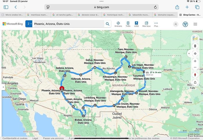
Day 1: Flight Marseille-Paris-Phoenix, then Gold Canyon (133 km) Day 2: Tucson (271 km) Lost Dutchman State Park Day 3: Tucson (155 km) Day 4: Tucson (34 km) Day 5: Bisbee (182 km) Day 6: Lordsburg (345 km) Day 7: Las Cruces (253 km) Day 8: Alamogordo (162 km) Day 9: Roswell (264 km) Day 10: Tucumcari (369 km) Day 11: Las Vegas (281 km) – the one in New Mexico Day 12: Taos (213 km) Day 13: Santa Fe (224 km) Day 14: Albuquerque (123 km) Day 15: Gallup (246 km) Day 16: Holbrook (224 km) Day 17: Flagstaff (179 km) Day 18: Sedona (118 km) Day 19: Sedona (48 km) Day 20: Sedona (41 km) Day 21: Phoenix (256 km) Day 22: Phoenix Airport (35 km)
📊 **Budget**: A little over 7,500 € for both of us, all included. The exchange rate was in our favor (1.17 dollars to 1 €). 📊 **Flights**: Marseille-Paris Charles de Gaulle-Phoenix: 1,787 € for two, with one checked bag each (Air France) 📊 **ESTA**: $42 📊 **America the Beautiful Pass**: $80 📊 **Parking**: 134 € (super eco at Marseille) 📊 **Car rental (Hertz)**: 865 €. Since there were no SUVs left in the reserved category (Nissan Rogue), we got an upgrade (4x4 Ford Explorer). We booked through Air France (15% discount). We’d originally reserved it in December for 1,140 €, but since prices dropped in March, we canceled and rebooked for 865 €. Hertz offers a free Hertz Gold Plus Rewards program, which gives you priority counter service when picking up the car. 📊 **Accommodation**: 2,400 € We stayed in hotels and motels of varying standards (from 60 to 203 € per night, depending on the city), all booked through Booking.com or Hotels.com. Out of 21 nights, only two didn’t include breakfast in the price. Booking.com sometimes offers slightly cheaper rates if you book by phone using the mobile app, and our Genius 3 status on the site also got us some preferential rates. 📊 **Supplementary insurance**: AVA 200 € for medical care if needed 📊 **Cash**: $2,078. We left with 1,000 € exchanged before departure and made two withdrawals of $500. This cash covered: - Evening restaurants and tips - Midday picnics - Gas: $298 for 4,160 km - Museum and private park entries (per person): - Lost Dutchman: $10 - Arizona-Sonora Desert Museum: $28 - Bird Cage Theater: $16 - Tombstone Shootout: $8 - New Mexico Farm & Ranch Museum: $12 - Roswell International UFO Museum: $5 - Billy the Kid Museum: $7 - Rancho de Taos: $22 - West Fork Oak Creek Trail entry: $15 We got a few discounts thanks to our senior age (+65). - Souvenirs and little treats
Like on our previous road trips, we didn’t rent a GPS. We got around using offline GPS apps Here WeGo and Organic Maps, with maps of the states we visited downloaded before we left (on our phones).
❤️❤️❤️ **Highlights** (there are so many!) 📍 Goldfield Ghost Town (even if it’s a reconstruction) 📍 The standing army of Saguaro cacti at Saguaro National Park West 📍 Diving into the cowboy universe of Tombstone 📍 The welcome from Rick and Henry at our guesthouse in Bisbee (Garden at Mile High Ranch) 📍 The tangled rocks of Chiricahua National Monument 📍 The flavored pistachios from Dwayne’s Fresh Jerky and Mac Ginnis Pistachioland 📍 Restaurants: La Posta (Las Cruces), Diner 66 (Albuquerque), and the Haunted Hamburger (Jerome) 📍 The old plazas of New Mexico 📍 The solitude and beauty of the white dunes at White Sands National Park 📍 Stepping back in time at the Billy the Kid Museum (Fort Stanton) 📍 Sections of historic Route 66 and the old motels of Tucumcari, especially at night when all the neon lights are on 📍 Taos Pueblo and diving into Native American culture 📍 After the Rio Grande Bridge, the descent via NM 567 to the very bottom of the Rio Grande Gorge, then the road along the riverbanks to Taos 📍 The tranquility of the Chimayo Sanctuary 📍 Discovering the ingenious native dwellings at Bandelier National Monument and Walnut Canyon National Park 📍 The small towns along the Turquoise Trail 📍 The red rocks of Red Rock Park and the Painted Desert 📍 The extraordinary colors of the petrified trees at Petrified Forest National Park 📍 Sedona, its red rocks, and the reward of the viewpoints at the end of hikes (Devil’s Bridge, The Subway, and West Fork Oak Creek) 📍 The immersion in Mexico when visiting Tlaquepaque 📍 The almost-ghost town of Jerome and its terraced streets 📍 The incredible kindness of Americans, always ready to help and up for a chat ❤️
☹️☹️☹️ **Flops** (there are very few) 📍 Several museums and churches being closed, so we couldn’t visit them 📍 Some museums and visitor centers opening late (10 AM) and closing early (4 PM) 📍 A 64 € phone roaming charge because we got near the Mexican border and picked up their cell tower 📍 The outrageous price ($5.99) for a gallon of gas at the Shell near Phoenix Airport
I hope this helps! Anyway, thanks for reading my long post. Don’t hesitate to reach out, even via PM, if you see I haven’t replied and you’d like more details. Have a great evening, everyone! 🙂
We’re back from our September 2025 road trip, this time to explore Arizona and New Mexico, and it’s time for me to start my travel journal—especially since everything’s already booked for another trip in September 2026 (to California), and I need to get started on the planning.
I was a little worried this new visit to Uncle Sam’s country might not be as "wow" as the others, but we still discovered some incredible places.
For those who don’t know us, we’re a couple in our seventies who speak very little English, but that didn’t stop us from fully enjoying our stay.
For this 6th road trip in the U.S., we spent 21 nights there, drove 4,160 km by car, and walked nearly 160 km in a loop starting from Phoenix.
We’d been to Arizona before (but not this side) and never to New Mexico. This whole road trip was a huge discovery for us.
In the prices mentioned (some in euros, others in dollars), bank fees and exchange charges are included. The flights, car rental, and parking were all paid for in December 2024 when we booked.
We’d downloaded the MPC (Mobile Passport Control) app, but there wasn’t a dedicated line at Phoenix Airport. Still, we got through quickly with friendly, smiling agents.
I don’t drive at all (I hate it), so the stops were chosen based on activities but also, for some, to limit daily mileage for the sole driver. The kilometers listed in the itinerary are the daily distances.
We traveled from September 9th to 22nd, unfortunately once again without our dear friends Mimi and Maumau.
The itinerary
Day 1: Flight Marseille-Paris-Phoenix, then Gold Canyon (133 km) Day 2: Tucson (271 km) Lost Dutchman State Park Day 3: Tucson (155 km) Day 4: Tucson (34 km) Day 5: Bisbee (182 km) Day 6: Lordsburg (345 km) Day 7: Las Cruces (253 km) Day 8: Alamogordo (162 km) Day 9: Roswell (264 km) Day 10: Tucumcari (369 km) Day 11: Las Vegas (281 km) – the one in New Mexico Day 12: Taos (213 km) Day 13: Santa Fe (224 km) Day 14: Albuquerque (123 km) Day 15: Gallup (246 km) Day 16: Holbrook (224 km) Day 17: Flagstaff (179 km) Day 18: Sedona (118 km) Day 19: Sedona (48 km) Day 20: Sedona (41 km) Day 21: Phoenix (256 km) Day 22: Phoenix Airport (35 km)
📊 **Budget**: A little over 7,500 € for both of us, all included. The exchange rate was in our favor (1.17 dollars to 1 €). 📊 **Flights**: Marseille-Paris Charles de Gaulle-Phoenix: 1,787 € for two, with one checked bag each (Air France) 📊 **ESTA**: $42 📊 **America the Beautiful Pass**: $80 📊 **Parking**: 134 € (super eco at Marseille) 📊 **Car rental (Hertz)**: 865 €. Since there were no SUVs left in the reserved category (Nissan Rogue), we got an upgrade (4x4 Ford Explorer). We booked through Air France (15% discount). We’d originally reserved it in December for 1,140 €, but since prices dropped in March, we canceled and rebooked for 865 €. Hertz offers a free Hertz Gold Plus Rewards program, which gives you priority counter service when picking up the car. 📊 **Accommodation**: 2,400 € We stayed in hotels and motels of varying standards (from 60 to 203 € per night, depending on the city), all booked through Booking.com or Hotels.com. Out of 21 nights, only two didn’t include breakfast in the price. Booking.com sometimes offers slightly cheaper rates if you book by phone using the mobile app, and our Genius 3 status on the site also got us some preferential rates. 📊 **Supplementary insurance**: AVA 200 € for medical care if needed 📊 **Cash**: $2,078. We left with 1,000 € exchanged before departure and made two withdrawals of $500. This cash covered: - Evening restaurants and tips - Midday picnics - Gas: $298 for 4,160 km - Museum and private park entries (per person): - Lost Dutchman: $10 - Arizona-Sonora Desert Museum: $28 - Bird Cage Theater: $16 - Tombstone Shootout: $8 - New Mexico Farm & Ranch Museum: $12 - Roswell International UFO Museum: $5 - Billy the Kid Museum: $7 - Rancho de Taos: $22 - West Fork Oak Creek Trail entry: $15 We got a few discounts thanks to our senior age (+65). - Souvenirs and little treats
Like on our previous road trips, we didn’t rent a GPS. We got around using offline GPS apps Here WeGo and Organic Maps, with maps of the states we visited downloaded before we left (on our phones).
❤️❤️❤️ **Highlights** (there are so many!) 📍 Goldfield Ghost Town (even if it’s a reconstruction) 📍 The standing army of Saguaro cacti at Saguaro National Park West 📍 Diving into the cowboy universe of Tombstone 📍 The welcome from Rick and Henry at our guesthouse in Bisbee (Garden at Mile High Ranch) 📍 The tangled rocks of Chiricahua National Monument 📍 The flavored pistachios from Dwayne’s Fresh Jerky and Mac Ginnis Pistachioland 📍 Restaurants: La Posta (Las Cruces), Diner 66 (Albuquerque), and the Haunted Hamburger (Jerome) 📍 The old plazas of New Mexico 📍 The solitude and beauty of the white dunes at White Sands National Park 📍 Stepping back in time at the Billy the Kid Museum (Fort Stanton) 📍 Sections of historic Route 66 and the old motels of Tucumcari, especially at night when all the neon lights are on 📍 Taos Pueblo and diving into Native American culture 📍 After the Rio Grande Bridge, the descent via NM 567 to the very bottom of the Rio Grande Gorge, then the road along the riverbanks to Taos 📍 The tranquility of the Chimayo Sanctuary 📍 Discovering the ingenious native dwellings at Bandelier National Monument and Walnut Canyon National Park 📍 The small towns along the Turquoise Trail 📍 The red rocks of Red Rock Park and the Painted Desert 📍 The extraordinary colors of the petrified trees at Petrified Forest National Park 📍 Sedona, its red rocks, and the reward of the viewpoints at the end of hikes (Devil’s Bridge, The Subway, and West Fork Oak Creek) 📍 The immersion in Mexico when visiting Tlaquepaque 📍 The almost-ghost town of Jerome and its terraced streets 📍 The incredible kindness of Americans, always ready to help and up for a chat ❤️
☹️☹️☹️ **Flops** (there are very few) 📍 Several museums and churches being closed, so we couldn’t visit them 📍 Some museums and visitor centers opening late (10 AM) and closing early (4 PM) 📍 A 64 € phone roaming charge because we got near the Mexican border and picked up their cell tower 📍 The outrageous price ($5.99) for a gallon of gas at the Shell near Phoenix Airport
I hope this helps! Anyway, thanks for reading my long post. Don’t hesitate to reach out, even via PM, if you see I haven’t replied and you’d like more details. Have a great evening, everyone! 🙂
Langtang – Trekking in the Rain
We did the Langtang trek (hike) from September 10th to 17th, with the first and last days being the trip from Kathmandu and back—so 6 days of actual walking. It’s a fairly well-known trek but certainly not as famous or crowded as those in the Annapurna or Everest regions, which is why we chose it.
In theory, it’s mandatory to have a guide for this trek. In reality, it seems there are ways to bypass the regulations: we met at least two people hiking without a guide—a South Korean, a New Zealander, and possibly also a couple of English women and an American couple, though we’re not sure if they had a guide.
The agency we booked with had told us it was an affordable trek for relatively older people in good shape—which is our case (I’m 72 myself). I have to say upfront that we found it quite challenging, maybe because we didn’t have good weather—it was the end of the monsoon season. To be clear, no matter your fitness level, I’d say doing this trek in the middle of the monsoon season would be suicidal.
Day 1 – Journey from Kathmandu to Syapru Besi
On Monday, September 8th, there had been violent protests in Kathmandu against the government, which had, among other things, blocked access to social media and been accused of nepotism and corruption. There were 19 deaths. The situation was very tense on the day of our departure, Wednesday the 10th. The agency warned us that public transport was very unreliable. So, we decided to take a jeep, at an additional cost of $100 ($160 minus what was already budgeted for the bus).
We left a little before 7 a.m. and it took us a good hour just to reach the outskirts of Kathmandu. Along the way, we saw several houses and vehicles set on fire by protesters.
The road to Syapru Besi is only 120 km, but it’s frankly awful. It’s always narrow, winds through endless mountains, and the shoulders range from bad to confusing to nonexistent. Several sections are just dirt tracks. We didn’t regret opting for the jeep, as we could stop several times at our convenience—if only to let Y (my Thai partner) throw up everything she had. She’d taken her usual motion sickness medication, but the constant turns, accelerations, and braking eventually made her terribly carsick.
In Nuwakot, we stopped for breakfast at a nice little restaurant, Jimbu. It was around 8:30 a.m., and we’d barely covered 60 km. The restaurant has a lovely garden overlooking the Trishuli Ganga, the river flowing down from Syapru Besi. First photo: the river in the bottom right corner, mist and clouds over the mountain on the other side.
An hour later, my second photo: the hills along the Trishuli Ganga. You can see the different crops—lush green rice paddies in the lower right and corn, already yellowed and likely harvested, in the foreground on the left. And of course, the mist and clouds through which you can glimpse the mountain on the other side of the river.
In theory, it’s mandatory to have a guide for this trek. In reality, it seems there are ways to bypass the regulations: we met at least two people hiking without a guide—a South Korean, a New Zealander, and possibly also a couple of English women and an American couple, though we’re not sure if they had a guide.
The agency we booked with had told us it was an affordable trek for relatively older people in good shape—which is our case (I’m 72 myself). I have to say upfront that we found it quite challenging, maybe because we didn’t have good weather—it was the end of the monsoon season. To be clear, no matter your fitness level, I’d say doing this trek in the middle of the monsoon season would be suicidal.
Day 1 – Journey from Kathmandu to Syapru Besi
On Monday, September 8th, there had been violent protests in Kathmandu against the government, which had, among other things, blocked access to social media and been accused of nepotism and corruption. There were 19 deaths. The situation was very tense on the day of our departure, Wednesday the 10th. The agency warned us that public transport was very unreliable. So, we decided to take a jeep, at an additional cost of $100 ($160 minus what was already budgeted for the bus).
We left a little before 7 a.m. and it took us a good hour just to reach the outskirts of Kathmandu. Along the way, we saw several houses and vehicles set on fire by protesters.
The road to Syapru Besi is only 120 km, but it’s frankly awful. It’s always narrow, winds through endless mountains, and the shoulders range from bad to confusing to nonexistent. Several sections are just dirt tracks. We didn’t regret opting for the jeep, as we could stop several times at our convenience—if only to let Y (my Thai partner) throw up everything she had. She’d taken her usual motion sickness medication, but the constant turns, accelerations, and braking eventually made her terribly carsick.
In Nuwakot, we stopped for breakfast at a nice little restaurant, Jimbu. It was around 8:30 a.m., and we’d barely covered 60 km. The restaurant has a lovely garden overlooking the Trishuli Ganga, the river flowing down from Syapru Besi. First photo: the river in the bottom right corner, mist and clouds over the mountain on the other side.
An hour later, my second photo: the hills along the Trishuli Ganga. You can see the different crops—lush green rice paddies in the lower right and corn, already yellowed and likely harvested, in the foreground on the left. And of course, the mist and clouds through which you can glimpse the mountain on the other side of the river.
USA Road Trip 2023 - Part 1
In January 2023, we started our second road trip across the United States. We stayed from January to mid-March, which gave us plenty of time to visit several cities, attractions, and parks in multiple states.
This travel journal will be split into two parts due to the considerable number of places we visited.
This first journal covers the following states: Ohio, Indiana, Missouri, Oklahoma, Texas, New Mexico, Arizona, Nevada, and California, and takes you through the outbound leg of our road trip.
The second journal will showcase the attractions we visited on the return trip, which mainly follows the famous Highway 1 along the Pacific coast.
So, I invite you to keep reading this first journal, which serves as a long recap to help you discover the various attractions we explored throughout this road trip.
Videos are included throughout the recap. Please click on the image to start the video.
Here are the links to jump to a specific post:
OHIO:
WinterLand - Christmas Lights at Cleveland Public Square Lake View Cemetery - Cleveland - Part 1 Lake View Cemetery - Cleveland - Part 2 Stroll through Columbus Upper Falls to Lower Falls via Buckeye Trail - Hocking Hills State Park – Logan Cedar Falls & Whispering Falls Hiking Trail - Hocking Hills State Park – Logan Ash Cave Hiking Trail - Hocking Hills State Park – Logan Exploring Cincinnati
INDIANA:
Visiting Indianapolis
MISSOURI:
Exploring St. Louis
OKLAHOMA:
Catoosa Blue Whale Discovering Tulsa Exploring Oklahoma City
TEXAS:
Exploring Shamrock Discovering McLean Exploring Amarillo
NEW MEXICO:
Ancestral Sites Trail - Pecos National Historical Park Discovering Santa Fe The Santuario de Chimayó Stroll through Los Cerrillos Walk through the village of Madrid San Francisco de Asis Catholic Church & The Bottle House - Golden Albuquerque Murals 66 Diner - Albuquerque Stroll through Old Town (Albuquerque) Rinconada Canyon Trail - Petroglyph National Monument Mesa Point Trail - Boca Negra Canyon - Petroglyph National Monument Macaw Trail - Boca Negra Canyon - Petroglyph National Monument Cliff Base Trail - Boca Negra Canyon - Petroglyph National Monument Piedras Marcadas Canyon - Petroglyph National Monument Sandstone Bluffs & Ventana Natural Arch - El Malpais National Monument
ARIZONA:
Stewart's Petrified Wood Shop – Holbrook Stroll through Holbrook Discovering Joseph City Exploring Winslow Grand Falls (The "Chocolate Falls") – Leupp Island Trail - Walnut Canyon National Monument Rim Trail - Walnut Canyon National Monument Wukoki Pueblo Trail – Wupatki National Monument Wupatki Pueblo Trail – Wupatki National Monument Doney Mountain Trail – Wupatki National Monument Citadel & Nalakihu Pueblos Trail – Wupatki National Monument Lomaki & Box Canyon Pueblos Trail – Wupatki National Monument Discovering Flagstaff On the way to Sedona Slide Rock State Park – Sedona Midgley Bridge Trail – Wilson Canyon – Sedona Tlaquepaque Arts & Shopping Village Walking Tour - Sedona Chapel of the Holy Cross - Sedona Hiking at Cathedral Rock - Sedona Hiking the Bell Rock Trail - Sedona Hiking the Airport Loop Trail - Sedona Amitabha Stupa and Peace Park - Sedona Hiking the Boynton Canyon Vortex Trail - Sedona Hiking the Devil's Bridge Trail - Sedona Hiking the Birthing Cave Trail - Sedona Bell Rock Inn - Sedona On the roads of Sedona - Part 1 On the roads of Sedona - Part 2 Keyhole Sink Hiking Trail - Kaibab National Forest Discovering Williams Exploring Ash Fork Discovering Kingman Ramada by Wyndham Kingman Davis Camp Park - Bullhead City Discovering Yucca Lake Havasu Boardwalk Tour A duck catches a lobster – Lake Havasu Boardwalk
CALIFORNIA:
Exploring Needles Discovering Goffs Discovering Amboy Visiting the famous Bagdad Cafe - Newberry Springs Exploring Barstow Vehicles from Hell (Mad Max Cars) - Barstow Peggy Sue's 50's Diner - Yermo Liberty Sculpture Park - Yermo Lake Dolores Water Park - Newberry Springs ZZYZX Road - Mojave National Preserve Alien Fresh Jerky - Baker Kelso Dunes Trail - Mojave National Preserve Hole-in-the-Wall Rings Trail - Mojave National Preserve Visiting Mitchell Caverns - Mojave National Preserve Dante's View - Death Valley National Park Zabriskie Point - Death Valley National Park Golden Canyon - Death Valley National Park Artists Drive & Artists Palette - Death Valley National Park Devil's Golf Course - Death Valley National Park Natural Bridge Trail - Death Valley National Park Badwater Basin - Death Valley National Park Harmony Borax Works - Death Valley National Park Devil's Cornfield - Death Valley National Park Mesquite Flat Sand Dunes - Death Valley National Park Mosaic Canyon Trail - Death Valley National Park On the road - Death Valley National Park
NEVADA:
Cleveland Clinic Lou Ruvo Center for Brain Health - Las Vegas Exploring Downtown Las Vegas SlotZilla Zipline - Fremont Street Experience – Downtown Las Vegas Viva Vision Light Show 1 - Fremont Street Experience - Downtown Las Vegas Viva Vision Light Show 2 - Fremont Street Experience - Downtown Las Vegas Viva Vision Light Show 3 - Fremont Street Experience - Downtown Las Vegas Viva Vision Light Show 4 - Fremont Street Experience - Downtown Las Vegas Free Live Music – Fremont Street Experience - Downtown Las Vegas Chucky – Fremont Street Experience - Downtown Las Vegas Las Vegas Strip - Part 1 Las Vegas Strip - Part 2 Las Vegas Strip - Part 3 Las Vegas Strip - Part 4 Las Vegas Strip - Part 5 Tom Devlin's Monster Museum - Boulder City Hoover Dam Lake Mead - Lakeview Overlook - Boulder City Nelson Ghost Town - Searchlight
CALIFORNIA:
Scenic Route through Joshua Tree National Park via the North Entrance Hidden Valley Trail - Joshua Tree National Park Barker Dam Trail - Joshua Tree National Park Cap Rock Trail - Joshua Tree National Park Keys View Trail - Joshua Tree National Park Hall of Horrors Trail - Joshua Tree National Park Skull Rock Trail - Joshua Tree National Park Arch Rock Trail - Joshua Tree National Park Cholla Cactus Garden Trail - Joshua Tree National Park Lone Pine - Owens Valley Miss Alabama & Shark Fin - Alabama Hills - Owens Valley Lone Ranger Canyon - Alabama Hills - Owens Valley Mobius Arch Loop Trail (Heart Arch & Lathe Arch) - Alabama Hills - Owens Valley Eye of the Alabama Hills Arch - Alabama Hills - Owens Valley Boot & Cyclops Arches - Alabama Hills - Owens Valley One Mile Arch, Bowling Ball and Pins & Gunga Din Area - Alabama Hills - Owens Valley Whitney Portal Arch Trailhead - Alabama Hills - Owens Valley Fish Rocks & Trona Pinnacles - Mojave Desert Red Cliffs Trail - Red Rock Canyon State Park Hagen Canyon Nature Trail - Red Rock Canyon State Park Tour of Historic Downtown Tehachapi View of the Tehachapi Loop – Monolith César E. Chávez National Monument – Keene Discovering Bakersfield Kern County Museum – Bakersfield Bravo Farms, Tree House & Petting Zoo - Traver Walking Tour of Kingsburg Exploring Fresno Simonian Farms & Soul Consoling Japanese Internment Tower - Fresno Duncan Ceramic Products (iLoveToCreate) - Fresno Walking Tour of Modesto Wat Dhammararam Buddhist Temple - Stockton Walking Tour of Stockton Discovering Stockton University of the Pacific - Stockton Visiting Lodi Sutter's Fort State Historic Park - Sacramento California State Capitol - Sacramento Walking Tour - Sacramento Walking Tour - Winters Walking Tour - Napa The Chandelier Tree In Drive-Thru Tree Park - Leggett One Log House - Garberville Grandfather Tree - Piercy The Living Chimney Tree - Avenue of the Giants Stephens Grove Loop Trail - Avenue of the Giants Gould Grove Nature Loop Trail - Avenue of the Giants Fleishmann Grove Trail - Avenue of the Giants Mahan Plaque Trail - Avenue of the Giants Founders Grove Nature Loop Trail - Avenue of the Giants Eternal Tree House & Immortal Tree - Avenue of the Giants Drury-Chaney Loop Trail - Avenue of the Giants Walking Tour - Redcrest
COMING UP NEXT:
USA Road Trip 2023 - Part 2
This travel journal will be split into two parts due to the considerable number of places we visited.
This first journal covers the following states: Ohio, Indiana, Missouri, Oklahoma, Texas, New Mexico, Arizona, Nevada, and California, and takes you through the outbound leg of our road trip.
The second journal will showcase the attractions we visited on the return trip, which mainly follows the famous Highway 1 along the Pacific coast.
So, I invite you to keep reading this first journal, which serves as a long recap to help you discover the various attractions we explored throughout this road trip.
Videos are included throughout the recap. Please click on the image to start the video.
Here are the links to jump to a specific post:
OHIO:
WinterLand - Christmas Lights at Cleveland Public Square Lake View Cemetery - Cleveland - Part 1 Lake View Cemetery - Cleveland - Part 2 Stroll through Columbus Upper Falls to Lower Falls via Buckeye Trail - Hocking Hills State Park – Logan Cedar Falls & Whispering Falls Hiking Trail - Hocking Hills State Park – Logan Ash Cave Hiking Trail - Hocking Hills State Park – Logan Exploring Cincinnati
INDIANA:
Visiting Indianapolis
MISSOURI:
Exploring St. Louis
OKLAHOMA:
Catoosa Blue Whale Discovering Tulsa Exploring Oklahoma City
TEXAS:
Exploring Shamrock Discovering McLean Exploring Amarillo
NEW MEXICO:
Ancestral Sites Trail - Pecos National Historical Park Discovering Santa Fe The Santuario de Chimayó Stroll through Los Cerrillos Walk through the village of Madrid San Francisco de Asis Catholic Church & The Bottle House - Golden Albuquerque Murals 66 Diner - Albuquerque Stroll through Old Town (Albuquerque) Rinconada Canyon Trail - Petroglyph National Monument Mesa Point Trail - Boca Negra Canyon - Petroglyph National Monument Macaw Trail - Boca Negra Canyon - Petroglyph National Monument Cliff Base Trail - Boca Negra Canyon - Petroglyph National Monument Piedras Marcadas Canyon - Petroglyph National Monument Sandstone Bluffs & Ventana Natural Arch - El Malpais National Monument
ARIZONA:
Stewart's Petrified Wood Shop – Holbrook Stroll through Holbrook Discovering Joseph City Exploring Winslow Grand Falls (The "Chocolate Falls") – Leupp Island Trail - Walnut Canyon National Monument Rim Trail - Walnut Canyon National Monument Wukoki Pueblo Trail – Wupatki National Monument Wupatki Pueblo Trail – Wupatki National Monument Doney Mountain Trail – Wupatki National Monument Citadel & Nalakihu Pueblos Trail – Wupatki National Monument Lomaki & Box Canyon Pueblos Trail – Wupatki National Monument Discovering Flagstaff On the way to Sedona Slide Rock State Park – Sedona Midgley Bridge Trail – Wilson Canyon – Sedona Tlaquepaque Arts & Shopping Village Walking Tour - Sedona Chapel of the Holy Cross - Sedona Hiking at Cathedral Rock - Sedona Hiking the Bell Rock Trail - Sedona Hiking the Airport Loop Trail - Sedona Amitabha Stupa and Peace Park - Sedona Hiking the Boynton Canyon Vortex Trail - Sedona Hiking the Devil's Bridge Trail - Sedona Hiking the Birthing Cave Trail - Sedona Bell Rock Inn - Sedona On the roads of Sedona - Part 1 On the roads of Sedona - Part 2 Keyhole Sink Hiking Trail - Kaibab National Forest Discovering Williams Exploring Ash Fork Discovering Kingman Ramada by Wyndham Kingman Davis Camp Park - Bullhead City Discovering Yucca Lake Havasu Boardwalk Tour A duck catches a lobster – Lake Havasu Boardwalk
CALIFORNIA:
Exploring Needles Discovering Goffs Discovering Amboy Visiting the famous Bagdad Cafe - Newberry Springs Exploring Barstow Vehicles from Hell (Mad Max Cars) - Barstow Peggy Sue's 50's Diner - Yermo Liberty Sculpture Park - Yermo Lake Dolores Water Park - Newberry Springs ZZYZX Road - Mojave National Preserve Alien Fresh Jerky - Baker Kelso Dunes Trail - Mojave National Preserve Hole-in-the-Wall Rings Trail - Mojave National Preserve Visiting Mitchell Caverns - Mojave National Preserve Dante's View - Death Valley National Park Zabriskie Point - Death Valley National Park Golden Canyon - Death Valley National Park Artists Drive & Artists Palette - Death Valley National Park Devil's Golf Course - Death Valley National Park Natural Bridge Trail - Death Valley National Park Badwater Basin - Death Valley National Park Harmony Borax Works - Death Valley National Park Devil's Cornfield - Death Valley National Park Mesquite Flat Sand Dunes - Death Valley National Park Mosaic Canyon Trail - Death Valley National Park On the road - Death Valley National Park
NEVADA:
Cleveland Clinic Lou Ruvo Center for Brain Health - Las Vegas Exploring Downtown Las Vegas SlotZilla Zipline - Fremont Street Experience – Downtown Las Vegas Viva Vision Light Show 1 - Fremont Street Experience - Downtown Las Vegas Viva Vision Light Show 2 - Fremont Street Experience - Downtown Las Vegas Viva Vision Light Show 3 - Fremont Street Experience - Downtown Las Vegas Viva Vision Light Show 4 - Fremont Street Experience - Downtown Las Vegas Free Live Music – Fremont Street Experience - Downtown Las Vegas Chucky – Fremont Street Experience - Downtown Las Vegas Las Vegas Strip - Part 1 Las Vegas Strip - Part 2 Las Vegas Strip - Part 3 Las Vegas Strip - Part 4 Las Vegas Strip - Part 5 Tom Devlin's Monster Museum - Boulder City Hoover Dam Lake Mead - Lakeview Overlook - Boulder City Nelson Ghost Town - Searchlight
CALIFORNIA:
Scenic Route through Joshua Tree National Park via the North Entrance Hidden Valley Trail - Joshua Tree National Park Barker Dam Trail - Joshua Tree National Park Cap Rock Trail - Joshua Tree National Park Keys View Trail - Joshua Tree National Park Hall of Horrors Trail - Joshua Tree National Park Skull Rock Trail - Joshua Tree National Park Arch Rock Trail - Joshua Tree National Park Cholla Cactus Garden Trail - Joshua Tree National Park Lone Pine - Owens Valley Miss Alabama & Shark Fin - Alabama Hills - Owens Valley Lone Ranger Canyon - Alabama Hills - Owens Valley Mobius Arch Loop Trail (Heart Arch & Lathe Arch) - Alabama Hills - Owens Valley Eye of the Alabama Hills Arch - Alabama Hills - Owens Valley Boot & Cyclops Arches - Alabama Hills - Owens Valley One Mile Arch, Bowling Ball and Pins & Gunga Din Area - Alabama Hills - Owens Valley Whitney Portal Arch Trailhead - Alabama Hills - Owens Valley Fish Rocks & Trona Pinnacles - Mojave Desert Red Cliffs Trail - Red Rock Canyon State Park Hagen Canyon Nature Trail - Red Rock Canyon State Park Tour of Historic Downtown Tehachapi View of the Tehachapi Loop – Monolith César E. Chávez National Monument – Keene Discovering Bakersfield Kern County Museum – Bakersfield Bravo Farms, Tree House & Petting Zoo - Traver Walking Tour of Kingsburg Exploring Fresno Simonian Farms & Soul Consoling Japanese Internment Tower - Fresno Duncan Ceramic Products (iLoveToCreate) - Fresno Walking Tour of Modesto Wat Dhammararam Buddhist Temple - Stockton Walking Tour of Stockton Discovering Stockton University of the Pacific - Stockton Visiting Lodi Sutter's Fort State Historic Park - Sacramento California State Capitol - Sacramento Walking Tour - Sacramento Walking Tour - Winters Walking Tour - Napa The Chandelier Tree In Drive-Thru Tree Park - Leggett One Log House - Garberville Grandfather Tree - Piercy The Living Chimney Tree - Avenue of the Giants Stephens Grove Loop Trail - Avenue of the Giants Gould Grove Nature Loop Trail - Avenue of the Giants Fleishmann Grove Trail - Avenue of the Giants Mahan Plaque Trail - Avenue of the Giants Founders Grove Nature Loop Trail - Avenue of the Giants Eternal Tree House & Immortal Tree - Avenue of the Giants Drury-Chaney Loop Trail - Avenue of the Giants Walking Tour - Redcrest
COMING UP NEXT:
USA Road Trip 2023 - Part 2
Namibia Travel Journal: May 2025 - Trip Review
NAMIBIA TRIP 2025: April 24 to May 20: Feel free to comment or ask us any questions about this amazing journey.
>> Find all our photos and videos for each day on our website here: www.montagne-aventure.net
**DAY 1: Thursday, April 24, 2025: Outbound Flights from Lyon to Windhoek via Munich - Visit to Munich:**

Off we go on a new adventure. The alarm rings at 6:30 AM, the travel bags are packed, and we head to Lyon Airport. We booked our flight tickets with Lufthansa. The first leg to Munich, Germany, is operated by AirBaltic. Departure at 1:05 PM for a 1-hour and 20-minute flight. We arrive at 2:30 PM.
**We now have a 7-hour layover, so we take the opportunity to get some fresh air and explore Munich.** We quickly exit Terminal 2 of the airport and head towards the subway. We buy a group day ticket "Airport-city Day Zone M-5," valid for 2 to 5 people at a price of 30.50 € (instead of 16.30 € per person). We take the S8 line to **Marienplatz** in 35 minutes. **This is the heart of the city.** The weather is overcast, quite cool, but dry. Perfect for a little city trip between two flights while leaving our large luggage in transit at the airport. **Munich is the third-largest German city after Berlin and Hamburg, in the Bavaria region.** **The center has a lot of charm and brings together several religious buildings, easy to explore on foot.** We are impressed by the number of people enjoying these 100% pedestrian streets, which are very pleasant. After Marienplatz, the most famous square with the town hall, we head to the Cathedral of Our Lady, a Gothic church, then continue to **Karlsplatz** and move on to **the food market offering a wide selection of high-end food products in an atmosphere where a certain art of living prevails.** We also visit St. Peter's Church before grabbing a bite to eat. Two good hours were enough for this 10 km city walk. It's time to take the subway back: by 6:30 PM, we are back at the airport. Now, it's time for a bit of waiting and rest. Our second flight is scheduled for 9:35 PM for a 9-hour and 30-minute journey to our final destination in Namibia: **Windhoek.**
> Round-trip flight tickets with Lufthansa from Lyon: 2029 €, or 1,014.50 € per person.
> Lyon Airport parking: 120 €
> Today's expenses: 7 € for 2 pizzas in France / 14 € for the restaurant in Munich / 30.50 € for the daily subway ticket in Munich.
**DAY 2: Friday, April 25, 2024: Arrival in Windhoek, Visit to the Namibian Capital:**
After a 9-hour and 30-minute overnight flight with Discover Airlines, we finally land on Namibian soil just before 7:30 AM. The day is breaking, and the colors are already stunning. We are eager despite the usual fatigue from the flight. The airline was punctual, with friendly staff and good meals, though a bit light. We are the first flight of the day to land, with no more than 15 flights per day here, from 7 AM to 8 PM. We disembark on the tarmac at this airport located in the middle of nowhere, **I finally set foot on African soil for the first time.** We exit among the first from the aircraft to go through the long formalities at the front of the line, as the wait can quickly become endless. Allow at least 5 minutes per person for e-visas. We still wait 45 minutes despite only about twenty people ahead of us. Phew, it's done. We collect our luggage and then withdraw money from an ATM. We make 4 withdrawals of the maximum amount, 2000 NAD $ per withdrawal, for a total of 380 €, or 95.33 € per withdrawal.
Our driver arrives at the same time, perfect timing, we were quick.
We leave the airport at 8:45 AM. By 9:30 AM, we arrive at the **Gracious Whisp vehicle rental agency**, located at the entrance of Windhoek, small and human-sized with a fleet of recent vehicles. More formalities, then a short wait as our vehicle is not yet ready. Time to decompress, catch our breath, and enjoy the very pleasant morning temperature. Not a cloud in sight. Next, a briefing on the vehicle, always with a bit of apprehension due to our approximate English. Allow 45 minutes of explanations, including setting up the roof tent, camping equipment, technical information in case of a flat tire, driving tips in Namibia, and a tour of the 4x4. We have all the necessary equipment for camping: mattresses, sleeping bags, pillows, table, chairs, gas stove, BBQ grill... as well as 2 spare tires, a compressor, a dual tank, and accessories for removing wheels. Off we go, it's time to muster our courage and get behind the wheel. **Heading to SuperSpar Maerua**, fortunately located less than 10 minutes away. We park with the help of a parking attendant; it's very crowded, the space is narrow, but everything goes well despite the cursed right-hand drive. Today's new mission: stock up on groceries. The store is well-stocked with local and imported products, catering to all tastes. We spend 114 € on groceries, from pasta to meat, BBQ lighters to dishwashing products. Two people load our groceries into two carts and transfer them to our vehicle; we feel compelled to leave a tip, 50 NAD $, as we don't have change yet. Now, we head to the hotel, 15 minutes away. Traffic is difficult at a complicated intersection; this will likely be the only traffic jam in Namibia. **We arrive at Kate's Nest Guesthouse & Backpackers around 1:15 PM, quite tired.** We take some well-deserved rest at this recent establishment, quite calm with secure private parking. After a short nap, we enjoy the quiet by the hotel pool. Night falls between 6:30 PM and 7 PM. We eat quietly in our room tonight before starting this long 4x4 road trip in camping mode in the heart of Namibia.
> Today's grocery expenses: 114 € at Super Spar Marua (2395.21 NAD $).
> Round-trip flight tickets with Lufthansa from Lyon: 2029 €, or 1,014.50 € per person.
> Vehicle rental: 4x4 Toyota with roof tent for 24 days: Gracious Whisp Car Rentals: 2,638 € (N$50,640) or **1,319 €** per person - (https://gwcarrentals.com/)
> Distance driven today: 15 km.
> Accommodation: Kate's Nest Guesthouse & Backpackers - 4 Aristotles Street Academia, 9000 Windhoek - 36 € for two for one night.
> Windhoek International Airport website: (https://www.airports.com.na/)
**DAY 3: Saturday, April 26, 2025: Windhoek to Hardap: Mariental Region - Kalahari Desert:**
After a good, restful night, we wake up leisurely around 7 AM. We enjoy the comfort provided by this first and last hotel before 24 nights under the tent.
**We leave Kate's Nest Guesthouse at 8:30 AM to tackle the Namibian roads.** We quickly leave the capital; in just 30 minutes, we find ourselves almost alone in the world. The landscape is dotted with small domes. We leave the **paved B1** quickly to turn left onto the **C15**. **From there, we won't see more than 10 vehicles all day.** After passing through the few houses of **Lekkerwaterpoort**, we tackle our first gravel road. These road sections are limited to 100 km/h, but even at 70 km/h, I find it already challenging. However, I quickly get used to it and gradually pick up speed to reach my cruising speed of around 80 to 90 km/h. **We are on immense straight lines crossing wild expanses as far as the eye can see.** **We come across two baboons, a few ostriches, and numerous cattle and sheep farms.** We pass through the charming village of **Uhlenhorst** with its typical houses and children with broad smiles waving at us. Life here is already very different from Windhoek. **The thermometer rises quickly from 16°C at 8:30 AM to over 28°C in the early afternoon.**
**We arrive at the Hardap Dam reserve at 2 PM.** We stop at the toll booth at the park entrance to pay the entrance fee: 250 NAD $ for 2 people and 1 vehicle. We continue to the dam and then the camp entrance, located a bit further. We had booked in advance, but this place remains little frequented by foreigners.
We take advantage of the hottest hours to rest by the large pool overlooking the immense lake, a very enjoyable moment. Would this be a bit of a vacation?
Around 4:30 PM, we head to the campsite. We overlook this vast water reserve. We arrive first; we will be only 3 vehicles spending the night here. It's time to get to work and set up our equipment for the first time. It takes us a good 20 minutes to set everything up, with a slight apprehension about unfolding the tent. Once this task is done, which we will have to repeat for almost a month, we will become much more efficient over time. Time for rest and contemplation in total silence. The sun gradually sets, and the heat quickly becomes bearable again. Bliss! **This dam is located 20 km northwest of Mariental in an area dotted with conical hills topped with dolerite buttons (Hardap means "hillock" in Nama). It captures the Fish River, which flows south, creating a large lake in the middle of an arid environment. The contrast is striking.** We enjoy our first sunset facing this 360° otherworldly landscape.
Around 7 PM, we start our first BBQ, or "braai" as it's called here. The temperature is perfect. The sun sets, giving way to a star-filled sky of incredible beauty thanks to the absence of any light pollution. The Milky Way will lull us throughout the evening. After some good sausages and potatoes on the BBQ, we head to our roof tent around 9:30 PM with a complete change of scenery in just 24 hours. France already seems so far away...
This campsite has shared showers and toilets, quite clean and functional, as well as a central area with several BBQs and tables. The sites are arranged in a semicircle, each with an electrical outlet. The sites are close to each other but spacious, some slightly shaded. We are only three vehicles tonight, so it's perfectly comfortable and quiet. Not to mention the large pool near the restaurant. Our trip is off to a great start.
> Today's road itinerary: Windhoek > Head south on the B1 to Rehoboth > Turn left onto the C25 then C15 to Stampriet > C20 to Hardap > Full north on the B1 > Then turn left onto the M93 - 5 hours of driving.
> Distance driven today: 354 km.
> Accommodation: Hardap Recreation Resort - 23.3 € for two - Large pool - GR6W+3M2, Hardap Game Reserve, Mariental, Namibia - (http://www.nwr.com.na/resorts/hardap-resort/)
**DAY 4: Sunday, April 27, 2025: Hardap - Brukkaros Volcano - Keetmanshoop - Quivertree Forest Rest Camp**
Our first night under the tent was very pleasant; the little wind quickly calmed down, giving way to absolute silence. The mattress is decent, more comfortable than some nights in Nepal. The length and width give us enough space for maximum comfort, despite my height (1.91 m). We wake up a little before 7 AM as the sun rises, and the lights dazzle us from the start of the day. We pack up the equipment in 30 minutes, quite easily. Then we enjoy the sun, which warms up quickly while we keep our light fleece on.
At 8:30 AM, **we hit the road again, heading south** to our first stop in **Mariental**. We want to do some shopping at SuperSpar, but once we arrive in the parking lot, a young local is fighting with the supermarket security guards and then threatens to throw stones. We don't want to take any risks right at the start, so despite the baton blows he receives, he doesn't stop. We leave empty-handed but fill up with fuel at the Shell station 1 km further. The price per liter is 21.33 NAD $, we fill our 107-liter tank for 107 €. In Namibia, you get served, and they bring the card machine to the window to pay. It's then customary to leave a tip.
We then take the B1 heading due south on a recently renovated road. Around 11:30 AM, we leave it on our right to take **a wild gravel road, the M98**. Just before **Berseba**, we turn right onto a small track, the **D3904 towards Brukkaros Crater up to a camp at 1588 m altitude**. The track then becomes too bumpy. We stop on the counter-slopes where **a wide panorama unfolds over these immense plains as far as the eye can see**. It's 12:15 PM, time for us to eat a rice and tuna salad facing this landscape.
**We are alone in the world until a vehicle arrives and parks next to us.** A bit of apprehension, 4 men head towards us. It turns out to be 4 shepherds looking for a lost foal. The conversation is pleasant, lost in the middle of nowhere. We find ourselves alone again in this absolute silence. **The heat becomes stifling with a good 30°C**. We get back on the road around 1 PM. Back on the B1, **we continue due south to Keetmanshoop**, which we reach around 3 PM. We stop there to do some shopping for 262 NAD $ (12 eggs, a can of tuna, a can of corn, bread, a soda, and a 5-liter water container), or 12.48 €. Two quite insistent children ask us for money or candy at the store exit, yet we give them a small tip, but they continue to cling to the car. Locals parked next to us tell them to leave us alone. Anyway, we finish the trip to **Quivertree Forest**, 15 km away. We will spend the night in this **pleasant farm run by a German**. Upon arrival, as the day before, and as I suppose in the future, we dive straight into the cool pool to relax after all these kilometers. A bliss. Then we take our 4x4 and choose a spot near these famous trees. After the 33°C this afternoon, once 4 PM passed, the temperature drops again and becomes very pleasant. **We are in the middle of the Kokerboom, one of the most interesting and characteristic plants of hot and arid regions. It's not really a tree but a variant of the aloe plant whose botanical name is Aloe Dichotoma. This Kokerboom has a smooth and thick trunk reaching up to 1 m in thickness and 9 m in height. They bloom for the first time at the age of 20 to 30 years.** The flowers are yellow and reach about thirty centimeters during the season between June and July. **They grow mainly in an environment with a high concentration of black rocks absorbing a large amount of heat (38°C). The rocks also serve to anchor the tree with its tentacle-like roots. It also resists frost. Each is between 200 and 300 years old.**
Around 5 PM, we walk to the farm reception to watch the feeding of **two cheetahs**. Magnificent carnivores taking their time to savor their piece of meat. **Then we return near our campsite to enjoy the sunset among these trees. The colors are sublime, as every evening apparently. A magnificent spectacle with colors evolving from yellow to orange then to pink, before giving way once again to a sky filled with thousands of stars.** Our campsite at Quiver Tree Forest Camp is very comfortable; we have a water supply, a stone table, a small lamp, an electrical outlet, a small tree for shade, and a BBQ that we won't use tonight; we'll cook on gas. The sites are far apart, with some shared facilities scattered around, a very beautiful setting. No reservation possible, no need, just show up directly. **The campsite accommodation for 2 people costs 28 €, including the reserve entrance fee of 5 €**. We finish this second bivouac evening around 9:30 PM, time for some reading and sleep in peaceful silence without wind.
> Today's road itinerary: Mariental > B1 heading south to Brukkaros > At Tses turn right towards Berseba via the M98 > Turn right onto the D3904 > 8 km > Brukkaros Volcano (stop at the lower camp as the track is difficult for 1 hour) > Keetmanshoop > Turn left onto the M29 > Quivertree Forest - 4 hours of driving.
> Distance driven today: 371 km.
> Distance walked today: 6 km.
> Today's expenses: Groceries for 12.48 € (262 NAD $) / Fuel for 107 € (1 liter of diesel for 21.33 NAD $).
> Accommodation: Quivertree Forest Rest Camp, P.O. Box 262, Keetmanshoop, Namibia - BBQ, hot showers, toilets, and electricity - No reservation - Pool - 18 €/Person (N$ 340.00 with park entrance) - (http://www.quivertreeforest.com/)
**DAY 5: Monday, April 28, 2025: Quivertree Forest Rest Camp - Giant's Playground - Keetmanshoop - Fish River Canyon - Canyon Roadhouse:**
After an excellent start to the night, we are woken up by the wind shortly before 6 AM, but the sunrise is not far off. We get up at 6:30 AM to enjoy it. The atmosphere is a bit cooler this morning, but the reward is already here.
The adventure continues. At 7:45 AM, we head towards **Giant's Playground**, 4 km away. We take a 3-kilometer walk through this expanse of blocks and igneous rocks.
We continue south at 8:45 AM, passing through Keetmanshoop again where we do some shopping for 25 €, a big stock-up for a good part of the trip: meats, canned goods, pasta, fruits... At 9:30 AM, we take the B4 to Fish River Canyon.
At 11:30 AM, we arrive at the entrance to the NWR park (350 NAD $ entrance for 2 people and 1 vehicle). The track becomes bumpy immediately upon entering the park. After about ten kilometers, we come upon this landscape carved by nature. In the end, it's well worth the detour. We were at the Grand Canyon in the USA exactly (https://www.montagne-aventure.net/2024/04/29/j21-3-juin-2024-grand-canyon-et-lac-powell/) and can thus confirm that this Fish River Canyon is comparable. We make several stops along the southern flank. **Here, nothing is developed; nature is almost in the wild state.** **With 160 km in length, up to 27 km in width, and a depth of 150 m, it is indeed the second-largest canyon in the world.** The history of the canyon is apparent in its different earth layers and stratification: the antiquity of the place is tangible, and the absence of vegetation is surprising. **It consists of two nested canyons, formed at distinct periods. The first distinct layer of schist, sandstone, and eruptive material surrounding the canyon was formed a few two billion years ago, then transformed due to heat and pressure into more solid rock such as gneiss. The inner canyon, carved more recently by the Fish River, has a depth of 270 m.**
We have a picnic once again alone in the world facing this grand panorama at the **Sulphur Spring View Point**. This is where the hiking trail begins, plunging into this narrow canyon, but it is forbidden to venture there alone without a guide. It's 30°C, but a slight wind makes the atmosphere bearable. At 1 PM, we retrace our steps and continue to the **Main View Point** then to the **Hikers View Point**.
In the south of Namibia, the Fish River Canyon, 160 km long, is a true geological wonder: a canyon nested within another canyon, one of the largest in the world. The first sedimentary layers formed two billion years ago; 500 million years ago, a period of tectonic activity caused these layers to crack and tilt, opening a vast canyon in the Earth's crust. The second canyon, with a depth of 270 m, was carved over time by the passage of the Fish River in this new valley.
At 3 PM, we arrive at our very charming camp for the evening, the **Canyon Road House**. We fill up with fuel right away because tomorrow we have a long day of isolated driving: 55 liters for 1240 NAD $. Then we settle into the campsite we had previously reserved in France. We are assigned site 2, very well set up under a tree with its BBQ and stone table just steps from the pool. We quickly set up the tent and jump straight into the pool for the relaxation moment of the day. As usual, the water is quite cool, but it's a real pleasure. Then we stroll around this Canyon Road House, which recreates the atmosphere of the roadside inns of the 1950s with old car wrecks and vintage gas pumps in a bygone era. **Around 5:45 PM, we start a short walk leading us to the top of a hill overlooking the wide plateau where we are to watch the sunset.**
And finally, to end this beautiful day, it's time for the braai, with grilled sausages and white beans on the evening menu.
> Park entrance: 150 DN/person + 50 DN/vehicle (18 € for two). It is possible to enter at two access points: Hobas in the north and Ai-Ais in the south.
> Today's road itinerary: M29 > Keetmanshoop > B1 > B4 > C12 (track) > After Holoog turn right onto the D601 (C37 track) > Accommodation on our right (stop just to check in before 6 PM) > Continue 30 km (30 minutes of track) to the viewpoints after Hobas where you must pay the entrance fee. Sunset View Point to the left > Return before sunset as the park closes (best lights at sunrise). 3 hours.
> Distance driven today: 228 km.
> Distance walked today: 10 km.
> Today's expenses: 25 € for groceries / 17 € for the Fish River Canyon park entrance / 58 € for fuel.
> Accommodation: Canyon Roadhouse, Gondwana Collection Namibia – 34.4 € for two - Pool - Near Hobas - (http://www.gondwana-collection.com/fr/accommodation/canyon-road-campsite)
**DAY 6: Tuesday, April 29, 2025: Canyon Roadhouse - Orange River - South African Border - Vista Trail - Gondwana Sperrgebiet Park - Aus:**
The night was excellent in this very comfortable campsite. **We wake up to the sound of birds** before the alarm at 6:45 AM. Our little morning routine starts as the sun rises. **A big day of driving awaits us to the South African border. This will be the southernmost point of our journey.** We hit the road at 8 AM via the C37, pass through **Hobas**, then turn onto the D207 to **Aussenkehr.** **We cross a mountainous barrier with some high peaks and perfect cones. The rock varies from orange to pink to black.**
We then cross a lunar desert as far as the eye can see on a giant dome; the track winds through nowhere without meeting anyone for hours. The landscapes are surprising. **We spot several ostriches and a gemsbok.** In the middle of this endless expanse, we come to an improbable intersection and continue right onto the D278.
In the middle of these arid lands, we come across a green zone: a vast vineyard. At 10:30 AM, **we come across a "Road closed" sign, fortunately, a local resident waves us to continue; a bit stressed, we proceed.** We start to follow the beautiful Orange River. On the other side of the bank, just a few meters away, South Africa is there. It is the second-longest river in Southern Africa, after the Zambezi. It flows over 2,000 km to the Atlantic. After passing through narrow gorges, we regain altitude before starting the descent, gently heading back north.
**We now cross and follow the Fish River, which joins the Orange River further south** **along this gorge dating back millennia.** At exactly noon, we take a lunch break by the Fish River, still without meeting a soul in this landscape between greenery and aridity. The temperature here is cooler with a pleasant 23°C on the banks, the perfect spot. **We continue on the track to Rosh Pinah**, where we find a paved road again. **The section along the Orange River and the Fish River was officially closed, but we were able to pass without any issues, avoiding a detour of at least 3 hours.** Phew. We now drive at high speed (limited to 120 km/h) through these vast spaces. We come across many ostriches after the **dozens of monkeys along the Fish River**. Around 3 PM, 3 km after the very small town of **Aus**, we reach **our campsite for the evening at Klein Aus Vista**. A new **small peaceful haven very well set up**. As usual, after checking in at reception, we jump straight into the beautiful pool to get our well-deserved dose of coolness, another good thermal shock that our bodies appreciate. Once this moment of relaxation is over, we take our 4x4 to reach the campsite located a bit higher, set apart at the foot of a hill that overlooks us.
After setting up, **around 5 PM, we head to the Vista Trail to climb to the top of a mountain overlooking the vast plain that surrounds us at 360°**. It takes about 30 minutes to climb. The place is just magical, **the perfect viewpoint to admire the sunset**. **We fully savor the moment. We also spot one of the few wild horses in the world capable of living in the desert.** Their numbers have decreased in recent years due to predation and drought (around 100 to 150). At 7 PM, we return to the camp, time for the braai and preparing the meal in this peaceful little camp.
In the south of Namibia, the Fish River Canyon, 160 km long, is a true geological wonder: a canyon nested within another canyon, one of the largest in the world. The first sedimentary layers formed two billion years ago; 500 million years ago, a period of tectonic activity caused these layers to crack and tilt, opening a vast canyon in the Earth's crust. The second canyon, with a depth of 270 m, was carved over time by the passage of the Fish River in this new valley.
> Today's road itinerary: 5 hours of driving: D324 heading south (track) > turn right onto the C10 (track) > D316 heading south > turn right onto the C13 > In Aus turn left onto the B4 > Campsite via a track on the left.
> Fuel station: Solitaire or Aus.
> Distance driven today: 398 km.
> Distance walked today: 7 km.
> Accommodation: Klein-Aus Vista Desert Horse Campsite - Farm Klein-Aus No 8 on the B4 main road to Luederitz Aus 9000, Aus, Namibia - (http://www.klein-aus-vista.com/accommodation/desert-horse-campsite/) 17908 420 DN - Water + Shared shower (hot water). No electricity.
**DAY 7: Wednesday, April 30, 2025: Aus - Kolmanskop - Diaz Point - Luderitz - Kanaan Desert:**
We wake up around 6:45 AM, with partly cloudy weather for once; we feel the ocean's influence gradually. But the sun isn't far off. At 7 AM, we leave the campsite heading west towards Luderitz via the B4. **First stop of the day: Kolmanskop, the ghost town we reach at 8:30 AM**, entry costs 180 NAD $ per person. We discover this **timeless place** in 1.5 hours, moving from building to building amidst violent sand-laden gusts of wind. There's a lot of charm in these different living spaces. **The sand quickly reclaimed the place after this mining town was abandoned.** This was once the headquarters of Consolidated Diamond Mines. It's hard to believe that this former town, where the diamond industry once flourished, had a hospital, a bowling alley, and a theater. The decline in diamond sales after World War II and the discovery of richer deposits put an end to this golden age. By 1956, the town was already completely deserted, and the sand had reclaimed its rights. **These dilapidated buildings swallowed by shifting dunes have something surreal about them.**
At 10:15 AM, we hit the road again **heading to Luderitz, 22 km away**, and first to **Diaz Point** **facing the Atlantic Ocean**. It's a wind-swept peninsula with its characteristic red and white lighthouse. There's a campsite and a coffee shop on site, but the place doesn't inspire rest without shade or shelter from the wind. We return to the city via the D701 track that runs along the ocean, be careful at low tide. We come across **a few fishermen and a fox as well as flamingos.**
We walk through the few streets of the city, much smaller than I imagined, then climb to the **famous little Lutheran church that overlooks the city, the Felsenkirchr.** **The wind blows very strongly here, and the sand is omnipresent, surrounded by the Namib Desert and the southern Atlantic coast.** **A German colonial relic barely touched by the 21st century, Luderitz seems frozen in the past, giving it both a gloomy and a certain charm. In short, it's certainly one of the most incongruous places in Africa.**
At 1:15 PM, just before leaving Luderitz, we do some shopping for 20.50 € and fill up with fuel: 61.50 €, 1290 NAD $ for 61 liters (21.18 $ per liter).
**We return via the B4 to Aus** (paved), **then via rougher tracks**, the C13 then the D707, magnificent as it runs along a mountain range with multiple colors on our right and an endless flat desert on the other side.
To access our campsite for the evening, we must take a **narrow private track for 7 km** on our right to emerge, in this total vastness, at the **isolated Kanaan Desert Retreat on a small hill**. I don't have time today to jump into the pool near the reception; we arrive at 5 PM at 8 small, isolated, and unique sites with a small kitchen, a shower, and a private toilet under a small tarp shelter. **A crazy charm with a unique view...** **This will be my favorite accommodation of this trip. The photos speak for themselves.** We jump into the outdoor shower while savoring the landscape, then prepare our evening braai while enjoying the colors fading, facing this plateau with bushes turning a vivid orange. **A moment that will remain etched for life.** **Savanna atmosphere under a thin emerging moon. Every minute offers different colors. Facing our meal, we have a natural giant screen.**
We end this day contemplating the stars and admire this thin orange moon setting on the horizon (8:42 PM).
**Ghost town just before Luderitz: Kolmanskop** (open from 8 AM to 3 PM - N$ 180 p.p – 9 €). Once, Kolmanskoppe was organized around diamond mining. After finding new, more prolific spots, the town was abandoned and is now a ghost town. The sand and dunes have reclaimed their rights and buried everything humans had built. Houses, train station, bakery, everything has been covered by sand, which passes through the windows, even though they are 1 meter high.
> Today's road itinerary: 5h30: B4 to Luderitz (paved) > Round trip > Kolmanskop on the left > Return via the previous campsite > Then C13 (track) > Turn left D707 (track) > Then track to the right to the campsite.
> Distance driven today: 438 km.
> Distance walked today: 8 km.
> Today's expenses: Groceries at the Spar in Luderitz for 20.50 € / Fuel fill-up in Luderitz for 61.50 €.
> Official Kolmanskop website: (https://kolmanskuppe.com) (open from 8 AM to 1 PM - N$ 180 p.p – 9 €).
> Accommodation: Night at the south of the Namibrand Nature Reserve: Kanaan Desert Retreat – 26.5 € for two - (http://www.kanaannamibia.com/) - Farm 104 Karas 9000 - Sanitary facilities + BBQ + Water + Pool - No electricity - My favorite accommodation of this trip.
**DAY 8: Thursday, May 1, 2025: Kanaan Desert Retreat - Namib Desert - Crossing the Namibrand Nature Reserve – Sesriem Canyon - Elim Dune - Little Sossus Lodge**
After a cooler night than the previous ones with about 10°C, we wake up around 7 AM. We admire, as usual, the sunrise between the desert and the mountains. **The spot from last night was truly perfect, isolated from the world, in total serenity, with a wake-up call to the sound of birds.**
We hit the road a little after 8 AM, heading north via the D707 to Spes Bona, then the gravel road C27 via Betta to Sesriem. **The landscapes roll by and dazzle us.** **We are right in the heart of the Namibrand reserve**, coming across numerous **zebras**, **impalas**, **ruminants that reproduce in large numbers**, and **gemsboks**. At noon, we stop in the shade of a tree to eat. The spot is so romantic facing orange arid mountains and a vast green plateau. **A landscape full of contrasts, timeless and silent.**
**The Namib Desert is the oldest on the planet; its name means "vast arid plain," and it also gave its name to the entire country: Namibia.** The majority of these arid and semi-arid lands dotted with viewpoints are part of the Namib-Naukluft National Park, which covers 23,000 km².
At 1 PM, we enter the Sossusvlei park. We start with the **Sesriem Canyon**, which is 3 km long and 30 m deep. We enter it with a short 1-hour hike into its depths. **It was carved by the Tsauchab River in an agglomerate of sand and pebbles over 15 million years old.** We retrace our steps back to Sesriem, which means "six belts," referring to the number of leather belts (from ox wagons) needed to draw water from the canyon. This remote locality is mainly the gateway to Sossusvlei but offers a gas station and some accommodations. For our part, we sleep 40 km away tonight.
**We then move on to Elim Dune.** It takes about 45 minutes of walking to reach its summit, and the climb is very breath-taking as we progress in the sand where we almost slide back with each step. **A first grand 360° panorama unfolds. The ochre color of the sand contrasts completely with the yellow plain and the brown and black mountains in the distance.**
At 3:15 PM, we start the descent facing Sesriem. We were completely alone once again on this dune. **These Namib dunes are composed of colored quartzite sand, presenting hues ranging from cream to orange and from red to purple. Unlike the ancient dunes of the Kalahari, these move with the wind and adopt distinct, ever-changing shapes.** Star dunes resemble stars seen from above, while transverse dunes, like those on the coast south of Walvis Bay, stand perpendicular to the prevailing southwest wind. The most stable dunes, which thus have the most vegetation, are parabolic dunes, due to the variability of the winds. Longitudinal (seif) dunes measure up to 100 m in height, while barchan dunes, crescent-shaped and predominant at the extreme north of the Skeleton Coast and south of Luderitz, are the most mobile, created by unidirectional winds.
**We get back on the road for 45 minutes to our campsite for the evening, Little Sossus, which we reach at 5 PM**, via C27 then right onto C19. As often upon our arrival, I jump into the cool pool to relax after all this driving, then we proceed to set up the camp. As the day before, the campsite consists of 10 fairly distant sites, with private sanitary facilities and a small roof. We are delighted with this crazy charm. The hot water for our shower is wood-heated: a Namibian lights it every evening around 5 PM.
For a change, or not, the menu features a small BBQ with pork ribs and pasta, facing another sunset, this time with partial cloud cover giving equally splendid colors. Time for a well-deserved rest after long corrugated tracks covered in our 4x4 today.
> Today's road itinerary: 4h45 of driving: Find the D707 and head north (track) > At Spesbona turn left onto the C27 (track) > At Sesriem after entering the park, turn left following View Point Sesriem > Continue 4.5 km to the Sesriem Canyon Parking > Return then head towards Elim Dune > Exit the park then take the D826 > Turn right onto the C19 heading SE > Turn right facing the D854 to the campsite (campsite closes at 7 PM).
> Distance driven today: 272 km.
> Distance walked today: 8 km.
> Today's expenses: Entry to the Sossusvlei Namib-Naukluft Park: 17 € for two (with one car).
> Accommodation: Little Sossus Lodge – 35 € for two - At the junction of the C19 and D854 roads Maltahohe 9000, Maltahohe, Namibia - (http://www.littlesossus.net/) - Pool + Private bathroom + Hot water + Electricity + BBQ + Grocery store (bread to order the day before).
**DAY 9: Friday, May 2, 2025: Little Sossus Lodge - Namib-Naukluft National Park – Sesriem - Sossusvlei - Big Daddy – Deadvlei - Tsauchab River Camp**
Today we start the day early to tackle **the famous dunes of Sossusvlei at first light**. The alarm goes off at 6 AM to leave the camp at 6:45 AM. The wind is blowing quite strongly in gusts this morning, but it only woke us up a quarter of an hour before sunrise. The park opens at 7:15 AM. We start with a small encounter: a friendly **jackal lounging by the roadside.**
We first have to cover the 40 km of track to Sesriem, pay the entrance fee (350 NAD $), and drive 65 km on a paved road this time to reach the **vast salt pan (a lake whose sediments are made of salts) of Sossusvlei**. **It appears amidst the gigantic red dunes that rise on either side. The wind constantly changes the shape of the dunes, as well as their colors, which vary with the light. The setting is breathtaking, giving an impression of immensity and timeless grandeur.**
The paved road ends; the last 4 kilometers become technical and are reserved for 4x4s. Phew, I pass without any problems, though not without stress, switching to L4 mode. **We start the ascent to Big Daddy at 8:45 AM, 325 m of elevation gain in the sand nonetheless.** We climb at an excellent speed despite the strong wind, in exactly 1 hour. At 9:45 AM, we are at the summit of what will remain etched for a long time. The 360° view is simply unimaginable; you have to experience it to believe it. The wind blows violently up there, **it feels like being in the high mountains, on a snow ridge, with a strong transport of sand. The atmosphere is magical.** We start the descent running barefoot in the steep sand.
**We then move on to its neighbor, Deadvlei.** **Here, petrified trees stand in the "vlei" (basin) with their dried branches casting desolate shadows on the white ground. The juxtaposition of the deep blue sky and the towering dunes is captivating.**
We return to the 4x4 parking at 11 AM, the stress rises again for the sandy track passage. We retrace our steps and stop at **Dune 45**.
At noon, we take the opportunity to picnic at the foot of **the beautiful Dune 40**, where there is already no one left. We enjoy the quiet again, well, almost, as the wind remains omnipresent.
At 1 PM, we return to **Sesriem**, where we fill up with fuel (21.15 NAD $ per liter), totaling 1630 for 77 liters (78 €), and do some shopping for 245 NAD $ (two nice pieces of pork, 2 cans, 2 sandwiches for tomorrow, and 1 soda), which is 12.48 €. It's 27°C. We hit the road again, heading to a new destination at 2 PM. We take the C19 back to Little Sossus where we spent the night, then turn left onto the gravel road D854 for about 40 km to **Tsauchab River camp**. Finally, we won't be sleeping here; we are redirected 7 km downstream to **Naukluft View Camp**, which also belongs to Tsauchab River Camp.
We arrive at 4 PM, and thankfully, the fatigue was starting to set in. **Our campsite is located under a small forest, providing some protection from the wind that blew strongly all day. The calm does us a world of good. Once again, a lot of charm**, with very spaced-out sites without any visibility. We can't wait to take our shower. It will be possible from 5 PM with, as the day before, water heated by a wood fire. Time to prepare the campsite for the night. And on the menu, a braai with two superb pieces of pork bought in Sesriem and fries!!!!
**The Namib Desert**
An impressive coastal desert stretching from the Atlantic to a high plateau inland, the narrow Namib Desert runs along the southwest African coast for about 1,300 km. **Considered one of the oldest deserts in the world**, it is bordered to the north by the Kaokoland Desert, which extends into Angola, and to the south by South Africa's Karoo. The narrow Namib is mostly less than 160 km wide. Despite this, it is considered to consist of three sections: the coastal strip influenced by the Atlantic; the Outer Namib, occupying what remains of the western half; and the Inner Namib, comprising the eastern half of the desert. Generally called the Skeleton Coast, the coastal Namib receives almost no rain and depends on regular marine fogs for moisture. From sea level, the terrain rises to 900 m, where the desert meets the base of the Great Escarpment to the east. In the Inner Namib, average annual rainfall is only about 50 mm.
The dryness is such a characteristic of the Namib that it is thought to have been in this arid state for at least 55 million years. It is all the more surprising to learn that animals such as vipers, geckos, zebras, and elephants live in this desert. Some areas of the Namib are also rich in flora, including Welwitschia mirabilis, which grows near the ground with seemingly exhausted leaves, extracting moisture from marine fogs and can live over 1,000 years. In the southern Namib, some dunes are up to 32 km long and 240 m high.
**The frequent fog of the Skeleton Coast:** Driving north along the coast of Namibia, the cold Benguela Current in the Atlantic cools the moist air above the ocean, which, upon meeting the warm desert air, leads to the formation of thick fog banks that drift up to 100 km into the center of the Namib before evaporating under the sun.
> Today's road itinerary: 4 hours of driving: C19 towards Sesriem (track) > D826 (paved) > Foot of Big Daddy via a technical sandy track > Return via the same route > D854 to Tsauchab.
> Gas station: Sesriem.
> Distance driven today: 254 km.
> Distance walked today: 12 km.
> Today's expenses: Park entry at Sesriem for 2 people: 17 € / Fuel fill-up: 78 € / Groceries at Sesriem gas station: 12 € (245 NAD $).
> Accommodation: Tsauchab River Camp - Naukluft View Camp - D054 & D850 GPS: S24 26' 37" E16 10' 11" Sossusvlei 22007, Maltahohe, Namibia - BBQ + Private sanitary facilities + Water - www.tsauchab.com
**DAY 10: Saturday, May 3, 2025: Tsauchab River Camp - Naukluft National Park - Olive Trail Hike (10 km) - Ababis Guest Farm**
We pack up the camp at 8 AM and continue our road trip north via the D854, a bumpy track with many corrugated sections. It's cool this morning, 12°C.
**We enter the Naukluft massif, discovering landscapes with very different terrain than before.** We first need to check in at the campsite, 13 km from the entrance at the end of the track: 350 NAD $ for 2 people and 1 vehicle, then return 4 km back. **On the agenda is the lovely Olive Trail, a 10 km hiking loop that starts 4 km northwest of the park office**, along the D854 that we follow. At 9:45 AM, the hike begins with a fairly steep ascent (about 45 minutes) among the **wild olive trees** from which the trail gets its name. **At the summit, we enjoy a view that embraces the Naukluft Valley.** We then turn east and gradually descend into a deep valley, passing over sometimes slippery rocks. We have a snack around 11:30 AM in these small gorges. **Further on, to cross the wall of a canyon in front of us, some chains are fixed to the rock to help us pass.** We finish this superb loop clockwise at 1:15 PM, taking 3.5 hours including 30 minutes of breaks. We only crossed a small group of 3 people on this wild adventure far from everything. At 1:45 PM, we exit the park and take the **D854 track north to Bullsport**. From there, we turn left and take the C14, which **runs along the bed of the Tsondab River.**
**We arrive at our campsite for the evening, Ababis Guest Farm, at 3 PM.** Quite early for once, allowing us to rest a bit in this peaceful farm where many sheep wander around us. We also enjoy the pool under a magnificent sun, less hot than the previous days, it's 22°C. The camp has only 4 spaced-out sites around shared sanitary facilities. **We are in the middle of a vast plain facing the Naukluft massif mountains.** We will have another beautiful sunset on these mountains. For the first time on this trip, **we will be completely alone at this campsite.** **We haven't encountered many people today**, just 3 during the hike and fewer than 10 vehicles all day.
> Today's road itinerary: Head north on the D854 (track) > Turn left to enter the Naukfluft National Park > Continue on the track then turn right to the Olive Trail hike parking lot (1 hour for 45 km). Return to the D854 and continue north > At Bullsport turn left onto the C14 to Ababis (still a track) > The camp is located on the left facing the D1261 (1 hour for 60 km from Olive Trail). Total: 2 hours of driving for 100 km.
> Gas station: No gas station on the route, except in Solitaire.
> Distance driven today: 115 km.
> Distance walked today: 13 km.
> Accommodation: Ababis Gaestefarm - Night booked by email – payment on site: (https://www.ababis-gaestefarm.de/) - P.O.Box 1004, Maltahöhe - N$ 300.00 per person
**DAY 11: Sunday, May 4, 2025: Ababis Gaestefarm - Namib-Naukluft National Park – Solitaire - Gaub Pass - Kuiseb Canyon - Moon Landscape - Walvis Bay**
The night was, for the first time since the start of this road trip, quite difficult. A strong wind accompanied us all night, making the tent flap constantly. A racket that drove us crazy. We still managed to sleep a few hours. The morning sun brings back our smiles. We hit the road for this new stage a little before 7:45 AM.
We start the day with a first stop less than 15 km away **on the C14 in Solitaire** at 8:15 AM. **This town is lost in the middle of nowhere with its small gas station with a western atmosphere adorned with rusted and sand-covered car wrecks.** After a quick supply stop: 86 NAD $, or 4 € for 1 water container and a box of cookies, we continue north still on the C14, **crossing the Tropic of Capricorn** then devouring this **magnificent track up to Gaub Pass**. **A succession of narrow gorges, turns, climbs, and descents breaking the monotony of the previous long straight lines.** We are right in the heart of no man's land for 200 km. We then start the descent to the **Kuiseb Canyon. It houses the wide bed of the eponymous river, dry almost all year.** Even when it flows for 2 to 3 weeks during the rainy season, it doesn't go beyond Gobabeb and then seeps into the sand. **The drinking water that supplies Walvis Bay is pumped at Rooibank from this underground water table.** **We now cross the Kuiseb Desert where impressive dunes roll down.** We make a short stop at a **natural rock arch** reminding us of our (https://www.montagne-aventure.net/2024/04/29/j19-1-juin-2024-canyonlands-national-park-et-arches-national-park/). Then we gradually descend towards **Walvis Bay** where we will spend the night. At noon, we enter the **Dorob National Park**. The thermometer drops 10°C in 10 minutes as we get closer to the Atlantic Ocean.
At 12:45 PM, much earlier than initially planned, we arrive at the **Moon Landscape** (View Point 4, free) to have a snack, via a very recent surprising dual carriageway in the middle of nowhere, then via the C28. We are again in the hinterlands, the temperature has soared: 30°C without a bit of shade. Even if the colors and the panorama must be exceptional at sunrise or sunset, the detour for this 360° panorama is still worth it. Extreme aridity as far as the eye can see. The place lives up to its name; it really feels like being on the moon. We get back on the road at 1:30 PM via the D1991, C28, then again the A2, which is very new. The latter runs along the beautiful dunes up to the **Dune 7**, where we make another stop.
Then we head towards our final destination of the day, **Walvis Bay. Its port is sheltered by a sand spit, a natural breakwater that protects the city from the powerful assaults of the ocean. Its port was long a strategic place: claimed by the Cape Colony in 1795, it was officially annexed by the British in 1878 to counter Germany's ambitions in the region. A colony of fur seals, pelicans, flamingos, and whale terns have made it their home.**
We do a big grocery shopping at the Spar located in the center for 66 €; it's very easy to park there. Then we fill up with fuel at an Engen station right across for 1117 NAD $ for 54 liters (20.6 NAD $ per liter), which is 54 €. We then **enjoy the seaside in the Lagoon neighborhood**, where it's also easy to park. After kilometers in the desert, **this cool break is more than welcome. The outside temperature is 22°C. In the distance, we can clearly see the clouds lingering over Swakopmund.**
We take the 4x4 one last time to the **Lagoon Chalets where we will spend the night**. The spot is well set up and surprising in the heart of a residential neighborhood. The sites are quite large, separated by fences around very comfortable shared sanitary facilities. BBQ, electricity, and shaded area. We settle in quietly before going out on foot to watch the **sunset over the Pacific Ocean along Lagoon Promenade Road**. We can still see this impressive persistent mist in the distance. The neighborhood is very peaceful, certainly without much charm, but with a very well-developed seafront that inspires relaxation after kilometers without meeting anyone in inhospitable lands. We end the day with our traditional braai: grilled chicken thighs and sautéed potatoes in the coolness of a starry sky.
> Today's road itinerary: 5h30 of driving (or 3h30 of driving for 250 km without the Moon Landscape): Head north on the C14 > Cross the Tropic of Capricorn > Gaub Pass > Kuiseb Canyon on our left in a round trip > Continue to Green Valley and leave the C14 to the right on the D1984 > Turn right on the C28 > Then left D1991 to Moon Landscape D1991 View Point 4 > Return via the same road and stop at Dune 7 for sunset > Walvis Bay.
> Gas station: Solitaire or Walvis Bay.
> Distance driven today: 372 km.
> Distance walked today: 5 km.
> Today's expenses: Fuel fill-up for 54 € + Groceries for 66 € at Spar.
> Accommodation: Walvis Bay: Lagoon Chalets – 36.6 € for two - (http://www.lagoonchaletswb.com/) - 8th Road West, Meersig Meersig 9000, Walvis Bay, Namibia - BBQ – Electricity – Shared sanitary facilities.

**DAY 12: Monday, May 5, 2025: Walvis Bay - Swakopmund - Round Trip to Cape Cross (seals) - Wreck of the Zeila en route - Henties Bay - Spitzkoppe Tented Camp & Campsite**
After an excellent night, a bit cooler and more humid than usual, we wake up around 7 AM and leave the camp at 7:45 AM to **follow the Atlantic coast heading north**. We thus leave **Walvis Bay**, a very pleasant stopover town, and follow the ocean via the B2. **We enter the mist and Swakopmund** at 8:40 AM, parking **near the lighthouse**. The atmosphere is very quiet, the streets seem dead with large empty parking lots and very little traffic, but the few open shops are filled with expatriates enjoying their breakfasts, French bakeries, cafes, travel agencies... **We are in this Benguela Current, a fast cold ocean current that flows from South Africa, up the coasts of Namibia and Angola, towards the northwest to join a warm equatorial current. Hence the supply of very fish-rich waters and this tenacious mist depending on the seasons. In the northern part of the Namib Desert, fogs are frequent during the southern winter. It's almost the only source of moisture since the city of Swakopmund receives, on average, only 11 liters of water per m² in December and January.**
**Swakopmund is wedged between the dunes and the Atlantic rollers. It is the Namibian capital of adventure activities and has a ghostly colonial remnant. With its German architecture, its seaside promenade, it resembles a seaside town of the North Sea or the Baltic.** It is also a bustling African city. **Nearly two-thirds of Swakopmund's population live in Mondesa, a township created during apartheid, northeast of the city center, a legacy of the South African mandate.** The heart of the city is located in the area of the pier, at the foot of the lighthouse, better known as the Mole. During the South African occupation of Swakopmund, the port took a back seat to Walvis Bay.
Continuing on this C34, sometimes on salt, we come across the famous **wreck of the Zeila, stranded in 2008**, on our left. We can see it through the thick fog, being very close to the beach. It's 10:15 AM. Further on, Henties Bay is a bay that attracts many fishermen; it's teeming with vehicles equipped with fishing rods. Besides its fish-rich waters, it enjoys a relaxed atmosphere and a large beach suitable for walks.
We continue further north, heading to Cape Cross, this time a round trip because we will turn off later here in Henties Bay to reach Spitzkoppe via good gravel roads that are quiet alternatives to the very busy paved B2 further south. **Henties Bay is part of the Dorob National Park, a multi-purpose park protecting coastal ecosystems and hosting the many renowned recreational activities of the region. The part of the coast north of Swakopmund up to the Ugab is particularly popular with fishermen who come in droves to fish for saltwater fish.** The small concrete buildings spaced at regular intervals are actually toilets for fishermen and campers. The coastline is also dotted with world-renowned surf spots.
Even before arriving, we can already smell it before we come across thousands of seals (population in 2021: 1.5 million). **The Cape Cross Seal Reserve, the most renowned on the Namibian coast, is home to the most famous breeding colony of fur seals, which seems to take full advantage of the high concentrations of fish present in the icy waters of the Benguela Current. We are impressed by the sight of these 100,000 pinnipeds lounging on the beach and frolicking in the waves.** We have a picnic a little away from the smells facing the ocean in the sun.
At 12:45 PM, it's time to hit the road again. We retrace our steps back to Henties Bay. We stop there to do another big grocery run before not encountering any big cities for many days. We will only buy fresh items day by day until the end of the trip; we have 23 € worth. **In the space of 30 minutes, we go from 15 to 36°C. The thermal shock with an amplitude of more than 20°C.** At 1:45 PM, we hit the road again via the D1918, then we try a very small track on our left, the D1925. It becomes narrow and rough; I have a bit of apprehension. We arrive at a gate to open in the middle of nowhere, then young children run up to us asking for water or food... We then drive to **Spitzkoppe. The arrival right in front of the mountains is majestic, off the beaten path. This mountain appears in the distance like a mirage above the dusty plains of southern Damaraland.** We come across a second gate held by a guard. We enter the "Community Camp" campsite without realizing it through the west entrance. We are given a small paper, then we go to the reception passing **at the foot of these gigantic, magnificent rocks.** Once at the reception, we are informed that this is not the camp we had booked. Ours is located just a little further, and in the end, it's better because the latter was packed. We were able to cross the park very close to these rocks without paying. We exit through the main entrance; 5 Himba children cling to our doors and trunk asking for bread and food again. We continue despite them staying attached, worried about hurting them. Phew, more fear than harm. We cross the few houses and arrive at the right camp at 4:30 PM, the Spitzkoppe Tented & Campsite. The spot is much quieter and well set up. We have site C12, cozy to perfection with its sink, a private shower and toilet, as well as electricity, under the shade of a tree and facing the mountains. The sunset and sunrise will be perfect. We set up the tent and, without delay, head to the pool for a big dose of coolness. Then it's time to prepare the BBQ and **contemplate the fading lights on the Spitzkoppe massif.**
> Today's road itinerary: 5 hours of driving: Head north on the B2 (paved) along the ocean > Swakopmund > C34 (paved) still heading north > On the left, the wreck of the Zeila before Henties Bay > Cape Cross round trip > Henties Bay > D1916 heading east (track) > Turn left onto D3716 > Turn left to the campsite.
> Gas station: Swakopmund or Henties Bay.
> Distance driven today: 344 km.
> Distance walked today: 6 km.
> Today's expenses: Groceries in Henties Bay: 23 € + Cape Cross park entry: 17 €.
> Accommodation: Spitzkoppe Tented Camp & Campsite - Spitzkoppe River Valley 00000, Spitzkoppe river valley, Namibia - (http://spitzkoppemountaincamp.com/) - 26 € - Pool - BBQ - Shower and toilet.
**DAY 13: Tuesday, May 6, 2025: Spitzkoppe - Rock Pools - Uis**
It's 6:45 AM, **we wake up at the foot of one of the most emblematic landscapes of the country, Spitzkoppe, which towers over the valley at 1,728 m.** **The Spitzkoppe massif, "pointed hat" in Afrikaans, is actually a set of three rock formations: Big Spitzkoppe, the granite domes of the Pontok Mountains that surround it, and Little Spitzkoppe, to the southwest. It was first climbed in 1946 and has never stopped attracting experienced climbers; it remains one of the most challenging ascents in the country. The climate in the region is hot**, so try to visit during the cooler months, as it can quickly reach 36°C in the sun in the afternoon. **Spitzkoppe is particularly striking at dusk, as it was last night, and at dawn this morning when the low light sets the rocks ablaze with red and orange hues. The spectacle is unique.**
We re-enter the park managed by the local community (160 NAD $ per person), then start with the **arch sector**. We quietly enjoy all the viewpoints under perfect orange colors. We leave this magnificent spot, reminding us of (https://www.montagne-aventure.net/2024/04/29/j19-1-juin-2024-canyonlands-national-park-et-arches-national-park/), but with much less crowding here. Around 10 AM, we head closer to these mythical peaks, including the main one nicknamed the Matterhorn of Namibia. Then we finish with the **ascent of the rock above Rock Pool. The 360° view of the park is a must-see. Small natural pools carved into the rock bring a bit of water to this arid and rocky landscape.** The wind blows strongly up there, and during a photo shoot with a tripod, it falls forward right onto the lens glass, cracking it... Frustration and shouts, these will be the last quality photos of this trip, and a new bill to pay when we return to replace it... Disgusted.
We continue to **Bushmans Paradise**, have a lunch break in the shade of a rock before hitting the road again around 12:30 PM after thoroughly exploring the park, feeling weakened and sad about my passion: photography...
We fill up with fuel as soon as we arrive in Uis at the price of 21 NAD $ per liter, a total of 1021 NAD $ for 50 liters (52 € by card). **Uis is a former mining town. Tin mining ceased in the early 1990s, but the high white mountain where the ore was dumped is clearly visible. The region is rich in amethysts, Brandberg crystals, and other semi-precious stones; we come across many vendors on the roadside.**
We then head to our final destination of the day, the **Daureb Isib Restcamp**. We arrive quite early for once at 2:45 PM in the heat, but the camp is just perfectly set up, surely the most upscale we will have during this trip. We are in a fortunately shaded area under palm leaves, with a table, chairs with cushions, a sink, a hot shower, toilets, a beautiful pool, and of course our private BBQ. Perfect for regaining a bit of a smile after the fall of my DSLR camera. **We are facing the Brandberg massif, the "fire mountain" in Afrikaans, dominated by Königstein (2,573 m), the highest peak in Namibia.** **The Brandberg owes its name to the reddish-orange glow that forms on its slopes at dawn and dusk, when the sun's rays awaken its red granite faces studded with crystals. It also hides a real treasure inside, as it contains an exceptional concentration of prehistoric rock art**, mainly paintings and some petroglyphs, including the most famous of them, the **White Lady in the Tsisab Gorge**. There are over 43,000 in total, dating back 2,000 to 4,000 years, scattered in hundreds of crevices around the mountain.
Time for the usual swim, laundry, and evening cooking. On the braai menu, local sausages with cheese pasta and leftovers for a good salad the next day.
> Today's road itinerary: 1h45: Head north on the D3716 > Then D1930 (gravel and sand track) to Uis.
> Gas station: Uis.
> Distance driven today: 113 km.
> Distance walked today: 6 km.
> Today's expenses: Fuel fill-up in Uis for 52 € (1,021 NAD $).

> Accommodation: Daureb Isib Restcamp - Erf 672 C/O 3rd & 4th Avenue Uis 9000, Uis, Namibia - (http://www.daurebisib.com/) – 31 € - Pool. Comfort with private bathroom + electricity + Wi-Fi at the restaurant. Clear sky for a beautiful starry night.
**DAY 14: Wednesday, May 7, 2025: Brandberg (Namibia's Highest Mountain) - Damaraland:**
**The Brandberg massif is an isolated, dome-shaped mountain, an inselberg, that towers over the gravel plains scorched by the sun of the Namib Desert to the northwest. It measures 23 km long and 20 km wide. It is the highest point in Namibia at 2,573 meters.**
This massif formed about 130 million years ago when a gigantic viscous mass of magma from deep within the Earth's crust rose through the surrounding rock layers before solidifying. Later, the granite mass was exposed by the erosion of the surrounding rocks.
**The Brandberg is the highest mountain in Namibia, peaking at an altitude of 2,573 m. The indigenous San people call it the "burning mountain," as it appears to glow with a red light at sunset. With its considerable height and width, this massif influences the local climate, attracting more rain on its slopes than the desert below.** The rain seeps through the springs. Unique animal and plant species thrive in this high-altitude environment, and prehistoric paintings adorn the rock faces hidden in the ravines around the base of the mountain.
The first night was also hot since the start of this trip, the thermometer did not drop below 20°C. We wake up gently around 8 AM, a pleasant sleep-in, the sun is already out. After a quick morning cleanup of the 4x4, we have time today, we hit the road at 9:30 AM, getting lost in the Brandberg massif. We are now in the **Damaraland, which stretches from the majestic rock formations of the Brandberg in the south, where we are today, to the bushy expanses at the foot of the rugged mountains of Sesfontein in the north, where we will be tomorrow. It is the perfect destination for wildlife and flora observation.**
We take the track heading towards the **White Lady**, but we want an alternative to this guided visit only. So, just before arriving, we turn right towards a viewpoint named on Google Maps **Rastplatz**. We come across **small Himba villages, living in extreme poverty with no natural resources; the inhabitants ask for water with every passing vehicle...** A bit further, we encounter about ten **ostriches** in the middle of the track, magnificent, as we get closer to the mountains in the background, and a few meters further, **a herd of Oryx**. Then we approach the **bed of the Ugab River**. We then go back and have a snack in the middle of nowhere, under the shade of our 4x4, facing the mountainous massif. We get back on the road around noon, while the temperature is at its peak in this very hot region, 35°C on the gauge with very dry air. We go up the C35 slightly then turn left onto the small track D2319 until we reach the Ugab bed again. Back to Uis in the mid-afternoon.
We did not book the same campsite as the previous night; today we are at the Brandberg Rest Camp. Unfortunately, the camp is not at the same level as the previous one, which was perfect. But the price is also much lower. The sites are next to each other, separated by small fences behind the main building. But it will do just fine. We have our BBQ and electricity, the shared sanitary facilities are decent. We then lounge in the large pool. We will then buy some water for 10 € at the supermarket located right across.
> Gas station: Uis.
> Distance driven today: 118 km.
> Today's expenses: Groceries in Uis: 10 €.
> Accommodation: Brandberg Rest Camp Uis - No 3 Uis Street Namibia 9000, Damaraland, Namibia - (http://www.brandbergrestcamp.com/) - Large pool – Shower – Electricity
**DAY 15: Thursday, May 8, 2025: Damaraland: Petrified Forest - Ugab Valley - Palmwag**
The night was excellent and slightly cooler than the previous one. We wake up around 7 AM and hit the road just before 7:45 AM heading to a new destination as we continue this Namibian road trip. **We cross Damaraland today from south to north.** First via the C35 to **Khorixas**, then turning left onto the C39. **We come across some villagers walking kilometers under the scorching sun with only a small water container in their hand... What a tough life, light-years away from ours.** About 40 km west of this town, we arrive at the **Petrified Forest National Monument**. It is a vast expanse of veld (open vegetation area), dotted with petrified tree trunks that can reach 34 m in length and 6 m in circumference, estimated to be over 260 million years old. These trees belonged to the Gymnospermae family, conifers among which we find today's cycads and welwitschias. The absence of roots and branches suggests that the trunks were deposited here during a significant flood. The site has about fifty trees, some half-buried in sandstone, others perfectly petrified in silica with their bark and growth rings. A guide is mandatory at the entrance to visit the site.
We then continue on this C39 due west to the junction of the D2612. We make a round trip to the south to **Twyfelfontein, which means "uncertain spring" or "bubbling spring" in Damara**. The site is a UNESCO World Heritage site, located at the entrance of the grassy Aba Huab Valley and houses one of the largest collections of rock art on the continent. More than **2,500 petroglyphs** have been discovered on over 200 stones, as well as some rock paintings. They date back about 6,000 years and others 2,500 years. Many engravings depict species that have since disappeared from the region, such as elephants, rhinoceroses, giraffes, and lions. The presence of a seal attests to the existence of links with the coastline at the time, now over 100 km away. It is here, as well as at Brandberg, that the human history of Namibia began with these testimonies of ritual and economic practices among hunter-gatherer peoples.
We continue a bit further south on the D3214 then D3254 to visit the **Organ Pipes, "organ pipes"**. The entrance is also paid, much to our regret... 500 NAD $ for two. We take a well-marked trail leading to a small gorge containing dolerite (coarse-grained basalt) columns 4 m high and aligned on an astonishing 100 m long wall. We are in a volcanic chain stretching over a dozen kilometers, a pile of scoria that seems to have been exposed to fire, the Burnt Mountain "burnt mountain" stands in a bleak and desolate landscape where almost nothing grows.
We head back north and return to the C39 then the C43 to **Palmwag where we will spend the night**. **This concession, covering an area of 5,500 km², is a region of red hills and plains, remarkable for its rolling landscapes as well as its rich fauna and flora**. The region serves as a **buffer zone between Etosha and the Skeleton Coast**. We have a good chance of encountering black rhinos, desert elephants, and lions, as well as spotted hyenas, giraffes, gemsboks, and other antelopes.
We pass the sanitary control barrier at 4 PM, just before entering Palmwag. In our direction, from south to north, we are simply asked about our future destinations and to present my French driver's license. A few meters further, there is a small gas station, then on our left our final destination of the day: the Palmwag Lodge Campsites. We are happy to arrive after this long journey. The welcome is very pleasant, and the site is very comfortable with a real brick shelter housing our shower and toilet, as well as water and electricity. We always have a BBQ available, but today we unfortunately no longer have meat due to concerns about the sanitary control, but we were not sure if it was rather in the other direction that the transport of fresh meat and dairy products is prohibited. We now cross our fingers to be able to observe some different animals, as the place is renowned for elephants, giraffes, and rhinos. We first take some time to relax in the pool before going for a walk around the reserve, without encountering anything unfortunately this evening, but the wake-up will be up to par... Time for the sunset, which is always one of the highlights of the day.
> Today's road itinerary: 5h30 of driving: C35 heading north > Then turn left onto the C39 > Petrified Forest > Go down on the D3612 in a round trip to Twyfelfontain (rock paintings and Organ Pipes) > Go back up on the C39 then C43 to Palmwag > Round trip on the C40 to Mount Grootberg Pass.
For info on the C43, there is a sanitary control at the entrance and exit (transporting raw meat is prohibited).
Palmwag: black rhinos (guided or free visit? at sunrise or sunset).
> Gas station: Twyfelfontain or Palmwag (07:00 – 19:00) – Tire repair in Palmwag.
> Distance driven today: 349 km.
> Distance walked today: km.
> Accommodation: North of Palmwag Lodge Campsites - GPS Coordinates -19.88556°, 13.93694° - Pool – Water and electricity – 34 € - (https://gondwana-collection.com/accommodation/palmwag-campsite?LodgeName=PALMWAG%20CAMPSITE)
**DAY 16: Friday, May 9, 2025: Palmwag - Sesfontein - Entry into Kaokoland - Opuwo**
This morning, we take our time watching for wildlife. We can finally observe our first **kudus** as the sun begins to illuminate the plain in front of us (see video and time-lapse of the day). A few minutes later, we also spot **a couple of giraffes with their calf**, moving calmly and serenely.
**We leave Palmwag** at 9 AM, heading to the northernmost point of Damaraland via the C43 to Sesfontein.
A few kilometers on the track, and we come across **a herd of zebras**, 11 to be exact, in the middle of green hills. Even further, it's more than twenty that cross right in front of us, a treat for our eyes. Their gait is majestic; they are very sensitive to noise. Some are more curious than others and don't hesitate to stay close if we remain quiet. We then cross numerous rough riverbeds. We must always stay very attentive at the wheel because we can drive at over 80 km/h on straight lines and then suddenly have to brake to cross these small streams, usually already dry at this time of year. Many antelopes are still present by the side of the track; the heat is already rising, and they are often lying on the ground at this hour.
**We arrive in Sesfontein at 11:15 AM**, just as the children are leaving school. Transportation is done by donkey-drawn carts. The villagers spend their time in the shade of the trees and in front of the few small shops. The atmosphere of its streets is dusty with a laid-back pace; this town has the feel of an oasis located **by the Hoanib River**, the town of six springs from which it gets its name. Founded in 1896, it was a military outpost built after a cattle plague epidemic. This page of its history is reflected in Fort Sesfontein, erected in 1905 to fight cattle diseases, arms smuggling, and poaching.
We take a lunch break at the exit of the village around 11:30 AM in the shade of a tree, so peaceful, it's 32°C. We continue further north, away from the usual tourist routes, and **enter the Kunene region, also called Kaokoland**. The track becomes narrower and more winding. **These are now vast solitary spaces largely devoid of roads, simply crossed by sandy tracks opened by the South African army just a few decades ago.** The fauna and flora have managed to adapt to this harsh and dry environment, like the desert elephant, an endangered species whose slender legs are perfectly suited to the long journeys the animal must make to find water, a rare resource. This region is also the territory of the Himba people, emblematic of the country. Its name comes from the Kunene River, which marks a narrow belt of vegetation at the Angolan border.
**We arrive in Opuwo at 3 PM**, **this town is the capital of the Kunene region**. Its name means "the end" in the Herero language, a fitting term for this dusty collection of commercial buildings surrounded by traditional huts with round thatched roofs.
**Opuwo is a strong cultural moment of this trip in Himba territory, this semi-nomadic people traditionally settles in an onganda (small village), moving if necessary to find access to water. Himba women are known for their ochre-colored cream, otjize, a mixture of butterfat and ochre powder, applied to protect and moisturize the skin and hair. Fire and smoke play an important role in their culture.** Smoke, often scented with herbs, is used by women for purification. It can also convey prayers to the supreme being, Muluru. In traditional celebrations, there is always a sacred fire that remains lit between the main hut and the animal enclosure, to maintain ties with the ancestors.
Right upon arrival, we fill up with fuel at the Shell station at the price of 21.48 NAD $ per liter, or 67 liters for 1454 NAD $ (72 €) by card. We then quickly stock up on meat at the Spar **where Himba women with bare breasts mix with us, the only white people shopping in the aisles**. **Since the beginning of this trip, this is where life is most bustling**. There are many people on these dusty streets, after kilometers without seeing anyone, the shock is brutal. There are small markets, poverty but also wealth. The town is quite spread out. There are no white people left, **we finally discover the true, harsh African life.**
We arrive at the **Opuwo Country Lodge at 3:30 PM**, located slightly on the heights. We have site 9 at the end of the property for maximum isolation as we like. Once again, we have private sanitary facilities, a BBQ, and electricity. Once settled, we walk 10 minutes to the reception where the pool is located to cool off. An infinity pool that is just magnificent facing the vast landscape before us. But this contrast between this little comfort and the town below makes us uneasy. The employees walk back down. A guard is present at the entrance of the lodge to ensure security; the park where we are is fenced. We enjoy a good braai, then enjoy the few lights of the town gradually lighting up. The night will be quite noisy for once with very loud music rising from a party below until 2:30 AM... And yet it comes from far away... Maybe a bar? In any case, we rule out what we thought was just a party during our visit here on Friday.
> Today's road itinerary: 4 hours of track: Return via the C43 heading south to Opuwo.
> Gas station: Okangwati or Opuwo
> Distance driven today: 261 km.
> Today's expenses: Fuel fill-up in Opuwo for 72 € + Groceries in Opuwo for 21 €.
> Accommodation: Opuwo Country Hotel - Opuwo Hilltop Opuwo 9000, Opuwo, Namibia - -18.044682 / 13.833861 - (http://www.opuwolodge.com/) - N$600.00 - Pool / Water / Private sanitary facilities / Electricity / BBQ.
**DAY 17: Saturday, May 10, 2025: Opuwo to Epupa Falls:**
We take our time this morning by the **Kunene River**, then we hit the road at 8:45 AM. This is our return trip to Opuwo.
After 4 good hours of driving, **we return to the bustling life of Opuwo**. We refill with fuel at the Shell station (21.48 NAD $ per liter) 820 NAD $ (40 €) for 38 liters and do a quick grocery run at the Spar for 488 NAD $ (24 €). We don't take any meat because we have the **sanitary barrier** to cross tomorrow before entering Etosha Park. We pay for these two expenses in cash for the first time; until now, the credit card was always accepted, so we now have to use the cash we withdrew at the airport. Then we head back to the Opuwo Country Lodge, arriving at the campsite at 2 PM. We are the first to arrive, we rest for a moment before heading to the pool and then end the day around our traditional BBQ with sausages and sautéed potatoes. The full moon accompanies us, perfect for nighttime observations in Etosha starting tomorrow.
The campsite's location should be avoided because we again have infernal music that gets louder from 7 PM to 2:30 AM... And yet it comes from far away... Maybe a bar? In any case, we eliminate what we thought was just a party during our visit here on Friday.
> Today's road itinerary: 4 hours of track: Return via the C43 heading south to Opuwo.
> Gas station: Okangwati or Opuwo
> Distance driven today: 180 km.
> Accommodation: Opuwo Country Hotel - Opuwo Hilltop Opuwo 9000, Opuwo, Namibia - -18.044682 / 13.833861 - (http://www.opuwolodge.com/) - N$600.00 - Pool / Water / Electricity / BBQ
**DAY 18: Sunday, May 11, 2025: Epupa Falls:**
Time for a "vacation" day; we wake up leisurely at 8 AM and take our time this morning. Breakfast and even coffee. The night was good, lulled by the sound of the waterfalls.
In the late morning, we head out on the small path along the banks of the Kunene River, which offers magnificent landscapes. We have a beautiful view of Angola from the opposite bank. The falls extend over about 1.5 km and flow over a series of promontories, the highest of which reaches 37 m.
At noon, we return to our campsite to eat in the shade of the palm trees. On the menu: fried eggs and pasta. We take advantage of this afternoon to rest before the last part of this road trip, with reading, writing, and pool time on the agenda.
In the late afternoon, we return to one of the viewpoints overlooking Epupa Falls to once again enjoy the sunset colors from a different angle. We are over the moon; our thoughts wander in all directions. We discuss future trips, adventures, reminisce about our memories, and think about the world around us... We savor the luck of being here. On the way back, a Himba woman asks if we can give her a ride in our 4x4 to Opuwo tomorrow.
Tonight, we dine on our traditional braai with white beans by the Kunene River. We are lulled by the sound of this powerful river flowing under the song of insects. The coolness sets in, and we fall asleep under the stars.
> Distance driven today: 0 km.
> Distance walked today: 10 km.
> Accommodation: Omarunga Lodge Campsites - 68 € for two nights - Site by the river - (https://gondwana-collection.com/fr/accommodation/omarunga-epupa-falls-campsite?LodgeName=OMARUNGA%20EPUPA-FALLS%20CAMPSITE&hsLang=en)

**DAY 19: Monday, May 12, 2025: Epupa to Opuwo**
We enjoy the morning a bit more by the **Kunene River**, then we hit the road at 8:45 AM. This is our return trip to Opuwo.
After 4 good hours on the road, **we return to the bustling life of Opuwo**. We refill with fuel at the Shell station (21.48 NAD $ per liter) for 820 NAD $ (40 €) for 38 liters and do a quick grocery run at the Spar for 488 NAD $ (24 €). We don't take any meat because we have the **sanitary barrier** to cross tomorrow before entering Etosha Park. We pay in cash for these two expenses for the first time; until now, the credit card was always accepted, so we have to use the cash we withdrew at the airport. Then we head back to the Opuwo Country Lodge, arriving at the campsite at 2:30 PM. We are the first to arrive, rest for a moment before heading to the pool, and then end the day with our traditional BBQ: sausages and sautéed potatoes. The full moon accompanies us, perfect for nighttime observations in Etosha starting tomorrow.
The campsite's location should be avoided, as we again have loud music until 2:30 AM... And it comes from far away... Maybe a bar? In any case, we rule out what we thought was just a party during our visit here on Friday.
> Today's road itinerary: 4 hours of track: Return via the C43 heading south to Opuwo.
> Gas station: Okangwati or Opuwo
> Distance driven today: 180 km.
> Accommodation: Opuwo Country Hotel - Opuwo Hilltop Opuwo 9000, Opuwo, Namibia - -18.044682 / 13.833861 - (http://www.opuwolodge.com/) - N$600.00 - Pool / Water / Private sanitary facilities / Electricity / BBQ
**DAY 20: Tuesday, May 13, 2025: Opuwo – Etosha - Olifantsrus**
We wake up before dawn around 6:30 AM. We pack up the camp at 7:15 AM heading to a first waterhole to watch the sunrise and start our day of observations and discoveries. It's 11°C, and as soon as we leave the campsite, we come across numerous zebras, foxes, and springboks with the sun rising on the horizon. Magnificent images.
**At 8:30 AM, we are still alone**, we witness **one of the most beautiful scenes of this trip: 3 lionesses hunting springboks**. It's thanks to the latter, slowing down, that we manage to spot 4 lionesses' heads barely above the tall grass. They hide, stand up, move slowly... We wait without moving. This is their perfect terrain for camouflage. **We are on the lookout and try to be discreet during this hunting scene**. We leave the area to let them finish their remarkable work and continue the track towards the East. The terrain becomes completely flat. It's now been 3 hours since we left the campsite without noticing the time passing, and especially without meeting anyone. Around 10 AM, near a waterhole, we come across a solitary elephant mixed with zebras, buffaloes, and springboks.
Around 11 AM, we take a lunch break; here, it's us who are enclosed in enclosures. Whether in the campsites or the few small equipped areas, we are fenced in by a gate. The animals are free on their territory. The wind has picked up again, just like the sun. We eat alone in absolute calm in the heart of this incredible, unique park; there are no words to describe what nature offers us here, far from any human activity. We start to see some safari vehicles arriving, but the attendance remains much lower than I had imagined. At most, a total of fifteen throughout the day.
Etosha is also a wonderful reserve of vegetation; you can find multiple mopane groves. But also acacias and other trees appreciated by ruminants. The south and east of the park have the most waterholes, which is where most animals gather. In the West, the vegetation is denser, and the wildlife is harder to spot, but it is well present, especially the black-faced impala and Hartmann's mountain zebra, which are found almost nowhere else. The area being less frequented, the bush feeling is more pronounced.
30 minutes of track after eating, **we come across a solitary male lion. The build compared to the females this morning is noticeable from afar**, even though this one is quite far from us unfortunately, unlike this morning when they were right on top of us.
**Etosha is the preferred habitat of lions in Namibia, with about 330 individuals roaming the park's plains, nearly half of the country's wild lions.** The big cats rest under the trees near waterholes, especially the one at Okaukuejo where we arrive today, but it's also a good spot for elephants and rhinos.
We then enter the territory of buffaloes, which we come across by the dozens now. Wow, the encounters keep coming. Then around 2 PM, we follow this immense **Etosha Pan** for the first time, which we will follow for a good part of tomorrow's day.
We arrive at our campsite at 3:30 PM after more than 8 hours of self-safari filled with discoveries. We sleep tonight at the **Olifantsrus Camp**, which we had previously booked in France. We had to wait and click several times for a spot to open up, as the camp has very few sites, and that's a good thing. It is located in one of the wildest areas of Etosha and has a practical observation tower overlooking a waterhole, offering us great opportunities to spot wildlife after nightfall (see photos). **The sunset is once again memorable.** In the guestbook at the reception, where each visitor can note their observations, 3 lions were seen the day before just a few steps from here (1 male, 1 female, and their cub), on a part of the track we didn't cover today; it will be on tomorrow morning's program. We cross our fingers for these predators.
> Today's road itinerary: 6 hours of driving: Leave Opuwo via the C41 (paved road) > Turn right onto the C35 (paved road) to the Galton Gate > Enter Etosha Park.
> Gas station: Opuwo.
> Distance driven today: 369 km.
> Accommodation: Olifantsrus Camping site - 53.4 € for two – Shared sanitary facilities – Electricity – BBQ – No grocery store - (https://www.etoshanationalpark.org/fr/accommodation/olifantsrus-camp)

**DAY 21: Wednesday, May 14, 2025: Etosha National Park: From Olifantsrus to Okaukuejo:**
We wake up before dawn around 6:30 AM. We pack up the camp at 7:15 AM as the gates open, heading to a first waterhole to watch the sunrise and start our day of observations. It's 11°C, and just outside the campsite, we come across numerous zebras, foxes, and springboks with the sun rising on the horizon. Magnificent scenes.
**At 8:30 AM, we are still alone**, and we witness **one of the most beautiful moments of this trip: three lionesses hunting springboks**. Thanks to the springboks slowing down, we manage to spot four lionesses' heads barely above the tall grass. They hide, stand up, and move slowly... We wait without moving. This is their perfect terrain for camouflage. **We stay alert and try to be discreet during this hunting scene**. We leave the area to let them finish their remarkable work and continue the track towards the east. The terrain becomes completely flat. It's been 3 hours since we left the campsite without noticing the time, and especially without meeting anyone. Around 10 AM, near a waterhole, we come across a solitary elephant mixed with zebras, buffaloes, and springboks.
Around 11 AM, we take a lunch break; here, it's us who are enclosed in enclosures. Whether in the campsites or the few small equipped areas, we are fenced in by a gate. The animals are free on their territory. The wind has picked up again, just like the sun. We eat alone in absolute calm in the heart of this incredible, unique park; there are no words to describe what nature offers us here, far from any human activity. We start to see some safari vehicles arriving, but the attendance remains much lower than I had imagined. At most, a total of fifteen throughout the day.
Etosha is also a wonderful reserve of vegetation; you can find multiple mopane groves. But also acacias and other trees appreciated by ruminants. The south and east of the park have the most waterholes, which is where most animals gather. In the west, the vegetation is denser, and the wildlife is harder to spot, but it is well present, especially the black-faced impala and Hartmann's mountain zebra, which are found almost nowhere else. The area being less frequented, the bush feeling is more pronounced.
Thirty minutes of track after eating, **we come across a solitary male lion. The build compared to the females this morning is noticeable from afar**, even though this one is quite far from us unfortunately, unlike this morning when they were right on top of us.
**Etosha is the preferred habitat of lions in Namibia, with about 330 individuals roaming the park's plains, nearly half of the country's wild lions.** The big cats rest under the trees near waterholes, especially the one at Okaukuejo where we arrive today, but it's also a good spot for elephants and rhinos.
We then enter the territory of buffaloes, which we come across by the dozens now. Wow, the encounters keep coming. Then around 2 PM, we follow this immense **Etosha Pan** for the first time, which we will follow for a good part of tomorrow's day.
We arrive at our campsite at 3:30 PM after more than 8 hours of self-safari filled with discoveries. We sleep tonight at the **Okaukuejo Resort**. Upon arrival, this impression of a small town in the middle of hundreds of kilometers without infrastructure remains shocking. **The atmosphere is quite different from last night in our small wild campsite**. However, even though the attendance is higher, we are lucky to get a site in a corner (number 46). **The lit waterhole will also be a reward**. After checking in, we take advantage of the small grocery store to buy two meats for our next BBQs in the park, 3 pork chops and sausages, as well as a cold drink for 252 NAD $. This locality also offers a gas station, a restaurant, and a nice pool, but our goal during this park stay remains focused on the wildlife, so I won't give in this time. Time to set up, followed by a short rest, then our toilette before heading to the "waterhole" for the sunset around 6 PM. **A new grand spectacle unfolds before us, a hundred zebras come to hydrate right before our eyes at the water reserve facing the sunset in a cloud of dust. Then a couple of lions approach stealthily without managing to fill their stomachs. A third guest arrives, a second male lion also comes to drink. The waterhole now becomes the territory of the lions... We are speechless facing what nature offers us, we savor for over an hour scrutinizing the smallest details. What an intense day, images that will remain forever etched in our minds.** It's our turn to have our meal with three beautiful pork chops on the BBQ accompanied by curry vegetables.
At 9 PM, we decide to return to the waterhole, a wonderful idea because we find **an elephant and two black rhinos courting in the water. The male has a hard time seducing his sweetheart and eventually leaves, but a third rhino appears out of nowhere to join her. The scenes unfold under the spotlights** accompanied by a sky full of stars. We eventually go to bed. Looking forward to the rest of the story tomorrow.
> Today's road itinerary: Camp Olifantsrus > Camp Okaukuejo.
> Gas station: Okaukuejo camp.
> Distance driven today: 229 km. > Today's expenses: Groceries for 12 €.
> Accommodation: Okaukuejo Camping Site - 48.12 € for two - Pool - Gas station - Lit waterhole - Grocery store - (https://www.etoshanationalpark.org/fr/accommodation/okaukuejo)

**DAY 22: Thursday, May 15, 2025: Etosha National Park: From Okaukuejo to Halali:**
We wake up around 5:30 AM to a strange noise getting closer, a few thunderclaps, then heavy rain pours down on us! The first since the start of this trip, we had forgotten its sound and smell. We leave the campsite quickly at 7:13 AM as the gates open, the rain stops just in time!
We are right in the heart of the park today. We arrive at the Etosha Pan, an immense flat salt desert that, a few days a year, transforms into a shallow expanse teeming with flamingos and pelicans. At the end of the dry season, everything, from elephants to grasslands, is covered in the white, chalky dust of Etosha.
Around noon, at the Riedfontein waterhole, we spot two male lions in this picturesque savannah. As we've noticed, the females hunt while the males protect the territory. The males and cubs will benefit first.
The day was less emotional than the previous one. We encounter far fewer animals, often at a greater distance. Is it because of the stormy rain we had at dawn this morning, or is it the area? The tracks were also more exhausting, especially the Rhino Drive without meeting a soul. But the view over the immense salt pan as far as the eye can see is worth seeing. Maybe the waterhole at the campsite will surprise us tonight as it did yesterday?
We arrive at 4 PM at the Halali Resort for our last night in the park. We still have a lit waterhole, more intimate than yesterday's, and we can walk around the park thanks to a hiking trail. The sanitary facilities are shared and quite recent, with each site offering its own BBQ and electrical outlet. After setting up and a quick wash, we head on foot to the Halali waterhole for sunset. Tonight's menu features local sausages (beef and pork) with curry pasta.
> Today's road itinerary: Camp Okaukuejo > Camp Halali.
> Gas station: Halali Camp.
> Distance driven today: 242 km.
> Accommodation: Halali Camping Site - 48.12 € for two - Pool - Gas station - Lit waterhole - Grocery store - (https://www.nwr.com.na/resorts/halali-resort/)

**DAY 23: Friday, May 16, 2025: Etosha National Park: From Halali to Namutoni - Waterberg Park:**
We pack up the camp at 7:15 AM as the gates open. It's 17°C, and the sun is out as usual. **We follow the Etosha Pan, still quite wet at this time of year.** The small track offers different viewpoints under a sun gradually rising higher.
The further east we go, the more we encounter gnus, kudus, and impalas. **We are once again spoiled and delighted by everything we discover this morning.** A majestic **giraffe** appears before our eyes just before arriving at **Namutoni** around 9:45 AM, quickly followed by 4 other companions. From there, we change plans, do the **Fischer's Pan** loop, and then decide to exit through the northern gate, allowing us to cover the entire park. Our last encounters will be with these tallest animals, the giraffes, and what a spectacle to see them spread their legs to hydrate, followed by gnus.
Just before the exit, we take a lunch break at an equipped area at 11:30 AM.
**We leave Etosha National Park with a touch of nostalgia through the King Nehale Iya Mpingana gate** at 12:30 PM. We find the beautiful paved B1 road, which is a great relief. Cows and goats take over; driving at 120 km/h on these single-lane, two-way roads with these animals we brush past requires constant vigilance. We fill up with fuel at 1:30 PM in **Oshivelo** (21.33 $ per liter), 93 liters for 99 € by card. Since we hadn't planned to go so far north out of Etosha, we are surprised to go through a **sanitary check** at the exit of the town, but it turns out to be even quicker than the previous one, a simple glance in the fridge by very smiling women, much more pleasant than the staff at the Etosha entrances and exits.
We pass **near Lake Otjikoto** ("deep hole" in Herero), which is **one of the only two natural lakes in Namibia along with its neighbor Lake Guinas**. In 1851, explorers Charles Andersson and Francis Galton came across this karst lake occupying a limestone cauldron 100 m long, 150 m wide, and 55 m deep. Its steep walls, about 20 m high, are the result of the collapse of the rock roof of the sinkhole under water pressure. This lake is also known for the large quantity of weapons and ammunition found in its depths. Remnants of the region's violent past, they were dumped there in 1915 by the retreating German army, refusing to let South African troops get their hands on them. Unfortunately, it's paid entry, and given the late hour, we continue on our way. To our great surprise, there is a lot of traffic on this B1, including many trucks, the first time we've seen so many people in this country. The landscapes change; we even discover deciduous trees taking on their autumn colors.
We pass through **Tsumeb**, and the road continues to **Otjiwarongo**, which means "pleasant place" in the Herero language, and the town lives up to its name. Prosperous and peaceful, with wide avenues and a relaxed atmosphere, we stop there to do some shopping. We buy some local meat to treat ourselves during these last two remaining camping nights: skewers, pork, and sausages, as well as biscuits, a last water tank, and yogurt for Mimi; 388 NAD $ - 20 €. We get back on the road heading south via the B1 for 15 minutes, then turn left onto the C42, still paved, for 30 minutes and 41 km, then left again onto the D2512, a wavy sandy track for 15 minutes.
**We enter the Waterberg National Park this evening.** The arrival facing this mountainous massif in the middle of the plains under the end-of-day lights of a deep red makes us even more eager to discover it. **Composed of impressive sandstone cliffs, tangles of vines, a canopy teeming with birds, elusive wildlife, and improbable dinosaur footprints. The Waterberg occupies a large sandstone plateau 50 km long and 16 km wide, at an altitude of 150 m above the plain.** It is possible to encounter elands, black wildebeests, roan antelopes, buffaloes, and red hartebeests, and with luck, leopards, as well as 200 identified bird species.
We arrive at the NWR campsite at 6 PM, the first time we arrive so late, just before nightfall. It's from here that various hiking trails start for tomorrow's day, including the **Mountain View Trail** that climbs to the edge of the plateau. We quickly settle into this peaceful camp where calm reigns, no more than 5 vehicles tonight. The place is shaded, with fairly recent shared sanitary facilities, electricity, and a BBQ for each. We savor our second-to-last braai under the stars, hearing our plane that brought us to Frankfurt fly over, every day at the same time over the Waterberg then Etosha. Very rare, as there are very few flights that land or fly over Namibian skies.
> Today's road itinerary: 10 hours of driving: B1 then C42 then D2512.
> Gas station: Exit of Etosha Park, Tsumeb, Otavi, or Waterberg Park.
> Distance driven today: 616 km.
> Accommodation: NWR Waterberg Camping Site - Pool - Water - 45 € for two - (https://www.nwr.com.na/resorts/waterberg-resort/#1577510913112-8f243e49-35a647e7-1997)

**DAY 24: Saturday, May 17, 2025: Waterberg Park - Otjiwa:**
We wake up around 7 AM after a very cool night.
**At sunrise, the cliffs appear even redder, and the cries of baboons echo around us.** We come across about thirty of them. We start the hike around 8:15 AM. **The Mountain View Trail will take us to the Waterberg Plateau.** The temperature is pleasant for walking. **The trail starts in a thick forest where the song of birds resonates.** The path is little frequented, so progress is slow and irregular; we regularly have to duck, step over, and climb rocks. However, in 35 minutes, we reach the top of the plateau. We are once again alone in the world in this Namibian nature. **The 360° panorama extends over a wide plain of green shrubs below, then over these steep red cliffs** giving access to this suspended plateau of the Waterberg. To enter, unfortunately, a special permit is required, and you must be accompanied by a guide. We savor the moment under the already hot sun at 9 AM. After an hour reminiscing about our journey on our rocky promontory, we start the descent at 10 AM, completing a loop back to our starting point. **At 10:30 AM, we pass by the small cemetery of German fighters who died in 1904**, then we hit the road back to the B1. We take a lunch break at noon at one of the tables scattered regularly along the paved roads. We are watched by **baboons** perched in their tree. We then decide to make a **detour through the town of Otjiwarongo**, which we didn't have time to explore properly yesterday. **A quick visit to the train station is a must to see locomotive No. 41, built in 1912 by the German company Henschel. It was transported to Namibia to carry ore between the mines of Tsumeb and the port of Swakopmund before being decommissioned in 1960 when the tracks were modified.**
We return to do some shopping and bring back some souvenirs for 300 NAD $ (14 €). We then take the road south on the B1. I start to feel the end of this immense loop through Namibia. Morale is gradually dropping. But we still have plenty of beautiful things to discover. We arrive at 3 PM at the **Otjiwa Safari Lodge. This will be our last night camping after 22 nights sleeping in the wild to the sound of animals.** The nostalgia is palpable. We enter this high-end private park; we don't really feel at home upon arrival. The reception, the pool, the restaurant, everything is very upscale, unlike anything we've experienced during this road trip. However, the reserve has its charm; we come across our beautiful antelopes again. The 10 sites are very comfortable, spaced apart under some bushes. Each has, of course, its BBQ, electricity, lighting, and sink. Before enjoying our last evening, we need to do a thorough dusting of the 4x4 and a good cleaning and organizing of our belongings. Then it's time for our last perfect braai: chicken and pork skewers, as well as tomato-flavored white beans.
> Today's road itinerary: 1h30 of driving: Waterberg > Otjiwarongo > Okonjima wildlife reserve - D2512 then C22 then B1 then turn right onto a 3 km track.
> Gas station: Waterberg Park.
> Distance driven today: 135 km.
> Distance walked today: 6 km.
> Today's expenses: Souvenirs for 14 €.
> Accommodation: Otjiwa Safari Lodge - B1 main road, west side Otjiwarongo 12001, Otjiwarongo, Namibia - (http://www.otjiwa.com.na/) – 40 € for two – From 3 PM.
**DAY 25: Sunday, May 18, 2025: Otjiwa - Windhoek:**
For this last leg of our Namibian journey, we complete the loop back to our starting point, Windhoek. We leave our last campsite at Otjiwa, later than usual, at 10 AM. We head due south on the B1 in less than 3 hours to the country's capital, not without a touch of nostalgia after all these kilometers traveled through Namibia. The landscapes roll by with a lot of melancholy. We make a stop 60 km north, in Okahandja. We take the opportunity to fill up with fuel (21.10 $ per liter), 500 NAD $ for 23 liters; the card machine wasn't working, so we had to withdraw from an ATM at the next gas station. A local was quite insistent at my window, asking for food or money. Anyway, after 15 minutes, we get back on the road.
From here, we take the new A1, a 2x2 lane highway limited, like the previous roads, to 120 km/h. Then we gradually see some of the country's industries before entering the capital in the blink of an eye. We arrive at 1:45 PM at Chameleon Backpackers. It's a small hostel-style hotel with a central pool, a shared kitchen, secure indoor parking, and a restaurant. They also organize tours (3 Day Express, 3 Day Link, 4 Days Etosha, 7 Day Norbert Adventure), very different from everything we've encountered so far, a kind of atmosphere like in Thailand. There are dormitories, rooms with shared bathrooms, and our little cocoon, the Love Bird, a room located alone on the upper floor with its small balcony, a swing, its bathroom, and its large bed with a thatched roof. A lot of charm while overlooking the pool. We eat before setting off to explore the capital.
Windhoek is a modern and well-maintained city, contrasting completely with the rest of the country. It is heavily influenced by its German colonial heritage, still very present in some streets of the capital. The architecture is colorful and surprising. The skyline is shared between the spires of a neo-baroque cathedral, the unusual silhouette of three castles from the German colonial era, and glass and steel skyscrapers. Office workers head to Zoo Park at lunchtime.
We enjoy the smell of grills at some street corners lined with small single-story houses with zinc roofs.
We first head to Windhoek's emblematic monument, its unofficial symbol: Christuskirche, just a 10-minute walk away. This German Lutheran church rises above the traffic at the center of an intersection. Built in 1907 with local sandstone. The roof and other elements were imported from Europe. The result evokes a gingerbread house.
We then walk along the pedestrian shopping street of **Post Street Mall** to admire African crafts, but on this Sunday, most shops are closed; we'll come back tomorrow. We return via the Wernhil shopping center.
> Today's road itinerary: Return to Windhoek in 3 hours via the B1 then the A1. In the capital, turn left onto Florence Nightingale, then right onto Beethoven Street then C28 then B6, then Bismarck Street. Take Church Street and Trift Street towards Voight Street.
> Gas station: Okahandja or Windhoek.
> Distance driven today: 245 km.
> Accommodation: Chameleon Backpackers & Guesthouse – 49 € for two - 5-7 Voigt St, North Windhoek Central, 9000 Windhoek
**DAY 26: Monday, May 19, 2025: Windhoek, Visit to the Namibian Capital:**
Our last sleep in Namibia... The wake-up is a bit sad; we still enjoy this return to comfort in a real bed. After a hearty breakfast, we check out of our little cocoon at 10 AM. We leave our vehicle in the secure parking lot and return for a walk in the center of Windhoek. On this Monday, the center is immediately livelier while still remaining extremely calm for a capital. The pace of life is slow; employees move slowly without rushing, each task is performed with a slowness that is almost surprising. A few skyscrapers further on, we quickly leave the hyper-center. We retrace our steps to the shopping gallery where we linger for a while. We eat around noon with African music in the background, making us even more nostalgic. Then the trip will gradually come to an end, unfortunately, until the moment when we will have to, not without regret, return our rental vehicle around 3 PM... We stop by the hotel again and then head to the rental agency and then to the airport by shuttle, included in our contract.
At 4:20 PM, we are back at the airport. We see ourselves upon arrival as if it were yesterday... Tears are not far off; we wait, the formalities are much quicker than upon arrival. **We board by walking across the tarmac on foot, escorted by about fifteen Namibians, facing the sunset. It will be there until the end, beautifully drawn on the horizon, to say goodbye to Namibia...**
> Round-trip flight tickets with Lufthansa from Lyon: 2029 €, or **1,014.50 €** per person.
> Vehicle rental: 4x4 Toyota with roof tent for 24 days: Gracious Whisp Car Rentals: 2,638 € (N$50,640) or **1,319 €** per person - (https://gwcarrentals.com/)
**DAY 27: Tuesday, May 20, 2025:** Flight FRA 8:15 AM -> 9:35 AM LYS (Air Dolomite No. 1074)
Total expenses including flight tickets + vehicle rental + visa + Lyon parking + food + fuel:
Cost per person: 3467 € Cost for two: 6935 €
>> All our photos and videos for each day on our website here: (https://www.montagne-aventure.net/voyages-découvertes/namibie-2025/)
>> Find all our photos and videos for each day on our website here: www.montagne-aventure.net
**DAY 1: Thursday, April 24, 2025: Outbound Flights from Lyon to Windhoek via Munich - Visit to Munich:**
Off we go on a new adventure. The alarm rings at 6:30 AM, the travel bags are packed, and we head to Lyon Airport. We booked our flight tickets with Lufthansa. The first leg to Munich, Germany, is operated by AirBaltic. Departure at 1:05 PM for a 1-hour and 20-minute flight. We arrive at 2:30 PM.
**We now have a 7-hour layover, so we take the opportunity to get some fresh air and explore Munich.** We quickly exit Terminal 2 of the airport and head towards the subway. We buy a group day ticket "Airport-city Day Zone M-5," valid for 2 to 5 people at a price of 30.50 € (instead of 16.30 € per person). We take the S8 line to **Marienplatz** in 35 minutes. **This is the heart of the city.** The weather is overcast, quite cool, but dry. Perfect for a little city trip between two flights while leaving our large luggage in transit at the airport. **Munich is the third-largest German city after Berlin and Hamburg, in the Bavaria region.** **The center has a lot of charm and brings together several religious buildings, easy to explore on foot.** We are impressed by the number of people enjoying these 100% pedestrian streets, which are very pleasant. After Marienplatz, the most famous square with the town hall, we head to the Cathedral of Our Lady, a Gothic church, then continue to **Karlsplatz** and move on to **the food market offering a wide selection of high-end food products in an atmosphere where a certain art of living prevails.** We also visit St. Peter's Church before grabbing a bite to eat. Two good hours were enough for this 10 km city walk. It's time to take the subway back: by 6:30 PM, we are back at the airport. Now, it's time for a bit of waiting and rest. Our second flight is scheduled for 9:35 PM for a 9-hour and 30-minute journey to our final destination in Namibia: **Windhoek.**
> Round-trip flight tickets with Lufthansa from Lyon: 2029 €, or 1,014.50 € per person.
> Lyon Airport parking: 120 €
> Today's expenses: 7 € for 2 pizzas in France / 14 € for the restaurant in Munich / 30.50 € for the daily subway ticket in Munich.
**DAY 2: Friday, April 25, 2024: Arrival in Windhoek, Visit to the Namibian Capital:**
After a 9-hour and 30-minute overnight flight with Discover Airlines, we finally land on Namibian soil just before 7:30 AM. The day is breaking, and the colors are already stunning. We are eager despite the usual fatigue from the flight. The airline was punctual, with friendly staff and good meals, though a bit light. We are the first flight of the day to land, with no more than 15 flights per day here, from 7 AM to 8 PM. We disembark on the tarmac at this airport located in the middle of nowhere, **I finally set foot on African soil for the first time.** We exit among the first from the aircraft to go through the long formalities at the front of the line, as the wait can quickly become endless. Allow at least 5 minutes per person for e-visas. We still wait 45 minutes despite only about twenty people ahead of us. Phew, it's done. We collect our luggage and then withdraw money from an ATM. We make 4 withdrawals of the maximum amount, 2000 NAD $ per withdrawal, for a total of 380 €, or 95.33 € per withdrawal.
Our driver arrives at the same time, perfect timing, we were quick.
We leave the airport at 8:45 AM. By 9:30 AM, we arrive at the **Gracious Whisp vehicle rental agency**, located at the entrance of Windhoek, small and human-sized with a fleet of recent vehicles. More formalities, then a short wait as our vehicle is not yet ready. Time to decompress, catch our breath, and enjoy the very pleasant morning temperature. Not a cloud in sight. Next, a briefing on the vehicle, always with a bit of apprehension due to our approximate English. Allow 45 minutes of explanations, including setting up the roof tent, camping equipment, technical information in case of a flat tire, driving tips in Namibia, and a tour of the 4x4. We have all the necessary equipment for camping: mattresses, sleeping bags, pillows, table, chairs, gas stove, BBQ grill... as well as 2 spare tires, a compressor, a dual tank, and accessories for removing wheels. Off we go, it's time to muster our courage and get behind the wheel. **Heading to SuperSpar Maerua**, fortunately located less than 10 minutes away. We park with the help of a parking attendant; it's very crowded, the space is narrow, but everything goes well despite the cursed right-hand drive. Today's new mission: stock up on groceries. The store is well-stocked with local and imported products, catering to all tastes. We spend 114 € on groceries, from pasta to meat, BBQ lighters to dishwashing products. Two people load our groceries into two carts and transfer them to our vehicle; we feel compelled to leave a tip, 50 NAD $, as we don't have change yet. Now, we head to the hotel, 15 minutes away. Traffic is difficult at a complicated intersection; this will likely be the only traffic jam in Namibia. **We arrive at Kate's Nest Guesthouse & Backpackers around 1:15 PM, quite tired.** We take some well-deserved rest at this recent establishment, quite calm with secure private parking. After a short nap, we enjoy the quiet by the hotel pool. Night falls between 6:30 PM and 7 PM. We eat quietly in our room tonight before starting this long 4x4 road trip in camping mode in the heart of Namibia.
> Today's grocery expenses: 114 € at Super Spar Marua (2395.21 NAD $).
> Round-trip flight tickets with Lufthansa from Lyon: 2029 €, or 1,014.50 € per person.
> Vehicle rental: 4x4 Toyota with roof tent for 24 days: Gracious Whisp Car Rentals: 2,638 € (N$50,640) or **1,319 €** per person - (https://gwcarrentals.com/)
> Distance driven today: 15 km.
> Accommodation: Kate's Nest Guesthouse & Backpackers - 4 Aristotles Street Academia, 9000 Windhoek - 36 € for two for one night.
> Windhoek International Airport website: (https://www.airports.com.na/)
**DAY 3: Saturday, April 26, 2025: Windhoek to Hardap: Mariental Region - Kalahari Desert:**
After a good, restful night, we wake up leisurely around 7 AM. We enjoy the comfort provided by this first and last hotel before 24 nights under the tent.
**We leave Kate's Nest Guesthouse at 8:30 AM to tackle the Namibian roads.** We quickly leave the capital; in just 30 minutes, we find ourselves almost alone in the world. The landscape is dotted with small domes. We leave the **paved B1** quickly to turn left onto the **C15**. **From there, we won't see more than 10 vehicles all day.** After passing through the few houses of **Lekkerwaterpoort**, we tackle our first gravel road. These road sections are limited to 100 km/h, but even at 70 km/h, I find it already challenging. However, I quickly get used to it and gradually pick up speed to reach my cruising speed of around 80 to 90 km/h. **We are on immense straight lines crossing wild expanses as far as the eye can see.** **We come across two baboons, a few ostriches, and numerous cattle and sheep farms.** We pass through the charming village of **Uhlenhorst** with its typical houses and children with broad smiles waving at us. Life here is already very different from Windhoek. **The thermometer rises quickly from 16°C at 8:30 AM to over 28°C in the early afternoon.**
**We arrive at the Hardap Dam reserve at 2 PM.** We stop at the toll booth at the park entrance to pay the entrance fee: 250 NAD $ for 2 people and 1 vehicle. We continue to the dam and then the camp entrance, located a bit further. We had booked in advance, but this place remains little frequented by foreigners.
We take advantage of the hottest hours to rest by the large pool overlooking the immense lake, a very enjoyable moment. Would this be a bit of a vacation?
Around 4:30 PM, we head to the campsite. We overlook this vast water reserve. We arrive first; we will be only 3 vehicles spending the night here. It's time to get to work and set up our equipment for the first time. It takes us a good 20 minutes to set everything up, with a slight apprehension about unfolding the tent. Once this task is done, which we will have to repeat for almost a month, we will become much more efficient over time. Time for rest and contemplation in total silence. The sun gradually sets, and the heat quickly becomes bearable again. Bliss! **This dam is located 20 km northwest of Mariental in an area dotted with conical hills topped with dolerite buttons (Hardap means "hillock" in Nama). It captures the Fish River, which flows south, creating a large lake in the middle of an arid environment. The contrast is striking.** We enjoy our first sunset facing this 360° otherworldly landscape.
Around 7 PM, we start our first BBQ, or "braai" as it's called here. The temperature is perfect. The sun sets, giving way to a star-filled sky of incredible beauty thanks to the absence of any light pollution. The Milky Way will lull us throughout the evening. After some good sausages and potatoes on the BBQ, we head to our roof tent around 9:30 PM with a complete change of scenery in just 24 hours. France already seems so far away...
This campsite has shared showers and toilets, quite clean and functional, as well as a central area with several BBQs and tables. The sites are arranged in a semicircle, each with an electrical outlet. The sites are close to each other but spacious, some slightly shaded. We are only three vehicles tonight, so it's perfectly comfortable and quiet. Not to mention the large pool near the restaurant. Our trip is off to a great start.
> Today's road itinerary: Windhoek > Head south on the B1 to Rehoboth > Turn left onto the C25 then C15 to Stampriet > C20 to Hardap > Full north on the B1 > Then turn left onto the M93 - 5 hours of driving.
> Distance driven today: 354 km.
> Accommodation: Hardap Recreation Resort - 23.3 € for two - Large pool - GR6W+3M2, Hardap Game Reserve, Mariental, Namibia - (http://www.nwr.com.na/resorts/hardap-resort/)
**DAY 4: Sunday, April 27, 2025: Hardap - Brukkaros Volcano - Keetmanshoop - Quivertree Forest Rest Camp**
Our first night under the tent was very pleasant; the little wind quickly calmed down, giving way to absolute silence. The mattress is decent, more comfortable than some nights in Nepal. The length and width give us enough space for maximum comfort, despite my height (1.91 m). We wake up a little before 7 AM as the sun rises, and the lights dazzle us from the start of the day. We pack up the equipment in 30 minutes, quite easily. Then we enjoy the sun, which warms up quickly while we keep our light fleece on.
At 8:30 AM, **we hit the road again, heading south** to our first stop in **Mariental**. We want to do some shopping at SuperSpar, but once we arrive in the parking lot, a young local is fighting with the supermarket security guards and then threatens to throw stones. We don't want to take any risks right at the start, so despite the baton blows he receives, he doesn't stop. We leave empty-handed but fill up with fuel at the Shell station 1 km further. The price per liter is 21.33 NAD $, we fill our 107-liter tank for 107 €. In Namibia, you get served, and they bring the card machine to the window to pay. It's then customary to leave a tip.
We then take the B1 heading due south on a recently renovated road. Around 11:30 AM, we leave it on our right to take **a wild gravel road, the M98**. Just before **Berseba**, we turn right onto a small track, the **D3904 towards Brukkaros Crater up to a camp at 1588 m altitude**. The track then becomes too bumpy. We stop on the counter-slopes where **a wide panorama unfolds over these immense plains as far as the eye can see**. It's 12:15 PM, time for us to eat a rice and tuna salad facing this landscape.
**We are alone in the world until a vehicle arrives and parks next to us.** A bit of apprehension, 4 men head towards us. It turns out to be 4 shepherds looking for a lost foal. The conversation is pleasant, lost in the middle of nowhere. We find ourselves alone again in this absolute silence. **The heat becomes stifling with a good 30°C**. We get back on the road around 1 PM. Back on the B1, **we continue due south to Keetmanshoop**, which we reach around 3 PM. We stop there to do some shopping for 262 NAD $ (12 eggs, a can of tuna, a can of corn, bread, a soda, and a 5-liter water container), or 12.48 €. Two quite insistent children ask us for money or candy at the store exit, yet we give them a small tip, but they continue to cling to the car. Locals parked next to us tell them to leave us alone. Anyway, we finish the trip to **Quivertree Forest**, 15 km away. We will spend the night in this **pleasant farm run by a German**. Upon arrival, as the day before, and as I suppose in the future, we dive straight into the cool pool to relax after all these kilometers. A bliss. Then we take our 4x4 and choose a spot near these famous trees. After the 33°C this afternoon, once 4 PM passed, the temperature drops again and becomes very pleasant. **We are in the middle of the Kokerboom, one of the most interesting and characteristic plants of hot and arid regions. It's not really a tree but a variant of the aloe plant whose botanical name is Aloe Dichotoma. This Kokerboom has a smooth and thick trunk reaching up to 1 m in thickness and 9 m in height. They bloom for the first time at the age of 20 to 30 years.** The flowers are yellow and reach about thirty centimeters during the season between June and July. **They grow mainly in an environment with a high concentration of black rocks absorbing a large amount of heat (38°C). The rocks also serve to anchor the tree with its tentacle-like roots. It also resists frost. Each is between 200 and 300 years old.**
Around 5 PM, we walk to the farm reception to watch the feeding of **two cheetahs**. Magnificent carnivores taking their time to savor their piece of meat. **Then we return near our campsite to enjoy the sunset among these trees. The colors are sublime, as every evening apparently. A magnificent spectacle with colors evolving from yellow to orange then to pink, before giving way once again to a sky filled with thousands of stars.** Our campsite at Quiver Tree Forest Camp is very comfortable; we have a water supply, a stone table, a small lamp, an electrical outlet, a small tree for shade, and a BBQ that we won't use tonight; we'll cook on gas. The sites are far apart, with some shared facilities scattered around, a very beautiful setting. No reservation possible, no need, just show up directly. **The campsite accommodation for 2 people costs 28 €, including the reserve entrance fee of 5 €**. We finish this second bivouac evening around 9:30 PM, time for some reading and sleep in peaceful silence without wind.
> Today's road itinerary: Mariental > B1 heading south to Brukkaros > At Tses turn right towards Berseba via the M98 > Turn right onto the D3904 > 8 km > Brukkaros Volcano (stop at the lower camp as the track is difficult for 1 hour) > Keetmanshoop > Turn left onto the M29 > Quivertree Forest - 4 hours of driving.
> Distance driven today: 371 km.
> Distance walked today: 6 km.
> Today's expenses: Groceries for 12.48 € (262 NAD $) / Fuel for 107 € (1 liter of diesel for 21.33 NAD $).
> Accommodation: Quivertree Forest Rest Camp, P.O. Box 262, Keetmanshoop, Namibia - BBQ, hot showers, toilets, and electricity - No reservation - Pool - 18 €/Person (N$ 340.00 with park entrance) - (http://www.quivertreeforest.com/)
**DAY 5: Monday, April 28, 2025: Quivertree Forest Rest Camp - Giant's Playground - Keetmanshoop - Fish River Canyon - Canyon Roadhouse:**
After an excellent start to the night, we are woken up by the wind shortly before 6 AM, but the sunrise is not far off. We get up at 6:30 AM to enjoy it. The atmosphere is a bit cooler this morning, but the reward is already here.
The adventure continues. At 7:45 AM, we head towards **Giant's Playground**, 4 km away. We take a 3-kilometer walk through this expanse of blocks and igneous rocks.
We continue south at 8:45 AM, passing through Keetmanshoop again where we do some shopping for 25 €, a big stock-up for a good part of the trip: meats, canned goods, pasta, fruits... At 9:30 AM, we take the B4 to Fish River Canyon.
At 11:30 AM, we arrive at the entrance to the NWR park (350 NAD $ entrance for 2 people and 1 vehicle). The track becomes bumpy immediately upon entering the park. After about ten kilometers, we come upon this landscape carved by nature. In the end, it's well worth the detour. We were at the Grand Canyon in the USA exactly (https://www.montagne-aventure.net/2024/04/29/j21-3-juin-2024-grand-canyon-et-lac-powell/) and can thus confirm that this Fish River Canyon is comparable. We make several stops along the southern flank. **Here, nothing is developed; nature is almost in the wild state.** **With 160 km in length, up to 27 km in width, and a depth of 150 m, it is indeed the second-largest canyon in the world.** The history of the canyon is apparent in its different earth layers and stratification: the antiquity of the place is tangible, and the absence of vegetation is surprising. **It consists of two nested canyons, formed at distinct periods. The first distinct layer of schist, sandstone, and eruptive material surrounding the canyon was formed a few two billion years ago, then transformed due to heat and pressure into more solid rock such as gneiss. The inner canyon, carved more recently by the Fish River, has a depth of 270 m.**
We have a picnic once again alone in the world facing this grand panorama at the **Sulphur Spring View Point**. This is where the hiking trail begins, plunging into this narrow canyon, but it is forbidden to venture there alone without a guide. It's 30°C, but a slight wind makes the atmosphere bearable. At 1 PM, we retrace our steps and continue to the **Main View Point** then to the **Hikers View Point**.
In the south of Namibia, the Fish River Canyon, 160 km long, is a true geological wonder: a canyon nested within another canyon, one of the largest in the world. The first sedimentary layers formed two billion years ago; 500 million years ago, a period of tectonic activity caused these layers to crack and tilt, opening a vast canyon in the Earth's crust. The second canyon, with a depth of 270 m, was carved over time by the passage of the Fish River in this new valley.
At 3 PM, we arrive at our very charming camp for the evening, the **Canyon Road House**. We fill up with fuel right away because tomorrow we have a long day of isolated driving: 55 liters for 1240 NAD $. Then we settle into the campsite we had previously reserved in France. We are assigned site 2, very well set up under a tree with its BBQ and stone table just steps from the pool. We quickly set up the tent and jump straight into the pool for the relaxation moment of the day. As usual, the water is quite cool, but it's a real pleasure. Then we stroll around this Canyon Road House, which recreates the atmosphere of the roadside inns of the 1950s with old car wrecks and vintage gas pumps in a bygone era. **Around 5:45 PM, we start a short walk leading us to the top of a hill overlooking the wide plateau where we are to watch the sunset.**
And finally, to end this beautiful day, it's time for the braai, with grilled sausages and white beans on the evening menu.
> Park entrance: 150 DN/person + 50 DN/vehicle (18 € for two). It is possible to enter at two access points: Hobas in the north and Ai-Ais in the south.
> Today's road itinerary: M29 > Keetmanshoop > B1 > B4 > C12 (track) > After Holoog turn right onto the D601 (C37 track) > Accommodation on our right (stop just to check in before 6 PM) > Continue 30 km (30 minutes of track) to the viewpoints after Hobas where you must pay the entrance fee. Sunset View Point to the left > Return before sunset as the park closes (best lights at sunrise). 3 hours.
> Distance driven today: 228 km.
> Distance walked today: 10 km.
> Today's expenses: 25 € for groceries / 17 € for the Fish River Canyon park entrance / 58 € for fuel.
> Accommodation: Canyon Roadhouse, Gondwana Collection Namibia – 34.4 € for two - Pool - Near Hobas - (http://www.gondwana-collection.com/fr/accommodation/canyon-road-campsite)
**DAY 6: Tuesday, April 29, 2025: Canyon Roadhouse - Orange River - South African Border - Vista Trail - Gondwana Sperrgebiet Park - Aus:**
The night was excellent in this very comfortable campsite. **We wake up to the sound of birds** before the alarm at 6:45 AM. Our little morning routine starts as the sun rises. **A big day of driving awaits us to the South African border. This will be the southernmost point of our journey.** We hit the road at 8 AM via the C37, pass through **Hobas**, then turn onto the D207 to **Aussenkehr.** **We cross a mountainous barrier with some high peaks and perfect cones. The rock varies from orange to pink to black.**
We then cross a lunar desert as far as the eye can see on a giant dome; the track winds through nowhere without meeting anyone for hours. The landscapes are surprising. **We spot several ostriches and a gemsbok.** In the middle of this endless expanse, we come to an improbable intersection and continue right onto the D278.
In the middle of these arid lands, we come across a green zone: a vast vineyard. At 10:30 AM, **we come across a "Road closed" sign, fortunately, a local resident waves us to continue; a bit stressed, we proceed.** We start to follow the beautiful Orange River. On the other side of the bank, just a few meters away, South Africa is there. It is the second-longest river in Southern Africa, after the Zambezi. It flows over 2,000 km to the Atlantic. After passing through narrow gorges, we regain altitude before starting the descent, gently heading back north.
**We now cross and follow the Fish River, which joins the Orange River further south** **along this gorge dating back millennia.** At exactly noon, we take a lunch break by the Fish River, still without meeting a soul in this landscape between greenery and aridity. The temperature here is cooler with a pleasant 23°C on the banks, the perfect spot. **We continue on the track to Rosh Pinah**, where we find a paved road again. **The section along the Orange River and the Fish River was officially closed, but we were able to pass without any issues, avoiding a detour of at least 3 hours.** Phew. We now drive at high speed (limited to 120 km/h) through these vast spaces. We come across many ostriches after the **dozens of monkeys along the Fish River**. Around 3 PM, 3 km after the very small town of **Aus**, we reach **our campsite for the evening at Klein Aus Vista**. A new **small peaceful haven very well set up**. As usual, after checking in at reception, we jump straight into the beautiful pool to get our well-deserved dose of coolness, another good thermal shock that our bodies appreciate. Once this moment of relaxation is over, we take our 4x4 to reach the campsite located a bit higher, set apart at the foot of a hill that overlooks us.
After setting up, **around 5 PM, we head to the Vista Trail to climb to the top of a mountain overlooking the vast plain that surrounds us at 360°**. It takes about 30 minutes to climb. The place is just magical, **the perfect viewpoint to admire the sunset**. **We fully savor the moment. We also spot one of the few wild horses in the world capable of living in the desert.** Their numbers have decreased in recent years due to predation and drought (around 100 to 150). At 7 PM, we return to the camp, time for the braai and preparing the meal in this peaceful little camp.
In the south of Namibia, the Fish River Canyon, 160 km long, is a true geological wonder: a canyon nested within another canyon, one of the largest in the world. The first sedimentary layers formed two billion years ago; 500 million years ago, a period of tectonic activity caused these layers to crack and tilt, opening a vast canyon in the Earth's crust. The second canyon, with a depth of 270 m, was carved over time by the passage of the Fish River in this new valley.
> Today's road itinerary: 5 hours of driving: D324 heading south (track) > turn right onto the C10 (track) > D316 heading south > turn right onto the C13 > In Aus turn left onto the B4 > Campsite via a track on the left.
> Fuel station: Solitaire or Aus.
> Distance driven today: 398 km.
> Distance walked today: 7 km.
> Accommodation: Klein-Aus Vista Desert Horse Campsite - Farm Klein-Aus No 8 on the B4 main road to Luederitz Aus 9000, Aus, Namibia - (http://www.klein-aus-vista.com/accommodation/desert-horse-campsite/) 17908 420 DN - Water + Shared shower (hot water). No electricity.
**DAY 7: Wednesday, April 30, 2025: Aus - Kolmanskop - Diaz Point - Luderitz - Kanaan Desert:**
We wake up around 6:45 AM, with partly cloudy weather for once; we feel the ocean's influence gradually. But the sun isn't far off. At 7 AM, we leave the campsite heading west towards Luderitz via the B4. **First stop of the day: Kolmanskop, the ghost town we reach at 8:30 AM**, entry costs 180 NAD $ per person. We discover this **timeless place** in 1.5 hours, moving from building to building amidst violent sand-laden gusts of wind. There's a lot of charm in these different living spaces. **The sand quickly reclaimed the place after this mining town was abandoned.** This was once the headquarters of Consolidated Diamond Mines. It's hard to believe that this former town, where the diamond industry once flourished, had a hospital, a bowling alley, and a theater. The decline in diamond sales after World War II and the discovery of richer deposits put an end to this golden age. By 1956, the town was already completely deserted, and the sand had reclaimed its rights. **These dilapidated buildings swallowed by shifting dunes have something surreal about them.**
At 10:15 AM, we hit the road again **heading to Luderitz, 22 km away**, and first to **Diaz Point** **facing the Atlantic Ocean**. It's a wind-swept peninsula with its characteristic red and white lighthouse. There's a campsite and a coffee shop on site, but the place doesn't inspire rest without shade or shelter from the wind. We return to the city via the D701 track that runs along the ocean, be careful at low tide. We come across **a few fishermen and a fox as well as flamingos.**
We walk through the few streets of the city, much smaller than I imagined, then climb to the **famous little Lutheran church that overlooks the city, the Felsenkirchr.** **The wind blows very strongly here, and the sand is omnipresent, surrounded by the Namib Desert and the southern Atlantic coast.** **A German colonial relic barely touched by the 21st century, Luderitz seems frozen in the past, giving it both a gloomy and a certain charm. In short, it's certainly one of the most incongruous places in Africa.**
At 1:15 PM, just before leaving Luderitz, we do some shopping for 20.50 € and fill up with fuel: 61.50 €, 1290 NAD $ for 61 liters (21.18 $ per liter).
**We return via the B4 to Aus** (paved), **then via rougher tracks**, the C13 then the D707, magnificent as it runs along a mountain range with multiple colors on our right and an endless flat desert on the other side.
To access our campsite for the evening, we must take a **narrow private track for 7 km** on our right to emerge, in this total vastness, at the **isolated Kanaan Desert Retreat on a small hill**. I don't have time today to jump into the pool near the reception; we arrive at 5 PM at 8 small, isolated, and unique sites with a small kitchen, a shower, and a private toilet under a small tarp shelter. **A crazy charm with a unique view...** **This will be my favorite accommodation of this trip. The photos speak for themselves.** We jump into the outdoor shower while savoring the landscape, then prepare our evening braai while enjoying the colors fading, facing this plateau with bushes turning a vivid orange. **A moment that will remain etched for life.** **Savanna atmosphere under a thin emerging moon. Every minute offers different colors. Facing our meal, we have a natural giant screen.**
We end this day contemplating the stars and admire this thin orange moon setting on the horizon (8:42 PM).
**Ghost town just before Luderitz: Kolmanskop** (open from 8 AM to 3 PM - N$ 180 p.p – 9 €). Once, Kolmanskoppe was organized around diamond mining. After finding new, more prolific spots, the town was abandoned and is now a ghost town. The sand and dunes have reclaimed their rights and buried everything humans had built. Houses, train station, bakery, everything has been covered by sand, which passes through the windows, even though they are 1 meter high.
> Today's road itinerary: 5h30: B4 to Luderitz (paved) > Round trip > Kolmanskop on the left > Return via the previous campsite > Then C13 (track) > Turn left D707 (track) > Then track to the right to the campsite.
> Distance driven today: 438 km.
> Distance walked today: 8 km.
> Today's expenses: Groceries at the Spar in Luderitz for 20.50 € / Fuel fill-up in Luderitz for 61.50 €.
> Official Kolmanskop website: (https://kolmanskuppe.com) (open from 8 AM to 1 PM - N$ 180 p.p – 9 €).
> Accommodation: Night at the south of the Namibrand Nature Reserve: Kanaan Desert Retreat – 26.5 € for two - (http://www.kanaannamibia.com/) - Farm 104 Karas 9000 - Sanitary facilities + BBQ + Water + Pool - No electricity - My favorite accommodation of this trip.
**DAY 8: Thursday, May 1, 2025: Kanaan Desert Retreat - Namib Desert - Crossing the Namibrand Nature Reserve – Sesriem Canyon - Elim Dune - Little Sossus Lodge**
After a cooler night than the previous ones with about 10°C, we wake up around 7 AM. We admire, as usual, the sunrise between the desert and the mountains. **The spot from last night was truly perfect, isolated from the world, in total serenity, with a wake-up call to the sound of birds.**
We hit the road a little after 8 AM, heading north via the D707 to Spes Bona, then the gravel road C27 via Betta to Sesriem. **The landscapes roll by and dazzle us.** **We are right in the heart of the Namibrand reserve**, coming across numerous **zebras**, **impalas**, **ruminants that reproduce in large numbers**, and **gemsboks**. At noon, we stop in the shade of a tree to eat. The spot is so romantic facing orange arid mountains and a vast green plateau. **A landscape full of contrasts, timeless and silent.**
**The Namib Desert is the oldest on the planet; its name means "vast arid plain," and it also gave its name to the entire country: Namibia.** The majority of these arid and semi-arid lands dotted with viewpoints are part of the Namib-Naukluft National Park, which covers 23,000 km².
At 1 PM, we enter the Sossusvlei park. We start with the **Sesriem Canyon**, which is 3 km long and 30 m deep. We enter it with a short 1-hour hike into its depths. **It was carved by the Tsauchab River in an agglomerate of sand and pebbles over 15 million years old.** We retrace our steps back to Sesriem, which means "six belts," referring to the number of leather belts (from ox wagons) needed to draw water from the canyon. This remote locality is mainly the gateway to Sossusvlei but offers a gas station and some accommodations. For our part, we sleep 40 km away tonight.
**We then move on to Elim Dune.** It takes about 45 minutes of walking to reach its summit, and the climb is very breath-taking as we progress in the sand where we almost slide back with each step. **A first grand 360° panorama unfolds. The ochre color of the sand contrasts completely with the yellow plain and the brown and black mountains in the distance.**
At 3:15 PM, we start the descent facing Sesriem. We were completely alone once again on this dune. **These Namib dunes are composed of colored quartzite sand, presenting hues ranging from cream to orange and from red to purple. Unlike the ancient dunes of the Kalahari, these move with the wind and adopt distinct, ever-changing shapes.** Star dunes resemble stars seen from above, while transverse dunes, like those on the coast south of Walvis Bay, stand perpendicular to the prevailing southwest wind. The most stable dunes, which thus have the most vegetation, are parabolic dunes, due to the variability of the winds. Longitudinal (seif) dunes measure up to 100 m in height, while barchan dunes, crescent-shaped and predominant at the extreme north of the Skeleton Coast and south of Luderitz, are the most mobile, created by unidirectional winds.
**We get back on the road for 45 minutes to our campsite for the evening, Little Sossus, which we reach at 5 PM**, via C27 then right onto C19. As often upon our arrival, I jump into the cool pool to relax after all this driving, then we proceed to set up the camp. As the day before, the campsite consists of 10 fairly distant sites, with private sanitary facilities and a small roof. We are delighted with this crazy charm. The hot water for our shower is wood-heated: a Namibian lights it every evening around 5 PM.
For a change, or not, the menu features a small BBQ with pork ribs and pasta, facing another sunset, this time with partial cloud cover giving equally splendid colors. Time for a well-deserved rest after long corrugated tracks covered in our 4x4 today.
> Today's road itinerary: 4h45 of driving: Find the D707 and head north (track) > At Spesbona turn left onto the C27 (track) > At Sesriem after entering the park, turn left following View Point Sesriem > Continue 4.5 km to the Sesriem Canyon Parking > Return then head towards Elim Dune > Exit the park then take the D826 > Turn right onto the C19 heading SE > Turn right facing the D854 to the campsite (campsite closes at 7 PM).
> Distance driven today: 272 km.
> Distance walked today: 8 km.
> Today's expenses: Entry to the Sossusvlei Namib-Naukluft Park: 17 € for two (with one car).
> Accommodation: Little Sossus Lodge – 35 € for two - At the junction of the C19 and D854 roads Maltahohe 9000, Maltahohe, Namibia - (http://www.littlesossus.net/) - Pool + Private bathroom + Hot water + Electricity + BBQ + Grocery store (bread to order the day before).
**DAY 9: Friday, May 2, 2025: Little Sossus Lodge - Namib-Naukluft National Park – Sesriem - Sossusvlei - Big Daddy – Deadvlei - Tsauchab River Camp**
Today we start the day early to tackle **the famous dunes of Sossusvlei at first light**. The alarm goes off at 6 AM to leave the camp at 6:45 AM. The wind is blowing quite strongly in gusts this morning, but it only woke us up a quarter of an hour before sunrise. The park opens at 7:15 AM. We start with a small encounter: a friendly **jackal lounging by the roadside.**
We first have to cover the 40 km of track to Sesriem, pay the entrance fee (350 NAD $), and drive 65 km on a paved road this time to reach the **vast salt pan (a lake whose sediments are made of salts) of Sossusvlei**. **It appears amidst the gigantic red dunes that rise on either side. The wind constantly changes the shape of the dunes, as well as their colors, which vary with the light. The setting is breathtaking, giving an impression of immensity and timeless grandeur.**
The paved road ends; the last 4 kilometers become technical and are reserved for 4x4s. Phew, I pass without any problems, though not without stress, switching to L4 mode. **We start the ascent to Big Daddy at 8:45 AM, 325 m of elevation gain in the sand nonetheless.** We climb at an excellent speed despite the strong wind, in exactly 1 hour. At 9:45 AM, we are at the summit of what will remain etched for a long time. The 360° view is simply unimaginable; you have to experience it to believe it. The wind blows violently up there, **it feels like being in the high mountains, on a snow ridge, with a strong transport of sand. The atmosphere is magical.** We start the descent running barefoot in the steep sand.
**We then move on to its neighbor, Deadvlei.** **Here, petrified trees stand in the "vlei" (basin) with their dried branches casting desolate shadows on the white ground. The juxtaposition of the deep blue sky and the towering dunes is captivating.**
We return to the 4x4 parking at 11 AM, the stress rises again for the sandy track passage. We retrace our steps and stop at **Dune 45**.
At noon, we take the opportunity to picnic at the foot of **the beautiful Dune 40**, where there is already no one left. We enjoy the quiet again, well, almost, as the wind remains omnipresent.
At 1 PM, we return to **Sesriem**, where we fill up with fuel (21.15 NAD $ per liter), totaling 1630 for 77 liters (78 €), and do some shopping for 245 NAD $ (two nice pieces of pork, 2 cans, 2 sandwiches for tomorrow, and 1 soda), which is 12.48 €. It's 27°C. We hit the road again, heading to a new destination at 2 PM. We take the C19 back to Little Sossus where we spent the night, then turn left onto the gravel road D854 for about 40 km to **Tsauchab River camp**. Finally, we won't be sleeping here; we are redirected 7 km downstream to **Naukluft View Camp**, which also belongs to Tsauchab River Camp.
We arrive at 4 PM, and thankfully, the fatigue was starting to set in. **Our campsite is located under a small forest, providing some protection from the wind that blew strongly all day. The calm does us a world of good. Once again, a lot of charm**, with very spaced-out sites without any visibility. We can't wait to take our shower. It will be possible from 5 PM with, as the day before, water heated by a wood fire. Time to prepare the campsite for the night. And on the menu, a braai with two superb pieces of pork bought in Sesriem and fries!!!!
**The Namib Desert**
An impressive coastal desert stretching from the Atlantic to a high plateau inland, the narrow Namib Desert runs along the southwest African coast for about 1,300 km. **Considered one of the oldest deserts in the world**, it is bordered to the north by the Kaokoland Desert, which extends into Angola, and to the south by South Africa's Karoo. The narrow Namib is mostly less than 160 km wide. Despite this, it is considered to consist of three sections: the coastal strip influenced by the Atlantic; the Outer Namib, occupying what remains of the western half; and the Inner Namib, comprising the eastern half of the desert. Generally called the Skeleton Coast, the coastal Namib receives almost no rain and depends on regular marine fogs for moisture. From sea level, the terrain rises to 900 m, where the desert meets the base of the Great Escarpment to the east. In the Inner Namib, average annual rainfall is only about 50 mm.
The dryness is such a characteristic of the Namib that it is thought to have been in this arid state for at least 55 million years. It is all the more surprising to learn that animals such as vipers, geckos, zebras, and elephants live in this desert. Some areas of the Namib are also rich in flora, including Welwitschia mirabilis, which grows near the ground with seemingly exhausted leaves, extracting moisture from marine fogs and can live over 1,000 years. In the southern Namib, some dunes are up to 32 km long and 240 m high.
**The frequent fog of the Skeleton Coast:** Driving north along the coast of Namibia, the cold Benguela Current in the Atlantic cools the moist air above the ocean, which, upon meeting the warm desert air, leads to the formation of thick fog banks that drift up to 100 km into the center of the Namib before evaporating under the sun.
> Today's road itinerary: 4 hours of driving: C19 towards Sesriem (track) > D826 (paved) > Foot of Big Daddy via a technical sandy track > Return via the same route > D854 to Tsauchab.
> Gas station: Sesriem.
> Distance driven today: 254 km.
> Distance walked today: 12 km.
> Today's expenses: Park entry at Sesriem for 2 people: 17 € / Fuel fill-up: 78 € / Groceries at Sesriem gas station: 12 € (245 NAD $).
> Accommodation: Tsauchab River Camp - Naukluft View Camp - D054 & D850 GPS: S24 26' 37" E16 10' 11" Sossusvlei 22007, Maltahohe, Namibia - BBQ + Private sanitary facilities + Water - www.tsauchab.com
**DAY 10: Saturday, May 3, 2025: Tsauchab River Camp - Naukluft National Park - Olive Trail Hike (10 km) - Ababis Guest Farm**
We pack up the camp at 8 AM and continue our road trip north via the D854, a bumpy track with many corrugated sections. It's cool this morning, 12°C.
**We enter the Naukluft massif, discovering landscapes with very different terrain than before.** We first need to check in at the campsite, 13 km from the entrance at the end of the track: 350 NAD $ for 2 people and 1 vehicle, then return 4 km back. **On the agenda is the lovely Olive Trail, a 10 km hiking loop that starts 4 km northwest of the park office**, along the D854 that we follow. At 9:45 AM, the hike begins with a fairly steep ascent (about 45 minutes) among the **wild olive trees** from which the trail gets its name. **At the summit, we enjoy a view that embraces the Naukluft Valley.** We then turn east and gradually descend into a deep valley, passing over sometimes slippery rocks. We have a snack around 11:30 AM in these small gorges. **Further on, to cross the wall of a canyon in front of us, some chains are fixed to the rock to help us pass.** We finish this superb loop clockwise at 1:15 PM, taking 3.5 hours including 30 minutes of breaks. We only crossed a small group of 3 people on this wild adventure far from everything. At 1:45 PM, we exit the park and take the **D854 track north to Bullsport**. From there, we turn left and take the C14, which **runs along the bed of the Tsondab River.**
**We arrive at our campsite for the evening, Ababis Guest Farm, at 3 PM.** Quite early for once, allowing us to rest a bit in this peaceful farm where many sheep wander around us. We also enjoy the pool under a magnificent sun, less hot than the previous days, it's 22°C. The camp has only 4 spaced-out sites around shared sanitary facilities. **We are in the middle of a vast plain facing the Naukluft massif mountains.** We will have another beautiful sunset on these mountains. For the first time on this trip, **we will be completely alone at this campsite.** **We haven't encountered many people today**, just 3 during the hike and fewer than 10 vehicles all day.
> Today's road itinerary: Head north on the D854 (track) > Turn left to enter the Naukfluft National Park > Continue on the track then turn right to the Olive Trail hike parking lot (1 hour for 45 km). Return to the D854 and continue north > At Bullsport turn left onto the C14 to Ababis (still a track) > The camp is located on the left facing the D1261 (1 hour for 60 km from Olive Trail). Total: 2 hours of driving for 100 km.
> Gas station: No gas station on the route, except in Solitaire.
> Distance driven today: 115 km.
> Distance walked today: 13 km.
> Accommodation: Ababis Gaestefarm - Night booked by email – payment on site: (https://www.ababis-gaestefarm.de/) - P.O.Box 1004, Maltahöhe - N$ 300.00 per person
**DAY 11: Sunday, May 4, 2025: Ababis Gaestefarm - Namib-Naukluft National Park – Solitaire - Gaub Pass - Kuiseb Canyon - Moon Landscape - Walvis Bay**
The night was, for the first time since the start of this road trip, quite difficult. A strong wind accompanied us all night, making the tent flap constantly. A racket that drove us crazy. We still managed to sleep a few hours. The morning sun brings back our smiles. We hit the road for this new stage a little before 7:45 AM.
We start the day with a first stop less than 15 km away **on the C14 in Solitaire** at 8:15 AM. **This town is lost in the middle of nowhere with its small gas station with a western atmosphere adorned with rusted and sand-covered car wrecks.** After a quick supply stop: 86 NAD $, or 4 € for 1 water container and a box of cookies, we continue north still on the C14, **crossing the Tropic of Capricorn** then devouring this **magnificent track up to Gaub Pass**. **A succession of narrow gorges, turns, climbs, and descents breaking the monotony of the previous long straight lines.** We are right in the heart of no man's land for 200 km. We then start the descent to the **Kuiseb Canyon. It houses the wide bed of the eponymous river, dry almost all year.** Even when it flows for 2 to 3 weeks during the rainy season, it doesn't go beyond Gobabeb and then seeps into the sand. **The drinking water that supplies Walvis Bay is pumped at Rooibank from this underground water table.** **We now cross the Kuiseb Desert where impressive dunes roll down.** We make a short stop at a **natural rock arch** reminding us of our (https://www.montagne-aventure.net/2024/04/29/j19-1-juin-2024-canyonlands-national-park-et-arches-national-park/). Then we gradually descend towards **Walvis Bay** where we will spend the night. At noon, we enter the **Dorob National Park**. The thermometer drops 10°C in 10 minutes as we get closer to the Atlantic Ocean.
At 12:45 PM, much earlier than initially planned, we arrive at the **Moon Landscape** (View Point 4, free) to have a snack, via a very recent surprising dual carriageway in the middle of nowhere, then via the C28. We are again in the hinterlands, the temperature has soared: 30°C without a bit of shade. Even if the colors and the panorama must be exceptional at sunrise or sunset, the detour for this 360° panorama is still worth it. Extreme aridity as far as the eye can see. The place lives up to its name; it really feels like being on the moon. We get back on the road at 1:30 PM via the D1991, C28, then again the A2, which is very new. The latter runs along the beautiful dunes up to the **Dune 7**, where we make another stop.
Then we head towards our final destination of the day, **Walvis Bay. Its port is sheltered by a sand spit, a natural breakwater that protects the city from the powerful assaults of the ocean. Its port was long a strategic place: claimed by the Cape Colony in 1795, it was officially annexed by the British in 1878 to counter Germany's ambitions in the region. A colony of fur seals, pelicans, flamingos, and whale terns have made it their home.**
We do a big grocery shopping at the Spar located in the center for 66 €; it's very easy to park there. Then we fill up with fuel at an Engen station right across for 1117 NAD $ for 54 liters (20.6 NAD $ per liter), which is 54 €. We then **enjoy the seaside in the Lagoon neighborhood**, where it's also easy to park. After kilometers in the desert, **this cool break is more than welcome. The outside temperature is 22°C. In the distance, we can clearly see the clouds lingering over Swakopmund.**
We take the 4x4 one last time to the **Lagoon Chalets where we will spend the night**. The spot is well set up and surprising in the heart of a residential neighborhood. The sites are quite large, separated by fences around very comfortable shared sanitary facilities. BBQ, electricity, and shaded area. We settle in quietly before going out on foot to watch the **sunset over the Pacific Ocean along Lagoon Promenade Road**. We can still see this impressive persistent mist in the distance. The neighborhood is very peaceful, certainly without much charm, but with a very well-developed seafront that inspires relaxation after kilometers without meeting anyone in inhospitable lands. We end the day with our traditional braai: grilled chicken thighs and sautéed potatoes in the coolness of a starry sky.
> Today's road itinerary: 5h30 of driving (or 3h30 of driving for 250 km without the Moon Landscape): Head north on the C14 > Cross the Tropic of Capricorn > Gaub Pass > Kuiseb Canyon on our left in a round trip > Continue to Green Valley and leave the C14 to the right on the D1984 > Turn right on the C28 > Then left D1991 to Moon Landscape D1991 View Point 4 > Return via the same road and stop at Dune 7 for sunset > Walvis Bay.
> Gas station: Solitaire or Walvis Bay.
> Distance driven today: 372 km.
> Distance walked today: 5 km.
> Today's expenses: Fuel fill-up for 54 € + Groceries for 66 € at Spar.
> Accommodation: Walvis Bay: Lagoon Chalets – 36.6 € for two - (http://www.lagoonchaletswb.com/) - 8th Road West, Meersig Meersig 9000, Walvis Bay, Namibia - BBQ – Electricity – Shared sanitary facilities.
**DAY 12: Monday, May 5, 2025: Walvis Bay - Swakopmund - Round Trip to Cape Cross (seals) - Wreck of the Zeila en route - Henties Bay - Spitzkoppe Tented Camp & Campsite**
After an excellent night, a bit cooler and more humid than usual, we wake up around 7 AM and leave the camp at 7:45 AM to **follow the Atlantic coast heading north**. We thus leave **Walvis Bay**, a very pleasant stopover town, and follow the ocean via the B2. **We enter the mist and Swakopmund** at 8:40 AM, parking **near the lighthouse**. The atmosphere is very quiet, the streets seem dead with large empty parking lots and very little traffic, but the few open shops are filled with expatriates enjoying their breakfasts, French bakeries, cafes, travel agencies... **We are in this Benguela Current, a fast cold ocean current that flows from South Africa, up the coasts of Namibia and Angola, towards the northwest to join a warm equatorial current. Hence the supply of very fish-rich waters and this tenacious mist depending on the seasons. In the northern part of the Namib Desert, fogs are frequent during the southern winter. It's almost the only source of moisture since the city of Swakopmund receives, on average, only 11 liters of water per m² in December and January.**
**Swakopmund is wedged between the dunes and the Atlantic rollers. It is the Namibian capital of adventure activities and has a ghostly colonial remnant. With its German architecture, its seaside promenade, it resembles a seaside town of the North Sea or the Baltic.** It is also a bustling African city. **Nearly two-thirds of Swakopmund's population live in Mondesa, a township created during apartheid, northeast of the city center, a legacy of the South African mandate.** The heart of the city is located in the area of the pier, at the foot of the lighthouse, better known as the Mole. During the South African occupation of Swakopmund, the port took a back seat to Walvis Bay.
Continuing on this C34, sometimes on salt, we come across the famous **wreck of the Zeila, stranded in 2008**, on our left. We can see it through the thick fog, being very close to the beach. It's 10:15 AM. Further on, Henties Bay is a bay that attracts many fishermen; it's teeming with vehicles equipped with fishing rods. Besides its fish-rich waters, it enjoys a relaxed atmosphere and a large beach suitable for walks.
We continue further north, heading to Cape Cross, this time a round trip because we will turn off later here in Henties Bay to reach Spitzkoppe via good gravel roads that are quiet alternatives to the very busy paved B2 further south. **Henties Bay is part of the Dorob National Park, a multi-purpose park protecting coastal ecosystems and hosting the many renowned recreational activities of the region. The part of the coast north of Swakopmund up to the Ugab is particularly popular with fishermen who come in droves to fish for saltwater fish.** The small concrete buildings spaced at regular intervals are actually toilets for fishermen and campers. The coastline is also dotted with world-renowned surf spots.
Even before arriving, we can already smell it before we come across thousands of seals (population in 2021: 1.5 million). **The Cape Cross Seal Reserve, the most renowned on the Namibian coast, is home to the most famous breeding colony of fur seals, which seems to take full advantage of the high concentrations of fish present in the icy waters of the Benguela Current. We are impressed by the sight of these 100,000 pinnipeds lounging on the beach and frolicking in the waves.** We have a picnic a little away from the smells facing the ocean in the sun.
At 12:45 PM, it's time to hit the road again. We retrace our steps back to Henties Bay. We stop there to do another big grocery run before not encountering any big cities for many days. We will only buy fresh items day by day until the end of the trip; we have 23 € worth. **In the space of 30 minutes, we go from 15 to 36°C. The thermal shock with an amplitude of more than 20°C.** At 1:45 PM, we hit the road again via the D1918, then we try a very small track on our left, the D1925. It becomes narrow and rough; I have a bit of apprehension. We arrive at a gate to open in the middle of nowhere, then young children run up to us asking for water or food... We then drive to **Spitzkoppe. The arrival right in front of the mountains is majestic, off the beaten path. This mountain appears in the distance like a mirage above the dusty plains of southern Damaraland.** We come across a second gate held by a guard. We enter the "Community Camp" campsite without realizing it through the west entrance. We are given a small paper, then we go to the reception passing **at the foot of these gigantic, magnificent rocks.** Once at the reception, we are informed that this is not the camp we had booked. Ours is located just a little further, and in the end, it's better because the latter was packed. We were able to cross the park very close to these rocks without paying. We exit through the main entrance; 5 Himba children cling to our doors and trunk asking for bread and food again. We continue despite them staying attached, worried about hurting them. Phew, more fear than harm. We cross the few houses and arrive at the right camp at 4:30 PM, the Spitzkoppe Tented & Campsite. The spot is much quieter and well set up. We have site C12, cozy to perfection with its sink, a private shower and toilet, as well as electricity, under the shade of a tree and facing the mountains. The sunset and sunrise will be perfect. We set up the tent and, without delay, head to the pool for a big dose of coolness. Then it's time to prepare the BBQ and **contemplate the fading lights on the Spitzkoppe massif.**
> Today's road itinerary: 5 hours of driving: Head north on the B2 (paved) along the ocean > Swakopmund > C34 (paved) still heading north > On the left, the wreck of the Zeila before Henties Bay > Cape Cross round trip > Henties Bay > D1916 heading east (track) > Turn left onto D3716 > Turn left to the campsite.
> Gas station: Swakopmund or Henties Bay.
> Distance driven today: 344 km.
> Distance walked today: 6 km.
> Today's expenses: Groceries in Henties Bay: 23 € + Cape Cross park entry: 17 €.
> Accommodation: Spitzkoppe Tented Camp & Campsite - Spitzkoppe River Valley 00000, Spitzkoppe river valley, Namibia - (http://spitzkoppemountaincamp.com/) - 26 € - Pool - BBQ - Shower and toilet.
**DAY 13: Tuesday, May 6, 2025: Spitzkoppe - Rock Pools - Uis**
It's 6:45 AM, **we wake up at the foot of one of the most emblematic landscapes of the country, Spitzkoppe, which towers over the valley at 1,728 m.** **The Spitzkoppe massif, "pointed hat" in Afrikaans, is actually a set of three rock formations: Big Spitzkoppe, the granite domes of the Pontok Mountains that surround it, and Little Spitzkoppe, to the southwest. It was first climbed in 1946 and has never stopped attracting experienced climbers; it remains one of the most challenging ascents in the country. The climate in the region is hot**, so try to visit during the cooler months, as it can quickly reach 36°C in the sun in the afternoon. **Spitzkoppe is particularly striking at dusk, as it was last night, and at dawn this morning when the low light sets the rocks ablaze with red and orange hues. The spectacle is unique.**
We re-enter the park managed by the local community (160 NAD $ per person), then start with the **arch sector**. We quietly enjoy all the viewpoints under perfect orange colors. We leave this magnificent spot, reminding us of (https://www.montagne-aventure.net/2024/04/29/j19-1-juin-2024-canyonlands-national-park-et-arches-national-park/), but with much less crowding here. Around 10 AM, we head closer to these mythical peaks, including the main one nicknamed the Matterhorn of Namibia. Then we finish with the **ascent of the rock above Rock Pool. The 360° view of the park is a must-see. Small natural pools carved into the rock bring a bit of water to this arid and rocky landscape.** The wind blows strongly up there, and during a photo shoot with a tripod, it falls forward right onto the lens glass, cracking it... Frustration and shouts, these will be the last quality photos of this trip, and a new bill to pay when we return to replace it... Disgusted.
We continue to **Bushmans Paradise**, have a lunch break in the shade of a rock before hitting the road again around 12:30 PM after thoroughly exploring the park, feeling weakened and sad about my passion: photography...
We fill up with fuel as soon as we arrive in Uis at the price of 21 NAD $ per liter, a total of 1021 NAD $ for 50 liters (52 € by card). **Uis is a former mining town. Tin mining ceased in the early 1990s, but the high white mountain where the ore was dumped is clearly visible. The region is rich in amethysts, Brandberg crystals, and other semi-precious stones; we come across many vendors on the roadside.**
We then head to our final destination of the day, the **Daureb Isib Restcamp**. We arrive quite early for once at 2:45 PM in the heat, but the camp is just perfectly set up, surely the most upscale we will have during this trip. We are in a fortunately shaded area under palm leaves, with a table, chairs with cushions, a sink, a hot shower, toilets, a beautiful pool, and of course our private BBQ. Perfect for regaining a bit of a smile after the fall of my DSLR camera. **We are facing the Brandberg massif, the "fire mountain" in Afrikaans, dominated by Königstein (2,573 m), the highest peak in Namibia.** **The Brandberg owes its name to the reddish-orange glow that forms on its slopes at dawn and dusk, when the sun's rays awaken its red granite faces studded with crystals. It also hides a real treasure inside, as it contains an exceptional concentration of prehistoric rock art**, mainly paintings and some petroglyphs, including the most famous of them, the **White Lady in the Tsisab Gorge**. There are over 43,000 in total, dating back 2,000 to 4,000 years, scattered in hundreds of crevices around the mountain.
Time for the usual swim, laundry, and evening cooking. On the braai menu, local sausages with cheese pasta and leftovers for a good salad the next day.
> Today's road itinerary: 1h45: Head north on the D3716 > Then D1930 (gravel and sand track) to Uis.
> Gas station: Uis.
> Distance driven today: 113 km.
> Distance walked today: 6 km.
> Today's expenses: Fuel fill-up in Uis for 52 € (1,021 NAD $).
> Accommodation: Daureb Isib Restcamp - Erf 672 C/O 3rd & 4th Avenue Uis 9000, Uis, Namibia - (http://www.daurebisib.com/) – 31 € - Pool. Comfort with private bathroom + electricity + Wi-Fi at the restaurant. Clear sky for a beautiful starry night.
**DAY 14: Wednesday, May 7, 2025: Brandberg (Namibia's Highest Mountain) - Damaraland:**
**The Brandberg massif is an isolated, dome-shaped mountain, an inselberg, that towers over the gravel plains scorched by the sun of the Namib Desert to the northwest. It measures 23 km long and 20 km wide. It is the highest point in Namibia at 2,573 meters.**
This massif formed about 130 million years ago when a gigantic viscous mass of magma from deep within the Earth's crust rose through the surrounding rock layers before solidifying. Later, the granite mass was exposed by the erosion of the surrounding rocks.
**The Brandberg is the highest mountain in Namibia, peaking at an altitude of 2,573 m. The indigenous San people call it the "burning mountain," as it appears to glow with a red light at sunset. With its considerable height and width, this massif influences the local climate, attracting more rain on its slopes than the desert below.** The rain seeps through the springs. Unique animal and plant species thrive in this high-altitude environment, and prehistoric paintings adorn the rock faces hidden in the ravines around the base of the mountain.
The first night was also hot since the start of this trip, the thermometer did not drop below 20°C. We wake up gently around 8 AM, a pleasant sleep-in, the sun is already out. After a quick morning cleanup of the 4x4, we have time today, we hit the road at 9:30 AM, getting lost in the Brandberg massif. We are now in the **Damaraland, which stretches from the majestic rock formations of the Brandberg in the south, where we are today, to the bushy expanses at the foot of the rugged mountains of Sesfontein in the north, where we will be tomorrow. It is the perfect destination for wildlife and flora observation.**
We take the track heading towards the **White Lady**, but we want an alternative to this guided visit only. So, just before arriving, we turn right towards a viewpoint named on Google Maps **Rastplatz**. We come across **small Himba villages, living in extreme poverty with no natural resources; the inhabitants ask for water with every passing vehicle...** A bit further, we encounter about ten **ostriches** in the middle of the track, magnificent, as we get closer to the mountains in the background, and a few meters further, **a herd of Oryx**. Then we approach the **bed of the Ugab River**. We then go back and have a snack in the middle of nowhere, under the shade of our 4x4, facing the mountainous massif. We get back on the road around noon, while the temperature is at its peak in this very hot region, 35°C on the gauge with very dry air. We go up the C35 slightly then turn left onto the small track D2319 until we reach the Ugab bed again. Back to Uis in the mid-afternoon.
We did not book the same campsite as the previous night; today we are at the Brandberg Rest Camp. Unfortunately, the camp is not at the same level as the previous one, which was perfect. But the price is also much lower. The sites are next to each other, separated by small fences behind the main building. But it will do just fine. We have our BBQ and electricity, the shared sanitary facilities are decent. We then lounge in the large pool. We will then buy some water for 10 € at the supermarket located right across.
> Gas station: Uis.
> Distance driven today: 118 km.
> Today's expenses: Groceries in Uis: 10 €.
> Accommodation: Brandberg Rest Camp Uis - No 3 Uis Street Namibia 9000, Damaraland, Namibia - (http://www.brandbergrestcamp.com/) - Large pool – Shower – Electricity
**DAY 15: Thursday, May 8, 2025: Damaraland: Petrified Forest - Ugab Valley - Palmwag**
The night was excellent and slightly cooler than the previous one. We wake up around 7 AM and hit the road just before 7:45 AM heading to a new destination as we continue this Namibian road trip. **We cross Damaraland today from south to north.** First via the C35 to **Khorixas**, then turning left onto the C39. **We come across some villagers walking kilometers under the scorching sun with only a small water container in their hand... What a tough life, light-years away from ours.** About 40 km west of this town, we arrive at the **Petrified Forest National Monument**. It is a vast expanse of veld (open vegetation area), dotted with petrified tree trunks that can reach 34 m in length and 6 m in circumference, estimated to be over 260 million years old. These trees belonged to the Gymnospermae family, conifers among which we find today's cycads and welwitschias. The absence of roots and branches suggests that the trunks were deposited here during a significant flood. The site has about fifty trees, some half-buried in sandstone, others perfectly petrified in silica with their bark and growth rings. A guide is mandatory at the entrance to visit the site.
We then continue on this C39 due west to the junction of the D2612. We make a round trip to the south to **Twyfelfontein, which means "uncertain spring" or "bubbling spring" in Damara**. The site is a UNESCO World Heritage site, located at the entrance of the grassy Aba Huab Valley and houses one of the largest collections of rock art on the continent. More than **2,500 petroglyphs** have been discovered on over 200 stones, as well as some rock paintings. They date back about 6,000 years and others 2,500 years. Many engravings depict species that have since disappeared from the region, such as elephants, rhinoceroses, giraffes, and lions. The presence of a seal attests to the existence of links with the coastline at the time, now over 100 km away. It is here, as well as at Brandberg, that the human history of Namibia began with these testimonies of ritual and economic practices among hunter-gatherer peoples.
We continue a bit further south on the D3214 then D3254 to visit the **Organ Pipes, "organ pipes"**. The entrance is also paid, much to our regret... 500 NAD $ for two. We take a well-marked trail leading to a small gorge containing dolerite (coarse-grained basalt) columns 4 m high and aligned on an astonishing 100 m long wall. We are in a volcanic chain stretching over a dozen kilometers, a pile of scoria that seems to have been exposed to fire, the Burnt Mountain "burnt mountain" stands in a bleak and desolate landscape where almost nothing grows.
We head back north and return to the C39 then the C43 to **Palmwag where we will spend the night**. **This concession, covering an area of 5,500 km², is a region of red hills and plains, remarkable for its rolling landscapes as well as its rich fauna and flora**. The region serves as a **buffer zone between Etosha and the Skeleton Coast**. We have a good chance of encountering black rhinos, desert elephants, and lions, as well as spotted hyenas, giraffes, gemsboks, and other antelopes.
We pass the sanitary control barrier at 4 PM, just before entering Palmwag. In our direction, from south to north, we are simply asked about our future destinations and to present my French driver's license. A few meters further, there is a small gas station, then on our left our final destination of the day: the Palmwag Lodge Campsites. We are happy to arrive after this long journey. The welcome is very pleasant, and the site is very comfortable with a real brick shelter housing our shower and toilet, as well as water and electricity. We always have a BBQ available, but today we unfortunately no longer have meat due to concerns about the sanitary control, but we were not sure if it was rather in the other direction that the transport of fresh meat and dairy products is prohibited. We now cross our fingers to be able to observe some different animals, as the place is renowned for elephants, giraffes, and rhinos. We first take some time to relax in the pool before going for a walk around the reserve, without encountering anything unfortunately this evening, but the wake-up will be up to par... Time for the sunset, which is always one of the highlights of the day.
> Today's road itinerary: 5h30 of driving: C35 heading north > Then turn left onto the C39 > Petrified Forest > Go down on the D3612 in a round trip to Twyfelfontain (rock paintings and Organ Pipes) > Go back up on the C39 then C43 to Palmwag > Round trip on the C40 to Mount Grootberg Pass.
For info on the C43, there is a sanitary control at the entrance and exit (transporting raw meat is prohibited).
Palmwag: black rhinos (guided or free visit? at sunrise or sunset).
> Gas station: Twyfelfontain or Palmwag (07:00 – 19:00) – Tire repair in Palmwag.
> Distance driven today: 349 km.
> Distance walked today: km.
> Accommodation: North of Palmwag Lodge Campsites - GPS Coordinates -19.88556°, 13.93694° - Pool – Water and electricity – 34 € - (https://gondwana-collection.com/accommodation/palmwag-campsite?LodgeName=PALMWAG%20CAMPSITE)
**DAY 16: Friday, May 9, 2025: Palmwag - Sesfontein - Entry into Kaokoland - Opuwo**
This morning, we take our time watching for wildlife. We can finally observe our first **kudus** as the sun begins to illuminate the plain in front of us (see video and time-lapse of the day). A few minutes later, we also spot **a couple of giraffes with their calf**, moving calmly and serenely.
**We leave Palmwag** at 9 AM, heading to the northernmost point of Damaraland via the C43 to Sesfontein.
A few kilometers on the track, and we come across **a herd of zebras**, 11 to be exact, in the middle of green hills. Even further, it's more than twenty that cross right in front of us, a treat for our eyes. Their gait is majestic; they are very sensitive to noise. Some are more curious than others and don't hesitate to stay close if we remain quiet. We then cross numerous rough riverbeds. We must always stay very attentive at the wheel because we can drive at over 80 km/h on straight lines and then suddenly have to brake to cross these small streams, usually already dry at this time of year. Many antelopes are still present by the side of the track; the heat is already rising, and they are often lying on the ground at this hour.
**We arrive in Sesfontein at 11:15 AM**, just as the children are leaving school. Transportation is done by donkey-drawn carts. The villagers spend their time in the shade of the trees and in front of the few small shops. The atmosphere of its streets is dusty with a laid-back pace; this town has the feel of an oasis located **by the Hoanib River**, the town of six springs from which it gets its name. Founded in 1896, it was a military outpost built after a cattle plague epidemic. This page of its history is reflected in Fort Sesfontein, erected in 1905 to fight cattle diseases, arms smuggling, and poaching.
We take a lunch break at the exit of the village around 11:30 AM in the shade of a tree, so peaceful, it's 32°C. We continue further north, away from the usual tourist routes, and **enter the Kunene region, also called Kaokoland**. The track becomes narrower and more winding. **These are now vast solitary spaces largely devoid of roads, simply crossed by sandy tracks opened by the South African army just a few decades ago.** The fauna and flora have managed to adapt to this harsh and dry environment, like the desert elephant, an endangered species whose slender legs are perfectly suited to the long journeys the animal must make to find water, a rare resource. This region is also the territory of the Himba people, emblematic of the country. Its name comes from the Kunene River, which marks a narrow belt of vegetation at the Angolan border.
**We arrive in Opuwo at 3 PM**, **this town is the capital of the Kunene region**. Its name means "the end" in the Herero language, a fitting term for this dusty collection of commercial buildings surrounded by traditional huts with round thatched roofs.
**Opuwo is a strong cultural moment of this trip in Himba territory, this semi-nomadic people traditionally settles in an onganda (small village), moving if necessary to find access to water. Himba women are known for their ochre-colored cream, otjize, a mixture of butterfat and ochre powder, applied to protect and moisturize the skin and hair. Fire and smoke play an important role in their culture.** Smoke, often scented with herbs, is used by women for purification. It can also convey prayers to the supreme being, Muluru. In traditional celebrations, there is always a sacred fire that remains lit between the main hut and the animal enclosure, to maintain ties with the ancestors.
Right upon arrival, we fill up with fuel at the Shell station at the price of 21.48 NAD $ per liter, or 67 liters for 1454 NAD $ (72 €) by card. We then quickly stock up on meat at the Spar **where Himba women with bare breasts mix with us, the only white people shopping in the aisles**. **Since the beginning of this trip, this is where life is most bustling**. There are many people on these dusty streets, after kilometers without seeing anyone, the shock is brutal. There are small markets, poverty but also wealth. The town is quite spread out. There are no white people left, **we finally discover the true, harsh African life.**
We arrive at the **Opuwo Country Lodge at 3:30 PM**, located slightly on the heights. We have site 9 at the end of the property for maximum isolation as we like. Once again, we have private sanitary facilities, a BBQ, and electricity. Once settled, we walk 10 minutes to the reception where the pool is located to cool off. An infinity pool that is just magnificent facing the vast landscape before us. But this contrast between this little comfort and the town below makes us uneasy. The employees walk back down. A guard is present at the entrance of the lodge to ensure security; the park where we are is fenced. We enjoy a good braai, then enjoy the few lights of the town gradually lighting up. The night will be quite noisy for once with very loud music rising from a party below until 2:30 AM... And yet it comes from far away... Maybe a bar? In any case, we rule out what we thought was just a party during our visit here on Friday.
> Today's road itinerary: 4 hours of track: Return via the C43 heading south to Opuwo.
> Gas station: Okangwati or Opuwo
> Distance driven today: 261 km.
> Today's expenses: Fuel fill-up in Opuwo for 72 € + Groceries in Opuwo for 21 €.
> Accommodation: Opuwo Country Hotel - Opuwo Hilltop Opuwo 9000, Opuwo, Namibia - -18.044682 / 13.833861 - (http://www.opuwolodge.com/) - N$600.00 - Pool / Water / Private sanitary facilities / Electricity / BBQ.
**DAY 17: Saturday, May 10, 2025: Opuwo to Epupa Falls:**
We take our time this morning by the **Kunene River**, then we hit the road at 8:45 AM. This is our return trip to Opuwo.
After 4 good hours of driving, **we return to the bustling life of Opuwo**. We refill with fuel at the Shell station (21.48 NAD $ per liter) 820 NAD $ (40 €) for 38 liters and do a quick grocery run at the Spar for 488 NAD $ (24 €). We don't take any meat because we have the **sanitary barrier** to cross tomorrow before entering Etosha Park. We pay for these two expenses in cash for the first time; until now, the credit card was always accepted, so we now have to use the cash we withdrew at the airport. Then we head back to the Opuwo Country Lodge, arriving at the campsite at 2 PM. We are the first to arrive, we rest for a moment before heading to the pool and then end the day around our traditional BBQ with sausages and sautéed potatoes. The full moon accompanies us, perfect for nighttime observations in Etosha starting tomorrow.
The campsite's location should be avoided because we again have infernal music that gets louder from 7 PM to 2:30 AM... And yet it comes from far away... Maybe a bar? In any case, we eliminate what we thought was just a party during our visit here on Friday.
> Today's road itinerary: 4 hours of track: Return via the C43 heading south to Opuwo.
> Gas station: Okangwati or Opuwo
> Distance driven today: 180 km.
> Accommodation: Opuwo Country Hotel - Opuwo Hilltop Opuwo 9000, Opuwo, Namibia - -18.044682 / 13.833861 - (http://www.opuwolodge.com/) - N$600.00 - Pool / Water / Electricity / BBQ
**DAY 18: Sunday, May 11, 2025: Epupa Falls:**
Time for a "vacation" day; we wake up leisurely at 8 AM and take our time this morning. Breakfast and even coffee. The night was good, lulled by the sound of the waterfalls.
In the late morning, we head out on the small path along the banks of the Kunene River, which offers magnificent landscapes. We have a beautiful view of Angola from the opposite bank. The falls extend over about 1.5 km and flow over a series of promontories, the highest of which reaches 37 m.
At noon, we return to our campsite to eat in the shade of the palm trees. On the menu: fried eggs and pasta. We take advantage of this afternoon to rest before the last part of this road trip, with reading, writing, and pool time on the agenda.
In the late afternoon, we return to one of the viewpoints overlooking Epupa Falls to once again enjoy the sunset colors from a different angle. We are over the moon; our thoughts wander in all directions. We discuss future trips, adventures, reminisce about our memories, and think about the world around us... We savor the luck of being here. On the way back, a Himba woman asks if we can give her a ride in our 4x4 to Opuwo tomorrow.
Tonight, we dine on our traditional braai with white beans by the Kunene River. We are lulled by the sound of this powerful river flowing under the song of insects. The coolness sets in, and we fall asleep under the stars.
> Distance driven today: 0 km.
> Distance walked today: 10 km.
> Accommodation: Omarunga Lodge Campsites - 68 € for two nights - Site by the river - (https://gondwana-collection.com/fr/accommodation/omarunga-epupa-falls-campsite?LodgeName=OMARUNGA%20EPUPA-FALLS%20CAMPSITE&hsLang=en)
**DAY 19: Monday, May 12, 2025: Epupa to Opuwo**
We enjoy the morning a bit more by the **Kunene River**, then we hit the road at 8:45 AM. This is our return trip to Opuwo.
After 4 good hours on the road, **we return to the bustling life of Opuwo**. We refill with fuel at the Shell station (21.48 NAD $ per liter) for 820 NAD $ (40 €) for 38 liters and do a quick grocery run at the Spar for 488 NAD $ (24 €). We don't take any meat because we have the **sanitary barrier** to cross tomorrow before entering Etosha Park. We pay in cash for these two expenses for the first time; until now, the credit card was always accepted, so we have to use the cash we withdrew at the airport. Then we head back to the Opuwo Country Lodge, arriving at the campsite at 2:30 PM. We are the first to arrive, rest for a moment before heading to the pool, and then end the day with our traditional BBQ: sausages and sautéed potatoes. The full moon accompanies us, perfect for nighttime observations in Etosha starting tomorrow.
The campsite's location should be avoided, as we again have loud music until 2:30 AM... And it comes from far away... Maybe a bar? In any case, we rule out what we thought was just a party during our visit here on Friday.
> Today's road itinerary: 4 hours of track: Return via the C43 heading south to Opuwo.
> Gas station: Okangwati or Opuwo
> Distance driven today: 180 km.
> Accommodation: Opuwo Country Hotel - Opuwo Hilltop Opuwo 9000, Opuwo, Namibia - -18.044682 / 13.833861 - (http://www.opuwolodge.com/) - N$600.00 - Pool / Water / Private sanitary facilities / Electricity / BBQ
**DAY 20: Tuesday, May 13, 2025: Opuwo – Etosha - Olifantsrus**
We wake up before dawn around 6:30 AM. We pack up the camp at 7:15 AM heading to a first waterhole to watch the sunrise and start our day of observations and discoveries. It's 11°C, and as soon as we leave the campsite, we come across numerous zebras, foxes, and springboks with the sun rising on the horizon. Magnificent images.
**At 8:30 AM, we are still alone**, we witness **one of the most beautiful scenes of this trip: 3 lionesses hunting springboks**. It's thanks to the latter, slowing down, that we manage to spot 4 lionesses' heads barely above the tall grass. They hide, stand up, move slowly... We wait without moving. This is their perfect terrain for camouflage. **We are on the lookout and try to be discreet during this hunting scene**. We leave the area to let them finish their remarkable work and continue the track towards the East. The terrain becomes completely flat. It's now been 3 hours since we left the campsite without noticing the time passing, and especially without meeting anyone. Around 10 AM, near a waterhole, we come across a solitary elephant mixed with zebras, buffaloes, and springboks.
Around 11 AM, we take a lunch break; here, it's us who are enclosed in enclosures. Whether in the campsites or the few small equipped areas, we are fenced in by a gate. The animals are free on their territory. The wind has picked up again, just like the sun. We eat alone in absolute calm in the heart of this incredible, unique park; there are no words to describe what nature offers us here, far from any human activity. We start to see some safari vehicles arriving, but the attendance remains much lower than I had imagined. At most, a total of fifteen throughout the day.
Etosha is also a wonderful reserve of vegetation; you can find multiple mopane groves. But also acacias and other trees appreciated by ruminants. The south and east of the park have the most waterholes, which is where most animals gather. In the West, the vegetation is denser, and the wildlife is harder to spot, but it is well present, especially the black-faced impala and Hartmann's mountain zebra, which are found almost nowhere else. The area being less frequented, the bush feeling is more pronounced.
30 minutes of track after eating, **we come across a solitary male lion. The build compared to the females this morning is noticeable from afar**, even though this one is quite far from us unfortunately, unlike this morning when they were right on top of us.
**Etosha is the preferred habitat of lions in Namibia, with about 330 individuals roaming the park's plains, nearly half of the country's wild lions.** The big cats rest under the trees near waterholes, especially the one at Okaukuejo where we arrive today, but it's also a good spot for elephants and rhinos.
We then enter the territory of buffaloes, which we come across by the dozens now. Wow, the encounters keep coming. Then around 2 PM, we follow this immense **Etosha Pan** for the first time, which we will follow for a good part of tomorrow's day.
We arrive at our campsite at 3:30 PM after more than 8 hours of self-safari filled with discoveries. We sleep tonight at the **Olifantsrus Camp**, which we had previously booked in France. We had to wait and click several times for a spot to open up, as the camp has very few sites, and that's a good thing. It is located in one of the wildest areas of Etosha and has a practical observation tower overlooking a waterhole, offering us great opportunities to spot wildlife after nightfall (see photos). **The sunset is once again memorable.** In the guestbook at the reception, where each visitor can note their observations, 3 lions were seen the day before just a few steps from here (1 male, 1 female, and their cub), on a part of the track we didn't cover today; it will be on tomorrow morning's program. We cross our fingers for these predators.
> Today's road itinerary: 6 hours of driving: Leave Opuwo via the C41 (paved road) > Turn right onto the C35 (paved road) to the Galton Gate > Enter Etosha Park.
> Gas station: Opuwo.
> Distance driven today: 369 km.
> Accommodation: Olifantsrus Camping site - 53.4 € for two – Shared sanitary facilities – Electricity – BBQ – No grocery store - (https://www.etoshanationalpark.org/fr/accommodation/olifantsrus-camp)
**DAY 21: Wednesday, May 14, 2025: Etosha National Park: From Olifantsrus to Okaukuejo:**
We wake up before dawn around 6:30 AM. We pack up the camp at 7:15 AM as the gates open, heading to a first waterhole to watch the sunrise and start our day of observations. It's 11°C, and just outside the campsite, we come across numerous zebras, foxes, and springboks with the sun rising on the horizon. Magnificent scenes.
**At 8:30 AM, we are still alone**, and we witness **one of the most beautiful moments of this trip: three lionesses hunting springboks**. Thanks to the springboks slowing down, we manage to spot four lionesses' heads barely above the tall grass. They hide, stand up, and move slowly... We wait without moving. This is their perfect terrain for camouflage. **We stay alert and try to be discreet during this hunting scene**. We leave the area to let them finish their remarkable work and continue the track towards the east. The terrain becomes completely flat. It's been 3 hours since we left the campsite without noticing the time, and especially without meeting anyone. Around 10 AM, near a waterhole, we come across a solitary elephant mixed with zebras, buffaloes, and springboks.
Around 11 AM, we take a lunch break; here, it's us who are enclosed in enclosures. Whether in the campsites or the few small equipped areas, we are fenced in by a gate. The animals are free on their territory. The wind has picked up again, just like the sun. We eat alone in absolute calm in the heart of this incredible, unique park; there are no words to describe what nature offers us here, far from any human activity. We start to see some safari vehicles arriving, but the attendance remains much lower than I had imagined. At most, a total of fifteen throughout the day.
Etosha is also a wonderful reserve of vegetation; you can find multiple mopane groves. But also acacias and other trees appreciated by ruminants. The south and east of the park have the most waterholes, which is where most animals gather. In the west, the vegetation is denser, and the wildlife is harder to spot, but it is well present, especially the black-faced impala and Hartmann's mountain zebra, which are found almost nowhere else. The area being less frequented, the bush feeling is more pronounced.
Thirty minutes of track after eating, **we come across a solitary male lion. The build compared to the females this morning is noticeable from afar**, even though this one is quite far from us unfortunately, unlike this morning when they were right on top of us.
**Etosha is the preferred habitat of lions in Namibia, with about 330 individuals roaming the park's plains, nearly half of the country's wild lions.** The big cats rest under the trees near waterholes, especially the one at Okaukuejo where we arrive today, but it's also a good spot for elephants and rhinos.
We then enter the territory of buffaloes, which we come across by the dozens now. Wow, the encounters keep coming. Then around 2 PM, we follow this immense **Etosha Pan** for the first time, which we will follow for a good part of tomorrow's day.
We arrive at our campsite at 3:30 PM after more than 8 hours of self-safari filled with discoveries. We sleep tonight at the **Okaukuejo Resort**. Upon arrival, this impression of a small town in the middle of hundreds of kilometers without infrastructure remains shocking. **The atmosphere is quite different from last night in our small wild campsite**. However, even though the attendance is higher, we are lucky to get a site in a corner (number 46). **The lit waterhole will also be a reward**. After checking in, we take advantage of the small grocery store to buy two meats for our next BBQs in the park, 3 pork chops and sausages, as well as a cold drink for 252 NAD $. This locality also offers a gas station, a restaurant, and a nice pool, but our goal during this park stay remains focused on the wildlife, so I won't give in this time. Time to set up, followed by a short rest, then our toilette before heading to the "waterhole" for the sunset around 6 PM. **A new grand spectacle unfolds before us, a hundred zebras come to hydrate right before our eyes at the water reserve facing the sunset in a cloud of dust. Then a couple of lions approach stealthily without managing to fill their stomachs. A third guest arrives, a second male lion also comes to drink. The waterhole now becomes the territory of the lions... We are speechless facing what nature offers us, we savor for over an hour scrutinizing the smallest details. What an intense day, images that will remain forever etched in our minds.** It's our turn to have our meal with three beautiful pork chops on the BBQ accompanied by curry vegetables.
At 9 PM, we decide to return to the waterhole, a wonderful idea because we find **an elephant and two black rhinos courting in the water. The male has a hard time seducing his sweetheart and eventually leaves, but a third rhino appears out of nowhere to join her. The scenes unfold under the spotlights** accompanied by a sky full of stars. We eventually go to bed. Looking forward to the rest of the story tomorrow.
> Today's road itinerary: Camp Olifantsrus > Camp Okaukuejo.
> Gas station: Okaukuejo camp.
> Distance driven today: 229 km. > Today's expenses: Groceries for 12 €.
> Accommodation: Okaukuejo Camping Site - 48.12 € for two - Pool - Gas station - Lit waterhole - Grocery store - (https://www.etoshanationalpark.org/fr/accommodation/okaukuejo)
**DAY 22: Thursday, May 15, 2025: Etosha National Park: From Okaukuejo to Halali:**
We wake up around 5:30 AM to a strange noise getting closer, a few thunderclaps, then heavy rain pours down on us! The first since the start of this trip, we had forgotten its sound and smell. We leave the campsite quickly at 7:13 AM as the gates open, the rain stops just in time!
We are right in the heart of the park today. We arrive at the Etosha Pan, an immense flat salt desert that, a few days a year, transforms into a shallow expanse teeming with flamingos and pelicans. At the end of the dry season, everything, from elephants to grasslands, is covered in the white, chalky dust of Etosha.
Around noon, at the Riedfontein waterhole, we spot two male lions in this picturesque savannah. As we've noticed, the females hunt while the males protect the territory. The males and cubs will benefit first.
The day was less emotional than the previous one. We encounter far fewer animals, often at a greater distance. Is it because of the stormy rain we had at dawn this morning, or is it the area? The tracks were also more exhausting, especially the Rhino Drive without meeting a soul. But the view over the immense salt pan as far as the eye can see is worth seeing. Maybe the waterhole at the campsite will surprise us tonight as it did yesterday?
We arrive at 4 PM at the Halali Resort for our last night in the park. We still have a lit waterhole, more intimate than yesterday's, and we can walk around the park thanks to a hiking trail. The sanitary facilities are shared and quite recent, with each site offering its own BBQ and electrical outlet. After setting up and a quick wash, we head on foot to the Halali waterhole for sunset. Tonight's menu features local sausages (beef and pork) with curry pasta.
> Today's road itinerary: Camp Okaukuejo > Camp Halali.
> Gas station: Halali Camp.
> Distance driven today: 242 km.
> Accommodation: Halali Camping Site - 48.12 € for two - Pool - Gas station - Lit waterhole - Grocery store - (https://www.nwr.com.na/resorts/halali-resort/)
**DAY 23: Friday, May 16, 2025: Etosha National Park: From Halali to Namutoni - Waterberg Park:**
We pack up the camp at 7:15 AM as the gates open. It's 17°C, and the sun is out as usual. **We follow the Etosha Pan, still quite wet at this time of year.** The small track offers different viewpoints under a sun gradually rising higher.
The further east we go, the more we encounter gnus, kudus, and impalas. **We are once again spoiled and delighted by everything we discover this morning.** A majestic **giraffe** appears before our eyes just before arriving at **Namutoni** around 9:45 AM, quickly followed by 4 other companions. From there, we change plans, do the **Fischer's Pan** loop, and then decide to exit through the northern gate, allowing us to cover the entire park. Our last encounters will be with these tallest animals, the giraffes, and what a spectacle to see them spread their legs to hydrate, followed by gnus.
Just before the exit, we take a lunch break at an equipped area at 11:30 AM.
**We leave Etosha National Park with a touch of nostalgia through the King Nehale Iya Mpingana gate** at 12:30 PM. We find the beautiful paved B1 road, which is a great relief. Cows and goats take over; driving at 120 km/h on these single-lane, two-way roads with these animals we brush past requires constant vigilance. We fill up with fuel at 1:30 PM in **Oshivelo** (21.33 $ per liter), 93 liters for 99 € by card. Since we hadn't planned to go so far north out of Etosha, we are surprised to go through a **sanitary check** at the exit of the town, but it turns out to be even quicker than the previous one, a simple glance in the fridge by very smiling women, much more pleasant than the staff at the Etosha entrances and exits.
We pass **near Lake Otjikoto** ("deep hole" in Herero), which is **one of the only two natural lakes in Namibia along with its neighbor Lake Guinas**. In 1851, explorers Charles Andersson and Francis Galton came across this karst lake occupying a limestone cauldron 100 m long, 150 m wide, and 55 m deep. Its steep walls, about 20 m high, are the result of the collapse of the rock roof of the sinkhole under water pressure. This lake is also known for the large quantity of weapons and ammunition found in its depths. Remnants of the region's violent past, they were dumped there in 1915 by the retreating German army, refusing to let South African troops get their hands on them. Unfortunately, it's paid entry, and given the late hour, we continue on our way. To our great surprise, there is a lot of traffic on this B1, including many trucks, the first time we've seen so many people in this country. The landscapes change; we even discover deciduous trees taking on their autumn colors.
We pass through **Tsumeb**, and the road continues to **Otjiwarongo**, which means "pleasant place" in the Herero language, and the town lives up to its name. Prosperous and peaceful, with wide avenues and a relaxed atmosphere, we stop there to do some shopping. We buy some local meat to treat ourselves during these last two remaining camping nights: skewers, pork, and sausages, as well as biscuits, a last water tank, and yogurt for Mimi; 388 NAD $ - 20 €. We get back on the road heading south via the B1 for 15 minutes, then turn left onto the C42, still paved, for 30 minutes and 41 km, then left again onto the D2512, a wavy sandy track for 15 minutes.
**We enter the Waterberg National Park this evening.** The arrival facing this mountainous massif in the middle of the plains under the end-of-day lights of a deep red makes us even more eager to discover it. **Composed of impressive sandstone cliffs, tangles of vines, a canopy teeming with birds, elusive wildlife, and improbable dinosaur footprints. The Waterberg occupies a large sandstone plateau 50 km long and 16 km wide, at an altitude of 150 m above the plain.** It is possible to encounter elands, black wildebeests, roan antelopes, buffaloes, and red hartebeests, and with luck, leopards, as well as 200 identified bird species.
We arrive at the NWR campsite at 6 PM, the first time we arrive so late, just before nightfall. It's from here that various hiking trails start for tomorrow's day, including the **Mountain View Trail** that climbs to the edge of the plateau. We quickly settle into this peaceful camp where calm reigns, no more than 5 vehicles tonight. The place is shaded, with fairly recent shared sanitary facilities, electricity, and a BBQ for each. We savor our second-to-last braai under the stars, hearing our plane that brought us to Frankfurt fly over, every day at the same time over the Waterberg then Etosha. Very rare, as there are very few flights that land or fly over Namibian skies.
> Today's road itinerary: 10 hours of driving: B1 then C42 then D2512.
> Gas station: Exit of Etosha Park, Tsumeb, Otavi, or Waterberg Park.
> Distance driven today: 616 km.
> Accommodation: NWR Waterberg Camping Site - Pool - Water - 45 € for two - (https://www.nwr.com.na/resorts/waterberg-resort/#1577510913112-8f243e49-35a647e7-1997)
**DAY 24: Saturday, May 17, 2025: Waterberg Park - Otjiwa:**
We wake up around 7 AM after a very cool night.
**At sunrise, the cliffs appear even redder, and the cries of baboons echo around us.** We come across about thirty of them. We start the hike around 8:15 AM. **The Mountain View Trail will take us to the Waterberg Plateau.** The temperature is pleasant for walking. **The trail starts in a thick forest where the song of birds resonates.** The path is little frequented, so progress is slow and irregular; we regularly have to duck, step over, and climb rocks. However, in 35 minutes, we reach the top of the plateau. We are once again alone in the world in this Namibian nature. **The 360° panorama extends over a wide plain of green shrubs below, then over these steep red cliffs** giving access to this suspended plateau of the Waterberg. To enter, unfortunately, a special permit is required, and you must be accompanied by a guide. We savor the moment under the already hot sun at 9 AM. After an hour reminiscing about our journey on our rocky promontory, we start the descent at 10 AM, completing a loop back to our starting point. **At 10:30 AM, we pass by the small cemetery of German fighters who died in 1904**, then we hit the road back to the B1. We take a lunch break at noon at one of the tables scattered regularly along the paved roads. We are watched by **baboons** perched in their tree. We then decide to make a **detour through the town of Otjiwarongo**, which we didn't have time to explore properly yesterday. **A quick visit to the train station is a must to see locomotive No. 41, built in 1912 by the German company Henschel. It was transported to Namibia to carry ore between the mines of Tsumeb and the port of Swakopmund before being decommissioned in 1960 when the tracks were modified.**
We return to do some shopping and bring back some souvenirs for 300 NAD $ (14 €). We then take the road south on the B1. I start to feel the end of this immense loop through Namibia. Morale is gradually dropping. But we still have plenty of beautiful things to discover. We arrive at 3 PM at the **Otjiwa Safari Lodge. This will be our last night camping after 22 nights sleeping in the wild to the sound of animals.** The nostalgia is palpable. We enter this high-end private park; we don't really feel at home upon arrival. The reception, the pool, the restaurant, everything is very upscale, unlike anything we've experienced during this road trip. However, the reserve has its charm; we come across our beautiful antelopes again. The 10 sites are very comfortable, spaced apart under some bushes. Each has, of course, its BBQ, electricity, lighting, and sink. Before enjoying our last evening, we need to do a thorough dusting of the 4x4 and a good cleaning and organizing of our belongings. Then it's time for our last perfect braai: chicken and pork skewers, as well as tomato-flavored white beans.
> Today's road itinerary: 1h30 of driving: Waterberg > Otjiwarongo > Okonjima wildlife reserve - D2512 then C22 then B1 then turn right onto a 3 km track.
> Gas station: Waterberg Park.
> Distance driven today: 135 km.
> Distance walked today: 6 km.
> Today's expenses: Souvenirs for 14 €.
> Accommodation: Otjiwa Safari Lodge - B1 main road, west side Otjiwarongo 12001, Otjiwarongo, Namibia - (http://www.otjiwa.com.na/) – 40 € for two – From 3 PM.
**DAY 25: Sunday, May 18, 2025: Otjiwa - Windhoek:**
For this last leg of our Namibian journey, we complete the loop back to our starting point, Windhoek. We leave our last campsite at Otjiwa, later than usual, at 10 AM. We head due south on the B1 in less than 3 hours to the country's capital, not without a touch of nostalgia after all these kilometers traveled through Namibia. The landscapes roll by with a lot of melancholy. We make a stop 60 km north, in Okahandja. We take the opportunity to fill up with fuel (21.10 $ per liter), 500 NAD $ for 23 liters; the card machine wasn't working, so we had to withdraw from an ATM at the next gas station. A local was quite insistent at my window, asking for food or money. Anyway, after 15 minutes, we get back on the road.
From here, we take the new A1, a 2x2 lane highway limited, like the previous roads, to 120 km/h. Then we gradually see some of the country's industries before entering the capital in the blink of an eye. We arrive at 1:45 PM at Chameleon Backpackers. It's a small hostel-style hotel with a central pool, a shared kitchen, secure indoor parking, and a restaurant. They also organize tours (3 Day Express, 3 Day Link, 4 Days Etosha, 7 Day Norbert Adventure), very different from everything we've encountered so far, a kind of atmosphere like in Thailand. There are dormitories, rooms with shared bathrooms, and our little cocoon, the Love Bird, a room located alone on the upper floor with its small balcony, a swing, its bathroom, and its large bed with a thatched roof. A lot of charm while overlooking the pool. We eat before setting off to explore the capital.
Windhoek is a modern and well-maintained city, contrasting completely with the rest of the country. It is heavily influenced by its German colonial heritage, still very present in some streets of the capital. The architecture is colorful and surprising. The skyline is shared between the spires of a neo-baroque cathedral, the unusual silhouette of three castles from the German colonial era, and glass and steel skyscrapers. Office workers head to Zoo Park at lunchtime.
We enjoy the smell of grills at some street corners lined with small single-story houses with zinc roofs.
We first head to Windhoek's emblematic monument, its unofficial symbol: Christuskirche, just a 10-minute walk away. This German Lutheran church rises above the traffic at the center of an intersection. Built in 1907 with local sandstone. The roof and other elements were imported from Europe. The result evokes a gingerbread house.
We then walk along the pedestrian shopping street of **Post Street Mall** to admire African crafts, but on this Sunday, most shops are closed; we'll come back tomorrow. We return via the Wernhil shopping center.
> Today's road itinerary: Return to Windhoek in 3 hours via the B1 then the A1. In the capital, turn left onto Florence Nightingale, then right onto Beethoven Street then C28 then B6, then Bismarck Street. Take Church Street and Trift Street towards Voight Street.
> Gas station: Okahandja or Windhoek.
> Distance driven today: 245 km.
> Accommodation: Chameleon Backpackers & Guesthouse – 49 € for two - 5-7 Voigt St, North Windhoek Central, 9000 Windhoek
**DAY 26: Monday, May 19, 2025: Windhoek, Visit to the Namibian Capital:**
Our last sleep in Namibia... The wake-up is a bit sad; we still enjoy this return to comfort in a real bed. After a hearty breakfast, we check out of our little cocoon at 10 AM. We leave our vehicle in the secure parking lot and return for a walk in the center of Windhoek. On this Monday, the center is immediately livelier while still remaining extremely calm for a capital. The pace of life is slow; employees move slowly without rushing, each task is performed with a slowness that is almost surprising. A few skyscrapers further on, we quickly leave the hyper-center. We retrace our steps to the shopping gallery where we linger for a while. We eat around noon with African music in the background, making us even more nostalgic. Then the trip will gradually come to an end, unfortunately, until the moment when we will have to, not without regret, return our rental vehicle around 3 PM... We stop by the hotel again and then head to the rental agency and then to the airport by shuttle, included in our contract.
At 4:20 PM, we are back at the airport. We see ourselves upon arrival as if it were yesterday... Tears are not far off; we wait, the formalities are much quicker than upon arrival. **We board by walking across the tarmac on foot, escorted by about fifteen Namibians, facing the sunset. It will be there until the end, beautifully drawn on the horizon, to say goodbye to Namibia...**
> Round-trip flight tickets with Lufthansa from Lyon: 2029 €, or **1,014.50 €** per person.
> Vehicle rental: 4x4 Toyota with roof tent for 24 days: Gracious Whisp Car Rentals: 2,638 € (N$50,640) or **1,319 €** per person - (https://gwcarrentals.com/)
**DAY 27: Tuesday, May 20, 2025:** Flight FRA 8:15 AM -> 9:35 AM LYS (Air Dolomite No. 1074)
Total expenses including flight tickets + vehicle rental + visa + Lyon parking + food + fuel:
Cost per person: 3467 € Cost for two: 6935 €
>> All our photos and videos for each day on our website here: (https://www.montagne-aventure.net/voyages-découvertes/namibie-2025/)
Thailand, Cambodia, or Vietnam?
I really loved Thailand, but it was too touristy for my taste. So I'm hesitating about going back and wondering if Cambodia or Vietnam would be less crowded with tourists...
Crossing Africa from Namibia to Mozambique
Hi there, here’s the first draft of the itinerary I’m considering for Africa, leaving in late/mid-October 2025 for a duration of 5 months.
The idea is to cross Africa from the Atlantic to the Indian Ocean. Just to clarify, I don’t have a driver’s license, but I’m used to traveling by hitchhiking, carpooling, or any other type of transport. My must-sees, which I really want to visit, are the Namib and Kalahari deserts, the Okavango Delta, Victoria Falls, and the sandbanks of Vilankulos.
So if anyone has already done this route, more or less, I’d love to hear all your practical tips, especially for getting around within these areas.
Travel style: no problem with big contrasts—whether it’s sleeping in a tent/hammock or a fancy hotel. Budget: flexible (I think).
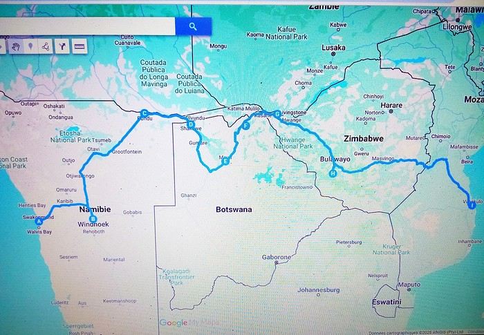
The idea is to cross Africa from the Atlantic to the Indian Ocean. Just to clarify, I don’t have a driver’s license, but I’m used to traveling by hitchhiking, carpooling, or any other type of transport. My must-sees, which I really want to visit, are the Namib and Kalahari deserts, the Okavango Delta, Victoria Falls, and the sandbanks of Vilankulos.
So if anyone has already done this route, more or less, I’d love to hear all your practical tips, especially for getting around within these areas.
Travel style: no problem with big contrasts—whether it’s sleeping in a tent/hammock or a fancy hotel. Budget: flexible (I think).
So where are they and what are they doing?
This catchy and somewhat mysterious title comes from several questions I’ve been asking myself.
VF has been back open for a reasonable number of weeks and months now. The number of visitors overall matches past averages, but the number of members online in the last 24 hours seems relatively lower than what we used to see.
Yet, to my surprise, I’m seeing fewer travel journals, way fewer messages, and way fewer questions. I don’t see many new registered users online, and I notice a number of members who are logged in but either aren’t participating or have stopped participating.
Something’s not adding up for me because, in my opinion, VF is still appealing, and I don’t see which other sites could really compete.
Was there a real break between pre- and post-Covid? Does it just take more time for some people to discover the site or learn that it’s active again? Do people now prefer quick consumption on sites like FB or others I’m not familiar with? Where have the site’s old-timers gone, and what are they doing with their time now? What’s really going on here?
VF has been back open for a reasonable number of weeks and months now. The number of visitors overall matches past averages, but the number of members online in the last 24 hours seems relatively lower than what we used to see.
Yet, to my surprise, I’m seeing fewer travel journals, way fewer messages, and way fewer questions. I don’t see many new registered users online, and I notice a number of members who are logged in but either aren’t participating or have stopped participating.
Something’s not adding up for me because, in my opinion, VF is still appealing, and I don’t see which other sites could really compete.
Was there a real break between pre- and post-Covid? Does it just take more time for some people to discover the site or learn that it’s active again? Do people now prefer quick consumption on sites like FB or others I’m not familiar with? Where have the site’s old-timers gone, and what are they doing with their time now? What’s really going on here?
Discussion parallèle au concours photo d'août: "Noir & Blanc" English translation pending
Je vous donne rendez-vous ici pour vos photos hors concours, pour discuter, échanger, conseiller, apprendre et s'amuser 😛
Le concours se passe par-là: https://voyageforum.com/v.f?post=10330487;a=10330487
Le concours se passe par-là: https://voyageforum.com/v.f?post=10330487;a=10330487
Plan de reprise des croisières Costa English translation pending
Bonjour
Voilà ce qui serait prévu à partir de la mi-août :
http://crew-center.com/costa-cruises-plans-re-start-voyages-7-ships-5-phases
Cordialement
Voilà ce qui serait prévu à partir de la mi-août :
http://crew-center.com/costa-cruises-plans-re-start-voyages-7-ships-5-phases
Cordialement
The most beautiful mountain hikes in France?
Hi everyone,
I usually travel abroad in the summer, but given the circumstances, I think this year I’ll be staying in France. I’d love to know which places you’d recommend for the most stunning mountain landscapes and the best hikes.
Thanks in advance for your help!
😉
I usually travel abroad in the summer, but given the circumstances, I think this year I’ll be staying in France. I’d love to know which places you’d recommend for the most stunning mountain landscapes and the best hikes.
Thanks in advance for your help!
😉
Reportage "À la découverte du Viêtnam" sur Arte English translation pending
Un documentaire :
A la découverte du Viêtnam -Un voyage à travers le Viêtnam, celui, millénaire, des Hmong du Nord du pays, mais aussi celui de la haute technologie, des gratte-ciel et de la modernité la plus éclatante.
Sur Arte en ce moment avec une rediffusion le Lundi 8 juin à 11h20 sur cette même chaîne. A mon sens très bien documenté et fort intéressant. Orientation plutôt nature et préservation.
https://www.arte.tv/fr/videos/085378-000-A/a-la-decouverte-du-vietnam/
A la découverte du Viêtnam -Un voyage à travers le Viêtnam, celui, millénaire, des Hmong du Nord du pays, mais aussi celui de la haute technologie, des gratte-ciel et de la modernité la plus éclatante.
Sur Arte en ce moment avec une rediffusion le Lundi 8 juin à 11h20 sur cette même chaîne. A mon sens très bien documenté et fort intéressant. Orientation plutôt nature et préservation.
https://www.arte.tv/fr/videos/085378-000-A/a-la-decouverte-du-vietnam/
Déréclusion! English translation pending
Déréclusion !
Je ne suis pas à un néologisme près.
Parce que j’me demande : Suis-je libre ? En liberté surveillée ? Contrainte ? Coercition sanitaire et salubrité publique... J’crois que secouer les peurs est mille fois plus efficace qu’un bracelet électronique. Voir le monde entier en pause, je ne pensais pas le vivre. Je comprends aujourd’hui avec quelle rapidité pourrait s’installer une dictature.
J’me demande pourquoi je ne ressens aucune crainte, pourquoi je me sens à mille lieux des peurs dont j’entends parler. Suis-je normale ? Suis-je inconsciente ? J’ai vu des gens avec un masque en voiture, mettre des gants pour tenir un chariot de magasin, où s’arrête le bon sens ? C’est quand même horripilant de se sentir infantilisé. Quand j’entends toutes ces sommités parler, j’ai l’impression qu’elles s’adressent à une population de mômes.
Parait que certains sont porteurs sains et transmettent le virus, paraît que certains ont eu la maladie sans s’en apercevoir et ont des anticorps, paraît que certains ont été malades et ont développé des anticorps, paraît que certains n’ont jamais été en contact et ne seront jamais malades, paraît qu’il faut qu’il y ait 60 % au moins de gens avec des anticorps pour l’immunité collective. Ca s’appelle RO lala.
Et beaucoup sont morts et au regard de l’humanité sur nos plus de 7 milliards, c’est une goutte. Une goutte d’acide et de chagrin pour les familles et amis des décédés, c’est certain. Des cataractes de panique pour des millions d’autres qui tremblent d’entendre un reniflement ou un éternuement. J’me demande aussi combien sont morts de faim et de maladie dans le même temps et aussi combien vont mourir des dégâts induits par le monde à l’arrêt.
Combien de pandémies ont-elles eu lieu sans que le monde occidental ne bouge un cil ? Un virus à la volette et qui disparaîtra comme tous les virus avant qu’un autre ne prenne le relais. C’est ainsi depuis toujours.
Ma solution : je respecte les peurs et angoisses des autres. Je respecte les consignes assenées à longueur de temps. Mais dans l’absolu, au fond de ma p’tite tête, j’pense tout autre chose et me tiens coite.
Je ne suis pas à un néologisme près.
Parce que j’me demande : Suis-je libre ? En liberté surveillée ? Contrainte ? Coercition sanitaire et salubrité publique... J’crois que secouer les peurs est mille fois plus efficace qu’un bracelet électronique. Voir le monde entier en pause, je ne pensais pas le vivre. Je comprends aujourd’hui avec quelle rapidité pourrait s’installer une dictature.
J’me demande pourquoi je ne ressens aucune crainte, pourquoi je me sens à mille lieux des peurs dont j’entends parler. Suis-je normale ? Suis-je inconsciente ? J’ai vu des gens avec un masque en voiture, mettre des gants pour tenir un chariot de magasin, où s’arrête le bon sens ? C’est quand même horripilant de se sentir infantilisé. Quand j’entends toutes ces sommités parler, j’ai l’impression qu’elles s’adressent à une population de mômes.
Parait que certains sont porteurs sains et transmettent le virus, paraît que certains ont eu la maladie sans s’en apercevoir et ont des anticorps, paraît que certains ont été malades et ont développé des anticorps, paraît que certains n’ont jamais été en contact et ne seront jamais malades, paraît qu’il faut qu’il y ait 60 % au moins de gens avec des anticorps pour l’immunité collective. Ca s’appelle RO lala.
Et beaucoup sont morts et au regard de l’humanité sur nos plus de 7 milliards, c’est une goutte. Une goutte d’acide et de chagrin pour les familles et amis des décédés, c’est certain. Des cataractes de panique pour des millions d’autres qui tremblent d’entendre un reniflement ou un éternuement. J’me demande aussi combien sont morts de faim et de maladie dans le même temps et aussi combien vont mourir des dégâts induits par le monde à l’arrêt.
Combien de pandémies ont-elles eu lieu sans que le monde occidental ne bouge un cil ? Un virus à la volette et qui disparaîtra comme tous les virus avant qu’un autre ne prenne le relais. C’est ainsi depuis toujours.
Ma solution : je respecte les peurs et angoisses des autres. Je respecte les consignes assenées à longueur de temps. Mais dans l’absolu, au fond de ma p’tite tête, j’pense tout autre chose et me tiens coite.
Dans quel pays aimeriez-vous vous expatrier? English translation pending
Je saisis au vol cette remarque d'Attila (que je partage!)
Franchement, je serais le gouvernement, je demanderais l'asile en ...?... et dirais aux français, démerdez vous.
et cette autre :
On fait le coucou dans les discussions mais jamais on n'en entame une...
pour proposer un nouveau post sur un mode très différent de voyager.
Où aimeriez-vous partir vivre?
Bien sûr vous choisissez votre pays ou région d'accueil, on part du principe que ce n'est pas une obligation que l'on vous fait.
Et vous avez besoin de vous éloigner momentanément de votre lieu de vie habituel, pour quelque raison que ce soit.
Quels seraient les atouts locaux importants pour vous de cette nouvelle installation : population, climat, paysages, archéologie, autres .... ?
Franchement, je serais le gouvernement, je demanderais l'asile en ...?... et dirais aux français, démerdez vous.
et cette autre :
On fait le coucou dans les discussions mais jamais on n'en entame une...
pour proposer un nouveau post sur un mode très différent de voyager.
Où aimeriez-vous partir vivre?
Bien sûr vous choisissez votre pays ou région d'accueil, on part du principe que ce n'est pas une obligation que l'on vous fait.
Et vous avez besoin de vous éloigner momentanément de votre lieu de vie habituel, pour quelque raison que ce soit.
Quels seraient les atouts locaux importants pour vous de cette nouvelle installation : population, climat, paysages, archéologie, autres .... ?
100 km autour du domicile English translation pending
Bonjour,
Quelqu'un a-t-il une information fiable quant à la définition des 100 kms évoqués par le Premier Ministre ? S'agit il de 100 kms à vol d'oiseau du domicile ou 100 kms en suivant des routes ou des chemins, ce qui, bien sûr, change la donne ? Merci.
Quelqu'un a-t-il une information fiable quant à la définition des 100 kms évoqués par le Premier Ministre ? S'agit il de 100 kms à vol d'oiseau du domicile ou 100 kms en suivant des routes ou des chemins, ce qui, bien sûr, change la donne ? Merci.
Le patron de Ryanair juge «idiotes» les règles de distanciation sociale dans les avions English translation pending
Il n'a peut être pas forcément tort mais comme toujours, l'art et la manière...
Quelques articles... Ryanair boss says airline won't fly with 'idiotic' social distancing rules en anglais.
«Soit le gouvernement paie pour le siège du milieu, soit nous ne volerons pas» ici. Ryanair ne revolera pas si le siège du milieu doit rester vide là. Ryanair : pas de vol avec siège du milieu vacant sur ce lien.
Quelques articles... Ryanair boss says airline won't fly with 'idiotic' social distancing rules en anglais.
«Soit le gouvernement paie pour le siège du milieu, soit nous ne volerons pas» ici. Ryanair ne revolera pas si le siège du milieu doit rester vide là. Ryanair : pas de vol avec siège du milieu vacant sur ce lien.
Été 1985 : un voyage de noces hors du commun dans la Chine pop English translation pending
Deuxième séjour à Pékin en 2018, je discute à l'auberge avec une voyageuse :
"Pékin ! Ici on vit vraiment dans un autre monde."
"Peut-être, mais alors que dire du Pékin des années 80. Une autre planète !"
Ceux qui découvrent cette Chine du 21° siècle ne retrouveront guère que des fragments de celle que je vais raconter ici, comme j'ai pu le constater par moi-même. (Voir mes carnets sur la route de la soie.)
Ce sera donc un carnet "impressions de Chine", ce qui m'est resté de plus marquant. Les quelques photos jaunies que j'ai pu sauver sont scannées et de mauvaise qualité. Merci à Jacqueline et Jean-Pierre pour leur contribution photographique, entièrement d'époque elle aussi.
AU MENU
Préambule - le contexte politique et économique du pays Chapitre 1 - Un voyage qui s'annonce pas très romantique, c'était prévu... Chapitre 2 - Pékin : le trafic de monnaie. Illégal mais indispensable. Chapitre 3 - Pékin 1985-2018 : du Moyen-Age à la révolution technologique. Immersion comparative. Chapitre 4 - Pékin : un billet de train pour Xi'an ? Pas si simple que ça. Chapitre 5 - Le "qi feng shui". Le soigneur se fait soigner. Chapitre 6 - Xi'an : «mei yo», la réponse favorite des fonctionnaires. Chapitre 7 - Vol au-dessus de la jungle. Le coucou arrivera-t-il à bon port ? Chapitre 8 - Chongqing : le bal, ou la vie sexuelle des jeunes chinois. Chapitre 9 - Croisière pop sur le Yangtse. Chapitre 10 - L'hôtel à rats. C'est à Wuhan, comme par hasard. Chapitre 11 - Canton : à la recherche de xiao Wu. Chapitre 12 - Canton : un train sous haute surveillance. Chapitre 13 - Hong Kong : dur retour à la civilisation. Albums : les photos d'époque signées Jacqueline et Jean-Pierre. A partir de la page 5 Témoignages et photos d'époque. Merci aux différents contributeurs. A partir de la page 6. Ne manquez pas le Tibet et le Xinjiang !
PREAMBULE : le contexte politique et économique Comment voyager dans ce pays encore très fermé, obscur, énigmatique, dont en Europe on ne connaît guère la mentalité, les règles de fonctionnement, dont on ne perçoit à l'étranger que quelques images soigneusement filtrées par la censure. Comment se déplacer, se loger, se nourrir, sans moyen de communication, sans réservation d'hôtel ou de train, sans connaître la langue , sans aide, sans guide, sans assistance, sans carte bleue...
1984, date clé pour le voyageur Après trente années de communisme à marche forcée, de campagnes idéologiques calamiteuses pour les populations, de luttes intestines pour le pouvoir, le pays n'arrive pas à décoller économiquement. L'écart grandit avec les nations développées. Mais avec le rétablissement des relations diplomatiques avec les Etats Unis en 1979, le nouveau président, Deng Xiaoping, tient enfin sa revanche et entame sa longue marche vers le progrès. Les fossiles maoïstes de la "longue marche", des "cent fleurs", du "grand bond en avant", les criminels de la "grande révolution culturelle prolétarienne", représentés par la "bande des quatre", tous ceux qui l'avaient évincé du pouvoir et condamné à l'oubli au fin fond d'une province, le sont à leur tour.
Le "révisionniste", comme l'a appelé la veuve Mao, lance ses réformes de libéralisation et d'ouverture de l'économie : « Peu importe qu'un chat soit blanc ou noir, l'essentiel est qu'il attrape les souris ! » Parole du maître.
Parmi ces réformes : l'ouverture au tourisme. Jusqu'à présent, pour visiter le pays, il fallait obligatoirement, soit passer par un tour opérateur avec guide et circuit programmé, soit demander des autorisations de voyage pour un nombre limité de destinations. Très peu pour moi. Mais en 1984, monsieur Deng supprime le permis de circuler et ouvre quasiment tout le pays aux visiteurs. L'info provoque un déclic : - C'est l'occasion ou jamais. L'année prochaine, ce sera la Chine. Et en sac à dos! Et ce sera aussi notre voyage de noces...
Nous aurons le privilège d'être parmi les premiers voyageurs occidentaux à tenter l'aventure. Je pourrai enfin mettre en pratique ce que j'ai appris de chinois à la fac et réaliser un vieux rêve. A nous la Chine, à nous la découverte de ce pays mystérieux et fascinant. Quelle réalité se cache derrière ces images édulcorées de bonheur populaire que nous distillent les images officielles ? Comment vit-on réellement dans ce pays ? Quel accueil réserve-t-on aux impérialistes occidentaux ?

Wuhan, 1985 : slogans révolutionnaires pour mini gardes rouges
CHAPITRE 1 : un voyage qui s'annonce pas très romantique, c'était prévu... Eh oui, juste mariés, il y a peut-être plus glamour comme destination. Bon, Venise, on connaît déjà. Quoi de mieux qu'une telle aventure pour forger un couple ? Pendant toute l'année, je peaufine le projet : itinéraire, transports, hébergements... Les guides de voyage sur la Chine ne sont pas nombreux, il n'en existe d'ailleurs qu'un en français. Pour ce qui est de l'itinéraire, c'est à peu près établi, pour le reste, ce sera au coup par coup, improvisation et opportunités. L'aventure quoi. Juste qu'on dispose d'un mois entre l'atterrissage et le retour à Hong-Kong. Pour l'itinéraire, ce sera donc Pékin - Hong Kong, mais par où et comment ? C'est le grand mystère, même si certains incontournables sont au programme : la Grande Muraille, Xi'an et son armée en terre cuite, la croisière sur le Yang Tse Kiang...
Août 1985 : Hong Kong, premiers pas en extrême-orient Munis d'un joli visa sur notre passeport et d'un billet d'avion Hong Kong - Pékin acheté en agence en France, nous débarquons à Hong Kong pour y passer une nuit avant de repartir pour Pékin le lendemain, L'atterrissage au-dessus de la ville est spectaculaire, l'avion louvoie entre les immeubles pour plonger vers la piste au raz de l'océan, un véritable tour de manège à sensations. Pas trop le temps d'explorer la ville, mais le dépaysement est déjà total. Et pourtant, ce n'est rien à côté de ce qui nous attend...
Ca commence plutôt mal Aéroport de Hong Kong, le lendemain. Nos billets sont valables, pas de problème, seulement : - Désolé, mais vous n'avez pas confirmé votre vol, l'avion est complet. Il va falloir attendre deux ou trois jours... Eh oui, en 1985, il faut confirmer son vol la veille par téléphone. Dans l'excitation et l'émotion, nous avions complètement oublié la consigne. Zut alors, deux ou trois jours de perdus sur le projet, c'est beaucoup trop. - Attendez ici, peut-être il y aura des places si des voyageurs ne se présentent pas. Longue attente plutôt anxieuse, et quelques minutes avant le décollage, petit signe de l'employé : - C'est bon, il reste deux places, vous pouvez partir.
Pékin : avenue Xidan. Photo : Jacqueline et Jean-Pierre
Dès l'aéroport, j'ai senti le choc... Une simple piste en béton, pas d'avion en attente, un trafic aérien quasi nul, un bâtiment à la chinoise, usé et vieillot à souhait, des gardes en uniforme. L'aéroport est encore une base militaire, accessoirement civile pour quelques rares liaisons vers l'URSS et les pays d'Asie. Il n'y a rien dans ce qui fait office de hall d'accueil, une pièce de quelques dizaines de mètres carré tout au plus.
Contrôles minutieux, file d'attente, les militaires ne sont pas très souriants, et le comité d'accueil pas très... accueillant. On n'est pas là pour rigoler, surtout avec ces étrangers qui débarquent de Hong Kong, la zone capitaliste. Eh oui, Hong Kong chinois, ce sera dans une dizaine d'années. D'ici là...
Des billets de Monopoly ?! Un simple bureau dans un recoin fait office de banque. Vite, changer nos travelers chèques en dollars. Ben oui, la carte bleue, ça n'existe pas encore. Derrière son boulier, l'employé fait ses calculs à une vitesse incroyable et me rend le change. Surprise : j'ai une liasse de jolis billets tout neufs dans la main, mais ils n'ont rien à voir avec la monnaie locale. La preuve, il n'y a pas le portrait du grand timonier, mais des jolis dessins de monuments et paysages ! Ca ressemble davantage à des billets de Monopoly.
C'est quoi ce truc ?
Une bonne affaire, mais un gros risque En fait, c'est une monnaie spéciale réservée aux étrangers. Nous allons vite apprendre deux choses. - Un, cette monnaie n'est pas utilisée (et même interdite) par les chinois dans leur vie quotidienne. Elle est réservée aux étrangers et ils doivent payer avec. - Deux, elle est très recherchée par quelques autochtones, car c'est la seule monnaie ayant un équivalent dollar. A l'époque, le yuan chinois ne vaut absolument rien, il n'est pas convertible dans une autre monnaie. Pire que le kopeck. Du coup, notre monnaie "spécial étrangers" fait l'objet d'un trafic formellement interdit et sévèrement réprimé par les autorités.
Mais comment faire si tu veux voyager en dehors des circuits touristiques et des grands hôtels, juste prendre le bus par exemple ou manger dans une gargote. Ca, les autorités n'en ont cure. Un étranger, ça dort dans les hôtels de luxe, ça prend l'avion ou le train en première classe, ça mange dans les grands restaurants. Mieux encore, ça voyage en groupe avec un guide.
Pas d'autre solution, il faudra changer au black Dans la rue, avec les petits trafiquants locaux. Il y a même un cours « officiel » du change : un yuan de Monopoly contre trois yuans de monnaie populaire. A l'époque, un yuan, c'est à peu près un franc. Une sacrée bonne affaire ! Le tout, c'est de ne pas se faire pincer. Les rumeurs les plus folles courent sur les peines encourues pour les trafiquants, mais aussi pour les étrangers qui se font pincer. C'est d'ailleurs marqué sur certains documents. Si les peines de prison ferme ont de quoi dissuader le voyageur, il faudra quand même prendre le risque, pas le choix. Une des nombreuses absurdités du système.
Pékin : place Tian An Men. Photo : Jacqueline et Jean-Pierre
Mise à l'épreuve 1 : trouver un hébergement... Sortie de l'aéroport, c'est l'après-midi. Quelques taxis attendent, réservés aux privilégiés du régime et aux étrangers. Mais nous ne savons même pas où nous allons, juste en ville, et on verra après. Donc ce sera le bus, celui-ci prend la monnaie de Monopoly. C'est notre premier transport en commun, direction le centre ville, à une vingtaine de kilomètres. Très bien, mais où aller, à qui demander un tuyau, un renseignement, une bonne adresse ?
L'aéroport étant en rase campagne, la route bordée d'arbres qui conduit à Pékin centre ressemble à une de nos départementales. De part et d'autres, c'est le défilé des paysans, le plus souvent à pied, tirant des charrettes à bras, quelques fois à bicyclette ou en tracteur. Pour nous occidentaux déjà rodés aux autoroutes, c'est un choc. Ici, pas de voiture individuelle : les véhicules à moteur, c'est juste des camions, quelques bus et de rares taxi, c'est tout .
La carte de Pékin n'indique rien d'autre que le nom des rues, impossible de savoir où se trouve tel service, hôtel, restaurant... Il faut se débrouiller. Les quelques éléments écrits et oraux de chinois que je possède, je vais vite devoir les mettre à l'épreuve. L'anglais ici, on connaît pas.
Juste à côté de nous est assise une jeune femme, bien de sa personne, sans doute un cadre du parti ou d'une grande entreprise. Elle semble plus amène que les autres voyageurs, plus disposée à rendre service. J'entame la conversation comme je peux. Après les échanges d'usage : - Nous sommes français, c'est notre premier voyage en Chine. Connaissez-vous un hôtel sur le trajet du bus qui nous accepterait ? Coup de chance, la femme nous en indique un non loin d'un arrêt, elle nous dira quand il faudra descendre.
Mise à l'épreuve 2 : et qui accepte les étrangers... L'hôtel n'est pas facile à trouver, tout se ressemble ici et rien ne permet de discerner au premier coup d'oeil la fonction d'un bâtiment. Ce n'est même pas écrit « hôtel » à l'entrée. Finalement nous poussons la porte de ce qui semble être ce que nous cherchons. Un étroit couloir sombre, un guichet, une sorte de réception, on dirait un peu un hôtel. Le type de l'accueil est très surpris de nous voir ici, mais oui, c'est bien un hôtel, sauf que : - C'est interdit aux étrangers, vous ne devez pas rester ici ! - Mais comment faire alors ? Le type décroche son téléphone, puis, au bout d'un moment : - Prenez le bus et descendez à cet arrêt, vous y trouverez un hôtel pour vous.
C'est ainsi que nous découvrons que nous ne pourrons pas loger comme on veut dans le pays. La plupart des hôtels sont interdits aux étrangers, il faut toujours aller à l'hôtel spécial « wai guo ren». Oui, mais ce n'est pas forcément indiqué. Quant à dormir chez l'habitant, ce n'est même pas la peine d'y songer, c'est interdit. De plus, quand on voit dans quoi vivent les gens en ville, le peu d'espace dont ils disposent, ça ne donne pas vraiment envie de se faire inviter.
Je ne me souviens plus comment nous avons fait pour trouver le bon bus et le bon arrêt, juste que ça n'a pas été facile du tout. La contrôleuse du bus a tiré une drôle de tronche quand je lui ai tendu le billet de Monoploy, mais elle n'avait pas le choix. Un mao le ticket, dix centimes de franc. Premier aperçu du coup de la vie : trois fois rien. Dans le bus, tous les regards sont fixés sur nous...
Pas de doute, il faut absolument trouver de la monnaie locale, et le plus vite possible. On ne va rien pouvoir faire avec cette monnaie de m... Et quand par hasard ils sont acceptés, on y perd sacrément au change, car ils nous rendent l'argent en monnaie locale. C'est une arnaque gouvernementale bien calculée !
Prochain épisode : le trafic de monnaie
Ce sera donc un carnet "impressions de Chine", ce qui m'est resté de plus marquant. Les quelques photos jaunies que j'ai pu sauver sont scannées et de mauvaise qualité. Merci à Jacqueline et Jean-Pierre pour leur contribution photographique, entièrement d'époque elle aussi.
AU MENU
Préambule - le contexte politique et économique du pays Chapitre 1 - Un voyage qui s'annonce pas très romantique, c'était prévu... Chapitre 2 - Pékin : le trafic de monnaie. Illégal mais indispensable. Chapitre 3 - Pékin 1985-2018 : du Moyen-Age à la révolution technologique. Immersion comparative. Chapitre 4 - Pékin : un billet de train pour Xi'an ? Pas si simple que ça. Chapitre 5 - Le "qi feng shui". Le soigneur se fait soigner. Chapitre 6 - Xi'an : «mei yo», la réponse favorite des fonctionnaires. Chapitre 7 - Vol au-dessus de la jungle. Le coucou arrivera-t-il à bon port ? Chapitre 8 - Chongqing : le bal, ou la vie sexuelle des jeunes chinois. Chapitre 9 - Croisière pop sur le Yangtse. Chapitre 10 - L'hôtel à rats. C'est à Wuhan, comme par hasard. Chapitre 11 - Canton : à la recherche de xiao Wu. Chapitre 12 - Canton : un train sous haute surveillance. Chapitre 13 - Hong Kong : dur retour à la civilisation. Albums : les photos d'époque signées Jacqueline et Jean-Pierre. A partir de la page 5 Témoignages et photos d'époque. Merci aux différents contributeurs. A partir de la page 6. Ne manquez pas le Tibet et le Xinjiang !
PREAMBULE : le contexte politique et économique Comment voyager dans ce pays encore très fermé, obscur, énigmatique, dont en Europe on ne connaît guère la mentalité, les règles de fonctionnement, dont on ne perçoit à l'étranger que quelques images soigneusement filtrées par la censure. Comment se déplacer, se loger, se nourrir, sans moyen de communication, sans réservation d'hôtel ou de train, sans connaître la langue , sans aide, sans guide, sans assistance, sans carte bleue...
1984, date clé pour le voyageur Après trente années de communisme à marche forcée, de campagnes idéologiques calamiteuses pour les populations, de luttes intestines pour le pouvoir, le pays n'arrive pas à décoller économiquement. L'écart grandit avec les nations développées. Mais avec le rétablissement des relations diplomatiques avec les Etats Unis en 1979, le nouveau président, Deng Xiaoping, tient enfin sa revanche et entame sa longue marche vers le progrès. Les fossiles maoïstes de la "longue marche", des "cent fleurs", du "grand bond en avant", les criminels de la "grande révolution culturelle prolétarienne", représentés par la "bande des quatre", tous ceux qui l'avaient évincé du pouvoir et condamné à l'oubli au fin fond d'une province, le sont à leur tour.
Le "révisionniste", comme l'a appelé la veuve Mao, lance ses réformes de libéralisation et d'ouverture de l'économie : « Peu importe qu'un chat soit blanc ou noir, l'essentiel est qu'il attrape les souris ! » Parole du maître.
Parmi ces réformes : l'ouverture au tourisme. Jusqu'à présent, pour visiter le pays, il fallait obligatoirement, soit passer par un tour opérateur avec guide et circuit programmé, soit demander des autorisations de voyage pour un nombre limité de destinations. Très peu pour moi. Mais en 1984, monsieur Deng supprime le permis de circuler et ouvre quasiment tout le pays aux visiteurs. L'info provoque un déclic : - C'est l'occasion ou jamais. L'année prochaine, ce sera la Chine. Et en sac à dos! Et ce sera aussi notre voyage de noces...
Nous aurons le privilège d'être parmi les premiers voyageurs occidentaux à tenter l'aventure. Je pourrai enfin mettre en pratique ce que j'ai appris de chinois à la fac et réaliser un vieux rêve. A nous la Chine, à nous la découverte de ce pays mystérieux et fascinant. Quelle réalité se cache derrière ces images édulcorées de bonheur populaire que nous distillent les images officielles ? Comment vit-on réellement dans ce pays ? Quel accueil réserve-t-on aux impérialistes occidentaux ?
Wuhan, 1985 : slogans révolutionnaires pour mini gardes rouges
CHAPITRE 1 : un voyage qui s'annonce pas très romantique, c'était prévu... Eh oui, juste mariés, il y a peut-être plus glamour comme destination. Bon, Venise, on connaît déjà. Quoi de mieux qu'une telle aventure pour forger un couple ? Pendant toute l'année, je peaufine le projet : itinéraire, transports, hébergements... Les guides de voyage sur la Chine ne sont pas nombreux, il n'en existe d'ailleurs qu'un en français. Pour ce qui est de l'itinéraire, c'est à peu près établi, pour le reste, ce sera au coup par coup, improvisation et opportunités. L'aventure quoi. Juste qu'on dispose d'un mois entre l'atterrissage et le retour à Hong-Kong. Pour l'itinéraire, ce sera donc Pékin - Hong Kong, mais par où et comment ? C'est le grand mystère, même si certains incontournables sont au programme : la Grande Muraille, Xi'an et son armée en terre cuite, la croisière sur le Yang Tse Kiang...
Août 1985 : Hong Kong, premiers pas en extrême-orient Munis d'un joli visa sur notre passeport et d'un billet d'avion Hong Kong - Pékin acheté en agence en France, nous débarquons à Hong Kong pour y passer une nuit avant de repartir pour Pékin le lendemain, L'atterrissage au-dessus de la ville est spectaculaire, l'avion louvoie entre les immeubles pour plonger vers la piste au raz de l'océan, un véritable tour de manège à sensations. Pas trop le temps d'explorer la ville, mais le dépaysement est déjà total. Et pourtant, ce n'est rien à côté de ce qui nous attend...
Ca commence plutôt mal Aéroport de Hong Kong, le lendemain. Nos billets sont valables, pas de problème, seulement : - Désolé, mais vous n'avez pas confirmé votre vol, l'avion est complet. Il va falloir attendre deux ou trois jours... Eh oui, en 1985, il faut confirmer son vol la veille par téléphone. Dans l'excitation et l'émotion, nous avions complètement oublié la consigne. Zut alors, deux ou trois jours de perdus sur le projet, c'est beaucoup trop. - Attendez ici, peut-être il y aura des places si des voyageurs ne se présentent pas. Longue attente plutôt anxieuse, et quelques minutes avant le décollage, petit signe de l'employé : - C'est bon, il reste deux places, vous pouvez partir.
Pékin : avenue Xidan. Photo : Jacqueline et Jean-Pierre
Dès l'aéroport, j'ai senti le choc... Une simple piste en béton, pas d'avion en attente, un trafic aérien quasi nul, un bâtiment à la chinoise, usé et vieillot à souhait, des gardes en uniforme. L'aéroport est encore une base militaire, accessoirement civile pour quelques rares liaisons vers l'URSS et les pays d'Asie. Il n'y a rien dans ce qui fait office de hall d'accueil, une pièce de quelques dizaines de mètres carré tout au plus.
Contrôles minutieux, file d'attente, les militaires ne sont pas très souriants, et le comité d'accueil pas très... accueillant. On n'est pas là pour rigoler, surtout avec ces étrangers qui débarquent de Hong Kong, la zone capitaliste. Eh oui, Hong Kong chinois, ce sera dans une dizaine d'années. D'ici là...
Des billets de Monopoly ?! Un simple bureau dans un recoin fait office de banque. Vite, changer nos travelers chèques en dollars. Ben oui, la carte bleue, ça n'existe pas encore. Derrière son boulier, l'employé fait ses calculs à une vitesse incroyable et me rend le change. Surprise : j'ai une liasse de jolis billets tout neufs dans la main, mais ils n'ont rien à voir avec la monnaie locale. La preuve, il n'y a pas le portrait du grand timonier, mais des jolis dessins de monuments et paysages ! Ca ressemble davantage à des billets de Monopoly.
C'est quoi ce truc ?
Une bonne affaire, mais un gros risque En fait, c'est une monnaie spéciale réservée aux étrangers. Nous allons vite apprendre deux choses. - Un, cette monnaie n'est pas utilisée (et même interdite) par les chinois dans leur vie quotidienne. Elle est réservée aux étrangers et ils doivent payer avec. - Deux, elle est très recherchée par quelques autochtones, car c'est la seule monnaie ayant un équivalent dollar. A l'époque, le yuan chinois ne vaut absolument rien, il n'est pas convertible dans une autre monnaie. Pire que le kopeck. Du coup, notre monnaie "spécial étrangers" fait l'objet d'un trafic formellement interdit et sévèrement réprimé par les autorités.
Mais comment faire si tu veux voyager en dehors des circuits touristiques et des grands hôtels, juste prendre le bus par exemple ou manger dans une gargote. Ca, les autorités n'en ont cure. Un étranger, ça dort dans les hôtels de luxe, ça prend l'avion ou le train en première classe, ça mange dans les grands restaurants. Mieux encore, ça voyage en groupe avec un guide.
Pas d'autre solution, il faudra changer au black Dans la rue, avec les petits trafiquants locaux. Il y a même un cours « officiel » du change : un yuan de Monopoly contre trois yuans de monnaie populaire. A l'époque, un yuan, c'est à peu près un franc. Une sacrée bonne affaire ! Le tout, c'est de ne pas se faire pincer. Les rumeurs les plus folles courent sur les peines encourues pour les trafiquants, mais aussi pour les étrangers qui se font pincer. C'est d'ailleurs marqué sur certains documents. Si les peines de prison ferme ont de quoi dissuader le voyageur, il faudra quand même prendre le risque, pas le choix. Une des nombreuses absurdités du système.
Pékin : place Tian An Men. Photo : Jacqueline et Jean-Pierre
Mise à l'épreuve 1 : trouver un hébergement... Sortie de l'aéroport, c'est l'après-midi. Quelques taxis attendent, réservés aux privilégiés du régime et aux étrangers. Mais nous ne savons même pas où nous allons, juste en ville, et on verra après. Donc ce sera le bus, celui-ci prend la monnaie de Monopoly. C'est notre premier transport en commun, direction le centre ville, à une vingtaine de kilomètres. Très bien, mais où aller, à qui demander un tuyau, un renseignement, une bonne adresse ?
L'aéroport étant en rase campagne, la route bordée d'arbres qui conduit à Pékin centre ressemble à une de nos départementales. De part et d'autres, c'est le défilé des paysans, le plus souvent à pied, tirant des charrettes à bras, quelques fois à bicyclette ou en tracteur. Pour nous occidentaux déjà rodés aux autoroutes, c'est un choc. Ici, pas de voiture individuelle : les véhicules à moteur, c'est juste des camions, quelques bus et de rares taxi, c'est tout .
La carte de Pékin n'indique rien d'autre que le nom des rues, impossible de savoir où se trouve tel service, hôtel, restaurant... Il faut se débrouiller. Les quelques éléments écrits et oraux de chinois que je possède, je vais vite devoir les mettre à l'épreuve. L'anglais ici, on connaît pas.
Juste à côté de nous est assise une jeune femme, bien de sa personne, sans doute un cadre du parti ou d'une grande entreprise. Elle semble plus amène que les autres voyageurs, plus disposée à rendre service. J'entame la conversation comme je peux. Après les échanges d'usage : - Nous sommes français, c'est notre premier voyage en Chine. Connaissez-vous un hôtel sur le trajet du bus qui nous accepterait ? Coup de chance, la femme nous en indique un non loin d'un arrêt, elle nous dira quand il faudra descendre.
Mise à l'épreuve 2 : et qui accepte les étrangers... L'hôtel n'est pas facile à trouver, tout se ressemble ici et rien ne permet de discerner au premier coup d'oeil la fonction d'un bâtiment. Ce n'est même pas écrit « hôtel » à l'entrée. Finalement nous poussons la porte de ce qui semble être ce que nous cherchons. Un étroit couloir sombre, un guichet, une sorte de réception, on dirait un peu un hôtel. Le type de l'accueil est très surpris de nous voir ici, mais oui, c'est bien un hôtel, sauf que : - C'est interdit aux étrangers, vous ne devez pas rester ici ! - Mais comment faire alors ? Le type décroche son téléphone, puis, au bout d'un moment : - Prenez le bus et descendez à cet arrêt, vous y trouverez un hôtel pour vous.
C'est ainsi que nous découvrons que nous ne pourrons pas loger comme on veut dans le pays. La plupart des hôtels sont interdits aux étrangers, il faut toujours aller à l'hôtel spécial « wai guo ren». Oui, mais ce n'est pas forcément indiqué. Quant à dormir chez l'habitant, ce n'est même pas la peine d'y songer, c'est interdit. De plus, quand on voit dans quoi vivent les gens en ville, le peu d'espace dont ils disposent, ça ne donne pas vraiment envie de se faire inviter.
Je ne me souviens plus comment nous avons fait pour trouver le bon bus et le bon arrêt, juste que ça n'a pas été facile du tout. La contrôleuse du bus a tiré une drôle de tronche quand je lui ai tendu le billet de Monoploy, mais elle n'avait pas le choix. Un mao le ticket, dix centimes de franc. Premier aperçu du coup de la vie : trois fois rien. Dans le bus, tous les regards sont fixés sur nous...
Pas de doute, il faut absolument trouver de la monnaie locale, et le plus vite possible. On ne va rien pouvoir faire avec cette monnaie de m... Et quand par hasard ils sont acceptés, on y perd sacrément au change, car ils nous rendent l'argent en monnaie locale. C'est une arnaque gouvernementale bien calculée !
Prochain épisode : le trafic de monnaie
Memories of Thailand
ko samui
Croisières, à quand la reprise? English translation pending
Bonsoir,
beaucoup se posent la question, parfois avec un optimisme surprenant ! Voici un petit rappel :
Pour qu'il y ait des croisières il faut au moins réunir 3 conditions principales (et d'autres aussi) :
- 1 un bateau DÉSINFECTÉ avec son équipage au complet et opérationnel. Pour l'instant les équipages sont disséminés dans le monde. Il faudra les retrouver, les convaincre, certains auront peur. Les convaincus devront trouver des vols pour revenir ; enfin venant de pays "exotiques" ils devront être acceptés à l'entrée des pays où seront les bateaux. Pas gagné avec toutes ces contraintes !!
- 2 un minimum de passagers car en mer un bateau armé coûte beaucoup plus cher que désarmé dans 1 port ou au mouillage !!! Comment vont-ils arriver au port d'embarquement s'ils viennent de loin ? Et mêmes remarques que pour l'équipage, ils faudra qu'ils puissent entrer dans le pays de départ...
- 3 des ports qui acceptent les bateaux. Ce que diront les gouvernements est une chose, ce que décideront les locaux qui, déjà avant l'épidémie ne voyaient plus les croisiéristes d'un très bon œil en est une autre ! Pas gagné non plus pour beaucoup d'endroits où les populations risquent de très très mal réagir à l'arrivée de milliers de personnes potentiellement porteuses du virus même si elles ne sont pas malades.
On peut rêver, mais il faut aussi parfois revenir sur terre à défaut d'être en mer. Pour moi il y aura extrêmement peu de départs avant l'automne en étant très optimiste !!! Je prépare déjà un plan B pour notre départ du 17/10 depuis le Japon Nous avons heureusement des vols reportables. Qui vivra verra.... Qu'en pensez-vous ?
beaucoup se posent la question, parfois avec un optimisme surprenant ! Voici un petit rappel :
Pour qu'il y ait des croisières il faut au moins réunir 3 conditions principales (et d'autres aussi) :
- 1 un bateau DÉSINFECTÉ avec son équipage au complet et opérationnel. Pour l'instant les équipages sont disséminés dans le monde. Il faudra les retrouver, les convaincre, certains auront peur. Les convaincus devront trouver des vols pour revenir ; enfin venant de pays "exotiques" ils devront être acceptés à l'entrée des pays où seront les bateaux. Pas gagné avec toutes ces contraintes !!
- 2 un minimum de passagers car en mer un bateau armé coûte beaucoup plus cher que désarmé dans 1 port ou au mouillage !!! Comment vont-ils arriver au port d'embarquement s'ils viennent de loin ? Et mêmes remarques que pour l'équipage, ils faudra qu'ils puissent entrer dans le pays de départ...
- 3 des ports qui acceptent les bateaux. Ce que diront les gouvernements est une chose, ce que décideront les locaux qui, déjà avant l'épidémie ne voyaient plus les croisiéristes d'un très bon œil en est une autre ! Pas gagné non plus pour beaucoup d'endroits où les populations risquent de très très mal réagir à l'arrivée de milliers de personnes potentiellement porteuses du virus même si elles ne sont pas malades.
On peut rêver, mais il faut aussi parfois revenir sur terre à défaut d'être en mer. Pour moi il y aura extrêmement peu de départs avant l'automne en étant très optimiste !!! Je prépare déjà un plan B pour notre départ du 17/10 depuis le Japon Nous avons heureusement des vols reportables. Qui vivra verra.... Qu'en pensez-vous ?
Off to explore Jordan!
Well, since the lockdown is dragging on, I’m starting a new travel journal following the one I finished publishing yesterday:
https://voyageforum.com/discussion/voyage-pays-perles-voyage-dans-ouest-americain-d9943984/
This time, after the U.S., we’re heading to the Middle East—Jordan!
And we’re keeping up the good habits: one day’s entry published every day at 5:30 PM! Happy reading, and feel free to leave a comment, question, or remark...
Franck
Franck
Les mythes touristiques English translation pending
Les Mythes Touristiques
Dans un carnet que je suis en train d'écrire sur un voyage récent au Mexique, nous sommes arrivés à une petite discussion sur les fameux groupes de musiciens Mexicains, les mariachis. Il existe un mythe selon lequel « mariachi » serait une déformation du mot Français « mariage », et que cela viendrait des fêtes tenues par les Français lors de leurs quelques années d’occupation du Mexique, dans les années 1860 et quelques. Je cite l’un des intervenants sur mon poste Mexicain :
« Les français organisaient de grandes fêtes aux mariages et avaient l'habitude d'inviter des musiciens…. Mariachi serait une déformation du mot mariage ..? »
Ce mythe a été réfuté car il a été prouvé que le terme « mariachi » était d’usage longtemps avant la peu glorieuse « Intervention » de la France au Mexique (c’était sous Napoléon III).
Plusieurs mythes semblables circulent. Certains semblent être propagés à l’intention des touristes, pour leur donner l’illusion de « mieux comprendre le pays », pour donner une profondeur supplémentaire à leurs voyages, pour alimenter leurs conversations avec les amis quand ils sont de retour. Car tout cela gonfle l’égo et donne envie de faire d’autres voyages, ça alimente le tourisme. D’où revenus, tiens donc, pour qui ?
Mais d’autres mythes existent qui ne sont peut-être pas créés à but lucratif.
Vous connaissez sans aucun doute de tels mythes et je vous propose de les partager. Et de donner les raisons pour lesquelles ces mythes existent.
Dans un carnet que je suis en train d'écrire sur un voyage récent au Mexique, nous sommes arrivés à une petite discussion sur les fameux groupes de musiciens Mexicains, les mariachis. Il existe un mythe selon lequel « mariachi » serait une déformation du mot Français « mariage », et que cela viendrait des fêtes tenues par les Français lors de leurs quelques années d’occupation du Mexique, dans les années 1860 et quelques. Je cite l’un des intervenants sur mon poste Mexicain :
« Les français organisaient de grandes fêtes aux mariages et avaient l'habitude d'inviter des musiciens…. Mariachi serait une déformation du mot mariage ..? »
Ce mythe a été réfuté car il a été prouvé que le terme « mariachi » était d’usage longtemps avant la peu glorieuse « Intervention » de la France au Mexique (c’était sous Napoléon III).
Plusieurs mythes semblables circulent. Certains semblent être propagés à l’intention des touristes, pour leur donner l’illusion de « mieux comprendre le pays », pour donner une profondeur supplémentaire à leurs voyages, pour alimenter leurs conversations avec les amis quand ils sont de retour. Car tout cela gonfle l’égo et donne envie de faire d’autres voyages, ça alimente le tourisme. D’où revenus, tiens donc, pour qui ?
Mais d’autres mythes existent qui ne sont peut-être pas créés à but lucratif.
Vous connaissez sans aucun doute de tels mythes et je vous propose de les partager. Et de donner les raisons pour lesquelles ces mythes existent.
L'hiver au pays des merveilles (Maroc) English translation pending
Bonjour,
Je crains que le forum ne soit morose dans les mois à venir , alors pourquoi ne pas faire un nouveau carnet de voyage . J'ai eu la chance de rentrer du Maroc 2 jours avant la suspension des vols et me retrouve donc, comme vous sans doute , en mode confinement total, chez moi, en Basse-Bretagne , avec quelques centaines de photos de mon dernier séjour à sélectionner, recadrer, retravailler .... On s'occupe comme on peut, alors pourquoi ne pas en faire profiter les Forumeurs ?
Je suis resté au Maroc un mois et j'avais organisé un circuit de 10 nuits / 11 jours pour ma plus jeune fille ( 17 ans ) , mon épouse et la grand- mère, ma chère belle-mère, Mina . Ça correspond aux vacances de février en France .
J'avais donc prévu un voyage " simple" sur le papier, mais qui chaque jour et comme toujours allait nous réserver son lot de découvertes, d'émerveillements, de rencontres, de surprises ....
Au programme :
- Départ de Rabat - 2 nuits à Ouarzazate - 2 nuits à N'kob - 2 nuits à Foum Zguid, avec une longue journée 4X4 au plus profond du désert - 4 nuits à Icht / Borj Biramane et retour sur Rabat
Je vais donc essayer d'éviter des redites avec mes précédents carnets, mais le Maroc a tant de richesses à montrer.....
Rabat est une de mes balades urbaines préférées au Maroc . Je découvre toujours de nouveaux endroits, de jolis détails, des points de vue .... Je vais donc m'y balader avec toujours un plaisir renouvelé
Ma première surprise se passe en médina où je découvre avec étonnement que les autorités ont fait le ménage . Tout ce qui encombrait les rues ( déballages sauvages, marchands de tortues et autres lézards, empiétements sur les trottoirs, la rue , etc.... ) a disparu . Plus rien . Même les commerces " en dur " sont "rentrés dans leurs murs" : plus rien sur la voie publique, pas même une chaise.... Une première au Maroc ?
Si le résultat est plutôt agréable dans la rue des consuls ( rue de l'artisanat ) et la rue Souika ( commerces vestimentaires surtout ) , le boulevard Mohamed V, où régnaient les petits restaurants et gargotes , est désormais mort . Ils ont perdu la quasi-totalité de leur ancienne surface commerciale et ne peuvent plus accueillir que quelques clients à la fois . La rue est tuée et il ne me reste plus qu'à chercher un autre endroit où casser la croûte dans la ville . Ce qui est bénéfique dans une rue ( on peut enfin flâner tranquillement ) est catastrophique dans l'autre ( le commerce est mort et le charme est parti ) . A suivre ....
Bon. C'est comme çà . Ici, dans la rue Souika ( à l'heure de la prière ) . Il y a même des poubelles en plastique positionnées dans la rue !
Une autre artère de la médina est la rue Sidi Fatah . Elle donne sur la rue Souika . Une magnifique mosquée y a été restaurée . Si j'en crois mon plan, il s'agit de la mosquée Moulay El Mekki . La porte principale est couverte et on trouve sur chacun des côtés 2 très belles portes ( 4 au total ) . Le minaret octogonal est remarquable . L'ensemble est complété par plusieurs marabout et un peu plus loin se trouve une importante zaouia . C'est vraiment très joli .
L'entrée principale est somptueuse . Le grand art de la peinture sur bois.
Quelques portes latérales
C'est vraiment très agréable de se balader sur la côte atlantique en cette saison ( mi-février ) . Il fait entre 18 et 22 degrés . Temps lumineux . Je n'aurai d'ailleurs pas de pluie pendant un mois ( après avoir eu de la pluie à peu près tous les jours les 5 derniers mois ) : que du bonheur donc ....
Le minaret octogonal
et la rue Sidi Fatah
La rénovation des monuments de la médina est presque terminée . La rue des consuls reprend vie, même si les nombreux fondouks de cette rue sont toujours en travaux . J'ai hâte de les revoir . Je déambule dans les ruelles tranquilles , toujours à l’affût de ces détails qui en font le charme .
Une belle oeuvre de street-art accroche mon œil ....
et cette fenêtre a un charme fou .
Cette fois , mes pas me portent vers les quais ( on pourrait presque dire le port ) de Rabat . Je quitte la médina par un jolie porte : l'ensemble , également restauré, est charmant . J'arrive directement sur l'Oued Bou Regreg .
Au cœur de la capitale subsiste un coin " pêche " . Un petit navire est devenu un restaurant-Lounge , plutôt luxueux ( menu à 790 dirhams pour 2 en cette Saint Valentin ) .
Rabat se donne des airs de petite Essaouira avec ses mouettes, ses bateaux, sa médina au fond, ses filets de pêche .... Le même site à l'horizontale .
Au fond, Les Oudayas
Un " pêche promenade ", me passe sous le nez . C'est mignon . On a envie de le faire la prochaine fois . Il y avait une activité de passeurs entre Rabat et Salé . Mais avec les ponts, le tramway, ..... Certains se sont adaptés , même si çà se fait toujours, plutôt en été ( la plage de Salé est toute proche ) .
Quelques barques rentrent , les unes après les autres et s'amarrent au ponton, côté Salé . Surement les lointains descendants des redoutables corsaires de Salé . Leur univers a été " explosé" ces dernières années avec l'immense projet d'aménagement de l'oued Bou Regreg . Il leur reste un petit ponton , ..... et juste après, on a construit une grande marina pour accueillir les nouveaux jouets de l'aristocratie locale .
et une autre
Tout ceci fait un curieux mélange entre une architecture ancestrale et la plus grande modernité ....
Ci-après, à gauche, le médina sur sa falaise, au fond le toit blanc du nouveau " Grand Théâtre de Rabat ), à côté duquel commence à sortir la future tour Mohamed VI qui sera la plus haute d' Afrique , et à droite la marina côté Salé .
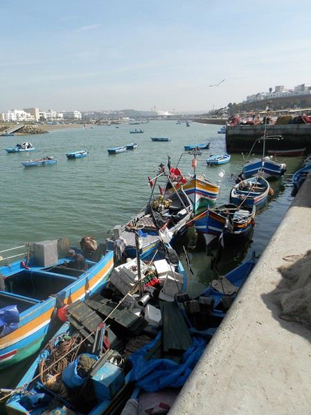
Mais la Kasbah veille toujours sur la capitale
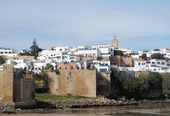
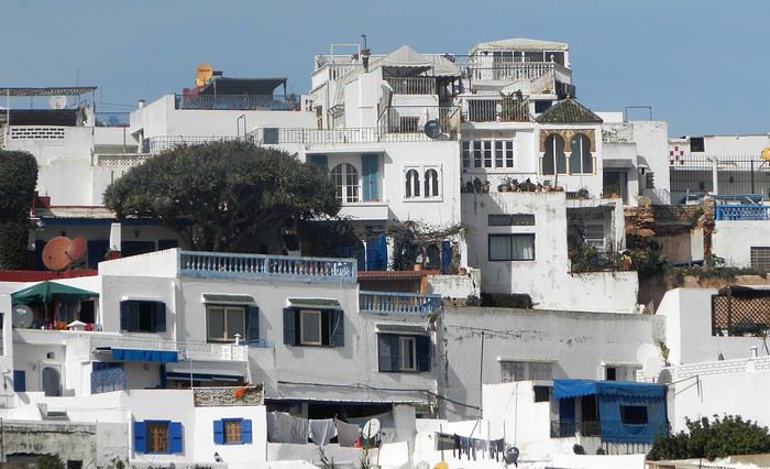
Un dernier regard ...
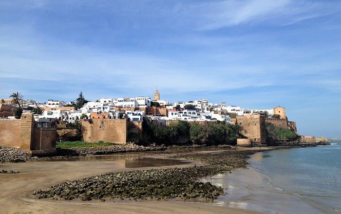
Voila pour ce nouveau coup de projecteur sur la capitale . Faites le détour et surprenez- vous
Demain, j'enfourche ma bonne Dacia Sandero et nous partons à l'assaut de l'Atlas .
Je crains que le forum ne soit morose dans les mois à venir , alors pourquoi ne pas faire un nouveau carnet de voyage . J'ai eu la chance de rentrer du Maroc 2 jours avant la suspension des vols et me retrouve donc, comme vous sans doute , en mode confinement total, chez moi, en Basse-Bretagne , avec quelques centaines de photos de mon dernier séjour à sélectionner, recadrer, retravailler .... On s'occupe comme on peut, alors pourquoi ne pas en faire profiter les Forumeurs ?
Je suis resté au Maroc un mois et j'avais organisé un circuit de 10 nuits / 11 jours pour ma plus jeune fille ( 17 ans ) , mon épouse et la grand- mère, ma chère belle-mère, Mina . Ça correspond aux vacances de février en France .
J'avais donc prévu un voyage " simple" sur le papier, mais qui chaque jour et comme toujours allait nous réserver son lot de découvertes, d'émerveillements, de rencontres, de surprises ....
Au programme :
- Départ de Rabat - 2 nuits à Ouarzazate - 2 nuits à N'kob - 2 nuits à Foum Zguid, avec une longue journée 4X4 au plus profond du désert - 4 nuits à Icht / Borj Biramane et retour sur Rabat
Je vais donc essayer d'éviter des redites avec mes précédents carnets, mais le Maroc a tant de richesses à montrer.....
Rabat est une de mes balades urbaines préférées au Maroc . Je découvre toujours de nouveaux endroits, de jolis détails, des points de vue .... Je vais donc m'y balader avec toujours un plaisir renouvelé
Ma première surprise se passe en médina où je découvre avec étonnement que les autorités ont fait le ménage . Tout ce qui encombrait les rues ( déballages sauvages, marchands de tortues et autres lézards, empiétements sur les trottoirs, la rue , etc.... ) a disparu . Plus rien . Même les commerces " en dur " sont "rentrés dans leurs murs" : plus rien sur la voie publique, pas même une chaise.... Une première au Maroc ?
Si le résultat est plutôt agréable dans la rue des consuls ( rue de l'artisanat ) et la rue Souika ( commerces vestimentaires surtout ) , le boulevard Mohamed V, où régnaient les petits restaurants et gargotes , est désormais mort . Ils ont perdu la quasi-totalité de leur ancienne surface commerciale et ne peuvent plus accueillir que quelques clients à la fois . La rue est tuée et il ne me reste plus qu'à chercher un autre endroit où casser la croûte dans la ville . Ce qui est bénéfique dans une rue ( on peut enfin flâner tranquillement ) est catastrophique dans l'autre ( le commerce est mort et le charme est parti ) . A suivre ....
Bon. C'est comme çà . Ici, dans la rue Souika ( à l'heure de la prière ) . Il y a même des poubelles en plastique positionnées dans la rue !
Une autre artère de la médina est la rue Sidi Fatah . Elle donne sur la rue Souika . Une magnifique mosquée y a été restaurée . Si j'en crois mon plan, il s'agit de la mosquée Moulay El Mekki . La porte principale est couverte et on trouve sur chacun des côtés 2 très belles portes ( 4 au total ) . Le minaret octogonal est remarquable . L'ensemble est complété par plusieurs marabout et un peu plus loin se trouve une importante zaouia . C'est vraiment très joli .
L'entrée principale est somptueuse . Le grand art de la peinture sur bois.
Quelques portes latérales
C'est vraiment très agréable de se balader sur la côte atlantique en cette saison ( mi-février ) . Il fait entre 18 et 22 degrés . Temps lumineux . Je n'aurai d'ailleurs pas de pluie pendant un mois ( après avoir eu de la pluie à peu près tous les jours les 5 derniers mois ) : que du bonheur donc ....
Le minaret octogonal
et la rue Sidi Fatah
La rénovation des monuments de la médina est presque terminée . La rue des consuls reprend vie, même si les nombreux fondouks de cette rue sont toujours en travaux . J'ai hâte de les revoir . Je déambule dans les ruelles tranquilles , toujours à l’affût de ces détails qui en font le charme .
Une belle oeuvre de street-art accroche mon œil ....
et cette fenêtre a un charme fou .
Cette fois , mes pas me portent vers les quais ( on pourrait presque dire le port ) de Rabat . Je quitte la médina par un jolie porte : l'ensemble , également restauré, est charmant . J'arrive directement sur l'Oued Bou Regreg .
Au cœur de la capitale subsiste un coin " pêche " . Un petit navire est devenu un restaurant-Lounge , plutôt luxueux ( menu à 790 dirhams pour 2 en cette Saint Valentin ) .
Rabat se donne des airs de petite Essaouira avec ses mouettes, ses bateaux, sa médina au fond, ses filets de pêche .... Le même site à l'horizontale .
Au fond, Les Oudayas
Un " pêche promenade ", me passe sous le nez . C'est mignon . On a envie de le faire la prochaine fois . Il y avait une activité de passeurs entre Rabat et Salé . Mais avec les ponts, le tramway, ..... Certains se sont adaptés , même si çà se fait toujours, plutôt en été ( la plage de Salé est toute proche ) .
Quelques barques rentrent , les unes après les autres et s'amarrent au ponton, côté Salé . Surement les lointains descendants des redoutables corsaires de Salé . Leur univers a été " explosé" ces dernières années avec l'immense projet d'aménagement de l'oued Bou Regreg . Il leur reste un petit ponton , ..... et juste après, on a construit une grande marina pour accueillir les nouveaux jouets de l'aristocratie locale .
et une autre
Tout ceci fait un curieux mélange entre une architecture ancestrale et la plus grande modernité ....
Ci-après, à gauche, le médina sur sa falaise, au fond le toit blanc du nouveau " Grand Théâtre de Rabat ), à côté duquel commence à sortir la future tour Mohamed VI qui sera la plus haute d' Afrique , et à droite la marina côté Salé .
Mais la Kasbah veille toujours sur la capitale
Un dernier regard ...
Voila pour ce nouveau coup de projecteur sur la capitale . Faites le détour et surprenez- vous
Demain, j'enfourche ma bonne Dacia Sandero et nous partons à l'assaut de l'Atlas .