Results for "Mirage+|+3+>+99"
1695 results found.
Namibia Travel Journal: May 2025 - Trip Review
NAMIBIA TRIP 2025: April 24 to May 20: Feel free to comment or ask us any questions about this amazing journey.
>> Find all our photos and videos for each day on our website here: www.montagne-aventure.net
**DAY 1: Thursday, April 24, 2025: Outbound Flights from Lyon to Windhoek via Munich - Visit to Munich:**

Off we go on a new adventure. The alarm rings at 6:30 AM, the travel bags are packed, and we head to Lyon Airport. We booked our flight tickets with Lufthansa. The first leg to Munich, Germany, is operated by AirBaltic. Departure at 1:05 PM for a 1-hour and 20-minute flight. We arrive at 2:30 PM.
**We now have a 7-hour layover, so we take the opportunity to get some fresh air and explore Munich.** We quickly exit Terminal 2 of the airport and head towards the subway. We buy a group day ticket "Airport-city Day Zone M-5," valid for 2 to 5 people at a price of 30.50 € (instead of 16.30 € per person). We take the S8 line to **Marienplatz** in 35 minutes. **This is the heart of the city.** The weather is overcast, quite cool, but dry. Perfect for a little city trip between two flights while leaving our large luggage in transit at the airport. **Munich is the third-largest German city after Berlin and Hamburg, in the Bavaria region.** **The center has a lot of charm and brings together several religious buildings, easy to explore on foot.** We are impressed by the number of people enjoying these 100% pedestrian streets, which are very pleasant. After Marienplatz, the most famous square with the town hall, we head to the Cathedral of Our Lady, a Gothic church, then continue to **Karlsplatz** and move on to **the food market offering a wide selection of high-end food products in an atmosphere where a certain art of living prevails.** We also visit St. Peter's Church before grabbing a bite to eat. Two good hours were enough for this 10 km city walk. It's time to take the subway back: by 6:30 PM, we are back at the airport. Now, it's time for a bit of waiting and rest. Our second flight is scheduled for 9:35 PM for a 9-hour and 30-minute journey to our final destination in Namibia: **Windhoek.**
> Round-trip flight tickets with Lufthansa from Lyon: 2029 €, or 1,014.50 € per person.
> Lyon Airport parking: 120 €
> Today's expenses: 7 € for 2 pizzas in France / 14 € for the restaurant in Munich / 30.50 € for the daily subway ticket in Munich.
**DAY 2: Friday, April 25, 2024: Arrival in Windhoek, Visit to the Namibian Capital:**
After a 9-hour and 30-minute overnight flight with Discover Airlines, we finally land on Namibian soil just before 7:30 AM. The day is breaking, and the colors are already stunning. We are eager despite the usual fatigue from the flight. The airline was punctual, with friendly staff and good meals, though a bit light. We are the first flight of the day to land, with no more than 15 flights per day here, from 7 AM to 8 PM. We disembark on the tarmac at this airport located in the middle of nowhere, **I finally set foot on African soil for the first time.** We exit among the first from the aircraft to go through the long formalities at the front of the line, as the wait can quickly become endless. Allow at least 5 minutes per person for e-visas. We still wait 45 minutes despite only about twenty people ahead of us. Phew, it's done. We collect our luggage and then withdraw money from an ATM. We make 4 withdrawals of the maximum amount, 2000 NAD $ per withdrawal, for a total of 380 €, or 95.33 € per withdrawal.
Our driver arrives at the same time, perfect timing, we were quick.
We leave the airport at 8:45 AM. By 9:30 AM, we arrive at the **Gracious Whisp vehicle rental agency**, located at the entrance of Windhoek, small and human-sized with a fleet of recent vehicles. More formalities, then a short wait as our vehicle is not yet ready. Time to decompress, catch our breath, and enjoy the very pleasant morning temperature. Not a cloud in sight. Next, a briefing on the vehicle, always with a bit of apprehension due to our approximate English. Allow 45 minutes of explanations, including setting up the roof tent, camping equipment, technical information in case of a flat tire, driving tips in Namibia, and a tour of the 4x4. We have all the necessary equipment for camping: mattresses, sleeping bags, pillows, table, chairs, gas stove, BBQ grill... as well as 2 spare tires, a compressor, a dual tank, and accessories for removing wheels. Off we go, it's time to muster our courage and get behind the wheel. **Heading to SuperSpar Maerua**, fortunately located less than 10 minutes away. We park with the help of a parking attendant; it's very crowded, the space is narrow, but everything goes well despite the cursed right-hand drive. Today's new mission: stock up on groceries. The store is well-stocked with local and imported products, catering to all tastes. We spend 114 € on groceries, from pasta to meat, BBQ lighters to dishwashing products. Two people load our groceries into two carts and transfer them to our vehicle; we feel compelled to leave a tip, 50 NAD $, as we don't have change yet. Now, we head to the hotel, 15 minutes away. Traffic is difficult at a complicated intersection; this will likely be the only traffic jam in Namibia. **We arrive at Kate's Nest Guesthouse & Backpackers around 1:15 PM, quite tired.** We take some well-deserved rest at this recent establishment, quite calm with secure private parking. After a short nap, we enjoy the quiet by the hotel pool. Night falls between 6:30 PM and 7 PM. We eat quietly in our room tonight before starting this long 4x4 road trip in camping mode in the heart of Namibia.
> Today's grocery expenses: 114 € at Super Spar Marua (2395.21 NAD $).
> Round-trip flight tickets with Lufthansa from Lyon: 2029 €, or 1,014.50 € per person.
> Vehicle rental: 4x4 Toyota with roof tent for 24 days: Gracious Whisp Car Rentals: 2,638 € (N$50,640) or **1,319 €** per person - (https://gwcarrentals.com/)
> Distance driven today: 15 km.
> Accommodation: Kate's Nest Guesthouse & Backpackers - 4 Aristotles Street Academia, 9000 Windhoek - 36 € for two for one night.
> Windhoek International Airport website: (https://www.airports.com.na/)
**DAY 3: Saturday, April 26, 2025: Windhoek to Hardap: Mariental Region - Kalahari Desert:**
After a good, restful night, we wake up leisurely around 7 AM. We enjoy the comfort provided by this first and last hotel before 24 nights under the tent.
**We leave Kate's Nest Guesthouse at 8:30 AM to tackle the Namibian roads.** We quickly leave the capital; in just 30 minutes, we find ourselves almost alone in the world. The landscape is dotted with small domes. We leave the **paved B1** quickly to turn left onto the **C15**. **From there, we won't see more than 10 vehicles all day.** After passing through the few houses of **Lekkerwaterpoort**, we tackle our first gravel road. These road sections are limited to 100 km/h, but even at 70 km/h, I find it already challenging. However, I quickly get used to it and gradually pick up speed to reach my cruising speed of around 80 to 90 km/h. **We are on immense straight lines crossing wild expanses as far as the eye can see.** **We come across two baboons, a few ostriches, and numerous cattle and sheep farms.** We pass through the charming village of **Uhlenhorst** with its typical houses and children with broad smiles waving at us. Life here is already very different from Windhoek. **The thermometer rises quickly from 16°C at 8:30 AM to over 28°C in the early afternoon.**
**We arrive at the Hardap Dam reserve at 2 PM.** We stop at the toll booth at the park entrance to pay the entrance fee: 250 NAD $ for 2 people and 1 vehicle. We continue to the dam and then the camp entrance, located a bit further. We had booked in advance, but this place remains little frequented by foreigners.
We take advantage of the hottest hours to rest by the large pool overlooking the immense lake, a very enjoyable moment. Would this be a bit of a vacation?
Around 4:30 PM, we head to the campsite. We overlook this vast water reserve. We arrive first; we will be only 3 vehicles spending the night here. It's time to get to work and set up our equipment for the first time. It takes us a good 20 minutes to set everything up, with a slight apprehension about unfolding the tent. Once this task is done, which we will have to repeat for almost a month, we will become much more efficient over time. Time for rest and contemplation in total silence. The sun gradually sets, and the heat quickly becomes bearable again. Bliss! **This dam is located 20 km northwest of Mariental in an area dotted with conical hills topped with dolerite buttons (Hardap means "hillock" in Nama). It captures the Fish River, which flows south, creating a large lake in the middle of an arid environment. The contrast is striking.** We enjoy our first sunset facing this 360° otherworldly landscape.
Around 7 PM, we start our first BBQ, or "braai" as it's called here. The temperature is perfect. The sun sets, giving way to a star-filled sky of incredible beauty thanks to the absence of any light pollution. The Milky Way will lull us throughout the evening. After some good sausages and potatoes on the BBQ, we head to our roof tent around 9:30 PM with a complete change of scenery in just 24 hours. France already seems so far away...
This campsite has shared showers and toilets, quite clean and functional, as well as a central area with several BBQs and tables. The sites are arranged in a semicircle, each with an electrical outlet. The sites are close to each other but spacious, some slightly shaded. We are only three vehicles tonight, so it's perfectly comfortable and quiet. Not to mention the large pool near the restaurant. Our trip is off to a great start.
> Today's road itinerary: Windhoek > Head south on the B1 to Rehoboth > Turn left onto the C25 then C15 to Stampriet > C20 to Hardap > Full north on the B1 > Then turn left onto the M93 - 5 hours of driving.
> Distance driven today: 354 km.
> Accommodation: Hardap Recreation Resort - 23.3 € for two - Large pool - GR6W+3M2, Hardap Game Reserve, Mariental, Namibia - (http://www.nwr.com.na/resorts/hardap-resort/)
**DAY 4: Sunday, April 27, 2025: Hardap - Brukkaros Volcano - Keetmanshoop - Quivertree Forest Rest Camp**
Our first night under the tent was very pleasant; the little wind quickly calmed down, giving way to absolute silence. The mattress is decent, more comfortable than some nights in Nepal. The length and width give us enough space for maximum comfort, despite my height (1.91 m). We wake up a little before 7 AM as the sun rises, and the lights dazzle us from the start of the day. We pack up the equipment in 30 minutes, quite easily. Then we enjoy the sun, which warms up quickly while we keep our light fleece on.
At 8:30 AM, **we hit the road again, heading south** to our first stop in **Mariental**. We want to do some shopping at SuperSpar, but once we arrive in the parking lot, a young local is fighting with the supermarket security guards and then threatens to throw stones. We don't want to take any risks right at the start, so despite the baton blows he receives, he doesn't stop. We leave empty-handed but fill up with fuel at the Shell station 1 km further. The price per liter is 21.33 NAD $, we fill our 107-liter tank for 107 €. In Namibia, you get served, and they bring the card machine to the window to pay. It's then customary to leave a tip.
We then take the B1 heading due south on a recently renovated road. Around 11:30 AM, we leave it on our right to take **a wild gravel road, the M98**. Just before **Berseba**, we turn right onto a small track, the **D3904 towards Brukkaros Crater up to a camp at 1588 m altitude**. The track then becomes too bumpy. We stop on the counter-slopes where **a wide panorama unfolds over these immense plains as far as the eye can see**. It's 12:15 PM, time for us to eat a rice and tuna salad facing this landscape.
**We are alone in the world until a vehicle arrives and parks next to us.** A bit of apprehension, 4 men head towards us. It turns out to be 4 shepherds looking for a lost foal. The conversation is pleasant, lost in the middle of nowhere. We find ourselves alone again in this absolute silence. **The heat becomes stifling with a good 30°C**. We get back on the road around 1 PM. Back on the B1, **we continue due south to Keetmanshoop**, which we reach around 3 PM. We stop there to do some shopping for 262 NAD $ (12 eggs, a can of tuna, a can of corn, bread, a soda, and a 5-liter water container), or 12.48 €. Two quite insistent children ask us for money or candy at the store exit, yet we give them a small tip, but they continue to cling to the car. Locals parked next to us tell them to leave us alone. Anyway, we finish the trip to **Quivertree Forest**, 15 km away. We will spend the night in this **pleasant farm run by a German**. Upon arrival, as the day before, and as I suppose in the future, we dive straight into the cool pool to relax after all these kilometers. A bliss. Then we take our 4x4 and choose a spot near these famous trees. After the 33°C this afternoon, once 4 PM passed, the temperature drops again and becomes very pleasant. **We are in the middle of the Kokerboom, one of the most interesting and characteristic plants of hot and arid regions. It's not really a tree but a variant of the aloe plant whose botanical name is Aloe Dichotoma. This Kokerboom has a smooth and thick trunk reaching up to 1 m in thickness and 9 m in height. They bloom for the first time at the age of 20 to 30 years.** The flowers are yellow and reach about thirty centimeters during the season between June and July. **They grow mainly in an environment with a high concentration of black rocks absorbing a large amount of heat (38°C). The rocks also serve to anchor the tree with its tentacle-like roots. It also resists frost. Each is between 200 and 300 years old.**
Around 5 PM, we walk to the farm reception to watch the feeding of **two cheetahs**. Magnificent carnivores taking their time to savor their piece of meat. **Then we return near our campsite to enjoy the sunset among these trees. The colors are sublime, as every evening apparently. A magnificent spectacle with colors evolving from yellow to orange then to pink, before giving way once again to a sky filled with thousands of stars.** Our campsite at Quiver Tree Forest Camp is very comfortable; we have a water supply, a stone table, a small lamp, an electrical outlet, a small tree for shade, and a BBQ that we won't use tonight; we'll cook on gas. The sites are far apart, with some shared facilities scattered around, a very beautiful setting. No reservation possible, no need, just show up directly. **The campsite accommodation for 2 people costs 28 €, including the reserve entrance fee of 5 €**. We finish this second bivouac evening around 9:30 PM, time for some reading and sleep in peaceful silence without wind.
> Today's road itinerary: Mariental > B1 heading south to Brukkaros > At Tses turn right towards Berseba via the M98 > Turn right onto the D3904 > 8 km > Brukkaros Volcano (stop at the lower camp as the track is difficult for 1 hour) > Keetmanshoop > Turn left onto the M29 > Quivertree Forest - 4 hours of driving.
> Distance driven today: 371 km.
> Distance walked today: 6 km.
> Today's expenses: Groceries for 12.48 € (262 NAD $) / Fuel for 107 € (1 liter of diesel for 21.33 NAD $).
> Accommodation: Quivertree Forest Rest Camp, P.O. Box 262, Keetmanshoop, Namibia - BBQ, hot showers, toilets, and electricity - No reservation - Pool - 18 €/Person (N$ 340.00 with park entrance) - (http://www.quivertreeforest.com/)
**DAY 5: Monday, April 28, 2025: Quivertree Forest Rest Camp - Giant's Playground - Keetmanshoop - Fish River Canyon - Canyon Roadhouse:**
After an excellent start to the night, we are woken up by the wind shortly before 6 AM, but the sunrise is not far off. We get up at 6:30 AM to enjoy it. The atmosphere is a bit cooler this morning, but the reward is already here.
The adventure continues. At 7:45 AM, we head towards **Giant's Playground**, 4 km away. We take a 3-kilometer walk through this expanse of blocks and igneous rocks.
We continue south at 8:45 AM, passing through Keetmanshoop again where we do some shopping for 25 €, a big stock-up for a good part of the trip: meats, canned goods, pasta, fruits... At 9:30 AM, we take the B4 to Fish River Canyon.
At 11:30 AM, we arrive at the entrance to the NWR park (350 NAD $ entrance for 2 people and 1 vehicle). The track becomes bumpy immediately upon entering the park. After about ten kilometers, we come upon this landscape carved by nature. In the end, it's well worth the detour. We were at the Grand Canyon in the USA exactly (https://www.montagne-aventure.net/2024/04/29/j21-3-juin-2024-grand-canyon-et-lac-powell/) and can thus confirm that this Fish River Canyon is comparable. We make several stops along the southern flank. **Here, nothing is developed; nature is almost in the wild state.** **With 160 km in length, up to 27 km in width, and a depth of 150 m, it is indeed the second-largest canyon in the world.** The history of the canyon is apparent in its different earth layers and stratification: the antiquity of the place is tangible, and the absence of vegetation is surprising. **It consists of two nested canyons, formed at distinct periods. The first distinct layer of schist, sandstone, and eruptive material surrounding the canyon was formed a few two billion years ago, then transformed due to heat and pressure into more solid rock such as gneiss. The inner canyon, carved more recently by the Fish River, has a depth of 270 m.**
We have a picnic once again alone in the world facing this grand panorama at the **Sulphur Spring View Point**. This is where the hiking trail begins, plunging into this narrow canyon, but it is forbidden to venture there alone without a guide. It's 30°C, but a slight wind makes the atmosphere bearable. At 1 PM, we retrace our steps and continue to the **Main View Point** then to the **Hikers View Point**.
In the south of Namibia, the Fish River Canyon, 160 km long, is a true geological wonder: a canyon nested within another canyon, one of the largest in the world. The first sedimentary layers formed two billion years ago; 500 million years ago, a period of tectonic activity caused these layers to crack and tilt, opening a vast canyon in the Earth's crust. The second canyon, with a depth of 270 m, was carved over time by the passage of the Fish River in this new valley.
At 3 PM, we arrive at our very charming camp for the evening, the **Canyon Road House**. We fill up with fuel right away because tomorrow we have a long day of isolated driving: 55 liters for 1240 NAD $. Then we settle into the campsite we had previously reserved in France. We are assigned site 2, very well set up under a tree with its BBQ and stone table just steps from the pool. We quickly set up the tent and jump straight into the pool for the relaxation moment of the day. As usual, the water is quite cool, but it's a real pleasure. Then we stroll around this Canyon Road House, which recreates the atmosphere of the roadside inns of the 1950s with old car wrecks and vintage gas pumps in a bygone era. **Around 5:45 PM, we start a short walk leading us to the top of a hill overlooking the wide plateau where we are to watch the sunset.**
And finally, to end this beautiful day, it's time for the braai, with grilled sausages and white beans on the evening menu.
> Park entrance: 150 DN/person + 50 DN/vehicle (18 € for two). It is possible to enter at two access points: Hobas in the north and Ai-Ais in the south.
> Today's road itinerary: M29 > Keetmanshoop > B1 > B4 > C12 (track) > After Holoog turn right onto the D601 (C37 track) > Accommodation on our right (stop just to check in before 6 PM) > Continue 30 km (30 minutes of track) to the viewpoints after Hobas where you must pay the entrance fee. Sunset View Point to the left > Return before sunset as the park closes (best lights at sunrise). 3 hours.
> Distance driven today: 228 km.
> Distance walked today: 10 km.
> Today's expenses: 25 € for groceries / 17 € for the Fish River Canyon park entrance / 58 € for fuel.
> Accommodation: Canyon Roadhouse, Gondwana Collection Namibia – 34.4 € for two - Pool - Near Hobas - (http://www.gondwana-collection.com/fr/accommodation/canyon-road-campsite)
**DAY 6: Tuesday, April 29, 2025: Canyon Roadhouse - Orange River - South African Border - Vista Trail - Gondwana Sperrgebiet Park - Aus:**
The night was excellent in this very comfortable campsite. **We wake up to the sound of birds** before the alarm at 6:45 AM. Our little morning routine starts as the sun rises. **A big day of driving awaits us to the South African border. This will be the southernmost point of our journey.** We hit the road at 8 AM via the C37, pass through **Hobas**, then turn onto the D207 to **Aussenkehr.** **We cross a mountainous barrier with some high peaks and perfect cones. The rock varies from orange to pink to black.**
We then cross a lunar desert as far as the eye can see on a giant dome; the track winds through nowhere without meeting anyone for hours. The landscapes are surprising. **We spot several ostriches and a gemsbok.** In the middle of this endless expanse, we come to an improbable intersection and continue right onto the D278.
In the middle of these arid lands, we come across a green zone: a vast vineyard. At 10:30 AM, **we come across a "Road closed" sign, fortunately, a local resident waves us to continue; a bit stressed, we proceed.** We start to follow the beautiful Orange River. On the other side of the bank, just a few meters away, South Africa is there. It is the second-longest river in Southern Africa, after the Zambezi. It flows over 2,000 km to the Atlantic. After passing through narrow gorges, we regain altitude before starting the descent, gently heading back north.
**We now cross and follow the Fish River, which joins the Orange River further south** **along this gorge dating back millennia.** At exactly noon, we take a lunch break by the Fish River, still without meeting a soul in this landscape between greenery and aridity. The temperature here is cooler with a pleasant 23°C on the banks, the perfect spot. **We continue on the track to Rosh Pinah**, where we find a paved road again. **The section along the Orange River and the Fish River was officially closed, but we were able to pass without any issues, avoiding a detour of at least 3 hours.** Phew. We now drive at high speed (limited to 120 km/h) through these vast spaces. We come across many ostriches after the **dozens of monkeys along the Fish River**. Around 3 PM, 3 km after the very small town of **Aus**, we reach **our campsite for the evening at Klein Aus Vista**. A new **small peaceful haven very well set up**. As usual, after checking in at reception, we jump straight into the beautiful pool to get our well-deserved dose of coolness, another good thermal shock that our bodies appreciate. Once this moment of relaxation is over, we take our 4x4 to reach the campsite located a bit higher, set apart at the foot of a hill that overlooks us.
After setting up, **around 5 PM, we head to the Vista Trail to climb to the top of a mountain overlooking the vast plain that surrounds us at 360°**. It takes about 30 minutes to climb. The place is just magical, **the perfect viewpoint to admire the sunset**. **We fully savor the moment. We also spot one of the few wild horses in the world capable of living in the desert.** Their numbers have decreased in recent years due to predation and drought (around 100 to 150). At 7 PM, we return to the camp, time for the braai and preparing the meal in this peaceful little camp.
In the south of Namibia, the Fish River Canyon, 160 km long, is a true geological wonder: a canyon nested within another canyon, one of the largest in the world. The first sedimentary layers formed two billion years ago; 500 million years ago, a period of tectonic activity caused these layers to crack and tilt, opening a vast canyon in the Earth's crust. The second canyon, with a depth of 270 m, was carved over time by the passage of the Fish River in this new valley.
> Today's road itinerary: 5 hours of driving: D324 heading south (track) > turn right onto the C10 (track) > D316 heading south > turn right onto the C13 > In Aus turn left onto the B4 > Campsite via a track on the left.
> Fuel station: Solitaire or Aus.
> Distance driven today: 398 km.
> Distance walked today: 7 km.
> Accommodation: Klein-Aus Vista Desert Horse Campsite - Farm Klein-Aus No 8 on the B4 main road to Luederitz Aus 9000, Aus, Namibia - (http://www.klein-aus-vista.com/accommodation/desert-horse-campsite/) 17908 420 DN - Water + Shared shower (hot water). No electricity.
**DAY 7: Wednesday, April 30, 2025: Aus - Kolmanskop - Diaz Point - Luderitz - Kanaan Desert:**
We wake up around 6:45 AM, with partly cloudy weather for once; we feel the ocean's influence gradually. But the sun isn't far off. At 7 AM, we leave the campsite heading west towards Luderitz via the B4. **First stop of the day: Kolmanskop, the ghost town we reach at 8:30 AM**, entry costs 180 NAD $ per person. We discover this **timeless place** in 1.5 hours, moving from building to building amidst violent sand-laden gusts of wind. There's a lot of charm in these different living spaces. **The sand quickly reclaimed the place after this mining town was abandoned.** This was once the headquarters of Consolidated Diamond Mines. It's hard to believe that this former town, where the diamond industry once flourished, had a hospital, a bowling alley, and a theater. The decline in diamond sales after World War II and the discovery of richer deposits put an end to this golden age. By 1956, the town was already completely deserted, and the sand had reclaimed its rights. **These dilapidated buildings swallowed by shifting dunes have something surreal about them.**
At 10:15 AM, we hit the road again **heading to Luderitz, 22 km away**, and first to **Diaz Point** **facing the Atlantic Ocean**. It's a wind-swept peninsula with its characteristic red and white lighthouse. There's a campsite and a coffee shop on site, but the place doesn't inspire rest without shade or shelter from the wind. We return to the city via the D701 track that runs along the ocean, be careful at low tide. We come across **a few fishermen and a fox as well as flamingos.**
We walk through the few streets of the city, much smaller than I imagined, then climb to the **famous little Lutheran church that overlooks the city, the Felsenkirchr.** **The wind blows very strongly here, and the sand is omnipresent, surrounded by the Namib Desert and the southern Atlantic coast.** **A German colonial relic barely touched by the 21st century, Luderitz seems frozen in the past, giving it both a gloomy and a certain charm. In short, it's certainly one of the most incongruous places in Africa.**
At 1:15 PM, just before leaving Luderitz, we do some shopping for 20.50 € and fill up with fuel: 61.50 €, 1290 NAD $ for 61 liters (21.18 $ per liter).
**We return via the B4 to Aus** (paved), **then via rougher tracks**, the C13 then the D707, magnificent as it runs along a mountain range with multiple colors on our right and an endless flat desert on the other side.
To access our campsite for the evening, we must take a **narrow private track for 7 km** on our right to emerge, in this total vastness, at the **isolated Kanaan Desert Retreat on a small hill**. I don't have time today to jump into the pool near the reception; we arrive at 5 PM at 8 small, isolated, and unique sites with a small kitchen, a shower, and a private toilet under a small tarp shelter. **A crazy charm with a unique view...** **This will be my favorite accommodation of this trip. The photos speak for themselves.** We jump into the outdoor shower while savoring the landscape, then prepare our evening braai while enjoying the colors fading, facing this plateau with bushes turning a vivid orange. **A moment that will remain etched for life.** **Savanna atmosphere under a thin emerging moon. Every minute offers different colors. Facing our meal, we have a natural giant screen.**
We end this day contemplating the stars and admire this thin orange moon setting on the horizon (8:42 PM).
**Ghost town just before Luderitz: Kolmanskop** (open from 8 AM to 3 PM - N$ 180 p.p – 9 €). Once, Kolmanskoppe was organized around diamond mining. After finding new, more prolific spots, the town was abandoned and is now a ghost town. The sand and dunes have reclaimed their rights and buried everything humans had built. Houses, train station, bakery, everything has been covered by sand, which passes through the windows, even though they are 1 meter high.
> Today's road itinerary: 5h30: B4 to Luderitz (paved) > Round trip > Kolmanskop on the left > Return via the previous campsite > Then C13 (track) > Turn left D707 (track) > Then track to the right to the campsite.
> Distance driven today: 438 km.
> Distance walked today: 8 km.
> Today's expenses: Groceries at the Spar in Luderitz for 20.50 € / Fuel fill-up in Luderitz for 61.50 €.
> Official Kolmanskop website: (https://kolmanskuppe.com) (open from 8 AM to 1 PM - N$ 180 p.p – 9 €).
> Accommodation: Night at the south of the Namibrand Nature Reserve: Kanaan Desert Retreat – 26.5 € for two - (http://www.kanaannamibia.com/) - Farm 104 Karas 9000 - Sanitary facilities + BBQ + Water + Pool - No electricity - My favorite accommodation of this trip.
**DAY 8: Thursday, May 1, 2025: Kanaan Desert Retreat - Namib Desert - Crossing the Namibrand Nature Reserve – Sesriem Canyon - Elim Dune - Little Sossus Lodge**
After a cooler night than the previous ones with about 10°C, we wake up around 7 AM. We admire, as usual, the sunrise between the desert and the mountains. **The spot from last night was truly perfect, isolated from the world, in total serenity, with a wake-up call to the sound of birds.**
We hit the road a little after 8 AM, heading north via the D707 to Spes Bona, then the gravel road C27 via Betta to Sesriem. **The landscapes roll by and dazzle us.** **We are right in the heart of the Namibrand reserve**, coming across numerous **zebras**, **impalas**, **ruminants that reproduce in large numbers**, and **gemsboks**. At noon, we stop in the shade of a tree to eat. The spot is so romantic facing orange arid mountains and a vast green plateau. **A landscape full of contrasts, timeless and silent.**
**The Namib Desert is the oldest on the planet; its name means "vast arid plain," and it also gave its name to the entire country: Namibia.** The majority of these arid and semi-arid lands dotted with viewpoints are part of the Namib-Naukluft National Park, which covers 23,000 km².
At 1 PM, we enter the Sossusvlei park. We start with the **Sesriem Canyon**, which is 3 km long and 30 m deep. We enter it with a short 1-hour hike into its depths. **It was carved by the Tsauchab River in an agglomerate of sand and pebbles over 15 million years old.** We retrace our steps back to Sesriem, which means "six belts," referring to the number of leather belts (from ox wagons) needed to draw water from the canyon. This remote locality is mainly the gateway to Sossusvlei but offers a gas station and some accommodations. For our part, we sleep 40 km away tonight.
**We then move on to Elim Dune.** It takes about 45 minutes of walking to reach its summit, and the climb is very breath-taking as we progress in the sand where we almost slide back with each step. **A first grand 360° panorama unfolds. The ochre color of the sand contrasts completely with the yellow plain and the brown and black mountains in the distance.**
At 3:15 PM, we start the descent facing Sesriem. We were completely alone once again on this dune. **These Namib dunes are composed of colored quartzite sand, presenting hues ranging from cream to orange and from red to purple. Unlike the ancient dunes of the Kalahari, these move with the wind and adopt distinct, ever-changing shapes.** Star dunes resemble stars seen from above, while transverse dunes, like those on the coast south of Walvis Bay, stand perpendicular to the prevailing southwest wind. The most stable dunes, which thus have the most vegetation, are parabolic dunes, due to the variability of the winds. Longitudinal (seif) dunes measure up to 100 m in height, while barchan dunes, crescent-shaped and predominant at the extreme north of the Skeleton Coast and south of Luderitz, are the most mobile, created by unidirectional winds.
**We get back on the road for 45 minutes to our campsite for the evening, Little Sossus, which we reach at 5 PM**, via C27 then right onto C19. As often upon our arrival, I jump into the cool pool to relax after all this driving, then we proceed to set up the camp. As the day before, the campsite consists of 10 fairly distant sites, with private sanitary facilities and a small roof. We are delighted with this crazy charm. The hot water for our shower is wood-heated: a Namibian lights it every evening around 5 PM.
For a change, or not, the menu features a small BBQ with pork ribs and pasta, facing another sunset, this time with partial cloud cover giving equally splendid colors. Time for a well-deserved rest after long corrugated tracks covered in our 4x4 today.
> Today's road itinerary: 4h45 of driving: Find the D707 and head north (track) > At Spesbona turn left onto the C27 (track) > At Sesriem after entering the park, turn left following View Point Sesriem > Continue 4.5 km to the Sesriem Canyon Parking > Return then head towards Elim Dune > Exit the park then take the D826 > Turn right onto the C19 heading SE > Turn right facing the D854 to the campsite (campsite closes at 7 PM).
> Distance driven today: 272 km.
> Distance walked today: 8 km.
> Today's expenses: Entry to the Sossusvlei Namib-Naukluft Park: 17 € for two (with one car).
> Accommodation: Little Sossus Lodge – 35 € for two - At the junction of the C19 and D854 roads Maltahohe 9000, Maltahohe, Namibia - (http://www.littlesossus.net/) - Pool + Private bathroom + Hot water + Electricity + BBQ + Grocery store (bread to order the day before).
**DAY 9: Friday, May 2, 2025: Little Sossus Lodge - Namib-Naukluft National Park – Sesriem - Sossusvlei - Big Daddy – Deadvlei - Tsauchab River Camp**
Today we start the day early to tackle **the famous dunes of Sossusvlei at first light**. The alarm goes off at 6 AM to leave the camp at 6:45 AM. The wind is blowing quite strongly in gusts this morning, but it only woke us up a quarter of an hour before sunrise. The park opens at 7:15 AM. We start with a small encounter: a friendly **jackal lounging by the roadside.**
We first have to cover the 40 km of track to Sesriem, pay the entrance fee (350 NAD $), and drive 65 km on a paved road this time to reach the **vast salt pan (a lake whose sediments are made of salts) of Sossusvlei**. **It appears amidst the gigantic red dunes that rise on either side. The wind constantly changes the shape of the dunes, as well as their colors, which vary with the light. The setting is breathtaking, giving an impression of immensity and timeless grandeur.**
The paved road ends; the last 4 kilometers become technical and are reserved for 4x4s. Phew, I pass without any problems, though not without stress, switching to L4 mode. **We start the ascent to Big Daddy at 8:45 AM, 325 m of elevation gain in the sand nonetheless.** We climb at an excellent speed despite the strong wind, in exactly 1 hour. At 9:45 AM, we are at the summit of what will remain etched for a long time. The 360° view is simply unimaginable; you have to experience it to believe it. The wind blows violently up there, **it feels like being in the high mountains, on a snow ridge, with a strong transport of sand. The atmosphere is magical.** We start the descent running barefoot in the steep sand.
**We then move on to its neighbor, Deadvlei.** **Here, petrified trees stand in the "vlei" (basin) with their dried branches casting desolate shadows on the white ground. The juxtaposition of the deep blue sky and the towering dunes is captivating.**
We return to the 4x4 parking at 11 AM, the stress rises again for the sandy track passage. We retrace our steps and stop at **Dune 45**.
At noon, we take the opportunity to picnic at the foot of **the beautiful Dune 40**, where there is already no one left. We enjoy the quiet again, well, almost, as the wind remains omnipresent.
At 1 PM, we return to **Sesriem**, where we fill up with fuel (21.15 NAD $ per liter), totaling 1630 for 77 liters (78 €), and do some shopping for 245 NAD $ (two nice pieces of pork, 2 cans, 2 sandwiches for tomorrow, and 1 soda), which is 12.48 €. It's 27°C. We hit the road again, heading to a new destination at 2 PM. We take the C19 back to Little Sossus where we spent the night, then turn left onto the gravel road D854 for about 40 km to **Tsauchab River camp**. Finally, we won't be sleeping here; we are redirected 7 km downstream to **Naukluft View Camp**, which also belongs to Tsauchab River Camp.
We arrive at 4 PM, and thankfully, the fatigue was starting to set in. **Our campsite is located under a small forest, providing some protection from the wind that blew strongly all day. The calm does us a world of good. Once again, a lot of charm**, with very spaced-out sites without any visibility. We can't wait to take our shower. It will be possible from 5 PM with, as the day before, water heated by a wood fire. Time to prepare the campsite for the night. And on the menu, a braai with two superb pieces of pork bought in Sesriem and fries!!!!
**The Namib Desert**
An impressive coastal desert stretching from the Atlantic to a high plateau inland, the narrow Namib Desert runs along the southwest African coast for about 1,300 km. **Considered one of the oldest deserts in the world**, it is bordered to the north by the Kaokoland Desert, which extends into Angola, and to the south by South Africa's Karoo. The narrow Namib is mostly less than 160 km wide. Despite this, it is considered to consist of three sections: the coastal strip influenced by the Atlantic; the Outer Namib, occupying what remains of the western half; and the Inner Namib, comprising the eastern half of the desert. Generally called the Skeleton Coast, the coastal Namib receives almost no rain and depends on regular marine fogs for moisture. From sea level, the terrain rises to 900 m, where the desert meets the base of the Great Escarpment to the east. In the Inner Namib, average annual rainfall is only about 50 mm.
The dryness is such a characteristic of the Namib that it is thought to have been in this arid state for at least 55 million years. It is all the more surprising to learn that animals such as vipers, geckos, zebras, and elephants live in this desert. Some areas of the Namib are also rich in flora, including Welwitschia mirabilis, which grows near the ground with seemingly exhausted leaves, extracting moisture from marine fogs and can live over 1,000 years. In the southern Namib, some dunes are up to 32 km long and 240 m high.
**The frequent fog of the Skeleton Coast:** Driving north along the coast of Namibia, the cold Benguela Current in the Atlantic cools the moist air above the ocean, which, upon meeting the warm desert air, leads to the formation of thick fog banks that drift up to 100 km into the center of the Namib before evaporating under the sun.
> Today's road itinerary: 4 hours of driving: C19 towards Sesriem (track) > D826 (paved) > Foot of Big Daddy via a technical sandy track > Return via the same route > D854 to Tsauchab.
> Gas station: Sesriem.
> Distance driven today: 254 km.
> Distance walked today: 12 km.
> Today's expenses: Park entry at Sesriem for 2 people: 17 € / Fuel fill-up: 78 € / Groceries at Sesriem gas station: 12 € (245 NAD $).
> Accommodation: Tsauchab River Camp - Naukluft View Camp - D054 & D850 GPS: S24 26' 37" E16 10' 11" Sossusvlei 22007, Maltahohe, Namibia - BBQ + Private sanitary facilities + Water - www.tsauchab.com
**DAY 10: Saturday, May 3, 2025: Tsauchab River Camp - Naukluft National Park - Olive Trail Hike (10 km) - Ababis Guest Farm**
We pack up the camp at 8 AM and continue our road trip north via the D854, a bumpy track with many corrugated sections. It's cool this morning, 12°C.
**We enter the Naukluft massif, discovering landscapes with very different terrain than before.** We first need to check in at the campsite, 13 km from the entrance at the end of the track: 350 NAD $ for 2 people and 1 vehicle, then return 4 km back. **On the agenda is the lovely Olive Trail, a 10 km hiking loop that starts 4 km northwest of the park office**, along the D854 that we follow. At 9:45 AM, the hike begins with a fairly steep ascent (about 45 minutes) among the **wild olive trees** from which the trail gets its name. **At the summit, we enjoy a view that embraces the Naukluft Valley.** We then turn east and gradually descend into a deep valley, passing over sometimes slippery rocks. We have a snack around 11:30 AM in these small gorges. **Further on, to cross the wall of a canyon in front of us, some chains are fixed to the rock to help us pass.** We finish this superb loop clockwise at 1:15 PM, taking 3.5 hours including 30 minutes of breaks. We only crossed a small group of 3 people on this wild adventure far from everything. At 1:45 PM, we exit the park and take the **D854 track north to Bullsport**. From there, we turn left and take the C14, which **runs along the bed of the Tsondab River.**
**We arrive at our campsite for the evening, Ababis Guest Farm, at 3 PM.** Quite early for once, allowing us to rest a bit in this peaceful farm where many sheep wander around us. We also enjoy the pool under a magnificent sun, less hot than the previous days, it's 22°C. The camp has only 4 spaced-out sites around shared sanitary facilities. **We are in the middle of a vast plain facing the Naukluft massif mountains.** We will have another beautiful sunset on these mountains. For the first time on this trip, **we will be completely alone at this campsite.** **We haven't encountered many people today**, just 3 during the hike and fewer than 10 vehicles all day.
> Today's road itinerary: Head north on the D854 (track) > Turn left to enter the Naukfluft National Park > Continue on the track then turn right to the Olive Trail hike parking lot (1 hour for 45 km). Return to the D854 and continue north > At Bullsport turn left onto the C14 to Ababis (still a track) > The camp is located on the left facing the D1261 (1 hour for 60 km from Olive Trail). Total: 2 hours of driving for 100 km.
> Gas station: No gas station on the route, except in Solitaire.
> Distance driven today: 115 km.
> Distance walked today: 13 km.
> Accommodation: Ababis Gaestefarm - Night booked by email – payment on site: (https://www.ababis-gaestefarm.de/) - P.O.Box 1004, Maltahöhe - N$ 300.00 per person
**DAY 11: Sunday, May 4, 2025: Ababis Gaestefarm - Namib-Naukluft National Park – Solitaire - Gaub Pass - Kuiseb Canyon - Moon Landscape - Walvis Bay**
The night was, for the first time since the start of this road trip, quite difficult. A strong wind accompanied us all night, making the tent flap constantly. A racket that drove us crazy. We still managed to sleep a few hours. The morning sun brings back our smiles. We hit the road for this new stage a little before 7:45 AM.
We start the day with a first stop less than 15 km away **on the C14 in Solitaire** at 8:15 AM. **This town is lost in the middle of nowhere with its small gas station with a western atmosphere adorned with rusted and sand-covered car wrecks.** After a quick supply stop: 86 NAD $, or 4 € for 1 water container and a box of cookies, we continue north still on the C14, **crossing the Tropic of Capricorn** then devouring this **magnificent track up to Gaub Pass**. **A succession of narrow gorges, turns, climbs, and descents breaking the monotony of the previous long straight lines.** We are right in the heart of no man's land for 200 km. We then start the descent to the **Kuiseb Canyon. It houses the wide bed of the eponymous river, dry almost all year.** Even when it flows for 2 to 3 weeks during the rainy season, it doesn't go beyond Gobabeb and then seeps into the sand. **The drinking water that supplies Walvis Bay is pumped at Rooibank from this underground water table.** **We now cross the Kuiseb Desert where impressive dunes roll down.** We make a short stop at a **natural rock arch** reminding us of our (https://www.montagne-aventure.net/2024/04/29/j19-1-juin-2024-canyonlands-national-park-et-arches-national-park/). Then we gradually descend towards **Walvis Bay** where we will spend the night. At noon, we enter the **Dorob National Park**. The thermometer drops 10°C in 10 minutes as we get closer to the Atlantic Ocean.
At 12:45 PM, much earlier than initially planned, we arrive at the **Moon Landscape** (View Point 4, free) to have a snack, via a very recent surprising dual carriageway in the middle of nowhere, then via the C28. We are again in the hinterlands, the temperature has soared: 30°C without a bit of shade. Even if the colors and the panorama must be exceptional at sunrise or sunset, the detour for this 360° panorama is still worth it. Extreme aridity as far as the eye can see. The place lives up to its name; it really feels like being on the moon. We get back on the road at 1:30 PM via the D1991, C28, then again the A2, which is very new. The latter runs along the beautiful dunes up to the **Dune 7**, where we make another stop.
Then we head towards our final destination of the day, **Walvis Bay. Its port is sheltered by a sand spit, a natural breakwater that protects the city from the powerful assaults of the ocean. Its port was long a strategic place: claimed by the Cape Colony in 1795, it was officially annexed by the British in 1878 to counter Germany's ambitions in the region. A colony of fur seals, pelicans, flamingos, and whale terns have made it their home.**
We do a big grocery shopping at the Spar located in the center for 66 €; it's very easy to park there. Then we fill up with fuel at an Engen station right across for 1117 NAD $ for 54 liters (20.6 NAD $ per liter), which is 54 €. We then **enjoy the seaside in the Lagoon neighborhood**, where it's also easy to park. After kilometers in the desert, **this cool break is more than welcome. The outside temperature is 22°C. In the distance, we can clearly see the clouds lingering over Swakopmund.**
We take the 4x4 one last time to the **Lagoon Chalets where we will spend the night**. The spot is well set up and surprising in the heart of a residential neighborhood. The sites are quite large, separated by fences around very comfortable shared sanitary facilities. BBQ, electricity, and shaded area. We settle in quietly before going out on foot to watch the **sunset over the Pacific Ocean along Lagoon Promenade Road**. We can still see this impressive persistent mist in the distance. The neighborhood is very peaceful, certainly without much charm, but with a very well-developed seafront that inspires relaxation after kilometers without meeting anyone in inhospitable lands. We end the day with our traditional braai: grilled chicken thighs and sautéed potatoes in the coolness of a starry sky.
> Today's road itinerary: 5h30 of driving (or 3h30 of driving for 250 km without the Moon Landscape): Head north on the C14 > Cross the Tropic of Capricorn > Gaub Pass > Kuiseb Canyon on our left in a round trip > Continue to Green Valley and leave the C14 to the right on the D1984 > Turn right on the C28 > Then left D1991 to Moon Landscape D1991 View Point 4 > Return via the same road and stop at Dune 7 for sunset > Walvis Bay.
> Gas station: Solitaire or Walvis Bay.
> Distance driven today: 372 km.
> Distance walked today: 5 km.
> Today's expenses: Fuel fill-up for 54 € + Groceries for 66 € at Spar.
> Accommodation: Walvis Bay: Lagoon Chalets – 36.6 € for two - (http://www.lagoonchaletswb.com/) - 8th Road West, Meersig Meersig 9000, Walvis Bay, Namibia - BBQ – Electricity – Shared sanitary facilities.

**DAY 12: Monday, May 5, 2025: Walvis Bay - Swakopmund - Round Trip to Cape Cross (seals) - Wreck of the Zeila en route - Henties Bay - Spitzkoppe Tented Camp & Campsite**
After an excellent night, a bit cooler and more humid than usual, we wake up around 7 AM and leave the camp at 7:45 AM to **follow the Atlantic coast heading north**. We thus leave **Walvis Bay**, a very pleasant stopover town, and follow the ocean via the B2. **We enter the mist and Swakopmund** at 8:40 AM, parking **near the lighthouse**. The atmosphere is very quiet, the streets seem dead with large empty parking lots and very little traffic, but the few open shops are filled with expatriates enjoying their breakfasts, French bakeries, cafes, travel agencies... **We are in this Benguela Current, a fast cold ocean current that flows from South Africa, up the coasts of Namibia and Angola, towards the northwest to join a warm equatorial current. Hence the supply of very fish-rich waters and this tenacious mist depending on the seasons. In the northern part of the Namib Desert, fogs are frequent during the southern winter. It's almost the only source of moisture since the city of Swakopmund receives, on average, only 11 liters of water per m² in December and January.**
**Swakopmund is wedged between the dunes and the Atlantic rollers. It is the Namibian capital of adventure activities and has a ghostly colonial remnant. With its German architecture, its seaside promenade, it resembles a seaside town of the North Sea or the Baltic.** It is also a bustling African city. **Nearly two-thirds of Swakopmund's population live in Mondesa, a township created during apartheid, northeast of the city center, a legacy of the South African mandate.** The heart of the city is located in the area of the pier, at the foot of the lighthouse, better known as the Mole. During the South African occupation of Swakopmund, the port took a back seat to Walvis Bay.
Continuing on this C34, sometimes on salt, we come across the famous **wreck of the Zeila, stranded in 2008**, on our left. We can see it through the thick fog, being very close to the beach. It's 10:15 AM. Further on, Henties Bay is a bay that attracts many fishermen; it's teeming with vehicles equipped with fishing rods. Besides its fish-rich waters, it enjoys a relaxed atmosphere and a large beach suitable for walks.
We continue further north, heading to Cape Cross, this time a round trip because we will turn off later here in Henties Bay to reach Spitzkoppe via good gravel roads that are quiet alternatives to the very busy paved B2 further south. **Henties Bay is part of the Dorob National Park, a multi-purpose park protecting coastal ecosystems and hosting the many renowned recreational activities of the region. The part of the coast north of Swakopmund up to the Ugab is particularly popular with fishermen who come in droves to fish for saltwater fish.** The small concrete buildings spaced at regular intervals are actually toilets for fishermen and campers. The coastline is also dotted with world-renowned surf spots.
Even before arriving, we can already smell it before we come across thousands of seals (population in 2021: 1.5 million). **The Cape Cross Seal Reserve, the most renowned on the Namibian coast, is home to the most famous breeding colony of fur seals, which seems to take full advantage of the high concentrations of fish present in the icy waters of the Benguela Current. We are impressed by the sight of these 100,000 pinnipeds lounging on the beach and frolicking in the waves.** We have a picnic a little away from the smells facing the ocean in the sun.
At 12:45 PM, it's time to hit the road again. We retrace our steps back to Henties Bay. We stop there to do another big grocery run before not encountering any big cities for many days. We will only buy fresh items day by day until the end of the trip; we have 23 € worth. **In the space of 30 minutes, we go from 15 to 36°C. The thermal shock with an amplitude of more than 20°C.** At 1:45 PM, we hit the road again via the D1918, then we try a very small track on our left, the D1925. It becomes narrow and rough; I have a bit of apprehension. We arrive at a gate to open in the middle of nowhere, then young children run up to us asking for water or food... We then drive to **Spitzkoppe. The arrival right in front of the mountains is majestic, off the beaten path. This mountain appears in the distance like a mirage above the dusty plains of southern Damaraland.** We come across a second gate held by a guard. We enter the "Community Camp" campsite without realizing it through the west entrance. We are given a small paper, then we go to the reception passing **at the foot of these gigantic, magnificent rocks.** Once at the reception, we are informed that this is not the camp we had booked. Ours is located just a little further, and in the end, it's better because the latter was packed. We were able to cross the park very close to these rocks without paying. We exit through the main entrance; 5 Himba children cling to our doors and trunk asking for bread and food again. We continue despite them staying attached, worried about hurting them. Phew, more fear than harm. We cross the few houses and arrive at the right camp at 4:30 PM, the Spitzkoppe Tented & Campsite. The spot is much quieter and well set up. We have site C12, cozy to perfection with its sink, a private shower and toilet, as well as electricity, under the shade of a tree and facing the mountains. The sunset and sunrise will be perfect. We set up the tent and, without delay, head to the pool for a big dose of coolness. Then it's time to prepare the BBQ and **contemplate the fading lights on the Spitzkoppe massif.**
> Today's road itinerary: 5 hours of driving: Head north on the B2 (paved) along the ocean > Swakopmund > C34 (paved) still heading north > On the left, the wreck of the Zeila before Henties Bay > Cape Cross round trip > Henties Bay > D1916 heading east (track) > Turn left onto D3716 > Turn left to the campsite.
> Gas station: Swakopmund or Henties Bay.
> Distance driven today: 344 km.
> Distance walked today: 6 km.
> Today's expenses: Groceries in Henties Bay: 23 € + Cape Cross park entry: 17 €.
> Accommodation: Spitzkoppe Tented Camp & Campsite - Spitzkoppe River Valley 00000, Spitzkoppe river valley, Namibia - (http://spitzkoppemountaincamp.com/) - 26 € - Pool - BBQ - Shower and toilet.
**DAY 13: Tuesday, May 6, 2025: Spitzkoppe - Rock Pools - Uis**
It's 6:45 AM, **we wake up at the foot of one of the most emblematic landscapes of the country, Spitzkoppe, which towers over the valley at 1,728 m.** **The Spitzkoppe massif, "pointed hat" in Afrikaans, is actually a set of three rock formations: Big Spitzkoppe, the granite domes of the Pontok Mountains that surround it, and Little Spitzkoppe, to the southwest. It was first climbed in 1946 and has never stopped attracting experienced climbers; it remains one of the most challenging ascents in the country. The climate in the region is hot**, so try to visit during the cooler months, as it can quickly reach 36°C in the sun in the afternoon. **Spitzkoppe is particularly striking at dusk, as it was last night, and at dawn this morning when the low light sets the rocks ablaze with red and orange hues. The spectacle is unique.**
We re-enter the park managed by the local community (160 NAD $ per person), then start with the **arch sector**. We quietly enjoy all the viewpoints under perfect orange colors. We leave this magnificent spot, reminding us of (https://www.montagne-aventure.net/2024/04/29/j19-1-juin-2024-canyonlands-national-park-et-arches-national-park/), but with much less crowding here. Around 10 AM, we head closer to these mythical peaks, including the main one nicknamed the Matterhorn of Namibia. Then we finish with the **ascent of the rock above Rock Pool. The 360° view of the park is a must-see. Small natural pools carved into the rock bring a bit of water to this arid and rocky landscape.** The wind blows strongly up there, and during a photo shoot with a tripod, it falls forward right onto the lens glass, cracking it... Frustration and shouts, these will be the last quality photos of this trip, and a new bill to pay when we return to replace it... Disgusted.
We continue to **Bushmans Paradise**, have a lunch break in the shade of a rock before hitting the road again around 12:30 PM after thoroughly exploring the park, feeling weakened and sad about my passion: photography...
We fill up with fuel as soon as we arrive in Uis at the price of 21 NAD $ per liter, a total of 1021 NAD $ for 50 liters (52 € by card). **Uis is a former mining town. Tin mining ceased in the early 1990s, but the high white mountain where the ore was dumped is clearly visible. The region is rich in amethysts, Brandberg crystals, and other semi-precious stones; we come across many vendors on the roadside.**
We then head to our final destination of the day, the **Daureb Isib Restcamp**. We arrive quite early for once at 2:45 PM in the heat, but the camp is just perfectly set up, surely the most upscale we will have during this trip. We are in a fortunately shaded area under palm leaves, with a table, chairs with cushions, a sink, a hot shower, toilets, a beautiful pool, and of course our private BBQ. Perfect for regaining a bit of a smile after the fall of my DSLR camera. **We are facing the Brandberg massif, the "fire mountain" in Afrikaans, dominated by Königstein (2,573 m), the highest peak in Namibia.** **The Brandberg owes its name to the reddish-orange glow that forms on its slopes at dawn and dusk, when the sun's rays awaken its red granite faces studded with crystals. It also hides a real treasure inside, as it contains an exceptional concentration of prehistoric rock art**, mainly paintings and some petroglyphs, including the most famous of them, the **White Lady in the Tsisab Gorge**. There are over 43,000 in total, dating back 2,000 to 4,000 years, scattered in hundreds of crevices around the mountain.
Time for the usual swim, laundry, and evening cooking. On the braai menu, local sausages with cheese pasta and leftovers for a good salad the next day.
> Today's road itinerary: 1h45: Head north on the D3716 > Then D1930 (gravel and sand track) to Uis.
> Gas station: Uis.
> Distance driven today: 113 km.
> Distance walked today: 6 km.
> Today's expenses: Fuel fill-up in Uis for 52 € (1,021 NAD $).

> Accommodation: Daureb Isib Restcamp - Erf 672 C/O 3rd & 4th Avenue Uis 9000, Uis, Namibia - (http://www.daurebisib.com/) – 31 € - Pool. Comfort with private bathroom + electricity + Wi-Fi at the restaurant. Clear sky for a beautiful starry night.
**DAY 14: Wednesday, May 7, 2025: Brandberg (Namibia's Highest Mountain) - Damaraland:**
**The Brandberg massif is an isolated, dome-shaped mountain, an inselberg, that towers over the gravel plains scorched by the sun of the Namib Desert to the northwest. It measures 23 km long and 20 km wide. It is the highest point in Namibia at 2,573 meters.**
This massif formed about 130 million years ago when a gigantic viscous mass of magma from deep within the Earth's crust rose through the surrounding rock layers before solidifying. Later, the granite mass was exposed by the erosion of the surrounding rocks.
**The Brandberg is the highest mountain in Namibia, peaking at an altitude of 2,573 m. The indigenous San people call it the "burning mountain," as it appears to glow with a red light at sunset. With its considerable height and width, this massif influences the local climate, attracting more rain on its slopes than the desert below.** The rain seeps through the springs. Unique animal and plant species thrive in this high-altitude environment, and prehistoric paintings adorn the rock faces hidden in the ravines around the base of the mountain.
The first night was also hot since the start of this trip, the thermometer did not drop below 20°C. We wake up gently around 8 AM, a pleasant sleep-in, the sun is already out. After a quick morning cleanup of the 4x4, we have time today, we hit the road at 9:30 AM, getting lost in the Brandberg massif. We are now in the **Damaraland, which stretches from the majestic rock formations of the Brandberg in the south, where we are today, to the bushy expanses at the foot of the rugged mountains of Sesfontein in the north, where we will be tomorrow. It is the perfect destination for wildlife and flora observation.**
We take the track heading towards the **White Lady**, but we want an alternative to this guided visit only. So, just before arriving, we turn right towards a viewpoint named on Google Maps **Rastplatz**. We come across **small Himba villages, living in extreme poverty with no natural resources; the inhabitants ask for water with every passing vehicle...** A bit further, we encounter about ten **ostriches** in the middle of the track, magnificent, as we get closer to the mountains in the background, and a few meters further, **a herd of Oryx**. Then we approach the **bed of the Ugab River**. We then go back and have a snack in the middle of nowhere, under the shade of our 4x4, facing the mountainous massif. We get back on the road around noon, while the temperature is at its peak in this very hot region, 35°C on the gauge with very dry air. We go up the C35 slightly then turn left onto the small track D2319 until we reach the Ugab bed again. Back to Uis in the mid-afternoon.
We did not book the same campsite as the previous night; today we are at the Brandberg Rest Camp. Unfortunately, the camp is not at the same level as the previous one, which was perfect. But the price is also much lower. The sites are next to each other, separated by small fences behind the main building. But it will do just fine. We have our BBQ and electricity, the shared sanitary facilities are decent. We then lounge in the large pool. We will then buy some water for 10 € at the supermarket located right across.
> Gas station: Uis.
> Distance driven today: 118 km.
> Today's expenses: Groceries in Uis: 10 €.
> Accommodation: Brandberg Rest Camp Uis - No 3 Uis Street Namibia 9000, Damaraland, Namibia - (http://www.brandbergrestcamp.com/) - Large pool – Shower – Electricity
**DAY 15: Thursday, May 8, 2025: Damaraland: Petrified Forest - Ugab Valley - Palmwag**
The night was excellent and slightly cooler than the previous one. We wake up around 7 AM and hit the road just before 7:45 AM heading to a new destination as we continue this Namibian road trip. **We cross Damaraland today from south to north.** First via the C35 to **Khorixas**, then turning left onto the C39. **We come across some villagers walking kilometers under the scorching sun with only a small water container in their hand... What a tough life, light-years away from ours.** About 40 km west of this town, we arrive at the **Petrified Forest National Monument**. It is a vast expanse of veld (open vegetation area), dotted with petrified tree trunks that can reach 34 m in length and 6 m in circumference, estimated to be over 260 million years old. These trees belonged to the Gymnospermae family, conifers among which we find today's cycads and welwitschias. The absence of roots and branches suggests that the trunks were deposited here during a significant flood. The site has about fifty trees, some half-buried in sandstone, others perfectly petrified in silica with their bark and growth rings. A guide is mandatory at the entrance to visit the site.
We then continue on this C39 due west to the junction of the D2612. We make a round trip to the south to **Twyfelfontein, which means "uncertain spring" or "bubbling spring" in Damara**. The site is a UNESCO World Heritage site, located at the entrance of the grassy Aba Huab Valley and houses one of the largest collections of rock art on the continent. More than **2,500 petroglyphs** have been discovered on over 200 stones, as well as some rock paintings. They date back about 6,000 years and others 2,500 years. Many engravings depict species that have since disappeared from the region, such as elephants, rhinoceroses, giraffes, and lions. The presence of a seal attests to the existence of links with the coastline at the time, now over 100 km away. It is here, as well as at Brandberg, that the human history of Namibia began with these testimonies of ritual and economic practices among hunter-gatherer peoples.
We continue a bit further south on the D3214 then D3254 to visit the **Organ Pipes, "organ pipes"**. The entrance is also paid, much to our regret... 500 NAD $ for two. We take a well-marked trail leading to a small gorge containing dolerite (coarse-grained basalt) columns 4 m high and aligned on an astonishing 100 m long wall. We are in a volcanic chain stretching over a dozen kilometers, a pile of scoria that seems to have been exposed to fire, the Burnt Mountain "burnt mountain" stands in a bleak and desolate landscape where almost nothing grows.
We head back north and return to the C39 then the C43 to **Palmwag where we will spend the night**. **This concession, covering an area of 5,500 km², is a region of red hills and plains, remarkable for its rolling landscapes as well as its rich fauna and flora**. The region serves as a **buffer zone between Etosha and the Skeleton Coast**. We have a good chance of encountering black rhinos, desert elephants, and lions, as well as spotted hyenas, giraffes, gemsboks, and other antelopes.
We pass the sanitary control barrier at 4 PM, just before entering Palmwag. In our direction, from south to north, we are simply asked about our future destinations and to present my French driver's license. A few meters further, there is a small gas station, then on our left our final destination of the day: the Palmwag Lodge Campsites. We are happy to arrive after this long journey. The welcome is very pleasant, and the site is very comfortable with a real brick shelter housing our shower and toilet, as well as water and electricity. We always have a BBQ available, but today we unfortunately no longer have meat due to concerns about the sanitary control, but we were not sure if it was rather in the other direction that the transport of fresh meat and dairy products is prohibited. We now cross our fingers to be able to observe some different animals, as the place is renowned for elephants, giraffes, and rhinos. We first take some time to relax in the pool before going for a walk around the reserve, without encountering anything unfortunately this evening, but the wake-up will be up to par... Time for the sunset, which is always one of the highlights of the day.
> Today's road itinerary: 5h30 of driving: C35 heading north > Then turn left onto the C39 > Petrified Forest > Go down on the D3612 in a round trip to Twyfelfontain (rock paintings and Organ Pipes) > Go back up on the C39 then C43 to Palmwag > Round trip on the C40 to Mount Grootberg Pass.
For info on the C43, there is a sanitary control at the entrance and exit (transporting raw meat is prohibited).
Palmwag: black rhinos (guided or free visit? at sunrise or sunset).
> Gas station: Twyfelfontain or Palmwag (07:00 – 19:00) – Tire repair in Palmwag.
> Distance driven today: 349 km.
> Distance walked today: km.
> Accommodation: North of Palmwag Lodge Campsites - GPS Coordinates -19.88556°, 13.93694° - Pool – Water and electricity – 34 € - (https://gondwana-collection.com/accommodation/palmwag-campsite?LodgeName=PALMWAG%20CAMPSITE)
**DAY 16: Friday, May 9, 2025: Palmwag - Sesfontein - Entry into Kaokoland - Opuwo**
This morning, we take our time watching for wildlife. We can finally observe our first **kudus** as the sun begins to illuminate the plain in front of us (see video and time-lapse of the day). A few minutes later, we also spot **a couple of giraffes with their calf**, moving calmly and serenely.
**We leave Palmwag** at 9 AM, heading to the northernmost point of Damaraland via the C43 to Sesfontein.
A few kilometers on the track, and we come across **a herd of zebras**, 11 to be exact, in the middle of green hills. Even further, it's more than twenty that cross right in front of us, a treat for our eyes. Their gait is majestic; they are very sensitive to noise. Some are more curious than others and don't hesitate to stay close if we remain quiet. We then cross numerous rough riverbeds. We must always stay very attentive at the wheel because we can drive at over 80 km/h on straight lines and then suddenly have to brake to cross these small streams, usually already dry at this time of year. Many antelopes are still present by the side of the track; the heat is already rising, and they are often lying on the ground at this hour.
**We arrive in Sesfontein at 11:15 AM**, just as the children are leaving school. Transportation is done by donkey-drawn carts. The villagers spend their time in the shade of the trees and in front of the few small shops. The atmosphere of its streets is dusty with a laid-back pace; this town has the feel of an oasis located **by the Hoanib River**, the town of six springs from which it gets its name. Founded in 1896, it was a military outpost built after a cattle plague epidemic. This page of its history is reflected in Fort Sesfontein, erected in 1905 to fight cattle diseases, arms smuggling, and poaching.
We take a lunch break at the exit of the village around 11:30 AM in the shade of a tree, so peaceful, it's 32°C. We continue further north, away from the usual tourist routes, and **enter the Kunene region, also called Kaokoland**. The track becomes narrower and more winding. **These are now vast solitary spaces largely devoid of roads, simply crossed by sandy tracks opened by the South African army just a few decades ago.** The fauna and flora have managed to adapt to this harsh and dry environment, like the desert elephant, an endangered species whose slender legs are perfectly suited to the long journeys the animal must make to find water, a rare resource. This region is also the territory of the Himba people, emblematic of the country. Its name comes from the Kunene River, which marks a narrow belt of vegetation at the Angolan border.
**We arrive in Opuwo at 3 PM**, **this town is the capital of the Kunene region**. Its name means "the end" in the Herero language, a fitting term for this dusty collection of commercial buildings surrounded by traditional huts with round thatched roofs.
**Opuwo is a strong cultural moment of this trip in Himba territory, this semi-nomadic people traditionally settles in an onganda (small village), moving if necessary to find access to water. Himba women are known for their ochre-colored cream, otjize, a mixture of butterfat and ochre powder, applied to protect and moisturize the skin and hair. Fire and smoke play an important role in their culture.** Smoke, often scented with herbs, is used by women for purification. It can also convey prayers to the supreme being, Muluru. In traditional celebrations, there is always a sacred fire that remains lit between the main hut and the animal enclosure, to maintain ties with the ancestors.
Right upon arrival, we fill up with fuel at the Shell station at the price of 21.48 NAD $ per liter, or 67 liters for 1454 NAD $ (72 €) by card. We then quickly stock up on meat at the Spar **where Himba women with bare breasts mix with us, the only white people shopping in the aisles**. **Since the beginning of this trip, this is where life is most bustling**. There are many people on these dusty streets, after kilometers without seeing anyone, the shock is brutal. There are small markets, poverty but also wealth. The town is quite spread out. There are no white people left, **we finally discover the true, harsh African life.**
We arrive at the **Opuwo Country Lodge at 3:30 PM**, located slightly on the heights. We have site 9 at the end of the property for maximum isolation as we like. Once again, we have private sanitary facilities, a BBQ, and electricity. Once settled, we walk 10 minutes to the reception where the pool is located to cool off. An infinity pool that is just magnificent facing the vast landscape before us. But this contrast between this little comfort and the town below makes us uneasy. The employees walk back down. A guard is present at the entrance of the lodge to ensure security; the park where we are is fenced. We enjoy a good braai, then enjoy the few lights of the town gradually lighting up. The night will be quite noisy for once with very loud music rising from a party below until 2:30 AM... And yet it comes from far away... Maybe a bar? In any case, we rule out what we thought was just a party during our visit here on Friday.
> Today's road itinerary: 4 hours of track: Return via the C43 heading south to Opuwo.
> Gas station: Okangwati or Opuwo
> Distance driven today: 261 km.
> Today's expenses: Fuel fill-up in Opuwo for 72 € + Groceries in Opuwo for 21 €.
> Accommodation: Opuwo Country Hotel - Opuwo Hilltop Opuwo 9000, Opuwo, Namibia - -18.044682 / 13.833861 - (http://www.opuwolodge.com/) - N$600.00 - Pool / Water / Private sanitary facilities / Electricity / BBQ.
**DAY 17: Saturday, May 10, 2025: Opuwo to Epupa Falls:**
We take our time this morning by the **Kunene River**, then we hit the road at 8:45 AM. This is our return trip to Opuwo.
After 4 good hours of driving, **we return to the bustling life of Opuwo**. We refill with fuel at the Shell station (21.48 NAD $ per liter) 820 NAD $ (40 €) for 38 liters and do a quick grocery run at the Spar for 488 NAD $ (24 €). We don't take any meat because we have the **sanitary barrier** to cross tomorrow before entering Etosha Park. We pay for these two expenses in cash for the first time; until now, the credit card was always accepted, so we now have to use the cash we withdrew at the airport. Then we head back to the Opuwo Country Lodge, arriving at the campsite at 2 PM. We are the first to arrive, we rest for a moment before heading to the pool and then end the day around our traditional BBQ with sausages and sautéed potatoes. The full moon accompanies us, perfect for nighttime observations in Etosha starting tomorrow.
The campsite's location should be avoided because we again have infernal music that gets louder from 7 PM to 2:30 AM... And yet it comes from far away... Maybe a bar? In any case, we eliminate what we thought was just a party during our visit here on Friday.
> Today's road itinerary: 4 hours of track: Return via the C43 heading south to Opuwo.
> Gas station: Okangwati or Opuwo
> Distance driven today: 180 km.
> Accommodation: Opuwo Country Hotel - Opuwo Hilltop Opuwo 9000, Opuwo, Namibia - -18.044682 / 13.833861 - (http://www.opuwolodge.com/) - N$600.00 - Pool / Water / Electricity / BBQ
**DAY 18: Sunday, May 11, 2025: Epupa Falls:**
Time for a "vacation" day; we wake up leisurely at 8 AM and take our time this morning. Breakfast and even coffee. The night was good, lulled by the sound of the waterfalls.
In the late morning, we head out on the small path along the banks of the Kunene River, which offers magnificent landscapes. We have a beautiful view of Angola from the opposite bank. The falls extend over about 1.5 km and flow over a series of promontories, the highest of which reaches 37 m.
At noon, we return to our campsite to eat in the shade of the palm trees. On the menu: fried eggs and pasta. We take advantage of this afternoon to rest before the last part of this road trip, with reading, writing, and pool time on the agenda.
In the late afternoon, we return to one of the viewpoints overlooking Epupa Falls to once again enjoy the sunset colors from a different angle. We are over the moon; our thoughts wander in all directions. We discuss future trips, adventures, reminisce about our memories, and think about the world around us... We savor the luck of being here. On the way back, a Himba woman asks if we can give her a ride in our 4x4 to Opuwo tomorrow.
Tonight, we dine on our traditional braai with white beans by the Kunene River. We are lulled by the sound of this powerful river flowing under the song of insects. The coolness sets in, and we fall asleep under the stars.
> Distance driven today: 0 km.
> Distance walked today: 10 km.
> Accommodation: Omarunga Lodge Campsites - 68 € for two nights - Site by the river - (https://gondwana-collection.com/fr/accommodation/omarunga-epupa-falls-campsite?LodgeName=OMARUNGA%20EPUPA-FALLS%20CAMPSITE&hsLang=en)

**DAY 19: Monday, May 12, 2025: Epupa to Opuwo**
We enjoy the morning a bit more by the **Kunene River**, then we hit the road at 8:45 AM. This is our return trip to Opuwo.
After 4 good hours on the road, **we return to the bustling life of Opuwo**. We refill with fuel at the Shell station (21.48 NAD $ per liter) for 820 NAD $ (40 €) for 38 liters and do a quick grocery run at the Spar for 488 NAD $ (24 €). We don't take any meat because we have the **sanitary barrier** to cross tomorrow before entering Etosha Park. We pay in cash for these two expenses for the first time; until now, the credit card was always accepted, so we have to use the cash we withdrew at the airport. Then we head back to the Opuwo Country Lodge, arriving at the campsite at 2:30 PM. We are the first to arrive, rest for a moment before heading to the pool, and then end the day with our traditional BBQ: sausages and sautéed potatoes. The full moon accompanies us, perfect for nighttime observations in Etosha starting tomorrow.
The campsite's location should be avoided, as we again have loud music until 2:30 AM... And it comes from far away... Maybe a bar? In any case, we rule out what we thought was just a party during our visit here on Friday.
> Today's road itinerary: 4 hours of track: Return via the C43 heading south to Opuwo.
> Gas station: Okangwati or Opuwo
> Distance driven today: 180 km.
> Accommodation: Opuwo Country Hotel - Opuwo Hilltop Opuwo 9000, Opuwo, Namibia - -18.044682 / 13.833861 - (http://www.opuwolodge.com/) - N$600.00 - Pool / Water / Private sanitary facilities / Electricity / BBQ
**DAY 20: Tuesday, May 13, 2025: Opuwo – Etosha - Olifantsrus**
We wake up before dawn around 6:30 AM. We pack up the camp at 7:15 AM heading to a first waterhole to watch the sunrise and start our day of observations and discoveries. It's 11°C, and as soon as we leave the campsite, we come across numerous zebras, foxes, and springboks with the sun rising on the horizon. Magnificent images.
**At 8:30 AM, we are still alone**, we witness **one of the most beautiful scenes of this trip: 3 lionesses hunting springboks**. It's thanks to the latter, slowing down, that we manage to spot 4 lionesses' heads barely above the tall grass. They hide, stand up, move slowly... We wait without moving. This is their perfect terrain for camouflage. **We are on the lookout and try to be discreet during this hunting scene**. We leave the area to let them finish their remarkable work and continue the track towards the East. The terrain becomes completely flat. It's now been 3 hours since we left the campsite without noticing the time passing, and especially without meeting anyone. Around 10 AM, near a waterhole, we come across a solitary elephant mixed with zebras, buffaloes, and springboks.
Around 11 AM, we take a lunch break; here, it's us who are enclosed in enclosures. Whether in the campsites or the few small equipped areas, we are fenced in by a gate. The animals are free on their territory. The wind has picked up again, just like the sun. We eat alone in absolute calm in the heart of this incredible, unique park; there are no words to describe what nature offers us here, far from any human activity. We start to see some safari vehicles arriving, but the attendance remains much lower than I had imagined. At most, a total of fifteen throughout the day.
Etosha is also a wonderful reserve of vegetation; you can find multiple mopane groves. But also acacias and other trees appreciated by ruminants. The south and east of the park have the most waterholes, which is where most animals gather. In the West, the vegetation is denser, and the wildlife is harder to spot, but it is well present, especially the black-faced impala and Hartmann's mountain zebra, which are found almost nowhere else. The area being less frequented, the bush feeling is more pronounced.
30 minutes of track after eating, **we come across a solitary male lion. The build compared to the females this morning is noticeable from afar**, even though this one is quite far from us unfortunately, unlike this morning when they were right on top of us.
**Etosha is the preferred habitat of lions in Namibia, with about 330 individuals roaming the park's plains, nearly half of the country's wild lions.** The big cats rest under the trees near waterholes, especially the one at Okaukuejo where we arrive today, but it's also a good spot for elephants and rhinos.
We then enter the territory of buffaloes, which we come across by the dozens now. Wow, the encounters keep coming. Then around 2 PM, we follow this immense **Etosha Pan** for the first time, which we will follow for a good part of tomorrow's day.
We arrive at our campsite at 3:30 PM after more than 8 hours of self-safari filled with discoveries. We sleep tonight at the **Olifantsrus Camp**, which we had previously booked in France. We had to wait and click several times for a spot to open up, as the camp has very few sites, and that's a good thing. It is located in one of the wildest areas of Etosha and has a practical observation tower overlooking a waterhole, offering us great opportunities to spot wildlife after nightfall (see photos). **The sunset is once again memorable.** In the guestbook at the reception, where each visitor can note their observations, 3 lions were seen the day before just a few steps from here (1 male, 1 female, and their cub), on a part of the track we didn't cover today; it will be on tomorrow morning's program. We cross our fingers for these predators.
> Today's road itinerary: 6 hours of driving: Leave Opuwo via the C41 (paved road) > Turn right onto the C35 (paved road) to the Galton Gate > Enter Etosha Park.
> Gas station: Opuwo.
> Distance driven today: 369 km.
> Accommodation: Olifantsrus Camping site - 53.4 € for two – Shared sanitary facilities – Electricity – BBQ – No grocery store - (https://www.etoshanationalpark.org/fr/accommodation/olifantsrus-camp)

**DAY 21: Wednesday, May 14, 2025: Etosha National Park: From Olifantsrus to Okaukuejo:**
We wake up before dawn around 6:30 AM. We pack up the camp at 7:15 AM as the gates open, heading to a first waterhole to watch the sunrise and start our day of observations. It's 11°C, and just outside the campsite, we come across numerous zebras, foxes, and springboks with the sun rising on the horizon. Magnificent scenes.
**At 8:30 AM, we are still alone**, and we witness **one of the most beautiful moments of this trip: three lionesses hunting springboks**. Thanks to the springboks slowing down, we manage to spot four lionesses' heads barely above the tall grass. They hide, stand up, and move slowly... We wait without moving. This is their perfect terrain for camouflage. **We stay alert and try to be discreet during this hunting scene**. We leave the area to let them finish their remarkable work and continue the track towards the east. The terrain becomes completely flat. It's been 3 hours since we left the campsite without noticing the time, and especially without meeting anyone. Around 10 AM, near a waterhole, we come across a solitary elephant mixed with zebras, buffaloes, and springboks.
Around 11 AM, we take a lunch break; here, it's us who are enclosed in enclosures. Whether in the campsites or the few small equipped areas, we are fenced in by a gate. The animals are free on their territory. The wind has picked up again, just like the sun. We eat alone in absolute calm in the heart of this incredible, unique park; there are no words to describe what nature offers us here, far from any human activity. We start to see some safari vehicles arriving, but the attendance remains much lower than I had imagined. At most, a total of fifteen throughout the day.
Etosha is also a wonderful reserve of vegetation; you can find multiple mopane groves. But also acacias and other trees appreciated by ruminants. The south and east of the park have the most waterholes, which is where most animals gather. In the west, the vegetation is denser, and the wildlife is harder to spot, but it is well present, especially the black-faced impala and Hartmann's mountain zebra, which are found almost nowhere else. The area being less frequented, the bush feeling is more pronounced.
Thirty minutes of track after eating, **we come across a solitary male lion. The build compared to the females this morning is noticeable from afar**, even though this one is quite far from us unfortunately, unlike this morning when they were right on top of us.
**Etosha is the preferred habitat of lions in Namibia, with about 330 individuals roaming the park's plains, nearly half of the country's wild lions.** The big cats rest under the trees near waterholes, especially the one at Okaukuejo where we arrive today, but it's also a good spot for elephants and rhinos.
We then enter the territory of buffaloes, which we come across by the dozens now. Wow, the encounters keep coming. Then around 2 PM, we follow this immense **Etosha Pan** for the first time, which we will follow for a good part of tomorrow's day.
We arrive at our campsite at 3:30 PM after more than 8 hours of self-safari filled with discoveries. We sleep tonight at the **Okaukuejo Resort**. Upon arrival, this impression of a small town in the middle of hundreds of kilometers without infrastructure remains shocking. **The atmosphere is quite different from last night in our small wild campsite**. However, even though the attendance is higher, we are lucky to get a site in a corner (number 46). **The lit waterhole will also be a reward**. After checking in, we take advantage of the small grocery store to buy two meats for our next BBQs in the park, 3 pork chops and sausages, as well as a cold drink for 252 NAD $. This locality also offers a gas station, a restaurant, and a nice pool, but our goal during this park stay remains focused on the wildlife, so I won't give in this time. Time to set up, followed by a short rest, then our toilette before heading to the "waterhole" for the sunset around 6 PM. **A new grand spectacle unfolds before us, a hundred zebras come to hydrate right before our eyes at the water reserve facing the sunset in a cloud of dust. Then a couple of lions approach stealthily without managing to fill their stomachs. A third guest arrives, a second male lion also comes to drink. The waterhole now becomes the territory of the lions... We are speechless facing what nature offers us, we savor for over an hour scrutinizing the smallest details. What an intense day, images that will remain forever etched in our minds.** It's our turn to have our meal with three beautiful pork chops on the BBQ accompanied by curry vegetables.
At 9 PM, we decide to return to the waterhole, a wonderful idea because we find **an elephant and two black rhinos courting in the water. The male has a hard time seducing his sweetheart and eventually leaves, but a third rhino appears out of nowhere to join her. The scenes unfold under the spotlights** accompanied by a sky full of stars. We eventually go to bed. Looking forward to the rest of the story tomorrow.
> Today's road itinerary: Camp Olifantsrus > Camp Okaukuejo.
> Gas station: Okaukuejo camp.
> Distance driven today: 229 km. > Today's expenses: Groceries for 12 €.
> Accommodation: Okaukuejo Camping Site - 48.12 € for two - Pool - Gas station - Lit waterhole - Grocery store - (https://www.etoshanationalpark.org/fr/accommodation/okaukuejo)

**DAY 22: Thursday, May 15, 2025: Etosha National Park: From Okaukuejo to Halali:**
We wake up around 5:30 AM to a strange noise getting closer, a few thunderclaps, then heavy rain pours down on us! The first since the start of this trip, we had forgotten its sound and smell. We leave the campsite quickly at 7:13 AM as the gates open, the rain stops just in time!
We are right in the heart of the park today. We arrive at the Etosha Pan, an immense flat salt desert that, a few days a year, transforms into a shallow expanse teeming with flamingos and pelicans. At the end of the dry season, everything, from elephants to grasslands, is covered in the white, chalky dust of Etosha.
Around noon, at the Riedfontein waterhole, we spot two male lions in this picturesque savannah. As we've noticed, the females hunt while the males protect the territory. The males and cubs will benefit first.
The day was less emotional than the previous one. We encounter far fewer animals, often at a greater distance. Is it because of the stormy rain we had at dawn this morning, or is it the area? The tracks were also more exhausting, especially the Rhino Drive without meeting a soul. But the view over the immense salt pan as far as the eye can see is worth seeing. Maybe the waterhole at the campsite will surprise us tonight as it did yesterday?
We arrive at 4 PM at the Halali Resort for our last night in the park. We still have a lit waterhole, more intimate than yesterday's, and we can walk around the park thanks to a hiking trail. The sanitary facilities are shared and quite recent, with each site offering its own BBQ and electrical outlet. After setting up and a quick wash, we head on foot to the Halali waterhole for sunset. Tonight's menu features local sausages (beef and pork) with curry pasta.
> Today's road itinerary: Camp Okaukuejo > Camp Halali.
> Gas station: Halali Camp.
> Distance driven today: 242 km.
> Accommodation: Halali Camping Site - 48.12 € for two - Pool - Gas station - Lit waterhole - Grocery store - (https://www.nwr.com.na/resorts/halali-resort/)

**DAY 23: Friday, May 16, 2025: Etosha National Park: From Halali to Namutoni - Waterberg Park:**
We pack up the camp at 7:15 AM as the gates open. It's 17°C, and the sun is out as usual. **We follow the Etosha Pan, still quite wet at this time of year.** The small track offers different viewpoints under a sun gradually rising higher.
The further east we go, the more we encounter gnus, kudus, and impalas. **We are once again spoiled and delighted by everything we discover this morning.** A majestic **giraffe** appears before our eyes just before arriving at **Namutoni** around 9:45 AM, quickly followed by 4 other companions. From there, we change plans, do the **Fischer's Pan** loop, and then decide to exit through the northern gate, allowing us to cover the entire park. Our last encounters will be with these tallest animals, the giraffes, and what a spectacle to see them spread their legs to hydrate, followed by gnus.
Just before the exit, we take a lunch break at an equipped area at 11:30 AM.
**We leave Etosha National Park with a touch of nostalgia through the King Nehale Iya Mpingana gate** at 12:30 PM. We find the beautiful paved B1 road, which is a great relief. Cows and goats take over; driving at 120 km/h on these single-lane, two-way roads with these animals we brush past requires constant vigilance. We fill up with fuel at 1:30 PM in **Oshivelo** (21.33 $ per liter), 93 liters for 99 € by card. Since we hadn't planned to go so far north out of Etosha, we are surprised to go through a **sanitary check** at the exit of the town, but it turns out to be even quicker than the previous one, a simple glance in the fridge by very smiling women, much more pleasant than the staff at the Etosha entrances and exits.
We pass **near Lake Otjikoto** ("deep hole" in Herero), which is **one of the only two natural lakes in Namibia along with its neighbor Lake Guinas**. In 1851, explorers Charles Andersson and Francis Galton came across this karst lake occupying a limestone cauldron 100 m long, 150 m wide, and 55 m deep. Its steep walls, about 20 m high, are the result of the collapse of the rock roof of the sinkhole under water pressure. This lake is also known for the large quantity of weapons and ammunition found in its depths. Remnants of the region's violent past, they were dumped there in 1915 by the retreating German army, refusing to let South African troops get their hands on them. Unfortunately, it's paid entry, and given the late hour, we continue on our way. To our great surprise, there is a lot of traffic on this B1, including many trucks, the first time we've seen so many people in this country. The landscapes change; we even discover deciduous trees taking on their autumn colors.
We pass through **Tsumeb**, and the road continues to **Otjiwarongo**, which means "pleasant place" in the Herero language, and the town lives up to its name. Prosperous and peaceful, with wide avenues and a relaxed atmosphere, we stop there to do some shopping. We buy some local meat to treat ourselves during these last two remaining camping nights: skewers, pork, and sausages, as well as biscuits, a last water tank, and yogurt for Mimi; 388 NAD $ - 20 €. We get back on the road heading south via the B1 for 15 minutes, then turn left onto the C42, still paved, for 30 minutes and 41 km, then left again onto the D2512, a wavy sandy track for 15 minutes.
**We enter the Waterberg National Park this evening.** The arrival facing this mountainous massif in the middle of the plains under the end-of-day lights of a deep red makes us even more eager to discover it. **Composed of impressive sandstone cliffs, tangles of vines, a canopy teeming with birds, elusive wildlife, and improbable dinosaur footprints. The Waterberg occupies a large sandstone plateau 50 km long and 16 km wide, at an altitude of 150 m above the plain.** It is possible to encounter elands, black wildebeests, roan antelopes, buffaloes, and red hartebeests, and with luck, leopards, as well as 200 identified bird species.
We arrive at the NWR campsite at 6 PM, the first time we arrive so late, just before nightfall. It's from here that various hiking trails start for tomorrow's day, including the **Mountain View Trail** that climbs to the edge of the plateau. We quickly settle into this peaceful camp where calm reigns, no more than 5 vehicles tonight. The place is shaded, with fairly recent shared sanitary facilities, electricity, and a BBQ for each. We savor our second-to-last braai under the stars, hearing our plane that brought us to Frankfurt fly over, every day at the same time over the Waterberg then Etosha. Very rare, as there are very few flights that land or fly over Namibian skies.
> Today's road itinerary: 10 hours of driving: B1 then C42 then D2512.
> Gas station: Exit of Etosha Park, Tsumeb, Otavi, or Waterberg Park.
> Distance driven today: 616 km.
> Accommodation: NWR Waterberg Camping Site - Pool - Water - 45 € for two - (https://www.nwr.com.na/resorts/waterberg-resort/#1577510913112-8f243e49-35a647e7-1997)

**DAY 24: Saturday, May 17, 2025: Waterberg Park - Otjiwa:**
We wake up around 7 AM after a very cool night.
**At sunrise, the cliffs appear even redder, and the cries of baboons echo around us.** We come across about thirty of them. We start the hike around 8:15 AM. **The Mountain View Trail will take us to the Waterberg Plateau.** The temperature is pleasant for walking. **The trail starts in a thick forest where the song of birds resonates.** The path is little frequented, so progress is slow and irregular; we regularly have to duck, step over, and climb rocks. However, in 35 minutes, we reach the top of the plateau. We are once again alone in the world in this Namibian nature. **The 360° panorama extends over a wide plain of green shrubs below, then over these steep red cliffs** giving access to this suspended plateau of the Waterberg. To enter, unfortunately, a special permit is required, and you must be accompanied by a guide. We savor the moment under the already hot sun at 9 AM. After an hour reminiscing about our journey on our rocky promontory, we start the descent at 10 AM, completing a loop back to our starting point. **At 10:30 AM, we pass by the small cemetery of German fighters who died in 1904**, then we hit the road back to the B1. We take a lunch break at noon at one of the tables scattered regularly along the paved roads. We are watched by **baboons** perched in their tree. We then decide to make a **detour through the town of Otjiwarongo**, which we didn't have time to explore properly yesterday. **A quick visit to the train station is a must to see locomotive No. 41, built in 1912 by the German company Henschel. It was transported to Namibia to carry ore between the mines of Tsumeb and the port of Swakopmund before being decommissioned in 1960 when the tracks were modified.**
We return to do some shopping and bring back some souvenirs for 300 NAD $ (14 €). We then take the road south on the B1. I start to feel the end of this immense loop through Namibia. Morale is gradually dropping. But we still have plenty of beautiful things to discover. We arrive at 3 PM at the **Otjiwa Safari Lodge. This will be our last night camping after 22 nights sleeping in the wild to the sound of animals.** The nostalgia is palpable. We enter this high-end private park; we don't really feel at home upon arrival. The reception, the pool, the restaurant, everything is very upscale, unlike anything we've experienced during this road trip. However, the reserve has its charm; we come across our beautiful antelopes again. The 10 sites are very comfortable, spaced apart under some bushes. Each has, of course, its BBQ, electricity, lighting, and sink. Before enjoying our last evening, we need to do a thorough dusting of the 4x4 and a good cleaning and organizing of our belongings. Then it's time for our last perfect braai: chicken and pork skewers, as well as tomato-flavored white beans.
> Today's road itinerary: 1h30 of driving: Waterberg > Otjiwarongo > Okonjima wildlife reserve - D2512 then C22 then B1 then turn right onto a 3 km track.
> Gas station: Waterberg Park.
> Distance driven today: 135 km.
> Distance walked today: 6 km.
> Today's expenses: Souvenirs for 14 €.
> Accommodation: Otjiwa Safari Lodge - B1 main road, west side Otjiwarongo 12001, Otjiwarongo, Namibia - (http://www.otjiwa.com.na/) – 40 € for two – From 3 PM.
**DAY 25: Sunday, May 18, 2025: Otjiwa - Windhoek:**
For this last leg of our Namibian journey, we complete the loop back to our starting point, Windhoek. We leave our last campsite at Otjiwa, later than usual, at 10 AM. We head due south on the B1 in less than 3 hours to the country's capital, not without a touch of nostalgia after all these kilometers traveled through Namibia. The landscapes roll by with a lot of melancholy. We make a stop 60 km north, in Okahandja. We take the opportunity to fill up with fuel (21.10 $ per liter), 500 NAD $ for 23 liters; the card machine wasn't working, so we had to withdraw from an ATM at the next gas station. A local was quite insistent at my window, asking for food or money. Anyway, after 15 minutes, we get back on the road.
From here, we take the new A1, a 2x2 lane highway limited, like the previous roads, to 120 km/h. Then we gradually see some of the country's industries before entering the capital in the blink of an eye. We arrive at 1:45 PM at Chameleon Backpackers. It's a small hostel-style hotel with a central pool, a shared kitchen, secure indoor parking, and a restaurant. They also organize tours (3 Day Express, 3 Day Link, 4 Days Etosha, 7 Day Norbert Adventure), very different from everything we've encountered so far, a kind of atmosphere like in Thailand. There are dormitories, rooms with shared bathrooms, and our little cocoon, the Love Bird, a room located alone on the upper floor with its small balcony, a swing, its bathroom, and its large bed with a thatched roof. A lot of charm while overlooking the pool. We eat before setting off to explore the capital.
Windhoek is a modern and well-maintained city, contrasting completely with the rest of the country. It is heavily influenced by its German colonial heritage, still very present in some streets of the capital. The architecture is colorful and surprising. The skyline is shared between the spires of a neo-baroque cathedral, the unusual silhouette of three castles from the German colonial era, and glass and steel skyscrapers. Office workers head to Zoo Park at lunchtime.
We enjoy the smell of grills at some street corners lined with small single-story houses with zinc roofs.
We first head to Windhoek's emblematic monument, its unofficial symbol: Christuskirche, just a 10-minute walk away. This German Lutheran church rises above the traffic at the center of an intersection. Built in 1907 with local sandstone. The roof and other elements were imported from Europe. The result evokes a gingerbread house.
We then walk along the pedestrian shopping street of **Post Street Mall** to admire African crafts, but on this Sunday, most shops are closed; we'll come back tomorrow. We return via the Wernhil shopping center.
> Today's road itinerary: Return to Windhoek in 3 hours via the B1 then the A1. In the capital, turn left onto Florence Nightingale, then right onto Beethoven Street then C28 then B6, then Bismarck Street. Take Church Street and Trift Street towards Voight Street.
> Gas station: Okahandja or Windhoek.
> Distance driven today: 245 km.
> Accommodation: Chameleon Backpackers & Guesthouse – 49 € for two - 5-7 Voigt St, North Windhoek Central, 9000 Windhoek
**DAY 26: Monday, May 19, 2025: Windhoek, Visit to the Namibian Capital:**
Our last sleep in Namibia... The wake-up is a bit sad; we still enjoy this return to comfort in a real bed. After a hearty breakfast, we check out of our little cocoon at 10 AM. We leave our vehicle in the secure parking lot and return for a walk in the center of Windhoek. On this Monday, the center is immediately livelier while still remaining extremely calm for a capital. The pace of life is slow; employees move slowly without rushing, each task is performed with a slowness that is almost surprising. A few skyscrapers further on, we quickly leave the hyper-center. We retrace our steps to the shopping gallery where we linger for a while. We eat around noon with African music in the background, making us even more nostalgic. Then the trip will gradually come to an end, unfortunately, until the moment when we will have to, not without regret, return our rental vehicle around 3 PM... We stop by the hotel again and then head to the rental agency and then to the airport by shuttle, included in our contract.
At 4:20 PM, we are back at the airport. We see ourselves upon arrival as if it were yesterday... Tears are not far off; we wait, the formalities are much quicker than upon arrival. **We board by walking across the tarmac on foot, escorted by about fifteen Namibians, facing the sunset. It will be there until the end, beautifully drawn on the horizon, to say goodbye to Namibia...**
> Round-trip flight tickets with Lufthansa from Lyon: 2029 €, or **1,014.50 €** per person.
> Vehicle rental: 4x4 Toyota with roof tent for 24 days: Gracious Whisp Car Rentals: 2,638 € (N$50,640) or **1,319 €** per person - (https://gwcarrentals.com/)
**DAY 27: Tuesday, May 20, 2025:** Flight FRA 8:15 AM -> 9:35 AM LYS (Air Dolomite No. 1074)
Total expenses including flight tickets + vehicle rental + visa + Lyon parking + food + fuel:
Cost per person: 3467 € Cost for two: 6935 €
>> All our photos and videos for each day on our website here: (https://www.montagne-aventure.net/voyages-découvertes/namibie-2025/)
>> Find all our photos and videos for each day on our website here: www.montagne-aventure.net
**DAY 1: Thursday, April 24, 2025: Outbound Flights from Lyon to Windhoek via Munich - Visit to Munich:**
Off we go on a new adventure. The alarm rings at 6:30 AM, the travel bags are packed, and we head to Lyon Airport. We booked our flight tickets with Lufthansa. The first leg to Munich, Germany, is operated by AirBaltic. Departure at 1:05 PM for a 1-hour and 20-minute flight. We arrive at 2:30 PM.
**We now have a 7-hour layover, so we take the opportunity to get some fresh air and explore Munich.** We quickly exit Terminal 2 of the airport and head towards the subway. We buy a group day ticket "Airport-city Day Zone M-5," valid for 2 to 5 people at a price of 30.50 € (instead of 16.30 € per person). We take the S8 line to **Marienplatz** in 35 minutes. **This is the heart of the city.** The weather is overcast, quite cool, but dry. Perfect for a little city trip between two flights while leaving our large luggage in transit at the airport. **Munich is the third-largest German city after Berlin and Hamburg, in the Bavaria region.** **The center has a lot of charm and brings together several religious buildings, easy to explore on foot.** We are impressed by the number of people enjoying these 100% pedestrian streets, which are very pleasant. After Marienplatz, the most famous square with the town hall, we head to the Cathedral of Our Lady, a Gothic church, then continue to **Karlsplatz** and move on to **the food market offering a wide selection of high-end food products in an atmosphere where a certain art of living prevails.** We also visit St. Peter's Church before grabbing a bite to eat. Two good hours were enough for this 10 km city walk. It's time to take the subway back: by 6:30 PM, we are back at the airport. Now, it's time for a bit of waiting and rest. Our second flight is scheduled for 9:35 PM for a 9-hour and 30-minute journey to our final destination in Namibia: **Windhoek.**
> Round-trip flight tickets with Lufthansa from Lyon: 2029 €, or 1,014.50 € per person.
> Lyon Airport parking: 120 €
> Today's expenses: 7 € for 2 pizzas in France / 14 € for the restaurant in Munich / 30.50 € for the daily subway ticket in Munich.
**DAY 2: Friday, April 25, 2024: Arrival in Windhoek, Visit to the Namibian Capital:**
After a 9-hour and 30-minute overnight flight with Discover Airlines, we finally land on Namibian soil just before 7:30 AM. The day is breaking, and the colors are already stunning. We are eager despite the usual fatigue from the flight. The airline was punctual, with friendly staff and good meals, though a bit light. We are the first flight of the day to land, with no more than 15 flights per day here, from 7 AM to 8 PM. We disembark on the tarmac at this airport located in the middle of nowhere, **I finally set foot on African soil for the first time.** We exit among the first from the aircraft to go through the long formalities at the front of the line, as the wait can quickly become endless. Allow at least 5 minutes per person for e-visas. We still wait 45 minutes despite only about twenty people ahead of us. Phew, it's done. We collect our luggage and then withdraw money from an ATM. We make 4 withdrawals of the maximum amount, 2000 NAD $ per withdrawal, for a total of 380 €, or 95.33 € per withdrawal.
Our driver arrives at the same time, perfect timing, we were quick.
We leave the airport at 8:45 AM. By 9:30 AM, we arrive at the **Gracious Whisp vehicle rental agency**, located at the entrance of Windhoek, small and human-sized with a fleet of recent vehicles. More formalities, then a short wait as our vehicle is not yet ready. Time to decompress, catch our breath, and enjoy the very pleasant morning temperature. Not a cloud in sight. Next, a briefing on the vehicle, always with a bit of apprehension due to our approximate English. Allow 45 minutes of explanations, including setting up the roof tent, camping equipment, technical information in case of a flat tire, driving tips in Namibia, and a tour of the 4x4. We have all the necessary equipment for camping: mattresses, sleeping bags, pillows, table, chairs, gas stove, BBQ grill... as well as 2 spare tires, a compressor, a dual tank, and accessories for removing wheels. Off we go, it's time to muster our courage and get behind the wheel. **Heading to SuperSpar Maerua**, fortunately located less than 10 minutes away. We park with the help of a parking attendant; it's very crowded, the space is narrow, but everything goes well despite the cursed right-hand drive. Today's new mission: stock up on groceries. The store is well-stocked with local and imported products, catering to all tastes. We spend 114 € on groceries, from pasta to meat, BBQ lighters to dishwashing products. Two people load our groceries into two carts and transfer them to our vehicle; we feel compelled to leave a tip, 50 NAD $, as we don't have change yet. Now, we head to the hotel, 15 minutes away. Traffic is difficult at a complicated intersection; this will likely be the only traffic jam in Namibia. **We arrive at Kate's Nest Guesthouse & Backpackers around 1:15 PM, quite tired.** We take some well-deserved rest at this recent establishment, quite calm with secure private parking. After a short nap, we enjoy the quiet by the hotel pool. Night falls between 6:30 PM and 7 PM. We eat quietly in our room tonight before starting this long 4x4 road trip in camping mode in the heart of Namibia.
> Today's grocery expenses: 114 € at Super Spar Marua (2395.21 NAD $).
> Round-trip flight tickets with Lufthansa from Lyon: 2029 €, or 1,014.50 € per person.
> Vehicle rental: 4x4 Toyota with roof tent for 24 days: Gracious Whisp Car Rentals: 2,638 € (N$50,640) or **1,319 €** per person - (https://gwcarrentals.com/)
> Distance driven today: 15 km.
> Accommodation: Kate's Nest Guesthouse & Backpackers - 4 Aristotles Street Academia, 9000 Windhoek - 36 € for two for one night.
> Windhoek International Airport website: (https://www.airports.com.na/)
**DAY 3: Saturday, April 26, 2025: Windhoek to Hardap: Mariental Region - Kalahari Desert:**
After a good, restful night, we wake up leisurely around 7 AM. We enjoy the comfort provided by this first and last hotel before 24 nights under the tent.
**We leave Kate's Nest Guesthouse at 8:30 AM to tackle the Namibian roads.** We quickly leave the capital; in just 30 minutes, we find ourselves almost alone in the world. The landscape is dotted with small domes. We leave the **paved B1** quickly to turn left onto the **C15**. **From there, we won't see more than 10 vehicles all day.** After passing through the few houses of **Lekkerwaterpoort**, we tackle our first gravel road. These road sections are limited to 100 km/h, but even at 70 km/h, I find it already challenging. However, I quickly get used to it and gradually pick up speed to reach my cruising speed of around 80 to 90 km/h. **We are on immense straight lines crossing wild expanses as far as the eye can see.** **We come across two baboons, a few ostriches, and numerous cattle and sheep farms.** We pass through the charming village of **Uhlenhorst** with its typical houses and children with broad smiles waving at us. Life here is already very different from Windhoek. **The thermometer rises quickly from 16°C at 8:30 AM to over 28°C in the early afternoon.**
**We arrive at the Hardap Dam reserve at 2 PM.** We stop at the toll booth at the park entrance to pay the entrance fee: 250 NAD $ for 2 people and 1 vehicle. We continue to the dam and then the camp entrance, located a bit further. We had booked in advance, but this place remains little frequented by foreigners.
We take advantage of the hottest hours to rest by the large pool overlooking the immense lake, a very enjoyable moment. Would this be a bit of a vacation?
Around 4:30 PM, we head to the campsite. We overlook this vast water reserve. We arrive first; we will be only 3 vehicles spending the night here. It's time to get to work and set up our equipment for the first time. It takes us a good 20 minutes to set everything up, with a slight apprehension about unfolding the tent. Once this task is done, which we will have to repeat for almost a month, we will become much more efficient over time. Time for rest and contemplation in total silence. The sun gradually sets, and the heat quickly becomes bearable again. Bliss! **This dam is located 20 km northwest of Mariental in an area dotted with conical hills topped with dolerite buttons (Hardap means "hillock" in Nama). It captures the Fish River, which flows south, creating a large lake in the middle of an arid environment. The contrast is striking.** We enjoy our first sunset facing this 360° otherworldly landscape.
Around 7 PM, we start our first BBQ, or "braai" as it's called here. The temperature is perfect. The sun sets, giving way to a star-filled sky of incredible beauty thanks to the absence of any light pollution. The Milky Way will lull us throughout the evening. After some good sausages and potatoes on the BBQ, we head to our roof tent around 9:30 PM with a complete change of scenery in just 24 hours. France already seems so far away...
This campsite has shared showers and toilets, quite clean and functional, as well as a central area with several BBQs and tables. The sites are arranged in a semicircle, each with an electrical outlet. The sites are close to each other but spacious, some slightly shaded. We are only three vehicles tonight, so it's perfectly comfortable and quiet. Not to mention the large pool near the restaurant. Our trip is off to a great start.
> Today's road itinerary: Windhoek > Head south on the B1 to Rehoboth > Turn left onto the C25 then C15 to Stampriet > C20 to Hardap > Full north on the B1 > Then turn left onto the M93 - 5 hours of driving.
> Distance driven today: 354 km.
> Accommodation: Hardap Recreation Resort - 23.3 € for two - Large pool - GR6W+3M2, Hardap Game Reserve, Mariental, Namibia - (http://www.nwr.com.na/resorts/hardap-resort/)
**DAY 4: Sunday, April 27, 2025: Hardap - Brukkaros Volcano - Keetmanshoop - Quivertree Forest Rest Camp**
Our first night under the tent was very pleasant; the little wind quickly calmed down, giving way to absolute silence. The mattress is decent, more comfortable than some nights in Nepal. The length and width give us enough space for maximum comfort, despite my height (1.91 m). We wake up a little before 7 AM as the sun rises, and the lights dazzle us from the start of the day. We pack up the equipment in 30 minutes, quite easily. Then we enjoy the sun, which warms up quickly while we keep our light fleece on.
At 8:30 AM, **we hit the road again, heading south** to our first stop in **Mariental**. We want to do some shopping at SuperSpar, but once we arrive in the parking lot, a young local is fighting with the supermarket security guards and then threatens to throw stones. We don't want to take any risks right at the start, so despite the baton blows he receives, he doesn't stop. We leave empty-handed but fill up with fuel at the Shell station 1 km further. The price per liter is 21.33 NAD $, we fill our 107-liter tank for 107 €. In Namibia, you get served, and they bring the card machine to the window to pay. It's then customary to leave a tip.
We then take the B1 heading due south on a recently renovated road. Around 11:30 AM, we leave it on our right to take **a wild gravel road, the M98**. Just before **Berseba**, we turn right onto a small track, the **D3904 towards Brukkaros Crater up to a camp at 1588 m altitude**. The track then becomes too bumpy. We stop on the counter-slopes where **a wide panorama unfolds over these immense plains as far as the eye can see**. It's 12:15 PM, time for us to eat a rice and tuna salad facing this landscape.
**We are alone in the world until a vehicle arrives and parks next to us.** A bit of apprehension, 4 men head towards us. It turns out to be 4 shepherds looking for a lost foal. The conversation is pleasant, lost in the middle of nowhere. We find ourselves alone again in this absolute silence. **The heat becomes stifling with a good 30°C**. We get back on the road around 1 PM. Back on the B1, **we continue due south to Keetmanshoop**, which we reach around 3 PM. We stop there to do some shopping for 262 NAD $ (12 eggs, a can of tuna, a can of corn, bread, a soda, and a 5-liter water container), or 12.48 €. Two quite insistent children ask us for money or candy at the store exit, yet we give them a small tip, but they continue to cling to the car. Locals parked next to us tell them to leave us alone. Anyway, we finish the trip to **Quivertree Forest**, 15 km away. We will spend the night in this **pleasant farm run by a German**. Upon arrival, as the day before, and as I suppose in the future, we dive straight into the cool pool to relax after all these kilometers. A bliss. Then we take our 4x4 and choose a spot near these famous trees. After the 33°C this afternoon, once 4 PM passed, the temperature drops again and becomes very pleasant. **We are in the middle of the Kokerboom, one of the most interesting and characteristic plants of hot and arid regions. It's not really a tree but a variant of the aloe plant whose botanical name is Aloe Dichotoma. This Kokerboom has a smooth and thick trunk reaching up to 1 m in thickness and 9 m in height. They bloom for the first time at the age of 20 to 30 years.** The flowers are yellow and reach about thirty centimeters during the season between June and July. **They grow mainly in an environment with a high concentration of black rocks absorbing a large amount of heat (38°C). The rocks also serve to anchor the tree with its tentacle-like roots. It also resists frost. Each is between 200 and 300 years old.**
Around 5 PM, we walk to the farm reception to watch the feeding of **two cheetahs**. Magnificent carnivores taking their time to savor their piece of meat. **Then we return near our campsite to enjoy the sunset among these trees. The colors are sublime, as every evening apparently. A magnificent spectacle with colors evolving from yellow to orange then to pink, before giving way once again to a sky filled with thousands of stars.** Our campsite at Quiver Tree Forest Camp is very comfortable; we have a water supply, a stone table, a small lamp, an electrical outlet, a small tree for shade, and a BBQ that we won't use tonight; we'll cook on gas. The sites are far apart, with some shared facilities scattered around, a very beautiful setting. No reservation possible, no need, just show up directly. **The campsite accommodation for 2 people costs 28 €, including the reserve entrance fee of 5 €**. We finish this second bivouac evening around 9:30 PM, time for some reading and sleep in peaceful silence without wind.
> Today's road itinerary: Mariental > B1 heading south to Brukkaros > At Tses turn right towards Berseba via the M98 > Turn right onto the D3904 > 8 km > Brukkaros Volcano (stop at the lower camp as the track is difficult for 1 hour) > Keetmanshoop > Turn left onto the M29 > Quivertree Forest - 4 hours of driving.
> Distance driven today: 371 km.
> Distance walked today: 6 km.
> Today's expenses: Groceries for 12.48 € (262 NAD $) / Fuel for 107 € (1 liter of diesel for 21.33 NAD $).
> Accommodation: Quivertree Forest Rest Camp, P.O. Box 262, Keetmanshoop, Namibia - BBQ, hot showers, toilets, and electricity - No reservation - Pool - 18 €/Person (N$ 340.00 with park entrance) - (http://www.quivertreeforest.com/)
**DAY 5: Monday, April 28, 2025: Quivertree Forest Rest Camp - Giant's Playground - Keetmanshoop - Fish River Canyon - Canyon Roadhouse:**
After an excellent start to the night, we are woken up by the wind shortly before 6 AM, but the sunrise is not far off. We get up at 6:30 AM to enjoy it. The atmosphere is a bit cooler this morning, but the reward is already here.
The adventure continues. At 7:45 AM, we head towards **Giant's Playground**, 4 km away. We take a 3-kilometer walk through this expanse of blocks and igneous rocks.
We continue south at 8:45 AM, passing through Keetmanshoop again where we do some shopping for 25 €, a big stock-up for a good part of the trip: meats, canned goods, pasta, fruits... At 9:30 AM, we take the B4 to Fish River Canyon.
At 11:30 AM, we arrive at the entrance to the NWR park (350 NAD $ entrance for 2 people and 1 vehicle). The track becomes bumpy immediately upon entering the park. After about ten kilometers, we come upon this landscape carved by nature. In the end, it's well worth the detour. We were at the Grand Canyon in the USA exactly (https://www.montagne-aventure.net/2024/04/29/j21-3-juin-2024-grand-canyon-et-lac-powell/) and can thus confirm that this Fish River Canyon is comparable. We make several stops along the southern flank. **Here, nothing is developed; nature is almost in the wild state.** **With 160 km in length, up to 27 km in width, and a depth of 150 m, it is indeed the second-largest canyon in the world.** The history of the canyon is apparent in its different earth layers and stratification: the antiquity of the place is tangible, and the absence of vegetation is surprising. **It consists of two nested canyons, formed at distinct periods. The first distinct layer of schist, sandstone, and eruptive material surrounding the canyon was formed a few two billion years ago, then transformed due to heat and pressure into more solid rock such as gneiss. The inner canyon, carved more recently by the Fish River, has a depth of 270 m.**
We have a picnic once again alone in the world facing this grand panorama at the **Sulphur Spring View Point**. This is where the hiking trail begins, plunging into this narrow canyon, but it is forbidden to venture there alone without a guide. It's 30°C, but a slight wind makes the atmosphere bearable. At 1 PM, we retrace our steps and continue to the **Main View Point** then to the **Hikers View Point**.
In the south of Namibia, the Fish River Canyon, 160 km long, is a true geological wonder: a canyon nested within another canyon, one of the largest in the world. The first sedimentary layers formed two billion years ago; 500 million years ago, a period of tectonic activity caused these layers to crack and tilt, opening a vast canyon in the Earth's crust. The second canyon, with a depth of 270 m, was carved over time by the passage of the Fish River in this new valley.
At 3 PM, we arrive at our very charming camp for the evening, the **Canyon Road House**. We fill up with fuel right away because tomorrow we have a long day of isolated driving: 55 liters for 1240 NAD $. Then we settle into the campsite we had previously reserved in France. We are assigned site 2, very well set up under a tree with its BBQ and stone table just steps from the pool. We quickly set up the tent and jump straight into the pool for the relaxation moment of the day. As usual, the water is quite cool, but it's a real pleasure. Then we stroll around this Canyon Road House, which recreates the atmosphere of the roadside inns of the 1950s with old car wrecks and vintage gas pumps in a bygone era. **Around 5:45 PM, we start a short walk leading us to the top of a hill overlooking the wide plateau where we are to watch the sunset.**
And finally, to end this beautiful day, it's time for the braai, with grilled sausages and white beans on the evening menu.
> Park entrance: 150 DN/person + 50 DN/vehicle (18 € for two). It is possible to enter at two access points: Hobas in the north and Ai-Ais in the south.
> Today's road itinerary: M29 > Keetmanshoop > B1 > B4 > C12 (track) > After Holoog turn right onto the D601 (C37 track) > Accommodation on our right (stop just to check in before 6 PM) > Continue 30 km (30 minutes of track) to the viewpoints after Hobas where you must pay the entrance fee. Sunset View Point to the left > Return before sunset as the park closes (best lights at sunrise). 3 hours.
> Distance driven today: 228 km.
> Distance walked today: 10 km.
> Today's expenses: 25 € for groceries / 17 € for the Fish River Canyon park entrance / 58 € for fuel.
> Accommodation: Canyon Roadhouse, Gondwana Collection Namibia – 34.4 € for two - Pool - Near Hobas - (http://www.gondwana-collection.com/fr/accommodation/canyon-road-campsite)
**DAY 6: Tuesday, April 29, 2025: Canyon Roadhouse - Orange River - South African Border - Vista Trail - Gondwana Sperrgebiet Park - Aus:**
The night was excellent in this very comfortable campsite. **We wake up to the sound of birds** before the alarm at 6:45 AM. Our little morning routine starts as the sun rises. **A big day of driving awaits us to the South African border. This will be the southernmost point of our journey.** We hit the road at 8 AM via the C37, pass through **Hobas**, then turn onto the D207 to **Aussenkehr.** **We cross a mountainous barrier with some high peaks and perfect cones. The rock varies from orange to pink to black.**
We then cross a lunar desert as far as the eye can see on a giant dome; the track winds through nowhere without meeting anyone for hours. The landscapes are surprising. **We spot several ostriches and a gemsbok.** In the middle of this endless expanse, we come to an improbable intersection and continue right onto the D278.
In the middle of these arid lands, we come across a green zone: a vast vineyard. At 10:30 AM, **we come across a "Road closed" sign, fortunately, a local resident waves us to continue; a bit stressed, we proceed.** We start to follow the beautiful Orange River. On the other side of the bank, just a few meters away, South Africa is there. It is the second-longest river in Southern Africa, after the Zambezi. It flows over 2,000 km to the Atlantic. After passing through narrow gorges, we regain altitude before starting the descent, gently heading back north.
**We now cross and follow the Fish River, which joins the Orange River further south** **along this gorge dating back millennia.** At exactly noon, we take a lunch break by the Fish River, still without meeting a soul in this landscape between greenery and aridity. The temperature here is cooler with a pleasant 23°C on the banks, the perfect spot. **We continue on the track to Rosh Pinah**, where we find a paved road again. **The section along the Orange River and the Fish River was officially closed, but we were able to pass without any issues, avoiding a detour of at least 3 hours.** Phew. We now drive at high speed (limited to 120 km/h) through these vast spaces. We come across many ostriches after the **dozens of monkeys along the Fish River**. Around 3 PM, 3 km after the very small town of **Aus**, we reach **our campsite for the evening at Klein Aus Vista**. A new **small peaceful haven very well set up**. As usual, after checking in at reception, we jump straight into the beautiful pool to get our well-deserved dose of coolness, another good thermal shock that our bodies appreciate. Once this moment of relaxation is over, we take our 4x4 to reach the campsite located a bit higher, set apart at the foot of a hill that overlooks us.
After setting up, **around 5 PM, we head to the Vista Trail to climb to the top of a mountain overlooking the vast plain that surrounds us at 360°**. It takes about 30 minutes to climb. The place is just magical, **the perfect viewpoint to admire the sunset**. **We fully savor the moment. We also spot one of the few wild horses in the world capable of living in the desert.** Their numbers have decreased in recent years due to predation and drought (around 100 to 150). At 7 PM, we return to the camp, time for the braai and preparing the meal in this peaceful little camp.
In the south of Namibia, the Fish River Canyon, 160 km long, is a true geological wonder: a canyon nested within another canyon, one of the largest in the world. The first sedimentary layers formed two billion years ago; 500 million years ago, a period of tectonic activity caused these layers to crack and tilt, opening a vast canyon in the Earth's crust. The second canyon, with a depth of 270 m, was carved over time by the passage of the Fish River in this new valley.
> Today's road itinerary: 5 hours of driving: D324 heading south (track) > turn right onto the C10 (track) > D316 heading south > turn right onto the C13 > In Aus turn left onto the B4 > Campsite via a track on the left.
> Fuel station: Solitaire or Aus.
> Distance driven today: 398 km.
> Distance walked today: 7 km.
> Accommodation: Klein-Aus Vista Desert Horse Campsite - Farm Klein-Aus No 8 on the B4 main road to Luederitz Aus 9000, Aus, Namibia - (http://www.klein-aus-vista.com/accommodation/desert-horse-campsite/) 17908 420 DN - Water + Shared shower (hot water). No electricity.
**DAY 7: Wednesday, April 30, 2025: Aus - Kolmanskop - Diaz Point - Luderitz - Kanaan Desert:**
We wake up around 6:45 AM, with partly cloudy weather for once; we feel the ocean's influence gradually. But the sun isn't far off. At 7 AM, we leave the campsite heading west towards Luderitz via the B4. **First stop of the day: Kolmanskop, the ghost town we reach at 8:30 AM**, entry costs 180 NAD $ per person. We discover this **timeless place** in 1.5 hours, moving from building to building amidst violent sand-laden gusts of wind. There's a lot of charm in these different living spaces. **The sand quickly reclaimed the place after this mining town was abandoned.** This was once the headquarters of Consolidated Diamond Mines. It's hard to believe that this former town, where the diamond industry once flourished, had a hospital, a bowling alley, and a theater. The decline in diamond sales after World War II and the discovery of richer deposits put an end to this golden age. By 1956, the town was already completely deserted, and the sand had reclaimed its rights. **These dilapidated buildings swallowed by shifting dunes have something surreal about them.**
At 10:15 AM, we hit the road again **heading to Luderitz, 22 km away**, and first to **Diaz Point** **facing the Atlantic Ocean**. It's a wind-swept peninsula with its characteristic red and white lighthouse. There's a campsite and a coffee shop on site, but the place doesn't inspire rest without shade or shelter from the wind. We return to the city via the D701 track that runs along the ocean, be careful at low tide. We come across **a few fishermen and a fox as well as flamingos.**
We walk through the few streets of the city, much smaller than I imagined, then climb to the **famous little Lutheran church that overlooks the city, the Felsenkirchr.** **The wind blows very strongly here, and the sand is omnipresent, surrounded by the Namib Desert and the southern Atlantic coast.** **A German colonial relic barely touched by the 21st century, Luderitz seems frozen in the past, giving it both a gloomy and a certain charm. In short, it's certainly one of the most incongruous places in Africa.**
At 1:15 PM, just before leaving Luderitz, we do some shopping for 20.50 € and fill up with fuel: 61.50 €, 1290 NAD $ for 61 liters (21.18 $ per liter).
**We return via the B4 to Aus** (paved), **then via rougher tracks**, the C13 then the D707, magnificent as it runs along a mountain range with multiple colors on our right and an endless flat desert on the other side.
To access our campsite for the evening, we must take a **narrow private track for 7 km** on our right to emerge, in this total vastness, at the **isolated Kanaan Desert Retreat on a small hill**. I don't have time today to jump into the pool near the reception; we arrive at 5 PM at 8 small, isolated, and unique sites with a small kitchen, a shower, and a private toilet under a small tarp shelter. **A crazy charm with a unique view...** **This will be my favorite accommodation of this trip. The photos speak for themselves.** We jump into the outdoor shower while savoring the landscape, then prepare our evening braai while enjoying the colors fading, facing this plateau with bushes turning a vivid orange. **A moment that will remain etched for life.** **Savanna atmosphere under a thin emerging moon. Every minute offers different colors. Facing our meal, we have a natural giant screen.**
We end this day contemplating the stars and admire this thin orange moon setting on the horizon (8:42 PM).
**Ghost town just before Luderitz: Kolmanskop** (open from 8 AM to 3 PM - N$ 180 p.p – 9 €). Once, Kolmanskoppe was organized around diamond mining. After finding new, more prolific spots, the town was abandoned and is now a ghost town. The sand and dunes have reclaimed their rights and buried everything humans had built. Houses, train station, bakery, everything has been covered by sand, which passes through the windows, even though they are 1 meter high.
> Today's road itinerary: 5h30: B4 to Luderitz (paved) > Round trip > Kolmanskop on the left > Return via the previous campsite > Then C13 (track) > Turn left D707 (track) > Then track to the right to the campsite.
> Distance driven today: 438 km.
> Distance walked today: 8 km.
> Today's expenses: Groceries at the Spar in Luderitz for 20.50 € / Fuel fill-up in Luderitz for 61.50 €.
> Official Kolmanskop website: (https://kolmanskuppe.com) (open from 8 AM to 1 PM - N$ 180 p.p – 9 €).
> Accommodation: Night at the south of the Namibrand Nature Reserve: Kanaan Desert Retreat – 26.5 € for two - (http://www.kanaannamibia.com/) - Farm 104 Karas 9000 - Sanitary facilities + BBQ + Water + Pool - No electricity - My favorite accommodation of this trip.
**DAY 8: Thursday, May 1, 2025: Kanaan Desert Retreat - Namib Desert - Crossing the Namibrand Nature Reserve – Sesriem Canyon - Elim Dune - Little Sossus Lodge**
After a cooler night than the previous ones with about 10°C, we wake up around 7 AM. We admire, as usual, the sunrise between the desert and the mountains. **The spot from last night was truly perfect, isolated from the world, in total serenity, with a wake-up call to the sound of birds.**
We hit the road a little after 8 AM, heading north via the D707 to Spes Bona, then the gravel road C27 via Betta to Sesriem. **The landscapes roll by and dazzle us.** **We are right in the heart of the Namibrand reserve**, coming across numerous **zebras**, **impalas**, **ruminants that reproduce in large numbers**, and **gemsboks**. At noon, we stop in the shade of a tree to eat. The spot is so romantic facing orange arid mountains and a vast green plateau. **A landscape full of contrasts, timeless and silent.**
**The Namib Desert is the oldest on the planet; its name means "vast arid plain," and it also gave its name to the entire country: Namibia.** The majority of these arid and semi-arid lands dotted with viewpoints are part of the Namib-Naukluft National Park, which covers 23,000 km².
At 1 PM, we enter the Sossusvlei park. We start with the **Sesriem Canyon**, which is 3 km long and 30 m deep. We enter it with a short 1-hour hike into its depths. **It was carved by the Tsauchab River in an agglomerate of sand and pebbles over 15 million years old.** We retrace our steps back to Sesriem, which means "six belts," referring to the number of leather belts (from ox wagons) needed to draw water from the canyon. This remote locality is mainly the gateway to Sossusvlei but offers a gas station and some accommodations. For our part, we sleep 40 km away tonight.
**We then move on to Elim Dune.** It takes about 45 minutes of walking to reach its summit, and the climb is very breath-taking as we progress in the sand where we almost slide back with each step. **A first grand 360° panorama unfolds. The ochre color of the sand contrasts completely with the yellow plain and the brown and black mountains in the distance.**
At 3:15 PM, we start the descent facing Sesriem. We were completely alone once again on this dune. **These Namib dunes are composed of colored quartzite sand, presenting hues ranging from cream to orange and from red to purple. Unlike the ancient dunes of the Kalahari, these move with the wind and adopt distinct, ever-changing shapes.** Star dunes resemble stars seen from above, while transverse dunes, like those on the coast south of Walvis Bay, stand perpendicular to the prevailing southwest wind. The most stable dunes, which thus have the most vegetation, are parabolic dunes, due to the variability of the winds. Longitudinal (seif) dunes measure up to 100 m in height, while barchan dunes, crescent-shaped and predominant at the extreme north of the Skeleton Coast and south of Luderitz, are the most mobile, created by unidirectional winds.
**We get back on the road for 45 minutes to our campsite for the evening, Little Sossus, which we reach at 5 PM**, via C27 then right onto C19. As often upon our arrival, I jump into the cool pool to relax after all this driving, then we proceed to set up the camp. As the day before, the campsite consists of 10 fairly distant sites, with private sanitary facilities and a small roof. We are delighted with this crazy charm. The hot water for our shower is wood-heated: a Namibian lights it every evening around 5 PM.
For a change, or not, the menu features a small BBQ with pork ribs and pasta, facing another sunset, this time with partial cloud cover giving equally splendid colors. Time for a well-deserved rest after long corrugated tracks covered in our 4x4 today.
> Today's road itinerary: 4h45 of driving: Find the D707 and head north (track) > At Spesbona turn left onto the C27 (track) > At Sesriem after entering the park, turn left following View Point Sesriem > Continue 4.5 km to the Sesriem Canyon Parking > Return then head towards Elim Dune > Exit the park then take the D826 > Turn right onto the C19 heading SE > Turn right facing the D854 to the campsite (campsite closes at 7 PM).
> Distance driven today: 272 km.
> Distance walked today: 8 km.
> Today's expenses: Entry to the Sossusvlei Namib-Naukluft Park: 17 € for two (with one car).
> Accommodation: Little Sossus Lodge – 35 € for two - At the junction of the C19 and D854 roads Maltahohe 9000, Maltahohe, Namibia - (http://www.littlesossus.net/) - Pool + Private bathroom + Hot water + Electricity + BBQ + Grocery store (bread to order the day before).
**DAY 9: Friday, May 2, 2025: Little Sossus Lodge - Namib-Naukluft National Park – Sesriem - Sossusvlei - Big Daddy – Deadvlei - Tsauchab River Camp**
Today we start the day early to tackle **the famous dunes of Sossusvlei at first light**. The alarm goes off at 6 AM to leave the camp at 6:45 AM. The wind is blowing quite strongly in gusts this morning, but it only woke us up a quarter of an hour before sunrise. The park opens at 7:15 AM. We start with a small encounter: a friendly **jackal lounging by the roadside.**
We first have to cover the 40 km of track to Sesriem, pay the entrance fee (350 NAD $), and drive 65 km on a paved road this time to reach the **vast salt pan (a lake whose sediments are made of salts) of Sossusvlei**. **It appears amidst the gigantic red dunes that rise on either side. The wind constantly changes the shape of the dunes, as well as their colors, which vary with the light. The setting is breathtaking, giving an impression of immensity and timeless grandeur.**
The paved road ends; the last 4 kilometers become technical and are reserved for 4x4s. Phew, I pass without any problems, though not without stress, switching to L4 mode. **We start the ascent to Big Daddy at 8:45 AM, 325 m of elevation gain in the sand nonetheless.** We climb at an excellent speed despite the strong wind, in exactly 1 hour. At 9:45 AM, we are at the summit of what will remain etched for a long time. The 360° view is simply unimaginable; you have to experience it to believe it. The wind blows violently up there, **it feels like being in the high mountains, on a snow ridge, with a strong transport of sand. The atmosphere is magical.** We start the descent running barefoot in the steep sand.
**We then move on to its neighbor, Deadvlei.** **Here, petrified trees stand in the "vlei" (basin) with their dried branches casting desolate shadows on the white ground. The juxtaposition of the deep blue sky and the towering dunes is captivating.**
We return to the 4x4 parking at 11 AM, the stress rises again for the sandy track passage. We retrace our steps and stop at **Dune 45**.
At noon, we take the opportunity to picnic at the foot of **the beautiful Dune 40**, where there is already no one left. We enjoy the quiet again, well, almost, as the wind remains omnipresent.
At 1 PM, we return to **Sesriem**, where we fill up with fuel (21.15 NAD $ per liter), totaling 1630 for 77 liters (78 €), and do some shopping for 245 NAD $ (two nice pieces of pork, 2 cans, 2 sandwiches for tomorrow, and 1 soda), which is 12.48 €. It's 27°C. We hit the road again, heading to a new destination at 2 PM. We take the C19 back to Little Sossus where we spent the night, then turn left onto the gravel road D854 for about 40 km to **Tsauchab River camp**. Finally, we won't be sleeping here; we are redirected 7 km downstream to **Naukluft View Camp**, which also belongs to Tsauchab River Camp.
We arrive at 4 PM, and thankfully, the fatigue was starting to set in. **Our campsite is located under a small forest, providing some protection from the wind that blew strongly all day. The calm does us a world of good. Once again, a lot of charm**, with very spaced-out sites without any visibility. We can't wait to take our shower. It will be possible from 5 PM with, as the day before, water heated by a wood fire. Time to prepare the campsite for the night. And on the menu, a braai with two superb pieces of pork bought in Sesriem and fries!!!!
**The Namib Desert**
An impressive coastal desert stretching from the Atlantic to a high plateau inland, the narrow Namib Desert runs along the southwest African coast for about 1,300 km. **Considered one of the oldest deserts in the world**, it is bordered to the north by the Kaokoland Desert, which extends into Angola, and to the south by South Africa's Karoo. The narrow Namib is mostly less than 160 km wide. Despite this, it is considered to consist of three sections: the coastal strip influenced by the Atlantic; the Outer Namib, occupying what remains of the western half; and the Inner Namib, comprising the eastern half of the desert. Generally called the Skeleton Coast, the coastal Namib receives almost no rain and depends on regular marine fogs for moisture. From sea level, the terrain rises to 900 m, where the desert meets the base of the Great Escarpment to the east. In the Inner Namib, average annual rainfall is only about 50 mm.
The dryness is such a characteristic of the Namib that it is thought to have been in this arid state for at least 55 million years. It is all the more surprising to learn that animals such as vipers, geckos, zebras, and elephants live in this desert. Some areas of the Namib are also rich in flora, including Welwitschia mirabilis, which grows near the ground with seemingly exhausted leaves, extracting moisture from marine fogs and can live over 1,000 years. In the southern Namib, some dunes are up to 32 km long and 240 m high.
**The frequent fog of the Skeleton Coast:** Driving north along the coast of Namibia, the cold Benguela Current in the Atlantic cools the moist air above the ocean, which, upon meeting the warm desert air, leads to the formation of thick fog banks that drift up to 100 km into the center of the Namib before evaporating under the sun.
> Today's road itinerary: 4 hours of driving: C19 towards Sesriem (track) > D826 (paved) > Foot of Big Daddy via a technical sandy track > Return via the same route > D854 to Tsauchab.
> Gas station: Sesriem.
> Distance driven today: 254 km.
> Distance walked today: 12 km.
> Today's expenses: Park entry at Sesriem for 2 people: 17 € / Fuel fill-up: 78 € / Groceries at Sesriem gas station: 12 € (245 NAD $).
> Accommodation: Tsauchab River Camp - Naukluft View Camp - D054 & D850 GPS: S24 26' 37" E16 10' 11" Sossusvlei 22007, Maltahohe, Namibia - BBQ + Private sanitary facilities + Water - www.tsauchab.com
**DAY 10: Saturday, May 3, 2025: Tsauchab River Camp - Naukluft National Park - Olive Trail Hike (10 km) - Ababis Guest Farm**
We pack up the camp at 8 AM and continue our road trip north via the D854, a bumpy track with many corrugated sections. It's cool this morning, 12°C.
**We enter the Naukluft massif, discovering landscapes with very different terrain than before.** We first need to check in at the campsite, 13 km from the entrance at the end of the track: 350 NAD $ for 2 people and 1 vehicle, then return 4 km back. **On the agenda is the lovely Olive Trail, a 10 km hiking loop that starts 4 km northwest of the park office**, along the D854 that we follow. At 9:45 AM, the hike begins with a fairly steep ascent (about 45 minutes) among the **wild olive trees** from which the trail gets its name. **At the summit, we enjoy a view that embraces the Naukluft Valley.** We then turn east and gradually descend into a deep valley, passing over sometimes slippery rocks. We have a snack around 11:30 AM in these small gorges. **Further on, to cross the wall of a canyon in front of us, some chains are fixed to the rock to help us pass.** We finish this superb loop clockwise at 1:15 PM, taking 3.5 hours including 30 minutes of breaks. We only crossed a small group of 3 people on this wild adventure far from everything. At 1:45 PM, we exit the park and take the **D854 track north to Bullsport**. From there, we turn left and take the C14, which **runs along the bed of the Tsondab River.**
**We arrive at our campsite for the evening, Ababis Guest Farm, at 3 PM.** Quite early for once, allowing us to rest a bit in this peaceful farm where many sheep wander around us. We also enjoy the pool under a magnificent sun, less hot than the previous days, it's 22°C. The camp has only 4 spaced-out sites around shared sanitary facilities. **We are in the middle of a vast plain facing the Naukluft massif mountains.** We will have another beautiful sunset on these mountains. For the first time on this trip, **we will be completely alone at this campsite.** **We haven't encountered many people today**, just 3 during the hike and fewer than 10 vehicles all day.
> Today's road itinerary: Head north on the D854 (track) > Turn left to enter the Naukfluft National Park > Continue on the track then turn right to the Olive Trail hike parking lot (1 hour for 45 km). Return to the D854 and continue north > At Bullsport turn left onto the C14 to Ababis (still a track) > The camp is located on the left facing the D1261 (1 hour for 60 km from Olive Trail). Total: 2 hours of driving for 100 km.
> Gas station: No gas station on the route, except in Solitaire.
> Distance driven today: 115 km.
> Distance walked today: 13 km.
> Accommodation: Ababis Gaestefarm - Night booked by email – payment on site: (https://www.ababis-gaestefarm.de/) - P.O.Box 1004, Maltahöhe - N$ 300.00 per person
**DAY 11: Sunday, May 4, 2025: Ababis Gaestefarm - Namib-Naukluft National Park – Solitaire - Gaub Pass - Kuiseb Canyon - Moon Landscape - Walvis Bay**
The night was, for the first time since the start of this road trip, quite difficult. A strong wind accompanied us all night, making the tent flap constantly. A racket that drove us crazy. We still managed to sleep a few hours. The morning sun brings back our smiles. We hit the road for this new stage a little before 7:45 AM.
We start the day with a first stop less than 15 km away **on the C14 in Solitaire** at 8:15 AM. **This town is lost in the middle of nowhere with its small gas station with a western atmosphere adorned with rusted and sand-covered car wrecks.** After a quick supply stop: 86 NAD $, or 4 € for 1 water container and a box of cookies, we continue north still on the C14, **crossing the Tropic of Capricorn** then devouring this **magnificent track up to Gaub Pass**. **A succession of narrow gorges, turns, climbs, and descents breaking the monotony of the previous long straight lines.** We are right in the heart of no man's land for 200 km. We then start the descent to the **Kuiseb Canyon. It houses the wide bed of the eponymous river, dry almost all year.** Even when it flows for 2 to 3 weeks during the rainy season, it doesn't go beyond Gobabeb and then seeps into the sand. **The drinking water that supplies Walvis Bay is pumped at Rooibank from this underground water table.** **We now cross the Kuiseb Desert where impressive dunes roll down.** We make a short stop at a **natural rock arch** reminding us of our (https://www.montagne-aventure.net/2024/04/29/j19-1-juin-2024-canyonlands-national-park-et-arches-national-park/). Then we gradually descend towards **Walvis Bay** where we will spend the night. At noon, we enter the **Dorob National Park**. The thermometer drops 10°C in 10 minutes as we get closer to the Atlantic Ocean.
At 12:45 PM, much earlier than initially planned, we arrive at the **Moon Landscape** (View Point 4, free) to have a snack, via a very recent surprising dual carriageway in the middle of nowhere, then via the C28. We are again in the hinterlands, the temperature has soared: 30°C without a bit of shade. Even if the colors and the panorama must be exceptional at sunrise or sunset, the detour for this 360° panorama is still worth it. Extreme aridity as far as the eye can see. The place lives up to its name; it really feels like being on the moon. We get back on the road at 1:30 PM via the D1991, C28, then again the A2, which is very new. The latter runs along the beautiful dunes up to the **Dune 7**, where we make another stop.
Then we head towards our final destination of the day, **Walvis Bay. Its port is sheltered by a sand spit, a natural breakwater that protects the city from the powerful assaults of the ocean. Its port was long a strategic place: claimed by the Cape Colony in 1795, it was officially annexed by the British in 1878 to counter Germany's ambitions in the region. A colony of fur seals, pelicans, flamingos, and whale terns have made it their home.**
We do a big grocery shopping at the Spar located in the center for 66 €; it's very easy to park there. Then we fill up with fuel at an Engen station right across for 1117 NAD $ for 54 liters (20.6 NAD $ per liter), which is 54 €. We then **enjoy the seaside in the Lagoon neighborhood**, where it's also easy to park. After kilometers in the desert, **this cool break is more than welcome. The outside temperature is 22°C. In the distance, we can clearly see the clouds lingering over Swakopmund.**
We take the 4x4 one last time to the **Lagoon Chalets where we will spend the night**. The spot is well set up and surprising in the heart of a residential neighborhood. The sites are quite large, separated by fences around very comfortable shared sanitary facilities. BBQ, electricity, and shaded area. We settle in quietly before going out on foot to watch the **sunset over the Pacific Ocean along Lagoon Promenade Road**. We can still see this impressive persistent mist in the distance. The neighborhood is very peaceful, certainly without much charm, but with a very well-developed seafront that inspires relaxation after kilometers without meeting anyone in inhospitable lands. We end the day with our traditional braai: grilled chicken thighs and sautéed potatoes in the coolness of a starry sky.
> Today's road itinerary: 5h30 of driving (or 3h30 of driving for 250 km without the Moon Landscape): Head north on the C14 > Cross the Tropic of Capricorn > Gaub Pass > Kuiseb Canyon on our left in a round trip > Continue to Green Valley and leave the C14 to the right on the D1984 > Turn right on the C28 > Then left D1991 to Moon Landscape D1991 View Point 4 > Return via the same road and stop at Dune 7 for sunset > Walvis Bay.
> Gas station: Solitaire or Walvis Bay.
> Distance driven today: 372 km.
> Distance walked today: 5 km.
> Today's expenses: Fuel fill-up for 54 € + Groceries for 66 € at Spar.
> Accommodation: Walvis Bay: Lagoon Chalets – 36.6 € for two - (http://www.lagoonchaletswb.com/) - 8th Road West, Meersig Meersig 9000, Walvis Bay, Namibia - BBQ – Electricity – Shared sanitary facilities.
**DAY 12: Monday, May 5, 2025: Walvis Bay - Swakopmund - Round Trip to Cape Cross (seals) - Wreck of the Zeila en route - Henties Bay - Spitzkoppe Tented Camp & Campsite**
After an excellent night, a bit cooler and more humid than usual, we wake up around 7 AM and leave the camp at 7:45 AM to **follow the Atlantic coast heading north**. We thus leave **Walvis Bay**, a very pleasant stopover town, and follow the ocean via the B2. **We enter the mist and Swakopmund** at 8:40 AM, parking **near the lighthouse**. The atmosphere is very quiet, the streets seem dead with large empty parking lots and very little traffic, but the few open shops are filled with expatriates enjoying their breakfasts, French bakeries, cafes, travel agencies... **We are in this Benguela Current, a fast cold ocean current that flows from South Africa, up the coasts of Namibia and Angola, towards the northwest to join a warm equatorial current. Hence the supply of very fish-rich waters and this tenacious mist depending on the seasons. In the northern part of the Namib Desert, fogs are frequent during the southern winter. It's almost the only source of moisture since the city of Swakopmund receives, on average, only 11 liters of water per m² in December and January.**
**Swakopmund is wedged between the dunes and the Atlantic rollers. It is the Namibian capital of adventure activities and has a ghostly colonial remnant. With its German architecture, its seaside promenade, it resembles a seaside town of the North Sea or the Baltic.** It is also a bustling African city. **Nearly two-thirds of Swakopmund's population live in Mondesa, a township created during apartheid, northeast of the city center, a legacy of the South African mandate.** The heart of the city is located in the area of the pier, at the foot of the lighthouse, better known as the Mole. During the South African occupation of Swakopmund, the port took a back seat to Walvis Bay.
Continuing on this C34, sometimes on salt, we come across the famous **wreck of the Zeila, stranded in 2008**, on our left. We can see it through the thick fog, being very close to the beach. It's 10:15 AM. Further on, Henties Bay is a bay that attracts many fishermen; it's teeming with vehicles equipped with fishing rods. Besides its fish-rich waters, it enjoys a relaxed atmosphere and a large beach suitable for walks.
We continue further north, heading to Cape Cross, this time a round trip because we will turn off later here in Henties Bay to reach Spitzkoppe via good gravel roads that are quiet alternatives to the very busy paved B2 further south. **Henties Bay is part of the Dorob National Park, a multi-purpose park protecting coastal ecosystems and hosting the many renowned recreational activities of the region. The part of the coast north of Swakopmund up to the Ugab is particularly popular with fishermen who come in droves to fish for saltwater fish.** The small concrete buildings spaced at regular intervals are actually toilets for fishermen and campers. The coastline is also dotted with world-renowned surf spots.
Even before arriving, we can already smell it before we come across thousands of seals (population in 2021: 1.5 million). **The Cape Cross Seal Reserve, the most renowned on the Namibian coast, is home to the most famous breeding colony of fur seals, which seems to take full advantage of the high concentrations of fish present in the icy waters of the Benguela Current. We are impressed by the sight of these 100,000 pinnipeds lounging on the beach and frolicking in the waves.** We have a picnic a little away from the smells facing the ocean in the sun.
At 12:45 PM, it's time to hit the road again. We retrace our steps back to Henties Bay. We stop there to do another big grocery run before not encountering any big cities for many days. We will only buy fresh items day by day until the end of the trip; we have 23 € worth. **In the space of 30 minutes, we go from 15 to 36°C. The thermal shock with an amplitude of more than 20°C.** At 1:45 PM, we hit the road again via the D1918, then we try a very small track on our left, the D1925. It becomes narrow and rough; I have a bit of apprehension. We arrive at a gate to open in the middle of nowhere, then young children run up to us asking for water or food... We then drive to **Spitzkoppe. The arrival right in front of the mountains is majestic, off the beaten path. This mountain appears in the distance like a mirage above the dusty plains of southern Damaraland.** We come across a second gate held by a guard. We enter the "Community Camp" campsite without realizing it through the west entrance. We are given a small paper, then we go to the reception passing **at the foot of these gigantic, magnificent rocks.** Once at the reception, we are informed that this is not the camp we had booked. Ours is located just a little further, and in the end, it's better because the latter was packed. We were able to cross the park very close to these rocks without paying. We exit through the main entrance; 5 Himba children cling to our doors and trunk asking for bread and food again. We continue despite them staying attached, worried about hurting them. Phew, more fear than harm. We cross the few houses and arrive at the right camp at 4:30 PM, the Spitzkoppe Tented & Campsite. The spot is much quieter and well set up. We have site C12, cozy to perfection with its sink, a private shower and toilet, as well as electricity, under the shade of a tree and facing the mountains. The sunset and sunrise will be perfect. We set up the tent and, without delay, head to the pool for a big dose of coolness. Then it's time to prepare the BBQ and **contemplate the fading lights on the Spitzkoppe massif.**
> Today's road itinerary: 5 hours of driving: Head north on the B2 (paved) along the ocean > Swakopmund > C34 (paved) still heading north > On the left, the wreck of the Zeila before Henties Bay > Cape Cross round trip > Henties Bay > D1916 heading east (track) > Turn left onto D3716 > Turn left to the campsite.
> Gas station: Swakopmund or Henties Bay.
> Distance driven today: 344 km.
> Distance walked today: 6 km.
> Today's expenses: Groceries in Henties Bay: 23 € + Cape Cross park entry: 17 €.
> Accommodation: Spitzkoppe Tented Camp & Campsite - Spitzkoppe River Valley 00000, Spitzkoppe river valley, Namibia - (http://spitzkoppemountaincamp.com/) - 26 € - Pool - BBQ - Shower and toilet.
**DAY 13: Tuesday, May 6, 2025: Spitzkoppe - Rock Pools - Uis**
It's 6:45 AM, **we wake up at the foot of one of the most emblematic landscapes of the country, Spitzkoppe, which towers over the valley at 1,728 m.** **The Spitzkoppe massif, "pointed hat" in Afrikaans, is actually a set of three rock formations: Big Spitzkoppe, the granite domes of the Pontok Mountains that surround it, and Little Spitzkoppe, to the southwest. It was first climbed in 1946 and has never stopped attracting experienced climbers; it remains one of the most challenging ascents in the country. The climate in the region is hot**, so try to visit during the cooler months, as it can quickly reach 36°C in the sun in the afternoon. **Spitzkoppe is particularly striking at dusk, as it was last night, and at dawn this morning when the low light sets the rocks ablaze with red and orange hues. The spectacle is unique.**
We re-enter the park managed by the local community (160 NAD $ per person), then start with the **arch sector**. We quietly enjoy all the viewpoints under perfect orange colors. We leave this magnificent spot, reminding us of (https://www.montagne-aventure.net/2024/04/29/j19-1-juin-2024-canyonlands-national-park-et-arches-national-park/), but with much less crowding here. Around 10 AM, we head closer to these mythical peaks, including the main one nicknamed the Matterhorn of Namibia. Then we finish with the **ascent of the rock above Rock Pool. The 360° view of the park is a must-see. Small natural pools carved into the rock bring a bit of water to this arid and rocky landscape.** The wind blows strongly up there, and during a photo shoot with a tripod, it falls forward right onto the lens glass, cracking it... Frustration and shouts, these will be the last quality photos of this trip, and a new bill to pay when we return to replace it... Disgusted.
We continue to **Bushmans Paradise**, have a lunch break in the shade of a rock before hitting the road again around 12:30 PM after thoroughly exploring the park, feeling weakened and sad about my passion: photography...
We fill up with fuel as soon as we arrive in Uis at the price of 21 NAD $ per liter, a total of 1021 NAD $ for 50 liters (52 € by card). **Uis is a former mining town. Tin mining ceased in the early 1990s, but the high white mountain where the ore was dumped is clearly visible. The region is rich in amethysts, Brandberg crystals, and other semi-precious stones; we come across many vendors on the roadside.**
We then head to our final destination of the day, the **Daureb Isib Restcamp**. We arrive quite early for once at 2:45 PM in the heat, but the camp is just perfectly set up, surely the most upscale we will have during this trip. We are in a fortunately shaded area under palm leaves, with a table, chairs with cushions, a sink, a hot shower, toilets, a beautiful pool, and of course our private BBQ. Perfect for regaining a bit of a smile after the fall of my DSLR camera. **We are facing the Brandberg massif, the "fire mountain" in Afrikaans, dominated by Königstein (2,573 m), the highest peak in Namibia.** **The Brandberg owes its name to the reddish-orange glow that forms on its slopes at dawn and dusk, when the sun's rays awaken its red granite faces studded with crystals. It also hides a real treasure inside, as it contains an exceptional concentration of prehistoric rock art**, mainly paintings and some petroglyphs, including the most famous of them, the **White Lady in the Tsisab Gorge**. There are over 43,000 in total, dating back 2,000 to 4,000 years, scattered in hundreds of crevices around the mountain.
Time for the usual swim, laundry, and evening cooking. On the braai menu, local sausages with cheese pasta and leftovers for a good salad the next day.
> Today's road itinerary: 1h45: Head north on the D3716 > Then D1930 (gravel and sand track) to Uis.
> Gas station: Uis.
> Distance driven today: 113 km.
> Distance walked today: 6 km.
> Today's expenses: Fuel fill-up in Uis for 52 € (1,021 NAD $).
> Accommodation: Daureb Isib Restcamp - Erf 672 C/O 3rd & 4th Avenue Uis 9000, Uis, Namibia - (http://www.daurebisib.com/) – 31 € - Pool. Comfort with private bathroom + electricity + Wi-Fi at the restaurant. Clear sky for a beautiful starry night.
**DAY 14: Wednesday, May 7, 2025: Brandberg (Namibia's Highest Mountain) - Damaraland:**
**The Brandberg massif is an isolated, dome-shaped mountain, an inselberg, that towers over the gravel plains scorched by the sun of the Namib Desert to the northwest. It measures 23 km long and 20 km wide. It is the highest point in Namibia at 2,573 meters.**
This massif formed about 130 million years ago when a gigantic viscous mass of magma from deep within the Earth's crust rose through the surrounding rock layers before solidifying. Later, the granite mass was exposed by the erosion of the surrounding rocks.
**The Brandberg is the highest mountain in Namibia, peaking at an altitude of 2,573 m. The indigenous San people call it the "burning mountain," as it appears to glow with a red light at sunset. With its considerable height and width, this massif influences the local climate, attracting more rain on its slopes than the desert below.** The rain seeps through the springs. Unique animal and plant species thrive in this high-altitude environment, and prehistoric paintings adorn the rock faces hidden in the ravines around the base of the mountain.
The first night was also hot since the start of this trip, the thermometer did not drop below 20°C. We wake up gently around 8 AM, a pleasant sleep-in, the sun is already out. After a quick morning cleanup of the 4x4, we have time today, we hit the road at 9:30 AM, getting lost in the Brandberg massif. We are now in the **Damaraland, which stretches from the majestic rock formations of the Brandberg in the south, where we are today, to the bushy expanses at the foot of the rugged mountains of Sesfontein in the north, where we will be tomorrow. It is the perfect destination for wildlife and flora observation.**
We take the track heading towards the **White Lady**, but we want an alternative to this guided visit only. So, just before arriving, we turn right towards a viewpoint named on Google Maps **Rastplatz**. We come across **small Himba villages, living in extreme poverty with no natural resources; the inhabitants ask for water with every passing vehicle...** A bit further, we encounter about ten **ostriches** in the middle of the track, magnificent, as we get closer to the mountains in the background, and a few meters further, **a herd of Oryx**. Then we approach the **bed of the Ugab River**. We then go back and have a snack in the middle of nowhere, under the shade of our 4x4, facing the mountainous massif. We get back on the road around noon, while the temperature is at its peak in this very hot region, 35°C on the gauge with very dry air. We go up the C35 slightly then turn left onto the small track D2319 until we reach the Ugab bed again. Back to Uis in the mid-afternoon.
We did not book the same campsite as the previous night; today we are at the Brandberg Rest Camp. Unfortunately, the camp is not at the same level as the previous one, which was perfect. But the price is also much lower. The sites are next to each other, separated by small fences behind the main building. But it will do just fine. We have our BBQ and electricity, the shared sanitary facilities are decent. We then lounge in the large pool. We will then buy some water for 10 € at the supermarket located right across.
> Gas station: Uis.
> Distance driven today: 118 km.
> Today's expenses: Groceries in Uis: 10 €.
> Accommodation: Brandberg Rest Camp Uis - No 3 Uis Street Namibia 9000, Damaraland, Namibia - (http://www.brandbergrestcamp.com/) - Large pool – Shower – Electricity
**DAY 15: Thursday, May 8, 2025: Damaraland: Petrified Forest - Ugab Valley - Palmwag**
The night was excellent and slightly cooler than the previous one. We wake up around 7 AM and hit the road just before 7:45 AM heading to a new destination as we continue this Namibian road trip. **We cross Damaraland today from south to north.** First via the C35 to **Khorixas**, then turning left onto the C39. **We come across some villagers walking kilometers under the scorching sun with only a small water container in their hand... What a tough life, light-years away from ours.** About 40 km west of this town, we arrive at the **Petrified Forest National Monument**. It is a vast expanse of veld (open vegetation area), dotted with petrified tree trunks that can reach 34 m in length and 6 m in circumference, estimated to be over 260 million years old. These trees belonged to the Gymnospermae family, conifers among which we find today's cycads and welwitschias. The absence of roots and branches suggests that the trunks were deposited here during a significant flood. The site has about fifty trees, some half-buried in sandstone, others perfectly petrified in silica with their bark and growth rings. A guide is mandatory at the entrance to visit the site.
We then continue on this C39 due west to the junction of the D2612. We make a round trip to the south to **Twyfelfontein, which means "uncertain spring" or "bubbling spring" in Damara**. The site is a UNESCO World Heritage site, located at the entrance of the grassy Aba Huab Valley and houses one of the largest collections of rock art on the continent. More than **2,500 petroglyphs** have been discovered on over 200 stones, as well as some rock paintings. They date back about 6,000 years and others 2,500 years. Many engravings depict species that have since disappeared from the region, such as elephants, rhinoceroses, giraffes, and lions. The presence of a seal attests to the existence of links with the coastline at the time, now over 100 km away. It is here, as well as at Brandberg, that the human history of Namibia began with these testimonies of ritual and economic practices among hunter-gatherer peoples.
We continue a bit further south on the D3214 then D3254 to visit the **Organ Pipes, "organ pipes"**. The entrance is also paid, much to our regret... 500 NAD $ for two. We take a well-marked trail leading to a small gorge containing dolerite (coarse-grained basalt) columns 4 m high and aligned on an astonishing 100 m long wall. We are in a volcanic chain stretching over a dozen kilometers, a pile of scoria that seems to have been exposed to fire, the Burnt Mountain "burnt mountain" stands in a bleak and desolate landscape where almost nothing grows.
We head back north and return to the C39 then the C43 to **Palmwag where we will spend the night**. **This concession, covering an area of 5,500 km², is a region of red hills and plains, remarkable for its rolling landscapes as well as its rich fauna and flora**. The region serves as a **buffer zone between Etosha and the Skeleton Coast**. We have a good chance of encountering black rhinos, desert elephants, and lions, as well as spotted hyenas, giraffes, gemsboks, and other antelopes.
We pass the sanitary control barrier at 4 PM, just before entering Palmwag. In our direction, from south to north, we are simply asked about our future destinations and to present my French driver's license. A few meters further, there is a small gas station, then on our left our final destination of the day: the Palmwag Lodge Campsites. We are happy to arrive after this long journey. The welcome is very pleasant, and the site is very comfortable with a real brick shelter housing our shower and toilet, as well as water and electricity. We always have a BBQ available, but today we unfortunately no longer have meat due to concerns about the sanitary control, but we were not sure if it was rather in the other direction that the transport of fresh meat and dairy products is prohibited. We now cross our fingers to be able to observe some different animals, as the place is renowned for elephants, giraffes, and rhinos. We first take some time to relax in the pool before going for a walk around the reserve, without encountering anything unfortunately this evening, but the wake-up will be up to par... Time for the sunset, which is always one of the highlights of the day.
> Today's road itinerary: 5h30 of driving: C35 heading north > Then turn left onto the C39 > Petrified Forest > Go down on the D3612 in a round trip to Twyfelfontain (rock paintings and Organ Pipes) > Go back up on the C39 then C43 to Palmwag > Round trip on the C40 to Mount Grootberg Pass.
For info on the C43, there is a sanitary control at the entrance and exit (transporting raw meat is prohibited).
Palmwag: black rhinos (guided or free visit? at sunrise or sunset).
> Gas station: Twyfelfontain or Palmwag (07:00 – 19:00) – Tire repair in Palmwag.
> Distance driven today: 349 km.
> Distance walked today: km.
> Accommodation: North of Palmwag Lodge Campsites - GPS Coordinates -19.88556°, 13.93694° - Pool – Water and electricity – 34 € - (https://gondwana-collection.com/accommodation/palmwag-campsite?LodgeName=PALMWAG%20CAMPSITE)
**DAY 16: Friday, May 9, 2025: Palmwag - Sesfontein - Entry into Kaokoland - Opuwo**
This morning, we take our time watching for wildlife. We can finally observe our first **kudus** as the sun begins to illuminate the plain in front of us (see video and time-lapse of the day). A few minutes later, we also spot **a couple of giraffes with their calf**, moving calmly and serenely.
**We leave Palmwag** at 9 AM, heading to the northernmost point of Damaraland via the C43 to Sesfontein.
A few kilometers on the track, and we come across **a herd of zebras**, 11 to be exact, in the middle of green hills. Even further, it's more than twenty that cross right in front of us, a treat for our eyes. Their gait is majestic; they are very sensitive to noise. Some are more curious than others and don't hesitate to stay close if we remain quiet. We then cross numerous rough riverbeds. We must always stay very attentive at the wheel because we can drive at over 80 km/h on straight lines and then suddenly have to brake to cross these small streams, usually already dry at this time of year. Many antelopes are still present by the side of the track; the heat is already rising, and they are often lying on the ground at this hour.
**We arrive in Sesfontein at 11:15 AM**, just as the children are leaving school. Transportation is done by donkey-drawn carts. The villagers spend their time in the shade of the trees and in front of the few small shops. The atmosphere of its streets is dusty with a laid-back pace; this town has the feel of an oasis located **by the Hoanib River**, the town of six springs from which it gets its name. Founded in 1896, it was a military outpost built after a cattle plague epidemic. This page of its history is reflected in Fort Sesfontein, erected in 1905 to fight cattle diseases, arms smuggling, and poaching.
We take a lunch break at the exit of the village around 11:30 AM in the shade of a tree, so peaceful, it's 32°C. We continue further north, away from the usual tourist routes, and **enter the Kunene region, also called Kaokoland**. The track becomes narrower and more winding. **These are now vast solitary spaces largely devoid of roads, simply crossed by sandy tracks opened by the South African army just a few decades ago.** The fauna and flora have managed to adapt to this harsh and dry environment, like the desert elephant, an endangered species whose slender legs are perfectly suited to the long journeys the animal must make to find water, a rare resource. This region is also the territory of the Himba people, emblematic of the country. Its name comes from the Kunene River, which marks a narrow belt of vegetation at the Angolan border.
**We arrive in Opuwo at 3 PM**, **this town is the capital of the Kunene region**. Its name means "the end" in the Herero language, a fitting term for this dusty collection of commercial buildings surrounded by traditional huts with round thatched roofs.
**Opuwo is a strong cultural moment of this trip in Himba territory, this semi-nomadic people traditionally settles in an onganda (small village), moving if necessary to find access to water. Himba women are known for their ochre-colored cream, otjize, a mixture of butterfat and ochre powder, applied to protect and moisturize the skin and hair. Fire and smoke play an important role in their culture.** Smoke, often scented with herbs, is used by women for purification. It can also convey prayers to the supreme being, Muluru. In traditional celebrations, there is always a sacred fire that remains lit between the main hut and the animal enclosure, to maintain ties with the ancestors.
Right upon arrival, we fill up with fuel at the Shell station at the price of 21.48 NAD $ per liter, or 67 liters for 1454 NAD $ (72 €) by card. We then quickly stock up on meat at the Spar **where Himba women with bare breasts mix with us, the only white people shopping in the aisles**. **Since the beginning of this trip, this is where life is most bustling**. There are many people on these dusty streets, after kilometers without seeing anyone, the shock is brutal. There are small markets, poverty but also wealth. The town is quite spread out. There are no white people left, **we finally discover the true, harsh African life.**
We arrive at the **Opuwo Country Lodge at 3:30 PM**, located slightly on the heights. We have site 9 at the end of the property for maximum isolation as we like. Once again, we have private sanitary facilities, a BBQ, and electricity. Once settled, we walk 10 minutes to the reception where the pool is located to cool off. An infinity pool that is just magnificent facing the vast landscape before us. But this contrast between this little comfort and the town below makes us uneasy. The employees walk back down. A guard is present at the entrance of the lodge to ensure security; the park where we are is fenced. We enjoy a good braai, then enjoy the few lights of the town gradually lighting up. The night will be quite noisy for once with very loud music rising from a party below until 2:30 AM... And yet it comes from far away... Maybe a bar? In any case, we rule out what we thought was just a party during our visit here on Friday.
> Today's road itinerary: 4 hours of track: Return via the C43 heading south to Opuwo.
> Gas station: Okangwati or Opuwo
> Distance driven today: 261 km.
> Today's expenses: Fuel fill-up in Opuwo for 72 € + Groceries in Opuwo for 21 €.
> Accommodation: Opuwo Country Hotel - Opuwo Hilltop Opuwo 9000, Opuwo, Namibia - -18.044682 / 13.833861 - (http://www.opuwolodge.com/) - N$600.00 - Pool / Water / Private sanitary facilities / Electricity / BBQ.
**DAY 17: Saturday, May 10, 2025: Opuwo to Epupa Falls:**
We take our time this morning by the **Kunene River**, then we hit the road at 8:45 AM. This is our return trip to Opuwo.
After 4 good hours of driving, **we return to the bustling life of Opuwo**. We refill with fuel at the Shell station (21.48 NAD $ per liter) 820 NAD $ (40 €) for 38 liters and do a quick grocery run at the Spar for 488 NAD $ (24 €). We don't take any meat because we have the **sanitary barrier** to cross tomorrow before entering Etosha Park. We pay for these two expenses in cash for the first time; until now, the credit card was always accepted, so we now have to use the cash we withdrew at the airport. Then we head back to the Opuwo Country Lodge, arriving at the campsite at 2 PM. We are the first to arrive, we rest for a moment before heading to the pool and then end the day around our traditional BBQ with sausages and sautéed potatoes. The full moon accompanies us, perfect for nighttime observations in Etosha starting tomorrow.
The campsite's location should be avoided because we again have infernal music that gets louder from 7 PM to 2:30 AM... And yet it comes from far away... Maybe a bar? In any case, we eliminate what we thought was just a party during our visit here on Friday.
> Today's road itinerary: 4 hours of track: Return via the C43 heading south to Opuwo.
> Gas station: Okangwati or Opuwo
> Distance driven today: 180 km.
> Accommodation: Opuwo Country Hotel - Opuwo Hilltop Opuwo 9000, Opuwo, Namibia - -18.044682 / 13.833861 - (http://www.opuwolodge.com/) - N$600.00 - Pool / Water / Electricity / BBQ
**DAY 18: Sunday, May 11, 2025: Epupa Falls:**
Time for a "vacation" day; we wake up leisurely at 8 AM and take our time this morning. Breakfast and even coffee. The night was good, lulled by the sound of the waterfalls.
In the late morning, we head out on the small path along the banks of the Kunene River, which offers magnificent landscapes. We have a beautiful view of Angola from the opposite bank. The falls extend over about 1.5 km and flow over a series of promontories, the highest of which reaches 37 m.
At noon, we return to our campsite to eat in the shade of the palm trees. On the menu: fried eggs and pasta. We take advantage of this afternoon to rest before the last part of this road trip, with reading, writing, and pool time on the agenda.
In the late afternoon, we return to one of the viewpoints overlooking Epupa Falls to once again enjoy the sunset colors from a different angle. We are over the moon; our thoughts wander in all directions. We discuss future trips, adventures, reminisce about our memories, and think about the world around us... We savor the luck of being here. On the way back, a Himba woman asks if we can give her a ride in our 4x4 to Opuwo tomorrow.
Tonight, we dine on our traditional braai with white beans by the Kunene River. We are lulled by the sound of this powerful river flowing under the song of insects. The coolness sets in, and we fall asleep under the stars.
> Distance driven today: 0 km.
> Distance walked today: 10 km.
> Accommodation: Omarunga Lodge Campsites - 68 € for two nights - Site by the river - (https://gondwana-collection.com/fr/accommodation/omarunga-epupa-falls-campsite?LodgeName=OMARUNGA%20EPUPA-FALLS%20CAMPSITE&hsLang=en)
**DAY 19: Monday, May 12, 2025: Epupa to Opuwo**
We enjoy the morning a bit more by the **Kunene River**, then we hit the road at 8:45 AM. This is our return trip to Opuwo.
After 4 good hours on the road, **we return to the bustling life of Opuwo**. We refill with fuel at the Shell station (21.48 NAD $ per liter) for 820 NAD $ (40 €) for 38 liters and do a quick grocery run at the Spar for 488 NAD $ (24 €). We don't take any meat because we have the **sanitary barrier** to cross tomorrow before entering Etosha Park. We pay in cash for these two expenses for the first time; until now, the credit card was always accepted, so we have to use the cash we withdrew at the airport. Then we head back to the Opuwo Country Lodge, arriving at the campsite at 2:30 PM. We are the first to arrive, rest for a moment before heading to the pool, and then end the day with our traditional BBQ: sausages and sautéed potatoes. The full moon accompanies us, perfect for nighttime observations in Etosha starting tomorrow.
The campsite's location should be avoided, as we again have loud music until 2:30 AM... And it comes from far away... Maybe a bar? In any case, we rule out what we thought was just a party during our visit here on Friday.
> Today's road itinerary: 4 hours of track: Return via the C43 heading south to Opuwo.
> Gas station: Okangwati or Opuwo
> Distance driven today: 180 km.
> Accommodation: Opuwo Country Hotel - Opuwo Hilltop Opuwo 9000, Opuwo, Namibia - -18.044682 / 13.833861 - (http://www.opuwolodge.com/) - N$600.00 - Pool / Water / Private sanitary facilities / Electricity / BBQ
**DAY 20: Tuesday, May 13, 2025: Opuwo – Etosha - Olifantsrus**
We wake up before dawn around 6:30 AM. We pack up the camp at 7:15 AM heading to a first waterhole to watch the sunrise and start our day of observations and discoveries. It's 11°C, and as soon as we leave the campsite, we come across numerous zebras, foxes, and springboks with the sun rising on the horizon. Magnificent images.
**At 8:30 AM, we are still alone**, we witness **one of the most beautiful scenes of this trip: 3 lionesses hunting springboks**. It's thanks to the latter, slowing down, that we manage to spot 4 lionesses' heads barely above the tall grass. They hide, stand up, move slowly... We wait without moving. This is their perfect terrain for camouflage. **We are on the lookout and try to be discreet during this hunting scene**. We leave the area to let them finish their remarkable work and continue the track towards the East. The terrain becomes completely flat. It's now been 3 hours since we left the campsite without noticing the time passing, and especially without meeting anyone. Around 10 AM, near a waterhole, we come across a solitary elephant mixed with zebras, buffaloes, and springboks.
Around 11 AM, we take a lunch break; here, it's us who are enclosed in enclosures. Whether in the campsites or the few small equipped areas, we are fenced in by a gate. The animals are free on their territory. The wind has picked up again, just like the sun. We eat alone in absolute calm in the heart of this incredible, unique park; there are no words to describe what nature offers us here, far from any human activity. We start to see some safari vehicles arriving, but the attendance remains much lower than I had imagined. At most, a total of fifteen throughout the day.
Etosha is also a wonderful reserve of vegetation; you can find multiple mopane groves. But also acacias and other trees appreciated by ruminants. The south and east of the park have the most waterholes, which is where most animals gather. In the West, the vegetation is denser, and the wildlife is harder to spot, but it is well present, especially the black-faced impala and Hartmann's mountain zebra, which are found almost nowhere else. The area being less frequented, the bush feeling is more pronounced.
30 minutes of track after eating, **we come across a solitary male lion. The build compared to the females this morning is noticeable from afar**, even though this one is quite far from us unfortunately, unlike this morning when they were right on top of us.
**Etosha is the preferred habitat of lions in Namibia, with about 330 individuals roaming the park's plains, nearly half of the country's wild lions.** The big cats rest under the trees near waterholes, especially the one at Okaukuejo where we arrive today, but it's also a good spot for elephants and rhinos.
We then enter the territory of buffaloes, which we come across by the dozens now. Wow, the encounters keep coming. Then around 2 PM, we follow this immense **Etosha Pan** for the first time, which we will follow for a good part of tomorrow's day.
We arrive at our campsite at 3:30 PM after more than 8 hours of self-safari filled with discoveries. We sleep tonight at the **Olifantsrus Camp**, which we had previously booked in France. We had to wait and click several times for a spot to open up, as the camp has very few sites, and that's a good thing. It is located in one of the wildest areas of Etosha and has a practical observation tower overlooking a waterhole, offering us great opportunities to spot wildlife after nightfall (see photos). **The sunset is once again memorable.** In the guestbook at the reception, where each visitor can note their observations, 3 lions were seen the day before just a few steps from here (1 male, 1 female, and their cub), on a part of the track we didn't cover today; it will be on tomorrow morning's program. We cross our fingers for these predators.
> Today's road itinerary: 6 hours of driving: Leave Opuwo via the C41 (paved road) > Turn right onto the C35 (paved road) to the Galton Gate > Enter Etosha Park.
> Gas station: Opuwo.
> Distance driven today: 369 km.
> Accommodation: Olifantsrus Camping site - 53.4 € for two – Shared sanitary facilities – Electricity – BBQ – No grocery store - (https://www.etoshanationalpark.org/fr/accommodation/olifantsrus-camp)
**DAY 21: Wednesday, May 14, 2025: Etosha National Park: From Olifantsrus to Okaukuejo:**
We wake up before dawn around 6:30 AM. We pack up the camp at 7:15 AM as the gates open, heading to a first waterhole to watch the sunrise and start our day of observations. It's 11°C, and just outside the campsite, we come across numerous zebras, foxes, and springboks with the sun rising on the horizon. Magnificent scenes.
**At 8:30 AM, we are still alone**, and we witness **one of the most beautiful moments of this trip: three lionesses hunting springboks**. Thanks to the springboks slowing down, we manage to spot four lionesses' heads barely above the tall grass. They hide, stand up, and move slowly... We wait without moving. This is their perfect terrain for camouflage. **We stay alert and try to be discreet during this hunting scene**. We leave the area to let them finish their remarkable work and continue the track towards the east. The terrain becomes completely flat. It's been 3 hours since we left the campsite without noticing the time, and especially without meeting anyone. Around 10 AM, near a waterhole, we come across a solitary elephant mixed with zebras, buffaloes, and springboks.
Around 11 AM, we take a lunch break; here, it's us who are enclosed in enclosures. Whether in the campsites or the few small equipped areas, we are fenced in by a gate. The animals are free on their territory. The wind has picked up again, just like the sun. We eat alone in absolute calm in the heart of this incredible, unique park; there are no words to describe what nature offers us here, far from any human activity. We start to see some safari vehicles arriving, but the attendance remains much lower than I had imagined. At most, a total of fifteen throughout the day.
Etosha is also a wonderful reserve of vegetation; you can find multiple mopane groves. But also acacias and other trees appreciated by ruminants. The south and east of the park have the most waterholes, which is where most animals gather. In the west, the vegetation is denser, and the wildlife is harder to spot, but it is well present, especially the black-faced impala and Hartmann's mountain zebra, which are found almost nowhere else. The area being less frequented, the bush feeling is more pronounced.
Thirty minutes of track after eating, **we come across a solitary male lion. The build compared to the females this morning is noticeable from afar**, even though this one is quite far from us unfortunately, unlike this morning when they were right on top of us.
**Etosha is the preferred habitat of lions in Namibia, with about 330 individuals roaming the park's plains, nearly half of the country's wild lions.** The big cats rest under the trees near waterholes, especially the one at Okaukuejo where we arrive today, but it's also a good spot for elephants and rhinos.
We then enter the territory of buffaloes, which we come across by the dozens now. Wow, the encounters keep coming. Then around 2 PM, we follow this immense **Etosha Pan** for the first time, which we will follow for a good part of tomorrow's day.
We arrive at our campsite at 3:30 PM after more than 8 hours of self-safari filled with discoveries. We sleep tonight at the **Okaukuejo Resort**. Upon arrival, this impression of a small town in the middle of hundreds of kilometers without infrastructure remains shocking. **The atmosphere is quite different from last night in our small wild campsite**. However, even though the attendance is higher, we are lucky to get a site in a corner (number 46). **The lit waterhole will also be a reward**. After checking in, we take advantage of the small grocery store to buy two meats for our next BBQs in the park, 3 pork chops and sausages, as well as a cold drink for 252 NAD $. This locality also offers a gas station, a restaurant, and a nice pool, but our goal during this park stay remains focused on the wildlife, so I won't give in this time. Time to set up, followed by a short rest, then our toilette before heading to the "waterhole" for the sunset around 6 PM. **A new grand spectacle unfolds before us, a hundred zebras come to hydrate right before our eyes at the water reserve facing the sunset in a cloud of dust. Then a couple of lions approach stealthily without managing to fill their stomachs. A third guest arrives, a second male lion also comes to drink. The waterhole now becomes the territory of the lions... We are speechless facing what nature offers us, we savor for over an hour scrutinizing the smallest details. What an intense day, images that will remain forever etched in our minds.** It's our turn to have our meal with three beautiful pork chops on the BBQ accompanied by curry vegetables.
At 9 PM, we decide to return to the waterhole, a wonderful idea because we find **an elephant and two black rhinos courting in the water. The male has a hard time seducing his sweetheart and eventually leaves, but a third rhino appears out of nowhere to join her. The scenes unfold under the spotlights** accompanied by a sky full of stars. We eventually go to bed. Looking forward to the rest of the story tomorrow.
> Today's road itinerary: Camp Olifantsrus > Camp Okaukuejo.
> Gas station: Okaukuejo camp.
> Distance driven today: 229 km. > Today's expenses: Groceries for 12 €.
> Accommodation: Okaukuejo Camping Site - 48.12 € for two - Pool - Gas station - Lit waterhole - Grocery store - (https://www.etoshanationalpark.org/fr/accommodation/okaukuejo)
**DAY 22: Thursday, May 15, 2025: Etosha National Park: From Okaukuejo to Halali:**
We wake up around 5:30 AM to a strange noise getting closer, a few thunderclaps, then heavy rain pours down on us! The first since the start of this trip, we had forgotten its sound and smell. We leave the campsite quickly at 7:13 AM as the gates open, the rain stops just in time!
We are right in the heart of the park today. We arrive at the Etosha Pan, an immense flat salt desert that, a few days a year, transforms into a shallow expanse teeming with flamingos and pelicans. At the end of the dry season, everything, from elephants to grasslands, is covered in the white, chalky dust of Etosha.
Around noon, at the Riedfontein waterhole, we spot two male lions in this picturesque savannah. As we've noticed, the females hunt while the males protect the territory. The males and cubs will benefit first.
The day was less emotional than the previous one. We encounter far fewer animals, often at a greater distance. Is it because of the stormy rain we had at dawn this morning, or is it the area? The tracks were also more exhausting, especially the Rhino Drive without meeting a soul. But the view over the immense salt pan as far as the eye can see is worth seeing. Maybe the waterhole at the campsite will surprise us tonight as it did yesterday?
We arrive at 4 PM at the Halali Resort for our last night in the park. We still have a lit waterhole, more intimate than yesterday's, and we can walk around the park thanks to a hiking trail. The sanitary facilities are shared and quite recent, with each site offering its own BBQ and electrical outlet. After setting up and a quick wash, we head on foot to the Halali waterhole for sunset. Tonight's menu features local sausages (beef and pork) with curry pasta.
> Today's road itinerary: Camp Okaukuejo > Camp Halali.
> Gas station: Halali Camp.
> Distance driven today: 242 km.
> Accommodation: Halali Camping Site - 48.12 € for two - Pool - Gas station - Lit waterhole - Grocery store - (https://www.nwr.com.na/resorts/halali-resort/)
**DAY 23: Friday, May 16, 2025: Etosha National Park: From Halali to Namutoni - Waterberg Park:**
We pack up the camp at 7:15 AM as the gates open. It's 17°C, and the sun is out as usual. **We follow the Etosha Pan, still quite wet at this time of year.** The small track offers different viewpoints under a sun gradually rising higher.
The further east we go, the more we encounter gnus, kudus, and impalas. **We are once again spoiled and delighted by everything we discover this morning.** A majestic **giraffe** appears before our eyes just before arriving at **Namutoni** around 9:45 AM, quickly followed by 4 other companions. From there, we change plans, do the **Fischer's Pan** loop, and then decide to exit through the northern gate, allowing us to cover the entire park. Our last encounters will be with these tallest animals, the giraffes, and what a spectacle to see them spread their legs to hydrate, followed by gnus.
Just before the exit, we take a lunch break at an equipped area at 11:30 AM.
**We leave Etosha National Park with a touch of nostalgia through the King Nehale Iya Mpingana gate** at 12:30 PM. We find the beautiful paved B1 road, which is a great relief. Cows and goats take over; driving at 120 km/h on these single-lane, two-way roads with these animals we brush past requires constant vigilance. We fill up with fuel at 1:30 PM in **Oshivelo** (21.33 $ per liter), 93 liters for 99 € by card. Since we hadn't planned to go so far north out of Etosha, we are surprised to go through a **sanitary check** at the exit of the town, but it turns out to be even quicker than the previous one, a simple glance in the fridge by very smiling women, much more pleasant than the staff at the Etosha entrances and exits.
We pass **near Lake Otjikoto** ("deep hole" in Herero), which is **one of the only two natural lakes in Namibia along with its neighbor Lake Guinas**. In 1851, explorers Charles Andersson and Francis Galton came across this karst lake occupying a limestone cauldron 100 m long, 150 m wide, and 55 m deep. Its steep walls, about 20 m high, are the result of the collapse of the rock roof of the sinkhole under water pressure. This lake is also known for the large quantity of weapons and ammunition found in its depths. Remnants of the region's violent past, they were dumped there in 1915 by the retreating German army, refusing to let South African troops get their hands on them. Unfortunately, it's paid entry, and given the late hour, we continue on our way. To our great surprise, there is a lot of traffic on this B1, including many trucks, the first time we've seen so many people in this country. The landscapes change; we even discover deciduous trees taking on their autumn colors.
We pass through **Tsumeb**, and the road continues to **Otjiwarongo**, which means "pleasant place" in the Herero language, and the town lives up to its name. Prosperous and peaceful, with wide avenues and a relaxed atmosphere, we stop there to do some shopping. We buy some local meat to treat ourselves during these last two remaining camping nights: skewers, pork, and sausages, as well as biscuits, a last water tank, and yogurt for Mimi; 388 NAD $ - 20 €. We get back on the road heading south via the B1 for 15 minutes, then turn left onto the C42, still paved, for 30 minutes and 41 km, then left again onto the D2512, a wavy sandy track for 15 minutes.
**We enter the Waterberg National Park this evening.** The arrival facing this mountainous massif in the middle of the plains under the end-of-day lights of a deep red makes us even more eager to discover it. **Composed of impressive sandstone cliffs, tangles of vines, a canopy teeming with birds, elusive wildlife, and improbable dinosaur footprints. The Waterberg occupies a large sandstone plateau 50 km long and 16 km wide, at an altitude of 150 m above the plain.** It is possible to encounter elands, black wildebeests, roan antelopes, buffaloes, and red hartebeests, and with luck, leopards, as well as 200 identified bird species.
We arrive at the NWR campsite at 6 PM, the first time we arrive so late, just before nightfall. It's from here that various hiking trails start for tomorrow's day, including the **Mountain View Trail** that climbs to the edge of the plateau. We quickly settle into this peaceful camp where calm reigns, no more than 5 vehicles tonight. The place is shaded, with fairly recent shared sanitary facilities, electricity, and a BBQ for each. We savor our second-to-last braai under the stars, hearing our plane that brought us to Frankfurt fly over, every day at the same time over the Waterberg then Etosha. Very rare, as there are very few flights that land or fly over Namibian skies.
> Today's road itinerary: 10 hours of driving: B1 then C42 then D2512.
> Gas station: Exit of Etosha Park, Tsumeb, Otavi, or Waterberg Park.
> Distance driven today: 616 km.
> Accommodation: NWR Waterberg Camping Site - Pool - Water - 45 € for two - (https://www.nwr.com.na/resorts/waterberg-resort/#1577510913112-8f243e49-35a647e7-1997)
**DAY 24: Saturday, May 17, 2025: Waterberg Park - Otjiwa:**
We wake up around 7 AM after a very cool night.
**At sunrise, the cliffs appear even redder, and the cries of baboons echo around us.** We come across about thirty of them. We start the hike around 8:15 AM. **The Mountain View Trail will take us to the Waterberg Plateau.** The temperature is pleasant for walking. **The trail starts in a thick forest where the song of birds resonates.** The path is little frequented, so progress is slow and irregular; we regularly have to duck, step over, and climb rocks. However, in 35 minutes, we reach the top of the plateau. We are once again alone in the world in this Namibian nature. **The 360° panorama extends over a wide plain of green shrubs below, then over these steep red cliffs** giving access to this suspended plateau of the Waterberg. To enter, unfortunately, a special permit is required, and you must be accompanied by a guide. We savor the moment under the already hot sun at 9 AM. After an hour reminiscing about our journey on our rocky promontory, we start the descent at 10 AM, completing a loop back to our starting point. **At 10:30 AM, we pass by the small cemetery of German fighters who died in 1904**, then we hit the road back to the B1. We take a lunch break at noon at one of the tables scattered regularly along the paved roads. We are watched by **baboons** perched in their tree. We then decide to make a **detour through the town of Otjiwarongo**, which we didn't have time to explore properly yesterday. **A quick visit to the train station is a must to see locomotive No. 41, built in 1912 by the German company Henschel. It was transported to Namibia to carry ore between the mines of Tsumeb and the port of Swakopmund before being decommissioned in 1960 when the tracks were modified.**
We return to do some shopping and bring back some souvenirs for 300 NAD $ (14 €). We then take the road south on the B1. I start to feel the end of this immense loop through Namibia. Morale is gradually dropping. But we still have plenty of beautiful things to discover. We arrive at 3 PM at the **Otjiwa Safari Lodge. This will be our last night camping after 22 nights sleeping in the wild to the sound of animals.** The nostalgia is palpable. We enter this high-end private park; we don't really feel at home upon arrival. The reception, the pool, the restaurant, everything is very upscale, unlike anything we've experienced during this road trip. However, the reserve has its charm; we come across our beautiful antelopes again. The 10 sites are very comfortable, spaced apart under some bushes. Each has, of course, its BBQ, electricity, lighting, and sink. Before enjoying our last evening, we need to do a thorough dusting of the 4x4 and a good cleaning and organizing of our belongings. Then it's time for our last perfect braai: chicken and pork skewers, as well as tomato-flavored white beans.
> Today's road itinerary: 1h30 of driving: Waterberg > Otjiwarongo > Okonjima wildlife reserve - D2512 then C22 then B1 then turn right onto a 3 km track.
> Gas station: Waterberg Park.
> Distance driven today: 135 km.
> Distance walked today: 6 km.
> Today's expenses: Souvenirs for 14 €.
> Accommodation: Otjiwa Safari Lodge - B1 main road, west side Otjiwarongo 12001, Otjiwarongo, Namibia - (http://www.otjiwa.com.na/) – 40 € for two – From 3 PM.
**DAY 25: Sunday, May 18, 2025: Otjiwa - Windhoek:**
For this last leg of our Namibian journey, we complete the loop back to our starting point, Windhoek. We leave our last campsite at Otjiwa, later than usual, at 10 AM. We head due south on the B1 in less than 3 hours to the country's capital, not without a touch of nostalgia after all these kilometers traveled through Namibia. The landscapes roll by with a lot of melancholy. We make a stop 60 km north, in Okahandja. We take the opportunity to fill up with fuel (21.10 $ per liter), 500 NAD $ for 23 liters; the card machine wasn't working, so we had to withdraw from an ATM at the next gas station. A local was quite insistent at my window, asking for food or money. Anyway, after 15 minutes, we get back on the road.
From here, we take the new A1, a 2x2 lane highway limited, like the previous roads, to 120 km/h. Then we gradually see some of the country's industries before entering the capital in the blink of an eye. We arrive at 1:45 PM at Chameleon Backpackers. It's a small hostel-style hotel with a central pool, a shared kitchen, secure indoor parking, and a restaurant. They also organize tours (3 Day Express, 3 Day Link, 4 Days Etosha, 7 Day Norbert Adventure), very different from everything we've encountered so far, a kind of atmosphere like in Thailand. There are dormitories, rooms with shared bathrooms, and our little cocoon, the Love Bird, a room located alone on the upper floor with its small balcony, a swing, its bathroom, and its large bed with a thatched roof. A lot of charm while overlooking the pool. We eat before setting off to explore the capital.
Windhoek is a modern and well-maintained city, contrasting completely with the rest of the country. It is heavily influenced by its German colonial heritage, still very present in some streets of the capital. The architecture is colorful and surprising. The skyline is shared between the spires of a neo-baroque cathedral, the unusual silhouette of three castles from the German colonial era, and glass and steel skyscrapers. Office workers head to Zoo Park at lunchtime.
We enjoy the smell of grills at some street corners lined with small single-story houses with zinc roofs.
We first head to Windhoek's emblematic monument, its unofficial symbol: Christuskirche, just a 10-minute walk away. This German Lutheran church rises above the traffic at the center of an intersection. Built in 1907 with local sandstone. The roof and other elements were imported from Europe. The result evokes a gingerbread house.
We then walk along the pedestrian shopping street of **Post Street Mall** to admire African crafts, but on this Sunday, most shops are closed; we'll come back tomorrow. We return via the Wernhil shopping center.
> Today's road itinerary: Return to Windhoek in 3 hours via the B1 then the A1. In the capital, turn left onto Florence Nightingale, then right onto Beethoven Street then C28 then B6, then Bismarck Street. Take Church Street and Trift Street towards Voight Street.
> Gas station: Okahandja or Windhoek.
> Distance driven today: 245 km.
> Accommodation: Chameleon Backpackers & Guesthouse – 49 € for two - 5-7 Voigt St, North Windhoek Central, 9000 Windhoek
**DAY 26: Monday, May 19, 2025: Windhoek, Visit to the Namibian Capital:**
Our last sleep in Namibia... The wake-up is a bit sad; we still enjoy this return to comfort in a real bed. After a hearty breakfast, we check out of our little cocoon at 10 AM. We leave our vehicle in the secure parking lot and return for a walk in the center of Windhoek. On this Monday, the center is immediately livelier while still remaining extremely calm for a capital. The pace of life is slow; employees move slowly without rushing, each task is performed with a slowness that is almost surprising. A few skyscrapers further on, we quickly leave the hyper-center. We retrace our steps to the shopping gallery where we linger for a while. We eat around noon with African music in the background, making us even more nostalgic. Then the trip will gradually come to an end, unfortunately, until the moment when we will have to, not without regret, return our rental vehicle around 3 PM... We stop by the hotel again and then head to the rental agency and then to the airport by shuttle, included in our contract.
At 4:20 PM, we are back at the airport. We see ourselves upon arrival as if it were yesterday... Tears are not far off; we wait, the formalities are much quicker than upon arrival. **We board by walking across the tarmac on foot, escorted by about fifteen Namibians, facing the sunset. It will be there until the end, beautifully drawn on the horizon, to say goodbye to Namibia...**
> Round-trip flight tickets with Lufthansa from Lyon: 2029 €, or **1,014.50 €** per person.
> Vehicle rental: 4x4 Toyota with roof tent for 24 days: Gracious Whisp Car Rentals: 2,638 € (N$50,640) or **1,319 €** per person - (https://gwcarrentals.com/)
**DAY 27: Tuesday, May 20, 2025:** Flight FRA 8:15 AM -> 9:35 AM LYS (Air Dolomite No. 1074)
Total expenses including flight tickets + vehicle rental + visa + Lyon parking + food + fuel:
Cost per person: 3467 € Cost for two: 6935 €
>> All our photos and videos for each day on our website here: (https://www.montagne-aventure.net/voyages-découvertes/namibie-2025/)
Nothing’s stopping you from going to Ampefy (Madagascar)
During these three big weeks in Madagascar, one week in Sainte Marie, a few days for a little loop in the west/south, and the rest in Tana.
This loop I’m talking about covers an area I’d never taken the time to visit before. A recent road in good condition, the chance to pass through beautiful highland landscapes, and a few free days made it the perfect opportunity. Destination: Ampefy, west of Tana via the RN1, then a turn south onto the recently rehabilitated RN43 to reach Antsirabe before heading back to Tana. Four days planned—perfect, since an extra day wouldn’t have been a problem given all the activities in Ampefy.
First day: a relaxed and fairly late departure for Ampefy. We weren’t in a rush and took our time. Traffic leaving Tana to get back on the RN1 cost us the head start we had on our original schedule. An hour and a half bumper-to-bumper with the *buxis*, inching painfully toward the roundabout and then the bridge that acts as a bottleneck—we dove in like all our fellow sufferers. It’s not our everyday reality, and we were early, so no big deal, but man, it’s long and slow. Once past that obstacle, traffic flowed smoothly, and the road was good (all the way to Ampefy). We moved through highland landscapes, bustling villages full of activity, and countless agricultural supply shops—clear proof, if any were needed, that we were crossing a prime farming region. Around Arivonimamo, we passed through a forest with a Mediterranean vibe: a single-species forest of stout little trees with glossy, elongated light-green leaves—these are *tapia*. An endemic tree in Madagascar, and a pretty unique forest as a result (you can see them elsewhere, like between Antsirabe and Ambositra). There are efforts to protect it from illegal logging because the wood is fire-resistant, which helps shield the forest from wildfires. Beyond its biodiversity value, the *tapia* hosts silkworms, giving it economic and cultural importance.
As we kept going, we started spotting a lake and mountains with the rounded shapes typical of extinct volcanoes worn down by time and the elements. We were approaching Lake Itasy and, by extension, Ampefy. We stopped at a *hotely* for a plate of *tongon’kisoa*—pig’s trotters caramelized by cooking, with thick, flavorful skin—along with the obligatory portion of rice, which we took the time to drizzle with cooking juices to make it a bit more appetizing. Full, we turned left to reach Ampefy and our hotel. The landscape was dotted with collapsed, dormant volcanic cones, and suddenly, the view opened up onto the lake. Shallow and expansive, we followed it, losing sight of it now and then before finding it again in Ampefy itself, which we entered after crossing the Lily, a beautiful river that drains the lake. Lots of hotels and restaurants, with plenty of options at all price points. We chose the *Farihy*, about 5 km past Ampefy. A gorgeous spot by the lake, with a pool and lovely bungalows—some with picture windows overlooking the lake. Really nice. In the evening, a drink and some *sak sak* for aperitif on the terrace. It wasn’t warm, there was a lot of wind, and a storm was brewing. Off to bed quickly to start the next day’s visits.
After buying some lychees—we hadn’t seen many this year, and these were fresh from the field, picked in Ampefy—we headed to the Lily Falls. Well signposted, with a paved road in great condition, we stopped at the kiosk for the entrance fee and parking (1 euro for one *vahiny* and 10 cents for one Malagasy). We set off down the path and quickly reached the first waterfall, then continued for maybe 1 km on a well-marked trail to the second. A guide led us to the third, which is harder to spot and isn’t actually on the Lily itself. Beautiful countryside scenery: fishermen straight out of *Tom Sawyer*, straw hats on their heads, lying down with one foot hooked to a fragile bamboo rod, their line dipping into the calm river. Men preparing rice paddies with their *angady*, women transplanting rice, bent over the water. At some points, we walked along the dikes between paddies almost ready for harvest. It’s peaceful and beautiful when you’re strolling or fishing, but working the paddies is grueling, especially under that beating sun. A really nice walk—2 hours and a bit, going at a leisurely pace. A guide isn’t mandatory; only the entrance fee is. We took one because it provides a bit of work and puts money in the hands of locals, giving them more incentive to protect the site. But you can easily skip it, like most people do. Lots of visitors since it was the weekend—Tananarivians with family or groups of young people, scout groups organized under their chaperones’ direction. Very few foreign tourists, though—that’s a general observation. It’s great to see this growth in domestic tourism, giving Malagasy people the chance to discover their own country and allowing those in the sector to rely less on foreign visitors, who’ve been scarce for years.
Next, we headed to the "geysers" (which aren’t actually geysers, but whatever). We had to go back to the RN1, head toward Tsiroanomandidy, and a few kilometers later, a well-marked sign and a newly paved track led us to a pretty site. Again, lots of people, another kiosk, more fees to pay, and guides available. This time, we skipped the guide. A downpour caught us in front of the "geysers," so we took shelter under a little shop, grabbing an ice cream and some drinks. We didn’t stay long—we weren’t interested in a massage or a dip in the thermal water. The countryside and barren mountain landscapes were stunning on the way back to the hotel. We noticed you could go paragliding right in front of the bungalow, so we booked a session for the next morning. After eating at the *Auberge* in the town center (it was good), we headed back to the hotel to turn in early. Once again, a storm rolled in during the afternoon, and the temperature dropped significantly.
The next morning, around 8 a.m., we walked to the takeoff zone near the hotel. Towed by a small boat, we took off for a flight over the lake and the volcanic domes before landing back at the same spot. Two companies handle this. I’m no expert, but it seemed safe and well-organized.
To be continued...
First day: a relaxed and fairly late departure for Ampefy. We weren’t in a rush and took our time. Traffic leaving Tana to get back on the RN1 cost us the head start we had on our original schedule. An hour and a half bumper-to-bumper with the *buxis*, inching painfully toward the roundabout and then the bridge that acts as a bottleneck—we dove in like all our fellow sufferers. It’s not our everyday reality, and we were early, so no big deal, but man, it’s long and slow. Once past that obstacle, traffic flowed smoothly, and the road was good (all the way to Ampefy). We moved through highland landscapes, bustling villages full of activity, and countless agricultural supply shops—clear proof, if any were needed, that we were crossing a prime farming region. Around Arivonimamo, we passed through a forest with a Mediterranean vibe: a single-species forest of stout little trees with glossy, elongated light-green leaves—these are *tapia*. An endemic tree in Madagascar, and a pretty unique forest as a result (you can see them elsewhere, like between Antsirabe and Ambositra). There are efforts to protect it from illegal logging because the wood is fire-resistant, which helps shield the forest from wildfires. Beyond its biodiversity value, the *tapia* hosts silkworms, giving it economic and cultural importance.
As we kept going, we started spotting a lake and mountains with the rounded shapes typical of extinct volcanoes worn down by time and the elements. We were approaching Lake Itasy and, by extension, Ampefy. We stopped at a *hotely* for a plate of *tongon’kisoa*—pig’s trotters caramelized by cooking, with thick, flavorful skin—along with the obligatory portion of rice, which we took the time to drizzle with cooking juices to make it a bit more appetizing. Full, we turned left to reach Ampefy and our hotel. The landscape was dotted with collapsed, dormant volcanic cones, and suddenly, the view opened up onto the lake. Shallow and expansive, we followed it, losing sight of it now and then before finding it again in Ampefy itself, which we entered after crossing the Lily, a beautiful river that drains the lake. Lots of hotels and restaurants, with plenty of options at all price points. We chose the *Farihy*, about 5 km past Ampefy. A gorgeous spot by the lake, with a pool and lovely bungalows—some with picture windows overlooking the lake. Really nice. In the evening, a drink and some *sak sak* for aperitif on the terrace. It wasn’t warm, there was a lot of wind, and a storm was brewing. Off to bed quickly to start the next day’s visits.
After buying some lychees—we hadn’t seen many this year, and these were fresh from the field, picked in Ampefy—we headed to the Lily Falls. Well signposted, with a paved road in great condition, we stopped at the kiosk for the entrance fee and parking (1 euro for one *vahiny* and 10 cents for one Malagasy). We set off down the path and quickly reached the first waterfall, then continued for maybe 1 km on a well-marked trail to the second. A guide led us to the third, which is harder to spot and isn’t actually on the Lily itself. Beautiful countryside scenery: fishermen straight out of *Tom Sawyer*, straw hats on their heads, lying down with one foot hooked to a fragile bamboo rod, their line dipping into the calm river. Men preparing rice paddies with their *angady*, women transplanting rice, bent over the water. At some points, we walked along the dikes between paddies almost ready for harvest. It’s peaceful and beautiful when you’re strolling or fishing, but working the paddies is grueling, especially under that beating sun. A really nice walk—2 hours and a bit, going at a leisurely pace. A guide isn’t mandatory; only the entrance fee is. We took one because it provides a bit of work and puts money in the hands of locals, giving them more incentive to protect the site. But you can easily skip it, like most people do. Lots of visitors since it was the weekend—Tananarivians with family or groups of young people, scout groups organized under their chaperones’ direction. Very few foreign tourists, though—that’s a general observation. It’s great to see this growth in domestic tourism, giving Malagasy people the chance to discover their own country and allowing those in the sector to rely less on foreign visitors, who’ve been scarce for years.
Next, we headed to the "geysers" (which aren’t actually geysers, but whatever). We had to go back to the RN1, head toward Tsiroanomandidy, and a few kilometers later, a well-marked sign and a newly paved track led us to a pretty site. Again, lots of people, another kiosk, more fees to pay, and guides available. This time, we skipped the guide. A downpour caught us in front of the "geysers," so we took shelter under a little shop, grabbing an ice cream and some drinks. We didn’t stay long—we weren’t interested in a massage or a dip in the thermal water. The countryside and barren mountain landscapes were stunning on the way back to the hotel. We noticed you could go paragliding right in front of the bungalow, so we booked a session for the next morning. After eating at the *Auberge* in the town center (it was good), we headed back to the hotel to turn in early. Once again, a storm rolled in during the afternoon, and the temperature dropped significantly.
The next morning, around 8 a.m., we walked to the takeoff zone near the hotel. Towed by a small boat, we took off for a flight over the lake and the volcanic domes before landing back at the same spot. Two companies handle this. I’m no expert, but it seemed safe and well-organized.
To be continued...
Morocco, an encounter...
Hello everyone,
I’ve been to Morocco about fifteen times, but I’ve never posted a travel journal here on Voyage Forum. Why? I have no idea… Maybe because this section was so active, with lots of stories and photos. I thought sharing my adventures in *al Maghrib* wouldn’t be very original. Today, this space feels quieter, so what if I tried to give it a little life back, modestly? With some help…
This trip will be different. From the start of my relationship with Richard, I was determined to introduce him to *my* Morocco. But he was a bit reluctant… He’ll tell you about our 2022 meeting, and I’ll illustrate it with my photos, just like we did with our India travel journal.
I’ve been to Morocco about fifteen times, but I’ve never posted a travel journal here on Voyage Forum. Why? I have no idea… Maybe because this section was so active, with lots of stories and photos. I thought sharing my adventures in *al Maghrib* wouldn’t be very original. Today, this space feels quieter, so what if I tried to give it a little life back, modestly? With some help…
This trip will be different. From the start of my relationship with Richard, I was determined to introduce him to *my* Morocco. But he was a bit reluctant… He’ll tell you about our 2022 meeting, and I’ll illustrate it with my photos, just like we did with our India travel journal.
Discussion autour du concours de juillet 2020: Verticale(s) English translation pending
Pour discuter autour du concours de juillet 2020, Verticale(s), ça se passe ici.
Concours photo de juillet 2020: Verticale(s) English translation pending
Bonjour 🙂
Après déjà dix ans depuis la première édition, nous voici au lancement du 120ème concours.
J’aime l'idée de garder la surprise des photos qui pourront être proposées, c’est pourquoi j’ai choisi un thème ouvert : Verticale(s). Il n’y aura pas de contrôle au fil à plomb, ça pourra pencher un peu mais raisonnablement. Pour accompagner le démarrage du concours, vous trouverez quelques pistes en bas de ce message.
Vous pourrez participer jusqu’au samedi 25 juillet à 23h59, heure de Paris. Chaque participant est autorisé à poster jusqu’à trois photos, numérotées de 1 à 3, en précisant le lieu de prise de vue. N’hésitez pas à accompagner vos photos de quelques lignes.
Le vote aura lieu du dimanche 26 juillet 0h01 au jeudi 30 juillet à 22h. Il est accessible à tous, participants ou non, dans la limite d’un vote, et se fera par l’attribution d’un total de six points répartis sur 3 ou 4 photos : Photo n°1 : 3 points Photo n°2 : 2 points Photo n°3 : 1 point - OU - Photo n°3A et photo n°3B : 1/2 point chacune
La photo gagnante sera celle qui aura remporté le plus de points. En cas d’égalité pour la première position, les photos seront départagées par le nombre de votes à 3 points, puis , si l'égalité persiste, par le nombre de votes à 2 points, etc.
Le ou la gagnant(e) aura le privilège d’organiser le concours suivant.
Ce fil est réservé aux photos participantes et aux votes. Pour le blabla ça se passe ici ! Le diaporama arrivera dans quelques jours et figurera dans ma signature.
C’est parti 🙂
Après déjà dix ans depuis la première édition, nous voici au lancement du 120ème concours.
J’aime l'idée de garder la surprise des photos qui pourront être proposées, c’est pourquoi j’ai choisi un thème ouvert : Verticale(s). Il n’y aura pas de contrôle au fil à plomb, ça pourra pencher un peu mais raisonnablement. Pour accompagner le démarrage du concours, vous trouverez quelques pistes en bas de ce message.
Vous pourrez participer jusqu’au samedi 25 juillet à 23h59, heure de Paris. Chaque participant est autorisé à poster jusqu’à trois photos, numérotées de 1 à 3, en précisant le lieu de prise de vue. N’hésitez pas à accompagner vos photos de quelques lignes.
Le vote aura lieu du dimanche 26 juillet 0h01 au jeudi 30 juillet à 22h. Il est accessible à tous, participants ou non, dans la limite d’un vote, et se fera par l’attribution d’un total de six points répartis sur 3 ou 4 photos : Photo n°1 : 3 points Photo n°2 : 2 points Photo n°3 : 1 point - OU - Photo n°3A et photo n°3B : 1/2 point chacune
La photo gagnante sera celle qui aura remporté le plus de points. En cas d’égalité pour la première position, les photos seront départagées par le nombre de votes à 3 points, puis , si l'égalité persiste, par le nombre de votes à 2 points, etc.
Le ou la gagnant(e) aura le privilège d’organiser le concours suivant.
Ce fil est réservé aux photos participantes et aux votes. Pour le blabla ça se passe ici ! Le diaporama arrivera dans quelques jours et figurera dans ma signature.
C’est parti 🙂
L'hiver au pays des merveilles (Maroc) English translation pending
Bonjour,
Je crains que le forum ne soit morose dans les mois à venir , alors pourquoi ne pas faire un nouveau carnet de voyage . J'ai eu la chance de rentrer du Maroc 2 jours avant la suspension des vols et me retrouve donc, comme vous sans doute , en mode confinement total, chez moi, en Basse-Bretagne , avec quelques centaines de photos de mon dernier séjour à sélectionner, recadrer, retravailler .... On s'occupe comme on peut, alors pourquoi ne pas en faire profiter les Forumeurs ?
Je suis resté au Maroc un mois et j'avais organisé un circuit de 10 nuits / 11 jours pour ma plus jeune fille ( 17 ans ) , mon épouse et la grand- mère, ma chère belle-mère, Mina . Ça correspond aux vacances de février en France .
J'avais donc prévu un voyage " simple" sur le papier, mais qui chaque jour et comme toujours allait nous réserver son lot de découvertes, d'émerveillements, de rencontres, de surprises ....
Au programme :
- Départ de Rabat - 2 nuits à Ouarzazate - 2 nuits à N'kob - 2 nuits à Foum Zguid, avec une longue journée 4X4 au plus profond du désert - 4 nuits à Icht / Borj Biramane et retour sur Rabat
Je vais donc essayer d'éviter des redites avec mes précédents carnets, mais le Maroc a tant de richesses à montrer.....
Rabat est une de mes balades urbaines préférées au Maroc . Je découvre toujours de nouveaux endroits, de jolis détails, des points de vue .... Je vais donc m'y balader avec toujours un plaisir renouvelé
Ma première surprise se passe en médina où je découvre avec étonnement que les autorités ont fait le ménage . Tout ce qui encombrait les rues ( déballages sauvages, marchands de tortues et autres lézards, empiétements sur les trottoirs, la rue , etc.... ) a disparu . Plus rien . Même les commerces " en dur " sont "rentrés dans leurs murs" : plus rien sur la voie publique, pas même une chaise.... Une première au Maroc ?
Si le résultat est plutôt agréable dans la rue des consuls ( rue de l'artisanat ) et la rue Souika ( commerces vestimentaires surtout ) , le boulevard Mohamed V, où régnaient les petits restaurants et gargotes , est désormais mort . Ils ont perdu la quasi-totalité de leur ancienne surface commerciale et ne peuvent plus accueillir que quelques clients à la fois . La rue est tuée et il ne me reste plus qu'à chercher un autre endroit où casser la croûte dans la ville . Ce qui est bénéfique dans une rue ( on peut enfin flâner tranquillement ) est catastrophique dans l'autre ( le commerce est mort et le charme est parti ) . A suivre ....
Bon. C'est comme çà . Ici, dans la rue Souika ( à l'heure de la prière ) . Il y a même des poubelles en plastique positionnées dans la rue !
Une autre artère de la médina est la rue Sidi Fatah . Elle donne sur la rue Souika . Une magnifique mosquée y a été restaurée . Si j'en crois mon plan, il s'agit de la mosquée Moulay El Mekki . La porte principale est couverte et on trouve sur chacun des côtés 2 très belles portes ( 4 au total ) . Le minaret octogonal est remarquable . L'ensemble est complété par plusieurs marabout et un peu plus loin se trouve une importante zaouia . C'est vraiment très joli .
L'entrée principale est somptueuse . Le grand art de la peinture sur bois.
Quelques portes latérales
C'est vraiment très agréable de se balader sur la côte atlantique en cette saison ( mi-février ) . Il fait entre 18 et 22 degrés . Temps lumineux . Je n'aurai d'ailleurs pas de pluie pendant un mois ( après avoir eu de la pluie à peu près tous les jours les 5 derniers mois ) : que du bonheur donc ....
Le minaret octogonal
et la rue Sidi Fatah
La rénovation des monuments de la médina est presque terminée . La rue des consuls reprend vie, même si les nombreux fondouks de cette rue sont toujours en travaux . J'ai hâte de les revoir . Je déambule dans les ruelles tranquilles , toujours à l’affût de ces détails qui en font le charme .
Une belle oeuvre de street-art accroche mon œil ....
et cette fenêtre a un charme fou .
Cette fois , mes pas me portent vers les quais ( on pourrait presque dire le port ) de Rabat . Je quitte la médina par un jolie porte : l'ensemble , également restauré, est charmant . J'arrive directement sur l'Oued Bou Regreg .
Au cœur de la capitale subsiste un coin " pêche " . Un petit navire est devenu un restaurant-Lounge , plutôt luxueux ( menu à 790 dirhams pour 2 en cette Saint Valentin ) .
Rabat se donne des airs de petite Essaouira avec ses mouettes, ses bateaux, sa médina au fond, ses filets de pêche .... Le même site à l'horizontale .
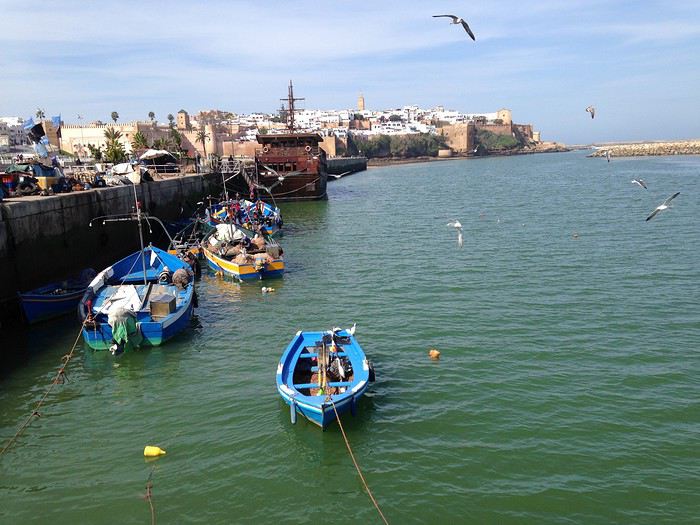
Au fond, Les Oudayas
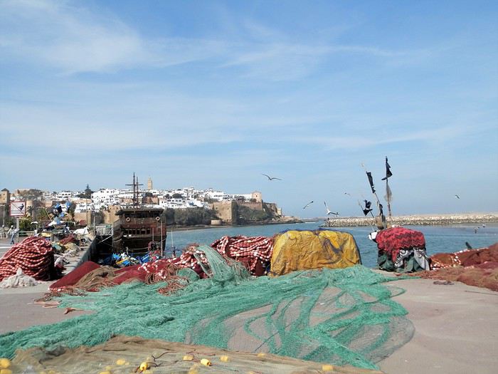
Un " pêche promenade ", me passe sous le nez . C'est mignon . On a envie de le faire la prochaine fois . Il y avait une activité de passeurs entre Rabat et Salé . Mais avec les ponts, le tramway, ..... Certains se sont adaptés , même si çà se fait toujours, plutôt en été ( la plage de Salé est toute proche ) .
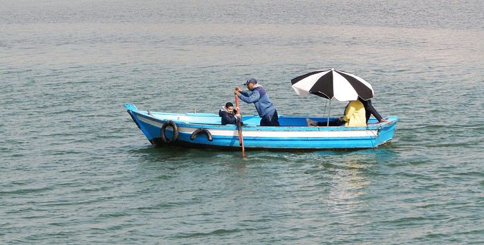
Quelques barques rentrent , les unes après les autres et s'amarrent au ponton, côté Salé . Surement les lointains descendants des redoutables corsaires de Salé . Leur univers a été " explosé" ces dernières années avec l'immense projet d'aménagement de l'oued Bou Regreg . Il leur reste un petit ponton , ..... et juste après, on a construit une grande marina pour accueillir les nouveaux jouets de l'aristocratie locale .
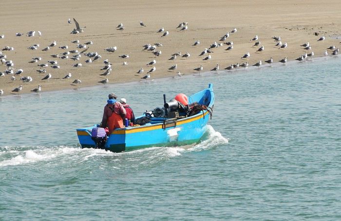
et une autre
Tout ceci fait un curieux mélange entre une architecture ancestrale et la plus grande modernité ....
Ci-après, à gauche, le médina sur sa falaise, au fond le toit blanc du nouveau " Grand Théâtre de Rabat ), à côté duquel commence à sortir la future tour Mohamed VI qui sera la plus haute d' Afrique , et à droite la marina côté Salé .
Mais la Kasbah veille toujours sur la capitale
Un dernier regard ...
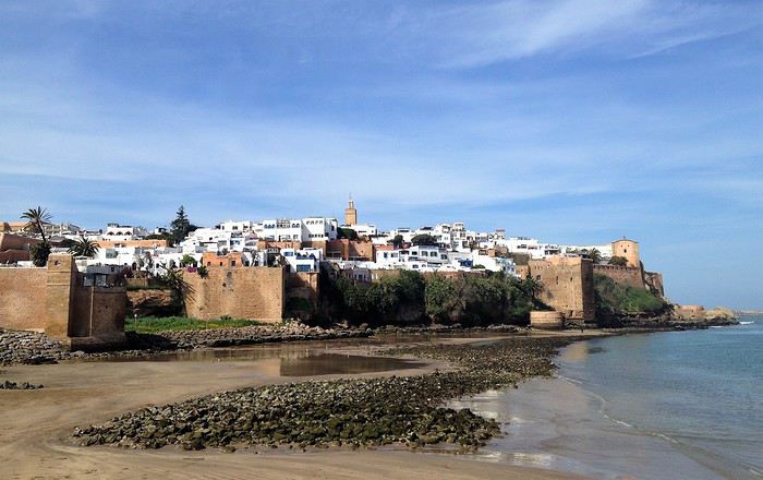
Voila pour ce nouveau coup de projecteur sur la capitale . Faites le détour et surprenez- vous
Demain, j'enfourche ma bonne Dacia Sandero et nous partons à l'assaut de l'Atlas .
Je crains que le forum ne soit morose dans les mois à venir , alors pourquoi ne pas faire un nouveau carnet de voyage . J'ai eu la chance de rentrer du Maroc 2 jours avant la suspension des vols et me retrouve donc, comme vous sans doute , en mode confinement total, chez moi, en Basse-Bretagne , avec quelques centaines de photos de mon dernier séjour à sélectionner, recadrer, retravailler .... On s'occupe comme on peut, alors pourquoi ne pas en faire profiter les Forumeurs ?
Je suis resté au Maroc un mois et j'avais organisé un circuit de 10 nuits / 11 jours pour ma plus jeune fille ( 17 ans ) , mon épouse et la grand- mère, ma chère belle-mère, Mina . Ça correspond aux vacances de février en France .
J'avais donc prévu un voyage " simple" sur le papier, mais qui chaque jour et comme toujours allait nous réserver son lot de découvertes, d'émerveillements, de rencontres, de surprises ....
Au programme :
- Départ de Rabat - 2 nuits à Ouarzazate - 2 nuits à N'kob - 2 nuits à Foum Zguid, avec une longue journée 4X4 au plus profond du désert - 4 nuits à Icht / Borj Biramane et retour sur Rabat
Je vais donc essayer d'éviter des redites avec mes précédents carnets, mais le Maroc a tant de richesses à montrer.....
Rabat est une de mes balades urbaines préférées au Maroc . Je découvre toujours de nouveaux endroits, de jolis détails, des points de vue .... Je vais donc m'y balader avec toujours un plaisir renouvelé
Ma première surprise se passe en médina où je découvre avec étonnement que les autorités ont fait le ménage . Tout ce qui encombrait les rues ( déballages sauvages, marchands de tortues et autres lézards, empiétements sur les trottoirs, la rue , etc.... ) a disparu . Plus rien . Même les commerces " en dur " sont "rentrés dans leurs murs" : plus rien sur la voie publique, pas même une chaise.... Une première au Maroc ?
Si le résultat est plutôt agréable dans la rue des consuls ( rue de l'artisanat ) et la rue Souika ( commerces vestimentaires surtout ) , le boulevard Mohamed V, où régnaient les petits restaurants et gargotes , est désormais mort . Ils ont perdu la quasi-totalité de leur ancienne surface commerciale et ne peuvent plus accueillir que quelques clients à la fois . La rue est tuée et il ne me reste plus qu'à chercher un autre endroit où casser la croûte dans la ville . Ce qui est bénéfique dans une rue ( on peut enfin flâner tranquillement ) est catastrophique dans l'autre ( le commerce est mort et le charme est parti ) . A suivre ....
Bon. C'est comme çà . Ici, dans la rue Souika ( à l'heure de la prière ) . Il y a même des poubelles en plastique positionnées dans la rue !
Une autre artère de la médina est la rue Sidi Fatah . Elle donne sur la rue Souika . Une magnifique mosquée y a été restaurée . Si j'en crois mon plan, il s'agit de la mosquée Moulay El Mekki . La porte principale est couverte et on trouve sur chacun des côtés 2 très belles portes ( 4 au total ) . Le minaret octogonal est remarquable . L'ensemble est complété par plusieurs marabout et un peu plus loin se trouve une importante zaouia . C'est vraiment très joli .
L'entrée principale est somptueuse . Le grand art de la peinture sur bois.
Quelques portes latérales
C'est vraiment très agréable de se balader sur la côte atlantique en cette saison ( mi-février ) . Il fait entre 18 et 22 degrés . Temps lumineux . Je n'aurai d'ailleurs pas de pluie pendant un mois ( après avoir eu de la pluie à peu près tous les jours les 5 derniers mois ) : que du bonheur donc ....
Le minaret octogonal
et la rue Sidi Fatah
La rénovation des monuments de la médina est presque terminée . La rue des consuls reprend vie, même si les nombreux fondouks de cette rue sont toujours en travaux . J'ai hâte de les revoir . Je déambule dans les ruelles tranquilles , toujours à l’affût de ces détails qui en font le charme .
Une belle oeuvre de street-art accroche mon œil ....
et cette fenêtre a un charme fou .
Cette fois , mes pas me portent vers les quais ( on pourrait presque dire le port ) de Rabat . Je quitte la médina par un jolie porte : l'ensemble , également restauré, est charmant . J'arrive directement sur l'Oued Bou Regreg .
Au cœur de la capitale subsiste un coin " pêche " . Un petit navire est devenu un restaurant-Lounge , plutôt luxueux ( menu à 790 dirhams pour 2 en cette Saint Valentin ) .
Rabat se donne des airs de petite Essaouira avec ses mouettes, ses bateaux, sa médina au fond, ses filets de pêche .... Le même site à l'horizontale .
Au fond, Les Oudayas
Un " pêche promenade ", me passe sous le nez . C'est mignon . On a envie de le faire la prochaine fois . Il y avait une activité de passeurs entre Rabat et Salé . Mais avec les ponts, le tramway, ..... Certains se sont adaptés , même si çà se fait toujours, plutôt en été ( la plage de Salé est toute proche ) .
Quelques barques rentrent , les unes après les autres et s'amarrent au ponton, côté Salé . Surement les lointains descendants des redoutables corsaires de Salé . Leur univers a été " explosé" ces dernières années avec l'immense projet d'aménagement de l'oued Bou Regreg . Il leur reste un petit ponton , ..... et juste après, on a construit une grande marina pour accueillir les nouveaux jouets de l'aristocratie locale .
et une autre
Tout ceci fait un curieux mélange entre une architecture ancestrale et la plus grande modernité ....
Ci-après, à gauche, le médina sur sa falaise, au fond le toit blanc du nouveau " Grand Théâtre de Rabat ), à côté duquel commence à sortir la future tour Mohamed VI qui sera la plus haute d' Afrique , et à droite la marina côté Salé .
Mais la Kasbah veille toujours sur la capitale
Un dernier regard ...
Voila pour ce nouveau coup de projecteur sur la capitale . Faites le détour et surprenez- vous
Demain, j'enfourche ma bonne Dacia Sandero et nous partons à l'assaut de l'Atlas .
Cape Town and Kruger: 12 days in February with teens
Hi everyone,
I’d love to share a little travel journal from our 14-day/12-night road trip with our two teens (14 and 17) in February/March 2020. A huge thank you to all of you who helped me plan this trip to South Africa—your patience with my endless questions was amazing!
We left Lyon on Saturday, February 22 at 7:00 AM and arrived in Johannesburg at 10:00 PM after a short layover in Amsterdam. Flights cost 440 € per person (booked in October), with carry-on luggage. We added just one checked bag for the whole family (80 € round-trip with the free Flying Blue membership). Since we’d be moving around a lot, we packed light! In Lyon, we reserved parking at P5 in advance for 70 € for 14 days. The Air France/KLM flight was smooth. When we landed, we picked up our bags and had booked a night at the Aero Guest Lodge, just 5 minutes from the airport, with a free shuttle and breakfast. All you have to do is send a WhatsApp message when you arrive at the airport to let the shuttle driver know. The tricky part? Finding him in the terminal—he wasn’t holding a sign with the hotel’s name. 🤪 A South African called him for me since my English wasn’t great (and I had to get used to the accent 😛), and helped us spot the driver (who was actually less than 5 meters away!) with other guests. When we got to the hotel: all good, except we were 10 people in a van meant for 7. The room was spacious—one king-size bed and two single beds for the kids—with a simple but clean bathroom, a garden, pool, and breakfast (which we didn’t try). All for 65 €, so an awesome value!
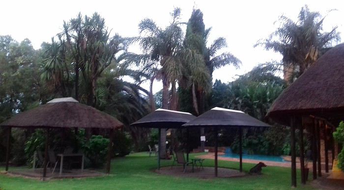 After a restful night, we woke up at 6:00 AM to catch the shuttle back to the airport. Just a heads-up: there’s only one shuttle per hour in the morning, and Kulula canceled our 9:00 AM flight, moving it to 8:00 AM—so no time for breakfast (it starts at 6:30).
We waited 15 minutes in the lovely garden for the driver, who dropped us off at the airport in 5 minutes.
We checked in for our flight to Cape Town, which cost around 40 € (including two checked bags per person).
We grabbed breakfast at the airport instead (less than 20 € for all four of us—one of the nice surprises of South Africa!), and arrived in Cape Town at 10:20 AM.
After a restful night, we woke up at 6:00 AM to catch the shuttle back to the airport. Just a heads-up: there’s only one shuttle per hour in the morning, and Kulula canceled our 9:00 AM flight, moving it to 8:00 AM—so no time for breakfast (it starts at 6:30).
We waited 15 minutes in the lovely garden for the driver, who dropped us off at the airport in 5 minutes.
We checked in for our flight to Cape Town, which cost around 40 € (including two checked bags per person).
We grabbed breakfast at the airport instead (less than 20 € for all four of us—one of the nice surprises of South Africa!), and arrived in Cape Town at 10:20 AM.
 After quickly picking up our bags, we headed to the Avis counter and left with a Toyota Corolla for 80 € for 4 days (rented with the Flying Blue card—free additional driver).
Everything’s on the left... not easy, but it works if you plan your route well.
We drove to our Airbnb in Constantia. We were surprised to see animals, bikes, and pedestrians on the highway!
We arrived around 11:30 AM at our rental—a huge house in the vineyards, in a super secure neighborhood, about 15-20 minutes from Hout Bay. It felt like Beverly Hills, but with super-high walls and barbed wire around the villas. 😕
After quickly picking up our bags, we headed to the Avis counter and left with a Toyota Corolla for 80 € for 4 days (rented with the Flying Blue card—free additional driver).
Everything’s on the left... not easy, but it works if you plan your route well.
We drove to our Airbnb in Constantia. We were surprised to see animals, bikes, and pedestrians on the highway!
We arrived around 11:30 AM at our rental—a huge house in the vineyards, in a super secure neighborhood, about 15-20 minutes from Hout Bay. It felt like Beverly Hills, but with super-high walls and barbed wire around the villas. 😕

We dropped off our bags, changed into shorts (it was around 30°C/86°F), and headed to the Bay Harbour Market in Hout Bay. We had lunch there—such a great vibe! We wandered through the stalls, everyone picked their own dish, and we sat down on the terrace. There was music, artisans of all kinds... a really nice moment.

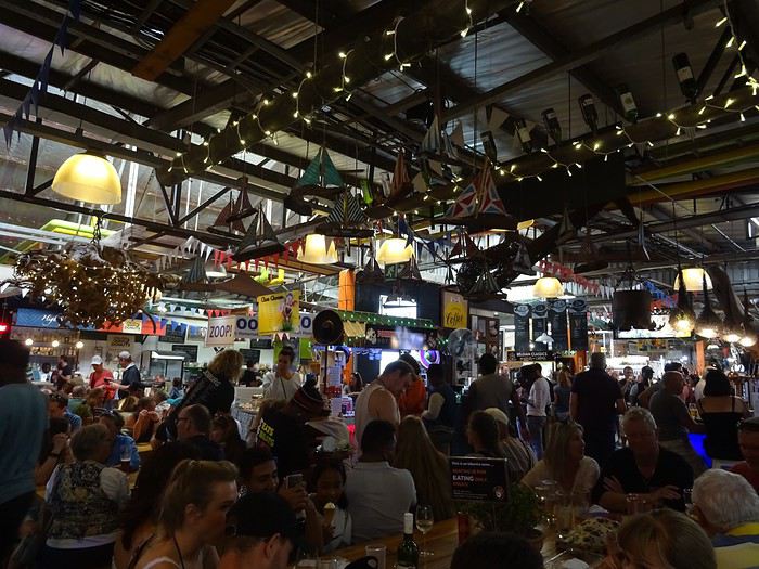
I’d withdrawn 50 € before leaving... and that gave me change to pay the parking attendant. Lunch cost around 30 € for four, including food and drinks.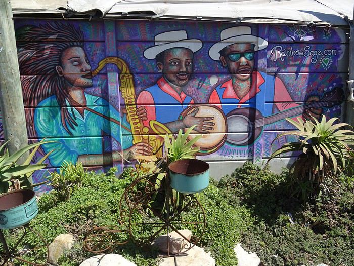

After browsing the artisan stalls, we headed to Hout Bay Beach near the restaurant, Marina Wharf (another small tip for the parking attendant—we’d have to get used to that!). We stopped to admire the sea lions. An ice cream for 1 €? No way we were saying no! 🙂
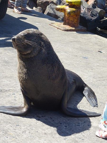
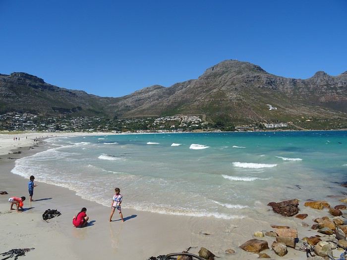
The fatigue was starting to hit, so we headed to the grocery store 10 minutes away (Constantia shopping center) and then had an aperitif in front of the vineyards, opening a delicious bottle of white wine.
I’d love to share a little travel journal from our 14-day/12-night road trip with our two teens (14 and 17) in February/March 2020. A huge thank you to all of you who helped me plan this trip to South Africa—your patience with my endless questions was amazing!
We left Lyon on Saturday, February 22 at 7:00 AM and arrived in Johannesburg at 10:00 PM after a short layover in Amsterdam. Flights cost 440 € per person (booked in October), with carry-on luggage. We added just one checked bag for the whole family (80 € round-trip with the free Flying Blue membership). Since we’d be moving around a lot, we packed light! In Lyon, we reserved parking at P5 in advance for 70 € for 14 days. The Air France/KLM flight was smooth. When we landed, we picked up our bags and had booked a night at the Aero Guest Lodge, just 5 minutes from the airport, with a free shuttle and breakfast. All you have to do is send a WhatsApp message when you arrive at the airport to let the shuttle driver know. The tricky part? Finding him in the terminal—he wasn’t holding a sign with the hotel’s name. 🤪 A South African called him for me since my English wasn’t great (and I had to get used to the accent 😛), and helped us spot the driver (who was actually less than 5 meters away!) with other guests. When we got to the hotel: all good, except we were 10 people in a van meant for 7. The room was spacious—one king-size bed and two single beds for the kids—with a simple but clean bathroom, a garden, pool, and breakfast (which we didn’t try). All for 65 €, so an awesome value!
After a restful night, we woke up at 6:00 AM to catch the shuttle back to the airport. Just a heads-up: there’s only one shuttle per hour in the morning, and Kulula canceled our 9:00 AM flight, moving it to 8:00 AM—so no time for breakfast (it starts at 6:30).
We waited 15 minutes in the lovely garden for the driver, who dropped us off at the airport in 5 minutes.
We checked in for our flight to Cape Town, which cost around 40 € (including two checked bags per person).
We grabbed breakfast at the airport instead (less than 20 € for all four of us—one of the nice surprises of South Africa!), and arrived in Cape Town at 10:20 AM.
After quickly picking up our bags, we headed to the Avis counter and left with a Toyota Corolla for 80 € for 4 days (rented with the Flying Blue card—free additional driver).
Everything’s on the left... not easy, but it works if you plan your route well.
We drove to our Airbnb in Constantia. We were surprised to see animals, bikes, and pedestrians on the highway!
We arrived around 11:30 AM at our rental—a huge house in the vineyards, in a super secure neighborhood, about 15-20 minutes from Hout Bay. It felt like Beverly Hills, but with super-high walls and barbed wire around the villas. 😕We dropped off our bags, changed into shorts (it was around 30°C/86°F), and headed to the Bay Harbour Market in Hout Bay. We had lunch there—such a great vibe! We wandered through the stalls, everyone picked their own dish, and we sat down on the terrace. There was music, artisans of all kinds... a really nice moment.
I’d withdrawn 50 € before leaving... and that gave me change to pay the parking attendant. Lunch cost around 30 € for four, including food and drinks.
After browsing the artisan stalls, we headed to Hout Bay Beach near the restaurant, Marina Wharf (another small tip for the parking attendant—we’d have to get used to that!). We stopped to admire the sea lions. An ice cream for 1 €? No way we were saying no! 🙂
The fatigue was starting to hit, so we headed to the grocery store 10 minutes away (Constantia shopping center) and then had an aperitif in front of the vineyards, opening a delicious bottle of white wine.
Californie en mars 2020: qui veut une part de désert? English translation pending
Hello à toutes et à tous,
De retour cette semaine, voici le carnet de nos dernières aventures, majoritairement dans le désert californien (petites incursions dans le Nevada et en Arizona). Nous avons eu la chance de pouvoir partir. Cela s'est joué à quelques jours mais on passera sur la phase d'incertitude et de stress les semaines et jours précédant le départ, car bien d'autres sont davantage impactés par ce coronavirus....
Au programme théorique, boucle de 15 jours depuis Los Angeles avec les alentours de Ridgecrest, Alabama Hills, Death Valley approfondie sur 3/4 jours, des belles randos autour de Las Vegas, les désert de Mojave et d'Anza Borrego, Joshua NP et Palm Springs.
Los Angeles n'est pas une ville que nous aimons, mais c'est une destination sur laquelle les compagnies (y compris les low cost long courrier) se livrent une bataille avec des prix compétitifs. Et nous voulions du soleil et ne pouvant partir qu'en dehors de la saison touristique, c'était le meilleur choix pour la rando aux states...
C'est parti pour le départ!
Jour 1: Jeudi 5 mars 2020
Après une nuit à Roissy, trajet en bus pour l'aéroport sous une forte pluie, vol Air France direct CDG LAX sans encombre. Même si le vol est long (11h30), nous avons apprécié le confort d'un vol direct et les prestations de la compagnie Air France (vol réservé au prix compétitif de 330€ hors supplément bagages et autres, tout compris 760€ / 2 avec sièges choisis et un bagage en soute / pers). L'A380 est vraiment confortable.
Arrivée à l'heure prévue (13h heure locale), il fait beau et bon (20°C). Passage de l'immigration hyper rapide, nous voyons beaucoup d'évolutions année après année: le personnel est remplacé par les machines. Tout se fait désormais par les bornes. Seul un passage rapide pour le coup de tampon. En 10 minutes, tout est plié! Récupération des bagages puis attente de la navette Alamo.
Une vingtaine de minutes plus tard, nous voici au parking Alamo. Toujours un moment de "stress" sur le type de véhicule qu'il y aura de dispo. Sans surprise, très peu de choix en Suv 4x4. Seulement un et il y a quelqu'un dedans. On prend un Ford Escape 2wd, la garde au sol est correcte, il est neuf (4000 miles au compteur), spacieux et les pneus Michelin sont bons (résa plusieurs mois à l'avance, 443 € pour 15 jours). Pour la première fois, il n'a pas été possible de valider le "Skip the counter" permettant d'éviter l'étape réputée très chiante de l'attente au guichet. Et je confirme c'est très chiant. Attente interminable, le vendeur essaie de fourguer toutes sortes d'options. Il me dit que je suis "Mr No", refusant chacune de ses propositions.
Il était prévu d'aller se balader l'après-midi au bord du Pacifique à Los Angeles, vers 3rd St, Palisades Park, Venice beach et un sunset éventuel vers Santa Monica. Mais la fatigue, le détour (par rapport à la situation de notre hôtel situé à l'Est) et la circulation très dense dans l'agglo tentaculaire de L.A nous font renoncer. Et nous avons bien fait! Nous allons mettre 1h30 pour rejoindre notre hôtel Days Inn à Artesia (choisi pour position pour la route de demain et petit dej inclus) alors qu'il n'y a que 37 km! toutes les routes sont encombrées, y compris en rusant en quittant les freeway et highway...
Bien contents d'arriver, quartier calme, parking gratuit. Quelques achats à pied au supermarché tout proche Stater Bross pour le diner de ce soir. Hôtel classique (88$), chambre spacieuse avec frigo, M-O, coin table, piscine extérieure non chauffée (et froide). Nous avons trouvé les hôtels chers cette année comparativement à l'Arizona l'année dernière à la même période.
Sunset à 17h49, c'est tôt! Diner dans la chambre et au lit à 19h30! La première nuit est toujours un moment spécial...
Jour 2: Vendredi 6 mars 2020
Le road-trip commence!! réveil évidemment très tôt, on fait l'ouverture du p'tit dèj à 6h30 (avec notre gel désinfectant en poche) et route pour Barstow pour la première rando du voyage peu connue et.. normalement peu fréquentée... Il nous faut 2 bonnes heures pour rejoindre le départ dans le secteur de Rainbow basin, au nord de Barstow. La piste après Irwin Rd est bonne, en tôle ondul��e. Quelques passages sablonneux mais ok avec tout type de véhicule si temps sec (et c'est le cas). On traverse le camping de Owl canyon, chaque campeur nous salue.
Aucune voiture au trailhead (😉 !), j'aime. C'est indiqué. Il est déjà presque 10h, le soleil est levé depuis plusieurs heures (sunrise 6h14) et la luminosité n'est déjà plus optimale pour des photographes. Pour nous randonneurs, on est au top ! Il fait beau et on retrouve le plaisir des randos en tenue estivale (65° F, soit 17°C au départ)
Le parking est tout au bout de la piste. J'ai repéré 2 canyons qui semblent intéressants, peu d'infos sur le net sur ce secteur. J'ai envie de faire une boucle plutôt que 2 A/R pour chaque canyon mais je ne sais pas ce que nous allons trouvé comme type de terrain pour faire la boucle. Au programme, une assez longue boucle pour un début de voyage avec 13km mais peu de dénivelé (380m d'après ma trace gpx théorique).
Nous partons par le canyon le plus à l'est, facile à suivre.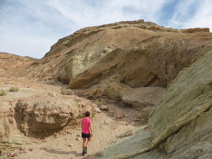
C'est rapidement très joli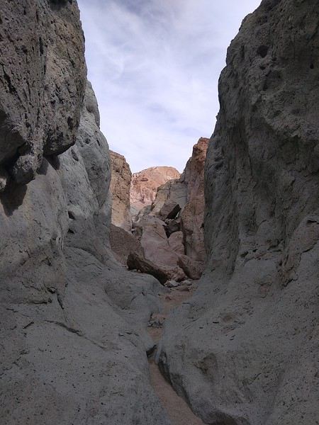
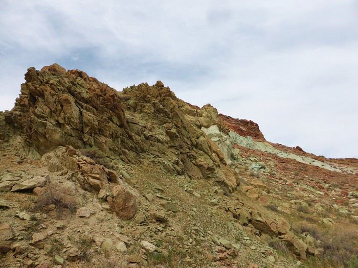
Une grande diversité, la solitude. Une tortue (morte), des belles pierres
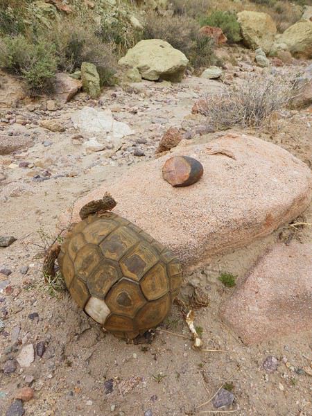
Il nous faut une heure pour parcourir ce premier canyon, qui va vers le nord. Nous galérons à trouver un chemin qui connecte les 2 canyons. C'est un peu casse gueule par endroits (on aperçoit le sentier à droite sur la photo du dessous)
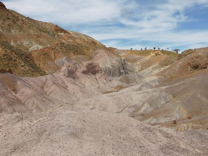
La portion qui suit est moins intéressante (après les arbres en haut de la photo). Deux belles remontées et nous piquons à gauche pour retrouver le second canyon qui va nous ramener à la piste puis à la voiture. Je n'attendais rien de cette seconde partie et nous l'avons préféré, plus ludique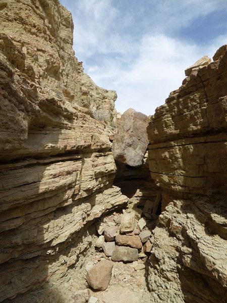
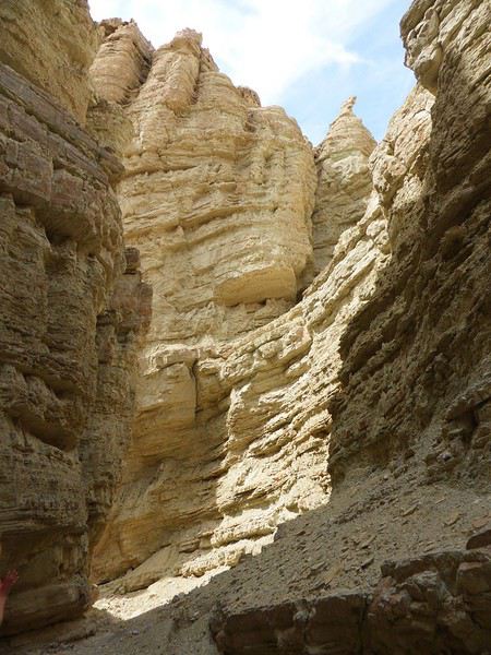
Attention il y a une grosse "marche" à descendre" d'environ 4 mètres puis une seconde de 2/3 mètres. Après quelques hésitations et études des environs, nous "désescaladons" cette partie avec précaution. Il serait plus facile de faire la boucle dans l'autre sens mais ce serait moins joli...
Vers 12h, nous sortons du canyon et remontons sur la piste (faisable en voiture, en sens unique). Nous prenons donc cette (jolie) piste aux belles couleurs malgré une lumière devenue trop crue. La piste a des airs de Death Valley, c'est le désert et plus c'est désert. Personne de près ni de loin...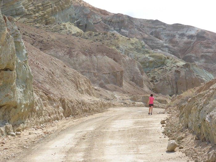
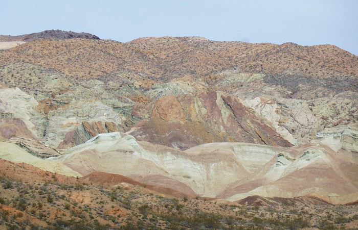
La dernière partie est commune à notre arrivée en voiture, sur la piste puis au travers du camping de Owl canyon (6$ / jour pour les campeurs, dépaysement garanti!) . Les jambes commencent à être lourdes et ce secteur n'est pas passionnant mais c'est le prix à payer pour faire la boucle... On est en mode automatique, bonne cadence. Il fait désormais très chaud (75°F).
Cette première rando Owl canyon / rainbow canyon nous a vraiment plu. 2h50 de rando, 13,5km et 400m de D+.
Petit rafraichissement à l'espace aménagé sur la piste du retour (picnic area pour les groupes)
Retour vers Barstow qui essaie de revivre (sans véritable succès) en utilisant son emplacement sur la route 66
Arrêt aux outlets de Barstow que nous avions fait en 2014. Aucun achat ici, vraiment pas terrible.
Route pour Ridgecrest. Au passage, arrêt à la ghost town de Randsburg. Petite bourgade sympatique, très Old West. Tout est fermé sauf un bar. C'est sympa. L'arrêt ne nous prend que quelques minutes.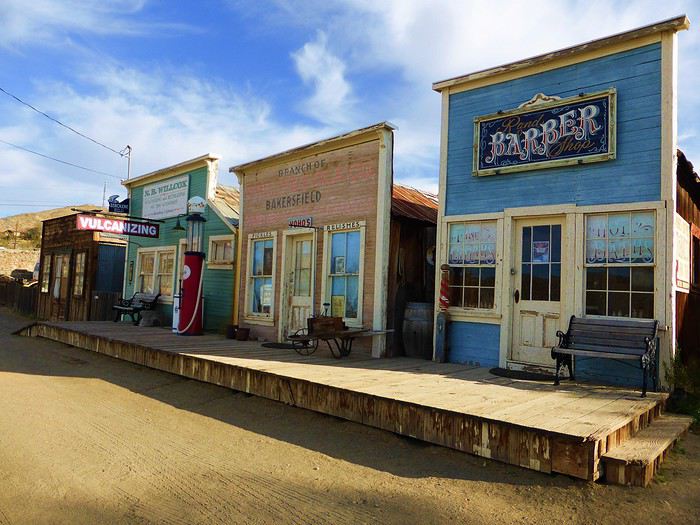
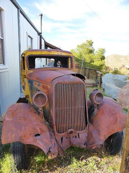
Pas de touristes ici à cette saison. Seuls quelques bikers et pilotes de quads et des locaux.
Check-in au Best western China Lake Inn de Ridecrest en fin de journée (181$ pour 2 nuits, PDJ inclus). Bel hôtel. Ridgerest est une ville où l'on trouve tout pour se ravitailler avant la Vallée de la mort (Walmart, Albertsons) à des prix abordables. Accueil charmant à l'hôtel, soirée relax ici. Jacuzzi extérieur, piscine non chauffée et glaciale. On prend plaisir à retrouver un Walmart avec nos achats pour les prochains jours. Bière, burrito salade dans la chambre. Première journée sympa. Belle entrée en matière avec la rando
A suivre...
De retour cette semaine, voici le carnet de nos dernières aventures, majoritairement dans le désert californien (petites incursions dans le Nevada et en Arizona). Nous avons eu la chance de pouvoir partir. Cela s'est joué à quelques jours mais on passera sur la phase d'incertitude et de stress les semaines et jours précédant le départ, car bien d'autres sont davantage impactés par ce coronavirus....
Au programme théorique, boucle de 15 jours depuis Los Angeles avec les alentours de Ridgecrest, Alabama Hills, Death Valley approfondie sur 3/4 jours, des belles randos autour de Las Vegas, les désert de Mojave et d'Anza Borrego, Joshua NP et Palm Springs.
Los Angeles n'est pas une ville que nous aimons, mais c'est une destination sur laquelle les compagnies (y compris les low cost long courrier) se livrent une bataille avec des prix compétitifs. Et nous voulions du soleil et ne pouvant partir qu'en dehors de la saison touristique, c'était le meilleur choix pour la rando aux states...
C'est parti pour le départ!
Jour 1: Jeudi 5 mars 2020
Après une nuit à Roissy, trajet en bus pour l'aéroport sous une forte pluie, vol Air France direct CDG LAX sans encombre. Même si le vol est long (11h30), nous avons apprécié le confort d'un vol direct et les prestations de la compagnie Air France (vol réservé au prix compétitif de 330€ hors supplément bagages et autres, tout compris 760€ / 2 avec sièges choisis et un bagage en soute / pers). L'A380 est vraiment confortable.
Arrivée à l'heure prévue (13h heure locale), il fait beau et bon (20°C). Passage de l'immigration hyper rapide, nous voyons beaucoup d'évolutions année après année: le personnel est remplacé par les machines. Tout se fait désormais par les bornes. Seul un passage rapide pour le coup de tampon. En 10 minutes, tout est plié! Récupération des bagages puis attente de la navette Alamo.
Une vingtaine de minutes plus tard, nous voici au parking Alamo. Toujours un moment de "stress" sur le type de véhicule qu'il y aura de dispo. Sans surprise, très peu de choix en Suv 4x4. Seulement un et il y a quelqu'un dedans. On prend un Ford Escape 2wd, la garde au sol est correcte, il est neuf (4000 miles au compteur), spacieux et les pneus Michelin sont bons (résa plusieurs mois à l'avance, 443 € pour 15 jours). Pour la première fois, il n'a pas été possible de valider le "Skip the counter" permettant d'éviter l'étape réputée très chiante de l'attente au guichet. Et je confirme c'est très chiant. Attente interminable, le vendeur essaie de fourguer toutes sortes d'options. Il me dit que je suis "Mr No", refusant chacune de ses propositions.
Il était prévu d'aller se balader l'après-midi au bord du Pacifique à Los Angeles, vers 3rd St, Palisades Park, Venice beach et un sunset éventuel vers Santa Monica. Mais la fatigue, le détour (par rapport à la situation de notre hôtel situé à l'Est) et la circulation très dense dans l'agglo tentaculaire de L.A nous font renoncer. Et nous avons bien fait! Nous allons mettre 1h30 pour rejoindre notre hôtel Days Inn à Artesia (choisi pour position pour la route de demain et petit dej inclus) alors qu'il n'y a que 37 km! toutes les routes sont encombrées, y compris en rusant en quittant les freeway et highway...
Bien contents d'arriver, quartier calme, parking gratuit. Quelques achats à pied au supermarché tout proche Stater Bross pour le diner de ce soir. Hôtel classique (88$), chambre spacieuse avec frigo, M-O, coin table, piscine extérieure non chauffée (et froide). Nous avons trouvé les hôtels chers cette année comparativement à l'Arizona l'année dernière à la même période.
Sunset à 17h49, c'est tôt! Diner dans la chambre et au lit à 19h30! La première nuit est toujours un moment spécial...
Jour 2: Vendredi 6 mars 2020
Le road-trip commence!! réveil évidemment très tôt, on fait l'ouverture du p'tit dèj à 6h30 (avec notre gel désinfectant en poche) et route pour Barstow pour la première rando du voyage peu connue et.. normalement peu fréquentée... Il nous faut 2 bonnes heures pour rejoindre le départ dans le secteur de Rainbow basin, au nord de Barstow. La piste après Irwin Rd est bonne, en tôle ondul��e. Quelques passages sablonneux mais ok avec tout type de véhicule si temps sec (et c'est le cas). On traverse le camping de Owl canyon, chaque campeur nous salue.
Aucune voiture au trailhead (😉 !), j'aime. C'est indiqué. Il est déjà presque 10h, le soleil est levé depuis plusieurs heures (sunrise 6h14) et la luminosité n'est déjà plus optimale pour des photographes. Pour nous randonneurs, on est au top ! Il fait beau et on retrouve le plaisir des randos en tenue estivale (65° F, soit 17°C au départ)
Le parking est tout au bout de la piste. J'ai repéré 2 canyons qui semblent intéressants, peu d'infos sur le net sur ce secteur. J'ai envie de faire une boucle plutôt que 2 A/R pour chaque canyon mais je ne sais pas ce que nous allons trouvé comme type de terrain pour faire la boucle. Au programme, une assez longue boucle pour un début de voyage avec 13km mais peu de dénivelé (380m d'après ma trace gpx théorique).
Nous partons par le canyon le plus à l'est, facile à suivre.
C'est rapidement très joli
Une grande diversité, la solitude. Une tortue (morte), des belles pierres
Il nous faut une heure pour parcourir ce premier canyon, qui va vers le nord. Nous galérons à trouver un chemin qui connecte les 2 canyons. C'est un peu casse gueule par endroits (on aperçoit le sentier à droite sur la photo du dessous)
La portion qui suit est moins intéressante (après les arbres en haut de la photo). Deux belles remontées et nous piquons à gauche pour retrouver le second canyon qui va nous ramener à la piste puis à la voiture. Je n'attendais rien de cette seconde partie et nous l'avons préféré, plus ludique
Attention il y a une grosse "marche" à descendre" d'environ 4 mètres puis une seconde de 2/3 mètres. Après quelques hésitations et études des environs, nous "désescaladons" cette partie avec précaution. Il serait plus facile de faire la boucle dans l'autre sens mais ce serait moins joli...
Vers 12h, nous sortons du canyon et remontons sur la piste (faisable en voiture, en sens unique). Nous prenons donc cette (jolie) piste aux belles couleurs malgré une lumière devenue trop crue. La piste a des airs de Death Valley, c'est le désert et plus c'est désert. Personne de près ni de loin...
La dernière partie est commune à notre arrivée en voiture, sur la piste puis au travers du camping de Owl canyon (6$ / jour pour les campeurs, dépaysement garanti!) . Les jambes commencent à être lourdes et ce secteur n'est pas passionnant mais c'est le prix à payer pour faire la boucle... On est en mode automatique, bonne cadence. Il fait désormais très chaud (75°F).
Cette première rando Owl canyon / rainbow canyon nous a vraiment plu. 2h50 de rando, 13,5km et 400m de D+.
Petit rafraichissement à l'espace aménagé sur la piste du retour (picnic area pour les groupes)
Retour vers Barstow qui essaie de revivre (sans véritable succès) en utilisant son emplacement sur la route 66
Arrêt aux outlets de Barstow que nous avions fait en 2014. Aucun achat ici, vraiment pas terrible.
Route pour Ridgecrest. Au passage, arrêt à la ghost town de Randsburg. Petite bourgade sympatique, très Old West. Tout est fermé sauf un bar. C'est sympa. L'arrêt ne nous prend que quelques minutes.
Pas de touristes ici à cette saison. Seuls quelques bikers et pilotes de quads et des locaux.
Check-in au Best western China Lake Inn de Ridecrest en fin de journée (181$ pour 2 nuits, PDJ inclus). Bel hôtel. Ridgerest est une ville où l'on trouve tout pour se ravitailler avant la Vallée de la mort (Walmart, Albertsons) à des prix abordables. Accueil charmant à l'hôtel, soirée relax ici. Jacuzzi extérieur, piscine non chauffée et glaciale. On prend plaisir à retrouver un Walmart avec nos achats pour les prochains jours. Bière, burrito salade dans la chambre. Première journée sympa. Belle entrée en matière avec la rando
A suivre...
Qui pour l'Algérie à vélo cette année? English translation pending
Salut,
Alors voilà, tout est dans le titre 😉
Projet itinéraire Ouest américain avec un enfant de 10 ans English translation pending
Bonjour à tous 🙂
J'ai un projet pour l'été 2021. Je m'y prends tôt et en même temps, pas si tôt que ça.
Nous sommes un couple avec un jeune garçon qui aura 10 ans en juillet 2021 😎 L'été 2021, car ce sera donc la période de son anniversaire. Les dates dépendront du travail pour moi mais il est vrai que fêter ses 10 ans aux USA, serait un anniversaire original.
J'ai donc besoin de vos avis concernant cette 1ere ébauche (pour vous car moi, j'en suis à la 5e )
J1 => Départ Paris - Arrivéee à San Francisco Nuit à San Francisco
J2 => San Francisco Alcatraz (le 1er départ du matin) Pier 39 Quartier Castro Palace of fire arts Musée du cable car Sausalito ... Nuit à San Francisco
J3 => San Francisco => Yosemite Récupération du véhicule Silicon Valley Route vers Yosemite 1ere rando dans Yosemite Nuit à Mariposa ? El Portal ?
J4 => Yosemite => Mammoth lake (en passant par Tioga road) Rando dans Yosemite Visiter Bodies est-il envisageable sur cette journée ? Nuit à Mammoth lake J5 => Mammoth lake ou où ? => Death Valley Route vers Furnace Creek ranch Arrêt à Alabama Hills Arrêt à Mesquite Flat sand dunes Coucher de soleil sur Zabrieskie point Nuit au Furnace creek ranch
J6 => Death Valley => Las Vegas Badwater Devil's golf Course Artist's palette Golden Canyon Nuit à Las Vegas
J7 => Las Vegas Journée complète à Las Vegas
J8 => Las Vegas => Zion Valley of Fire Fort Zion rando dans Zion Nuit à proximité de Zion
J9 => Zion => Bryce Visite de Zion jusqu'en début d'après-midi Scenic 12 pour se rapprocher de Bryce Nuit à Tropic
J10 => Bryce Rando Queens Garden + Navajo loop Rodeo Nuit à Tropic
J11 => Bryce => Moab Goblin Valley State Capitol Reef Dynosaur track ? j'ai un doute si sur bonne journée. mon fils est fan de dinosaures Coucher de soleil à Corona Arch Nuit à Moab
J12 => Moab Arch NP Dead Horse point Nuit à Moab
J13 => Moab Journée rafting sur le colorado Nuit à Moab
J14 => Moab => Monument Valley Canyonsland Route vers MV Balade à cheval ? Nuit à The View premium cabin
J15 => Monument Valley => Page Valley Drive Horseshoe Bend Nuit à Page
J16 => Page => Grand Canyon Lower Antelope Canyon le matin Pique nique et baignade au Lake Powell Route vers Tusayan Survol en hélicoptère en fin de journée. Avec un peu de chance, ce sera le jour de l'anniversaire de mon fils 😊 Coucher de soleil sur Grand Canyon Nuit à Tusayan ? Flagstaff ? A proximité de GC
J17 => Grand Canyon => Needle Rando dans Grand Canyon Seligman Kingman Nuit à Needle ou Kingman ?
J18 => Needle => Los Angeles Sigle Hollywwod Beverly Hills ... en fonction de l'heure d'arrivée et de la situation de l’hotel.
J19 => Universal Studio
J20 => Los Angeles Venice Beach (loc de vélo ?) 😎 Visite de la ville Nuit à Los Angeles
J21 => Los Angeles => Paris Street Art sur Melrose avenue Vol pour Paris
J22 => Arrivée Paris et retour maison
Voici donc mon ébauche, que j'ai modifiée en l'écrivant 😊
J'ai quelques doutes sur l'organisation de certaines journée, notamment celle avec le coucher de soleil sur Corona Arch, je pense que je zapperais le coucher de soleil. Une autre interrogation. J'ai très envie de voir la Silicon Valley mais comme je n'ai pas beaucoup de jours à San Francisco, est-il préférable de voir la Silicon Valley ou de visiter Sausalito en partant le matin de San Francisco vers Yosemite. Mon conjoint n'est pas fan des villes.
Pour info, nous sommes des lève tôt et plutôt couche tôt (on ne peut pas être les 2 😇 ) y compris le Schtroumpf 😇.
J'aimerai avoir plus de temps sur certains endroits, malheureusement, je ne pourrais pas rajouter de jours supplémentaires 🤪
En ce qui concerne les nuits, toutes se feront en hôtel ou motel, dans mon idéal mon budget est de 150 € par nuit donc à équilibrer entre les différentes adresses. Les seules qui me tiennent à coeur sont The View à Monument Valley et Furnace Creek. Une chose importante pour mon fils, avoir une piscine dans les hôtels / motels.
Merci de tous vos bons conseils, cet itinéraire ne demande qu'à être amélioré.
Myriam
J'ai un projet pour l'été 2021. Je m'y prends tôt et en même temps, pas si tôt que ça.
Nous sommes un couple avec un jeune garçon qui aura 10 ans en juillet 2021 😎 L'été 2021, car ce sera donc la période de son anniversaire. Les dates dépendront du travail pour moi mais il est vrai que fêter ses 10 ans aux USA, serait un anniversaire original.
J'ai donc besoin de vos avis concernant cette 1ere ébauche (pour vous car moi, j'en suis à la 5e )
J1 => Départ Paris - Arrivéee à San Francisco Nuit à San Francisco
J2 => San Francisco Alcatraz (le 1er départ du matin) Pier 39 Quartier Castro Palace of fire arts Musée du cable car Sausalito ... Nuit à San Francisco
J3 => San Francisco => Yosemite Récupération du véhicule Silicon Valley Route vers Yosemite 1ere rando dans Yosemite Nuit à Mariposa ? El Portal ?
J4 => Yosemite => Mammoth lake (en passant par Tioga road) Rando dans Yosemite Visiter Bodies est-il envisageable sur cette journée ? Nuit à Mammoth lake J5 => Mammoth lake ou où ? => Death Valley Route vers Furnace Creek ranch Arrêt à Alabama Hills Arrêt à Mesquite Flat sand dunes Coucher de soleil sur Zabrieskie point Nuit au Furnace creek ranch
J6 => Death Valley => Las Vegas Badwater Devil's golf Course Artist's palette Golden Canyon Nuit à Las Vegas
J7 => Las Vegas Journée complète à Las Vegas
J8 => Las Vegas => Zion Valley of Fire Fort Zion rando dans Zion Nuit à proximité de Zion
J9 => Zion => Bryce Visite de Zion jusqu'en début d'après-midi Scenic 12 pour se rapprocher de Bryce Nuit à Tropic
J10 => Bryce Rando Queens Garden + Navajo loop Rodeo Nuit à Tropic
J11 => Bryce => Moab Goblin Valley State Capitol Reef Dynosaur track ? j'ai un doute si sur bonne journée. mon fils est fan de dinosaures Coucher de soleil à Corona Arch Nuit à Moab
J12 => Moab Arch NP Dead Horse point Nuit à Moab
J13 => Moab Journée rafting sur le colorado Nuit à Moab
J14 => Moab => Monument Valley Canyonsland Route vers MV Balade à cheval ? Nuit à The View premium cabin
J15 => Monument Valley => Page Valley Drive Horseshoe Bend Nuit à Page
J16 => Page => Grand Canyon Lower Antelope Canyon le matin Pique nique et baignade au Lake Powell Route vers Tusayan Survol en hélicoptère en fin de journée. Avec un peu de chance, ce sera le jour de l'anniversaire de mon fils 😊 Coucher de soleil sur Grand Canyon Nuit à Tusayan ? Flagstaff ? A proximité de GC
J17 => Grand Canyon => Needle Rando dans Grand Canyon Seligman Kingman Nuit à Needle ou Kingman ?
J18 => Needle => Los Angeles Sigle Hollywwod Beverly Hills ... en fonction de l'heure d'arrivée et de la situation de l’hotel.
J19 => Universal Studio
J20 => Los Angeles Venice Beach (loc de vélo ?) 😎 Visite de la ville Nuit à Los Angeles
J21 => Los Angeles => Paris Street Art sur Melrose avenue Vol pour Paris
J22 => Arrivée Paris et retour maison
Voici donc mon ébauche, que j'ai modifiée en l'écrivant 😊
J'ai quelques doutes sur l'organisation de certaines journée, notamment celle avec le coucher de soleil sur Corona Arch, je pense que je zapperais le coucher de soleil. Une autre interrogation. J'ai très envie de voir la Silicon Valley mais comme je n'ai pas beaucoup de jours à San Francisco, est-il préférable de voir la Silicon Valley ou de visiter Sausalito en partant le matin de San Francisco vers Yosemite. Mon conjoint n'est pas fan des villes.
Pour info, nous sommes des lève tôt et plutôt couche tôt (on ne peut pas être les 2 😇 ) y compris le Schtroumpf 😇.
J'aimerai avoir plus de temps sur certains endroits, malheureusement, je ne pourrais pas rajouter de jours supplémentaires 🤪
En ce qui concerne les nuits, toutes se feront en hôtel ou motel, dans mon idéal mon budget est de 150 € par nuit donc à équilibrer entre les différentes adresses. Les seules qui me tiennent à coeur sont The View à Monument Valley et Furnace Creek. Une chose importante pour mon fils, avoir une piscine dans les hôtels / motels.
Merci de tous vos bons conseils, cet itinéraire ne demande qu'à être amélioré.
Myriam
Retour de croisière Costa aux Caraïbes (2 au 12 décembre 2019) English translation pending
Bonjour à tous,
De retour d'une croisière intitulée "Caraïbes au départ de Port Everglades" effectuée à bord du Costa Luminosa du 2 au 12 décembre 2019, je m'attaque à la rédaction de ce carnet de voyage, laquelle se fera au rythme de mes disponibilités d'emploi du temps, donc avec beaucoup de...
A suivre...,
Itinéraire de onze jours en voiture dans l'Ouest américain English translation pending
Bonjour la communauté,
Je viens solliciter votre aide et vos précieux conseils pour une idée de road trip dans l'Ouest Américain prévu en avril 2020. Une chose est figé actuellement le VOL: => On arrive à LA et repart de SF. En tout, nous restons 11 jours sur place grosso modo.
Notre séjour est certes court mais avons d'une part l'habitude et d'autre part, nous y reviendrons. Nous partons en avril et ma femme est enseignante (déjà dit sur d'autre topic), d'ou le créneau disponible de 15 jours lié aux vacances scolaires.
Du coup, nous avons décidé de faire court à LA. Nous ne sommes pas intéressés plus que ça et nous pensons ainsi faire le premier après-midi sur LA puis une partie de la matinée avant de partir sur la route 66 vers le GC.
Autre concession, Yosémite et Death Valley. Ce sont évidemment des incontournables, mais au vu de la distance entre LV et San Francisco, il nous semble préférable de s'attarder (par exemple) une demi-journée suppl à Bryce ou Zion et ensuite depuis LV, prendre un vol direction SF. Nous avons vu des vols abordable avec SouthWest qui partent tôt et en moins de 2heures, on a rejoint San Fr. La route dans Yosemite et Death Valley est pour le coup très longue si j'ai bien compris surtout si c'est pour visiter ces 2 régions en 2 jours. Nous remettons ces sites pour notre prochaine venue (sniff, faut savoir faire des concessions dans la vie héhé).
Nous rendrons la voiture de location à l'aéroport de LAS Vegas (on la récupère dès le premier jour à LA). Qu'en pensez-vous ?
A San Francisco, nous avons noté que la voiture n'est une obligation pour visiter (contrairement à LA). Nous y passerons les 2 derniers jours avant de reprendre notre vol le samedi en fin d'après-midi pour Londres.
Ci-dessous le résumé
JOUR x MATIN--APRES-MIDI
DAY 1 - VOL -- LOS ANGELES DAY 2 - LOS ANGELES -- ROUTE 66 DAY 3 - ROUTE 66 -- GRAND CANYON DAY 4 - GRAND CANYON -- MONUMENT VALLEY DAY 5 - MONUMENT VALLEY -- ANTELOPE CANYON DAY 6 - ANTELOPE CANYON -- HORSEHOE BEND DAY 7 - BRYCE CANYON -- BRYCE CANYON DAY 8 - ZION -- ZION DAY 9 - VALLEY OF FIRE-- LAS VEGAS DAY 10 - VOL LV->SF -- SAN FRANCISCO DAY 11 - SAN FRANCISCO -- SAN FRANCISCO DAY 12 - SAN FRANCISCO -- VOL
En jour 3, possible qu'on passe l'après midi au GC et le soir qu'on reste sur Flagstaff pour dormir (à moindre coût qu'au Grand Canyon où c'est hors de prix). Et le matin du DAY4, on reste sur Flagstaff avant de partir vers MV. Bref, ce sont des ajustement que je n'ai pas indiqués sur l'itinéraire ci-dessus à ce stade. Je m'occuperai des détails dans un second temps, une fois que cet itinéraire semble ... okay.
Je suis preneur de vos conseils et avis. Merci d'avance pour vos retours.
Ne soyez pas surpris si vous avez déjà vu mon planning récemment sur un autre forum (j'ai aussi demandé conseils sur un autre forum de voyage).
Je viens solliciter votre aide et vos précieux conseils pour une idée de road trip dans l'Ouest Américain prévu en avril 2020. Une chose est figé actuellement le VOL: => On arrive à LA et repart de SF. En tout, nous restons 11 jours sur place grosso modo.
Notre séjour est certes court mais avons d'une part l'habitude et d'autre part, nous y reviendrons. Nous partons en avril et ma femme est enseignante (déjà dit sur d'autre topic), d'ou le créneau disponible de 15 jours lié aux vacances scolaires.
Du coup, nous avons décidé de faire court à LA. Nous ne sommes pas intéressés plus que ça et nous pensons ainsi faire le premier après-midi sur LA puis une partie de la matinée avant de partir sur la route 66 vers le GC.
Autre concession, Yosémite et Death Valley. Ce sont évidemment des incontournables, mais au vu de la distance entre LV et San Francisco, il nous semble préférable de s'attarder (par exemple) une demi-journée suppl à Bryce ou Zion et ensuite depuis LV, prendre un vol direction SF. Nous avons vu des vols abordable avec SouthWest qui partent tôt et en moins de 2heures, on a rejoint San Fr. La route dans Yosemite et Death Valley est pour le coup très longue si j'ai bien compris surtout si c'est pour visiter ces 2 régions en 2 jours. Nous remettons ces sites pour notre prochaine venue (sniff, faut savoir faire des concessions dans la vie héhé).
Nous rendrons la voiture de location à l'aéroport de LAS Vegas (on la récupère dès le premier jour à LA). Qu'en pensez-vous ?
A San Francisco, nous avons noté que la voiture n'est une obligation pour visiter (contrairement à LA). Nous y passerons les 2 derniers jours avant de reprendre notre vol le samedi en fin d'après-midi pour Londres.
Ci-dessous le résumé
JOUR x MATIN--APRES-MIDI
DAY 1 - VOL -- LOS ANGELES DAY 2 - LOS ANGELES -- ROUTE 66 DAY 3 - ROUTE 66 -- GRAND CANYON DAY 4 - GRAND CANYON -- MONUMENT VALLEY DAY 5 - MONUMENT VALLEY -- ANTELOPE CANYON DAY 6 - ANTELOPE CANYON -- HORSEHOE BEND DAY 7 - BRYCE CANYON -- BRYCE CANYON DAY 8 - ZION -- ZION DAY 9 - VALLEY OF FIRE-- LAS VEGAS DAY 10 - VOL LV->SF -- SAN FRANCISCO DAY 11 - SAN FRANCISCO -- SAN FRANCISCO DAY 12 - SAN FRANCISCO -- VOL
En jour 3, possible qu'on passe l'après midi au GC et le soir qu'on reste sur Flagstaff pour dormir (à moindre coût qu'au Grand Canyon où c'est hors de prix). Et le matin du DAY4, on reste sur Flagstaff avant de partir vers MV. Bref, ce sont des ajustement que je n'ai pas indiqués sur l'itinéraire ci-dessus à ce stade. Je m'occuperai des détails dans un second temps, une fois que cet itinéraire semble ... okay.
Je suis preneur de vos conseils et avis. Merci d'avance pour vos retours.
Ne soyez pas surpris si vous avez déjà vu mon planning récemment sur un autre forum (j'ai aussi demandé conseils sur un autre forum de voyage).
On part en vadrouille au Pérou / Bolivie / Chili! English translation pending
Hello les aficionados de voyages ! Un nouveau petit carnet pour vous raconter ma vadrouille au Pérou, en Bolivie et au Chili en 18 jours. Voyage intense, fatigant, mais au combien dépaysant... Je te laisse découvrir ça même si tu peux déjà retrouver la version complète ici :
onpartenvadrouille.over-blog.com/...-pas-l-pero...
Bonne lecture et n'hésite pas à me faire part de tes éventuels remarques / commentaires...
23 octobre C’est pas l’Pérou ? Si ! Quand j’étais petit, je n’étais pas grand… Normal, vas-tu me dire… Et quand j’étais petit, j’étais fasciné par la carte du monde. Comme mes vieux posters de Chris Waddle et de Jean-Pierre Papin, je la fixais comme un ahuri en me posant cette question toute bête : Qu’est-ce qu’il y a là-bas, de l’autre côté de la planète ? Mon envie de voyage a certainement commencé à poindre le bout de son nez à ce moment-là. Malheureusement pour mon porte-monnaie et pour ma femme, elle n’a fait que s’accroître avec le temps. Ma femme, justement, parlons-en !! Le jour (ou plus précisément la nuit) où nous avons dormi (ou plus précisément essayé de dormir) dans une maison (ou plus précisément dans une cabane) mal isolée (ou plus précisément pas isolée du tout) par une température revigorante (ou plus précisément glaciale) au fin fond de la Birmanie, elle a dit « Stop ! Finito ! Terminé ! Kaput ! Les voyages dans ces conditions, ce n’est plus de mon âge ! » Sauf que moi, premièrement, je ne fais pas son âge !!! S’en est donc suivi un voyage à Bali cet été dans des conditions à la brosser dans le sens du poil. Sauf que moi, deuxièmement, ça ne m’a pas comblé mon envie de dormir à l’arrache au milieu des cochons ! Et puis un voyage à quatre à Bali en conditions préférentielles, ça a un coup ! La cigale ayant dépensé tout l’été, se trouva fort dépourvue quand la bise fut venue. Sauf que moi, troisièmement, j’en ai gardé un peu sous le pied. Mais juste un tout p’tit peu… Juste pour une seule personne… Juste pour moi, en fait ! Sauf que moi, quatrièmement, je ne me vois pas partir en solo à l’assaut du monde pour dormir avec des cochons... Partenaire particulier, je cherche partenaire particulière, débloqué, pas trop timide et avec une bonne dose de savoir faire !
Et là, se pointe mon frère. Lors d’une soirée bien arrosée faisant suite à une journée de ski, il nous confesse que le générique des « Mystérieuses cités d’or » le hante au plus profond de son être depuis qu’il est tout petit et qu’il lui faut donc absolument étancher sa soif d’aller toiser le Machu Picchu en tête à tête. « Franck, pourquoi n’y emmènerais-tu pas ton frère ? » Incrédule ou femme parfaite, Dieu seul le sait ! En tout cas, Sandrine a prononcé ces quelques mots à 21h57. Sur le coup, je pense qu’elle ne perçoit pas la portée de ses mots. Crédule ou homme opportuniste, Dieu seul le sait ! En tout cas, je saisis l’opportunité par les deux mains et à 22h25, je suis scotché à mon écran en train de retourner le net pour y dénicher des billets d’avion pas chers. 22h49, emballé, c’est pesé, y’a plus rien à voir, cinq cents euros par personne, départ en octobre prochain !!! C’est ce qu’on appelle « battre le net tant qu’il est encore tôt ! » Je t’annonce donc solennellement que pour ce nouveau voyage, je prends la direction de l'Amérique du Sud, et plus précisément de la Cordillère des Andes, la plus longue chaîne de montagnes du monde... Une traversée de Lima au Pérou, jusqu’à San Pédro de Atacama au Chili en passant par La Paz en Bolivie, pour une durée totale de dix-huit jours sur place, du 23 octobre au 11 novembre. Au programme de ce roadtrip, des noms qui résonnent comme autant de lieux magiques… Les lignes de Nazca, l'incontournable Machu Picchu, la ville ancestrale de Cuzco, le Lac Titicaca, la tentaculaire capitale La Paz, le Salar d’Uyuni, le sud Lipez, le désert d'Atacama, … et bien d’autres de leurs amis qui riment avec Esteban, Tao et Zia ! Et tu l’as donc compris, dans la rubrique « C’est qui qui vient ? », je serai pour cette fois-ci accompagné par mon frère que je m’en vais te présenter de ce pas...
Pour commencer, soit-disant qu’il serait ma copie. Pâle, mais copie quand même dixit les personnes qui nous connaissent… Ensuite et c’est bien là le plus important, dormir avec des cochons ne le rebute pas du tout, bien au contraire ! Ne me fais pas dire ce que je n’ai pas dit, je parle bien de l’animal mâle… Enfin, sache qu’il a une dizaine d’années de moins que moi et qu’il se prénomme Sullivan. Voilà pour les présentations sommaires, tu en sauras plus sur lui en allant consulter son compte Tinder, ou tout au long de notre vadrouille qui débute… maintenant ! Car comme dirait ma grand-mère, « il y a de la route, faut y aller mes gamins ! » Trente minutes de voiture jusqu’à la gare TGV de Reims. Trente minutes supplémentaires de train pour gagner l’aéroport Charles de Gaulle. Neuf heures d’avion pour aller jusqu’à Atlanta, puis sept nouvelles heures de vol pour enfin atterrir à Lima. Ajoute à ça les temps d’attente dont les quatre heures d’escale à Atlanta, secoue le shaker et tu obtiens un résultat de vingt-et-une heures de transport !... Mais on est des oufs, nous ! Car je profite du fait d’être cette fois-ci exonéré de ralentisseurs plaintifs pour pousser le bouchon un peu plus loin. A cela, comprendre que je voyage léger, sans femme ni enfant. Pour gagner du temps, on enchaîne donc direct en arrivant à Lima avec une heure de taxi pour gagner la gare routière, trois heures d’attente sur un banc en pleine nuit, puis cinq heures de bus pour aller jusqu’à Ica. De là, on prend un nouveau taxi et terminus, tout le monde descend !!! Ouf, nous arrivons enfin à notre lieu de villégiature, Huacachina, pas moins de trente-trois heures après avoir regardé ma maison s’éloigner dans mon rétroviseur. Que retenir de ce voyage à part que ce fut extrêmement long ? Pas grand’chose à part qu’à l’immigration américaine, vu qu’on porte logiquement le même nom avec mon frère, on nous a demandé si nous étions mariés ensemble ; qu’on a tué le temps à l’aéroport d’Atlanta à boire des bières à la citrouille d’Halloween ; que nous avons été accueillis par des prostituées pratiquement nues dans les rues de Lima (merci à elles pour cette délicate attention), et que des affiches de Julien Clerc couvraient les murs de la ville. Oui, oui, « Lili voulait aller danser » a apparemment son public là-bas… Allez, maintenant, tu m’excuseras pour le caractère expéditif de cette fin de description de journée, mais le thermomètre ici affiche déjà près de trente degrés. Si on ajoute à l’équation le temps de transport, ainsi que les six heures de décalage horaire, on obtient deux français complètement crevés qui doivent aller se coucher pour être en forme demain. De toute façon, demain est une autre aventure...
Bonne lecture et n'hésite pas à me faire part de tes éventuels remarques / commentaires...
23 octobre C’est pas l’Pérou ? Si ! Quand j’étais petit, je n’étais pas grand… Normal, vas-tu me dire… Et quand j’étais petit, j’étais fasciné par la carte du monde. Comme mes vieux posters de Chris Waddle et de Jean-Pierre Papin, je la fixais comme un ahuri en me posant cette question toute bête : Qu’est-ce qu’il y a là-bas, de l’autre côté de la planète ? Mon envie de voyage a certainement commencé à poindre le bout de son nez à ce moment-là. Malheureusement pour mon porte-monnaie et pour ma femme, elle n’a fait que s’accroître avec le temps. Ma femme, justement, parlons-en !! Le jour (ou plus précisément la nuit) où nous avons dormi (ou plus précisément essayé de dormir) dans une maison (ou plus précisément dans une cabane) mal isolée (ou plus précisément pas isolée du tout) par une température revigorante (ou plus précisément glaciale) au fin fond de la Birmanie, elle a dit « Stop ! Finito ! Terminé ! Kaput ! Les voyages dans ces conditions, ce n’est plus de mon âge ! » Sauf que moi, premièrement, je ne fais pas son âge !!! S’en est donc suivi un voyage à Bali cet été dans des conditions à la brosser dans le sens du poil. Sauf que moi, deuxièmement, ça ne m’a pas comblé mon envie de dormir à l’arrache au milieu des cochons ! Et puis un voyage à quatre à Bali en conditions préférentielles, ça a un coup ! La cigale ayant dépensé tout l’été, se trouva fort dépourvue quand la bise fut venue. Sauf que moi, troisièmement, j’en ai gardé un peu sous le pied. Mais juste un tout p’tit peu… Juste pour une seule personne… Juste pour moi, en fait ! Sauf que moi, quatrièmement, je ne me vois pas partir en solo à l’assaut du monde pour dormir avec des cochons... Partenaire particulier, je cherche partenaire particulière, débloqué, pas trop timide et avec une bonne dose de savoir faire !
Et là, se pointe mon frère. Lors d’une soirée bien arrosée faisant suite à une journée de ski, il nous confesse que le générique des « Mystérieuses cités d’or » le hante au plus profond de son être depuis qu’il est tout petit et qu’il lui faut donc absolument étancher sa soif d’aller toiser le Machu Picchu en tête à tête. « Franck, pourquoi n’y emmènerais-tu pas ton frère ? » Incrédule ou femme parfaite, Dieu seul le sait ! En tout cas, Sandrine a prononcé ces quelques mots à 21h57. Sur le coup, je pense qu’elle ne perçoit pas la portée de ses mots. Crédule ou homme opportuniste, Dieu seul le sait ! En tout cas, je saisis l’opportunité par les deux mains et à 22h25, je suis scotché à mon écran en train de retourner le net pour y dénicher des billets d’avion pas chers. 22h49, emballé, c’est pesé, y’a plus rien à voir, cinq cents euros par personne, départ en octobre prochain !!! C’est ce qu’on appelle « battre le net tant qu’il est encore tôt ! » Je t’annonce donc solennellement que pour ce nouveau voyage, je prends la direction de l'Amérique du Sud, et plus précisément de la Cordillère des Andes, la plus longue chaîne de montagnes du monde... Une traversée de Lima au Pérou, jusqu’à San Pédro de Atacama au Chili en passant par La Paz en Bolivie, pour une durée totale de dix-huit jours sur place, du 23 octobre au 11 novembre. Au programme de ce roadtrip, des noms qui résonnent comme autant de lieux magiques… Les lignes de Nazca, l'incontournable Machu Picchu, la ville ancestrale de Cuzco, le Lac Titicaca, la tentaculaire capitale La Paz, le Salar d’Uyuni, le sud Lipez, le désert d'Atacama, … et bien d’autres de leurs amis qui riment avec Esteban, Tao et Zia ! Et tu l’as donc compris, dans la rubrique « C’est qui qui vient ? », je serai pour cette fois-ci accompagné par mon frère que je m’en vais te présenter de ce pas...
Pour commencer, soit-disant qu’il serait ma copie. Pâle, mais copie quand même dixit les personnes qui nous connaissent… Ensuite et c’est bien là le plus important, dormir avec des cochons ne le rebute pas du tout, bien au contraire ! Ne me fais pas dire ce que je n’ai pas dit, je parle bien de l’animal mâle… Enfin, sache qu’il a une dizaine d’années de moins que moi et qu’il se prénomme Sullivan. Voilà pour les présentations sommaires, tu en sauras plus sur lui en allant consulter son compte Tinder, ou tout au long de notre vadrouille qui débute… maintenant ! Car comme dirait ma grand-mère, « il y a de la route, faut y aller mes gamins ! » Trente minutes de voiture jusqu’à la gare TGV de Reims. Trente minutes supplémentaires de train pour gagner l’aéroport Charles de Gaulle. Neuf heures d’avion pour aller jusqu’à Atlanta, puis sept nouvelles heures de vol pour enfin atterrir à Lima. Ajoute à ça les temps d’attente dont les quatre heures d’escale à Atlanta, secoue le shaker et tu obtiens un résultat de vingt-et-une heures de transport !... Mais on est des oufs, nous ! Car je profite du fait d’être cette fois-ci exonéré de ralentisseurs plaintifs pour pousser le bouchon un peu plus loin. A cela, comprendre que je voyage léger, sans femme ni enfant. Pour gagner du temps, on enchaîne donc direct en arrivant à Lima avec une heure de taxi pour gagner la gare routière, trois heures d’attente sur un banc en pleine nuit, puis cinq heures de bus pour aller jusqu’à Ica. De là, on prend un nouveau taxi et terminus, tout le monde descend !!! Ouf, nous arrivons enfin à notre lieu de villégiature, Huacachina, pas moins de trente-trois heures après avoir regardé ma maison s’éloigner dans mon rétroviseur. Que retenir de ce voyage à part que ce fut extrêmement long ? Pas grand’chose à part qu’à l’immigration américaine, vu qu’on porte logiquement le même nom avec mon frère, on nous a demandé si nous étions mariés ensemble ; qu’on a tué le temps à l’aéroport d’Atlanta à boire des bières à la citrouille d’Halloween ; que nous avons été accueillis par des prostituées pratiquement nues dans les rues de Lima (merci à elles pour cette délicate attention), et que des affiches de Julien Clerc couvraient les murs de la ville. Oui, oui, « Lili voulait aller danser » a apparemment son public là-bas… Allez, maintenant, tu m’excuseras pour le caractère expéditif de cette fin de description de journée, mais le thermomètre ici affiche déjà près de trente degrés. Si on ajoute à l’équation le temps de transport, ainsi que les six heures de décalage horaire, on obtient deux français complètement crevés qui doivent aller se coucher pour être en forme demain. De toute façon, demain est une autre aventure...
California! Nevada! Utah! Oh!
After my trip to Oregon in 2018 (see Travel Journal "Oregon and Only Oregon"), I vaguely intended to return to the West (the western USA, of course—the west of France is where I almost live) someday, later... with no specific date or plan.
November 2018, I stumbled upon a promotion for round-trip flights from Paris to San Francisco. Well, I *stumbled*—they must’ve collected some "data" on me to make sure this deal crossed my path. And it worked! My ESTA was still valid, and two days later, it was decided: May 13, 2019 (departure from Paris) to June 15, 2019 (return to Paris).
The travel style? Just like last year: low-budget trip, rental car, and accommodation only in campgrounds, with no reservations to stay as free as possible.
Exceptions? 3 nights in a youth hostel upon arrival in downtown San Francisco, and 1 night on the way back (right before flying) in Montara, near Pacifica—a spot that seemed well-located for driving back to the airport in the middle of the night.
Now, to sketch out the rough itinerary. Here’s what it looked like after the trip:
Westernmost point: Montara Lighthouse on the coast, 30 km south of San Francisco (California); Easternmost point: Zion National Park (Utah). Northernmost point: Reno (Nevada). Southernmost point: Spring Mountain Ranch State Park in Blue Diamond, near Las Vegas (Nevada).
Another view:
I’ll be spending 33 days in this little area! I’m a slow traveler.
Meanwhile, I realized that in some places I wanted to visit (Las Vegas and National Parks), it was better to book ahead. So, I added to my reservations: - 2 nights in a hostel in Las Vegas - 6 nights of camping in the national parks (2 at Zion NP, 2 at Yosemite NP, 2 at Sequoia-Kings Canyon NP). Between all these dated stops, it’s a choose-your-own-adventure from the ideas I found.
I’m also a slow writer—slow writer, slow traveler—so it’ll take me a while to wrap this up. I’ll start tomorrow.
November 2018, I stumbled upon a promotion for round-trip flights from Paris to San Francisco. Well, I *stumbled*—they must’ve collected some "data" on me to make sure this deal crossed my path. And it worked! My ESTA was still valid, and two days later, it was decided: May 13, 2019 (departure from Paris) to June 15, 2019 (return to Paris).
The travel style? Just like last year: low-budget trip, rental car, and accommodation only in campgrounds, with no reservations to stay as free as possible.
Exceptions? 3 nights in a youth hostel upon arrival in downtown San Francisco, and 1 night on the way back (right before flying) in Montara, near Pacifica—a spot that seemed well-located for driving back to the airport in the middle of the night.
Now, to sketch out the rough itinerary. Here’s what it looked like after the trip:
Westernmost point: Montara Lighthouse on the coast, 30 km south of San Francisco (California); Easternmost point: Zion National Park (Utah). Northernmost point: Reno (Nevada). Southernmost point: Spring Mountain Ranch State Park in Blue Diamond, near Las Vegas (Nevada).
Another view:
I’ll be spending 33 days in this little area! I’m a slow traveler.
Meanwhile, I realized that in some places I wanted to visit (Las Vegas and National Parks), it was better to book ahead. So, I added to my reservations: - 2 nights in a hostel in Las Vegas - 6 nights of camping in the national parks (2 at Zion NP, 2 at Yosemite NP, 2 at Sequoia-Kings Canyon NP). Between all these dated stops, it’s a choose-your-own-adventure from the ideas I found.
I’m also a slow writer—slow writer, slow traveler—so it’ll take me a while to wrap this up. I’ll start tomorrow.
Circuit San Francisco - Los Angeles - Las Vegas English translation pending
Bonjour
je prépare un voyage entre amis comme nous avons des enfants le voyage se fera pour les vacances de toussaint, donc 15 jours. Nous sommes arrivés à nous mettre d'accord sur le circuit car le but principal était la cote californienne ( SF À LA ) par la Highway 1 mais je trouvais dommage de ne pas finir par au moins 1 parc. Voici mon parcours et dites mois si c'est faisable :
3 jours à SF
Descente vers LA sur 3 jours
4/5 jours à LA puis route vers Las vegas avec valley de la mort et valley of fire ( Gran canyon trop loin vu le peu temps ) retour de Las Vegas.
J'ai des doutes sur le temps pour aller à vegas, j'aurais aussi voulu m'arrêter à joshua tree mais j'ai peur que ça rallonge encore ;
Pensez-vous que c'est faisable?
merci
On part en vadrouille dans l'ouest américain! Oui, encore et encore... English translation pending
21 juin
Encore en vadrouille ???
Le monde n’est pas logique… L’addiction aux jeux est une maladie. Pas la peine de revenir là-dessus, ça a été prouvé scientifiquement. Du coup, l’homme a inventé les médecins de l’addiction… Dans le même registre, le travail est une maladie. Ben oui, il y a bien des médecins du travail, non ?... Du coup, je te pose cette question : Pourquoi n’y aurait-il pas des médecins du voyage ?... Pitié, aide-moi, je n’arrive pas à m’en passer ! La preuve, nous sommes rentrés mi-mars de notre vadrouille birmane et me revoilà, un peu couillon, en train de t’expliquer que nous allons remettre les voiles vers de nouveaux horizons ! Mais pas d’bol, parmi les cent quatre-vingt-dix-sept pays que compte notre bonne vieille Terre, le tirage au sort a désigné une nouvelle fois les Etats-Unis. Ben oui, mais lesquels ?... Car ça, tu ne le sais peut-être pas encore, mais il y a deux pays dont le nom officiel commence par « Etats-Unis ». Les Etats-Unis d’Amérique… Ok, tu es nul en géographie mais j’imagine que ça, tu l’savais… Et l’autre, c’est le Mexique dont le véritable nom est « Etats-Unis du Mexique » !... Tu vois, cette prose en est encore à ses balbutiements mais tu peux d’ores et déjà cocher la case « Je ne sais pas pourquoi je lis toutes ces conneries mais ça me sert quand même un peu pour ma culture générale »…
Bref, je ne vais pas faire durer ce suspense insoutenable plus longtemps. Je t’annonce en effet officiellement que le sort nous envoie une nouvelle fois chez l’oncle Sam... Une fois, ok, deux fois, passe encore… Mais là, ce sera la cinquième fois !!! Non mais franchement, quand le sort a décidé de s’acharner, ben… il s’acharne !
Déjà, dans un premier temps, il me faut annoncer la mauvaise nouvelle à madame… Bon, un poil plus urbaine que bibi, elle n’est pas hostile à l’idée, mais à une seule condition : Passer pour cette fois-ci obligatoirement par Los Angeles, Las Vegas et San Francisco que nous n’avons toujours pas marquées de nos semelles. Moi, bon gars, j’accède volontiers à cette requête. Faut dire que pour repartir en vadrouille, je serais prêt à accepter n’importe quoi… Partir en vélo, avec un euro par jour, … et même avec sa grand-mère en bikini sur le porte-bagages s’il le fallait ! Non, non, si tu la connaissais, tu ne rigolerais pas...
Du coup, une fois le feu vert de madame obtenu, à la façon d’un compositeur de musique classique, et bien je me mets à composer… Les yeux fermés, confortablement installé sur mon petit tabouret feutré, je caresse sensuellement les touches de mon instrument en attendant patiemment que mon imagination abyssale se mette à pianoter… Ça y est, elle entre en action…: Los Angeles, la route 66, le Grand Canyon, Las Vegas, Bryce Canyon, Zion National Park, la Vallée de la Mort, San Francisco… Une œuvre on ne peut plus classique diront les puristes, là où mon objectif est d’écrire un bon vieux tube de rock’n’roll ! Car annoncé comme ça, ça fait très circuit organisé de la dernière brochure Grégoire Laclaire qui permet à cinquante gugusses de découvrir tous ensemble les Etats-Unis en dix jours dont cinq dans le bus ! Je n’en ai pas rêvé, Laclaire l’a fait, et je suis en train de le copier !… Allez mon bonhomme, on s’essore un peu le cervelet et on nous pond un truc qui va faire un peu plus Dora l’exploratrice… : Victorville, Bottletree Ranch d’Elmer, Antelope Canyon, Horseshoe Bend, Stud Horse Point, Buckskin Gulch, Toadstool Hoodoos, Edmaiers secret, Coyote Buttes North, Yellowrock, Strike Valley, Capitol Reef, Cathedral Valley, Valley of Fire, Sequoia National Park, … Voilà qui envoie du bois ! En combinant tout ça avec mon œuvre classique initiale, le bébé devrait quand même plus ressembler à du Iron Maiden qu’à du Frédéric Chopin, non ?
Ne me reste alors plus qu’à te donner les quelques éléments logistiques qu’il te manque pour en savoir autant que moi sur cette vadrouille, soit cinquante fois plus que Sandrine, qui découvre presque, le jour de notre départ, qu’on va faire du camping en me voyant charger la tente dans la voiture qui va nous mener à l’aéroport… Ça te donne un bon indice sur l’identité de celui qui a une nouvelle fois tout organisé… All by myself, tu vois ce que j’veux dire ? Et sans même Céline Dion pour me filer un coup de main ! Bref, revenons-en à nos détails logistiques. Dans le désordre, ça donne ça : Quatre mois de préparation intense pour que les quatre mêmes acteurs que d’habitude se retrouvent ensemble pendant quatre semaines dans le 4x4 que j’ai réservé de Los Angeles à San Francisco, soit pour une boucle d’environ quatre mille kilomètres pour vadrouiller aux quatre coins des quatre états que sont la Californie, l’Arizona, l’Utah et le Nevada… « N’aie pas peur, Sandrine, nous ne nous rendons pas là-bas à quatre pattes… Si tu veux que j’te dise tes quatre vérités, ce sera à bord d’un Airbus A380 affrété par Air France ! » Voilà, je crois que je t’ai tout dit ! En avant la musique ! En avant le rock’n’roll !
Bref, je ne vais pas faire durer ce suspense insoutenable plus longtemps. Je t’annonce en effet officiellement que le sort nous envoie une nouvelle fois chez l’oncle Sam... Une fois, ok, deux fois, passe encore… Mais là, ce sera la cinquième fois !!! Non mais franchement, quand le sort a décidé de s’acharner, ben… il s’acharne !
Déjà, dans un premier temps, il me faut annoncer la mauvaise nouvelle à madame… Bon, un poil plus urbaine que bibi, elle n’est pas hostile à l’idée, mais à une seule condition : Passer pour cette fois-ci obligatoirement par Los Angeles, Las Vegas et San Francisco que nous n’avons toujours pas marquées de nos semelles. Moi, bon gars, j’accède volontiers à cette requête. Faut dire que pour repartir en vadrouille, je serais prêt à accepter n’importe quoi… Partir en vélo, avec un euro par jour, … et même avec sa grand-mère en bikini sur le porte-bagages s’il le fallait ! Non, non, si tu la connaissais, tu ne rigolerais pas...
Du coup, une fois le feu vert de madame obtenu, à la façon d’un compositeur de musique classique, et bien je me mets à composer… Les yeux fermés, confortablement installé sur mon petit tabouret feutré, je caresse sensuellement les touches de mon instrument en attendant patiemment que mon imagination abyssale se mette à pianoter… Ça y est, elle entre en action…: Los Angeles, la route 66, le Grand Canyon, Las Vegas, Bryce Canyon, Zion National Park, la Vallée de la Mort, San Francisco… Une œuvre on ne peut plus classique diront les puristes, là où mon objectif est d’écrire un bon vieux tube de rock’n’roll ! Car annoncé comme ça, ça fait très circuit organisé de la dernière brochure Grégoire Laclaire qui permet à cinquante gugusses de découvrir tous ensemble les Etats-Unis en dix jours dont cinq dans le bus ! Je n’en ai pas rêvé, Laclaire l’a fait, et je suis en train de le copier !… Allez mon bonhomme, on s’essore un peu le cervelet et on nous pond un truc qui va faire un peu plus Dora l’exploratrice… : Victorville, Bottletree Ranch d’Elmer, Antelope Canyon, Horseshoe Bend, Stud Horse Point, Buckskin Gulch, Toadstool Hoodoos, Edmaiers secret, Coyote Buttes North, Yellowrock, Strike Valley, Capitol Reef, Cathedral Valley, Valley of Fire, Sequoia National Park, … Voilà qui envoie du bois ! En combinant tout ça avec mon œuvre classique initiale, le bébé devrait quand même plus ressembler à du Iron Maiden qu’à du Frédéric Chopin, non ?
Ne me reste alors plus qu’à te donner les quelques éléments logistiques qu’il te manque pour en savoir autant que moi sur cette vadrouille, soit cinquante fois plus que Sandrine, qui découvre presque, le jour de notre départ, qu’on va faire du camping en me voyant charger la tente dans la voiture qui va nous mener à l’aéroport… Ça te donne un bon indice sur l’identité de celui qui a une nouvelle fois tout organisé… All by myself, tu vois ce que j’veux dire ? Et sans même Céline Dion pour me filer un coup de main ! Bref, revenons-en à nos détails logistiques. Dans le désordre, ça donne ça : Quatre mois de préparation intense pour que les quatre mêmes acteurs que d’habitude se retrouvent ensemble pendant quatre semaines dans le 4x4 que j’ai réservé de Los Angeles à San Francisco, soit pour une boucle d’environ quatre mille kilomètres pour vadrouiller aux quatre coins des quatre états que sont la Californie, l’Arizona, l’Utah et le Nevada… « N’aie pas peur, Sandrine, nous ne nous rendons pas là-bas à quatre pattes… Si tu veux que j’te dise tes quatre vérités, ce sera à bord d’un Airbus A380 affrété par Air France ! » Voilà, je crois que je t’ai tout dit ! En avant la musique ! En avant le rock’n’roll !
Ces panneaux de signalisation atypiques English translation pending
Bonjour à tous ,
Tout au long de vos voyages vous avez peut être vu ces panneaux atypiques , pour ma part j’aime bien les collectionner . Je vous en propose trois qui concernent la protection animale , peut être en avez vous de toutes sortes sur différents sujets , partageons nos panneaux 😉. .
1 - Espagne , province d’ Albacete , vers la naissance du rio Mundo .
2- Espagne , province d’ Albacete , après une réintroduction du lynx .
3- Espagne , province de Murcia , Sierra Espuna .
Tout au long de vos voyages vous avez peut être vu ces panneaux atypiques , pour ma part j’aime bien les collectionner . Je vous en propose trois qui concernent la protection animale , peut être en avez vous de toutes sortes sur différents sujets , partageons nos panneaux 😉. .
1 - Espagne , province d’ Albacete , vers la naissance du rio Mundo .
2- Espagne , province d’ Albacete , après une réintroduction du lynx .
3- Espagne , province de Murcia , Sierra Espuna .
Road trip Ouest américain avec enfants English translation pending
bonjour à tous !
Je suis en train de finaliser mon road trip pour Los Angeles départ prévu le 15/10 et retour le 26/10, nous serons avec nos enfants qui ont 4 ans et 7 ans. Du coup nous ne ferons pas de randonnées dans les parcs, juste des « balades »,
j'ai préparé 3 itinéraires (indécise moi... pas du tout ...)
pourriez vous me dire si les itinéraires ci-dessous sont corrects/faisables sachant que mon mari adore conduire (il sera le seul à conduire mais il a l’habitude des grandes distances).
merci à tous et une excellente journée.
Itinéraire 1 :
15/10 Jour 1 : arrivée los angeles 15h00 – récupération voiture Hertz puis départ pour Yucca City. Nuit yucca City
16/10 Jour 2 : départ très tôt – levé du soleil à joshua Tree puis balade sur la route de joshua tree direction Williams – arrêt Oatman, seligman et nuit à William
17/10 jour 3 : départ matin tôt pour grand Canyon. Après mangé départ pour Monument Valley – nuit à The View.
18/10 Jour 4 – Monument Valley puis départ pour Page – arrêt à Horseband Shoe. Nuit à Page
19/10 jour 5 – Antelope Canyon puis trajet pour Bryce Canyon – coucher soleil Bryce et nuit à Bryce.
20/10 Jour 6 : bryce canyon le matin puis départ pour Las vegas avec arrêt à Valley of Fire et red rock canyon. Nuit Las Vegas
21/10 jour 7 : Las vegas et nuit à las vegas.
22/10 Jour 8 : départ pour los angeles et nuit à Los angeles
23/10 Jour 9 : los angeles – Universal studio nuit à Los angeles
24/10 jour 10 : Los angeles – walk of fame, venice beach santa monica nuit à Los angeles
25/10 jour 11 : Los angeles – à définir (malibu ? ou du coté de Manhattan beach?) nuit à Los angeles (proche aeroport
26/10 jour 12 : retour véhicule départ à 07h30 le matin pour paris.
Itinéraire 2 : 15/10 Jour 1 : arrivée los angeles 15h00 – récupération voiture Hertz puis nuit à Los angeles 16/10 Jour 2 : Los angeles – walk of fame, venice beach santa monica nuit à Los angeles 17/10 jour 3 :los angeles – Universal studio nuit à Los angeles 18/10 Jour 4 : Los angeles – à définir (malibu ? Ou du coté de manathan beach?) départ pour Yucca City. Nuit yucca City 19/10 jour 5 : 1départ très tôt – levé du soleil à joshua Tree puis balade sur la route de joshua tree direction Williams – arrêt Oatman, seligman et nuit à William 20/10 Jour 6 :départ matin tôt pour grand Canyon. Après mangé départ pour Monument Valley – nuit à The View. 21/10 jour 7 : – Monument Valley puis départ pour Page – arrêt à Horseband Shoe. Nuit à Page 22/10 Jour 8 :– Antelope Canyon puis trajet pour Bryce Canyon – coucher soleil Bryce et nuit à Bryce. 23/10 Jour 9 :bryce canyon le matin puis départ pour Las vegas avec arrêt à Valley of Fire et red rock canyon. Nuit Las Vegas 24/10 jour 10 : Las vegas et nuit à las vegas. 25/10 jour 11 : départ los angeles nuit à Los angeles (proche aeroport) 26/10 jour 12 : retour véhicule départ à 07h30 le matin pour paris.
Itinéraire 3 : 15/10 Jour 1 : arrivée los angeles 15h00 – récupération voiture Hertz puis nuit à Los angeles 16/10 Jour 2 : Los angeles – walk of fame, venice beach santa monica nuit à Los angeles 17/10 jour 3 :los angeles – Universal studio nuit à Los angeles 18/10 Jour 4 : route pour Las vegas et nuit à las vegas. 19/10 jour 5 : Las vegas et nuit à las vegas. 20/10 Jour 6 départ pour:bryce canyon le matin avec arrêt à Valley of Fire et red rock canyon. Nuit bryce (couché soleil Bryce) 21/10 jour 7 : départ très tôt – levé du soleil à Bryce Canyon puis départ pour Page arrêt à Horseband Shoe. Nuit à Page 22/10 Jour 8 :– Antelope Canyon puis trajet pour Bryce Canyon – départ pour Monument Valley – nuit à The View – Monument Valley coucher soleil nuit monument Valley 23/10 Jour 9 : Monument Valley puis départ grand Canyon coucher soleil Grand Canyon et nuit à William 24/10 jour 10 : départ pour Joshua Tree avec arrêt Oatman, seligman nuit à Joshua Tree, 25/10 jour 11 : journée Joshua Tree Palm spring et nuit à Los angeles (proche aeroport) 26/10 jour 12 : retour véhicule départ à 07h30 le matin pour paris.
Itinéraire 2 : 15/10 Jour 1 : arrivée los angeles 15h00 – récupération voiture Hertz puis nuit à Los angeles 16/10 Jour 2 : Los angeles – walk of fame, venice beach santa monica nuit à Los angeles 17/10 jour 3 :los angeles – Universal studio nuit à Los angeles 18/10 Jour 4 : Los angeles – à définir (malibu ? Ou du coté de manathan beach?) départ pour Yucca City. Nuit yucca City 19/10 jour 5 : 1départ très tôt – levé du soleil à joshua Tree puis balade sur la route de joshua tree direction Williams – arrêt Oatman, seligman et nuit à William 20/10 Jour 6 :départ matin tôt pour grand Canyon. Après mangé départ pour Monument Valley – nuit à The View. 21/10 jour 7 : – Monument Valley puis départ pour Page – arrêt à Horseband Shoe. Nuit à Page 22/10 Jour 8 :– Antelope Canyon puis trajet pour Bryce Canyon – coucher soleil Bryce et nuit à Bryce. 23/10 Jour 9 :bryce canyon le matin puis départ pour Las vegas avec arrêt à Valley of Fire et red rock canyon. Nuit Las Vegas 24/10 jour 10 : Las vegas et nuit à las vegas. 25/10 jour 11 : départ los angeles nuit à Los angeles (proche aeroport) 26/10 jour 12 : retour véhicule départ à 07h30 le matin pour paris.
Itinéraire 3 : 15/10 Jour 1 : arrivée los angeles 15h00 – récupération voiture Hertz puis nuit à Los angeles 16/10 Jour 2 : Los angeles – walk of fame, venice beach santa monica nuit à Los angeles 17/10 jour 3 :los angeles – Universal studio nuit à Los angeles 18/10 Jour 4 : route pour Las vegas et nuit à las vegas. 19/10 jour 5 : Las vegas et nuit à las vegas. 20/10 Jour 6 départ pour:bryce canyon le matin avec arrêt à Valley of Fire et red rock canyon. Nuit bryce (couché soleil Bryce) 21/10 jour 7 : départ très tôt – levé du soleil à Bryce Canyon puis départ pour Page arrêt à Horseband Shoe. Nuit à Page 22/10 Jour 8 :– Antelope Canyon puis trajet pour Bryce Canyon – départ pour Monument Valley – nuit à The View – Monument Valley coucher soleil nuit monument Valley 23/10 Jour 9 : Monument Valley puis départ grand Canyon coucher soleil Grand Canyon et nuit à William 24/10 jour 10 : départ pour Joshua Tree avec arrêt Oatman, seligman nuit à Joshua Tree, 25/10 jour 11 : journée Joshua Tree Palm spring et nuit à Los angeles (proche aeroport) 26/10 jour 12 : retour véhicule départ à 07h30 le matin pour paris.
Concours Photo du mois de juin 2019: "Chaleur" English translation pending
Le 107éme épisode de ce concours est lancé et le sujet de ce mois de Juin est :
« Chaleur ».
Deux raisons, la première est que l'hiver austral commence aujourd'hui, eh oui en Australie les saisons commencent le premier du mois (?!) et qu'un peu de chaleur sera bienvenue down under et la seconde est que je viens de débarquer à Dubai où les températures montent jusqu'à 44 deg, en cette dernière semaine de Ramadan.
J’espère que ce théme, aux multiples interprétations (il suffit de bien chercher !), sera une source d'inspiration et que les photos seront nombreuses et diverses. Bonne chance !
Les dates : Vous pouvez mettre vos photos dès aujourd’hui Samedi 1 Juin et ce jusqu’au Dimanche 23 Juin, 22:00 (heure de Bern). Le vote pourra commencer dès la minute suivante et se terminera le Samedi 29 Juin, 22:00 (heure de Zurich). Déclaration des résultats le Dimanche 30 Juin si tout se passe normalement !!!
Les modalités du concours : Vous pouvez poster jusqu'à trois photos (prises par vous-même uniquement), chacune dans un message différent et en indiquant clairement leur numéro (1, 2 ou 3) ainsi que le lieu de prise de vue. Toutes les explications concernant vos photos seront bienvenues.
Pour ceux qui le désirent les ½ points sont de retour mais uniquement ce mois-ci et seulement pour la troisième place.
Vous voterez donc pour trois (ou quatre) photos en indiquant clairement le nom du participant choisi, suivi du numéro de sa photo. La première photo de votre vote se verra attribuer trois points, la deuxième photo deux points et la troisième un point - ou s’il y a des exæquos ½ point chacune.
Le gagnant sera celui qui aura proposé la photo obtenant le plus de points. En cas d'exæquos, le vainqueur sera celui qui aura obtenu le plus grand nombre de premières places, et à défaut, de secondes. Enfin, en cas d'égalité parfaite, le gagnant sera celui ou celle qui aura obtenu son score avant l'autre. Ce vainqueur aura alors la joie de choisir le thème du concours de Juillet 2019 qu'il organisera. Les exæquos à une autre place que la première ne seront pas départagés. Enfin, il n'est nul besoin de participer au concours pour voter.
Merci de ne poster sur ce fil que les photos pour le concours, puis à compter du Dimanche 23 Juin (après 22:00 à Genéve), uniquement les votes.
Le fil de la discussion se trouve ici Le lien de photorama se trouve dans ma signature
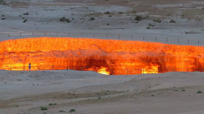 R en contemplation devant le cratère gazier de Darvaza
Deux raisons, la première est que l'hiver austral commence aujourd'hui, eh oui en Australie les saisons commencent le premier du mois (?!) et qu'un peu de chaleur sera bienvenue down under et la seconde est que je viens de débarquer à Dubai où les températures montent jusqu'à 44 deg, en cette dernière semaine de Ramadan.
J’espère que ce théme, aux multiples interprétations (il suffit de bien chercher !), sera une source d'inspiration et que les photos seront nombreuses et diverses. Bonne chance !
Les dates : Vous pouvez mettre vos photos dès aujourd’hui Samedi 1 Juin et ce jusqu’au Dimanche 23 Juin, 22:00 (heure de Bern). Le vote pourra commencer dès la minute suivante et se terminera le Samedi 29 Juin, 22:00 (heure de Zurich). Déclaration des résultats le Dimanche 30 Juin si tout se passe normalement !!!
Les modalités du concours : Vous pouvez poster jusqu'à trois photos (prises par vous-même uniquement), chacune dans un message différent et en indiquant clairement leur numéro (1, 2 ou 3) ainsi que le lieu de prise de vue. Toutes les explications concernant vos photos seront bienvenues.
Pour ceux qui le désirent les ½ points sont de retour mais uniquement ce mois-ci et seulement pour la troisième place.
Vous voterez donc pour trois (ou quatre) photos en indiquant clairement le nom du participant choisi, suivi du numéro de sa photo. La première photo de votre vote se verra attribuer trois points, la deuxième photo deux points et la troisième un point - ou s’il y a des exæquos ½ point chacune.
Le gagnant sera celui qui aura proposé la photo obtenant le plus de points. En cas d'exæquos, le vainqueur sera celui qui aura obtenu le plus grand nombre de premières places, et à défaut, de secondes. Enfin, en cas d'égalité parfaite, le gagnant sera celui ou celle qui aura obtenu son score avant l'autre. Ce vainqueur aura alors la joie de choisir le thème du concours de Juillet 2019 qu'il organisera. Les exæquos à une autre place que la première ne seront pas départagés. Enfin, il n'est nul besoin de participer au concours pour voter.
Merci de ne poster sur ce fil que les photos pour le concours, puis à compter du Dimanche 23 Juin (après 22:00 à Genéve), uniquement les votes.
Le fil de la discussion se trouve ici Le lien de photorama se trouve dans ma signature
R en contemplation devant le cratère gazier de DarvazaUn nouveau tête à tête mère-fils magnifique! Avril 2019 English translation pending
Après un road-trip multigénérationnel en juillet 2015, nous sommes retournés avec mon fils, surnommé T., dans l’ouest américain en avril 2017 pour un magnifique voyage en tête à tête ! Nous avions adoré partir en avril, températures plus clémentes, coup de cœur pour Death Valley… Donc, comme à chaque retour, une seule idée en tête, renouveler cette incroyable expérience !
Et cette année encore, grâce aux conseils puisés sur VF (une nouvelle fois merci à tous), le voyage fut merveilleux ! Tous les jours son lot de découvertes et d’émerveillements !
Nous avons été particulièrement touchés par le foisonnement de fleurs tout au long du voyage, par des milliers de papillons nous faisant tourner la tête à Death Valley et par l’impression d’être seuls au monde dans ces merveilleux paysages (très faible fréquentation à cette période) 😎! Comme à chaque fois, nous avons apprécié les rencontres et la gentillesse des américains !
Par contre nous avons été surpris par la chaleur 🤪: très heureux d’avoir beau temps, mais étonnés par les températures élevées (31° C dès midi toute la 1ere semaine) ! Aussi le programme a un peu évolué par rapport à celui d’origine en fonction de la météo essentiellement mais aussi en fonction de problèmes techniques rencontrés ou de notre état de fatigue.
Programme effectué avec 3212km au compteur :
JOUR 1 : France – LAS VEGAS. Nuit Las Vegas
JOUR 2 : Seven Magic Mountains - Amboy ROY'S café - JOSHUA TREE (Arch Rock trail, Cholla Cactus, Skull Rock, Hidden Valley et Keys View). Nuit Twentynine Palms voyageforum.com/...st=9647375;a=9647375
JOUR 3 : AMBOY Crater - Kelso Depot - Baker (plus grand thermomètre – Boutique Alien) - SOSHONE (Museum, Dublin Gulch) - DEATH VALLEY par badwater road (avec découverte pédestre de Badwater, Artists Palette et Mars Hill). Nuit1 Furnace Creek voyageforum.com/...st=9648823;a=9648823
JOUR 4 : DEATH VALLEY : lever de soleil à Zabriskie + trail pour Meanly Beacon - Piscine - Devil' s golf Course, Artist Drive, Mushroom Rock, coucher de soleil à Zabriskie. Nuit2 Furnace Creek voyageforum.com/...st=9649703;a=9649703
JOUR 5 : DEATH VALLEY ( Gnome's Workshop, Salt creek et Mustard Canyon). PARHUMP (museum + boulangerie O HAPPY BREAD) - RED ROCK CANYON (avec Calico Hills- Lost Creek). Nuit Las Vegas voyageforum.com/...st=9651800;a=9651800
JOUR 6 : SNOW CANYON (avec Sand Dunes, Hidden Pinyon - Petrified dunes trail et Lava Flow). Nuit ST GEORGE voyageforum.com/...st=9658216;a=9658216
JOUR 7 : ZION : avec Scout's Overlook - rim trail, Riverside Walk, Weeping Rock. Nuit Kanab. voyageforum.com/...st=9664493;a=9664493
JOUR 8 : Johnson Canyon - The Chains - MONUMENT VALLEY : Wildcat trail. Nuit cabin Monument Valley voyageforum.com/...st=9669060;a=9669060
JOUR 9 : MONUMENT VALLEY (Mesa rim trail + Lee Cly trail) - CANYON DE CHELLY : South rim avec White House trail. Nuit Chinle voyageforum.com/...st=9673898;a=9673898
JOUR 10 : PAINTED DESERT - PETRIFIED FOREST : avec Blue Mesa trail, Crystal Forest, Giant Logs, Long Logs et Agate house trail. HOLBROOK (Museum – Wigwam Hotel )- Nuit Flagstaff voyageforum.com/...st=9676578;a=9676578
JOUR 11 : Route 66 : SELIGMAN, HACKBERRY, KINGMAN. Nuit LAS VEGAS voyageforum.com/...st=9678172;a=9678172
JOUR 12 : LAS VEGAS avec Count's Kustom's, Old Las Vegas Mormon fort, Gold & Silver Pawn shop... voyageforum.com/...st=9678610;a=9678610
JOUR 13 : LAS VEGAS avec VOID Star Wars, spectacle LOVE (the Beatles)… voyageforum.com/...st=9678639;a=9678639
JOUR 14 : Retour FRANCEhttps://voyageforum.com/v.f?post=9678644;a=9678644
Voilà, un programme à notre image, nous sommes plutôt des contemplatifs, nous aimons nous perdre dans des lieux magnifiques, s'isoler pour s'imprégner des lieux, marcher pour découvrir des petites merveilles... mais pas des sportifs expérimentés comme on peut le voir sur d'autres carnets😉! Les photos, j'en fait beaucoup... trop d'après T😉! Mais pour moi, ça fait parti du plaisir, pouvoir s'imprégner de la beauté des lieux, partager des sensations et fixer à jamais des souvenirs😎!Les préparatifs :BUDGET TOTAL : 1500€/pers tout compris (souvenirs, loisirs, nourriture, avions, voiture, essence, parkings, hôtels…)Billets d’avions : 500€/pers, achetés sur Air Canada + 50€ bagage en soute! Alors nous ne sommes pas fidèles à une compagnie ! On change à chaque fois car on prend en fonction des meilleurs prix ! Mais Air Canada ne restera pas dans nos favoris 😕!
La voiture : 340€ pour 12 jours avec Alamo. Voiture Hyundai, super confortable, caméra de recul, écran avec affichage de la pression de chaque pneu (cela s’avérera utile😉) … ! Réservé sur Alamo.fr comme à chaque voyage, mais première fois que l’on rencontre un problème à la prise de voiture malgré Skip the Counter😠! Côté essence = 137$ !
Les hôtels : réservés majoritairement sur hotels.com… ce qui permet à chaque voyage d’utiliser des nuits gratuites! Et via Igraal et Poulpeo pour le cashback… Cette année j’ai beaucoup utilisé l’annulation gratuite et est modifié mes réservations à nombreuses reprises ce qui nous a permis de faire des économies conséquentes (plus de 200€) !
Les frais bancaires : Depuis notre voyage en avril 2017, j’ai conservé mon compte Boursorama, avec carte 1er gratuite (donc réservations d'avion faites avec pour l'assurance associée) et niveau frais pour les paiements aux USA, nettement plus intéressant qu’avec LCL! Pour tout achat important sur internet ou tout 1er achat à l'étranger, on reçoit un sms pour nous prévenir... rien à faire si c'est nous... et sinon, on peut de suite intervenir en cas de fraude! Essayé, c’est l’adopter !
GPS : Points préparés à l’avance… mais malheureusement pour rien, le GPS nous a lâché dès le 1er jour 😠 !
Forfait téléphonique : FREE avec USA et Canada! Grâce au bon plan de Gilles😉
La suite bientôt avec le voyage!
Programme effectué avec 3212km au compteur :
JOUR 1 : France – LAS VEGAS. Nuit Las Vegas
JOUR 2 : Seven Magic Mountains - Amboy ROY'S café - JOSHUA TREE (Arch Rock trail, Cholla Cactus, Skull Rock, Hidden Valley et Keys View). Nuit Twentynine Palms voyageforum.com/...st=9647375;a=9647375
JOUR 3 : AMBOY Crater - Kelso Depot - Baker (plus grand thermomètre – Boutique Alien) - SOSHONE (Museum, Dublin Gulch) - DEATH VALLEY par badwater road (avec découverte pédestre de Badwater, Artists Palette et Mars Hill). Nuit1 Furnace Creek voyageforum.com/...st=9648823;a=9648823
JOUR 4 : DEATH VALLEY : lever de soleil à Zabriskie + trail pour Meanly Beacon - Piscine - Devil' s golf Course, Artist Drive, Mushroom Rock, coucher de soleil à Zabriskie. Nuit2 Furnace Creek voyageforum.com/...st=9649703;a=9649703
JOUR 5 : DEATH VALLEY ( Gnome's Workshop, Salt creek et Mustard Canyon). PARHUMP (museum + boulangerie O HAPPY BREAD) - RED ROCK CANYON (avec Calico Hills- Lost Creek). Nuit Las Vegas voyageforum.com/...st=9651800;a=9651800
JOUR 6 : SNOW CANYON (avec Sand Dunes, Hidden Pinyon - Petrified dunes trail et Lava Flow). Nuit ST GEORGE voyageforum.com/...st=9658216;a=9658216
JOUR 7 : ZION : avec Scout's Overlook - rim trail, Riverside Walk, Weeping Rock. Nuit Kanab. voyageforum.com/...st=9664493;a=9664493
JOUR 8 : Johnson Canyon - The Chains - MONUMENT VALLEY : Wildcat trail. Nuit cabin Monument Valley voyageforum.com/...st=9669060;a=9669060
JOUR 9 : MONUMENT VALLEY (Mesa rim trail + Lee Cly trail) - CANYON DE CHELLY : South rim avec White House trail. Nuit Chinle voyageforum.com/...st=9673898;a=9673898
JOUR 10 : PAINTED DESERT - PETRIFIED FOREST : avec Blue Mesa trail, Crystal Forest, Giant Logs, Long Logs et Agate house trail. HOLBROOK (Museum – Wigwam Hotel )- Nuit Flagstaff voyageforum.com/...st=9676578;a=9676578
JOUR 11 : Route 66 : SELIGMAN, HACKBERRY, KINGMAN. Nuit LAS VEGAS voyageforum.com/...st=9678172;a=9678172
JOUR 12 : LAS VEGAS avec Count's Kustom's, Old Las Vegas Mormon fort, Gold & Silver Pawn shop... voyageforum.com/...st=9678610;a=9678610
JOUR 13 : LAS VEGAS avec VOID Star Wars, spectacle LOVE (the Beatles)… voyageforum.com/...st=9678639;a=9678639
JOUR 14 : Retour FRANCEhttps://voyageforum.com/v.f?post=9678644;a=9678644
Voilà, un programme à notre image, nous sommes plutôt des contemplatifs, nous aimons nous perdre dans des lieux magnifiques, s'isoler pour s'imprégner des lieux, marcher pour découvrir des petites merveilles... mais pas des sportifs expérimentés comme on peut le voir sur d'autres carnets😉! Les photos, j'en fait beaucoup... trop d'après T😉! Mais pour moi, ça fait parti du plaisir, pouvoir s'imprégner de la beauté des lieux, partager des sensations et fixer à jamais des souvenirs😎!Les préparatifs :BUDGET TOTAL : 1500€/pers tout compris (souvenirs, loisirs, nourriture, avions, voiture, essence, parkings, hôtels…)Billets d’avions : 500€/pers, achetés sur Air Canada + 50€ bagage en soute! Alors nous ne sommes pas fidèles à une compagnie ! On change à chaque fois car on prend en fonction des meilleurs prix ! Mais Air Canada ne restera pas dans nos favoris 😕!
La voiture : 340€ pour 12 jours avec Alamo. Voiture Hyundai, super confortable, caméra de recul, écran avec affichage de la pression de chaque pneu (cela s’avérera utile😉) … ! Réservé sur Alamo.fr comme à chaque voyage, mais première fois que l’on rencontre un problème à la prise de voiture malgré Skip the Counter😠! Côté essence = 137$ !
Les hôtels : réservés majoritairement sur hotels.com… ce qui permet à chaque voyage d’utiliser des nuits gratuites! Et via Igraal et Poulpeo pour le cashback… Cette année j’ai beaucoup utilisé l’annulation gratuite et est modifié mes réservations à nombreuses reprises ce qui nous a permis de faire des économies conséquentes (plus de 200€) !
Les frais bancaires : Depuis notre voyage en avril 2017, j’ai conservé mon compte Boursorama, avec carte 1er gratuite (donc réservations d'avion faites avec pour l'assurance associée) et niveau frais pour les paiements aux USA, nettement plus intéressant qu’avec LCL! Pour tout achat important sur internet ou tout 1er achat à l'étranger, on reçoit un sms pour nous prévenir... rien à faire si c'est nous... et sinon, on peut de suite intervenir en cas de fraude! Essayé, c’est l’adopter !
GPS : Points préparés à l’avance… mais malheureusement pour rien, le GPS nous a lâché dès le 1er jour 😠 !
Forfait téléphonique : FREE avec USA et Canada! Grâce au bon plan de Gilles😉
La suite bientôt avec le voyage!
Afrique du Sud: En traversant le Mpumalanga... ou du Parc Kruger jusqu'à Soweto English translation pending
Le Mpumalanga ne vous évoque probablement rien de bien précis … pourtant c'est le nom d'une des régions les plus visitées de toute l'Afrique du Sud. En effet, c'est sur ce territoire que sont situés le célèbre Parc Kruger ainsi que les principales réserves animalières du pays.
Comme de nombreux voyageurs je suis parti là-bas à la découverte de la faune sauvage d'Afrique australe, en quête des fameux « Big Five » !
Mais traverser le vaste Mpumalanga a bien d'autres curiosités à offrir aux visiteurs. On y traverse des paysages grandioses dans le Blyde River Canyon, on y retrouve aussi le souvenir des chercheurs d'or à Pilgrim's Rest ou celui des couleurs de l'ethnie N'debele …
Et au-delà du Mpumalanga, à la fin de ce récit, on poursuivra la découverte du pays en évoquant le plus illustre des sud-africains, le grand Nelson Mandela avant de faire un tour dans le triste et célèbre township de Soweto.
……………………………………………………………………………………………………………………………..
Dans la brousse, en quête de rencontres …
C'est le moment qu'attend avec impatience tout voyageur venu dans cette région d'Afrique du Sud : le départ pour un safari animalier.
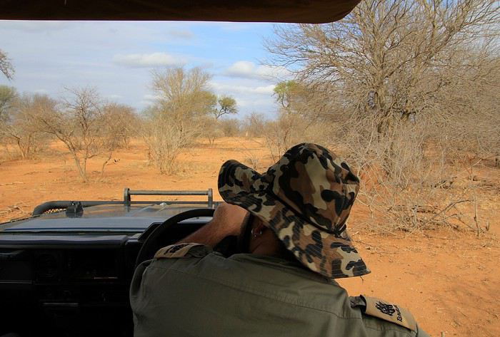
En cet fin d'après-midi, nous voilà à bord d'un 4x4 zigzagant sur une piste cabossée, perdue au milieu de nulle part … heureusement notre ranger pilote, lui, connaît bien ce secteur de la réserve de Tshukudu situé dans les environs du célèbre Parc Kruger. Malgré les secousses, nous ne cessons de scruter le paysage alentour à la recherche parmi les broussailles d'une silhouette animale. Quelques longues minutes de trajet et toujours rien en vue. Et notre ranger, coiffé d'un joli chapeau style camouflage, de nous rassurer : pas d'inquiétude à avoir, il y a bien des animaux dans les parages mais pas avec la même densité que dans un zoo ! En effet, dans les très vastes réserves, les animaux vivent en liberté sur des kilomètres à la ronde … Là, sur la gauche, une première silhouette, immanquable, toute en hauteur, elle domine la végétation.

Une girafe, l'espèce la plus grande de la brousse dont certains spécimen atteignent même les 5 mètres de haut. Doucement on s'approche tout en restant à une relative distance afin de ne pas déranger l'animal. Et la girafe de continuer à brouter les feuilles vertes d'un acacia. Une allure gracile et une robe tachetée qui vaut à cette espèce son nom latin de Giraffa cameleopardalis leopardalis pour ce pelage qui évoque celui des léopards, de vrais prédateurs qui s'attaquent aux girafes et cameleo pour une lointaine ressemblance aux camélidés du désert … si l'on veut !
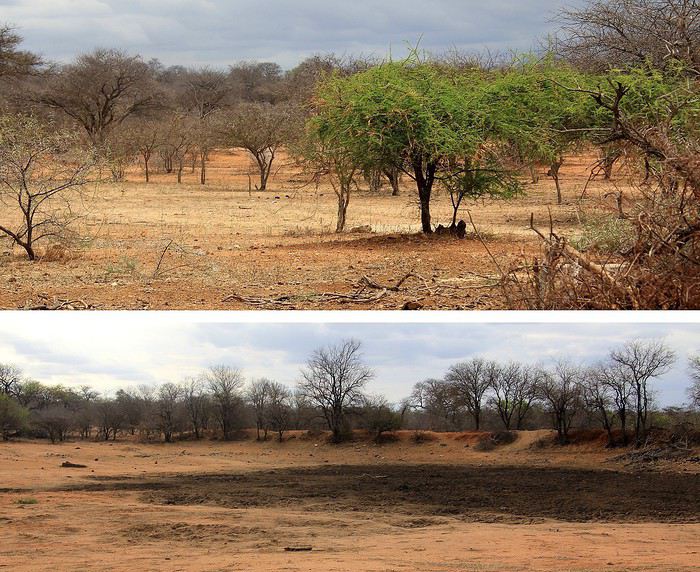
La verdure se fait rare dans cette région où régulièrement la sécheresse sévit. La saison sèche se termine, (nous sommes en novembre) mais pour autant les pluies ne sont pas encore arrivées. D'ailleurs, les dernières saisons dites humides ont été particulièrement courtes. Aussi, il n'est pas étonnant de trouver parmi cette brousse beaucoup d'arbres et de buissons totalement secs, les plus résistants arborent déjà un feuillage vert (pour le bonheur des girafes !) et d'autres attendent les premières gouttes pour reverdir … enfin peut-être ! Devant nous et sur la photo, une mare, elle aussi a soif … totalement asséchée en cette période alors que son niveau d'eau peut atteindre un mètre au plus fort de la saison humide.
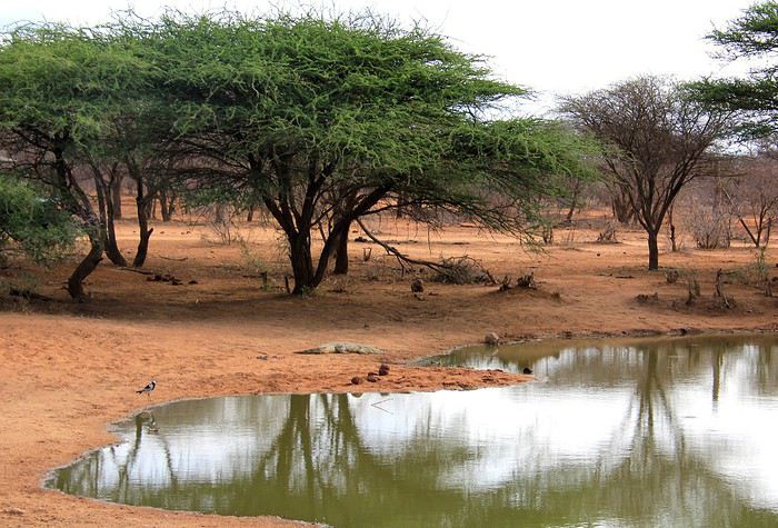
Heureusement pour les animaux de la réserve, certains points d'eau sont mieux pourvus. En voilà un avec sur sa berge un jeune crocodile. Immobile, il lézarde au soleil (voilé).
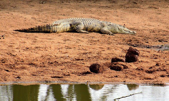
Les crocodiles se doivent d'emmagasiner durant la journée de la chaleur, ce sont des animaux à sang froid. Leur peau fait en quelque sorte office de rudimentaires « panneaux solaires ». Et les grosses boules que l'on voit sur l'image devant le croco ? Ce sont en fait des déjections d'éléphants, elles paraissent monstrueuses. Les intestins des éléphants rejettent une énorme quantité de fibres végétales et quand on nous apprend qu'un éléphant englouti en moyenne 150 kilos de végétaux par 24 h et que de plus il en assimile qu'environ la moitié, on comprend ainsi la raison de la taille des crottes ! Des éléphants sont donc passés par là mais de toute évidence ils sont repartis.
Mais sur la rive opposée de cette mare, c'est un troupeau de buffles qui s'avance. L'heure de la boisson en famille, petits et grands se désaltèrent d'une eau verdâtre bien peu ragoûtante, ils en ont l'habitude.
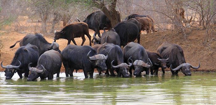
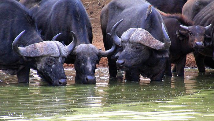
Le déplacement en troupeau constitue une bonne technique de défense vis à vis des prédateurs, ce sont surtout les petits qui sont vulnérables, aussi les adultes les entourent afin de les protéger. Celui que l'on voit sur la droite semble aux aguets, plutôt méfiant semble-t-il. Sur le dos de ces buffles on aperçoit quelques oiseaux. Des piques bœufs à bec rouge avides des parasites accrochés à leur cuir.
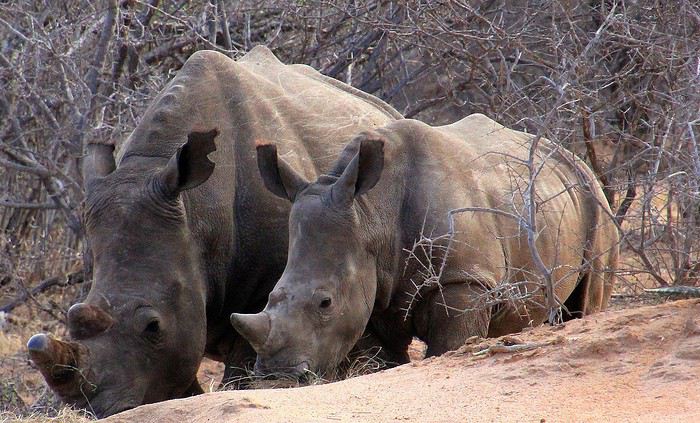
Un peu plus loin, sur une étendue de savane, ce sont trois rhinocéros blancs que l'on distingue. Une mère est accompagnée de son petit … façon de parler, car ce « petit » en impose par son volume. La scène est attendrissante, voici que le gros bébé se met à téter. Les petits suivent ainsi leur mère pendant deux à trois années.
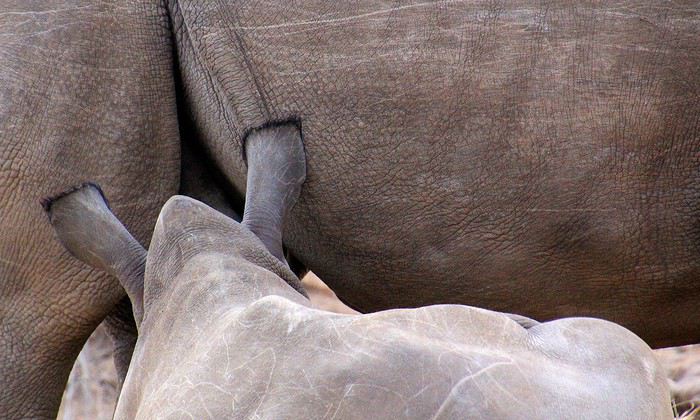
Ce sont là des rhinocéros blancs. Et pourtant, ils ont une peau grise, c'est vrai. Ce nom de rhino blanc vient d'une déformation du mot « large »: « wyd » en Africaans ou « wide » en Anglais puis transformé en « white » (blanc) en anglais. Pourquoi le qualificatif de « large » pour ces rhinocéros ? En raison de leur large bouche d'herbivores qui broutent en opposition aux rhinos noirs qui ont une bouche plus étroite. Eux, les noirs, ils se nourrissent de feuilles et lèvent généralement la tête contrairement aux blancs qui la baissent le plus souvent, vers les herbes du sol. Dernière précision, les rhinocéros noirs sont aussi gris de peau, vous m'avez suivi ? Enfin j'espère !
Les rhinocéros avec leur tête allongée, leurs deux cornes et leurs petits yeux font presque penser à des animaux préhistoriques qui auraient survécu à l'extinction des dinosaures. Les rhinos n'ont paraît-il pas une très bonne vue, cela nous arrange pour l'observation, ils ne font pas attention à nous, observateurs animaliers d'un jour. C'est bien connu, les rhinocéros se doivent d'être protégés de certains prédateurs … je veux parler des braconniers ! La poudre de cornes de rhino s'échange à prix d'or : en Asie, en raison de pseudo vertus aphrodisiaques mais aussi dans certains pays du Moyen-Orient, là, elles sont recherchées comme étui de poignard. Officiellement, ce commerce lucratif est interdit depuis 1977 ... Alors comme prévention la plus efficace, on « décorne » les pachydermes en coupant régulièrement tous les 2 à 4 ans les cornes des rhinocéros des réserves avant de les brûler … ou de les stocker dans des lieux bien protégés. On ne sait jamais ? certains espèrent toujours une reprise de ce commerce mais par des filières officielles et très encadrées. Autre procédé pour dissuader les braconniers, l'application de produits toxiques sur les cornes, les rendant impropres à la consommation. Quant aux cornes, qu'on se rassure pour ces animaux, elles repoussent lentement mais sûrement : 5 à 10 cm par an. C'est comme nos ongles et nos cheveux, elles se composent de kératine.
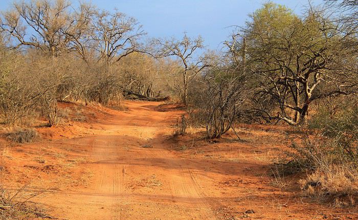
On poursuit notre safari sur une autre piste de cette terre d'Afrique aux belles tonalités ocre rouge. Les rayons du soleil de cette fin d'après-midi accentuant ces superbes teintes chaudes.
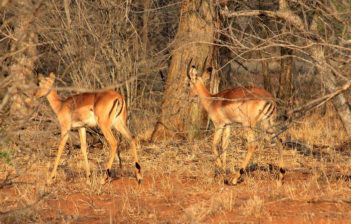
Nous sommes toujours à l'affût. Voici à présent qu'on aperçoit dans les broussailles des impalas. Une espèce d'antilopes parmi les plus fréquentes de cette région. J'ai bien dit, on aperçoit … car il faut le reconnaître, avec tous ces buissons et toutes ces branches, les animaux en profitent pour rester à distance tout en se protégeant derrière ce rideau de branchages. C'est très souvent le cas dans ce bush, même si cela contrarie les observateurs, c'est ainsi en pleine nature. Pour les amateurs de photos, l'autofocus est un peu perdu dans ces conditions … et parfois (ou souvent), la mise au point se fait sur les branches.
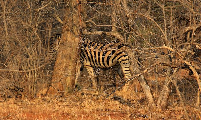
Et une nouvelle prise presque ratée ! Comme celle de ces zèbres … côté netteté des branches, c'est pas mal ! Bon, heureusement on en verra plusieurs autres, impalas et zèbres, au cours de nos safaris. Réussir des photos animalières est un continuel challenge mais avec beaucoup de moments forts et souvent de plaisantes réussites durant cette chasse … seulement photo !
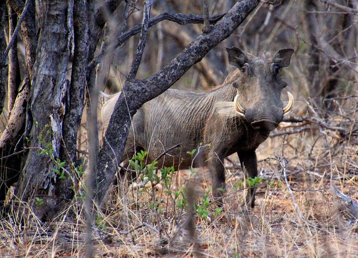
Un moment de chance avec ce phacochère qui m'observe durant quelques instants. Une trouée entre les tiges des buissons, c'est parfait pour lui tirer le portrait. Un spécimen affublé de belles défenses. Ces canines qui ne cessent de pousser peuvent atteindre 60 centimètres chez les vieux mâles. Bien nommées elles servent à leur défense mais également à leur nourriture pour déterrer racines et bulbes. Des phacochères, on en voit pas mal dans cette brousse mais … le plus souvent ces animaux craintifs fuient en courant, la queue en l'air. Et ces puissants et massifs phacochères, j'en témoigne, sont particulièrement vifs et rapides.
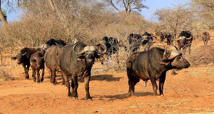
Notre chemin nous fait rencontrer une nouvelle fois quelques buffles, décidément ce doit être notre jour des buffles d'Afrique. Eux n'ont pas de défenses mais des cornes plutôt impressionnantes. Dans cette région vivent les buffles noirs, les plus imposants de cette espèce de bovidés sauvages. Même s'ils n'ont pas l'air agressifs, mieux vaut ne pas s'en approcher … sauf avec l'aide du zoom qui m'a permis d'observer un de ces monstrueux spécimen, presque les yeux dans les yeux.
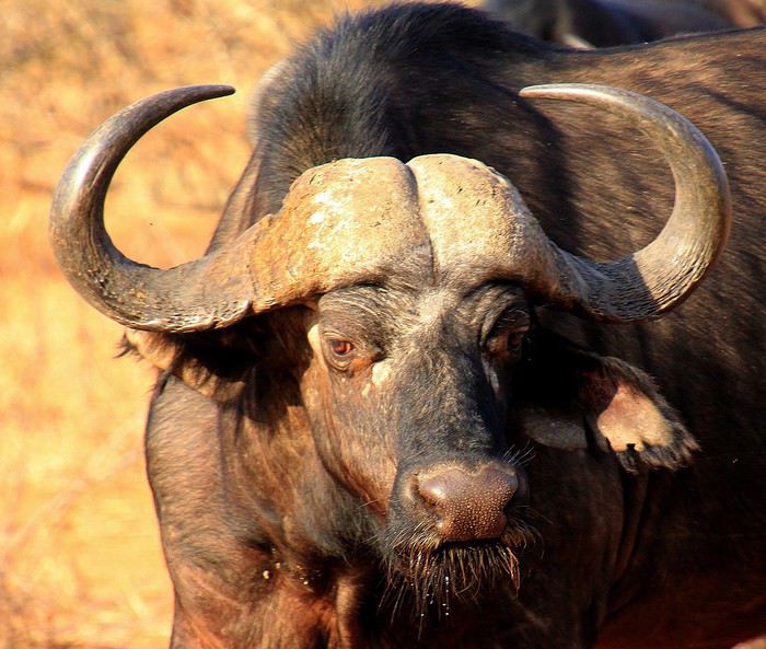
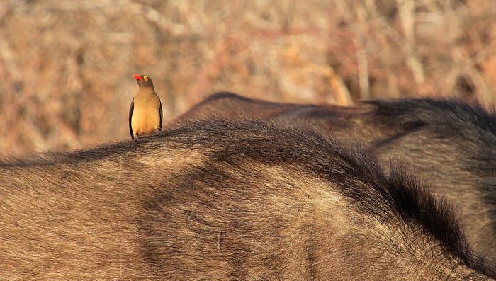
La proximité relative et surtout mon zoom photo m'a permis aussi d'observer en gros plan cette scène. Le dos d'un de ces buffles sur lequel sautillait un pique-bœuf à bec rouge. Un vrai duo de compères entre le gros bovidé et cet oiseau que l'on aurait envie de renommer ici, pique-buffle ! Opération déparasitage, le pique avec son bec débarrasse le buffle de ses parasites nichés entre peau et poils. Une complicité qui parfois agace les buffles, surtout quant l'oiseau s'acharne à piquer les plaies pour se gorger du sang de l'animal. On a beau avoir le cuir épais cela m'empêche pas une certaine sensibilité.
L'après-midi s'achève et le soleil tutoie maintenant l'horizon. L'heure est venue de gagner un point d'eau, là où les animaux de la savane viennent s'abreuver au crépuscule. Notre conducteur-ranger gare notre 4x4 à proximité d'une mare, ce belvédère offre une splendide vue sur le plan d'eau et les animaux présents.
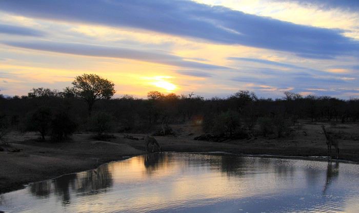
Juste en face, des girafes viennent justement d'arriver. Des pas lents et une belle allure et si un grand cou s'avère pratique pour atteindre les feuilles du faîte des acacias, cela l'est moins pour se baisser jusqu'au niveau de l'eau. Quelles acrobaties et contorsions doivent exécuter ces girafes pour pouvoir s'abreuver. Mais la technique jambes écartées semble d'une parfaite efficacité. A côté, un héron, malgré sa grande taille pour un volatile semble minuscule aux côtés des gigantesques girafes.
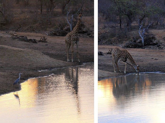
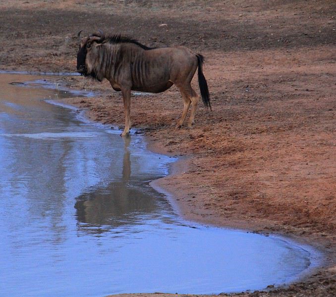
A l'opposé, c'est un gnou qui s'approche de la mare. Un gnou bleu ou également appelé gnou à queue noire. Son pelage gris bleu va vite prendre une tonalité bleu nuit avec ce crépuscule qui s'abat si rapidement dans ces contrées. Cette espèce n'est pas des plus intelligentes, dit-on. Et pour moquer encore plus ces pauvres bêtes à la silhouette pas vraiment gracieuses on les classe en Afrique du Sud parmi les les « Ugly Five » en compagnie des hyènes, phacochères, vautours et marabous. Ugly (laid) en opposition aux nobles habitants de la brousse, les « Big Five » que sont les lions, rhinocéros, éléphants, buffles et léopards.
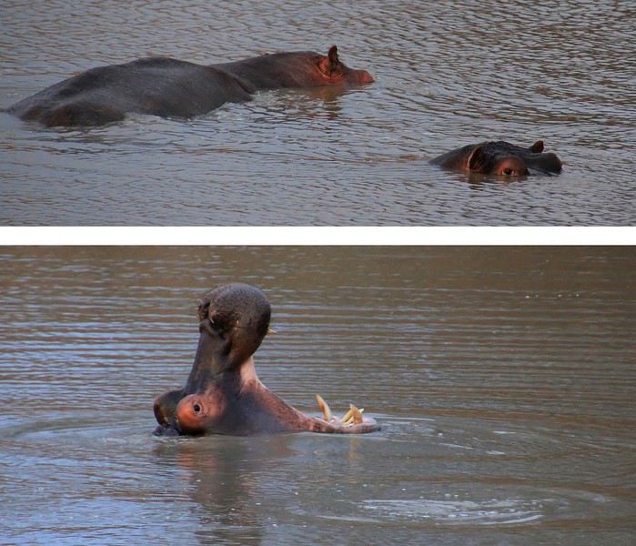
Au milieu de ces eaux stagnantes, on devine par instants quelques mouvements. Des oreilles qui frétillent, un œil observateur et régulièrement une gueule ouverte à 180°, à s'en décrocher la mâchoire … ce sont des hippopotames. Ils passent leurs journées dans l'eau, ne les appelle-t-on d'ailleurs hippopotames amphibies ? Nagent-ils ? Pas vraiment ! non, ils se déplacent le plus souvent en marchant dans la boue. L'hippopotame aime donc avoir pied lorsqu'il se baigne, l'animal apprécie donc les bains de boues … debout ! Ces monstres bien dodus ne possèdent pas de glandes sudoripares au niveau de leur peau le contact de l'eau, plus fraîche que la température de l'air en journée, leur permet ainsi de réguler leur température interne. La nature fait bien les choses : pour se protéger du soleil, des glandes de leur peau sécrètent un mucus qui fait office d'écran solaire. Sa teinte rouge-orangée donne cet aspect coloré que l'on observe surtout autour de leur yeux et de leur oreilles, les parties les plus exposées aux rayons du soleil.
Suite du récit --> message suivant
……………………………………………………………………………………………………………………………..
Dans la brousse, en quête de rencontres …
C'est le moment qu'attend avec impatience tout voyageur venu dans cette région d'Afrique du Sud : le départ pour un safari animalier.
En cet fin d'après-midi, nous voilà à bord d'un 4x4 zigzagant sur une piste cabossée, perdue au milieu de nulle part … heureusement notre ranger pilote, lui, connaît bien ce secteur de la réserve de Tshukudu situé dans les environs du célèbre Parc Kruger. Malgré les secousses, nous ne cessons de scruter le paysage alentour à la recherche parmi les broussailles d'une silhouette animale. Quelques longues minutes de trajet et toujours rien en vue. Et notre ranger, coiffé d'un joli chapeau style camouflage, de nous rassurer : pas d'inquiétude à avoir, il y a bien des animaux dans les parages mais pas avec la même densité que dans un zoo ! En effet, dans les très vastes réserves, les animaux vivent en liberté sur des kilomètres à la ronde … Là, sur la gauche, une première silhouette, immanquable, toute en hauteur, elle domine la végétation.
Une girafe, l'espèce la plus grande de la brousse dont certains spécimen atteignent même les 5 mètres de haut. Doucement on s'approche tout en restant à une relative distance afin de ne pas déranger l'animal. Et la girafe de continuer à brouter les feuilles vertes d'un acacia. Une allure gracile et une robe tachetée qui vaut à cette espèce son nom latin de Giraffa cameleopardalis leopardalis pour ce pelage qui évoque celui des léopards, de vrais prédateurs qui s'attaquent aux girafes et cameleo pour une lointaine ressemblance aux camélidés du désert … si l'on veut !
La verdure se fait rare dans cette région où régulièrement la sécheresse sévit. La saison sèche se termine, (nous sommes en novembre) mais pour autant les pluies ne sont pas encore arrivées. D'ailleurs, les dernières saisons dites humides ont été particulièrement courtes. Aussi, il n'est pas étonnant de trouver parmi cette brousse beaucoup d'arbres et de buissons totalement secs, les plus résistants arborent déjà un feuillage vert (pour le bonheur des girafes !) et d'autres attendent les premières gouttes pour reverdir … enfin peut-être ! Devant nous et sur la photo, une mare, elle aussi a soif … totalement asséchée en cette période alors que son niveau d'eau peut atteindre un mètre au plus fort de la saison humide.
Heureusement pour les animaux de la réserve, certains points d'eau sont mieux pourvus. En voilà un avec sur sa berge un jeune crocodile. Immobile, il lézarde au soleil (voilé).
Les crocodiles se doivent d'emmagasiner durant la journée de la chaleur, ce sont des animaux à sang froid. Leur peau fait en quelque sorte office de rudimentaires « panneaux solaires ». Et les grosses boules que l'on voit sur l'image devant le croco ? Ce sont en fait des déjections d'éléphants, elles paraissent monstrueuses. Les intestins des éléphants rejettent une énorme quantité de fibres végétales et quand on nous apprend qu'un éléphant englouti en moyenne 150 kilos de végétaux par 24 h et que de plus il en assimile qu'environ la moitié, on comprend ainsi la raison de la taille des crottes ! Des éléphants sont donc passés par là mais de toute évidence ils sont repartis.
Mais sur la rive opposée de cette mare, c'est un troupeau de buffles qui s'avance. L'heure de la boisson en famille, petits et grands se désaltèrent d'une eau verdâtre bien peu ragoûtante, ils en ont l'habitude.
Le déplacement en troupeau constitue une bonne technique de défense vis à vis des prédateurs, ce sont surtout les petits qui sont vulnérables, aussi les adultes les entourent afin de les protéger. Celui que l'on voit sur la droite semble aux aguets, plutôt méfiant semble-t-il. Sur le dos de ces buffles on aperçoit quelques oiseaux. Des piques bœufs à bec rouge avides des parasites accrochés à leur cuir.
Un peu plus loin, sur une étendue de savane, ce sont trois rhinocéros blancs que l'on distingue. Une mère est accompagnée de son petit … façon de parler, car ce « petit » en impose par son volume. La scène est attendrissante, voici que le gros bébé se met à téter. Les petits suivent ainsi leur mère pendant deux à trois années.
Ce sont là des rhinocéros blancs. Et pourtant, ils ont une peau grise, c'est vrai. Ce nom de rhino blanc vient d'une déformation du mot « large »: « wyd » en Africaans ou « wide » en Anglais puis transformé en « white » (blanc) en anglais. Pourquoi le qualificatif de « large » pour ces rhinocéros ? En raison de leur large bouche d'herbivores qui broutent en opposition aux rhinos noirs qui ont une bouche plus étroite. Eux, les noirs, ils se nourrissent de feuilles et lèvent généralement la tête contrairement aux blancs qui la baissent le plus souvent, vers les herbes du sol. Dernière précision, les rhinocéros noirs sont aussi gris de peau, vous m'avez suivi ? Enfin j'espère !
Les rhinocéros avec leur tête allongée, leurs deux cornes et leurs petits yeux font presque penser à des animaux préhistoriques qui auraient survécu à l'extinction des dinosaures. Les rhinos n'ont paraît-il pas une très bonne vue, cela nous arrange pour l'observation, ils ne font pas attention à nous, observateurs animaliers d'un jour. C'est bien connu, les rhinocéros se doivent d'être protégés de certains prédateurs … je veux parler des braconniers ! La poudre de cornes de rhino s'échange à prix d'or : en Asie, en raison de pseudo vertus aphrodisiaques mais aussi dans certains pays du Moyen-Orient, là, elles sont recherchées comme étui de poignard. Officiellement, ce commerce lucratif est interdit depuis 1977 ... Alors comme prévention la plus efficace, on « décorne » les pachydermes en coupant régulièrement tous les 2 à 4 ans les cornes des rhinocéros des réserves avant de les brûler … ou de les stocker dans des lieux bien protégés. On ne sait jamais ? certains espèrent toujours une reprise de ce commerce mais par des filières officielles et très encadrées. Autre procédé pour dissuader les braconniers, l'application de produits toxiques sur les cornes, les rendant impropres à la consommation. Quant aux cornes, qu'on se rassure pour ces animaux, elles repoussent lentement mais sûrement : 5 à 10 cm par an. C'est comme nos ongles et nos cheveux, elles se composent de kératine.
On poursuit notre safari sur une autre piste de cette terre d'Afrique aux belles tonalités ocre rouge. Les rayons du soleil de cette fin d'après-midi accentuant ces superbes teintes chaudes.
Nous sommes toujours à l'affût. Voici à présent qu'on aperçoit dans les broussailles des impalas. Une espèce d'antilopes parmi les plus fréquentes de cette région. J'ai bien dit, on aperçoit … car il faut le reconnaître, avec tous ces buissons et toutes ces branches, les animaux en profitent pour rester à distance tout en se protégeant derrière ce rideau de branchages. C'est très souvent le cas dans ce bush, même si cela contrarie les observateurs, c'est ainsi en pleine nature. Pour les amateurs de photos, l'autofocus est un peu perdu dans ces conditions … et parfois (ou souvent), la mise au point se fait sur les branches.
Et une nouvelle prise presque ratée ! Comme celle de ces zèbres … côté netteté des branches, c'est pas mal ! Bon, heureusement on en verra plusieurs autres, impalas et zèbres, au cours de nos safaris. Réussir des photos animalières est un continuel challenge mais avec beaucoup de moments forts et souvent de plaisantes réussites durant cette chasse … seulement photo !
Un moment de chance avec ce phacochère qui m'observe durant quelques instants. Une trouée entre les tiges des buissons, c'est parfait pour lui tirer le portrait. Un spécimen affublé de belles défenses. Ces canines qui ne cessent de pousser peuvent atteindre 60 centimètres chez les vieux mâles. Bien nommées elles servent à leur défense mais également à leur nourriture pour déterrer racines et bulbes. Des phacochères, on en voit pas mal dans cette brousse mais … le plus souvent ces animaux craintifs fuient en courant, la queue en l'air. Et ces puissants et massifs phacochères, j'en témoigne, sont particulièrement vifs et rapides.
Notre chemin nous fait rencontrer une nouvelle fois quelques buffles, décidément ce doit être notre jour des buffles d'Afrique. Eux n'ont pas de défenses mais des cornes plutôt impressionnantes. Dans cette région vivent les buffles noirs, les plus imposants de cette espèce de bovidés sauvages. Même s'ils n'ont pas l'air agressifs, mieux vaut ne pas s'en approcher … sauf avec l'aide du zoom qui m'a permis d'observer un de ces monstrueux spécimen, presque les yeux dans les yeux.
La proximité relative et surtout mon zoom photo m'a permis aussi d'observer en gros plan cette scène. Le dos d'un de ces buffles sur lequel sautillait un pique-bœuf à bec rouge. Un vrai duo de compères entre le gros bovidé et cet oiseau que l'on aurait envie de renommer ici, pique-buffle ! Opération déparasitage, le pique avec son bec débarrasse le buffle de ses parasites nichés entre peau et poils. Une complicité qui parfois agace les buffles, surtout quant l'oiseau s'acharne à piquer les plaies pour se gorger du sang de l'animal. On a beau avoir le cuir épais cela m'empêche pas une certaine sensibilité.
L'après-midi s'achève et le soleil tutoie maintenant l'horizon. L'heure est venue de gagner un point d'eau, là où les animaux de la savane viennent s'abreuver au crépuscule. Notre conducteur-ranger gare notre 4x4 à proximité d'une mare, ce belvédère offre une splendide vue sur le plan d'eau et les animaux présents.
Juste en face, des girafes viennent justement d'arriver. Des pas lents et une belle allure et si un grand cou s'avère pratique pour atteindre les feuilles du faîte des acacias, cela l'est moins pour se baisser jusqu'au niveau de l'eau. Quelles acrobaties et contorsions doivent exécuter ces girafes pour pouvoir s'abreuver. Mais la technique jambes écartées semble d'une parfaite efficacité. A côté, un héron, malgré sa grande taille pour un volatile semble minuscule aux côtés des gigantesques girafes.
A l'opposé, c'est un gnou qui s'approche de la mare. Un gnou bleu ou également appelé gnou à queue noire. Son pelage gris bleu va vite prendre une tonalité bleu nuit avec ce crépuscule qui s'abat si rapidement dans ces contrées. Cette espèce n'est pas des plus intelligentes, dit-on. Et pour moquer encore plus ces pauvres bêtes à la silhouette pas vraiment gracieuses on les classe en Afrique du Sud parmi les les « Ugly Five » en compagnie des hyènes, phacochères, vautours et marabous. Ugly (laid) en opposition aux nobles habitants de la brousse, les « Big Five » que sont les lions, rhinocéros, éléphants, buffles et léopards.
Au milieu de ces eaux stagnantes, on devine par instants quelques mouvements. Des oreilles qui frétillent, un œil observateur et régulièrement une gueule ouverte à 180°, à s'en décrocher la mâchoire … ce sont des hippopotames. Ils passent leurs journées dans l'eau, ne les appelle-t-on d'ailleurs hippopotames amphibies ? Nagent-ils ? Pas vraiment ! non, ils se déplacent le plus souvent en marchant dans la boue. L'hippopotame aime donc avoir pied lorsqu'il se baigne, l'animal apprécie donc les bains de boues … debout ! Ces monstres bien dodus ne possèdent pas de glandes sudoripares au niveau de leur peau le contact de l'eau, plus fraîche que la température de l'air en journée, leur permet ainsi de réguler leur température interne. La nature fait bien les choses : pour se protéger du soleil, des glandes de leur peau sécrètent un mucus qui fait office d'écran solaire. Sa teinte rouge-orangée donne cet aspect coloré que l'on observe surtout autour de leur yeux et de leur oreilles, les parties les plus exposées aux rayons du soleil.
Suite du récit --> message suivant
Organisation de séjour 45 jours dans l'Ouest américain English translation pending
Bonjour,
Nous souhaitons mon épouse et moi-même organiser un séjour dans l'Ouest Américain en 2025. Vous allez me dire, c'est loin très loin comme date. Mais, nous avons l'habitude de programmer en général un an avant ( en Europe ). Du coup, pour ma retraite en 2025 ( ma femme est déjà à la retraite ), nous programmons ce séjour ( je me répète je crois 😕 ).
Détail de l’itinéraire :
Jour 1 San Francisco : Arrivée Jour 2 San Francisco : Alcatraz Jour 3 San Francisco : Jour 4 San Francisco : Prise en charge véhicule Jour 5 San Francisco 315 Km 3 H 40 96150 South Lake Tahoe Jour 6 South Lake Tahoe 166 Km 2 H 50 93517 Bodie Jour 7 Bodie 90 Km 1 H 30 93546 Mammoth Lakes Jour 8 Mammoth Lakes 185 Km 2 H 15 93545 Swansea ou Cartago Jour 9 Swansea 185 Km 2 H 45 92328 Furnace Creek Death Valley Jour 10 Furnace Creek Death Valley 233 Km 2 H 15 Las Vegas Jour 11 Las Vegas Jour 12 Las Vegas Jour 13 Las Vegas 105 Km 1 H 30 Valley of Fire Jour 14 Valley of Fire 225 Km 2 H 30 Zion National Park Springdale Jour 15 Zion National Park Jour 16 Zion National Park 140 Km 2 H 15 Bryce Canyon Jour 17 Bryce Canyon Jour 18 Bryce Canyon 440 Km 4 H 45 84111 Salt Lake City Jour 19 Salt Lake City Jour 20 Salt Lake City 380 Km 4 H 40 84532 Moab Jour 21 Moab : Canyonlands + Colorado River Jour 22 Moab : Dead Horse Point State Park + Arches Jour 23 Moab 225 Km 3 H 15 Mesa Verde Colorado 81330 Cliff Palace Cortez Jour 24 Mesa Verde 240 Km 3 H 45 Monument Valley Jour 25 Monument Valley Jour 26 Monument Valley 195 Km 2 H 35 86040 Page Jour 27 Page : Lower & Upper Antelope Canyon Jour 28 Page : Horseshoe Bend Jour 29 Page 180 Km 1 H 45 86040 Bitter Springs Jour 30 Bitter Springs : Cathedral Wash Jour 31 Bitter Springs 86020 Cameron Jour 32 Cameron : Grand Canyon ( avion ? ) Jour 33 Cameron : Grand Canyon Jour 34 Cameron 210 Km 2 H 30 86337 Seligman Jour 35 Seligman 190 Km 2 H 30 86426 Fort Mohave Jour 36 Fort Mohave 250 Km 3 H 00 92311 Barstow Jour 37 Barstow 190 Km 2 H 15 90001 Los Angeles Jour 38 Los Angeles Jour 39 Los Angeles Jour 40 Los Angeles Jour 41 Los Angeles 160 Km 2 H 05 93101 Santa Barbara Jour 42 Santa Barbara 530 Km 7 H 00 San Francisco Jour 43 San Francisco : Dépose véhicule Jour 44 San Francisco : Départ
J'ai plusieurs questions qui m'interpellent : - Est-ce que le détour à Salt Lake City vaut le coup ? - Nous souhaitons ajouter une ville fantôme ( en plus de Bodie & Barstow ) sur notre programme, quelqu'un a t-il une idée pour une belle ville ? - Hormis Antelope Valley & Cathedral Wash, y a t-il d'autres sentiers avec des passages étroits ? - Nous allons louer un 4 X 4 avec une caravane ( trailer ) qui nous permettra de mieux nous déplacer. Comme le budget total est assez conséquent ( 8.000 à 9.000, - Euros ) existe t-il des emplacements ( ou sites internet ) qui permet de passer des nuitées sans trop ou pas de frais ? - Pour Death Valley, nous comptons juste passer avec le véhicule en passant par Furnace Creek. Y a t-il quelque chose à voir en particulier ? Je sais qu'il y a beaucoup de questions 😐.
Nous souhaitons mon épouse et moi-même organiser un séjour dans l'Ouest Américain en 2025. Vous allez me dire, c'est loin très loin comme date. Mais, nous avons l'habitude de programmer en général un an avant ( en Europe ). Du coup, pour ma retraite en 2025 ( ma femme est déjà à la retraite ), nous programmons ce séjour ( je me répète je crois 😕 ).
Détail de l’itinéraire :
Jour 1 San Francisco : Arrivée Jour 2 San Francisco : Alcatraz Jour 3 San Francisco : Jour 4 San Francisco : Prise en charge véhicule Jour 5 San Francisco 315 Km 3 H 40 96150 South Lake Tahoe Jour 6 South Lake Tahoe 166 Km 2 H 50 93517 Bodie Jour 7 Bodie 90 Km 1 H 30 93546 Mammoth Lakes Jour 8 Mammoth Lakes 185 Km 2 H 15 93545 Swansea ou Cartago Jour 9 Swansea 185 Km 2 H 45 92328 Furnace Creek Death Valley Jour 10 Furnace Creek Death Valley 233 Km 2 H 15 Las Vegas Jour 11 Las Vegas Jour 12 Las Vegas Jour 13 Las Vegas 105 Km 1 H 30 Valley of Fire Jour 14 Valley of Fire 225 Km 2 H 30 Zion National Park Springdale Jour 15 Zion National Park Jour 16 Zion National Park 140 Km 2 H 15 Bryce Canyon Jour 17 Bryce Canyon Jour 18 Bryce Canyon 440 Km 4 H 45 84111 Salt Lake City Jour 19 Salt Lake City Jour 20 Salt Lake City 380 Km 4 H 40 84532 Moab Jour 21 Moab : Canyonlands + Colorado River Jour 22 Moab : Dead Horse Point State Park + Arches Jour 23 Moab 225 Km 3 H 15 Mesa Verde Colorado 81330 Cliff Palace Cortez Jour 24 Mesa Verde 240 Km 3 H 45 Monument Valley Jour 25 Monument Valley Jour 26 Monument Valley 195 Km 2 H 35 86040 Page Jour 27 Page : Lower & Upper Antelope Canyon Jour 28 Page : Horseshoe Bend Jour 29 Page 180 Km 1 H 45 86040 Bitter Springs Jour 30 Bitter Springs : Cathedral Wash Jour 31 Bitter Springs 86020 Cameron Jour 32 Cameron : Grand Canyon ( avion ? ) Jour 33 Cameron : Grand Canyon Jour 34 Cameron 210 Km 2 H 30 86337 Seligman Jour 35 Seligman 190 Km 2 H 30 86426 Fort Mohave Jour 36 Fort Mohave 250 Km 3 H 00 92311 Barstow Jour 37 Barstow 190 Km 2 H 15 90001 Los Angeles Jour 38 Los Angeles Jour 39 Los Angeles Jour 40 Los Angeles Jour 41 Los Angeles 160 Km 2 H 05 93101 Santa Barbara Jour 42 Santa Barbara 530 Km 7 H 00 San Francisco Jour 43 San Francisco : Dépose véhicule Jour 44 San Francisco : Départ
J'ai plusieurs questions qui m'interpellent : - Est-ce que le détour à Salt Lake City vaut le coup ? - Nous souhaitons ajouter une ville fantôme ( en plus de Bodie & Barstow ) sur notre programme, quelqu'un a t-il une idée pour une belle ville ? - Hormis Antelope Valley & Cathedral Wash, y a t-il d'autres sentiers avec des passages étroits ? - Nous allons louer un 4 X 4 avec une caravane ( trailer ) qui nous permettra de mieux nous déplacer. Comme le budget total est assez conséquent ( 8.000 à 9.000, - Euros ) existe t-il des emplacements ( ou sites internet ) qui permet de passer des nuitées sans trop ou pas de frais ? - Pour Death Valley, nous comptons juste passer avec le véhicule en passant par Furnace Creek. Y a t-il quelque chose à voir en particulier ? Je sais qu'il y a beaucoup de questions 😐.
Compte rendu MSC Preziosa aux Antilles du 27 janvier au 10 février 2019 English translation pending
Bonjour à tous et à toutes
Je vous invite ici à donner vos impressions et conseils sur cette croisière que vous auriez déjà effectuée.
Revenant d'une croisière sur le MSC Préziosa dont voici les escales
27 janv Pointe a pitre appareillage à 19H 28 janv Road town iles vierges britaniques 10H 19H > 9H30 à 18H30 29 janv Phillipsburg St Martin 8H 19H 30 janv Roseau la Dominique 9H 19H > 9H à 18H 31 janv Basseterre St Kitts 9H 19H 01 fev St john's Antigua 8H 18H 02 fev Fort de France Martinique 8H 23H > 8H à 6H le lendemain 03 fev Pointe à pitre Guadeloupe 8H 19H > 12H à 22 H 04 fev Castrie St Lucie 9H 18H 05 fev Bridgetown Barbades 8H 20H 06 fev Port of spain Trinidad 9H 18H 07 fev St Georges Grenade 9H 18H > 8H à 18H 08 fev Kingstown St Vincent Grenadine 9H 18H 09 fev Fort de France Martinique 8H 23H > 8H à 22H30 10 fev Pointe a pitre Guadeloupe débarquement 8H
En somme des escales assez longues à terre et pas de journée en mer avec cependant des petits changements dans les horaires définis au départ voir les horaires après >
notamment le 02 fev à Fort de France où le bateau a dû attendre après un avion complet MSC d'ou notre retard à l'accostage à 12H à Pointe à pitre en Guadeloupe le lendemain le 3 fev
Mais ce ne fut pas le seul retard dû aux transports de notre groupe VF Deux de mes amies étant parti 3 jours avant l'appareillage ont eu quelques problèmes avec leur avion, les obligeant à faire escale en plein océan Atlantique sur une île militaire Portugaise. Ce qui retarda pour le moins le repos qu'elles pensaient prendre à l'hôtel. Néanmoins elles ont quand même pu décoller le lendemain matin à 2H après avoir rembarqué dans un autre avion affrété par Air France avec leurs bagages. Heureusement les beaux militaires ne les ont pas subjuguées 😉 et le 25 janv à 7H elles étaient amusées mais fourbu de ce compte temps pour leur arrivée à l'hôtel à Pointe à Pitre.
Elles ont quand même pu profiter de leur arrivée anticipée pour visiter la Guadeloupe? Je leur laisse le soin de le faire ici après.🙂
Quatre autres de nos amis avaient également anticipé leur vol pour arriver le 25 janv.
Le 26 janv nous arrivions avec le reste de la troupe toujours à l'hôtel à pointe a pitre, car en réservant le vol XL airways nous même, il est toujours prudent de prévoir un jour sur place pour un aléa de transport afin de prendre le bateau à temps. Cela nous permet aussi d'encaisser le décalage horaire de 5H de moins qu'en métropole, nous sommes donc arrivés à l'hôtel à 16H heure locale convoyé par la "compagnie de taxi Ruddy".😎
Malgré un petit quiproquo sur l'endroit de la prise en charge à l'aéroport et malgré l'écriteau tenu à bout de bras "rcoucou".😊 Transfert ce jour-là pour 9 personnes avec bagages et grosses valises, il faut assurer merci Ruddy.
Nous avons quand même profité de la plage et des transats jusqu'au coucher de soleil avant l'Apéro (APp mon abréviation grecque).😉
Le seul barman tout en étant très efficace mais débordé par les multiples commandes de cocktails, restait malgré tout très souriant et méthodique malgré l'impatience de ses clients. Il devrait sans doute être aidé à cette heure-là, car le bar était quasiment plein.
Ma femme participa involontairement aux jeux apéritifs et gagna un bon pour 1 cocktail.🙂
Une soirée cool passée à l'hôtel avec un buffet, 2 plats (23€) suivi d'une animation en fin de soirée au bar . Celui ci étant fermé le lendemain midi, ma moitié en a profité pour solder son bon cocktail, je l'accompagnerai donc, bien conseillé par le barman, par un Rhum Damoiseau XO, un délice comparé aux somnifères en pharmacie.😛
Je sais la photo est flou 😛mais moi aussi je l'étais à cette heure-là à 6H30 du matin heure française.
je laisse le soin aux autres de participer à ce compte rendu escale par escale
A suivre ..
Je vous invite ici à donner vos impressions et conseils sur cette croisière que vous auriez déjà effectuée.
Revenant d'une croisière sur le MSC Préziosa dont voici les escales
27 janv Pointe a pitre appareillage à 19H 28 janv Road town iles vierges britaniques 10H 19H > 9H30 à 18H30 29 janv Phillipsburg St Martin 8H 19H 30 janv Roseau la Dominique 9H 19H > 9H à 18H 31 janv Basseterre St Kitts 9H 19H 01 fev St john's Antigua 8H 18H 02 fev Fort de France Martinique 8H 23H > 8H à 6H le lendemain 03 fev Pointe à pitre Guadeloupe 8H 19H > 12H à 22 H 04 fev Castrie St Lucie 9H 18H 05 fev Bridgetown Barbades 8H 20H 06 fev Port of spain Trinidad 9H 18H 07 fev St Georges Grenade 9H 18H > 8H à 18H 08 fev Kingstown St Vincent Grenadine 9H 18H 09 fev Fort de France Martinique 8H 23H > 8H à 22H30 10 fev Pointe a pitre Guadeloupe débarquement 8H
En somme des escales assez longues à terre et pas de journée en mer avec cependant des petits changements dans les horaires définis au départ voir les horaires après >
notamment le 02 fev à Fort de France où le bateau a dû attendre après un avion complet MSC d'ou notre retard à l'accostage à 12H à Pointe à pitre en Guadeloupe le lendemain le 3 fev
Mais ce ne fut pas le seul retard dû aux transports de notre groupe VF Deux de mes amies étant parti 3 jours avant l'appareillage ont eu quelques problèmes avec leur avion, les obligeant à faire escale en plein océan Atlantique sur une île militaire Portugaise. Ce qui retarda pour le moins le repos qu'elles pensaient prendre à l'hôtel. Néanmoins elles ont quand même pu décoller le lendemain matin à 2H après avoir rembarqué dans un autre avion affrété par Air France avec leurs bagages. Heureusement les beaux militaires ne les ont pas subjuguées 😉 et le 25 janv à 7H elles étaient amusées mais fourbu de ce compte temps pour leur arrivée à l'hôtel à Pointe à Pitre.
Elles ont quand même pu profiter de leur arrivée anticipée pour visiter la Guadeloupe? Je leur laisse le soin de le faire ici après.🙂
Quatre autres de nos amis avaient également anticipé leur vol pour arriver le 25 janv.
Le 26 janv nous arrivions avec le reste de la troupe toujours à l'hôtel à pointe a pitre, car en réservant le vol XL airways nous même, il est toujours prudent de prévoir un jour sur place pour un aléa de transport afin de prendre le bateau à temps. Cela nous permet aussi d'encaisser le décalage horaire de 5H de moins qu'en métropole, nous sommes donc arrivés à l'hôtel à 16H heure locale convoyé par la "compagnie de taxi Ruddy".😎
Malgré un petit quiproquo sur l'endroit de la prise en charge à l'aéroport et malgré l'écriteau tenu à bout de bras "rcoucou".😊 Transfert ce jour-là pour 9 personnes avec bagages et grosses valises, il faut assurer merci Ruddy.
Nous avons quand même profité de la plage et des transats jusqu'au coucher de soleil avant l'Apéro (APp mon abréviation grecque).😉
Le seul barman tout en étant très efficace mais débordé par les multiples commandes de cocktails, restait malgré tout très souriant et méthodique malgré l'impatience de ses clients. Il devrait sans doute être aidé à cette heure-là, car le bar était quasiment plein.
Ma femme participa involontairement aux jeux apéritifs et gagna un bon pour 1 cocktail.🙂
Une soirée cool passée à l'hôtel avec un buffet, 2 plats (23€) suivi d'une animation en fin de soirée au bar . Celui ci étant fermé le lendemain midi, ma moitié en a profité pour solder son bon cocktail, je l'accompagnerai donc, bien conseillé par le barman, par un Rhum Damoiseau XO, un délice comparé aux somnifères en pharmacie.😛
Je sais la photo est flou 😛mais moi aussi je l'étais à cette heure-là à 6H30 du matin heure française.
je laisse le soin aux autres de participer à ce compte rendu escale par escale
A suivre ..
Oregon: fog, smoke, sun & fun English translation pending
Avant propos
Au retour de notre roadtrip USA 2016, qui nous a amené à traverser 5 Etats de San Francisco à Denver, nous nous sommes immédiatement mis à la recherche du procahin itinéraire sur les routes nord-américaines. Tout roadtripper qui se respecte connait cette sensation au retour d’un tel voyage et le besoin de se projeter sur un nouveau projet. Nous ne dérogeons pas à la règle !
Ce nouvel itinéraire a été très difficile à définir. Une seule chose était certaine, nous irions dans le nord-ouest des Etats Unis ! Mais pour le reste … Nous avons longtemps hésité : Washington + Oregon, côte pacifique nord de San Francisco à Seattle, One way Seattle Yellowstone en passant par Glacier … que de choix ! Et comme l’affirmait André Gide « choisir c’est renoncer » !
Après avoir tous mis dans le shaker (nos priorités à voir, le temps imparti, le budget), nous avons concocté un bel et bon cocktail Oregon : côte pacifique, monts volcaniques, déserts, roches et rivières ! Tous les ingrédients d’un roadtrip réussi pour nous !
Nous avons donc réalisé une boucle au départ de Portland du 10 au 26 août et je vous invite à suivre nos aventures dans ce carnet 😉
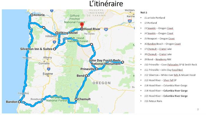
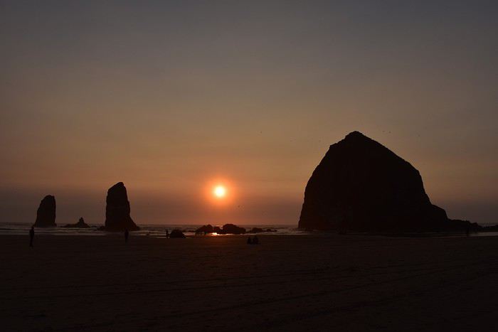 Cannon Beach
J1 : Notre arrivée à Portland OR Ca y est, le grand jour du départ est arrivé ! Bien qu’ayant eu un peu de mal à m’endormir la veille au soir, je n’ai aucun mal à me lever à 3h45 ce vendredi matin ! Notre taxi G7 passe nous prendre à 5h00, comme prévu, pour nous déposer au terminal 1 de Roissy Charles de Gaulle. A cette heure-ci, personne sur la route et nous arrivons très rapidement à l’aéroport. Nous arrivons si tôt que le comptoir United Airline n’est pas encore ouvert. Aux alentours de 6h30, nous pouvons déposer nos valises. Notre enregistrement s’est fait la veille. Nous avons d’ailleurs opté pour un supplément au moment du check in en ligne afin d’être placés près des portes d’évacuation de l’avion et ainsi avoir un espace supplémentaire pour nos jambes, pouvoir nous lever sans gêner personne et nous déplacer en toute liberté.
En attendant l’embarquement, nous déambulons dans les Duty free et prenons notre petit déjeuner. Le 1er vol est un Paris/San Francisco. Le départ est prévu « on time » et je tiens à saluer la parfaite organisation de la compagnie aérienne choisie. L’embarquement se fait rapidement et méthodiquement. Nous partons bel et bien à l’heure ! Bien installés, nous passons le vol entre visionnage de films, siestes et repas plutôt bof bof ! C’est à mon sens, le point faible de United. Les repas étaient vraiment mauvais. Nous arrivons à San Francisco à l’heure et filons à l’immigration. Nous avions prévu un temps d’escale conséquent afin d’anticiper tout retard du 1er vol ainsi que le temps de transit par les services américains d’immigration, contrôle de sécurité etc. Au final, nous avons passé l’immigration en même pas 10 minutes, récupéré nos bagages et repassé la sécurité dans la foulée. Cela nous aura pris maximum 1h ! Il ne nous reste plus qu’à nous relaxer en attendant notre second vol qui est lui aussi prévu « on time ». Une petite bière et des chips pour faire passer le temps. Puis nous trouvons un coin sympathique équipé de banquettes sur lesquelles nous pouvons nous allonger et de prises, pour recharger nos téléphones portables. Bien sûr, le wifi est simple d’accès et gratuit comme c’est souvent le cas aux US. Même plus besoin de donner une adresse mail bidon pour se connecter ! En 5 heures, nous avons encore le temps pour une petite collation. Un smoothie aux fruits et un scone cranberries feront très bien l’affaire ! Notre second vol, le San Francisco/Portland est lui aussi à l’heure. Il se permettra même le luxe d’arriver à Portland en avance ! Après l’atterrissage, toutes les corvées administratives ayant été faites à San Francisco, nous pouvons très rapidement nous rendre chez Avis, chez qui nous avons loué un SUV catégorie « moyen ». Et nous héritons d’un Mitsubishi Outlander ! Pas la voiture du siècle ! Elle semble être en plastique. Mais bon, elle est spacieuse, haute et consomme peu. Cela nous suffit. Il est finalement plus tôt ce que nous avions prévu. Au lieu de nous rendre directement au motel, nous décidons donc de partir sur la rive de la Columbia River et d’y découvrir nos premières cascades. Nous quittons l’US84 et nous engageons sur la fameuse Historic Columbia Highway 30, qui est en ce mois d’août 2018, fermée entre Bridal Veil et Cascade lock (les réouvertures partielles sont en cours à l’heure où je tape ces quelques lignes). Nous arrivons sur le parking de Bridal Veil Falls, quasiment désert en cette fin de journée, puis nous nous engageons sur le petit trail qui nous mènera à la cascade. Cela nous fait un bien fou de nous dégourdir les pattes malgré la fatigue et le manque de sommeil (je n’arrive pas à dormir assise, donc en avion … on peut oublier). Le trail descend gentiment vers la petite rivière Bridal Veil Creek. Nous entendons le bruit de l’eau et celui de la route. Il est étonnant de se sentir en pleine nature mais en même temps être si près d’un grand axe routier comme l’US 84 ! Je dois vous avouer que je ne m’attendais pas à de si jolies falls. Bridal Veil vaut vraiment le déplacement. Et les lieux sont encore plus appréciables après 17h30 de voyage ! Nous ne souhaitons toujours pas nous nous rendre au motel et nous poursuivons nos découvertes avec Latourell Falls. Cette fois, nous nous contenterons de la contempler de loin et ne nous engagerons pas sur le trail permettant de la regarder d’en bas. Bien que très excités, la fatigue nous rattrape. A ce moment-là, nous nous disons que nous y reviendrons à la fin de notre séjour. Mais nous ne le ferons pas. Il commence à se faire tard et nous décidons d’arrêter là nos explorations. Nous décidons de continuer sur la l’US30 west en direction de Portland. En chemin, nous faisons tout de même halte à la Vista House, depuis laquelle nous allons assister à notre premier coucher de soleil en Oregon. Et quel coucher de soleil ! La vue sur les Gorges de la Columbia River est magnifique et les couleurs époustouflantes.
En revanche, nous sommes très surpris de la fréquentation des lieux et ne nous attardons pas près du bâtiment où des personnes peu recommandables se sont rassemblées. Nous restons et prenons des photos depuis le bord de la route où d’autres spectateurs beaucoup plus fréquentables se sont installés pour, tout comme nous, faire des photos. Le soleil vient de se coucher et il est grand temps que nous prenions nos quartiers au Viking Motel, au nord de Portland. Idéalement situé près de l’US 5, ce motel a un très bon rapport qualité/prix sans pour autant être transcendant. Son gros point faible : la climatisation est installée trop près du lit. Impossible de la faire tourner la nuit. Mais le nom déchire ! Nous nous installons pour 2 nuits dans ce petit motel. Avant de dormir, il ne faut pas oublier de se restaurer. Et ça tombe bien, il y a un petit restaurant mexicain à 2 blocs de là. Et Ô miracle, il a en plus la réputation de servir les meilleurs burritos de Portland ! Nous nous rendons donc à El Burrito Azteca à pieds. Il se trouve au milieu d’un quartier résidentiel, c’est assez déroutant. Mais au moins, immersion totale. Il n’y aura pas de touristes ici ! El Burrito Azteca tient ses promesses ! C’est copieux et bon : burritos et nachos ! L’ambiance est sympa. Passée une certaine heure le soir, c’est au bar que les plats sont servis. Rien à redire sur ce premier dîner. C’est totalement satisfaits et repus que nous rentrons à l’hôtel et nous mettons au lit après une bonne douche. Nous avons largement fait le tour du cadran et le marchand de sable ne se fait pas prier pour passer.
(merci de m'avoir lu 😉 Pour l'intégralité des photos >> www.nv-de-voyages.com/...-portland/#more-6072 )
Cannon BeachJ1 : Notre arrivée à Portland OR Ca y est, le grand jour du départ est arrivé ! Bien qu’ayant eu un peu de mal à m’endormir la veille au soir, je n’ai aucun mal à me lever à 3h45 ce vendredi matin ! Notre taxi G7 passe nous prendre à 5h00, comme prévu, pour nous déposer au terminal 1 de Roissy Charles de Gaulle. A cette heure-ci, personne sur la route et nous arrivons très rapidement à l’aéroport. Nous arrivons si tôt que le comptoir United Airline n’est pas encore ouvert. Aux alentours de 6h30, nous pouvons déposer nos valises. Notre enregistrement s’est fait la veille. Nous avons d’ailleurs opté pour un supplément au moment du check in en ligne afin d’être placés près des portes d’évacuation de l’avion et ainsi avoir un espace supplémentaire pour nos jambes, pouvoir nous lever sans gêner personne et nous déplacer en toute liberté.
En attendant l’embarquement, nous déambulons dans les Duty free et prenons notre petit déjeuner. Le 1er vol est un Paris/San Francisco. Le départ est prévu « on time » et je tiens à saluer la parfaite organisation de la compagnie aérienne choisie. L’embarquement se fait rapidement et méthodiquement. Nous partons bel et bien à l’heure ! Bien installés, nous passons le vol entre visionnage de films, siestes et repas plutôt bof bof ! C’est à mon sens, le point faible de United. Les repas étaient vraiment mauvais. Nous arrivons à San Francisco à l’heure et filons à l’immigration. Nous avions prévu un temps d’escale conséquent afin d’anticiper tout retard du 1er vol ainsi que le temps de transit par les services américains d’immigration, contrôle de sécurité etc. Au final, nous avons passé l’immigration en même pas 10 minutes, récupéré nos bagages et repassé la sécurité dans la foulée. Cela nous aura pris maximum 1h ! Il ne nous reste plus qu’à nous relaxer en attendant notre second vol qui est lui aussi prévu « on time ». Une petite bière et des chips pour faire passer le temps. Puis nous trouvons un coin sympathique équipé de banquettes sur lesquelles nous pouvons nous allonger et de prises, pour recharger nos téléphones portables. Bien sûr, le wifi est simple d’accès et gratuit comme c’est souvent le cas aux US. Même plus besoin de donner une adresse mail bidon pour se connecter ! En 5 heures, nous avons encore le temps pour une petite collation. Un smoothie aux fruits et un scone cranberries feront très bien l’affaire ! Notre second vol, le San Francisco/Portland est lui aussi à l’heure. Il se permettra même le luxe d’arriver à Portland en avance ! Après l’atterrissage, toutes les corvées administratives ayant été faites à San Francisco, nous pouvons très rapidement nous rendre chez Avis, chez qui nous avons loué un SUV catégorie « moyen ». Et nous héritons d’un Mitsubishi Outlander ! Pas la voiture du siècle ! Elle semble être en plastique. Mais bon, elle est spacieuse, haute et consomme peu. Cela nous suffit. Il est finalement plus tôt ce que nous avions prévu. Au lieu de nous rendre directement au motel, nous décidons donc de partir sur la rive de la Columbia River et d’y découvrir nos premières cascades. Nous quittons l’US84 et nous engageons sur la fameuse Historic Columbia Highway 30, qui est en ce mois d’août 2018, fermée entre Bridal Veil et Cascade lock (les réouvertures partielles sont en cours à l’heure où je tape ces quelques lignes). Nous arrivons sur le parking de Bridal Veil Falls, quasiment désert en cette fin de journée, puis nous nous engageons sur le petit trail qui nous mènera à la cascade. Cela nous fait un bien fou de nous dégourdir les pattes malgré la fatigue et le manque de sommeil (je n’arrive pas à dormir assise, donc en avion … on peut oublier). Le trail descend gentiment vers la petite rivière Bridal Veil Creek. Nous entendons le bruit de l’eau et celui de la route. Il est étonnant de se sentir en pleine nature mais en même temps être si près d’un grand axe routier comme l’US 84 ! Je dois vous avouer que je ne m’attendais pas à de si jolies falls. Bridal Veil vaut vraiment le déplacement. Et les lieux sont encore plus appréciables après 17h30 de voyage ! Nous ne souhaitons toujours pas nous nous rendre au motel et nous poursuivons nos découvertes avec Latourell Falls. Cette fois, nous nous contenterons de la contempler de loin et ne nous engagerons pas sur le trail permettant de la regarder d’en bas. Bien que très excités, la fatigue nous rattrape. A ce moment-là, nous nous disons que nous y reviendrons à la fin de notre séjour. Mais nous ne le ferons pas. Il commence à se faire tard et nous décidons d’arrêter là nos explorations. Nous décidons de continuer sur la l’US30 west en direction de Portland. En chemin, nous faisons tout de même halte à la Vista House, depuis laquelle nous allons assister à notre premier coucher de soleil en Oregon. Et quel coucher de soleil ! La vue sur les Gorges de la Columbia River est magnifique et les couleurs époustouflantes.
En revanche, nous sommes très surpris de la fréquentation des lieux et ne nous attardons pas près du bâtiment où des personnes peu recommandables se sont rassemblées. Nous restons et prenons des photos depuis le bord de la route où d’autres spectateurs beaucoup plus fréquentables se sont installés pour, tout comme nous, faire des photos. Le soleil vient de se coucher et il est grand temps que nous prenions nos quartiers au Viking Motel, au nord de Portland. Idéalement situé près de l’US 5, ce motel a un très bon rapport qualité/prix sans pour autant être transcendant. Son gros point faible : la climatisation est installée trop près du lit. Impossible de la faire tourner la nuit. Mais le nom déchire ! Nous nous installons pour 2 nuits dans ce petit motel. Avant de dormir, il ne faut pas oublier de se restaurer. Et ça tombe bien, il y a un petit restaurant mexicain à 2 blocs de là. Et Ô miracle, il a en plus la réputation de servir les meilleurs burritos de Portland ! Nous nous rendons donc à El Burrito Azteca à pieds. Il se trouve au milieu d’un quartier résidentiel, c’est assez déroutant. Mais au moins, immersion totale. Il n’y aura pas de touristes ici ! El Burrito Azteca tient ses promesses ! C’est copieux et bon : burritos et nachos ! L’ambiance est sympa. Passée une certaine heure le soir, c’est au bar que les plats sont servis. Rien à redire sur ce premier dîner. C’est totalement satisfaits et repus que nous rentrons à l’hôtel et nous mettons au lit après une bonne douche. Nous avons largement fait le tour du cadran et le marchand de sable ne se fait pas prier pour passer.
(merci de m'avoir lu 😉 Pour l'intégralité des photos >> www.nv-de-voyages.com/...-portland/#more-6072 )
Road trip de 3 semaines dans l'Ouest américain en solo English translation pending
Hello,
Prenant beaucoup de plaisir à lire tous vos carnets, sans compter que cela m'a beaucoup aidé à planifier mon voyage. Il est temps de m'y mettre aussi.
Tout d'abord, je voyage en solo, à petit budget: soit du camping, soit des auberges de jeunesse. je préfère le terme anglais de hostel car le terme jeunesse ne me convient plus vraiment.
Je suis partie en juillet 2018 en suivant le parcours:
- San Francisco
- Yosemite
- Sequoia
- Las vegas
- Bryce canyon
- Moab
- Monument valley
- Grand Canyon
- San Diego
- Los Angeles
Il ne faut pas s'attendre à la découverte de trails cachés avec moi, c'était une première (pas tout à fait, j'ai fait un voyage organisé il y a 20 ans), des gros classiques qui m'ont toutefois enchantée. Je suis un peu paradoxal, j'aime la nature, surtout les animaux sauvages que je recherche en permanence mais aussi les grandes villes bien que je me sens vite oppressée par la foule.
De Winnipeg à Sault Ste. Marie à vélo: via les États-Unis? English translation pending
Bonjour,
Je suis nouveau sur ce site car je l'ai découvert tout en faisant des recherches pour ma traversée du Canada en vélo (deux gars, sacoches, autonomes) En lisant d'autres forum, je constate que la route 17 à partir de Winnipeg est dangereuse pour les cyclistes. J'avais l'idée de passer par les Etats. Ma question: quelqu'un a-t-il déjà ce trajet à partir de Winnipeg en passant par Baudette, Duluth, Marquette et ce jusqu'au Sault St-Marie? Est-ce que le détour en vaut la peine, (combien de jours; ou bien on subit la dangereuse route 17? merci
Je suis nouveau sur ce site car je l'ai découvert tout en faisant des recherches pour ma traversée du Canada en vélo (deux gars, sacoches, autonomes) En lisant d'autres forum, je constate que la route 17 à partir de Winnipeg est dangereuse pour les cyclistes. J'avais l'idée de passer par les Etats. Ma question: quelqu'un a-t-il déjà ce trajet à partir de Winnipeg en passant par Baudette, Duluth, Marquette et ce jusqu'au Sault St-Marie? Est-ce que le détour en vaut la peine, (combien de jours; ou bien on subit la dangereuse route 17? merci
Croisière Costa Fortuna du 15 au 29 janvier 2019 English translation pending
Bonjour, Nous faisons une croisière du 15 au 29 janvier 2019 sur le Costa Fortuna .Nous aimerions avoir des avis sur les choses à visiter aux escales et le moyen de les faire. Si des personnes font la même croisière, essayer de partager les taxis.Merci pour vos réponses et informations
Première fois dans l'Ouest, 3 semaines de découvertes English translation pending
Salut les voyageurs !
Voilà bientôt 2 mois que nous sommes rentrés de ce qui fût notre premier voyage aux Etats-Unis. Un fabuleux premier voyage ! Je me suis tellement inspirée des divers récits et discussions trouvées ça et là sur ce forum, souvent sans parler mais en lisant avec attention, que je me dois de vous raconter notre périple. Peut-être qu’un jour il aidera quelqu’un comme moi, en recherche d’informations, ou au moins aura-t-il peut-être le mérite de vous faire voyager un peu ! Un premier road-trip pas forcément hors des sentiers battus (je ne vais pas faire découvrir de nouveaux endroits aux habitués du forum), peut-être pas parfait, mais réussi de notre point de vue. Je ne compte pas étaler notre vie dans ce carnet, mais pour vous situer, voici qui nous sommes : Moi, Adeline et lui, Samuel, 25 ans tous les deux, avec plusieurs tampons dans notre passeport, mais aucun de ce continent. Rester sur une plage en lisant un magazine people, très très peu pour nous. On aime la randonnée, la nature, bouger (et la bière au camping). Voilà pour les présentations. Pour commencer, voici le parcours que nous avons réalisé, du 22 septembre au 11 octobre : Jour 1 : Arrivée à Los Angeles Jour 2 : Los Angeles Jour 3 : Los Angeles – Needles via Route 66 Jour 4 : Needles – Grand Canyon Jour 5 : Grand Canyon – Page Jour 6 : Page – Monument Valley Jour 7 : Monument Valley – Torrey Jour 8 : Torrey – Bryce Canyon Jour 9 : Bryce Canyon – Zion Jour 10 : Zion Jour 11 : Zion – Las Vegas Jour 12 : Las Vegas Jour 13 : Las Vegas – Death Valley Jour 14 : Death Valley – Lee Vining Jour 15 : Lee Vining – Yosemite Jour 16 : Yosemite Jour 17 : Yosemite – San Francisco Jour 18 : San Francisco Jour 19 : San Francisco Jour 20 : San Francisco – retour en Suisse
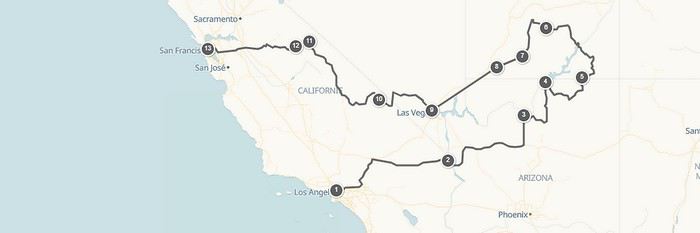
Notre mode d’hébergement fût plutôt simple, étant donné que c’était le même que notre moyen de transport. Notre SUV ! Nous voulions dormir dans des campings, ça c’était sûr, mais le fait de devoir tout le temps monter et démonter une tente ne nous enchantait guère. Un RV ? Bof, pas très pratique pour les pistes dans les parcs. Et puis je suis tombée sur un carnet de voyage ici, d’un couple ayant dormi à plat à l’arrière de la voiture. Adjugé vendu, c’est ainsi que nous allons faire ! Et franchement, on ne regrette pas du tout. Certes il faut sacrifier un peu de confort, mais certainement pas plus que dans une tente. Et puis on est encore jeunes, notre dos ne nous fait pas souffrir alors profitons ! Après des mois de préparation minutieuse, de changements d’itinéraire, de lecture de carnets, de J- ….., etc… le jour J est arrivé ! Alors, chers amis voyageurs, embarquez si l’envie vous en dit, dans ce 1rst US road trip !
JOUR 1 : Les valises sont bouclées, les papiers en règles, le road-book dans le sac à dos, et la motivation plus que présente ! Nous arrivons à l’aéroport de Zürich dans les temps, les différents contrôles se font sans aucun souci. Nous volerons avec Swiss, sur un boeing 777 tout neuf, sans escale jusqu’à Los Angeles. Le vol se passe très bien, heureusement qu’il y a des films car je ne dors que 20 minutes. Plus nous approchons du sol, plus je suis scotchée au hublot. Je crois reconnaître 2-3 endroits, sans certitude. Le survol de LA nous permet de voir quelques quartiers de villas bien alignées, avec leur piscine et parfois même leur court de tennis. On se pose, ça y est, on est arrivés ! Premier passage obligé, l’immigration. On doit être arrivés en même temps que 3 vols asiatiques vu le monde qu’il y a aux bornes. Franchement, c’est assez long, on mettra 1heure avant de passer. Bref, c’est vite oublié on a un nouveau tampon dans notre passeport ! Les valises récupérées, on doit encore passer un contrôle des bagages, cette fois assez rapide. Prochaine destination, Alamo pour récupérer notre voiture. C’est très bien indiqué, on trouve la navette qui nous y amène facilement, avec un chauffeur hyper sympa. Au guichet, tout se passe bien, on nous attribue un Ford Explorer. J’explique tout de même au monsieur que nous allons dormir dedans et que le véhicule doit être assez long et avoir des sièges rabattables à plat. Il m’assure que c’est le cas. Alors ok, allons sur parking. Quelques minutes plus tard, un employé arrive devant nous avec notre Fort fraîchement nettoyé, la carrosserie est même encore un peu mouillée. Et là, je m’attendais quand même à devoir remplir un constat avec lui en faisant le tour de la voiture, à recevoir quelques explications. Rien, il nous dit « have fun » et s’en va. Alors d’accord, on y va ! Avant ça, on teste quand même le coffre. C’est parfait, on a la place. La voiture est très récente, de février 2018, avec une multitude d’option dernier cri, c’est la classe ! Ce modèle rentre dans la catégorie Premium SUV. Le soleil vient de se coucher, c’est donc presque de nuit que Sam prend le volant pour rejoindre directement notre hôtel, le Rodeway Inn Hollywood. La route se fait sans encombre et nous pouvons parquer le Ford à l’hôtel. Après avoir déposé les valises dans la chambre (jolie car rénovée, contrairement au reste du bâtiment), on sort manger un truc vite fait. Il y a un Subway juste de l’autre côté de la route, ça fera très bien l’affaire. On y croit pas, on est aux Etats-Unis… ! Une fois de retour dans la chambre, on ne fait pas long car on est quand même crevés de ce voyage. A bientôt pour la suite !
Adeline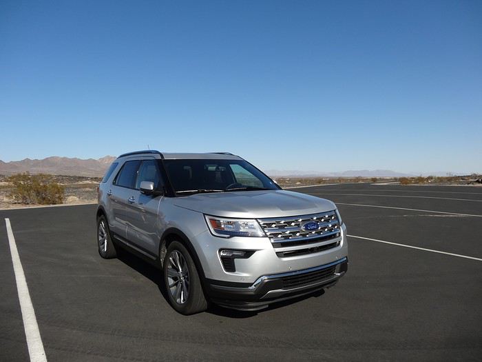
Voilà bientôt 2 mois que nous sommes rentrés de ce qui fût notre premier voyage aux Etats-Unis. Un fabuleux premier voyage ! Je me suis tellement inspirée des divers récits et discussions trouvées ça et là sur ce forum, souvent sans parler mais en lisant avec attention, que je me dois de vous raconter notre périple. Peut-être qu’un jour il aidera quelqu’un comme moi, en recherche d’informations, ou au moins aura-t-il peut-être le mérite de vous faire voyager un peu ! Un premier road-trip pas forcément hors des sentiers battus (je ne vais pas faire découvrir de nouveaux endroits aux habitués du forum), peut-être pas parfait, mais réussi de notre point de vue. Je ne compte pas étaler notre vie dans ce carnet, mais pour vous situer, voici qui nous sommes : Moi, Adeline et lui, Samuel, 25 ans tous les deux, avec plusieurs tampons dans notre passeport, mais aucun de ce continent. Rester sur une plage en lisant un magazine people, très très peu pour nous. On aime la randonnée, la nature, bouger (et la bière au camping). Voilà pour les présentations. Pour commencer, voici le parcours que nous avons réalisé, du 22 septembre au 11 octobre : Jour 1 : Arrivée à Los Angeles Jour 2 : Los Angeles Jour 3 : Los Angeles – Needles via Route 66 Jour 4 : Needles – Grand Canyon Jour 5 : Grand Canyon – Page Jour 6 : Page – Monument Valley Jour 7 : Monument Valley – Torrey Jour 8 : Torrey – Bryce Canyon Jour 9 : Bryce Canyon – Zion Jour 10 : Zion Jour 11 : Zion – Las Vegas Jour 12 : Las Vegas Jour 13 : Las Vegas – Death Valley Jour 14 : Death Valley – Lee Vining Jour 15 : Lee Vining – Yosemite Jour 16 : Yosemite Jour 17 : Yosemite – San Francisco Jour 18 : San Francisco Jour 19 : San Francisco Jour 20 : San Francisco – retour en Suisse
Notre mode d’hébergement fût plutôt simple, étant donné que c’était le même que notre moyen de transport. Notre SUV ! Nous voulions dormir dans des campings, ça c’était sûr, mais le fait de devoir tout le temps monter et démonter une tente ne nous enchantait guère. Un RV ? Bof, pas très pratique pour les pistes dans les parcs. Et puis je suis tombée sur un carnet de voyage ici, d’un couple ayant dormi à plat à l’arrière de la voiture. Adjugé vendu, c’est ainsi que nous allons faire ! Et franchement, on ne regrette pas du tout. Certes il faut sacrifier un peu de confort, mais certainement pas plus que dans une tente. Et puis on est encore jeunes, notre dos ne nous fait pas souffrir alors profitons ! Après des mois de préparation minutieuse, de changements d’itinéraire, de lecture de carnets, de J- ….., etc… le jour J est arrivé ! Alors, chers amis voyageurs, embarquez si l’envie vous en dit, dans ce 1rst US road trip !
JOUR 1 : Les valises sont bouclées, les papiers en règles, le road-book dans le sac à dos, et la motivation plus que présente ! Nous arrivons à l’aéroport de Zürich dans les temps, les différents contrôles se font sans aucun souci. Nous volerons avec Swiss, sur un boeing 777 tout neuf, sans escale jusqu’à Los Angeles. Le vol se passe très bien, heureusement qu’il y a des films car je ne dors que 20 minutes. Plus nous approchons du sol, plus je suis scotchée au hublot. Je crois reconnaître 2-3 endroits, sans certitude. Le survol de LA nous permet de voir quelques quartiers de villas bien alignées, avec leur piscine et parfois même leur court de tennis. On se pose, ça y est, on est arrivés ! Premier passage obligé, l’immigration. On doit être arrivés en même temps que 3 vols asiatiques vu le monde qu’il y a aux bornes. Franchement, c’est assez long, on mettra 1heure avant de passer. Bref, c’est vite oublié on a un nouveau tampon dans notre passeport ! Les valises récupérées, on doit encore passer un contrôle des bagages, cette fois assez rapide. Prochaine destination, Alamo pour récupérer notre voiture. C’est très bien indiqué, on trouve la navette qui nous y amène facilement, avec un chauffeur hyper sympa. Au guichet, tout se passe bien, on nous attribue un Ford Explorer. J’explique tout de même au monsieur que nous allons dormir dedans et que le véhicule doit être assez long et avoir des sièges rabattables à plat. Il m’assure que c’est le cas. Alors ok, allons sur parking. Quelques minutes plus tard, un employé arrive devant nous avec notre Fort fraîchement nettoyé, la carrosserie est même encore un peu mouillée. Et là, je m’attendais quand même à devoir remplir un constat avec lui en faisant le tour de la voiture, à recevoir quelques explications. Rien, il nous dit « have fun » et s’en va. Alors d’accord, on y va ! Avant ça, on teste quand même le coffre. C’est parfait, on a la place. La voiture est très récente, de février 2018, avec une multitude d’option dernier cri, c’est la classe ! Ce modèle rentre dans la catégorie Premium SUV. Le soleil vient de se coucher, c’est donc presque de nuit que Sam prend le volant pour rejoindre directement notre hôtel, le Rodeway Inn Hollywood. La route se fait sans encombre et nous pouvons parquer le Ford à l’hôtel. Après avoir déposé les valises dans la chambre (jolie car rénovée, contrairement au reste du bâtiment), on sort manger un truc vite fait. Il y a un Subway juste de l’autre côté de la route, ça fera très bien l’affaire. On y croit pas, on est aux Etats-Unis… ! Une fois de retour dans la chambre, on ne fait pas long car on est quand même crevés de ce voyage. A bientôt pour la suite !
Adeline
Vingt et un jours Paris - Québec / Montréal - Paris English translation pending
Bonjour,
Voyage Paris Québec /Montréal Paris du 15/06/19 au 6/07/19 Arrivée Québec 3jours 18/06 location de voiture pour départ Tadoussac 2 nuits 20/06 direction Baie comeau 1 nuit 21/06 traversée pour Cap Chat 2 nuits (parc Gaspesie) 23/06 cap des Rosiers 3 nuits (parc Forillon ) 26/06 percé 2 nuits 28/06 Carleton sur mer 1nuit 29/06 Bic parc du Bic 3 nuits 2/07 Montmagny 1nuit 3/07 rendre location voiture Québec puis bus pour Montréal 3/07 Montréal 3 nuits 6/07 Retour Paris Location principalement avec kitchenette , moyenne du prix par nuit 60 euros Il me reste la location de voiture à prendre . Des conseils ??
Voyage Paris Québec /Montréal Paris du 15/06/19 au 6/07/19 Arrivée Québec 3jours 18/06 location de voiture pour départ Tadoussac 2 nuits 20/06 direction Baie comeau 1 nuit 21/06 traversée pour Cap Chat 2 nuits (parc Gaspesie) 23/06 cap des Rosiers 3 nuits (parc Forillon ) 26/06 percé 2 nuits 28/06 Carleton sur mer 1nuit 29/06 Bic parc du Bic 3 nuits 2/07 Montmagny 1nuit 3/07 rendre location voiture Québec puis bus pour Montréal 3/07 Montréal 3 nuits 6/07 Retour Paris Location principalement avec kitchenette , moyenne du prix par nuit 60 euros Il me reste la location de voiture à prendre . Des conseils ??
Le monde du voyage peut-il coexister avec le monde ordinaire? English translation pending
Quand on attrape le virus du voyage, on vois la vie autrement. Tout ce que nos parents ainsi que la société à pu nous apprendre perd son sens au profit d'une autre vision de la vie. Cette vision nous sort de cette société de consommation et change notre conception de la société.
Je ne m’étale pas trop sur le sujet car ce message n'est qu'une introduction à notre discussion. alors d'après vous, est-il possible que ces deux mondes, celui du voyage et le monde ordinaire dans lequel la majorité des gens vivent, puisse coexister ? Si oui, comment ? Comment faites-vous dans la vie quotidienne pour concilier une condition qui vous incite à rester là où vous êtes et répéter une tâche jusqu'à la retraite et vos aspirations de voyage ? Que pensez-vous de tout ça ?
Je ne m’étale pas trop sur le sujet car ce message n'est qu'une introduction à notre discussion. alors d'après vous, est-il possible que ces deux mondes, celui du voyage et le monde ordinaire dans lequel la majorité des gens vivent, puisse coexister ? Si oui, comment ? Comment faites-vous dans la vie quotidienne pour concilier une condition qui vous incite à rester là où vous êtes et répéter une tâche jusqu'à la retraite et vos aspirations de voyage ? Que pensez-vous de tout ça ?