Results for "Grotte+Bleue+|+9+>+282"
12544 results found.
Réchauffement climatique en Alaska English translation pending
Bonjour,
Je reviens d'Alaska où j'ai passé 3 super semaines. J'étais déjà allée en Alaska il y a 8 ans. Cette fois, j'ai eu 2 jours de pluie… sur trois semaines, c'est terrible. Un grand ciel bleu, et à Tok (au sud de Fairbanks) nous avons branché un ventilateur dans la chambre.
Il y a 8 ans, ce n'était pas ainsi, il faisait plus frais et nous avons eu de la pluie, bref, un vrai temps d'Alaska.
Tout au nord, à Barrow, les habitants sont obligés de protéger le rivage avec d'énormes sacs afin que la mer n'attaque pas trop car les habitations pourraient s'écrouler…
Quelle tristesse…
😕
Retour d'un voyage de trois semaines au Mexique English translation pending
Bonjour à tous,
De retour depuis une semaine, je vous laisse un petit résumé pour vous aider si vous préparez un voyage dans ce pays génial.
Nous étions 5, les parents et les trois enfants de 6 ans, 8 ans et 16ans.
Nous avons loués une voiture à Mexico que nous avons rendus à Cancun avant de reprendre l'avion pour Lyon soit 3625 kms.
Notre trajet:
MEXICO
OAXACA
PUERTO ESCONDIDO
PUERTO ANGEL PLAYA LA BOQUILLA
SAN CRISTOBAL DE LAS CASAS
PALENQUE
CALAKMUL/BECAN
LAGUNE BACALAR
MERIDA
TULUM
PUERTO MORELOS
Nos coups de coeur:
Mexico sans voitures le dimanche pour cause de manisfestations(ambiance, Zapata n'est pas loin!!), les valadores, les peintures de Diego Rivera au palacio National pour comprendre l'histoire du Mexique en visualisant, bien suûr le musée mais il est immense(avec des enfants on survole!!!)
Oaxaca ville du chocolat et son marché typique pour petit déjeuner et le soir barbecue tapas une expérience !!
Puerto Escondido station balnéaire mexicaine
Puerto Angel Playa la Boquilla plage robinson crusoé
San Cristobal Canyon Sumidero, San Juan Chamula les rites mayas dans l'église (enfin j'étais la seule de la famille à apprécier)
Palenque les chutes et cascades aux alentours surtout la petite grottes sous la chute où nous a emmenés un mexicain avec petite cascade et chauves souris plein le plafond beurk!!
Calakmul et Becan 2 beaux sites perdus dans la forêt tropicale avec personne à part les moustiques(je ne vous parle pas des autres tout le monde connait!) avec les singes hurleurs comme compagnie
Laguna bacalar bleue turquoise, village typique écrasé par la chaleur
Merida notre ville préférée surtout le dimanche méga fête dans les rues sans voitures et les 3 cenotes du hameau de Cuzama (noter dans aucuns guides par chance 2 sympathiques hollandais nous l'ont conseillés)
Tulum on sent les resorts pas loin mais plage magnifique et peu de monde
Puerto Morelos un peu défait par le cyclone de l'année dernière mais typique malgré les alentours et à 20 minutes de l'aéroport
Les plus du Mexique:La facilité pour voyager sympa avec des enfants (panneaux routiers, sécurité, dans les villes tout se situe autour de la place centrale le zocalo), les routes en excellent état, la civilité des automobilistes notamment les camions et les bus, la facilité pour se nourrir et pas cher, la gentillesse des Mexicains malgré leur abord difficile au début, la diversité des paysages et la multitude de choses à faire, la richesse culturelle et politique, la musique toujours présente, le romantisme amoureux s'embrassant à pleine bouche souvent accompagnés d'un guitariste, des sièges par 2 pour les amoureux et l'architecture!!!, la gratuité des musées et des sites le dimanche.
Les moins: Toujours payer en liquide (mais il y a des distributeurs partout), les hotels sans petit dej compris, les resorts américains monstrueux sur la côte caraibes, à contrario des plus très ou trop civilisé par moment!!
Nos moments difficiles:avoir louper le rodéo à Mexico car je me suis trompée de jour( à faire si vous avez la chance d'être là un dimanche!!), l'arrivée à Mazunte devant l'hotel El Copal que nous avions réservés par internet avec de l'eau jusqu'au genoux à l'entrée (en fait fermé depuis 1 an)arnaque!! Ils voulaient nous faire payer un acompte depui la France on a toujours refusé ouf!Alors faites gaffe!!.
Pour la météo un peu frais à Mexico, Oaxaca et San cristobal normal altitude, pour le reste très chaud avec un peu de pluie mais sans plus (rien à voir avec le Costa Rica il y 2 ans à la même époque!!)
Bon voyage à tous
Mendiants dans la rue English translation pending
Donnez vous aux mendiants ??
Ballades et visites en Sardaigne au mois d'août English translation pending
nous partons pour la sardaigne du 2 au 22 aout, nous avons loué une caravane du côté d'oristano, dans la presqu'ile de sinis pour 897€, c'est la prix pour d'une semaine sur la côte en france! pourriez-vous m'indiquer ce qu'il y a à ne pas rater!
bonnes vacances à tous!
Excursions à Sosua English translation pending
Bonjour
Quelqu'un peut'il me renseigner? Lequel est le mieux pour les excursions à Sosua alf's tours ou mel' tour. et ont'ils des brochures en français.
Quelqu'un peut'il me renseigner? Lequel est le mieux pour les excursions à Sosua alf's tours ou mel' tour. et ont'ils des brochures en français.
Avis sur le choix d'une tente English translation pending
Salut a tous les randonneurs (et les autres),
A la recherche d'une tente legere 2p. pour la rando j'ai enqueté, ecumé, fouillé, gratté chez tous les revendeurs un peu specialisé "out-door" comme on dit, et voila j'en arrive tjr aux trois-quatre memes, et qui me plaisent bien en fait, cad Hubba Hubba, Zoid2, Tadpole et cie... Moi j'aime ces marques specialisé c'est plus fort que moi!
Mais a vrai dire c'est quand meme 300-400euro pour une tente, meme si c'est de "bonne qualité" j'en viens a me demander si tout ca est vraiment necessaire au final. Bref est-ce que ca vaut vraiment le coup d'investir autant ou est ce qu'une ptite tente Quechua a 99euro ne ferai pas l'affaire tout simplement. J'ai tjr un peu de mefiance envers ces produits mais peut etre que ce n'est pas fondé. Mon utilisation serai principalement "rando en france" et pas en hiver, enfin rarement. Sans me priver de qqc bons voyage si d'aventure ca me reprennait, andes, asie, amerique du nord, etc... Donc quelque chose de solide quand meme.
Enfin voila, si quelqu'un a fait son choix pour l'un ou pour l'autre et s'il l'a regreté ou pas, ca serai sympa d'eclairer ma lanterne... votre avis quoi...
😉 merci
A la recherche d'une tente legere 2p. pour la rando j'ai enqueté, ecumé, fouillé, gratté chez tous les revendeurs un peu specialisé "out-door" comme on dit, et voila j'en arrive tjr aux trois-quatre memes, et qui me plaisent bien en fait, cad Hubba Hubba, Zoid2, Tadpole et cie... Moi j'aime ces marques specialisé c'est plus fort que moi!
Mais a vrai dire c'est quand meme 300-400euro pour une tente, meme si c'est de "bonne qualité" j'en viens a me demander si tout ca est vraiment necessaire au final. Bref est-ce que ca vaut vraiment le coup d'investir autant ou est ce qu'une ptite tente Quechua a 99euro ne ferai pas l'affaire tout simplement. J'ai tjr un peu de mefiance envers ces produits mais peut etre que ce n'est pas fondé. Mon utilisation serai principalement "rando en france" et pas en hiver, enfin rarement. Sans me priver de qqc bons voyage si d'aventure ca me reprennait, andes, asie, amerique du nord, etc... Donc quelque chose de solide quand meme.
Enfin voila, si quelqu'un a fait son choix pour l'un ou pour l'autre et s'il l'a regreté ou pas, ca serai sympa d'eclairer ma lanterne... votre avis quoi...
😉 merci
Visites et logement pour trois jours à Bari en Italie English translation pending
Bonjour à tous!
Mon meilleur ami et moi-même passerons 3 jours et deux nuits à Bari du 10 au 13 août avant de prendre le ferry pour la Croatie le 13 au soir et d'après mes recherches l'hébergement à Bari n'est pas très évident, pour un budget serré notamment.
Pour ceux qui ont déjà connu cette ville plusieurs questions; siouplait !
quelle est la solution la plus avantageuse d'hébergement selon vous?
que faire à Bari? qu'avez vous pensé de cette ville?
Et en moins important y a-t-il une plage à Bari ou tout proche 😛 ?
Précision : nous sommes réduits à des moyens pédestres! pas de voiture, que les transports locaux...
Merci d'avance !
Mon meilleur ami et moi-même passerons 3 jours et deux nuits à Bari du 10 au 13 août avant de prendre le ferry pour la Croatie le 13 au soir et d'après mes recherches l'hébergement à Bari n'est pas très évident, pour un budget serré notamment.
Pour ceux qui ont déjà connu cette ville plusieurs questions; siouplait !
quelle est la solution la plus avantageuse d'hébergement selon vous?
que faire à Bari? qu'avez vous pensé de cette ville?
Et en moins important y a-t-il une plage à Bari ou tout proche 😛 ?
Précision : nous sommes réduits à des moyens pédestres! pas de voiture, que les transports locaux...
Merci d'avance !
Semuc Champey,Cuevas Candelaria et Sayaxché au Guatemala English translation pending
J'aimerais savoir si quelqu'un a visité Semuc champey,
cuevas de candelaria (grottes) et la région de sayaxché?
Car j'aimerais partir du lac Atitlan pour me rendre à tikal en passant par ces régions? Est-ce que cela en vaut la peine?
Merci Solange
cuevas de candelaria (grottes) et la région de sayaxché?
Car j'aimerais partir du lac Atitlan pour me rendre à tikal en passant par ces régions? Est-ce que cela en vaut la peine?
Merci Solange
Donne informations sur le Vietnam English translation pending
Bonjour a tous,
Si vous avez besoin d'infos sur le Vietnam exiter a me demander, je serai ravi de vous repondre.
Bonne annee chinoise !!!
massage à varadero English translation pending
Pour les futurs touristes de cuba qui vont séjourner à varadero et qui ont envie de se faire du bien (sans arrière pensée) à vraiment pas cher je vous conseille cette petit adresse.
Il y a à Varadero un parc naturel préservé non loin des hotels. Dans ce parc on peut voir le cactus le plus vieux de cuba (huit cent ans il parait), bon c'est pas le plus interessant. ce parc est longé par une plage. Sur cette plage il y a une petite paillotte où une cubain vous fait un massage ( et quand je dis un massage c'est plutot LE massage).
Je détaille :pour 12 pesos convertible vous avez le gommage intégral, le massage et la réfléxologie. Le gommage c'est à partir de sable très fin, un vrai délice (déconseillé en cas de très fort coup de soleil quand même), et on se rince dans la mer un vrai moment de bonheur. Le massage (avec du miel) la détente absolument avec le bruit de la mer en fond et un superbe ciel bleu. Et pour finir le nec plus ultra la réflexologie. et là franchement le gars il s'y connait: il a remis les vertèbres de mon mari qui se trainait péniblement depuis le début du voyage et il m'a débloqué chez moi des points douloureux. Compter une heure par massage environ ( moi j'ai eu le droit à plus longtemps parce qu'il n'y avait personne après moi et qu'il a montrer à mon mari ce qu'il pouvait me faire comme massage à la maison).😄
En plus si vous vous débrouillez bien en espagnol, il vous expliquera des petites astuces pour faire continuer les bienfaits une fois rentré.
Petite note pour ceux que cela pourrait géner: le masseur fini en chassant les esprit (d'après ce qu'il m'a semblé)
Voilà je vous ai donné envie alors suivez le guide: De varadero allez vers la pointe de la péninsule vous passerez devant le grand hotel qui se construit un peu en forme de pyramide puis devant le club amigo (après le delphinarium), vous passez devant la grotte (sur votre gauche (intéressant à voir pour ceux qui n'ont pas peur des chauves souris mais un peu chere)). Vous tournez à la première à gauche (il y a un parc juste au carrefour mais ce n'est pas celui ci), un peu plus loin il y a une entrée avec une grille qui indique le cactus centenaire, pénétrer dans le parc. Normalement vous allez croiser un gars qui va vous parler du cactus (c 3 pesos par personne pour visite guidée de 15mn à peine en espagnol et en anglais mais pas en francais) et il y a la plage. Nous on est passé par le parc pour atteindre le masseur et on a fait la visite guidée donc je ne peux pas vous dire si par la plage c'est loin (Y a surement encore un peu de marche parce qu'on a du pédaler pour l'atteindre).
En tout cas ça vaux le déplacement et quand on connait les prix d'un bon massage en France....
Profitez en bien
Il y a à Varadero un parc naturel préservé non loin des hotels. Dans ce parc on peut voir le cactus le plus vieux de cuba (huit cent ans il parait), bon c'est pas le plus interessant. ce parc est longé par une plage. Sur cette plage il y a une petite paillotte où une cubain vous fait un massage ( et quand je dis un massage c'est plutot LE massage).
Je détaille :pour 12 pesos convertible vous avez le gommage intégral, le massage et la réfléxologie. Le gommage c'est à partir de sable très fin, un vrai délice (déconseillé en cas de très fort coup de soleil quand même), et on se rince dans la mer un vrai moment de bonheur. Le massage (avec du miel) la détente absolument avec le bruit de la mer en fond et un superbe ciel bleu. Et pour finir le nec plus ultra la réflexologie. et là franchement le gars il s'y connait: il a remis les vertèbres de mon mari qui se trainait péniblement depuis le début du voyage et il m'a débloqué chez moi des points douloureux. Compter une heure par massage environ ( moi j'ai eu le droit à plus longtemps parce qu'il n'y avait personne après moi et qu'il a montrer à mon mari ce qu'il pouvait me faire comme massage à la maison).😄
En plus si vous vous débrouillez bien en espagnol, il vous expliquera des petites astuces pour faire continuer les bienfaits une fois rentré.
Petite note pour ceux que cela pourrait géner: le masseur fini en chassant les esprit (d'après ce qu'il m'a semblé)
Voilà je vous ai donné envie alors suivez le guide: De varadero allez vers la pointe de la péninsule vous passerez devant le grand hotel qui se construit un peu en forme de pyramide puis devant le club amigo (après le delphinarium), vous passez devant la grotte (sur votre gauche (intéressant à voir pour ceux qui n'ont pas peur des chauves souris mais un peu chere)). Vous tournez à la première à gauche (il y a un parc juste au carrefour mais ce n'est pas celui ci), un peu plus loin il y a une entrée avec une grille qui indique le cactus centenaire, pénétrer dans le parc. Normalement vous allez croiser un gars qui va vous parler du cactus (c 3 pesos par personne pour visite guidée de 15mn à peine en espagnol et en anglais mais pas en francais) et il y a la plage. Nous on est passé par le parc pour atteindre le masseur et on a fait la visite guidée donc je ne peux pas vous dire si par la plage c'est loin (Y a surement encore un peu de marche parce qu'on a du pédaler pour l'atteindre).
En tout cas ça vaux le déplacement et quand on connait les prix d'un bon massage en France....
Profitez en bien
Second trip to Curaçao Island
Returning to Curaçao is a bit like reopening a book whose pages still smell of sun and salt.
As soon as the plane descends toward the island, the familiar colors reappear: the dazzling turquoise of the sea, the pastel facades of Willemstad, and that unique light that seems to soften everything.
For this second trip, we no longer arrive as hesitant explorers, but as confirmed lovers of this warm island.
We already know that the warm wind will welcome us as soon as we step out of the airport, that the beaches will once again offer their infinite shades of blue, and that each day will have that unhurried pace that makes you forget the rest of the world.
Yet, despite this sense of déjà vu, Curaçao always manages to surprise. A new cove to discover, a different sunset, a smile shared with a local...
The island has that rare talent for reinventing itself without ever betraying what makes it so endearing.
This second trip isn’t a repetition, then, but a reunion: a chance to rediscover Curaçao with more attentive, more connected, and perhaps even more amazed eyes.
I invite you to keep reading this travel journal and watch the videos that will help you learn a little more about the island’s different attractions.
Just click on the video image to start watching.
To go to a specific post, here are the appropriate links:
Exploring Willemstad’s colorful neighborhoods The Most Beautiful Beaches in Curaçao Hike at Boka Sint Michiel | Flamingos & panoramic views Climbing Christoffel Mountain Den Dunki & Flamingos of Jan Thiel Must-see spots in Curaçao Snorkeling at Playa Kenepa Chiki: Turquoise Water & Tropical Fish Snorkeling at Porto Mari: One of Curaçao’s Best Spots Snorkeling at Mambo Beach, the Perfect Spot Snorkeling at Daaibooi Beach, a diverse marine world
As soon as the plane descends toward the island, the familiar colors reappear: the dazzling turquoise of the sea, the pastel facades of Willemstad, and that unique light that seems to soften everything.
For this second trip, we no longer arrive as hesitant explorers, but as confirmed lovers of this warm island.
We already know that the warm wind will welcome us as soon as we step out of the airport, that the beaches will once again offer their infinite shades of blue, and that each day will have that unhurried pace that makes you forget the rest of the world.
Yet, despite this sense of déjà vu, Curaçao always manages to surprise. A new cove to discover, a different sunset, a smile shared with a local...
The island has that rare talent for reinventing itself without ever betraying what makes it so endearing.
This second trip isn’t a repetition, then, but a reunion: a chance to rediscover Curaçao with more attentive, more connected, and perhaps even more amazed eyes.
I invite you to keep reading this travel journal and watch the videos that will help you learn a little more about the island’s different attractions.
Just click on the video image to start watching.
To go to a specific post, here are the appropriate links:
Exploring Willemstad’s colorful neighborhoods The Most Beautiful Beaches in Curaçao Hike at Boka Sint Michiel | Flamingos & panoramic views Climbing Christoffel Mountain Den Dunki & Flamingos of Jan Thiel Must-see spots in Curaçao Snorkeling at Playa Kenepa Chiki: Turquoise Water & Tropical Fish Snorkeling at Porto Mari: One of Curaçao’s Best Spots Snorkeling at Mambo Beach, the Perfect Spot Snorkeling at Daaibooi Beach, a diverse marine world
Iceland: To do the Golden Circle or not?
Hi everyone! 🙂
For once, I'm heading north... I’ve decided to spend a short time in Iceland, alone, during the first week of July. I’ll only have 5 full days there. Sure, it’s not much, so I’ll focus on what attracts me the most: the Highlands. Obviously, renting a 4x4—or even a regular car—on my own isn’t an option. That’s why I’m breaking my (probably unfounded) principles and have contacted local agencies for "day tours" in small-group format. Well, small-group up to 15 people, anyway... Oh well, I’m going for it! I’m really hesitant about visiting the Golden Circle on the last day, since I’ve read it’s become super crowded. I’d love your thoughts on this. Plus, if I visit that area, I’d want to include Bruarfoss, and as far as I know, only the Troll agency offers that detour. There’s also the Snaefellsnes Peninsula excursion that appeals to me, but it seems time-consuming. Time-consuming like the Jokulsarlon tour I’ve already booked. (But that’s on the first day, so I’ll still be full of energy!) By the last day, I’ll probably be running on empty... Otherwise, I’ll be doing 3 4x4 excursions that I’m really excited about: 1 in Thorsmork Valley, 1 in Landmannalaugar, and 1 in Kerlingarfjöll.
So, Golden Circle or no Golden Circle—that’s the question... Or maybe a relaxed day visiting Reykjavik and a lagoon. Blue Lagoon? Sky Lagoon? Meh...
For once, I'm heading north... I’ve decided to spend a short time in Iceland, alone, during the first week of July. I’ll only have 5 full days there. Sure, it’s not much, so I’ll focus on what attracts me the most: the Highlands. Obviously, renting a 4x4—or even a regular car—on my own isn’t an option. That’s why I’m breaking my (probably unfounded) principles and have contacted local agencies for "day tours" in small-group format. Well, small-group up to 15 people, anyway... Oh well, I’m going for it! I’m really hesitant about visiting the Golden Circle on the last day, since I’ve read it’s become super crowded. I’d love your thoughts on this. Plus, if I visit that area, I’d want to include Bruarfoss, and as far as I know, only the Troll agency offers that detour. There’s also the Snaefellsnes Peninsula excursion that appeals to me, but it seems time-consuming. Time-consuming like the Jokulsarlon tour I’ve already booked. (But that’s on the first day, so I’ll still be full of energy!) By the last day, I’ll probably be running on empty... Otherwise, I’ll be doing 3 4x4 excursions that I’m really excited about: 1 in Thorsmork Valley, 1 in Landmannalaugar, and 1 in Kerlingarfjöll.
So, Golden Circle or no Golden Circle—that’s the question... Or maybe a relaxed day visiting Reykjavik and a lagoon. Blue Lagoon? Sky Lagoon? Meh...
Feedback on a 2-week Thailand itinerary with kids
Hello!
After a long travel hiatus, we’re (finally) back on the road for some getaways! Now with two kids in tow, we’re heading to Thailand for two weeks next February (a destination that’s stood us up twice before but seems perfect for our first big family trip).
We’d have loved to stay longer, but two weeks is already a great start and will be plenty enjoyable.
Key points: - Experience Thailand, not just live our usual routine in Thailand - Avoid crowds as much as possible, even though February will be busy - Not big city fans, so Bangkok (BKK) will be kept to a minimum - Focus on nature, the sea, forests, waterfalls, hiking, kayaking...
At this stage, here’s the rough itinerary I’m considering: - Arrival at 7 AM + a day in BKK
- DEPART for SURAT THANI (BUS) - Transfer + Khao Sok (overnight on the lake / in the trees)
- RETURN to Ko Samui - Transfer to Koh Pha Ngan or Koh Tao (snorkeling)
- RETURN to Khao Lak. While there: * Visit Ao Phang Nga Park by kayak * Excursion to caves / Ko Khao Phing Kan (the "007 beach" lol) * ALTERNATIVE = SIMILAN ISLANDS
- RETURN to KRABI or Koh Phi Phi * Visit Koh Hong or Koh Yao Yai
* Flight from SURAT THANI to BKK - If time left in BKK: - Explore BKK: Wat Pho / floating market / Maeklong Railway Market / Chinatown... - Or a day trip to Ayutthaya - Or a day at Erawan Waterfall (Haew Suwat) - Day +1 = Return to France
Questions I’m pondering: - Is this too ambitious? I think it might be... but since we’d rather see as much as possible than just lounge on a beach... - How to get around on this route? Bus or rental vehicle (which I’d prefer to avoid) - Are there any inconsistencies in the plan I’ve outlined? - Should I adjust any connections or prioritize differently? - Krabi vs. Koh Phi Phi? - Koh Hong vs. Koh Yao Yai?
We’ve booked the first night (using some leftover backpacking perks), but nothing else—so open to all ideas!
If you know a local agency that can offer advice (for a fee), that could work too, since the options feel endless...
Thanks so much for reading this far, and even more if you’ve got tips or suggestions to share!! Best wishes ;)
After a long travel hiatus, we’re (finally) back on the road for some getaways! Now with two kids in tow, we’re heading to Thailand for two weeks next February (a destination that’s stood us up twice before but seems perfect for our first big family trip).
We’d have loved to stay longer, but two weeks is already a great start and will be plenty enjoyable.
Key points: - Experience Thailand, not just live our usual routine in Thailand - Avoid crowds as much as possible, even though February will be busy - Not big city fans, so Bangkok (BKK) will be kept to a minimum - Focus on nature, the sea, forests, waterfalls, hiking, kayaking...
At this stage, here’s the rough itinerary I’m considering: - Arrival at 7 AM + a day in BKK
- DEPART for SURAT THANI (BUS) - Transfer + Khao Sok (overnight on the lake / in the trees)
- RETURN to Ko Samui - Transfer to Koh Pha Ngan or Koh Tao (snorkeling)
- RETURN to Khao Lak. While there: * Visit Ao Phang Nga Park by kayak * Excursion to caves / Ko Khao Phing Kan (the "007 beach" lol) * ALTERNATIVE = SIMILAN ISLANDS
- RETURN to KRABI or Koh Phi Phi * Visit Koh Hong or Koh Yao Yai
* Flight from SURAT THANI to BKK - If time left in BKK: - Explore BKK: Wat Pho / floating market / Maeklong Railway Market / Chinatown... - Or a day trip to Ayutthaya - Or a day at Erawan Waterfall (Haew Suwat) - Day +1 = Return to France
Questions I’m pondering: - Is this too ambitious? I think it might be... but since we’d rather see as much as possible than just lounge on a beach... - How to get around on this route? Bus or rental vehicle (which I’d prefer to avoid) - Are there any inconsistencies in the plan I’ve outlined? - Should I adjust any connections or prioritize differently? - Krabi vs. Koh Phi Phi? - Koh Hong vs. Koh Yao Yai?
We’ve booked the first night (using some leftover backpacking perks), but nothing else—so open to all ideas!
If you know a local agency that can offer advice (for a fee), that could work too, since the options feel endless...
Thanks so much for reading this far, and even more if you’ve got tips or suggestions to share!! Best wishes ;)
Review of an Aegean Sea cruise on Ponant's Bougainville from November 1-8, 2025
Hello everyone,
If you'd like, I invite you to join me for a week-long cruise to northern Greece, visiting ports that are often less crowded with cruise ships.
Itinerary: Athens, Skiathos, Volos, Thessaloniki, Kavala, Limnos, Hydra, Athens
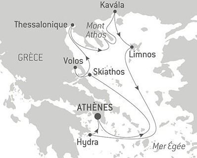
If you'd like, I invite you to join me for a week-long cruise to northern Greece, visiting ports that are often less crowded with cruise ships.
Itinerary: Athens, Skiathos, Volos, Thessaloniki, Kavala, Limnos, Hydra, Athens
Two weeks in Corfu with the family – our feedback
Hi everyone,
Here’s a little account of our two-week family trip (with two boys aged 7 and 10) to Corfu. I hope it helps other travelers! We chose Corfu because there are direct flights from Paris, and we were looking for a destination where it’d be easy to swim with the kids. We were there from August 14 to 28.
Since I wasn’t sure about the distances and had read quite a bit about Greek driving and the state of the roads, I decided to split the trip into three parts: Corfu Town, the North, and the South.
Corfu Town (3 nights) Day 1: We landed in the late afternoon. Booked three nights via Booking on the edge of the old town (Sueno Garden Apartment), which is walkable from the airport—no need to rent a car for the first few days or stay in Corfu Town. First evening in the old town, dinner at Pane e Souvlaki on Dimarchiou Square. Touristy, but good vibes.
Day 2: Visited the Old Fort. Nice for the Church of St. George, which looks like an ancient Greek temple, and especially for the 360° view from the top. By 11 a.m., the sun was already beating down. Left the fort and strolled through the People’s Gardens. Lunch at Mouragia a bit further away, then backtracked to let the kids swim at Faliraki Bathing Beach.
Day 3: We took bus line 2A from Spinada (in front of the Old Fort) to the end of the runway (stop ΚΑΛΟΚΑΙΡΙ Ε). Poorly signposted when you’re at the top—you have to go down via the bar. Not well set up, which is a shame. The Panagia Vlacherna Monastery is pretty on its little island, but don’t turn around—the landings are impressive. Returned via the 2A with a stop at Mon Repos Beach, where the kids loved jumping off the pier.
North (6 nights) Day 4: Headed to Sidari, rented a small Fiat Panda from Europcar—no issues with this rental company (I booked late, so it’s probably possible to find cheaper). We’d also booked via Booking at Blue Dreams Apartment, just south of Sidari. A family-run hotel with a nice pool, we had a great stay (it’s just been taken over by Belgians who speak French). We wandered around Sidari to the Canal d’Amour. Not easy to access—you have to walk through all the bars, and the tiny beach is pretty dirty. Still, it’s fun for a swim and exploring the cave.
Day 5: Quick breakfast to be at Cap Drastis by 9 a.m. Parked at the top, but there’s very little space (we couldn’t park on the way back), and it’s a dirt road. The signs saying “To the sea” actually lead to a boat dock for a cape tour. You only see the cape from above, not below. A bit of a letdown, but since it was early and no one was down there yet, we treated ourselves to a quick swim. Brunch back in Sidari at Eviva—I recommend it: not Greek at all, but high quality. Agios Stefanos in the late afternoon after the heat. The port is awful (dirty and uninteresting), but there’s a swimming spot just before the beach, near the old port (park above, by the church). No one was there—great moment with the kids.
Day 6: Left around 9 a.m. for Mount Pantokrator. A bit of a climb at the end in the Fiat Panda—it’s steep! The road is long, but I think it’s worth it for the lunar landscape at the top, the monastery-antenna, and the 360° view. Then down to Kassiopi (we paid 5 euros for the Kassiopi Car Park—I think it’s the best option, as there’s no big free parking like in Sidari) and a swim at Paralia Mpataria (small but nice). Really relaxing in the late afternoon. Walked around the peninsula and saw several dolphin pods with amazing jumps. Unforgettable. Kassiopi is more family-friendly than Sidari and has more charm (Sidari has none, so that’s easy!).
Day 7: Morning off at the hotel, then afternoon at Paralia Kalamaki for the inflatable playground the kids had spotted on the way back from Kassiopi. 10 euros per person for an hour, not many people around 4 p.m., and we had a blast. Shallow sandy beach. Not much marine life, but safe for young kids. Note: free freshwater shower. Dinner at Nikos Family Restaurant in Roda. Great welcome and atmosphere. The stifado and soutzoukakia were delicious, and the Greek desserts were amazing too. Next door, at Roda Park restaurant, there was a Greek party with traditional dancing and plaster plate-smashing. Even though we didn’t eat there, everyone was invited to join in the street—it was fun. Probably touristy, but pretty spontaneous, and it was a good time.
Day 8: I’d booked two dives in Paleokastritsa with Achilleon Diving Center, directly via WhatsApp. Great international vibe, two easy but interesting dives (a barracuda school and a “cow” nudibranch at Colovri Reefs, cool crevasses and holes at Donald’s Place). In the afternoon, we visited the Paleokastritsa Monastery (well-maintained, pretty nice) and spent some time at the beach (very crowded).
Day 9: Day off—we enjoyed the hotel pool and went to Olea next door to buy a small olive wood souvenir. Note that the old man who works the wood doesn’t have many fingers left…
South (5 nights) Day 10: Headed to Lefkimmi. Stopped at Achilleion on the way. I knew from reviews that only the gardens were accessible, but I think it’s worth it, even at 7 euros. We passed by the French military cemetery nearby (nothing special, poorly signposted but quiet and peaceful) and ate at Elia Tavern right next door: super good, best calamari of the trip. We’d booked our accommodation at Villa Rosa South Corfu, a bit outside Lefkimmi, near Alikes. Pretty isolated, but the beach is a 3-minute walk away, right next to the old salt pans. On the way, we saw a poster (use Google Lens to translate) for a local festival near Linia. We went that evening: barbecue, concert, and local dancing. Lots of people, but only locals—it was a great time.
Day 11: Short “hike” to Arkoudilas. We parked at the exit of Kavos, just before The Rose Tree restaurant. Some people drive all the way to the beach, but it’s very rocky. We followed the “Monastery” path to see Cape Asprokavos and the ruins of the monastery nearby. To avoid backtracking, we continued through the woods after the monastery to reach Arkoudilas Beach. Nice shaded walk, but dusty road. Dinner at Agali on the Potami Canal (friendly family vibe, but long wait).
Day 12: Boat trip to Sivota with Pegasus. A wooden boat, human-sized. Crowded, but not cramped. Two swimming stops (Blue Lagoon in the morning and a beach in the afternoon) and a 2-hour stop at noon in Sivota. We knew it’d be touristy, but the vibe was good, with some dancing on the way back. Not too many people at the swimming stops.
Day 13: Kouris Museum in Lefkimmi. Okay, don’t go for the history—the guide cracks more jokes than gives rational explanations. Still, we laughed a lot and had a great time. Lunch at The Village on the main road: very fresh, very good. Perfect homemade dip platter. Not the best location since it’s right on the road, but it’s worth it. Free ice cream for the kids, super-friendly owner. Fresh ratatouille (finally, some veggies!). Afternoon at Paralia Issos. View of Korission Lagoon and a walk through the sand dunes, a bit like the Sahara in places (hard to do before 5 p.m., even 6 p.m., because of the heat).
Day 14: I’d booked a visit/tasting at Pontiglio Winery. Short tour of the small site and tasting of the 4 wines produced there: 2 whites, 1 red, 1 rosé. Fresh homemade snacks, fruit for the kids, great welcome. Then to Paralia Kanoula Beach. Mikro Nisi Bar, sunbeds at 20 euros—expensive. But a nice beach with some rocks, so a bit of marine life. We saw octopuses while snorkeling with the kids—great moment.
Honest take on Corfu The island is dirty—not just at the garbage sites, which aren’t collected often enough and overflow constantly, but everywhere. Not a single square meter without cigarette butts, even if you get off the main paths. Stray cats everywhere, wasps everywhere, sewage smells often.
The natural heritage is stunning but ruined by private encroachment on the coastline. Bars and restaurants take over the land right up to the sea. I’d only been to Santorini and Paros about ten years ago, and I don’t remember it being like this at all. Maybe the Cyclades are different now. From talking to a few tourists here and there, it seems Crete is better managed. We still had a good vacation, even if it was sometimes hard to overlook the dirtiness.
Here’s a little account of our two-week family trip (with two boys aged 7 and 10) to Corfu. I hope it helps other travelers! We chose Corfu because there are direct flights from Paris, and we were looking for a destination where it’d be easy to swim with the kids. We were there from August 14 to 28.
Since I wasn’t sure about the distances and had read quite a bit about Greek driving and the state of the roads, I decided to split the trip into three parts: Corfu Town, the North, and the South.
Corfu Town (3 nights) Day 1: We landed in the late afternoon. Booked three nights via Booking on the edge of the old town (Sueno Garden Apartment), which is walkable from the airport—no need to rent a car for the first few days or stay in Corfu Town. First evening in the old town, dinner at Pane e Souvlaki on Dimarchiou Square. Touristy, but good vibes.
Day 2: Visited the Old Fort. Nice for the Church of St. George, which looks like an ancient Greek temple, and especially for the 360° view from the top. By 11 a.m., the sun was already beating down. Left the fort and strolled through the People’s Gardens. Lunch at Mouragia a bit further away, then backtracked to let the kids swim at Faliraki Bathing Beach.
Day 3: We took bus line 2A from Spinada (in front of the Old Fort) to the end of the runway (stop ΚΑΛΟΚΑΙΡΙ Ε). Poorly signposted when you’re at the top—you have to go down via the bar. Not well set up, which is a shame. The Panagia Vlacherna Monastery is pretty on its little island, but don’t turn around—the landings are impressive. Returned via the 2A with a stop at Mon Repos Beach, where the kids loved jumping off the pier.
North (6 nights) Day 4: Headed to Sidari, rented a small Fiat Panda from Europcar—no issues with this rental company (I booked late, so it’s probably possible to find cheaper). We’d also booked via Booking at Blue Dreams Apartment, just south of Sidari. A family-run hotel with a nice pool, we had a great stay (it’s just been taken over by Belgians who speak French). We wandered around Sidari to the Canal d’Amour. Not easy to access—you have to walk through all the bars, and the tiny beach is pretty dirty. Still, it’s fun for a swim and exploring the cave.
Day 5: Quick breakfast to be at Cap Drastis by 9 a.m. Parked at the top, but there’s very little space (we couldn’t park on the way back), and it’s a dirt road. The signs saying “To the sea” actually lead to a boat dock for a cape tour. You only see the cape from above, not below. A bit of a letdown, but since it was early and no one was down there yet, we treated ourselves to a quick swim. Brunch back in Sidari at Eviva—I recommend it: not Greek at all, but high quality. Agios Stefanos in the late afternoon after the heat. The port is awful (dirty and uninteresting), but there’s a swimming spot just before the beach, near the old port (park above, by the church). No one was there—great moment with the kids.
Day 6: Left around 9 a.m. for Mount Pantokrator. A bit of a climb at the end in the Fiat Panda—it’s steep! The road is long, but I think it’s worth it for the lunar landscape at the top, the monastery-antenna, and the 360° view. Then down to Kassiopi (we paid 5 euros for the Kassiopi Car Park—I think it’s the best option, as there’s no big free parking like in Sidari) and a swim at Paralia Mpataria (small but nice). Really relaxing in the late afternoon. Walked around the peninsula and saw several dolphin pods with amazing jumps. Unforgettable. Kassiopi is more family-friendly than Sidari and has more charm (Sidari has none, so that’s easy!).
Day 7: Morning off at the hotel, then afternoon at Paralia Kalamaki for the inflatable playground the kids had spotted on the way back from Kassiopi. 10 euros per person for an hour, not many people around 4 p.m., and we had a blast. Shallow sandy beach. Not much marine life, but safe for young kids. Note: free freshwater shower. Dinner at Nikos Family Restaurant in Roda. Great welcome and atmosphere. The stifado and soutzoukakia were delicious, and the Greek desserts were amazing too. Next door, at Roda Park restaurant, there was a Greek party with traditional dancing and plaster plate-smashing. Even though we didn’t eat there, everyone was invited to join in the street—it was fun. Probably touristy, but pretty spontaneous, and it was a good time.
Day 8: I’d booked two dives in Paleokastritsa with Achilleon Diving Center, directly via WhatsApp. Great international vibe, two easy but interesting dives (a barracuda school and a “cow” nudibranch at Colovri Reefs, cool crevasses and holes at Donald’s Place). In the afternoon, we visited the Paleokastritsa Monastery (well-maintained, pretty nice) and spent some time at the beach (very crowded).
Day 9: Day off—we enjoyed the hotel pool and went to Olea next door to buy a small olive wood souvenir. Note that the old man who works the wood doesn’t have many fingers left…
South (5 nights) Day 10: Headed to Lefkimmi. Stopped at Achilleion on the way. I knew from reviews that only the gardens were accessible, but I think it’s worth it, even at 7 euros. We passed by the French military cemetery nearby (nothing special, poorly signposted but quiet and peaceful) and ate at Elia Tavern right next door: super good, best calamari of the trip. We’d booked our accommodation at Villa Rosa South Corfu, a bit outside Lefkimmi, near Alikes. Pretty isolated, but the beach is a 3-minute walk away, right next to the old salt pans. On the way, we saw a poster (use Google Lens to translate) for a local festival near Linia. We went that evening: barbecue, concert, and local dancing. Lots of people, but only locals—it was a great time.
Day 11: Short “hike” to Arkoudilas. We parked at the exit of Kavos, just before The Rose Tree restaurant. Some people drive all the way to the beach, but it’s very rocky. We followed the “Monastery” path to see Cape Asprokavos and the ruins of the monastery nearby. To avoid backtracking, we continued through the woods after the monastery to reach Arkoudilas Beach. Nice shaded walk, but dusty road. Dinner at Agali on the Potami Canal (friendly family vibe, but long wait).
Day 12: Boat trip to Sivota with Pegasus. A wooden boat, human-sized. Crowded, but not cramped. Two swimming stops (Blue Lagoon in the morning and a beach in the afternoon) and a 2-hour stop at noon in Sivota. We knew it’d be touristy, but the vibe was good, with some dancing on the way back. Not too many people at the swimming stops.
Day 13: Kouris Museum in Lefkimmi. Okay, don’t go for the history—the guide cracks more jokes than gives rational explanations. Still, we laughed a lot and had a great time. Lunch at The Village on the main road: very fresh, very good. Perfect homemade dip platter. Not the best location since it’s right on the road, but it’s worth it. Free ice cream for the kids, super-friendly owner. Fresh ratatouille (finally, some veggies!). Afternoon at Paralia Issos. View of Korission Lagoon and a walk through the sand dunes, a bit like the Sahara in places (hard to do before 5 p.m., even 6 p.m., because of the heat).
Day 14: I’d booked a visit/tasting at Pontiglio Winery. Short tour of the small site and tasting of the 4 wines produced there: 2 whites, 1 red, 1 rosé. Fresh homemade snacks, fruit for the kids, great welcome. Then to Paralia Kanoula Beach. Mikro Nisi Bar, sunbeds at 20 euros—expensive. But a nice beach with some rocks, so a bit of marine life. We saw octopuses while snorkeling with the kids—great moment.
Honest take on Corfu The island is dirty—not just at the garbage sites, which aren’t collected often enough and overflow constantly, but everywhere. Not a single square meter without cigarette butts, even if you get off the main paths. Stray cats everywhere, wasps everywhere, sewage smells often.
The natural heritage is stunning but ruined by private encroachment on the coastline. Bars and restaurants take over the land right up to the sea. I’d only been to Santorini and Paros about ten years ago, and I don’t remember it being like this at all. Maybe the Cyclades are different now. From talking to a few tourists here and there, it seems Crete is better managed. We still had a good vacation, even if it was sometimes hard to overlook the dirtiness.
Exploring southern and western Iceland by 4x4
Hi there,
I’m looking to put together a group of 4 people to explore western and southern Iceland. The snow conditions in November (second half of the month) make access to the north and east tricky. Why November? The nighttime conditions (between 9 PM and 2 AM are ideal for spotting the northern lights), there’s still daylight (days run from about 9:30 AM to 5:30 PM—so we’ll need to start the day while it’s still dark), it’s not too cold (between 0 and 5 °C), and prices are more attractive than in late summer or during the December holidays.
I plan to use a provider to handle the logistics of the itinerary, which we’ll need to stick to (see details below). The provider charges 1345 € per person (price based on 2 people, but it’s better to have 4 to lower the cost per person since the vehicle rate is the same for 2, 3, or 4 people). We can tweak the itinerary a bit, but we all know that if we stray too far from the proposed offer, the price can quickly go up. Included:
7 nights in a guesthouse or hotel, twin or double room, shared facilities, and breakfast included. 7 days of rental for a 4-wheel-drive vehicle suited to the group size, unlimited mileage (fuel is on us), CDW insurance, and a second driver option. A road map and detailed itinerary A 24/7 French-speaking assistance service
Base itinerary proposed by the agency... It seems solid, given we’ll be there for 8 days (arrival and departure included). It’s possible to extend (by paying for extra accommodation) depending on your flight departure date. Day 1: Arrival in Iceland From the airport, the Blue Lagoon (optional) for a swim in its warm, turquoise, and milky waters. Then, the drive to Reykjavík, crossing the wild and lunar landscapes of the Reykjanes Peninsula. Explore the Icelandic capital, Reykjavík. Distance: 55 km. Meals: on your own. Accommodation: guesthouse in Reykjavík or the surrounding area.
Day 2: Exploring the west coast around Snæfellsjökull The west coast in the Snæfellsnes region. Cliffs, wild coastlines, and isolated farms in vast open spaces. Around the Snæfellsjökull volcano, the gateway to Jules Verne’s *Journey to the Center of the Earth*, you’ll discover the Djúpalónssandur reefs, the charming little port of Arnarstapi, nestled beneath the glacier, and the ports of the north coast, Grundarfjörður and Stykkishólmur. Distance: 260 km.
Day 3: Borgarfjörður, Reykholt & the Hraunfossar & Barnafoss waterfalls The lovely and unique Hraunfossar and Barnafoss waterfalls, before visiting Reykholt, the historic home of Snorri Sturluson, a famous 13th-century writer, poet, and historian. Distance: 160 km. Day 4: The famous Golden Circle The three most famous sites in the country, forming the Golden Circle. First, the Þingvellir tectonic rift, where you can hike or even dive between the two tectonic plates in a stunning, vast lake. Geysir, to see its hot springs and the Strokkur geyser. Finally, the impressive Gullfoss waterfall. You can also relax in one of the hot springs in the area. Distance: 160 km. Day 5: The south coast: Seljalandsfoss, Skógafoss, Dyrhólaey & Vík From the Golden Circle region, the route continues along the south coast. You can stop near two magnificent waterfalls: Seljalandsfoss, which you can walk behind, and Skógafoss. Head toward Vík, at the foot of Eyjafjallajökull, and the stunning cliffs of Dyrhólaey with its black sand beaches. Distance: 180 km. Day 6: Walk among the icebergs of Jökulsárlón & Vatnajökull Glacier Continuing on Route 1, Jökulsárlón will be your next stop, where you’ll see the glacial lagoon with icebergs breaking off from the Breiðamerkurjökull glacier. Skaftafell National Park, where you can take a walk, especially around the Svartifoss waterfall. As an option, you can visit a hidden ice cave beneath the glacier. Distance: 250 km. Day 7: Exploring the south coast & return to Reykjavík Return to Reykjavík. Stop in Vík or at the Skógar Folklore Museum, then pass through Hveragerði town center to see the fumaroles and solfataras before heading back to the capital in the late afternoon. Distance: 280 km.
Day 8: Departure from Reykjavík & return flight Take your flight from Keflavík International Airport. If you’d like to explore the capital further, an extra night in Reykjavík is totally doable. Distance: 55 km.
We’d need to lock in dates between November 20 and 30 (I can’t do earlier, and after that, the days get too short, temperatures drop, and prices go up). Ideally, 4 people from my area—I’m in Vendée, so people from neighboring departments in Pays de la Loire, southern Brittany, or northern Nouvelle-Aquitaine would work so we can meet up.
Contact me via PM if you’re *seriously* interested in joining. We’ll need to book soon to keep the option of tweaking the trip (within limits) and to reserve flights early to manage costs (Iceland isn’t cheap for flights or the trip itself) and stick to the travel dates.
Meeting beforehand is key—we’ll need to agree that we’ll be spending 7 days in the same vehicle and sharing a room with one other person, which requires some flexibility and respect for each other. It’s best if everyone’s a little active. You can do your own thing in terms of mobility, but it’s good to get out of the vehicle and walk a bit (more or less, depending on the person). I’m planning optional activities that might be possible, like: - Walking on a glacier - Visiting an ice cave - Winter diving in the Silfra fissure (if possible) - And of course, soaking in hot springs Everyone can decide based on their interests and budget, but we’ll need to be okay with others doing these activities while sharing the same vehicle—obviously, within the limits of the itinerary and timing tied to accommodations.
Pascal
I’m looking to put together a group of 4 people to explore western and southern Iceland. The snow conditions in November (second half of the month) make access to the north and east tricky. Why November? The nighttime conditions (between 9 PM and 2 AM are ideal for spotting the northern lights), there’s still daylight (days run from about 9:30 AM to 5:30 PM—so we’ll need to start the day while it’s still dark), it’s not too cold (between 0 and 5 °C), and prices are more attractive than in late summer or during the December holidays.
I plan to use a provider to handle the logistics of the itinerary, which we’ll need to stick to (see details below). The provider charges 1345 € per person (price based on 2 people, but it’s better to have 4 to lower the cost per person since the vehicle rate is the same for 2, 3, or 4 people). We can tweak the itinerary a bit, but we all know that if we stray too far from the proposed offer, the price can quickly go up. Included:
7 nights in a guesthouse or hotel, twin or double room, shared facilities, and breakfast included. 7 days of rental for a 4-wheel-drive vehicle suited to the group size, unlimited mileage (fuel is on us), CDW insurance, and a second driver option. A road map and detailed itinerary A 24/7 French-speaking assistance service
Base itinerary proposed by the agency... It seems solid, given we’ll be there for 8 days (arrival and departure included). It’s possible to extend (by paying for extra accommodation) depending on your flight departure date. Day 1: Arrival in Iceland From the airport, the Blue Lagoon (optional) for a swim in its warm, turquoise, and milky waters. Then, the drive to Reykjavík, crossing the wild and lunar landscapes of the Reykjanes Peninsula. Explore the Icelandic capital, Reykjavík. Distance: 55 km. Meals: on your own. Accommodation: guesthouse in Reykjavík or the surrounding area.
Day 2: Exploring the west coast around Snæfellsjökull The west coast in the Snæfellsnes region. Cliffs, wild coastlines, and isolated farms in vast open spaces. Around the Snæfellsjökull volcano, the gateway to Jules Verne’s *Journey to the Center of the Earth*, you’ll discover the Djúpalónssandur reefs, the charming little port of Arnarstapi, nestled beneath the glacier, and the ports of the north coast, Grundarfjörður and Stykkishólmur. Distance: 260 km.
Day 3: Borgarfjörður, Reykholt & the Hraunfossar & Barnafoss waterfalls The lovely and unique Hraunfossar and Barnafoss waterfalls, before visiting Reykholt, the historic home of Snorri Sturluson, a famous 13th-century writer, poet, and historian. Distance: 160 km. Day 4: The famous Golden Circle The three most famous sites in the country, forming the Golden Circle. First, the Þingvellir tectonic rift, where you can hike or even dive between the two tectonic plates in a stunning, vast lake. Geysir, to see its hot springs and the Strokkur geyser. Finally, the impressive Gullfoss waterfall. You can also relax in one of the hot springs in the area. Distance: 160 km. Day 5: The south coast: Seljalandsfoss, Skógafoss, Dyrhólaey & Vík From the Golden Circle region, the route continues along the south coast. You can stop near two magnificent waterfalls: Seljalandsfoss, which you can walk behind, and Skógafoss. Head toward Vík, at the foot of Eyjafjallajökull, and the stunning cliffs of Dyrhólaey with its black sand beaches. Distance: 180 km. Day 6: Walk among the icebergs of Jökulsárlón & Vatnajökull Glacier Continuing on Route 1, Jökulsárlón will be your next stop, where you’ll see the glacial lagoon with icebergs breaking off from the Breiðamerkurjökull glacier. Skaftafell National Park, where you can take a walk, especially around the Svartifoss waterfall. As an option, you can visit a hidden ice cave beneath the glacier. Distance: 250 km. Day 7: Exploring the south coast & return to Reykjavík Return to Reykjavík. Stop in Vík or at the Skógar Folklore Museum, then pass through Hveragerði town center to see the fumaroles and solfataras before heading back to the capital in the late afternoon. Distance: 280 km.
Day 8: Departure from Reykjavík & return flight Take your flight from Keflavík International Airport. If you’d like to explore the capital further, an extra night in Reykjavík is totally doable. Distance: 55 km.
We’d need to lock in dates between November 20 and 30 (I can’t do earlier, and after that, the days get too short, temperatures drop, and prices go up). Ideally, 4 people from my area—I’m in Vendée, so people from neighboring departments in Pays de la Loire, southern Brittany, or northern Nouvelle-Aquitaine would work so we can meet up.
Contact me via PM if you’re *seriously* interested in joining. We’ll need to book soon to keep the option of tweaking the trip (within limits) and to reserve flights early to manage costs (Iceland isn’t cheap for flights or the trip itself) and stick to the travel dates.
Meeting beforehand is key—we’ll need to agree that we’ll be spending 7 days in the same vehicle and sharing a room with one other person, which requires some flexibility and respect for each other. It’s best if everyone’s a little active. You can do your own thing in terms of mobility, but it’s good to get out of the vehicle and walk a bit (more or less, depending on the person). I’m planning optional activities that might be possible, like: - Walking on a glacier - Visiting an ice cave - Winter diving in the Silfra fissure (if possible) - And of course, soaking in hot springs Everyone can decide based on their interests and budget, but we’ll need to be okay with others doing these activities while sharing the same vehicle—obviously, within the limits of the itinerary and timing tied to accommodations.
Pascal
Discover the 10 Must-See Spots in Sardinia
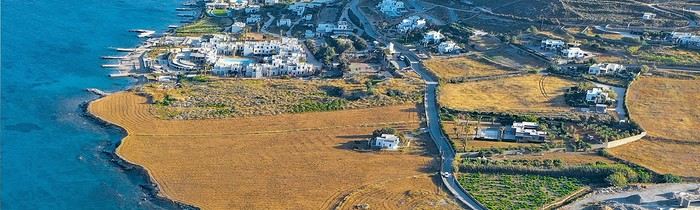
If you're dreaming of idyllic beaches and picturesque villages, you're in the right place! Known for its crystal-clear waters, millennia-old traditions, and preserved nature, Sardinia captivates travelers seeking a change of scenery. Here, you can enjoy a spectacular coastline, but also discover the authentic heart of the island, with its wild mountains and history-laden towns. Visiting Sardinia means taking the time to let yourself be lulled by the song of cicadas and the scent of the maquis. Escape to Sardinia with an all-inclusive stay at a 5-star hotel, allowing you to get away from it all.
To help you plan your itinerary, here’s an overview of ten must-see spots and a few off-the-beaten-path escapes.
Cagliari, the vibrant capital
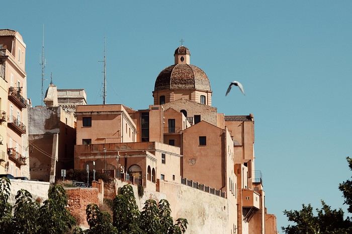
Often the first point of contact with the island, Cagliari charms with its historic center, dominated by the medieval Castello district. Stroll through the narrow streets to reach the Santa Maria Cathedral, then climb up to the Saint-Remy Bastion, where the view of the city and the sea is well worth the effort. Be sure to visit the San Benedetto market, where stalls of cheeses, cured meats, and fish reflect Sardinia’s culinary diversity.
Villasimius, fine sand and turquoise waters
Less than an hour’s drive from Cagliari, the Villasimius area is famous for its dreamy beaches, including Porto Giunco and Simius Beach. The white sand contrasts beautifully with the crystal-clear blue of the sea—a postcard-perfect setting. Diving enthusiasts will be delighted, while hikers can explore Capo Carbonara, a protected area home to pink flamingos.
Costa Smeralda, the glamorous side of the island
Renowned for its prestigious seaside resorts, the Costa Smeralda attracts yachts and lively evenings. Porto Cervo, its iconic port, draws travelers from around the world. Don’t worry—if you venture a little off the beaten path, you’ll find small, wild coves and trails lined with umbrella pines. A stop at a local wine bar to taste a glass of vermentino is highly recommended, if only to admire the view.
The La Maddalena Archipelago, a marine gem
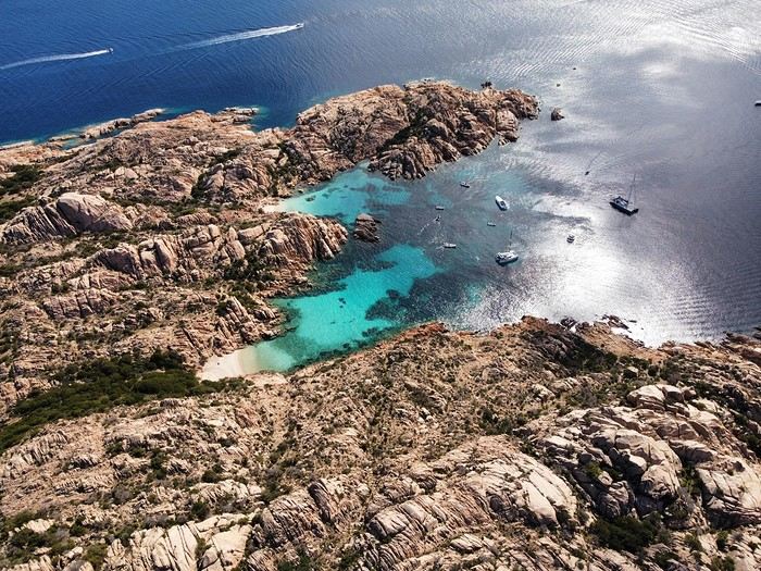
In the northeast, this national marine park comprises several islands with stunning beaches. La Maddalena, the main island, charms with its colorful houses and lively port. Offshore, wonders like Spargi Island or the famous Pink Beach of Budelli await visitors. It’s best to dedicate a full day—or more—to exploring this paradise by boat.
Alghero, the Catalan city
On the northwest coast, Alghero reveals a historic center encircled by ramparts, where the Catalan influence is still strong. Walk along the fortifications to watch the sunset, then sample the local cuisine, focused on seafood and wine. A short drive away, Neptune’s Grotto is a spectacular site: you can reach it via a staircase of 654 steps carved into the cliff or by boat for a more romantic approach.
Bosa, a painting under the open sky
Heading south along the coast from Alghero, you’ll reach Bosa, one of Sardinia’s most charming villages. Its colorful houses line the Temo River, overlooked by the Serravalle Castle. Wander the streets, admiring the vibrant facades, then settle into a small restaurant to taste the famous bottarga. The atmosphere is peaceful—this is la dolce vita.
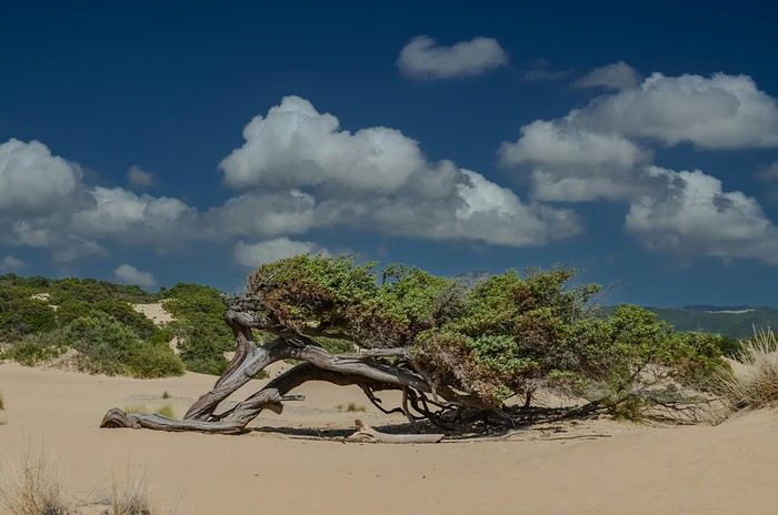
The Piscinas Dunes, a desert by the sea
Head southwest to discover Piscinas, a natural site where sand dunes evoke a desert. Between sparse vegetation and turquoise sea, the contrast is simply stunning. The beaches, rarely crowded, offer a soothing tranquility. A perfect spot for lovers of wild landscapes, far from the hustle and bustle of seaside resorts.
Su Nuraxi di Barumini, a prehistoric relic
You can’t truly understand Sardinian history without mentioning the nuraghes, mysterious stone towers left by the Nuragic civilization. In Barumini, you can explore Su Nuraxi, the most famous, a UNESCO World Heritage site. Its millennia-old architecture and vast complex make it a must-visit for anyone wanting to delve into the island’s past.
Orgosolo and the mountainous interior
To experience the deep soul of Sardinia, head to the Supramonte massif. Orgosolo, once a bandit hideout, is known for its mural paintings adorning house facades. These artworks tell the local history, social struggles, and Sardinian pride. The surrounding nature is breathtaking: forests, canyons, and panoramic views invite you to hike.
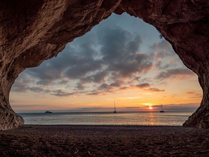
The Gulf of Orosei, dreamy coves
Finally, it’s hard to miss the beaches of the Gulf of Orosei. Cala Luna, Cala Mariolu, and Cala Goloritzé are among the most beautiful in the Mediterranean. Accessible by boat or on foot, each reveals transparent waters perfect for diving. Time seems to stand still in these wild landscapes, immersing you in the charm of a preserved Sardinia. From its sandy beaches to its rugged mountains, the island offers a stunning array of scenery. Far beyond the Costa Smeralda, Sardinia is full of hidden corners where nature reigns supreme and traditions are still very much alive. Once there, let yourself be swept up by the Sardinian dolce vita, savor its generous cuisine, and soak in its legends.
Happy travels!
21-Day Trip to La Gomera and La Palma
Travel Journal: 21 Days in La Gomera and La Palma
From February 6 to February 26, 2024
Tuesday, February 6 We left around 9 AM with our car, along with Pierre-Paul and Patricia, heading to the Bluepark parking lot in Bartenheim. As expected, we were awaited and left promptly for EuroAirport Basel. Took off at 12:25 PM for a 4-hour-15-minute flight under excellent conditions. Beautiful arrival in Tenerife with Teide in sight under a clear blue sky. Fifteen minutes later, we waited for bus No. 40 to Los Cristianos with quite a few other tourists, but we managed to find four seats. From the bus station, it was a 20-minute walk to our hotel. We checked into a lovely apartment for the four of us, complete with all the comforts. Outside, it was quite warm—at least 25°C! After dropping off our luggage, we went for a stroll. The immediate surroundings of the hotel held no interest for us: a modern, concrete area filled with hotels, bars, tourist agencies, and unappealing restaurants all offering the same bland international cuisine. Pat went to cool off at the pool, unfortunately overrun by loud, drunk English tourists. I took a walk to the paseo maritimo that leads to the port, skirting the seafront. The promenade was pleasant, but it could have been any seaside resort in the world—same old scene: a succession of bars with blaring music where many elderly people sipped cold beers waiting for the sunset, the backdrop a wall of resort-style hotels resembling rabbit hutches! Upon reaching the port, I scouted the route we’d take the next day to the Fred Olsen ferry. Back at the apartment, in the early evening, we looked for a non-touristy restaurant for dinner. Monique stopped a woman to ask her opinion! In this area, she told us, there’s no restaurant that serves Canarian or Spanish cuisine! The only place with decent restaurants is at the port. Off we went to the port, where we sat down at Al Bordo restaurant and ordered a seafood paella for four. Excellent, and at a very reasonable price (36 € for two). We returned to the hotel along the seafront.
Wednesday, February 7
Woke up at 6 AM. Had breakfast in the apartment with what we’d bought the day before at a supermarket. It was still dark when we left on foot toward the port, walking along the calm seafront at this early hour. Forty minutes later, we arrived and waited 10 minutes before the ferry docked. At 9:30 AM, we left the port of Los Cristianos for a 50-minute crossing on a calm sea under a beautiful blue sky. There were quite a few people on this large ferry, but many had no luggage, meaning they were visiting La Gomera for the day and would take the ferry back in the evening. Upon disembarking, we went straight to our rental car agency to pick up the car we’d booked online a few months earlier. It was a nice Peugeot 2008, spacious enough for the four of us and our luggage. We immediately took the beautiful road from San Sebastián that climbs directly into the mountains toward our rental in Vallehermoso. The road was in perfect condition—it seemed brand new, like all the others we’d take on this island later. This side of the island is very arid with little vegetation, and the terrain is particularly rugged, as it is throughout the island. We stopped at our first miradors, which would be followed by many more throughout our Canarian trip. Our first visit was to the small village of Agulo, perched on a promontory above the sea and at the foot of a high cliff. The village features typical Canarian houses with windows flush with the façade and black volcanic stone masonry on white or reddish-brown walls. The first recommended restaurant was already booked for a group, so we settled for the shaded terrace of the excellent El Alameda bar-restaurant. From Agulo, you can access the Abrante viewpoint via a winding road, where the view of Agulo, 600 meters below, is exceptional. A glass ledge over the void lets you test your fear of heights!
We drove to Vallehermoso to do our grocery shopping at the supermarket—a habit that would continue until the end of the trip. Our little house, "Casa rural El Encatadora," is located in a beautiful flower-filled valley a few kilometers west of Vallehermoso. Each of us had a bedroom with an en-suite bathroom, plus a living room, kitchen, and a small terrace overlooking the quiet street at the valley’s end, which didn’t bother us at all.
Thursday, February 8 The good weather seemed to follow us since our arrival in the Canary Islands. This morning, we took the road—still as beautiful and new—toward Arure, high up to the west. The landscape was magnificent, with breathtaking glimpses of the sea far below. In Arure, we parked in front of Conchita’s bar, where a hike (Rother No. 30) starts toward two viewpoints: Alojera, which we reached after 45 minutes on a lovely path. Monique, tired from the first steep climb, stopped at the first viewpoint and hitchhiked back to Arure. Meanwhile, we continued toward the second viewpoint, Los Barranquillos, where the view of the surroundings was partially hidden by misty clouds rising from the sea. The entire mountain is sculpted by ancient, endless terraces climbing until the slope becomes too steep for construction—visible traces of the hard work of past inhabitants trying to survive in a harsh environment. We had a decent lunch at La Conchita bar, then drove to the small seaside town of Puerto la Caleta, sheltered by an immense cliff plunging into the sea. Black sand beach, rough sea—despite our encouragement, Pat didn’t dare to swim! As for the old village of Caleta, it’s perched on the mountainside, and visiting it requires climbing steep, stair-filled alleys to discover a few traditional houses. Back at the casa, dinner in, and card games...
 Vallehermoso
Friday, February 9 This morning, the sky was overcast, and the peaks around us were shrouded in clouds. We took the same road as yesterday to hike Las Creces. Quickly gaining altitude, we entered a thick fog—visibility was very limited. We stopped at the Las Creces parking lot; visibility improved, and the sun wasn’t far off. The hike is entirely within a beautiful laurel forest, with the sun playing hide-and-seek, but it wasn’t cold despite the altitude. After finishing the loop trail, we decided to picnic—not there, as it was too chilly—but on Vallehermoso’s beach, where we found a nice picnic area sheltered by large black rocks. A short digestive walk on the surrounding hill to admire the little beach from above. Back in Vallehermoso, we did some grocery shopping, then tried to return to the casa—only to find ourselves locked out because we’d left the key in the lock inside! After several attempts and with the help of Yéli, a relative of the owner we called for help, we were finally able to get back in!
Saturday, February 10
It rained last night, and the sky remained overcast. Monique decided to rest this morning. PP, Pat, and I set off on the hike that starts from the house toward the Marichal reservoir. The sun wasn’t far off, and by 11 AM, it was fully out. The pleasant hike passed by many flower-filled gardens and orchards—orange, lemon, and mandarin trees in fruit. The path climbed gently toward the reservoir, where the view of the Cano rock dominating the landscape was magnificent. The last part of the climb was a bit tough, overgrown with lush vegetation, and the trail was slippery from last night’s rain. We descended via a different, much more pleasant path and returned to the casa just in time for lunch, prepared by Monique. This valley is rich with its many farmers and market gardeners who’ve cultivated the entire valley, taking advantage of the water flowing down from the mountain, captured upstream and redistributed through countless pipes snaking along the paths. Numerous tanks also store water during dry periods. The houses are scattered across both sides of the valley, and these colorful little homes add a beautiful touch to the landscape. The many palm trees give this valley a distinctly tropical feel—you could almost imagine yourself in the Caribbean. Add to that some salsa music drifting from a hut where farmers were working, and the picture is complete. A well-chilled beer apéro capped off a lovely morning. The afternoon was dedicated to rest, relaxation, reading, and games.
Sunday, February 11 The blue sky returned, though a few clouds still capped the highest peaks. Today, we visited Garajonay National Park, which covers the highest central mountains. Up there, we were above the clouds, and the panoramas from the various viewpoints were stunning: first, Cherelepin, accessible from the Laguna Grande parking lot, then Alto de Garajonay, offering an exceptional view of Teide—over 3,000 meters high—emerging from the clouds on Tenerife, far in the distance. We continued to the Los Roques viewpoints, then stopped for lunch at the Degollada de Peraza restaurant, where the view of the barranco was impressive. We descended toward San Sebastián and checked into our new lodging, La Cabezada, located in the countryside about 3 km above San Sebastián. It’s a small apartment adjacent to the owner’s, with a lovely terrace overlooking the surrounding mountains and surrounded by a beautiful garden. Apéro, then dinner on our beautiful terrace.
Monday, February 12 This morning, we went down to visit San Sebastián de La Gomera: its old tower, main street with some beautiful traditional houses, and the Church of the Assumption. Back at the casa for lunch. In the afternoon, Pat, PP, and I set off on the short hike from San Sebastián beach to La Guancha beach. We drove down and parked on the beach. The path climbs along the hill overlooking San Sebastián, passes by the tall Christ statue dominating the landscape, and roughly follows the coast down to the isolated Guancha beach. A beautiful hike under a hot sun, and a swim was welcome, even if the beach and sea access weren’t very comfortable due to large pebbles and quickly deepening water. Apart from two nudist bathers, there was no one on this beach. We returned the same way.
Tuesday, February 13 Rest day. We went down to town to stroll and do some shopping. I took the opportunity to visit the parador, beautifully situated above the city in a lovely garden overlooking the port and town. Together, we went for a cuba libre at the "Cuba Libre" bar, then had lunch at Breñusca (mediocre paella!). Back at the casa, then we went back down to town to see a carnival parade, a "passacalles," which actually passed an hour earlier than scheduled. Oh well.
Wednesday, February 14 Each to their own program this morning. Pat went swimming at San Sebastián beach, Monique rested at the casa, and PP and I set off on the hike from Playa de Avalos to the Ermita de Guadalupe on Playa del Cangrejo. It wasn’t easy to find the right road or the parking spot, but we managed. The path seemed to have suffered landslides, according to a sign at the trailhead! We decided to check it out, ready to turn back if it seemed too dangerous. In the end, apart from one or two slightly tricky spots where we had to climb a pile of rocks, the trail remained passable, though a bit vertigo-inducing in places. The narrow path clings to very vertical cliffs nearly 300 meters above sea level! But what a magnificent view. At one point, the trail runs alongside a wall of basaltic pipes. We returned via the drivable track that parallels the trail a bit lower. Back at the house for lunch. In the late afternoon, we returned to town to attend the "Entierro de las Sardinas" (Burial of the Sardine), which closes the Canarian carnival festivities. While waiting, we strolled through the parador’s gardens and had mojitos in town. Around 9 PM, we heard the noise and cries of the mourners. The procession advanced, led by a large papier-mâché sardine on a float, surrounded by wailing mourners. The procession headed toward the sea, where the sardine was burned, and a mini fireworks display ended the procession. It was all very good-natured, and everyone had fun. We ended the evening with dinner at a good fish restaurant, El Pajar.
 Entierro de la Sardina in San Sebastián de La Gomera
Thursday, February 15
Woke up at 5:15 AM. The only suitable ferry was at 7 AM, which would get us to La Palma by late morning rather than evening. We packed our bags, had breakfast, then headed to the port, left our rental car, and boarded the ferry to Tenerife, from where we’d continue to La Palma. Calm sea, beautiful sun—by 10:30 AM, we disembarked in La Palma. We picked up our car and immediately headed to our new apartment in Breña Alta. It’s a large apartment with a superb terrace facing the sea, fully equipped and very comfortable. The hosts recommended Casa Goyo restaurant, near the airport and close to us. It’s a restaurant with many small rooms, some of which can be reserved for families. The fish-based cuisine (chipirones, pulpo) was excellent, hearty, and reasonably priced. Since it’s in the airport’s flight path, we occasionally heard planes landing. Quick and efficient service. Afterward, we visited Santa Cruz de La Palma, which reminded us of the historic quarters of La Orotava in Tenerife or the capital of Gran Canaria.
Friday, February 16
Beautiful weather, blue sky. We headed to the San Bartolo viewpoint toward the northeast coast, then to the lovely village of San Andrés, which we explored. From there, we walked along the shore to the natural pools of Charco Azul, where we swam in the cool but "swimmable" sea. Back in San Andrés for lunch at the "San Andrés" restaurant on the beautiful church square. Very good fish-based meal. We got back in the car and continued along the north coast to the port of Espindola and the natural pools of Fajana near the Cumplida lighthouse. A fairly strong wind whipped up beautiful waves crashing onto the rocky coast in bursts of foam. Back in Santa Cruz, we stopped at the Mercadona supermarket to buy fresh shrimp for dinner. San Andrés
Saturday, February 17
Uniform blue sky, even on the heights. We took the beautiful road that winds up to the summit of the Caldera de Taburiente. Several viewpoints offer 360° views of the entire island and beyond: you can make out La Gomera, El Hierro, and, of course, Tenerife with the perfect triangle of Teide. We parked at the Los Andes viewpoint parking lot and started our hike to Pico de la Cruz along a trail following the ridge, offering superb views into the caldera. We got back in the car and passed by the Roque de los Muchachos astronomical complex, composed of numerous observatories, some with very aesthetic mirror telescopes. We hiked from the Roque de los Muchachos parking lot to the various viewpoints, always as impressive. Picnic on site, then back to Santa Cruz. We stopped by our car dealer because the oil warning light came on—better safe than sorry. The representative reassured us but preferred to give us a Fiat Cross SUV instead. The Caldera de Taburiente
Sunday, February 18 The weather was a bit mixed, with cloudy patches. We set off to hike the Barranco de la Cuba de Galga. Unfortunately, the Los Tilos trail had been closed for several months due to a major landslide. The parking lot by the road was already quite full, and indeed, we crossed paths with many hikers along the way—it’s an easy hike with little elevation gain, which is rare here in La Palma! The beautiful path winds through a very narrow, deep gorge covered in lush tropical vegetation—you’d think you were in a Southeast Asian forest, especially with the humidity in the gorge bringing out earthy and floral scents. Halfway through, Monique turned back while the rest of us continued to the Cuba de Galga. A light drizzle accompanied us on the return. For lunch, we went to Chipi Chipi restaurant in the heights of Santa Cruz. The cool air forced us to leave the lovely terrace for the slightly noisy dining room. The meal was very good and hearty. Afternoon spent resting at our house.
 La Cuba de la Galga
Monday, February 19 A few clouds still clung to the nearby mountain peaks. We headed south to Los Canarios. We stopped in front of the small San Antonio Abad church, where a path leads to the viewpoint in 15 minutes. Then we visited the San Antonio Volcano Interpretation Center and climbed to the viewpoint via the trail along the crater’s edge, offering a plunging view into the crater. Then PP, Pat, and I headed toward the Teneguía volcano but turned back given the remaining distance and the intense heat bearing down on us! Plus, the landscape was rather arid and not very interesting. We got back in the car and drove down to the salt flats at the island’s southern tip. The ocean crashes here in large waves, exploding against the volcanic rocks and feeding a "blowhole" carved into the rock. We stopped for drinks at the salt flats restaurant, then headed home. The salt flats in Fuencaliente
Tuesday, February 20 Beautiful weather with a few clouds clinging to the mountains, as usual. A relaxed morning since my parking reservation at La Cumbrecita didn’t start until 1 PM. It takes about 30 minutes from Santa Cruz to reach the valley floor via a beautiful but narrow road toward the end, though there’s very little traffic. Meanwhile, the clouds had disappeared, and the view from the La Cumbrecita viewpoint was superb. We recognized Pico de la Cruz in the distance, where we’d been a few days earlier. We then took the path leading to the Las Chozas viewpoint through a magnificent Canarian pine forest. We picnicked on site, then took the path to the Los Roques viewpoint. We returned the same way since the direct route was closed for construction. Back in Santa Cruz, we visited the Sanctuary of Las Nieves, with its beautiful golden Baroque altar. Hike from La Cumbrecita
Wednesday, February 21 After packing our things and loading the car, we left Santa Cruz under a very blue sky for Los Llanos de Aridane, where we stopped to visit this lovely town. The Church of Nuestra Señora de los Remedios has a beautiful coffered ceiling and an original papier-mâché Christ statue from the 16th century. Around it, colorful old Canarian houses brighten the streets of the town center. We took the opportunity to stroll, do some shopping, and finally sat down at La Pergola restaurant for a mediocre lunch. We got back in the car to check into our new house in Arecida. On the way, we stopped at the Mirador del Time, which once again offered an impressive panorama, allowing us—for the first time—to see the damage caused by the Tajogaite volcano eruption in 2021. You can clearly see the still-smoking crater and the large black lava flow covering the landscape down to the sea. We really liked our new accommodation: a local house that’s been renovated on the heights of Arecida, not far from the Canarian pine forest. From several terraces, we have a 360° view of the sea and mountains. We even have a private pool! There are two beautiful, brand-new bedrooms, each with its own bathroom—the best. Plus, we’re on the GR 131 trail that runs along the Barranco de las Angustias toward the northeast.
 Los Llanos de Aridane
Thursday, February 22 Once again, beautiful weather greeted us when we woke up. We started the GR 131 with the goal of reaching the Torre del Time viewpoint—about 400 meters of elevation gain. The path, quite steep at first, winds through a superb Canarian pine forest. A few viewpoints let you appreciate the sheer drop of the Barranco de las Angustias—watch out for vertigo! At the Torre del Time viewpoint, there’s a nearly 1,000-meter vertical drop. We returned via another path, the PLP1, which meanders first through this beautiful forest, then along lovely flower-filled gardens adjacent to beautiful properties that cascade from the forest down to the road serving these neighborhoods. This afternoon, we tried to get closer to the area devastated by the 2021 lava flows. Several roads are still closed or reserved for residents, while others—brand new—have been rebuilt to open up this densely populated and cultivated region. In some places, the lava flow slightly diverted, sparing some properties that logically should have disappeared. Now, they’re encircled by a massive cooled lava field. In other spots, twisted and charred metal scraps or greenhouse remains protrude from the lava—all that’s left of the former banana plantations. A little higher up, you can see the slightly smoking crater of Tajogaite, responsible for this disaster. Back to Casa Barreros.
 View of Los Llanos and, in the background, the 2021 lava flow
Friday, February 23
Though the sky was still blue, the temperature had dropped due to a chilly wind. By midday, it still rose to 22°C. Today, we headed north, specifically to the town of Tijarafe, where a very narrow road descends to the small port, Porís de Candelaria. The 3.7-kilometer road drops 700 meters in elevation, with gradients up to 30%—it was going to be intense! Indeed, the descent was scary, with the void right next to the very narrow road where passing was impossible except at a few rare spots. Everything went well—there was little traffic at this early hour. From the parking lot at the bottom, a path leads to Porís de Candelaria. It’s surprising to see this small fishing hamlet nestled in the shelter of an immense cave opening onto the sea, which was quite rough today. The sun, at this time of year, would appear late in the cave, which remained in shadow for much of the day. We returned via the same road, strolled through the small town of Puntagorda, and had lunch at El Jardín de los Naranjos restaurant—excellent meal. Fishing hamlet of Candelaria
Saturday, February 24 The air was still cool, but the sun was beautiful. While Monique stayed home to rest, the three of us headed to the village of Las Tricias to hike the Buracas Caves trail. We left the car parked on the LP1 road and took the small paved road down to the sign marking the trail’s start. The signage for all the trails we took here, as in La Gomera, was very well done. The path descended steadily, then more steeply toward the caves where the island’s first inhabitants lived—some petroglyphs are still visible in certain caves. The path then climbed back up, passing magnificent dragon trees and more or less elaborate huts occupied by Germans who’ve lived here for many years. Back at Casa Barreros for some rest.
Sunday, February 25 The weather once again blessed us with a beautiful day. This morning, we visited the local produce market held on weekends in Puntagorda. You’ll find agricultural products, crafts, and food to keep you going. A little further on, there’s a glass viewpoint overlooking the barranco plunging toward the sea, with a view of the thrill-seekers trying the zip line right next to it. Lunch at Naranjos—definitely a good spot—with their shrimp and spice tagliatelle. Back home for an afternoon of relaxation.
Monday, February 26 We left Arecida under a cloudy sky. Driving up from Los Llanos de Aridane toward the east, an enormous cascade of clouds poured from the mountain peaks into the Los Llanos plain—very impressive. Arriving in Santa Cruz, we went for a stroll, did some last-minute shopping, then had a final good-quality paella at La Chalana on the paseo maritimo. We left the car in the parking lot and took the 5 PM Olsen ferry to Tenerife on a slightly choppy sea, but the ferry didn’t rock too much. Arriving at 7:15 PM, we dropped off our things near the port in our reserved apartment and went for dinner at Abordo—rubbery chipirones. A digestive stroll among the ever-increasing number of tourists in Los Cristianos—restaurants were packed to the brim, the season is in full swing here. Gone is the calm of La Gomera and La Palma, and the laid-back tourism of German hikers among whom a few French were hiding!
Tuesday, February 27 To make our homemade breakfast more enjoyable, we went to buy pastries at the local bakery, then took one last walk on the paseo along the beaches, mingling with the many mobility scooters driven by elderly or disabled people, joggers, and tourists. Last apéro near the bus station, then off to the airport. After a smooth 4-hour-30-minute flight, we arrived in Basel-Mulhouse at 10:20 PM.
THE END
Conclusion A fantastic trip to two islands with magnificent and diverse nature, where landscapes range from desert-like to tropical depending on exposure to winds and clouds. Thanks to the many beautiful viewpoints, you can truly appreciate these exceptionally dynamic reliefs. A hiker’s paradise, the trails are all very well marked, though the choice of easy or moderate paths for "casual walkers" is quite limited. Another notable advantage, in our opinion, is that these islands are very lightly developed—you’ll hardly see any of those ugly hotel blocks that spoil the landscapes of some other Canary Islands. It’s true that the beaches on these two islands don’t meet traditional international tourism criteria: they’re small, with black sand, and often difficult to access. Special mention for the quality of the road network (except for a few small local roads), which seems brand new, well-paved, and well-signposted. We also enjoyed exceptional weather for February, with fewer than three days of gray or rainy weather out of 21.
Almost all the accommodations we chose met or exceeded our expectations, often at reasonable prices: an average of 98 € per night for an apartment or house with two bedrooms for four people.
All photos can be viewed by clicking this link: https://photos.app.goo.gl/G44pPk4g9PW1rNzg8
Tuesday, February 6 We left around 9 AM with our car, along with Pierre-Paul and Patricia, heading to the Bluepark parking lot in Bartenheim. As expected, we were awaited and left promptly for EuroAirport Basel. Took off at 12:25 PM for a 4-hour-15-minute flight under excellent conditions. Beautiful arrival in Tenerife with Teide in sight under a clear blue sky. Fifteen minutes later, we waited for bus No. 40 to Los Cristianos with quite a few other tourists, but we managed to find four seats. From the bus station, it was a 20-minute walk to our hotel. We checked into a lovely apartment for the four of us, complete with all the comforts. Outside, it was quite warm—at least 25°C! After dropping off our luggage, we went for a stroll. The immediate surroundings of the hotel held no interest for us: a modern, concrete area filled with hotels, bars, tourist agencies, and unappealing restaurants all offering the same bland international cuisine. Pat went to cool off at the pool, unfortunately overrun by loud, drunk English tourists. I took a walk to the paseo maritimo that leads to the port, skirting the seafront. The promenade was pleasant, but it could have been any seaside resort in the world—same old scene: a succession of bars with blaring music where many elderly people sipped cold beers waiting for the sunset, the backdrop a wall of resort-style hotels resembling rabbit hutches! Upon reaching the port, I scouted the route we’d take the next day to the Fred Olsen ferry. Back at the apartment, in the early evening, we looked for a non-touristy restaurant for dinner. Monique stopped a woman to ask her opinion! In this area, she told us, there’s no restaurant that serves Canarian or Spanish cuisine! The only place with decent restaurants is at the port. Off we went to the port, where we sat down at Al Bordo restaurant and ordered a seafood paella for four. Excellent, and at a very reasonable price (36 € for two). We returned to the hotel along the seafront.
Wednesday, February 7
Woke up at 6 AM. Had breakfast in the apartment with what we’d bought the day before at a supermarket. It was still dark when we left on foot toward the port, walking along the calm seafront at this early hour. Forty minutes later, we arrived and waited 10 minutes before the ferry docked. At 9:30 AM, we left the port of Los Cristianos for a 50-minute crossing on a calm sea under a beautiful blue sky. There were quite a few people on this large ferry, but many had no luggage, meaning they were visiting La Gomera for the day and would take the ferry back in the evening. Upon disembarking, we went straight to our rental car agency to pick up the car we’d booked online a few months earlier. It was a nice Peugeot 2008, spacious enough for the four of us and our luggage. We immediately took the beautiful road from San Sebastián that climbs directly into the mountains toward our rental in Vallehermoso. The road was in perfect condition—it seemed brand new, like all the others we’d take on this island later. This side of the island is very arid with little vegetation, and the terrain is particularly rugged, as it is throughout the island. We stopped at our first miradors, which would be followed by many more throughout our Canarian trip. Our first visit was to the small village of Agulo, perched on a promontory above the sea and at the foot of a high cliff. The village features typical Canarian houses with windows flush with the façade and black volcanic stone masonry on white or reddish-brown walls. The first recommended restaurant was already booked for a group, so we settled for the shaded terrace of the excellent El Alameda bar-restaurant. From Agulo, you can access the Abrante viewpoint via a winding road, where the view of Agulo, 600 meters below, is exceptional. A glass ledge over the void lets you test your fear of heights!
We drove to Vallehermoso to do our grocery shopping at the supermarket—a habit that would continue until the end of the trip. Our little house, "Casa rural El Encatadora," is located in a beautiful flower-filled valley a few kilometers west of Vallehermoso. Each of us had a bedroom with an en-suite bathroom, plus a living room, kitchen, and a small terrace overlooking the quiet street at the valley’s end, which didn’t bother us at all.
Thursday, February 8 The good weather seemed to follow us since our arrival in the Canary Islands. This morning, we took the road—still as beautiful and new—toward Arure, high up to the west. The landscape was magnificent, with breathtaking glimpses of the sea far below. In Arure, we parked in front of Conchita’s bar, where a hike (Rother No. 30) starts toward two viewpoints: Alojera, which we reached after 45 minutes on a lovely path. Monique, tired from the first steep climb, stopped at the first viewpoint and hitchhiked back to Arure. Meanwhile, we continued toward the second viewpoint, Los Barranquillos, where the view of the surroundings was partially hidden by misty clouds rising from the sea. The entire mountain is sculpted by ancient, endless terraces climbing until the slope becomes too steep for construction—visible traces of the hard work of past inhabitants trying to survive in a harsh environment. We had a decent lunch at La Conchita bar, then drove to the small seaside town of Puerto la Caleta, sheltered by an immense cliff plunging into the sea. Black sand beach, rough sea—despite our encouragement, Pat didn’t dare to swim! As for the old village of Caleta, it’s perched on the mountainside, and visiting it requires climbing steep, stair-filled alleys to discover a few traditional houses. Back at the casa, dinner in, and card games...
VallehermosoFriday, February 9 This morning, the sky was overcast, and the peaks around us were shrouded in clouds. We took the same road as yesterday to hike Las Creces. Quickly gaining altitude, we entered a thick fog—visibility was very limited. We stopped at the Las Creces parking lot; visibility improved, and the sun wasn’t far off. The hike is entirely within a beautiful laurel forest, with the sun playing hide-and-seek, but it wasn’t cold despite the altitude. After finishing the loop trail, we decided to picnic—not there, as it was too chilly—but on Vallehermoso’s beach, where we found a nice picnic area sheltered by large black rocks. A short digestive walk on the surrounding hill to admire the little beach from above. Back in Vallehermoso, we did some grocery shopping, then tried to return to the casa—only to find ourselves locked out because we’d left the key in the lock inside! After several attempts and with the help of Yéli, a relative of the owner we called for help, we were finally able to get back in!
Saturday, February 10
It rained last night, and the sky remained overcast. Monique decided to rest this morning. PP, Pat, and I set off on the hike that starts from the house toward the Marichal reservoir. The sun wasn’t far off, and by 11 AM, it was fully out. The pleasant hike passed by many flower-filled gardens and orchards—orange, lemon, and mandarin trees in fruit. The path climbed gently toward the reservoir, where the view of the Cano rock dominating the landscape was magnificent. The last part of the climb was a bit tough, overgrown with lush vegetation, and the trail was slippery from last night’s rain. We descended via a different, much more pleasant path and returned to the casa just in time for lunch, prepared by Monique. This valley is rich with its many farmers and market gardeners who’ve cultivated the entire valley, taking advantage of the water flowing down from the mountain, captured upstream and redistributed through countless pipes snaking along the paths. Numerous tanks also store water during dry periods. The houses are scattered across both sides of the valley, and these colorful little homes add a beautiful touch to the landscape. The many palm trees give this valley a distinctly tropical feel—you could almost imagine yourself in the Caribbean. Add to that some salsa music drifting from a hut where farmers were working, and the picture is complete. A well-chilled beer apéro capped off a lovely morning. The afternoon was dedicated to rest, relaxation, reading, and games.
Sunday, February 11 The blue sky returned, though a few clouds still capped the highest peaks. Today, we visited Garajonay National Park, which covers the highest central mountains. Up there, we were above the clouds, and the panoramas from the various viewpoints were stunning: first, Cherelepin, accessible from the Laguna Grande parking lot, then Alto de Garajonay, offering an exceptional view of Teide—over 3,000 meters high—emerging from the clouds on Tenerife, far in the distance. We continued to the Los Roques viewpoints, then stopped for lunch at the Degollada de Peraza restaurant, where the view of the barranco was impressive. We descended toward San Sebastián and checked into our new lodging, La Cabezada, located in the countryside about 3 km above San Sebastián. It’s a small apartment adjacent to the owner’s, with a lovely terrace overlooking the surrounding mountains and surrounded by a beautiful garden. Apéro, then dinner on our beautiful terrace.
Monday, February 12 This morning, we went down to visit San Sebastián de La Gomera: its old tower, main street with some beautiful traditional houses, and the Church of the Assumption. Back at the casa for lunch. In the afternoon, Pat, PP, and I set off on the short hike from San Sebastián beach to La Guancha beach. We drove down and parked on the beach. The path climbs along the hill overlooking San Sebastián, passes by the tall Christ statue dominating the landscape, and roughly follows the coast down to the isolated Guancha beach. A beautiful hike under a hot sun, and a swim was welcome, even if the beach and sea access weren’t very comfortable due to large pebbles and quickly deepening water. Apart from two nudist bathers, there was no one on this beach. We returned the same way.
Tuesday, February 13 Rest day. We went down to town to stroll and do some shopping. I took the opportunity to visit the parador, beautifully situated above the city in a lovely garden overlooking the port and town. Together, we went for a cuba libre at the "Cuba Libre" bar, then had lunch at Breñusca (mediocre paella!). Back at the casa, then we went back down to town to see a carnival parade, a "passacalles," which actually passed an hour earlier than scheduled. Oh well.
Wednesday, February 14 Each to their own program this morning. Pat went swimming at San Sebastián beach, Monique rested at the casa, and PP and I set off on the hike from Playa de Avalos to the Ermita de Guadalupe on Playa del Cangrejo. It wasn’t easy to find the right road or the parking spot, but we managed. The path seemed to have suffered landslides, according to a sign at the trailhead! We decided to check it out, ready to turn back if it seemed too dangerous. In the end, apart from one or two slightly tricky spots where we had to climb a pile of rocks, the trail remained passable, though a bit vertigo-inducing in places. The narrow path clings to very vertical cliffs nearly 300 meters above sea level! But what a magnificent view. At one point, the trail runs alongside a wall of basaltic pipes. We returned via the drivable track that parallels the trail a bit lower. Back at the house for lunch. In the late afternoon, we returned to town to attend the "Entierro de las Sardinas" (Burial of the Sardine), which closes the Canarian carnival festivities. While waiting, we strolled through the parador’s gardens and had mojitos in town. Around 9 PM, we heard the noise and cries of the mourners. The procession advanced, led by a large papier-mâché sardine on a float, surrounded by wailing mourners. The procession headed toward the sea, where the sardine was burned, and a mini fireworks display ended the procession. It was all very good-natured, and everyone had fun. We ended the evening with dinner at a good fish restaurant, El Pajar.
Entierro de la Sardina in San Sebastián de La GomeraThursday, February 15
Woke up at 5:15 AM. The only suitable ferry was at 7 AM, which would get us to La Palma by late morning rather than evening. We packed our bags, had breakfast, then headed to the port, left our rental car, and boarded the ferry to Tenerife, from where we’d continue to La Palma. Calm sea, beautiful sun—by 10:30 AM, we disembarked in La Palma. We picked up our car and immediately headed to our new apartment in Breña Alta. It’s a large apartment with a superb terrace facing the sea, fully equipped and very comfortable. The hosts recommended Casa Goyo restaurant, near the airport and close to us. It’s a restaurant with many small rooms, some of which can be reserved for families. The fish-based cuisine (chipirones, pulpo) was excellent, hearty, and reasonably priced. Since it’s in the airport’s flight path, we occasionally heard planes landing. Quick and efficient service. Afterward, we visited Santa Cruz de La Palma, which reminded us of the historic quarters of La Orotava in Tenerife or the capital of Gran Canaria.
Friday, February 16
Beautiful weather, blue sky. We headed to the San Bartolo viewpoint toward the northeast coast, then to the lovely village of San Andrés, which we explored. From there, we walked along the shore to the natural pools of Charco Azul, where we swam in the cool but "swimmable" sea. Back in San Andrés for lunch at the "San Andrés" restaurant on the beautiful church square. Very good fish-based meal. We got back in the car and continued along the north coast to the port of Espindola and the natural pools of Fajana near the Cumplida lighthouse. A fairly strong wind whipped up beautiful waves crashing onto the rocky coast in bursts of foam. Back in Santa Cruz, we stopped at the Mercadona supermarket to buy fresh shrimp for dinner.
San AndrésSaturday, February 17
Uniform blue sky, even on the heights. We took the beautiful road that winds up to the summit of the Caldera de Taburiente. Several viewpoints offer 360° views of the entire island and beyond: you can make out La Gomera, El Hierro, and, of course, Tenerife with the perfect triangle of Teide. We parked at the Los Andes viewpoint parking lot and started our hike to Pico de la Cruz along a trail following the ridge, offering superb views into the caldera. We got back in the car and passed by the Roque de los Muchachos astronomical complex, composed of numerous observatories, some with very aesthetic mirror telescopes. We hiked from the Roque de los Muchachos parking lot to the various viewpoints, always as impressive. Picnic on site, then back to Santa Cruz. We stopped by our car dealer because the oil warning light came on—better safe than sorry. The representative reassured us but preferred to give us a Fiat Cross SUV instead.
The Caldera de TaburienteSunday, February 18 The weather was a bit mixed, with cloudy patches. We set off to hike the Barranco de la Cuba de Galga. Unfortunately, the Los Tilos trail had been closed for several months due to a major landslide. The parking lot by the road was already quite full, and indeed, we crossed paths with many hikers along the way—it’s an easy hike with little elevation gain, which is rare here in La Palma! The beautiful path winds through a very narrow, deep gorge covered in lush tropical vegetation—you’d think you were in a Southeast Asian forest, especially with the humidity in the gorge bringing out earthy and floral scents. Halfway through, Monique turned back while the rest of us continued to the Cuba de Galga. A light drizzle accompanied us on the return. For lunch, we went to Chipi Chipi restaurant in the heights of Santa Cruz. The cool air forced us to leave the lovely terrace for the slightly noisy dining room. The meal was very good and hearty. Afternoon spent resting at our house.
La Cuba de la GalgaMonday, February 19 A few clouds still clung to the nearby mountain peaks. We headed south to Los Canarios. We stopped in front of the small San Antonio Abad church, where a path leads to the viewpoint in 15 minutes. Then we visited the San Antonio Volcano Interpretation Center and climbed to the viewpoint via the trail along the crater’s edge, offering a plunging view into the crater. Then PP, Pat, and I headed toward the Teneguía volcano but turned back given the remaining distance and the intense heat bearing down on us! Plus, the landscape was rather arid and not very interesting. We got back in the car and drove down to the salt flats at the island’s southern tip. The ocean crashes here in large waves, exploding against the volcanic rocks and feeding a "blowhole" carved into the rock. We stopped for drinks at the salt flats restaurant, then headed home.
The salt flats in FuencalienteTuesday, February 20 Beautiful weather with a few clouds clinging to the mountains, as usual. A relaxed morning since my parking reservation at La Cumbrecita didn’t start until 1 PM. It takes about 30 minutes from Santa Cruz to reach the valley floor via a beautiful but narrow road toward the end, though there’s very little traffic. Meanwhile, the clouds had disappeared, and the view from the La Cumbrecita viewpoint was superb. We recognized Pico de la Cruz in the distance, where we’d been a few days earlier. We then took the path leading to the Las Chozas viewpoint through a magnificent Canarian pine forest. We picnicked on site, then took the path to the Los Roques viewpoint. We returned the same way since the direct route was closed for construction. Back in Santa Cruz, we visited the Sanctuary of Las Nieves, with its beautiful golden Baroque altar.
Hike from La CumbrecitaWednesday, February 21 After packing our things and loading the car, we left Santa Cruz under a very blue sky for Los Llanos de Aridane, where we stopped to visit this lovely town. The Church of Nuestra Señora de los Remedios has a beautiful coffered ceiling and an original papier-mâché Christ statue from the 16th century. Around it, colorful old Canarian houses brighten the streets of the town center. We took the opportunity to stroll, do some shopping, and finally sat down at La Pergola restaurant for a mediocre lunch. We got back in the car to check into our new house in Arecida. On the way, we stopped at the Mirador del Time, which once again offered an impressive panorama, allowing us—for the first time—to see the damage caused by the Tajogaite volcano eruption in 2021. You can clearly see the still-smoking crater and the large black lava flow covering the landscape down to the sea. We really liked our new accommodation: a local house that’s been renovated on the heights of Arecida, not far from the Canarian pine forest. From several terraces, we have a 360° view of the sea and mountains. We even have a private pool! There are two beautiful, brand-new bedrooms, each with its own bathroom—the best. Plus, we’re on the GR 131 trail that runs along the Barranco de las Angustias toward the northeast.
Los Llanos de AridaneThursday, February 22 Once again, beautiful weather greeted us when we woke up. We started the GR 131 with the goal of reaching the Torre del Time viewpoint—about 400 meters of elevation gain. The path, quite steep at first, winds through a superb Canarian pine forest. A few viewpoints let you appreciate the sheer drop of the Barranco de las Angustias—watch out for vertigo! At the Torre del Time viewpoint, there’s a nearly 1,000-meter vertical drop. We returned via another path, the PLP1, which meanders first through this beautiful forest, then along lovely flower-filled gardens adjacent to beautiful properties that cascade from the forest down to the road serving these neighborhoods. This afternoon, we tried to get closer to the area devastated by the 2021 lava flows. Several roads are still closed or reserved for residents, while others—brand new—have been rebuilt to open up this densely populated and cultivated region. In some places, the lava flow slightly diverted, sparing some properties that logically should have disappeared. Now, they’re encircled by a massive cooled lava field. In other spots, twisted and charred metal scraps or greenhouse remains protrude from the lava—all that’s left of the former banana plantations. A little higher up, you can see the slightly smoking crater of Tajogaite, responsible for this disaster. Back to Casa Barreros.
View of Los Llanos and, in the background, the 2021 lava flowFriday, February 23
Though the sky was still blue, the temperature had dropped due to a chilly wind. By midday, it still rose to 22°C. Today, we headed north, specifically to the town of Tijarafe, where a very narrow road descends to the small port, Porís de Candelaria. The 3.7-kilometer road drops 700 meters in elevation, with gradients up to 30%—it was going to be intense! Indeed, the descent was scary, with the void right next to the very narrow road where passing was impossible except at a few rare spots. Everything went well—there was little traffic at this early hour. From the parking lot at the bottom, a path leads to Porís de Candelaria. It’s surprising to see this small fishing hamlet nestled in the shelter of an immense cave opening onto the sea, which was quite rough today. The sun, at this time of year, would appear late in the cave, which remained in shadow for much of the day. We returned via the same road, strolled through the small town of Puntagorda, and had lunch at El Jardín de los Naranjos restaurant—excellent meal.
Fishing hamlet of CandelariaSaturday, February 24 The air was still cool, but the sun was beautiful. While Monique stayed home to rest, the three of us headed to the village of Las Tricias to hike the Buracas Caves trail. We left the car parked on the LP1 road and took the small paved road down to the sign marking the trail’s start. The signage for all the trails we took here, as in La Gomera, was very well done. The path descended steadily, then more steeply toward the caves where the island’s first inhabitants lived—some petroglyphs are still visible in certain caves. The path then climbed back up, passing magnificent dragon trees and more or less elaborate huts occupied by Germans who’ve lived here for many years. Back at Casa Barreros for some rest.
Sunday, February 25 The weather once again blessed us with a beautiful day. This morning, we visited the local produce market held on weekends in Puntagorda. You’ll find agricultural products, crafts, and food to keep you going. A little further on, there’s a glass viewpoint overlooking the barranco plunging toward the sea, with a view of the thrill-seekers trying the zip line right next to it. Lunch at Naranjos—definitely a good spot—with their shrimp and spice tagliatelle. Back home for an afternoon of relaxation.
Monday, February 26 We left Arecida under a cloudy sky. Driving up from Los Llanos de Aridane toward the east, an enormous cascade of clouds poured from the mountain peaks into the Los Llanos plain—very impressive. Arriving in Santa Cruz, we went for a stroll, did some last-minute shopping, then had a final good-quality paella at La Chalana on the paseo maritimo. We left the car in the parking lot and took the 5 PM Olsen ferry to Tenerife on a slightly choppy sea, but the ferry didn’t rock too much. Arriving at 7:15 PM, we dropped off our things near the port in our reserved apartment and went for dinner at Abordo—rubbery chipirones. A digestive stroll among the ever-increasing number of tourists in Los Cristianos—restaurants were packed to the brim, the season is in full swing here. Gone is the calm of La Gomera and La Palma, and the laid-back tourism of German hikers among whom a few French were hiding!
Tuesday, February 27 To make our homemade breakfast more enjoyable, we went to buy pastries at the local bakery, then took one last walk on the paseo along the beaches, mingling with the many mobility scooters driven by elderly or disabled people, joggers, and tourists. Last apéro near the bus station, then off to the airport. After a smooth 4-hour-30-minute flight, we arrived in Basel-Mulhouse at 10:20 PM.
THE END
Conclusion A fantastic trip to two islands with magnificent and diverse nature, where landscapes range from desert-like to tropical depending on exposure to winds and clouds. Thanks to the many beautiful viewpoints, you can truly appreciate these exceptionally dynamic reliefs. A hiker’s paradise, the trails are all very well marked, though the choice of easy or moderate paths for "casual walkers" is quite limited. Another notable advantage, in our opinion, is that these islands are very lightly developed—you’ll hardly see any of those ugly hotel blocks that spoil the landscapes of some other Canary Islands. It’s true that the beaches on these two islands don’t meet traditional international tourism criteria: they’re small, with black sand, and often difficult to access. Special mention for the quality of the road network (except for a few small local roads), which seems brand new, well-paved, and well-signposted. We also enjoyed exceptional weather for February, with fewer than three days of gray or rainy weather out of 21.
Almost all the accommodations we chose met or exceeded our expectations, often at reasonable prices: an average of 98 € per night for an apartment or house with two bedrooms for four people.
All photos can be viewed by clicking this link: https://photos.app.goo.gl/G44pPk4g9PW1rNzg8
Cécile découvre le Finistère English translation pending
Après l'ouest américain
https://voyageforum.com/v.f?do=post_view_flat;post=9613741;page=1;search_string=Cecile;sb=post_latest_reply;so=ASC;mh=20;
et New York, https://voyageforum.com/v.f?post=9796574;search_string=Cecile
cet été, Cécile découvre le Finistère....
certes cela peut faire moins rêver, mais bon la Bretagne c est toujours aussi beau ..sans les parisiens et autres touristes covidés !
Campement à Bénodet, sa plage, son ciel bleu......
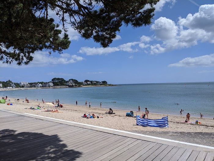
Où boire un coup par cette chaleur ? à l Ile Tudy bien sûr ! situé en face de sa voisine Loctudy,
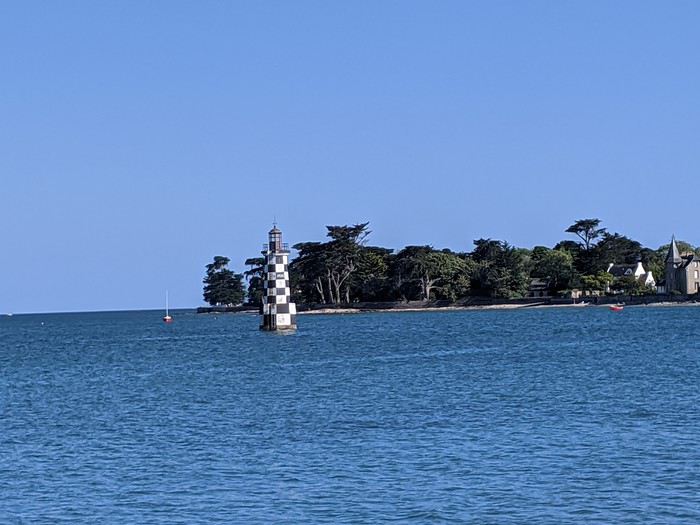
le bout de ce village se concentre sur son port , ses bistrots, restos.... encore calmes ce lundi
...il faut bien ça pour se remettre des 915 km de la veille
Descente de cervoise ambrée dans un bar connu
aussi pour la sa déco, affiche de concerts, artistes au plafond quant aux toilettes, super tapisserie

bref, on glande en admirant le paysage
la journée d installation se termine tranquillement.. Cécile se félicite de son bon choix...
et New York, https://voyageforum.com/v.f?post=9796574;search_string=Cecile
cet été, Cécile découvre le Finistère....
certes cela peut faire moins rêver, mais bon la Bretagne c est toujours aussi beau ..sans les parisiens et autres touristes covidés !
Campement à Bénodet, sa plage, son ciel bleu......
Où boire un coup par cette chaleur ? à l Ile Tudy bien sûr ! situé en face de sa voisine Loctudy,
le bout de ce village se concentre sur son port , ses bistrots, restos.... encore calmes ce lundi
...il faut bien ça pour se remettre des 915 km de la veille
Descente de cervoise ambrée dans un bar connu
aussi pour la sa déco, affiche de concerts, artistes au plafond quant aux toilettes, super tapisserie
bref, on glande en admirant le paysage
la journée d installation se termine tranquillement.. Cécile se félicite de son bon choix...
Un petit tour au Tamil Nadu English translation pending
Au milieu de toute cette morosité, je me lance dans un nouveau carnet indien qui vous changera les idées, je l’espère. Un nouveau séjour de deux semaines pendant les vacances d’hiver, du 21 au 6 mars. Mon 15ème voyage en Inde, mais mon 1er dans le grand sud.
Cette année, ce sera une petite partie du Tamil Nadu, un petit tour de 1000 km à peu près, de Chennai à Chennai (Kanchipuram, Gingee, Tirunmavallai, Chidambaram, Tranquebar, Kumbakonam, Trichy, le Chettinad, Tanjore, Pondichery et Mahabalipuram) avec une amie. Nous avons volontairement zappé Madurai et Rameshvaram, ce sera pour une autre fois, nous n’avions pas envie de faire trop de km et nous avons déjà beaucoup de chose au programme... Comme d’habitude, location d’une voiture avec chauffeur, et nous ne le regrettons pas, tant nous avons vu de lieux, quelquefois bien perdus, que nous n’aurions jamais pu atteindre en transport en commun, ou certainement pas en 14 jours.
J’ai consulté les carnets et blogs de Pagaljavad et Yann55 entre autre et je les remercie pour leurs tuyaux. J’ai eu des conseils d’Aleph, qui quand elle écumait le Tamil Nadu, ne postait pas encore de carnet. J’ai lu et relu les pages sur le Tamil Nadu sur le site Purattatva, un must pour moi depuis toujours. Et cherché, lu et relu, sur internet et sur papier (j’ai un vieux guide bleu de 1984 trouvé sur une brocante que je conserve précieusement et consulte pour chaque voyage car la qualité des guides a bien baissé culturellement depuis …)
A l’aéroport de Chennai, nous faisons connaissance avec notre chauffeur, Pandi. Départ immédiat pour Kanchipuram, à 65 km de là. Chennai sera pour une prochaine fois … Nous arrivons en fin de journée, il fait quasi nuit. Après le dîner, nous nous lançons à l’assaut des petites rues de Kanchipuram pour aller au temple de Kamaskhi, (une forme de Parvati), le plus proche, avec ses gopurams illuminés, son bassin sacré, des familles indiennes.
La photo n'est pas terrible car mon APN ne gère pas bien l'obscurité ...
Cette année, ce sera une petite partie du Tamil Nadu, un petit tour de 1000 km à peu près, de Chennai à Chennai (Kanchipuram, Gingee, Tirunmavallai, Chidambaram, Tranquebar, Kumbakonam, Trichy, le Chettinad, Tanjore, Pondichery et Mahabalipuram) avec une amie. Nous avons volontairement zappé Madurai et Rameshvaram, ce sera pour une autre fois, nous n’avions pas envie de faire trop de km et nous avons déjà beaucoup de chose au programme... Comme d’habitude, location d’une voiture avec chauffeur, et nous ne le regrettons pas, tant nous avons vu de lieux, quelquefois bien perdus, que nous n’aurions jamais pu atteindre en transport en commun, ou certainement pas en 14 jours.
J’ai consulté les carnets et blogs de Pagaljavad et Yann55 entre autre et je les remercie pour leurs tuyaux. J’ai eu des conseils d’Aleph, qui quand elle écumait le Tamil Nadu, ne postait pas encore de carnet. J’ai lu et relu les pages sur le Tamil Nadu sur le site Purattatva, un must pour moi depuis toujours. Et cherché, lu et relu, sur internet et sur papier (j’ai un vieux guide bleu de 1984 trouvé sur une brocante que je conserve précieusement et consulte pour chaque voyage car la qualité des guides a bien baissé culturellement depuis …)
A l’aéroport de Chennai, nous faisons connaissance avec notre chauffeur, Pandi. Départ immédiat pour Kanchipuram, à 65 km de là. Chennai sera pour une prochaine fois … Nous arrivons en fin de journée, il fait quasi nuit. Après le dîner, nous nous lançons à l’assaut des petites rues de Kanchipuram pour aller au temple de Kamaskhi, (une forme de Parvati), le plus proche, avec ses gopurams illuminés, son bassin sacré, des familles indiennes.
La photo n'est pas terrible car mon APN ne gère pas bien l'obscurité ...
A breath of fresh air!
Vrrrrrm, vrmmmm! (phone on vibrate)
"Hi Mamido, it's Clémence." Clémence, 5 years old, is a giggly, cheerful little girl and the queen of mischief.
"Mom says we're coming to your place until the holidays because we're on vacation tonight."
"Yes, I know. She asked me—do you know why?" "Because of the croronavirus." "And do you know what that is?"
"Oh yeah, at school Théo told me it's like a louse that doesn't itch, that doesn't get in your head but in your lungs, that it's all round with red bumps like raspberries, and that it makes old people die."
"Your friend knows a lot of things."
"His dad showed him a microscope picture, and you—are you old?" "What do you think?" "Well, yeah, but only a little because you always leave on your motorcycle to travel. Are you going traveling?"
"No, because you're coming with your brother and sister."
"Can we go to the little bridge to look for frog eggs? You remember, there were some last year, and we'll make them grow and put the baby frogs in the washhouse, and we'll also make boats to put in the stream so they can go to the sea." "That's a great idea." "And you'll make me the model in print letters so I can write which country my boat is going to." "Where do you want your boat to go?" "To the land of pandas—is it far?" "Oh yes, very far." "Then we have to make the boat strong so it doesn't sink." "Promise, we'll have so much fun." "Mom says in some countries they wear masks. Do you still have the chicken, rabbit, and pig masks in the attic? Can we wear them like that?"
"You know, here there are only trees, birds, and fields—we'll do whatever we want."
"Mom's calling me."
Click, she hangs up, and I laugh.
"Hi Mamido, it's Clémence." Clémence, 5 years old, is a giggly, cheerful little girl and the queen of mischief.
"Mom says we're coming to your place until the holidays because we're on vacation tonight."
"Yes, I know. She asked me—do you know why?" "Because of the croronavirus." "And do you know what that is?"
"Oh yeah, at school Théo told me it's like a louse that doesn't itch, that doesn't get in your head but in your lungs, that it's all round with red bumps like raspberries, and that it makes old people die."
"Your friend knows a lot of things."
"His dad showed him a microscope picture, and you—are you old?" "What do you think?" "Well, yeah, but only a little because you always leave on your motorcycle to travel. Are you going traveling?"
"No, because you're coming with your brother and sister."
"Can we go to the little bridge to look for frog eggs? You remember, there were some last year, and we'll make them grow and put the baby frogs in the washhouse, and we'll also make boats to put in the stream so they can go to the sea." "That's a great idea." "And you'll make me the model in print letters so I can write which country my boat is going to." "Where do you want your boat to go?" "To the land of pandas—is it far?" "Oh yes, very far." "Then we have to make the boat strong so it doesn't sink." "Promise, we'll have so much fun." "Mom says in some countries they wear masks. Do you still have the chicken, rabbit, and pig masks in the attic? Can we wear them like that?"
"You know, here there are only trees, birds, and fields—we'll do whatever we want."
"Mom's calling me."
Click, she hangs up, and I laugh.
Circuit de 4 semaines au Sultanat d'Oman, automne 2019 English translation pending
Bonjour aux voyageurs,
Nous voici tout juste de retour (brusque transition climatique je vous assure !) de notre sincèrement enchanteur périple de 5575 km, en couple, de 4 semaines au sultanat d’Oman, cet automne 2019.
POURQUOI OMAN ?
Les comptes rendus lus ici et là (surtout ici pour être honnête) sont tous enthousiastes et pour nous retraités vivant à la montagne, l’automne est un peu la saison creuse avant la neige et le ski. Et un peu de chaleur (on n’a pas été déçu sur ce point) et de ciel bleu sont aussi de bons arguments ! Nos dates ont aussi été choisies de façon à ne pas partir trop tôt à cause de la chaleur – le tropique du Cancer passe un peu au Nord de Muscat la capitale qui est assez au Nord du pays – et d’éviter d’être sur place lors des fêtes d’anniversaire du Sultan pendant lesquelles nous avions lu qu’il devenait difficile de se loger près des lieux touristiques.
Nous n’avons vraiment pas été déçus et chaque jour de notre séjour a été très dense en découvertes variées, sans pour autant que ce soit une course quotidienne de site en site.
Oman, c’est une multitude de paysages somptueux et variés : mer d’Oman à l’Est et océan indien au Sud Est avec des plages de sable blanc (la plupart du temps pour nous seuls), les déserts des Wahibas et Rub al Khali, les montagnes aux canyons impressionnants, wadis encaissés que l’on parcourt en partie à la nage dans une eau claire et chaude… Oman c’est aussi une histoire riche d’un peuple de voyageurs – c’est le pays de Simbad le marin et des caravanes d’encens de la reine de Saba – avec ses vestiges antiques, ses nombreux forts, ses vielles villes aux souks tortueux… Oman, c’est aussi des villes « à l’américaine » avec des centres commerciaux démesurés, au choix de marchandises étonnant et où la voiture est indispensable… Oman, c’est surtout les Omanais avec leur fabuleux sens de l’hospitalité désintéressée (qui a devant sa maison une fontaine d’eau glacée filtrée, parfois même du café et des dattes à l’attention du voyageur qui passe par là ?), leur courtoisie, leur sourire… Je m’arrête avant de devenir lyrique mais il y a là quelque chose à apprendre des Omanais…
Oman est un pays facile à visiter, malgré des distances non négligeables à franchir entre certaines étapes, mais les infrastructures sont bonnes, voir très bonnes et par exemple la traversée de presque 900 km jusqu’à Salalah se fait sans fatigue insurmontable par une autoroute gratuite 2x2 voies sur plus de la moitié du trajet (attention aux radars !!!). C’est aussi facile pour le voyageur car on se sent en sécurité partout. On a compris qu’il n’y avait pas à se faire de soucis à laisser les bagages dans le coffre de la voiture, sans tablette arrière : souvent les omanais laissent le moteur de leur véhicule tourner pour maintenir la clim et font leurs courses. Attention toute fois à ne pas prendre de mauvaises habitudes au retour ! De plus la qualité de l’eau est contrôlée de partout et les omanais sont presque maniaques de la propreté des mains (queue fréquente aux lavabos des restos), on a mangé salades et fruits sans aucun des problème digestifs auxquels il nous est arrivé d’être sujets lors d’autres voyages.
Contrairement à ce que nous pensions lorsque nous avons commencé à planifier notre circuit, le coût de la vie en voyage n’y est pas si cher : l’essence à 0,50 € en est pour beaucoup l’une des raisons, mais nous avons trouvé des hôtels très corrects à moins de 25 € la nuit avec petit déjeuner et la plupart des repas (souvent cuisine indienne) à environ 10 € pour 2 (sauf s’il y a des langoustes au menu, on frise plutôt les 12 € par personne !…).
LES PREPARATIFS :
Formalités : Avant le départ, nous avons demandé en ligne sur le site evisa les visas touristiques limités à 30 jours. C’est à faire moins d’un mois avant l’entrée dans le pays, mais avec une petite marge pour éviter tout aléa. Ces documents seront à imprimer et ont été réclamés au contrôle d’immigration. C’est rapide puisque nous avons reçu les visas 5 à 6 heures après le payement.
Avion : Les billets sont pris sur le site Lufthansa via une recherche Google Flights : hors vacances, les tarifs restent abordables.
Voiture : Nous avons fait le choix de louer un véhicule 4x4 pour pouvoir passer sans problème en montagne et dans le désert, mais aussi pour pouvoir transporter notre volumineux matériel de camping. Après avoir comparé les sites web des différents loueurs internationaux et locaux et lancé des consultations directes par email, c’est l’agence Dollar de l’aéroport de Muscat que nous avons retenue pour un contrat mensuel payé en ligne avec un tarif qui se démarquait fortement de la concurrence… Le permis de conduire international ne semble pas obligatoire, mais comme j’en avais un, le présenter à la page traduite en arabe est apprécié.
Quelques infos en vrac basées sur notre vécu sur place au sujet des déplacements : • les 2x2 voies sont gratuites ainsi que le stationnement. • attention aux radars tous les 3 à 4 km sur les 2x2 voies et à tous les carrefours dans les grandes villes. • les routes sont en général très bien entretenues et éclairées la nuit, même loin des agglomérations • les pistes sont raclées souvent et faciles avec un 4x4. Beaucoup sont possibles avec un véhicule standard. • les wadis deviennent impraticables et dangereux en cas de pluie (même lointaine…). • pas de contrôle de police routière pour nous sauf chek-point de l’armée vers la frontière du Yémen. • pompes à essence tout les 100 à 120 km maxi. • les cartes bancaires ne sont pas toujours acceptées hors des villes. • voiture de location « bridée » à 120 km/h compteur (113 réels sur le GPS). • conducteurs Omanais prudents, courtois et disciplinés. • gonflage pour le sable : 15 PSI soit 1 bar.
Hôtels : Pour loger dans les villes, on a réservé sur le site B**king.com une liste d’hôtels avec possibilité d’annulation car notre périple n’était pas complètement figé (c’est aussi le voyage que de garder la liberté de choisir une destination au dernier moment). Facile aussi de modifier les réservations car partout nous avions de la 4G ou un wifi correct dans les hôtels.
Camping : Il a fallu faire rentrer dans les sacs tout le matériel de camping – tente à arceaux, duvets, matelas auto-gonflants, ustensiles de cuisine – mais au final, nous avions de la marge en poids et tout est rentré sans problème dans le sac de soute, la valise de cabine et le petit sac à dos pour l’ordinateur que nous avions chacun… On plante sa tente de partout dans des endroits fabuleux sans être embêté. Les nuits en altitudes commençaient déjà à être fraîches en octobre : le sweat-shirt était bienvenu.
Navigation : La préparation des cartes pour le GPS a été faite en se basant sur les nombreux comptes-rendus que l’on trouve sur Oman, sur les sites de randos ou de voyages en 4x4. Toutes ces infos sont reportées sur « maps » de G**gle, elles sont alors retravaillées pour être mises au format .mca compatible avec notre « navigator » GPS, puis stockées sur les smartphones équipés des cartes gratuites OSM très complètes. C’est toujours bien utile une fois sur place de ne pas perdre de temps à tenter de s’orienter pour se rendre sur un point touristique où tourner en rond en ville à la recherche de son hôtel… Un clic suffit mais ça occupe quelques heures en préparation (mais c’est déjà le voyage) !!!
Choix du circuit : Pour des raisons de durée de visas, pour éviter les passages de frontières, de contrat de location de voiture, nous avons avons laissé tomber l’idée de la visite de la péninsule de Musandam et ses fjords certainement magnifiques. Nous ne sommes pas remonté beaucoup plus au Nord que Muscat. Le commencement du trip par les jebels en altitude laisse espérer une température plus supportable et décale d’autant l’arrivée au sud vers le début de l’hiver. Les trajets entre étapes sont établis de façon à optimiser les visites, sans que la durée moyenne passée en voiture dépasse 3 heures par jour.
Vous trouverez plus de détails pouvant être utile pour planifier (feuille de route que nous modifions au jour le jour, bilan des dépenses, liens vers sites utiles, commentaires laissés sur les logements, quelques photos…) , en suivant le lien vers nos documents de préparation et de suivi de voyage : docs.google.com/...LR0/edit?usp=sharing. Ce ne sont que des documents de travail et la mise en page peut laisser à désirer… Les indications sur les dépenses seront affinées au fur et à mesure de la réception des relevés bancaires. Nous n’avons pas visité tous les points d’intérêt relevés sur la feuille de route ainsi que sur la carte, mais c’était bien pratique, une fois sur place, de voir d’un coup d’œil ce qui méritait de consacrer un peu de temps aux alentours.
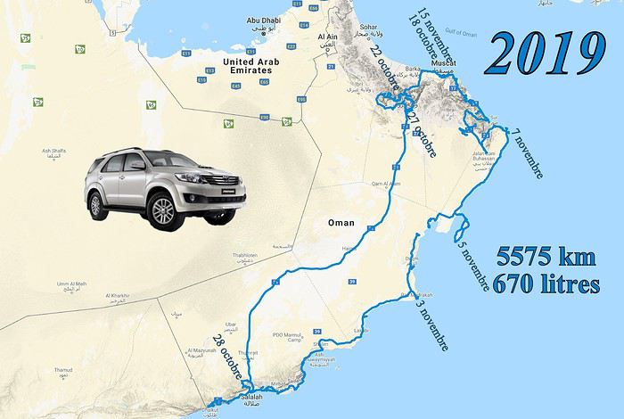
Le lien direct vers la carte interactive de notre circuit, telle que prévue lors de la préparation et qui a été complétée au fur et à mesure du voyage (par des lieux à visiter, restos sympas, emplacements de camping que nous avons particulièrement appréciés…), est ici : drive.google.com/...FRmo&usp=sharing
L’AGENDA de VOYAGE : Voici un résumé de nos étapes, tout n’y est pas mais c’est une trame mémoire de l’organisation générale quotidienne.
jeudi 17 oct. : départ de Lyon pour Munich par Air Baltic puis Munich-Mascate sur Oman Air en vol de nuit.
vendredi 18 oct. : arrivée à Muscat Airport à 6:40, une grande journée devant nous. Pas de problème pour les formalités de police : c’est très bien organisé : on laisse nos visas contre un coup de tampon sur les passeports et en moins d’une demie heure c’est terminé. Nous allons au desk Dollar dans le hall des arrivées pour retirer la voiture. Ici aussi cela se passe bien et vite. Nous sommes agréablement surpris que la caution puisse se faire avec la nouvelle carte de « débit » au nom de madame (pas nécessairement au même nom donc que lors de la réservation) sur laquelle nous n’avons pas de frais, alors que sur les documents il était spécifié « carte de crédit ». On en profite pour acheter une carte SIM sur le stand OMANTEL juste à côte : attention, le forfait que nous avons acheté 12 € ne permettait pas d’appeler sur la data (Whatsa*p, Sk*pe et autres). Il aurait fallu prendre l’option adéquate indiquée « Whatsa*p » : tant pis, surtout qu’on a constaté que le wifi des hôtel n’autorise pas non plus l’appel en data… (Par contre, presque partout, même dans des endroits très reculés, la 4G permet de se connecter à l’internet.)
Le TOYOTA Fortuner 7 places 2.7 boite auto 4x4 que nous récupérons après nous être perdus entre les étages des parkings, n’a que 2 ans mais déjà 83000 km au compteur. Il est en bon état avec pas mal d’options (entre autre radar de recul bien pratique quand il a fallu manœuvrer serré le premier soir dans Muthra complètement embouteillé) et 4 bons pneus. On aura donc de la place pour entasser notre matériel de camping. Pas de temps perdu non plus : à 8:30 nous sommes prêts à quitter l’aéroport. Nous pointons le GPS (Navigator sur Android et carte OSM sur laquelle j’ai ajouté des POI) sur le grand Mall de Bousher. Visite rapide chez Carrefour pour voir s’il y a des cartouches de gaz pour le réchaud Primus mais chou blanc. Nous montons à l’étage où il y a une libraire « Border » pour acheter le célébrissime et indispensable OMAN OFF-ROAD (« OOR » pour les intimes) présenté en tête de gondole. Le format retenu est complètement incompréhensible – plutôt pour exposer sur une étagère que pour un guide de voyage amené à être consulté fréquemment en voiture par le passager – broché, papier glacé, 1,6 kg pour une largeur de 25 cm, certes de très bonne qualité et bien documenté. On achète aussi une carte d’Oman qui se révélera d’une utilité limitée.
En voiture, nous traversons sur l’autre partie de cet immense centre commercial pour voir chez Lulu Hypermarket s’ils ont les cartouches de gaz recherchées. Fiasco encore, mais nous visitons – étonnés par la diversité des produits – cette grande surface où il y a beaucoup plus de monde que chez Carrefour où se sont les « expat » qui s’y approvisionnent. Nous achetons quelques vivres pour nos soirées de camping ainsi que 2 fauteuils de camping en promo (15 € les 2) et 2 nattes (à l’étage) pour renforcer l’isolation sur sols caillouteux, accessoires que nous avons trouvé bien utiles à l’usage. Sur le coup des midis, nous allons à l’hôtel « Muscat Al Murooj Grand Hotel » où nous avons réservé : la chambre – très confortable et grande – est déjà prête. Un repas avec viande de chameau et riz au resto juste à coté puis 2 bonnes heures de sieste.
 Nous voila en meilleure forme, rangeons nos sacs et passons 2 heures à la piscine sur le toit de l’hôtel : ça commence pas mal…
 A tombée de nuit on repart à la recherche de cartouches de gaz : un ou deux clics sur internet nous orientent vers un petit magasin spécialisé en matériel de camping : « the adventurer », pas de problème, il y a le modèle de cartouche que nous voulons. Il y a un matériel incroyable, des tentes, duvets bien sûr mais aussi des articles dont on n’avait pas idée que cela existait (merci la Chine et ses usines…). On a remarqué (sans acheter!) entre autres gadgets, quelque chose qui ressemble à un mitigeur chromé équipé d’une pompe intégrée pour puiser l’eau dans les grosses bobonnes plastiques !!! On a tout de même cédé aux sirènes de la société de consommation en s’offrant une lampe LED surpuissante sur socle magnétique à positionner sur la carrosserie et se raccordant par pinces sur la batterie de la voiture, qui s’est révélée très utile en camping.
On file après faire un tour à Muthra embouteillée : vraiment beaucoup de monde car c’est vendredi. Balade sur la corniche où pas mal de familles se promènent car il commence relativement à faire moins chaud (30°C tout de même) puis au souk, qui est à ce qu’il nous semble, surtout pour les touristes, sauf peut être dans quelques ruelles éloignés où des échoppes proposent autre chose que de l’encens et des casquettes…

A 9 heures, un bon jus de fruit frais pris en face du port, et au lit car la journée a été longue. On met la clim car le lit est équipé d’une couette épaisse et que sinon, on étouffe de chaleur. Dommage pour le bilan carbone, mais ce sera de même dans tous les hôtels où nous avons dormi. samedi 19 oct. : après un petit déjeuner somptueux en choix et qualité, en route ! Premier arrêt à une pompe à essence pour compléter le réservoir laissé à moitié vide par le précédent utilisateur : un vrai plaisir devant le prix affiché à moins de 0,50 € le litre, sachant que notre 4x4 semble assez gourmand. Bonjour encore le réchauffement de la planète. Stop suivant à Seeb Beach & Fish Market avec des poissons de tailles impressionnantes parfois posés à même le sol.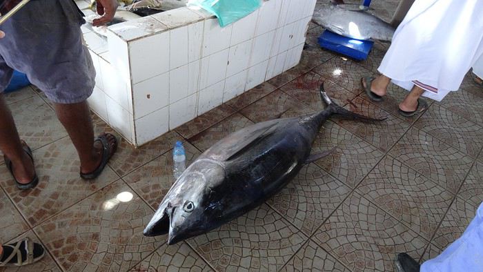
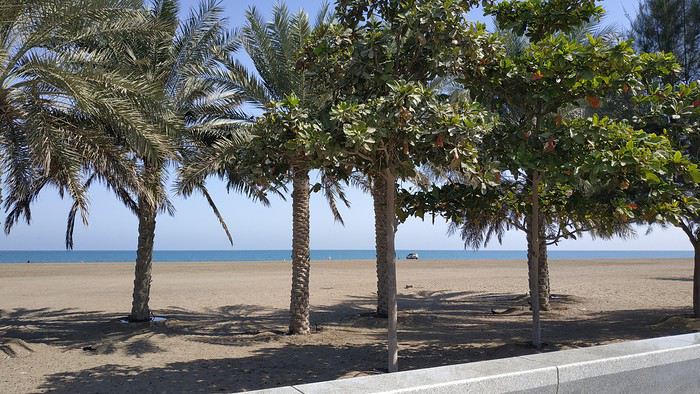
Ensuite Barka Fort que l’on contourne sans visiter car on se réserve pour le Fort Nakhal un peu plus loin. Sur place manque de bol : « fermé pour travaux » et il semblerait que les travaux soient amenés à durer !
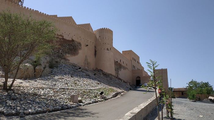
L’heure avançant, nous décidons de monter directement sur Wadi Bani Kharus, après être passés par un « coffee shop » à Al Awabi où nous commandons à emporter pour le soir, un poulet riz - biryany + salade pour environ 7 € pour 2 ! Pas de touriste dans le wadi et la palmeraie où nous marchons à l’ombre pendant 2 heures dans un vert luxuriant. Premiers contacts chaleureux avec des Omanais travaillant leur parcelle de terre sous les dattiers et bananiers et qui nous proposent de venir boire le café chez eux. Nous déclinons car nous ne voulons pas les interrompre, mais le sens de l’hospitalité à Oman n’est pas une légende.
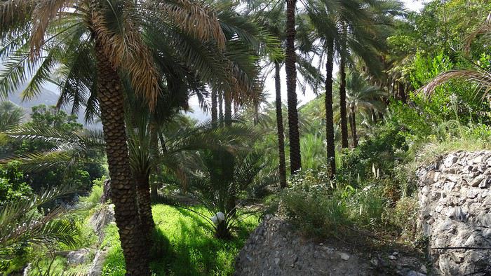
L’Oman Off-Road indique des emplacements où planter sa tente le long de la piste très chaotique qui relie les wadis Tanuf & Awf. C’est une des seules pistes que nous avons empruntées où le 4x4 est indispensable, à cause de la pente marquée et des rigoles au milieu des cailloux, hormis celles en sable meuble où on se plante sans la motricité complète (expérience vécue !). Coin superbe près du col, mais la nuit tombe vite et la température aussi car on est à 1100 m d’altitude. On se dépêche de monter la tente : la lampe achetée à Muscat remplit parfaitement son rôle. Petit apéro avec le Martini que nous avions transvasé avant de partir, dans une bouteille d’eau minérale, pour éviter les désagréments qui pourraient résulter des manipulations parfois peu délicates des sacs lors des chargements dans les avions (expérience vécue! bis). Nous n’arrivons pas à finir le repas du coffee shop tellement c’est copieux et à 7:30 nous sommes déjà dans les duvets.
dimanche 20 oct. : réveil un peu avant 6:00. Petit déjeuner grâce au réchaud Primus parfaitement adapté à sa cartouche ! On plie vite car le soleil arrive et ça cogne déjà fort ! Plongée sur le Wadi Bani Awf par la piste magnifique qui est plus carrossable que celle de la montée de la veille.
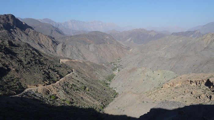
En bas on bifurque vers Little Snake Canyon pour une rando d’environ 1:30. Personne encore cette fois. Je me baigne dans une piscine naturelle mais pas madame qui la trouve trop fraîche le matin.
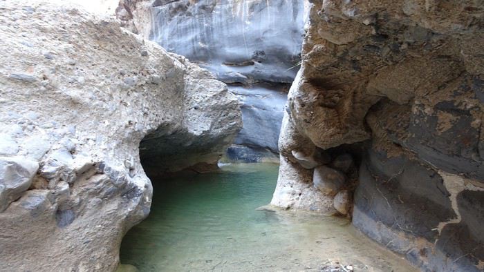
On reprend la piste pour Bait Bimah ( 4x4 indispensable ) où on a réservé en 1/2 pension pour la nuit, nous laissons la voiture et partons à pied pour « Snake Canyon » qu’on va parcourir en descente par le côte Sud. Superbe gorge très encaissée mais on doit s’arrêter au bout d’ 1 à 2 km car il y a un passage quasi vertical de 8 m et complètement lissé par l’eau, impossible à franchir sans corde.
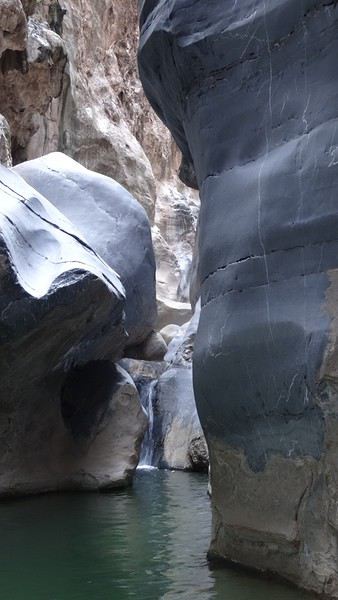
Re-baignade pour moi dans une belle vasque. On retourne au gîte pour reprendre la voiture sur 5 km pour rejoindre l’entrée Nord du canyon et le faire cette fois en remontant. Départ avec de l’eau à la ceinture et superbe rando entre des murailles de roches très resserrées. On arrive à une piscine naturelle où il faut nager, et qui est fermée en amont par une cascade de 3 m. On doit renoncer, mais on a pratiquement parcouru tout le canyon en deux fois. Pour le faire entièrement d’une traite, je suppose qu’il faut partir du Sud mais avec une corde pour tirer un rappel dans les passages délicats, puis se faire remonter par la piste sur les 5 km… Retour à Bait Bimah pour une bonne douche. Au repas du soir, il y a un groupe d’une dizaine de Singapouriennes encadré par un guide français… qui habite les alpes du sud à moins de 30 km de chez nous !!! Salut Cyril !!!
lundi 21 oct. : une bonne nuit, sans se faire bercer, dans la chambre simple mais confortable « Al Hail » – on a pas mal randonné la veille – et départ après un petit déjeuner correct pour visiter l’oasis perchée de Bilat Sayt. Personne encore comme touriste lors de la visite. Nous ne croiserons que 2 voitures en repartant. En route vers l’étape du soir : Al Hamra par une piste magnifique surplombant vallées et oasis. Balade au col en longeant le bord de la falaise. Comme on ne passe pas loin, on fait le détour à la grotte « Al Hoota Cave » qu’on ne visitera finalement pas : le prix du billet est élevé (15 €), le dépliant ne nous convainc pas vraiment et cerise sur le gâteau il faut patienter 2 heures pour la prochaine visite et marcher 1 heure A/R sous un soleil de plomb (36°C affiché par la voiture) car le petit train qui mène à l’entrée est en panne ! On laisse les valises à l’hébergement du soir et rajoutons une demie-heure de voiture pour le village de Misfat Al Abriyyin où nous flânons 1 heure dans les ruelles et dans la palmeraie.
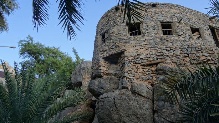
Cette fois, il y a des touristes, par bus entiers… mais ils restent tous concentrés vers le centre du village. Les hôtels et chambres d’hôtes ont placardé des panneaux un peu de partout dans les étroites ruelles et les cohortes d’aventuriers avec large chapeau, tenue saharienne, gros objectif sur le ventre et valise à roulette qui s’y rendent font beaucoup perdre en authenticité. Un tour en 4x4 par la piste raide qui part au dessus de Misfat Al Abriyyin, offre un point de vue panoramique sur la vallée. Retour à « Al Hamra Guest House ». Je profite de la petite piscine, puis resto où je découvre le jus frais d’avocat en terrasse au « Hud Hud restaurant » suivi d’un ragoût de chameau : très bon mais très nourrissant. Il n’y a que quelques rares tables dans ce restaurant, mais c’est une noria de voitures qui viennent chercher les plats commandés en « take away » signalant leur arrivée aux serveurs à coups de klaxon. Retour à la chambre après quelques courses au supermarché (dont une balayette à 1 € qui nous servira à se débarrasser de la poussière des pistes qui s’accumule sur la voiture et qui a tendance à rentrer dans l’habitacle à l’ouverture des portières. Utile aussi pour les pieds pleins de sable sur les plages). C’est l’heure du repos des voyageurs.
mardi 22 oct. : lever à 7:00 et petit déjeuner au « Hud Hud restaurant ». On en profite pour prendre un take away (dire plutôt « to parcel ») pour le soir. Visite de l’ancien Al Hamra : Bait Al Safah en bordure de sa palmeraie montre une architecture impressionnante avec ses maisons abandonnées de 2, 3 voir 4 étages en terre battue, toutes enchevêtrées mais qui malheureusement tombent en ruine. Ça a tout de même de la gueule…
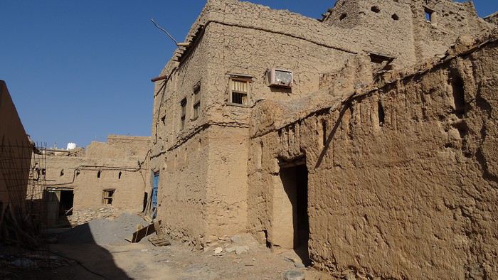
En route maintenant pour la montagne et le Jabal Shams. Nous abandonnons rapidement l’idée de suivre la piste qui monte à An Nakhur par le Wadi Nakhr peu roulante et qui nous prendrait trop de temps à faire en aller-retour. Direction le Jebel Shams et son plateau où nous nous lançons dans la superbe rando "W6:balcony trail Jebel Shams" pour 3 heures de marche environ.
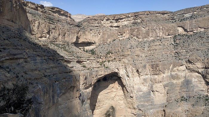
C’est mieux de prévoir en tout début d’après midi ce fabuleux aller et retour accroché à la falaise, surplombant un paysage qui n’a pas grand-chose à envier au Grand Canyon du Colorado (pour être honnête c’est quand même moins large !) car le retour peut alors se faire en partie à l'ombre. Il est temps de trouver maintenant un endroit où planter la tente. Et là, on découvre juste sur le bord du plateau, sur la crête sommitale de la falaise, au dessus du canyon avec toute la vallée et la plaine en contrebas, LE coin où s’installer.
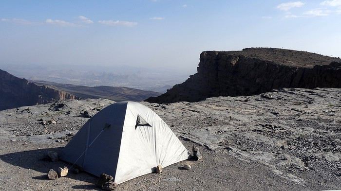
Je suis sûr que les passagers des voitures qui ont ralenti en dessous sur la piste un peu plus tard auraient bien aimé que l’emplacement soit encore libre (point GPS sur la carte)… La tente plantée (c’est une expression car la roche plate du sol ne laissait pénétrer aucune « sardine »), c’est corvée de bois en voiture. Soirée feu de camp tard dans la nuit (au moins jusqu’à 8 heures, mais il fait nuit noire à 6:00) à s’émerveiller du paysage à nos pieds.
mercredi 23 oct. : au petit matin, départ pour la rando "W4: Jebel shams". On monte pendant plus de 2 heures le long du canyon avec de beaux points de vue.
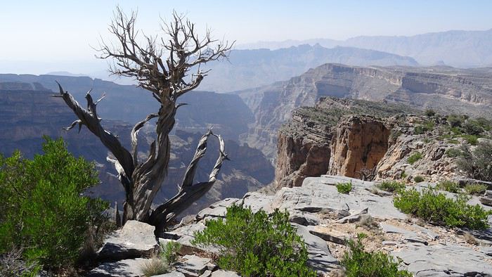
Le cheminement entre les buissons commence à devenir monotone. On s’aperçoit alors en regardant la carte sur le GPS que le dernier tiers de la rando n'est pas très intéressant : la zone militaire qui occupe le sommet n'est pas autorisée et il n’est donc pas possible d’atteindre le sommet, mais seulement une antécime, sans perspective sur les autres vallées. On aurait mieux dû regarder avant et faisons demi tour sans regret.
Arrivés à la voiture, cap sur le Wadi Damm. Rando dans ce superbe canyon aux parois sombres, où de grandes vasques d’eau limpide incitent à la baignade.
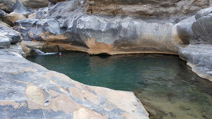
Pour continuer la montée du wadi, passage un peu sportif sans prise, où il faut s’aider d’une corde (qui reste en place), dos contre la roche (la technique de franchissement originale est heureusement décrite dans l’OOR, sans quoi nous ne serions certainement pas passés !). Demi tour après être arrivés jusqu’à l’endroit où le wadi s’élargit et l’eau disparaît sous les graviers et de nouveau la baignade en passant.
On trouve une place de camping tranquille dans la vallée parallèle au wadi pour passer la nuit. On finit les restes du take away qui s’est bien conservé dans la glacière garnie de bouteilles en plastiques toujours remplies de glace, préparées à « Al Hamra Guest House ».
.... à suivre ...
Nous voici tout juste de retour (brusque transition climatique je vous assure !) de notre sincèrement enchanteur périple de 5575 km, en couple, de 4 semaines au sultanat d’Oman, cet automne 2019.
POURQUOI OMAN ?
Les comptes rendus lus ici et là (surtout ici pour être honnête) sont tous enthousiastes et pour nous retraités vivant à la montagne, l’automne est un peu la saison creuse avant la neige et le ski. Et un peu de chaleur (on n’a pas été déçu sur ce point) et de ciel bleu sont aussi de bons arguments ! Nos dates ont aussi été choisies de façon à ne pas partir trop tôt à cause de la chaleur – le tropique du Cancer passe un peu au Nord de Muscat la capitale qui est assez au Nord du pays – et d’éviter d’être sur place lors des fêtes d’anniversaire du Sultan pendant lesquelles nous avions lu qu’il devenait difficile de se loger près des lieux touristiques.
Nous n’avons vraiment pas été déçus et chaque jour de notre séjour a été très dense en découvertes variées, sans pour autant que ce soit une course quotidienne de site en site.
Oman, c’est une multitude de paysages somptueux et variés : mer d’Oman à l’Est et océan indien au Sud Est avec des plages de sable blanc (la plupart du temps pour nous seuls), les déserts des Wahibas et Rub al Khali, les montagnes aux canyons impressionnants, wadis encaissés que l’on parcourt en partie à la nage dans une eau claire et chaude… Oman c’est aussi une histoire riche d’un peuple de voyageurs – c’est le pays de Simbad le marin et des caravanes d’encens de la reine de Saba – avec ses vestiges antiques, ses nombreux forts, ses vielles villes aux souks tortueux… Oman, c’est aussi des villes « à l’américaine » avec des centres commerciaux démesurés, au choix de marchandises étonnant et où la voiture est indispensable… Oman, c’est surtout les Omanais avec leur fabuleux sens de l’hospitalité désintéressée (qui a devant sa maison une fontaine d’eau glacée filtrée, parfois même du café et des dattes à l’attention du voyageur qui passe par là ?), leur courtoisie, leur sourire… Je m’arrête avant de devenir lyrique mais il y a là quelque chose à apprendre des Omanais…
Oman est un pays facile à visiter, malgré des distances non négligeables à franchir entre certaines étapes, mais les infrastructures sont bonnes, voir très bonnes et par exemple la traversée de presque 900 km jusqu’à Salalah se fait sans fatigue insurmontable par une autoroute gratuite 2x2 voies sur plus de la moitié du trajet (attention aux radars !!!). C’est aussi facile pour le voyageur car on se sent en sécurité partout. On a compris qu’il n’y avait pas à se faire de soucis à laisser les bagages dans le coffre de la voiture, sans tablette arrière : souvent les omanais laissent le moteur de leur véhicule tourner pour maintenir la clim et font leurs courses. Attention toute fois à ne pas prendre de mauvaises habitudes au retour ! De plus la qualité de l’eau est contrôlée de partout et les omanais sont presque maniaques de la propreté des mains (queue fréquente aux lavabos des restos), on a mangé salades et fruits sans aucun des problème digestifs auxquels il nous est arrivé d’être sujets lors d’autres voyages.
Contrairement à ce que nous pensions lorsque nous avons commencé à planifier notre circuit, le coût de la vie en voyage n’y est pas si cher : l’essence à 0,50 € en est pour beaucoup l’une des raisons, mais nous avons trouvé des hôtels très corrects à moins de 25 € la nuit avec petit déjeuner et la plupart des repas (souvent cuisine indienne) à environ 10 € pour 2 (sauf s’il y a des langoustes au menu, on frise plutôt les 12 € par personne !…).
LES PREPARATIFS :
Formalités : Avant le départ, nous avons demandé en ligne sur le site evisa les visas touristiques limités à 30 jours. C’est à faire moins d’un mois avant l’entrée dans le pays, mais avec une petite marge pour éviter tout aléa. Ces documents seront à imprimer et ont été réclamés au contrôle d’immigration. C’est rapide puisque nous avons reçu les visas 5 à 6 heures après le payement.
Avion : Les billets sont pris sur le site Lufthansa via une recherche Google Flights : hors vacances, les tarifs restent abordables.
Voiture : Nous avons fait le choix de louer un véhicule 4x4 pour pouvoir passer sans problème en montagne et dans le désert, mais aussi pour pouvoir transporter notre volumineux matériel de camping. Après avoir comparé les sites web des différents loueurs internationaux et locaux et lancé des consultations directes par email, c’est l’agence Dollar de l’aéroport de Muscat que nous avons retenue pour un contrat mensuel payé en ligne avec un tarif qui se démarquait fortement de la concurrence… Le permis de conduire international ne semble pas obligatoire, mais comme j’en avais un, le présenter à la page traduite en arabe est apprécié.
Quelques infos en vrac basées sur notre vécu sur place au sujet des déplacements : • les 2x2 voies sont gratuites ainsi que le stationnement. • attention aux radars tous les 3 à 4 km sur les 2x2 voies et à tous les carrefours dans les grandes villes. • les routes sont en général très bien entretenues et éclairées la nuit, même loin des agglomérations • les pistes sont raclées souvent et faciles avec un 4x4. Beaucoup sont possibles avec un véhicule standard. • les wadis deviennent impraticables et dangereux en cas de pluie (même lointaine…). • pas de contrôle de police routière pour nous sauf chek-point de l’armée vers la frontière du Yémen. • pompes à essence tout les 100 à 120 km maxi. • les cartes bancaires ne sont pas toujours acceptées hors des villes. • voiture de location « bridée » à 120 km/h compteur (113 réels sur le GPS). • conducteurs Omanais prudents, courtois et disciplinés. • gonflage pour le sable : 15 PSI soit 1 bar.
Hôtels : Pour loger dans les villes, on a réservé sur le site B**king.com une liste d’hôtels avec possibilité d’annulation car notre périple n’était pas complètement figé (c’est aussi le voyage que de garder la liberté de choisir une destination au dernier moment). Facile aussi de modifier les réservations car partout nous avions de la 4G ou un wifi correct dans les hôtels.
Camping : Il a fallu faire rentrer dans les sacs tout le matériel de camping – tente à arceaux, duvets, matelas auto-gonflants, ustensiles de cuisine – mais au final, nous avions de la marge en poids et tout est rentré sans problème dans le sac de soute, la valise de cabine et le petit sac à dos pour l’ordinateur que nous avions chacun… On plante sa tente de partout dans des endroits fabuleux sans être embêté. Les nuits en altitudes commençaient déjà à être fraîches en octobre : le sweat-shirt était bienvenu.
Navigation : La préparation des cartes pour le GPS a été faite en se basant sur les nombreux comptes-rendus que l’on trouve sur Oman, sur les sites de randos ou de voyages en 4x4. Toutes ces infos sont reportées sur « maps » de G**gle, elles sont alors retravaillées pour être mises au format .mca compatible avec notre « navigator » GPS, puis stockées sur les smartphones équipés des cartes gratuites OSM très complètes. C’est toujours bien utile une fois sur place de ne pas perdre de temps à tenter de s’orienter pour se rendre sur un point touristique où tourner en rond en ville à la recherche de son hôtel… Un clic suffit mais ça occupe quelques heures en préparation (mais c’est déjà le voyage) !!!
Choix du circuit : Pour des raisons de durée de visas, pour éviter les passages de frontières, de contrat de location de voiture, nous avons avons laissé tomber l’idée de la visite de la péninsule de Musandam et ses fjords certainement magnifiques. Nous ne sommes pas remonté beaucoup plus au Nord que Muscat. Le commencement du trip par les jebels en altitude laisse espérer une température plus supportable et décale d’autant l’arrivée au sud vers le début de l’hiver. Les trajets entre étapes sont établis de façon à optimiser les visites, sans que la durée moyenne passée en voiture dépasse 3 heures par jour.
Vous trouverez plus de détails pouvant être utile pour planifier (feuille de route que nous modifions au jour le jour, bilan des dépenses, liens vers sites utiles, commentaires laissés sur les logements, quelques photos…) , en suivant le lien vers nos documents de préparation et de suivi de voyage : docs.google.com/...LR0/edit?usp=sharing. Ce ne sont que des documents de travail et la mise en page peut laisser à désirer… Les indications sur les dépenses seront affinées au fur et à mesure de la réception des relevés bancaires. Nous n’avons pas visité tous les points d’intérêt relevés sur la feuille de route ainsi que sur la carte, mais c’était bien pratique, une fois sur place, de voir d’un coup d’œil ce qui méritait de consacrer un peu de temps aux alentours.
Le lien direct vers la carte interactive de notre circuit, telle que prévue lors de la préparation et qui a été complétée au fur et à mesure du voyage (par des lieux à visiter, restos sympas, emplacements de camping que nous avons particulièrement appréciés…), est ici : drive.google.com/...FRmo&usp=sharing
L’AGENDA de VOYAGE : Voici un résumé de nos étapes, tout n’y est pas mais c’est une trame mémoire de l’organisation générale quotidienne.
jeudi 17 oct. : départ de Lyon pour Munich par Air Baltic puis Munich-Mascate sur Oman Air en vol de nuit.
vendredi 18 oct. : arrivée à Muscat Airport à 6:40, une grande journée devant nous. Pas de problème pour les formalités de police : c’est très bien organisé : on laisse nos visas contre un coup de tampon sur les passeports et en moins d’une demie heure c’est terminé. Nous allons au desk Dollar dans le hall des arrivées pour retirer la voiture. Ici aussi cela se passe bien et vite. Nous sommes agréablement surpris que la caution puisse se faire avec la nouvelle carte de « débit » au nom de madame (pas nécessairement au même nom donc que lors de la réservation) sur laquelle nous n’avons pas de frais, alors que sur les documents il était spécifié « carte de crédit ». On en profite pour acheter une carte SIM sur le stand OMANTEL juste à côte : attention, le forfait que nous avons acheté 12 € ne permettait pas d’appeler sur la data (Whatsa*p, Sk*pe et autres). Il aurait fallu prendre l’option adéquate indiquée « Whatsa*p » : tant pis, surtout qu’on a constaté que le wifi des hôtel n’autorise pas non plus l’appel en data… (Par contre, presque partout, même dans des endroits très reculés, la 4G permet de se connecter à l’internet.)
Le TOYOTA Fortuner 7 places 2.7 boite auto 4x4 que nous récupérons après nous être perdus entre les étages des parkings, n’a que 2 ans mais déjà 83000 km au compteur. Il est en bon état avec pas mal d’options (entre autre radar de recul bien pratique quand il a fallu manœuvrer serré le premier soir dans Muthra complètement embouteillé) et 4 bons pneus. On aura donc de la place pour entasser notre matériel de camping. Pas de temps perdu non plus : à 8:30 nous sommes prêts à quitter l’aéroport. Nous pointons le GPS (Navigator sur Android et carte OSM sur laquelle j’ai ajouté des POI) sur le grand Mall de Bousher. Visite rapide chez Carrefour pour voir s’il y a des cartouches de gaz pour le réchaud Primus mais chou blanc. Nous montons à l’étage où il y a une libraire « Border » pour acheter le célébrissime et indispensable OMAN OFF-ROAD (« OOR » pour les intimes) présenté en tête de gondole. Le format retenu est complètement incompréhensible – plutôt pour exposer sur une étagère que pour un guide de voyage amené à être consulté fréquemment en voiture par le passager – broché, papier glacé, 1,6 kg pour une largeur de 25 cm, certes de très bonne qualité et bien documenté. On achète aussi une carte d’Oman qui se révélera d’une utilité limitée.
En voiture, nous traversons sur l’autre partie de cet immense centre commercial pour voir chez Lulu Hypermarket s’ils ont les cartouches de gaz recherchées. Fiasco encore, mais nous visitons – étonnés par la diversité des produits – cette grande surface où il y a beaucoup plus de monde que chez Carrefour où se sont les « expat » qui s’y approvisionnent. Nous achetons quelques vivres pour nos soirées de camping ainsi que 2 fauteuils de camping en promo (15 € les 2) et 2 nattes (à l’étage) pour renforcer l’isolation sur sols caillouteux, accessoires que nous avons trouvé bien utiles à l’usage. Sur le coup des midis, nous allons à l’hôtel « Muscat Al Murooj Grand Hotel » où nous avons réservé : la chambre – très confortable et grande – est déjà prête. Un repas avec viande de chameau et riz au resto juste à coté puis 2 bonnes heures de sieste.
Nous voila en meilleure forme, rangeons nos sacs et passons 2 heures à la piscine sur le toit de l’hôtel : ça commence pas mal…
A tombée de nuit on repart à la recherche de cartouches de gaz : un ou deux clics sur internet nous orientent vers un petit magasin spécialisé en matériel de camping : « the adventurer », pas de problème, il y a le modèle de cartouche que nous voulons. Il y a un matériel incroyable, des tentes, duvets bien sûr mais aussi des articles dont on n’avait pas idée que cela existait (merci la Chine et ses usines…). On a remarqué (sans acheter!) entre autres gadgets, quelque chose qui ressemble à un mitigeur chromé équipé d’une pompe intégrée pour puiser l’eau dans les grosses bobonnes plastiques !!! On a tout de même cédé aux sirènes de la société de consommation en s’offrant une lampe LED surpuissante sur socle magnétique à positionner sur la carrosserie et se raccordant par pinces sur la batterie de la voiture, qui s’est révélée très utile en camping.On file après faire un tour à Muthra embouteillée : vraiment beaucoup de monde car c’est vendredi. Balade sur la corniche où pas mal de familles se promènent car il commence relativement à faire moins chaud (30°C tout de même) puis au souk, qui est à ce qu’il nous semble, surtout pour les touristes, sauf peut être dans quelques ruelles éloignés où des échoppes proposent autre chose que de l’encens et des casquettes…
A 9 heures, un bon jus de fruit frais pris en face du port, et au lit car la journée a été longue. On met la clim car le lit est équipé d’une couette épaisse et que sinon, on étouffe de chaleur. Dommage pour le bilan carbone, mais ce sera de même dans tous les hôtels où nous avons dormi. samedi 19 oct. : après un petit déjeuner somptueux en choix et qualité, en route ! Premier arrêt à une pompe à essence pour compléter le réservoir laissé à moitié vide par le précédent utilisateur : un vrai plaisir devant le prix affiché à moins de 0,50 € le litre, sachant que notre 4x4 semble assez gourmand. Bonjour encore le réchauffement de la planète. Stop suivant à Seeb Beach & Fish Market avec des poissons de tailles impressionnantes parfois posés à même le sol.
Ensuite Barka Fort que l’on contourne sans visiter car on se réserve pour le Fort Nakhal un peu plus loin. Sur place manque de bol : « fermé pour travaux » et il semblerait que les travaux soient amenés à durer !
L’heure avançant, nous décidons de monter directement sur Wadi Bani Kharus, après être passés par un « coffee shop » à Al Awabi où nous commandons à emporter pour le soir, un poulet riz - biryany + salade pour environ 7 € pour 2 ! Pas de touriste dans le wadi et la palmeraie où nous marchons à l’ombre pendant 2 heures dans un vert luxuriant. Premiers contacts chaleureux avec des Omanais travaillant leur parcelle de terre sous les dattiers et bananiers et qui nous proposent de venir boire le café chez eux. Nous déclinons car nous ne voulons pas les interrompre, mais le sens de l’hospitalité à Oman n’est pas une légende.
L’Oman Off-Road indique des emplacements où planter sa tente le long de la piste très chaotique qui relie les wadis Tanuf & Awf. C’est une des seules pistes que nous avons empruntées où le 4x4 est indispensable, à cause de la pente marquée et des rigoles au milieu des cailloux, hormis celles en sable meuble où on se plante sans la motricité complète (expérience vécue !). Coin superbe près du col, mais la nuit tombe vite et la température aussi car on est à 1100 m d’altitude. On se dépêche de monter la tente : la lampe achetée à Muscat remplit parfaitement son rôle. Petit apéro avec le Martini que nous avions transvasé avant de partir, dans une bouteille d’eau minérale, pour éviter les désagréments qui pourraient résulter des manipulations parfois peu délicates des sacs lors des chargements dans les avions (expérience vécue! bis). Nous n’arrivons pas à finir le repas du coffee shop tellement c’est copieux et à 7:30 nous sommes déjà dans les duvets.
dimanche 20 oct. : réveil un peu avant 6:00. Petit déjeuner grâce au réchaud Primus parfaitement adapté à sa cartouche ! On plie vite car le soleil arrive et ça cogne déjà fort ! Plongée sur le Wadi Bani Awf par la piste magnifique qui est plus carrossable que celle de la montée de la veille.
En bas on bifurque vers Little Snake Canyon pour une rando d’environ 1:30. Personne encore cette fois. Je me baigne dans une piscine naturelle mais pas madame qui la trouve trop fraîche le matin.
On reprend la piste pour Bait Bimah ( 4x4 indispensable ) où on a réservé en 1/2 pension pour la nuit, nous laissons la voiture et partons à pied pour « Snake Canyon » qu’on va parcourir en descente par le côte Sud. Superbe gorge très encaissée mais on doit s’arrêter au bout d’ 1 à 2 km car il y a un passage quasi vertical de 8 m et complètement lissé par l’eau, impossible à franchir sans corde.
Re-baignade pour moi dans une belle vasque. On retourne au gîte pour reprendre la voiture sur 5 km pour rejoindre l’entrée Nord du canyon et le faire cette fois en remontant. Départ avec de l’eau à la ceinture et superbe rando entre des murailles de roches très resserrées. On arrive à une piscine naturelle où il faut nager, et qui est fermée en amont par une cascade de 3 m. On doit renoncer, mais on a pratiquement parcouru tout le canyon en deux fois. Pour le faire entièrement d’une traite, je suppose qu’il faut partir du Sud mais avec une corde pour tirer un rappel dans les passages délicats, puis se faire remonter par la piste sur les 5 km… Retour à Bait Bimah pour une bonne douche. Au repas du soir, il y a un groupe d’une dizaine de Singapouriennes encadré par un guide français… qui habite les alpes du sud à moins de 30 km de chez nous !!! Salut Cyril !!!
lundi 21 oct. : une bonne nuit, sans se faire bercer, dans la chambre simple mais confortable « Al Hail » – on a pas mal randonné la veille – et départ après un petit déjeuner correct pour visiter l’oasis perchée de Bilat Sayt. Personne encore comme touriste lors de la visite. Nous ne croiserons que 2 voitures en repartant. En route vers l’étape du soir : Al Hamra par une piste magnifique surplombant vallées et oasis. Balade au col en longeant le bord de la falaise. Comme on ne passe pas loin, on fait le détour à la grotte « Al Hoota Cave » qu’on ne visitera finalement pas : le prix du billet est élevé (15 €), le dépliant ne nous convainc pas vraiment et cerise sur le gâteau il faut patienter 2 heures pour la prochaine visite et marcher 1 heure A/R sous un soleil de plomb (36°C affiché par la voiture) car le petit train qui mène à l’entrée est en panne ! On laisse les valises à l’hébergement du soir et rajoutons une demie-heure de voiture pour le village de Misfat Al Abriyyin où nous flânons 1 heure dans les ruelles et dans la palmeraie.
Cette fois, il y a des touristes, par bus entiers… mais ils restent tous concentrés vers le centre du village. Les hôtels et chambres d’hôtes ont placardé des panneaux un peu de partout dans les étroites ruelles et les cohortes d’aventuriers avec large chapeau, tenue saharienne, gros objectif sur le ventre et valise à roulette qui s’y rendent font beaucoup perdre en authenticité. Un tour en 4x4 par la piste raide qui part au dessus de Misfat Al Abriyyin, offre un point de vue panoramique sur la vallée. Retour à « Al Hamra Guest House ». Je profite de la petite piscine, puis resto où je découvre le jus frais d’avocat en terrasse au « Hud Hud restaurant » suivi d’un ragoût de chameau : très bon mais très nourrissant. Il n’y a que quelques rares tables dans ce restaurant, mais c’est une noria de voitures qui viennent chercher les plats commandés en « take away » signalant leur arrivée aux serveurs à coups de klaxon. Retour à la chambre après quelques courses au supermarché (dont une balayette à 1 € qui nous servira à se débarrasser de la poussière des pistes qui s’accumule sur la voiture et qui a tendance à rentrer dans l’habitacle à l’ouverture des portières. Utile aussi pour les pieds pleins de sable sur les plages). C’est l’heure du repos des voyageurs.
mardi 22 oct. : lever à 7:00 et petit déjeuner au « Hud Hud restaurant ». On en profite pour prendre un take away (dire plutôt « to parcel ») pour le soir. Visite de l’ancien Al Hamra : Bait Al Safah en bordure de sa palmeraie montre une architecture impressionnante avec ses maisons abandonnées de 2, 3 voir 4 étages en terre battue, toutes enchevêtrées mais qui malheureusement tombent en ruine. Ça a tout de même de la gueule…
En route maintenant pour la montagne et le Jabal Shams. Nous abandonnons rapidement l’idée de suivre la piste qui monte à An Nakhur par le Wadi Nakhr peu roulante et qui nous prendrait trop de temps à faire en aller-retour. Direction le Jebel Shams et son plateau où nous nous lançons dans la superbe rando "W6:balcony trail Jebel Shams" pour 3 heures de marche environ.
C’est mieux de prévoir en tout début d’après midi ce fabuleux aller et retour accroché à la falaise, surplombant un paysage qui n’a pas grand-chose à envier au Grand Canyon du Colorado (pour être honnête c’est quand même moins large !) car le retour peut alors se faire en partie à l'ombre. Il est temps de trouver maintenant un endroit où planter la tente. Et là, on découvre juste sur le bord du plateau, sur la crête sommitale de la falaise, au dessus du canyon avec toute la vallée et la plaine en contrebas, LE coin où s’installer.
Je suis sûr que les passagers des voitures qui ont ralenti en dessous sur la piste un peu plus tard auraient bien aimé que l’emplacement soit encore libre (point GPS sur la carte)… La tente plantée (c’est une expression car la roche plate du sol ne laissait pénétrer aucune « sardine »), c’est corvée de bois en voiture. Soirée feu de camp tard dans la nuit (au moins jusqu’à 8 heures, mais il fait nuit noire à 6:00) à s’émerveiller du paysage à nos pieds.
mercredi 23 oct. : au petit matin, départ pour la rando "W4: Jebel shams". On monte pendant plus de 2 heures le long du canyon avec de beaux points de vue.
Le cheminement entre les buissons commence à devenir monotone. On s’aperçoit alors en regardant la carte sur le GPS que le dernier tiers de la rando n'est pas très intéressant : la zone militaire qui occupe le sommet n'est pas autorisée et il n’est donc pas possible d’atteindre le sommet, mais seulement une antécime, sans perspective sur les autres vallées. On aurait mieux dû regarder avant et faisons demi tour sans regret.
Arrivés à la voiture, cap sur le Wadi Damm. Rando dans ce superbe canyon aux parois sombres, où de grandes vasques d’eau limpide incitent à la baignade.
Pour continuer la montée du wadi, passage un peu sportif sans prise, où il faut s’aider d’une corde (qui reste en place), dos contre la roche (la technique de franchissement originale est heureusement décrite dans l’OOR, sans quoi nous ne serions certainement pas passés !). Demi tour après être arrivés jusqu’à l’endroit où le wadi s’élargit et l’eau disparaît sous les graviers et de nouveau la baignade en passant.
On trouve une place de camping tranquille dans la vallée parallèle au wadi pour passer la nuit. On finit les restes du take away qui s’est bien conservé dans la glacière garnie de bouteilles en plastiques toujours remplies de glace, préparées à « Al Hamra Guest House ».
.... à suivre ...
Two Sides of China: Urban Shanghai and Rural Yangshuo
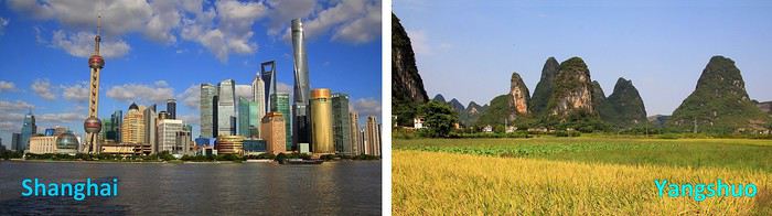
Vast, diverse, and multifaceted China! During a recent journey across part of this fascinating country, I enthusiastically discovered so many aspects of it. But such variety seems hard to condense into a single story. So, for this travel journal, I’ve focused on two main facets of China. First, a modern and urban China—the sprawling city of Shanghai—and then, in a second part, a China that’s the complete opposite: a rural and more traditional side explored around Yangshuo, where nature is absolutely stunning. Ready for a tour of China, city first, then countryside? Travel stories, descriptions, and impressions are on the program, with plenty of room for photos. Enjoy the journey and happy reading!
--
Urban China: Shanghai
As soon as you explore the city, it’s clear: the Chinese wanted to turn Shanghai—once a small fishing village—into a showcase of a modern, powerful, and forward-looking China. The megacity is immense, with around 24 million people bustling through its avenues or stuck in monstrous traffic jams at the foot of some of the world’s tallest skyscrapers. Towers so high they almost touch the sky—well, almost. But this gigantism is just one side of this southern metropolis in the Middle Kingdom.
Away from the towers and business districts, you discover another side of Shanghai—more traditional and, some would say, more human. This is where my travel story begins: on a quiet morning among smiling, relaxed locals. We’re in one of the city’s parks, specifically Fuxing Park.
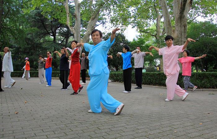
As everyone knows, the Chinese love practicing Tai Chi Chuan, in groups or solo, so it’s no surprise to see so many here, moving slowly and precisely through their sequences. Here’s a first group, their movements and postures perfectly coordinated.
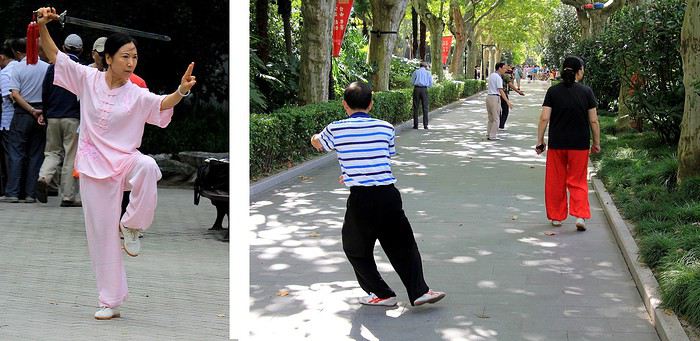
In another alley, a lone practitioner is deep in concentration, executing his movements with focus. I watch him for a few moments, discreetly and from a distance, so as not to disturb him. To his right, a woman in bright red pants keeps walking, almost as if she’s marching in place. A strange ballet: a series of steps forward, then backward, and so on...
Nearby, this elegant athlete (or artist) performs Tai Chi with a sword—almost like a choreography, her movements resembling a true sword dance.
Further on, the atmosphere is more relaxed and melodic. People are playing music and dancing joyfully, like this woman with her colorful, original hairstyle, all smiles with maracas in hand. You almost want to clap along—her energy is so contagious!
The mood is lighthearted among this group of retirees. Their choir alternates between patriotic hymns and lighter songs. Someone must have told them some French people were watching, because suddenly they start singing an old French tune: « Vive le vent, vive le vent d’hiver... » And the cheerful choir leader invites us to sing along—all together! The result was a fun cacophony: us in French, them in Chinese. But it was so charming!
These Chinese locals definitely passed on their good mood. It’s a joy to see all these retirees—you can imagine them leaving their small apartments to get some fresh air and meet up in the park for these morning activities. But let’s not kid ourselves: while they seem so happy and content with those big smiles, most of them probably didn’t have an easy life. Food shortages, draconian regulations, propaganda, the one-child policy—just to name a few! No, what many endured in their daily lives didn’t always give them reason to smile so brightly. But now, they’re making the most of it, and as I wrote earlier, it’s wonderful to see them like this.
Encouraged by these shared moments, I decide to keep going. Without hesitation, I join a Tai Chi session. I tried my best to follow the movements of my neighbors practicing this traditional exercise, but I’ll admit—it wasn’t easy!
This artist, especially attentive, rewards us with a calligraphed phrase about France. A lover of Chinese calligraphy, he writes these sinograms in ancient characters directly on the ground. Is it writing or drawing? It’s hard to say—the result is so aesthetic. An ephemeral phrase, written in water that slowly fades as it dries, before disappearing entirely.
As we walk, we approach one of the park’s exits—so beautifully flowered. These flowerbeds and their blooms hint at the name of this charming place: Parc des Roses—and it’s even written in French!
--
We’re now in the former French Concession of Shanghai, which explains the French inscriptions. The era of foreign concessions in Shanghai is an old story, dating back to the 1840s—a time when China opened its market to international trade. Several nations, including European ones, established trading posts in the city. There were British, American, Japanese, Russian, Italian, German, and French communities. This part of Shanghai was under French administration for a time, starting in 1846.
Some buildings in the area still bear witness to that time, like these ones, with bikes and scooters passing by. The architecture popular at the time blended European influences with the style of Shanghai’s elegant residences: stone arches above entrances, brick walls, and pleasant inner courtyards. Large homes often divided into several apartments today.
--
Traditional Chinese architecture shines in all its splendor at this tea house. With pagoda-style roofs—corners turned up toward the sky—refined colors and decorations, and a small corner tower on the right, this Huxinting Pavilion dates back to 1784. It was built in the middle of a pond, offering beautiful reflections. A truly charming spot where you can savor the subtle flavors of Oriental teas in the interior rooms.
Just steps from this picturesque spot, don’t miss the Yuyuan Pavilions and Garden. The whole complex is stunning and gives a glimpse of imperial-era homes and parks from the Ming Dynasty.

Pass through the entrance gate to enter this opulent property, well protected by a high surrounding wall. On one of them, a dragon sculpture sprawled at full length—about 7 meters—is impressive. The symbol represents power but also happiness.
Created in 1577 by the Pan family, wealthy dignitaries of the time, the visit takes you from pavilions with poetic names like the Pavilion of Three Ears to the Pavilion of Spring’s Announcement. Charming!
The interiors are decorated with woodwork from walls to ceilings, where beautiful Asian lanterns hang. But the real charm is outside. These shaded gardens, rustling with bamboo, are adorned with several ponds surrounded by impressive rock formations. A world that recreates (in miniature) the mountain and water landscapes of rural China.
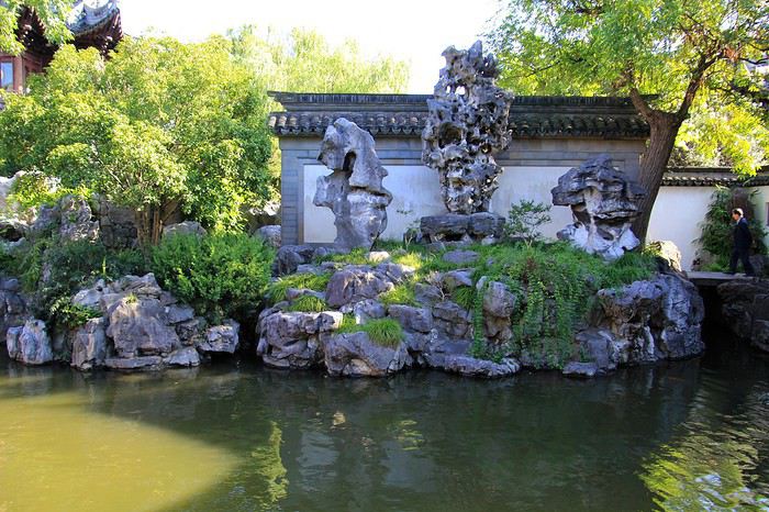
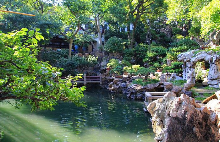
This historic Yuyuan Garden, in the heart of the city, took about 18 years to design and build (pavilions and gardens). Its current appearance is the result of a faithful renovation—much needed, because in 1942, during the so-called Opium War, British officers made it one of their residences. It was partly destroyed by bombings, and later, French troops ransacked it after an attack on their concession.
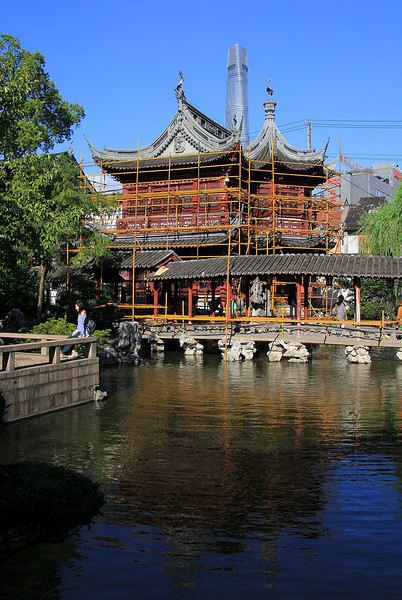
The site is still under construction—maintenance and renovation—with scaffolding as proof. The garden’s enclosure was set to close for work the day after our visit (for a few weeks, until the end of October 2019). That’s probably why crowds of visitors were rushing in, making the atmosphere a bit less peaceful than this beautiful architectural ensemble might suggest. For the photos, I had to be a bit clever, avoiding the crowds to give an impression of tranquility—this historic place deserves it.
--
To be continued in the next post...
Idée de circuit pour un mois à Bali English translation pending
Bonjour,
Nous projetons d'aller a Bali au mois de Mars qui apparemment n'est pas le meilleur au niveau du climat , mais bon.....
Je n'ai pas envie de changer de lieu tous les jour et on aime bien prendre notre temps . On pense rester 5 jours sur Ubud par exemple. On aimerai bien faire aussi Gili pour faire du snorkeling et mettre les doigts de pied en éventail .
Pouvez vos me conseiller un circuit a faire . Je j'ai pas envie d'aller voir le temple des singes ( J'ai la pétoche de ces bébêtes la ! )
Je vous remercie par avance
Cordialement
Pascal
L'Indonésie, une si belle mosaïque English translation pending
Disons-le tout de suite, d'entrée de jeu, j'ai été conquise par ce beau pays ... quelle splendeur, quelle beauté, quelles merveilles, quelle diversité, quelles rencontres 🙂
- la splendeur de ses rizières : des rizières plates, des rizières en toile d'araignée, des rizières en terrasse, des rizières en eau, des rizières avec du riz fraîchement planté, des rizières avec les tiges bien hautes et vertes du riz proche de la récolte - la beauté de ses temples : des petits temples au détour d'une rue, des temples imposants, le temple de Borobudur, unique en son genre - les merveilles de ses fonds marins : petits et gros poissons monochromes et multicolores, étoiles de mer rouges, bleues, à gros points noirs, des coraux mous, des coraux durs, des raies mantas, des tortues - la diversité de ses plages : du sable blanc, du sable rose, du sable noir, des galets bleus - les rencontres animalières : des orangs outans, des varans, des chauve-souris, des singes Thomas Leaf, des babouins, les petits et gros poissons
et partout une constante : la gentillesse des Indonésiens que nous avons trouvés si accueillants, souriants, serviables et globalement désintéressés.
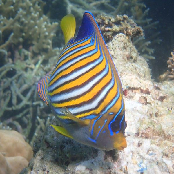
Bonjour à tous, bienvenue dans mon carnet sur cette si belle destination.
L'Indonésie, je l'avais initialement envisagée pour nos vacances en famille à la Toussaint 2018 mais pour différentes raisons (dont certaines bassement matérielles 😊), j'avais finalement choisi la Thaïlande qui fut une belle découverte. Ayant de la suite dans les idées et décidant de vaincre cette frustration 😛, je décidais donc de la reprogrammer pour cet été et estimais un budget grâce à l'aide précieuse de Lhorizon. Comme à son habitude, mon mari me donne carte blanche pour organiser. Objectif : contenter petits (deux garçons de 10 et 11 ans) et grands. Pour la première fois, nous décidons de partir un mois.
J'avais déjà collecté quelques informations au printemps 2018 grâce aux conseils des forumeurs et notamment de Lhorizon (décidément 😉), Kartoffel, OldPlatypus et Eiger. Vos carnets de voyage du forum m'ont également été très utiles, surtout pour la préparation de Bali, Java et Sumatra et j'ai ainsi dévoré les récits de Lhorizon, Marati, Muriel 18, Kate, Tokala, Max68 et Sambre01 et quelques autres (désolée si je ne vous nomme pas tous 😊).
L'Indonésie est un vaste archipel dont le choix des îles à visiter, si l'on ne tient pas à visiter Bali, n'est de prime abord pas évident. Certains lieux étaient à mon sens incontournables pour nos vacances : - Florès : énorme envie de découvrir cette île encore aux balbutiements du tourisme - Java : pour certains de ses volcans, le mont Bromo et le Kawah Ijen - Sumatra : pour les orangs outans
Bali était une étape qui nous permettait de rejoindre d'autres îles, par voie aérienne ou maritime. J'ai volontairement restreint la visite de cette belle île en raison de son fort développement touristique. J'ai par conséquent ciblé les endroits pas trop touristiques, même si je n'ai pas pu résister à certains endroits très courus.
Quelques détails logistiques en global avant d'entamer le récit de notre voyage : * billets d'avion : - pour les liaisons internes, j'ai fait des simulations sur de nombreuses combinaisons pour retenir les vols de Garuda et Air Asia qui alliaient un tarif pas trop onéreux et une durée de trajet pas trop longue et sans escales. Les vols internes ont été réservés en mars. - pour le trajet international, les prix des billets d'avion ont conditionné l'ordre de nos visites. Lors de mes réservations en novembre, il était financièrement plus intéressant de voyager à l'aller jusqu'à Bali et de repartir de Malaisie *logements : Habitués à voyager en couple en mode routard sans réservations d'hébergement, nous souhaitions des vacances un peu plus cadrées pour nos enfants, notamment sur les logements qui étaient tous réservés à l'avance. Soit en direct auprès des hébergements, soit sur Booking.com * billets de train Pour nos déplacements sur Java, ils ont été achetés en ligne au mois de juin via le site tiket (très simple d'utilisation) * croisière Komodo Trouvant les prix élevés pour une prestation à réserver depuis la France, je décidais d'attendre notre arrivée à Florès pour trouver un bateau qui nous permette de réaliser une croisière en quatre jours/trois nuits, avec idéalement seulement nous à bord.
J'espère que vous aurez plaisir à lire ce carnet et que ceux qui projettent de se rendre en Indonésie y trouveront des informations utiles 😎
Jour 0 - jeudi 11 juillet
Vol sur China Eastern prévu à 21h20 au départ de Roissy CDG. Nous arrivons au guichet d'embarquement vers 19h et sommes pris en charge immédiatement car il n'y a pas de file d'attente Le personnel reste ébahi devant la taille, et surtout le poids, de nos bagages : 3 sacs à dos en soute pour moins de 30 kg pour nous quatre. Quand on sait que chaque passager avait le droit à un bagage de 23 kg, moi je dis qu'on aurait mérité un surclassement 😇 Décollage ponctuel, hôtesses de l'air charmantes, le vol se déroule sans problème jusqu'à Shanghai.
Jour 1 - vendredi 12 juillet
Arrivée à Shanghai à 14h40, escale de 3h20. Initialement prévu à 18h, l'avion partira finalement avec 45 minutes de retard. Rien de particulier ; nous dormons tant bien que mal. Sauf quand certains se mettent à jacasser fort alors que manifestement, tout le monde dort, toutes les lumières étant éteintes 😠
Jour 3 - samedi 13 juillet
Magie des fuseaux horaires, partis le 11 juillet de France, nous atterrissons 22 heures après, dans la nuit du 12 au 13 juillet. Le retard au décollage n'a pas été résorbé en vol. Nous atterrissons donc à 1h15 du matin au lieu de 00h30 et devons attendre un temps certain (1h15 au bas mot) pour passer l'immigration. La récupération des bagages se fait heureusement rapidement. Le chauffeur réservé via notre hôtel nous attend comme convenu dans le hall de l'aéroport. L'avantage de cette heure tardive est qu'il n'y a pas d'embouteillages. Nous arrivons à l'hôtel peu après 3h00, ravis de pouvoir nous glisser dans des lits bien confortables non sans avoir oublié programmé nos réveils pour 10h15 afin de profiter du petit déjeuner de l'hôtel et découvrir quand même un peu Bali en journée.
Après quelques petites heures de sommeil réparateur, nous émergeons grâce au réveil et à la dépose de notre petit déjeuner sur notre terrasse. Pour cette (demi) nuit et la nuit suivante, nous logeons au Tropical Bali Hotel à Sanur, un hôtel dont la gérance est assurée par un couple de Français, Mathieu et Audrey, depuis plusieurs années. Le cadre est très agréable avec une belle végétation et une piscine. Nous profitons de ce début de matinée au calme avec ce qui sera le meilleur petit dej de toutes nos vacances.
Audrey nous brosse un plan des alentours et nous conseille d'acheter une carte SIM. Nous décidons de nous promener sur la promenade littorale jusqu'à remonter à la station balnéaire de Sanur et réservons via l'intermédiaire de l'hôtel un chauffeur qui nous retrouvera à un carrefour, facilement identifiable grâce à un fast-food avec un M jaune 🙂. Audrey nous prend en photo avec son téléphone afin d'envoyer ensuite notre bouille au chauffeur pour l'aider à nous reconnaître.
C'est parti pour une balade d'un peu plus d'une heure largement entrecoupée comme à notre habitude par de nombreux arrêts photos. Peu de touristes croisés lors de cette balade. Nous verrons surtout des Balinais qui vaquent à leurs occupations diverses et variées, des travaux, la pêche, confection d'offrandes.
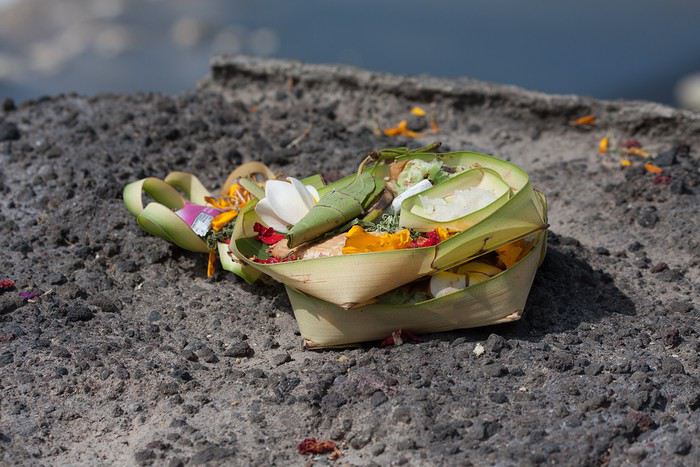
Nous échangeons régulièrement des Hello et grands sourires.
Le photographe ...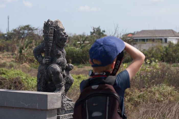
photographié 🙂
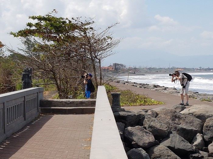
Arrivée à Sanur, bien plus de monde. Nous apercevons les touristes embarquant sur les bateaux rapides en direction notamment de Nusa Lembogan et les Gili.
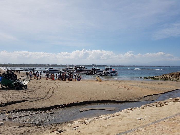
Nous photographions les bateaux à balancier typiques de cet endroit.
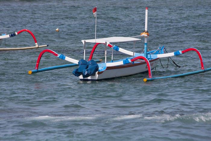
Nous quittons le front de mer pour nous diriger vers le point de rencontre prévu avec le chauffeur. Sur le chemin, nous en profitons pour faire des retraits d'espèces car nous n'avions pas réussi la veille à l'aéroport. Les distributeurs se trouvent dans des petits bâtiments climatisés réservés aux distributeurs. Les distributeurs délivrent soit des coupures de 50 000 roupies (auquel cas le montant maximal de retrait est de 2 500 000 roupies), soit des coupures de 100 000 roupies (retrait max de 3 000 000 roupies). Facilement repérables grâce aux étiquettes apposées sur les DAB. Plusieurs essais sont nécessaires car certains distributeurs nous rendent instantanément notre carte. Mon mari et moi réussissons finalement à opérer un retrait chacun. 15 krp = 1€ (environ)
Nous retrouvons notre chauffeur Komang (coordonnées en MP) et nous partons en direction du Pura Tanah Lot (pura = temple). Dans une petite boutique sur le trajet, nous achetons avec l'aide de notre chauffeur qui parle un anglais excellent une carte SIM de 8 Go pour 97 krp. En route, nous prendrons des photos insolites en Europe mais habituelles en Asie (peut-être pas au Japon, bien que je ne connaisse - pas encore - le pays 😉).
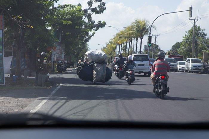
Moi qui apprécie peu les endroits bondés vais être servie au Pura Tanah Lot ! Mais je reste stoïque car je savais qu'il y aurait énormément de monde, l'endroit étant renommé. Une fois garés, il faut passer le long de nombreuses boutiques de souvenirs mais nous ne nous sommes pas sentis harcelés. Notre chauffeur nous indique qu'il nous attendra le temps nécessaire et nous conseille d'en profiter et de ne pas nous presser. Le surnom de Mont St Michel indonésien me semble adapté : le lieu est magnifique, le temple est situé dans la mer. Il y a effectivement beaucoup de monde. Ce temple est l'un des plus vénérés par les Balinais qui sont les seuls à pouvoir y pénétrer. Nous observons d'ailleurs plusieurs personnes et leurs offrandes.
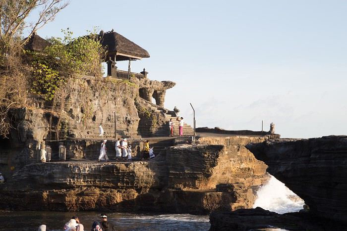
Quelques photos de loin, de près. La marée monte mais nous verrons globalement le Tanah Lot à marée basse.
Le spectacle doit valoir le coup d'œil lorsque le temple est cerné par les flots à marée haute ! Nous assistons au coucher de soleil et décidons de dîner sur place histoire de laisser les voitures repartir un peu. Nasi goreng (riz sauté) pour notre fils cadet, mie goreng (nouilles sautées) pour notre fils aîné et ayam satay (brochettes de poulet servie avec une sauce aux cacahuètes) pour les parents. Le dîner fût bon. Celui des moustiques aussi semble-t-il, nous nous sommes fait dévorer pendant le repas 😠
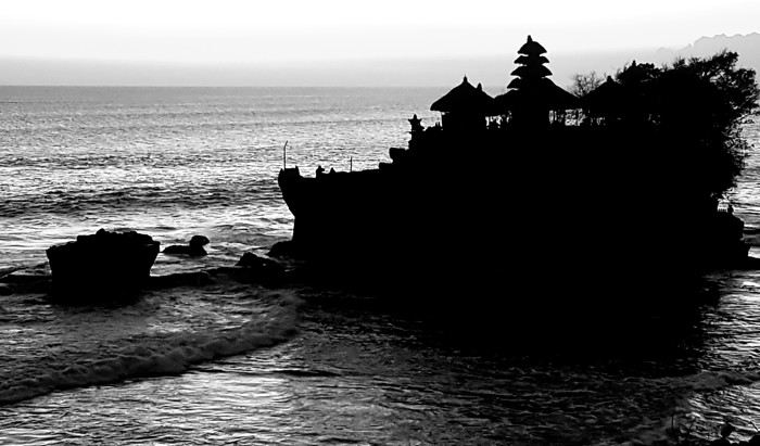
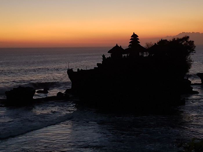
Retour à l'hôtel, préparation de nos sacs car nous quittons déjà Bali le lendemain en direction de Florès.
- la splendeur de ses rizières : des rizières plates, des rizières en toile d'araignée, des rizières en terrasse, des rizières en eau, des rizières avec du riz fraîchement planté, des rizières avec les tiges bien hautes et vertes du riz proche de la récolte - la beauté de ses temples : des petits temples au détour d'une rue, des temples imposants, le temple de Borobudur, unique en son genre - les merveilles de ses fonds marins : petits et gros poissons monochromes et multicolores, étoiles de mer rouges, bleues, à gros points noirs, des coraux mous, des coraux durs, des raies mantas, des tortues - la diversité de ses plages : du sable blanc, du sable rose, du sable noir, des galets bleus - les rencontres animalières : des orangs outans, des varans, des chauve-souris, des singes Thomas Leaf, des babouins, les petits et gros poissons
et partout une constante : la gentillesse des Indonésiens que nous avons trouvés si accueillants, souriants, serviables et globalement désintéressés.
Bonjour à tous, bienvenue dans mon carnet sur cette si belle destination.
L'Indonésie, je l'avais initialement envisagée pour nos vacances en famille à la Toussaint 2018 mais pour différentes raisons (dont certaines bassement matérielles 😊), j'avais finalement choisi la Thaïlande qui fut une belle découverte. Ayant de la suite dans les idées et décidant de vaincre cette frustration 😛, je décidais donc de la reprogrammer pour cet été et estimais un budget grâce à l'aide précieuse de Lhorizon. Comme à son habitude, mon mari me donne carte blanche pour organiser. Objectif : contenter petits (deux garçons de 10 et 11 ans) et grands. Pour la première fois, nous décidons de partir un mois.
J'avais déjà collecté quelques informations au printemps 2018 grâce aux conseils des forumeurs et notamment de Lhorizon (décidément 😉), Kartoffel, OldPlatypus et Eiger. Vos carnets de voyage du forum m'ont également été très utiles, surtout pour la préparation de Bali, Java et Sumatra et j'ai ainsi dévoré les récits de Lhorizon, Marati, Muriel 18, Kate, Tokala, Max68 et Sambre01 et quelques autres (désolée si je ne vous nomme pas tous 😊).
L'Indonésie est un vaste archipel dont le choix des îles à visiter, si l'on ne tient pas à visiter Bali, n'est de prime abord pas évident. Certains lieux étaient à mon sens incontournables pour nos vacances : - Florès : énorme envie de découvrir cette île encore aux balbutiements du tourisme - Java : pour certains de ses volcans, le mont Bromo et le Kawah Ijen - Sumatra : pour les orangs outans
Bali était une étape qui nous permettait de rejoindre d'autres îles, par voie aérienne ou maritime. J'ai volontairement restreint la visite de cette belle île en raison de son fort développement touristique. J'ai par conséquent ciblé les endroits pas trop touristiques, même si je n'ai pas pu résister à certains endroits très courus.
Quelques détails logistiques en global avant d'entamer le récit de notre voyage : * billets d'avion : - pour les liaisons internes, j'ai fait des simulations sur de nombreuses combinaisons pour retenir les vols de Garuda et Air Asia qui alliaient un tarif pas trop onéreux et une durée de trajet pas trop longue et sans escales. Les vols internes ont été réservés en mars. - pour le trajet international, les prix des billets d'avion ont conditionné l'ordre de nos visites. Lors de mes réservations en novembre, il était financièrement plus intéressant de voyager à l'aller jusqu'à Bali et de repartir de Malaisie *logements : Habitués à voyager en couple en mode routard sans réservations d'hébergement, nous souhaitions des vacances un peu plus cadrées pour nos enfants, notamment sur les logements qui étaient tous réservés à l'avance. Soit en direct auprès des hébergements, soit sur Booking.com * billets de train Pour nos déplacements sur Java, ils ont été achetés en ligne au mois de juin via le site tiket (très simple d'utilisation) * croisière Komodo Trouvant les prix élevés pour une prestation à réserver depuis la France, je décidais d'attendre notre arrivée à Florès pour trouver un bateau qui nous permette de réaliser une croisière en quatre jours/trois nuits, avec idéalement seulement nous à bord.
J'espère que vous aurez plaisir à lire ce carnet et que ceux qui projettent de se rendre en Indonésie y trouveront des informations utiles 😎
Jour 0 - jeudi 11 juillet
Vol sur China Eastern prévu à 21h20 au départ de Roissy CDG. Nous arrivons au guichet d'embarquement vers 19h et sommes pris en charge immédiatement car il n'y a pas de file d'attente Le personnel reste ébahi devant la taille, et surtout le poids, de nos bagages : 3 sacs à dos en soute pour moins de 30 kg pour nous quatre. Quand on sait que chaque passager avait le droit à un bagage de 23 kg, moi je dis qu'on aurait mérité un surclassement 😇 Décollage ponctuel, hôtesses de l'air charmantes, le vol se déroule sans problème jusqu'à Shanghai.
Jour 1 - vendredi 12 juillet
Arrivée à Shanghai à 14h40, escale de 3h20. Initialement prévu à 18h, l'avion partira finalement avec 45 minutes de retard. Rien de particulier ; nous dormons tant bien que mal. Sauf quand certains se mettent à jacasser fort alors que manifestement, tout le monde dort, toutes les lumières étant éteintes 😠
Jour 3 - samedi 13 juillet
Magie des fuseaux horaires, partis le 11 juillet de France, nous atterrissons 22 heures après, dans la nuit du 12 au 13 juillet. Le retard au décollage n'a pas été résorbé en vol. Nous atterrissons donc à 1h15 du matin au lieu de 00h30 et devons attendre un temps certain (1h15 au bas mot) pour passer l'immigration. La récupération des bagages se fait heureusement rapidement. Le chauffeur réservé via notre hôtel nous attend comme convenu dans le hall de l'aéroport. L'avantage de cette heure tardive est qu'il n'y a pas d'embouteillages. Nous arrivons à l'hôtel peu après 3h00, ravis de pouvoir nous glisser dans des lits bien confortables non sans avoir oublié programmé nos réveils pour 10h15 afin de profiter du petit déjeuner de l'hôtel et découvrir quand même un peu Bali en journée.
Après quelques petites heures de sommeil réparateur, nous émergeons grâce au réveil et à la dépose de notre petit déjeuner sur notre terrasse. Pour cette (demi) nuit et la nuit suivante, nous logeons au Tropical Bali Hotel à Sanur, un hôtel dont la gérance est assurée par un couple de Français, Mathieu et Audrey, depuis plusieurs années. Le cadre est très agréable avec une belle végétation et une piscine. Nous profitons de ce début de matinée au calme avec ce qui sera le meilleur petit dej de toutes nos vacances.
Audrey nous brosse un plan des alentours et nous conseille d'acheter une carte SIM. Nous décidons de nous promener sur la promenade littorale jusqu'à remonter à la station balnéaire de Sanur et réservons via l'intermédiaire de l'hôtel un chauffeur qui nous retrouvera à un carrefour, facilement identifiable grâce à un fast-food avec un M jaune 🙂. Audrey nous prend en photo avec son téléphone afin d'envoyer ensuite notre bouille au chauffeur pour l'aider à nous reconnaître.
C'est parti pour une balade d'un peu plus d'une heure largement entrecoupée comme à notre habitude par de nombreux arrêts photos. Peu de touristes croisés lors de cette balade. Nous verrons surtout des Balinais qui vaquent à leurs occupations diverses et variées, des travaux, la pêche, confection d'offrandes.
Nous échangeons régulièrement des Hello et grands sourires.
Le photographe ...
photographié 🙂
Arrivée à Sanur, bien plus de monde. Nous apercevons les touristes embarquant sur les bateaux rapides en direction notamment de Nusa Lembogan et les Gili.
Nous photographions les bateaux à balancier typiques de cet endroit.
Nous quittons le front de mer pour nous diriger vers le point de rencontre prévu avec le chauffeur. Sur le chemin, nous en profitons pour faire des retraits d'espèces car nous n'avions pas réussi la veille à l'aéroport. Les distributeurs se trouvent dans des petits bâtiments climatisés réservés aux distributeurs. Les distributeurs délivrent soit des coupures de 50 000 roupies (auquel cas le montant maximal de retrait est de 2 500 000 roupies), soit des coupures de 100 000 roupies (retrait max de 3 000 000 roupies). Facilement repérables grâce aux étiquettes apposées sur les DAB. Plusieurs essais sont nécessaires car certains distributeurs nous rendent instantanément notre carte. Mon mari et moi réussissons finalement à opérer un retrait chacun. 15 krp = 1€ (environ)
Nous retrouvons notre chauffeur Komang (coordonnées en MP) et nous partons en direction du Pura Tanah Lot (pura = temple). Dans une petite boutique sur le trajet, nous achetons avec l'aide de notre chauffeur qui parle un anglais excellent une carte SIM de 8 Go pour 97 krp. En route, nous prendrons des photos insolites en Europe mais habituelles en Asie (peut-être pas au Japon, bien que je ne connaisse - pas encore - le pays 😉).
Moi qui apprécie peu les endroits bondés vais être servie au Pura Tanah Lot ! Mais je reste stoïque car je savais qu'il y aurait énormément de monde, l'endroit étant renommé. Une fois garés, il faut passer le long de nombreuses boutiques de souvenirs mais nous ne nous sommes pas sentis harcelés. Notre chauffeur nous indique qu'il nous attendra le temps nécessaire et nous conseille d'en profiter et de ne pas nous presser. Le surnom de Mont St Michel indonésien me semble adapté : le lieu est magnifique, le temple est situé dans la mer. Il y a effectivement beaucoup de monde. Ce temple est l'un des plus vénérés par les Balinais qui sont les seuls à pouvoir y pénétrer. Nous observons d'ailleurs plusieurs personnes et leurs offrandes.
Quelques photos de loin, de près. La marée monte mais nous verrons globalement le Tanah Lot à marée basse.
Le spectacle doit valoir le coup d'œil lorsque le temple est cerné par les flots à marée haute ! Nous assistons au coucher de soleil et décidons de dîner sur place histoire de laisser les voitures repartir un peu. Nasi goreng (riz sauté) pour notre fils cadet, mie goreng (nouilles sautées) pour notre fils aîné et ayam satay (brochettes de poulet servie avec une sauce aux cacahuètes) pour les parents. Le dîner fût bon. Celui des moustiques aussi semble-t-il, nous nous sommes fait dévorer pendant le repas 😠
Retour à l'hôtel, préparation de nos sacs car nous quittons déjà Bali le lendemain en direction de Florès.
Itinéraire 15 jours en couple en Grèce English translation pending
Bonjour,
Nous partons les 15 derniers jours d’aout en Grèce, nous avons juste les billets d’avion pour Athènes. C’est un voyage sac à dos « petit budget ». Nous cherchons de la découverte, de belles plages mais sans trop de monde. On m’a dit d’éviter Santorin et Mykonos et on m’a conseillé Naxos et Paros. Je suis preneuse de tout conseil, idée d’itinéraire ou hébergement...
Merci beaucoup
Périple dans le nord de Madagascar (en 4x4) English translation pending
Bonjour voyageurs(euses),
Dans la préparation de mon périple à Mada courant Septembre, j’aimerais avoir de bonnes infos par des personnes ayant fait Diégo et quelques-unes de ces activités récemment.
DIEGO - RAMENA Visite des 3 baies + tour en quad ?? La Montagne des Français Mer d’émeraude + tour en pirogue ?? J’ai vu qu’il était possible de faire un tour ULM. Quel est le prestataire ? Est-il possible d’aller jusqu’au Wintsor Castle et la Baie du courrier et d’y dormir avant de repartir vers la Montagne Ambre ?? Visite tsingy rouge d’Irodo MONTAGNE AMBRE Randos dans le Parc et visites des alentours… Nuit dans le parc ???
Ensuite deux possibilités : 1/ Soit d’abord m’arrêter à ANKARANA pour la visite du parc national (voir le pont suspendu, le siphon de Mahamasina…etc) Est-il possible d’y dormir 1 nuit ?? 2/ soit aller à ANKIFY directement (plutôt que Ambaja) pour prendre le bateau pour Nosy Bé. Nuit à Ankify ? Savez-vous si c’est possible ?
Connaissez-vous les guides à tarif correct pour les visites, si vous avez des contacts ou infos pour ULM, piroguiers, gites ou hotels à tarif modérés bord de plage et avez-vous des adresses ? Et un chauffeur avec 4x4 pour ce périple (ou une partie) ? Et toutes les autres visites que j'aurais pu oublier... Combien de jours me conseille-vous ?
Merci beaucoup à tous et toutes. A bientôt de vous lire Cordialement Christine
Dans la préparation de mon périple à Mada courant Septembre, j’aimerais avoir de bonnes infos par des personnes ayant fait Diégo et quelques-unes de ces activités récemment.
DIEGO - RAMENA Visite des 3 baies + tour en quad ?? La Montagne des Français Mer d’émeraude + tour en pirogue ?? J’ai vu qu’il était possible de faire un tour ULM. Quel est le prestataire ? Est-il possible d’aller jusqu’au Wintsor Castle et la Baie du courrier et d’y dormir avant de repartir vers la Montagne Ambre ?? Visite tsingy rouge d’Irodo MONTAGNE AMBRE Randos dans le Parc et visites des alentours… Nuit dans le parc ???
Ensuite deux possibilités : 1/ Soit d’abord m’arrêter à ANKARANA pour la visite du parc national (voir le pont suspendu, le siphon de Mahamasina…etc) Est-il possible d’y dormir 1 nuit ?? 2/ soit aller à ANKIFY directement (plutôt que Ambaja) pour prendre le bateau pour Nosy Bé. Nuit à Ankify ? Savez-vous si c’est possible ?
Connaissez-vous les guides à tarif correct pour les visites, si vous avez des contacts ou infos pour ULM, piroguiers, gites ou hotels à tarif modérés bord de plage et avez-vous des adresses ? Et un chauffeur avec 4x4 pour ce périple (ou une partie) ? Et toutes les autres visites que j'aurais pu oublier... Combien de jours me conseille-vous ?
Merci beaucoup à tous et toutes. A bientôt de vous lire Cordialement Christine
Voyage en Australie et Nouvelle-Zélande en octobre English translation pending
Nous souhaitons partir en octobre. D'abord l'Australie, et étant si loin, la Nouvelle Zeelande. En plus des classiques, nous aimerions avoir votre avis sur Melbourne, Kangaroo Island et Adélaïde. Cette extension vaut elle la peine ? En effet rarement proposé me semble t il. Et auriez vous l'une ou l'autre agence locale (parlant français si possible) à me recommander pour finaliser notre voyage au bout du monde ?
Kao Sok ou rivière Kwai? English translation pending
bonjour a tous
je prépare notre voyage pour décembre 2019 et j’hésite sur 2 destinations .
je voulais monter passer 2 nuits en rafthouse sur la riviere Kwai ou descendre sur Kao sok.
entre les 2 mon cœur balance . sur vos expériences vécu quelle serait vos préférences.
merci pour vos avis.
merci pour vos avis.
Itinéraire de 15 jours en Islande fin mars English translation pending
Bonjour à tous.
Avec un ami, nous partons 15 jours en Islande du 16 au 31 mars. En regardant les divers exemples d'itinéraires sur ce forum ou ailleurs, je remarque que la grande majorité concerne la période estivale avec, donc, l'emprunt de pistes. Or en mars, j'ai cru comprendre que la grande majorité des "F-roads" étaient fermées. Nous louerons un 4x4 et dormirons dans des auberges de jeunesse, hôtels ou chez l'habitant. Pouvez me dire, dans l'itinéraire ci-dessous, quels coins seront inaccessibles malgré notre 4x4 ?
JOUR 1 : samedi 16 mars Arrivée à Reykjavik l’après midi. Visite de la capitale.
JOUR 2 : dimanche 17 mars Le Cercle d’Or : Pingvellir, Geysir, Gullfoss Nuit à Geysir ou Gullfoss
JOUR 3 : lundi 18 mars Gjain, Haifoss et direction vers le Landmannalaugar.
JOUR 4 : mardi 19 mars Le Landmannalaugar : Randonnées la journée puis direction Hella. Nuit à Hella
JOUR 5 : Mercredi 20 mars Entre Hella à Vik : Seljalandsfoss, Skogafoss, l'avion de Solheimasandur, Dyrholaey, Reynisfjall, Reynisdrangar et Reynisfjara. Nuit à Vik.
JOUR 6 : Jeudi 21 mars Entre Vik à Skaftafell : Myrdalssandur, Eldhraun, Le canyon Fjaorargljufur, Fagrigoss, Foss a sidu, Skeioararsandur, Laki (si nous avons le temps)
JOUR 7 : Vendredi 22 mars De Skaftafell à Höfn : Skaftafell, Svartifoss, arrêt à Hof, Breiðárlón, Jokulsarlon et nuit à Höfn.
JOUR 8 : Samedi 23 mars Les Fjords de l’Est : Vestrahorn, arrêt au fjord Mjóifjörður puis nuit à Egilsstaðir
JOUR 9 : Dimanche 24 mars (journée iréalisable fin mars ?) Direction Aksja, Viti et nuit à Dettifoss.
JOUR 10 : Lundi 25 mars Sellfoss, Dettifoss, ballade à Hljóðaklettar et/ou Rauðhólar. Nuit à Húsavík
JOUR 11 : Mardi 26 mars Autour de Myvatn : Namafjall, Hverir, Krafla et Leirhnjukur, grotte Grjótagjá, Dimmuborgir.
JOUR 12 : Mercredi 27 mars Dans les environs d’Akureyri : Goðafoss, Akureyri, Eyjafjörður, Siglufjörður, Glaumbær Nuit à Blönduós
JOUR 13 : Jeudi 28 mars Hvítserkur, Osar, Hraunfossar et Barnafoss
JOUR 14 : Vendredi 29 mars Péninsule de Snæfellsnes : cratère d’Eldborg, Kirkjufell, Snæfellsjökull, grotte de Vatnshellir, Arnarstapi, Búðakirkja. Nuit à Akranes.
JOUR 15 : Samedi 30 mars Reykjavik et Blue Lagoon
JOUR 15 : Dimanche 31 mars Départ le matin de Reykjavik.
Merci d'avance pour vos informations.
Avec un ami, nous partons 15 jours en Islande du 16 au 31 mars. En regardant les divers exemples d'itinéraires sur ce forum ou ailleurs, je remarque que la grande majorité concerne la période estivale avec, donc, l'emprunt de pistes. Or en mars, j'ai cru comprendre que la grande majorité des "F-roads" étaient fermées. Nous louerons un 4x4 et dormirons dans des auberges de jeunesse, hôtels ou chez l'habitant. Pouvez me dire, dans l'itinéraire ci-dessous, quels coins seront inaccessibles malgré notre 4x4 ?
JOUR 1 : samedi 16 mars Arrivée à Reykjavik l’après midi. Visite de la capitale.
JOUR 2 : dimanche 17 mars Le Cercle d’Or : Pingvellir, Geysir, Gullfoss Nuit à Geysir ou Gullfoss
JOUR 3 : lundi 18 mars Gjain, Haifoss et direction vers le Landmannalaugar.
JOUR 4 : mardi 19 mars Le Landmannalaugar : Randonnées la journée puis direction Hella. Nuit à Hella
JOUR 5 : Mercredi 20 mars Entre Hella à Vik : Seljalandsfoss, Skogafoss, l'avion de Solheimasandur, Dyrholaey, Reynisfjall, Reynisdrangar et Reynisfjara. Nuit à Vik.
JOUR 6 : Jeudi 21 mars Entre Vik à Skaftafell : Myrdalssandur, Eldhraun, Le canyon Fjaorargljufur, Fagrigoss, Foss a sidu, Skeioararsandur, Laki (si nous avons le temps)
JOUR 7 : Vendredi 22 mars De Skaftafell à Höfn : Skaftafell, Svartifoss, arrêt à Hof, Breiðárlón, Jokulsarlon et nuit à Höfn.
JOUR 8 : Samedi 23 mars Les Fjords de l’Est : Vestrahorn, arrêt au fjord Mjóifjörður puis nuit à Egilsstaðir
JOUR 9 : Dimanche 24 mars (journée iréalisable fin mars ?) Direction Aksja, Viti et nuit à Dettifoss.
JOUR 10 : Lundi 25 mars Sellfoss, Dettifoss, ballade à Hljóðaklettar et/ou Rauðhólar. Nuit à Húsavík
JOUR 11 : Mardi 26 mars Autour de Myvatn : Namafjall, Hverir, Krafla et Leirhnjukur, grotte Grjótagjá, Dimmuborgir.
JOUR 12 : Mercredi 27 mars Dans les environs d’Akureyri : Goðafoss, Akureyri, Eyjafjörður, Siglufjörður, Glaumbær Nuit à Blönduós
JOUR 13 : Jeudi 28 mars Hvítserkur, Osar, Hraunfossar et Barnafoss
JOUR 14 : Vendredi 29 mars Péninsule de Snæfellsnes : cratère d’Eldborg, Kirkjufell, Snæfellsjökull, grotte de Vatnshellir, Arnarstapi, Búðakirkja. Nuit à Akranes.
JOUR 15 : Samedi 30 mars Reykjavik et Blue Lagoon
JOUR 15 : Dimanche 31 mars Départ le matin de Reykjavik.
Merci d'avance pour vos informations.