Results for "occasion+|+53"
42856 results found.
Los Angeles, San Francisco, Las Vegas English translation pending
Dans laquel de ces deux villes il vaut mieux passer une semaine dans un hotel avec une voiture de loc?
A380: Décollage mercredi! English translation pending
Cà y est, c' est mercredi que l' A380 va faire son premier décollage. Il y aura à l' intérieur deux pilotes d' essai, un s' occupera du décollage l' autre de l' atterrissage, ils auront chacun un parachute...🏴☠️. A l' intérieur des bonbones d' eau seront placées pour remplacer le poids des passagers. Celà fait des années qu' ils préparent ce projet fabuleux, on peut dire que mercredi sera l' aboutissement de tout leur travail. On imagine les sensations que vont vivre ces deux hommes, surtout au moment d' envoyer les gaz.... Bonne chance les gars...
Retour du Grand Playa Turquesa English translation pending
Bonjour à tous,
Je suis de retour de Cuba, je suis allé au Grand Playa Turquesa dans la région d’Holguin. Nous sommes partis le 28 décembre 2004 pour revenir dans la nuit du 4 au 5 janvier 2005. Veuillez aussi tenir compte que nous avions réservé avec Signature avec un surclassement (VIP) Tel que promis voici mes impressions sur mon séjour.
Avant mon départ, j’avais lu des commentaires plus ou moins négatifs sur cet hôtel, sa plage, ses moustiques, ses marches… Étant donné que c’était ma première expérience dans un tout inclus et aussi à Cuba, j’avais très hâte de partir en vacances. Premièrement faut ce mettre dans la tête que nous allons à Cuba, ce n’est pas le Québec…Les Cubains ne sont pas stressés comme nous le sommes, donc ils sont slow aussi… Deuxièmement il y avait un problème avec l’eau, nous étions " rationnés ", c’est à dire que nous avions de l’eau entre 6H00 et 9H30 le matin, 12H00 et 14H00 et de 18H00 à 23H00. Il y a un problème d’eau dans la région, ce n’était pas juste à notre hôtel, nous n’avons pas laissé ce problème gâcher nos vacances, nous avons fait avec. Il y avait toujours de l’eau en bouteille de disponible et pour les toilettes dans les chambres, ils nous avaient laissé une chaudière avec de l’eau pour flusher la toilette si nous avions a y aller hors des heures mentionnées plus haut. C’est sur que ce n’était pas toujours évident, mais nous avons " dealé " avec et ce sans problèmes.
ACCUEIL
Nous sommes arrivés tard le soir, nous sommes arrivés à 23H00 à l’hôtel. Tout c’est bien passé à l’aéroport, moins long que je ne le pensais. Ensuite, nous avions 50 minutes de route à faire. Ce qui était plate c’est que nous n’avons pas vu grand chose sur la route car il faisait noir. L’aéroport est propre et assez grand.
Le " check-in " à l’hôtel s’est bien passé, quand même assez vite si on tient compte du fait que nous étions 5 autobus qui sont arrivés en même temps. Le lobby est très beau, grand et il y a aussi un beau petit bar. Nous sommes arrivés à nos chambres vers 23H30. L’hôtel à ouvert le buffet pour notre arrivé et ils ont pompé de l’eau au chambre en dehors des heures habituelles pour nous accommoder.
CHAMBRE
La chambre était super belle. Nous étions au 2ième étage (dans un immeuble de 2 étages). Le décor était beau, nous avions la TV avec un 20 de postes (CNN, Disney, ESPN…), la chambre de bain était super belle…Nous avions un balcon couvert avec une vue sur la mer. Nous avions la chambre #156. Nous étions près du lobby tout en haut du complexe. Nous étions à 5 minutes de marche des piscines, du lobby et des restos. Environ 10 minutes de marche de la plage. Étant donné que nous étions en haut nous avions une vue de la mer. Beaucoup de monde mentionne que la section 500 est la meilleure, ca dépend des goûts. La section 500, étant situé au centre du complexe, est collée sur les piscines mais il y a beaucoup de bruit, de la musique et du va et vient. À mon goût à moi, j’aimais mieux être tranquille et être capable de faire une sieste en après midi dans mon petit coin tranquille.
DÉPLACEMENT SUR LE SITE
Oui il y a beaucoup de marches sur le site, mais ça a l’air pire que ce ne l’est vraiment. Il y a des " cart " de golf qui passent régulièrement pour nous transportés sur le site et si on veut éviter les marches, il y a des sentiers qui nous rallongent mais qui nous évitent les marches. J’ai été surpris de constater que même si c’est un complexe de 532 chambres, t’as pas l’impression de te marcher dessus.
RESTAURANTS
Il y a 2 buffets sur le site, le buffet principal porte le nom de " Hacienda " est près du lobby. C’est grand. Il y a du choix en masse et pour tous les goûts. Pour les déjeuners il y avait des œufs, bacons, crêpes, pains dorés, du jus d’orange fraîchement pressé, des fruits en masse. Pour le dîner et souper il y avait des pâtes, de la pizza, des frites, des fruits de mers, un grill pour du poulet, du porc et des steaks…Les breuvages nous sont servis.
Le deuxième buffet, près de la plage, s’appelle le " Bucanero ". Le buffet est ouvert pour le déjeuner et dîner seulement, le soir, il devient un restaurant à la carte. Le buffet ressemble beaucoup à l’autre, mais est un peu plus petit et l’ambiance est plus chaleureuse, de plus étant près de la plage, nous allions souvent dîner la bas, ca nous évitait de monter les marches.
Avec Signature VIP, nous avions le droit de manger dans les 5 restaurants à la carte une fois dans la semaine. Nous avons mangé au restaurant Méditerranéen, le " Bucanero ". La bisque au fruits de mer est excellente. Nous avons mangé au Grill, le " Don Bartollo ", très bon la aussi. Et nous avons mangé à l’Italien, " le Forresta ", le dindon pané avec les Penne à la bolognese était excellent. Nous n’avons pas mangé à l’oriental " El-Gong " et au Cubain (ne me rappelle plus le nom).
Pour les restaurants à la carte vous devez avoir une réservation, il est possible de réservez près du restaurant " El-Gong " en dessous du buffet " Hacienda ". Je vous conseille une chose, réservez vos restaurants dès votre arrivée et si possible, réservez pour la semaine, c’est à dire que si vous avez droits à plus d’une réservation dans la semaine, faites la à l’avance. Nous avons mangé à seulement 3 restaurants à la carte sur une possibilité de 5 car il n’y avait plus de place les autres soirs. Ca ne nous dérangeait pas car le buffet était très bon. Nous avons mangé à 20H30 chaque fois.
Pour résumé les restos et buffets, le service est excellent et courtois. Il n’y avait jamais de retard dans nos réservations et la bouffe était bonne. Le vin rouge y était excellent.
PISCINES
Nous ne sommes pas allés à la piscine, il y avait beaucoup de monde, de la musique et de l’animation. Nous ne recherchions pas ça, nous voulions profiter de la plage. Les piscines étaient nettoyer chaque matin et il y avait beaucoup de chaise.
PLAGE
Ayant lu beaucoup de commentaire négatif sur la plage avant de partir, nous étions un peu nerveux avant de partir. Nous sommes allés à la plage à chaque jour, de 9H30 à 16H00. La plage est nettoyée à chaque matin pour enlevé les branches et déchets laissés sur la plage par " les cochons de touristes ". Le sable était beau. Pour ce qui est de l’eau, il y avait des petites roches et coquillages en entrant, mais rien de dramatique. La plage est " naturelle ", il y a une partie plus tranquille et un peu boisé et une partie plus dégagée, près du bar, des activités et de la hutte à pizza. Cette dernière partie est plus animée car il y a de la musique, du volley-ball et c’est là que la sortie est pour les catamarans, pédalos et kayak de mer. De plus, dans cette partie j’ai remarqué qu’il semblait y avoir plus d’algues/coraux . Nous allions toujours à la même place sur la plage, un endroit plus tranquille. En arrivant par l’entrée principale de la plage (près du GYM), nous allions à notre droite, c’est un peu plus boisé (pratique pour se mettre à l’abris du soleil) et plus tranquille. C’est un peu loin du bar et de la hutte à pizza, mais il y a moins de monde et l’eau y était belle.
Je vous conseille d’arriver tôt à la plage pour avoir de la place et des chaises, ca part vite, souvent à 11H00 il n’y avait plus de chaises de disponibles. Nous on arrivait tôt (9H00-9H30) et quand nous allions dîner on laissait nos serviettes sur nos chaises et jamais personne nous a volé nos places. Il y a toujours un employé pour vous amener nos chaises et les essuyer. 1 pesos pour ce service est bien peu et c’est très apprécié.
Mon ami Roberto au bar est très gentil, il fait des bons drinks (sex on the beach, Bahama Mama, Tentaçion…). La pizza semblait bonne sur la plage, mais étant donné qu’il y avait beaucoup de monde nous ne l’avons pas essayé.
SPECTACLE
Il y avait des spectacles chaque soir à 21H30. Nous avons été au premier, mais nous n’avons pas été aux autres car ont aimait mieux prendre un verre et retourné à notre chambre pas trop tard.
BOUTIQUE ET MARCHANTS
Il y a une petite boutique sur le site qui vend des souvenirs, de la boisson, des cigares et différents items de soins personnels. Les prix de la boissons sont semblables à ceux du duty free ainsi que pour les cigares.
Il y avait à l’occasion des artisans sur place vendant divers souvenirs. Ils n’étaient pas la à chaque jour par contre lors de notre séjour.
ARGENT
Nous avons changé notre argent canadiens en pesos convertibles (CUC) au comptoir de l’hôtel sans problèmes. On changeait de petites quantités à la fois.
MOUSTIQUES
Il y avait quelques moustiques surtout le soir, apporté vous du Off et il n'y aura pas de problèmes. Moi je n'ai pas été piqué, ma copine 2-3 piqures surtout le soir. Il faut cependant dire qu'il ventait beaucoup lors de notre séjour
AUTRES SERVICES
Il y a 4 ordinateurs avec internet dans le lobby et je vous préviens, c’est très lent. Ca ressemble à une connexion 14400 bps…Pas de haute vitesse la. C’est pas très dispendieux, 3 CUC pour ½ heure et 6 CUC pour 1 heure.
Il y a un service de nettoyeur sur place, nous ne l’avons pas utilisé.
Il y a un bureau de location pour des voitures et " mopeds ". Veuillez éviter les mopeds car ils sont rès dangereux. Les routes sont pas très belle. Nous avons d’ailleurs vu un couple pas mal amochés, il avait eu un accident de mopeds. Anyway, notre représentant Signature sur place nous avait fortement déconseillé la location de voitures et mopeds. Il est préférable de prendre un taxi.
Il y a un bureau appelé " guest service " au lobby, si vous avez des problèmes allez les voirs, la dame parle anglais et français et elle est très gentille. Il est possible de réserver les restos à la carte à cet endroit
Avec Signature VIP nous avions certains avantages comme le remplissage du Mini-bar à chaque jour et le service de soirée. Nous avons eu un peu de difficulté à avoir le service. Il manque un peu de rodage à l’hôtel sur certains points, cependant, ne soyez pas gené de le mentionné au " guest service ", ils vont régler le problème avec plaisir. Au lieu de chialer, parlez en.
CONSEILS DIVERS
Apporter vous des débarbouillettes car ceux qu'ils fournissent sont grosses (ressemblent à une serviette à main)
Apporter du OFF, de la crème solaire
Pour la conversions en pesos CUC apporter du cash canadiens car je ne crois pas que l'hôtel accepte les cartes de crédits pour changer des pesos CUC.
J'ai téléphoné au canada de ma chambre d'hôtel, la communication était excellente et pas trop dispendieux, environ 10 minutes pour 7 pesos CUC
En résumé, nous avons adoré notre séjour, à part le problème de l’eau bien entendu. On y retournerais volontiers. C’est sûr que ce n’est pas toujours comme on le voudrait, mais il ne faut pas laisser certains petits détails nous gâcher les vacances. Si vous n ‘êtes pas satisfait de certaines choses, parlez en et tout va rentrer dans l’ordre.
Je suis de retour de Cuba, je suis allé au Grand Playa Turquesa dans la région d’Holguin. Nous sommes partis le 28 décembre 2004 pour revenir dans la nuit du 4 au 5 janvier 2005. Veuillez aussi tenir compte que nous avions réservé avec Signature avec un surclassement (VIP) Tel que promis voici mes impressions sur mon séjour.
Avant mon départ, j’avais lu des commentaires plus ou moins négatifs sur cet hôtel, sa plage, ses moustiques, ses marches… Étant donné que c’était ma première expérience dans un tout inclus et aussi à Cuba, j’avais très hâte de partir en vacances. Premièrement faut ce mettre dans la tête que nous allons à Cuba, ce n’est pas le Québec…Les Cubains ne sont pas stressés comme nous le sommes, donc ils sont slow aussi… Deuxièmement il y avait un problème avec l’eau, nous étions " rationnés ", c’est à dire que nous avions de l’eau entre 6H00 et 9H30 le matin, 12H00 et 14H00 et de 18H00 à 23H00. Il y a un problème d’eau dans la région, ce n’était pas juste à notre hôtel, nous n’avons pas laissé ce problème gâcher nos vacances, nous avons fait avec. Il y avait toujours de l’eau en bouteille de disponible et pour les toilettes dans les chambres, ils nous avaient laissé une chaudière avec de l’eau pour flusher la toilette si nous avions a y aller hors des heures mentionnées plus haut. C’est sur que ce n’était pas toujours évident, mais nous avons " dealé " avec et ce sans problèmes.
ACCUEIL
Nous sommes arrivés tard le soir, nous sommes arrivés à 23H00 à l’hôtel. Tout c’est bien passé à l’aéroport, moins long que je ne le pensais. Ensuite, nous avions 50 minutes de route à faire. Ce qui était plate c’est que nous n’avons pas vu grand chose sur la route car il faisait noir. L’aéroport est propre et assez grand.
Le " check-in " à l’hôtel s’est bien passé, quand même assez vite si on tient compte du fait que nous étions 5 autobus qui sont arrivés en même temps. Le lobby est très beau, grand et il y a aussi un beau petit bar. Nous sommes arrivés à nos chambres vers 23H30. L’hôtel à ouvert le buffet pour notre arrivé et ils ont pompé de l’eau au chambre en dehors des heures habituelles pour nous accommoder.
CHAMBRE
La chambre était super belle. Nous étions au 2ième étage (dans un immeuble de 2 étages). Le décor était beau, nous avions la TV avec un 20 de postes (CNN, Disney, ESPN…), la chambre de bain était super belle…Nous avions un balcon couvert avec une vue sur la mer. Nous avions la chambre #156. Nous étions près du lobby tout en haut du complexe. Nous étions à 5 minutes de marche des piscines, du lobby et des restos. Environ 10 minutes de marche de la plage. Étant donné que nous étions en haut nous avions une vue de la mer. Beaucoup de monde mentionne que la section 500 est la meilleure, ca dépend des goûts. La section 500, étant situé au centre du complexe, est collée sur les piscines mais il y a beaucoup de bruit, de la musique et du va et vient. À mon goût à moi, j’aimais mieux être tranquille et être capable de faire une sieste en après midi dans mon petit coin tranquille.
DÉPLACEMENT SUR LE SITE
Oui il y a beaucoup de marches sur le site, mais ça a l’air pire que ce ne l’est vraiment. Il y a des " cart " de golf qui passent régulièrement pour nous transportés sur le site et si on veut éviter les marches, il y a des sentiers qui nous rallongent mais qui nous évitent les marches. J’ai été surpris de constater que même si c’est un complexe de 532 chambres, t’as pas l’impression de te marcher dessus.
RESTAURANTS
Il y a 2 buffets sur le site, le buffet principal porte le nom de " Hacienda " est près du lobby. C’est grand. Il y a du choix en masse et pour tous les goûts. Pour les déjeuners il y avait des œufs, bacons, crêpes, pains dorés, du jus d’orange fraîchement pressé, des fruits en masse. Pour le dîner et souper il y avait des pâtes, de la pizza, des frites, des fruits de mers, un grill pour du poulet, du porc et des steaks…Les breuvages nous sont servis.
Le deuxième buffet, près de la plage, s’appelle le " Bucanero ". Le buffet est ouvert pour le déjeuner et dîner seulement, le soir, il devient un restaurant à la carte. Le buffet ressemble beaucoup à l’autre, mais est un peu plus petit et l’ambiance est plus chaleureuse, de plus étant près de la plage, nous allions souvent dîner la bas, ca nous évitait de monter les marches.
Avec Signature VIP, nous avions le droit de manger dans les 5 restaurants à la carte une fois dans la semaine. Nous avons mangé au restaurant Méditerranéen, le " Bucanero ". La bisque au fruits de mer est excellente. Nous avons mangé au Grill, le " Don Bartollo ", très bon la aussi. Et nous avons mangé à l’Italien, " le Forresta ", le dindon pané avec les Penne à la bolognese était excellent. Nous n’avons pas mangé à l’oriental " El-Gong " et au Cubain (ne me rappelle plus le nom).
Pour les restaurants à la carte vous devez avoir une réservation, il est possible de réservez près du restaurant " El-Gong " en dessous du buffet " Hacienda ". Je vous conseille une chose, réservez vos restaurants dès votre arrivée et si possible, réservez pour la semaine, c’est à dire que si vous avez droits à plus d’une réservation dans la semaine, faites la à l’avance. Nous avons mangé à seulement 3 restaurants à la carte sur une possibilité de 5 car il n’y avait plus de place les autres soirs. Ca ne nous dérangeait pas car le buffet était très bon. Nous avons mangé à 20H30 chaque fois.
Pour résumé les restos et buffets, le service est excellent et courtois. Il n’y avait jamais de retard dans nos réservations et la bouffe était bonne. Le vin rouge y était excellent.
PISCINES
Nous ne sommes pas allés à la piscine, il y avait beaucoup de monde, de la musique et de l’animation. Nous ne recherchions pas ça, nous voulions profiter de la plage. Les piscines étaient nettoyer chaque matin et il y avait beaucoup de chaise.
PLAGE
Ayant lu beaucoup de commentaire négatif sur la plage avant de partir, nous étions un peu nerveux avant de partir. Nous sommes allés à la plage à chaque jour, de 9H30 à 16H00. La plage est nettoyée à chaque matin pour enlevé les branches et déchets laissés sur la plage par " les cochons de touristes ". Le sable était beau. Pour ce qui est de l’eau, il y avait des petites roches et coquillages en entrant, mais rien de dramatique. La plage est " naturelle ", il y a une partie plus tranquille et un peu boisé et une partie plus dégagée, près du bar, des activités et de la hutte à pizza. Cette dernière partie est plus animée car il y a de la musique, du volley-ball et c’est là que la sortie est pour les catamarans, pédalos et kayak de mer. De plus, dans cette partie j’ai remarqué qu’il semblait y avoir plus d’algues/coraux . Nous allions toujours à la même place sur la plage, un endroit plus tranquille. En arrivant par l’entrée principale de la plage (près du GYM), nous allions à notre droite, c’est un peu plus boisé (pratique pour se mettre à l’abris du soleil) et plus tranquille. C’est un peu loin du bar et de la hutte à pizza, mais il y a moins de monde et l’eau y était belle.
Je vous conseille d’arriver tôt à la plage pour avoir de la place et des chaises, ca part vite, souvent à 11H00 il n’y avait plus de chaises de disponibles. Nous on arrivait tôt (9H00-9H30) et quand nous allions dîner on laissait nos serviettes sur nos chaises et jamais personne nous a volé nos places. Il y a toujours un employé pour vous amener nos chaises et les essuyer. 1 pesos pour ce service est bien peu et c’est très apprécié.
Mon ami Roberto au bar est très gentil, il fait des bons drinks (sex on the beach, Bahama Mama, Tentaçion…). La pizza semblait bonne sur la plage, mais étant donné qu’il y avait beaucoup de monde nous ne l’avons pas essayé.
SPECTACLE
Il y avait des spectacles chaque soir à 21H30. Nous avons été au premier, mais nous n’avons pas été aux autres car ont aimait mieux prendre un verre et retourné à notre chambre pas trop tard.
BOUTIQUE ET MARCHANTS
Il y a une petite boutique sur le site qui vend des souvenirs, de la boisson, des cigares et différents items de soins personnels. Les prix de la boissons sont semblables à ceux du duty free ainsi que pour les cigares.
Il y avait à l’occasion des artisans sur place vendant divers souvenirs. Ils n’étaient pas la à chaque jour par contre lors de notre séjour.
ARGENT
Nous avons changé notre argent canadiens en pesos convertibles (CUC) au comptoir de l’hôtel sans problèmes. On changeait de petites quantités à la fois.
MOUSTIQUES
Il y avait quelques moustiques surtout le soir, apporté vous du Off et il n'y aura pas de problèmes. Moi je n'ai pas été piqué, ma copine 2-3 piqures surtout le soir. Il faut cependant dire qu'il ventait beaucoup lors de notre séjour
AUTRES SERVICES
Il y a 4 ordinateurs avec internet dans le lobby et je vous préviens, c’est très lent. Ca ressemble à une connexion 14400 bps…Pas de haute vitesse la. C’est pas très dispendieux, 3 CUC pour ½ heure et 6 CUC pour 1 heure.
Il y a un service de nettoyeur sur place, nous ne l’avons pas utilisé.
Il y a un bureau de location pour des voitures et " mopeds ". Veuillez éviter les mopeds car ils sont rès dangereux. Les routes sont pas très belle. Nous avons d’ailleurs vu un couple pas mal amochés, il avait eu un accident de mopeds. Anyway, notre représentant Signature sur place nous avait fortement déconseillé la location de voitures et mopeds. Il est préférable de prendre un taxi.
Il y a un bureau appelé " guest service " au lobby, si vous avez des problèmes allez les voirs, la dame parle anglais et français et elle est très gentille. Il est possible de réserver les restos à la carte à cet endroit
Avec Signature VIP nous avions certains avantages comme le remplissage du Mini-bar à chaque jour et le service de soirée. Nous avons eu un peu de difficulté à avoir le service. Il manque un peu de rodage à l’hôtel sur certains points, cependant, ne soyez pas gené de le mentionné au " guest service ", ils vont régler le problème avec plaisir. Au lieu de chialer, parlez en.
CONSEILS DIVERS
Apporter vous des débarbouillettes car ceux qu'ils fournissent sont grosses (ressemblent à une serviette à main)
Apporter du OFF, de la crème solaire
Pour la conversions en pesos CUC apporter du cash canadiens car je ne crois pas que l'hôtel accepte les cartes de crédits pour changer des pesos CUC.
J'ai téléphoné au canada de ma chambre d'hôtel, la communication était excellente et pas trop dispendieux, environ 10 minutes pour 7 pesos CUC
En résumé, nous avons adoré notre séjour, à part le problème de l’eau bien entendu. On y retournerais volontiers. C’est sûr que ce n’est pas toujours comme on le voudrait, mais il ne faut pas laisser certains petits détails nous gâcher les vacances. Si vous n ‘êtes pas satisfait de certaines choses, parlez en et tout va rentrer dans l’ordre.
Apprendre l'indonésien English translation pending
bonjour à tous
j'ai dans l'idée d'apprendre l'indonésien, je sais pas pourquoi mais bon ça m'a pris comme ça....
🙂
sinon je voulais savoir si certains ont déja commencer à l'apprendre et si oui comment quel livre ect...
au fait il parait que c'est la langue la plus facile à apprendre qu'en pensez vous ?
🤪
Birmanie - Novembre 2004 English translation pending
Je rentre d'un voyage de 3 semaines en Birmanie.
Voici quelques infos pratiques qui vous aideront peut-être à préparer votre voyage. Je répondrai avec plaisir à toutes vos questions complémentaires.
NOTRE PERIPLE EN 3 SEMAINES :
Comme souvent, nous avons pris l'option d'en faire moins (ni MraukU, ni trek, ni plage ...) pour bénéficier de longues étapes et visiter chaque région tranquillement. Ce rythme nous a permis d'encaisser facilement les très longs transferts en bus et de quitter chaque région avec nostalgie mais sans regret.
Ven 5 Nov - Vols Singapore Airlines et SilkAir Paris/Yangon via Singapour - Sam - Arrivée à Yangon vers midi Départ pour Mandalay à 18h00 (bus : 7$ - durée 15 heures) - Nuit dans le bus Dim - Arrivée à Mandalay à 8h40 Petit tour en ville et monastère de Shwé Nan Daw (vélo : 1 500 Ks) - Nuit à Mandalay Lun - Pagode Maha Muni - Amarapura (vélo) - Nuit à Mandalay Mar - Pagode Shwé Inbin - Inwa - Sagaing (taxi bleu : 10 000 Ks) - Nuit à Mandalay Mer - Po Win Daung (taxi : 50 $) - Nuit à Mandalay Jeu - Mingun (bateau : 1 500 Ks) - Pagodes au Nord de Mandalay (vélo) - Nuit à Mandalay Ven - Descente de l'Irrawady (Express Boat : 16 $ - durée 10 heures) - Nuit à Bagan Sam - Bagan (vélo : 1 000 Ks) - Nuit à Bagan Dim - Bagan (vélo) - Nuit à Bagan Lun - Bagan (vélo) - Nuit à Bagan Mar - Départ pour le lac Inlé à 5h00 (taxi : 100$ à 4 - durée 9 heures) - Mont Popa - Nuit à Nyaung Shwé Mer - Nyaung Shwé (vélo : 1 400 Ks) - Balade sur les canaux (canoë à rames : 1 500 Ks/h) - Nuit à Nyaung Shwé Jeu - Pindaya (taxi : 30 $) - Nuit à Nyaung Shwé Ven - Journée sur le lac (pirogue à moteur : 11 000 Ks) - Nuit à Nyaung Shwé Sam - Kakku - Festival de Taungyi (taxi : 35 $) - Nuit à Nyaung Shwé Dim - Départ pour Yangon à 13h (bus : 7 000 Ks - durée 20 heures) - Nuit dans le bus Lun - Arrivée à Yangon (downtown) vers 8h00 - Nuit à Yangon Mar - Rocher d'Or (bus : 2 500 Ks + camion-bus : 500 Ks/p) - Nuit à Kin Pun Camp Mer - Départ pour Yangon à 11h30 (bus : 2 500 Ks) - Nuit à Yangon Jeu - Marché Bogyoke - Musée - Pagode Shwé Dagon - Nuit à Yangon Ven - Marché indien - Pagode Shwé Dagon bis ... - Nuit à Yangon Sam 27 Nov - Vols SilkAir et Singapore Airlines Yangon/Paris via Singapour -
BUDGET :
Rappel : à ce jour, pas d'obligation de changer des US$ en FEC à l'arrivée toujours aucune transaction possible par carte bancaire (ni paiement, ni retrait) pas de change possible avec les traveler cheques. Vous l'avez compris, il faut venir avec du cash et rien que du cash ... Cela dit, rassurez-vous, on voyage serein tant le risque de vol est faible (soyez quand même attentifs mais ne vous inquiétez pas outre mesure ...) Nous n'avions pris que des $ en billets neufs : quelques grosses coupures de 100 $ pour le change et un bon paquet de petites coupures (20, 10 et 1$) pour le "quotidien". Je ne peux pas dire si l'Euro est facilement changeable, je ne m'en suis pas préoccupée ...
Nous avons changé 200 US$ à Mandalay et 100 US$ à Bagan au cours de 900 Kyats (Ks, prononcez tchiat) pour 1 US$. Change effectué à l'hôtel à chaque fois. Ca a couvert nos 3 semaines, les grosses dépenses (hôtels et taxi) étant payées directement en US$.
Sur place (et pour nous 2) 995 $ dépensés, répartis en 341 $ d'hôtel pour 19 nuits 120 $ d'entrée de sites 534 $ de repas, boissons, transport ... (je ne compte pas les achats de souvenirs)
GUIDES :
Guide du Routard 2004 - logistique - Très à jour. Pour une fois ! Lonely Planet version française 4è édition (Rocher d'Or en couverture) - N'est plus du tout à jour quant aux tarifs et aux informations générales : quasiment inutilisé. Guide Bleu Evasion 2002 - culturel - De bonnes infos logistiques également.
TRANSPORTS :
1 - Vols
Nous avons fait le choix de Singapore Airlines : bonne compagnie, fiable et confortable (écran individuel, grand choix de films, documentaires, jeux ...). L'escale à Singapour est toujours un vrai bonheur. Billets d'avion achetés en Juin sur Internet auprès de Go Voyages : http://www.govoyages.comRécupérés sans frais à leur agence rue de Cléry à Paris. Prix = 787 Euros l'A/R Taxe d'aéroport au retour : 10 $/p
2 - Bus
Yangon-Mandalay : 7$ par la compagnie Mann Shwe Pyi Express (durée 14, 5 heures) Achat du billet directement à la gare le jour même grâce à l'aide précieuse du chauffeur de taxi. Départ à 18h00 - Arrivée à 8h40 à la gare routière de Mandalay, à 11km du centre (3 000Ks en taxi bleu pour se rendre au centre) Bon confort - A/C - Bouteille d'eau fournie - Pas de vidéo ni de cassette à tue tête - Nous avons bien dormi et n'avons eu ni chaud, ni froid. Plusieurs arrêts pour se restaurer et se soulager.
Nous avons enchaîné le transfert en bus Yangon-Mandalay dès notre arrivée à Yangon. Pour éviter une nuit à Yangon, parce que nos bagages étaient déjà tout prêts, parce qu'on avait le rythme ... bref, ce qui sur le papier nous avait paru un peu fou s'est finalement fait tout seul ! On a dormi dans le bus, plutôt bien, et le dimanche à 9h, on était à l'hôtel, à Mandalay. On ne regrette pas cet effort qui finalement n'en fut un que dans la tête : celui de se dire, à l'atterrissage à Yangon, qu'on n'était pas encore arrivés ... Pour ce faire, nous avons demandé au chauffeur de taxi de nous emmener à la gare routière pour Mandalay. Il nous annonce que la gare routière proche de l'aéroport de Yangon est désormais fermée et qu'elle a été déplacée à l'Aung Mingalar Bus Stadium. Beaucoup plus loin. C'est cela, oui !... Très dubitatifs au départ, nous avons fini par nous laisser emmener quand même et, il s'est avéré que toutes nos arrivées à Yangon (de Inlé ou de Golden Rock) nous ont finalement ramenés dans cette "nouvelle" gare routière (qui n'a rien de neuf, d'ailleurs). On n'a jamais vu de gare routière près de l'aéroport ... On a donc fini par y croire 😛... N'ayant que des $ en poche, le chauffeur de taxi a payé nos billets de bus en Ks et nous l'avons remboursé en $.
Inlé-Yangon : 7 000 Ks par la compagnie Eastern State Express (durée 19 heures) Achat du billet par notre hôtel Départ à 13h00 à Shwé Nyaung, à qq km de Nyaung Shwé (5 000 Ks en taxi pour s'y rendre) Arrivée à Yangon, downtown, après s'être arrêté à l'Aung Mingalar Bus Stadium qu'on a reconnu (2 000 Ks en taxi pour se rendre à l'hôtel). Plus rustique - A/C - Bouteille d'eau - Vidéo assommante - Pas de pb de chaud ou de froid non plus. Plusieurs arrêts aussi bien sûr.
Yangon-Kin Pun Camp (Rocher d'Or) : 2 500 Ks par la compagnie Win Express (durée 4 heures) Achat du billet directement à la gare routière le jour même, juste avant d'embarquer. Départ à 7h00 de l'Aung Mingalar Bus Stadium (3 500 Ks de taxi depuis le centre ville) - Arrivée à KPC à 11h00 devant le Sea Sar, sympathique petit restaurant qui fait aussi guesthouse. Bon confort - A/C - Vidéos de karaoké assourdissantes (j'ai mis des boules Quiès !) Attention au retour. (Même prix - Achat du billet effectué par le jeune patron de notre guesthouse plein d'attentions). Nous sommes partis à 11h30. Nous avions choisi cet horaire pour pouvoir encore profiter de ce petit village avant de rentrer vers la bruyante capitale. Or, le bus ne disposait pas de rideaux aux fenêtres et nous avons énormément souffert. En plus, il a été plus lent qu'à l'alller, il a mis 4h30. Ce fut assez pénible.
PS1 - Les places des bus sont numérotées. Si vous le pouvez, évitez d'aller trop à l'arrière où l'on est davantage secoué. Pas d'embrouille, les réservations sont respectées. PS2. N'oubliez pas de prévoir votre papier toilette pour les arrêts, il n'y en a jamais 😛. Une lampe de poche peut aussi être utile ...
3 - Express Boat
Mandalay-Bagan : 16 $ (durée 10 heures) Achat du billet par l'hôtel Départ à 6h00 (transfert gracieux depuis l'hôtel) - Arrivée à 16h00 (transfert gracieux à l'hôtel puisqu'il était réservé) On n'a pas aimé ce transfert 🙁... Sans intérêt, bateau de touristes, quelques rares birmans, isolés. De plus, le voyage a peu d'intérêt, les paysages sont quelconques. Grosse, grosse déception ... Si c'était à refaire, on prendrait le bus depuis Mandalay ou peut-être depuis Po Win Daung (encore qu'il parait que l'hébergement à Po Win Daung est vraiment très spartiate). Bref, ça ne vaut pas les 16 $ investis ! Le bus, c'est beaucoup plus sympa.
4 - Taxi longue distance
Attention, pour les grandes distances, ça revient vite assez cher . Excursion à Po Win Daung depuis Mandalay : 50 $ (8 heures de route A/R) Bagan-Inlé via Mont Popa (arrêt de 2 heures) : 100 $ (9 heures de route) à partager, nous étions 2 couples - Partis à 5h00, arrivés à Nyaung Shwé vers 18h. Voiture genre microbus (7 places) -désolée, je suis nulle en marque de voiture, je n'ai pas noté ...- Confortable. Lors de nos périples dans Bagan, des rabatteurs nous proposaient ce même périple pour 70 $ ... Mais peut-être pas pour 4 personnes ce qui revient au même .... à vérifier ... Excursion Pindaya depuis Nyaung Shwé (Inlé) : 30 $ (7 heures de route A/R) Excursion Kakku depuis Nyaung Shwé (Inlé) : 35 $ (6 heures de route A/R) Partis à 11h, de retour à 19h car nous avons raté le festival de Taungyi (il nous a semblé (?) que le chauffeur ne savait pas vraiment où se tenaient les attractions de ballons, ou peut-être n'était-ce pas encore commencé ...) Bref, beaucoup de monde, trop à notre goût, trop longtemps à attendre avant ... on ne savait pas trop quoi ... un feu d'artifice peut-être ?... Bôf, on rentre ... Sans le festival deTaungyi, l'excursion aurait dû coûter moins cher (20$ peut-être ...) Un beau raté 😕 !
5 - Taxi en ville
A Yangon, ce sont des voitures avec enseigne sur le toit. Pas de compteur bien sûr ... Se mettre d'accord sur le prix avant la course. Aéroport - Gare routière (Aung Mingalar Bus Stadium) : 3 $ - Sortez de l'aéroport, évitez les prépaid et négociez bien à l'arrivée. Les chauffeurs proposent du change mais il n'est pas intéressant (enfin, ce n'est pas une grosse arnaque non plus : 850 Ks le $) - Bien sûr, ils acceptent d'être payés en $ mais du coup, la négociation est moins fine ... Centre ville - gare routière (Aung Mingalar Bus Stadium) : 3 500 Ks Centre ville - Aéroport : 3 000 Ks Course en ville : entre 800 et 2 000 Ks selon la distance
A Mandalay, ce sont des camionnettes bleues (blue taxi) où l'on monte à l'arrière Gare routière - centre ville (11 km) : 3 000 Ks Journée Inwa, Sagaing ... avec autant d'arrêts que l'on souhaite : 11 000 Ks Course en ville : 1 800 Ks Course Trishaw : 500 Ks (on a pris un trishaw chacun, ayant des scrupules ... nous sommes un peu plus lourds qu'eux ...)
A Nyaung Shwé, voiture particulière de l'hôtel Nyaung Shwé à Shwé Nyaung (pour prendre le bus vers Yangon) : 5 000 Ks. On n'a pas discuté mais, ça me parait beaucoup trop cher ...
6 - Vélo
1 500 Ks/j à Mandalay (loué à l'hôtel) 1 000 Ks/j à Bagan (loué à l'hôtel) 1 400 Ks/j à Nyaung Shwé (loué en ville) - Ceux-ci étaient tout neufs ! Nous avons crevé régulièrement (1 fois par jour). Ce qui n'est pas un problème, on trouve partout des petits ateliers qui vous réparent votre vélo pour 50 ou 100 Ks (à votre bon coeur). Même en ville ... Pas de problème ! Les Birmans sont tellement serviables que l'un d'eux a été jusqu'à emmener notre vélo en camionnette auprès du mécano à quelques centaines de mètres. Gracieusement .... Ces petits inconvénients laissent vraiment de bons souvenirs !
HEBERGEMENT :
Nous avons recherché des hôtels en gamme de prix moyens. Chambres toujours spacieuses, sanitaires (douches et wc) privés, eau chaude, A/C sauf à Nyaung Shwé (où c'est inutile). Nous avons toujours payé en US$, les prix indiqués sont par nuit, ttc et petit déjeuner inclus. Sans doute à tort, nous n'avons jamais cherché à négocier les prix annoncés.
Mandalay : Le Golden Mandalay Hotel (20 $) - ref GDR 🙂🙂 Anciennement le Yadanar Su Pon. Tenu par U Ko Ko et son adorable fille Tanzy (je ne suis pas sûre de l'orthographe ...). Un vrai coup de coeur. Petit ensemble de quelques bungalows, face à une mare couverte de nénuphars et gardée bruyamment par Amélie et Amélia 😉, 2 oies blanches et jacassantes. Chambre très spacieuse et très joliment décorée de bambou. Petit déjeuner servi dans le jardin face à la mare. Eau en bouteille à volonté, offerte. Petite assiette de fruits frais au retour. Accueil et service très familial, sans lourdeur. Tanzy est souriante du matin au soir et se met en 4 pour répondre à tous vos besoins. Elle s'occupe de tout : elle vous trouve des vélos, elle vous réserve les taxis, le bateau, vous fait du change ... Un vrai bonheur. Elle fut notre premier contact avec la Birmanie (après nos 16 heures de bus depuis Yangon) et a illuminé notre séjour à Mandalay. La famille de U Ko Ko mérite de beaucoup la pub que je me suis promise de leur faire !
Bagan : Golden Express Hotel (20 $) à Wet Kyi Inn - recommandé et réservé par Tanzy. Grand complexe sans aucun charme (bungalows et hotel) avec plusieurs niveaux de chambre : 18, 20, 24 et 30 $. Nous avons choisi une chambre en bungalow. Literie et sanitaires propres. Petite piscine agréable. Location de vélos. Service d'e-mail (1$ par mail envoyé). Excellente situation pour visiter les temples.
Nyaung Shwé (Lac Inlé) : View Point Inn (12 $) - ref GDR 🙂 Sur le canal, 4 bungalows sur pilotis de 2 chambres chaque. Chambre spacieuse mais spartiate, sanitaires vétustes ... Petite terrasse devant la chambre donnant sur le canal. Petit déj (pancakes absolument délicieux !) servi sur une terrasse haute dominant le canal où il fait bon observer l'animation naissante du matin. Beaucoup de charme - Bien situé - Tour du lac organisé par l'hôtel très très bien. Beaucoup d'animation (donc de bruit dès 5h30) sur le canal ... Ça ne nous a pas gêné mais je préviens ... C'est pas là qu'il faut prévoir de faire des grasses mat'!
Kin Pun Camp (Rocher d'Or) : Sea Sar Guesthouse (13 $) - ref GDR 🙂 Restaurant du même nom face à l'arrêt du bus qui arrive de Yangon. On va manger et on repart avec une chambre ... C'est pratique. Le jeune patron est sympa. La chambre est très très propre et spacieuse. A/C ! Rien à redire ! Une bonne adresse. En plus, le petit village est très vivant. Etape bien agréable.
Yangon : Queen's Park Hotel (22 $) Grand hotel sans charme. Situé downtown à 25 minutes de Paya Sulé et de Bogyoke Market. Les 2 hôtels dans le coin cités par le GDR étaient complets ... Accueil chaleureux et serviable - Ils nous ont gardé nos bagages (gratuitement bien sûr) lors de notre excursion au Rocher d'Or) Propre - A/C - Eau chaude, très très chaude - Ici, nous avons payé notre eau ... (raisonnable 200Ks). C'est une bonne adresse à défaut ...
REPAS :
On trouve très facilement, en plus de la cuisine birmane, de la cuisine chinoise et parfois de la cuisine indienne.
Un repas birman est constitué de riz (à volonté), éventuellement d'un petit curry de viande (nous sommes toujours restés au poulet) : 3 ou 4 morceaux cuisinés dans une sauce parfumée et épicée (mais pas pimentée), d'un bouillon et d'une quantité impressionnante de petites assiettes garnies de légumes, d'épices, de condiments divers et variés. Certains sont délicieux, d'autres plus surprenants ... Attention à la pâte de crevettes, forte en goût et en odeur ! Dès qu'une assiette est vide, elle est regarnie ... Finalement, seule la viande n'est pas à volonté. C'est très sympathique et très convivial. Ce genre de repas est très économique, autour de 1 000 Ks. Le thé birman est gratuit, à disposition sur les tables. Bonne adresse : dans Old Bagan, le Mar Lar Thein Gi (GDR) ...
Les cartes chinoises proposent les traditionnels Fried Rice et Fried Noddles avec ou sans viande. C'est toujours extrêment copieux, parfois garnis d'un oeuf. Vous y trouverez aussi des légumes fris délicieux (brocolis, choux-fleurs, pois gourmands ...) Bonnes adresses : à Mandalay, le Myanmar Lion Restaurant ; à Wet Kyi Inn (Bagan), le Pyi Sone (juste à côté du Golden Express Hotel), goûtez le Coconut Rice 🙂 au poulet à commander la veille (2 500 Ks), c'est divin !
Enfin, vous trouverez de bons restaurants indiens proposant thali, biryanis, chapatis ... avec toujours le riz à volonté. Bonnes adresses : à Yangon, le New Dehli (GDR) ; à Nyaung Shwé, l'Aroma(GDR)
En résumé, on mange facilement, bien, (sans se régaler comme en Indonésie) et à un prix dérisoire. Clairement, ce qui coûte le plus cher dans les repas, ce sont les boissons (Coca ou bière - la Myanmar à la pression est une merveille de douceur et de fraîcheur ! Je suis sûre que Parvat ne me contredira pas 😉!!).
Nous n'avons jamais discuté les prix des plats dans les petites gargottes. Ils sont indiqués sur les cartes et sont relativement les mêmes partout :
1 canette de Coca : 450 (en superette) à 700 (dans la rue, au restau) Ks 1 bouteille de Star Cola (leur Coca Cola local) : 100 Ks (c'est plus sirupeux que le Coca mais pas mauvais du tout) 1 litre d'eau en bouteille : 100 (en superette) à 200 Ks (dans la rue, dans les gargottes) - La marque Alpine est bonne. 1 demi de Myanmar pression : 325 Ks (Amateurs de bière, ne la ratez pas, elle est vraiment bonne. Elle m'a rappelé la Grimbergen). 1 bouteille de bière Mandalay (620 ml !! Attention !) : 1200 à 2000 Ks 1 assiette de riz blanc (quand il est payant ...) : 100 à 200 Ks 1 fried rice ou fried noddle au poulet : 700 Ks 1 chicken curry : 500 à 1 700 Ks (selon la préparation et le type du restaurant) Ainsi, un repas simple dans une petite gargotte nous revenait pour nous 2, hors boisson à 1 500-2 000 Ks. Un "repas de fête" à Yangon, pour mon anniv, nous a couté 11 000 Ks (au Shan Kan (GDR) - très sympa le soir, vue sur Shwé Dagon - Excellent Roasted Duck) avec 2 bouteilles de bière (anniv oblige 😊!) incluses.
Pour un petit encas, vous trouverez dans les rues des vendeurs de fruits : pastèques, ananas, papaye (pas testé, on déteste tous les 2 la papaye ...). Ils découpent votre portion en petits quartiers et les servent dans une petite poche plastique avec un pic en bois. Pratique, rafraîchissant et délicieux. Vous trouverez aussi des vendeurs de noix de coco fraîches (buvez d'abord le lait, puis mangez la pulpe). Essayez aussi le jus de canne à sucre servis avec du citron vert et, à la demande, de la glace. C'est dynamisant. Toutes ces petites douceurs tournent toujours autour de 100 à 200 Ks ...
Dans les maisons de thé, vous trouverez ... du thé (au lait ou nature) et encore des petites gâteries. Des samossas, aux légumes ou aux oignons, des beignets à tremper dans une sauce pimentée ... Tout ça est très bon. Seul inconvénient : pour les grands et gros que nous sommes, la pause peut s'avérer compliquée car les tabourets sont miniatures et il faut être adroits pour s'y asseoir et s'en relever sans s'étaler 😛 ... C'est bien connu : nous n'avons pas leur souplesse pour nous accroupir ... ce qui d'ailleurs les amuse beaucoup ...
SITES :
En Birmanie, il ne s'agit plus d'aimer seulement les vieilles pierres ... il faut aimer ... les pagodes !! Car, vous allez en voir ! Des anciennes, des récentes, des sobres, des moins sobres, des vraiment trop kitsches, des dorées ... Et des bouddhas !... Assis, dans la position de prise de la terre à témoin, parfois couchés, rarement debout ... Blancs, rouges, dorés ... voire boursouflés pour certains tellement ils sont couverts d'or ... Et c'est pieds nus que vous devrez voir toutes ces merveilles. Chaussez-vous en conséquence. Nous avions des sandales à scratch. Pratique tant pour faire du vélo que pour se déchausser facilement. Vous trouverez parfois des consignes à l'entrée des pagodes. On ne les a jamais utilisées : on laissait nos chaussures avec les tongs des Birmans, on les a toujours retrouvées.
Budget total entrées des sites : 60 $/p - Aucun supplément n'est demandé pour les appareils photo (sauf Pindaya).
Mandalay et ses environs Pass Mandalay : 10$ (validité 5 jours)dont Inwa Pass Sagaing/Mingun : 3 $ Mandalay : à ne pas rater, monastères Shwé Nandaw et Shwé Inbin et pagode Maha Muni. Nous n'avons pas visité le palais ... On s'est contenté d'admirer ses murailles. Nous ne sommes pas non plus monté en haut de la colline. J'ai bien aimé me promener en vélo dans cette ville facile et calme. Amarapura : prévoir 1 journée de vélo - Facile depuis Mandalay - La journée est d'ailleurs, à mon goût, plus intéressante pour la balade que pour les pagodes ... Nous avons déjeuné près du Pont U Bein dans une petite gargotte installée au bord du lac. Magnifique et reposant. Ne manquez pas la traversée du pont à pied (pas pieds nus !!). Nous y sommes revenus le lendemain (lors de notre excursion Inwa/Sagaing avec notre taxi bleu) en fin de journée pour profiter d'une plus belle lumière. Très photogénique. Inwa : on y a va en taxi bleu, puis on prend une barge qui traverse le fleuve (500 Ks/p) et accoste sur l'ile. Là, il faut négocier une calèche pour faire le tour. Nous avons demandé le grand tour (2h30) et payé 5 000 Ks pour nous 2. Belle promenade dans cette île très vivante et couverte de ... pagodes. Là encore, la balade au rythme du trot du cheval dans cette campagne enjouée est aussi intéressante si ce n'est plus que les pagodes en elles-mêmes. A ne pas rater. Sagaing : dans la même journée, on va en taxi bleu à Sagaing pour gravir un long escalier (à couvert) aboutissant à une pagode moderne et vraiment trop kitsch ! Certes, le panorama 360° est très beau mais ... on peut se passer de cette visite. Mingun : un bateau part à 9h et revient à 13h (1 heure à l'aller, 45 minutes au retour) : 1500 Ks/p Mingun est un beau site, présentant une pagode inachevée gigantesque et une autre éclatante de blancheur et d'une grande originalité. De nombreux artisans vous permettent de patienter jusqu'à 13h. Belles peintures (aquarelle, huile, pastel) à tous les prix (de qq milliers de Ks à plusieurs dizaines de $), certaines absolument magnifiques. Comme on regrette aujourd'hui de ne pas s'être laissés tenter !...
Po Win Daung Entrée = 2$ Excursion en taxi depuis Mandalay - 8 heures de taxi - 50 $ Attirés par un article paru dans un vieil exemplaire de Géo Magazine, nous tenions absolument à voir ce site. Des dizaines de grottes, plus ou moins grandes et dans chacune d'elles, des bouddhas, mais surtout des peintures murales magnifiques, très très bien conservées. La visite se fait avec un guide. J'aime mon autonomie mais là, je reconnais qu'il est indispensable. Trop de grottes pour savoir laquelle aller voir, laquelle ne pas rater, laquelle négliger. Lui sait les choisir avec un intérêt crescendo, la visite est bien menée. Anglais approximatif mais suffisant. Et comme toujours une grande sollicitude et une grande gentillesse. En 2 heures, on voit le principal. Organisée depuis Mandalay en taxi, c'est une excursion coûteuse en temps et en argent. Difficile de dire si ça les vaut ... nous, on n'a pas regretté mais c'est encore des bouddhas ...vous voila avertis.
Bagan Pass illimité 10$Musée 3$ Comme pour Angkor, nous avons loué des vélos ... Quel bonheur de visiter à son rythme, de prendre les chemins de traverse, de piocher dans ce champ de pagodes celle qui retient un peu plus notre attention et dont on va s'approcher ... Un bus de touristes ? Passons à la suivante, on y reviendra ! Mauvaise lumière ? On y repassera ce soir ! J'adore ces visites à vélo qui vous offrent cette liberté totale. Un bon plan (on en trouve partout à 500 Ks), une boussole (et encore !) et on trouve toutes les pagodes qu'on cherche. On n'a jamais eu aucune difficulté. On a même pris des raccourcis à travers les rizières. C'est fabuleux !... Les vélos possèdent un petit panier à l'avant, un antivol intégré, ils sont vieux et couinent beaucoup mais ils roulent. On crève ? Et alors ? Là, juste à côté, il y a un petit atelier en plein air qui va réparer en 10 minutes et 50 Ks la chambre à air ! Et c'est reparti ! "A demain, ami mécano pour la roue arrière !..." Nous avons passé 3 jours pleins à Bagan. 3 jours de bonheur. Nous avons vu le principal ... Mais Bagan a cela de commun avec Angkor qu'au dela de "voir le principal", il y a, après, l'envie de profiter de l'atmosphère. Et là on ne voit plus, on ressent ... Nous avions prévu d'y passer 1 jour de plus, pour le plaisir, pour l'ancrage comme je dis. Une opportunité de partager un taxi nous a fait revoir nos plans ... Un petit regret quand même ... je serais bien restée encore 1 jour ... La plus belle lumière, à mon goût (avis personnel !), était vers 16h00. Là le bleu du ciel, le rouge des briques des pagodes et le vert des rizières claquent vraiment ! Le matin, l'ambiance est magique mais c'est un peu voilé pour les photos. La nuit tombe vite, attention, à 18h00, il fait nuit noire ... Comme pour les pagodes en activité, il faut se déchausser. Les marchands du temple envahissent de plus en plus les pagodes. Ils vont maintenant jusqu'à l'intérieur. C'est un peu dommage ... Ils sont un peu collants, il faut l'avouer mais toujours souriants et très aimables. Aucune agressivité, jamais. Et puis, l'artisanat est beau, un artisanat de laques notamment pas mal du tout !... C'est ici, à Bagan que vous aurez le plus grand choix : achetez ici ! Nous on a trop attendu (toujours dans l'idée de voyager léger le plus longtemps possible) et on a regretté ! Boissons fraîches partout sur le site. Par contre, pas de toilettes.
Mont Popa Entrée = ?? Je n'ai rien noté et ne me souviens plus s'il s'agit ou non d'un oubli ... Bôf ... peut-être y sommes nous arrivés trop tôt (il était 6h30) ... les chappelles ouvraient à peine, personne en haut ... pas d'ambiance. Dans ces conditions, 1h30 nous ont largement suffi mais, encore une fois, je pense qu'on n'y était pas au meilleur moment. Tout au long de l'ascension (escalier facile, à couvert), vous serez accompagnés de dizaines de singes vifs et malicieux. Scènes de jeux très amusantes. Restez néanmoins sur vos gardes ... Il était donc 8h00 environ quand nous sommes redescendus et, là, nous avons adoré la vie, l'animation de début de journée de ce petit bourg. Les moines qui font leur tournée du matin, les boutiques de racines et d'herbes qui ouvrent ... Moment très agréable.
Pindaya Entrée = 3 $ + 200 Ks / app photos Une grande grotte (avec stalactites et stalacmites comme il se doit) encombrée de bouddhas dorés de toute taille. 8093 il parait. Excursion organisée depuis Nyaung Shwé à défaut d'avoir passé la nuit à Kalaw. Il me semble plus simple de passer la nuit à Kalaw et de faire Pindaya en allant de Kalaw à Nyaung Shwé. On y gagne en temps et en fatigue. C'est ce que nous avions prévu initialement (le chauffeur acceptait de passer la nuit à Kalaw en majorant son prix de 20$) mais l'opportunité de partager le taxi avec un autre couple nous a amenés à changer nos plans. Je reste convaincue que l'option "étape à Kalaw" aurait été plus confortable et moins redondante ... 1 bonne heure suffit pour compter les 8093 bouddhas.
Lac Inlé Accès : 3 $ (validité illimitée) Ah, quel régal ! Ah, quel bonheur ! Ah, quelle beauté, quelle sérénité ! Nous avons passé 5 nuits à Nyaung Shwé, petit bourg au Nord du lac. Là encore, j'aurais aimé y passer 1 journée de plus, pour le plaisir des yeux. Cette petite localité, à fleur d'eau, vit du tourisme : restau, quelques boutiques, guesthouses et hôtels, embarcadère pour les balades sur les canaux et sur le lac, location de vélo ... tout est facile. De Nyaung Shwé, nous avons aussi organisé les excursions vers Pindaya et Kakku. Nous avons passé 1 journée à nous promener dans Nyaung Shwé. Ne ratez pas le superbe monastère en bois Shwé Yan Pyay, qui abrite une communauté de bonzes jeunes et gais, à 2 km de la ville sur la route d'Hého et surtout la pagode juste à côté, toute décorée de motifs en pâte de verre et de bouddhas d'albâtre. On la dirait à l'abandon mais elle a une âme comme nous en avons rarement trouvé dans les pagodes. En vélo, c'est facile et tout plat. En plus, on longe des canaux où les familles se baignent. Belles images. Petite balade très sympa. Petits vendeurs de souvenirs en face où on a trouvé de jolies gravures sur bambous. Balade sur les canaux en canoë à rames : 1 500 Ks/h - On a fait 2h ... ça ne nous a pas transportés mais on aurait peut-ête dû mieux expliquer ce qu'on voulait : juste glisser sur des canaux entre les maisons sur pilotis pour profiter de la fin de journée. En fait, nous sommes passés d'une fabrique de cheerots, à un vieux stupas, à un monastère ... Nous avons passé autant de temps sur la terre ferme que dans la barque. Ce n'était pas l'idée que je m'en faisais .... Je n'avais qu'à le dire ! Pas grave, ce n'était quand même pas une galère non plus .... Et nous avons fait le tour du lac, en pirogue à moteur. Départ à 7h15 de l'hôtel (qui donne sur le canal), retour à 17h45 après le coucher du soleil - Grand tour avec Inn Dein : 11 000 Ks pour nous 2. Excursion réservée et organisée par l'hôtel (nous avions bien expliqué ce qu'on voulait voir et il n'y a eu aucune embrouille). Alors là, une journée magique !! La plus belle du voyage ! La plus esthétique, la plus sereine, la plus dépaysante ! Nous n'étions que tous les 2 dans la longue pirogue, petit luxe bien agréable ... La balade a duré toute la journée, à travers les villages de pêcheurs aux magnifiques maisons sur pilotis se réflétant dans une eau claire, à travers les lotus, à travers les jardins flottants et avec les arrêts chez les artisans que nous avions demandé à voir : ombelles, soie, bronze, argent, ... Un arrêt également à un marché semi-touristique semi-local où les locaux portent de beaux kramas (c'est le nom au Cambodge, peut-être n'est-ce pas le bon vocable ici) oranges sur la tête ... Le soir un arrêt au monastère des chats sauteurs, petite attraction amusante que nous avons ratée de peu tellement nous avions flâné ailleurs mais qu'un gentil bonze nous a montrée, pour nous, tout seuls : les chats sont dressés à sauter dans un cerceau. C'est mignon .... On rentre au soleil couchant, en ne manquant pas de photographier les Inthas qui rament en enroulant leur jambe autour de leur gaffe, en un geste à la fois gracieux et puissant. Une journée, en plein air (prévoyez la crème solaire, avec la réverbération sur la lac, ça tape !), dans un cadre naturel magnifique. C'est incontournable !!
Kakku Entrée = 3 $/p + 5 $ pour le guide obligatoire ... Ma petite excursion préférée ! Excursion organisée depuis Nyaung Shwé. ½ journée peut suffire. Sur la route, on s'arrête à Taungyi pour payer le droit d'entrée à Kakku et pour emmener un guide Pa O, obligatoire que l'on paye 5$ (pour nous 2). Le guide ne sert strictement à rien mais Kakku est géré par les PaO et le guide obligatoire fut la condition qu'ils ont posée pour ouvrir le site au plublic. Qu'importe. Nous voila en route pour 1h30 depuis Taungyi avec un guide qui, pensant nous plaire, parlait à moitié anglais, à moitié français ... Ce qui rendait son discours totalement incompréhensible ! Allez comprendre un mot mal prononcé en français quand vous supposez que c'est de l'anglais 🤪 !!... Arrivés à Kakku, ils nous a donné 2 mots d'explication et nous a lâchés sur ce site. Tant mieux finalement ... Des centaines de stupas alignés, plus ou moins décorés ... Certaines statues gardent encore de jolies traces de peintures. C'est vraiment fabuleux et on se promène dans ce dédale de stupas (pieds nus bien sûr) avec délices. La route pour y arriver traverse des villages de maisons de teck et de bambous harmonieusement tressés. On devine une région agricole un peu plus riche qu'ailleurs ... Ne ratez pas ça, c'est fabuleux et bien moins touristique que Pindaya.
Rocher d'Or Entrée = 6 $ En préparant notre voyage, nous avions hésité ... Cette excursion depuis Yangon nous paraissait bien galère pour ... peu de chose ... Au final, c'est ultra simple et intéressant. Pour y aller depuis Yangon, bus (voir § bus plus haut) puis à Kin Pun Camp, on s'installe confortablement 😛 dans la benne de ce qu'ils appellent le camion-bus, serrés avec 50 autres passagers ... Et c'est parti pour 30 minutes de montagnes russes ! Mieux qu'à Disney : ça dure plus longtemps et c'est moins cher mais je vous assure que les sensations y sont très semblables, les éclats de rire aussi ! Cette douce folie coûte 500 Ks. Le camion nous déverse au pied du Rocher que l'on gravit péniblement (c'est la montée la plus dure qu'on ait eu à faire) en 30-40 minutes. Là haut : le Rocher et toute la foule de pélerins venus s'y recueillir. L'ambiance y est très enjouée : les gamins jouent, les adultes rient, mangent, prient. Grande ferveur n'excluant pas une grande bonne humeur (mais ça c'est vrai partout en Birmanie : ils s'autorisent à prier et à rire dans un même lieu, mélange impie inconnu chez nous). Retour par le même manège à Kin Pun Camp vers 18h (la dernière benne -décidément, je n'arrive pas à appeler ça un camion-bus ! - part à 19h) où nous avions réservé notre petite chambre. Petite soirée agréable dans le petit bourg animé comme d'une fête foraine. Nuit au calme ... Le bilan : c'est une excursion qui prend du temps, certes (pas beaucoup d'argent) mais qui est intéressante. Le Rocher vaut d'être vu ... La vie dans le petit village est authentique. Cela dit, en tout honnêteté, je n'ai pas ressenti une grosse émotion. Si vous avez le temps (et en 3 semaines, on a le temps ! ), ne le manquez pas ; sinon ... Mais si c'était à refaire, n'aurais-je pas préféré passer 1 journée de plus à Bagan et 1 journée de plus à Inlé ?... Difficile ... Les durs choix des voyages ! Allez, il y a des décisions plus dures que ça dans la vie ! Haut les coeurs 🙂 !
Yangon Pagode Botahtaung : 2 $ Pagode Shwé Dagon : 5 $ Musée de Yangon : 5 $ Yangon, c'est la capitale ... Après 15 jours dans les champs, dans les villages, sur l'eau ... C'est moins agréable ... néanmoins, la vie n'y est pas stressante. Ne ratez pas la pagode Shwé Dagon et le marché Bogyoke, couvert, aéré, agréable. Le musée n'intéressera que les passionnés.
DIVERS :
Logistique : n'hésitez pas à vous adresser à votre hôtel pour tous vos besoins. Ils ont un sens du service hors du commun. Les photos : trop faciles ! Aucun pb pour les portraits, tous s'y prêtent volontiers, enfants, hommes, femmes, bonzes ... Sourire aux lèvres et nous remerciant après coup ! Du coup, tout le monde se remercie, c'est vraiment sympa ! Un vrai bonheur. Et personne n'a jamais réclamé de bakchich ... D'un point de vue pratique, je suis encore à l'argentique. J'ai pris du 200 Asa et aucun filtre. Je suis très satisfaite du résultat, la Birmanie est très photogénique et les couleurs pètent ! Le palu : après de longues hésitations et pour éviter le Lariam, nous avons fini par prendre de la Doxycycline, recommandé par l'institut Pasteur. C'est en fait un antibiotique (il faut donc une ordonnance médicale et s'y prendre à l'avance, la pharmacie renâclant à fournir toutes les boites d'un seul coup). Aucun effet secondaire (pour l'instant !). Consultez le site de l'Institut Pasteur pour plus de détails : http://www.pasteur.fr/externe L'artisanat : attention, n'attendez pas Yangon pour faire vos achats, vous le regretteriez. Nous avons vu les plus belles marionnettes à Mandalay (en face de la Shwé NanDaw ou sur la route d'Inwa) ; les plus belles laques à Bagan (visitez un workshop dans New Bagan, c'est instructif et sympa) ; les plus belles aquarelles à Mingun et près du Pont Ubein. Nous avons trouvé de jolies sculptures sur bois à Yangon, dans la pagode Shwé Dagon. Et des tas de bricoles partout, pour 3 francs 6 sous ... On est revenu avec un sac plein !! Prévoyez de la place ! C'est un régal. Globalement, nous avons payé nos achats 1/3 de moins que le prix initial. Marchandage facile et sans agressivité. Gardez toujours le sourire, ça facilite énormément la négociation. Petite astuce : si les ombrelles en papier vous intéressent (vous en verrez de jolies à Pindaya et sur le lac Inlé), sachez que j'ai trouvé (totalement par hasard !) dans une superette à Yangon une authentique ombrelle de moine, rouge, grande, pour 800 Ks ... A acheter sans doute en dernier car c'est un peu pénible à transporter ....mais quel effet dans le salon ! Info de toute dernière minute ... J'ai porté ce week end un petit ensemble en coton que j'ai acheté à Bagan (petite tunique col mao et pantalon à ceinture coulissante). Pas de mauvaise surprise au lavage et je confirme qu'ils disent vrai quand ils affirment que le coton s'assouplit au lavage. Agréable à porter, pour 4 000 Ks, c'est du plus bel effet !
On a beaucoup aimé : Leur jovialité, leur amabilité, leur gentillesse et leur sollicitude vis à vis de nous ... Pouvoir se promener dans les villages ou dans les villes, à pied ou à vélo, à toute heure, en toute sécurité et en toute sérénité. La beauté du Lac Inlé. Les nombreux chiens et chats, qui vivent en bonne entente avec les gens. Les chevaux et les buffles sont également bien traités. La Myanmar Beer à la pression !
On a moins aimé : Les crachats rouges dûs au bétel. L'odeur et le goût de la pâte de crevette.
En conclusion ... La junte militaire a eu raison de l'évolution économique de ce pays mais pas du sourire des gens ! Un accueil, une serviabilité, une sollicitude, rencontrées nulle part ailleurs, ont rendu ce voyage facile et émouvant. Un voyage où l'on partage, un court instant, leur mode vie et où l'on profite de leurs richesses culturelles et naturelles. Pagodes, maisons sur pilotis et éclats de rire sont désormais, pour moi, associés au Myanmar. Un des voyages les plus enrichissants et les plus dépaysants qu'on ait faits.
NOTRE PERIPLE EN 3 SEMAINES :
Comme souvent, nous avons pris l'option d'en faire moins (ni MraukU, ni trek, ni plage ...) pour bénéficier de longues étapes et visiter chaque région tranquillement. Ce rythme nous a permis d'encaisser facilement les très longs transferts en bus et de quitter chaque région avec nostalgie mais sans regret.
Ven 5 Nov - Vols Singapore Airlines et SilkAir Paris/Yangon via Singapour - Sam - Arrivée à Yangon vers midi Départ pour Mandalay à 18h00 (bus : 7$ - durée 15 heures) - Nuit dans le bus Dim - Arrivée à Mandalay à 8h40 Petit tour en ville et monastère de Shwé Nan Daw (vélo : 1 500 Ks) - Nuit à Mandalay Lun - Pagode Maha Muni - Amarapura (vélo) - Nuit à Mandalay Mar - Pagode Shwé Inbin - Inwa - Sagaing (taxi bleu : 10 000 Ks) - Nuit à Mandalay Mer - Po Win Daung (taxi : 50 $) - Nuit à Mandalay Jeu - Mingun (bateau : 1 500 Ks) - Pagodes au Nord de Mandalay (vélo) - Nuit à Mandalay Ven - Descente de l'Irrawady (Express Boat : 16 $ - durée 10 heures) - Nuit à Bagan Sam - Bagan (vélo : 1 000 Ks) - Nuit à Bagan Dim - Bagan (vélo) - Nuit à Bagan Lun - Bagan (vélo) - Nuit à Bagan Mar - Départ pour le lac Inlé à 5h00 (taxi : 100$ à 4 - durée 9 heures) - Mont Popa - Nuit à Nyaung Shwé Mer - Nyaung Shwé (vélo : 1 400 Ks) - Balade sur les canaux (canoë à rames : 1 500 Ks/h) - Nuit à Nyaung Shwé Jeu - Pindaya (taxi : 30 $) - Nuit à Nyaung Shwé Ven - Journée sur le lac (pirogue à moteur : 11 000 Ks) - Nuit à Nyaung Shwé Sam - Kakku - Festival de Taungyi (taxi : 35 $) - Nuit à Nyaung Shwé Dim - Départ pour Yangon à 13h (bus : 7 000 Ks - durée 20 heures) - Nuit dans le bus Lun - Arrivée à Yangon (downtown) vers 8h00 - Nuit à Yangon Mar - Rocher d'Or (bus : 2 500 Ks + camion-bus : 500 Ks/p) - Nuit à Kin Pun Camp Mer - Départ pour Yangon à 11h30 (bus : 2 500 Ks) - Nuit à Yangon Jeu - Marché Bogyoke - Musée - Pagode Shwé Dagon - Nuit à Yangon Ven - Marché indien - Pagode Shwé Dagon bis ... - Nuit à Yangon Sam 27 Nov - Vols SilkAir et Singapore Airlines Yangon/Paris via Singapour -
BUDGET :
Rappel : à ce jour, pas d'obligation de changer des US$ en FEC à l'arrivée toujours aucune transaction possible par carte bancaire (ni paiement, ni retrait) pas de change possible avec les traveler cheques. Vous l'avez compris, il faut venir avec du cash et rien que du cash ... Cela dit, rassurez-vous, on voyage serein tant le risque de vol est faible (soyez quand même attentifs mais ne vous inquiétez pas outre mesure ...) Nous n'avions pris que des $ en billets neufs : quelques grosses coupures de 100 $ pour le change et un bon paquet de petites coupures (20, 10 et 1$) pour le "quotidien". Je ne peux pas dire si l'Euro est facilement changeable, je ne m'en suis pas préoccupée ...
Nous avons changé 200 US$ à Mandalay et 100 US$ à Bagan au cours de 900 Kyats (Ks, prononcez tchiat) pour 1 US$. Change effectué à l'hôtel à chaque fois. Ca a couvert nos 3 semaines, les grosses dépenses (hôtels et taxi) étant payées directement en US$.
Sur place (et pour nous 2) 995 $ dépensés, répartis en 341 $ d'hôtel pour 19 nuits 120 $ d'entrée de sites 534 $ de repas, boissons, transport ... (je ne compte pas les achats de souvenirs)
GUIDES :
Guide du Routard 2004 - logistique - Très à jour. Pour une fois ! Lonely Planet version française 4è édition (Rocher d'Or en couverture) - N'est plus du tout à jour quant aux tarifs et aux informations générales : quasiment inutilisé. Guide Bleu Evasion 2002 - culturel - De bonnes infos logistiques également.
TRANSPORTS :
1 - Vols
Nous avons fait le choix de Singapore Airlines : bonne compagnie, fiable et confortable (écran individuel, grand choix de films, documentaires, jeux ...). L'escale à Singapour est toujours un vrai bonheur. Billets d'avion achetés en Juin sur Internet auprès de Go Voyages : http://www.govoyages.comRécupérés sans frais à leur agence rue de Cléry à Paris. Prix = 787 Euros l'A/R Taxe d'aéroport au retour : 10 $/p
2 - Bus
Yangon-Mandalay : 7$ par la compagnie Mann Shwe Pyi Express (durée 14, 5 heures) Achat du billet directement à la gare le jour même grâce à l'aide précieuse du chauffeur de taxi. Départ à 18h00 - Arrivée à 8h40 à la gare routière de Mandalay, à 11km du centre (3 000Ks en taxi bleu pour se rendre au centre) Bon confort - A/C - Bouteille d'eau fournie - Pas de vidéo ni de cassette à tue tête - Nous avons bien dormi et n'avons eu ni chaud, ni froid. Plusieurs arrêts pour se restaurer et se soulager.
Nous avons enchaîné le transfert en bus Yangon-Mandalay dès notre arrivée à Yangon. Pour éviter une nuit à Yangon, parce que nos bagages étaient déjà tout prêts, parce qu'on avait le rythme ... bref, ce qui sur le papier nous avait paru un peu fou s'est finalement fait tout seul ! On a dormi dans le bus, plutôt bien, et le dimanche à 9h, on était à l'hôtel, à Mandalay. On ne regrette pas cet effort qui finalement n'en fut un que dans la tête : celui de se dire, à l'atterrissage à Yangon, qu'on n'était pas encore arrivés ... Pour ce faire, nous avons demandé au chauffeur de taxi de nous emmener à la gare routière pour Mandalay. Il nous annonce que la gare routière proche de l'aéroport de Yangon est désormais fermée et qu'elle a été déplacée à l'Aung Mingalar Bus Stadium. Beaucoup plus loin. C'est cela, oui !... Très dubitatifs au départ, nous avons fini par nous laisser emmener quand même et, il s'est avéré que toutes nos arrivées à Yangon (de Inlé ou de Golden Rock) nous ont finalement ramenés dans cette "nouvelle" gare routière (qui n'a rien de neuf, d'ailleurs). On n'a jamais vu de gare routière près de l'aéroport ... On a donc fini par y croire 😛... N'ayant que des $ en poche, le chauffeur de taxi a payé nos billets de bus en Ks et nous l'avons remboursé en $.
Inlé-Yangon : 7 000 Ks par la compagnie Eastern State Express (durée 19 heures) Achat du billet par notre hôtel Départ à 13h00 à Shwé Nyaung, à qq km de Nyaung Shwé (5 000 Ks en taxi pour s'y rendre) Arrivée à Yangon, downtown, après s'être arrêté à l'Aung Mingalar Bus Stadium qu'on a reconnu (2 000 Ks en taxi pour se rendre à l'hôtel). Plus rustique - A/C - Bouteille d'eau - Vidéo assommante - Pas de pb de chaud ou de froid non plus. Plusieurs arrêts aussi bien sûr.
Yangon-Kin Pun Camp (Rocher d'Or) : 2 500 Ks par la compagnie Win Express (durée 4 heures) Achat du billet directement à la gare routière le jour même, juste avant d'embarquer. Départ à 7h00 de l'Aung Mingalar Bus Stadium (3 500 Ks de taxi depuis le centre ville) - Arrivée à KPC à 11h00 devant le Sea Sar, sympathique petit restaurant qui fait aussi guesthouse. Bon confort - A/C - Vidéos de karaoké assourdissantes (j'ai mis des boules Quiès !) Attention au retour. (Même prix - Achat du billet effectué par le jeune patron de notre guesthouse plein d'attentions). Nous sommes partis à 11h30. Nous avions choisi cet horaire pour pouvoir encore profiter de ce petit village avant de rentrer vers la bruyante capitale. Or, le bus ne disposait pas de rideaux aux fenêtres et nous avons énormément souffert. En plus, il a été plus lent qu'à l'alller, il a mis 4h30. Ce fut assez pénible.
PS1 - Les places des bus sont numérotées. Si vous le pouvez, évitez d'aller trop à l'arrière où l'on est davantage secoué. Pas d'embrouille, les réservations sont respectées. PS2. N'oubliez pas de prévoir votre papier toilette pour les arrêts, il n'y en a jamais 😛. Une lampe de poche peut aussi être utile ...
3 - Express Boat
Mandalay-Bagan : 16 $ (durée 10 heures) Achat du billet par l'hôtel Départ à 6h00 (transfert gracieux depuis l'hôtel) - Arrivée à 16h00 (transfert gracieux à l'hôtel puisqu'il était réservé) On n'a pas aimé ce transfert 🙁... Sans intérêt, bateau de touristes, quelques rares birmans, isolés. De plus, le voyage a peu d'intérêt, les paysages sont quelconques. Grosse, grosse déception ... Si c'était à refaire, on prendrait le bus depuis Mandalay ou peut-être depuis Po Win Daung (encore qu'il parait que l'hébergement à Po Win Daung est vraiment très spartiate). Bref, ça ne vaut pas les 16 $ investis ! Le bus, c'est beaucoup plus sympa.
4 - Taxi longue distance
Attention, pour les grandes distances, ça revient vite assez cher . Excursion à Po Win Daung depuis Mandalay : 50 $ (8 heures de route A/R) Bagan-Inlé via Mont Popa (arrêt de 2 heures) : 100 $ (9 heures de route) à partager, nous étions 2 couples - Partis à 5h00, arrivés à Nyaung Shwé vers 18h. Voiture genre microbus (7 places) -désolée, je suis nulle en marque de voiture, je n'ai pas noté ...- Confortable. Lors de nos périples dans Bagan, des rabatteurs nous proposaient ce même périple pour 70 $ ... Mais peut-être pas pour 4 personnes ce qui revient au même .... à vérifier ... Excursion Pindaya depuis Nyaung Shwé (Inlé) : 30 $ (7 heures de route A/R) Excursion Kakku depuis Nyaung Shwé (Inlé) : 35 $ (6 heures de route A/R) Partis à 11h, de retour à 19h car nous avons raté le festival de Taungyi (il nous a semblé (?) que le chauffeur ne savait pas vraiment où se tenaient les attractions de ballons, ou peut-être n'était-ce pas encore commencé ...) Bref, beaucoup de monde, trop à notre goût, trop longtemps à attendre avant ... on ne savait pas trop quoi ... un feu d'artifice peut-être ?... Bôf, on rentre ... Sans le festival deTaungyi, l'excursion aurait dû coûter moins cher (20$ peut-être ...) Un beau raté 😕 !
5 - Taxi en ville
A Yangon, ce sont des voitures avec enseigne sur le toit. Pas de compteur bien sûr ... Se mettre d'accord sur le prix avant la course. Aéroport - Gare routière (Aung Mingalar Bus Stadium) : 3 $ - Sortez de l'aéroport, évitez les prépaid et négociez bien à l'arrivée. Les chauffeurs proposent du change mais il n'est pas intéressant (enfin, ce n'est pas une grosse arnaque non plus : 850 Ks le $) - Bien sûr, ils acceptent d'être payés en $ mais du coup, la négociation est moins fine ... Centre ville - gare routière (Aung Mingalar Bus Stadium) : 3 500 Ks Centre ville - Aéroport : 3 000 Ks Course en ville : entre 800 et 2 000 Ks selon la distance
A Mandalay, ce sont des camionnettes bleues (blue taxi) où l'on monte à l'arrière Gare routière - centre ville (11 km) : 3 000 Ks Journée Inwa, Sagaing ... avec autant d'arrêts que l'on souhaite : 11 000 Ks Course en ville : 1 800 Ks Course Trishaw : 500 Ks (on a pris un trishaw chacun, ayant des scrupules ... nous sommes un peu plus lourds qu'eux ...)
A Nyaung Shwé, voiture particulière de l'hôtel Nyaung Shwé à Shwé Nyaung (pour prendre le bus vers Yangon) : 5 000 Ks. On n'a pas discuté mais, ça me parait beaucoup trop cher ...
6 - Vélo
1 500 Ks/j à Mandalay (loué à l'hôtel) 1 000 Ks/j à Bagan (loué à l'hôtel) 1 400 Ks/j à Nyaung Shwé (loué en ville) - Ceux-ci étaient tout neufs ! Nous avons crevé régulièrement (1 fois par jour). Ce qui n'est pas un problème, on trouve partout des petits ateliers qui vous réparent votre vélo pour 50 ou 100 Ks (à votre bon coeur). Même en ville ... Pas de problème ! Les Birmans sont tellement serviables que l'un d'eux a été jusqu'à emmener notre vélo en camionnette auprès du mécano à quelques centaines de mètres. Gracieusement .... Ces petits inconvénients laissent vraiment de bons souvenirs !
HEBERGEMENT :
Nous avons recherché des hôtels en gamme de prix moyens. Chambres toujours spacieuses, sanitaires (douches et wc) privés, eau chaude, A/C sauf à Nyaung Shwé (où c'est inutile). Nous avons toujours payé en US$, les prix indiqués sont par nuit, ttc et petit déjeuner inclus. Sans doute à tort, nous n'avons jamais cherché à négocier les prix annoncés.
Mandalay : Le Golden Mandalay Hotel (20 $) - ref GDR 🙂🙂 Anciennement le Yadanar Su Pon. Tenu par U Ko Ko et son adorable fille Tanzy (je ne suis pas sûre de l'orthographe ...). Un vrai coup de coeur. Petit ensemble de quelques bungalows, face à une mare couverte de nénuphars et gardée bruyamment par Amélie et Amélia 😉, 2 oies blanches et jacassantes. Chambre très spacieuse et très joliment décorée de bambou. Petit déjeuner servi dans le jardin face à la mare. Eau en bouteille à volonté, offerte. Petite assiette de fruits frais au retour. Accueil et service très familial, sans lourdeur. Tanzy est souriante du matin au soir et se met en 4 pour répondre à tous vos besoins. Elle s'occupe de tout : elle vous trouve des vélos, elle vous réserve les taxis, le bateau, vous fait du change ... Un vrai bonheur. Elle fut notre premier contact avec la Birmanie (après nos 16 heures de bus depuis Yangon) et a illuminé notre séjour à Mandalay. La famille de U Ko Ko mérite de beaucoup la pub que je me suis promise de leur faire !
Bagan : Golden Express Hotel (20 $) à Wet Kyi Inn - recommandé et réservé par Tanzy. Grand complexe sans aucun charme (bungalows et hotel) avec plusieurs niveaux de chambre : 18, 20, 24 et 30 $. Nous avons choisi une chambre en bungalow. Literie et sanitaires propres. Petite piscine agréable. Location de vélos. Service d'e-mail (1$ par mail envoyé). Excellente situation pour visiter les temples.
Nyaung Shwé (Lac Inlé) : View Point Inn (12 $) - ref GDR 🙂 Sur le canal, 4 bungalows sur pilotis de 2 chambres chaque. Chambre spacieuse mais spartiate, sanitaires vétustes ... Petite terrasse devant la chambre donnant sur le canal. Petit déj (pancakes absolument délicieux !) servi sur une terrasse haute dominant le canal où il fait bon observer l'animation naissante du matin. Beaucoup de charme - Bien situé - Tour du lac organisé par l'hôtel très très bien. Beaucoup d'animation (donc de bruit dès 5h30) sur le canal ... Ça ne nous a pas gêné mais je préviens ... C'est pas là qu'il faut prévoir de faire des grasses mat'!
Kin Pun Camp (Rocher d'Or) : Sea Sar Guesthouse (13 $) - ref GDR 🙂 Restaurant du même nom face à l'arrêt du bus qui arrive de Yangon. On va manger et on repart avec une chambre ... C'est pratique. Le jeune patron est sympa. La chambre est très très propre et spacieuse. A/C ! Rien à redire ! Une bonne adresse. En plus, le petit village est très vivant. Etape bien agréable.
Yangon : Queen's Park Hotel (22 $) Grand hotel sans charme. Situé downtown à 25 minutes de Paya Sulé et de Bogyoke Market. Les 2 hôtels dans le coin cités par le GDR étaient complets ... Accueil chaleureux et serviable - Ils nous ont gardé nos bagages (gratuitement bien sûr) lors de notre excursion au Rocher d'Or) Propre - A/C - Eau chaude, très très chaude - Ici, nous avons payé notre eau ... (raisonnable 200Ks). C'est une bonne adresse à défaut ...
REPAS :
On trouve très facilement, en plus de la cuisine birmane, de la cuisine chinoise et parfois de la cuisine indienne.
Un repas birman est constitué de riz (à volonté), éventuellement d'un petit curry de viande (nous sommes toujours restés au poulet) : 3 ou 4 morceaux cuisinés dans une sauce parfumée et épicée (mais pas pimentée), d'un bouillon et d'une quantité impressionnante de petites assiettes garnies de légumes, d'épices, de condiments divers et variés. Certains sont délicieux, d'autres plus surprenants ... Attention à la pâte de crevettes, forte en goût et en odeur ! Dès qu'une assiette est vide, elle est regarnie ... Finalement, seule la viande n'est pas à volonté. C'est très sympathique et très convivial. Ce genre de repas est très économique, autour de 1 000 Ks. Le thé birman est gratuit, à disposition sur les tables. Bonne adresse : dans Old Bagan, le Mar Lar Thein Gi (GDR) ...
Les cartes chinoises proposent les traditionnels Fried Rice et Fried Noddles avec ou sans viande. C'est toujours extrêment copieux, parfois garnis d'un oeuf. Vous y trouverez aussi des légumes fris délicieux (brocolis, choux-fleurs, pois gourmands ...) Bonnes adresses : à Mandalay, le Myanmar Lion Restaurant ; à Wet Kyi Inn (Bagan), le Pyi Sone (juste à côté du Golden Express Hotel), goûtez le Coconut Rice 🙂 au poulet à commander la veille (2 500 Ks), c'est divin !
Enfin, vous trouverez de bons restaurants indiens proposant thali, biryanis, chapatis ... avec toujours le riz à volonté. Bonnes adresses : à Yangon, le New Dehli (GDR) ; à Nyaung Shwé, l'Aroma(GDR)
En résumé, on mange facilement, bien, (sans se régaler comme en Indonésie) et à un prix dérisoire. Clairement, ce qui coûte le plus cher dans les repas, ce sont les boissons (Coca ou bière - la Myanmar à la pression est une merveille de douceur et de fraîcheur ! Je suis sûre que Parvat ne me contredira pas 😉!!).
Nous n'avons jamais discuté les prix des plats dans les petites gargottes. Ils sont indiqués sur les cartes et sont relativement les mêmes partout :
1 canette de Coca : 450 (en superette) à 700 (dans la rue, au restau) Ks 1 bouteille de Star Cola (leur Coca Cola local) : 100 Ks (c'est plus sirupeux que le Coca mais pas mauvais du tout) 1 litre d'eau en bouteille : 100 (en superette) à 200 Ks (dans la rue, dans les gargottes) - La marque Alpine est bonne. 1 demi de Myanmar pression : 325 Ks (Amateurs de bière, ne la ratez pas, elle est vraiment bonne. Elle m'a rappelé la Grimbergen). 1 bouteille de bière Mandalay (620 ml !! Attention !) : 1200 à 2000 Ks 1 assiette de riz blanc (quand il est payant ...) : 100 à 200 Ks 1 fried rice ou fried noddle au poulet : 700 Ks 1 chicken curry : 500 à 1 700 Ks (selon la préparation et le type du restaurant) Ainsi, un repas simple dans une petite gargotte nous revenait pour nous 2, hors boisson à 1 500-2 000 Ks. Un "repas de fête" à Yangon, pour mon anniv, nous a couté 11 000 Ks (au Shan Kan (GDR) - très sympa le soir, vue sur Shwé Dagon - Excellent Roasted Duck) avec 2 bouteilles de bière (anniv oblige 😊!) incluses.
Pour un petit encas, vous trouverez dans les rues des vendeurs de fruits : pastèques, ananas, papaye (pas testé, on déteste tous les 2 la papaye ...). Ils découpent votre portion en petits quartiers et les servent dans une petite poche plastique avec un pic en bois. Pratique, rafraîchissant et délicieux. Vous trouverez aussi des vendeurs de noix de coco fraîches (buvez d'abord le lait, puis mangez la pulpe). Essayez aussi le jus de canne à sucre servis avec du citron vert et, à la demande, de la glace. C'est dynamisant. Toutes ces petites douceurs tournent toujours autour de 100 à 200 Ks ...
Dans les maisons de thé, vous trouverez ... du thé (au lait ou nature) et encore des petites gâteries. Des samossas, aux légumes ou aux oignons, des beignets à tremper dans une sauce pimentée ... Tout ça est très bon. Seul inconvénient : pour les grands et gros que nous sommes, la pause peut s'avérer compliquée car les tabourets sont miniatures et il faut être adroits pour s'y asseoir et s'en relever sans s'étaler 😛 ... C'est bien connu : nous n'avons pas leur souplesse pour nous accroupir ... ce qui d'ailleurs les amuse beaucoup ...
SITES :
En Birmanie, il ne s'agit plus d'aimer seulement les vieilles pierres ... il faut aimer ... les pagodes !! Car, vous allez en voir ! Des anciennes, des récentes, des sobres, des moins sobres, des vraiment trop kitsches, des dorées ... Et des bouddhas !... Assis, dans la position de prise de la terre à témoin, parfois couchés, rarement debout ... Blancs, rouges, dorés ... voire boursouflés pour certains tellement ils sont couverts d'or ... Et c'est pieds nus que vous devrez voir toutes ces merveilles. Chaussez-vous en conséquence. Nous avions des sandales à scratch. Pratique tant pour faire du vélo que pour se déchausser facilement. Vous trouverez parfois des consignes à l'entrée des pagodes. On ne les a jamais utilisées : on laissait nos chaussures avec les tongs des Birmans, on les a toujours retrouvées.
Budget total entrées des sites : 60 $/p - Aucun supplément n'est demandé pour les appareils photo (sauf Pindaya).
Mandalay et ses environs Pass Mandalay : 10$ (validité 5 jours)dont Inwa Pass Sagaing/Mingun : 3 $ Mandalay : à ne pas rater, monastères Shwé Nandaw et Shwé Inbin et pagode Maha Muni. Nous n'avons pas visité le palais ... On s'est contenté d'admirer ses murailles. Nous ne sommes pas non plus monté en haut de la colline. J'ai bien aimé me promener en vélo dans cette ville facile et calme. Amarapura : prévoir 1 journée de vélo - Facile depuis Mandalay - La journée est d'ailleurs, à mon goût, plus intéressante pour la balade que pour les pagodes ... Nous avons déjeuné près du Pont U Bein dans une petite gargotte installée au bord du lac. Magnifique et reposant. Ne manquez pas la traversée du pont à pied (pas pieds nus !!). Nous y sommes revenus le lendemain (lors de notre excursion Inwa/Sagaing avec notre taxi bleu) en fin de journée pour profiter d'une plus belle lumière. Très photogénique. Inwa : on y a va en taxi bleu, puis on prend une barge qui traverse le fleuve (500 Ks/p) et accoste sur l'ile. Là, il faut négocier une calèche pour faire le tour. Nous avons demandé le grand tour (2h30) et payé 5 000 Ks pour nous 2. Belle promenade dans cette île très vivante et couverte de ... pagodes. Là encore, la balade au rythme du trot du cheval dans cette campagne enjouée est aussi intéressante si ce n'est plus que les pagodes en elles-mêmes. A ne pas rater. Sagaing : dans la même journée, on va en taxi bleu à Sagaing pour gravir un long escalier (à couvert) aboutissant à une pagode moderne et vraiment trop kitsch ! Certes, le panorama 360° est très beau mais ... on peut se passer de cette visite. Mingun : un bateau part à 9h et revient à 13h (1 heure à l'aller, 45 minutes au retour) : 1500 Ks/p Mingun est un beau site, présentant une pagode inachevée gigantesque et une autre éclatante de blancheur et d'une grande originalité. De nombreux artisans vous permettent de patienter jusqu'à 13h. Belles peintures (aquarelle, huile, pastel) à tous les prix (de qq milliers de Ks à plusieurs dizaines de $), certaines absolument magnifiques. Comme on regrette aujourd'hui de ne pas s'être laissés tenter !...
Po Win Daung Entrée = 2$ Excursion en taxi depuis Mandalay - 8 heures de taxi - 50 $ Attirés par un article paru dans un vieil exemplaire de Géo Magazine, nous tenions absolument à voir ce site. Des dizaines de grottes, plus ou moins grandes et dans chacune d'elles, des bouddhas, mais surtout des peintures murales magnifiques, très très bien conservées. La visite se fait avec un guide. J'aime mon autonomie mais là, je reconnais qu'il est indispensable. Trop de grottes pour savoir laquelle aller voir, laquelle ne pas rater, laquelle négliger. Lui sait les choisir avec un intérêt crescendo, la visite est bien menée. Anglais approximatif mais suffisant. Et comme toujours une grande sollicitude et une grande gentillesse. En 2 heures, on voit le principal. Organisée depuis Mandalay en taxi, c'est une excursion coûteuse en temps et en argent. Difficile de dire si ça les vaut ... nous, on n'a pas regretté mais c'est encore des bouddhas ...vous voila avertis.
Bagan Pass illimité 10$Musée 3$ Comme pour Angkor, nous avons loué des vélos ... Quel bonheur de visiter à son rythme, de prendre les chemins de traverse, de piocher dans ce champ de pagodes celle qui retient un peu plus notre attention et dont on va s'approcher ... Un bus de touristes ? Passons à la suivante, on y reviendra ! Mauvaise lumière ? On y repassera ce soir ! J'adore ces visites à vélo qui vous offrent cette liberté totale. Un bon plan (on en trouve partout à 500 Ks), une boussole (et encore !) et on trouve toutes les pagodes qu'on cherche. On n'a jamais eu aucune difficulté. On a même pris des raccourcis à travers les rizières. C'est fabuleux !... Les vélos possèdent un petit panier à l'avant, un antivol intégré, ils sont vieux et couinent beaucoup mais ils roulent. On crève ? Et alors ? Là, juste à côté, il y a un petit atelier en plein air qui va réparer en 10 minutes et 50 Ks la chambre à air ! Et c'est reparti ! "A demain, ami mécano pour la roue arrière !..." Nous avons passé 3 jours pleins à Bagan. 3 jours de bonheur. Nous avons vu le principal ... Mais Bagan a cela de commun avec Angkor qu'au dela de "voir le principal", il y a, après, l'envie de profiter de l'atmosphère. Et là on ne voit plus, on ressent ... Nous avions prévu d'y passer 1 jour de plus, pour le plaisir, pour l'ancrage comme je dis. Une opportunité de partager un taxi nous a fait revoir nos plans ... Un petit regret quand même ... je serais bien restée encore 1 jour ... La plus belle lumière, à mon goût (avis personnel !), était vers 16h00. Là le bleu du ciel, le rouge des briques des pagodes et le vert des rizières claquent vraiment ! Le matin, l'ambiance est magique mais c'est un peu voilé pour les photos. La nuit tombe vite, attention, à 18h00, il fait nuit noire ... Comme pour les pagodes en activité, il faut se déchausser. Les marchands du temple envahissent de plus en plus les pagodes. Ils vont maintenant jusqu'à l'intérieur. C'est un peu dommage ... Ils sont un peu collants, il faut l'avouer mais toujours souriants et très aimables. Aucune agressivité, jamais. Et puis, l'artisanat est beau, un artisanat de laques notamment pas mal du tout !... C'est ici, à Bagan que vous aurez le plus grand choix : achetez ici ! Nous on a trop attendu (toujours dans l'idée de voyager léger le plus longtemps possible) et on a regretté ! Boissons fraîches partout sur le site. Par contre, pas de toilettes.
Mont Popa Entrée = ?? Je n'ai rien noté et ne me souviens plus s'il s'agit ou non d'un oubli ... Bôf ... peut-être y sommes nous arrivés trop tôt (il était 6h30) ... les chappelles ouvraient à peine, personne en haut ... pas d'ambiance. Dans ces conditions, 1h30 nous ont largement suffi mais, encore une fois, je pense qu'on n'y était pas au meilleur moment. Tout au long de l'ascension (escalier facile, à couvert), vous serez accompagnés de dizaines de singes vifs et malicieux. Scènes de jeux très amusantes. Restez néanmoins sur vos gardes ... Il était donc 8h00 environ quand nous sommes redescendus et, là, nous avons adoré la vie, l'animation de début de journée de ce petit bourg. Les moines qui font leur tournée du matin, les boutiques de racines et d'herbes qui ouvrent ... Moment très agréable.
Pindaya Entrée = 3 $ + 200 Ks / app photos Une grande grotte (avec stalactites et stalacmites comme il se doit) encombrée de bouddhas dorés de toute taille. 8093 il parait. Excursion organisée depuis Nyaung Shwé à défaut d'avoir passé la nuit à Kalaw. Il me semble plus simple de passer la nuit à Kalaw et de faire Pindaya en allant de Kalaw à Nyaung Shwé. On y gagne en temps et en fatigue. C'est ce que nous avions prévu initialement (le chauffeur acceptait de passer la nuit à Kalaw en majorant son prix de 20$) mais l'opportunité de partager le taxi avec un autre couple nous a amenés à changer nos plans. Je reste convaincue que l'option "étape à Kalaw" aurait été plus confortable et moins redondante ... 1 bonne heure suffit pour compter les 8093 bouddhas.
Lac Inlé Accès : 3 $ (validité illimitée) Ah, quel régal ! Ah, quel bonheur ! Ah, quelle beauté, quelle sérénité ! Nous avons passé 5 nuits à Nyaung Shwé, petit bourg au Nord du lac. Là encore, j'aurais aimé y passer 1 journée de plus, pour le plaisir des yeux. Cette petite localité, à fleur d'eau, vit du tourisme : restau, quelques boutiques, guesthouses et hôtels, embarcadère pour les balades sur les canaux et sur le lac, location de vélo ... tout est facile. De Nyaung Shwé, nous avons aussi organisé les excursions vers Pindaya et Kakku. Nous avons passé 1 journée à nous promener dans Nyaung Shwé. Ne ratez pas le superbe monastère en bois Shwé Yan Pyay, qui abrite une communauté de bonzes jeunes et gais, à 2 km de la ville sur la route d'Hého et surtout la pagode juste à côté, toute décorée de motifs en pâte de verre et de bouddhas d'albâtre. On la dirait à l'abandon mais elle a une âme comme nous en avons rarement trouvé dans les pagodes. En vélo, c'est facile et tout plat. En plus, on longe des canaux où les familles se baignent. Belles images. Petite balade très sympa. Petits vendeurs de souvenirs en face où on a trouvé de jolies gravures sur bambous. Balade sur les canaux en canoë à rames : 1 500 Ks/h - On a fait 2h ... ça ne nous a pas transportés mais on aurait peut-ête dû mieux expliquer ce qu'on voulait : juste glisser sur des canaux entre les maisons sur pilotis pour profiter de la fin de journée. En fait, nous sommes passés d'une fabrique de cheerots, à un vieux stupas, à un monastère ... Nous avons passé autant de temps sur la terre ferme que dans la barque. Ce n'était pas l'idée que je m'en faisais .... Je n'avais qu'à le dire ! Pas grave, ce n'était quand même pas une galère non plus .... Et nous avons fait le tour du lac, en pirogue à moteur. Départ à 7h15 de l'hôtel (qui donne sur le canal), retour à 17h45 après le coucher du soleil - Grand tour avec Inn Dein : 11 000 Ks pour nous 2. Excursion réservée et organisée par l'hôtel (nous avions bien expliqué ce qu'on voulait voir et il n'y a eu aucune embrouille). Alors là, une journée magique !! La plus belle du voyage ! La plus esthétique, la plus sereine, la plus dépaysante ! Nous n'étions que tous les 2 dans la longue pirogue, petit luxe bien agréable ... La balade a duré toute la journée, à travers les villages de pêcheurs aux magnifiques maisons sur pilotis se réflétant dans une eau claire, à travers les lotus, à travers les jardins flottants et avec les arrêts chez les artisans que nous avions demandé à voir : ombelles, soie, bronze, argent, ... Un arrêt également à un marché semi-touristique semi-local où les locaux portent de beaux kramas (c'est le nom au Cambodge, peut-être n'est-ce pas le bon vocable ici) oranges sur la tête ... Le soir un arrêt au monastère des chats sauteurs, petite attraction amusante que nous avons ratée de peu tellement nous avions flâné ailleurs mais qu'un gentil bonze nous a montrée, pour nous, tout seuls : les chats sont dressés à sauter dans un cerceau. C'est mignon .... On rentre au soleil couchant, en ne manquant pas de photographier les Inthas qui rament en enroulant leur jambe autour de leur gaffe, en un geste à la fois gracieux et puissant. Une journée, en plein air (prévoyez la crème solaire, avec la réverbération sur la lac, ça tape !), dans un cadre naturel magnifique. C'est incontournable !!
Kakku Entrée = 3 $/p + 5 $ pour le guide obligatoire ... Ma petite excursion préférée ! Excursion organisée depuis Nyaung Shwé. ½ journée peut suffire. Sur la route, on s'arrête à Taungyi pour payer le droit d'entrée à Kakku et pour emmener un guide Pa O, obligatoire que l'on paye 5$ (pour nous 2). Le guide ne sert strictement à rien mais Kakku est géré par les PaO et le guide obligatoire fut la condition qu'ils ont posée pour ouvrir le site au plublic. Qu'importe. Nous voila en route pour 1h30 depuis Taungyi avec un guide qui, pensant nous plaire, parlait à moitié anglais, à moitié français ... Ce qui rendait son discours totalement incompréhensible ! Allez comprendre un mot mal prononcé en français quand vous supposez que c'est de l'anglais 🤪 !!... Arrivés à Kakku, ils nous a donné 2 mots d'explication et nous a lâchés sur ce site. Tant mieux finalement ... Des centaines de stupas alignés, plus ou moins décorés ... Certaines statues gardent encore de jolies traces de peintures. C'est vraiment fabuleux et on se promène dans ce dédale de stupas (pieds nus bien sûr) avec délices. La route pour y arriver traverse des villages de maisons de teck et de bambous harmonieusement tressés. On devine une région agricole un peu plus riche qu'ailleurs ... Ne ratez pas ça, c'est fabuleux et bien moins touristique que Pindaya.
Rocher d'Or Entrée = 6 $ En préparant notre voyage, nous avions hésité ... Cette excursion depuis Yangon nous paraissait bien galère pour ... peu de chose ... Au final, c'est ultra simple et intéressant. Pour y aller depuis Yangon, bus (voir § bus plus haut) puis à Kin Pun Camp, on s'installe confortablement 😛 dans la benne de ce qu'ils appellent le camion-bus, serrés avec 50 autres passagers ... Et c'est parti pour 30 minutes de montagnes russes ! Mieux qu'à Disney : ça dure plus longtemps et c'est moins cher mais je vous assure que les sensations y sont très semblables, les éclats de rire aussi ! Cette douce folie coûte 500 Ks. Le camion nous déverse au pied du Rocher que l'on gravit péniblement (c'est la montée la plus dure qu'on ait eu à faire) en 30-40 minutes. Là haut : le Rocher et toute la foule de pélerins venus s'y recueillir. L'ambiance y est très enjouée : les gamins jouent, les adultes rient, mangent, prient. Grande ferveur n'excluant pas une grande bonne humeur (mais ça c'est vrai partout en Birmanie : ils s'autorisent à prier et à rire dans un même lieu, mélange impie inconnu chez nous). Retour par le même manège à Kin Pun Camp vers 18h (la dernière benne -décidément, je n'arrive pas à appeler ça un camion-bus ! - part à 19h) où nous avions réservé notre petite chambre. Petite soirée agréable dans le petit bourg animé comme d'une fête foraine. Nuit au calme ... Le bilan : c'est une excursion qui prend du temps, certes (pas beaucoup d'argent) mais qui est intéressante. Le Rocher vaut d'être vu ... La vie dans le petit village est authentique. Cela dit, en tout honnêteté, je n'ai pas ressenti une grosse émotion. Si vous avez le temps (et en 3 semaines, on a le temps ! ), ne le manquez pas ; sinon ... Mais si c'était à refaire, n'aurais-je pas préféré passer 1 journée de plus à Bagan et 1 journée de plus à Inlé ?... Difficile ... Les durs choix des voyages ! Allez, il y a des décisions plus dures que ça dans la vie ! Haut les coeurs 🙂 !
Yangon Pagode Botahtaung : 2 $ Pagode Shwé Dagon : 5 $ Musée de Yangon : 5 $ Yangon, c'est la capitale ... Après 15 jours dans les champs, dans les villages, sur l'eau ... C'est moins agréable ... néanmoins, la vie n'y est pas stressante. Ne ratez pas la pagode Shwé Dagon et le marché Bogyoke, couvert, aéré, agréable. Le musée n'intéressera que les passionnés.
DIVERS :
Logistique : n'hésitez pas à vous adresser à votre hôtel pour tous vos besoins. Ils ont un sens du service hors du commun. Les photos : trop faciles ! Aucun pb pour les portraits, tous s'y prêtent volontiers, enfants, hommes, femmes, bonzes ... Sourire aux lèvres et nous remerciant après coup ! Du coup, tout le monde se remercie, c'est vraiment sympa ! Un vrai bonheur. Et personne n'a jamais réclamé de bakchich ... D'un point de vue pratique, je suis encore à l'argentique. J'ai pris du 200 Asa et aucun filtre. Je suis très satisfaite du résultat, la Birmanie est très photogénique et les couleurs pètent ! Le palu : après de longues hésitations et pour éviter le Lariam, nous avons fini par prendre de la Doxycycline, recommandé par l'institut Pasteur. C'est en fait un antibiotique (il faut donc une ordonnance médicale et s'y prendre à l'avance, la pharmacie renâclant à fournir toutes les boites d'un seul coup). Aucun effet secondaire (pour l'instant !). Consultez le site de l'Institut Pasteur pour plus de détails : http://www.pasteur.fr/externe L'artisanat : attention, n'attendez pas Yangon pour faire vos achats, vous le regretteriez. Nous avons vu les plus belles marionnettes à Mandalay (en face de la Shwé NanDaw ou sur la route d'Inwa) ; les plus belles laques à Bagan (visitez un workshop dans New Bagan, c'est instructif et sympa) ; les plus belles aquarelles à Mingun et près du Pont Ubein. Nous avons trouvé de jolies sculptures sur bois à Yangon, dans la pagode Shwé Dagon. Et des tas de bricoles partout, pour 3 francs 6 sous ... On est revenu avec un sac plein !! Prévoyez de la place ! C'est un régal. Globalement, nous avons payé nos achats 1/3 de moins que le prix initial. Marchandage facile et sans agressivité. Gardez toujours le sourire, ça facilite énormément la négociation. Petite astuce : si les ombrelles en papier vous intéressent (vous en verrez de jolies à Pindaya et sur le lac Inlé), sachez que j'ai trouvé (totalement par hasard !) dans une superette à Yangon une authentique ombrelle de moine, rouge, grande, pour 800 Ks ... A acheter sans doute en dernier car c'est un peu pénible à transporter ....mais quel effet dans le salon ! Info de toute dernière minute ... J'ai porté ce week end un petit ensemble en coton que j'ai acheté à Bagan (petite tunique col mao et pantalon à ceinture coulissante). Pas de mauvaise surprise au lavage et je confirme qu'ils disent vrai quand ils affirment que le coton s'assouplit au lavage. Agréable à porter, pour 4 000 Ks, c'est du plus bel effet !
On a beaucoup aimé : Leur jovialité, leur amabilité, leur gentillesse et leur sollicitude vis à vis de nous ... Pouvoir se promener dans les villages ou dans les villes, à pied ou à vélo, à toute heure, en toute sécurité et en toute sérénité. La beauté du Lac Inlé. Les nombreux chiens et chats, qui vivent en bonne entente avec les gens. Les chevaux et les buffles sont également bien traités. La Myanmar Beer à la pression !
On a moins aimé : Les crachats rouges dûs au bétel. L'odeur et le goût de la pâte de crevette.
En conclusion ... La junte militaire a eu raison de l'évolution économique de ce pays mais pas du sourire des gens ! Un accueil, une serviabilité, une sollicitude, rencontrées nulle part ailleurs, ont rendu ce voyage facile et émouvant. Un voyage où l'on partage, un court instant, leur mode vie et où l'on profite de leurs richesses culturelles et naturelles. Pagodes, maisons sur pilotis et éclats de rire sont désormais, pour moi, associés au Myanmar. Un des voyages les plus enrichissants et les plus dépaysants qu'on ait faits.
Belgium Exel? English translation pending
qui connaît Belgium Exel (pas sûre de l'orthographe !), je n'en ai jamais entendu parler, mais comme c'est la première fois que nous partons de Belgique (Zaventem) ! Est ce que, comme bcp d'autres compagnies, tout est payant à bord ?? les sièges ne sont ils pas trop rapprochés (de quoi au moins caser correctement durant ces nombreuses heures de vol ses gambettes ??). Merci de bien vouloir me renseigner.
Africa: A Heartfelt Love for a Continent
“When the Whites came to Africa, we had the land and they had the Bible. They taught us to pray with our eyes closed: when we opened them, the Whites had the land and we had the Bible.” Jomo Kenyatta (p.7)
The Maggi cube, an unchallenged hegemony, and so much more
“The hopeless continent,” headlined The Economist, a British magazine, in July 2000 about Africa. Eleven years later, the same magazine headlined “Africa rising” instead. Images of Africa in the prosperous North constantly oscillate between apocalyptic scenarios and enthusiastic projections. A key issue with such images lies in the generalization they entail. If you look at the continent, considerable contrasts emerge depending on space and time. It’s no surprise that a region of the world encompassing such diverse ecological zones, maintaining such varied ties with other continents, comprising nearly fifty nation-states in sub-Saharan Africa alone, and characterized by a great diversity of languages, belief systems, and historical paths, doesn’t share a single destiny.
And yet, for many people outside Africa, as well as for many Africans, the continent constitutes a single entity, defined by criteria such as skin color, a colonial past, poverty, and the art of survival. Until now, these perspectives were generally accompanied by the idea that Africa had to—or should have—followed a single path together, sometimes called development, sometimes modernization, sometimes liberation, then a market economy. None of these paths delivered on their promises.
The two writers Alain Mabanckou and Abdourahman Waberi—one from Congo, the other raised in Djibouti, both long settled in France and now professors at renowned North American universities (Los Angeles, Washington)—have had enough of pessimistic scenarios: “We are aware that Africa is in the world and the world is in Africa. The same goes for all other continents, as our destinies are inextricably linked for better or worse. We refuse to see Africa as a reservoir of misfortunes or a continent cursed by atavistic misfortune and characterized by ethnic conflicts. [...] It’s this passionate flame we wanted to capture in a book [...] a kind of stroll through African cultures, without any demands, each letter of the alphabet leading us to a notion, a practice, a concept, a moment in history, literature, painting, politics, economics, cuisine, etc.” (p.10-11). Africa, they write, is on the verge of “imposing a signature, a style, a way of being in the world and in relation to the rest of the world.” (p.11) To put words to the continent’s diversity and dynamism, the two authors created a “rambling ABC,” a kind of portrait—or more precisely, a mythography—that lets you see and feel the pulse of a vast continent whose cultural power is unfolding before our eyes. Once marginalized or even mocked, the voice and importance of the Continent in global affairs are now undeniable” (p.11), containing over a hundred entries, mostly concise, written in a relaxed and casual style. The optimistic, even exuberant tone is set from the brief introduction. The duo of authors wants to “sing a love song to the cultures of our continent, to its inhabitants past and present, to its exceptional resources and its spectacular globalization despite a certain pollution that still clouds our skies due to the unmatched duration of dictatorships in some of our regions.” (p.12) In doing so, they don’t want to be too distracted by today’s Afewerki-Biya-Bongo-Déby & Co. ...
Of course, you’ll find tributes to great precursors like Frantz Fanon (“[...] it was a love story and admiration that wasn’t dimmed by the four decades separating his birth from ours. Let’s add that we were born while the native of Fort-de-France had left the world’s stage four years earlier, in the prime of life” p.141), Mongo Beti (“You must read and reread Mongo Beti, a genius who used his fame to support often just causes in Africa, like defending oppressed groups. His place is already in History. His oppressors, like the dictators Ahmadou Ahidjo and Paul Biya, can’t compete in the same category” p.64), the Malian Amadou Hampâté Bâ
(“Posterity remembers him mainly as an tireless defender of African cultures. His plea for the collection and preservation of traditional African knowledge remains a major event for all men and women of good will. One day in 1960, at the UNESCO podium, the native of Bandiagara sounded the alarm: ‘[...] Since we’ve admitted that the humanity of each people is the heritage of all humanity, if African traditions aren’t collected in time and written down, they’ll one day be missing from the universal archives of humanity.’” p.51),
Kwame Nkrumah, “one of the founders of Pan-Africanism, father of Ghana’s independence” (p.239), as well as the historian Cheikh Anta Diop, the writer, poet, and politician Aimé Césaire, and the economist and thinker Samir Amin, but also very warm tributes to certain contemporary African intellectuals like Souleymane Bachir Diagne and Achille Mbembe
(“A few years ago, in dominant economic circles, a rumor often resurfaced, usually disguised as a cold and scientifically proven analysis: Africa is useless. It’s a burden for the rest of the human community. With its 2% share in world trade, it would disappear from stock market radars without anyone noticing. So? Maybe it’ll be pulled up by other continents. Wanting to surpass itself is a crazy bet for Africans, they concluded. Arrogant or clueless, President Nicolas Sarkozy declared before an audience of students and teachers at Cheikh Anta Diop University in Dakar: ‘The African man hasn’t entered history enough [...] He only knows the eternal repetition of time marked by the endless repetition of the same gestures and words.’ That was in 2007. For decades, armed only with reason, an intellectual often steps up to debunk prejudices, lazy readings, and dishonest frameworks used as false fronts by those who, like Nicolas Sarkozy or former journalist Stephen Smith, out of ignorance, contempt, or condescension, distort African reality. This intellectual is none other than the historian and political scientist Achille Mbembe. This heir of Frantz Fanon, Amílcar Cabral, Jean-Marc Ela, and Fabien Eboussi-Boulaga was born in 1957 in Cameroon, in the Bassa region. Marked early by the upheavals of a fratricidal war, Achille Mbembe became the guardian of the memory of martyrs. After brilliant studies in Paris, he went on to teach at the best American universities, but the call of the Continent was stronger than anything else. In Dakar, he once directed CODESRIA (Council for the Development of Social Science Research in Africa) before joining the University of the Witwatersrand in Johannesburg, South Africa. Even though the author of *Critique of Black Reason* (Éditions La Découverte, 2015) spends a few months at Duke University in North Carolina, his observation post remains South Africa. From Johannesburg, Achille Mbembe scrutinizes Africa and the whole world. A lucid observer with an elegant and generous pen, Achille Mbembe knows how to blend big and small history: ‘I was born one day in July, as the month was drawing to a close. It was 1957, in that part of Africa recently named ‘Cameroon,’ a memory of the wonder that seized Portuguese sailors in the 15th century when, sailing up the river near Douala, they couldn’t help but note the presence of a multitude of crustaceans, and named it *Rio dos Camarões*, meaning ‘River of Shrimp.’ I grew up in the shadow of this nameless land, since, in a way, the name it bears is only the product of someone else’s astonishment: a lexical mistake, if you will.’ From this mistake or wound, he made leaven, a springboard to compose a rich work, recognized worldwide. To denounce barriers and barbarians too. But that’s not enough. Among his peers in circles of thought and action, Achille Mbembe passionately and consistently defends human dignity and the beauty of the world. In doing so, he fulfills the mission Frantz Fanon entrusted to him.” (p.227-229),
as well as entries dedicated to lesser-known artists and intellectuals, like the French journalist and activist Rokhaya Diallo, daughter of Senegalese and Gambian parents, or the Ethiopian filmmaker Haile Gerima, who has long lived in the United States. Other names from politics, sports, music, art, and literature: Kofi Annan, p.36; Barack Obama, p.243; Thomas Sankara, p.277; Ousmane Sow, p.285; Yambo Ouologuem, p.250; Léopold Sédar Senghor, p.282; Muhammad Ali, p.30; Nuruddin Farah, p.146; Salif Keita, p.203; Ahmadou Kourouma, p.206; Ngũgĩ wa Thiong’o, p.236; Winnie Mandela, p.224; Kylian Mbappé, p.226 ...
The authors, who resolutely commit to a “mythography” (p.11) of Africa, also pay special attention to local social movements, cultural events, and aspects of daily life. *Y’en a marre*, “which also meant ‘we’re fed up with sitting on our hands’” (p.320-321), emerged about a decade ago in Senegal as a citizen movement of peaceful resistance and symbolizes, the authors emphasize, the fact that African youth are increasingly fed up “with the political circus deployed in Africa since independence, as our parents would say, ‘since the White man left’...” (p.321). A full entry is dedicated to the Maggi bouillon cube, which has flooded African markets for about forty years and enjoys immense popularity (“It’s everywhere in Africa, from Dakar to Djibouti, and from Tangier to Cape Town. It’s in every pot, every stew. Little hands put it in every sauce, every local or adapted dish. An unchallenged hegemony! You’ll find it in diasporas too. The culinary strolls in Paris, in the [...] neighborhood” p.90). Critics blame it not only for impoverishing the aromatic diversity of local dishes but also for being harmful to health. And yet, “he poorest Africans, those who eat only once a day, a few spoonfuls of white beans and a ball of *foufou*, for example, are the most fervent users of the magic cube.” (p.92-93)
For *fonio*, “the new trendy cereal. [...] From the millet family, fonio is probably the oldest cereal cultivated in West Africa, and mainly in its sub-Saharan part, for millennia. [...] Easy to grow, water-efficient, fonio grows everywhere except on clay soils. Long neglected because it was considered the poor man’s crop, fonio is now a source of pride for the farmers who cultivate it and cherish it like the apple of their eye” (p.156-157), the authors immediately offer a detailed recipe, letting the reader know that “e can’t resist sharing this fonio with chicken recipe from Mali with you:
Ingredients: 1 chicken 3 large ripe red tomatoes 4 tbsp tomato paste 4 large onions 1 garlic clove 1/2 cup oil 2 Maggi cubes or salt 2 large carrots 1 turnip 1 large cabbage 2 large potatoes 1 celery stalk 1 packet pre-cooked fonio 4 okra (or okra powder) salt, pepper
Preparation: 1. Prepare the sauce: wash and cut the chicken. Peel the onions, garlic, and vegetables. 2. In a pot, fry the chicken pieces. 3. Dice the onions, tomatoes, carrots, and turnip very small and add them to the pot. 4. Add the tomato paste, salt, and pepper. 5. Simmer for 15 min, then add 2 L of water and the cooked chicken pieces. 6. Simmer for 30 min, then add the crushed garlic and celery, plus the cabbage cut into 4 and the potatoes cut in half. 7. Prepare the fonio: cover it with warm water, let it rest for 15 min, and cook it over low heat. 8. In a small pot, boil the okra and crush them. 9. Mix the crushed okra with the cooked fonio, then salt. Serve hot.” (p.158-159)
The comedy *Black Mic Mac*, released in French theaters in 1986 and addressing France’s increasingly restrictive immigration policy at the time, also gets an entry, as do *Tintin in the Congo*, the popular comic, and *Jip’s Café* (“[...] a little Africa in the heart of Paris, with passersby stopping to admire the ‘ambianceurs’ on the dance floor or attend the cultural events offered by the place” (p.194), an African establishment in Paris that Alain Mabanckou already immortalized in one of his novels.
The duo of authors also tackles thorny subjects like jihadism (p.119), the Rwandan genocide (p.272), the CFA franc (p.82), and dictatorship (p.110). While the two strike the right tone here, many entries leave a slightly bitter taste. Two examples: why doesn’t the text on Barack Obama mention the great disappointment of many people in Africa, who expected more from the African policy of the first U.S. president with African roots than just occasional warm words? Why do the comments on Winnie Mandela gloss over the fact that she was a highly controversial icon of the anti-apartheid movement due to her involvement in kidnappings, acts of torture, and murders of alleged apartheid collaborators? Instead, there’s a compassion that brings tears to the eyes: “She was often reduced to a secondary role, the wife of a great man” or “When victory came, she didn’t taste its fruits. Divorced, isolated. She would never be a ‘first lady’ in an evening gown, posing before a bed of chrysanthemums. They’d keep her far from the circles of power” (p.224-225). At this point, I would’ve liked the authors to take a slightly more critical stance...
That said, these “weaknesses” (if you can call them that) shouldn’t overshadow the book as a whole. It remains an informative, sometimes very entertaining, and often even original work in its own way.
Book information (the original French and the German translation):
Alain Mabanckou/Abdourahman Waberi. Dictionnaire enjoué des cultures africaines. Fayard, 2019. Alain Mabanckou/Abdourahman Waberi. Der Puls Afrikas. Eine Liebeserklärung von A bis Z. Reclam, 2022.
Hery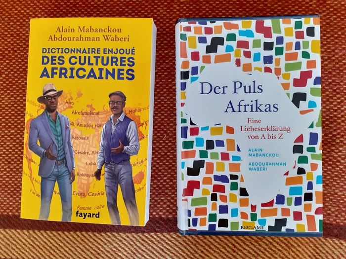
The Maggi cube, an unchallenged hegemony, and so much more
“The hopeless continent,” headlined The Economist, a British magazine, in July 2000 about Africa. Eleven years later, the same magazine headlined “Africa rising” instead. Images of Africa in the prosperous North constantly oscillate between apocalyptic scenarios and enthusiastic projections. A key issue with such images lies in the generalization they entail. If you look at the continent, considerable contrasts emerge depending on space and time. It’s no surprise that a region of the world encompassing such diverse ecological zones, maintaining such varied ties with other continents, comprising nearly fifty nation-states in sub-Saharan Africa alone, and characterized by a great diversity of languages, belief systems, and historical paths, doesn’t share a single destiny.
And yet, for many people outside Africa, as well as for many Africans, the continent constitutes a single entity, defined by criteria such as skin color, a colonial past, poverty, and the art of survival. Until now, these perspectives were generally accompanied by the idea that Africa had to—or should have—followed a single path together, sometimes called development, sometimes modernization, sometimes liberation, then a market economy. None of these paths delivered on their promises.
The two writers Alain Mabanckou and Abdourahman Waberi—one from Congo, the other raised in Djibouti, both long settled in France and now professors at renowned North American universities (Los Angeles, Washington)—have had enough of pessimistic scenarios: “We are aware that Africa is in the world and the world is in Africa. The same goes for all other continents, as our destinies are inextricably linked for better or worse. We refuse to see Africa as a reservoir of misfortunes or a continent cursed by atavistic misfortune and characterized by ethnic conflicts. [...] It’s this passionate flame we wanted to capture in a book [...] a kind of stroll through African cultures, without any demands, each letter of the alphabet leading us to a notion, a practice, a concept, a moment in history, literature, painting, politics, economics, cuisine, etc.” (p.10-11). Africa, they write, is on the verge of “imposing a signature, a style, a way of being in the world and in relation to the rest of the world.” (p.11) To put words to the continent’s diversity and dynamism, the two authors created a “rambling ABC,” a kind of portrait—or more precisely, a mythography—that lets you see and feel the pulse of a vast continent whose cultural power is unfolding before our eyes. Once marginalized or even mocked, the voice and importance of the Continent in global affairs are now undeniable” (p.11), containing over a hundred entries, mostly concise, written in a relaxed and casual style. The optimistic, even exuberant tone is set from the brief introduction. The duo of authors wants to “sing a love song to the cultures of our continent, to its inhabitants past and present, to its exceptional resources and its spectacular globalization despite a certain pollution that still clouds our skies due to the unmatched duration of dictatorships in some of our regions.” (p.12) In doing so, they don’t want to be too distracted by today’s Afewerki-Biya-Bongo-Déby & Co. ...
Of course, you’ll find tributes to great precursors like Frantz Fanon (“[...] it was a love story and admiration that wasn’t dimmed by the four decades separating his birth from ours. Let’s add that we were born while the native of Fort-de-France had left the world’s stage four years earlier, in the prime of life” p.141), Mongo Beti (“You must read and reread Mongo Beti, a genius who used his fame to support often just causes in Africa, like defending oppressed groups. His place is already in History. His oppressors, like the dictators Ahmadou Ahidjo and Paul Biya, can’t compete in the same category” p.64), the Malian Amadou Hampâté Bâ
(“Posterity remembers him mainly as an tireless defender of African cultures. His plea for the collection and preservation of traditional African knowledge remains a major event for all men and women of good will. One day in 1960, at the UNESCO podium, the native of Bandiagara sounded the alarm: ‘[...] Since we’ve admitted that the humanity of each people is the heritage of all humanity, if African traditions aren’t collected in time and written down, they’ll one day be missing from the universal archives of humanity.’” p.51),
Kwame Nkrumah, “one of the founders of Pan-Africanism, father of Ghana’s independence” (p.239), as well as the historian Cheikh Anta Diop, the writer, poet, and politician Aimé Césaire, and the economist and thinker Samir Amin, but also very warm tributes to certain contemporary African intellectuals like Souleymane Bachir Diagne and Achille Mbembe
(“A few years ago, in dominant economic circles, a rumor often resurfaced, usually disguised as a cold and scientifically proven analysis: Africa is useless. It’s a burden for the rest of the human community. With its 2% share in world trade, it would disappear from stock market radars without anyone noticing. So? Maybe it’ll be pulled up by other continents. Wanting to surpass itself is a crazy bet for Africans, they concluded. Arrogant or clueless, President Nicolas Sarkozy declared before an audience of students and teachers at Cheikh Anta Diop University in Dakar: ‘The African man hasn’t entered history enough [...] He only knows the eternal repetition of time marked by the endless repetition of the same gestures and words.’ That was in 2007. For decades, armed only with reason, an intellectual often steps up to debunk prejudices, lazy readings, and dishonest frameworks used as false fronts by those who, like Nicolas Sarkozy or former journalist Stephen Smith, out of ignorance, contempt, or condescension, distort African reality. This intellectual is none other than the historian and political scientist Achille Mbembe. This heir of Frantz Fanon, Amílcar Cabral, Jean-Marc Ela, and Fabien Eboussi-Boulaga was born in 1957 in Cameroon, in the Bassa region. Marked early by the upheavals of a fratricidal war, Achille Mbembe became the guardian of the memory of martyrs. After brilliant studies in Paris, he went on to teach at the best American universities, but the call of the Continent was stronger than anything else. In Dakar, he once directed CODESRIA (Council for the Development of Social Science Research in Africa) before joining the University of the Witwatersrand in Johannesburg, South Africa. Even though the author of *Critique of Black Reason* (Éditions La Découverte, 2015) spends a few months at Duke University in North Carolina, his observation post remains South Africa. From Johannesburg, Achille Mbembe scrutinizes Africa and the whole world. A lucid observer with an elegant and generous pen, Achille Mbembe knows how to blend big and small history: ‘I was born one day in July, as the month was drawing to a close. It was 1957, in that part of Africa recently named ‘Cameroon,’ a memory of the wonder that seized Portuguese sailors in the 15th century when, sailing up the river near Douala, they couldn’t help but note the presence of a multitude of crustaceans, and named it *Rio dos Camarões*, meaning ‘River of Shrimp.’ I grew up in the shadow of this nameless land, since, in a way, the name it bears is only the product of someone else’s astonishment: a lexical mistake, if you will.’ From this mistake or wound, he made leaven, a springboard to compose a rich work, recognized worldwide. To denounce barriers and barbarians too. But that’s not enough. Among his peers in circles of thought and action, Achille Mbembe passionately and consistently defends human dignity and the beauty of the world. In doing so, he fulfills the mission Frantz Fanon entrusted to him.” (p.227-229),
as well as entries dedicated to lesser-known artists and intellectuals, like the French journalist and activist Rokhaya Diallo, daughter of Senegalese and Gambian parents, or the Ethiopian filmmaker Haile Gerima, who has long lived in the United States. Other names from politics, sports, music, art, and literature: Kofi Annan, p.36; Barack Obama, p.243; Thomas Sankara, p.277; Ousmane Sow, p.285; Yambo Ouologuem, p.250; Léopold Sédar Senghor, p.282; Muhammad Ali, p.30; Nuruddin Farah, p.146; Salif Keita, p.203; Ahmadou Kourouma, p.206; Ngũgĩ wa Thiong’o, p.236; Winnie Mandela, p.224; Kylian Mbappé, p.226 ...
The authors, who resolutely commit to a “mythography” (p.11) of Africa, also pay special attention to local social movements, cultural events, and aspects of daily life. *Y’en a marre*, “which also meant ‘we’re fed up with sitting on our hands’” (p.320-321), emerged about a decade ago in Senegal as a citizen movement of peaceful resistance and symbolizes, the authors emphasize, the fact that African youth are increasingly fed up “with the political circus deployed in Africa since independence, as our parents would say, ‘since the White man left’...” (p.321). A full entry is dedicated to the Maggi bouillon cube, which has flooded African markets for about forty years and enjoys immense popularity (“It’s everywhere in Africa, from Dakar to Djibouti, and from Tangier to Cape Town. It’s in every pot, every stew. Little hands put it in every sauce, every local or adapted dish. An unchallenged hegemony! You’ll find it in diasporas too. The culinary strolls in Paris, in the [...] neighborhood” p.90). Critics blame it not only for impoverishing the aromatic diversity of local dishes but also for being harmful to health. And yet, “he poorest Africans, those who eat only once a day, a few spoonfuls of white beans and a ball of *foufou*, for example, are the most fervent users of the magic cube.” (p.92-93)
For *fonio*, “the new trendy cereal. [...] From the millet family, fonio is probably the oldest cereal cultivated in West Africa, and mainly in its sub-Saharan part, for millennia. [...] Easy to grow, water-efficient, fonio grows everywhere except on clay soils. Long neglected because it was considered the poor man’s crop, fonio is now a source of pride for the farmers who cultivate it and cherish it like the apple of their eye” (p.156-157), the authors immediately offer a detailed recipe, letting the reader know that “e can’t resist sharing this fonio with chicken recipe from Mali with you:
Ingredients: 1 chicken 3 large ripe red tomatoes 4 tbsp tomato paste 4 large onions 1 garlic clove 1/2 cup oil 2 Maggi cubes or salt 2 large carrots 1 turnip 1 large cabbage 2 large potatoes 1 celery stalk 1 packet pre-cooked fonio 4 okra (or okra powder) salt, pepper
Preparation: 1. Prepare the sauce: wash and cut the chicken. Peel the onions, garlic, and vegetables. 2. In a pot, fry the chicken pieces. 3. Dice the onions, tomatoes, carrots, and turnip very small and add them to the pot. 4. Add the tomato paste, salt, and pepper. 5. Simmer for 15 min, then add 2 L of water and the cooked chicken pieces. 6. Simmer for 30 min, then add the crushed garlic and celery, plus the cabbage cut into 4 and the potatoes cut in half. 7. Prepare the fonio: cover it with warm water, let it rest for 15 min, and cook it over low heat. 8. In a small pot, boil the okra and crush them. 9. Mix the crushed okra with the cooked fonio, then salt. Serve hot.” (p.158-159)
The comedy *Black Mic Mac*, released in French theaters in 1986 and addressing France’s increasingly restrictive immigration policy at the time, also gets an entry, as do *Tintin in the Congo*, the popular comic, and *Jip’s Café* (“[...] a little Africa in the heart of Paris, with passersby stopping to admire the ‘ambianceurs’ on the dance floor or attend the cultural events offered by the place” (p.194), an African establishment in Paris that Alain Mabanckou already immortalized in one of his novels.
The duo of authors also tackles thorny subjects like jihadism (p.119), the Rwandan genocide (p.272), the CFA franc (p.82), and dictatorship (p.110). While the two strike the right tone here, many entries leave a slightly bitter taste. Two examples: why doesn’t the text on Barack Obama mention the great disappointment of many people in Africa, who expected more from the African policy of the first U.S. president with African roots than just occasional warm words? Why do the comments on Winnie Mandela gloss over the fact that she was a highly controversial icon of the anti-apartheid movement due to her involvement in kidnappings, acts of torture, and murders of alleged apartheid collaborators? Instead, there’s a compassion that brings tears to the eyes: “She was often reduced to a secondary role, the wife of a great man” or “When victory came, she didn’t taste its fruits. Divorced, isolated. She would never be a ‘first lady’ in an evening gown, posing before a bed of chrysanthemums. They’d keep her far from the circles of power” (p.224-225). At this point, I would’ve liked the authors to take a slightly more critical stance...
That said, these “weaknesses” (if you can call them that) shouldn’t overshadow the book as a whole. It remains an informative, sometimes very entertaining, and often even original work in its own way.
Book information (the original French and the German translation):
Alain Mabanckou/Abdourahman Waberi. Dictionnaire enjoué des cultures africaines. Fayard, 2019. Alain Mabanckou/Abdourahman Waberi. Der Puls Afrikas. Eine Liebeserklärung von A bis Z. Reclam, 2022.
Hery
Back in Tunisia (live account)
Hi there,
On this forum, I shared my first trip to Tunisia from mid-February to early March (https://voyageforum.com/forum/impressions-tunisiennes-en-direct-d11460662/), a stay I enjoyed so much that six weeks later, I’m back in Tunisia for a full 15 days (I return on April 27).
This time, I landed in Monastir on a direct flight from Nice, again with Tunisair. We left about ten minutes late, and the flight lasted around 1 hour 30 minutes. A meal was served on board (cucumber salad with Edam-like cheese, carrots, and two small portions of dishes I couldn’t identify—semolina with peppers, olives, and parsley, two small rolls, a square of processed cheese, and a chocolate cake). It’s worth noting because it’s not common on flights this short.
In February, France and Tunisia were in the same time zone, but now Tunisia is one hour behind. This time difference and the flight duration work perfectly for a short 15-day trip since it takes me a few days to adjust to jet lag.
Luckily, I’d asked my hotel about the taxi fare from the airport because the drivers (there were several around me) didn’t hesitate to quote outrageous prices. The actual fare is 20 dinars, but one asked for 120 dinars. I refused, and another offered 60 dinars. I replied, "That’s too expensive—I’ll take the metro!" (Having tried the Tunis metro, I had no desire to repeat the experience in Monastir with a suitcase!). I started walking toward the metro, and one of the drivers caught up with me, saying, "20 dinars is fine!" I’ll skip the details, but the negotiation took a little while. When I arrived at the hotel, I told the receptionist someone had asked for 120 dinars. He put his hands to his head and said, "They’re awful!" He remembered our phone call two days earlier when I’d booked (he’s the one who told me I could take the metro).
The Mezri Hotel isn’t expensive. I got a sea-view room for 75 dinars (22 €). (I’d booked a balcony room for 90 dinars but wouldn’t have had time to enjoy it.) It’s well-located but noisy because there’s no double glazing. The receptionist is a very kind older gentleman. He called a friend whose wife is from Tozeur to find out if I should take a bus or a *louage* tomorrow and what time.
I arrived at the hotel around 7:00 PM and had time to stroll along the corniche to the ribat. Despite some run-down buildings, the seaside seemed livelier and cheerier than Sousse’s.
Monastir is the hometown of former president Bourguiba. I passed his mausoleum by taxi. There are Tunisian flags along the avenue by the sea because every year on April 6—the anniversary of Habib Bourguiba’s death—the president of the Republic visits the Bourguiba Mausoleum in Monastir to pay respects.
The taxi driver mentioned other Tunisian presidents. He complained about rising prices and insecurity, blaming President Kaïs Saïed (I’d already heard that security was better under Ben Ali).
At the end of my stay, I’ll take time to explore Monastir, but tomorrow morning, I’m off to Tozeur—a long bus ride awaits me.
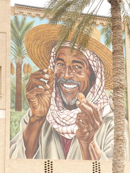

TO BE CONTINUED....
On this forum, I shared my first trip to Tunisia from mid-February to early March (https://voyageforum.com/forum/impressions-tunisiennes-en-direct-d11460662/), a stay I enjoyed so much that six weeks later, I’m back in Tunisia for a full 15 days (I return on April 27).
This time, I landed in Monastir on a direct flight from Nice, again with Tunisair. We left about ten minutes late, and the flight lasted around 1 hour 30 minutes. A meal was served on board (cucumber salad with Edam-like cheese, carrots, and two small portions of dishes I couldn’t identify—semolina with peppers, olives, and parsley, two small rolls, a square of processed cheese, and a chocolate cake). It’s worth noting because it’s not common on flights this short.
In February, France and Tunisia were in the same time zone, but now Tunisia is one hour behind. This time difference and the flight duration work perfectly for a short 15-day trip since it takes me a few days to adjust to jet lag.
Luckily, I’d asked my hotel about the taxi fare from the airport because the drivers (there were several around me) didn’t hesitate to quote outrageous prices. The actual fare is 20 dinars, but one asked for 120 dinars. I refused, and another offered 60 dinars. I replied, "That’s too expensive—I’ll take the metro!" (Having tried the Tunis metro, I had no desire to repeat the experience in Monastir with a suitcase!). I started walking toward the metro, and one of the drivers caught up with me, saying, "20 dinars is fine!" I’ll skip the details, but the negotiation took a little while. When I arrived at the hotel, I told the receptionist someone had asked for 120 dinars. He put his hands to his head and said, "They’re awful!" He remembered our phone call two days earlier when I’d booked (he’s the one who told me I could take the metro).
The Mezri Hotel isn’t expensive. I got a sea-view room for 75 dinars (22 €). (I’d booked a balcony room for 90 dinars but wouldn’t have had time to enjoy it.) It’s well-located but noisy because there’s no double glazing. The receptionist is a very kind older gentleman. He called a friend whose wife is from Tozeur to find out if I should take a bus or a *louage* tomorrow and what time.
I arrived at the hotel around 7:00 PM and had time to stroll along the corniche to the ribat. Despite some run-down buildings, the seaside seemed livelier and cheerier than Sousse’s.
Monastir is the hometown of former president Bourguiba. I passed his mausoleum by taxi. There are Tunisian flags along the avenue by the sea because every year on April 6—the anniversary of Habib Bourguiba’s death—the president of the Republic visits the Bourguiba Mausoleum in Monastir to pay respects.
The taxi driver mentioned other Tunisian presidents. He complained about rising prices and insecurity, blaming President Kaïs Saïed (I’d already heard that security was better under Ben Ali).
At the end of my stay, I’ll take time to explore Monastir, but tomorrow morning, I’m off to Tozeur—a long bus ride awaits me.
TO BE CONTINUED....
Back to RUAHA and SELOUS (Southern Tanzania).
...
" We’re ALL different, and so are our expectations when it comes to travel or leisure ". There are—without a doubt—as many ways to experience a trip as there are travelers!! For the two of us, it’s only our love of wild nature that guides us to East Africa. The stated goal of this trip was purely wildlife-focused, and NOT about discovering the country or its people.
...
Hello everyone,
Previously, I shared the account of a trip/safari in southern Tanzania in June 2024, in the Mikumi and Selous reserves.
This time, still in southern Tanzania, I invite you to join us in Ruaha National Park. (Then, depending on the number of images allowed in my quota, at the end of my story, we’ll return to Selous for the second part of the same trip.)
- This trip/safari took place in November 2022. - Our flight started in Marseille, heading to Addis Ababa, then Dar es Salaam (via Ethiopian Airlines). In Dar, we spent one night at a hotel near the airfield.
-1- During the layover in Addis Ababa. The Airbus A-350 in the early morning mist.
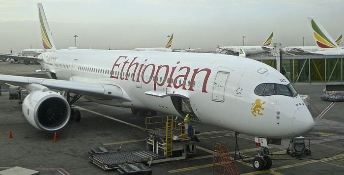
Reminder: Click on each image to enlarge it, if needed. .
From Dar es Salaam, if you want to go by road to Ruaha, it’ll take a very long and tiring day. 🤪
On previous trips, we’ve always taken a bush plane for this route. In this case, it took just over an hour and a half, with two short intermediate stops to drop off passengers at other bush airstrips.
Since I’m also passionate about aviation, I love these flights where you can admire the landscapes from low altitude while sitting right behind the pilot 🙂.
-2- These routes mainly use Cessna 208 Caravans.
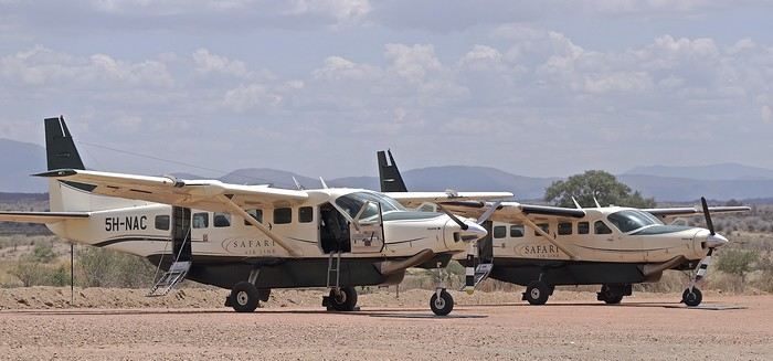
At the Msembe airstrip, we’re greeted around 1:30 PM by a guide and a driver from our chosen lodge. They brought a picnic basket, which we enjoy at a nearby picnic area. We’re by the Ruaha River, completely dry—it’s scorching hot.
-3- The first mammals we encounter are a pair of female impalas, accompanied by a young male.
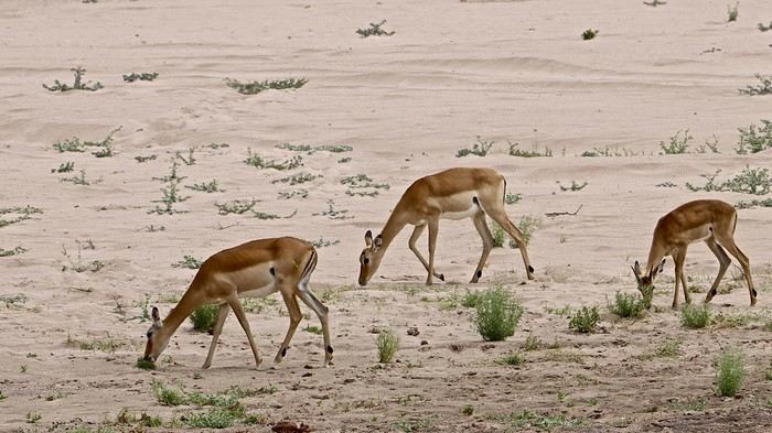
Reminder: Click on the image to view it in larger size. 😉
-4- To save the hippopotamus populations from certain death, rangers had to dig holes in the sand with bulldozers. Fortunately, water is present beneath the sand layer.
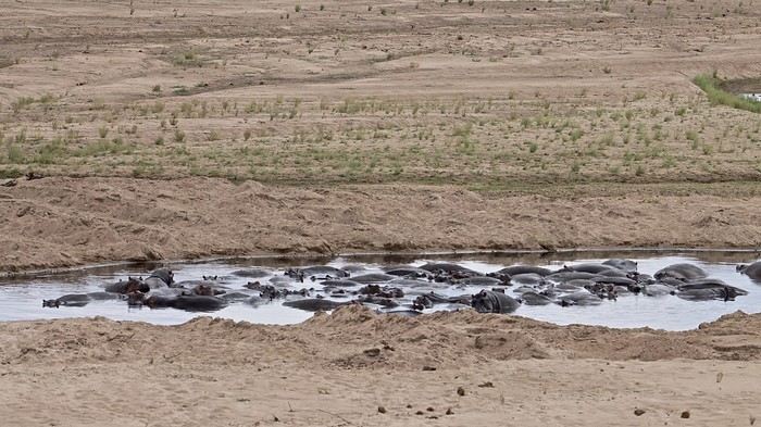
-5- This crocodile doesn’t seem to have been accepted as a swimming neighbor by the hippos...
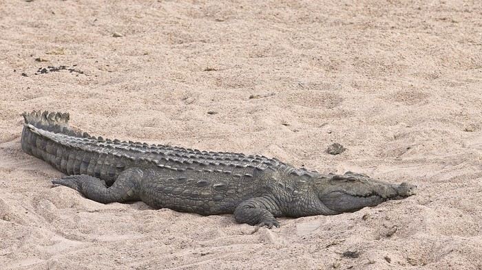
We’ll explore along the river for 2-3 hours before crossing it at a ford toward the southern part of the reserve.
-6- The typical landscape of Ruaha, with its many baobabs.
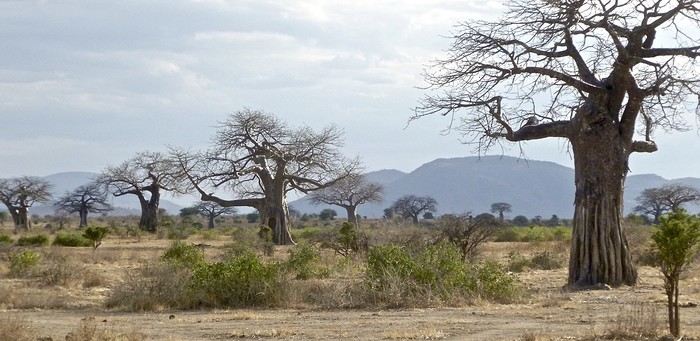
-7- My buddy the R.L.B. is also here to welcome me.... 🙂 🙂
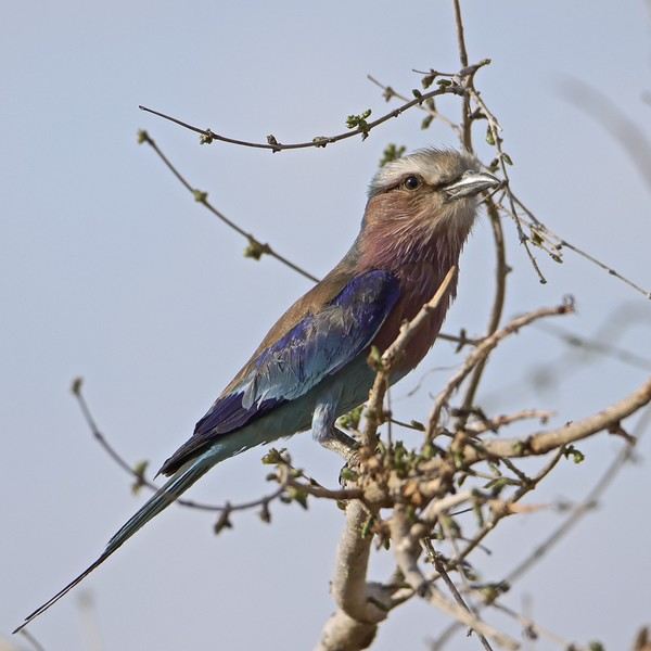
-8- As well as this little bee-eater... 😎
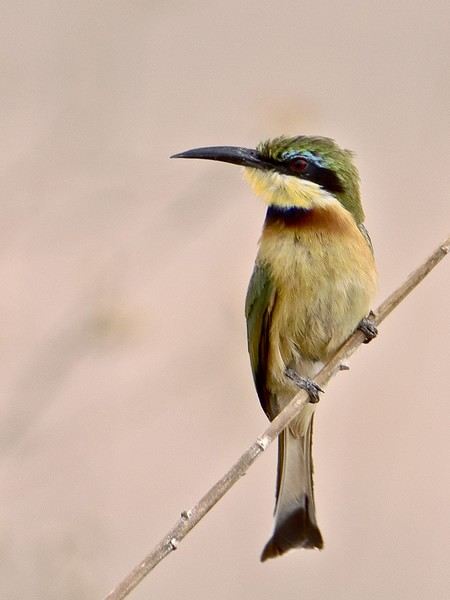
-9- ...which reminds us of the origin of its name...!
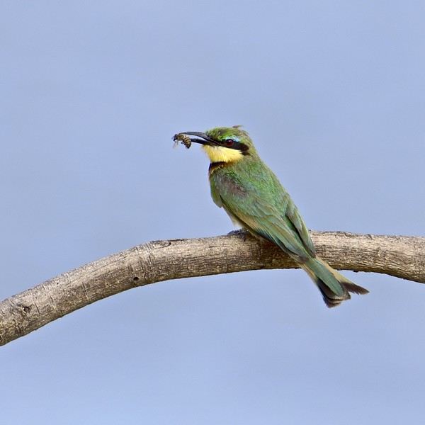
-10- Above a rare waterhole, a fish eagle keeps watch for fish...
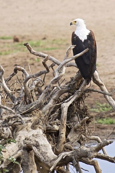
...
*** Please wait until the end of the story for any questions or to share your own experiences in Ruaha. (Or via PM.) Thanks in advance for keeping this account smooth and enjoyable. 😉
...
*** I’m not an ornithologist, but birds are an important and unavoidable part of safari discoveries. You’ll find quite a few in the images of my story. 😎
...
" We’re ALL different, and so are our expectations when it comes to travel or leisure ". There are—without a doubt—as many ways to experience a trip as there are travelers!! For the two of us, it’s only our love of wild nature that guides us to East Africa. The stated goal of this trip was purely wildlife-focused, and NOT about discovering the country or its people.
...
Hello everyone,
Previously, I shared the account of a trip/safari in southern Tanzania in June 2024, in the Mikumi and Selous reserves.
This time, still in southern Tanzania, I invite you to join us in Ruaha National Park. (Then, depending on the number of images allowed in my quota, at the end of my story, we’ll return to Selous for the second part of the same trip.)
- This trip/safari took place in November 2022. - Our flight started in Marseille, heading to Addis Ababa, then Dar es Salaam (via Ethiopian Airlines). In Dar, we spent one night at a hotel near the airfield.
-1- During the layover in Addis Ababa. The Airbus A-350 in the early morning mist.
Reminder: Click on each image to enlarge it, if needed. .
From Dar es Salaam, if you want to go by road to Ruaha, it’ll take a very long and tiring day. 🤪
On previous trips, we’ve always taken a bush plane for this route. In this case, it took just over an hour and a half, with two short intermediate stops to drop off passengers at other bush airstrips.
Since I’m also passionate about aviation, I love these flights where you can admire the landscapes from low altitude while sitting right behind the pilot 🙂.
-2- These routes mainly use Cessna 208 Caravans.
At the Msembe airstrip, we’re greeted around 1:30 PM by a guide and a driver from our chosen lodge. They brought a picnic basket, which we enjoy at a nearby picnic area. We’re by the Ruaha River, completely dry—it’s scorching hot.
-3- The first mammals we encounter are a pair of female impalas, accompanied by a young male.
Reminder: Click on the image to view it in larger size. 😉
-4- To save the hippopotamus populations from certain death, rangers had to dig holes in the sand with bulldozers. Fortunately, water is present beneath the sand layer.
-5- This crocodile doesn’t seem to have been accepted as a swimming neighbor by the hippos...
We’ll explore along the river for 2-3 hours before crossing it at a ford toward the southern part of the reserve.
-6- The typical landscape of Ruaha, with its many baobabs.
-7- My buddy the R.L.B. is also here to welcome me.... 🙂 🙂
-8- As well as this little bee-eater... 😎
-9- ...which reminds us of the origin of its name...!
-10- Above a rare waterhole, a fish eagle keeps watch for fish...
...
*** Please wait until the end of the story for any questions or to share your own experiences in Ruaha. (Or via PM.) Thanks in advance for keeping this account smooth and enjoyable. 😉
...
*** I’m not an ornithologist, but birds are an important and unavoidable part of safari discoveries. You’ll find quite a few in the images of my story. 😎
...
Travel Journal - 28 Days in China in August 2025
Hi everyone! I’m sharing a modest travel journal from my trip to China in August 2025.
There wasn’t much room for improvisation on this trip—everything was planned in advance. Since August is peak season, I decided to book train tickets early, and once that was set, I reserved all the accommodations too. I got everything on Trip.com.
I bought the flight tickets back in March from Hainan Airlines. They were super expensive, but with these travel dates, I couldn’t exactly dream of a bargain!
I picked up e-SIMs valid for a month from Free just before departure: 10 € for the e-SIM + 19.90 € for a one-month plan with 35 GB of data abroad.
No need for a VPN with these e-SIMs, but D. still got one—a multi-device plan for 5 € with a discount from Let’s VPN, valid for a month. It was for evenings at the hotel on Wi-Fi to avoid burning through the 35 GB with video.
I downloaded Alipay, WeChat, Amap (Baidu Maps), and Trip.com. We also have Google Translate and Maps.me—absolute must-haves.
We’re ready to go!
I’ve been waiting for this day for nearly 15 years!! I travel a lot, but this one—this is MY TRIP 🙂 It’s been postponed so many times: because I wanted to do it with the right person, because I have a Turkish stamp in my passport and heard they don’t issue visas with that, because of COVID... and then China introduced a 30-day visa exemption, and that was the green light! Ugh, they forced us to take our vacation in August this year—far from ideal—but no more delays. Saturday, August 2, 2025: it’s finally the big day!
Days 1 and 2: We got dropped off at Charles de Gaulle at 9:30 AM. I supposedly checked in online, but only for the first flight and without getting the boarding pass... Might as well scrap online check-in in that case. So, we spent over an hour in line at the counter to get them. We didn’t have any checked luggage—just our backpacks as carry-ons—so this was a step we’d never had to deal with before, but whatever, it’s done. No wait at passport control, 5 minutes through security, a quick walk around the terminal, 10 minutes in the boarding area, and it was already time to board. Departure around 12:45 PM, arrival in Chongqing at 4:50 AM. We had a few hours of layover before our next flight. Went through immigration, connecting flight control, and security. Pro tip: check your next flight’s boarding gate right after immigration. We never saw it displayed again anywhere in the terminal.
The Free e-SIMs work—phew!
Took off at 9:30 AM, arrived in Guangzhou (Canton) at 11:20 AM in the rain. I love how Chongqing is translated as "Tchoung King" on the screens in the plane—very French!
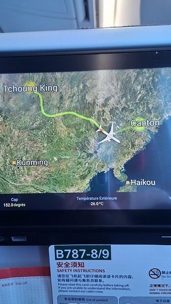
During my first two trips to China, we paid for everything in cash, but this time, we’re going all-in on Alipay and WeChat. I still brought the leftover change from previous trips—it might come in handy. At the metro station, they showed us a QR code to buy tickets via WeChat. There were probably machines and even a ticket counter, but we didn’t see them, and buying via WeChat was pretty simple. 8 yuan to Changshu Lu, which is 22 stops. So far, so good. Then, we had to find the hotel, which wasn’t on Google Maps, Maps.me, or Amap... Easy 😎! We found it without too much hassle, though. Dropped off our stuff and went out to eat. 55 yuan for two claypots with fish/eel, rice, cabbage, and purple eggplant. When we left, it was pouring. We grabbed our umbrellas and set off to explore the neighborhood: Enning Road (we’ll come back later to check out a specific spot), Shangxiajiu (the pedestrian shopping street), Baohua Road... The area is pretty diverse—one street to the next, it’s like stepping into a different world.

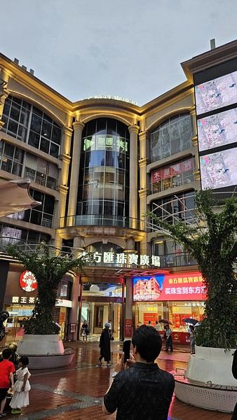
There weren’t many people around, probably because of the rain. We grabbed a quick street food dinner and went to bed—we were exhausted. We struggled to stay awake until 11 PM to adjust to the time change as quickly as possible. There’s a 6-hour time difference.
There wasn’t much room for improvisation on this trip—everything was planned in advance. Since August is peak season, I decided to book train tickets early, and once that was set, I reserved all the accommodations too. I got everything on Trip.com.
I bought the flight tickets back in March from Hainan Airlines. They were super expensive, but with these travel dates, I couldn’t exactly dream of a bargain!
I picked up e-SIMs valid for a month from Free just before departure: 10 € for the e-SIM + 19.90 € for a one-month plan with 35 GB of data abroad.
No need for a VPN with these e-SIMs, but D. still got one—a multi-device plan for 5 € with a discount from Let’s VPN, valid for a month. It was for evenings at the hotel on Wi-Fi to avoid burning through the 35 GB with video.
I downloaded Alipay, WeChat, Amap (Baidu Maps), and Trip.com. We also have Google Translate and Maps.me—absolute must-haves.
We’re ready to go!
I’ve been waiting for this day for nearly 15 years!! I travel a lot, but this one—this is MY TRIP 🙂 It’s been postponed so many times: because I wanted to do it with the right person, because I have a Turkish stamp in my passport and heard they don’t issue visas with that, because of COVID... and then China introduced a 30-day visa exemption, and that was the green light! Ugh, they forced us to take our vacation in August this year—far from ideal—but no more delays. Saturday, August 2, 2025: it’s finally the big day!
Days 1 and 2: We got dropped off at Charles de Gaulle at 9:30 AM. I supposedly checked in online, but only for the first flight and without getting the boarding pass... Might as well scrap online check-in in that case. So, we spent over an hour in line at the counter to get them. We didn’t have any checked luggage—just our backpacks as carry-ons—so this was a step we’d never had to deal with before, but whatever, it’s done. No wait at passport control, 5 minutes through security, a quick walk around the terminal, 10 minutes in the boarding area, and it was already time to board. Departure around 12:45 PM, arrival in Chongqing at 4:50 AM. We had a few hours of layover before our next flight. Went through immigration, connecting flight control, and security. Pro tip: check your next flight’s boarding gate right after immigration. We never saw it displayed again anywhere in the terminal.
The Free e-SIMs work—phew!
Took off at 9:30 AM, arrived in Guangzhou (Canton) at 11:20 AM in the rain. I love how Chongqing is translated as "Tchoung King" on the screens in the plane—very French!
During my first two trips to China, we paid for everything in cash, but this time, we’re going all-in on Alipay and WeChat. I still brought the leftover change from previous trips—it might come in handy. At the metro station, they showed us a QR code to buy tickets via WeChat. There were probably machines and even a ticket counter, but we didn’t see them, and buying via WeChat was pretty simple. 8 yuan to Changshu Lu, which is 22 stops. So far, so good. Then, we had to find the hotel, which wasn’t on Google Maps, Maps.me, or Amap... Easy 😎! We found it without too much hassle, though. Dropped off our stuff and went out to eat. 55 yuan for two claypots with fish/eel, rice, cabbage, and purple eggplant. When we left, it was pouring. We grabbed our umbrellas and set off to explore the neighborhood: Enning Road (we’ll come back later to check out a specific spot), Shangxiajiu (the pedestrian shopping street), Baohua Road... The area is pretty diverse—one street to the next, it’s like stepping into a different world.
There weren’t many people around, probably because of the rain. We grabbed a quick street food dinner and went to bed—we were exhausted. We struggled to stay awake until 11 PM to adjust to the time change as quickly as possible. There’s a 6-hour time difference.
Namibia Travel Journal: May 2025 - Trip Review
NAMIBIA TRIP 2025: April 24 to May 20: Feel free to comment or ask us any questions about this amazing journey.
>> Find all our photos and videos for each day on our website here: www.montagne-aventure.net
**DAY 1: Thursday, April 24, 2025: Outbound Flights from Lyon to Windhoek via Munich - Visit to Munich:**

Off we go on a new adventure. The alarm rings at 6:30 AM, the travel bags are packed, and we head to Lyon Airport. We booked our flight tickets with Lufthansa. The first leg to Munich, Germany, is operated by AirBaltic. Departure at 1:05 PM for a 1-hour and 20-minute flight. We arrive at 2:30 PM.
**We now have a 7-hour layover, so we take the opportunity to get some fresh air and explore Munich.** We quickly exit Terminal 2 of the airport and head towards the subway. We buy a group day ticket "Airport-city Day Zone M-5," valid for 2 to 5 people at a price of 30.50 € (instead of 16.30 € per person). We take the S8 line to **Marienplatz** in 35 minutes. **This is the heart of the city.** The weather is overcast, quite cool, but dry. Perfect for a little city trip between two flights while leaving our large luggage in transit at the airport. **Munich is the third-largest German city after Berlin and Hamburg, in the Bavaria region.** **The center has a lot of charm and brings together several religious buildings, easy to explore on foot.** We are impressed by the number of people enjoying these 100% pedestrian streets, which are very pleasant. After Marienplatz, the most famous square with the town hall, we head to the Cathedral of Our Lady, a Gothic church, then continue to **Karlsplatz** and move on to **the food market offering a wide selection of high-end food products in an atmosphere where a certain art of living prevails.** We also visit St. Peter's Church before grabbing a bite to eat. Two good hours were enough for this 10 km city walk. It's time to take the subway back: by 6:30 PM, we are back at the airport. Now, it's time for a bit of waiting and rest. Our second flight is scheduled for 9:35 PM for a 9-hour and 30-minute journey to our final destination in Namibia: **Windhoek.**
> Round-trip flight tickets with Lufthansa from Lyon: 2029 €, or 1,014.50 € per person.
> Lyon Airport parking: 120 €
> Today's expenses: 7 € for 2 pizzas in France / 14 € for the restaurant in Munich / 30.50 € for the daily subway ticket in Munich.
**DAY 2: Friday, April 25, 2024: Arrival in Windhoek, Visit to the Namibian Capital:**
After a 9-hour and 30-minute overnight flight with Discover Airlines, we finally land on Namibian soil just before 7:30 AM. The day is breaking, and the colors are already stunning. We are eager despite the usual fatigue from the flight. The airline was punctual, with friendly staff and good meals, though a bit light. We are the first flight of the day to land, with no more than 15 flights per day here, from 7 AM to 8 PM. We disembark on the tarmac at this airport located in the middle of nowhere, **I finally set foot on African soil for the first time.** We exit among the first from the aircraft to go through the long formalities at the front of the line, as the wait can quickly become endless. Allow at least 5 minutes per person for e-visas. We still wait 45 minutes despite only about twenty people ahead of us. Phew, it's done. We collect our luggage and then withdraw money from an ATM. We make 4 withdrawals of the maximum amount, 2000 NAD $ per withdrawal, for a total of 380 €, or 95.33 € per withdrawal.
Our driver arrives at the same time, perfect timing, we were quick.
We leave the airport at 8:45 AM. By 9:30 AM, we arrive at the **Gracious Whisp vehicle rental agency**, located at the entrance of Windhoek, small and human-sized with a fleet of recent vehicles. More formalities, then a short wait as our vehicle is not yet ready. Time to decompress, catch our breath, and enjoy the very pleasant morning temperature. Not a cloud in sight. Next, a briefing on the vehicle, always with a bit of apprehension due to our approximate English. Allow 45 minutes of explanations, including setting up the roof tent, camping equipment, technical information in case of a flat tire, driving tips in Namibia, and a tour of the 4x4. We have all the necessary equipment for camping: mattresses, sleeping bags, pillows, table, chairs, gas stove, BBQ grill... as well as 2 spare tires, a compressor, a dual tank, and accessories for removing wheels. Off we go, it's time to muster our courage and get behind the wheel. **Heading to SuperSpar Maerua**, fortunately located less than 10 minutes away. We park with the help of a parking attendant; it's very crowded, the space is narrow, but everything goes well despite the cursed right-hand drive. Today's new mission: stock up on groceries. The store is well-stocked with local and imported products, catering to all tastes. We spend 114 € on groceries, from pasta to meat, BBQ lighters to dishwashing products. Two people load our groceries into two carts and transfer them to our vehicle; we feel compelled to leave a tip, 50 NAD $, as we don't have change yet. Now, we head to the hotel, 15 minutes away. Traffic is difficult at a complicated intersection; this will likely be the only traffic jam in Namibia. **We arrive at Kate's Nest Guesthouse & Backpackers around 1:15 PM, quite tired.** We take some well-deserved rest at this recent establishment, quite calm with secure private parking. After a short nap, we enjoy the quiet by the hotel pool. Night falls between 6:30 PM and 7 PM. We eat quietly in our room tonight before starting this long 4x4 road trip in camping mode in the heart of Namibia.
> Today's grocery expenses: 114 € at Super Spar Marua (2395.21 NAD $).
> Round-trip flight tickets with Lufthansa from Lyon: 2029 €, or 1,014.50 € per person.
> Vehicle rental: 4x4 Toyota with roof tent for 24 days: Gracious Whisp Car Rentals: 2,638 € (N$50,640) or **1,319 €** per person - (https://gwcarrentals.com/)
> Distance driven today: 15 km.
> Accommodation: Kate's Nest Guesthouse & Backpackers - 4 Aristotles Street Academia, 9000 Windhoek - 36 € for two for one night.
> Windhoek International Airport website: (https://www.airports.com.na/)
**DAY 3: Saturday, April 26, 2025: Windhoek to Hardap: Mariental Region - Kalahari Desert:**
After a good, restful night, we wake up leisurely around 7 AM. We enjoy the comfort provided by this first and last hotel before 24 nights under the tent.
**We leave Kate's Nest Guesthouse at 8:30 AM to tackle the Namibian roads.** We quickly leave the capital; in just 30 minutes, we find ourselves almost alone in the world. The landscape is dotted with small domes. We leave the **paved B1** quickly to turn left onto the **C15**. **From there, we won't see more than 10 vehicles all day.** After passing through the few houses of **Lekkerwaterpoort**, we tackle our first gravel road. These road sections are limited to 100 km/h, but even at 70 km/h, I find it already challenging. However, I quickly get used to it and gradually pick up speed to reach my cruising speed of around 80 to 90 km/h. **We are on immense straight lines crossing wild expanses as far as the eye can see.** **We come across two baboons, a few ostriches, and numerous cattle and sheep farms.** We pass through the charming village of **Uhlenhorst** with its typical houses and children with broad smiles waving at us. Life here is already very different from Windhoek. **The thermometer rises quickly from 16°C at 8:30 AM to over 28°C in the early afternoon.**
**We arrive at the Hardap Dam reserve at 2 PM.** We stop at the toll booth at the park entrance to pay the entrance fee: 250 NAD $ for 2 people and 1 vehicle. We continue to the dam and then the camp entrance, located a bit further. We had booked in advance, but this place remains little frequented by foreigners.
We take advantage of the hottest hours to rest by the large pool overlooking the immense lake, a very enjoyable moment. Would this be a bit of a vacation?
Around 4:30 PM, we head to the campsite. We overlook this vast water reserve. We arrive first; we will be only 3 vehicles spending the night here. It's time to get to work and set up our equipment for the first time. It takes us a good 20 minutes to set everything up, with a slight apprehension about unfolding the tent. Once this task is done, which we will have to repeat for almost a month, we will become much more efficient over time. Time for rest and contemplation in total silence. The sun gradually sets, and the heat quickly becomes bearable again. Bliss! **This dam is located 20 km northwest of Mariental in an area dotted with conical hills topped with dolerite buttons (Hardap means "hillock" in Nama). It captures the Fish River, which flows south, creating a large lake in the middle of an arid environment. The contrast is striking.** We enjoy our first sunset facing this 360° otherworldly landscape.
Around 7 PM, we start our first BBQ, or "braai" as it's called here. The temperature is perfect. The sun sets, giving way to a star-filled sky of incredible beauty thanks to the absence of any light pollution. The Milky Way will lull us throughout the evening. After some good sausages and potatoes on the BBQ, we head to our roof tent around 9:30 PM with a complete change of scenery in just 24 hours. France already seems so far away...
This campsite has shared showers and toilets, quite clean and functional, as well as a central area with several BBQs and tables. The sites are arranged in a semicircle, each with an electrical outlet. The sites are close to each other but spacious, some slightly shaded. We are only three vehicles tonight, so it's perfectly comfortable and quiet. Not to mention the large pool near the restaurant. Our trip is off to a great start.
> Today's road itinerary: Windhoek > Head south on the B1 to Rehoboth > Turn left onto the C25 then C15 to Stampriet > C20 to Hardap > Full north on the B1 > Then turn left onto the M93 - 5 hours of driving.
> Distance driven today: 354 km.
> Accommodation: Hardap Recreation Resort - 23.3 € for two - Large pool - GR6W+3M2, Hardap Game Reserve, Mariental, Namibia - (http://www.nwr.com.na/resorts/hardap-resort/)
**DAY 4: Sunday, April 27, 2025: Hardap - Brukkaros Volcano - Keetmanshoop - Quivertree Forest Rest Camp**
Our first night under the tent was very pleasant; the little wind quickly calmed down, giving way to absolute silence. The mattress is decent, more comfortable than some nights in Nepal. The length and width give us enough space for maximum comfort, despite my height (1.91 m). We wake up a little before 7 AM as the sun rises, and the lights dazzle us from the start of the day. We pack up the equipment in 30 minutes, quite easily. Then we enjoy the sun, which warms up quickly while we keep our light fleece on.
At 8:30 AM, **we hit the road again, heading south** to our first stop in **Mariental**. We want to do some shopping at SuperSpar, but once we arrive in the parking lot, a young local is fighting with the supermarket security guards and then threatens to throw stones. We don't want to take any risks right at the start, so despite the baton blows he receives, he doesn't stop. We leave empty-handed but fill up with fuel at the Shell station 1 km further. The price per liter is 21.33 NAD $, we fill our 107-liter tank for 107 €. In Namibia, you get served, and they bring the card machine to the window to pay. It's then customary to leave a tip.
We then take the B1 heading due south on a recently renovated road. Around 11:30 AM, we leave it on our right to take **a wild gravel road, the M98**. Just before **Berseba**, we turn right onto a small track, the **D3904 towards Brukkaros Crater up to a camp at 1588 m altitude**. The track then becomes too bumpy. We stop on the counter-slopes where **a wide panorama unfolds over these immense plains as far as the eye can see**. It's 12:15 PM, time for us to eat a rice and tuna salad facing this landscape.
**We are alone in the world until a vehicle arrives and parks next to us.** A bit of apprehension, 4 men head towards us. It turns out to be 4 shepherds looking for a lost foal. The conversation is pleasant, lost in the middle of nowhere. We find ourselves alone again in this absolute silence. **The heat becomes stifling with a good 30°C**. We get back on the road around 1 PM. Back on the B1, **we continue due south to Keetmanshoop**, which we reach around 3 PM. We stop there to do some shopping for 262 NAD $ (12 eggs, a can of tuna, a can of corn, bread, a soda, and a 5-liter water container), or 12.48 €. Two quite insistent children ask us for money or candy at the store exit, yet we give them a small tip, but they continue to cling to the car. Locals parked next to us tell them to leave us alone. Anyway, we finish the trip to **Quivertree Forest**, 15 km away. We will spend the night in this **pleasant farm run by a German**. Upon arrival, as the day before, and as I suppose in the future, we dive straight into the cool pool to relax after all these kilometers. A bliss. Then we take our 4x4 and choose a spot near these famous trees. After the 33°C this afternoon, once 4 PM passed, the temperature drops again and becomes very pleasant. **We are in the middle of the Kokerboom, one of the most interesting and characteristic plants of hot and arid regions. It's not really a tree but a variant of the aloe plant whose botanical name is Aloe Dichotoma. This Kokerboom has a smooth and thick trunk reaching up to 1 m in thickness and 9 m in height. They bloom for the first time at the age of 20 to 30 years.** The flowers are yellow and reach about thirty centimeters during the season between June and July. **They grow mainly in an environment with a high concentration of black rocks absorbing a large amount of heat (38°C). The rocks also serve to anchor the tree with its tentacle-like roots. It also resists frost. Each is between 200 and 300 years old.**
Around 5 PM, we walk to the farm reception to watch the feeding of **two cheetahs**. Magnificent carnivores taking their time to savor their piece of meat. **Then we return near our campsite to enjoy the sunset among these trees. The colors are sublime, as every evening apparently. A magnificent spectacle with colors evolving from yellow to orange then to pink, before giving way once again to a sky filled with thousands of stars.** Our campsite at Quiver Tree Forest Camp is very comfortable; we have a water supply, a stone table, a small lamp, an electrical outlet, a small tree for shade, and a BBQ that we won't use tonight; we'll cook on gas. The sites are far apart, with some shared facilities scattered around, a very beautiful setting. No reservation possible, no need, just show up directly. **The campsite accommodation for 2 people costs 28 €, including the reserve entrance fee of 5 €**. We finish this second bivouac evening around 9:30 PM, time for some reading and sleep in peaceful silence without wind.
> Today's road itinerary: Mariental > B1 heading south to Brukkaros > At Tses turn right towards Berseba via the M98 > Turn right onto the D3904 > 8 km > Brukkaros Volcano (stop at the lower camp as the track is difficult for 1 hour) > Keetmanshoop > Turn left onto the M29 > Quivertree Forest - 4 hours of driving.
> Distance driven today: 371 km.
> Distance walked today: 6 km.
> Today's expenses: Groceries for 12.48 € (262 NAD $) / Fuel for 107 € (1 liter of diesel for 21.33 NAD $).
> Accommodation: Quivertree Forest Rest Camp, P.O. Box 262, Keetmanshoop, Namibia - BBQ, hot showers, toilets, and electricity - No reservation - Pool - 18 €/Person (N$ 340.00 with park entrance) - (http://www.quivertreeforest.com/)
**DAY 5: Monday, April 28, 2025: Quivertree Forest Rest Camp - Giant's Playground - Keetmanshoop - Fish River Canyon - Canyon Roadhouse:**
After an excellent start to the night, we are woken up by the wind shortly before 6 AM, but the sunrise is not far off. We get up at 6:30 AM to enjoy it. The atmosphere is a bit cooler this morning, but the reward is already here.
The adventure continues. At 7:45 AM, we head towards **Giant's Playground**, 4 km away. We take a 3-kilometer walk through this expanse of blocks and igneous rocks.
We continue south at 8:45 AM, passing through Keetmanshoop again where we do some shopping for 25 €, a big stock-up for a good part of the trip: meats, canned goods, pasta, fruits... At 9:30 AM, we take the B4 to Fish River Canyon.
At 11:30 AM, we arrive at the entrance to the NWR park (350 NAD $ entrance for 2 people and 1 vehicle). The track becomes bumpy immediately upon entering the park. After about ten kilometers, we come upon this landscape carved by nature. In the end, it's well worth the detour. We were at the Grand Canyon in the USA exactly (https://www.montagne-aventure.net/2024/04/29/j21-3-juin-2024-grand-canyon-et-lac-powell/) and can thus confirm that this Fish River Canyon is comparable. We make several stops along the southern flank. **Here, nothing is developed; nature is almost in the wild state.** **With 160 km in length, up to 27 km in width, and a depth of 150 m, it is indeed the second-largest canyon in the world.** The history of the canyon is apparent in its different earth layers and stratification: the antiquity of the place is tangible, and the absence of vegetation is surprising. **It consists of two nested canyons, formed at distinct periods. The first distinct layer of schist, sandstone, and eruptive material surrounding the canyon was formed a few two billion years ago, then transformed due to heat and pressure into more solid rock such as gneiss. The inner canyon, carved more recently by the Fish River, has a depth of 270 m.**
We have a picnic once again alone in the world facing this grand panorama at the **Sulphur Spring View Point**. This is where the hiking trail begins, plunging into this narrow canyon, but it is forbidden to venture there alone without a guide. It's 30°C, but a slight wind makes the atmosphere bearable. At 1 PM, we retrace our steps and continue to the **Main View Point** then to the **Hikers View Point**.
In the south of Namibia, the Fish River Canyon, 160 km long, is a true geological wonder: a canyon nested within another canyon, one of the largest in the world. The first sedimentary layers formed two billion years ago; 500 million years ago, a period of tectonic activity caused these layers to crack and tilt, opening a vast canyon in the Earth's crust. The second canyon, with a depth of 270 m, was carved over time by the passage of the Fish River in this new valley.
At 3 PM, we arrive at our very charming camp for the evening, the **Canyon Road House**. We fill up with fuel right away because tomorrow we have a long day of isolated driving: 55 liters for 1240 NAD $. Then we settle into the campsite we had previously reserved in France. We are assigned site 2, very well set up under a tree with its BBQ and stone table just steps from the pool. We quickly set up the tent and jump straight into the pool for the relaxation moment of the day. As usual, the water is quite cool, but it's a real pleasure. Then we stroll around this Canyon Road House, which recreates the atmosphere of the roadside inns of the 1950s with old car wrecks and vintage gas pumps in a bygone era. **Around 5:45 PM, we start a short walk leading us to the top of a hill overlooking the wide plateau where we are to watch the sunset.**
And finally, to end this beautiful day, it's time for the braai, with grilled sausages and white beans on the evening menu.
> Park entrance: 150 DN/person + 50 DN/vehicle (18 € for two). It is possible to enter at two access points: Hobas in the north and Ai-Ais in the south.
> Today's road itinerary: M29 > Keetmanshoop > B1 > B4 > C12 (track) > After Holoog turn right onto the D601 (C37 track) > Accommodation on our right (stop just to check in before 6 PM) > Continue 30 km (30 minutes of track) to the viewpoints after Hobas where you must pay the entrance fee. Sunset View Point to the left > Return before sunset as the park closes (best lights at sunrise). 3 hours.
> Distance driven today: 228 km.
> Distance walked today: 10 km.
> Today's expenses: 25 € for groceries / 17 € for the Fish River Canyon park entrance / 58 € for fuel.
> Accommodation: Canyon Roadhouse, Gondwana Collection Namibia – 34.4 € for two - Pool - Near Hobas - (http://www.gondwana-collection.com/fr/accommodation/canyon-road-campsite)
**DAY 6: Tuesday, April 29, 2025: Canyon Roadhouse - Orange River - South African Border - Vista Trail - Gondwana Sperrgebiet Park - Aus:**
The night was excellent in this very comfortable campsite. **We wake up to the sound of birds** before the alarm at 6:45 AM. Our little morning routine starts as the sun rises. **A big day of driving awaits us to the South African border. This will be the southernmost point of our journey.** We hit the road at 8 AM via the C37, pass through **Hobas**, then turn onto the D207 to **Aussenkehr.** **We cross a mountainous barrier with some high peaks and perfect cones. The rock varies from orange to pink to black.**
We then cross a lunar desert as far as the eye can see on a giant dome; the track winds through nowhere without meeting anyone for hours. The landscapes are surprising. **We spot several ostriches and a gemsbok.** In the middle of this endless expanse, we come to an improbable intersection and continue right onto the D278.
In the middle of these arid lands, we come across a green zone: a vast vineyard. At 10:30 AM, **we come across a "Road closed" sign, fortunately, a local resident waves us to continue; a bit stressed, we proceed.** We start to follow the beautiful Orange River. On the other side of the bank, just a few meters away, South Africa is there. It is the second-longest river in Southern Africa, after the Zambezi. It flows over 2,000 km to the Atlantic. After passing through narrow gorges, we regain altitude before starting the descent, gently heading back north.
**We now cross and follow the Fish River, which joins the Orange River further south** **along this gorge dating back millennia.** At exactly noon, we take a lunch break by the Fish River, still without meeting a soul in this landscape between greenery and aridity. The temperature here is cooler with a pleasant 23°C on the banks, the perfect spot. **We continue on the track to Rosh Pinah**, where we find a paved road again. **The section along the Orange River and the Fish River was officially closed, but we were able to pass without any issues, avoiding a detour of at least 3 hours.** Phew. We now drive at high speed (limited to 120 km/h) through these vast spaces. We come across many ostriches after the **dozens of monkeys along the Fish River**. Around 3 PM, 3 km after the very small town of **Aus**, we reach **our campsite for the evening at Klein Aus Vista**. A new **small peaceful haven very well set up**. As usual, after checking in at reception, we jump straight into the beautiful pool to get our well-deserved dose of coolness, another good thermal shock that our bodies appreciate. Once this moment of relaxation is over, we take our 4x4 to reach the campsite located a bit higher, set apart at the foot of a hill that overlooks us.
After setting up, **around 5 PM, we head to the Vista Trail to climb to the top of a mountain overlooking the vast plain that surrounds us at 360°**. It takes about 30 minutes to climb. The place is just magical, **the perfect viewpoint to admire the sunset**. **We fully savor the moment. We also spot one of the few wild horses in the world capable of living in the desert.** Their numbers have decreased in recent years due to predation and drought (around 100 to 150). At 7 PM, we return to the camp, time for the braai and preparing the meal in this peaceful little camp.
In the south of Namibia, the Fish River Canyon, 160 km long, is a true geological wonder: a canyon nested within another canyon, one of the largest in the world. The first sedimentary layers formed two billion years ago; 500 million years ago, a period of tectonic activity caused these layers to crack and tilt, opening a vast canyon in the Earth's crust. The second canyon, with a depth of 270 m, was carved over time by the passage of the Fish River in this new valley.
> Today's road itinerary: 5 hours of driving: D324 heading south (track) > turn right onto the C10 (track) > D316 heading south > turn right onto the C13 > In Aus turn left onto the B4 > Campsite via a track on the left.
> Fuel station: Solitaire or Aus.
> Distance driven today: 398 km.
> Distance walked today: 7 km.
> Accommodation: Klein-Aus Vista Desert Horse Campsite - Farm Klein-Aus No 8 on the B4 main road to Luederitz Aus 9000, Aus, Namibia - (http://www.klein-aus-vista.com/accommodation/desert-horse-campsite/) 17908 420 DN - Water + Shared shower (hot water). No electricity.
**DAY 7: Wednesday, April 30, 2025: Aus - Kolmanskop - Diaz Point - Luderitz - Kanaan Desert:**
We wake up around 6:45 AM, with partly cloudy weather for once; we feel the ocean's influence gradually. But the sun isn't far off. At 7 AM, we leave the campsite heading west towards Luderitz via the B4. **First stop of the day: Kolmanskop, the ghost town we reach at 8:30 AM**, entry costs 180 NAD $ per person. We discover this **timeless place** in 1.5 hours, moving from building to building amidst violent sand-laden gusts of wind. There's a lot of charm in these different living spaces. **The sand quickly reclaimed the place after this mining town was abandoned.** This was once the headquarters of Consolidated Diamond Mines. It's hard to believe that this former town, where the diamond industry once flourished, had a hospital, a bowling alley, and a theater. The decline in diamond sales after World War II and the discovery of richer deposits put an end to this golden age. By 1956, the town was already completely deserted, and the sand had reclaimed its rights. **These dilapidated buildings swallowed by shifting dunes have something surreal about them.**
At 10:15 AM, we hit the road again **heading to Luderitz, 22 km away**, and first to **Diaz Point** **facing the Atlantic Ocean**. It's a wind-swept peninsula with its characteristic red and white lighthouse. There's a campsite and a coffee shop on site, but the place doesn't inspire rest without shade or shelter from the wind. We return to the city via the D701 track that runs along the ocean, be careful at low tide. We come across **a few fishermen and a fox as well as flamingos.**
We walk through the few streets of the city, much smaller than I imagined, then climb to the **famous little Lutheran church that overlooks the city, the Felsenkirchr.** **The wind blows very strongly here, and the sand is omnipresent, surrounded by the Namib Desert and the southern Atlantic coast.** **A German colonial relic barely touched by the 21st century, Luderitz seems frozen in the past, giving it both a gloomy and a certain charm. In short, it's certainly one of the most incongruous places in Africa.**
At 1:15 PM, just before leaving Luderitz, we do some shopping for 20.50 € and fill up with fuel: 61.50 €, 1290 NAD $ for 61 liters (21.18 $ per liter).
**We return via the B4 to Aus** (paved), **then via rougher tracks**, the C13 then the D707, magnificent as it runs along a mountain range with multiple colors on our right and an endless flat desert on the other side.
To access our campsite for the evening, we must take a **narrow private track for 7 km** on our right to emerge, in this total vastness, at the **isolated Kanaan Desert Retreat on a small hill**. I don't have time today to jump into the pool near the reception; we arrive at 5 PM at 8 small, isolated, and unique sites with a small kitchen, a shower, and a private toilet under a small tarp shelter. **A crazy charm with a unique view...** **This will be my favorite accommodation of this trip. The photos speak for themselves.** We jump into the outdoor shower while savoring the landscape, then prepare our evening braai while enjoying the colors fading, facing this plateau with bushes turning a vivid orange. **A moment that will remain etched for life.** **Savanna atmosphere under a thin emerging moon. Every minute offers different colors. Facing our meal, we have a natural giant screen.**
We end this day contemplating the stars and admire this thin orange moon setting on the horizon (8:42 PM).
**Ghost town just before Luderitz: Kolmanskop** (open from 8 AM to 3 PM - N$ 180 p.p – 9 €). Once, Kolmanskoppe was organized around diamond mining. After finding new, more prolific spots, the town was abandoned and is now a ghost town. The sand and dunes have reclaimed their rights and buried everything humans had built. Houses, train station, bakery, everything has been covered by sand, which passes through the windows, even though they are 1 meter high.
> Today's road itinerary: 5h30: B4 to Luderitz (paved) > Round trip > Kolmanskop on the left > Return via the previous campsite > Then C13 (track) > Turn left D707 (track) > Then track to the right to the campsite.
> Distance driven today: 438 km.
> Distance walked today: 8 km.
> Today's expenses: Groceries at the Spar in Luderitz for 20.50 € / Fuel fill-up in Luderitz for 61.50 €.
> Official Kolmanskop website: (https://kolmanskuppe.com) (open from 8 AM to 1 PM - N$ 180 p.p – 9 €).
> Accommodation: Night at the south of the Namibrand Nature Reserve: Kanaan Desert Retreat – 26.5 € for two - (http://www.kanaannamibia.com/) - Farm 104 Karas 9000 - Sanitary facilities + BBQ + Water + Pool - No electricity - My favorite accommodation of this trip.
**DAY 8: Thursday, May 1, 2025: Kanaan Desert Retreat - Namib Desert - Crossing the Namibrand Nature Reserve – Sesriem Canyon - Elim Dune - Little Sossus Lodge**
After a cooler night than the previous ones with about 10°C, we wake up around 7 AM. We admire, as usual, the sunrise between the desert and the mountains. **The spot from last night was truly perfect, isolated from the world, in total serenity, with a wake-up call to the sound of birds.**
We hit the road a little after 8 AM, heading north via the D707 to Spes Bona, then the gravel road C27 via Betta to Sesriem. **The landscapes roll by and dazzle us.** **We are right in the heart of the Namibrand reserve**, coming across numerous **zebras**, **impalas**, **ruminants that reproduce in large numbers**, and **gemsboks**. At noon, we stop in the shade of a tree to eat. The spot is so romantic facing orange arid mountains and a vast green plateau. **A landscape full of contrasts, timeless and silent.**
**The Namib Desert is the oldest on the planet; its name means "vast arid plain," and it also gave its name to the entire country: Namibia.** The majority of these arid and semi-arid lands dotted with viewpoints are part of the Namib-Naukluft National Park, which covers 23,000 km².
At 1 PM, we enter the Sossusvlei park. We start with the **Sesriem Canyon**, which is 3 km long and 30 m deep. We enter it with a short 1-hour hike into its depths. **It was carved by the Tsauchab River in an agglomerate of sand and pebbles over 15 million years old.** We retrace our steps back to Sesriem, which means "six belts," referring to the number of leather belts (from ox wagons) needed to draw water from the canyon. This remote locality is mainly the gateway to Sossusvlei but offers a gas station and some accommodations. For our part, we sleep 40 km away tonight.
**We then move on to Elim Dune.** It takes about 45 minutes of walking to reach its summit, and the climb is very breath-taking as we progress in the sand where we almost slide back with each step. **A first grand 360° panorama unfolds. The ochre color of the sand contrasts completely with the yellow plain and the brown and black mountains in the distance.**
At 3:15 PM, we start the descent facing Sesriem. We were completely alone once again on this dune. **These Namib dunes are composed of colored quartzite sand, presenting hues ranging from cream to orange and from red to purple. Unlike the ancient dunes of the Kalahari, these move with the wind and adopt distinct, ever-changing shapes.** Star dunes resemble stars seen from above, while transverse dunes, like those on the coast south of Walvis Bay, stand perpendicular to the prevailing southwest wind. The most stable dunes, which thus have the most vegetation, are parabolic dunes, due to the variability of the winds. Longitudinal (seif) dunes measure up to 100 m in height, while barchan dunes, crescent-shaped and predominant at the extreme north of the Skeleton Coast and south of Luderitz, are the most mobile, created by unidirectional winds.
**We get back on the road for 45 minutes to our campsite for the evening, Little Sossus, which we reach at 5 PM**, via C27 then right onto C19. As often upon our arrival, I jump into the cool pool to relax after all this driving, then we proceed to set up the camp. As the day before, the campsite consists of 10 fairly distant sites, with private sanitary facilities and a small roof. We are delighted with this crazy charm. The hot water for our shower is wood-heated: a Namibian lights it every evening around 5 PM.
For a change, or not, the menu features a small BBQ with pork ribs and pasta, facing another sunset, this time with partial cloud cover giving equally splendid colors. Time for a well-deserved rest after long corrugated tracks covered in our 4x4 today.
> Today's road itinerary: 4h45 of driving: Find the D707 and head north (track) > At Spesbona turn left onto the C27 (track) > At Sesriem after entering the park, turn left following View Point Sesriem > Continue 4.5 km to the Sesriem Canyon Parking > Return then head towards Elim Dune > Exit the park then take the D826 > Turn right onto the C19 heading SE > Turn right facing the D854 to the campsite (campsite closes at 7 PM).
> Distance driven today: 272 km.
> Distance walked today: 8 km.
> Today's expenses: Entry to the Sossusvlei Namib-Naukluft Park: 17 € for two (with one car).
> Accommodation: Little Sossus Lodge – 35 € for two - At the junction of the C19 and D854 roads Maltahohe 9000, Maltahohe, Namibia - (http://www.littlesossus.net/) - Pool + Private bathroom + Hot water + Electricity + BBQ + Grocery store (bread to order the day before).
**DAY 9: Friday, May 2, 2025: Little Sossus Lodge - Namib-Naukluft National Park – Sesriem - Sossusvlei - Big Daddy – Deadvlei - Tsauchab River Camp**
Today we start the day early to tackle **the famous dunes of Sossusvlei at first light**. The alarm goes off at 6 AM to leave the camp at 6:45 AM. The wind is blowing quite strongly in gusts this morning, but it only woke us up a quarter of an hour before sunrise. The park opens at 7:15 AM. We start with a small encounter: a friendly **jackal lounging by the roadside.**
We first have to cover the 40 km of track to Sesriem, pay the entrance fee (350 NAD $), and drive 65 km on a paved road this time to reach the **vast salt pan (a lake whose sediments are made of salts) of Sossusvlei**. **It appears amidst the gigantic red dunes that rise on either side. The wind constantly changes the shape of the dunes, as well as their colors, which vary with the light. The setting is breathtaking, giving an impression of immensity and timeless grandeur.**
The paved road ends; the last 4 kilometers become technical and are reserved for 4x4s. Phew, I pass without any problems, though not without stress, switching to L4 mode. **We start the ascent to Big Daddy at 8:45 AM, 325 m of elevation gain in the sand nonetheless.** We climb at an excellent speed despite the strong wind, in exactly 1 hour. At 9:45 AM, we are at the summit of what will remain etched for a long time. The 360° view is simply unimaginable; you have to experience it to believe it. The wind blows violently up there, **it feels like being in the high mountains, on a snow ridge, with a strong transport of sand. The atmosphere is magical.** We start the descent running barefoot in the steep sand.
**We then move on to its neighbor, Deadvlei.** **Here, petrified trees stand in the "vlei" (basin) with their dried branches casting desolate shadows on the white ground. The juxtaposition of the deep blue sky and the towering dunes is captivating.**
We return to the 4x4 parking at 11 AM, the stress rises again for the sandy track passage. We retrace our steps and stop at **Dune 45**.
At noon, we take the opportunity to picnic at the foot of **the beautiful Dune 40**, where there is already no one left. We enjoy the quiet again, well, almost, as the wind remains omnipresent.
At 1 PM, we return to **Sesriem**, where we fill up with fuel (21.15 NAD $ per liter), totaling 1630 for 77 liters (78 €), and do some shopping for 245 NAD $ (two nice pieces of pork, 2 cans, 2 sandwiches for tomorrow, and 1 soda), which is 12.48 €. It's 27°C. We hit the road again, heading to a new destination at 2 PM. We take the C19 back to Little Sossus where we spent the night, then turn left onto the gravel road D854 for about 40 km to **Tsauchab River camp**. Finally, we won't be sleeping here; we are redirected 7 km downstream to **Naukluft View Camp**, which also belongs to Tsauchab River Camp.
We arrive at 4 PM, and thankfully, the fatigue was starting to set in. **Our campsite is located under a small forest, providing some protection from the wind that blew strongly all day. The calm does us a world of good. Once again, a lot of charm**, with very spaced-out sites without any visibility. We can't wait to take our shower. It will be possible from 5 PM with, as the day before, water heated by a wood fire. Time to prepare the campsite for the night. And on the menu, a braai with two superb pieces of pork bought in Sesriem and fries!!!!
**The Namib Desert**
An impressive coastal desert stretching from the Atlantic to a high plateau inland, the narrow Namib Desert runs along the southwest African coast for about 1,300 km. **Considered one of the oldest deserts in the world**, it is bordered to the north by the Kaokoland Desert, which extends into Angola, and to the south by South Africa's Karoo. The narrow Namib is mostly less than 160 km wide. Despite this, it is considered to consist of three sections: the coastal strip influenced by the Atlantic; the Outer Namib, occupying what remains of the western half; and the Inner Namib, comprising the eastern half of the desert. Generally called the Skeleton Coast, the coastal Namib receives almost no rain and depends on regular marine fogs for moisture. From sea level, the terrain rises to 900 m, where the desert meets the base of the Great Escarpment to the east. In the Inner Namib, average annual rainfall is only about 50 mm.
The dryness is such a characteristic of the Namib that it is thought to have been in this arid state for at least 55 million years. It is all the more surprising to learn that animals such as vipers, geckos, zebras, and elephants live in this desert. Some areas of the Namib are also rich in flora, including Welwitschia mirabilis, which grows near the ground with seemingly exhausted leaves, extracting moisture from marine fogs and can live over 1,000 years. In the southern Namib, some dunes are up to 32 km long and 240 m high.
**The frequent fog of the Skeleton Coast:** Driving north along the coast of Namibia, the cold Benguela Current in the Atlantic cools the moist air above the ocean, which, upon meeting the warm desert air, leads to the formation of thick fog banks that drift up to 100 km into the center of the Namib before evaporating under the sun.
> Today's road itinerary: 4 hours of driving: C19 towards Sesriem (track) > D826 (paved) > Foot of Big Daddy via a technical sandy track > Return via the same route > D854 to Tsauchab.
> Gas station: Sesriem.
> Distance driven today: 254 km.
> Distance walked today: 12 km.
> Today's expenses: Park entry at Sesriem for 2 people: 17 € / Fuel fill-up: 78 € / Groceries at Sesriem gas station: 12 € (245 NAD $).
> Accommodation: Tsauchab River Camp - Naukluft View Camp - D054 & D850 GPS: S24 26' 37" E16 10' 11" Sossusvlei 22007, Maltahohe, Namibia - BBQ + Private sanitary facilities + Water - www.tsauchab.com
**DAY 10: Saturday, May 3, 2025: Tsauchab River Camp - Naukluft National Park - Olive Trail Hike (10 km) - Ababis Guest Farm**
We pack up the camp at 8 AM and continue our road trip north via the D854, a bumpy track with many corrugated sections. It's cool this morning, 12°C.
**We enter the Naukluft massif, discovering landscapes with very different terrain than before.** We first need to check in at the campsite, 13 km from the entrance at the end of the track: 350 NAD $ for 2 people and 1 vehicle, then return 4 km back. **On the agenda is the lovely Olive Trail, a 10 km hiking loop that starts 4 km northwest of the park office**, along the D854 that we follow. At 9:45 AM, the hike begins with a fairly steep ascent (about 45 minutes) among the **wild olive trees** from which the trail gets its name. **At the summit, we enjoy a view that embraces the Naukluft Valley.** We then turn east and gradually descend into a deep valley, passing over sometimes slippery rocks. We have a snack around 11:30 AM in these small gorges. **Further on, to cross the wall of a canyon in front of us, some chains are fixed to the rock to help us pass.** We finish this superb loop clockwise at 1:15 PM, taking 3.5 hours including 30 minutes of breaks. We only crossed a small group of 3 people on this wild adventure far from everything. At 1:45 PM, we exit the park and take the **D854 track north to Bullsport**. From there, we turn left and take the C14, which **runs along the bed of the Tsondab River.**
**We arrive at our campsite for the evening, Ababis Guest Farm, at 3 PM.** Quite early for once, allowing us to rest a bit in this peaceful farm where many sheep wander around us. We also enjoy the pool under a magnificent sun, less hot than the previous days, it's 22°C. The camp has only 4 spaced-out sites around shared sanitary facilities. **We are in the middle of a vast plain facing the Naukluft massif mountains.** We will have another beautiful sunset on these mountains. For the first time on this trip, **we will be completely alone at this campsite.** **We haven't encountered many people today**, just 3 during the hike and fewer than 10 vehicles all day.
> Today's road itinerary: Head north on the D854 (track) > Turn left to enter the Naukfluft National Park > Continue on the track then turn right to the Olive Trail hike parking lot (1 hour for 45 km). Return to the D854 and continue north > At Bullsport turn left onto the C14 to Ababis (still a track) > The camp is located on the left facing the D1261 (1 hour for 60 km from Olive Trail). Total: 2 hours of driving for 100 km.
> Gas station: No gas station on the route, except in Solitaire.
> Distance driven today: 115 km.
> Distance walked today: 13 km.
> Accommodation: Ababis Gaestefarm - Night booked by email – payment on site: (https://www.ababis-gaestefarm.de/) - P.O.Box 1004, Maltahöhe - N$ 300.00 per person
**DAY 11: Sunday, May 4, 2025: Ababis Gaestefarm - Namib-Naukluft National Park – Solitaire - Gaub Pass - Kuiseb Canyon - Moon Landscape - Walvis Bay**
The night was, for the first time since the start of this road trip, quite difficult. A strong wind accompanied us all night, making the tent flap constantly. A racket that drove us crazy. We still managed to sleep a few hours. The morning sun brings back our smiles. We hit the road for this new stage a little before 7:45 AM.
We start the day with a first stop less than 15 km away **on the C14 in Solitaire** at 8:15 AM. **This town is lost in the middle of nowhere with its small gas station with a western atmosphere adorned with rusted and sand-covered car wrecks.** After a quick supply stop: 86 NAD $, or 4 € for 1 water container and a box of cookies, we continue north still on the C14, **crossing the Tropic of Capricorn** then devouring this **magnificent track up to Gaub Pass**. **A succession of narrow gorges, turns, climbs, and descents breaking the monotony of the previous long straight lines.** We are right in the heart of no man's land for 200 km. We then start the descent to the **Kuiseb Canyon. It houses the wide bed of the eponymous river, dry almost all year.** Even when it flows for 2 to 3 weeks during the rainy season, it doesn't go beyond Gobabeb and then seeps into the sand. **The drinking water that supplies Walvis Bay is pumped at Rooibank from this underground water table.** **We now cross the Kuiseb Desert where impressive dunes roll down.** We make a short stop at a **natural rock arch** reminding us of our (https://www.montagne-aventure.net/2024/04/29/j19-1-juin-2024-canyonlands-national-park-et-arches-national-park/). Then we gradually descend towards **Walvis Bay** where we will spend the night. At noon, we enter the **Dorob National Park**. The thermometer drops 10°C in 10 minutes as we get closer to the Atlantic Ocean.
At 12:45 PM, much earlier than initially planned, we arrive at the **Moon Landscape** (View Point 4, free) to have a snack, via a very recent surprising dual carriageway in the middle of nowhere, then via the C28. We are again in the hinterlands, the temperature has soared: 30°C without a bit of shade. Even if the colors and the panorama must be exceptional at sunrise or sunset, the detour for this 360° panorama is still worth it. Extreme aridity as far as the eye can see. The place lives up to its name; it really feels like being on the moon. We get back on the road at 1:30 PM via the D1991, C28, then again the A2, which is very new. The latter runs along the beautiful dunes up to the **Dune 7**, where we make another stop.
Then we head towards our final destination of the day, **Walvis Bay. Its port is sheltered by a sand spit, a natural breakwater that protects the city from the powerful assaults of the ocean. Its port was long a strategic place: claimed by the Cape Colony in 1795, it was officially annexed by the British in 1878 to counter Germany's ambitions in the region. A colony of fur seals, pelicans, flamingos, and whale terns have made it their home.**
We do a big grocery shopping at the Spar located in the center for 66 €; it's very easy to park there. Then we fill up with fuel at an Engen station right across for 1117 NAD $ for 54 liters (20.6 NAD $ per liter), which is 54 €. We then **enjoy the seaside in the Lagoon neighborhood**, where it's also easy to park. After kilometers in the desert, **this cool break is more than welcome. The outside temperature is 22°C. In the distance, we can clearly see the clouds lingering over Swakopmund.**
We take the 4x4 one last time to the **Lagoon Chalets where we will spend the night**. The spot is well set up and surprising in the heart of a residential neighborhood. The sites are quite large, separated by fences around very comfortable shared sanitary facilities. BBQ, electricity, and shaded area. We settle in quietly before going out on foot to watch the **sunset over the Pacific Ocean along Lagoon Promenade Road**. We can still see this impressive persistent mist in the distance. The neighborhood is very peaceful, certainly without much charm, but with a very well-developed seafront that inspires relaxation after kilometers without meeting anyone in inhospitable lands. We end the day with our traditional braai: grilled chicken thighs and sautéed potatoes in the coolness of a starry sky.
> Today's road itinerary: 5h30 of driving (or 3h30 of driving for 250 km without the Moon Landscape): Head north on the C14 > Cross the Tropic of Capricorn > Gaub Pass > Kuiseb Canyon on our left in a round trip > Continue to Green Valley and leave the C14 to the right on the D1984 > Turn right on the C28 > Then left D1991 to Moon Landscape D1991 View Point 4 > Return via the same road and stop at Dune 7 for sunset > Walvis Bay.
> Gas station: Solitaire or Walvis Bay.
> Distance driven today: 372 km.
> Distance walked today: 5 km.
> Today's expenses: Fuel fill-up for 54 € + Groceries for 66 € at Spar.
> Accommodation: Walvis Bay: Lagoon Chalets – 36.6 € for two - (http://www.lagoonchaletswb.com/) - 8th Road West, Meersig Meersig 9000, Walvis Bay, Namibia - BBQ – Electricity – Shared sanitary facilities.

**DAY 12: Monday, May 5, 2025: Walvis Bay - Swakopmund - Round Trip to Cape Cross (seals) - Wreck of the Zeila en route - Henties Bay - Spitzkoppe Tented Camp & Campsite**
After an excellent night, a bit cooler and more humid than usual, we wake up around 7 AM and leave the camp at 7:45 AM to **follow the Atlantic coast heading north**. We thus leave **Walvis Bay**, a very pleasant stopover town, and follow the ocean via the B2. **We enter the mist and Swakopmund** at 8:40 AM, parking **near the lighthouse**. The atmosphere is very quiet, the streets seem dead with large empty parking lots and very little traffic, but the few open shops are filled with expatriates enjoying their breakfasts, French bakeries, cafes, travel agencies... **We are in this Benguela Current, a fast cold ocean current that flows from South Africa, up the coasts of Namibia and Angola, towards the northwest to join a warm equatorial current. Hence the supply of very fish-rich waters and this tenacious mist depending on the seasons. In the northern part of the Namib Desert, fogs are frequent during the southern winter. It's almost the only source of moisture since the city of Swakopmund receives, on average, only 11 liters of water per m² in December and January.**
**Swakopmund is wedged between the dunes and the Atlantic rollers. It is the Namibian capital of adventure activities and has a ghostly colonial remnant. With its German architecture, its seaside promenade, it resembles a seaside town of the North Sea or the Baltic.** It is also a bustling African city. **Nearly two-thirds of Swakopmund's population live in Mondesa, a township created during apartheid, northeast of the city center, a legacy of the South African mandate.** The heart of the city is located in the area of the pier, at the foot of the lighthouse, better known as the Mole. During the South African occupation of Swakopmund, the port took a back seat to Walvis Bay.
Continuing on this C34, sometimes on salt, we come across the famous **wreck of the Zeila, stranded in 2008**, on our left. We can see it through the thick fog, being very close to the beach. It's 10:15 AM. Further on, Henties Bay is a bay that attracts many fishermen; it's teeming with vehicles equipped with fishing rods. Besides its fish-rich waters, it enjoys a relaxed atmosphere and a large beach suitable for walks.
We continue further north, heading to Cape Cross, this time a round trip because we will turn off later here in Henties Bay to reach Spitzkoppe via good gravel roads that are quiet alternatives to the very busy paved B2 further south. **Henties Bay is part of the Dorob National Park, a multi-purpose park protecting coastal ecosystems and hosting the many renowned recreational activities of the region. The part of the coast north of Swakopmund up to the Ugab is particularly popular with fishermen who come in droves to fish for saltwater fish.** The small concrete buildings spaced at regular intervals are actually toilets for fishermen and campers. The coastline is also dotted with world-renowned surf spots.
Even before arriving, we can already smell it before we come across thousands of seals (population in 2021: 1.5 million). **The Cape Cross Seal Reserve, the most renowned on the Namibian coast, is home to the most famous breeding colony of fur seals, which seems to take full advantage of the high concentrations of fish present in the icy waters of the Benguela Current. We are impressed by the sight of these 100,000 pinnipeds lounging on the beach and frolicking in the waves.** We have a picnic a little away from the smells facing the ocean in the sun.
At 12:45 PM, it's time to hit the road again. We retrace our steps back to Henties Bay. We stop there to do another big grocery run before not encountering any big cities for many days. We will only buy fresh items day by day until the end of the trip; we have 23 € worth. **In the space of 30 minutes, we go from 15 to 36°C. The thermal shock with an amplitude of more than 20°C.** At 1:45 PM, we hit the road again via the D1918, then we try a very small track on our left, the D1925. It becomes narrow and rough; I have a bit of apprehension. We arrive at a gate to open in the middle of nowhere, then young children run up to us asking for water or food... We then drive to **Spitzkoppe. The arrival right in front of the mountains is majestic, off the beaten path. This mountain appears in the distance like a mirage above the dusty plains of southern Damaraland.** We come across a second gate held by a guard. We enter the "Community Camp" campsite without realizing it through the west entrance. We are given a small paper, then we go to the reception passing **at the foot of these gigantic, magnificent rocks.** Once at the reception, we are informed that this is not the camp we had booked. Ours is located just a little further, and in the end, it's better because the latter was packed. We were able to cross the park very close to these rocks without paying. We exit through the main entrance; 5 Himba children cling to our doors and trunk asking for bread and food again. We continue despite them staying attached, worried about hurting them. Phew, more fear than harm. We cross the few houses and arrive at the right camp at 4:30 PM, the Spitzkoppe Tented & Campsite. The spot is much quieter and well set up. We have site C12, cozy to perfection with its sink, a private shower and toilet, as well as electricity, under the shade of a tree and facing the mountains. The sunset and sunrise will be perfect. We set up the tent and, without delay, head to the pool for a big dose of coolness. Then it's time to prepare the BBQ and **contemplate the fading lights on the Spitzkoppe massif.**
> Today's road itinerary: 5 hours of driving: Head north on the B2 (paved) along the ocean > Swakopmund > C34 (paved) still heading north > On the left, the wreck of the Zeila before Henties Bay > Cape Cross round trip > Henties Bay > D1916 heading east (track) > Turn left onto D3716 > Turn left to the campsite.
> Gas station: Swakopmund or Henties Bay.
> Distance driven today: 344 km.
> Distance walked today: 6 km.
> Today's expenses: Groceries in Henties Bay: 23 € + Cape Cross park entry: 17 €.
> Accommodation: Spitzkoppe Tented Camp & Campsite - Spitzkoppe River Valley 00000, Spitzkoppe river valley, Namibia - (http://spitzkoppemountaincamp.com/) - 26 € - Pool - BBQ - Shower and toilet.
**DAY 13: Tuesday, May 6, 2025: Spitzkoppe - Rock Pools - Uis**
It's 6:45 AM, **we wake up at the foot of one of the most emblematic landscapes of the country, Spitzkoppe, which towers over the valley at 1,728 m.** **The Spitzkoppe massif, "pointed hat" in Afrikaans, is actually a set of three rock formations: Big Spitzkoppe, the granite domes of the Pontok Mountains that surround it, and Little Spitzkoppe, to the southwest. It was first climbed in 1946 and has never stopped attracting experienced climbers; it remains one of the most challenging ascents in the country. The climate in the region is hot**, so try to visit during the cooler months, as it can quickly reach 36°C in the sun in the afternoon. **Spitzkoppe is particularly striking at dusk, as it was last night, and at dawn this morning when the low light sets the rocks ablaze with red and orange hues. The spectacle is unique.**
We re-enter the park managed by the local community (160 NAD $ per person), then start with the **arch sector**. We quietly enjoy all the viewpoints under perfect orange colors. We leave this magnificent spot, reminding us of (https://www.montagne-aventure.net/2024/04/29/j19-1-juin-2024-canyonlands-national-park-et-arches-national-park/), but with much less crowding here. Around 10 AM, we head closer to these mythical peaks, including the main one nicknamed the Matterhorn of Namibia. Then we finish with the **ascent of the rock above Rock Pool. The 360° view of the park is a must-see. Small natural pools carved into the rock bring a bit of water to this arid and rocky landscape.** The wind blows strongly up there, and during a photo shoot with a tripod, it falls forward right onto the lens glass, cracking it... Frustration and shouts, these will be the last quality photos of this trip, and a new bill to pay when we return to replace it... Disgusted.
We continue to **Bushmans Paradise**, have a lunch break in the shade of a rock before hitting the road again around 12:30 PM after thoroughly exploring the park, feeling weakened and sad about my passion: photography...
We fill up with fuel as soon as we arrive in Uis at the price of 21 NAD $ per liter, a total of 1021 NAD $ for 50 liters (52 € by card). **Uis is a former mining town. Tin mining ceased in the early 1990s, but the high white mountain where the ore was dumped is clearly visible. The region is rich in amethysts, Brandberg crystals, and other semi-precious stones; we come across many vendors on the roadside.**
We then head to our final destination of the day, the **Daureb Isib Restcamp**. We arrive quite early for once at 2:45 PM in the heat, but the camp is just perfectly set up, surely the most upscale we will have during this trip. We are in a fortunately shaded area under palm leaves, with a table, chairs with cushions, a sink, a hot shower, toilets, a beautiful pool, and of course our private BBQ. Perfect for regaining a bit of a smile after the fall of my DSLR camera. **We are facing the Brandberg massif, the "fire mountain" in Afrikaans, dominated by Königstein (2,573 m), the highest peak in Namibia.** **The Brandberg owes its name to the reddish-orange glow that forms on its slopes at dawn and dusk, when the sun's rays awaken its red granite faces studded with crystals. It also hides a real treasure inside, as it contains an exceptional concentration of prehistoric rock art**, mainly paintings and some petroglyphs, including the most famous of them, the **White Lady in the Tsisab Gorge**. There are over 43,000 in total, dating back 2,000 to 4,000 years, scattered in hundreds of crevices around the mountain.
Time for the usual swim, laundry, and evening cooking. On the braai menu, local sausages with cheese pasta and leftovers for a good salad the next day.
> Today's road itinerary: 1h45: Head north on the D3716 > Then D1930 (gravel and sand track) to Uis.
> Gas station: Uis.
> Distance driven today: 113 km.
> Distance walked today: 6 km.
> Today's expenses: Fuel fill-up in Uis for 52 € (1,021 NAD $).

> Accommodation: Daureb Isib Restcamp - Erf 672 C/O 3rd & 4th Avenue Uis 9000, Uis, Namibia - (http://www.daurebisib.com/) – 31 € - Pool. Comfort with private bathroom + electricity + Wi-Fi at the restaurant. Clear sky for a beautiful starry night.
**DAY 14: Wednesday, May 7, 2025: Brandberg (Namibia's Highest Mountain) - Damaraland:**
**The Brandberg massif is an isolated, dome-shaped mountain, an inselberg, that towers over the gravel plains scorched by the sun of the Namib Desert to the northwest. It measures 23 km long and 20 km wide. It is the highest point in Namibia at 2,573 meters.**
This massif formed about 130 million years ago when a gigantic viscous mass of magma from deep within the Earth's crust rose through the surrounding rock layers before solidifying. Later, the granite mass was exposed by the erosion of the surrounding rocks.
**The Brandberg is the highest mountain in Namibia, peaking at an altitude of 2,573 m. The indigenous San people call it the "burning mountain," as it appears to glow with a red light at sunset. With its considerable height and width, this massif influences the local climate, attracting more rain on its slopes than the desert below.** The rain seeps through the springs. Unique animal and plant species thrive in this high-altitude environment, and prehistoric paintings adorn the rock faces hidden in the ravines around the base of the mountain.
The first night was also hot since the start of this trip, the thermometer did not drop below 20°C. We wake up gently around 8 AM, a pleasant sleep-in, the sun is already out. After a quick morning cleanup of the 4x4, we have time today, we hit the road at 9:30 AM, getting lost in the Brandberg massif. We are now in the **Damaraland, which stretches from the majestic rock formations of the Brandberg in the south, where we are today, to the bushy expanses at the foot of the rugged mountains of Sesfontein in the north, where we will be tomorrow. It is the perfect destination for wildlife and flora observation.**
We take the track heading towards the **White Lady**, but we want an alternative to this guided visit only. So, just before arriving, we turn right towards a viewpoint named on Google Maps **Rastplatz**. We come across **small Himba villages, living in extreme poverty with no natural resources; the inhabitants ask for water with every passing vehicle...** A bit further, we encounter about ten **ostriches** in the middle of the track, magnificent, as we get closer to the mountains in the background, and a few meters further, **a herd of Oryx**. Then we approach the **bed of the Ugab River**. We then go back and have a snack in the middle of nowhere, under the shade of our 4x4, facing the mountainous massif. We get back on the road around noon, while the temperature is at its peak in this very hot region, 35°C on the gauge with very dry air. We go up the C35 slightly then turn left onto the small track D2319 until we reach the Ugab bed again. Back to Uis in the mid-afternoon.
We did not book the same campsite as the previous night; today we are at the Brandberg Rest Camp. Unfortunately, the camp is not at the same level as the previous one, which was perfect. But the price is also much lower. The sites are next to each other, separated by small fences behind the main building. But it will do just fine. We have our BBQ and electricity, the shared sanitary facilities are decent. We then lounge in the large pool. We will then buy some water for 10 € at the supermarket located right across.
> Gas station: Uis.
> Distance driven today: 118 km.
> Today's expenses: Groceries in Uis: 10 €.
> Accommodation: Brandberg Rest Camp Uis - No 3 Uis Street Namibia 9000, Damaraland, Namibia - (http://www.brandbergrestcamp.com/) - Large pool – Shower – Electricity
**DAY 15: Thursday, May 8, 2025: Damaraland: Petrified Forest - Ugab Valley - Palmwag**
The night was excellent and slightly cooler than the previous one. We wake up around 7 AM and hit the road just before 7:45 AM heading to a new destination as we continue this Namibian road trip. **We cross Damaraland today from south to north.** First via the C35 to **Khorixas**, then turning left onto the C39. **We come across some villagers walking kilometers under the scorching sun with only a small water container in their hand... What a tough life, light-years away from ours.** About 40 km west of this town, we arrive at the **Petrified Forest National Monument**. It is a vast expanse of veld (open vegetation area), dotted with petrified tree trunks that can reach 34 m in length and 6 m in circumference, estimated to be over 260 million years old. These trees belonged to the Gymnospermae family, conifers among which we find today's cycads and welwitschias. The absence of roots and branches suggests that the trunks were deposited here during a significant flood. The site has about fifty trees, some half-buried in sandstone, others perfectly petrified in silica with their bark and growth rings. A guide is mandatory at the entrance to visit the site.
We then continue on this C39 due west to the junction of the D2612. We make a round trip to the south to **Twyfelfontein, which means "uncertain spring" or "bubbling spring" in Damara**. The site is a UNESCO World Heritage site, located at the entrance of the grassy Aba Huab Valley and houses one of the largest collections of rock art on the continent. More than **2,500 petroglyphs** have been discovered on over 200 stones, as well as some rock paintings. They date back about 6,000 years and others 2,500 years. Many engravings depict species that have since disappeared from the region, such as elephants, rhinoceroses, giraffes, and lions. The presence of a seal attests to the existence of links with the coastline at the time, now over 100 km away. It is here, as well as at Brandberg, that the human history of Namibia began with these testimonies of ritual and economic practices among hunter-gatherer peoples.
We continue a bit further south on the D3214 then D3254 to visit the **Organ Pipes, "organ pipes"**. The entrance is also paid, much to our regret... 500 NAD $ for two. We take a well-marked trail leading to a small gorge containing dolerite (coarse-grained basalt) columns 4 m high and aligned on an astonishing 100 m long wall. We are in a volcanic chain stretching over a dozen kilometers, a pile of scoria that seems to have been exposed to fire, the Burnt Mountain "burnt mountain" stands in a bleak and desolate landscape where almost nothing grows.
We head back north and return to the C39 then the C43 to **Palmwag where we will spend the night**. **This concession, covering an area of 5,500 km², is a region of red hills and plains, remarkable for its rolling landscapes as well as its rich fauna and flora**. The region serves as a **buffer zone between Etosha and the Skeleton Coast**. We have a good chance of encountering black rhinos, desert elephants, and lions, as well as spotted hyenas, giraffes, gemsboks, and other antelopes.
We pass the sanitary control barrier at 4 PM, just before entering Palmwag. In our direction, from south to north, we are simply asked about our future destinations and to present my French driver's license. A few meters further, there is a small gas station, then on our left our final destination of the day: the Palmwag Lodge Campsites. We are happy to arrive after this long journey. The welcome is very pleasant, and the site is very comfortable with a real brick shelter housing our shower and toilet, as well as water and electricity. We always have a BBQ available, but today we unfortunately no longer have meat due to concerns about the sanitary control, but we were not sure if it was rather in the other direction that the transport of fresh meat and dairy products is prohibited. We now cross our fingers to be able to observe some different animals, as the place is renowned for elephants, giraffes, and rhinos. We first take some time to relax in the pool before going for a walk around the reserve, without encountering anything unfortunately this evening, but the wake-up will be up to par... Time for the sunset, which is always one of the highlights of the day.
> Today's road itinerary: 5h30 of driving: C35 heading north > Then turn left onto the C39 > Petrified Forest > Go down on the D3612 in a round trip to Twyfelfontain (rock paintings and Organ Pipes) > Go back up on the C39 then C43 to Palmwag > Round trip on the C40 to Mount Grootberg Pass.
For info on the C43, there is a sanitary control at the entrance and exit (transporting raw meat is prohibited).
Palmwag: black rhinos (guided or free visit? at sunrise or sunset).
> Gas station: Twyfelfontain or Palmwag (07:00 – 19:00) – Tire repair in Palmwag.
> Distance driven today: 349 km.
> Distance walked today: km.
> Accommodation: North of Palmwag Lodge Campsites - GPS Coordinates -19.88556°, 13.93694° - Pool – Water and electricity – 34 € - (https://gondwana-collection.com/accommodation/palmwag-campsite?LodgeName=PALMWAG%20CAMPSITE)
**DAY 16: Friday, May 9, 2025: Palmwag - Sesfontein - Entry into Kaokoland - Opuwo**
This morning, we take our time watching for wildlife. We can finally observe our first **kudus** as the sun begins to illuminate the plain in front of us (see video and time-lapse of the day). A few minutes later, we also spot **a couple of giraffes with their calf**, moving calmly and serenely.
**We leave Palmwag** at 9 AM, heading to the northernmost point of Damaraland via the C43 to Sesfontein.
A few kilometers on the track, and we come across **a herd of zebras**, 11 to be exact, in the middle of green hills. Even further, it's more than twenty that cross right in front of us, a treat for our eyes. Their gait is majestic; they are very sensitive to noise. Some are more curious than others and don't hesitate to stay close if we remain quiet. We then cross numerous rough riverbeds. We must always stay very attentive at the wheel because we can drive at over 80 km/h on straight lines and then suddenly have to brake to cross these small streams, usually already dry at this time of year. Many antelopes are still present by the side of the track; the heat is already rising, and they are often lying on the ground at this hour.
**We arrive in Sesfontein at 11:15 AM**, just as the children are leaving school. Transportation is done by donkey-drawn carts. The villagers spend their time in the shade of the trees and in front of the few small shops. The atmosphere of its streets is dusty with a laid-back pace; this town has the feel of an oasis located **by the Hoanib River**, the town of six springs from which it gets its name. Founded in 1896, it was a military outpost built after a cattle plague epidemic. This page of its history is reflected in Fort Sesfontein, erected in 1905 to fight cattle diseases, arms smuggling, and poaching.
We take a lunch break at the exit of the village around 11:30 AM in the shade of a tree, so peaceful, it's 32°C. We continue further north, away from the usual tourist routes, and **enter the Kunene region, also called Kaokoland**. The track becomes narrower and more winding. **These are now vast solitary spaces largely devoid of roads, simply crossed by sandy tracks opened by the South African army just a few decades ago.** The fauna and flora have managed to adapt to this harsh and dry environment, like the desert elephant, an endangered species whose slender legs are perfectly suited to the long journeys the animal must make to find water, a rare resource. This region is also the territory of the Himba people, emblematic of the country. Its name comes from the Kunene River, which marks a narrow belt of vegetation at the Angolan border.
**We arrive in Opuwo at 3 PM**, **this town is the capital of the Kunene region**. Its name means "the end" in the Herero language, a fitting term for this dusty collection of commercial buildings surrounded by traditional huts with round thatched roofs.
**Opuwo is a strong cultural moment of this trip in Himba territory, this semi-nomadic people traditionally settles in an onganda (small village), moving if necessary to find access to water. Himba women are known for their ochre-colored cream, otjize, a mixture of butterfat and ochre powder, applied to protect and moisturize the skin and hair. Fire and smoke play an important role in their culture.** Smoke, often scented with herbs, is used by women for purification. It can also convey prayers to the supreme being, Muluru. In traditional celebrations, there is always a sacred fire that remains lit between the main hut and the animal enclosure, to maintain ties with the ancestors.
Right upon arrival, we fill up with fuel at the Shell station at the price of 21.48 NAD $ per liter, or 67 liters for 1454 NAD $ (72 €) by card. We then quickly stock up on meat at the Spar **where Himba women with bare breasts mix with us, the only white people shopping in the aisles**. **Since the beginning of this trip, this is where life is most bustling**. There are many people on these dusty streets, after kilometers without seeing anyone, the shock is brutal. There are small markets, poverty but also wealth. The town is quite spread out. There are no white people left, **we finally discover the true, harsh African life.**
We arrive at the **Opuwo Country Lodge at 3:30 PM**, located slightly on the heights. We have site 9 at the end of the property for maximum isolation as we like. Once again, we have private sanitary facilities, a BBQ, and electricity. Once settled, we walk 10 minutes to the reception where the pool is located to cool off. An infinity pool that is just magnificent facing the vast landscape before us. But this contrast between this little comfort and the town below makes us uneasy. The employees walk back down. A guard is present at the entrance of the lodge to ensure security; the park where we are is fenced. We enjoy a good braai, then enjoy the few lights of the town gradually lighting up. The night will be quite noisy for once with very loud music rising from a party below until 2:30 AM... And yet it comes from far away... Maybe a bar? In any case, we rule out what we thought was just a party during our visit here on Friday.
> Today's road itinerary: 4 hours of track: Return via the C43 heading south to Opuwo.
> Gas station: Okangwati or Opuwo
> Distance driven today: 261 km.
> Today's expenses: Fuel fill-up in Opuwo for 72 € + Groceries in Opuwo for 21 €.
> Accommodation: Opuwo Country Hotel - Opuwo Hilltop Opuwo 9000, Opuwo, Namibia - -18.044682 / 13.833861 - (http://www.opuwolodge.com/) - N$600.00 - Pool / Water / Private sanitary facilities / Electricity / BBQ.
**DAY 17: Saturday, May 10, 2025: Opuwo to Epupa Falls:**
We take our time this morning by the **Kunene River**, then we hit the road at 8:45 AM. This is our return trip to Opuwo.
After 4 good hours of driving, **we return to the bustling life of Opuwo**. We refill with fuel at the Shell station (21.48 NAD $ per liter) 820 NAD $ (40 €) for 38 liters and do a quick grocery run at the Spar for 488 NAD $ (24 €). We don't take any meat because we have the **sanitary barrier** to cross tomorrow before entering Etosha Park. We pay for these two expenses in cash for the first time; until now, the credit card was always accepted, so we now have to use the cash we withdrew at the airport. Then we head back to the Opuwo Country Lodge, arriving at the campsite at 2 PM. We are the first to arrive, we rest for a moment before heading to the pool and then end the day around our traditional BBQ with sausages and sautéed potatoes. The full moon accompanies us, perfect for nighttime observations in Etosha starting tomorrow.
The campsite's location should be avoided because we again have infernal music that gets louder from 7 PM to 2:30 AM... And yet it comes from far away... Maybe a bar? In any case, we eliminate what we thought was just a party during our visit here on Friday.
> Today's road itinerary: 4 hours of track: Return via the C43 heading south to Opuwo.
> Gas station: Okangwati or Opuwo
> Distance driven today: 180 km.
> Accommodation: Opuwo Country Hotel - Opuwo Hilltop Opuwo 9000, Opuwo, Namibia - -18.044682 / 13.833861 - (http://www.opuwolodge.com/) - N$600.00 - Pool / Water / Electricity / BBQ
**DAY 18: Sunday, May 11, 2025: Epupa Falls:**
Time for a "vacation" day; we wake up leisurely at 8 AM and take our time this morning. Breakfast and even coffee. The night was good, lulled by the sound of the waterfalls.
In the late morning, we head out on the small path along the banks of the Kunene River, which offers magnificent landscapes. We have a beautiful view of Angola from the opposite bank. The falls extend over about 1.5 km and flow over a series of promontories, the highest of which reaches 37 m.
At noon, we return to our campsite to eat in the shade of the palm trees. On the menu: fried eggs and pasta. We take advantage of this afternoon to rest before the last part of this road trip, with reading, writing, and pool time on the agenda.
In the late afternoon, we return to one of the viewpoints overlooking Epupa Falls to once again enjoy the sunset colors from a different angle. We are over the moon; our thoughts wander in all directions. We discuss future trips, adventures, reminisce about our memories, and think about the world around us... We savor the luck of being here. On the way back, a Himba woman asks if we can give her a ride in our 4x4 to Opuwo tomorrow.
Tonight, we dine on our traditional braai with white beans by the Kunene River. We are lulled by the sound of this powerful river flowing under the song of insects. The coolness sets in, and we fall asleep under the stars.
> Distance driven today: 0 km.
> Distance walked today: 10 km.
> Accommodation: Omarunga Lodge Campsites - 68 € for two nights - Site by the river - (https://gondwana-collection.com/fr/accommodation/omarunga-epupa-falls-campsite?LodgeName=OMARUNGA%20EPUPA-FALLS%20CAMPSITE&hsLang=en)

**DAY 19: Monday, May 12, 2025: Epupa to Opuwo**
We enjoy the morning a bit more by the **Kunene River**, then we hit the road at 8:45 AM. This is our return trip to Opuwo.
After 4 good hours on the road, **we return to the bustling life of Opuwo**. We refill with fuel at the Shell station (21.48 NAD $ per liter) for 820 NAD $ (40 €) for 38 liters and do a quick grocery run at the Spar for 488 NAD $ (24 €). We don't take any meat because we have the **sanitary barrier** to cross tomorrow before entering Etosha Park. We pay in cash for these two expenses for the first time; until now, the credit card was always accepted, so we have to use the cash we withdrew at the airport. Then we head back to the Opuwo Country Lodge, arriving at the campsite at 2:30 PM. We are the first to arrive, rest for a moment before heading to the pool, and then end the day with our traditional BBQ: sausages and sautéed potatoes. The full moon accompanies us, perfect for nighttime observations in Etosha starting tomorrow.
The campsite's location should be avoided, as we again have loud music until 2:30 AM... And it comes from far away... Maybe a bar? In any case, we rule out what we thought was just a party during our visit here on Friday.
> Today's road itinerary: 4 hours of track: Return via the C43 heading south to Opuwo.
> Gas station: Okangwati or Opuwo
> Distance driven today: 180 km.
> Accommodation: Opuwo Country Hotel - Opuwo Hilltop Opuwo 9000, Opuwo, Namibia - -18.044682 / 13.833861 - (http://www.opuwolodge.com/) - N$600.00 - Pool / Water / Private sanitary facilities / Electricity / BBQ
**DAY 20: Tuesday, May 13, 2025: Opuwo – Etosha - Olifantsrus**
We wake up before dawn around 6:30 AM. We pack up the camp at 7:15 AM heading to a first waterhole to watch the sunrise and start our day of observations and discoveries. It's 11°C, and as soon as we leave the campsite, we come across numerous zebras, foxes, and springboks with the sun rising on the horizon. Magnificent images.
**At 8:30 AM, we are still alone**, we witness **one of the most beautiful scenes of this trip: 3 lionesses hunting springboks**. It's thanks to the latter, slowing down, that we manage to spot 4 lionesses' heads barely above the tall grass. They hide, stand up, move slowly... We wait without moving. This is their perfect terrain for camouflage. **We are on the lookout and try to be discreet during this hunting scene**. We leave the area to let them finish their remarkable work and continue the track towards the East. The terrain becomes completely flat. It's now been 3 hours since we left the campsite without noticing the time passing, and especially without meeting anyone. Around 10 AM, near a waterhole, we come across a solitary elephant mixed with zebras, buffaloes, and springboks.
Around 11 AM, we take a lunch break; here, it's us who are enclosed in enclosures. Whether in the campsites or the few small equipped areas, we are fenced in by a gate. The animals are free on their territory. The wind has picked up again, just like the sun. We eat alone in absolute calm in the heart of this incredible, unique park; there are no words to describe what nature offers us here, far from any human activity. We start to see some safari vehicles arriving, but the attendance remains much lower than I had imagined. At most, a total of fifteen throughout the day.
Etosha is also a wonderful reserve of vegetation; you can find multiple mopane groves. But also acacias and other trees appreciated by ruminants. The south and east of the park have the most waterholes, which is where most animals gather. In the West, the vegetation is denser, and the wildlife is harder to spot, but it is well present, especially the black-faced impala and Hartmann's mountain zebra, which are found almost nowhere else. The area being less frequented, the bush feeling is more pronounced.
30 minutes of track after eating, **we come across a solitary male lion. The build compared to the females this morning is noticeable from afar**, even though this one is quite far from us unfortunately, unlike this morning when they were right on top of us.
**Etosha is the preferred habitat of lions in Namibia, with about 330 individuals roaming the park's plains, nearly half of the country's wild lions.** The big cats rest under the trees near waterholes, especially the one at Okaukuejo where we arrive today, but it's also a good spot for elephants and rhinos.
We then enter the territory of buffaloes, which we come across by the dozens now. Wow, the encounters keep coming. Then around 2 PM, we follow this immense **Etosha Pan** for the first time, which we will follow for a good part of tomorrow's day.
We arrive at our campsite at 3:30 PM after more than 8 hours of self-safari filled with discoveries. We sleep tonight at the **Olifantsrus Camp**, which we had previously booked in France. We had to wait and click several times for a spot to open up, as the camp has very few sites, and that's a good thing. It is located in one of the wildest areas of Etosha and has a practical observation tower overlooking a waterhole, offering us great opportunities to spot wildlife after nightfall (see photos). **The sunset is once again memorable.** In the guestbook at the reception, where each visitor can note their observations, 3 lions were seen the day before just a few steps from here (1 male, 1 female, and their cub), on a part of the track we didn't cover today; it will be on tomorrow morning's program. We cross our fingers for these predators.
> Today's road itinerary: 6 hours of driving: Leave Opuwo via the C41 (paved road) > Turn right onto the C35 (paved road) to the Galton Gate > Enter Etosha Park.
> Gas station: Opuwo.
> Distance driven today: 369 km.
> Accommodation: Olifantsrus Camping site - 53.4 € for two – Shared sanitary facilities – Electricity – BBQ – No grocery store - (https://www.etoshanationalpark.org/fr/accommodation/olifantsrus-camp)

**DAY 21: Wednesday, May 14, 2025: Etosha National Park: From Olifantsrus to Okaukuejo:**
We wake up before dawn around 6:30 AM. We pack up the camp at 7:15 AM as the gates open, heading to a first waterhole to watch the sunrise and start our day of observations. It's 11°C, and just outside the campsite, we come across numerous zebras, foxes, and springboks with the sun rising on the horizon. Magnificent scenes.
**At 8:30 AM, we are still alone**, and we witness **one of the most beautiful moments of this trip: three lionesses hunting springboks**. Thanks to the springboks slowing down, we manage to spot four lionesses' heads barely above the tall grass. They hide, stand up, and move slowly... We wait without moving. This is their perfect terrain for camouflage. **We stay alert and try to be discreet during this hunting scene**. We leave the area to let them finish their remarkable work and continue the track towards the east. The terrain becomes completely flat. It's been 3 hours since we left the campsite without noticing the time, and especially without meeting anyone. Around 10 AM, near a waterhole, we come across a solitary elephant mixed with zebras, buffaloes, and springboks.
Around 11 AM, we take a lunch break; here, it's us who are enclosed in enclosures. Whether in the campsites or the few small equipped areas, we are fenced in by a gate. The animals are free on their territory. The wind has picked up again, just like the sun. We eat alone in absolute calm in the heart of this incredible, unique park; there are no words to describe what nature offers us here, far from any human activity. We start to see some safari vehicles arriving, but the attendance remains much lower than I had imagined. At most, a total of fifteen throughout the day.
Etosha is also a wonderful reserve of vegetation; you can find multiple mopane groves. But also acacias and other trees appreciated by ruminants. The south and east of the park have the most waterholes, which is where most animals gather. In the west, the vegetation is denser, and the wildlife is harder to spot, but it is well present, especially the black-faced impala and Hartmann's mountain zebra, which are found almost nowhere else. The area being less frequented, the bush feeling is more pronounced.
Thirty minutes of track after eating, **we come across a solitary male lion. The build compared to the females this morning is noticeable from afar**, even though this one is quite far from us unfortunately, unlike this morning when they were right on top of us.
**Etosha is the preferred habitat of lions in Namibia, with about 330 individuals roaming the park's plains, nearly half of the country's wild lions.** The big cats rest under the trees near waterholes, especially the one at Okaukuejo where we arrive today, but it's also a good spot for elephants and rhinos.
We then enter the territory of buffaloes, which we come across by the dozens now. Wow, the encounters keep coming. Then around 2 PM, we follow this immense **Etosha Pan** for the first time, which we will follow for a good part of tomorrow's day.
We arrive at our campsite at 3:30 PM after more than 8 hours of self-safari filled with discoveries. We sleep tonight at the **Okaukuejo Resort**. Upon arrival, this impression of a small town in the middle of hundreds of kilometers without infrastructure remains shocking. **The atmosphere is quite different from last night in our small wild campsite**. However, even though the attendance is higher, we are lucky to get a site in a corner (number 46). **The lit waterhole will also be a reward**. After checking in, we take advantage of the small grocery store to buy two meats for our next BBQs in the park, 3 pork chops and sausages, as well as a cold drink for 252 NAD $. This locality also offers a gas station, a restaurant, and a nice pool, but our goal during this park stay remains focused on the wildlife, so I won't give in this time. Time to set up, followed by a short rest, then our toilette before heading to the "waterhole" for the sunset around 6 PM. **A new grand spectacle unfolds before us, a hundred zebras come to hydrate right before our eyes at the water reserve facing the sunset in a cloud of dust. Then a couple of lions approach stealthily without managing to fill their stomachs. A third guest arrives, a second male lion also comes to drink. The waterhole now becomes the territory of the lions... We are speechless facing what nature offers us, we savor for over an hour scrutinizing the smallest details. What an intense day, images that will remain forever etched in our minds.** It's our turn to have our meal with three beautiful pork chops on the BBQ accompanied by curry vegetables.
At 9 PM, we decide to return to the waterhole, a wonderful idea because we find **an elephant and two black rhinos courting in the water. The male has a hard time seducing his sweetheart and eventually leaves, but a third rhino appears out of nowhere to join her. The scenes unfold under the spotlights** accompanied by a sky full of stars. We eventually go to bed. Looking forward to the rest of the story tomorrow.
> Today's road itinerary: Camp Olifantsrus > Camp Okaukuejo.
> Gas station: Okaukuejo camp.
> Distance driven today: 229 km. > Today's expenses: Groceries for 12 €.
> Accommodation: Okaukuejo Camping Site - 48.12 € for two - Pool - Gas station - Lit waterhole - Grocery store - (https://www.etoshanationalpark.org/fr/accommodation/okaukuejo)

**DAY 22: Thursday, May 15, 2025: Etosha National Park: From Okaukuejo to Halali:**
We wake up around 5:30 AM to a strange noise getting closer, a few thunderclaps, then heavy rain pours down on us! The first since the start of this trip, we had forgotten its sound and smell. We leave the campsite quickly at 7:13 AM as the gates open, the rain stops just in time!
We are right in the heart of the park today. We arrive at the Etosha Pan, an immense flat salt desert that, a few days a year, transforms into a shallow expanse teeming with flamingos and pelicans. At the end of the dry season, everything, from elephants to grasslands, is covered in the white, chalky dust of Etosha.
Around noon, at the Riedfontein waterhole, we spot two male lions in this picturesque savannah. As we've noticed, the females hunt while the males protect the territory. The males and cubs will benefit first.
The day was less emotional than the previous one. We encounter far fewer animals, often at a greater distance. Is it because of the stormy rain we had at dawn this morning, or is it the area? The tracks were also more exhausting, especially the Rhino Drive without meeting a soul. But the view over the immense salt pan as far as the eye can see is worth seeing. Maybe the waterhole at the campsite will surprise us tonight as it did yesterday?
We arrive at 4 PM at the Halali Resort for our last night in the park. We still have a lit waterhole, more intimate than yesterday's, and we can walk around the park thanks to a hiking trail. The sanitary facilities are shared and quite recent, with each site offering its own BBQ and electrical outlet. After setting up and a quick wash, we head on foot to the Halali waterhole for sunset. Tonight's menu features local sausages (beef and pork) with curry pasta.
> Today's road itinerary: Camp Okaukuejo > Camp Halali.
> Gas station: Halali Camp.
> Distance driven today: 242 km.
> Accommodation: Halali Camping Site - 48.12 € for two - Pool - Gas station - Lit waterhole - Grocery store - (https://www.nwr.com.na/resorts/halali-resort/)

**DAY 23: Friday, May 16, 2025: Etosha National Park: From Halali to Namutoni - Waterberg Park:**
We pack up the camp at 7:15 AM as the gates open. It's 17°C, and the sun is out as usual. **We follow the Etosha Pan, still quite wet at this time of year.** The small track offers different viewpoints under a sun gradually rising higher.
The further east we go, the more we encounter gnus, kudus, and impalas. **We are once again spoiled and delighted by everything we discover this morning.** A majestic **giraffe** appears before our eyes just before arriving at **Namutoni** around 9:45 AM, quickly followed by 4 other companions. From there, we change plans, do the **Fischer's Pan** loop, and then decide to exit through the northern gate, allowing us to cover the entire park. Our last encounters will be with these tallest animals, the giraffes, and what a spectacle to see them spread their legs to hydrate, followed by gnus.
Just before the exit, we take a lunch break at an equipped area at 11:30 AM.
**We leave Etosha National Park with a touch of nostalgia through the King Nehale Iya Mpingana gate** at 12:30 PM. We find the beautiful paved B1 road, which is a great relief. Cows and goats take over; driving at 120 km/h on these single-lane, two-way roads with these animals we brush past requires constant vigilance. We fill up with fuel at 1:30 PM in **Oshivelo** (21.33 $ per liter), 93 liters for 99 € by card. Since we hadn't planned to go so far north out of Etosha, we are surprised to go through a **sanitary check** at the exit of the town, but it turns out to be even quicker than the previous one, a simple glance in the fridge by very smiling women, much more pleasant than the staff at the Etosha entrances and exits.
We pass **near Lake Otjikoto** ("deep hole" in Herero), which is **one of the only two natural lakes in Namibia along with its neighbor Lake Guinas**. In 1851, explorers Charles Andersson and Francis Galton came across this karst lake occupying a limestone cauldron 100 m long, 150 m wide, and 55 m deep. Its steep walls, about 20 m high, are the result of the collapse of the rock roof of the sinkhole under water pressure. This lake is also known for the large quantity of weapons and ammunition found in its depths. Remnants of the region's violent past, they were dumped there in 1915 by the retreating German army, refusing to let South African troops get their hands on them. Unfortunately, it's paid entry, and given the late hour, we continue on our way. To our great surprise, there is a lot of traffic on this B1, including many trucks, the first time we've seen so many people in this country. The landscapes change; we even discover deciduous trees taking on their autumn colors.
We pass through **Tsumeb**, and the road continues to **Otjiwarongo**, which means "pleasant place" in the Herero language, and the town lives up to its name. Prosperous and peaceful, with wide avenues and a relaxed atmosphere, we stop there to do some shopping. We buy some local meat to treat ourselves during these last two remaining camping nights: skewers, pork, and sausages, as well as biscuits, a last water tank, and yogurt for Mimi; 388 NAD $ - 20 €. We get back on the road heading south via the B1 for 15 minutes, then turn left onto the C42, still paved, for 30 minutes and 41 km, then left again onto the D2512, a wavy sandy track for 15 minutes.
**We enter the Waterberg National Park this evening.** The arrival facing this mountainous massif in the middle of the plains under the end-of-day lights of a deep red makes us even more eager to discover it. **Composed of impressive sandstone cliffs, tangles of vines, a canopy teeming with birds, elusive wildlife, and improbable dinosaur footprints. The Waterberg occupies a large sandstone plateau 50 km long and 16 km wide, at an altitude of 150 m above the plain.** It is possible to encounter elands, black wildebeests, roan antelopes, buffaloes, and red hartebeests, and with luck, leopards, as well as 200 identified bird species.
We arrive at the NWR campsite at 6 PM, the first time we arrive so late, just before nightfall. It's from here that various hiking trails start for tomorrow's day, including the **Mountain View Trail** that climbs to the edge of the plateau. We quickly settle into this peaceful camp where calm reigns, no more than 5 vehicles tonight. The place is shaded, with fairly recent shared sanitary facilities, electricity, and a BBQ for each. We savor our second-to-last braai under the stars, hearing our plane that brought us to Frankfurt fly over, every day at the same time over the Waterberg then Etosha. Very rare, as there are very few flights that land or fly over Namibian skies.
> Today's road itinerary: 10 hours of driving: B1 then C42 then D2512.
> Gas station: Exit of Etosha Park, Tsumeb, Otavi, or Waterberg Park.
> Distance driven today: 616 km.
> Accommodation: NWR Waterberg Camping Site - Pool - Water - 45 € for two - (https://www.nwr.com.na/resorts/waterberg-resort/#1577510913112-8f243e49-35a647e7-1997)

**DAY 24: Saturday, May 17, 2025: Waterberg Park - Otjiwa:**
We wake up around 7 AM after a very cool night.
**At sunrise, the cliffs appear even redder, and the cries of baboons echo around us.** We come across about thirty of them. We start the hike around 8:15 AM. **The Mountain View Trail will take us to the Waterberg Plateau.** The temperature is pleasant for walking. **The trail starts in a thick forest where the song of birds resonates.** The path is little frequented, so progress is slow and irregular; we regularly have to duck, step over, and climb rocks. However, in 35 minutes, we reach the top of the plateau. We are once again alone in the world in this Namibian nature. **The 360° panorama extends over a wide plain of green shrubs below, then over these steep red cliffs** giving access to this suspended plateau of the Waterberg. To enter, unfortunately, a special permit is required, and you must be accompanied by a guide. We savor the moment under the already hot sun at 9 AM. After an hour reminiscing about our journey on our rocky promontory, we start the descent at 10 AM, completing a loop back to our starting point. **At 10:30 AM, we pass by the small cemetery of German fighters who died in 1904**, then we hit the road back to the B1. We take a lunch break at noon at one of the tables scattered regularly along the paved roads. We are watched by **baboons** perched in their tree. We then decide to make a **detour through the town of Otjiwarongo**, which we didn't have time to explore properly yesterday. **A quick visit to the train station is a must to see locomotive No. 41, built in 1912 by the German company Henschel. It was transported to Namibia to carry ore between the mines of Tsumeb and the port of Swakopmund before being decommissioned in 1960 when the tracks were modified.**
We return to do some shopping and bring back some souvenirs for 300 NAD $ (14 €). We then take the road south on the B1. I start to feel the end of this immense loop through Namibia. Morale is gradually dropping. But we still have plenty of beautiful things to discover. We arrive at 3 PM at the **Otjiwa Safari Lodge. This will be our last night camping after 22 nights sleeping in the wild to the sound of animals.** The nostalgia is palpable. We enter this high-end private park; we don't really feel at home upon arrival. The reception, the pool, the restaurant, everything is very upscale, unlike anything we've experienced during this road trip. However, the reserve has its charm; we come across our beautiful antelopes again. The 10 sites are very comfortable, spaced apart under some bushes. Each has, of course, its BBQ, electricity, lighting, and sink. Before enjoying our last evening, we need to do a thorough dusting of the 4x4 and a good cleaning and organizing of our belongings. Then it's time for our last perfect braai: chicken and pork skewers, as well as tomato-flavored white beans.
> Today's road itinerary: 1h30 of driving: Waterberg > Otjiwarongo > Okonjima wildlife reserve - D2512 then C22 then B1 then turn right onto a 3 km track.
> Gas station: Waterberg Park.
> Distance driven today: 135 km.
> Distance walked today: 6 km.
> Today's expenses: Souvenirs for 14 €.
> Accommodation: Otjiwa Safari Lodge - B1 main road, west side Otjiwarongo 12001, Otjiwarongo, Namibia - (http://www.otjiwa.com.na/) – 40 € for two – From 3 PM.
**DAY 25: Sunday, May 18, 2025: Otjiwa - Windhoek:**
For this last leg of our Namibian journey, we complete the loop back to our starting point, Windhoek. We leave our last campsite at Otjiwa, later than usual, at 10 AM. We head due south on the B1 in less than 3 hours to the country's capital, not without a touch of nostalgia after all these kilometers traveled through Namibia. The landscapes roll by with a lot of melancholy. We make a stop 60 km north, in Okahandja. We take the opportunity to fill up with fuel (21.10 $ per liter), 500 NAD $ for 23 liters; the card machine wasn't working, so we had to withdraw from an ATM at the next gas station. A local was quite insistent at my window, asking for food or money. Anyway, after 15 minutes, we get back on the road.
From here, we take the new A1, a 2x2 lane highway limited, like the previous roads, to 120 km/h. Then we gradually see some of the country's industries before entering the capital in the blink of an eye. We arrive at 1:45 PM at Chameleon Backpackers. It's a small hostel-style hotel with a central pool, a shared kitchen, secure indoor parking, and a restaurant. They also organize tours (3 Day Express, 3 Day Link, 4 Days Etosha, 7 Day Norbert Adventure), very different from everything we've encountered so far, a kind of atmosphere like in Thailand. There are dormitories, rooms with shared bathrooms, and our little cocoon, the Love Bird, a room located alone on the upper floor with its small balcony, a swing, its bathroom, and its large bed with a thatched roof. A lot of charm while overlooking the pool. We eat before setting off to explore the capital.
Windhoek is a modern and well-maintained city, contrasting completely with the rest of the country. It is heavily influenced by its German colonial heritage, still very present in some streets of the capital. The architecture is colorful and surprising. The skyline is shared between the spires of a neo-baroque cathedral, the unusual silhouette of three castles from the German colonial era, and glass and steel skyscrapers. Office workers head to Zoo Park at lunchtime.
We enjoy the smell of grills at some street corners lined with small single-story houses with zinc roofs.
We first head to Windhoek's emblematic monument, its unofficial symbol: Christuskirche, just a 10-minute walk away. This German Lutheran church rises above the traffic at the center of an intersection. Built in 1907 with local sandstone. The roof and other elements were imported from Europe. The result evokes a gingerbread house.
We then walk along the pedestrian shopping street of **Post Street Mall** to admire African crafts, but on this Sunday, most shops are closed; we'll come back tomorrow. We return via the Wernhil shopping center.
> Today's road itinerary: Return to Windhoek in 3 hours via the B1 then the A1. In the capital, turn left onto Florence Nightingale, then right onto Beethoven Street then C28 then B6, then Bismarck Street. Take Church Street and Trift Street towards Voight Street.
> Gas station: Okahandja or Windhoek.
> Distance driven today: 245 km.
> Accommodation: Chameleon Backpackers & Guesthouse – 49 € for two - 5-7 Voigt St, North Windhoek Central, 9000 Windhoek
**DAY 26: Monday, May 19, 2025: Windhoek, Visit to the Namibian Capital:**
Our last sleep in Namibia... The wake-up is a bit sad; we still enjoy this return to comfort in a real bed. After a hearty breakfast, we check out of our little cocoon at 10 AM. We leave our vehicle in the secure parking lot and return for a walk in the center of Windhoek. On this Monday, the center is immediately livelier while still remaining extremely calm for a capital. The pace of life is slow; employees move slowly without rushing, each task is performed with a slowness that is almost surprising. A few skyscrapers further on, we quickly leave the hyper-center. We retrace our steps to the shopping gallery where we linger for a while. We eat around noon with African music in the background, making us even more nostalgic. Then the trip will gradually come to an end, unfortunately, until the moment when we will have to, not without regret, return our rental vehicle around 3 PM... We stop by the hotel again and then head to the rental agency and then to the airport by shuttle, included in our contract.
At 4:20 PM, we are back at the airport. We see ourselves upon arrival as if it were yesterday... Tears are not far off; we wait, the formalities are much quicker than upon arrival. **We board by walking across the tarmac on foot, escorted by about fifteen Namibians, facing the sunset. It will be there until the end, beautifully drawn on the horizon, to say goodbye to Namibia...**
> Round-trip flight tickets with Lufthansa from Lyon: 2029 €, or **1,014.50 €** per person.
> Vehicle rental: 4x4 Toyota with roof tent for 24 days: Gracious Whisp Car Rentals: 2,638 € (N$50,640) or **1,319 €** per person - (https://gwcarrentals.com/)
**DAY 27: Tuesday, May 20, 2025:** Flight FRA 8:15 AM -> 9:35 AM LYS (Air Dolomite No. 1074)
Total expenses including flight tickets + vehicle rental + visa + Lyon parking + food + fuel:
Cost per person: 3467 € Cost for two: 6935 €
>> All our photos and videos for each day on our website here: (https://www.montagne-aventure.net/voyages-découvertes/namibie-2025/)
>> Find all our photos and videos for each day on our website here: www.montagne-aventure.net
**DAY 1: Thursday, April 24, 2025: Outbound Flights from Lyon to Windhoek via Munich - Visit to Munich:**
Off we go on a new adventure. The alarm rings at 6:30 AM, the travel bags are packed, and we head to Lyon Airport. We booked our flight tickets with Lufthansa. The first leg to Munich, Germany, is operated by AirBaltic. Departure at 1:05 PM for a 1-hour and 20-minute flight. We arrive at 2:30 PM.
**We now have a 7-hour layover, so we take the opportunity to get some fresh air and explore Munich.** We quickly exit Terminal 2 of the airport and head towards the subway. We buy a group day ticket "Airport-city Day Zone M-5," valid for 2 to 5 people at a price of 30.50 € (instead of 16.30 € per person). We take the S8 line to **Marienplatz** in 35 minutes. **This is the heart of the city.** The weather is overcast, quite cool, but dry. Perfect for a little city trip between two flights while leaving our large luggage in transit at the airport. **Munich is the third-largest German city after Berlin and Hamburg, in the Bavaria region.** **The center has a lot of charm and brings together several religious buildings, easy to explore on foot.** We are impressed by the number of people enjoying these 100% pedestrian streets, which are very pleasant. After Marienplatz, the most famous square with the town hall, we head to the Cathedral of Our Lady, a Gothic church, then continue to **Karlsplatz** and move on to **the food market offering a wide selection of high-end food products in an atmosphere where a certain art of living prevails.** We also visit St. Peter's Church before grabbing a bite to eat. Two good hours were enough for this 10 km city walk. It's time to take the subway back: by 6:30 PM, we are back at the airport. Now, it's time for a bit of waiting and rest. Our second flight is scheduled for 9:35 PM for a 9-hour and 30-minute journey to our final destination in Namibia: **Windhoek.**
> Round-trip flight tickets with Lufthansa from Lyon: 2029 €, or 1,014.50 € per person.
> Lyon Airport parking: 120 €
> Today's expenses: 7 € for 2 pizzas in France / 14 € for the restaurant in Munich / 30.50 € for the daily subway ticket in Munich.
**DAY 2: Friday, April 25, 2024: Arrival in Windhoek, Visit to the Namibian Capital:**
After a 9-hour and 30-minute overnight flight with Discover Airlines, we finally land on Namibian soil just before 7:30 AM. The day is breaking, and the colors are already stunning. We are eager despite the usual fatigue from the flight. The airline was punctual, with friendly staff and good meals, though a bit light. We are the first flight of the day to land, with no more than 15 flights per day here, from 7 AM to 8 PM. We disembark on the tarmac at this airport located in the middle of nowhere, **I finally set foot on African soil for the first time.** We exit among the first from the aircraft to go through the long formalities at the front of the line, as the wait can quickly become endless. Allow at least 5 minutes per person for e-visas. We still wait 45 minutes despite only about twenty people ahead of us. Phew, it's done. We collect our luggage and then withdraw money from an ATM. We make 4 withdrawals of the maximum amount, 2000 NAD $ per withdrawal, for a total of 380 €, or 95.33 € per withdrawal.
Our driver arrives at the same time, perfect timing, we were quick.
We leave the airport at 8:45 AM. By 9:30 AM, we arrive at the **Gracious Whisp vehicle rental agency**, located at the entrance of Windhoek, small and human-sized with a fleet of recent vehicles. More formalities, then a short wait as our vehicle is not yet ready. Time to decompress, catch our breath, and enjoy the very pleasant morning temperature. Not a cloud in sight. Next, a briefing on the vehicle, always with a bit of apprehension due to our approximate English. Allow 45 minutes of explanations, including setting up the roof tent, camping equipment, technical information in case of a flat tire, driving tips in Namibia, and a tour of the 4x4. We have all the necessary equipment for camping: mattresses, sleeping bags, pillows, table, chairs, gas stove, BBQ grill... as well as 2 spare tires, a compressor, a dual tank, and accessories for removing wheels. Off we go, it's time to muster our courage and get behind the wheel. **Heading to SuperSpar Maerua**, fortunately located less than 10 minutes away. We park with the help of a parking attendant; it's very crowded, the space is narrow, but everything goes well despite the cursed right-hand drive. Today's new mission: stock up on groceries. The store is well-stocked with local and imported products, catering to all tastes. We spend 114 € on groceries, from pasta to meat, BBQ lighters to dishwashing products. Two people load our groceries into two carts and transfer them to our vehicle; we feel compelled to leave a tip, 50 NAD $, as we don't have change yet. Now, we head to the hotel, 15 minutes away. Traffic is difficult at a complicated intersection; this will likely be the only traffic jam in Namibia. **We arrive at Kate's Nest Guesthouse & Backpackers around 1:15 PM, quite tired.** We take some well-deserved rest at this recent establishment, quite calm with secure private parking. After a short nap, we enjoy the quiet by the hotel pool. Night falls between 6:30 PM and 7 PM. We eat quietly in our room tonight before starting this long 4x4 road trip in camping mode in the heart of Namibia.
> Today's grocery expenses: 114 € at Super Spar Marua (2395.21 NAD $).
> Round-trip flight tickets with Lufthansa from Lyon: 2029 €, or 1,014.50 € per person.
> Vehicle rental: 4x4 Toyota with roof tent for 24 days: Gracious Whisp Car Rentals: 2,638 € (N$50,640) or **1,319 €** per person - (https://gwcarrentals.com/)
> Distance driven today: 15 km.
> Accommodation: Kate's Nest Guesthouse & Backpackers - 4 Aristotles Street Academia, 9000 Windhoek - 36 € for two for one night.
> Windhoek International Airport website: (https://www.airports.com.na/)
**DAY 3: Saturday, April 26, 2025: Windhoek to Hardap: Mariental Region - Kalahari Desert:**
After a good, restful night, we wake up leisurely around 7 AM. We enjoy the comfort provided by this first and last hotel before 24 nights under the tent.
**We leave Kate's Nest Guesthouse at 8:30 AM to tackle the Namibian roads.** We quickly leave the capital; in just 30 minutes, we find ourselves almost alone in the world. The landscape is dotted with small domes. We leave the **paved B1** quickly to turn left onto the **C15**. **From there, we won't see more than 10 vehicles all day.** After passing through the few houses of **Lekkerwaterpoort**, we tackle our first gravel road. These road sections are limited to 100 km/h, but even at 70 km/h, I find it already challenging. However, I quickly get used to it and gradually pick up speed to reach my cruising speed of around 80 to 90 km/h. **We are on immense straight lines crossing wild expanses as far as the eye can see.** **We come across two baboons, a few ostriches, and numerous cattle and sheep farms.** We pass through the charming village of **Uhlenhorst** with its typical houses and children with broad smiles waving at us. Life here is already very different from Windhoek. **The thermometer rises quickly from 16°C at 8:30 AM to over 28°C in the early afternoon.**
**We arrive at the Hardap Dam reserve at 2 PM.** We stop at the toll booth at the park entrance to pay the entrance fee: 250 NAD $ for 2 people and 1 vehicle. We continue to the dam and then the camp entrance, located a bit further. We had booked in advance, but this place remains little frequented by foreigners.
We take advantage of the hottest hours to rest by the large pool overlooking the immense lake, a very enjoyable moment. Would this be a bit of a vacation?
Around 4:30 PM, we head to the campsite. We overlook this vast water reserve. We arrive first; we will be only 3 vehicles spending the night here. It's time to get to work and set up our equipment for the first time. It takes us a good 20 minutes to set everything up, with a slight apprehension about unfolding the tent. Once this task is done, which we will have to repeat for almost a month, we will become much more efficient over time. Time for rest and contemplation in total silence. The sun gradually sets, and the heat quickly becomes bearable again. Bliss! **This dam is located 20 km northwest of Mariental in an area dotted with conical hills topped with dolerite buttons (Hardap means "hillock" in Nama). It captures the Fish River, which flows south, creating a large lake in the middle of an arid environment. The contrast is striking.** We enjoy our first sunset facing this 360° otherworldly landscape.
Around 7 PM, we start our first BBQ, or "braai" as it's called here. The temperature is perfect. The sun sets, giving way to a star-filled sky of incredible beauty thanks to the absence of any light pollution. The Milky Way will lull us throughout the evening. After some good sausages and potatoes on the BBQ, we head to our roof tent around 9:30 PM with a complete change of scenery in just 24 hours. France already seems so far away...
This campsite has shared showers and toilets, quite clean and functional, as well as a central area with several BBQs and tables. The sites are arranged in a semicircle, each with an electrical outlet. The sites are close to each other but spacious, some slightly shaded. We are only three vehicles tonight, so it's perfectly comfortable and quiet. Not to mention the large pool near the restaurant. Our trip is off to a great start.
> Today's road itinerary: Windhoek > Head south on the B1 to Rehoboth > Turn left onto the C25 then C15 to Stampriet > C20 to Hardap > Full north on the B1 > Then turn left onto the M93 - 5 hours of driving.
> Distance driven today: 354 km.
> Accommodation: Hardap Recreation Resort - 23.3 € for two - Large pool - GR6W+3M2, Hardap Game Reserve, Mariental, Namibia - (http://www.nwr.com.na/resorts/hardap-resort/)
**DAY 4: Sunday, April 27, 2025: Hardap - Brukkaros Volcano - Keetmanshoop - Quivertree Forest Rest Camp**
Our first night under the tent was very pleasant; the little wind quickly calmed down, giving way to absolute silence. The mattress is decent, more comfortable than some nights in Nepal. The length and width give us enough space for maximum comfort, despite my height (1.91 m). We wake up a little before 7 AM as the sun rises, and the lights dazzle us from the start of the day. We pack up the equipment in 30 minutes, quite easily. Then we enjoy the sun, which warms up quickly while we keep our light fleece on.
At 8:30 AM, **we hit the road again, heading south** to our first stop in **Mariental**. We want to do some shopping at SuperSpar, but once we arrive in the parking lot, a young local is fighting with the supermarket security guards and then threatens to throw stones. We don't want to take any risks right at the start, so despite the baton blows he receives, he doesn't stop. We leave empty-handed but fill up with fuel at the Shell station 1 km further. The price per liter is 21.33 NAD $, we fill our 107-liter tank for 107 €. In Namibia, you get served, and they bring the card machine to the window to pay. It's then customary to leave a tip.
We then take the B1 heading due south on a recently renovated road. Around 11:30 AM, we leave it on our right to take **a wild gravel road, the M98**. Just before **Berseba**, we turn right onto a small track, the **D3904 towards Brukkaros Crater up to a camp at 1588 m altitude**. The track then becomes too bumpy. We stop on the counter-slopes where **a wide panorama unfolds over these immense plains as far as the eye can see**. It's 12:15 PM, time for us to eat a rice and tuna salad facing this landscape.
**We are alone in the world until a vehicle arrives and parks next to us.** A bit of apprehension, 4 men head towards us. It turns out to be 4 shepherds looking for a lost foal. The conversation is pleasant, lost in the middle of nowhere. We find ourselves alone again in this absolute silence. **The heat becomes stifling with a good 30°C**. We get back on the road around 1 PM. Back on the B1, **we continue due south to Keetmanshoop**, which we reach around 3 PM. We stop there to do some shopping for 262 NAD $ (12 eggs, a can of tuna, a can of corn, bread, a soda, and a 5-liter water container), or 12.48 €. Two quite insistent children ask us for money or candy at the store exit, yet we give them a small tip, but they continue to cling to the car. Locals parked next to us tell them to leave us alone. Anyway, we finish the trip to **Quivertree Forest**, 15 km away. We will spend the night in this **pleasant farm run by a German**. Upon arrival, as the day before, and as I suppose in the future, we dive straight into the cool pool to relax after all these kilometers. A bliss. Then we take our 4x4 and choose a spot near these famous trees. After the 33°C this afternoon, once 4 PM passed, the temperature drops again and becomes very pleasant. **We are in the middle of the Kokerboom, one of the most interesting and characteristic plants of hot and arid regions. It's not really a tree but a variant of the aloe plant whose botanical name is Aloe Dichotoma. This Kokerboom has a smooth and thick trunk reaching up to 1 m in thickness and 9 m in height. They bloom for the first time at the age of 20 to 30 years.** The flowers are yellow and reach about thirty centimeters during the season between June and July. **They grow mainly in an environment with a high concentration of black rocks absorbing a large amount of heat (38°C). The rocks also serve to anchor the tree with its tentacle-like roots. It also resists frost. Each is between 200 and 300 years old.**
Around 5 PM, we walk to the farm reception to watch the feeding of **two cheetahs**. Magnificent carnivores taking their time to savor their piece of meat. **Then we return near our campsite to enjoy the sunset among these trees. The colors are sublime, as every evening apparently. A magnificent spectacle with colors evolving from yellow to orange then to pink, before giving way once again to a sky filled with thousands of stars.** Our campsite at Quiver Tree Forest Camp is very comfortable; we have a water supply, a stone table, a small lamp, an electrical outlet, a small tree for shade, and a BBQ that we won't use tonight; we'll cook on gas. The sites are far apart, with some shared facilities scattered around, a very beautiful setting. No reservation possible, no need, just show up directly. **The campsite accommodation for 2 people costs 28 €, including the reserve entrance fee of 5 €**. We finish this second bivouac evening around 9:30 PM, time for some reading and sleep in peaceful silence without wind.
> Today's road itinerary: Mariental > B1 heading south to Brukkaros > At Tses turn right towards Berseba via the M98 > Turn right onto the D3904 > 8 km > Brukkaros Volcano (stop at the lower camp as the track is difficult for 1 hour) > Keetmanshoop > Turn left onto the M29 > Quivertree Forest - 4 hours of driving.
> Distance driven today: 371 km.
> Distance walked today: 6 km.
> Today's expenses: Groceries for 12.48 € (262 NAD $) / Fuel for 107 € (1 liter of diesel for 21.33 NAD $).
> Accommodation: Quivertree Forest Rest Camp, P.O. Box 262, Keetmanshoop, Namibia - BBQ, hot showers, toilets, and electricity - No reservation - Pool - 18 €/Person (N$ 340.00 with park entrance) - (http://www.quivertreeforest.com/)
**DAY 5: Monday, April 28, 2025: Quivertree Forest Rest Camp - Giant's Playground - Keetmanshoop - Fish River Canyon - Canyon Roadhouse:**
After an excellent start to the night, we are woken up by the wind shortly before 6 AM, but the sunrise is not far off. We get up at 6:30 AM to enjoy it. The atmosphere is a bit cooler this morning, but the reward is already here.
The adventure continues. At 7:45 AM, we head towards **Giant's Playground**, 4 km away. We take a 3-kilometer walk through this expanse of blocks and igneous rocks.
We continue south at 8:45 AM, passing through Keetmanshoop again where we do some shopping for 25 €, a big stock-up for a good part of the trip: meats, canned goods, pasta, fruits... At 9:30 AM, we take the B4 to Fish River Canyon.
At 11:30 AM, we arrive at the entrance to the NWR park (350 NAD $ entrance for 2 people and 1 vehicle). The track becomes bumpy immediately upon entering the park. After about ten kilometers, we come upon this landscape carved by nature. In the end, it's well worth the detour. We were at the Grand Canyon in the USA exactly (https://www.montagne-aventure.net/2024/04/29/j21-3-juin-2024-grand-canyon-et-lac-powell/) and can thus confirm that this Fish River Canyon is comparable. We make several stops along the southern flank. **Here, nothing is developed; nature is almost in the wild state.** **With 160 km in length, up to 27 km in width, and a depth of 150 m, it is indeed the second-largest canyon in the world.** The history of the canyon is apparent in its different earth layers and stratification: the antiquity of the place is tangible, and the absence of vegetation is surprising. **It consists of two nested canyons, formed at distinct periods. The first distinct layer of schist, sandstone, and eruptive material surrounding the canyon was formed a few two billion years ago, then transformed due to heat and pressure into more solid rock such as gneiss. The inner canyon, carved more recently by the Fish River, has a depth of 270 m.**
We have a picnic once again alone in the world facing this grand panorama at the **Sulphur Spring View Point**. This is where the hiking trail begins, plunging into this narrow canyon, but it is forbidden to venture there alone without a guide. It's 30°C, but a slight wind makes the atmosphere bearable. At 1 PM, we retrace our steps and continue to the **Main View Point** then to the **Hikers View Point**.
In the south of Namibia, the Fish River Canyon, 160 km long, is a true geological wonder: a canyon nested within another canyon, one of the largest in the world. The first sedimentary layers formed two billion years ago; 500 million years ago, a period of tectonic activity caused these layers to crack and tilt, opening a vast canyon in the Earth's crust. The second canyon, with a depth of 270 m, was carved over time by the passage of the Fish River in this new valley.
At 3 PM, we arrive at our very charming camp for the evening, the **Canyon Road House**. We fill up with fuel right away because tomorrow we have a long day of isolated driving: 55 liters for 1240 NAD $. Then we settle into the campsite we had previously reserved in France. We are assigned site 2, very well set up under a tree with its BBQ and stone table just steps from the pool. We quickly set up the tent and jump straight into the pool for the relaxation moment of the day. As usual, the water is quite cool, but it's a real pleasure. Then we stroll around this Canyon Road House, which recreates the atmosphere of the roadside inns of the 1950s with old car wrecks and vintage gas pumps in a bygone era. **Around 5:45 PM, we start a short walk leading us to the top of a hill overlooking the wide plateau where we are to watch the sunset.**
And finally, to end this beautiful day, it's time for the braai, with grilled sausages and white beans on the evening menu.
> Park entrance: 150 DN/person + 50 DN/vehicle (18 € for two). It is possible to enter at two access points: Hobas in the north and Ai-Ais in the south.
> Today's road itinerary: M29 > Keetmanshoop > B1 > B4 > C12 (track) > After Holoog turn right onto the D601 (C37 track) > Accommodation on our right (stop just to check in before 6 PM) > Continue 30 km (30 minutes of track) to the viewpoints after Hobas where you must pay the entrance fee. Sunset View Point to the left > Return before sunset as the park closes (best lights at sunrise). 3 hours.
> Distance driven today: 228 km.
> Distance walked today: 10 km.
> Today's expenses: 25 € for groceries / 17 € for the Fish River Canyon park entrance / 58 € for fuel.
> Accommodation: Canyon Roadhouse, Gondwana Collection Namibia – 34.4 € for two - Pool - Near Hobas - (http://www.gondwana-collection.com/fr/accommodation/canyon-road-campsite)
**DAY 6: Tuesday, April 29, 2025: Canyon Roadhouse - Orange River - South African Border - Vista Trail - Gondwana Sperrgebiet Park - Aus:**
The night was excellent in this very comfortable campsite. **We wake up to the sound of birds** before the alarm at 6:45 AM. Our little morning routine starts as the sun rises. **A big day of driving awaits us to the South African border. This will be the southernmost point of our journey.** We hit the road at 8 AM via the C37, pass through **Hobas**, then turn onto the D207 to **Aussenkehr.** **We cross a mountainous barrier with some high peaks and perfect cones. The rock varies from orange to pink to black.**
We then cross a lunar desert as far as the eye can see on a giant dome; the track winds through nowhere without meeting anyone for hours. The landscapes are surprising. **We spot several ostriches and a gemsbok.** In the middle of this endless expanse, we come to an improbable intersection and continue right onto the D278.
In the middle of these arid lands, we come across a green zone: a vast vineyard. At 10:30 AM, **we come across a "Road closed" sign, fortunately, a local resident waves us to continue; a bit stressed, we proceed.** We start to follow the beautiful Orange River. On the other side of the bank, just a few meters away, South Africa is there. It is the second-longest river in Southern Africa, after the Zambezi. It flows over 2,000 km to the Atlantic. After passing through narrow gorges, we regain altitude before starting the descent, gently heading back north.
**We now cross and follow the Fish River, which joins the Orange River further south** **along this gorge dating back millennia.** At exactly noon, we take a lunch break by the Fish River, still without meeting a soul in this landscape between greenery and aridity. The temperature here is cooler with a pleasant 23°C on the banks, the perfect spot. **We continue on the track to Rosh Pinah**, where we find a paved road again. **The section along the Orange River and the Fish River was officially closed, but we were able to pass without any issues, avoiding a detour of at least 3 hours.** Phew. We now drive at high speed (limited to 120 km/h) through these vast spaces. We come across many ostriches after the **dozens of monkeys along the Fish River**. Around 3 PM, 3 km after the very small town of **Aus**, we reach **our campsite for the evening at Klein Aus Vista**. A new **small peaceful haven very well set up**. As usual, after checking in at reception, we jump straight into the beautiful pool to get our well-deserved dose of coolness, another good thermal shock that our bodies appreciate. Once this moment of relaxation is over, we take our 4x4 to reach the campsite located a bit higher, set apart at the foot of a hill that overlooks us.
After setting up, **around 5 PM, we head to the Vista Trail to climb to the top of a mountain overlooking the vast plain that surrounds us at 360°**. It takes about 30 minutes to climb. The place is just magical, **the perfect viewpoint to admire the sunset**. **We fully savor the moment. We also spot one of the few wild horses in the world capable of living in the desert.** Their numbers have decreased in recent years due to predation and drought (around 100 to 150). At 7 PM, we return to the camp, time for the braai and preparing the meal in this peaceful little camp.
In the south of Namibia, the Fish River Canyon, 160 km long, is a true geological wonder: a canyon nested within another canyon, one of the largest in the world. The first sedimentary layers formed two billion years ago; 500 million years ago, a period of tectonic activity caused these layers to crack and tilt, opening a vast canyon in the Earth's crust. The second canyon, with a depth of 270 m, was carved over time by the passage of the Fish River in this new valley.
> Today's road itinerary: 5 hours of driving: D324 heading south (track) > turn right onto the C10 (track) > D316 heading south > turn right onto the C13 > In Aus turn left onto the B4 > Campsite via a track on the left.
> Fuel station: Solitaire or Aus.
> Distance driven today: 398 km.
> Distance walked today: 7 km.
> Accommodation: Klein-Aus Vista Desert Horse Campsite - Farm Klein-Aus No 8 on the B4 main road to Luederitz Aus 9000, Aus, Namibia - (http://www.klein-aus-vista.com/accommodation/desert-horse-campsite/) 17908 420 DN - Water + Shared shower (hot water). No electricity.
**DAY 7: Wednesday, April 30, 2025: Aus - Kolmanskop - Diaz Point - Luderitz - Kanaan Desert:**
We wake up around 6:45 AM, with partly cloudy weather for once; we feel the ocean's influence gradually. But the sun isn't far off. At 7 AM, we leave the campsite heading west towards Luderitz via the B4. **First stop of the day: Kolmanskop, the ghost town we reach at 8:30 AM**, entry costs 180 NAD $ per person. We discover this **timeless place** in 1.5 hours, moving from building to building amidst violent sand-laden gusts of wind. There's a lot of charm in these different living spaces. **The sand quickly reclaimed the place after this mining town was abandoned.** This was once the headquarters of Consolidated Diamond Mines. It's hard to believe that this former town, where the diamond industry once flourished, had a hospital, a bowling alley, and a theater. The decline in diamond sales after World War II and the discovery of richer deposits put an end to this golden age. By 1956, the town was already completely deserted, and the sand had reclaimed its rights. **These dilapidated buildings swallowed by shifting dunes have something surreal about them.**
At 10:15 AM, we hit the road again **heading to Luderitz, 22 km away**, and first to **Diaz Point** **facing the Atlantic Ocean**. It's a wind-swept peninsula with its characteristic red and white lighthouse. There's a campsite and a coffee shop on site, but the place doesn't inspire rest without shade or shelter from the wind. We return to the city via the D701 track that runs along the ocean, be careful at low tide. We come across **a few fishermen and a fox as well as flamingos.**
We walk through the few streets of the city, much smaller than I imagined, then climb to the **famous little Lutheran church that overlooks the city, the Felsenkirchr.** **The wind blows very strongly here, and the sand is omnipresent, surrounded by the Namib Desert and the southern Atlantic coast.** **A German colonial relic barely touched by the 21st century, Luderitz seems frozen in the past, giving it both a gloomy and a certain charm. In short, it's certainly one of the most incongruous places in Africa.**
At 1:15 PM, just before leaving Luderitz, we do some shopping for 20.50 € and fill up with fuel: 61.50 €, 1290 NAD $ for 61 liters (21.18 $ per liter).
**We return via the B4 to Aus** (paved), **then via rougher tracks**, the C13 then the D707, magnificent as it runs along a mountain range with multiple colors on our right and an endless flat desert on the other side.
To access our campsite for the evening, we must take a **narrow private track for 7 km** on our right to emerge, in this total vastness, at the **isolated Kanaan Desert Retreat on a small hill**. I don't have time today to jump into the pool near the reception; we arrive at 5 PM at 8 small, isolated, and unique sites with a small kitchen, a shower, and a private toilet under a small tarp shelter. **A crazy charm with a unique view...** **This will be my favorite accommodation of this trip. The photos speak for themselves.** We jump into the outdoor shower while savoring the landscape, then prepare our evening braai while enjoying the colors fading, facing this plateau with bushes turning a vivid orange. **A moment that will remain etched for life.** **Savanna atmosphere under a thin emerging moon. Every minute offers different colors. Facing our meal, we have a natural giant screen.**
We end this day contemplating the stars and admire this thin orange moon setting on the horizon (8:42 PM).
**Ghost town just before Luderitz: Kolmanskop** (open from 8 AM to 3 PM - N$ 180 p.p – 9 €). Once, Kolmanskoppe was organized around diamond mining. After finding new, more prolific spots, the town was abandoned and is now a ghost town. The sand and dunes have reclaimed their rights and buried everything humans had built. Houses, train station, bakery, everything has been covered by sand, which passes through the windows, even though they are 1 meter high.
> Today's road itinerary: 5h30: B4 to Luderitz (paved) > Round trip > Kolmanskop on the left > Return via the previous campsite > Then C13 (track) > Turn left D707 (track) > Then track to the right to the campsite.
> Distance driven today: 438 km.
> Distance walked today: 8 km.
> Today's expenses: Groceries at the Spar in Luderitz for 20.50 € / Fuel fill-up in Luderitz for 61.50 €.
> Official Kolmanskop website: (https://kolmanskuppe.com) (open from 8 AM to 1 PM - N$ 180 p.p – 9 €).
> Accommodation: Night at the south of the Namibrand Nature Reserve: Kanaan Desert Retreat – 26.5 € for two - (http://www.kanaannamibia.com/) - Farm 104 Karas 9000 - Sanitary facilities + BBQ + Water + Pool - No electricity - My favorite accommodation of this trip.
**DAY 8: Thursday, May 1, 2025: Kanaan Desert Retreat - Namib Desert - Crossing the Namibrand Nature Reserve – Sesriem Canyon - Elim Dune - Little Sossus Lodge**
After a cooler night than the previous ones with about 10°C, we wake up around 7 AM. We admire, as usual, the sunrise between the desert and the mountains. **The spot from last night was truly perfect, isolated from the world, in total serenity, with a wake-up call to the sound of birds.**
We hit the road a little after 8 AM, heading north via the D707 to Spes Bona, then the gravel road C27 via Betta to Sesriem. **The landscapes roll by and dazzle us.** **We are right in the heart of the Namibrand reserve**, coming across numerous **zebras**, **impalas**, **ruminants that reproduce in large numbers**, and **gemsboks**. At noon, we stop in the shade of a tree to eat. The spot is so romantic facing orange arid mountains and a vast green plateau. **A landscape full of contrasts, timeless and silent.**
**The Namib Desert is the oldest on the planet; its name means "vast arid plain," and it also gave its name to the entire country: Namibia.** The majority of these arid and semi-arid lands dotted with viewpoints are part of the Namib-Naukluft National Park, which covers 23,000 km².
At 1 PM, we enter the Sossusvlei park. We start with the **Sesriem Canyon**, which is 3 km long and 30 m deep. We enter it with a short 1-hour hike into its depths. **It was carved by the Tsauchab River in an agglomerate of sand and pebbles over 15 million years old.** We retrace our steps back to Sesriem, which means "six belts," referring to the number of leather belts (from ox wagons) needed to draw water from the canyon. This remote locality is mainly the gateway to Sossusvlei but offers a gas station and some accommodations. For our part, we sleep 40 km away tonight.
**We then move on to Elim Dune.** It takes about 45 minutes of walking to reach its summit, and the climb is very breath-taking as we progress in the sand where we almost slide back with each step. **A first grand 360° panorama unfolds. The ochre color of the sand contrasts completely with the yellow plain and the brown and black mountains in the distance.**
At 3:15 PM, we start the descent facing Sesriem. We were completely alone once again on this dune. **These Namib dunes are composed of colored quartzite sand, presenting hues ranging from cream to orange and from red to purple. Unlike the ancient dunes of the Kalahari, these move with the wind and adopt distinct, ever-changing shapes.** Star dunes resemble stars seen from above, while transverse dunes, like those on the coast south of Walvis Bay, stand perpendicular to the prevailing southwest wind. The most stable dunes, which thus have the most vegetation, are parabolic dunes, due to the variability of the winds. Longitudinal (seif) dunes measure up to 100 m in height, while barchan dunes, crescent-shaped and predominant at the extreme north of the Skeleton Coast and south of Luderitz, are the most mobile, created by unidirectional winds.
**We get back on the road for 45 minutes to our campsite for the evening, Little Sossus, which we reach at 5 PM**, via C27 then right onto C19. As often upon our arrival, I jump into the cool pool to relax after all this driving, then we proceed to set up the camp. As the day before, the campsite consists of 10 fairly distant sites, with private sanitary facilities and a small roof. We are delighted with this crazy charm. The hot water for our shower is wood-heated: a Namibian lights it every evening around 5 PM.
For a change, or not, the menu features a small BBQ with pork ribs and pasta, facing another sunset, this time with partial cloud cover giving equally splendid colors. Time for a well-deserved rest after long corrugated tracks covered in our 4x4 today.
> Today's road itinerary: 4h45 of driving: Find the D707 and head north (track) > At Spesbona turn left onto the C27 (track) > At Sesriem after entering the park, turn left following View Point Sesriem > Continue 4.5 km to the Sesriem Canyon Parking > Return then head towards Elim Dune > Exit the park then take the D826 > Turn right onto the C19 heading SE > Turn right facing the D854 to the campsite (campsite closes at 7 PM).
> Distance driven today: 272 km.
> Distance walked today: 8 km.
> Today's expenses: Entry to the Sossusvlei Namib-Naukluft Park: 17 € for two (with one car).
> Accommodation: Little Sossus Lodge – 35 € for two - At the junction of the C19 and D854 roads Maltahohe 9000, Maltahohe, Namibia - (http://www.littlesossus.net/) - Pool + Private bathroom + Hot water + Electricity + BBQ + Grocery store (bread to order the day before).
**DAY 9: Friday, May 2, 2025: Little Sossus Lodge - Namib-Naukluft National Park – Sesriem - Sossusvlei - Big Daddy – Deadvlei - Tsauchab River Camp**
Today we start the day early to tackle **the famous dunes of Sossusvlei at first light**. The alarm goes off at 6 AM to leave the camp at 6:45 AM. The wind is blowing quite strongly in gusts this morning, but it only woke us up a quarter of an hour before sunrise. The park opens at 7:15 AM. We start with a small encounter: a friendly **jackal lounging by the roadside.**
We first have to cover the 40 km of track to Sesriem, pay the entrance fee (350 NAD $), and drive 65 km on a paved road this time to reach the **vast salt pan (a lake whose sediments are made of salts) of Sossusvlei**. **It appears amidst the gigantic red dunes that rise on either side. The wind constantly changes the shape of the dunes, as well as their colors, which vary with the light. The setting is breathtaking, giving an impression of immensity and timeless grandeur.**
The paved road ends; the last 4 kilometers become technical and are reserved for 4x4s. Phew, I pass without any problems, though not without stress, switching to L4 mode. **We start the ascent to Big Daddy at 8:45 AM, 325 m of elevation gain in the sand nonetheless.** We climb at an excellent speed despite the strong wind, in exactly 1 hour. At 9:45 AM, we are at the summit of what will remain etched for a long time. The 360° view is simply unimaginable; you have to experience it to believe it. The wind blows violently up there, **it feels like being in the high mountains, on a snow ridge, with a strong transport of sand. The atmosphere is magical.** We start the descent running barefoot in the steep sand.
**We then move on to its neighbor, Deadvlei.** **Here, petrified trees stand in the "vlei" (basin) with their dried branches casting desolate shadows on the white ground. The juxtaposition of the deep blue sky and the towering dunes is captivating.**
We return to the 4x4 parking at 11 AM, the stress rises again for the sandy track passage. We retrace our steps and stop at **Dune 45**.
At noon, we take the opportunity to picnic at the foot of **the beautiful Dune 40**, where there is already no one left. We enjoy the quiet again, well, almost, as the wind remains omnipresent.
At 1 PM, we return to **Sesriem**, where we fill up with fuel (21.15 NAD $ per liter), totaling 1630 for 77 liters (78 €), and do some shopping for 245 NAD $ (two nice pieces of pork, 2 cans, 2 sandwiches for tomorrow, and 1 soda), which is 12.48 €. It's 27°C. We hit the road again, heading to a new destination at 2 PM. We take the C19 back to Little Sossus where we spent the night, then turn left onto the gravel road D854 for about 40 km to **Tsauchab River camp**. Finally, we won't be sleeping here; we are redirected 7 km downstream to **Naukluft View Camp**, which also belongs to Tsauchab River Camp.
We arrive at 4 PM, and thankfully, the fatigue was starting to set in. **Our campsite is located under a small forest, providing some protection from the wind that blew strongly all day. The calm does us a world of good. Once again, a lot of charm**, with very spaced-out sites without any visibility. We can't wait to take our shower. It will be possible from 5 PM with, as the day before, water heated by a wood fire. Time to prepare the campsite for the night. And on the menu, a braai with two superb pieces of pork bought in Sesriem and fries!!!!
**The Namib Desert**
An impressive coastal desert stretching from the Atlantic to a high plateau inland, the narrow Namib Desert runs along the southwest African coast for about 1,300 km. **Considered one of the oldest deserts in the world**, it is bordered to the north by the Kaokoland Desert, which extends into Angola, and to the south by South Africa's Karoo. The narrow Namib is mostly less than 160 km wide. Despite this, it is considered to consist of three sections: the coastal strip influenced by the Atlantic; the Outer Namib, occupying what remains of the western half; and the Inner Namib, comprising the eastern half of the desert. Generally called the Skeleton Coast, the coastal Namib receives almost no rain and depends on regular marine fogs for moisture. From sea level, the terrain rises to 900 m, where the desert meets the base of the Great Escarpment to the east. In the Inner Namib, average annual rainfall is only about 50 mm.
The dryness is such a characteristic of the Namib that it is thought to have been in this arid state for at least 55 million years. It is all the more surprising to learn that animals such as vipers, geckos, zebras, and elephants live in this desert. Some areas of the Namib are also rich in flora, including Welwitschia mirabilis, which grows near the ground with seemingly exhausted leaves, extracting moisture from marine fogs and can live over 1,000 years. In the southern Namib, some dunes are up to 32 km long and 240 m high.
**The frequent fog of the Skeleton Coast:** Driving north along the coast of Namibia, the cold Benguela Current in the Atlantic cools the moist air above the ocean, which, upon meeting the warm desert air, leads to the formation of thick fog banks that drift up to 100 km into the center of the Namib before evaporating under the sun.
> Today's road itinerary: 4 hours of driving: C19 towards Sesriem (track) > D826 (paved) > Foot of Big Daddy via a technical sandy track > Return via the same route > D854 to Tsauchab.
> Gas station: Sesriem.
> Distance driven today: 254 km.
> Distance walked today: 12 km.
> Today's expenses: Park entry at Sesriem for 2 people: 17 € / Fuel fill-up: 78 € / Groceries at Sesriem gas station: 12 € (245 NAD $).
> Accommodation: Tsauchab River Camp - Naukluft View Camp - D054 & D850 GPS: S24 26' 37" E16 10' 11" Sossusvlei 22007, Maltahohe, Namibia - BBQ + Private sanitary facilities + Water - www.tsauchab.com
**DAY 10: Saturday, May 3, 2025: Tsauchab River Camp - Naukluft National Park - Olive Trail Hike (10 km) - Ababis Guest Farm**
We pack up the camp at 8 AM and continue our road trip north via the D854, a bumpy track with many corrugated sections. It's cool this morning, 12°C.
**We enter the Naukluft massif, discovering landscapes with very different terrain than before.** We first need to check in at the campsite, 13 km from the entrance at the end of the track: 350 NAD $ for 2 people and 1 vehicle, then return 4 km back. **On the agenda is the lovely Olive Trail, a 10 km hiking loop that starts 4 km northwest of the park office**, along the D854 that we follow. At 9:45 AM, the hike begins with a fairly steep ascent (about 45 minutes) among the **wild olive trees** from which the trail gets its name. **At the summit, we enjoy a view that embraces the Naukluft Valley.** We then turn east and gradually descend into a deep valley, passing over sometimes slippery rocks. We have a snack around 11:30 AM in these small gorges. **Further on, to cross the wall of a canyon in front of us, some chains are fixed to the rock to help us pass.** We finish this superb loop clockwise at 1:15 PM, taking 3.5 hours including 30 minutes of breaks. We only crossed a small group of 3 people on this wild adventure far from everything. At 1:45 PM, we exit the park and take the **D854 track north to Bullsport**. From there, we turn left and take the C14, which **runs along the bed of the Tsondab River.**
**We arrive at our campsite for the evening, Ababis Guest Farm, at 3 PM.** Quite early for once, allowing us to rest a bit in this peaceful farm where many sheep wander around us. We also enjoy the pool under a magnificent sun, less hot than the previous days, it's 22°C. The camp has only 4 spaced-out sites around shared sanitary facilities. **We are in the middle of a vast plain facing the Naukluft massif mountains.** We will have another beautiful sunset on these mountains. For the first time on this trip, **we will be completely alone at this campsite.** **We haven't encountered many people today**, just 3 during the hike and fewer than 10 vehicles all day.
> Today's road itinerary: Head north on the D854 (track) > Turn left to enter the Naukfluft National Park > Continue on the track then turn right to the Olive Trail hike parking lot (1 hour for 45 km). Return to the D854 and continue north > At Bullsport turn left onto the C14 to Ababis (still a track) > The camp is located on the left facing the D1261 (1 hour for 60 km from Olive Trail). Total: 2 hours of driving for 100 km.
> Gas station: No gas station on the route, except in Solitaire.
> Distance driven today: 115 km.
> Distance walked today: 13 km.
> Accommodation: Ababis Gaestefarm - Night booked by email – payment on site: (https://www.ababis-gaestefarm.de/) - P.O.Box 1004, Maltahöhe - N$ 300.00 per person
**DAY 11: Sunday, May 4, 2025: Ababis Gaestefarm - Namib-Naukluft National Park – Solitaire - Gaub Pass - Kuiseb Canyon - Moon Landscape - Walvis Bay**
The night was, for the first time since the start of this road trip, quite difficult. A strong wind accompanied us all night, making the tent flap constantly. A racket that drove us crazy. We still managed to sleep a few hours. The morning sun brings back our smiles. We hit the road for this new stage a little before 7:45 AM.
We start the day with a first stop less than 15 km away **on the C14 in Solitaire** at 8:15 AM. **This town is lost in the middle of nowhere with its small gas station with a western atmosphere adorned with rusted and sand-covered car wrecks.** After a quick supply stop: 86 NAD $, or 4 € for 1 water container and a box of cookies, we continue north still on the C14, **crossing the Tropic of Capricorn** then devouring this **magnificent track up to Gaub Pass**. **A succession of narrow gorges, turns, climbs, and descents breaking the monotony of the previous long straight lines.** We are right in the heart of no man's land for 200 km. We then start the descent to the **Kuiseb Canyon. It houses the wide bed of the eponymous river, dry almost all year.** Even when it flows for 2 to 3 weeks during the rainy season, it doesn't go beyond Gobabeb and then seeps into the sand. **The drinking water that supplies Walvis Bay is pumped at Rooibank from this underground water table.** **We now cross the Kuiseb Desert where impressive dunes roll down.** We make a short stop at a **natural rock arch** reminding us of our (https://www.montagne-aventure.net/2024/04/29/j19-1-juin-2024-canyonlands-national-park-et-arches-national-park/). Then we gradually descend towards **Walvis Bay** where we will spend the night. At noon, we enter the **Dorob National Park**. The thermometer drops 10°C in 10 minutes as we get closer to the Atlantic Ocean.
At 12:45 PM, much earlier than initially planned, we arrive at the **Moon Landscape** (View Point 4, free) to have a snack, via a very recent surprising dual carriageway in the middle of nowhere, then via the C28. We are again in the hinterlands, the temperature has soared: 30°C without a bit of shade. Even if the colors and the panorama must be exceptional at sunrise or sunset, the detour for this 360° panorama is still worth it. Extreme aridity as far as the eye can see. The place lives up to its name; it really feels like being on the moon. We get back on the road at 1:30 PM via the D1991, C28, then again the A2, which is very new. The latter runs along the beautiful dunes up to the **Dune 7**, where we make another stop.
Then we head towards our final destination of the day, **Walvis Bay. Its port is sheltered by a sand spit, a natural breakwater that protects the city from the powerful assaults of the ocean. Its port was long a strategic place: claimed by the Cape Colony in 1795, it was officially annexed by the British in 1878 to counter Germany's ambitions in the region. A colony of fur seals, pelicans, flamingos, and whale terns have made it their home.**
We do a big grocery shopping at the Spar located in the center for 66 €; it's very easy to park there. Then we fill up with fuel at an Engen station right across for 1117 NAD $ for 54 liters (20.6 NAD $ per liter), which is 54 €. We then **enjoy the seaside in the Lagoon neighborhood**, where it's also easy to park. After kilometers in the desert, **this cool break is more than welcome. The outside temperature is 22°C. In the distance, we can clearly see the clouds lingering over Swakopmund.**
We take the 4x4 one last time to the **Lagoon Chalets where we will spend the night**. The spot is well set up and surprising in the heart of a residential neighborhood. The sites are quite large, separated by fences around very comfortable shared sanitary facilities. BBQ, electricity, and shaded area. We settle in quietly before going out on foot to watch the **sunset over the Pacific Ocean along Lagoon Promenade Road**. We can still see this impressive persistent mist in the distance. The neighborhood is very peaceful, certainly without much charm, but with a very well-developed seafront that inspires relaxation after kilometers without meeting anyone in inhospitable lands. We end the day with our traditional braai: grilled chicken thighs and sautéed potatoes in the coolness of a starry sky.
> Today's road itinerary: 5h30 of driving (or 3h30 of driving for 250 km without the Moon Landscape): Head north on the C14 > Cross the Tropic of Capricorn > Gaub Pass > Kuiseb Canyon on our left in a round trip > Continue to Green Valley and leave the C14 to the right on the D1984 > Turn right on the C28 > Then left D1991 to Moon Landscape D1991 View Point 4 > Return via the same road and stop at Dune 7 for sunset > Walvis Bay.
> Gas station: Solitaire or Walvis Bay.
> Distance driven today: 372 km.
> Distance walked today: 5 km.
> Today's expenses: Fuel fill-up for 54 € + Groceries for 66 € at Spar.
> Accommodation: Walvis Bay: Lagoon Chalets – 36.6 € for two - (http://www.lagoonchaletswb.com/) - 8th Road West, Meersig Meersig 9000, Walvis Bay, Namibia - BBQ – Electricity – Shared sanitary facilities.
**DAY 12: Monday, May 5, 2025: Walvis Bay - Swakopmund - Round Trip to Cape Cross (seals) - Wreck of the Zeila en route - Henties Bay - Spitzkoppe Tented Camp & Campsite**
After an excellent night, a bit cooler and more humid than usual, we wake up around 7 AM and leave the camp at 7:45 AM to **follow the Atlantic coast heading north**. We thus leave **Walvis Bay**, a very pleasant stopover town, and follow the ocean via the B2. **We enter the mist and Swakopmund** at 8:40 AM, parking **near the lighthouse**. The atmosphere is very quiet, the streets seem dead with large empty parking lots and very little traffic, but the few open shops are filled with expatriates enjoying their breakfasts, French bakeries, cafes, travel agencies... **We are in this Benguela Current, a fast cold ocean current that flows from South Africa, up the coasts of Namibia and Angola, towards the northwest to join a warm equatorial current. Hence the supply of very fish-rich waters and this tenacious mist depending on the seasons. In the northern part of the Namib Desert, fogs are frequent during the southern winter. It's almost the only source of moisture since the city of Swakopmund receives, on average, only 11 liters of water per m² in December and January.**
**Swakopmund is wedged between the dunes and the Atlantic rollers. It is the Namibian capital of adventure activities and has a ghostly colonial remnant. With its German architecture, its seaside promenade, it resembles a seaside town of the North Sea or the Baltic.** It is also a bustling African city. **Nearly two-thirds of Swakopmund's population live in Mondesa, a township created during apartheid, northeast of the city center, a legacy of the South African mandate.** The heart of the city is located in the area of the pier, at the foot of the lighthouse, better known as the Mole. During the South African occupation of Swakopmund, the port took a back seat to Walvis Bay.
Continuing on this C34, sometimes on salt, we come across the famous **wreck of the Zeila, stranded in 2008**, on our left. We can see it through the thick fog, being very close to the beach. It's 10:15 AM. Further on, Henties Bay is a bay that attracts many fishermen; it's teeming with vehicles equipped with fishing rods. Besides its fish-rich waters, it enjoys a relaxed atmosphere and a large beach suitable for walks.
We continue further north, heading to Cape Cross, this time a round trip because we will turn off later here in Henties Bay to reach Spitzkoppe via good gravel roads that are quiet alternatives to the very busy paved B2 further south. **Henties Bay is part of the Dorob National Park, a multi-purpose park protecting coastal ecosystems and hosting the many renowned recreational activities of the region. The part of the coast north of Swakopmund up to the Ugab is particularly popular with fishermen who come in droves to fish for saltwater fish.** The small concrete buildings spaced at regular intervals are actually toilets for fishermen and campers. The coastline is also dotted with world-renowned surf spots.
Even before arriving, we can already smell it before we come across thousands of seals (population in 2021: 1.5 million). **The Cape Cross Seal Reserve, the most renowned on the Namibian coast, is home to the most famous breeding colony of fur seals, which seems to take full advantage of the high concentrations of fish present in the icy waters of the Benguela Current. We are impressed by the sight of these 100,000 pinnipeds lounging on the beach and frolicking in the waves.** We have a picnic a little away from the smells facing the ocean in the sun.
At 12:45 PM, it's time to hit the road again. We retrace our steps back to Henties Bay. We stop there to do another big grocery run before not encountering any big cities for many days. We will only buy fresh items day by day until the end of the trip; we have 23 € worth. **In the space of 30 minutes, we go from 15 to 36°C. The thermal shock with an amplitude of more than 20°C.** At 1:45 PM, we hit the road again via the D1918, then we try a very small track on our left, the D1925. It becomes narrow and rough; I have a bit of apprehension. We arrive at a gate to open in the middle of nowhere, then young children run up to us asking for water or food... We then drive to **Spitzkoppe. The arrival right in front of the mountains is majestic, off the beaten path. This mountain appears in the distance like a mirage above the dusty plains of southern Damaraland.** We come across a second gate held by a guard. We enter the "Community Camp" campsite without realizing it through the west entrance. We are given a small paper, then we go to the reception passing **at the foot of these gigantic, magnificent rocks.** Once at the reception, we are informed that this is not the camp we had booked. Ours is located just a little further, and in the end, it's better because the latter was packed. We were able to cross the park very close to these rocks without paying. We exit through the main entrance; 5 Himba children cling to our doors and trunk asking for bread and food again. We continue despite them staying attached, worried about hurting them. Phew, more fear than harm. We cross the few houses and arrive at the right camp at 4:30 PM, the Spitzkoppe Tented & Campsite. The spot is much quieter and well set up. We have site C12, cozy to perfection with its sink, a private shower and toilet, as well as electricity, under the shade of a tree and facing the mountains. The sunset and sunrise will be perfect. We set up the tent and, without delay, head to the pool for a big dose of coolness. Then it's time to prepare the BBQ and **contemplate the fading lights on the Spitzkoppe massif.**
> Today's road itinerary: 5 hours of driving: Head north on the B2 (paved) along the ocean > Swakopmund > C34 (paved) still heading north > On the left, the wreck of the Zeila before Henties Bay > Cape Cross round trip > Henties Bay > D1916 heading east (track) > Turn left onto D3716 > Turn left to the campsite.
> Gas station: Swakopmund or Henties Bay.
> Distance driven today: 344 km.
> Distance walked today: 6 km.
> Today's expenses: Groceries in Henties Bay: 23 € + Cape Cross park entry: 17 €.
> Accommodation: Spitzkoppe Tented Camp & Campsite - Spitzkoppe River Valley 00000, Spitzkoppe river valley, Namibia - (http://spitzkoppemountaincamp.com/) - 26 € - Pool - BBQ - Shower and toilet.
**DAY 13: Tuesday, May 6, 2025: Spitzkoppe - Rock Pools - Uis**
It's 6:45 AM, **we wake up at the foot of one of the most emblematic landscapes of the country, Spitzkoppe, which towers over the valley at 1,728 m.** **The Spitzkoppe massif, "pointed hat" in Afrikaans, is actually a set of three rock formations: Big Spitzkoppe, the granite domes of the Pontok Mountains that surround it, and Little Spitzkoppe, to the southwest. It was first climbed in 1946 and has never stopped attracting experienced climbers; it remains one of the most challenging ascents in the country. The climate in the region is hot**, so try to visit during the cooler months, as it can quickly reach 36°C in the sun in the afternoon. **Spitzkoppe is particularly striking at dusk, as it was last night, and at dawn this morning when the low light sets the rocks ablaze with red and orange hues. The spectacle is unique.**
We re-enter the park managed by the local community (160 NAD $ per person), then start with the **arch sector**. We quietly enjoy all the viewpoints under perfect orange colors. We leave this magnificent spot, reminding us of (https://www.montagne-aventure.net/2024/04/29/j19-1-juin-2024-canyonlands-national-park-et-arches-national-park/), but with much less crowding here. Around 10 AM, we head closer to these mythical peaks, including the main one nicknamed the Matterhorn of Namibia. Then we finish with the **ascent of the rock above Rock Pool. The 360° view of the park is a must-see. Small natural pools carved into the rock bring a bit of water to this arid and rocky landscape.** The wind blows strongly up there, and during a photo shoot with a tripod, it falls forward right onto the lens glass, cracking it... Frustration and shouts, these will be the last quality photos of this trip, and a new bill to pay when we return to replace it... Disgusted.
We continue to **Bushmans Paradise**, have a lunch break in the shade of a rock before hitting the road again around 12:30 PM after thoroughly exploring the park, feeling weakened and sad about my passion: photography...
We fill up with fuel as soon as we arrive in Uis at the price of 21 NAD $ per liter, a total of 1021 NAD $ for 50 liters (52 € by card). **Uis is a former mining town. Tin mining ceased in the early 1990s, but the high white mountain where the ore was dumped is clearly visible. The region is rich in amethysts, Brandberg crystals, and other semi-precious stones; we come across many vendors on the roadside.**
We then head to our final destination of the day, the **Daureb Isib Restcamp**. We arrive quite early for once at 2:45 PM in the heat, but the camp is just perfectly set up, surely the most upscale we will have during this trip. We are in a fortunately shaded area under palm leaves, with a table, chairs with cushions, a sink, a hot shower, toilets, a beautiful pool, and of course our private BBQ. Perfect for regaining a bit of a smile after the fall of my DSLR camera. **We are facing the Brandberg massif, the "fire mountain" in Afrikaans, dominated by Königstein (2,573 m), the highest peak in Namibia.** **The Brandberg owes its name to the reddish-orange glow that forms on its slopes at dawn and dusk, when the sun's rays awaken its red granite faces studded with crystals. It also hides a real treasure inside, as it contains an exceptional concentration of prehistoric rock art**, mainly paintings and some petroglyphs, including the most famous of them, the **White Lady in the Tsisab Gorge**. There are over 43,000 in total, dating back 2,000 to 4,000 years, scattered in hundreds of crevices around the mountain.
Time for the usual swim, laundry, and evening cooking. On the braai menu, local sausages with cheese pasta and leftovers for a good salad the next day.
> Today's road itinerary: 1h45: Head north on the D3716 > Then D1930 (gravel and sand track) to Uis.
> Gas station: Uis.
> Distance driven today: 113 km.
> Distance walked today: 6 km.
> Today's expenses: Fuel fill-up in Uis for 52 € (1,021 NAD $).
> Accommodation: Daureb Isib Restcamp - Erf 672 C/O 3rd & 4th Avenue Uis 9000, Uis, Namibia - (http://www.daurebisib.com/) – 31 € - Pool. Comfort with private bathroom + electricity + Wi-Fi at the restaurant. Clear sky for a beautiful starry night.
**DAY 14: Wednesday, May 7, 2025: Brandberg (Namibia's Highest Mountain) - Damaraland:**
**The Brandberg massif is an isolated, dome-shaped mountain, an inselberg, that towers over the gravel plains scorched by the sun of the Namib Desert to the northwest. It measures 23 km long and 20 km wide. It is the highest point in Namibia at 2,573 meters.**
This massif formed about 130 million years ago when a gigantic viscous mass of magma from deep within the Earth's crust rose through the surrounding rock layers before solidifying. Later, the granite mass was exposed by the erosion of the surrounding rocks.
**The Brandberg is the highest mountain in Namibia, peaking at an altitude of 2,573 m. The indigenous San people call it the "burning mountain," as it appears to glow with a red light at sunset. With its considerable height and width, this massif influences the local climate, attracting more rain on its slopes than the desert below.** The rain seeps through the springs. Unique animal and plant species thrive in this high-altitude environment, and prehistoric paintings adorn the rock faces hidden in the ravines around the base of the mountain.
The first night was also hot since the start of this trip, the thermometer did not drop below 20°C. We wake up gently around 8 AM, a pleasant sleep-in, the sun is already out. After a quick morning cleanup of the 4x4, we have time today, we hit the road at 9:30 AM, getting lost in the Brandberg massif. We are now in the **Damaraland, which stretches from the majestic rock formations of the Brandberg in the south, where we are today, to the bushy expanses at the foot of the rugged mountains of Sesfontein in the north, where we will be tomorrow. It is the perfect destination for wildlife and flora observation.**
We take the track heading towards the **White Lady**, but we want an alternative to this guided visit only. So, just before arriving, we turn right towards a viewpoint named on Google Maps **Rastplatz**. We come across **small Himba villages, living in extreme poverty with no natural resources; the inhabitants ask for water with every passing vehicle...** A bit further, we encounter about ten **ostriches** in the middle of the track, magnificent, as we get closer to the mountains in the background, and a few meters further, **a herd of Oryx**. Then we approach the **bed of the Ugab River**. We then go back and have a snack in the middle of nowhere, under the shade of our 4x4, facing the mountainous massif. We get back on the road around noon, while the temperature is at its peak in this very hot region, 35°C on the gauge with very dry air. We go up the C35 slightly then turn left onto the small track D2319 until we reach the Ugab bed again. Back to Uis in the mid-afternoon.
We did not book the same campsite as the previous night; today we are at the Brandberg Rest Camp. Unfortunately, the camp is not at the same level as the previous one, which was perfect. But the price is also much lower. The sites are next to each other, separated by small fences behind the main building. But it will do just fine. We have our BBQ and electricity, the shared sanitary facilities are decent. We then lounge in the large pool. We will then buy some water for 10 € at the supermarket located right across.
> Gas station: Uis.
> Distance driven today: 118 km.
> Today's expenses: Groceries in Uis: 10 €.
> Accommodation: Brandberg Rest Camp Uis - No 3 Uis Street Namibia 9000, Damaraland, Namibia - (http://www.brandbergrestcamp.com/) - Large pool – Shower – Electricity
**DAY 15: Thursday, May 8, 2025: Damaraland: Petrified Forest - Ugab Valley - Palmwag**
The night was excellent and slightly cooler than the previous one. We wake up around 7 AM and hit the road just before 7:45 AM heading to a new destination as we continue this Namibian road trip. **We cross Damaraland today from south to north.** First via the C35 to **Khorixas**, then turning left onto the C39. **We come across some villagers walking kilometers under the scorching sun with only a small water container in their hand... What a tough life, light-years away from ours.** About 40 km west of this town, we arrive at the **Petrified Forest National Monument**. It is a vast expanse of veld (open vegetation area), dotted with petrified tree trunks that can reach 34 m in length and 6 m in circumference, estimated to be over 260 million years old. These trees belonged to the Gymnospermae family, conifers among which we find today's cycads and welwitschias. The absence of roots and branches suggests that the trunks were deposited here during a significant flood. The site has about fifty trees, some half-buried in sandstone, others perfectly petrified in silica with their bark and growth rings. A guide is mandatory at the entrance to visit the site.
We then continue on this C39 due west to the junction of the D2612. We make a round trip to the south to **Twyfelfontein, which means "uncertain spring" or "bubbling spring" in Damara**. The site is a UNESCO World Heritage site, located at the entrance of the grassy Aba Huab Valley and houses one of the largest collections of rock art on the continent. More than **2,500 petroglyphs** have been discovered on over 200 stones, as well as some rock paintings. They date back about 6,000 years and others 2,500 years. Many engravings depict species that have since disappeared from the region, such as elephants, rhinoceroses, giraffes, and lions. The presence of a seal attests to the existence of links with the coastline at the time, now over 100 km away. It is here, as well as at Brandberg, that the human history of Namibia began with these testimonies of ritual and economic practices among hunter-gatherer peoples.
We continue a bit further south on the D3214 then D3254 to visit the **Organ Pipes, "organ pipes"**. The entrance is also paid, much to our regret... 500 NAD $ for two. We take a well-marked trail leading to a small gorge containing dolerite (coarse-grained basalt) columns 4 m high and aligned on an astonishing 100 m long wall. We are in a volcanic chain stretching over a dozen kilometers, a pile of scoria that seems to have been exposed to fire, the Burnt Mountain "burnt mountain" stands in a bleak and desolate landscape where almost nothing grows.
We head back north and return to the C39 then the C43 to **Palmwag where we will spend the night**. **This concession, covering an area of 5,500 km², is a region of red hills and plains, remarkable for its rolling landscapes as well as its rich fauna and flora**. The region serves as a **buffer zone between Etosha and the Skeleton Coast**. We have a good chance of encountering black rhinos, desert elephants, and lions, as well as spotted hyenas, giraffes, gemsboks, and other antelopes.
We pass the sanitary control barrier at 4 PM, just before entering Palmwag. In our direction, from south to north, we are simply asked about our future destinations and to present my French driver's license. A few meters further, there is a small gas station, then on our left our final destination of the day: the Palmwag Lodge Campsites. We are happy to arrive after this long journey. The welcome is very pleasant, and the site is very comfortable with a real brick shelter housing our shower and toilet, as well as water and electricity. We always have a BBQ available, but today we unfortunately no longer have meat due to concerns about the sanitary control, but we were not sure if it was rather in the other direction that the transport of fresh meat and dairy products is prohibited. We now cross our fingers to be able to observe some different animals, as the place is renowned for elephants, giraffes, and rhinos. We first take some time to relax in the pool before going for a walk around the reserve, without encountering anything unfortunately this evening, but the wake-up will be up to par... Time for the sunset, which is always one of the highlights of the day.
> Today's road itinerary: 5h30 of driving: C35 heading north > Then turn left onto the C39 > Petrified Forest > Go down on the D3612 in a round trip to Twyfelfontain (rock paintings and Organ Pipes) > Go back up on the C39 then C43 to Palmwag > Round trip on the C40 to Mount Grootberg Pass.
For info on the C43, there is a sanitary control at the entrance and exit (transporting raw meat is prohibited).
Palmwag: black rhinos (guided or free visit? at sunrise or sunset).
> Gas station: Twyfelfontain or Palmwag (07:00 – 19:00) – Tire repair in Palmwag.
> Distance driven today: 349 km.
> Distance walked today: km.
> Accommodation: North of Palmwag Lodge Campsites - GPS Coordinates -19.88556°, 13.93694° - Pool – Water and electricity – 34 € - (https://gondwana-collection.com/accommodation/palmwag-campsite?LodgeName=PALMWAG%20CAMPSITE)
**DAY 16: Friday, May 9, 2025: Palmwag - Sesfontein - Entry into Kaokoland - Opuwo**
This morning, we take our time watching for wildlife. We can finally observe our first **kudus** as the sun begins to illuminate the plain in front of us (see video and time-lapse of the day). A few minutes later, we also spot **a couple of giraffes with their calf**, moving calmly and serenely.
**We leave Palmwag** at 9 AM, heading to the northernmost point of Damaraland via the C43 to Sesfontein.
A few kilometers on the track, and we come across **a herd of zebras**, 11 to be exact, in the middle of green hills. Even further, it's more than twenty that cross right in front of us, a treat for our eyes. Their gait is majestic; they are very sensitive to noise. Some are more curious than others and don't hesitate to stay close if we remain quiet. We then cross numerous rough riverbeds. We must always stay very attentive at the wheel because we can drive at over 80 km/h on straight lines and then suddenly have to brake to cross these small streams, usually already dry at this time of year. Many antelopes are still present by the side of the track; the heat is already rising, and they are often lying on the ground at this hour.
**We arrive in Sesfontein at 11:15 AM**, just as the children are leaving school. Transportation is done by donkey-drawn carts. The villagers spend their time in the shade of the trees and in front of the few small shops. The atmosphere of its streets is dusty with a laid-back pace; this town has the feel of an oasis located **by the Hoanib River**, the town of six springs from which it gets its name. Founded in 1896, it was a military outpost built after a cattle plague epidemic. This page of its history is reflected in Fort Sesfontein, erected in 1905 to fight cattle diseases, arms smuggling, and poaching.
We take a lunch break at the exit of the village around 11:30 AM in the shade of a tree, so peaceful, it's 32°C. We continue further north, away from the usual tourist routes, and **enter the Kunene region, also called Kaokoland**. The track becomes narrower and more winding. **These are now vast solitary spaces largely devoid of roads, simply crossed by sandy tracks opened by the South African army just a few decades ago.** The fauna and flora have managed to adapt to this harsh and dry environment, like the desert elephant, an endangered species whose slender legs are perfectly suited to the long journeys the animal must make to find water, a rare resource. This region is also the territory of the Himba people, emblematic of the country. Its name comes from the Kunene River, which marks a narrow belt of vegetation at the Angolan border.
**We arrive in Opuwo at 3 PM**, **this town is the capital of the Kunene region**. Its name means "the end" in the Herero language, a fitting term for this dusty collection of commercial buildings surrounded by traditional huts with round thatched roofs.
**Opuwo is a strong cultural moment of this trip in Himba territory, this semi-nomadic people traditionally settles in an onganda (small village), moving if necessary to find access to water. Himba women are known for their ochre-colored cream, otjize, a mixture of butterfat and ochre powder, applied to protect and moisturize the skin and hair. Fire and smoke play an important role in their culture.** Smoke, often scented with herbs, is used by women for purification. It can also convey prayers to the supreme being, Muluru. In traditional celebrations, there is always a sacred fire that remains lit between the main hut and the animal enclosure, to maintain ties with the ancestors.
Right upon arrival, we fill up with fuel at the Shell station at the price of 21.48 NAD $ per liter, or 67 liters for 1454 NAD $ (72 €) by card. We then quickly stock up on meat at the Spar **where Himba women with bare breasts mix with us, the only white people shopping in the aisles**. **Since the beginning of this trip, this is where life is most bustling**. There are many people on these dusty streets, after kilometers without seeing anyone, the shock is brutal. There are small markets, poverty but also wealth. The town is quite spread out. There are no white people left, **we finally discover the true, harsh African life.**
We arrive at the **Opuwo Country Lodge at 3:30 PM**, located slightly on the heights. We have site 9 at the end of the property for maximum isolation as we like. Once again, we have private sanitary facilities, a BBQ, and electricity. Once settled, we walk 10 minutes to the reception where the pool is located to cool off. An infinity pool that is just magnificent facing the vast landscape before us. But this contrast between this little comfort and the town below makes us uneasy. The employees walk back down. A guard is present at the entrance of the lodge to ensure security; the park where we are is fenced. We enjoy a good braai, then enjoy the few lights of the town gradually lighting up. The night will be quite noisy for once with very loud music rising from a party below until 2:30 AM... And yet it comes from far away... Maybe a bar? In any case, we rule out what we thought was just a party during our visit here on Friday.
> Today's road itinerary: 4 hours of track: Return via the C43 heading south to Opuwo.
> Gas station: Okangwati or Opuwo
> Distance driven today: 261 km.
> Today's expenses: Fuel fill-up in Opuwo for 72 € + Groceries in Opuwo for 21 €.
> Accommodation: Opuwo Country Hotel - Opuwo Hilltop Opuwo 9000, Opuwo, Namibia - -18.044682 / 13.833861 - (http://www.opuwolodge.com/) - N$600.00 - Pool / Water / Private sanitary facilities / Electricity / BBQ.
**DAY 17: Saturday, May 10, 2025: Opuwo to Epupa Falls:**
We take our time this morning by the **Kunene River**, then we hit the road at 8:45 AM. This is our return trip to Opuwo.
After 4 good hours of driving, **we return to the bustling life of Opuwo**. We refill with fuel at the Shell station (21.48 NAD $ per liter) 820 NAD $ (40 €) for 38 liters and do a quick grocery run at the Spar for 488 NAD $ (24 €). We don't take any meat because we have the **sanitary barrier** to cross tomorrow before entering Etosha Park. We pay for these two expenses in cash for the first time; until now, the credit card was always accepted, so we now have to use the cash we withdrew at the airport. Then we head back to the Opuwo Country Lodge, arriving at the campsite at 2 PM. We are the first to arrive, we rest for a moment before heading to the pool and then end the day around our traditional BBQ with sausages and sautéed potatoes. The full moon accompanies us, perfect for nighttime observations in Etosha starting tomorrow.
The campsite's location should be avoided because we again have infernal music that gets louder from 7 PM to 2:30 AM... And yet it comes from far away... Maybe a bar? In any case, we eliminate what we thought was just a party during our visit here on Friday.
> Today's road itinerary: 4 hours of track: Return via the C43 heading south to Opuwo.
> Gas station: Okangwati or Opuwo
> Distance driven today: 180 km.
> Accommodation: Opuwo Country Hotel - Opuwo Hilltop Opuwo 9000, Opuwo, Namibia - -18.044682 / 13.833861 - (http://www.opuwolodge.com/) - N$600.00 - Pool / Water / Electricity / BBQ
**DAY 18: Sunday, May 11, 2025: Epupa Falls:**
Time for a "vacation" day; we wake up leisurely at 8 AM and take our time this morning. Breakfast and even coffee. The night was good, lulled by the sound of the waterfalls.
In the late morning, we head out on the small path along the banks of the Kunene River, which offers magnificent landscapes. We have a beautiful view of Angola from the opposite bank. The falls extend over about 1.5 km and flow over a series of promontories, the highest of which reaches 37 m.
At noon, we return to our campsite to eat in the shade of the palm trees. On the menu: fried eggs and pasta. We take advantage of this afternoon to rest before the last part of this road trip, with reading, writing, and pool time on the agenda.
In the late afternoon, we return to one of the viewpoints overlooking Epupa Falls to once again enjoy the sunset colors from a different angle. We are over the moon; our thoughts wander in all directions. We discuss future trips, adventures, reminisce about our memories, and think about the world around us... We savor the luck of being here. On the way back, a Himba woman asks if we can give her a ride in our 4x4 to Opuwo tomorrow.
Tonight, we dine on our traditional braai with white beans by the Kunene River. We are lulled by the sound of this powerful river flowing under the song of insects. The coolness sets in, and we fall asleep under the stars.
> Distance driven today: 0 km.
> Distance walked today: 10 km.
> Accommodation: Omarunga Lodge Campsites - 68 € for two nights - Site by the river - (https://gondwana-collection.com/fr/accommodation/omarunga-epupa-falls-campsite?LodgeName=OMARUNGA%20EPUPA-FALLS%20CAMPSITE&hsLang=en)
**DAY 19: Monday, May 12, 2025: Epupa to Opuwo**
We enjoy the morning a bit more by the **Kunene River**, then we hit the road at 8:45 AM. This is our return trip to Opuwo.
After 4 good hours on the road, **we return to the bustling life of Opuwo**. We refill with fuel at the Shell station (21.48 NAD $ per liter) for 820 NAD $ (40 €) for 38 liters and do a quick grocery run at the Spar for 488 NAD $ (24 €). We don't take any meat because we have the **sanitary barrier** to cross tomorrow before entering Etosha Park. We pay in cash for these two expenses for the first time; until now, the credit card was always accepted, so we have to use the cash we withdrew at the airport. Then we head back to the Opuwo Country Lodge, arriving at the campsite at 2:30 PM. We are the first to arrive, rest for a moment before heading to the pool, and then end the day with our traditional BBQ: sausages and sautéed potatoes. The full moon accompanies us, perfect for nighttime observations in Etosha starting tomorrow.
The campsite's location should be avoided, as we again have loud music until 2:30 AM... And it comes from far away... Maybe a bar? In any case, we rule out what we thought was just a party during our visit here on Friday.
> Today's road itinerary: 4 hours of track: Return via the C43 heading south to Opuwo.
> Gas station: Okangwati or Opuwo
> Distance driven today: 180 km.
> Accommodation: Opuwo Country Hotel - Opuwo Hilltop Opuwo 9000, Opuwo, Namibia - -18.044682 / 13.833861 - (http://www.opuwolodge.com/) - N$600.00 - Pool / Water / Private sanitary facilities / Electricity / BBQ
**DAY 20: Tuesday, May 13, 2025: Opuwo – Etosha - Olifantsrus**
We wake up before dawn around 6:30 AM. We pack up the camp at 7:15 AM heading to a first waterhole to watch the sunrise and start our day of observations and discoveries. It's 11°C, and as soon as we leave the campsite, we come across numerous zebras, foxes, and springboks with the sun rising on the horizon. Magnificent images.
**At 8:30 AM, we are still alone**, we witness **one of the most beautiful scenes of this trip: 3 lionesses hunting springboks**. It's thanks to the latter, slowing down, that we manage to spot 4 lionesses' heads barely above the tall grass. They hide, stand up, move slowly... We wait without moving. This is their perfect terrain for camouflage. **We are on the lookout and try to be discreet during this hunting scene**. We leave the area to let them finish their remarkable work and continue the track towards the East. The terrain becomes completely flat. It's now been 3 hours since we left the campsite without noticing the time passing, and especially without meeting anyone. Around 10 AM, near a waterhole, we come across a solitary elephant mixed with zebras, buffaloes, and springboks.
Around 11 AM, we take a lunch break; here, it's us who are enclosed in enclosures. Whether in the campsites or the few small equipped areas, we are fenced in by a gate. The animals are free on their territory. The wind has picked up again, just like the sun. We eat alone in absolute calm in the heart of this incredible, unique park; there are no words to describe what nature offers us here, far from any human activity. We start to see some safari vehicles arriving, but the attendance remains much lower than I had imagined. At most, a total of fifteen throughout the day.
Etosha is also a wonderful reserve of vegetation; you can find multiple mopane groves. But also acacias and other trees appreciated by ruminants. The south and east of the park have the most waterholes, which is where most animals gather. In the West, the vegetation is denser, and the wildlife is harder to spot, but it is well present, especially the black-faced impala and Hartmann's mountain zebra, which are found almost nowhere else. The area being less frequented, the bush feeling is more pronounced.
30 minutes of track after eating, **we come across a solitary male lion. The build compared to the females this morning is noticeable from afar**, even though this one is quite far from us unfortunately, unlike this morning when they were right on top of us.
**Etosha is the preferred habitat of lions in Namibia, with about 330 individuals roaming the park's plains, nearly half of the country's wild lions.** The big cats rest under the trees near waterholes, especially the one at Okaukuejo where we arrive today, but it's also a good spot for elephants and rhinos.
We then enter the territory of buffaloes, which we come across by the dozens now. Wow, the encounters keep coming. Then around 2 PM, we follow this immense **Etosha Pan** for the first time, which we will follow for a good part of tomorrow's day.
We arrive at our campsite at 3:30 PM after more than 8 hours of self-safari filled with discoveries. We sleep tonight at the **Olifantsrus Camp**, which we had previously booked in France. We had to wait and click several times for a spot to open up, as the camp has very few sites, and that's a good thing. It is located in one of the wildest areas of Etosha and has a practical observation tower overlooking a waterhole, offering us great opportunities to spot wildlife after nightfall (see photos). **The sunset is once again memorable.** In the guestbook at the reception, where each visitor can note their observations, 3 lions were seen the day before just a few steps from here (1 male, 1 female, and their cub), on a part of the track we didn't cover today; it will be on tomorrow morning's program. We cross our fingers for these predators.
> Today's road itinerary: 6 hours of driving: Leave Opuwo via the C41 (paved road) > Turn right onto the C35 (paved road) to the Galton Gate > Enter Etosha Park.
> Gas station: Opuwo.
> Distance driven today: 369 km.
> Accommodation: Olifantsrus Camping site - 53.4 € for two – Shared sanitary facilities – Electricity – BBQ – No grocery store - (https://www.etoshanationalpark.org/fr/accommodation/olifantsrus-camp)
**DAY 21: Wednesday, May 14, 2025: Etosha National Park: From Olifantsrus to Okaukuejo:**
We wake up before dawn around 6:30 AM. We pack up the camp at 7:15 AM as the gates open, heading to a first waterhole to watch the sunrise and start our day of observations. It's 11°C, and just outside the campsite, we come across numerous zebras, foxes, and springboks with the sun rising on the horizon. Magnificent scenes.
**At 8:30 AM, we are still alone**, and we witness **one of the most beautiful moments of this trip: three lionesses hunting springboks**. Thanks to the springboks slowing down, we manage to spot four lionesses' heads barely above the tall grass. They hide, stand up, and move slowly... We wait without moving. This is their perfect terrain for camouflage. **We stay alert and try to be discreet during this hunting scene**. We leave the area to let them finish their remarkable work and continue the track towards the east. The terrain becomes completely flat. It's been 3 hours since we left the campsite without noticing the time, and especially without meeting anyone. Around 10 AM, near a waterhole, we come across a solitary elephant mixed with zebras, buffaloes, and springboks.
Around 11 AM, we take a lunch break; here, it's us who are enclosed in enclosures. Whether in the campsites or the few small equipped areas, we are fenced in by a gate. The animals are free on their territory. The wind has picked up again, just like the sun. We eat alone in absolute calm in the heart of this incredible, unique park; there are no words to describe what nature offers us here, far from any human activity. We start to see some safari vehicles arriving, but the attendance remains much lower than I had imagined. At most, a total of fifteen throughout the day.
Etosha is also a wonderful reserve of vegetation; you can find multiple mopane groves. But also acacias and other trees appreciated by ruminants. The south and east of the park have the most waterholes, which is where most animals gather. In the west, the vegetation is denser, and the wildlife is harder to spot, but it is well present, especially the black-faced impala and Hartmann's mountain zebra, which are found almost nowhere else. The area being less frequented, the bush feeling is more pronounced.
Thirty minutes of track after eating, **we come across a solitary male lion. The build compared to the females this morning is noticeable from afar**, even though this one is quite far from us unfortunately, unlike this morning when they were right on top of us.
**Etosha is the preferred habitat of lions in Namibia, with about 330 individuals roaming the park's plains, nearly half of the country's wild lions.** The big cats rest under the trees near waterholes, especially the one at Okaukuejo where we arrive today, but it's also a good spot for elephants and rhinos.
We then enter the territory of buffaloes, which we come across by the dozens now. Wow, the encounters keep coming. Then around 2 PM, we follow this immense **Etosha Pan** for the first time, which we will follow for a good part of tomorrow's day.
We arrive at our campsite at 3:30 PM after more than 8 hours of self-safari filled with discoveries. We sleep tonight at the **Okaukuejo Resort**. Upon arrival, this impression of a small town in the middle of hundreds of kilometers without infrastructure remains shocking. **The atmosphere is quite different from last night in our small wild campsite**. However, even though the attendance is higher, we are lucky to get a site in a corner (number 46). **The lit waterhole will also be a reward**. After checking in, we take advantage of the small grocery store to buy two meats for our next BBQs in the park, 3 pork chops and sausages, as well as a cold drink for 252 NAD $. This locality also offers a gas station, a restaurant, and a nice pool, but our goal during this park stay remains focused on the wildlife, so I won't give in this time. Time to set up, followed by a short rest, then our toilette before heading to the "waterhole" for the sunset around 6 PM. **A new grand spectacle unfolds before us, a hundred zebras come to hydrate right before our eyes at the water reserve facing the sunset in a cloud of dust. Then a couple of lions approach stealthily without managing to fill their stomachs. A third guest arrives, a second male lion also comes to drink. The waterhole now becomes the territory of the lions... We are speechless facing what nature offers us, we savor for over an hour scrutinizing the smallest details. What an intense day, images that will remain forever etched in our minds.** It's our turn to have our meal with three beautiful pork chops on the BBQ accompanied by curry vegetables.
At 9 PM, we decide to return to the waterhole, a wonderful idea because we find **an elephant and two black rhinos courting in the water. The male has a hard time seducing his sweetheart and eventually leaves, but a third rhino appears out of nowhere to join her. The scenes unfold under the spotlights** accompanied by a sky full of stars. We eventually go to bed. Looking forward to the rest of the story tomorrow.
> Today's road itinerary: Camp Olifantsrus > Camp Okaukuejo.
> Gas station: Okaukuejo camp.
> Distance driven today: 229 km. > Today's expenses: Groceries for 12 €.
> Accommodation: Okaukuejo Camping Site - 48.12 € for two - Pool - Gas station - Lit waterhole - Grocery store - (https://www.etoshanationalpark.org/fr/accommodation/okaukuejo)
**DAY 22: Thursday, May 15, 2025: Etosha National Park: From Okaukuejo to Halali:**
We wake up around 5:30 AM to a strange noise getting closer, a few thunderclaps, then heavy rain pours down on us! The first since the start of this trip, we had forgotten its sound and smell. We leave the campsite quickly at 7:13 AM as the gates open, the rain stops just in time!
We are right in the heart of the park today. We arrive at the Etosha Pan, an immense flat salt desert that, a few days a year, transforms into a shallow expanse teeming with flamingos and pelicans. At the end of the dry season, everything, from elephants to grasslands, is covered in the white, chalky dust of Etosha.
Around noon, at the Riedfontein waterhole, we spot two male lions in this picturesque savannah. As we've noticed, the females hunt while the males protect the territory. The males and cubs will benefit first.
The day was less emotional than the previous one. We encounter far fewer animals, often at a greater distance. Is it because of the stormy rain we had at dawn this morning, or is it the area? The tracks were also more exhausting, especially the Rhino Drive without meeting a soul. But the view over the immense salt pan as far as the eye can see is worth seeing. Maybe the waterhole at the campsite will surprise us tonight as it did yesterday?
We arrive at 4 PM at the Halali Resort for our last night in the park. We still have a lit waterhole, more intimate than yesterday's, and we can walk around the park thanks to a hiking trail. The sanitary facilities are shared and quite recent, with each site offering its own BBQ and electrical outlet. After setting up and a quick wash, we head on foot to the Halali waterhole for sunset. Tonight's menu features local sausages (beef and pork) with curry pasta.
> Today's road itinerary: Camp Okaukuejo > Camp Halali.
> Gas station: Halali Camp.
> Distance driven today: 242 km.
> Accommodation: Halali Camping Site - 48.12 € for two - Pool - Gas station - Lit waterhole - Grocery store - (https://www.nwr.com.na/resorts/halali-resort/)
**DAY 23: Friday, May 16, 2025: Etosha National Park: From Halali to Namutoni - Waterberg Park:**
We pack up the camp at 7:15 AM as the gates open. It's 17°C, and the sun is out as usual. **We follow the Etosha Pan, still quite wet at this time of year.** The small track offers different viewpoints under a sun gradually rising higher.
The further east we go, the more we encounter gnus, kudus, and impalas. **We are once again spoiled and delighted by everything we discover this morning.** A majestic **giraffe** appears before our eyes just before arriving at **Namutoni** around 9:45 AM, quickly followed by 4 other companions. From there, we change plans, do the **Fischer's Pan** loop, and then decide to exit through the northern gate, allowing us to cover the entire park. Our last encounters will be with these tallest animals, the giraffes, and what a spectacle to see them spread their legs to hydrate, followed by gnus.
Just before the exit, we take a lunch break at an equipped area at 11:30 AM.
**We leave Etosha National Park with a touch of nostalgia through the King Nehale Iya Mpingana gate** at 12:30 PM. We find the beautiful paved B1 road, which is a great relief. Cows and goats take over; driving at 120 km/h on these single-lane, two-way roads with these animals we brush past requires constant vigilance. We fill up with fuel at 1:30 PM in **Oshivelo** (21.33 $ per liter), 93 liters for 99 € by card. Since we hadn't planned to go so far north out of Etosha, we are surprised to go through a **sanitary check** at the exit of the town, but it turns out to be even quicker than the previous one, a simple glance in the fridge by very smiling women, much more pleasant than the staff at the Etosha entrances and exits.
We pass **near Lake Otjikoto** ("deep hole" in Herero), which is **one of the only two natural lakes in Namibia along with its neighbor Lake Guinas**. In 1851, explorers Charles Andersson and Francis Galton came across this karst lake occupying a limestone cauldron 100 m long, 150 m wide, and 55 m deep. Its steep walls, about 20 m high, are the result of the collapse of the rock roof of the sinkhole under water pressure. This lake is also known for the large quantity of weapons and ammunition found in its depths. Remnants of the region's violent past, they were dumped there in 1915 by the retreating German army, refusing to let South African troops get their hands on them. Unfortunately, it's paid entry, and given the late hour, we continue on our way. To our great surprise, there is a lot of traffic on this B1, including many trucks, the first time we've seen so many people in this country. The landscapes change; we even discover deciduous trees taking on their autumn colors.
We pass through **Tsumeb**, and the road continues to **Otjiwarongo**, which means "pleasant place" in the Herero language, and the town lives up to its name. Prosperous and peaceful, with wide avenues and a relaxed atmosphere, we stop there to do some shopping. We buy some local meat to treat ourselves during these last two remaining camping nights: skewers, pork, and sausages, as well as biscuits, a last water tank, and yogurt for Mimi; 388 NAD $ - 20 €. We get back on the road heading south via the B1 for 15 minutes, then turn left onto the C42, still paved, for 30 minutes and 41 km, then left again onto the D2512, a wavy sandy track for 15 minutes.
**We enter the Waterberg National Park this evening.** The arrival facing this mountainous massif in the middle of the plains under the end-of-day lights of a deep red makes us even more eager to discover it. **Composed of impressive sandstone cliffs, tangles of vines, a canopy teeming with birds, elusive wildlife, and improbable dinosaur footprints. The Waterberg occupies a large sandstone plateau 50 km long and 16 km wide, at an altitude of 150 m above the plain.** It is possible to encounter elands, black wildebeests, roan antelopes, buffaloes, and red hartebeests, and with luck, leopards, as well as 200 identified bird species.
We arrive at the NWR campsite at 6 PM, the first time we arrive so late, just before nightfall. It's from here that various hiking trails start for tomorrow's day, including the **Mountain View Trail** that climbs to the edge of the plateau. We quickly settle into this peaceful camp where calm reigns, no more than 5 vehicles tonight. The place is shaded, with fairly recent shared sanitary facilities, electricity, and a BBQ for each. We savor our second-to-last braai under the stars, hearing our plane that brought us to Frankfurt fly over, every day at the same time over the Waterberg then Etosha. Very rare, as there are very few flights that land or fly over Namibian skies.
> Today's road itinerary: 10 hours of driving: B1 then C42 then D2512.
> Gas station: Exit of Etosha Park, Tsumeb, Otavi, or Waterberg Park.
> Distance driven today: 616 km.
> Accommodation: NWR Waterberg Camping Site - Pool - Water - 45 € for two - (https://www.nwr.com.na/resorts/waterberg-resort/#1577510913112-8f243e49-35a647e7-1997)
**DAY 24: Saturday, May 17, 2025: Waterberg Park - Otjiwa:**
We wake up around 7 AM after a very cool night.
**At sunrise, the cliffs appear even redder, and the cries of baboons echo around us.** We come across about thirty of them. We start the hike around 8:15 AM. **The Mountain View Trail will take us to the Waterberg Plateau.** The temperature is pleasant for walking. **The trail starts in a thick forest where the song of birds resonates.** The path is little frequented, so progress is slow and irregular; we regularly have to duck, step over, and climb rocks. However, in 35 minutes, we reach the top of the plateau. We are once again alone in the world in this Namibian nature. **The 360° panorama extends over a wide plain of green shrubs below, then over these steep red cliffs** giving access to this suspended plateau of the Waterberg. To enter, unfortunately, a special permit is required, and you must be accompanied by a guide. We savor the moment under the already hot sun at 9 AM. After an hour reminiscing about our journey on our rocky promontory, we start the descent at 10 AM, completing a loop back to our starting point. **At 10:30 AM, we pass by the small cemetery of German fighters who died in 1904**, then we hit the road back to the B1. We take a lunch break at noon at one of the tables scattered regularly along the paved roads. We are watched by **baboons** perched in their tree. We then decide to make a **detour through the town of Otjiwarongo**, which we didn't have time to explore properly yesterday. **A quick visit to the train station is a must to see locomotive No. 41, built in 1912 by the German company Henschel. It was transported to Namibia to carry ore between the mines of Tsumeb and the port of Swakopmund before being decommissioned in 1960 when the tracks were modified.**
We return to do some shopping and bring back some souvenirs for 300 NAD $ (14 €). We then take the road south on the B1. I start to feel the end of this immense loop through Namibia. Morale is gradually dropping. But we still have plenty of beautiful things to discover. We arrive at 3 PM at the **Otjiwa Safari Lodge. This will be our last night camping after 22 nights sleeping in the wild to the sound of animals.** The nostalgia is palpable. We enter this high-end private park; we don't really feel at home upon arrival. The reception, the pool, the restaurant, everything is very upscale, unlike anything we've experienced during this road trip. However, the reserve has its charm; we come across our beautiful antelopes again. The 10 sites are very comfortable, spaced apart under some bushes. Each has, of course, its BBQ, electricity, lighting, and sink. Before enjoying our last evening, we need to do a thorough dusting of the 4x4 and a good cleaning and organizing of our belongings. Then it's time for our last perfect braai: chicken and pork skewers, as well as tomato-flavored white beans.
> Today's road itinerary: 1h30 of driving: Waterberg > Otjiwarongo > Okonjima wildlife reserve - D2512 then C22 then B1 then turn right onto a 3 km track.
> Gas station: Waterberg Park.
> Distance driven today: 135 km.
> Distance walked today: 6 km.
> Today's expenses: Souvenirs for 14 €.
> Accommodation: Otjiwa Safari Lodge - B1 main road, west side Otjiwarongo 12001, Otjiwarongo, Namibia - (http://www.otjiwa.com.na/) – 40 € for two – From 3 PM.
**DAY 25: Sunday, May 18, 2025: Otjiwa - Windhoek:**
For this last leg of our Namibian journey, we complete the loop back to our starting point, Windhoek. We leave our last campsite at Otjiwa, later than usual, at 10 AM. We head due south on the B1 in less than 3 hours to the country's capital, not without a touch of nostalgia after all these kilometers traveled through Namibia. The landscapes roll by with a lot of melancholy. We make a stop 60 km north, in Okahandja. We take the opportunity to fill up with fuel (21.10 $ per liter), 500 NAD $ for 23 liters; the card machine wasn't working, so we had to withdraw from an ATM at the next gas station. A local was quite insistent at my window, asking for food or money. Anyway, after 15 minutes, we get back on the road.
From here, we take the new A1, a 2x2 lane highway limited, like the previous roads, to 120 km/h. Then we gradually see some of the country's industries before entering the capital in the blink of an eye. We arrive at 1:45 PM at Chameleon Backpackers. It's a small hostel-style hotel with a central pool, a shared kitchen, secure indoor parking, and a restaurant. They also organize tours (3 Day Express, 3 Day Link, 4 Days Etosha, 7 Day Norbert Adventure), very different from everything we've encountered so far, a kind of atmosphere like in Thailand. There are dormitories, rooms with shared bathrooms, and our little cocoon, the Love Bird, a room located alone on the upper floor with its small balcony, a swing, its bathroom, and its large bed with a thatched roof. A lot of charm while overlooking the pool. We eat before setting off to explore the capital.
Windhoek is a modern and well-maintained city, contrasting completely with the rest of the country. It is heavily influenced by its German colonial heritage, still very present in some streets of the capital. The architecture is colorful and surprising. The skyline is shared between the spires of a neo-baroque cathedral, the unusual silhouette of three castles from the German colonial era, and glass and steel skyscrapers. Office workers head to Zoo Park at lunchtime.
We enjoy the smell of grills at some street corners lined with small single-story houses with zinc roofs.
We first head to Windhoek's emblematic monument, its unofficial symbol: Christuskirche, just a 10-minute walk away. This German Lutheran church rises above the traffic at the center of an intersection. Built in 1907 with local sandstone. The roof and other elements were imported from Europe. The result evokes a gingerbread house.
We then walk along the pedestrian shopping street of **Post Street Mall** to admire African crafts, but on this Sunday, most shops are closed; we'll come back tomorrow. We return via the Wernhil shopping center.
> Today's road itinerary: Return to Windhoek in 3 hours via the B1 then the A1. In the capital, turn left onto Florence Nightingale, then right onto Beethoven Street then C28 then B6, then Bismarck Street. Take Church Street and Trift Street towards Voight Street.
> Gas station: Okahandja or Windhoek.
> Distance driven today: 245 km.
> Accommodation: Chameleon Backpackers & Guesthouse – 49 € for two - 5-7 Voigt St, North Windhoek Central, 9000 Windhoek
**DAY 26: Monday, May 19, 2025: Windhoek, Visit to the Namibian Capital:**
Our last sleep in Namibia... The wake-up is a bit sad; we still enjoy this return to comfort in a real bed. After a hearty breakfast, we check out of our little cocoon at 10 AM. We leave our vehicle in the secure parking lot and return for a walk in the center of Windhoek. On this Monday, the center is immediately livelier while still remaining extremely calm for a capital. The pace of life is slow; employees move slowly without rushing, each task is performed with a slowness that is almost surprising. A few skyscrapers further on, we quickly leave the hyper-center. We retrace our steps to the shopping gallery where we linger for a while. We eat around noon with African music in the background, making us even more nostalgic. Then the trip will gradually come to an end, unfortunately, until the moment when we will have to, not without regret, return our rental vehicle around 3 PM... We stop by the hotel again and then head to the rental agency and then to the airport by shuttle, included in our contract.
At 4:20 PM, we are back at the airport. We see ourselves upon arrival as if it were yesterday... Tears are not far off; we wait, the formalities are much quicker than upon arrival. **We board by walking across the tarmac on foot, escorted by about fifteen Namibians, facing the sunset. It will be there until the end, beautifully drawn on the horizon, to say goodbye to Namibia...**
> Round-trip flight tickets with Lufthansa from Lyon: 2029 €, or **1,014.50 €** per person.
> Vehicle rental: 4x4 Toyota with roof tent for 24 days: Gracious Whisp Car Rentals: 2,638 € (N$50,640) or **1,319 €** per person - (https://gwcarrentals.com/)
**DAY 27: Tuesday, May 20, 2025:** Flight FRA 8:15 AM -> 9:35 AM LYS (Air Dolomite No. 1074)
Total expenses including flight tickets + vehicle rental + visa + Lyon parking + food + fuel:
Cost per person: 3467 € Cost for two: 6935 €
>> All our photos and videos for each day on our website here: (https://www.montagne-aventure.net/voyages-découvertes/namibie-2025/)
Exploring the Lower North Shore and Labrador – Come Join the Adventure!
After visiting Newfoundland Island, we took the ferry to Blanc-Sablon, a municipality located on the Lower North Shore in Quebec, Canada.
Instead of heading back to Quebec via Sydney in Nova Scotia, we decided to explore the Lower North Shore—the least-known region of Quebec—as well as Labrador, which is part of the province of Newfoundland and Labrador.
From Blanc-Sablon, we drove to the municipality of Vieux-Fort via Route 138. This road ends in that municipality.
Afterward, we crossed Labrador to return to the Old Capital. Only one road allows this route. It wasn’t fully paved during our trip, but it is now.
We made stops in different areas to go on hikes that let us discover some incredible landscapes.
I hope this travel journal inspires you to venture into these stunning regions.
Videos are embedded throughout the summary. Click on the image to start the video.
Lower North Shore:
Lower North Shore - Blanc-Sablon - Brador Falls Lookout Lower North Shore - Blanc-Sablon - Astragalus Trail (Milk-Vetch Trail) Lower North Shore - Bonne-Espérance - Granny Hill Trail
Labrador:
Red Bay - Tracey Hill Trail Mary's Harbour - White Water Falls Trail Mary's Harbour - Gin Cove Hiking Trail Mary's Harbour - Dr. Moret Hiking Trail Happy Valley-Goose Bay - Birch Island Walk North West River - Sunday Hill Lookout Trail Churchill Falls - Bowdoin Canyon Nature Trail Labrador City - Tanya Lake Loop Trail Labrador City - Crystal Falls Hiking Trail
North Shore
North Shore - Manic 2, 3, 5 Hydroelectric Plants and Daniel-Johnson Dam Baie-Comeau - Pioneers Park Tadoussac Village
**********
More landscapes of the Lower North Shore, Labrador, and the North Shore
Instead of heading back to Quebec via Sydney in Nova Scotia, we decided to explore the Lower North Shore—the least-known region of Quebec—as well as Labrador, which is part of the province of Newfoundland and Labrador.
From Blanc-Sablon, we drove to the municipality of Vieux-Fort via Route 138. This road ends in that municipality.
Afterward, we crossed Labrador to return to the Old Capital. Only one road allows this route. It wasn’t fully paved during our trip, but it is now.
We made stops in different areas to go on hikes that let us discover some incredible landscapes.
I hope this travel journal inspires you to venture into these stunning regions.
Videos are embedded throughout the summary. Click on the image to start the video.
Lower North Shore:
Lower North Shore - Blanc-Sablon - Brador Falls Lookout Lower North Shore - Blanc-Sablon - Astragalus Trail (Milk-Vetch Trail) Lower North Shore - Bonne-Espérance - Granny Hill Trail
Labrador:
Red Bay - Tracey Hill Trail Mary's Harbour - White Water Falls Trail Mary's Harbour - Gin Cove Hiking Trail Mary's Harbour - Dr. Moret Hiking Trail Happy Valley-Goose Bay - Birch Island Walk North West River - Sunday Hill Lookout Trail Churchill Falls - Bowdoin Canyon Nature Trail Labrador City - Tanya Lake Loop Trail Labrador City - Crystal Falls Hiking Trail
North Shore
North Shore - Manic 2, 3, 5 Hydroelectric Plants and Daniel-Johnson Dam Baie-Comeau - Pioneers Park Tadoussac Village
**********
More landscapes of the Lower North Shore, Labrador, and the North Shore
From Bangkok to Krabi, Thailand by Car!
This first trip of 2025 will have the taste of Asia.
More precisely, Thailand!
It’s not my first time—I’ve often traveled across Southeast Asia between 2000 and 2015. (This travel journal, for example...)
But it’ll be my partner’s first steps in this part of the world.
The itinerary we’ve chosen will alternate between familiar sights for me and new discoveries for both of us.
I’ll get to see how the country has changed in 20 years—and what’s stayed the same!
We were torn between the north and the south of the kingdom. Fears of smoke from slash-and-burn farming and a desire to relax on the sand tipped the scales toward the south...
What if we rented a car?
I think driving in sprawling Bangkok would be a bit ambitious, so we’ll only book our vehicle from Hua Hin to return it in Surat Thani.
Other transportation will range from tuk-tuks to overnight trains and ride-hailing services.
And of course, the plane!
I’d love to travel from Auvergne to Bangkok by road, but 15 days wouldn’t be enough...
Plus, the current geopolitical situation isn’t exactly favorable...
So, once again, we’ll be stuck for hours in the less-than-comfortable economy class of Qatar Airways.
The arrival time was on schedule, entry formalities were quick, and all our luggage made it.
We left Lyon in wind and cold—now we’re breathing in the warm, humid air of กรุงเทพมหานคร.
To reach our hotel, we first took the metro, which dropped us off in the city center in about 30 minutes for the incredible price of 1.18 €.
A few taps on the GRAB app, and we booked a ride-hailing service for the last few kilometers.
We waited a while for our driver due to insane traffic in the area, but once in the 4x4, we were at our lodging in no time.
We chose this small hotel for its riverside location, tranquility, and price.
It’ll do the job perfectly—the only downside is the weak breakfast.
The room is inviting, and we collapse onto the bed for a well-deserved short nap.
Wake-up call in an hour for our first visits!
See you soon...
More precisely, Thailand!
It’s not my first time—I’ve often traveled across Southeast Asia between 2000 and 2015. (This travel journal, for example...)
But it’ll be my partner’s first steps in this part of the world.
The itinerary we’ve chosen will alternate between familiar sights for me and new discoveries for both of us.
I’ll get to see how the country has changed in 20 years—and what’s stayed the same!
We were torn between the north and the south of the kingdom. Fears of smoke from slash-and-burn farming and a desire to relax on the sand tipped the scales toward the south...
What if we rented a car?
I think driving in sprawling Bangkok would be a bit ambitious, so we’ll only book our vehicle from Hua Hin to return it in Surat Thani.
Other transportation will range from tuk-tuks to overnight trains and ride-hailing services.
And of course, the plane!
I’d love to travel from Auvergne to Bangkok by road, but 15 days wouldn’t be enough...
Plus, the current geopolitical situation isn’t exactly favorable...
So, once again, we’ll be stuck for hours in the less-than-comfortable economy class of Qatar Airways.
The arrival time was on schedule, entry formalities were quick, and all our luggage made it.
We left Lyon in wind and cold—now we’re breathing in the warm, humid air of กรุงเทพมหานคร.
To reach our hotel, we first took the metro, which dropped us off in the city center in about 30 minutes for the incredible price of 1.18 €.
A few taps on the GRAB app, and we booked a ride-hailing service for the last few kilometers.
We waited a while for our driver due to insane traffic in the area, but once in the 4x4, we were at our lodging in no time.
We chose this small hotel for its riverside location, tranquility, and price.
It’ll do the job perfectly—the only downside is the weak breakfast.
The room is inviting, and we collapse onto the bed for a well-deserved short nap.
Wake-up call in an hour for our first visits!
See you soon...
Sao Tomé, the forgotten island
Hey there, it's me again—back with my usual travel journal share for our loved ones, from our 15-day trip in October 2019.
"Ah, here it is at last—that sweet scent of elsewhere so dear to Cricri and Lulu’s noses, that mix of apprehension and desire when facing the unknown.
We’re really diving into the unknown this time, taking you to the island of SAO TOMÉ... also known as the island: *‘Wait, what did you say?’* 😄. Because apparently, no one’s heard of Sao Tomé—except our Portuguese friends.
It’s an archipelago of three islands smack in the middle of the world, right on the equator, off the coast of Gabon.
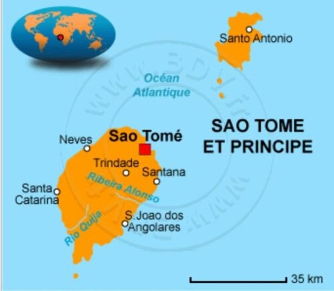
No, these aren’t the sun-soaked, Polynesian lagoon islands. Here, *‘it rains, it pours...’* pretty much all the time, it seems.
There’s not much to *‘see’* in the traditional tourist sense—EXCEPT for stunning landscapes, lush vegetation, a few beaches with golden or black sand, colonial buildings still in their original state, a single main road, and plenty of *‘tracks’* that are more or less drivable. All this surrounded by an African population that speaks Portuguese and is known for its warm welcome.
Well, that should be enough for our happiness—and hopefully yours too! 😊
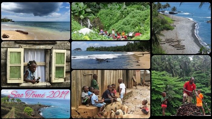
Ready for landing?
"Ah, here it is at last—that sweet scent of elsewhere so dear to Cricri and Lulu’s noses, that mix of apprehension and desire when facing the unknown.
We’re really diving into the unknown this time, taking you to the island of SAO TOMÉ... also known as the island: *‘Wait, what did you say?’* 😄. Because apparently, no one’s heard of Sao Tomé—except our Portuguese friends.
It’s an archipelago of three islands smack in the middle of the world, right on the equator, off the coast of Gabon.
No, these aren’t the sun-soaked, Polynesian lagoon islands. Here, *‘it rains, it pours...’* pretty much all the time, it seems.
There’s not much to *‘see’* in the traditional tourist sense—EXCEPT for stunning landscapes, lush vegetation, a few beaches with golden or black sand, colonial buildings still in their original state, a single main road, and plenty of *‘tracks’* that are more or less drivable. All this surrounded by an African population that speaks Portuguese and is known for its warm welcome.
Well, that should be enough for our happiness—and hopefully yours too! 😊
Ready for landing?
A long journey around Australia
Sunday, October 1st, 2023
Mulhouse-London
We dumped our trash on our neighbors. We hugged, overflowing with emotion. Then Léa from Taxis S showed up. She knows us well. For ages, she’s been our driver. She was practically the official taxiwoman for the trips of the company where Dom and I met. She knew us when we were single! Almost teenagers! She knows everyone and fills in the biographies of people we’d forgotten.
 Across the street, while we loaded the luggage, S., perched in his window frame, waved a handkerchief. This wasn’t just any trip.
 Then things got tricky. It’s funny how fate sinks its teeth into our happy moments—there’s this whole intermediate phase where the poison seeps in unnoticed because you’re still in the dark...
First, there was a delay on our flight to London. Dom immediately went on high alert, while I stayed calm. In my mind, we had two hours. I knew we had to go from Terminal 5 to Terminal 4, but two hours—come on, that’s plenty, right?
Then things got tricky. It’s funny how fate sinks its teeth into our happy moments—there’s this whole intermediate phase where the poison seeps in unnoticed because you’re still in the dark...
First, there was a delay on our flight to London. Dom immediately went on high alert, while I stayed calm. In my mind, we had two hours. I knew we had to go from Terminal 5 to Terminal 4, but two hours—come on, that’s plenty, right?
Bad calculation! Because those two hours were between the first flight’s landing and the second’s takeoff. But flights close at least half an hour before departure. Getting from one terminal to another means taking a shuttle bus. We waited for the one going to Terminal 4... until a young guy paid to direct people (who hadn’t seen us) informed us it was no longer possible to access Terminal 4 without going through Terminal 2 first for a connection! That really cranked up the pressure. We started installing a mental countdown with a programmed explosion at the end—guaranteed stress with added beads of sweat. The terminal bus was driven by a young Pakistani guy. We were *so* tense we bombarded him with our frantic, repetitive questions. “So? When are we getting there? What’s happening? Why aren’t we moving?” Our eyes were glued to our watches. The poor guy knew. Perfectly. Because it was obvious—no way around it. We weren’t going to make it. It was impossible. But Dom and I stubbornly refused to believe it. Then the kid stopped the bus. Me, hysterical: “What are you doing? What’s going on? Our plane takes off in... in... 4 minutes!!!! We’re gonna miss iiiiiit!” He wasn’t calm either. “You’ve already missed it!” He explained we had to cross a zone that required an escort car to clear a path through the runways. Impossible to do without. It’s forbidden. We had to WAIT (!!!). Then he got a radio call—he had to rush to Terminal 3 to pick up a passenger who was *super* tight on time. “Amir!!!! It’s RIGHT NOW!” they yelled in his already-red ears, thanks to the complaints of two hysterical Frenchies. Dom and I were in overdrive, hallucinating! We wanted to stop him, maybe even hit him to prevent him from turning around. He picked up the girl, whom we instantly hated like the most despicable witch. I turned on my data, searched for Malaysia Airlines’ number at Terminal 4, called, and actually got someone—quite a feat. A woman cut off my frantic rambling with a blunt “It’s over, the check-in is closed, the plane is about to take off.” I heard her but refused to accept it. I yelled, “We’re coming!” She shot back her monolithic “It’s over.” Finally at the doors of that damn Terminal 4, we ran—*really* ran—a marathon, Gate 6, security checks, pat-downs, “Take off your belts,” we asked questions, everyone seemed confident, we ran with one hand holding up our pants, the other clutching our belt, Gate 6—the room was empty. A girl was sitting there, calmly on the phone. We pounced on her. She calmed us down. Little by little, the light came back. Our brains rebooted. We finally understood it was over. We’d have to start crafting a new plan with the new reality. It started with a return to Terminal 5 to talk to British Airways, which took a good hour. With the same driver as before. We were alone with him. He took the time to apologize, to assure us it wasn’t his fault, that our problem had no solution, that nothing could’ve changed the outcome. At BA, we were exhausted. We were greeted by a handsome young man in a navy-blue uniform with gold stripes everywhere. We could’ve made a scene, but we were just relieved to find someone who’d take charge of our story. It was a minimal response, but it was *a* response. I suppose we could’ve demanded a business-class upgrade or a free trip, but we were just happy with a few vouchers for food, a hotel room with breakfast, and a little bag with plastic toys, a razor, toothbrush, hygiene products, and a T-shirt... Trinkets... But we were fine with it all—we said thank you eagerly because the essential was assured. He found us seats on flights tomorrow. *Tomorrow.* We were afraid to hope! We had the exact same flights but a day later. The same crappy times, but it was all good. We felt saved from the shipwreck, like survivors. - And what about the luggage? - .... !!!!
Monday, October 2nd, 2023 London - Kuala Lumpur
It wasn’t the Ritz, but with exhaustion on our side, we slept well. The continental breakfast was way better than we’d expected from an Ibis Budget. Still, it wasn’t enough to restore my joy for life. The course correction had turned into an arduous obstacle course. I scoured the car rental site every which way. Couldn’t reschedule the car. I’d done it before, but this time... Not to mention the laptop battery was complaining—the Brits have this quirk of making their power outlets incompatible with our chargers. Frustrated, I called them but ended up with a girl who declared herself incompetent and offered to have someone from Avis in Perth call me back—someone who’d supposedly handle rentals better. I decided to wait while taking a bath. Barely settled in, the phone rang. I was soaking wet, of course, and asked Dom to answer. Unfortunately, she’s known for disliking my phone, and in a clumsy move, she hung up. We got annoyed. She put dry towels on the edge of the bathtub, but—another false move—they fell in the water. The phone rang again... I completely redid the plans for the next two days, then transferred the files to my phone to consult them later offline. I plugged in my USB cable... *Plop!* The battery died abruptly—my PC shut down without any of the usual polite warnings! I looked around, hoping to find someone to strangle... Long story short, you can tell the day started under the worst omens. I was in a foul mood and spread my bad vibes to Dominique, who was initially in much better spirits... I called Mastercard, hoping to get a refund for the non-refundable night in Perth we’d already paid for. Same old song: “We’ll call you back”... Then... I’ll cut it short—buses, trains, lots of waiting... We rushed to reach the infamous Terminal 4.
We tried new options and convinced ourselves that a delayed departure flight is unrecoverable, no matter the scenario. We were furious that BA hadn’t bothered to tell us, leaving us to run around like rats in a burning house.
Tuesday, October 3rd, 2023 Kuala Lumpur-Perth
The flight was pretty nice. 13 hours, though. Dom and I were facing each other across the aisle. We could get up easily whenever we wanted without bothering anyone and chat when we felt like it. Besides, their chicken was amazing. They were kind enough to offer Dom a truly remarkable glass of rum. Good movies too, including the excellent *Prisoners* by Denis Villeneuve. At KL, during boarding, we developed a nagging worry about our luggage. We checked with some Malaysian Airlines staff. I sensed their hesitation. They made calls. Then changed their minds, giving us smiles and thumbs up...
Wednesday, October 4th, 2023 Perth
*Happy is the man who, like Ulysses, has had a fine voyage.* Well, for us, it wasn’t that. Finally arrived, we experienced the loneliness of tourists watching the baggage carousel spin, emptying of its precious containers one by one, until only a handful of travelers were left, staring at each other in disbelief. Without luggage, you’re kinda screwed. Not even a change of socks—our feet had been swimming in the same shoes for 3 days. No adapter, so no laptop. No toiletries. We could’ve cried! The lost luggage guy played his part. If you want compensation, fill out the disclaimer on the website made for that. And then, “Don’t worry, your luggage will arrive tomorrow!” “Don’t worry?!” From the start of the trip, we’ve been jerked around, fed lies. Tomorrow is the *absolute* last chance to get them back. Beyond that, we’d have to scramble a whole new trip. And lose a lot in the process! I have no idea how to go about it. Tomorrow... OMG... Tomorrow... We landed at 1 AM. Avis, the car rental place, opens at 6:30. Luckily, we found some decent breakfast. It cheered us up and gave us a second wind. Incorrigible, we started believing again! Well, then we just killed time. What else was there to do?

In front of Avis’s little shack, we were freezing. We’d been there since dawn. The girl who showed up, a Latina, immediately saw us as a nuisance who’d ruin her hopes of a peaceful start. Her face and tone were as unwelcoming as possible. You know us—it ended with hugs. She gave us a gorgeous, brand-new car! A hybrid with ultra-sophisticated features, all buttons you shouldn’t touch if you want to drive this thing without causing irreparable damage! We’re off! Driving on the left is easy at first. You think about it constantly. It’s counterintuitive, it takes effort. It’s later, when you get used to it and confidence sets in, that it becomes dangerous—old reflexes can send you into a wall. Anyway, the car and I immediately clicked.
In Perth, underground parking next to the hotel, friendly welcome—we ended up forgetting all the morning’s mishaps. Should we go sightseeing?
https://voyageforum.com/images/posts/small/1733767537-5Nwk6t3DsBZNOzf.jpg
Across the street, while we loaded the luggage, S., perched in his window frame, waved a handkerchief. This wasn’t just any trip.
Then things got tricky. It’s funny how fate sinks its teeth into our happy moments—there’s this whole intermediate phase where the poison seeps in unnoticed because you’re still in the dark...
First, there was a delay on our flight to London. Dom immediately went on high alert, while I stayed calm. In my mind, we had two hours. I knew we had to go from Terminal 5 to Terminal 4, but two hours—come on, that’s plenty, right?
Bad calculation! Because those two hours were between the first flight’s landing and the second’s takeoff. But flights close at least half an hour before departure. Getting from one terminal to another means taking a shuttle bus. We waited for the one going to Terminal 4... until a young guy paid to direct people (who hadn’t seen us) informed us it was no longer possible to access Terminal 4 without going through Terminal 2 first for a connection! That really cranked up the pressure. We started installing a mental countdown with a programmed explosion at the end—guaranteed stress with added beads of sweat. The terminal bus was driven by a young Pakistani guy. We were *so* tense we bombarded him with our frantic, repetitive questions. “So? When are we getting there? What’s happening? Why aren’t we moving?” Our eyes were glued to our watches. The poor guy knew. Perfectly. Because it was obvious—no way around it. We weren’t going to make it. It was impossible. But Dom and I stubbornly refused to believe it. Then the kid stopped the bus. Me, hysterical: “What are you doing? What’s going on? Our plane takes off in... in... 4 minutes!!!! We’re gonna miss iiiiiit!” He wasn’t calm either. “You’ve already missed it!” He explained we had to cross a zone that required an escort car to clear a path through the runways. Impossible to do without. It’s forbidden. We had to WAIT (!!!). Then he got a radio call—he had to rush to Terminal 3 to pick up a passenger who was *super* tight on time. “Amir!!!! It’s RIGHT NOW!” they yelled in his already-red ears, thanks to the complaints of two hysterical Frenchies. Dom and I were in overdrive, hallucinating! We wanted to stop him, maybe even hit him to prevent him from turning around. He picked up the girl, whom we instantly hated like the most despicable witch. I turned on my data, searched for Malaysia Airlines’ number at Terminal 4, called, and actually got someone—quite a feat. A woman cut off my frantic rambling with a blunt “It’s over, the check-in is closed, the plane is about to take off.” I heard her but refused to accept it. I yelled, “We’re coming!” She shot back her monolithic “It’s over.” Finally at the doors of that damn Terminal 4, we ran—*really* ran—a marathon, Gate 6, security checks, pat-downs, “Take off your belts,” we asked questions, everyone seemed confident, we ran with one hand holding up our pants, the other clutching our belt, Gate 6—the room was empty. A girl was sitting there, calmly on the phone. We pounced on her. She calmed us down. Little by little, the light came back. Our brains rebooted. We finally understood it was over. We’d have to start crafting a new plan with the new reality. It started with a return to Terminal 5 to talk to British Airways, which took a good hour. With the same driver as before. We were alone with him. He took the time to apologize, to assure us it wasn’t his fault, that our problem had no solution, that nothing could’ve changed the outcome. At BA, we were exhausted. We were greeted by a handsome young man in a navy-blue uniform with gold stripes everywhere. We could’ve made a scene, but we were just relieved to find someone who’d take charge of our story. It was a minimal response, but it was *a* response. I suppose we could’ve demanded a business-class upgrade or a free trip, but we were just happy with a few vouchers for food, a hotel room with breakfast, and a little bag with plastic toys, a razor, toothbrush, hygiene products, and a T-shirt... Trinkets... But we were fine with it all—we said thank you eagerly because the essential was assured. He found us seats on flights tomorrow. *Tomorrow.* We were afraid to hope! We had the exact same flights but a day later. The same crappy times, but it was all good. We felt saved from the shipwreck, like survivors. - And what about the luggage? - .... !!!!
Monday, October 2nd, 2023 London - Kuala Lumpur
It wasn’t the Ritz, but with exhaustion on our side, we slept well. The continental breakfast was way better than we’d expected from an Ibis Budget. Still, it wasn’t enough to restore my joy for life. The course correction had turned into an arduous obstacle course. I scoured the car rental site every which way. Couldn’t reschedule the car. I’d done it before, but this time... Not to mention the laptop battery was complaining—the Brits have this quirk of making their power outlets incompatible with our chargers. Frustrated, I called them but ended up with a girl who declared herself incompetent and offered to have someone from Avis in Perth call me back—someone who’d supposedly handle rentals better. I decided to wait while taking a bath. Barely settled in, the phone rang. I was soaking wet, of course, and asked Dom to answer. Unfortunately, she’s known for disliking my phone, and in a clumsy move, she hung up. We got annoyed. She put dry towels on the edge of the bathtub, but—another false move—they fell in the water. The phone rang again... I completely redid the plans for the next two days, then transferred the files to my phone to consult them later offline. I plugged in my USB cable... *Plop!* The battery died abruptly—my PC shut down without any of the usual polite warnings! I looked around, hoping to find someone to strangle... Long story short, you can tell the day started under the worst omens. I was in a foul mood and spread my bad vibes to Dominique, who was initially in much better spirits... I called Mastercard, hoping to get a refund for the non-refundable night in Perth we’d already paid for. Same old song: “We’ll call you back”... Then... I’ll cut it short—buses, trains, lots of waiting... We rushed to reach the infamous Terminal 4.
We tried new options and convinced ourselves that a delayed departure flight is unrecoverable, no matter the scenario. We were furious that BA hadn’t bothered to tell us, leaving us to run around like rats in a burning house.
Tuesday, October 3rd, 2023 Kuala Lumpur-Perth
The flight was pretty nice. 13 hours, though. Dom and I were facing each other across the aisle. We could get up easily whenever we wanted without bothering anyone and chat when we felt like it. Besides, their chicken was amazing. They were kind enough to offer Dom a truly remarkable glass of rum. Good movies too, including the excellent *Prisoners* by Denis Villeneuve. At KL, during boarding, we developed a nagging worry about our luggage. We checked with some Malaysian Airlines staff. I sensed their hesitation. They made calls. Then changed their minds, giving us smiles and thumbs up...
Wednesday, October 4th, 2023 Perth
*Happy is the man who, like Ulysses, has had a fine voyage.* Well, for us, it wasn’t that. Finally arrived, we experienced the loneliness of tourists watching the baggage carousel spin, emptying of its precious containers one by one, until only a handful of travelers were left, staring at each other in disbelief. Without luggage, you’re kinda screwed. Not even a change of socks—our feet had been swimming in the same shoes for 3 days. No adapter, so no laptop. No toiletries. We could’ve cried! The lost luggage guy played his part. If you want compensation, fill out the disclaimer on the website made for that. And then, “Don’t worry, your luggage will arrive tomorrow!” “Don’t worry?!” From the start of the trip, we’ve been jerked around, fed lies. Tomorrow is the *absolute* last chance to get them back. Beyond that, we’d have to scramble a whole new trip. And lose a lot in the process! I have no idea how to go about it. Tomorrow... OMG... Tomorrow... We landed at 1 AM. Avis, the car rental place, opens at 6:30. Luckily, we found some decent breakfast. It cheered us up and gave us a second wind. Incorrigible, we started believing again! Well, then we just killed time. What else was there to do?
In front of Avis’s little shack, we were freezing. We’d been there since dawn. The girl who showed up, a Latina, immediately saw us as a nuisance who’d ruin her hopes of a peaceful start. Her face and tone were as unwelcoming as possible. You know us—it ended with hugs. She gave us a gorgeous, brand-new car! A hybrid with ultra-sophisticated features, all buttons you shouldn’t touch if you want to drive this thing without causing irreparable damage! We’re off! Driving on the left is easy at first. You think about it constantly. It’s counterintuitive, it takes effort. It’s later, when you get used to it and confidence sets in, that it becomes dangerous—old reflexes can send you into a wall. Anyway, the car and I immediately clicked.
In Perth, underground parking next to the hotel, friendly welcome—we ended up forgetting all the morning’s mishaps. Should we go sightseeing?
https://voyageforum.com/images/posts/small/1733767537-5Nwk6t3DsBZNOzf.jpg
VoyageForum Members' 2025 Cruise Departure Calendar
hi everyone
I’ll go ahead and restart the cruise calendar for 2025 for now.
It can give people ideas and might help members meet up!
Two essential rules: don’t “quote” the calendar when replying—this’ll avoid any confusion and if you can, list your cruise in this example format: enter the month first, then date /username / SHIP / number of days / destination / departure port
FEBRUARY
14/02- poupou10 / CELEBRITY INFINITY /11 days / Greece Turkey Cyprus / Piraeus (Athens) AUGUST 01/08- poupou10 / REGAL PRINCESS /13 days / British Isles / Southampton YOUR TURN 😉 NUMBER OF CRUISES 2025: 2 JANUARY FEBRUARY 14/02- poupou10 / CELEBRITY INFINITY /11 days / Greece Turkey Cyprus / Piraeus (Athens) MARCH APRIL MAY JUNE JULY AUGUST 01/08- poupou10 / REGAL PRINCESS /13 days / British Isles / Southampton SEPTEMBER OCTOBER NOVEMBER DECEMBER
Two essential rules: don’t “quote” the calendar when replying—this’ll avoid any confusion and if you can, list your cruise in this example format: enter the month first, then date /username / SHIP / number of days / destination / departure port
FEBRUARY
14/02- poupou10 / CELEBRITY INFINITY /11 days / Greece Turkey Cyprus / Piraeus (Athens) AUGUST 01/08- poupou10 / REGAL PRINCESS /13 days / British Isles / Southampton YOUR TURN 😉 NUMBER OF CRUISES 2025: 2 JANUARY FEBRUARY 14/02- poupou10 / CELEBRITY INFINITY /11 days / Greece Turkey Cyprus / Piraeus (Athens) MARCH APRIL MAY JUNE JULY AUGUST 01/08- poupou10 / REGAL PRINCESS /13 days / British Isles / Southampton SEPTEMBER OCTOBER NOVEMBER DECEMBER
Southwest! 8 weeks with the family, Denver-to-Denver loop, 1st part...
Hey there, VoyageForum!!!
I’ve combed through this site up, down, and sideways to plan our two-month road trip across the American Southwest during the summer of 2022, so it only feels right to give back and revive the USA travel journal section—helping others prep, travel, or relive their own memories! 😏
A quick intro to the stars of this trip is coming soon... in an upcoming post!
Table of Contents:
Road trip introduction Day 1 & 2: the days we double-checked all our papers... Day 3 & 3 bis: The day we discovered Denver... Day 4: The day of the race, the carriage, and the little one’s cough... Day 5: the day the road trip truly began... Day 6 & 6 bis: the day of Nature’s first wonders... Day 7: the day the sky fell on our heads... Day 8 & 8 bis: the day we saw ghosts... Day 9: the day we climbed the mountain... Day 10: the day the theme song from "The Last Picture Show" played on loop in my head... Day 11: the day we lived like Native Americans... Day 12: the day we left civilization behind... Day 13 & 13 bis: the day we explored another planet... Day 14 & 14 bis: the day Caro reunited with HER rocks... Day 15 & 15 bis: the day of the fantastic ride... Day 16: the day we cooled off in Lake Powell... Day 17: the day the Colorado River’s meanders were all ours... Day 18: the day we dipped our feet in the Colorado... Day 19: the day the guys discovered true vastness... Day 20 & 20 bis: the day we covered a few acres of Route 66 before sunset... Day 21: the day the credit card said stop... right before the STRIP... Day 22: the day we finally discovered Cirque du Soleil... Day 23: the day we returned to calm... well, almost... Day 24: the day we reached our home base for 6 nights: Saint George Day 25: the day we should’ve explored Yant Flat... Day 26: the day it was 13°C at Cedar Breaks... Day 27: the day we explored The Narrows in Zion NP... Day 28: the day we discovered Snow Canyon... Day 29: the day we hiked to the "SUBWAY"... Day 30: the day we encountered the abyss—from the north this time... Day 31: the day we arrived in a place where dreams begin... Kanab... Day 32: the day we discovered the first treasures along House Rock Valley... 2nd part: the second part of the journey... Day 33: the day we discovered a magical place... Edmaier's Secret... Day 34: the day Cottonwood Road didn’t open up to us... Day 35: the day of the classic Queen’s Garden + Navajo Loop—and another event that became a classic... Day 36: the second day in Bryce... pure bliss!!! Day 37: the day we swam at the foot of Calf Creek Falls... Day 38: the day we took the Burr Trail, even with storms lurking... Day 39: The day of the goblins... Day 40: the day we enjoyed the peaceful Capitol Reef NP... Day 41: the day of the Rim Overlook and another letdown... Day 42: the day we arrived in... Moab... Day 43: the first day in Arches National Park... Day 44: the day of the Fisher Towers... Day 45: the day of Bow Tie & Corona Arches... Day 46: The day of Shafer Trail + Potash Road... Day 47: The second day in Arches NP... Day 48: the day we discovered Colorado NM in a flash... Day 49: the day of Black Canyon... Day 50: the day we passed through Durango before falling for Silverton... Day 51: the day we went through Ouray and ended up in Gunnison... Day 52: the day of Kebler Pass and arriving at the hot springs... Day 53: the day of hot springs II, then the road back to Denver... Day 54: the last day... Day 55: back home and the RECAP...
I’ve combed through this site up, down, and sideways to plan our two-month road trip across the American Southwest during the summer of 2022, so it only feels right to give back and revive the USA travel journal section—helping others prep, travel, or relive their own memories! 😏
A quick intro to the stars of this trip is coming soon... in an upcoming post!
Table of Contents:
Road trip introduction Day 1 & 2: the days we double-checked all our papers... Day 3 & 3 bis: The day we discovered Denver... Day 4: The day of the race, the carriage, and the little one’s cough... Day 5: the day the road trip truly began... Day 6 & 6 bis: the day of Nature’s first wonders... Day 7: the day the sky fell on our heads... Day 8 & 8 bis: the day we saw ghosts... Day 9: the day we climbed the mountain... Day 10: the day the theme song from "The Last Picture Show" played on loop in my head... Day 11: the day we lived like Native Americans... Day 12: the day we left civilization behind... Day 13 & 13 bis: the day we explored another planet... Day 14 & 14 bis: the day Caro reunited with HER rocks... Day 15 & 15 bis: the day of the fantastic ride... Day 16: the day we cooled off in Lake Powell... Day 17: the day the Colorado River’s meanders were all ours... Day 18: the day we dipped our feet in the Colorado... Day 19: the day the guys discovered true vastness... Day 20 & 20 bis: the day we covered a few acres of Route 66 before sunset... Day 21: the day the credit card said stop... right before the STRIP... Day 22: the day we finally discovered Cirque du Soleil... Day 23: the day we returned to calm... well, almost... Day 24: the day we reached our home base for 6 nights: Saint George Day 25: the day we should’ve explored Yant Flat... Day 26: the day it was 13°C at Cedar Breaks... Day 27: the day we explored The Narrows in Zion NP... Day 28: the day we discovered Snow Canyon... Day 29: the day we hiked to the "SUBWAY"... Day 30: the day we encountered the abyss—from the north this time... Day 31: the day we arrived in a place where dreams begin... Kanab... Day 32: the day we discovered the first treasures along House Rock Valley... 2nd part: the second part of the journey... Day 33: the day we discovered a magical place... Edmaier's Secret... Day 34: the day Cottonwood Road didn’t open up to us... Day 35: the day of the classic Queen’s Garden + Navajo Loop—and another event that became a classic... Day 36: the second day in Bryce... pure bliss!!! Day 37: the day we swam at the foot of Calf Creek Falls... Day 38: the day we took the Burr Trail, even with storms lurking... Day 39: The day of the goblins... Day 40: the day we enjoyed the peaceful Capitol Reef NP... Day 41: the day of the Rim Overlook and another letdown... Day 42: the day we arrived in... Moab... Day 43: the first day in Arches National Park... Day 44: the day of the Fisher Towers... Day 45: the day of Bow Tie & Corona Arches... Day 46: The day of Shafer Trail + Potash Road... Day 47: The second day in Arches NP... Day 48: the day we discovered Colorado NM in a flash... Day 49: the day of Black Canyon... Day 50: the day we passed through Durango before falling for Silverton... Day 51: the day we went through Ouray and ended up in Gunnison... Day 52: the day of Kebler Pass and arriving at the hot springs... Day 53: the day of hot springs II, then the road back to Denver... Day 54: the last day... Day 55: back home and the RECAP...
La SNCF aime-t-elle le vélo? English translation pending
Bonjour à tous
Cyclo de fraîche date, j'ai pour ambition d'amener mon vélo de Paris à Nice fin août et de démarrer mon voyage là-bas. Je pensais qu'il serait assez simple de trouver une place dans un train (quitte à payer un supplément). Comme j'étais naïf !! Je découvre qu'il n'y a absolument rien. L'alternative serait de démonter mon vélo et de le mettre dans une housse, sauf que la SNCF ne prête pas de housse. Or, sachant que je repartirai de Nice à vélo, je n'ai aucune intention de me trimballer une housse.
Bref, quelle solution voyez-vous ? Enchaîner les TER et mettre 2 jours pour aller de Paris à Nice ? Prendre l'avion, et tant pis pour la planète ?
Je suis à l'écoute de vos idées, mais vraiment je tombe de haut.
Merci !
Cyclo de fraîche date, j'ai pour ambition d'amener mon vélo de Paris à Nice fin août et de démarrer mon voyage là-bas. Je pensais qu'il serait assez simple de trouver une place dans un train (quitte à payer un supplément). Comme j'étais naïf !! Je découvre qu'il n'y a absolument rien. L'alternative serait de démonter mon vélo et de le mettre dans une housse, sauf que la SNCF ne prête pas de housse. Or, sachant que je repartirai de Nice à vélo, je n'ai aucune intention de me trimballer une housse.
Bref, quelle solution voyez-vous ? Enchaîner les TER et mettre 2 jours pour aller de Paris à Nice ? Prendre l'avion, et tant pis pour la planète ?
Je suis à l'écoute de vos idées, mais vraiment je tombe de haut.
Merci !
Festival des éléphants en Thaïlande English translation pending
Salut tout le monde just partage d'une petite video sur la thailande, c'est tellement un beau pays, Mais vous pensez quoi des elephants la bas
https://www.youtube.com/watch?v=zlbo0_rpKM0
Annuler une croisière pour les fjords au départ de Kiel en août 2020 étant Français English translation pending
Bonjour
Ayant depuis longtemps réservé une croisiere pour les fjords en aout 2020. Je me demande dans quelle conditions je peux l annuler sans avoir à payer le solde puisque étant français nous ne pourrons sortir du territoire pour prendre le bateau msc à kiel. Merci de vos conseils cordialement
Le premier jour English translation pending
Nous sommes le xx xx xxxx, jour de votre déconfinement, vous êtes guéri ou n'avez jamais été en contact avec le virus couronné.
Qu'imaginez-vous faire en premier ? 😛
(Par simplicité, nous allons partir du principe que votre région est redevenue comme avant à défaut du monde.)
(Par simplicité, nous allons partir du principe que votre région est redevenue comme avant à défaut du monde.)
Cape Town and Kruger: 12 days in February with teens
Hi everyone,
I’d love to share a little travel journal from our 14-day/12-night road trip with our two teens (14 and 17) in February/March 2020. A huge thank you to all of you who helped me plan this trip to South Africa—your patience with my endless questions was amazing!
We left Lyon on Saturday, February 22 at 7:00 AM and arrived in Johannesburg at 10:00 PM after a short layover in Amsterdam. Flights cost 440 € per person (booked in October), with carry-on luggage. We added just one checked bag for the whole family (80 € round-trip with the free Flying Blue membership). Since we’d be moving around a lot, we packed light! In Lyon, we reserved parking at P5 in advance for 70 € for 14 days. The Air France/KLM flight was smooth. When we landed, we picked up our bags and had booked a night at the Aero Guest Lodge, just 5 minutes from the airport, with a free shuttle and breakfast. All you have to do is send a WhatsApp message when you arrive at the airport to let the shuttle driver know. The tricky part? Finding him in the terminal—he wasn’t holding a sign with the hotel’s name. 🤪 A South African called him for me since my English wasn’t great (and I had to get used to the accent 😛), and helped us spot the driver (who was actually less than 5 meters away!) with other guests. When we got to the hotel: all good, except we were 10 people in a van meant for 7. The room was spacious—one king-size bed and two single beds for the kids—with a simple but clean bathroom, a garden, pool, and breakfast (which we didn’t try). All for 65 €, so an awesome value!
 After a restful night, we woke up at 6:00 AM to catch the shuttle back to the airport. Just a heads-up: there’s only one shuttle per hour in the morning, and Kulula canceled our 9:00 AM flight, moving it to 8:00 AM—so no time for breakfast (it starts at 6:30).
We waited 15 minutes in the lovely garden for the driver, who dropped us off at the airport in 5 minutes.
We checked in for our flight to Cape Town, which cost around 40 € (including two checked bags per person).
We grabbed breakfast at the airport instead (less than 20 € for all four of us—one of the nice surprises of South Africa!), and arrived in Cape Town at 10:20 AM.
After a restful night, we woke up at 6:00 AM to catch the shuttle back to the airport. Just a heads-up: there’s only one shuttle per hour in the morning, and Kulula canceled our 9:00 AM flight, moving it to 8:00 AM—so no time for breakfast (it starts at 6:30).
We waited 15 minutes in the lovely garden for the driver, who dropped us off at the airport in 5 minutes.
We checked in for our flight to Cape Town, which cost around 40 € (including two checked bags per person).
We grabbed breakfast at the airport instead (less than 20 € for all four of us—one of the nice surprises of South Africa!), and arrived in Cape Town at 10:20 AM.
 After quickly picking up our bags, we headed to the Avis counter and left with a Toyota Corolla for 80 € for 4 days (rented with the Flying Blue card—free additional driver).
Everything’s on the left... not easy, but it works if you plan your route well.
We drove to our Airbnb in Constantia. We were surprised to see animals, bikes, and pedestrians on the highway!
We arrived around 11:30 AM at our rental—a huge house in the vineyards, in a super secure neighborhood, about 15-20 minutes from Hout Bay. It felt like Beverly Hills, but with super-high walls and barbed wire around the villas. 😕
After quickly picking up our bags, we headed to the Avis counter and left with a Toyota Corolla for 80 € for 4 days (rented with the Flying Blue card—free additional driver).
Everything’s on the left... not easy, but it works if you plan your route well.
We drove to our Airbnb in Constantia. We were surprised to see animals, bikes, and pedestrians on the highway!
We arrived around 11:30 AM at our rental—a huge house in the vineyards, in a super secure neighborhood, about 15-20 minutes from Hout Bay. It felt like Beverly Hills, but with super-high walls and barbed wire around the villas. 😕

We dropped off our bags, changed into shorts (it was around 30°C/86°F), and headed to the Bay Harbour Market in Hout Bay. We had lunch there—such a great vibe! We wandered through the stalls, everyone picked their own dish, and we sat down on the terrace. There was music, artisans of all kinds... a really nice moment.

I’d withdrawn 50 € before leaving... and that gave me change to pay the parking attendant. Lunch cost around 30 € for four, including food and drinks.

After browsing the artisan stalls, we headed to Hout Bay Beach near the restaurant, Marina Wharf (another small tip for the parking attendant—we’d have to get used to that!). We stopped to admire the sea lions. An ice cream for 1 €? No way we were saying no! 🙂
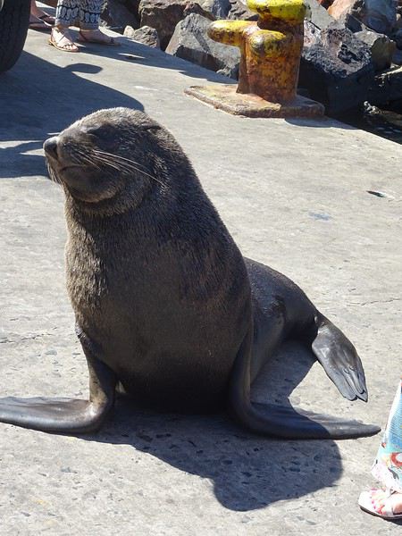
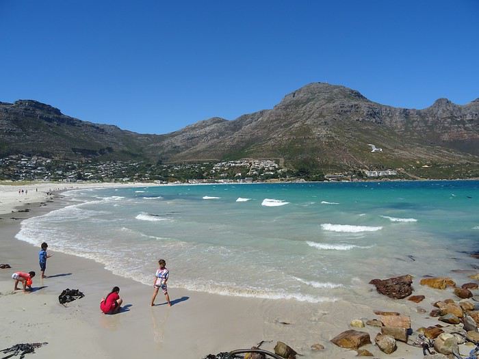
The fatigue was starting to hit, so we headed to the grocery store 10 minutes away (Constantia shopping center) and then had an aperitif in front of the vineyards, opening a delicious bottle of white wine.
I’d love to share a little travel journal from our 14-day/12-night road trip with our two teens (14 and 17) in February/March 2020. A huge thank you to all of you who helped me plan this trip to South Africa—your patience with my endless questions was amazing!
We left Lyon on Saturday, February 22 at 7:00 AM and arrived in Johannesburg at 10:00 PM after a short layover in Amsterdam. Flights cost 440 € per person (booked in October), with carry-on luggage. We added just one checked bag for the whole family (80 € round-trip with the free Flying Blue membership). Since we’d be moving around a lot, we packed light! In Lyon, we reserved parking at P5 in advance for 70 € for 14 days. The Air France/KLM flight was smooth. When we landed, we picked up our bags and had booked a night at the Aero Guest Lodge, just 5 minutes from the airport, with a free shuttle and breakfast. All you have to do is send a WhatsApp message when you arrive at the airport to let the shuttle driver know. The tricky part? Finding him in the terminal—he wasn’t holding a sign with the hotel’s name. 🤪 A South African called him for me since my English wasn’t great (and I had to get used to the accent 😛), and helped us spot the driver (who was actually less than 5 meters away!) with other guests. When we got to the hotel: all good, except we were 10 people in a van meant for 7. The room was spacious—one king-size bed and two single beds for the kids—with a simple but clean bathroom, a garden, pool, and breakfast (which we didn’t try). All for 65 €, so an awesome value!
After a restful night, we woke up at 6:00 AM to catch the shuttle back to the airport. Just a heads-up: there’s only one shuttle per hour in the morning, and Kulula canceled our 9:00 AM flight, moving it to 8:00 AM—so no time for breakfast (it starts at 6:30).
We waited 15 minutes in the lovely garden for the driver, who dropped us off at the airport in 5 minutes.
We checked in for our flight to Cape Town, which cost around 40 € (including two checked bags per person).
We grabbed breakfast at the airport instead (less than 20 € for all four of us—one of the nice surprises of South Africa!), and arrived in Cape Town at 10:20 AM.
After quickly picking up our bags, we headed to the Avis counter and left with a Toyota Corolla for 80 € for 4 days (rented with the Flying Blue card—free additional driver).
Everything’s on the left... not easy, but it works if you plan your route well.
We drove to our Airbnb in Constantia. We were surprised to see animals, bikes, and pedestrians on the highway!
We arrived around 11:30 AM at our rental—a huge house in the vineyards, in a super secure neighborhood, about 15-20 minutes from Hout Bay. It felt like Beverly Hills, but with super-high walls and barbed wire around the villas. 😕We dropped off our bags, changed into shorts (it was around 30°C/86°F), and headed to the Bay Harbour Market in Hout Bay. We had lunch there—such a great vibe! We wandered through the stalls, everyone picked their own dish, and we sat down on the terrace. There was music, artisans of all kinds... a really nice moment.
I’d withdrawn 50 € before leaving... and that gave me change to pay the parking attendant. Lunch cost around 30 € for four, including food and drinks.
After browsing the artisan stalls, we headed to Hout Bay Beach near the restaurant, Marina Wharf (another small tip for the parking attendant—we’d have to get used to that!). We stopped to admire the sea lions. An ice cream for 1 €? No way we were saying no! 🙂
The fatigue was starting to hit, so we headed to the grocery store 10 minutes away (Constantia shopping center) and then had an aperitif in front of the vineyards, opening a delicious bottle of white wine.
Un petit tour au Tamil Nadu English translation pending
Au milieu de toute cette morosité, je me lance dans un nouveau carnet indien qui vous changera les idées, je l’espère. Un nouveau séjour de deux semaines pendant les vacances d’hiver, du 21 au 6 mars. Mon 15ème voyage en Inde, mais mon 1er dans le grand sud.
Cette année, ce sera une petite partie du Tamil Nadu, un petit tour de 1000 km à peu près, de Chennai à Chennai (Kanchipuram, Gingee, Tirunmavallai, Chidambaram, Tranquebar, Kumbakonam, Trichy, le Chettinad, Tanjore, Pondichery et Mahabalipuram) avec une amie. Nous avons volontairement zappé Madurai et Rameshvaram, ce sera pour une autre fois, nous n’avions pas envie de faire trop de km et nous avons déjà beaucoup de chose au programme... Comme d’habitude, location d’une voiture avec chauffeur, et nous ne le regrettons pas, tant nous avons vu de lieux, quelquefois bien perdus, que nous n’aurions jamais pu atteindre en transport en commun, ou certainement pas en 14 jours.
J’ai consulté les carnets et blogs de Pagaljavad et Yann55 entre autre et je les remercie pour leurs tuyaux. J’ai eu des conseils d’Aleph, qui quand elle écumait le Tamil Nadu, ne postait pas encore de carnet. J’ai lu et relu les pages sur le Tamil Nadu sur le site Purattatva, un must pour moi depuis toujours. Et cherché, lu et relu, sur internet et sur papier (j’ai un vieux guide bleu de 1984 trouvé sur une brocante que je conserve précieusement et consulte pour chaque voyage car la qualité des guides a bien baissé culturellement depuis …)
A l’aéroport de Chennai, nous faisons connaissance avec notre chauffeur, Pandi. Départ immédiat pour Kanchipuram, à 65 km de là. Chennai sera pour une prochaine fois … Nous arrivons en fin de journée, il fait quasi nuit. Après le dîner, nous nous lançons à l’assaut des petites rues de Kanchipuram pour aller au temple de Kamaskhi, (une forme de Parvati), le plus proche, avec ses gopurams illuminés, son bassin sacré, des familles indiennes.
La photo n'est pas terrible car mon APN ne gère pas bien l'obscurité ...
Cette année, ce sera une petite partie du Tamil Nadu, un petit tour de 1000 km à peu près, de Chennai à Chennai (Kanchipuram, Gingee, Tirunmavallai, Chidambaram, Tranquebar, Kumbakonam, Trichy, le Chettinad, Tanjore, Pondichery et Mahabalipuram) avec une amie. Nous avons volontairement zappé Madurai et Rameshvaram, ce sera pour une autre fois, nous n’avions pas envie de faire trop de km et nous avons déjà beaucoup de chose au programme... Comme d’habitude, location d’une voiture avec chauffeur, et nous ne le regrettons pas, tant nous avons vu de lieux, quelquefois bien perdus, que nous n’aurions jamais pu atteindre en transport en commun, ou certainement pas en 14 jours.
J’ai consulté les carnets et blogs de Pagaljavad et Yann55 entre autre et je les remercie pour leurs tuyaux. J’ai eu des conseils d’Aleph, qui quand elle écumait le Tamil Nadu, ne postait pas encore de carnet. J’ai lu et relu les pages sur le Tamil Nadu sur le site Purattatva, un must pour moi depuis toujours. Et cherché, lu et relu, sur internet et sur papier (j’ai un vieux guide bleu de 1984 trouvé sur une brocante que je conserve précieusement et consulte pour chaque voyage car la qualité des guides a bien baissé culturellement depuis …)
A l’aéroport de Chennai, nous faisons connaissance avec notre chauffeur, Pandi. Départ immédiat pour Kanchipuram, à 65 km de là. Chennai sera pour une prochaine fois … Nous arrivons en fin de journée, il fait quasi nuit. Après le dîner, nous nous lançons à l’assaut des petites rues de Kanchipuram pour aller au temple de Kamaskhi, (une forme de Parvati), le plus proche, avec ses gopurams illuminés, son bassin sacré, des familles indiennes.
La photo n'est pas terrible car mon APN ne gère pas bien l'obscurité ...
De retour du Ladakh, 3 semaines de Leh à Delhi English translation pending
De retour d’un premier séjour au Ladakh…je me décide enfin à écrire quelques lignes.
En effet le voyage date déjà de quelques mois, l’été 2019. Mieux vaut tard que jamais…
Beaucoup de montagnards chevronnés sur cette destination (il y a peut être une certaine logique à cela), je dois avouer que je n’entre pas dans cette catégorie… ce qui ne m’empêche pas d’apprécier de grandioses paysages de montagne !! Mes motivations premières pour cette destination étaient donc : la découverte de la région et des ses habitants, bien entendu ; l’Himalaya bien sûr, mais sans forcément penser à faire de grandes marches / de grands escalades ; les monastères bouddhistes, cela va sans dire ; et les routes mythiques, en particulier la route ralliant Leh à Manali qui est bien haut dans ma wish-list depuis un certain nombre d’années…
Avant de rentrer dans le vif du sujet, un grand merci à tous ceux qui ont répondu à mes messages et m’ont aidé à dans ma préparation. Et des very special thanks au grand spécialiste de la destination, Djullé84, qui, m’a grandement aidé dans mon itinéraire, et qui a aussi influé sur le contenu de mon voyage. On en reparlera !
Donc, les grandes lignes de ce voyage ont été : - Leh (inévitablement) et les monastères de la vallée de l’Indus - Le festival de Lamayuru - Le trek de la Markha - Une virée dans la vallée de la Nubra - Le trajet de retour en bus de Leh à Delhi. Pour les déplacements, les transports publics sont privilégiés, autant que possible.
Durée / période : ~3 semaines, fin juin / mi-juillet
Le voyage jusqu'à Leh : vol jusqu’à Delhi sur Lufthansa via Munich (Lufthansa est très concurrentiel vers les destinations asiatiques depuis ma province). Arrivée Delhi peu avant minuit, passage à l’immigration sans problème pour valider mon visa à entrées multiples sur un an obtenu sur internet. Je traîne quelques heures dans l’aéroport puis je m’aperçois qu’il me faut changer de terminal pour prendre mon vol SpiceJet du petit matin. Le terminal 1D est loin, la navette en bus est gratuite en montrant sa carte d’embarquement du vol précédent et sa réservation du vol suivant (à prendre près du pilier 10 accessible par la sortie 4, le monsieur dans la cabane donne le ticket). Heureusement, j’avais été attentif lors de ma réservation et je n’avais pas acheté mon billet avec une CB virtuelle : il faut effectivement montrer la CB avec laquelle on a fait l’achat pour obtenir sa boarding card…(Spicejet) Vol sans histoire, mais… le ciel très couvert ne permet aucun spectacle, c’est une déception car ça aurait pu être pire : le vol n’a pas été annulé… Avion jusqu'à Leh, donc : d'une part en juin, c'est encore tôt dans la saison pour prendre la route ; et d'autre part, la route Delhi-Manali-Leh me paraît très haute pour l'emprunter sans aucune acclimatation, je la réserve pour le retour... Et l'autre possibilité par Amritsar et Srinagar était très tentante, mais d'une part elle exigeait beaucoup de temps, et d'autre part cet itinéraire fait emprunter des trajets qui se situent dans la zone rouge du ministère des affaires étrangères...
Depuis l'aéroport, le taxi pour le centre de Leh coûte 450 Rs (flat price), installation à la GH, réservée sur booking, dans le vieux Leh, entre le terrain de polo et la rue principale.
La 1ère journée se passe au ralenti, sous un ciel couvert, il me faut récupérer du voyage et de la nuit dans l’aéroport de Delhi, et m’acclimater à l’altitude. Premières découvertes de Leh qui au premier abord et sous le ciel gris, n’est pas vraiment enthousiasmante (ça me rassure un peu d’avoir lu quelque part (n’est ce pas, Djullé84) que « chaque journée passée à Leh est une journée de moins passée au Ladakh »…). Ah tous ces toutous en train de roupiller… La première nuit est un peu difficile, mal de tête avec l’altitude… Et les chiens donnent un concert dès le coucher du soleil. Je comprends pourquoi les chiens dormaient dans la journée : à Leh, le chien est un animal nocturne, qui dort le jour et qui passe ses nuits à aboyer… Ah, il y a le chant du muezzin aussi…
Temps pluvieux le matin (et j’apprends qu’il n’y a aucun vol depuis/vers Leh aujourd’hui…), il me faut récupérer des infos pratiques pour organiser la suite du voyage (les jours et heures des bus, en particulier …). Le temps s’arrange, location de scooter l’après midi, je parviens à en obtenir un bien que je n’aie pas pu avoir mon permis de conduire international en temps et en heure. Je vais aller jusqu’à Phyang. Une fois sorti des embouteillages et du bazar de Leh, la ballade permet les premières vues spectaculaires sur les montagnes himalayennes et sur l’Indus. Et les premiers convois militaires à croiser aussi, ils seront omniprésents sur les routes…Et la possibilité de voir de près le 1er monastère ! (mais pas de le visiter à l’heure de mon arrivée) Côté organisation, j’ai pu planifier les choses : dans les prochains jours, ce sera une virée Alchi – Likir – Lamayuru et retour sur Leh : le lendemain je prendrai un premier bus pour Alchi ; mon périple continuera en prenant le bus qui repart pour Leh ; en descendant à la bifurcation pour Likir, je pourrai ensuite monter à pied pour la fin d’après-midi et la nuit à Likir. Le jour suivant je redescendrai à pied à la highway prendre le bus pour Lamayuru, où je resterai deux jours et demi (dont une pleine journée de festival) avant de rentrer en bus pour Leh. J’en repartirai le lendemain pour la vallée de la Markha. Leh sera donc ma plaque tournante, ce qui me permet de m’alléger en demandant à la GH de garder une partie de mes affaires lors de chacune de mes escapades.
(à suivre)
En effet le voyage date déjà de quelques mois, l’été 2019. Mieux vaut tard que jamais…
Beaucoup de montagnards chevronnés sur cette destination (il y a peut être une certaine logique à cela), je dois avouer que je n’entre pas dans cette catégorie… ce qui ne m’empêche pas d’apprécier de grandioses paysages de montagne !! Mes motivations premières pour cette destination étaient donc : la découverte de la région et des ses habitants, bien entendu ; l’Himalaya bien sûr, mais sans forcément penser à faire de grandes marches / de grands escalades ; les monastères bouddhistes, cela va sans dire ; et les routes mythiques, en particulier la route ralliant Leh à Manali qui est bien haut dans ma wish-list depuis un certain nombre d’années…
Avant de rentrer dans le vif du sujet, un grand merci à tous ceux qui ont répondu à mes messages et m’ont aidé à dans ma préparation. Et des very special thanks au grand spécialiste de la destination, Djullé84, qui, m’a grandement aidé dans mon itinéraire, et qui a aussi influé sur le contenu de mon voyage. On en reparlera !
Donc, les grandes lignes de ce voyage ont été : - Leh (inévitablement) et les monastères de la vallée de l’Indus - Le festival de Lamayuru - Le trek de la Markha - Une virée dans la vallée de la Nubra - Le trajet de retour en bus de Leh à Delhi. Pour les déplacements, les transports publics sont privilégiés, autant que possible.
Durée / période : ~3 semaines, fin juin / mi-juillet
Le voyage jusqu'à Leh : vol jusqu’à Delhi sur Lufthansa via Munich (Lufthansa est très concurrentiel vers les destinations asiatiques depuis ma province). Arrivée Delhi peu avant minuit, passage à l’immigration sans problème pour valider mon visa à entrées multiples sur un an obtenu sur internet. Je traîne quelques heures dans l’aéroport puis je m’aperçois qu’il me faut changer de terminal pour prendre mon vol SpiceJet du petit matin. Le terminal 1D est loin, la navette en bus est gratuite en montrant sa carte d’embarquement du vol précédent et sa réservation du vol suivant (à prendre près du pilier 10 accessible par la sortie 4, le monsieur dans la cabane donne le ticket). Heureusement, j’avais été attentif lors de ma réservation et je n’avais pas acheté mon billet avec une CB virtuelle : il faut effectivement montrer la CB avec laquelle on a fait l’achat pour obtenir sa boarding card…(Spicejet) Vol sans histoire, mais… le ciel très couvert ne permet aucun spectacle, c’est une déception car ça aurait pu être pire : le vol n’a pas été annulé… Avion jusqu'à Leh, donc : d'une part en juin, c'est encore tôt dans la saison pour prendre la route ; et d'autre part, la route Delhi-Manali-Leh me paraît très haute pour l'emprunter sans aucune acclimatation, je la réserve pour le retour... Et l'autre possibilité par Amritsar et Srinagar était très tentante, mais d'une part elle exigeait beaucoup de temps, et d'autre part cet itinéraire fait emprunter des trajets qui se situent dans la zone rouge du ministère des affaires étrangères...
Depuis l'aéroport, le taxi pour le centre de Leh coûte 450 Rs (flat price), installation à la GH, réservée sur booking, dans le vieux Leh, entre le terrain de polo et la rue principale.
La 1ère journée se passe au ralenti, sous un ciel couvert, il me faut récupérer du voyage et de la nuit dans l’aéroport de Delhi, et m’acclimater à l’altitude. Premières découvertes de Leh qui au premier abord et sous le ciel gris, n’est pas vraiment enthousiasmante (ça me rassure un peu d’avoir lu quelque part (n’est ce pas, Djullé84) que « chaque journée passée à Leh est une journée de moins passée au Ladakh »…). Ah tous ces toutous en train de roupiller… La première nuit est un peu difficile, mal de tête avec l’altitude… Et les chiens donnent un concert dès le coucher du soleil. Je comprends pourquoi les chiens dormaient dans la journée : à Leh, le chien est un animal nocturne, qui dort le jour et qui passe ses nuits à aboyer… Ah, il y a le chant du muezzin aussi…
Temps pluvieux le matin (et j’apprends qu’il n’y a aucun vol depuis/vers Leh aujourd’hui…), il me faut récupérer des infos pratiques pour organiser la suite du voyage (les jours et heures des bus, en particulier …). Le temps s’arrange, location de scooter l’après midi, je parviens à en obtenir un bien que je n’aie pas pu avoir mon permis de conduire international en temps et en heure. Je vais aller jusqu’à Phyang. Une fois sorti des embouteillages et du bazar de Leh, la ballade permet les premières vues spectaculaires sur les montagnes himalayennes et sur l’Indus. Et les premiers convois militaires à croiser aussi, ils seront omniprésents sur les routes…Et la possibilité de voir de près le 1er monastère ! (mais pas de le visiter à l’heure de mon arrivée) Côté organisation, j’ai pu planifier les choses : dans les prochains jours, ce sera une virée Alchi – Likir – Lamayuru et retour sur Leh : le lendemain je prendrai un premier bus pour Alchi ; mon périple continuera en prenant le bus qui repart pour Leh ; en descendant à la bifurcation pour Likir, je pourrai ensuite monter à pied pour la fin d’après-midi et la nuit à Likir. Le jour suivant je redescendrai à pied à la highway prendre le bus pour Lamayuru, où je resterai deux jours et demi (dont une pleine journée de festival) avant de rentrer en bus pour Leh. J’en repartirai le lendemain pour la vallée de la Markha. Leh sera donc ma plaque tournante, ce qui me permet de m’alléger en demandant à la GH de garder une partie de mes affaires lors de chacune de mes escapades.
(à suivre)
Dans de beaux drâa.... English translation pending
S🙂lam!
En ouverture de ptit fil, un article...vestimentaire:
https://www.voyagemauritanie.com/tenues-traditionelles-maures-detours-operator
Pour Ceux qui, comme nousautes, souhaitent s'en ramener un, de drâa, le tarif (à négocier) sur le Marché Capitale de Nouakchott, pour un complet (boubou+pantalon+chemise), de qualité disons "correcte" (selon un avis Local, hein) , compter dans les 25-30 euros comme ça . L'entrée de gamme, appelée , en fine cotonnade idéale pour rester à la maison par grosse chaleur, s'obtient à moins "cher".Le haut de gamme, connu sous le terme , qu'on trouve plutôt en boutique spécialisée, voit s'envoler les prix, genre + 1000 euros, mon frère.
A suivre, si ça vous branche, un ptit topo circonstancié et illustré de nos , oulah kiffées à la mi-février juste passée.Je veux y partager notre expérience de l'hospitalité (de toutes classes sociales), du vibrant (marchés de Nouakchott), de l'oasis, du logistique (hébergements, restauration, transports...), nos interactions avec bourricots et chameaux à (presque) chaque coin de rue, au rythme du "rite" sucré des 3 thés et des 5 appels à la prière quotidiens.
@++, incha allah, les potos.
Sanouk3😎
En ouverture de ptit fil, un article...vestimentaire:
https://www.voyagemauritanie.com/tenues-traditionelles-maures-detours-operator
Pour Ceux qui, comme nousautes, souhaitent s'en ramener un, de drâa, le tarif (à négocier) sur le Marché Capitale de Nouakchott, pour un complet (boubou+pantalon+chemise), de qualité disons "correcte" (selon un avis Local, hein) , compter dans les 25-30 euros comme ça . L'entrée de gamme, appelée , en fine cotonnade idéale pour rester à la maison par grosse chaleur, s'obtient à moins "cher".Le haut de gamme, connu sous le terme , qu'on trouve plutôt en boutique spécialisée, voit s'envoler les prix, genre + 1000 euros, mon frère.
A suivre, si ça vous branche, un ptit topo circonstancié et illustré de nos , oulah kiffées à la mi-février juste passée.Je veux y partager notre expérience de l'hospitalité (de toutes classes sociales), du vibrant (marchés de Nouakchott), de l'oasis, du logistique (hébergements, restauration, transports...), nos interactions avec bourricots et chameaux à (presque) chaque coin de rue, au rythme du "rite" sucré des 3 thés et des 5 appels à la prière quotidiens.
@++, incha allah, les potos.
Sanouk3😎
La Namibie (et environs) des piafous English translation pending
Bonjour à tous,
Je n'avais pas encore partagé sur Voyage Forum un de nos safaris à orientation piafoulogique. (Piafoulogique, car beaucoup de nos safaris, comme beaucoup dans nos safaris, sont orientés vers la gent ailée, même si perso myself pour ma part je ne crache pas sur un lycaon ou un guépard ou...)
C'est donc avec un plaisir que j'espère vous faire partager que je vais vous montrer quelques-unes des photos d'oiseaux que nous avons faites en Namibie, ma blonde et moi. J'ai adopté une présentation par ordre alphabétique, une sorte de catalogue succinct des emplumés namibiens. Succinct car nous n'avons de photos (montrables ou à peu près) que de 139 espèces namibiennes (plus 24 au Botswana et Zimbabwe), même pas le quart de l'avifaune namibienne (687 espèces d'après Avibase). Et aussi 34 espèces de mammifères, dont il ne sera pas question ici (à 4 ou 5 photos près dans le pavé ci-dessous).

Amitiés à tous et bises aux autres
BL
PS : pour ceux qui seraient intéressés par des détails sur notre voyage, je les renvoie à notre carnet de voyage sur Wilipi. Nous avons voyagé "pépère" avec un guide-chauffeur (l'excellent Olivier), avec un circuit organisé (par Namvic) qui nous a conduits de Windhoek à Victoria Falls.
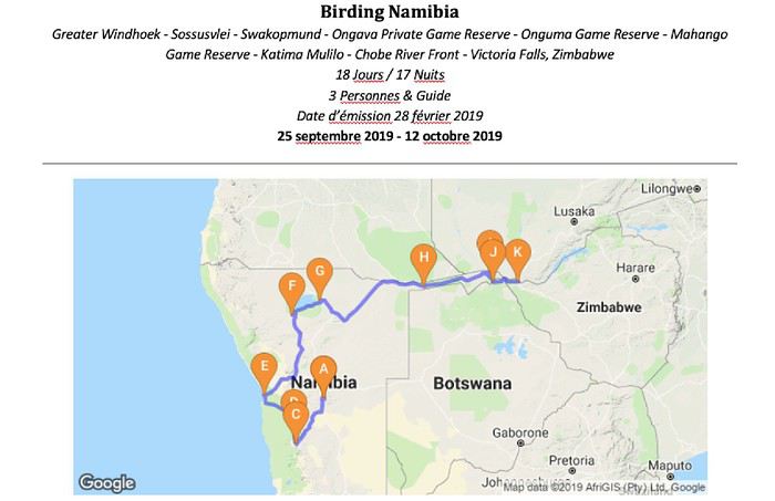
PS' : et pour ceux qui se demandent "mais pourquoi tant d'ailes", j'ai essayé de répondre à la question finalo-fondamentale "Et les piafous dans tout ça ?" dans une page de safari-tanzanie.net "Photographier des oiseaux en safari ... Pourquoi ? Où ? Lesquels ? Comment ?"
PS '' : et enfin d'enfin, l'index des espèces namibiennes (et assimilées) photographiées
Je n'avais pas encore partagé sur Voyage Forum un de nos safaris à orientation piafoulogique. (Piafoulogique, car beaucoup de nos safaris, comme beaucoup dans nos safaris, sont orientés vers la gent ailée, même si perso myself pour ma part je ne crache pas sur un lycaon ou un guépard ou...)
C'est donc avec un plaisir que j'espère vous faire partager que je vais vous montrer quelques-unes des photos d'oiseaux que nous avons faites en Namibie, ma blonde et moi. J'ai adopté une présentation par ordre alphabétique, une sorte de catalogue succinct des emplumés namibiens. Succinct car nous n'avons de photos (montrables ou à peu près) que de 139 espèces namibiennes (plus 24 au Botswana et Zimbabwe), même pas le quart de l'avifaune namibienne (687 espèces d'après Avibase). Et aussi 34 espèces de mammifères, dont il ne sera pas question ici (à 4 ou 5 photos près dans le pavé ci-dessous).
Amitiés à tous et bises aux autres
BL
PS : pour ceux qui seraient intéressés par des détails sur notre voyage, je les renvoie à notre carnet de voyage sur Wilipi. Nous avons voyagé "pépère" avec un guide-chauffeur (l'excellent Olivier), avec un circuit organisé (par Namvic) qui nous a conduits de Windhoek à Victoria Falls.
PS' : et pour ceux qui se demandent "mais pourquoi tant d'ailes", j'ai essayé de répondre à la question finalo-fondamentale "Et les piafous dans tout ça ?" dans une page de safari-tanzanie.net "Photographier des oiseaux en safari ... Pourquoi ? Où ? Lesquels ? Comment ?"
PS '' : et enfin d'enfin, l'index des espèces namibiennes (et assimilées) photographiées
Trek du Mardi Himal en partant de Pokhara ou de Kande (Népal) English translation pending
bonsoir ,
je souhaiterais des renseignements sur le trek " mardi Himal " en partant de pokhara ou de Kande , pour une période de 5 jours environ , ce debut avril .
nous voudrions savoir si les nuits sont froides et quel genre de duvet nous devons prévoir ?, s' il faut reserver les lodges , ou si nous pouvons nous rentre directement dans les camps , sans avoir reserver , ? auriez vous un itinéraire en partant de kaskikot et retour à kaskikot ? la difficulté du trek ? que faut il prévoir dans notre sac à dos? généralement je suis bien organisée mais là je peine un peu , ne voulant pas passer par une agence . un guide est il nécessaire ?
nous sommes intéressés par toutes sortes de suggestions .
cordialement
Randonnées le long de la Costa Blanca English translation pending
Région montagneuse au bord de la Méditerranée, la Costa Blanca (Côte Blanche) est propice aux randonnées en novembre alors que la chaleur de l'été s'estompe.
La proximité des stations balnéaires permet de combiner les différents éléments et de bénéficier des infrastructures de logement et de transport.
Je reviens d'un séjour effectué du 11 au 21 novembre 2019 à Benidorm avec un rayonnement vers les massifs alentours.
Le trajet en voiture de Nancy à Charleroi débute dans la fraîcheur automnale et se termine sous une pluie battante.
Le vol s'effectue sans problème et 2 heures plus tard je débarque à Alicante.
Un dernier trajet en bus ALSA et j'arrive à Benidorm où Vukica m'accueille dans l'appartement que je lui ai loué pour 10 nuits.
Je tombe en plein dans les fêtes de novembre qui pendant 5 jours répandent la liesse dans les rues et les plages de Benidorm.
De ma fenêtre haut placée, j'assiste au spectacle illuminé et sonorisé.
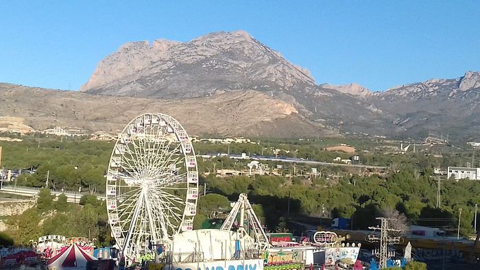
Je profite du mardi, jour férié, pour effectuer une randonnée urbaine. La ville émerge progressivement de la fiesta passée et reprend vie sous le soleil qui ne tarde pas à s'imposer. Je déambule entre les tours qui semblent être la spécialité locale.
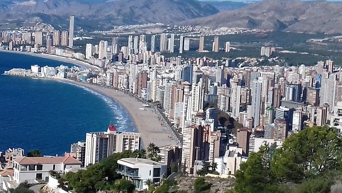
Les architectes ont fait un effort pour rendre ce paysage urbain agréable à regarder.
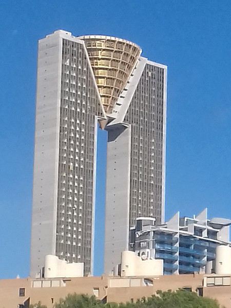
Cette tour en pierre renvoie au passé.
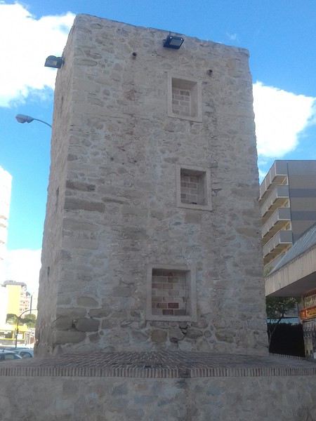
Benidorm sera mon point de chute pour la durée du séjour. Grâce aux transports publics, bus et ferrocarril, je peux me déplacer le long de la côte et à l'intérieur des terres. Dés que je quitte les urbanisations côtières, je suis confronté aux paysages majestueux des sierras hérissées de pics et aux flancs vertigineux. Ceci offre un contraste bien agréable et un encouragement à découvrir cette région surtout connue pour ses activités balnéaires.
Mercredi 13 novembre 2019 La Sierra Cortina Pour ma première sortie, le massif que j'aperçois de mon logement me semble constituer une destination toute indiquée. La Sierra Cortina n'est pas une montagne particulièrement élevée, mais elle est située près de la côte et offre une belle promenade le long de sa large crête.
Mon immeuble étant situé à la périphérie de l'agglomération, je me retrouve rapidement à naviguer entre les propriétés avant de franchir des ronds-points qui constituent l'ultime obstacle avant l'arrière-pays préservé de l'urbanisation. en quelques dizaines de minutes je suis entré dans un autre monde, celui de la campagne paisible. Après avoir contourné le massif j'emprunte un sentier qui grimpe vers la crète.
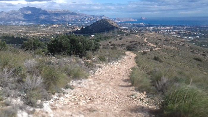
Arrivé au sommet je découvre un paysage qui pointe dans toutes les directions. Au nord, la ville de Calpe et son fameux rocher
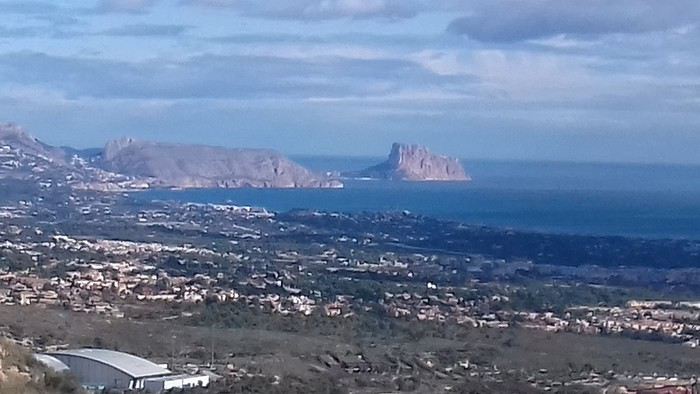
Au sud la côte jusqu'à Alicante A l'ouest le Puig Campana culminant à 1408 mètres.
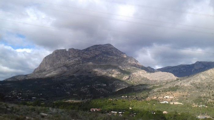
A l'est la Sierra Helada, la ville de Benidorm et sa forêt de gratte-ciel. Le ciel variable m'incite à progresser le long de la Serra Cortina au gré des montées et descentes qui se succèdent. Une croix ornée de drapeaux marque la descente et c'est un sentier caillouteux bien raide qui de conduit au pied du massif.
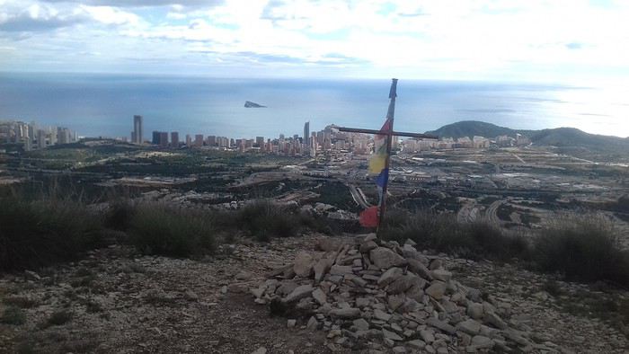
Je rejoins le littoral pour boucler mon circuit les pieds caressés par les vagues d'une mer encore tiède.
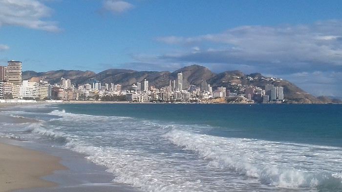
Jeudi 14 novembre 2019 La Serra d'Olta Une trace trouvée sur Visorando inspire ma randonnée du jour. À 30 mn de tram, à Calpe, le massif de la Serra d'Olta permet un magnifique panorama à 360° sur la région. Dés la sortie de la gare je prend la route qui me conduit en 2 kilomètres au départ du circuit au parking de la "Zona Acampada" de Ermita Vella
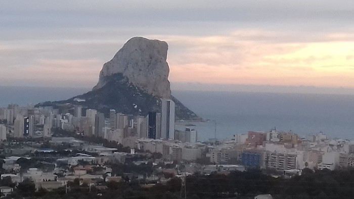
Tout le parcours est balisé Blanc et Jaune.
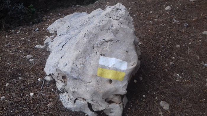
J'emprunte un large chemin jusqu'à l'ermitage Ermita Vella, endroit propice au pique nique mais ce n'est pas encore l'heure.
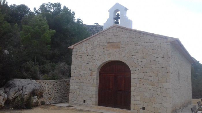
300 m plus loin le parcours suit un petit sentier qui grimpe sérieusement au milieu d'un vallon escarpé. C'est ici la difficulté de ce circuit sur 150m de dénivelé. En progressant sur le sentier, qui devient plus aisé, rejoindre le carrefour des sentiers sur le plateau.
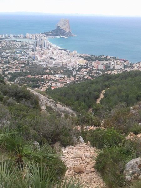
Arrivée au point culminant du plateau, domaine des chèvres sauvages.
Je couvre la côte du regard jusqu'à Benidorm.
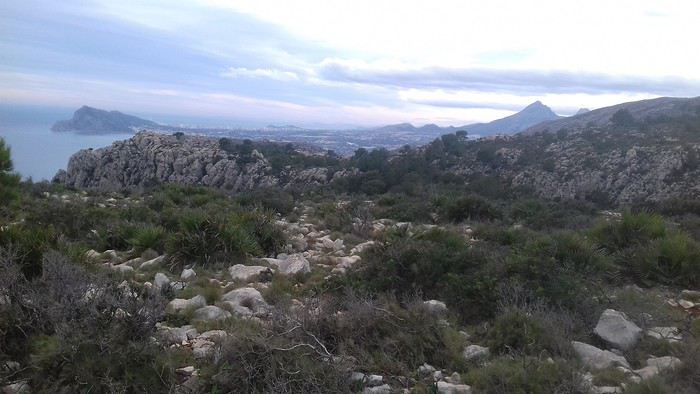
Les nuages d'encre qui encombrent le ciel m'incitent à redescendre sur l'autre versant en passant devant une bergerie en ruine. Je passe devant le Pou de Mola croisant au passage un groupe de jeunes filles. Après une longue descente à l'abri du sous-bois, je rejoins le large chemin périphérique.
Le circuit continue en contournant le massif et ses impressionnantes falaises.
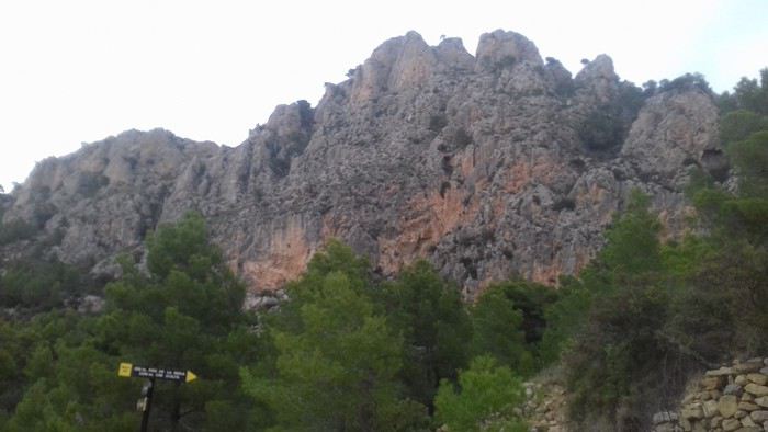
Arrivé au Pas de Canal (402m), le sentier descend en pente raide puis débouche sur le chemin principal.
En quelques minutes, j'ai bouclé la boucle et je peux rejoindre la gare du ferrocarril de la généralité de Valence non sans admirer le rocher d'Ifach que j'espère bien gravir.
La suite de mon séjour sur la Costa Blanca dans un prochain message.
Je profite du mardi, jour férié, pour effectuer une randonnée urbaine. La ville émerge progressivement de la fiesta passée et reprend vie sous le soleil qui ne tarde pas à s'imposer. Je déambule entre les tours qui semblent être la spécialité locale.
Les architectes ont fait un effort pour rendre ce paysage urbain agréable à regarder.
Cette tour en pierre renvoie au passé.
Benidorm sera mon point de chute pour la durée du séjour. Grâce aux transports publics, bus et ferrocarril, je peux me déplacer le long de la côte et à l'intérieur des terres. Dés que je quitte les urbanisations côtières, je suis confronté aux paysages majestueux des sierras hérissées de pics et aux flancs vertigineux. Ceci offre un contraste bien agréable et un encouragement à découvrir cette région surtout connue pour ses activités balnéaires.
Mercredi 13 novembre 2019 La Sierra Cortina Pour ma première sortie, le massif que j'aperçois de mon logement me semble constituer une destination toute indiquée. La Sierra Cortina n'est pas une montagne particulièrement élevée, mais elle est située près de la côte et offre une belle promenade le long de sa large crête.
Mon immeuble étant situé à la périphérie de l'agglomération, je me retrouve rapidement à naviguer entre les propriétés avant de franchir des ronds-points qui constituent l'ultime obstacle avant l'arrière-pays préservé de l'urbanisation. en quelques dizaines de minutes je suis entré dans un autre monde, celui de la campagne paisible. Après avoir contourné le massif j'emprunte un sentier qui grimpe vers la crète.
Arrivé au sommet je découvre un paysage qui pointe dans toutes les directions. Au nord, la ville de Calpe et son fameux rocher
Au sud la côte jusqu'à Alicante A l'ouest le Puig Campana culminant à 1408 mètres.
A l'est la Sierra Helada, la ville de Benidorm et sa forêt de gratte-ciel. Le ciel variable m'incite à progresser le long de la Serra Cortina au gré des montées et descentes qui se succèdent. Une croix ornée de drapeaux marque la descente et c'est un sentier caillouteux bien raide qui de conduit au pied du massif.
Je rejoins le littoral pour boucler mon circuit les pieds caressés par les vagues d'une mer encore tiède.
Jeudi 14 novembre 2019 La Serra d'Olta Une trace trouvée sur Visorando inspire ma randonnée du jour. À 30 mn de tram, à Calpe, le massif de la Serra d'Olta permet un magnifique panorama à 360° sur la région. Dés la sortie de la gare je prend la route qui me conduit en 2 kilomètres au départ du circuit au parking de la "Zona Acampada" de Ermita Vella
Tout le parcours est balisé Blanc et Jaune.
J'emprunte un large chemin jusqu'à l'ermitage Ermita Vella, endroit propice au pique nique mais ce n'est pas encore l'heure.
300 m plus loin le parcours suit un petit sentier qui grimpe sérieusement au milieu d'un vallon escarpé. C'est ici la difficulté de ce circuit sur 150m de dénivelé. En progressant sur le sentier, qui devient plus aisé, rejoindre le carrefour des sentiers sur le plateau.
Arrivée au point culminant du plateau, domaine des chèvres sauvages.
Je couvre la côte du regard jusqu'à Benidorm.
Les nuages d'encre qui encombrent le ciel m'incitent à redescendre sur l'autre versant en passant devant une bergerie en ruine. Je passe devant le Pou de Mola croisant au passage un groupe de jeunes filles. Après une longue descente à l'abri du sous-bois, je rejoins le large chemin périphérique.
Le circuit continue en contournant le massif et ses impressionnantes falaises.
Arrivé au Pas de Canal (402m), le sentier descend en pente raide puis débouche sur le chemin principal.
En quelques minutes, j'ai bouclé la boucle et je peux rejoindre la gare du ferrocarril de la généralité de Valence non sans admirer le rocher d'Ifach que j'espère bien gravir.
La suite de mon séjour sur la Costa Blanca dans un prochain message.
Périple en Asie du Sud-est English translation pending
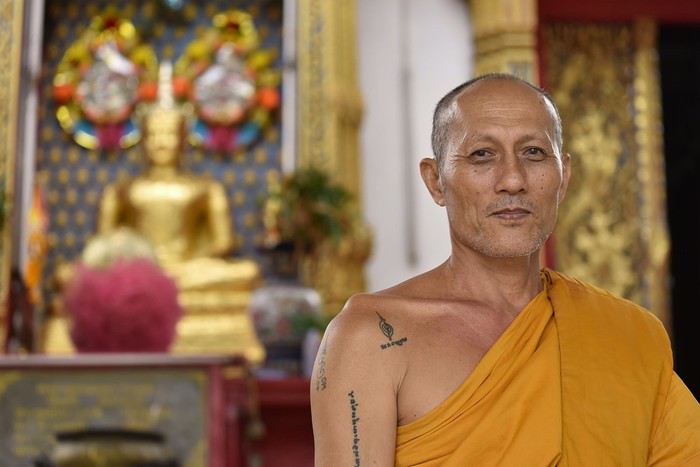
Bonjour à tous,
J'avoue avoir pas mal tergiversé avant de me décider à publier ce carnet. Car l'Asie du Sud-Est, à commencer par la Thaïlande, est une zone sur laquelle beaucoup de carnets ont déjà été publiés, notamment par des voyageurs qui sont devenus de vrais spécialistes du secteur.
Et puis finalement, ce voyage en famille fut un tel régal qu'il me semble normal de faire un retour sur VF. J'y prends régulièrement des infos pour préparer mes voyages (merci notamment à Anne alias Xeta pour son carnet et ses infos pratiques), alors ce carnet sera un juste retour des choses.
Tout aurait dû bien commencer pour ce voyage car, contrairement à nos avions pour l'Indonésie en 2015 et pour le Nicaragua en 2017, qui avaient tous les deux été annulés au dernier moment alors que nous étions quelques centaines à poireauter en salle d'embarquement, notre avion pour Bangkok a bien décollé, lui, en temps et en heure. Mais sans nous quand même !
En effet, quelques jours plus tôt, le brevet des collèges que passait notre fils aîné avait été décalé de quelques jours par le ministre pour cause de... canicule ! Les école maternelles n'ont pas été fermées mais les collèges qui accueillaient le brevet, si ! Allez comprendre. Toujours est-il que notre avion s'est trouvé à décoller quelques minutes seulement après la fin de la dernière épreuve du brevet, nous étions donc un poil trop courts pour l'attraper. Nous avons ainsi dû décaler notre vol de 24 heures. Nous attendons d'ailleurs toujours le remboursement partiel auquel nous avons droit mais peu importe, c'est une autre histoire...
Si je cite cette anecdote qui n'a apparemment rien à voir avec la Thaïlande, c'est parce qu'une fois arrivés à Bangkok, le monsieur à l'accueil de notre hôtel nous annonce qu'il a annulé par erreur les 3 nuitées que nous y avions réservées. J'avais pourtant envoyé 2 mails de confirmation de notre réservation en précisant que nous manquerions juste la première nuit et j'avais reçu une réponse positive, mais il a fait la boulette quand même ! Bref, après le coup de l'avion, quand ça veut pas, ben ça veut pas 🤪
Nous prenons donc la nouvelle avec le sourire (quoi de plus normal dans ce pays !), alors que notre interlocuteur de l'hôtel, lui, n'esquisse pas le moindre rictus. Il paraît que quand on va au pays du sourire, il y en a toujours un qui fait exception à la règle. Pour nous, ce sera donc celui-là ! Mais ce n'est pas bien grave, tous les autres rattraperont le coup après lui, au fil de notre séjour...
Enfin bon, après une demi-journée perdue bêtement pour chercher un autre hôtel, puis pour le rejoindre au milieu de l'intense circulation de Bangkok, notre voyage peut enfin commencer. Sauf que c'est l'heure de manger puis de se coucher. Le voyage commencera donc enfin demain.
BANGKOK
Selon le dernier classement des villes les plus visitées du monde, Bangkok se situe à... la première place ! Devant Londres (2e) et Paris (3e), excusez du peu. Et si certains quartiers ne sont pas spécialement sexy, certains sites en revanche constituent de pures merveilles et justifient un tel classement.
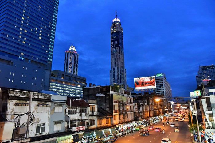
Après tous les problèmes que nous avons rencontrés d'emblée dans ce voyage, il ne nous reste plus qu'un jour pour visiter Bangkok, au lieu de deux et demi comme initialement prévu, sachant que nous y reviendrons une demi-journée au milieu du séjour.
Nous allons donc manquer de temps pour visiter la ville mais bon il faut faire avec et nous allons essayer de voir le maximum de choses pour cette première journée que nous n'avons pas volée !
Nous commençons donc par traverser, rapidement hélas, le marché aux fleurs.
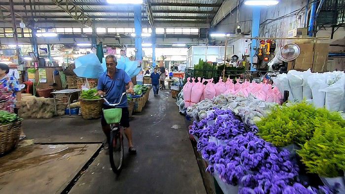
Il paraît qu'il est ouvert 24 heures sur 24. En tout cas lors de notre venue, il n'y a pas foule mais l'endroit, où il y a également pas mal de fruits et légumes, est vraiment agréable.
Nous enchaînons par l'un des fameux temples de Bangkok : le Wat Pho.
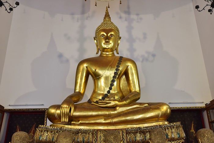
Son architecture nous dépayse totalement et je dois dire qu'avec le stress énorme que nous a causé pendant une semaine le report de notre départ, ce lieu sacré nous fait un bien fou. C'est pour vivre ce genre de moments que nous aimons tant voyager.
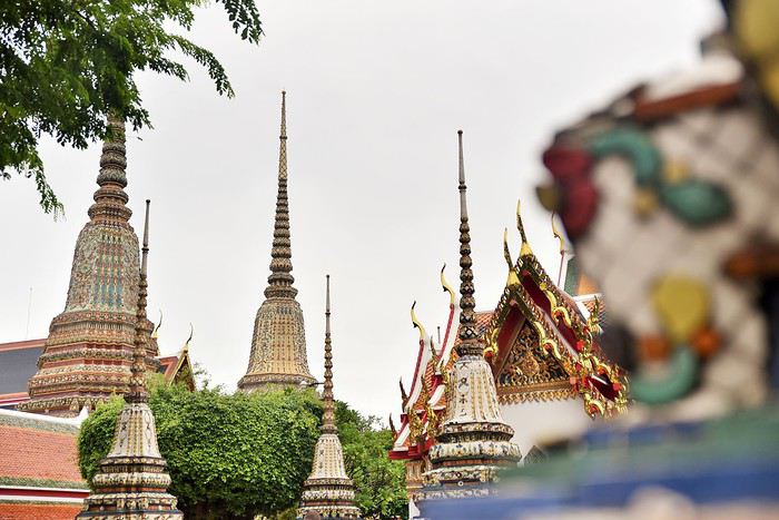
Alors bien sûr, le temps n'est pas très beau (pas étonnant, on est en juillet mais ça au moins, c'était prévu), contrairement au site !
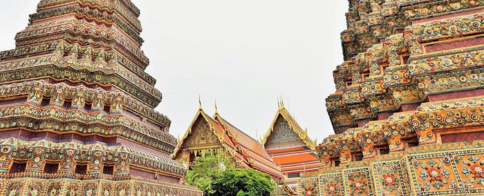
Là, ça y est, notre voyage est enfin bel et bien lancé.
A l'intérieur de ces bâtiments multicolores, les bouddhas sont omniprésents et rivalisent de sérénité.
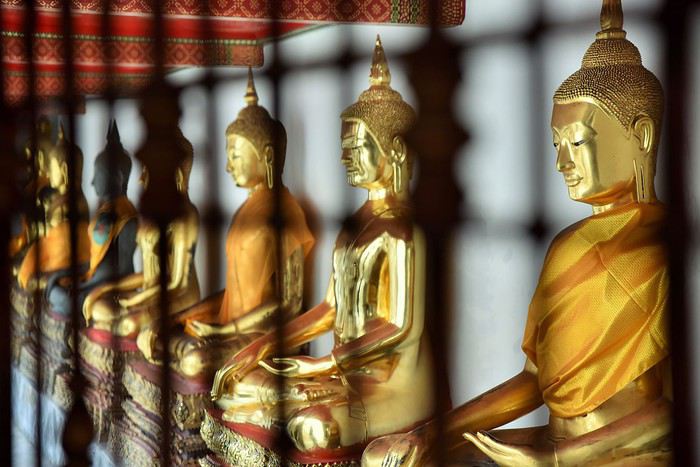
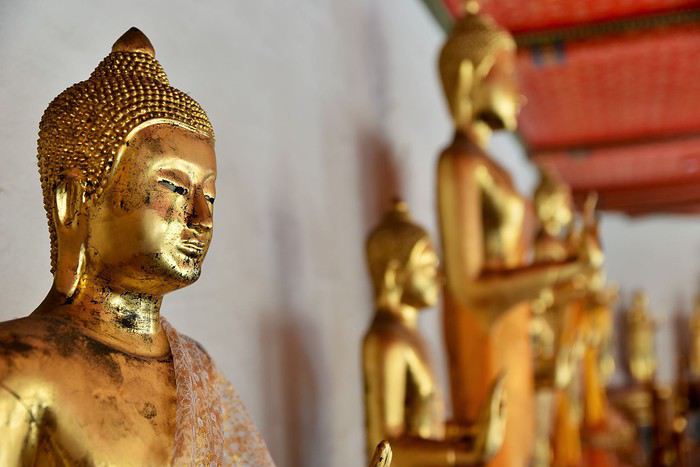
Le plus grand et le plus impressionnant d'entre eux, c'est Bouddha couché, représenté sur son lit de mort juste avant d'atteindre le Parinirvāṇa (la fin de l'existence physique pour qui a atteint l'éveil).
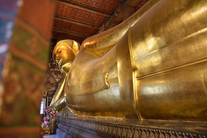
Ce magnifique bouddha est entièrement recouvert de feuilles d'or. Il nous impressionne.
La salle qui l'accueille, bien que très grande, semble trop exiguë pour cette statue qui en impose : 46 mètres de long sur 15 de haut.
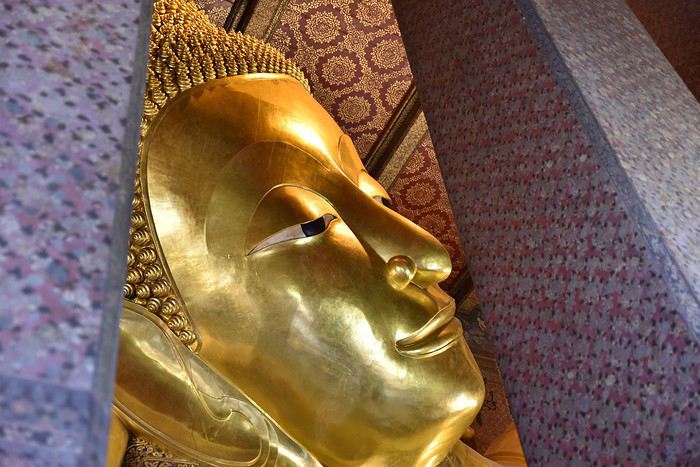
Et que dire de ses pieds, qui sont au moins aussi beaux que tout le reste : incrustés de nacre, ils représentent les 108 actions qui ont permis à Bouddha d'atteindre la perfection.
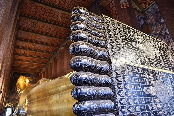
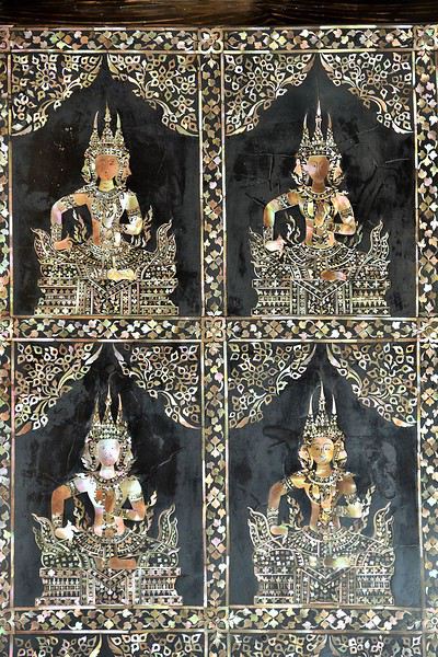
Ci-dessus : la plante du pied de Bouddha
Un peu plus loin se trouve le sanctuaire principal : l'Ubosot. A l'intérieur, on retrouve Bouddha, mais assis cette fois. C'est en dessous de cette statue toute en or et en cristal que sont conservées les cendres du célèbre roi Rama Ier (1737-1809).
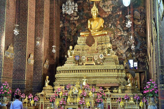
A noter enfin que dans l'enceinte du Wat Pho, on trouve également une école de médecine et de massages traditionnels, qui fut créée pour assurer la transmission des savoirs ancestraux.
Aujourd'hui, elle assure la formation des étudiants venus du monde entier. Les visiteurs peuvent d'ailleurs se faire masser dans les règles de l'art, même si l'attente peut parfois être un peu longue...
Bon, finalement, il commence bien ce voyage en Thaïlande. Nous enchaînons avec un autre temple, le Wat Arun.
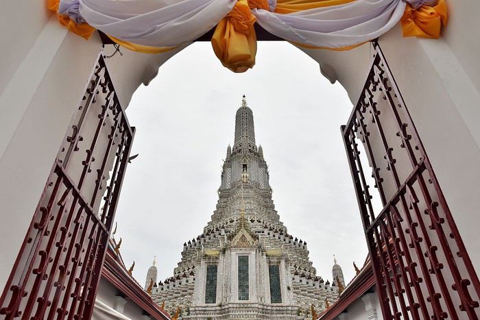
Contrairement au Wat Pho qui est très coloré, la Wat Arun apparaît plutôt blanc de loin. Mais de près, on constate que c'est une infinité de petites mosaïques colorées qui constituent ce gigantesque ensemble.
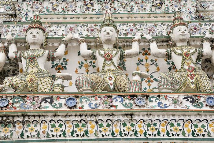
Une partie seulement des escaliers du prang central (72 mètres de haut) est ouverte au public, ce qui est suffisant pour avoir une jolie vue sur Bangkok quand le temps s'y prête... ce qui n'était pas le cas le jour de notre visite !
Si les deux temples que nous avons visités nous ont impressionnés, que dire de celui que nous allons voir dans la foulée : le Wat Phra Kaeo. Mais je posterai la suite dans un prochain message, ayant déjà presque atteint mon quota de photos...
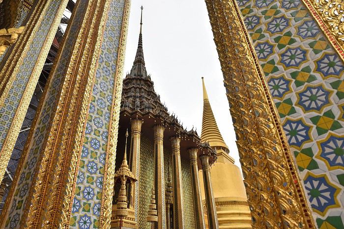
Un mois dingue en Bolivie et au Pérou English translation pending
Voici le récit de notre extra voyage d’1 mois en Bolivie- Perou sac à dos, mon pote Christian et moi, Patrick (chacun 58 ans)
Tout d’abord le circuit fait en juillet 2017- oui je sais j’ai mis du temps à cette mise en ligne mais depuis j’ai été au Myanmar, Canada, Oman, Vietnam. Et maintenant que notre futur trip en Namibie l’été prochain est booké, je me lance dans ce retour arrière de 2 ans. Après énormément de recherches sur de nombreux blogs perso, carnets de voyages et forum de voyages, on a finalisé notre circuit :
J1 : départ de Bruxelles J2 :arrivée La Paz- transfert le soir sur Uyuni J3 :Uyuni-Tupiza J4 :Tupiza J5 :Tupiza- sud Lipez J6 :sud Lipez J7 :sud Lipez J8 :sud Lipez- Uyuni-La Paz J9 :La Paz-Rurrenabaque J10 :Amazonie J11 :Amazonie J12 :Amazonie J13 :Amazonie J14 :Amazonie J15 :Amazonie-Rurrenabaque J16 :Rurrenabaque-La Paz- Copacabana J17 :Copacabana-isla del sol J18 :isla del sol-Puno J19 :Puno- Cusco J20 :Cusco J21 :Cusco-Ollantaytambo J22 :Ollantaytambo- Pisac J23 :Pisac- Cusco J24 :inca trail J25 :inca trail J26 :inca trail J27 :Machu picchu- Cusco J28:Cusco J29 :Cusco-La paz J30 :La Paz- départ J31 :arrivée
Tout d’abord le circuit fait en juillet 2017- oui je sais j’ai mis du temps à cette mise en ligne mais depuis j’ai été au Myanmar, Canada, Oman, Vietnam. Et maintenant que notre futur trip en Namibie l’été prochain est booké, je me lance dans ce retour arrière de 2 ans. Après énormément de recherches sur de nombreux blogs perso, carnets de voyages et forum de voyages, on a finalisé notre circuit :
J1 : départ de Bruxelles J2 :arrivée La Paz- transfert le soir sur Uyuni J3 :Uyuni-Tupiza J4 :Tupiza J5 :Tupiza- sud Lipez J6 :sud Lipez J7 :sud Lipez J8 :sud Lipez- Uyuni-La Paz J9 :La Paz-Rurrenabaque J10 :Amazonie J11 :Amazonie J12 :Amazonie J13 :Amazonie J14 :Amazonie J15 :Amazonie-Rurrenabaque J16 :Rurrenabaque-La Paz- Copacabana J17 :Copacabana-isla del sol J18 :isla del sol-Puno J19 :Puno- Cusco J20 :Cusco J21 :Cusco-Ollantaytambo J22 :Ollantaytambo- Pisac J23 :Pisac- Cusco J24 :inca trail J25 :inca trail J26 :inca trail J27 :Machu picchu- Cusco J28:Cusco J29 :Cusco-La paz J30 :La Paz- départ J31 :arrivée