Results for "Passau+et+vélo+|+9+>+196"
1346 results found.
Hôtel Casa del Mar English translation pending
Bonjour je pensais aller a Bayahibe a l'hotel sunscape casa del mar en décembre;qui connait cet hotel?les plages sont elles belles et calmes?(bruit des moteurs des bateaux pour l'ile de Saona?);enfin est il possible d'observer des poissons facilement au bors de la plage;Je vous remercie pour ces renseignements
Phil
Lombok, Indonesia: A Forgotten Paradise?
Lombok, Indonesia: A Forgotten Paradise?
We’ve just returned from 3 weeks (yes, only that!) in Lombok, an island next to Bali, just a few miles away. Since I found very little information before leaving—except about the Gili Islands and organized Rinjani treks—I’ve tried to gather some details that might be useful for a Voyage Forum member looking to explore the area. Nothing exhaustive, but maybe a few great tips.
For those considering a Lonely Planet *Bali & Lombok* guide, be aware that the prices are wrong (expect a 30% increase, especially due to rising fuel costs), much of the info is outdated (the latest edition must be at least 2 or 3 years old), and the real good deals aren’t included. In short, don’t bother weighing down your bag (we already had 17kg of luggage for two—we’re getting soft!). A good map will be far more useful.
Climate: We went in late August to mid-September, so the weather was ideal in this region (best from June to September). It was pleasant, not too hot, with a light breeze keeping the Bintang cold in the evening—pure bliss!
Getting There: The cheapest way is to fly to Kuala Lumpur (Malaysia Airlines), then switch airports (getting to the LCC terminal costs 1.5 ringgit by bus) and take an AirAsia flight to Bali (booked in advance online). Once in Bali, to reach Lombok: either another flight—around 30 €—on a small propeller plane (probably a Dutch legacy); or by boat, but since you have to get to Padangbai in eastern Bali to catch the ferry, you “lose” (a very relative term when traveling) a lot of time (at least 6 hours total) to save a few euros. Since we were already mid-afternoon and didn’t want to spend a night in Bali, we opted for the “tuk-tuk with propellers” 😉. It was the first time I was weighed with my bag before boarding a plane! I know I’ve put on weight lately, but still…
After arriving in the late afternoon in Mataram, Lombok, we decided to find a bed nearby. Headed to Senggigi, Lombok’s main beach resort. We ended up at the first guesthouse, “Lina Cottages,” for 75,000 IDR a night. Exhausted, we headed straight to dreamland. I woke up around midnight, thinking I heard Massimo!??!! I hadn’t even had too much Bintang—was the jet lag giving me hallucinations ? No, I really did hear Massimo belting out a song! After a few seconds of “lost in translation,” I realized the Marina, Senggigi’s trendy bar, had—like every night—a live band playing, and these guys were covering that French classic (sic) you’ve probably heard at least once. Coming all this way just to hear “Massiiiimooooo, Massiiimmoooo, Massiiimmooomooooo…” blasting in your ears like you’re at a campsite in Juan-les-Pins—enough to depress anyone! Anyway, we left ASAP. Just enough time to check out Senggigi: its 4 or 5 bars, 10 restaurants, 3 or 4 luxury hotels—still far from Kuta Bali, but not really our scene anyway. We quickly realized there’s very little organized transport (except for a few Perama bus routes, almost all passing through Senggigi) in Lombok. To avoid spending our 3 weeks in bemos, we quickly opted to rent a car (too old for a two-person motorbike, though we’d done it in Bali… Turns out we made the right call—the roads in Lombok are way too rough for bikes). Senggigi is one of the few places on the island where you can rent a car and withdraw cash. After some tough negotiation, I got a Suzuki Katana for 120,000 IDR/day (instead of the usual 200,000 IDR). I was a bit frustrated—thought it was expensive. A local on vacation in Lombok (he’s lived in Australia for years) later told me he couldn’t even get that rate, saying prices had jumped with the fuel hike (from 2,500 IDR/liter two years ago to 5,000 IDR now).
Anyway, we left Massimo to his interplanetary success and headed south. I was curious to see if we could stay on a small island off Lombok’s southwest peninsula. After 60km and 1.5 hours, we arrived in Taun, where we found a “captain” willing to take us to Gili Nanggu. There seemed to be a guesthouse on the island. After some *very* tough negotiation, we got a round-trip price of 150,000 IDR for two days later (a guide taking tourists to the island for the day later told me he pays 185,000 IDR for the same trip). The island is barely a few hundred meters across, and the only guesthouse, “Gili Nanggu Cottages” (165,000 IDR/night), offered us a charming bungalow in traditional Lombok style. No negotiating possible—we were stuck on the island anyway! By mid-afternoon, the day-trippers (often from Senggigi) left. There were about ten of us staying overnight. The sand was white, the water crystal-clear with fish, and the sunsets stunning… but the coral was pretty damaged.
Next, we headed south to Kuta Lombok. The most direct route via Sepi was marked as “small” on the map… mmm… The Lonely Planet—this was the *only* time it was “useful” (sic)—had a special warning saying many readers had been robbed in the area. Wanting to clear this up for my Voyage Forum friends, we took the plunge! The road was *completely* wrecked—potholes everywhere, and if you ignore the rain-carved ravines, it was like a pothole per square meter! I was searching for tarmac to park my wheels! After 80km and 3 hours of bone-rattling driving, with stunning views of Lombok’s arid southern countryside and deserted turquoise bays, we arrived in Kuta Lombok. On the way, instead of robbers and thieves, we only met schoolchildren with big smiles shouting cheerful “hellloooo’s.” We didn’t see a single other car the whole trip.
Kuta is nothing like its Balinese namesake. It stretches just a few hundred meters along a beautiful round-sand bay (yes, round—it rolls under your feet). About ten deserted restaurants and just as many guesthouses (5% occupancy, I was told—we only saw about ten Westerners in 3 days). No guesthouses face the beach; they’re all on the other side of the road in an inner garden. A bit of a shame. Still, the bay is gorgeous, and a few fishing families live in very basic huts on the beach. We decided to check out the Novotel to get a feel for the area. The lush vegetation contrasted with the surrounding aridity, two pools… all that fresh water being used, plus the Accor flag, made me want to head back to the fishermen’s huts. Finally, we found a guesthouse on the beach at the eastern end of Kuta Bay, just before the Novotel: “Lombok Baru.” It’s the only one on the beach. The bungalow was spotless, right by the sea, for 105,000 IDR/night. The Chinese-Indonesian family running the place told me they’d only been open for 3 years and were growing slowly as they saved up. A new bungalow was under construction, and the “garden” was still a work in progress.
The Tanjung Aan bay, a few kilometers east of Kuta, is stunning—huge, white sand, and almost no one except a few persistent sarong sellers. The bay is definitely worth a visit (if not a sunburn). A toothless old man even tried to sell us a coconut, improvising a song (after my girlfriend started singing to ignore them 😉). With his three words of broken English, he sang: “Coconut mist’errrr… mister coconuttttee… If no coconut, no monyyyy… Coconut mister…” for at least 10 minutes! A rare moment, a beautiful encounter. The song stuck with us for the rest of the trip—even now, I hum it to avoid getting too depressed about being back home. One evening, a Balinese waiter who’d been living in Lombok for 7 years gave us lots of info about the area, the culture, and the people. He talked about the security issues in Kuta—yes, there are frequent thefts (money, cars, etc.). For him, it’s due to the lack of education among many locals, who don’t see beyond their immediate needs and risk scaring tourists away (which is why Kuta is so deserted). After a few days there, you do get the sense that you shouldn’t tempt fate by flashing money or jewelry amid such poverty in southern Lombok. But calling it a “dangerous area” is a stretch! That won’t stop me from going back, though!
Next, we headed east—northeast, actually. I was curious about the small islands on my map, and I hadn’t found *anyone* who’d been there to give me tips. So we drove to Labu Pandan (115km, 3 hours—I may have pushed the Katana a bit…). What looked like a small village was actually just a guesthouse and a few fishing boats on the beach. The “Pondok Gili Lampu” guesthouse also sold basic supplies to locals and had a simple restaurant with 5 or 6 basic bungalows (60,000 IDR/night) and a beautiful deserted black-sand beach. They offered snorkeling trips to Gili Lampu and camping there (organized by the guesthouse), but there were no facilities or water on the island. The strong wind made us decide to stay on the beach—poor visibility for snorkeling and sand in the sleeping bags didn’t sound appealing… The owner, Yanto, didn’t speak a word of English but was absolutely lovely. Another heartwarming encounter that did us so much good. Life was sweet, and we let ourselves drift to the rhythm of faraway relaxation.
Then we headed to Sembalun Lawang, the least crowded starting point for the Rinjani trek (most people start from Senaru). The southern route was fine—we crossed a 1,700m pass. The only person we met was an ice cream vendor on a motorbike overtaking us on the climb—he must’ve been in a hurry, which is ironic for an ice cream seller! After 65km and 1h15 of winding roads, we arrived in Sembalun Lawang and parked our trusty Katana at “Sembalun Nauli,” which had 4 standalone bungalows (90,000 IDR/night) in the middle of nowhere. There was nothing around—just the Rinjani looming ahead, our goal for the next 3 days. The guesthouse arranged our gear (sleeping bags, tent), hired two porters, and bought food. I got a price of 1,400,000 IDR for 2 people for 3 days. I think you could get it down to 1,000,000 or 1,200,000 if you did it yourself, but we hadn’t seen a single person in SL (not a restaurant in sight—even the Rinjani Trekking Center was closed, the guy was supposedly napping…). I didn’t feel like stressing over it. It was a far cry from the 170 USD/person quoted in Senggigi!
The 3-Day Rinjani Trek was a unique experience—not just for the scenery but also for the (relative) “sharing” with the porters: Mister Adi (who spoke a little English) and Mister An (who only spoke Sasak and Indonesian). On the first day, we went from Sembalun to base camp: 1,700m elevation gain under the sun, 6 solid hours of hiking (not counting breaks). My shared backpack, weighing around 10kg, felt heavy on the climb. We took breaks to drink, while our porters smoked!! I don’t know how they did it! The next day, we left at 2:30 AM to reach the summit (1,500m elevation gain) by 6 AM for sunrise. The last 300 meters were brutal—a 35/40° slope, straight up in sand and small stones. Those who say you move a meter forward and slide 50cm back haven’t seen the slope! It’s more like 20cm forward and sometimes 20cm back… tough stuff. But we made it to the summit (3,726m)—not everyone does. A word to the wise: you’d better be in good shape and, above all, have the right mindset! More beautiful than the sunrise was the moonrise—almost full and reddish—around 4 AM. It was stunning! As for vertigo, sure, you’re walking along a ridge, but even for someone like me who’s not a fan of heights, it was fine. Back at base camp, Mister An had made delicious banana pancakes—a local ritual, apparently, and a treat for us! Then we descended to Segara Anak Lake in the crater. It was steep, and with our legs like telephone poles, it wasn’t easy: “Adeng adeng, Mister An!!!” We enjoyed the hot springs (40°C!) and I even swam in the lake itself—the water must’ve been around 20°C, incredibly pure. I was alone facing Gunung Baru, the active volcanic cone: unforgettable! On the third day, we climbed back out of the crater, then descended 2,000m to Senaru, where ojek (motorcycle taxis) were waiting to take us back to Sembalun to retrieve our car, still parked at Sembalun Nauli. Then we drove to Senggigi (2 hours, flat out), where this time we stayed at Dharmarie (150,000 IDR instead of 300,000 IDR)—spotless room, nice bathroom, much quieter than Lina! We returned our Suzuki Katana 3 days late (I thought they’d have a heart attack—they’d been looking for us everywhere, even going to Kuta!). Anyway, I paid for 2 extra days out of the 3, and we headed to catch the Perama boat directly to Gili Air from Senggigi (70,000 IDR/person).
We chose Gili Air based on the posts I’d read on Voyage Forum (thanks 😉). Somehow, we ended up with a French friend at Hotel Gili Air (yes, I know—after our Rinjani adventure, we treated ourselves…) on the north side of the island, where we negotiated the room down to 225,000 IDR/night from the listed 38 USD. The included breakfast was huge, and the seawater pool was a nice touch (if not the hotel staff…). The island was pretty nice—white sand, pretty fish, turtles—but the coral was damaged in many places. Hammock, snorkeling, grilled fish, and Bintang—a simple pleasure
After 3 days, the travel bug bit us again. We wanted to reach Komodo by boat. Two agencies offered 4-day one-way trips to Flores: Perama (1,400,000 IDR/person for deck sleeping) and another (name forgotten) for 850,000 IDR. Couldn’t negotiate with Perama—the next departure was in 5 days (every 6 days, I think). We went with the other one. Everything seemed fine (the boat actually left from Labuhan Lombok, east of Lombok, which we reached by bus from Gili Air) until the agency told us there were only 2 flights a week from Labuan Bajo in Flores back to Bali, which would leave us stuck for 3 days in Flores and make us miss our return flight to Kuala Lumpur. To top it off, the agency lady said we were only 6 people signed up, and the boat wouldn’t leave with fewer than 8… so it fell through. We decided to end our trip with a few days in Bali to see how the island had changed since our last visit in 2003.
I won’t go on about Bali—it’s much better known than Lombok—but here are 3 great spots: - Ubud: So much construction since 2003! You’d think you were in a French city center with all the shops! “Nick’s Pension,” near the top of Monkey Forest—take a small alley to the left as you go up, all the way to the end. A green paradise in the middle of rice fields, quiet, just 50m from Monkey Forest. Nice pool. 300,000 IDR/night, negotiated down to 150,000 IDR. - Amed: “Wa Wa We We II” (120,000 IDR/night)—gorgeous infinity pool, charming bungalows, “relax” vibe. - Jimbaran: “Villa Puri Royan” (from 120,000 IDR)—like a hacienda on 3 levels with a pool in the middle. Right next to the beach warungs. *The* good deal in Jimbaran.
When you go from Lombok to Bali, you notice a clear difference. First, in terms of development. In Lombok, cars are rare outside Mataram/Senggigi. Development is far behind Bali—probably what Bali was like 20 years ago! I heard that construction on an international airport in Praya, central Lombok, started on August 1, 2006… Even if it takes 5 or 10 years to build, maybe it’s time to go. Then there’s the “people” factor—culture or religion plays a role. It’s true that it’s less easy than in Bali (which is so unique…), and relationships can be tougher, even tense at times. Maybe it’s just less accessible for “whirlwind travelers” like us. The car also saved us from many hassles (negotiating bemos, ferry arrivals, etc.). Still, we had some amazing encounters and never felt unsafe. I imagine other experiences could be different, especially if you’re easily intimidated.
I hope you’ll find some useful info in this post. When you visit this part of the world, try to get off the beaten path of the Gili Islands or Senggigi. Lombok and its people are well worth a detour.
Selamat Jalan
We’ve just returned from 3 weeks (yes, only that!) in Lombok, an island next to Bali, just a few miles away. Since I found very little information before leaving—except about the Gili Islands and organized Rinjani treks—I’ve tried to gather some details that might be useful for a Voyage Forum member looking to explore the area. Nothing exhaustive, but maybe a few great tips.
For those considering a Lonely Planet *Bali & Lombok* guide, be aware that the prices are wrong (expect a 30% increase, especially due to rising fuel costs), much of the info is outdated (the latest edition must be at least 2 or 3 years old), and the real good deals aren’t included. In short, don’t bother weighing down your bag (we already had 17kg of luggage for two—we’re getting soft!). A good map will be far more useful.
Climate: We went in late August to mid-September, so the weather was ideal in this region (best from June to September). It was pleasant, not too hot, with a light breeze keeping the Bintang cold in the evening—pure bliss!
Getting There: The cheapest way is to fly to Kuala Lumpur (Malaysia Airlines), then switch airports (getting to the LCC terminal costs 1.5 ringgit by bus) and take an AirAsia flight to Bali (booked in advance online). Once in Bali, to reach Lombok: either another flight—around 30 €—on a small propeller plane (probably a Dutch legacy); or by boat, but since you have to get to Padangbai in eastern Bali to catch the ferry, you “lose” (a very relative term when traveling) a lot of time (at least 6 hours total) to save a few euros. Since we were already mid-afternoon and didn’t want to spend a night in Bali, we opted for the “tuk-tuk with propellers” 😉. It was the first time I was weighed with my bag before boarding a plane! I know I’ve put on weight lately, but still…
After arriving in the late afternoon in Mataram, Lombok, we decided to find a bed nearby. Headed to Senggigi, Lombok’s main beach resort. We ended up at the first guesthouse, “Lina Cottages,” for 75,000 IDR a night. Exhausted, we headed straight to dreamland. I woke up around midnight, thinking I heard Massimo!??!! I hadn’t even had too much Bintang—was the jet lag giving me hallucinations ? No, I really did hear Massimo belting out a song! After a few seconds of “lost in translation,” I realized the Marina, Senggigi’s trendy bar, had—like every night—a live band playing, and these guys were covering that French classic (sic) you’ve probably heard at least once. Coming all this way just to hear “Massiiiimooooo, Massiiimmoooo, Massiiimmooomooooo…” blasting in your ears like you’re at a campsite in Juan-les-Pins—enough to depress anyone! Anyway, we left ASAP. Just enough time to check out Senggigi: its 4 or 5 bars, 10 restaurants, 3 or 4 luxury hotels—still far from Kuta Bali, but not really our scene anyway. We quickly realized there’s very little organized transport (except for a few Perama bus routes, almost all passing through Senggigi) in Lombok. To avoid spending our 3 weeks in bemos, we quickly opted to rent a car (too old for a two-person motorbike, though we’d done it in Bali… Turns out we made the right call—the roads in Lombok are way too rough for bikes). Senggigi is one of the few places on the island where you can rent a car and withdraw cash. After some tough negotiation, I got a Suzuki Katana for 120,000 IDR/day (instead of the usual 200,000 IDR). I was a bit frustrated—thought it was expensive. A local on vacation in Lombok (he’s lived in Australia for years) later told me he couldn’t even get that rate, saying prices had jumped with the fuel hike (from 2,500 IDR/liter two years ago to 5,000 IDR now).
Anyway, we left Massimo to his interplanetary success and headed south. I was curious to see if we could stay on a small island off Lombok’s southwest peninsula. After 60km and 1.5 hours, we arrived in Taun, where we found a “captain” willing to take us to Gili Nanggu. There seemed to be a guesthouse on the island. After some *very* tough negotiation, we got a round-trip price of 150,000 IDR for two days later (a guide taking tourists to the island for the day later told me he pays 185,000 IDR for the same trip). The island is barely a few hundred meters across, and the only guesthouse, “Gili Nanggu Cottages” (165,000 IDR/night), offered us a charming bungalow in traditional Lombok style. No negotiating possible—we were stuck on the island anyway! By mid-afternoon, the day-trippers (often from Senggigi) left. There were about ten of us staying overnight. The sand was white, the water crystal-clear with fish, and the sunsets stunning… but the coral was pretty damaged.
Next, we headed south to Kuta Lombok. The most direct route via Sepi was marked as “small” on the map… mmm… The Lonely Planet—this was the *only* time it was “useful” (sic)—had a special warning saying many readers had been robbed in the area. Wanting to clear this up for my Voyage Forum friends, we took the plunge! The road was *completely* wrecked—potholes everywhere, and if you ignore the rain-carved ravines, it was like a pothole per square meter! I was searching for tarmac to park my wheels! After 80km and 3 hours of bone-rattling driving, with stunning views of Lombok’s arid southern countryside and deserted turquoise bays, we arrived in Kuta Lombok. On the way, instead of robbers and thieves, we only met schoolchildren with big smiles shouting cheerful “hellloooo’s.” We didn’t see a single other car the whole trip.
Kuta is nothing like its Balinese namesake. It stretches just a few hundred meters along a beautiful round-sand bay (yes, round—it rolls under your feet). About ten deserted restaurants and just as many guesthouses (5% occupancy, I was told—we only saw about ten Westerners in 3 days). No guesthouses face the beach; they’re all on the other side of the road in an inner garden. A bit of a shame. Still, the bay is gorgeous, and a few fishing families live in very basic huts on the beach. We decided to check out the Novotel to get a feel for the area. The lush vegetation contrasted with the surrounding aridity, two pools… all that fresh water being used, plus the Accor flag, made me want to head back to the fishermen’s huts. Finally, we found a guesthouse on the beach at the eastern end of Kuta Bay, just before the Novotel: “Lombok Baru.” It’s the only one on the beach. The bungalow was spotless, right by the sea, for 105,000 IDR/night. The Chinese-Indonesian family running the place told me they’d only been open for 3 years and were growing slowly as they saved up. A new bungalow was under construction, and the “garden” was still a work in progress.
The Tanjung Aan bay, a few kilometers east of Kuta, is stunning—huge, white sand, and almost no one except a few persistent sarong sellers. The bay is definitely worth a visit (if not a sunburn). A toothless old man even tried to sell us a coconut, improvising a song (after my girlfriend started singing to ignore them 😉). With his three words of broken English, he sang: “Coconut mist’errrr… mister coconuttttee… If no coconut, no monyyyy… Coconut mister…” for at least 10 minutes! A rare moment, a beautiful encounter. The song stuck with us for the rest of the trip—even now, I hum it to avoid getting too depressed about being back home. One evening, a Balinese waiter who’d been living in Lombok for 7 years gave us lots of info about the area, the culture, and the people. He talked about the security issues in Kuta—yes, there are frequent thefts (money, cars, etc.). For him, it’s due to the lack of education among many locals, who don’t see beyond their immediate needs and risk scaring tourists away (which is why Kuta is so deserted). After a few days there, you do get the sense that you shouldn’t tempt fate by flashing money or jewelry amid such poverty in southern Lombok. But calling it a “dangerous area” is a stretch! That won’t stop me from going back, though!
Next, we headed east—northeast, actually. I was curious about the small islands on my map, and I hadn’t found *anyone* who’d been there to give me tips. So we drove to Labu Pandan (115km, 3 hours—I may have pushed the Katana a bit…). What looked like a small village was actually just a guesthouse and a few fishing boats on the beach. The “Pondok Gili Lampu” guesthouse also sold basic supplies to locals and had a simple restaurant with 5 or 6 basic bungalows (60,000 IDR/night) and a beautiful deserted black-sand beach. They offered snorkeling trips to Gili Lampu and camping there (organized by the guesthouse), but there were no facilities or water on the island. The strong wind made us decide to stay on the beach—poor visibility for snorkeling and sand in the sleeping bags didn’t sound appealing… The owner, Yanto, didn’t speak a word of English but was absolutely lovely. Another heartwarming encounter that did us so much good. Life was sweet, and we let ourselves drift to the rhythm of faraway relaxation.
Then we headed to Sembalun Lawang, the least crowded starting point for the Rinjani trek (most people start from Senaru). The southern route was fine—we crossed a 1,700m pass. The only person we met was an ice cream vendor on a motorbike overtaking us on the climb—he must’ve been in a hurry, which is ironic for an ice cream seller! After 65km and 1h15 of winding roads, we arrived in Sembalun Lawang and parked our trusty Katana at “Sembalun Nauli,” which had 4 standalone bungalows (90,000 IDR/night) in the middle of nowhere. There was nothing around—just the Rinjani looming ahead, our goal for the next 3 days. The guesthouse arranged our gear (sleeping bags, tent), hired two porters, and bought food. I got a price of 1,400,000 IDR for 2 people for 3 days. I think you could get it down to 1,000,000 or 1,200,000 if you did it yourself, but we hadn’t seen a single person in SL (not a restaurant in sight—even the Rinjani Trekking Center was closed, the guy was supposedly napping…). I didn’t feel like stressing over it. It was a far cry from the 170 USD/person quoted in Senggigi!
The 3-Day Rinjani Trek was a unique experience—not just for the scenery but also for the (relative) “sharing” with the porters: Mister Adi (who spoke a little English) and Mister An (who only spoke Sasak and Indonesian). On the first day, we went from Sembalun to base camp: 1,700m elevation gain under the sun, 6 solid hours of hiking (not counting breaks). My shared backpack, weighing around 10kg, felt heavy on the climb. We took breaks to drink, while our porters smoked!! I don’t know how they did it! The next day, we left at 2:30 AM to reach the summit (1,500m elevation gain) by 6 AM for sunrise. The last 300 meters were brutal—a 35/40° slope, straight up in sand and small stones. Those who say you move a meter forward and slide 50cm back haven’t seen the slope! It’s more like 20cm forward and sometimes 20cm back… tough stuff. But we made it to the summit (3,726m)—not everyone does. A word to the wise: you’d better be in good shape and, above all, have the right mindset! More beautiful than the sunrise was the moonrise—almost full and reddish—around 4 AM. It was stunning! As for vertigo, sure, you’re walking along a ridge, but even for someone like me who’s not a fan of heights, it was fine. Back at base camp, Mister An had made delicious banana pancakes—a local ritual, apparently, and a treat for us! Then we descended to Segara Anak Lake in the crater. It was steep, and with our legs like telephone poles, it wasn’t easy: “Adeng adeng, Mister An!!!” We enjoyed the hot springs (40°C!) and I even swam in the lake itself—the water must’ve been around 20°C, incredibly pure. I was alone facing Gunung Baru, the active volcanic cone: unforgettable! On the third day, we climbed back out of the crater, then descended 2,000m to Senaru, where ojek (motorcycle taxis) were waiting to take us back to Sembalun to retrieve our car, still parked at Sembalun Nauli. Then we drove to Senggigi (2 hours, flat out), where this time we stayed at Dharmarie (150,000 IDR instead of 300,000 IDR)—spotless room, nice bathroom, much quieter than Lina! We returned our Suzuki Katana 3 days late (I thought they’d have a heart attack—they’d been looking for us everywhere, even going to Kuta!). Anyway, I paid for 2 extra days out of the 3, and we headed to catch the Perama boat directly to Gili Air from Senggigi (70,000 IDR/person).
We chose Gili Air based on the posts I’d read on Voyage Forum (thanks 😉). Somehow, we ended up with a French friend at Hotel Gili Air (yes, I know—after our Rinjani adventure, we treated ourselves…) on the north side of the island, where we negotiated the room down to 225,000 IDR/night from the listed 38 USD. The included breakfast was huge, and the seawater pool was a nice touch (if not the hotel staff…). The island was pretty nice—white sand, pretty fish, turtles—but the coral was damaged in many places. Hammock, snorkeling, grilled fish, and Bintang—a simple pleasure
After 3 days, the travel bug bit us again. We wanted to reach Komodo by boat. Two agencies offered 4-day one-way trips to Flores: Perama (1,400,000 IDR/person for deck sleeping) and another (name forgotten) for 850,000 IDR. Couldn’t negotiate with Perama—the next departure was in 5 days (every 6 days, I think). We went with the other one. Everything seemed fine (the boat actually left from Labuhan Lombok, east of Lombok, which we reached by bus from Gili Air) until the agency told us there were only 2 flights a week from Labuan Bajo in Flores back to Bali, which would leave us stuck for 3 days in Flores and make us miss our return flight to Kuala Lumpur. To top it off, the agency lady said we were only 6 people signed up, and the boat wouldn’t leave with fewer than 8… so it fell through. We decided to end our trip with a few days in Bali to see how the island had changed since our last visit in 2003.
I won’t go on about Bali—it’s much better known than Lombok—but here are 3 great spots: - Ubud: So much construction since 2003! You’d think you were in a French city center with all the shops! “Nick’s Pension,” near the top of Monkey Forest—take a small alley to the left as you go up, all the way to the end. A green paradise in the middle of rice fields, quiet, just 50m from Monkey Forest. Nice pool. 300,000 IDR/night, negotiated down to 150,000 IDR. - Amed: “Wa Wa We We II” (120,000 IDR/night)—gorgeous infinity pool, charming bungalows, “relax” vibe. - Jimbaran: “Villa Puri Royan” (from 120,000 IDR)—like a hacienda on 3 levels with a pool in the middle. Right next to the beach warungs. *The* good deal in Jimbaran.
When you go from Lombok to Bali, you notice a clear difference. First, in terms of development. In Lombok, cars are rare outside Mataram/Senggigi. Development is far behind Bali—probably what Bali was like 20 years ago! I heard that construction on an international airport in Praya, central Lombok, started on August 1, 2006… Even if it takes 5 or 10 years to build, maybe it’s time to go. Then there’s the “people” factor—culture or religion plays a role. It’s true that it’s less easy than in Bali (which is so unique…), and relationships can be tougher, even tense at times. Maybe it’s just less accessible for “whirlwind travelers” like us. The car also saved us from many hassles (negotiating bemos, ferry arrivals, etc.). Still, we had some amazing encounters and never felt unsafe. I imagine other experiences could be different, especially if you’re easily intimidated.
I hope you’ll find some useful info in this post. When you visit this part of the world, try to get off the beaten path of the Gili Islands or Senggigi. Lombok and its people are well worth a detour.
Selamat Jalan
Logement dans le quartier Moron ou Quilmes à Buenos Aires? English translation pending
bonjour à tous;
j'aimerais bien savoir le quel de ces 2 quartiers ou on peut trouver façilement un logement ( hostel, apart, hauberge de jeunes..)
et aussi si c'est des endroit sur et sans danger pour un european?
merçi davance
Quartier Kao San Road à Bangkok English translation pending
😉Bonsoir à tous, amis voyageurs!
C'est fini, grace à tous vos conseils, j' ai terminé mon programe et mon book de voyage pour découvrir la thailande, entre fin juin et mi juillet.
Tout d' abord, merci à tous! Cependant, car il y a un mais, j'avais prevu de loger 4 nuitzs à KAO SAN ROAD à BK et j' ai vu sur un post des avis qui m'ont fait un peu peur!!!
J' aimerais savoir ce que vous en penser.
Un maximum d' avis je suis preneur de tout, avec ou sans argments, ( avec c' est mieux).
Ca me permettra de me conforter ou non dans mon choix.
Merci beaucoup à tous et à toutes
C'est fini, grace à tous vos conseils, j' ai terminé mon programe et mon book de voyage pour découvrir la thailande, entre fin juin et mi juillet.
Tout d' abord, merci à tous! Cependant, car il y a un mais, j'avais prevu de loger 4 nuitzs à KAO SAN ROAD à BK et j' ai vu sur un post des avis qui m'ont fait un peu peur!!!
J' aimerais savoir ce que vous en penser.
Un maximum d' avis je suis preneur de tout, avec ou sans argments, ( avec c' est mieux).
Ca me permettra de me conforter ou non dans mon choix.
Merci beaucoup à tous et à toutes
Changement de mentalité thaïlandaise? English translation pending
Suite aux quelques propos que j'ai pu échanger avec Thuan sur un autre topic et ne voulant pas flooder indéfiniment le topic d'un autre membre, je crée ce sujet afin de poser une question sur la mentalité thailandaise !
Je me demandais simplement au vu de la fascination de la jeunesse thailandaise pour l'occident si les mentalités n'étaient pas en train de changer et si la jeunesse thai en voulant suivre un mode de vie et des preceptes occidentaux, ne perdraient pas certaines valeurs ou si au contraire la jeunesse thailandaise finalement évoluaient dans le bon sens en jumelant deux cultures différentes en y prenant le meilleur de chacune !
J'imagine que ce changement s'il y a, doit être beaucoup plus manifeste à Bangkok que dans le reste du pays !
Liaison maritime Tunisie-Egypte English translation pending
Quelqu'un suarait-il s'il existe une liaison maritime vers l'Egypte à partir de la Tunisie?
Autre question, passer de Tunisie vers l'Algérie à pied (bus, etc..) pour rejoindre Alger vous semble-t-il dangereux ?
Merci
Valmy
Merci
Valmy
Magic Bus ou seule en Nouvelle-Zélande English translation pending
Hello à tous,
Je devais partir avec 1 amie en NZ (1, 5 mois à partir de mi-mars), mais elle a du annuler. Du coup, j'hesite à voyager seule car j'ai peur de m'ennuyer (et puis je n'ai pas l'habitude). Alors, je me renseigne pour partir, pourquoi pas, avec Magic Bus.
Je recherche donc des personnes qui ont utiliser ce système pour me raconter leur expérience : comment ça se déroule, si c'etait bien, s'il faut impérativement etre bilingue (mon niveau d'anglais est déplorable)... etc. Bref, toutes les infos sont les bien venues !!
Quand aux voyageurs solitaires, je suis aussi preneuse de vos impressions (surtout la 1ere expérience), qui peut etre me convaincra de partir seule sur les routes.
Merci :-)
Je recherche donc des personnes qui ont utiliser ce système pour me raconter leur expérience : comment ça se déroule, si c'etait bien, s'il faut impérativement etre bilingue (mon niveau d'anglais est déplorable)... etc. Bref, toutes les infos sont les bien venues !!
Quand aux voyageurs solitaires, je suis aussi preneuse de vos impressions (surtout la 1ere expérience), qui peut etre me convaincra de partir seule sur les routes.
Merci :-)
Retour de la Jamaïque English translation pending
Allo moi je reviens de jamaique (le 14 jan), nous étions 4 amies de filles ensemble et wow je crois que cetait la meilleure chose qui ne pouvais pas nous arriver. Nous étions près de Montego Bay à l'hotel Starfish Trelawny puis franchement pour un 3 etoiles et demi cest tres surprenant, nous avons tres bien manger (surtout les bons fruits de mer Miinoummm) et l'eau la bas est correct nous avons eu la confirmation par la representente air canada donc pas de souci a boire leau... les gens qui travaille a ce resort savent comment taborder, cest cool de se sentir apprécier (ou en tk l'illusion hahhahha) mais bon, jai eu la piqure et je pense que ce netait pas la derniere fois que jallais en jamaique de ma vie.... cela fait partie dun futur projet!!! Bien sur si vous aller dans le bout, je vous conseil a 100% les chutes dunns river fall's a Ocho Rios qui est paradisiaque et tout un événement dans une vie et si vous pouver aller veiller à Margaritaville. Nous ne sommes pas aller a Margarita car 4 filles seules ensemble je ne voulais pas risquer de sortir du resort le soir... mais la prochaine fois que je remet les pieds en jamaique, je vais marranger pour aller faire un tour dans ce bar qui a lair tellement nice!!! A part de ca, je suis revenu avec une partie de leur mentalité: No problem Mon!!! Wowww pourquoi on pense pas de meme nous les québécois??? Cest dure de se rattacher a la realité apres une semaine de reve comme cela la! Jadore le reggea et bob marley, la bas jai été servi à souhait sun of god on a appris a danser avec des jamaicains oufff troo de magnifiques souvenirs!!! Bon alors cest ca, javais besoin de ventiler car ce voyage ma marquer!! Les mordus de jamaique, réécrivez moi et les autres aussi la hihihih😉
Pascale
Tourisme à Ayacucho au Pérou English translation pending
Bonjour !
Je dois rendre visite à un ami au Pérou à Ayacucho, mais je ne pourrai rester que deux semaines. Donc que me conseillez-vous de ne surtout pas louper dans les environs ?
Je dois rendre visite à un ami au Pérou à Ayacucho, mais je ne pourrai rester que deux semaines. Donc que me conseillez-vous de ne surtout pas louper dans les environs ?
Recherche vol Paris-Puerto Plata (République Dominicaine) English translation pending
je désirs me rendre en janvier 2006 a puerto plata République Dominicaine
en voyageur libre
j'avais prévu a playa del carmen au mexique mes mon hotel est fermé???
connaissez vous un vol si possible direct et quel compagnie
merci du renseignemnt
bonne vacance a ceux qui partent
Royal Decameron au Panama English translation pending
Bonjour,
Je pars pour le Panama le 2 janvier. Tout ce que je lis sur cet hotel est excellent. J'aimerais parcontre avoir un "feed back" du Casino. Il y a 2 ans nous avons fait un autre voyage et nous avons remporté la joyeuse somme de $2500 US en jouant dans un casino d'hotel... Alors, peut-être que... on ne sait jamais !!!
Merci
Qatar ou Emirates? English translation pending
J ai le choix entre un billet avec Qatar airlines ou Emirates pour aller a Bangkok, la difference de prix est quand meme de 100 euros(200 pour 2 personnes) mais je suis prete a payer un peu plus cher si le confort et le service est meilleur, quelle est a votre avis la meilleure compagnie entre ces deux?
J ai aussi lu que l aeroport de Dubai est beaucoup mieux que celui de Doha pour le changement d avion.
Merci de vos reponses qui m aideront a faire mon choix
Stephanie
Stephanie
Conseil achat véhicule pour France-Mali English translation pending
Quel type de véhicule est à acheter pour faire France -MAli avec du matériel à acheminer (environ 30 kg), mais dans des cartons assez encombrants ? Peut-être que le véhicule sera revendu par la suite au Mali.
Je n'ai aucune idée, et en regardant quelques discussions sur VF je n'ai pas trop pu me faire d'idée. Je suis dans le flou total, je n'y connais rien en matière de véhicule, sortie de ma 106 Peugeot je suis litéralement paumée !!!! AU SECOURS
Merci
Karine
Déplacements en Amérique du Sud English translation pending
Bonjour à tous,
Nous sommes un jeune couple au début de la soixantaine en bonne forme qui prépare un voyage de six mois en Amérique du Sud débutant le 15 novembre 2005. Nous n’en sommes pas à notre premier voyage sakado et nous parlons tous deux espagnol.
Voici l’itinéraire projeté :
AVION Montréal - Port of Spain – Paramaribo BUS Paramaribo – Cayenne – Macapà BATEAU Macapà – Santarém – Manaus AVION Manaus – Brazilia – Recife BUS Le long de la côte jusqu’à Sao Paulo BUS À Iguazu – Paraguay – le nord de l’Argentine et ensuite descendre vers le sud via Mendoza, Cordoba, ensuite rentrer à Buenos Aires en passant par Montevideo AVION Buenos Aires – Montréal.
QUESTIONS 1- Est-ce que les billets d’avion sont moins chers si on les achète sur place (ex. au Brésil) plutôt que de les acheter sur internet? 2- Le service de bus entre Cayenne et Macapà est-il fiable? Combien coûte-t-il? Combien de temps prends le trajet et y a-t-il des arrêts intéressants en cours de route? 3- Le bateau vers Santarém et Manaus… peut-on louer des hamacs ou doit-on les acheter? Nous ne prévoyons pas les réutiliser pendant le reste du voyage. Quel prix doit-on s’attendre à payer pour le trajet Macapà – Santarém – Manaus? 4- Est-ce qu’il y a des excursions intéressantes à petits prix aux alentours de Manaus et combien de temps doit-on prévoir pour visiter la ville? Si vous avez des suggestions pour des auberges dans les villes mentionnées ci-haut, elles seront très appréciée.
Merci pour votre aide, Rhino14
AVION Montréal - Port of Spain – Paramaribo BUS Paramaribo – Cayenne – Macapà BATEAU Macapà – Santarém – Manaus AVION Manaus – Brazilia – Recife BUS Le long de la côte jusqu’à Sao Paulo BUS À Iguazu – Paraguay – le nord de l’Argentine et ensuite descendre vers le sud via Mendoza, Cordoba, ensuite rentrer à Buenos Aires en passant par Montevideo AVION Buenos Aires – Montréal.
QUESTIONS 1- Est-ce que les billets d’avion sont moins chers si on les achète sur place (ex. au Brésil) plutôt que de les acheter sur internet? 2- Le service de bus entre Cayenne et Macapà est-il fiable? Combien coûte-t-il? Combien de temps prends le trajet et y a-t-il des arrêts intéressants en cours de route? 3- Le bateau vers Santarém et Manaus… peut-on louer des hamacs ou doit-on les acheter? Nous ne prévoyons pas les réutiliser pendant le reste du voyage. Quel prix doit-on s’attendre à payer pour le trajet Macapà – Santarém – Manaus? 4- Est-ce qu’il y a des excursions intéressantes à petits prix aux alentours de Manaus et combien de temps doit-on prévoir pour visiter la ville? Si vous avez des suggestions pour des auberges dans les villes mentionnées ci-haut, elles seront très appréciée.
Merci pour votre aide, Rhino14
Parcours Thailande-Cambodge English translation pending
Bonjour à tous,
Que penser de cet itinéraire d'environ 10 jours avant de rejoindre mon copain à bangkok et de partir ensemble en Birmanie:
Arrivée à bangkok, départ direct pour Trat et Krong Koh kong (cambodge) puis bateau jusqu'à Sihanoukville puis bus pour Phnom Penh, enfin bateau jusqu'à Siem Reap, escale à Battambang (si j'ai le temps) puis retour sur bangkok en passant la frontire à Poipet.
Merci pour vos infos. Pas de risque de trouver les mêmes choses qu'en Birmanie, vaut-il mieux rester en Thailande et aller dans le Nord?
Pas de problme de visa pour le cambodge?
A plus
delph'
Que penser de cet itinéraire d'environ 10 jours avant de rejoindre mon copain à bangkok et de partir ensemble en Birmanie:
Arrivée à bangkok, départ direct pour Trat et Krong Koh kong (cambodge) puis bateau jusqu'à Sihanoukville puis bus pour Phnom Penh, enfin bateau jusqu'à Siem Reap, escale à Battambang (si j'ai le temps) puis retour sur bangkok en passant la frontire à Poipet.
Merci pour vos infos. Pas de risque de trouver les mêmes choses qu'en Birmanie, vaut-il mieux rester en Thailande et aller dans le Nord?
Pas de problme de visa pour le cambodge?
A plus
delph'
Ile de la Réunion avec petit budget English translation pending
Pourrais-je avoir des avis de personne ayant traversé par hasard des vents, l'île de la Reunion, avec un budget restreint. Où avez-vous dormi. Est-il simple de planter la tente en camping payant ou sauvage... Est-il facil de profiter à fond de l'île sans dépenser """"100 euros""""" par jour...?????!!!!!!
Amoureux de la Réunion à moindre coût, je vous attends avec impatience.
Karine
Amoureux de la Réunion à moindre coût, je vous attends avec impatience.
Karine
La route de la soie English translation pending
Bonjour à tous,
Je suis actuellement en troisième année d'école de commmerce. J'ai le projet avec un ami de parcourir pendant un an (à partir de septembre 2005) la route de la soie : Turquie, Iran, Turkménistan, Ouzbékistan, Tadjikistan et Chine. Nous nous sommes déjà renseignés sur ces différents pays mais nous aimerions avoir des précisions sur l'obtention des visas. Nous manquons cruellement d'informations sur le budget nécessaire à un tel périple.
Nous continuons activement nos recherches mais je me permets de vous solliciter, vous qui pourriez nous aider à préparer ce voyage.
A bientôt
Je suis actuellement en troisième année d'école de commmerce. J'ai le projet avec un ami de parcourir pendant un an (à partir de septembre 2005) la route de la soie : Turquie, Iran, Turkménistan, Ouzbékistan, Tadjikistan et Chine. Nous nous sommes déjà renseignés sur ces différents pays mais nous aimerions avoir des précisions sur l'obtention des visas. Nous manquons cruellement d'informations sur le budget nécessaire à un tel périple.
Nous continuons activement nos recherches mais je me permets de vous solliciter, vous qui pourriez nous aider à préparer ce voyage.
A bientôt
Namibia Travel Journal: May 2025 - Trip Review
NAMIBIA TRIP 2025: April 24 to May 20: Feel free to comment or ask us any questions about this amazing journey.
>> Find all our photos and videos for each day on our website here: www.montagne-aventure.net
**DAY 1: Thursday, April 24, 2025: Outbound Flights from Lyon to Windhoek via Munich - Visit to Munich:**

Off we go on a new adventure. The alarm rings at 6:30 AM, the travel bags are packed, and we head to Lyon Airport. We booked our flight tickets with Lufthansa. The first leg to Munich, Germany, is operated by AirBaltic. Departure at 1:05 PM for a 1-hour and 20-minute flight. We arrive at 2:30 PM.
**We now have a 7-hour layover, so we take the opportunity to get some fresh air and explore Munich.** We quickly exit Terminal 2 of the airport and head towards the subway. We buy a group day ticket "Airport-city Day Zone M-5," valid for 2 to 5 people at a price of 30.50 € (instead of 16.30 € per person). We take the S8 line to **Marienplatz** in 35 minutes. **This is the heart of the city.** The weather is overcast, quite cool, but dry. Perfect for a little city trip between two flights while leaving our large luggage in transit at the airport. **Munich is the third-largest German city after Berlin and Hamburg, in the Bavaria region.** **The center has a lot of charm and brings together several religious buildings, easy to explore on foot.** We are impressed by the number of people enjoying these 100% pedestrian streets, which are very pleasant. After Marienplatz, the most famous square with the town hall, we head to the Cathedral of Our Lady, a Gothic church, then continue to **Karlsplatz** and move on to **the food market offering a wide selection of high-end food products in an atmosphere where a certain art of living prevails.** We also visit St. Peter's Church before grabbing a bite to eat. Two good hours were enough for this 10 km city walk. It's time to take the subway back: by 6:30 PM, we are back at the airport. Now, it's time for a bit of waiting and rest. Our second flight is scheduled for 9:35 PM for a 9-hour and 30-minute journey to our final destination in Namibia: **Windhoek.**
> Round-trip flight tickets with Lufthansa from Lyon: 2029 €, or 1,014.50 € per person.
> Lyon Airport parking: 120 €
> Today's expenses: 7 € for 2 pizzas in France / 14 € for the restaurant in Munich / 30.50 € for the daily subway ticket in Munich.
**DAY 2: Friday, April 25, 2024: Arrival in Windhoek, Visit to the Namibian Capital:**
After a 9-hour and 30-minute overnight flight with Discover Airlines, we finally land on Namibian soil just before 7:30 AM. The day is breaking, and the colors are already stunning. We are eager despite the usual fatigue from the flight. The airline was punctual, with friendly staff and good meals, though a bit light. We are the first flight of the day to land, with no more than 15 flights per day here, from 7 AM to 8 PM. We disembark on the tarmac at this airport located in the middle of nowhere, **I finally set foot on African soil for the first time.** We exit among the first from the aircraft to go through the long formalities at the front of the line, as the wait can quickly become endless. Allow at least 5 minutes per person for e-visas. We still wait 45 minutes despite only about twenty people ahead of us. Phew, it's done. We collect our luggage and then withdraw money from an ATM. We make 4 withdrawals of the maximum amount, 2000 NAD $ per withdrawal, for a total of 380 €, or 95.33 € per withdrawal.
Our driver arrives at the same time, perfect timing, we were quick.
We leave the airport at 8:45 AM. By 9:30 AM, we arrive at the **Gracious Whisp vehicle rental agency**, located at the entrance of Windhoek, small and human-sized with a fleet of recent vehicles. More formalities, then a short wait as our vehicle is not yet ready. Time to decompress, catch our breath, and enjoy the very pleasant morning temperature. Not a cloud in sight. Next, a briefing on the vehicle, always with a bit of apprehension due to our approximate English. Allow 45 minutes of explanations, including setting up the roof tent, camping equipment, technical information in case of a flat tire, driving tips in Namibia, and a tour of the 4x4. We have all the necessary equipment for camping: mattresses, sleeping bags, pillows, table, chairs, gas stove, BBQ grill... as well as 2 spare tires, a compressor, a dual tank, and accessories for removing wheels. Off we go, it's time to muster our courage and get behind the wheel. **Heading to SuperSpar Maerua**, fortunately located less than 10 minutes away. We park with the help of a parking attendant; it's very crowded, the space is narrow, but everything goes well despite the cursed right-hand drive. Today's new mission: stock up on groceries. The store is well-stocked with local and imported products, catering to all tastes. We spend 114 € on groceries, from pasta to meat, BBQ lighters to dishwashing products. Two people load our groceries into two carts and transfer them to our vehicle; we feel compelled to leave a tip, 50 NAD $, as we don't have change yet. Now, we head to the hotel, 15 minutes away. Traffic is difficult at a complicated intersection; this will likely be the only traffic jam in Namibia. **We arrive at Kate's Nest Guesthouse & Backpackers around 1:15 PM, quite tired.** We take some well-deserved rest at this recent establishment, quite calm with secure private parking. After a short nap, we enjoy the quiet by the hotel pool. Night falls between 6:30 PM and 7 PM. We eat quietly in our room tonight before starting this long 4x4 road trip in camping mode in the heart of Namibia.
> Today's grocery expenses: 114 € at Super Spar Marua (2395.21 NAD $).
> Round-trip flight tickets with Lufthansa from Lyon: 2029 €, or 1,014.50 € per person.
> Vehicle rental: 4x4 Toyota with roof tent for 24 days: Gracious Whisp Car Rentals: 2,638 € (N$50,640) or **1,319 €** per person - (https://gwcarrentals.com/)
> Distance driven today: 15 km.
> Accommodation: Kate's Nest Guesthouse & Backpackers - 4 Aristotles Street Academia, 9000 Windhoek - 36 € for two for one night.
> Windhoek International Airport website: (https://www.airports.com.na/)
**DAY 3: Saturday, April 26, 2025: Windhoek to Hardap: Mariental Region - Kalahari Desert:**
After a good, restful night, we wake up leisurely around 7 AM. We enjoy the comfort provided by this first and last hotel before 24 nights under the tent.
**We leave Kate's Nest Guesthouse at 8:30 AM to tackle the Namibian roads.** We quickly leave the capital; in just 30 minutes, we find ourselves almost alone in the world. The landscape is dotted with small domes. We leave the **paved B1** quickly to turn left onto the **C15**. **From there, we won't see more than 10 vehicles all day.** After passing through the few houses of **Lekkerwaterpoort**, we tackle our first gravel road. These road sections are limited to 100 km/h, but even at 70 km/h, I find it already challenging. However, I quickly get used to it and gradually pick up speed to reach my cruising speed of around 80 to 90 km/h. **We are on immense straight lines crossing wild expanses as far as the eye can see.** **We come across two baboons, a few ostriches, and numerous cattle and sheep farms.** We pass through the charming village of **Uhlenhorst** with its typical houses and children with broad smiles waving at us. Life here is already very different from Windhoek. **The thermometer rises quickly from 16°C at 8:30 AM to over 28°C in the early afternoon.**
**We arrive at the Hardap Dam reserve at 2 PM.** We stop at the toll booth at the park entrance to pay the entrance fee: 250 NAD $ for 2 people and 1 vehicle. We continue to the dam and then the camp entrance, located a bit further. We had booked in advance, but this place remains little frequented by foreigners.
We take advantage of the hottest hours to rest by the large pool overlooking the immense lake, a very enjoyable moment. Would this be a bit of a vacation?
Around 4:30 PM, we head to the campsite. We overlook this vast water reserve. We arrive first; we will be only 3 vehicles spending the night here. It's time to get to work and set up our equipment for the first time. It takes us a good 20 minutes to set everything up, with a slight apprehension about unfolding the tent. Once this task is done, which we will have to repeat for almost a month, we will become much more efficient over time. Time for rest and contemplation in total silence. The sun gradually sets, and the heat quickly becomes bearable again. Bliss! **This dam is located 20 km northwest of Mariental in an area dotted with conical hills topped with dolerite buttons (Hardap means "hillock" in Nama). It captures the Fish River, which flows south, creating a large lake in the middle of an arid environment. The contrast is striking.** We enjoy our first sunset facing this 360° otherworldly landscape.
Around 7 PM, we start our first BBQ, or "braai" as it's called here. The temperature is perfect. The sun sets, giving way to a star-filled sky of incredible beauty thanks to the absence of any light pollution. The Milky Way will lull us throughout the evening. After some good sausages and potatoes on the BBQ, we head to our roof tent around 9:30 PM with a complete change of scenery in just 24 hours. France already seems so far away...
This campsite has shared showers and toilets, quite clean and functional, as well as a central area with several BBQs and tables. The sites are arranged in a semicircle, each with an electrical outlet. The sites are close to each other but spacious, some slightly shaded. We are only three vehicles tonight, so it's perfectly comfortable and quiet. Not to mention the large pool near the restaurant. Our trip is off to a great start.
> Today's road itinerary: Windhoek > Head south on the B1 to Rehoboth > Turn left onto the C25 then C15 to Stampriet > C20 to Hardap > Full north on the B1 > Then turn left onto the M93 - 5 hours of driving.
> Distance driven today: 354 km.
> Accommodation: Hardap Recreation Resort - 23.3 € for two - Large pool - GR6W+3M2, Hardap Game Reserve, Mariental, Namibia - (http://www.nwr.com.na/resorts/hardap-resort/)
**DAY 4: Sunday, April 27, 2025: Hardap - Brukkaros Volcano - Keetmanshoop - Quivertree Forest Rest Camp**
Our first night under the tent was very pleasant; the little wind quickly calmed down, giving way to absolute silence. The mattress is decent, more comfortable than some nights in Nepal. The length and width give us enough space for maximum comfort, despite my height (1.91 m). We wake up a little before 7 AM as the sun rises, and the lights dazzle us from the start of the day. We pack up the equipment in 30 minutes, quite easily. Then we enjoy the sun, which warms up quickly while we keep our light fleece on.
At 8:30 AM, **we hit the road again, heading south** to our first stop in **Mariental**. We want to do some shopping at SuperSpar, but once we arrive in the parking lot, a young local is fighting with the supermarket security guards and then threatens to throw stones. We don't want to take any risks right at the start, so despite the baton blows he receives, he doesn't stop. We leave empty-handed but fill up with fuel at the Shell station 1 km further. The price per liter is 21.33 NAD $, we fill our 107-liter tank for 107 €. In Namibia, you get served, and they bring the card machine to the window to pay. It's then customary to leave a tip.
We then take the B1 heading due south on a recently renovated road. Around 11:30 AM, we leave it on our right to take **a wild gravel road, the M98**. Just before **Berseba**, we turn right onto a small track, the **D3904 towards Brukkaros Crater up to a camp at 1588 m altitude**. The track then becomes too bumpy. We stop on the counter-slopes where **a wide panorama unfolds over these immense plains as far as the eye can see**. It's 12:15 PM, time for us to eat a rice and tuna salad facing this landscape.
**We are alone in the world until a vehicle arrives and parks next to us.** A bit of apprehension, 4 men head towards us. It turns out to be 4 shepherds looking for a lost foal. The conversation is pleasant, lost in the middle of nowhere. We find ourselves alone again in this absolute silence. **The heat becomes stifling with a good 30°C**. We get back on the road around 1 PM. Back on the B1, **we continue due south to Keetmanshoop**, which we reach around 3 PM. We stop there to do some shopping for 262 NAD $ (12 eggs, a can of tuna, a can of corn, bread, a soda, and a 5-liter water container), or 12.48 €. Two quite insistent children ask us for money or candy at the store exit, yet we give them a small tip, but they continue to cling to the car. Locals parked next to us tell them to leave us alone. Anyway, we finish the trip to **Quivertree Forest**, 15 km away. We will spend the night in this **pleasant farm run by a German**. Upon arrival, as the day before, and as I suppose in the future, we dive straight into the cool pool to relax after all these kilometers. A bliss. Then we take our 4x4 and choose a spot near these famous trees. After the 33°C this afternoon, once 4 PM passed, the temperature drops again and becomes very pleasant. **We are in the middle of the Kokerboom, one of the most interesting and characteristic plants of hot and arid regions. It's not really a tree but a variant of the aloe plant whose botanical name is Aloe Dichotoma. This Kokerboom has a smooth and thick trunk reaching up to 1 m in thickness and 9 m in height. They bloom for the first time at the age of 20 to 30 years.** The flowers are yellow and reach about thirty centimeters during the season between June and July. **They grow mainly in an environment with a high concentration of black rocks absorbing a large amount of heat (38°C). The rocks also serve to anchor the tree with its tentacle-like roots. It also resists frost. Each is between 200 and 300 years old.**
Around 5 PM, we walk to the farm reception to watch the feeding of **two cheetahs**. Magnificent carnivores taking their time to savor their piece of meat. **Then we return near our campsite to enjoy the sunset among these trees. The colors are sublime, as every evening apparently. A magnificent spectacle with colors evolving from yellow to orange then to pink, before giving way once again to a sky filled with thousands of stars.** Our campsite at Quiver Tree Forest Camp is very comfortable; we have a water supply, a stone table, a small lamp, an electrical outlet, a small tree for shade, and a BBQ that we won't use tonight; we'll cook on gas. The sites are far apart, with some shared facilities scattered around, a very beautiful setting. No reservation possible, no need, just show up directly. **The campsite accommodation for 2 people costs 28 €, including the reserve entrance fee of 5 €**. We finish this second bivouac evening around 9:30 PM, time for some reading and sleep in peaceful silence without wind.
> Today's road itinerary: Mariental > B1 heading south to Brukkaros > At Tses turn right towards Berseba via the M98 > Turn right onto the D3904 > 8 km > Brukkaros Volcano (stop at the lower camp as the track is difficult for 1 hour) > Keetmanshoop > Turn left onto the M29 > Quivertree Forest - 4 hours of driving.
> Distance driven today: 371 km.
> Distance walked today: 6 km.
> Today's expenses: Groceries for 12.48 € (262 NAD $) / Fuel for 107 € (1 liter of diesel for 21.33 NAD $).
> Accommodation: Quivertree Forest Rest Camp, P.O. Box 262, Keetmanshoop, Namibia - BBQ, hot showers, toilets, and electricity - No reservation - Pool - 18 €/Person (N$ 340.00 with park entrance) - (http://www.quivertreeforest.com/)
**DAY 5: Monday, April 28, 2025: Quivertree Forest Rest Camp - Giant's Playground - Keetmanshoop - Fish River Canyon - Canyon Roadhouse:**
After an excellent start to the night, we are woken up by the wind shortly before 6 AM, but the sunrise is not far off. We get up at 6:30 AM to enjoy it. The atmosphere is a bit cooler this morning, but the reward is already here.
The adventure continues. At 7:45 AM, we head towards **Giant's Playground**, 4 km away. We take a 3-kilometer walk through this expanse of blocks and igneous rocks.
We continue south at 8:45 AM, passing through Keetmanshoop again where we do some shopping for 25 €, a big stock-up for a good part of the trip: meats, canned goods, pasta, fruits... At 9:30 AM, we take the B4 to Fish River Canyon.
At 11:30 AM, we arrive at the entrance to the NWR park (350 NAD $ entrance for 2 people and 1 vehicle). The track becomes bumpy immediately upon entering the park. After about ten kilometers, we come upon this landscape carved by nature. In the end, it's well worth the detour. We were at the Grand Canyon in the USA exactly (https://www.montagne-aventure.net/2024/04/29/j21-3-juin-2024-grand-canyon-et-lac-powell/) and can thus confirm that this Fish River Canyon is comparable. We make several stops along the southern flank. **Here, nothing is developed; nature is almost in the wild state.** **With 160 km in length, up to 27 km in width, and a depth of 150 m, it is indeed the second-largest canyon in the world.** The history of the canyon is apparent in its different earth layers and stratification: the antiquity of the place is tangible, and the absence of vegetation is surprising. **It consists of two nested canyons, formed at distinct periods. The first distinct layer of schist, sandstone, and eruptive material surrounding the canyon was formed a few two billion years ago, then transformed due to heat and pressure into more solid rock such as gneiss. The inner canyon, carved more recently by the Fish River, has a depth of 270 m.**
We have a picnic once again alone in the world facing this grand panorama at the **Sulphur Spring View Point**. This is where the hiking trail begins, plunging into this narrow canyon, but it is forbidden to venture there alone without a guide. It's 30°C, but a slight wind makes the atmosphere bearable. At 1 PM, we retrace our steps and continue to the **Main View Point** then to the **Hikers View Point**.
In the south of Namibia, the Fish River Canyon, 160 km long, is a true geological wonder: a canyon nested within another canyon, one of the largest in the world. The first sedimentary layers formed two billion years ago; 500 million years ago, a period of tectonic activity caused these layers to crack and tilt, opening a vast canyon in the Earth's crust. The second canyon, with a depth of 270 m, was carved over time by the passage of the Fish River in this new valley.
At 3 PM, we arrive at our very charming camp for the evening, the **Canyon Road House**. We fill up with fuel right away because tomorrow we have a long day of isolated driving: 55 liters for 1240 NAD $. Then we settle into the campsite we had previously reserved in France. We are assigned site 2, very well set up under a tree with its BBQ and stone table just steps from the pool. We quickly set up the tent and jump straight into the pool for the relaxation moment of the day. As usual, the water is quite cool, but it's a real pleasure. Then we stroll around this Canyon Road House, which recreates the atmosphere of the roadside inns of the 1950s with old car wrecks and vintage gas pumps in a bygone era. **Around 5:45 PM, we start a short walk leading us to the top of a hill overlooking the wide plateau where we are to watch the sunset.**
And finally, to end this beautiful day, it's time for the braai, with grilled sausages and white beans on the evening menu.
> Park entrance: 150 DN/person + 50 DN/vehicle (18 € for two). It is possible to enter at two access points: Hobas in the north and Ai-Ais in the south.
> Today's road itinerary: M29 > Keetmanshoop > B1 > B4 > C12 (track) > After Holoog turn right onto the D601 (C37 track) > Accommodation on our right (stop just to check in before 6 PM) > Continue 30 km (30 minutes of track) to the viewpoints after Hobas where you must pay the entrance fee. Sunset View Point to the left > Return before sunset as the park closes (best lights at sunrise). 3 hours.
> Distance driven today: 228 km.
> Distance walked today: 10 km.
> Today's expenses: 25 € for groceries / 17 € for the Fish River Canyon park entrance / 58 € for fuel.
> Accommodation: Canyon Roadhouse, Gondwana Collection Namibia – 34.4 € for two - Pool - Near Hobas - (http://www.gondwana-collection.com/fr/accommodation/canyon-road-campsite)
**DAY 6: Tuesday, April 29, 2025: Canyon Roadhouse - Orange River - South African Border - Vista Trail - Gondwana Sperrgebiet Park - Aus:**
The night was excellent in this very comfortable campsite. **We wake up to the sound of birds** before the alarm at 6:45 AM. Our little morning routine starts as the sun rises. **A big day of driving awaits us to the South African border. This will be the southernmost point of our journey.** We hit the road at 8 AM via the C37, pass through **Hobas**, then turn onto the D207 to **Aussenkehr.** **We cross a mountainous barrier with some high peaks and perfect cones. The rock varies from orange to pink to black.**
We then cross a lunar desert as far as the eye can see on a giant dome; the track winds through nowhere without meeting anyone for hours. The landscapes are surprising. **We spot several ostriches and a gemsbok.** In the middle of this endless expanse, we come to an improbable intersection and continue right onto the D278.
In the middle of these arid lands, we come across a green zone: a vast vineyard. At 10:30 AM, **we come across a "Road closed" sign, fortunately, a local resident waves us to continue; a bit stressed, we proceed.** We start to follow the beautiful Orange River. On the other side of the bank, just a few meters away, South Africa is there. It is the second-longest river in Southern Africa, after the Zambezi. It flows over 2,000 km to the Atlantic. After passing through narrow gorges, we regain altitude before starting the descent, gently heading back north.
**We now cross and follow the Fish River, which joins the Orange River further south** **along this gorge dating back millennia.** At exactly noon, we take a lunch break by the Fish River, still without meeting a soul in this landscape between greenery and aridity. The temperature here is cooler with a pleasant 23°C on the banks, the perfect spot. **We continue on the track to Rosh Pinah**, where we find a paved road again. **The section along the Orange River and the Fish River was officially closed, but we were able to pass without any issues, avoiding a detour of at least 3 hours.** Phew. We now drive at high speed (limited to 120 km/h) through these vast spaces. We come across many ostriches after the **dozens of monkeys along the Fish River**. Around 3 PM, 3 km after the very small town of **Aus**, we reach **our campsite for the evening at Klein Aus Vista**. A new **small peaceful haven very well set up**. As usual, after checking in at reception, we jump straight into the beautiful pool to get our well-deserved dose of coolness, another good thermal shock that our bodies appreciate. Once this moment of relaxation is over, we take our 4x4 to reach the campsite located a bit higher, set apart at the foot of a hill that overlooks us.
After setting up, **around 5 PM, we head to the Vista Trail to climb to the top of a mountain overlooking the vast plain that surrounds us at 360°**. It takes about 30 minutes to climb. The place is just magical, **the perfect viewpoint to admire the sunset**. **We fully savor the moment. We also spot one of the few wild horses in the world capable of living in the desert.** Their numbers have decreased in recent years due to predation and drought (around 100 to 150). At 7 PM, we return to the camp, time for the braai and preparing the meal in this peaceful little camp.
In the south of Namibia, the Fish River Canyon, 160 km long, is a true geological wonder: a canyon nested within another canyon, one of the largest in the world. The first sedimentary layers formed two billion years ago; 500 million years ago, a period of tectonic activity caused these layers to crack and tilt, opening a vast canyon in the Earth's crust. The second canyon, with a depth of 270 m, was carved over time by the passage of the Fish River in this new valley.
> Today's road itinerary: 5 hours of driving: D324 heading south (track) > turn right onto the C10 (track) > D316 heading south > turn right onto the C13 > In Aus turn left onto the B4 > Campsite via a track on the left.
> Fuel station: Solitaire or Aus.
> Distance driven today: 398 km.
> Distance walked today: 7 km.
> Accommodation: Klein-Aus Vista Desert Horse Campsite - Farm Klein-Aus No 8 on the B4 main road to Luederitz Aus 9000, Aus, Namibia - (http://www.klein-aus-vista.com/accommodation/desert-horse-campsite/) 17908 420 DN - Water + Shared shower (hot water). No electricity.
**DAY 7: Wednesday, April 30, 2025: Aus - Kolmanskop - Diaz Point - Luderitz - Kanaan Desert:**
We wake up around 6:45 AM, with partly cloudy weather for once; we feel the ocean's influence gradually. But the sun isn't far off. At 7 AM, we leave the campsite heading west towards Luderitz via the B4. **First stop of the day: Kolmanskop, the ghost town we reach at 8:30 AM**, entry costs 180 NAD $ per person. We discover this **timeless place** in 1.5 hours, moving from building to building amidst violent sand-laden gusts of wind. There's a lot of charm in these different living spaces. **The sand quickly reclaimed the place after this mining town was abandoned.** This was once the headquarters of Consolidated Diamond Mines. It's hard to believe that this former town, where the diamond industry once flourished, had a hospital, a bowling alley, and a theater. The decline in diamond sales after World War II and the discovery of richer deposits put an end to this golden age. By 1956, the town was already completely deserted, and the sand had reclaimed its rights. **These dilapidated buildings swallowed by shifting dunes have something surreal about them.**
At 10:15 AM, we hit the road again **heading to Luderitz, 22 km away**, and first to **Diaz Point** **facing the Atlantic Ocean**. It's a wind-swept peninsula with its characteristic red and white lighthouse. There's a campsite and a coffee shop on site, but the place doesn't inspire rest without shade or shelter from the wind. We return to the city via the D701 track that runs along the ocean, be careful at low tide. We come across **a few fishermen and a fox as well as flamingos.**
We walk through the few streets of the city, much smaller than I imagined, then climb to the **famous little Lutheran church that overlooks the city, the Felsenkirchr.** **The wind blows very strongly here, and the sand is omnipresent, surrounded by the Namib Desert and the southern Atlantic coast.** **A German colonial relic barely touched by the 21st century, Luderitz seems frozen in the past, giving it both a gloomy and a certain charm. In short, it's certainly one of the most incongruous places in Africa.**
At 1:15 PM, just before leaving Luderitz, we do some shopping for 20.50 € and fill up with fuel: 61.50 €, 1290 NAD $ for 61 liters (21.18 $ per liter).
**We return via the B4 to Aus** (paved), **then via rougher tracks**, the C13 then the D707, magnificent as it runs along a mountain range with multiple colors on our right and an endless flat desert on the other side.
To access our campsite for the evening, we must take a **narrow private track for 7 km** on our right to emerge, in this total vastness, at the **isolated Kanaan Desert Retreat on a small hill**. I don't have time today to jump into the pool near the reception; we arrive at 5 PM at 8 small, isolated, and unique sites with a small kitchen, a shower, and a private toilet under a small tarp shelter. **A crazy charm with a unique view...** **This will be my favorite accommodation of this trip. The photos speak for themselves.** We jump into the outdoor shower while savoring the landscape, then prepare our evening braai while enjoying the colors fading, facing this plateau with bushes turning a vivid orange. **A moment that will remain etched for life.** **Savanna atmosphere under a thin emerging moon. Every minute offers different colors. Facing our meal, we have a natural giant screen.**
We end this day contemplating the stars and admire this thin orange moon setting on the horizon (8:42 PM).
**Ghost town just before Luderitz: Kolmanskop** (open from 8 AM to 3 PM - N$ 180 p.p – 9 €). Once, Kolmanskoppe was organized around diamond mining. After finding new, more prolific spots, the town was abandoned and is now a ghost town. The sand and dunes have reclaimed their rights and buried everything humans had built. Houses, train station, bakery, everything has been covered by sand, which passes through the windows, even though they are 1 meter high.
> Today's road itinerary: 5h30: B4 to Luderitz (paved) > Round trip > Kolmanskop on the left > Return via the previous campsite > Then C13 (track) > Turn left D707 (track) > Then track to the right to the campsite.
> Distance driven today: 438 km.
> Distance walked today: 8 km.
> Today's expenses: Groceries at the Spar in Luderitz for 20.50 € / Fuel fill-up in Luderitz for 61.50 €.
> Official Kolmanskop website: (https://kolmanskuppe.com) (open from 8 AM to 1 PM - N$ 180 p.p – 9 €).
> Accommodation: Night at the south of the Namibrand Nature Reserve: Kanaan Desert Retreat – 26.5 € for two - (http://www.kanaannamibia.com/) - Farm 104 Karas 9000 - Sanitary facilities + BBQ + Water + Pool - No electricity - My favorite accommodation of this trip.
**DAY 8: Thursday, May 1, 2025: Kanaan Desert Retreat - Namib Desert - Crossing the Namibrand Nature Reserve – Sesriem Canyon - Elim Dune - Little Sossus Lodge**
After a cooler night than the previous ones with about 10°C, we wake up around 7 AM. We admire, as usual, the sunrise between the desert and the mountains. **The spot from last night was truly perfect, isolated from the world, in total serenity, with a wake-up call to the sound of birds.**
We hit the road a little after 8 AM, heading north via the D707 to Spes Bona, then the gravel road C27 via Betta to Sesriem. **The landscapes roll by and dazzle us.** **We are right in the heart of the Namibrand reserve**, coming across numerous **zebras**, **impalas**, **ruminants that reproduce in large numbers**, and **gemsboks**. At noon, we stop in the shade of a tree to eat. The spot is so romantic facing orange arid mountains and a vast green plateau. **A landscape full of contrasts, timeless and silent.**
**The Namib Desert is the oldest on the planet; its name means "vast arid plain," and it also gave its name to the entire country: Namibia.** The majority of these arid and semi-arid lands dotted with viewpoints are part of the Namib-Naukluft National Park, which covers 23,000 km².
At 1 PM, we enter the Sossusvlei park. We start with the **Sesriem Canyon**, which is 3 km long and 30 m deep. We enter it with a short 1-hour hike into its depths. **It was carved by the Tsauchab River in an agglomerate of sand and pebbles over 15 million years old.** We retrace our steps back to Sesriem, which means "six belts," referring to the number of leather belts (from ox wagons) needed to draw water from the canyon. This remote locality is mainly the gateway to Sossusvlei but offers a gas station and some accommodations. For our part, we sleep 40 km away tonight.
**We then move on to Elim Dune.** It takes about 45 minutes of walking to reach its summit, and the climb is very breath-taking as we progress in the sand where we almost slide back with each step. **A first grand 360° panorama unfolds. The ochre color of the sand contrasts completely with the yellow plain and the brown and black mountains in the distance.**
At 3:15 PM, we start the descent facing Sesriem. We were completely alone once again on this dune. **These Namib dunes are composed of colored quartzite sand, presenting hues ranging from cream to orange and from red to purple. Unlike the ancient dunes of the Kalahari, these move with the wind and adopt distinct, ever-changing shapes.** Star dunes resemble stars seen from above, while transverse dunes, like those on the coast south of Walvis Bay, stand perpendicular to the prevailing southwest wind. The most stable dunes, which thus have the most vegetation, are parabolic dunes, due to the variability of the winds. Longitudinal (seif) dunes measure up to 100 m in height, while barchan dunes, crescent-shaped and predominant at the extreme north of the Skeleton Coast and south of Luderitz, are the most mobile, created by unidirectional winds.
**We get back on the road for 45 minutes to our campsite for the evening, Little Sossus, which we reach at 5 PM**, via C27 then right onto C19. As often upon our arrival, I jump into the cool pool to relax after all this driving, then we proceed to set up the camp. As the day before, the campsite consists of 10 fairly distant sites, with private sanitary facilities and a small roof. We are delighted with this crazy charm. The hot water for our shower is wood-heated: a Namibian lights it every evening around 5 PM.
For a change, or not, the menu features a small BBQ with pork ribs and pasta, facing another sunset, this time with partial cloud cover giving equally splendid colors. Time for a well-deserved rest after long corrugated tracks covered in our 4x4 today.
> Today's road itinerary: 4h45 of driving: Find the D707 and head north (track) > At Spesbona turn left onto the C27 (track) > At Sesriem after entering the park, turn left following View Point Sesriem > Continue 4.5 km to the Sesriem Canyon Parking > Return then head towards Elim Dune > Exit the park then take the D826 > Turn right onto the C19 heading SE > Turn right facing the D854 to the campsite (campsite closes at 7 PM).
> Distance driven today: 272 km.
> Distance walked today: 8 km.
> Today's expenses: Entry to the Sossusvlei Namib-Naukluft Park: 17 € for two (with one car).
> Accommodation: Little Sossus Lodge – 35 € for two - At the junction of the C19 and D854 roads Maltahohe 9000, Maltahohe, Namibia - (http://www.littlesossus.net/) - Pool + Private bathroom + Hot water + Electricity + BBQ + Grocery store (bread to order the day before).
**DAY 9: Friday, May 2, 2025: Little Sossus Lodge - Namib-Naukluft National Park – Sesriem - Sossusvlei - Big Daddy – Deadvlei - Tsauchab River Camp**
Today we start the day early to tackle **the famous dunes of Sossusvlei at first light**. The alarm goes off at 6 AM to leave the camp at 6:45 AM. The wind is blowing quite strongly in gusts this morning, but it only woke us up a quarter of an hour before sunrise. The park opens at 7:15 AM. We start with a small encounter: a friendly **jackal lounging by the roadside.**
We first have to cover the 40 km of track to Sesriem, pay the entrance fee (350 NAD $), and drive 65 km on a paved road this time to reach the **vast salt pan (a lake whose sediments are made of salts) of Sossusvlei**. **It appears amidst the gigantic red dunes that rise on either side. The wind constantly changes the shape of the dunes, as well as their colors, which vary with the light. The setting is breathtaking, giving an impression of immensity and timeless grandeur.**
The paved road ends; the last 4 kilometers become technical and are reserved for 4x4s. Phew, I pass without any problems, though not without stress, switching to L4 mode. **We start the ascent to Big Daddy at 8:45 AM, 325 m of elevation gain in the sand nonetheless.** We climb at an excellent speed despite the strong wind, in exactly 1 hour. At 9:45 AM, we are at the summit of what will remain etched for a long time. The 360° view is simply unimaginable; you have to experience it to believe it. The wind blows violently up there, **it feels like being in the high mountains, on a snow ridge, with a strong transport of sand. The atmosphere is magical.** We start the descent running barefoot in the steep sand.
**We then move on to its neighbor, Deadvlei.** **Here, petrified trees stand in the "vlei" (basin) with their dried branches casting desolate shadows on the white ground. The juxtaposition of the deep blue sky and the towering dunes is captivating.**
We return to the 4x4 parking at 11 AM, the stress rises again for the sandy track passage. We retrace our steps and stop at **Dune 45**.
At noon, we take the opportunity to picnic at the foot of **the beautiful Dune 40**, where there is already no one left. We enjoy the quiet again, well, almost, as the wind remains omnipresent.
At 1 PM, we return to **Sesriem**, where we fill up with fuel (21.15 NAD $ per liter), totaling 1630 for 77 liters (78 €), and do some shopping for 245 NAD $ (two nice pieces of pork, 2 cans, 2 sandwiches for tomorrow, and 1 soda), which is 12.48 €. It's 27°C. We hit the road again, heading to a new destination at 2 PM. We take the C19 back to Little Sossus where we spent the night, then turn left onto the gravel road D854 for about 40 km to **Tsauchab River camp**. Finally, we won't be sleeping here; we are redirected 7 km downstream to **Naukluft View Camp**, which also belongs to Tsauchab River Camp.
We arrive at 4 PM, and thankfully, the fatigue was starting to set in. **Our campsite is located under a small forest, providing some protection from the wind that blew strongly all day. The calm does us a world of good. Once again, a lot of charm**, with very spaced-out sites without any visibility. We can't wait to take our shower. It will be possible from 5 PM with, as the day before, water heated by a wood fire. Time to prepare the campsite for the night. And on the menu, a braai with two superb pieces of pork bought in Sesriem and fries!!!!
**The Namib Desert**
An impressive coastal desert stretching from the Atlantic to a high plateau inland, the narrow Namib Desert runs along the southwest African coast for about 1,300 km. **Considered one of the oldest deserts in the world**, it is bordered to the north by the Kaokoland Desert, which extends into Angola, and to the south by South Africa's Karoo. The narrow Namib is mostly less than 160 km wide. Despite this, it is considered to consist of three sections: the coastal strip influenced by the Atlantic; the Outer Namib, occupying what remains of the western half; and the Inner Namib, comprising the eastern half of the desert. Generally called the Skeleton Coast, the coastal Namib receives almost no rain and depends on regular marine fogs for moisture. From sea level, the terrain rises to 900 m, where the desert meets the base of the Great Escarpment to the east. In the Inner Namib, average annual rainfall is only about 50 mm.
The dryness is such a characteristic of the Namib that it is thought to have been in this arid state for at least 55 million years. It is all the more surprising to learn that animals such as vipers, geckos, zebras, and elephants live in this desert. Some areas of the Namib are also rich in flora, including Welwitschia mirabilis, which grows near the ground with seemingly exhausted leaves, extracting moisture from marine fogs and can live over 1,000 years. In the southern Namib, some dunes are up to 32 km long and 240 m high.
**The frequent fog of the Skeleton Coast:** Driving north along the coast of Namibia, the cold Benguela Current in the Atlantic cools the moist air above the ocean, which, upon meeting the warm desert air, leads to the formation of thick fog banks that drift up to 100 km into the center of the Namib before evaporating under the sun.
> Today's road itinerary: 4 hours of driving: C19 towards Sesriem (track) > D826 (paved) > Foot of Big Daddy via a technical sandy track > Return via the same route > D854 to Tsauchab.
> Gas station: Sesriem.
> Distance driven today: 254 km.
> Distance walked today: 12 km.
> Today's expenses: Park entry at Sesriem for 2 people: 17 € / Fuel fill-up: 78 € / Groceries at Sesriem gas station: 12 € (245 NAD $).
> Accommodation: Tsauchab River Camp - Naukluft View Camp - D054 & D850 GPS: S24 26' 37" E16 10' 11" Sossusvlei 22007, Maltahohe, Namibia - BBQ + Private sanitary facilities + Water - www.tsauchab.com
**DAY 10: Saturday, May 3, 2025: Tsauchab River Camp - Naukluft National Park - Olive Trail Hike (10 km) - Ababis Guest Farm**
We pack up the camp at 8 AM and continue our road trip north via the D854, a bumpy track with many corrugated sections. It's cool this morning, 12°C.
**We enter the Naukluft massif, discovering landscapes with very different terrain than before.** We first need to check in at the campsite, 13 km from the entrance at the end of the track: 350 NAD $ for 2 people and 1 vehicle, then return 4 km back. **On the agenda is the lovely Olive Trail, a 10 km hiking loop that starts 4 km northwest of the park office**, along the D854 that we follow. At 9:45 AM, the hike begins with a fairly steep ascent (about 45 minutes) among the **wild olive trees** from which the trail gets its name. **At the summit, we enjoy a view that embraces the Naukluft Valley.** We then turn east and gradually descend into a deep valley, passing over sometimes slippery rocks. We have a snack around 11:30 AM in these small gorges. **Further on, to cross the wall of a canyon in front of us, some chains are fixed to the rock to help us pass.** We finish this superb loop clockwise at 1:15 PM, taking 3.5 hours including 30 minutes of breaks. We only crossed a small group of 3 people on this wild adventure far from everything. At 1:45 PM, we exit the park and take the **D854 track north to Bullsport**. From there, we turn left and take the C14, which **runs along the bed of the Tsondab River.**
**We arrive at our campsite for the evening, Ababis Guest Farm, at 3 PM.** Quite early for once, allowing us to rest a bit in this peaceful farm where many sheep wander around us. We also enjoy the pool under a magnificent sun, less hot than the previous days, it's 22°C. The camp has only 4 spaced-out sites around shared sanitary facilities. **We are in the middle of a vast plain facing the Naukluft massif mountains.** We will have another beautiful sunset on these mountains. For the first time on this trip, **we will be completely alone at this campsite.** **We haven't encountered many people today**, just 3 during the hike and fewer than 10 vehicles all day.
> Today's road itinerary: Head north on the D854 (track) > Turn left to enter the Naukfluft National Park > Continue on the track then turn right to the Olive Trail hike parking lot (1 hour for 45 km). Return to the D854 and continue north > At Bullsport turn left onto the C14 to Ababis (still a track) > The camp is located on the left facing the D1261 (1 hour for 60 km from Olive Trail). Total: 2 hours of driving for 100 km.
> Gas station: No gas station on the route, except in Solitaire.
> Distance driven today: 115 km.
> Distance walked today: 13 km.
> Accommodation: Ababis Gaestefarm - Night booked by email – payment on site: (https://www.ababis-gaestefarm.de/) - P.O.Box 1004, Maltahöhe - N$ 300.00 per person
**DAY 11: Sunday, May 4, 2025: Ababis Gaestefarm - Namib-Naukluft National Park – Solitaire - Gaub Pass - Kuiseb Canyon - Moon Landscape - Walvis Bay**
The night was, for the first time since the start of this road trip, quite difficult. A strong wind accompanied us all night, making the tent flap constantly. A racket that drove us crazy. We still managed to sleep a few hours. The morning sun brings back our smiles. We hit the road for this new stage a little before 7:45 AM.
We start the day with a first stop less than 15 km away **on the C14 in Solitaire** at 8:15 AM. **This town is lost in the middle of nowhere with its small gas station with a western atmosphere adorned with rusted and sand-covered car wrecks.** After a quick supply stop: 86 NAD $, or 4 € for 1 water container and a box of cookies, we continue north still on the C14, **crossing the Tropic of Capricorn** then devouring this **magnificent track up to Gaub Pass**. **A succession of narrow gorges, turns, climbs, and descents breaking the monotony of the previous long straight lines.** We are right in the heart of no man's land for 200 km. We then start the descent to the **Kuiseb Canyon. It houses the wide bed of the eponymous river, dry almost all year.** Even when it flows for 2 to 3 weeks during the rainy season, it doesn't go beyond Gobabeb and then seeps into the sand. **The drinking water that supplies Walvis Bay is pumped at Rooibank from this underground water table.** **We now cross the Kuiseb Desert where impressive dunes roll down.** We make a short stop at a **natural rock arch** reminding us of our (https://www.montagne-aventure.net/2024/04/29/j19-1-juin-2024-canyonlands-national-park-et-arches-national-park/). Then we gradually descend towards **Walvis Bay** where we will spend the night. At noon, we enter the **Dorob National Park**. The thermometer drops 10°C in 10 minutes as we get closer to the Atlantic Ocean.
At 12:45 PM, much earlier than initially planned, we arrive at the **Moon Landscape** (View Point 4, free) to have a snack, via a very recent surprising dual carriageway in the middle of nowhere, then via the C28. We are again in the hinterlands, the temperature has soared: 30°C without a bit of shade. Even if the colors and the panorama must be exceptional at sunrise or sunset, the detour for this 360° panorama is still worth it. Extreme aridity as far as the eye can see. The place lives up to its name; it really feels like being on the moon. We get back on the road at 1:30 PM via the D1991, C28, then again the A2, which is very new. The latter runs along the beautiful dunes up to the **Dune 7**, where we make another stop.
Then we head towards our final destination of the day, **Walvis Bay. Its port is sheltered by a sand spit, a natural breakwater that protects the city from the powerful assaults of the ocean. Its port was long a strategic place: claimed by the Cape Colony in 1795, it was officially annexed by the British in 1878 to counter Germany's ambitions in the region. A colony of fur seals, pelicans, flamingos, and whale terns have made it their home.**
We do a big grocery shopping at the Spar located in the center for 66 €; it's very easy to park there. Then we fill up with fuel at an Engen station right across for 1117 NAD $ for 54 liters (20.6 NAD $ per liter), which is 54 €. We then **enjoy the seaside in the Lagoon neighborhood**, where it's also easy to park. After kilometers in the desert, **this cool break is more than welcome. The outside temperature is 22°C. In the distance, we can clearly see the clouds lingering over Swakopmund.**
We take the 4x4 one last time to the **Lagoon Chalets where we will spend the night**. The spot is well set up and surprising in the heart of a residential neighborhood. The sites are quite large, separated by fences around very comfortable shared sanitary facilities. BBQ, electricity, and shaded area. We settle in quietly before going out on foot to watch the **sunset over the Pacific Ocean along Lagoon Promenade Road**. We can still see this impressive persistent mist in the distance. The neighborhood is very peaceful, certainly without much charm, but with a very well-developed seafront that inspires relaxation after kilometers without meeting anyone in inhospitable lands. We end the day with our traditional braai: grilled chicken thighs and sautéed potatoes in the coolness of a starry sky.
> Today's road itinerary: 5h30 of driving (or 3h30 of driving for 250 km without the Moon Landscape): Head north on the C14 > Cross the Tropic of Capricorn > Gaub Pass > Kuiseb Canyon on our left in a round trip > Continue to Green Valley and leave the C14 to the right on the D1984 > Turn right on the C28 > Then left D1991 to Moon Landscape D1991 View Point 4 > Return via the same road and stop at Dune 7 for sunset > Walvis Bay.
> Gas station: Solitaire or Walvis Bay.
> Distance driven today: 372 km.
> Distance walked today: 5 km.
> Today's expenses: Fuel fill-up for 54 € + Groceries for 66 € at Spar.
> Accommodation: Walvis Bay: Lagoon Chalets – 36.6 € for two - (http://www.lagoonchaletswb.com/) - 8th Road West, Meersig Meersig 9000, Walvis Bay, Namibia - BBQ – Electricity – Shared sanitary facilities.

**DAY 12: Monday, May 5, 2025: Walvis Bay - Swakopmund - Round Trip to Cape Cross (seals) - Wreck of the Zeila en route - Henties Bay - Spitzkoppe Tented Camp & Campsite**
After an excellent night, a bit cooler and more humid than usual, we wake up around 7 AM and leave the camp at 7:45 AM to **follow the Atlantic coast heading north**. We thus leave **Walvis Bay**, a very pleasant stopover town, and follow the ocean via the B2. **We enter the mist and Swakopmund** at 8:40 AM, parking **near the lighthouse**. The atmosphere is very quiet, the streets seem dead with large empty parking lots and very little traffic, but the few open shops are filled with expatriates enjoying their breakfasts, French bakeries, cafes, travel agencies... **We are in this Benguela Current, a fast cold ocean current that flows from South Africa, up the coasts of Namibia and Angola, towards the northwest to join a warm equatorial current. Hence the supply of very fish-rich waters and this tenacious mist depending on the seasons. In the northern part of the Namib Desert, fogs are frequent during the southern winter. It's almost the only source of moisture since the city of Swakopmund receives, on average, only 11 liters of water per m² in December and January.**
**Swakopmund is wedged between the dunes and the Atlantic rollers. It is the Namibian capital of adventure activities and has a ghostly colonial remnant. With its German architecture, its seaside promenade, it resembles a seaside town of the North Sea or the Baltic.** It is also a bustling African city. **Nearly two-thirds of Swakopmund's population live in Mondesa, a township created during apartheid, northeast of the city center, a legacy of the South African mandate.** The heart of the city is located in the area of the pier, at the foot of the lighthouse, better known as the Mole. During the South African occupation of Swakopmund, the port took a back seat to Walvis Bay.
Continuing on this C34, sometimes on salt, we come across the famous **wreck of the Zeila, stranded in 2008**, on our left. We can see it through the thick fog, being very close to the beach. It's 10:15 AM. Further on, Henties Bay is a bay that attracts many fishermen; it's teeming with vehicles equipped with fishing rods. Besides its fish-rich waters, it enjoys a relaxed atmosphere and a large beach suitable for walks.
We continue further north, heading to Cape Cross, this time a round trip because we will turn off later here in Henties Bay to reach Spitzkoppe via good gravel roads that are quiet alternatives to the very busy paved B2 further south. **Henties Bay is part of the Dorob National Park, a multi-purpose park protecting coastal ecosystems and hosting the many renowned recreational activities of the region. The part of the coast north of Swakopmund up to the Ugab is particularly popular with fishermen who come in droves to fish for saltwater fish.** The small concrete buildings spaced at regular intervals are actually toilets for fishermen and campers. The coastline is also dotted with world-renowned surf spots.
Even before arriving, we can already smell it before we come across thousands of seals (population in 2021: 1.5 million). **The Cape Cross Seal Reserve, the most renowned on the Namibian coast, is home to the most famous breeding colony of fur seals, which seems to take full advantage of the high concentrations of fish present in the icy waters of the Benguela Current. We are impressed by the sight of these 100,000 pinnipeds lounging on the beach and frolicking in the waves.** We have a picnic a little away from the smells facing the ocean in the sun.
At 12:45 PM, it's time to hit the road again. We retrace our steps back to Henties Bay. We stop there to do another big grocery run before not encountering any big cities for many days. We will only buy fresh items day by day until the end of the trip; we have 23 € worth. **In the space of 30 minutes, we go from 15 to 36°C. The thermal shock with an amplitude of more than 20°C.** At 1:45 PM, we hit the road again via the D1918, then we try a very small track on our left, the D1925. It becomes narrow and rough; I have a bit of apprehension. We arrive at a gate to open in the middle of nowhere, then young children run up to us asking for water or food... We then drive to **Spitzkoppe. The arrival right in front of the mountains is majestic, off the beaten path. This mountain appears in the distance like a mirage above the dusty plains of southern Damaraland.** We come across a second gate held by a guard. We enter the "Community Camp" campsite without realizing it through the west entrance. We are given a small paper, then we go to the reception passing **at the foot of these gigantic, magnificent rocks.** Once at the reception, we are informed that this is not the camp we had booked. Ours is located just a little further, and in the end, it's better because the latter was packed. We were able to cross the park very close to these rocks without paying. We exit through the main entrance; 5 Himba children cling to our doors and trunk asking for bread and food again. We continue despite them staying attached, worried about hurting them. Phew, more fear than harm. We cross the few houses and arrive at the right camp at 4:30 PM, the Spitzkoppe Tented & Campsite. The spot is much quieter and well set up. We have site C12, cozy to perfection with its sink, a private shower and toilet, as well as electricity, under the shade of a tree and facing the mountains. The sunset and sunrise will be perfect. We set up the tent and, without delay, head to the pool for a big dose of coolness. Then it's time to prepare the BBQ and **contemplate the fading lights on the Spitzkoppe massif.**
> Today's road itinerary: 5 hours of driving: Head north on the B2 (paved) along the ocean > Swakopmund > C34 (paved) still heading north > On the left, the wreck of the Zeila before Henties Bay > Cape Cross round trip > Henties Bay > D1916 heading east (track) > Turn left onto D3716 > Turn left to the campsite.
> Gas station: Swakopmund or Henties Bay.
> Distance driven today: 344 km.
> Distance walked today: 6 km.
> Today's expenses: Groceries in Henties Bay: 23 € + Cape Cross park entry: 17 €.
> Accommodation: Spitzkoppe Tented Camp & Campsite - Spitzkoppe River Valley 00000, Spitzkoppe river valley, Namibia - (http://spitzkoppemountaincamp.com/) - 26 € - Pool - BBQ - Shower and toilet.
**DAY 13: Tuesday, May 6, 2025: Spitzkoppe - Rock Pools - Uis**
It's 6:45 AM, **we wake up at the foot of one of the most emblematic landscapes of the country, Spitzkoppe, which towers over the valley at 1,728 m.** **The Spitzkoppe massif, "pointed hat" in Afrikaans, is actually a set of three rock formations: Big Spitzkoppe, the granite domes of the Pontok Mountains that surround it, and Little Spitzkoppe, to the southwest. It was first climbed in 1946 and has never stopped attracting experienced climbers; it remains one of the most challenging ascents in the country. The climate in the region is hot**, so try to visit during the cooler months, as it can quickly reach 36°C in the sun in the afternoon. **Spitzkoppe is particularly striking at dusk, as it was last night, and at dawn this morning when the low light sets the rocks ablaze with red and orange hues. The spectacle is unique.**
We re-enter the park managed by the local community (160 NAD $ per person), then start with the **arch sector**. We quietly enjoy all the viewpoints under perfect orange colors. We leave this magnificent spot, reminding us of (https://www.montagne-aventure.net/2024/04/29/j19-1-juin-2024-canyonlands-national-park-et-arches-national-park/), but with much less crowding here. Around 10 AM, we head closer to these mythical peaks, including the main one nicknamed the Matterhorn of Namibia. Then we finish with the **ascent of the rock above Rock Pool. The 360° view of the park is a must-see. Small natural pools carved into the rock bring a bit of water to this arid and rocky landscape.** The wind blows strongly up there, and during a photo shoot with a tripod, it falls forward right onto the lens glass, cracking it... Frustration and shouts, these will be the last quality photos of this trip, and a new bill to pay when we return to replace it... Disgusted.
We continue to **Bushmans Paradise**, have a lunch break in the shade of a rock before hitting the road again around 12:30 PM after thoroughly exploring the park, feeling weakened and sad about my passion: photography...
We fill up with fuel as soon as we arrive in Uis at the price of 21 NAD $ per liter, a total of 1021 NAD $ for 50 liters (52 € by card). **Uis is a former mining town. Tin mining ceased in the early 1990s, but the high white mountain where the ore was dumped is clearly visible. The region is rich in amethysts, Brandberg crystals, and other semi-precious stones; we come across many vendors on the roadside.**
We then head to our final destination of the day, the **Daureb Isib Restcamp**. We arrive quite early for once at 2:45 PM in the heat, but the camp is just perfectly set up, surely the most upscale we will have during this trip. We are in a fortunately shaded area under palm leaves, with a table, chairs with cushions, a sink, a hot shower, toilets, a beautiful pool, and of course our private BBQ. Perfect for regaining a bit of a smile after the fall of my DSLR camera. **We are facing the Brandberg massif, the "fire mountain" in Afrikaans, dominated by Königstein (2,573 m), the highest peak in Namibia.** **The Brandberg owes its name to the reddish-orange glow that forms on its slopes at dawn and dusk, when the sun's rays awaken its red granite faces studded with crystals. It also hides a real treasure inside, as it contains an exceptional concentration of prehistoric rock art**, mainly paintings and some petroglyphs, including the most famous of them, the **White Lady in the Tsisab Gorge**. There are over 43,000 in total, dating back 2,000 to 4,000 years, scattered in hundreds of crevices around the mountain.
Time for the usual swim, laundry, and evening cooking. On the braai menu, local sausages with cheese pasta and leftovers for a good salad the next day.
> Today's road itinerary: 1h45: Head north on the D3716 > Then D1930 (gravel and sand track) to Uis.
> Gas station: Uis.
> Distance driven today: 113 km.
> Distance walked today: 6 km.
> Today's expenses: Fuel fill-up in Uis for 52 € (1,021 NAD $).

> Accommodation: Daureb Isib Restcamp - Erf 672 C/O 3rd & 4th Avenue Uis 9000, Uis, Namibia - (http://www.daurebisib.com/) – 31 € - Pool. Comfort with private bathroom + electricity + Wi-Fi at the restaurant. Clear sky for a beautiful starry night.
**DAY 14: Wednesday, May 7, 2025: Brandberg (Namibia's Highest Mountain) - Damaraland:**
**The Brandberg massif is an isolated, dome-shaped mountain, an inselberg, that towers over the gravel plains scorched by the sun of the Namib Desert to the northwest. It measures 23 km long and 20 km wide. It is the highest point in Namibia at 2,573 meters.**
This massif formed about 130 million years ago when a gigantic viscous mass of magma from deep within the Earth's crust rose through the surrounding rock layers before solidifying. Later, the granite mass was exposed by the erosion of the surrounding rocks.
**The Brandberg is the highest mountain in Namibia, peaking at an altitude of 2,573 m. The indigenous San people call it the "burning mountain," as it appears to glow with a red light at sunset. With its considerable height and width, this massif influences the local climate, attracting more rain on its slopes than the desert below.** The rain seeps through the springs. Unique animal and plant species thrive in this high-altitude environment, and prehistoric paintings adorn the rock faces hidden in the ravines around the base of the mountain.
The first night was also hot since the start of this trip, the thermometer did not drop below 20°C. We wake up gently around 8 AM, a pleasant sleep-in, the sun is already out. After a quick morning cleanup of the 4x4, we have time today, we hit the road at 9:30 AM, getting lost in the Brandberg massif. We are now in the **Damaraland, which stretches from the majestic rock formations of the Brandberg in the south, where we are today, to the bushy expanses at the foot of the rugged mountains of Sesfontein in the north, where we will be tomorrow. It is the perfect destination for wildlife and flora observation.**
We take the track heading towards the **White Lady**, but we want an alternative to this guided visit only. So, just before arriving, we turn right towards a viewpoint named on Google Maps **Rastplatz**. We come across **small Himba villages, living in extreme poverty with no natural resources; the inhabitants ask for water with every passing vehicle...** A bit further, we encounter about ten **ostriches** in the middle of the track, magnificent, as we get closer to the mountains in the background, and a few meters further, **a herd of Oryx**. Then we approach the **bed of the Ugab River**. We then go back and have a snack in the middle of nowhere, under the shade of our 4x4, facing the mountainous massif. We get back on the road around noon, while the temperature is at its peak in this very hot region, 35°C on the gauge with very dry air. We go up the C35 slightly then turn left onto the small track D2319 until we reach the Ugab bed again. Back to Uis in the mid-afternoon.
We did not book the same campsite as the previous night; today we are at the Brandberg Rest Camp. Unfortunately, the camp is not at the same level as the previous one, which was perfect. But the price is also much lower. The sites are next to each other, separated by small fences behind the main building. But it will do just fine. We have our BBQ and electricity, the shared sanitary facilities are decent. We then lounge in the large pool. We will then buy some water for 10 € at the supermarket located right across.
> Gas station: Uis.
> Distance driven today: 118 km.
> Today's expenses: Groceries in Uis: 10 €.
> Accommodation: Brandberg Rest Camp Uis - No 3 Uis Street Namibia 9000, Damaraland, Namibia - (http://www.brandbergrestcamp.com/) - Large pool – Shower – Electricity
**DAY 15: Thursday, May 8, 2025: Damaraland: Petrified Forest - Ugab Valley - Palmwag**
The night was excellent and slightly cooler than the previous one. We wake up around 7 AM and hit the road just before 7:45 AM heading to a new destination as we continue this Namibian road trip. **We cross Damaraland today from south to north.** First via the C35 to **Khorixas**, then turning left onto the C39. **We come across some villagers walking kilometers under the scorching sun with only a small water container in their hand... What a tough life, light-years away from ours.** About 40 km west of this town, we arrive at the **Petrified Forest National Monument**. It is a vast expanse of veld (open vegetation area), dotted with petrified tree trunks that can reach 34 m in length and 6 m in circumference, estimated to be over 260 million years old. These trees belonged to the Gymnospermae family, conifers among which we find today's cycads and welwitschias. The absence of roots and branches suggests that the trunks were deposited here during a significant flood. The site has about fifty trees, some half-buried in sandstone, others perfectly petrified in silica with their bark and growth rings. A guide is mandatory at the entrance to visit the site.
We then continue on this C39 due west to the junction of the D2612. We make a round trip to the south to **Twyfelfontein, which means "uncertain spring" or "bubbling spring" in Damara**. The site is a UNESCO World Heritage site, located at the entrance of the grassy Aba Huab Valley and houses one of the largest collections of rock art on the continent. More than **2,500 petroglyphs** have been discovered on over 200 stones, as well as some rock paintings. They date back about 6,000 years and others 2,500 years. Many engravings depict species that have since disappeared from the region, such as elephants, rhinoceroses, giraffes, and lions. The presence of a seal attests to the existence of links with the coastline at the time, now over 100 km away. It is here, as well as at Brandberg, that the human history of Namibia began with these testimonies of ritual and economic practices among hunter-gatherer peoples.
We continue a bit further south on the D3214 then D3254 to visit the **Organ Pipes, "organ pipes"**. The entrance is also paid, much to our regret... 500 NAD $ for two. We take a well-marked trail leading to a small gorge containing dolerite (coarse-grained basalt) columns 4 m high and aligned on an astonishing 100 m long wall. We are in a volcanic chain stretching over a dozen kilometers, a pile of scoria that seems to have been exposed to fire, the Burnt Mountain "burnt mountain" stands in a bleak and desolate landscape where almost nothing grows.
We head back north and return to the C39 then the C43 to **Palmwag where we will spend the night**. **This concession, covering an area of 5,500 km², is a region of red hills and plains, remarkable for its rolling landscapes as well as its rich fauna and flora**. The region serves as a **buffer zone between Etosha and the Skeleton Coast**. We have a good chance of encountering black rhinos, desert elephants, and lions, as well as spotted hyenas, giraffes, gemsboks, and other antelopes.
We pass the sanitary control barrier at 4 PM, just before entering Palmwag. In our direction, from south to north, we are simply asked about our future destinations and to present my French driver's license. A few meters further, there is a small gas station, then on our left our final destination of the day: the Palmwag Lodge Campsites. We are happy to arrive after this long journey. The welcome is very pleasant, and the site is very comfortable with a real brick shelter housing our shower and toilet, as well as water and electricity. We always have a BBQ available, but today we unfortunately no longer have meat due to concerns about the sanitary control, but we were not sure if it was rather in the other direction that the transport of fresh meat and dairy products is prohibited. We now cross our fingers to be able to observe some different animals, as the place is renowned for elephants, giraffes, and rhinos. We first take some time to relax in the pool before going for a walk around the reserve, without encountering anything unfortunately this evening, but the wake-up will be up to par... Time for the sunset, which is always one of the highlights of the day.
> Today's road itinerary: 5h30 of driving: C35 heading north > Then turn left onto the C39 > Petrified Forest > Go down on the D3612 in a round trip to Twyfelfontain (rock paintings and Organ Pipes) > Go back up on the C39 then C43 to Palmwag > Round trip on the C40 to Mount Grootberg Pass.
For info on the C43, there is a sanitary control at the entrance and exit (transporting raw meat is prohibited).
Palmwag: black rhinos (guided or free visit? at sunrise or sunset).
> Gas station: Twyfelfontain or Palmwag (07:00 – 19:00) – Tire repair in Palmwag.
> Distance driven today: 349 km.
> Distance walked today: km.
> Accommodation: North of Palmwag Lodge Campsites - GPS Coordinates -19.88556°, 13.93694° - Pool – Water and electricity – 34 € - (https://gondwana-collection.com/accommodation/palmwag-campsite?LodgeName=PALMWAG%20CAMPSITE)
**DAY 16: Friday, May 9, 2025: Palmwag - Sesfontein - Entry into Kaokoland - Opuwo**
This morning, we take our time watching for wildlife. We can finally observe our first **kudus** as the sun begins to illuminate the plain in front of us (see video and time-lapse of the day). A few minutes later, we also spot **a couple of giraffes with their calf**, moving calmly and serenely.
**We leave Palmwag** at 9 AM, heading to the northernmost point of Damaraland via the C43 to Sesfontein.
A few kilometers on the track, and we come across **a herd of zebras**, 11 to be exact, in the middle of green hills. Even further, it's more than twenty that cross right in front of us, a treat for our eyes. Their gait is majestic; they are very sensitive to noise. Some are more curious than others and don't hesitate to stay close if we remain quiet. We then cross numerous rough riverbeds. We must always stay very attentive at the wheel because we can drive at over 80 km/h on straight lines and then suddenly have to brake to cross these small streams, usually already dry at this time of year. Many antelopes are still present by the side of the track; the heat is already rising, and they are often lying on the ground at this hour.
**We arrive in Sesfontein at 11:15 AM**, just as the children are leaving school. Transportation is done by donkey-drawn carts. The villagers spend their time in the shade of the trees and in front of the few small shops. The atmosphere of its streets is dusty with a laid-back pace; this town has the feel of an oasis located **by the Hoanib River**, the town of six springs from which it gets its name. Founded in 1896, it was a military outpost built after a cattle plague epidemic. This page of its history is reflected in Fort Sesfontein, erected in 1905 to fight cattle diseases, arms smuggling, and poaching.
We take a lunch break at the exit of the village around 11:30 AM in the shade of a tree, so peaceful, it's 32°C. We continue further north, away from the usual tourist routes, and **enter the Kunene region, also called Kaokoland**. The track becomes narrower and more winding. **These are now vast solitary spaces largely devoid of roads, simply crossed by sandy tracks opened by the South African army just a few decades ago.** The fauna and flora have managed to adapt to this harsh and dry environment, like the desert elephant, an endangered species whose slender legs are perfectly suited to the long journeys the animal must make to find water, a rare resource. This region is also the territory of the Himba people, emblematic of the country. Its name comes from the Kunene River, which marks a narrow belt of vegetation at the Angolan border.
**We arrive in Opuwo at 3 PM**, **this town is the capital of the Kunene region**. Its name means "the end" in the Herero language, a fitting term for this dusty collection of commercial buildings surrounded by traditional huts with round thatched roofs.
**Opuwo is a strong cultural moment of this trip in Himba territory, this semi-nomadic people traditionally settles in an onganda (small village), moving if necessary to find access to water. Himba women are known for their ochre-colored cream, otjize, a mixture of butterfat and ochre powder, applied to protect and moisturize the skin and hair. Fire and smoke play an important role in their culture.** Smoke, often scented with herbs, is used by women for purification. It can also convey prayers to the supreme being, Muluru. In traditional celebrations, there is always a sacred fire that remains lit between the main hut and the animal enclosure, to maintain ties with the ancestors.
Right upon arrival, we fill up with fuel at the Shell station at the price of 21.48 NAD $ per liter, or 67 liters for 1454 NAD $ (72 €) by card. We then quickly stock up on meat at the Spar **where Himba women with bare breasts mix with us, the only white people shopping in the aisles**. **Since the beginning of this trip, this is where life is most bustling**. There are many people on these dusty streets, after kilometers without seeing anyone, the shock is brutal. There are small markets, poverty but also wealth. The town is quite spread out. There are no white people left, **we finally discover the true, harsh African life.**
We arrive at the **Opuwo Country Lodge at 3:30 PM**, located slightly on the heights. We have site 9 at the end of the property for maximum isolation as we like. Once again, we have private sanitary facilities, a BBQ, and electricity. Once settled, we walk 10 minutes to the reception where the pool is located to cool off. An infinity pool that is just magnificent facing the vast landscape before us. But this contrast between this little comfort and the town below makes us uneasy. The employees walk back down. A guard is present at the entrance of the lodge to ensure security; the park where we are is fenced. We enjoy a good braai, then enjoy the few lights of the town gradually lighting up. The night will be quite noisy for once with very loud music rising from a party below until 2:30 AM... And yet it comes from far away... Maybe a bar? In any case, we rule out what we thought was just a party during our visit here on Friday.
> Today's road itinerary: 4 hours of track: Return via the C43 heading south to Opuwo.
> Gas station: Okangwati or Opuwo
> Distance driven today: 261 km.
> Today's expenses: Fuel fill-up in Opuwo for 72 € + Groceries in Opuwo for 21 €.
> Accommodation: Opuwo Country Hotel - Opuwo Hilltop Opuwo 9000, Opuwo, Namibia - -18.044682 / 13.833861 - (http://www.opuwolodge.com/) - N$600.00 - Pool / Water / Private sanitary facilities / Electricity / BBQ.
**DAY 17: Saturday, May 10, 2025: Opuwo to Epupa Falls:**
We take our time this morning by the **Kunene River**, then we hit the road at 8:45 AM. This is our return trip to Opuwo.
After 4 good hours of driving, **we return to the bustling life of Opuwo**. We refill with fuel at the Shell station (21.48 NAD $ per liter) 820 NAD $ (40 €) for 38 liters and do a quick grocery run at the Spar for 488 NAD $ (24 €). We don't take any meat because we have the **sanitary barrier** to cross tomorrow before entering Etosha Park. We pay for these two expenses in cash for the first time; until now, the credit card was always accepted, so we now have to use the cash we withdrew at the airport. Then we head back to the Opuwo Country Lodge, arriving at the campsite at 2 PM. We are the first to arrive, we rest for a moment before heading to the pool and then end the day around our traditional BBQ with sausages and sautéed potatoes. The full moon accompanies us, perfect for nighttime observations in Etosha starting tomorrow.
The campsite's location should be avoided because we again have infernal music that gets louder from 7 PM to 2:30 AM... And yet it comes from far away... Maybe a bar? In any case, we eliminate what we thought was just a party during our visit here on Friday.
> Today's road itinerary: 4 hours of track: Return via the C43 heading south to Opuwo.
> Gas station: Okangwati or Opuwo
> Distance driven today: 180 km.
> Accommodation: Opuwo Country Hotel - Opuwo Hilltop Opuwo 9000, Opuwo, Namibia - -18.044682 / 13.833861 - (http://www.opuwolodge.com/) - N$600.00 - Pool / Water / Electricity / BBQ
**DAY 18: Sunday, May 11, 2025: Epupa Falls:**
Time for a "vacation" day; we wake up leisurely at 8 AM and take our time this morning. Breakfast and even coffee. The night was good, lulled by the sound of the waterfalls.
In the late morning, we head out on the small path along the banks of the Kunene River, which offers magnificent landscapes. We have a beautiful view of Angola from the opposite bank. The falls extend over about 1.5 km and flow over a series of promontories, the highest of which reaches 37 m.
At noon, we return to our campsite to eat in the shade of the palm trees. On the menu: fried eggs and pasta. We take advantage of this afternoon to rest before the last part of this road trip, with reading, writing, and pool time on the agenda.
In the late afternoon, we return to one of the viewpoints overlooking Epupa Falls to once again enjoy the sunset colors from a different angle. We are over the moon; our thoughts wander in all directions. We discuss future trips, adventures, reminisce about our memories, and think about the world around us... We savor the luck of being here. On the way back, a Himba woman asks if we can give her a ride in our 4x4 to Opuwo tomorrow.
Tonight, we dine on our traditional braai with white beans by the Kunene River. We are lulled by the sound of this powerful river flowing under the song of insects. The coolness sets in, and we fall asleep under the stars.
> Distance driven today: 0 km.
> Distance walked today: 10 km.
> Accommodation: Omarunga Lodge Campsites - 68 € for two nights - Site by the river - (https://gondwana-collection.com/fr/accommodation/omarunga-epupa-falls-campsite?LodgeName=OMARUNGA%20EPUPA-FALLS%20CAMPSITE&hsLang=en)

**DAY 19: Monday, May 12, 2025: Epupa to Opuwo**
We enjoy the morning a bit more by the **Kunene River**, then we hit the road at 8:45 AM. This is our return trip to Opuwo.
After 4 good hours on the road, **we return to the bustling life of Opuwo**. We refill with fuel at the Shell station (21.48 NAD $ per liter) for 820 NAD $ (40 €) for 38 liters and do a quick grocery run at the Spar for 488 NAD $ (24 €). We don't take any meat because we have the **sanitary barrier** to cross tomorrow before entering Etosha Park. We pay in cash for these two expenses for the first time; until now, the credit card was always accepted, so we have to use the cash we withdrew at the airport. Then we head back to the Opuwo Country Lodge, arriving at the campsite at 2:30 PM. We are the first to arrive, rest for a moment before heading to the pool, and then end the day with our traditional BBQ: sausages and sautéed potatoes. The full moon accompanies us, perfect for nighttime observations in Etosha starting tomorrow.
The campsite's location should be avoided, as we again have loud music until 2:30 AM... And it comes from far away... Maybe a bar? In any case, we rule out what we thought was just a party during our visit here on Friday.
> Today's road itinerary: 4 hours of track: Return via the C43 heading south to Opuwo.
> Gas station: Okangwati or Opuwo
> Distance driven today: 180 km.
> Accommodation: Opuwo Country Hotel - Opuwo Hilltop Opuwo 9000, Opuwo, Namibia - -18.044682 / 13.833861 - (http://www.opuwolodge.com/) - N$600.00 - Pool / Water / Private sanitary facilities / Electricity / BBQ
**DAY 20: Tuesday, May 13, 2025: Opuwo – Etosha - Olifantsrus**
We wake up before dawn around 6:30 AM. We pack up the camp at 7:15 AM heading to a first waterhole to watch the sunrise and start our day of observations and discoveries. It's 11°C, and as soon as we leave the campsite, we come across numerous zebras, foxes, and springboks with the sun rising on the horizon. Magnificent images.
**At 8:30 AM, we are still alone**, we witness **one of the most beautiful scenes of this trip: 3 lionesses hunting springboks**. It's thanks to the latter, slowing down, that we manage to spot 4 lionesses' heads barely above the tall grass. They hide, stand up, move slowly... We wait without moving. This is their perfect terrain for camouflage. **We are on the lookout and try to be discreet during this hunting scene**. We leave the area to let them finish their remarkable work and continue the track towards the East. The terrain becomes completely flat. It's now been 3 hours since we left the campsite without noticing the time passing, and especially without meeting anyone. Around 10 AM, near a waterhole, we come across a solitary elephant mixed with zebras, buffaloes, and springboks.
Around 11 AM, we take a lunch break; here, it's us who are enclosed in enclosures. Whether in the campsites or the few small equipped areas, we are fenced in by a gate. The animals are free on their territory. The wind has picked up again, just like the sun. We eat alone in absolute calm in the heart of this incredible, unique park; there are no words to describe what nature offers us here, far from any human activity. We start to see some safari vehicles arriving, but the attendance remains much lower than I had imagined. At most, a total of fifteen throughout the day.
Etosha is also a wonderful reserve of vegetation; you can find multiple mopane groves. But also acacias and other trees appreciated by ruminants. The south and east of the park have the most waterholes, which is where most animals gather. In the West, the vegetation is denser, and the wildlife is harder to spot, but it is well present, especially the black-faced impala and Hartmann's mountain zebra, which are found almost nowhere else. The area being less frequented, the bush feeling is more pronounced.
30 minutes of track after eating, **we come across a solitary male lion. The build compared to the females this morning is noticeable from afar**, even though this one is quite far from us unfortunately, unlike this morning when they were right on top of us.
**Etosha is the preferred habitat of lions in Namibia, with about 330 individuals roaming the park's plains, nearly half of the country's wild lions.** The big cats rest under the trees near waterholes, especially the one at Okaukuejo where we arrive today, but it's also a good spot for elephants and rhinos.
We then enter the territory of buffaloes, which we come across by the dozens now. Wow, the encounters keep coming. Then around 2 PM, we follow this immense **Etosha Pan** for the first time, which we will follow for a good part of tomorrow's day.
We arrive at our campsite at 3:30 PM after more than 8 hours of self-safari filled with discoveries. We sleep tonight at the **Olifantsrus Camp**, which we had previously booked in France. We had to wait and click several times for a spot to open up, as the camp has very few sites, and that's a good thing. It is located in one of the wildest areas of Etosha and has a practical observation tower overlooking a waterhole, offering us great opportunities to spot wildlife after nightfall (see photos). **The sunset is once again memorable.** In the guestbook at the reception, where each visitor can note their observations, 3 lions were seen the day before just a few steps from here (1 male, 1 female, and their cub), on a part of the track we didn't cover today; it will be on tomorrow morning's program. We cross our fingers for these predators.
> Today's road itinerary: 6 hours of driving: Leave Opuwo via the C41 (paved road) > Turn right onto the C35 (paved road) to the Galton Gate > Enter Etosha Park.
> Gas station: Opuwo.
> Distance driven today: 369 km.
> Accommodation: Olifantsrus Camping site - 53.4 € for two – Shared sanitary facilities – Electricity – BBQ – No grocery store - (https://www.etoshanationalpark.org/fr/accommodation/olifantsrus-camp)

**DAY 21: Wednesday, May 14, 2025: Etosha National Park: From Olifantsrus to Okaukuejo:**
We wake up before dawn around 6:30 AM. We pack up the camp at 7:15 AM as the gates open, heading to a first waterhole to watch the sunrise and start our day of observations. It's 11°C, and just outside the campsite, we come across numerous zebras, foxes, and springboks with the sun rising on the horizon. Magnificent scenes.
**At 8:30 AM, we are still alone**, and we witness **one of the most beautiful moments of this trip: three lionesses hunting springboks**. Thanks to the springboks slowing down, we manage to spot four lionesses' heads barely above the tall grass. They hide, stand up, and move slowly... We wait without moving. This is their perfect terrain for camouflage. **We stay alert and try to be discreet during this hunting scene**. We leave the area to let them finish their remarkable work and continue the track towards the east. The terrain becomes completely flat. It's been 3 hours since we left the campsite without noticing the time, and especially without meeting anyone. Around 10 AM, near a waterhole, we come across a solitary elephant mixed with zebras, buffaloes, and springboks.
Around 11 AM, we take a lunch break; here, it's us who are enclosed in enclosures. Whether in the campsites or the few small equipped areas, we are fenced in by a gate. The animals are free on their territory. The wind has picked up again, just like the sun. We eat alone in absolute calm in the heart of this incredible, unique park; there are no words to describe what nature offers us here, far from any human activity. We start to see some safari vehicles arriving, but the attendance remains much lower than I had imagined. At most, a total of fifteen throughout the day.
Etosha is also a wonderful reserve of vegetation; you can find multiple mopane groves. But also acacias and other trees appreciated by ruminants. The south and east of the park have the most waterholes, which is where most animals gather. In the west, the vegetation is denser, and the wildlife is harder to spot, but it is well present, especially the black-faced impala and Hartmann's mountain zebra, which are found almost nowhere else. The area being less frequented, the bush feeling is more pronounced.
Thirty minutes of track after eating, **we come across a solitary male lion. The build compared to the females this morning is noticeable from afar**, even though this one is quite far from us unfortunately, unlike this morning when they were right on top of us.
**Etosha is the preferred habitat of lions in Namibia, with about 330 individuals roaming the park's plains, nearly half of the country's wild lions.** The big cats rest under the trees near waterholes, especially the one at Okaukuejo where we arrive today, but it's also a good spot for elephants and rhinos.
We then enter the territory of buffaloes, which we come across by the dozens now. Wow, the encounters keep coming. Then around 2 PM, we follow this immense **Etosha Pan** for the first time, which we will follow for a good part of tomorrow's day.
We arrive at our campsite at 3:30 PM after more than 8 hours of self-safari filled with discoveries. We sleep tonight at the **Okaukuejo Resort**. Upon arrival, this impression of a small town in the middle of hundreds of kilometers without infrastructure remains shocking. **The atmosphere is quite different from last night in our small wild campsite**. However, even though the attendance is higher, we are lucky to get a site in a corner (number 46). **The lit waterhole will also be a reward**. After checking in, we take advantage of the small grocery store to buy two meats for our next BBQs in the park, 3 pork chops and sausages, as well as a cold drink for 252 NAD $. This locality also offers a gas station, a restaurant, and a nice pool, but our goal during this park stay remains focused on the wildlife, so I won't give in this time. Time to set up, followed by a short rest, then our toilette before heading to the "waterhole" for the sunset around 6 PM. **A new grand spectacle unfolds before us, a hundred zebras come to hydrate right before our eyes at the water reserve facing the sunset in a cloud of dust. Then a couple of lions approach stealthily without managing to fill their stomachs. A third guest arrives, a second male lion also comes to drink. The waterhole now becomes the territory of the lions... We are speechless facing what nature offers us, we savor for over an hour scrutinizing the smallest details. What an intense day, images that will remain forever etched in our minds.** It's our turn to have our meal with three beautiful pork chops on the BBQ accompanied by curry vegetables.
At 9 PM, we decide to return to the waterhole, a wonderful idea because we find **an elephant and two black rhinos courting in the water. The male has a hard time seducing his sweetheart and eventually leaves, but a third rhino appears out of nowhere to join her. The scenes unfold under the spotlights** accompanied by a sky full of stars. We eventually go to bed. Looking forward to the rest of the story tomorrow.
> Today's road itinerary: Camp Olifantsrus > Camp Okaukuejo.
> Gas station: Okaukuejo camp.
> Distance driven today: 229 km. > Today's expenses: Groceries for 12 €.
> Accommodation: Okaukuejo Camping Site - 48.12 € for two - Pool - Gas station - Lit waterhole - Grocery store - (https://www.etoshanationalpark.org/fr/accommodation/okaukuejo)

**DAY 22: Thursday, May 15, 2025: Etosha National Park: From Okaukuejo to Halali:**
We wake up around 5:30 AM to a strange noise getting closer, a few thunderclaps, then heavy rain pours down on us! The first since the start of this trip, we had forgotten its sound and smell. We leave the campsite quickly at 7:13 AM as the gates open, the rain stops just in time!
We are right in the heart of the park today. We arrive at the Etosha Pan, an immense flat salt desert that, a few days a year, transforms into a shallow expanse teeming with flamingos and pelicans. At the end of the dry season, everything, from elephants to grasslands, is covered in the white, chalky dust of Etosha.
Around noon, at the Riedfontein waterhole, we spot two male lions in this picturesque savannah. As we've noticed, the females hunt while the males protect the territory. The males and cubs will benefit first.
The day was less emotional than the previous one. We encounter far fewer animals, often at a greater distance. Is it because of the stormy rain we had at dawn this morning, or is it the area? The tracks were also more exhausting, especially the Rhino Drive without meeting a soul. But the view over the immense salt pan as far as the eye can see is worth seeing. Maybe the waterhole at the campsite will surprise us tonight as it did yesterday?
We arrive at 4 PM at the Halali Resort for our last night in the park. We still have a lit waterhole, more intimate than yesterday's, and we can walk around the park thanks to a hiking trail. The sanitary facilities are shared and quite recent, with each site offering its own BBQ and electrical outlet. After setting up and a quick wash, we head on foot to the Halali waterhole for sunset. Tonight's menu features local sausages (beef and pork) with curry pasta.
> Today's road itinerary: Camp Okaukuejo > Camp Halali.
> Gas station: Halali Camp.
> Distance driven today: 242 km.
> Accommodation: Halali Camping Site - 48.12 € for two - Pool - Gas station - Lit waterhole - Grocery store - (https://www.nwr.com.na/resorts/halali-resort/)

**DAY 23: Friday, May 16, 2025: Etosha National Park: From Halali to Namutoni - Waterberg Park:**
We pack up the camp at 7:15 AM as the gates open. It's 17°C, and the sun is out as usual. **We follow the Etosha Pan, still quite wet at this time of year.** The small track offers different viewpoints under a sun gradually rising higher.
The further east we go, the more we encounter gnus, kudus, and impalas. **We are once again spoiled and delighted by everything we discover this morning.** A majestic **giraffe** appears before our eyes just before arriving at **Namutoni** around 9:45 AM, quickly followed by 4 other companions. From there, we change plans, do the **Fischer's Pan** loop, and then decide to exit through the northern gate, allowing us to cover the entire park. Our last encounters will be with these tallest animals, the giraffes, and what a spectacle to see them spread their legs to hydrate, followed by gnus.
Just before the exit, we take a lunch break at an equipped area at 11:30 AM.
**We leave Etosha National Park with a touch of nostalgia through the King Nehale Iya Mpingana gate** at 12:30 PM. We find the beautiful paved B1 road, which is a great relief. Cows and goats take over; driving at 120 km/h on these single-lane, two-way roads with these animals we brush past requires constant vigilance. We fill up with fuel at 1:30 PM in **Oshivelo** (21.33 $ per liter), 93 liters for 99 € by card. Since we hadn't planned to go so far north out of Etosha, we are surprised to go through a **sanitary check** at the exit of the town, but it turns out to be even quicker than the previous one, a simple glance in the fridge by very smiling women, much more pleasant than the staff at the Etosha entrances and exits.
We pass **near Lake Otjikoto** ("deep hole" in Herero), which is **one of the only two natural lakes in Namibia along with its neighbor Lake Guinas**. In 1851, explorers Charles Andersson and Francis Galton came across this karst lake occupying a limestone cauldron 100 m long, 150 m wide, and 55 m deep. Its steep walls, about 20 m high, are the result of the collapse of the rock roof of the sinkhole under water pressure. This lake is also known for the large quantity of weapons and ammunition found in its depths. Remnants of the region's violent past, they were dumped there in 1915 by the retreating German army, refusing to let South African troops get their hands on them. Unfortunately, it's paid entry, and given the late hour, we continue on our way. To our great surprise, there is a lot of traffic on this B1, including many trucks, the first time we've seen so many people in this country. The landscapes change; we even discover deciduous trees taking on their autumn colors.
We pass through **Tsumeb**, and the road continues to **Otjiwarongo**, which means "pleasant place" in the Herero language, and the town lives up to its name. Prosperous and peaceful, with wide avenues and a relaxed atmosphere, we stop there to do some shopping. We buy some local meat to treat ourselves during these last two remaining camping nights: skewers, pork, and sausages, as well as biscuits, a last water tank, and yogurt for Mimi; 388 NAD $ - 20 €. We get back on the road heading south via the B1 for 15 minutes, then turn left onto the C42, still paved, for 30 minutes and 41 km, then left again onto the D2512, a wavy sandy track for 15 minutes.
**We enter the Waterberg National Park this evening.** The arrival facing this mountainous massif in the middle of the plains under the end-of-day lights of a deep red makes us even more eager to discover it. **Composed of impressive sandstone cliffs, tangles of vines, a canopy teeming with birds, elusive wildlife, and improbable dinosaur footprints. The Waterberg occupies a large sandstone plateau 50 km long and 16 km wide, at an altitude of 150 m above the plain.** It is possible to encounter elands, black wildebeests, roan antelopes, buffaloes, and red hartebeests, and with luck, leopards, as well as 200 identified bird species.
We arrive at the NWR campsite at 6 PM, the first time we arrive so late, just before nightfall. It's from here that various hiking trails start for tomorrow's day, including the **Mountain View Trail** that climbs to the edge of the plateau. We quickly settle into this peaceful camp where calm reigns, no more than 5 vehicles tonight. The place is shaded, with fairly recent shared sanitary facilities, electricity, and a BBQ for each. We savor our second-to-last braai under the stars, hearing our plane that brought us to Frankfurt fly over, every day at the same time over the Waterberg then Etosha. Very rare, as there are very few flights that land or fly over Namibian skies.
> Today's road itinerary: 10 hours of driving: B1 then C42 then D2512.
> Gas station: Exit of Etosha Park, Tsumeb, Otavi, or Waterberg Park.
> Distance driven today: 616 km.
> Accommodation: NWR Waterberg Camping Site - Pool - Water - 45 € for two - (https://www.nwr.com.na/resorts/waterberg-resort/#1577510913112-8f243e49-35a647e7-1997)

**DAY 24: Saturday, May 17, 2025: Waterberg Park - Otjiwa:**
We wake up around 7 AM after a very cool night.
**At sunrise, the cliffs appear even redder, and the cries of baboons echo around us.** We come across about thirty of them. We start the hike around 8:15 AM. **The Mountain View Trail will take us to the Waterberg Plateau.** The temperature is pleasant for walking. **The trail starts in a thick forest where the song of birds resonates.** The path is little frequented, so progress is slow and irregular; we regularly have to duck, step over, and climb rocks. However, in 35 minutes, we reach the top of the plateau. We are once again alone in the world in this Namibian nature. **The 360° panorama extends over a wide plain of green shrubs below, then over these steep red cliffs** giving access to this suspended plateau of the Waterberg. To enter, unfortunately, a special permit is required, and you must be accompanied by a guide. We savor the moment under the already hot sun at 9 AM. After an hour reminiscing about our journey on our rocky promontory, we start the descent at 10 AM, completing a loop back to our starting point. **At 10:30 AM, we pass by the small cemetery of German fighters who died in 1904**, then we hit the road back to the B1. We take a lunch break at noon at one of the tables scattered regularly along the paved roads. We are watched by **baboons** perched in their tree. We then decide to make a **detour through the town of Otjiwarongo**, which we didn't have time to explore properly yesterday. **A quick visit to the train station is a must to see locomotive No. 41, built in 1912 by the German company Henschel. It was transported to Namibia to carry ore between the mines of Tsumeb and the port of Swakopmund before being decommissioned in 1960 when the tracks were modified.**
We return to do some shopping and bring back some souvenirs for 300 NAD $ (14 €). We then take the road south on the B1. I start to feel the end of this immense loop through Namibia. Morale is gradually dropping. But we still have plenty of beautiful things to discover. We arrive at 3 PM at the **Otjiwa Safari Lodge. This will be our last night camping after 22 nights sleeping in the wild to the sound of animals.** The nostalgia is palpable. We enter this high-end private park; we don't really feel at home upon arrival. The reception, the pool, the restaurant, everything is very upscale, unlike anything we've experienced during this road trip. However, the reserve has its charm; we come across our beautiful antelopes again. The 10 sites are very comfortable, spaced apart under some bushes. Each has, of course, its BBQ, electricity, lighting, and sink. Before enjoying our last evening, we need to do a thorough dusting of the 4x4 and a good cleaning and organizing of our belongings. Then it's time for our last perfect braai: chicken and pork skewers, as well as tomato-flavored white beans.
> Today's road itinerary: 1h30 of driving: Waterberg > Otjiwarongo > Okonjima wildlife reserve - D2512 then C22 then B1 then turn right onto a 3 km track.
> Gas station: Waterberg Park.
> Distance driven today: 135 km.
> Distance walked today: 6 km.
> Today's expenses: Souvenirs for 14 €.
> Accommodation: Otjiwa Safari Lodge - B1 main road, west side Otjiwarongo 12001, Otjiwarongo, Namibia - (http://www.otjiwa.com.na/) – 40 € for two – From 3 PM.
**DAY 25: Sunday, May 18, 2025: Otjiwa - Windhoek:**
For this last leg of our Namibian journey, we complete the loop back to our starting point, Windhoek. We leave our last campsite at Otjiwa, later than usual, at 10 AM. We head due south on the B1 in less than 3 hours to the country's capital, not without a touch of nostalgia after all these kilometers traveled through Namibia. The landscapes roll by with a lot of melancholy. We make a stop 60 km north, in Okahandja. We take the opportunity to fill up with fuel (21.10 $ per liter), 500 NAD $ for 23 liters; the card machine wasn't working, so we had to withdraw from an ATM at the next gas station. A local was quite insistent at my window, asking for food or money. Anyway, after 15 minutes, we get back on the road.
From here, we take the new A1, a 2x2 lane highway limited, like the previous roads, to 120 km/h. Then we gradually see some of the country's industries before entering the capital in the blink of an eye. We arrive at 1:45 PM at Chameleon Backpackers. It's a small hostel-style hotel with a central pool, a shared kitchen, secure indoor parking, and a restaurant. They also organize tours (3 Day Express, 3 Day Link, 4 Days Etosha, 7 Day Norbert Adventure), very different from everything we've encountered so far, a kind of atmosphere like in Thailand. There are dormitories, rooms with shared bathrooms, and our little cocoon, the Love Bird, a room located alone on the upper floor with its small balcony, a swing, its bathroom, and its large bed with a thatched roof. A lot of charm while overlooking the pool. We eat before setting off to explore the capital.
Windhoek is a modern and well-maintained city, contrasting completely with the rest of the country. It is heavily influenced by its German colonial heritage, still very present in some streets of the capital. The architecture is colorful and surprising. The skyline is shared between the spires of a neo-baroque cathedral, the unusual silhouette of three castles from the German colonial era, and glass and steel skyscrapers. Office workers head to Zoo Park at lunchtime.
We enjoy the smell of grills at some street corners lined with small single-story houses with zinc roofs.
We first head to Windhoek's emblematic monument, its unofficial symbol: Christuskirche, just a 10-minute walk away. This German Lutheran church rises above the traffic at the center of an intersection. Built in 1907 with local sandstone. The roof and other elements were imported from Europe. The result evokes a gingerbread house.
We then walk along the pedestrian shopping street of **Post Street Mall** to admire African crafts, but on this Sunday, most shops are closed; we'll come back tomorrow. We return via the Wernhil shopping center.
> Today's road itinerary: Return to Windhoek in 3 hours via the B1 then the A1. In the capital, turn left onto Florence Nightingale, then right onto Beethoven Street then C28 then B6, then Bismarck Street. Take Church Street and Trift Street towards Voight Street.
> Gas station: Okahandja or Windhoek.
> Distance driven today: 245 km.
> Accommodation: Chameleon Backpackers & Guesthouse – 49 € for two - 5-7 Voigt St, North Windhoek Central, 9000 Windhoek
**DAY 26: Monday, May 19, 2025: Windhoek, Visit to the Namibian Capital:**
Our last sleep in Namibia... The wake-up is a bit sad; we still enjoy this return to comfort in a real bed. After a hearty breakfast, we check out of our little cocoon at 10 AM. We leave our vehicle in the secure parking lot and return for a walk in the center of Windhoek. On this Monday, the center is immediately livelier while still remaining extremely calm for a capital. The pace of life is slow; employees move slowly without rushing, each task is performed with a slowness that is almost surprising. A few skyscrapers further on, we quickly leave the hyper-center. We retrace our steps to the shopping gallery where we linger for a while. We eat around noon with African music in the background, making us even more nostalgic. Then the trip will gradually come to an end, unfortunately, until the moment when we will have to, not without regret, return our rental vehicle around 3 PM... We stop by the hotel again and then head to the rental agency and then to the airport by shuttle, included in our contract.
At 4:20 PM, we are back at the airport. We see ourselves upon arrival as if it were yesterday... Tears are not far off; we wait, the formalities are much quicker than upon arrival. **We board by walking across the tarmac on foot, escorted by about fifteen Namibians, facing the sunset. It will be there until the end, beautifully drawn on the horizon, to say goodbye to Namibia...**
> Round-trip flight tickets with Lufthansa from Lyon: 2029 €, or **1,014.50 €** per person.
> Vehicle rental: 4x4 Toyota with roof tent for 24 days: Gracious Whisp Car Rentals: 2,638 € (N$50,640) or **1,319 €** per person - (https://gwcarrentals.com/)
**DAY 27: Tuesday, May 20, 2025:** Flight FRA 8:15 AM -> 9:35 AM LYS (Air Dolomite No. 1074)
Total expenses including flight tickets + vehicle rental + visa + Lyon parking + food + fuel:
Cost per person: 3467 € Cost for two: 6935 €
>> All our photos and videos for each day on our website here: (https://www.montagne-aventure.net/voyages-découvertes/namibie-2025/)
>> Find all our photos and videos for each day on our website here: www.montagne-aventure.net
**DAY 1: Thursday, April 24, 2025: Outbound Flights from Lyon to Windhoek via Munich - Visit to Munich:**
Off we go on a new adventure. The alarm rings at 6:30 AM, the travel bags are packed, and we head to Lyon Airport. We booked our flight tickets with Lufthansa. The first leg to Munich, Germany, is operated by AirBaltic. Departure at 1:05 PM for a 1-hour and 20-minute flight. We arrive at 2:30 PM.
**We now have a 7-hour layover, so we take the opportunity to get some fresh air and explore Munich.** We quickly exit Terminal 2 of the airport and head towards the subway. We buy a group day ticket "Airport-city Day Zone M-5," valid for 2 to 5 people at a price of 30.50 € (instead of 16.30 € per person). We take the S8 line to **Marienplatz** in 35 minutes. **This is the heart of the city.** The weather is overcast, quite cool, but dry. Perfect for a little city trip between two flights while leaving our large luggage in transit at the airport. **Munich is the third-largest German city after Berlin and Hamburg, in the Bavaria region.** **The center has a lot of charm and brings together several religious buildings, easy to explore on foot.** We are impressed by the number of people enjoying these 100% pedestrian streets, which are very pleasant. After Marienplatz, the most famous square with the town hall, we head to the Cathedral of Our Lady, a Gothic church, then continue to **Karlsplatz** and move on to **the food market offering a wide selection of high-end food products in an atmosphere where a certain art of living prevails.** We also visit St. Peter's Church before grabbing a bite to eat. Two good hours were enough for this 10 km city walk. It's time to take the subway back: by 6:30 PM, we are back at the airport. Now, it's time for a bit of waiting and rest. Our second flight is scheduled for 9:35 PM for a 9-hour and 30-minute journey to our final destination in Namibia: **Windhoek.**
> Round-trip flight tickets with Lufthansa from Lyon: 2029 €, or 1,014.50 € per person.
> Lyon Airport parking: 120 €
> Today's expenses: 7 € for 2 pizzas in France / 14 € for the restaurant in Munich / 30.50 € for the daily subway ticket in Munich.
**DAY 2: Friday, April 25, 2024: Arrival in Windhoek, Visit to the Namibian Capital:**
After a 9-hour and 30-minute overnight flight with Discover Airlines, we finally land on Namibian soil just before 7:30 AM. The day is breaking, and the colors are already stunning. We are eager despite the usual fatigue from the flight. The airline was punctual, with friendly staff and good meals, though a bit light. We are the first flight of the day to land, with no more than 15 flights per day here, from 7 AM to 8 PM. We disembark on the tarmac at this airport located in the middle of nowhere, **I finally set foot on African soil for the first time.** We exit among the first from the aircraft to go through the long formalities at the front of the line, as the wait can quickly become endless. Allow at least 5 minutes per person for e-visas. We still wait 45 minutes despite only about twenty people ahead of us. Phew, it's done. We collect our luggage and then withdraw money from an ATM. We make 4 withdrawals of the maximum amount, 2000 NAD $ per withdrawal, for a total of 380 €, or 95.33 € per withdrawal.
Our driver arrives at the same time, perfect timing, we were quick.
We leave the airport at 8:45 AM. By 9:30 AM, we arrive at the **Gracious Whisp vehicle rental agency**, located at the entrance of Windhoek, small and human-sized with a fleet of recent vehicles. More formalities, then a short wait as our vehicle is not yet ready. Time to decompress, catch our breath, and enjoy the very pleasant morning temperature. Not a cloud in sight. Next, a briefing on the vehicle, always with a bit of apprehension due to our approximate English. Allow 45 minutes of explanations, including setting up the roof tent, camping equipment, technical information in case of a flat tire, driving tips in Namibia, and a tour of the 4x4. We have all the necessary equipment for camping: mattresses, sleeping bags, pillows, table, chairs, gas stove, BBQ grill... as well as 2 spare tires, a compressor, a dual tank, and accessories for removing wheels. Off we go, it's time to muster our courage and get behind the wheel. **Heading to SuperSpar Maerua**, fortunately located less than 10 minutes away. We park with the help of a parking attendant; it's very crowded, the space is narrow, but everything goes well despite the cursed right-hand drive. Today's new mission: stock up on groceries. The store is well-stocked with local and imported products, catering to all tastes. We spend 114 € on groceries, from pasta to meat, BBQ lighters to dishwashing products. Two people load our groceries into two carts and transfer them to our vehicle; we feel compelled to leave a tip, 50 NAD $, as we don't have change yet. Now, we head to the hotel, 15 minutes away. Traffic is difficult at a complicated intersection; this will likely be the only traffic jam in Namibia. **We arrive at Kate's Nest Guesthouse & Backpackers around 1:15 PM, quite tired.** We take some well-deserved rest at this recent establishment, quite calm with secure private parking. After a short nap, we enjoy the quiet by the hotel pool. Night falls between 6:30 PM and 7 PM. We eat quietly in our room tonight before starting this long 4x4 road trip in camping mode in the heart of Namibia.
> Today's grocery expenses: 114 € at Super Spar Marua (2395.21 NAD $).
> Round-trip flight tickets with Lufthansa from Lyon: 2029 €, or 1,014.50 € per person.
> Vehicle rental: 4x4 Toyota with roof tent for 24 days: Gracious Whisp Car Rentals: 2,638 € (N$50,640) or **1,319 €** per person - (https://gwcarrentals.com/)
> Distance driven today: 15 km.
> Accommodation: Kate's Nest Guesthouse & Backpackers - 4 Aristotles Street Academia, 9000 Windhoek - 36 € for two for one night.
> Windhoek International Airport website: (https://www.airports.com.na/)
**DAY 3: Saturday, April 26, 2025: Windhoek to Hardap: Mariental Region - Kalahari Desert:**
After a good, restful night, we wake up leisurely around 7 AM. We enjoy the comfort provided by this first and last hotel before 24 nights under the tent.
**We leave Kate's Nest Guesthouse at 8:30 AM to tackle the Namibian roads.** We quickly leave the capital; in just 30 minutes, we find ourselves almost alone in the world. The landscape is dotted with small domes. We leave the **paved B1** quickly to turn left onto the **C15**. **From there, we won't see more than 10 vehicles all day.** After passing through the few houses of **Lekkerwaterpoort**, we tackle our first gravel road. These road sections are limited to 100 km/h, but even at 70 km/h, I find it already challenging. However, I quickly get used to it and gradually pick up speed to reach my cruising speed of around 80 to 90 km/h. **We are on immense straight lines crossing wild expanses as far as the eye can see.** **We come across two baboons, a few ostriches, and numerous cattle and sheep farms.** We pass through the charming village of **Uhlenhorst** with its typical houses and children with broad smiles waving at us. Life here is already very different from Windhoek. **The thermometer rises quickly from 16°C at 8:30 AM to over 28°C in the early afternoon.**
**We arrive at the Hardap Dam reserve at 2 PM.** We stop at the toll booth at the park entrance to pay the entrance fee: 250 NAD $ for 2 people and 1 vehicle. We continue to the dam and then the camp entrance, located a bit further. We had booked in advance, but this place remains little frequented by foreigners.
We take advantage of the hottest hours to rest by the large pool overlooking the immense lake, a very enjoyable moment. Would this be a bit of a vacation?
Around 4:30 PM, we head to the campsite. We overlook this vast water reserve. We arrive first; we will be only 3 vehicles spending the night here. It's time to get to work and set up our equipment for the first time. It takes us a good 20 minutes to set everything up, with a slight apprehension about unfolding the tent. Once this task is done, which we will have to repeat for almost a month, we will become much more efficient over time. Time for rest and contemplation in total silence. The sun gradually sets, and the heat quickly becomes bearable again. Bliss! **This dam is located 20 km northwest of Mariental in an area dotted with conical hills topped with dolerite buttons (Hardap means "hillock" in Nama). It captures the Fish River, which flows south, creating a large lake in the middle of an arid environment. The contrast is striking.** We enjoy our first sunset facing this 360° otherworldly landscape.
Around 7 PM, we start our first BBQ, or "braai" as it's called here. The temperature is perfect. The sun sets, giving way to a star-filled sky of incredible beauty thanks to the absence of any light pollution. The Milky Way will lull us throughout the evening. After some good sausages and potatoes on the BBQ, we head to our roof tent around 9:30 PM with a complete change of scenery in just 24 hours. France already seems so far away...
This campsite has shared showers and toilets, quite clean and functional, as well as a central area with several BBQs and tables. The sites are arranged in a semicircle, each with an electrical outlet. The sites are close to each other but spacious, some slightly shaded. We are only three vehicles tonight, so it's perfectly comfortable and quiet. Not to mention the large pool near the restaurant. Our trip is off to a great start.
> Today's road itinerary: Windhoek > Head south on the B1 to Rehoboth > Turn left onto the C25 then C15 to Stampriet > C20 to Hardap > Full north on the B1 > Then turn left onto the M93 - 5 hours of driving.
> Distance driven today: 354 km.
> Accommodation: Hardap Recreation Resort - 23.3 € for two - Large pool - GR6W+3M2, Hardap Game Reserve, Mariental, Namibia - (http://www.nwr.com.na/resorts/hardap-resort/)
**DAY 4: Sunday, April 27, 2025: Hardap - Brukkaros Volcano - Keetmanshoop - Quivertree Forest Rest Camp**
Our first night under the tent was very pleasant; the little wind quickly calmed down, giving way to absolute silence. The mattress is decent, more comfortable than some nights in Nepal. The length and width give us enough space for maximum comfort, despite my height (1.91 m). We wake up a little before 7 AM as the sun rises, and the lights dazzle us from the start of the day. We pack up the equipment in 30 minutes, quite easily. Then we enjoy the sun, which warms up quickly while we keep our light fleece on.
At 8:30 AM, **we hit the road again, heading south** to our first stop in **Mariental**. We want to do some shopping at SuperSpar, but once we arrive in the parking lot, a young local is fighting with the supermarket security guards and then threatens to throw stones. We don't want to take any risks right at the start, so despite the baton blows he receives, he doesn't stop. We leave empty-handed but fill up with fuel at the Shell station 1 km further. The price per liter is 21.33 NAD $, we fill our 107-liter tank for 107 €. In Namibia, you get served, and they bring the card machine to the window to pay. It's then customary to leave a tip.
We then take the B1 heading due south on a recently renovated road. Around 11:30 AM, we leave it on our right to take **a wild gravel road, the M98**. Just before **Berseba**, we turn right onto a small track, the **D3904 towards Brukkaros Crater up to a camp at 1588 m altitude**. The track then becomes too bumpy. We stop on the counter-slopes where **a wide panorama unfolds over these immense plains as far as the eye can see**. It's 12:15 PM, time for us to eat a rice and tuna salad facing this landscape.
**We are alone in the world until a vehicle arrives and parks next to us.** A bit of apprehension, 4 men head towards us. It turns out to be 4 shepherds looking for a lost foal. The conversation is pleasant, lost in the middle of nowhere. We find ourselves alone again in this absolute silence. **The heat becomes stifling with a good 30°C**. We get back on the road around 1 PM. Back on the B1, **we continue due south to Keetmanshoop**, which we reach around 3 PM. We stop there to do some shopping for 262 NAD $ (12 eggs, a can of tuna, a can of corn, bread, a soda, and a 5-liter water container), or 12.48 €. Two quite insistent children ask us for money or candy at the store exit, yet we give them a small tip, but they continue to cling to the car. Locals parked next to us tell them to leave us alone. Anyway, we finish the trip to **Quivertree Forest**, 15 km away. We will spend the night in this **pleasant farm run by a German**. Upon arrival, as the day before, and as I suppose in the future, we dive straight into the cool pool to relax after all these kilometers. A bliss. Then we take our 4x4 and choose a spot near these famous trees. After the 33°C this afternoon, once 4 PM passed, the temperature drops again and becomes very pleasant. **We are in the middle of the Kokerboom, one of the most interesting and characteristic plants of hot and arid regions. It's not really a tree but a variant of the aloe plant whose botanical name is Aloe Dichotoma. This Kokerboom has a smooth and thick trunk reaching up to 1 m in thickness and 9 m in height. They bloom for the first time at the age of 20 to 30 years.** The flowers are yellow and reach about thirty centimeters during the season between June and July. **They grow mainly in an environment with a high concentration of black rocks absorbing a large amount of heat (38°C). The rocks also serve to anchor the tree with its tentacle-like roots. It also resists frost. Each is between 200 and 300 years old.**
Around 5 PM, we walk to the farm reception to watch the feeding of **two cheetahs**. Magnificent carnivores taking their time to savor their piece of meat. **Then we return near our campsite to enjoy the sunset among these trees. The colors are sublime, as every evening apparently. A magnificent spectacle with colors evolving from yellow to orange then to pink, before giving way once again to a sky filled with thousands of stars.** Our campsite at Quiver Tree Forest Camp is very comfortable; we have a water supply, a stone table, a small lamp, an electrical outlet, a small tree for shade, and a BBQ that we won't use tonight; we'll cook on gas. The sites are far apart, with some shared facilities scattered around, a very beautiful setting. No reservation possible, no need, just show up directly. **The campsite accommodation for 2 people costs 28 €, including the reserve entrance fee of 5 €**. We finish this second bivouac evening around 9:30 PM, time for some reading and sleep in peaceful silence without wind.
> Today's road itinerary: Mariental > B1 heading south to Brukkaros > At Tses turn right towards Berseba via the M98 > Turn right onto the D3904 > 8 km > Brukkaros Volcano (stop at the lower camp as the track is difficult for 1 hour) > Keetmanshoop > Turn left onto the M29 > Quivertree Forest - 4 hours of driving.
> Distance driven today: 371 km.
> Distance walked today: 6 km.
> Today's expenses: Groceries for 12.48 € (262 NAD $) / Fuel for 107 € (1 liter of diesel for 21.33 NAD $).
> Accommodation: Quivertree Forest Rest Camp, P.O. Box 262, Keetmanshoop, Namibia - BBQ, hot showers, toilets, and electricity - No reservation - Pool - 18 €/Person (N$ 340.00 with park entrance) - (http://www.quivertreeforest.com/)
**DAY 5: Monday, April 28, 2025: Quivertree Forest Rest Camp - Giant's Playground - Keetmanshoop - Fish River Canyon - Canyon Roadhouse:**
After an excellent start to the night, we are woken up by the wind shortly before 6 AM, but the sunrise is not far off. We get up at 6:30 AM to enjoy it. The atmosphere is a bit cooler this morning, but the reward is already here.
The adventure continues. At 7:45 AM, we head towards **Giant's Playground**, 4 km away. We take a 3-kilometer walk through this expanse of blocks and igneous rocks.
We continue south at 8:45 AM, passing through Keetmanshoop again where we do some shopping for 25 €, a big stock-up for a good part of the trip: meats, canned goods, pasta, fruits... At 9:30 AM, we take the B4 to Fish River Canyon.
At 11:30 AM, we arrive at the entrance to the NWR park (350 NAD $ entrance for 2 people and 1 vehicle). The track becomes bumpy immediately upon entering the park. After about ten kilometers, we come upon this landscape carved by nature. In the end, it's well worth the detour. We were at the Grand Canyon in the USA exactly (https://www.montagne-aventure.net/2024/04/29/j21-3-juin-2024-grand-canyon-et-lac-powell/) and can thus confirm that this Fish River Canyon is comparable. We make several stops along the southern flank. **Here, nothing is developed; nature is almost in the wild state.** **With 160 km in length, up to 27 km in width, and a depth of 150 m, it is indeed the second-largest canyon in the world.** The history of the canyon is apparent in its different earth layers and stratification: the antiquity of the place is tangible, and the absence of vegetation is surprising. **It consists of two nested canyons, formed at distinct periods. The first distinct layer of schist, sandstone, and eruptive material surrounding the canyon was formed a few two billion years ago, then transformed due to heat and pressure into more solid rock such as gneiss. The inner canyon, carved more recently by the Fish River, has a depth of 270 m.**
We have a picnic once again alone in the world facing this grand panorama at the **Sulphur Spring View Point**. This is where the hiking trail begins, plunging into this narrow canyon, but it is forbidden to venture there alone without a guide. It's 30°C, but a slight wind makes the atmosphere bearable. At 1 PM, we retrace our steps and continue to the **Main View Point** then to the **Hikers View Point**.
In the south of Namibia, the Fish River Canyon, 160 km long, is a true geological wonder: a canyon nested within another canyon, one of the largest in the world. The first sedimentary layers formed two billion years ago; 500 million years ago, a period of tectonic activity caused these layers to crack and tilt, opening a vast canyon in the Earth's crust. The second canyon, with a depth of 270 m, was carved over time by the passage of the Fish River in this new valley.
At 3 PM, we arrive at our very charming camp for the evening, the **Canyon Road House**. We fill up with fuel right away because tomorrow we have a long day of isolated driving: 55 liters for 1240 NAD $. Then we settle into the campsite we had previously reserved in France. We are assigned site 2, very well set up under a tree with its BBQ and stone table just steps from the pool. We quickly set up the tent and jump straight into the pool for the relaxation moment of the day. As usual, the water is quite cool, but it's a real pleasure. Then we stroll around this Canyon Road House, which recreates the atmosphere of the roadside inns of the 1950s with old car wrecks and vintage gas pumps in a bygone era. **Around 5:45 PM, we start a short walk leading us to the top of a hill overlooking the wide plateau where we are to watch the sunset.**
And finally, to end this beautiful day, it's time for the braai, with grilled sausages and white beans on the evening menu.
> Park entrance: 150 DN/person + 50 DN/vehicle (18 € for two). It is possible to enter at two access points: Hobas in the north and Ai-Ais in the south.
> Today's road itinerary: M29 > Keetmanshoop > B1 > B4 > C12 (track) > After Holoog turn right onto the D601 (C37 track) > Accommodation on our right (stop just to check in before 6 PM) > Continue 30 km (30 minutes of track) to the viewpoints after Hobas where you must pay the entrance fee. Sunset View Point to the left > Return before sunset as the park closes (best lights at sunrise). 3 hours.
> Distance driven today: 228 km.
> Distance walked today: 10 km.
> Today's expenses: 25 € for groceries / 17 € for the Fish River Canyon park entrance / 58 € for fuel.
> Accommodation: Canyon Roadhouse, Gondwana Collection Namibia – 34.4 € for two - Pool - Near Hobas - (http://www.gondwana-collection.com/fr/accommodation/canyon-road-campsite)
**DAY 6: Tuesday, April 29, 2025: Canyon Roadhouse - Orange River - South African Border - Vista Trail - Gondwana Sperrgebiet Park - Aus:**
The night was excellent in this very comfortable campsite. **We wake up to the sound of birds** before the alarm at 6:45 AM. Our little morning routine starts as the sun rises. **A big day of driving awaits us to the South African border. This will be the southernmost point of our journey.** We hit the road at 8 AM via the C37, pass through **Hobas**, then turn onto the D207 to **Aussenkehr.** **We cross a mountainous barrier with some high peaks and perfect cones. The rock varies from orange to pink to black.**
We then cross a lunar desert as far as the eye can see on a giant dome; the track winds through nowhere without meeting anyone for hours. The landscapes are surprising. **We spot several ostriches and a gemsbok.** In the middle of this endless expanse, we come to an improbable intersection and continue right onto the D278.
In the middle of these arid lands, we come across a green zone: a vast vineyard. At 10:30 AM, **we come across a "Road closed" sign, fortunately, a local resident waves us to continue; a bit stressed, we proceed.** We start to follow the beautiful Orange River. On the other side of the bank, just a few meters away, South Africa is there. It is the second-longest river in Southern Africa, after the Zambezi. It flows over 2,000 km to the Atlantic. After passing through narrow gorges, we regain altitude before starting the descent, gently heading back north.
**We now cross and follow the Fish River, which joins the Orange River further south** **along this gorge dating back millennia.** At exactly noon, we take a lunch break by the Fish River, still without meeting a soul in this landscape between greenery and aridity. The temperature here is cooler with a pleasant 23°C on the banks, the perfect spot. **We continue on the track to Rosh Pinah**, where we find a paved road again. **The section along the Orange River and the Fish River was officially closed, but we were able to pass without any issues, avoiding a detour of at least 3 hours.** Phew. We now drive at high speed (limited to 120 km/h) through these vast spaces. We come across many ostriches after the **dozens of monkeys along the Fish River**. Around 3 PM, 3 km after the very small town of **Aus**, we reach **our campsite for the evening at Klein Aus Vista**. A new **small peaceful haven very well set up**. As usual, after checking in at reception, we jump straight into the beautiful pool to get our well-deserved dose of coolness, another good thermal shock that our bodies appreciate. Once this moment of relaxation is over, we take our 4x4 to reach the campsite located a bit higher, set apart at the foot of a hill that overlooks us.
After setting up, **around 5 PM, we head to the Vista Trail to climb to the top of a mountain overlooking the vast plain that surrounds us at 360°**. It takes about 30 minutes to climb. The place is just magical, **the perfect viewpoint to admire the sunset**. **We fully savor the moment. We also spot one of the few wild horses in the world capable of living in the desert.** Their numbers have decreased in recent years due to predation and drought (around 100 to 150). At 7 PM, we return to the camp, time for the braai and preparing the meal in this peaceful little camp.
In the south of Namibia, the Fish River Canyon, 160 km long, is a true geological wonder: a canyon nested within another canyon, one of the largest in the world. The first sedimentary layers formed two billion years ago; 500 million years ago, a period of tectonic activity caused these layers to crack and tilt, opening a vast canyon in the Earth's crust. The second canyon, with a depth of 270 m, was carved over time by the passage of the Fish River in this new valley.
> Today's road itinerary: 5 hours of driving: D324 heading south (track) > turn right onto the C10 (track) > D316 heading south > turn right onto the C13 > In Aus turn left onto the B4 > Campsite via a track on the left.
> Fuel station: Solitaire or Aus.
> Distance driven today: 398 km.
> Distance walked today: 7 km.
> Accommodation: Klein-Aus Vista Desert Horse Campsite - Farm Klein-Aus No 8 on the B4 main road to Luederitz Aus 9000, Aus, Namibia - (http://www.klein-aus-vista.com/accommodation/desert-horse-campsite/) 17908 420 DN - Water + Shared shower (hot water). No electricity.
**DAY 7: Wednesday, April 30, 2025: Aus - Kolmanskop - Diaz Point - Luderitz - Kanaan Desert:**
We wake up around 6:45 AM, with partly cloudy weather for once; we feel the ocean's influence gradually. But the sun isn't far off. At 7 AM, we leave the campsite heading west towards Luderitz via the B4. **First stop of the day: Kolmanskop, the ghost town we reach at 8:30 AM**, entry costs 180 NAD $ per person. We discover this **timeless place** in 1.5 hours, moving from building to building amidst violent sand-laden gusts of wind. There's a lot of charm in these different living spaces. **The sand quickly reclaimed the place after this mining town was abandoned.** This was once the headquarters of Consolidated Diamond Mines. It's hard to believe that this former town, where the diamond industry once flourished, had a hospital, a bowling alley, and a theater. The decline in diamond sales after World War II and the discovery of richer deposits put an end to this golden age. By 1956, the town was already completely deserted, and the sand had reclaimed its rights. **These dilapidated buildings swallowed by shifting dunes have something surreal about them.**
At 10:15 AM, we hit the road again **heading to Luderitz, 22 km away**, and first to **Diaz Point** **facing the Atlantic Ocean**. It's a wind-swept peninsula with its characteristic red and white lighthouse. There's a campsite and a coffee shop on site, but the place doesn't inspire rest without shade or shelter from the wind. We return to the city via the D701 track that runs along the ocean, be careful at low tide. We come across **a few fishermen and a fox as well as flamingos.**
We walk through the few streets of the city, much smaller than I imagined, then climb to the **famous little Lutheran church that overlooks the city, the Felsenkirchr.** **The wind blows very strongly here, and the sand is omnipresent, surrounded by the Namib Desert and the southern Atlantic coast.** **A German colonial relic barely touched by the 21st century, Luderitz seems frozen in the past, giving it both a gloomy and a certain charm. In short, it's certainly one of the most incongruous places in Africa.**
At 1:15 PM, just before leaving Luderitz, we do some shopping for 20.50 € and fill up with fuel: 61.50 €, 1290 NAD $ for 61 liters (21.18 $ per liter).
**We return via the B4 to Aus** (paved), **then via rougher tracks**, the C13 then the D707, magnificent as it runs along a mountain range with multiple colors on our right and an endless flat desert on the other side.
To access our campsite for the evening, we must take a **narrow private track for 7 km** on our right to emerge, in this total vastness, at the **isolated Kanaan Desert Retreat on a small hill**. I don't have time today to jump into the pool near the reception; we arrive at 5 PM at 8 small, isolated, and unique sites with a small kitchen, a shower, and a private toilet under a small tarp shelter. **A crazy charm with a unique view...** **This will be my favorite accommodation of this trip. The photos speak for themselves.** We jump into the outdoor shower while savoring the landscape, then prepare our evening braai while enjoying the colors fading, facing this plateau with bushes turning a vivid orange. **A moment that will remain etched for life.** **Savanna atmosphere under a thin emerging moon. Every minute offers different colors. Facing our meal, we have a natural giant screen.**
We end this day contemplating the stars and admire this thin orange moon setting on the horizon (8:42 PM).
**Ghost town just before Luderitz: Kolmanskop** (open from 8 AM to 3 PM - N$ 180 p.p – 9 €). Once, Kolmanskoppe was organized around diamond mining. After finding new, more prolific spots, the town was abandoned and is now a ghost town. The sand and dunes have reclaimed their rights and buried everything humans had built. Houses, train station, bakery, everything has been covered by sand, which passes through the windows, even though they are 1 meter high.
> Today's road itinerary: 5h30: B4 to Luderitz (paved) > Round trip > Kolmanskop on the left > Return via the previous campsite > Then C13 (track) > Turn left D707 (track) > Then track to the right to the campsite.
> Distance driven today: 438 km.
> Distance walked today: 8 km.
> Today's expenses: Groceries at the Spar in Luderitz for 20.50 € / Fuel fill-up in Luderitz for 61.50 €.
> Official Kolmanskop website: (https://kolmanskuppe.com) (open from 8 AM to 1 PM - N$ 180 p.p – 9 €).
> Accommodation: Night at the south of the Namibrand Nature Reserve: Kanaan Desert Retreat – 26.5 € for two - (http://www.kanaannamibia.com/) - Farm 104 Karas 9000 - Sanitary facilities + BBQ + Water + Pool - No electricity - My favorite accommodation of this trip.
**DAY 8: Thursday, May 1, 2025: Kanaan Desert Retreat - Namib Desert - Crossing the Namibrand Nature Reserve – Sesriem Canyon - Elim Dune - Little Sossus Lodge**
After a cooler night than the previous ones with about 10°C, we wake up around 7 AM. We admire, as usual, the sunrise between the desert and the mountains. **The spot from last night was truly perfect, isolated from the world, in total serenity, with a wake-up call to the sound of birds.**
We hit the road a little after 8 AM, heading north via the D707 to Spes Bona, then the gravel road C27 via Betta to Sesriem. **The landscapes roll by and dazzle us.** **We are right in the heart of the Namibrand reserve**, coming across numerous **zebras**, **impalas**, **ruminants that reproduce in large numbers**, and **gemsboks**. At noon, we stop in the shade of a tree to eat. The spot is so romantic facing orange arid mountains and a vast green plateau. **A landscape full of contrasts, timeless and silent.**
**The Namib Desert is the oldest on the planet; its name means "vast arid plain," and it also gave its name to the entire country: Namibia.** The majority of these arid and semi-arid lands dotted with viewpoints are part of the Namib-Naukluft National Park, which covers 23,000 km².
At 1 PM, we enter the Sossusvlei park. We start with the **Sesriem Canyon**, which is 3 km long and 30 m deep. We enter it with a short 1-hour hike into its depths. **It was carved by the Tsauchab River in an agglomerate of sand and pebbles over 15 million years old.** We retrace our steps back to Sesriem, which means "six belts," referring to the number of leather belts (from ox wagons) needed to draw water from the canyon. This remote locality is mainly the gateway to Sossusvlei but offers a gas station and some accommodations. For our part, we sleep 40 km away tonight.
**We then move on to Elim Dune.** It takes about 45 minutes of walking to reach its summit, and the climb is very breath-taking as we progress in the sand where we almost slide back with each step. **A first grand 360° panorama unfolds. The ochre color of the sand contrasts completely with the yellow plain and the brown and black mountains in the distance.**
At 3:15 PM, we start the descent facing Sesriem. We were completely alone once again on this dune. **These Namib dunes are composed of colored quartzite sand, presenting hues ranging from cream to orange and from red to purple. Unlike the ancient dunes of the Kalahari, these move with the wind and adopt distinct, ever-changing shapes.** Star dunes resemble stars seen from above, while transverse dunes, like those on the coast south of Walvis Bay, stand perpendicular to the prevailing southwest wind. The most stable dunes, which thus have the most vegetation, are parabolic dunes, due to the variability of the winds. Longitudinal (seif) dunes measure up to 100 m in height, while barchan dunes, crescent-shaped and predominant at the extreme north of the Skeleton Coast and south of Luderitz, are the most mobile, created by unidirectional winds.
**We get back on the road for 45 minutes to our campsite for the evening, Little Sossus, which we reach at 5 PM**, via C27 then right onto C19. As often upon our arrival, I jump into the cool pool to relax after all this driving, then we proceed to set up the camp. As the day before, the campsite consists of 10 fairly distant sites, with private sanitary facilities and a small roof. We are delighted with this crazy charm. The hot water for our shower is wood-heated: a Namibian lights it every evening around 5 PM.
For a change, or not, the menu features a small BBQ with pork ribs and pasta, facing another sunset, this time with partial cloud cover giving equally splendid colors. Time for a well-deserved rest after long corrugated tracks covered in our 4x4 today.
> Today's road itinerary: 4h45 of driving: Find the D707 and head north (track) > At Spesbona turn left onto the C27 (track) > At Sesriem after entering the park, turn left following View Point Sesriem > Continue 4.5 km to the Sesriem Canyon Parking > Return then head towards Elim Dune > Exit the park then take the D826 > Turn right onto the C19 heading SE > Turn right facing the D854 to the campsite (campsite closes at 7 PM).
> Distance driven today: 272 km.
> Distance walked today: 8 km.
> Today's expenses: Entry to the Sossusvlei Namib-Naukluft Park: 17 € for two (with one car).
> Accommodation: Little Sossus Lodge – 35 € for two - At the junction of the C19 and D854 roads Maltahohe 9000, Maltahohe, Namibia - (http://www.littlesossus.net/) - Pool + Private bathroom + Hot water + Electricity + BBQ + Grocery store (bread to order the day before).
**DAY 9: Friday, May 2, 2025: Little Sossus Lodge - Namib-Naukluft National Park – Sesriem - Sossusvlei - Big Daddy – Deadvlei - Tsauchab River Camp**
Today we start the day early to tackle **the famous dunes of Sossusvlei at first light**. The alarm goes off at 6 AM to leave the camp at 6:45 AM. The wind is blowing quite strongly in gusts this morning, but it only woke us up a quarter of an hour before sunrise. The park opens at 7:15 AM. We start with a small encounter: a friendly **jackal lounging by the roadside.**
We first have to cover the 40 km of track to Sesriem, pay the entrance fee (350 NAD $), and drive 65 km on a paved road this time to reach the **vast salt pan (a lake whose sediments are made of salts) of Sossusvlei**. **It appears amidst the gigantic red dunes that rise on either side. The wind constantly changes the shape of the dunes, as well as their colors, which vary with the light. The setting is breathtaking, giving an impression of immensity and timeless grandeur.**
The paved road ends; the last 4 kilometers become technical and are reserved for 4x4s. Phew, I pass without any problems, though not without stress, switching to L4 mode. **We start the ascent to Big Daddy at 8:45 AM, 325 m of elevation gain in the sand nonetheless.** We climb at an excellent speed despite the strong wind, in exactly 1 hour. At 9:45 AM, we are at the summit of what will remain etched for a long time. The 360° view is simply unimaginable; you have to experience it to believe it. The wind blows violently up there, **it feels like being in the high mountains, on a snow ridge, with a strong transport of sand. The atmosphere is magical.** We start the descent running barefoot in the steep sand.
**We then move on to its neighbor, Deadvlei.** **Here, petrified trees stand in the "vlei" (basin) with their dried branches casting desolate shadows on the white ground. The juxtaposition of the deep blue sky and the towering dunes is captivating.**
We return to the 4x4 parking at 11 AM, the stress rises again for the sandy track passage. We retrace our steps and stop at **Dune 45**.
At noon, we take the opportunity to picnic at the foot of **the beautiful Dune 40**, where there is already no one left. We enjoy the quiet again, well, almost, as the wind remains omnipresent.
At 1 PM, we return to **Sesriem**, where we fill up with fuel (21.15 NAD $ per liter), totaling 1630 for 77 liters (78 €), and do some shopping for 245 NAD $ (two nice pieces of pork, 2 cans, 2 sandwiches for tomorrow, and 1 soda), which is 12.48 €. It's 27°C. We hit the road again, heading to a new destination at 2 PM. We take the C19 back to Little Sossus where we spent the night, then turn left onto the gravel road D854 for about 40 km to **Tsauchab River camp**. Finally, we won't be sleeping here; we are redirected 7 km downstream to **Naukluft View Camp**, which also belongs to Tsauchab River Camp.
We arrive at 4 PM, and thankfully, the fatigue was starting to set in. **Our campsite is located under a small forest, providing some protection from the wind that blew strongly all day. The calm does us a world of good. Once again, a lot of charm**, with very spaced-out sites without any visibility. We can't wait to take our shower. It will be possible from 5 PM with, as the day before, water heated by a wood fire. Time to prepare the campsite for the night. And on the menu, a braai with two superb pieces of pork bought in Sesriem and fries!!!!
**The Namib Desert**
An impressive coastal desert stretching from the Atlantic to a high plateau inland, the narrow Namib Desert runs along the southwest African coast for about 1,300 km. **Considered one of the oldest deserts in the world**, it is bordered to the north by the Kaokoland Desert, which extends into Angola, and to the south by South Africa's Karoo. The narrow Namib is mostly less than 160 km wide. Despite this, it is considered to consist of three sections: the coastal strip influenced by the Atlantic; the Outer Namib, occupying what remains of the western half; and the Inner Namib, comprising the eastern half of the desert. Generally called the Skeleton Coast, the coastal Namib receives almost no rain and depends on regular marine fogs for moisture. From sea level, the terrain rises to 900 m, where the desert meets the base of the Great Escarpment to the east. In the Inner Namib, average annual rainfall is only about 50 mm.
The dryness is such a characteristic of the Namib that it is thought to have been in this arid state for at least 55 million years. It is all the more surprising to learn that animals such as vipers, geckos, zebras, and elephants live in this desert. Some areas of the Namib are also rich in flora, including Welwitschia mirabilis, which grows near the ground with seemingly exhausted leaves, extracting moisture from marine fogs and can live over 1,000 years. In the southern Namib, some dunes are up to 32 km long and 240 m high.
**The frequent fog of the Skeleton Coast:** Driving north along the coast of Namibia, the cold Benguela Current in the Atlantic cools the moist air above the ocean, which, upon meeting the warm desert air, leads to the formation of thick fog banks that drift up to 100 km into the center of the Namib before evaporating under the sun.
> Today's road itinerary: 4 hours of driving: C19 towards Sesriem (track) > D826 (paved) > Foot of Big Daddy via a technical sandy track > Return via the same route > D854 to Tsauchab.
> Gas station: Sesriem.
> Distance driven today: 254 km.
> Distance walked today: 12 km.
> Today's expenses: Park entry at Sesriem for 2 people: 17 € / Fuel fill-up: 78 € / Groceries at Sesriem gas station: 12 € (245 NAD $).
> Accommodation: Tsauchab River Camp - Naukluft View Camp - D054 & D850 GPS: S24 26' 37" E16 10' 11" Sossusvlei 22007, Maltahohe, Namibia - BBQ + Private sanitary facilities + Water - www.tsauchab.com
**DAY 10: Saturday, May 3, 2025: Tsauchab River Camp - Naukluft National Park - Olive Trail Hike (10 km) - Ababis Guest Farm**
We pack up the camp at 8 AM and continue our road trip north via the D854, a bumpy track with many corrugated sections. It's cool this morning, 12°C.
**We enter the Naukluft massif, discovering landscapes with very different terrain than before.** We first need to check in at the campsite, 13 km from the entrance at the end of the track: 350 NAD $ for 2 people and 1 vehicle, then return 4 km back. **On the agenda is the lovely Olive Trail, a 10 km hiking loop that starts 4 km northwest of the park office**, along the D854 that we follow. At 9:45 AM, the hike begins with a fairly steep ascent (about 45 minutes) among the **wild olive trees** from which the trail gets its name. **At the summit, we enjoy a view that embraces the Naukluft Valley.** We then turn east and gradually descend into a deep valley, passing over sometimes slippery rocks. We have a snack around 11:30 AM in these small gorges. **Further on, to cross the wall of a canyon in front of us, some chains are fixed to the rock to help us pass.** We finish this superb loop clockwise at 1:15 PM, taking 3.5 hours including 30 minutes of breaks. We only crossed a small group of 3 people on this wild adventure far from everything. At 1:45 PM, we exit the park and take the **D854 track north to Bullsport**. From there, we turn left and take the C14, which **runs along the bed of the Tsondab River.**
**We arrive at our campsite for the evening, Ababis Guest Farm, at 3 PM.** Quite early for once, allowing us to rest a bit in this peaceful farm where many sheep wander around us. We also enjoy the pool under a magnificent sun, less hot than the previous days, it's 22°C. The camp has only 4 spaced-out sites around shared sanitary facilities. **We are in the middle of a vast plain facing the Naukluft massif mountains.** We will have another beautiful sunset on these mountains. For the first time on this trip, **we will be completely alone at this campsite.** **We haven't encountered many people today**, just 3 during the hike and fewer than 10 vehicles all day.
> Today's road itinerary: Head north on the D854 (track) > Turn left to enter the Naukfluft National Park > Continue on the track then turn right to the Olive Trail hike parking lot (1 hour for 45 km). Return to the D854 and continue north > At Bullsport turn left onto the C14 to Ababis (still a track) > The camp is located on the left facing the D1261 (1 hour for 60 km from Olive Trail). Total: 2 hours of driving for 100 km.
> Gas station: No gas station on the route, except in Solitaire.
> Distance driven today: 115 km.
> Distance walked today: 13 km.
> Accommodation: Ababis Gaestefarm - Night booked by email – payment on site: (https://www.ababis-gaestefarm.de/) - P.O.Box 1004, Maltahöhe - N$ 300.00 per person
**DAY 11: Sunday, May 4, 2025: Ababis Gaestefarm - Namib-Naukluft National Park – Solitaire - Gaub Pass - Kuiseb Canyon - Moon Landscape - Walvis Bay**
The night was, for the first time since the start of this road trip, quite difficult. A strong wind accompanied us all night, making the tent flap constantly. A racket that drove us crazy. We still managed to sleep a few hours. The morning sun brings back our smiles. We hit the road for this new stage a little before 7:45 AM.
We start the day with a first stop less than 15 km away **on the C14 in Solitaire** at 8:15 AM. **This town is lost in the middle of nowhere with its small gas station with a western atmosphere adorned with rusted and sand-covered car wrecks.** After a quick supply stop: 86 NAD $, or 4 € for 1 water container and a box of cookies, we continue north still on the C14, **crossing the Tropic of Capricorn** then devouring this **magnificent track up to Gaub Pass**. **A succession of narrow gorges, turns, climbs, and descents breaking the monotony of the previous long straight lines.** We are right in the heart of no man's land for 200 km. We then start the descent to the **Kuiseb Canyon. It houses the wide bed of the eponymous river, dry almost all year.** Even when it flows for 2 to 3 weeks during the rainy season, it doesn't go beyond Gobabeb and then seeps into the sand. **The drinking water that supplies Walvis Bay is pumped at Rooibank from this underground water table.** **We now cross the Kuiseb Desert where impressive dunes roll down.** We make a short stop at a **natural rock arch** reminding us of our (https://www.montagne-aventure.net/2024/04/29/j19-1-juin-2024-canyonlands-national-park-et-arches-national-park/). Then we gradually descend towards **Walvis Bay** where we will spend the night. At noon, we enter the **Dorob National Park**. The thermometer drops 10°C in 10 minutes as we get closer to the Atlantic Ocean.
At 12:45 PM, much earlier than initially planned, we arrive at the **Moon Landscape** (View Point 4, free) to have a snack, via a very recent surprising dual carriageway in the middle of nowhere, then via the C28. We are again in the hinterlands, the temperature has soared: 30°C without a bit of shade. Even if the colors and the panorama must be exceptional at sunrise or sunset, the detour for this 360° panorama is still worth it. Extreme aridity as far as the eye can see. The place lives up to its name; it really feels like being on the moon. We get back on the road at 1:30 PM via the D1991, C28, then again the A2, which is very new. The latter runs along the beautiful dunes up to the **Dune 7**, where we make another stop.
Then we head towards our final destination of the day, **Walvis Bay. Its port is sheltered by a sand spit, a natural breakwater that protects the city from the powerful assaults of the ocean. Its port was long a strategic place: claimed by the Cape Colony in 1795, it was officially annexed by the British in 1878 to counter Germany's ambitions in the region. A colony of fur seals, pelicans, flamingos, and whale terns have made it their home.**
We do a big grocery shopping at the Spar located in the center for 66 €; it's very easy to park there. Then we fill up with fuel at an Engen station right across for 1117 NAD $ for 54 liters (20.6 NAD $ per liter), which is 54 €. We then **enjoy the seaside in the Lagoon neighborhood**, where it's also easy to park. After kilometers in the desert, **this cool break is more than welcome. The outside temperature is 22°C. In the distance, we can clearly see the clouds lingering over Swakopmund.**
We take the 4x4 one last time to the **Lagoon Chalets where we will spend the night**. The spot is well set up and surprising in the heart of a residential neighborhood. The sites are quite large, separated by fences around very comfortable shared sanitary facilities. BBQ, electricity, and shaded area. We settle in quietly before going out on foot to watch the **sunset over the Pacific Ocean along Lagoon Promenade Road**. We can still see this impressive persistent mist in the distance. The neighborhood is very peaceful, certainly without much charm, but with a very well-developed seafront that inspires relaxation after kilometers without meeting anyone in inhospitable lands. We end the day with our traditional braai: grilled chicken thighs and sautéed potatoes in the coolness of a starry sky.
> Today's road itinerary: 5h30 of driving (or 3h30 of driving for 250 km without the Moon Landscape): Head north on the C14 > Cross the Tropic of Capricorn > Gaub Pass > Kuiseb Canyon on our left in a round trip > Continue to Green Valley and leave the C14 to the right on the D1984 > Turn right on the C28 > Then left D1991 to Moon Landscape D1991 View Point 4 > Return via the same road and stop at Dune 7 for sunset > Walvis Bay.
> Gas station: Solitaire or Walvis Bay.
> Distance driven today: 372 km.
> Distance walked today: 5 km.
> Today's expenses: Fuel fill-up for 54 € + Groceries for 66 € at Spar.
> Accommodation: Walvis Bay: Lagoon Chalets – 36.6 € for two - (http://www.lagoonchaletswb.com/) - 8th Road West, Meersig Meersig 9000, Walvis Bay, Namibia - BBQ – Electricity – Shared sanitary facilities.
**DAY 12: Monday, May 5, 2025: Walvis Bay - Swakopmund - Round Trip to Cape Cross (seals) - Wreck of the Zeila en route - Henties Bay - Spitzkoppe Tented Camp & Campsite**
After an excellent night, a bit cooler and more humid than usual, we wake up around 7 AM and leave the camp at 7:45 AM to **follow the Atlantic coast heading north**. We thus leave **Walvis Bay**, a very pleasant stopover town, and follow the ocean via the B2. **We enter the mist and Swakopmund** at 8:40 AM, parking **near the lighthouse**. The atmosphere is very quiet, the streets seem dead with large empty parking lots and very little traffic, but the few open shops are filled with expatriates enjoying their breakfasts, French bakeries, cafes, travel agencies... **We are in this Benguela Current, a fast cold ocean current that flows from South Africa, up the coasts of Namibia and Angola, towards the northwest to join a warm equatorial current. Hence the supply of very fish-rich waters and this tenacious mist depending on the seasons. In the northern part of the Namib Desert, fogs are frequent during the southern winter. It's almost the only source of moisture since the city of Swakopmund receives, on average, only 11 liters of water per m² in December and January.**
**Swakopmund is wedged between the dunes and the Atlantic rollers. It is the Namibian capital of adventure activities and has a ghostly colonial remnant. With its German architecture, its seaside promenade, it resembles a seaside town of the North Sea or the Baltic.** It is also a bustling African city. **Nearly two-thirds of Swakopmund's population live in Mondesa, a township created during apartheid, northeast of the city center, a legacy of the South African mandate.** The heart of the city is located in the area of the pier, at the foot of the lighthouse, better known as the Mole. During the South African occupation of Swakopmund, the port took a back seat to Walvis Bay.
Continuing on this C34, sometimes on salt, we come across the famous **wreck of the Zeila, stranded in 2008**, on our left. We can see it through the thick fog, being very close to the beach. It's 10:15 AM. Further on, Henties Bay is a bay that attracts many fishermen; it's teeming with vehicles equipped with fishing rods. Besides its fish-rich waters, it enjoys a relaxed atmosphere and a large beach suitable for walks.
We continue further north, heading to Cape Cross, this time a round trip because we will turn off later here in Henties Bay to reach Spitzkoppe via good gravel roads that are quiet alternatives to the very busy paved B2 further south. **Henties Bay is part of the Dorob National Park, a multi-purpose park protecting coastal ecosystems and hosting the many renowned recreational activities of the region. The part of the coast north of Swakopmund up to the Ugab is particularly popular with fishermen who come in droves to fish for saltwater fish.** The small concrete buildings spaced at regular intervals are actually toilets for fishermen and campers. The coastline is also dotted with world-renowned surf spots.
Even before arriving, we can already smell it before we come across thousands of seals (population in 2021: 1.5 million). **The Cape Cross Seal Reserve, the most renowned on the Namibian coast, is home to the most famous breeding colony of fur seals, which seems to take full advantage of the high concentrations of fish present in the icy waters of the Benguela Current. We are impressed by the sight of these 100,000 pinnipeds lounging on the beach and frolicking in the waves.** We have a picnic a little away from the smells facing the ocean in the sun.
At 12:45 PM, it's time to hit the road again. We retrace our steps back to Henties Bay. We stop there to do another big grocery run before not encountering any big cities for many days. We will only buy fresh items day by day until the end of the trip; we have 23 € worth. **In the space of 30 minutes, we go from 15 to 36°C. The thermal shock with an amplitude of more than 20°C.** At 1:45 PM, we hit the road again via the D1918, then we try a very small track on our left, the D1925. It becomes narrow and rough; I have a bit of apprehension. We arrive at a gate to open in the middle of nowhere, then young children run up to us asking for water or food... We then drive to **Spitzkoppe. The arrival right in front of the mountains is majestic, off the beaten path. This mountain appears in the distance like a mirage above the dusty plains of southern Damaraland.** We come across a second gate held by a guard. We enter the "Community Camp" campsite without realizing it through the west entrance. We are given a small paper, then we go to the reception passing **at the foot of these gigantic, magnificent rocks.** Once at the reception, we are informed that this is not the camp we had booked. Ours is located just a little further, and in the end, it's better because the latter was packed. We were able to cross the park very close to these rocks without paying. We exit through the main entrance; 5 Himba children cling to our doors and trunk asking for bread and food again. We continue despite them staying attached, worried about hurting them. Phew, more fear than harm. We cross the few houses and arrive at the right camp at 4:30 PM, the Spitzkoppe Tented & Campsite. The spot is much quieter and well set up. We have site C12, cozy to perfection with its sink, a private shower and toilet, as well as electricity, under the shade of a tree and facing the mountains. The sunset and sunrise will be perfect. We set up the tent and, without delay, head to the pool for a big dose of coolness. Then it's time to prepare the BBQ and **contemplate the fading lights on the Spitzkoppe massif.**
> Today's road itinerary: 5 hours of driving: Head north on the B2 (paved) along the ocean > Swakopmund > C34 (paved) still heading north > On the left, the wreck of the Zeila before Henties Bay > Cape Cross round trip > Henties Bay > D1916 heading east (track) > Turn left onto D3716 > Turn left to the campsite.
> Gas station: Swakopmund or Henties Bay.
> Distance driven today: 344 km.
> Distance walked today: 6 km.
> Today's expenses: Groceries in Henties Bay: 23 € + Cape Cross park entry: 17 €.
> Accommodation: Spitzkoppe Tented Camp & Campsite - Spitzkoppe River Valley 00000, Spitzkoppe river valley, Namibia - (http://spitzkoppemountaincamp.com/) - 26 € - Pool - BBQ - Shower and toilet.
**DAY 13: Tuesday, May 6, 2025: Spitzkoppe - Rock Pools - Uis**
It's 6:45 AM, **we wake up at the foot of one of the most emblematic landscapes of the country, Spitzkoppe, which towers over the valley at 1,728 m.** **The Spitzkoppe massif, "pointed hat" in Afrikaans, is actually a set of three rock formations: Big Spitzkoppe, the granite domes of the Pontok Mountains that surround it, and Little Spitzkoppe, to the southwest. It was first climbed in 1946 and has never stopped attracting experienced climbers; it remains one of the most challenging ascents in the country. The climate in the region is hot**, so try to visit during the cooler months, as it can quickly reach 36°C in the sun in the afternoon. **Spitzkoppe is particularly striking at dusk, as it was last night, and at dawn this morning when the low light sets the rocks ablaze with red and orange hues. The spectacle is unique.**
We re-enter the park managed by the local community (160 NAD $ per person), then start with the **arch sector**. We quietly enjoy all the viewpoints under perfect orange colors. We leave this magnificent spot, reminding us of (https://www.montagne-aventure.net/2024/04/29/j19-1-juin-2024-canyonlands-national-park-et-arches-national-park/), but with much less crowding here. Around 10 AM, we head closer to these mythical peaks, including the main one nicknamed the Matterhorn of Namibia. Then we finish with the **ascent of the rock above Rock Pool. The 360° view of the park is a must-see. Small natural pools carved into the rock bring a bit of water to this arid and rocky landscape.** The wind blows strongly up there, and during a photo shoot with a tripod, it falls forward right onto the lens glass, cracking it... Frustration and shouts, these will be the last quality photos of this trip, and a new bill to pay when we return to replace it... Disgusted.
We continue to **Bushmans Paradise**, have a lunch break in the shade of a rock before hitting the road again around 12:30 PM after thoroughly exploring the park, feeling weakened and sad about my passion: photography...
We fill up with fuel as soon as we arrive in Uis at the price of 21 NAD $ per liter, a total of 1021 NAD $ for 50 liters (52 € by card). **Uis is a former mining town. Tin mining ceased in the early 1990s, but the high white mountain where the ore was dumped is clearly visible. The region is rich in amethysts, Brandberg crystals, and other semi-precious stones; we come across many vendors on the roadside.**
We then head to our final destination of the day, the **Daureb Isib Restcamp**. We arrive quite early for once at 2:45 PM in the heat, but the camp is just perfectly set up, surely the most upscale we will have during this trip. We are in a fortunately shaded area under palm leaves, with a table, chairs with cushions, a sink, a hot shower, toilets, a beautiful pool, and of course our private BBQ. Perfect for regaining a bit of a smile after the fall of my DSLR camera. **We are facing the Brandberg massif, the "fire mountain" in Afrikaans, dominated by Königstein (2,573 m), the highest peak in Namibia.** **The Brandberg owes its name to the reddish-orange glow that forms on its slopes at dawn and dusk, when the sun's rays awaken its red granite faces studded with crystals. It also hides a real treasure inside, as it contains an exceptional concentration of prehistoric rock art**, mainly paintings and some petroglyphs, including the most famous of them, the **White Lady in the Tsisab Gorge**. There are over 43,000 in total, dating back 2,000 to 4,000 years, scattered in hundreds of crevices around the mountain.
Time for the usual swim, laundry, and evening cooking. On the braai menu, local sausages with cheese pasta and leftovers for a good salad the next day.
> Today's road itinerary: 1h45: Head north on the D3716 > Then D1930 (gravel and sand track) to Uis.
> Gas station: Uis.
> Distance driven today: 113 km.
> Distance walked today: 6 km.
> Today's expenses: Fuel fill-up in Uis for 52 € (1,021 NAD $).
> Accommodation: Daureb Isib Restcamp - Erf 672 C/O 3rd & 4th Avenue Uis 9000, Uis, Namibia - (http://www.daurebisib.com/) – 31 € - Pool. Comfort with private bathroom + electricity + Wi-Fi at the restaurant. Clear sky for a beautiful starry night.
**DAY 14: Wednesday, May 7, 2025: Brandberg (Namibia's Highest Mountain) - Damaraland:**
**The Brandberg massif is an isolated, dome-shaped mountain, an inselberg, that towers over the gravel plains scorched by the sun of the Namib Desert to the northwest. It measures 23 km long and 20 km wide. It is the highest point in Namibia at 2,573 meters.**
This massif formed about 130 million years ago when a gigantic viscous mass of magma from deep within the Earth's crust rose through the surrounding rock layers before solidifying. Later, the granite mass was exposed by the erosion of the surrounding rocks.
**The Brandberg is the highest mountain in Namibia, peaking at an altitude of 2,573 m. The indigenous San people call it the "burning mountain," as it appears to glow with a red light at sunset. With its considerable height and width, this massif influences the local climate, attracting more rain on its slopes than the desert below.** The rain seeps through the springs. Unique animal and plant species thrive in this high-altitude environment, and prehistoric paintings adorn the rock faces hidden in the ravines around the base of the mountain.
The first night was also hot since the start of this trip, the thermometer did not drop below 20°C. We wake up gently around 8 AM, a pleasant sleep-in, the sun is already out. After a quick morning cleanup of the 4x4, we have time today, we hit the road at 9:30 AM, getting lost in the Brandberg massif. We are now in the **Damaraland, which stretches from the majestic rock formations of the Brandberg in the south, where we are today, to the bushy expanses at the foot of the rugged mountains of Sesfontein in the north, where we will be tomorrow. It is the perfect destination for wildlife and flora observation.**
We take the track heading towards the **White Lady**, but we want an alternative to this guided visit only. So, just before arriving, we turn right towards a viewpoint named on Google Maps **Rastplatz**. We come across **small Himba villages, living in extreme poverty with no natural resources; the inhabitants ask for water with every passing vehicle...** A bit further, we encounter about ten **ostriches** in the middle of the track, magnificent, as we get closer to the mountains in the background, and a few meters further, **a herd of Oryx**. Then we approach the **bed of the Ugab River**. We then go back and have a snack in the middle of nowhere, under the shade of our 4x4, facing the mountainous massif. We get back on the road around noon, while the temperature is at its peak in this very hot region, 35°C on the gauge with very dry air. We go up the C35 slightly then turn left onto the small track D2319 until we reach the Ugab bed again. Back to Uis in the mid-afternoon.
We did not book the same campsite as the previous night; today we are at the Brandberg Rest Camp. Unfortunately, the camp is not at the same level as the previous one, which was perfect. But the price is also much lower. The sites are next to each other, separated by small fences behind the main building. But it will do just fine. We have our BBQ and electricity, the shared sanitary facilities are decent. We then lounge in the large pool. We will then buy some water for 10 € at the supermarket located right across.
> Gas station: Uis.
> Distance driven today: 118 km.
> Today's expenses: Groceries in Uis: 10 €.
> Accommodation: Brandberg Rest Camp Uis - No 3 Uis Street Namibia 9000, Damaraland, Namibia - (http://www.brandbergrestcamp.com/) - Large pool – Shower – Electricity
**DAY 15: Thursday, May 8, 2025: Damaraland: Petrified Forest - Ugab Valley - Palmwag**
The night was excellent and slightly cooler than the previous one. We wake up around 7 AM and hit the road just before 7:45 AM heading to a new destination as we continue this Namibian road trip. **We cross Damaraland today from south to north.** First via the C35 to **Khorixas**, then turning left onto the C39. **We come across some villagers walking kilometers under the scorching sun with only a small water container in their hand... What a tough life, light-years away from ours.** About 40 km west of this town, we arrive at the **Petrified Forest National Monument**. It is a vast expanse of veld (open vegetation area), dotted with petrified tree trunks that can reach 34 m in length and 6 m in circumference, estimated to be over 260 million years old. These trees belonged to the Gymnospermae family, conifers among which we find today's cycads and welwitschias. The absence of roots and branches suggests that the trunks were deposited here during a significant flood. The site has about fifty trees, some half-buried in sandstone, others perfectly petrified in silica with their bark and growth rings. A guide is mandatory at the entrance to visit the site.
We then continue on this C39 due west to the junction of the D2612. We make a round trip to the south to **Twyfelfontein, which means "uncertain spring" or "bubbling spring" in Damara**. The site is a UNESCO World Heritage site, located at the entrance of the grassy Aba Huab Valley and houses one of the largest collections of rock art on the continent. More than **2,500 petroglyphs** have been discovered on over 200 stones, as well as some rock paintings. They date back about 6,000 years and others 2,500 years. Many engravings depict species that have since disappeared from the region, such as elephants, rhinoceroses, giraffes, and lions. The presence of a seal attests to the existence of links with the coastline at the time, now over 100 km away. It is here, as well as at Brandberg, that the human history of Namibia began with these testimonies of ritual and economic practices among hunter-gatherer peoples.
We continue a bit further south on the D3214 then D3254 to visit the **Organ Pipes, "organ pipes"**. The entrance is also paid, much to our regret... 500 NAD $ for two. We take a well-marked trail leading to a small gorge containing dolerite (coarse-grained basalt) columns 4 m high and aligned on an astonishing 100 m long wall. We are in a volcanic chain stretching over a dozen kilometers, a pile of scoria that seems to have been exposed to fire, the Burnt Mountain "burnt mountain" stands in a bleak and desolate landscape where almost nothing grows.
We head back north and return to the C39 then the C43 to **Palmwag where we will spend the night**. **This concession, covering an area of 5,500 km², is a region of red hills and plains, remarkable for its rolling landscapes as well as its rich fauna and flora**. The region serves as a **buffer zone between Etosha and the Skeleton Coast**. We have a good chance of encountering black rhinos, desert elephants, and lions, as well as spotted hyenas, giraffes, gemsboks, and other antelopes.
We pass the sanitary control barrier at 4 PM, just before entering Palmwag. In our direction, from south to north, we are simply asked about our future destinations and to present my French driver's license. A few meters further, there is a small gas station, then on our left our final destination of the day: the Palmwag Lodge Campsites. We are happy to arrive after this long journey. The welcome is very pleasant, and the site is very comfortable with a real brick shelter housing our shower and toilet, as well as water and electricity. We always have a BBQ available, but today we unfortunately no longer have meat due to concerns about the sanitary control, but we were not sure if it was rather in the other direction that the transport of fresh meat and dairy products is prohibited. We now cross our fingers to be able to observe some different animals, as the place is renowned for elephants, giraffes, and rhinos. We first take some time to relax in the pool before going for a walk around the reserve, without encountering anything unfortunately this evening, but the wake-up will be up to par... Time for the sunset, which is always one of the highlights of the day.
> Today's road itinerary: 5h30 of driving: C35 heading north > Then turn left onto the C39 > Petrified Forest > Go down on the D3612 in a round trip to Twyfelfontain (rock paintings and Organ Pipes) > Go back up on the C39 then C43 to Palmwag > Round trip on the C40 to Mount Grootberg Pass.
For info on the C43, there is a sanitary control at the entrance and exit (transporting raw meat is prohibited).
Palmwag: black rhinos (guided or free visit? at sunrise or sunset).
> Gas station: Twyfelfontain or Palmwag (07:00 – 19:00) – Tire repair in Palmwag.
> Distance driven today: 349 km.
> Distance walked today: km.
> Accommodation: North of Palmwag Lodge Campsites - GPS Coordinates -19.88556°, 13.93694° - Pool – Water and electricity – 34 € - (https://gondwana-collection.com/accommodation/palmwag-campsite?LodgeName=PALMWAG%20CAMPSITE)
**DAY 16: Friday, May 9, 2025: Palmwag - Sesfontein - Entry into Kaokoland - Opuwo**
This morning, we take our time watching for wildlife. We can finally observe our first **kudus** as the sun begins to illuminate the plain in front of us (see video and time-lapse of the day). A few minutes later, we also spot **a couple of giraffes with their calf**, moving calmly and serenely.
**We leave Palmwag** at 9 AM, heading to the northernmost point of Damaraland via the C43 to Sesfontein.
A few kilometers on the track, and we come across **a herd of zebras**, 11 to be exact, in the middle of green hills. Even further, it's more than twenty that cross right in front of us, a treat for our eyes. Their gait is majestic; they are very sensitive to noise. Some are more curious than others and don't hesitate to stay close if we remain quiet. We then cross numerous rough riverbeds. We must always stay very attentive at the wheel because we can drive at over 80 km/h on straight lines and then suddenly have to brake to cross these small streams, usually already dry at this time of year. Many antelopes are still present by the side of the track; the heat is already rising, and they are often lying on the ground at this hour.
**We arrive in Sesfontein at 11:15 AM**, just as the children are leaving school. Transportation is done by donkey-drawn carts. The villagers spend their time in the shade of the trees and in front of the few small shops. The atmosphere of its streets is dusty with a laid-back pace; this town has the feel of an oasis located **by the Hoanib River**, the town of six springs from which it gets its name. Founded in 1896, it was a military outpost built after a cattle plague epidemic. This page of its history is reflected in Fort Sesfontein, erected in 1905 to fight cattle diseases, arms smuggling, and poaching.
We take a lunch break at the exit of the village around 11:30 AM in the shade of a tree, so peaceful, it's 32°C. We continue further north, away from the usual tourist routes, and **enter the Kunene region, also called Kaokoland**. The track becomes narrower and more winding. **These are now vast solitary spaces largely devoid of roads, simply crossed by sandy tracks opened by the South African army just a few decades ago.** The fauna and flora have managed to adapt to this harsh and dry environment, like the desert elephant, an endangered species whose slender legs are perfectly suited to the long journeys the animal must make to find water, a rare resource. This region is also the territory of the Himba people, emblematic of the country. Its name comes from the Kunene River, which marks a narrow belt of vegetation at the Angolan border.
**We arrive in Opuwo at 3 PM**, **this town is the capital of the Kunene region**. Its name means "the end" in the Herero language, a fitting term for this dusty collection of commercial buildings surrounded by traditional huts with round thatched roofs.
**Opuwo is a strong cultural moment of this trip in Himba territory, this semi-nomadic people traditionally settles in an onganda (small village), moving if necessary to find access to water. Himba women are known for their ochre-colored cream, otjize, a mixture of butterfat and ochre powder, applied to protect and moisturize the skin and hair. Fire and smoke play an important role in their culture.** Smoke, often scented with herbs, is used by women for purification. It can also convey prayers to the supreme being, Muluru. In traditional celebrations, there is always a sacred fire that remains lit between the main hut and the animal enclosure, to maintain ties with the ancestors.
Right upon arrival, we fill up with fuel at the Shell station at the price of 21.48 NAD $ per liter, or 67 liters for 1454 NAD $ (72 €) by card. We then quickly stock up on meat at the Spar **where Himba women with bare breasts mix with us, the only white people shopping in the aisles**. **Since the beginning of this trip, this is where life is most bustling**. There are many people on these dusty streets, after kilometers without seeing anyone, the shock is brutal. There are small markets, poverty but also wealth. The town is quite spread out. There are no white people left, **we finally discover the true, harsh African life.**
We arrive at the **Opuwo Country Lodge at 3:30 PM**, located slightly on the heights. We have site 9 at the end of the property for maximum isolation as we like. Once again, we have private sanitary facilities, a BBQ, and electricity. Once settled, we walk 10 minutes to the reception where the pool is located to cool off. An infinity pool that is just magnificent facing the vast landscape before us. But this contrast between this little comfort and the town below makes us uneasy. The employees walk back down. A guard is present at the entrance of the lodge to ensure security; the park where we are is fenced. We enjoy a good braai, then enjoy the few lights of the town gradually lighting up. The night will be quite noisy for once with very loud music rising from a party below until 2:30 AM... And yet it comes from far away... Maybe a bar? In any case, we rule out what we thought was just a party during our visit here on Friday.
> Today's road itinerary: 4 hours of track: Return via the C43 heading south to Opuwo.
> Gas station: Okangwati or Opuwo
> Distance driven today: 261 km.
> Today's expenses: Fuel fill-up in Opuwo for 72 € + Groceries in Opuwo for 21 €.
> Accommodation: Opuwo Country Hotel - Opuwo Hilltop Opuwo 9000, Opuwo, Namibia - -18.044682 / 13.833861 - (http://www.opuwolodge.com/) - N$600.00 - Pool / Water / Private sanitary facilities / Electricity / BBQ.
**DAY 17: Saturday, May 10, 2025: Opuwo to Epupa Falls:**
We take our time this morning by the **Kunene River**, then we hit the road at 8:45 AM. This is our return trip to Opuwo.
After 4 good hours of driving, **we return to the bustling life of Opuwo**. We refill with fuel at the Shell station (21.48 NAD $ per liter) 820 NAD $ (40 €) for 38 liters and do a quick grocery run at the Spar for 488 NAD $ (24 €). We don't take any meat because we have the **sanitary barrier** to cross tomorrow before entering Etosha Park. We pay for these two expenses in cash for the first time; until now, the credit card was always accepted, so we now have to use the cash we withdrew at the airport. Then we head back to the Opuwo Country Lodge, arriving at the campsite at 2 PM. We are the first to arrive, we rest for a moment before heading to the pool and then end the day around our traditional BBQ with sausages and sautéed potatoes. The full moon accompanies us, perfect for nighttime observations in Etosha starting tomorrow.
The campsite's location should be avoided because we again have infernal music that gets louder from 7 PM to 2:30 AM... And yet it comes from far away... Maybe a bar? In any case, we eliminate what we thought was just a party during our visit here on Friday.
> Today's road itinerary: 4 hours of track: Return via the C43 heading south to Opuwo.
> Gas station: Okangwati or Opuwo
> Distance driven today: 180 km.
> Accommodation: Opuwo Country Hotel - Opuwo Hilltop Opuwo 9000, Opuwo, Namibia - -18.044682 / 13.833861 - (http://www.opuwolodge.com/) - N$600.00 - Pool / Water / Electricity / BBQ
**DAY 18: Sunday, May 11, 2025: Epupa Falls:**
Time for a "vacation" day; we wake up leisurely at 8 AM and take our time this morning. Breakfast and even coffee. The night was good, lulled by the sound of the waterfalls.
In the late morning, we head out on the small path along the banks of the Kunene River, which offers magnificent landscapes. We have a beautiful view of Angola from the opposite bank. The falls extend over about 1.5 km and flow over a series of promontories, the highest of which reaches 37 m.
At noon, we return to our campsite to eat in the shade of the palm trees. On the menu: fried eggs and pasta. We take advantage of this afternoon to rest before the last part of this road trip, with reading, writing, and pool time on the agenda.
In the late afternoon, we return to one of the viewpoints overlooking Epupa Falls to once again enjoy the sunset colors from a different angle. We are over the moon; our thoughts wander in all directions. We discuss future trips, adventures, reminisce about our memories, and think about the world around us... We savor the luck of being here. On the way back, a Himba woman asks if we can give her a ride in our 4x4 to Opuwo tomorrow.
Tonight, we dine on our traditional braai with white beans by the Kunene River. We are lulled by the sound of this powerful river flowing under the song of insects. The coolness sets in, and we fall asleep under the stars.
> Distance driven today: 0 km.
> Distance walked today: 10 km.
> Accommodation: Omarunga Lodge Campsites - 68 € for two nights - Site by the river - (https://gondwana-collection.com/fr/accommodation/omarunga-epupa-falls-campsite?LodgeName=OMARUNGA%20EPUPA-FALLS%20CAMPSITE&hsLang=en)
**DAY 19: Monday, May 12, 2025: Epupa to Opuwo**
We enjoy the morning a bit more by the **Kunene River**, then we hit the road at 8:45 AM. This is our return trip to Opuwo.
After 4 good hours on the road, **we return to the bustling life of Opuwo**. We refill with fuel at the Shell station (21.48 NAD $ per liter) for 820 NAD $ (40 €) for 38 liters and do a quick grocery run at the Spar for 488 NAD $ (24 €). We don't take any meat because we have the **sanitary barrier** to cross tomorrow before entering Etosha Park. We pay in cash for these two expenses for the first time; until now, the credit card was always accepted, so we have to use the cash we withdrew at the airport. Then we head back to the Opuwo Country Lodge, arriving at the campsite at 2:30 PM. We are the first to arrive, rest for a moment before heading to the pool, and then end the day with our traditional BBQ: sausages and sautéed potatoes. The full moon accompanies us, perfect for nighttime observations in Etosha starting tomorrow.
The campsite's location should be avoided, as we again have loud music until 2:30 AM... And it comes from far away... Maybe a bar? In any case, we rule out what we thought was just a party during our visit here on Friday.
> Today's road itinerary: 4 hours of track: Return via the C43 heading south to Opuwo.
> Gas station: Okangwati or Opuwo
> Distance driven today: 180 km.
> Accommodation: Opuwo Country Hotel - Opuwo Hilltop Opuwo 9000, Opuwo, Namibia - -18.044682 / 13.833861 - (http://www.opuwolodge.com/) - N$600.00 - Pool / Water / Private sanitary facilities / Electricity / BBQ
**DAY 20: Tuesday, May 13, 2025: Opuwo – Etosha - Olifantsrus**
We wake up before dawn around 6:30 AM. We pack up the camp at 7:15 AM heading to a first waterhole to watch the sunrise and start our day of observations and discoveries. It's 11°C, and as soon as we leave the campsite, we come across numerous zebras, foxes, and springboks with the sun rising on the horizon. Magnificent images.
**At 8:30 AM, we are still alone**, we witness **one of the most beautiful scenes of this trip: 3 lionesses hunting springboks**. It's thanks to the latter, slowing down, that we manage to spot 4 lionesses' heads barely above the tall grass. They hide, stand up, move slowly... We wait without moving. This is their perfect terrain for camouflage. **We are on the lookout and try to be discreet during this hunting scene**. We leave the area to let them finish their remarkable work and continue the track towards the East. The terrain becomes completely flat. It's now been 3 hours since we left the campsite without noticing the time passing, and especially without meeting anyone. Around 10 AM, near a waterhole, we come across a solitary elephant mixed with zebras, buffaloes, and springboks.
Around 11 AM, we take a lunch break; here, it's us who are enclosed in enclosures. Whether in the campsites or the few small equipped areas, we are fenced in by a gate. The animals are free on their territory. The wind has picked up again, just like the sun. We eat alone in absolute calm in the heart of this incredible, unique park; there are no words to describe what nature offers us here, far from any human activity. We start to see some safari vehicles arriving, but the attendance remains much lower than I had imagined. At most, a total of fifteen throughout the day.
Etosha is also a wonderful reserve of vegetation; you can find multiple mopane groves. But also acacias and other trees appreciated by ruminants. The south and east of the park have the most waterholes, which is where most animals gather. In the West, the vegetation is denser, and the wildlife is harder to spot, but it is well present, especially the black-faced impala and Hartmann's mountain zebra, which are found almost nowhere else. The area being less frequented, the bush feeling is more pronounced.
30 minutes of track after eating, **we come across a solitary male lion. The build compared to the females this morning is noticeable from afar**, even though this one is quite far from us unfortunately, unlike this morning when they were right on top of us.
**Etosha is the preferred habitat of lions in Namibia, with about 330 individuals roaming the park's plains, nearly half of the country's wild lions.** The big cats rest under the trees near waterholes, especially the one at Okaukuejo where we arrive today, but it's also a good spot for elephants and rhinos.
We then enter the territory of buffaloes, which we come across by the dozens now. Wow, the encounters keep coming. Then around 2 PM, we follow this immense **Etosha Pan** for the first time, which we will follow for a good part of tomorrow's day.
We arrive at our campsite at 3:30 PM after more than 8 hours of self-safari filled with discoveries. We sleep tonight at the **Olifantsrus Camp**, which we had previously booked in France. We had to wait and click several times for a spot to open up, as the camp has very few sites, and that's a good thing. It is located in one of the wildest areas of Etosha and has a practical observation tower overlooking a waterhole, offering us great opportunities to spot wildlife after nightfall (see photos). **The sunset is once again memorable.** In the guestbook at the reception, where each visitor can note their observations, 3 lions were seen the day before just a few steps from here (1 male, 1 female, and their cub), on a part of the track we didn't cover today; it will be on tomorrow morning's program. We cross our fingers for these predators.
> Today's road itinerary: 6 hours of driving: Leave Opuwo via the C41 (paved road) > Turn right onto the C35 (paved road) to the Galton Gate > Enter Etosha Park.
> Gas station: Opuwo.
> Distance driven today: 369 km.
> Accommodation: Olifantsrus Camping site - 53.4 € for two – Shared sanitary facilities – Electricity – BBQ – No grocery store - (https://www.etoshanationalpark.org/fr/accommodation/olifantsrus-camp)
**DAY 21: Wednesday, May 14, 2025: Etosha National Park: From Olifantsrus to Okaukuejo:**
We wake up before dawn around 6:30 AM. We pack up the camp at 7:15 AM as the gates open, heading to a first waterhole to watch the sunrise and start our day of observations. It's 11°C, and just outside the campsite, we come across numerous zebras, foxes, and springboks with the sun rising on the horizon. Magnificent scenes.
**At 8:30 AM, we are still alone**, and we witness **one of the most beautiful moments of this trip: three lionesses hunting springboks**. Thanks to the springboks slowing down, we manage to spot four lionesses' heads barely above the tall grass. They hide, stand up, and move slowly... We wait without moving. This is their perfect terrain for camouflage. **We stay alert and try to be discreet during this hunting scene**. We leave the area to let them finish their remarkable work and continue the track towards the east. The terrain becomes completely flat. It's been 3 hours since we left the campsite without noticing the time, and especially without meeting anyone. Around 10 AM, near a waterhole, we come across a solitary elephant mixed with zebras, buffaloes, and springboks.
Around 11 AM, we take a lunch break; here, it's us who are enclosed in enclosures. Whether in the campsites or the few small equipped areas, we are fenced in by a gate. The animals are free on their territory. The wind has picked up again, just like the sun. We eat alone in absolute calm in the heart of this incredible, unique park; there are no words to describe what nature offers us here, far from any human activity. We start to see some safari vehicles arriving, but the attendance remains much lower than I had imagined. At most, a total of fifteen throughout the day.
Etosha is also a wonderful reserve of vegetation; you can find multiple mopane groves. But also acacias and other trees appreciated by ruminants. The south and east of the park have the most waterholes, which is where most animals gather. In the west, the vegetation is denser, and the wildlife is harder to spot, but it is well present, especially the black-faced impala and Hartmann's mountain zebra, which are found almost nowhere else. The area being less frequented, the bush feeling is more pronounced.
Thirty minutes of track after eating, **we come across a solitary male lion. The build compared to the females this morning is noticeable from afar**, even though this one is quite far from us unfortunately, unlike this morning when they were right on top of us.
**Etosha is the preferred habitat of lions in Namibia, with about 330 individuals roaming the park's plains, nearly half of the country's wild lions.** The big cats rest under the trees near waterholes, especially the one at Okaukuejo where we arrive today, but it's also a good spot for elephants and rhinos.
We then enter the territory of buffaloes, which we come across by the dozens now. Wow, the encounters keep coming. Then around 2 PM, we follow this immense **Etosha Pan** for the first time, which we will follow for a good part of tomorrow's day.
We arrive at our campsite at 3:30 PM after more than 8 hours of self-safari filled with discoveries. We sleep tonight at the **Okaukuejo Resort**. Upon arrival, this impression of a small town in the middle of hundreds of kilometers without infrastructure remains shocking. **The atmosphere is quite different from last night in our small wild campsite**. However, even though the attendance is higher, we are lucky to get a site in a corner (number 46). **The lit waterhole will also be a reward**. After checking in, we take advantage of the small grocery store to buy two meats for our next BBQs in the park, 3 pork chops and sausages, as well as a cold drink for 252 NAD $. This locality also offers a gas station, a restaurant, and a nice pool, but our goal during this park stay remains focused on the wildlife, so I won't give in this time. Time to set up, followed by a short rest, then our toilette before heading to the "waterhole" for the sunset around 6 PM. **A new grand spectacle unfolds before us, a hundred zebras come to hydrate right before our eyes at the water reserve facing the sunset in a cloud of dust. Then a couple of lions approach stealthily without managing to fill their stomachs. A third guest arrives, a second male lion also comes to drink. The waterhole now becomes the territory of the lions... We are speechless facing what nature offers us, we savor for over an hour scrutinizing the smallest details. What an intense day, images that will remain forever etched in our minds.** It's our turn to have our meal with three beautiful pork chops on the BBQ accompanied by curry vegetables.
At 9 PM, we decide to return to the waterhole, a wonderful idea because we find **an elephant and two black rhinos courting in the water. The male has a hard time seducing his sweetheart and eventually leaves, but a third rhino appears out of nowhere to join her. The scenes unfold under the spotlights** accompanied by a sky full of stars. We eventually go to bed. Looking forward to the rest of the story tomorrow.
> Today's road itinerary: Camp Olifantsrus > Camp Okaukuejo.
> Gas station: Okaukuejo camp.
> Distance driven today: 229 km. > Today's expenses: Groceries for 12 €.
> Accommodation: Okaukuejo Camping Site - 48.12 € for two - Pool - Gas station - Lit waterhole - Grocery store - (https://www.etoshanationalpark.org/fr/accommodation/okaukuejo)
**DAY 22: Thursday, May 15, 2025: Etosha National Park: From Okaukuejo to Halali:**
We wake up around 5:30 AM to a strange noise getting closer, a few thunderclaps, then heavy rain pours down on us! The first since the start of this trip, we had forgotten its sound and smell. We leave the campsite quickly at 7:13 AM as the gates open, the rain stops just in time!
We are right in the heart of the park today. We arrive at the Etosha Pan, an immense flat salt desert that, a few days a year, transforms into a shallow expanse teeming with flamingos and pelicans. At the end of the dry season, everything, from elephants to grasslands, is covered in the white, chalky dust of Etosha.
Around noon, at the Riedfontein waterhole, we spot two male lions in this picturesque savannah. As we've noticed, the females hunt while the males protect the territory. The males and cubs will benefit first.
The day was less emotional than the previous one. We encounter far fewer animals, often at a greater distance. Is it because of the stormy rain we had at dawn this morning, or is it the area? The tracks were also more exhausting, especially the Rhino Drive without meeting a soul. But the view over the immense salt pan as far as the eye can see is worth seeing. Maybe the waterhole at the campsite will surprise us tonight as it did yesterday?
We arrive at 4 PM at the Halali Resort for our last night in the park. We still have a lit waterhole, more intimate than yesterday's, and we can walk around the park thanks to a hiking trail. The sanitary facilities are shared and quite recent, with each site offering its own BBQ and electrical outlet. After setting up and a quick wash, we head on foot to the Halali waterhole for sunset. Tonight's menu features local sausages (beef and pork) with curry pasta.
> Today's road itinerary: Camp Okaukuejo > Camp Halali.
> Gas station: Halali Camp.
> Distance driven today: 242 km.
> Accommodation: Halali Camping Site - 48.12 € for two - Pool - Gas station - Lit waterhole - Grocery store - (https://www.nwr.com.na/resorts/halali-resort/)
**DAY 23: Friday, May 16, 2025: Etosha National Park: From Halali to Namutoni - Waterberg Park:**
We pack up the camp at 7:15 AM as the gates open. It's 17°C, and the sun is out as usual. **We follow the Etosha Pan, still quite wet at this time of year.** The small track offers different viewpoints under a sun gradually rising higher.
The further east we go, the more we encounter gnus, kudus, and impalas. **We are once again spoiled and delighted by everything we discover this morning.** A majestic **giraffe** appears before our eyes just before arriving at **Namutoni** around 9:45 AM, quickly followed by 4 other companions. From there, we change plans, do the **Fischer's Pan** loop, and then decide to exit through the northern gate, allowing us to cover the entire park. Our last encounters will be with these tallest animals, the giraffes, and what a spectacle to see them spread their legs to hydrate, followed by gnus.
Just before the exit, we take a lunch break at an equipped area at 11:30 AM.
**We leave Etosha National Park with a touch of nostalgia through the King Nehale Iya Mpingana gate** at 12:30 PM. We find the beautiful paved B1 road, which is a great relief. Cows and goats take over; driving at 120 km/h on these single-lane, two-way roads with these animals we brush past requires constant vigilance. We fill up with fuel at 1:30 PM in **Oshivelo** (21.33 $ per liter), 93 liters for 99 € by card. Since we hadn't planned to go so far north out of Etosha, we are surprised to go through a **sanitary check** at the exit of the town, but it turns out to be even quicker than the previous one, a simple glance in the fridge by very smiling women, much more pleasant than the staff at the Etosha entrances and exits.
We pass **near Lake Otjikoto** ("deep hole" in Herero), which is **one of the only two natural lakes in Namibia along with its neighbor Lake Guinas**. In 1851, explorers Charles Andersson and Francis Galton came across this karst lake occupying a limestone cauldron 100 m long, 150 m wide, and 55 m deep. Its steep walls, about 20 m high, are the result of the collapse of the rock roof of the sinkhole under water pressure. This lake is also known for the large quantity of weapons and ammunition found in its depths. Remnants of the region's violent past, they were dumped there in 1915 by the retreating German army, refusing to let South African troops get their hands on them. Unfortunately, it's paid entry, and given the late hour, we continue on our way. To our great surprise, there is a lot of traffic on this B1, including many trucks, the first time we've seen so many people in this country. The landscapes change; we even discover deciduous trees taking on their autumn colors.
We pass through **Tsumeb**, and the road continues to **Otjiwarongo**, which means "pleasant place" in the Herero language, and the town lives up to its name. Prosperous and peaceful, with wide avenues and a relaxed atmosphere, we stop there to do some shopping. We buy some local meat to treat ourselves during these last two remaining camping nights: skewers, pork, and sausages, as well as biscuits, a last water tank, and yogurt for Mimi; 388 NAD $ - 20 €. We get back on the road heading south via the B1 for 15 minutes, then turn left onto the C42, still paved, for 30 minutes and 41 km, then left again onto the D2512, a wavy sandy track for 15 minutes.
**We enter the Waterberg National Park this evening.** The arrival facing this mountainous massif in the middle of the plains under the end-of-day lights of a deep red makes us even more eager to discover it. **Composed of impressive sandstone cliffs, tangles of vines, a canopy teeming with birds, elusive wildlife, and improbable dinosaur footprints. The Waterberg occupies a large sandstone plateau 50 km long and 16 km wide, at an altitude of 150 m above the plain.** It is possible to encounter elands, black wildebeests, roan antelopes, buffaloes, and red hartebeests, and with luck, leopards, as well as 200 identified bird species.
We arrive at the NWR campsite at 6 PM, the first time we arrive so late, just before nightfall. It's from here that various hiking trails start for tomorrow's day, including the **Mountain View Trail** that climbs to the edge of the plateau. We quickly settle into this peaceful camp where calm reigns, no more than 5 vehicles tonight. The place is shaded, with fairly recent shared sanitary facilities, electricity, and a BBQ for each. We savor our second-to-last braai under the stars, hearing our plane that brought us to Frankfurt fly over, every day at the same time over the Waterberg then Etosha. Very rare, as there are very few flights that land or fly over Namibian skies.
> Today's road itinerary: 10 hours of driving: B1 then C42 then D2512.
> Gas station: Exit of Etosha Park, Tsumeb, Otavi, or Waterberg Park.
> Distance driven today: 616 km.
> Accommodation: NWR Waterberg Camping Site - Pool - Water - 45 € for two - (https://www.nwr.com.na/resorts/waterberg-resort/#1577510913112-8f243e49-35a647e7-1997)
**DAY 24: Saturday, May 17, 2025: Waterberg Park - Otjiwa:**
We wake up around 7 AM after a very cool night.
**At sunrise, the cliffs appear even redder, and the cries of baboons echo around us.** We come across about thirty of them. We start the hike around 8:15 AM. **The Mountain View Trail will take us to the Waterberg Plateau.** The temperature is pleasant for walking. **The trail starts in a thick forest where the song of birds resonates.** The path is little frequented, so progress is slow and irregular; we regularly have to duck, step over, and climb rocks. However, in 35 minutes, we reach the top of the plateau. We are once again alone in the world in this Namibian nature. **The 360° panorama extends over a wide plain of green shrubs below, then over these steep red cliffs** giving access to this suspended plateau of the Waterberg. To enter, unfortunately, a special permit is required, and you must be accompanied by a guide. We savor the moment under the already hot sun at 9 AM. After an hour reminiscing about our journey on our rocky promontory, we start the descent at 10 AM, completing a loop back to our starting point. **At 10:30 AM, we pass by the small cemetery of German fighters who died in 1904**, then we hit the road back to the B1. We take a lunch break at noon at one of the tables scattered regularly along the paved roads. We are watched by **baboons** perched in their tree. We then decide to make a **detour through the town of Otjiwarongo**, which we didn't have time to explore properly yesterday. **A quick visit to the train station is a must to see locomotive No. 41, built in 1912 by the German company Henschel. It was transported to Namibia to carry ore between the mines of Tsumeb and the port of Swakopmund before being decommissioned in 1960 when the tracks were modified.**
We return to do some shopping and bring back some souvenirs for 300 NAD $ (14 €). We then take the road south on the B1. I start to feel the end of this immense loop through Namibia. Morale is gradually dropping. But we still have plenty of beautiful things to discover. We arrive at 3 PM at the **Otjiwa Safari Lodge. This will be our last night camping after 22 nights sleeping in the wild to the sound of animals.** The nostalgia is palpable. We enter this high-end private park; we don't really feel at home upon arrival. The reception, the pool, the restaurant, everything is very upscale, unlike anything we've experienced during this road trip. However, the reserve has its charm; we come across our beautiful antelopes again. The 10 sites are very comfortable, spaced apart under some bushes. Each has, of course, its BBQ, electricity, lighting, and sink. Before enjoying our last evening, we need to do a thorough dusting of the 4x4 and a good cleaning and organizing of our belongings. Then it's time for our last perfect braai: chicken and pork skewers, as well as tomato-flavored white beans.
> Today's road itinerary: 1h30 of driving: Waterberg > Otjiwarongo > Okonjima wildlife reserve - D2512 then C22 then B1 then turn right onto a 3 km track.
> Gas station: Waterberg Park.
> Distance driven today: 135 km.
> Distance walked today: 6 km.
> Today's expenses: Souvenirs for 14 €.
> Accommodation: Otjiwa Safari Lodge - B1 main road, west side Otjiwarongo 12001, Otjiwarongo, Namibia - (http://www.otjiwa.com.na/) – 40 € for two – From 3 PM.
**DAY 25: Sunday, May 18, 2025: Otjiwa - Windhoek:**
For this last leg of our Namibian journey, we complete the loop back to our starting point, Windhoek. We leave our last campsite at Otjiwa, later than usual, at 10 AM. We head due south on the B1 in less than 3 hours to the country's capital, not without a touch of nostalgia after all these kilometers traveled through Namibia. The landscapes roll by with a lot of melancholy. We make a stop 60 km north, in Okahandja. We take the opportunity to fill up with fuel (21.10 $ per liter), 500 NAD $ for 23 liters; the card machine wasn't working, so we had to withdraw from an ATM at the next gas station. A local was quite insistent at my window, asking for food or money. Anyway, after 15 minutes, we get back on the road.
From here, we take the new A1, a 2x2 lane highway limited, like the previous roads, to 120 km/h. Then we gradually see some of the country's industries before entering the capital in the blink of an eye. We arrive at 1:45 PM at Chameleon Backpackers. It's a small hostel-style hotel with a central pool, a shared kitchen, secure indoor parking, and a restaurant. They also organize tours (3 Day Express, 3 Day Link, 4 Days Etosha, 7 Day Norbert Adventure), very different from everything we've encountered so far, a kind of atmosphere like in Thailand. There are dormitories, rooms with shared bathrooms, and our little cocoon, the Love Bird, a room located alone on the upper floor with its small balcony, a swing, its bathroom, and its large bed with a thatched roof. A lot of charm while overlooking the pool. We eat before setting off to explore the capital.
Windhoek is a modern and well-maintained city, contrasting completely with the rest of the country. It is heavily influenced by its German colonial heritage, still very present in some streets of the capital. The architecture is colorful and surprising. The skyline is shared between the spires of a neo-baroque cathedral, the unusual silhouette of three castles from the German colonial era, and glass and steel skyscrapers. Office workers head to Zoo Park at lunchtime.
We enjoy the smell of grills at some street corners lined with small single-story houses with zinc roofs.
We first head to Windhoek's emblematic monument, its unofficial symbol: Christuskirche, just a 10-minute walk away. This German Lutheran church rises above the traffic at the center of an intersection. Built in 1907 with local sandstone. The roof and other elements were imported from Europe. The result evokes a gingerbread house.
We then walk along the pedestrian shopping street of **Post Street Mall** to admire African crafts, but on this Sunday, most shops are closed; we'll come back tomorrow. We return via the Wernhil shopping center.
> Today's road itinerary: Return to Windhoek in 3 hours via the B1 then the A1. In the capital, turn left onto Florence Nightingale, then right onto Beethoven Street then C28 then B6, then Bismarck Street. Take Church Street and Trift Street towards Voight Street.
> Gas station: Okahandja or Windhoek.
> Distance driven today: 245 km.
> Accommodation: Chameleon Backpackers & Guesthouse – 49 € for two - 5-7 Voigt St, North Windhoek Central, 9000 Windhoek
**DAY 26: Monday, May 19, 2025: Windhoek, Visit to the Namibian Capital:**
Our last sleep in Namibia... The wake-up is a bit sad; we still enjoy this return to comfort in a real bed. After a hearty breakfast, we check out of our little cocoon at 10 AM. We leave our vehicle in the secure parking lot and return for a walk in the center of Windhoek. On this Monday, the center is immediately livelier while still remaining extremely calm for a capital. The pace of life is slow; employees move slowly without rushing, each task is performed with a slowness that is almost surprising. A few skyscrapers further on, we quickly leave the hyper-center. We retrace our steps to the shopping gallery where we linger for a while. We eat around noon with African music in the background, making us even more nostalgic. Then the trip will gradually come to an end, unfortunately, until the moment when we will have to, not without regret, return our rental vehicle around 3 PM... We stop by the hotel again and then head to the rental agency and then to the airport by shuttle, included in our contract.
At 4:20 PM, we are back at the airport. We see ourselves upon arrival as if it were yesterday... Tears are not far off; we wait, the formalities are much quicker than upon arrival. **We board by walking across the tarmac on foot, escorted by about fifteen Namibians, facing the sunset. It will be there until the end, beautifully drawn on the horizon, to say goodbye to Namibia...**
> Round-trip flight tickets with Lufthansa from Lyon: 2029 €, or **1,014.50 €** per person.
> Vehicle rental: 4x4 Toyota with roof tent for 24 days: Gracious Whisp Car Rentals: 2,638 € (N$50,640) or **1,319 €** per person - (https://gwcarrentals.com/)
**DAY 27: Tuesday, May 20, 2025:** Flight FRA 8:15 AM -> 9:35 AM LYS (Air Dolomite No. 1074)
Total expenses including flight tickets + vehicle rental + visa + Lyon parking + food + fuel:
Cost per person: 3467 € Cost for two: 6935 €
>> All our photos and videos for each day on our website here: (https://www.montagne-aventure.net/voyages-découvertes/namibie-2025/)
Angkor: l'École Française d'Extrême-Orient (EFEO) English translation pending
Ce post se compose de trois parties
Première partie
Sources :
- "Les monuments du Groupe d'Angkor" de Maurice Glaize. Dans ce livre il y a le chapitre suivant : "L'œuvre de l'Ecole Française d'Extrême-Orient"
- "Angkor résidences des dieux", de Claude Jacques et Michael Freeman.
- "Un siècle d'histoire. L'Ecole Française d'Extrême-Orient et le Cambodge" (Editions Magellan & Cie – EFEO)
- Le site de l'EFEO
- Différents BEFEO (Bulletins de l'EFEO)
Le site de l'EFEO : https://www.efeo.fr/ - En haut dans la partie EFEO, dans ACCUEIL, cliquer sur CHERCHEURS D'ASIE, cliquer ensuite sur "Cliquez ici". On peut alors accéder aux différents membres (par pays ou index alphabétique). Pour chaque membre on y trouve une biographie et leurs publications avec des références :
• BEFEO, voir le site Persée BEFEO.
• Pour les Arts asiatiques : https://www.persee.fr/collection/arasi
• Comptes rendus des séances de l'Académie des Inscriptions et Belles-Lettres : https://www.persee.fr/collection/crai
• Journal des Savants : https://www.persee.fr/collection/jds
- En haut, dans la partie CENTRES on trouve la liste des villes où l'EFEO est présente
Le site Persée BEFEO : https://www.persee.fr/collection/befeo • Dans certains livres ou documents on trouve le nom de l'auteur, le titre, l'année de publication et éventuellement les numéros des pages. Cela facilite la recherche. Il en est de même pour les autres sites Persée (Arts asiatiques…). • Le BEFEO apparait sous forme de Pdf. En haut à gauche de l'article il y a plusieurs icônes. Cliquer sur l'icône en dessous de Pdf, on passe alors sur la "version texte", cela facilite la lecture de l'article et on peut alors faire un copier-coller (à mettre par exemple dans un document Word)
"En 1860, l’explorateur et naturaliste Henri Mouhot redécouvrit les temples d’Angkor au Cambodge. Cet événement fit alors grande impression sur l’opinion publique en Occident. Dès lors, la beauté et la majesté de ces monuments n’ont cessé de fasciner les amateurs d’art oriental. La cité khmère d’Angkor fut le centre d’une civilisation qui, au sommet de sa puissance, englobait une région allant, à l’Ouest, jusqu’à l’actuelle Birmane et, au Nord, jusqu’au Vat Phu, situé au Laos.…Il est vrai que l’Occident ignorait tout des ruines khmères, n’ayant pas prêté attention aux notes de voyage des Espagnols et des Portugais. Rien n’en transparaît dans les récits écrits par les français qui vinrent à Ayutthaya à la fin du XVIIème siècle. En fait le premier européen à signaler l’existence des monuments d’Angkor au XIXème siècle ne fut d’ailleurs pas le célèbre botaniste Henri Mouhot comme on le dit trop souvent, mais un missionnaire français, le père Charles-Emile Bouillevaux, établi à Battambang, alors sous la juridiction des Thaïs" ("Angkor résidences des dieux", de Claude Jacques et Michael Freeman).
- Décembre 1850 : Le Père Charles-Emile Bouillevaux (1823-1913), visita les ruines d'Angkor, qu'il signala à l'attention du monde savant. Il a écrit "Voyage en Indo-Chine, 1848 – 1856", édité en 1858, ce livre n'a pas eu un grand succès. Cet ouvrage a été réédité en 2012 aux éditions "Hachette – Livre BNF". Dans son livre, Charles-Emile Bouillevaux parle très peu des temples d'Angkor. Un peu décevant. Je ne recommande pas cet ouvrage.
- Henri MOUHOT (1826–1861) : naturaliste et explorateur français, en mission pour la British Royal Géographique Society. En Janvier 1860, Il arriva à Angkor Vat. Il fut le premier occidental à vanter auprès du grand public les merveilles d'Angkor. Ses descriptions publiées en France dans le journal le "Tour du Monde" et la "Bibliothèque Rose" après sa mort au Laos firent sensation. Ses écrits ont été rassemblés par Patrick Salès et publiés après sa mort en 1868 sous le titre "Voyage dans les royaumes de Siam, de Cambodge, de Laos, et autres parties centrales de l'Indochine, 1858-1861". Réédité à plusieurs reprises. Voir "Laos – Henri Mouhot, ce méconnu" http://www.souvenir-francais-asie.com/2009/12/04/laos-henri-mouhot-ce-meconnu/
- 1863 : début du protectorat français
- 1886-1868 : La mission Doudart de Lagrée - Garnier (1866-1868) : Le but principal de cette mission était de reconnaitre les voies navigables pour rejoindre la Chine. Au cours de cette mission les participants ont visité les ruines d'Angkor.
- Louis DELAPORTE a participé à la mission de Doudard de Lagrée. Il a été émerveillé par les temples d'Angkor. Il a fait connaitre l'art khmer. C'est aussi un peu grâce à lui et à l'intérêt qu'il a su éveiller pour les arts du Cambodge qu'en 1898 est fondée à Hanoï la M.A.I. (Mission Archéologique d'Indo-Chine) qui deviendra l'EFEO en 1900.
• Pour plus de détails voir mon post "L'art khmer dans les collections du Musée Guimet" https://voyageforum.com/v.f?post=6703899#6703899
• Les plâtres de Louis Delaporte D'Octobre 2013 à Janvier 2014 il y a eu une exposition au Musée Guimet "Angkor, naissance d'un mythe" où l'on pouvait voir une partie des plâtres que Louis Delaporte avait fait faire. Un livre avait alors été édité :"Angkor naissance d'un mythe, Louis Delaporte et le Cambodge" de Pierre Baptiste et Thierry Zéphir. J'ai trouvé ce livre très intéressant. Lors de cette exposition on pouvait voir l'excellent documentaire "Angkor redécouvert" Voir le post d'Enrodage https://voyageforum.com/v.f?post=6266628#6266628
- Etienne François AYMONIER (1844 – 1929). Officier et administrateur colonial français, spécialiste des cultures khmères et Cham. Il est l'auteur d'une étude en trois volumes sur le Cambodge qui donne pour la première fois les traductions des inscriptions trouvées sur le site. Il mène de multiples travaux épigraphiques, notamment des relevés systématiques d'inscriptions khmères qui précisent la chronologie des anciens royaumes. Il innove sur le plan technique en utilisant la méthode d'estampage (*) pour reproduire une inscription gravée dans la pierre
(*) L’estampage : une feuille de papier de soie est appliquée sur une pierre à l’aide d’une brosse humide, afin d’épouser la gravure dans ses moindres détails. On tamponne ensuite la surface redevenue sèche avec de l’encre : les parties qui ont épousé les creux de la gravure apparaîtront en blanc sur fond noir.
Il joue aussi un rôle en 1899 dans la fondation de la M.A.I. (EFEO)
Œuvres : "I – Le Cambodge. Le royaume actuel" : Editions Leroux, Paris, 1900-1904. Réédité en 2014 par la BNF. Disponible sur "Gallica": gallica.bnf.fr/...0s.r=cambodge.langEN "II – Le Cambodge. Les provinces siamoises". Réédité en 2014 par la BNF. Disponible sur "Gallica": gallica.bnf.fr/...14.r=cambodge.langEN "III - Le Cambodge. Le groupe d'Angkor et l'histoire, (Editions Leroux, 1900-1904). Réédité en 2014 par la BNF. Disponible sur "Gallica" : gallica.bnf.fr/...2g.r=cambodge.langEN Voir le BEFEO de George Cœdès : "Étienne-François Aymonier (1844-1929)". BEFEO, 1929, pp. 542-548
Voir le BEFEO année 1929 – 29 – pp. 542 548. De George Coedès "Etienne-François Aymonier (1844-1929) https://www.persee.fr/doc/befeo_0336-1519_1929_num_29_1_3305
Jacques
- "Angkor résidences des dieux", de Claude Jacques et Michael Freeman.
- "Un siècle d'histoire. L'Ecole Française d'Extrême-Orient et le Cambodge" (Editions Magellan & Cie – EFEO)
- Le site de l'EFEO
- Différents BEFEO (Bulletins de l'EFEO)
Le site de l'EFEO : https://www.efeo.fr/ - En haut dans la partie EFEO, dans ACCUEIL, cliquer sur CHERCHEURS D'ASIE, cliquer ensuite sur "Cliquez ici". On peut alors accéder aux différents membres (par pays ou index alphabétique). Pour chaque membre on y trouve une biographie et leurs publications avec des références :
• BEFEO, voir le site Persée BEFEO.
• Pour les Arts asiatiques : https://www.persee.fr/collection/arasi
• Comptes rendus des séances de l'Académie des Inscriptions et Belles-Lettres : https://www.persee.fr/collection/crai
• Journal des Savants : https://www.persee.fr/collection/jds
- En haut, dans la partie CENTRES on trouve la liste des villes où l'EFEO est présente
Le site Persée BEFEO : https://www.persee.fr/collection/befeo • Dans certains livres ou documents on trouve le nom de l'auteur, le titre, l'année de publication et éventuellement les numéros des pages. Cela facilite la recherche. Il en est de même pour les autres sites Persée (Arts asiatiques…). • Le BEFEO apparait sous forme de Pdf. En haut à gauche de l'article il y a plusieurs icônes. Cliquer sur l'icône en dessous de Pdf, on passe alors sur la "version texte", cela facilite la lecture de l'article et on peut alors faire un copier-coller (à mettre par exemple dans un document Word)
"En 1860, l’explorateur et naturaliste Henri Mouhot redécouvrit les temples d’Angkor au Cambodge. Cet événement fit alors grande impression sur l’opinion publique en Occident. Dès lors, la beauté et la majesté de ces monuments n’ont cessé de fasciner les amateurs d’art oriental. La cité khmère d’Angkor fut le centre d’une civilisation qui, au sommet de sa puissance, englobait une région allant, à l’Ouest, jusqu’à l’actuelle Birmane et, au Nord, jusqu’au Vat Phu, situé au Laos.…Il est vrai que l’Occident ignorait tout des ruines khmères, n’ayant pas prêté attention aux notes de voyage des Espagnols et des Portugais. Rien n’en transparaît dans les récits écrits par les français qui vinrent à Ayutthaya à la fin du XVIIème siècle. En fait le premier européen à signaler l’existence des monuments d’Angkor au XIXème siècle ne fut d’ailleurs pas le célèbre botaniste Henri Mouhot comme on le dit trop souvent, mais un missionnaire français, le père Charles-Emile Bouillevaux, établi à Battambang, alors sous la juridiction des Thaïs" ("Angkor résidences des dieux", de Claude Jacques et Michael Freeman).
- Décembre 1850 : Le Père Charles-Emile Bouillevaux (1823-1913), visita les ruines d'Angkor, qu'il signala à l'attention du monde savant. Il a écrit "Voyage en Indo-Chine, 1848 – 1856", édité en 1858, ce livre n'a pas eu un grand succès. Cet ouvrage a été réédité en 2012 aux éditions "Hachette – Livre BNF". Dans son livre, Charles-Emile Bouillevaux parle très peu des temples d'Angkor. Un peu décevant. Je ne recommande pas cet ouvrage.
- Henri MOUHOT (1826–1861) : naturaliste et explorateur français, en mission pour la British Royal Géographique Society. En Janvier 1860, Il arriva à Angkor Vat. Il fut le premier occidental à vanter auprès du grand public les merveilles d'Angkor. Ses descriptions publiées en France dans le journal le "Tour du Monde" et la "Bibliothèque Rose" après sa mort au Laos firent sensation. Ses écrits ont été rassemblés par Patrick Salès et publiés après sa mort en 1868 sous le titre "Voyage dans les royaumes de Siam, de Cambodge, de Laos, et autres parties centrales de l'Indochine, 1858-1861". Réédité à plusieurs reprises. Voir "Laos – Henri Mouhot, ce méconnu" http://www.souvenir-francais-asie.com/2009/12/04/laos-henri-mouhot-ce-meconnu/
- 1863 : début du protectorat français
- 1886-1868 : La mission Doudart de Lagrée - Garnier (1866-1868) : Le but principal de cette mission était de reconnaitre les voies navigables pour rejoindre la Chine. Au cours de cette mission les participants ont visité les ruines d'Angkor.
- Louis DELAPORTE a participé à la mission de Doudard de Lagrée. Il a été émerveillé par les temples d'Angkor. Il a fait connaitre l'art khmer. C'est aussi un peu grâce à lui et à l'intérêt qu'il a su éveiller pour les arts du Cambodge qu'en 1898 est fondée à Hanoï la M.A.I. (Mission Archéologique d'Indo-Chine) qui deviendra l'EFEO en 1900.
• Pour plus de détails voir mon post "L'art khmer dans les collections du Musée Guimet" https://voyageforum.com/v.f?post=6703899#6703899
• Les plâtres de Louis Delaporte D'Octobre 2013 à Janvier 2014 il y a eu une exposition au Musée Guimet "Angkor, naissance d'un mythe" où l'on pouvait voir une partie des plâtres que Louis Delaporte avait fait faire. Un livre avait alors été édité :"Angkor naissance d'un mythe, Louis Delaporte et le Cambodge" de Pierre Baptiste et Thierry Zéphir. J'ai trouvé ce livre très intéressant. Lors de cette exposition on pouvait voir l'excellent documentaire "Angkor redécouvert" Voir le post d'Enrodage https://voyageforum.com/v.f?post=6266628#6266628
- Etienne François AYMONIER (1844 – 1929). Officier et administrateur colonial français, spécialiste des cultures khmères et Cham. Il est l'auteur d'une étude en trois volumes sur le Cambodge qui donne pour la première fois les traductions des inscriptions trouvées sur le site. Il mène de multiples travaux épigraphiques, notamment des relevés systématiques d'inscriptions khmères qui précisent la chronologie des anciens royaumes. Il innove sur le plan technique en utilisant la méthode d'estampage (*) pour reproduire une inscription gravée dans la pierre
(*) L’estampage : une feuille de papier de soie est appliquée sur une pierre à l’aide d’une brosse humide, afin d’épouser la gravure dans ses moindres détails. On tamponne ensuite la surface redevenue sèche avec de l’encre : les parties qui ont épousé les creux de la gravure apparaîtront en blanc sur fond noir.
Il joue aussi un rôle en 1899 dans la fondation de la M.A.I. (EFEO)
Œuvres : "I – Le Cambodge. Le royaume actuel" : Editions Leroux, Paris, 1900-1904. Réédité en 2014 par la BNF. Disponible sur "Gallica": gallica.bnf.fr/...0s.r=cambodge.langEN "II – Le Cambodge. Les provinces siamoises". Réédité en 2014 par la BNF. Disponible sur "Gallica": gallica.bnf.fr/...14.r=cambodge.langEN "III - Le Cambodge. Le groupe d'Angkor et l'histoire, (Editions Leroux, 1900-1904). Réédité en 2014 par la BNF. Disponible sur "Gallica" : gallica.bnf.fr/...2g.r=cambodge.langEN Voir le BEFEO de George Cœdès : "Étienne-François Aymonier (1844-1929)". BEFEO, 1929, pp. 542-548
Voir le BEFEO année 1929 – 29 – pp. 542 548. De George Coedès "Etienne-François Aymonier (1844-1929) https://www.persee.fr/doc/befeo_0336-1519_1929_num_29_1_3305
Jacques
Gangotri, expédition à la source du Gange English translation pending
GANGOTRI, EXPÉDITION À LA SOURCE DU GANGE !
28 février 2019
Gangotri se trouve dans la région d’Uttarakand dans le nord de l’Inde; c’est un des principaux lieux de pèlerinage Indien. Partout en Inde, avec ou sans argent, les Indiens parcours le pays pour ces terres qui renferment la source du Gange. En effet à 15 km de Gangotri se trouve un glacier d’où sort le Gange, c’est là qu’il naît pour la religion Hindou, et l’eau du Gange ici a une valeur inestimable.
Pour la culture Hindou, le Gange est comme un être vivant qui passe de bébé (à Gangotri) à adulte (Varanasi par exemple); il est donc essentiel d’aller trouver les origines de la rivière car c’est là où elle possède le plus de pouvoir.
Le seul problème… C’est que le chemin pour aller à la source s’est écroulé ces dernières années et qu’il est devenu très compliqué de l’atteindre; c’est là que commence mon défi !
Ps : Pour aller à Gangotri il faut être muni d’un permis que vous pouvez vous procurer à Uttarkashi.
Arrivé à Gangotri
Gangotri est un petit village avec seulement un temple et le reste se base sur le tourisme des pèlerins qui viennent ici pour venir récolter l’eau magique du Gange. Il y a donc de nombreux boui-boui qui vendent des bracelets, des bijoux Hindous mais surtout des récipients pour pouvoir les remplirent avec l’eau du Gange. J’en ai moi même acheté un, je peux vous dire que la qualité est très moyenne !
Début de la randonnée Le début de la randonnée part de Gangotri, la première étape est Chirwasa puis j’irai dormir à Bhojbasa et son Ashram*. En tout 14 km de marche pour aujourd’hui !
Le début de la randonnée est très facile malgré quelques passages un peu hauts et sans protections, il faut simplement évitez de trébucher à ce moment là.
*Un Ashram est un lieu ouvert, gratuit et gardé, disponible pour tous les pèlerins, leurs fournissant dortoirs et nourritures.
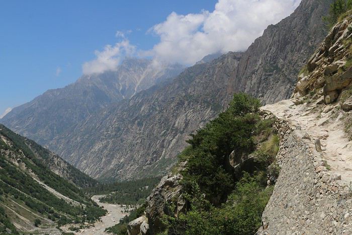
Après Chirwasa la randonnée se complique, on passe par des petits ponts vraiment très flippants avec une rivière déferlante passant dessous. Le chemin est bordé de cailloux immenses emprisonnés dans la terre, et certains trous dans cette terre nous laisse deviner qu’elle ne tient pas très bien. Ça devient tendu mais je continue jusqu’à Bhojbasa !
Sur la route je rencontre un gardien du parc qui a une petite passion pour les photos.
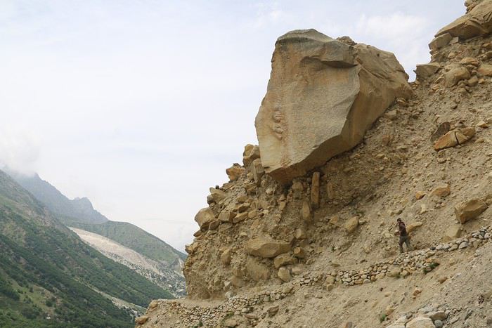
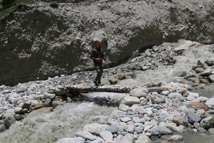
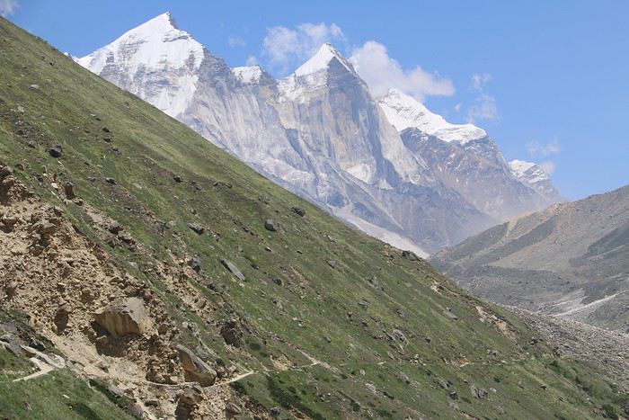
Arrivé à Bhojbasa
Enfin arrivé et je suis mort ! La randonnée était longue, le chemin ne faisait que descendre et monter. C’était plutôt fatiguant.
Je me dirige donc vers le Ashram, on peut aussi dormir dans une sorte de guesthouse mais je voulais avoir l’expérience d’avoir dormi dans un Ashram. Je suis très bien accueilli, on est environ 7 dans l’Ashram, et je suis le seul touriste.
On commence à manger tôt, pour cela on doit s’asseoir dans la cour, par terre et un homme passe avec un sceau rempli de riz, puis un autre avec du Dhal et encore un avec de l’eau. On se croirait un peu en prison mais c’est atypique !
Le soir je discute avec un vieil homme accompagné de 3 disciples dans le dortoir; oui j’ai bien dis disciple, les 3 jeunes hommes accompagnent le vieil homme dans ce pèlerinage pour s’entraîner à bien chanter Hindou ou bien prier. Le vieil homme passa toute la soirée à m’apprendre tout ce qu’il faut savoir sur l’Hindouisme avec son anglais approximatif. Ce que j’en ai retenu :
Le Gange vient des cheveux de Shiva, l’un des plus grand « dieux » Hindouistes; et plus on remonte à la racine de ses cheveux, plus on s’approche de la source et plus son pouvoir est immense.
Il existe beaucoup de croyants différents, il y a par exemple les chanteurs, les prieurs, les danseurs et j’ai du mal à me souvenir des autres.
Il y a 3 grands dieux dans la religion Hindou : Brahma, Vishnu et Shiva. Le vieil homme a tenté de m’en apprendre plus sur chacun d’eux mais la barrière linguistique a rendu la tâche bien compliqué.
Dernière étape : Le glacier Gaumukh et la source du Gange
Je pars le matin, beaucoup des pèlerins sont déjà partis. Le chemin est assez facile la première heure, puis d’un coup je tombe sur un effondrement, je dois avancer entre les rochers, juste à coté du Gange en folie. Et oui, ce n’est plus le Gange calme qu’on a connu à Varanasi, ici c’est un vrai torrent !
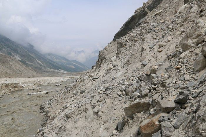
Mais ce n’était que le début, je vois que les pèlerins se sont tous arrêtés au même endroit, ils prennent l’eau de la rivière, et pourtant on est pas encore au glacier.
En effet on ne peut plus vraiment avancer, le chemin est totalement effondré, le vieil homme m’en avait parlé hier.
Bon, moi j’ai tendance à être un peu têtu, je me rappelle de cet homme à Dehli qui avait atteint le glacier, alors je me lance. Le reste du chemin est très très serré, ce n’est que de la terre qui menace de s’effondrer à tout moment, et en dessous le Gange est sans pitié, si je tombe dans la rivière à plus d’un mètre du bord je sais que j’aurais aucune chance de m’y échapper.
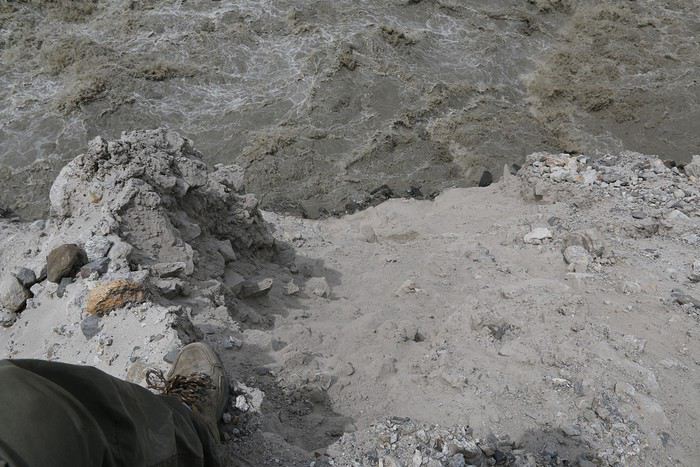
OUF le plus dangereux est passé ! Je continue ma route en sautant de rocher en rocher; tout s’est écroulé et je fais attention à ce que rien d’autre ne s’écroule quand je passe.
Le glacier n’est plus très loin, je le vois de l’autre coté, je continue encore 2h sur ces rochers, il est très compliqué d’avancer en sautant d’un rocher à l’autre.
Une fois au dessus du glacier je dois descendre jusqu’à lui, mais pour descendre il faut que je suive un effondrement.
En soi l’effondrement n’est pas dangereux, je peux descendre dedans mais si il est là ça veut dire que le terrain est dangereux. En effet de temps en temps de gros cailloux tombe d’en haut.
Je vois l’eau sortir du glacier avec une vitesse incroyable, l’eau est déjà marron en sortant, une partie de moi voudrais explorer l’intérieur, mais il est évident que j’y resterais.
J’entends de plus en plus de cailloux qui tombe d’en haut, je me dépêche de prendre l’eau (et prendre une photo) avant que ce ne soit un rocher qui tombe !
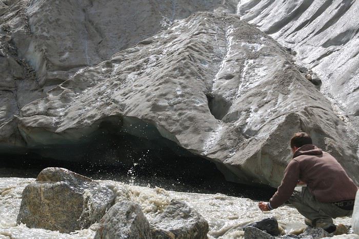
Ceci est un extrait rapide de l'article : the-wild-trip.fr/...tri-source-du-gange/
De passage en Thaïlande sans billet retour English translation pending
Salut,
J’ai prévu un voyage avec mon fils en Asie, on arrive à Bangkok , de la on va descendre dans le sud un passage par Penang et on verra si on traverse par Sumatra et retour en Suisse depuis Bali. On est libre... Ayant vécu 5 ans à Bali, j’y ai garder des amis. Ma question : On arrive à Bangkok et ma crainte est que nous n’avons de billet retour... On m’a déjà eu embêtée pour ce type de problèmes pour un voyage en Indo...
Voilà quelle sont les solutions envisageables ? Le moins cher possible..
Merci On part le 3 juillet pour un voyage express et retour le 13 août...
J’ai prévu un voyage avec mon fils en Asie, on arrive à Bangkok , de la on va descendre dans le sud un passage par Penang et on verra si on traverse par Sumatra et retour en Suisse depuis Bali. On est libre... Ayant vécu 5 ans à Bali, j’y ai garder des amis. Ma question : On arrive à Bangkok et ma crainte est que nous n’avons de billet retour... On m’a déjà eu embêtée pour ce type de problèmes pour un voyage en Indo...
Voilà quelle sont les solutions envisageables ? Le moins cher possible..
Merci On part le 3 juillet pour un voyage express et retour le 13 août...
Comment obtenir des coupons de réduction pour buffets à Las Vegas? English translation pending
Bonjour,
En septembre au cours de notre voyage organisé, nous passerons deux jours à L'hotel Boulder station casino , qui est très excentré du strip de las Vegas.
Nous souhaiterions obtenir des retours d'expérience pour obtenir des réductions 2 pour le prix d'un concernant le buffet à L’hôtel où nous allons loger, voire même dans certains hôtels du strip .
Tous les conseils et suggestions sont les bienvenus.
En vous remerciant d'avance.
En passant par la Lorraine English translation pending
Nos échanges e-pistolaires sur VF sont des rencontres dématérialisées par nature: ainsi celle avec Jeanne. J’ai été touché par son attachement à sa Lorraine et à la fidélité aux Siens. Pour moi, à l’instar de beaucoup de Français, la Lorraine est transparente; mais si j’y pense, elle est pour moi l’image, de façon caricaturale certes, de la vieille industrie, de la mine de fer, du gâchis des investissements industriels sans logique, de la désindustrialisation, des friches industrielles, du désespoir des ouvriers, des guerres aux frontières….. Une sorte de Ruhr ou de Silésie dans mon imaginaire. C’est une province que je traverse en A4 l’autoroute procure des œillères, tant il fait ignorer le paysage traversé en tous lieux.
Pourtant en invoquant la Lorraine, notre Sainte Patronne se rappelle à mon souvenir et à mon affection. Une des plus belles figures de France est lorraine. Cette Province ne m’est peut être pas si indifférente. Et puis, il y a chez nous Lothaire, l’oncle lorrain.
(Ces e-pistolaires, échanges entre âmes suite à des rencontres improbables sont une remise en question bénéfique. Je dis bien des « âmes », car nous sommes dans un quasi Paradis, puisque sur l’ensemble appelé VF, nous sommes dématérialisés : Notre enveloppe charnelle n’entre pas en ligne de compte pour nous jauger et influencer notre rapport à l’Autre. En plus nous ne nous rencontrerons sans doute jamais. La différence avec la représentation du Paradis, où tout le monde s’aime, est qu’un tout petit nombre, profitant de l’anonymat, se livre à l’invective, comportement qu’ils ne se permettraient sans doute pas s’ils se rencontraient réellement.
Cette remise en question pour moi, c’est mon rapport à la Lorraine, province oubliée que Jeanne implicitement me demande de ne pas oublier. Je me remémore mes belles visites, en particulier celle d’un des plus beaux sites de France et la rencontre avec quelques Lorrains. Ceux que j’ai pu identifier comme tels, étaient des personnes de belle tenue, affichant une certaine densité des personnes avec lesquelles j’aurais aimé partager une amitié. Plus j’avance dans mon récit, plus je sens que la Lorraine commence à prendre des couleurs et à se parer de beauté et de noblesse dans mes pensées; l’image des damnés de la Terre s’estompe.
Jeanne m’avait mis au défi d’écrire sur la Lorraine, puis m’a délié de ce défi. Trop tard, j’avais rassemblé tous mes arguments, mes séquences, mes souvenirs pour lui répondre. Surtout je voudrais vous parler de l’Oncle Lothaire que ma famille a eu le bonheur de recevoir en son sein. Allais-je jeter tous ces matériaux ? Non, car outre raconter Oncle Lothaire, je suis souhaite me faire pardonner des pensées si médiocres envers une province de si grande qualité.
Voici ma Lorraine en deux récits :
« Pourquoi accélères tu en fin d’A4 ?»
« Rencontre avec Maxim »
« Pourquoi accélères tu en fin d’A4 ? »
Chère Jeanne,
Je ne suis pas très fier d’écrire ces lignes, c’est presque un acte de contrition. En effet ta Province est absente dans mon imaginaire je suis sûr que je passe à coté de belles richesses. Je t’expose donc ma Lorraine, ce possessif est un peu abusif, tant il étreint si peu, mais j’essaye d’être honnête, car on ne peut qu’être honnête avec un Lorrain
Carlin
Je revenais chaque dimanche vers Allemagne pour rejoindre la BASF à Ludwigshafen. Sur le tronçon final de l’A4, des lumières au sodium vous plongent en dépression. Les panneaux aux noms barbares défilent : « Freyming » « Merlebach », « Forbach ». J’ai l’impression de passer l’entrée des antres sous terrains des travailleurs de fond des légendes germaniques : Ceux qui, une fois l’an remontent à la surface manger les épicuriens qui se dorent au soleil. J’accélère presque pour chercher refuge en Allemagne proche; « Tu parles d’un refuge » ! Ce pays me pose un problème d’Amour/Répulsion, mais je m’écarte du sujet. Je ne surjoue ce récit, je ressens toujours les mêmes émotions sur ce tronçon d’autoroute. Le seul rayon de bonheur qui m’apparaît sur cette section dantesque, c’est Carlin la ville abrite un magnifique Vapocraqueur, composé d’une batterie de grandes colonnes noir et de tuyauteries compliquées. La vapeur d’eau agit aussi doucement qu’un jet sur la peau, elle supprime des atomes d’hydrogène sur les molécules d’hydrocarbures livrés à son traitement. Le flux sortant est transformé en molécules à double ou triple liaisons, de la tribu des « insaturés ». Après séparation par distillation dans les grandes colonnes, les différentes fractions seront livrées aux chimistes, véritables magiciens. Ils en feront des sacs plastiques jetables, des costumes pour gens fauchés, des tableaux de bord de voiture, des coques de yacht pour des gens friqués. ….Si ma vie était à refaire, je postulerais pour servir ce géant magnifique, merveille de la création humaine. (Le vapocraqueur n’a rien à voir avec le Craqueur Catalytique, la « marmite du diable » selon les mots d’un ingénieur exploitant de la Baie de San Francisco Ce démon casse en morceaux les molécules d’hydrocarbures trop longues, et offre des quantités de carburant supplémentaires par rapport de la distillation initiale du brut. (J’aurais pu rester à San Francisco servir la « Marmite du Diable », je n’aurais eu aucun problème de permis de travail, je serais maintenant américain??!!?. Quand j’annonçais que je rentrais en Europe mes interlocuteurs se demandaient comment pouvait on quitter la Terre Promise, après avoir l’avoir foulée)). Carlin mon amour !
Montigny les Metz, une histoire des fesses. (Non, n’appelez pas la modération, l’histoire est chaste, je ne déraille pas) L’Armée française a ses raisons pour avoir fait de moi un infirmier. J’ai donc passé 3 mois d’instruction à Montigny les Metz. Vous y arrivez en passant par la grande gare de Metz, au style germanique. La salle des pas perdus grouille de bidasses le chef de gare est blasé : lorsqu’il la traverse, des bidasses un peu benêts le saluent militairement au vu du galon rouge de sa casquette.
Le métier du soldat est de vouloir du mal à des inconnus (des jeunes) d’ailleurs, sur lesquels nos Autorités (des vieux) ont lancé un arrêt de mort pour une raison qui leur appartient, et de leur trouer la peau avec de gros calibres. Mon travail est de vouloir du bien à des personnes non agressives mais de leur trouer la peau quand même, avec du très petit calibre. Encore faut il apprendre le métier. Notre formation avait commencé par la mise en place des bandages l’Adjudant Chef (Il avait mis 15 ans pour avoir cette rallonge à son grade : « Chef », si vous l’oubliez en vous adressant à lui, gare à vous !) fait l’instruction des bandages depuis 30 ans il déclare péremptoirement : « L’infirmier doit savoir bander » (Sic). Etait ce de l’ironie, pour nous, nourris momentanément au Bromure ? Vient l’instruction des piqures. Presque comme un guet apens, 8 soldats dont moi, sommes quasiment enfermés dans une pièce avec l’Instructeur. Celui ci nous déclare que nous ne quitterons la pièce tant que nous, constitués en 4 binômes, ne nous serons pas fait mutuellement une piqure sous cutanée et une intramusculaire dans le quart supérieur externe des fesses. A l’Armée on est vite persuadés qu’il était absolument vain de discuter. C’est pourquoi actuellement des jeunes gens dans notre société, auraient besoin de se mesurer à cette limite infranchissable. Il a été décidé que je serai infirmier, je serai donc infirmier. Nous exécutons ces taches peu agréables assez rapidement, sauf un infirmier: Nous le regardons tous, nous, les 6 infirmiers et l’instructeur, sidérés, retenant notre souffle : L’homme est ultra nerveux, il abaisse doucement la seringue, l’aiguille forme lentement une dépression dans la fesse de l’infortuné binôme (1/4 supérieur externe !) : la dépression se creuse encore, la peau lâche enfin et l’aiguille pénètre le muscle en prenant son temps. La victime lance un long cri, rauque et douloureux, et nous les spectateurs, relâchons la tension par un grand éclat de rire, peu charitable. Nous, les nouveaux « injecteurs » allons nous répandre dans toutes les unités militaires de France pour exercer nos nouveaux talents. Il est entendu que l’intraveineuse, mal faite, peut tuer elle est réservée aux seuls infirmiers D.E., ce que nous n’étions pas. Dans ma nouvelle affectation, je ne devais pas toucher aux fesses étoilées ni à celles à barrettes. C’est notre voisine l’infirmière (Une charmante Lorraine !) qui nous soulageait de traiter ces muscles de gradés, et nous évitait des risques potentiels de punitions. Nous traitions les fesses diverses: Femmes, Sous off, Gendarmes, Gardes Républicains et Hommes de troupe….. Je ne me plains pas, car j’aurais pu être affecté à la Morgue de l’Hôpital militaire local. Mes débuts de ma nouvelle affectation ont été laborieux : Ainsi un gendarme se présente: Je le pique correctement, mais j’ai mal fixé la seringue à l’aiguille la belle solution de vitamines rouge s’est répandue sur sa chemise neuve de sortie. L’homme est passablement furieux. Une jeune femme de l’Etat Major arrive, elle m’a quelque peu troublé et je n’ai pas mis l’énergie nécessaire pour enfoncer l’aiguille par deux fois, distrait de ce qui devait être pourtant l’unique objet de mon attention : un de ses ¼ supérieurs externes et rien d’autre ! Elle m’a fait un gentil reproche et j’ai pu planter l’aiguille jusqu’à la garde à la 3èmetentative depuis cet instant j’ai servi sans faiblesse et sans distraction la Nation et son Armée. Nous faisions aussi des injections sous cutanées de TABDT, qui vous rendaient malades comme des chiens pendant 2 jours. Dans ma file d’attente, de temps à autres, un soldat me susurrait des gentillesses : « Si tu me piques, je te casse la gueule ». Alors c’était la compresse qui recevait le vaccin. Un autre moins menaçant glissait un billet de 50 Francs que je refusais la compresse prenait encore le contenu de la seringue. Puisque le sujet est la Lorraine, parlons de cette gentille infirmière, notre voisine. Elle était jolie et enjouée : Elle venait dans notre salle de soins tous les matins pour nous saluer, nous, ses « collègues ». On avait l’impression qu’elle venait souffler, s’échapper un peu de la rigidité ambiante, elle nous faisait du bien en retour. Un jour, un long conflit entre moi et mon « supérieur », un Sergent, mélange atroce de l’Armée et du Séminaire, trouve son aboutissement par un « motif »collé à mon encontre. Il est des luttes sournoises entre « l’intello », sursitaire et les « non intello ». Pour certains, être « intello » est une tare, une sorte de paresse de celui qui ne travaille pas de ses mains et qui en plus, gagne plus les « non intello » ne réalisent pas toutes les beautés des réalisations de l’esprit dont ils sont pourtant entourés, elles leur paraissent naturelles. Ainsi j’ai vu dans une Compagnie du Train, de chauffeurs un « intello »harcelé, terminer au service psychiatrique. Je complète par ce « motif » qui m’est collé, tous les attributs pour être un vrai soldat :
1. Aller au trou au moins une fois 2. Faire le mur : J’avais déjà fait le mur 3. Picoler et tenir à la boisson. Ca se discute est ce vraiment indispensable ?
Dans les petits pays, un vrai homme devait aussi avoir « fait son régiment »! Comme cela il était bon pour les filles.
Je n’ai pas été de ces braillards qui hurlaient dans les gares « La quille !» et la brandissait par contre j’ai fixé à jamais l’instant lorsque j’ai franchi le portillon de la caserne, ce qui m’a fait redevenir un homme d’avant, une personne, qui dans les limites fixées par la Société, pouvait décider de son destin, de ses activités. Mon aliénation s’était envolée !
Pour en revenir à mon « motif », la justice militaire est assez cocasse : Nous sommes rentrés dans le bureau du Médecin Capitaine, un soir, et avons consulté son Code de Justice Militaire: Chaque motif est décrit le Gradé après avoir fait son choix, doit accoler au motif un qualificatif : « Léger » « Sérieux » « Très sérieux » « Très grave »« Gravissime ».
D’où le mot de Clémenceau : « La justice militaire est à la justice, ce qu’est la musique militaire à la musique ».
Après cette longue digression, je reviens à l’infirmière lorraine. Je l’avoue, j’étais un de ses chouchous et nous aimions bien échanger. Elle est scandalisée par le « motif » collé à l’encontre de son chouchou, et elle entend le venger dans un couloir, elle rencontre le Sergent, l’hybride séminariste/militaire, et lui lance : « Vous pourriez me saluer, je suis votre supérieure en tant qu’Adjudante !» L’hybride se met au garde à vous, et nous pouffons dans notre coin. Le lendemain, nous saluons la Lorraine avec ces mots : « Mes respect, mon Adjudante ». Elle sourit avec indulgence et elle nous répond: « Vous exagérez, les garçons ».
L’Armée a des problèmes avec la féminité : Attribuer un titre d’Adjudante à une jolie femme, quel non sens ! Le surnom masculin de l’Adjudant est « Juteux », le féminin donnerait « Juteuse » ça ne passe pas. Par exception, à la Marine Nationale, le Personnel Féminin a une coiffure très craquante Une rencontre avec une « Première Maîtresse » serait très aguichante, si le titre existe comme on a « Premier Maître » au masculin, et si Ornella Muti me permettait ce vagabondage. Les « Quart Maîtresses » correspondent elles à « Quartier Maître » ? Elles peuvent rester dans leurs sous marins, l’idée de partager avec trois autres quarts est moins séduisante.
A Montigny les Metz, J’ai même livré un combat, armé d’un fusil d’avant guerre. Je relate ce fait militaire très banal, car j’ai « été tué » a cette occasion. Les mots « Zorba, tu es mort ! » résonnent encore en moi.
Un des plus beaux endroits de France
Je n’ai pas choisi ce titre pour me racheter, on ne triche pas à une Lorraine: Visiter cet endroit me permet de me réaliser, de sentir la plénitude du bien être, de rassasier mon sens de l’esthétique: Place Stanislas, Nancy.
Je me sens Français (J’ai la crainte de ce qu’il faudra bientôt s’excuser d’éprouver ce sentiment bien élémentaire), et je suis fier de penser qu’un Architecte français avait sorti ce joyau de son imagination.
Je ne suis pas seulement Français, Place Stanislas, car j’ai une faculté, celle de me métamorphoser en rêve suivant le lieu. Ce jour là je suis un Gentilhomme français, le Comte de Kervraz, habillé en costume d’époque (Dans ma tête). Je croise sur cette sublime place, John Malkovitch je le trouve encore plus sournois que d’habitude. Je salue Madame de Volanges, et Michelle Pfeiffer, je soutiens à peine son regard. J’aperçois Choderlos de Laclos. Je lui demande en aparté un stratagème pour circonvenir Ornella Mutti, lui qui a été si brillant dans son plan de conquête de Madame de Tourvel. Glenn Close passe et me glace. Je m’en détourne. Belle femme pourtant ! En l’apercevant, je me demande où a-t-elle caché sa fiole de poison il est vrai que ses mots sont aussi des lames de poignards.
(Déjà j’ai eu du mal à réintégrer Bourvil dans mon Panthéon, après son rôle atroce en Thénardier. J’étais prêt à le haïr à vie. Mais qui peut résister longtemps à Bourvil ?)
La Place Stanislas, c’est pour moi un art maitrisé, c’est la fantaisie, la beauté qui s’arrête à la limite du « C’est trop », du surchargé. Le « C’est trop » est souvent atteint et dépassé par les Architectes italiens. Cette place est tout simplement la manifestation de l’élégance française à son sommet elle montre sans ostentation, tout en est éblouissante de noblesse. Regardez comme la Renaissance italienne revisitée par les artistes français en Renaissance française est plus sobre, est totalement élégante. L’élégance ne se remarque pas dit on !
Il y a au moins deux joyaux inestimables en Lorraine : Jeanne d’Arc et la Place Stanislas. Je me mets soudain à avoir de l’indulgence envers moi même, et je ne me sens pas si coupable d’indifférence envers la Lorraine mon culte pour Jeanne d’Arc me dédouane du reproche dans une large mesure. Je repasserai par la Lorraine !
Dans le domaine de l’Architecture Louis XV, j’affectionne le Grand Trianon et l’Hôtel de la Marine, visité lors des journées du Patrimoine. Travailler même comme planton, dans l’œuvre de Gabriel aurait été un rêve pour satisfaire ma dose journalière d’esthétique, tant cet Hôtel est majestueux et juste dans la note. J’ai remarqué, selon une fiche attenante à une fenêtre qu’elle avait occupée à la Révolution par des témoins officiels mandatés par l’Assemblée Nationale : Ils devaient certifier avoir vu les décapitations de Louis XVI et de Marie Antoinette. Quels procéduriers !
Nancy est aussi un des berceaux de l’Art Nouveau, les verreries s’inspirant de la Nature sont tellement belles, le style végétal est si original. Mais là aussi l’excentricité des motifs à base de lianes doit trouver une limite pour le bon goût. (Voyez comme Mucha, le Tchèque a un style un peu chargé) Les quelques maisons Art Nouveau de Nancy sont un bonheur à contempler.
RENCONTRE AVEC MAXIM
Je commence le récit concernant mon Oncle Lorrain, lorsqu’un inconnu aux cheveux jaunâtres couverts de toiles d’araignées et aux yeux maquillés de noir s’invite à assoir à coté de moi. -« Que faites vous ici ? D‘ailleurs Halloween, c’est terminé, maintenant on va sur le 11 Novembre » -« Du calme, l ‘« écrivain », je suis mandaté, dans le cadre du centenaire de l’Armistice de la Grande Guerre, par la « Commission Citoyenne de la Transversalité multiculturelle et le Souvenir Solidaire » de recueillir des textes afin d’illustrer nos différences et notre unité mémorielle ». -« C’est quoi ce truc, je n’y comprends rien » -« C’est une invention de Macron, il doit savoir ce que c’est » -« Bon asseyez vous et restez silencieux je continue, il faut que tout soit fini pour le 11 Novembre »
Ma Tante Soizic était menue et offrait encore un visage fin et rieur c’était une belle femme elle était un mélangecurieux de femme du monde parisien qu’elle avait fréquenté un temps assez court, et de femme dévote aux idées sociales et religieuses antédiluviennes. Cette absence de connaissance des réalités du Monde tenait au fait qu’elle resta le reste de sa vie en Basse Bretagne : Au manoir de Kervraz-Lanvullin.
En Bretagne, la seule attaque sérieuse contre notre foi confite a eu lieu à Tréguier où l’Antéchrist Renan a répandu des idées sataniques. Si vous passez à Tréguier, allez saluer le buste d’Ernest Renan qu’un pouvoir sacrilège a édifié par provocation devant l’Eglise, et descendez près du Jaudy admirer le « Calvaire de la Réparation » censé laver les péchés Renaniens !
En ce temps là, l’appariement de jeunes gens d’une certaine société, en vue du mariage consécutif se faisait aux bals des Grandes Ecoles ou dans des petits gouters guet-apens organisés par des « Marieuses ». Vous constatiez que la Maitresse de maison avec invité plusieurs couples et comme par le fait du hasard une seule Demoiselle et un seul jeune Homme. Pas trop dupes, ils engageaient la conversation et se mariaient. (Cette phrase est un peu sèche, mais c’est une relation de cause à effet, les choses se passaient ainsi à cette époque. Nul besoin de remplissage à la Christian Jacq entre « la rencontre fortuite » et le mariage)
Les bals ! Le plus prestigieux était le bal de l’X. Pour les Polytechniciens, souvent issus de milieux très modestes, c’était le moyen de rencontrer des jeunes filles de la bourgeoisie parisienne. Les Demoiselles pouvaient rencontrer la fleur de l’intelligence française, promise à des situations les plus élevées.
Cette année là, 1913 ? Un jeune Lorrain, fils de paysan de la région de Thionville danse au bal de son Ecole. Il l’avait intégrée après avoir été le héros d’une belle histoire classique en France : Un « hussard noir de la République », son instituteur l’avait remarqué parmi tous les petits paysans, ses élèves. Le Lorrain avait une intelligence très au dessus de la moyenne ses parents sont convoqués, le « hussard » leur explique les perspectives de l’enfant et les projette dans un monde totalement inconnu pour eux. Tout fiers, ils laissent l’Instituteur placer leur fils dans « l’ascenseur social » et la République paye pour la montée.
Ainsi arrivait en continu à la tête de l’Etat, aux Affaires ou dans l’Industrie, des gens simples, très proches des réalités quotidiennes, durs au travail, d’une grande éthique, ayant le sens du service de l’Etat, et surtout ayant du sens pratique.
Aujourd’hui l’ascenseur est cassé et personne ne s’est avisé de le réparer. Ainsi les jeunes gens de bon sens issus des milieux modestes sont remplacés par les enfants consanguins de la bourgeoisie parisienne endogame, aux plus hautes fonctions par cooptation, après être passés par l’Ecole du Baratin Policé. Le bon sens déserte les hautes sphères, l’éthique laisse à désirer, et qui sert on ? Les nouveaux maîtres sont occupés à nourrir un monstre avide : L’Etat, ou à enrichir leur caste. Où sont les grands chantiers d’antan et les grandes ambitions ? Les anciens élèves de l’Ecole Polytechnique, même disparaissent des instances dirigeantes peu à peu.….
Notre Lorrain s’appelait Lothaire, il a remarqué ma Tante, la jeune beauté. Comme je connais la gentillesse de Tante, le Lorrain n’a pas du se faire violence pour la demander en mariage. Ils se sont mariés la Lorraine prenait pied chez la Bretagne ! Mon Grand Père, pourtant homme très réservé ne cacha pas son approbation et son bonheur à l’arrivée de ce gendre lorrain et il l’adopta sans réserve. Celui ci reçut le meilleur accueil de ses beaux frères et de sa belle sœur. Ma Grand Mère a certainement du expliquer à sa fille à quoi s’attendre de la part de son Mari. Les choses de la Nature ne faisaient pas l’objet de publicité en Basse Bretagne en ce temps là, l’Eglise et Mr le Recteur jetaient peut être un voile suspect sur ces choses.
Hélas, les coups de feu de Sarajevo ont provoqué la conflagration que l’on connaît. Tous les jeunes hommes ont été mobilisés. Le Lorrain, Polytechnicien, était de ce fait Lieutenant. Il prit donc un commandement d’une unité dans les Vosges, en Alsace, province sœur de sa Lorraine natale.
A ce point du récit que je convoque Blaise Cendrars, Maurice Genevois, Erich Maria Remarque, Stanley Kubrick pour témoigner de cet événement.
Mon voisin aux cheveux jaunes s’agite et me pousse du coude : - « Hé, Zorba ! Je ne suis pas mandaté pour le comité machin chose…. »
- « Laisse moi écrire, je ne m’en sors pas » - « Je suis la Mort, chez toi en Bretagne on m’appelle l’Angkou, mais calme toi ! Je ne viens pas pour toi. J’ai appris que tu écrivais une bio sur un Lieutenant, alors je t’interdis d’écrire quoique ce soit sur son salut ou sa résurrection, sinon ton disque dur va mystérieusement crasher. Il y en a d’autres qui m’ont bravé, ils ont du tout recommencer »
- « ………………………….. »
- « Tu sais Zorba, tu me fais marrer avec ta marotte de travailler à l’Hôtel de la Marine. Je peux t‘aider à y aller : A l’étage des Amiraux on recherche un Monsieur PiPi, comme pour Amélie Nothomb au Japon. Ah Ah Ah Ah.. »
- « ………………………………. »
- « Eh puis tu sais je connais la femme de chambre d’Ornella Mutti, je vais lui dire qu’elle à un Amoureux transi, futur Homme Pipi, au Ministère de la Marine, Ah Ah Ah Ah, je me tiens les côtes, elles vont tomber »
- « Laisse moi, et ne compte pas sur moi pour les remettre »
- « Hé doucement Monsieur le nouveau Majordome maritime, si tu veux que j’anticipe notre ultime rendez vous avec moi, dis le moi! Et pas de bêtises sur ton texte, je pars chez Ornella Ah Ah Ah Ah Mr Zorbamuti de la Marine française !!
C’était déjà la guerre de tranchées, l‘unité du Lieutenant en occupait une section.
A l’Etat Major général des Armées, le Général en chef consulte les cartes et s’attarde sur le front d’Alsace. Il lance à tout l’aréopage de ses Aides de camps et collaborateurs : -« Que fait Dubois dans les Vosges ? » -« Le secteur est calme, mon Général » -« On ne va pas s’endormir, allons réveiller les Allemands las bas ! Mon Instructeur à l’Ecole de Guerre insistait: « Offensive, Offensive, toujours l’Offensive. Notre Armée excelle dans l’attaque, montrons nos atouts; il faut bousculer les Allemands, ne pas leur laisser un jour de répit nous finirons par percer un jour. Dites à Dubois de monter quelque chose et de nous le soumettre il aura le droit à de l’artillerie supplémentaire ».
Plus tard le Lieutenant Lorrain est convoqué ainsi que tous les autres Lieutenants et Capitaines de cette partie du Front des Vosges à une réunion du Général Dubois. Celui ci annonce d’un air martial que les troupes sous ses ordres allaient lancer qu’une grande offensive dans 20 prochains jours. « Je compte sur vous, Messieurs, le Grand Etat Major a les yeux sur nous nous ne pouvons pas faillir. Messieurs les officiers, allez préparer vos hommes pour le grand jour ».
Le Lieutenant Lorrain avait analysé le dispositif allemand, la déclivité du terrain, les obstacles visibles et ceux qu’il supputait. L’équation « Assaut » n’avait pas de solution car il savait qu’il n’y aurait aucune chance pour lui et ses Chasseurs d’atteindre les lignes ennemis en nombre suffisant et supplanter l’ennemi si les mitrailleuses n’étaient pas neutralisées. Elles étaient escamotables très rapidement: « Le grand jour » serait nécessairement son dernier jour !
Une autre pensée lui vient immédiatement à l’esprit : Si cette attaque est absurde, lui et ses hommes seront sacrifiés inutilement. Ce sentiment du sacrifice inutile lui semble odieux. Pourtant il n’exprime aucune révolte qui serait pourtant légitime. Il est pénétré du sentiment de servir les valeurs de son Armée sont les siennes.
Regardez le cas du Capitaine Dreyfus : Il a subit l’affront majeur pour un soldat, celui du déshonneur pire que la mort. Il est dégradé lors d’une cérémonie bien mise en scène pour frapper les esprits de la Nation entière : son sabre est brisé. On le condamne au bagne. Après sa réhabilitation, que fait il ? Il sert son drapeau à nouveau !
Jusque là, pour le Lieutenant lorrain, sa trajectoire personnelle décrivait plus ou moins une courbe y=3+sin x avec des hauts et des bas. Jamais elle n’avait l’occasion de décrocher et de toucher la droite y= 0 où rodait la Mort, puisqu’il n’avait été impliqué dans un aucun engagement.
Imaginez vous, jeune homme, jeune marié, promis à une mort certaine et inutile. Vos perspectives s’effondrent. Soudain vous êtes basculé dans la catégorie des vivants en sursis et vous êtes embarqué sur le toboggan mortifère de l’équation : y= 1/x avec x positif
Cette terrible courbe était la branche d’hyperbole du désespoir, elle décroissait de jour en jour pour aller asymptotiquement vers y=0, la droite de la Mort. Pourtant on doit parler de décroissance asymptotique et non de « quasi » croisement avec y=0. Ce « quasi » vous vaudrait un zéro en Maths Sup. Il restait une incertitude résiduelle toujours s’amenuisant et cela jusqu’à la fin des temps. Comme causes d’incertitude on pouvait avoir :
-Une maladie grave du Lieutenant, le rendant indisponible pour l’assaut.
-Un message du Président Poincaré envoyé au Kaiser en ces mots: « Arrêtons les conneries, je vous invite à un picnic de réconciliation sur la ligne de front, nous faisons la Paix, et gommons Sarajevo»..….
-Jésus revient sur Terre et interroge : « Que faites vous en mon nom »……
-Le char d’assaut vient d’être inventé secrètement, il va livrer son premier combat en conséquence les assauts d’Infanterie sont ajournés. Il ne fallait pas rêver, ces raisons devenaient de plus improbables, 1/x se rapprochait dangereusement de y=0.
Le Lieutenant lorrain était intimement persuadé de sa fin prochaine. C’est ce qu’il dira à son Beau Père et c’est ce qui m’a été rapporté. Avant la grande attaque, on lui offre une permission un convoi du Train le conduit à la gare il commence son voyage vers Kervraz- Lanvallin.
Comment vit il ses derniers jours avec sa jeune épouse, avec ses parents ? Que se communique-t-on dans leur dernière étreinte ? Je m’interdis de faire du Christian Jacq ! A cet instant du récit je me félicite lâchement de n’avoir pas eu à expérimenter ces situations. Mais je salue la mémoire de ma chère tante et de mon cher oncle, ces admirables héros inconnus.
Lothaire fait des adieux sobres les regards sont lourds mais n’affichent aucune faiblesse. Il monte dans la calèche, elle s’éloigne sur l’allée bordée de chênes. Il est maintenant redevenu le Lieutenant Lorrain et uniquement cela. L’époux et amant, le gendre, le beau frère sont restés à Kervraz, tous ces qualités peuvent maintenant faire l’objet du culte du futur disparu. C’est dit ! Le Lieutenant Lothaire ne se retourne pas, il est droit sur son siège. Cela aussi m’a été rapporté. Homme de devoir, fidèle à son Armée, il part pour sa dernière mission.
Jour J , H-5 minutes, dans la tranchée, le Lieutenant Lorrain ne s’attendrit pas sur son sort, il a réglé sa montre sur celle du Colonel, il convoque ses Sergents et Adjudants, ces chiens bergers des Armées qui mordent les tièdes. Les hommes ont reçu leur ration exceptionnelle de gnole, cette divine boisson aide le condamné à mort militaire ou civil à affronter son supplice. Le Lieutenant sort son pistolet dont il doute d’avoir à se servir, il met son sifflet aux lèvres et siffle, il franchit les premières marches du parapet et s’élance en criant « En avant, pour la France, pour vos familles ! »
En face les Allemands ne tardent pas à réagir, ils avaient été copieusement arrosés par une préparation d’artillerie intense c’est un signe qui ne trompe pas. Les Jägers sont déjà en position et font feu deux Maxim crépitent. Le Lieutenant a juste le temps de penser : « On n’a pas eu les Maxim ! » Les assaillants français sont fauchés méthodiquement, vague par vague on ne dépasse pas des Maxim !
Le Lieutenant a reçu deux projectiles, il conserve deux secondes de conscience, et son âme s’envole au pays des Braves. Sa vie décroche de la courbe 1/x flirtant toujours avec l’asymptote y=0, où la Mort rode en parcourant -l’infini à +l’infini, à une vitesse inconnue dans notre Monde. (Je sais que c’est impossible de parcourir ce chemin, mais la Mort, elle, peut le faire)! Sa vie déclinante attrape une des droites x = Constante et frappe avec violence la droite y=0, même si le chemin à parcourir est infime.
La Mort cueille le Lieutenant Lothaire, Lorrain, Polytechnicien, fils de paysans, fils adoptif de Bretagne, et Etre noble, en grinçant des dents de plaisir. Elle ne s’attarde pas tant elle a une belle moisson offerte par les deux « Maxim ». La Mort lance un hurlement à l’adresse des malheureux qu’elle a recueillis :
« Vos officiers, vieilles badernes, sont trop cons ! le travail est trop facile, Ah, Ah, Ah, Ah, Ah, Ah, Ah, Ah ! J’adore la « Maxim », il faudra que je rajeunisse mon image, finie la faux, je poserai en tenant une « Maxim » dans les bras. Remarquez quand je travaille sur les assauts allemands, votre canon de 75 ne pardonne pas non plus».
Notice Wikipedia sur la « Maxim » : « Sa puissance de feu, considérable pour l'époque, en fit une arme redoutable qui a permis de stopper de nombreuses charges d'assaillants ».
L’Etat Major n’aurait sans doute pas été ébranlé dans ses certitudes en lisant cette note. Dommage, j’aurai peut être conservé deux oncles.
La Mort est partie sur un autre front; les infirmiers tentent de récupérer morts et blessés, les convois sanitaires pathétiques partent pour l’Arrière avec leur lot de malheureux pleins de bandages ces malheureux qui étaient des jeunes gens une heure plus tôt. Des infirmières, surement des Lorraines parmi elles, prodiguent soins, paroles affectueuses de douce féminité, ou de Mères, montrant la merveilleuse ambivalence de la Femme.
Le scribouillard du régiment commence sa comptabilité macabre pour le rapport à l’Etat Major.
Le Général Dubois est un peu gêné par l’échec de l’action qu’il a ordonnée. C’est moche pour les hommes et un peu négatif pour sa carrière: -« Oui il y avait très peu de chances, mais l’artillerie n’a pas fait son travail en ne neutralisant pas les Maxim. Enfin les Hommes se sont bien battus » (Tu parles, ils ne se sont pas battus, ils n’ont pas pu atteindre la ligne ennemie !).
-« Vous me faites un petit communiqué un peu ronflant, pour le Général en Chef , comme vous savez les tourner» dit Dubois à son Aide de Camp.
-« J’en ai déjà préparé un : « Le 123 ème Chasseur a montré de façon éclatante face à l’ennemi, sa résolution, son esprit guerrier et sa bravoure légendaire. L’ennemi a été bousculé en plusieurs endroits par cette action résolue » »
-« C’est pas mal, envoyez le !»
La folie touche les Allemands On se prête souvent à l’auto flagellation, et on porte aux nues tout ce qui se fait outre Rhin. Voici un petit épisode qui bat en brèche ce culte démesuré : Lors d’une émission de TV, alors que la France ne comptait plus que 10 survivants de la Grande Guerre, l’un d’eux raconte son combat : Il était servant d’une mitrailleuse, installée devant un petit ruisseau creux. Lui et son unité sont attaqués par les Allemands il tire sans fin et voit le ruisseau se combler de corps à la fin du tir il n’y avait plus de creux et plus d’assaillants ! Ainsi un gradé allemand a laissé toute une unité se faire détruire, malgré la vanité de l’action. Sans doute est ce du à l’obéissance aveugle aux ordres, valeur essentielle en Allemagne. Le gradé est allé jusqu’au bout de l’absurde, mais au moins on n’aura pas pu lui reprocher une désobéissance aux ordres. Cet épisode dépasse la fiction qui aurait pu inventer une histoire aussi stupide ? Je pense qu’il serait intéressant de ressortir un jour l’interview pour se pénétrer de la véracité de l’incident.
Le record de bêtise chez les Français
Je peux apparaître comme un amateur, sans connaissance aucune de l’Art militaire et refaire la bataille confortablement installé chez moi. Je me permets de faire ces commentaires, car il n’est pas besoin d’être expert pour signaler l’absurdité de certaines situations : Ainsi le Général Nivelle, polytechnicien fait un plan léché pour percer les lignes allemandes au « Chemin des Dames ». Son plan détaille la progression future des troupes assaillantes heure par heure. L’heure a laquelle les Allemands partiront en débâcle, est donnée aussi surement que la solution d’une équation. Ce plan est une belle construction intellectuelle. Pour avoir toutes les chances de son coté, le Général fait venir plusieurs grosses pièces d’artillerie formidables. A l’heure dite un déluge de feu s’abat sur les lignes allemandes…. Il ne s’est trouvé personne pour dire au Général Nivelles que la cote du « Chemin des Dames », en France donc, comporte des grottes où les Allemands se sont réfugiés en attendant que cela se passe !
Pour conclure sur ces épisodes de folie militaire, j’ai lu récemment un article d’un expert militaire affirmant que ces grandes charges étaient vaines. Si une première ligne est emportée, la seconde ligne prend le relais défensif presqu’immédiatement. La sagesse aurait voulu d’attendre de nouvelles armes comme les chars et conserver précieusement le potentiel humain.
Tout est fini, les équations des courbes mathématiques régissant la vie du Polytechnicien mort, sont répandues sur le sol, déversées depuis sa besace ouverte.
La Bretonne, ma gentille Tante a reçu la visite du facteur la famille partage le deuil avec la dignité des gens de ce temps là. Mon grand père avait déjà perdu un fils juste de l’autre coté de la Lorraine en Belgique. Ce patriote était employé de banque à New York il était revenu à l’appel de son Pays, on l’avait habillé de rouge, cible voyante, et il avait rencontré un projectile de Maxim. Il est enterré à la limite de la France, de la Belgique et du Luxembourg dans un cimetière allemand. Les Allemands n’ont pas fait le nécessaire pour l’inhumer avec un signe de reconnaissance, il est devenu « soldat inconnu ». Qu’a t il apporté aux armées françaises ? Rien ! Encore, si on avait pu dire à sa Mère, ma Grand Mère que son engagement et son sacrifice avait à son échelon, contribué au succès de nos Armées, qu’il avait participé à une action telle que prendre une tranchée ou un pont, cela aurait été une petite consolation et une fierté. Je vois encore son certificat de décès sous verre avec la médaille militaire dans la chambre de ma grand-mère à Kervraz.
Tante Soizic commence un deuil de près de 60 ans, à porter du noir, et d’afficher sa fidélité à son Lorrain. Elle est prête à traverser la vie en solitaire, dans le souvenir de ces moments si courts passés avec son être cher. Elle aussi est cassée en pleine jeunesse. La vie va être morne à Kervraz.
Le Lieutenant avait laissé une exponentielle dans le tiroir de la table de nuit à tout hasard. Il avait quitté sa femme, sans qu’elle ne manifeste aucun signe avant coureur qu’elle abrite une vie nouvelle : Retard, nausée, démangeaison mammaire, exigence pressante d’un Kuing Amann à la farine de sarrazin à 2 heures du matin…Aucun petit palabre entre les initiées n’avait été détecté dans les couloirs de Kervraz. Lothaire aurait tellement eu besoin de réconfort en partant vers son destin, en pensant qu’il laisserait un enfant, trace de son passage. Ce réconfort lui a été refusé.
Ma Tante n’y entend rien en mathématiques, et l’exponentielle lui est totalement étrangère. Cette courbe est assez exceptionnelle : Dans les x négatifs, elle tangente asymptotiquement y=0, la droite de la mort. Depuis le fond des âges et au delà, la Vie et la Mort, dans les x négatifs, parcourent leurs courbes respectives, presque à touche-touche, elles se sentent, elles se haïssent, mais ne peuvent se toucher. La Mort ne peut s’élever de la quantité infinitésimale qui la sépare de la Vie, pour l’agripper, la déchirer. Les mathématiques l’interdisent strictement. Alors il reste les râles de haine et d’invectives. Soudain en touchant x=0 la Vie s’élève d’un coup au point (0,1), et s’éloigne de sa rivale rampant toujours sur y=0. Elle peut continuer sa course et jaillir dans les hauteurs, si et seulement si, elle peut embarquer dans les x positifs une microscopique formation de Vie que l’on trouve chez les femmes qui réclament du Kuing Amann à 2 heures du matin. Alors la courbe, jaillit dans les hauteurs infinies« de façon exponentielle ». La Vie triomphe !
Revenons en arrière : Kervraz étant au bord de la mer, ma Tante comme beaucoup d’autres femmes de la région, abritait un chantier naval fabriquant des petites nacelles l’activité était assez paresseuse : La porte du chantier s’ouvrait tous les 27, 28 ou 29 jours pour laisser passer l’esquif tout neuf. Mon oncle, dans ses effusions, déposait vague après vague des armées de braillards, aux grandes chemises marquées en gros X ou Y, près du chantier. Cette multitude naviguait en ondulant leurs queues pour la propulsion et elle avait été formée pour naviguer sur les nacelles. Mais aucune n’était annoncée dans ces cavernes immenses : La porte du chantier restait désespérément close. Alors vague après vague 3, 6, 9 Milliards de braillards hurlant, faisant un bruit d’enfer, s’étiolaient petit à petit sur ces rivages étranges. Le silence revenait jusqu’à la prochaine visite.
Un jour le chantier ouvrit , sans préavis, sa porte et libéra une nacelle par chance mon Oncle avait renouvelé sa petite armée. La clameur monta à son comble, tout est agitation, pugilats. Imaginez une place ou parfois deux dans la nacelle pour 3 milliards de postulants. ! On approche de la nacelle, un X monte à l’assaut, il est presqu’installé c’est alors qu’un Y s’est retourné et lance sa queue de propulsion comme un lasso pour attraper le X déjà à bord et l’arrache violemment de l’esquif. Un Y avait anticipé la manœuvre, il est déjà prêt en ayant enroulé sa queue sous lui comme un ressort, et se propulse dans la nacelle en grillant la politesse au lanceur de lasso.
La nacelle très automatisée, ferme ses écoutilles immédiatement, asperge les 3 Milliards moins un, braillards d’un spray pour les éloigner. Le Y gagnant a eu le temps de lancer par l’ouverture aux perdants : « Je saluerai la Place Stanislas pour vous ! »La nacelle et son occupant commençe son voyage dans grandes grottes et s’accroche à une paroi qui recelait une station service ultra moderne. Pour la suite de l’histoire de la nacelle et de son occupant, reportez vous à vos livres de sciences naturelles.
Le conseil des initiées et expertes de Kervraz (Marijo, la vieille bonne bretonne en faisait partie) chuchotaient et se mirent d’accord sur le fait qu’un occupant avait pris place chez ma Tante, d’autant qu’il manquait une exponentielle dans le tiroir de la table de nuit. Pourtant ma Tante n’avait pas osé demander un Kuing Amann à son Père ou à son jeune Frère à une heure indue. Fortes de leur expertise, elles décident d’annoncer la nouvelle aux hommes de Kervraz. Ainsi le Manoir avait laissé partir une Vie, une nouvelle jaillit. Le Lorrain continuera à se perpétuer.
Cet incident que mes investigations ont mis en lumière vous montre que votre vie se décide en un temps infime : Ma Tante a failli avoir une descendante de Lorraine, douce et aux beaux cheveux blonds. Au lieu de cela, par une manœuvre brutale et sournoise que j’ai eu le privilège de découvrir, ma Tante a élevé un grand gaillard blond, à la carrure de bucheron. Elle a été vite dépassée par l’individu moralement et physiquement. Elle ne fait pas le poids ! Cela m’étonnera toujours de voir de frêles Mamans entourées de géants.
Il était très bricoleur : il a par exemple inventé un système avancé de détection du passage maternel la nuit. Ainsi il pouvait éteindre sa lumière à temps et faire semblant de dormir. Il devint Pilote militaire. Avec la carrure, les yeux bleus et l’uniforme il moissonna beaucoup de femmes de Bretagne et d’ailleurs. Il passa des soirées entières dans les bistrots et cabarets de France et d’Afrique. Sa Mère levait rarement le nez de son missel, et n’avait pas pris conscience de son activité affective, et savait elle seulement ce qu’était un cabaret ? Le grand Lorrain se marrie à une Bretonne enjouée. La Vie enfourchant une Exponentielle ne fait pas de pause ! Deux petits fils naissent, l’un brun : le Breton? Et l’autre blond : Le Lorrain ? Ce dernier un garçon très solide à l’image de son père. Mais il est plus fin que son Père, il est extraordinairement beau de l’enfance à l’âge adulte ! D’habitude je ne m’attarde pas sur la beauté des hommes, tout au plus je ressens une petite pointe jalousie, puisque tout est plus facile pour eux avec les Filles.
L’un des petits fils du Lorrain, le Breton se marie : Après la messe, Kervraz s’ouvre à une très belle réception où du beau monde de Bretagne est convié. La joie nous tourne la tête, particulièrement celle de « l’Apollon Lorrain ». Il est entouré des plus belles filles de la région, habillées de si belles robes et aux coiffures magnifiques, se déhanchant, dansant, s’abandonnant au plaisir de la fête. Elles avaient aligné le grand jeu de la séduction féminine et ne quittaient pas d’une semelle l’Appolon. Les femmes affichent rarement leur concupiscence je ne doute pas que leurs têtes soient traversées par des orages sentimentaux. A Kervraz, l’une d’elles devait tirer le gros lot : Mon cousin, tant les yeux brillaient et les petits rires fusaient. Ces demoiselles et Apollon riaient, jouaient, dansaient, nulle doute qu’un petit angelot, fesses nues était en train de bandait son arc pour le compte de la Vie juchée sur son Exponentielle.: Une nouvelle dynastie bretonno-lorraine allaient être crée. Ces belles filles étaient vraiment émoustillées. Combien de fois avait elles vu un gars pareil, avec une telle carrure, un tel esprit, une telle gentillesse et une telle gaité. Pensez à Mick Jager, à Adamo, et à Frantz Listz….Ils ont passé leur vie entourés de femmes en émoi, ils ont pu vivre une vie de sultan oriental sans faire d’efforts. Aux autres le long chemin de la séduction, de la naissance de l’Amour…Quoique maintenant on prend des raccourcis.
Mon cousin, ce tellement beau cousin, vient vers nous. Nous nous attendions à le voir, tel un homme à la joie de vivre décuplée par la fête, sûr de sa virilité, gonflé d’ivresse à la joie future de partager des instants délicieux avec une belle femme, de gouter aux traits si particuliers, si déroutant et si enchanteur de la féminité. Au lieu de cela, il nous assène un piteux : « Je ne peux pas ». Nous étions désolés pour lui, car en plus d’être beau, il était très famille. Est ce un caractère breton ou lorrain ? Nous l’aimions beaucoup et il était un cousin charmant.
J’ai compris ce jour là les ressorts de l’homosexualité et de l’impossibilité de désirer une personne du sexe opposé : Nous sommes tous soumis à une sécrétion d’hormone. Si l’on pense : « Quelle belle fille ! » Un jet d’hormone se déclenche en nous. A « Je l’ai dans la peau » Là un cocktail puissant envahit notre organisme. A « Elle me rend fou » toutes les hormones en stock sont envoyées. J’abandonne la description du mécanisme, car il va vite s’emballer et je n’aurais pas de mots assez forts pour le décrire. Le pauvre garçon avait en stock d’autres hormones pour d’autres desseins. Nous avons rencontré son autre dessein : On dit que les extrêmes s’attirent, c’est la réalité : Son autre dessein était un homme encore assez jeune, haut fonctionnaire que Jean Edern Hallier aurait décrit comme un « Colin froid ». Les desseins de la nature sont surprenants : Finies les jeunes filles, avec des rubans dans leurs longues coiffures, endiablées et tout désir dehors, à la fête à Kervraz . Cette triste fin est due à un petit jet absent d’hormones ! On peut aimer un Colin froid mais ne me demandez pas la mayonnaise. Coup dur pour la descendance du Lorrain, la Vie décroche de son Exponentielle porteuse pour s’accrocher à une nouvelle Exponentielle la Vie ne prend qu’un léger retard, oublié dans deux générations. La Mort n’a même pas le temps de lancer un sarcasme.
Je peux en témoigner de la persistance de la Vie et du jaillissement de l’exponentielle. Sa dérivée est follement positive: Il y a mariage à Kervraz à nouveau. Les Cousins de Lorraine reviennent, lointains cousins maintenant. A ce nouveau mariage d’un arrière petit fils du Lorrain, la fête continue. Je suis entouré par sa nombreuse descendance. L’un joue a cache-cache avec ses cousins, ou une autre joue à la poupée, d’autres s’essaient à la drague. Par contre l’endogamie naturelle bretonne sévit: Les têtes blondes ont disparues, les gènes lorrains ont été submergés par ceux de Bretagne. Mais tous les enfants présents portaient encore son nom.
« Pourquoi accélères tu en fin d’A4 ?»
« Rencontre avec Maxim »
« Pourquoi accélères tu en fin d’A4 ? »
Chère Jeanne,
Je ne suis pas très fier d’écrire ces lignes, c’est presque un acte de contrition. En effet ta Province est absente dans mon imaginaire je suis sûr que je passe à coté de belles richesses. Je t’expose donc ma Lorraine, ce possessif est un peu abusif, tant il étreint si peu, mais j’essaye d’être honnête, car on ne peut qu’être honnête avec un Lorrain
Carlin
Je revenais chaque dimanche vers Allemagne pour rejoindre la BASF à Ludwigshafen. Sur le tronçon final de l’A4, des lumières au sodium vous plongent en dépression. Les panneaux aux noms barbares défilent : « Freyming » « Merlebach », « Forbach ». J’ai l’impression de passer l’entrée des antres sous terrains des travailleurs de fond des légendes germaniques : Ceux qui, une fois l’an remontent à la surface manger les épicuriens qui se dorent au soleil. J’accélère presque pour chercher refuge en Allemagne proche; « Tu parles d’un refuge » ! Ce pays me pose un problème d’Amour/Répulsion, mais je m’écarte du sujet. Je ne surjoue ce récit, je ressens toujours les mêmes émotions sur ce tronçon d’autoroute. Le seul rayon de bonheur qui m’apparaît sur cette section dantesque, c’est Carlin la ville abrite un magnifique Vapocraqueur, composé d’une batterie de grandes colonnes noir et de tuyauteries compliquées. La vapeur d’eau agit aussi doucement qu’un jet sur la peau, elle supprime des atomes d’hydrogène sur les molécules d’hydrocarbures livrés à son traitement. Le flux sortant est transformé en molécules à double ou triple liaisons, de la tribu des « insaturés ». Après séparation par distillation dans les grandes colonnes, les différentes fractions seront livrées aux chimistes, véritables magiciens. Ils en feront des sacs plastiques jetables, des costumes pour gens fauchés, des tableaux de bord de voiture, des coques de yacht pour des gens friqués. ….Si ma vie était à refaire, je postulerais pour servir ce géant magnifique, merveille de la création humaine. (Le vapocraqueur n’a rien à voir avec le Craqueur Catalytique, la « marmite du diable » selon les mots d’un ingénieur exploitant de la Baie de San Francisco Ce démon casse en morceaux les molécules d’hydrocarbures trop longues, et offre des quantités de carburant supplémentaires par rapport de la distillation initiale du brut. (J’aurais pu rester à San Francisco servir la « Marmite du Diable », je n’aurais eu aucun problème de permis de travail, je serais maintenant américain??!!?. Quand j’annonçais que je rentrais en Europe mes interlocuteurs se demandaient comment pouvait on quitter la Terre Promise, après avoir l’avoir foulée)). Carlin mon amour !
Montigny les Metz, une histoire des fesses. (Non, n’appelez pas la modération, l’histoire est chaste, je ne déraille pas) L’Armée française a ses raisons pour avoir fait de moi un infirmier. J’ai donc passé 3 mois d’instruction à Montigny les Metz. Vous y arrivez en passant par la grande gare de Metz, au style germanique. La salle des pas perdus grouille de bidasses le chef de gare est blasé : lorsqu’il la traverse, des bidasses un peu benêts le saluent militairement au vu du galon rouge de sa casquette.
Le métier du soldat est de vouloir du mal à des inconnus (des jeunes) d’ailleurs, sur lesquels nos Autorités (des vieux) ont lancé un arrêt de mort pour une raison qui leur appartient, et de leur trouer la peau avec de gros calibres. Mon travail est de vouloir du bien à des personnes non agressives mais de leur trouer la peau quand même, avec du très petit calibre. Encore faut il apprendre le métier. Notre formation avait commencé par la mise en place des bandages l’Adjudant Chef (Il avait mis 15 ans pour avoir cette rallonge à son grade : « Chef », si vous l’oubliez en vous adressant à lui, gare à vous !) fait l’instruction des bandages depuis 30 ans il déclare péremptoirement : « L’infirmier doit savoir bander » (Sic). Etait ce de l’ironie, pour nous, nourris momentanément au Bromure ? Vient l’instruction des piqures. Presque comme un guet apens, 8 soldats dont moi, sommes quasiment enfermés dans une pièce avec l’Instructeur. Celui ci nous déclare que nous ne quitterons la pièce tant que nous, constitués en 4 binômes, ne nous serons pas fait mutuellement une piqure sous cutanée et une intramusculaire dans le quart supérieur externe des fesses. A l’Armée on est vite persuadés qu’il était absolument vain de discuter. C’est pourquoi actuellement des jeunes gens dans notre société, auraient besoin de se mesurer à cette limite infranchissable. Il a été décidé que je serai infirmier, je serai donc infirmier. Nous exécutons ces taches peu agréables assez rapidement, sauf un infirmier: Nous le regardons tous, nous, les 6 infirmiers et l’instructeur, sidérés, retenant notre souffle : L’homme est ultra nerveux, il abaisse doucement la seringue, l’aiguille forme lentement une dépression dans la fesse de l’infortuné binôme (1/4 supérieur externe !) : la dépression se creuse encore, la peau lâche enfin et l’aiguille pénètre le muscle en prenant son temps. La victime lance un long cri, rauque et douloureux, et nous les spectateurs, relâchons la tension par un grand éclat de rire, peu charitable. Nous, les nouveaux « injecteurs » allons nous répandre dans toutes les unités militaires de France pour exercer nos nouveaux talents. Il est entendu que l’intraveineuse, mal faite, peut tuer elle est réservée aux seuls infirmiers D.E., ce que nous n’étions pas. Dans ma nouvelle affectation, je ne devais pas toucher aux fesses étoilées ni à celles à barrettes. C’est notre voisine l’infirmière (Une charmante Lorraine !) qui nous soulageait de traiter ces muscles de gradés, et nous évitait des risques potentiels de punitions. Nous traitions les fesses diverses: Femmes, Sous off, Gendarmes, Gardes Républicains et Hommes de troupe….. Je ne me plains pas, car j’aurais pu être affecté à la Morgue de l’Hôpital militaire local. Mes débuts de ma nouvelle affectation ont été laborieux : Ainsi un gendarme se présente: Je le pique correctement, mais j’ai mal fixé la seringue à l’aiguille la belle solution de vitamines rouge s’est répandue sur sa chemise neuve de sortie. L’homme est passablement furieux. Une jeune femme de l’Etat Major arrive, elle m’a quelque peu troublé et je n’ai pas mis l’énergie nécessaire pour enfoncer l’aiguille par deux fois, distrait de ce qui devait être pourtant l’unique objet de mon attention : un de ses ¼ supérieurs externes et rien d’autre ! Elle m’a fait un gentil reproche et j’ai pu planter l’aiguille jusqu’à la garde à la 3èmetentative depuis cet instant j’ai servi sans faiblesse et sans distraction la Nation et son Armée. Nous faisions aussi des injections sous cutanées de TABDT, qui vous rendaient malades comme des chiens pendant 2 jours. Dans ma file d’attente, de temps à autres, un soldat me susurrait des gentillesses : « Si tu me piques, je te casse la gueule ». Alors c’était la compresse qui recevait le vaccin. Un autre moins menaçant glissait un billet de 50 Francs que je refusais la compresse prenait encore le contenu de la seringue. Puisque le sujet est la Lorraine, parlons de cette gentille infirmière, notre voisine. Elle était jolie et enjouée : Elle venait dans notre salle de soins tous les matins pour nous saluer, nous, ses « collègues ». On avait l’impression qu’elle venait souffler, s’échapper un peu de la rigidité ambiante, elle nous faisait du bien en retour. Un jour, un long conflit entre moi et mon « supérieur », un Sergent, mélange atroce de l’Armée et du Séminaire, trouve son aboutissement par un « motif »collé à mon encontre. Il est des luttes sournoises entre « l’intello », sursitaire et les « non intello ». Pour certains, être « intello » est une tare, une sorte de paresse de celui qui ne travaille pas de ses mains et qui en plus, gagne plus les « non intello » ne réalisent pas toutes les beautés des réalisations de l’esprit dont ils sont pourtant entourés, elles leur paraissent naturelles. Ainsi j’ai vu dans une Compagnie du Train, de chauffeurs un « intello »harcelé, terminer au service psychiatrique. Je complète par ce « motif » qui m’est collé, tous les attributs pour être un vrai soldat :
1. Aller au trou au moins une fois 2. Faire le mur : J’avais déjà fait le mur 3. Picoler et tenir à la boisson. Ca se discute est ce vraiment indispensable ?
Dans les petits pays, un vrai homme devait aussi avoir « fait son régiment »! Comme cela il était bon pour les filles.
Je n’ai pas été de ces braillards qui hurlaient dans les gares « La quille !» et la brandissait par contre j’ai fixé à jamais l’instant lorsque j’ai franchi le portillon de la caserne, ce qui m’a fait redevenir un homme d’avant, une personne, qui dans les limites fixées par la Société, pouvait décider de son destin, de ses activités. Mon aliénation s’était envolée !
Pour en revenir à mon « motif », la justice militaire est assez cocasse : Nous sommes rentrés dans le bureau du Médecin Capitaine, un soir, et avons consulté son Code de Justice Militaire: Chaque motif est décrit le Gradé après avoir fait son choix, doit accoler au motif un qualificatif : « Léger » « Sérieux » « Très sérieux » « Très grave »« Gravissime ».
D’où le mot de Clémenceau : « La justice militaire est à la justice, ce qu’est la musique militaire à la musique ».
Après cette longue digression, je reviens à l’infirmière lorraine. Je l’avoue, j’étais un de ses chouchous et nous aimions bien échanger. Elle est scandalisée par le « motif » collé à l’encontre de son chouchou, et elle entend le venger dans un couloir, elle rencontre le Sergent, l’hybride séminariste/militaire, et lui lance : « Vous pourriez me saluer, je suis votre supérieure en tant qu’Adjudante !» L’hybride se met au garde à vous, et nous pouffons dans notre coin. Le lendemain, nous saluons la Lorraine avec ces mots : « Mes respect, mon Adjudante ». Elle sourit avec indulgence et elle nous répond: « Vous exagérez, les garçons ».
L’Armée a des problèmes avec la féminité : Attribuer un titre d’Adjudante à une jolie femme, quel non sens ! Le surnom masculin de l’Adjudant est « Juteux », le féminin donnerait « Juteuse » ça ne passe pas. Par exception, à la Marine Nationale, le Personnel Féminin a une coiffure très craquante Une rencontre avec une « Première Maîtresse » serait très aguichante, si le titre existe comme on a « Premier Maître » au masculin, et si Ornella Muti me permettait ce vagabondage. Les « Quart Maîtresses » correspondent elles à « Quartier Maître » ? Elles peuvent rester dans leurs sous marins, l’idée de partager avec trois autres quarts est moins séduisante.
A Montigny les Metz, J’ai même livré un combat, armé d’un fusil d’avant guerre. Je relate ce fait militaire très banal, car j’ai « été tué » a cette occasion. Les mots « Zorba, tu es mort ! » résonnent encore en moi.
Un des plus beaux endroits de France
Je n’ai pas choisi ce titre pour me racheter, on ne triche pas à une Lorraine: Visiter cet endroit me permet de me réaliser, de sentir la plénitude du bien être, de rassasier mon sens de l’esthétique: Place Stanislas, Nancy.
Je me sens Français (J’ai la crainte de ce qu’il faudra bientôt s’excuser d’éprouver ce sentiment bien élémentaire), et je suis fier de penser qu’un Architecte français avait sorti ce joyau de son imagination.
Je ne suis pas seulement Français, Place Stanislas, car j’ai une faculté, celle de me métamorphoser en rêve suivant le lieu. Ce jour là je suis un Gentilhomme français, le Comte de Kervraz, habillé en costume d’époque (Dans ma tête). Je croise sur cette sublime place, John Malkovitch je le trouve encore plus sournois que d’habitude. Je salue Madame de Volanges, et Michelle Pfeiffer, je soutiens à peine son regard. J’aperçois Choderlos de Laclos. Je lui demande en aparté un stratagème pour circonvenir Ornella Mutti, lui qui a été si brillant dans son plan de conquête de Madame de Tourvel. Glenn Close passe et me glace. Je m’en détourne. Belle femme pourtant ! En l’apercevant, je me demande où a-t-elle caché sa fiole de poison il est vrai que ses mots sont aussi des lames de poignards.
(Déjà j’ai eu du mal à réintégrer Bourvil dans mon Panthéon, après son rôle atroce en Thénardier. J’étais prêt à le haïr à vie. Mais qui peut résister longtemps à Bourvil ?)
La Place Stanislas, c’est pour moi un art maitrisé, c’est la fantaisie, la beauté qui s’arrête à la limite du « C’est trop », du surchargé. Le « C’est trop » est souvent atteint et dépassé par les Architectes italiens. Cette place est tout simplement la manifestation de l’élégance française à son sommet elle montre sans ostentation, tout en est éblouissante de noblesse. Regardez comme la Renaissance italienne revisitée par les artistes français en Renaissance française est plus sobre, est totalement élégante. L’élégance ne se remarque pas dit on !
Il y a au moins deux joyaux inestimables en Lorraine : Jeanne d’Arc et la Place Stanislas. Je me mets soudain à avoir de l’indulgence envers moi même, et je ne me sens pas si coupable d’indifférence envers la Lorraine mon culte pour Jeanne d’Arc me dédouane du reproche dans une large mesure. Je repasserai par la Lorraine !
Dans le domaine de l’Architecture Louis XV, j’affectionne le Grand Trianon et l’Hôtel de la Marine, visité lors des journées du Patrimoine. Travailler même comme planton, dans l’œuvre de Gabriel aurait été un rêve pour satisfaire ma dose journalière d’esthétique, tant cet Hôtel est majestueux et juste dans la note. J’ai remarqué, selon une fiche attenante à une fenêtre qu’elle avait occupée à la Révolution par des témoins officiels mandatés par l’Assemblée Nationale : Ils devaient certifier avoir vu les décapitations de Louis XVI et de Marie Antoinette. Quels procéduriers !
Nancy est aussi un des berceaux de l’Art Nouveau, les verreries s’inspirant de la Nature sont tellement belles, le style végétal est si original. Mais là aussi l’excentricité des motifs à base de lianes doit trouver une limite pour le bon goût. (Voyez comme Mucha, le Tchèque a un style un peu chargé) Les quelques maisons Art Nouveau de Nancy sont un bonheur à contempler.
RENCONTRE AVEC MAXIM
Je commence le récit concernant mon Oncle Lorrain, lorsqu’un inconnu aux cheveux jaunâtres couverts de toiles d’araignées et aux yeux maquillés de noir s’invite à assoir à coté de moi. -« Que faites vous ici ? D‘ailleurs Halloween, c’est terminé, maintenant on va sur le 11 Novembre » -« Du calme, l ‘« écrivain », je suis mandaté, dans le cadre du centenaire de l’Armistice de la Grande Guerre, par la « Commission Citoyenne de la Transversalité multiculturelle et le Souvenir Solidaire » de recueillir des textes afin d’illustrer nos différences et notre unité mémorielle ». -« C’est quoi ce truc, je n’y comprends rien » -« C’est une invention de Macron, il doit savoir ce que c’est » -« Bon asseyez vous et restez silencieux je continue, il faut que tout soit fini pour le 11 Novembre »
Ma Tante Soizic était menue et offrait encore un visage fin et rieur c’était une belle femme elle était un mélangecurieux de femme du monde parisien qu’elle avait fréquenté un temps assez court, et de femme dévote aux idées sociales et religieuses antédiluviennes. Cette absence de connaissance des réalités du Monde tenait au fait qu’elle resta le reste de sa vie en Basse Bretagne : Au manoir de Kervraz-Lanvullin.
En Bretagne, la seule attaque sérieuse contre notre foi confite a eu lieu à Tréguier où l’Antéchrist Renan a répandu des idées sataniques. Si vous passez à Tréguier, allez saluer le buste d’Ernest Renan qu’un pouvoir sacrilège a édifié par provocation devant l’Eglise, et descendez près du Jaudy admirer le « Calvaire de la Réparation » censé laver les péchés Renaniens !
En ce temps là, l’appariement de jeunes gens d’une certaine société, en vue du mariage consécutif se faisait aux bals des Grandes Ecoles ou dans des petits gouters guet-apens organisés par des « Marieuses ». Vous constatiez que la Maitresse de maison avec invité plusieurs couples et comme par le fait du hasard une seule Demoiselle et un seul jeune Homme. Pas trop dupes, ils engageaient la conversation et se mariaient. (Cette phrase est un peu sèche, mais c’est une relation de cause à effet, les choses se passaient ainsi à cette époque. Nul besoin de remplissage à la Christian Jacq entre « la rencontre fortuite » et le mariage)
Les bals ! Le plus prestigieux était le bal de l’X. Pour les Polytechniciens, souvent issus de milieux très modestes, c’était le moyen de rencontrer des jeunes filles de la bourgeoisie parisienne. Les Demoiselles pouvaient rencontrer la fleur de l’intelligence française, promise à des situations les plus élevées.
Cette année là, 1913 ? Un jeune Lorrain, fils de paysan de la région de Thionville danse au bal de son Ecole. Il l’avait intégrée après avoir été le héros d’une belle histoire classique en France : Un « hussard noir de la République », son instituteur l’avait remarqué parmi tous les petits paysans, ses élèves. Le Lorrain avait une intelligence très au dessus de la moyenne ses parents sont convoqués, le « hussard » leur explique les perspectives de l’enfant et les projette dans un monde totalement inconnu pour eux. Tout fiers, ils laissent l’Instituteur placer leur fils dans « l’ascenseur social » et la République paye pour la montée.
Ainsi arrivait en continu à la tête de l’Etat, aux Affaires ou dans l’Industrie, des gens simples, très proches des réalités quotidiennes, durs au travail, d’une grande éthique, ayant le sens du service de l’Etat, et surtout ayant du sens pratique.
Aujourd’hui l’ascenseur est cassé et personne ne s’est avisé de le réparer. Ainsi les jeunes gens de bon sens issus des milieux modestes sont remplacés par les enfants consanguins de la bourgeoisie parisienne endogame, aux plus hautes fonctions par cooptation, après être passés par l’Ecole du Baratin Policé. Le bon sens déserte les hautes sphères, l’éthique laisse à désirer, et qui sert on ? Les nouveaux maîtres sont occupés à nourrir un monstre avide : L’Etat, ou à enrichir leur caste. Où sont les grands chantiers d’antan et les grandes ambitions ? Les anciens élèves de l’Ecole Polytechnique, même disparaissent des instances dirigeantes peu à peu.….
Notre Lorrain s’appelait Lothaire, il a remarqué ma Tante, la jeune beauté. Comme je connais la gentillesse de Tante, le Lorrain n’a pas du se faire violence pour la demander en mariage. Ils se sont mariés la Lorraine prenait pied chez la Bretagne ! Mon Grand Père, pourtant homme très réservé ne cacha pas son approbation et son bonheur à l’arrivée de ce gendre lorrain et il l’adopta sans réserve. Celui ci reçut le meilleur accueil de ses beaux frères et de sa belle sœur. Ma Grand Mère a certainement du expliquer à sa fille à quoi s’attendre de la part de son Mari. Les choses de la Nature ne faisaient pas l’objet de publicité en Basse Bretagne en ce temps là, l’Eglise et Mr le Recteur jetaient peut être un voile suspect sur ces choses.
Hélas, les coups de feu de Sarajevo ont provoqué la conflagration que l’on connaît. Tous les jeunes hommes ont été mobilisés. Le Lorrain, Polytechnicien, était de ce fait Lieutenant. Il prit donc un commandement d’une unité dans les Vosges, en Alsace, province sœur de sa Lorraine natale.
A ce point du récit que je convoque Blaise Cendrars, Maurice Genevois, Erich Maria Remarque, Stanley Kubrick pour témoigner de cet événement.
Mon voisin aux cheveux jaunes s’agite et me pousse du coude : - « Hé, Zorba ! Je ne suis pas mandaté pour le comité machin chose…. »
- « Laisse moi écrire, je ne m’en sors pas » - « Je suis la Mort, chez toi en Bretagne on m’appelle l’Angkou, mais calme toi ! Je ne viens pas pour toi. J’ai appris que tu écrivais une bio sur un Lieutenant, alors je t’interdis d’écrire quoique ce soit sur son salut ou sa résurrection, sinon ton disque dur va mystérieusement crasher. Il y en a d’autres qui m’ont bravé, ils ont du tout recommencer »
- « ………………………….. »
- « Tu sais Zorba, tu me fais marrer avec ta marotte de travailler à l’Hôtel de la Marine. Je peux t‘aider à y aller : A l’étage des Amiraux on recherche un Monsieur PiPi, comme pour Amélie Nothomb au Japon. Ah Ah Ah Ah.. »
- « ………………………………. »
- « Eh puis tu sais je connais la femme de chambre d’Ornella Mutti, je vais lui dire qu’elle à un Amoureux transi, futur Homme Pipi, au Ministère de la Marine, Ah Ah Ah Ah, je me tiens les côtes, elles vont tomber »
- « Laisse moi, et ne compte pas sur moi pour les remettre »
- « Hé doucement Monsieur le nouveau Majordome maritime, si tu veux que j’anticipe notre ultime rendez vous avec moi, dis le moi! Et pas de bêtises sur ton texte, je pars chez Ornella Ah Ah Ah Ah Mr Zorbamuti de la Marine française !!
C’était déjà la guerre de tranchées, l‘unité du Lieutenant en occupait une section.
A l’Etat Major général des Armées, le Général en chef consulte les cartes et s’attarde sur le front d’Alsace. Il lance à tout l’aréopage de ses Aides de camps et collaborateurs : -« Que fait Dubois dans les Vosges ? » -« Le secteur est calme, mon Général » -« On ne va pas s’endormir, allons réveiller les Allemands las bas ! Mon Instructeur à l’Ecole de Guerre insistait: « Offensive, Offensive, toujours l’Offensive. Notre Armée excelle dans l’attaque, montrons nos atouts; il faut bousculer les Allemands, ne pas leur laisser un jour de répit nous finirons par percer un jour. Dites à Dubois de monter quelque chose et de nous le soumettre il aura le droit à de l’artillerie supplémentaire ».
Plus tard le Lieutenant Lorrain est convoqué ainsi que tous les autres Lieutenants et Capitaines de cette partie du Front des Vosges à une réunion du Général Dubois. Celui ci annonce d’un air martial que les troupes sous ses ordres allaient lancer qu’une grande offensive dans 20 prochains jours. « Je compte sur vous, Messieurs, le Grand Etat Major a les yeux sur nous nous ne pouvons pas faillir. Messieurs les officiers, allez préparer vos hommes pour le grand jour ».
Le Lieutenant Lorrain avait analysé le dispositif allemand, la déclivité du terrain, les obstacles visibles et ceux qu’il supputait. L’équation « Assaut » n’avait pas de solution car il savait qu’il n’y aurait aucune chance pour lui et ses Chasseurs d’atteindre les lignes ennemis en nombre suffisant et supplanter l’ennemi si les mitrailleuses n’étaient pas neutralisées. Elles étaient escamotables très rapidement: « Le grand jour » serait nécessairement son dernier jour !
Une autre pensée lui vient immédiatement à l’esprit : Si cette attaque est absurde, lui et ses hommes seront sacrifiés inutilement. Ce sentiment du sacrifice inutile lui semble odieux. Pourtant il n’exprime aucune révolte qui serait pourtant légitime. Il est pénétré du sentiment de servir les valeurs de son Armée sont les siennes.
Regardez le cas du Capitaine Dreyfus : Il a subit l’affront majeur pour un soldat, celui du déshonneur pire que la mort. Il est dégradé lors d’une cérémonie bien mise en scène pour frapper les esprits de la Nation entière : son sabre est brisé. On le condamne au bagne. Après sa réhabilitation, que fait il ? Il sert son drapeau à nouveau !
Jusque là, pour le Lieutenant lorrain, sa trajectoire personnelle décrivait plus ou moins une courbe y=3+sin x avec des hauts et des bas. Jamais elle n’avait l’occasion de décrocher et de toucher la droite y= 0 où rodait la Mort, puisqu’il n’avait été impliqué dans un aucun engagement.
Imaginez vous, jeune homme, jeune marié, promis à une mort certaine et inutile. Vos perspectives s’effondrent. Soudain vous êtes basculé dans la catégorie des vivants en sursis et vous êtes embarqué sur le toboggan mortifère de l’équation : y= 1/x avec x positif
Cette terrible courbe était la branche d’hyperbole du désespoir, elle décroissait de jour en jour pour aller asymptotiquement vers y=0, la droite de la Mort. Pourtant on doit parler de décroissance asymptotique et non de « quasi » croisement avec y=0. Ce « quasi » vous vaudrait un zéro en Maths Sup. Il restait une incertitude résiduelle toujours s’amenuisant et cela jusqu’à la fin des temps. Comme causes d’incertitude on pouvait avoir :
-Une maladie grave du Lieutenant, le rendant indisponible pour l’assaut.
-Un message du Président Poincaré envoyé au Kaiser en ces mots: « Arrêtons les conneries, je vous invite à un picnic de réconciliation sur la ligne de front, nous faisons la Paix, et gommons Sarajevo»..….
-Jésus revient sur Terre et interroge : « Que faites vous en mon nom »……
-Le char d’assaut vient d’être inventé secrètement, il va livrer son premier combat en conséquence les assauts d’Infanterie sont ajournés. Il ne fallait pas rêver, ces raisons devenaient de plus improbables, 1/x se rapprochait dangereusement de y=0.
Le Lieutenant lorrain était intimement persuadé de sa fin prochaine. C’est ce qu’il dira à son Beau Père et c’est ce qui m’a été rapporté. Avant la grande attaque, on lui offre une permission un convoi du Train le conduit à la gare il commence son voyage vers Kervraz- Lanvallin.
Comment vit il ses derniers jours avec sa jeune épouse, avec ses parents ? Que se communique-t-on dans leur dernière étreinte ? Je m’interdis de faire du Christian Jacq ! A cet instant du récit je me félicite lâchement de n’avoir pas eu à expérimenter ces situations. Mais je salue la mémoire de ma chère tante et de mon cher oncle, ces admirables héros inconnus.
Lothaire fait des adieux sobres les regards sont lourds mais n’affichent aucune faiblesse. Il monte dans la calèche, elle s’éloigne sur l’allée bordée de chênes. Il est maintenant redevenu le Lieutenant Lorrain et uniquement cela. L’époux et amant, le gendre, le beau frère sont restés à Kervraz, tous ces qualités peuvent maintenant faire l’objet du culte du futur disparu. C’est dit ! Le Lieutenant Lothaire ne se retourne pas, il est droit sur son siège. Cela aussi m’a été rapporté. Homme de devoir, fidèle à son Armée, il part pour sa dernière mission.
Jour J , H-5 minutes, dans la tranchée, le Lieutenant Lorrain ne s’attendrit pas sur son sort, il a réglé sa montre sur celle du Colonel, il convoque ses Sergents et Adjudants, ces chiens bergers des Armées qui mordent les tièdes. Les hommes ont reçu leur ration exceptionnelle de gnole, cette divine boisson aide le condamné à mort militaire ou civil à affronter son supplice. Le Lieutenant sort son pistolet dont il doute d’avoir à se servir, il met son sifflet aux lèvres et siffle, il franchit les premières marches du parapet et s’élance en criant « En avant, pour la France, pour vos familles ! »
En face les Allemands ne tardent pas à réagir, ils avaient été copieusement arrosés par une préparation d’artillerie intense c’est un signe qui ne trompe pas. Les Jägers sont déjà en position et font feu deux Maxim crépitent. Le Lieutenant a juste le temps de penser : « On n’a pas eu les Maxim ! » Les assaillants français sont fauchés méthodiquement, vague par vague on ne dépasse pas des Maxim !
Le Lieutenant a reçu deux projectiles, il conserve deux secondes de conscience, et son âme s’envole au pays des Braves. Sa vie décroche de la courbe 1/x flirtant toujours avec l’asymptote y=0, où la Mort rode en parcourant -l’infini à +l’infini, à une vitesse inconnue dans notre Monde. (Je sais que c’est impossible de parcourir ce chemin, mais la Mort, elle, peut le faire)! Sa vie déclinante attrape une des droites x = Constante et frappe avec violence la droite y=0, même si le chemin à parcourir est infime.
La Mort cueille le Lieutenant Lothaire, Lorrain, Polytechnicien, fils de paysans, fils adoptif de Bretagne, et Etre noble, en grinçant des dents de plaisir. Elle ne s’attarde pas tant elle a une belle moisson offerte par les deux « Maxim ». La Mort lance un hurlement à l’adresse des malheureux qu’elle a recueillis :
« Vos officiers, vieilles badernes, sont trop cons ! le travail est trop facile, Ah, Ah, Ah, Ah, Ah, Ah, Ah, Ah ! J’adore la « Maxim », il faudra que je rajeunisse mon image, finie la faux, je poserai en tenant une « Maxim » dans les bras. Remarquez quand je travaille sur les assauts allemands, votre canon de 75 ne pardonne pas non plus».
Notice Wikipedia sur la « Maxim » : « Sa puissance de feu, considérable pour l'époque, en fit une arme redoutable qui a permis de stopper de nombreuses charges d'assaillants ».
L’Etat Major n’aurait sans doute pas été ébranlé dans ses certitudes en lisant cette note. Dommage, j’aurai peut être conservé deux oncles.
La Mort est partie sur un autre front; les infirmiers tentent de récupérer morts et blessés, les convois sanitaires pathétiques partent pour l’Arrière avec leur lot de malheureux pleins de bandages ces malheureux qui étaient des jeunes gens une heure plus tôt. Des infirmières, surement des Lorraines parmi elles, prodiguent soins, paroles affectueuses de douce féminité, ou de Mères, montrant la merveilleuse ambivalence de la Femme.
Le scribouillard du régiment commence sa comptabilité macabre pour le rapport à l’Etat Major.
Le Général Dubois est un peu gêné par l’échec de l’action qu’il a ordonnée. C’est moche pour les hommes et un peu négatif pour sa carrière: -« Oui il y avait très peu de chances, mais l’artillerie n’a pas fait son travail en ne neutralisant pas les Maxim. Enfin les Hommes se sont bien battus » (Tu parles, ils ne se sont pas battus, ils n’ont pas pu atteindre la ligne ennemie !).
-« Vous me faites un petit communiqué un peu ronflant, pour le Général en Chef , comme vous savez les tourner» dit Dubois à son Aide de Camp.
-« J’en ai déjà préparé un : « Le 123 ème Chasseur a montré de façon éclatante face à l’ennemi, sa résolution, son esprit guerrier et sa bravoure légendaire. L’ennemi a été bousculé en plusieurs endroits par cette action résolue » »
-« C’est pas mal, envoyez le !»
La folie touche les Allemands On se prête souvent à l’auto flagellation, et on porte aux nues tout ce qui se fait outre Rhin. Voici un petit épisode qui bat en brèche ce culte démesuré : Lors d’une émission de TV, alors que la France ne comptait plus que 10 survivants de la Grande Guerre, l’un d’eux raconte son combat : Il était servant d’une mitrailleuse, installée devant un petit ruisseau creux. Lui et son unité sont attaqués par les Allemands il tire sans fin et voit le ruisseau se combler de corps à la fin du tir il n’y avait plus de creux et plus d’assaillants ! Ainsi un gradé allemand a laissé toute une unité se faire détruire, malgré la vanité de l’action. Sans doute est ce du à l’obéissance aveugle aux ordres, valeur essentielle en Allemagne. Le gradé est allé jusqu’au bout de l’absurde, mais au moins on n’aura pas pu lui reprocher une désobéissance aux ordres. Cet épisode dépasse la fiction qui aurait pu inventer une histoire aussi stupide ? Je pense qu’il serait intéressant de ressortir un jour l’interview pour se pénétrer de la véracité de l’incident.
Le record de bêtise chez les Français
Je peux apparaître comme un amateur, sans connaissance aucune de l’Art militaire et refaire la bataille confortablement installé chez moi. Je me permets de faire ces commentaires, car il n’est pas besoin d’être expert pour signaler l’absurdité de certaines situations : Ainsi le Général Nivelle, polytechnicien fait un plan léché pour percer les lignes allemandes au « Chemin des Dames ». Son plan détaille la progression future des troupes assaillantes heure par heure. L’heure a laquelle les Allemands partiront en débâcle, est donnée aussi surement que la solution d’une équation. Ce plan est une belle construction intellectuelle. Pour avoir toutes les chances de son coté, le Général fait venir plusieurs grosses pièces d’artillerie formidables. A l’heure dite un déluge de feu s’abat sur les lignes allemandes…. Il ne s’est trouvé personne pour dire au Général Nivelles que la cote du « Chemin des Dames », en France donc, comporte des grottes où les Allemands se sont réfugiés en attendant que cela se passe !
Pour conclure sur ces épisodes de folie militaire, j’ai lu récemment un article d’un expert militaire affirmant que ces grandes charges étaient vaines. Si une première ligne est emportée, la seconde ligne prend le relais défensif presqu’immédiatement. La sagesse aurait voulu d’attendre de nouvelles armes comme les chars et conserver précieusement le potentiel humain.
Tout est fini, les équations des courbes mathématiques régissant la vie du Polytechnicien mort, sont répandues sur le sol, déversées depuis sa besace ouverte.
La Bretonne, ma gentille Tante a reçu la visite du facteur la famille partage le deuil avec la dignité des gens de ce temps là. Mon grand père avait déjà perdu un fils juste de l’autre coté de la Lorraine en Belgique. Ce patriote était employé de banque à New York il était revenu à l’appel de son Pays, on l’avait habillé de rouge, cible voyante, et il avait rencontré un projectile de Maxim. Il est enterré à la limite de la France, de la Belgique et du Luxembourg dans un cimetière allemand. Les Allemands n’ont pas fait le nécessaire pour l’inhumer avec un signe de reconnaissance, il est devenu « soldat inconnu ». Qu’a t il apporté aux armées françaises ? Rien ! Encore, si on avait pu dire à sa Mère, ma Grand Mère que son engagement et son sacrifice avait à son échelon, contribué au succès de nos Armées, qu’il avait participé à une action telle que prendre une tranchée ou un pont, cela aurait été une petite consolation et une fierté. Je vois encore son certificat de décès sous verre avec la médaille militaire dans la chambre de ma grand-mère à Kervraz.
Tante Soizic commence un deuil de près de 60 ans, à porter du noir, et d’afficher sa fidélité à son Lorrain. Elle est prête à traverser la vie en solitaire, dans le souvenir de ces moments si courts passés avec son être cher. Elle aussi est cassée en pleine jeunesse. La vie va être morne à Kervraz.
Le Lieutenant avait laissé une exponentielle dans le tiroir de la table de nuit à tout hasard. Il avait quitté sa femme, sans qu’elle ne manifeste aucun signe avant coureur qu’elle abrite une vie nouvelle : Retard, nausée, démangeaison mammaire, exigence pressante d’un Kuing Amann à la farine de sarrazin à 2 heures du matin…Aucun petit palabre entre les initiées n’avait été détecté dans les couloirs de Kervraz. Lothaire aurait tellement eu besoin de réconfort en partant vers son destin, en pensant qu’il laisserait un enfant, trace de son passage. Ce réconfort lui a été refusé.
Ma Tante n’y entend rien en mathématiques, et l’exponentielle lui est totalement étrangère. Cette courbe est assez exceptionnelle : Dans les x négatifs, elle tangente asymptotiquement y=0, la droite de la mort. Depuis le fond des âges et au delà, la Vie et la Mort, dans les x négatifs, parcourent leurs courbes respectives, presque à touche-touche, elles se sentent, elles se haïssent, mais ne peuvent se toucher. La Mort ne peut s’élever de la quantité infinitésimale qui la sépare de la Vie, pour l’agripper, la déchirer. Les mathématiques l’interdisent strictement. Alors il reste les râles de haine et d’invectives. Soudain en touchant x=0 la Vie s’élève d’un coup au point (0,1), et s’éloigne de sa rivale rampant toujours sur y=0. Elle peut continuer sa course et jaillir dans les hauteurs, si et seulement si, elle peut embarquer dans les x positifs une microscopique formation de Vie que l’on trouve chez les femmes qui réclament du Kuing Amann à 2 heures du matin. Alors la courbe, jaillit dans les hauteurs infinies« de façon exponentielle ». La Vie triomphe !
Revenons en arrière : Kervraz étant au bord de la mer, ma Tante comme beaucoup d’autres femmes de la région, abritait un chantier naval fabriquant des petites nacelles l’activité était assez paresseuse : La porte du chantier s’ouvrait tous les 27, 28 ou 29 jours pour laisser passer l’esquif tout neuf. Mon oncle, dans ses effusions, déposait vague après vague des armées de braillards, aux grandes chemises marquées en gros X ou Y, près du chantier. Cette multitude naviguait en ondulant leurs queues pour la propulsion et elle avait été formée pour naviguer sur les nacelles. Mais aucune n’était annoncée dans ces cavernes immenses : La porte du chantier restait désespérément close. Alors vague après vague 3, 6, 9 Milliards de braillards hurlant, faisant un bruit d’enfer, s’étiolaient petit à petit sur ces rivages étranges. Le silence revenait jusqu’à la prochaine visite.
Un jour le chantier ouvrit , sans préavis, sa porte et libéra une nacelle par chance mon Oncle avait renouvelé sa petite armée. La clameur monta à son comble, tout est agitation, pugilats. Imaginez une place ou parfois deux dans la nacelle pour 3 milliards de postulants. ! On approche de la nacelle, un X monte à l’assaut, il est presqu’installé c’est alors qu’un Y s’est retourné et lance sa queue de propulsion comme un lasso pour attraper le X déjà à bord et l’arrache violemment de l’esquif. Un Y avait anticipé la manœuvre, il est déjà prêt en ayant enroulé sa queue sous lui comme un ressort, et se propulse dans la nacelle en grillant la politesse au lanceur de lasso.
La nacelle très automatisée, ferme ses écoutilles immédiatement, asperge les 3 Milliards moins un, braillards d’un spray pour les éloigner. Le Y gagnant a eu le temps de lancer par l’ouverture aux perdants : « Je saluerai la Place Stanislas pour vous ! »La nacelle et son occupant commençe son voyage dans grandes grottes et s’accroche à une paroi qui recelait une station service ultra moderne. Pour la suite de l’histoire de la nacelle et de son occupant, reportez vous à vos livres de sciences naturelles.
Le conseil des initiées et expertes de Kervraz (Marijo, la vieille bonne bretonne en faisait partie) chuchotaient et se mirent d’accord sur le fait qu’un occupant avait pris place chez ma Tante, d’autant qu’il manquait une exponentielle dans le tiroir de la table de nuit. Pourtant ma Tante n’avait pas osé demander un Kuing Amann à son Père ou à son jeune Frère à une heure indue. Fortes de leur expertise, elles décident d’annoncer la nouvelle aux hommes de Kervraz. Ainsi le Manoir avait laissé partir une Vie, une nouvelle jaillit. Le Lorrain continuera à se perpétuer.
Cet incident que mes investigations ont mis en lumière vous montre que votre vie se décide en un temps infime : Ma Tante a failli avoir une descendante de Lorraine, douce et aux beaux cheveux blonds. Au lieu de cela, par une manœuvre brutale et sournoise que j’ai eu le privilège de découvrir, ma Tante a élevé un grand gaillard blond, à la carrure de bucheron. Elle a été vite dépassée par l’individu moralement et physiquement. Elle ne fait pas le poids ! Cela m’étonnera toujours de voir de frêles Mamans entourées de géants.
Il était très bricoleur : il a par exemple inventé un système avancé de détection du passage maternel la nuit. Ainsi il pouvait éteindre sa lumière à temps et faire semblant de dormir. Il devint Pilote militaire. Avec la carrure, les yeux bleus et l’uniforme il moissonna beaucoup de femmes de Bretagne et d’ailleurs. Il passa des soirées entières dans les bistrots et cabarets de France et d’Afrique. Sa Mère levait rarement le nez de son missel, et n’avait pas pris conscience de son activité affective, et savait elle seulement ce qu’était un cabaret ? Le grand Lorrain se marrie à une Bretonne enjouée. La Vie enfourchant une Exponentielle ne fait pas de pause ! Deux petits fils naissent, l’un brun : le Breton? Et l’autre blond : Le Lorrain ? Ce dernier un garçon très solide à l’image de son père. Mais il est plus fin que son Père, il est extraordinairement beau de l’enfance à l’âge adulte ! D’habitude je ne m’attarde pas sur la beauté des hommes, tout au plus je ressens une petite pointe jalousie, puisque tout est plus facile pour eux avec les Filles.
L’un des petits fils du Lorrain, le Breton se marie : Après la messe, Kervraz s’ouvre à une très belle réception où du beau monde de Bretagne est convié. La joie nous tourne la tête, particulièrement celle de « l’Apollon Lorrain ». Il est entouré des plus belles filles de la région, habillées de si belles robes et aux coiffures magnifiques, se déhanchant, dansant, s’abandonnant au plaisir de la fête. Elles avaient aligné le grand jeu de la séduction féminine et ne quittaient pas d’une semelle l’Appolon. Les femmes affichent rarement leur concupiscence je ne doute pas que leurs têtes soient traversées par des orages sentimentaux. A Kervraz, l’une d’elles devait tirer le gros lot : Mon cousin, tant les yeux brillaient et les petits rires fusaient. Ces demoiselles et Apollon riaient, jouaient, dansaient, nulle doute qu’un petit angelot, fesses nues était en train de bandait son arc pour le compte de la Vie juchée sur son Exponentielle.: Une nouvelle dynastie bretonno-lorraine allaient être crée. Ces belles filles étaient vraiment émoustillées. Combien de fois avait elles vu un gars pareil, avec une telle carrure, un tel esprit, une telle gentillesse et une telle gaité. Pensez à Mick Jager, à Adamo, et à Frantz Listz….Ils ont passé leur vie entourés de femmes en émoi, ils ont pu vivre une vie de sultan oriental sans faire d’efforts. Aux autres le long chemin de la séduction, de la naissance de l’Amour…Quoique maintenant on prend des raccourcis.
Mon cousin, ce tellement beau cousin, vient vers nous. Nous nous attendions à le voir, tel un homme à la joie de vivre décuplée par la fête, sûr de sa virilité, gonflé d’ivresse à la joie future de partager des instants délicieux avec une belle femme, de gouter aux traits si particuliers, si déroutant et si enchanteur de la féminité. Au lieu de cela, il nous assène un piteux : « Je ne peux pas ». Nous étions désolés pour lui, car en plus d’être beau, il était très famille. Est ce un caractère breton ou lorrain ? Nous l’aimions beaucoup et il était un cousin charmant.
J’ai compris ce jour là les ressorts de l’homosexualité et de l’impossibilité de désirer une personne du sexe opposé : Nous sommes tous soumis à une sécrétion d’hormone. Si l’on pense : « Quelle belle fille ! » Un jet d’hormone se déclenche en nous. A « Je l’ai dans la peau » Là un cocktail puissant envahit notre organisme. A « Elle me rend fou » toutes les hormones en stock sont envoyées. J’abandonne la description du mécanisme, car il va vite s’emballer et je n’aurais pas de mots assez forts pour le décrire. Le pauvre garçon avait en stock d’autres hormones pour d’autres desseins. Nous avons rencontré son autre dessein : On dit que les extrêmes s’attirent, c’est la réalité : Son autre dessein était un homme encore assez jeune, haut fonctionnaire que Jean Edern Hallier aurait décrit comme un « Colin froid ». Les desseins de la nature sont surprenants : Finies les jeunes filles, avec des rubans dans leurs longues coiffures, endiablées et tout désir dehors, à la fête à Kervraz . Cette triste fin est due à un petit jet absent d’hormones ! On peut aimer un Colin froid mais ne me demandez pas la mayonnaise. Coup dur pour la descendance du Lorrain, la Vie décroche de son Exponentielle porteuse pour s’accrocher à une nouvelle Exponentielle la Vie ne prend qu’un léger retard, oublié dans deux générations. La Mort n’a même pas le temps de lancer un sarcasme.
Je peux en témoigner de la persistance de la Vie et du jaillissement de l’exponentielle. Sa dérivée est follement positive: Il y a mariage à Kervraz à nouveau. Les Cousins de Lorraine reviennent, lointains cousins maintenant. A ce nouveau mariage d’un arrière petit fils du Lorrain, la fête continue. Je suis entouré par sa nombreuse descendance. L’un joue a cache-cache avec ses cousins, ou une autre joue à la poupée, d’autres s’essaient à la drague. Par contre l’endogamie naturelle bretonne sévit: Les têtes blondes ont disparues, les gènes lorrains ont été submergés par ceux de Bretagne. Mais tous les enfants présents portaient encore son nom.
Palawan en famille! English translation pending
Programme :
Manille The Escapist Pointe 2 nuits Puerto Princessa Marianne hôtel 2 nuits El Nido hôtel Dreamland 2 nuits San Vicente hôtel Sunset beach 4 nuits Puerto Princessa Marianne hôtel 2 nuits Manille hôtel Condo Palm Tree 2 nuits.
 Séjour du 13 au 28 avril 2018 avec la Saudia Airlines escale à Riyad.
Aux Philippines, il est encore possible d’éviter le tourisme de masse. Nombreux sont les espaces vierges, les plages étendues sans aménagement. Contrairement à d’autres pays d’Asie du Sud Est, les Philippines ont de nombreuses affinités culturelles avec l'Occident. C'est, par exemple, l’un des deux seuls pays à prédominance catholique d'Asie avec le Timor orientale. Le pays a été sous domination espagnole pendant 333 ans et tire son nom de Philippe II, qui était roi d'Espagne. Sous tutelle américaine pendant 48 ans, les États-Unis imposèrent leur protectorat aux Philippines au prix d'une guerre qui a fait plus d'un million et demi de victimes. Pendant la Seconde Guerre mondiale, les troupes japonaises multiplient les exactions comme le terrible massacre de Manille en février 1945, où plus de 100 000 civils trouvent la mort.
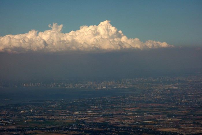 Survol de Manille qui est le centre de l'activité économique, politique, sociale et culturelle du pays. Manille est l'une des villes les plus densément peuplées au monde.
L’île de Lubang située au sud de Luçon.
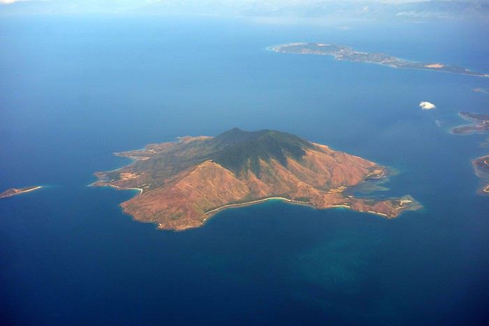
C'est sur cette île que le soldat japonais Hirō Onoda passa trente années de sa vie, entre 1944 et 1974, sans avoir connaissance de la fin de la Seconde Guerre mondiale.
En arrivant à l’aéroport ont tente la navette jusqu’au terminal 3, ont nous annonce 45 mn d’attente. Avec la fatigue et le stress du voyage nous préférons optez pour un taxi qui nous amènera au pied de l’hôtel dans le quartier de New Port.
La circulation chaotique et à les embouteillages incessants, rythme la capitale du pays. Les départs tôt ou les arrivées tardives, permettant d'éviter la circulation très dense.
Je ne m’attendais pas à voir une telle disparités entre les riches et les pauvres, de nombreux enfants errent dans les rues. On passe d’un quartier pauvre avec des maisons en tôle à un quartier de résidence haut standing.
Manille The Escapist Pointe 2 nuits Puerto Princessa Marianne hôtel 2 nuits El Nido hôtel Dreamland 2 nuits San Vicente hôtel Sunset beach 4 nuits Puerto Princessa Marianne hôtel 2 nuits Manille hôtel Condo Palm Tree 2 nuits.
Séjour du 13 au 28 avril 2018 avec la Saudia Airlines escale à Riyad.Aux Philippines, il est encore possible d’éviter le tourisme de masse. Nombreux sont les espaces vierges, les plages étendues sans aménagement. Contrairement à d’autres pays d’Asie du Sud Est, les Philippines ont de nombreuses affinités culturelles avec l'Occident. C'est, par exemple, l’un des deux seuls pays à prédominance catholique d'Asie avec le Timor orientale. Le pays a été sous domination espagnole pendant 333 ans et tire son nom de Philippe II, qui était roi d'Espagne. Sous tutelle américaine pendant 48 ans, les États-Unis imposèrent leur protectorat aux Philippines au prix d'une guerre qui a fait plus d'un million et demi de victimes. Pendant la Seconde Guerre mondiale, les troupes japonaises multiplient les exactions comme le terrible massacre de Manille en février 1945, où plus de 100 000 civils trouvent la mort.
Survol de Manille qui est le centre de l'activité économique, politique, sociale et culturelle du pays. Manille est l'une des villes les plus densément peuplées au monde.L’île de Lubang située au sud de Luçon.
C'est sur cette île que le soldat japonais Hirō Onoda passa trente années de sa vie, entre 1944 et 1974, sans avoir connaissance de la fin de la Seconde Guerre mondiale.
En arrivant à l’aéroport ont tente la navette jusqu’au terminal 3, ont nous annonce 45 mn d’attente. Avec la fatigue et le stress du voyage nous préférons optez pour un taxi qui nous amènera au pied de l’hôtel dans le quartier de New Port.
La circulation chaotique et à les embouteillages incessants, rythme la capitale du pays. Les départs tôt ou les arrivées tardives, permettant d'éviter la circulation très dense.
Je ne m’attendais pas à voir une telle disparités entre les riches et les pauvres, de nombreux enfants errent dans les rues. On passe d’un quartier pauvre avec des maisons en tôle à un quartier de résidence haut standing.
Itinéraire en Alaska, 3 semaines de mai à juin English translation pending
Bonjour,
Ça y est, le billet d’avion de mon voyage annuel est acheté! Direction l’Alaska pour trois semaines, du 20 mai au 10 juin inclusivement (arrivée et départ de Anchorage), avec ma copine.
Principaux objectifs du voyage : randonnées à la journée (nous sommes bons marcheurs et en bonne forme physique) et photographie. Aussi, un peu d’activités nautiques (kayak, canoë) et beaucoup de route (le véhicule, de type utilitaire sport, est déjà réservé).
J’ai une bonne idée de l’itinéraire pour le début et la fin du voyage. C’est en milieu de périple que ça se gâte, car il y a beaucoup d’options et je peine à me décider… D’où mon appel à vous!
Donc voici. J’arrive le 20 mai à Anchorage, en fin d’après-midi, donc je dormirai en ville. Par la suite, direction la péninsule Kenaï pour 6 nuits :
3 nuits à Homer (21, 22, 23 mai) 3 nuits à Seward (24, 25, 26 mai);
Est-ce trop? Pas assez?
Ensuite direction Valdez (2 nuits, 27 et 28 mai). Ou 3 nuits?
C’est avec la suite que j’ai de la difficulté. Je pensais au parc Wrangell – St-Elias, mais il semblerait que les loueurs de bagnoles n’autorisent pas leurs véhicules sur la route de McCarthy. Et est-ce que ce parc vaut la peine pour randonner à la journée?
Aussi, est-ce que ça vaut la peine de pousser jusqu’à Haines et/ou Skagway pour quelques jours?
Sinon j’aurais bien aimé faire un détour par le Yukon, jusqu’à Dawson City et revenir vers Tok par la Top of the World Highway. Mais encore là, il y a le problème des véhicules non autorisés sur cette route…
Autrement, je compte remonter vers Fairbanks pour redescendre vers le Denali National Park. J’ai déjà réservé une cabine à Healy pour 4 nuits (4 au 8 juin). Je pensais ensuite descendre vers Talkeetna pour 2 nuits (8 et 9 juin) et retourner directement à l’aéroport le 10 pour mon vol en soirée.
Est-ce que cet itinéraire vous semble sensé? Qu’est-ce que vous me conseilleriez pour la portion de 6 jours entre Valdez et Denali?
Merci d’avance à celles et ceux qui prendront le temps de m’éclairer!
Principaux objectifs du voyage : randonnées à la journée (nous sommes bons marcheurs et en bonne forme physique) et photographie. Aussi, un peu d’activités nautiques (kayak, canoë) et beaucoup de route (le véhicule, de type utilitaire sport, est déjà réservé).
J’ai une bonne idée de l’itinéraire pour le début et la fin du voyage. C’est en milieu de périple que ça se gâte, car il y a beaucoup d’options et je peine à me décider… D’où mon appel à vous!
Donc voici. J’arrive le 20 mai à Anchorage, en fin d’après-midi, donc je dormirai en ville. Par la suite, direction la péninsule Kenaï pour 6 nuits :
3 nuits à Homer (21, 22, 23 mai) 3 nuits à Seward (24, 25, 26 mai);
Est-ce trop? Pas assez?
Ensuite direction Valdez (2 nuits, 27 et 28 mai). Ou 3 nuits?
C’est avec la suite que j’ai de la difficulté. Je pensais au parc Wrangell – St-Elias, mais il semblerait que les loueurs de bagnoles n’autorisent pas leurs véhicules sur la route de McCarthy. Et est-ce que ce parc vaut la peine pour randonner à la journée?
Aussi, est-ce que ça vaut la peine de pousser jusqu’à Haines et/ou Skagway pour quelques jours?
Sinon j’aurais bien aimé faire un détour par le Yukon, jusqu’à Dawson City et revenir vers Tok par la Top of the World Highway. Mais encore là, il y a le problème des véhicules non autorisés sur cette route…
Autrement, je compte remonter vers Fairbanks pour redescendre vers le Denali National Park. J’ai déjà réservé une cabine à Healy pour 4 nuits (4 au 8 juin). Je pensais ensuite descendre vers Talkeetna pour 2 nuits (8 et 9 juin) et retourner directement à l’aéroport le 10 pour mon vol en soirée.
Est-ce que cet itinéraire vous semble sensé? Qu’est-ce que vous me conseilleriez pour la portion de 6 jours entre Valdez et Denali?
Merci d’avance à celles et ceux qui prendront le temps de m’éclairer!
Quarante ans après, retour en Sardaigne sur les traces de mon passé English translation pending
Je pense que, pour des raisons instinctives d’auto-protection, l’être humain n’est pas conçu pour intégrer par défaut des notions comme «plus jamais», car de telles pensées nous renvoient à la fragilité et, somme toute, à la brièveté de notre existence sur cette Terre. Elles sont génératrices de mélancolie, voire de déprime, états que l’être humain en bonne santé est programmé pour écarter autant que possible de sa route, à telle enseigne que, lorsqu’un tel état s’installe, s’installe avec lui, bien souvent, la pathologie correspondante.
Tout cela pour dire que, lorsque nous nous trouvons devant un paysage, un spectacle, un événement merveilleux, magnifique, émouvant, nous ressentons instinctivement que ce à quoi nous assistons va nous laisser un souvenir, une émotion durables, mais, au moment de nous détourner à regret pour poursuivre notre chemin, nous ne nous disons pas «plus jamais je ne verrai cet endroit» ou «je viens de voir le Soleil se coucher sur Bagan pour la dernière fois de ma vie… Demain, je reprends l’avion pour la France et je ne reviendrai plus jamais ici».
La plupart d’entre nous ne sommes pas «construits» pour nous dire ce genre de chose. Nous sommes programmés pour voir plutôt le bon côté des choses, pour profiter de la vie et de l’instant présent, voire pour anticiper les joies que recèle l’avenir («je suis impatient qu’arrive tel moment, car c’est alors que je partirai faire ce merveilleux voyage…»), et ce n’est que lorsque l’on prend conscience qu’on est maintenant plus proche de la fin de sa vie que du début, que l’on se remémore parfois quelque souvenir poignant, en se disant «hélas ! plus jamais je ne reverrai cet endroit…». Et, bien souvent, c’est malheureusement vrai.
Étant à peu près normalement constitué, je ne suis pas spécialement plus enclin à la nostalgie que mon prochain. Néanmoins, ce fut bien la nostalgie qui, au printemps 2015, me poussa à retourner en Sardaigne, avec pour principal objectif le fait de «revoir une dernière fois la baie de Cala Garibaldi à Caprera».
Comme vous en avez sûrement déjà marre de ma philosophie de comptoir, je ne vais pas épiloguer —en tous cas, pas trop longtemps. Je dirai donc seulement que, sur l’île paradisiaque de Caprera, au nord-est de la Sardaigne, fut créé dans les années cinquante un village de cases tahitiennes du Club Méditerranée, comme on appelait à l’époque ce que les paresseux d’aujourd’hui écrivent Club Med, puisqu’il faut, toujours et partout, «faire court», débordés que nous sommes par les multiples fragments d’activités entrecoupés de SMS, qui nous conduisent à un train d’enfer vers le jour de notre mort, sans même que nous ayons pris le temps de profiter… du temps qui passe, justement.
Mais je m’égare, une fois de plus.
Village du Club Med, disais-je donc. Moi, jeune ado de 14 ans passionné de voile, j’y fis en famille plusieurs séjours de deux bons mois à chaque fois, et pendant plusieurs années. Il y eut aussi la Corse, la Toscane, la Sicile, mais Caprera et la Sardaigne me marquèrent particulièrement, peut-être parce que c’est là que je vécus mes instants sportifs les plus intenses, que j’appris à naviguer dans le gros temps avec un marin qui allait devenir, quelques années plus tard, skipper de la course autour du monde, et là que je devins, à 14 ans donc, le plus jeune moniteur de voile que le Club ait jamais connu. On imagine la fierté du gamin…
Or donc, au début de l’année 2015, par le plus grand des hasards, j’appris que l’exploitation du village de Caprera avait cessé depuis plusieurs années et que tout était abandonné, laissé en l’état, sans espoir d’y faire quoi que ce soit d’autre puisque le lieu était désormais inclus dans le périmètre d’un parc naturel. La seule option était de tout détruire afin de remettre les lieux dans l’état d’origine, et bien entendu, les fonds pour ce faire manquaient.
Donc, «mon» village de Caprera pourrissait depuis déjà sept ans, sa merveilleuse baie, avec sa petite île posée au milieu, abandonnée de tous.
L’idée me vint aussitôt… que dis-je, l’ardente nécessité se fit jour aussitôt en moi: je devais retourner à Caprera pour documenter photographiquement («en mode urbex», comme diraient les jeunes d’aujourd’hui) le coin de paradis où j’avais été si heureux et si insouciant, près d’un demi-siècle auparavant.
Il me restait des photos de l’époque, photos prises par ma mère ou achetées au photographe du village (en noir-et-blanc, dans ce dernier cas), et en combinant ce qu’elles me montraient, et ce que je découvrais en utilisant les ressources de l’internet, j’acquis la seule certitude qui m’importait: il ne devait pas être difficile d’accéder physiquement dans l’enceinte du village défunt. Par exemple, depuis la plage, seule une frêle barrière en plastique souple d’un mètre de haut en défendait l’accès. J’emporterais mon fidèle Leatherman, et mon non moins fidèle Laguiole, et s’il le fallait, je saurais me servir des deux pour commettre la violation de propriété privée que j’étais tout prêt à assumer dans l’intérêt du devoir de mémoire!
J’arrivai donc en Sardaigne, et plus précisément à l’aéroport d’Alghero (grand merci au passage à Kate, dont le très joli carnet de voyage sur cette ville et ses environs m’a donné l’idée d’écrire celui-ci !), un jour de semaine parfaitement banal (et choisi comme tel) à la fin d’avril 2015. Trop tôt dans la saison pour que les premiers vacanciers soient déjà là pour s’intéresser à mes activités, mais assez tard quand même pour être quasiment assuré d’une météo typiquement sarde : soleil et belle lumière… si ce n’est qu’en débarquant de Lyon, où il faisait grand soleil, ce fut la pluie qui m’accueillit!
Je ne demeurai pas à Alghero : pour moi, de tous temps, cette ville n’avait été qu’un aéroport. Je pris aussitôt la route, au volant de ma voiture de location, destination le port de Palau, sur la côte nord-est. En chemin, je fus frappé par la magnifique perspective qui s’ouvrait depuis la nationale sur la basilique Santa Trinità di Saccargia, presque oubliée au milieu de la campagne, et dont la beauté sereine, mais aussi la triste décrépitude, me convainquirent de m’arrêter pour faire quelques photos, en profitant d’une miraculeuse éclaircie.
1. Une magnifique "casa cantoniera" abandonnée:
2 et 3. La basilique perdue au milieu des champs...
Tout cela pour dire que, lorsque nous nous trouvons devant un paysage, un spectacle, un événement merveilleux, magnifique, émouvant, nous ressentons instinctivement que ce à quoi nous assistons va nous laisser un souvenir, une émotion durables, mais, au moment de nous détourner à regret pour poursuivre notre chemin, nous ne nous disons pas «plus jamais je ne verrai cet endroit» ou «je viens de voir le Soleil se coucher sur Bagan pour la dernière fois de ma vie… Demain, je reprends l’avion pour la France et je ne reviendrai plus jamais ici».
La plupart d’entre nous ne sommes pas «construits» pour nous dire ce genre de chose. Nous sommes programmés pour voir plutôt le bon côté des choses, pour profiter de la vie et de l’instant présent, voire pour anticiper les joies que recèle l’avenir («je suis impatient qu’arrive tel moment, car c’est alors que je partirai faire ce merveilleux voyage…»), et ce n’est que lorsque l’on prend conscience qu’on est maintenant plus proche de la fin de sa vie que du début, que l’on se remémore parfois quelque souvenir poignant, en se disant «hélas ! plus jamais je ne reverrai cet endroit…». Et, bien souvent, c’est malheureusement vrai.
Étant à peu près normalement constitué, je ne suis pas spécialement plus enclin à la nostalgie que mon prochain. Néanmoins, ce fut bien la nostalgie qui, au printemps 2015, me poussa à retourner en Sardaigne, avec pour principal objectif le fait de «revoir une dernière fois la baie de Cala Garibaldi à Caprera».
Comme vous en avez sûrement déjà marre de ma philosophie de comptoir, je ne vais pas épiloguer —en tous cas, pas trop longtemps. Je dirai donc seulement que, sur l’île paradisiaque de Caprera, au nord-est de la Sardaigne, fut créé dans les années cinquante un village de cases tahitiennes du Club Méditerranée, comme on appelait à l’époque ce que les paresseux d’aujourd’hui écrivent Club Med, puisqu’il faut, toujours et partout, «faire court», débordés que nous sommes par les multiples fragments d’activités entrecoupés de SMS, qui nous conduisent à un train d’enfer vers le jour de notre mort, sans même que nous ayons pris le temps de profiter… du temps qui passe, justement.
Mais je m’égare, une fois de plus.
Village du Club Med, disais-je donc. Moi, jeune ado de 14 ans passionné de voile, j’y fis en famille plusieurs séjours de deux bons mois à chaque fois, et pendant plusieurs années. Il y eut aussi la Corse, la Toscane, la Sicile, mais Caprera et la Sardaigne me marquèrent particulièrement, peut-être parce que c’est là que je vécus mes instants sportifs les plus intenses, que j’appris à naviguer dans le gros temps avec un marin qui allait devenir, quelques années plus tard, skipper de la course autour du monde, et là que je devins, à 14 ans donc, le plus jeune moniteur de voile que le Club ait jamais connu. On imagine la fierté du gamin…
Or donc, au début de l’année 2015, par le plus grand des hasards, j’appris que l’exploitation du village de Caprera avait cessé depuis plusieurs années et que tout était abandonné, laissé en l’état, sans espoir d’y faire quoi que ce soit d’autre puisque le lieu était désormais inclus dans le périmètre d’un parc naturel. La seule option était de tout détruire afin de remettre les lieux dans l’état d’origine, et bien entendu, les fonds pour ce faire manquaient.
Donc, «mon» village de Caprera pourrissait depuis déjà sept ans, sa merveilleuse baie, avec sa petite île posée au milieu, abandonnée de tous.
L’idée me vint aussitôt… que dis-je, l’ardente nécessité se fit jour aussitôt en moi: je devais retourner à Caprera pour documenter photographiquement («en mode urbex», comme diraient les jeunes d’aujourd’hui) le coin de paradis où j’avais été si heureux et si insouciant, près d’un demi-siècle auparavant.
Il me restait des photos de l’époque, photos prises par ma mère ou achetées au photographe du village (en noir-et-blanc, dans ce dernier cas), et en combinant ce qu’elles me montraient, et ce que je découvrais en utilisant les ressources de l’internet, j’acquis la seule certitude qui m’importait: il ne devait pas être difficile d’accéder physiquement dans l’enceinte du village défunt. Par exemple, depuis la plage, seule une frêle barrière en plastique souple d’un mètre de haut en défendait l’accès. J’emporterais mon fidèle Leatherman, et mon non moins fidèle Laguiole, et s’il le fallait, je saurais me servir des deux pour commettre la violation de propriété privée que j’étais tout prêt à assumer dans l’intérêt du devoir de mémoire!
J’arrivai donc en Sardaigne, et plus précisément à l’aéroport d’Alghero (grand merci au passage à Kate, dont le très joli carnet de voyage sur cette ville et ses environs m’a donné l’idée d’écrire celui-ci !), un jour de semaine parfaitement banal (et choisi comme tel) à la fin d’avril 2015. Trop tôt dans la saison pour que les premiers vacanciers soient déjà là pour s’intéresser à mes activités, mais assez tard quand même pour être quasiment assuré d’une météo typiquement sarde : soleil et belle lumière… si ce n’est qu’en débarquant de Lyon, où il faisait grand soleil, ce fut la pluie qui m’accueillit!
Je ne demeurai pas à Alghero : pour moi, de tous temps, cette ville n’avait été qu’un aéroport. Je pris aussitôt la route, au volant de ma voiture de location, destination le port de Palau, sur la côte nord-est. En chemin, je fus frappé par la magnifique perspective qui s’ouvrait depuis la nationale sur la basilique Santa Trinità di Saccargia, presque oubliée au milieu de la campagne, et dont la beauté sereine, mais aussi la triste décrépitude, me convainquirent de m’arrêter pour faire quelques photos, en profitant d’une miraculeuse éclaircie.
1. Une magnifique "casa cantoniera" abandonnée:
2 et 3. La basilique perdue au milieu des champs...
Magnifique Lisbonne English translation pending
Magnifique Lisbonne 😎
A la suite de plusieurs séjour à Lisbonne, je me lance pour vous présenter mon 2ème carnet de voyage (le premier étant "Rome"). J'espère qu'il vous plaira et vous aidera à organiser votre futur voyage. C’est sur la période des vacances de Pâques 2017 que j’ai décidé d’emmener à nouveau ma petite famille à Lisbonne, magnifique capitale ou il y fait bon vivre et flâner.
Se joindront à nous cette année mes parents avec qui je me ferais un plaisir de leur faire découvrir cette ville aux mille couleurs et faire le plein de soleil, au moment ou on le cherche désespérément en Normandie.
C’est sur la période des vacances de Pâques 2017 que j’ai décidé d’emmener à nouveau ma petite famille à Lisbonne, magnifique capitale ou il y fait bon vivre et flâner.
Se joindront à nous cette année mes parents avec qui je me ferais un plaisir de leur faire découvrir cette ville aux mille couleurs et faire le plein de soleil, au moment ou on le cherche désespérément en Normandie.
Dans ce 1er sujet, je vais vous parler rapidement de la logistique et de la préparation en amont de ce voyage. Alors voici :
Les dates : Du 11 au 18 avril 2017 (Du mardi au mardi, les billets sont moins chers en semaine que les week-end). A prendre en compte quand on a pas de dates précises.
La compagnie : Ryanair (Paris Beauvais / Lisbonne) : 543 € pour 6 billets aller/retour
Le parking de l’aéroport => Parking « Voisin » : 3 €/jour soit 24 €, pour + de renseignement : www.facebook.com/...sin-473289902737264/
Le logement, trouvé sur AirBnB : www.airbnb.fr/rooms/87723, 538 € la semaine.
Pour les transports sur place, on a opté pour la carte Viva Viagem, comme tout le monde d'ailleurs. On a préféré la formule Zapping, c’est à dire que l’on rechargeait notre carte au fur et à mesure de nos besoins. L’avantage avec le Zapping c’est que la carte fonctionne pour tous les transports (métro, bus, tram, trains pour Cascais et pour Sintra ainsi que les navettes fluviales) contrairement au Pass journée (6,15 €) mais qui ne fonctionne pas avec les ferries et les trains.
Cela nous a coûté environ 30-33 € / cartes pour la semaine (Moins onéreux que si nous avions pris le Pass journée à chaque fois).
Pour les restos, ça a été très aléatoire.
Chaque matin nous prenions notre petit déjeuner à l’enseigne SAGA, une sorte de boulangerie/patisserie/brasserie. Délicieux.
Environ 25 € pour 6 pers (boissons chaudes, 1 viennoiserie, 1 jus d’orange frais)
Pour les repas, nous privilégions un repas rapide le midi de façon à pouvoir visiter un maximum dans la journée et en soirée on se faisait un petit resto avant de rentrer à l’appartement.
Tout les frais sur place ont été divisé en 2 (mes parents et nous). On a instauré un porte monnaie commun que l’on réapprovisionnait lorsque cela était nécessaire. En gros, nous avons retiré 800 € chacun la semaine soit 1600 €. Nous étions 6, ma femme et moi, nos enfants (12 et 14 ans) et mes parents. Le budget de la semaine nous à servi principalement pour les repas, les goûters, les visites et les transports.
Concernant notre semaine, en voici le programme :
Mardi 11 : Arrivée vers 12h15. Réception de notre logement puis ballade dans Lisbonne Mercredi 12 : Journée à Sintra Jeudi 13 : Journée à Bélem Vendredi 14 : Lisbonne centre Samedi 15 : Parc des Nations et Château Saint Jorges Dimanche 16 : Journée à Cascais Lundi 17 : Christ Roi puis Lisbonne
Météo : Magnifique, une moyenne de 18° la nuit et 26° la journée. Plein soleil tous les jours.
Passons maintenant à notre semaine proprement dites, détaillée jour par jour.
A la suite de plusieurs séjour à Lisbonne, je me lance pour vous présenter mon 2ème carnet de voyage (le premier étant "Rome"). J'espère qu'il vous plaira et vous aidera à organiser votre futur voyage.
C’est sur la période des vacances de Pâques 2017 que j’ai décidé d’emmener à nouveau ma petite famille à Lisbonne, magnifique capitale ou il y fait bon vivre et flâner.
Se joindront à nous cette année mes parents avec qui je me ferais un plaisir de leur faire découvrir cette ville aux mille couleurs et faire le plein de soleil, au moment ou on le cherche désespérément en Normandie.Dans ce 1er sujet, je vais vous parler rapidement de la logistique et de la préparation en amont de ce voyage. Alors voici :
Les dates : Du 11 au 18 avril 2017 (Du mardi au mardi, les billets sont moins chers en semaine que les week-end). A prendre en compte quand on a pas de dates précises.
La compagnie : Ryanair (Paris Beauvais / Lisbonne) : 543 € pour 6 billets aller/retour
Le parking de l’aéroport => Parking « Voisin » : 3 €/jour soit 24 €, pour + de renseignement : www.facebook.com/...sin-473289902737264/
Le logement, trouvé sur AirBnB : www.airbnb.fr/rooms/87723, 538 € la semaine.
Pour les transports sur place, on a opté pour la carte Viva Viagem, comme tout le monde d'ailleurs. On a préféré la formule Zapping, c’est à dire que l’on rechargeait notre carte au fur et à mesure de nos besoins. L’avantage avec le Zapping c’est que la carte fonctionne pour tous les transports (métro, bus, tram, trains pour Cascais et pour Sintra ainsi que les navettes fluviales) contrairement au Pass journée (6,15 €) mais qui ne fonctionne pas avec les ferries et les trains.
Cela nous a coûté environ 30-33 € / cartes pour la semaine (Moins onéreux que si nous avions pris le Pass journée à chaque fois).
Pour les restos, ça a été très aléatoire.
Chaque matin nous prenions notre petit déjeuner à l’enseigne SAGA, une sorte de boulangerie/patisserie/brasserie. Délicieux.
Environ 25 € pour 6 pers (boissons chaudes, 1 viennoiserie, 1 jus d’orange frais)
Pour les repas, nous privilégions un repas rapide le midi de façon à pouvoir visiter un maximum dans la journée et en soirée on se faisait un petit resto avant de rentrer à l’appartement.
Tout les frais sur place ont été divisé en 2 (mes parents et nous). On a instauré un porte monnaie commun que l’on réapprovisionnait lorsque cela était nécessaire. En gros, nous avons retiré 800 € chacun la semaine soit 1600 €. Nous étions 6, ma femme et moi, nos enfants (12 et 14 ans) et mes parents. Le budget de la semaine nous à servi principalement pour les repas, les goûters, les visites et les transports.
Concernant notre semaine, en voici le programme :
Mardi 11 : Arrivée vers 12h15. Réception de notre logement puis ballade dans Lisbonne Mercredi 12 : Journée à Sintra Jeudi 13 : Journée à Bélem Vendredi 14 : Lisbonne centre Samedi 15 : Parc des Nations et Château Saint Jorges Dimanche 16 : Journée à Cascais Lundi 17 : Christ Roi puis Lisbonne
Météo : Magnifique, une moyenne de 18° la nuit et 26° la journée. Plein soleil tous les jours.
Passons maintenant à notre semaine proprement dites, détaillée jour par jour.
La nation arc en ciel English translation pending
Début de notre périple de 15 jours en Afrique du Sud en commençant par une visite rapide de Johannesburg, le temps d'une journée, en toute indépendance avec une voiture reservé chez Avis et des hébergements réservés à l'avance le long du circuit. On voyage en famille deux adultes et trois enfants (12, 8 et 3 ans).
 Première surprise le sentiment d'insécurité, l’Afrique du Sud connaît une insécurité énorme et les crimes sont nombreux, mais la grande majorité des incidents concernent les Townships (bidonvilles).
Deuxième surprise, l'installation d'étranges portiques sur les autoroutes, equipés de caméras permettant de reconnaître les plaques d'immatriculation et de capteurs pour les boîtiers de télépéage des abonnés.
C'est assez déroutant au début, mais les tarifs sont bas.
Première surprise le sentiment d'insécurité, l’Afrique du Sud connaît une insécurité énorme et les crimes sont nombreux, mais la grande majorité des incidents concernent les Townships (bidonvilles).
Deuxième surprise, l'installation d'étranges portiques sur les autoroutes, equipés de caméras permettant de reconnaître les plaques d'immatriculation et de capteurs pour les boîtiers de télépéage des abonnés.
C'est assez déroutant au début, mais les tarifs sont bas.
 Achat et échange d'argent à la banque au Mall Africa ou l'on découvre la lenteur de l'administration.
Départ le lendemain en direction de la route panoramique de blyde river canyon.
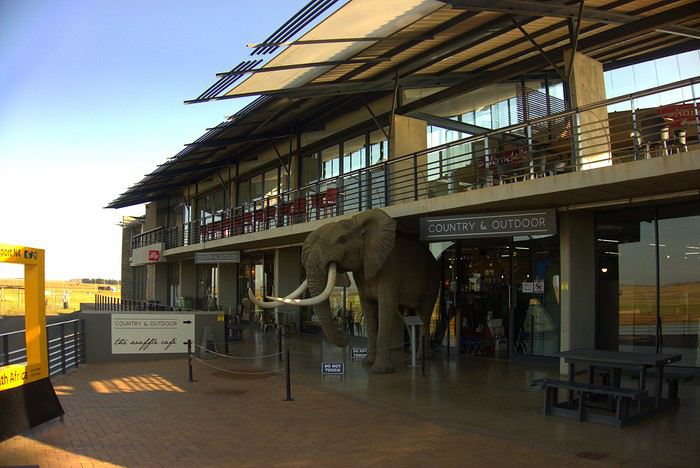 Découverte de nos premiers animaux dans une station d'autoroute.
La visite de la route panoramique se fait très facilement.
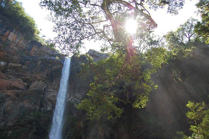 Lone Creek Falls.
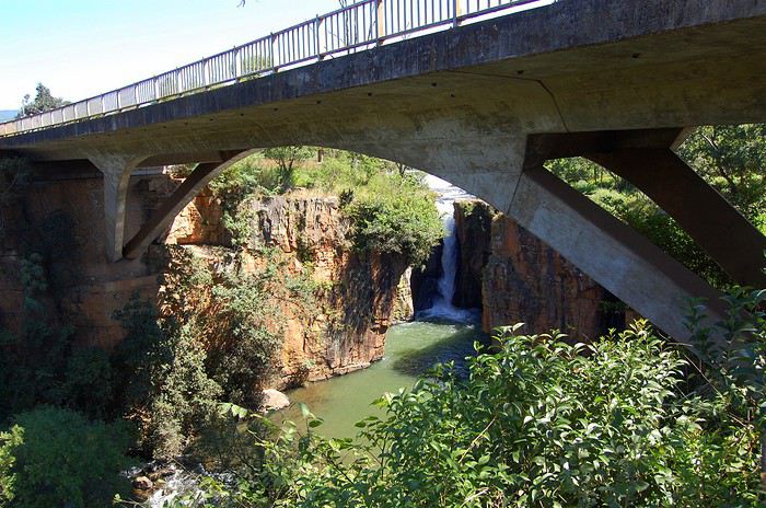 Sabie Falls.
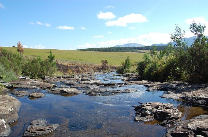 Plusieurs sites exceptionnels se succèdent, des magnifiques cascades, ainsi que des vallées verdoyantes.
 Mac Mac Pools.
 Mac Mac Falls.
 Des hautes falaises surplombent des paysages fabuleux.
 The Pinnacle Rock.
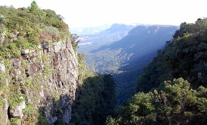 God's Window.
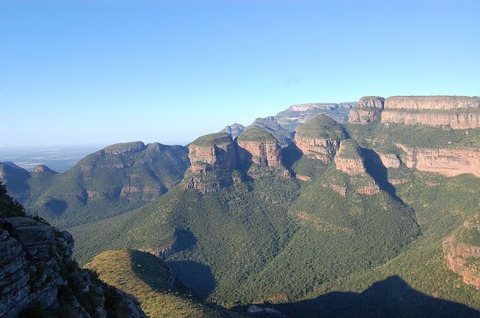 Three Rondavels View Point.
 A la tombée de la nuit, on pose nos bagages au Giraffe lodge, à hoedspruit,
 C'est un domaine privé à l'extèrieur du parc Kruger.
Demain, Les animaux de la savane nous attendent, on se lève à l’aube pour partir le plus tôt possible, rentrer le plus tard possible, c’est le matin et le soir qu’on voit le plus d’animaux. Le Kruger National Park est la plus grande réserve animalière d'Afrique du Sud.
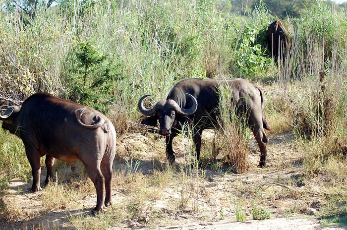 On explore le parc par Orpen gate, stoppant notre voiture à la moindre rencontre.
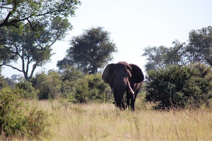 Un éléphant attire notre attention 🙂 wow, un moment magique.
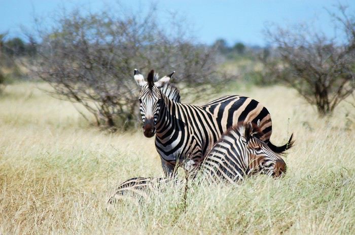 Le safari dans le parc Kruger est extraordinaire.
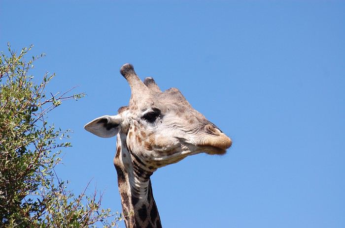 On ne sait plus où donner de la tête, un peu comme cette girafe.😛
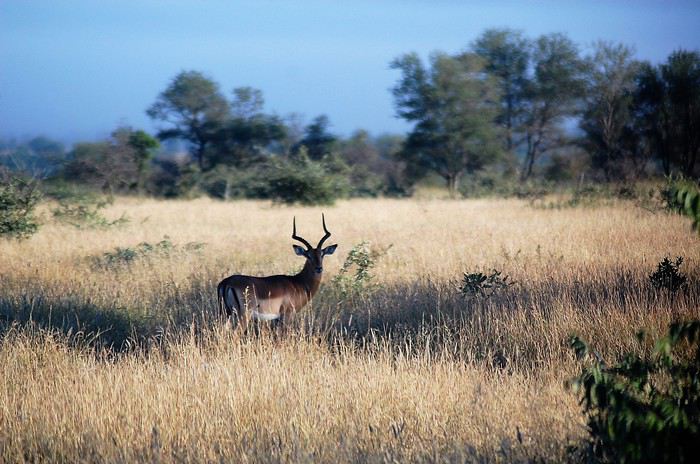 Les moments inoubliables se succèdent.
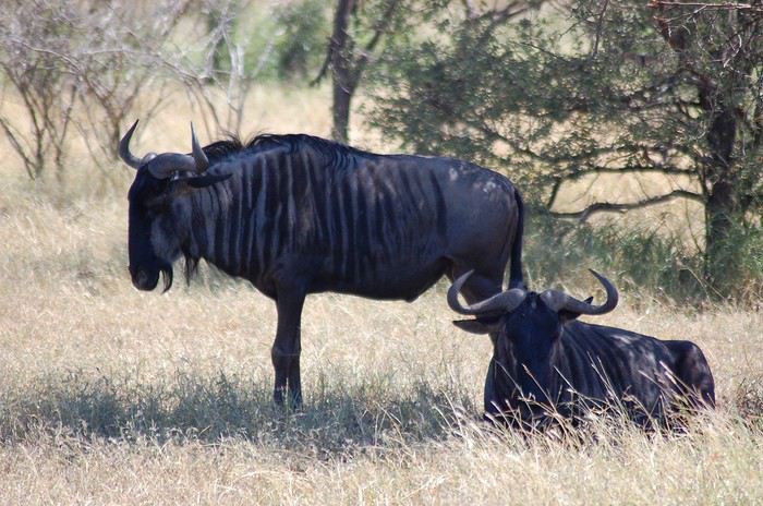 A suivre...
Première surprise le sentiment d'insécurité, l’Afrique du Sud connaît une insécurité énorme et les crimes sont nombreux, mais la grande majorité des incidents concernent les Townships (bidonvilles).
Deuxième surprise, l'installation d'étranges portiques sur les autoroutes, equipés de caméras permettant de reconnaître les plaques d'immatriculation et de capteurs pour les boîtiers de télépéage des abonnés.
C'est assez déroutant au début, mais les tarifs sont bas.
Achat et échange d'argent à la banque au Mall Africa ou l'on découvre la lenteur de l'administration.Départ le lendemain en direction de la route panoramique de blyde river canyon.
Découverte de nos premiers animaux dans une station d'autoroute.La visite de la route panoramique se fait très facilement.
Lone Creek Falls.
Sabie Falls.
Plusieurs sites exceptionnels se succèdent, des magnifiques cascades, ainsi que des vallées verdoyantes.
Mac Mac Pools.
Mac Mac Falls.
Des hautes falaises surplombent des paysages fabuleux.
The Pinnacle Rock.
God's Window.
Three Rondavels View Point.
A la tombée de la nuit, on pose nos bagages au Giraffe lodge, à hoedspruit,
C'est un domaine privé à l'extèrieur du parc Kruger.Demain, Les animaux de la savane nous attendent, on se lève à l’aube pour partir le plus tôt possible, rentrer le plus tard possible, c’est le matin et le soir qu’on voit le plus d’animaux. Le Kruger National Park est la plus grande réserve animalière d'Afrique du Sud.
On explore le parc par Orpen gate, stoppant notre voiture à la moindre rencontre.
Un éléphant attire notre attention 🙂 wow, un moment magique.
Le safari dans le parc Kruger est extraordinaire.
On ne sait plus où donner de la tête, un peu comme cette girafe.😛
Les moments inoubliables se succèdent.
A suivre...Vol pour Plovdiv (Bulgarie) English translation pending
Bonjour,
quelqu'un pourrait-il me donner des infos sur les compagnies qui font des vols de paris ou de belgique pour Plovdiv. plutôt des lows coats puisque c'est pour un long we.
merci laurence
quelqu'un pourrait-il me donner des infos sur les compagnies qui font des vols de paris ou de belgique pour Plovdiv. plutôt des lows coats puisque c'est pour un long we.
merci laurence
Codes de réduction pour location de voiture aux États-Unis English translation pending
Bonjour
Je pense que l'on pourrait mettre en commun nos codes de réductions récents qui marchent (j'en ai noté plein mais j'ai bien l'impression qu'ils ne marchent plus)
Pour AVIS j'ai J046307 mais il ne marche pas.
Par contre bon plan -5% chez avis avec Igraal
Igraal marche aussi chez hertz et autoeurope
Je cherche activement un bon tarif pour cet été je suis passé à côté d'un bon tarif sur avis.es
Je suis super déçue alors je fouille
Je cherche activement un bon tarif pour cet été je suis passé à côté d'un bon tarif sur avis.es
Je suis super déçue alors je fouille