Results for "Art+moderne+Istanbul+|+123+>+233"
12963 results found.
100 jours/20 villes (régions) en Europe de l'ouest English translation pending
Bonjour,
J'ai 26 ans et je pars pour l'Europe de l'Ouest du 22 aout au 30 novembre avec un Eurail pass qui me permet de voyager à volonté en France, Espagne, Portugal, Italie, Belgique, Allemagne, Hollande, Autriche...
J'aimerais savoir ce que vous visiteriez en 20 coups de coeurs. Soyez diversifiez, c'est surement ma seule chance d'y aller...
MErci
Nancy
J'ai 26 ans et je pars pour l'Europe de l'Ouest du 22 aout au 30 novembre avec un Eurail pass qui me permet de voyager à volonté en France, Espagne, Portugal, Italie, Belgique, Allemagne, Hollande, Autriche...
J'aimerais savoir ce que vous visiteriez en 20 coups de coeurs. Soyez diversifiez, c'est surement ma seule chance d'y aller...
MErci
Nancy
Excursion à partir du Playa Pesquero English translation pending
😎 Bonjour à tous,
Nous partons au Playa Pesquero le 11 avril. Nous voulons probablement faire une excursion. Selon votre expérience, laquelle recommendez-vous? Pouvez-vous aussi nous indiquer le prix afin qu'on puisse le planifier dans notre budget de voyage.
Merci!
Soal
Nous partons au Playa Pesquero le 11 avril. Nous voulons probablement faire une excursion. Selon votre expérience, laquelle recommendez-vous? Pouvez-vous aussi nous indiquer le prix afin qu'on puisse le planifier dans notre budget de voyage.
Merci!
Soal
From Mexico to the Wonderful Chiapas
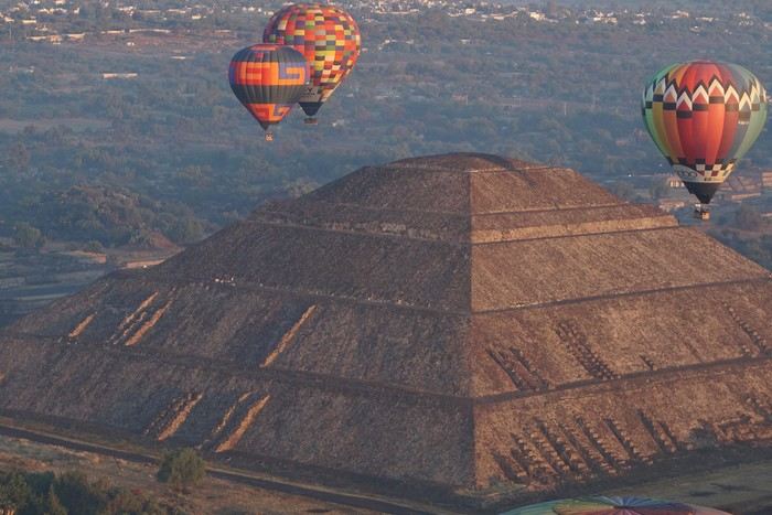
This one-month trip, from January 18 to February 17, 2026, allowed us to visit Mexico City and travel through the states of Puebla, Oaxaca, and Chiapas. We mainly used buses (ADO company) for medium and long distances and colectivos or taxis (or Uber) for shorter trips. Before leaving, I had contacted several people on the ground: Harry, a Vendéan settled in Oaxaca offering, among other things, discoveries of artisan villages or the Monte Albán site, and Oscar in Comitán de Domínguez. I’ll come back to our meeting with Oscar, who runs a local agency (CVL Travel Turismo Alternativo & Corre la voz) and owns a very pleasant hostel, a real highlight of our trip. Our journey took place in 8 stages on a loop starting from Mexico City. The connections between each were made by day or night buses depending on the trip duration. I had booked our seats in advance, either directly on the ADO company’s website or through booking platforms depending on the rates offered. Note that by planning ahead, I was able to benefit from very interesting "Early Booking" rates. There are several comfort classes. For all our trips, I had booked seats in Primera class buses, except for two in GL (Grand Luxe) class. The rates are very reasonable, and the buses turned out to be comfortable or even very comfortable (only the basic seat recline might surprise you).
Our itinerary and number of days per stage: Stage 1 – Mexico City: 4 days Stage 2 – Puebla: 2 days Stage 3 – Oaxaca: 4 days Stage 4 – San Agustinillo: 4 days Stage 5 – San Cristóbal de las Casas: 3 days Stage 6 – Comitán de Domínguez: 6 days Stage 7 – Palenque: 4 days Stage 8 – Mexico City: 2 days If I were to do it again, I’d remove one day from Palenque and add it either to Puebla or San Cristóbal to visit nearby sites or villages, or to San Agustinillo to enjoy one more day by the Pacific Ocean.
Stage 1: Mexico City (2,200 m / 9.2 million inhabitants) We arrived in the Mexican capital around 10:00 PM. The simplified customs process was very quick. After exchanging some money at the airport, we took a taxi to our youth hostel. We got around the capital on foot, of course, but also by metro. Signs are very rare, and we took the train in the wrong direction several times. After a few mistakes, we systematically asked on the platform if we were going the right way. The metro is very affordable. You need to get a rechargeable card (the Tarjeta de Movilidad Integrada) and top it up as needed. This card (less than 1 €) isn’t personal, so there’s no need to get one per person.
Mexico City: Day 1.
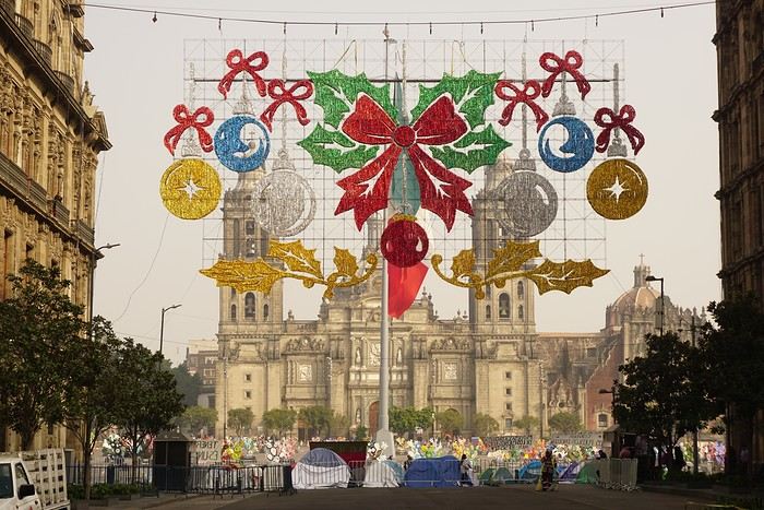
Visits and walks of the day (note: many museums are closed on Mondays): The Zócalo or Constitution Square: it’s one of the most beautiful, largest (195m x 240m), and oldest squares in the world. This is where Cortés decided to build the center of the new Spanish city on the site of the former Tenochtitlan market. Stones from the pyramids were used to pave the esplanade and build the surrounding colonial churches and buildings. During our visit, the huge square was covered with (resin) cacti, the theme of the temporary exhibition at the time. Indeed, temporary events or exhibitions take place here throughout the year. It’s also the endpoint for many protest marches.
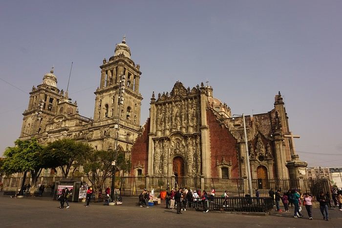
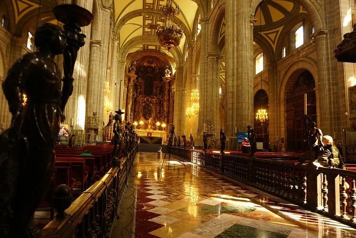


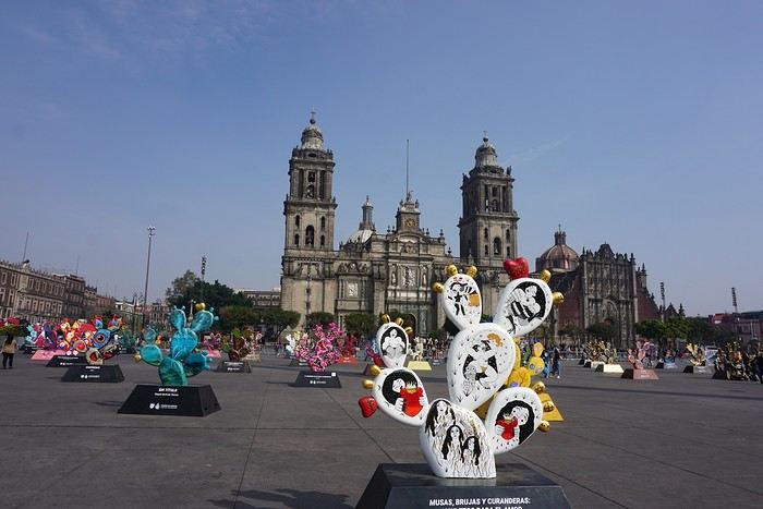
The cathedral: it’s sinking by one centimeter per year despite massive stabilization work (the collapse of many Mexican buildings—30 cm/year—is due to groundwater pumping). It was built starting in 1571 and completed in... 1813. The modest remains of the Templo Mayor (exterior view): they have high symbolic value, as this monument was the most important in the Mexica Empire.
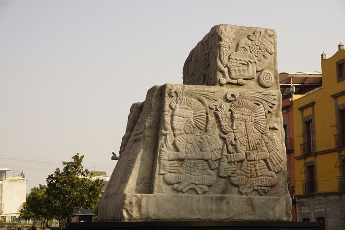 We then walked through the streets of the historic center to the Santísima Church, unfortunately closed for renovation work.
Next, we took the metro to visit one of Mexico’s most important pilgrimage sites: the Insigne y Nacional Basílicas de Santa María de Guadalupe, as well as the Capilla del Cerrito on the hill.
The first, dating from the colonial era, is really leaning a lot.
We then walked through the streets of the historic center to the Santísima Church, unfortunately closed for renovation work.
Next, we took the metro to visit one of Mexico’s most important pilgrimage sites: the Insigne y Nacional Basílicas de Santa María de Guadalupe, as well as the Capilla del Cerrito on the hill.
The first, dating from the colonial era, is really leaning a lot.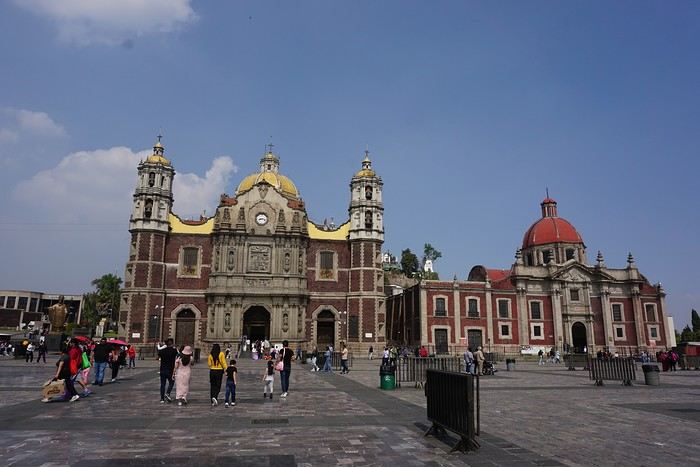
The second, shaped like a rotunda, is very impressive from the inside.
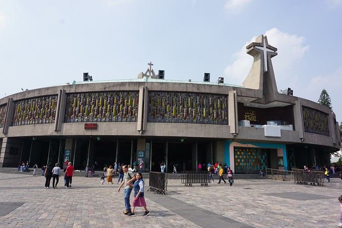
In the basement, there’s a sacred tunic where, in 1531, an image of the Virgin Mary is said to have appeared. A real mystery for scientists, the garment has never deteriorated since that date. Slow-moving conveyor belts allow pilgrims to admire it, preventing crowds from gathering in front of the image for hours. Well thought out!
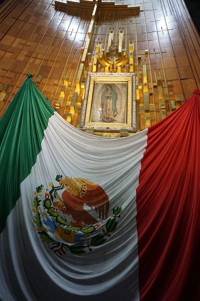 From the top of the Capilla del Cerrito, you get beautiful views of huge Mexico City.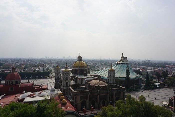
Tunisian Impressions (Live)
Hi there,
I arrived in Tunisia this afternoon for a full 14-day stay.
I took a direct Tunisair flight from Nice, which departed about thirty minutes late (that’s nothing compared to the "nightmares" I’ve had on some of my recent trips).
The flight lasts around 1 hour and 20 minutes, and a small snack was served on board (a sort of quiche with chickpea purée, a small bread roll, a portion of cheese like La Vache qui rit, and a small chocolate cake). It’s worth mentioning because it’s becoming increasingly rare on short flights. I was seated between two Tunisian gentlemen who gave me some great tips for my trip, especially about negotiating prices. One of them is a former cameraman for France Télévisions, very cultured and well-traveled—his daughter is a journalist at France Télévisions (I found some of her articles online). In short, the flight was very pleasant and quick.

I’m staying at the Hôtel Royal Victoria. I booked it yesterday afternoon by email without providing my credit card number. The room costs 241 TND (71 €) with breakfast included. It has heating, a small fridge, a safe, a hairdryer, Wi-Fi, and a TV with international channels. There’s a police van permanently parked in the square where the hotel is located.
This hotel is housed in the former British consulate and later embassy. It has a lot of charm with its painted wood ceilings and doors, and its bathroom covered in ceramic tiles. The tiny elevator is from another era. The main advantage of the hotel is its location between the medina and Avenue Bourguiba. Nearby, there’s the Magasin Général, where you can find groceries and some typical products like rose water, geranium water, and tons of halwa (a customer kindly explained how to eat it and which is the best).
After nightfall, I took a short stroll down Avenue Bourguiba. There weren’t many people around—it’s windy and cold.
I’ve already noticed the warm welcome from Tunisians. The supermarket cashier welcomed me to Tunisia, and a gentleman I asked for directions to the Magasin Général (I was about to climb stairs leading to a mosque!) insisted on inviting me for coffee, but I declined.
The rest of my itinerary will depend on the weather. If it doesn’t rain tomorrow, I might visit Carthage since the Bardo Museum is closed on Mondays, as are the museums in Sidi Bou Said.
TO BE CONTINUED...


I arrived in Tunisia this afternoon for a full 14-day stay.
I took a direct Tunisair flight from Nice, which departed about thirty minutes late (that’s nothing compared to the "nightmares" I’ve had on some of my recent trips).
The flight lasts around 1 hour and 20 minutes, and a small snack was served on board (a sort of quiche with chickpea purée, a small bread roll, a portion of cheese like La Vache qui rit, and a small chocolate cake). It’s worth mentioning because it’s becoming increasingly rare on short flights. I was seated between two Tunisian gentlemen who gave me some great tips for my trip, especially about negotiating prices. One of them is a former cameraman for France Télévisions, very cultured and well-traveled—his daughter is a journalist at France Télévisions (I found some of her articles online). In short, the flight was very pleasant and quick.
I’m staying at the Hôtel Royal Victoria. I booked it yesterday afternoon by email without providing my credit card number. The room costs 241 TND (71 €) with breakfast included. It has heating, a small fridge, a safe, a hairdryer, Wi-Fi, and a TV with international channels. There’s a police van permanently parked in the square where the hotel is located.
This hotel is housed in the former British consulate and later embassy. It has a lot of charm with its painted wood ceilings and doors, and its bathroom covered in ceramic tiles. The tiny elevator is from another era. The main advantage of the hotel is its location between the medina and Avenue Bourguiba. Nearby, there’s the Magasin Général, where you can find groceries and some typical products like rose water, geranium water, and tons of halwa (a customer kindly explained how to eat it and which is the best).
After nightfall, I took a short stroll down Avenue Bourguiba. There weren’t many people around—it’s windy and cold.
I’ve already noticed the warm welcome from Tunisians. The supermarket cashier welcomed me to Tunisia, and a gentleman I asked for directions to the Magasin Général (I was about to climb stairs leading to a mosque!) insisted on inviting me for coffee, but I declined.
The rest of my itinerary will depend on the weather. If it doesn’t rain tomorrow, I might visit Carthage since the Bardo Museum is closed on Mondays, as are the museums in Sidi Bou Said.
TO BE CONTINUED...
Review of an Aegean Sea cruise on Ponant's Bougainville from November 1-8, 2025
Hello everyone,
If you'd like, I invite you to join me for a week-long cruise to northern Greece, visiting ports that are often less crowded with cruise ships.
Itinerary: Athens, Skiathos, Volos, Thessaloniki, Kavala, Limnos, Hydra, Athens
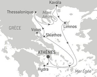
If you'd like, I invite you to join me for a week-long cruise to northern Greece, visiting ports that are often less crowded with cruise ships.
Itinerary: Athens, Skiathos, Volos, Thessaloniki, Kavala, Limnos, Hydra, Athens
15-Day Road Trip Recap: Colorado and New Mexico
Hello, here’s a totally subjective recap of our 15-day road trip between Colorado and New Mexico, from late September to mid-October.
Our main interests are culture, museums, and landscapes—no hiking or trails for us. Personally, I’m pretty contemplative, and luckily, there’s always something to see out there! We’re pretty used to the US; we’ve been going there often for a long time (let’s just say we’re not exactly young anymore).
Budget: Even though we don’t set a strict budget beforehand, we try to keep costs as low as possible. This time, we managed to spend around 4000 € for two, all included. To do this: avoid expensive accommodations, staying between 60 and 120 € per night with an average of 90 €/night, mixing Airbnb and motels. And skip the “real” restaurants, which are pretty pricey in the US: sandwiches for lunch, takeout or cooking in the Airbnb in the evening. We shop at Sprouts or Whole Foods—organic-style chains that are pricier than Walmart but better. In the evenings, Sprouts has discounts on items that didn’t sell during the day. Also, avoid toll roads, paid parking, and overly expensive attractions or sites. The dispensary budget is separate…
Route: Denver/Colorado Springs/Alamosa/Raton/Santa Fe/Cuba/Cortez/Grand Junction/Glenwood Springs/Denver This wasn’t too planned in advance—we booked a few nights upon arrival and went with the flow. Flight from CDG to Denver with AF/Delta, car rental at Dollar for a standard SUV. The guy at the Dollar counter upsold me on extra insurance for flat tires (and since I knew we’d be off-roading, I took it). Without telling me, he upgraded me to a Jeep Sahara 4X4 Hybrid. Nice.
Listening to the news upon arrival, the anchor announced, “It’s officially fall now.” We hadn’t really thought about that before leaving, but yeah—it’s the time when the trees turn fluorescent yellow and red. Amazing.
Colorado Springs: Garden of the Gods is a free park with paved trails winding through red/orange rock formations. Magical at sunrise—groups of deer roam around, along with birds and rabbits. It’s small but wow! Didn’t try the Manitou Incline in Manitou Springs, a staircase with thousands of steps going straight up the mountain. Impressive from the bottom, but the parking is paid, which is a downside for those willing to tackle it. The Cog Railway goes up to the summit of Pikes Peak—around $100 when we were there. No thanks. And of course, the parking is paid too. For fans, Maggie’s Farm dispensary is great.
On Route 24, Eleven Mile Canyon Recreation Area is fly-fishing paradise—just like in the movie *A River Runs Through It*. Entry is $11, and a trail follows the river at the bottom of the canyon to the dam. Dozens of people in waders are in the water, casting their lines over and over. You can see the salmon in the clear water, and we had a picnic in the sun, imagining Brad Pitt catching a fish.
Buena Vista: A cute little tourist town with an Outdoor Fair that day—some pretty impressive vehicles for sale, set up for mountain living (like Juniper outfitting a RAM).
Alamosa: The closest town to Great Sand Dunes National Park, crossed by the Rio Grande (and let’s be real—it’s more of a stream than a river!). Park access was free because it was National Park Day. A park with massive dunes—climbing them is pretty exhausting, with lots of wind and sinking sand. Glad we didn’t do it in summer; I can’t imagine how tough it’d be in the heat. It’s a bit deceptive: it looks easy to get to the top of a dune, but it’s really not. The campsites were nice, and it was busy that weekend. We passed the “Point of No Return,” a sandy trail winding through the hills and connecting to Route 559 from above. Didn’t go all the way, but it’s possible the entrance is free from that side. However, you need a 4X4 with good ground clearance. After 1 or 2 km on the trail, you’re alone between the dunes and hills—hardly anyone around. But tricky to turn around or pass other vehicles; the trail isn’t wide. We crossed paths with a Hanomag (registered in the Netherlands—impressive!) coming down without stopping, or risking getting stuck.
On the way out, we took the small Route 403, which quickly turns into a trail crossing the mountain. Entire sections of forest were turning fluorescent yellow with patches of green and red—an incredible sight.
Raton: A small town that probably peaked in the late 19th century and has been in slow decline ever since. The Raton Pass Motor Inn is the kind of place that makes the US legendary—entirely 50s and 60s decor, really well done. I had the Betty Page room—too cool. Felt like we were on Route 66. Even better.
Santa Fe: A small city with no high-rises—almost all low-rise buildings, many in adobe, blending perfectly into the landscape. The old downtown is touristy but nice, with its plaza and church. There’s a really cool vibe—we loved it. For drinks, the bar at the top of La Fonda Hotel was packed for sunset, with a diverse crowd. Not overpriced for the location. SITE Santa Fe is a contemporary art space near the train station. It’s free, and the temporary exhibit was really good—high quality. Museum Hill is, as the name suggests, where several museums are located. We visited the Museum of Indian Art and Culture—great if you’re into “First Nations” history. Saw The Dandy Warhols at The Bridge—an outdoor venue, one of the last concerts of the season before winter makes it too cold. Oddly, there was no bag check, just an ID required (even though it was obvious we were over 21!). Tickets were reasonable, around $30 (concerts in the US can be crazy expensive). The band was good, with fewer than 300 people in front. A sign at the bar warned: Don’t forget you’re at 1,500 meters—alcohol hits harder up here!
Albuquerque: A sprawling city with an old historic center that feels a bit like Disneyland—too perfect for my taste. The real highlight is the Sandia Peak Tramway, which goes up to the old ski resort above the city. Tickets are around $35, and it’s worth it—the ride over the canyons is pretty wild. The ski resort is a bit abandoned; apparently, like elsewhere, there’s no snow anymore. I asked several people about the lack of snow, and the answer was always the same: “It’s cyclical.” Okay then. We arrived for the start of the International Balloon Fiesta (one of the world’s largest hot-air balloon gatherings), hoping to see hundreds of balloons in the sky. Nope—windy today, so no one took off. Bummer.
Las Vegas: New Mexico has its own Las Vegas, but it’s nothing like the other one—a sleepy little town with a perfectly preserved 19th-century Historic Plaza Hotel, brick buildings, and vintage streetlights. Everything is so well-preserved it’s often used as a filming location. NM attracts a lot of productions thanks to tax incentives and its Western landscapes—and it’s cheaper than California! That day, a huge Texas flag was flying in the wind: they were filming the second season of *Ransom Canyon* for Netflix in the town center. If we’d been dressed more “Western,” we could’ve been extras.
Jemez Springs: Its Jemez Hot Springs is super cute—several thermal pools at different temperatures, a New Age vibe. The pools are surrounded by big rocks, and you’re asked to speak softly. A place where you could spend hours. $50 for two hours for two.
Los Alamos: A town made legendary by the bomb, the movie, etc. Heads up: It’s still a research center, and to cross part of the town, you need to show ID. No stopping or taking photos allowed. Other than the Oppenheimer House (currently closed—only the neighboring house is open to visitors), there’s not much to see. There’s a replica of the camp entrance, but it’s been turned into restrooms.
Georgia O’Keeffe Trail (American painter, 1887–1986): Her museum in Santa Fe is pretty good, even if they don’t have tons of works. Entry is $20. Her house in Abiquiu is open for visits, but it’s way overpriced at $65. So we skipped it. You can get an idea of it by stopping at the Welcome Center on Route 84. Further down the same road, Ghost Ranch is worth a visit—beautiful setting, free to enter, with trails to explore and a great atmosphere.
Chaco Culture National Historical Park: A pretty isolated park—25 km of trails to get there, with only a small section paved. The road is decent except for the last few kilometers, which have potholes. I can’t imagine it being accessible after rain, though that doesn’t happen often! This park, in the middle of a desert plain with a few canyons, is one of the rare places where you can find multi-story structures from pre-Columbian civilizations—so, before the “current” tribes. But cruel disappointment: it’s been shut down for a few days. We met a Native ranger—tall, with long hair—who explained that even though he wasn’t being paid, he was still guarding the park and had closed all access to the sites. Darn. Turned around and headed back down the trail.
Same story in the next town, Aztec (a funny name, right?): Aztec Ruins National Monument was closed too.
We passed Ship Rock, the Navajo’s sacred mountain—really impressive. Couldn’t find a trail to get closer, but it’s better from a distance anyway! The town of Shiprock itself is pretty depressing—poor living conditions for some Natives, with rundown mobile homes and piles of junk cars.
Stopped in Cortez to visit Mesa Verde National Park. Ate at Denny’s—hadn’t been there in ages (though it’s the kind of place I should feel at home in!). The customers all looked like they’d stepped out of *The Addams Family*—a little creepy. Or funny, depending on your perspective. For Mesa Verde, after discussing it on this forum with the honorable member Caussat (who didn’t find it that amazing), we were on the fence. Problem solved: it was closed too. Back on the road.
Durango: Really nice with its Main Ave and its shops, cafés—touristy but with local life. Famous for its tourist train to Silverton, but we didn’t do it—way too expensive. Choice between a steam locomotive or diesel (which belches black, stinky smoke—yuck). The diesel should be replaced with electric as soon as they get the funds.
Million Dollar Highway: The road winds through the mountains, and every turn (and there are a lot) is breathtaking—unbelievable landscapes with fluorescent yellow, green, and snow-capped mountains. Just wow.
Silverton: A Western town nestled between two mountains, preserved in its original state despite the tourists arriving by train. Around it, abandoned mines and old wooden ties—must’ve been tough for the 19th-century miners.
Grand Junction: The city is surrounded by giant mesas—pretty impressive. The old downtown is *too* clean—almost sterile.
Colorado National Monument: Just outside the city, a winding road climbs between stunning canyons, with sweeping views of the valley. Entry was free that day due to the shutdown.
Route 330, which we took to get back to the highway, passes through a place called “Cowboy Country”—and it’s true. We saw guys in Stetsons with huge pickups, the road turned into a trail with cows wandering on it, and we had to honk to get them to move. The trail to I-70 was full of potholes—the 4X4 came in handy. Had a picnic by Vega Reservoir: the booth at the entrance was empty, but people left cash in envelopes for camping fees. Anyone passing by could’ve taken it, but it’s an example of US trust and honesty!
Glenwood Springs: A small town famous for its hot springs pool—they claim it’s the largest in the world. I don’t know about that, but it has a great look. Unfortunately, it was closed for maintenance those days! Blew our budget by staying at the Hotel Colorado, a huge 1893 building with a real atmosphere in its grand lobby and fake fireplaces. Fire pits in front of wooden chairs in the garden with mountain views—just really great.
Aspen: The billionaires’ ski resort, but surprisingly, parking was free for 2 hours. Rare to see a place for the super-rich that doesn’t scream “not for you” (like Palm Beach, for example). A former mining town completely redone, every shop occupied by a luxury brand. There’s even a thrift shop run by sweet retirees—funny as hell. Two ski lifts to start directly with your skis, but we didn’t see the price—they were still closed. Lots of houses that aren’t huge but are cute, though looking at real estate prices made us think, “Is there an extra zero on that listing?” A 6-bedroom villa for $52 million? Wow. The mountains around are gorgeous—no wonder it became what it is.
Another fancy resort nearby: Vail, more modern in its construction. The restaurants opted for a “Schwarzwald” decor—kind of odd.
Denver: Nothing really stood out for us in this city, except the Design Museum—the Kirkland, where a local painter collected furniture and supplies from Arts and Crafts to Postmodern. Just really great. Entry is included with a visit to the Denver Art Museum, which has diverse collections—from Impressionism (they have a Manet, a Van Gogh, a Cézanne, several Sisleys) to photography. The best part for me was the “Ancient Americas” totems—huge, impressive wooden sculptures, painted, the kind you’re more used to seeing in Polynesia or Easter Island. Personally, I didn’t know Natives made them too. That’s what museums are for!
Back at the airport, where I had to tag my own luggage (you have to do everything yourself with these US airlines). The tag said SLC/CDG! But we were supposed to connect through JFK. Turns out, they’d put us on a DEN/SLC/CDG flight without telling us. In the end, we gained 30 minutes on our original arrival time in Paris!
There you go—hope this inspires other travelers! !
Our main interests are culture, museums, and landscapes—no hiking or trails for us. Personally, I’m pretty contemplative, and luckily, there’s always something to see out there! We’re pretty used to the US; we’ve been going there often for a long time (let’s just say we’re not exactly young anymore).
Budget: Even though we don’t set a strict budget beforehand, we try to keep costs as low as possible. This time, we managed to spend around 4000 € for two, all included. To do this: avoid expensive accommodations, staying between 60 and 120 € per night with an average of 90 €/night, mixing Airbnb and motels. And skip the “real” restaurants, which are pretty pricey in the US: sandwiches for lunch, takeout or cooking in the Airbnb in the evening. We shop at Sprouts or Whole Foods—organic-style chains that are pricier than Walmart but better. In the evenings, Sprouts has discounts on items that didn’t sell during the day. Also, avoid toll roads, paid parking, and overly expensive attractions or sites. The dispensary budget is separate…
Route: Denver/Colorado Springs/Alamosa/Raton/Santa Fe/Cuba/Cortez/Grand Junction/Glenwood Springs/Denver This wasn’t too planned in advance—we booked a few nights upon arrival and went with the flow. Flight from CDG to Denver with AF/Delta, car rental at Dollar for a standard SUV. The guy at the Dollar counter upsold me on extra insurance for flat tires (and since I knew we’d be off-roading, I took it). Without telling me, he upgraded me to a Jeep Sahara 4X4 Hybrid. Nice.
Listening to the news upon arrival, the anchor announced, “It’s officially fall now.” We hadn’t really thought about that before leaving, but yeah—it’s the time when the trees turn fluorescent yellow and red. Amazing.
Colorado Springs: Garden of the Gods is a free park with paved trails winding through red/orange rock formations. Magical at sunrise—groups of deer roam around, along with birds and rabbits. It’s small but wow! Didn’t try the Manitou Incline in Manitou Springs, a staircase with thousands of steps going straight up the mountain. Impressive from the bottom, but the parking is paid, which is a downside for those willing to tackle it. The Cog Railway goes up to the summit of Pikes Peak—around $100 when we were there. No thanks. And of course, the parking is paid too. For fans, Maggie’s Farm dispensary is great.
On Route 24, Eleven Mile Canyon Recreation Area is fly-fishing paradise—just like in the movie *A River Runs Through It*. Entry is $11, and a trail follows the river at the bottom of the canyon to the dam. Dozens of people in waders are in the water, casting their lines over and over. You can see the salmon in the clear water, and we had a picnic in the sun, imagining Brad Pitt catching a fish.
Buena Vista: A cute little tourist town with an Outdoor Fair that day—some pretty impressive vehicles for sale, set up for mountain living (like Juniper outfitting a RAM).
Alamosa: The closest town to Great Sand Dunes National Park, crossed by the Rio Grande (and let’s be real—it’s more of a stream than a river!). Park access was free because it was National Park Day. A park with massive dunes—climbing them is pretty exhausting, with lots of wind and sinking sand. Glad we didn’t do it in summer; I can’t imagine how tough it’d be in the heat. It’s a bit deceptive: it looks easy to get to the top of a dune, but it’s really not. The campsites were nice, and it was busy that weekend. We passed the “Point of No Return,” a sandy trail winding through the hills and connecting to Route 559 from above. Didn’t go all the way, but it’s possible the entrance is free from that side. However, you need a 4X4 with good ground clearance. After 1 or 2 km on the trail, you’re alone between the dunes and hills—hardly anyone around. But tricky to turn around or pass other vehicles; the trail isn’t wide. We crossed paths with a Hanomag (registered in the Netherlands—impressive!) coming down without stopping, or risking getting stuck.
On the way out, we took the small Route 403, which quickly turns into a trail crossing the mountain. Entire sections of forest were turning fluorescent yellow with patches of green and red—an incredible sight.
Raton: A small town that probably peaked in the late 19th century and has been in slow decline ever since. The Raton Pass Motor Inn is the kind of place that makes the US legendary—entirely 50s and 60s decor, really well done. I had the Betty Page room—too cool. Felt like we were on Route 66. Even better.
Santa Fe: A small city with no high-rises—almost all low-rise buildings, many in adobe, blending perfectly into the landscape. The old downtown is touristy but nice, with its plaza and church. There’s a really cool vibe—we loved it. For drinks, the bar at the top of La Fonda Hotel was packed for sunset, with a diverse crowd. Not overpriced for the location. SITE Santa Fe is a contemporary art space near the train station. It’s free, and the temporary exhibit was really good—high quality. Museum Hill is, as the name suggests, where several museums are located. We visited the Museum of Indian Art and Culture—great if you’re into “First Nations” history. Saw The Dandy Warhols at The Bridge—an outdoor venue, one of the last concerts of the season before winter makes it too cold. Oddly, there was no bag check, just an ID required (even though it was obvious we were over 21!). Tickets were reasonable, around $30 (concerts in the US can be crazy expensive). The band was good, with fewer than 300 people in front. A sign at the bar warned: Don’t forget you’re at 1,500 meters—alcohol hits harder up here!
Albuquerque: A sprawling city with an old historic center that feels a bit like Disneyland—too perfect for my taste. The real highlight is the Sandia Peak Tramway, which goes up to the old ski resort above the city. Tickets are around $35, and it’s worth it—the ride over the canyons is pretty wild. The ski resort is a bit abandoned; apparently, like elsewhere, there’s no snow anymore. I asked several people about the lack of snow, and the answer was always the same: “It’s cyclical.” Okay then. We arrived for the start of the International Balloon Fiesta (one of the world’s largest hot-air balloon gatherings), hoping to see hundreds of balloons in the sky. Nope—windy today, so no one took off. Bummer.
Las Vegas: New Mexico has its own Las Vegas, but it’s nothing like the other one—a sleepy little town with a perfectly preserved 19th-century Historic Plaza Hotel, brick buildings, and vintage streetlights. Everything is so well-preserved it’s often used as a filming location. NM attracts a lot of productions thanks to tax incentives and its Western landscapes—and it’s cheaper than California! That day, a huge Texas flag was flying in the wind: they were filming the second season of *Ransom Canyon* for Netflix in the town center. If we’d been dressed more “Western,” we could’ve been extras.
Jemez Springs: Its Jemez Hot Springs is super cute—several thermal pools at different temperatures, a New Age vibe. The pools are surrounded by big rocks, and you’re asked to speak softly. A place where you could spend hours. $50 for two hours for two.
Los Alamos: A town made legendary by the bomb, the movie, etc. Heads up: It’s still a research center, and to cross part of the town, you need to show ID. No stopping or taking photos allowed. Other than the Oppenheimer House (currently closed—only the neighboring house is open to visitors), there’s not much to see. There’s a replica of the camp entrance, but it’s been turned into restrooms.
Georgia O’Keeffe Trail (American painter, 1887–1986): Her museum in Santa Fe is pretty good, even if they don’t have tons of works. Entry is $20. Her house in Abiquiu is open for visits, but it’s way overpriced at $65. So we skipped it. You can get an idea of it by stopping at the Welcome Center on Route 84. Further down the same road, Ghost Ranch is worth a visit—beautiful setting, free to enter, with trails to explore and a great atmosphere.
Chaco Culture National Historical Park: A pretty isolated park—25 km of trails to get there, with only a small section paved. The road is decent except for the last few kilometers, which have potholes. I can’t imagine it being accessible after rain, though that doesn’t happen often! This park, in the middle of a desert plain with a few canyons, is one of the rare places where you can find multi-story structures from pre-Columbian civilizations—so, before the “current” tribes. But cruel disappointment: it’s been shut down for a few days. We met a Native ranger—tall, with long hair—who explained that even though he wasn’t being paid, he was still guarding the park and had closed all access to the sites. Darn. Turned around and headed back down the trail.
Same story in the next town, Aztec (a funny name, right?): Aztec Ruins National Monument was closed too.
We passed Ship Rock, the Navajo’s sacred mountain—really impressive. Couldn’t find a trail to get closer, but it’s better from a distance anyway! The town of Shiprock itself is pretty depressing—poor living conditions for some Natives, with rundown mobile homes and piles of junk cars.
Stopped in Cortez to visit Mesa Verde National Park. Ate at Denny’s—hadn’t been there in ages (though it’s the kind of place I should feel at home in!). The customers all looked like they’d stepped out of *The Addams Family*—a little creepy. Or funny, depending on your perspective. For Mesa Verde, after discussing it on this forum with the honorable member Caussat (who didn’t find it that amazing), we were on the fence. Problem solved: it was closed too. Back on the road.
Durango: Really nice with its Main Ave and its shops, cafés—touristy but with local life. Famous for its tourist train to Silverton, but we didn’t do it—way too expensive. Choice between a steam locomotive or diesel (which belches black, stinky smoke—yuck). The diesel should be replaced with electric as soon as they get the funds.
Million Dollar Highway: The road winds through the mountains, and every turn (and there are a lot) is breathtaking—unbelievable landscapes with fluorescent yellow, green, and snow-capped mountains. Just wow.
Silverton: A Western town nestled between two mountains, preserved in its original state despite the tourists arriving by train. Around it, abandoned mines and old wooden ties—must’ve been tough for the 19th-century miners.
Grand Junction: The city is surrounded by giant mesas—pretty impressive. The old downtown is *too* clean—almost sterile.
Colorado National Monument: Just outside the city, a winding road climbs between stunning canyons, with sweeping views of the valley. Entry was free that day due to the shutdown.
Route 330, which we took to get back to the highway, passes through a place called “Cowboy Country”—and it’s true. We saw guys in Stetsons with huge pickups, the road turned into a trail with cows wandering on it, and we had to honk to get them to move. The trail to I-70 was full of potholes—the 4X4 came in handy. Had a picnic by Vega Reservoir: the booth at the entrance was empty, but people left cash in envelopes for camping fees. Anyone passing by could’ve taken it, but it’s an example of US trust and honesty!
Glenwood Springs: A small town famous for its hot springs pool—they claim it’s the largest in the world. I don’t know about that, but it has a great look. Unfortunately, it was closed for maintenance those days! Blew our budget by staying at the Hotel Colorado, a huge 1893 building with a real atmosphere in its grand lobby and fake fireplaces. Fire pits in front of wooden chairs in the garden with mountain views—just really great.
Aspen: The billionaires’ ski resort, but surprisingly, parking was free for 2 hours. Rare to see a place for the super-rich that doesn’t scream “not for you” (like Palm Beach, for example). A former mining town completely redone, every shop occupied by a luxury brand. There’s even a thrift shop run by sweet retirees—funny as hell. Two ski lifts to start directly with your skis, but we didn’t see the price—they were still closed. Lots of houses that aren’t huge but are cute, though looking at real estate prices made us think, “Is there an extra zero on that listing?” A 6-bedroom villa for $52 million? Wow. The mountains around are gorgeous—no wonder it became what it is.
Another fancy resort nearby: Vail, more modern in its construction. The restaurants opted for a “Schwarzwald” decor—kind of odd.
Denver: Nothing really stood out for us in this city, except the Design Museum—the Kirkland, where a local painter collected furniture and supplies from Arts and Crafts to Postmodern. Just really great. Entry is included with a visit to the Denver Art Museum, which has diverse collections—from Impressionism (they have a Manet, a Van Gogh, a Cézanne, several Sisleys) to photography. The best part for me was the “Ancient Americas” totems—huge, impressive wooden sculptures, painted, the kind you’re more used to seeing in Polynesia or Easter Island. Personally, I didn’t know Natives made them too. That’s what museums are for!
Back at the airport, where I had to tag my own luggage (you have to do everything yourself with these US airlines). The tag said SLC/CDG! But we were supposed to connect through JFK. Turns out, they’d put us on a DEN/SLC/CDG flight without telling us. In the end, we gained 30 minutes on our original arrival time in Paris!
There you go—hope this inspires other travelers! !
Namibia Travel Journal: May 2025 - Trip Review
NAMIBIA TRIP 2025: April 24 to May 20: Feel free to comment or ask us any questions about this amazing journey.
>> Find all our photos and videos for each day on our website here: www.montagne-aventure.net
**DAY 1: Thursday, April 24, 2025: Outbound Flights from Lyon to Windhoek via Munich - Visit to Munich:**

Off we go on a new adventure. The alarm rings at 6:30 AM, the travel bags are packed, and we head to Lyon Airport. We booked our flight tickets with Lufthansa. The first leg to Munich, Germany, is operated by AirBaltic. Departure at 1:05 PM for a 1-hour and 20-minute flight. We arrive at 2:30 PM.
**We now have a 7-hour layover, so we take the opportunity to get some fresh air and explore Munich.** We quickly exit Terminal 2 of the airport and head towards the subway. We buy a group day ticket "Airport-city Day Zone M-5," valid for 2 to 5 people at a price of 30.50 € (instead of 16.30 € per person). We take the S8 line to **Marienplatz** in 35 minutes. **This is the heart of the city.** The weather is overcast, quite cool, but dry. Perfect for a little city trip between two flights while leaving our large luggage in transit at the airport. **Munich is the third-largest German city after Berlin and Hamburg, in the Bavaria region.** **The center has a lot of charm and brings together several religious buildings, easy to explore on foot.** We are impressed by the number of people enjoying these 100% pedestrian streets, which are very pleasant. After Marienplatz, the most famous square with the town hall, we head to the Cathedral of Our Lady, a Gothic church, then continue to **Karlsplatz** and move on to **the food market offering a wide selection of high-end food products in an atmosphere where a certain art of living prevails.** We also visit St. Peter's Church before grabbing a bite to eat. Two good hours were enough for this 10 km city walk. It's time to take the subway back: by 6:30 PM, we are back at the airport. Now, it's time for a bit of waiting and rest. Our second flight is scheduled for 9:35 PM for a 9-hour and 30-minute journey to our final destination in Namibia: **Windhoek.**
> Round-trip flight tickets with Lufthansa from Lyon: 2029 €, or 1,014.50 € per person.
> Lyon Airport parking: 120 €
> Today's expenses: 7 € for 2 pizzas in France / 14 € for the restaurant in Munich / 30.50 € for the daily subway ticket in Munich.
**DAY 2: Friday, April 25, 2024: Arrival in Windhoek, Visit to the Namibian Capital:**
After a 9-hour and 30-minute overnight flight with Discover Airlines, we finally land on Namibian soil just before 7:30 AM. The day is breaking, and the colors are already stunning. We are eager despite the usual fatigue from the flight. The airline was punctual, with friendly staff and good meals, though a bit light. We are the first flight of the day to land, with no more than 15 flights per day here, from 7 AM to 8 PM. We disembark on the tarmac at this airport located in the middle of nowhere, **I finally set foot on African soil for the first time.** We exit among the first from the aircraft to go through the long formalities at the front of the line, as the wait can quickly become endless. Allow at least 5 minutes per person for e-visas. We still wait 45 minutes despite only about twenty people ahead of us. Phew, it's done. We collect our luggage and then withdraw money from an ATM. We make 4 withdrawals of the maximum amount, 2000 NAD $ per withdrawal, for a total of 380 €, or 95.33 € per withdrawal.
Our driver arrives at the same time, perfect timing, we were quick.
We leave the airport at 8:45 AM. By 9:30 AM, we arrive at the **Gracious Whisp vehicle rental agency**, located at the entrance of Windhoek, small and human-sized with a fleet of recent vehicles. More formalities, then a short wait as our vehicle is not yet ready. Time to decompress, catch our breath, and enjoy the very pleasant morning temperature. Not a cloud in sight. Next, a briefing on the vehicle, always with a bit of apprehension due to our approximate English. Allow 45 minutes of explanations, including setting up the roof tent, camping equipment, technical information in case of a flat tire, driving tips in Namibia, and a tour of the 4x4. We have all the necessary equipment for camping: mattresses, sleeping bags, pillows, table, chairs, gas stove, BBQ grill... as well as 2 spare tires, a compressor, a dual tank, and accessories for removing wheels. Off we go, it's time to muster our courage and get behind the wheel. **Heading to SuperSpar Maerua**, fortunately located less than 10 minutes away. We park with the help of a parking attendant; it's very crowded, the space is narrow, but everything goes well despite the cursed right-hand drive. Today's new mission: stock up on groceries. The store is well-stocked with local and imported products, catering to all tastes. We spend 114 € on groceries, from pasta to meat, BBQ lighters to dishwashing products. Two people load our groceries into two carts and transfer them to our vehicle; we feel compelled to leave a tip, 50 NAD $, as we don't have change yet. Now, we head to the hotel, 15 minutes away. Traffic is difficult at a complicated intersection; this will likely be the only traffic jam in Namibia. **We arrive at Kate's Nest Guesthouse & Backpackers around 1:15 PM, quite tired.** We take some well-deserved rest at this recent establishment, quite calm with secure private parking. After a short nap, we enjoy the quiet by the hotel pool. Night falls between 6:30 PM and 7 PM. We eat quietly in our room tonight before starting this long 4x4 road trip in camping mode in the heart of Namibia.
> Today's grocery expenses: 114 € at Super Spar Marua (2395.21 NAD $).
> Round-trip flight tickets with Lufthansa from Lyon: 2029 €, or 1,014.50 € per person.
> Vehicle rental: 4x4 Toyota with roof tent for 24 days: Gracious Whisp Car Rentals: 2,638 € (N$50,640) or **1,319 €** per person - (https://gwcarrentals.com/)
> Distance driven today: 15 km.
> Accommodation: Kate's Nest Guesthouse & Backpackers - 4 Aristotles Street Academia, 9000 Windhoek - 36 € for two for one night.
> Windhoek International Airport website: (https://www.airports.com.na/)
**DAY 3: Saturday, April 26, 2025: Windhoek to Hardap: Mariental Region - Kalahari Desert:**
After a good, restful night, we wake up leisurely around 7 AM. We enjoy the comfort provided by this first and last hotel before 24 nights under the tent.
**We leave Kate's Nest Guesthouse at 8:30 AM to tackle the Namibian roads.** We quickly leave the capital; in just 30 minutes, we find ourselves almost alone in the world. The landscape is dotted with small domes. We leave the **paved B1** quickly to turn left onto the **C15**. **From there, we won't see more than 10 vehicles all day.** After passing through the few houses of **Lekkerwaterpoort**, we tackle our first gravel road. These road sections are limited to 100 km/h, but even at 70 km/h, I find it already challenging. However, I quickly get used to it and gradually pick up speed to reach my cruising speed of around 80 to 90 km/h. **We are on immense straight lines crossing wild expanses as far as the eye can see.** **We come across two baboons, a few ostriches, and numerous cattle and sheep farms.** We pass through the charming village of **Uhlenhorst** with its typical houses and children with broad smiles waving at us. Life here is already very different from Windhoek. **The thermometer rises quickly from 16°C at 8:30 AM to over 28°C in the early afternoon.**
**We arrive at the Hardap Dam reserve at 2 PM.** We stop at the toll booth at the park entrance to pay the entrance fee: 250 NAD $ for 2 people and 1 vehicle. We continue to the dam and then the camp entrance, located a bit further. We had booked in advance, but this place remains little frequented by foreigners.
We take advantage of the hottest hours to rest by the large pool overlooking the immense lake, a very enjoyable moment. Would this be a bit of a vacation?
Around 4:30 PM, we head to the campsite. We overlook this vast water reserve. We arrive first; we will be only 3 vehicles spending the night here. It's time to get to work and set up our equipment for the first time. It takes us a good 20 minutes to set everything up, with a slight apprehension about unfolding the tent. Once this task is done, which we will have to repeat for almost a month, we will become much more efficient over time. Time for rest and contemplation in total silence. The sun gradually sets, and the heat quickly becomes bearable again. Bliss! **This dam is located 20 km northwest of Mariental in an area dotted with conical hills topped with dolerite buttons (Hardap means "hillock" in Nama). It captures the Fish River, which flows south, creating a large lake in the middle of an arid environment. The contrast is striking.** We enjoy our first sunset facing this 360° otherworldly landscape.
Around 7 PM, we start our first BBQ, or "braai" as it's called here. The temperature is perfect. The sun sets, giving way to a star-filled sky of incredible beauty thanks to the absence of any light pollution. The Milky Way will lull us throughout the evening. After some good sausages and potatoes on the BBQ, we head to our roof tent around 9:30 PM with a complete change of scenery in just 24 hours. France already seems so far away...
This campsite has shared showers and toilets, quite clean and functional, as well as a central area with several BBQs and tables. The sites are arranged in a semicircle, each with an electrical outlet. The sites are close to each other but spacious, some slightly shaded. We are only three vehicles tonight, so it's perfectly comfortable and quiet. Not to mention the large pool near the restaurant. Our trip is off to a great start.
> Today's road itinerary: Windhoek > Head south on the B1 to Rehoboth > Turn left onto the C25 then C15 to Stampriet > C20 to Hardap > Full north on the B1 > Then turn left onto the M93 - 5 hours of driving.
> Distance driven today: 354 km.
> Accommodation: Hardap Recreation Resort - 23.3 € for two - Large pool - GR6W+3M2, Hardap Game Reserve, Mariental, Namibia - (http://www.nwr.com.na/resorts/hardap-resort/)
**DAY 4: Sunday, April 27, 2025: Hardap - Brukkaros Volcano - Keetmanshoop - Quivertree Forest Rest Camp**
Our first night under the tent was very pleasant; the little wind quickly calmed down, giving way to absolute silence. The mattress is decent, more comfortable than some nights in Nepal. The length and width give us enough space for maximum comfort, despite my height (1.91 m). We wake up a little before 7 AM as the sun rises, and the lights dazzle us from the start of the day. We pack up the equipment in 30 minutes, quite easily. Then we enjoy the sun, which warms up quickly while we keep our light fleece on.
At 8:30 AM, **we hit the road again, heading south** to our first stop in **Mariental**. We want to do some shopping at SuperSpar, but once we arrive in the parking lot, a young local is fighting with the supermarket security guards and then threatens to throw stones. We don't want to take any risks right at the start, so despite the baton blows he receives, he doesn't stop. We leave empty-handed but fill up with fuel at the Shell station 1 km further. The price per liter is 21.33 NAD $, we fill our 107-liter tank for 107 €. In Namibia, you get served, and they bring the card machine to the window to pay. It's then customary to leave a tip.
We then take the B1 heading due south on a recently renovated road. Around 11:30 AM, we leave it on our right to take **a wild gravel road, the M98**. Just before **Berseba**, we turn right onto a small track, the **D3904 towards Brukkaros Crater up to a camp at 1588 m altitude**. The track then becomes too bumpy. We stop on the counter-slopes where **a wide panorama unfolds over these immense plains as far as the eye can see**. It's 12:15 PM, time for us to eat a rice and tuna salad facing this landscape.
**We are alone in the world until a vehicle arrives and parks next to us.** A bit of apprehension, 4 men head towards us. It turns out to be 4 shepherds looking for a lost foal. The conversation is pleasant, lost in the middle of nowhere. We find ourselves alone again in this absolute silence. **The heat becomes stifling with a good 30°C**. We get back on the road around 1 PM. Back on the B1, **we continue due south to Keetmanshoop**, which we reach around 3 PM. We stop there to do some shopping for 262 NAD $ (12 eggs, a can of tuna, a can of corn, bread, a soda, and a 5-liter water container), or 12.48 €. Two quite insistent children ask us for money or candy at the store exit, yet we give them a small tip, but they continue to cling to the car. Locals parked next to us tell them to leave us alone. Anyway, we finish the trip to **Quivertree Forest**, 15 km away. We will spend the night in this **pleasant farm run by a German**. Upon arrival, as the day before, and as I suppose in the future, we dive straight into the cool pool to relax after all these kilometers. A bliss. Then we take our 4x4 and choose a spot near these famous trees. After the 33°C this afternoon, once 4 PM passed, the temperature drops again and becomes very pleasant. **We are in the middle of the Kokerboom, one of the most interesting and characteristic plants of hot and arid regions. It's not really a tree but a variant of the aloe plant whose botanical name is Aloe Dichotoma. This Kokerboom has a smooth and thick trunk reaching up to 1 m in thickness and 9 m in height. They bloom for the first time at the age of 20 to 30 years.** The flowers are yellow and reach about thirty centimeters during the season between June and July. **They grow mainly in an environment with a high concentration of black rocks absorbing a large amount of heat (38°C). The rocks also serve to anchor the tree with its tentacle-like roots. It also resists frost. Each is between 200 and 300 years old.**
Around 5 PM, we walk to the farm reception to watch the feeding of **two cheetahs**. Magnificent carnivores taking their time to savor their piece of meat. **Then we return near our campsite to enjoy the sunset among these trees. The colors are sublime, as every evening apparently. A magnificent spectacle with colors evolving from yellow to orange then to pink, before giving way once again to a sky filled with thousands of stars.** Our campsite at Quiver Tree Forest Camp is very comfortable; we have a water supply, a stone table, a small lamp, an electrical outlet, a small tree for shade, and a BBQ that we won't use tonight; we'll cook on gas. The sites are far apart, with some shared facilities scattered around, a very beautiful setting. No reservation possible, no need, just show up directly. **The campsite accommodation for 2 people costs 28 €, including the reserve entrance fee of 5 €**. We finish this second bivouac evening around 9:30 PM, time for some reading and sleep in peaceful silence without wind.
> Today's road itinerary: Mariental > B1 heading south to Brukkaros > At Tses turn right towards Berseba via the M98 > Turn right onto the D3904 > 8 km > Brukkaros Volcano (stop at the lower camp as the track is difficult for 1 hour) > Keetmanshoop > Turn left onto the M29 > Quivertree Forest - 4 hours of driving.
> Distance driven today: 371 km.
> Distance walked today: 6 km.
> Today's expenses: Groceries for 12.48 € (262 NAD $) / Fuel for 107 € (1 liter of diesel for 21.33 NAD $).
> Accommodation: Quivertree Forest Rest Camp, P.O. Box 262, Keetmanshoop, Namibia - BBQ, hot showers, toilets, and electricity - No reservation - Pool - 18 €/Person (N$ 340.00 with park entrance) - (http://www.quivertreeforest.com/)
**DAY 5: Monday, April 28, 2025: Quivertree Forest Rest Camp - Giant's Playground - Keetmanshoop - Fish River Canyon - Canyon Roadhouse:**
After an excellent start to the night, we are woken up by the wind shortly before 6 AM, but the sunrise is not far off. We get up at 6:30 AM to enjoy it. The atmosphere is a bit cooler this morning, but the reward is already here.
The adventure continues. At 7:45 AM, we head towards **Giant's Playground**, 4 km away. We take a 3-kilometer walk through this expanse of blocks and igneous rocks.
We continue south at 8:45 AM, passing through Keetmanshoop again where we do some shopping for 25 €, a big stock-up for a good part of the trip: meats, canned goods, pasta, fruits... At 9:30 AM, we take the B4 to Fish River Canyon.
At 11:30 AM, we arrive at the entrance to the NWR park (350 NAD $ entrance for 2 people and 1 vehicle). The track becomes bumpy immediately upon entering the park. After about ten kilometers, we come upon this landscape carved by nature. In the end, it's well worth the detour. We were at the Grand Canyon in the USA exactly (https://www.montagne-aventure.net/2024/04/29/j21-3-juin-2024-grand-canyon-et-lac-powell/) and can thus confirm that this Fish River Canyon is comparable. We make several stops along the southern flank. **Here, nothing is developed; nature is almost in the wild state.** **With 160 km in length, up to 27 km in width, and a depth of 150 m, it is indeed the second-largest canyon in the world.** The history of the canyon is apparent in its different earth layers and stratification: the antiquity of the place is tangible, and the absence of vegetation is surprising. **It consists of two nested canyons, formed at distinct periods. The first distinct layer of schist, sandstone, and eruptive material surrounding the canyon was formed a few two billion years ago, then transformed due to heat and pressure into more solid rock such as gneiss. The inner canyon, carved more recently by the Fish River, has a depth of 270 m.**
We have a picnic once again alone in the world facing this grand panorama at the **Sulphur Spring View Point**. This is where the hiking trail begins, plunging into this narrow canyon, but it is forbidden to venture there alone without a guide. It's 30°C, but a slight wind makes the atmosphere bearable. At 1 PM, we retrace our steps and continue to the **Main View Point** then to the **Hikers View Point**.
In the south of Namibia, the Fish River Canyon, 160 km long, is a true geological wonder: a canyon nested within another canyon, one of the largest in the world. The first sedimentary layers formed two billion years ago; 500 million years ago, a period of tectonic activity caused these layers to crack and tilt, opening a vast canyon in the Earth's crust. The second canyon, with a depth of 270 m, was carved over time by the passage of the Fish River in this new valley.
At 3 PM, we arrive at our very charming camp for the evening, the **Canyon Road House**. We fill up with fuel right away because tomorrow we have a long day of isolated driving: 55 liters for 1240 NAD $. Then we settle into the campsite we had previously reserved in France. We are assigned site 2, very well set up under a tree with its BBQ and stone table just steps from the pool. We quickly set up the tent and jump straight into the pool for the relaxation moment of the day. As usual, the water is quite cool, but it's a real pleasure. Then we stroll around this Canyon Road House, which recreates the atmosphere of the roadside inns of the 1950s with old car wrecks and vintage gas pumps in a bygone era. **Around 5:45 PM, we start a short walk leading us to the top of a hill overlooking the wide plateau where we are to watch the sunset.**
And finally, to end this beautiful day, it's time for the braai, with grilled sausages and white beans on the evening menu.
> Park entrance: 150 DN/person + 50 DN/vehicle (18 € for two). It is possible to enter at two access points: Hobas in the north and Ai-Ais in the south.
> Today's road itinerary: M29 > Keetmanshoop > B1 > B4 > C12 (track) > After Holoog turn right onto the D601 (C37 track) > Accommodation on our right (stop just to check in before 6 PM) > Continue 30 km (30 minutes of track) to the viewpoints after Hobas where you must pay the entrance fee. Sunset View Point to the left > Return before sunset as the park closes (best lights at sunrise). 3 hours.
> Distance driven today: 228 km.
> Distance walked today: 10 km.
> Today's expenses: 25 € for groceries / 17 € for the Fish River Canyon park entrance / 58 € for fuel.
> Accommodation: Canyon Roadhouse, Gondwana Collection Namibia – 34.4 € for two - Pool - Near Hobas - (http://www.gondwana-collection.com/fr/accommodation/canyon-road-campsite)
**DAY 6: Tuesday, April 29, 2025: Canyon Roadhouse - Orange River - South African Border - Vista Trail - Gondwana Sperrgebiet Park - Aus:**
The night was excellent in this very comfortable campsite. **We wake up to the sound of birds** before the alarm at 6:45 AM. Our little morning routine starts as the sun rises. **A big day of driving awaits us to the South African border. This will be the southernmost point of our journey.** We hit the road at 8 AM via the C37, pass through **Hobas**, then turn onto the D207 to **Aussenkehr.** **We cross a mountainous barrier with some high peaks and perfect cones. The rock varies from orange to pink to black.**
We then cross a lunar desert as far as the eye can see on a giant dome; the track winds through nowhere without meeting anyone for hours. The landscapes are surprising. **We spot several ostriches and a gemsbok.** In the middle of this endless expanse, we come to an improbable intersection and continue right onto the D278.
In the middle of these arid lands, we come across a green zone: a vast vineyard. At 10:30 AM, **we come across a "Road closed" sign, fortunately, a local resident waves us to continue; a bit stressed, we proceed.** We start to follow the beautiful Orange River. On the other side of the bank, just a few meters away, South Africa is there. It is the second-longest river in Southern Africa, after the Zambezi. It flows over 2,000 km to the Atlantic. After passing through narrow gorges, we regain altitude before starting the descent, gently heading back north.
**We now cross and follow the Fish River, which joins the Orange River further south** **along this gorge dating back millennia.** At exactly noon, we take a lunch break by the Fish River, still without meeting a soul in this landscape between greenery and aridity. The temperature here is cooler with a pleasant 23°C on the banks, the perfect spot. **We continue on the track to Rosh Pinah**, where we find a paved road again. **The section along the Orange River and the Fish River was officially closed, but we were able to pass without any issues, avoiding a detour of at least 3 hours.** Phew. We now drive at high speed (limited to 120 km/h) through these vast spaces. We come across many ostriches after the **dozens of monkeys along the Fish River**. Around 3 PM, 3 km after the very small town of **Aus**, we reach **our campsite for the evening at Klein Aus Vista**. A new **small peaceful haven very well set up**. As usual, after checking in at reception, we jump straight into the beautiful pool to get our well-deserved dose of coolness, another good thermal shock that our bodies appreciate. Once this moment of relaxation is over, we take our 4x4 to reach the campsite located a bit higher, set apart at the foot of a hill that overlooks us.
After setting up, **around 5 PM, we head to the Vista Trail to climb to the top of a mountain overlooking the vast plain that surrounds us at 360°**. It takes about 30 minutes to climb. The place is just magical, **the perfect viewpoint to admire the sunset**. **We fully savor the moment. We also spot one of the few wild horses in the world capable of living in the desert.** Their numbers have decreased in recent years due to predation and drought (around 100 to 150). At 7 PM, we return to the camp, time for the braai and preparing the meal in this peaceful little camp.
In the south of Namibia, the Fish River Canyon, 160 km long, is a true geological wonder: a canyon nested within another canyon, one of the largest in the world. The first sedimentary layers formed two billion years ago; 500 million years ago, a period of tectonic activity caused these layers to crack and tilt, opening a vast canyon in the Earth's crust. The second canyon, with a depth of 270 m, was carved over time by the passage of the Fish River in this new valley.
> Today's road itinerary: 5 hours of driving: D324 heading south (track) > turn right onto the C10 (track) > D316 heading south > turn right onto the C13 > In Aus turn left onto the B4 > Campsite via a track on the left.
> Fuel station: Solitaire or Aus.
> Distance driven today: 398 km.
> Distance walked today: 7 km.
> Accommodation: Klein-Aus Vista Desert Horse Campsite - Farm Klein-Aus No 8 on the B4 main road to Luederitz Aus 9000, Aus, Namibia - (http://www.klein-aus-vista.com/accommodation/desert-horse-campsite/) 17908 420 DN - Water + Shared shower (hot water). No electricity.
**DAY 7: Wednesday, April 30, 2025: Aus - Kolmanskop - Diaz Point - Luderitz - Kanaan Desert:**
We wake up around 6:45 AM, with partly cloudy weather for once; we feel the ocean's influence gradually. But the sun isn't far off. At 7 AM, we leave the campsite heading west towards Luderitz via the B4. **First stop of the day: Kolmanskop, the ghost town we reach at 8:30 AM**, entry costs 180 NAD $ per person. We discover this **timeless place** in 1.5 hours, moving from building to building amidst violent sand-laden gusts of wind. There's a lot of charm in these different living spaces. **The sand quickly reclaimed the place after this mining town was abandoned.** This was once the headquarters of Consolidated Diamond Mines. It's hard to believe that this former town, where the diamond industry once flourished, had a hospital, a bowling alley, and a theater. The decline in diamond sales after World War II and the discovery of richer deposits put an end to this golden age. By 1956, the town was already completely deserted, and the sand had reclaimed its rights. **These dilapidated buildings swallowed by shifting dunes have something surreal about them.**
At 10:15 AM, we hit the road again **heading to Luderitz, 22 km away**, and first to **Diaz Point** **facing the Atlantic Ocean**. It's a wind-swept peninsula with its characteristic red and white lighthouse. There's a campsite and a coffee shop on site, but the place doesn't inspire rest without shade or shelter from the wind. We return to the city via the D701 track that runs along the ocean, be careful at low tide. We come across **a few fishermen and a fox as well as flamingos.**
We walk through the few streets of the city, much smaller than I imagined, then climb to the **famous little Lutheran church that overlooks the city, the Felsenkirchr.** **The wind blows very strongly here, and the sand is omnipresent, surrounded by the Namib Desert and the southern Atlantic coast.** **A German colonial relic barely touched by the 21st century, Luderitz seems frozen in the past, giving it both a gloomy and a certain charm. In short, it's certainly one of the most incongruous places in Africa.**
At 1:15 PM, just before leaving Luderitz, we do some shopping for 20.50 € and fill up with fuel: 61.50 €, 1290 NAD $ for 61 liters (21.18 $ per liter).
**We return via the B4 to Aus** (paved), **then via rougher tracks**, the C13 then the D707, magnificent as it runs along a mountain range with multiple colors on our right and an endless flat desert on the other side.
To access our campsite for the evening, we must take a **narrow private track for 7 km** on our right to emerge, in this total vastness, at the **isolated Kanaan Desert Retreat on a small hill**. I don't have time today to jump into the pool near the reception; we arrive at 5 PM at 8 small, isolated, and unique sites with a small kitchen, a shower, and a private toilet under a small tarp shelter. **A crazy charm with a unique view...** **This will be my favorite accommodation of this trip. The photos speak for themselves.** We jump into the outdoor shower while savoring the landscape, then prepare our evening braai while enjoying the colors fading, facing this plateau with bushes turning a vivid orange. **A moment that will remain etched for life.** **Savanna atmosphere under a thin emerging moon. Every minute offers different colors. Facing our meal, we have a natural giant screen.**
We end this day contemplating the stars and admire this thin orange moon setting on the horizon (8:42 PM).
**Ghost town just before Luderitz: Kolmanskop** (open from 8 AM to 3 PM - N$ 180 p.p – 9 €). Once, Kolmanskoppe was organized around diamond mining. After finding new, more prolific spots, the town was abandoned and is now a ghost town. The sand and dunes have reclaimed their rights and buried everything humans had built. Houses, train station, bakery, everything has been covered by sand, which passes through the windows, even though they are 1 meter high.
> Today's road itinerary: 5h30: B4 to Luderitz (paved) > Round trip > Kolmanskop on the left > Return via the previous campsite > Then C13 (track) > Turn left D707 (track) > Then track to the right to the campsite.
> Distance driven today: 438 km.
> Distance walked today: 8 km.
> Today's expenses: Groceries at the Spar in Luderitz for 20.50 € / Fuel fill-up in Luderitz for 61.50 €.
> Official Kolmanskop website: (https://kolmanskuppe.com) (open from 8 AM to 1 PM - N$ 180 p.p – 9 €).
> Accommodation: Night at the south of the Namibrand Nature Reserve: Kanaan Desert Retreat – 26.5 € for two - (http://www.kanaannamibia.com/) - Farm 104 Karas 9000 - Sanitary facilities + BBQ + Water + Pool - No electricity - My favorite accommodation of this trip.
**DAY 8: Thursday, May 1, 2025: Kanaan Desert Retreat - Namib Desert - Crossing the Namibrand Nature Reserve – Sesriem Canyon - Elim Dune - Little Sossus Lodge**
After a cooler night than the previous ones with about 10°C, we wake up around 7 AM. We admire, as usual, the sunrise between the desert and the mountains. **The spot from last night was truly perfect, isolated from the world, in total serenity, with a wake-up call to the sound of birds.**
We hit the road a little after 8 AM, heading north via the D707 to Spes Bona, then the gravel road C27 via Betta to Sesriem. **The landscapes roll by and dazzle us.** **We are right in the heart of the Namibrand reserve**, coming across numerous **zebras**, **impalas**, **ruminants that reproduce in large numbers**, and **gemsboks**. At noon, we stop in the shade of a tree to eat. The spot is so romantic facing orange arid mountains and a vast green plateau. **A landscape full of contrasts, timeless and silent.**
**The Namib Desert is the oldest on the planet; its name means "vast arid plain," and it also gave its name to the entire country: Namibia.** The majority of these arid and semi-arid lands dotted with viewpoints are part of the Namib-Naukluft National Park, which covers 23,000 km².
At 1 PM, we enter the Sossusvlei park. We start with the **Sesriem Canyon**, which is 3 km long and 30 m deep. We enter it with a short 1-hour hike into its depths. **It was carved by the Tsauchab River in an agglomerate of sand and pebbles over 15 million years old.** We retrace our steps back to Sesriem, which means "six belts," referring to the number of leather belts (from ox wagons) needed to draw water from the canyon. This remote locality is mainly the gateway to Sossusvlei but offers a gas station and some accommodations. For our part, we sleep 40 km away tonight.
**We then move on to Elim Dune.** It takes about 45 minutes of walking to reach its summit, and the climb is very breath-taking as we progress in the sand where we almost slide back with each step. **A first grand 360° panorama unfolds. The ochre color of the sand contrasts completely with the yellow plain and the brown and black mountains in the distance.**
At 3:15 PM, we start the descent facing Sesriem. We were completely alone once again on this dune. **These Namib dunes are composed of colored quartzite sand, presenting hues ranging from cream to orange and from red to purple. Unlike the ancient dunes of the Kalahari, these move with the wind and adopt distinct, ever-changing shapes.** Star dunes resemble stars seen from above, while transverse dunes, like those on the coast south of Walvis Bay, stand perpendicular to the prevailing southwest wind. The most stable dunes, which thus have the most vegetation, are parabolic dunes, due to the variability of the winds. Longitudinal (seif) dunes measure up to 100 m in height, while barchan dunes, crescent-shaped and predominant at the extreme north of the Skeleton Coast and south of Luderitz, are the most mobile, created by unidirectional winds.
**We get back on the road for 45 minutes to our campsite for the evening, Little Sossus, which we reach at 5 PM**, via C27 then right onto C19. As often upon our arrival, I jump into the cool pool to relax after all this driving, then we proceed to set up the camp. As the day before, the campsite consists of 10 fairly distant sites, with private sanitary facilities and a small roof. We are delighted with this crazy charm. The hot water for our shower is wood-heated: a Namibian lights it every evening around 5 PM.
For a change, or not, the menu features a small BBQ with pork ribs and pasta, facing another sunset, this time with partial cloud cover giving equally splendid colors. Time for a well-deserved rest after long corrugated tracks covered in our 4x4 today.
> Today's road itinerary: 4h45 of driving: Find the D707 and head north (track) > At Spesbona turn left onto the C27 (track) > At Sesriem after entering the park, turn left following View Point Sesriem > Continue 4.5 km to the Sesriem Canyon Parking > Return then head towards Elim Dune > Exit the park then take the D826 > Turn right onto the C19 heading SE > Turn right facing the D854 to the campsite (campsite closes at 7 PM).
> Distance driven today: 272 km.
> Distance walked today: 8 km.
> Today's expenses: Entry to the Sossusvlei Namib-Naukluft Park: 17 € for two (with one car).
> Accommodation: Little Sossus Lodge – 35 € for two - At the junction of the C19 and D854 roads Maltahohe 9000, Maltahohe, Namibia - (http://www.littlesossus.net/) - Pool + Private bathroom + Hot water + Electricity + BBQ + Grocery store (bread to order the day before).
**DAY 9: Friday, May 2, 2025: Little Sossus Lodge - Namib-Naukluft National Park – Sesriem - Sossusvlei - Big Daddy – Deadvlei - Tsauchab River Camp**
Today we start the day early to tackle **the famous dunes of Sossusvlei at first light**. The alarm goes off at 6 AM to leave the camp at 6:45 AM. The wind is blowing quite strongly in gusts this morning, but it only woke us up a quarter of an hour before sunrise. The park opens at 7:15 AM. We start with a small encounter: a friendly **jackal lounging by the roadside.**
We first have to cover the 40 km of track to Sesriem, pay the entrance fee (350 NAD $), and drive 65 km on a paved road this time to reach the **vast salt pan (a lake whose sediments are made of salts) of Sossusvlei**. **It appears amidst the gigantic red dunes that rise on either side. The wind constantly changes the shape of the dunes, as well as their colors, which vary with the light. The setting is breathtaking, giving an impression of immensity and timeless grandeur.**
The paved road ends; the last 4 kilometers become technical and are reserved for 4x4s. Phew, I pass without any problems, though not without stress, switching to L4 mode. **We start the ascent to Big Daddy at 8:45 AM, 325 m of elevation gain in the sand nonetheless.** We climb at an excellent speed despite the strong wind, in exactly 1 hour. At 9:45 AM, we are at the summit of what will remain etched for a long time. The 360° view is simply unimaginable; you have to experience it to believe it. The wind blows violently up there, **it feels like being in the high mountains, on a snow ridge, with a strong transport of sand. The atmosphere is magical.** We start the descent running barefoot in the steep sand.
**We then move on to its neighbor, Deadvlei.** **Here, petrified trees stand in the "vlei" (basin) with their dried branches casting desolate shadows on the white ground. The juxtaposition of the deep blue sky and the towering dunes is captivating.**
We return to the 4x4 parking at 11 AM, the stress rises again for the sandy track passage. We retrace our steps and stop at **Dune 45**.
At noon, we take the opportunity to picnic at the foot of **the beautiful Dune 40**, where there is already no one left. We enjoy the quiet again, well, almost, as the wind remains omnipresent.
At 1 PM, we return to **Sesriem**, where we fill up with fuel (21.15 NAD $ per liter), totaling 1630 for 77 liters (78 €), and do some shopping for 245 NAD $ (two nice pieces of pork, 2 cans, 2 sandwiches for tomorrow, and 1 soda), which is 12.48 €. It's 27°C. We hit the road again, heading to a new destination at 2 PM. We take the C19 back to Little Sossus where we spent the night, then turn left onto the gravel road D854 for about 40 km to **Tsauchab River camp**. Finally, we won't be sleeping here; we are redirected 7 km downstream to **Naukluft View Camp**, which also belongs to Tsauchab River Camp.
We arrive at 4 PM, and thankfully, the fatigue was starting to set in. **Our campsite is located under a small forest, providing some protection from the wind that blew strongly all day. The calm does us a world of good. Once again, a lot of charm**, with very spaced-out sites without any visibility. We can't wait to take our shower. It will be possible from 5 PM with, as the day before, water heated by a wood fire. Time to prepare the campsite for the night. And on the menu, a braai with two superb pieces of pork bought in Sesriem and fries!!!!
**The Namib Desert**
An impressive coastal desert stretching from the Atlantic to a high plateau inland, the narrow Namib Desert runs along the southwest African coast for about 1,300 km. **Considered one of the oldest deserts in the world**, it is bordered to the north by the Kaokoland Desert, which extends into Angola, and to the south by South Africa's Karoo. The narrow Namib is mostly less than 160 km wide. Despite this, it is considered to consist of three sections: the coastal strip influenced by the Atlantic; the Outer Namib, occupying what remains of the western half; and the Inner Namib, comprising the eastern half of the desert. Generally called the Skeleton Coast, the coastal Namib receives almost no rain and depends on regular marine fogs for moisture. From sea level, the terrain rises to 900 m, where the desert meets the base of the Great Escarpment to the east. In the Inner Namib, average annual rainfall is only about 50 mm.
The dryness is such a characteristic of the Namib that it is thought to have been in this arid state for at least 55 million years. It is all the more surprising to learn that animals such as vipers, geckos, zebras, and elephants live in this desert. Some areas of the Namib are also rich in flora, including Welwitschia mirabilis, which grows near the ground with seemingly exhausted leaves, extracting moisture from marine fogs and can live over 1,000 years. In the southern Namib, some dunes are up to 32 km long and 240 m high.
**The frequent fog of the Skeleton Coast:** Driving north along the coast of Namibia, the cold Benguela Current in the Atlantic cools the moist air above the ocean, which, upon meeting the warm desert air, leads to the formation of thick fog banks that drift up to 100 km into the center of the Namib before evaporating under the sun.
> Today's road itinerary: 4 hours of driving: C19 towards Sesriem (track) > D826 (paved) > Foot of Big Daddy via a technical sandy track > Return via the same route > D854 to Tsauchab.
> Gas station: Sesriem.
> Distance driven today: 254 km.
> Distance walked today: 12 km.
> Today's expenses: Park entry at Sesriem for 2 people: 17 € / Fuel fill-up: 78 € / Groceries at Sesriem gas station: 12 € (245 NAD $).
> Accommodation: Tsauchab River Camp - Naukluft View Camp - D054 & D850 GPS: S24 26' 37" E16 10' 11" Sossusvlei 22007, Maltahohe, Namibia - BBQ + Private sanitary facilities + Water - www.tsauchab.com
**DAY 10: Saturday, May 3, 2025: Tsauchab River Camp - Naukluft National Park - Olive Trail Hike (10 km) - Ababis Guest Farm**
We pack up the camp at 8 AM and continue our road trip north via the D854, a bumpy track with many corrugated sections. It's cool this morning, 12°C.
**We enter the Naukluft massif, discovering landscapes with very different terrain than before.** We first need to check in at the campsite, 13 km from the entrance at the end of the track: 350 NAD $ for 2 people and 1 vehicle, then return 4 km back. **On the agenda is the lovely Olive Trail, a 10 km hiking loop that starts 4 km northwest of the park office**, along the D854 that we follow. At 9:45 AM, the hike begins with a fairly steep ascent (about 45 minutes) among the **wild olive trees** from which the trail gets its name. **At the summit, we enjoy a view that embraces the Naukluft Valley.** We then turn east and gradually descend into a deep valley, passing over sometimes slippery rocks. We have a snack around 11:30 AM in these small gorges. **Further on, to cross the wall of a canyon in front of us, some chains are fixed to the rock to help us pass.** We finish this superb loop clockwise at 1:15 PM, taking 3.5 hours including 30 minutes of breaks. We only crossed a small group of 3 people on this wild adventure far from everything. At 1:45 PM, we exit the park and take the **D854 track north to Bullsport**. From there, we turn left and take the C14, which **runs along the bed of the Tsondab River.**
**We arrive at our campsite for the evening, Ababis Guest Farm, at 3 PM.** Quite early for once, allowing us to rest a bit in this peaceful farm where many sheep wander around us. We also enjoy the pool under a magnificent sun, less hot than the previous days, it's 22°C. The camp has only 4 spaced-out sites around shared sanitary facilities. **We are in the middle of a vast plain facing the Naukluft massif mountains.** We will have another beautiful sunset on these mountains. For the first time on this trip, **we will be completely alone at this campsite.** **We haven't encountered many people today**, just 3 during the hike and fewer than 10 vehicles all day.
> Today's road itinerary: Head north on the D854 (track) > Turn left to enter the Naukfluft National Park > Continue on the track then turn right to the Olive Trail hike parking lot (1 hour for 45 km). Return to the D854 and continue north > At Bullsport turn left onto the C14 to Ababis (still a track) > The camp is located on the left facing the D1261 (1 hour for 60 km from Olive Trail). Total: 2 hours of driving for 100 km.
> Gas station: No gas station on the route, except in Solitaire.
> Distance driven today: 115 km.
> Distance walked today: 13 km.
> Accommodation: Ababis Gaestefarm - Night booked by email – payment on site: (https://www.ababis-gaestefarm.de/) - P.O.Box 1004, Maltahöhe - N$ 300.00 per person
**DAY 11: Sunday, May 4, 2025: Ababis Gaestefarm - Namib-Naukluft National Park – Solitaire - Gaub Pass - Kuiseb Canyon - Moon Landscape - Walvis Bay**
The night was, for the first time since the start of this road trip, quite difficult. A strong wind accompanied us all night, making the tent flap constantly. A racket that drove us crazy. We still managed to sleep a few hours. The morning sun brings back our smiles. We hit the road for this new stage a little before 7:45 AM.
We start the day with a first stop less than 15 km away **on the C14 in Solitaire** at 8:15 AM. **This town is lost in the middle of nowhere with its small gas station with a western atmosphere adorned with rusted and sand-covered car wrecks.** After a quick supply stop: 86 NAD $, or 4 € for 1 water container and a box of cookies, we continue north still on the C14, **crossing the Tropic of Capricorn** then devouring this **magnificent track up to Gaub Pass**. **A succession of narrow gorges, turns, climbs, and descents breaking the monotony of the previous long straight lines.** We are right in the heart of no man's land for 200 km. We then start the descent to the **Kuiseb Canyon. It houses the wide bed of the eponymous river, dry almost all year.** Even when it flows for 2 to 3 weeks during the rainy season, it doesn't go beyond Gobabeb and then seeps into the sand. **The drinking water that supplies Walvis Bay is pumped at Rooibank from this underground water table.** **We now cross the Kuiseb Desert where impressive dunes roll down.** We make a short stop at a **natural rock arch** reminding us of our (https://www.montagne-aventure.net/2024/04/29/j19-1-juin-2024-canyonlands-national-park-et-arches-national-park/). Then we gradually descend towards **Walvis Bay** where we will spend the night. At noon, we enter the **Dorob National Park**. The thermometer drops 10°C in 10 minutes as we get closer to the Atlantic Ocean.
At 12:45 PM, much earlier than initially planned, we arrive at the **Moon Landscape** (View Point 4, free) to have a snack, via a very recent surprising dual carriageway in the middle of nowhere, then via the C28. We are again in the hinterlands, the temperature has soared: 30°C without a bit of shade. Even if the colors and the panorama must be exceptional at sunrise or sunset, the detour for this 360° panorama is still worth it. Extreme aridity as far as the eye can see. The place lives up to its name; it really feels like being on the moon. We get back on the road at 1:30 PM via the D1991, C28, then again the A2, which is very new. The latter runs along the beautiful dunes up to the **Dune 7**, where we make another stop.
Then we head towards our final destination of the day, **Walvis Bay. Its port is sheltered by a sand spit, a natural breakwater that protects the city from the powerful assaults of the ocean. Its port was long a strategic place: claimed by the Cape Colony in 1795, it was officially annexed by the British in 1878 to counter Germany's ambitions in the region. A colony of fur seals, pelicans, flamingos, and whale terns have made it their home.**
We do a big grocery shopping at the Spar located in the center for 66 €; it's very easy to park there. Then we fill up with fuel at an Engen station right across for 1117 NAD $ for 54 liters (20.6 NAD $ per liter), which is 54 €. We then **enjoy the seaside in the Lagoon neighborhood**, where it's also easy to park. After kilometers in the desert, **this cool break is more than welcome. The outside temperature is 22°C. In the distance, we can clearly see the clouds lingering over Swakopmund.**
We take the 4x4 one last time to the **Lagoon Chalets where we will spend the night**. The spot is well set up and surprising in the heart of a residential neighborhood. The sites are quite large, separated by fences around very comfortable shared sanitary facilities. BBQ, electricity, and shaded area. We settle in quietly before going out on foot to watch the **sunset over the Pacific Ocean along Lagoon Promenade Road**. We can still see this impressive persistent mist in the distance. The neighborhood is very peaceful, certainly without much charm, but with a very well-developed seafront that inspires relaxation after kilometers without meeting anyone in inhospitable lands. We end the day with our traditional braai: grilled chicken thighs and sautéed potatoes in the coolness of a starry sky.
> Today's road itinerary: 5h30 of driving (or 3h30 of driving for 250 km without the Moon Landscape): Head north on the C14 > Cross the Tropic of Capricorn > Gaub Pass > Kuiseb Canyon on our left in a round trip > Continue to Green Valley and leave the C14 to the right on the D1984 > Turn right on the C28 > Then left D1991 to Moon Landscape D1991 View Point 4 > Return via the same road and stop at Dune 7 for sunset > Walvis Bay.
> Gas station: Solitaire or Walvis Bay.
> Distance driven today: 372 km.
> Distance walked today: 5 km.
> Today's expenses: Fuel fill-up for 54 € + Groceries for 66 € at Spar.
> Accommodation: Walvis Bay: Lagoon Chalets – 36.6 € for two - (http://www.lagoonchaletswb.com/) - 8th Road West, Meersig Meersig 9000, Walvis Bay, Namibia - BBQ – Electricity – Shared sanitary facilities.

**DAY 12: Monday, May 5, 2025: Walvis Bay - Swakopmund - Round Trip to Cape Cross (seals) - Wreck of the Zeila en route - Henties Bay - Spitzkoppe Tented Camp & Campsite**
After an excellent night, a bit cooler and more humid than usual, we wake up around 7 AM and leave the camp at 7:45 AM to **follow the Atlantic coast heading north**. We thus leave **Walvis Bay**, a very pleasant stopover town, and follow the ocean via the B2. **We enter the mist and Swakopmund** at 8:40 AM, parking **near the lighthouse**. The atmosphere is very quiet, the streets seem dead with large empty parking lots and very little traffic, but the few open shops are filled with expatriates enjoying their breakfasts, French bakeries, cafes, travel agencies... **We are in this Benguela Current, a fast cold ocean current that flows from South Africa, up the coasts of Namibia and Angola, towards the northwest to join a warm equatorial current. Hence the supply of very fish-rich waters and this tenacious mist depending on the seasons. In the northern part of the Namib Desert, fogs are frequent during the southern winter. It's almost the only source of moisture since the city of Swakopmund receives, on average, only 11 liters of water per m² in December and January.**
**Swakopmund is wedged between the dunes and the Atlantic rollers. It is the Namibian capital of adventure activities and has a ghostly colonial remnant. With its German architecture, its seaside promenade, it resembles a seaside town of the North Sea or the Baltic.** It is also a bustling African city. **Nearly two-thirds of Swakopmund's population live in Mondesa, a township created during apartheid, northeast of the city center, a legacy of the South African mandate.** The heart of the city is located in the area of the pier, at the foot of the lighthouse, better known as the Mole. During the South African occupation of Swakopmund, the port took a back seat to Walvis Bay.
Continuing on this C34, sometimes on salt, we come across the famous **wreck of the Zeila, stranded in 2008**, on our left. We can see it through the thick fog, being very close to the beach. It's 10:15 AM. Further on, Henties Bay is a bay that attracts many fishermen; it's teeming with vehicles equipped with fishing rods. Besides its fish-rich waters, it enjoys a relaxed atmosphere and a large beach suitable for walks.
We continue further north, heading to Cape Cross, this time a round trip because we will turn off later here in Henties Bay to reach Spitzkoppe via good gravel roads that are quiet alternatives to the very busy paved B2 further south. **Henties Bay is part of the Dorob National Park, a multi-purpose park protecting coastal ecosystems and hosting the many renowned recreational activities of the region. The part of the coast north of Swakopmund up to the Ugab is particularly popular with fishermen who come in droves to fish for saltwater fish.** The small concrete buildings spaced at regular intervals are actually toilets for fishermen and campers. The coastline is also dotted with world-renowned surf spots.
Even before arriving, we can already smell it before we come across thousands of seals (population in 2021: 1.5 million). **The Cape Cross Seal Reserve, the most renowned on the Namibian coast, is home to the most famous breeding colony of fur seals, which seems to take full advantage of the high concentrations of fish present in the icy waters of the Benguela Current. We are impressed by the sight of these 100,000 pinnipeds lounging on the beach and frolicking in the waves.** We have a picnic a little away from the smells facing the ocean in the sun.
At 12:45 PM, it's time to hit the road again. We retrace our steps back to Henties Bay. We stop there to do another big grocery run before not encountering any big cities for many days. We will only buy fresh items day by day until the end of the trip; we have 23 € worth. **In the space of 30 minutes, we go from 15 to 36°C. The thermal shock with an amplitude of more than 20°C.** At 1:45 PM, we hit the road again via the D1918, then we try a very small track on our left, the D1925. It becomes narrow and rough; I have a bit of apprehension. We arrive at a gate to open in the middle of nowhere, then young children run up to us asking for water or food... We then drive to **Spitzkoppe. The arrival right in front of the mountains is majestic, off the beaten path. This mountain appears in the distance like a mirage above the dusty plains of southern Damaraland.** We come across a second gate held by a guard. We enter the "Community Camp" campsite without realizing it through the west entrance. We are given a small paper, then we go to the reception passing **at the foot of these gigantic, magnificent rocks.** Once at the reception, we are informed that this is not the camp we had booked. Ours is located just a little further, and in the end, it's better because the latter was packed. We were able to cross the park very close to these rocks without paying. We exit through the main entrance; 5 Himba children cling to our doors and trunk asking for bread and food again. We continue despite them staying attached, worried about hurting them. Phew, more fear than harm. We cross the few houses and arrive at the right camp at 4:30 PM, the Spitzkoppe Tented & Campsite. The spot is much quieter and well set up. We have site C12, cozy to perfection with its sink, a private shower and toilet, as well as electricity, under the shade of a tree and facing the mountains. The sunset and sunrise will be perfect. We set up the tent and, without delay, head to the pool for a big dose of coolness. Then it's time to prepare the BBQ and **contemplate the fading lights on the Spitzkoppe massif.**
> Today's road itinerary: 5 hours of driving: Head north on the B2 (paved) along the ocean > Swakopmund > C34 (paved) still heading north > On the left, the wreck of the Zeila before Henties Bay > Cape Cross round trip > Henties Bay > D1916 heading east (track) > Turn left onto D3716 > Turn left to the campsite.
> Gas station: Swakopmund or Henties Bay.
> Distance driven today: 344 km.
> Distance walked today: 6 km.
> Today's expenses: Groceries in Henties Bay: 23 € + Cape Cross park entry: 17 €.
> Accommodation: Spitzkoppe Tented Camp & Campsite - Spitzkoppe River Valley 00000, Spitzkoppe river valley, Namibia - (http://spitzkoppemountaincamp.com/) - 26 € - Pool - BBQ - Shower and toilet.
**DAY 13: Tuesday, May 6, 2025: Spitzkoppe - Rock Pools - Uis**
It's 6:45 AM, **we wake up at the foot of one of the most emblematic landscapes of the country, Spitzkoppe, which towers over the valley at 1,728 m.** **The Spitzkoppe massif, "pointed hat" in Afrikaans, is actually a set of three rock formations: Big Spitzkoppe, the granite domes of the Pontok Mountains that surround it, and Little Spitzkoppe, to the southwest. It was first climbed in 1946 and has never stopped attracting experienced climbers; it remains one of the most challenging ascents in the country. The climate in the region is hot**, so try to visit during the cooler months, as it can quickly reach 36°C in the sun in the afternoon. **Spitzkoppe is particularly striking at dusk, as it was last night, and at dawn this morning when the low light sets the rocks ablaze with red and orange hues. The spectacle is unique.**
We re-enter the park managed by the local community (160 NAD $ per person), then start with the **arch sector**. We quietly enjoy all the viewpoints under perfect orange colors. We leave this magnificent spot, reminding us of (https://www.montagne-aventure.net/2024/04/29/j19-1-juin-2024-canyonlands-national-park-et-arches-national-park/), but with much less crowding here. Around 10 AM, we head closer to these mythical peaks, including the main one nicknamed the Matterhorn of Namibia. Then we finish with the **ascent of the rock above Rock Pool. The 360° view of the park is a must-see. Small natural pools carved into the rock bring a bit of water to this arid and rocky landscape.** The wind blows strongly up there, and during a photo shoot with a tripod, it falls forward right onto the lens glass, cracking it... Frustration and shouts, these will be the last quality photos of this trip, and a new bill to pay when we return to replace it... Disgusted.
We continue to **Bushmans Paradise**, have a lunch break in the shade of a rock before hitting the road again around 12:30 PM after thoroughly exploring the park, feeling weakened and sad about my passion: photography...
We fill up with fuel as soon as we arrive in Uis at the price of 21 NAD $ per liter, a total of 1021 NAD $ for 50 liters (52 € by card). **Uis is a former mining town. Tin mining ceased in the early 1990s, but the high white mountain where the ore was dumped is clearly visible. The region is rich in amethysts, Brandberg crystals, and other semi-precious stones; we come across many vendors on the roadside.**
We then head to our final destination of the day, the **Daureb Isib Restcamp**. We arrive quite early for once at 2:45 PM in the heat, but the camp is just perfectly set up, surely the most upscale we will have during this trip. We are in a fortunately shaded area under palm leaves, with a table, chairs with cushions, a sink, a hot shower, toilets, a beautiful pool, and of course our private BBQ. Perfect for regaining a bit of a smile after the fall of my DSLR camera. **We are facing the Brandberg massif, the "fire mountain" in Afrikaans, dominated by Königstein (2,573 m), the highest peak in Namibia.** **The Brandberg owes its name to the reddish-orange glow that forms on its slopes at dawn and dusk, when the sun's rays awaken its red granite faces studded with crystals. It also hides a real treasure inside, as it contains an exceptional concentration of prehistoric rock art**, mainly paintings and some petroglyphs, including the most famous of them, the **White Lady in the Tsisab Gorge**. There are over 43,000 in total, dating back 2,000 to 4,000 years, scattered in hundreds of crevices around the mountain.
Time for the usual swim, laundry, and evening cooking. On the braai menu, local sausages with cheese pasta and leftovers for a good salad the next day.
> Today's road itinerary: 1h45: Head north on the D3716 > Then D1930 (gravel and sand track) to Uis.
> Gas station: Uis.
> Distance driven today: 113 km.
> Distance walked today: 6 km.
> Today's expenses: Fuel fill-up in Uis for 52 € (1,021 NAD $).

> Accommodation: Daureb Isib Restcamp - Erf 672 C/O 3rd & 4th Avenue Uis 9000, Uis, Namibia - (http://www.daurebisib.com/) – 31 € - Pool. Comfort with private bathroom + electricity + Wi-Fi at the restaurant. Clear sky for a beautiful starry night.
**DAY 14: Wednesday, May 7, 2025: Brandberg (Namibia's Highest Mountain) - Damaraland:**
**The Brandberg massif is an isolated, dome-shaped mountain, an inselberg, that towers over the gravel plains scorched by the sun of the Namib Desert to the northwest. It measures 23 km long and 20 km wide. It is the highest point in Namibia at 2,573 meters.**
This massif formed about 130 million years ago when a gigantic viscous mass of magma from deep within the Earth's crust rose through the surrounding rock layers before solidifying. Later, the granite mass was exposed by the erosion of the surrounding rocks.
**The Brandberg is the highest mountain in Namibia, peaking at an altitude of 2,573 m. The indigenous San people call it the "burning mountain," as it appears to glow with a red light at sunset. With its considerable height and width, this massif influences the local climate, attracting more rain on its slopes than the desert below.** The rain seeps through the springs. Unique animal and plant species thrive in this high-altitude environment, and prehistoric paintings adorn the rock faces hidden in the ravines around the base of the mountain.
The first night was also hot since the start of this trip, the thermometer did not drop below 20°C. We wake up gently around 8 AM, a pleasant sleep-in, the sun is already out. After a quick morning cleanup of the 4x4, we have time today, we hit the road at 9:30 AM, getting lost in the Brandberg massif. We are now in the **Damaraland, which stretches from the majestic rock formations of the Brandberg in the south, where we are today, to the bushy expanses at the foot of the rugged mountains of Sesfontein in the north, where we will be tomorrow. It is the perfect destination for wildlife and flora observation.**
We take the track heading towards the **White Lady**, but we want an alternative to this guided visit only. So, just before arriving, we turn right towards a viewpoint named on Google Maps **Rastplatz**. We come across **small Himba villages, living in extreme poverty with no natural resources; the inhabitants ask for water with every passing vehicle...** A bit further, we encounter about ten **ostriches** in the middle of the track, magnificent, as we get closer to the mountains in the background, and a few meters further, **a herd of Oryx**. Then we approach the **bed of the Ugab River**. We then go back and have a snack in the middle of nowhere, under the shade of our 4x4, facing the mountainous massif. We get back on the road around noon, while the temperature is at its peak in this very hot region, 35°C on the gauge with very dry air. We go up the C35 slightly then turn left onto the small track D2319 until we reach the Ugab bed again. Back to Uis in the mid-afternoon.
We did not book the same campsite as the previous night; today we are at the Brandberg Rest Camp. Unfortunately, the camp is not at the same level as the previous one, which was perfect. But the price is also much lower. The sites are next to each other, separated by small fences behind the main building. But it will do just fine. We have our BBQ and electricity, the shared sanitary facilities are decent. We then lounge in the large pool. We will then buy some water for 10 € at the supermarket located right across.
> Gas station: Uis.
> Distance driven today: 118 km.
> Today's expenses: Groceries in Uis: 10 €.
> Accommodation: Brandberg Rest Camp Uis - No 3 Uis Street Namibia 9000, Damaraland, Namibia - (http://www.brandbergrestcamp.com/) - Large pool – Shower – Electricity
**DAY 15: Thursday, May 8, 2025: Damaraland: Petrified Forest - Ugab Valley - Palmwag**
The night was excellent and slightly cooler than the previous one. We wake up around 7 AM and hit the road just before 7:45 AM heading to a new destination as we continue this Namibian road trip. **We cross Damaraland today from south to north.** First via the C35 to **Khorixas**, then turning left onto the C39. **We come across some villagers walking kilometers under the scorching sun with only a small water container in their hand... What a tough life, light-years away from ours.** About 40 km west of this town, we arrive at the **Petrified Forest National Monument**. It is a vast expanse of veld (open vegetation area), dotted with petrified tree trunks that can reach 34 m in length and 6 m in circumference, estimated to be over 260 million years old. These trees belonged to the Gymnospermae family, conifers among which we find today's cycads and welwitschias. The absence of roots and branches suggests that the trunks were deposited here during a significant flood. The site has about fifty trees, some half-buried in sandstone, others perfectly petrified in silica with their bark and growth rings. A guide is mandatory at the entrance to visit the site.
We then continue on this C39 due west to the junction of the D2612. We make a round trip to the south to **Twyfelfontein, which means "uncertain spring" or "bubbling spring" in Damara**. The site is a UNESCO World Heritage site, located at the entrance of the grassy Aba Huab Valley and houses one of the largest collections of rock art on the continent. More than **2,500 petroglyphs** have been discovered on over 200 stones, as well as some rock paintings. They date back about 6,000 years and others 2,500 years. Many engravings depict species that have since disappeared from the region, such as elephants, rhinoceroses, giraffes, and lions. The presence of a seal attests to the existence of links with the coastline at the time, now over 100 km away. It is here, as well as at Brandberg, that the human history of Namibia began with these testimonies of ritual and economic practices among hunter-gatherer peoples.
We continue a bit further south on the D3214 then D3254 to visit the **Organ Pipes, "organ pipes"**. The entrance is also paid, much to our regret... 500 NAD $ for two. We take a well-marked trail leading to a small gorge containing dolerite (coarse-grained basalt) columns 4 m high and aligned on an astonishing 100 m long wall. We are in a volcanic chain stretching over a dozen kilometers, a pile of scoria that seems to have been exposed to fire, the Burnt Mountain "burnt mountain" stands in a bleak and desolate landscape where almost nothing grows.
We head back north and return to the C39 then the C43 to **Palmwag where we will spend the night**. **This concession, covering an area of 5,500 km², is a region of red hills and plains, remarkable for its rolling landscapes as well as its rich fauna and flora**. The region serves as a **buffer zone between Etosha and the Skeleton Coast**. We have a good chance of encountering black rhinos, desert elephants, and lions, as well as spotted hyenas, giraffes, gemsboks, and other antelopes.
We pass the sanitary control barrier at 4 PM, just before entering Palmwag. In our direction, from south to north, we are simply asked about our future destinations and to present my French driver's license. A few meters further, there is a small gas station, then on our left our final destination of the day: the Palmwag Lodge Campsites. We are happy to arrive after this long journey. The welcome is very pleasant, and the site is very comfortable with a real brick shelter housing our shower and toilet, as well as water and electricity. We always have a BBQ available, but today we unfortunately no longer have meat due to concerns about the sanitary control, but we were not sure if it was rather in the other direction that the transport of fresh meat and dairy products is prohibited. We now cross our fingers to be able to observe some different animals, as the place is renowned for elephants, giraffes, and rhinos. We first take some time to relax in the pool before going for a walk around the reserve, without encountering anything unfortunately this evening, but the wake-up will be up to par... Time for the sunset, which is always one of the highlights of the day.
> Today's road itinerary: 5h30 of driving: C35 heading north > Then turn left onto the C39 > Petrified Forest > Go down on the D3612 in a round trip to Twyfelfontain (rock paintings and Organ Pipes) > Go back up on the C39 then C43 to Palmwag > Round trip on the C40 to Mount Grootberg Pass.
For info on the C43, there is a sanitary control at the entrance and exit (transporting raw meat is prohibited).
Palmwag: black rhinos (guided or free visit? at sunrise or sunset).
> Gas station: Twyfelfontain or Palmwag (07:00 – 19:00) – Tire repair in Palmwag.
> Distance driven today: 349 km.
> Distance walked today: km.
> Accommodation: North of Palmwag Lodge Campsites - GPS Coordinates -19.88556°, 13.93694° - Pool – Water and electricity – 34 € - (https://gondwana-collection.com/accommodation/palmwag-campsite?LodgeName=PALMWAG%20CAMPSITE)
**DAY 16: Friday, May 9, 2025: Palmwag - Sesfontein - Entry into Kaokoland - Opuwo**
This morning, we take our time watching for wildlife. We can finally observe our first **kudus** as the sun begins to illuminate the plain in front of us (see video and time-lapse of the day). A few minutes later, we also spot **a couple of giraffes with their calf**, moving calmly and serenely.
**We leave Palmwag** at 9 AM, heading to the northernmost point of Damaraland via the C43 to Sesfontein.
A few kilometers on the track, and we come across **a herd of zebras**, 11 to be exact, in the middle of green hills. Even further, it's more than twenty that cross right in front of us, a treat for our eyes. Their gait is majestic; they are very sensitive to noise. Some are more curious than others and don't hesitate to stay close if we remain quiet. We then cross numerous rough riverbeds. We must always stay very attentive at the wheel because we can drive at over 80 km/h on straight lines and then suddenly have to brake to cross these small streams, usually already dry at this time of year. Many antelopes are still present by the side of the track; the heat is already rising, and they are often lying on the ground at this hour.
**We arrive in Sesfontein at 11:15 AM**, just as the children are leaving school. Transportation is done by donkey-drawn carts. The villagers spend their time in the shade of the trees and in front of the few small shops. The atmosphere of its streets is dusty with a laid-back pace; this town has the feel of an oasis located **by the Hoanib River**, the town of six springs from which it gets its name. Founded in 1896, it was a military outpost built after a cattle plague epidemic. This page of its history is reflected in Fort Sesfontein, erected in 1905 to fight cattle diseases, arms smuggling, and poaching.
We take a lunch break at the exit of the village around 11:30 AM in the shade of a tree, so peaceful, it's 32°C. We continue further north, away from the usual tourist routes, and **enter the Kunene region, also called Kaokoland**. The track becomes narrower and more winding. **These are now vast solitary spaces largely devoid of roads, simply crossed by sandy tracks opened by the South African army just a few decades ago.** The fauna and flora have managed to adapt to this harsh and dry environment, like the desert elephant, an endangered species whose slender legs are perfectly suited to the long journeys the animal must make to find water, a rare resource. This region is also the territory of the Himba people, emblematic of the country. Its name comes from the Kunene River, which marks a narrow belt of vegetation at the Angolan border.
**We arrive in Opuwo at 3 PM**, **this town is the capital of the Kunene region**. Its name means "the end" in the Herero language, a fitting term for this dusty collection of commercial buildings surrounded by traditional huts with round thatched roofs.
**Opuwo is a strong cultural moment of this trip in Himba territory, this semi-nomadic people traditionally settles in an onganda (small village), moving if necessary to find access to water. Himba women are known for their ochre-colored cream, otjize, a mixture of butterfat and ochre powder, applied to protect and moisturize the skin and hair. Fire and smoke play an important role in their culture.** Smoke, often scented with herbs, is used by women for purification. It can also convey prayers to the supreme being, Muluru. In traditional celebrations, there is always a sacred fire that remains lit between the main hut and the animal enclosure, to maintain ties with the ancestors.
Right upon arrival, we fill up with fuel at the Shell station at the price of 21.48 NAD $ per liter, or 67 liters for 1454 NAD $ (72 €) by card. We then quickly stock up on meat at the Spar **where Himba women with bare breasts mix with us, the only white people shopping in the aisles**. **Since the beginning of this trip, this is where life is most bustling**. There are many people on these dusty streets, after kilometers without seeing anyone, the shock is brutal. There are small markets, poverty but also wealth. The town is quite spread out. There are no white people left, **we finally discover the true, harsh African life.**
We arrive at the **Opuwo Country Lodge at 3:30 PM**, located slightly on the heights. We have site 9 at the end of the property for maximum isolation as we like. Once again, we have private sanitary facilities, a BBQ, and electricity. Once settled, we walk 10 minutes to the reception where the pool is located to cool off. An infinity pool that is just magnificent facing the vast landscape before us. But this contrast between this little comfort and the town below makes us uneasy. The employees walk back down. A guard is present at the entrance of the lodge to ensure security; the park where we are is fenced. We enjoy a good braai, then enjoy the few lights of the town gradually lighting up. The night will be quite noisy for once with very loud music rising from a party below until 2:30 AM... And yet it comes from far away... Maybe a bar? In any case, we rule out what we thought was just a party during our visit here on Friday.
> Today's road itinerary: 4 hours of track: Return via the C43 heading south to Opuwo.
> Gas station: Okangwati or Opuwo
> Distance driven today: 261 km.
> Today's expenses: Fuel fill-up in Opuwo for 72 € + Groceries in Opuwo for 21 €.
> Accommodation: Opuwo Country Hotel - Opuwo Hilltop Opuwo 9000, Opuwo, Namibia - -18.044682 / 13.833861 - (http://www.opuwolodge.com/) - N$600.00 - Pool / Water / Private sanitary facilities / Electricity / BBQ.
**DAY 17: Saturday, May 10, 2025: Opuwo to Epupa Falls:**
We take our time this morning by the **Kunene River**, then we hit the road at 8:45 AM. This is our return trip to Opuwo.
After 4 good hours of driving, **we return to the bustling life of Opuwo**. We refill with fuel at the Shell station (21.48 NAD $ per liter) 820 NAD $ (40 €) for 38 liters and do a quick grocery run at the Spar for 488 NAD $ (24 €). We don't take any meat because we have the **sanitary barrier** to cross tomorrow before entering Etosha Park. We pay for these two expenses in cash for the first time; until now, the credit card was always accepted, so we now have to use the cash we withdrew at the airport. Then we head back to the Opuwo Country Lodge, arriving at the campsite at 2 PM. We are the first to arrive, we rest for a moment before heading to the pool and then end the day around our traditional BBQ with sausages and sautéed potatoes. The full moon accompanies us, perfect for nighttime observations in Etosha starting tomorrow.
The campsite's location should be avoided because we again have infernal music that gets louder from 7 PM to 2:30 AM... And yet it comes from far away... Maybe a bar? In any case, we eliminate what we thought was just a party during our visit here on Friday.
> Today's road itinerary: 4 hours of track: Return via the C43 heading south to Opuwo.
> Gas station: Okangwati or Opuwo
> Distance driven today: 180 km.
> Accommodation: Opuwo Country Hotel - Opuwo Hilltop Opuwo 9000, Opuwo, Namibia - -18.044682 / 13.833861 - (http://www.opuwolodge.com/) - N$600.00 - Pool / Water / Electricity / BBQ
**DAY 18: Sunday, May 11, 2025: Epupa Falls:**
Time for a "vacation" day; we wake up leisurely at 8 AM and take our time this morning. Breakfast and even coffee. The night was good, lulled by the sound of the waterfalls.
In the late morning, we head out on the small path along the banks of the Kunene River, which offers magnificent landscapes. We have a beautiful view of Angola from the opposite bank. The falls extend over about 1.5 km and flow over a series of promontories, the highest of which reaches 37 m.
At noon, we return to our campsite to eat in the shade of the palm trees. On the menu: fried eggs and pasta. We take advantage of this afternoon to rest before the last part of this road trip, with reading, writing, and pool time on the agenda.
In the late afternoon, we return to one of the viewpoints overlooking Epupa Falls to once again enjoy the sunset colors from a different angle. We are over the moon; our thoughts wander in all directions. We discuss future trips, adventures, reminisce about our memories, and think about the world around us... We savor the luck of being here. On the way back, a Himba woman asks if we can give her a ride in our 4x4 to Opuwo tomorrow.
Tonight, we dine on our traditional braai with white beans by the Kunene River. We are lulled by the sound of this powerful river flowing under the song of insects. The coolness sets in, and we fall asleep under the stars.
> Distance driven today: 0 km.
> Distance walked today: 10 km.
> Accommodation: Omarunga Lodge Campsites - 68 € for two nights - Site by the river - (https://gondwana-collection.com/fr/accommodation/omarunga-epupa-falls-campsite?LodgeName=OMARUNGA%20EPUPA-FALLS%20CAMPSITE&hsLang=en)

**DAY 19: Monday, May 12, 2025: Epupa to Opuwo**
We enjoy the morning a bit more by the **Kunene River**, then we hit the road at 8:45 AM. This is our return trip to Opuwo.
After 4 good hours on the road, **we return to the bustling life of Opuwo**. We refill with fuel at the Shell station (21.48 NAD $ per liter) for 820 NAD $ (40 €) for 38 liters and do a quick grocery run at the Spar for 488 NAD $ (24 €). We don't take any meat because we have the **sanitary barrier** to cross tomorrow before entering Etosha Park. We pay in cash for these two expenses for the first time; until now, the credit card was always accepted, so we have to use the cash we withdrew at the airport. Then we head back to the Opuwo Country Lodge, arriving at the campsite at 2:30 PM. We are the first to arrive, rest for a moment before heading to the pool, and then end the day with our traditional BBQ: sausages and sautéed potatoes. The full moon accompanies us, perfect for nighttime observations in Etosha starting tomorrow.
The campsite's location should be avoided, as we again have loud music until 2:30 AM... And it comes from far away... Maybe a bar? In any case, we rule out what we thought was just a party during our visit here on Friday.
> Today's road itinerary: 4 hours of track: Return via the C43 heading south to Opuwo.
> Gas station: Okangwati or Opuwo
> Distance driven today: 180 km.
> Accommodation: Opuwo Country Hotel - Opuwo Hilltop Opuwo 9000, Opuwo, Namibia - -18.044682 / 13.833861 - (http://www.opuwolodge.com/) - N$600.00 - Pool / Water / Private sanitary facilities / Electricity / BBQ
**DAY 20: Tuesday, May 13, 2025: Opuwo – Etosha - Olifantsrus**
We wake up before dawn around 6:30 AM. We pack up the camp at 7:15 AM heading to a first waterhole to watch the sunrise and start our day of observations and discoveries. It's 11°C, and as soon as we leave the campsite, we come across numerous zebras, foxes, and springboks with the sun rising on the horizon. Magnificent images.
**At 8:30 AM, we are still alone**, we witness **one of the most beautiful scenes of this trip: 3 lionesses hunting springboks**. It's thanks to the latter, slowing down, that we manage to spot 4 lionesses' heads barely above the tall grass. They hide, stand up, move slowly... We wait without moving. This is their perfect terrain for camouflage. **We are on the lookout and try to be discreet during this hunting scene**. We leave the area to let them finish their remarkable work and continue the track towards the East. The terrain becomes completely flat. It's now been 3 hours since we left the campsite without noticing the time passing, and especially without meeting anyone. Around 10 AM, near a waterhole, we come across a solitary elephant mixed with zebras, buffaloes, and springboks.
Around 11 AM, we take a lunch break; here, it's us who are enclosed in enclosures. Whether in the campsites or the few small equipped areas, we are fenced in by a gate. The animals are free on their territory. The wind has picked up again, just like the sun. We eat alone in absolute calm in the heart of this incredible, unique park; there are no words to describe what nature offers us here, far from any human activity. We start to see some safari vehicles arriving, but the attendance remains much lower than I had imagined. At most, a total of fifteen throughout the day.
Etosha is also a wonderful reserve of vegetation; you can find multiple mopane groves. But also acacias and other trees appreciated by ruminants. The south and east of the park have the most waterholes, which is where most animals gather. In the West, the vegetation is denser, and the wildlife is harder to spot, but it is well present, especially the black-faced impala and Hartmann's mountain zebra, which are found almost nowhere else. The area being less frequented, the bush feeling is more pronounced.
30 minutes of track after eating, **we come across a solitary male lion. The build compared to the females this morning is noticeable from afar**, even though this one is quite far from us unfortunately, unlike this morning when they were right on top of us.
**Etosha is the preferred habitat of lions in Namibia, with about 330 individuals roaming the park's plains, nearly half of the country's wild lions.** The big cats rest under the trees near waterholes, especially the one at Okaukuejo where we arrive today, but it's also a good spot for elephants and rhinos.
We then enter the territory of buffaloes, which we come across by the dozens now. Wow, the encounters keep coming. Then around 2 PM, we follow this immense **Etosha Pan** for the first time, which we will follow for a good part of tomorrow's day.
We arrive at our campsite at 3:30 PM after more than 8 hours of self-safari filled with discoveries. We sleep tonight at the **Olifantsrus Camp**, which we had previously booked in France. We had to wait and click several times for a spot to open up, as the camp has very few sites, and that's a good thing. It is located in one of the wildest areas of Etosha and has a practical observation tower overlooking a waterhole, offering us great opportunities to spot wildlife after nightfall (see photos). **The sunset is once again memorable.** In the guestbook at the reception, where each visitor can note their observations, 3 lions were seen the day before just a few steps from here (1 male, 1 female, and their cub), on a part of the track we didn't cover today; it will be on tomorrow morning's program. We cross our fingers for these predators.
> Today's road itinerary: 6 hours of driving: Leave Opuwo via the C41 (paved road) > Turn right onto the C35 (paved road) to the Galton Gate > Enter Etosha Park.
> Gas station: Opuwo.
> Distance driven today: 369 km.
> Accommodation: Olifantsrus Camping site - 53.4 € for two – Shared sanitary facilities – Electricity – BBQ – No grocery store - (https://www.etoshanationalpark.org/fr/accommodation/olifantsrus-camp)

**DAY 21: Wednesday, May 14, 2025: Etosha National Park: From Olifantsrus to Okaukuejo:**
We wake up before dawn around 6:30 AM. We pack up the camp at 7:15 AM as the gates open, heading to a first waterhole to watch the sunrise and start our day of observations. It's 11°C, and just outside the campsite, we come across numerous zebras, foxes, and springboks with the sun rising on the horizon. Magnificent scenes.
**At 8:30 AM, we are still alone**, and we witness **one of the most beautiful moments of this trip: three lionesses hunting springboks**. Thanks to the springboks slowing down, we manage to spot four lionesses' heads barely above the tall grass. They hide, stand up, and move slowly... We wait without moving. This is their perfect terrain for camouflage. **We stay alert and try to be discreet during this hunting scene**. We leave the area to let them finish their remarkable work and continue the track towards the east. The terrain becomes completely flat. It's been 3 hours since we left the campsite without noticing the time, and especially without meeting anyone. Around 10 AM, near a waterhole, we come across a solitary elephant mixed with zebras, buffaloes, and springboks.
Around 11 AM, we take a lunch break; here, it's us who are enclosed in enclosures. Whether in the campsites or the few small equipped areas, we are fenced in by a gate. The animals are free on their territory. The wind has picked up again, just like the sun. We eat alone in absolute calm in the heart of this incredible, unique park; there are no words to describe what nature offers us here, far from any human activity. We start to see some safari vehicles arriving, but the attendance remains much lower than I had imagined. At most, a total of fifteen throughout the day.
Etosha is also a wonderful reserve of vegetation; you can find multiple mopane groves. But also acacias and other trees appreciated by ruminants. The south and east of the park have the most waterholes, which is where most animals gather. In the west, the vegetation is denser, and the wildlife is harder to spot, but it is well present, especially the black-faced impala and Hartmann's mountain zebra, which are found almost nowhere else. The area being less frequented, the bush feeling is more pronounced.
Thirty minutes of track after eating, **we come across a solitary male lion. The build compared to the females this morning is noticeable from afar**, even though this one is quite far from us unfortunately, unlike this morning when they were right on top of us.
**Etosha is the preferred habitat of lions in Namibia, with about 330 individuals roaming the park's plains, nearly half of the country's wild lions.** The big cats rest under the trees near waterholes, especially the one at Okaukuejo where we arrive today, but it's also a good spot for elephants and rhinos.
We then enter the territory of buffaloes, which we come across by the dozens now. Wow, the encounters keep coming. Then around 2 PM, we follow this immense **Etosha Pan** for the first time, which we will follow for a good part of tomorrow's day.
We arrive at our campsite at 3:30 PM after more than 8 hours of self-safari filled with discoveries. We sleep tonight at the **Okaukuejo Resort**. Upon arrival, this impression of a small town in the middle of hundreds of kilometers without infrastructure remains shocking. **The atmosphere is quite different from last night in our small wild campsite**. However, even though the attendance is higher, we are lucky to get a site in a corner (number 46). **The lit waterhole will also be a reward**. After checking in, we take advantage of the small grocery store to buy two meats for our next BBQs in the park, 3 pork chops and sausages, as well as a cold drink for 252 NAD $. This locality also offers a gas station, a restaurant, and a nice pool, but our goal during this park stay remains focused on the wildlife, so I won't give in this time. Time to set up, followed by a short rest, then our toilette before heading to the "waterhole" for the sunset around 6 PM. **A new grand spectacle unfolds before us, a hundred zebras come to hydrate right before our eyes at the water reserve facing the sunset in a cloud of dust. Then a couple of lions approach stealthily without managing to fill their stomachs. A third guest arrives, a second male lion also comes to drink. The waterhole now becomes the territory of the lions... We are speechless facing what nature offers us, we savor for over an hour scrutinizing the smallest details. What an intense day, images that will remain forever etched in our minds.** It's our turn to have our meal with three beautiful pork chops on the BBQ accompanied by curry vegetables.
At 9 PM, we decide to return to the waterhole, a wonderful idea because we find **an elephant and two black rhinos courting in the water. The male has a hard time seducing his sweetheart and eventually leaves, but a third rhino appears out of nowhere to join her. The scenes unfold under the spotlights** accompanied by a sky full of stars. We eventually go to bed. Looking forward to the rest of the story tomorrow.
> Today's road itinerary: Camp Olifantsrus > Camp Okaukuejo.
> Gas station: Okaukuejo camp.
> Distance driven today: 229 km. > Today's expenses: Groceries for 12 €.
> Accommodation: Okaukuejo Camping Site - 48.12 € for two - Pool - Gas station - Lit waterhole - Grocery store - (https://www.etoshanationalpark.org/fr/accommodation/okaukuejo)

**DAY 22: Thursday, May 15, 2025: Etosha National Park: From Okaukuejo to Halali:**
We wake up around 5:30 AM to a strange noise getting closer, a few thunderclaps, then heavy rain pours down on us! The first since the start of this trip, we had forgotten its sound and smell. We leave the campsite quickly at 7:13 AM as the gates open, the rain stops just in time!
We are right in the heart of the park today. We arrive at the Etosha Pan, an immense flat salt desert that, a few days a year, transforms into a shallow expanse teeming with flamingos and pelicans. At the end of the dry season, everything, from elephants to grasslands, is covered in the white, chalky dust of Etosha.
Around noon, at the Riedfontein waterhole, we spot two male lions in this picturesque savannah. As we've noticed, the females hunt while the males protect the territory. The males and cubs will benefit first.
The day was less emotional than the previous one. We encounter far fewer animals, often at a greater distance. Is it because of the stormy rain we had at dawn this morning, or is it the area? The tracks were also more exhausting, especially the Rhino Drive without meeting a soul. But the view over the immense salt pan as far as the eye can see is worth seeing. Maybe the waterhole at the campsite will surprise us tonight as it did yesterday?
We arrive at 4 PM at the Halali Resort for our last night in the park. We still have a lit waterhole, more intimate than yesterday's, and we can walk around the park thanks to a hiking trail. The sanitary facilities are shared and quite recent, with each site offering its own BBQ and electrical outlet. After setting up and a quick wash, we head on foot to the Halali waterhole for sunset. Tonight's menu features local sausages (beef and pork) with curry pasta.
> Today's road itinerary: Camp Okaukuejo > Camp Halali.
> Gas station: Halali Camp.
> Distance driven today: 242 km.
> Accommodation: Halali Camping Site - 48.12 € for two - Pool - Gas station - Lit waterhole - Grocery store - (https://www.nwr.com.na/resorts/halali-resort/)

**DAY 23: Friday, May 16, 2025: Etosha National Park: From Halali to Namutoni - Waterberg Park:**
We pack up the camp at 7:15 AM as the gates open. It's 17°C, and the sun is out as usual. **We follow the Etosha Pan, still quite wet at this time of year.** The small track offers different viewpoints under a sun gradually rising higher.
The further east we go, the more we encounter gnus, kudus, and impalas. **We are once again spoiled and delighted by everything we discover this morning.** A majestic **giraffe** appears before our eyes just before arriving at **Namutoni** around 9:45 AM, quickly followed by 4 other companions. From there, we change plans, do the **Fischer's Pan** loop, and then decide to exit through the northern gate, allowing us to cover the entire park. Our last encounters will be with these tallest animals, the giraffes, and what a spectacle to see them spread their legs to hydrate, followed by gnus.
Just before the exit, we take a lunch break at an equipped area at 11:30 AM.
**We leave Etosha National Park with a touch of nostalgia through the King Nehale Iya Mpingana gate** at 12:30 PM. We find the beautiful paved B1 road, which is a great relief. Cows and goats take over; driving at 120 km/h on these single-lane, two-way roads with these animals we brush past requires constant vigilance. We fill up with fuel at 1:30 PM in **Oshivelo** (21.33 $ per liter), 93 liters for 99 € by card. Since we hadn't planned to go so far north out of Etosha, we are surprised to go through a **sanitary check** at the exit of the town, but it turns out to be even quicker than the previous one, a simple glance in the fridge by very smiling women, much more pleasant than the staff at the Etosha entrances and exits.
We pass **near Lake Otjikoto** ("deep hole" in Herero), which is **one of the only two natural lakes in Namibia along with its neighbor Lake Guinas**. In 1851, explorers Charles Andersson and Francis Galton came across this karst lake occupying a limestone cauldron 100 m long, 150 m wide, and 55 m deep. Its steep walls, about 20 m high, are the result of the collapse of the rock roof of the sinkhole under water pressure. This lake is also known for the large quantity of weapons and ammunition found in its depths. Remnants of the region's violent past, they were dumped there in 1915 by the retreating German army, refusing to let South African troops get their hands on them. Unfortunately, it's paid entry, and given the late hour, we continue on our way. To our great surprise, there is a lot of traffic on this B1, including many trucks, the first time we've seen so many people in this country. The landscapes change; we even discover deciduous trees taking on their autumn colors.
We pass through **Tsumeb**, and the road continues to **Otjiwarongo**, which means "pleasant place" in the Herero language, and the town lives up to its name. Prosperous and peaceful, with wide avenues and a relaxed atmosphere, we stop there to do some shopping. We buy some local meat to treat ourselves during these last two remaining camping nights: skewers, pork, and sausages, as well as biscuits, a last water tank, and yogurt for Mimi; 388 NAD $ - 20 €. We get back on the road heading south via the B1 for 15 minutes, then turn left onto the C42, still paved, for 30 minutes and 41 km, then left again onto the D2512, a wavy sandy track for 15 minutes.
**We enter the Waterberg National Park this evening.** The arrival facing this mountainous massif in the middle of the plains under the end-of-day lights of a deep red makes us even more eager to discover it. **Composed of impressive sandstone cliffs, tangles of vines, a canopy teeming with birds, elusive wildlife, and improbable dinosaur footprints. The Waterberg occupies a large sandstone plateau 50 km long and 16 km wide, at an altitude of 150 m above the plain.** It is possible to encounter elands, black wildebeests, roan antelopes, buffaloes, and red hartebeests, and with luck, leopards, as well as 200 identified bird species.
We arrive at the NWR campsite at 6 PM, the first time we arrive so late, just before nightfall. It's from here that various hiking trails start for tomorrow's day, including the **Mountain View Trail** that climbs to the edge of the plateau. We quickly settle into this peaceful camp where calm reigns, no more than 5 vehicles tonight. The place is shaded, with fairly recent shared sanitary facilities, electricity, and a BBQ for each. We savor our second-to-last braai under the stars, hearing our plane that brought us to Frankfurt fly over, every day at the same time over the Waterberg then Etosha. Very rare, as there are very few flights that land or fly over Namibian skies.
> Today's road itinerary: 10 hours of driving: B1 then C42 then D2512.
> Gas station: Exit of Etosha Park, Tsumeb, Otavi, or Waterberg Park.
> Distance driven today: 616 km.
> Accommodation: NWR Waterberg Camping Site - Pool - Water - 45 € for two - (https://www.nwr.com.na/resorts/waterberg-resort/#1577510913112-8f243e49-35a647e7-1997)

**DAY 24: Saturday, May 17, 2025: Waterberg Park - Otjiwa:**
We wake up around 7 AM after a very cool night.
**At sunrise, the cliffs appear even redder, and the cries of baboons echo around us.** We come across about thirty of them. We start the hike around 8:15 AM. **The Mountain View Trail will take us to the Waterberg Plateau.** The temperature is pleasant for walking. **The trail starts in a thick forest where the song of birds resonates.** The path is little frequented, so progress is slow and irregular; we regularly have to duck, step over, and climb rocks. However, in 35 minutes, we reach the top of the plateau. We are once again alone in the world in this Namibian nature. **The 360° panorama extends over a wide plain of green shrubs below, then over these steep red cliffs** giving access to this suspended plateau of the Waterberg. To enter, unfortunately, a special permit is required, and you must be accompanied by a guide. We savor the moment under the already hot sun at 9 AM. After an hour reminiscing about our journey on our rocky promontory, we start the descent at 10 AM, completing a loop back to our starting point. **At 10:30 AM, we pass by the small cemetery of German fighters who died in 1904**, then we hit the road back to the B1. We take a lunch break at noon at one of the tables scattered regularly along the paved roads. We are watched by **baboons** perched in their tree. We then decide to make a **detour through the town of Otjiwarongo**, which we didn't have time to explore properly yesterday. **A quick visit to the train station is a must to see locomotive No. 41, built in 1912 by the German company Henschel. It was transported to Namibia to carry ore between the mines of Tsumeb and the port of Swakopmund before being decommissioned in 1960 when the tracks were modified.**
We return to do some shopping and bring back some souvenirs for 300 NAD $ (14 €). We then take the road south on the B1. I start to feel the end of this immense loop through Namibia. Morale is gradually dropping. But we still have plenty of beautiful things to discover. We arrive at 3 PM at the **Otjiwa Safari Lodge. This will be our last night camping after 22 nights sleeping in the wild to the sound of animals.** The nostalgia is palpable. We enter this high-end private park; we don't really feel at home upon arrival. The reception, the pool, the restaurant, everything is very upscale, unlike anything we've experienced during this road trip. However, the reserve has its charm; we come across our beautiful antelopes again. The 10 sites are very comfortable, spaced apart under some bushes. Each has, of course, its BBQ, electricity, lighting, and sink. Before enjoying our last evening, we need to do a thorough dusting of the 4x4 and a good cleaning and organizing of our belongings. Then it's time for our last perfect braai: chicken and pork skewers, as well as tomato-flavored white beans.
> Today's road itinerary: 1h30 of driving: Waterberg > Otjiwarongo > Okonjima wildlife reserve - D2512 then C22 then B1 then turn right onto a 3 km track.
> Gas station: Waterberg Park.
> Distance driven today: 135 km.
> Distance walked today: 6 km.
> Today's expenses: Souvenirs for 14 €.
> Accommodation: Otjiwa Safari Lodge - B1 main road, west side Otjiwarongo 12001, Otjiwarongo, Namibia - (http://www.otjiwa.com.na/) – 40 € for two – From 3 PM.
**DAY 25: Sunday, May 18, 2025: Otjiwa - Windhoek:**
For this last leg of our Namibian journey, we complete the loop back to our starting point, Windhoek. We leave our last campsite at Otjiwa, later than usual, at 10 AM. We head due south on the B1 in less than 3 hours to the country's capital, not without a touch of nostalgia after all these kilometers traveled through Namibia. The landscapes roll by with a lot of melancholy. We make a stop 60 km north, in Okahandja. We take the opportunity to fill up with fuel (21.10 $ per liter), 500 NAD $ for 23 liters; the card machine wasn't working, so we had to withdraw from an ATM at the next gas station. A local was quite insistent at my window, asking for food or money. Anyway, after 15 minutes, we get back on the road.
From here, we take the new A1, a 2x2 lane highway limited, like the previous roads, to 120 km/h. Then we gradually see some of the country's industries before entering the capital in the blink of an eye. We arrive at 1:45 PM at Chameleon Backpackers. It's a small hostel-style hotel with a central pool, a shared kitchen, secure indoor parking, and a restaurant. They also organize tours (3 Day Express, 3 Day Link, 4 Days Etosha, 7 Day Norbert Adventure), very different from everything we've encountered so far, a kind of atmosphere like in Thailand. There are dormitories, rooms with shared bathrooms, and our little cocoon, the Love Bird, a room located alone on the upper floor with its small balcony, a swing, its bathroom, and its large bed with a thatched roof. A lot of charm while overlooking the pool. We eat before setting off to explore the capital.
Windhoek is a modern and well-maintained city, contrasting completely with the rest of the country. It is heavily influenced by its German colonial heritage, still very present in some streets of the capital. The architecture is colorful and surprising. The skyline is shared between the spires of a neo-baroque cathedral, the unusual silhouette of three castles from the German colonial era, and glass and steel skyscrapers. Office workers head to Zoo Park at lunchtime.
We enjoy the smell of grills at some street corners lined with small single-story houses with zinc roofs.
We first head to Windhoek's emblematic monument, its unofficial symbol: Christuskirche, just a 10-minute walk away. This German Lutheran church rises above the traffic at the center of an intersection. Built in 1907 with local sandstone. The roof and other elements were imported from Europe. The result evokes a gingerbread house.
We then walk along the pedestrian shopping street of **Post Street Mall** to admire African crafts, but on this Sunday, most shops are closed; we'll come back tomorrow. We return via the Wernhil shopping center.
> Today's road itinerary: Return to Windhoek in 3 hours via the B1 then the A1. In the capital, turn left onto Florence Nightingale, then right onto Beethoven Street then C28 then B6, then Bismarck Street. Take Church Street and Trift Street towards Voight Street.
> Gas station: Okahandja or Windhoek.
> Distance driven today: 245 km.
> Accommodation: Chameleon Backpackers & Guesthouse – 49 € for two - 5-7 Voigt St, North Windhoek Central, 9000 Windhoek
**DAY 26: Monday, May 19, 2025: Windhoek, Visit to the Namibian Capital:**
Our last sleep in Namibia... The wake-up is a bit sad; we still enjoy this return to comfort in a real bed. After a hearty breakfast, we check out of our little cocoon at 10 AM. We leave our vehicle in the secure parking lot and return for a walk in the center of Windhoek. On this Monday, the center is immediately livelier while still remaining extremely calm for a capital. The pace of life is slow; employees move slowly without rushing, each task is performed with a slowness that is almost surprising. A few skyscrapers further on, we quickly leave the hyper-center. We retrace our steps to the shopping gallery where we linger for a while. We eat around noon with African music in the background, making us even more nostalgic. Then the trip will gradually come to an end, unfortunately, until the moment when we will have to, not without regret, return our rental vehicle around 3 PM... We stop by the hotel again and then head to the rental agency and then to the airport by shuttle, included in our contract.
At 4:20 PM, we are back at the airport. We see ourselves upon arrival as if it were yesterday... Tears are not far off; we wait, the formalities are much quicker than upon arrival. **We board by walking across the tarmac on foot, escorted by about fifteen Namibians, facing the sunset. It will be there until the end, beautifully drawn on the horizon, to say goodbye to Namibia...**
> Round-trip flight tickets with Lufthansa from Lyon: 2029 €, or **1,014.50 €** per person.
> Vehicle rental: 4x4 Toyota with roof tent for 24 days: Gracious Whisp Car Rentals: 2,638 € (N$50,640) or **1,319 €** per person - (https://gwcarrentals.com/)
**DAY 27: Tuesday, May 20, 2025:** Flight FRA 8:15 AM -> 9:35 AM LYS (Air Dolomite No. 1074)
Total expenses including flight tickets + vehicle rental + visa + Lyon parking + food + fuel:
Cost per person: 3467 € Cost for two: 6935 €
>> All our photos and videos for each day on our website here: (https://www.montagne-aventure.net/voyages-découvertes/namibie-2025/)
>> Find all our photos and videos for each day on our website here: www.montagne-aventure.net
**DAY 1: Thursday, April 24, 2025: Outbound Flights from Lyon to Windhoek via Munich - Visit to Munich:**
Off we go on a new adventure. The alarm rings at 6:30 AM, the travel bags are packed, and we head to Lyon Airport. We booked our flight tickets with Lufthansa. The first leg to Munich, Germany, is operated by AirBaltic. Departure at 1:05 PM for a 1-hour and 20-minute flight. We arrive at 2:30 PM.
**We now have a 7-hour layover, so we take the opportunity to get some fresh air and explore Munich.** We quickly exit Terminal 2 of the airport and head towards the subway. We buy a group day ticket "Airport-city Day Zone M-5," valid for 2 to 5 people at a price of 30.50 € (instead of 16.30 € per person). We take the S8 line to **Marienplatz** in 35 minutes. **This is the heart of the city.** The weather is overcast, quite cool, but dry. Perfect for a little city trip between two flights while leaving our large luggage in transit at the airport. **Munich is the third-largest German city after Berlin and Hamburg, in the Bavaria region.** **The center has a lot of charm and brings together several religious buildings, easy to explore on foot.** We are impressed by the number of people enjoying these 100% pedestrian streets, which are very pleasant. After Marienplatz, the most famous square with the town hall, we head to the Cathedral of Our Lady, a Gothic church, then continue to **Karlsplatz** and move on to **the food market offering a wide selection of high-end food products in an atmosphere where a certain art of living prevails.** We also visit St. Peter's Church before grabbing a bite to eat. Two good hours were enough for this 10 km city walk. It's time to take the subway back: by 6:30 PM, we are back at the airport. Now, it's time for a bit of waiting and rest. Our second flight is scheduled for 9:35 PM for a 9-hour and 30-minute journey to our final destination in Namibia: **Windhoek.**
> Round-trip flight tickets with Lufthansa from Lyon: 2029 €, or 1,014.50 € per person.
> Lyon Airport parking: 120 €
> Today's expenses: 7 € for 2 pizzas in France / 14 € for the restaurant in Munich / 30.50 € for the daily subway ticket in Munich.
**DAY 2: Friday, April 25, 2024: Arrival in Windhoek, Visit to the Namibian Capital:**
After a 9-hour and 30-minute overnight flight with Discover Airlines, we finally land on Namibian soil just before 7:30 AM. The day is breaking, and the colors are already stunning. We are eager despite the usual fatigue from the flight. The airline was punctual, with friendly staff and good meals, though a bit light. We are the first flight of the day to land, with no more than 15 flights per day here, from 7 AM to 8 PM. We disembark on the tarmac at this airport located in the middle of nowhere, **I finally set foot on African soil for the first time.** We exit among the first from the aircraft to go through the long formalities at the front of the line, as the wait can quickly become endless. Allow at least 5 minutes per person for e-visas. We still wait 45 minutes despite only about twenty people ahead of us. Phew, it's done. We collect our luggage and then withdraw money from an ATM. We make 4 withdrawals of the maximum amount, 2000 NAD $ per withdrawal, for a total of 380 €, or 95.33 € per withdrawal.
Our driver arrives at the same time, perfect timing, we were quick.
We leave the airport at 8:45 AM. By 9:30 AM, we arrive at the **Gracious Whisp vehicle rental agency**, located at the entrance of Windhoek, small and human-sized with a fleet of recent vehicles. More formalities, then a short wait as our vehicle is not yet ready. Time to decompress, catch our breath, and enjoy the very pleasant morning temperature. Not a cloud in sight. Next, a briefing on the vehicle, always with a bit of apprehension due to our approximate English. Allow 45 minutes of explanations, including setting up the roof tent, camping equipment, technical information in case of a flat tire, driving tips in Namibia, and a tour of the 4x4. We have all the necessary equipment for camping: mattresses, sleeping bags, pillows, table, chairs, gas stove, BBQ grill... as well as 2 spare tires, a compressor, a dual tank, and accessories for removing wheels. Off we go, it's time to muster our courage and get behind the wheel. **Heading to SuperSpar Maerua**, fortunately located less than 10 minutes away. We park with the help of a parking attendant; it's very crowded, the space is narrow, but everything goes well despite the cursed right-hand drive. Today's new mission: stock up on groceries. The store is well-stocked with local and imported products, catering to all tastes. We spend 114 € on groceries, from pasta to meat, BBQ lighters to dishwashing products. Two people load our groceries into two carts and transfer them to our vehicle; we feel compelled to leave a tip, 50 NAD $, as we don't have change yet. Now, we head to the hotel, 15 minutes away. Traffic is difficult at a complicated intersection; this will likely be the only traffic jam in Namibia. **We arrive at Kate's Nest Guesthouse & Backpackers around 1:15 PM, quite tired.** We take some well-deserved rest at this recent establishment, quite calm with secure private parking. After a short nap, we enjoy the quiet by the hotel pool. Night falls between 6:30 PM and 7 PM. We eat quietly in our room tonight before starting this long 4x4 road trip in camping mode in the heart of Namibia.
> Today's grocery expenses: 114 € at Super Spar Marua (2395.21 NAD $).
> Round-trip flight tickets with Lufthansa from Lyon: 2029 €, or 1,014.50 € per person.
> Vehicle rental: 4x4 Toyota with roof tent for 24 days: Gracious Whisp Car Rentals: 2,638 € (N$50,640) or **1,319 €** per person - (https://gwcarrentals.com/)
> Distance driven today: 15 km.
> Accommodation: Kate's Nest Guesthouse & Backpackers - 4 Aristotles Street Academia, 9000 Windhoek - 36 € for two for one night.
> Windhoek International Airport website: (https://www.airports.com.na/)
**DAY 3: Saturday, April 26, 2025: Windhoek to Hardap: Mariental Region - Kalahari Desert:**
After a good, restful night, we wake up leisurely around 7 AM. We enjoy the comfort provided by this first and last hotel before 24 nights under the tent.
**We leave Kate's Nest Guesthouse at 8:30 AM to tackle the Namibian roads.** We quickly leave the capital; in just 30 minutes, we find ourselves almost alone in the world. The landscape is dotted with small domes. We leave the **paved B1** quickly to turn left onto the **C15**. **From there, we won't see more than 10 vehicles all day.** After passing through the few houses of **Lekkerwaterpoort**, we tackle our first gravel road. These road sections are limited to 100 km/h, but even at 70 km/h, I find it already challenging. However, I quickly get used to it and gradually pick up speed to reach my cruising speed of around 80 to 90 km/h. **We are on immense straight lines crossing wild expanses as far as the eye can see.** **We come across two baboons, a few ostriches, and numerous cattle and sheep farms.** We pass through the charming village of **Uhlenhorst** with its typical houses and children with broad smiles waving at us. Life here is already very different from Windhoek. **The thermometer rises quickly from 16°C at 8:30 AM to over 28°C in the early afternoon.**
**We arrive at the Hardap Dam reserve at 2 PM.** We stop at the toll booth at the park entrance to pay the entrance fee: 250 NAD $ for 2 people and 1 vehicle. We continue to the dam and then the camp entrance, located a bit further. We had booked in advance, but this place remains little frequented by foreigners.
We take advantage of the hottest hours to rest by the large pool overlooking the immense lake, a very enjoyable moment. Would this be a bit of a vacation?
Around 4:30 PM, we head to the campsite. We overlook this vast water reserve. We arrive first; we will be only 3 vehicles spending the night here. It's time to get to work and set up our equipment for the first time. It takes us a good 20 minutes to set everything up, with a slight apprehension about unfolding the tent. Once this task is done, which we will have to repeat for almost a month, we will become much more efficient over time. Time for rest and contemplation in total silence. The sun gradually sets, and the heat quickly becomes bearable again. Bliss! **This dam is located 20 km northwest of Mariental in an area dotted with conical hills topped with dolerite buttons (Hardap means "hillock" in Nama). It captures the Fish River, which flows south, creating a large lake in the middle of an arid environment. The contrast is striking.** We enjoy our first sunset facing this 360° otherworldly landscape.
Around 7 PM, we start our first BBQ, or "braai" as it's called here. The temperature is perfect. The sun sets, giving way to a star-filled sky of incredible beauty thanks to the absence of any light pollution. The Milky Way will lull us throughout the evening. After some good sausages and potatoes on the BBQ, we head to our roof tent around 9:30 PM with a complete change of scenery in just 24 hours. France already seems so far away...
This campsite has shared showers and toilets, quite clean and functional, as well as a central area with several BBQs and tables. The sites are arranged in a semicircle, each with an electrical outlet. The sites are close to each other but spacious, some slightly shaded. We are only three vehicles tonight, so it's perfectly comfortable and quiet. Not to mention the large pool near the restaurant. Our trip is off to a great start.
> Today's road itinerary: Windhoek > Head south on the B1 to Rehoboth > Turn left onto the C25 then C15 to Stampriet > C20 to Hardap > Full north on the B1 > Then turn left onto the M93 - 5 hours of driving.
> Distance driven today: 354 km.
> Accommodation: Hardap Recreation Resort - 23.3 € for two - Large pool - GR6W+3M2, Hardap Game Reserve, Mariental, Namibia - (http://www.nwr.com.na/resorts/hardap-resort/)
**DAY 4: Sunday, April 27, 2025: Hardap - Brukkaros Volcano - Keetmanshoop - Quivertree Forest Rest Camp**
Our first night under the tent was very pleasant; the little wind quickly calmed down, giving way to absolute silence. The mattress is decent, more comfortable than some nights in Nepal. The length and width give us enough space for maximum comfort, despite my height (1.91 m). We wake up a little before 7 AM as the sun rises, and the lights dazzle us from the start of the day. We pack up the equipment in 30 minutes, quite easily. Then we enjoy the sun, which warms up quickly while we keep our light fleece on.
At 8:30 AM, **we hit the road again, heading south** to our first stop in **Mariental**. We want to do some shopping at SuperSpar, but once we arrive in the parking lot, a young local is fighting with the supermarket security guards and then threatens to throw stones. We don't want to take any risks right at the start, so despite the baton blows he receives, he doesn't stop. We leave empty-handed but fill up with fuel at the Shell station 1 km further. The price per liter is 21.33 NAD $, we fill our 107-liter tank for 107 €. In Namibia, you get served, and they bring the card machine to the window to pay. It's then customary to leave a tip.
We then take the B1 heading due south on a recently renovated road. Around 11:30 AM, we leave it on our right to take **a wild gravel road, the M98**. Just before **Berseba**, we turn right onto a small track, the **D3904 towards Brukkaros Crater up to a camp at 1588 m altitude**. The track then becomes too bumpy. We stop on the counter-slopes where **a wide panorama unfolds over these immense plains as far as the eye can see**. It's 12:15 PM, time for us to eat a rice and tuna salad facing this landscape.
**We are alone in the world until a vehicle arrives and parks next to us.** A bit of apprehension, 4 men head towards us. It turns out to be 4 shepherds looking for a lost foal. The conversation is pleasant, lost in the middle of nowhere. We find ourselves alone again in this absolute silence. **The heat becomes stifling with a good 30°C**. We get back on the road around 1 PM. Back on the B1, **we continue due south to Keetmanshoop**, which we reach around 3 PM. We stop there to do some shopping for 262 NAD $ (12 eggs, a can of tuna, a can of corn, bread, a soda, and a 5-liter water container), or 12.48 €. Two quite insistent children ask us for money or candy at the store exit, yet we give them a small tip, but they continue to cling to the car. Locals parked next to us tell them to leave us alone. Anyway, we finish the trip to **Quivertree Forest**, 15 km away. We will spend the night in this **pleasant farm run by a German**. Upon arrival, as the day before, and as I suppose in the future, we dive straight into the cool pool to relax after all these kilometers. A bliss. Then we take our 4x4 and choose a spot near these famous trees. After the 33°C this afternoon, once 4 PM passed, the temperature drops again and becomes very pleasant. **We are in the middle of the Kokerboom, one of the most interesting and characteristic plants of hot and arid regions. It's not really a tree but a variant of the aloe plant whose botanical name is Aloe Dichotoma. This Kokerboom has a smooth and thick trunk reaching up to 1 m in thickness and 9 m in height. They bloom for the first time at the age of 20 to 30 years.** The flowers are yellow and reach about thirty centimeters during the season between June and July. **They grow mainly in an environment with a high concentration of black rocks absorbing a large amount of heat (38°C). The rocks also serve to anchor the tree with its tentacle-like roots. It also resists frost. Each is between 200 and 300 years old.**
Around 5 PM, we walk to the farm reception to watch the feeding of **two cheetahs**. Magnificent carnivores taking their time to savor their piece of meat. **Then we return near our campsite to enjoy the sunset among these trees. The colors are sublime, as every evening apparently. A magnificent spectacle with colors evolving from yellow to orange then to pink, before giving way once again to a sky filled with thousands of stars.** Our campsite at Quiver Tree Forest Camp is very comfortable; we have a water supply, a stone table, a small lamp, an electrical outlet, a small tree for shade, and a BBQ that we won't use tonight; we'll cook on gas. The sites are far apart, with some shared facilities scattered around, a very beautiful setting. No reservation possible, no need, just show up directly. **The campsite accommodation for 2 people costs 28 €, including the reserve entrance fee of 5 €**. We finish this second bivouac evening around 9:30 PM, time for some reading and sleep in peaceful silence without wind.
> Today's road itinerary: Mariental > B1 heading south to Brukkaros > At Tses turn right towards Berseba via the M98 > Turn right onto the D3904 > 8 km > Brukkaros Volcano (stop at the lower camp as the track is difficult for 1 hour) > Keetmanshoop > Turn left onto the M29 > Quivertree Forest - 4 hours of driving.
> Distance driven today: 371 km.
> Distance walked today: 6 km.
> Today's expenses: Groceries for 12.48 € (262 NAD $) / Fuel for 107 € (1 liter of diesel for 21.33 NAD $).
> Accommodation: Quivertree Forest Rest Camp, P.O. Box 262, Keetmanshoop, Namibia - BBQ, hot showers, toilets, and electricity - No reservation - Pool - 18 €/Person (N$ 340.00 with park entrance) - (http://www.quivertreeforest.com/)
**DAY 5: Monday, April 28, 2025: Quivertree Forest Rest Camp - Giant's Playground - Keetmanshoop - Fish River Canyon - Canyon Roadhouse:**
After an excellent start to the night, we are woken up by the wind shortly before 6 AM, but the sunrise is not far off. We get up at 6:30 AM to enjoy it. The atmosphere is a bit cooler this morning, but the reward is already here.
The adventure continues. At 7:45 AM, we head towards **Giant's Playground**, 4 km away. We take a 3-kilometer walk through this expanse of blocks and igneous rocks.
We continue south at 8:45 AM, passing through Keetmanshoop again where we do some shopping for 25 €, a big stock-up for a good part of the trip: meats, canned goods, pasta, fruits... At 9:30 AM, we take the B4 to Fish River Canyon.
At 11:30 AM, we arrive at the entrance to the NWR park (350 NAD $ entrance for 2 people and 1 vehicle). The track becomes bumpy immediately upon entering the park. After about ten kilometers, we come upon this landscape carved by nature. In the end, it's well worth the detour. We were at the Grand Canyon in the USA exactly (https://www.montagne-aventure.net/2024/04/29/j21-3-juin-2024-grand-canyon-et-lac-powell/) and can thus confirm that this Fish River Canyon is comparable. We make several stops along the southern flank. **Here, nothing is developed; nature is almost in the wild state.** **With 160 km in length, up to 27 km in width, and a depth of 150 m, it is indeed the second-largest canyon in the world.** The history of the canyon is apparent in its different earth layers and stratification: the antiquity of the place is tangible, and the absence of vegetation is surprising. **It consists of two nested canyons, formed at distinct periods. The first distinct layer of schist, sandstone, and eruptive material surrounding the canyon was formed a few two billion years ago, then transformed due to heat and pressure into more solid rock such as gneiss. The inner canyon, carved more recently by the Fish River, has a depth of 270 m.**
We have a picnic once again alone in the world facing this grand panorama at the **Sulphur Spring View Point**. This is where the hiking trail begins, plunging into this narrow canyon, but it is forbidden to venture there alone without a guide. It's 30°C, but a slight wind makes the atmosphere bearable. At 1 PM, we retrace our steps and continue to the **Main View Point** then to the **Hikers View Point**.
In the south of Namibia, the Fish River Canyon, 160 km long, is a true geological wonder: a canyon nested within another canyon, one of the largest in the world. The first sedimentary layers formed two billion years ago; 500 million years ago, a period of tectonic activity caused these layers to crack and tilt, opening a vast canyon in the Earth's crust. The second canyon, with a depth of 270 m, was carved over time by the passage of the Fish River in this new valley.
At 3 PM, we arrive at our very charming camp for the evening, the **Canyon Road House**. We fill up with fuel right away because tomorrow we have a long day of isolated driving: 55 liters for 1240 NAD $. Then we settle into the campsite we had previously reserved in France. We are assigned site 2, very well set up under a tree with its BBQ and stone table just steps from the pool. We quickly set up the tent and jump straight into the pool for the relaxation moment of the day. As usual, the water is quite cool, but it's a real pleasure. Then we stroll around this Canyon Road House, which recreates the atmosphere of the roadside inns of the 1950s with old car wrecks and vintage gas pumps in a bygone era. **Around 5:45 PM, we start a short walk leading us to the top of a hill overlooking the wide plateau where we are to watch the sunset.**
And finally, to end this beautiful day, it's time for the braai, with grilled sausages and white beans on the evening menu.
> Park entrance: 150 DN/person + 50 DN/vehicle (18 € for two). It is possible to enter at two access points: Hobas in the north and Ai-Ais in the south.
> Today's road itinerary: M29 > Keetmanshoop > B1 > B4 > C12 (track) > After Holoog turn right onto the D601 (C37 track) > Accommodation on our right (stop just to check in before 6 PM) > Continue 30 km (30 minutes of track) to the viewpoints after Hobas where you must pay the entrance fee. Sunset View Point to the left > Return before sunset as the park closes (best lights at sunrise). 3 hours.
> Distance driven today: 228 km.
> Distance walked today: 10 km.
> Today's expenses: 25 € for groceries / 17 € for the Fish River Canyon park entrance / 58 € for fuel.
> Accommodation: Canyon Roadhouse, Gondwana Collection Namibia – 34.4 € for two - Pool - Near Hobas - (http://www.gondwana-collection.com/fr/accommodation/canyon-road-campsite)
**DAY 6: Tuesday, April 29, 2025: Canyon Roadhouse - Orange River - South African Border - Vista Trail - Gondwana Sperrgebiet Park - Aus:**
The night was excellent in this very comfortable campsite. **We wake up to the sound of birds** before the alarm at 6:45 AM. Our little morning routine starts as the sun rises. **A big day of driving awaits us to the South African border. This will be the southernmost point of our journey.** We hit the road at 8 AM via the C37, pass through **Hobas**, then turn onto the D207 to **Aussenkehr.** **We cross a mountainous barrier with some high peaks and perfect cones. The rock varies from orange to pink to black.**
We then cross a lunar desert as far as the eye can see on a giant dome; the track winds through nowhere without meeting anyone for hours. The landscapes are surprising. **We spot several ostriches and a gemsbok.** In the middle of this endless expanse, we come to an improbable intersection and continue right onto the D278.
In the middle of these arid lands, we come across a green zone: a vast vineyard. At 10:30 AM, **we come across a "Road closed" sign, fortunately, a local resident waves us to continue; a bit stressed, we proceed.** We start to follow the beautiful Orange River. On the other side of the bank, just a few meters away, South Africa is there. It is the second-longest river in Southern Africa, after the Zambezi. It flows over 2,000 km to the Atlantic. After passing through narrow gorges, we regain altitude before starting the descent, gently heading back north.
**We now cross and follow the Fish River, which joins the Orange River further south** **along this gorge dating back millennia.** At exactly noon, we take a lunch break by the Fish River, still without meeting a soul in this landscape between greenery and aridity. The temperature here is cooler with a pleasant 23°C on the banks, the perfect spot. **We continue on the track to Rosh Pinah**, where we find a paved road again. **The section along the Orange River and the Fish River was officially closed, but we were able to pass without any issues, avoiding a detour of at least 3 hours.** Phew. We now drive at high speed (limited to 120 km/h) through these vast spaces. We come across many ostriches after the **dozens of monkeys along the Fish River**. Around 3 PM, 3 km after the very small town of **Aus**, we reach **our campsite for the evening at Klein Aus Vista**. A new **small peaceful haven very well set up**. As usual, after checking in at reception, we jump straight into the beautiful pool to get our well-deserved dose of coolness, another good thermal shock that our bodies appreciate. Once this moment of relaxation is over, we take our 4x4 to reach the campsite located a bit higher, set apart at the foot of a hill that overlooks us.
After setting up, **around 5 PM, we head to the Vista Trail to climb to the top of a mountain overlooking the vast plain that surrounds us at 360°**. It takes about 30 minutes to climb. The place is just magical, **the perfect viewpoint to admire the sunset**. **We fully savor the moment. We also spot one of the few wild horses in the world capable of living in the desert.** Their numbers have decreased in recent years due to predation and drought (around 100 to 150). At 7 PM, we return to the camp, time for the braai and preparing the meal in this peaceful little camp.
In the south of Namibia, the Fish River Canyon, 160 km long, is a true geological wonder: a canyon nested within another canyon, one of the largest in the world. The first sedimentary layers formed two billion years ago; 500 million years ago, a period of tectonic activity caused these layers to crack and tilt, opening a vast canyon in the Earth's crust. The second canyon, with a depth of 270 m, was carved over time by the passage of the Fish River in this new valley.
> Today's road itinerary: 5 hours of driving: D324 heading south (track) > turn right onto the C10 (track) > D316 heading south > turn right onto the C13 > In Aus turn left onto the B4 > Campsite via a track on the left.
> Fuel station: Solitaire or Aus.
> Distance driven today: 398 km.
> Distance walked today: 7 km.
> Accommodation: Klein-Aus Vista Desert Horse Campsite - Farm Klein-Aus No 8 on the B4 main road to Luederitz Aus 9000, Aus, Namibia - (http://www.klein-aus-vista.com/accommodation/desert-horse-campsite/) 17908 420 DN - Water + Shared shower (hot water). No electricity.
**DAY 7: Wednesday, April 30, 2025: Aus - Kolmanskop - Diaz Point - Luderitz - Kanaan Desert:**
We wake up around 6:45 AM, with partly cloudy weather for once; we feel the ocean's influence gradually. But the sun isn't far off. At 7 AM, we leave the campsite heading west towards Luderitz via the B4. **First stop of the day: Kolmanskop, the ghost town we reach at 8:30 AM**, entry costs 180 NAD $ per person. We discover this **timeless place** in 1.5 hours, moving from building to building amidst violent sand-laden gusts of wind. There's a lot of charm in these different living spaces. **The sand quickly reclaimed the place after this mining town was abandoned.** This was once the headquarters of Consolidated Diamond Mines. It's hard to believe that this former town, where the diamond industry once flourished, had a hospital, a bowling alley, and a theater. The decline in diamond sales after World War II and the discovery of richer deposits put an end to this golden age. By 1956, the town was already completely deserted, and the sand had reclaimed its rights. **These dilapidated buildings swallowed by shifting dunes have something surreal about them.**
At 10:15 AM, we hit the road again **heading to Luderitz, 22 km away**, and first to **Diaz Point** **facing the Atlantic Ocean**. It's a wind-swept peninsula with its characteristic red and white lighthouse. There's a campsite and a coffee shop on site, but the place doesn't inspire rest without shade or shelter from the wind. We return to the city via the D701 track that runs along the ocean, be careful at low tide. We come across **a few fishermen and a fox as well as flamingos.**
We walk through the few streets of the city, much smaller than I imagined, then climb to the **famous little Lutheran church that overlooks the city, the Felsenkirchr.** **The wind blows very strongly here, and the sand is omnipresent, surrounded by the Namib Desert and the southern Atlantic coast.** **A German colonial relic barely touched by the 21st century, Luderitz seems frozen in the past, giving it both a gloomy and a certain charm. In short, it's certainly one of the most incongruous places in Africa.**
At 1:15 PM, just before leaving Luderitz, we do some shopping for 20.50 € and fill up with fuel: 61.50 €, 1290 NAD $ for 61 liters (21.18 $ per liter).
**We return via the B4 to Aus** (paved), **then via rougher tracks**, the C13 then the D707, magnificent as it runs along a mountain range with multiple colors on our right and an endless flat desert on the other side.
To access our campsite for the evening, we must take a **narrow private track for 7 km** on our right to emerge, in this total vastness, at the **isolated Kanaan Desert Retreat on a small hill**. I don't have time today to jump into the pool near the reception; we arrive at 5 PM at 8 small, isolated, and unique sites with a small kitchen, a shower, and a private toilet under a small tarp shelter. **A crazy charm with a unique view...** **This will be my favorite accommodation of this trip. The photos speak for themselves.** We jump into the outdoor shower while savoring the landscape, then prepare our evening braai while enjoying the colors fading, facing this plateau with bushes turning a vivid orange. **A moment that will remain etched for life.** **Savanna atmosphere under a thin emerging moon. Every minute offers different colors. Facing our meal, we have a natural giant screen.**
We end this day contemplating the stars and admire this thin orange moon setting on the horizon (8:42 PM).
**Ghost town just before Luderitz: Kolmanskop** (open from 8 AM to 3 PM - N$ 180 p.p – 9 €). Once, Kolmanskoppe was organized around diamond mining. After finding new, more prolific spots, the town was abandoned and is now a ghost town. The sand and dunes have reclaimed their rights and buried everything humans had built. Houses, train station, bakery, everything has been covered by sand, which passes through the windows, even though they are 1 meter high.
> Today's road itinerary: 5h30: B4 to Luderitz (paved) > Round trip > Kolmanskop on the left > Return via the previous campsite > Then C13 (track) > Turn left D707 (track) > Then track to the right to the campsite.
> Distance driven today: 438 km.
> Distance walked today: 8 km.
> Today's expenses: Groceries at the Spar in Luderitz for 20.50 € / Fuel fill-up in Luderitz for 61.50 €.
> Official Kolmanskop website: (https://kolmanskuppe.com) (open from 8 AM to 1 PM - N$ 180 p.p – 9 €).
> Accommodation: Night at the south of the Namibrand Nature Reserve: Kanaan Desert Retreat – 26.5 € for two - (http://www.kanaannamibia.com/) - Farm 104 Karas 9000 - Sanitary facilities + BBQ + Water + Pool - No electricity - My favorite accommodation of this trip.
**DAY 8: Thursday, May 1, 2025: Kanaan Desert Retreat - Namib Desert - Crossing the Namibrand Nature Reserve – Sesriem Canyon - Elim Dune - Little Sossus Lodge**
After a cooler night than the previous ones with about 10°C, we wake up around 7 AM. We admire, as usual, the sunrise between the desert and the mountains. **The spot from last night was truly perfect, isolated from the world, in total serenity, with a wake-up call to the sound of birds.**
We hit the road a little after 8 AM, heading north via the D707 to Spes Bona, then the gravel road C27 via Betta to Sesriem. **The landscapes roll by and dazzle us.** **We are right in the heart of the Namibrand reserve**, coming across numerous **zebras**, **impalas**, **ruminants that reproduce in large numbers**, and **gemsboks**. At noon, we stop in the shade of a tree to eat. The spot is so romantic facing orange arid mountains and a vast green plateau. **A landscape full of contrasts, timeless and silent.**
**The Namib Desert is the oldest on the planet; its name means "vast arid plain," and it also gave its name to the entire country: Namibia.** The majority of these arid and semi-arid lands dotted with viewpoints are part of the Namib-Naukluft National Park, which covers 23,000 km².
At 1 PM, we enter the Sossusvlei park. We start with the **Sesriem Canyon**, which is 3 km long and 30 m deep. We enter it with a short 1-hour hike into its depths. **It was carved by the Tsauchab River in an agglomerate of sand and pebbles over 15 million years old.** We retrace our steps back to Sesriem, which means "six belts," referring to the number of leather belts (from ox wagons) needed to draw water from the canyon. This remote locality is mainly the gateway to Sossusvlei but offers a gas station and some accommodations. For our part, we sleep 40 km away tonight.
**We then move on to Elim Dune.** It takes about 45 minutes of walking to reach its summit, and the climb is very breath-taking as we progress in the sand where we almost slide back with each step. **A first grand 360° panorama unfolds. The ochre color of the sand contrasts completely with the yellow plain and the brown and black mountains in the distance.**
At 3:15 PM, we start the descent facing Sesriem. We were completely alone once again on this dune. **These Namib dunes are composed of colored quartzite sand, presenting hues ranging from cream to orange and from red to purple. Unlike the ancient dunes of the Kalahari, these move with the wind and adopt distinct, ever-changing shapes.** Star dunes resemble stars seen from above, while transverse dunes, like those on the coast south of Walvis Bay, stand perpendicular to the prevailing southwest wind. The most stable dunes, which thus have the most vegetation, are parabolic dunes, due to the variability of the winds. Longitudinal (seif) dunes measure up to 100 m in height, while barchan dunes, crescent-shaped and predominant at the extreme north of the Skeleton Coast and south of Luderitz, are the most mobile, created by unidirectional winds.
**We get back on the road for 45 minutes to our campsite for the evening, Little Sossus, which we reach at 5 PM**, via C27 then right onto C19. As often upon our arrival, I jump into the cool pool to relax after all this driving, then we proceed to set up the camp. As the day before, the campsite consists of 10 fairly distant sites, with private sanitary facilities and a small roof. We are delighted with this crazy charm. The hot water for our shower is wood-heated: a Namibian lights it every evening around 5 PM.
For a change, or not, the menu features a small BBQ with pork ribs and pasta, facing another sunset, this time with partial cloud cover giving equally splendid colors. Time for a well-deserved rest after long corrugated tracks covered in our 4x4 today.
> Today's road itinerary: 4h45 of driving: Find the D707 and head north (track) > At Spesbona turn left onto the C27 (track) > At Sesriem after entering the park, turn left following View Point Sesriem > Continue 4.5 km to the Sesriem Canyon Parking > Return then head towards Elim Dune > Exit the park then take the D826 > Turn right onto the C19 heading SE > Turn right facing the D854 to the campsite (campsite closes at 7 PM).
> Distance driven today: 272 km.
> Distance walked today: 8 km.
> Today's expenses: Entry to the Sossusvlei Namib-Naukluft Park: 17 € for two (with one car).
> Accommodation: Little Sossus Lodge – 35 € for two - At the junction of the C19 and D854 roads Maltahohe 9000, Maltahohe, Namibia - (http://www.littlesossus.net/) - Pool + Private bathroom + Hot water + Electricity + BBQ + Grocery store (bread to order the day before).
**DAY 9: Friday, May 2, 2025: Little Sossus Lodge - Namib-Naukluft National Park – Sesriem - Sossusvlei - Big Daddy – Deadvlei - Tsauchab River Camp**
Today we start the day early to tackle **the famous dunes of Sossusvlei at first light**. The alarm goes off at 6 AM to leave the camp at 6:45 AM. The wind is blowing quite strongly in gusts this morning, but it only woke us up a quarter of an hour before sunrise. The park opens at 7:15 AM. We start with a small encounter: a friendly **jackal lounging by the roadside.**
We first have to cover the 40 km of track to Sesriem, pay the entrance fee (350 NAD $), and drive 65 km on a paved road this time to reach the **vast salt pan (a lake whose sediments are made of salts) of Sossusvlei**. **It appears amidst the gigantic red dunes that rise on either side. The wind constantly changes the shape of the dunes, as well as their colors, which vary with the light. The setting is breathtaking, giving an impression of immensity and timeless grandeur.**
The paved road ends; the last 4 kilometers become technical and are reserved for 4x4s. Phew, I pass without any problems, though not without stress, switching to L4 mode. **We start the ascent to Big Daddy at 8:45 AM, 325 m of elevation gain in the sand nonetheless.** We climb at an excellent speed despite the strong wind, in exactly 1 hour. At 9:45 AM, we are at the summit of what will remain etched for a long time. The 360° view is simply unimaginable; you have to experience it to believe it. The wind blows violently up there, **it feels like being in the high mountains, on a snow ridge, with a strong transport of sand. The atmosphere is magical.** We start the descent running barefoot in the steep sand.
**We then move on to its neighbor, Deadvlei.** **Here, petrified trees stand in the "vlei" (basin) with their dried branches casting desolate shadows on the white ground. The juxtaposition of the deep blue sky and the towering dunes is captivating.**
We return to the 4x4 parking at 11 AM, the stress rises again for the sandy track passage. We retrace our steps and stop at **Dune 45**.
At noon, we take the opportunity to picnic at the foot of **the beautiful Dune 40**, where there is already no one left. We enjoy the quiet again, well, almost, as the wind remains omnipresent.
At 1 PM, we return to **Sesriem**, where we fill up with fuel (21.15 NAD $ per liter), totaling 1630 for 77 liters (78 €), and do some shopping for 245 NAD $ (two nice pieces of pork, 2 cans, 2 sandwiches for tomorrow, and 1 soda), which is 12.48 €. It's 27°C. We hit the road again, heading to a new destination at 2 PM. We take the C19 back to Little Sossus where we spent the night, then turn left onto the gravel road D854 for about 40 km to **Tsauchab River camp**. Finally, we won't be sleeping here; we are redirected 7 km downstream to **Naukluft View Camp**, which also belongs to Tsauchab River Camp.
We arrive at 4 PM, and thankfully, the fatigue was starting to set in. **Our campsite is located under a small forest, providing some protection from the wind that blew strongly all day. The calm does us a world of good. Once again, a lot of charm**, with very spaced-out sites without any visibility. We can't wait to take our shower. It will be possible from 5 PM with, as the day before, water heated by a wood fire. Time to prepare the campsite for the night. And on the menu, a braai with two superb pieces of pork bought in Sesriem and fries!!!!
**The Namib Desert**
An impressive coastal desert stretching from the Atlantic to a high plateau inland, the narrow Namib Desert runs along the southwest African coast for about 1,300 km. **Considered one of the oldest deserts in the world**, it is bordered to the north by the Kaokoland Desert, which extends into Angola, and to the south by South Africa's Karoo. The narrow Namib is mostly less than 160 km wide. Despite this, it is considered to consist of three sections: the coastal strip influenced by the Atlantic; the Outer Namib, occupying what remains of the western half; and the Inner Namib, comprising the eastern half of the desert. Generally called the Skeleton Coast, the coastal Namib receives almost no rain and depends on regular marine fogs for moisture. From sea level, the terrain rises to 900 m, where the desert meets the base of the Great Escarpment to the east. In the Inner Namib, average annual rainfall is only about 50 mm.
The dryness is such a characteristic of the Namib that it is thought to have been in this arid state for at least 55 million years. It is all the more surprising to learn that animals such as vipers, geckos, zebras, and elephants live in this desert. Some areas of the Namib are also rich in flora, including Welwitschia mirabilis, which grows near the ground with seemingly exhausted leaves, extracting moisture from marine fogs and can live over 1,000 years. In the southern Namib, some dunes are up to 32 km long and 240 m high.
**The frequent fog of the Skeleton Coast:** Driving north along the coast of Namibia, the cold Benguela Current in the Atlantic cools the moist air above the ocean, which, upon meeting the warm desert air, leads to the formation of thick fog banks that drift up to 100 km into the center of the Namib before evaporating under the sun.
> Today's road itinerary: 4 hours of driving: C19 towards Sesriem (track) > D826 (paved) > Foot of Big Daddy via a technical sandy track > Return via the same route > D854 to Tsauchab.
> Gas station: Sesriem.
> Distance driven today: 254 km.
> Distance walked today: 12 km.
> Today's expenses: Park entry at Sesriem for 2 people: 17 € / Fuel fill-up: 78 € / Groceries at Sesriem gas station: 12 € (245 NAD $).
> Accommodation: Tsauchab River Camp - Naukluft View Camp - D054 & D850 GPS: S24 26' 37" E16 10' 11" Sossusvlei 22007, Maltahohe, Namibia - BBQ + Private sanitary facilities + Water - www.tsauchab.com
**DAY 10: Saturday, May 3, 2025: Tsauchab River Camp - Naukluft National Park - Olive Trail Hike (10 km) - Ababis Guest Farm**
We pack up the camp at 8 AM and continue our road trip north via the D854, a bumpy track with many corrugated sections. It's cool this morning, 12°C.
**We enter the Naukluft massif, discovering landscapes with very different terrain than before.** We first need to check in at the campsite, 13 km from the entrance at the end of the track: 350 NAD $ for 2 people and 1 vehicle, then return 4 km back. **On the agenda is the lovely Olive Trail, a 10 km hiking loop that starts 4 km northwest of the park office**, along the D854 that we follow. At 9:45 AM, the hike begins with a fairly steep ascent (about 45 minutes) among the **wild olive trees** from which the trail gets its name. **At the summit, we enjoy a view that embraces the Naukluft Valley.** We then turn east and gradually descend into a deep valley, passing over sometimes slippery rocks. We have a snack around 11:30 AM in these small gorges. **Further on, to cross the wall of a canyon in front of us, some chains are fixed to the rock to help us pass.** We finish this superb loop clockwise at 1:15 PM, taking 3.5 hours including 30 minutes of breaks. We only crossed a small group of 3 people on this wild adventure far from everything. At 1:45 PM, we exit the park and take the **D854 track north to Bullsport**. From there, we turn left and take the C14, which **runs along the bed of the Tsondab River.**
**We arrive at our campsite for the evening, Ababis Guest Farm, at 3 PM.** Quite early for once, allowing us to rest a bit in this peaceful farm where many sheep wander around us. We also enjoy the pool under a magnificent sun, less hot than the previous days, it's 22°C. The camp has only 4 spaced-out sites around shared sanitary facilities. **We are in the middle of a vast plain facing the Naukluft massif mountains.** We will have another beautiful sunset on these mountains. For the first time on this trip, **we will be completely alone at this campsite.** **We haven't encountered many people today**, just 3 during the hike and fewer than 10 vehicles all day.
> Today's road itinerary: Head north on the D854 (track) > Turn left to enter the Naukfluft National Park > Continue on the track then turn right to the Olive Trail hike parking lot (1 hour for 45 km). Return to the D854 and continue north > At Bullsport turn left onto the C14 to Ababis (still a track) > The camp is located on the left facing the D1261 (1 hour for 60 km from Olive Trail). Total: 2 hours of driving for 100 km.
> Gas station: No gas station on the route, except in Solitaire.
> Distance driven today: 115 km.
> Distance walked today: 13 km.
> Accommodation: Ababis Gaestefarm - Night booked by email – payment on site: (https://www.ababis-gaestefarm.de/) - P.O.Box 1004, Maltahöhe - N$ 300.00 per person
**DAY 11: Sunday, May 4, 2025: Ababis Gaestefarm - Namib-Naukluft National Park – Solitaire - Gaub Pass - Kuiseb Canyon - Moon Landscape - Walvis Bay**
The night was, for the first time since the start of this road trip, quite difficult. A strong wind accompanied us all night, making the tent flap constantly. A racket that drove us crazy. We still managed to sleep a few hours. The morning sun brings back our smiles. We hit the road for this new stage a little before 7:45 AM.
We start the day with a first stop less than 15 km away **on the C14 in Solitaire** at 8:15 AM. **This town is lost in the middle of nowhere with its small gas station with a western atmosphere adorned with rusted and sand-covered car wrecks.** After a quick supply stop: 86 NAD $, or 4 € for 1 water container and a box of cookies, we continue north still on the C14, **crossing the Tropic of Capricorn** then devouring this **magnificent track up to Gaub Pass**. **A succession of narrow gorges, turns, climbs, and descents breaking the monotony of the previous long straight lines.** We are right in the heart of no man's land for 200 km. We then start the descent to the **Kuiseb Canyon. It houses the wide bed of the eponymous river, dry almost all year.** Even when it flows for 2 to 3 weeks during the rainy season, it doesn't go beyond Gobabeb and then seeps into the sand. **The drinking water that supplies Walvis Bay is pumped at Rooibank from this underground water table.** **We now cross the Kuiseb Desert where impressive dunes roll down.** We make a short stop at a **natural rock arch** reminding us of our (https://www.montagne-aventure.net/2024/04/29/j19-1-juin-2024-canyonlands-national-park-et-arches-national-park/). Then we gradually descend towards **Walvis Bay** where we will spend the night. At noon, we enter the **Dorob National Park**. The thermometer drops 10°C in 10 minutes as we get closer to the Atlantic Ocean.
At 12:45 PM, much earlier than initially planned, we arrive at the **Moon Landscape** (View Point 4, free) to have a snack, via a very recent surprising dual carriageway in the middle of nowhere, then via the C28. We are again in the hinterlands, the temperature has soared: 30°C without a bit of shade. Even if the colors and the panorama must be exceptional at sunrise or sunset, the detour for this 360° panorama is still worth it. Extreme aridity as far as the eye can see. The place lives up to its name; it really feels like being on the moon. We get back on the road at 1:30 PM via the D1991, C28, then again the A2, which is very new. The latter runs along the beautiful dunes up to the **Dune 7**, where we make another stop.
Then we head towards our final destination of the day, **Walvis Bay. Its port is sheltered by a sand spit, a natural breakwater that protects the city from the powerful assaults of the ocean. Its port was long a strategic place: claimed by the Cape Colony in 1795, it was officially annexed by the British in 1878 to counter Germany's ambitions in the region. A colony of fur seals, pelicans, flamingos, and whale terns have made it their home.**
We do a big grocery shopping at the Spar located in the center for 66 €; it's very easy to park there. Then we fill up with fuel at an Engen station right across for 1117 NAD $ for 54 liters (20.6 NAD $ per liter), which is 54 €. We then **enjoy the seaside in the Lagoon neighborhood**, where it's also easy to park. After kilometers in the desert, **this cool break is more than welcome. The outside temperature is 22°C. In the distance, we can clearly see the clouds lingering over Swakopmund.**
We take the 4x4 one last time to the **Lagoon Chalets where we will spend the night**. The spot is well set up and surprising in the heart of a residential neighborhood. The sites are quite large, separated by fences around very comfortable shared sanitary facilities. BBQ, electricity, and shaded area. We settle in quietly before going out on foot to watch the **sunset over the Pacific Ocean along Lagoon Promenade Road**. We can still see this impressive persistent mist in the distance. The neighborhood is very peaceful, certainly without much charm, but with a very well-developed seafront that inspires relaxation after kilometers without meeting anyone in inhospitable lands. We end the day with our traditional braai: grilled chicken thighs and sautéed potatoes in the coolness of a starry sky.
> Today's road itinerary: 5h30 of driving (or 3h30 of driving for 250 km without the Moon Landscape): Head north on the C14 > Cross the Tropic of Capricorn > Gaub Pass > Kuiseb Canyon on our left in a round trip > Continue to Green Valley and leave the C14 to the right on the D1984 > Turn right on the C28 > Then left D1991 to Moon Landscape D1991 View Point 4 > Return via the same road and stop at Dune 7 for sunset > Walvis Bay.
> Gas station: Solitaire or Walvis Bay.
> Distance driven today: 372 km.
> Distance walked today: 5 km.
> Today's expenses: Fuel fill-up for 54 € + Groceries for 66 € at Spar.
> Accommodation: Walvis Bay: Lagoon Chalets – 36.6 € for two - (http://www.lagoonchaletswb.com/) - 8th Road West, Meersig Meersig 9000, Walvis Bay, Namibia - BBQ – Electricity – Shared sanitary facilities.
**DAY 12: Monday, May 5, 2025: Walvis Bay - Swakopmund - Round Trip to Cape Cross (seals) - Wreck of the Zeila en route - Henties Bay - Spitzkoppe Tented Camp & Campsite**
After an excellent night, a bit cooler and more humid than usual, we wake up around 7 AM and leave the camp at 7:45 AM to **follow the Atlantic coast heading north**. We thus leave **Walvis Bay**, a very pleasant stopover town, and follow the ocean via the B2. **We enter the mist and Swakopmund** at 8:40 AM, parking **near the lighthouse**. The atmosphere is very quiet, the streets seem dead with large empty parking lots and very little traffic, but the few open shops are filled with expatriates enjoying their breakfasts, French bakeries, cafes, travel agencies... **We are in this Benguela Current, a fast cold ocean current that flows from South Africa, up the coasts of Namibia and Angola, towards the northwest to join a warm equatorial current. Hence the supply of very fish-rich waters and this tenacious mist depending on the seasons. In the northern part of the Namib Desert, fogs are frequent during the southern winter. It's almost the only source of moisture since the city of Swakopmund receives, on average, only 11 liters of water per m² in December and January.**
**Swakopmund is wedged between the dunes and the Atlantic rollers. It is the Namibian capital of adventure activities and has a ghostly colonial remnant. With its German architecture, its seaside promenade, it resembles a seaside town of the North Sea or the Baltic.** It is also a bustling African city. **Nearly two-thirds of Swakopmund's population live in Mondesa, a township created during apartheid, northeast of the city center, a legacy of the South African mandate.** The heart of the city is located in the area of the pier, at the foot of the lighthouse, better known as the Mole. During the South African occupation of Swakopmund, the port took a back seat to Walvis Bay.
Continuing on this C34, sometimes on salt, we come across the famous **wreck of the Zeila, stranded in 2008**, on our left. We can see it through the thick fog, being very close to the beach. It's 10:15 AM. Further on, Henties Bay is a bay that attracts many fishermen; it's teeming with vehicles equipped with fishing rods. Besides its fish-rich waters, it enjoys a relaxed atmosphere and a large beach suitable for walks.
We continue further north, heading to Cape Cross, this time a round trip because we will turn off later here in Henties Bay to reach Spitzkoppe via good gravel roads that are quiet alternatives to the very busy paved B2 further south. **Henties Bay is part of the Dorob National Park, a multi-purpose park protecting coastal ecosystems and hosting the many renowned recreational activities of the region. The part of the coast north of Swakopmund up to the Ugab is particularly popular with fishermen who come in droves to fish for saltwater fish.** The small concrete buildings spaced at regular intervals are actually toilets for fishermen and campers. The coastline is also dotted with world-renowned surf spots.
Even before arriving, we can already smell it before we come across thousands of seals (population in 2021: 1.5 million). **The Cape Cross Seal Reserve, the most renowned on the Namibian coast, is home to the most famous breeding colony of fur seals, which seems to take full advantage of the high concentrations of fish present in the icy waters of the Benguela Current. We are impressed by the sight of these 100,000 pinnipeds lounging on the beach and frolicking in the waves.** We have a picnic a little away from the smells facing the ocean in the sun.
At 12:45 PM, it's time to hit the road again. We retrace our steps back to Henties Bay. We stop there to do another big grocery run before not encountering any big cities for many days. We will only buy fresh items day by day until the end of the trip; we have 23 € worth. **In the space of 30 minutes, we go from 15 to 36°C. The thermal shock with an amplitude of more than 20°C.** At 1:45 PM, we hit the road again via the D1918, then we try a very small track on our left, the D1925. It becomes narrow and rough; I have a bit of apprehension. We arrive at a gate to open in the middle of nowhere, then young children run up to us asking for water or food... We then drive to **Spitzkoppe. The arrival right in front of the mountains is majestic, off the beaten path. This mountain appears in the distance like a mirage above the dusty plains of southern Damaraland.** We come across a second gate held by a guard. We enter the "Community Camp" campsite without realizing it through the west entrance. We are given a small paper, then we go to the reception passing **at the foot of these gigantic, magnificent rocks.** Once at the reception, we are informed that this is not the camp we had booked. Ours is located just a little further, and in the end, it's better because the latter was packed. We were able to cross the park very close to these rocks without paying. We exit through the main entrance; 5 Himba children cling to our doors and trunk asking for bread and food again. We continue despite them staying attached, worried about hurting them. Phew, more fear than harm. We cross the few houses and arrive at the right camp at 4:30 PM, the Spitzkoppe Tented & Campsite. The spot is much quieter and well set up. We have site C12, cozy to perfection with its sink, a private shower and toilet, as well as electricity, under the shade of a tree and facing the mountains. The sunset and sunrise will be perfect. We set up the tent and, without delay, head to the pool for a big dose of coolness. Then it's time to prepare the BBQ and **contemplate the fading lights on the Spitzkoppe massif.**
> Today's road itinerary: 5 hours of driving: Head north on the B2 (paved) along the ocean > Swakopmund > C34 (paved) still heading north > On the left, the wreck of the Zeila before Henties Bay > Cape Cross round trip > Henties Bay > D1916 heading east (track) > Turn left onto D3716 > Turn left to the campsite.
> Gas station: Swakopmund or Henties Bay.
> Distance driven today: 344 km.
> Distance walked today: 6 km.
> Today's expenses: Groceries in Henties Bay: 23 € + Cape Cross park entry: 17 €.
> Accommodation: Spitzkoppe Tented Camp & Campsite - Spitzkoppe River Valley 00000, Spitzkoppe river valley, Namibia - (http://spitzkoppemountaincamp.com/) - 26 € - Pool - BBQ - Shower and toilet.
**DAY 13: Tuesday, May 6, 2025: Spitzkoppe - Rock Pools - Uis**
It's 6:45 AM, **we wake up at the foot of one of the most emblematic landscapes of the country, Spitzkoppe, which towers over the valley at 1,728 m.** **The Spitzkoppe massif, "pointed hat" in Afrikaans, is actually a set of three rock formations: Big Spitzkoppe, the granite domes of the Pontok Mountains that surround it, and Little Spitzkoppe, to the southwest. It was first climbed in 1946 and has never stopped attracting experienced climbers; it remains one of the most challenging ascents in the country. The climate in the region is hot**, so try to visit during the cooler months, as it can quickly reach 36°C in the sun in the afternoon. **Spitzkoppe is particularly striking at dusk, as it was last night, and at dawn this morning when the low light sets the rocks ablaze with red and orange hues. The spectacle is unique.**
We re-enter the park managed by the local community (160 NAD $ per person), then start with the **arch sector**. We quietly enjoy all the viewpoints under perfect orange colors. We leave this magnificent spot, reminding us of (https://www.montagne-aventure.net/2024/04/29/j19-1-juin-2024-canyonlands-national-park-et-arches-national-park/), but with much less crowding here. Around 10 AM, we head closer to these mythical peaks, including the main one nicknamed the Matterhorn of Namibia. Then we finish with the **ascent of the rock above Rock Pool. The 360° view of the park is a must-see. Small natural pools carved into the rock bring a bit of water to this arid and rocky landscape.** The wind blows strongly up there, and during a photo shoot with a tripod, it falls forward right onto the lens glass, cracking it... Frustration and shouts, these will be the last quality photos of this trip, and a new bill to pay when we return to replace it... Disgusted.
We continue to **Bushmans Paradise**, have a lunch break in the shade of a rock before hitting the road again around 12:30 PM after thoroughly exploring the park, feeling weakened and sad about my passion: photography...
We fill up with fuel as soon as we arrive in Uis at the price of 21 NAD $ per liter, a total of 1021 NAD $ for 50 liters (52 € by card). **Uis is a former mining town. Tin mining ceased in the early 1990s, but the high white mountain where the ore was dumped is clearly visible. The region is rich in amethysts, Brandberg crystals, and other semi-precious stones; we come across many vendors on the roadside.**
We then head to our final destination of the day, the **Daureb Isib Restcamp**. We arrive quite early for once at 2:45 PM in the heat, but the camp is just perfectly set up, surely the most upscale we will have during this trip. We are in a fortunately shaded area under palm leaves, with a table, chairs with cushions, a sink, a hot shower, toilets, a beautiful pool, and of course our private BBQ. Perfect for regaining a bit of a smile after the fall of my DSLR camera. **We are facing the Brandberg massif, the "fire mountain" in Afrikaans, dominated by Königstein (2,573 m), the highest peak in Namibia.** **The Brandberg owes its name to the reddish-orange glow that forms on its slopes at dawn and dusk, when the sun's rays awaken its red granite faces studded with crystals. It also hides a real treasure inside, as it contains an exceptional concentration of prehistoric rock art**, mainly paintings and some petroglyphs, including the most famous of them, the **White Lady in the Tsisab Gorge**. There are over 43,000 in total, dating back 2,000 to 4,000 years, scattered in hundreds of crevices around the mountain.
Time for the usual swim, laundry, and evening cooking. On the braai menu, local sausages with cheese pasta and leftovers for a good salad the next day.
> Today's road itinerary: 1h45: Head north on the D3716 > Then D1930 (gravel and sand track) to Uis.
> Gas station: Uis.
> Distance driven today: 113 km.
> Distance walked today: 6 km.
> Today's expenses: Fuel fill-up in Uis for 52 € (1,021 NAD $).
> Accommodation: Daureb Isib Restcamp - Erf 672 C/O 3rd & 4th Avenue Uis 9000, Uis, Namibia - (http://www.daurebisib.com/) – 31 € - Pool. Comfort with private bathroom + electricity + Wi-Fi at the restaurant. Clear sky for a beautiful starry night.
**DAY 14: Wednesday, May 7, 2025: Brandberg (Namibia's Highest Mountain) - Damaraland:**
**The Brandberg massif is an isolated, dome-shaped mountain, an inselberg, that towers over the gravel plains scorched by the sun of the Namib Desert to the northwest. It measures 23 km long and 20 km wide. It is the highest point in Namibia at 2,573 meters.**
This massif formed about 130 million years ago when a gigantic viscous mass of magma from deep within the Earth's crust rose through the surrounding rock layers before solidifying. Later, the granite mass was exposed by the erosion of the surrounding rocks.
**The Brandberg is the highest mountain in Namibia, peaking at an altitude of 2,573 m. The indigenous San people call it the "burning mountain," as it appears to glow with a red light at sunset. With its considerable height and width, this massif influences the local climate, attracting more rain on its slopes than the desert below.** The rain seeps through the springs. Unique animal and plant species thrive in this high-altitude environment, and prehistoric paintings adorn the rock faces hidden in the ravines around the base of the mountain.
The first night was also hot since the start of this trip, the thermometer did not drop below 20°C. We wake up gently around 8 AM, a pleasant sleep-in, the sun is already out. After a quick morning cleanup of the 4x4, we have time today, we hit the road at 9:30 AM, getting lost in the Brandberg massif. We are now in the **Damaraland, which stretches from the majestic rock formations of the Brandberg in the south, where we are today, to the bushy expanses at the foot of the rugged mountains of Sesfontein in the north, where we will be tomorrow. It is the perfect destination for wildlife and flora observation.**
We take the track heading towards the **White Lady**, but we want an alternative to this guided visit only. So, just before arriving, we turn right towards a viewpoint named on Google Maps **Rastplatz**. We come across **small Himba villages, living in extreme poverty with no natural resources; the inhabitants ask for water with every passing vehicle...** A bit further, we encounter about ten **ostriches** in the middle of the track, magnificent, as we get closer to the mountains in the background, and a few meters further, **a herd of Oryx**. Then we approach the **bed of the Ugab River**. We then go back and have a snack in the middle of nowhere, under the shade of our 4x4, facing the mountainous massif. We get back on the road around noon, while the temperature is at its peak in this very hot region, 35°C on the gauge with very dry air. We go up the C35 slightly then turn left onto the small track D2319 until we reach the Ugab bed again. Back to Uis in the mid-afternoon.
We did not book the same campsite as the previous night; today we are at the Brandberg Rest Camp. Unfortunately, the camp is not at the same level as the previous one, which was perfect. But the price is also much lower. The sites are next to each other, separated by small fences behind the main building. But it will do just fine. We have our BBQ and electricity, the shared sanitary facilities are decent. We then lounge in the large pool. We will then buy some water for 10 € at the supermarket located right across.
> Gas station: Uis.
> Distance driven today: 118 km.
> Today's expenses: Groceries in Uis: 10 €.
> Accommodation: Brandberg Rest Camp Uis - No 3 Uis Street Namibia 9000, Damaraland, Namibia - (http://www.brandbergrestcamp.com/) - Large pool – Shower – Electricity
**DAY 15: Thursday, May 8, 2025: Damaraland: Petrified Forest - Ugab Valley - Palmwag**
The night was excellent and slightly cooler than the previous one. We wake up around 7 AM and hit the road just before 7:45 AM heading to a new destination as we continue this Namibian road trip. **We cross Damaraland today from south to north.** First via the C35 to **Khorixas**, then turning left onto the C39. **We come across some villagers walking kilometers under the scorching sun with only a small water container in their hand... What a tough life, light-years away from ours.** About 40 km west of this town, we arrive at the **Petrified Forest National Monument**. It is a vast expanse of veld (open vegetation area), dotted with petrified tree trunks that can reach 34 m in length and 6 m in circumference, estimated to be over 260 million years old. These trees belonged to the Gymnospermae family, conifers among which we find today's cycads and welwitschias. The absence of roots and branches suggests that the trunks were deposited here during a significant flood. The site has about fifty trees, some half-buried in sandstone, others perfectly petrified in silica with their bark and growth rings. A guide is mandatory at the entrance to visit the site.
We then continue on this C39 due west to the junction of the D2612. We make a round trip to the south to **Twyfelfontein, which means "uncertain spring" or "bubbling spring" in Damara**. The site is a UNESCO World Heritage site, located at the entrance of the grassy Aba Huab Valley and houses one of the largest collections of rock art on the continent. More than **2,500 petroglyphs** have been discovered on over 200 stones, as well as some rock paintings. They date back about 6,000 years and others 2,500 years. Many engravings depict species that have since disappeared from the region, such as elephants, rhinoceroses, giraffes, and lions. The presence of a seal attests to the existence of links with the coastline at the time, now over 100 km away. It is here, as well as at Brandberg, that the human history of Namibia began with these testimonies of ritual and economic practices among hunter-gatherer peoples.
We continue a bit further south on the D3214 then D3254 to visit the **Organ Pipes, "organ pipes"**. The entrance is also paid, much to our regret... 500 NAD $ for two. We take a well-marked trail leading to a small gorge containing dolerite (coarse-grained basalt) columns 4 m high and aligned on an astonishing 100 m long wall. We are in a volcanic chain stretching over a dozen kilometers, a pile of scoria that seems to have been exposed to fire, the Burnt Mountain "burnt mountain" stands in a bleak and desolate landscape where almost nothing grows.
We head back north and return to the C39 then the C43 to **Palmwag where we will spend the night**. **This concession, covering an area of 5,500 km², is a region of red hills and plains, remarkable for its rolling landscapes as well as its rich fauna and flora**. The region serves as a **buffer zone between Etosha and the Skeleton Coast**. We have a good chance of encountering black rhinos, desert elephants, and lions, as well as spotted hyenas, giraffes, gemsboks, and other antelopes.
We pass the sanitary control barrier at 4 PM, just before entering Palmwag. In our direction, from south to north, we are simply asked about our future destinations and to present my French driver's license. A few meters further, there is a small gas station, then on our left our final destination of the day: the Palmwag Lodge Campsites. We are happy to arrive after this long journey. The welcome is very pleasant, and the site is very comfortable with a real brick shelter housing our shower and toilet, as well as water and electricity. We always have a BBQ available, but today we unfortunately no longer have meat due to concerns about the sanitary control, but we were not sure if it was rather in the other direction that the transport of fresh meat and dairy products is prohibited. We now cross our fingers to be able to observe some different animals, as the place is renowned for elephants, giraffes, and rhinos. We first take some time to relax in the pool before going for a walk around the reserve, without encountering anything unfortunately this evening, but the wake-up will be up to par... Time for the sunset, which is always one of the highlights of the day.
> Today's road itinerary: 5h30 of driving: C35 heading north > Then turn left onto the C39 > Petrified Forest > Go down on the D3612 in a round trip to Twyfelfontain (rock paintings and Organ Pipes) > Go back up on the C39 then C43 to Palmwag > Round trip on the C40 to Mount Grootberg Pass.
For info on the C43, there is a sanitary control at the entrance and exit (transporting raw meat is prohibited).
Palmwag: black rhinos (guided or free visit? at sunrise or sunset).
> Gas station: Twyfelfontain or Palmwag (07:00 – 19:00) – Tire repair in Palmwag.
> Distance driven today: 349 km.
> Distance walked today: km.
> Accommodation: North of Palmwag Lodge Campsites - GPS Coordinates -19.88556°, 13.93694° - Pool – Water and electricity – 34 € - (https://gondwana-collection.com/accommodation/palmwag-campsite?LodgeName=PALMWAG%20CAMPSITE)
**DAY 16: Friday, May 9, 2025: Palmwag - Sesfontein - Entry into Kaokoland - Opuwo**
This morning, we take our time watching for wildlife. We can finally observe our first **kudus** as the sun begins to illuminate the plain in front of us (see video and time-lapse of the day). A few minutes later, we also spot **a couple of giraffes with their calf**, moving calmly and serenely.
**We leave Palmwag** at 9 AM, heading to the northernmost point of Damaraland via the C43 to Sesfontein.
A few kilometers on the track, and we come across **a herd of zebras**, 11 to be exact, in the middle of green hills. Even further, it's more than twenty that cross right in front of us, a treat for our eyes. Their gait is majestic; they are very sensitive to noise. Some are more curious than others and don't hesitate to stay close if we remain quiet. We then cross numerous rough riverbeds. We must always stay very attentive at the wheel because we can drive at over 80 km/h on straight lines and then suddenly have to brake to cross these small streams, usually already dry at this time of year. Many antelopes are still present by the side of the track; the heat is already rising, and they are often lying on the ground at this hour.
**We arrive in Sesfontein at 11:15 AM**, just as the children are leaving school. Transportation is done by donkey-drawn carts. The villagers spend their time in the shade of the trees and in front of the few small shops. The atmosphere of its streets is dusty with a laid-back pace; this town has the feel of an oasis located **by the Hoanib River**, the town of six springs from which it gets its name. Founded in 1896, it was a military outpost built after a cattle plague epidemic. This page of its history is reflected in Fort Sesfontein, erected in 1905 to fight cattle diseases, arms smuggling, and poaching.
We take a lunch break at the exit of the village around 11:30 AM in the shade of a tree, so peaceful, it's 32°C. We continue further north, away from the usual tourist routes, and **enter the Kunene region, also called Kaokoland**. The track becomes narrower and more winding. **These are now vast solitary spaces largely devoid of roads, simply crossed by sandy tracks opened by the South African army just a few decades ago.** The fauna and flora have managed to adapt to this harsh and dry environment, like the desert elephant, an endangered species whose slender legs are perfectly suited to the long journeys the animal must make to find water, a rare resource. This region is also the territory of the Himba people, emblematic of the country. Its name comes from the Kunene River, which marks a narrow belt of vegetation at the Angolan border.
**We arrive in Opuwo at 3 PM**, **this town is the capital of the Kunene region**. Its name means "the end" in the Herero language, a fitting term for this dusty collection of commercial buildings surrounded by traditional huts with round thatched roofs.
**Opuwo is a strong cultural moment of this trip in Himba territory, this semi-nomadic people traditionally settles in an onganda (small village), moving if necessary to find access to water. Himba women are known for their ochre-colored cream, otjize, a mixture of butterfat and ochre powder, applied to protect and moisturize the skin and hair. Fire and smoke play an important role in their culture.** Smoke, often scented with herbs, is used by women for purification. It can also convey prayers to the supreme being, Muluru. In traditional celebrations, there is always a sacred fire that remains lit between the main hut and the animal enclosure, to maintain ties with the ancestors.
Right upon arrival, we fill up with fuel at the Shell station at the price of 21.48 NAD $ per liter, or 67 liters for 1454 NAD $ (72 €) by card. We then quickly stock up on meat at the Spar **where Himba women with bare breasts mix with us, the only white people shopping in the aisles**. **Since the beginning of this trip, this is where life is most bustling**. There are many people on these dusty streets, after kilometers without seeing anyone, the shock is brutal. There are small markets, poverty but also wealth. The town is quite spread out. There are no white people left, **we finally discover the true, harsh African life.**
We arrive at the **Opuwo Country Lodge at 3:30 PM**, located slightly on the heights. We have site 9 at the end of the property for maximum isolation as we like. Once again, we have private sanitary facilities, a BBQ, and electricity. Once settled, we walk 10 minutes to the reception where the pool is located to cool off. An infinity pool that is just magnificent facing the vast landscape before us. But this contrast between this little comfort and the town below makes us uneasy. The employees walk back down. A guard is present at the entrance of the lodge to ensure security; the park where we are is fenced. We enjoy a good braai, then enjoy the few lights of the town gradually lighting up. The night will be quite noisy for once with very loud music rising from a party below until 2:30 AM... And yet it comes from far away... Maybe a bar? In any case, we rule out what we thought was just a party during our visit here on Friday.
> Today's road itinerary: 4 hours of track: Return via the C43 heading south to Opuwo.
> Gas station: Okangwati or Opuwo
> Distance driven today: 261 km.
> Today's expenses: Fuel fill-up in Opuwo for 72 € + Groceries in Opuwo for 21 €.
> Accommodation: Opuwo Country Hotel - Opuwo Hilltop Opuwo 9000, Opuwo, Namibia - -18.044682 / 13.833861 - (http://www.opuwolodge.com/) - N$600.00 - Pool / Water / Private sanitary facilities / Electricity / BBQ.
**DAY 17: Saturday, May 10, 2025: Opuwo to Epupa Falls:**
We take our time this morning by the **Kunene River**, then we hit the road at 8:45 AM. This is our return trip to Opuwo.
After 4 good hours of driving, **we return to the bustling life of Opuwo**. We refill with fuel at the Shell station (21.48 NAD $ per liter) 820 NAD $ (40 €) for 38 liters and do a quick grocery run at the Spar for 488 NAD $ (24 €). We don't take any meat because we have the **sanitary barrier** to cross tomorrow before entering Etosha Park. We pay for these two expenses in cash for the first time; until now, the credit card was always accepted, so we now have to use the cash we withdrew at the airport. Then we head back to the Opuwo Country Lodge, arriving at the campsite at 2 PM. We are the first to arrive, we rest for a moment before heading to the pool and then end the day around our traditional BBQ with sausages and sautéed potatoes. The full moon accompanies us, perfect for nighttime observations in Etosha starting tomorrow.
The campsite's location should be avoided because we again have infernal music that gets louder from 7 PM to 2:30 AM... And yet it comes from far away... Maybe a bar? In any case, we eliminate what we thought was just a party during our visit here on Friday.
> Today's road itinerary: 4 hours of track: Return via the C43 heading south to Opuwo.
> Gas station: Okangwati or Opuwo
> Distance driven today: 180 km.
> Accommodation: Opuwo Country Hotel - Opuwo Hilltop Opuwo 9000, Opuwo, Namibia - -18.044682 / 13.833861 - (http://www.opuwolodge.com/) - N$600.00 - Pool / Water / Electricity / BBQ
**DAY 18: Sunday, May 11, 2025: Epupa Falls:**
Time for a "vacation" day; we wake up leisurely at 8 AM and take our time this morning. Breakfast and even coffee. The night was good, lulled by the sound of the waterfalls.
In the late morning, we head out on the small path along the banks of the Kunene River, which offers magnificent landscapes. We have a beautiful view of Angola from the opposite bank. The falls extend over about 1.5 km and flow over a series of promontories, the highest of which reaches 37 m.
At noon, we return to our campsite to eat in the shade of the palm trees. On the menu: fried eggs and pasta. We take advantage of this afternoon to rest before the last part of this road trip, with reading, writing, and pool time on the agenda.
In the late afternoon, we return to one of the viewpoints overlooking Epupa Falls to once again enjoy the sunset colors from a different angle. We are over the moon; our thoughts wander in all directions. We discuss future trips, adventures, reminisce about our memories, and think about the world around us... We savor the luck of being here. On the way back, a Himba woman asks if we can give her a ride in our 4x4 to Opuwo tomorrow.
Tonight, we dine on our traditional braai with white beans by the Kunene River. We are lulled by the sound of this powerful river flowing under the song of insects. The coolness sets in, and we fall asleep under the stars.
> Distance driven today: 0 km.
> Distance walked today: 10 km.
> Accommodation: Omarunga Lodge Campsites - 68 € for two nights - Site by the river - (https://gondwana-collection.com/fr/accommodation/omarunga-epupa-falls-campsite?LodgeName=OMARUNGA%20EPUPA-FALLS%20CAMPSITE&hsLang=en)
**DAY 19: Monday, May 12, 2025: Epupa to Opuwo**
We enjoy the morning a bit more by the **Kunene River**, then we hit the road at 8:45 AM. This is our return trip to Opuwo.
After 4 good hours on the road, **we return to the bustling life of Opuwo**. We refill with fuel at the Shell station (21.48 NAD $ per liter) for 820 NAD $ (40 €) for 38 liters and do a quick grocery run at the Spar for 488 NAD $ (24 €). We don't take any meat because we have the **sanitary barrier** to cross tomorrow before entering Etosha Park. We pay in cash for these two expenses for the first time; until now, the credit card was always accepted, so we have to use the cash we withdrew at the airport. Then we head back to the Opuwo Country Lodge, arriving at the campsite at 2:30 PM. We are the first to arrive, rest for a moment before heading to the pool, and then end the day with our traditional BBQ: sausages and sautéed potatoes. The full moon accompanies us, perfect for nighttime observations in Etosha starting tomorrow.
The campsite's location should be avoided, as we again have loud music until 2:30 AM... And it comes from far away... Maybe a bar? In any case, we rule out what we thought was just a party during our visit here on Friday.
> Today's road itinerary: 4 hours of track: Return via the C43 heading south to Opuwo.
> Gas station: Okangwati or Opuwo
> Distance driven today: 180 km.
> Accommodation: Opuwo Country Hotel - Opuwo Hilltop Opuwo 9000, Opuwo, Namibia - -18.044682 / 13.833861 - (http://www.opuwolodge.com/) - N$600.00 - Pool / Water / Private sanitary facilities / Electricity / BBQ
**DAY 20: Tuesday, May 13, 2025: Opuwo – Etosha - Olifantsrus**
We wake up before dawn around 6:30 AM. We pack up the camp at 7:15 AM heading to a first waterhole to watch the sunrise and start our day of observations and discoveries. It's 11°C, and as soon as we leave the campsite, we come across numerous zebras, foxes, and springboks with the sun rising on the horizon. Magnificent images.
**At 8:30 AM, we are still alone**, we witness **one of the most beautiful scenes of this trip: 3 lionesses hunting springboks**. It's thanks to the latter, slowing down, that we manage to spot 4 lionesses' heads barely above the tall grass. They hide, stand up, move slowly... We wait without moving. This is their perfect terrain for camouflage. **We are on the lookout and try to be discreet during this hunting scene**. We leave the area to let them finish their remarkable work and continue the track towards the East. The terrain becomes completely flat. It's now been 3 hours since we left the campsite without noticing the time passing, and especially without meeting anyone. Around 10 AM, near a waterhole, we come across a solitary elephant mixed with zebras, buffaloes, and springboks.
Around 11 AM, we take a lunch break; here, it's us who are enclosed in enclosures. Whether in the campsites or the few small equipped areas, we are fenced in by a gate. The animals are free on their territory. The wind has picked up again, just like the sun. We eat alone in absolute calm in the heart of this incredible, unique park; there are no words to describe what nature offers us here, far from any human activity. We start to see some safari vehicles arriving, but the attendance remains much lower than I had imagined. At most, a total of fifteen throughout the day.
Etosha is also a wonderful reserve of vegetation; you can find multiple mopane groves. But also acacias and other trees appreciated by ruminants. The south and east of the park have the most waterholes, which is where most animals gather. In the West, the vegetation is denser, and the wildlife is harder to spot, but it is well present, especially the black-faced impala and Hartmann's mountain zebra, which are found almost nowhere else. The area being less frequented, the bush feeling is more pronounced.
30 minutes of track after eating, **we come across a solitary male lion. The build compared to the females this morning is noticeable from afar**, even though this one is quite far from us unfortunately, unlike this morning when they were right on top of us.
**Etosha is the preferred habitat of lions in Namibia, with about 330 individuals roaming the park's plains, nearly half of the country's wild lions.** The big cats rest under the trees near waterholes, especially the one at Okaukuejo where we arrive today, but it's also a good spot for elephants and rhinos.
We then enter the territory of buffaloes, which we come across by the dozens now. Wow, the encounters keep coming. Then around 2 PM, we follow this immense **Etosha Pan** for the first time, which we will follow for a good part of tomorrow's day.
We arrive at our campsite at 3:30 PM after more than 8 hours of self-safari filled with discoveries. We sleep tonight at the **Olifantsrus Camp**, which we had previously booked in France. We had to wait and click several times for a spot to open up, as the camp has very few sites, and that's a good thing. It is located in one of the wildest areas of Etosha and has a practical observation tower overlooking a waterhole, offering us great opportunities to spot wildlife after nightfall (see photos). **The sunset is once again memorable.** In the guestbook at the reception, where each visitor can note their observations, 3 lions were seen the day before just a few steps from here (1 male, 1 female, and their cub), on a part of the track we didn't cover today; it will be on tomorrow morning's program. We cross our fingers for these predators.
> Today's road itinerary: 6 hours of driving: Leave Opuwo via the C41 (paved road) > Turn right onto the C35 (paved road) to the Galton Gate > Enter Etosha Park.
> Gas station: Opuwo.
> Distance driven today: 369 km.
> Accommodation: Olifantsrus Camping site - 53.4 € for two – Shared sanitary facilities – Electricity – BBQ – No grocery store - (https://www.etoshanationalpark.org/fr/accommodation/olifantsrus-camp)
**DAY 21: Wednesday, May 14, 2025: Etosha National Park: From Olifantsrus to Okaukuejo:**
We wake up before dawn around 6:30 AM. We pack up the camp at 7:15 AM as the gates open, heading to a first waterhole to watch the sunrise and start our day of observations. It's 11°C, and just outside the campsite, we come across numerous zebras, foxes, and springboks with the sun rising on the horizon. Magnificent scenes.
**At 8:30 AM, we are still alone**, and we witness **one of the most beautiful moments of this trip: three lionesses hunting springboks**. Thanks to the springboks slowing down, we manage to spot four lionesses' heads barely above the tall grass. They hide, stand up, and move slowly... We wait without moving. This is their perfect terrain for camouflage. **We stay alert and try to be discreet during this hunting scene**. We leave the area to let them finish their remarkable work and continue the track towards the east. The terrain becomes completely flat. It's been 3 hours since we left the campsite without noticing the time, and especially without meeting anyone. Around 10 AM, near a waterhole, we come across a solitary elephant mixed with zebras, buffaloes, and springboks.
Around 11 AM, we take a lunch break; here, it's us who are enclosed in enclosures. Whether in the campsites or the few small equipped areas, we are fenced in by a gate. The animals are free on their territory. The wind has picked up again, just like the sun. We eat alone in absolute calm in the heart of this incredible, unique park; there are no words to describe what nature offers us here, far from any human activity. We start to see some safari vehicles arriving, but the attendance remains much lower than I had imagined. At most, a total of fifteen throughout the day.
Etosha is also a wonderful reserve of vegetation; you can find multiple mopane groves. But also acacias and other trees appreciated by ruminants. The south and east of the park have the most waterholes, which is where most animals gather. In the west, the vegetation is denser, and the wildlife is harder to spot, but it is well present, especially the black-faced impala and Hartmann's mountain zebra, which are found almost nowhere else. The area being less frequented, the bush feeling is more pronounced.
Thirty minutes of track after eating, **we come across a solitary male lion. The build compared to the females this morning is noticeable from afar**, even though this one is quite far from us unfortunately, unlike this morning when they were right on top of us.
**Etosha is the preferred habitat of lions in Namibia, with about 330 individuals roaming the park's plains, nearly half of the country's wild lions.** The big cats rest under the trees near waterholes, especially the one at Okaukuejo where we arrive today, but it's also a good spot for elephants and rhinos.
We then enter the territory of buffaloes, which we come across by the dozens now. Wow, the encounters keep coming. Then around 2 PM, we follow this immense **Etosha Pan** for the first time, which we will follow for a good part of tomorrow's day.
We arrive at our campsite at 3:30 PM after more than 8 hours of self-safari filled with discoveries. We sleep tonight at the **Okaukuejo Resort**. Upon arrival, this impression of a small town in the middle of hundreds of kilometers without infrastructure remains shocking. **The atmosphere is quite different from last night in our small wild campsite**. However, even though the attendance is higher, we are lucky to get a site in a corner (number 46). **The lit waterhole will also be a reward**. After checking in, we take advantage of the small grocery store to buy two meats for our next BBQs in the park, 3 pork chops and sausages, as well as a cold drink for 252 NAD $. This locality also offers a gas station, a restaurant, and a nice pool, but our goal during this park stay remains focused on the wildlife, so I won't give in this time. Time to set up, followed by a short rest, then our toilette before heading to the "waterhole" for the sunset around 6 PM. **A new grand spectacle unfolds before us, a hundred zebras come to hydrate right before our eyes at the water reserve facing the sunset in a cloud of dust. Then a couple of lions approach stealthily without managing to fill their stomachs. A third guest arrives, a second male lion also comes to drink. The waterhole now becomes the territory of the lions... We are speechless facing what nature offers us, we savor for over an hour scrutinizing the smallest details. What an intense day, images that will remain forever etched in our minds.** It's our turn to have our meal with three beautiful pork chops on the BBQ accompanied by curry vegetables.
At 9 PM, we decide to return to the waterhole, a wonderful idea because we find **an elephant and two black rhinos courting in the water. The male has a hard time seducing his sweetheart and eventually leaves, but a third rhino appears out of nowhere to join her. The scenes unfold under the spotlights** accompanied by a sky full of stars. We eventually go to bed. Looking forward to the rest of the story tomorrow.
> Today's road itinerary: Camp Olifantsrus > Camp Okaukuejo.
> Gas station: Okaukuejo camp.
> Distance driven today: 229 km. > Today's expenses: Groceries for 12 €.
> Accommodation: Okaukuejo Camping Site - 48.12 € for two - Pool - Gas station - Lit waterhole - Grocery store - (https://www.etoshanationalpark.org/fr/accommodation/okaukuejo)
**DAY 22: Thursday, May 15, 2025: Etosha National Park: From Okaukuejo to Halali:**
We wake up around 5:30 AM to a strange noise getting closer, a few thunderclaps, then heavy rain pours down on us! The first since the start of this trip, we had forgotten its sound and smell. We leave the campsite quickly at 7:13 AM as the gates open, the rain stops just in time!
We are right in the heart of the park today. We arrive at the Etosha Pan, an immense flat salt desert that, a few days a year, transforms into a shallow expanse teeming with flamingos and pelicans. At the end of the dry season, everything, from elephants to grasslands, is covered in the white, chalky dust of Etosha.
Around noon, at the Riedfontein waterhole, we spot two male lions in this picturesque savannah. As we've noticed, the females hunt while the males protect the territory. The males and cubs will benefit first.
The day was less emotional than the previous one. We encounter far fewer animals, often at a greater distance. Is it because of the stormy rain we had at dawn this morning, or is it the area? The tracks were also more exhausting, especially the Rhino Drive without meeting a soul. But the view over the immense salt pan as far as the eye can see is worth seeing. Maybe the waterhole at the campsite will surprise us tonight as it did yesterday?
We arrive at 4 PM at the Halali Resort for our last night in the park. We still have a lit waterhole, more intimate than yesterday's, and we can walk around the park thanks to a hiking trail. The sanitary facilities are shared and quite recent, with each site offering its own BBQ and electrical outlet. After setting up and a quick wash, we head on foot to the Halali waterhole for sunset. Tonight's menu features local sausages (beef and pork) with curry pasta.
> Today's road itinerary: Camp Okaukuejo > Camp Halali.
> Gas station: Halali Camp.
> Distance driven today: 242 km.
> Accommodation: Halali Camping Site - 48.12 € for two - Pool - Gas station - Lit waterhole - Grocery store - (https://www.nwr.com.na/resorts/halali-resort/)
**DAY 23: Friday, May 16, 2025: Etosha National Park: From Halali to Namutoni - Waterberg Park:**
We pack up the camp at 7:15 AM as the gates open. It's 17°C, and the sun is out as usual. **We follow the Etosha Pan, still quite wet at this time of year.** The small track offers different viewpoints under a sun gradually rising higher.
The further east we go, the more we encounter gnus, kudus, and impalas. **We are once again spoiled and delighted by everything we discover this morning.** A majestic **giraffe** appears before our eyes just before arriving at **Namutoni** around 9:45 AM, quickly followed by 4 other companions. From there, we change plans, do the **Fischer's Pan** loop, and then decide to exit through the northern gate, allowing us to cover the entire park. Our last encounters will be with these tallest animals, the giraffes, and what a spectacle to see them spread their legs to hydrate, followed by gnus.
Just before the exit, we take a lunch break at an equipped area at 11:30 AM.
**We leave Etosha National Park with a touch of nostalgia through the King Nehale Iya Mpingana gate** at 12:30 PM. We find the beautiful paved B1 road, which is a great relief. Cows and goats take over; driving at 120 km/h on these single-lane, two-way roads with these animals we brush past requires constant vigilance. We fill up with fuel at 1:30 PM in **Oshivelo** (21.33 $ per liter), 93 liters for 99 € by card. Since we hadn't planned to go so far north out of Etosha, we are surprised to go through a **sanitary check** at the exit of the town, but it turns out to be even quicker than the previous one, a simple glance in the fridge by very smiling women, much more pleasant than the staff at the Etosha entrances and exits.
We pass **near Lake Otjikoto** ("deep hole" in Herero), which is **one of the only two natural lakes in Namibia along with its neighbor Lake Guinas**. In 1851, explorers Charles Andersson and Francis Galton came across this karst lake occupying a limestone cauldron 100 m long, 150 m wide, and 55 m deep. Its steep walls, about 20 m high, are the result of the collapse of the rock roof of the sinkhole under water pressure. This lake is also known for the large quantity of weapons and ammunition found in its depths. Remnants of the region's violent past, they were dumped there in 1915 by the retreating German army, refusing to let South African troops get their hands on them. Unfortunately, it's paid entry, and given the late hour, we continue on our way. To our great surprise, there is a lot of traffic on this B1, including many trucks, the first time we've seen so many people in this country. The landscapes change; we even discover deciduous trees taking on their autumn colors.
We pass through **Tsumeb**, and the road continues to **Otjiwarongo**, which means "pleasant place" in the Herero language, and the town lives up to its name. Prosperous and peaceful, with wide avenues and a relaxed atmosphere, we stop there to do some shopping. We buy some local meat to treat ourselves during these last two remaining camping nights: skewers, pork, and sausages, as well as biscuits, a last water tank, and yogurt for Mimi; 388 NAD $ - 20 €. We get back on the road heading south via the B1 for 15 minutes, then turn left onto the C42, still paved, for 30 minutes and 41 km, then left again onto the D2512, a wavy sandy track for 15 minutes.
**We enter the Waterberg National Park this evening.** The arrival facing this mountainous massif in the middle of the plains under the end-of-day lights of a deep red makes us even more eager to discover it. **Composed of impressive sandstone cliffs, tangles of vines, a canopy teeming with birds, elusive wildlife, and improbable dinosaur footprints. The Waterberg occupies a large sandstone plateau 50 km long and 16 km wide, at an altitude of 150 m above the plain.** It is possible to encounter elands, black wildebeests, roan antelopes, buffaloes, and red hartebeests, and with luck, leopards, as well as 200 identified bird species.
We arrive at the NWR campsite at 6 PM, the first time we arrive so late, just before nightfall. It's from here that various hiking trails start for tomorrow's day, including the **Mountain View Trail** that climbs to the edge of the plateau. We quickly settle into this peaceful camp where calm reigns, no more than 5 vehicles tonight. The place is shaded, with fairly recent shared sanitary facilities, electricity, and a BBQ for each. We savor our second-to-last braai under the stars, hearing our plane that brought us to Frankfurt fly over, every day at the same time over the Waterberg then Etosha. Very rare, as there are very few flights that land or fly over Namibian skies.
> Today's road itinerary: 10 hours of driving: B1 then C42 then D2512.
> Gas station: Exit of Etosha Park, Tsumeb, Otavi, or Waterberg Park.
> Distance driven today: 616 km.
> Accommodation: NWR Waterberg Camping Site - Pool - Water - 45 € for two - (https://www.nwr.com.na/resorts/waterberg-resort/#1577510913112-8f243e49-35a647e7-1997)
**DAY 24: Saturday, May 17, 2025: Waterberg Park - Otjiwa:**
We wake up around 7 AM after a very cool night.
**At sunrise, the cliffs appear even redder, and the cries of baboons echo around us.** We come across about thirty of them. We start the hike around 8:15 AM. **The Mountain View Trail will take us to the Waterberg Plateau.** The temperature is pleasant for walking. **The trail starts in a thick forest where the song of birds resonates.** The path is little frequented, so progress is slow and irregular; we regularly have to duck, step over, and climb rocks. However, in 35 minutes, we reach the top of the plateau. We are once again alone in the world in this Namibian nature. **The 360° panorama extends over a wide plain of green shrubs below, then over these steep red cliffs** giving access to this suspended plateau of the Waterberg. To enter, unfortunately, a special permit is required, and you must be accompanied by a guide. We savor the moment under the already hot sun at 9 AM. After an hour reminiscing about our journey on our rocky promontory, we start the descent at 10 AM, completing a loop back to our starting point. **At 10:30 AM, we pass by the small cemetery of German fighters who died in 1904**, then we hit the road back to the B1. We take a lunch break at noon at one of the tables scattered regularly along the paved roads. We are watched by **baboons** perched in their tree. We then decide to make a **detour through the town of Otjiwarongo**, which we didn't have time to explore properly yesterday. **A quick visit to the train station is a must to see locomotive No. 41, built in 1912 by the German company Henschel. It was transported to Namibia to carry ore between the mines of Tsumeb and the port of Swakopmund before being decommissioned in 1960 when the tracks were modified.**
We return to do some shopping and bring back some souvenirs for 300 NAD $ (14 €). We then take the road south on the B1. I start to feel the end of this immense loop through Namibia. Morale is gradually dropping. But we still have plenty of beautiful things to discover. We arrive at 3 PM at the **Otjiwa Safari Lodge. This will be our last night camping after 22 nights sleeping in the wild to the sound of animals.** The nostalgia is palpable. We enter this high-end private park; we don't really feel at home upon arrival. The reception, the pool, the restaurant, everything is very upscale, unlike anything we've experienced during this road trip. However, the reserve has its charm; we come across our beautiful antelopes again. The 10 sites are very comfortable, spaced apart under some bushes. Each has, of course, its BBQ, electricity, lighting, and sink. Before enjoying our last evening, we need to do a thorough dusting of the 4x4 and a good cleaning and organizing of our belongings. Then it's time for our last perfect braai: chicken and pork skewers, as well as tomato-flavored white beans.
> Today's road itinerary: 1h30 of driving: Waterberg > Otjiwarongo > Okonjima wildlife reserve - D2512 then C22 then B1 then turn right onto a 3 km track.
> Gas station: Waterberg Park.
> Distance driven today: 135 km.
> Distance walked today: 6 km.
> Today's expenses: Souvenirs for 14 €.
> Accommodation: Otjiwa Safari Lodge - B1 main road, west side Otjiwarongo 12001, Otjiwarongo, Namibia - (http://www.otjiwa.com.na/) – 40 € for two – From 3 PM.
**DAY 25: Sunday, May 18, 2025: Otjiwa - Windhoek:**
For this last leg of our Namibian journey, we complete the loop back to our starting point, Windhoek. We leave our last campsite at Otjiwa, later than usual, at 10 AM. We head due south on the B1 in less than 3 hours to the country's capital, not without a touch of nostalgia after all these kilometers traveled through Namibia. The landscapes roll by with a lot of melancholy. We make a stop 60 km north, in Okahandja. We take the opportunity to fill up with fuel (21.10 $ per liter), 500 NAD $ for 23 liters; the card machine wasn't working, so we had to withdraw from an ATM at the next gas station. A local was quite insistent at my window, asking for food or money. Anyway, after 15 minutes, we get back on the road.
From here, we take the new A1, a 2x2 lane highway limited, like the previous roads, to 120 km/h. Then we gradually see some of the country's industries before entering the capital in the blink of an eye. We arrive at 1:45 PM at Chameleon Backpackers. It's a small hostel-style hotel with a central pool, a shared kitchen, secure indoor parking, and a restaurant. They also organize tours (3 Day Express, 3 Day Link, 4 Days Etosha, 7 Day Norbert Adventure), very different from everything we've encountered so far, a kind of atmosphere like in Thailand. There are dormitories, rooms with shared bathrooms, and our little cocoon, the Love Bird, a room located alone on the upper floor with its small balcony, a swing, its bathroom, and its large bed with a thatched roof. A lot of charm while overlooking the pool. We eat before setting off to explore the capital.
Windhoek is a modern and well-maintained city, contrasting completely with the rest of the country. It is heavily influenced by its German colonial heritage, still very present in some streets of the capital. The architecture is colorful and surprising. The skyline is shared between the spires of a neo-baroque cathedral, the unusual silhouette of three castles from the German colonial era, and glass and steel skyscrapers. Office workers head to Zoo Park at lunchtime.
We enjoy the smell of grills at some street corners lined with small single-story houses with zinc roofs.
We first head to Windhoek's emblematic monument, its unofficial symbol: Christuskirche, just a 10-minute walk away. This German Lutheran church rises above the traffic at the center of an intersection. Built in 1907 with local sandstone. The roof and other elements were imported from Europe. The result evokes a gingerbread house.
We then walk along the pedestrian shopping street of **Post Street Mall** to admire African crafts, but on this Sunday, most shops are closed; we'll come back tomorrow. We return via the Wernhil shopping center.
> Today's road itinerary: Return to Windhoek in 3 hours via the B1 then the A1. In the capital, turn left onto Florence Nightingale, then right onto Beethoven Street then C28 then B6, then Bismarck Street. Take Church Street and Trift Street towards Voight Street.
> Gas station: Okahandja or Windhoek.
> Distance driven today: 245 km.
> Accommodation: Chameleon Backpackers & Guesthouse – 49 € for two - 5-7 Voigt St, North Windhoek Central, 9000 Windhoek
**DAY 26: Monday, May 19, 2025: Windhoek, Visit to the Namibian Capital:**
Our last sleep in Namibia... The wake-up is a bit sad; we still enjoy this return to comfort in a real bed. After a hearty breakfast, we check out of our little cocoon at 10 AM. We leave our vehicle in the secure parking lot and return for a walk in the center of Windhoek. On this Monday, the center is immediately livelier while still remaining extremely calm for a capital. The pace of life is slow; employees move slowly without rushing, each task is performed with a slowness that is almost surprising. A few skyscrapers further on, we quickly leave the hyper-center. We retrace our steps to the shopping gallery where we linger for a while. We eat around noon with African music in the background, making us even more nostalgic. Then the trip will gradually come to an end, unfortunately, until the moment when we will have to, not without regret, return our rental vehicle around 3 PM... We stop by the hotel again and then head to the rental agency and then to the airport by shuttle, included in our contract.
At 4:20 PM, we are back at the airport. We see ourselves upon arrival as if it were yesterday... Tears are not far off; we wait, the formalities are much quicker than upon arrival. **We board by walking across the tarmac on foot, escorted by about fifteen Namibians, facing the sunset. It will be there until the end, beautifully drawn on the horizon, to say goodbye to Namibia...**
> Round-trip flight tickets with Lufthansa from Lyon: 2029 €, or **1,014.50 €** per person.
> Vehicle rental: 4x4 Toyota with roof tent for 24 days: Gracious Whisp Car Rentals: 2,638 € (N$50,640) or **1,319 €** per person - (https://gwcarrentals.com/)
**DAY 27: Tuesday, May 20, 2025:** Flight FRA 8:15 AM -> 9:35 AM LYS (Air Dolomite No. 1074)
Total expenses including flight tickets + vehicle rental + visa + Lyon parking + food + fuel:
Cost per person: 3467 € Cost for two: 6935 €
>> All our photos and videos for each day on our website here: (https://www.montagne-aventure.net/voyages-découvertes/namibie-2025/)
5 days in Saint Petersburg in May 2019
Hello there!
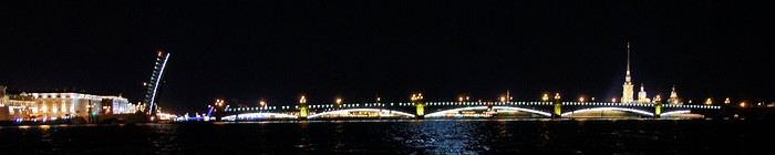
Here’s the recap of a little week we spent as a couple in Saint Petersburg in early May 2019, just before the *annus horribilis* of Covid. Since then, there’s also been the war in Ukraine, which has made things quite complicated, but tourist stays in Russia are still possible (see the discussion thread for the post-2022 situation). Looking back, early May was a bit too soon in the season—the trees were just starting to bud, and the wind was pretty chilly. It’s better to go at the end of May to enjoy the gardens.
Below is our 5-day itinerary. I’d brought along the inevitable Lonely Planet and the Blue Guide to Saint Petersburg, just to get a basic understanding of the architecture of the buildings I’d be admiring. I’d prepared two complementary routes on G**gle Maps in advance to cover the essentials of the city center in two days. That left the other days completely free for the big highlights: the Hermitage Museum and Peterhof Palace. We tried to adapt based on the weather, visiting Peterhof and its gardens on what was *supposed* to be the nicest day. We’d saved the Hermitage for a day when the weather was really bad, but in the end, we had more or less the same weather every day (sunny but windy and chilly).
Itinerary:
Day 1: City center north of Nevsky Prospect, up to the fortress (Route 1 on the map) Day 2: Peterhof Day 3: City center south of Nevsky Prospect up to Mariinsky (Route 2) Day 4: Canal boat tour during the day + nighttime boat ride on the Neva Day 5: Hermitage
Evening activities:
On the 3rd day, we saw an opera at the Mariinsky I, On the 4th day, we saw a ballet at the Mariinsky II, then headed back to the embankments at half past midnight for a nighttime cruise on the Neva—magical!
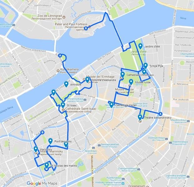
Here’s the recap of a little week we spent as a couple in Saint Petersburg in early May 2019, just before the *annus horribilis* of Covid. Since then, there’s also been the war in Ukraine, which has made things quite complicated, but tourist stays in Russia are still possible (see the discussion thread for the post-2022 situation). Looking back, early May was a bit too soon in the season—the trees were just starting to bud, and the wind was pretty chilly. It’s better to go at the end of May to enjoy the gardens.
Below is our 5-day itinerary. I’d brought along the inevitable Lonely Planet and the Blue Guide to Saint Petersburg, just to get a basic understanding of the architecture of the buildings I’d be admiring. I’d prepared two complementary routes on G**gle Maps in advance to cover the essentials of the city center in two days. That left the other days completely free for the big highlights: the Hermitage Museum and Peterhof Palace. We tried to adapt based on the weather, visiting Peterhof and its gardens on what was *supposed* to be the nicest day. We’d saved the Hermitage for a day when the weather was really bad, but in the end, we had more or less the same weather every day (sunny but windy and chilly).
Itinerary:
Day 1: City center north of Nevsky Prospect, up to the fortress (Route 1 on the map) Day 2: Peterhof Day 3: City center south of Nevsky Prospect up to Mariinsky (Route 2) Day 4: Canal boat tour during the day + nighttime boat ride on the Neva Day 5: Hermitage
Evening activities:
On the 3rd day, we saw an opera at the Mariinsky I, On the 4th day, we saw a ballet at the Mariinsky II, then headed back to the embankments at half past midnight for a nighttime cruise on the Neva—magical!
On the Derisive Thread (Episode 1)
Dear members of this forum,
*With the pandemic, travel guides were replaced by cookbooks. With lockdown, there’s no need for the *Guía del Trotamundos*—the cookbook is gospel, and your daily life turns into a *Spaghetti Western*. It’s no longer about good and bad actors but good and bad fats. And for a few extra pinches of salt. To the tune of Ennio Morricone, it’s hard to diagnose pastalogy—sorry, the pathology—you’re suffering from. Italy, now confined, and pasta—no more aimless gondola rides on Venice’s canals or *Dolce Vita* weekends in Rome. The beauty of the soul blends with minestrone preparation.
*With the pandemic, Professor Didier Raoult became the new Christ-like figure; like the Indira Gandhi of medicine, like Moses showing the way to the people across the Dead Sea, for tormented souls, the value of a medical prescription doesn’t wait for the years to pass. And plexiglass reigned over the world.
*With the pandemic and gender theory, in particular, pushing us to become androgynous, hermaphroditic beings—*patatras*—the Colossi of Rhodes we are waver because of a tiny nuisance.
*Phew, the pandemic has receded... but watch out for a new swine flu pandemic, because on this forum, it’ll be followed by long-winded rants. Political/historical revisionism with such a pandemic—Fidel Castro wouldn’t have been able to invade the *Bahía de los Cochinos*. And that’s where his comrade Ernesto *Che* Guevara becomes a perfect scam. A fierce opponent of capitalist ideology, yet many clothing sellers got rich selling T-shirts with his face on them.
*Neutrality and the Helvetic underground. Last summer, I found myself passing the *Chalet Gaillard* deep in the *Forêt du Risoux* in the Jura, then crossing the border into the Canton of Vaud on foot. My disappointment was great: no sign indicating we were in neutral territory. And what kind of neutrality are we talking about? Since neutrality is an abstract concept. It’s like those visitors eager to see Calais who, spotting the sign for the *Pas-de-Calais* department, turn around on the road.
*There’s always a traveler quick to recommend a local guide. I know an excellent guide named Michel who lives in Cairo—Michel of Cairo. He has a truck and takes you to see the pharaoh’s ruins by truck. Still, be careful—good guides aren’t that common, because there are only eight Cairenes.
*The mix between large mammals and humans. Or how infantilism rules the world. The ultimate quest for happiness is petting rhinos in Nepal—we’ll confirm if this kind of animal is visible on the streets of Sauraha, a town near Chitwan National Park. The downside of this animal? It takes up too much space as a pet—better to raise a Yorkshire terrier in your modest apartment.
*I’m tired of recurring topics like, *‘Do I have time for my connection at New York airport?’* Aren’t you? There’s the discussion about *Gare de Lyon Part-Dieu*—*Gare de Lyon Part-Dieu*, God bless you. In the name of the Father, the taxman, and the Holy Spirit, don’t miss your connection. *Gare de Lyon-Part-Dieu*—apparently, a great French actor, Gérard de Part-Dieu, was born there. If you think you’ll miss your connection, just get rich and fly private. The working masses of the *lumpenproletariat*—they dare everything, that’s how you recognize them.
*Experts in non-events: learning that some members don’t like Spanish-speaking countries because, supposedly, the people are too loud. That’s it, I’m not going to China anymore—too many stairs on the Great Wall. So, too bad, I’m not going. It’s like two people crossing paths—one asks, *‘Going fishing?’* and the other says no. These experts are probably natives of Arles, because with people like that, it’s *l’Arlésienne*...
*The art of taking selfies at every turn. You’d think it’s an ancient practice, almost an anthropological ritual—everything suggests it dates back to prehistoric times. Back in the days of the Lascaux caves, instead of photographing the meal they were about to eat (it’s crazy how many food photos we see on this forum, especially in travel journals), prehistoric men and women could only make cave paintings. From there, it’s only a small step to conclude that cave art was nothing more than the menu served in caves that doubled as *Buffalo Grills* long before the chain existed. By the way, if you want to visit the caves, ask for a guide named Josiane. When it comes to parietal art skills, Josiane beats Lascaux... (Only the French on this forum will get that one.)
*Mythology of an object: the suitcase (a nod to Mr. Éric Libiot, whose columns I enjoy) An object that gets lost during a flight, especially during a transfer at an airport. And it’s stuffed to the brim with clothes and other useless items, like Mickey Mouse slippers. You’re in despair: when going through customs, the officers find those slightly risqué photos hidden in your laundry, taken at Cap d’Agde on a naturist beach. The suitcase is an object that makes noise when rolling because of its wheels—you’re quickly spotted.
*Hurry up and visit New York while you still can. Because of *Woke* ideology, more and more statues are being torn down, and the Statue of Liberty will likely meet the same fate. *Queer* culture isn’t everyone’s cup of tea.
*The Dead Poets Society I admired the beautiful photos of Venice, and *click*—I check the new discussions when I come across one where Mr. J.M.B. offers money loans. This person probably works at the Ministry of Finance and risks loosening the purse strings of your wallets.
*Toward the independence of New Caledonia: will we call it *Nouvelle Nouvelle-Calédonie*? From what I know, Chinese authorities want to settle there and invest; apparently, they want to send (fake) tourists—facsimiles of real travelers. So, it’ll be hard to separate the wheat from the chaff (the *ivraie* tourists).
*There’s a topic about hitchhiking in Scotland: apparently, Scots are very welcoming people. I imagine arriving at Aberdeen Airport to a typical welcoming committee—men in kilts and a bagpiper playing. Just like arriving in Papeete, where you’re greeted with flower leis—*Aloha! (Jacta Est)*. To attract tourists, Scottish cities will end up installing whisky vending machines.
*Eskimo pies banned for sale because of *cancel culture*—you can’t go to Iqaluit anymore. Panicked, ice cream manufacturers had to revise their *packaging*—sorry for the anglicism. Because of *cancel culture*, we can no longer say *Eskimo* without it being pejorative. The identity of the Arctic people of the same name takes a hit—it’s crazy how *bien-pensance* wreaks havoc in our minds... We can’t even bite into a chocolate *Eskimo* pie anymore.
*Diplomatic tensions between France and Australia: and there goes the submarine sale project, canceled. Given that the cost of these machines is a fifth of Australia’s public finances budget, it’s tough to pay in didgeridoos and kangaroo skins.
Thanks for reading, and see you soon for more chronicles.
*With the pandemic, travel guides were replaced by cookbooks. With lockdown, there’s no need for the *Guía del Trotamundos*—the cookbook is gospel, and your daily life turns into a *Spaghetti Western*. It’s no longer about good and bad actors but good and bad fats. And for a few extra pinches of salt. To the tune of Ennio Morricone, it’s hard to diagnose pastalogy—sorry, the pathology—you’re suffering from. Italy, now confined, and pasta—no more aimless gondola rides on Venice’s canals or *Dolce Vita* weekends in Rome. The beauty of the soul blends with minestrone preparation.
*With the pandemic, Professor Didier Raoult became the new Christ-like figure; like the Indira Gandhi of medicine, like Moses showing the way to the people across the Dead Sea, for tormented souls, the value of a medical prescription doesn’t wait for the years to pass. And plexiglass reigned over the world.
*With the pandemic and gender theory, in particular, pushing us to become androgynous, hermaphroditic beings—*patatras*—the Colossi of Rhodes we are waver because of a tiny nuisance.
*Phew, the pandemic has receded... but watch out for a new swine flu pandemic, because on this forum, it’ll be followed by long-winded rants. Political/historical revisionism with such a pandemic—Fidel Castro wouldn’t have been able to invade the *Bahía de los Cochinos*. And that’s where his comrade Ernesto *Che* Guevara becomes a perfect scam. A fierce opponent of capitalist ideology, yet many clothing sellers got rich selling T-shirts with his face on them.
*Neutrality and the Helvetic underground. Last summer, I found myself passing the *Chalet Gaillard* deep in the *Forêt du Risoux* in the Jura, then crossing the border into the Canton of Vaud on foot. My disappointment was great: no sign indicating we were in neutral territory. And what kind of neutrality are we talking about? Since neutrality is an abstract concept. It’s like those visitors eager to see Calais who, spotting the sign for the *Pas-de-Calais* department, turn around on the road.
*There’s always a traveler quick to recommend a local guide. I know an excellent guide named Michel who lives in Cairo—Michel of Cairo. He has a truck and takes you to see the pharaoh’s ruins by truck. Still, be careful—good guides aren’t that common, because there are only eight Cairenes.
*The mix between large mammals and humans. Or how infantilism rules the world. The ultimate quest for happiness is petting rhinos in Nepal—we’ll confirm if this kind of animal is visible on the streets of Sauraha, a town near Chitwan National Park. The downside of this animal? It takes up too much space as a pet—better to raise a Yorkshire terrier in your modest apartment.
*I’m tired of recurring topics like, *‘Do I have time for my connection at New York airport?’* Aren’t you? There’s the discussion about *Gare de Lyon Part-Dieu*—*Gare de Lyon Part-Dieu*, God bless you. In the name of the Father, the taxman, and the Holy Spirit, don’t miss your connection. *Gare de Lyon-Part-Dieu*—apparently, a great French actor, Gérard de Part-Dieu, was born there. If you think you’ll miss your connection, just get rich and fly private. The working masses of the *lumpenproletariat*—they dare everything, that’s how you recognize them.
*Experts in non-events: learning that some members don’t like Spanish-speaking countries because, supposedly, the people are too loud. That’s it, I’m not going to China anymore—too many stairs on the Great Wall. So, too bad, I’m not going. It’s like two people crossing paths—one asks, *‘Going fishing?’* and the other says no. These experts are probably natives of Arles, because with people like that, it’s *l’Arlésienne*...
*The art of taking selfies at every turn. You’d think it’s an ancient practice, almost an anthropological ritual—everything suggests it dates back to prehistoric times. Back in the days of the Lascaux caves, instead of photographing the meal they were about to eat (it’s crazy how many food photos we see on this forum, especially in travel journals), prehistoric men and women could only make cave paintings. From there, it’s only a small step to conclude that cave art was nothing more than the menu served in caves that doubled as *Buffalo Grills* long before the chain existed. By the way, if you want to visit the caves, ask for a guide named Josiane. When it comes to parietal art skills, Josiane beats Lascaux... (Only the French on this forum will get that one.)
*Mythology of an object: the suitcase (a nod to Mr. Éric Libiot, whose columns I enjoy) An object that gets lost during a flight, especially during a transfer at an airport. And it’s stuffed to the brim with clothes and other useless items, like Mickey Mouse slippers. You’re in despair: when going through customs, the officers find those slightly risqué photos hidden in your laundry, taken at Cap d’Agde on a naturist beach. The suitcase is an object that makes noise when rolling because of its wheels—you’re quickly spotted.
*Hurry up and visit New York while you still can. Because of *Woke* ideology, more and more statues are being torn down, and the Statue of Liberty will likely meet the same fate. *Queer* culture isn’t everyone’s cup of tea.
*The Dead Poets Society I admired the beautiful photos of Venice, and *click*—I check the new discussions when I come across one where Mr. J.M.B. offers money loans. This person probably works at the Ministry of Finance and risks loosening the purse strings of your wallets.
*Toward the independence of New Caledonia: will we call it *Nouvelle Nouvelle-Calédonie*? From what I know, Chinese authorities want to settle there and invest; apparently, they want to send (fake) tourists—facsimiles of real travelers. So, it’ll be hard to separate the wheat from the chaff (the *ivraie* tourists).
*There’s a topic about hitchhiking in Scotland: apparently, Scots are very welcoming people. I imagine arriving at Aberdeen Airport to a typical welcoming committee—men in kilts and a bagpiper playing. Just like arriving in Papeete, where you’re greeted with flower leis—*Aloha! (Jacta Est)*. To attract tourists, Scottish cities will end up installing whisky vending machines.
*Eskimo pies banned for sale because of *cancel culture*—you can’t go to Iqaluit anymore. Panicked, ice cream manufacturers had to revise their *packaging*—sorry for the anglicism. Because of *cancel culture*, we can no longer say *Eskimo* without it being pejorative. The identity of the Arctic people of the same name takes a hit—it’s crazy how *bien-pensance* wreaks havoc in our minds... We can’t even bite into a chocolate *Eskimo* pie anymore.
*Diplomatic tensions between France and Australia: and there goes the submarine sale project, canceled. Given that the cost of these machines is a fifth of Australia’s public finances budget, it’s tough to pay in didgeridoos and kangaroo skins.
Thanks for reading, and see you soon for more chronicles.
12 days in Israel, before...
This trip took place in May 2023, a period of calm that later proved precarious.
Day of May 17
Departure from Marseille on El Al (tickets booked by ourselves, while the stay itself was organized by Voyageurs du Monde). Before check-in, six or seven El Al staff members conduct a security check—quite understandable, but they do it in total chaos. They send people to the left, then block them, redirect them to the right, for no apparent reason. Most of the staff don’t speak French, which complicates things. They work at an incomprehensible slow pace, stopping the interview to do something else, then coming back and starting over...
The flight goes smoothly, except for the meal service, which, for a four-hour flight that El Al delayed to lunchtime, is more than basic: a quarter-liter of water and a corned beef sandwich that’s absolutely disgusting and inedible. To get a coffee, you have to queue at the back of the plane. You end up missing Ryanair🙂
Arrival at Ben Gurion goes better than expected—the passport control is fairly quick, as is baggage delivery.
Transfer to the Lily and Bloom hotel, Lilienblaum Street (easy to remember 🙂)
As advised by Voyageurs du Monde, we book a table for the evening at the nearest restaurant, North Abraxas. Good atmosphere and decent food. We get a sense of the price level in Israeli restaurants.
Around us, diners share dishes placed in the middle of the table. Much more convivial than our individual plates!!
Day of May 18
The next morning, we go down for breakfast at 7:30 AM—a late hour, but the setup is slow, with the two servers taking their time. We ask the bartender for a long coffee and a black tea... It must be a complicated order because it takes him over 10 minutes to make it. He serves us with the grace of a dancer. A good breakfast if you’re not in a hurry, followed by a little stroll in the neighborhood, since our meet-up with Patrick Arfi, our guide for the day, isn’t until 10 AM. P. Arfi is a former publishing house director in Paris who has lived in Israel for a long time and has a vast cultural knowledge. After an initial chat, we head toward Jaffa, focusing on the Bauhaus buildings preserved by a clever urban policy that allows high-rise construction while maintaining old architectural ensembles.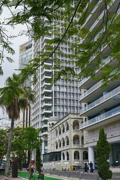
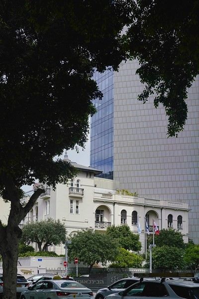
This policy keeps the streets looking more human-scale than the usual high-rise districts in modern cities.
 With the visit to Jaffa, Patrick introduces us to a fascinating slice of history, despite the temperature nearing 38°C. Jaffa, once an independent city, is now a neighborhood of Tel Aviv—a predominantly Muslim area. We notice a few buildings in poor condition. They belong to Palestinian families who left Tel Aviv. Otherwise, the city has been very well restored, apart from these few buildings.
A government agency rents out the ground floors of these buildings, which helps fund part of the security work. They also try to track down the owners and buy back the abandoned properties, but some refuse to sell. The visit is very touristy—most of the people we meet are tourists like us.


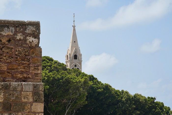
There’s very little local life, except in the lower part of the city. To be continued, as I’ve reached the allowed photo limit.
The next morning, we go down for breakfast at 7:30 AM—a late hour, but the setup is slow, with the two servers taking their time. We ask the bartender for a long coffee and a black tea... It must be a complicated order because it takes him over 10 minutes to make it. He serves us with the grace of a dancer. A good breakfast if you’re not in a hurry, followed by a little stroll in the neighborhood, since our meet-up with Patrick Arfi, our guide for the day, isn’t until 10 AM. P. Arfi is a former publishing house director in Paris who has lived in Israel for a long time and has a vast cultural knowledge. After an initial chat, we head toward Jaffa, focusing on the Bauhaus buildings preserved by a clever urban policy that allows high-rise construction while maintaining old architectural ensembles.
This policy keeps the streets looking more human-scale than the usual high-rise districts in modern cities.
With the visit to Jaffa, Patrick introduces us to a fascinating slice of history, despite the temperature nearing 38°C. Jaffa, once an independent city, is now a neighborhood of Tel Aviv—a predominantly Muslim area. We notice a few buildings in poor condition. They belong to Palestinian families who left Tel Aviv. Otherwise, the city has been very well restored, apart from these few buildings.
A government agency rents out the ground floors of these buildings, which helps fund part of the security work. They also try to track down the owners and buy back the abandoned properties, but some refuse to sell. The visit is very touristy—most of the people we meet are tourists like us.
There’s very little local life, except in the lower part of the city. To be continued, as I’ve reached the allowed photo limit.
Il est grand temps de rallumer les étoiles! English translation pending
Bonjour à tous
Le Vietnam pays magique multiculturel aux paysages diversifiés et époustouflants. Voilà ce que je vous invite à partager sans aborder s'il vous plaît ce qui aujourd'hui empêche la planète de vivre... Essayons d'être constructifs et positivons! Il est grand temps de rallumer les étoiles!
Pour commencer avec légèreté: La médecine des Dao, le bain aux herbes. C'est un moment délicieux après une journée de marche et de visites rien de tel pour vous requinquer! Ce bain est très souvent proposé aux touristes dans le nord, spécialité de l'ethnie Dao il est "accommodé" dans plusieurs maisons d'hôtes et hôtels aux besoins des touristes.
Traditionnellement les recettes sont destinées à chaque cas et en fonction de la pathologie: femmes enceintes ou qui viennent d'accoucher, nouveau-nés, malades, vieillards…les herbes seront donc choisies en fonction des besoins et du type de médication (orale, en bain, en emplâtre...). C'est dès l'aube que les femmes, les hommes, les chamanes iront cueillir ces plantes, racines et écorces dans la forêt, le tout sera combiné à un régime adapté (on ne mange pas de tout..) et souvent suivi d'un massage spécifique.
Nous en avons testé plusieurs à plusieurs endroits mais celui de la chamane Dao d'un petit village au nord de Muong Lay restera sans doute le plus authentique et le plus insolite.. On nous prend en main dès notre arrivée dans la maison de la chamane. Elle y vit avec sa fille et son gendre... Maison, je devrai plus dire assemblage de planches et de tôles et quand on connaît les rigueurs de l'hivers on peut rêver mieux. La pièce principale est bourrée de pots en tout genre remplis de décoctions plus ou moins troubles...ces sont les médications à avaler, beurk.. Il y a aussi de gros sacs (plastique) d'herbes, de racines, d'écorces, un vrai magasin d'herboriste (l'ordre et la propreté en moins) sans oublier bien sur l'hôtel des ancêtres. Derrière des rideaux, les couches des habitants, nous ne dormirons pas là, ouf.. Puis attenantes, les deux salles des bains avec 2 baquets chacune et entre les deux sous une pergola un énorme foyer construit en ciment surmonté d'une aussi énorme bassine où l'eau et les herbes "cuisent" jusqu'à parfois 12 heures...c'est là que l'on fait aussi cuire la soupe des cochons... Le feu est alimenté de poupée de maïs et de bois. C'est dans ces baquets que nous tromperont plus ou moins longtemps...le temps de "cuisson" est décidé par la chamane en fonction de chacun, jamais plus de 30 mm...et les herbes qui seront rajoutée dans les baquets seront aussi choisies en fonction de chaque "malade". C'est très très chaud, il faut vraiment se faire violence pour entrer là dedans et c'est sans compter qu'une fois immergés la dame ajoute de l'eau chaude bien sur...ouille. Une fois "les touristes bien cuits" on nous sort de là, inutile de préciser que nous ressemblons plus à des homards qu'à des visages pâles... Après cuisson, nous serons conduits ensuite vers le silo à grains, où une pièce spéciale massage à été aménagée à son top, on l'atteint via une échelle de bois...au sol deux couches. Ici commence le moment le plus douloureux de tous les massages faits au Vietnam par le gendre et la fille de la maison.. Pas de douces caresses, non, non, mais un pétrissage et un battage en bonne et due forme suivis de torsion, j'ai cru ma dernière heure arrivée... Pour clore la séance nous dînerons chez la chamane d'un souper spécial, la couleur des mets est importante, nous ne mangerons que du blanc et du vert....des légumes et des herbes inconnues de nous et un peu de poulet bouilli, élastique à souhait, sans doute celui que nous avons croisé sur le chemin en arrivant et des petits poissons frits (très bons). C'est sans conteste le meilleur soin reçu au Vietnam si l'on fait abstraction de la propreté des lieux, des serviettes (surtout apporter les siennes) et des moments douloureux.
Le Vietnam pays magique multiculturel aux paysages diversifiés et époustouflants. Voilà ce que je vous invite à partager sans aborder s'il vous plaît ce qui aujourd'hui empêche la planète de vivre... Essayons d'être constructifs et positivons! Il est grand temps de rallumer les étoiles!
Pour commencer avec légèreté: La médecine des Dao, le bain aux herbes. C'est un moment délicieux après une journée de marche et de visites rien de tel pour vous requinquer! Ce bain est très souvent proposé aux touristes dans le nord, spécialité de l'ethnie Dao il est "accommodé" dans plusieurs maisons d'hôtes et hôtels aux besoins des touristes.
Traditionnellement les recettes sont destinées à chaque cas et en fonction de la pathologie: femmes enceintes ou qui viennent d'accoucher, nouveau-nés, malades, vieillards…les herbes seront donc choisies en fonction des besoins et du type de médication (orale, en bain, en emplâtre...). C'est dès l'aube que les femmes, les hommes, les chamanes iront cueillir ces plantes, racines et écorces dans la forêt, le tout sera combiné à un régime adapté (on ne mange pas de tout..) et souvent suivi d'un massage spécifique.
Nous en avons testé plusieurs à plusieurs endroits mais celui de la chamane Dao d'un petit village au nord de Muong Lay restera sans doute le plus authentique et le plus insolite.. On nous prend en main dès notre arrivée dans la maison de la chamane. Elle y vit avec sa fille et son gendre... Maison, je devrai plus dire assemblage de planches et de tôles et quand on connaît les rigueurs de l'hivers on peut rêver mieux. La pièce principale est bourrée de pots en tout genre remplis de décoctions plus ou moins troubles...ces sont les médications à avaler, beurk.. Il y a aussi de gros sacs (plastique) d'herbes, de racines, d'écorces, un vrai magasin d'herboriste (l'ordre et la propreté en moins) sans oublier bien sur l'hôtel des ancêtres. Derrière des rideaux, les couches des habitants, nous ne dormirons pas là, ouf.. Puis attenantes, les deux salles des bains avec 2 baquets chacune et entre les deux sous une pergola un énorme foyer construit en ciment surmonté d'une aussi énorme bassine où l'eau et les herbes "cuisent" jusqu'à parfois 12 heures...c'est là que l'on fait aussi cuire la soupe des cochons... Le feu est alimenté de poupée de maïs et de bois. C'est dans ces baquets que nous tromperont plus ou moins longtemps...le temps de "cuisson" est décidé par la chamane en fonction de chacun, jamais plus de 30 mm...et les herbes qui seront rajoutée dans les baquets seront aussi choisies en fonction de chaque "malade". C'est très très chaud, il faut vraiment se faire violence pour entrer là dedans et c'est sans compter qu'une fois immergés la dame ajoute de l'eau chaude bien sur...ouille. Une fois "les touristes bien cuits" on nous sort de là, inutile de préciser que nous ressemblons plus à des homards qu'à des visages pâles... Après cuisson, nous serons conduits ensuite vers le silo à grains, où une pièce spéciale massage à été aménagée à son top, on l'atteint via une échelle de bois...au sol deux couches. Ici commence le moment le plus douloureux de tous les massages faits au Vietnam par le gendre et la fille de la maison.. Pas de douces caresses, non, non, mais un pétrissage et un battage en bonne et due forme suivis de torsion, j'ai cru ma dernière heure arrivée... Pour clore la séance nous dînerons chez la chamane d'un souper spécial, la couleur des mets est importante, nous ne mangerons que du blanc et du vert....des légumes et des herbes inconnues de nous et un peu de poulet bouilli, élastique à souhait, sans doute celui que nous avons croisé sur le chemin en arrivant et des petits poissons frits (très bons). C'est sans conteste le meilleur soin reçu au Vietnam si l'on fait abstraction de la propreté des lieux, des serviettes (surtout apporter les siennes) et des moments douloureux.
Quel vélo Gravel choisir en 2020? English translation pending
Bonjour,
J'ai acheté il y a 4 jours un gravel croix de fer Genesis 20, que je me suis fait vélo hier !!! J'avoue avoir eu un coup de coeur pour ce vélo.... mais depuis ce vol je me suis mise à nouveau en quête de recherche car j'ai à nouveau comparé les prix et les équipements et à nouveau le doute plane. Le problème du croix de fer c'est la dimension du cadre il faut avoir un buste assez long pour avoir un minimum de confort ou alors raccourcir la potence mais le guidon devient nerveux et la tenue de route se dégrade selon avis d'expert ! Alors toutes les questions sont là pour un budget entre 1000 et 1500e grand max car l'assurance heureusement va me rembourser mais je vais perdre de billes ! : - cadre acier ou alu - choisir un cadre et faire monter son vélo // cadre ll city par exemple // - choix de la transition - choix des freins - pneu en 700 de quelle marque ? car il paraît qu'on ne fait pas assez attention aux pneus quand on achète son vélo alors que ce sont eux qui après le cadre offre une belle adhérence et confort route
déjà une bonne base si je pouvais avoir vos avis d'expert ....! voire quelques modèles en exemple ....
Bonne journée à tous, Anne
J'ai acheté il y a 4 jours un gravel croix de fer Genesis 20, que je me suis fait vélo hier !!! J'avoue avoir eu un coup de coeur pour ce vélo.... mais depuis ce vol je me suis mise à nouveau en quête de recherche car j'ai à nouveau comparé les prix et les équipements et à nouveau le doute plane. Le problème du croix de fer c'est la dimension du cadre il faut avoir un buste assez long pour avoir un minimum de confort ou alors raccourcir la potence mais le guidon devient nerveux et la tenue de route se dégrade selon avis d'expert ! Alors toutes les questions sont là pour un budget entre 1000 et 1500e grand max car l'assurance heureusement va me rembourser mais je vais perdre de billes ! : - cadre acier ou alu - choisir un cadre et faire monter son vélo // cadre ll city par exemple // - choix de la transition - choix des freins - pneu en 700 de quelle marque ? car il paraît qu'on ne fait pas assez attention aux pneus quand on achète son vélo alors que ce sont eux qui après le cadre offre une belle adhérence et confort route
déjà une bonne base si je pouvais avoir vos avis d'expert ....! voire quelques modèles en exemple ....
Bonne journée à tous, Anne
L'Uruguay, pourquoi pas? English translation pending
Si vous cherchez l’aventure, le dépaysement total, les paysages extraordinaires, la rando, ce n’est pas en Uruguay qu’il faut aller. Je le savais avant de partir.
Simplement l’envie de découvrir un autre pays, un autre mode de vie. Trouver de la chaleur et du soleil pour les vacances de Noël, passer des vacances cool !
Côté paysage c’est un paysage de campagne comme on peut en trouver en France. Le pays est plat, vraiment plat ! Et pas de dépaysement avec la population : c’est un peuple issu de l’émigration européenne. Dans les faciès et les tenues, aucun étonnement, on pourrait se croire en Europe. (Sauf pour le maillot de bain string, c’est comme au Brésil !)
Dans un premier temps, je dois avouer, j’ai eu un peu peur. Où trouver mon contentement dans un environnement qui ne semblait pas vraiment différent de mon quotidien. Mais si je fais maintenant le bilan, je suis très contente d’y être allée.
Voyage de 12 nuits sur place, location de voiture, et c’est parti….
Un petit récit, quelques photos pour illustrer et quelques infos pratiques pour ceux qui décideraient d'y aller ! Au fait, ce n’est pas une destination économique, à peu près les mêmes prix qu’en France !
COLONIA DEL SACRAMENTO (2 nuits)
Petite déception en arrivant en fin de journée : peu d’animation dans la vielle ville, la population ne semble plus vivre dans cette partie de la ville. Il y a beaucoup de restaurants et d’hôtels et pourtant, vraiment peu de monde dans les rues. Une grosse surprise pour moi qui m’attendait (en fonction de ce que j’avais lu) à y voir beaucoup de touristes. Et pourtant, nous étions en période de fêtes. D’un côté, je suis super contente d’éviter la foule de touristes, mais en même temps, pas de population locale, cela fait un peu triste. Par contre, le soir, avec les éclairages, la vielle ville est superbe. zut, je n'ai pas de photos 😠
Le lendemain, belle découverte sous le soleil. Nous avons été charmés par toutes ces rues bordées de magnifiques platanes, par les rues pavées avec ses vieilles maisons, vieilles voitures, tags. C’est calme, pas de circulation.
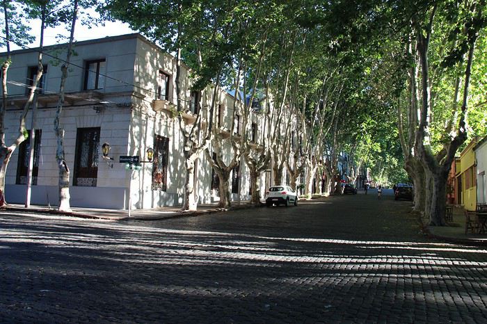
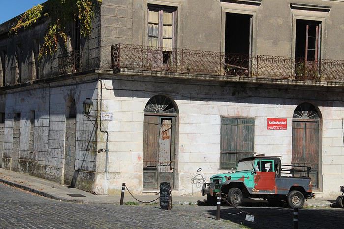
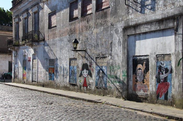
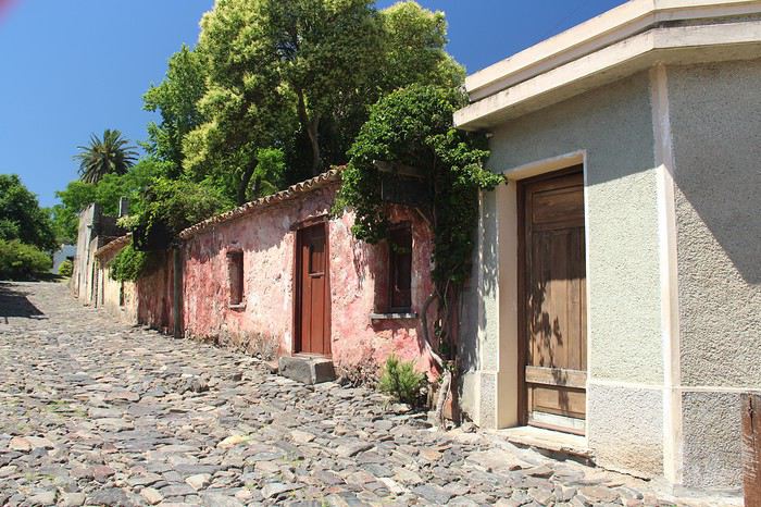
Comparé à Paraty au Brésil près de Rio, rien à voir avec le tourisme de masse et toutes ces conséquences. Nous avons arpenté plusieurs fois la vieille ville et à chaque fois de nouvelles surprises. L’après-midi, nous avons marché sur les plages aux alentours. Rien d’exceptionnel car on est dans le delta du rio de la Plata et l’eau est marron. Mais de la belle végétation par endroit. Ce n’est pas désagréable. Bilan : je pensais trouver une ville remplie de touristes : non, il y en a un peu mais aucune gêne. Bonne entrée en matière dans le pays et nous avons beaucoup apprécié cette première étape.
MERCEDES (1 nuit)
Je ne voulais pas me contenter de la côte sud et je voulais faire une incursion au centre du pays. Nous remontons donc le long du rio Negro.
Quelques arrêts sur la route à Réal de San Carlos, avec les restes d’un complexe touristique du début du XXième siècle. Des bâtiments encore en très bon état avec arène, hôtel, casino… On y trouve une plage plus grande que celles de Colonia. Arrêt à CONCHILLAS, petit village construit par les anglais avec des maisons typiques de l’époque et quelques bâtiments. Bon, on passait à côté. Pas désagréable.
Carmello : 3 étoiles dans le petit futé. Ben…. Je ne sais pas mais pour moi, rien à voir.
Plage de la agraciada : aucun intérêt
Mercedes : je dirais bof bof. Je pense que le problème vient du fait que c’était le jour de Noël, personne dans la ville, tout était fermé donc difficile d’apprécier une ville dans ces conditions.
Départ 10 h, arrivée 16 h, avec tous les arrêts. Journée sans intérêt. Paysage de campagne, monotone et rien de typique.
Bon, j’ai bien peur que vous ne continuiez pas à lire mon carnet de voyage. Pas eu l’envie de prendre des photos ce jour-là. Mais si si, accrochez-vous !
SAN GREGORIO DE PALANCO (1 nuit)
Départ 11 h, arrivée 16 h. on se dirige vers le centre du pays. Pluie torrentielle toute la route. Difficile d’apprécier un paysage ! En résumé : c’est plat, soit des plantations d’arbres, soit des champs céréaliers. De la piste, quelques haciendas. Mais on a vu personne, peu de voiture. A priori, ce n’est pas le moment du travail aux champs. Je pensais voir des troupeaux d’animaux, des gauchos. Rien. Mais nous sommes le surlendemain de Noël, c’est peut-être la raison ?
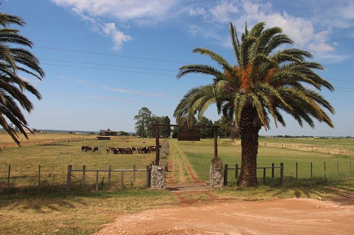
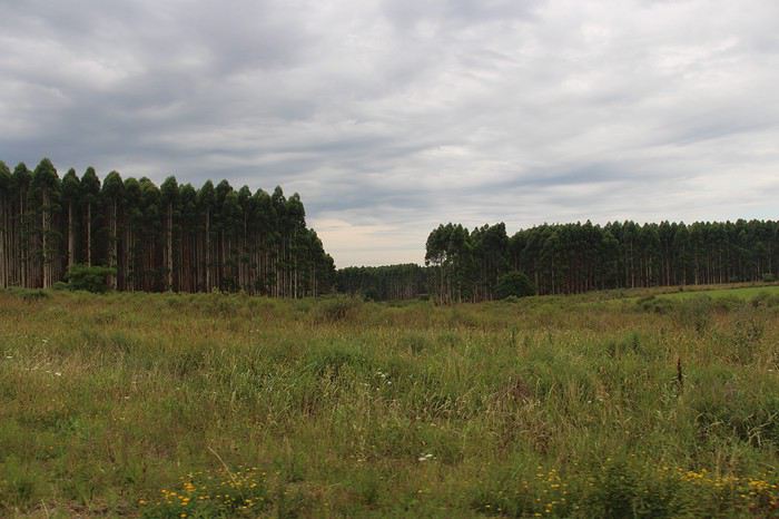
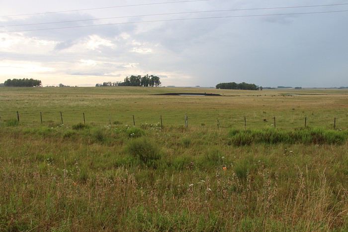
Arrivée à San Gregorio à 16 h, heure où tout est fermé et personnes dans les rues.
On s’est pris au jeu du principal centre d’intérêt de cette ville : LE STREET ART. Nous partons à la recherche des peintures murales éparpillées dans la ville. Un plan très bien fait permet de déambuler et les retrouver. L’occasion de marcher à travers les habitations et se retrouver dans un monde rural. Très diffèrent de notre approche à Colonia del Sacramento. Le niveau de vie semble ici très bas.
Notre déambulation nous amène en fin de journée à la belle plage de San Grégorio. Il est 18 H 30 et comme partout en Uruguay, c’est l’heure où tout le monde sort pour terminer la journée. Les couleurs sont belles. Grand malecom pour se promener, agréable.
A suivre....
Côté paysage c’est un paysage de campagne comme on peut en trouver en France. Le pays est plat, vraiment plat ! Et pas de dépaysement avec la population : c’est un peuple issu de l’émigration européenne. Dans les faciès et les tenues, aucun étonnement, on pourrait se croire en Europe. (Sauf pour le maillot de bain string, c’est comme au Brésil !)
Dans un premier temps, je dois avouer, j’ai eu un peu peur. Où trouver mon contentement dans un environnement qui ne semblait pas vraiment différent de mon quotidien. Mais si je fais maintenant le bilan, je suis très contente d’y être allée.
Voyage de 12 nuits sur place, location de voiture, et c’est parti….
Un petit récit, quelques photos pour illustrer et quelques infos pratiques pour ceux qui décideraient d'y aller ! Au fait, ce n’est pas une destination économique, à peu près les mêmes prix qu’en France !
COLONIA DEL SACRAMENTO (2 nuits)
Petite déception en arrivant en fin de journée : peu d’animation dans la vielle ville, la population ne semble plus vivre dans cette partie de la ville. Il y a beaucoup de restaurants et d’hôtels et pourtant, vraiment peu de monde dans les rues. Une grosse surprise pour moi qui m’attendait (en fonction de ce que j’avais lu) à y voir beaucoup de touristes. Et pourtant, nous étions en période de fêtes. D’un côté, je suis super contente d’éviter la foule de touristes, mais en même temps, pas de population locale, cela fait un peu triste. Par contre, le soir, avec les éclairages, la vielle ville est superbe. zut, je n'ai pas de photos 😠
Le lendemain, belle découverte sous le soleil. Nous avons été charmés par toutes ces rues bordées de magnifiques platanes, par les rues pavées avec ses vieilles maisons, vieilles voitures, tags. C’est calme, pas de circulation.
Comparé à Paraty au Brésil près de Rio, rien à voir avec le tourisme de masse et toutes ces conséquences. Nous avons arpenté plusieurs fois la vieille ville et à chaque fois de nouvelles surprises. L’après-midi, nous avons marché sur les plages aux alentours. Rien d’exceptionnel car on est dans le delta du rio de la Plata et l’eau est marron. Mais de la belle végétation par endroit. Ce n’est pas désagréable. Bilan : je pensais trouver une ville remplie de touristes : non, il y en a un peu mais aucune gêne. Bonne entrée en matière dans le pays et nous avons beaucoup apprécié cette première étape.
MERCEDES (1 nuit)
Je ne voulais pas me contenter de la côte sud et je voulais faire une incursion au centre du pays. Nous remontons donc le long du rio Negro.
Quelques arrêts sur la route à Réal de San Carlos, avec les restes d’un complexe touristique du début du XXième siècle. Des bâtiments encore en très bon état avec arène, hôtel, casino… On y trouve une plage plus grande que celles de Colonia. Arrêt à CONCHILLAS, petit village construit par les anglais avec des maisons typiques de l’époque et quelques bâtiments. Bon, on passait à côté. Pas désagréable.
Carmello : 3 étoiles dans le petit futé. Ben…. Je ne sais pas mais pour moi, rien à voir.
Plage de la agraciada : aucun intérêt
Mercedes : je dirais bof bof. Je pense que le problème vient du fait que c’était le jour de Noël, personne dans la ville, tout était fermé donc difficile d’apprécier une ville dans ces conditions.
Départ 10 h, arrivée 16 h, avec tous les arrêts. Journée sans intérêt. Paysage de campagne, monotone et rien de typique.
Bon, j’ai bien peur que vous ne continuiez pas à lire mon carnet de voyage. Pas eu l’envie de prendre des photos ce jour-là. Mais si si, accrochez-vous !
SAN GREGORIO DE PALANCO (1 nuit)
Départ 11 h, arrivée 16 h. on se dirige vers le centre du pays. Pluie torrentielle toute la route. Difficile d’apprécier un paysage ! En résumé : c’est plat, soit des plantations d’arbres, soit des champs céréaliers. De la piste, quelques haciendas. Mais on a vu personne, peu de voiture. A priori, ce n’est pas le moment du travail aux champs. Je pensais voir des troupeaux d’animaux, des gauchos. Rien. Mais nous sommes le surlendemain de Noël, c’est peut-être la raison ?
Arrivée à San Gregorio à 16 h, heure où tout est fermé et personnes dans les rues.
On s’est pris au jeu du principal centre d’intérêt de cette ville : LE STREET ART. Nous partons à la recherche des peintures murales éparpillées dans la ville. Un plan très bien fait permet de déambuler et les retrouver. L’occasion de marcher à travers les habitations et se retrouver dans un monde rural. Très diffèrent de notre approche à Colonia del Sacramento. Le niveau de vie semble ici très bas.
Notre déambulation nous amène en fin de journée à la belle plage de San Grégorio. Il est 18 H 30 et comme partout en Uruguay, c’est l’heure où tout le monde sort pour terminer la journée. Les couleurs sont belles. Grand malecom pour se promener, agréable.
A suivre....
On the Silk Road: Chronicles of a Sixty-Something Traveling Completely Independently
From Beijing to Khiva: China, Kyrgyzstan, Tajikistan, Uzbekistan
Chronicle of anecdotes, highlights, and other adventures that marked this eight-week journey in 2018.
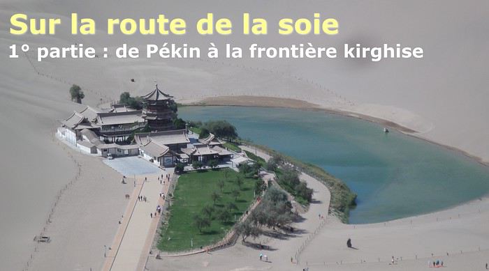
The Chinese Far West More than 30 years after my first trip to eastern China, I finally fulfilled an old dream: traveling solo from Beijing to the far west, discovering Xinjiang, the Uyghur people and the oppression they endure, the oases of Turpan and Kashgar, the Taklamakan Desert, the end of the Great Wall... The route was covered by train.
MENU PART 1: CHINA
1- Beijing (Jiankou) : the authentic Great Wall, without tourists 2- Cycling in Beijing, the best way to get around 3- Beijing : departure for the far west 4- Jiayuguan : getting by without English 5- Jiayuguan : scams and heritage 6- Dunhuang : abundance in the middle of the desert 7- Turpan : the Uyghurs under heavy surveillance 8- Kashgar : love at first sight for the old city 9- Kashgar : China’s recipe for controlling the populace 10- Tashkurgan : what on earth was I thinking going there! Kyrgyz border: a surreal epic Photo album from the 80s, contributions from other travelers (page 2)
1- JIANKOU Finding the authentic Great Wall, without tourists or a guide Friday, August 24, 2018 Thirty years later, I didn’t feel like revisiting the Great Wall at Badaling or any other overcrowded site. I chose to explore it at Jiankou, in its wildest, most authentic, and unrestored section, starting from a lost village deep in a valley—though it wasn’t *that* lost, since it had everything for communication.
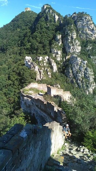
No need to pay for a taxi to get there—by timing it right, you can take the bus for just a few yuan. You have to get off at Xizhazi, the bus terminus. Be careful, there are only two buses a day in each direction. At the Xizhazi bus stop, I met a young couple who’d arrived with zero information about what to expect. We hiked the three of us toward the restored section of Mutianyu.
Still, be cautious With GPS and a topographic map (OpenTopoMap), you can set off without a problem or guide. The trail up to Jiankou is easy and well-marked. The trails down are too. But be careful—once you’re on the Wall, it’s real mountain hiking, with easy but dangerous climbing sections (over sheer drops). Not for amateurs or those afraid of heights! But what a reward. The Wall all to yourself, where it’s at its most daring. Truly mesmerizing.
More photos...
2- BEIJING The best way to get around the capital Sunday, August 26 The best way to explore the city is still by bike. Most are in a bike-share system, but you need to use an app—WeChat, the app that does everything, like monitoring your every move. No way I was installing that.
I found one at a rental shop near the hostel. The key is to quickly learn local traffic customs to minimize risks. Bike lanes are wide along the avenues.
But you still have to: - Watch out for anything parked on the bike paths—the most annoying are people napping or talking on the phone in their cars - Keep an eye on everything coming the wrong way—the list is long - The worst is right turns on red, which in Chinese traffic rules seem to have priority Once you get the hang of it, it’s fine. The city is huge but flat, so you can just wing it.
3- BEIJING By train to the far west Sunday, August 26 Beijing West Station is the size and operates like an airport. With your e-ticket from the agency, you first have to pick up your ticket at the special "English" counter, after passing through security. With your ticket in hand, you have to exit and enter through the boarding waiting area—not the platform—after a second security check.
 Then you find the right hall and wait for the sign to finally access the platform. In the end, it works pretty well given the incredible number of passengers to manage. Everywhere in Beijing, I saw that the Chinese have mastered crowd flow management.
Nice surprise: second-class carriages are clean, air-conditioned, and bright. Perfect, since I was in for 20 hours. One uniformed attendant per carriage, mobile meal service—luxury! Small downside: no luggage space. Hauling your suitcase up to the top bunk is quite a workout. I was in the middle, so it wasn’t too bad. The landscape, though, whether rural or urban, is pretty bleak. That should change once we leave the eastern plains.
Of course, I got my first police visit, with a thorough passport check and bag search. I was warned—going to the Chinese far west exposes you to this kind of hassle. But they were polite and respectful.
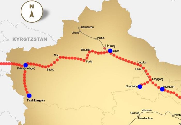 The Chinese Far West
4- JIAYUGUAN Getting by without English Monday, August 27 At the gates of two deserts (Gobi and Taklamakan) and at the foot of the Tibetan highlands, the Great Wall ends at Jiayuguan. Here, I found the deeper China I’d somewhat rediscovered during my bike ride, even if now everyone gets around on electric bikes and I’m no longer stared at like an alien.
Prices are nothing like Beijing: you can find a full meal for 2 €, and my bike cost 7 € for two days. Plus, few people speak English—neither the owner of the HI hostel where I stayed, nor the ticket sellers at the sites, let alone the servers at the small eateries where I ate. Everything is written in Chinese. So I had to use the little Chinese I know to communicate about essentials. It makes the locals laugh to see a European trying to speak their language, but it earns respect. With Google Translate’s help, I managed.
Rant: With their avenues blocked for construction for kilometers without warning, and new roads not yet on maps, I must’ve taken 15 km of detours. More photos...
5- JIAYUGUAN Scams and heritage Tuesday, August 28 The Great Wall doesn’t exactly end at the fort I visited yesterday but 10 km further, at the entrance to a river gorge at the foot of the mountains. All that’s left is a badly damaged tower (more like a mound of earth) and a section of clay wall, similar to the one I biked yesterday.
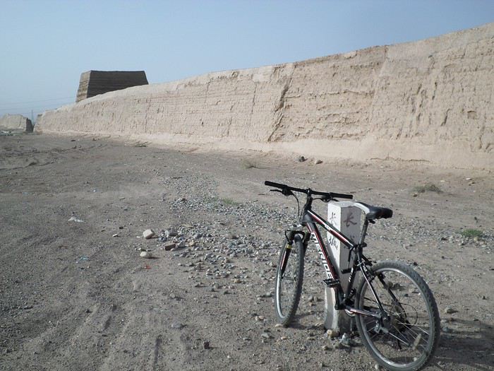
This morning, I hopped on my bike, determined to venture into the desert to see this highly symbolic site. First, you access it via a wide, brand-new road with not a soul in sight. Just before the site, I came across a grand welcome gate, very period-style, but it’s actually the inevitable toll booth.
Behind the gate, the road continues straight to the site, which you can see in the distance—at least 2 km away—the remains of the tower and wall. I had to leave my bike here. Fine. I went to the ticket counter and asked the price: 120 yuan! I couldn’t believe it—over 15 € for a simple mound of earth.
I showed my displeasure to the attendant, who couldn’t care less, and immediately turned back. 120 yuan—that’s the price for a new road, a fancy gate planted 2 km before the site just to force you to take a shuttle, and employees with nothing to do all day... Now I understand why I didn’t meet anyone!
Heritage China is a bit pricey Generally, sites are expensive for the country’s standard of living, but travelers are supposed to have money, so why hold back? I even gave up on the Forbidden City—reservations required days in advance (or on the black market at an impossible price). I prefer to keep the memory of my first visit, when entry must’ve cost a few dozen cents, and there were only a handful of visitors.
This morning, I took a taxi to see remarkable tombs of common people from the 3rd to 6th centuries. They’re small vaulted caves made of painted bricks, depicting scenes of daily life. Very pretty and moving. But even here, though the price was more reasonable, I was left wanting—only one of the 16 tombs is open to visitors, and it’s apparently not the most beautiful.
The authentic China—at least what’s left of it... Wandering the impersonal avenues of the city, you stumble upon a market. There, you still find traditional China—small shops with questionable hygiene, Go players, musicians, and even a dental prosthetist. The last refuge for those untouched by modernity. More photos...
6- DUNHUANG Abundance in the middle of the desert Wednesday, August 29 Well, I thought the landscape would be less bleak as I headed west. Nope. The only distraction in this expanse of dark, clayey sand is the forests of pylons and wind turbines, plus wild camels racing each other.
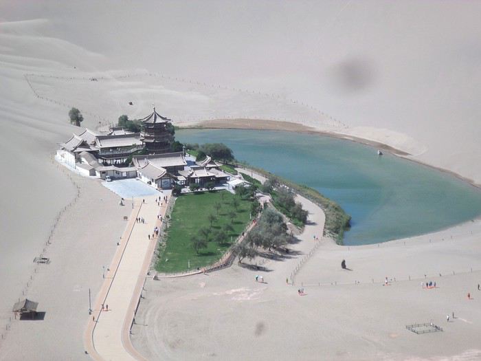 However, Dunhuang, the gateway to the Taklamakan, is by far the most pleasant Chinese city I know. There’s a real city center you can explore on foot. It’s hot but not unbearable, with a light, dry breeze. Much nicer than Beijing. The Han Chinese are still the majority, but the Muslim Uyghurs are more numerous, and the muezzin’s call to prayer echoes around the mosque.
The most surprising thing is the abundance and diversity of fruits and vegetables. You wonder how it all grows here. Well-irrigated, the desert sands are very fertile. Here, raisins have subtle, mysterious flavors, and the lamb really tastes like lamb.
Today, I visited the must-see Mingshashan, a dune complex next to which Pila is a molehill. The Basque Country, but covered in sand... More photos...
7- TURPAN The Uyghurs under heavy surveillance Friday, August 31 Surveillance cameras everywhere in the city, armed police stationed at intersections, in front of public buildings, at the entrance and inside tourist sites, police stations on every corner, patrols on foot or by car, khaki uniforms even for middle schoolers... here, the Han Chinese are in the minority, and you can feel it. Turpan feels like a city under siege.
To enter the youth hostel where I stayed, there’s even a security gate, and the receptionist (a Han, like everyone in tourism) wears a bulletproof vest! Reassuring. Still, you don’t feel particularly threatened here, especially as a European. The troublemakers are the Chinese, not the Uyghurs. Generally, China is a very safe country for visitors.
Smile, you’re on camera! I was biking on an avenue when the car in front of me got flashed for driving slowly. I quickly understood why when I got flashed too.
Here, the official time is Beijing time, but it gets dark two hours later. It’ll be even worse in Kashgar. Trickier to manage: everything is displayed in Chinese and Arabic. Nothing in English. Choosing a menu is a shot in the dark. Apart from a few young Chinese, no one here speaks English, and my Chinese doesn’t seem very understandable...
Mogao, the end of the road for the Han Yesterday, near Dunhuang, I went to Mogao, a complex of decorated caves with Buddha sculptures and paintings. Stunning, but so crowded! Luckily, here in Turpan, Chinese tourists barely venture out. So I visited a Silk Road ghost town with only a handful of other visitors and under a howling wind.
The modern Chinese city is swallowing up the old Uyghur neighborhoods—only a museum-like district remains in the center, and pockets of resistance on the outskirts are doomed to disappear soon. More photos...
8- KASHGAR A (relative) love at first sight for the old city Sunday, September 2 After three overnight trains, here I am in the far west of China, nearly 4,000 km from the capital. Despite the omnipresent police and an old city preserved UNESCO-style, Kashgar is my Chinese love at first sight.
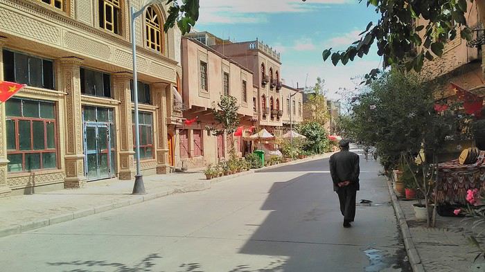
Finally, Chinese... well, sort of, because we’re in Uyghur territory here—a Turkic people with nothing culturally in common with the Han, the eastern Chinese. It started badly yesterday at Turfan station, where after three security gate passes, at least five passport checks, and a bag search, three adorable policewomen confiscated my antibacterial lotion because it had a flammable logo...
Then came the welcoming committee of armed cops at Kashgar station. Once all that was over, they left me alone—except you still have to go through security checks like everyone else to enter the old city, the bazaar, the livestock market... The further west you go, the more the siege mentality is evident. Luckily, the border isn’t far...
Despite the inevitable destruction-reconstruction, the city center has been well preserved. Thankfully, because it’s a very original style, a mix of local and colonial. I love it, even if it’s a bit too artificial, sanitized, and watered-down, and rather empty of residents. On the Silk Road, the city was famous for its great food. And it still is—rarely have I seen such richness and abundance of food! And not just scorpions or snakes. More photos...
9- KASHGAR China’s recipe for controlling the populace Saturday, September 1 Xinjiang, along with Tibet, is a "sensitive" area of rebellion in the eyes of Chinese authorities. As a result, the state has these regions and their populations under total control. Tourists also feel the consequences, even if they’re not at risk of re-education camps.
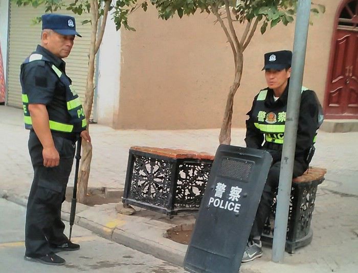 - Putting barbed wire and anti-ramming barriers around sensitive sites (schools, big hotels, government buildings...)
- Installing traffic surveillance gates with cameras and photo flashes (for all vehicles passing, including bikes) throughout the city and even in the countryside
- Posting uniformed guards with tasers, batons, or huge baseball bats every 100 meters
- Training the Han population (ethnic Chinese) in self-defense with sticks, preferably in the morning on the street. Men and women of all ages
- Starting school with the national anthem, doing military exercises, and receiving political indoctrination, all neatly lined up in the courtyard. (The dream school for any teacher)
- Placing a snitch in uniform (a pseudo-guard) in public gathering places, like youth hostels. Mine spends the day loafing around the courtyard
- Putting Chinese flags everywhere on the streets to remind everyone who’s in charge
- Installing security gates at every entrance to areas frequented by tourists (thanks for that) but not just there
- Never photographing cops, or else! I tried, but it’s not easy...
- Putting barbed wire and anti-ramming barriers around sensitive sites (schools, big hotels, government buildings...)
- Installing traffic surveillance gates with cameras and photo flashes (for all vehicles passing, including bikes) throughout the city and even in the countryside
- Posting uniformed guards with tasers, batons, or huge baseball bats every 100 meters
- Training the Han population (ethnic Chinese) in self-defense with sticks, preferably in the morning on the street. Men and women of all ages
- Starting school with the national anthem, doing military exercises, and receiving political indoctrination, all neatly lined up in the courtyard. (The dream school for any teacher)
- Placing a snitch in uniform (a pseudo-guard) in public gathering places, like youth hostels. Mine spends the day loafing around the courtyard
- Putting Chinese flags everywhere on the streets to remind everyone who’s in charge
- Installing security gates at every entrance to areas frequented by tourists (thanks for that) but not just there
- Never photographing cops, or else! I tried, but it’s not easy...
With all that, you can stroll around safely Not much crime! As for the amount the Chinese state spends to maintain such a system, it’s staggering! A third of the Han living in Xinjiang work in security. Today, I wandered freely around old Kashgar, which is quite large after all. More photos...
10- TASHKURGAN What on earth was I thinking going there! Wednesday, September 5 First, there’s the taxi—pretty crappy, with a driver who doesn’t speak a word of English and won’t stop smoking. Over six hours in that... shared with a completely out-of-it American.
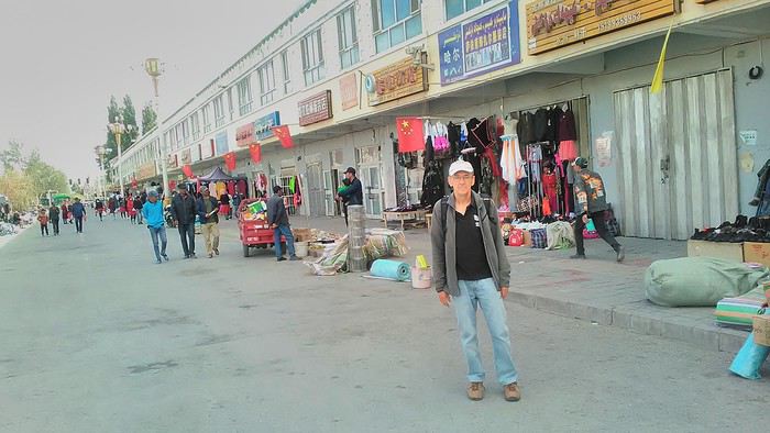
Then there are all the checkpoints along the way. I won’t go on—you know the drill by now.
After that, there’s Tashkurgan—a town with nothing to see, nothing to do. Deserted as soon as night falls. There’s this huge youth hostel and a few lost Chinese tapping away on their smartphones, chain-smoking. This lost American-European crowd, swapping tips on how to enter Pakistan or Tajikistan.
Luckily, there’s the Chinese Pamir Highway, lined with peaks over 7,000m. There’s the feeling of no longer being in China, with a population whose features are Middle Eastern. And these Tajik women with their stunning hairstyles and vibrant costumes. There’s the fact of having reached the westernmost Chinese city, far from crowds and tourist sites. A sort of end of the world. More photos...
11- KYRGYZ BORDER A surreal epic Thursday, September 6 The road from Kashgar to the Kyrgyzstan border is a little over 200 km and passes through beautiful landscapes of colorful, desert-like mountains with acrobatic folds. That’s the bucolic part of the trip.
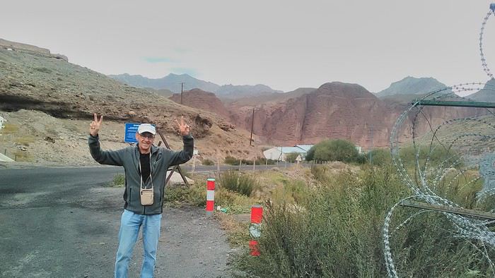 Yesterday, I managed to gather four people to rent a minibus to reach the border more easily: a Spaniard and an Argentine I’d already met in Turpan, and two New Zealanders who responded to the ad left at the hostel.
Absurdity and paranoia of Chinese authorities The highlight was crossing the town of Wuqia, 50 km past Kashgar. After tallying up with my fellow sufferers, we must’ve passed about ten checkpoints with: - Passport checks: 14 times, sometimes by two cops side by side - Bag checks: 4 times - Smartphone checks: 2 times, with deletion of "non-compliant" photos, and registration of your IMEI in the exit log!... Absurd and surreal at the same time, since my camera stayed in my bag, my apps are in French, and my photos have been online for ages...
With all that, we arrived just as the last checkpoint before the no man’s land marking the border between the two countries was on lunch break. And bam! Another 1.5-hour wait, alongside truckers who were much more used to this than we were.
What to think? The cops themselves aren’t fooled. They play the role they’re asked to, but sometimes you can coax a smile out of them—they realize how ridiculous the situation is.
What’s the point? That’s the big question my companions and I were tempted to answer with "to piss people off." To show you your place isn’t here, but with the other tourists, over there in the east, in Shanghai, Xi’an, or Guangzhou.
As for you, a traveler from a democratic country, you really experience this as aggression, humiliation, a violation of your private space. And yet, I’m respected, they speak to me properly. Today, I better understand what a Palestinian or a citizen of an occupied country might feel daily. A unique experience! Thanks, China.
And to top it off, the cherry on the cake! It’s still this glowing button you press to rate your passage after clearing the last obstacle before the exit stamp. I was so surprised it turned off before I could react. The Spaniard, with great humor and irony, had time to vote "excellent." In the end, he wasn’t wrong—you can hardly do better!
PS: I ditched my buddies at the border. They didn’t want to pay for a taxi to continue. So I took a direct taxi to Osh. The first 100 km are fabulous. I couldn’t take many photos, but I’ll be back on Monday to go to Tajikistan.
More photos...
The rest of the Silk Road, Part 2, in these travel journals: Kyrgyzstan, Tajikistan, Uzbekistan.
The Chinese Far West More than 30 years after my first trip to eastern China, I finally fulfilled an old dream: traveling solo from Beijing to the far west, discovering Xinjiang, the Uyghur people and the oppression they endure, the oases of Turpan and Kashgar, the Taklamakan Desert, the end of the Great Wall... The route was covered by train.
MENU PART 1: CHINA
1- Beijing (Jiankou) : the authentic Great Wall, without tourists 2- Cycling in Beijing, the best way to get around 3- Beijing : departure for the far west 4- Jiayuguan : getting by without English 5- Jiayuguan : scams and heritage 6- Dunhuang : abundance in the middle of the desert 7- Turpan : the Uyghurs under heavy surveillance 8- Kashgar : love at first sight for the old city 9- Kashgar : China’s recipe for controlling the populace 10- Tashkurgan : what on earth was I thinking going there! Kyrgyz border: a surreal epic Photo album from the 80s, contributions from other travelers (page 2)
1- JIANKOU Finding the authentic Great Wall, without tourists or a guide Friday, August 24, 2018 Thirty years later, I didn’t feel like revisiting the Great Wall at Badaling or any other overcrowded site. I chose to explore it at Jiankou, in its wildest, most authentic, and unrestored section, starting from a lost village deep in a valley—though it wasn’t *that* lost, since it had everything for communication.
No need to pay for a taxi to get there—by timing it right, you can take the bus for just a few yuan. You have to get off at Xizhazi, the bus terminus. Be careful, there are only two buses a day in each direction. At the Xizhazi bus stop, I met a young couple who’d arrived with zero information about what to expect. We hiked the three of us toward the restored section of Mutianyu.
Still, be cautious With GPS and a topographic map (OpenTopoMap), you can set off without a problem or guide. The trail up to Jiankou is easy and well-marked. The trails down are too. But be careful—once you’re on the Wall, it’s real mountain hiking, with easy but dangerous climbing sections (over sheer drops). Not for amateurs or those afraid of heights! But what a reward. The Wall all to yourself, where it’s at its most daring. Truly mesmerizing.
More photos...
2- BEIJING The best way to get around the capital Sunday, August 26 The best way to explore the city is still by bike. Most are in a bike-share system, but you need to use an app—WeChat, the app that does everything, like monitoring your every move. No way I was installing that.
I found one at a rental shop near the hostel. The key is to quickly learn local traffic customs to minimize risks. Bike lanes are wide along the avenues.
But you still have to: - Watch out for anything parked on the bike paths—the most annoying are people napping or talking on the phone in their cars - Keep an eye on everything coming the wrong way—the list is long - The worst is right turns on red, which in Chinese traffic rules seem to have priority Once you get the hang of it, it’s fine. The city is huge but flat, so you can just wing it.
3- BEIJING By train to the far west Sunday, August 26 Beijing West Station is the size and operates like an airport. With your e-ticket from the agency, you first have to pick up your ticket at the special "English" counter, after passing through security. With your ticket in hand, you have to exit and enter through the boarding waiting area—not the platform—after a second security check.
Then you find the right hall and wait for the sign to finally access the platform. In the end, it works pretty well given the incredible number of passengers to manage. Everywhere in Beijing, I saw that the Chinese have mastered crowd flow management.Nice surprise: second-class carriages are clean, air-conditioned, and bright. Perfect, since I was in for 20 hours. One uniformed attendant per carriage, mobile meal service—luxury! Small downside: no luggage space. Hauling your suitcase up to the top bunk is quite a workout. I was in the middle, so it wasn’t too bad. The landscape, though, whether rural or urban, is pretty bleak. That should change once we leave the eastern plains.
Of course, I got my first police visit, with a thorough passport check and bag search. I was warned—going to the Chinese far west exposes you to this kind of hassle. But they were polite and respectful.
The Chinese Far West4- JIAYUGUAN Getting by without English Monday, August 27 At the gates of two deserts (Gobi and Taklamakan) and at the foot of the Tibetan highlands, the Great Wall ends at Jiayuguan. Here, I found the deeper China I’d somewhat rediscovered during my bike ride, even if now everyone gets around on electric bikes and I’m no longer stared at like an alien.
Prices are nothing like Beijing: you can find a full meal for 2 €, and my bike cost 7 € for two days. Plus, few people speak English—neither the owner of the HI hostel where I stayed, nor the ticket sellers at the sites, let alone the servers at the small eateries where I ate. Everything is written in Chinese. So I had to use the little Chinese I know to communicate about essentials. It makes the locals laugh to see a European trying to speak their language, but it earns respect. With Google Translate’s help, I managed.
Rant: With their avenues blocked for construction for kilometers without warning, and new roads not yet on maps, I must’ve taken 15 km of detours. More photos...
5- JIAYUGUAN Scams and heritage Tuesday, August 28 The Great Wall doesn’t exactly end at the fort I visited yesterday but 10 km further, at the entrance to a river gorge at the foot of the mountains. All that’s left is a badly damaged tower (more like a mound of earth) and a section of clay wall, similar to the one I biked yesterday.
This morning, I hopped on my bike, determined to venture into the desert to see this highly symbolic site. First, you access it via a wide, brand-new road with not a soul in sight. Just before the site, I came across a grand welcome gate, very period-style, but it’s actually the inevitable toll booth.
Behind the gate, the road continues straight to the site, which you can see in the distance—at least 2 km away—the remains of the tower and wall. I had to leave my bike here. Fine. I went to the ticket counter and asked the price: 120 yuan! I couldn’t believe it—over 15 € for a simple mound of earth.
I showed my displeasure to the attendant, who couldn’t care less, and immediately turned back. 120 yuan—that’s the price for a new road, a fancy gate planted 2 km before the site just to force you to take a shuttle, and employees with nothing to do all day... Now I understand why I didn’t meet anyone!
Heritage China is a bit pricey Generally, sites are expensive for the country’s standard of living, but travelers are supposed to have money, so why hold back? I even gave up on the Forbidden City—reservations required days in advance (or on the black market at an impossible price). I prefer to keep the memory of my first visit, when entry must’ve cost a few dozen cents, and there were only a handful of visitors.
This morning, I took a taxi to see remarkable tombs of common people from the 3rd to 6th centuries. They’re small vaulted caves made of painted bricks, depicting scenes of daily life. Very pretty and moving. But even here, though the price was more reasonable, I was left wanting—only one of the 16 tombs is open to visitors, and it’s apparently not the most beautiful.
The authentic China—at least what’s left of it... Wandering the impersonal avenues of the city, you stumble upon a market. There, you still find traditional China—small shops with questionable hygiene, Go players, musicians, and even a dental prosthetist. The last refuge for those untouched by modernity. More photos...
6- DUNHUANG Abundance in the middle of the desert Wednesday, August 29 Well, I thought the landscape would be less bleak as I headed west. Nope. The only distraction in this expanse of dark, clayey sand is the forests of pylons and wind turbines, plus wild camels racing each other.
However, Dunhuang, the gateway to the Taklamakan, is by far the most pleasant Chinese city I know. There’s a real city center you can explore on foot. It’s hot but not unbearable, with a light, dry breeze. Much nicer than Beijing. The Han Chinese are still the majority, but the Muslim Uyghurs are more numerous, and the muezzin’s call to prayer echoes around the mosque.The most surprising thing is the abundance and diversity of fruits and vegetables. You wonder how it all grows here. Well-irrigated, the desert sands are very fertile. Here, raisins have subtle, mysterious flavors, and the lamb really tastes like lamb.
Today, I visited the must-see Mingshashan, a dune complex next to which Pila is a molehill. The Basque Country, but covered in sand... More photos...
7- TURPAN The Uyghurs under heavy surveillance Friday, August 31 Surveillance cameras everywhere in the city, armed police stationed at intersections, in front of public buildings, at the entrance and inside tourist sites, police stations on every corner, patrols on foot or by car, khaki uniforms even for middle schoolers... here, the Han Chinese are in the minority, and you can feel it. Turpan feels like a city under siege.
To enter the youth hostel where I stayed, there’s even a security gate, and the receptionist (a Han, like everyone in tourism) wears a bulletproof vest! Reassuring. Still, you don’t feel particularly threatened here, especially as a European. The troublemakers are the Chinese, not the Uyghurs. Generally, China is a very safe country for visitors.
Smile, you’re on camera! I was biking on an avenue when the car in front of me got flashed for driving slowly. I quickly understood why when I got flashed too.
Here, the official time is Beijing time, but it gets dark two hours later. It’ll be even worse in Kashgar. Trickier to manage: everything is displayed in Chinese and Arabic. Nothing in English. Choosing a menu is a shot in the dark. Apart from a few young Chinese, no one here speaks English, and my Chinese doesn’t seem very understandable...
Mogao, the end of the road for the Han Yesterday, near Dunhuang, I went to Mogao, a complex of decorated caves with Buddha sculptures and paintings. Stunning, but so crowded! Luckily, here in Turpan, Chinese tourists barely venture out. So I visited a Silk Road ghost town with only a handful of other visitors and under a howling wind.
The modern Chinese city is swallowing up the old Uyghur neighborhoods—only a museum-like district remains in the center, and pockets of resistance on the outskirts are doomed to disappear soon. More photos...
8- KASHGAR A (relative) love at first sight for the old city Sunday, September 2 After three overnight trains, here I am in the far west of China, nearly 4,000 km from the capital. Despite the omnipresent police and an old city preserved UNESCO-style, Kashgar is my Chinese love at first sight.
Finally, Chinese... well, sort of, because we’re in Uyghur territory here—a Turkic people with nothing culturally in common with the Han, the eastern Chinese. It started badly yesterday at Turfan station, where after three security gate passes, at least five passport checks, and a bag search, three adorable policewomen confiscated my antibacterial lotion because it had a flammable logo...
Then came the welcoming committee of armed cops at Kashgar station. Once all that was over, they left me alone—except you still have to go through security checks like everyone else to enter the old city, the bazaar, the livestock market... The further west you go, the more the siege mentality is evident. Luckily, the border isn’t far...
Despite the inevitable destruction-reconstruction, the city center has been well preserved. Thankfully, because it’s a very original style, a mix of local and colonial. I love it, even if it’s a bit too artificial, sanitized, and watered-down, and rather empty of residents. On the Silk Road, the city was famous for its great food. And it still is—rarely have I seen such richness and abundance of food! And not just scorpions or snakes. More photos...
9- KASHGAR China’s recipe for controlling the populace Saturday, September 1 Xinjiang, along with Tibet, is a "sensitive" area of rebellion in the eyes of Chinese authorities. As a result, the state has these regions and their populations under total control. Tourists also feel the consequences, even if they’re not at risk of re-education camps.
- Putting barbed wire and anti-ramming barriers around sensitive sites (schools, big hotels, government buildings...)
- Installing traffic surveillance gates with cameras and photo flashes (for all vehicles passing, including bikes) throughout the city and even in the countryside
- Posting uniformed guards with tasers, batons, or huge baseball bats every 100 meters
- Training the Han population (ethnic Chinese) in self-defense with sticks, preferably in the morning on the street. Men and women of all ages
- Starting school with the national anthem, doing military exercises, and receiving political indoctrination, all neatly lined up in the courtyard. (The dream school for any teacher)
- Placing a snitch in uniform (a pseudo-guard) in public gathering places, like youth hostels. Mine spends the day loafing around the courtyard
- Putting Chinese flags everywhere on the streets to remind everyone who’s in charge
- Installing security gates at every entrance to areas frequented by tourists (thanks for that) but not just there
- Never photographing cops, or else! I tried, but it’s not easy...With all that, you can stroll around safely Not much crime! As for the amount the Chinese state spends to maintain such a system, it’s staggering! A third of the Han living in Xinjiang work in security. Today, I wandered freely around old Kashgar, which is quite large after all. More photos...
10- TASHKURGAN What on earth was I thinking going there! Wednesday, September 5 First, there’s the taxi—pretty crappy, with a driver who doesn’t speak a word of English and won’t stop smoking. Over six hours in that... shared with a completely out-of-it American.
Then there are all the checkpoints along the way. I won’t go on—you know the drill by now.
After that, there’s Tashkurgan—a town with nothing to see, nothing to do. Deserted as soon as night falls. There’s this huge youth hostel and a few lost Chinese tapping away on their smartphones, chain-smoking. This lost American-European crowd, swapping tips on how to enter Pakistan or Tajikistan.
Luckily, there’s the Chinese Pamir Highway, lined with peaks over 7,000m. There’s the feeling of no longer being in China, with a population whose features are Middle Eastern. And these Tajik women with their stunning hairstyles and vibrant costumes. There’s the fact of having reached the westernmost Chinese city, far from crowds and tourist sites. A sort of end of the world. More photos...
11- KYRGYZ BORDER A surreal epic Thursday, September 6 The road from Kashgar to the Kyrgyzstan border is a little over 200 km and passes through beautiful landscapes of colorful, desert-like mountains with acrobatic folds. That’s the bucolic part of the trip.
Yesterday, I managed to gather four people to rent a minibus to reach the border more easily: a Spaniard and an Argentine I’d already met in Turpan, and two New Zealanders who responded to the ad left at the hostel.Absurdity and paranoia of Chinese authorities The highlight was crossing the town of Wuqia, 50 km past Kashgar. After tallying up with my fellow sufferers, we must’ve passed about ten checkpoints with: - Passport checks: 14 times, sometimes by two cops side by side - Bag checks: 4 times - Smartphone checks: 2 times, with deletion of "non-compliant" photos, and registration of your IMEI in the exit log!... Absurd and surreal at the same time, since my camera stayed in my bag, my apps are in French, and my photos have been online for ages...
With all that, we arrived just as the last checkpoint before the no man’s land marking the border between the two countries was on lunch break. And bam! Another 1.5-hour wait, alongside truckers who were much more used to this than we were.
What to think? The cops themselves aren’t fooled. They play the role they’re asked to, but sometimes you can coax a smile out of them—they realize how ridiculous the situation is.
What’s the point? That’s the big question my companions and I were tempted to answer with "to piss people off." To show you your place isn’t here, but with the other tourists, over there in the east, in Shanghai, Xi’an, or Guangzhou.
As for you, a traveler from a democratic country, you really experience this as aggression, humiliation, a violation of your private space. And yet, I’m respected, they speak to me properly. Today, I better understand what a Palestinian or a citizen of an occupied country might feel daily. A unique experience! Thanks, China.
And to top it off, the cherry on the cake! It’s still this glowing button you press to rate your passage after clearing the last obstacle before the exit stamp. I was so surprised it turned off before I could react. The Spaniard, with great humor and irony, had time to vote "excellent." In the end, he wasn’t wrong—you can hardly do better!
PS: I ditched my buddies at the border. They didn’t want to pay for a taxi to continue. So I took a direct taxi to Osh. The first 100 km are fabulous. I couldn’t take many photos, but I’ll be back on Monday to go to Tajikistan.
More photos...
The rest of the Silk Road, Part 2, in these travel journals: Kyrgyzstan, Tajikistan, Uzbekistan.
Israël en décembre English translation pending
Carnet de voyage ou compte-rendu ? Discussion ou partage d'images ?
Les administrateurs (compétents, oui je suis aussi diplomate😎) sauront où placer ce sujet.
Donc, un de mes amis m'informe qu'une compagnie à bas coût ouvre un ligne Marseille/Tel Aviv.
Et il souhait découvrir Jérusalem avec ma modeste personne comme guide.
In petto, il réserve sur R.... et moi sur El Al.
Bref....
Nous avons passé 10 jours à découvrir les vignobles locaux et autres brasseries à base de houblon.
Laissons la place aux images.
Le Marché de Ma'hane Yehuda.

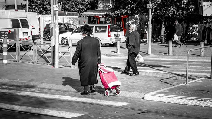


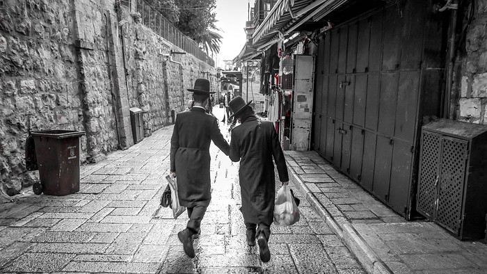
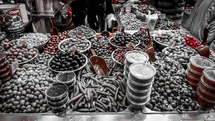

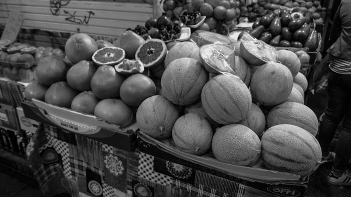

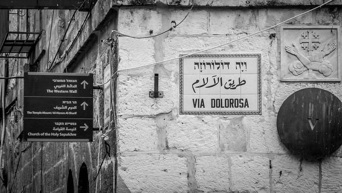
Les administrateurs (compétents, oui je suis aussi diplomate😎) sauront où placer ce sujet.
Donc, un de mes amis m'informe qu'une compagnie à bas coût ouvre un ligne Marseille/Tel Aviv.
Et il souhait découvrir Jérusalem avec ma modeste personne comme guide.
In petto, il réserve sur R.... et moi sur El Al.
Bref....
Nous avons passé 10 jours à découvrir les vignobles locaux et autres brasseries à base de houblon.
Laissons la place aux images.
Le Marché de Ma'hane Yehuda.
De Tijuana à Los Cabos, road trip de 16 jours en Basse Californie English translation pending
Bonjour,
Ce carnet de voyage est le compte rendu d’un séjour de 16 jours effectué du 29 avril au 14 mai 2019.
Participants: 2 adultes (63 et 65 ans) Organisation : nous-mêmes en nous basant sur des carnets de voyage, des programmes d’agence, le Lonely Planet en anglais (Baja California et Los Cabos, seul guide un peu complet). Réservation d’hôtels par internet ou par mail. Déplacements : voiture de location. Climat : frais et venteux dans le nord et le long du Pacifique, chaud et sec dans le sud et le long de la mer de Cortes. Formalités / santé :
- Pas de visa nécessaire. - Pas de vaccin à prévoir. Divers :
- Electricité : les prises sont les mêmes qu’aux Etats-Unis (deux fiches plates). Voltage : 110/140 volts. - Décalage horaire avec la France : 9h en Baja California nord - 8h en Baja California sud. - La saison pour l’observation des baleines, parmi les meilleures du monde, s’étend de janvier à avril. Conseils :
- L'eau du robinet est dite potable mais mieux vaut ne pas la boire. - Avoir deux permis de conduire internationaux (gratuits). - Avoir une bonne carte routière et télécharger les cartes sur openstreetmap. - Un 4/4 est inutile pour ce circuit. Nous avons opté pour un SUV, un peu plus haut que les berlines. Il est clair que si on veut sortir complètement des sentiers battus pour aller découvrir des sites uniquement accessibles par pistes, un 4/4 est indispensable.
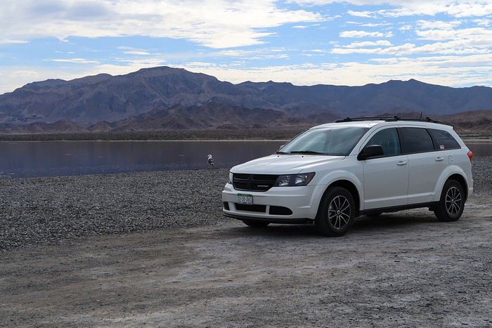 - Faire le plein d’essence dès qu’il y a une station car il peut ne pas y en avoir sur plus de 200 kilomètres.
- Se méfier des nids de poule, des topes (ralentisseurs) mal ou pas signalés et des troupeaux en liberté le long des routes.
- Faire le plein d’essence dès qu’il y a une station car il peut ne pas y en avoir sur plus de 200 kilomètres.
- Se méfier des nids de poule, des topes (ralentisseurs) mal ou pas signalés et des troupeaux en liberté le long des routes.
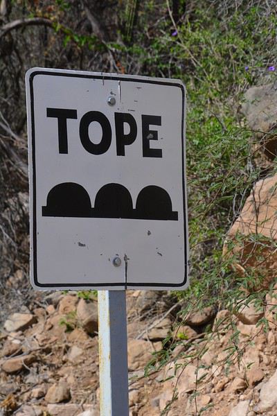
- Se laisser dépasser par les camions qui roulent très vite plutôt que de les avoir dans le dos. - De manière générale, il est préférable de ne pas circuler la nuit. Comme partout dans le monde, il vaut mieux ne rien laisser dans la voiture le soir et se garer dans des endroits éclairés et dans les parkings des hôtels. - Avoir toujours un stock d’eau dans la voiture et quelques provisions (éventuellement dans une petite glacière dont on renouvelle la glace régulièrement dans les supermarchés comme Oxxo). On peut ne pas trouver de restaurant pendant des heures (hors saison en tout cas).
- Avoir suffisamment d’argent liquide, les cartes de crédit ne fonctionnant pas partout. - Prévoir des pourboires de 10 à 15% dans les hôtels et les restaurants.
Nos coups de cœur : - en général, la géologie de la région - la vallée de los Cirios - Bahia de los Angeles - les salines de Guerrero Negro - San Ignacio, son oasis et sa mission - les plages de Bahia Concepcion (Santispac, El Coyote et El Requeson) - la Sierra Giganta et la mission San Javier (Loreto) - l’excursion en bateau à l’île Espiritu Santo (La Paz) - la vieille ville de San Jose del Cabo
Nos bonnes surprises - l’état des routes bien meilleur qu’espéré - la sécurité, en tout cas hors saison. Aucune agressivité, les Mexicains sont très aimables et toujours prêts à aider. - la nourriture tout à fait correcte et n’entraînant pas de troubles digestifs majeurs
Nos regrets ou déceptions : - ne pas avoir pu faire d’excursion pour voir les peintures rupestres - ne pas avoir pu faire de snorkeling à Cabo Pulmo - le manque de jolies villes (les villes traversées sont très laides et n’ont aucune âme) - les promenades sur les malecons n’ont jamais été à la hauteur de nos attentes, surtout à La Paz dont on dit que c’est le plus beau de Basse Californie - La Paz, grande ville peu séduisante - Cabo San Lucas : à fuir
Bilan - Très beau voyage hors des sentiers battus, avec des paysages assez époustouflants. Un petit bémol en ce qui me concerne est le manque de variété (alternance de désert et de plage, peu de jolis villages et manque de visites culturelles), peut-être dû en partie au fait que nous n’avons pas pu faire de visites de grottes de peintures rupestres et que nous n’étions pas à la saison de l’observation des baleines (choix délibéré). - Le fait d’être hors-saison était très agréable et nous a permis de très bien profiter des sites mais il avait aussi ses inconvénients, comme la difficulté d’organiser des excursions accompagnées.
Jour 1 : Bruxelles – Paris – Mexico - Tijuana a.m. : - train pour Paris CDG p.m. : - vol Paris – Mexico - vol Mexico – Tijuana
Train pour Paris CDG. Vol de 11h30 entre Paris et Mexico (Air France – A380). L’aéroport de Mexico est vieux et délabré. Quand on est en transit, il faut récupérer ses bagages et les déposer au fond de la zone de réception des bagages sur un tapis roulant réservé aux correspondances. Douane très rapide. Il ne faut surtout pas se précipiter sur le premier bureau de change dans la zone des bagages où le taux est beaucoup moins intéressant qu’ailleurs. On marche des kilomètres et on prend un train pour accéder à la zone 2 des vols domestiques. Complètement épuisés, on se dit qu’on aurait peut-être mieux fait de loger à côté de l’aéroport de Mexico et de prendre le vol de Tijuana le lendemain. Vol de +/- 3h30 pour Tijuana (Aeromexico) qui nous semble interminable et inconfortable. L’aéroport de Tijuana, par contre, est très moderne et propre. On a rapidement nos bagages. Pas de navette pour aller à l’hôtel. On prend donc un taxi (200 pesos). On se couche à 11 p.m. (heure locale), soit 8 a.m. pour nous ! Nuit à Tijuana (aéroport) Hôtel Hampton Inn, grand hôtel moderne, très confortable, excellente literie, très bonne douche. On ne retiendra pas la vue (entrepôt et chantier) mais bien les superbes photos noir et blanc de Basse Californie.
Jour 2 : Tijuana – San Quintin (6h45) a.m. : - prise de possession de la voiture de location à l’aéroport - route vers Ensenada p.m. : - arrêt à la Bufadora et déjeuner. - route vers San Quintin - nuit à San Quintin
Petit déjeuner à l’hôtel, correct sauf le pain. A 9h, la navette de l’hôtel nous conduit à l’aéroport pour prendre possession de la voiture de location. Service horriblement lent mais personnel très aimable et souriant ne parlant quasiment que l’espagnol. Départ à 10h30 et route vers Ensenada. Les quartiers de Tijuana que nous traversons ne donnent vraiment pas envie de s’attarder. Au niveau de la frontière, on se croirait à Calais avec les files interminables de camions. On longe l’impressionnant mur de fer séparant le Mexique et les USA. Il est constitué d’une énorme grille à laquelle on est en train d’accoler des panneaux métalliques. Tout cela est doublé quelques mètres plus loin par un grillage surmonté de fils de fer barbelés. Clochards ou migrants y vivent sous les ponts dans un état souvent très avancé.
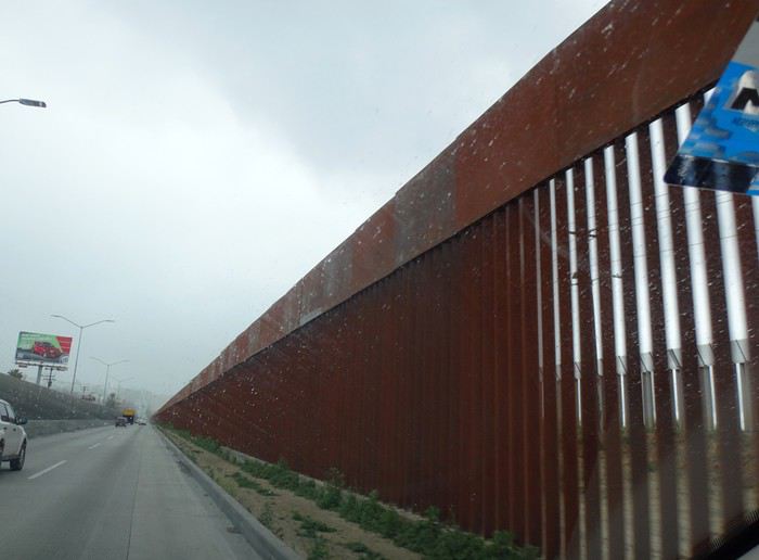
Comme il pleut, on regrette encore moins de ne pas s’attarder ici. La scenic road longe la côte … mais quelle déception ! C’est très construit et mal, beaucoup de bâtiments sont en ruines ou abandonnés. Ce n’est qu’à proximité d’Ensenada que la côte devient plus belle. On fait d’ailleurs un petit arrêt à un point de vue sur une côte sauvage avec falaises et iles au loin. Il fait meilleur et le soleil apparaît.
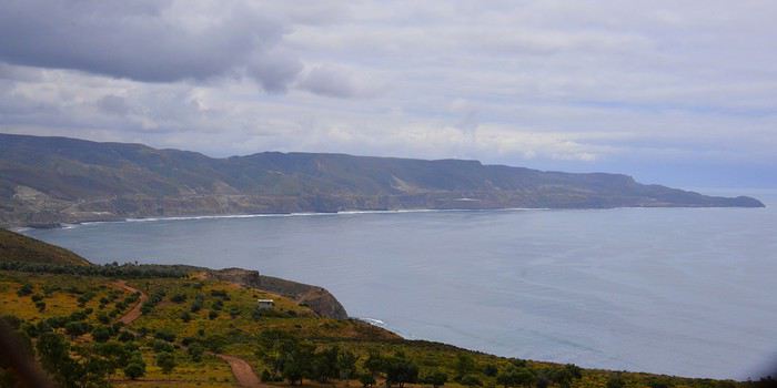
Vers 13h15, après avoir fait un petit détour, on s’arrête à la Buffadora, un site très touristique au sud d’Ensenada, au bout d’une péninsule. L’endroit est complétement paumé.
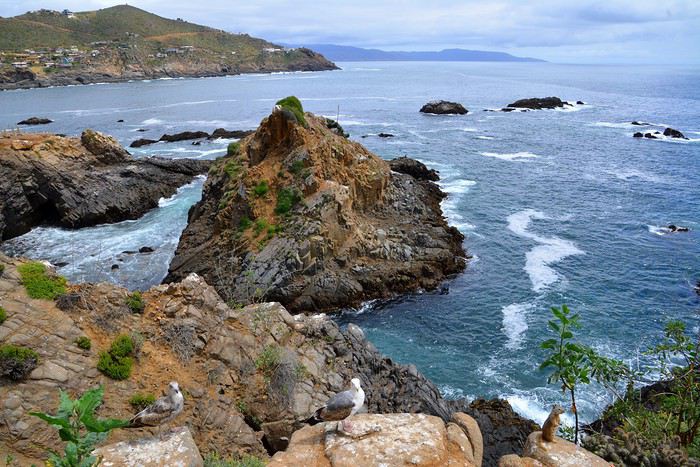
On n’avait encore vu quasi aucun touriste, mais là, c’est la foule, dans une rue interminable bordée de boutiques et de petits restos. Et on est hors saison ! Cela s’explique par le fait qu’Ensenada accueille de gros bateaux de croisière.
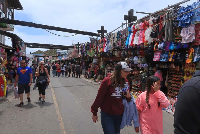
On arrive enfin à la bufadora, sorte de geyser où l’eau de mer s’engouffre dans une bouche et jaillit de manière inégale.
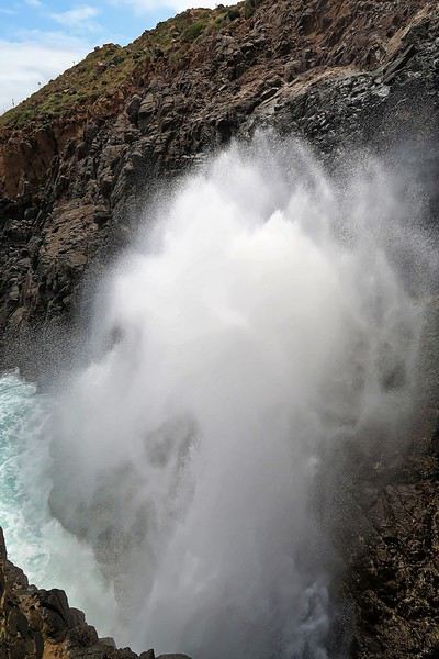
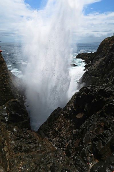
Les gens se font photographier devant les grandes lettres colorées de ENSENADA. Il semble y en avoir de pareilles dans toutes les villes.
Ça ne vaut peut-être pas le détour mais ça fait un divertissement amusant pour couper la route. C’est tout de même le 2ème plus grand geyser marin du monde. On renonce à un chic resto conseillé dans le Lonely Planet pour manger dans un petit établissement, chez Dona Chuy, où tout est étalé sur un comptoir ouvert sur la rue. Très animé et bon. On y mange des grands coquillages remplis de grosses crevettes chauds et gratinés et des tacos de poisson, tout ça assez bon. Service agréable.
On se laisse déjà tenter par des hamacs/fauteuils très sympas (20 $ pièce après avoir marchandé). On nous en proposera plus tard des moins chers évidemment (10 $) mais notre vendeur était très sympa et parlait français. On reprend la route à 14h35 après s’être bien amusés. Encore une fois, on se dit qu’il ne faut pas se précipiter sur les premières choses qu’on nous propose, comme ici le parking qui est beaucoup plus cher à l’entrée que plus loin.
Enormément de fleurs le long de la route. Après Ensenada, il y a aussi beaucoup de serres avec des légumes mais aussi des fleurs. La route est pleine de trous dont il faut se méfier. Ce n’est pas pour rien qu’il y a tant de vendeurs de pneus le long de la route.
Les camions roulent très vite et il vaut mieux les laisser passer que de les avoir dans le dos. On suit la route des vins et on commence à voir des vignes.
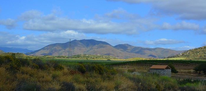
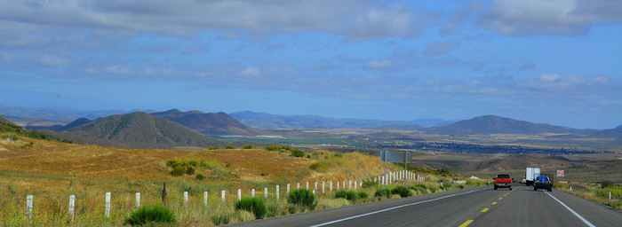
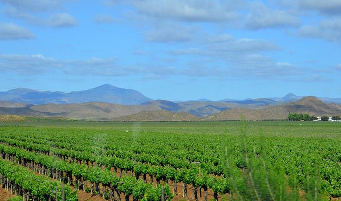
Le relief change et la route passe entre de raides collines bien vertes. Des travaux sur la route nous font perdre beaucoup de temps, heureusement dans un bel endroit. Beaucoup d’oliviers dont on fait la récolte et aussi des cultures de cactus. Sur les collines, on aperçoit parfois de curieux agaves. La route devient vraiment très belle jusqu’à San Antonio del Mar où le paysage redevient plus plat. Enormément de cultures. Mais où va-t-on chercher l’eau, les rivières sont à sec déjà fin avril ? Arrivée à San Quintin vers 18h30. L’hôtel Jardines Baja n’est pas facile à trouver. Il faut prendre la direction de l’hôtel Old Mill, puis la 1ère route non macadamisée à gauche. Comme on s’est trompé, on est allé jusqu’au bout, à un assez bel endroit de bras de mer sur fond de petits volcans aux cratères bien marqués. Etonnant.
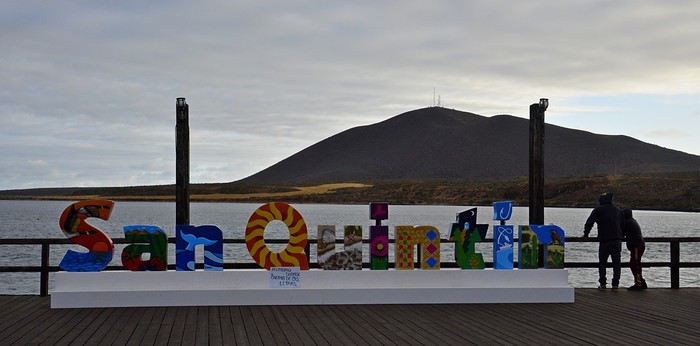
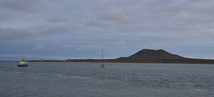
Dîner au restaurant de l’hôtel, assez bon. Beaucoup d’Américains ici. Nuit à San Quintin. Hôtel Jardines Baja, superbes jardins sophistiqués et fleuris, jolis patios et terrasses très conviviaux. Grande chambre malheureusement très sombre, normalement équipée. Salle de bain vieillotte mais correcte. Calme absolu.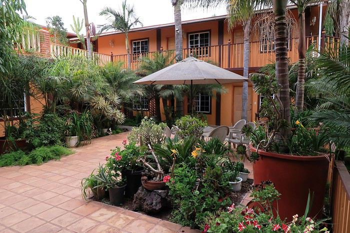
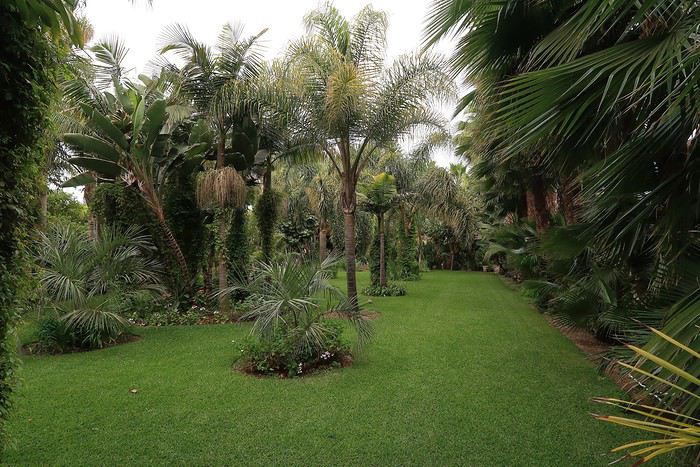
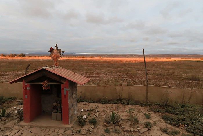
Ce carnet de voyage est le compte rendu d’un séjour de 16 jours effectué du 29 avril au 14 mai 2019.
Participants: 2 adultes (63 et 65 ans) Organisation : nous-mêmes en nous basant sur des carnets de voyage, des programmes d’agence, le Lonely Planet en anglais (Baja California et Los Cabos, seul guide un peu complet). Réservation d’hôtels par internet ou par mail. Déplacements : voiture de location. Climat : frais et venteux dans le nord et le long du Pacifique, chaud et sec dans le sud et le long de la mer de Cortes. Formalités / santé :
- Pas de visa nécessaire. - Pas de vaccin à prévoir. Divers :
- Electricité : les prises sont les mêmes qu’aux Etats-Unis (deux fiches plates). Voltage : 110/140 volts. - Décalage horaire avec la France : 9h en Baja California nord - 8h en Baja California sud. - La saison pour l’observation des baleines, parmi les meilleures du monde, s’étend de janvier à avril. Conseils :
- L'eau du robinet est dite potable mais mieux vaut ne pas la boire. - Avoir deux permis de conduire internationaux (gratuits). - Avoir une bonne carte routière et télécharger les cartes sur openstreetmap. - Un 4/4 est inutile pour ce circuit. Nous avons opté pour un SUV, un peu plus haut que les berlines. Il est clair que si on veut sortir complètement des sentiers battus pour aller découvrir des sites uniquement accessibles par pistes, un 4/4 est indispensable.
- Faire le plein d’essence dès qu’il y a une station car il peut ne pas y en avoir sur plus de 200 kilomètres.
- Se méfier des nids de poule, des topes (ralentisseurs) mal ou pas signalés et des troupeaux en liberté le long des routes.- Se laisser dépasser par les camions qui roulent très vite plutôt que de les avoir dans le dos. - De manière générale, il est préférable de ne pas circuler la nuit. Comme partout dans le monde, il vaut mieux ne rien laisser dans la voiture le soir et se garer dans des endroits éclairés et dans les parkings des hôtels. - Avoir toujours un stock d’eau dans la voiture et quelques provisions (éventuellement dans une petite glacière dont on renouvelle la glace régulièrement dans les supermarchés comme Oxxo). On peut ne pas trouver de restaurant pendant des heures (hors saison en tout cas).
- Avoir suffisamment d’argent liquide, les cartes de crédit ne fonctionnant pas partout. - Prévoir des pourboires de 10 à 15% dans les hôtels et les restaurants.
Nos coups de cœur : - en général, la géologie de la région - la vallée de los Cirios - Bahia de los Angeles - les salines de Guerrero Negro - San Ignacio, son oasis et sa mission - les plages de Bahia Concepcion (Santispac, El Coyote et El Requeson) - la Sierra Giganta et la mission San Javier (Loreto) - l’excursion en bateau à l’île Espiritu Santo (La Paz) - la vieille ville de San Jose del Cabo
Nos bonnes surprises - l’état des routes bien meilleur qu’espéré - la sécurité, en tout cas hors saison. Aucune agressivité, les Mexicains sont très aimables et toujours prêts à aider. - la nourriture tout à fait correcte et n’entraînant pas de troubles digestifs majeurs
Nos regrets ou déceptions : - ne pas avoir pu faire d’excursion pour voir les peintures rupestres - ne pas avoir pu faire de snorkeling à Cabo Pulmo - le manque de jolies villes (les villes traversées sont très laides et n’ont aucune âme) - les promenades sur les malecons n’ont jamais été à la hauteur de nos attentes, surtout à La Paz dont on dit que c’est le plus beau de Basse Californie - La Paz, grande ville peu séduisante - Cabo San Lucas : à fuir
Bilan - Très beau voyage hors des sentiers battus, avec des paysages assez époustouflants. Un petit bémol en ce qui me concerne est le manque de variété (alternance de désert et de plage, peu de jolis villages et manque de visites culturelles), peut-être dû en partie au fait que nous n’avons pas pu faire de visites de grottes de peintures rupestres et que nous n’étions pas à la saison de l’observation des baleines (choix délibéré). - Le fait d’être hors-saison était très agréable et nous a permis de très bien profiter des sites mais il avait aussi ses inconvénients, comme la difficulté d’organiser des excursions accompagnées.
Jour 1 : Bruxelles – Paris – Mexico - Tijuana a.m. : - train pour Paris CDG p.m. : - vol Paris – Mexico - vol Mexico – Tijuana
Train pour Paris CDG. Vol de 11h30 entre Paris et Mexico (Air France – A380). L’aéroport de Mexico est vieux et délabré. Quand on est en transit, il faut récupérer ses bagages et les déposer au fond de la zone de réception des bagages sur un tapis roulant réservé aux correspondances. Douane très rapide. Il ne faut surtout pas se précipiter sur le premier bureau de change dans la zone des bagages où le taux est beaucoup moins intéressant qu’ailleurs. On marche des kilomètres et on prend un train pour accéder à la zone 2 des vols domestiques. Complètement épuisés, on se dit qu’on aurait peut-être mieux fait de loger à côté de l’aéroport de Mexico et de prendre le vol de Tijuana le lendemain. Vol de +/- 3h30 pour Tijuana (Aeromexico) qui nous semble interminable et inconfortable. L’aéroport de Tijuana, par contre, est très moderne et propre. On a rapidement nos bagages. Pas de navette pour aller à l’hôtel. On prend donc un taxi (200 pesos). On se couche à 11 p.m. (heure locale), soit 8 a.m. pour nous ! Nuit à Tijuana (aéroport) Hôtel Hampton Inn, grand hôtel moderne, très confortable, excellente literie, très bonne douche. On ne retiendra pas la vue (entrepôt et chantier) mais bien les superbes photos noir et blanc de Basse Californie.
Jour 2 : Tijuana – San Quintin (6h45) a.m. : - prise de possession de la voiture de location à l’aéroport - route vers Ensenada p.m. : - arrêt à la Bufadora et déjeuner. - route vers San Quintin - nuit à San Quintin
Petit déjeuner à l’hôtel, correct sauf le pain. A 9h, la navette de l’hôtel nous conduit à l’aéroport pour prendre possession de la voiture de location. Service horriblement lent mais personnel très aimable et souriant ne parlant quasiment que l’espagnol. Départ à 10h30 et route vers Ensenada. Les quartiers de Tijuana que nous traversons ne donnent vraiment pas envie de s’attarder. Au niveau de la frontière, on se croirait à Calais avec les files interminables de camions. On longe l’impressionnant mur de fer séparant le Mexique et les USA. Il est constitué d’une énorme grille à laquelle on est en train d’accoler des panneaux métalliques. Tout cela est doublé quelques mètres plus loin par un grillage surmonté de fils de fer barbelés. Clochards ou migrants y vivent sous les ponts dans un état souvent très avancé.
Comme il pleut, on regrette encore moins de ne pas s’attarder ici. La scenic road longe la côte … mais quelle déception ! C’est très construit et mal, beaucoup de bâtiments sont en ruines ou abandonnés. Ce n’est qu’à proximité d’Ensenada que la côte devient plus belle. On fait d’ailleurs un petit arrêt à un point de vue sur une côte sauvage avec falaises et iles au loin. Il fait meilleur et le soleil apparaît.
Vers 13h15, après avoir fait un petit détour, on s’arrête à la Buffadora, un site très touristique au sud d’Ensenada, au bout d’une péninsule. L’endroit est complétement paumé.
On n’avait encore vu quasi aucun touriste, mais là, c’est la foule, dans une rue interminable bordée de boutiques et de petits restos. Et on est hors saison ! Cela s’explique par le fait qu’Ensenada accueille de gros bateaux de croisière.
On arrive enfin à la bufadora, sorte de geyser où l’eau de mer s’engouffre dans une bouche et jaillit de manière inégale.
Les gens se font photographier devant les grandes lettres colorées de ENSENADA. Il semble y en avoir de pareilles dans toutes les villes.
Ça ne vaut peut-être pas le détour mais ça fait un divertissement amusant pour couper la route. C’est tout de même le 2ème plus grand geyser marin du monde. On renonce à un chic resto conseillé dans le Lonely Planet pour manger dans un petit établissement, chez Dona Chuy, où tout est étalé sur un comptoir ouvert sur la rue. Très animé et bon. On y mange des grands coquillages remplis de grosses crevettes chauds et gratinés et des tacos de poisson, tout ça assez bon. Service agréable.
On se laisse déjà tenter par des hamacs/fauteuils très sympas (20 $ pièce après avoir marchandé). On nous en proposera plus tard des moins chers évidemment (10 $) mais notre vendeur était très sympa et parlait français. On reprend la route à 14h35 après s’être bien amusés. Encore une fois, on se dit qu’il ne faut pas se précipiter sur les premières choses qu’on nous propose, comme ici le parking qui est beaucoup plus cher à l’entrée que plus loin.
Enormément de fleurs le long de la route. Après Ensenada, il y a aussi beaucoup de serres avec des légumes mais aussi des fleurs. La route est pleine de trous dont il faut se méfier. Ce n’est pas pour rien qu’il y a tant de vendeurs de pneus le long de la route.
Les camions roulent très vite et il vaut mieux les laisser passer que de les avoir dans le dos. On suit la route des vins et on commence à voir des vignes.
Le relief change et la route passe entre de raides collines bien vertes. Des travaux sur la route nous font perdre beaucoup de temps, heureusement dans un bel endroit. Beaucoup d’oliviers dont on fait la récolte et aussi des cultures de cactus. Sur les collines, on aperçoit parfois de curieux agaves. La route devient vraiment très belle jusqu’à San Antonio del Mar où le paysage redevient plus plat. Enormément de cultures. Mais où va-t-on chercher l’eau, les rivières sont à sec déjà fin avril ? Arrivée à San Quintin vers 18h30. L’hôtel Jardines Baja n’est pas facile à trouver. Il faut prendre la direction de l’hôtel Old Mill, puis la 1ère route non macadamisée à gauche. Comme on s’est trompé, on est allé jusqu’au bout, à un assez bel endroit de bras de mer sur fond de petits volcans aux cratères bien marqués. Etonnant.
Dîner au restaurant de l’hôtel, assez bon. Beaucoup d’Américains ici. Nuit à San Quintin. Hôtel Jardines Baja, superbes jardins sophistiqués et fleuris, jolis patios et terrasses très conviviaux. Grande chambre malheureusement très sombre, normalement équipée. Salle de bain vieillotte mais correcte. Calme absolu.
Septembre (2019) en Grèce English translation pending
Grèce
Ayant profité des interventions de forumistes et de routards, c’est donc avec plaisir que je relate mon expérience qui pourra aider des prochains voyageurs. Mon épouse et moi, dans la « joyeuse » 70aine, avons pendant le mois de septembre, visité la Grèce. Il s’agissait de notre premier voyage dans ce pays. …………………… Jour 0. Vol avec Air Transat Montréal-Athènes (3 septembre 2019) …parti avec 6 heures de retard mais la compagnie a vraiment été reconnaissante de la docilité manifestée par ses passagers : un ti-verre de soda et un ti-chips pour tenir de 21:00 à 3:00. Que demander de mieux !!! …………………….. Jour 1 et 2 : Athènes : Visite de l’Acropole et de son musée et longues promenades dans divers quartiers de la ville tels Plaka, Psiri, Exarchia, .. Nous avons suivi les itinéraires proposés dans LeRoutard et dans Michelin. On peut en se rendant au musée de l’Acropole accéder gratuitement au restaurant et à la terrasse de celui-ci et profiter d’une magnifique vue sur le site de l’Acropole juste devant vous. Logement : Cecil Hôtel : (booking.com) Je ne suggèrerais pas cet hôtel pour un voyage de noces…plutôt vétuste, sdb pour les moins de 75 kg, ti-déj b’en ordinaire (heureusement de bonnes boulangeries-pâtisseries tout près) mais propre, bonne literie et bien situé. Suite : Athènes : jour 9. ………………….. Jour 3, 4 et 5 : Sifnos : Traversée Pyrée-Sifnos avec Sea Jet (catamaran : 3 heures). Sifnos : Superbe ! Les Cyclades comme nous les rêvions ! De bons transports publics qui permettent des déplacements faciles dans toute l’île. On a bien aimé la plage de Christopighi (et quelle vue !), Apollonia oû nous logions et le village haut perché de Kastro. De bonnes tables au centre d’Apollonia. Logement: Margarita GH, à Apollonia. (booking.com Au-dessus d’un café, mais calme et agréable, bien situé, construction récente et moderne, belle vue sur la mer au loin depuis le balcon, joli jardin à l’arrière, proprio très sympathique. Je recommande. On a adoré Sifnos. J’avais quelques inquiétudes concernant le Pyrée : prendre la bonne ligne de métro, identifier le bureau de SeaJet, récupérer les billets, trouver le quai, le bateau, etc. Finalement tout s’est bien passé. PS : si vous prenez possession de vos billets au bureau de la cie au port, il y a risque de vous trouver séparés –si vous êtes deux- pour la traversée car plusieurs rangées de 3 sièges. …………………… Jour 6, 7 et 8 : Milos : Traversée Sifnos-Milos en catamaran avec la cie Agean. À privilégier. Andamas, oû nous logions est beaucoup plus axée sur le tourisme. Ça bouge et on le sent dès que nous mettons le pied dans l’île. Ici aussi, les transports en commun sont très efficaces. Excellent restaurant –nous y sommes allés 2 fois- le long de la mer/plage à environ 1,5 kilomètre du centre-ville. Achalandé. Promenade-croisière autour de l’île avec baignade - repas - groupe retreint : de superbes points de vue, des couleurs incroyables, des formations rocheuses uniques…. Nous avons aimé, nous ne regrettons pas mais avons trouvé la « balade » un peu longue (mais les plus jeunes ou les moins vieux que nous ont davantage apprécié !!!). Notre coup de cœur le Kastro/Plaka : en prime le coucher de soleil. Hôtel : Dionysis Studios, à Andamas. (booking.com) Logement correct. Bien situé. Mini balcon et vue sur des champs. Près de tout. Prix négociable. Le propriétaire a également un hôtel situé en face, dans un e petite rue parallèle, oû un excellent petit-déjeuner est servi : le Semiramis a beaucoup plus de caractère et représente un meilleur RQP. ………………. En conclusion, nous avons adoré notre séjour dans ces deux îles -avec une préférence marquée pour Sifnos- et croyons avoir fait un bon choix car nous ne voulions pas faire des trajets de plus de 3 heures en bateau…mais on rêve de découvrir 2 ou 3 autres îles des Cyclades le printemps prochain. À suivre ! Pour un séjour de 3-4 jours, dans ces deux îles, à moins de vouloir vous rendre dans des coins isolés, le transport en autobus est efficace pour rejoindre les lieux touristiques intéressants et les principales plages. Et le pouce marche bien ! Cinq ou six fois, des gens nous ont pris avec eux : ils ont peut-être eu pitié des deux vieux sur le bord de la route au soleil……hahaha ! PS : Agean: catamarans plus confortables et propres que SeaJet.
……………………. Jour 9 : Athènes : Traversée Milos-Pyrée avec Agean (catamaran). Retour en fin d’après-midi à Athènes. Profitons des heures qui suivent pour nous promener jusque sur la colline de Lycabette. Hôtel : Cecil Hotel (voir jour 1) Restaurants : dans Monastiraki : Euxapis et Maiandros …mais évitez Scholarchio Ouzeri Kouklis (j’aurais dû écouter mon épouse !) Nous aimons « marcher » une ville et nous pensons avoir un portrait d’ensemble satisfaisant de la capitale à la suite de ces 2-3 journées. Nous avons beaucoup apprécié l’animation nocturne de la ville. Il y a une belle effervescence qui est palpable… Et Mythos et freddo cappuccino font bien les choses ! PS : Si + de 65 ans : billet métro aéroport-centre-ville moitié prix. …………………. Location d’une voiture : Budget via AutoEurope –une Volks Polo- pour la continuation de notre voyage en Grèce continentale. Prise et remise de la voiture à l’aéroport. J’ai bien apprécié la transmission manuelle dans les régions montagneuses. Jour 10 : Delphes : Le haut fait culturel de notre voyage. En dépit de nos connaissances limitées de la civilisation grecque, nous avons vraiment été impressionnés, ébahis par la visite du Sanctuaire d’Apollon. Le Sanctuaire d’Athéna vaut grandement le petit détour. Visite rapide d’Itéa et d’Amfissa (initiation aux routes essouFFlantes et aux paysages époustouFFlants) avant de rejoindre l’autoroute qui nous mènera à Kalambaka. Souvenir de la ville même : deux rues parallèles et à sens unique !!! Hébergement : Hôtel Hermès (réservation directe) : Sans être un 5-étoiles un R Q/P imbattable. Confort. Balcon. Vue sur la vallée. Petit déjeuner complet. ………………….. Jour 11 et 12 : Les Météores. Tout un spectacle ! Visite de trois monastères : Grand Météore, Varlaam et Agios Nikolaos. Vaut mieux y aller tôt le matin. La visite intérieure des monastères nous a laissés quelque peu sur notre appétit … mais l’emplacement et l’architecture des monastères et la vue que nous avons de chacun sont remarquables. Bien peu de spiritualité émane de ces lieux devenus trop touristiques. Nous avons repris l’auto pour nous rendre à Vlachava, un joli village en hauteur. Vue superbe sur la vallée – une ‘image’ que je conserve- et un accueil enthousiaste dans une toute petite taverne que vous ne pouvez rater tout en haut. Nous avons logé à Kalambaka et nous n’avons nullement regretté notre choix car la ville est plutôt intéressante et une belle animation règne au centre-ville. Nous avons pris les deux repas du soir à Kalambaka dans un restaurant de la Place de la Mairie : le dimanche en soirée, de la terrasse du Météora -cuisine très correcte et service enjoué-, nous avons profité d’une procession religieuse accompagnée d’une fanfare ( !) puis avons partiellement assisté à un office religieux et à un spectacle musical sympathique sur une place voisine de l’église. Hébergement : à Kalambaka. Nous avions réservé directement à l’Alosos House (le 29-07) une chambre double avec balcon et vue sur les Météores. Jolie déconvenue ! Le proprio tente de nous refiler une espèce de chambre-dortoir de 4 lits - oui, oui, 4 lits – à la propreté plus que douteuse avec une toute petite fenêtre offrant une vue imprenable sur la maison voisine et le palier de l’escalier faisant office de balcon! Seul petit nuage de tout notre voyage ! On passe à un autre appel ! Fort heureusement, nous avons trouvé facilement à nous loger à l’hôtel voisin. ………………. Jour 13 et 14 : Au Pays des Zagoria. Des Météores à Ioannina, nous avons emprunté en bonne partie la vieille route et avons joui de très beaux paysages. Visite de la Grotte de Péranna : Vaut amplement le petit détour. Une forêt magique ! Et une jeune guide bien allumée. Pour moi, Québécois, le spectacle de ces ‘chandelles de cire’ est fascinant. La deuxième journée, nous sommes partis tôt pour découvrir le pays des Zagoria…et nous n’avons pas été déçus. Woah ! À couper le souffle ! Un majestueux pont de pierre avec ses trois arches, les gorges de Vikos, de hautes parois rocheuses, des villages, Monodendri, Oxia, Aristi, Vikos, ayant conservé de belles demeures typiques et oû le temps semble s’être arrêté. Nous aurions pu passer une journée additionnelle dans ce coin de pays. Bien loin de l’image que les dépliants touristiques nous donnent de la Grèce. Hébergement : à Ioannina : Hôtel Kentrikon (booking.com). Impeccable. Excellent RQ/P. Balcon sur le toit. Bien situé, dans une rue piétonnière tout près de la belle place composée d’édifices gouvernementaux. La ville d’Ioannina représente une bonne halte (promenade agréable et les abords du lac) et la restauration est à signaler : nous avons fait deux excellents dîners au Stoa Louli (classe et cadre… et vin blanc) et au Il Pazzo (la pizza comme on l’aime!). Une ville qui bouge. PS : un formidable horloger dans le passage commercial face à l’hôtel …………………. Jour 15 et 16 : Île de Leucade. Petit choc en arrivant. Oû est mon hôtel ? Comment y accéder avec le valises ? Oû laisser la voiture ? Tout rentre vite dans l’ordre …mais nous pouvons imaginer le plaisir à garer sa voiture et à circuler au mois d’août! Deux journées majoritairement consacrées à la plage. L’une, sur la côte ouest : nous avons partagé notre temps entre Agios Nikitas et Kathisma. La seconde journée, sur la côte opposée, partagée entre pause à deux plages et randonnée jusqu’à Katahori. Pour une rare fois, nous avons pris un repas en journée : le meilleur plat de poisson de notre séjour: un petit restau dans la rue portuaire de Nidri : le nom ??? mais un auvent rayé de rouge et de blanc. Lefkada a des airs d’une petite ville balnéaire provençale (du moins pour nous qui venons du Québec). L’entrée dans « l’île », la rue qui longe le port, la grande place avec son hôtel et la terrasse du café. Une ou deux Mythos et on passe rapidement en mode vacances. Belle animation en soirée autour de la place portuaire et dans l’artère commerciale piétonnière. On ne s’y ennuie pas ! Hébergement : à Lefkada : Santa Maura Hôtel (sur booking.com). À deux pas de la grande place, pas de vue sur la mer, tranquille, un certain charme désuet, balcon étroit, grande chambre, propre, accueil gentil et de bons conseils. Pour 2-3 nuitées, ça va! Bon RQP. Restauration à Lefkada : rien de transcendant même le restau-poissonnerie des locaux dans une petite rue hors du centre-ville. ……………………….. Jour 17 : On roule jusqu’à Kyparissia : Dans un voyage, il y a parfois une « journée asphalte » et c’était celle-ci : 350 kilomètres ! Faut reconnaître que nous avons profité de bonnes conditions routières. Bien peu d’autos sur les routes et encore moins-moins sur les autoroutes Pont de Patra : superbe architecture …mais ça se paie : 13,50 euros ! Patra : passage rapide, pause-collation dans une taverne dans la rue qui longe le port : la ville ne nous est pas apparue bien souriante, invitante et circulation pas facile. Katakolon : deuxième pause-collation au joli petit port …ça sentait la fin de saison, quelques fermetures annuelles. Qu’est-ce qui nous attend ? Nous nous dirigeons plus au sud pour les prochains dix jours. Kyparissia : Petite promenade dans le centre en soirée. Joli point de vue sur la mer au pied de la ville. Parc bien aménagé. Spectacle musical donné par des militaires et bien apprécié de la foule. Retour en ville le lendemain matin, samedi, pour faire quelques provisions et c’est journée de marché. On s’attarde un peu et un Grec nous entendant parler devant un étal de légumes reconnaît notre accent –il a vécu une dizaine d’années à Montréal- et nous offre le café pour « faire un brin de jasette » et prendre des nouvelles de la ville !!! Hébergement: Apollo Resort Art Hotel. (sur place). Quelque peu en retrait de la ville : auto nécessaire pour aller (manger) dans la ville. Piscine extra. Confort moderne. Accueil correct. Beaux espaces intérieurs et extérieurs. Super ti-déj ! Excellent R Q/P. Et la mer est tout près ! Restauration : dans une rue attenante au parc, face à une crème glacée. Accueil et service enjoués. Terrasse intime. Cuisine savoureuse (poisson et porc) Ça fait du bien! ………………………. Péloponnèse : Jour 18, 19 et 20 : Méthoni En chemin vers Méthoni, nous avons fait une longue mais belle pause à Pylos. Quel site ! Époustoufflante vue du haut et une place portuaire très accueillante et des remparts qui imposent le respect. D’ailleurs, nous y reviendrons passer une soirée tant nous sommes tombés sous le charme de cette belle place. Un peu avant Pylos, au nord, arrêt palais de Nestor. Pauvre Nestor, il ne l’a pas eu facile ! Il en reste bien peu ! Décevant à moins de posséder de solides connaissances ! Pylos, en fait, constitue « la porte d’entrée du bonheur » ! Hébergement à Méthoni : Achilles Hill Hôtel (booking.com) Construction récente, chambre aérée, vue dégagée sur la mer au loin, grand balcon pour l’apéro, un peu (2 km) à l’écart de du village (nécessite une auto pour les a-r) et excellent ti-déj sur une belle terrasse. Je recommande. Restauration : À Méthoni : Taverna Klimataria : Poisson bien apprêté et très bonne tarte aux épinards. À Finikounda : Elena : oui, oui allez-y même si touristique! À Pylos : un vrai bon gyros, dans un « petit boui-boui » au haut d’une rue-escalier….nombreux locaux, c’est bon signe + personnel enjoué. À Pylos : restaurant sur la place du port : Aétos La citadelle de Méthoni est impressionnante par sa taille, ses nombreux bâtiments, et son emplacement. ……………….. Jour 21, 22 et 23 : Areopolis C’est petit mais un joli cadre et bien situé pour rayonner dans la région. Hébergement à Areopolis : Hôtel Trapela (sans réservation): central, architecture régionale avec murs de pierre dans les chambres, propreté, confort et superbe ti-déj (et quelles confitures!!!...Sommes repartis avec 2 pots). Notre coup de cœur ! Restauration : à Aréopolis : O Poulos : cuisine originale (enfin !) et savoureuse et service attentionné…dans ‘nos’ meilleurs tables. Accueil pro dans ce petit restaurant familial! Restau �� : juste en face de O Poulos : également très bon. Que du bonheur dans tout cette grandiose partie encore préservée du tourisme de masse et s’étendant depuis Kyparissia jusqu’au Cap Tanaro. Nous avons passé six (6) merveilleuses journées à nous balader tranquillement en alternant plages, ports et villages -de belles maisons de pierres- au fil des routes qui serpentent, grimpent, et descendent et dans un décor aride, minéral, rocheux mais combien grandiose de Mani qui souvent me rappelle l’Ouest américain des grands westerns de Hollywood. PS : Nous aurions choisi un hébergement à Koroni, Limeni, Kardamyli, Gerolimenas ou … que nous ne l’aurions pas regretté… Deux boucles, deux expériences : au départ de Méthoni : la route Koroni (adorable village) -Longa-Pylos-Méthoni ne nous a pas emballés : longue et de peu d’intérêt. Tandis que la route Aéropolis-Gérolimenas (plutôt commercial)- Vatheia-Porto Kagio (déjeuner pris à une table les pieds dans l’eau)-Kotronas-Aéropolis est vraiment scénique : retenez votre souffle ! Entre Kalamata et Kardamyli, dans une montée nous l’avons échappé belle. OUF ! Plus de peur que de mal ! Soyez alertes au volant !
…………………… Jour 24 et 25 : Monemvassia : En route, pause à Gythion : ville qui m’a semblé constituer une bonne étape pour une nuit : l’avenue de la mer a un certain charme. Le Routard dit bien vrai quand il fait un parallèle entre Monemvassia et le Mont-Saint-Michel : le seul endroit de notre voyage, si nous faisons exception d’Athènes, oû nous ressentons la présence des touristes autour de nous … et des boutiques. Mais il faut voir « le » rocher et la mer tout autour, de préférence tôt le matin parce qu’il faut grimper – pas toujours facile et à éviter à 35C - pour découvrir le grandiose du kastro. La petite plage de Xiphias, au nord, est très sympathique et peut se remplir rapidement. Hébergement : À Géfira : Villa Cazala (booking.com) En hauteur –nécessite une voiture à moins d’avoir de gros mollets – mais quel coup d’œil ! Au calme. Grande chambre à l’étage avec beau balcon. Construction récente. Un très bon plan à Géfira! Restauration : Taverne Scorpios : bonne cuisine. Située en bord de la mer… un des derniers du long défilé de restaurants et tous le même menu ! Tout près du pont : 2- 3 bonnes crèmes glacées et viennoiseries pour compléter le repas ! ………………….. Jour 26-27 et 28 : Nauplie : Partis très tôt, le matin, de Monemvassia, nous avons fait une courte halte café-brioche à Gerarki et filer à Mystras. Mystras : La chance est de notre côté : entrée libre en ce dernier dimanche de septembre contrairement à ce que j’avais lu. Un autre site remarquable et impressionnant : nous aurions souhaité davantage d’informations sur les lieux surtout dans la partie haute. Planifiez facilement une visite de trois heures : c’est le temps que nous avons passé sur les lieux et nous ne sommes pas connaisseurs. Nauplie ou comment terminer en Beauté un voyage en Grèce ! Il y a à coup sûr un aspect de cette ville qui accrochera le plus blasé des voyageurs…seul ‘petit’ hic : trouver une place pour se garer. Mais ce n’est plus la Grèce profonde ! Épidaure : si l’acoustique peut vous en mettre plein les oreilles, la vue de ce théâtre, l’état de conservation de ce monument gigantesque, unique plus de 2000 ans plus tard vous en met plein les yeux ! Un incontournable au même titre que Delphes ! Une jolie mais toute petite plage à Archea Epidavros –vs- la grande plage touristique de Tolo : le choix est facile. Hébergement : Rigas Pension (booking.com) Hôtel bien positionné et personnalisé. Proprio australienne sympathique et accomodante. Un personnage ! Chambres bien décorées quoique petites. Ti-déj bien dans un joli cadre. J’y retourne. Restauration : Omorfo : Variété et qualité. Un peu expéditif s’il y a file. Bon R Q-P. O Noulis : Une bonne table. Un peu en retrait de la foule. Je n’hésite pas à recommander (mais « le plateau de 10 mezzes » –Michelin 2019- n’est plus au menu depuis trois ans. Et le vin blanc coule bien. Jour 29 ; Nauplie -Athènes-Montréal: Retour de l'auto (Budget) à l'aéroport sans difficulté ...et sans égratinure! Vol de retour ...10 heures, c'est long-long... avec AirTransat.
………………… Ce que je retiens: La gentillesse des Grecs ***** accompagnée d’un large sourire quand vous baragouinez 4-5 mots de grec. L’honnêteté des commerçants. Partout et en tout temps un sentiment de totale sécurité. Les vibrations intérieures ressenties à Delphes, au sanctuaire d’Apollon. La Grèce ne se résume pas aux Cyclades : la côte et l’intérieur de la Messénie, du Péloponnèse (Mani) et de la Laconie sont inoubliables. L’effervescence communicative dans les cafés à l’heure de l’apéro. La propreté des hôtels et des restaurants… et même des toilettes publiques. La facilité d’accès à la mer, aux plages…et leS couleurS de la mer… et avons bien apprécié trouver une douche à l’eau douce. Les petits-déjeûners à l’hôtel souvent copieux et excellents. Menu des restaus souvent ré-ré-répititif. Aucun souci à circuler sur les routes. Qu’est-ce que ça doit être au mois d’août à Delphes, aux Météores, à…, à…, à Milos !!!
Ayant profité des interventions de forumistes et de routards, c’est donc avec plaisir que je relate mon expérience qui pourra aider des prochains voyageurs. Mon épouse et moi, dans la « joyeuse » 70aine, avons pendant le mois de septembre, visité la Grèce. Il s’agissait de notre premier voyage dans ce pays. …………………… Jour 0. Vol avec Air Transat Montréal-Athènes (3 septembre 2019) …parti avec 6 heures de retard mais la compagnie a vraiment été reconnaissante de la docilité manifestée par ses passagers : un ti-verre de soda et un ti-chips pour tenir de 21:00 à 3:00. Que demander de mieux !!! …………………….. Jour 1 et 2 : Athènes : Visite de l’Acropole et de son musée et longues promenades dans divers quartiers de la ville tels Plaka, Psiri, Exarchia, .. Nous avons suivi les itinéraires proposés dans LeRoutard et dans Michelin. On peut en se rendant au musée de l’Acropole accéder gratuitement au restaurant et à la terrasse de celui-ci et profiter d’une magnifique vue sur le site de l’Acropole juste devant vous. Logement : Cecil Hôtel : (booking.com) Je ne suggèrerais pas cet hôtel pour un voyage de noces…plutôt vétuste, sdb pour les moins de 75 kg, ti-déj b’en ordinaire (heureusement de bonnes boulangeries-pâtisseries tout près) mais propre, bonne literie et bien situé. Suite : Athènes : jour 9. ………………….. Jour 3, 4 et 5 : Sifnos : Traversée Pyrée-Sifnos avec Sea Jet (catamaran : 3 heures). Sifnos : Superbe ! Les Cyclades comme nous les rêvions ! De bons transports publics qui permettent des déplacements faciles dans toute l’île. On a bien aimé la plage de Christopighi (et quelle vue !), Apollonia oû nous logions et le village haut perché de Kastro. De bonnes tables au centre d’Apollonia. Logement: Margarita GH, à Apollonia. (booking.com Au-dessus d’un café, mais calme et agréable, bien situé, construction récente et moderne, belle vue sur la mer au loin depuis le balcon, joli jardin à l’arrière, proprio très sympathique. Je recommande. On a adoré Sifnos. J’avais quelques inquiétudes concernant le Pyrée : prendre la bonne ligne de métro, identifier le bureau de SeaJet, récupérer les billets, trouver le quai, le bateau, etc. Finalement tout s’est bien passé. PS : si vous prenez possession de vos billets au bureau de la cie au port, il y a risque de vous trouver séparés –si vous êtes deux- pour la traversée car plusieurs rangées de 3 sièges. …………………… Jour 6, 7 et 8 : Milos : Traversée Sifnos-Milos en catamaran avec la cie Agean. À privilégier. Andamas, oû nous logions est beaucoup plus axée sur le tourisme. Ça bouge et on le sent dès que nous mettons le pied dans l’île. Ici aussi, les transports en commun sont très efficaces. Excellent restaurant –nous y sommes allés 2 fois- le long de la mer/plage à environ 1,5 kilomètre du centre-ville. Achalandé. Promenade-croisière autour de l’île avec baignade - repas - groupe retreint : de superbes points de vue, des couleurs incroyables, des formations rocheuses uniques…. Nous avons aimé, nous ne regrettons pas mais avons trouvé la « balade » un peu longue (mais les plus jeunes ou les moins vieux que nous ont davantage apprécié !!!). Notre coup de cœur le Kastro/Plaka : en prime le coucher de soleil. Hôtel : Dionysis Studios, à Andamas. (booking.com) Logement correct. Bien situé. Mini balcon et vue sur des champs. Près de tout. Prix négociable. Le propriétaire a également un hôtel situé en face, dans un e petite rue parallèle, oû un excellent petit-déjeuner est servi : le Semiramis a beaucoup plus de caractère et représente un meilleur RQP. ………………. En conclusion, nous avons adoré notre séjour dans ces deux îles -avec une préférence marquée pour Sifnos- et croyons avoir fait un bon choix car nous ne voulions pas faire des trajets de plus de 3 heures en bateau…mais on rêve de découvrir 2 ou 3 autres îles des Cyclades le printemps prochain. À suivre ! Pour un séjour de 3-4 jours, dans ces deux îles, à moins de vouloir vous rendre dans des coins isolés, le transport en autobus est efficace pour rejoindre les lieux touristiques intéressants et les principales plages. Et le pouce marche bien ! Cinq ou six fois, des gens nous ont pris avec eux : ils ont peut-être eu pitié des deux vieux sur le bord de la route au soleil……hahaha ! PS : Agean: catamarans plus confortables et propres que SeaJet.
……………………. Jour 9 : Athènes : Traversée Milos-Pyrée avec Agean (catamaran). Retour en fin d’après-midi à Athènes. Profitons des heures qui suivent pour nous promener jusque sur la colline de Lycabette. Hôtel : Cecil Hotel (voir jour 1) Restaurants : dans Monastiraki : Euxapis et Maiandros …mais évitez Scholarchio Ouzeri Kouklis (j’aurais dû écouter mon épouse !) Nous aimons « marcher » une ville et nous pensons avoir un portrait d’ensemble satisfaisant de la capitale à la suite de ces 2-3 journées. Nous avons beaucoup apprécié l’animation nocturne de la ville. Il y a une belle effervescence qui est palpable… Et Mythos et freddo cappuccino font bien les choses ! PS : Si + de 65 ans : billet métro aéroport-centre-ville moitié prix. …………………. Location d’une voiture : Budget via AutoEurope –une Volks Polo- pour la continuation de notre voyage en Grèce continentale. Prise et remise de la voiture à l’aéroport. J’ai bien apprécié la transmission manuelle dans les régions montagneuses. Jour 10 : Delphes : Le haut fait culturel de notre voyage. En dépit de nos connaissances limitées de la civilisation grecque, nous avons vraiment été impressionnés, ébahis par la visite du Sanctuaire d’Apollon. Le Sanctuaire d’Athéna vaut grandement le petit détour. Visite rapide d’Itéa et d’Amfissa (initiation aux routes essouFFlantes et aux paysages époustouFFlants) avant de rejoindre l’autoroute qui nous mènera à Kalambaka. Souvenir de la ville même : deux rues parallèles et à sens unique !!! Hébergement : Hôtel Hermès (réservation directe) : Sans être un 5-étoiles un R Q/P imbattable. Confort. Balcon. Vue sur la vallée. Petit déjeuner complet. ………………….. Jour 11 et 12 : Les Météores. Tout un spectacle ! Visite de trois monastères : Grand Météore, Varlaam et Agios Nikolaos. Vaut mieux y aller tôt le matin. La visite intérieure des monastères nous a laissés quelque peu sur notre appétit … mais l’emplacement et l’architecture des monastères et la vue que nous avons de chacun sont remarquables. Bien peu de spiritualité émane de ces lieux devenus trop touristiques. Nous avons repris l’auto pour nous rendre à Vlachava, un joli village en hauteur. Vue superbe sur la vallée – une ‘image’ que je conserve- et un accueil enthousiaste dans une toute petite taverne que vous ne pouvez rater tout en haut. Nous avons logé à Kalambaka et nous n’avons nullement regretté notre choix car la ville est plutôt intéressante et une belle animation règne au centre-ville. Nous avons pris les deux repas du soir à Kalambaka dans un restaurant de la Place de la Mairie : le dimanche en soirée, de la terrasse du Météora -cuisine très correcte et service enjoué-, nous avons profité d’une procession religieuse accompagnée d’une fanfare ( !) puis avons partiellement assisté à un office religieux et à un spectacle musical sympathique sur une place voisine de l’église. Hébergement : à Kalambaka. Nous avions réservé directement à l’Alosos House (le 29-07) une chambre double avec balcon et vue sur les Météores. Jolie déconvenue ! Le proprio tente de nous refiler une espèce de chambre-dortoir de 4 lits - oui, oui, 4 lits – à la propreté plus que douteuse avec une toute petite fenêtre offrant une vue imprenable sur la maison voisine et le palier de l’escalier faisant office de balcon! Seul petit nuage de tout notre voyage ! On passe à un autre appel ! Fort heureusement, nous avons trouvé facilement à nous loger à l’hôtel voisin. ………………. Jour 13 et 14 : Au Pays des Zagoria. Des Météores à Ioannina, nous avons emprunté en bonne partie la vieille route et avons joui de très beaux paysages. Visite de la Grotte de Péranna : Vaut amplement le petit détour. Une forêt magique ! Et une jeune guide bien allumée. Pour moi, Québécois, le spectacle de ces ‘chandelles de cire’ est fascinant. La deuxième journée, nous sommes partis tôt pour découvrir le pays des Zagoria…et nous n’avons pas été déçus. Woah ! À couper le souffle ! Un majestueux pont de pierre avec ses trois arches, les gorges de Vikos, de hautes parois rocheuses, des villages, Monodendri, Oxia, Aristi, Vikos, ayant conservé de belles demeures typiques et oû le temps semble s’être arrêté. Nous aurions pu passer une journée additionnelle dans ce coin de pays. Bien loin de l’image que les dépliants touristiques nous donnent de la Grèce. Hébergement : à Ioannina : Hôtel Kentrikon (booking.com). Impeccable. Excellent RQ/P. Balcon sur le toit. Bien situé, dans une rue piétonnière tout près de la belle place composée d’édifices gouvernementaux. La ville d’Ioannina représente une bonne halte (promenade agréable et les abords du lac) et la restauration est à signaler : nous avons fait deux excellents dîners au Stoa Louli (classe et cadre… et vin blanc) et au Il Pazzo (la pizza comme on l’aime!). Une ville qui bouge. PS : un formidable horloger dans le passage commercial face à l’hôtel …………………. Jour 15 et 16 : Île de Leucade. Petit choc en arrivant. Oû est mon hôtel ? Comment y accéder avec le valises ? Oû laisser la voiture ? Tout rentre vite dans l’ordre …mais nous pouvons imaginer le plaisir à garer sa voiture et à circuler au mois d’août! Deux journées majoritairement consacrées à la plage. L’une, sur la côte ouest : nous avons partagé notre temps entre Agios Nikitas et Kathisma. La seconde journée, sur la côte opposée, partagée entre pause à deux plages et randonnée jusqu’à Katahori. Pour une rare fois, nous avons pris un repas en journée : le meilleur plat de poisson de notre séjour: un petit restau dans la rue portuaire de Nidri : le nom ??? mais un auvent rayé de rouge et de blanc. Lefkada a des airs d’une petite ville balnéaire provençale (du moins pour nous qui venons du Québec). L’entrée dans « l’île », la rue qui longe le port, la grande place avec son hôtel et la terrasse du café. Une ou deux Mythos et on passe rapidement en mode vacances. Belle animation en soirée autour de la place portuaire et dans l’artère commerciale piétonnière. On ne s’y ennuie pas ! Hébergement : à Lefkada : Santa Maura Hôtel (sur booking.com). À deux pas de la grande place, pas de vue sur la mer, tranquille, un certain charme désuet, balcon étroit, grande chambre, propre, accueil gentil et de bons conseils. Pour 2-3 nuitées, ça va! Bon RQP. Restauration à Lefkada : rien de transcendant même le restau-poissonnerie des locaux dans une petite rue hors du centre-ville. ……………………….. Jour 17 : On roule jusqu’à Kyparissia : Dans un voyage, il y a parfois une « journée asphalte » et c’était celle-ci : 350 kilomètres ! Faut reconnaître que nous avons profité de bonnes conditions routières. Bien peu d’autos sur les routes et encore moins-moins sur les autoroutes Pont de Patra : superbe architecture …mais ça se paie : 13,50 euros ! Patra : passage rapide, pause-collation dans une taverne dans la rue qui longe le port : la ville ne nous est pas apparue bien souriante, invitante et circulation pas facile. Katakolon : deuxième pause-collation au joli petit port …ça sentait la fin de saison, quelques fermetures annuelles. Qu’est-ce qui nous attend ? Nous nous dirigeons plus au sud pour les prochains dix jours. Kyparissia : Petite promenade dans le centre en soirée. Joli point de vue sur la mer au pied de la ville. Parc bien aménagé. Spectacle musical donné par des militaires et bien apprécié de la foule. Retour en ville le lendemain matin, samedi, pour faire quelques provisions et c’est journée de marché. On s’attarde un peu et un Grec nous entendant parler devant un étal de légumes reconnaît notre accent –il a vécu une dizaine d’années à Montréal- et nous offre le café pour « faire un brin de jasette » et prendre des nouvelles de la ville !!! Hébergement: Apollo Resort Art Hotel. (sur place). Quelque peu en retrait de la ville : auto nécessaire pour aller (manger) dans la ville. Piscine extra. Confort moderne. Accueil correct. Beaux espaces intérieurs et extérieurs. Super ti-déj ! Excellent R Q/P. Et la mer est tout près ! Restauration : dans une rue attenante au parc, face à une crème glacée. Accueil et service enjoués. Terrasse intime. Cuisine savoureuse (poisson et porc) Ça fait du bien! ………………………. Péloponnèse : Jour 18, 19 et 20 : Méthoni En chemin vers Méthoni, nous avons fait une longue mais belle pause à Pylos. Quel site ! Époustoufflante vue du haut et une place portuaire très accueillante et des remparts qui imposent le respect. D’ailleurs, nous y reviendrons passer une soirée tant nous sommes tombés sous le charme de cette belle place. Un peu avant Pylos, au nord, arrêt palais de Nestor. Pauvre Nestor, il ne l’a pas eu facile ! Il en reste bien peu ! Décevant à moins de posséder de solides connaissances ! Pylos, en fait, constitue « la porte d’entrée du bonheur » ! Hébergement à Méthoni : Achilles Hill Hôtel (booking.com) Construction récente, chambre aérée, vue dégagée sur la mer au loin, grand balcon pour l’apéro, un peu (2 km) à l’écart de du village (nécessite une auto pour les a-r) et excellent ti-déj sur une belle terrasse. Je recommande. Restauration : À Méthoni : Taverna Klimataria : Poisson bien apprêté et très bonne tarte aux épinards. À Finikounda : Elena : oui, oui allez-y même si touristique! À Pylos : un vrai bon gyros, dans un « petit boui-boui » au haut d’une rue-escalier….nombreux locaux, c’est bon signe + personnel enjoué. À Pylos : restaurant sur la place du port : Aétos La citadelle de Méthoni est impressionnante par sa taille, ses nombreux bâtiments, et son emplacement. ……………….. Jour 21, 22 et 23 : Areopolis C’est petit mais un joli cadre et bien situé pour rayonner dans la région. Hébergement à Areopolis : Hôtel Trapela (sans réservation): central, architecture régionale avec murs de pierre dans les chambres, propreté, confort et superbe ti-déj (et quelles confitures!!!...Sommes repartis avec 2 pots). Notre coup de cœur ! Restauration : à Aréopolis : O Poulos : cuisine originale (enfin !) et savoureuse et service attentionné…dans ‘nos’ meilleurs tables. Accueil pro dans ce petit restaurant familial! Restau �� : juste en face de O Poulos : également très bon. Que du bonheur dans tout cette grandiose partie encore préservée du tourisme de masse et s’étendant depuis Kyparissia jusqu’au Cap Tanaro. Nous avons passé six (6) merveilleuses journées à nous balader tranquillement en alternant plages, ports et villages -de belles maisons de pierres- au fil des routes qui serpentent, grimpent, et descendent et dans un décor aride, minéral, rocheux mais combien grandiose de Mani qui souvent me rappelle l’Ouest américain des grands westerns de Hollywood. PS : Nous aurions choisi un hébergement à Koroni, Limeni, Kardamyli, Gerolimenas ou … que nous ne l’aurions pas regretté… Deux boucles, deux expériences : au départ de Méthoni : la route Koroni (adorable village) -Longa-Pylos-Méthoni ne nous a pas emballés : longue et de peu d’intérêt. Tandis que la route Aéropolis-Gérolimenas (plutôt commercial)- Vatheia-Porto Kagio (déjeuner pris à une table les pieds dans l’eau)-Kotronas-Aéropolis est vraiment scénique : retenez votre souffle ! Entre Kalamata et Kardamyli, dans une montée nous l’avons échappé belle. OUF ! Plus de peur que de mal ! Soyez alertes au volant !
…………………… Jour 24 et 25 : Monemvassia : En route, pause à Gythion : ville qui m’a semblé constituer une bonne étape pour une nuit : l’avenue de la mer a un certain charme. Le Routard dit bien vrai quand il fait un parallèle entre Monemvassia et le Mont-Saint-Michel : le seul endroit de notre voyage, si nous faisons exception d’Athènes, oû nous ressentons la présence des touristes autour de nous … et des boutiques. Mais il faut voir « le » rocher et la mer tout autour, de préférence tôt le matin parce qu’il faut grimper – pas toujours facile et à éviter à 35C - pour découvrir le grandiose du kastro. La petite plage de Xiphias, au nord, est très sympathique et peut se remplir rapidement. Hébergement : À Géfira : Villa Cazala (booking.com) En hauteur –nécessite une voiture à moins d’avoir de gros mollets – mais quel coup d’œil ! Au calme. Grande chambre à l’étage avec beau balcon. Construction récente. Un très bon plan à Géfira! Restauration : Taverne Scorpios : bonne cuisine. Située en bord de la mer… un des derniers du long défilé de restaurants et tous le même menu ! Tout près du pont : 2- 3 bonnes crèmes glacées et viennoiseries pour compléter le repas ! ………………….. Jour 26-27 et 28 : Nauplie : Partis très tôt, le matin, de Monemvassia, nous avons fait une courte halte café-brioche à Gerarki et filer à Mystras. Mystras : La chance est de notre côté : entrée libre en ce dernier dimanche de septembre contrairement à ce que j’avais lu. Un autre site remarquable et impressionnant : nous aurions souhaité davantage d’informations sur les lieux surtout dans la partie haute. Planifiez facilement une visite de trois heures : c’est le temps que nous avons passé sur les lieux et nous ne sommes pas connaisseurs. Nauplie ou comment terminer en Beauté un voyage en Grèce ! Il y a à coup sûr un aspect de cette ville qui accrochera le plus blasé des voyageurs…seul ‘petit’ hic : trouver une place pour se garer. Mais ce n’est plus la Grèce profonde ! Épidaure : si l’acoustique peut vous en mettre plein les oreilles, la vue de ce théâtre, l’état de conservation de ce monument gigantesque, unique plus de 2000 ans plus tard vous en met plein les yeux ! Un incontournable au même titre que Delphes ! Une jolie mais toute petite plage à Archea Epidavros –vs- la grande plage touristique de Tolo : le choix est facile. Hébergement : Rigas Pension (booking.com) Hôtel bien positionné et personnalisé. Proprio australienne sympathique et accomodante. Un personnage ! Chambres bien décorées quoique petites. Ti-déj bien dans un joli cadre. J’y retourne. Restauration : Omorfo : Variété et qualité. Un peu expéditif s’il y a file. Bon R Q-P. O Noulis : Une bonne table. Un peu en retrait de la foule. Je n’hésite pas à recommander (mais « le plateau de 10 mezzes » –Michelin 2019- n’est plus au menu depuis trois ans. Et le vin blanc coule bien. Jour 29 ; Nauplie -Athènes-Montréal: Retour de l'auto (Budget) à l'aéroport sans difficulté ...et sans égratinure! Vol de retour ...10 heures, c'est long-long... avec AirTransat.
………………… Ce que je retiens: La gentillesse des Grecs ***** accompagnée d’un large sourire quand vous baragouinez 4-5 mots de grec. L’honnêteté des commerçants. Partout et en tout temps un sentiment de totale sécurité. Les vibrations intérieures ressenties à Delphes, au sanctuaire d’Apollon. La Grèce ne se résume pas aux Cyclades : la côte et l’intérieur de la Messénie, du Péloponnèse (Mani) et de la Laconie sont inoubliables. L’effervescence communicative dans les cafés à l’heure de l’apéro. La propreté des hôtels et des restaurants… et même des toilettes publiques. La facilité d’accès à la mer, aux plages…et leS couleurS de la mer… et avons bien apprécié trouver une douche à l’eau douce. Les petits-déjeûners à l’hôtel souvent copieux et excellents. Menu des restaus souvent ré-ré-répititif. Aucun souci à circuler sur les routes. Qu’est-ce que ça doit être au mois d’août à Delphes, aux Météores, à…, à…, à Milos !!!
Echappée belle en Serbie: Belgrade et la Voïvodine English translation pending
INTRODUCTION
La Serbie, pays le plus septentrional des Balkans, pays de naissance ou de coeur du savant Nicola Tesla, du dessinateur Enki Bilal et du cinéaste Emir Kusturica, n' a pourtant pas atteint le niveau de visibilité touristique de certains de ses voisins comme la Croatie par exemple ou la Slovénie ou encore le Montenegro. C' est encore pour quelque temps une destination confidentielle. C' est l'une des raisons pour laquelle nous avons décidé de partir quelques jours d'abord pour visiter Belgrade, en plein réaménagement culturel et urbanistique, et ensuite pour découvrir la partie nord du pays, appelé la Voïvodine, région culturellement riche connue pour ses villes et bourgades historiques, ses monastères et ses parcs naturels. Nous n' avons pas regretté ce voyage et avons apprécié le côté authentique qu'offre la Serbie à ceux qui veulent bien venir y passer quelques jours. Pas ou très peu de touristes européens ou américains, en revanche l'on rencontre des touristes chinois, le gouvernement serbe ayant exempté les visiteurs chinois - ou indiens - de visa. A deux heures et demie d'avion de Paris, Belgrade, la Ville Blanche ( ou ' Beo Grad ' ) ambitionne de redevenir ce qu'elle était dans les années 30, à savoir la reine des Balkans, une capitale joyeuse et ambitieuse, et l'une des destinations les plus courues d'Europe du Sud. Elle n' est pas loin de gagner son pari.
UN PEU D HISTOIRE La première principauté serbe voit le jour au milieu du 9ème siècle, alors que l' ambitieux prince Vladimir profite d'une victoire sur les Byzantins pour confédérer les principautés qui ont concouru à la victoire. Le nouvel état voulu par le prince - la Rascie - sera le siège de la principale cour de justice dans les Balkans. Ce nouvel état comporte la Serbie méridionale et occidentale, ainsi que le Montenegro et l' Herzégovine actuels. L' empereur byzantin auquel tous les princes - dont Vladimir- ont prêté allégeance va envoyer les moines Cyrille et Méthode évangéliser les Slaves. Il s'agit de rendre le christianisme accessible aux populations locales et Cyrille va mettre au point une écriture basée sur l' alphabet grec, adaptée au slavon, langue liturgique des écritures saintes. C 'est ainsi que nait l' alphabet cyrillique, toujours utilisé dans la région, et qui a ensuite migré vers la Bulgarie actuelle ainsi que vers la Russie, avec des différences mineures qui n' empêchent pas les populations de la Grande Région de se comprendre. La Serbie appartient donc depuis le 9ème siècle à un espace chrétien d'obédience byzantine , qui, après le schisme de 1054, deviendra d'obédience orthodoxe. Le Moyen-Âge est donc l' âge d'or serbe. Les princes successeurs de Vladimir n' auront de cesse d'abord d'agrandir le royaume de Rascie, englobant à la fin du 12ème siècle le littoral adriatique et la Zeta, et puis de construire des monastères à la richesse architecturale incomparable. L' empire serbe va s'effilocher puis disparaître sous la domination ottomane , qui va durer cinq siècles. Les Serbes refusent massivement de se convertir, subissent les discriminations et ne pratiquent leur religion et leur langue qu'à l' église ou à la maison. Les conflits culturels et d'autorité sont permanents, mais, paradoxalement et miraculeusement, la liberté de culte étant réglementée mais permise, les monastères orthodoxes, lieux de liberté et de développement culturel, vont prospérer. Les Turcs, quant à eux, ont une vision des Balkans très nette et organisée; ils vont construire des édifices militaires et religieux, des ponts, des forteresses, des mosquées bien sur. La création d'un état moderne date du milieu du 19ème siècle. Des soulèvements populaires ont lieu contre ' la Sublime Porte ', une démocratie de type libéral est créée en 1830, fortement influencée par l' Autriche-Hongrie. Mais la Serbie a des prétentions territoriales qui l' opposent au grand voisin, ce qui va mener aux guerres balkaniques de 1912-1913, et de fil en aiguille, à la Première Guerre Mondiale. Le prince héritier du trône d'Autriche, Louis-Ferdinand est assassiné à Sarajevo par un Serbe, Gavrilo Princip, membre actif de l' organisation étudiante de Bosnie, la Main Noire. L' alliance entre la France et la Serbie va offrir à l' état serbe en exil une position de force dans les négociations de 1918. En 1921, le royaume devient un état centralisé sur le modèle français. Mais la situation politique va se gâter, les minorités vont s'opposer et se radicaliser, l' armée allemande est accueillie à bras ouverts par les Croates alors que Belgrade la résistante est bombardée. La Serbie va, contre son gré, devenir un état collaborateur dirigé par une marionnette aux ordres de Berlin. Face aux démonstrations de haine féroce et grandissante entre frères yougoslaves, les communistes vont s'imposer comme une évidence. Tito, leur chef et habile stratège politique, décide en 1945 de créer une fédération de six républiques : les Slovènes, les Croates, les Monténégrins, les Serbes, les Macédoniens et, un peu plus tard, les Musulmans. A l' intérieur de la Serbie sont créées les provinces autonomes de Voïvodine et du Kosovo avec obtention pour chacune des 26 nationalités, de droits culturels importants. L' histoire moderne de la Serbie est tumultueuse, trouble, violente, chaotique et impitoyable. C' est en particulier celle d'une guerre de nettoyage ethnique, la guerre de Bosnie qui culminera avec le massacre de Srebrenica en 1995, sous le commandement du sinistre général Mladic, lui-même aux ordres de Slobodan Milosevic élu président de la Serbie en 1992. Autre guerre qui va suivre, celle du Kosovo, occupé par l' armée serbe. Autre massacre, celui de Racak qui déclenchera les bombardements de l' Otan visant à forcer les Serbes à se retirer du Kosovo et à cesser leurs exactions. Ces bombardements massifs contre des objectifs militaires et civils conduiront à la mise en accusation de Milosevic devant le Tribunal Pénal International, à la disparition définitive de la Yougoslavie et à l' indépendance du Kosovo en 2008, un chapitre encore douloureux pour les Serbes en 2019.
LA SERBIE ET LA FRANCE La France a sauvé la Serbie lors de la première Guerre Mondiale, en remettant sur pied son armée et en l' aidant à s'opposer aux Austro-Allemands, puis en libérant Macédoine et Serbie. En 1934, le sculpteur Mestrovic réalise un monument de style Art Déco en reconnaissance à la France qui se trouve dans le parc de la forteresse de Kalemegdan.
Cette belle amitié s' est hélas fissurée pendant les dernières guerres des Balkans, la France étant à la tête des pays d'Europe de l' Ouest ayant décidé de faire rendre gorge à l' armée serbe après les massacres de Bosnie puis ceux du Kosovo. C 'est Jacques Chirac, nouvellement élu président qui commande à l' armée française - " on tire ou on se tire ", aurait-il dit- de venger les humiliations subies par les soldats de l' OTAN interdits d'utiliser leurs armes - mais canardés à balles réelles en permanence - et de reprendre un certain nombre de positions par la force, dont le fameux pont de Mostar. Ce sont les avions de chasse américains et français qui détruiront un certain nombre d' objectifs militaires et civils dans le but de faire plier le régime. Pas toujours aux bons endroits, il faut bien le reconnaître. Exemple : Novi Sad, ville rebelle et dans l'opposition à Milosevic, qui a , malgré tout, été bombardée et perdu tous ses ponts sur le Danube. Cette période n' a pas laissé de bons souvenirs en Serbie où le patriotisme est exacerbé et le militarisme encore actif. On n' en est pas encore à vraiment reconnaître les funestes erreurs d'un passé récent, la rancoeur n' a pas disparu. Le nom de Jacques Chirac, juste décédé, a récemment été sifflé par des supporteurs serbes de l' équipe nationale avant un match.
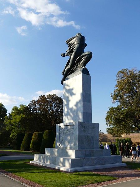
LA SERBIE ET L EUROPE La Serbie attend aux porte de de l' Europe que l'on veuille bien la laisser entrer dans la communauté des 27. Mais les choses sont compliquées : corruption politique, presse aux ordres, système judiciaire contrôlé, népotisme, intimidation des opposants politiques, existence de groupes criminels proches du pouvoir monopolisant le commerce des armes, verrouillage du système électoral par une oligarchie directement issue de l' ancienne nomenclature communiste ( comme en Roumanie, Bulgarie, Slovaquie ou Russie... ), refus de mettre en jugement les généraux criminels de guerre, manque de volonté évidente à assainir les finances publiques. Tout est donc en suspens... Le bilan démocratique n' est pas terrible ! En attendant Novi Sad a été déclarée Ville Européenne de la Culture pour 2020, un cadeau fait aux Serbes, un signal amical aussi, et une distinction méritée. Mais il reste d'autres exigences démocratiques à satisfaire avant de pouvoir siéger à la même table que les 27.
ARGENT La monnaie officielle est le dinar serbe. Un euro s'échangera pour 117 à 119 dinars. Inutile de chercher à changer de l' argent au marché noir... qui n' existe pas. Il faut soit retirer de l' argent aux distributeurs soit partir avec de l' argent liquide et changer dans les officines de change qui pullulent à tous les coins de rue. Sans présentation de carte d'identité ou de passeport. On peut changer les dinars en sens inverse en euros avant de repartir vers la France. Coût de la vie moindre qu'en France de moitié environ. Nous avons dépensé 220 euros en nourriture, restaurants et autres en 3 jours.
FORMALITES D ENTREE Un passeport valide est requis sur lequel un tampon sera appliqué à l' entrée et à la sortie du pays. Normal puisque la Serbie n' est pas dans l' espace Schengen. Mais on peut aussi entrer en Serbie avec une simple carte d'identité si l'on est européen de l' Ouest. On repasse devant la police des frontières au retour à Paris.
NOTRE VOYAGE Nous avons voyagé au départ de Montpellier via CDG sur deux vols Air France pour un peu plus de 500 euros à deux. Vol international d'environ 2 heures et quart, en survol du sud de l' Allemagne, des Alpes autrichiennes, de la Slovénie puis de Zagreb et enfin de Belgrade. Départ à 6 heures de MPL. Vol en continuation en fin de matinée vers Belgrade et arrivée en début d'après-midi. Pas de décalage horaire par rapport à Paris. Nous avions réservé un hôtel hyper-central dans la rue piétonne principale, dite Knez Mihajlova. Un choix judicieux car nous avons pu faire nos visites et balades à pied, et à loisir, sauf quand nous sommes allés à Zemun ( en bus ). On nous avait prévenu que c'était la foire d'empoigne au niveau taxis à l' aéroport, et nous avons préféré utiliser un transport privé réservé par l' hôtel. Bonne idée aussi car nous sommes arrivés très vite en ville et avons eu largement le temps de poser nos jalons en prévision du lendemain.
 CLIMAT
Nous sommes allés du 10 au 13 septembre.
Temps estival magnifique, belle lumière, chaleur méditerranéenne sèche. Les artères centrales de Belgrade étaient couvertes de terrasses, très animées en soirée.
Il ne faut pas rater le quartier bohème et festif de Belgrade, Skadarlija qui est jumelé avec Montmartre depuis quelques années déjà. Nous y avons dîné tous les soirs avec plaisir. Bonne cuisine variée, avec musique tzigane ou traditionnelle serbe en sus, si l'on aime. A quelques minutes à pied du centre ville.
C' est l' avantage de Belgrade, une ville à taille humaine où tout est à portée de main. Elle nous a rappelé Ljubliana, encore plus petite capitale de la Slovénie.
CLIMAT
Nous sommes allés du 10 au 13 septembre.
Temps estival magnifique, belle lumière, chaleur méditerranéenne sèche. Les artères centrales de Belgrade étaient couvertes de terrasses, très animées en soirée.
Il ne faut pas rater le quartier bohème et festif de Belgrade, Skadarlija qui est jumelé avec Montmartre depuis quelques années déjà. Nous y avons dîné tous les soirs avec plaisir. Bonne cuisine variée, avec musique tzigane ou traditionnelle serbe en sus, si l'on aime. A quelques minutes à pied du centre ville.
C' est l' avantage de Belgrade, une ville à taille humaine où tout est à portée de main. Elle nous a rappelé Ljubliana, encore plus petite capitale de la Slovénie.
BELGRADE Le nom romain de Belgrade était Singidunum. La ville est située à un emplacement géographique de rêve, sur un promontoire rocheux surplombant le confluent du Danube et de la Save. Au sud, la forêt et au nord, une vaste plaine fertile. Comme on peut l' imaginer, le destin de Belgrade - détruite et reconstruite plusieurs fois - et de sa région fut souvent tragique au fil des siècles, attirant les convoitises de nombreux envahisseurs : Celtes, Romains, Goths, Huns, Bulgares, Magyars, Croisés marchant sur Jérusalem, Ottomans, Autrichiens... De toutes ces invasions et de toutes ces influences croisées, mélangées et exotiques, Belgrade s'est nourrie et est devenue une ville unique et accueillante. Un symbole de cette renaissance est ' Stari Grad ', la vieille ville, l' âme, le poumon et le coeur de la capitale serbe.
1er jour : 10 septembre Arrivée à Belgrade centre en début d'après-midi. Installation à l' hôtel. Ensuite, nous allons faire nos repérages, mais aussi profiter de l' après-midi dans le centre piétonnier puis à l' intérieur de la forteresse de Kalemegdan ( accès gratuit ), ancien poste militaire romain puis serbe - la construction commence au 14ème siècle - remaniée ensuite par les Autrichiens selon les systèmes Vauban, enfin occupée par les Turcs pendant un siècle - de 1730 à 1830. S'y retrouvent, en ces longues journées estivales, étudiants, joueurs d'échecs, badauds, touristes, amoureux et familles avec poussettes. Quelques échoppes et aussi des marchands ambulants, mais finalement pas trop, et surtout moins qu'ailleurs. La forteresse est immense, il faut donc quelques heures pour en faire le tour à loisir. Elle est intéressante pour ses tours et portes médiévales, en particulier la Tour carrée du Despote, la plus ancienne servant d'accès principal à la forteresse et celle de Nebojsa sur les berges au pied de la forteresse, construite au 15ème siècle pour être utilisée comme octroi et poste de garde entre le vieux port et la ville haute, mais aussi comme prison. Dans la partie haute de la forteresse se trouve le musée de l' armée où sont exposées des pièces relatives à l' histoire militaire de l' ancienne Yougoslavie. Devant le Musée, une exposition de chars yougoslaves, américains, français et soviétiques, datant de la Seconde Guerre Mondiale. Tout en haut de la forteresse, dominant le confluent des deux fleuves, se trouve le symbole de la ville de Belgrade, la statue d'un jeune soldat porteur d'un message de paix et qui rappelle les sacrifices de l' armée serbe pour la libération du pays en 1918, avec l' aide de la France.
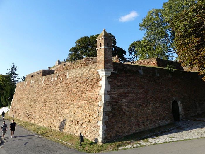
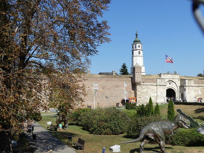
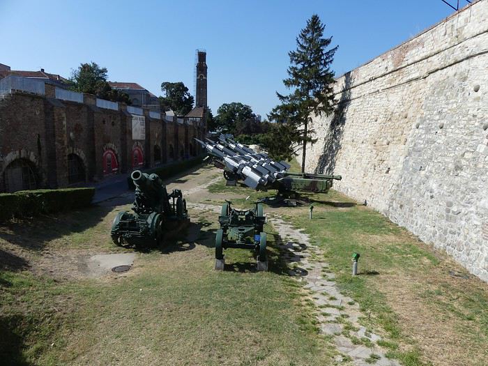
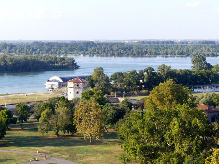
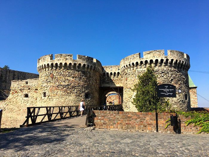
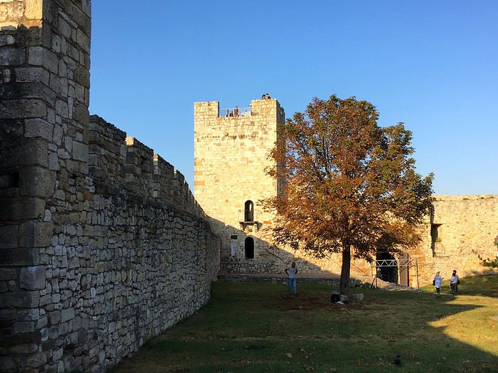
Il fait beau, ambiance détendue au milieu des familles et des badauds. Vue imprenable sur le port et les berges du Danube. Retour à l' hôtel. Nous allons explorer Skadarlija avant et après le dîner dans un restaurant recommandé par notre guide. La cuisine serbe n' est pas fantastique, car il est difficile d'échapper aux soupes et goulash aqueux et sempiternels que l'on propose facilement dans toute l' Europe de l' Est. En lieu et place du ragoût proposé, nous allons opter pour un menu un peu plus carné. Viandes grillées avec légumes à la méditerranéenne. On aime la viande en Serbie , surtout le porc.
2ème jour : 11 septembre Nous allons sortir de la zone piétonne puis emprunter la grande avenue commerçante et touristique - Terazije - qui mène jusqu'aux hauteurs de la cathédrale Saint Sava aux bulbes dorés. On passe d'abord devant l' hôtel Art Déco Moskva, le restaurant Frans, et la fontaine qui donne son nom au quartier. Les immeubles de cette partie du centre-ville ont une étrange identité faite d'un mélange d'architecture communiste et d'architecture Art Nouveau suite aux bombardements ayant modifié l' apparence du quartier de 1941 à 1944. Dans le prolongement de Terazije, se trouve l' avenue prestigieuse Kralja Milana menant à la plus grande place de Belgrade, Slavija. On n' est plus, à ce niveau, dans Stari Grad.
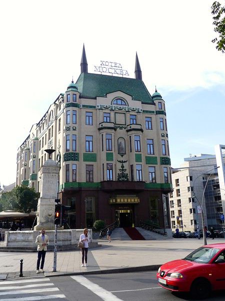
Arrivée à la cathédrale de Saint Sava. Entrée gratuite. C 'est la plus grande église orthodoxe d'Europe, monumentale, élégante, très byzantine avec son plan en croix grecque ramassée et ses 18 coupoles étincelantes. Elle a une signification spirituelle très forte et il faut remonter dans le temps pour comprendre son importance aux yeux des Serbes. En 1594, le vizir Sinan Pacha ordonne le transfert des reliques du saint moine Sava d'un monastère de Serbie méridionale vers cette colline pour qu'elles y soient brûlées, un geste de défi de la part des Ottomans qui s'opposent aux velléités d'indépendance des Serbes. Les travaux débutent en 1935 sur ordre du roi Alexandre, qui, hélas, mourra en exil à Marseille quelques années plus tard sans jamais avoir vu sa cathédrale sortir de terre.. Le chantier traîne en longueur puis est interrompu en 1941. Tito refuse de payer pour une continuation de travaux ordonnés par le défunt roi et qui ne vont reprendre qu'en 1985 à la mort du dictateur, grâce à une souscription internationale et surtout à la générosité des Serbes de la diaspora. L'intérieur est toujours en chantier à ce jour, mais la crypte, magnifique avec ses dorures éblouissantes, est accessible gratuitement.
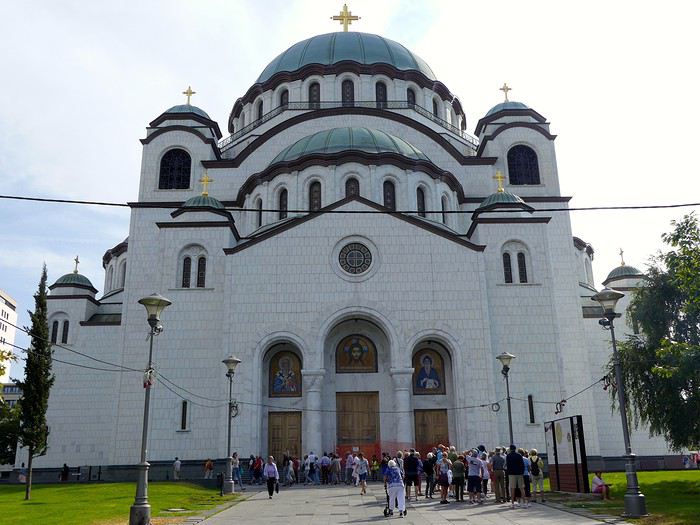

Retour par un chemin différent vers le centre en obliquant vers le Belgrade monumental, gouvernemental et culturel : la Présidence de la République, le Parlement, le Théâtre National, construit en 1869, inspiré des théâtres d'Europe centrale de la même époque et agrémenté de sculptures néo-classiques et de décors Renaissance, enfin le Musée National fondé en 1844 par un prince serbe et logé dans un palais datant de 1903 Place de la République , et dont la rénovation vient enfin de se terminer De beaux ensembles regroupant palais nationaux et maisons colorées entourés de parcs et de jardins entretenus et dotés de jeux d'eau. La rénovation du centre de la capitale est une réussite, et, pour une fois, les travaux en cours restent discrets et ne gâchent pas les perspectives. A noter également la ré-ouverture en début d'année du Musée d'Art Contemporain ( MoCAB ) à Novi Beograd à l' architecture audacieuse.
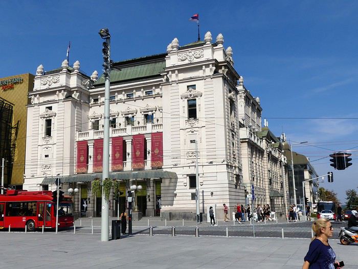
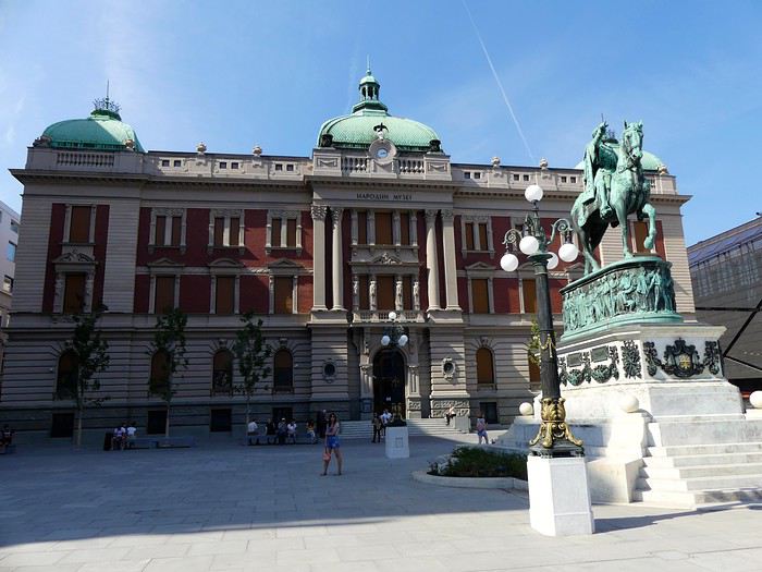
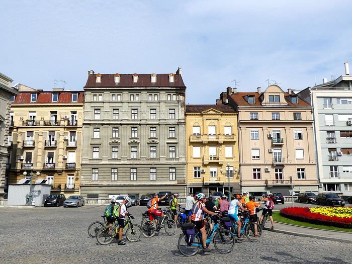
La Serbie, pays le plus septentrional des Balkans, pays de naissance ou de coeur du savant Nicola Tesla, du dessinateur Enki Bilal et du cinéaste Emir Kusturica, n' a pourtant pas atteint le niveau de visibilité touristique de certains de ses voisins comme la Croatie par exemple ou la Slovénie ou encore le Montenegro. C' est encore pour quelque temps une destination confidentielle. C' est l'une des raisons pour laquelle nous avons décidé de partir quelques jours d'abord pour visiter Belgrade, en plein réaménagement culturel et urbanistique, et ensuite pour découvrir la partie nord du pays, appelé la Voïvodine, région culturellement riche connue pour ses villes et bourgades historiques, ses monastères et ses parcs naturels. Nous n' avons pas regretté ce voyage et avons apprécié le côté authentique qu'offre la Serbie à ceux qui veulent bien venir y passer quelques jours. Pas ou très peu de touristes européens ou américains, en revanche l'on rencontre des touristes chinois, le gouvernement serbe ayant exempté les visiteurs chinois - ou indiens - de visa. A deux heures et demie d'avion de Paris, Belgrade, la Ville Blanche ( ou ' Beo Grad ' ) ambitionne de redevenir ce qu'elle était dans les années 30, à savoir la reine des Balkans, une capitale joyeuse et ambitieuse, et l'une des destinations les plus courues d'Europe du Sud. Elle n' est pas loin de gagner son pari.
UN PEU D HISTOIRE La première principauté serbe voit le jour au milieu du 9ème siècle, alors que l' ambitieux prince Vladimir profite d'une victoire sur les Byzantins pour confédérer les principautés qui ont concouru à la victoire. Le nouvel état voulu par le prince - la Rascie - sera le siège de la principale cour de justice dans les Balkans. Ce nouvel état comporte la Serbie méridionale et occidentale, ainsi que le Montenegro et l' Herzégovine actuels. L' empereur byzantin auquel tous les princes - dont Vladimir- ont prêté allégeance va envoyer les moines Cyrille et Méthode évangéliser les Slaves. Il s'agit de rendre le christianisme accessible aux populations locales et Cyrille va mettre au point une écriture basée sur l' alphabet grec, adaptée au slavon, langue liturgique des écritures saintes. C 'est ainsi que nait l' alphabet cyrillique, toujours utilisé dans la région, et qui a ensuite migré vers la Bulgarie actuelle ainsi que vers la Russie, avec des différences mineures qui n' empêchent pas les populations de la Grande Région de se comprendre. La Serbie appartient donc depuis le 9ème siècle à un espace chrétien d'obédience byzantine , qui, après le schisme de 1054, deviendra d'obédience orthodoxe. Le Moyen-Âge est donc l' âge d'or serbe. Les princes successeurs de Vladimir n' auront de cesse d'abord d'agrandir le royaume de Rascie, englobant à la fin du 12ème siècle le littoral adriatique et la Zeta, et puis de construire des monastères à la richesse architecturale incomparable. L' empire serbe va s'effilocher puis disparaître sous la domination ottomane , qui va durer cinq siècles. Les Serbes refusent massivement de se convertir, subissent les discriminations et ne pratiquent leur religion et leur langue qu'à l' église ou à la maison. Les conflits culturels et d'autorité sont permanents, mais, paradoxalement et miraculeusement, la liberté de culte étant réglementée mais permise, les monastères orthodoxes, lieux de liberté et de développement culturel, vont prospérer. Les Turcs, quant à eux, ont une vision des Balkans très nette et organisée; ils vont construire des édifices militaires et religieux, des ponts, des forteresses, des mosquées bien sur. La création d'un état moderne date du milieu du 19ème siècle. Des soulèvements populaires ont lieu contre ' la Sublime Porte ', une démocratie de type libéral est créée en 1830, fortement influencée par l' Autriche-Hongrie. Mais la Serbie a des prétentions territoriales qui l' opposent au grand voisin, ce qui va mener aux guerres balkaniques de 1912-1913, et de fil en aiguille, à la Première Guerre Mondiale. Le prince héritier du trône d'Autriche, Louis-Ferdinand est assassiné à Sarajevo par un Serbe, Gavrilo Princip, membre actif de l' organisation étudiante de Bosnie, la Main Noire. L' alliance entre la France et la Serbie va offrir à l' état serbe en exil une position de force dans les négociations de 1918. En 1921, le royaume devient un état centralisé sur le modèle français. Mais la situation politique va se gâter, les minorités vont s'opposer et se radicaliser, l' armée allemande est accueillie à bras ouverts par les Croates alors que Belgrade la résistante est bombardée. La Serbie va, contre son gré, devenir un état collaborateur dirigé par une marionnette aux ordres de Berlin. Face aux démonstrations de haine féroce et grandissante entre frères yougoslaves, les communistes vont s'imposer comme une évidence. Tito, leur chef et habile stratège politique, décide en 1945 de créer une fédération de six républiques : les Slovènes, les Croates, les Monténégrins, les Serbes, les Macédoniens et, un peu plus tard, les Musulmans. A l' intérieur de la Serbie sont créées les provinces autonomes de Voïvodine et du Kosovo avec obtention pour chacune des 26 nationalités, de droits culturels importants. L' histoire moderne de la Serbie est tumultueuse, trouble, violente, chaotique et impitoyable. C' est en particulier celle d'une guerre de nettoyage ethnique, la guerre de Bosnie qui culminera avec le massacre de Srebrenica en 1995, sous le commandement du sinistre général Mladic, lui-même aux ordres de Slobodan Milosevic élu président de la Serbie en 1992. Autre guerre qui va suivre, celle du Kosovo, occupé par l' armée serbe. Autre massacre, celui de Racak qui déclenchera les bombardements de l' Otan visant à forcer les Serbes à se retirer du Kosovo et à cesser leurs exactions. Ces bombardements massifs contre des objectifs militaires et civils conduiront à la mise en accusation de Milosevic devant le Tribunal Pénal International, à la disparition définitive de la Yougoslavie et à l' indépendance du Kosovo en 2008, un chapitre encore douloureux pour les Serbes en 2019.
LA SERBIE ET LA FRANCE La France a sauvé la Serbie lors de la première Guerre Mondiale, en remettant sur pied son armée et en l' aidant à s'opposer aux Austro-Allemands, puis en libérant Macédoine et Serbie. En 1934, le sculpteur Mestrovic réalise un monument de style Art Déco en reconnaissance à la France qui se trouve dans le parc de la forteresse de Kalemegdan.
Cette belle amitié s' est hélas fissurée pendant les dernières guerres des Balkans, la France étant à la tête des pays d'Europe de l' Ouest ayant décidé de faire rendre gorge à l' armée serbe après les massacres de Bosnie puis ceux du Kosovo. C 'est Jacques Chirac, nouvellement élu président qui commande à l' armée française - " on tire ou on se tire ", aurait-il dit- de venger les humiliations subies par les soldats de l' OTAN interdits d'utiliser leurs armes - mais canardés à balles réelles en permanence - et de reprendre un certain nombre de positions par la force, dont le fameux pont de Mostar. Ce sont les avions de chasse américains et français qui détruiront un certain nombre d' objectifs militaires et civils dans le but de faire plier le régime. Pas toujours aux bons endroits, il faut bien le reconnaître. Exemple : Novi Sad, ville rebelle et dans l'opposition à Milosevic, qui a , malgré tout, été bombardée et perdu tous ses ponts sur le Danube. Cette période n' a pas laissé de bons souvenirs en Serbie où le patriotisme est exacerbé et le militarisme encore actif. On n' en est pas encore à vraiment reconnaître les funestes erreurs d'un passé récent, la rancoeur n' a pas disparu. Le nom de Jacques Chirac, juste décédé, a récemment été sifflé par des supporteurs serbes de l' équipe nationale avant un match.
LA SERBIE ET L EUROPE La Serbie attend aux porte de de l' Europe que l'on veuille bien la laisser entrer dans la communauté des 27. Mais les choses sont compliquées : corruption politique, presse aux ordres, système judiciaire contrôlé, népotisme, intimidation des opposants politiques, existence de groupes criminels proches du pouvoir monopolisant le commerce des armes, verrouillage du système électoral par une oligarchie directement issue de l' ancienne nomenclature communiste ( comme en Roumanie, Bulgarie, Slovaquie ou Russie... ), refus de mettre en jugement les généraux criminels de guerre, manque de volonté évidente à assainir les finances publiques. Tout est donc en suspens... Le bilan démocratique n' est pas terrible ! En attendant Novi Sad a été déclarée Ville Européenne de la Culture pour 2020, un cadeau fait aux Serbes, un signal amical aussi, et une distinction méritée. Mais il reste d'autres exigences démocratiques à satisfaire avant de pouvoir siéger à la même table que les 27.
ARGENT La monnaie officielle est le dinar serbe. Un euro s'échangera pour 117 à 119 dinars. Inutile de chercher à changer de l' argent au marché noir... qui n' existe pas. Il faut soit retirer de l' argent aux distributeurs soit partir avec de l' argent liquide et changer dans les officines de change qui pullulent à tous les coins de rue. Sans présentation de carte d'identité ou de passeport. On peut changer les dinars en sens inverse en euros avant de repartir vers la France. Coût de la vie moindre qu'en France de moitié environ. Nous avons dépensé 220 euros en nourriture, restaurants et autres en 3 jours.
FORMALITES D ENTREE Un passeport valide est requis sur lequel un tampon sera appliqué à l' entrée et à la sortie du pays. Normal puisque la Serbie n' est pas dans l' espace Schengen. Mais on peut aussi entrer en Serbie avec une simple carte d'identité si l'on est européen de l' Ouest. On repasse devant la police des frontières au retour à Paris.
NOTRE VOYAGE Nous avons voyagé au départ de Montpellier via CDG sur deux vols Air France pour un peu plus de 500 euros à deux. Vol international d'environ 2 heures et quart, en survol du sud de l' Allemagne, des Alpes autrichiennes, de la Slovénie puis de Zagreb et enfin de Belgrade. Départ à 6 heures de MPL. Vol en continuation en fin de matinée vers Belgrade et arrivée en début d'après-midi. Pas de décalage horaire par rapport à Paris. Nous avions réservé un hôtel hyper-central dans la rue piétonne principale, dite Knez Mihajlova. Un choix judicieux car nous avons pu faire nos visites et balades à pied, et à loisir, sauf quand nous sommes allés à Zemun ( en bus ). On nous avait prévenu que c'était la foire d'empoigne au niveau taxis à l' aéroport, et nous avons préféré utiliser un transport privé réservé par l' hôtel. Bonne idée aussi car nous sommes arrivés très vite en ville et avons eu largement le temps de poser nos jalons en prévision du lendemain.
CLIMAT
Nous sommes allés du 10 au 13 septembre.
Temps estival magnifique, belle lumière, chaleur méditerranéenne sèche. Les artères centrales de Belgrade étaient couvertes de terrasses, très animées en soirée.
Il ne faut pas rater le quartier bohème et festif de Belgrade, Skadarlija qui est jumelé avec Montmartre depuis quelques années déjà. Nous y avons dîné tous les soirs avec plaisir. Bonne cuisine variée, avec musique tzigane ou traditionnelle serbe en sus, si l'on aime. A quelques minutes à pied du centre ville.
C' est l' avantage de Belgrade, une ville à taille humaine où tout est à portée de main. Elle nous a rappelé Ljubliana, encore plus petite capitale de la Slovénie.BELGRADE Le nom romain de Belgrade était Singidunum. La ville est située à un emplacement géographique de rêve, sur un promontoire rocheux surplombant le confluent du Danube et de la Save. Au sud, la forêt et au nord, une vaste plaine fertile. Comme on peut l' imaginer, le destin de Belgrade - détruite et reconstruite plusieurs fois - et de sa région fut souvent tragique au fil des siècles, attirant les convoitises de nombreux envahisseurs : Celtes, Romains, Goths, Huns, Bulgares, Magyars, Croisés marchant sur Jérusalem, Ottomans, Autrichiens... De toutes ces invasions et de toutes ces influences croisées, mélangées et exotiques, Belgrade s'est nourrie et est devenue une ville unique et accueillante. Un symbole de cette renaissance est ' Stari Grad ', la vieille ville, l' âme, le poumon et le coeur de la capitale serbe.
1er jour : 10 septembre Arrivée à Belgrade centre en début d'après-midi. Installation à l' hôtel. Ensuite, nous allons faire nos repérages, mais aussi profiter de l' après-midi dans le centre piétonnier puis à l' intérieur de la forteresse de Kalemegdan ( accès gratuit ), ancien poste militaire romain puis serbe - la construction commence au 14ème siècle - remaniée ensuite par les Autrichiens selon les systèmes Vauban, enfin occupée par les Turcs pendant un siècle - de 1730 à 1830. S'y retrouvent, en ces longues journées estivales, étudiants, joueurs d'échecs, badauds, touristes, amoureux et familles avec poussettes. Quelques échoppes et aussi des marchands ambulants, mais finalement pas trop, et surtout moins qu'ailleurs. La forteresse est immense, il faut donc quelques heures pour en faire le tour à loisir. Elle est intéressante pour ses tours et portes médiévales, en particulier la Tour carrée du Despote, la plus ancienne servant d'accès principal à la forteresse et celle de Nebojsa sur les berges au pied de la forteresse, construite au 15ème siècle pour être utilisée comme octroi et poste de garde entre le vieux port et la ville haute, mais aussi comme prison. Dans la partie haute de la forteresse se trouve le musée de l' armée où sont exposées des pièces relatives à l' histoire militaire de l' ancienne Yougoslavie. Devant le Musée, une exposition de chars yougoslaves, américains, français et soviétiques, datant de la Seconde Guerre Mondiale. Tout en haut de la forteresse, dominant le confluent des deux fleuves, se trouve le symbole de la ville de Belgrade, la statue d'un jeune soldat porteur d'un message de paix et qui rappelle les sacrifices de l' armée serbe pour la libération du pays en 1918, avec l' aide de la France.
Il fait beau, ambiance détendue au milieu des familles et des badauds. Vue imprenable sur le port et les berges du Danube. Retour à l' hôtel. Nous allons explorer Skadarlija avant et après le dîner dans un restaurant recommandé par notre guide. La cuisine serbe n' est pas fantastique, car il est difficile d'échapper aux soupes et goulash aqueux et sempiternels que l'on propose facilement dans toute l' Europe de l' Est. En lieu et place du ragoût proposé, nous allons opter pour un menu un peu plus carné. Viandes grillées avec légumes à la méditerranéenne. On aime la viande en Serbie , surtout le porc.
2ème jour : 11 septembre Nous allons sortir de la zone piétonne puis emprunter la grande avenue commerçante et touristique - Terazije - qui mène jusqu'aux hauteurs de la cathédrale Saint Sava aux bulbes dorés. On passe d'abord devant l' hôtel Art Déco Moskva, le restaurant Frans, et la fontaine qui donne son nom au quartier. Les immeubles de cette partie du centre-ville ont une étrange identité faite d'un mélange d'architecture communiste et d'architecture Art Nouveau suite aux bombardements ayant modifié l' apparence du quartier de 1941 à 1944. Dans le prolongement de Terazije, se trouve l' avenue prestigieuse Kralja Milana menant à la plus grande place de Belgrade, Slavija. On n' est plus, à ce niveau, dans Stari Grad.
Arrivée à la cathédrale de Saint Sava. Entrée gratuite. C 'est la plus grande église orthodoxe d'Europe, monumentale, élégante, très byzantine avec son plan en croix grecque ramassée et ses 18 coupoles étincelantes. Elle a une signification spirituelle très forte et il faut remonter dans le temps pour comprendre son importance aux yeux des Serbes. En 1594, le vizir Sinan Pacha ordonne le transfert des reliques du saint moine Sava d'un monastère de Serbie méridionale vers cette colline pour qu'elles y soient brûlées, un geste de défi de la part des Ottomans qui s'opposent aux velléités d'indépendance des Serbes. Les travaux débutent en 1935 sur ordre du roi Alexandre, qui, hélas, mourra en exil à Marseille quelques années plus tard sans jamais avoir vu sa cathédrale sortir de terre.. Le chantier traîne en longueur puis est interrompu en 1941. Tito refuse de payer pour une continuation de travaux ordonnés par le défunt roi et qui ne vont reprendre qu'en 1985 à la mort du dictateur, grâce à une souscription internationale et surtout à la générosité des Serbes de la diaspora. L'intérieur est toujours en chantier à ce jour, mais la crypte, magnifique avec ses dorures éblouissantes, est accessible gratuitement.
Retour par un chemin différent vers le centre en obliquant vers le Belgrade monumental, gouvernemental et culturel : la Présidence de la République, le Parlement, le Théâtre National, construit en 1869, inspiré des théâtres d'Europe centrale de la même époque et agrémenté de sculptures néo-classiques et de décors Renaissance, enfin le Musée National fondé en 1844 par un prince serbe et logé dans un palais datant de 1903 Place de la République , et dont la rénovation vient enfin de se terminer De beaux ensembles regroupant palais nationaux et maisons colorées entourés de parcs et de jardins entretenus et dotés de jeux d'eau. La rénovation du centre de la capitale est une réussite, et, pour une fois, les travaux en cours restent discrets et ne gâchent pas les perspectives. A noter également la ré-ouverture en début d'année du Musée d'Art Contemporain ( MoCAB ) à Novi Beograd à l' architecture audacieuse.
L'Ouest américain a-t-il mené à la ‘’rustography"? English translation pending
L’Ouest américain a-t-il mené à la ‘’rustography’ ? …
Dans un vaste échange précédent très ouvert Fabhyene a fait des remarques judicieuses qui m’ont paru mériter un petit développement …
‘’’ C'est marrant parce que certains se demandent pourquoi sur internet on trouve une telle fascination pour la rouille et les ruines. Sans remonter aux textes bibliques (tu es poussière et tu retourneras poussière), c'est oublier que les ruines étaient déjà fascinantes pour les Romantiques au 19ème siècle (à relier aussi à la thématiques des cités englouties)... et c'est aussi oublier la tradition dans la peinture occidentale des "vanités", ces représentations allégoriques de la mort, du temps qui passe et du caractère vain de toute activité humaine, vouée à la mort et la destruction... Plus récemment, c'est aussi une thématique qui s'est développée d'une revanche de la nature sur les hommes... Je pense qu'aux USA cela renvoie aussi aux villes fantômes, qui font partie du patrimoine... ‘’’ …
Le sujet est en effet assez fascinant quand on y réfléchit….
Chez les Romains qui ont dû leur Empire pour une bonne part à la maîtrise du fer mais qui n’avaient pas les moyens de comprendre l’oxydation, la rouille était un acte des dieux compensant la facilité avec laquelle le nouvel armement permettait de tuer l’ennemi … en tous cas c’est ce qu’ aurait écrit un certain Pline l’Ancien (🙂) en parlant de ferrum corrumpitur ( pas besoin de traduire). Cette interprétation force d’ailleurs le rapprochement avec la fiction développée dans La mort du fer(1931) de S.S. Held oû ce n’est pas une force divine mais une maladie venue de l’espace la sidérie encore appelée Mal bleu qui détruit la civilisation industrielle. La sidérie aurait bien sûr été introduite sur terre par une Sidérite …
Au Moyen Age et sous les latitudes humides on imagine le travail que çà devait être de maintenir l’armure hors rouille. Heureusement le Chevalier avait son fidèle Ecuyer qui s’en chargeait en frottant consciencieusement ladite armure avec du sable fin puis de l’huile de poisson, à ce qu’on lit chez les historiens! Cependant quand l’écuyer n’est plus là les choses peuvent mal tourner… on raconte d’un Chevalier Normand, en Angleterre, frappé par la Grâce divine ou pour échapper à l’ennemi, se réfugie dans la forêt et en signe de pénitence décide d’y vivre en ermite et ne plus jamais quitter son armure … de mauvaise langues disent qu’en réalité il ne pouvait plus l’ôter tant elle était rouillée. …...
Bon… passons sur les ponts effondrés à cause de la rouille des boulonnages de poutres acier ou du ferraillage interne, la plus récente étant celle du béton armé du pont Morandi de Gênes Alors, effectivement aux Etats Unis l’attrait contemporain de la rouille ‘’ renvoie aussi aux villes fantômes, qui font partie du patrimoine…’’
mais pas seulement….
Aux Etats Unis, en Australie et plus récemment au Royaume Uni se sont développés depuis une trentaine d’années un intérêt voire une passion pour ‘’la rouille’’ largement et d’abord associés à son esthétisme On peut probablement trouver un repère important dans l’introduction vers 1983 par le magazine Hemmings Motor News d’un calendrier thématique sur les voitures abandonnées dont voici la dernière édition :
L’art s’est donc emparé de la rouille : en peinture, en photographie, dans l’art textile oû c’est souvent tout simplement un objet de fer rouillé qui, posé pour un certain temps sur le tissu, imprime en rouille le canevas de l’oeuvre (textile rust dye) ..
Parlons photo et vieux trucks rouillés...
Il y a une douzaine d’années, ou un peu plus, une jeune architecte d’intérieur de la Côte Est, un peu pour s’amuser, met en vente dans une boutique quelques photos de vieux trucks abandonnés et rouillés prises à l’occasion d’un voyage dans l’Ouest. Elle s’aperçoit alors qu’elles partent toutes en un clin d’oeil et que les gens en redemandent. Stupeur : il y avait donc un marché pour çà !
Lors d’un interview de 2015 trucks & rust - Nancy "Weezy"Forman devait en effet déclarer :
“ A little bell went off in my head, ” Forman said. “I realized it was something people were loving, artistically, automotively and nostalgically.”
C’est ainsi qu’elle devient photographe spécialisée en RUSTOGRAPHY et qu’elle parcourt le pays, en particulier l’Ouest et le Sud Ouest, à la recherche de nouveaux sujets, mue par un sens artistique opportun puisque, incidemment, elle vend ses photos à partir de 250 et jusqu’à 2500 à 3000 dollars pour décorer les murs de votre cuisine, de votre bureau, de votre salle de séjour ou même de votre chambre…
Pour elle au moins l’expression ‘’beau comme un camion’’ a pris un sens concret !
Un autre photographe, Wayne Stadler, à peu près en même temps crée le groupe Rustography
S’il existe donc maintenant indiscutablement un rust art en anglophonie (à défaut d’un art de la rouille en francophonie) c’est à dire en fin de compte un art associé à l’oxydation du fer on peut en retracer l’origine loin… très loin en arrière, au paléolithique quand maîtrise du feu (= charbon de bois) et prise en compte des oxydes de fer (ocre etc..) ont permis l’art pariétal avec en premier lieu l’impression de mains positives ou négatives comme à La Grotte Chauvet-Pont d'Arc ( 36000 ans)
Le fer joue décidément un rôle capital dans l’histoire de la Terre et dans celle de l’humanité qu’elle porte.
Il a d’abord permis à la vie de se développer et de se maintenir grâce au puissant champ magnétique généré par le noyau externe (du fer liquide) au centre du globe qui la protège d’un excès de rayonnements et de particules solaires et cosmiques potentiellement léthales. Si un jour, le noyau s’étant suffisamment refroidi, le fer liquide arrêtait de ‘’bouger’’ sous nos pieds, le champ magnétique terrestre disparaissant alors, nous n’aurions plus à nous soucier de changement climatique…Nous disparaîtrions aussi, probablement complètement irradiés… mais çà n’est pas pour demain !
je m’égare un peu…...
Parlons ‘’rust’’ et paysages….
En peinture je me demande si ce n’est pas Georgia O'Keeffe elle-même qui n’aurait pas, la première, associé le terme ‘’rust’ à la peinture interprétative des paysages du sud ouest américain avec ‘’rust red hills’’. De ceci je ne suis pas sûr... quoiqu’il en soit le rust painting est maintenant bien établi
En francophonie on ne trouve pas un tel engouement. Cependant on peut citer au Quebec L'Art de la rouille de Jean-Pierre Tremblay (2016) et en France Rust-Art ou l'art de la rouille by AYRAULT BRIGITTE de Nantes (2015) dont le patronyme est bien celui auquel vous pensez . Son livre disponible chez l’ Américain Blurb, Inc. est payable en dollars. En en pied de couverture : ‘’ Rust in photo is an artistic and philosophic subject ‘’.
Au fait et la sculpture ?
Il existe bien sûr depuis des décennies des sculptures, constructions métalliques d’art plus ou moins rouillées ou plus ou moins potentiellement rouillées mais qui ne sont ni dédiées à la rouille ni construits avec elle . Superbe exemple avec Anza Borrego !
Par contre l’an dernier (2018) à Pittsburg ville qui semble avoir surmonté la crise de la Rust Belt issue du déclin industriel amorcé à la fin des années 70 le Carnegie Museum of Art a inauguré une œuvre dédiée à l’histoire industrielle passée, aux ouvriers, afro-américains entre autres qui l’ont fait vivre et à la musique jazz qui en est sortie. Occupant 185 m², constituée à partir de 11 tonnes de ferraille rouillée récupérée sur une friche industrielle et arrangée sur du charbon (en principe, peut-être une lave volcanique noire tenant lieu de charbon) et sur du verre pilé, l’oeuvre évoque par sa géométrie un ‘’sand painting’’ Navajo , ce qui n’est pas fortuit les auteurs étant trois Amérindiens de l’Ouest (dont un Navajo d’Albuquerque). From Smoke and Tangled Waters We Carried Fire Home est le titre complet de l’oeuvre que l’on peut admirer ... ou simplement voir ici :
From Smoke and Tangled Waters
Mais la rouille au sens large, c’est à dire l’oxydation du fer est à l’origine de bien d’autres beautés…..
Sans l’oxydation du fer , sans la ‘’rouille’’ le sud ouest américain serait à peu près monochrome et les formes mêmes des sédiments du plateau du Colorado (bof!) plus cohérents, seraient moins découpées, beaucoup moins spectaculaires parce que de la même manière que l’oxydation du ferraillage contribue à la désagrégation du béton des ponts elle contribue à celle des couches géologiques en créant des hétérogénéités. Le Plateau du Colorado ne serait qu’une masse d’une monotonie accablante. Déprimante perspective !
Rust et imagination
C’est un fait que les épaves abandonnées çà et là dans le désert, les ghost-towns, ou la forêt … çà titille l’imagination et on peut rêver un instant devant chacune d’entre elles. Le mystère est d’autant plus prégnant que, au milieu de nulle part, l’abandon semble avoir été brutal et imprévu.
L’exemple le plus médiatisé , le plus photographié depuis que les touristes affluent en Utah est probablement celui de la foreuse d’eau de Cathedral Valley (cathedral valley abandoned drill rig). On y voit un vieux truck de la marque INTERNATIONAL des années 50, reconnaissable à sa calandre, dont la peinture verte (comme c’était courant chez INTERNATIONAL à l’époque) est encore visible. On imagine qu’il a été pris dans une coulée de boue suite à un flash flood, que l’équipage ( de la Compagnie J. Pinkerton) a fuit, n’ayant plus tard jamais été en mesure de l’extirper de sa gangue. Peu à peu le sable, le recouvrant, il se fossilise pour...les archéologues du futur, tel un dinosaure de l’ère moderne ! Pour eux il portera aussi témoignage de l’une des Gun cultures les plus affirmées de notre temps puisque, comme beaucoup d’autres épaves, il a servi de cible aux ‘’ trigger happy’’ de la région en devenant un exemple d’une variante du ‘’rust art’’... à savoir le '’bullet ridden rusty car ‘’ dont voici un autre classique :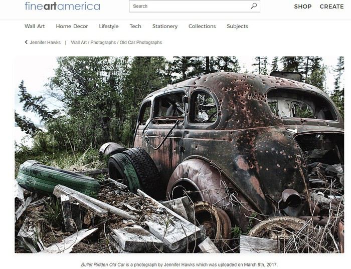
et dont un autre exemple fameux est bien sûr le véhicule dans lequel Bonnie and Clyde furent mitraillés libéralement ( Bonnie and Clyde's bullet riddled "death car" ). Assez morbide !
Si la foreuse sur camion est encore en batterie, tour dressée, matériel éparpillé tout autour, l’effet est encore plus saisissant. On dirait alors que le temps s’est figé.. comme à Pompéi ... sans les cendres. Mais là nous sommes dans l’ouest et, pendant une seconde, une idée va vous traverser la tête…. l’équipage aurait-il dû fuir pour échapper à une attaque d’ Apaches irréductibles descendus des montagnes. Que diable a-t-il bien pu survenir en effet à l’équipage de cette foreuse fantomatique abandonnée là, en urgence (sud de l’Arizona du côté de la San Pedro valley)….
En réalité l’affaire remonte à la fin des années 50 quand nombre de prospecteurs ont commencé à forer pour le pétrole dans le coin et sans beaucoup de succès… certains qui avaient vendu la peau de l’ours avant de l’avoir tué et emprunté pour payer leur matériel ont simplement dû couper court à leur aventure de manière en effet brutale... Mais qu’en est-il de ce mystérieux porte-voitures encore chargé de ses 4 voitures, lui aussi des années 50… ?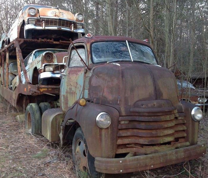
... Si vous avez une idée….lâchez vous !
Pour conclure sur une note d’humour tout en poursuivant votre réflexion métaphysique et si vous passez par là, visitez donc, en Oregon : The Rust Age - Zymoglyphic Museum
p.s. inutile de chercher Zymoglyphic dans le Merriam-Webster il n’y est pas encore ! Bonne journée !
Dans un vaste échange précédent très ouvert Fabhyene a fait des remarques judicieuses qui m’ont paru mériter un petit développement …
‘’’ C'est marrant parce que certains se demandent pourquoi sur internet on trouve une telle fascination pour la rouille et les ruines. Sans remonter aux textes bibliques (tu es poussière et tu retourneras poussière), c'est oublier que les ruines étaient déjà fascinantes pour les Romantiques au 19ème siècle (à relier aussi à la thématiques des cités englouties)... et c'est aussi oublier la tradition dans la peinture occidentale des "vanités", ces représentations allégoriques de la mort, du temps qui passe et du caractère vain de toute activité humaine, vouée à la mort et la destruction... Plus récemment, c'est aussi une thématique qui s'est développée d'une revanche de la nature sur les hommes... Je pense qu'aux USA cela renvoie aussi aux villes fantômes, qui font partie du patrimoine... ‘’’ …
Le sujet est en effet assez fascinant quand on y réfléchit….
Chez les Romains qui ont dû leur Empire pour une bonne part à la maîtrise du fer mais qui n’avaient pas les moyens de comprendre l’oxydation, la rouille était un acte des dieux compensant la facilité avec laquelle le nouvel armement permettait de tuer l’ennemi … en tous cas c’est ce qu’ aurait écrit un certain Pline l’Ancien (🙂) en parlant de ferrum corrumpitur ( pas besoin de traduire). Cette interprétation force d’ailleurs le rapprochement avec la fiction développée dans La mort du fer(1931) de S.S. Held oû ce n’est pas une force divine mais une maladie venue de l’espace la sidérie encore appelée Mal bleu qui détruit la civilisation industrielle. La sidérie aurait bien sûr été introduite sur terre par une Sidérite …
Au Moyen Age et sous les latitudes humides on imagine le travail que çà devait être de maintenir l’armure hors rouille. Heureusement le Chevalier avait son fidèle Ecuyer qui s’en chargeait en frottant consciencieusement ladite armure avec du sable fin puis de l’huile de poisson, à ce qu’on lit chez les historiens! Cependant quand l’écuyer n’est plus là les choses peuvent mal tourner… on raconte d’un Chevalier Normand, en Angleterre, frappé par la Grâce divine ou pour échapper à l’ennemi, se réfugie dans la forêt et en signe de pénitence décide d’y vivre en ermite et ne plus jamais quitter son armure … de mauvaise langues disent qu’en réalité il ne pouvait plus l’ôter tant elle était rouillée. …...
Bon… passons sur les ponts effondrés à cause de la rouille des boulonnages de poutres acier ou du ferraillage interne, la plus récente étant celle du béton armé du pont Morandi de Gênes Alors, effectivement aux Etats Unis l’attrait contemporain de la rouille ‘’ renvoie aussi aux villes fantômes, qui font partie du patrimoine…’’
mais pas seulement….
Aux Etats Unis, en Australie et plus récemment au Royaume Uni se sont développés depuis une trentaine d’années un intérêt voire une passion pour ‘’la rouille’’ largement et d’abord associés à son esthétisme On peut probablement trouver un repère important dans l’introduction vers 1983 par le magazine Hemmings Motor News d’un calendrier thématique sur les voitures abandonnées dont voici la dernière édition :
L’art s’est donc emparé de la rouille : en peinture, en photographie, dans l’art textile oû c’est souvent tout simplement un objet de fer rouillé qui, posé pour un certain temps sur le tissu, imprime en rouille le canevas de l’oeuvre (textile rust dye) ..
Parlons photo et vieux trucks rouillés...
Il y a une douzaine d’années, ou un peu plus, une jeune architecte d’intérieur de la Côte Est, un peu pour s’amuser, met en vente dans une boutique quelques photos de vieux trucks abandonnés et rouillés prises à l’occasion d’un voyage dans l’Ouest. Elle s’aperçoit alors qu’elles partent toutes en un clin d’oeil et que les gens en redemandent. Stupeur : il y avait donc un marché pour çà !
Lors d’un interview de 2015 trucks & rust - Nancy "Weezy"Forman devait en effet déclarer :
“ A little bell went off in my head, ” Forman said. “I realized it was something people were loving, artistically, automotively and nostalgically.”
C’est ainsi qu’elle devient photographe spécialisée en RUSTOGRAPHY et qu’elle parcourt le pays, en particulier l’Ouest et le Sud Ouest, à la recherche de nouveaux sujets, mue par un sens artistique opportun puisque, incidemment, elle vend ses photos à partir de 250 et jusqu’à 2500 à 3000 dollars pour décorer les murs de votre cuisine, de votre bureau, de votre salle de séjour ou même de votre chambre…
Pour elle au moins l’expression ‘’beau comme un camion’’ a pris un sens concret !
Un autre photographe, Wayne Stadler, à peu près en même temps crée le groupe Rustography
S’il existe donc maintenant indiscutablement un rust art en anglophonie (à défaut d’un art de la rouille en francophonie) c’est à dire en fin de compte un art associé à l’oxydation du fer on peut en retracer l’origine loin… très loin en arrière, au paléolithique quand maîtrise du feu (= charbon de bois) et prise en compte des oxydes de fer (ocre etc..) ont permis l’art pariétal avec en premier lieu l’impression de mains positives ou négatives comme à La Grotte Chauvet-Pont d'Arc ( 36000 ans)
Le fer joue décidément un rôle capital dans l’histoire de la Terre et dans celle de l’humanité qu’elle porte.
Il a d’abord permis à la vie de se développer et de se maintenir grâce au puissant champ magnétique généré par le noyau externe (du fer liquide) au centre du globe qui la protège d’un excès de rayonnements et de particules solaires et cosmiques potentiellement léthales. Si un jour, le noyau s’étant suffisamment refroidi, le fer liquide arrêtait de ‘’bouger’’ sous nos pieds, le champ magnétique terrestre disparaissant alors, nous n’aurions plus à nous soucier de changement climatique…Nous disparaîtrions aussi, probablement complètement irradiés… mais çà n’est pas pour demain !
je m’égare un peu…...
Parlons ‘’rust’’ et paysages….
En peinture je me demande si ce n’est pas Georgia O'Keeffe elle-même qui n’aurait pas, la première, associé le terme ‘’rust’ à la peinture interprétative des paysages du sud ouest américain avec ‘’rust red hills’’. De ceci je ne suis pas sûr... quoiqu’il en soit le rust painting est maintenant bien établi
En francophonie on ne trouve pas un tel engouement. Cependant on peut citer au Quebec L'Art de la rouille de Jean-Pierre Tremblay (2016) et en France Rust-Art ou l'art de la rouille by AYRAULT BRIGITTE de Nantes (2015) dont le patronyme est bien celui auquel vous pensez . Son livre disponible chez l’ Américain Blurb, Inc. est payable en dollars. En en pied de couverture : ‘’ Rust in photo is an artistic and philosophic subject ‘’.
Au fait et la sculpture ?
Il existe bien sûr depuis des décennies des sculptures, constructions métalliques d’art plus ou moins rouillées ou plus ou moins potentiellement rouillées mais qui ne sont ni dédiées à la rouille ni construits avec elle . Superbe exemple avec Anza Borrego !
Par contre l’an dernier (2018) à Pittsburg ville qui semble avoir surmonté la crise de la Rust Belt issue du déclin industriel amorcé à la fin des années 70 le Carnegie Museum of Art a inauguré une œuvre dédiée à l’histoire industrielle passée, aux ouvriers, afro-américains entre autres qui l’ont fait vivre et à la musique jazz qui en est sortie. Occupant 185 m², constituée à partir de 11 tonnes de ferraille rouillée récupérée sur une friche industrielle et arrangée sur du charbon (en principe, peut-être une lave volcanique noire tenant lieu de charbon) et sur du verre pilé, l’oeuvre évoque par sa géométrie un ‘’sand painting’’ Navajo , ce qui n’est pas fortuit les auteurs étant trois Amérindiens de l’Ouest (dont un Navajo d’Albuquerque). From Smoke and Tangled Waters We Carried Fire Home est le titre complet de l’oeuvre que l’on peut admirer ... ou simplement voir ici :
From Smoke and Tangled Waters
Mais la rouille au sens large, c’est à dire l’oxydation du fer est à l’origine de bien d’autres beautés…..
Sans l’oxydation du fer , sans la ‘’rouille’’ le sud ouest américain serait à peu près monochrome et les formes mêmes des sédiments du plateau du Colorado (bof!) plus cohérents, seraient moins découpées, beaucoup moins spectaculaires parce que de la même manière que l’oxydation du ferraillage contribue à la désagrégation du béton des ponts elle contribue à celle des couches géologiques en créant des hétérogénéités. Le Plateau du Colorado ne serait qu’une masse d’une monotonie accablante. Déprimante perspective !
Rust et imagination
C’est un fait que les épaves abandonnées çà et là dans le désert, les ghost-towns, ou la forêt … çà titille l’imagination et on peut rêver un instant devant chacune d’entre elles. Le mystère est d’autant plus prégnant que, au milieu de nulle part, l’abandon semble avoir été brutal et imprévu.
L’exemple le plus médiatisé , le plus photographié depuis que les touristes affluent en Utah est probablement celui de la foreuse d’eau de Cathedral Valley (cathedral valley abandoned drill rig). On y voit un vieux truck de la marque INTERNATIONAL des années 50, reconnaissable à sa calandre, dont la peinture verte (comme c’était courant chez INTERNATIONAL à l’époque) est encore visible. On imagine qu’il a été pris dans une coulée de boue suite à un flash flood, que l’équipage ( de la Compagnie J. Pinkerton) a fuit, n’ayant plus tard jamais été en mesure de l’extirper de sa gangue. Peu à peu le sable, le recouvrant, il se fossilise pour...les archéologues du futur, tel un dinosaure de l’ère moderne ! Pour eux il portera aussi témoignage de l’une des Gun cultures les plus affirmées de notre temps puisque, comme beaucoup d’autres épaves, il a servi de cible aux ‘’ trigger happy’’ de la région en devenant un exemple d’une variante du ‘’rust art’’... à savoir le '’bullet ridden rusty car ‘’ dont voici un autre classique :
et dont un autre exemple fameux est bien sûr le véhicule dans lequel Bonnie and Clyde furent mitraillés libéralement ( Bonnie and Clyde's bullet riddled "death car" ). Assez morbide !
Si la foreuse sur camion est encore en batterie, tour dressée, matériel éparpillé tout autour, l’effet est encore plus saisissant. On dirait alors que le temps s’est figé.. comme à Pompéi ... sans les cendres. Mais là nous sommes dans l’ouest et, pendant une seconde, une idée va vous traverser la tête…. l’équipage aurait-il dû fuir pour échapper à une attaque d’ Apaches irréductibles descendus des montagnes. Que diable a-t-il bien pu survenir en effet à l’équipage de cette foreuse fantomatique abandonnée là, en urgence (sud de l’Arizona du côté de la San Pedro valley)….
En réalité l’affaire remonte à la fin des années 50 quand nombre de prospecteurs ont commencé à forer pour le pétrole dans le coin et sans beaucoup de succès… certains qui avaient vendu la peau de l’ours avant de l’avoir tué et emprunté pour payer leur matériel ont simplement dû couper court à leur aventure de manière en effet brutale... Mais qu’en est-il de ce mystérieux porte-voitures encore chargé de ses 4 voitures, lui aussi des années 50… ?
... Si vous avez une idée….lâchez vous !
Pour conclure sur une note d’humour tout en poursuivant votre réflexion métaphysique et si vous passez par là, visitez donc, en Oregon : The Rust Age - Zymoglyphic Museum
p.s. inutile de chercher Zymoglyphic dans le Merriam-Webster il n’y est pas encore ! Bonne journée !
À propos de l'expression: "j'ai fait... tel ou tel pays" English translation pending
bonjour
il est fréquent de voir cette expression :"j'ai fais " en parlant d'un pays existant depuis des siècles ? est ce vraiment le terme approprié ? certes le terme est devenu banal , et presque personne ne le trouve inapproprié , cependant ne serait il pas plus correct de dire par exemple : j'ai VISITE , j'ai DECOUVERT , même j'ai exploré tel , où tel pays ? le fameux j'ai FAIS" il me semble à une connotation d'appropriation , alors que le pays cité existait bien avant que vous ne l'ayez "fait " et existera bien après que vous l'ayez quitté ! cette remarque faite , juste pour que notre si belle langue , tellement martyrisée , perdure ! bons voyages à tous , le plus longtemps , longtemps, possible , que le monde continue à vous émerveiller afin de mieux le respecter cordialement Jacques
il est fréquent de voir cette expression :"j'ai fais " en parlant d'un pays existant depuis des siècles ? est ce vraiment le terme approprié ? certes le terme est devenu banal , et presque personne ne le trouve inapproprié , cependant ne serait il pas plus correct de dire par exemple : j'ai VISITE , j'ai DECOUVERT , même j'ai exploré tel , où tel pays ? le fameux j'ai FAIS" il me semble à une connotation d'appropriation , alors que le pays cité existait bien avant que vous ne l'ayez "fait " et existera bien après que vous l'ayez quitté ! cette remarque faite , juste pour que notre si belle langue , tellement martyrisée , perdure ! bons voyages à tous , le plus longtemps , longtemps, possible , que le monde continue à vous émerveiller afin de mieux le respecter cordialement Jacques
Découvertes pédestres au Cap Vert English translation pending
Voici déjà quelques semaines que nous sommes rentrés du Cap Vert et, enfin, notre carnet de voyages se précise...
Durant 3 semaines nous sommes partis à la découverte de quelques îles en alternant randonnées pédestres et parcours en voiture. Pour réserver les hébergements au cours des randonnées nous avions fait appel, avant le départ, à l'agence Nobai qui a été très réactive et efficace. Nous n'avons utilisé les services d'un guide que pour l'ascension du volcan Fogo. Pour les autres randonnées nous avons voyagé seuls sans aucune difficulté d'orientation.
15/02/2019 : Marseille-Lisbonne-Praia Pour tuer le temps entre 2 avions à Lisbonne nous faisons un petit tour au travers du parc des Nations créé, sur la rive du Tage, à l'occasion de l'exposition universelle en 1998. De l'aéroport, en 10 minutes de métro nous rejoignons la station Oriente, porte d'entrée du parc des Nations. Nous déambulons une partie de l'après-midi au cœur de ces constructions, parfois élégantes, parfois manquant de finesse mais toujours surprenantes. Nous reprenons le chemin de l'aéroport en fin de journée. A minuit (heure locale) nous descendons de l'avion accueillis par une douce chaleur tempérée par un vent assez fort. L'attente au contrôle des passeports sera relativement courte car nous avons eu la chance d'avoir des places à l'avant de l'avion. Le contrôle est rapide, l'enregistrement préalable sur internet pour payer la taxe de sécurité semble efficace et une fois les bagages récupérés nous retrouvons notre chauffeur qui nous conduit à l’hôtel. Le distributeur de billets de l'aéroport refuse obstinément notre carte Visa mais un guichet de change à coté nous dépanne.
Île de Santiago: côté mer, la houle permanente de l'Atlantique découpe la côte en une succession de criques et de plages. Évidemment, l'activité principale des petits ports est la pêche encore très artisanale. Côté montagne, l'origine volcanique du relief a découpé des crêtes acérées où se perchent de façon étonnante une multitude de hameaux. Des canyons escarpés dévalent jusqu'à la mer. Parfois au fond des vallées s'installent cocotiers et bananiers. Partout, la terre est aride : on se demande ce que vaches, chèvres et ânes trouvent à se mettre sous la dent. La canne à sucre profite du moindre petit lopin de terre suspendu et nous, nous profitons du « grogue », apéritif local au rhum et au citron !!!
16/02 : Praia – Tarrafal Le petit déjeuner est pris sur la terrasse de l’hôtel plutôt ventée. Nous sollicitons une voiture de location auprès de l’hôtel qui nous propose une Clio pour 55 € par jour. L'affaire est conclue et nous faisons un tour vers le DAB situé à 200 mètres. Ici, seule la carte Visa semble acceptée. La sortie de Praia est simple malgré une signalisation assez espacée mais en suivant attentivement la carte nous trouvons facilement notre chemin bien que le GPS du téléphone refuse absolument de fonctionner. La ville est étagée sur les collines avec de multiples constructions inachevées en tous sens. Après les derniers immeubles la route serpente dans un paysage d'une aridité totale. Le ciel reste voilé de lourds nuages chargés de poussière. Quelques rares chèvres, vaches et cochons efflanqués broutent au milieu des cailloux et les arbres décharnés semblent bousculés en permanence par le vent.
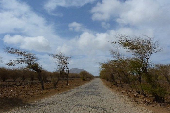 Nous croisons régulièrement des piétons qui circulent au bord de la route et les villages nombreux parsèment le paysage. Notre premier arrêt sera pour le petit port de Pedra Badejo.
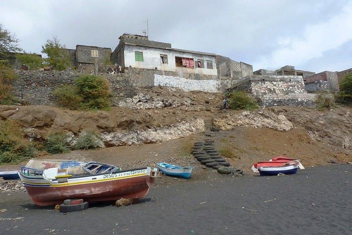 C'est la fin du marché au poissons à la suite du retour de pèche. Nous croisons de nombreux habitants qui ramènent parfois un seul poisson, parfois une bassine pleine portée par les femmes sur la tête.
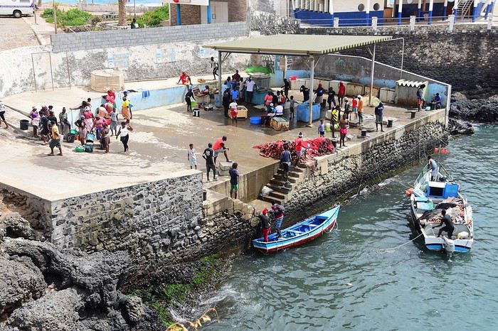
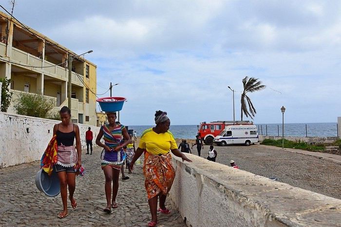
La mer est agitée et se fracasse en longs rouleaux sur le sable noir. Les bateaux de pêche colorés sont alignés au bord de l'eau. La route parcourt ensuite le bord de mer en franchissant de nombreux ravins au fond desquels poussent des vergers de bananiers et de cocotiers, oasis verdoyantes au cœur de ce paysage de pierre et de poussière. Un peu plus loin, la petite bourgade de Calheta de sao Miguel déploie ses façades peintes de fresques colorées tout autour du port et une petit place récemment aménagée avec des jeux d'enfants nous accueille pour un frugal pique nique de quelques biscuits accompagnant une banane et une mandarine.
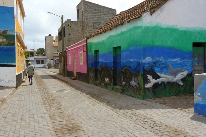
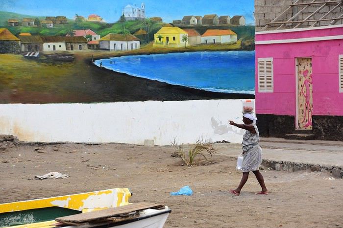
La route devient ensuite pavée jusque Tarrafal. Nous tournons un long moment à la recherche d'une chambre disponible : c'est samedi et nous découvrons que la plupart des hébergements sont complets en week-end. Finalement guidés par un cycliste aimablement pressenti par une dame serviable nous rejoignons une pension où il reste une petite chambre sans eau chaude dans la douche. En fin d'après-midi nous parcourons le plage au sable blanc au milieu des sombres roches volcaniques.
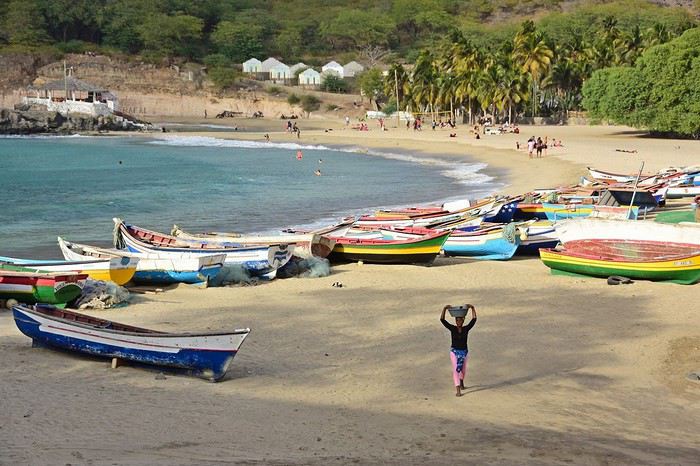 De hautes vagues déferlantes font le bonheur des baigneurs et, ici aussi, de nombreuses barques de pêcheurs décorent la plage de leurs couleurs variées.
15/02/2019 : Marseille-Lisbonne-Praia Pour tuer le temps entre 2 avions à Lisbonne nous faisons un petit tour au travers du parc des Nations créé, sur la rive du Tage, à l'occasion de l'exposition universelle en 1998. De l'aéroport, en 10 minutes de métro nous rejoignons la station Oriente, porte d'entrée du parc des Nations. Nous déambulons une partie de l'après-midi au cœur de ces constructions, parfois élégantes, parfois manquant de finesse mais toujours surprenantes. Nous reprenons le chemin de l'aéroport en fin de journée. A minuit (heure locale) nous descendons de l'avion accueillis par une douce chaleur tempérée par un vent assez fort. L'attente au contrôle des passeports sera relativement courte car nous avons eu la chance d'avoir des places à l'avant de l'avion. Le contrôle est rapide, l'enregistrement préalable sur internet pour payer la taxe de sécurité semble efficace et une fois les bagages récupérés nous retrouvons notre chauffeur qui nous conduit à l’hôtel. Le distributeur de billets de l'aéroport refuse obstinément notre carte Visa mais un guichet de change à coté nous dépanne.
Île de Santiago: côté mer, la houle permanente de l'Atlantique découpe la côte en une succession de criques et de plages. Évidemment, l'activité principale des petits ports est la pêche encore très artisanale. Côté montagne, l'origine volcanique du relief a découpé des crêtes acérées où se perchent de façon étonnante une multitude de hameaux. Des canyons escarpés dévalent jusqu'à la mer. Parfois au fond des vallées s'installent cocotiers et bananiers. Partout, la terre est aride : on se demande ce que vaches, chèvres et ânes trouvent à se mettre sous la dent. La canne à sucre profite du moindre petit lopin de terre suspendu et nous, nous profitons du « grogue », apéritif local au rhum et au citron !!!
16/02 : Praia – Tarrafal Le petit déjeuner est pris sur la terrasse de l’hôtel plutôt ventée. Nous sollicitons une voiture de location auprès de l’hôtel qui nous propose une Clio pour 55 € par jour. L'affaire est conclue et nous faisons un tour vers le DAB situé à 200 mètres. Ici, seule la carte Visa semble acceptée. La sortie de Praia est simple malgré une signalisation assez espacée mais en suivant attentivement la carte nous trouvons facilement notre chemin bien que le GPS du téléphone refuse absolument de fonctionner. La ville est étagée sur les collines avec de multiples constructions inachevées en tous sens. Après les derniers immeubles la route serpente dans un paysage d'une aridité totale. Le ciel reste voilé de lourds nuages chargés de poussière. Quelques rares chèvres, vaches et cochons efflanqués broutent au milieu des cailloux et les arbres décharnés semblent bousculés en permanence par le vent.
Nous croisons régulièrement des piétons qui circulent au bord de la route et les villages nombreux parsèment le paysage. Notre premier arrêt sera pour le petit port de Pedra Badejo.
C'est la fin du marché au poissons à la suite du retour de pèche. Nous croisons de nombreux habitants qui ramènent parfois un seul poisson, parfois une bassine pleine portée par les femmes sur la tête.
La mer est agitée et se fracasse en longs rouleaux sur le sable noir. Les bateaux de pêche colorés sont alignés au bord de l'eau. La route parcourt ensuite le bord de mer en franchissant de nombreux ravins au fond desquels poussent des vergers de bananiers et de cocotiers, oasis verdoyantes au cœur de ce paysage de pierre et de poussière. Un peu plus loin, la petite bourgade de Calheta de sao Miguel déploie ses façades peintes de fresques colorées tout autour du port et une petit place récemment aménagée avec des jeux d'enfants nous accueille pour un frugal pique nique de quelques biscuits accompagnant une banane et une mandarine.
La route devient ensuite pavée jusque Tarrafal. Nous tournons un long moment à la recherche d'une chambre disponible : c'est samedi et nous découvrons que la plupart des hébergements sont complets en week-end. Finalement guidés par un cycliste aimablement pressenti par une dame serviable nous rejoignons une pension où il reste une petite chambre sans eau chaude dans la douche. En fin d'après-midi nous parcourons le plage au sable blanc au milieu des sombres roches volcaniques.
De hautes vagues déferlantes font le bonheur des baigneurs et, ici aussi, de nombreuses barques de pêcheurs décorent la plage de leurs couleurs variées.À faire ou voir à Lampang et Sukhothaï English translation pending
Bonsoir!
Notre itinéraire est enfin bouclé, et le voyage prend forme petit à petit. (3 semaines en Octobre 2019, 1er voyage avec notre bébé). Bangkok, Chiang Mai, Lampang et Sukhothai sont au programme cette année! Nous avons quelques questions supplémentaires à vous poser...
A Lampang, certains d'entre vous ont-ils des endroits à ne pas louper à nous conseiller, ou des choses à faire en particulier? Suite à la lecture de carnets de voyages et de posts sur cette ville, nous nous sommes arrangés pour y être de passage sur un week-end pour découvrir le marché (du week-end, donc) qui parait très sympa. Nous avons prévu de rester 2 jours.
Pour Sukhothai, nous avons également prévu 2 jours sur place, est-ce que ça vous parait raisonnable et suffisant? (Nous ne réservons rien, c'est pour avoir une idée de notre feuille de route)
Enfin, une question sur les réservations, nous allons réserver le train de nuit Bangkok- Chiang Mai par sécurité, mais pour le reste, pensez-vous qu'il soit nécessaire de réserver à l'avance? A savoir: Chiang-Mai -> Lampang (train de jour) Lampang -> Phitsanulok (train de jour) Phitsanulok -> Bangkok (possible en train de nuit?)
Merci d'avance à tous pour votre aide.
Notre itinéraire est enfin bouclé, et le voyage prend forme petit à petit. (3 semaines en Octobre 2019, 1er voyage avec notre bébé). Bangkok, Chiang Mai, Lampang et Sukhothai sont au programme cette année! Nous avons quelques questions supplémentaires à vous poser...
A Lampang, certains d'entre vous ont-ils des endroits à ne pas louper à nous conseiller, ou des choses à faire en particulier? Suite à la lecture de carnets de voyages et de posts sur cette ville, nous nous sommes arrangés pour y être de passage sur un week-end pour découvrir le marché (du week-end, donc) qui parait très sympa. Nous avons prévu de rester 2 jours.
Pour Sukhothai, nous avons également prévu 2 jours sur place, est-ce que ça vous parait raisonnable et suffisant? (Nous ne réservons rien, c'est pour avoir une idée de notre feuille de route)
Enfin, une question sur les réservations, nous allons réserver le train de nuit Bangkok- Chiang Mai par sécurité, mais pour le reste, pensez-vous qu'il soit nécessaire de réserver à l'avance? A savoir: Chiang-Mai -> Lampang (train de jour) Lampang -> Phitsanulok (train de jour) Phitsanulok -> Bangkok (possible en train de nuit?)
Merci d'avance à tous pour votre aide.
De Grenoble au cap Nord en juin 2011 (Récit Complet) English translation pending
De Grenoble au Cap Nord - Norvège - Juin 2011
Voilà un récit sur un voyage au Cap Nord, décidé au dernier moment. C'est à notre retour d'un voyage de 20 jours en Sicile, et cela avec la petite voiture bleue, et un parcours de plus de 6500 km, que nous avons appris la mort d'un super pote à cause "du cancer '' et c'est là que je me suis dit qu'il faut réaliser ses rêves avant la maladie et la mort. Moi comme ancien motard, dans les années 1974/1985 , j'avais comme rêve de monter au Cap Nord en moto, mais hélas parmi mes copains, je n'ai trouvé personne. Donc je ne serais jamais monté là-haut, ni avec ma Kawasaki Z 650, ni avec ma Honda Gold Wing 1000CC.
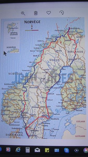
Le but de ce voyage était d'aller au Cap Nord et de redescendre. Le 23 mai, nous avons enterré notre pote et le départ a eu lieu le 15 juin 2011à 5h20 du matin.
Vous me verrez pas trop de photos du voyage, j'avais décidé que la destination était le Cap Nord, et je ne voulais pas trop trainer en route. Depuis Grenoble, par autoroute j'ai rejoint le Luxembourg pour faire un dernier plein par trop cher, car ensuite le prix du carburant des pays traversés n'allaient pas cesser d'augmenter pour terminer à 1,80 euros le litre de gasoil en Norvège.
Je suis donc parti seul, ma compagne n'ayant pas envie de faire encore autant de kilomètres après notre séjour sicilien.
Mercredi 15 juin 2011.
Après 1049 km, ma 1ère étape fut le Camping d'Osnabruck en Allemagne.
Jeudi 16 juin 2011, départ d'Osnabruck à 7h15 du matin, la photo c'est le Tunnel sous l'Elbe à Hambourg, ensuite frontière FLENSBURG, et entrée au Danemark, ensuite le tunnel Pont entre le Danemark et la Suède.
Le pont entre Danemark et la Suède environ 40 euros.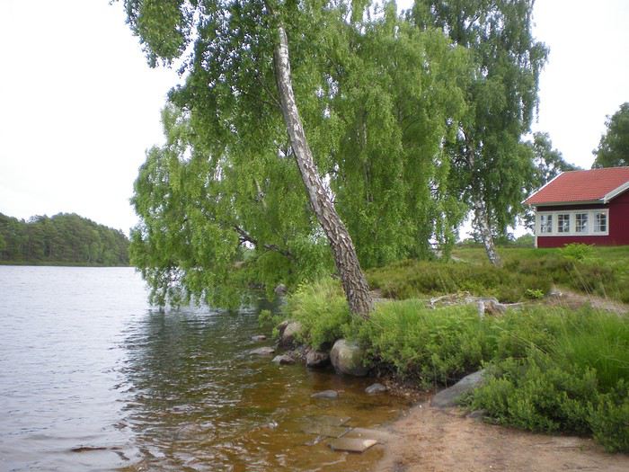
Et après 870 kilomètres me voilà au bord d'un lac en Suède à Markaryd, où je passe ma 2ème nuit, en dormant dans ma Citroen C3.
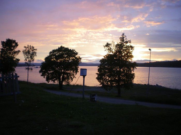
Vendredi 17 juin 2011, après 905 km, je passe un 2ème nuit en Suède au bord de la mer baltique à HARNOSAND, et c'est à cet endroit là que commence le soleil de nuit, il ne fait plus nuit.
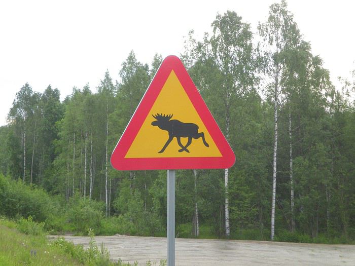
Samedi 18 juin 2011, première vision de panneaux routiers qu'on ne voit pas trop dans notre pays, mais mon but ce jour est de passer la frontière entre la Suède et la Finlande.
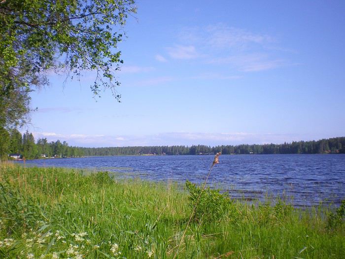
En Suède les paysages ne sont pas trop variés, mer baltique, lacs et forêts.
Là sur la route, il a fallu que je m'arrête pour faire la photo des rennes en liberté, c'étaient les premiers que je voyais.
ça y est , bientôt la Finlande et dans ce pays on retrouve notre monnaie l'euro, c'est plus facile de comprendre les prix, pas de calculs à faire.
Après les lacs suédois, me voilà donc en Finlande, le pays aux mille lacs.
Là c'est une route qui se situe pas très loin de la Russie, une 2 fois deux voies avec une bande d'arrêt d'urgence de chaque côté, tout en ligne droite, bizarre cette grande route de 2500 mètres, dans un endroit où quelques fois, on ne croise pas de véhicules pendant une heure voire plus.
J'aurais mon explication au retour, cette route pouvait servir comme terrain d'atterrissage pour des avions militaires en cas de conflit avec la Russie. (67°03'43.45 N - 26°31'10.68E) la Russie n'étant qu'à 100 km.
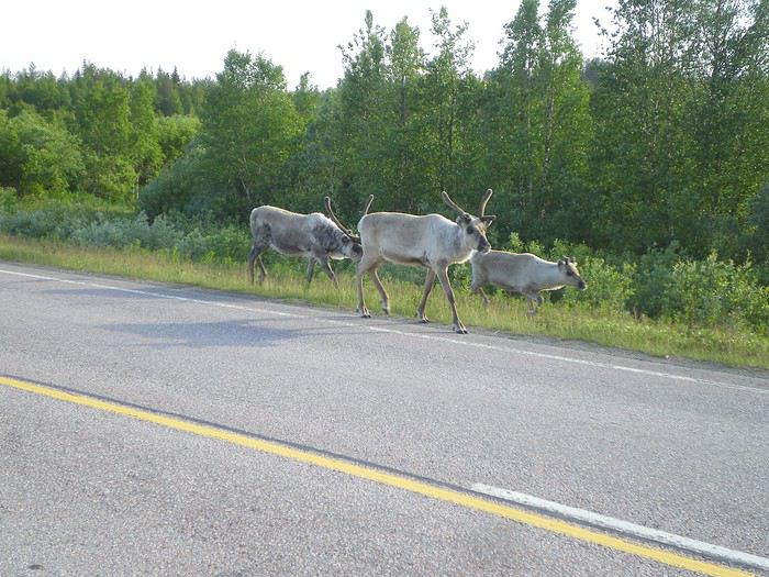
Encore des rennes en liberté, qui déambulent tranquillement sur les routes.
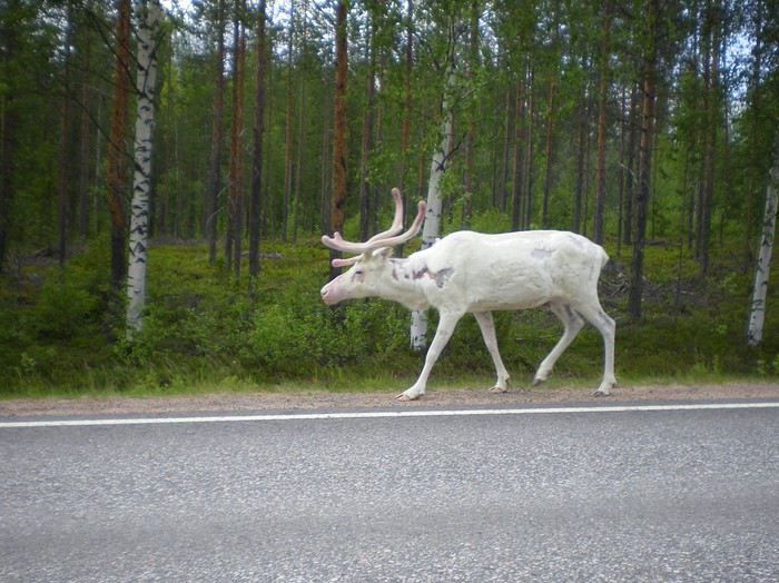
C'est dans cette ville finlandaise de SODANKYLA, que je passerais ma 4ème nuit après une étape de 864 km.
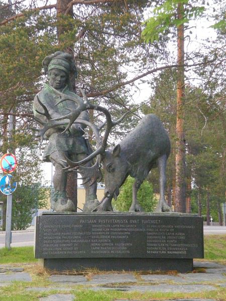
Un statue représentant le peuple Sami ( anciennement les Lapons) qui élèvent des troupeaux de rennes, et qui vivent sur 4 pays Norvège Suède Finlande et Russie.
Voilà, mon emplacement de camping, il y avait dans la ville, un festival de musique, et la photo est prise vers 1 heure du matin et on voit comme en plein jour.
Dimanche 19 juin 2011, je quitte le camping à 4h00 du matin, environ 600 km m'attendent, je veux être dans la soirée ou plus tôt au Cap Nord.
Voilà un récit sur un voyage au Cap Nord, décidé au dernier moment. C'est à notre retour d'un voyage de 20 jours en Sicile, et cela avec la petite voiture bleue, et un parcours de plus de 6500 km, que nous avons appris la mort d'un super pote à cause "du cancer '' et c'est là que je me suis dit qu'il faut réaliser ses rêves avant la maladie et la mort. Moi comme ancien motard, dans les années 1974/1985 , j'avais comme rêve de monter au Cap Nord en moto, mais hélas parmi mes copains, je n'ai trouvé personne. Donc je ne serais jamais monté là-haut, ni avec ma Kawasaki Z 650, ni avec ma Honda Gold Wing 1000CC.
Le but de ce voyage était d'aller au Cap Nord et de redescendre. Le 23 mai, nous avons enterré notre pote et le départ a eu lieu le 15 juin 2011à 5h20 du matin.
Vous me verrez pas trop de photos du voyage, j'avais décidé que la destination était le Cap Nord, et je ne voulais pas trop trainer en route. Depuis Grenoble, par autoroute j'ai rejoint le Luxembourg pour faire un dernier plein par trop cher, car ensuite le prix du carburant des pays traversés n'allaient pas cesser d'augmenter pour terminer à 1,80 euros le litre de gasoil en Norvège.
Je suis donc parti seul, ma compagne n'ayant pas envie de faire encore autant de kilomètres après notre séjour sicilien.
Mercredi 15 juin 2011.
Après 1049 km, ma 1ère étape fut le Camping d'Osnabruck en Allemagne.
Jeudi 16 juin 2011, départ d'Osnabruck à 7h15 du matin, la photo c'est le Tunnel sous l'Elbe à Hambourg, ensuite frontière FLENSBURG, et entrée au Danemark, ensuite le tunnel Pont entre le Danemark et la Suède.
Le pont entre Danemark et la Suède environ 40 euros.
Et après 870 kilomètres me voilà au bord d'un lac en Suède à Markaryd, où je passe ma 2ème nuit, en dormant dans ma Citroen C3.
Vendredi 17 juin 2011, après 905 km, je passe un 2ème nuit en Suède au bord de la mer baltique à HARNOSAND, et c'est à cet endroit là que commence le soleil de nuit, il ne fait plus nuit.
Samedi 18 juin 2011, première vision de panneaux routiers qu'on ne voit pas trop dans notre pays, mais mon but ce jour est de passer la frontière entre la Suède et la Finlande.
En Suède les paysages ne sont pas trop variés, mer baltique, lacs et forêts.
Là sur la route, il a fallu que je m'arrête pour faire la photo des rennes en liberté, c'étaient les premiers que je voyais.
ça y est , bientôt la Finlande et dans ce pays on retrouve notre monnaie l'euro, c'est plus facile de comprendre les prix, pas de calculs à faire.
Après les lacs suédois, me voilà donc en Finlande, le pays aux mille lacs.
Là c'est une route qui se situe pas très loin de la Russie, une 2 fois deux voies avec une bande d'arrêt d'urgence de chaque côté, tout en ligne droite, bizarre cette grande route de 2500 mètres, dans un endroit où quelques fois, on ne croise pas de véhicules pendant une heure voire plus.
J'aurais mon explication au retour, cette route pouvait servir comme terrain d'atterrissage pour des avions militaires en cas de conflit avec la Russie. (67°03'43.45 N - 26°31'10.68E) la Russie n'étant qu'à 100 km.
Encore des rennes en liberté, qui déambulent tranquillement sur les routes.
C'est dans cette ville finlandaise de SODANKYLA, que je passerais ma 4ème nuit après une étape de 864 km.
Un statue représentant le peuple Sami ( anciennement les Lapons) qui élèvent des troupeaux de rennes, et qui vivent sur 4 pays Norvège Suède Finlande et Russie.
Voilà, mon emplacement de camping, il y avait dans la ville, un festival de musique, et la photo est prise vers 1 heure du matin et on voit comme en plein jour.
Dimanche 19 juin 2011, je quitte le camping à 4h00 du matin, environ 600 km m'attendent, je veux être dans la soirée ou plus tôt au Cap Nord.
Visites et snorkeling pour 2 à 3 semaines en Indonésie? English translation pending
Bonjour,
Difficile de tout résumer dans un titre.
Nous sommes en pleine réflexion sur la destination de notre premier gros voyage (nous sommes 2, sans enfant). La principale contrainte : les dates, à partir du 10/08/2019 et pour 2 semaines (ou 3 possibles).
On hésite entre plusieurs destinations très différentes, mais Bali et l'Indonésie nous tente. Nous n'avons jamais voyagé hors des sentiers battus (hormis Marrakech et la Turquie/izmir mais en club...).
Nous avons besoin de détente, de dépaysement, de découvrir le patrimoine local et avons un gros faible pour : les animaux (et leur bien-être) et le snorkeling.
Idéalement, je me dis qu'il serait dommage de ne faire que Bali. En effleurant quelques pages sur le web, j'ai vu que certaines îles permettaient d'aller à la rencontre de la faune sauvage terrestre (orang outan), d'autres plutôt des beaux spots de snorkeling, d'autres encore plutôt pour le patrimoine culture (rizières, temples)... bref, j'ai l'impression qu'il vaut mieux ne pas se contenter d'une île mais de 2, voir 3.
Mes questions aux avis éclairés : 1) 2 à 3 semaines permettent-elles de répondre à cela ? 2) Peut-on facilement passer d'une île à une autre comment : avion? Bateau? et à quels coûts ? 3) Est-il envisageable facilement de s'organiser tout soit même : vol, transfert, hôtels, excursions soit-même ou vaut-il mieux partir sur la base d'un séjour / circuit préparé ?
4) Les premières appréhensions concernent d'éventuelles difficultés de communication pour l'organisation (problème de la langue) et des amis à nous qui y sont allés se sont fait plusieurs fois arnaqués sur place (en bateau, par des faux guides ou autres). Qu'en pensez-vous ?
5) Vu notre "idée" de voyage et nos centres d'intêrets, quelle fourchette de budget prévoir. Pensez-vous que 6.000€ pour 2 est une somme raisonnable pour 3 semaines ou faut-il prévoir beaucoup plus (en comptant tout).
Je suis preneur de tous vos retours, suggestions... pour dégrossir cette hypothèse de voyage :-)
Nous sommes en pleine réflexion sur la destination de notre premier gros voyage (nous sommes 2, sans enfant). La principale contrainte : les dates, à partir du 10/08/2019 et pour 2 semaines (ou 3 possibles).
On hésite entre plusieurs destinations très différentes, mais Bali et l'Indonésie nous tente. Nous n'avons jamais voyagé hors des sentiers battus (hormis Marrakech et la Turquie/izmir mais en club...).
Nous avons besoin de détente, de dépaysement, de découvrir le patrimoine local et avons un gros faible pour : les animaux (et leur bien-être) et le snorkeling.
Idéalement, je me dis qu'il serait dommage de ne faire que Bali. En effleurant quelques pages sur le web, j'ai vu que certaines îles permettaient d'aller à la rencontre de la faune sauvage terrestre (orang outan), d'autres plutôt des beaux spots de snorkeling, d'autres encore plutôt pour le patrimoine culture (rizières, temples)... bref, j'ai l'impression qu'il vaut mieux ne pas se contenter d'une île mais de 2, voir 3.
Mes questions aux avis éclairés : 1) 2 à 3 semaines permettent-elles de répondre à cela ? 2) Peut-on facilement passer d'une île à une autre comment : avion? Bateau? et à quels coûts ? 3) Est-il envisageable facilement de s'organiser tout soit même : vol, transfert, hôtels, excursions soit-même ou vaut-il mieux partir sur la base d'un séjour / circuit préparé ?
4) Les premières appréhensions concernent d'éventuelles difficultés de communication pour l'organisation (problème de la langue) et des amis à nous qui y sont allés se sont fait plusieurs fois arnaqués sur place (en bateau, par des faux guides ou autres). Qu'en pensez-vous ?
5) Vu notre "idée" de voyage et nos centres d'intêrets, quelle fourchette de budget prévoir. Pensez-vous que 6.000€ pour 2 est une somme raisonnable pour 3 semaines ou faut-il prévoir beaucoup plus (en comptant tout).
Je suis preneur de tous vos retours, suggestions... pour dégrossir cette hypothèse de voyage :-)
Quarante jours au Myanmar du Nord au Sud et "overstay" English translation pending
1- Les personnes désirant séjourner au Myanmar plus longtemps que la durée du visa ( 28 jours+ le jour d'entrée qui ne compte pas) peuvent le faire sans problème; c'est l"overstay" reconnu par les autorités. En quittant le pays par voie aérienne ou terrestre, vous réglez 3$ ( uniquement des dollars en billets neufs) par jour d'overstay, ni plus, ni moins. Vous avez le droit de dépasser de 90 jours. Au delà, vous devez régler 5$ par jour. Nous avons eu la confirmation de cela par les douaniers à Kawthaung. Pour les 12 jours de dépassement, nous avons réglé chacun 36$. C'est officiel avec tampon sur le passeport.
Ignorant le principe de l'overstay, certains hôteliers demandent des explications; nous n'avons jamais renvontré de problèmes.
L'entrée en Thailande avec exemption de visa de 30 jours par voie terrestre ne peut se faire que 2 fois par année calendaire ( depuis fin 2016). Cela ne s'applique pas pour les entrées par voie aérienne.
2- notre voyage:
Vieux routards depuis toujours ( voir mon post de février2018), nous voyageons sans nous presser, sans stresser, sans rien réserver ( sauf 1 fois au sud Dawei) et sans télé phoner. Nous utilisons uniquement le wifi des guest houses. Nous circulons avec les moyens locaux, bus et minibus, bateau public, tuk tuk, moto-taxi et accessoirement taxi, vélo et logeons dans des guest houses modestes et propres souvent avec clim. Le petit dej est toujours inclus. Les hôteliers souvent nous réservent les transports pour le lendemain. Repas dans des restaurants de rue, nourriture souvent grasse mais très bon marché ou fruits, biscuits et bière Myanmar.
Moyenne des dépenses pour 40 jours sur place: 39 € par jour pour le couple ( quelques nuits sans hôtel car en bus ou en bateau.
3-Itinéraire:
Rangoon-Mandalay ( bus de nuit)
Monywa-Htamanthi ( environ 600 km bateau public)
Layshe et le festival Naga (4×4). Retour idem.
Mindat ( minibus) et tribus Chin ( moto-taxi)
Kantpetlet ( jeep collective)
Pyay ( bus, changement à Magwe)
Ngapali ( bus de nuit hors d'âge)
Yangon ( bus confortable)
Dawei ( bus de nuit)
Péninsule de Dawei, ( tuk tuk et surtout moto-taxi)
Myeik ( minibus)
Tanintharyi ( bus)
Bokpyin ( minibus)
Kawthaung ( bus confortable)
Ranong ( Thailande, bateau public long tail).
4- Les points forts de notre circuit:
-festival du nouvel an Naga 14 et 15 janvier
-les tribus Chin autour de Mindat, femmes au visage tatoué.
- plages et villages de pêcheurs du sud de la péninsule de Dawei.
5- quelques infos a venir sur les lieux visités.
Pérégrinations sud-africaines English translation pending
Bonjour,
Nous voilà de retour de ce deuxième voyage en Afrique du Sud, qui aura été, tout comme le premier, un séjour magnifique. Ayant profité sur ce site de nombreuses informations sur l’AFS et de réponses de différents membres à mes questions d’avant départ, je vais essayer en retour de vous faire partager les différentes étapes de notre voyage mais surtout notre enthousiasme par rapport à ce pays, ses richesses et ses habitants. Nous avons adoré les différents coins de l’Afrique du Sud mais aussi du Lesotho que nous avons parcouru pendant un mois en juillet/août 2017 et un mois en juillet/août 2018. Pour le voyage 2017, par manque de notes prises en cours de route et aussi un peu (beaucoup) par manque de temps et de courage, nous n’avions pas publié de carnet. J’espère que celui-ci sera à la hauteur de notre émerveillement tout au long de notre périple. Ce carnet étant notre toute première production, il ne sera probablement pas exempt de petites erreurs ou approximations.
En route donc pour ce périple de 6000 km environ s’étalant du 11 juillet au 12 aout 2018. Ce voyage nous l’avons réalisé en couple et nous avons dans la cinquantaine (comme ça vous savez presque tout😉).
Quelques informations générales sur le voyage.
Itinéraire :
11/07 Départ de Bruxelles en soirée 12/07 Arrivée Jobourg 14h00 - nuit à Malelane 13/07 Kruger – nuit à Skukuza 14/07 Kruger – nuit à Skukuza 15/07 Kruger – nuit à Satara 16/07 Timbavati reserv – nuit à Shindzela tented camp 17/07 Timbavati reserv – nuit à Shindzela tented camp 18/07 Route vers Swaziland – nuit à Dullstrom 19/07 Swaziland – nuit à Malkern 20/07 Swaziland – nuit à Malkern 21/07 Route vers le Drakensberg – nuit à Didima Camp Cathedral Peak 22/07 Drakensberg – nuit à Didima Camp Cathedral Peak 23/07 Drakensberg – nuit à Didima Camp Cathedral Peak 24/07 Route vers le Royal Natal NP – nuit à Thendele Upper Camp 25/07 Royal Natal NP – nuit à Thendele Upper Camp 26/07 Royal Natal NP – nuit à Thendele Upper Camp 27/07 Route vers Kimberley – nuit à Kimberley 28/07 Kimberley – nuit à Kimberley 29/07 Route vers Upington – nuit à Upington 30/07 Route vers Augrabies Falls NP – nuit à Daberas Guest Farm 31/07 Augrabies Falls NP – nuit à Augrabies Camp 01//08 Augrabies Falls NP – nuit à Augrabies Camp 02/08 Route vers Kgalagadi Transfrontier Park – nuit à Urikaruus 03/08 Kgalagadi Transfrontier Park – nuit à Urikaruus 04/08 Kgalagadi Transfrontier Park – nuit à Kalahari tented camp 05/08 Kgalagadi Transfrontier Park – nuit à Kalahari tented camp 06/08 Kgalagadi Transfrontier Park – nuit à Nossob 07/08 Kgalagadi Transfrontier Park – nuit à Askham (70 km sud du park) 08/08 Route vers Vryburg – nuit à Vryburg 09/08 Route vers Madikwe Game reserv – nuit à Thakadu river camp 10/08 Madikwe Game reserv – nuit à Thakadu river camp 11/08 Madikwe Game reserv – nuit à Jobourg 12/08 Jobourg – avion vers Belgique via Addis Abeba 13/08 Arrivée en matinée à Bruxelles
L’itinéraire s’est organisé autour des réservations dans les parcs et notamment celles dans le KTP très difficiles à obtenir et bookées 1 an à l’avance ; dès le premier jour, les premières heures même de la mise en location sur le site.
Le Vol Bruxelles – Jobourg a été exécuté avec Ethiopian Airlines Aucun problème, horaires respectés, service à bord normal, repas corrects. Le grand plus : beaucoup de place pour les jambes sur les différents vols Le choix de Ethiopian était au départ un choix économique (490 euros A/R par pers. Réservé 10 mois à l’avance) mais il s’est avéré aussi très confortable avec une escale à Addis Abbeba de 2h00 à l’aller et 3h00 au retour
Nous avons loué une voiture chez Europcar via Rentalcars pour toute la durée du séjour. Mise à disposition et retour à l’aéroport. 31 jours de location pour 1288 euros Le véhicule était un Nissan Xtrail 7 places, boite auto avec 4X4 non permanent (que nous n’avions pas demandé et qui n’a été que très peu utilisé sur certaines pistes sablonneuses du KTP) Par contre le fait d’avoir un véhicule surélevé a vraiment été utile dans les différents parcs et permet une meilleure vue lors des games drive Vu le nombre de kilomètres parcourus, le confort de ce genre de véhicule a aussi été fortement apprécié.
Budget tout compris avec les vols pour 2 personnes : 7600 euros pour 34 jours de voyage dont 32 sur place. Les 4 nuits en réserves privées ont évidemment lourdement impacté le budget . Mais ça valait le coup au final… Tous les logements durant le séjour étaient en « dur » (pas de camping)
Nous voilà de retour de ce deuxième voyage en Afrique du Sud, qui aura été, tout comme le premier, un séjour magnifique. Ayant profité sur ce site de nombreuses informations sur l’AFS et de réponses de différents membres à mes questions d’avant départ, je vais essayer en retour de vous faire partager les différentes étapes de notre voyage mais surtout notre enthousiasme par rapport à ce pays, ses richesses et ses habitants. Nous avons adoré les différents coins de l’Afrique du Sud mais aussi du Lesotho que nous avons parcouru pendant un mois en juillet/août 2017 et un mois en juillet/août 2018. Pour le voyage 2017, par manque de notes prises en cours de route et aussi un peu (beaucoup) par manque de temps et de courage, nous n’avions pas publié de carnet. J’espère que celui-ci sera à la hauteur de notre émerveillement tout au long de notre périple. Ce carnet étant notre toute première production, il ne sera probablement pas exempt de petites erreurs ou approximations.
En route donc pour ce périple de 6000 km environ s’étalant du 11 juillet au 12 aout 2018. Ce voyage nous l’avons réalisé en couple et nous avons dans la cinquantaine (comme ça vous savez presque tout😉).
Quelques informations générales sur le voyage.
Itinéraire :
11/07 Départ de Bruxelles en soirée 12/07 Arrivée Jobourg 14h00 - nuit à Malelane 13/07 Kruger – nuit à Skukuza 14/07 Kruger – nuit à Skukuza 15/07 Kruger – nuit à Satara 16/07 Timbavati reserv – nuit à Shindzela tented camp 17/07 Timbavati reserv – nuit à Shindzela tented camp 18/07 Route vers Swaziland – nuit à Dullstrom 19/07 Swaziland – nuit à Malkern 20/07 Swaziland – nuit à Malkern 21/07 Route vers le Drakensberg – nuit à Didima Camp Cathedral Peak 22/07 Drakensberg – nuit à Didima Camp Cathedral Peak 23/07 Drakensberg – nuit à Didima Camp Cathedral Peak 24/07 Route vers le Royal Natal NP – nuit à Thendele Upper Camp 25/07 Royal Natal NP – nuit à Thendele Upper Camp 26/07 Royal Natal NP – nuit à Thendele Upper Camp 27/07 Route vers Kimberley – nuit à Kimberley 28/07 Kimberley – nuit à Kimberley 29/07 Route vers Upington – nuit à Upington 30/07 Route vers Augrabies Falls NP – nuit à Daberas Guest Farm 31/07 Augrabies Falls NP – nuit à Augrabies Camp 01//08 Augrabies Falls NP – nuit à Augrabies Camp 02/08 Route vers Kgalagadi Transfrontier Park – nuit à Urikaruus 03/08 Kgalagadi Transfrontier Park – nuit à Urikaruus 04/08 Kgalagadi Transfrontier Park – nuit à Kalahari tented camp 05/08 Kgalagadi Transfrontier Park – nuit à Kalahari tented camp 06/08 Kgalagadi Transfrontier Park – nuit à Nossob 07/08 Kgalagadi Transfrontier Park – nuit à Askham (70 km sud du park) 08/08 Route vers Vryburg – nuit à Vryburg 09/08 Route vers Madikwe Game reserv – nuit à Thakadu river camp 10/08 Madikwe Game reserv – nuit à Thakadu river camp 11/08 Madikwe Game reserv – nuit à Jobourg 12/08 Jobourg – avion vers Belgique via Addis Abeba 13/08 Arrivée en matinée à Bruxelles
L’itinéraire s’est organisé autour des réservations dans les parcs et notamment celles dans le KTP très difficiles à obtenir et bookées 1 an à l’avance ; dès le premier jour, les premières heures même de la mise en location sur le site.
Le Vol Bruxelles – Jobourg a été exécuté avec Ethiopian Airlines Aucun problème, horaires respectés, service à bord normal, repas corrects. Le grand plus : beaucoup de place pour les jambes sur les différents vols Le choix de Ethiopian était au départ un choix économique (490 euros A/R par pers. Réservé 10 mois à l’avance) mais il s’est avéré aussi très confortable avec une escale à Addis Abbeba de 2h00 à l’aller et 3h00 au retour
Nous avons loué une voiture chez Europcar via Rentalcars pour toute la durée du séjour. Mise à disposition et retour à l’aéroport. 31 jours de location pour 1288 euros Le véhicule était un Nissan Xtrail 7 places, boite auto avec 4X4 non permanent (que nous n’avions pas demandé et qui n’a été que très peu utilisé sur certaines pistes sablonneuses du KTP) Par contre le fait d’avoir un véhicule surélevé a vraiment été utile dans les différents parcs et permet une meilleure vue lors des games drive Vu le nombre de kilomètres parcourus, le confort de ce genre de véhicule a aussi été fortement apprécié.
Budget tout compris avec les vols pour 2 personnes : 7600 euros pour 34 jours de voyage dont 32 sur place. Les 4 nuits en réserves privées ont évidemment lourdement impacté le budget . Mais ça valait le coup au final… Tous les logements durant le séjour étaient en « dur » (pas de camping)
Retour d'une croisière en Nouvelle-Zélande, Tasmanie et Australie sur le Noordam English translation pending
Bonjour à tous !
Je suis ravie de vous retrouver et de vous souhaiter une belle et heureuse année 2019 avec plein, plein et encore plus, de belles croisières !!! ou de beaux voyages !!!
Avant de lire le récit de cette croisière que je commencerai dans quelques jours, je vous invite à suivre le CR du tour en voiture que nous avons fait dans l’Île du Nord en Nouvelle Zélande avant d’embarquer sur le Noordam : https://voyageforum.com/discussion/retour-mini-tour-8-jours-dans-ile-nord-d9267805/
Je suis ravie de vous retrouver et de vous souhaiter une belle et heureuse année 2019 avec plein, plein et encore plus, de belles croisières !!! ou de beaux voyages !!!
Avant de lire le récit de cette croisière que je commencerai dans quelques jours, je vous invite à suivre le CR du tour en voiture que nous avons fait dans l’Île du Nord en Nouvelle Zélande avant d’embarquer sur le Noordam : https://voyageforum.com/discussion/retour-mini-tour-8-jours-dans-ile-nord-d9267805/
Aventures et mésaventures au cours d'une année en Chine English translation pending
Les aventures et mésaventures au cours d'une année en Chine d'août 2017 à Juillet 2018.
Première semaine :
J’arrive à l’aéroport de Shanghai pour deux changements importants dans ma vie. Premièrement, je vais vivre pour la première fois en dehors de mon pays natal. Ensuite, je quitte le cocon familial et le lycée pour rentrer tout seul dans l’enseignement supérieur. A peine arrivé, 2 problèmes : ma valise est perdue et je ne trouve pas la personne censée venir me chercher. 3 heures plus tard, je quitte l’aéroport sans ma valise. Je discute avec une autre élève, coréenne mais ayant vécu plusieurs années en Argentine. Quand j’arrive à ma résidence, je discute longuement avec Ritvik, un indien ayant habité à Hong-Kong. Peu après, je sors dans la rue. Mes deux toutes premières impressions de la Chine : le « sink tofu », du tofu fermenté que l’on sent à 20 mètres, et des hauts parleurs publicitaires dans la rue faisant un vacarme insupportable.
Le deuxième jour, deux surprises : ma carte bleue ne fonctionne pas, et le VPN que j’avais installé pour pouvoir accéder à Google et Gmail non plus. Je discute avec un tunisien qui travaillait comme avocat qui m’alarme sur le cout de la vie dans le centre de Shanghai, se plaignant que le café y est 3 fois plus cher qu’à Tunis.
Samedi, premier week-end. Pas de repas disponibles à l’université, il faut donc me débrouiller tout seul. Tiens, essayons cette brochette de tofu que propose un vendeur. Non, deux bouchées suffisent à me donner la nausée. Pas grave, allons dans un des restaurants à côté. Des tas de photos de plats avec de la viande, et des inscriptions uniquement en chinois. Impossible de faire comprendre que je suis végétarien. Et ici, bien que l’on soit officiellement à Shanghai, on est dans la banlieue lointaine, et il y a pour seul choix les petits bouis bouis locaux. Incapable de trouver quelque chose sans viande et poissons, je décide de rendre un taxi jusqu’au centre-ville. C’est là que l’on réalise que Shanghai n’est pas réputé la plus grande ville du monde pour rien. 1 heure 30 de route jusqu’au centre, avec partout des barres de béton à l’infini. Mais la surprise en valait la peine. Après toute une semaine dans la banlieue éloignée, je m’imaginais tout Shanghai comme pauvre et rustique, avec uniquement des bouis-bouis, et aucun du confort auquel on est habitué en occident. Mais soudainement, en arrivant au centre, je découvre un autre univers. Des centres commerciaux de luxe à chaque coin de rue, quantité de restaurants somptueux, des chinois roulant en voiture de luxe partout. Pour mon esprit fatigué habitué à une vision rustique de la Chine, tout cela apparait comme un mirage dans un désert, ou une image 3D transplantée par un ordinateur. Je déjeune dans un restaurant végétarien où l’on m’offre un menu en anglais, avec une décoration bobo moderne exactement comme on en trouve en occident, ce qui est assez différent des bouis bouis que j’ai visité 2 heures plus tôt. La Chine peut définitivement offrir 2 versions aux expatriés selon là où ils habitent. Après avoir repris de forces au cours d’un bon repas, je découvre pour la première fois le centre de Shanghai. En résumé, j’ai l’impression que c’est une succession de centres commerciaux et résidences ultra luxueuses entrecoupées par des quartiers restés encore très populaires. Le soir, retour en taxis dans la banlieue et la Chine profonde.
Dimanche, je dois déjeuner avec deux français, qui me donnent une adresse de rendez-vous. Prévoyant la sûreté, je pars 4 heures avant. Il s’avère que j’ai bien fait de prendre de l’avance. Pour une raison inconnue, le taxi me dépose au-loin du centre-ville, pas du tout à l’adresse inconnue (et il ne parle évidemment bien anglais). Je déambule perdu dans un centre commercial (avec un Carrefour) et je m’arrête pour reprendre mes esprits dans un restaurant pour expatriés où je mange des frites de patate douce. Un serveur m’indique la location d’une station de métro tout proche. Comme souvent à Shanghai, celle-ci est immense, chaotique, et tout est mal indiqué. Après avoir passé 20 minutes pour m’acheter un billet, je monte dans un métro. 15 minutes plus tard, je me rends compte que je ne vais pas du tout dans la bonne direction et que je suis encore plus perdue. Heureusement, je rencontre quelqu’un du personnel qui m’aide et me donne une feuille avec des indications en chinois et en anglais. 40 bonnes minutes plus tard, j’arrive enfin au lieu de rendez-vous, où je rencontre les deux français. Ils m’invitent à déjeuner dans un restaurant occidental à l’intérieur d’un centre-commercial. Nous discutons longuement, et ils s’avèrent que l’un des deux à passer toute son enfance dans la rue à côté de là où j’habitais à Paris. Après déjeuner, ils me font découvrir un supermarché spécialisé dans les produits importés. Je souhaite acheter quelques fruits, jusqu’à ce que je découvre qu’une petite boite coute 9 euros ! Comme me l’explique le français : « ici c’est comme le Bon Marché à Paris, on y achète certaines choses spéciales, mais ce n’est pas là que l’on remplit le panier pour la semaine ». Je prends ensuite le métro pour aller visiter le Bund, cet endroit mythique. Même si cela est ultra touristique, cela n’en reste pas moins magique.
L'Équateur en train English translation pending
En Equateur, le train n’est pas un moyen de transport populaire mais il offre néanmoins la possibilité aux touristes de se déplacer à travers le pays de manière confortable et en empruntant des itinéraires aux paysages somptueux, très différents de ceux que vous pourriez découvrir en passant par la route. De plus, grâce aux nombreux arrêts et aux plateformes des wagons, le voyage en train vous offre la possibilité de faire de très belles photos. En septembre 2017 j’ai donc organisé mon parcours en Equateur en utilisant le train à chaque fois que cela était possible
:
- De Guayaquil à Alausi : tren Costa - Sierra
- D’Ambato à Quito Tren de Los Volcanes
- D’Otavalo à Salinas : Tren de la Liberdad
J’ai défini mon parcours et mes étapes en tenant compte du fait que ces trains touristiques ne fonctionnent que le week-end. Il n’est pas possible d’aller de Quito à Guayaquil (ou vice et versa) uniquement en train, car cette ligne, laissée à l’abandon pendant de nombreuses années, n’a été que partiellement restaurée, certains tronçons ayant été détruits par les glissements de terrain résultant des intempéries. De plus je constate que cette année, certains parcours qui étaient proposés l’année dernière ne le sont plus cette année. Il est donc indispensable de bien préparer son voyage en utilisant le site Tren Ecuador et de surtout réserver à l’avance pour ne pas avoir de déconvenues.
trenecuador.com/es/expediciones/
J’ai défini mon parcours et mes étapes en tenant compte du fait que ces trains touristiques ne fonctionnent que le week-end. Il n’est pas possible d’aller de Quito à Guayaquil (ou vice et versa) uniquement en train, car cette ligne, laissée à l’abandon pendant de nombreuses années, n’a été que partiellement restaurée, certains tronçons ayant été détruits par les glissements de terrain résultant des intempéries. De plus je constate que cette année, certains parcours qui étaient proposés l’année dernière ne le sont plus cette année. Il est donc indispensable de bien préparer son voyage en utilisant le site Tren Ecuador et de surtout réserver à l’avance pour ne pas avoir de déconvenues.
trenecuador.com/es/expediciones/
Trois semaines au Japon pour mes 50 ans English translation pending
Bonjour à Tous,
En septembre pour fêter mes 50 ans et les 18 ans de ma fille nous allons réaliser un rêve en voyageant au Japon et en profiter pour assouvir une passion en essayant de voir un match de l’équipe e France de rugby.
Les dates approximatives seront du 4 au 25 septembre.
J’ai évidemment beaucoup de question pour les habitués de ce pays.
L’idée serait d’arriver à Tokyo de rester 3 jours, de partir dans le japon puis de revenir quelques jours à Tokyo (pour notamment France-argentine le 21 septembre)
Première question, est ce qu’il y a des compagnies aériennes à éviter, genre airchina, airindia, aeroflot, lot, ANA,
Est-ce que pour 3 semaines, dont 2 semaines en vadrouille vous avez une idée du budget pour deux ?
Est-ce qu’au Japon on peut faire comme je fais d’habitude en Europe et réserver les hôtels au dernier moment ?
Et une question complètement bateau mais en ayant 2 semaines de vadrouilles dans le japon et une semaine dans Tokyo, qu’est ce qui est incontournable selon vous. Evidemment nous pensons passer à Kyoto.
Nos centres d’intérêt hors Tokyo seront surement les onsens, la nature, la cuisine, le zen, la tradition
Merci d’avance.
Les dates approximatives seront du 4 au 25 septembre.
J’ai évidemment beaucoup de question pour les habitués de ce pays.
L’idée serait d’arriver à Tokyo de rester 3 jours, de partir dans le japon puis de revenir quelques jours à Tokyo (pour notamment France-argentine le 21 septembre)
Première question, est ce qu’il y a des compagnies aériennes à éviter, genre airchina, airindia, aeroflot, lot, ANA,
Est-ce que pour 3 semaines, dont 2 semaines en vadrouille vous avez une idée du budget pour deux ?
Est-ce qu’au Japon on peut faire comme je fais d’habitude en Europe et réserver les hôtels au dernier moment ?
Et une question complètement bateau mais en ayant 2 semaines de vadrouilles dans le japon et une semaine dans Tokyo, qu’est ce qui est incontournable selon vous. Evidemment nous pensons passer à Kyoto.
Nos centres d’intérêt hors Tokyo seront surement les onsens, la nature, la cuisine, le zen, la tradition
Merci d’avance.