Results for "Garzê+et+hébergement+|+112+>+171"
77873 results found.
Itinéraire pour partir à vélo quelques jours en France? English translation pending
Salut à tous,
Je vous sollicite car étant donné que je suis en vacances, j'aimerais partir quelques jours en velo en France. Je ne suis jamais parti et ca me fait un peu peur mais ca m'a l'air tellement excitant que j'aimerais tenter le coup. Deja je n'ai pas d'idée précise sur un trajet précis sachant que je pars de Paris. J'aimerais vos conseil quant à un premier trajet, pas trop difficil et comment le tracer. Ensuite des conseils sur le matos: sachant que j'ai un Vtt RockRider 5.3. Et pourquoi pas plusieurs conseils pratiques car je n'ai jamais fait de camping de ma vie. Ca sera une grande première pour moi et j'aimerais bien vivre cette expérience à fond alors je vous demande de m'aider un peu s'il vous plait.
Merci d'avance
Merci d'avance
Laos - Novembre 2005 English translation pending
Je rentre d'un voyage de 3 semaines au Laos.
Voici quelques infos pratiques qui vous aideront peut-être à préparer votre voyage. Je répondrai avec plaisir à toutes vos questions complémentaires.
Voyage particulier, qui ne nous ressemble pas ... Ici, au Laos, il faut accepter de se poser, profiter de l'instant présent, des scènes de la vie, du paysage. Inutile de courir pour boucler un programme, inutile de vouloir tout voir. L'exhaustivité, ici encore plus qu'ailleurs, n'a aucun sens. On n'a pas vu la plaine des Jarres, on n'a pas vu les minorités du Nord, on n'a pas vu Tat Lo dans les Bolovens ... et ça m'est bien égal. Ce qu'on a vu m'a remplie de bonheur. Et après avoir bien profité des nombreux posts sur VF (et je remercie en particulier Sawaddeekha), j'ai plaisir à partager ce moment avec vous.
NOTRE PERIPLE EN 3 SEMAINES :
Ven 11 Nov - Vols Thai Airways Paris/Bkk/Ubon Ratchathani Sam - Arrivée à Paksé à 18h - Nuit à Paksé Dim - Ban Sapaï (tuk tuk : 4$ pour nous 2 - 1/2h) - Don Kho (bac : 3$AR pour nous 2 - 5min !) - Retour Paksé (sawngthaew : 4$ pour nous 2 - 1/2h) - Nuit à Paksé Lun - Tad Fan (sawngthaew : 1$/p - 1h) - Nuit à Tad Fan Mar - Retour à Paksé - Nuit à Paksé Mer - Champassak (pirogue à moteur : 3$/p à 8 - 1h30) - Vat Phou (vélo : 1, 5$/j/p) - Nuit à Champassak Jeu - Champassak - Nuit à ChampassakVen - Route vers Don Khong (sawngthaew:10$/p à 6 - 2h30 + bac:1$/p) - Nuit à Don Khong Sam - Don Khon (pirogue à moteur : 4$/p - 1h) - Nuit à Don Khon Dim - Don Khon et Don Det (vélo : 1$/j/p) - A la recherche des dauphins du Mékong (8$/boat - 1h15) - Nuit à Don Khon Lun - Remontée vers le Nord : pirogue vers Ban Nakasang (5$ pour nous 2 depuis Don Khong) + sawngthaew vers Paksé (3$/p - 3h) + bus VIP de nuit (13$/p - 10h) - Nuit dans le bus Mar - Arrivée à Vientiane à 6h00 du matin - Nuit à VientianeMer - Route vers Vang Vieng (bus VIP : 5, 5$/p - 3h30) - Nuit à Vang Vieng Jeu - Journée fun : tubbing, trekking, kayaking, jumping (8$/p) - Nuit à Vang ViengVen - Route vers Luang Prabang (bus VIP : 7, 5$/p - 5h) - Nuit à Luang Prabang Sam - Luang Prabang - Nuit à Luang Prabang Dim - Luang Prabang - Nuit à Luang Prabang Lun - Grottes de Pak Ou (bateau : 5$/p) - Nuit à Luang Prabang Mar - Luang Prabang - Nuit à Luang PrabangMer-Tad Kouang Si (tuk tuk : 12$ pour nous 2 - 4h) - Nuit à Luang Prabang Jeu - Luang Prabang - Nuit à Luang Prabang Ven - Luang Prabang - Nuit à Luang Prabang Sam 3 Déc - Vols Luang Prabang/Bkk/Paris
BUDGET :
Aucun problème pour changer des $ en Kip. Nous avons changé plusieurs fois, dans des banques, à Paksé et à Luang Prabang à un taux variant de 10 750 à 10 807 Kips pour 1$. Nous avons tout payé en liquide, soit en Kip soit en $, très bien accepté partout. Le taux appliqué lors des achats payés en $ est légèrement plus désavantageux : 1$ pour 10 000 Kips. La carte bancaire est néanmoins acceptée dans les boutiques d'artisanat plus chics et dans les hôtels de plus haut de gamme. Je ne peux pas vous dire si une commission est appliquée.
Sur place (et pour nous 2) 969 $ dépensés, répartis en 241 $ d'hébergement en guesthouse pour 20 nuits 728 $ de repas, boissons, transport, entrées de sites (une poignée de $) ... (je ne compte pas les achats personnels d'artisanat) soit 23 $/j/p sans se priver.
En proportion, ce sont les petits trajets privés qui coûtent le plus cher (course en ville en tuk tuk, bac pour traverser le Mékong, ...). Budget hébergement dérisoire (et on peut faire encore bien plus économique que nous), la nourriture aussi (voir les § correspondants). Quand ils sont payants, les sites (temples, musées, cascades) sont chers (toujours en proportion bien sûr). Mais, la majorité des temples de Luang Prabang sont gratuits ...
GUIDES :
Lonely Planet version française 5è édition (stupa doré du Pha That Luang de Vientiane en couverture) - Tous les tarifs sont sous-estimés (ajouter 30% à chaque fois) - Plan de Vang Vieng totalement faux - Plan de Luang Prabang plus pratique dans le GdR. Guide du Routard 2006-2007 (!) - Les prix sont à jour, les plans corrects, les commentaires intéressants et engagés comme d'habitude. Mais que c'est maigre ...
TRANSPORTS :
1 - Vols Nous avons acheté nos vols directement auprès de la Thai Airways fin juin www.thaiairways.fr/france/magazine.htm Réservés par téléphone et récupérés sans frais à leur agence sur les Champs Elysées, 2 jours plus tard. Prix = 873 Euros ttc l'A/R (environ 730 Paris/Bkk + 40 Bkk/Ubon Ratchathani + 100 Luang Prabang/Bkk) Autant les escales à Singapour peuvent être agréables, autant l'aéroport de Bangkok est tristounet ... Nous avons reconfirmé (gratuitement et rapidement) nos vols de retour à Luang Prabang dans une des nombreuses petites agences de la rue Sisavang Vong. Taxe d'aéroport au retour : 10 $/p à Luang Prabang à payer après le check-in en présentant le boarding pass.
Attention : petit désagrément à la douane de Luang Prabang. Les bagages sont passés aux Rayons X avant l'enregistrement. Un douanier m'interpelle : Vous avez acheté une tête de Bouddha ? Oui Vous avez un reçu ? (tu parles !) Non, acheté sur le Night Market Vous l'avez payé combien ? 17 $ Il me présente alors un papier précisant qu'il est interdit de sortir du Laos toute image de Bouddha (ancienne ou neuve, en bois, en marbre, en bronze ...) et qu'ils sont en droit de la confisquer sans un mot d'excuse. J'ai lu, bon, ok. Je le laisse venir ... Si mon responsable vient, il peut vous le confisquer ... ... mais avec 5$, il ne viendra pas ... Voila comment mon Bouddha m'a finalement coûté 22 $ ...😕
2 - Passage de la frontière Nous sommes arrivés à Ubon Ratchathani, dans l'Est de la Thaïlande, vers 14h. A l'extérieur de l'aéroport, nous trouvons facilement un taxi pour nous conduire jusqu'à Chong Mek, à la frontière. 900 baths (environ 22$) pour nous 2. Environ 1h30. On passe le bureau d'émigration de la Thaïlande (rappel : visa thaïlandais inutile). Quelques pas, il fait chaud ... on arrive au bureau d'immigration du Laos. Et comme on est samedi, on paie leurs heures supplémentaires : 140 Baths (soit 4$). Nous avions notre visa. Encore quelques pas, nous sommes maintenant à Vang Tao, au Laos. Nous sortons du village et trouvons une vieille gimbarde conduite par un ancêtre aussi cabossé que sa voiture. Il va nous conduire à Paksé en ¾h pour 9$. Nous arriverons à Paksé vers 18h. Donc, 4 heures au total pour récupérer les bagages à l'aéroport, faire la route et passer les 2 bureaux. Encore merci à Sawaddeekha pour les conseils qu'elle m'a apportés sur ce point précis. Ca nous avait bien rassurés 🙂. PS - On peut sans doute faire tout ça en bus et sawngthaew pour beaucoup moins cher (mais plus long).
3 - Sawngthaew et tuk tuk Au début on s'y perd un peu. Si j'ai bien compris, les tuk tuk ont trois roues, les sangthaews en ont 4 mais il y a des exceptions. Plus clairement, les tuk tuk sont faits pour les petites distances et peuvent transporter 3 à 5 ou 6 personnes (selon le nombre d'occidentaux !), les sawngthaews (qu'ils appellent aussi bus tout simplement) transportent beaucoup plus de monde (!) et d'objets et conviennent aux longues distances. Ce sont des camionnettes aménagées de bancs où l'on s'entasse. On les reconnaît très facilement. Ils partent des gares routières et s'arrêtent à la demande. C'est dans ces bus que vous partagerez quelques moments très agréables avec la population locale, qui vous accueillera avec de grands sourires et se poussera toujours pour vous faire asseoir. Bien sûr, on est serré, mal assis, c'est hyper salissant quand la route se transforme en piste sablonneuse (comme vers Si Phan Don), c'est fatiguant car les amortisseurs ne sont pas toujours de première jeunesse, c'est écoeurant parfois quand les vapeurs d'essence sont mal évacuées ... mais quel bonheur d'avoir les cheveux au vent, d'échanger des sourires avec des gamins timides, de voir défiler les paysages ruraux et de traverser des villages pittoresques. Une gamine nous a même offert spontanément la rose qu'elle emportait à l'école ! Les groupes de Japonais qui s'y risquent portent eux des masques sur le nez ...😏
J'ai indiqué dans le planning le prix des transferts en sawngthaew (prix par personne). Quant aux courses en tuk tuk en ville, ça variait de 5 000 à 10 000 kip par personne selon la distance. A Luang Prabang, on payait 10 000 Kip pour nous 2. Et on a payé 3$ pour nous 2 pour aller jusqu'à l'aéroport. Voila, ça vous donne une idée. Comme toujours, on discute un peu le prix avant. Négociation de rigueur mais pas acharnée dès que vous connaissez les habitudes.
4 - Bus VIP Pour les longs trajets, c'est agréable. Ceux qui partent de Paksé pour Vientiane partent du marché central, à côté du Champassak Plazza Shopping Center. Les agences s'arrachent les touristes ... Les prix sont identiques : 13$, départ à 20h ou 20h30. Nous, on a choisi un peu au hasard. Bus confortables, sièges inclinables, vidéo et karaoké à donf jusque minuit, musique douce après (si, si !). Un arrêt à 1h du mat' dans une gare. Toujours ces ambiances surréalistes : néons blafards, voyageurs ensommeillés se dégourdissant les jambes, leur couverture sur le dos et ces milliers d'insectes énormes en pleine activité. WC propres et payants (dame pipi). Arrivée à Vientiane à 6h du mat. Il fait froid, attention ! Pour le transfert, Vientiane à Vang Vieng, nous nous sommes adressés à l'hôtel pour le billet de bus. Pas d'arnaque. Enfin, toutes les agences proposent le transfert Vang Vieng/Luang Prabang pour 7 ou 8$. Ils affrètent en fonction des besoins. Paysages magnifiques.
5 - Bateaux sur le Mékong Paksé - Champassak : Le 16 Novembre, il n'y avait pas de bateaux pour Champassak (fête). Zut ! Mais comme en Asie, il y a toujours une solution simple, avec 6 autres touristes, nous avons loué les services d'une pirogue à moteur pour 3$/p. 1h30 de descente, sagement alignés les uns derrière les autres dans cette toute petite embarcation, qui n'était ni bruyante, ni trop rapide. Ne confondez pas les pirogues à moteur et les speed boats. Nous avons vu des speed boats à Luang Prabang, il faut mettre un casque, c'est très rapide (mais c'est quoi l'intérêt pour nous voyageurs ?), extrêmement bruyant et parait-il assez dangeureux. Une horreur. Pas testé ! Donc, ici, une bien belle balade au fil de l'eau brune du Mékong. C'est vraiment magique d'être sur ce fleuve et d'en prendre conscience : «je suis sur le Mékong, fleuve mythique s'il en est» ! Le piroguier nous a débarqués à la An Uxa Guesthouse. Chouette, justement celle conseillée par Sawaddheeka. On était donc à pied d'oeuvre ! Don Khong-Don Khon : Encore une pirogue à moteur (à vrai dire, on n'a utilisé que cela, pas de bateau lent, pas eu l'occasion et pas vraiment cherché) affrétée pour les touristes par la Pon's GH. La Pon's GH organise des tours à la journée vers les autres îles. Nous, nous avions pris un aller simple (4$/p) ...
6 - Vélo Généralement 1$/j/p Nous en avons loué à Champassak, à Don Khong, à Don Khon, à Luang Prabang. Ca s'y prête particulièrement bien dans les îles.
HEBERGEMENT :
C'est une bonne surprise : beaucoup de choix, vraiment pas cher et toujours propre. Nous avons privilégié les petites guesthouses (GH). Les petits déjeuners sont rarement inclus. Nous avons payé en Kips ou en $ selon le montant. Paksé : Sabaidy 2 GH (4, 50 $ et 5, 20 $ avec douche privée) - ref GdR et LP Chambre très simple aux parois de bambou avec ou sans sdb privée. Les sanitaires communs sont très propres. Moustiquaires, ventilo et, dans la chambre à 5, 20$ A/C. Petite cour ombragée sur le devant. Tad Fan : Tad Fan Resort (28 $ sans le petit déj) - ref LP Trop cher pour être un coup de coeur. Seule possibilité d'hébergement à Tad Fan. Ils en profitent et les prix flambent. Certes, la chambre est belle, spacieuse, tout en bois, face à la cascade, dans une végétation luxuriante. Sdb privée. D'une façon assez surprenante, le restaurant est bon et les prix corrects. C'est véritablement un havre de paix, mais cela vaut-il vraiment 28$ ?... Attention, si vous le pouvez, réservez. Nous n'avions pas réservé et c'était limite. Ils demandent à être payés d'avance ; j'ai accepté de payer seulement la première nuit sur les 2 prévues. Bien nous en a pris, puisque nous sommes partis dès le lendemain. En effet, nous étions trop mal équipés pour pouvoir trekker, le sol était vraiment trop glissant. Une seule journée nous a donc suffi pour profiter de la cascade (voir plus bas pour détails). Champassak : An Uxa GH (10 $) - ref LP 🙂 En bord de Mékong, des petites chambres à différents prix. Nous avons choisi une chambre en dur, très spacieuse, sdb privée, ventilo et A/C. Négociée 10$ si on n'utilisait pas l'A/C. On s'en est privé sans difficulté. Cadre très agréable, quelques hamacs face au Mékong, bon restaurant quasiment au dessus de l'eau, location de vélo, service de sawngthaew pour aller jusqu'à Si Phan Don. Patron souriant, entouré de toute sa marmaille (An Uxa est le prénom de son dernier fils d'ailleurs). Nous avons eu droit à un magnifique lever de pleine lune. Féerique ! Halte tellement agréable que nous y avons passé une journée à buller ...
Don Khong : Villa Kang Khong (6 $) - ref LP et GdR Grande maison traditionnelle en teck tout ouverte sur un beau jardin. Chambre n°6 spacieuse bourrée de charme désuet, sdb privée (un peu vieillotte quand même, seule restriction pour que ce soit un coup de coeur). Pas d'eau chaude, pas gênant. Don Khon : Auberge Sala Don Khone (18$ pdj super copieux inclus) - ref LP et GdR Notre gros coup de coeur 🙂🙂. Plutôt qu'une chambre dans l'ancien hôpital, nous avons préféré celle des habitations sur pilotis, tout en bois, plus petite mais vraiment pleine de charme et, en plus, moins chère. Sdb privée. Electricité de 18h à 22h. Avez-vous déjà goûté au charme de prendre une douche à la lueur d'une bougie ? C'est fort agréable.
Vientiane : Vayakorn GH (15$ pdj inclus) - ref GdR Hotel standard impersonnel, chambre quelconque mais spacieuse, ultra propre, sdb privée, bon confort, télé avec TV5 ( !!). Pour une nuit ...
Vang Vieng : Les Jardins de Vang Vieng (13$) - raccolés dès la sortie du bus, par la propriétaire chaleureuse dont le dynamisme nous étourdit ... Bungalows sur pilotis en bois et bambou, un peu à l'écart de la ville, idéalement situés face à la rivière Nam Song et aux montagnes karstiques. Mais manque d'entretien : nous avons dû appeler pour faire réparer une fenêtre qui ne fermait pas, puis la porte, puis changer un drap plein de saletés provenant de l'A/C toute neuve, puis la lumière ... le tuyau de douche fuyait, les WC étaient cassés, la moustiquaire toute trouée ... Epique ! Mais ça reste un bon souvenir tellement la vue était belle ! Enfin, 13$ ... on la paye, cette vue !
Luang Prabang : View Khem Khong GH (12$) - ref GdR Un seul défaut, mais de taille (si j'ose dire !) : les chambres sont minuscules. 2 lits jumeaux (ou un double) et 50 cm autour, c'est tout. En dehors de ça : chambre lumineuse (elles ne le sont pas toutes à Luang Prabang), sdb privée avec eau chaude (et là, ça sert !!), ventilo (qui lui ne sert à rien), fenêtres avec moustiquaire, très bien située, au bord du Mékong, à 2 pas de la Sisavang Vong Road. Propriétaire sympathique, hilare du matin au soir, très accro aux dessins animés de la télé allumée du matin au soir. Service de laundry (10 000 Kip/kg - on peut trouver 8 000 Kip/kg en ville). Location de vélo. Pas de coin cosy où se reposer (là où on écrit son carnet de voyage par exemple 😛) mais tout un choix de restau juste en face, le long du Mékong. Dont le restau de la GH. Juste la rue à traverser. On a passé 8 nuits dans cet endroit où on a très vite trouvé nos marques. C'est clair, il faut obligatoirement s'astreindre à un peu d'ordre dans la chambre ... Donc, une très bonne adresse si vous êtes capable de gérer vos affaires dans votre sac ... Attention, à notre arrivée en ville, nous avons visité 2 GH, toutes 2 complètes, avant de trouver celle-ci. Nous avons cherché ensuite (histoire de voir si on trouvait mieux puisqu'on devait y rester longtemps) et beaucoup étaient complètes. Au final, on n'a pas bougé, notre GH nous convenait (bon rapport qualité/prix/situation). Pour satisfaire notre curiosité, nous sommes allés voir la Thongbay GH. Pour 18$, vous avez un magnifique bungalow sur pilotis face à la Nam Kane, avec sdb privée superbe. C'est vraiment très très beau, pas très cher, mais complètement excentré, ce qui est un inconvénient majeur pour Luang Prabang (voir plus bas).
REPAS :
Là encore (comme souvent en Asie), on mange bien, facilement, et à un prix dérisoire.
Petit déjeuner : on trouve très facilement de la baguette, vieux reste de la présence française au Laos.
Bonne adresse : Scandinavian Bakery à Luang Prabang dans la Sisavang Vong Road - Elle sert des viennoiseries variées, un délicieux chocolat mousseux et épais, des salades, des sandwichs. Ce n'est pas très local (pas du tout même) mais c'est très bon. Et c'est ouvert dès 7h, donc, juste après l'aumône des bonzes. Nous en avions pour 45 000 kips environ pour nous 2 (c'était parfois notre repas le plus cher de la journée).
Déjeuner et diner : les petits restaurants ne manquent pas. Ils servent un peu tous la même chose : fried rice, fried noodle, noddle soup, fried ou fresh springrolls, et quelques plats thaïlandais ... Une des spécialités laotiennes est le laap, viande ou poisson finement haché et mélangé à des herbes. C'est bon mais sec ... Egalement beaucoup de légumes verts : des petites aubergines rondes, des liserons d'eau (morning glory), de la citronnelle, des haricots ... Le green curry (mélange de légumes cuits) servi avec du riz est un régal. Le riz est proposé vapeur (steam) ou gluant (sticky). Enfin, sur toutes les tables de la moindre gargotte, vous trouverez la sauce soja, à ne pas confondre avec la sauce de poissons plus ... parfumée (on reconnaît à l'odeur !). La pâte de crevettes séduira les plus téméraires !
1 canette de Coca : 5 000 Kips. Pepsi est très présent et supplante parfois Coca. Pour moi qui suis une inconditionnelle, j'ai dû parfois chercher un peu ... 1 lao Beer (640ml) : 5 à 10 000 Kips L'eau est généralement offerte. On vous apportera systématiquement un verre d'eau dans les restaurants. C'est de l'eau purifiée propre à notre consommation. Les GH mettent également souvent des bouteilles à disposition. Enfin, vous aurez aussi une bouteille dans les bus lors des voyages assez longs. Les dépenses en eau sont du coup très limitées ... 1 litre d'eau purifiée en épicerie : 2 000 kips. 1, 5 litre d'eau minérale : 5 000 Kips. Le lao lao est l'alcool local (3 à 10 000 kips selon l'endroit), trop fort à mon goût pour être avalé tel quel, mais qui additionné d'un jus de citron devient très agréable. Ils ne comprennent pas tous cette notion de cocktail et j'ai souvent eu mon lao lao dans un verre et mon jus de citron dans un autre. Je faisais ma toutouille moi-même ...
Entre une petite gargotte de bord de rue ou un restaurant un peu plus traditionnel (et plus chic), les prix varient beaucoup. 1 steam ou sticky rice : 2 à 5 000 Kip 1 fried rice/noddle with veg. = 10 à 15 000 Kip Les poissons cuits dans des feuilles de bananiers sont délicieux (grilled ou steamed fish in banana leaves). Goûtez-y ! C'est plus cher : entre 30 et 50 000 Kips mais ça les vaut. Ainsi, un repas simple dans une petite gargotte nous revenait pour nous 2, hors boisson à 30 à 50 000 kips. Un "repas de fête" à Luang Prabang nous a coûté jusqu'à 15$ (au Couleur Café par exemple).
Bonnes adresses : A Don Khong, l'auberge Sala Don Khong. J'y ai mangé le meilleur poisson grillé dans des feuilles de bananiers (50 000 kips). Poisson entier, pas haché. Réservé l'apm pour le soir. Un super souvenir.
A Don Khon, au Bamboo Restaurant. Le poisson cuit au sel et pommes de terre des Bolovens (50 000 Kips). Mon meilleur repas. En plus, le restau est sympa, on est vraiment à fleur d'eau ...
A Vang Vieng, l'Organic Farm Café a l'avantage de ne pas avoir de télé ! En plus la nourriture est excellente. Curry de légumes du jardin (Harvest Curry Veg) pour 12 000 Kips. Tous les amateurs de calme de Vang Vieng viennent chercher refuge ici. Et ils sont plus nombreux qu'on ne l'imagine, c'est très vite plein.
A Luang Prabang, le Naun Na Pha Restaurant propose une cuisine simple, pas chère et gouteuse. Notamment le Green Curry (je n'ai pas noté le prix mais ce n'est pas cher) Le soir, le long du marché de nuit sur la Sisavang Vong Road se tient un buffet végétarien. Une seule grande table sur le trottoir. 5 000 Kips le buffet à volonté. Pas testé mais c'était toujours plein et ça donnait envie ... Beaucoup de restaurants plus chics et très bons : Couleur Café, Tum Tum Cheng, Bamboo Restaurant ... Comptez alors 5 à 7$ par personne. Le Nazim est un restau indien à l'ambiance froide (néons) mais très bon ... (pas cher)
Et aussi à Paksé, le Jasmine Restaurant. C'est aussi un indien, sans surprise. Délicieux et copieux biryanis. Avant de trouver ses marques sur la cuisine lao, si vous arrivez comme nous par Paksé .... Nous avons passé aussi de longues heures au café Sinouk à Paksé, en attendant le bus de nuit ou en attendant de laisser passer les heures chaudes de la mi-journée. Ambiance coloniale très conviviale, gros ventilos qui brassent l'air, tentures devant les portes pour empêcher la chaleur d'entrer, nombreuses revues en français qui invitent à la lecture. Et puis surtout, des cafés frappés parfumés à la banane ou à l'ananas ou tout simplement des cappuccinos frappés ! C'est original et délicieux (même moi qui déteste le café, je me suis régalée !). Autour de 15 000 kips le grand verre.
SITES CULTURELS :
Pas de grands sites prestigieux comme Angkor ou Bagan, pas de vieux temples au bois patiné par le temps comme en Birmanie, pas de merveilles architecturales comme en Inde ... il ne faut pas venir au Laos pour assouvir un besoin de visites culturelles. Vous seriez déçus. Les atouts du Laos se cachent ailleurs. Voir plus bas. Néanmoins quelques infos sur les sites quand même ...
Budget total entrées des sites : pas vraiment calculé. Une poignée de $, c'est négligeable dans le budget - Aucun supplément n'est demandé pour les appareils photo.
Champassak Wat Phou : 30 000 Kips Depuis la An Uxa GH, nous y sommes allés en vélo. Bon, ça fait quand même un bout ... surtout quand il fait chaud. Mais ça se fait, c'est plat et on traverse Champassak, joli petit village tout fleuri, tout mimi ... Prenez de l'eau. Le Wat Phou est un site pré-angkorien. C'est assez petit, on en fait le tour en 3-4 heures (à pied, sans les vélos, qu'on laisse à l'entrée). Ceux qui ont lu mon carnet sur Angkor savent à quel point nous avons été envoutés par la magie de ses temples. Alors, forcément, le Wat Phou nous a un peu laissés sur notre faim. C'est petit et les apsaras ne sont pas bien nombreuses. Mais, n'allons pas jouer les blasés ou les rabat-joie ! Les frangipaniers en fleurs apportaient une touche de fraîcheur, de couleur et d'odeur bien agréables. Aucun doute, c'est mignon, c'est incontournable mais pas la peine de prévoir 2 jours de visite (c'est ce qu'on avait planifié, amoureux des vieilles pierres comme on l'est !). En ½ journée, c'est vu. Et bien vu.
Vientiane Une seule journée consacrée à Vientiane. C'est une jolie petite capitale, bien préservée. On peut assez peu en parler néanmoins.
Sisaket Museum : 5 000 Kips Magnifique temple où l'on flâne plus de 2 heures. Le cloître est garni de centaines de statues de Bouddhas magnifiques. Nous serons tous les 2 atterrés d'entendre une Française d'un groupe se lamenter «oh, du Bouddha, du Bouddha, encore du Bouddha !» ... Qu'est-elle donc venue faire ici ?... Comment peut-on à ce point se tromper de voyage. Il lui fallait un All Inclusive en RD !... Non, non, arrêtez, je ne lance pas de débat !! C'est juste un clin d'oeil 😛...
Ho Phra Keo Museum : 5 000 Kips Juste en face, ancien temple transformé en musée qui regroupe quelques belles pièces mais envahi par les groupes de touristes. Il faut jouer des coudes, ce n'est pas très agréable.
Phra That Luang Museum : 5 000 Kips Je n'y ai vu absolument aucun intérêt. C'est lourd et moche. A choisir le Vat Sisaket a beaucoup plus de charme et d'intérêt. Affaire de goût ?...
Luang Prabang Grottes de Pak Ou : 10 000 Kips On part de Luang Prabang en pirogue à moteur (5$/p, nous sommes une dizaine de touristes) vers 8h30. Premier arrêt à un petit village pour y voir du tissage. Deuxième arrêt pour voir la fabrication de l'alcool local, le lao lao. Enfin, on arrive à 11h à Pak Ou où nous aurons ½h (!) pour voir les 2 grottes. On se moque de nous 😠 ! Un autre touriste réplique d'ailleurs qu'il reviendra quand il aura fini. Bon, allez, on va pas se fâcher, jamais en vacances. On y va .... On grimpe la volée de marches blanches, on paie nos entrées et nous voici dans la petite grotte, assez peu profonde, remplie de statuettes de Bouddhas. Bon ... Sur la gauche les escaliers s'élèvent vers la seconde grotte. Allez, on court ... combien de temps ? 22 minutes !... Après environ 200 marches (quand même !) on arrive à la seconde grotte, beaucoup plus profonde. Elle n'est pas éclairée, des torches sont louées à l'entrée si vous n'avez pas prévu. Elle abrite quelques bouddhas, assez peu par rapport à celle d'en bas. Et sous la lueur d'une torche, on apprécie mal. Redescente des 200 marches. Combien de temps ? 7 minutes ... Retour dans la grotte inférieure. Photo ? ben ... non 😕... On redescend au bateau. Combien de temps ? 1 minute ! ½h, ça suffit finalement ! Vous l'aurez compris. Ca ne nous a pas transportés. D'abord les grottes sont pauvrettes ... Ensuite, la formule. L'expédition en groupe, ah non, c'est vraiment ch... Pour 20$ (avant négo), on aurait pu avoir un bateau pour nous 2 et choisir nos arrêts et leur durée. A vrai dire, s'il y a bien une chose que je ne supporte pas en voyage, c'est qu'on organise mon temps ! Je subis ça toute l'année au boulot, alors, en voyage, c'est moi qui décide. Quand même. Mais finalement, est-ce que Pak Ou méritait 20$ (au lieu de 10 en groupe) ? Pas sûre ...😕
Musée du palais royal : 20 000 Kips Vraiment sympa. La salle des cadeaux est amusante. S'y cotoient les précieux cadeaux de nombreaux pays, rivalisant de finesse et de valeur. Et au milieu de tout ça, des pin's offerts par l'URSS. Désopilant ! Le ballet du palais royal est assez cher (place à 6, 10 et 15$) et assez décevant si vous connaissez les danses balinaises.
Wat Xieng Thong : 10 000 Kips Aux chapelles couvertes de mosaïques
Wat May : 5 000 Kips A la façade toute dorée Pour ne citer qu'eux ....
Luang Prabang regorge de temples, tous assez jolis. Seuls certains (les plus beaux) sont payants mais uniquement pour visiter l'intérieur. Si votre budget est serré, sachez que les intérieurs se ressemblent tous un peu et que, par ailleurs, le soir, au moment de la prière, les portes sont ouvertes ...
SITES NATURELS :
Tad Fan Notre seule incursion dans le plateau des Bolovens. Le sawngthaew nous laisse sur la route, à l'entrée d'une piste rouge. 800m pour atteindre le resort. Belle vue sur la cascade mais on ne réussira pas à s'en approcher. Il faut parait-il prévoir 1 journée pour aller jusqu'en bas et surtout il faut de vraies bonnes chaussures de marche. En effet, le sol est très très glissant. Philippe en fera les frais lors de la balade qu'on entreprendra pour arriver à un point de vue. Belles glissades ! Nos sandales sont insuffisantes pour aller plus loin. Nous n'y passerons donc qu'une seule journée. Du coup, je ne suis pas totalement convaincue de la pertinence de notre excursion : c'était trop court ou trop long. Qu'avons-nous vu des Bolovens ?... Pour repartir, on se poste sur la route. Un sawngthaew ne tarde pas, on lève la main et on s'entasse. 1 heure plus tard, on est à Paksé. Que c'est facile, l'Asie !
Si Phan Don Les 4 000 îles. Don = île. Comme le conseillait Alan (merci Alan 🙂 !), nous avons rejoint les îles par la route et non par bateau pour être du bon côté. Conseil très judicieux effectivement. Le sawngthaew qui nous a amenés était celui de la GH de Champassak, affreté tout spécialement pour les 6 clients que nous étions à vouloir descendre vers les îles. 10$/p incluant le passage en bac à Champassak pour rejoindre la route n°13 et 2h30 de route. Le chauffeur nous pose à Hat Xai Khun où nous prenons un bac, à pied cette fois, 1$/p pour traverser le bras du Mékong et arriver sur l'Ile de Don Khong à Muang Khong. 1 journée pleine nous a permis de faire une boucle (la petite boucle du sud) à vélo pour en découvrir toute sa sérénité et sa beauté. Villages ruraux, paysans dans les rizières, enfants et animaux vivant ensemble, en belle harmonie. Le lendemain, en hésitant un peu, on décide d'élire domicile sur Don Khon (sans G, ah oui, il s'agit de bien prononcer !), moins grande, plus sauvage encore parait-il. Une pirogue à moteur réservée auprès de la Pon's GH nous y conduit en 1h. Notre plus belle balade sur le Mékong, c'est ici ! On longe des îles verdoyantes dont les rives sont cultivées consciencieusement. Parfois de gros rochers émergent de l'eau brune. Des plages de sable fin inviteraient presque à la baignade. Et cette végétation, des cocotiers immenses, droits, fiers ! Et ces arbres dont je ne saurai jamais le nom, en bord de fleuve dont les racines aériennes tentaculaires plongent vers le Mékong. Des paysages paradisiaques et un fleuve incroyablement large mais toujours aussi brun, aussi puissant, aussi impressionnant. Le souffle est coupé. Séquence émotion où se mèlent le respect et l'emerveillement. Trop vite nous arrivons à Don Khon. Plus aucun doute, nous avons eu raison de quitter Don Khong, pourtant déjà fort jolie. Car ici, la nature l'emporte encore davantage. Pas de bitume, les routes sont des pistes sablonneuses. Beaucoup plus d'arbres, des maisons pour la plupart en bois et bambous. Ici, les GH sont au bord de l'eau. Les chambres donnent sur le fleuve et chaque terrasse dispose de hamacs. Nombreux restaurants les pieds dans l'eau. Tout invite au repos. Carpe Diem. On cherche une GH, il fait vraiment chaud pour porter des sacs ! On trouve très vite. Un premier tour dans l'île, à pied, pour repérer la plage "embarcadère" pour la "balade des dauphins". Les villages sont de toutes beauté, voués aux touristes pour les loger, les nourrir, les blanchir, les distraire mais sans perte d'identité. Les fermes côtoient les GH, les rizières côtoient les restaurants. Le lendemain, à vélo nous ferons le tour complet de l'île, traverserons par le pont et rejoindrons Don Det, à l'ambiance un peu plus space mais peut-être encore plus jolie, je ne sais plus, on touche à la perfection ! Souvenirs inoubliables. Peut-être, sans doute même, aurions-nous dû privilégier Don Khon dès le début et plutôt que buller à Champassak, nous aurions dû attendre d'être ici. Mais nous ne le savions pas ! Vous les chanceux qui préparez votre prochain voyage, vous le savez maintenant ! Si vous aimez profiter de l'instant présent, allez à Don Khon et posez-vous. A elle seule, Don Khon justifie un voyage au Laos.
Un mot encore sur la balade des dauphins. La veille, nous croisons au restau (Bamboo restau, super !) une des touristes avec qui nous venions de Champassak. Elle avait fait la balade le matin et avait vu de nombreux dauphins. Pleins d'espoir, nous y allons en fin de journée (meilleure heure d'après les guides). On discute un peu et on finit par se mettre d'accord sur 8$ pour le bateau. On n'est que tous les 2. C'est romantique ! Là encore, un paysage époustouflant. Nous longeons la frontière cambodgienne. Paysages de mangroves, d'arbres engloutis par le fleuve, d'îles aux forêts sombres et épaisses, et une estampe de montagnes voilées en toile de fond. La recherche de dauphins sera infructueuse. Le piroguier sera navré et gêné d'accepter notre argent. Pourtant, nous sommes enchantés et nous ne cessons de lui répéter. Mais lui est tout déçu de ne pas avoir pu nous montrer ses dauphins. Qu'importe les dauphins ! On était déjà au 7ème ciel ! Tout ça pour dire que la balade en bateau (1h15 environ) vaut par elle-même. Encore faut-il prendre le bateau à Kong Ngay, à l'Ouest de lîle et non pas à Ban Hang Khon, au Sud (vous comprendrez tout de suite avec le plan du Lonely Planet p.250).
Les chutes de Li Phi sont accessibles à vélo. Elles sont payantes, je ne sais plus combien, 10 000 kips peut-être. Elles sont très impressionnantes. Nous ne sommes pas allés aux chutes de Khon Phapheng
Presque une page sur Don Khon, vous avez compris : c'est extraordinaire 🙂😮!! (et pourtant, pas de vieilles pierres 😛!)
Vang Vieng Nous avions lu «Vang Vieng, on adore ou on déteste». Mmmh ... bon. C'est donc un peu circonspects qu'on y arrive. La ville est délabrée, il faut l'avouer ... Les rues sont défoncées, des tas de GH poussent juste à côté d'autres qui tombent en ruine. Les bords du fleuve sont hérissés de parasols trop colorés où les touristes s'entassent en écoutant de la musique qui braille ... La ville n'existe que par le tourisme : GH, agences proposant toutes sortes d'activités sportives, quelques magasins de fringues et de nombreux restaurants où de jeunes, de très jeunes touristes sont affalés sur de grands divans face à des télés qui débitent bruyamment des soap operas ... Et puis, des pizzerias dont les murs aux dessins psychédéliques ainsi que le sourire entendu des patrons nous font rapidement comprendre ce que les happy pizzas ont de si happy ... Ambiance un peu bizarre. On ne se sent pas vraiment à notre place, trop vieux, trop sages, trop ... ou pas assez peut-être. Bref. Mais puisqu'on y est ... on va essayer de trouver chaussure à notre pied et pagaie à notre main. Car en effet ici, de nombreuses activités nautiques sont proposées. Et le kayak, ça nous tente bien ... Très vite, on trouve une agence, la TCK Amazing Tour, près de la poste dont le dynamisme et l'accroche de Lam nous séduisent. Il nous propose, pour 8$/p, une journée de tubbing, trekking, kayaking double, jumping. Pas trop physique ? Non, non. Allez, vendu. Bien sûr, on sait bien qu'on ne sera pas seul. Pourvu que les autres ne soient pas des jeunes kékés branchés blasés surdoués ... Le lendemain, on rencontrera 2 couples francophones (canadiens et belges) super sympas, bien sûr plus jeunes que nous mais ni kéké ni branchés ni blasés ni surdoués. Ouf, tout va bien. Et ce fut une excellente journée d'activités sportives et ludiques : découverte d'une grotte sous-marine, tous engoncés dans une chambre à air de tracteur à évoluer à la lueur de nos lampes frontales, accrochés par les pieds les uns aux autres, comme une grande chenille ; repas simple mais bon (brochettes cuites sur place) pour sécher ; promenade d'1 heure au milieu des montagnes dentelées, escarpées qui nous font penser à la Chine (qu'on ne connait pas mais qu'on imagine comme ça !) pour rejoindre le point d'embarquement des kayaks. Quelques conseils basiques pour les 6 néophytes que nous étions. Et c'est parti pour 2 heures de kayak, sur les eaux claires et vives de la Nam Song (à croire que seules les eaux du Mékong sont brunes de limon !). Quelques rapides sans difficulté aucune. Nous doublons de nombreux touristes ayant opté pour une activité plus longue de tubbing (descente de la Nam Sang dans la chambre à air). Un peu trop passif à notre goût. Faut aimer flotter et ne pas craindre les coups de soleil ... La dernière activité sera un saut depuis une haute plate forme dans la rivère, à la Tarzan. C'est cela, oui !! Nous on a regardé le Belge qui s'est vraiment éclaté. C'est bien, vas-y, vas-y mon gars !! Moi, j'suis mieux là ... je garde tes affaires 😛 ! Bref, une journée bien pleine, bien sympathique, plus ludique que véritablement sportive ! Enfin, quand même ... on a bien dormi ! Et chose amusante, le soir, on a retrouvé le couple canadien à l'Organic Farm Restaurant qui eux aussi cherchaient le calme. Comme quoi, qui se rassemblent s'assemblent. Et ça se fait naturellement, tout seul. L'activité qui nous a tentés a attiré 2 autres couples aux mêmes ambitions. Les kékés et autres blasés auront sans aucun doute trouvé une autre formule plus adaptée à leurs besoins. Et tout le monde est heureux ! Nous n'avons pas adoré Vang Vieng, non, mais nous avons beaucoup aimé la journée qu'on y a passée dans un décor grandiose.
Luang Prabang Ca peut paraître totalement abusif de classer une ville dans une rubrique "site naturels" et pourtant, et pourtant .... Lors de tous nos voyages, nous fuyons les villes. Nous habitons en banlieue parisienne et s'il est une ambiance que l'on ne cherche pas à retrouver c'est bien l'ambiance citadine. Rien de telle à Luang Prabang. Ville hors du temps, hors du monde. D'abord, aucun grand bâtiment, peu de circulation, pas de klaxon, pas de néons, pas de magasins, pas de MacDo. Que des maisons, souvent en bois et bambous, beaucoup, énormément de végétation (il faut monter sur le Mont Phousi pour s'en rendre vraiment compte), 2 fleuves, le Mékong boueux qui avale les eaux claires de la Nam Kane, bordent une péninsule où se situe l'activité principale de la ville, et des venelles au charme incroyable. Toutes de briques, fleuries avec soin, éclairés par des lampes dans des poteries ajourées. Nous y sommes restés 8 jours sans jamais nous y ennuyer. En arrivant à Luang Prabang, on sait tout de suite qu'on y sera bien.
La ville s'éveille doucement vers 6h, quand l'aumônedes bonzes s'organise. Les moines quittent leur monastère pour se regrouper tous au bout de la péninsule. Ensuite, en une très longue file orange, ils parcourent, pieds nus, la rue principale. Des groupes de touristes asiatiques les attendent pour leur donner, chacun leur tour, la boule de riz gluant ou le billet qu'ils ont préparés. Parfois s'y mèlent quelques touristes occidentaux. Même si c'est un peu dénaturé par l'organisation, cette pratique reste assez spectaculaire de par le nombre de bonzes et le calme empreint de respect. Pour du plus authentique mais moins grandiose, postez-vous à la sortie du temple le plus proche de votre GH dès 6h¼. Là, vous verrez sortir les moines par petits groupes et recevoir l'aumône des gens du quartier. Il sera alors temps de vous rapprocher de la Sisavang Vong Road pour découvrir le long cortège. La plus belle image, à notre goût, est la procession en face du Wat Sene. A la nuit tombée, vers 17h45, chaque temple rassemble sa communauté de bonzes pour la prière menée par un plus ancien. Les portes sont ouvertes, et si vous savez vous faire discrets et respectueux, personne ne vous empêchera d'assister à cette cérémonie extrêmement touchante. Personnellement, nous avons particulièrement apprécié la prière au temple Wat Shoum Kong, psalmodies envoutantes et lancinantes de ces jeunes gens à la fois studieux et reccueillis.
Le soir à partir de 17h, des femmes Hmongs installent le Night Market le long de la Sisavang Vong Road, alors fermée à la circulation, pour vendre leur artisanat. Principalement du textile, des contonnades, des soieries. Ce marché se tient jusque 21h environ. Attention, à la lumière des ampoules, le marché dégage une très belle ambiance mais les couleurs sont un peu faussées. Pour choisir le tissu qui va bien, il vaut mieux le repérer de jour ... D'ailleurs, la plupart des étalages se retrouvent de jour au marché artisanal situé au bout de la Sisavang Vong Road, à côté de la Poste. Si vous restez plusieurs jours, vous pourrez remarquer que le marché de nuit évolue. Certains étalages apparaissent ou disparaissent. Négociation de rigueur. On obtient facilement et en douceur au moins 30 à 50% de rabais.
Pour rejoindre la cascade de Tad Kouang Si, nous louons les services d'un tuk tuk pour nous 2. 12$ (2, 5$/p en minibus pour un groupe organisé). Nous quittons Luang Prabang vers 13h. 1h de tape cul dans une campagne toujours aussi belle. On traverse des villages bourrés de gamins. On finit d'ailleurs par en charger quelques-uns qui se rendaient à l'école. Petits costumes sobres, bien coiffés, bien proprets, bien polis. Enfin, nous voici à Tad Kouang Si. Le site est aménagé pour recevoir du monde mais ce jour là, personne ... 15 000 kips/p. La piste vers la chute est tracée dans une végétation luxuriante. Elle passe d'abord par un enclos où évoluent des ours noirs d'Asie orphelins puis un deuxième avec un grand tigre que nous aurons la chance de toucher, avec la bénédiction de son gardien. Juste le bout de sa patte mais quand même ... c'est quelque chose ! Le chemin s'enfonce ensuite dans la forêt pour rejoindre le torrent et le remonter jusqu'à la chute. Suivez-le, évitez la route aux échoppes qui bien-sûr mène aussi à la chute mais elle n'a pas l'intérêt de la piste. Nous en avons fait la malheureuse expérience ... La cascade est magnifique dans un cadre joliment aménagé, encore très sauvage, fleuri. Des vasques étincelantes de calcite recueillent une eau bleu turquoise. Certaines d'entre elles sont propices à la baignade même si l'eau n'est pas chaude chaude !! Des petites cabanes de bois permettent d'ailleurs de se changer facilement. C'est un très joli site, bien aménagé, mais pas trop non plus, où nous avons flâné plus de 2 heures (sans nous baigner ... pas très courageux ... mais nous avons presque regretté ...). Cette grande balade peut s'effectuer à vélo depuis Luang Prabang mais il faut veiller dans ce cas à avoir un très bon vélo (genre VTT) en bon état, partir tôt, prévoir de l'eau et avoir les mollets préparés. Ca grimpe vraiment bien. Cela dit, pour des cyclistes aguerris et avec du bon matériel, c'est une magnifique balade.
Luang Prabang est classée au patrimoine mondial de l'Unesco. On ne s'en étonne pas. La France participe toujours beaucoup à sa conservation. C'est tant mieux.
DIVERS :
Logistique : encore une destination facile pour peu qu'on accepte un peu d'inconfort. Facile de trouver bus, tuk tuk, vélo, bateau ... Les gens sont adorables et ne demandent qu'à vous aider. Les matelas des lits sont généralement bien minces et posés sur une planche. On finit par rêver d'un bon sommier à lattes ... Nombreux cyber cafés. Le climat à cette époque : très chaud dans le Sud (Paksé, les Bolovens, les îles) ; beaucoup plus frais à Luang Prabang, on a apprécié un bon sweat parfois jusqu'à 10h30. Quelques gouttes (plutôt de la bruine) à Luang Prabang. Protégez-vous des moustiques attirés par les ampoules du Night Market à partir de 18h. Les massages : peut-on venir au Laos sans essayer un massage ? C'est parce que mes amis m'avaient mis une pression d'enfer que je m'y suis résolue, moi la grande timide pudique 😊. Pour commencer doucement, j'ai testé à Paksé un foot massage, pas trop invasif, pas trop compromettant. Le pantalon est trop serré pour être remonté au-dessus des mollets ? Pas grave, ils vous prêtent un large pantalon de coton qu'on enfile dans une cabine. Une fois installée et détendue (le plus dur pour moi !), ce n'est plus que du bonheur ! 35 000 kips l'heure de massage. Je vais finalement y prendre vraiment goût et en faire quasiment une habitude à Luang Prabang, au Lotus du Laos, dans la rue principale (Sisavang Vong Road), mon préféré, un peu plus feutré que les autres que j'ai testés. Des petites pièces individuelles pour les body massages avec une douche permettant de se laver avant d'être massée, de la musique douce, une jolie décoration. Autour de 5$ l'heure. C'est propre, professionnel, sans ambiguité et fait avec toujours le souci de préserver votre pudeur. Les femmes massent les femmes, les hommes massent les hommes (c'est moins systématique pour les foot massages). N'hésitez pas un seul instant et essayez toutes les variantes. Les photos : ça y est ! nous sommes passés au numérique. Premier essai. On a besoin d'apprivoiser notre nouvel appareil (un reflex Canon pour pouvoir conserver nos vieux mais fidèles objectifs). C'est plus simple, pas de pelloches à trimballer, on change la sensibilité du film à volonté, on multiplie les prises pour ne garder que la meilleure. Facile ! Aucun problème pour recharger la batterie, les prises électriques ici sont compatibles. Et puis, un énorme avantage qu'on ne soupçonne pas : le plaisir partagé de montrer à un Lao le portrait qu'on vient de faire de lui ! Son sourire, ses yeux qui s'allument, son regard heureux. Cette fois, il voit vraiment le cadeau qu'il nous a fait en acceptant, toujours de bonne grâce, de se faire tirer le portrait. J'ai même été jusqu'à montrer aux vendeurs leurs étalages de légumes que je photographiais au marché. En fait, ça fournit une occasion de partager. Globalement, nous avons été un peu déçus par le résultat. Manque de maîtrise d'une nouvelle technologie sans doute, mais aussi une atmosphère chargée d'humidité, un ciel qui n'a pas été d'un bleu pétant, des villages et un Mékong couleur terre ... Qu'importe, ce qu'on a gardé dans nos yeux, nos têtes et nos coeurs, restera éblouissant ! Le palu : aucun conseil en la matière, on n'a rien pris et ça n'engage que nous. Pour plus de détails : www.pasteur.fr/externe La grippe aviaire : à suivre ... www.diplomatie.gouv.fr/...aos_12274/index.html. et www.grippeaviaire.gouv.fr/ Ne partez pas en espérant éviter la volaille, il y en a partout. Les Laotiens vivent au milieu des poulets, des dindons, des oies, des canards .... Nous avions pris la sage résolution d'éviter les marchés aux oiseaux. Sur place, nous avons dû faire preuve de fatalisme !... A l'arrivée à Roissy, distribution individuelle de recommandations sur la conduite à tenir en cas de symptômes. Cela étant dit, ça ne nous a pas alarmés une seule seconde, ni avant, ni pendant, ni après ... L'artisanat : vous trouverez tout à Luang Prabang. De 12 kg à l'arrivée, nous sommes repartis avec 25 kg !! Tissus (coton et soie), bouddhas, papier "sa" (en écorce de mûrier), pipe à opium, aquarelles, paniers ... nous avons même acheté une énorme hotte, de celles qu'ils utilisent pour leur récolte et qu'ils portent grâce à un bandeau sur le front. Enveloppée chichement, elle a malgré tout survécu à tous les bagagistes des aéroports (bien forcés de la mettre en soute !). Mais nos plus beaux souvenirs sont encore ceux qu'on garde au fond de nous !
On a beaucoup aimé : 🙂 La gentillesse, l'accueil chaleureux et désintéressé des Laotiens. La beauté des maisons de bambous sur pilotis L'impétuosité du Mékong Les îles du Sud Les paysages entre Vang Vieng et Luang Prabang La douceur de vivre à Luang Prabang La nourriture, particulièrement le poisson
On a moins aimé : 😕 La nécessité de se déchausser partout (temples, maisons, GH ...). Evitez les lacets, les sandales à scratch sont idéales. On est bien d'accord, c'est du détail ... En conclusion ... Cette expérience nous a apporté une autre vision du voyage, nous a fait évoluer, nous a appris à profiter autrement ; de nouvelles portes se sont ouvertes. Comme pour l'Inde où nous avons attendu d'être prêts, je pense qu'il faut aussi savoir ce que l'on va rechercher au Laos, et surtout ce que l'on n'y trouvera pas. Pas ou peu de vieilles pierres, mais des scènes de vie magnifiques, du spirituel avec des bonzes omniprésents, une douceur de vivre au quotidien, des contacts faciles et agréables. On revient avec une vraie richesse intérieure et une multitude de souvenirs d'ambiances. Le Laos, c'est le sourire nostalique qui accompagne le moindre souvenir qui revient ... des choses plus difficiles à raconter. Voila peut-être pourquoi j'ai mis plus longtemps que d'habitude à sortir ce carnet. Raconter le Laos, c'est se livrer.
Voyage particulier, qui ne nous ressemble pas ... Ici, au Laos, il faut accepter de se poser, profiter de l'instant présent, des scènes de la vie, du paysage. Inutile de courir pour boucler un programme, inutile de vouloir tout voir. L'exhaustivité, ici encore plus qu'ailleurs, n'a aucun sens. On n'a pas vu la plaine des Jarres, on n'a pas vu les minorités du Nord, on n'a pas vu Tat Lo dans les Bolovens ... et ça m'est bien égal. Ce qu'on a vu m'a remplie de bonheur. Et après avoir bien profité des nombreux posts sur VF (et je remercie en particulier Sawaddeekha), j'ai plaisir à partager ce moment avec vous.
NOTRE PERIPLE EN 3 SEMAINES :
Ven 11 Nov - Vols Thai Airways Paris/Bkk/Ubon Ratchathani Sam - Arrivée à Paksé à 18h - Nuit à Paksé Dim - Ban Sapaï (tuk tuk : 4$ pour nous 2 - 1/2h) - Don Kho (bac : 3$AR pour nous 2 - 5min !) - Retour Paksé (sawngthaew : 4$ pour nous 2 - 1/2h) - Nuit à Paksé Lun - Tad Fan (sawngthaew : 1$/p - 1h) - Nuit à Tad Fan Mar - Retour à Paksé - Nuit à Paksé Mer - Champassak (pirogue à moteur : 3$/p à 8 - 1h30) - Vat Phou (vélo : 1, 5$/j/p) - Nuit à Champassak Jeu - Champassak - Nuit à ChampassakVen - Route vers Don Khong (sawngthaew:10$/p à 6 - 2h30 + bac:1$/p) - Nuit à Don Khong Sam - Don Khon (pirogue à moteur : 4$/p - 1h) - Nuit à Don Khon Dim - Don Khon et Don Det (vélo : 1$/j/p) - A la recherche des dauphins du Mékong (8$/boat - 1h15) - Nuit à Don Khon Lun - Remontée vers le Nord : pirogue vers Ban Nakasang (5$ pour nous 2 depuis Don Khong) + sawngthaew vers Paksé (3$/p - 3h) + bus VIP de nuit (13$/p - 10h) - Nuit dans le bus Mar - Arrivée à Vientiane à 6h00 du matin - Nuit à VientianeMer - Route vers Vang Vieng (bus VIP : 5, 5$/p - 3h30) - Nuit à Vang Vieng Jeu - Journée fun : tubbing, trekking, kayaking, jumping (8$/p) - Nuit à Vang ViengVen - Route vers Luang Prabang (bus VIP : 7, 5$/p - 5h) - Nuit à Luang Prabang Sam - Luang Prabang - Nuit à Luang Prabang Dim - Luang Prabang - Nuit à Luang Prabang Lun - Grottes de Pak Ou (bateau : 5$/p) - Nuit à Luang Prabang Mar - Luang Prabang - Nuit à Luang PrabangMer-Tad Kouang Si (tuk tuk : 12$ pour nous 2 - 4h) - Nuit à Luang Prabang Jeu - Luang Prabang - Nuit à Luang Prabang Ven - Luang Prabang - Nuit à Luang Prabang Sam 3 Déc - Vols Luang Prabang/Bkk/Paris
BUDGET :
Aucun problème pour changer des $ en Kip. Nous avons changé plusieurs fois, dans des banques, à Paksé et à Luang Prabang à un taux variant de 10 750 à 10 807 Kips pour 1$. Nous avons tout payé en liquide, soit en Kip soit en $, très bien accepté partout. Le taux appliqué lors des achats payés en $ est légèrement plus désavantageux : 1$ pour 10 000 Kips. La carte bancaire est néanmoins acceptée dans les boutiques d'artisanat plus chics et dans les hôtels de plus haut de gamme. Je ne peux pas vous dire si une commission est appliquée.
Sur place (et pour nous 2) 969 $ dépensés, répartis en 241 $ d'hébergement en guesthouse pour 20 nuits 728 $ de repas, boissons, transport, entrées de sites (une poignée de $) ... (je ne compte pas les achats personnels d'artisanat) soit 23 $/j/p sans se priver.
En proportion, ce sont les petits trajets privés qui coûtent le plus cher (course en ville en tuk tuk, bac pour traverser le Mékong, ...). Budget hébergement dérisoire (et on peut faire encore bien plus économique que nous), la nourriture aussi (voir les § correspondants). Quand ils sont payants, les sites (temples, musées, cascades) sont chers (toujours en proportion bien sûr). Mais, la majorité des temples de Luang Prabang sont gratuits ...
GUIDES :
Lonely Planet version française 5è édition (stupa doré du Pha That Luang de Vientiane en couverture) - Tous les tarifs sont sous-estimés (ajouter 30% à chaque fois) - Plan de Vang Vieng totalement faux - Plan de Luang Prabang plus pratique dans le GdR. Guide du Routard 2006-2007 (!) - Les prix sont à jour, les plans corrects, les commentaires intéressants et engagés comme d'habitude. Mais que c'est maigre ...
TRANSPORTS :
1 - Vols Nous avons acheté nos vols directement auprès de la Thai Airways fin juin www.thaiairways.fr/france/magazine.htm Réservés par téléphone et récupérés sans frais à leur agence sur les Champs Elysées, 2 jours plus tard. Prix = 873 Euros ttc l'A/R (environ 730 Paris/Bkk + 40 Bkk/Ubon Ratchathani + 100 Luang Prabang/Bkk) Autant les escales à Singapour peuvent être agréables, autant l'aéroport de Bangkok est tristounet ... Nous avons reconfirmé (gratuitement et rapidement) nos vols de retour à Luang Prabang dans une des nombreuses petites agences de la rue Sisavang Vong. Taxe d'aéroport au retour : 10 $/p à Luang Prabang à payer après le check-in en présentant le boarding pass.
Attention : petit désagrément à la douane de Luang Prabang. Les bagages sont passés aux Rayons X avant l'enregistrement. Un douanier m'interpelle : Vous avez acheté une tête de Bouddha ? Oui Vous avez un reçu ? (tu parles !) Non, acheté sur le Night Market Vous l'avez payé combien ? 17 $ Il me présente alors un papier précisant qu'il est interdit de sortir du Laos toute image de Bouddha (ancienne ou neuve, en bois, en marbre, en bronze ...) et qu'ils sont en droit de la confisquer sans un mot d'excuse. J'ai lu, bon, ok. Je le laisse venir ... Si mon responsable vient, il peut vous le confisquer ... ... mais avec 5$, il ne viendra pas ... Voila comment mon Bouddha m'a finalement coûté 22 $ ...😕
2 - Passage de la frontière Nous sommes arrivés à Ubon Ratchathani, dans l'Est de la Thaïlande, vers 14h. A l'extérieur de l'aéroport, nous trouvons facilement un taxi pour nous conduire jusqu'à Chong Mek, à la frontière. 900 baths (environ 22$) pour nous 2. Environ 1h30. On passe le bureau d'émigration de la Thaïlande (rappel : visa thaïlandais inutile). Quelques pas, il fait chaud ... on arrive au bureau d'immigration du Laos. Et comme on est samedi, on paie leurs heures supplémentaires : 140 Baths (soit 4$). Nous avions notre visa. Encore quelques pas, nous sommes maintenant à Vang Tao, au Laos. Nous sortons du village et trouvons une vieille gimbarde conduite par un ancêtre aussi cabossé que sa voiture. Il va nous conduire à Paksé en ¾h pour 9$. Nous arriverons à Paksé vers 18h. Donc, 4 heures au total pour récupérer les bagages à l'aéroport, faire la route et passer les 2 bureaux. Encore merci à Sawaddeekha pour les conseils qu'elle m'a apportés sur ce point précis. Ca nous avait bien rassurés 🙂. PS - On peut sans doute faire tout ça en bus et sawngthaew pour beaucoup moins cher (mais plus long).
3 - Sawngthaew et tuk tuk Au début on s'y perd un peu. Si j'ai bien compris, les tuk tuk ont trois roues, les sangthaews en ont 4 mais il y a des exceptions. Plus clairement, les tuk tuk sont faits pour les petites distances et peuvent transporter 3 à 5 ou 6 personnes (selon le nombre d'occidentaux !), les sawngthaews (qu'ils appellent aussi bus tout simplement) transportent beaucoup plus de monde (!) et d'objets et conviennent aux longues distances. Ce sont des camionnettes aménagées de bancs où l'on s'entasse. On les reconnaît très facilement. Ils partent des gares routières et s'arrêtent à la demande. C'est dans ces bus que vous partagerez quelques moments très agréables avec la population locale, qui vous accueillera avec de grands sourires et se poussera toujours pour vous faire asseoir. Bien sûr, on est serré, mal assis, c'est hyper salissant quand la route se transforme en piste sablonneuse (comme vers Si Phan Don), c'est fatiguant car les amortisseurs ne sont pas toujours de première jeunesse, c'est écoeurant parfois quand les vapeurs d'essence sont mal évacuées ... mais quel bonheur d'avoir les cheveux au vent, d'échanger des sourires avec des gamins timides, de voir défiler les paysages ruraux et de traverser des villages pittoresques. Une gamine nous a même offert spontanément la rose qu'elle emportait à l'école ! Les groupes de Japonais qui s'y risquent portent eux des masques sur le nez ...😏
J'ai indiqué dans le planning le prix des transferts en sawngthaew (prix par personne). Quant aux courses en tuk tuk en ville, ça variait de 5 000 à 10 000 kip par personne selon la distance. A Luang Prabang, on payait 10 000 Kip pour nous 2. Et on a payé 3$ pour nous 2 pour aller jusqu'à l'aéroport. Voila, ça vous donne une idée. Comme toujours, on discute un peu le prix avant. Négociation de rigueur mais pas acharnée dès que vous connaissez les habitudes.
4 - Bus VIP Pour les longs trajets, c'est agréable. Ceux qui partent de Paksé pour Vientiane partent du marché central, à côté du Champassak Plazza Shopping Center. Les agences s'arrachent les touristes ... Les prix sont identiques : 13$, départ à 20h ou 20h30. Nous, on a choisi un peu au hasard. Bus confortables, sièges inclinables, vidéo et karaoké à donf jusque minuit, musique douce après (si, si !). Un arrêt à 1h du mat' dans une gare. Toujours ces ambiances surréalistes : néons blafards, voyageurs ensommeillés se dégourdissant les jambes, leur couverture sur le dos et ces milliers d'insectes énormes en pleine activité. WC propres et payants (dame pipi). Arrivée à Vientiane à 6h du mat. Il fait froid, attention ! Pour le transfert, Vientiane à Vang Vieng, nous nous sommes adressés à l'hôtel pour le billet de bus. Pas d'arnaque. Enfin, toutes les agences proposent le transfert Vang Vieng/Luang Prabang pour 7 ou 8$. Ils affrètent en fonction des besoins. Paysages magnifiques.
5 - Bateaux sur le Mékong Paksé - Champassak : Le 16 Novembre, il n'y avait pas de bateaux pour Champassak (fête). Zut ! Mais comme en Asie, il y a toujours une solution simple, avec 6 autres touristes, nous avons loué les services d'une pirogue à moteur pour 3$/p. 1h30 de descente, sagement alignés les uns derrière les autres dans cette toute petite embarcation, qui n'était ni bruyante, ni trop rapide. Ne confondez pas les pirogues à moteur et les speed boats. Nous avons vu des speed boats à Luang Prabang, il faut mettre un casque, c'est très rapide (mais c'est quoi l'intérêt pour nous voyageurs ?), extrêmement bruyant et parait-il assez dangeureux. Une horreur. Pas testé ! Donc, ici, une bien belle balade au fil de l'eau brune du Mékong. C'est vraiment magique d'être sur ce fleuve et d'en prendre conscience : «je suis sur le Mékong, fleuve mythique s'il en est» ! Le piroguier nous a débarqués à la An Uxa Guesthouse. Chouette, justement celle conseillée par Sawaddheeka. On était donc à pied d'oeuvre ! Don Khong-Don Khon : Encore une pirogue à moteur (à vrai dire, on n'a utilisé que cela, pas de bateau lent, pas eu l'occasion et pas vraiment cherché) affrétée pour les touristes par la Pon's GH. La Pon's GH organise des tours à la journée vers les autres îles. Nous, nous avions pris un aller simple (4$/p) ...
6 - Vélo Généralement 1$/j/p Nous en avons loué à Champassak, à Don Khong, à Don Khon, à Luang Prabang. Ca s'y prête particulièrement bien dans les îles.
HEBERGEMENT :
C'est une bonne surprise : beaucoup de choix, vraiment pas cher et toujours propre. Nous avons privilégié les petites guesthouses (GH). Les petits déjeuners sont rarement inclus. Nous avons payé en Kips ou en $ selon le montant. Paksé : Sabaidy 2 GH (4, 50 $ et 5, 20 $ avec douche privée) - ref GdR et LP Chambre très simple aux parois de bambou avec ou sans sdb privée. Les sanitaires communs sont très propres. Moustiquaires, ventilo et, dans la chambre à 5, 20$ A/C. Petite cour ombragée sur le devant. Tad Fan : Tad Fan Resort (28 $ sans le petit déj) - ref LP Trop cher pour être un coup de coeur. Seule possibilité d'hébergement à Tad Fan. Ils en profitent et les prix flambent. Certes, la chambre est belle, spacieuse, tout en bois, face à la cascade, dans une végétation luxuriante. Sdb privée. D'une façon assez surprenante, le restaurant est bon et les prix corrects. C'est véritablement un havre de paix, mais cela vaut-il vraiment 28$ ?... Attention, si vous le pouvez, réservez. Nous n'avions pas réservé et c'était limite. Ils demandent à être payés d'avance ; j'ai accepté de payer seulement la première nuit sur les 2 prévues. Bien nous en a pris, puisque nous sommes partis dès le lendemain. En effet, nous étions trop mal équipés pour pouvoir trekker, le sol était vraiment trop glissant. Une seule journée nous a donc suffi pour profiter de la cascade (voir plus bas pour détails). Champassak : An Uxa GH (10 $) - ref LP 🙂 En bord de Mékong, des petites chambres à différents prix. Nous avons choisi une chambre en dur, très spacieuse, sdb privée, ventilo et A/C. Négociée 10$ si on n'utilisait pas l'A/C. On s'en est privé sans difficulté. Cadre très agréable, quelques hamacs face au Mékong, bon restaurant quasiment au dessus de l'eau, location de vélo, service de sawngthaew pour aller jusqu'à Si Phan Don. Patron souriant, entouré de toute sa marmaille (An Uxa est le prénom de son dernier fils d'ailleurs). Nous avons eu droit à un magnifique lever de pleine lune. Féerique ! Halte tellement agréable que nous y avons passé une journée à buller ...
Don Khong : Villa Kang Khong (6 $) - ref LP et GdR Grande maison traditionnelle en teck tout ouverte sur un beau jardin. Chambre n°6 spacieuse bourrée de charme désuet, sdb privée (un peu vieillotte quand même, seule restriction pour que ce soit un coup de coeur). Pas d'eau chaude, pas gênant. Don Khon : Auberge Sala Don Khone (18$ pdj super copieux inclus) - ref LP et GdR Notre gros coup de coeur 🙂🙂. Plutôt qu'une chambre dans l'ancien hôpital, nous avons préféré celle des habitations sur pilotis, tout en bois, plus petite mais vraiment pleine de charme et, en plus, moins chère. Sdb privée. Electricité de 18h à 22h. Avez-vous déjà goûté au charme de prendre une douche à la lueur d'une bougie ? C'est fort agréable.
Vientiane : Vayakorn GH (15$ pdj inclus) - ref GdR Hotel standard impersonnel, chambre quelconque mais spacieuse, ultra propre, sdb privée, bon confort, télé avec TV5 ( !!). Pour une nuit ...
Vang Vieng : Les Jardins de Vang Vieng (13$) - raccolés dès la sortie du bus, par la propriétaire chaleureuse dont le dynamisme nous étourdit ... Bungalows sur pilotis en bois et bambou, un peu à l'écart de la ville, idéalement situés face à la rivière Nam Song et aux montagnes karstiques. Mais manque d'entretien : nous avons dû appeler pour faire réparer une fenêtre qui ne fermait pas, puis la porte, puis changer un drap plein de saletés provenant de l'A/C toute neuve, puis la lumière ... le tuyau de douche fuyait, les WC étaient cassés, la moustiquaire toute trouée ... Epique ! Mais ça reste un bon souvenir tellement la vue était belle ! Enfin, 13$ ... on la paye, cette vue !
Luang Prabang : View Khem Khong GH (12$) - ref GdR Un seul défaut, mais de taille (si j'ose dire !) : les chambres sont minuscules. 2 lits jumeaux (ou un double) et 50 cm autour, c'est tout. En dehors de ça : chambre lumineuse (elles ne le sont pas toutes à Luang Prabang), sdb privée avec eau chaude (et là, ça sert !!), ventilo (qui lui ne sert à rien), fenêtres avec moustiquaire, très bien située, au bord du Mékong, à 2 pas de la Sisavang Vong Road. Propriétaire sympathique, hilare du matin au soir, très accro aux dessins animés de la télé allumée du matin au soir. Service de laundry (10 000 Kip/kg - on peut trouver 8 000 Kip/kg en ville). Location de vélo. Pas de coin cosy où se reposer (là où on écrit son carnet de voyage par exemple 😛) mais tout un choix de restau juste en face, le long du Mékong. Dont le restau de la GH. Juste la rue à traverser. On a passé 8 nuits dans cet endroit où on a très vite trouvé nos marques. C'est clair, il faut obligatoirement s'astreindre à un peu d'ordre dans la chambre ... Donc, une très bonne adresse si vous êtes capable de gérer vos affaires dans votre sac ... Attention, à notre arrivée en ville, nous avons visité 2 GH, toutes 2 complètes, avant de trouver celle-ci. Nous avons cherché ensuite (histoire de voir si on trouvait mieux puisqu'on devait y rester longtemps) et beaucoup étaient complètes. Au final, on n'a pas bougé, notre GH nous convenait (bon rapport qualité/prix/situation). Pour satisfaire notre curiosité, nous sommes allés voir la Thongbay GH. Pour 18$, vous avez un magnifique bungalow sur pilotis face à la Nam Kane, avec sdb privée superbe. C'est vraiment très très beau, pas très cher, mais complètement excentré, ce qui est un inconvénient majeur pour Luang Prabang (voir plus bas).
REPAS :
Là encore (comme souvent en Asie), on mange bien, facilement, et à un prix dérisoire.
Petit déjeuner : on trouve très facilement de la baguette, vieux reste de la présence française au Laos.
Bonne adresse : Scandinavian Bakery à Luang Prabang dans la Sisavang Vong Road - Elle sert des viennoiseries variées, un délicieux chocolat mousseux et épais, des salades, des sandwichs. Ce n'est pas très local (pas du tout même) mais c'est très bon. Et c'est ouvert dès 7h, donc, juste après l'aumône des bonzes. Nous en avions pour 45 000 kips environ pour nous 2 (c'était parfois notre repas le plus cher de la journée).
Déjeuner et diner : les petits restaurants ne manquent pas. Ils servent un peu tous la même chose : fried rice, fried noodle, noddle soup, fried ou fresh springrolls, et quelques plats thaïlandais ... Une des spécialités laotiennes est le laap, viande ou poisson finement haché et mélangé à des herbes. C'est bon mais sec ... Egalement beaucoup de légumes verts : des petites aubergines rondes, des liserons d'eau (morning glory), de la citronnelle, des haricots ... Le green curry (mélange de légumes cuits) servi avec du riz est un régal. Le riz est proposé vapeur (steam) ou gluant (sticky). Enfin, sur toutes les tables de la moindre gargotte, vous trouverez la sauce soja, à ne pas confondre avec la sauce de poissons plus ... parfumée (on reconnaît à l'odeur !). La pâte de crevettes séduira les plus téméraires !
1 canette de Coca : 5 000 Kips. Pepsi est très présent et supplante parfois Coca. Pour moi qui suis une inconditionnelle, j'ai dû parfois chercher un peu ... 1 lao Beer (640ml) : 5 à 10 000 Kips L'eau est généralement offerte. On vous apportera systématiquement un verre d'eau dans les restaurants. C'est de l'eau purifiée propre à notre consommation. Les GH mettent également souvent des bouteilles à disposition. Enfin, vous aurez aussi une bouteille dans les bus lors des voyages assez longs. Les dépenses en eau sont du coup très limitées ... 1 litre d'eau purifiée en épicerie : 2 000 kips. 1, 5 litre d'eau minérale : 5 000 Kips. Le lao lao est l'alcool local (3 à 10 000 kips selon l'endroit), trop fort à mon goût pour être avalé tel quel, mais qui additionné d'un jus de citron devient très agréable. Ils ne comprennent pas tous cette notion de cocktail et j'ai souvent eu mon lao lao dans un verre et mon jus de citron dans un autre. Je faisais ma toutouille moi-même ...
Entre une petite gargotte de bord de rue ou un restaurant un peu plus traditionnel (et plus chic), les prix varient beaucoup. 1 steam ou sticky rice : 2 à 5 000 Kip 1 fried rice/noddle with veg. = 10 à 15 000 Kip Les poissons cuits dans des feuilles de bananiers sont délicieux (grilled ou steamed fish in banana leaves). Goûtez-y ! C'est plus cher : entre 30 et 50 000 Kips mais ça les vaut. Ainsi, un repas simple dans une petite gargotte nous revenait pour nous 2, hors boisson à 30 à 50 000 kips. Un "repas de fête" à Luang Prabang nous a coûté jusqu'à 15$ (au Couleur Café par exemple).
Bonnes adresses : A Don Khong, l'auberge Sala Don Khong. J'y ai mangé le meilleur poisson grillé dans des feuilles de bananiers (50 000 kips). Poisson entier, pas haché. Réservé l'apm pour le soir. Un super souvenir.
A Don Khon, au Bamboo Restaurant. Le poisson cuit au sel et pommes de terre des Bolovens (50 000 Kips). Mon meilleur repas. En plus, le restau est sympa, on est vraiment à fleur d'eau ...
A Vang Vieng, l'Organic Farm Café a l'avantage de ne pas avoir de télé ! En plus la nourriture est excellente. Curry de légumes du jardin (Harvest Curry Veg) pour 12 000 Kips. Tous les amateurs de calme de Vang Vieng viennent chercher refuge ici. Et ils sont plus nombreux qu'on ne l'imagine, c'est très vite plein.
A Luang Prabang, le Naun Na Pha Restaurant propose une cuisine simple, pas chère et gouteuse. Notamment le Green Curry (je n'ai pas noté le prix mais ce n'est pas cher) Le soir, le long du marché de nuit sur la Sisavang Vong Road se tient un buffet végétarien. Une seule grande table sur le trottoir. 5 000 Kips le buffet à volonté. Pas testé mais c'était toujours plein et ça donnait envie ... Beaucoup de restaurants plus chics et très bons : Couleur Café, Tum Tum Cheng, Bamboo Restaurant ... Comptez alors 5 à 7$ par personne. Le Nazim est un restau indien à l'ambiance froide (néons) mais très bon ... (pas cher)
Et aussi à Paksé, le Jasmine Restaurant. C'est aussi un indien, sans surprise. Délicieux et copieux biryanis. Avant de trouver ses marques sur la cuisine lao, si vous arrivez comme nous par Paksé .... Nous avons passé aussi de longues heures au café Sinouk à Paksé, en attendant le bus de nuit ou en attendant de laisser passer les heures chaudes de la mi-journée. Ambiance coloniale très conviviale, gros ventilos qui brassent l'air, tentures devant les portes pour empêcher la chaleur d'entrer, nombreuses revues en français qui invitent à la lecture. Et puis surtout, des cafés frappés parfumés à la banane ou à l'ananas ou tout simplement des cappuccinos frappés ! C'est original et délicieux (même moi qui déteste le café, je me suis régalée !). Autour de 15 000 kips le grand verre.
SITES CULTURELS :
Pas de grands sites prestigieux comme Angkor ou Bagan, pas de vieux temples au bois patiné par le temps comme en Birmanie, pas de merveilles architecturales comme en Inde ... il ne faut pas venir au Laos pour assouvir un besoin de visites culturelles. Vous seriez déçus. Les atouts du Laos se cachent ailleurs. Voir plus bas. Néanmoins quelques infos sur les sites quand même ...
Budget total entrées des sites : pas vraiment calculé. Une poignée de $, c'est négligeable dans le budget - Aucun supplément n'est demandé pour les appareils photo.
Champassak Wat Phou : 30 000 Kips Depuis la An Uxa GH, nous y sommes allés en vélo. Bon, ça fait quand même un bout ... surtout quand il fait chaud. Mais ça se fait, c'est plat et on traverse Champassak, joli petit village tout fleuri, tout mimi ... Prenez de l'eau. Le Wat Phou est un site pré-angkorien. C'est assez petit, on en fait le tour en 3-4 heures (à pied, sans les vélos, qu'on laisse à l'entrée). Ceux qui ont lu mon carnet sur Angkor savent à quel point nous avons été envoutés par la magie de ses temples. Alors, forcément, le Wat Phou nous a un peu laissés sur notre faim. C'est petit et les apsaras ne sont pas bien nombreuses. Mais, n'allons pas jouer les blasés ou les rabat-joie ! Les frangipaniers en fleurs apportaient une touche de fraîcheur, de couleur et d'odeur bien agréables. Aucun doute, c'est mignon, c'est incontournable mais pas la peine de prévoir 2 jours de visite (c'est ce qu'on avait planifié, amoureux des vieilles pierres comme on l'est !). En ½ journée, c'est vu. Et bien vu.
Vientiane Une seule journée consacrée à Vientiane. C'est une jolie petite capitale, bien préservée. On peut assez peu en parler néanmoins.
Sisaket Museum : 5 000 Kips Magnifique temple où l'on flâne plus de 2 heures. Le cloître est garni de centaines de statues de Bouddhas magnifiques. Nous serons tous les 2 atterrés d'entendre une Française d'un groupe se lamenter «oh, du Bouddha, du Bouddha, encore du Bouddha !» ... Qu'est-elle donc venue faire ici ?... Comment peut-on à ce point se tromper de voyage. Il lui fallait un All Inclusive en RD !... Non, non, arrêtez, je ne lance pas de débat !! C'est juste un clin d'oeil 😛...
Ho Phra Keo Museum : 5 000 Kips Juste en face, ancien temple transformé en musée qui regroupe quelques belles pièces mais envahi par les groupes de touristes. Il faut jouer des coudes, ce n'est pas très agréable.
Phra That Luang Museum : 5 000 Kips Je n'y ai vu absolument aucun intérêt. C'est lourd et moche. A choisir le Vat Sisaket a beaucoup plus de charme et d'intérêt. Affaire de goût ?...
Luang Prabang Grottes de Pak Ou : 10 000 Kips On part de Luang Prabang en pirogue à moteur (5$/p, nous sommes une dizaine de touristes) vers 8h30. Premier arrêt à un petit village pour y voir du tissage. Deuxième arrêt pour voir la fabrication de l'alcool local, le lao lao. Enfin, on arrive à 11h à Pak Ou où nous aurons ½h (!) pour voir les 2 grottes. On se moque de nous 😠 ! Un autre touriste réplique d'ailleurs qu'il reviendra quand il aura fini. Bon, allez, on va pas se fâcher, jamais en vacances. On y va .... On grimpe la volée de marches blanches, on paie nos entrées et nous voici dans la petite grotte, assez peu profonde, remplie de statuettes de Bouddhas. Bon ... Sur la gauche les escaliers s'élèvent vers la seconde grotte. Allez, on court ... combien de temps ? 22 minutes !... Après environ 200 marches (quand même !) on arrive à la seconde grotte, beaucoup plus profonde. Elle n'est pas éclairée, des torches sont louées à l'entrée si vous n'avez pas prévu. Elle abrite quelques bouddhas, assez peu par rapport à celle d'en bas. Et sous la lueur d'une torche, on apprécie mal. Redescente des 200 marches. Combien de temps ? 7 minutes ... Retour dans la grotte inférieure. Photo ? ben ... non 😕... On redescend au bateau. Combien de temps ? 1 minute ! ½h, ça suffit finalement ! Vous l'aurez compris. Ca ne nous a pas transportés. D'abord les grottes sont pauvrettes ... Ensuite, la formule. L'expédition en groupe, ah non, c'est vraiment ch... Pour 20$ (avant négo), on aurait pu avoir un bateau pour nous 2 et choisir nos arrêts et leur durée. A vrai dire, s'il y a bien une chose que je ne supporte pas en voyage, c'est qu'on organise mon temps ! Je subis ça toute l'année au boulot, alors, en voyage, c'est moi qui décide. Quand même. Mais finalement, est-ce que Pak Ou méritait 20$ (au lieu de 10 en groupe) ? Pas sûre ...😕
Musée du palais royal : 20 000 Kips Vraiment sympa. La salle des cadeaux est amusante. S'y cotoient les précieux cadeaux de nombreaux pays, rivalisant de finesse et de valeur. Et au milieu de tout ça, des pin's offerts par l'URSS. Désopilant ! Le ballet du palais royal est assez cher (place à 6, 10 et 15$) et assez décevant si vous connaissez les danses balinaises.
Wat Xieng Thong : 10 000 Kips Aux chapelles couvertes de mosaïques
Wat May : 5 000 Kips A la façade toute dorée Pour ne citer qu'eux ....
Luang Prabang regorge de temples, tous assez jolis. Seuls certains (les plus beaux) sont payants mais uniquement pour visiter l'intérieur. Si votre budget est serré, sachez que les intérieurs se ressemblent tous un peu et que, par ailleurs, le soir, au moment de la prière, les portes sont ouvertes ...
SITES NATURELS :
Tad Fan Notre seule incursion dans le plateau des Bolovens. Le sawngthaew nous laisse sur la route, à l'entrée d'une piste rouge. 800m pour atteindre le resort. Belle vue sur la cascade mais on ne réussira pas à s'en approcher. Il faut parait-il prévoir 1 journée pour aller jusqu'en bas et surtout il faut de vraies bonnes chaussures de marche. En effet, le sol est très très glissant. Philippe en fera les frais lors de la balade qu'on entreprendra pour arriver à un point de vue. Belles glissades ! Nos sandales sont insuffisantes pour aller plus loin. Nous n'y passerons donc qu'une seule journée. Du coup, je ne suis pas totalement convaincue de la pertinence de notre excursion : c'était trop court ou trop long. Qu'avons-nous vu des Bolovens ?... Pour repartir, on se poste sur la route. Un sawngthaew ne tarde pas, on lève la main et on s'entasse. 1 heure plus tard, on est à Paksé. Que c'est facile, l'Asie !
Si Phan Don Les 4 000 îles. Don = île. Comme le conseillait Alan (merci Alan 🙂 !), nous avons rejoint les îles par la route et non par bateau pour être du bon côté. Conseil très judicieux effectivement. Le sawngthaew qui nous a amenés était celui de la GH de Champassak, affreté tout spécialement pour les 6 clients que nous étions à vouloir descendre vers les îles. 10$/p incluant le passage en bac à Champassak pour rejoindre la route n°13 et 2h30 de route. Le chauffeur nous pose à Hat Xai Khun où nous prenons un bac, à pied cette fois, 1$/p pour traverser le bras du Mékong et arriver sur l'Ile de Don Khong à Muang Khong. 1 journée pleine nous a permis de faire une boucle (la petite boucle du sud) à vélo pour en découvrir toute sa sérénité et sa beauté. Villages ruraux, paysans dans les rizières, enfants et animaux vivant ensemble, en belle harmonie. Le lendemain, en hésitant un peu, on décide d'élire domicile sur Don Khon (sans G, ah oui, il s'agit de bien prononcer !), moins grande, plus sauvage encore parait-il. Une pirogue à moteur réservée auprès de la Pon's GH nous y conduit en 1h. Notre plus belle balade sur le Mékong, c'est ici ! On longe des îles verdoyantes dont les rives sont cultivées consciencieusement. Parfois de gros rochers émergent de l'eau brune. Des plages de sable fin inviteraient presque à la baignade. Et cette végétation, des cocotiers immenses, droits, fiers ! Et ces arbres dont je ne saurai jamais le nom, en bord de fleuve dont les racines aériennes tentaculaires plongent vers le Mékong. Des paysages paradisiaques et un fleuve incroyablement large mais toujours aussi brun, aussi puissant, aussi impressionnant. Le souffle est coupé. Séquence émotion où se mèlent le respect et l'emerveillement. Trop vite nous arrivons à Don Khon. Plus aucun doute, nous avons eu raison de quitter Don Khong, pourtant déjà fort jolie. Car ici, la nature l'emporte encore davantage. Pas de bitume, les routes sont des pistes sablonneuses. Beaucoup plus d'arbres, des maisons pour la plupart en bois et bambous. Ici, les GH sont au bord de l'eau. Les chambres donnent sur le fleuve et chaque terrasse dispose de hamacs. Nombreux restaurants les pieds dans l'eau. Tout invite au repos. Carpe Diem. On cherche une GH, il fait vraiment chaud pour porter des sacs ! On trouve très vite. Un premier tour dans l'île, à pied, pour repérer la plage "embarcadère" pour la "balade des dauphins". Les villages sont de toutes beauté, voués aux touristes pour les loger, les nourrir, les blanchir, les distraire mais sans perte d'identité. Les fermes côtoient les GH, les rizières côtoient les restaurants. Le lendemain, à vélo nous ferons le tour complet de l'île, traverserons par le pont et rejoindrons Don Det, à l'ambiance un peu plus space mais peut-être encore plus jolie, je ne sais plus, on touche à la perfection ! Souvenirs inoubliables. Peut-être, sans doute même, aurions-nous dû privilégier Don Khon dès le début et plutôt que buller à Champassak, nous aurions dû attendre d'être ici. Mais nous ne le savions pas ! Vous les chanceux qui préparez votre prochain voyage, vous le savez maintenant ! Si vous aimez profiter de l'instant présent, allez à Don Khon et posez-vous. A elle seule, Don Khon justifie un voyage au Laos.
Un mot encore sur la balade des dauphins. La veille, nous croisons au restau (Bamboo restau, super !) une des touristes avec qui nous venions de Champassak. Elle avait fait la balade le matin et avait vu de nombreux dauphins. Pleins d'espoir, nous y allons en fin de journée (meilleure heure d'après les guides). On discute un peu et on finit par se mettre d'accord sur 8$ pour le bateau. On n'est que tous les 2. C'est romantique ! Là encore, un paysage époustouflant. Nous longeons la frontière cambodgienne. Paysages de mangroves, d'arbres engloutis par le fleuve, d'îles aux forêts sombres et épaisses, et une estampe de montagnes voilées en toile de fond. La recherche de dauphins sera infructueuse. Le piroguier sera navré et gêné d'accepter notre argent. Pourtant, nous sommes enchantés et nous ne cessons de lui répéter. Mais lui est tout déçu de ne pas avoir pu nous montrer ses dauphins. Qu'importe les dauphins ! On était déjà au 7ème ciel ! Tout ça pour dire que la balade en bateau (1h15 environ) vaut par elle-même. Encore faut-il prendre le bateau à Kong Ngay, à l'Ouest de lîle et non pas à Ban Hang Khon, au Sud (vous comprendrez tout de suite avec le plan du Lonely Planet p.250).
Les chutes de Li Phi sont accessibles à vélo. Elles sont payantes, je ne sais plus combien, 10 000 kips peut-être. Elles sont très impressionnantes. Nous ne sommes pas allés aux chutes de Khon Phapheng
Presque une page sur Don Khon, vous avez compris : c'est extraordinaire 🙂😮!! (et pourtant, pas de vieilles pierres 😛!)
Vang Vieng Nous avions lu «Vang Vieng, on adore ou on déteste». Mmmh ... bon. C'est donc un peu circonspects qu'on y arrive. La ville est délabrée, il faut l'avouer ... Les rues sont défoncées, des tas de GH poussent juste à côté d'autres qui tombent en ruine. Les bords du fleuve sont hérissés de parasols trop colorés où les touristes s'entassent en écoutant de la musique qui braille ... La ville n'existe que par le tourisme : GH, agences proposant toutes sortes d'activités sportives, quelques magasins de fringues et de nombreux restaurants où de jeunes, de très jeunes touristes sont affalés sur de grands divans face à des télés qui débitent bruyamment des soap operas ... Et puis, des pizzerias dont les murs aux dessins psychédéliques ainsi que le sourire entendu des patrons nous font rapidement comprendre ce que les happy pizzas ont de si happy ... Ambiance un peu bizarre. On ne se sent pas vraiment à notre place, trop vieux, trop sages, trop ... ou pas assez peut-être. Bref. Mais puisqu'on y est ... on va essayer de trouver chaussure à notre pied et pagaie à notre main. Car en effet ici, de nombreuses activités nautiques sont proposées. Et le kayak, ça nous tente bien ... Très vite, on trouve une agence, la TCK Amazing Tour, près de la poste dont le dynamisme et l'accroche de Lam nous séduisent. Il nous propose, pour 8$/p, une journée de tubbing, trekking, kayaking double, jumping. Pas trop physique ? Non, non. Allez, vendu. Bien sûr, on sait bien qu'on ne sera pas seul. Pourvu que les autres ne soient pas des jeunes kékés branchés blasés surdoués ... Le lendemain, on rencontrera 2 couples francophones (canadiens et belges) super sympas, bien sûr plus jeunes que nous mais ni kéké ni branchés ni blasés ni surdoués. Ouf, tout va bien. Et ce fut une excellente journée d'activités sportives et ludiques : découverte d'une grotte sous-marine, tous engoncés dans une chambre à air de tracteur à évoluer à la lueur de nos lampes frontales, accrochés par les pieds les uns aux autres, comme une grande chenille ; repas simple mais bon (brochettes cuites sur place) pour sécher ; promenade d'1 heure au milieu des montagnes dentelées, escarpées qui nous font penser à la Chine (qu'on ne connait pas mais qu'on imagine comme ça !) pour rejoindre le point d'embarquement des kayaks. Quelques conseils basiques pour les 6 néophytes que nous étions. Et c'est parti pour 2 heures de kayak, sur les eaux claires et vives de la Nam Song (à croire que seules les eaux du Mékong sont brunes de limon !). Quelques rapides sans difficulté aucune. Nous doublons de nombreux touristes ayant opté pour une activité plus longue de tubbing (descente de la Nam Sang dans la chambre à air). Un peu trop passif à notre goût. Faut aimer flotter et ne pas craindre les coups de soleil ... La dernière activité sera un saut depuis une haute plate forme dans la rivère, à la Tarzan. C'est cela, oui !! Nous on a regardé le Belge qui s'est vraiment éclaté. C'est bien, vas-y, vas-y mon gars !! Moi, j'suis mieux là ... je garde tes affaires 😛 ! Bref, une journée bien pleine, bien sympathique, plus ludique que véritablement sportive ! Enfin, quand même ... on a bien dormi ! Et chose amusante, le soir, on a retrouvé le couple canadien à l'Organic Farm Restaurant qui eux aussi cherchaient le calme. Comme quoi, qui se rassemblent s'assemblent. Et ça se fait naturellement, tout seul. L'activité qui nous a tentés a attiré 2 autres couples aux mêmes ambitions. Les kékés et autres blasés auront sans aucun doute trouvé une autre formule plus adaptée à leurs besoins. Et tout le monde est heureux ! Nous n'avons pas adoré Vang Vieng, non, mais nous avons beaucoup aimé la journée qu'on y a passée dans un décor grandiose.
Luang Prabang Ca peut paraître totalement abusif de classer une ville dans une rubrique "site naturels" et pourtant, et pourtant .... Lors de tous nos voyages, nous fuyons les villes. Nous habitons en banlieue parisienne et s'il est une ambiance que l'on ne cherche pas à retrouver c'est bien l'ambiance citadine. Rien de telle à Luang Prabang. Ville hors du temps, hors du monde. D'abord, aucun grand bâtiment, peu de circulation, pas de klaxon, pas de néons, pas de magasins, pas de MacDo. Que des maisons, souvent en bois et bambous, beaucoup, énormément de végétation (il faut monter sur le Mont Phousi pour s'en rendre vraiment compte), 2 fleuves, le Mékong boueux qui avale les eaux claires de la Nam Kane, bordent une péninsule où se situe l'activité principale de la ville, et des venelles au charme incroyable. Toutes de briques, fleuries avec soin, éclairés par des lampes dans des poteries ajourées. Nous y sommes restés 8 jours sans jamais nous y ennuyer. En arrivant à Luang Prabang, on sait tout de suite qu'on y sera bien.
La ville s'éveille doucement vers 6h, quand l'aumônedes bonzes s'organise. Les moines quittent leur monastère pour se regrouper tous au bout de la péninsule. Ensuite, en une très longue file orange, ils parcourent, pieds nus, la rue principale. Des groupes de touristes asiatiques les attendent pour leur donner, chacun leur tour, la boule de riz gluant ou le billet qu'ils ont préparés. Parfois s'y mèlent quelques touristes occidentaux. Même si c'est un peu dénaturé par l'organisation, cette pratique reste assez spectaculaire de par le nombre de bonzes et le calme empreint de respect. Pour du plus authentique mais moins grandiose, postez-vous à la sortie du temple le plus proche de votre GH dès 6h¼. Là, vous verrez sortir les moines par petits groupes et recevoir l'aumône des gens du quartier. Il sera alors temps de vous rapprocher de la Sisavang Vong Road pour découvrir le long cortège. La plus belle image, à notre goût, est la procession en face du Wat Sene. A la nuit tombée, vers 17h45, chaque temple rassemble sa communauté de bonzes pour la prière menée par un plus ancien. Les portes sont ouvertes, et si vous savez vous faire discrets et respectueux, personne ne vous empêchera d'assister à cette cérémonie extrêmement touchante. Personnellement, nous avons particulièrement apprécié la prière au temple Wat Shoum Kong, psalmodies envoutantes et lancinantes de ces jeunes gens à la fois studieux et reccueillis.
Le soir à partir de 17h, des femmes Hmongs installent le Night Market le long de la Sisavang Vong Road, alors fermée à la circulation, pour vendre leur artisanat. Principalement du textile, des contonnades, des soieries. Ce marché se tient jusque 21h environ. Attention, à la lumière des ampoules, le marché dégage une très belle ambiance mais les couleurs sont un peu faussées. Pour choisir le tissu qui va bien, il vaut mieux le repérer de jour ... D'ailleurs, la plupart des étalages se retrouvent de jour au marché artisanal situé au bout de la Sisavang Vong Road, à côté de la Poste. Si vous restez plusieurs jours, vous pourrez remarquer que le marché de nuit évolue. Certains étalages apparaissent ou disparaissent. Négociation de rigueur. On obtient facilement et en douceur au moins 30 à 50% de rabais.
Pour rejoindre la cascade de Tad Kouang Si, nous louons les services d'un tuk tuk pour nous 2. 12$ (2, 5$/p en minibus pour un groupe organisé). Nous quittons Luang Prabang vers 13h. 1h de tape cul dans une campagne toujours aussi belle. On traverse des villages bourrés de gamins. On finit d'ailleurs par en charger quelques-uns qui se rendaient à l'école. Petits costumes sobres, bien coiffés, bien proprets, bien polis. Enfin, nous voici à Tad Kouang Si. Le site est aménagé pour recevoir du monde mais ce jour là, personne ... 15 000 kips/p. La piste vers la chute est tracée dans une végétation luxuriante. Elle passe d'abord par un enclos où évoluent des ours noirs d'Asie orphelins puis un deuxième avec un grand tigre que nous aurons la chance de toucher, avec la bénédiction de son gardien. Juste le bout de sa patte mais quand même ... c'est quelque chose ! Le chemin s'enfonce ensuite dans la forêt pour rejoindre le torrent et le remonter jusqu'à la chute. Suivez-le, évitez la route aux échoppes qui bien-sûr mène aussi à la chute mais elle n'a pas l'intérêt de la piste. Nous en avons fait la malheureuse expérience ... La cascade est magnifique dans un cadre joliment aménagé, encore très sauvage, fleuri. Des vasques étincelantes de calcite recueillent une eau bleu turquoise. Certaines d'entre elles sont propices à la baignade même si l'eau n'est pas chaude chaude !! Des petites cabanes de bois permettent d'ailleurs de se changer facilement. C'est un très joli site, bien aménagé, mais pas trop non plus, où nous avons flâné plus de 2 heures (sans nous baigner ... pas très courageux ... mais nous avons presque regretté ...). Cette grande balade peut s'effectuer à vélo depuis Luang Prabang mais il faut veiller dans ce cas à avoir un très bon vélo (genre VTT) en bon état, partir tôt, prévoir de l'eau et avoir les mollets préparés. Ca grimpe vraiment bien. Cela dit, pour des cyclistes aguerris et avec du bon matériel, c'est une magnifique balade.
Luang Prabang est classée au patrimoine mondial de l'Unesco. On ne s'en étonne pas. La France participe toujours beaucoup à sa conservation. C'est tant mieux.
DIVERS :
Logistique : encore une destination facile pour peu qu'on accepte un peu d'inconfort. Facile de trouver bus, tuk tuk, vélo, bateau ... Les gens sont adorables et ne demandent qu'à vous aider. Les matelas des lits sont généralement bien minces et posés sur une planche. On finit par rêver d'un bon sommier à lattes ... Nombreux cyber cafés. Le climat à cette époque : très chaud dans le Sud (Paksé, les Bolovens, les îles) ; beaucoup plus frais à Luang Prabang, on a apprécié un bon sweat parfois jusqu'à 10h30. Quelques gouttes (plutôt de la bruine) à Luang Prabang. Protégez-vous des moustiques attirés par les ampoules du Night Market à partir de 18h. Les massages : peut-on venir au Laos sans essayer un massage ? C'est parce que mes amis m'avaient mis une pression d'enfer que je m'y suis résolue, moi la grande timide pudique 😊. Pour commencer doucement, j'ai testé à Paksé un foot massage, pas trop invasif, pas trop compromettant. Le pantalon est trop serré pour être remonté au-dessus des mollets ? Pas grave, ils vous prêtent un large pantalon de coton qu'on enfile dans une cabine. Une fois installée et détendue (le plus dur pour moi !), ce n'est plus que du bonheur ! 35 000 kips l'heure de massage. Je vais finalement y prendre vraiment goût et en faire quasiment une habitude à Luang Prabang, au Lotus du Laos, dans la rue principale (Sisavang Vong Road), mon préféré, un peu plus feutré que les autres que j'ai testés. Des petites pièces individuelles pour les body massages avec une douche permettant de se laver avant d'être massée, de la musique douce, une jolie décoration. Autour de 5$ l'heure. C'est propre, professionnel, sans ambiguité et fait avec toujours le souci de préserver votre pudeur. Les femmes massent les femmes, les hommes massent les hommes (c'est moins systématique pour les foot massages). N'hésitez pas un seul instant et essayez toutes les variantes. Les photos : ça y est ! nous sommes passés au numérique. Premier essai. On a besoin d'apprivoiser notre nouvel appareil (un reflex Canon pour pouvoir conserver nos vieux mais fidèles objectifs). C'est plus simple, pas de pelloches à trimballer, on change la sensibilité du film à volonté, on multiplie les prises pour ne garder que la meilleure. Facile ! Aucun problème pour recharger la batterie, les prises électriques ici sont compatibles. Et puis, un énorme avantage qu'on ne soupçonne pas : le plaisir partagé de montrer à un Lao le portrait qu'on vient de faire de lui ! Son sourire, ses yeux qui s'allument, son regard heureux. Cette fois, il voit vraiment le cadeau qu'il nous a fait en acceptant, toujours de bonne grâce, de se faire tirer le portrait. J'ai même été jusqu'à montrer aux vendeurs leurs étalages de légumes que je photographiais au marché. En fait, ça fournit une occasion de partager. Globalement, nous avons été un peu déçus par le résultat. Manque de maîtrise d'une nouvelle technologie sans doute, mais aussi une atmosphère chargée d'humidité, un ciel qui n'a pas été d'un bleu pétant, des villages et un Mékong couleur terre ... Qu'importe, ce qu'on a gardé dans nos yeux, nos têtes et nos coeurs, restera éblouissant ! Le palu : aucun conseil en la matière, on n'a rien pris et ça n'engage que nous. Pour plus de détails : www.pasteur.fr/externe La grippe aviaire : à suivre ... www.diplomatie.gouv.fr/...aos_12274/index.html. et www.grippeaviaire.gouv.fr/ Ne partez pas en espérant éviter la volaille, il y en a partout. Les Laotiens vivent au milieu des poulets, des dindons, des oies, des canards .... Nous avions pris la sage résolution d'éviter les marchés aux oiseaux. Sur place, nous avons dû faire preuve de fatalisme !... A l'arrivée à Roissy, distribution individuelle de recommandations sur la conduite à tenir en cas de symptômes. Cela étant dit, ça ne nous a pas alarmés une seule seconde, ni avant, ni pendant, ni après ... L'artisanat : vous trouverez tout à Luang Prabang. De 12 kg à l'arrivée, nous sommes repartis avec 25 kg !! Tissus (coton et soie), bouddhas, papier "sa" (en écorce de mûrier), pipe à opium, aquarelles, paniers ... nous avons même acheté une énorme hotte, de celles qu'ils utilisent pour leur récolte et qu'ils portent grâce à un bandeau sur le front. Enveloppée chichement, elle a malgré tout survécu à tous les bagagistes des aéroports (bien forcés de la mettre en soute !). Mais nos plus beaux souvenirs sont encore ceux qu'on garde au fond de nous !
On a beaucoup aimé : 🙂 La gentillesse, l'accueil chaleureux et désintéressé des Laotiens. La beauté des maisons de bambous sur pilotis L'impétuosité du Mékong Les îles du Sud Les paysages entre Vang Vieng et Luang Prabang La douceur de vivre à Luang Prabang La nourriture, particulièrement le poisson
On a moins aimé : 😕 La nécessité de se déchausser partout (temples, maisons, GH ...). Evitez les lacets, les sandales à scratch sont idéales. On est bien d'accord, c'est du détail ... En conclusion ... Cette expérience nous a apporté une autre vision du voyage, nous a fait évoluer, nous a appris à profiter autrement ; de nouvelles portes se sont ouvertes. Comme pour l'Inde où nous avons attendu d'être prêts, je pense qu'il faut aussi savoir ce que l'on va rechercher au Laos, et surtout ce que l'on n'y trouvera pas. Pas ou peu de vieilles pierres, mais des scènes de vie magnifiques, du spirituel avec des bonzes omniprésents, une douceur de vivre au quotidien, des contacts faciles et agréables. On revient avec une vraie richesse intérieure et une multitude de souvenirs d'ambiances. Le Laos, c'est le sourire nostalique qui accompagne le moindre souvenir qui revient ... des choses plus difficiles à raconter. Voila peut-être pourquoi j'ai mis plus longtemps que d'habitude à sortir ce carnet. Raconter le Laos, c'est se livrer.
Quel quartier à Bangkok pour réservation d'hôtel? English translation pending
Bonjour a tous,
Je voudrais savoir quel est le quartier ou il est preferable de loger a Bangkok? Et quels sont les meilleurs sites pour reserver son hotel en ligne?
Merci pour vos reponses.
Stephanie
Stephanie
De retour d'Inde (Rajasthan, Agra, Varanasi, Darjeeling, Kérala...) English translation pending
salut!
je voulais juste signaler, si certains ont des questions, que je reviens de 2 mois en inde j'ai fait le rahjastan (udaipur, jodhpur, jaisalmer, jaipur), le taj, varanasi, darjeeling, quelques plages (varkala, cochin, palolem), et bombay qui est la seule grande ville que j'ai appreciee (j'ai aussi fait dehli et calcutta en coup de vent), le tout en train...
je n'est donc pas eu le temps de connaitre ces endroits comme ceux qui y passe plusieurs semaines, mais je n'ai pas l'impression d'etre partie trop tot d'un endroit. en tout cas ca m'a convenu. par contre si je devais y retourner j'eliminerai calcutta, dehli et jaipur.
je ne sais pas si j'y retournerai, mais ce pays est a faire au moins une fois, la bas j'y ai compris beaucoup de choses sur notre mode de vie occidentale, sur moi. je conseillerais a n'importe qui d'y aller. j'ai adoré le rahjastan (meme si les touristes y sont un peu trop harcelés), varanasi est incontournable on pourrait y passer des mois a observer cette ville sans s'ennuyer, c'est vraiment un monde parallele, et le kerala une detente totale apres le nord bouillonnant.
voyager en train en inde est facile si on est patient dans les queues pour acheter les billets, nous on a essentiellement pris des trains de nuit.
je m'etais tellement preparee au choc culturel a l'arrivee que je l'ai tres peu senti, par contre de retour en france, je ne m'y attendais pas et j'ai mis une semaine a me rappeler ce qu'etait ma vie avant.
bref je reviens d'inde avec des souvenirs et des anecdotes que je n'aurais jamais penser vivre, je suis aussi plus forte, plus consciente des faiblesses de notre societe, je me sens mieux, la vie est belle.......enfin faut y aller quoi!! 🙂
je vous joins une photo d'un joyeux dromadaire a jaisalmer..
je voulais juste signaler, si certains ont des questions, que je reviens de 2 mois en inde j'ai fait le rahjastan (udaipur, jodhpur, jaisalmer, jaipur), le taj, varanasi, darjeeling, quelques plages (varkala, cochin, palolem), et bombay qui est la seule grande ville que j'ai appreciee (j'ai aussi fait dehli et calcutta en coup de vent), le tout en train...
je n'est donc pas eu le temps de connaitre ces endroits comme ceux qui y passe plusieurs semaines, mais je n'ai pas l'impression d'etre partie trop tot d'un endroit. en tout cas ca m'a convenu. par contre si je devais y retourner j'eliminerai calcutta, dehli et jaipur.
je ne sais pas si j'y retournerai, mais ce pays est a faire au moins une fois, la bas j'y ai compris beaucoup de choses sur notre mode de vie occidentale, sur moi. je conseillerais a n'importe qui d'y aller. j'ai adoré le rahjastan (meme si les touristes y sont un peu trop harcelés), varanasi est incontournable on pourrait y passer des mois a observer cette ville sans s'ennuyer, c'est vraiment un monde parallele, et le kerala une detente totale apres le nord bouillonnant.
voyager en train en inde est facile si on est patient dans les queues pour acheter les billets, nous on a essentiellement pris des trains de nuit.
je m'etais tellement preparee au choc culturel a l'arrivee que je l'ai tres peu senti, par contre de retour en france, je ne m'y attendais pas et j'ai mis une semaine a me rappeler ce qu'etait ma vie avant.
bref je reviens d'inde avec des souvenirs et des anecdotes que je n'aurais jamais penser vivre, je suis aussi plus forte, plus consciente des faiblesses de notre societe, je me sens mieux, la vie est belle.......enfin faut y aller quoi!! 🙂
je vous joins une photo d'un joyeux dromadaire a jaisalmer..
Some trips are born twice - Peru April - May 2025
Some trips are born twice.
Ours was supposed to happen in 2020. Everything was ready: the itinerary, the flight tickets, hotel reservations and Machu Picchu, the rental car, dreams of high altitudes and wide-open spaces. And then the world stopped.
Like so many other plans, our trip to Peru was put on hold. Disappointment was followed by a more concrete reality: paperwork, endless back-and-forth, and battles to recover some of the costs we’d already paid.
The years went by. Life moved on, with its shifting priorities and unexpected twists. Rescheduling this trip wasn’t possible until 2025.
The itinerary stayed mostly true to what we’d imagined five years earlier. One major difference, though—in 2020, we’d planned to rent a car and explore the roads completely independently. Most importantly, we hadn’t included the three-day Ausangate trek, due to lack of time.
For 2025, our plans evolved. 4x4 rental prices had skyrocketed, and when we looked at our schedule more closely, we realized quite a few days didn’t actually need a vehicle. So we made a different choice and opted for private drivers instead. A decision we never regretted. Always punctual, thoughtful, and available... they were so much more than just drivers.
All our reservations were made in January, except for the trek, which we booked in February.
Finding reliable drivers on our own was tough, so we asked Laurent from Tout Pérou to handle it for us. Going through Tout Pérou also gave us a discount on the train ride to Aguas Calientes, so Laurent booked those tickets too. He also bought our Machu Picchu entrance tickets at the same price we would’ve paid on the official website. When comparing domestic flight prices, we found it was cheaper to book from Peru, so Laurent took care of those as well.
This time, nothing was going to stop us. Peru was waiting. And we were ready. 🙂
Ours was supposed to happen in 2020. Everything was ready: the itinerary, the flight tickets, hotel reservations and Machu Picchu, the rental car, dreams of high altitudes and wide-open spaces. And then the world stopped.
Like so many other plans, our trip to Peru was put on hold. Disappointment was followed by a more concrete reality: paperwork, endless back-and-forth, and battles to recover some of the costs we’d already paid.
The years went by. Life moved on, with its shifting priorities and unexpected twists. Rescheduling this trip wasn’t possible until 2025.
The itinerary stayed mostly true to what we’d imagined five years earlier. One major difference, though—in 2020, we’d planned to rent a car and explore the roads completely independently. Most importantly, we hadn’t included the three-day Ausangate trek, due to lack of time.
For 2025, our plans evolved. 4x4 rental prices had skyrocketed, and when we looked at our schedule more closely, we realized quite a few days didn’t actually need a vehicle. So we made a different choice and opted for private drivers instead. A decision we never regretted. Always punctual, thoughtful, and available... they were so much more than just drivers.
All our reservations were made in January, except for the trek, which we booked in February.
Finding reliable drivers on our own was tough, so we asked Laurent from Tout Pérou to handle it for us. Going through Tout Pérou also gave us a discount on the train ride to Aguas Calientes, so Laurent booked those tickets too. He also bought our Machu Picchu entrance tickets at the same price we would’ve paid on the official website. When comparing domestic flight prices, we found it was cheaper to book from Peru, so Laurent took care of those as well.
This time, nothing was going to stop us. Peru was waiting. And we were ready. 🙂
Another side of my trip to Thailand: Villages, nature, countryside, mountains...
February 9th is a pivotal day during my trip to Thailand. Up until this date, my focus had been on cities, temples, and other urban landmarks. Starting February 10th, I’ll finally leave the city behind for the outskirts—one town, one life, farther from tourism, more real, more authentic... Then comes the bucolic surroundings of Chiang Mai, nature, the countryside, the mountains.
This morning, I head to visit the ethnographic museum. I’d been told about another one, but it’s permanently closed. I wonder if it’s the same one that might have changed its name and location.
I thoroughly enjoy visiting this museum. At first, I’m a bit annoyed because the place is packed with noisy school groups blocking the display cases without even showing the slightest interest. But soon, their chaperones manage to lead them into another room, giving me some peace. They maintain this distance throughout the tour, allowing me to explore the museum in complete tranquility. I really appreciate their tact.
I’m amazed by the absolutely stunning fabric displays and the countless everyday objects, especially the very old pottery. There’s so much beautiful basketry and intricately carved wood. The statues are also incredible... After seeing all of them, I no longer feel like buying any from the shops.
On my way back, not far from my hotel, I discover a rather unique place that only serves one drink, which they’ve made their specialty: egg coffee! A pretty surprising novelty. I have to try it.

At the bottom of the cup, they pour a layer of milk, topped with a layer of liquid coffee, followed by a layer of egg yolk, and finally a top layer that turns out to be a mix of coffee and cocoa powder. It’s a cold drink that, in the end, doesn’t have much flavor, and the price is pretty steep for such a small cup. You’re paying for the exclusivity!
Later in the day, I venture once again into small alleys, something I love doing when exploring a new city—no specific goal, just wandering east of the city, outside the walls.

I encounter very few tourists there and discover unsuspected little shops overflowing with lovely items, much cheaper than what you find in the heart of the tourist district. Then I wander through the floors of Warorot Market. I discover another kind of temple there: the temple of good deals. I love finding clothes that are really original for locals, not the flood of shirts and pants that tourists love but no Thai would ever buy, which invade the shops in the "Historic Square." I stop in my tracks in front of a stall with beautiful shirts featuring stunning geometric patterns in elegant color combinations and very short sleeves. Hmm, these would be perfect for showing off my biceps, one of which is adorned with the magnificent Ganesh tattoo I got last year in Bali. "When you’ve got nice things, you’ve got to show them off!" he said. 😜🙏💪 I pick out two for 380 baht and negotiate them down to 300. But the seller won’t go any lower. I understand I’ve reached the limit of her commercial possibilities. Just as I’m leaving the shop, happy with my purchase, my ever-helpful inner voice, Petite Voix, suggests: - You didn’t try them on because you were too lazy to take off the one you’re wearing and also because of the sweat, but you could just put one on over the one you’re wearing. It’s light enough that it won’t bother you.
I go back to the two sellers, who burst out laughing when I ask to try them on. - Oh no, it’s way too small for you! It’s a women’s shirt! - But they don’t look particularly feminine in style! And I chose XXL... I put the shirt on, and of course, it won’t close. Then I notice the buttons are on the wrong side. That’s why the sleeves seemed so short!!! They put the shirts back on the rack and refund me without any fuss, commenting amid total hilarity: - Well, thank goodness you tried it on just as you were leaving the shop!
Since I don’t want to walk too much before tomorrow’s first Big Outing with the driver, I end my stroll with a visit to two very pretty temples recommended by Joël.

I’d rather not post more temple photos. But these ones smell like village and countryside...


I’ve never seen anything like Wat Ket Karam, so extravagant...


And I end my day with two other lesser-known temples: Wat Noung Kham, simple and finally free of gold and glitter,

and Wat Dap Phai, where an intimate ceremony is taking place at the end of the day.
This morning, I head to visit the ethnographic museum. I’d been told about another one, but it’s permanently closed. I wonder if it’s the same one that might have changed its name and location.
I thoroughly enjoy visiting this museum. At first, I’m a bit annoyed because the place is packed with noisy school groups blocking the display cases without even showing the slightest interest. But soon, their chaperones manage to lead them into another room, giving me some peace. They maintain this distance throughout the tour, allowing me to explore the museum in complete tranquility. I really appreciate their tact.
I’m amazed by the absolutely stunning fabric displays and the countless everyday objects, especially the very old pottery. There’s so much beautiful basketry and intricately carved wood. The statues are also incredible... After seeing all of them, I no longer feel like buying any from the shops.
On my way back, not far from my hotel, I discover a rather unique place that only serves one drink, which they’ve made their specialty: egg coffee! A pretty surprising novelty. I have to try it.
At the bottom of the cup, they pour a layer of milk, topped with a layer of liquid coffee, followed by a layer of egg yolk, and finally a top layer that turns out to be a mix of coffee and cocoa powder. It’s a cold drink that, in the end, doesn’t have much flavor, and the price is pretty steep for such a small cup. You’re paying for the exclusivity!
Later in the day, I venture once again into small alleys, something I love doing when exploring a new city—no specific goal, just wandering east of the city, outside the walls.
I encounter very few tourists there and discover unsuspected little shops overflowing with lovely items, much cheaper than what you find in the heart of the tourist district. Then I wander through the floors of Warorot Market. I discover another kind of temple there: the temple of good deals. I love finding clothes that are really original for locals, not the flood of shirts and pants that tourists love but no Thai would ever buy, which invade the shops in the "Historic Square." I stop in my tracks in front of a stall with beautiful shirts featuring stunning geometric patterns in elegant color combinations and very short sleeves. Hmm, these would be perfect for showing off my biceps, one of which is adorned with the magnificent Ganesh tattoo I got last year in Bali. "When you’ve got nice things, you’ve got to show them off!" he said. 😜🙏💪 I pick out two for 380 baht and negotiate them down to 300. But the seller won’t go any lower. I understand I’ve reached the limit of her commercial possibilities. Just as I’m leaving the shop, happy with my purchase, my ever-helpful inner voice, Petite Voix, suggests: - You didn’t try them on because you were too lazy to take off the one you’re wearing and also because of the sweat, but you could just put one on over the one you’re wearing. It’s light enough that it won’t bother you.
I go back to the two sellers, who burst out laughing when I ask to try them on. - Oh no, it’s way too small for you! It’s a women’s shirt! - But they don’t look particularly feminine in style! And I chose XXL... I put the shirt on, and of course, it won’t close. Then I notice the buttons are on the wrong side. That’s why the sleeves seemed so short!!! They put the shirts back on the rack and refund me without any fuss, commenting amid total hilarity: - Well, thank goodness you tried it on just as you were leaving the shop!
Since I don’t want to walk too much before tomorrow’s first Big Outing with the driver, I end my stroll with a visit to two very pretty temples recommended by Joël.
I’d rather not post more temple photos. But these ones smell like village and countryside...
I’ve never seen anything like Wat Ket Karam, so extravagant...
And I end my day with two other lesser-known temples: Wat Noung Kham, simple and finally free of gold and glitter,
and Wat Dap Phai, where an intimate ceremony is taking place at the end of the day.
Thai Countryside Scenes
Hi there,
Yesterday in the Thailand section, 100% of the new threads were just about beach destinations 😕...
So here’s the counterattack in the form of this photo thread, dedicated solely to the countryside: the locals, their livestock, fields, farms, rice paddies, small rivers, and agricultural machinery. If you’ve got any pictures that fit these categories, feel free to add them!
Comments welcome.
For each photo, I’ll (or you can) indicate the area where it was taken.
Kanchanaburi: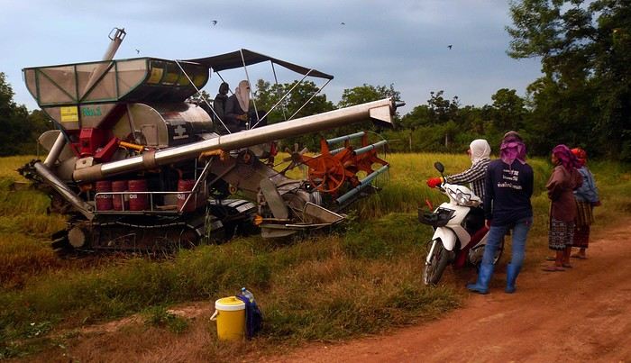
Kanchanaburi: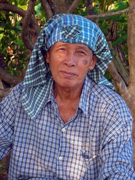
Sri Chiangmai: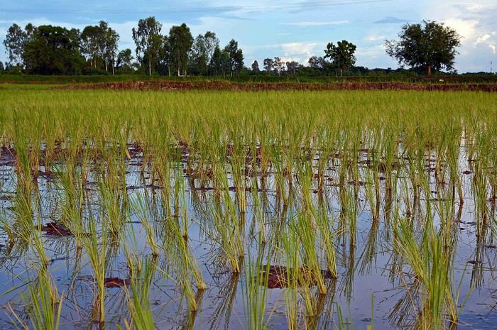
Soppong: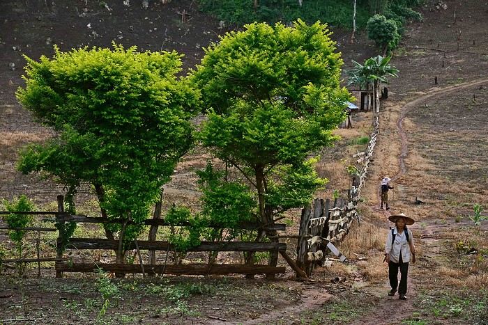
Tha Wang Pha: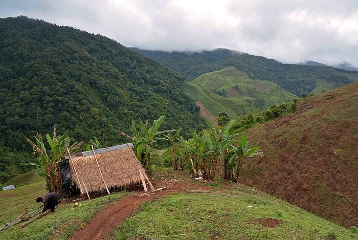
Kanchanaburi:
Kanchanaburi:
Sri Chiangmai:
Soppong:
Tha Wang Pha:
Namibia Travel Journal: May 2025 - Trip Review
NAMIBIA TRIP 2025: April 24 to May 20: Feel free to comment or ask us any questions about this amazing journey.
>> Find all our photos and videos for each day on our website here: www.montagne-aventure.net
**DAY 1: Thursday, April 24, 2025: Outbound Flights from Lyon to Windhoek via Munich - Visit to Munich:**

Off we go on a new adventure. The alarm rings at 6:30 AM, the travel bags are packed, and we head to Lyon Airport. We booked our flight tickets with Lufthansa. The first leg to Munich, Germany, is operated by AirBaltic. Departure at 1:05 PM for a 1-hour and 20-minute flight. We arrive at 2:30 PM.
**We now have a 7-hour layover, so we take the opportunity to get some fresh air and explore Munich.** We quickly exit Terminal 2 of the airport and head towards the subway. We buy a group day ticket "Airport-city Day Zone M-5," valid for 2 to 5 people at a price of 30.50 € (instead of 16.30 € per person). We take the S8 line to **Marienplatz** in 35 minutes. **This is the heart of the city.** The weather is overcast, quite cool, but dry. Perfect for a little city trip between two flights while leaving our large luggage in transit at the airport. **Munich is the third-largest German city after Berlin and Hamburg, in the Bavaria region.** **The center has a lot of charm and brings together several religious buildings, easy to explore on foot.** We are impressed by the number of people enjoying these 100% pedestrian streets, which are very pleasant. After Marienplatz, the most famous square with the town hall, we head to the Cathedral of Our Lady, a Gothic church, then continue to **Karlsplatz** and move on to **the food market offering a wide selection of high-end food products in an atmosphere where a certain art of living prevails.** We also visit St. Peter's Church before grabbing a bite to eat. Two good hours were enough for this 10 km city walk. It's time to take the subway back: by 6:30 PM, we are back at the airport. Now, it's time for a bit of waiting and rest. Our second flight is scheduled for 9:35 PM for a 9-hour and 30-minute journey to our final destination in Namibia: **Windhoek.**
> Round-trip flight tickets with Lufthansa from Lyon: 2029 €, or 1,014.50 € per person.
> Lyon Airport parking: 120 €
> Today's expenses: 7 € for 2 pizzas in France / 14 € for the restaurant in Munich / 30.50 € for the daily subway ticket in Munich.
**DAY 2: Friday, April 25, 2024: Arrival in Windhoek, Visit to the Namibian Capital:**
After a 9-hour and 30-minute overnight flight with Discover Airlines, we finally land on Namibian soil just before 7:30 AM. The day is breaking, and the colors are already stunning. We are eager despite the usual fatigue from the flight. The airline was punctual, with friendly staff and good meals, though a bit light. We are the first flight of the day to land, with no more than 15 flights per day here, from 7 AM to 8 PM. We disembark on the tarmac at this airport located in the middle of nowhere, **I finally set foot on African soil for the first time.** We exit among the first from the aircraft to go through the long formalities at the front of the line, as the wait can quickly become endless. Allow at least 5 minutes per person for e-visas. We still wait 45 minutes despite only about twenty people ahead of us. Phew, it's done. We collect our luggage and then withdraw money from an ATM. We make 4 withdrawals of the maximum amount, 2000 NAD $ per withdrawal, for a total of 380 €, or 95.33 € per withdrawal.
Our driver arrives at the same time, perfect timing, we were quick.
We leave the airport at 8:45 AM. By 9:30 AM, we arrive at the **Gracious Whisp vehicle rental agency**, located at the entrance of Windhoek, small and human-sized with a fleet of recent vehicles. More formalities, then a short wait as our vehicle is not yet ready. Time to decompress, catch our breath, and enjoy the very pleasant morning temperature. Not a cloud in sight. Next, a briefing on the vehicle, always with a bit of apprehension due to our approximate English. Allow 45 minutes of explanations, including setting up the roof tent, camping equipment, technical information in case of a flat tire, driving tips in Namibia, and a tour of the 4x4. We have all the necessary equipment for camping: mattresses, sleeping bags, pillows, table, chairs, gas stove, BBQ grill... as well as 2 spare tires, a compressor, a dual tank, and accessories for removing wheels. Off we go, it's time to muster our courage and get behind the wheel. **Heading to SuperSpar Maerua**, fortunately located less than 10 minutes away. We park with the help of a parking attendant; it's very crowded, the space is narrow, but everything goes well despite the cursed right-hand drive. Today's new mission: stock up on groceries. The store is well-stocked with local and imported products, catering to all tastes. We spend 114 € on groceries, from pasta to meat, BBQ lighters to dishwashing products. Two people load our groceries into two carts and transfer them to our vehicle; we feel compelled to leave a tip, 50 NAD $, as we don't have change yet. Now, we head to the hotel, 15 minutes away. Traffic is difficult at a complicated intersection; this will likely be the only traffic jam in Namibia. **We arrive at Kate's Nest Guesthouse & Backpackers around 1:15 PM, quite tired.** We take some well-deserved rest at this recent establishment, quite calm with secure private parking. After a short nap, we enjoy the quiet by the hotel pool. Night falls between 6:30 PM and 7 PM. We eat quietly in our room tonight before starting this long 4x4 road trip in camping mode in the heart of Namibia.
> Today's grocery expenses: 114 € at Super Spar Marua (2395.21 NAD $).
> Round-trip flight tickets with Lufthansa from Lyon: 2029 €, or 1,014.50 € per person.
> Vehicle rental: 4x4 Toyota with roof tent for 24 days: Gracious Whisp Car Rentals: 2,638 € (N$50,640) or **1,319 €** per person - (https://gwcarrentals.com/)
> Distance driven today: 15 km.
> Accommodation: Kate's Nest Guesthouse & Backpackers - 4 Aristotles Street Academia, 9000 Windhoek - 36 € for two for one night.
> Windhoek International Airport website: (https://www.airports.com.na/)
**DAY 3: Saturday, April 26, 2025: Windhoek to Hardap: Mariental Region - Kalahari Desert:**
After a good, restful night, we wake up leisurely around 7 AM. We enjoy the comfort provided by this first and last hotel before 24 nights under the tent.
**We leave Kate's Nest Guesthouse at 8:30 AM to tackle the Namibian roads.** We quickly leave the capital; in just 30 minutes, we find ourselves almost alone in the world. The landscape is dotted with small domes. We leave the **paved B1** quickly to turn left onto the **C15**. **From there, we won't see more than 10 vehicles all day.** After passing through the few houses of **Lekkerwaterpoort**, we tackle our first gravel road. These road sections are limited to 100 km/h, but even at 70 km/h, I find it already challenging. However, I quickly get used to it and gradually pick up speed to reach my cruising speed of around 80 to 90 km/h. **We are on immense straight lines crossing wild expanses as far as the eye can see.** **We come across two baboons, a few ostriches, and numerous cattle and sheep farms.** We pass through the charming village of **Uhlenhorst** with its typical houses and children with broad smiles waving at us. Life here is already very different from Windhoek. **The thermometer rises quickly from 16°C at 8:30 AM to over 28°C in the early afternoon.**
**We arrive at the Hardap Dam reserve at 2 PM.** We stop at the toll booth at the park entrance to pay the entrance fee: 250 NAD $ for 2 people and 1 vehicle. We continue to the dam and then the camp entrance, located a bit further. We had booked in advance, but this place remains little frequented by foreigners.
We take advantage of the hottest hours to rest by the large pool overlooking the immense lake, a very enjoyable moment. Would this be a bit of a vacation?
Around 4:30 PM, we head to the campsite. We overlook this vast water reserve. We arrive first; we will be only 3 vehicles spending the night here. It's time to get to work and set up our equipment for the first time. It takes us a good 20 minutes to set everything up, with a slight apprehension about unfolding the tent. Once this task is done, which we will have to repeat for almost a month, we will become much more efficient over time. Time for rest and contemplation in total silence. The sun gradually sets, and the heat quickly becomes bearable again. Bliss! **This dam is located 20 km northwest of Mariental in an area dotted with conical hills topped with dolerite buttons (Hardap means "hillock" in Nama). It captures the Fish River, which flows south, creating a large lake in the middle of an arid environment. The contrast is striking.** We enjoy our first sunset facing this 360° otherworldly landscape.
Around 7 PM, we start our first BBQ, or "braai" as it's called here. The temperature is perfect. The sun sets, giving way to a star-filled sky of incredible beauty thanks to the absence of any light pollution. The Milky Way will lull us throughout the evening. After some good sausages and potatoes on the BBQ, we head to our roof tent around 9:30 PM with a complete change of scenery in just 24 hours. France already seems so far away...
This campsite has shared showers and toilets, quite clean and functional, as well as a central area with several BBQs and tables. The sites are arranged in a semicircle, each with an electrical outlet. The sites are close to each other but spacious, some slightly shaded. We are only three vehicles tonight, so it's perfectly comfortable and quiet. Not to mention the large pool near the restaurant. Our trip is off to a great start.
> Today's road itinerary: Windhoek > Head south on the B1 to Rehoboth > Turn left onto the C25 then C15 to Stampriet > C20 to Hardap > Full north on the B1 > Then turn left onto the M93 - 5 hours of driving.
> Distance driven today: 354 km.
> Accommodation: Hardap Recreation Resort - 23.3 € for two - Large pool - GR6W+3M2, Hardap Game Reserve, Mariental, Namibia - (http://www.nwr.com.na/resorts/hardap-resort/)
**DAY 4: Sunday, April 27, 2025: Hardap - Brukkaros Volcano - Keetmanshoop - Quivertree Forest Rest Camp**
Our first night under the tent was very pleasant; the little wind quickly calmed down, giving way to absolute silence. The mattress is decent, more comfortable than some nights in Nepal. The length and width give us enough space for maximum comfort, despite my height (1.91 m). We wake up a little before 7 AM as the sun rises, and the lights dazzle us from the start of the day. We pack up the equipment in 30 minutes, quite easily. Then we enjoy the sun, which warms up quickly while we keep our light fleece on.
At 8:30 AM, **we hit the road again, heading south** to our first stop in **Mariental**. We want to do some shopping at SuperSpar, but once we arrive in the parking lot, a young local is fighting with the supermarket security guards and then threatens to throw stones. We don't want to take any risks right at the start, so despite the baton blows he receives, he doesn't stop. We leave empty-handed but fill up with fuel at the Shell station 1 km further. The price per liter is 21.33 NAD $, we fill our 107-liter tank for 107 €. In Namibia, you get served, and they bring the card machine to the window to pay. It's then customary to leave a tip.
We then take the B1 heading due south on a recently renovated road. Around 11:30 AM, we leave it on our right to take **a wild gravel road, the M98**. Just before **Berseba**, we turn right onto a small track, the **D3904 towards Brukkaros Crater up to a camp at 1588 m altitude**. The track then becomes too bumpy. We stop on the counter-slopes where **a wide panorama unfolds over these immense plains as far as the eye can see**. It's 12:15 PM, time for us to eat a rice and tuna salad facing this landscape.
**We are alone in the world until a vehicle arrives and parks next to us.** A bit of apprehension, 4 men head towards us. It turns out to be 4 shepherds looking for a lost foal. The conversation is pleasant, lost in the middle of nowhere. We find ourselves alone again in this absolute silence. **The heat becomes stifling with a good 30°C**. We get back on the road around 1 PM. Back on the B1, **we continue due south to Keetmanshoop**, which we reach around 3 PM. We stop there to do some shopping for 262 NAD $ (12 eggs, a can of tuna, a can of corn, bread, a soda, and a 5-liter water container), or 12.48 €. Two quite insistent children ask us for money or candy at the store exit, yet we give them a small tip, but they continue to cling to the car. Locals parked next to us tell them to leave us alone. Anyway, we finish the trip to **Quivertree Forest**, 15 km away. We will spend the night in this **pleasant farm run by a German**. Upon arrival, as the day before, and as I suppose in the future, we dive straight into the cool pool to relax after all these kilometers. A bliss. Then we take our 4x4 and choose a spot near these famous trees. After the 33°C this afternoon, once 4 PM passed, the temperature drops again and becomes very pleasant. **We are in the middle of the Kokerboom, one of the most interesting and characteristic plants of hot and arid regions. It's not really a tree but a variant of the aloe plant whose botanical name is Aloe Dichotoma. This Kokerboom has a smooth and thick trunk reaching up to 1 m in thickness and 9 m in height. They bloom for the first time at the age of 20 to 30 years.** The flowers are yellow and reach about thirty centimeters during the season between June and July. **They grow mainly in an environment with a high concentration of black rocks absorbing a large amount of heat (38°C). The rocks also serve to anchor the tree with its tentacle-like roots. It also resists frost. Each is between 200 and 300 years old.**
Around 5 PM, we walk to the farm reception to watch the feeding of **two cheetahs**. Magnificent carnivores taking their time to savor their piece of meat. **Then we return near our campsite to enjoy the sunset among these trees. The colors are sublime, as every evening apparently. A magnificent spectacle with colors evolving from yellow to orange then to pink, before giving way once again to a sky filled with thousands of stars.** Our campsite at Quiver Tree Forest Camp is very comfortable; we have a water supply, a stone table, a small lamp, an electrical outlet, a small tree for shade, and a BBQ that we won't use tonight; we'll cook on gas. The sites are far apart, with some shared facilities scattered around, a very beautiful setting. No reservation possible, no need, just show up directly. **The campsite accommodation for 2 people costs 28 €, including the reserve entrance fee of 5 €**. We finish this second bivouac evening around 9:30 PM, time for some reading and sleep in peaceful silence without wind.
> Today's road itinerary: Mariental > B1 heading south to Brukkaros > At Tses turn right towards Berseba via the M98 > Turn right onto the D3904 > 8 km > Brukkaros Volcano (stop at the lower camp as the track is difficult for 1 hour) > Keetmanshoop > Turn left onto the M29 > Quivertree Forest - 4 hours of driving.
> Distance driven today: 371 km.
> Distance walked today: 6 km.
> Today's expenses: Groceries for 12.48 € (262 NAD $) / Fuel for 107 € (1 liter of diesel for 21.33 NAD $).
> Accommodation: Quivertree Forest Rest Camp, P.O. Box 262, Keetmanshoop, Namibia - BBQ, hot showers, toilets, and electricity - No reservation - Pool - 18 €/Person (N$ 340.00 with park entrance) - (http://www.quivertreeforest.com/)
**DAY 5: Monday, April 28, 2025: Quivertree Forest Rest Camp - Giant's Playground - Keetmanshoop - Fish River Canyon - Canyon Roadhouse:**
After an excellent start to the night, we are woken up by the wind shortly before 6 AM, but the sunrise is not far off. We get up at 6:30 AM to enjoy it. The atmosphere is a bit cooler this morning, but the reward is already here.
The adventure continues. At 7:45 AM, we head towards **Giant's Playground**, 4 km away. We take a 3-kilometer walk through this expanse of blocks and igneous rocks.
We continue south at 8:45 AM, passing through Keetmanshoop again where we do some shopping for 25 €, a big stock-up for a good part of the trip: meats, canned goods, pasta, fruits... At 9:30 AM, we take the B4 to Fish River Canyon.
At 11:30 AM, we arrive at the entrance to the NWR park (350 NAD $ entrance for 2 people and 1 vehicle). The track becomes bumpy immediately upon entering the park. After about ten kilometers, we come upon this landscape carved by nature. In the end, it's well worth the detour. We were at the Grand Canyon in the USA exactly (https://www.montagne-aventure.net/2024/04/29/j21-3-juin-2024-grand-canyon-et-lac-powell/) and can thus confirm that this Fish River Canyon is comparable. We make several stops along the southern flank. **Here, nothing is developed; nature is almost in the wild state.** **With 160 km in length, up to 27 km in width, and a depth of 150 m, it is indeed the second-largest canyon in the world.** The history of the canyon is apparent in its different earth layers and stratification: the antiquity of the place is tangible, and the absence of vegetation is surprising. **It consists of two nested canyons, formed at distinct periods. The first distinct layer of schist, sandstone, and eruptive material surrounding the canyon was formed a few two billion years ago, then transformed due to heat and pressure into more solid rock such as gneiss. The inner canyon, carved more recently by the Fish River, has a depth of 270 m.**
We have a picnic once again alone in the world facing this grand panorama at the **Sulphur Spring View Point**. This is where the hiking trail begins, plunging into this narrow canyon, but it is forbidden to venture there alone without a guide. It's 30°C, but a slight wind makes the atmosphere bearable. At 1 PM, we retrace our steps and continue to the **Main View Point** then to the **Hikers View Point**.
In the south of Namibia, the Fish River Canyon, 160 km long, is a true geological wonder: a canyon nested within another canyon, one of the largest in the world. The first sedimentary layers formed two billion years ago; 500 million years ago, a period of tectonic activity caused these layers to crack and tilt, opening a vast canyon in the Earth's crust. The second canyon, with a depth of 270 m, was carved over time by the passage of the Fish River in this new valley.
At 3 PM, we arrive at our very charming camp for the evening, the **Canyon Road House**. We fill up with fuel right away because tomorrow we have a long day of isolated driving: 55 liters for 1240 NAD $. Then we settle into the campsite we had previously reserved in France. We are assigned site 2, very well set up under a tree with its BBQ and stone table just steps from the pool. We quickly set up the tent and jump straight into the pool for the relaxation moment of the day. As usual, the water is quite cool, but it's a real pleasure. Then we stroll around this Canyon Road House, which recreates the atmosphere of the roadside inns of the 1950s with old car wrecks and vintage gas pumps in a bygone era. **Around 5:45 PM, we start a short walk leading us to the top of a hill overlooking the wide plateau where we are to watch the sunset.**
And finally, to end this beautiful day, it's time for the braai, with grilled sausages and white beans on the evening menu.
> Park entrance: 150 DN/person + 50 DN/vehicle (18 € for two). It is possible to enter at two access points: Hobas in the north and Ai-Ais in the south.
> Today's road itinerary: M29 > Keetmanshoop > B1 > B4 > C12 (track) > After Holoog turn right onto the D601 (C37 track) > Accommodation on our right (stop just to check in before 6 PM) > Continue 30 km (30 minutes of track) to the viewpoints after Hobas where you must pay the entrance fee. Sunset View Point to the left > Return before sunset as the park closes (best lights at sunrise). 3 hours.
> Distance driven today: 228 km.
> Distance walked today: 10 km.
> Today's expenses: 25 € for groceries / 17 € for the Fish River Canyon park entrance / 58 € for fuel.
> Accommodation: Canyon Roadhouse, Gondwana Collection Namibia – 34.4 € for two - Pool - Near Hobas - (http://www.gondwana-collection.com/fr/accommodation/canyon-road-campsite)
**DAY 6: Tuesday, April 29, 2025: Canyon Roadhouse - Orange River - South African Border - Vista Trail - Gondwana Sperrgebiet Park - Aus:**
The night was excellent in this very comfortable campsite. **We wake up to the sound of birds** before the alarm at 6:45 AM. Our little morning routine starts as the sun rises. **A big day of driving awaits us to the South African border. This will be the southernmost point of our journey.** We hit the road at 8 AM via the C37, pass through **Hobas**, then turn onto the D207 to **Aussenkehr.** **We cross a mountainous barrier with some high peaks and perfect cones. The rock varies from orange to pink to black.**
We then cross a lunar desert as far as the eye can see on a giant dome; the track winds through nowhere without meeting anyone for hours. The landscapes are surprising. **We spot several ostriches and a gemsbok.** In the middle of this endless expanse, we come to an improbable intersection and continue right onto the D278.
In the middle of these arid lands, we come across a green zone: a vast vineyard. At 10:30 AM, **we come across a "Road closed" sign, fortunately, a local resident waves us to continue; a bit stressed, we proceed.** We start to follow the beautiful Orange River. On the other side of the bank, just a few meters away, South Africa is there. It is the second-longest river in Southern Africa, after the Zambezi. It flows over 2,000 km to the Atlantic. After passing through narrow gorges, we regain altitude before starting the descent, gently heading back north.
**We now cross and follow the Fish River, which joins the Orange River further south** **along this gorge dating back millennia.** At exactly noon, we take a lunch break by the Fish River, still without meeting a soul in this landscape between greenery and aridity. The temperature here is cooler with a pleasant 23°C on the banks, the perfect spot. **We continue on the track to Rosh Pinah**, where we find a paved road again. **The section along the Orange River and the Fish River was officially closed, but we were able to pass without any issues, avoiding a detour of at least 3 hours.** Phew. We now drive at high speed (limited to 120 km/h) through these vast spaces. We come across many ostriches after the **dozens of monkeys along the Fish River**. Around 3 PM, 3 km after the very small town of **Aus**, we reach **our campsite for the evening at Klein Aus Vista**. A new **small peaceful haven very well set up**. As usual, after checking in at reception, we jump straight into the beautiful pool to get our well-deserved dose of coolness, another good thermal shock that our bodies appreciate. Once this moment of relaxation is over, we take our 4x4 to reach the campsite located a bit higher, set apart at the foot of a hill that overlooks us.
After setting up, **around 5 PM, we head to the Vista Trail to climb to the top of a mountain overlooking the vast plain that surrounds us at 360°**. It takes about 30 minutes to climb. The place is just magical, **the perfect viewpoint to admire the sunset**. **We fully savor the moment. We also spot one of the few wild horses in the world capable of living in the desert.** Their numbers have decreased in recent years due to predation and drought (around 100 to 150). At 7 PM, we return to the camp, time for the braai and preparing the meal in this peaceful little camp.
In the south of Namibia, the Fish River Canyon, 160 km long, is a true geological wonder: a canyon nested within another canyon, one of the largest in the world. The first sedimentary layers formed two billion years ago; 500 million years ago, a period of tectonic activity caused these layers to crack and tilt, opening a vast canyon in the Earth's crust. The second canyon, with a depth of 270 m, was carved over time by the passage of the Fish River in this new valley.
> Today's road itinerary: 5 hours of driving: D324 heading south (track) > turn right onto the C10 (track) > D316 heading south > turn right onto the C13 > In Aus turn left onto the B4 > Campsite via a track on the left.
> Fuel station: Solitaire or Aus.
> Distance driven today: 398 km.
> Distance walked today: 7 km.
> Accommodation: Klein-Aus Vista Desert Horse Campsite - Farm Klein-Aus No 8 on the B4 main road to Luederitz Aus 9000, Aus, Namibia - (http://www.klein-aus-vista.com/accommodation/desert-horse-campsite/) 17908 420 DN - Water + Shared shower (hot water). No electricity.
**DAY 7: Wednesday, April 30, 2025: Aus - Kolmanskop - Diaz Point - Luderitz - Kanaan Desert:**
We wake up around 6:45 AM, with partly cloudy weather for once; we feel the ocean's influence gradually. But the sun isn't far off. At 7 AM, we leave the campsite heading west towards Luderitz via the B4. **First stop of the day: Kolmanskop, the ghost town we reach at 8:30 AM**, entry costs 180 NAD $ per person. We discover this **timeless place** in 1.5 hours, moving from building to building amidst violent sand-laden gusts of wind. There's a lot of charm in these different living spaces. **The sand quickly reclaimed the place after this mining town was abandoned.** This was once the headquarters of Consolidated Diamond Mines. It's hard to believe that this former town, where the diamond industry once flourished, had a hospital, a bowling alley, and a theater. The decline in diamond sales after World War II and the discovery of richer deposits put an end to this golden age. By 1956, the town was already completely deserted, and the sand had reclaimed its rights. **These dilapidated buildings swallowed by shifting dunes have something surreal about them.**
At 10:15 AM, we hit the road again **heading to Luderitz, 22 km away**, and first to **Diaz Point** **facing the Atlantic Ocean**. It's a wind-swept peninsula with its characteristic red and white lighthouse. There's a campsite and a coffee shop on site, but the place doesn't inspire rest without shade or shelter from the wind. We return to the city via the D701 track that runs along the ocean, be careful at low tide. We come across **a few fishermen and a fox as well as flamingos.**
We walk through the few streets of the city, much smaller than I imagined, then climb to the **famous little Lutheran church that overlooks the city, the Felsenkirchr.** **The wind blows very strongly here, and the sand is omnipresent, surrounded by the Namib Desert and the southern Atlantic coast.** **A German colonial relic barely touched by the 21st century, Luderitz seems frozen in the past, giving it both a gloomy and a certain charm. In short, it's certainly one of the most incongruous places in Africa.**
At 1:15 PM, just before leaving Luderitz, we do some shopping for 20.50 € and fill up with fuel: 61.50 €, 1290 NAD $ for 61 liters (21.18 $ per liter).
**We return via the B4 to Aus** (paved), **then via rougher tracks**, the C13 then the D707, magnificent as it runs along a mountain range with multiple colors on our right and an endless flat desert on the other side.
To access our campsite for the evening, we must take a **narrow private track for 7 km** on our right to emerge, in this total vastness, at the **isolated Kanaan Desert Retreat on a small hill**. I don't have time today to jump into the pool near the reception; we arrive at 5 PM at 8 small, isolated, and unique sites with a small kitchen, a shower, and a private toilet under a small tarp shelter. **A crazy charm with a unique view...** **This will be my favorite accommodation of this trip. The photos speak for themselves.** We jump into the outdoor shower while savoring the landscape, then prepare our evening braai while enjoying the colors fading, facing this plateau with bushes turning a vivid orange. **A moment that will remain etched for life.** **Savanna atmosphere under a thin emerging moon. Every minute offers different colors. Facing our meal, we have a natural giant screen.**
We end this day contemplating the stars and admire this thin orange moon setting on the horizon (8:42 PM).
**Ghost town just before Luderitz: Kolmanskop** (open from 8 AM to 3 PM - N$ 180 p.p – 9 €). Once, Kolmanskoppe was organized around diamond mining. After finding new, more prolific spots, the town was abandoned and is now a ghost town. The sand and dunes have reclaimed their rights and buried everything humans had built. Houses, train station, bakery, everything has been covered by sand, which passes through the windows, even though they are 1 meter high.
> Today's road itinerary: 5h30: B4 to Luderitz (paved) > Round trip > Kolmanskop on the left > Return via the previous campsite > Then C13 (track) > Turn left D707 (track) > Then track to the right to the campsite.
> Distance driven today: 438 km.
> Distance walked today: 8 km.
> Today's expenses: Groceries at the Spar in Luderitz for 20.50 € / Fuel fill-up in Luderitz for 61.50 €.
> Official Kolmanskop website: (https://kolmanskuppe.com) (open from 8 AM to 1 PM - N$ 180 p.p – 9 €).
> Accommodation: Night at the south of the Namibrand Nature Reserve: Kanaan Desert Retreat – 26.5 € for two - (http://www.kanaannamibia.com/) - Farm 104 Karas 9000 - Sanitary facilities + BBQ + Water + Pool - No electricity - My favorite accommodation of this trip.
**DAY 8: Thursday, May 1, 2025: Kanaan Desert Retreat - Namib Desert - Crossing the Namibrand Nature Reserve – Sesriem Canyon - Elim Dune - Little Sossus Lodge**
After a cooler night than the previous ones with about 10°C, we wake up around 7 AM. We admire, as usual, the sunrise between the desert and the mountains. **The spot from last night was truly perfect, isolated from the world, in total serenity, with a wake-up call to the sound of birds.**
We hit the road a little after 8 AM, heading north via the D707 to Spes Bona, then the gravel road C27 via Betta to Sesriem. **The landscapes roll by and dazzle us.** **We are right in the heart of the Namibrand reserve**, coming across numerous **zebras**, **impalas**, **ruminants that reproduce in large numbers**, and **gemsboks**. At noon, we stop in the shade of a tree to eat. The spot is so romantic facing orange arid mountains and a vast green plateau. **A landscape full of contrasts, timeless and silent.**
**The Namib Desert is the oldest on the planet; its name means "vast arid plain," and it also gave its name to the entire country: Namibia.** The majority of these arid and semi-arid lands dotted with viewpoints are part of the Namib-Naukluft National Park, which covers 23,000 km².
At 1 PM, we enter the Sossusvlei park. We start with the **Sesriem Canyon**, which is 3 km long and 30 m deep. We enter it with a short 1-hour hike into its depths. **It was carved by the Tsauchab River in an agglomerate of sand and pebbles over 15 million years old.** We retrace our steps back to Sesriem, which means "six belts," referring to the number of leather belts (from ox wagons) needed to draw water from the canyon. This remote locality is mainly the gateway to Sossusvlei but offers a gas station and some accommodations. For our part, we sleep 40 km away tonight.
**We then move on to Elim Dune.** It takes about 45 minutes of walking to reach its summit, and the climb is very breath-taking as we progress in the sand where we almost slide back with each step. **A first grand 360° panorama unfolds. The ochre color of the sand contrasts completely with the yellow plain and the brown and black mountains in the distance.**
At 3:15 PM, we start the descent facing Sesriem. We were completely alone once again on this dune. **These Namib dunes are composed of colored quartzite sand, presenting hues ranging from cream to orange and from red to purple. Unlike the ancient dunes of the Kalahari, these move with the wind and adopt distinct, ever-changing shapes.** Star dunes resemble stars seen from above, while transverse dunes, like those on the coast south of Walvis Bay, stand perpendicular to the prevailing southwest wind. The most stable dunes, which thus have the most vegetation, are parabolic dunes, due to the variability of the winds. Longitudinal (seif) dunes measure up to 100 m in height, while barchan dunes, crescent-shaped and predominant at the extreme north of the Skeleton Coast and south of Luderitz, are the most mobile, created by unidirectional winds.
**We get back on the road for 45 minutes to our campsite for the evening, Little Sossus, which we reach at 5 PM**, via C27 then right onto C19. As often upon our arrival, I jump into the cool pool to relax after all this driving, then we proceed to set up the camp. As the day before, the campsite consists of 10 fairly distant sites, with private sanitary facilities and a small roof. We are delighted with this crazy charm. The hot water for our shower is wood-heated: a Namibian lights it every evening around 5 PM.
For a change, or not, the menu features a small BBQ with pork ribs and pasta, facing another sunset, this time with partial cloud cover giving equally splendid colors. Time for a well-deserved rest after long corrugated tracks covered in our 4x4 today.
> Today's road itinerary: 4h45 of driving: Find the D707 and head north (track) > At Spesbona turn left onto the C27 (track) > At Sesriem after entering the park, turn left following View Point Sesriem > Continue 4.5 km to the Sesriem Canyon Parking > Return then head towards Elim Dune > Exit the park then take the D826 > Turn right onto the C19 heading SE > Turn right facing the D854 to the campsite (campsite closes at 7 PM).
> Distance driven today: 272 km.
> Distance walked today: 8 km.
> Today's expenses: Entry to the Sossusvlei Namib-Naukluft Park: 17 € for two (with one car).
> Accommodation: Little Sossus Lodge – 35 € for two - At the junction of the C19 and D854 roads Maltahohe 9000, Maltahohe, Namibia - (http://www.littlesossus.net/) - Pool + Private bathroom + Hot water + Electricity + BBQ + Grocery store (bread to order the day before).
**DAY 9: Friday, May 2, 2025: Little Sossus Lodge - Namib-Naukluft National Park – Sesriem - Sossusvlei - Big Daddy – Deadvlei - Tsauchab River Camp**
Today we start the day early to tackle **the famous dunes of Sossusvlei at first light**. The alarm goes off at 6 AM to leave the camp at 6:45 AM. The wind is blowing quite strongly in gusts this morning, but it only woke us up a quarter of an hour before sunrise. The park opens at 7:15 AM. We start with a small encounter: a friendly **jackal lounging by the roadside.**
We first have to cover the 40 km of track to Sesriem, pay the entrance fee (350 NAD $), and drive 65 km on a paved road this time to reach the **vast salt pan (a lake whose sediments are made of salts) of Sossusvlei**. **It appears amidst the gigantic red dunes that rise on either side. The wind constantly changes the shape of the dunes, as well as their colors, which vary with the light. The setting is breathtaking, giving an impression of immensity and timeless grandeur.**
The paved road ends; the last 4 kilometers become technical and are reserved for 4x4s. Phew, I pass without any problems, though not without stress, switching to L4 mode. **We start the ascent to Big Daddy at 8:45 AM, 325 m of elevation gain in the sand nonetheless.** We climb at an excellent speed despite the strong wind, in exactly 1 hour. At 9:45 AM, we are at the summit of what will remain etched for a long time. The 360° view is simply unimaginable; you have to experience it to believe it. The wind blows violently up there, **it feels like being in the high mountains, on a snow ridge, with a strong transport of sand. The atmosphere is magical.** We start the descent running barefoot in the steep sand.
**We then move on to its neighbor, Deadvlei.** **Here, petrified trees stand in the "vlei" (basin) with their dried branches casting desolate shadows on the white ground. The juxtaposition of the deep blue sky and the towering dunes is captivating.**
We return to the 4x4 parking at 11 AM, the stress rises again for the sandy track passage. We retrace our steps and stop at **Dune 45**.
At noon, we take the opportunity to picnic at the foot of **the beautiful Dune 40**, where there is already no one left. We enjoy the quiet again, well, almost, as the wind remains omnipresent.
At 1 PM, we return to **Sesriem**, where we fill up with fuel (21.15 NAD $ per liter), totaling 1630 for 77 liters (78 €), and do some shopping for 245 NAD $ (two nice pieces of pork, 2 cans, 2 sandwiches for tomorrow, and 1 soda), which is 12.48 €. It's 27°C. We hit the road again, heading to a new destination at 2 PM. We take the C19 back to Little Sossus where we spent the night, then turn left onto the gravel road D854 for about 40 km to **Tsauchab River camp**. Finally, we won't be sleeping here; we are redirected 7 km downstream to **Naukluft View Camp**, which also belongs to Tsauchab River Camp.
We arrive at 4 PM, and thankfully, the fatigue was starting to set in. **Our campsite is located under a small forest, providing some protection from the wind that blew strongly all day. The calm does us a world of good. Once again, a lot of charm**, with very spaced-out sites without any visibility. We can't wait to take our shower. It will be possible from 5 PM with, as the day before, water heated by a wood fire. Time to prepare the campsite for the night. And on the menu, a braai with two superb pieces of pork bought in Sesriem and fries!!!!
**The Namib Desert**
An impressive coastal desert stretching from the Atlantic to a high plateau inland, the narrow Namib Desert runs along the southwest African coast for about 1,300 km. **Considered one of the oldest deserts in the world**, it is bordered to the north by the Kaokoland Desert, which extends into Angola, and to the south by South Africa's Karoo. The narrow Namib is mostly less than 160 km wide. Despite this, it is considered to consist of three sections: the coastal strip influenced by the Atlantic; the Outer Namib, occupying what remains of the western half; and the Inner Namib, comprising the eastern half of the desert. Generally called the Skeleton Coast, the coastal Namib receives almost no rain and depends on regular marine fogs for moisture. From sea level, the terrain rises to 900 m, where the desert meets the base of the Great Escarpment to the east. In the Inner Namib, average annual rainfall is only about 50 mm.
The dryness is such a characteristic of the Namib that it is thought to have been in this arid state for at least 55 million years. It is all the more surprising to learn that animals such as vipers, geckos, zebras, and elephants live in this desert. Some areas of the Namib are also rich in flora, including Welwitschia mirabilis, which grows near the ground with seemingly exhausted leaves, extracting moisture from marine fogs and can live over 1,000 years. In the southern Namib, some dunes are up to 32 km long and 240 m high.
**The frequent fog of the Skeleton Coast:** Driving north along the coast of Namibia, the cold Benguela Current in the Atlantic cools the moist air above the ocean, which, upon meeting the warm desert air, leads to the formation of thick fog banks that drift up to 100 km into the center of the Namib before evaporating under the sun.
> Today's road itinerary: 4 hours of driving: C19 towards Sesriem (track) > D826 (paved) > Foot of Big Daddy via a technical sandy track > Return via the same route > D854 to Tsauchab.
> Gas station: Sesriem.
> Distance driven today: 254 km.
> Distance walked today: 12 km.
> Today's expenses: Park entry at Sesriem for 2 people: 17 € / Fuel fill-up: 78 € / Groceries at Sesriem gas station: 12 € (245 NAD $).
> Accommodation: Tsauchab River Camp - Naukluft View Camp - D054 & D850 GPS: S24 26' 37" E16 10' 11" Sossusvlei 22007, Maltahohe, Namibia - BBQ + Private sanitary facilities + Water - www.tsauchab.com
**DAY 10: Saturday, May 3, 2025: Tsauchab River Camp - Naukluft National Park - Olive Trail Hike (10 km) - Ababis Guest Farm**
We pack up the camp at 8 AM and continue our road trip north via the D854, a bumpy track with many corrugated sections. It's cool this morning, 12°C.
**We enter the Naukluft massif, discovering landscapes with very different terrain than before.** We first need to check in at the campsite, 13 km from the entrance at the end of the track: 350 NAD $ for 2 people and 1 vehicle, then return 4 km back. **On the agenda is the lovely Olive Trail, a 10 km hiking loop that starts 4 km northwest of the park office**, along the D854 that we follow. At 9:45 AM, the hike begins with a fairly steep ascent (about 45 minutes) among the **wild olive trees** from which the trail gets its name. **At the summit, we enjoy a view that embraces the Naukluft Valley.** We then turn east and gradually descend into a deep valley, passing over sometimes slippery rocks. We have a snack around 11:30 AM in these small gorges. **Further on, to cross the wall of a canyon in front of us, some chains are fixed to the rock to help us pass.** We finish this superb loop clockwise at 1:15 PM, taking 3.5 hours including 30 minutes of breaks. We only crossed a small group of 3 people on this wild adventure far from everything. At 1:45 PM, we exit the park and take the **D854 track north to Bullsport**. From there, we turn left and take the C14, which **runs along the bed of the Tsondab River.**
**We arrive at our campsite for the evening, Ababis Guest Farm, at 3 PM.** Quite early for once, allowing us to rest a bit in this peaceful farm where many sheep wander around us. We also enjoy the pool under a magnificent sun, less hot than the previous days, it's 22°C. The camp has only 4 spaced-out sites around shared sanitary facilities. **We are in the middle of a vast plain facing the Naukluft massif mountains.** We will have another beautiful sunset on these mountains. For the first time on this trip, **we will be completely alone at this campsite.** **We haven't encountered many people today**, just 3 during the hike and fewer than 10 vehicles all day.
> Today's road itinerary: Head north on the D854 (track) > Turn left to enter the Naukfluft National Park > Continue on the track then turn right to the Olive Trail hike parking lot (1 hour for 45 km). Return to the D854 and continue north > At Bullsport turn left onto the C14 to Ababis (still a track) > The camp is located on the left facing the D1261 (1 hour for 60 km from Olive Trail). Total: 2 hours of driving for 100 km.
> Gas station: No gas station on the route, except in Solitaire.
> Distance driven today: 115 km.
> Distance walked today: 13 km.
> Accommodation: Ababis Gaestefarm - Night booked by email – payment on site: (https://www.ababis-gaestefarm.de/) - P.O.Box 1004, Maltahöhe - N$ 300.00 per person
**DAY 11: Sunday, May 4, 2025: Ababis Gaestefarm - Namib-Naukluft National Park – Solitaire - Gaub Pass - Kuiseb Canyon - Moon Landscape - Walvis Bay**
The night was, for the first time since the start of this road trip, quite difficult. A strong wind accompanied us all night, making the tent flap constantly. A racket that drove us crazy. We still managed to sleep a few hours. The morning sun brings back our smiles. We hit the road for this new stage a little before 7:45 AM.
We start the day with a first stop less than 15 km away **on the C14 in Solitaire** at 8:15 AM. **This town is lost in the middle of nowhere with its small gas station with a western atmosphere adorned with rusted and sand-covered car wrecks.** After a quick supply stop: 86 NAD $, or 4 € for 1 water container and a box of cookies, we continue north still on the C14, **crossing the Tropic of Capricorn** then devouring this **magnificent track up to Gaub Pass**. **A succession of narrow gorges, turns, climbs, and descents breaking the monotony of the previous long straight lines.** We are right in the heart of no man's land for 200 km. We then start the descent to the **Kuiseb Canyon. It houses the wide bed of the eponymous river, dry almost all year.** Even when it flows for 2 to 3 weeks during the rainy season, it doesn't go beyond Gobabeb and then seeps into the sand. **The drinking water that supplies Walvis Bay is pumped at Rooibank from this underground water table.** **We now cross the Kuiseb Desert where impressive dunes roll down.** We make a short stop at a **natural rock arch** reminding us of our (https://www.montagne-aventure.net/2024/04/29/j19-1-juin-2024-canyonlands-national-park-et-arches-national-park/). Then we gradually descend towards **Walvis Bay** where we will spend the night. At noon, we enter the **Dorob National Park**. The thermometer drops 10°C in 10 minutes as we get closer to the Atlantic Ocean.
At 12:45 PM, much earlier than initially planned, we arrive at the **Moon Landscape** (View Point 4, free) to have a snack, via a very recent surprising dual carriageway in the middle of nowhere, then via the C28. We are again in the hinterlands, the temperature has soared: 30°C without a bit of shade. Even if the colors and the panorama must be exceptional at sunrise or sunset, the detour for this 360° panorama is still worth it. Extreme aridity as far as the eye can see. The place lives up to its name; it really feels like being on the moon. We get back on the road at 1:30 PM via the D1991, C28, then again the A2, which is very new. The latter runs along the beautiful dunes up to the **Dune 7**, where we make another stop.
Then we head towards our final destination of the day, **Walvis Bay. Its port is sheltered by a sand spit, a natural breakwater that protects the city from the powerful assaults of the ocean. Its port was long a strategic place: claimed by the Cape Colony in 1795, it was officially annexed by the British in 1878 to counter Germany's ambitions in the region. A colony of fur seals, pelicans, flamingos, and whale terns have made it their home.**
We do a big grocery shopping at the Spar located in the center for 66 €; it's very easy to park there. Then we fill up with fuel at an Engen station right across for 1117 NAD $ for 54 liters (20.6 NAD $ per liter), which is 54 €. We then **enjoy the seaside in the Lagoon neighborhood**, where it's also easy to park. After kilometers in the desert, **this cool break is more than welcome. The outside temperature is 22°C. In the distance, we can clearly see the clouds lingering over Swakopmund.**
We take the 4x4 one last time to the **Lagoon Chalets where we will spend the night**. The spot is well set up and surprising in the heart of a residential neighborhood. The sites are quite large, separated by fences around very comfortable shared sanitary facilities. BBQ, electricity, and shaded area. We settle in quietly before going out on foot to watch the **sunset over the Pacific Ocean along Lagoon Promenade Road**. We can still see this impressive persistent mist in the distance. The neighborhood is very peaceful, certainly without much charm, but with a very well-developed seafront that inspires relaxation after kilometers without meeting anyone in inhospitable lands. We end the day with our traditional braai: grilled chicken thighs and sautéed potatoes in the coolness of a starry sky.
> Today's road itinerary: 5h30 of driving (or 3h30 of driving for 250 km without the Moon Landscape): Head north on the C14 > Cross the Tropic of Capricorn > Gaub Pass > Kuiseb Canyon on our left in a round trip > Continue to Green Valley and leave the C14 to the right on the D1984 > Turn right on the C28 > Then left D1991 to Moon Landscape D1991 View Point 4 > Return via the same road and stop at Dune 7 for sunset > Walvis Bay.
> Gas station: Solitaire or Walvis Bay.
> Distance driven today: 372 km.
> Distance walked today: 5 km.
> Today's expenses: Fuel fill-up for 54 € + Groceries for 66 € at Spar.
> Accommodation: Walvis Bay: Lagoon Chalets – 36.6 € for two - (http://www.lagoonchaletswb.com/) - 8th Road West, Meersig Meersig 9000, Walvis Bay, Namibia - BBQ – Electricity – Shared sanitary facilities.

**DAY 12: Monday, May 5, 2025: Walvis Bay - Swakopmund - Round Trip to Cape Cross (seals) - Wreck of the Zeila en route - Henties Bay - Spitzkoppe Tented Camp & Campsite**
After an excellent night, a bit cooler and more humid than usual, we wake up around 7 AM and leave the camp at 7:45 AM to **follow the Atlantic coast heading north**. We thus leave **Walvis Bay**, a very pleasant stopover town, and follow the ocean via the B2. **We enter the mist and Swakopmund** at 8:40 AM, parking **near the lighthouse**. The atmosphere is very quiet, the streets seem dead with large empty parking lots and very little traffic, but the few open shops are filled with expatriates enjoying their breakfasts, French bakeries, cafes, travel agencies... **We are in this Benguela Current, a fast cold ocean current that flows from South Africa, up the coasts of Namibia and Angola, towards the northwest to join a warm equatorial current. Hence the supply of very fish-rich waters and this tenacious mist depending on the seasons. In the northern part of the Namib Desert, fogs are frequent during the southern winter. It's almost the only source of moisture since the city of Swakopmund receives, on average, only 11 liters of water per m² in December and January.**
**Swakopmund is wedged between the dunes and the Atlantic rollers. It is the Namibian capital of adventure activities and has a ghostly colonial remnant. With its German architecture, its seaside promenade, it resembles a seaside town of the North Sea or the Baltic.** It is also a bustling African city. **Nearly two-thirds of Swakopmund's population live in Mondesa, a township created during apartheid, northeast of the city center, a legacy of the South African mandate.** The heart of the city is located in the area of the pier, at the foot of the lighthouse, better known as the Mole. During the South African occupation of Swakopmund, the port took a back seat to Walvis Bay.
Continuing on this C34, sometimes on salt, we come across the famous **wreck of the Zeila, stranded in 2008**, on our left. We can see it through the thick fog, being very close to the beach. It's 10:15 AM. Further on, Henties Bay is a bay that attracts many fishermen; it's teeming with vehicles equipped with fishing rods. Besides its fish-rich waters, it enjoys a relaxed atmosphere and a large beach suitable for walks.
We continue further north, heading to Cape Cross, this time a round trip because we will turn off later here in Henties Bay to reach Spitzkoppe via good gravel roads that are quiet alternatives to the very busy paved B2 further south. **Henties Bay is part of the Dorob National Park, a multi-purpose park protecting coastal ecosystems and hosting the many renowned recreational activities of the region. The part of the coast north of Swakopmund up to the Ugab is particularly popular with fishermen who come in droves to fish for saltwater fish.** The small concrete buildings spaced at regular intervals are actually toilets for fishermen and campers. The coastline is also dotted with world-renowned surf spots.
Even before arriving, we can already smell it before we come across thousands of seals (population in 2021: 1.5 million). **The Cape Cross Seal Reserve, the most renowned on the Namibian coast, is home to the most famous breeding colony of fur seals, which seems to take full advantage of the high concentrations of fish present in the icy waters of the Benguela Current. We are impressed by the sight of these 100,000 pinnipeds lounging on the beach and frolicking in the waves.** We have a picnic a little away from the smells facing the ocean in the sun.
At 12:45 PM, it's time to hit the road again. We retrace our steps back to Henties Bay. We stop there to do another big grocery run before not encountering any big cities for many days. We will only buy fresh items day by day until the end of the trip; we have 23 € worth. **In the space of 30 minutes, we go from 15 to 36°C. The thermal shock with an amplitude of more than 20°C.** At 1:45 PM, we hit the road again via the D1918, then we try a very small track on our left, the D1925. It becomes narrow and rough; I have a bit of apprehension. We arrive at a gate to open in the middle of nowhere, then young children run up to us asking for water or food... We then drive to **Spitzkoppe. The arrival right in front of the mountains is majestic, off the beaten path. This mountain appears in the distance like a mirage above the dusty plains of southern Damaraland.** We come across a second gate held by a guard. We enter the "Community Camp" campsite without realizing it through the west entrance. We are given a small paper, then we go to the reception passing **at the foot of these gigantic, magnificent rocks.** Once at the reception, we are informed that this is not the camp we had booked. Ours is located just a little further, and in the end, it's better because the latter was packed. We were able to cross the park very close to these rocks without paying. We exit through the main entrance; 5 Himba children cling to our doors and trunk asking for bread and food again. We continue despite them staying attached, worried about hurting them. Phew, more fear than harm. We cross the few houses and arrive at the right camp at 4:30 PM, the Spitzkoppe Tented & Campsite. The spot is much quieter and well set up. We have site C12, cozy to perfection with its sink, a private shower and toilet, as well as electricity, under the shade of a tree and facing the mountains. The sunset and sunrise will be perfect. We set up the tent and, without delay, head to the pool for a big dose of coolness. Then it's time to prepare the BBQ and **contemplate the fading lights on the Spitzkoppe massif.**
> Today's road itinerary: 5 hours of driving: Head north on the B2 (paved) along the ocean > Swakopmund > C34 (paved) still heading north > On the left, the wreck of the Zeila before Henties Bay > Cape Cross round trip > Henties Bay > D1916 heading east (track) > Turn left onto D3716 > Turn left to the campsite.
> Gas station: Swakopmund or Henties Bay.
> Distance driven today: 344 km.
> Distance walked today: 6 km.
> Today's expenses: Groceries in Henties Bay: 23 € + Cape Cross park entry: 17 €.
> Accommodation: Spitzkoppe Tented Camp & Campsite - Spitzkoppe River Valley 00000, Spitzkoppe river valley, Namibia - (http://spitzkoppemountaincamp.com/) - 26 € - Pool - BBQ - Shower and toilet.
**DAY 13: Tuesday, May 6, 2025: Spitzkoppe - Rock Pools - Uis**
It's 6:45 AM, **we wake up at the foot of one of the most emblematic landscapes of the country, Spitzkoppe, which towers over the valley at 1,728 m.** **The Spitzkoppe massif, "pointed hat" in Afrikaans, is actually a set of three rock formations: Big Spitzkoppe, the granite domes of the Pontok Mountains that surround it, and Little Spitzkoppe, to the southwest. It was first climbed in 1946 and has never stopped attracting experienced climbers; it remains one of the most challenging ascents in the country. The climate in the region is hot**, so try to visit during the cooler months, as it can quickly reach 36°C in the sun in the afternoon. **Spitzkoppe is particularly striking at dusk, as it was last night, and at dawn this morning when the low light sets the rocks ablaze with red and orange hues. The spectacle is unique.**
We re-enter the park managed by the local community (160 NAD $ per person), then start with the **arch sector**. We quietly enjoy all the viewpoints under perfect orange colors. We leave this magnificent spot, reminding us of (https://www.montagne-aventure.net/2024/04/29/j19-1-juin-2024-canyonlands-national-park-et-arches-national-park/), but with much less crowding here. Around 10 AM, we head closer to these mythical peaks, including the main one nicknamed the Matterhorn of Namibia. Then we finish with the **ascent of the rock above Rock Pool. The 360° view of the park is a must-see. Small natural pools carved into the rock bring a bit of water to this arid and rocky landscape.** The wind blows strongly up there, and during a photo shoot with a tripod, it falls forward right onto the lens glass, cracking it... Frustration and shouts, these will be the last quality photos of this trip, and a new bill to pay when we return to replace it... Disgusted.
We continue to **Bushmans Paradise**, have a lunch break in the shade of a rock before hitting the road again around 12:30 PM after thoroughly exploring the park, feeling weakened and sad about my passion: photography...
We fill up with fuel as soon as we arrive in Uis at the price of 21 NAD $ per liter, a total of 1021 NAD $ for 50 liters (52 € by card). **Uis is a former mining town. Tin mining ceased in the early 1990s, but the high white mountain where the ore was dumped is clearly visible. The region is rich in amethysts, Brandberg crystals, and other semi-precious stones; we come across many vendors on the roadside.**
We then head to our final destination of the day, the **Daureb Isib Restcamp**. We arrive quite early for once at 2:45 PM in the heat, but the camp is just perfectly set up, surely the most upscale we will have during this trip. We are in a fortunately shaded area under palm leaves, with a table, chairs with cushions, a sink, a hot shower, toilets, a beautiful pool, and of course our private BBQ. Perfect for regaining a bit of a smile after the fall of my DSLR camera. **We are facing the Brandberg massif, the "fire mountain" in Afrikaans, dominated by Königstein (2,573 m), the highest peak in Namibia.** **The Brandberg owes its name to the reddish-orange glow that forms on its slopes at dawn and dusk, when the sun's rays awaken its red granite faces studded with crystals. It also hides a real treasure inside, as it contains an exceptional concentration of prehistoric rock art**, mainly paintings and some petroglyphs, including the most famous of them, the **White Lady in the Tsisab Gorge**. There are over 43,000 in total, dating back 2,000 to 4,000 years, scattered in hundreds of crevices around the mountain.
Time for the usual swim, laundry, and evening cooking. On the braai menu, local sausages with cheese pasta and leftovers for a good salad the next day.
> Today's road itinerary: 1h45: Head north on the D3716 > Then D1930 (gravel and sand track) to Uis.
> Gas station: Uis.
> Distance driven today: 113 km.
> Distance walked today: 6 km.
> Today's expenses: Fuel fill-up in Uis for 52 € (1,021 NAD $).

> Accommodation: Daureb Isib Restcamp - Erf 672 C/O 3rd & 4th Avenue Uis 9000, Uis, Namibia - (http://www.daurebisib.com/) – 31 € - Pool. Comfort with private bathroom + electricity + Wi-Fi at the restaurant. Clear sky for a beautiful starry night.
**DAY 14: Wednesday, May 7, 2025: Brandberg (Namibia's Highest Mountain) - Damaraland:**
**The Brandberg massif is an isolated, dome-shaped mountain, an inselberg, that towers over the gravel plains scorched by the sun of the Namib Desert to the northwest. It measures 23 km long and 20 km wide. It is the highest point in Namibia at 2,573 meters.**
This massif formed about 130 million years ago when a gigantic viscous mass of magma from deep within the Earth's crust rose through the surrounding rock layers before solidifying. Later, the granite mass was exposed by the erosion of the surrounding rocks.
**The Brandberg is the highest mountain in Namibia, peaking at an altitude of 2,573 m. The indigenous San people call it the "burning mountain," as it appears to glow with a red light at sunset. With its considerable height and width, this massif influences the local climate, attracting more rain on its slopes than the desert below.** The rain seeps through the springs. Unique animal and plant species thrive in this high-altitude environment, and prehistoric paintings adorn the rock faces hidden in the ravines around the base of the mountain.
The first night was also hot since the start of this trip, the thermometer did not drop below 20°C. We wake up gently around 8 AM, a pleasant sleep-in, the sun is already out. After a quick morning cleanup of the 4x4, we have time today, we hit the road at 9:30 AM, getting lost in the Brandberg massif. We are now in the **Damaraland, which stretches from the majestic rock formations of the Brandberg in the south, where we are today, to the bushy expanses at the foot of the rugged mountains of Sesfontein in the north, where we will be tomorrow. It is the perfect destination for wildlife and flora observation.**
We take the track heading towards the **White Lady**, but we want an alternative to this guided visit only. So, just before arriving, we turn right towards a viewpoint named on Google Maps **Rastplatz**. We come across **small Himba villages, living in extreme poverty with no natural resources; the inhabitants ask for water with every passing vehicle...** A bit further, we encounter about ten **ostriches** in the middle of the track, magnificent, as we get closer to the mountains in the background, and a few meters further, **a herd of Oryx**. Then we approach the **bed of the Ugab River**. We then go back and have a snack in the middle of nowhere, under the shade of our 4x4, facing the mountainous massif. We get back on the road around noon, while the temperature is at its peak in this very hot region, 35°C on the gauge with very dry air. We go up the C35 slightly then turn left onto the small track D2319 until we reach the Ugab bed again. Back to Uis in the mid-afternoon.
We did not book the same campsite as the previous night; today we are at the Brandberg Rest Camp. Unfortunately, the camp is not at the same level as the previous one, which was perfect. But the price is also much lower. The sites are next to each other, separated by small fences behind the main building. But it will do just fine. We have our BBQ and electricity, the shared sanitary facilities are decent. We then lounge in the large pool. We will then buy some water for 10 € at the supermarket located right across.
> Gas station: Uis.
> Distance driven today: 118 km.
> Today's expenses: Groceries in Uis: 10 €.
> Accommodation: Brandberg Rest Camp Uis - No 3 Uis Street Namibia 9000, Damaraland, Namibia - (http://www.brandbergrestcamp.com/) - Large pool – Shower – Electricity
**DAY 15: Thursday, May 8, 2025: Damaraland: Petrified Forest - Ugab Valley - Palmwag**
The night was excellent and slightly cooler than the previous one. We wake up around 7 AM and hit the road just before 7:45 AM heading to a new destination as we continue this Namibian road trip. **We cross Damaraland today from south to north.** First via the C35 to **Khorixas**, then turning left onto the C39. **We come across some villagers walking kilometers under the scorching sun with only a small water container in their hand... What a tough life, light-years away from ours.** About 40 km west of this town, we arrive at the **Petrified Forest National Monument**. It is a vast expanse of veld (open vegetation area), dotted with petrified tree trunks that can reach 34 m in length and 6 m in circumference, estimated to be over 260 million years old. These trees belonged to the Gymnospermae family, conifers among which we find today's cycads and welwitschias. The absence of roots and branches suggests that the trunks were deposited here during a significant flood. The site has about fifty trees, some half-buried in sandstone, others perfectly petrified in silica with their bark and growth rings. A guide is mandatory at the entrance to visit the site.
We then continue on this C39 due west to the junction of the D2612. We make a round trip to the south to **Twyfelfontein, which means "uncertain spring" or "bubbling spring" in Damara**. The site is a UNESCO World Heritage site, located at the entrance of the grassy Aba Huab Valley and houses one of the largest collections of rock art on the continent. More than **2,500 petroglyphs** have been discovered on over 200 stones, as well as some rock paintings. They date back about 6,000 years and others 2,500 years. Many engravings depict species that have since disappeared from the region, such as elephants, rhinoceroses, giraffes, and lions. The presence of a seal attests to the existence of links with the coastline at the time, now over 100 km away. It is here, as well as at Brandberg, that the human history of Namibia began with these testimonies of ritual and economic practices among hunter-gatherer peoples.
We continue a bit further south on the D3214 then D3254 to visit the **Organ Pipes, "organ pipes"**. The entrance is also paid, much to our regret... 500 NAD $ for two. We take a well-marked trail leading to a small gorge containing dolerite (coarse-grained basalt) columns 4 m high and aligned on an astonishing 100 m long wall. We are in a volcanic chain stretching over a dozen kilometers, a pile of scoria that seems to have been exposed to fire, the Burnt Mountain "burnt mountain" stands in a bleak and desolate landscape where almost nothing grows.
We head back north and return to the C39 then the C43 to **Palmwag where we will spend the night**. **This concession, covering an area of 5,500 km², is a region of red hills and plains, remarkable for its rolling landscapes as well as its rich fauna and flora**. The region serves as a **buffer zone between Etosha and the Skeleton Coast**. We have a good chance of encountering black rhinos, desert elephants, and lions, as well as spotted hyenas, giraffes, gemsboks, and other antelopes.
We pass the sanitary control barrier at 4 PM, just before entering Palmwag. In our direction, from south to north, we are simply asked about our future destinations and to present my French driver's license. A few meters further, there is a small gas station, then on our left our final destination of the day: the Palmwag Lodge Campsites. We are happy to arrive after this long journey. The welcome is very pleasant, and the site is very comfortable with a real brick shelter housing our shower and toilet, as well as water and electricity. We always have a BBQ available, but today we unfortunately no longer have meat due to concerns about the sanitary control, but we were not sure if it was rather in the other direction that the transport of fresh meat and dairy products is prohibited. We now cross our fingers to be able to observe some different animals, as the place is renowned for elephants, giraffes, and rhinos. We first take some time to relax in the pool before going for a walk around the reserve, without encountering anything unfortunately this evening, but the wake-up will be up to par... Time for the sunset, which is always one of the highlights of the day.
> Today's road itinerary: 5h30 of driving: C35 heading north > Then turn left onto the C39 > Petrified Forest > Go down on the D3612 in a round trip to Twyfelfontain (rock paintings and Organ Pipes) > Go back up on the C39 then C43 to Palmwag > Round trip on the C40 to Mount Grootberg Pass.
For info on the C43, there is a sanitary control at the entrance and exit (transporting raw meat is prohibited).
Palmwag: black rhinos (guided or free visit? at sunrise or sunset).
> Gas station: Twyfelfontain or Palmwag (07:00 – 19:00) – Tire repair in Palmwag.
> Distance driven today: 349 km.
> Distance walked today: km.
> Accommodation: North of Palmwag Lodge Campsites - GPS Coordinates -19.88556°, 13.93694° - Pool – Water and electricity – 34 € - (https://gondwana-collection.com/accommodation/palmwag-campsite?LodgeName=PALMWAG%20CAMPSITE)
**DAY 16: Friday, May 9, 2025: Palmwag - Sesfontein - Entry into Kaokoland - Opuwo**
This morning, we take our time watching for wildlife. We can finally observe our first **kudus** as the sun begins to illuminate the plain in front of us (see video and time-lapse of the day). A few minutes later, we also spot **a couple of giraffes with their calf**, moving calmly and serenely.
**We leave Palmwag** at 9 AM, heading to the northernmost point of Damaraland via the C43 to Sesfontein.
A few kilometers on the track, and we come across **a herd of zebras**, 11 to be exact, in the middle of green hills. Even further, it's more than twenty that cross right in front of us, a treat for our eyes. Their gait is majestic; they are very sensitive to noise. Some are more curious than others and don't hesitate to stay close if we remain quiet. We then cross numerous rough riverbeds. We must always stay very attentive at the wheel because we can drive at over 80 km/h on straight lines and then suddenly have to brake to cross these small streams, usually already dry at this time of year. Many antelopes are still present by the side of the track; the heat is already rising, and they are often lying on the ground at this hour.
**We arrive in Sesfontein at 11:15 AM**, just as the children are leaving school. Transportation is done by donkey-drawn carts. The villagers spend their time in the shade of the trees and in front of the few small shops. The atmosphere of its streets is dusty with a laid-back pace; this town has the feel of an oasis located **by the Hoanib River**, the town of six springs from which it gets its name. Founded in 1896, it was a military outpost built after a cattle plague epidemic. This page of its history is reflected in Fort Sesfontein, erected in 1905 to fight cattle diseases, arms smuggling, and poaching.
We take a lunch break at the exit of the village around 11:30 AM in the shade of a tree, so peaceful, it's 32°C. We continue further north, away from the usual tourist routes, and **enter the Kunene region, also called Kaokoland**. The track becomes narrower and more winding. **These are now vast solitary spaces largely devoid of roads, simply crossed by sandy tracks opened by the South African army just a few decades ago.** The fauna and flora have managed to adapt to this harsh and dry environment, like the desert elephant, an endangered species whose slender legs are perfectly suited to the long journeys the animal must make to find water, a rare resource. This region is also the territory of the Himba people, emblematic of the country. Its name comes from the Kunene River, which marks a narrow belt of vegetation at the Angolan border.
**We arrive in Opuwo at 3 PM**, **this town is the capital of the Kunene region**. Its name means "the end" in the Herero language, a fitting term for this dusty collection of commercial buildings surrounded by traditional huts with round thatched roofs.
**Opuwo is a strong cultural moment of this trip in Himba territory, this semi-nomadic people traditionally settles in an onganda (small village), moving if necessary to find access to water. Himba women are known for their ochre-colored cream, otjize, a mixture of butterfat and ochre powder, applied to protect and moisturize the skin and hair. Fire and smoke play an important role in their culture.** Smoke, often scented with herbs, is used by women for purification. It can also convey prayers to the supreme being, Muluru. In traditional celebrations, there is always a sacred fire that remains lit between the main hut and the animal enclosure, to maintain ties with the ancestors.
Right upon arrival, we fill up with fuel at the Shell station at the price of 21.48 NAD $ per liter, or 67 liters for 1454 NAD $ (72 €) by card. We then quickly stock up on meat at the Spar **where Himba women with bare breasts mix with us, the only white people shopping in the aisles**. **Since the beginning of this trip, this is where life is most bustling**. There are many people on these dusty streets, after kilometers without seeing anyone, the shock is brutal. There are small markets, poverty but also wealth. The town is quite spread out. There are no white people left, **we finally discover the true, harsh African life.**
We arrive at the **Opuwo Country Lodge at 3:30 PM**, located slightly on the heights. We have site 9 at the end of the property for maximum isolation as we like. Once again, we have private sanitary facilities, a BBQ, and electricity. Once settled, we walk 10 minutes to the reception where the pool is located to cool off. An infinity pool that is just magnificent facing the vast landscape before us. But this contrast between this little comfort and the town below makes us uneasy. The employees walk back down. A guard is present at the entrance of the lodge to ensure security; the park where we are is fenced. We enjoy a good braai, then enjoy the few lights of the town gradually lighting up. The night will be quite noisy for once with very loud music rising from a party below until 2:30 AM... And yet it comes from far away... Maybe a bar? In any case, we rule out what we thought was just a party during our visit here on Friday.
> Today's road itinerary: 4 hours of track: Return via the C43 heading south to Opuwo.
> Gas station: Okangwati or Opuwo
> Distance driven today: 261 km.
> Today's expenses: Fuel fill-up in Opuwo for 72 € + Groceries in Opuwo for 21 €.
> Accommodation: Opuwo Country Hotel - Opuwo Hilltop Opuwo 9000, Opuwo, Namibia - -18.044682 / 13.833861 - (http://www.opuwolodge.com/) - N$600.00 - Pool / Water / Private sanitary facilities / Electricity / BBQ.
**DAY 17: Saturday, May 10, 2025: Opuwo to Epupa Falls:**
We take our time this morning by the **Kunene River**, then we hit the road at 8:45 AM. This is our return trip to Opuwo.
After 4 good hours of driving, **we return to the bustling life of Opuwo**. We refill with fuel at the Shell station (21.48 NAD $ per liter) 820 NAD $ (40 €) for 38 liters and do a quick grocery run at the Spar for 488 NAD $ (24 €). We don't take any meat because we have the **sanitary barrier** to cross tomorrow before entering Etosha Park. We pay for these two expenses in cash for the first time; until now, the credit card was always accepted, so we now have to use the cash we withdrew at the airport. Then we head back to the Opuwo Country Lodge, arriving at the campsite at 2 PM. We are the first to arrive, we rest for a moment before heading to the pool and then end the day around our traditional BBQ with sausages and sautéed potatoes. The full moon accompanies us, perfect for nighttime observations in Etosha starting tomorrow.
The campsite's location should be avoided because we again have infernal music that gets louder from 7 PM to 2:30 AM... And yet it comes from far away... Maybe a bar? In any case, we eliminate what we thought was just a party during our visit here on Friday.
> Today's road itinerary: 4 hours of track: Return via the C43 heading south to Opuwo.
> Gas station: Okangwati or Opuwo
> Distance driven today: 180 km.
> Accommodation: Opuwo Country Hotel - Opuwo Hilltop Opuwo 9000, Opuwo, Namibia - -18.044682 / 13.833861 - (http://www.opuwolodge.com/) - N$600.00 - Pool / Water / Electricity / BBQ
**DAY 18: Sunday, May 11, 2025: Epupa Falls:**
Time for a "vacation" day; we wake up leisurely at 8 AM and take our time this morning. Breakfast and even coffee. The night was good, lulled by the sound of the waterfalls.
In the late morning, we head out on the small path along the banks of the Kunene River, which offers magnificent landscapes. We have a beautiful view of Angola from the opposite bank. The falls extend over about 1.5 km and flow over a series of promontories, the highest of which reaches 37 m.
At noon, we return to our campsite to eat in the shade of the palm trees. On the menu: fried eggs and pasta. We take advantage of this afternoon to rest before the last part of this road trip, with reading, writing, and pool time on the agenda.
In the late afternoon, we return to one of the viewpoints overlooking Epupa Falls to once again enjoy the sunset colors from a different angle. We are over the moon; our thoughts wander in all directions. We discuss future trips, adventures, reminisce about our memories, and think about the world around us... We savor the luck of being here. On the way back, a Himba woman asks if we can give her a ride in our 4x4 to Opuwo tomorrow.
Tonight, we dine on our traditional braai with white beans by the Kunene River. We are lulled by the sound of this powerful river flowing under the song of insects. The coolness sets in, and we fall asleep under the stars.
> Distance driven today: 0 km.
> Distance walked today: 10 km.
> Accommodation: Omarunga Lodge Campsites - 68 € for two nights - Site by the river - (https://gondwana-collection.com/fr/accommodation/omarunga-epupa-falls-campsite?LodgeName=OMARUNGA%20EPUPA-FALLS%20CAMPSITE&hsLang=en)

**DAY 19: Monday, May 12, 2025: Epupa to Opuwo**
We enjoy the morning a bit more by the **Kunene River**, then we hit the road at 8:45 AM. This is our return trip to Opuwo.
After 4 good hours on the road, **we return to the bustling life of Opuwo**. We refill with fuel at the Shell station (21.48 NAD $ per liter) for 820 NAD $ (40 €) for 38 liters and do a quick grocery run at the Spar for 488 NAD $ (24 €). We don't take any meat because we have the **sanitary barrier** to cross tomorrow before entering Etosha Park. We pay in cash for these two expenses for the first time; until now, the credit card was always accepted, so we have to use the cash we withdrew at the airport. Then we head back to the Opuwo Country Lodge, arriving at the campsite at 2:30 PM. We are the first to arrive, rest for a moment before heading to the pool, and then end the day with our traditional BBQ: sausages and sautéed potatoes. The full moon accompanies us, perfect for nighttime observations in Etosha starting tomorrow.
The campsite's location should be avoided, as we again have loud music until 2:30 AM... And it comes from far away... Maybe a bar? In any case, we rule out what we thought was just a party during our visit here on Friday.
> Today's road itinerary: 4 hours of track: Return via the C43 heading south to Opuwo.
> Gas station: Okangwati or Opuwo
> Distance driven today: 180 km.
> Accommodation: Opuwo Country Hotel - Opuwo Hilltop Opuwo 9000, Opuwo, Namibia - -18.044682 / 13.833861 - (http://www.opuwolodge.com/) - N$600.00 - Pool / Water / Private sanitary facilities / Electricity / BBQ
**DAY 20: Tuesday, May 13, 2025: Opuwo – Etosha - Olifantsrus**
We wake up before dawn around 6:30 AM. We pack up the camp at 7:15 AM heading to a first waterhole to watch the sunrise and start our day of observations and discoveries. It's 11°C, and as soon as we leave the campsite, we come across numerous zebras, foxes, and springboks with the sun rising on the horizon. Magnificent images.
**At 8:30 AM, we are still alone**, we witness **one of the most beautiful scenes of this trip: 3 lionesses hunting springboks**. It's thanks to the latter, slowing down, that we manage to spot 4 lionesses' heads barely above the tall grass. They hide, stand up, move slowly... We wait without moving. This is their perfect terrain for camouflage. **We are on the lookout and try to be discreet during this hunting scene**. We leave the area to let them finish their remarkable work and continue the track towards the East. The terrain becomes completely flat. It's now been 3 hours since we left the campsite without noticing the time passing, and especially without meeting anyone. Around 10 AM, near a waterhole, we come across a solitary elephant mixed with zebras, buffaloes, and springboks.
Around 11 AM, we take a lunch break; here, it's us who are enclosed in enclosures. Whether in the campsites or the few small equipped areas, we are fenced in by a gate. The animals are free on their territory. The wind has picked up again, just like the sun. We eat alone in absolute calm in the heart of this incredible, unique park; there are no words to describe what nature offers us here, far from any human activity. We start to see some safari vehicles arriving, but the attendance remains much lower than I had imagined. At most, a total of fifteen throughout the day.
Etosha is also a wonderful reserve of vegetation; you can find multiple mopane groves. But also acacias and other trees appreciated by ruminants. The south and east of the park have the most waterholes, which is where most animals gather. In the West, the vegetation is denser, and the wildlife is harder to spot, but it is well present, especially the black-faced impala and Hartmann's mountain zebra, which are found almost nowhere else. The area being less frequented, the bush feeling is more pronounced.
30 minutes of track after eating, **we come across a solitary male lion. The build compared to the females this morning is noticeable from afar**, even though this one is quite far from us unfortunately, unlike this morning when they were right on top of us.
**Etosha is the preferred habitat of lions in Namibia, with about 330 individuals roaming the park's plains, nearly half of the country's wild lions.** The big cats rest under the trees near waterholes, especially the one at Okaukuejo where we arrive today, but it's also a good spot for elephants and rhinos.
We then enter the territory of buffaloes, which we come across by the dozens now. Wow, the encounters keep coming. Then around 2 PM, we follow this immense **Etosha Pan** for the first time, which we will follow for a good part of tomorrow's day.
We arrive at our campsite at 3:30 PM after more than 8 hours of self-safari filled with discoveries. We sleep tonight at the **Olifantsrus Camp**, which we had previously booked in France. We had to wait and click several times for a spot to open up, as the camp has very few sites, and that's a good thing. It is located in one of the wildest areas of Etosha and has a practical observation tower overlooking a waterhole, offering us great opportunities to spot wildlife after nightfall (see photos). **The sunset is once again memorable.** In the guestbook at the reception, where each visitor can note their observations, 3 lions were seen the day before just a few steps from here (1 male, 1 female, and their cub), on a part of the track we didn't cover today; it will be on tomorrow morning's program. We cross our fingers for these predators.
> Today's road itinerary: 6 hours of driving: Leave Opuwo via the C41 (paved road) > Turn right onto the C35 (paved road) to the Galton Gate > Enter Etosha Park.
> Gas station: Opuwo.
> Distance driven today: 369 km.
> Accommodation: Olifantsrus Camping site - 53.4 € for two – Shared sanitary facilities – Electricity – BBQ – No grocery store - (https://www.etoshanationalpark.org/fr/accommodation/olifantsrus-camp)

**DAY 21: Wednesday, May 14, 2025: Etosha National Park: From Olifantsrus to Okaukuejo:**
We wake up before dawn around 6:30 AM. We pack up the camp at 7:15 AM as the gates open, heading to a first waterhole to watch the sunrise and start our day of observations. It's 11°C, and just outside the campsite, we come across numerous zebras, foxes, and springboks with the sun rising on the horizon. Magnificent scenes.
**At 8:30 AM, we are still alone**, and we witness **one of the most beautiful moments of this trip: three lionesses hunting springboks**. Thanks to the springboks slowing down, we manage to spot four lionesses' heads barely above the tall grass. They hide, stand up, and move slowly... We wait without moving. This is their perfect terrain for camouflage. **We stay alert and try to be discreet during this hunting scene**. We leave the area to let them finish their remarkable work and continue the track towards the east. The terrain becomes completely flat. It's been 3 hours since we left the campsite without noticing the time, and especially without meeting anyone. Around 10 AM, near a waterhole, we come across a solitary elephant mixed with zebras, buffaloes, and springboks.
Around 11 AM, we take a lunch break; here, it's us who are enclosed in enclosures. Whether in the campsites or the few small equipped areas, we are fenced in by a gate. The animals are free on their territory. The wind has picked up again, just like the sun. We eat alone in absolute calm in the heart of this incredible, unique park; there are no words to describe what nature offers us here, far from any human activity. We start to see some safari vehicles arriving, but the attendance remains much lower than I had imagined. At most, a total of fifteen throughout the day.
Etosha is also a wonderful reserve of vegetation; you can find multiple mopane groves. But also acacias and other trees appreciated by ruminants. The south and east of the park have the most waterholes, which is where most animals gather. In the west, the vegetation is denser, and the wildlife is harder to spot, but it is well present, especially the black-faced impala and Hartmann's mountain zebra, which are found almost nowhere else. The area being less frequented, the bush feeling is more pronounced.
Thirty minutes of track after eating, **we come across a solitary male lion. The build compared to the females this morning is noticeable from afar**, even though this one is quite far from us unfortunately, unlike this morning when they were right on top of us.
**Etosha is the preferred habitat of lions in Namibia, with about 330 individuals roaming the park's plains, nearly half of the country's wild lions.** The big cats rest under the trees near waterholes, especially the one at Okaukuejo where we arrive today, but it's also a good spot for elephants and rhinos.
We then enter the territory of buffaloes, which we come across by the dozens now. Wow, the encounters keep coming. Then around 2 PM, we follow this immense **Etosha Pan** for the first time, which we will follow for a good part of tomorrow's day.
We arrive at our campsite at 3:30 PM after more than 8 hours of self-safari filled with discoveries. We sleep tonight at the **Okaukuejo Resort**. Upon arrival, this impression of a small town in the middle of hundreds of kilometers without infrastructure remains shocking. **The atmosphere is quite different from last night in our small wild campsite**. However, even though the attendance is higher, we are lucky to get a site in a corner (number 46). **The lit waterhole will also be a reward**. After checking in, we take advantage of the small grocery store to buy two meats for our next BBQs in the park, 3 pork chops and sausages, as well as a cold drink for 252 NAD $. This locality also offers a gas station, a restaurant, and a nice pool, but our goal during this park stay remains focused on the wildlife, so I won't give in this time. Time to set up, followed by a short rest, then our toilette before heading to the "waterhole" for the sunset around 6 PM. **A new grand spectacle unfolds before us, a hundred zebras come to hydrate right before our eyes at the water reserve facing the sunset in a cloud of dust. Then a couple of lions approach stealthily without managing to fill their stomachs. A third guest arrives, a second male lion also comes to drink. The waterhole now becomes the territory of the lions... We are speechless facing what nature offers us, we savor for over an hour scrutinizing the smallest details. What an intense day, images that will remain forever etched in our minds.** It's our turn to have our meal with three beautiful pork chops on the BBQ accompanied by curry vegetables.
At 9 PM, we decide to return to the waterhole, a wonderful idea because we find **an elephant and two black rhinos courting in the water. The male has a hard time seducing his sweetheart and eventually leaves, but a third rhino appears out of nowhere to join her. The scenes unfold under the spotlights** accompanied by a sky full of stars. We eventually go to bed. Looking forward to the rest of the story tomorrow.
> Today's road itinerary: Camp Olifantsrus > Camp Okaukuejo.
> Gas station: Okaukuejo camp.
> Distance driven today: 229 km. > Today's expenses: Groceries for 12 €.
> Accommodation: Okaukuejo Camping Site - 48.12 € for two - Pool - Gas station - Lit waterhole - Grocery store - (https://www.etoshanationalpark.org/fr/accommodation/okaukuejo)

**DAY 22: Thursday, May 15, 2025: Etosha National Park: From Okaukuejo to Halali:**
We wake up around 5:30 AM to a strange noise getting closer, a few thunderclaps, then heavy rain pours down on us! The first since the start of this trip, we had forgotten its sound and smell. We leave the campsite quickly at 7:13 AM as the gates open, the rain stops just in time!
We are right in the heart of the park today. We arrive at the Etosha Pan, an immense flat salt desert that, a few days a year, transforms into a shallow expanse teeming with flamingos and pelicans. At the end of the dry season, everything, from elephants to grasslands, is covered in the white, chalky dust of Etosha.
Around noon, at the Riedfontein waterhole, we spot two male lions in this picturesque savannah. As we've noticed, the females hunt while the males protect the territory. The males and cubs will benefit first.
The day was less emotional than the previous one. We encounter far fewer animals, often at a greater distance. Is it because of the stormy rain we had at dawn this morning, or is it the area? The tracks were also more exhausting, especially the Rhino Drive without meeting a soul. But the view over the immense salt pan as far as the eye can see is worth seeing. Maybe the waterhole at the campsite will surprise us tonight as it did yesterday?
We arrive at 4 PM at the Halali Resort for our last night in the park. We still have a lit waterhole, more intimate than yesterday's, and we can walk around the park thanks to a hiking trail. The sanitary facilities are shared and quite recent, with each site offering its own BBQ and electrical outlet. After setting up and a quick wash, we head on foot to the Halali waterhole for sunset. Tonight's menu features local sausages (beef and pork) with curry pasta.
> Today's road itinerary: Camp Okaukuejo > Camp Halali.
> Gas station: Halali Camp.
> Distance driven today: 242 km.
> Accommodation: Halali Camping Site - 48.12 € for two - Pool - Gas station - Lit waterhole - Grocery store - (https://www.nwr.com.na/resorts/halali-resort/)

**DAY 23: Friday, May 16, 2025: Etosha National Park: From Halali to Namutoni - Waterberg Park:**
We pack up the camp at 7:15 AM as the gates open. It's 17°C, and the sun is out as usual. **We follow the Etosha Pan, still quite wet at this time of year.** The small track offers different viewpoints under a sun gradually rising higher.
The further east we go, the more we encounter gnus, kudus, and impalas. **We are once again spoiled and delighted by everything we discover this morning.** A majestic **giraffe** appears before our eyes just before arriving at **Namutoni** around 9:45 AM, quickly followed by 4 other companions. From there, we change plans, do the **Fischer's Pan** loop, and then decide to exit through the northern gate, allowing us to cover the entire park. Our last encounters will be with these tallest animals, the giraffes, and what a spectacle to see them spread their legs to hydrate, followed by gnus.
Just before the exit, we take a lunch break at an equipped area at 11:30 AM.
**We leave Etosha National Park with a touch of nostalgia through the King Nehale Iya Mpingana gate** at 12:30 PM. We find the beautiful paved B1 road, which is a great relief. Cows and goats take over; driving at 120 km/h on these single-lane, two-way roads with these animals we brush past requires constant vigilance. We fill up with fuel at 1:30 PM in **Oshivelo** (21.33 $ per liter), 93 liters for 99 € by card. Since we hadn't planned to go so far north out of Etosha, we are surprised to go through a **sanitary check** at the exit of the town, but it turns out to be even quicker than the previous one, a simple glance in the fridge by very smiling women, much more pleasant than the staff at the Etosha entrances and exits.
We pass **near Lake Otjikoto** ("deep hole" in Herero), which is **one of the only two natural lakes in Namibia along with its neighbor Lake Guinas**. In 1851, explorers Charles Andersson and Francis Galton came across this karst lake occupying a limestone cauldron 100 m long, 150 m wide, and 55 m deep. Its steep walls, about 20 m high, are the result of the collapse of the rock roof of the sinkhole under water pressure. This lake is also known for the large quantity of weapons and ammunition found in its depths. Remnants of the region's violent past, they were dumped there in 1915 by the retreating German army, refusing to let South African troops get their hands on them. Unfortunately, it's paid entry, and given the late hour, we continue on our way. To our great surprise, there is a lot of traffic on this B1, including many trucks, the first time we've seen so many people in this country. The landscapes change; we even discover deciduous trees taking on their autumn colors.
We pass through **Tsumeb**, and the road continues to **Otjiwarongo**, which means "pleasant place" in the Herero language, and the town lives up to its name. Prosperous and peaceful, with wide avenues and a relaxed atmosphere, we stop there to do some shopping. We buy some local meat to treat ourselves during these last two remaining camping nights: skewers, pork, and sausages, as well as biscuits, a last water tank, and yogurt for Mimi; 388 NAD $ - 20 €. We get back on the road heading south via the B1 for 15 minutes, then turn left onto the C42, still paved, for 30 minutes and 41 km, then left again onto the D2512, a wavy sandy track for 15 minutes.
**We enter the Waterberg National Park this evening.** The arrival facing this mountainous massif in the middle of the plains under the end-of-day lights of a deep red makes us even more eager to discover it. **Composed of impressive sandstone cliffs, tangles of vines, a canopy teeming with birds, elusive wildlife, and improbable dinosaur footprints. The Waterberg occupies a large sandstone plateau 50 km long and 16 km wide, at an altitude of 150 m above the plain.** It is possible to encounter elands, black wildebeests, roan antelopes, buffaloes, and red hartebeests, and with luck, leopards, as well as 200 identified bird species.
We arrive at the NWR campsite at 6 PM, the first time we arrive so late, just before nightfall. It's from here that various hiking trails start for tomorrow's day, including the **Mountain View Trail** that climbs to the edge of the plateau. We quickly settle into this peaceful camp where calm reigns, no more than 5 vehicles tonight. The place is shaded, with fairly recent shared sanitary facilities, electricity, and a BBQ for each. We savor our second-to-last braai under the stars, hearing our plane that brought us to Frankfurt fly over, every day at the same time over the Waterberg then Etosha. Very rare, as there are very few flights that land or fly over Namibian skies.
> Today's road itinerary: 10 hours of driving: B1 then C42 then D2512.
> Gas station: Exit of Etosha Park, Tsumeb, Otavi, or Waterberg Park.
> Distance driven today: 616 km.
> Accommodation: NWR Waterberg Camping Site - Pool - Water - 45 € for two - (https://www.nwr.com.na/resorts/waterberg-resort/#1577510913112-8f243e49-35a647e7-1997)

**DAY 24: Saturday, May 17, 2025: Waterberg Park - Otjiwa:**
We wake up around 7 AM after a very cool night.
**At sunrise, the cliffs appear even redder, and the cries of baboons echo around us.** We come across about thirty of them. We start the hike around 8:15 AM. **The Mountain View Trail will take us to the Waterberg Plateau.** The temperature is pleasant for walking. **The trail starts in a thick forest where the song of birds resonates.** The path is little frequented, so progress is slow and irregular; we regularly have to duck, step over, and climb rocks. However, in 35 minutes, we reach the top of the plateau. We are once again alone in the world in this Namibian nature. **The 360° panorama extends over a wide plain of green shrubs below, then over these steep red cliffs** giving access to this suspended plateau of the Waterberg. To enter, unfortunately, a special permit is required, and you must be accompanied by a guide. We savor the moment under the already hot sun at 9 AM. After an hour reminiscing about our journey on our rocky promontory, we start the descent at 10 AM, completing a loop back to our starting point. **At 10:30 AM, we pass by the small cemetery of German fighters who died in 1904**, then we hit the road back to the B1. We take a lunch break at noon at one of the tables scattered regularly along the paved roads. We are watched by **baboons** perched in their tree. We then decide to make a **detour through the town of Otjiwarongo**, which we didn't have time to explore properly yesterday. **A quick visit to the train station is a must to see locomotive No. 41, built in 1912 by the German company Henschel. It was transported to Namibia to carry ore between the mines of Tsumeb and the port of Swakopmund before being decommissioned in 1960 when the tracks were modified.**
We return to do some shopping and bring back some souvenirs for 300 NAD $ (14 €). We then take the road south on the B1. I start to feel the end of this immense loop through Namibia. Morale is gradually dropping. But we still have plenty of beautiful things to discover. We arrive at 3 PM at the **Otjiwa Safari Lodge. This will be our last night camping after 22 nights sleeping in the wild to the sound of animals.** The nostalgia is palpable. We enter this high-end private park; we don't really feel at home upon arrival. The reception, the pool, the restaurant, everything is very upscale, unlike anything we've experienced during this road trip. However, the reserve has its charm; we come across our beautiful antelopes again. The 10 sites are very comfortable, spaced apart under some bushes. Each has, of course, its BBQ, electricity, lighting, and sink. Before enjoying our last evening, we need to do a thorough dusting of the 4x4 and a good cleaning and organizing of our belongings. Then it's time for our last perfect braai: chicken and pork skewers, as well as tomato-flavored white beans.
> Today's road itinerary: 1h30 of driving: Waterberg > Otjiwarongo > Okonjima wildlife reserve - D2512 then C22 then B1 then turn right onto a 3 km track.
> Gas station: Waterberg Park.
> Distance driven today: 135 km.
> Distance walked today: 6 km.
> Today's expenses: Souvenirs for 14 €.
> Accommodation: Otjiwa Safari Lodge - B1 main road, west side Otjiwarongo 12001, Otjiwarongo, Namibia - (http://www.otjiwa.com.na/) – 40 € for two – From 3 PM.
**DAY 25: Sunday, May 18, 2025: Otjiwa - Windhoek:**
For this last leg of our Namibian journey, we complete the loop back to our starting point, Windhoek. We leave our last campsite at Otjiwa, later than usual, at 10 AM. We head due south on the B1 in less than 3 hours to the country's capital, not without a touch of nostalgia after all these kilometers traveled through Namibia. The landscapes roll by with a lot of melancholy. We make a stop 60 km north, in Okahandja. We take the opportunity to fill up with fuel (21.10 $ per liter), 500 NAD $ for 23 liters; the card machine wasn't working, so we had to withdraw from an ATM at the next gas station. A local was quite insistent at my window, asking for food or money. Anyway, after 15 minutes, we get back on the road.
From here, we take the new A1, a 2x2 lane highway limited, like the previous roads, to 120 km/h. Then we gradually see some of the country's industries before entering the capital in the blink of an eye. We arrive at 1:45 PM at Chameleon Backpackers. It's a small hostel-style hotel with a central pool, a shared kitchen, secure indoor parking, and a restaurant. They also organize tours (3 Day Express, 3 Day Link, 4 Days Etosha, 7 Day Norbert Adventure), very different from everything we've encountered so far, a kind of atmosphere like in Thailand. There are dormitories, rooms with shared bathrooms, and our little cocoon, the Love Bird, a room located alone on the upper floor with its small balcony, a swing, its bathroom, and its large bed with a thatched roof. A lot of charm while overlooking the pool. We eat before setting off to explore the capital.
Windhoek is a modern and well-maintained city, contrasting completely with the rest of the country. It is heavily influenced by its German colonial heritage, still very present in some streets of the capital. The architecture is colorful and surprising. The skyline is shared between the spires of a neo-baroque cathedral, the unusual silhouette of three castles from the German colonial era, and glass and steel skyscrapers. Office workers head to Zoo Park at lunchtime.
We enjoy the smell of grills at some street corners lined with small single-story houses with zinc roofs.
We first head to Windhoek's emblematic monument, its unofficial symbol: Christuskirche, just a 10-minute walk away. This German Lutheran church rises above the traffic at the center of an intersection. Built in 1907 with local sandstone. The roof and other elements were imported from Europe. The result evokes a gingerbread house.
We then walk along the pedestrian shopping street of **Post Street Mall** to admire African crafts, but on this Sunday, most shops are closed; we'll come back tomorrow. We return via the Wernhil shopping center.
> Today's road itinerary: Return to Windhoek in 3 hours via the B1 then the A1. In the capital, turn left onto Florence Nightingale, then right onto Beethoven Street then C28 then B6, then Bismarck Street. Take Church Street and Trift Street towards Voight Street.
> Gas station: Okahandja or Windhoek.
> Distance driven today: 245 km.
> Accommodation: Chameleon Backpackers & Guesthouse – 49 € for two - 5-7 Voigt St, North Windhoek Central, 9000 Windhoek
**DAY 26: Monday, May 19, 2025: Windhoek, Visit to the Namibian Capital:**
Our last sleep in Namibia... The wake-up is a bit sad; we still enjoy this return to comfort in a real bed. After a hearty breakfast, we check out of our little cocoon at 10 AM. We leave our vehicle in the secure parking lot and return for a walk in the center of Windhoek. On this Monday, the center is immediately livelier while still remaining extremely calm for a capital. The pace of life is slow; employees move slowly without rushing, each task is performed with a slowness that is almost surprising. A few skyscrapers further on, we quickly leave the hyper-center. We retrace our steps to the shopping gallery where we linger for a while. We eat around noon with African music in the background, making us even more nostalgic. Then the trip will gradually come to an end, unfortunately, until the moment when we will have to, not without regret, return our rental vehicle around 3 PM... We stop by the hotel again and then head to the rental agency and then to the airport by shuttle, included in our contract.
At 4:20 PM, we are back at the airport. We see ourselves upon arrival as if it were yesterday... Tears are not far off; we wait, the formalities are much quicker than upon arrival. **We board by walking across the tarmac on foot, escorted by about fifteen Namibians, facing the sunset. It will be there until the end, beautifully drawn on the horizon, to say goodbye to Namibia...**
> Round-trip flight tickets with Lufthansa from Lyon: 2029 €, or **1,014.50 €** per person.
> Vehicle rental: 4x4 Toyota with roof tent for 24 days: Gracious Whisp Car Rentals: 2,638 € (N$50,640) or **1,319 €** per person - (https://gwcarrentals.com/)
**DAY 27: Tuesday, May 20, 2025:** Flight FRA 8:15 AM -> 9:35 AM LYS (Air Dolomite No. 1074)
Total expenses including flight tickets + vehicle rental + visa + Lyon parking + food + fuel:
Cost per person: 3467 € Cost for two: 6935 €
>> All our photos and videos for each day on our website here: (https://www.montagne-aventure.net/voyages-découvertes/namibie-2025/)
>> Find all our photos and videos for each day on our website here: www.montagne-aventure.net
**DAY 1: Thursday, April 24, 2025: Outbound Flights from Lyon to Windhoek via Munich - Visit to Munich:**
Off we go on a new adventure. The alarm rings at 6:30 AM, the travel bags are packed, and we head to Lyon Airport. We booked our flight tickets with Lufthansa. The first leg to Munich, Germany, is operated by AirBaltic. Departure at 1:05 PM for a 1-hour and 20-minute flight. We arrive at 2:30 PM.
**We now have a 7-hour layover, so we take the opportunity to get some fresh air and explore Munich.** We quickly exit Terminal 2 of the airport and head towards the subway. We buy a group day ticket "Airport-city Day Zone M-5," valid for 2 to 5 people at a price of 30.50 € (instead of 16.30 € per person). We take the S8 line to **Marienplatz** in 35 minutes. **This is the heart of the city.** The weather is overcast, quite cool, but dry. Perfect for a little city trip between two flights while leaving our large luggage in transit at the airport. **Munich is the third-largest German city after Berlin and Hamburg, in the Bavaria region.** **The center has a lot of charm and brings together several religious buildings, easy to explore on foot.** We are impressed by the number of people enjoying these 100% pedestrian streets, which are very pleasant. After Marienplatz, the most famous square with the town hall, we head to the Cathedral of Our Lady, a Gothic church, then continue to **Karlsplatz** and move on to **the food market offering a wide selection of high-end food products in an atmosphere where a certain art of living prevails.** We also visit St. Peter's Church before grabbing a bite to eat. Two good hours were enough for this 10 km city walk. It's time to take the subway back: by 6:30 PM, we are back at the airport. Now, it's time for a bit of waiting and rest. Our second flight is scheduled for 9:35 PM for a 9-hour and 30-minute journey to our final destination in Namibia: **Windhoek.**
> Round-trip flight tickets with Lufthansa from Lyon: 2029 €, or 1,014.50 € per person.
> Lyon Airport parking: 120 €
> Today's expenses: 7 € for 2 pizzas in France / 14 € for the restaurant in Munich / 30.50 € for the daily subway ticket in Munich.
**DAY 2: Friday, April 25, 2024: Arrival in Windhoek, Visit to the Namibian Capital:**
After a 9-hour and 30-minute overnight flight with Discover Airlines, we finally land on Namibian soil just before 7:30 AM. The day is breaking, and the colors are already stunning. We are eager despite the usual fatigue from the flight. The airline was punctual, with friendly staff and good meals, though a bit light. We are the first flight of the day to land, with no more than 15 flights per day here, from 7 AM to 8 PM. We disembark on the tarmac at this airport located in the middle of nowhere, **I finally set foot on African soil for the first time.** We exit among the first from the aircraft to go through the long formalities at the front of the line, as the wait can quickly become endless. Allow at least 5 minutes per person for e-visas. We still wait 45 minutes despite only about twenty people ahead of us. Phew, it's done. We collect our luggage and then withdraw money from an ATM. We make 4 withdrawals of the maximum amount, 2000 NAD $ per withdrawal, for a total of 380 €, or 95.33 € per withdrawal.
Our driver arrives at the same time, perfect timing, we were quick.
We leave the airport at 8:45 AM. By 9:30 AM, we arrive at the **Gracious Whisp vehicle rental agency**, located at the entrance of Windhoek, small and human-sized with a fleet of recent vehicles. More formalities, then a short wait as our vehicle is not yet ready. Time to decompress, catch our breath, and enjoy the very pleasant morning temperature. Not a cloud in sight. Next, a briefing on the vehicle, always with a bit of apprehension due to our approximate English. Allow 45 minutes of explanations, including setting up the roof tent, camping equipment, technical information in case of a flat tire, driving tips in Namibia, and a tour of the 4x4. We have all the necessary equipment for camping: mattresses, sleeping bags, pillows, table, chairs, gas stove, BBQ grill... as well as 2 spare tires, a compressor, a dual tank, and accessories for removing wheels. Off we go, it's time to muster our courage and get behind the wheel. **Heading to SuperSpar Maerua**, fortunately located less than 10 minutes away. We park with the help of a parking attendant; it's very crowded, the space is narrow, but everything goes well despite the cursed right-hand drive. Today's new mission: stock up on groceries. The store is well-stocked with local and imported products, catering to all tastes. We spend 114 € on groceries, from pasta to meat, BBQ lighters to dishwashing products. Two people load our groceries into two carts and transfer them to our vehicle; we feel compelled to leave a tip, 50 NAD $, as we don't have change yet. Now, we head to the hotel, 15 minutes away. Traffic is difficult at a complicated intersection; this will likely be the only traffic jam in Namibia. **We arrive at Kate's Nest Guesthouse & Backpackers around 1:15 PM, quite tired.** We take some well-deserved rest at this recent establishment, quite calm with secure private parking. After a short nap, we enjoy the quiet by the hotel pool. Night falls between 6:30 PM and 7 PM. We eat quietly in our room tonight before starting this long 4x4 road trip in camping mode in the heart of Namibia.
> Today's grocery expenses: 114 € at Super Spar Marua (2395.21 NAD $).
> Round-trip flight tickets with Lufthansa from Lyon: 2029 €, or 1,014.50 € per person.
> Vehicle rental: 4x4 Toyota with roof tent for 24 days: Gracious Whisp Car Rentals: 2,638 € (N$50,640) or **1,319 €** per person - (https://gwcarrentals.com/)
> Distance driven today: 15 km.
> Accommodation: Kate's Nest Guesthouse & Backpackers - 4 Aristotles Street Academia, 9000 Windhoek - 36 € for two for one night.
> Windhoek International Airport website: (https://www.airports.com.na/)
**DAY 3: Saturday, April 26, 2025: Windhoek to Hardap: Mariental Region - Kalahari Desert:**
After a good, restful night, we wake up leisurely around 7 AM. We enjoy the comfort provided by this first and last hotel before 24 nights under the tent.
**We leave Kate's Nest Guesthouse at 8:30 AM to tackle the Namibian roads.** We quickly leave the capital; in just 30 minutes, we find ourselves almost alone in the world. The landscape is dotted with small domes. We leave the **paved B1** quickly to turn left onto the **C15**. **From there, we won't see more than 10 vehicles all day.** After passing through the few houses of **Lekkerwaterpoort**, we tackle our first gravel road. These road sections are limited to 100 km/h, but even at 70 km/h, I find it already challenging. However, I quickly get used to it and gradually pick up speed to reach my cruising speed of around 80 to 90 km/h. **We are on immense straight lines crossing wild expanses as far as the eye can see.** **We come across two baboons, a few ostriches, and numerous cattle and sheep farms.** We pass through the charming village of **Uhlenhorst** with its typical houses and children with broad smiles waving at us. Life here is already very different from Windhoek. **The thermometer rises quickly from 16°C at 8:30 AM to over 28°C in the early afternoon.**
**We arrive at the Hardap Dam reserve at 2 PM.** We stop at the toll booth at the park entrance to pay the entrance fee: 250 NAD $ for 2 people and 1 vehicle. We continue to the dam and then the camp entrance, located a bit further. We had booked in advance, but this place remains little frequented by foreigners.
We take advantage of the hottest hours to rest by the large pool overlooking the immense lake, a very enjoyable moment. Would this be a bit of a vacation?
Around 4:30 PM, we head to the campsite. We overlook this vast water reserve. We arrive first; we will be only 3 vehicles spending the night here. It's time to get to work and set up our equipment for the first time. It takes us a good 20 minutes to set everything up, with a slight apprehension about unfolding the tent. Once this task is done, which we will have to repeat for almost a month, we will become much more efficient over time. Time for rest and contemplation in total silence. The sun gradually sets, and the heat quickly becomes bearable again. Bliss! **This dam is located 20 km northwest of Mariental in an area dotted with conical hills topped with dolerite buttons (Hardap means "hillock" in Nama). It captures the Fish River, which flows south, creating a large lake in the middle of an arid environment. The contrast is striking.** We enjoy our first sunset facing this 360° otherworldly landscape.
Around 7 PM, we start our first BBQ, or "braai" as it's called here. The temperature is perfect. The sun sets, giving way to a star-filled sky of incredible beauty thanks to the absence of any light pollution. The Milky Way will lull us throughout the evening. After some good sausages and potatoes on the BBQ, we head to our roof tent around 9:30 PM with a complete change of scenery in just 24 hours. France already seems so far away...
This campsite has shared showers and toilets, quite clean and functional, as well as a central area with several BBQs and tables. The sites are arranged in a semicircle, each with an electrical outlet. The sites are close to each other but spacious, some slightly shaded. We are only three vehicles tonight, so it's perfectly comfortable and quiet. Not to mention the large pool near the restaurant. Our trip is off to a great start.
> Today's road itinerary: Windhoek > Head south on the B1 to Rehoboth > Turn left onto the C25 then C15 to Stampriet > C20 to Hardap > Full north on the B1 > Then turn left onto the M93 - 5 hours of driving.
> Distance driven today: 354 km.
> Accommodation: Hardap Recreation Resort - 23.3 € for two - Large pool - GR6W+3M2, Hardap Game Reserve, Mariental, Namibia - (http://www.nwr.com.na/resorts/hardap-resort/)
**DAY 4: Sunday, April 27, 2025: Hardap - Brukkaros Volcano - Keetmanshoop - Quivertree Forest Rest Camp**
Our first night under the tent was very pleasant; the little wind quickly calmed down, giving way to absolute silence. The mattress is decent, more comfortable than some nights in Nepal. The length and width give us enough space for maximum comfort, despite my height (1.91 m). We wake up a little before 7 AM as the sun rises, and the lights dazzle us from the start of the day. We pack up the equipment in 30 minutes, quite easily. Then we enjoy the sun, which warms up quickly while we keep our light fleece on.
At 8:30 AM, **we hit the road again, heading south** to our first stop in **Mariental**. We want to do some shopping at SuperSpar, but once we arrive in the parking lot, a young local is fighting with the supermarket security guards and then threatens to throw stones. We don't want to take any risks right at the start, so despite the baton blows he receives, he doesn't stop. We leave empty-handed but fill up with fuel at the Shell station 1 km further. The price per liter is 21.33 NAD $, we fill our 107-liter tank for 107 €. In Namibia, you get served, and they bring the card machine to the window to pay. It's then customary to leave a tip.
We then take the B1 heading due south on a recently renovated road. Around 11:30 AM, we leave it on our right to take **a wild gravel road, the M98**. Just before **Berseba**, we turn right onto a small track, the **D3904 towards Brukkaros Crater up to a camp at 1588 m altitude**. The track then becomes too bumpy. We stop on the counter-slopes where **a wide panorama unfolds over these immense plains as far as the eye can see**. It's 12:15 PM, time for us to eat a rice and tuna salad facing this landscape.
**We are alone in the world until a vehicle arrives and parks next to us.** A bit of apprehension, 4 men head towards us. It turns out to be 4 shepherds looking for a lost foal. The conversation is pleasant, lost in the middle of nowhere. We find ourselves alone again in this absolute silence. **The heat becomes stifling with a good 30°C**. We get back on the road around 1 PM. Back on the B1, **we continue due south to Keetmanshoop**, which we reach around 3 PM. We stop there to do some shopping for 262 NAD $ (12 eggs, a can of tuna, a can of corn, bread, a soda, and a 5-liter water container), or 12.48 €. Two quite insistent children ask us for money or candy at the store exit, yet we give them a small tip, but they continue to cling to the car. Locals parked next to us tell them to leave us alone. Anyway, we finish the trip to **Quivertree Forest**, 15 km away. We will spend the night in this **pleasant farm run by a German**. Upon arrival, as the day before, and as I suppose in the future, we dive straight into the cool pool to relax after all these kilometers. A bliss. Then we take our 4x4 and choose a spot near these famous trees. After the 33°C this afternoon, once 4 PM passed, the temperature drops again and becomes very pleasant. **We are in the middle of the Kokerboom, one of the most interesting and characteristic plants of hot and arid regions. It's not really a tree but a variant of the aloe plant whose botanical name is Aloe Dichotoma. This Kokerboom has a smooth and thick trunk reaching up to 1 m in thickness and 9 m in height. They bloom for the first time at the age of 20 to 30 years.** The flowers are yellow and reach about thirty centimeters during the season between June and July. **They grow mainly in an environment with a high concentration of black rocks absorbing a large amount of heat (38°C). The rocks also serve to anchor the tree with its tentacle-like roots. It also resists frost. Each is between 200 and 300 years old.**
Around 5 PM, we walk to the farm reception to watch the feeding of **two cheetahs**. Magnificent carnivores taking their time to savor their piece of meat. **Then we return near our campsite to enjoy the sunset among these trees. The colors are sublime, as every evening apparently. A magnificent spectacle with colors evolving from yellow to orange then to pink, before giving way once again to a sky filled with thousands of stars.** Our campsite at Quiver Tree Forest Camp is very comfortable; we have a water supply, a stone table, a small lamp, an electrical outlet, a small tree for shade, and a BBQ that we won't use tonight; we'll cook on gas. The sites are far apart, with some shared facilities scattered around, a very beautiful setting. No reservation possible, no need, just show up directly. **The campsite accommodation for 2 people costs 28 €, including the reserve entrance fee of 5 €**. We finish this second bivouac evening around 9:30 PM, time for some reading and sleep in peaceful silence without wind.
> Today's road itinerary: Mariental > B1 heading south to Brukkaros > At Tses turn right towards Berseba via the M98 > Turn right onto the D3904 > 8 km > Brukkaros Volcano (stop at the lower camp as the track is difficult for 1 hour) > Keetmanshoop > Turn left onto the M29 > Quivertree Forest - 4 hours of driving.
> Distance driven today: 371 km.
> Distance walked today: 6 km.
> Today's expenses: Groceries for 12.48 € (262 NAD $) / Fuel for 107 € (1 liter of diesel for 21.33 NAD $).
> Accommodation: Quivertree Forest Rest Camp, P.O. Box 262, Keetmanshoop, Namibia - BBQ, hot showers, toilets, and electricity - No reservation - Pool - 18 €/Person (N$ 340.00 with park entrance) - (http://www.quivertreeforest.com/)
**DAY 5: Monday, April 28, 2025: Quivertree Forest Rest Camp - Giant's Playground - Keetmanshoop - Fish River Canyon - Canyon Roadhouse:**
After an excellent start to the night, we are woken up by the wind shortly before 6 AM, but the sunrise is not far off. We get up at 6:30 AM to enjoy it. The atmosphere is a bit cooler this morning, but the reward is already here.
The adventure continues. At 7:45 AM, we head towards **Giant's Playground**, 4 km away. We take a 3-kilometer walk through this expanse of blocks and igneous rocks.
We continue south at 8:45 AM, passing through Keetmanshoop again where we do some shopping for 25 €, a big stock-up for a good part of the trip: meats, canned goods, pasta, fruits... At 9:30 AM, we take the B4 to Fish River Canyon.
At 11:30 AM, we arrive at the entrance to the NWR park (350 NAD $ entrance for 2 people and 1 vehicle). The track becomes bumpy immediately upon entering the park. After about ten kilometers, we come upon this landscape carved by nature. In the end, it's well worth the detour. We were at the Grand Canyon in the USA exactly (https://www.montagne-aventure.net/2024/04/29/j21-3-juin-2024-grand-canyon-et-lac-powell/) and can thus confirm that this Fish River Canyon is comparable. We make several stops along the southern flank. **Here, nothing is developed; nature is almost in the wild state.** **With 160 km in length, up to 27 km in width, and a depth of 150 m, it is indeed the second-largest canyon in the world.** The history of the canyon is apparent in its different earth layers and stratification: the antiquity of the place is tangible, and the absence of vegetation is surprising. **It consists of two nested canyons, formed at distinct periods. The first distinct layer of schist, sandstone, and eruptive material surrounding the canyon was formed a few two billion years ago, then transformed due to heat and pressure into more solid rock such as gneiss. The inner canyon, carved more recently by the Fish River, has a depth of 270 m.**
We have a picnic once again alone in the world facing this grand panorama at the **Sulphur Spring View Point**. This is where the hiking trail begins, plunging into this narrow canyon, but it is forbidden to venture there alone without a guide. It's 30°C, but a slight wind makes the atmosphere bearable. At 1 PM, we retrace our steps and continue to the **Main View Point** then to the **Hikers View Point**.
In the south of Namibia, the Fish River Canyon, 160 km long, is a true geological wonder: a canyon nested within another canyon, one of the largest in the world. The first sedimentary layers formed two billion years ago; 500 million years ago, a period of tectonic activity caused these layers to crack and tilt, opening a vast canyon in the Earth's crust. The second canyon, with a depth of 270 m, was carved over time by the passage of the Fish River in this new valley.
At 3 PM, we arrive at our very charming camp for the evening, the **Canyon Road House**. We fill up with fuel right away because tomorrow we have a long day of isolated driving: 55 liters for 1240 NAD $. Then we settle into the campsite we had previously reserved in France. We are assigned site 2, very well set up under a tree with its BBQ and stone table just steps from the pool. We quickly set up the tent and jump straight into the pool for the relaxation moment of the day. As usual, the water is quite cool, but it's a real pleasure. Then we stroll around this Canyon Road House, which recreates the atmosphere of the roadside inns of the 1950s with old car wrecks and vintage gas pumps in a bygone era. **Around 5:45 PM, we start a short walk leading us to the top of a hill overlooking the wide plateau where we are to watch the sunset.**
And finally, to end this beautiful day, it's time for the braai, with grilled sausages and white beans on the evening menu.
> Park entrance: 150 DN/person + 50 DN/vehicle (18 € for two). It is possible to enter at two access points: Hobas in the north and Ai-Ais in the south.
> Today's road itinerary: M29 > Keetmanshoop > B1 > B4 > C12 (track) > After Holoog turn right onto the D601 (C37 track) > Accommodation on our right (stop just to check in before 6 PM) > Continue 30 km (30 minutes of track) to the viewpoints after Hobas where you must pay the entrance fee. Sunset View Point to the left > Return before sunset as the park closes (best lights at sunrise). 3 hours.
> Distance driven today: 228 km.
> Distance walked today: 10 km.
> Today's expenses: 25 € for groceries / 17 € for the Fish River Canyon park entrance / 58 € for fuel.
> Accommodation: Canyon Roadhouse, Gondwana Collection Namibia – 34.4 € for two - Pool - Near Hobas - (http://www.gondwana-collection.com/fr/accommodation/canyon-road-campsite)
**DAY 6: Tuesday, April 29, 2025: Canyon Roadhouse - Orange River - South African Border - Vista Trail - Gondwana Sperrgebiet Park - Aus:**
The night was excellent in this very comfortable campsite. **We wake up to the sound of birds** before the alarm at 6:45 AM. Our little morning routine starts as the sun rises. **A big day of driving awaits us to the South African border. This will be the southernmost point of our journey.** We hit the road at 8 AM via the C37, pass through **Hobas**, then turn onto the D207 to **Aussenkehr.** **We cross a mountainous barrier with some high peaks and perfect cones. The rock varies from orange to pink to black.**
We then cross a lunar desert as far as the eye can see on a giant dome; the track winds through nowhere without meeting anyone for hours. The landscapes are surprising. **We spot several ostriches and a gemsbok.** In the middle of this endless expanse, we come to an improbable intersection and continue right onto the D278.
In the middle of these arid lands, we come across a green zone: a vast vineyard. At 10:30 AM, **we come across a "Road closed" sign, fortunately, a local resident waves us to continue; a bit stressed, we proceed.** We start to follow the beautiful Orange River. On the other side of the bank, just a few meters away, South Africa is there. It is the second-longest river in Southern Africa, after the Zambezi. It flows over 2,000 km to the Atlantic. After passing through narrow gorges, we regain altitude before starting the descent, gently heading back north.
**We now cross and follow the Fish River, which joins the Orange River further south** **along this gorge dating back millennia.** At exactly noon, we take a lunch break by the Fish River, still without meeting a soul in this landscape between greenery and aridity. The temperature here is cooler with a pleasant 23°C on the banks, the perfect spot. **We continue on the track to Rosh Pinah**, where we find a paved road again. **The section along the Orange River and the Fish River was officially closed, but we were able to pass without any issues, avoiding a detour of at least 3 hours.** Phew. We now drive at high speed (limited to 120 km/h) through these vast spaces. We come across many ostriches after the **dozens of monkeys along the Fish River**. Around 3 PM, 3 km after the very small town of **Aus**, we reach **our campsite for the evening at Klein Aus Vista**. A new **small peaceful haven very well set up**. As usual, after checking in at reception, we jump straight into the beautiful pool to get our well-deserved dose of coolness, another good thermal shock that our bodies appreciate. Once this moment of relaxation is over, we take our 4x4 to reach the campsite located a bit higher, set apart at the foot of a hill that overlooks us.
After setting up, **around 5 PM, we head to the Vista Trail to climb to the top of a mountain overlooking the vast plain that surrounds us at 360°**. It takes about 30 minutes to climb. The place is just magical, **the perfect viewpoint to admire the sunset**. **We fully savor the moment. We also spot one of the few wild horses in the world capable of living in the desert.** Their numbers have decreased in recent years due to predation and drought (around 100 to 150). At 7 PM, we return to the camp, time for the braai and preparing the meal in this peaceful little camp.
In the south of Namibia, the Fish River Canyon, 160 km long, is a true geological wonder: a canyon nested within another canyon, one of the largest in the world. The first sedimentary layers formed two billion years ago; 500 million years ago, a period of tectonic activity caused these layers to crack and tilt, opening a vast canyon in the Earth's crust. The second canyon, with a depth of 270 m, was carved over time by the passage of the Fish River in this new valley.
> Today's road itinerary: 5 hours of driving: D324 heading south (track) > turn right onto the C10 (track) > D316 heading south > turn right onto the C13 > In Aus turn left onto the B4 > Campsite via a track on the left.
> Fuel station: Solitaire or Aus.
> Distance driven today: 398 km.
> Distance walked today: 7 km.
> Accommodation: Klein-Aus Vista Desert Horse Campsite - Farm Klein-Aus No 8 on the B4 main road to Luederitz Aus 9000, Aus, Namibia - (http://www.klein-aus-vista.com/accommodation/desert-horse-campsite/) 17908 420 DN - Water + Shared shower (hot water). No electricity.
**DAY 7: Wednesday, April 30, 2025: Aus - Kolmanskop - Diaz Point - Luderitz - Kanaan Desert:**
We wake up around 6:45 AM, with partly cloudy weather for once; we feel the ocean's influence gradually. But the sun isn't far off. At 7 AM, we leave the campsite heading west towards Luderitz via the B4. **First stop of the day: Kolmanskop, the ghost town we reach at 8:30 AM**, entry costs 180 NAD $ per person. We discover this **timeless place** in 1.5 hours, moving from building to building amidst violent sand-laden gusts of wind. There's a lot of charm in these different living spaces. **The sand quickly reclaimed the place after this mining town was abandoned.** This was once the headquarters of Consolidated Diamond Mines. It's hard to believe that this former town, where the diamond industry once flourished, had a hospital, a bowling alley, and a theater. The decline in diamond sales after World War II and the discovery of richer deposits put an end to this golden age. By 1956, the town was already completely deserted, and the sand had reclaimed its rights. **These dilapidated buildings swallowed by shifting dunes have something surreal about them.**
At 10:15 AM, we hit the road again **heading to Luderitz, 22 km away**, and first to **Diaz Point** **facing the Atlantic Ocean**. It's a wind-swept peninsula with its characteristic red and white lighthouse. There's a campsite and a coffee shop on site, but the place doesn't inspire rest without shade or shelter from the wind. We return to the city via the D701 track that runs along the ocean, be careful at low tide. We come across **a few fishermen and a fox as well as flamingos.**
We walk through the few streets of the city, much smaller than I imagined, then climb to the **famous little Lutheran church that overlooks the city, the Felsenkirchr.** **The wind blows very strongly here, and the sand is omnipresent, surrounded by the Namib Desert and the southern Atlantic coast.** **A German colonial relic barely touched by the 21st century, Luderitz seems frozen in the past, giving it both a gloomy and a certain charm. In short, it's certainly one of the most incongruous places in Africa.**
At 1:15 PM, just before leaving Luderitz, we do some shopping for 20.50 € and fill up with fuel: 61.50 €, 1290 NAD $ for 61 liters (21.18 $ per liter).
**We return via the B4 to Aus** (paved), **then via rougher tracks**, the C13 then the D707, magnificent as it runs along a mountain range with multiple colors on our right and an endless flat desert on the other side.
To access our campsite for the evening, we must take a **narrow private track for 7 km** on our right to emerge, in this total vastness, at the **isolated Kanaan Desert Retreat on a small hill**. I don't have time today to jump into the pool near the reception; we arrive at 5 PM at 8 small, isolated, and unique sites with a small kitchen, a shower, and a private toilet under a small tarp shelter. **A crazy charm with a unique view...** **This will be my favorite accommodation of this trip. The photos speak for themselves.** We jump into the outdoor shower while savoring the landscape, then prepare our evening braai while enjoying the colors fading, facing this plateau with bushes turning a vivid orange. **A moment that will remain etched for life.** **Savanna atmosphere under a thin emerging moon. Every minute offers different colors. Facing our meal, we have a natural giant screen.**
We end this day contemplating the stars and admire this thin orange moon setting on the horizon (8:42 PM).
**Ghost town just before Luderitz: Kolmanskop** (open from 8 AM to 3 PM - N$ 180 p.p – 9 €). Once, Kolmanskoppe was organized around diamond mining. After finding new, more prolific spots, the town was abandoned and is now a ghost town. The sand and dunes have reclaimed their rights and buried everything humans had built. Houses, train station, bakery, everything has been covered by sand, which passes through the windows, even though they are 1 meter high.
> Today's road itinerary: 5h30: B4 to Luderitz (paved) > Round trip > Kolmanskop on the left > Return via the previous campsite > Then C13 (track) > Turn left D707 (track) > Then track to the right to the campsite.
> Distance driven today: 438 km.
> Distance walked today: 8 km.
> Today's expenses: Groceries at the Spar in Luderitz for 20.50 € / Fuel fill-up in Luderitz for 61.50 €.
> Official Kolmanskop website: (https://kolmanskuppe.com) (open from 8 AM to 1 PM - N$ 180 p.p – 9 €).
> Accommodation: Night at the south of the Namibrand Nature Reserve: Kanaan Desert Retreat – 26.5 € for two - (http://www.kanaannamibia.com/) - Farm 104 Karas 9000 - Sanitary facilities + BBQ + Water + Pool - No electricity - My favorite accommodation of this trip.
**DAY 8: Thursday, May 1, 2025: Kanaan Desert Retreat - Namib Desert - Crossing the Namibrand Nature Reserve – Sesriem Canyon - Elim Dune - Little Sossus Lodge**
After a cooler night than the previous ones with about 10°C, we wake up around 7 AM. We admire, as usual, the sunrise between the desert and the mountains. **The spot from last night was truly perfect, isolated from the world, in total serenity, with a wake-up call to the sound of birds.**
We hit the road a little after 8 AM, heading north via the D707 to Spes Bona, then the gravel road C27 via Betta to Sesriem. **The landscapes roll by and dazzle us.** **We are right in the heart of the Namibrand reserve**, coming across numerous **zebras**, **impalas**, **ruminants that reproduce in large numbers**, and **gemsboks**. At noon, we stop in the shade of a tree to eat. The spot is so romantic facing orange arid mountains and a vast green plateau. **A landscape full of contrasts, timeless and silent.**
**The Namib Desert is the oldest on the planet; its name means "vast arid plain," and it also gave its name to the entire country: Namibia.** The majority of these arid and semi-arid lands dotted with viewpoints are part of the Namib-Naukluft National Park, which covers 23,000 km².
At 1 PM, we enter the Sossusvlei park. We start with the **Sesriem Canyon**, which is 3 km long and 30 m deep. We enter it with a short 1-hour hike into its depths. **It was carved by the Tsauchab River in an agglomerate of sand and pebbles over 15 million years old.** We retrace our steps back to Sesriem, which means "six belts," referring to the number of leather belts (from ox wagons) needed to draw water from the canyon. This remote locality is mainly the gateway to Sossusvlei but offers a gas station and some accommodations. For our part, we sleep 40 km away tonight.
**We then move on to Elim Dune.** It takes about 45 minutes of walking to reach its summit, and the climb is very breath-taking as we progress in the sand where we almost slide back with each step. **A first grand 360° panorama unfolds. The ochre color of the sand contrasts completely with the yellow plain and the brown and black mountains in the distance.**
At 3:15 PM, we start the descent facing Sesriem. We were completely alone once again on this dune. **These Namib dunes are composed of colored quartzite sand, presenting hues ranging from cream to orange and from red to purple. Unlike the ancient dunes of the Kalahari, these move with the wind and adopt distinct, ever-changing shapes.** Star dunes resemble stars seen from above, while transverse dunes, like those on the coast south of Walvis Bay, stand perpendicular to the prevailing southwest wind. The most stable dunes, which thus have the most vegetation, are parabolic dunes, due to the variability of the winds. Longitudinal (seif) dunes measure up to 100 m in height, while barchan dunes, crescent-shaped and predominant at the extreme north of the Skeleton Coast and south of Luderitz, are the most mobile, created by unidirectional winds.
**We get back on the road for 45 minutes to our campsite for the evening, Little Sossus, which we reach at 5 PM**, via C27 then right onto C19. As often upon our arrival, I jump into the cool pool to relax after all this driving, then we proceed to set up the camp. As the day before, the campsite consists of 10 fairly distant sites, with private sanitary facilities and a small roof. We are delighted with this crazy charm. The hot water for our shower is wood-heated: a Namibian lights it every evening around 5 PM.
For a change, or not, the menu features a small BBQ with pork ribs and pasta, facing another sunset, this time with partial cloud cover giving equally splendid colors. Time for a well-deserved rest after long corrugated tracks covered in our 4x4 today.
> Today's road itinerary: 4h45 of driving: Find the D707 and head north (track) > At Spesbona turn left onto the C27 (track) > At Sesriem after entering the park, turn left following View Point Sesriem > Continue 4.5 km to the Sesriem Canyon Parking > Return then head towards Elim Dune > Exit the park then take the D826 > Turn right onto the C19 heading SE > Turn right facing the D854 to the campsite (campsite closes at 7 PM).
> Distance driven today: 272 km.
> Distance walked today: 8 km.
> Today's expenses: Entry to the Sossusvlei Namib-Naukluft Park: 17 € for two (with one car).
> Accommodation: Little Sossus Lodge – 35 € for two - At the junction of the C19 and D854 roads Maltahohe 9000, Maltahohe, Namibia - (http://www.littlesossus.net/) - Pool + Private bathroom + Hot water + Electricity + BBQ + Grocery store (bread to order the day before).
**DAY 9: Friday, May 2, 2025: Little Sossus Lodge - Namib-Naukluft National Park – Sesriem - Sossusvlei - Big Daddy – Deadvlei - Tsauchab River Camp**
Today we start the day early to tackle **the famous dunes of Sossusvlei at first light**. The alarm goes off at 6 AM to leave the camp at 6:45 AM. The wind is blowing quite strongly in gusts this morning, but it only woke us up a quarter of an hour before sunrise. The park opens at 7:15 AM. We start with a small encounter: a friendly **jackal lounging by the roadside.**
We first have to cover the 40 km of track to Sesriem, pay the entrance fee (350 NAD $), and drive 65 km on a paved road this time to reach the **vast salt pan (a lake whose sediments are made of salts) of Sossusvlei**. **It appears amidst the gigantic red dunes that rise on either side. The wind constantly changes the shape of the dunes, as well as their colors, which vary with the light. The setting is breathtaking, giving an impression of immensity and timeless grandeur.**
The paved road ends; the last 4 kilometers become technical and are reserved for 4x4s. Phew, I pass without any problems, though not without stress, switching to L4 mode. **We start the ascent to Big Daddy at 8:45 AM, 325 m of elevation gain in the sand nonetheless.** We climb at an excellent speed despite the strong wind, in exactly 1 hour. At 9:45 AM, we are at the summit of what will remain etched for a long time. The 360° view is simply unimaginable; you have to experience it to believe it. The wind blows violently up there, **it feels like being in the high mountains, on a snow ridge, with a strong transport of sand. The atmosphere is magical.** We start the descent running barefoot in the steep sand.
**We then move on to its neighbor, Deadvlei.** **Here, petrified trees stand in the "vlei" (basin) with their dried branches casting desolate shadows on the white ground. The juxtaposition of the deep blue sky and the towering dunes is captivating.**
We return to the 4x4 parking at 11 AM, the stress rises again for the sandy track passage. We retrace our steps and stop at **Dune 45**.
At noon, we take the opportunity to picnic at the foot of **the beautiful Dune 40**, where there is already no one left. We enjoy the quiet again, well, almost, as the wind remains omnipresent.
At 1 PM, we return to **Sesriem**, where we fill up with fuel (21.15 NAD $ per liter), totaling 1630 for 77 liters (78 €), and do some shopping for 245 NAD $ (two nice pieces of pork, 2 cans, 2 sandwiches for tomorrow, and 1 soda), which is 12.48 €. It's 27°C. We hit the road again, heading to a new destination at 2 PM. We take the C19 back to Little Sossus where we spent the night, then turn left onto the gravel road D854 for about 40 km to **Tsauchab River camp**. Finally, we won't be sleeping here; we are redirected 7 km downstream to **Naukluft View Camp**, which also belongs to Tsauchab River Camp.
We arrive at 4 PM, and thankfully, the fatigue was starting to set in. **Our campsite is located under a small forest, providing some protection from the wind that blew strongly all day. The calm does us a world of good. Once again, a lot of charm**, with very spaced-out sites without any visibility. We can't wait to take our shower. It will be possible from 5 PM with, as the day before, water heated by a wood fire. Time to prepare the campsite for the night. And on the menu, a braai with two superb pieces of pork bought in Sesriem and fries!!!!
**The Namib Desert**
An impressive coastal desert stretching from the Atlantic to a high plateau inland, the narrow Namib Desert runs along the southwest African coast for about 1,300 km. **Considered one of the oldest deserts in the world**, it is bordered to the north by the Kaokoland Desert, which extends into Angola, and to the south by South Africa's Karoo. The narrow Namib is mostly less than 160 km wide. Despite this, it is considered to consist of three sections: the coastal strip influenced by the Atlantic; the Outer Namib, occupying what remains of the western half; and the Inner Namib, comprising the eastern half of the desert. Generally called the Skeleton Coast, the coastal Namib receives almost no rain and depends on regular marine fogs for moisture. From sea level, the terrain rises to 900 m, where the desert meets the base of the Great Escarpment to the east. In the Inner Namib, average annual rainfall is only about 50 mm.
The dryness is such a characteristic of the Namib that it is thought to have been in this arid state for at least 55 million years. It is all the more surprising to learn that animals such as vipers, geckos, zebras, and elephants live in this desert. Some areas of the Namib are also rich in flora, including Welwitschia mirabilis, which grows near the ground with seemingly exhausted leaves, extracting moisture from marine fogs and can live over 1,000 years. In the southern Namib, some dunes are up to 32 km long and 240 m high.
**The frequent fog of the Skeleton Coast:** Driving north along the coast of Namibia, the cold Benguela Current in the Atlantic cools the moist air above the ocean, which, upon meeting the warm desert air, leads to the formation of thick fog banks that drift up to 100 km into the center of the Namib before evaporating under the sun.
> Today's road itinerary: 4 hours of driving: C19 towards Sesriem (track) > D826 (paved) > Foot of Big Daddy via a technical sandy track > Return via the same route > D854 to Tsauchab.
> Gas station: Sesriem.
> Distance driven today: 254 km.
> Distance walked today: 12 km.
> Today's expenses: Park entry at Sesriem for 2 people: 17 € / Fuel fill-up: 78 € / Groceries at Sesriem gas station: 12 € (245 NAD $).
> Accommodation: Tsauchab River Camp - Naukluft View Camp - D054 & D850 GPS: S24 26' 37" E16 10' 11" Sossusvlei 22007, Maltahohe, Namibia - BBQ + Private sanitary facilities + Water - www.tsauchab.com
**DAY 10: Saturday, May 3, 2025: Tsauchab River Camp - Naukluft National Park - Olive Trail Hike (10 km) - Ababis Guest Farm**
We pack up the camp at 8 AM and continue our road trip north via the D854, a bumpy track with many corrugated sections. It's cool this morning, 12°C.
**We enter the Naukluft massif, discovering landscapes with very different terrain than before.** We first need to check in at the campsite, 13 km from the entrance at the end of the track: 350 NAD $ for 2 people and 1 vehicle, then return 4 km back. **On the agenda is the lovely Olive Trail, a 10 km hiking loop that starts 4 km northwest of the park office**, along the D854 that we follow. At 9:45 AM, the hike begins with a fairly steep ascent (about 45 minutes) among the **wild olive trees** from which the trail gets its name. **At the summit, we enjoy a view that embraces the Naukluft Valley.** We then turn east and gradually descend into a deep valley, passing over sometimes slippery rocks. We have a snack around 11:30 AM in these small gorges. **Further on, to cross the wall of a canyon in front of us, some chains are fixed to the rock to help us pass.** We finish this superb loop clockwise at 1:15 PM, taking 3.5 hours including 30 minutes of breaks. We only crossed a small group of 3 people on this wild adventure far from everything. At 1:45 PM, we exit the park and take the **D854 track north to Bullsport**. From there, we turn left and take the C14, which **runs along the bed of the Tsondab River.**
**We arrive at our campsite for the evening, Ababis Guest Farm, at 3 PM.** Quite early for once, allowing us to rest a bit in this peaceful farm where many sheep wander around us. We also enjoy the pool under a magnificent sun, less hot than the previous days, it's 22°C. The camp has only 4 spaced-out sites around shared sanitary facilities. **We are in the middle of a vast plain facing the Naukluft massif mountains.** We will have another beautiful sunset on these mountains. For the first time on this trip, **we will be completely alone at this campsite.** **We haven't encountered many people today**, just 3 during the hike and fewer than 10 vehicles all day.
> Today's road itinerary: Head north on the D854 (track) > Turn left to enter the Naukfluft National Park > Continue on the track then turn right to the Olive Trail hike parking lot (1 hour for 45 km). Return to the D854 and continue north > At Bullsport turn left onto the C14 to Ababis (still a track) > The camp is located on the left facing the D1261 (1 hour for 60 km from Olive Trail). Total: 2 hours of driving for 100 km.
> Gas station: No gas station on the route, except in Solitaire.
> Distance driven today: 115 km.
> Distance walked today: 13 km.
> Accommodation: Ababis Gaestefarm - Night booked by email – payment on site: (https://www.ababis-gaestefarm.de/) - P.O.Box 1004, Maltahöhe - N$ 300.00 per person
**DAY 11: Sunday, May 4, 2025: Ababis Gaestefarm - Namib-Naukluft National Park – Solitaire - Gaub Pass - Kuiseb Canyon - Moon Landscape - Walvis Bay**
The night was, for the first time since the start of this road trip, quite difficult. A strong wind accompanied us all night, making the tent flap constantly. A racket that drove us crazy. We still managed to sleep a few hours. The morning sun brings back our smiles. We hit the road for this new stage a little before 7:45 AM.
We start the day with a first stop less than 15 km away **on the C14 in Solitaire** at 8:15 AM. **This town is lost in the middle of nowhere with its small gas station with a western atmosphere adorned with rusted and sand-covered car wrecks.** After a quick supply stop: 86 NAD $, or 4 € for 1 water container and a box of cookies, we continue north still on the C14, **crossing the Tropic of Capricorn** then devouring this **magnificent track up to Gaub Pass**. **A succession of narrow gorges, turns, climbs, and descents breaking the monotony of the previous long straight lines.** We are right in the heart of no man's land for 200 km. We then start the descent to the **Kuiseb Canyon. It houses the wide bed of the eponymous river, dry almost all year.** Even when it flows for 2 to 3 weeks during the rainy season, it doesn't go beyond Gobabeb and then seeps into the sand. **The drinking water that supplies Walvis Bay is pumped at Rooibank from this underground water table.** **We now cross the Kuiseb Desert where impressive dunes roll down.** We make a short stop at a **natural rock arch** reminding us of our (https://www.montagne-aventure.net/2024/04/29/j19-1-juin-2024-canyonlands-national-park-et-arches-national-park/). Then we gradually descend towards **Walvis Bay** where we will spend the night. At noon, we enter the **Dorob National Park**. The thermometer drops 10°C in 10 minutes as we get closer to the Atlantic Ocean.
At 12:45 PM, much earlier than initially planned, we arrive at the **Moon Landscape** (View Point 4, free) to have a snack, via a very recent surprising dual carriageway in the middle of nowhere, then via the C28. We are again in the hinterlands, the temperature has soared: 30°C without a bit of shade. Even if the colors and the panorama must be exceptional at sunrise or sunset, the detour for this 360° panorama is still worth it. Extreme aridity as far as the eye can see. The place lives up to its name; it really feels like being on the moon. We get back on the road at 1:30 PM via the D1991, C28, then again the A2, which is very new. The latter runs along the beautiful dunes up to the **Dune 7**, where we make another stop.
Then we head towards our final destination of the day, **Walvis Bay. Its port is sheltered by a sand spit, a natural breakwater that protects the city from the powerful assaults of the ocean. Its port was long a strategic place: claimed by the Cape Colony in 1795, it was officially annexed by the British in 1878 to counter Germany's ambitions in the region. A colony of fur seals, pelicans, flamingos, and whale terns have made it their home.**
We do a big grocery shopping at the Spar located in the center for 66 €; it's very easy to park there. Then we fill up with fuel at an Engen station right across for 1117 NAD $ for 54 liters (20.6 NAD $ per liter), which is 54 €. We then **enjoy the seaside in the Lagoon neighborhood**, where it's also easy to park. After kilometers in the desert, **this cool break is more than welcome. The outside temperature is 22°C. In the distance, we can clearly see the clouds lingering over Swakopmund.**
We take the 4x4 one last time to the **Lagoon Chalets where we will spend the night**. The spot is well set up and surprising in the heart of a residential neighborhood. The sites are quite large, separated by fences around very comfortable shared sanitary facilities. BBQ, electricity, and shaded area. We settle in quietly before going out on foot to watch the **sunset over the Pacific Ocean along Lagoon Promenade Road**. We can still see this impressive persistent mist in the distance. The neighborhood is very peaceful, certainly without much charm, but with a very well-developed seafront that inspires relaxation after kilometers without meeting anyone in inhospitable lands. We end the day with our traditional braai: grilled chicken thighs and sautéed potatoes in the coolness of a starry sky.
> Today's road itinerary: 5h30 of driving (or 3h30 of driving for 250 km without the Moon Landscape): Head north on the C14 > Cross the Tropic of Capricorn > Gaub Pass > Kuiseb Canyon on our left in a round trip > Continue to Green Valley and leave the C14 to the right on the D1984 > Turn right on the C28 > Then left D1991 to Moon Landscape D1991 View Point 4 > Return via the same road and stop at Dune 7 for sunset > Walvis Bay.
> Gas station: Solitaire or Walvis Bay.
> Distance driven today: 372 km.
> Distance walked today: 5 km.
> Today's expenses: Fuel fill-up for 54 € + Groceries for 66 € at Spar.
> Accommodation: Walvis Bay: Lagoon Chalets – 36.6 € for two - (http://www.lagoonchaletswb.com/) - 8th Road West, Meersig Meersig 9000, Walvis Bay, Namibia - BBQ – Electricity – Shared sanitary facilities.
**DAY 12: Monday, May 5, 2025: Walvis Bay - Swakopmund - Round Trip to Cape Cross (seals) - Wreck of the Zeila en route - Henties Bay - Spitzkoppe Tented Camp & Campsite**
After an excellent night, a bit cooler and more humid than usual, we wake up around 7 AM and leave the camp at 7:45 AM to **follow the Atlantic coast heading north**. We thus leave **Walvis Bay**, a very pleasant stopover town, and follow the ocean via the B2. **We enter the mist and Swakopmund** at 8:40 AM, parking **near the lighthouse**. The atmosphere is very quiet, the streets seem dead with large empty parking lots and very little traffic, but the few open shops are filled with expatriates enjoying their breakfasts, French bakeries, cafes, travel agencies... **We are in this Benguela Current, a fast cold ocean current that flows from South Africa, up the coasts of Namibia and Angola, towards the northwest to join a warm equatorial current. Hence the supply of very fish-rich waters and this tenacious mist depending on the seasons. In the northern part of the Namib Desert, fogs are frequent during the southern winter. It's almost the only source of moisture since the city of Swakopmund receives, on average, only 11 liters of water per m² in December and January.**
**Swakopmund is wedged between the dunes and the Atlantic rollers. It is the Namibian capital of adventure activities and has a ghostly colonial remnant. With its German architecture, its seaside promenade, it resembles a seaside town of the North Sea or the Baltic.** It is also a bustling African city. **Nearly two-thirds of Swakopmund's population live in Mondesa, a township created during apartheid, northeast of the city center, a legacy of the South African mandate.** The heart of the city is located in the area of the pier, at the foot of the lighthouse, better known as the Mole. During the South African occupation of Swakopmund, the port took a back seat to Walvis Bay.
Continuing on this C34, sometimes on salt, we come across the famous **wreck of the Zeila, stranded in 2008**, on our left. We can see it through the thick fog, being very close to the beach. It's 10:15 AM. Further on, Henties Bay is a bay that attracts many fishermen; it's teeming with vehicles equipped with fishing rods. Besides its fish-rich waters, it enjoys a relaxed atmosphere and a large beach suitable for walks.
We continue further north, heading to Cape Cross, this time a round trip because we will turn off later here in Henties Bay to reach Spitzkoppe via good gravel roads that are quiet alternatives to the very busy paved B2 further south. **Henties Bay is part of the Dorob National Park, a multi-purpose park protecting coastal ecosystems and hosting the many renowned recreational activities of the region. The part of the coast north of Swakopmund up to the Ugab is particularly popular with fishermen who come in droves to fish for saltwater fish.** The small concrete buildings spaced at regular intervals are actually toilets for fishermen and campers. The coastline is also dotted with world-renowned surf spots.
Even before arriving, we can already smell it before we come across thousands of seals (population in 2021: 1.5 million). **The Cape Cross Seal Reserve, the most renowned on the Namibian coast, is home to the most famous breeding colony of fur seals, which seems to take full advantage of the high concentrations of fish present in the icy waters of the Benguela Current. We are impressed by the sight of these 100,000 pinnipeds lounging on the beach and frolicking in the waves.** We have a picnic a little away from the smells facing the ocean in the sun.
At 12:45 PM, it's time to hit the road again. We retrace our steps back to Henties Bay. We stop there to do another big grocery run before not encountering any big cities for many days. We will only buy fresh items day by day until the end of the trip; we have 23 € worth. **In the space of 30 minutes, we go from 15 to 36°C. The thermal shock with an amplitude of more than 20°C.** At 1:45 PM, we hit the road again via the D1918, then we try a very small track on our left, the D1925. It becomes narrow and rough; I have a bit of apprehension. We arrive at a gate to open in the middle of nowhere, then young children run up to us asking for water or food... We then drive to **Spitzkoppe. The arrival right in front of the mountains is majestic, off the beaten path. This mountain appears in the distance like a mirage above the dusty plains of southern Damaraland.** We come across a second gate held by a guard. We enter the "Community Camp" campsite without realizing it through the west entrance. We are given a small paper, then we go to the reception passing **at the foot of these gigantic, magnificent rocks.** Once at the reception, we are informed that this is not the camp we had booked. Ours is located just a little further, and in the end, it's better because the latter was packed. We were able to cross the park very close to these rocks without paying. We exit through the main entrance; 5 Himba children cling to our doors and trunk asking for bread and food again. We continue despite them staying attached, worried about hurting them. Phew, more fear than harm. We cross the few houses and arrive at the right camp at 4:30 PM, the Spitzkoppe Tented & Campsite. The spot is much quieter and well set up. We have site C12, cozy to perfection with its sink, a private shower and toilet, as well as electricity, under the shade of a tree and facing the mountains. The sunset and sunrise will be perfect. We set up the tent and, without delay, head to the pool for a big dose of coolness. Then it's time to prepare the BBQ and **contemplate the fading lights on the Spitzkoppe massif.**
> Today's road itinerary: 5 hours of driving: Head north on the B2 (paved) along the ocean > Swakopmund > C34 (paved) still heading north > On the left, the wreck of the Zeila before Henties Bay > Cape Cross round trip > Henties Bay > D1916 heading east (track) > Turn left onto D3716 > Turn left to the campsite.
> Gas station: Swakopmund or Henties Bay.
> Distance driven today: 344 km.
> Distance walked today: 6 km.
> Today's expenses: Groceries in Henties Bay: 23 € + Cape Cross park entry: 17 €.
> Accommodation: Spitzkoppe Tented Camp & Campsite - Spitzkoppe River Valley 00000, Spitzkoppe river valley, Namibia - (http://spitzkoppemountaincamp.com/) - 26 € - Pool - BBQ - Shower and toilet.
**DAY 13: Tuesday, May 6, 2025: Spitzkoppe - Rock Pools - Uis**
It's 6:45 AM, **we wake up at the foot of one of the most emblematic landscapes of the country, Spitzkoppe, which towers over the valley at 1,728 m.** **The Spitzkoppe massif, "pointed hat" in Afrikaans, is actually a set of three rock formations: Big Spitzkoppe, the granite domes of the Pontok Mountains that surround it, and Little Spitzkoppe, to the southwest. It was first climbed in 1946 and has never stopped attracting experienced climbers; it remains one of the most challenging ascents in the country. The climate in the region is hot**, so try to visit during the cooler months, as it can quickly reach 36°C in the sun in the afternoon. **Spitzkoppe is particularly striking at dusk, as it was last night, and at dawn this morning when the low light sets the rocks ablaze with red and orange hues. The spectacle is unique.**
We re-enter the park managed by the local community (160 NAD $ per person), then start with the **arch sector**. We quietly enjoy all the viewpoints under perfect orange colors. We leave this magnificent spot, reminding us of (https://www.montagne-aventure.net/2024/04/29/j19-1-juin-2024-canyonlands-national-park-et-arches-national-park/), but with much less crowding here. Around 10 AM, we head closer to these mythical peaks, including the main one nicknamed the Matterhorn of Namibia. Then we finish with the **ascent of the rock above Rock Pool. The 360° view of the park is a must-see. Small natural pools carved into the rock bring a bit of water to this arid and rocky landscape.** The wind blows strongly up there, and during a photo shoot with a tripod, it falls forward right onto the lens glass, cracking it... Frustration and shouts, these will be the last quality photos of this trip, and a new bill to pay when we return to replace it... Disgusted.
We continue to **Bushmans Paradise**, have a lunch break in the shade of a rock before hitting the road again around 12:30 PM after thoroughly exploring the park, feeling weakened and sad about my passion: photography...
We fill up with fuel as soon as we arrive in Uis at the price of 21 NAD $ per liter, a total of 1021 NAD $ for 50 liters (52 € by card). **Uis is a former mining town. Tin mining ceased in the early 1990s, but the high white mountain where the ore was dumped is clearly visible. The region is rich in amethysts, Brandberg crystals, and other semi-precious stones; we come across many vendors on the roadside.**
We then head to our final destination of the day, the **Daureb Isib Restcamp**. We arrive quite early for once at 2:45 PM in the heat, but the camp is just perfectly set up, surely the most upscale we will have during this trip. We are in a fortunately shaded area under palm leaves, with a table, chairs with cushions, a sink, a hot shower, toilets, a beautiful pool, and of course our private BBQ. Perfect for regaining a bit of a smile after the fall of my DSLR camera. **We are facing the Brandberg massif, the "fire mountain" in Afrikaans, dominated by Königstein (2,573 m), the highest peak in Namibia.** **The Brandberg owes its name to the reddish-orange glow that forms on its slopes at dawn and dusk, when the sun's rays awaken its red granite faces studded with crystals. It also hides a real treasure inside, as it contains an exceptional concentration of prehistoric rock art**, mainly paintings and some petroglyphs, including the most famous of them, the **White Lady in the Tsisab Gorge**. There are over 43,000 in total, dating back 2,000 to 4,000 years, scattered in hundreds of crevices around the mountain.
Time for the usual swim, laundry, and evening cooking. On the braai menu, local sausages with cheese pasta and leftovers for a good salad the next day.
> Today's road itinerary: 1h45: Head north on the D3716 > Then D1930 (gravel and sand track) to Uis.
> Gas station: Uis.
> Distance driven today: 113 km.
> Distance walked today: 6 km.
> Today's expenses: Fuel fill-up in Uis for 52 € (1,021 NAD $).
> Accommodation: Daureb Isib Restcamp - Erf 672 C/O 3rd & 4th Avenue Uis 9000, Uis, Namibia - (http://www.daurebisib.com/) – 31 € - Pool. Comfort with private bathroom + electricity + Wi-Fi at the restaurant. Clear sky for a beautiful starry night.
**DAY 14: Wednesday, May 7, 2025: Brandberg (Namibia's Highest Mountain) - Damaraland:**
**The Brandberg massif is an isolated, dome-shaped mountain, an inselberg, that towers over the gravel plains scorched by the sun of the Namib Desert to the northwest. It measures 23 km long and 20 km wide. It is the highest point in Namibia at 2,573 meters.**
This massif formed about 130 million years ago when a gigantic viscous mass of magma from deep within the Earth's crust rose through the surrounding rock layers before solidifying. Later, the granite mass was exposed by the erosion of the surrounding rocks.
**The Brandberg is the highest mountain in Namibia, peaking at an altitude of 2,573 m. The indigenous San people call it the "burning mountain," as it appears to glow with a red light at sunset. With its considerable height and width, this massif influences the local climate, attracting more rain on its slopes than the desert below.** The rain seeps through the springs. Unique animal and plant species thrive in this high-altitude environment, and prehistoric paintings adorn the rock faces hidden in the ravines around the base of the mountain.
The first night was also hot since the start of this trip, the thermometer did not drop below 20°C. We wake up gently around 8 AM, a pleasant sleep-in, the sun is already out. After a quick morning cleanup of the 4x4, we have time today, we hit the road at 9:30 AM, getting lost in the Brandberg massif. We are now in the **Damaraland, which stretches from the majestic rock formations of the Brandberg in the south, where we are today, to the bushy expanses at the foot of the rugged mountains of Sesfontein in the north, where we will be tomorrow. It is the perfect destination for wildlife and flora observation.**
We take the track heading towards the **White Lady**, but we want an alternative to this guided visit only. So, just before arriving, we turn right towards a viewpoint named on Google Maps **Rastplatz**. We come across **small Himba villages, living in extreme poverty with no natural resources; the inhabitants ask for water with every passing vehicle...** A bit further, we encounter about ten **ostriches** in the middle of the track, magnificent, as we get closer to the mountains in the background, and a few meters further, **a herd of Oryx**. Then we approach the **bed of the Ugab River**. We then go back and have a snack in the middle of nowhere, under the shade of our 4x4, facing the mountainous massif. We get back on the road around noon, while the temperature is at its peak in this very hot region, 35°C on the gauge with very dry air. We go up the C35 slightly then turn left onto the small track D2319 until we reach the Ugab bed again. Back to Uis in the mid-afternoon.
We did not book the same campsite as the previous night; today we are at the Brandberg Rest Camp. Unfortunately, the camp is not at the same level as the previous one, which was perfect. But the price is also much lower. The sites are next to each other, separated by small fences behind the main building. But it will do just fine. We have our BBQ and electricity, the shared sanitary facilities are decent. We then lounge in the large pool. We will then buy some water for 10 € at the supermarket located right across.
> Gas station: Uis.
> Distance driven today: 118 km.
> Today's expenses: Groceries in Uis: 10 €.
> Accommodation: Brandberg Rest Camp Uis - No 3 Uis Street Namibia 9000, Damaraland, Namibia - (http://www.brandbergrestcamp.com/) - Large pool – Shower – Electricity
**DAY 15: Thursday, May 8, 2025: Damaraland: Petrified Forest - Ugab Valley - Palmwag**
The night was excellent and slightly cooler than the previous one. We wake up around 7 AM and hit the road just before 7:45 AM heading to a new destination as we continue this Namibian road trip. **We cross Damaraland today from south to north.** First via the C35 to **Khorixas**, then turning left onto the C39. **We come across some villagers walking kilometers under the scorching sun with only a small water container in their hand... What a tough life, light-years away from ours.** About 40 km west of this town, we arrive at the **Petrified Forest National Monument**. It is a vast expanse of veld (open vegetation area), dotted with petrified tree trunks that can reach 34 m in length and 6 m in circumference, estimated to be over 260 million years old. These trees belonged to the Gymnospermae family, conifers among which we find today's cycads and welwitschias. The absence of roots and branches suggests that the trunks were deposited here during a significant flood. The site has about fifty trees, some half-buried in sandstone, others perfectly petrified in silica with their bark and growth rings. A guide is mandatory at the entrance to visit the site.
We then continue on this C39 due west to the junction of the D2612. We make a round trip to the south to **Twyfelfontein, which means "uncertain spring" or "bubbling spring" in Damara**. The site is a UNESCO World Heritage site, located at the entrance of the grassy Aba Huab Valley and houses one of the largest collections of rock art on the continent. More than **2,500 petroglyphs** have been discovered on over 200 stones, as well as some rock paintings. They date back about 6,000 years and others 2,500 years. Many engravings depict species that have since disappeared from the region, such as elephants, rhinoceroses, giraffes, and lions. The presence of a seal attests to the existence of links with the coastline at the time, now over 100 km away. It is here, as well as at Brandberg, that the human history of Namibia began with these testimonies of ritual and economic practices among hunter-gatherer peoples.
We continue a bit further south on the D3214 then D3254 to visit the **Organ Pipes, "organ pipes"**. The entrance is also paid, much to our regret... 500 NAD $ for two. We take a well-marked trail leading to a small gorge containing dolerite (coarse-grained basalt) columns 4 m high and aligned on an astonishing 100 m long wall. We are in a volcanic chain stretching over a dozen kilometers, a pile of scoria that seems to have been exposed to fire, the Burnt Mountain "burnt mountain" stands in a bleak and desolate landscape where almost nothing grows.
We head back north and return to the C39 then the C43 to **Palmwag where we will spend the night**. **This concession, covering an area of 5,500 km², is a region of red hills and plains, remarkable for its rolling landscapes as well as its rich fauna and flora**. The region serves as a **buffer zone between Etosha and the Skeleton Coast**. We have a good chance of encountering black rhinos, desert elephants, and lions, as well as spotted hyenas, giraffes, gemsboks, and other antelopes.
We pass the sanitary control barrier at 4 PM, just before entering Palmwag. In our direction, from south to north, we are simply asked about our future destinations and to present my French driver's license. A few meters further, there is a small gas station, then on our left our final destination of the day: the Palmwag Lodge Campsites. We are happy to arrive after this long journey. The welcome is very pleasant, and the site is very comfortable with a real brick shelter housing our shower and toilet, as well as water and electricity. We always have a BBQ available, but today we unfortunately no longer have meat due to concerns about the sanitary control, but we were not sure if it was rather in the other direction that the transport of fresh meat and dairy products is prohibited. We now cross our fingers to be able to observe some different animals, as the place is renowned for elephants, giraffes, and rhinos. We first take some time to relax in the pool before going for a walk around the reserve, without encountering anything unfortunately this evening, but the wake-up will be up to par... Time for the sunset, which is always one of the highlights of the day.
> Today's road itinerary: 5h30 of driving: C35 heading north > Then turn left onto the C39 > Petrified Forest > Go down on the D3612 in a round trip to Twyfelfontain (rock paintings and Organ Pipes) > Go back up on the C39 then C43 to Palmwag > Round trip on the C40 to Mount Grootberg Pass.
For info on the C43, there is a sanitary control at the entrance and exit (transporting raw meat is prohibited).
Palmwag: black rhinos (guided or free visit? at sunrise or sunset).
> Gas station: Twyfelfontain or Palmwag (07:00 – 19:00) – Tire repair in Palmwag.
> Distance driven today: 349 km.
> Distance walked today: km.
> Accommodation: North of Palmwag Lodge Campsites - GPS Coordinates -19.88556°, 13.93694° - Pool – Water and electricity – 34 € - (https://gondwana-collection.com/accommodation/palmwag-campsite?LodgeName=PALMWAG%20CAMPSITE)
**DAY 16: Friday, May 9, 2025: Palmwag - Sesfontein - Entry into Kaokoland - Opuwo**
This morning, we take our time watching for wildlife. We can finally observe our first **kudus** as the sun begins to illuminate the plain in front of us (see video and time-lapse of the day). A few minutes later, we also spot **a couple of giraffes with their calf**, moving calmly and serenely.
**We leave Palmwag** at 9 AM, heading to the northernmost point of Damaraland via the C43 to Sesfontein.
A few kilometers on the track, and we come across **a herd of zebras**, 11 to be exact, in the middle of green hills. Even further, it's more than twenty that cross right in front of us, a treat for our eyes. Their gait is majestic; they are very sensitive to noise. Some are more curious than others and don't hesitate to stay close if we remain quiet. We then cross numerous rough riverbeds. We must always stay very attentive at the wheel because we can drive at over 80 km/h on straight lines and then suddenly have to brake to cross these small streams, usually already dry at this time of year. Many antelopes are still present by the side of the track; the heat is already rising, and they are often lying on the ground at this hour.
**We arrive in Sesfontein at 11:15 AM**, just as the children are leaving school. Transportation is done by donkey-drawn carts. The villagers spend their time in the shade of the trees and in front of the few small shops. The atmosphere of its streets is dusty with a laid-back pace; this town has the feel of an oasis located **by the Hoanib River**, the town of six springs from which it gets its name. Founded in 1896, it was a military outpost built after a cattle plague epidemic. This page of its history is reflected in Fort Sesfontein, erected in 1905 to fight cattle diseases, arms smuggling, and poaching.
We take a lunch break at the exit of the village around 11:30 AM in the shade of a tree, so peaceful, it's 32°C. We continue further north, away from the usual tourist routes, and **enter the Kunene region, also called Kaokoland**. The track becomes narrower and more winding. **These are now vast solitary spaces largely devoid of roads, simply crossed by sandy tracks opened by the South African army just a few decades ago.** The fauna and flora have managed to adapt to this harsh and dry environment, like the desert elephant, an endangered species whose slender legs are perfectly suited to the long journeys the animal must make to find water, a rare resource. This region is also the territory of the Himba people, emblematic of the country. Its name comes from the Kunene River, which marks a narrow belt of vegetation at the Angolan border.
**We arrive in Opuwo at 3 PM**, **this town is the capital of the Kunene region**. Its name means "the end" in the Herero language, a fitting term for this dusty collection of commercial buildings surrounded by traditional huts with round thatched roofs.
**Opuwo is a strong cultural moment of this trip in Himba territory, this semi-nomadic people traditionally settles in an onganda (small village), moving if necessary to find access to water. Himba women are known for their ochre-colored cream, otjize, a mixture of butterfat and ochre powder, applied to protect and moisturize the skin and hair. Fire and smoke play an important role in their culture.** Smoke, often scented with herbs, is used by women for purification. It can also convey prayers to the supreme being, Muluru. In traditional celebrations, there is always a sacred fire that remains lit between the main hut and the animal enclosure, to maintain ties with the ancestors.
Right upon arrival, we fill up with fuel at the Shell station at the price of 21.48 NAD $ per liter, or 67 liters for 1454 NAD $ (72 €) by card. We then quickly stock up on meat at the Spar **where Himba women with bare breasts mix with us, the only white people shopping in the aisles**. **Since the beginning of this trip, this is where life is most bustling**. There are many people on these dusty streets, after kilometers without seeing anyone, the shock is brutal. There are small markets, poverty but also wealth. The town is quite spread out. There are no white people left, **we finally discover the true, harsh African life.**
We arrive at the **Opuwo Country Lodge at 3:30 PM**, located slightly on the heights. We have site 9 at the end of the property for maximum isolation as we like. Once again, we have private sanitary facilities, a BBQ, and electricity. Once settled, we walk 10 minutes to the reception where the pool is located to cool off. An infinity pool that is just magnificent facing the vast landscape before us. But this contrast between this little comfort and the town below makes us uneasy. The employees walk back down. A guard is present at the entrance of the lodge to ensure security; the park where we are is fenced. We enjoy a good braai, then enjoy the few lights of the town gradually lighting up. The night will be quite noisy for once with very loud music rising from a party below until 2:30 AM... And yet it comes from far away... Maybe a bar? In any case, we rule out what we thought was just a party during our visit here on Friday.
> Today's road itinerary: 4 hours of track: Return via the C43 heading south to Opuwo.
> Gas station: Okangwati or Opuwo
> Distance driven today: 261 km.
> Today's expenses: Fuel fill-up in Opuwo for 72 € + Groceries in Opuwo for 21 €.
> Accommodation: Opuwo Country Hotel - Opuwo Hilltop Opuwo 9000, Opuwo, Namibia - -18.044682 / 13.833861 - (http://www.opuwolodge.com/) - N$600.00 - Pool / Water / Private sanitary facilities / Electricity / BBQ.
**DAY 17: Saturday, May 10, 2025: Opuwo to Epupa Falls:**
We take our time this morning by the **Kunene River**, then we hit the road at 8:45 AM. This is our return trip to Opuwo.
After 4 good hours of driving, **we return to the bustling life of Opuwo**. We refill with fuel at the Shell station (21.48 NAD $ per liter) 820 NAD $ (40 €) for 38 liters and do a quick grocery run at the Spar for 488 NAD $ (24 €). We don't take any meat because we have the **sanitary barrier** to cross tomorrow before entering Etosha Park. We pay for these two expenses in cash for the first time; until now, the credit card was always accepted, so we now have to use the cash we withdrew at the airport. Then we head back to the Opuwo Country Lodge, arriving at the campsite at 2 PM. We are the first to arrive, we rest for a moment before heading to the pool and then end the day around our traditional BBQ with sausages and sautéed potatoes. The full moon accompanies us, perfect for nighttime observations in Etosha starting tomorrow.
The campsite's location should be avoided because we again have infernal music that gets louder from 7 PM to 2:30 AM... And yet it comes from far away... Maybe a bar? In any case, we eliminate what we thought was just a party during our visit here on Friday.
> Today's road itinerary: 4 hours of track: Return via the C43 heading south to Opuwo.
> Gas station: Okangwati or Opuwo
> Distance driven today: 180 km.
> Accommodation: Opuwo Country Hotel - Opuwo Hilltop Opuwo 9000, Opuwo, Namibia - -18.044682 / 13.833861 - (http://www.opuwolodge.com/) - N$600.00 - Pool / Water / Electricity / BBQ
**DAY 18: Sunday, May 11, 2025: Epupa Falls:**
Time for a "vacation" day; we wake up leisurely at 8 AM and take our time this morning. Breakfast and even coffee. The night was good, lulled by the sound of the waterfalls.
In the late morning, we head out on the small path along the banks of the Kunene River, which offers magnificent landscapes. We have a beautiful view of Angola from the opposite bank. The falls extend over about 1.5 km and flow over a series of promontories, the highest of which reaches 37 m.
At noon, we return to our campsite to eat in the shade of the palm trees. On the menu: fried eggs and pasta. We take advantage of this afternoon to rest before the last part of this road trip, with reading, writing, and pool time on the agenda.
In the late afternoon, we return to one of the viewpoints overlooking Epupa Falls to once again enjoy the sunset colors from a different angle. We are over the moon; our thoughts wander in all directions. We discuss future trips, adventures, reminisce about our memories, and think about the world around us... We savor the luck of being here. On the way back, a Himba woman asks if we can give her a ride in our 4x4 to Opuwo tomorrow.
Tonight, we dine on our traditional braai with white beans by the Kunene River. We are lulled by the sound of this powerful river flowing under the song of insects. The coolness sets in, and we fall asleep under the stars.
> Distance driven today: 0 km.
> Distance walked today: 10 km.
> Accommodation: Omarunga Lodge Campsites - 68 € for two nights - Site by the river - (https://gondwana-collection.com/fr/accommodation/omarunga-epupa-falls-campsite?LodgeName=OMARUNGA%20EPUPA-FALLS%20CAMPSITE&hsLang=en)
**DAY 19: Monday, May 12, 2025: Epupa to Opuwo**
We enjoy the morning a bit more by the **Kunene River**, then we hit the road at 8:45 AM. This is our return trip to Opuwo.
After 4 good hours on the road, **we return to the bustling life of Opuwo**. We refill with fuel at the Shell station (21.48 NAD $ per liter) for 820 NAD $ (40 €) for 38 liters and do a quick grocery run at the Spar for 488 NAD $ (24 €). We don't take any meat because we have the **sanitary barrier** to cross tomorrow before entering Etosha Park. We pay in cash for these two expenses for the first time; until now, the credit card was always accepted, so we have to use the cash we withdrew at the airport. Then we head back to the Opuwo Country Lodge, arriving at the campsite at 2:30 PM. We are the first to arrive, rest for a moment before heading to the pool, and then end the day with our traditional BBQ: sausages and sautéed potatoes. The full moon accompanies us, perfect for nighttime observations in Etosha starting tomorrow.
The campsite's location should be avoided, as we again have loud music until 2:30 AM... And it comes from far away... Maybe a bar? In any case, we rule out what we thought was just a party during our visit here on Friday.
> Today's road itinerary: 4 hours of track: Return via the C43 heading south to Opuwo.
> Gas station: Okangwati or Opuwo
> Distance driven today: 180 km.
> Accommodation: Opuwo Country Hotel - Opuwo Hilltop Opuwo 9000, Opuwo, Namibia - -18.044682 / 13.833861 - (http://www.opuwolodge.com/) - N$600.00 - Pool / Water / Private sanitary facilities / Electricity / BBQ
**DAY 20: Tuesday, May 13, 2025: Opuwo – Etosha - Olifantsrus**
We wake up before dawn around 6:30 AM. We pack up the camp at 7:15 AM heading to a first waterhole to watch the sunrise and start our day of observations and discoveries. It's 11°C, and as soon as we leave the campsite, we come across numerous zebras, foxes, and springboks with the sun rising on the horizon. Magnificent images.
**At 8:30 AM, we are still alone**, we witness **one of the most beautiful scenes of this trip: 3 lionesses hunting springboks**. It's thanks to the latter, slowing down, that we manage to spot 4 lionesses' heads barely above the tall grass. They hide, stand up, move slowly... We wait without moving. This is their perfect terrain for camouflage. **We are on the lookout and try to be discreet during this hunting scene**. We leave the area to let them finish their remarkable work and continue the track towards the East. The terrain becomes completely flat. It's now been 3 hours since we left the campsite without noticing the time passing, and especially without meeting anyone. Around 10 AM, near a waterhole, we come across a solitary elephant mixed with zebras, buffaloes, and springboks.
Around 11 AM, we take a lunch break; here, it's us who are enclosed in enclosures. Whether in the campsites or the few small equipped areas, we are fenced in by a gate. The animals are free on their territory. The wind has picked up again, just like the sun. We eat alone in absolute calm in the heart of this incredible, unique park; there are no words to describe what nature offers us here, far from any human activity. We start to see some safari vehicles arriving, but the attendance remains much lower than I had imagined. At most, a total of fifteen throughout the day.
Etosha is also a wonderful reserve of vegetation; you can find multiple mopane groves. But also acacias and other trees appreciated by ruminants. The south and east of the park have the most waterholes, which is where most animals gather. In the West, the vegetation is denser, and the wildlife is harder to spot, but it is well present, especially the black-faced impala and Hartmann's mountain zebra, which are found almost nowhere else. The area being less frequented, the bush feeling is more pronounced.
30 minutes of track after eating, **we come across a solitary male lion. The build compared to the females this morning is noticeable from afar**, even though this one is quite far from us unfortunately, unlike this morning when they were right on top of us.
**Etosha is the preferred habitat of lions in Namibia, with about 330 individuals roaming the park's plains, nearly half of the country's wild lions.** The big cats rest under the trees near waterholes, especially the one at Okaukuejo where we arrive today, but it's also a good spot for elephants and rhinos.
We then enter the territory of buffaloes, which we come across by the dozens now. Wow, the encounters keep coming. Then around 2 PM, we follow this immense **Etosha Pan** for the first time, which we will follow for a good part of tomorrow's day.
We arrive at our campsite at 3:30 PM after more than 8 hours of self-safari filled with discoveries. We sleep tonight at the **Olifantsrus Camp**, which we had previously booked in France. We had to wait and click several times for a spot to open up, as the camp has very few sites, and that's a good thing. It is located in one of the wildest areas of Etosha and has a practical observation tower overlooking a waterhole, offering us great opportunities to spot wildlife after nightfall (see photos). **The sunset is once again memorable.** In the guestbook at the reception, where each visitor can note their observations, 3 lions were seen the day before just a few steps from here (1 male, 1 female, and their cub), on a part of the track we didn't cover today; it will be on tomorrow morning's program. We cross our fingers for these predators.
> Today's road itinerary: 6 hours of driving: Leave Opuwo via the C41 (paved road) > Turn right onto the C35 (paved road) to the Galton Gate > Enter Etosha Park.
> Gas station: Opuwo.
> Distance driven today: 369 km.
> Accommodation: Olifantsrus Camping site - 53.4 € for two – Shared sanitary facilities – Electricity – BBQ – No grocery store - (https://www.etoshanationalpark.org/fr/accommodation/olifantsrus-camp)
**DAY 21: Wednesday, May 14, 2025: Etosha National Park: From Olifantsrus to Okaukuejo:**
We wake up before dawn around 6:30 AM. We pack up the camp at 7:15 AM as the gates open, heading to a first waterhole to watch the sunrise and start our day of observations. It's 11°C, and just outside the campsite, we come across numerous zebras, foxes, and springboks with the sun rising on the horizon. Magnificent scenes.
**At 8:30 AM, we are still alone**, and we witness **one of the most beautiful moments of this trip: three lionesses hunting springboks**. Thanks to the springboks slowing down, we manage to spot four lionesses' heads barely above the tall grass. They hide, stand up, and move slowly... We wait without moving. This is their perfect terrain for camouflage. **We stay alert and try to be discreet during this hunting scene**. We leave the area to let them finish their remarkable work and continue the track towards the east. The terrain becomes completely flat. It's been 3 hours since we left the campsite without noticing the time, and especially without meeting anyone. Around 10 AM, near a waterhole, we come across a solitary elephant mixed with zebras, buffaloes, and springboks.
Around 11 AM, we take a lunch break; here, it's us who are enclosed in enclosures. Whether in the campsites or the few small equipped areas, we are fenced in by a gate. The animals are free on their territory. The wind has picked up again, just like the sun. We eat alone in absolute calm in the heart of this incredible, unique park; there are no words to describe what nature offers us here, far from any human activity. We start to see some safari vehicles arriving, but the attendance remains much lower than I had imagined. At most, a total of fifteen throughout the day.
Etosha is also a wonderful reserve of vegetation; you can find multiple mopane groves. But also acacias and other trees appreciated by ruminants. The south and east of the park have the most waterholes, which is where most animals gather. In the west, the vegetation is denser, and the wildlife is harder to spot, but it is well present, especially the black-faced impala and Hartmann's mountain zebra, which are found almost nowhere else. The area being less frequented, the bush feeling is more pronounced.
Thirty minutes of track after eating, **we come across a solitary male lion. The build compared to the females this morning is noticeable from afar**, even though this one is quite far from us unfortunately, unlike this morning when they were right on top of us.
**Etosha is the preferred habitat of lions in Namibia, with about 330 individuals roaming the park's plains, nearly half of the country's wild lions.** The big cats rest under the trees near waterholes, especially the one at Okaukuejo where we arrive today, but it's also a good spot for elephants and rhinos.
We then enter the territory of buffaloes, which we come across by the dozens now. Wow, the encounters keep coming. Then around 2 PM, we follow this immense **Etosha Pan** for the first time, which we will follow for a good part of tomorrow's day.
We arrive at our campsite at 3:30 PM after more than 8 hours of self-safari filled with discoveries. We sleep tonight at the **Okaukuejo Resort**. Upon arrival, this impression of a small town in the middle of hundreds of kilometers without infrastructure remains shocking. **The atmosphere is quite different from last night in our small wild campsite**. However, even though the attendance is higher, we are lucky to get a site in a corner (number 46). **The lit waterhole will also be a reward**. After checking in, we take advantage of the small grocery store to buy two meats for our next BBQs in the park, 3 pork chops and sausages, as well as a cold drink for 252 NAD $. This locality also offers a gas station, a restaurant, and a nice pool, but our goal during this park stay remains focused on the wildlife, so I won't give in this time. Time to set up, followed by a short rest, then our toilette before heading to the "waterhole" for the sunset around 6 PM. **A new grand spectacle unfolds before us, a hundred zebras come to hydrate right before our eyes at the water reserve facing the sunset in a cloud of dust. Then a couple of lions approach stealthily without managing to fill their stomachs. A third guest arrives, a second male lion also comes to drink. The waterhole now becomes the territory of the lions... We are speechless facing what nature offers us, we savor for over an hour scrutinizing the smallest details. What an intense day, images that will remain forever etched in our minds.** It's our turn to have our meal with three beautiful pork chops on the BBQ accompanied by curry vegetables.
At 9 PM, we decide to return to the waterhole, a wonderful idea because we find **an elephant and two black rhinos courting in the water. The male has a hard time seducing his sweetheart and eventually leaves, but a third rhino appears out of nowhere to join her. The scenes unfold under the spotlights** accompanied by a sky full of stars. We eventually go to bed. Looking forward to the rest of the story tomorrow.
> Today's road itinerary: Camp Olifantsrus > Camp Okaukuejo.
> Gas station: Okaukuejo camp.
> Distance driven today: 229 km. > Today's expenses: Groceries for 12 €.
> Accommodation: Okaukuejo Camping Site - 48.12 € for two - Pool - Gas station - Lit waterhole - Grocery store - (https://www.etoshanationalpark.org/fr/accommodation/okaukuejo)
**DAY 22: Thursday, May 15, 2025: Etosha National Park: From Okaukuejo to Halali:**
We wake up around 5:30 AM to a strange noise getting closer, a few thunderclaps, then heavy rain pours down on us! The first since the start of this trip, we had forgotten its sound and smell. We leave the campsite quickly at 7:13 AM as the gates open, the rain stops just in time!
We are right in the heart of the park today. We arrive at the Etosha Pan, an immense flat salt desert that, a few days a year, transforms into a shallow expanse teeming with flamingos and pelicans. At the end of the dry season, everything, from elephants to grasslands, is covered in the white, chalky dust of Etosha.
Around noon, at the Riedfontein waterhole, we spot two male lions in this picturesque savannah. As we've noticed, the females hunt while the males protect the territory. The males and cubs will benefit first.
The day was less emotional than the previous one. We encounter far fewer animals, often at a greater distance. Is it because of the stormy rain we had at dawn this morning, or is it the area? The tracks were also more exhausting, especially the Rhino Drive without meeting a soul. But the view over the immense salt pan as far as the eye can see is worth seeing. Maybe the waterhole at the campsite will surprise us tonight as it did yesterday?
We arrive at 4 PM at the Halali Resort for our last night in the park. We still have a lit waterhole, more intimate than yesterday's, and we can walk around the park thanks to a hiking trail. The sanitary facilities are shared and quite recent, with each site offering its own BBQ and electrical outlet. After setting up and a quick wash, we head on foot to the Halali waterhole for sunset. Tonight's menu features local sausages (beef and pork) with curry pasta.
> Today's road itinerary: Camp Okaukuejo > Camp Halali.
> Gas station: Halali Camp.
> Distance driven today: 242 km.
> Accommodation: Halali Camping Site - 48.12 € for two - Pool - Gas station - Lit waterhole - Grocery store - (https://www.nwr.com.na/resorts/halali-resort/)
**DAY 23: Friday, May 16, 2025: Etosha National Park: From Halali to Namutoni - Waterberg Park:**
We pack up the camp at 7:15 AM as the gates open. It's 17°C, and the sun is out as usual. **We follow the Etosha Pan, still quite wet at this time of year.** The small track offers different viewpoints under a sun gradually rising higher.
The further east we go, the more we encounter gnus, kudus, and impalas. **We are once again spoiled and delighted by everything we discover this morning.** A majestic **giraffe** appears before our eyes just before arriving at **Namutoni** around 9:45 AM, quickly followed by 4 other companions. From there, we change plans, do the **Fischer's Pan** loop, and then decide to exit through the northern gate, allowing us to cover the entire park. Our last encounters will be with these tallest animals, the giraffes, and what a spectacle to see them spread their legs to hydrate, followed by gnus.
Just before the exit, we take a lunch break at an equipped area at 11:30 AM.
**We leave Etosha National Park with a touch of nostalgia through the King Nehale Iya Mpingana gate** at 12:30 PM. We find the beautiful paved B1 road, which is a great relief. Cows and goats take over; driving at 120 km/h on these single-lane, two-way roads with these animals we brush past requires constant vigilance. We fill up with fuel at 1:30 PM in **Oshivelo** (21.33 $ per liter), 93 liters for 99 € by card. Since we hadn't planned to go so far north out of Etosha, we are surprised to go through a **sanitary check** at the exit of the town, but it turns out to be even quicker than the previous one, a simple glance in the fridge by very smiling women, much more pleasant than the staff at the Etosha entrances and exits.
We pass **near Lake Otjikoto** ("deep hole" in Herero), which is **one of the only two natural lakes in Namibia along with its neighbor Lake Guinas**. In 1851, explorers Charles Andersson and Francis Galton came across this karst lake occupying a limestone cauldron 100 m long, 150 m wide, and 55 m deep. Its steep walls, about 20 m high, are the result of the collapse of the rock roof of the sinkhole under water pressure. This lake is also known for the large quantity of weapons and ammunition found in its depths. Remnants of the region's violent past, they were dumped there in 1915 by the retreating German army, refusing to let South African troops get their hands on them. Unfortunately, it's paid entry, and given the late hour, we continue on our way. To our great surprise, there is a lot of traffic on this B1, including many trucks, the first time we've seen so many people in this country. The landscapes change; we even discover deciduous trees taking on their autumn colors.
We pass through **Tsumeb**, and the road continues to **Otjiwarongo**, which means "pleasant place" in the Herero language, and the town lives up to its name. Prosperous and peaceful, with wide avenues and a relaxed atmosphere, we stop there to do some shopping. We buy some local meat to treat ourselves during these last two remaining camping nights: skewers, pork, and sausages, as well as biscuits, a last water tank, and yogurt for Mimi; 388 NAD $ - 20 €. We get back on the road heading south via the B1 for 15 minutes, then turn left onto the C42, still paved, for 30 minutes and 41 km, then left again onto the D2512, a wavy sandy track for 15 minutes.
**We enter the Waterberg National Park this evening.** The arrival facing this mountainous massif in the middle of the plains under the end-of-day lights of a deep red makes us even more eager to discover it. **Composed of impressive sandstone cliffs, tangles of vines, a canopy teeming with birds, elusive wildlife, and improbable dinosaur footprints. The Waterberg occupies a large sandstone plateau 50 km long and 16 km wide, at an altitude of 150 m above the plain.** It is possible to encounter elands, black wildebeests, roan antelopes, buffaloes, and red hartebeests, and with luck, leopards, as well as 200 identified bird species.
We arrive at the NWR campsite at 6 PM, the first time we arrive so late, just before nightfall. It's from here that various hiking trails start for tomorrow's day, including the **Mountain View Trail** that climbs to the edge of the plateau. We quickly settle into this peaceful camp where calm reigns, no more than 5 vehicles tonight. The place is shaded, with fairly recent shared sanitary facilities, electricity, and a BBQ for each. We savor our second-to-last braai under the stars, hearing our plane that brought us to Frankfurt fly over, every day at the same time over the Waterberg then Etosha. Very rare, as there are very few flights that land or fly over Namibian skies.
> Today's road itinerary: 10 hours of driving: B1 then C42 then D2512.
> Gas station: Exit of Etosha Park, Tsumeb, Otavi, or Waterberg Park.
> Distance driven today: 616 km.
> Accommodation: NWR Waterberg Camping Site - Pool - Water - 45 € for two - (https://www.nwr.com.na/resorts/waterberg-resort/#1577510913112-8f243e49-35a647e7-1997)
**DAY 24: Saturday, May 17, 2025: Waterberg Park - Otjiwa:**
We wake up around 7 AM after a very cool night.
**At sunrise, the cliffs appear even redder, and the cries of baboons echo around us.** We come across about thirty of them. We start the hike around 8:15 AM. **The Mountain View Trail will take us to the Waterberg Plateau.** The temperature is pleasant for walking. **The trail starts in a thick forest where the song of birds resonates.** The path is little frequented, so progress is slow and irregular; we regularly have to duck, step over, and climb rocks. However, in 35 minutes, we reach the top of the plateau. We are once again alone in the world in this Namibian nature. **The 360° panorama extends over a wide plain of green shrubs below, then over these steep red cliffs** giving access to this suspended plateau of the Waterberg. To enter, unfortunately, a special permit is required, and you must be accompanied by a guide. We savor the moment under the already hot sun at 9 AM. After an hour reminiscing about our journey on our rocky promontory, we start the descent at 10 AM, completing a loop back to our starting point. **At 10:30 AM, we pass by the small cemetery of German fighters who died in 1904**, then we hit the road back to the B1. We take a lunch break at noon at one of the tables scattered regularly along the paved roads. We are watched by **baboons** perched in their tree. We then decide to make a **detour through the town of Otjiwarongo**, which we didn't have time to explore properly yesterday. **A quick visit to the train station is a must to see locomotive No. 41, built in 1912 by the German company Henschel. It was transported to Namibia to carry ore between the mines of Tsumeb and the port of Swakopmund before being decommissioned in 1960 when the tracks were modified.**
We return to do some shopping and bring back some souvenirs for 300 NAD $ (14 €). We then take the road south on the B1. I start to feel the end of this immense loop through Namibia. Morale is gradually dropping. But we still have plenty of beautiful things to discover. We arrive at 3 PM at the **Otjiwa Safari Lodge. This will be our last night camping after 22 nights sleeping in the wild to the sound of animals.** The nostalgia is palpable. We enter this high-end private park; we don't really feel at home upon arrival. The reception, the pool, the restaurant, everything is very upscale, unlike anything we've experienced during this road trip. However, the reserve has its charm; we come across our beautiful antelopes again. The 10 sites are very comfortable, spaced apart under some bushes. Each has, of course, its BBQ, electricity, lighting, and sink. Before enjoying our last evening, we need to do a thorough dusting of the 4x4 and a good cleaning and organizing of our belongings. Then it's time for our last perfect braai: chicken and pork skewers, as well as tomato-flavored white beans.
> Today's road itinerary: 1h30 of driving: Waterberg > Otjiwarongo > Okonjima wildlife reserve - D2512 then C22 then B1 then turn right onto a 3 km track.
> Gas station: Waterberg Park.
> Distance driven today: 135 km.
> Distance walked today: 6 km.
> Today's expenses: Souvenirs for 14 €.
> Accommodation: Otjiwa Safari Lodge - B1 main road, west side Otjiwarongo 12001, Otjiwarongo, Namibia - (http://www.otjiwa.com.na/) – 40 € for two – From 3 PM.
**DAY 25: Sunday, May 18, 2025: Otjiwa - Windhoek:**
For this last leg of our Namibian journey, we complete the loop back to our starting point, Windhoek. We leave our last campsite at Otjiwa, later than usual, at 10 AM. We head due south on the B1 in less than 3 hours to the country's capital, not without a touch of nostalgia after all these kilometers traveled through Namibia. The landscapes roll by with a lot of melancholy. We make a stop 60 km north, in Okahandja. We take the opportunity to fill up with fuel (21.10 $ per liter), 500 NAD $ for 23 liters; the card machine wasn't working, so we had to withdraw from an ATM at the next gas station. A local was quite insistent at my window, asking for food or money. Anyway, after 15 minutes, we get back on the road.
From here, we take the new A1, a 2x2 lane highway limited, like the previous roads, to 120 km/h. Then we gradually see some of the country's industries before entering the capital in the blink of an eye. We arrive at 1:45 PM at Chameleon Backpackers. It's a small hostel-style hotel with a central pool, a shared kitchen, secure indoor parking, and a restaurant. They also organize tours (3 Day Express, 3 Day Link, 4 Days Etosha, 7 Day Norbert Adventure), very different from everything we've encountered so far, a kind of atmosphere like in Thailand. There are dormitories, rooms with shared bathrooms, and our little cocoon, the Love Bird, a room located alone on the upper floor with its small balcony, a swing, its bathroom, and its large bed with a thatched roof. A lot of charm while overlooking the pool. We eat before setting off to explore the capital.
Windhoek is a modern and well-maintained city, contrasting completely with the rest of the country. It is heavily influenced by its German colonial heritage, still very present in some streets of the capital. The architecture is colorful and surprising. The skyline is shared between the spires of a neo-baroque cathedral, the unusual silhouette of three castles from the German colonial era, and glass and steel skyscrapers. Office workers head to Zoo Park at lunchtime.
We enjoy the smell of grills at some street corners lined with small single-story houses with zinc roofs.
We first head to Windhoek's emblematic monument, its unofficial symbol: Christuskirche, just a 10-minute walk away. This German Lutheran church rises above the traffic at the center of an intersection. Built in 1907 with local sandstone. The roof and other elements were imported from Europe. The result evokes a gingerbread house.
We then walk along the pedestrian shopping street of **Post Street Mall** to admire African crafts, but on this Sunday, most shops are closed; we'll come back tomorrow. We return via the Wernhil shopping center.
> Today's road itinerary: Return to Windhoek in 3 hours via the B1 then the A1. In the capital, turn left onto Florence Nightingale, then right onto Beethoven Street then C28 then B6, then Bismarck Street. Take Church Street and Trift Street towards Voight Street.
> Gas station: Okahandja or Windhoek.
> Distance driven today: 245 km.
> Accommodation: Chameleon Backpackers & Guesthouse – 49 € for two - 5-7 Voigt St, North Windhoek Central, 9000 Windhoek
**DAY 26: Monday, May 19, 2025: Windhoek, Visit to the Namibian Capital:**
Our last sleep in Namibia... The wake-up is a bit sad; we still enjoy this return to comfort in a real bed. After a hearty breakfast, we check out of our little cocoon at 10 AM. We leave our vehicle in the secure parking lot and return for a walk in the center of Windhoek. On this Monday, the center is immediately livelier while still remaining extremely calm for a capital. The pace of life is slow; employees move slowly without rushing, each task is performed with a slowness that is almost surprising. A few skyscrapers further on, we quickly leave the hyper-center. We retrace our steps to the shopping gallery where we linger for a while. We eat around noon with African music in the background, making us even more nostalgic. Then the trip will gradually come to an end, unfortunately, until the moment when we will have to, not without regret, return our rental vehicle around 3 PM... We stop by the hotel again and then head to the rental agency and then to the airport by shuttle, included in our contract.
At 4:20 PM, we are back at the airport. We see ourselves upon arrival as if it were yesterday... Tears are not far off; we wait, the formalities are much quicker than upon arrival. **We board by walking across the tarmac on foot, escorted by about fifteen Namibians, facing the sunset. It will be there until the end, beautifully drawn on the horizon, to say goodbye to Namibia...**
> Round-trip flight tickets with Lufthansa from Lyon: 2029 €, or **1,014.50 €** per person.
> Vehicle rental: 4x4 Toyota with roof tent for 24 days: Gracious Whisp Car Rentals: 2,638 € (N$50,640) or **1,319 €** per person - (https://gwcarrentals.com/)
**DAY 27: Tuesday, May 20, 2025:** Flight FRA 8:15 AM -> 9:35 AM LYS (Air Dolomite No. 1074)
Total expenses including flight tickets + vehicle rental + visa + Lyon parking + food + fuel:
Cost per person: 3467 € Cost for two: 6935 €
>> All our photos and videos for each day on our website here: (https://www.montagne-aventure.net/voyages-découvertes/namibie-2025/)
A Turquoise Dream Come True in Uzbekistan - 2022
We took this trip from September 12 to October 7, 2022. I didn’t post this travel journal earlier in Voyage Forum because the site wasn’t back up yet (and also because I was short on time).
Then, at the end of 2024, I made a promise to a friend: to publish my travel journal on VF. So here it is!
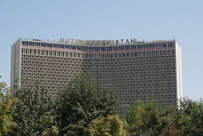 We took off from Paris in the late afternoon on September 12 and arrived in Tashkent around 7:15 AM on the 13th.
This trip was the result of long contemplation and preparation (it was originally planned for the year of the lockdown (2020) and was prepared with the help and advice of Nasrullo Jumanov from Turquoise Travel.
Stages and Itinerary
Stage 1: Tashkent - September 13 and 14
Stage 2: Ferghana Valley – September 15 to 17
Stage 3: Nukus and Moynaq - September 18 and 19
Stage 4: Mysterious Khiva - September 20 to 22
Stage 5: Holy Bukhara - September 23 to 26
Stage 6: Asraf - September 27 and 28
Stage 7: Mythical Samarkand - September 29 to October 2
Stage 8: Tersak (via Shakhrisabz and Urgut) – October 3 and 4
Stage 9: Samarkand – October 5 and 6
Stage 10: Tashkent/Istanbul/Paris – October 6 and 7
Stage 1: Tashkent
September 13
At the airport exit, we were greeted by the owner of our B&B (B&B Gulnara).
Today was all about recovery and our first steps in the capital. Our first currency exchange made us feel like sudden millionaires.
Our first stroll down the avenue leading to Chorsu Market introduced us to the fact that 80 to 90% of the cars here are white Chevrolets.
A walk under the arcades facing Chorsu: hardware stores, cabinetmakers, lute makers (one of them gave me a little concert/demo of a few string instruments).
We took off from Paris in the late afternoon on September 12 and arrived in Tashkent around 7:15 AM on the 13th.
This trip was the result of long contemplation and preparation (it was originally planned for the year of the lockdown (2020) and was prepared with the help and advice of Nasrullo Jumanov from Turquoise Travel.
Stages and Itinerary
Stage 1: Tashkent - September 13 and 14
Stage 2: Ferghana Valley – September 15 to 17
Stage 3: Nukus and Moynaq - September 18 and 19
Stage 4: Mysterious Khiva - September 20 to 22
Stage 5: Holy Bukhara - September 23 to 26
Stage 6: Asraf - September 27 and 28
Stage 7: Mythical Samarkand - September 29 to October 2
Stage 8: Tersak (via Shakhrisabz and Urgut) – October 3 and 4
Stage 9: Samarkand – October 5 and 6
Stage 10: Tashkent/Istanbul/Paris – October 6 and 7
Stage 1: Tashkent
September 13
At the airport exit, we were greeted by the owner of our B&B (B&B Gulnara).
Today was all about recovery and our first steps in the capital. Our first currency exchange made us feel like sudden millionaires.
Our first stroll down the avenue leading to Chorsu Market introduced us to the fact that 80 to 90% of the cars here are white Chevrolets.
A walk under the arcades facing Chorsu: hardware stores, cabinetmakers, lute makers (one of them gave me a little concert/demo of a few string instruments).
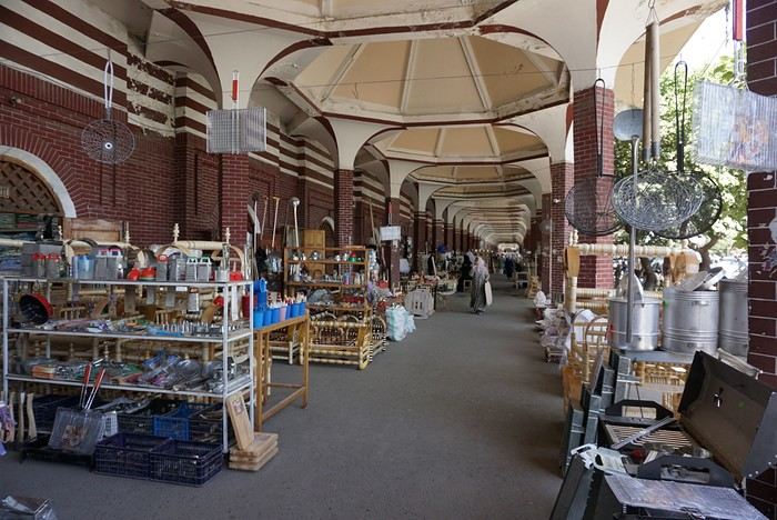
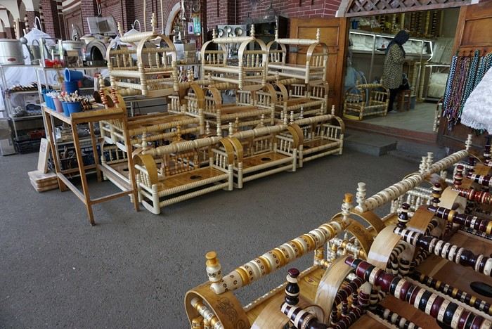
As we entered the market, many vendors called out to us, including this florist who asked where we were from: ‘France? Ah! Macron! PSG!’ He then recited a list of players from the Parisian team as well as past (Platini, Zidane, etc.) and current (Giroud, Griezmann, Mbappé, etc.) French national team players. Since we’re more into rugby (we live near Toulouse), he knew more players than I did!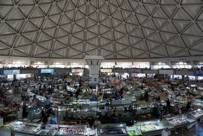
The market sprawls outside around the large circular, multi-story hall. We bought some grapes and bottles of freshly squeezed pomegranate juice for just a few sums. This evening, we had a meet-up with Nasrullo. The reunion was very warm: we’d been exchanging messages for over two years, and I’d been ‘torturing’ him with changes to our itinerary and trip duration. We were finally eager to meet, and honestly, I wasn’t disappointed—in fact, it was the opposite. Nasrullo was very attentive throughout our trip and always made sure, even from a distance (and most often from a distance!), that everything went smoothly. His goal was for us to leave delighted with our trip and, why not, indirectly become ambassadors for this destination. September 14 Breakfast with Nasrullo, then we set off with him by taxi to explore some of the capital’s sites.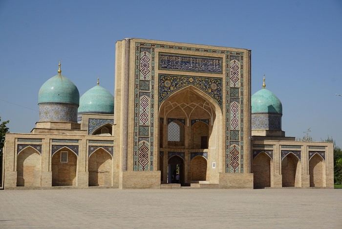
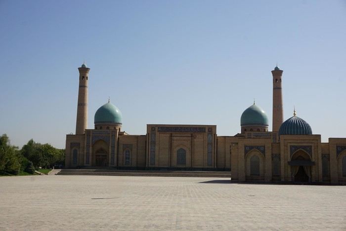
We started by visiting the Khazrati Imam complex, which includes the mausoleum of Kaffal Shashi, the Barak Khan and Muyi Muborak madrasas, and the great Khazrati Imam Mosque with its immense prayer hall.
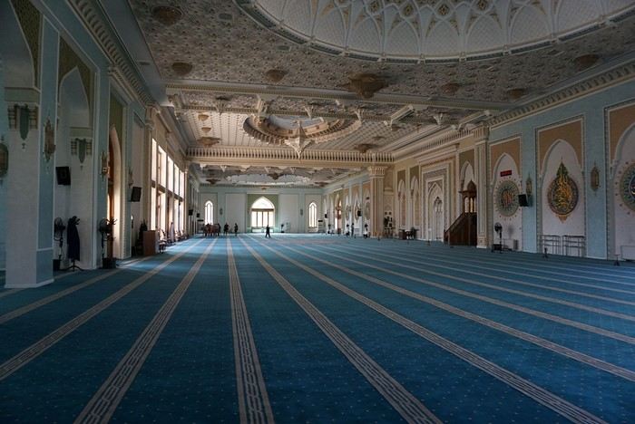
In the Muyi Muborak madrasa, now a museum, you can see the oldest Quran in the world. It was written by three religious scholars, including the secretary of the Prophet Muhammad, on large ‘pages’ made of antelope skin. Next, we explored Soviet-era Tashkent, discovering its parks, canals, and squares: Independence Square with its storks and phoenixes, Amir Temur Square with its large statue and, in the background, the massive Soviet-era hotel that has become one of Tashkent’s iconic buildings. Nasrullo took us through Broadway Boulevard and along what he calls ‘Tashkent’s Montmartre’… Well, it’s far, very far from Montmartre (in every sense of the word!). Then we took the metro to Chorsu station. Rush hour is pretty much the same everywhere in the metro… When we arrived at Chorsu, it was time to say goodbye. Nasrullo had to head back to Samarkand. Before leaving, he recommended some chaikhanas at the end of the galleries facing the market. We ate there for just a few euros (2 or 3 € for two people). After eating, we headed back to our room to cool off (our B&B is about a 10-minute walk away).
Around 4 PM, we set off to visit the Kokeldash Madrasa, which is still active. On the way, we stopped to watch some bread vendors and take a few photos. We were hesitating about buying some for our evening picnic when a young woman approached us. In perfect English, she asked: ‘Are you looking for something? Do you want to buy bread? Which one? How much?’ She then spoke to one of the vendors and negotiated the price. ‘Do you want one?’ And she took two. She paid directly. I took out my wallet to reimburse her, but she refused. It’s on the house! Then the vendor asked where we were from. And off we went again: Macron, PSG, football players… We’ll have to get used to it. The young woman smiled at the questions and comments, barely gave us time to thank her, and left as quickly as she had approached us.
We continued our walk. Visited the madrasa. Then we crossed the boulevard to see the Tashkent Circus. I would’ve loved to go in and visit, but the ticket seller wouldn’t hear of it. We carried on around what should’ve been a park with old-fashioned rides and attractions. All we found was a construction site. Oh well! Back at our hotel, a message from Nasrullo was waiting for us. He had managed to change our train ticket for the next day. Instead of taking the 6:00 AM train, we’d take the 8:00 AM one. And instead of second class, we’d be in first class! Great! This evening, we had a picnic at one of the breakfast tables in the B&B courtyard. Under a shelter, the owner and his family were celebrating a birthday. The owner started by offering us some tea. Then they brought us some fruit (watermelon and melon). Finally, after the song, candles, and cake cutting, they brought us two generous slices of that beautiful birthday cake. Delicious!
We took off from Paris in the late afternoon on September 12 and arrived in Tashkent around 7:15 AM on the 13th.
This trip was the result of long contemplation and preparation (it was originally planned for the year of the lockdown (2020) and was prepared with the help and advice of Nasrullo Jumanov from Turquoise Travel.
Stages and Itinerary
Stage 1: Tashkent - September 13 and 14
Stage 2: Ferghana Valley – September 15 to 17
Stage 3: Nukus and Moynaq - September 18 and 19
Stage 4: Mysterious Khiva - September 20 to 22
Stage 5: Holy Bukhara - September 23 to 26
Stage 6: Asraf - September 27 and 28
Stage 7: Mythical Samarkand - September 29 to October 2
Stage 8: Tersak (via Shakhrisabz and Urgut) – October 3 and 4
Stage 9: Samarkand – October 5 and 6
Stage 10: Tashkent/Istanbul/Paris – October 6 and 7
Stage 1: Tashkent
September 13
At the airport exit, we were greeted by the owner of our B&B (B&B Gulnara).
Today was all about recovery and our first steps in the capital. Our first currency exchange made us feel like sudden millionaires.
Our first stroll down the avenue leading to Chorsu Market introduced us to the fact that 80 to 90% of the cars here are white Chevrolets.
A walk under the arcades facing Chorsu: hardware stores, cabinetmakers, lute makers (one of them gave me a little concert/demo of a few string instruments).As we entered the market, many vendors called out to us, including this florist who asked where we were from: ‘France? Ah! Macron! PSG!’ He then recited a list of players from the Parisian team as well as past (Platini, Zidane, etc.) and current (Giroud, Griezmann, Mbappé, etc.) French national team players. Since we’re more into rugby (we live near Toulouse), he knew more players than I did!
The market sprawls outside around the large circular, multi-story hall. We bought some grapes and bottles of freshly squeezed pomegranate juice for just a few sums. This evening, we had a meet-up with Nasrullo. The reunion was very warm: we’d been exchanging messages for over two years, and I’d been ‘torturing’ him with changes to our itinerary and trip duration. We were finally eager to meet, and honestly, I wasn’t disappointed—in fact, it was the opposite. Nasrullo was very attentive throughout our trip and always made sure, even from a distance (and most often from a distance!), that everything went smoothly. His goal was for us to leave delighted with our trip and, why not, indirectly become ambassadors for this destination. September 14 Breakfast with Nasrullo, then we set off with him by taxi to explore some of the capital’s sites.
We started by visiting the Khazrati Imam complex, which includes the mausoleum of Kaffal Shashi, the Barak Khan and Muyi Muborak madrasas, and the great Khazrati Imam Mosque with its immense prayer hall.
In the Muyi Muborak madrasa, now a museum, you can see the oldest Quran in the world. It was written by three religious scholars, including the secretary of the Prophet Muhammad, on large ‘pages’ made of antelope skin. Next, we explored Soviet-era Tashkent, discovering its parks, canals, and squares: Independence Square with its storks and phoenixes, Amir Temur Square with its large statue and, in the background, the massive Soviet-era hotel that has become one of Tashkent’s iconic buildings. Nasrullo took us through Broadway Boulevard and along what he calls ‘Tashkent’s Montmartre’… Well, it’s far, very far from Montmartre (in every sense of the word!). Then we took the metro to Chorsu station. Rush hour is pretty much the same everywhere in the metro… When we arrived at Chorsu, it was time to say goodbye. Nasrullo had to head back to Samarkand. Before leaving, he recommended some chaikhanas at the end of the galleries facing the market. We ate there for just a few euros (2 or 3 € for two people). After eating, we headed back to our room to cool off (our B&B is about a 10-minute walk away).
Around 4 PM, we set off to visit the Kokeldash Madrasa, which is still active. On the way, we stopped to watch some bread vendors and take a few photos. We were hesitating about buying some for our evening picnic when a young woman approached us. In perfect English, she asked: ‘Are you looking for something? Do you want to buy bread? Which one? How much?’ She then spoke to one of the vendors and negotiated the price. ‘Do you want one?’ And she took two. She paid directly. I took out my wallet to reimburse her, but she refused. It’s on the house! Then the vendor asked where we were from. And off we went again: Macron, PSG, football players… We’ll have to get used to it. The young woman smiled at the questions and comments, barely gave us time to thank her, and left as quickly as she had approached us.
We continued our walk. Visited the madrasa. Then we crossed the boulevard to see the Tashkent Circus. I would’ve loved to go in and visit, but the ticket seller wouldn’t hear of it. We carried on around what should’ve been a park with old-fashioned rides and attractions. All we found was a construction site. Oh well! Back at our hotel, a message from Nasrullo was waiting for us. He had managed to change our train ticket for the next day. Instead of taking the 6:00 AM train, we’d take the 8:00 AM one. And instead of second class, we’d be in first class! Great! This evening, we had a picnic at one of the breakfast tables in the B&B courtyard. Under a shelter, the owner and his family were celebrating a birthday. The owner started by offering us some tea. Then they brought us some fruit (watermelon and melon). Finally, after the song, candles, and cake cutting, they brought us two generous slices of that beautiful birthday cake. Delicious!
Destinations à faire en famille en Italie English translation pending
Bonjour,
Je cherche LES destinations en Italie à faire absolument en famille, on est très paysage si possible des glissades d'eau de quoi du genre.
Je prendrais tous vos conseils et après on choisira ce qui nous corresponds. Merci beaucoup :)
Pour le moment on a ça, est-ce qu'il y en a qui sont à déconseiller ou alors d'autres à rajouter ? : Colisée Panthéon Fontaine de Trévi Tour de PIse Cinque Terre (Monteresso)
Je cherche LES destinations en Italie à faire absolument en famille, on est très paysage si possible des glissades d'eau de quoi du genre.
Je prendrais tous vos conseils et après on choisira ce qui nous corresponds. Merci beaucoup :)
Pour le moment on a ça, est-ce qu'il y en a qui sont à déconseiller ou alors d'autres à rajouter ? : Colisée Panthéon Fontaine de Trévi Tour de PIse Cinque Terre (Monteresso)
15 jours en août 2020 en Croatie English translation pending
Bonjour tout le monde,
me voici de retour après plusieurs semaines d'hésitations quant à notre voyage de cet été. Le voyage d'origine est celui-ci : https://voyageforum.com/discussion/itineraires-logements-visites-road-trip-dix-jours-split-dubrovnik-en-aout-d9829312/
Malheureusement (ou pas d'ailleurs) il y a changement de programme.... en effet le vol aller est décalé et j'ai bien peur que Volotea m'annonce à la dernière minute qu'il n'y a carrément plus de vols !!! Bref pour faire simple, réservation annulée et nouvelle réservation chez Transavia quasi au même prix mais du 5 au 19 aout soit 4 jours de plus. Il me reste quand même 2 problèmes de taille, à savoir : - arrivée à Dubrovnik au lieu de Split - 3 nuits réservées et non annulables à Lumbarda ( et au prix des nuits j'ai pas trop envie de faire l'impasse dessus !! )
J'ai donc élaboré un nouveau voyage et bien sur il me faut des conseils avisés pour peaufiner tout ça...... Nous sommes 2 adultes avec 2 enfants de 10 et 16 ans. Voilà a quoi ça ressemble :
J1 : arrivée à Dubrovnik 10h le matin (nuit à Dubrovnik) J2 : visite de Dubrovnik + Mont Srd (nuit à Dubrovnik) J3 : Route pour Korcula via la presqu'ile (nuit à Lumbarda déjà réservée) J4 : Ile de Korcula (nuit à Lumbarda déjà réservée) J5 : Ile de Korcula (nuit à Lumbarda déjà réservée) J6 :route pour Split (par la route ou direct par ferry) (nuit aux alentours de Split) J7 : visite de Split (nuit aux alentours de Split) J8 : Krka (nuit aux alentours de Split) J9 : journée "off", surement visite de Trogir et baignade (nuit aux alentours de Split) J10 : J11 : J12 : Route pour Mljet (route ou ferry en fonction du point de départ) J13 : Ile de Mljet J14 : Ile de Mljet J15 : départ tot et avion à Dubrovnik 11h
Il me manque encore pas mal de choses mais c'est une 1ère ébauche... j'ai plusieurs interrogations : - Est ce qu'il ne vaut mieux pas aller en direct à Korcula le J1 et garder Dubrovnik pour la fin de parcours ? J'ai peur que 2 jours de plus sur cette ile fasse peut être de trop... - J10 et J11 j'hésite entre remonter au nord ou faire une autre ile (Hvar par ex) à la place de Mljet. J'aimerais bien pouvoir faire un détour par la Bosnie et Mostar mais malheureusement c'est pour le moment impossible à prévoir... - partir de Mljet le dernier jour est il faisable sans trop de risque ?
Bref beaucoup de points à éclaircir et il ne me reste que quelques semaines....
me voici de retour après plusieurs semaines d'hésitations quant à notre voyage de cet été. Le voyage d'origine est celui-ci : https://voyageforum.com/discussion/itineraires-logements-visites-road-trip-dix-jours-split-dubrovnik-en-aout-d9829312/
Malheureusement (ou pas d'ailleurs) il y a changement de programme.... en effet le vol aller est décalé et j'ai bien peur que Volotea m'annonce à la dernière minute qu'il n'y a carrément plus de vols !!! Bref pour faire simple, réservation annulée et nouvelle réservation chez Transavia quasi au même prix mais du 5 au 19 aout soit 4 jours de plus. Il me reste quand même 2 problèmes de taille, à savoir : - arrivée à Dubrovnik au lieu de Split - 3 nuits réservées et non annulables à Lumbarda ( et au prix des nuits j'ai pas trop envie de faire l'impasse dessus !! )
J'ai donc élaboré un nouveau voyage et bien sur il me faut des conseils avisés pour peaufiner tout ça...... Nous sommes 2 adultes avec 2 enfants de 10 et 16 ans. Voilà a quoi ça ressemble :
J1 : arrivée à Dubrovnik 10h le matin (nuit à Dubrovnik) J2 : visite de Dubrovnik + Mont Srd (nuit à Dubrovnik) J3 : Route pour Korcula via la presqu'ile (nuit à Lumbarda déjà réservée) J4 : Ile de Korcula (nuit à Lumbarda déjà réservée) J5 : Ile de Korcula (nuit à Lumbarda déjà réservée) J6 :route pour Split (par la route ou direct par ferry) (nuit aux alentours de Split) J7 : visite de Split (nuit aux alentours de Split) J8 : Krka (nuit aux alentours de Split) J9 : journée "off", surement visite de Trogir et baignade (nuit aux alentours de Split) J10 : J11 : J12 : Route pour Mljet (route ou ferry en fonction du point de départ) J13 : Ile de Mljet J14 : Ile de Mljet J15 : départ tot et avion à Dubrovnik 11h
Il me manque encore pas mal de choses mais c'est une 1ère ébauche... j'ai plusieurs interrogations : - Est ce qu'il ne vaut mieux pas aller en direct à Korcula le J1 et garder Dubrovnik pour la fin de parcours ? J'ai peur que 2 jours de plus sur cette ile fasse peut être de trop... - J10 et J11 j'hésite entre remonter au nord ou faire une autre ile (Hvar par ex) à la place de Mljet. J'aimerais bien pouvoir faire un détour par la Bosnie et Mostar mais malheureusement c'est pour le moment impossible à prévoir... - partir de Mljet le dernier jour est il faisable sans trop de risque ?
Bref beaucoup de points à éclaircir et il ne me reste que quelques semaines....
Mais où qu'il est ce truc là? (3) English translation pending
Bonjour!
Je reprends donc la main en ouvrant un nouveau sujet.
Où est-ce?
Un indice? Je n'ai pas (encore?) fait de carnet sur ce pays....
À vous de jouer!
Je reprends donc la main en ouvrant un nouveau sujet.
Où est-ce?
Un indice? Je n'ai pas (encore?) fait de carnet sur ce pays....
À vous de jouer!
Croisière Costa Victoria avec départ des Maldives pour Venise le 7 mars 2020 English translation pending
Bonjour
Je dois partir le 7 Mars 2020 de Male aux Maldives sur le Costa Victoria pour 21 jours vers Venise
Je me demande si j y vais ou pas vu ce qu il se passe sur les bateaux de croisiere et a Venise en Croatie en Istael
Pour l instant je pense sue je vais tout annuler
J aimerai avoir vos avis si vous êtes dans la même situation
Au plaisir de vous lire
Marc
Trois générations, 23 jours, 11 états, western happiness English translation pending
J’ai longtemps hésité à écrire ce carnet, au retour de ce merveilleux voyage, en Juillet, il m’a semblé que plusieurs autres carnets parlaient plus ou moins des mêmes lieux , et d’autres ont suivi les mois suivants, je les ai lu et continue à les lire avec beaucoup de Plaisir (encore merci bibouns51, marcalamar, marati et les autres, trop nombreux pour que je les cite tous), ils me rappellent ces endroits superbes et ces 3 semaines d’émerveillements.
Mais en décembre, mon père, le seul participant masculin à ce beau voyage, nous a quitté . Et en y réfléchissant, j’ai eu envie de raconter ce dernier road trip tous ensemble , pour moi c’est un rappel de bons souvenirs, et j’espère que pour certains ça donnera encore un autre exemple, les voyages à 3 générations n’étant pas si fréquents dans les carnets. Voyager avec les grands-parents et les enfants ados, ça force chacun à faire des concessions, à s’adapter au rythme et aux envies des uns et des autres…
C’était déjà le 6ème voyage dans l’Ouest pour moi, en une vingtaine d’année, et 3ème en trois ans:
En 2017, un trip à 9 avec un couple d’amis, ma soeur et nos 5 enfants, de San Francisco à Las Vegas en passant par les parcs les plus fréquemment visités (Grand Canyon, Bryce, …) sans passer par Los Angeles (https://voyageforum.com/v.f?post=8264822;#8264822 ).
En 2018, toute seule sans enfants, à la découverte du Yellowstone puis de Valley of fire, Cedar breaks et Snow Canyon entre autres (https://voyageforum.com/v.f?post=9100875;#9100875 )
Et 2019, l’objet de ce carnet, avec mes parents, mes deux filles de 14 et 16 ans et ma niece de 17 ans. Il y a eu plusieurs versions de l’itinéraire, j’avais fait une liste de nombreux endroits possibles et chacun a donné son classement. J’ai pris les lieux qui avaient le plus de voix de préférence et j’ai essayé de tous les mettre dans un itinéraire bien chargé mais je pense assez équilibré. Les incontournables étaient pour moi Yellowstone et Monument Valley que je voulais absolument leur faire découvrir à tous. Et pour les enfants, Universal Studios à Los Angeles et un nouveau passage à Las Vegas qu’elles avaient adoré deux ans plus tôt. Pour mes parents, le Mont Rushmore leur faisait envie. Le résultat a été un road trip de 23 jours, avec 2 vols intérieurs, 11 états traversés, 11 parcs nationaux, des lieux marqués par l’histoire indienne…on a beaucoup ri, un peu marché, et si souvent été éblouis.
Alors, après ce long préambule, comme on dit dans New-York Unité spéciale; voilà leur histoire . 😊
Comme nous avions un vol le 25 Juin au matin, un direct CDG-Los Angeles, on a décidé de rejoindre Paris en TGV le 24 au soir, pour dormir près de l’aéroport. Le 25, frais et dispos, nous voilà à l’aéroport. Pas de bagages à enregistrer, nous avons tous voyagé avec une valise cabine et un sac à dos. On monte bien à temps dans l’A380, et on attend le décollage…et on attend…et on attend…on nous parle d’un petit souci technique, on attend toujours…au bout d’un moment, on nous dit qu’on va nous faire sortir, que du personnel au sol nous prépare une salle climatisée (oui, il fait plutôt chaud ces jours-ci) pour nous recevoir en attendant de nous trouver un autre avion… Quand enfin on peut sortir, pas vraiment de salle climatisée mais du personnel qui nous traite un peu comme du bétail pour nous faire sortir au plus vite et nous dit de récupérer nos bagages (youpie, on n’en a pas à récupérer) et d’aller au comptoir air France où on va nous trouver un prochain vol. Mais c’est pas possible, on a nos places pour Universal demain nous! Au comptoir, on arrive dans les premiers, n’ayant pas de bagages à récupérer (mais ayant dû parcourir CDG de long en large) et là commence la recherche d’une solution pour nous 6. Première proposition: attendre minuit (on est 11h du matin à peu près là)pour prendre un vol ver Mexico, y attendre 8h puis avoir enfin un vol vers Los Angeles. Notre refus est clair, tant qu’à arriver demain, autant partir demain matin, au moins on aura une nuit de repos d’ici là. On finit par nous trouver un vol le lendemain matin, avec une escale à Detroit et arrivée en fin d’après-midi à Los Angeles. Bon, bein on fera avec…vous nous trouvez un hotel pour cette nuit? Euh…"on n’en trouve pas directement mais trouvez vous même et on vous remboursera…"je comprends qu’ils n’aient pas trouvé, il m’a fallu 2h pour finalement trouver des chambres à Chantilly, il n’y avait rien de libre plus près (les environs de l’aéroport étaient surbookés et on était six donc besoin de minimum 2 chambres). Franchement, la gestion de la situation par Air France ne nous a pas du tout impressionnés. Heureusement qu’ils ont fini par nous rembourser l’hotel et nous dédommager pour le vol 2 mois plus tard, une fois la plainte enregistrée et traitée sur leur site.
J’ai profité de l’après-midi et la soirée à l’hotel pour appeler Universal, et là, super service, ils ont accepté de changer la date des billets sans problème en apprenant la situation. J’ai aussi appelé pour changer la date de location de la voiture (prevue au depart pour 48h, on l’aura finalement prise juste 24h) et ça a été sans souci.
Le lendemain, 26 Juin, on retourne à l’aéroport avec une petite apprehension, mais tout se passe bien, premier vol ok, étape à Détroit rapide pour le passage à la douane et deuxième vol très bien également. A l’arrivée à Los Angeles, pour rejoindre notre hotel près de Universal, on fait un petit arrêt à Griffith Park, voir le signe Hollywood à la tombée du jour,
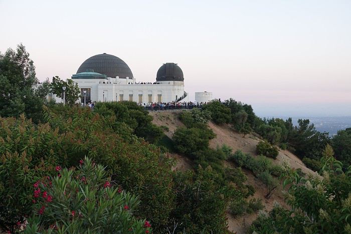
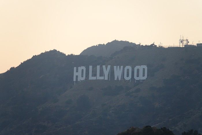
et après une pizza près de l’hotel, on s’effondre dans nos lits. Hotel : BLVD hotel and spa, très correct, jolie chambre, pas de petit déjeuner, bien situé (on peut aller à Universal à pieds).
Mais en décembre, mon père, le seul participant masculin à ce beau voyage, nous a quitté . Et en y réfléchissant, j’ai eu envie de raconter ce dernier road trip tous ensemble , pour moi c’est un rappel de bons souvenirs, et j’espère que pour certains ça donnera encore un autre exemple, les voyages à 3 générations n’étant pas si fréquents dans les carnets. Voyager avec les grands-parents et les enfants ados, ça force chacun à faire des concessions, à s’adapter au rythme et aux envies des uns et des autres…
C’était déjà le 6ème voyage dans l’Ouest pour moi, en une vingtaine d’année, et 3ème en trois ans:
En 2017, un trip à 9 avec un couple d’amis, ma soeur et nos 5 enfants, de San Francisco à Las Vegas en passant par les parcs les plus fréquemment visités (Grand Canyon, Bryce, …) sans passer par Los Angeles (https://voyageforum.com/v.f?post=8264822;#8264822 ).
En 2018, toute seule sans enfants, à la découverte du Yellowstone puis de Valley of fire, Cedar breaks et Snow Canyon entre autres (https://voyageforum.com/v.f?post=9100875;#9100875 )
Et 2019, l’objet de ce carnet, avec mes parents, mes deux filles de 14 et 16 ans et ma niece de 17 ans. Il y a eu plusieurs versions de l’itinéraire, j’avais fait une liste de nombreux endroits possibles et chacun a donné son classement. J’ai pris les lieux qui avaient le plus de voix de préférence et j’ai essayé de tous les mettre dans un itinéraire bien chargé mais je pense assez équilibré. Les incontournables étaient pour moi Yellowstone et Monument Valley que je voulais absolument leur faire découvrir à tous. Et pour les enfants, Universal Studios à Los Angeles et un nouveau passage à Las Vegas qu’elles avaient adoré deux ans plus tôt. Pour mes parents, le Mont Rushmore leur faisait envie. Le résultat a été un road trip de 23 jours, avec 2 vols intérieurs, 11 états traversés, 11 parcs nationaux, des lieux marqués par l’histoire indienne…on a beaucoup ri, un peu marché, et si souvent été éblouis.
Alors, après ce long préambule, comme on dit dans New-York Unité spéciale; voilà leur histoire . 😊
Comme nous avions un vol le 25 Juin au matin, un direct CDG-Los Angeles, on a décidé de rejoindre Paris en TGV le 24 au soir, pour dormir près de l’aéroport. Le 25, frais et dispos, nous voilà à l’aéroport. Pas de bagages à enregistrer, nous avons tous voyagé avec une valise cabine et un sac à dos. On monte bien à temps dans l’A380, et on attend le décollage…et on attend…et on attend…on nous parle d’un petit souci technique, on attend toujours…au bout d’un moment, on nous dit qu’on va nous faire sortir, que du personnel au sol nous prépare une salle climatisée (oui, il fait plutôt chaud ces jours-ci) pour nous recevoir en attendant de nous trouver un autre avion… Quand enfin on peut sortir, pas vraiment de salle climatisée mais du personnel qui nous traite un peu comme du bétail pour nous faire sortir au plus vite et nous dit de récupérer nos bagages (youpie, on n’en a pas à récupérer) et d’aller au comptoir air France où on va nous trouver un prochain vol. Mais c’est pas possible, on a nos places pour Universal demain nous! Au comptoir, on arrive dans les premiers, n’ayant pas de bagages à récupérer (mais ayant dû parcourir CDG de long en large) et là commence la recherche d’une solution pour nous 6. Première proposition: attendre minuit (on est 11h du matin à peu près là)pour prendre un vol ver Mexico, y attendre 8h puis avoir enfin un vol vers Los Angeles. Notre refus est clair, tant qu’à arriver demain, autant partir demain matin, au moins on aura une nuit de repos d’ici là. On finit par nous trouver un vol le lendemain matin, avec une escale à Detroit et arrivée en fin d’après-midi à Los Angeles. Bon, bein on fera avec…vous nous trouvez un hotel pour cette nuit? Euh…"on n’en trouve pas directement mais trouvez vous même et on vous remboursera…"je comprends qu’ils n’aient pas trouvé, il m’a fallu 2h pour finalement trouver des chambres à Chantilly, il n’y avait rien de libre plus près (les environs de l’aéroport étaient surbookés et on était six donc besoin de minimum 2 chambres). Franchement, la gestion de la situation par Air France ne nous a pas du tout impressionnés. Heureusement qu’ils ont fini par nous rembourser l’hotel et nous dédommager pour le vol 2 mois plus tard, une fois la plainte enregistrée et traitée sur leur site.
J’ai profité de l’après-midi et la soirée à l’hotel pour appeler Universal, et là, super service, ils ont accepté de changer la date des billets sans problème en apprenant la situation. J’ai aussi appelé pour changer la date de location de la voiture (prevue au depart pour 48h, on l’aura finalement prise juste 24h) et ça a été sans souci.
Le lendemain, 26 Juin, on retourne à l’aéroport avec une petite apprehension, mais tout se passe bien, premier vol ok, étape à Détroit rapide pour le passage à la douane et deuxième vol très bien également. A l’arrivée à Los Angeles, pour rejoindre notre hotel près de Universal, on fait un petit arrêt à Griffith Park, voir le signe Hollywood à la tombée du jour,
et après une pizza près de l’hotel, on s’effondre dans nos lits. Hotel : BLVD hotel and spa, très correct, jolie chambre, pas de petit déjeuner, bien situé (on peut aller à Universal à pieds).
Bolivia: Exploring the South Lipez by Self-Drive
Hi everyone,
The idea of traveling to Bolivia came to me after seeing Jean-François (Max68)’s photos on his website. I thought we *had* to see those stunning landscapes with the colorful lagoons for ourselves. But a self-drive trip didn’t seem doable at first. A few years ago, everyone advised against going to the South Lipez with just one car.
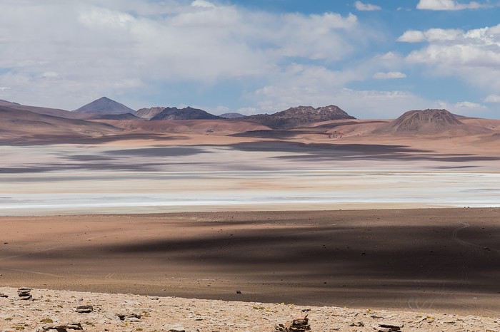 Laguna Kara
It was only after reading Laurent (Lolobe) and Pascal (Pepe874)’s travel journals—who explored the South Lipez solo with a car from Biz Rent a Car—that I thought we might be able to do the same. Meanwhile, we’d already contacted a local agency to organize a trip with a driver and guide. But the idea of a self-drive adventure really appealed to us. With encouragement and tips from Thierry (Tbernay) and Jean-François (Max68), we decided to plan our own self-drive trip. I’d like to thank them for their advice—it was *super* helpful. And a big thanks to all the other forum members for the info shared during our prep!
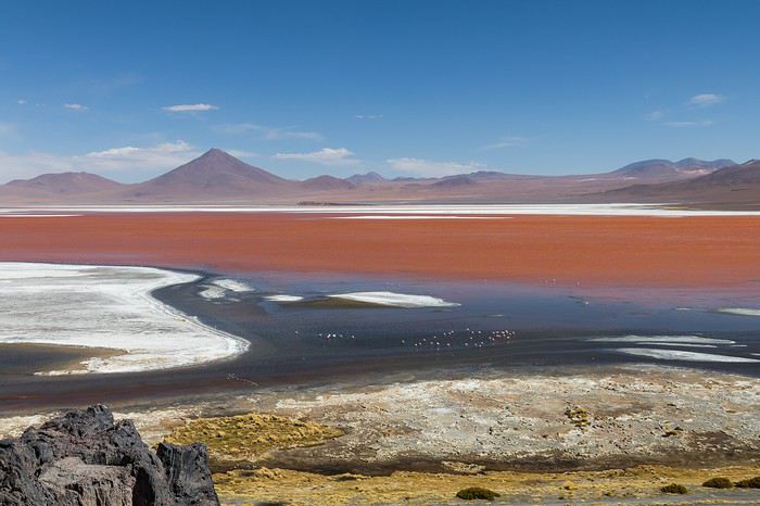 Laguna Colorada
Planning this trip happened during a tough time for our family. My mother-in-law’s illness and passing, plus a few health issues of my own, made us doubt the trip multiple times and nearly scrap the whole thing.
We booked our international flights in February with Swiss. They offered the best balance of travel time and price from Switzerland. Swiss operates Zurich–São Paulo with their own fleet, and São Paulo–Santa Cruz with GOL. In June, GOL canceled the Saturday flight and rebooked us on Sunday. Spending over 24 hours in that huge Brazilian city didn’t work for us at all, so we asked Swiss to put us on the next Zurich–São Paulo flight. Too bad—we lost a day in Bolivia and had to skip the Tarabucco market on Sunday.
Right after, we also booked the car in February. After contacting Imbex and Biz, we went with Biz. Not speaking Spanish, we were relieved to communicate with Alejandra in French. The contact was great—she answered all our questions patiently. Sometimes it took a few days to get a reply, but we could also reach her on WhatsApp. After our trip, we can *only* recommend Biz for rentals in Bolivia. The cars are well-prepped for the South Lipez tracks. The agency is reliable, and the vehicles are new and well-maintained.
 “Our” car, a Toyota Hilux
While planning, we realized the presidential elections would happen while we were in Bolivia. The risk of *bloqueos* (roadblocks and protests) was very real. But in Bolivia, *bloqueos* seem common—you always have to account for that kind of hassle. In late August/early September, Uyuni and the Salar region were blocked for days, leading to food, fuel, and cash shortages. Worried about a blockade in Uyuni and missing the Salar, we decided to visit it first *just in case*.
On election day, the whole country shut down. Planes were grounded, buses and taxis couldn’t circulate, and private cars were banned. There were a few exceptions—ambulances, police, or certain professions—but as tourists, we couldn’t get permission to drive. We asked the embassy, and Biz even requested a permit from the electoral office. So we had to plan to be somewhere with things to do *without* the car.
We decided not to book any accommodations in advance—a first for us. Usually, we plan our stops and reserve lodges, hotels, or campgrounds well ahead. This time, only the room in Sucre was booked, so we’d have a base when we arrived.
In July, Alex (Delhenry) reached out to propose joining part of the trip. He didn’t realize we were leaving in October. Still, we got fresh updates when he returned from the South Lipez. Thanks, Alex—your tips, especially about the Guadalupe–Tupiza stretch, were *super* useful.
In September, we connected with Jean-Louis (Avx) and Anne (Xeta), who were also heading to Bolivia in October, one and two weeks after us. We had dinner with Jean-Louis and his friend after our South Lipez trip and stayed in touch with Anne. It was great to chat with them! Unfortunately, Anne and her husband had a much rockier trip—they got hit hard by post-election issues.
 Climbing Volcán Tunupa
Our itinerary wasn’t set in stone—we decided to wing it on the spot. Two weeks before departure, I reconnected with Alejandra at Biz to move the car rental up by a day. With the elections, we wanted to leave Sucre ASAP and focus on the South Lipez. Outside Uyuni and Tupiza, the risk of blockades was zero. We also planned a two-night buffer in Sucre before our flights, just in case. It might sound overcautious, but in hindsight, we made the right call. If we’d left Sucre a day later, we wouldn’t have made it to Potosí—it was completely blocked. On the way back, we *just* dodged blockades in Potosí and elsewhere. Sometimes, you’ve gotta trust your gut.
Here’s our route—only the first two nights in Sucre were booked ahead:
D1 Departure from Switzerland
D2 Sucre (La Selenita)
D3 Sucre (La Selenita)
D4 Colchani (Hotel de Sal Luna Salada)
D5 Jirira (Auberge Doña Lupe)
D6 On the Salar (in the car)
D7 A few kilometers from Estancia Catal (in the car)
D8 Laguna Hedionda (Hotel Los Flamencos)
D9 Laguna Colorada (Lodge by the lagoon)
D10 Middle of nowhere, en route Laguna Verde–Mina Horsu–Quetena Chico (in the car)
D11 Quetena Chico (Lamphaya Lodge Andino)
D12 Quetena Chico (Lamphaya Lodge Andino)
D13 Guadalupe (Guest room at Celia’s)
D14 Along the Rio Grande (in the car)
D15 Tupiza (Hotel Mitru)
D16 Tupiza (Hotel Mitru)
D17 Sucre (La Selenita)
D18 Sucre (La Selenita)
D19 Santa Cruz (Hotel Sun)
D20 Departure from Santa Cruz
D21 Arrival in Switzerland
As you can see, we spent 13 nights in the South Lipez. Initially, we’d planned for nine, but Jean-François (Max68) suggested staying longer. Great advice—we didn’t regret it one bit. We could’ve even added 2–3 more days without getting bored.
Self-driving in the South Lipez takes some prep and a good GPS. We kept it simple and used maps.me to navigate. It’s a solid app—just save your waypoints ahead of time. For some stretches, I used Google Earth to visualize the tracks and sites. If you stick to the tour operator routes, you *almost* can’t get lost. But we often veered off the beaten path and took different routes. Some days, we didn’t see another car. So in case of a breakdown, it’s key to have water and food for several days. In some spots, there’s *zero* signal—your phone won’t work. Another must: it gets *cold* in the South Lipez, and a good sleeping bag is essential. We brought down sleeping bags rated for -10°C and didn’t regret it during our car nights.
 The Dalí Desert
Some tracks are *super* rocky—flat tires are a real risk. On those stretches, maps.me’s estimated travel time was way off. Some sections barely let us go over 15 km/h.
Lots of forum members recommend doing the South Lipez “loop” from Tupiza to Uyuni—ending with the Salar—to avoid Uyuni’s crowds. That might work for organized tours, but for self-drive, the direction *doesn’t* matter. I’ll say this: the few vehicles we saw mostly came from Tupiza and Chile, not Uyuni. So if starting from Uyuni works better for you, go for it! Ending in Tupiza means heading toward warmer weather. For our planned stops and climbs, starting in Uyuni helped with acclimatization. Spending a few nights between 3,600–3,800 m before going over 4,000 m is a smart move.
 Uyuni Salt Flats in the morning
Overall, we barely saw anyone—except at Laguna Hedionda and Chalviri. There were several tour groups at Hotel Los Flamencos (Laguna Hedionda), but we didn’t cross paths during the day. Hardly anyone on the Salar, on the roads, or at the lodges in the evenings. The *only* place that shocked us was Chalviri. We’d planned to stay there, but it was fully booked—and we counted *forty* tour jeeps on-site. This was around noon! At the Polques hot springs (Chalviri), it was *packed*—we quickly nixed the idea of a dip. Plus, the vibe wasn’t great: soaking right by the road with lodges and restaurants in the background? Meh. Still, lots of tourists love it, so it’s up to you.
For the photos, I kept the colors and mood we saw. The lagoons’ hues are often stunning, but some online photos are *way* over-edited and oversaturated. The South Lipez’s landscapes are breathtaking—no need for excessive retouching.
If you don’t want to read all the details, the start of the travel journal is here: https://voyageforum.com/v.f?post=9888761;a=9888761
The idea of traveling to Bolivia came to me after seeing Jean-François (Max68)’s photos on his website. I thought we *had* to see those stunning landscapes with the colorful lagoons for ourselves. But a self-drive trip didn’t seem doable at first. A few years ago, everyone advised against going to the South Lipez with just one car.
Laguna KaraIt was only after reading Laurent (Lolobe) and Pascal (Pepe874)’s travel journals—who explored the South Lipez solo with a car from Biz Rent a Car—that I thought we might be able to do the same. Meanwhile, we’d already contacted a local agency to organize a trip with a driver and guide. But the idea of a self-drive adventure really appealed to us. With encouragement and tips from Thierry (Tbernay) and Jean-François (Max68), we decided to plan our own self-drive trip. I’d like to thank them for their advice—it was *super* helpful. And a big thanks to all the other forum members for the info shared during our prep!
Laguna ColoradaPlanning this trip happened during a tough time for our family. My mother-in-law’s illness and passing, plus a few health issues of my own, made us doubt the trip multiple times and nearly scrap the whole thing.
We booked our international flights in February with Swiss. They offered the best balance of travel time and price from Switzerland. Swiss operates Zurich–São Paulo with their own fleet, and São Paulo–Santa Cruz with GOL. In June, GOL canceled the Saturday flight and rebooked us on Sunday. Spending over 24 hours in that huge Brazilian city didn’t work for us at all, so we asked Swiss to put us on the next Zurich–São Paulo flight. Too bad—we lost a day in Bolivia and had to skip the Tarabucco market on Sunday.
Right after, we also booked the car in February. After contacting Imbex and Biz, we went with Biz. Not speaking Spanish, we were relieved to communicate with Alejandra in French. The contact was great—she answered all our questions patiently. Sometimes it took a few days to get a reply, but we could also reach her on WhatsApp. After our trip, we can *only* recommend Biz for rentals in Bolivia. The cars are well-prepped for the South Lipez tracks. The agency is reliable, and the vehicles are new and well-maintained.
“Our” car, a Toyota HiluxWhile planning, we realized the presidential elections would happen while we were in Bolivia. The risk of *bloqueos* (roadblocks and protests) was very real. But in Bolivia, *bloqueos* seem common—you always have to account for that kind of hassle. In late August/early September, Uyuni and the Salar region were blocked for days, leading to food, fuel, and cash shortages. Worried about a blockade in Uyuni and missing the Salar, we decided to visit it first *just in case*.
On election day, the whole country shut down. Planes were grounded, buses and taxis couldn’t circulate, and private cars were banned. There were a few exceptions—ambulances, police, or certain professions—but as tourists, we couldn’t get permission to drive. We asked the embassy, and Biz even requested a permit from the electoral office. So we had to plan to be somewhere with things to do *without* the car.
We decided not to book any accommodations in advance—a first for us. Usually, we plan our stops and reserve lodges, hotels, or campgrounds well ahead. This time, only the room in Sucre was booked, so we’d have a base when we arrived.
In July, Alex (Delhenry) reached out to propose joining part of the trip. He didn’t realize we were leaving in October. Still, we got fresh updates when he returned from the South Lipez. Thanks, Alex—your tips, especially about the Guadalupe–Tupiza stretch, were *super* useful.
In September, we connected with Jean-Louis (Avx) and Anne (Xeta), who were also heading to Bolivia in October, one and two weeks after us. We had dinner with Jean-Louis and his friend after our South Lipez trip and stayed in touch with Anne. It was great to chat with them! Unfortunately, Anne and her husband had a much rockier trip—they got hit hard by post-election issues.
Climbing Volcán TunupaOur itinerary wasn’t set in stone—we decided to wing it on the spot. Two weeks before departure, I reconnected with Alejandra at Biz to move the car rental up by a day. With the elections, we wanted to leave Sucre ASAP and focus on the South Lipez. Outside Uyuni and Tupiza, the risk of blockades was zero. We also planned a two-night buffer in Sucre before our flights, just in case. It might sound overcautious, but in hindsight, we made the right call. If we’d left Sucre a day later, we wouldn’t have made it to Potosí—it was completely blocked. On the way back, we *just* dodged blockades in Potosí and elsewhere. Sometimes, you’ve gotta trust your gut.
Here’s our route—only the first two nights in Sucre were booked ahead:
D1 Departure from Switzerland
D2 Sucre (La Selenita)
D3 Sucre (La Selenita)
D4 Colchani (Hotel de Sal Luna Salada)
D5 Jirira (Auberge Doña Lupe)
D6 On the Salar (in the car)
D7 A few kilometers from Estancia Catal (in the car)
D8 Laguna Hedionda (Hotel Los Flamencos)
D9 Laguna Colorada (Lodge by the lagoon)
D10 Middle of nowhere, en route Laguna Verde–Mina Horsu–Quetena Chico (in the car)
D11 Quetena Chico (Lamphaya Lodge Andino)
D12 Quetena Chico (Lamphaya Lodge Andino)
D13 Guadalupe (Guest room at Celia’s)
D14 Along the Rio Grande (in the car)
D15 Tupiza (Hotel Mitru)
D16 Tupiza (Hotel Mitru)
D17 Sucre (La Selenita)
D18 Sucre (La Selenita)
D19 Santa Cruz (Hotel Sun)
D20 Departure from Santa Cruz
D21 Arrival in Switzerland
As you can see, we spent 13 nights in the South Lipez. Initially, we’d planned for nine, but Jean-François (Max68) suggested staying longer. Great advice—we didn’t regret it one bit. We could’ve even added 2–3 more days without getting bored.
Self-driving in the South Lipez takes some prep and a good GPS. We kept it simple and used maps.me to navigate. It’s a solid app—just save your waypoints ahead of time. For some stretches, I used Google Earth to visualize the tracks and sites. If you stick to the tour operator routes, you *almost* can’t get lost. But we often veered off the beaten path and took different routes. Some days, we didn’t see another car. So in case of a breakdown, it’s key to have water and food for several days. In some spots, there’s *zero* signal—your phone won’t work. Another must: it gets *cold* in the South Lipez, and a good sleeping bag is essential. We brought down sleeping bags rated for -10°C and didn’t regret it during our car nights.
The Dalí DesertSome tracks are *super* rocky—flat tires are a real risk. On those stretches, maps.me’s estimated travel time was way off. Some sections barely let us go over 15 km/h.
Lots of forum members recommend doing the South Lipez “loop” from Tupiza to Uyuni—ending with the Salar—to avoid Uyuni’s crowds. That might work for organized tours, but for self-drive, the direction *doesn’t* matter. I’ll say this: the few vehicles we saw mostly came from Tupiza and Chile, not Uyuni. So if starting from Uyuni works better for you, go for it! Ending in Tupiza means heading toward warmer weather. For our planned stops and climbs, starting in Uyuni helped with acclimatization. Spending a few nights between 3,600–3,800 m before going over 4,000 m is a smart move.
Uyuni Salt Flats in the morningOverall, we barely saw anyone—except at Laguna Hedionda and Chalviri. There were several tour groups at Hotel Los Flamencos (Laguna Hedionda), but we didn’t cross paths during the day. Hardly anyone on the Salar, on the roads, or at the lodges in the evenings. The *only* place that shocked us was Chalviri. We’d planned to stay there, but it was fully booked—and we counted *forty* tour jeeps on-site. This was around noon! At the Polques hot springs (Chalviri), it was *packed*—we quickly nixed the idea of a dip. Plus, the vibe wasn’t great: soaking right by the road with lodges and restaurants in the background? Meh. Still, lots of tourists love it, so it’s up to you.
For the photos, I kept the colors and mood we saw. The lagoons’ hues are often stunning, but some online photos are *way* over-edited and oversaturated. The South Lipez’s landscapes are breathtaking—no need for excessive retouching.
If you don’t want to read all the details, the start of the travel journal is here: https://voyageforum.com/v.f?post=9888761;a=9888761
Périple en Asie du Sud-est English translation pending
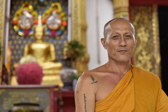
Bonjour à tous,
J'avoue avoir pas mal tergiversé avant de me décider à publier ce carnet. Car l'Asie du Sud-Est, à commencer par la Thaïlande, est une zone sur laquelle beaucoup de carnets ont déjà été publiés, notamment par des voyageurs qui sont devenus de vrais spécialistes du secteur.
Et puis finalement, ce voyage en famille fut un tel régal qu'il me semble normal de faire un retour sur VF. J'y prends régulièrement des infos pour préparer mes voyages (merci notamment à Anne alias Xeta pour son carnet et ses infos pratiques), alors ce carnet sera un juste retour des choses.
Tout aurait dû bien commencer pour ce voyage car, contrairement à nos avions pour l'Indonésie en 2015 et pour le Nicaragua en 2017, qui avaient tous les deux été annulés au dernier moment alors que nous étions quelques centaines à poireauter en salle d'embarquement, notre avion pour Bangkok a bien décollé, lui, en temps et en heure. Mais sans nous quand même !
En effet, quelques jours plus tôt, le brevet des collèges que passait notre fils aîné avait été décalé de quelques jours par le ministre pour cause de... canicule ! Les école maternelles n'ont pas été fermées mais les collèges qui accueillaient le brevet, si ! Allez comprendre. Toujours est-il que notre avion s'est trouvé à décoller quelques minutes seulement après la fin de la dernière épreuve du brevet, nous étions donc un poil trop courts pour l'attraper. Nous avons ainsi dû décaler notre vol de 24 heures. Nous attendons d'ailleurs toujours le remboursement partiel auquel nous avons droit mais peu importe, c'est une autre histoire...
Si je cite cette anecdote qui n'a apparemment rien à voir avec la Thaïlande, c'est parce qu'une fois arrivés à Bangkok, le monsieur à l'accueil de notre hôtel nous annonce qu'il a annulé par erreur les 3 nuitées que nous y avions réservées. J'avais pourtant envoyé 2 mails de confirmation de notre réservation en précisant que nous manquerions juste la première nuit et j'avais reçu une réponse positive, mais il a fait la boulette quand même ! Bref, après le coup de l'avion, quand ça veut pas, ben ça veut pas 🤪
Nous prenons donc la nouvelle avec le sourire (quoi de plus normal dans ce pays !), alors que notre interlocuteur de l'hôtel, lui, n'esquisse pas le moindre rictus. Il paraît que quand on va au pays du sourire, il y en a toujours un qui fait exception à la règle. Pour nous, ce sera donc celui-là ! Mais ce n'est pas bien grave, tous les autres rattraperont le coup après lui, au fil de notre séjour...
Enfin bon, après une demi-journée perdue bêtement pour chercher un autre hôtel, puis pour le rejoindre au milieu de l'intense circulation de Bangkok, notre voyage peut enfin commencer. Sauf que c'est l'heure de manger puis de se coucher. Le voyage commencera donc enfin demain.
BANGKOK
Selon le dernier classement des villes les plus visitées du monde, Bangkok se situe à... la première place ! Devant Londres (2e) et Paris (3e), excusez du peu. Et si certains quartiers ne sont pas spécialement sexy, certains sites en revanche constituent de pures merveilles et justifient un tel classement.
Après tous les problèmes que nous avons rencontrés d'emblée dans ce voyage, il ne nous reste plus qu'un jour pour visiter Bangkok, au lieu de deux et demi comme initialement prévu, sachant que nous y reviendrons une demi-journée au milieu du séjour.
Nous allons donc manquer de temps pour visiter la ville mais bon il faut faire avec et nous allons essayer de voir le maximum de choses pour cette première journée que nous n'avons pas volée !
Nous commençons donc par traverser, rapidement hélas, le marché aux fleurs.
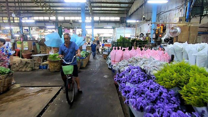
Il paraît qu'il est ouvert 24 heures sur 24. En tout cas lors de notre venue, il n'y a pas foule mais l'endroit, où il y a également pas mal de fruits et légumes, est vraiment agréable.
Nous enchaînons par l'un des fameux temples de Bangkok : le Wat Pho.
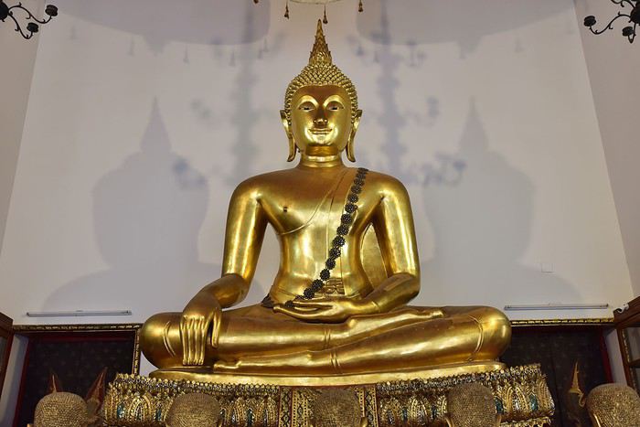
Son architecture nous dépayse totalement et je dois dire qu'avec le stress énorme que nous a causé pendant une semaine le report de notre départ, ce lieu sacré nous fait un bien fou. C'est pour vivre ce genre de moments que nous aimons tant voyager.
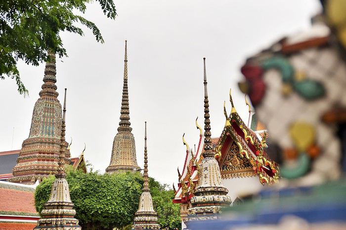
Alors bien sûr, le temps n'est pas très beau (pas étonnant, on est en juillet mais ça au moins, c'était prévu), contrairement au site !
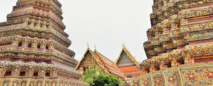
Là, ça y est, notre voyage est enfin bel et bien lancé.
A l'intérieur de ces bâtiments multicolores, les bouddhas sont omniprésents et rivalisent de sérénité.
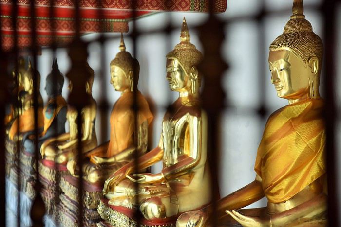
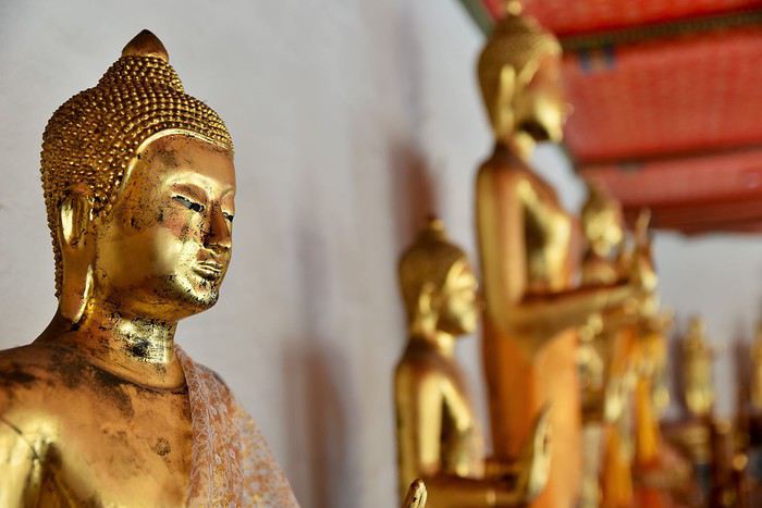
Le plus grand et le plus impressionnant d'entre eux, c'est Bouddha couché, représenté sur son lit de mort juste avant d'atteindre le Parinirvāṇa (la fin de l'existence physique pour qui a atteint l'éveil).
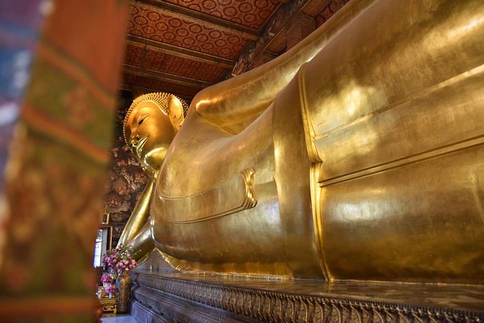
Ce magnifique bouddha est entièrement recouvert de feuilles d'or. Il nous impressionne.
La salle qui l'accueille, bien que très grande, semble trop exiguë pour cette statue qui en impose : 46 mètres de long sur 15 de haut.
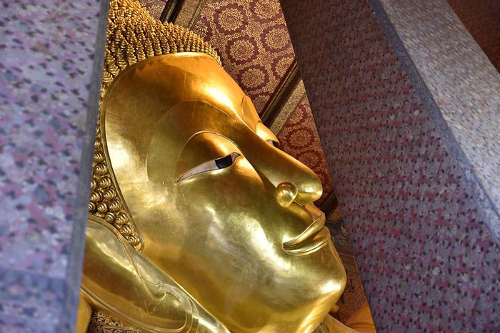
Et que dire de ses pieds, qui sont au moins aussi beaux que tout le reste : incrustés de nacre, ils représentent les 108 actions qui ont permis à Bouddha d'atteindre la perfection.
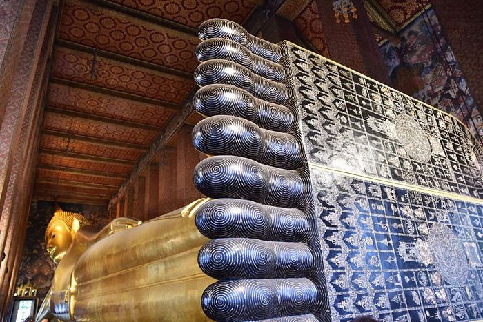
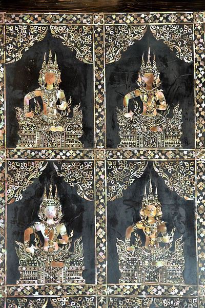
Ci-dessus : la plante du pied de Bouddha
Un peu plus loin se trouve le sanctuaire principal : l'Ubosot. A l'intérieur, on retrouve Bouddha, mais assis cette fois. C'est en dessous de cette statue toute en or et en cristal que sont conservées les cendres du célèbre roi Rama Ier (1737-1809).
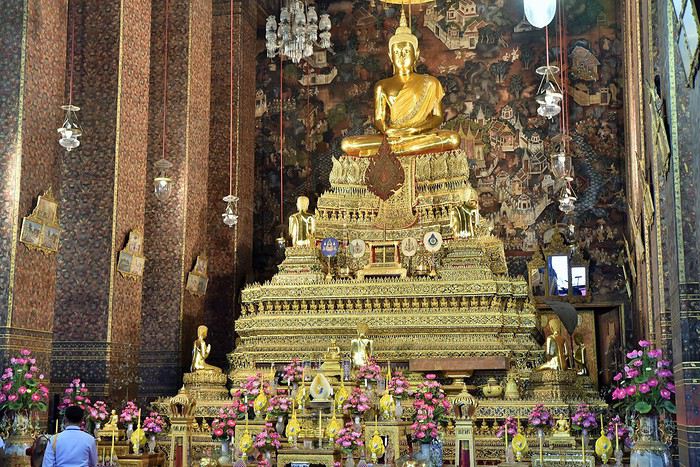
A noter enfin que dans l'enceinte du Wat Pho, on trouve également une école de médecine et de massages traditionnels, qui fut créée pour assurer la transmission des savoirs ancestraux.
Aujourd'hui, elle assure la formation des étudiants venus du monde entier. Les visiteurs peuvent d'ailleurs se faire masser dans les règles de l'art, même si l'attente peut parfois être un peu longue...
Bon, finalement, il commence bien ce voyage en Thaïlande. Nous enchaînons avec un autre temple, le Wat Arun.
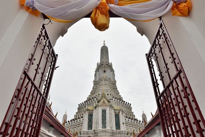
Contrairement au Wat Pho qui est très coloré, la Wat Arun apparaît plutôt blanc de loin. Mais de près, on constate que c'est une infinité de petites mosaïques colorées qui constituent ce gigantesque ensemble.
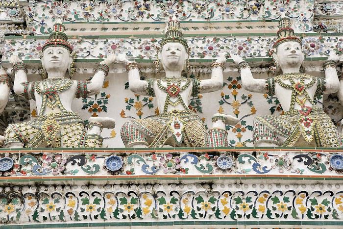
Une partie seulement des escaliers du prang central (72 mètres de haut) est ouverte au public, ce qui est suffisant pour avoir une jolie vue sur Bangkok quand le temps s'y prête... ce qui n'était pas le cas le jour de notre visite !
Si les deux temples que nous avons visités nous ont impressionnés, que dire de celui que nous allons voir dans la foulée : le Wat Phra Kaeo. Mais je posterai la suite dans un prochain message, ayant déjà presque atteint mon quota de photos...
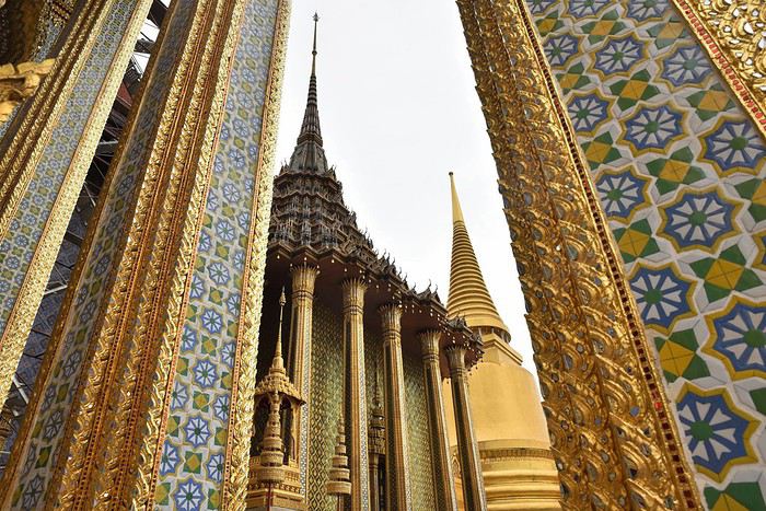
Train Moscou - Saint-Pétersbourg English translation pending
Bonsoir
Quelques précisions svp.
Prévoyant un classique combiné des 2 villes avec 6 jours dans chaque je commence à regarder le trajet en train qui semble pratique. Est ce bien d'abord sur ce site ?
pass.rzd.ru/main-pass/public/en
Si oui je vois qu'il faut mettre le n° de passeport. Est ce d'après vous modifiable après la réservation ? Je vais en changer prochainement après un dernier déplacement car je n'aurai pas les 6 mois de validité après le retour nécessaire.
Est ce indispensable de réserver à l'avance pour le mois d'août ?
Merci.
Quelques précisions svp.
Prévoyant un classique combiné des 2 villes avec 6 jours dans chaque je commence à regarder le trajet en train qui semble pratique. Est ce bien d'abord sur ce site ?
pass.rzd.ru/main-pass/public/en
Si oui je vois qu'il faut mettre le n° de passeport. Est ce d'après vous modifiable après la réservation ? Je vais en changer prochainement après un dernier déplacement car je n'aurai pas les 6 mois de validité après le retour nécessaire.
Est ce indispensable de réserver à l'avance pour le mois d'août ?
Merci.
Notre voyage vers le sud de la Thaïlande en avril (de Hua Hin à Ko Tao) English translation pending
Bonjour à tous amis forumeurs,
Nous avons une réservation Paris Bangkok pour le 22 avril, retour le 7 mai J'irai avec mon fils de 14 ans.
Je sollicite vos avis de connaisseurs pour programmer le voyage, nous arrivons à BKK à 14h20 et compte tenu de la queue, de la nécessité d'aller changer, nous envisageons de prendre un bus direct pour Hua Hin (départ niveau 1 porte 8, direct de l'aéroport) et de nous y reposer 2 jours, visiter le marché de nuit etc.
Ensuite direction le sud, doucement, avec pour but de voir des petites villes côtières, des îles et de faire du snorkeling.
Que pensez vous des endroits suivants:
Hua Hin Cha Am Ban Saphan Ko Thalu Prachuap Khiri Khan Ko Tao (et surtout quelle plage ?) (ou autre endroit sur ce segment)
Nous désirons voyager doucement, prendre notre temps, ne pas changer d'endroit tous les jours, voir des marchés, et snorkeler si possible direct de la plage, sinon avec excursion occasionnelle vers des îles plus lointaines et non habitables.
Nous privilégions les modes de transport locaux, les hôtels pas trop chers (mais avec la température je pense qu'une piscine et l'AC seront indispensables).
notre vol retour est le 7 mai à 23h45 donc il faudra nous rapprocher. Nous n'avons jamais visité bangkok et pourrions à cette occasion y passer 1 jour ou 2 mais ce n'est pas indispensable.
j'ai noté que le 1er mai et surtout le 6 mai (couronnement) seront fériés, je ne sais si le 6 va avoir une incidence particulière et ce qu'il faudrait prévoir.
j'attends avec impatience vos conseils
Deborah
Nous avons une réservation Paris Bangkok pour le 22 avril, retour le 7 mai J'irai avec mon fils de 14 ans.
Je sollicite vos avis de connaisseurs pour programmer le voyage, nous arrivons à BKK à 14h20 et compte tenu de la queue, de la nécessité d'aller changer, nous envisageons de prendre un bus direct pour Hua Hin (départ niveau 1 porte 8, direct de l'aéroport) et de nous y reposer 2 jours, visiter le marché de nuit etc.
Ensuite direction le sud, doucement, avec pour but de voir des petites villes côtières, des îles et de faire du snorkeling.
Que pensez vous des endroits suivants:
Hua Hin Cha Am Ban Saphan Ko Thalu Prachuap Khiri Khan Ko Tao (et surtout quelle plage ?) (ou autre endroit sur ce segment)
Nous désirons voyager doucement, prendre notre temps, ne pas changer d'endroit tous les jours, voir des marchés, et snorkeler si possible direct de la plage, sinon avec excursion occasionnelle vers des îles plus lointaines et non habitables.
Nous privilégions les modes de transport locaux, les hôtels pas trop chers (mais avec la température je pense qu'une piscine et l'AC seront indispensables).
notre vol retour est le 7 mai à 23h45 donc il faudra nous rapprocher. Nous n'avons jamais visité bangkok et pourrions à cette occasion y passer 1 jour ou 2 mais ce n'est pas indispensable.
j'ai noté que le 1er mai et surtout le 6 mai (couronnement) seront fériés, je ne sais si le 6 va avoir une incidence particulière et ce qu'il faudrait prévoir.
j'attends avec impatience vos conseils
Deborah
La Thaïlande, une belle découverte English translation pending
C'est au cours d'une escale en Norvège en février dernier que mon mari et moi décidons de partir en voyage avec nos fils de 9 et 10 ans à l'occasion des vacances de la Toussaint. Alors quelle destination pour contenter petits et grands ? Après réflexions, restent en lice ces 4 destinations :
- l'Argentine : recalée en raison d'un ratio taille de pays/durée de séjour déséquilibré 😕
- la Bolivie : abandonnée un peu pour les mêmes raisons que l'Argentine. Et je craignais également que nos garçons ne supportent pas bien l'altitude
- le Kenya : abandonnée à regret en raison du coût
- l'Indonésie, retenue pour un coût de vie local abordable et des atouts en nombre : des rizières, des temples, des volcans, des jolis poissons, ... 😉
Alors non, nous n'avons pas renoncé à l'Indonésie en raison des séismes de l'été 2018. Tout simplement pour des raisons bassement matérielles car je n'ai pas réussi à acheter des billets d'avion à un tarif raisonnable, malgré un périple quasi bouclé dès le printemps grâce notamment à Lhorizon et Karltoffel. Tant pis, ce n'est que partie remise. Nous décidons de maintenir la destination dans cette région du monde et arrêtons notre choix sur la Thaïlande. J'ai pensé pendant quelque temps faire l'itinéraire classique BKK - Ayuthaya, Sukkhothai, Chang Mai puis le sud. Mais mon mari et moi aimons bien sortir un peu des voies toutes tracées. Peut-être visiterons nous un jour la région de Chang Mai mais pas cette fois-là. L'Isan pourrait certainement nous plaire également. J'apprécie très peu les grandes villes ; nous avons donc volontairement concentré notre visite de Bangkok sur un périmètre assez restreint que nous pouvions parcourir à pied ou à bateau, en évitant les centres commerciaux. N'étant pas fan des temples, j'en avais quand même programmé certains pour notre visite à Bangkok car mon mari y tenait et je savais que Bangkok était réputée, notamment, pour la beauté de ses temples. Envie de voir des beaux paysages, des animaux et des îles, et idéalement pas trop de touristes 😊. J'arrête donc ce premier itinéraire : Bangkok - chutes d'Erawan - Kanchanaburi - Prachuap Khiri Khan et le sud. Le sud, justement, a nécessité quelques dizaines d'heures de réflexion et de consultation du forum. Notre séjour coïncidait avec la fin de la mousson sur la partie nord du pays. Quant au sud, hors dérèglement climatique qui peut faire varier les tendances, il semblait que les côtes ainsi que les îles côté ouest, donc mer d'Andaman, seraient moins sujettes à la mousson que la partie est du Golfe de Thaïlande. A deux semaines du départ, j'ai supprimé l'étape Erawan-Kanchanaburi car les liaisons vers PKK n'étaient pas forcément aisées et sur seulement deux semaines, je craignais que nous passions beaucoup de temps dans les transferts sans nous poser suffisamment. Avec le recul, je ne regrette pas d'avoir modifié notre itinéraire car je pense que nous aurions trop couru.
Je vous livre notre récit quotidien avec une sélection de quelques photos sur les 4000 rapportées (le mode rafale avec les animaux, ça fait du cliché ! vive le tri 😎
Alors non, nous n'avons pas renoncé à l'Indonésie en raison des séismes de l'été 2018. Tout simplement pour des raisons bassement matérielles car je n'ai pas réussi à acheter des billets d'avion à un tarif raisonnable, malgré un périple quasi bouclé dès le printemps grâce notamment à Lhorizon et Karltoffel. Tant pis, ce n'est que partie remise. Nous décidons de maintenir la destination dans cette région du monde et arrêtons notre choix sur la Thaïlande. J'ai pensé pendant quelque temps faire l'itinéraire classique BKK - Ayuthaya, Sukkhothai, Chang Mai puis le sud. Mais mon mari et moi aimons bien sortir un peu des voies toutes tracées. Peut-être visiterons nous un jour la région de Chang Mai mais pas cette fois-là. L'Isan pourrait certainement nous plaire également. J'apprécie très peu les grandes villes ; nous avons donc volontairement concentré notre visite de Bangkok sur un périmètre assez restreint que nous pouvions parcourir à pied ou à bateau, en évitant les centres commerciaux. N'étant pas fan des temples, j'en avais quand même programmé certains pour notre visite à Bangkok car mon mari y tenait et je savais que Bangkok était réputée, notamment, pour la beauté de ses temples. Envie de voir des beaux paysages, des animaux et des îles, et idéalement pas trop de touristes 😊. J'arrête donc ce premier itinéraire : Bangkok - chutes d'Erawan - Kanchanaburi - Prachuap Khiri Khan et le sud. Le sud, justement, a nécessité quelques dizaines d'heures de réflexion et de consultation du forum. Notre séjour coïncidait avec la fin de la mousson sur la partie nord du pays. Quant au sud, hors dérèglement climatique qui peut faire varier les tendances, il semblait que les côtes ainsi que les îles côté ouest, donc mer d'Andaman, seraient moins sujettes à la mousson que la partie est du Golfe de Thaïlande. A deux semaines du départ, j'ai supprimé l'étape Erawan-Kanchanaburi car les liaisons vers PKK n'étaient pas forcément aisées et sur seulement deux semaines, je craignais que nous passions beaucoup de temps dans les transferts sans nous poser suffisamment. Avec le recul, je ne regrette pas d'avoir modifié notre itinéraire car je pense que nous aurions trop couru.
Je vous livre notre récit quotidien avec une sélection de quelques photos sur les 4000 rapportées (le mode rafale avec les animaux, ça fait du cliché ! vive le tri 😎
Koyo, 6 semaines au Japon English translation pending
30 Novembre
En préambule à ce petit carnet je voudrais exprimer toute ma gratitude à tous les habitués du forum Japon, dont les réponses à mes questions et à celles des autres forumeurs, ou leur blog, m'ont permis de rassembler des informations qui ont contribué de manière décisive à ce que notre (premier, mais du coup probablement pas dernier) voyage au Japon soit un enchantement.
Notre itinéraire est resté classique, mais en même temps, c'est assez logique pour un premier voyage de se concentrer sur les "incontournables", dont certains nous ont semblé cependant ne pas l'être absolument.... de gustibus.....
Une partie du voyage a été faite en voiture de location et j'aimerais contribuer à démystifier cette manière de voyager au Japon, qui si elle paraît normale aux connaisseurs du pays, semble incongrue à beaucoup ( et à quelques Japonais que nous avons croisés dans notre voiture)
il y avait quelques critères dans la mise au point de l'itinéraire: 1. assister au Jidai Matsuri à Kyoto le 22 octobre 2. suivre le koyo
Bon... on y va?
En préambule à ce petit carnet je voudrais exprimer toute ma gratitude à tous les habitués du forum Japon, dont les réponses à mes questions et à celles des autres forumeurs, ou leur blog, m'ont permis de rassembler des informations qui ont contribué de manière décisive à ce que notre (premier, mais du coup probablement pas dernier) voyage au Japon soit un enchantement.
Notre itinéraire est resté classique, mais en même temps, c'est assez logique pour un premier voyage de se concentrer sur les "incontournables", dont certains nous ont semblé cependant ne pas l'être absolument.... de gustibus.....
Une partie du voyage a été faite en voiture de location et j'aimerais contribuer à démystifier cette manière de voyager au Japon, qui si elle paraît normale aux connaisseurs du pays, semble incongrue à beaucoup ( et à quelques Japonais que nous avons croisés dans notre voiture)
il y avait quelques critères dans la mise au point de l'itinéraire: 1. assister au Jidai Matsuri à Kyoto le 22 octobre 2. suivre le koyo
Bon... on y va?
Une semaine autour de Split English translation pending
Bonjour à tous,
Je viens chercher de l'aide pour mon prochain voyage pendant les vacances d'avril. J'ai succombé à une belle promo Easy-jet, et me voilà donc avec 1 semaine à occuper autour de Split pour une première expérience en Croatie.
Nous arrivons donc le 10 avril en fin d'après midi pour en repartir le 18 en début d'après midi. Cela me laisse donc 7 jours plein à combler. J'ai un peu regarder les visites à faire, et j'ai déjà une petite esquisse de ce que j'aimerai faire. (En fait comme beaucoup de monde 😉) On aimerait combiner des visites nature comme le parc de Krka, des balades en bord de mer, la muraille de chine croate, le parc de Biovoko, et des villes commes Trogir, Split. Et Eventuellement une halte sur une ile comme Hvar ou Korcula ou Mijet.
Je vais tout de suite crevé l'abcès et vous dire que j'aimerai aussi bien aller à Dubrovnik. Oui je sais c'est pas bien, mais je me dis qu'en étant dans le coin et en évitant la saison estivale, peut être que j'arriverai à apprécier cette ville. Et puis la proximité de cette ville me fait dire que ça serait dommage.
Nous avons le projet de revenir dans le Nord d'ici quelques années pour des vacances estivales, donc j'ai volontairement zappé le parc de Plitivice.
Maintenant je me pose la question de comment articuler toutes ces visites pour que cela soit optimiser pour les temps de visite et de trajet. J'ai lu par exemple qu'il était déconseiller de prendre la route pour aller à Dubrovnik, mais qu'il était possible de faire une halte sur une ile et repartir sur l'autre coté de la frontière.
Merci d'avance pour ceux qui me répondront et apporterons des éclaircies dans mes nuages pour le moment.
Guillaume
Je viens chercher de l'aide pour mon prochain voyage pendant les vacances d'avril. J'ai succombé à une belle promo Easy-jet, et me voilà donc avec 1 semaine à occuper autour de Split pour une première expérience en Croatie.
Nous arrivons donc le 10 avril en fin d'après midi pour en repartir le 18 en début d'après midi. Cela me laisse donc 7 jours plein à combler. J'ai un peu regarder les visites à faire, et j'ai déjà une petite esquisse de ce que j'aimerai faire. (En fait comme beaucoup de monde 😉) On aimerait combiner des visites nature comme le parc de Krka, des balades en bord de mer, la muraille de chine croate, le parc de Biovoko, et des villes commes Trogir, Split. Et Eventuellement une halte sur une ile comme Hvar ou Korcula ou Mijet.
Je vais tout de suite crevé l'abcès et vous dire que j'aimerai aussi bien aller à Dubrovnik. Oui je sais c'est pas bien, mais je me dis qu'en étant dans le coin et en évitant la saison estivale, peut être que j'arriverai à apprécier cette ville. Et puis la proximité de cette ville me fait dire que ça serait dommage.
Nous avons le projet de revenir dans le Nord d'ici quelques années pour des vacances estivales, donc j'ai volontairement zappé le parc de Plitivice.
Maintenant je me pose la question de comment articuler toutes ces visites pour que cela soit optimiser pour les temps de visite et de trajet. J'ai lu par exemple qu'il était déconseiller de prendre la route pour aller à Dubrovnik, mais qu'il était possible de faire une halte sur une ile et repartir sur l'autre coté de la frontière.
Merci d'avance pour ceux qui me répondront et apporterons des éclaircies dans mes nuages pour le moment.
Guillaume
Je vous invite à découvrir le Maroc English translation pending
INTRODUCTION
Des vidéos sont insérées tout au long du résumé. Veuillez cliquer sur l'image pour démarrer la vidéo.
Nous avons séjourné 15 jours au Maroc en septembre 2018 et avons parcouru plus de 5000 km pour découvrir ce pays sous ses différentes facettes.
Plusieurs semaines ont été consacrées à la création de notre itinéraire afin de pouvoir être en mesure d'atteindre parfaitement nos objectifs.
Nous avons fait l'achat d'une carte routière Michelin (742) et nous avions également téléchargé une carte du Maroc dans notre GPS.
Finalement, lors de notre séjour, nous n'avons utilisé que l'application Maps.me qui s'est avérée une application très précieuse lors de nos déplacements en voiture, en randonnée et même dans la recherche de nos hôtels dans les médinas ou lors de nos circuits à pied dans les grandes villes.
J'avais préalablement téléchargé les coordonnées GPS de toutes les attractions prévues à notre itinéraire dans l'application Maps.me, ce qui a facilité grandement nos déplacements.
La réservation de tous les hôtels ainsi que la location d'une voiture ont été effectuées sur internet avant notre départ.
Les attraits touristiques que nous avons visité sont les suivants:
Belyounech Tétouan Cascades d'Akchour et Pont de Dieu Chefchaouen Plage de Maresdar à El Jebha Al-Hoceima Source chaude Hammat Chaabi Plage Cara Blanca Plage de Tmadet Sidi El Bachir Gorges de Zegzel (grotte du chameau) Cascades de l'Aggai à Sefrou Fes Meknes Volubilis Sources de l'Oum Er-Rbia Route des Cèdres à Azrou Vallée du Ziz Moyenne Vallée du Ziz Erg Chebbi à Merzouga Gorges du Todgha Gorges du Dades Vallée des Roses Kasbah Aït-Ben-Haddou Tizi-N-Tichka Casdades d'Ouzoud Pont d'Imi-n-Ifri Cascades de l'Ourika Cascade d'Imlil Route vers Tacheddirt Tizi N' Test Mosquée de Tinmel Kasbah de Tizourgane Agard-Oudad - Les rochers bleus (les roches peintes) Gorges d'Aït Mansour Mosquée Tamsaout Grotte et Bassin Win-Timdouine Paradise Valley Agadir Essaouira Mosquée Hassan-II à Casablanca
Conduire une automobile au Maroc est tout un défi lorsque l'on sait qu'il est un des pays qui possède les routes les plus meurtrières au monde. Il n'y a aucune discipline sur les routes du Maroc. La vitesse, les dépassements illégaux, le passage aux feux rouges, les voitures délabrées, l'étroitesse de certaines routes, les piétons et les cyclistes qui traversent la route sans avertissement, les motocyclistes qui se faufilent entre les voitures, sans oublier les nombreux animaux qui se dressent en bordure de la route. Et je n'exagère surtout pas...
Il n'existe pratiquement aucun civisme sur la route. C'est chacun pour soi. Nous avons dû céder le passage la majorité du temps afin d'éviter que notre voiture de location soit amochée.
Toute une expérience pour mon conjoint Alain qui a réussi à parcourir ces milliers de kilomètres sans aucun accrochage. Après coup, nous comprenons pourquoi la voiture que nous avions louée avait autant de bosses et d'éraflures ....
Il y a énormément de postes de contrôle (gendarmes) au Maroc. Nous avons vécu quelques expériences, de bonnes et de moins bonnes. Je vous en ferai part au moment opportun.
Il est très important de respecter les limites de vitesse et de connaître le fonctionnement des postes de contrôle.
Ceux-ci se trouvent généralement à proximité d'un embranchement ou d'un carrefour giratoire. Des panneaux sont installées temporairement en bordure de la route pour indiquer le poste de contrôle ainsi que les limitations de vitesse.
C'est assez spécial car nous roulons à une vitesse d'environ 80 km/h et tout à coup on aperçoit le panneau indiquant le poste de contrôle et trois panneaux consécutifs invitant à réduire rapidement notre vitesse à 60, 40 et 20 km/h dans un espace vraiment restreint.
C'est toujours un stress de passer ces contrôles , même si nous n'avions rien à nous reprocher... Je passais mon temps à vérifier l'odomètre pour m'assurer que nous respections bien les limites de vitesse. 60, 40, 20.. 60, 40, 20 ... Combien de fois Alain m'a entendu répéter ces chiffres afin de passer les contrôles sans problème.
Lorsque nous avons effectué la réservation des hôtels, il était indiqué que le stationnement était gratuit. Cependant, la majorité du temps, il a fallu payer des frais de 10 MAD (environ 1,40 $ CAD ) pour qu'un gardien surveille la voiture.
Que la voiture soit en bordure de la route ou dans un stationnement, il y avait toujours quelqu'un portant un dossard qui se présentait pour réclamer son dû.
A Essaouira, nous avons battu un record: 50 MAD (7 $ CAD), soit 40 MAD pour le stationnement et 10 MAD pour le gardien.
Une arnaque pour les touristes lorsque l'on sait que le prix est fixé à 5 MAD à Essaouira pour toute une nuit. Mais que peut-on faire lorsque nous avons besoin d'un espace de stationnement pour la nuit et que le préposé au stationnement te réclame 40 MAD et te harcèle de rajouter un 10 MAD pour le gardien?
Par ailleurs, nous avons été très bien accueillis au Maroc. Les gens étaient contents de nous voir et aimaient discuter avec nous. Particulièrement les jeunes hommes qui se sont montrés très avenants et ont été d'une gentillesse extraordinaire.
Nous avons été choyés côté température. Le ciel était toujours d'un bleu éclatant, sauf dans le désert où le ciel était couvert. Mais heureusement, nous avons eu droit à une éclaircie au moment du coucher du soleil.
Sans plus attendre, je vous invite à venir découvrir par le biais de nos vidéos les différents attraits que nous avons visités ainsi que nos escapades sur les routes du Maroc.
POUR LA SUITE, C'EST ICI
POUR VOUS RENDRE À UNE JOURNÉE SPÉCIFIQUE, VOICI LES LIENS APPROPRIÉS:
Jour 1: De Casablanca à Tétouan Jour 2: De Tétouan à Chefchaouen Jour 3: De Chefchaouen à Al Hoceima Jour 4: De Al Hoceima à Oujda Jour 5: De Oujda à Meknès Jour 6: De Meknès à Azrou Jour 7: De Azrou à Merzouga Jour 8: De Merzouga à la Vallée des Roses Jour 9: De la Vallée des Roses à Ouzoud Jour 10: D'Ouzoud à la Vallée de l'Ourika Jour 11: De la Vallée de l'Ourika à Ouirgane (détour à Imlil) Jour 12: De Ouirgane (route du Tizi-n-Test) à Tafraoute Jour 13: De Tafraoute à Tizgui N'Chorfa Jour 14: De la Vallée du Paradis à Essaouira Jour 15: De Essaouira à Casablanca
Des vidéos sont insérées tout au long du résumé. Veuillez cliquer sur l'image pour démarrer la vidéo.
Nous avons séjourné 15 jours au Maroc en septembre 2018 et avons parcouru plus de 5000 km pour découvrir ce pays sous ses différentes facettes.
Plusieurs semaines ont été consacrées à la création de notre itinéraire afin de pouvoir être en mesure d'atteindre parfaitement nos objectifs.
Nous avons fait l'achat d'une carte routière Michelin (742) et nous avions également téléchargé une carte du Maroc dans notre GPS.
Finalement, lors de notre séjour, nous n'avons utilisé que l'application Maps.me qui s'est avérée une application très précieuse lors de nos déplacements en voiture, en randonnée et même dans la recherche de nos hôtels dans les médinas ou lors de nos circuits à pied dans les grandes villes.
J'avais préalablement téléchargé les coordonnées GPS de toutes les attractions prévues à notre itinéraire dans l'application Maps.me, ce qui a facilité grandement nos déplacements.
La réservation de tous les hôtels ainsi que la location d'une voiture ont été effectuées sur internet avant notre départ.
Les attraits touristiques que nous avons visité sont les suivants:
Belyounech Tétouan Cascades d'Akchour et Pont de Dieu Chefchaouen Plage de Maresdar à El Jebha Al-Hoceima Source chaude Hammat Chaabi Plage Cara Blanca Plage de Tmadet Sidi El Bachir Gorges de Zegzel (grotte du chameau) Cascades de l'Aggai à Sefrou Fes Meknes Volubilis Sources de l'Oum Er-Rbia Route des Cèdres à Azrou Vallée du Ziz Moyenne Vallée du Ziz Erg Chebbi à Merzouga Gorges du Todgha Gorges du Dades Vallée des Roses Kasbah Aït-Ben-Haddou Tizi-N-Tichka Casdades d'Ouzoud Pont d'Imi-n-Ifri Cascades de l'Ourika Cascade d'Imlil Route vers Tacheddirt Tizi N' Test Mosquée de Tinmel Kasbah de Tizourgane Agard-Oudad - Les rochers bleus (les roches peintes) Gorges d'Aït Mansour Mosquée Tamsaout Grotte et Bassin Win-Timdouine Paradise Valley Agadir Essaouira Mosquée Hassan-II à Casablanca
Conduire une automobile au Maroc est tout un défi lorsque l'on sait qu'il est un des pays qui possède les routes les plus meurtrières au monde. Il n'y a aucune discipline sur les routes du Maroc. La vitesse, les dépassements illégaux, le passage aux feux rouges, les voitures délabrées, l'étroitesse de certaines routes, les piétons et les cyclistes qui traversent la route sans avertissement, les motocyclistes qui se faufilent entre les voitures, sans oublier les nombreux animaux qui se dressent en bordure de la route. Et je n'exagère surtout pas...
Il n'existe pratiquement aucun civisme sur la route. C'est chacun pour soi. Nous avons dû céder le passage la majorité du temps afin d'éviter que notre voiture de location soit amochée.
Toute une expérience pour mon conjoint Alain qui a réussi à parcourir ces milliers de kilomètres sans aucun accrochage. Après coup, nous comprenons pourquoi la voiture que nous avions louée avait autant de bosses et d'éraflures ....
Il y a énormément de postes de contrôle (gendarmes) au Maroc. Nous avons vécu quelques expériences, de bonnes et de moins bonnes. Je vous en ferai part au moment opportun.
Il est très important de respecter les limites de vitesse et de connaître le fonctionnement des postes de contrôle.
Ceux-ci se trouvent généralement à proximité d'un embranchement ou d'un carrefour giratoire. Des panneaux sont installées temporairement en bordure de la route pour indiquer le poste de contrôle ainsi que les limitations de vitesse.
C'est assez spécial car nous roulons à une vitesse d'environ 80 km/h et tout à coup on aperçoit le panneau indiquant le poste de contrôle et trois panneaux consécutifs invitant à réduire rapidement notre vitesse à 60, 40 et 20 km/h dans un espace vraiment restreint.
C'est toujours un stress de passer ces contrôles , même si nous n'avions rien à nous reprocher... Je passais mon temps à vérifier l'odomètre pour m'assurer que nous respections bien les limites de vitesse. 60, 40, 20.. 60, 40, 20 ... Combien de fois Alain m'a entendu répéter ces chiffres afin de passer les contrôles sans problème.
Lorsque nous avons effectué la réservation des hôtels, il était indiqué que le stationnement était gratuit. Cependant, la majorité du temps, il a fallu payer des frais de 10 MAD (environ 1,40 $ CAD ) pour qu'un gardien surveille la voiture.
Que la voiture soit en bordure de la route ou dans un stationnement, il y avait toujours quelqu'un portant un dossard qui se présentait pour réclamer son dû.
A Essaouira, nous avons battu un record: 50 MAD (7 $ CAD), soit 40 MAD pour le stationnement et 10 MAD pour le gardien.
Une arnaque pour les touristes lorsque l'on sait que le prix est fixé à 5 MAD à Essaouira pour toute une nuit. Mais que peut-on faire lorsque nous avons besoin d'un espace de stationnement pour la nuit et que le préposé au stationnement te réclame 40 MAD et te harcèle de rajouter un 10 MAD pour le gardien?
Par ailleurs, nous avons été très bien accueillis au Maroc. Les gens étaient contents de nous voir et aimaient discuter avec nous. Particulièrement les jeunes hommes qui se sont montrés très avenants et ont été d'une gentillesse extraordinaire.
Nous avons été choyés côté température. Le ciel était toujours d'un bleu éclatant, sauf dans le désert où le ciel était couvert. Mais heureusement, nous avons eu droit à une éclaircie au moment du coucher du soleil.
Sans plus attendre, je vous invite à venir découvrir par le biais de nos vidéos les différents attraits que nous avons visités ainsi que nos escapades sur les routes du Maroc.
POUR LA SUITE, C'EST ICI
POUR VOUS RENDRE À UNE JOURNÉE SPÉCIFIQUE, VOICI LES LIENS APPROPRIÉS:
Jour 1: De Casablanca à Tétouan Jour 2: De Tétouan à Chefchaouen Jour 3: De Chefchaouen à Al Hoceima Jour 4: De Al Hoceima à Oujda Jour 5: De Oujda à Meknès Jour 6: De Meknès à Azrou Jour 7: De Azrou à Merzouga Jour 8: De Merzouga à la Vallée des Roses Jour 9: De la Vallée des Roses à Ouzoud Jour 10: D'Ouzoud à la Vallée de l'Ourika Jour 11: De la Vallée de l'Ourika à Ouirgane (détour à Imlil) Jour 12: De Ouirgane (route du Tizi-n-Test) à Tafraoute Jour 13: De Tafraoute à Tizgui N'Chorfa Jour 14: De la Vallée du Paradis à Essaouira Jour 15: De Essaouira à Casablanca
No, I Won’t Be Going Back to China
Hello forum,
Did any of you feel the same things we did in China?
We spent a good twenty days there in August. First, we traveled solo around Chengdu, then joined an organized tour for 12 days (Beijing, Pingyao, Xi'an, Guilin, Xingping, Yangshuo, Shanghai, Wuzhen) and extended our stay by 4 extra days to visit Zhangjiajie.
The landscapes were stunning, and we have unforgettable memories... but we were really disappointed by the following points:
- The food: way too spicy. Lacking in flavor, not much taste. I’m speaking "in general" because we did enjoy some good steamed dumplings, smoked pork, and other dumplings... But compared to Thailand, Cambodia, or India, Chinese cuisine didn’t impress us at all.
- The behavior of the Chinese: disrespectful, rushed, agitated. You constantly have to fight—people push, crowd, and overwhelm you... At the entrance to the Terracotta Army (and other sites), it’s a human tidal wave... and I mean that literally. We were carried by the crowd without even touching the ground. It was like a situation where you have one bowl of rice and 20,000 starving people diving for it...
You’re at a ticket counter, and they cut in front of you. You’re in line for boarding, suitcase ready to go on the conveyor belt, and someone shows up out of nowhere to put THEIR suitcase down... even though they have a flight ticket with THEIR seat number and won’t be leaving before you!!!! You’re getting on the bus, and someone shoves past you just so they don’t end up behind you.
It’s like these people only think about themselves. I didn’t see a single person let someone else go first or even ask—it’s as if politeness and respect are completely foreign to them.
It’s honestly exhausting and draining...
- Communication: In every other country we’ve visited, whether in Asia or Europe, we always manage—with English, a few words of Italian, French, or Spanish. In China, I’ll be blunt: if you don’t speak Chinese, you’re screwed. And yet, a pair of kids around ten or twelve years old asked us in English where we were from :)
- Understanding: Here’s the rule. Even if the person you’re talking to speaks a little English and says they understand you... make sure they *really* do, because 9 times out of 10, they don’t. Out of pride or just cluelessness, they’ll give you a big smile and nod, but in reality, they didn’t get what you were saying.
Several times with our group, in the evening at a restaurant, if we hadn’t been helped by someone at another table who spoke a little English, we’d still be there. The classic example: the waiter brings one menu (for 10 people at the table), and we’re all trying to explain that we need 4 or more menus. Five minutes later, he’s still staring at us with that same blank smile...
In 3* or 4* hotels, you go to the front desk for a hot water or AC issue. Three or four staff members just stand there beaming at you. You try to explain with photos or a translator, but in the end, you leave with the problem unresolved.
They don’t speak—they shout... on buses, in hotels...
We were also surprised to find that self-service laundromats were almost nonexistent. We got scammed once at a hotel with an astronomical bill!
As for flights, we flew Air China on the way there and Austrian Airlines on the way back—no comparison. Air China had zero service and food that was "baby food" quality. Austrian Airlines had multiple services, a decent meal, and smiling flight attendants.
I don’t know if any of you had the same experience in this country, but I’m definitely not eager to go back. Whereas if someone offered me India, Thailand, or Vietnam tomorrow, I’d be there in a heartbeat!!!
Did any of you feel the same things we did in China?
We spent a good twenty days there in August. First, we traveled solo around Chengdu, then joined an organized tour for 12 days (Beijing, Pingyao, Xi'an, Guilin, Xingping, Yangshuo, Shanghai, Wuzhen) and extended our stay by 4 extra days to visit Zhangjiajie.
The landscapes were stunning, and we have unforgettable memories... but we were really disappointed by the following points:
- The food: way too spicy. Lacking in flavor, not much taste. I’m speaking "in general" because we did enjoy some good steamed dumplings, smoked pork, and other dumplings... But compared to Thailand, Cambodia, or India, Chinese cuisine didn’t impress us at all.
- The behavior of the Chinese: disrespectful, rushed, agitated. You constantly have to fight—people push, crowd, and overwhelm you... At the entrance to the Terracotta Army (and other sites), it’s a human tidal wave... and I mean that literally. We were carried by the crowd without even touching the ground. It was like a situation where you have one bowl of rice and 20,000 starving people diving for it...
You’re at a ticket counter, and they cut in front of you. You’re in line for boarding, suitcase ready to go on the conveyor belt, and someone shows up out of nowhere to put THEIR suitcase down... even though they have a flight ticket with THEIR seat number and won’t be leaving before you!!!! You’re getting on the bus, and someone shoves past you just so they don’t end up behind you.
It’s like these people only think about themselves. I didn’t see a single person let someone else go first or even ask—it’s as if politeness and respect are completely foreign to them.
It’s honestly exhausting and draining...
- Communication: In every other country we’ve visited, whether in Asia or Europe, we always manage—with English, a few words of Italian, French, or Spanish. In China, I’ll be blunt: if you don’t speak Chinese, you’re screwed. And yet, a pair of kids around ten or twelve years old asked us in English where we were from :)
- Understanding: Here’s the rule. Even if the person you’re talking to speaks a little English and says they understand you... make sure they *really* do, because 9 times out of 10, they don’t. Out of pride or just cluelessness, they’ll give you a big smile and nod, but in reality, they didn’t get what you were saying.
Several times with our group, in the evening at a restaurant, if we hadn’t been helped by someone at another table who spoke a little English, we’d still be there. The classic example: the waiter brings one menu (for 10 people at the table), and we’re all trying to explain that we need 4 or more menus. Five minutes later, he’s still staring at us with that same blank smile...
In 3* or 4* hotels, you go to the front desk for a hot water or AC issue. Three or four staff members just stand there beaming at you. You try to explain with photos or a translator, but in the end, you leave with the problem unresolved.
They don’t speak—they shout... on buses, in hotels...
We were also surprised to find that self-service laundromats were almost nonexistent. We got scammed once at a hotel with an astronomical bill!
As for flights, we flew Air China on the way there and Austrian Airlines on the way back—no comparison. Air China had zero service and food that was "baby food" quality. Austrian Airlines had multiple services, a decent meal, and smiling flight attendants.
I don’t know if any of you had the same experience in this country, but I’m definitely not eager to go back. Whereas if someone offered me India, Thailand, or Vietnam tomorrow, I’d be there in a heartbeat!!!
Couleurs de Toscane au printemps English translation pending
Bonjour
Nous avons l’intention d’aller en Toscane au printemps 2019 , en prenant notre voiture .( 5 nuits à Florence, 1 nuit à Castellina di Chianti, 4 nuits à San Gimignano , en rayonnant à partir de cette dernière localité ). Après avoir envisagé d’y aller en avril ( en évitant la semaine de Pâques !), nous penchons plutôt, après avoir consulté divers sites , pour le mois de mai : pluviosité un peu plus faible, ensoleillement encore un peu plus marqué - et toujours pas la foule ! Mais je n’ai pas vraiment trouvé de réponse à une question que nous nous posons concernant la luminosité, les couleurs ( elles peuvent être si belles que nous voudrions en profiter au maximum ! ), ni sur le forum ni sur divers sites. Plusieurs critères seront à prendre en compte, mais, en prenant ce critère (lumière, couleurs) en considération, quel serait le meilleur moment pour se rendre dans cette partie de la Toscane ??
Merci par avance à la personne qui pourrait nous apporter une aide sur ce point.
Nous avons l’intention d’aller en Toscane au printemps 2019 , en prenant notre voiture .( 5 nuits à Florence, 1 nuit à Castellina di Chianti, 4 nuits à San Gimignano , en rayonnant à partir de cette dernière localité ). Après avoir envisagé d’y aller en avril ( en évitant la semaine de Pâques !), nous penchons plutôt, après avoir consulté divers sites , pour le mois de mai : pluviosité un peu plus faible, ensoleillement encore un peu plus marqué - et toujours pas la foule ! Mais je n’ai pas vraiment trouvé de réponse à une question que nous nous posons concernant la luminosité, les couleurs ( elles peuvent être si belles que nous voudrions en profiter au maximum ! ), ni sur le forum ni sur divers sites. Plusieurs critères seront à prendre en compte, mais, en prenant ce critère (lumière, couleurs) en considération, quel serait le meilleur moment pour se rendre dans cette partie de la Toscane ??
Merci par avance à la personne qui pourrait nous apporter une aide sur ce point.
Cahier de vacances: de la côte murcienne à l'Andalousie des sierras de Jaen English translation pending
Un cahier de vacances , c'est comme ça que je conçoit ce récit .
Tellement habituée à cette region pour y passer mes vacances depuis de nombreuses années je n'avais jamais fait de carnet de voyage . Rattrapons le temps perdu avec ce cahier de vacances 😉
Les vacances etaient programmées sur trois semaines , moitié mer , moitié montagne .
Deux jours pour descendre par le chemin des écoliers , Region bordelaise , Pampelune, Soria et arret dans la petite ville médiévale de Sepulveda ( une centaine de kms en amont de Madrid) . Pas de photos , lä grêle nous ä accompagné tout au long du parcours . Dommage . Deuxième jour on continue par les petites routes de traverses quî nous mènent à Guadalajarra, Tarancon , Albacete , ensuite autoroute jusqu' ä Puerto de Mazaron . Le temps s'arrangeant lentement , nous avons pris le chemin des écoliers à Hellin pour decouvrir les anciennes mines d'agramonte , les rizières qui produisent le riz de Calasparra ( AOC) sans lequel je n'envisage pas de faire une paella , et de trouver les traces des anciens volcans . Deux photos pour illustrer
Dans la soiree nous sommes arrivés sur cette côte tranquille , vers le village de La Azohia ( après El Puerto de Mazaron) , ce petit port où la route s'arrête pour buter sur le Cap Tinosa . Le soleil etait de retour . Les vacances pouvaient commencer sous de bonnes auspices . Le village se niche au fond de la photo en bas du cap .
Du Cap Tinoso on peut emprunter le GR92 quî longe toute la côte méditerranéenne jusqu'à Almeria . Ces sentiers de randonnées ont été mis en valeur au milieu des années 90 , ils suivent les anciens sentiers de paysans , de mineurs et des garde côtes . Remarquablement bien balisées , on ne risque pas de se perdre , le seul, risque insolation et déshydratation , pas d'eau sur le sentier entre Portus et Lä Azohia , le soleil tape fort sur ces roches volcaniques .mais la chance etaient avec nous , température entre 20/25° que du bonheur . Quelques photos pour vous donner une idee .
 De petites criques permettent la baignade
Les petits palmiers endémiques de la zone bordent le sentier .
 Sur ce site vous trouverez toutes les indications sur le GR
https://www.murciaturistica.es/fr/sentier?ficha=camino-del-mediterraneo-region-de-murcia-3
Sur ce site vous trouverez toutes les indications sur le GR
https://www.murciaturistica.es/fr/sentier?ficha=camino-del-mediterraneo-region-de-murcia-3
Tellement habituée à cette region pour y passer mes vacances depuis de nombreuses années je n'avais jamais fait de carnet de voyage . Rattrapons le temps perdu avec ce cahier de vacances 😉
Les vacances etaient programmées sur trois semaines , moitié mer , moitié montagne .
Deux jours pour descendre par le chemin des écoliers , Region bordelaise , Pampelune, Soria et arret dans la petite ville médiévale de Sepulveda ( une centaine de kms en amont de Madrid) . Pas de photos , lä grêle nous ä accompagné tout au long du parcours . Dommage . Deuxième jour on continue par les petites routes de traverses quî nous mènent à Guadalajarra, Tarancon , Albacete , ensuite autoroute jusqu' ä Puerto de Mazaron . Le temps s'arrangeant lentement , nous avons pris le chemin des écoliers à Hellin pour decouvrir les anciennes mines d'agramonte , les rizières qui produisent le riz de Calasparra ( AOC) sans lequel je n'envisage pas de faire une paella , et de trouver les traces des anciens volcans . Deux photos pour illustrer
Dans la soiree nous sommes arrivés sur cette côte tranquille , vers le village de La Azohia ( après El Puerto de Mazaron) , ce petit port où la route s'arrête pour buter sur le Cap Tinosa . Le soleil etait de retour . Les vacances pouvaient commencer sous de bonnes auspices . Le village se niche au fond de la photo en bas du cap .
Du Cap Tinoso on peut emprunter le GR92 quî longe toute la côte méditerranéenne jusqu'à Almeria . Ces sentiers de randonnées ont été mis en valeur au milieu des années 90 , ils suivent les anciens sentiers de paysans , de mineurs et des garde côtes . Remarquablement bien balisées , on ne risque pas de se perdre , le seul, risque insolation et déshydratation , pas d'eau sur le sentier entre Portus et Lä Azohia , le soleil tape fort sur ces roches volcaniques .mais la chance etaient avec nous , température entre 20/25° que du bonheur . Quelques photos pour vous donner une idee .
De petites criques permettent la baignadeLes petits palmiers endémiques de la zone bordent le sentier .
Sur ce site vous trouverez toutes les indications sur le GR
https://www.murciaturistica.es/fr/sentier?ficha=camino-del-mediterraneo-region-de-murcia-3Retour de 14 jours en Bulgarie English translation pending
Bonjour à tous,
Je mets ca ici plutôt que dans les Carnets, parce que quand j'ai planifié ce voyage, j'ai trouvé peu d'informations précises, et je n'aurais pas forcément eu le réflexe de chercher dans les Carnets.
Préambule: Comme souvent, c'est Ryanair qui nous trouve la destination, les dates, heures de vol nous conviennent et le prix également. Roumanie ou Bulgarie, je me renseigne un peu et je me dis que j'ai envie de quelque chose d'inhabituel => BULGARIE
On lit beaucoup de choses sur la Bulgarie: - Population pas sympathique - Pauvreté - Insécurité - Routes impraticables - ...
A tel point que plus je préparais le voyage, plus je commençais à douter et à être tiraillé entre "pourtant ca a l'air génial, j'ai déjà envie d'y retourner sans y être allé" et "ca va être nul, et en plus 14 jours, mince :/ "
De notre expérience sur ces 14 jours, les gens comme partout dans le sud ont l'air fermés, mais dès qu'on prononce un seul mot dans leur langue, ils sont cool. Pas forcément souriants, mais je repense par exemple à cet homme, en train de remplir comme d'autres ses bidons d'eau à une fontaine publique, qui nous a vus en train d'arriver avec nos deux petites bouteilles vides et sans un mot, ni un sourire, nous a fait un geste de la main et nous a libéré sa place le temps que nous remplissions nos bouteilles. Alors cet homme, au visage fermé, dur, sans dire un mot, s'est finalement montré bien plus serviable et gentil que tous ces autres gens qu'on peut croiser chez nous, qui ont perdu toute civilité. Même exemple, quand on suit un camion sur une route de montagne, qu'on voudrait dépasser sans visibilité, les camionneurs nous ont systématiquement indiqué avec un clignotant que la route était libre. De nouveau le genre de civilité qu'on ne croise pas par ici malheureusement, tous supérieurs que se croient les Européens de l'ouest :/. Dans toutes nos balades/randonnées, nous avons surtout croisé des Bulgares en visite dans leur propre pays, ils disent TOUS bonjour bien sympathique ou répondre à nos "Dobar Den" et sont en général en famille et souriants. Hors villes, et gens du tourisme, peu parlent anglais (et encore moins français). Google Translate a été notre ami, nos gestes, sourires... On a toujours réussi a se faire comprendre. Les gens dans les sites touristiques ou logements étaient tous très sympas et souriants.
Certes, c'est pauvre, les stigmates du communisme sont visibles partout. Mais les gens ne semblent pas pour autant malheureux, pas vu de mendiants, on ne s'est pas fait harceler, il y a la 4G, ils ont pour beaucoup, y compris les enfants, des Smartphones. Dans les campagnes, on vit comme ici il y a bien longtemps. Est-ce que cela rend forcément malheureux? Je n'en suis pas sûr...
Au niveau insécurité, à AUCUN moment on n'a ressenti la moindre insécurité. Bien moins que dans n'importe quelle ville de Belgique, France... Pas de jeunes qui traînent en faisant les malins, du bruit, d'ailleurs les jeunes, les enfants, sont bien élevés, calmes, groupes scolaires relativement silencieux, à se demander de nouveau pourquoi ce n'est pas pareil chez nous.
L'état des routes secondaires n'est pas génial, c'est vrai, mais avec une simple Clio, nous sommes passés partout où nous le souhaitions à de rares exceptions. En évitant des trous, principalement sur les routes menant à un site touristique. Aucun problème sur les routes principales.
J'ai beaucoup lu et entendu des gens qui disaient que ça leur avait tellement fait mal de voir la pauvreté qu'ils n'y retourneraient pas...
Notre Road Trip
Je n'ai jamais passé autant de temps à rechercher des informations sur un voyage que pour celui-ci. Peu d'informations en français, de grosses lacunes dans celles en anglais. Sûrement beaucoup plus en Bulgare mais pas évident de savoir quoi et où malgré l'aide de Google Translate.
Jour 1 : - Vol Ryanair Charleroi - Plovdiv - Prise de la voiture de location (TopRentACar) => Clio Break - Nuit et repas à Assenovgrad (Hotel Old Times) Jour 2 : - Monastère Sveti Kirik i Julita - Forteresse d'Assen - Monastère de Bachkovo - Promenade Slivodolsko Padalo - Chute d'eau Skakaloto et Vodopad Duplevo à Orehovo- Ponts Merveilleux - Nuit et repas à Smolyan (Petko Takov's House Hotel) Jour 3 : - Cathédrale de Smolyan - Randonnée Canyon of the Waterfalls - Grotte et Forteresse Kale - Canyon de Gorlo - Ecotrail de Nevystata et Forteresse de Smolyan - Nuit et repas à Trigrad (Guest House Villa Rossy) Jour 4 : - Randonnée Devil's Bridge and Waterfall - Randonnée Orlovo Oko (Eagle's Eye) - Visite de la grotte du Diable - Nuit et repas à Trigrad (Guest House Villa Rossy) Jour 5 : - Slonat - Hastite Ecotrail (Cherven Kamak/Red Stone) - Ecopath Struilitsa - Ustina Waterfall - Red Church - Nuit à Plovdiv (Guest House Fun And Rest) - Repas à Plovdiv (Gastronom Eatery House) Jour 6 : - Visite de Plovdiv - Nuit à Hisarya (Villa Paris) - Repas à Hisarya (Restaurant Chinar) Jour 7 : - Thracian Tumulus Horizont - Thracian Cult Complex Starosel - Eglise de Starosel - Ecopath White River - Monument Hristo Botev à Kalofer - Nuit à Hisarya (Villa Paris) - Repas à Hisarya (Restaurant Loven Dom) Jour 8 : - Visite de Hisarya (sources, Thermes romains, Tombe romaine...) - Suchurum Waterfall (Karlovo) - Monument Arch Of Freedom - Randonnée vers Kozya Stena - Nuit et repas à Berievo (Guest House Lugut) Jour 9 : - Croix d'Apriltsi - Randonnée Vidimsko Praskalo - Monastère de Trojan - Eglise de Trojan - Visite du site de Sostra - Nuit et repas à Lovech (Family Hotel Varosha 2003) Jour 10 : - Visite du centre de Lovech (Deli Hammam, Sveta Nedelya, Forteresse, ...) - Visite grotte Devetaki - Promenade aux chutes de Krushuna - Promenade à la grotte Stalbitsata - Visite de la forteresse d'Hotalich Jour 11 : - Visite de Veliko Tarnovo - Nuit à Veliko Tarnovo (Guest House Diel) - Repas à Veliko Tarnovo (Restaurant Asenevtsi) Jour 12 : - Visite d'Arbanasi - Visite du Monastère Patriarchal de la Sainte Trinité - Visite de Nicopolis ad Istrum - Visite du Monastère de la Transfiguration - Randonnée à Kaya Bunar - Nuit à Gabrovo (Kolyovata Kashta) - Repas à Gabrovo (Restaurant Strannopriemnica) Jour 13 : - Monastère de Dryanovo - Ecopath Via Ferrata - Visite de la grotte de Bacho Kiro - Ecopath de Dryanovo - Visite du centre de Tryavna - Nuit à Gabrovo (Kolyovata Kashta) - Repas à Gabrovo (Restaurant Rest) Jour 14 : - Visite du complexe Etar - Visite du Monastère de Sokolski - Visite du monument Shipka - Visite du monument Buzludzha - Visite de l'église russe du Mémorial Shipka - Visite des tombes thraces Shushmanets, Helvetia et Griffins - Visite de la tombe de Seuthes III - Visite de la tombe Thrace Ostrusha - Randonnée "A Time Trail through the Ages" - Nuit à Kazanlak (Suites Bulgari) - Repas à Kazanlak (Restaurant Magnolya) Jour 15 : - Visite de la tombe Thrace de Kazanlak - Randonnée au Dolmen de Zlatosel - Visite du musée de l'Aviation - Vol retour Plovdiv - Charleroi
Beaucoup de choses au programme donc (on aime pas trop le farniente), pas mal de balade/randonnée, sachant qu'il y a pas mal de dénivelé en Bulgarie, on a parfois eu du mal, d'autant que par manque d'information, certaines rando ont parfois été plus longues que prévu. A refaire, je modifierai sans doutes quelques petites choses, mais dans l'ensemble, on a réussi à s'en tenir +- au parcours prévu).
Ce qui est sûr, c'est que nous ne regrettons pas une seconde de ce voyage (à part un ou l'autre choix de restaurant), qu'on le referait sans hésiter, et que notre prochain voyage pourrait bien être la Bulgarie. Ce pays a tout : Montagnes, Plaines, Culture, de l'eau, des chutes d'eau à profusion, même la mer...
Dans la suite, je détaillerai les étapes avec les informations compilées sur ceux-ci
Je mets ca ici plutôt que dans les Carnets, parce que quand j'ai planifié ce voyage, j'ai trouvé peu d'informations précises, et je n'aurais pas forcément eu le réflexe de chercher dans les Carnets.
Préambule: Comme souvent, c'est Ryanair qui nous trouve la destination, les dates, heures de vol nous conviennent et le prix également. Roumanie ou Bulgarie, je me renseigne un peu et je me dis que j'ai envie de quelque chose d'inhabituel => BULGARIE
On lit beaucoup de choses sur la Bulgarie: - Population pas sympathique - Pauvreté - Insécurité - Routes impraticables - ...
A tel point que plus je préparais le voyage, plus je commençais à douter et à être tiraillé entre "pourtant ca a l'air génial, j'ai déjà envie d'y retourner sans y être allé" et "ca va être nul, et en plus 14 jours, mince :/ "
De notre expérience sur ces 14 jours, les gens comme partout dans le sud ont l'air fermés, mais dès qu'on prononce un seul mot dans leur langue, ils sont cool. Pas forcément souriants, mais je repense par exemple à cet homme, en train de remplir comme d'autres ses bidons d'eau à une fontaine publique, qui nous a vus en train d'arriver avec nos deux petites bouteilles vides et sans un mot, ni un sourire, nous a fait un geste de la main et nous a libéré sa place le temps que nous remplissions nos bouteilles. Alors cet homme, au visage fermé, dur, sans dire un mot, s'est finalement montré bien plus serviable et gentil que tous ces autres gens qu'on peut croiser chez nous, qui ont perdu toute civilité. Même exemple, quand on suit un camion sur une route de montagne, qu'on voudrait dépasser sans visibilité, les camionneurs nous ont systématiquement indiqué avec un clignotant que la route était libre. De nouveau le genre de civilité qu'on ne croise pas par ici malheureusement, tous supérieurs que se croient les Européens de l'ouest :/. Dans toutes nos balades/randonnées, nous avons surtout croisé des Bulgares en visite dans leur propre pays, ils disent TOUS bonjour bien sympathique ou répondre à nos "Dobar Den" et sont en général en famille et souriants. Hors villes, et gens du tourisme, peu parlent anglais (et encore moins français). Google Translate a été notre ami, nos gestes, sourires... On a toujours réussi a se faire comprendre. Les gens dans les sites touristiques ou logements étaient tous très sympas et souriants.
Certes, c'est pauvre, les stigmates du communisme sont visibles partout. Mais les gens ne semblent pas pour autant malheureux, pas vu de mendiants, on ne s'est pas fait harceler, il y a la 4G, ils ont pour beaucoup, y compris les enfants, des Smartphones. Dans les campagnes, on vit comme ici il y a bien longtemps. Est-ce que cela rend forcément malheureux? Je n'en suis pas sûr...
Au niveau insécurité, à AUCUN moment on n'a ressenti la moindre insécurité. Bien moins que dans n'importe quelle ville de Belgique, France... Pas de jeunes qui traînent en faisant les malins, du bruit, d'ailleurs les jeunes, les enfants, sont bien élevés, calmes, groupes scolaires relativement silencieux, à se demander de nouveau pourquoi ce n'est pas pareil chez nous.
L'état des routes secondaires n'est pas génial, c'est vrai, mais avec une simple Clio, nous sommes passés partout où nous le souhaitions à de rares exceptions. En évitant des trous, principalement sur les routes menant à un site touristique. Aucun problème sur les routes principales.
J'ai beaucoup lu et entendu des gens qui disaient que ça leur avait tellement fait mal de voir la pauvreté qu'ils n'y retourneraient pas...
Notre Road Trip
Je n'ai jamais passé autant de temps à rechercher des informations sur un voyage que pour celui-ci. Peu d'informations en français, de grosses lacunes dans celles en anglais. Sûrement beaucoup plus en Bulgare mais pas évident de savoir quoi et où malgré l'aide de Google Translate.
Jour 1 : - Vol Ryanair Charleroi - Plovdiv - Prise de la voiture de location (TopRentACar) => Clio Break - Nuit et repas à Assenovgrad (Hotel Old Times) Jour 2 : - Monastère Sveti Kirik i Julita - Forteresse d'Assen - Monastère de Bachkovo - Promenade Slivodolsko Padalo - Chute d'eau Skakaloto et Vodopad Duplevo à Orehovo- Ponts Merveilleux - Nuit et repas à Smolyan (Petko Takov's House Hotel) Jour 3 : - Cathédrale de Smolyan - Randonnée Canyon of the Waterfalls - Grotte et Forteresse Kale - Canyon de Gorlo - Ecotrail de Nevystata et Forteresse de Smolyan - Nuit et repas à Trigrad (Guest House Villa Rossy) Jour 4 : - Randonnée Devil's Bridge and Waterfall - Randonnée Orlovo Oko (Eagle's Eye) - Visite de la grotte du Diable - Nuit et repas à Trigrad (Guest House Villa Rossy) Jour 5 : - Slonat - Hastite Ecotrail (Cherven Kamak/Red Stone) - Ecopath Struilitsa - Ustina Waterfall - Red Church - Nuit à Plovdiv (Guest House Fun And Rest) - Repas à Plovdiv (Gastronom Eatery House) Jour 6 : - Visite de Plovdiv - Nuit à Hisarya (Villa Paris) - Repas à Hisarya (Restaurant Chinar) Jour 7 : - Thracian Tumulus Horizont - Thracian Cult Complex Starosel - Eglise de Starosel - Ecopath White River - Monument Hristo Botev à Kalofer - Nuit à Hisarya (Villa Paris) - Repas à Hisarya (Restaurant Loven Dom) Jour 8 : - Visite de Hisarya (sources, Thermes romains, Tombe romaine...) - Suchurum Waterfall (Karlovo) - Monument Arch Of Freedom - Randonnée vers Kozya Stena - Nuit et repas à Berievo (Guest House Lugut) Jour 9 : - Croix d'Apriltsi - Randonnée Vidimsko Praskalo - Monastère de Trojan - Eglise de Trojan - Visite du site de Sostra - Nuit et repas à Lovech (Family Hotel Varosha 2003) Jour 10 : - Visite du centre de Lovech (Deli Hammam, Sveta Nedelya, Forteresse, ...) - Visite grotte Devetaki - Promenade aux chutes de Krushuna - Promenade à la grotte Stalbitsata - Visite de la forteresse d'Hotalich Jour 11 : - Visite de Veliko Tarnovo - Nuit à Veliko Tarnovo (Guest House Diel) - Repas à Veliko Tarnovo (Restaurant Asenevtsi) Jour 12 : - Visite d'Arbanasi - Visite du Monastère Patriarchal de la Sainte Trinité - Visite de Nicopolis ad Istrum - Visite du Monastère de la Transfiguration - Randonnée à Kaya Bunar - Nuit à Gabrovo (Kolyovata Kashta) - Repas à Gabrovo (Restaurant Strannopriemnica) Jour 13 : - Monastère de Dryanovo - Ecopath Via Ferrata - Visite de la grotte de Bacho Kiro - Ecopath de Dryanovo - Visite du centre de Tryavna - Nuit à Gabrovo (Kolyovata Kashta) - Repas à Gabrovo (Restaurant Rest) Jour 14 : - Visite du complexe Etar - Visite du Monastère de Sokolski - Visite du monument Shipka - Visite du monument Buzludzha - Visite de l'église russe du Mémorial Shipka - Visite des tombes thraces Shushmanets, Helvetia et Griffins - Visite de la tombe de Seuthes III - Visite de la tombe Thrace Ostrusha - Randonnée "A Time Trail through the Ages" - Nuit à Kazanlak (Suites Bulgari) - Repas à Kazanlak (Restaurant Magnolya) Jour 15 : - Visite de la tombe Thrace de Kazanlak - Randonnée au Dolmen de Zlatosel - Visite du musée de l'Aviation - Vol retour Plovdiv - Charleroi
Beaucoup de choses au programme donc (on aime pas trop le farniente), pas mal de balade/randonnée, sachant qu'il y a pas mal de dénivelé en Bulgarie, on a parfois eu du mal, d'autant que par manque d'information, certaines rando ont parfois été plus longues que prévu. A refaire, je modifierai sans doutes quelques petites choses, mais dans l'ensemble, on a réussi à s'en tenir +- au parcours prévu).
Ce qui est sûr, c'est que nous ne regrettons pas une seconde de ce voyage (à part un ou l'autre choix de restaurant), qu'on le referait sans hésiter, et que notre prochain voyage pourrait bien être la Bulgarie. Ce pays a tout : Montagnes, Plaines, Culture, de l'eau, des chutes d'eau à profusion, même la mer...
Dans la suite, je détaillerai les étapes avec les informations compilées sur ceux-ci
Itinéraire 3 semaines pour un premier voyage en Chine English translation pending
Bonjour à tous,
Je réfléchis déjà à notre prochain voyage en famille en 2019. La Chine nous attire beaucoup pour la diversité des paysages. En quelques mots, nous sommes une famille de 4 avec nos deux filles qui auront 19 et 17 ans, les découvertes des paysages et de la faune sont nos centres d'intérêts principaux, mais nous aimons également découvrir la culture du pays. Pas le choix pour la période, cela sera juillet ou août... impossible sinon de partir 3 semaines d'affilée et je pense que c'est un minimum pour un premier voyage !
Voici la première ébauche d'itinéraire :
3 nuits Pékin, transfert à Xi'an en train (Grande muraille, cité interdite, etc) 2 nuits Xi'an, transfert à Chengdu en train (armée souterraine, vieille ville, etc) 3 nuits Chengdu, transfert à Lijiang en avion (Bouddha Leshan, Dujiangyan pour les pandas) 2 nuits Lijiang, transfert à Dali en voiture, taxi possible ? (Blue Moon Valley, etc) 2 nuits Dali, transfert à Kunming en train (Lac Erhai, temple, village Xizjou) 1 nuit Kunming, transfert à Guilin en avion, (forêt de pierres) 2 nuits Guilin (rizières Longji, village Pingan, croisière jusqu'à Yangshuo sur la rivière Li) 3 nuits Yangshuo (ou autre ?) visite tranquille de la région (colline des couleurs accumulée, radeau, etc)
Ensuite, je ne sais pas... soit
3 nuits Shanghaï ou 3 nuits Hong Kong
ou encore
2 nuits Zhangjiajie (ça serait super !) 3 nuits Shanghaï
Là cela ferait 23 nuits, c'est possible dans le planning. Zhangjiajie a l'air magnifique mais je n'arrive pas à savoir si c'est possible. et comment y aller ! Est-ce que ce parcours serait imaginable sans passer par une agence ? J'ai demandé un devis et c'est vraiment très cher... nous avons l'habitude d'organiser nos vacances par nous-mêmes, mais là, il me semble que c'est plus compliqué que pour d'autres pays.
Un grand merci pour votre aide et avis. Bonne journée à tous.
Je réfléchis déjà à notre prochain voyage en famille en 2019. La Chine nous attire beaucoup pour la diversité des paysages. En quelques mots, nous sommes une famille de 4 avec nos deux filles qui auront 19 et 17 ans, les découvertes des paysages et de la faune sont nos centres d'intérêts principaux, mais nous aimons également découvrir la culture du pays. Pas le choix pour la période, cela sera juillet ou août... impossible sinon de partir 3 semaines d'affilée et je pense que c'est un minimum pour un premier voyage !
Voici la première ébauche d'itinéraire :
3 nuits Pékin, transfert à Xi'an en train (Grande muraille, cité interdite, etc) 2 nuits Xi'an, transfert à Chengdu en train (armée souterraine, vieille ville, etc) 3 nuits Chengdu, transfert à Lijiang en avion (Bouddha Leshan, Dujiangyan pour les pandas) 2 nuits Lijiang, transfert à Dali en voiture, taxi possible ? (Blue Moon Valley, etc) 2 nuits Dali, transfert à Kunming en train (Lac Erhai, temple, village Xizjou) 1 nuit Kunming, transfert à Guilin en avion, (forêt de pierres) 2 nuits Guilin (rizières Longji, village Pingan, croisière jusqu'à Yangshuo sur la rivière Li) 3 nuits Yangshuo (ou autre ?) visite tranquille de la région (colline des couleurs accumulée, radeau, etc)
Ensuite, je ne sais pas... soit
3 nuits Shanghaï ou 3 nuits Hong Kong
ou encore
2 nuits Zhangjiajie (ça serait super !) 3 nuits Shanghaï
Là cela ferait 23 nuits, c'est possible dans le planning. Zhangjiajie a l'air magnifique mais je n'arrive pas à savoir si c'est possible. et comment y aller ! Est-ce que ce parcours serait imaginable sans passer par une agence ? J'ai demandé un devis et c'est vraiment très cher... nous avons l'habitude d'organiser nos vacances par nous-mêmes, mais là, il me semble que c'est plus compliqué que pour d'autres pays.
Un grand merci pour votre aide et avis. Bonne journée à tous.
Itinéraire dans le nord-ouest de l'Iran (Azerbaïdjan iranien) English translation pending
Bonjour à tous les VFistes !
Après un merveilleux voyage d'un mois en Iran en mai 2016 où j'ai fait le circuit "classique" (Téhéran > Yazd > Shiraz > Ispahan > Kashan > Caspienne et Golan), j'y retourne fin avril avec un ami pour découvrir l'Azerbaïdjan iranien, autour de Tabriz.
Je suis en train de plancher sur notre itinéraire, mais je suis preneuse de vos conseils ! Voilà en gros ce que je prévois pour l'instant :
- J1 : arrivée à Tabriz vers 11h (par un vol Ispahan > Tabriz, car oui, je repasse quand même quelques jours à Ispahan !) - journée et nuit à Tabriz - J2 : matinée à Tabriz puis route pour Ardabil - nuit à Ardabil - J3 : visite d'Ardabil (mausolée Sheikh Safi-od-Din) puis route pour Kaleybar - nuit à Kaleybar - J4 : journée d'excursion dans la vallée de l'Araxe entre Kaleybar et Jolfa, avec arrêts dans les sites à voir entre les deux (je ne pense pas faire l'ascension de la forteresse de Babak, je pensais plutôt à Ushtebin, par exemple) - nuit à Jolfa - J5 : route pour Maku avec un crochet par le monastère Saint-Stefanos, visite de la chapelle Dzordzor en fin de journée depuis Maku - nuit à Maku - J6 : route vers Kandovan ou Orumieh (Ourmia) ou Tabriz (là, ça flotte un peu ! 🤪) en faisant un crochet par l'église Qareh Kelisa (Saint-Thaddée) - nuit à Kandovan, Orumieh ou Tabriz ??? - J7 : matinée là où on aura dormi (!) puis route pour Takab - nuit à Takab - J8 : visite de Takht-e Suleiman puis route pour Zanjan - nuit à Zanjan - J9 : visite du mausolée de Soltaniyeh puis route pour Téhéran - nuit à Téhéran - J10 : vol retour depuis Téhéran (vol à 15h20)
Ce que je maîtrise mal, ce sont les temps de trajet sur les petites routes de montagne... Je pense qu'on prendra des bus ou savaris sur les tronçons fréquentés, et qu'on prendra des chauffeurs privés pour les parties plus compliquées, histoire de gagner du temps.
Voici mes interrogations, en plus de vos remarques éventuelles :
- J1 et 2 : est-ce qu'un jour et demi suffit à Tabriz pour voir l'essentiel et prendre le pouls de la ville ? Est-ce une ville agréable où flâner ? - J3 et 4 : y a-t-il autre chose d'intéressant à voir à Ardabil que le mausolée Sheikh Safi-od-Din ? Pareil que pour Tabriz : est-ce une ville agréable où flâner ? Sinon, serait-il envisageable de faire Ardabil > Jolfa en une seule étape, sans dormir à Kaleybar ? (ça me paraît beaucoup sur la carte, mais je ne sais pas...) - J6 et 7 : là, j'ai du mal à organiser le tronçon entre Maku et Zanjan, à part la visite de Qareh Kelisa en quittant Maku dont je suis sûre. Ensuite, plusieurs choix possibles : repasser par Tabriz si pas assez de temps au début / nuit à Kandovan (mais je lis partout que c'est affreusement touristique, et en 2016 j'avais déjà été assez déçue par Masuleh dans le même genre - à noter que ce sera en semaine, donc peut-être moins de touristes iraniens ?) / Orumieh pour voir les abords du lac (mais est-ce que ça mérite le détour ?) - J8 : pour ou contre la visite de Takht-e Suleiman ? En gros, j'ai peur que ce soit un tas de vieilles pierres. 😛 Qu'en disent ceux qui y sont allés ? - J9 : on pourrait ne pas du tout aller à Téhéran et filer direct sur l'aéroport en J10, mais comme j'ai des amis à Téhéran je trouvais sympa de passer une soirée là-bas (même si le simple fait de rentrer dans Téhéran fait perdre un temps fou avec la circulation... à voir, donc...)
Merci d'avance pour vos retours et conseils sur cet itinéraire, si vous voyez des gros oublis, des incohérences ou des améliorations possibles. Et aussi des choses à ne surtout pas rater sur ces étapes-là.
Je précise que je suis déjà allée à Rasht, Masuleh, Qazvin etc. lors de mon précédent voyage, donc ce n'est pas ma priorité cette fois ci. 😎
Je précise aussi que j'ai déjà lu beaucoup de posts sur ce forum pour y pêcher des infos (notamment les très précieux récits sur cette région de "FabGreg", "Windgassen", "Cosi" et "Fifties", que je remercie infiniment !).
Julie
Après un merveilleux voyage d'un mois en Iran en mai 2016 où j'ai fait le circuit "classique" (Téhéran > Yazd > Shiraz > Ispahan > Kashan > Caspienne et Golan), j'y retourne fin avril avec un ami pour découvrir l'Azerbaïdjan iranien, autour de Tabriz.
Je suis en train de plancher sur notre itinéraire, mais je suis preneuse de vos conseils ! Voilà en gros ce que je prévois pour l'instant :
- J1 : arrivée à Tabriz vers 11h (par un vol Ispahan > Tabriz, car oui, je repasse quand même quelques jours à Ispahan !) - journée et nuit à Tabriz - J2 : matinée à Tabriz puis route pour Ardabil - nuit à Ardabil - J3 : visite d'Ardabil (mausolée Sheikh Safi-od-Din) puis route pour Kaleybar - nuit à Kaleybar - J4 : journée d'excursion dans la vallée de l'Araxe entre Kaleybar et Jolfa, avec arrêts dans les sites à voir entre les deux (je ne pense pas faire l'ascension de la forteresse de Babak, je pensais plutôt à Ushtebin, par exemple) - nuit à Jolfa - J5 : route pour Maku avec un crochet par le monastère Saint-Stefanos, visite de la chapelle Dzordzor en fin de journée depuis Maku - nuit à Maku - J6 : route vers Kandovan ou Orumieh (Ourmia) ou Tabriz (là, ça flotte un peu ! 🤪) en faisant un crochet par l'église Qareh Kelisa (Saint-Thaddée) - nuit à Kandovan, Orumieh ou Tabriz ??? - J7 : matinée là où on aura dormi (!) puis route pour Takab - nuit à Takab - J8 : visite de Takht-e Suleiman puis route pour Zanjan - nuit à Zanjan - J9 : visite du mausolée de Soltaniyeh puis route pour Téhéran - nuit à Téhéran - J10 : vol retour depuis Téhéran (vol à 15h20)
Ce que je maîtrise mal, ce sont les temps de trajet sur les petites routes de montagne... Je pense qu'on prendra des bus ou savaris sur les tronçons fréquentés, et qu'on prendra des chauffeurs privés pour les parties plus compliquées, histoire de gagner du temps.
Voici mes interrogations, en plus de vos remarques éventuelles :
- J1 et 2 : est-ce qu'un jour et demi suffit à Tabriz pour voir l'essentiel et prendre le pouls de la ville ? Est-ce une ville agréable où flâner ? - J3 et 4 : y a-t-il autre chose d'intéressant à voir à Ardabil que le mausolée Sheikh Safi-od-Din ? Pareil que pour Tabriz : est-ce une ville agréable où flâner ? Sinon, serait-il envisageable de faire Ardabil > Jolfa en une seule étape, sans dormir à Kaleybar ? (ça me paraît beaucoup sur la carte, mais je ne sais pas...) - J6 et 7 : là, j'ai du mal à organiser le tronçon entre Maku et Zanjan, à part la visite de Qareh Kelisa en quittant Maku dont je suis sûre. Ensuite, plusieurs choix possibles : repasser par Tabriz si pas assez de temps au début / nuit à Kandovan (mais je lis partout que c'est affreusement touristique, et en 2016 j'avais déjà été assez déçue par Masuleh dans le même genre - à noter que ce sera en semaine, donc peut-être moins de touristes iraniens ?) / Orumieh pour voir les abords du lac (mais est-ce que ça mérite le détour ?) - J8 : pour ou contre la visite de Takht-e Suleiman ? En gros, j'ai peur que ce soit un tas de vieilles pierres. 😛 Qu'en disent ceux qui y sont allés ? - J9 : on pourrait ne pas du tout aller à Téhéran et filer direct sur l'aéroport en J10, mais comme j'ai des amis à Téhéran je trouvais sympa de passer une soirée là-bas (même si le simple fait de rentrer dans Téhéran fait perdre un temps fou avec la circulation... à voir, donc...)
Merci d'avance pour vos retours et conseils sur cet itinéraire, si vous voyez des gros oublis, des incohérences ou des améliorations possibles. Et aussi des choses à ne surtout pas rater sur ces étapes-là.
Je précise que je suis déjà allée à Rasht, Masuleh, Qazvin etc. lors de mon précédent voyage, donc ce n'est pas ma priorité cette fois ci. 😎
Je précise aussi que j'ai déjà lu beaucoup de posts sur ce forum pour y pêcher des infos (notamment les très précieux récits sur cette région de "FabGreg", "Windgassen", "Cosi" et "Fifties", que je remercie infiniment !).
Julie
Un an de vie en Inde, récits d'excursions depuis New Delhi English translation pending
Bonjour à tous,
Il y a 4 ans, je découvrais l'Inde pour la première fois (petite dédicace à mon premier récit: voyageforum.com/...ntense%20inde%20nord), et l'envie d'y retourner m'a fait y rechercher un travail... Chose à présent faite: après 1 an et demi de candidatures, j'ai trouvé un VIE (Volontariat International en Entreprise), le graal pour une expatriation à la fin des études (pour toute destination loin de la France).
Habitant à Greater Noida, banlieue industrielle sans grand (voire aucun) intérêt à 40 kms au sud-est de New Delhi, je passe une grande partie de mes week-ends à découvrir les environs, en utilisant les transports en commun uniquement.
C'est donc ce que je propose de vous raconter sous la forme d'un "carnet de voyage", agrémentés de quelques commentaires sur le fait de vivre dans ce pays fascinant (mais également fatiguant par moment!).
Les transports en bus sont en effet très pratiques et simples pour les trajets "courts" (en quelques centaines de kilomètres) : les départs sont très fréquents, on peut arriver sans réservation et avoir (en général) un bus partant dans les 30 minutes qui suivent. Il suffit juste d'être patient sur le trajet, la vitesse moyenne observée sur mes trajets étant de 50 km / heure.
Le train est un peu plus rapide et plus confortable, mais moins flexible (départs moins fréquents, réservation souvent nécessaire) et avec plus de risques de retards majeurs. Je le privilégie donc uniquement pour les longs trajets de nuit.
Quasiment aucune réservation d'hôtel à l'avance, et la plupart du temps ils sont vraiment sous-occupés.
Voilà pour l'introduction, et n'hésitez pas si vous avez des questions ou commentaires !
WE de Noël, 3 jours au sud de Delhi
Pour ce 1er week-end, je décide de prendre un bus pour Mathura depuis ma ville de Greater Noida, située au début de la récente autoroute "Yamuna Expressway" reliant Delhi à Agra. Le bus cherche à faire le plein avant de partir, et certains passagers crient pour le pousser à partir "à l'heure". Avec tous les passagers ramassés le long de l'autoroute, le bus est finalement plein à craquer. Le système est bien rodé pour tous les villages dans les environ de l'autoroute: le bus reste sur l'autoroute et s'arrête fréquemment pour prendre / déposer des passagers, qui rejoignent leur village à pied ou en moto avec ceux venant les chercher. Très pratique est assez rapide - enfin jusqu'à ce que je comprenne que, lorsqu'on m'a confirmé que le bus allait à Mathura, c'est plutôt qu'il dépose le long de l'autoroute à 10 km du centre ville. Pour une arrivée à 22h, ça ne me parait pas envisageable et je continue donc jusqu'à Agra. Je peux y compter sur les rickshaws, qui se font un plaisir de m'amener à un hôtel bon marché et toucher leur commission (mais à cette heure-ci c'est appréciable).
Bus depuis Idgah Bus Stand pour Mathura le lendemain pour revenir à mon plan initial. Après m'être installé à l'entrée de la vieille ville dans un hôtel "de base" (c'est à dire toilettes turques, draps probablement non lavés et laisser-aller généralisé - alors que ça ne manque pas de personnelf!), je peux donc commencer ma visite de cette ville sainte, "lieu de naissance de Krishna" pour les hindous. J'étais étonné par le concept de "naissance" d'un dieu. En fait (et en version simplifiée) l'essentiel des dieux hindous sont des avatars du / des dieux principaux (ça dépend des courants...) d'où le fait qu'un dieu puisse naître.
La rue qui mène de Holi Gate jusqu'à la Yamuna est très intéressante, avec un grand nombre de vieux bâtiments (qui tombent en ruine pour la plupart), et une circulation automobile limitée par l'étroitesse de la rue, ça fait du bien aux oreilles !
Les ghats sont assez peu impressionnants, et il règle un sentiment d'abandon sur l'essentiel de la longueur. Heureusement que les singes sont là pour donner un peu de vie.
Mais l'abandon a du bon: on peut, en cherchant un peu, monter dans certains bâtiments et ainsi avoir une vue panoramique sur les ghats.
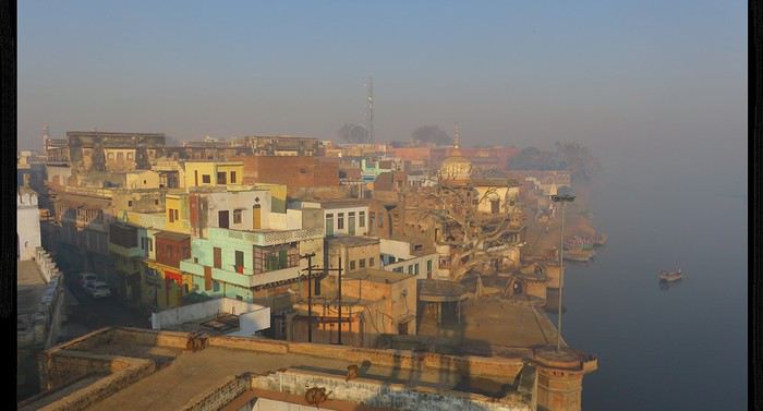
En continuant la balade dans la vielle ville en direction du fameux lieu de naissance de Krishna, on passe devant la Jama Masjid, puis on tombe sur une belle mosquée du style moghol habituel. La surprise commence à la marche d'approche : il y a 2 barrières tenus par des militaires, et la mosquée est entourée de barbelés et de miradors... Juste à côté on voit le temple hindou pour lequel la ville est connue. La visite se fait rapidement, accompagné d'un militaire et après avoir indiqué son identité à l'entrée. Impossible d'en savoir plus par les militaires, mais une recherche Google (grâce à la 4G indienne très efficace et pas cher!) donne la réponse: La mosquée fait partie des 3 sites que les extrémistes hindous appellent à la destruction, en se basant sur le fait que celles-ci sont construites elles-mêmes sur les ruines d'un temple hindou rasé il y a 300 ans, pendant le règne d'Aurangzeb, l'empereur moghol ayant rompu avec la tolérance de ses prédécesseurs. C'est d'ailleurs ce qu'ils ont fait à Ayodhya en 1992 en démolissant la Babri Masjid - celle de Mathura fait donc partie des restantes sur la liste (avec une autre à Varanasi).
Intéressant de tomber par hasard sur un de ces lieux cristallisant les tensions communautaires (c'est un sujet qui m'intéressait déjà, et qui en Inde du Nord est récurrent voire omniprésent). Difficile pour un étranger comme moi d'avoir un avis sur ce qui est juste ou non, à part dire que sur le plan artistique le temple hindou reconstruit juste à côté ne peut pas rivaliser avec la grâce de l'architecture moghole.
Visite du temple hindou sans grand intérêt. A un endroit, on se trouve à 3 mètres de l'arrière de la mosquée ! Aucune photo pour représenter cette juxtaposition, comme les contrôles sont stricts.
Coucher de bonne heure, l'Inde appartient à ceux qui se lèvent tôt ! __
Bus pour Deeg, à travers la campagne des grandes plaines du Nord qui est assez monotone: des petits champs parsemés d'arbres et avec comme seul relief des grands pylônes électriques et des grandes cheminées pour les fours à briques. Les villages quant à eux sont sans intérêt en terme "paysager" (constructions en brique recouverte de plâtre), mais voir la paisible vie locale est intéressant. Il est également appréciable de voir les beaux saris des campagnardes, qui arrivent malgré le travail des champs à être bien plus élégantes qu'une grande partie de la classe moyenne urbaine que je vois au quotidien, qui a cédé à la tenue pull-jean-basket.
Après un trajet bien lent, arrivée dans la petite ville de Deeg. En voyant tous ces regards curieux, on imagine qu'ils ne voient pas beaucoup de touristes marcher dans leur ville. Visite du Deeg Palace, très beau palais entourant un agréable jardin. Mais dont la plus belle vue se trouve depuis le grand bassin juste à l'ouest du palais.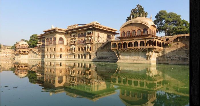
On peut se poser tranquillement sur les marches et admirer la vue, avec une lumière de plus en plus belle avec la journée qui passe.
Et aussi voir les lavandières (appelée "Dhobi", j'imagine d'ailleurs que le nom du personnage d'Harry Potter vient de là) au travail - et profiter du zoom pour ne pas se faire remarquer.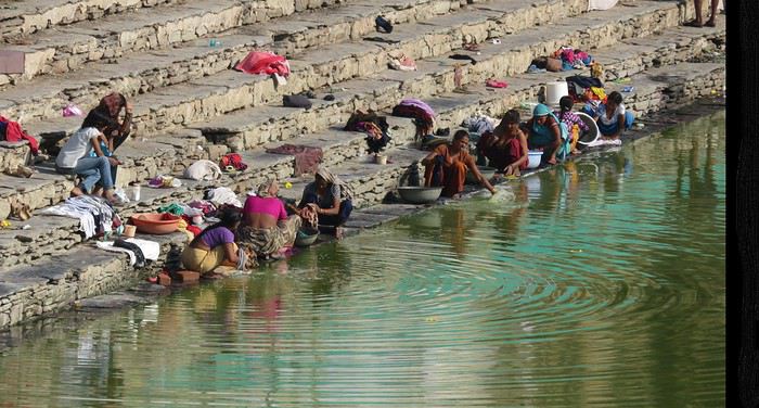
Me voyant m'éterniser sur les marches, un saddhu vient m'aborder. Conversation sympa où je peux pratiquer mes quelques mots d'hindi, jusqu'au moment où il se met à demander avec insistance des sous. Je finis donc par partir, j'avais déjà presque passé une heure autour du bassin.
Dans la rue je vois un bus rouler vers moi, et qui ralentit un peu: "Bharatpur?" auquel le conducteur répond par un hochement de tête positif : très pratique !
Arrivée en fin de journée à Bharatpur, juste à temps pour voir le très imposant Lohagarh Qila avec le soleil couchant.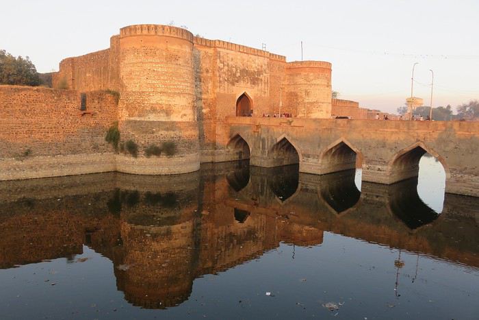 Ce que j'adore avec ce pays, c'est que même des sites considérés "mineurs" d'un point de vue touristique, sont vraiment intéressants! On gagne donc à s'éloigner des sites principaux, et pouvoir apprécier l'absence de harcèlement touristique, et la générosité des habitants, puisque je me fais inviter à prendre le thé chez une famille habitant juste face au fort. Quasiment toute la famille élargie (oncles, grand-mère ...) habitent dans les maisons voisines et passent donc dire bonjour!
Arrivée tardive au Saras Circle, près du sanctuaire pour oiseaux Keoladeo Ghana. __
Départ matinal pour le sanctuaire, des vélo-rickshaws font déjà la queue depuis longtemps pour pouvoir rentrer dans le parc. Je prend des sortes de patates sautées à l'entrée, que le gars essaie de me faire payer 50rs ... Je sors un "Aloo hai" ("C'est des patates") et paie 20rs, ce qui est déjà trop ... On sent bien là l'influence du tourisme !
A 8 heures du matin, tous les vélos de location sont déjà pris ... En insistant un peu, j'arrive à récupérer un vélo qui était en réparation, ça sera donc en danseuse !
Je n'ai rien d'un grand amateur d'oiseaux, mais l'idée de trouver un refuge contre l'agitation urbaine (surtout ces klaxons incessants qui tapent sur les nerfs) était très attirante. La visite est agréable, en voyant des biches, singes, chauve-souris, martin-pécheurs, hérons ... et des grues Saras, apparemment l'attraction principale.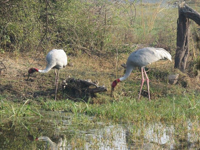 Le parc semble très appréciée par la classe aisée, à en juger par le comportement et le fait qu'ils parlent anglais notamment à leurs enfants.
Je retrouve la famille de la veille pour discuter tranquillement sur les chaises qu'ils installent devant la maison, face au fort et ses douves. Vers 15h, ils insistent sur le fait qu'il est temps que je rentre chez moi. Et ils ont raison comme il me faudra 7h30 pour arriver chez moi (pourtant à 200km), entre le bus pris dans les bouchons et le trajet jusqu'à ma banlieue lointaine. Mais tout ça en vaut le coup :)
Il y a 4 ans, je découvrais l'Inde pour la première fois (petite dédicace à mon premier récit: voyageforum.com/...ntense%20inde%20nord), et l'envie d'y retourner m'a fait y rechercher un travail... Chose à présent faite: après 1 an et demi de candidatures, j'ai trouvé un VIE (Volontariat International en Entreprise), le graal pour une expatriation à la fin des études (pour toute destination loin de la France).
Habitant à Greater Noida, banlieue industrielle sans grand (voire aucun) intérêt à 40 kms au sud-est de New Delhi, je passe une grande partie de mes week-ends à découvrir les environs, en utilisant les transports en commun uniquement.
C'est donc ce que je propose de vous raconter sous la forme d'un "carnet de voyage", agrémentés de quelques commentaires sur le fait de vivre dans ce pays fascinant (mais également fatiguant par moment!).
Les transports en bus sont en effet très pratiques et simples pour les trajets "courts" (en quelques centaines de kilomètres) : les départs sont très fréquents, on peut arriver sans réservation et avoir (en général) un bus partant dans les 30 minutes qui suivent. Il suffit juste d'être patient sur le trajet, la vitesse moyenne observée sur mes trajets étant de 50 km / heure.
Le train est un peu plus rapide et plus confortable, mais moins flexible (départs moins fréquents, réservation souvent nécessaire) et avec plus de risques de retards majeurs. Je le privilégie donc uniquement pour les longs trajets de nuit.
Quasiment aucune réservation d'hôtel à l'avance, et la plupart du temps ils sont vraiment sous-occupés.
Voilà pour l'introduction, et n'hésitez pas si vous avez des questions ou commentaires !
WE de Noël, 3 jours au sud de Delhi
Pour ce 1er week-end, je décide de prendre un bus pour Mathura depuis ma ville de Greater Noida, située au début de la récente autoroute "Yamuna Expressway" reliant Delhi à Agra. Le bus cherche à faire le plein avant de partir, et certains passagers crient pour le pousser à partir "à l'heure". Avec tous les passagers ramassés le long de l'autoroute, le bus est finalement plein à craquer. Le système est bien rodé pour tous les villages dans les environ de l'autoroute: le bus reste sur l'autoroute et s'arrête fréquemment pour prendre / déposer des passagers, qui rejoignent leur village à pied ou en moto avec ceux venant les chercher. Très pratique est assez rapide - enfin jusqu'à ce que je comprenne que, lorsqu'on m'a confirmé que le bus allait à Mathura, c'est plutôt qu'il dépose le long de l'autoroute à 10 km du centre ville. Pour une arrivée à 22h, ça ne me parait pas envisageable et je continue donc jusqu'à Agra. Je peux y compter sur les rickshaws, qui se font un plaisir de m'amener à un hôtel bon marché et toucher leur commission (mais à cette heure-ci c'est appréciable).
Bus depuis Idgah Bus Stand pour Mathura le lendemain pour revenir à mon plan initial. Après m'être installé à l'entrée de la vieille ville dans un hôtel "de base" (c'est à dire toilettes turques, draps probablement non lavés et laisser-aller généralisé - alors que ça ne manque pas de personnelf!), je peux donc commencer ma visite de cette ville sainte, "lieu de naissance de Krishna" pour les hindous. J'étais étonné par le concept de "naissance" d'un dieu. En fait (et en version simplifiée) l'essentiel des dieux hindous sont des avatars du / des dieux principaux (ça dépend des courants...) d'où le fait qu'un dieu puisse naître.
La rue qui mène de Holi Gate jusqu'à la Yamuna est très intéressante, avec un grand nombre de vieux bâtiments (qui tombent en ruine pour la plupart), et une circulation automobile limitée par l'étroitesse de la rue, ça fait du bien aux oreilles !
Les ghats sont assez peu impressionnants, et il règle un sentiment d'abandon sur l'essentiel de la longueur. Heureusement que les singes sont là pour donner un peu de vie.
Mais l'abandon a du bon: on peut, en cherchant un peu, monter dans certains bâtiments et ainsi avoir une vue panoramique sur les ghats.
En continuant la balade dans la vielle ville en direction du fameux lieu de naissance de Krishna, on passe devant la Jama Masjid, puis on tombe sur une belle mosquée du style moghol habituel. La surprise commence à la marche d'approche : il y a 2 barrières tenus par des militaires, et la mosquée est entourée de barbelés et de miradors... Juste à côté on voit le temple hindou pour lequel la ville est connue. La visite se fait rapidement, accompagné d'un militaire et après avoir indiqué son identité à l'entrée. Impossible d'en savoir plus par les militaires, mais une recherche Google (grâce à la 4G indienne très efficace et pas cher!) donne la réponse: La mosquée fait partie des 3 sites que les extrémistes hindous appellent à la destruction, en se basant sur le fait que celles-ci sont construites elles-mêmes sur les ruines d'un temple hindou rasé il y a 300 ans, pendant le règne d'Aurangzeb, l'empereur moghol ayant rompu avec la tolérance de ses prédécesseurs. C'est d'ailleurs ce qu'ils ont fait à Ayodhya en 1992 en démolissant la Babri Masjid - celle de Mathura fait donc partie des restantes sur la liste (avec une autre à Varanasi).
Intéressant de tomber par hasard sur un de ces lieux cristallisant les tensions communautaires (c'est un sujet qui m'intéressait déjà, et qui en Inde du Nord est récurrent voire omniprésent). Difficile pour un étranger comme moi d'avoir un avis sur ce qui est juste ou non, à part dire que sur le plan artistique le temple hindou reconstruit juste à côté ne peut pas rivaliser avec la grâce de l'architecture moghole.
Visite du temple hindou sans grand intérêt. A un endroit, on se trouve à 3 mètres de l'arrière de la mosquée ! Aucune photo pour représenter cette juxtaposition, comme les contrôles sont stricts.
Coucher de bonne heure, l'Inde appartient à ceux qui se lèvent tôt ! __
Bus pour Deeg, à travers la campagne des grandes plaines du Nord qui est assez monotone: des petits champs parsemés d'arbres et avec comme seul relief des grands pylônes électriques et des grandes cheminées pour les fours à briques. Les villages quant à eux sont sans intérêt en terme "paysager" (constructions en brique recouverte de plâtre), mais voir la paisible vie locale est intéressant. Il est également appréciable de voir les beaux saris des campagnardes, qui arrivent malgré le travail des champs à être bien plus élégantes qu'une grande partie de la classe moyenne urbaine que je vois au quotidien, qui a cédé à la tenue pull-jean-basket.
Après un trajet bien lent, arrivée dans la petite ville de Deeg. En voyant tous ces regards curieux, on imagine qu'ils ne voient pas beaucoup de touristes marcher dans leur ville. Visite du Deeg Palace, très beau palais entourant un agréable jardin. Mais dont la plus belle vue se trouve depuis le grand bassin juste à l'ouest du palais.
On peut se poser tranquillement sur les marches et admirer la vue, avec une lumière de plus en plus belle avec la journée qui passe.
Et aussi voir les lavandières (appelée "Dhobi", j'imagine d'ailleurs que le nom du personnage d'Harry Potter vient de là) au travail - et profiter du zoom pour ne pas se faire remarquer.
Me voyant m'éterniser sur les marches, un saddhu vient m'aborder. Conversation sympa où je peux pratiquer mes quelques mots d'hindi, jusqu'au moment où il se met à demander avec insistance des sous. Je finis donc par partir, j'avais déjà presque passé une heure autour du bassin.
Dans la rue je vois un bus rouler vers moi, et qui ralentit un peu: "Bharatpur?" auquel le conducteur répond par un hochement de tête positif : très pratique !
Arrivée en fin de journée à Bharatpur, juste à temps pour voir le très imposant Lohagarh Qila avec le soleil couchant.
Ce que j'adore avec ce pays, c'est que même des sites considérés "mineurs" d'un point de vue touristique, sont vraiment intéressants! On gagne donc à s'éloigner des sites principaux, et pouvoir apprécier l'absence de harcèlement touristique, et la générosité des habitants, puisque je me fais inviter à prendre le thé chez une famille habitant juste face au fort. Quasiment toute la famille élargie (oncles, grand-mère ...) habitent dans les maisons voisines et passent donc dire bonjour!Arrivée tardive au Saras Circle, près du sanctuaire pour oiseaux Keoladeo Ghana. __
Départ matinal pour le sanctuaire, des vélo-rickshaws font déjà la queue depuis longtemps pour pouvoir rentrer dans le parc. Je prend des sortes de patates sautées à l'entrée, que le gars essaie de me faire payer 50rs ... Je sors un "Aloo hai" ("C'est des patates") et paie 20rs, ce qui est déjà trop ... On sent bien là l'influence du tourisme !
A 8 heures du matin, tous les vélos de location sont déjà pris ... En insistant un peu, j'arrive à récupérer un vélo qui était en réparation, ça sera donc en danseuse !
Je n'ai rien d'un grand amateur d'oiseaux, mais l'idée de trouver un refuge contre l'agitation urbaine (surtout ces klaxons incessants qui tapent sur les nerfs) était très attirante. La visite est agréable, en voyant des biches, singes, chauve-souris, martin-pécheurs, hérons ... et des grues Saras, apparemment l'attraction principale.
Le parc semble très appréciée par la classe aisée, à en juger par le comportement et le fait qu'ils parlent anglais notamment à leurs enfants.Je retrouve la famille de la veille pour discuter tranquillement sur les chaises qu'ils installent devant la maison, face au fort et ses douves. Vers 15h, ils insistent sur le fait qu'il est temps que je rentre chez moi. Et ils ont raison comme il me faudra 7h30 pour arriver chez moi (pourtant à 200km), entre le bus pris dans les bouchons et le trajet jusqu'à ma banlieue lointaine. Mais tout ça en vaut le coup :)
Incredible India, here we go again!!
Hey there, fellow travelers 😎
We’re back from 15 days in northern India.
For our 6th visit to this country, we traveled between Uttar Pradesh and Madhya Pradesh, and let’s just say it was an emotional rollercoaster!!
So if you’re up for it, we’re taking you to Varanasi, Chitrakoot, Khajuraho, Orchha, and Agra.
Ready for takeoff??
WELCOME TO VARANASI

When you leave your sanitized, rigid Western world behind, there’s nothing like diving back into the Indian chaos. And we nailed it—because when it comes to monumental madness, we couldn’t have picked a better place to start than Varanasi 😉!!
Here’s a little recap of our first day in this insane city.
It all starts with landing at the city’s airport.
As soon as we step out, hundreds of Indians stare at us like they’ve never seen white people before (I’d forgotten how intense that is!). There are lots of women covered in black fabric, only their eyes visible—pretty striking, I must say. Turns out they’re Indians working in the Middle East, heading back to "work" after a month’s vacation.
We hop in a taxi, but after a few kilometers, we’re stopped… by the passage of the "state minister." The roads are freshly paved and spotless for his convoy (you can *totally* tell the difference with the roads he didn’t use 😛). We didn’t manage to spot him in the middle of the 25 cars surrounding him, though!!
Then we arrive in front of the mythical Ganges—a peaceful spot, except for a boat full of Indian pilgrims who, once again, stare at us and take our pictures (the mutual curiosity is hilarious!!).
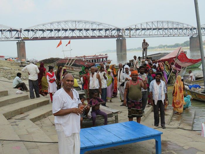
We board a boat, and almost immediately, we pass a cremation ghat!! Oh crap, I wasn’t expecting that so soon—it hits me hard (like, *really* hard 🤪)!! Huge piles of wood, eight massive fires with families gathered around. It lasts as long as the boat ride, and you think you must’ve imagined it… but no!!
You dock and wander through the tiny alleys.
It’s 36°C (97°F) with 90% humidity—you’re dripping.
Cows block the way sometimes. The air smells like incense, then urine, then a woman’s perfume, then rotten fruit, then amazing street food—all within two meters, and *everywhere*!!
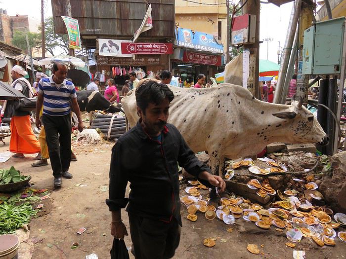
Then you step into the main street where pilgrims arrive (60,000 a day—Varanasi is the country’s holiest city!!). The chaos ramps up as you head toward the main road: nonstop honking, a bike whizzing past on your right, a scooter on your left, people brushing against you from all sides, air thick with dust and smoke (diesel *or* cremation!!), beggars of all kinds (kids, elderly, disabled) lined up to appeal to the pilgrims, the suffocating heat, and noise—*so much* noise…
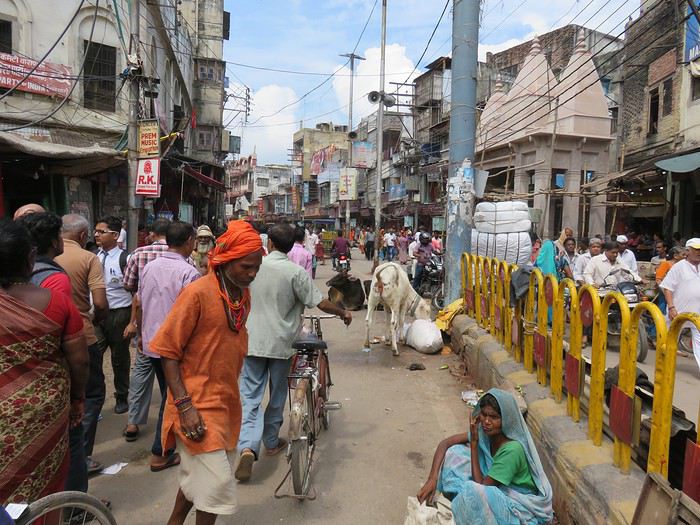
In some areas, people constantly approach you: "Come see my shop," "Need a taxi?" "Want to exchange money?" And then there’s the woman with her baby in her arms, following you for meters, repeating, "No money, milk; no money, milk…" And you’re *dying* inside, but you can’t stop. If you give in, ten more will come running!! You grit your teeth, keep walking, even talk to yourself out loud!!
After half an hour, it feels like you’ve run a marathon, and you don’t even know where you live anymore!
In the evening, you head to the PUJA (public prayers for all the pilgrims) on a boat in the middle of hundreds of others. Two ghats are competing—who can make the most noise. One side is singing, the other chanting, then they switch. They wave flames, the ghats are packed.
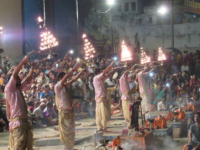
After dinner, you head back to your room around 9 PM and see hundreds of people sleeping on the scorching stones—with cows, dogs, and goats!!!!
A huge thank-you to our parents for giving us the mental balance to handle this, because *India drives you crazy*—and we’re right in the thick of it!!!
It’s an ex.tra.or.di.nary place in the truest sense of the word, with incredible beauty—especially in its human diversity—if you can look past what shocks you.
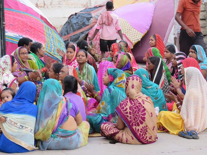
We stayed for 3 days—3 days of unmatched intensity, where the spectacle is *constant*.
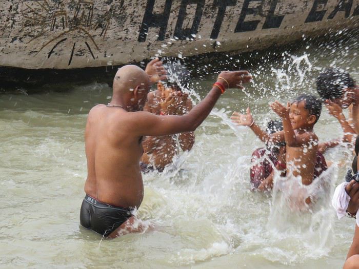
So I *highly* recommend it to all travel lovers, those who embrace difference, and the strange (for us, at least). But definitely *not* for anyone looking for a relaxing vacation!!
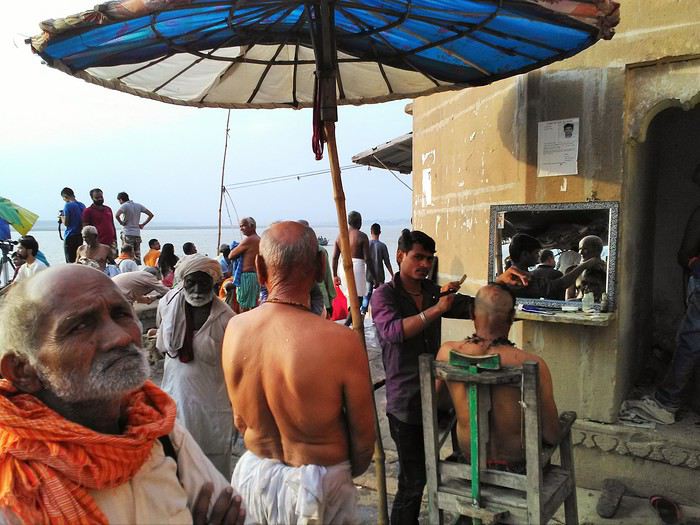
More to come soon if you’re interested!!
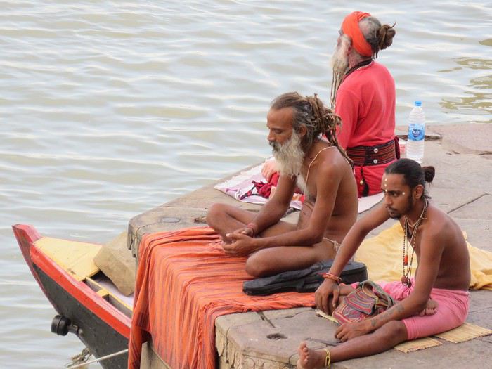
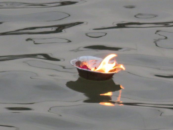
We’re back from 15 days in northern India.
For our 6th visit to this country, we traveled between Uttar Pradesh and Madhya Pradesh, and let’s just say it was an emotional rollercoaster!!
So if you’re up for it, we’re taking you to Varanasi, Chitrakoot, Khajuraho, Orchha, and Agra.
Ready for takeoff??
WELCOME TO VARANASI
When you leave your sanitized, rigid Western world behind, there’s nothing like diving back into the Indian chaos. And we nailed it—because when it comes to monumental madness, we couldn’t have picked a better place to start than Varanasi 😉!!
Here’s a little recap of our first day in this insane city.
It all starts with landing at the city’s airport.
As soon as we step out, hundreds of Indians stare at us like they’ve never seen white people before (I’d forgotten how intense that is!). There are lots of women covered in black fabric, only their eyes visible—pretty striking, I must say. Turns out they’re Indians working in the Middle East, heading back to "work" after a month’s vacation.
We hop in a taxi, but after a few kilometers, we’re stopped… by the passage of the "state minister." The roads are freshly paved and spotless for his convoy (you can *totally* tell the difference with the roads he didn’t use 😛). We didn’t manage to spot him in the middle of the 25 cars surrounding him, though!!
Then we arrive in front of the mythical Ganges—a peaceful spot, except for a boat full of Indian pilgrims who, once again, stare at us and take our pictures (the mutual curiosity is hilarious!!).
We board a boat, and almost immediately, we pass a cremation ghat!! Oh crap, I wasn’t expecting that so soon—it hits me hard (like, *really* hard 🤪)!! Huge piles of wood, eight massive fires with families gathered around. It lasts as long as the boat ride, and you think you must’ve imagined it… but no!!
You dock and wander through the tiny alleys.
It’s 36°C (97°F) with 90% humidity—you’re dripping.
Cows block the way sometimes. The air smells like incense, then urine, then a woman’s perfume, then rotten fruit, then amazing street food—all within two meters, and *everywhere*!!
Then you step into the main street where pilgrims arrive (60,000 a day—Varanasi is the country’s holiest city!!). The chaos ramps up as you head toward the main road: nonstop honking, a bike whizzing past on your right, a scooter on your left, people brushing against you from all sides, air thick with dust and smoke (diesel *or* cremation!!), beggars of all kinds (kids, elderly, disabled) lined up to appeal to the pilgrims, the suffocating heat, and noise—*so much* noise…
In some areas, people constantly approach you: "Come see my shop," "Need a taxi?" "Want to exchange money?" And then there’s the woman with her baby in her arms, following you for meters, repeating, "No money, milk; no money, milk…" And you’re *dying* inside, but you can’t stop. If you give in, ten more will come running!! You grit your teeth, keep walking, even talk to yourself out loud!!
After half an hour, it feels like you’ve run a marathon, and you don’t even know where you live anymore!
In the evening, you head to the PUJA (public prayers for all the pilgrims) on a boat in the middle of hundreds of others. Two ghats are competing—who can make the most noise. One side is singing, the other chanting, then they switch. They wave flames, the ghats are packed.
After dinner, you head back to your room around 9 PM and see hundreds of people sleeping on the scorching stones—with cows, dogs, and goats!!!!
A huge thank-you to our parents for giving us the mental balance to handle this, because *India drives you crazy*—and we’re right in the thick of it!!!
It’s an ex.tra.or.di.nary place in the truest sense of the word, with incredible beauty—especially in its human diversity—if you can look past what shocks you.
We stayed for 3 days—3 days of unmatched intensity, where the spectacle is *constant*.
So I *highly* recommend it to all travel lovers, those who embrace difference, and the strange (for us, at least). But definitely *not* for anyone looking for a relaxing vacation!!
More to come soon if you’re interested!!