Results for "Cacao+|+4+>+131"
2257 results found.
Retour de Villa Cojimar English translation pending
Bonjour à tous, comme promis je donnerai un petit comte rendu de mes vacances au villa cojimar de cayo guillermo.
Arrivée par air canada, merveilleux vol avec très bon service. Aucune attente à l'aéroport, je dirai même que c'est nos valises qui attensaient après nous. Check in à l'hôtel rapide, on étaient les 2 seules!
Arrivée dans la chambre: 1ere déception, pas très attirant comme déco. Vieux couvre-lit et rideaux mais lits assez confortables. Chambre demandée au bord de la mer mais aucune de disponible, attendons M le gérant le lendemain matin.
Arrivée au resto à 21h15...aucun service, c'est comme si on n'existait pas! Mais il y a de la langouste au buffet mais elle est froide! Les nappes sont sales. Bref, je suis un peu décue et espère que le lendemain sera différent. Spectacle à l'image des spectacles en général à cuba. Service au bar très lent....oh que je commence à avoir peur et à regretter d'avoir choisi cet hôtel!!! Mais attendons à demain....
Au lever on va choisir un palapas....oh que la mer est belle!!! peu profonde mais belle. Allons au buffet. Oh mais c'est très propre et on a du service avec le gentil José. Buffet assez complet evec les mangues, ananas, crêtes omelettes, bacon...etc. Je suis un peu encouragée! Diner et souper, parfait très bon service. Nous décidons de garder la même chambre étant donné qu'on y passera très peu de temps. Service au bar du lobby très courtois et plus rapide que la veille.
Lendemain matin, surprise...refoulement d'égoût, plein de caca dans la salle de bain!!! Je cours au lobby pour demander qu'on répare tout cela et nous allons à la playa. Au retour dans la chambre après le diner, aucun changement...toujours plein de merde. Je retourne au lobby pour changer de chambre car odeur insupportable et par crainte que cela se reproduise, nous demandons de monter dans un 2eme étage. Le lobby est plein de gens qui quittent l'hôtel et on se faite dire par M LE Gérant Face De Plâtre qu'il nY a aucune chambre de disponible car l'hôtel est plein. J'insiste un peu en lui disant qu'il y a beaucoup de gens qui partent et il me répond que ces chambres sont réservées pour les gens qui arriverons.Pas question qu'on change de chambre et quIl va faire réparer les dégas. Ils sont venu et l'odeur est partie en laissant une petite odeur d'égoût dans la salle de bain. Aucun refoulement par la suite, heureusement.
Allons au club d'activité pour avoir des serviettes de plage...il n'y en aura pas avant le lendemain. Mardi étant en excursion à moron, qui est très bien, nous n'avons pas pu aller chercher des serviettes donc mercredi matin je demande des serviettes, il n'y en avait pas avant le lendemain matin. J'ai réussi à avoir des vielles serviettes, ce qui était mieux que de ne pas en avoir du tout. Il semble qu'on puisse avoir des serviettes 1 jour sur 2.
Au restaurant pour ce qui sont des autres journées, le service était bien. Par José et Barbaro qui sont d'excellents serveurs et très souriants. Il y avait un manque au niveau de la musique au resto, on nous faisait entendre de la musique de centre d'achats tel qu'un jour lara et cie.
Il y avait des journées où il était difficile de se trouver des chaises à la plage.
Le site est très beau avec beaucoup de végétation. Les jardiniers font du bon travail et sont très souriants. Il y a possibilité de faire catamaran, canot et équipement de plongé en apnée. La table de billard n'est pas fonctionnelle. Il y a une table de ping pong. Il y a une bonne équipe d'animation à la piscine et on a la paix à la plage. Il n'y a pas une grande plage mais il y a des palmiers sur la plage. La plage est longue mais étroite. Attention aux piques piques, ils sont très petits mais très douloureux!
Les drinks sont bons et ils ne lésinent pas sur le "ron" qui n'est certainement pas dilué avec de l'eau.
Il a fait beau et chaud toute la semaine. On a eu droit à un gros 5 min de pluie à midi le mercredi. Presque pas de nuages, un beau ciel bleu! Ne vous fiez pas à la météo qu'on nous annonce car la guide de tmr ( qui était formidable en passant) nous a affirmé qu'il fait beau à cayo guillermo depuis 3 semaines même si on nous a dit le contraire à la météo.
Bref, service en général assez bon ( à part de la face de plâtre de gérant).
Bonne bouffe, langouste 1 fois à volonté, crevettes 3 fois, calmars, moules, pétoncles, pâtes, pizza et frites. Mangues, goyava, papayes, mais un manque d'ananas (1 seule fois), ce qui a manqué à notre internaute Plumes que j'ai rencontré et avec qui on s'est vite lié d'amitié, elle est très sympa et attachante. Elle y sera encore une autre semaine, la chanceuse! Je crois qu'à son retour je lui ferai parvenir une caise d'ananas qui sont 1.99 au québec. Je lui souhaite un semaine formidable!
Belle plage avec un peu de roche et très peu profonde, on n'y va pas pour jouer dans les vagues.
J'ai passé une belle semaine en général, avec une plage plus profonde, j'y retournerais certainement.
Il faut garder en tête que c'est un hôtel 3 étoiles.
Endroit idéal pour les enfants, à cause de la page qui est très calme et peu profone mais surtout pour les activités qui sont à la charge de DORALINA (ANCIENNEMENT AU IBÉROSTAR DAIQUIRI), qui est merveilleuse avec les enfants qui lui courent toute la journée même le soir. Il est évident qu'elle adore sont travail.
Voici donc mon petit résumé. Si vous avez des questions n'hésitez pas, il me fera plaisir de vous répondre. Celou qui s'ennuie déjà de cuba
Arrivée par air canada, merveilleux vol avec très bon service. Aucune attente à l'aéroport, je dirai même que c'est nos valises qui attensaient après nous. Check in à l'hôtel rapide, on étaient les 2 seules!
Arrivée dans la chambre: 1ere déception, pas très attirant comme déco. Vieux couvre-lit et rideaux mais lits assez confortables. Chambre demandée au bord de la mer mais aucune de disponible, attendons M le gérant le lendemain matin.
Arrivée au resto à 21h15...aucun service, c'est comme si on n'existait pas! Mais il y a de la langouste au buffet mais elle est froide! Les nappes sont sales. Bref, je suis un peu décue et espère que le lendemain sera différent. Spectacle à l'image des spectacles en général à cuba. Service au bar très lent....oh que je commence à avoir peur et à regretter d'avoir choisi cet hôtel!!! Mais attendons à demain....
Au lever on va choisir un palapas....oh que la mer est belle!!! peu profonde mais belle. Allons au buffet. Oh mais c'est très propre et on a du service avec le gentil José. Buffet assez complet evec les mangues, ananas, crêtes omelettes, bacon...etc. Je suis un peu encouragée! Diner et souper, parfait très bon service. Nous décidons de garder la même chambre étant donné qu'on y passera très peu de temps. Service au bar du lobby très courtois et plus rapide que la veille.
Lendemain matin, surprise...refoulement d'égoût, plein de caca dans la salle de bain!!! Je cours au lobby pour demander qu'on répare tout cela et nous allons à la playa. Au retour dans la chambre après le diner, aucun changement...toujours plein de merde. Je retourne au lobby pour changer de chambre car odeur insupportable et par crainte que cela se reproduise, nous demandons de monter dans un 2eme étage. Le lobby est plein de gens qui quittent l'hôtel et on se faite dire par M LE Gérant Face De Plâtre qu'il nY a aucune chambre de disponible car l'hôtel est plein. J'insiste un peu en lui disant qu'il y a beaucoup de gens qui partent et il me répond que ces chambres sont réservées pour les gens qui arriverons.Pas question qu'on change de chambre et quIl va faire réparer les dégas. Ils sont venu et l'odeur est partie en laissant une petite odeur d'égoût dans la salle de bain. Aucun refoulement par la suite, heureusement.
Allons au club d'activité pour avoir des serviettes de plage...il n'y en aura pas avant le lendemain. Mardi étant en excursion à moron, qui est très bien, nous n'avons pas pu aller chercher des serviettes donc mercredi matin je demande des serviettes, il n'y en avait pas avant le lendemain matin. J'ai réussi à avoir des vielles serviettes, ce qui était mieux que de ne pas en avoir du tout. Il semble qu'on puisse avoir des serviettes 1 jour sur 2.
Au restaurant pour ce qui sont des autres journées, le service était bien. Par José et Barbaro qui sont d'excellents serveurs et très souriants. Il y avait un manque au niveau de la musique au resto, on nous faisait entendre de la musique de centre d'achats tel qu'un jour lara et cie.
Il y avait des journées où il était difficile de se trouver des chaises à la plage.
Le site est très beau avec beaucoup de végétation. Les jardiniers font du bon travail et sont très souriants. Il y a possibilité de faire catamaran, canot et équipement de plongé en apnée. La table de billard n'est pas fonctionnelle. Il y a une table de ping pong. Il y a une bonne équipe d'animation à la piscine et on a la paix à la plage. Il n'y a pas une grande plage mais il y a des palmiers sur la plage. La plage est longue mais étroite. Attention aux piques piques, ils sont très petits mais très douloureux!
Les drinks sont bons et ils ne lésinent pas sur le "ron" qui n'est certainement pas dilué avec de l'eau.
Il a fait beau et chaud toute la semaine. On a eu droit à un gros 5 min de pluie à midi le mercredi. Presque pas de nuages, un beau ciel bleu! Ne vous fiez pas à la météo qu'on nous annonce car la guide de tmr ( qui était formidable en passant) nous a affirmé qu'il fait beau à cayo guillermo depuis 3 semaines même si on nous a dit le contraire à la météo.
Bref, service en général assez bon ( à part de la face de plâtre de gérant).
Bonne bouffe, langouste 1 fois à volonté, crevettes 3 fois, calmars, moules, pétoncles, pâtes, pizza et frites. Mangues, goyava, papayes, mais un manque d'ananas (1 seule fois), ce qui a manqué à notre internaute Plumes que j'ai rencontré et avec qui on s'est vite lié d'amitié, elle est très sympa et attachante. Elle y sera encore une autre semaine, la chanceuse! Je crois qu'à son retour je lui ferai parvenir une caise d'ananas qui sont 1.99 au québec. Je lui souhaite un semaine formidable!
Belle plage avec un peu de roche et très peu profonde, on n'y va pas pour jouer dans les vagues.
J'ai passé une belle semaine en général, avec une plage plus profonde, j'y retournerais certainement.
Il faut garder en tête que c'est un hôtel 3 étoiles.
Endroit idéal pour les enfants, à cause de la page qui est très calme et peu profone mais surtout pour les activités qui sont à la charge de DORALINA (ANCIENNEMENT AU IBÉROSTAR DAIQUIRI), qui est merveilleuse avec les enfants qui lui courent toute la journée même le soir. Il est évident qu'elle adore sont travail.
Voici donc mon petit résumé. Si vous avez des questions n'hésitez pas, il me fera plaisir de vous répondre. Celou qui s'ennuie déjà de cuba
Quoi apporter avec un bébé pour voyage-aventure? English translation pending
Bonjour à tous
Nous sommes depuis peu d'heureux parents et forcement, des questions nous viennent à l'esprit pour nos futurs voyages. Nous avions l'habitude de partir à "l'aventure" avec nos sacs à dos. Avec un enfant de 18 mois (été prochain) qu'emmenez vous en voyage (couches, petits pots, lit pliant...)? Nous envisageons de partir au Cap Vert l'été prochain, qu'emporteriez vous pour votre banbin ?
Merci par avance Xavier
Nous sommes depuis peu d'heureux parents et forcement, des questions nous viennent à l'esprit pour nos futurs voyages. Nous avions l'habitude de partir à "l'aventure" avec nos sacs à dos. Avec un enfant de 18 mois (été prochain) qu'emmenez vous en voyage (couches, petits pots, lit pliant...)? Nous envisageons de partir au Cap Vert l'été prochain, qu'emporteriez vous pour votre banbin ?
Merci par avance Xavier
3 mois en Thaïlande? English translation pending
bonjour à tous! Je prévois un voyage avec une copine...on aimerait aller en Thaïlande de mai jusqu'à la fin juilelt...mais on ne connait rien de ce pays! Jai commencé à lire pas mal..mais souvent les info se contredisent....
jai quelques questions....
peut-on travailler là bas? ( et est-ce que ça vaut vriament la peine...ça doit pas payer bien bien cher...)
comment d'argent pensez-vous que ça prend pour vivre là-bas 3 mois?
on peut avoir un visa pour 3 mois?!
on peut faire du surf?!?! des cours?? ça coute cher? Louer un planche ^ca se fais tu?!
en tout cas...je me pose encore pleinnnnn de question...mais j'vais arrêter de faire ma tannante....de toute manière jen apprant de plus en plus dans les livres et en lisant les disscusions!
merci d'avance!!!
nancy
jai quelques questions....
peut-on travailler là bas? ( et est-ce que ça vaut vriament la peine...ça doit pas payer bien bien cher...)
comment d'argent pensez-vous que ça prend pour vivre là-bas 3 mois?
on peut avoir un visa pour 3 mois?!
on peut faire du surf?!?! des cours?? ça coute cher? Louer un planche ^ca se fais tu?!
en tout cas...je me pose encore pleinnnnn de question...mais j'vais arrêter de faire ma tannante....de toute manière jen apprant de plus en plus dans les livres et en lisant les disscusions!
merci d'avance!!!
nancy
Le Quechua English translation pending
Bonjour.
Cette question s'adresse à tous les spécialistes de Andes. Le Quechua est-il difficile à apprendre? Y a-t-il des méthodes? De bonnes méthodes? Je compte aller dans des régions assez reculées en Bolivie et au Pérou, où on parle très peu espagnol. Je serai certainement obligé de me mettre au Quechua, ce qui me plaît d'ailleurs assez. Mais j'espère que ce n'est pas une utopie.
Merci d'avance de votre réponse... (à Chachapoya, notamment...😉)
Cette question s'adresse à tous les spécialistes de Andes. Le Quechua est-il difficile à apprendre? Y a-t-il des méthodes? De bonnes méthodes? Je compte aller dans des régions assez reculées en Bolivie et au Pérou, où on parle très peu espagnol. Je serai certainement obligé de me mettre au Quechua, ce qui me plaît d'ailleurs assez. Mais j'espère que ce n'est pas une utopie.
Merci d'avance de votre réponse... (à Chachapoya, notamment...😉)
Humanitaire en France! English translation pending
Bon je sent que je vais pas me faire que des amis mais la j'en peut plus ...
Sa me soul un peut de voir tous le monde dire, qu'il veut partire faire de l'humanitaire a l'autre bout du monde, alors que à côté de chez lui il y'as des personnes qui souffre !!!, Attention je ne dit pas que c'est pas bien de partire a l'autre bout du monde, mais il me parraitrais important que avant d'aller a l'autre bout du monde on face quelque chose chez soit (en combinée) ...
Je sait que l'état en france est riche, mais apparament il ne remplit pas tous les rôle qui selon la constitution lui imcombe, alors il faut y pallier !!!!
Désolée, je suis un peut énervé, mais je vient de voir un reportage sur des clandestins (autre sujet de conversation) qui soufrait en france de la faim, vous imaginé (je pense églement aux SDF, mais la c'est le reportage) ...
Vous aller me direque je retourne ma vest, c'est pas forcément ce queje disait il y'as quelques mois, c'est vraie, mais la réalité et la pseudisagesse de l'age ma fait avance de ce côté la !!!!!
Bon bas lachez vous !!!
Philo
Sa me soul un peut de voir tous le monde dire, qu'il veut partire faire de l'humanitaire a l'autre bout du monde, alors que à côté de chez lui il y'as des personnes qui souffre !!!, Attention je ne dit pas que c'est pas bien de partire a l'autre bout du monde, mais il me parraitrais important que avant d'aller a l'autre bout du monde on face quelque chose chez soit (en combinée) ...
Je sait que l'état en france est riche, mais apparament il ne remplit pas tous les rôle qui selon la constitution lui imcombe, alors il faut y pallier !!!!
Désolée, je suis un peut énervé, mais je vient de voir un reportage sur des clandestins (autre sujet de conversation) qui soufrait en france de la faim, vous imaginé (je pense églement aux SDF, mais la c'est le reportage) ...
Vous aller me direque je retourne ma vest, c'est pas forcément ce queje disait il y'as quelques mois, c'est vraie, mais la réalité et la pseudisagesse de l'age ma fait avance de ce côté la !!!!!
Bon bas lachez vous !!!
Philo
Prolonger un visa chinois: où et comment? English translation pending
Bonjour tout le monde, j'ia un petit (gros ???) soucis de visa, il faut que je le fasse prolonger une fois arrivée en Chine si possible sans passer par Hong-Kong qui n'est absolument pas ma destination, (loin de là), un tas de réponses differentes arrivent sur les forums sans que l'on connaisse vraiment la réalité....cela est vraiment ennuyeux;
Alors si quelqu'un peut me donner l'info, savoir si l'on peut prolonger un visa au cours d'un voyage dans les environs de Kunming ou de Chengdu (à coup sûr !) ce serait vraiment rassurant !
merci encore à vous tous !😛
Alors si quelqu'un peut me donner l'info, savoir si l'on peut prolonger un visa au cours d'un voyage dans les environs de Kunming ou de Chengdu (à coup sûr !) ce serait vraiment rassurant !
merci encore à vous tous !😛
Récit d'une semaine en République Dominicaine English translation pending
Bonjour!
De retour de République Dominicaine depuis une semaine, nous souhaitons apporter notre contribution en racontant notre petit séjour. En effet les informations trouvées sur les forums nous ont été très utiles!! Nous avons saisi une super occase : un vol sec A/R Nantes-La Romana pour moins de 270 euros par personne, taxes comprises! Trouvé sur les enchères Internet de Nouvelles Frontières... qui dit mieux? Jeune couple au petit budget, pays inconnu pour nous et même pas une semaine pour se préparer : nous avons utilisé Internet à fond et voici ce que ça a donné.
Avant de partir : Nous avons opté pour des euros et seulement un petit peu de dollars (de quoi payer la taxe de sortie de 20 $/pers et un peu plus au cas où). Nous avons changé nos euros au fur et à mesure de nos besoins. (Période 29 mars-5 avril nous avons toujours échangé 1 euro contre environ 50 pesos. Le dollar valait moins, entre 40 et 43 pesos.) Il faut changer dans les maisons de change des villes et villages. On a choisi les euros car les tarifs de 2 hôtels où nous sommes allés étaient en euros, et en cas où il nous en restait, pas besoin de faire le change à notre retour. De plus quand on dit que l'on n’a pas de dollars mais des pesos, c'est plus facile de marchander et on obtient des prix plus avantageux. Prévoir chapeau, lunettes de soleil, crème solaire indice élevé!! Surtout pour les trajets en bateau. Malgré les précautions nous n'avons pas échappé aux coups de soleil! Et puis la bombe anti-moustique mais franchement on n'a pas vu beaucoup de moustiques.
1ère partie : BAYAHIBE.
Un Joli petit hôtel : Hôtel BOCA YATE à BAYAHIBE Dominicus (excentré par rapport au village de pêcheurs BAYAHIBE) où nous avons passé 3 nuits. Pour des conseils sur les aspects pratiques (change, transport...) ou sur les excursions demander au patron, c'est un lyonnais du nom de Pierre, très sympa, toujours prêt à rendre service. Et il a à coeur de faire aimer la République Dominicaine! Devant l'hôtel on trouve un chemin qui mène à la belle plage de Bayahibe. Malheureusement les grands hôtels environnants se sont accaparés une grande partie de cette plage... Dommage! Deuxième hic : sans véhicule, difficile de trouver un endroit où sortir le soir. Mais là encore, demander au patron de l'hôtel qui trouvera sûrement une solution!
1er jour : Ballade à LA ROMANA, le parque central, le marché, les motos-conchos partout qui t'emmènent ailleurs dans la ville pour quelques pesos... Couleurs, chaleur, sourires et bonne humeur ont été nos premières impressions…et elles se sont confirmées!! Retour en guagua, minibus pas cher et sympa, souvent pleins à craquer car on ne refuse jamais personne! (le plus qu'on a vu : 23 personnes dedans alors qu'il y a 12 places!!!) Dîner au restaurant de l'hôtel : "Le Lyonnais" c'est beau, bon accueil, bonne ambiance, très bonne cuisine.
2ème jour : Excursion à l'île SAONA avec Raoul comme capitaine (le demander au port). 120 $ le bateau (et pas par personne!!) pour la journée, très intéressant lorsque l'on est plusieurs (à faire à 4 ou 6). Et surtout c'est sûrement mieux que les catamarans bondés ou que les speed boat qui vont à toute allure. Raoul nous emmène à son rythme sur les jolis coins : piscine naturelle, mangrove, différentes plages de Saona. Une très belle journée. Avec le recul les plages de Saona sont les plus belles que l'on a vu.
2ème partie : SAMANA
3ème jour : Départ pour la presqu'île de Samana. Il faut compter la journée pour traverser. Guagua Bayahibe-La Romana-San Pedro de Marcoris-Hato Mayor-SABANA DEL MAR. Arrivés là, très important: ne pas se fier aux multiples arnaqueurs qui veulent vous faire faire la traversée pour 30$ par tête!! Surement on peut arriver à faire baisser leurs prix, mais ils proposent une bicoque très douteuse... Non il faut attendre le bateau "officiel" que tous les dominicains prennent pour faire la traversée jusqu'à Samana, pour 100 pesos (soit 2 euros) et en 1 heure. L'inconvénient c'est qu'il n'y en a pas beaucoup par jour et il faut attendre. Arrivés à SAMANA, moto-taxi (moto avec une charrette derrière) jusqu'à l'hôtel Ballenas Escondidas, du côté de Los Cacaos. Hôtel sublime que nous recommandons absolument!! Allez voir les photos vous comprendrez tout de suite. Avec l'accueil chaleureux de Alexandra et Laurent. Nous y avons passé 3 nuits.
4ème jour : Excursion à la cascade EL LIMON (parada Manzana avant d'arriver au village El Limon, demander Antonia). Cuisine délicieuse d'Antonia puis ballade à cheval vers la cascade, environ 2h aller/retour. Très beau et agréable, mais si on le refaisait ce serait à pied car les guides ne sont pas à cheval mais à pied à côté de nous, on a trouvé ça plutôt gênant!! Du coup on a donné de bons pourboires aux guides. Ballade à Samana, autour du marché. Tous les guaguas partent de là. Soirée au Bingo Bar de Las Galeras. Orchestre dominicain : merengue, bachata, salsa, et il faut voir ces musiques dansées par les dominicaines! Impressionnant.
5ème jour : Excursion 4*4 pour la plage EL VALLE. Nous avons eu la chance de la faire avec des gens de l'hôtel qui disposaient de ce véhicule indispensable étant donné l'état des pistes!! En effet El Valle n'est accessible que par une piste avec 2 gués à traverser. C'est vraiment à faire pour avoir un bon aperçu de tout à la fois : les paysages superbes, les habitations dominicaines étonnantes et colorées, les enfants adorables qui saluent de la main en souriant. La plage au bout est d'autant plus belle qu'elle est restée sauvage...
6ème jour : Départ de l'hôtel pour passer la dernière nuit à LAS GALERAS (dans l'hôtel le moins cher qu'on a pu trouver, car il ne nous restait plus grand chose!) Comme c'était notre dernière journée avant d'entreprendre la traversée du pays dans l'autre sens, il fallait qu'on fasse la plus fameuse : PLAYA RINCON. On a trouvé facilement un capitaine pour nous y emmener en bateau pour 10 dollars chacun. Belle journée détente pour finir en beauté.
7ème jour : Retour vers La Romana pour prendre l'avion. Bateau à prendre tôt à Samana (9h) sinon vous êtes grillés et vous êtes obligés d'attendre l'après-midi. Puis guagua Sabana del Mar-Miches. Bon repas à l'hotel La Loma, avec une belle vue en hauteur de MICHES. Puis guagua Miches-El Seibo-La Romana. En tout 150 pesos (soit 3 euros) chacun le guagua de Sabana del mar à La Romana. Pas cher!! Mais il faut supporter: très long et pas de confort (sac à dos sur les genoux). Et on a repris l'avion pour rentrer dans notre grisaille natale...Mais on se réhabitue!
Conseils sur place :il vaut mieux connaître avant les prix habituels des transports, des excursions, des objets etc. Les dominicains vont toujours partir assez haut mais vous saurez jusqu'où les faire baisser pour que ce soit raisonnable.Pour les guaguas, ils demandent parfois si on le veut en privé, pour beaucoup plus cher bien sûr. Ca permet d'aller plus vite et dans des conditions plus confortables, mais pour plus d'authentique, rien ne vaut le guagua public!n'allez pas trop voir l'arrière des plages... En effet c'est plein de déchets, beaucoup moins paradisiaque que le bord de l'eau!repas sur plages : il y a toujours un ou deux restaurants même sur les plus désertes, mais rien n'est préparé à l'avance, c'est à la commande. On nous propose des poissons ou fruits de mer fraîchement pêchés, et tout un accompagnement varié, crudités, riz, pommes de terre, plantains frites, fruits. Il faut se mettre d'accord sur la commande et sur le prix dès en arrivant sur la plage puis revenir 1 heure plus tard, le temps que cela se prépare... A essayer!incontournable : la bière Présidente!à essayer au moins une fois dans le séjour : la langouste, c'est délicieux! Par exemple à l’hôtel Ballenas Escondidas, formidablement cuisinée par Laurent.
Et on est à votre disposition si vous avez des questions ! A bientôt.
Christelle et Stéphane
De retour de République Dominicaine depuis une semaine, nous souhaitons apporter notre contribution en racontant notre petit séjour. En effet les informations trouvées sur les forums nous ont été très utiles!! Nous avons saisi une super occase : un vol sec A/R Nantes-La Romana pour moins de 270 euros par personne, taxes comprises! Trouvé sur les enchères Internet de Nouvelles Frontières... qui dit mieux? Jeune couple au petit budget, pays inconnu pour nous et même pas une semaine pour se préparer : nous avons utilisé Internet à fond et voici ce que ça a donné.
Avant de partir : Nous avons opté pour des euros et seulement un petit peu de dollars (de quoi payer la taxe de sortie de 20 $/pers et un peu plus au cas où). Nous avons changé nos euros au fur et à mesure de nos besoins. (Période 29 mars-5 avril nous avons toujours échangé 1 euro contre environ 50 pesos. Le dollar valait moins, entre 40 et 43 pesos.) Il faut changer dans les maisons de change des villes et villages. On a choisi les euros car les tarifs de 2 hôtels où nous sommes allés étaient en euros, et en cas où il nous en restait, pas besoin de faire le change à notre retour. De plus quand on dit que l'on n’a pas de dollars mais des pesos, c'est plus facile de marchander et on obtient des prix plus avantageux. Prévoir chapeau, lunettes de soleil, crème solaire indice élevé!! Surtout pour les trajets en bateau. Malgré les précautions nous n'avons pas échappé aux coups de soleil! Et puis la bombe anti-moustique mais franchement on n'a pas vu beaucoup de moustiques.
1ère partie : BAYAHIBE.
Un Joli petit hôtel : Hôtel BOCA YATE à BAYAHIBE Dominicus (excentré par rapport au village de pêcheurs BAYAHIBE) où nous avons passé 3 nuits. Pour des conseils sur les aspects pratiques (change, transport...) ou sur les excursions demander au patron, c'est un lyonnais du nom de Pierre, très sympa, toujours prêt à rendre service. Et il a à coeur de faire aimer la République Dominicaine! Devant l'hôtel on trouve un chemin qui mène à la belle plage de Bayahibe. Malheureusement les grands hôtels environnants se sont accaparés une grande partie de cette plage... Dommage! Deuxième hic : sans véhicule, difficile de trouver un endroit où sortir le soir. Mais là encore, demander au patron de l'hôtel qui trouvera sûrement une solution!
1er jour : Ballade à LA ROMANA, le parque central, le marché, les motos-conchos partout qui t'emmènent ailleurs dans la ville pour quelques pesos... Couleurs, chaleur, sourires et bonne humeur ont été nos premières impressions…et elles se sont confirmées!! Retour en guagua, minibus pas cher et sympa, souvent pleins à craquer car on ne refuse jamais personne! (le plus qu'on a vu : 23 personnes dedans alors qu'il y a 12 places!!!) Dîner au restaurant de l'hôtel : "Le Lyonnais" c'est beau, bon accueil, bonne ambiance, très bonne cuisine.
2ème jour : Excursion à l'île SAONA avec Raoul comme capitaine (le demander au port). 120 $ le bateau (et pas par personne!!) pour la journée, très intéressant lorsque l'on est plusieurs (à faire à 4 ou 6). Et surtout c'est sûrement mieux que les catamarans bondés ou que les speed boat qui vont à toute allure. Raoul nous emmène à son rythme sur les jolis coins : piscine naturelle, mangrove, différentes plages de Saona. Une très belle journée. Avec le recul les plages de Saona sont les plus belles que l'on a vu.
2ème partie : SAMANA
3ème jour : Départ pour la presqu'île de Samana. Il faut compter la journée pour traverser. Guagua Bayahibe-La Romana-San Pedro de Marcoris-Hato Mayor-SABANA DEL MAR. Arrivés là, très important: ne pas se fier aux multiples arnaqueurs qui veulent vous faire faire la traversée pour 30$ par tête!! Surement on peut arriver à faire baisser leurs prix, mais ils proposent une bicoque très douteuse... Non il faut attendre le bateau "officiel" que tous les dominicains prennent pour faire la traversée jusqu'à Samana, pour 100 pesos (soit 2 euros) et en 1 heure. L'inconvénient c'est qu'il n'y en a pas beaucoup par jour et il faut attendre. Arrivés à SAMANA, moto-taxi (moto avec une charrette derrière) jusqu'à l'hôtel Ballenas Escondidas, du côté de Los Cacaos. Hôtel sublime que nous recommandons absolument!! Allez voir les photos vous comprendrez tout de suite. Avec l'accueil chaleureux de Alexandra et Laurent. Nous y avons passé 3 nuits.
4ème jour : Excursion à la cascade EL LIMON (parada Manzana avant d'arriver au village El Limon, demander Antonia). Cuisine délicieuse d'Antonia puis ballade à cheval vers la cascade, environ 2h aller/retour. Très beau et agréable, mais si on le refaisait ce serait à pied car les guides ne sont pas à cheval mais à pied à côté de nous, on a trouvé ça plutôt gênant!! Du coup on a donné de bons pourboires aux guides. Ballade à Samana, autour du marché. Tous les guaguas partent de là. Soirée au Bingo Bar de Las Galeras. Orchestre dominicain : merengue, bachata, salsa, et il faut voir ces musiques dansées par les dominicaines! Impressionnant.
5ème jour : Excursion 4*4 pour la plage EL VALLE. Nous avons eu la chance de la faire avec des gens de l'hôtel qui disposaient de ce véhicule indispensable étant donné l'état des pistes!! En effet El Valle n'est accessible que par une piste avec 2 gués à traverser. C'est vraiment à faire pour avoir un bon aperçu de tout à la fois : les paysages superbes, les habitations dominicaines étonnantes et colorées, les enfants adorables qui saluent de la main en souriant. La plage au bout est d'autant plus belle qu'elle est restée sauvage...
6ème jour : Départ de l'hôtel pour passer la dernière nuit à LAS GALERAS (dans l'hôtel le moins cher qu'on a pu trouver, car il ne nous restait plus grand chose!) Comme c'était notre dernière journée avant d'entreprendre la traversée du pays dans l'autre sens, il fallait qu'on fasse la plus fameuse : PLAYA RINCON. On a trouvé facilement un capitaine pour nous y emmener en bateau pour 10 dollars chacun. Belle journée détente pour finir en beauté.
7ème jour : Retour vers La Romana pour prendre l'avion. Bateau à prendre tôt à Samana (9h) sinon vous êtes grillés et vous êtes obligés d'attendre l'après-midi. Puis guagua Sabana del Mar-Miches. Bon repas à l'hotel La Loma, avec une belle vue en hauteur de MICHES. Puis guagua Miches-El Seibo-La Romana. En tout 150 pesos (soit 3 euros) chacun le guagua de Sabana del mar à La Romana. Pas cher!! Mais il faut supporter: très long et pas de confort (sac à dos sur les genoux). Et on a repris l'avion pour rentrer dans notre grisaille natale...Mais on se réhabitue!
Conseils sur place :il vaut mieux connaître avant les prix habituels des transports, des excursions, des objets etc. Les dominicains vont toujours partir assez haut mais vous saurez jusqu'où les faire baisser pour que ce soit raisonnable.Pour les guaguas, ils demandent parfois si on le veut en privé, pour beaucoup plus cher bien sûr. Ca permet d'aller plus vite et dans des conditions plus confortables, mais pour plus d'authentique, rien ne vaut le guagua public!n'allez pas trop voir l'arrière des plages... En effet c'est plein de déchets, beaucoup moins paradisiaque que le bord de l'eau!repas sur plages : il y a toujours un ou deux restaurants même sur les plus désertes, mais rien n'est préparé à l'avance, c'est à la commande. On nous propose des poissons ou fruits de mer fraîchement pêchés, et tout un accompagnement varié, crudités, riz, pommes de terre, plantains frites, fruits. Il faut se mettre d'accord sur la commande et sur le prix dès en arrivant sur la plage puis revenir 1 heure plus tard, le temps que cela se prépare... A essayer!incontournable : la bière Présidente!à essayer au moins une fois dans le séjour : la langouste, c'est délicieux! Par exemple à l’hôtel Ballenas Escondidas, formidablement cuisinée par Laurent.
Et on est à votre disposition si vous avez des questions ! A bientôt.
Christelle et Stéphane
Vos conseils pour le Cameroun English translation pending
Nous sommes tout un groupe de géographes à partir en Afrique et plus précisément au Cameroun en mai-juin 2004 (si tout se passe bien). Un fidèle de voyageforum aurait il des choses à nous apprendre sur ce pays très attrayant? Est-ce facile de s'adpater lorsqu'on est jamais parti dans un pays au climat tropical et equatorial?
Merci d'avance!
Snounit.🙂
Merci d'avance!
Snounit.🙂
Tiradentes au Brésil English translation pending
Je cherche des informations (toutes infos, histoire, logement, ...) sur Tiradentes une ville historique à 200 km au sud de Belo Horizonte dans le Minas.
Merci
Georges.
Merci
Georges.
South Africa in safari mode: February/March 2026
Hi everyone,
With my girlfriend Christelle, we’ve chosen South Africa for our first trip to Southern Africa, focusing on safaris—after a long debate with a Cape Town/Kruger combo. But that would’ve meant cutting out St Lucia, which would’ve been harder to fit into another trip. And St Lucia—thanks to Michel and all those travel journals—we really wanted to go there.
So our 11-night itinerary ended up like this, mostly shaped by school holidays: - 3 nights in St Lucia - 1 night in Hluhluwe - 1 night at Mkhaya Game Reserve (Eswatini) - 1 night at Hlane Royal National Park (Eswatini) - 3 nights in Kruger (Berg en Dal / Satara / Tamboti) - 1 night at Shindzela Tented Camp in the Timbavati private reserve - 1 final night in Kruger at Lower Sabie
All of this in the off-season and rainy season, just a month after catastrophic floods that killed over 150 people and seriously damaged Kruger’s infrastructure.
I’ll jump straight to St Lucia and skip the loooong journey to get there (with a layover in Frankfurt, landing in Johannesburg, a domestic flight to Durban, and the rest by rental SUV—First Car Rental, perfect, no complaints).
To motivate readers—especially some familiar faces here—I’ll drop in a first photo.

With my girlfriend Christelle, we’ve chosen South Africa for our first trip to Southern Africa, focusing on safaris—after a long debate with a Cape Town/Kruger combo. But that would’ve meant cutting out St Lucia, which would’ve been harder to fit into another trip. And St Lucia—thanks to Michel and all those travel journals—we really wanted to go there.
So our 11-night itinerary ended up like this, mostly shaped by school holidays: - 3 nights in St Lucia - 1 night in Hluhluwe - 1 night at Mkhaya Game Reserve (Eswatini) - 1 night at Hlane Royal National Park (Eswatini) - 3 nights in Kruger (Berg en Dal / Satara / Tamboti) - 1 night at Shindzela Tented Camp in the Timbavati private reserve - 1 final night in Kruger at Lower Sabie
All of this in the off-season and rainy season, just a month after catastrophic floods that killed over 150 people and seriously damaged Kruger’s infrastructure.
I’ll jump straight to St Lucia and skip the loooong journey to get there (with a layover in Frankfurt, landing in Johannesburg, a domestic flight to Durban, and the rest by rental SUV—First Car Rental, perfect, no complaints).
To motivate readers—especially some familiar faces here—I’ll drop in a first photo.
Namibia Travel Journal: May 2025 - Trip Review
NAMIBIA TRIP 2025: April 24 to May 20: Feel free to comment or ask us any questions about this amazing journey.
>> Find all our photos and videos for each day on our website here: www.montagne-aventure.net
**DAY 1: Thursday, April 24, 2025: Outbound Flights from Lyon to Windhoek via Munich - Visit to Munich:**

Off we go on a new adventure. The alarm rings at 6:30 AM, the travel bags are packed, and we head to Lyon Airport. We booked our flight tickets with Lufthansa. The first leg to Munich, Germany, is operated by AirBaltic. Departure at 1:05 PM for a 1-hour and 20-minute flight. We arrive at 2:30 PM.
**We now have a 7-hour layover, so we take the opportunity to get some fresh air and explore Munich.** We quickly exit Terminal 2 of the airport and head towards the subway. We buy a group day ticket "Airport-city Day Zone M-5," valid for 2 to 5 people at a price of 30.50 € (instead of 16.30 € per person). We take the S8 line to **Marienplatz** in 35 minutes. **This is the heart of the city.** The weather is overcast, quite cool, but dry. Perfect for a little city trip between two flights while leaving our large luggage in transit at the airport. **Munich is the third-largest German city after Berlin and Hamburg, in the Bavaria region.** **The center has a lot of charm and brings together several religious buildings, easy to explore on foot.** We are impressed by the number of people enjoying these 100% pedestrian streets, which are very pleasant. After Marienplatz, the most famous square with the town hall, we head to the Cathedral of Our Lady, a Gothic church, then continue to **Karlsplatz** and move on to **the food market offering a wide selection of high-end food products in an atmosphere where a certain art of living prevails.** We also visit St. Peter's Church before grabbing a bite to eat. Two good hours were enough for this 10 km city walk. It's time to take the subway back: by 6:30 PM, we are back at the airport. Now, it's time for a bit of waiting and rest. Our second flight is scheduled for 9:35 PM for a 9-hour and 30-minute journey to our final destination in Namibia: **Windhoek.**
> Round-trip flight tickets with Lufthansa from Lyon: 2029 €, or 1,014.50 € per person.
> Lyon Airport parking: 120 €
> Today's expenses: 7 € for 2 pizzas in France / 14 € for the restaurant in Munich / 30.50 € for the daily subway ticket in Munich.
**DAY 2: Friday, April 25, 2024: Arrival in Windhoek, Visit to the Namibian Capital:**
After a 9-hour and 30-minute overnight flight with Discover Airlines, we finally land on Namibian soil just before 7:30 AM. The day is breaking, and the colors are already stunning. We are eager despite the usual fatigue from the flight. The airline was punctual, with friendly staff and good meals, though a bit light. We are the first flight of the day to land, with no more than 15 flights per day here, from 7 AM to 8 PM. We disembark on the tarmac at this airport located in the middle of nowhere, **I finally set foot on African soil for the first time.** We exit among the first from the aircraft to go through the long formalities at the front of the line, as the wait can quickly become endless. Allow at least 5 minutes per person for e-visas. We still wait 45 minutes despite only about twenty people ahead of us. Phew, it's done. We collect our luggage and then withdraw money from an ATM. We make 4 withdrawals of the maximum amount, 2000 NAD $ per withdrawal, for a total of 380 €, or 95.33 € per withdrawal.
Our driver arrives at the same time, perfect timing, we were quick.
We leave the airport at 8:45 AM. By 9:30 AM, we arrive at the **Gracious Whisp vehicle rental agency**, located at the entrance of Windhoek, small and human-sized with a fleet of recent vehicles. More formalities, then a short wait as our vehicle is not yet ready. Time to decompress, catch our breath, and enjoy the very pleasant morning temperature. Not a cloud in sight. Next, a briefing on the vehicle, always with a bit of apprehension due to our approximate English. Allow 45 minutes of explanations, including setting up the roof tent, camping equipment, technical information in case of a flat tire, driving tips in Namibia, and a tour of the 4x4. We have all the necessary equipment for camping: mattresses, sleeping bags, pillows, table, chairs, gas stove, BBQ grill... as well as 2 spare tires, a compressor, a dual tank, and accessories for removing wheels. Off we go, it's time to muster our courage and get behind the wheel. **Heading to SuperSpar Maerua**, fortunately located less than 10 minutes away. We park with the help of a parking attendant; it's very crowded, the space is narrow, but everything goes well despite the cursed right-hand drive. Today's new mission: stock up on groceries. The store is well-stocked with local and imported products, catering to all tastes. We spend 114 € on groceries, from pasta to meat, BBQ lighters to dishwashing products. Two people load our groceries into two carts and transfer them to our vehicle; we feel compelled to leave a tip, 50 NAD $, as we don't have change yet. Now, we head to the hotel, 15 minutes away. Traffic is difficult at a complicated intersection; this will likely be the only traffic jam in Namibia. **We arrive at Kate's Nest Guesthouse & Backpackers around 1:15 PM, quite tired.** We take some well-deserved rest at this recent establishment, quite calm with secure private parking. After a short nap, we enjoy the quiet by the hotel pool. Night falls between 6:30 PM and 7 PM. We eat quietly in our room tonight before starting this long 4x4 road trip in camping mode in the heart of Namibia.
> Today's grocery expenses: 114 € at Super Spar Marua (2395.21 NAD $).
> Round-trip flight tickets with Lufthansa from Lyon: 2029 €, or 1,014.50 € per person.
> Vehicle rental: 4x4 Toyota with roof tent for 24 days: Gracious Whisp Car Rentals: 2,638 € (N$50,640) or **1,319 €** per person - (https://gwcarrentals.com/)
> Distance driven today: 15 km.
> Accommodation: Kate's Nest Guesthouse & Backpackers - 4 Aristotles Street Academia, 9000 Windhoek - 36 € for two for one night.
> Windhoek International Airport website: (https://www.airports.com.na/)
**DAY 3: Saturday, April 26, 2025: Windhoek to Hardap: Mariental Region - Kalahari Desert:**
After a good, restful night, we wake up leisurely around 7 AM. We enjoy the comfort provided by this first and last hotel before 24 nights under the tent.
**We leave Kate's Nest Guesthouse at 8:30 AM to tackle the Namibian roads.** We quickly leave the capital; in just 30 minutes, we find ourselves almost alone in the world. The landscape is dotted with small domes. We leave the **paved B1** quickly to turn left onto the **C15**. **From there, we won't see more than 10 vehicles all day.** After passing through the few houses of **Lekkerwaterpoort**, we tackle our first gravel road. These road sections are limited to 100 km/h, but even at 70 km/h, I find it already challenging. However, I quickly get used to it and gradually pick up speed to reach my cruising speed of around 80 to 90 km/h. **We are on immense straight lines crossing wild expanses as far as the eye can see.** **We come across two baboons, a few ostriches, and numerous cattle and sheep farms.** We pass through the charming village of **Uhlenhorst** with its typical houses and children with broad smiles waving at us. Life here is already very different from Windhoek. **The thermometer rises quickly from 16°C at 8:30 AM to over 28°C in the early afternoon.**
**We arrive at the Hardap Dam reserve at 2 PM.** We stop at the toll booth at the park entrance to pay the entrance fee: 250 NAD $ for 2 people and 1 vehicle. We continue to the dam and then the camp entrance, located a bit further. We had booked in advance, but this place remains little frequented by foreigners.
We take advantage of the hottest hours to rest by the large pool overlooking the immense lake, a very enjoyable moment. Would this be a bit of a vacation?
Around 4:30 PM, we head to the campsite. We overlook this vast water reserve. We arrive first; we will be only 3 vehicles spending the night here. It's time to get to work and set up our equipment for the first time. It takes us a good 20 minutes to set everything up, with a slight apprehension about unfolding the tent. Once this task is done, which we will have to repeat for almost a month, we will become much more efficient over time. Time for rest and contemplation in total silence. The sun gradually sets, and the heat quickly becomes bearable again. Bliss! **This dam is located 20 km northwest of Mariental in an area dotted with conical hills topped with dolerite buttons (Hardap means "hillock" in Nama). It captures the Fish River, which flows south, creating a large lake in the middle of an arid environment. The contrast is striking.** We enjoy our first sunset facing this 360° otherworldly landscape.
Around 7 PM, we start our first BBQ, or "braai" as it's called here. The temperature is perfect. The sun sets, giving way to a star-filled sky of incredible beauty thanks to the absence of any light pollution. The Milky Way will lull us throughout the evening. After some good sausages and potatoes on the BBQ, we head to our roof tent around 9:30 PM with a complete change of scenery in just 24 hours. France already seems so far away...
This campsite has shared showers and toilets, quite clean and functional, as well as a central area with several BBQs and tables. The sites are arranged in a semicircle, each with an electrical outlet. The sites are close to each other but spacious, some slightly shaded. We are only three vehicles tonight, so it's perfectly comfortable and quiet. Not to mention the large pool near the restaurant. Our trip is off to a great start.
> Today's road itinerary: Windhoek > Head south on the B1 to Rehoboth > Turn left onto the C25 then C15 to Stampriet > C20 to Hardap > Full north on the B1 > Then turn left onto the M93 - 5 hours of driving.
> Distance driven today: 354 km.
> Accommodation: Hardap Recreation Resort - 23.3 € for two - Large pool - GR6W+3M2, Hardap Game Reserve, Mariental, Namibia - (http://www.nwr.com.na/resorts/hardap-resort/)
**DAY 4: Sunday, April 27, 2025: Hardap - Brukkaros Volcano - Keetmanshoop - Quivertree Forest Rest Camp**
Our first night under the tent was very pleasant; the little wind quickly calmed down, giving way to absolute silence. The mattress is decent, more comfortable than some nights in Nepal. The length and width give us enough space for maximum comfort, despite my height (1.91 m). We wake up a little before 7 AM as the sun rises, and the lights dazzle us from the start of the day. We pack up the equipment in 30 minutes, quite easily. Then we enjoy the sun, which warms up quickly while we keep our light fleece on.
At 8:30 AM, **we hit the road again, heading south** to our first stop in **Mariental**. We want to do some shopping at SuperSpar, but once we arrive in the parking lot, a young local is fighting with the supermarket security guards and then threatens to throw stones. We don't want to take any risks right at the start, so despite the baton blows he receives, he doesn't stop. We leave empty-handed but fill up with fuel at the Shell station 1 km further. The price per liter is 21.33 NAD $, we fill our 107-liter tank for 107 €. In Namibia, you get served, and they bring the card machine to the window to pay. It's then customary to leave a tip.
We then take the B1 heading due south on a recently renovated road. Around 11:30 AM, we leave it on our right to take **a wild gravel road, the M98**. Just before **Berseba**, we turn right onto a small track, the **D3904 towards Brukkaros Crater up to a camp at 1588 m altitude**. The track then becomes too bumpy. We stop on the counter-slopes where **a wide panorama unfolds over these immense plains as far as the eye can see**. It's 12:15 PM, time for us to eat a rice and tuna salad facing this landscape.
**We are alone in the world until a vehicle arrives and parks next to us.** A bit of apprehension, 4 men head towards us. It turns out to be 4 shepherds looking for a lost foal. The conversation is pleasant, lost in the middle of nowhere. We find ourselves alone again in this absolute silence. **The heat becomes stifling with a good 30°C**. We get back on the road around 1 PM. Back on the B1, **we continue due south to Keetmanshoop**, which we reach around 3 PM. We stop there to do some shopping for 262 NAD $ (12 eggs, a can of tuna, a can of corn, bread, a soda, and a 5-liter water container), or 12.48 €. Two quite insistent children ask us for money or candy at the store exit, yet we give them a small tip, but they continue to cling to the car. Locals parked next to us tell them to leave us alone. Anyway, we finish the trip to **Quivertree Forest**, 15 km away. We will spend the night in this **pleasant farm run by a German**. Upon arrival, as the day before, and as I suppose in the future, we dive straight into the cool pool to relax after all these kilometers. A bliss. Then we take our 4x4 and choose a spot near these famous trees. After the 33°C this afternoon, once 4 PM passed, the temperature drops again and becomes very pleasant. **We are in the middle of the Kokerboom, one of the most interesting and characteristic plants of hot and arid regions. It's not really a tree but a variant of the aloe plant whose botanical name is Aloe Dichotoma. This Kokerboom has a smooth and thick trunk reaching up to 1 m in thickness and 9 m in height. They bloom for the first time at the age of 20 to 30 years.** The flowers are yellow and reach about thirty centimeters during the season between June and July. **They grow mainly in an environment with a high concentration of black rocks absorbing a large amount of heat (38°C). The rocks also serve to anchor the tree with its tentacle-like roots. It also resists frost. Each is between 200 and 300 years old.**
Around 5 PM, we walk to the farm reception to watch the feeding of **two cheetahs**. Magnificent carnivores taking their time to savor their piece of meat. **Then we return near our campsite to enjoy the sunset among these trees. The colors are sublime, as every evening apparently. A magnificent spectacle with colors evolving from yellow to orange then to pink, before giving way once again to a sky filled with thousands of stars.** Our campsite at Quiver Tree Forest Camp is very comfortable; we have a water supply, a stone table, a small lamp, an electrical outlet, a small tree for shade, and a BBQ that we won't use tonight; we'll cook on gas. The sites are far apart, with some shared facilities scattered around, a very beautiful setting. No reservation possible, no need, just show up directly. **The campsite accommodation for 2 people costs 28 €, including the reserve entrance fee of 5 €**. We finish this second bivouac evening around 9:30 PM, time for some reading and sleep in peaceful silence without wind.
> Today's road itinerary: Mariental > B1 heading south to Brukkaros > At Tses turn right towards Berseba via the M98 > Turn right onto the D3904 > 8 km > Brukkaros Volcano (stop at the lower camp as the track is difficult for 1 hour) > Keetmanshoop > Turn left onto the M29 > Quivertree Forest - 4 hours of driving.
> Distance driven today: 371 km.
> Distance walked today: 6 km.
> Today's expenses: Groceries for 12.48 € (262 NAD $) / Fuel for 107 € (1 liter of diesel for 21.33 NAD $).
> Accommodation: Quivertree Forest Rest Camp, P.O. Box 262, Keetmanshoop, Namibia - BBQ, hot showers, toilets, and electricity - No reservation - Pool - 18 €/Person (N$ 340.00 with park entrance) - (http://www.quivertreeforest.com/)
**DAY 5: Monday, April 28, 2025: Quivertree Forest Rest Camp - Giant's Playground - Keetmanshoop - Fish River Canyon - Canyon Roadhouse:**
After an excellent start to the night, we are woken up by the wind shortly before 6 AM, but the sunrise is not far off. We get up at 6:30 AM to enjoy it. The atmosphere is a bit cooler this morning, but the reward is already here.
The adventure continues. At 7:45 AM, we head towards **Giant's Playground**, 4 km away. We take a 3-kilometer walk through this expanse of blocks and igneous rocks.
We continue south at 8:45 AM, passing through Keetmanshoop again where we do some shopping for 25 €, a big stock-up for a good part of the trip: meats, canned goods, pasta, fruits... At 9:30 AM, we take the B4 to Fish River Canyon.
At 11:30 AM, we arrive at the entrance to the NWR park (350 NAD $ entrance for 2 people and 1 vehicle). The track becomes bumpy immediately upon entering the park. After about ten kilometers, we come upon this landscape carved by nature. In the end, it's well worth the detour. We were at the Grand Canyon in the USA exactly (https://www.montagne-aventure.net/2024/04/29/j21-3-juin-2024-grand-canyon-et-lac-powell/) and can thus confirm that this Fish River Canyon is comparable. We make several stops along the southern flank. **Here, nothing is developed; nature is almost in the wild state.** **With 160 km in length, up to 27 km in width, and a depth of 150 m, it is indeed the second-largest canyon in the world.** The history of the canyon is apparent in its different earth layers and stratification: the antiquity of the place is tangible, and the absence of vegetation is surprising. **It consists of two nested canyons, formed at distinct periods. The first distinct layer of schist, sandstone, and eruptive material surrounding the canyon was formed a few two billion years ago, then transformed due to heat and pressure into more solid rock such as gneiss. The inner canyon, carved more recently by the Fish River, has a depth of 270 m.**
We have a picnic once again alone in the world facing this grand panorama at the **Sulphur Spring View Point**. This is where the hiking trail begins, plunging into this narrow canyon, but it is forbidden to venture there alone without a guide. It's 30°C, but a slight wind makes the atmosphere bearable. At 1 PM, we retrace our steps and continue to the **Main View Point** then to the **Hikers View Point**.
In the south of Namibia, the Fish River Canyon, 160 km long, is a true geological wonder: a canyon nested within another canyon, one of the largest in the world. The first sedimentary layers formed two billion years ago; 500 million years ago, a period of tectonic activity caused these layers to crack and tilt, opening a vast canyon in the Earth's crust. The second canyon, with a depth of 270 m, was carved over time by the passage of the Fish River in this new valley.
At 3 PM, we arrive at our very charming camp for the evening, the **Canyon Road House**. We fill up with fuel right away because tomorrow we have a long day of isolated driving: 55 liters for 1240 NAD $. Then we settle into the campsite we had previously reserved in France. We are assigned site 2, very well set up under a tree with its BBQ and stone table just steps from the pool. We quickly set up the tent and jump straight into the pool for the relaxation moment of the day. As usual, the water is quite cool, but it's a real pleasure. Then we stroll around this Canyon Road House, which recreates the atmosphere of the roadside inns of the 1950s with old car wrecks and vintage gas pumps in a bygone era. **Around 5:45 PM, we start a short walk leading us to the top of a hill overlooking the wide plateau where we are to watch the sunset.**
And finally, to end this beautiful day, it's time for the braai, with grilled sausages and white beans on the evening menu.
> Park entrance: 150 DN/person + 50 DN/vehicle (18 € for two). It is possible to enter at two access points: Hobas in the north and Ai-Ais in the south.
> Today's road itinerary: M29 > Keetmanshoop > B1 > B4 > C12 (track) > After Holoog turn right onto the D601 (C37 track) > Accommodation on our right (stop just to check in before 6 PM) > Continue 30 km (30 minutes of track) to the viewpoints after Hobas where you must pay the entrance fee. Sunset View Point to the left > Return before sunset as the park closes (best lights at sunrise). 3 hours.
> Distance driven today: 228 km.
> Distance walked today: 10 km.
> Today's expenses: 25 € for groceries / 17 € for the Fish River Canyon park entrance / 58 € for fuel.
> Accommodation: Canyon Roadhouse, Gondwana Collection Namibia – 34.4 € for two - Pool - Near Hobas - (http://www.gondwana-collection.com/fr/accommodation/canyon-road-campsite)
**DAY 6: Tuesday, April 29, 2025: Canyon Roadhouse - Orange River - South African Border - Vista Trail - Gondwana Sperrgebiet Park - Aus:**
The night was excellent in this very comfortable campsite. **We wake up to the sound of birds** before the alarm at 6:45 AM. Our little morning routine starts as the sun rises. **A big day of driving awaits us to the South African border. This will be the southernmost point of our journey.** We hit the road at 8 AM via the C37, pass through **Hobas**, then turn onto the D207 to **Aussenkehr.** **We cross a mountainous barrier with some high peaks and perfect cones. The rock varies from orange to pink to black.**
We then cross a lunar desert as far as the eye can see on a giant dome; the track winds through nowhere without meeting anyone for hours. The landscapes are surprising. **We spot several ostriches and a gemsbok.** In the middle of this endless expanse, we come to an improbable intersection and continue right onto the D278.
In the middle of these arid lands, we come across a green zone: a vast vineyard. At 10:30 AM, **we come across a "Road closed" sign, fortunately, a local resident waves us to continue; a bit stressed, we proceed.** We start to follow the beautiful Orange River. On the other side of the bank, just a few meters away, South Africa is there. It is the second-longest river in Southern Africa, after the Zambezi. It flows over 2,000 km to the Atlantic. After passing through narrow gorges, we regain altitude before starting the descent, gently heading back north.
**We now cross and follow the Fish River, which joins the Orange River further south** **along this gorge dating back millennia.** At exactly noon, we take a lunch break by the Fish River, still without meeting a soul in this landscape between greenery and aridity. The temperature here is cooler with a pleasant 23°C on the banks, the perfect spot. **We continue on the track to Rosh Pinah**, where we find a paved road again. **The section along the Orange River and the Fish River was officially closed, but we were able to pass without any issues, avoiding a detour of at least 3 hours.** Phew. We now drive at high speed (limited to 120 km/h) through these vast spaces. We come across many ostriches after the **dozens of monkeys along the Fish River**. Around 3 PM, 3 km after the very small town of **Aus**, we reach **our campsite for the evening at Klein Aus Vista**. A new **small peaceful haven very well set up**. As usual, after checking in at reception, we jump straight into the beautiful pool to get our well-deserved dose of coolness, another good thermal shock that our bodies appreciate. Once this moment of relaxation is over, we take our 4x4 to reach the campsite located a bit higher, set apart at the foot of a hill that overlooks us.
After setting up, **around 5 PM, we head to the Vista Trail to climb to the top of a mountain overlooking the vast plain that surrounds us at 360°**. It takes about 30 minutes to climb. The place is just magical, **the perfect viewpoint to admire the sunset**. **We fully savor the moment. We also spot one of the few wild horses in the world capable of living in the desert.** Their numbers have decreased in recent years due to predation and drought (around 100 to 150). At 7 PM, we return to the camp, time for the braai and preparing the meal in this peaceful little camp.
In the south of Namibia, the Fish River Canyon, 160 km long, is a true geological wonder: a canyon nested within another canyon, one of the largest in the world. The first sedimentary layers formed two billion years ago; 500 million years ago, a period of tectonic activity caused these layers to crack and tilt, opening a vast canyon in the Earth's crust. The second canyon, with a depth of 270 m, was carved over time by the passage of the Fish River in this new valley.
> Today's road itinerary: 5 hours of driving: D324 heading south (track) > turn right onto the C10 (track) > D316 heading south > turn right onto the C13 > In Aus turn left onto the B4 > Campsite via a track on the left.
> Fuel station: Solitaire or Aus.
> Distance driven today: 398 km.
> Distance walked today: 7 km.
> Accommodation: Klein-Aus Vista Desert Horse Campsite - Farm Klein-Aus No 8 on the B4 main road to Luederitz Aus 9000, Aus, Namibia - (http://www.klein-aus-vista.com/accommodation/desert-horse-campsite/) 17908 420 DN - Water + Shared shower (hot water). No electricity.
**DAY 7: Wednesday, April 30, 2025: Aus - Kolmanskop - Diaz Point - Luderitz - Kanaan Desert:**
We wake up around 6:45 AM, with partly cloudy weather for once; we feel the ocean's influence gradually. But the sun isn't far off. At 7 AM, we leave the campsite heading west towards Luderitz via the B4. **First stop of the day: Kolmanskop, the ghost town we reach at 8:30 AM**, entry costs 180 NAD $ per person. We discover this **timeless place** in 1.5 hours, moving from building to building amidst violent sand-laden gusts of wind. There's a lot of charm in these different living spaces. **The sand quickly reclaimed the place after this mining town was abandoned.** This was once the headquarters of Consolidated Diamond Mines. It's hard to believe that this former town, where the diamond industry once flourished, had a hospital, a bowling alley, and a theater. The decline in diamond sales after World War II and the discovery of richer deposits put an end to this golden age. By 1956, the town was already completely deserted, and the sand had reclaimed its rights. **These dilapidated buildings swallowed by shifting dunes have something surreal about them.**
At 10:15 AM, we hit the road again **heading to Luderitz, 22 km away**, and first to **Diaz Point** **facing the Atlantic Ocean**. It's a wind-swept peninsula with its characteristic red and white lighthouse. There's a campsite and a coffee shop on site, but the place doesn't inspire rest without shade or shelter from the wind. We return to the city via the D701 track that runs along the ocean, be careful at low tide. We come across **a few fishermen and a fox as well as flamingos.**
We walk through the few streets of the city, much smaller than I imagined, then climb to the **famous little Lutheran church that overlooks the city, the Felsenkirchr.** **The wind blows very strongly here, and the sand is omnipresent, surrounded by the Namib Desert and the southern Atlantic coast.** **A German colonial relic barely touched by the 21st century, Luderitz seems frozen in the past, giving it both a gloomy and a certain charm. In short, it's certainly one of the most incongruous places in Africa.**
At 1:15 PM, just before leaving Luderitz, we do some shopping for 20.50 € and fill up with fuel: 61.50 €, 1290 NAD $ for 61 liters (21.18 $ per liter).
**We return via the B4 to Aus** (paved), **then via rougher tracks**, the C13 then the D707, magnificent as it runs along a mountain range with multiple colors on our right and an endless flat desert on the other side.
To access our campsite for the evening, we must take a **narrow private track for 7 km** on our right to emerge, in this total vastness, at the **isolated Kanaan Desert Retreat on a small hill**. I don't have time today to jump into the pool near the reception; we arrive at 5 PM at 8 small, isolated, and unique sites with a small kitchen, a shower, and a private toilet under a small tarp shelter. **A crazy charm with a unique view...** **This will be my favorite accommodation of this trip. The photos speak for themselves.** We jump into the outdoor shower while savoring the landscape, then prepare our evening braai while enjoying the colors fading, facing this plateau with bushes turning a vivid orange. **A moment that will remain etched for life.** **Savanna atmosphere under a thin emerging moon. Every minute offers different colors. Facing our meal, we have a natural giant screen.**
We end this day contemplating the stars and admire this thin orange moon setting on the horizon (8:42 PM).
**Ghost town just before Luderitz: Kolmanskop** (open from 8 AM to 3 PM - N$ 180 p.p – 9 €). Once, Kolmanskoppe was organized around diamond mining. After finding new, more prolific spots, the town was abandoned and is now a ghost town. The sand and dunes have reclaimed their rights and buried everything humans had built. Houses, train station, bakery, everything has been covered by sand, which passes through the windows, even though they are 1 meter high.
> Today's road itinerary: 5h30: B4 to Luderitz (paved) > Round trip > Kolmanskop on the left > Return via the previous campsite > Then C13 (track) > Turn left D707 (track) > Then track to the right to the campsite.
> Distance driven today: 438 km.
> Distance walked today: 8 km.
> Today's expenses: Groceries at the Spar in Luderitz for 20.50 € / Fuel fill-up in Luderitz for 61.50 €.
> Official Kolmanskop website: (https://kolmanskuppe.com) (open from 8 AM to 1 PM - N$ 180 p.p – 9 €).
> Accommodation: Night at the south of the Namibrand Nature Reserve: Kanaan Desert Retreat – 26.5 € for two - (http://www.kanaannamibia.com/) - Farm 104 Karas 9000 - Sanitary facilities + BBQ + Water + Pool - No electricity - My favorite accommodation of this trip.
**DAY 8: Thursday, May 1, 2025: Kanaan Desert Retreat - Namib Desert - Crossing the Namibrand Nature Reserve – Sesriem Canyon - Elim Dune - Little Sossus Lodge**
After a cooler night than the previous ones with about 10°C, we wake up around 7 AM. We admire, as usual, the sunrise between the desert and the mountains. **The spot from last night was truly perfect, isolated from the world, in total serenity, with a wake-up call to the sound of birds.**
We hit the road a little after 8 AM, heading north via the D707 to Spes Bona, then the gravel road C27 via Betta to Sesriem. **The landscapes roll by and dazzle us.** **We are right in the heart of the Namibrand reserve**, coming across numerous **zebras**, **impalas**, **ruminants that reproduce in large numbers**, and **gemsboks**. At noon, we stop in the shade of a tree to eat. The spot is so romantic facing orange arid mountains and a vast green plateau. **A landscape full of contrasts, timeless and silent.**
**The Namib Desert is the oldest on the planet; its name means "vast arid plain," and it also gave its name to the entire country: Namibia.** The majority of these arid and semi-arid lands dotted with viewpoints are part of the Namib-Naukluft National Park, which covers 23,000 km².
At 1 PM, we enter the Sossusvlei park. We start with the **Sesriem Canyon**, which is 3 km long and 30 m deep. We enter it with a short 1-hour hike into its depths. **It was carved by the Tsauchab River in an agglomerate of sand and pebbles over 15 million years old.** We retrace our steps back to Sesriem, which means "six belts," referring to the number of leather belts (from ox wagons) needed to draw water from the canyon. This remote locality is mainly the gateway to Sossusvlei but offers a gas station and some accommodations. For our part, we sleep 40 km away tonight.
**We then move on to Elim Dune.** It takes about 45 minutes of walking to reach its summit, and the climb is very breath-taking as we progress in the sand where we almost slide back with each step. **A first grand 360° panorama unfolds. The ochre color of the sand contrasts completely with the yellow plain and the brown and black mountains in the distance.**
At 3:15 PM, we start the descent facing Sesriem. We were completely alone once again on this dune. **These Namib dunes are composed of colored quartzite sand, presenting hues ranging from cream to orange and from red to purple. Unlike the ancient dunes of the Kalahari, these move with the wind and adopt distinct, ever-changing shapes.** Star dunes resemble stars seen from above, while transverse dunes, like those on the coast south of Walvis Bay, stand perpendicular to the prevailing southwest wind. The most stable dunes, which thus have the most vegetation, are parabolic dunes, due to the variability of the winds. Longitudinal (seif) dunes measure up to 100 m in height, while barchan dunes, crescent-shaped and predominant at the extreme north of the Skeleton Coast and south of Luderitz, are the most mobile, created by unidirectional winds.
**We get back on the road for 45 minutes to our campsite for the evening, Little Sossus, which we reach at 5 PM**, via C27 then right onto C19. As often upon our arrival, I jump into the cool pool to relax after all this driving, then we proceed to set up the camp. As the day before, the campsite consists of 10 fairly distant sites, with private sanitary facilities and a small roof. We are delighted with this crazy charm. The hot water for our shower is wood-heated: a Namibian lights it every evening around 5 PM.
For a change, or not, the menu features a small BBQ with pork ribs and pasta, facing another sunset, this time with partial cloud cover giving equally splendid colors. Time for a well-deserved rest after long corrugated tracks covered in our 4x4 today.
> Today's road itinerary: 4h45 of driving: Find the D707 and head north (track) > At Spesbona turn left onto the C27 (track) > At Sesriem after entering the park, turn left following View Point Sesriem > Continue 4.5 km to the Sesriem Canyon Parking > Return then head towards Elim Dune > Exit the park then take the D826 > Turn right onto the C19 heading SE > Turn right facing the D854 to the campsite (campsite closes at 7 PM).
> Distance driven today: 272 km.
> Distance walked today: 8 km.
> Today's expenses: Entry to the Sossusvlei Namib-Naukluft Park: 17 € for two (with one car).
> Accommodation: Little Sossus Lodge – 35 € for two - At the junction of the C19 and D854 roads Maltahohe 9000, Maltahohe, Namibia - (http://www.littlesossus.net/) - Pool + Private bathroom + Hot water + Electricity + BBQ + Grocery store (bread to order the day before).
**DAY 9: Friday, May 2, 2025: Little Sossus Lodge - Namib-Naukluft National Park – Sesriem - Sossusvlei - Big Daddy – Deadvlei - Tsauchab River Camp**
Today we start the day early to tackle **the famous dunes of Sossusvlei at first light**. The alarm goes off at 6 AM to leave the camp at 6:45 AM. The wind is blowing quite strongly in gusts this morning, but it only woke us up a quarter of an hour before sunrise. The park opens at 7:15 AM. We start with a small encounter: a friendly **jackal lounging by the roadside.**
We first have to cover the 40 km of track to Sesriem, pay the entrance fee (350 NAD $), and drive 65 km on a paved road this time to reach the **vast salt pan (a lake whose sediments are made of salts) of Sossusvlei**. **It appears amidst the gigantic red dunes that rise on either side. The wind constantly changes the shape of the dunes, as well as their colors, which vary with the light. The setting is breathtaking, giving an impression of immensity and timeless grandeur.**
The paved road ends; the last 4 kilometers become technical and are reserved for 4x4s. Phew, I pass without any problems, though not without stress, switching to L4 mode. **We start the ascent to Big Daddy at 8:45 AM, 325 m of elevation gain in the sand nonetheless.** We climb at an excellent speed despite the strong wind, in exactly 1 hour. At 9:45 AM, we are at the summit of what will remain etched for a long time. The 360° view is simply unimaginable; you have to experience it to believe it. The wind blows violently up there, **it feels like being in the high mountains, on a snow ridge, with a strong transport of sand. The atmosphere is magical.** We start the descent running barefoot in the steep sand.
**We then move on to its neighbor, Deadvlei.** **Here, petrified trees stand in the "vlei" (basin) with their dried branches casting desolate shadows on the white ground. The juxtaposition of the deep blue sky and the towering dunes is captivating.**
We return to the 4x4 parking at 11 AM, the stress rises again for the sandy track passage. We retrace our steps and stop at **Dune 45**.
At noon, we take the opportunity to picnic at the foot of **the beautiful Dune 40**, where there is already no one left. We enjoy the quiet again, well, almost, as the wind remains omnipresent.
At 1 PM, we return to **Sesriem**, where we fill up with fuel (21.15 NAD $ per liter), totaling 1630 for 77 liters (78 €), and do some shopping for 245 NAD $ (two nice pieces of pork, 2 cans, 2 sandwiches for tomorrow, and 1 soda), which is 12.48 €. It's 27°C. We hit the road again, heading to a new destination at 2 PM. We take the C19 back to Little Sossus where we spent the night, then turn left onto the gravel road D854 for about 40 km to **Tsauchab River camp**. Finally, we won't be sleeping here; we are redirected 7 km downstream to **Naukluft View Camp**, which also belongs to Tsauchab River Camp.
We arrive at 4 PM, and thankfully, the fatigue was starting to set in. **Our campsite is located under a small forest, providing some protection from the wind that blew strongly all day. The calm does us a world of good. Once again, a lot of charm**, with very spaced-out sites without any visibility. We can't wait to take our shower. It will be possible from 5 PM with, as the day before, water heated by a wood fire. Time to prepare the campsite for the night. And on the menu, a braai with two superb pieces of pork bought in Sesriem and fries!!!!
**The Namib Desert**
An impressive coastal desert stretching from the Atlantic to a high plateau inland, the narrow Namib Desert runs along the southwest African coast for about 1,300 km. **Considered one of the oldest deserts in the world**, it is bordered to the north by the Kaokoland Desert, which extends into Angola, and to the south by South Africa's Karoo. The narrow Namib is mostly less than 160 km wide. Despite this, it is considered to consist of three sections: the coastal strip influenced by the Atlantic; the Outer Namib, occupying what remains of the western half; and the Inner Namib, comprising the eastern half of the desert. Generally called the Skeleton Coast, the coastal Namib receives almost no rain and depends on regular marine fogs for moisture. From sea level, the terrain rises to 900 m, where the desert meets the base of the Great Escarpment to the east. In the Inner Namib, average annual rainfall is only about 50 mm.
The dryness is such a characteristic of the Namib that it is thought to have been in this arid state for at least 55 million years. It is all the more surprising to learn that animals such as vipers, geckos, zebras, and elephants live in this desert. Some areas of the Namib are also rich in flora, including Welwitschia mirabilis, which grows near the ground with seemingly exhausted leaves, extracting moisture from marine fogs and can live over 1,000 years. In the southern Namib, some dunes are up to 32 km long and 240 m high.
**The frequent fog of the Skeleton Coast:** Driving north along the coast of Namibia, the cold Benguela Current in the Atlantic cools the moist air above the ocean, which, upon meeting the warm desert air, leads to the formation of thick fog banks that drift up to 100 km into the center of the Namib before evaporating under the sun.
> Today's road itinerary: 4 hours of driving: C19 towards Sesriem (track) > D826 (paved) > Foot of Big Daddy via a technical sandy track > Return via the same route > D854 to Tsauchab.
> Gas station: Sesriem.
> Distance driven today: 254 km.
> Distance walked today: 12 km.
> Today's expenses: Park entry at Sesriem for 2 people: 17 € / Fuel fill-up: 78 € / Groceries at Sesriem gas station: 12 € (245 NAD $).
> Accommodation: Tsauchab River Camp - Naukluft View Camp - D054 & D850 GPS: S24 26' 37" E16 10' 11" Sossusvlei 22007, Maltahohe, Namibia - BBQ + Private sanitary facilities + Water - www.tsauchab.com
**DAY 10: Saturday, May 3, 2025: Tsauchab River Camp - Naukluft National Park - Olive Trail Hike (10 km) - Ababis Guest Farm**
We pack up the camp at 8 AM and continue our road trip north via the D854, a bumpy track with many corrugated sections. It's cool this morning, 12°C.
**We enter the Naukluft massif, discovering landscapes with very different terrain than before.** We first need to check in at the campsite, 13 km from the entrance at the end of the track: 350 NAD $ for 2 people and 1 vehicle, then return 4 km back. **On the agenda is the lovely Olive Trail, a 10 km hiking loop that starts 4 km northwest of the park office**, along the D854 that we follow. At 9:45 AM, the hike begins with a fairly steep ascent (about 45 minutes) among the **wild olive trees** from which the trail gets its name. **At the summit, we enjoy a view that embraces the Naukluft Valley.** We then turn east and gradually descend into a deep valley, passing over sometimes slippery rocks. We have a snack around 11:30 AM in these small gorges. **Further on, to cross the wall of a canyon in front of us, some chains are fixed to the rock to help us pass.** We finish this superb loop clockwise at 1:15 PM, taking 3.5 hours including 30 minutes of breaks. We only crossed a small group of 3 people on this wild adventure far from everything. At 1:45 PM, we exit the park and take the **D854 track north to Bullsport**. From there, we turn left and take the C14, which **runs along the bed of the Tsondab River.**
**We arrive at our campsite for the evening, Ababis Guest Farm, at 3 PM.** Quite early for once, allowing us to rest a bit in this peaceful farm where many sheep wander around us. We also enjoy the pool under a magnificent sun, less hot than the previous days, it's 22°C. The camp has only 4 spaced-out sites around shared sanitary facilities. **We are in the middle of a vast plain facing the Naukluft massif mountains.** We will have another beautiful sunset on these mountains. For the first time on this trip, **we will be completely alone at this campsite.** **We haven't encountered many people today**, just 3 during the hike and fewer than 10 vehicles all day.
> Today's road itinerary: Head north on the D854 (track) > Turn left to enter the Naukfluft National Park > Continue on the track then turn right to the Olive Trail hike parking lot (1 hour for 45 km). Return to the D854 and continue north > At Bullsport turn left onto the C14 to Ababis (still a track) > The camp is located on the left facing the D1261 (1 hour for 60 km from Olive Trail). Total: 2 hours of driving for 100 km.
> Gas station: No gas station on the route, except in Solitaire.
> Distance driven today: 115 km.
> Distance walked today: 13 km.
> Accommodation: Ababis Gaestefarm - Night booked by email – payment on site: (https://www.ababis-gaestefarm.de/) - P.O.Box 1004, Maltahöhe - N$ 300.00 per person
**DAY 11: Sunday, May 4, 2025: Ababis Gaestefarm - Namib-Naukluft National Park – Solitaire - Gaub Pass - Kuiseb Canyon - Moon Landscape - Walvis Bay**
The night was, for the first time since the start of this road trip, quite difficult. A strong wind accompanied us all night, making the tent flap constantly. A racket that drove us crazy. We still managed to sleep a few hours. The morning sun brings back our smiles. We hit the road for this new stage a little before 7:45 AM.
We start the day with a first stop less than 15 km away **on the C14 in Solitaire** at 8:15 AM. **This town is lost in the middle of nowhere with its small gas station with a western atmosphere adorned with rusted and sand-covered car wrecks.** After a quick supply stop: 86 NAD $, or 4 € for 1 water container and a box of cookies, we continue north still on the C14, **crossing the Tropic of Capricorn** then devouring this **magnificent track up to Gaub Pass**. **A succession of narrow gorges, turns, climbs, and descents breaking the monotony of the previous long straight lines.** We are right in the heart of no man's land for 200 km. We then start the descent to the **Kuiseb Canyon. It houses the wide bed of the eponymous river, dry almost all year.** Even when it flows for 2 to 3 weeks during the rainy season, it doesn't go beyond Gobabeb and then seeps into the sand. **The drinking water that supplies Walvis Bay is pumped at Rooibank from this underground water table.** **We now cross the Kuiseb Desert where impressive dunes roll down.** We make a short stop at a **natural rock arch** reminding us of our (https://www.montagne-aventure.net/2024/04/29/j19-1-juin-2024-canyonlands-national-park-et-arches-national-park/). Then we gradually descend towards **Walvis Bay** where we will spend the night. At noon, we enter the **Dorob National Park**. The thermometer drops 10°C in 10 minutes as we get closer to the Atlantic Ocean.
At 12:45 PM, much earlier than initially planned, we arrive at the **Moon Landscape** (View Point 4, free) to have a snack, via a very recent surprising dual carriageway in the middle of nowhere, then via the C28. We are again in the hinterlands, the temperature has soared: 30°C without a bit of shade. Even if the colors and the panorama must be exceptional at sunrise or sunset, the detour for this 360° panorama is still worth it. Extreme aridity as far as the eye can see. The place lives up to its name; it really feels like being on the moon. We get back on the road at 1:30 PM via the D1991, C28, then again the A2, which is very new. The latter runs along the beautiful dunes up to the **Dune 7**, where we make another stop.
Then we head towards our final destination of the day, **Walvis Bay. Its port is sheltered by a sand spit, a natural breakwater that protects the city from the powerful assaults of the ocean. Its port was long a strategic place: claimed by the Cape Colony in 1795, it was officially annexed by the British in 1878 to counter Germany's ambitions in the region. A colony of fur seals, pelicans, flamingos, and whale terns have made it their home.**
We do a big grocery shopping at the Spar located in the center for 66 €; it's very easy to park there. Then we fill up with fuel at an Engen station right across for 1117 NAD $ for 54 liters (20.6 NAD $ per liter), which is 54 €. We then **enjoy the seaside in the Lagoon neighborhood**, where it's also easy to park. After kilometers in the desert, **this cool break is more than welcome. The outside temperature is 22°C. In the distance, we can clearly see the clouds lingering over Swakopmund.**
We take the 4x4 one last time to the **Lagoon Chalets where we will spend the night**. The spot is well set up and surprising in the heart of a residential neighborhood. The sites are quite large, separated by fences around very comfortable shared sanitary facilities. BBQ, electricity, and shaded area. We settle in quietly before going out on foot to watch the **sunset over the Pacific Ocean along Lagoon Promenade Road**. We can still see this impressive persistent mist in the distance. The neighborhood is very peaceful, certainly without much charm, but with a very well-developed seafront that inspires relaxation after kilometers without meeting anyone in inhospitable lands. We end the day with our traditional braai: grilled chicken thighs and sautéed potatoes in the coolness of a starry sky.
> Today's road itinerary: 5h30 of driving (or 3h30 of driving for 250 km without the Moon Landscape): Head north on the C14 > Cross the Tropic of Capricorn > Gaub Pass > Kuiseb Canyon on our left in a round trip > Continue to Green Valley and leave the C14 to the right on the D1984 > Turn right on the C28 > Then left D1991 to Moon Landscape D1991 View Point 4 > Return via the same road and stop at Dune 7 for sunset > Walvis Bay.
> Gas station: Solitaire or Walvis Bay.
> Distance driven today: 372 km.
> Distance walked today: 5 km.
> Today's expenses: Fuel fill-up for 54 € + Groceries for 66 € at Spar.
> Accommodation: Walvis Bay: Lagoon Chalets – 36.6 € for two - (http://www.lagoonchaletswb.com/) - 8th Road West, Meersig Meersig 9000, Walvis Bay, Namibia - BBQ – Electricity – Shared sanitary facilities.

**DAY 12: Monday, May 5, 2025: Walvis Bay - Swakopmund - Round Trip to Cape Cross (seals) - Wreck of the Zeila en route - Henties Bay - Spitzkoppe Tented Camp & Campsite**
After an excellent night, a bit cooler and more humid than usual, we wake up around 7 AM and leave the camp at 7:45 AM to **follow the Atlantic coast heading north**. We thus leave **Walvis Bay**, a very pleasant stopover town, and follow the ocean via the B2. **We enter the mist and Swakopmund** at 8:40 AM, parking **near the lighthouse**. The atmosphere is very quiet, the streets seem dead with large empty parking lots and very little traffic, but the few open shops are filled with expatriates enjoying their breakfasts, French bakeries, cafes, travel agencies... **We are in this Benguela Current, a fast cold ocean current that flows from South Africa, up the coasts of Namibia and Angola, towards the northwest to join a warm equatorial current. Hence the supply of very fish-rich waters and this tenacious mist depending on the seasons. In the northern part of the Namib Desert, fogs are frequent during the southern winter. It's almost the only source of moisture since the city of Swakopmund receives, on average, only 11 liters of water per m² in December and January.**
**Swakopmund is wedged between the dunes and the Atlantic rollers. It is the Namibian capital of adventure activities and has a ghostly colonial remnant. With its German architecture, its seaside promenade, it resembles a seaside town of the North Sea or the Baltic.** It is also a bustling African city. **Nearly two-thirds of Swakopmund's population live in Mondesa, a township created during apartheid, northeast of the city center, a legacy of the South African mandate.** The heart of the city is located in the area of the pier, at the foot of the lighthouse, better known as the Mole. During the South African occupation of Swakopmund, the port took a back seat to Walvis Bay.
Continuing on this C34, sometimes on salt, we come across the famous **wreck of the Zeila, stranded in 2008**, on our left. We can see it through the thick fog, being very close to the beach. It's 10:15 AM. Further on, Henties Bay is a bay that attracts many fishermen; it's teeming with vehicles equipped with fishing rods. Besides its fish-rich waters, it enjoys a relaxed atmosphere and a large beach suitable for walks.
We continue further north, heading to Cape Cross, this time a round trip because we will turn off later here in Henties Bay to reach Spitzkoppe via good gravel roads that are quiet alternatives to the very busy paved B2 further south. **Henties Bay is part of the Dorob National Park, a multi-purpose park protecting coastal ecosystems and hosting the many renowned recreational activities of the region. The part of the coast north of Swakopmund up to the Ugab is particularly popular with fishermen who come in droves to fish for saltwater fish.** The small concrete buildings spaced at regular intervals are actually toilets for fishermen and campers. The coastline is also dotted with world-renowned surf spots.
Even before arriving, we can already smell it before we come across thousands of seals (population in 2021: 1.5 million). **The Cape Cross Seal Reserve, the most renowned on the Namibian coast, is home to the most famous breeding colony of fur seals, which seems to take full advantage of the high concentrations of fish present in the icy waters of the Benguela Current. We are impressed by the sight of these 100,000 pinnipeds lounging on the beach and frolicking in the waves.** We have a picnic a little away from the smells facing the ocean in the sun.
At 12:45 PM, it's time to hit the road again. We retrace our steps back to Henties Bay. We stop there to do another big grocery run before not encountering any big cities for many days. We will only buy fresh items day by day until the end of the trip; we have 23 € worth. **In the space of 30 minutes, we go from 15 to 36°C. The thermal shock with an amplitude of more than 20°C.** At 1:45 PM, we hit the road again via the D1918, then we try a very small track on our left, the D1925. It becomes narrow and rough; I have a bit of apprehension. We arrive at a gate to open in the middle of nowhere, then young children run up to us asking for water or food... We then drive to **Spitzkoppe. The arrival right in front of the mountains is majestic, off the beaten path. This mountain appears in the distance like a mirage above the dusty plains of southern Damaraland.** We come across a second gate held by a guard. We enter the "Community Camp" campsite without realizing it through the west entrance. We are given a small paper, then we go to the reception passing **at the foot of these gigantic, magnificent rocks.** Once at the reception, we are informed that this is not the camp we had booked. Ours is located just a little further, and in the end, it's better because the latter was packed. We were able to cross the park very close to these rocks without paying. We exit through the main entrance; 5 Himba children cling to our doors and trunk asking for bread and food again. We continue despite them staying attached, worried about hurting them. Phew, more fear than harm. We cross the few houses and arrive at the right camp at 4:30 PM, the Spitzkoppe Tented & Campsite. The spot is much quieter and well set up. We have site C12, cozy to perfection with its sink, a private shower and toilet, as well as electricity, under the shade of a tree and facing the mountains. The sunset and sunrise will be perfect. We set up the tent and, without delay, head to the pool for a big dose of coolness. Then it's time to prepare the BBQ and **contemplate the fading lights on the Spitzkoppe massif.**
> Today's road itinerary: 5 hours of driving: Head north on the B2 (paved) along the ocean > Swakopmund > C34 (paved) still heading north > On the left, the wreck of the Zeila before Henties Bay > Cape Cross round trip > Henties Bay > D1916 heading east (track) > Turn left onto D3716 > Turn left to the campsite.
> Gas station: Swakopmund or Henties Bay.
> Distance driven today: 344 km.
> Distance walked today: 6 km.
> Today's expenses: Groceries in Henties Bay: 23 € + Cape Cross park entry: 17 €.
> Accommodation: Spitzkoppe Tented Camp & Campsite - Spitzkoppe River Valley 00000, Spitzkoppe river valley, Namibia - (http://spitzkoppemountaincamp.com/) - 26 € - Pool - BBQ - Shower and toilet.
**DAY 13: Tuesday, May 6, 2025: Spitzkoppe - Rock Pools - Uis**
It's 6:45 AM, **we wake up at the foot of one of the most emblematic landscapes of the country, Spitzkoppe, which towers over the valley at 1,728 m.** **The Spitzkoppe massif, "pointed hat" in Afrikaans, is actually a set of three rock formations: Big Spitzkoppe, the granite domes of the Pontok Mountains that surround it, and Little Spitzkoppe, to the southwest. It was first climbed in 1946 and has never stopped attracting experienced climbers; it remains one of the most challenging ascents in the country. The climate in the region is hot**, so try to visit during the cooler months, as it can quickly reach 36°C in the sun in the afternoon. **Spitzkoppe is particularly striking at dusk, as it was last night, and at dawn this morning when the low light sets the rocks ablaze with red and orange hues. The spectacle is unique.**
We re-enter the park managed by the local community (160 NAD $ per person), then start with the **arch sector**. We quietly enjoy all the viewpoints under perfect orange colors. We leave this magnificent spot, reminding us of (https://www.montagne-aventure.net/2024/04/29/j19-1-juin-2024-canyonlands-national-park-et-arches-national-park/), but with much less crowding here. Around 10 AM, we head closer to these mythical peaks, including the main one nicknamed the Matterhorn of Namibia. Then we finish with the **ascent of the rock above Rock Pool. The 360° view of the park is a must-see. Small natural pools carved into the rock bring a bit of water to this arid and rocky landscape.** The wind blows strongly up there, and during a photo shoot with a tripod, it falls forward right onto the lens glass, cracking it... Frustration and shouts, these will be the last quality photos of this trip, and a new bill to pay when we return to replace it... Disgusted.
We continue to **Bushmans Paradise**, have a lunch break in the shade of a rock before hitting the road again around 12:30 PM after thoroughly exploring the park, feeling weakened and sad about my passion: photography...
We fill up with fuel as soon as we arrive in Uis at the price of 21 NAD $ per liter, a total of 1021 NAD $ for 50 liters (52 € by card). **Uis is a former mining town. Tin mining ceased in the early 1990s, but the high white mountain where the ore was dumped is clearly visible. The region is rich in amethysts, Brandberg crystals, and other semi-precious stones; we come across many vendors on the roadside.**
We then head to our final destination of the day, the **Daureb Isib Restcamp**. We arrive quite early for once at 2:45 PM in the heat, but the camp is just perfectly set up, surely the most upscale we will have during this trip. We are in a fortunately shaded area under palm leaves, with a table, chairs with cushions, a sink, a hot shower, toilets, a beautiful pool, and of course our private BBQ. Perfect for regaining a bit of a smile after the fall of my DSLR camera. **We are facing the Brandberg massif, the "fire mountain" in Afrikaans, dominated by Königstein (2,573 m), the highest peak in Namibia.** **The Brandberg owes its name to the reddish-orange glow that forms on its slopes at dawn and dusk, when the sun's rays awaken its red granite faces studded with crystals. It also hides a real treasure inside, as it contains an exceptional concentration of prehistoric rock art**, mainly paintings and some petroglyphs, including the most famous of them, the **White Lady in the Tsisab Gorge**. There are over 43,000 in total, dating back 2,000 to 4,000 years, scattered in hundreds of crevices around the mountain.
Time for the usual swim, laundry, and evening cooking. On the braai menu, local sausages with cheese pasta and leftovers for a good salad the next day.
> Today's road itinerary: 1h45: Head north on the D3716 > Then D1930 (gravel and sand track) to Uis.
> Gas station: Uis.
> Distance driven today: 113 km.
> Distance walked today: 6 km.
> Today's expenses: Fuel fill-up in Uis for 52 € (1,021 NAD $).

> Accommodation: Daureb Isib Restcamp - Erf 672 C/O 3rd & 4th Avenue Uis 9000, Uis, Namibia - (http://www.daurebisib.com/) – 31 € - Pool. Comfort with private bathroom + electricity + Wi-Fi at the restaurant. Clear sky for a beautiful starry night.
**DAY 14: Wednesday, May 7, 2025: Brandberg (Namibia's Highest Mountain) - Damaraland:**
**The Brandberg massif is an isolated, dome-shaped mountain, an inselberg, that towers over the gravel plains scorched by the sun of the Namib Desert to the northwest. It measures 23 km long and 20 km wide. It is the highest point in Namibia at 2,573 meters.**
This massif formed about 130 million years ago when a gigantic viscous mass of magma from deep within the Earth's crust rose through the surrounding rock layers before solidifying. Later, the granite mass was exposed by the erosion of the surrounding rocks.
**The Brandberg is the highest mountain in Namibia, peaking at an altitude of 2,573 m. The indigenous San people call it the "burning mountain," as it appears to glow with a red light at sunset. With its considerable height and width, this massif influences the local climate, attracting more rain on its slopes than the desert below.** The rain seeps through the springs. Unique animal and plant species thrive in this high-altitude environment, and prehistoric paintings adorn the rock faces hidden in the ravines around the base of the mountain.
The first night was also hot since the start of this trip, the thermometer did not drop below 20°C. We wake up gently around 8 AM, a pleasant sleep-in, the sun is already out. After a quick morning cleanup of the 4x4, we have time today, we hit the road at 9:30 AM, getting lost in the Brandberg massif. We are now in the **Damaraland, which stretches from the majestic rock formations of the Brandberg in the south, where we are today, to the bushy expanses at the foot of the rugged mountains of Sesfontein in the north, where we will be tomorrow. It is the perfect destination for wildlife and flora observation.**
We take the track heading towards the **White Lady**, but we want an alternative to this guided visit only. So, just before arriving, we turn right towards a viewpoint named on Google Maps **Rastplatz**. We come across **small Himba villages, living in extreme poverty with no natural resources; the inhabitants ask for water with every passing vehicle...** A bit further, we encounter about ten **ostriches** in the middle of the track, magnificent, as we get closer to the mountains in the background, and a few meters further, **a herd of Oryx**. Then we approach the **bed of the Ugab River**. We then go back and have a snack in the middle of nowhere, under the shade of our 4x4, facing the mountainous massif. We get back on the road around noon, while the temperature is at its peak in this very hot region, 35°C on the gauge with very dry air. We go up the C35 slightly then turn left onto the small track D2319 until we reach the Ugab bed again. Back to Uis in the mid-afternoon.
We did not book the same campsite as the previous night; today we are at the Brandberg Rest Camp. Unfortunately, the camp is not at the same level as the previous one, which was perfect. But the price is also much lower. The sites are next to each other, separated by small fences behind the main building. But it will do just fine. We have our BBQ and electricity, the shared sanitary facilities are decent. We then lounge in the large pool. We will then buy some water for 10 € at the supermarket located right across.
> Gas station: Uis.
> Distance driven today: 118 km.
> Today's expenses: Groceries in Uis: 10 €.
> Accommodation: Brandberg Rest Camp Uis - No 3 Uis Street Namibia 9000, Damaraland, Namibia - (http://www.brandbergrestcamp.com/) - Large pool – Shower – Electricity
**DAY 15: Thursday, May 8, 2025: Damaraland: Petrified Forest - Ugab Valley - Palmwag**
The night was excellent and slightly cooler than the previous one. We wake up around 7 AM and hit the road just before 7:45 AM heading to a new destination as we continue this Namibian road trip. **We cross Damaraland today from south to north.** First via the C35 to **Khorixas**, then turning left onto the C39. **We come across some villagers walking kilometers under the scorching sun with only a small water container in their hand... What a tough life, light-years away from ours.** About 40 km west of this town, we arrive at the **Petrified Forest National Monument**. It is a vast expanse of veld (open vegetation area), dotted with petrified tree trunks that can reach 34 m in length and 6 m in circumference, estimated to be over 260 million years old. These trees belonged to the Gymnospermae family, conifers among which we find today's cycads and welwitschias. The absence of roots and branches suggests that the trunks were deposited here during a significant flood. The site has about fifty trees, some half-buried in sandstone, others perfectly petrified in silica with their bark and growth rings. A guide is mandatory at the entrance to visit the site.
We then continue on this C39 due west to the junction of the D2612. We make a round trip to the south to **Twyfelfontein, which means "uncertain spring" or "bubbling spring" in Damara**. The site is a UNESCO World Heritage site, located at the entrance of the grassy Aba Huab Valley and houses one of the largest collections of rock art on the continent. More than **2,500 petroglyphs** have been discovered on over 200 stones, as well as some rock paintings. They date back about 6,000 years and others 2,500 years. Many engravings depict species that have since disappeared from the region, such as elephants, rhinoceroses, giraffes, and lions. The presence of a seal attests to the existence of links with the coastline at the time, now over 100 km away. It is here, as well as at Brandberg, that the human history of Namibia began with these testimonies of ritual and economic practices among hunter-gatherer peoples.
We continue a bit further south on the D3214 then D3254 to visit the **Organ Pipes, "organ pipes"**. The entrance is also paid, much to our regret... 500 NAD $ for two. We take a well-marked trail leading to a small gorge containing dolerite (coarse-grained basalt) columns 4 m high and aligned on an astonishing 100 m long wall. We are in a volcanic chain stretching over a dozen kilometers, a pile of scoria that seems to have been exposed to fire, the Burnt Mountain "burnt mountain" stands in a bleak and desolate landscape where almost nothing grows.
We head back north and return to the C39 then the C43 to **Palmwag where we will spend the night**. **This concession, covering an area of 5,500 km², is a region of red hills and plains, remarkable for its rolling landscapes as well as its rich fauna and flora**. The region serves as a **buffer zone between Etosha and the Skeleton Coast**. We have a good chance of encountering black rhinos, desert elephants, and lions, as well as spotted hyenas, giraffes, gemsboks, and other antelopes.
We pass the sanitary control barrier at 4 PM, just before entering Palmwag. In our direction, from south to north, we are simply asked about our future destinations and to present my French driver's license. A few meters further, there is a small gas station, then on our left our final destination of the day: the Palmwag Lodge Campsites. We are happy to arrive after this long journey. The welcome is very pleasant, and the site is very comfortable with a real brick shelter housing our shower and toilet, as well as water and electricity. We always have a BBQ available, but today we unfortunately no longer have meat due to concerns about the sanitary control, but we were not sure if it was rather in the other direction that the transport of fresh meat and dairy products is prohibited. We now cross our fingers to be able to observe some different animals, as the place is renowned for elephants, giraffes, and rhinos. We first take some time to relax in the pool before going for a walk around the reserve, without encountering anything unfortunately this evening, but the wake-up will be up to par... Time for the sunset, which is always one of the highlights of the day.
> Today's road itinerary: 5h30 of driving: C35 heading north > Then turn left onto the C39 > Petrified Forest > Go down on the D3612 in a round trip to Twyfelfontain (rock paintings and Organ Pipes) > Go back up on the C39 then C43 to Palmwag > Round trip on the C40 to Mount Grootberg Pass.
For info on the C43, there is a sanitary control at the entrance and exit (transporting raw meat is prohibited).
Palmwag: black rhinos (guided or free visit? at sunrise or sunset).
> Gas station: Twyfelfontain or Palmwag (07:00 – 19:00) – Tire repair in Palmwag.
> Distance driven today: 349 km.
> Distance walked today: km.
> Accommodation: North of Palmwag Lodge Campsites - GPS Coordinates -19.88556°, 13.93694° - Pool – Water and electricity – 34 € - (https://gondwana-collection.com/accommodation/palmwag-campsite?LodgeName=PALMWAG%20CAMPSITE)
**DAY 16: Friday, May 9, 2025: Palmwag - Sesfontein - Entry into Kaokoland - Opuwo**
This morning, we take our time watching for wildlife. We can finally observe our first **kudus** as the sun begins to illuminate the plain in front of us (see video and time-lapse of the day). A few minutes later, we also spot **a couple of giraffes with their calf**, moving calmly and serenely.
**We leave Palmwag** at 9 AM, heading to the northernmost point of Damaraland via the C43 to Sesfontein.
A few kilometers on the track, and we come across **a herd of zebras**, 11 to be exact, in the middle of green hills. Even further, it's more than twenty that cross right in front of us, a treat for our eyes. Their gait is majestic; they are very sensitive to noise. Some are more curious than others and don't hesitate to stay close if we remain quiet. We then cross numerous rough riverbeds. We must always stay very attentive at the wheel because we can drive at over 80 km/h on straight lines and then suddenly have to brake to cross these small streams, usually already dry at this time of year. Many antelopes are still present by the side of the track; the heat is already rising, and they are often lying on the ground at this hour.
**We arrive in Sesfontein at 11:15 AM**, just as the children are leaving school. Transportation is done by donkey-drawn carts. The villagers spend their time in the shade of the trees and in front of the few small shops. The atmosphere of its streets is dusty with a laid-back pace; this town has the feel of an oasis located **by the Hoanib River**, the town of six springs from which it gets its name. Founded in 1896, it was a military outpost built after a cattle plague epidemic. This page of its history is reflected in Fort Sesfontein, erected in 1905 to fight cattle diseases, arms smuggling, and poaching.
We take a lunch break at the exit of the village around 11:30 AM in the shade of a tree, so peaceful, it's 32°C. We continue further north, away from the usual tourist routes, and **enter the Kunene region, also called Kaokoland**. The track becomes narrower and more winding. **These are now vast solitary spaces largely devoid of roads, simply crossed by sandy tracks opened by the South African army just a few decades ago.** The fauna and flora have managed to adapt to this harsh and dry environment, like the desert elephant, an endangered species whose slender legs are perfectly suited to the long journeys the animal must make to find water, a rare resource. This region is also the territory of the Himba people, emblematic of the country. Its name comes from the Kunene River, which marks a narrow belt of vegetation at the Angolan border.
**We arrive in Opuwo at 3 PM**, **this town is the capital of the Kunene region**. Its name means "the end" in the Herero language, a fitting term for this dusty collection of commercial buildings surrounded by traditional huts with round thatched roofs.
**Opuwo is a strong cultural moment of this trip in Himba territory, this semi-nomadic people traditionally settles in an onganda (small village), moving if necessary to find access to water. Himba women are known for their ochre-colored cream, otjize, a mixture of butterfat and ochre powder, applied to protect and moisturize the skin and hair. Fire and smoke play an important role in their culture.** Smoke, often scented with herbs, is used by women for purification. It can also convey prayers to the supreme being, Muluru. In traditional celebrations, there is always a sacred fire that remains lit between the main hut and the animal enclosure, to maintain ties with the ancestors.
Right upon arrival, we fill up with fuel at the Shell station at the price of 21.48 NAD $ per liter, or 67 liters for 1454 NAD $ (72 €) by card. We then quickly stock up on meat at the Spar **where Himba women with bare breasts mix with us, the only white people shopping in the aisles**. **Since the beginning of this trip, this is where life is most bustling**. There are many people on these dusty streets, after kilometers without seeing anyone, the shock is brutal. There are small markets, poverty but also wealth. The town is quite spread out. There are no white people left, **we finally discover the true, harsh African life.**
We arrive at the **Opuwo Country Lodge at 3:30 PM**, located slightly on the heights. We have site 9 at the end of the property for maximum isolation as we like. Once again, we have private sanitary facilities, a BBQ, and electricity. Once settled, we walk 10 minutes to the reception where the pool is located to cool off. An infinity pool that is just magnificent facing the vast landscape before us. But this contrast between this little comfort and the town below makes us uneasy. The employees walk back down. A guard is present at the entrance of the lodge to ensure security; the park where we are is fenced. We enjoy a good braai, then enjoy the few lights of the town gradually lighting up. The night will be quite noisy for once with very loud music rising from a party below until 2:30 AM... And yet it comes from far away... Maybe a bar? In any case, we rule out what we thought was just a party during our visit here on Friday.
> Today's road itinerary: 4 hours of track: Return via the C43 heading south to Opuwo.
> Gas station: Okangwati or Opuwo
> Distance driven today: 261 km.
> Today's expenses: Fuel fill-up in Opuwo for 72 € + Groceries in Opuwo for 21 €.
> Accommodation: Opuwo Country Hotel - Opuwo Hilltop Opuwo 9000, Opuwo, Namibia - -18.044682 / 13.833861 - (http://www.opuwolodge.com/) - N$600.00 - Pool / Water / Private sanitary facilities / Electricity / BBQ.
**DAY 17: Saturday, May 10, 2025: Opuwo to Epupa Falls:**
We take our time this morning by the **Kunene River**, then we hit the road at 8:45 AM. This is our return trip to Opuwo.
After 4 good hours of driving, **we return to the bustling life of Opuwo**. We refill with fuel at the Shell station (21.48 NAD $ per liter) 820 NAD $ (40 €) for 38 liters and do a quick grocery run at the Spar for 488 NAD $ (24 €). We don't take any meat because we have the **sanitary barrier** to cross tomorrow before entering Etosha Park. We pay for these two expenses in cash for the first time; until now, the credit card was always accepted, so we now have to use the cash we withdrew at the airport. Then we head back to the Opuwo Country Lodge, arriving at the campsite at 2 PM. We are the first to arrive, we rest for a moment before heading to the pool and then end the day around our traditional BBQ with sausages and sautéed potatoes. The full moon accompanies us, perfect for nighttime observations in Etosha starting tomorrow.
The campsite's location should be avoided because we again have infernal music that gets louder from 7 PM to 2:30 AM... And yet it comes from far away... Maybe a bar? In any case, we eliminate what we thought was just a party during our visit here on Friday.
> Today's road itinerary: 4 hours of track: Return via the C43 heading south to Opuwo.
> Gas station: Okangwati or Opuwo
> Distance driven today: 180 km.
> Accommodation: Opuwo Country Hotel - Opuwo Hilltop Opuwo 9000, Opuwo, Namibia - -18.044682 / 13.833861 - (http://www.opuwolodge.com/) - N$600.00 - Pool / Water / Electricity / BBQ
**DAY 18: Sunday, May 11, 2025: Epupa Falls:**
Time for a "vacation" day; we wake up leisurely at 8 AM and take our time this morning. Breakfast and even coffee. The night was good, lulled by the sound of the waterfalls.
In the late morning, we head out on the small path along the banks of the Kunene River, which offers magnificent landscapes. We have a beautiful view of Angola from the opposite bank. The falls extend over about 1.5 km and flow over a series of promontories, the highest of which reaches 37 m.
At noon, we return to our campsite to eat in the shade of the palm trees. On the menu: fried eggs and pasta. We take advantage of this afternoon to rest before the last part of this road trip, with reading, writing, and pool time on the agenda.
In the late afternoon, we return to one of the viewpoints overlooking Epupa Falls to once again enjoy the sunset colors from a different angle. We are over the moon; our thoughts wander in all directions. We discuss future trips, adventures, reminisce about our memories, and think about the world around us... We savor the luck of being here. On the way back, a Himba woman asks if we can give her a ride in our 4x4 to Opuwo tomorrow.
Tonight, we dine on our traditional braai with white beans by the Kunene River. We are lulled by the sound of this powerful river flowing under the song of insects. The coolness sets in, and we fall asleep under the stars.
> Distance driven today: 0 km.
> Distance walked today: 10 km.
> Accommodation: Omarunga Lodge Campsites - 68 € for two nights - Site by the river - (https://gondwana-collection.com/fr/accommodation/omarunga-epupa-falls-campsite?LodgeName=OMARUNGA%20EPUPA-FALLS%20CAMPSITE&hsLang=en)

**DAY 19: Monday, May 12, 2025: Epupa to Opuwo**
We enjoy the morning a bit more by the **Kunene River**, then we hit the road at 8:45 AM. This is our return trip to Opuwo.
After 4 good hours on the road, **we return to the bustling life of Opuwo**. We refill with fuel at the Shell station (21.48 NAD $ per liter) for 820 NAD $ (40 €) for 38 liters and do a quick grocery run at the Spar for 488 NAD $ (24 €). We don't take any meat because we have the **sanitary barrier** to cross tomorrow before entering Etosha Park. We pay in cash for these two expenses for the first time; until now, the credit card was always accepted, so we have to use the cash we withdrew at the airport. Then we head back to the Opuwo Country Lodge, arriving at the campsite at 2:30 PM. We are the first to arrive, rest for a moment before heading to the pool, and then end the day with our traditional BBQ: sausages and sautéed potatoes. The full moon accompanies us, perfect for nighttime observations in Etosha starting tomorrow.
The campsite's location should be avoided, as we again have loud music until 2:30 AM... And it comes from far away... Maybe a bar? In any case, we rule out what we thought was just a party during our visit here on Friday.
> Today's road itinerary: 4 hours of track: Return via the C43 heading south to Opuwo.
> Gas station: Okangwati or Opuwo
> Distance driven today: 180 km.
> Accommodation: Opuwo Country Hotel - Opuwo Hilltop Opuwo 9000, Opuwo, Namibia - -18.044682 / 13.833861 - (http://www.opuwolodge.com/) - N$600.00 - Pool / Water / Private sanitary facilities / Electricity / BBQ
**DAY 20: Tuesday, May 13, 2025: Opuwo – Etosha - Olifantsrus**
We wake up before dawn around 6:30 AM. We pack up the camp at 7:15 AM heading to a first waterhole to watch the sunrise and start our day of observations and discoveries. It's 11°C, and as soon as we leave the campsite, we come across numerous zebras, foxes, and springboks with the sun rising on the horizon. Magnificent images.
**At 8:30 AM, we are still alone**, we witness **one of the most beautiful scenes of this trip: 3 lionesses hunting springboks**. It's thanks to the latter, slowing down, that we manage to spot 4 lionesses' heads barely above the tall grass. They hide, stand up, move slowly... We wait without moving. This is their perfect terrain for camouflage. **We are on the lookout and try to be discreet during this hunting scene**. We leave the area to let them finish their remarkable work and continue the track towards the East. The terrain becomes completely flat. It's now been 3 hours since we left the campsite without noticing the time passing, and especially without meeting anyone. Around 10 AM, near a waterhole, we come across a solitary elephant mixed with zebras, buffaloes, and springboks.
Around 11 AM, we take a lunch break; here, it's us who are enclosed in enclosures. Whether in the campsites or the few small equipped areas, we are fenced in by a gate. The animals are free on their territory. The wind has picked up again, just like the sun. We eat alone in absolute calm in the heart of this incredible, unique park; there are no words to describe what nature offers us here, far from any human activity. We start to see some safari vehicles arriving, but the attendance remains much lower than I had imagined. At most, a total of fifteen throughout the day.
Etosha is also a wonderful reserve of vegetation; you can find multiple mopane groves. But also acacias and other trees appreciated by ruminants. The south and east of the park have the most waterholes, which is where most animals gather. In the West, the vegetation is denser, and the wildlife is harder to spot, but it is well present, especially the black-faced impala and Hartmann's mountain zebra, which are found almost nowhere else. The area being less frequented, the bush feeling is more pronounced.
30 minutes of track after eating, **we come across a solitary male lion. The build compared to the females this morning is noticeable from afar**, even though this one is quite far from us unfortunately, unlike this morning when they were right on top of us.
**Etosha is the preferred habitat of lions in Namibia, with about 330 individuals roaming the park's plains, nearly half of the country's wild lions.** The big cats rest under the trees near waterholes, especially the one at Okaukuejo where we arrive today, but it's also a good spot for elephants and rhinos.
We then enter the territory of buffaloes, which we come across by the dozens now. Wow, the encounters keep coming. Then around 2 PM, we follow this immense **Etosha Pan** for the first time, which we will follow for a good part of tomorrow's day.
We arrive at our campsite at 3:30 PM after more than 8 hours of self-safari filled with discoveries. We sleep tonight at the **Olifantsrus Camp**, which we had previously booked in France. We had to wait and click several times for a spot to open up, as the camp has very few sites, and that's a good thing. It is located in one of the wildest areas of Etosha and has a practical observation tower overlooking a waterhole, offering us great opportunities to spot wildlife after nightfall (see photos). **The sunset is once again memorable.** In the guestbook at the reception, where each visitor can note their observations, 3 lions were seen the day before just a few steps from here (1 male, 1 female, and their cub), on a part of the track we didn't cover today; it will be on tomorrow morning's program. We cross our fingers for these predators.
> Today's road itinerary: 6 hours of driving: Leave Opuwo via the C41 (paved road) > Turn right onto the C35 (paved road) to the Galton Gate > Enter Etosha Park.
> Gas station: Opuwo.
> Distance driven today: 369 km.
> Accommodation: Olifantsrus Camping site - 53.4 € for two – Shared sanitary facilities – Electricity – BBQ – No grocery store - (https://www.etoshanationalpark.org/fr/accommodation/olifantsrus-camp)

**DAY 21: Wednesday, May 14, 2025: Etosha National Park: From Olifantsrus to Okaukuejo:**
We wake up before dawn around 6:30 AM. We pack up the camp at 7:15 AM as the gates open, heading to a first waterhole to watch the sunrise and start our day of observations. It's 11°C, and just outside the campsite, we come across numerous zebras, foxes, and springboks with the sun rising on the horizon. Magnificent scenes.
**At 8:30 AM, we are still alone**, and we witness **one of the most beautiful moments of this trip: three lionesses hunting springboks**. Thanks to the springboks slowing down, we manage to spot four lionesses' heads barely above the tall grass. They hide, stand up, and move slowly... We wait without moving. This is their perfect terrain for camouflage. **We stay alert and try to be discreet during this hunting scene**. We leave the area to let them finish their remarkable work and continue the track towards the east. The terrain becomes completely flat. It's been 3 hours since we left the campsite without noticing the time, and especially without meeting anyone. Around 10 AM, near a waterhole, we come across a solitary elephant mixed with zebras, buffaloes, and springboks.
Around 11 AM, we take a lunch break; here, it's us who are enclosed in enclosures. Whether in the campsites or the few small equipped areas, we are fenced in by a gate. The animals are free on their territory. The wind has picked up again, just like the sun. We eat alone in absolute calm in the heart of this incredible, unique park; there are no words to describe what nature offers us here, far from any human activity. We start to see some safari vehicles arriving, but the attendance remains much lower than I had imagined. At most, a total of fifteen throughout the day.
Etosha is also a wonderful reserve of vegetation; you can find multiple mopane groves. But also acacias and other trees appreciated by ruminants. The south and east of the park have the most waterholes, which is where most animals gather. In the west, the vegetation is denser, and the wildlife is harder to spot, but it is well present, especially the black-faced impala and Hartmann's mountain zebra, which are found almost nowhere else. The area being less frequented, the bush feeling is more pronounced.
Thirty minutes of track after eating, **we come across a solitary male lion. The build compared to the females this morning is noticeable from afar**, even though this one is quite far from us unfortunately, unlike this morning when they were right on top of us.
**Etosha is the preferred habitat of lions in Namibia, with about 330 individuals roaming the park's plains, nearly half of the country's wild lions.** The big cats rest under the trees near waterholes, especially the one at Okaukuejo where we arrive today, but it's also a good spot for elephants and rhinos.
We then enter the territory of buffaloes, which we come across by the dozens now. Wow, the encounters keep coming. Then around 2 PM, we follow this immense **Etosha Pan** for the first time, which we will follow for a good part of tomorrow's day.
We arrive at our campsite at 3:30 PM after more than 8 hours of self-safari filled with discoveries. We sleep tonight at the **Okaukuejo Resort**. Upon arrival, this impression of a small town in the middle of hundreds of kilometers without infrastructure remains shocking. **The atmosphere is quite different from last night in our small wild campsite**. However, even though the attendance is higher, we are lucky to get a site in a corner (number 46). **The lit waterhole will also be a reward**. After checking in, we take advantage of the small grocery store to buy two meats for our next BBQs in the park, 3 pork chops and sausages, as well as a cold drink for 252 NAD $. This locality also offers a gas station, a restaurant, and a nice pool, but our goal during this park stay remains focused on the wildlife, so I won't give in this time. Time to set up, followed by a short rest, then our toilette before heading to the "waterhole" for the sunset around 6 PM. **A new grand spectacle unfolds before us, a hundred zebras come to hydrate right before our eyes at the water reserve facing the sunset in a cloud of dust. Then a couple of lions approach stealthily without managing to fill their stomachs. A third guest arrives, a second male lion also comes to drink. The waterhole now becomes the territory of the lions... We are speechless facing what nature offers us, we savor for over an hour scrutinizing the smallest details. What an intense day, images that will remain forever etched in our minds.** It's our turn to have our meal with three beautiful pork chops on the BBQ accompanied by curry vegetables.
At 9 PM, we decide to return to the waterhole, a wonderful idea because we find **an elephant and two black rhinos courting in the water. The male has a hard time seducing his sweetheart and eventually leaves, but a third rhino appears out of nowhere to join her. The scenes unfold under the spotlights** accompanied by a sky full of stars. We eventually go to bed. Looking forward to the rest of the story tomorrow.
> Today's road itinerary: Camp Olifantsrus > Camp Okaukuejo.
> Gas station: Okaukuejo camp.
> Distance driven today: 229 km. > Today's expenses: Groceries for 12 €.
> Accommodation: Okaukuejo Camping Site - 48.12 € for two - Pool - Gas station - Lit waterhole - Grocery store - (https://www.etoshanationalpark.org/fr/accommodation/okaukuejo)

**DAY 22: Thursday, May 15, 2025: Etosha National Park: From Okaukuejo to Halali:**
We wake up around 5:30 AM to a strange noise getting closer, a few thunderclaps, then heavy rain pours down on us! The first since the start of this trip, we had forgotten its sound and smell. We leave the campsite quickly at 7:13 AM as the gates open, the rain stops just in time!
We are right in the heart of the park today. We arrive at the Etosha Pan, an immense flat salt desert that, a few days a year, transforms into a shallow expanse teeming with flamingos and pelicans. At the end of the dry season, everything, from elephants to grasslands, is covered in the white, chalky dust of Etosha.
Around noon, at the Riedfontein waterhole, we spot two male lions in this picturesque savannah. As we've noticed, the females hunt while the males protect the territory. The males and cubs will benefit first.
The day was less emotional than the previous one. We encounter far fewer animals, often at a greater distance. Is it because of the stormy rain we had at dawn this morning, or is it the area? The tracks were also more exhausting, especially the Rhino Drive without meeting a soul. But the view over the immense salt pan as far as the eye can see is worth seeing. Maybe the waterhole at the campsite will surprise us tonight as it did yesterday?
We arrive at 4 PM at the Halali Resort for our last night in the park. We still have a lit waterhole, more intimate than yesterday's, and we can walk around the park thanks to a hiking trail. The sanitary facilities are shared and quite recent, with each site offering its own BBQ and electrical outlet. After setting up and a quick wash, we head on foot to the Halali waterhole for sunset. Tonight's menu features local sausages (beef and pork) with curry pasta.
> Today's road itinerary: Camp Okaukuejo > Camp Halali.
> Gas station: Halali Camp.
> Distance driven today: 242 km.
> Accommodation: Halali Camping Site - 48.12 € for two - Pool - Gas station - Lit waterhole - Grocery store - (https://www.nwr.com.na/resorts/halali-resort/)

**DAY 23: Friday, May 16, 2025: Etosha National Park: From Halali to Namutoni - Waterberg Park:**
We pack up the camp at 7:15 AM as the gates open. It's 17°C, and the sun is out as usual. **We follow the Etosha Pan, still quite wet at this time of year.** The small track offers different viewpoints under a sun gradually rising higher.
The further east we go, the more we encounter gnus, kudus, and impalas. **We are once again spoiled and delighted by everything we discover this morning.** A majestic **giraffe** appears before our eyes just before arriving at **Namutoni** around 9:45 AM, quickly followed by 4 other companions. From there, we change plans, do the **Fischer's Pan** loop, and then decide to exit through the northern gate, allowing us to cover the entire park. Our last encounters will be with these tallest animals, the giraffes, and what a spectacle to see them spread their legs to hydrate, followed by gnus.
Just before the exit, we take a lunch break at an equipped area at 11:30 AM.
**We leave Etosha National Park with a touch of nostalgia through the King Nehale Iya Mpingana gate** at 12:30 PM. We find the beautiful paved B1 road, which is a great relief. Cows and goats take over; driving at 120 km/h on these single-lane, two-way roads with these animals we brush past requires constant vigilance. We fill up with fuel at 1:30 PM in **Oshivelo** (21.33 $ per liter), 93 liters for 99 € by card. Since we hadn't planned to go so far north out of Etosha, we are surprised to go through a **sanitary check** at the exit of the town, but it turns out to be even quicker than the previous one, a simple glance in the fridge by very smiling women, much more pleasant than the staff at the Etosha entrances and exits.
We pass **near Lake Otjikoto** ("deep hole" in Herero), which is **one of the only two natural lakes in Namibia along with its neighbor Lake Guinas**. In 1851, explorers Charles Andersson and Francis Galton came across this karst lake occupying a limestone cauldron 100 m long, 150 m wide, and 55 m deep. Its steep walls, about 20 m high, are the result of the collapse of the rock roof of the sinkhole under water pressure. This lake is also known for the large quantity of weapons and ammunition found in its depths. Remnants of the region's violent past, they were dumped there in 1915 by the retreating German army, refusing to let South African troops get their hands on them. Unfortunately, it's paid entry, and given the late hour, we continue on our way. To our great surprise, there is a lot of traffic on this B1, including many trucks, the first time we've seen so many people in this country. The landscapes change; we even discover deciduous trees taking on their autumn colors.
We pass through **Tsumeb**, and the road continues to **Otjiwarongo**, which means "pleasant place" in the Herero language, and the town lives up to its name. Prosperous and peaceful, with wide avenues and a relaxed atmosphere, we stop there to do some shopping. We buy some local meat to treat ourselves during these last two remaining camping nights: skewers, pork, and sausages, as well as biscuits, a last water tank, and yogurt for Mimi; 388 NAD $ - 20 €. We get back on the road heading south via the B1 for 15 minutes, then turn left onto the C42, still paved, for 30 minutes and 41 km, then left again onto the D2512, a wavy sandy track for 15 minutes.
**We enter the Waterberg National Park this evening.** The arrival facing this mountainous massif in the middle of the plains under the end-of-day lights of a deep red makes us even more eager to discover it. **Composed of impressive sandstone cliffs, tangles of vines, a canopy teeming with birds, elusive wildlife, and improbable dinosaur footprints. The Waterberg occupies a large sandstone plateau 50 km long and 16 km wide, at an altitude of 150 m above the plain.** It is possible to encounter elands, black wildebeests, roan antelopes, buffaloes, and red hartebeests, and with luck, leopards, as well as 200 identified bird species.
We arrive at the NWR campsite at 6 PM, the first time we arrive so late, just before nightfall. It's from here that various hiking trails start for tomorrow's day, including the **Mountain View Trail** that climbs to the edge of the plateau. We quickly settle into this peaceful camp where calm reigns, no more than 5 vehicles tonight. The place is shaded, with fairly recent shared sanitary facilities, electricity, and a BBQ for each. We savor our second-to-last braai under the stars, hearing our plane that brought us to Frankfurt fly over, every day at the same time over the Waterberg then Etosha. Very rare, as there are very few flights that land or fly over Namibian skies.
> Today's road itinerary: 10 hours of driving: B1 then C42 then D2512.
> Gas station: Exit of Etosha Park, Tsumeb, Otavi, or Waterberg Park.
> Distance driven today: 616 km.
> Accommodation: NWR Waterberg Camping Site - Pool - Water - 45 € for two - (https://www.nwr.com.na/resorts/waterberg-resort/#1577510913112-8f243e49-35a647e7-1997)

**DAY 24: Saturday, May 17, 2025: Waterberg Park - Otjiwa:**
We wake up around 7 AM after a very cool night.
**At sunrise, the cliffs appear even redder, and the cries of baboons echo around us.** We come across about thirty of them. We start the hike around 8:15 AM. **The Mountain View Trail will take us to the Waterberg Plateau.** The temperature is pleasant for walking. **The trail starts in a thick forest where the song of birds resonates.** The path is little frequented, so progress is slow and irregular; we regularly have to duck, step over, and climb rocks. However, in 35 minutes, we reach the top of the plateau. We are once again alone in the world in this Namibian nature. **The 360° panorama extends over a wide plain of green shrubs below, then over these steep red cliffs** giving access to this suspended plateau of the Waterberg. To enter, unfortunately, a special permit is required, and you must be accompanied by a guide. We savor the moment under the already hot sun at 9 AM. After an hour reminiscing about our journey on our rocky promontory, we start the descent at 10 AM, completing a loop back to our starting point. **At 10:30 AM, we pass by the small cemetery of German fighters who died in 1904**, then we hit the road back to the B1. We take a lunch break at noon at one of the tables scattered regularly along the paved roads. We are watched by **baboons** perched in their tree. We then decide to make a **detour through the town of Otjiwarongo**, which we didn't have time to explore properly yesterday. **A quick visit to the train station is a must to see locomotive No. 41, built in 1912 by the German company Henschel. It was transported to Namibia to carry ore between the mines of Tsumeb and the port of Swakopmund before being decommissioned in 1960 when the tracks were modified.**
We return to do some shopping and bring back some souvenirs for 300 NAD $ (14 €). We then take the road south on the B1. I start to feel the end of this immense loop through Namibia. Morale is gradually dropping. But we still have plenty of beautiful things to discover. We arrive at 3 PM at the **Otjiwa Safari Lodge. This will be our last night camping after 22 nights sleeping in the wild to the sound of animals.** The nostalgia is palpable. We enter this high-end private park; we don't really feel at home upon arrival. The reception, the pool, the restaurant, everything is very upscale, unlike anything we've experienced during this road trip. However, the reserve has its charm; we come across our beautiful antelopes again. The 10 sites are very comfortable, spaced apart under some bushes. Each has, of course, its BBQ, electricity, lighting, and sink. Before enjoying our last evening, we need to do a thorough dusting of the 4x4 and a good cleaning and organizing of our belongings. Then it's time for our last perfect braai: chicken and pork skewers, as well as tomato-flavored white beans.
> Today's road itinerary: 1h30 of driving: Waterberg > Otjiwarongo > Okonjima wildlife reserve - D2512 then C22 then B1 then turn right onto a 3 km track.
> Gas station: Waterberg Park.
> Distance driven today: 135 km.
> Distance walked today: 6 km.
> Today's expenses: Souvenirs for 14 €.
> Accommodation: Otjiwa Safari Lodge - B1 main road, west side Otjiwarongo 12001, Otjiwarongo, Namibia - (http://www.otjiwa.com.na/) – 40 € for two – From 3 PM.
**DAY 25: Sunday, May 18, 2025: Otjiwa - Windhoek:**
For this last leg of our Namibian journey, we complete the loop back to our starting point, Windhoek. We leave our last campsite at Otjiwa, later than usual, at 10 AM. We head due south on the B1 in less than 3 hours to the country's capital, not without a touch of nostalgia after all these kilometers traveled through Namibia. The landscapes roll by with a lot of melancholy. We make a stop 60 km north, in Okahandja. We take the opportunity to fill up with fuel (21.10 $ per liter), 500 NAD $ for 23 liters; the card machine wasn't working, so we had to withdraw from an ATM at the next gas station. A local was quite insistent at my window, asking for food or money. Anyway, after 15 minutes, we get back on the road.
From here, we take the new A1, a 2x2 lane highway limited, like the previous roads, to 120 km/h. Then we gradually see some of the country's industries before entering the capital in the blink of an eye. We arrive at 1:45 PM at Chameleon Backpackers. It's a small hostel-style hotel with a central pool, a shared kitchen, secure indoor parking, and a restaurant. They also organize tours (3 Day Express, 3 Day Link, 4 Days Etosha, 7 Day Norbert Adventure), very different from everything we've encountered so far, a kind of atmosphere like in Thailand. There are dormitories, rooms with shared bathrooms, and our little cocoon, the Love Bird, a room located alone on the upper floor with its small balcony, a swing, its bathroom, and its large bed with a thatched roof. A lot of charm while overlooking the pool. We eat before setting off to explore the capital.
Windhoek is a modern and well-maintained city, contrasting completely with the rest of the country. It is heavily influenced by its German colonial heritage, still very present in some streets of the capital. The architecture is colorful and surprising. The skyline is shared between the spires of a neo-baroque cathedral, the unusual silhouette of three castles from the German colonial era, and glass and steel skyscrapers. Office workers head to Zoo Park at lunchtime.
We enjoy the smell of grills at some street corners lined with small single-story houses with zinc roofs.
We first head to Windhoek's emblematic monument, its unofficial symbol: Christuskirche, just a 10-minute walk away. This German Lutheran church rises above the traffic at the center of an intersection. Built in 1907 with local sandstone. The roof and other elements were imported from Europe. The result evokes a gingerbread house.
We then walk along the pedestrian shopping street of **Post Street Mall** to admire African crafts, but on this Sunday, most shops are closed; we'll come back tomorrow. We return via the Wernhil shopping center.
> Today's road itinerary: Return to Windhoek in 3 hours via the B1 then the A1. In the capital, turn left onto Florence Nightingale, then right onto Beethoven Street then C28 then B6, then Bismarck Street. Take Church Street and Trift Street towards Voight Street.
> Gas station: Okahandja or Windhoek.
> Distance driven today: 245 km.
> Accommodation: Chameleon Backpackers & Guesthouse – 49 € for two - 5-7 Voigt St, North Windhoek Central, 9000 Windhoek
**DAY 26: Monday, May 19, 2025: Windhoek, Visit to the Namibian Capital:**
Our last sleep in Namibia... The wake-up is a bit sad; we still enjoy this return to comfort in a real bed. After a hearty breakfast, we check out of our little cocoon at 10 AM. We leave our vehicle in the secure parking lot and return for a walk in the center of Windhoek. On this Monday, the center is immediately livelier while still remaining extremely calm for a capital. The pace of life is slow; employees move slowly without rushing, each task is performed with a slowness that is almost surprising. A few skyscrapers further on, we quickly leave the hyper-center. We retrace our steps to the shopping gallery where we linger for a while. We eat around noon with African music in the background, making us even more nostalgic. Then the trip will gradually come to an end, unfortunately, until the moment when we will have to, not without regret, return our rental vehicle around 3 PM... We stop by the hotel again and then head to the rental agency and then to the airport by shuttle, included in our contract.
At 4:20 PM, we are back at the airport. We see ourselves upon arrival as if it were yesterday... Tears are not far off; we wait, the formalities are much quicker than upon arrival. **We board by walking across the tarmac on foot, escorted by about fifteen Namibians, facing the sunset. It will be there until the end, beautifully drawn on the horizon, to say goodbye to Namibia...**
> Round-trip flight tickets with Lufthansa from Lyon: 2029 €, or **1,014.50 €** per person.
> Vehicle rental: 4x4 Toyota with roof tent for 24 days: Gracious Whisp Car Rentals: 2,638 € (N$50,640) or **1,319 €** per person - (https://gwcarrentals.com/)
**DAY 27: Tuesday, May 20, 2025:** Flight FRA 8:15 AM -> 9:35 AM LYS (Air Dolomite No. 1074)
Total expenses including flight tickets + vehicle rental + visa + Lyon parking + food + fuel:
Cost per person: 3467 € Cost for two: 6935 €
>> All our photos and videos for each day on our website here: (https://www.montagne-aventure.net/voyages-découvertes/namibie-2025/)
>> Find all our photos and videos for each day on our website here: www.montagne-aventure.net
**DAY 1: Thursday, April 24, 2025: Outbound Flights from Lyon to Windhoek via Munich - Visit to Munich:**
Off we go on a new adventure. The alarm rings at 6:30 AM, the travel bags are packed, and we head to Lyon Airport. We booked our flight tickets with Lufthansa. The first leg to Munich, Germany, is operated by AirBaltic. Departure at 1:05 PM for a 1-hour and 20-minute flight. We arrive at 2:30 PM.
**We now have a 7-hour layover, so we take the opportunity to get some fresh air and explore Munich.** We quickly exit Terminal 2 of the airport and head towards the subway. We buy a group day ticket "Airport-city Day Zone M-5," valid for 2 to 5 people at a price of 30.50 € (instead of 16.30 € per person). We take the S8 line to **Marienplatz** in 35 minutes. **This is the heart of the city.** The weather is overcast, quite cool, but dry. Perfect for a little city trip between two flights while leaving our large luggage in transit at the airport. **Munich is the third-largest German city after Berlin and Hamburg, in the Bavaria region.** **The center has a lot of charm and brings together several religious buildings, easy to explore on foot.** We are impressed by the number of people enjoying these 100% pedestrian streets, which are very pleasant. After Marienplatz, the most famous square with the town hall, we head to the Cathedral of Our Lady, a Gothic church, then continue to **Karlsplatz** and move on to **the food market offering a wide selection of high-end food products in an atmosphere where a certain art of living prevails.** We also visit St. Peter's Church before grabbing a bite to eat. Two good hours were enough for this 10 km city walk. It's time to take the subway back: by 6:30 PM, we are back at the airport. Now, it's time for a bit of waiting and rest. Our second flight is scheduled for 9:35 PM for a 9-hour and 30-minute journey to our final destination in Namibia: **Windhoek.**
> Round-trip flight tickets with Lufthansa from Lyon: 2029 €, or 1,014.50 € per person.
> Lyon Airport parking: 120 €
> Today's expenses: 7 € for 2 pizzas in France / 14 € for the restaurant in Munich / 30.50 € for the daily subway ticket in Munich.
**DAY 2: Friday, April 25, 2024: Arrival in Windhoek, Visit to the Namibian Capital:**
After a 9-hour and 30-minute overnight flight with Discover Airlines, we finally land on Namibian soil just before 7:30 AM. The day is breaking, and the colors are already stunning. We are eager despite the usual fatigue from the flight. The airline was punctual, with friendly staff and good meals, though a bit light. We are the first flight of the day to land, with no more than 15 flights per day here, from 7 AM to 8 PM. We disembark on the tarmac at this airport located in the middle of nowhere, **I finally set foot on African soil for the first time.** We exit among the first from the aircraft to go through the long formalities at the front of the line, as the wait can quickly become endless. Allow at least 5 minutes per person for e-visas. We still wait 45 minutes despite only about twenty people ahead of us. Phew, it's done. We collect our luggage and then withdraw money from an ATM. We make 4 withdrawals of the maximum amount, 2000 NAD $ per withdrawal, for a total of 380 €, or 95.33 € per withdrawal.
Our driver arrives at the same time, perfect timing, we were quick.
We leave the airport at 8:45 AM. By 9:30 AM, we arrive at the **Gracious Whisp vehicle rental agency**, located at the entrance of Windhoek, small and human-sized with a fleet of recent vehicles. More formalities, then a short wait as our vehicle is not yet ready. Time to decompress, catch our breath, and enjoy the very pleasant morning temperature. Not a cloud in sight. Next, a briefing on the vehicle, always with a bit of apprehension due to our approximate English. Allow 45 minutes of explanations, including setting up the roof tent, camping equipment, technical information in case of a flat tire, driving tips in Namibia, and a tour of the 4x4. We have all the necessary equipment for camping: mattresses, sleeping bags, pillows, table, chairs, gas stove, BBQ grill... as well as 2 spare tires, a compressor, a dual tank, and accessories for removing wheels. Off we go, it's time to muster our courage and get behind the wheel. **Heading to SuperSpar Maerua**, fortunately located less than 10 minutes away. We park with the help of a parking attendant; it's very crowded, the space is narrow, but everything goes well despite the cursed right-hand drive. Today's new mission: stock up on groceries. The store is well-stocked with local and imported products, catering to all tastes. We spend 114 € on groceries, from pasta to meat, BBQ lighters to dishwashing products. Two people load our groceries into two carts and transfer them to our vehicle; we feel compelled to leave a tip, 50 NAD $, as we don't have change yet. Now, we head to the hotel, 15 minutes away. Traffic is difficult at a complicated intersection; this will likely be the only traffic jam in Namibia. **We arrive at Kate's Nest Guesthouse & Backpackers around 1:15 PM, quite tired.** We take some well-deserved rest at this recent establishment, quite calm with secure private parking. After a short nap, we enjoy the quiet by the hotel pool. Night falls between 6:30 PM and 7 PM. We eat quietly in our room tonight before starting this long 4x4 road trip in camping mode in the heart of Namibia.
> Today's grocery expenses: 114 € at Super Spar Marua (2395.21 NAD $).
> Round-trip flight tickets with Lufthansa from Lyon: 2029 €, or 1,014.50 € per person.
> Vehicle rental: 4x4 Toyota with roof tent for 24 days: Gracious Whisp Car Rentals: 2,638 € (N$50,640) or **1,319 €** per person - (https://gwcarrentals.com/)
> Distance driven today: 15 km.
> Accommodation: Kate's Nest Guesthouse & Backpackers - 4 Aristotles Street Academia, 9000 Windhoek - 36 € for two for one night.
> Windhoek International Airport website: (https://www.airports.com.na/)
**DAY 3: Saturday, April 26, 2025: Windhoek to Hardap: Mariental Region - Kalahari Desert:**
After a good, restful night, we wake up leisurely around 7 AM. We enjoy the comfort provided by this first and last hotel before 24 nights under the tent.
**We leave Kate's Nest Guesthouse at 8:30 AM to tackle the Namibian roads.** We quickly leave the capital; in just 30 minutes, we find ourselves almost alone in the world. The landscape is dotted with small domes. We leave the **paved B1** quickly to turn left onto the **C15**. **From there, we won't see more than 10 vehicles all day.** After passing through the few houses of **Lekkerwaterpoort**, we tackle our first gravel road. These road sections are limited to 100 km/h, but even at 70 km/h, I find it already challenging. However, I quickly get used to it and gradually pick up speed to reach my cruising speed of around 80 to 90 km/h. **We are on immense straight lines crossing wild expanses as far as the eye can see.** **We come across two baboons, a few ostriches, and numerous cattle and sheep farms.** We pass through the charming village of **Uhlenhorst** with its typical houses and children with broad smiles waving at us. Life here is already very different from Windhoek. **The thermometer rises quickly from 16°C at 8:30 AM to over 28°C in the early afternoon.**
**We arrive at the Hardap Dam reserve at 2 PM.** We stop at the toll booth at the park entrance to pay the entrance fee: 250 NAD $ for 2 people and 1 vehicle. We continue to the dam and then the camp entrance, located a bit further. We had booked in advance, but this place remains little frequented by foreigners.
We take advantage of the hottest hours to rest by the large pool overlooking the immense lake, a very enjoyable moment. Would this be a bit of a vacation?
Around 4:30 PM, we head to the campsite. We overlook this vast water reserve. We arrive first; we will be only 3 vehicles spending the night here. It's time to get to work and set up our equipment for the first time. It takes us a good 20 minutes to set everything up, with a slight apprehension about unfolding the tent. Once this task is done, which we will have to repeat for almost a month, we will become much more efficient over time. Time for rest and contemplation in total silence. The sun gradually sets, and the heat quickly becomes bearable again. Bliss! **This dam is located 20 km northwest of Mariental in an area dotted with conical hills topped with dolerite buttons (Hardap means "hillock" in Nama). It captures the Fish River, which flows south, creating a large lake in the middle of an arid environment. The contrast is striking.** We enjoy our first sunset facing this 360° otherworldly landscape.
Around 7 PM, we start our first BBQ, or "braai" as it's called here. The temperature is perfect. The sun sets, giving way to a star-filled sky of incredible beauty thanks to the absence of any light pollution. The Milky Way will lull us throughout the evening. After some good sausages and potatoes on the BBQ, we head to our roof tent around 9:30 PM with a complete change of scenery in just 24 hours. France already seems so far away...
This campsite has shared showers and toilets, quite clean and functional, as well as a central area with several BBQs and tables. The sites are arranged in a semicircle, each with an electrical outlet. The sites are close to each other but spacious, some slightly shaded. We are only three vehicles tonight, so it's perfectly comfortable and quiet. Not to mention the large pool near the restaurant. Our trip is off to a great start.
> Today's road itinerary: Windhoek > Head south on the B1 to Rehoboth > Turn left onto the C25 then C15 to Stampriet > C20 to Hardap > Full north on the B1 > Then turn left onto the M93 - 5 hours of driving.
> Distance driven today: 354 km.
> Accommodation: Hardap Recreation Resort - 23.3 € for two - Large pool - GR6W+3M2, Hardap Game Reserve, Mariental, Namibia - (http://www.nwr.com.na/resorts/hardap-resort/)
**DAY 4: Sunday, April 27, 2025: Hardap - Brukkaros Volcano - Keetmanshoop - Quivertree Forest Rest Camp**
Our first night under the tent was very pleasant; the little wind quickly calmed down, giving way to absolute silence. The mattress is decent, more comfortable than some nights in Nepal. The length and width give us enough space for maximum comfort, despite my height (1.91 m). We wake up a little before 7 AM as the sun rises, and the lights dazzle us from the start of the day. We pack up the equipment in 30 minutes, quite easily. Then we enjoy the sun, which warms up quickly while we keep our light fleece on.
At 8:30 AM, **we hit the road again, heading south** to our first stop in **Mariental**. We want to do some shopping at SuperSpar, but once we arrive in the parking lot, a young local is fighting with the supermarket security guards and then threatens to throw stones. We don't want to take any risks right at the start, so despite the baton blows he receives, he doesn't stop. We leave empty-handed but fill up with fuel at the Shell station 1 km further. The price per liter is 21.33 NAD $, we fill our 107-liter tank for 107 €. In Namibia, you get served, and they bring the card machine to the window to pay. It's then customary to leave a tip.
We then take the B1 heading due south on a recently renovated road. Around 11:30 AM, we leave it on our right to take **a wild gravel road, the M98**. Just before **Berseba**, we turn right onto a small track, the **D3904 towards Brukkaros Crater up to a camp at 1588 m altitude**. The track then becomes too bumpy. We stop on the counter-slopes where **a wide panorama unfolds over these immense plains as far as the eye can see**. It's 12:15 PM, time for us to eat a rice and tuna salad facing this landscape.
**We are alone in the world until a vehicle arrives and parks next to us.** A bit of apprehension, 4 men head towards us. It turns out to be 4 shepherds looking for a lost foal. The conversation is pleasant, lost in the middle of nowhere. We find ourselves alone again in this absolute silence. **The heat becomes stifling with a good 30°C**. We get back on the road around 1 PM. Back on the B1, **we continue due south to Keetmanshoop**, which we reach around 3 PM. We stop there to do some shopping for 262 NAD $ (12 eggs, a can of tuna, a can of corn, bread, a soda, and a 5-liter water container), or 12.48 €. Two quite insistent children ask us for money or candy at the store exit, yet we give them a small tip, but they continue to cling to the car. Locals parked next to us tell them to leave us alone. Anyway, we finish the trip to **Quivertree Forest**, 15 km away. We will spend the night in this **pleasant farm run by a German**. Upon arrival, as the day before, and as I suppose in the future, we dive straight into the cool pool to relax after all these kilometers. A bliss. Then we take our 4x4 and choose a spot near these famous trees. After the 33°C this afternoon, once 4 PM passed, the temperature drops again and becomes very pleasant. **We are in the middle of the Kokerboom, one of the most interesting and characteristic plants of hot and arid regions. It's not really a tree but a variant of the aloe plant whose botanical name is Aloe Dichotoma. This Kokerboom has a smooth and thick trunk reaching up to 1 m in thickness and 9 m in height. They bloom for the first time at the age of 20 to 30 years.** The flowers are yellow and reach about thirty centimeters during the season between June and July. **They grow mainly in an environment with a high concentration of black rocks absorbing a large amount of heat (38°C). The rocks also serve to anchor the tree with its tentacle-like roots. It also resists frost. Each is between 200 and 300 years old.**
Around 5 PM, we walk to the farm reception to watch the feeding of **two cheetahs**. Magnificent carnivores taking their time to savor their piece of meat. **Then we return near our campsite to enjoy the sunset among these trees. The colors are sublime, as every evening apparently. A magnificent spectacle with colors evolving from yellow to orange then to pink, before giving way once again to a sky filled with thousands of stars.** Our campsite at Quiver Tree Forest Camp is very comfortable; we have a water supply, a stone table, a small lamp, an electrical outlet, a small tree for shade, and a BBQ that we won't use tonight; we'll cook on gas. The sites are far apart, with some shared facilities scattered around, a very beautiful setting. No reservation possible, no need, just show up directly. **The campsite accommodation for 2 people costs 28 €, including the reserve entrance fee of 5 €**. We finish this second bivouac evening around 9:30 PM, time for some reading and sleep in peaceful silence without wind.
> Today's road itinerary: Mariental > B1 heading south to Brukkaros > At Tses turn right towards Berseba via the M98 > Turn right onto the D3904 > 8 km > Brukkaros Volcano (stop at the lower camp as the track is difficult for 1 hour) > Keetmanshoop > Turn left onto the M29 > Quivertree Forest - 4 hours of driving.
> Distance driven today: 371 km.
> Distance walked today: 6 km.
> Today's expenses: Groceries for 12.48 € (262 NAD $) / Fuel for 107 € (1 liter of diesel for 21.33 NAD $).
> Accommodation: Quivertree Forest Rest Camp, P.O. Box 262, Keetmanshoop, Namibia - BBQ, hot showers, toilets, and electricity - No reservation - Pool - 18 €/Person (N$ 340.00 with park entrance) - (http://www.quivertreeforest.com/)
**DAY 5: Monday, April 28, 2025: Quivertree Forest Rest Camp - Giant's Playground - Keetmanshoop - Fish River Canyon - Canyon Roadhouse:**
After an excellent start to the night, we are woken up by the wind shortly before 6 AM, but the sunrise is not far off. We get up at 6:30 AM to enjoy it. The atmosphere is a bit cooler this morning, but the reward is already here.
The adventure continues. At 7:45 AM, we head towards **Giant's Playground**, 4 km away. We take a 3-kilometer walk through this expanse of blocks and igneous rocks.
We continue south at 8:45 AM, passing through Keetmanshoop again where we do some shopping for 25 €, a big stock-up for a good part of the trip: meats, canned goods, pasta, fruits... At 9:30 AM, we take the B4 to Fish River Canyon.
At 11:30 AM, we arrive at the entrance to the NWR park (350 NAD $ entrance for 2 people and 1 vehicle). The track becomes bumpy immediately upon entering the park. After about ten kilometers, we come upon this landscape carved by nature. In the end, it's well worth the detour. We were at the Grand Canyon in the USA exactly (https://www.montagne-aventure.net/2024/04/29/j21-3-juin-2024-grand-canyon-et-lac-powell/) and can thus confirm that this Fish River Canyon is comparable. We make several stops along the southern flank. **Here, nothing is developed; nature is almost in the wild state.** **With 160 km in length, up to 27 km in width, and a depth of 150 m, it is indeed the second-largest canyon in the world.** The history of the canyon is apparent in its different earth layers and stratification: the antiquity of the place is tangible, and the absence of vegetation is surprising. **It consists of two nested canyons, formed at distinct periods. The first distinct layer of schist, sandstone, and eruptive material surrounding the canyon was formed a few two billion years ago, then transformed due to heat and pressure into more solid rock such as gneiss. The inner canyon, carved more recently by the Fish River, has a depth of 270 m.**
We have a picnic once again alone in the world facing this grand panorama at the **Sulphur Spring View Point**. This is where the hiking trail begins, plunging into this narrow canyon, but it is forbidden to venture there alone without a guide. It's 30°C, but a slight wind makes the atmosphere bearable. At 1 PM, we retrace our steps and continue to the **Main View Point** then to the **Hikers View Point**.
In the south of Namibia, the Fish River Canyon, 160 km long, is a true geological wonder: a canyon nested within another canyon, one of the largest in the world. The first sedimentary layers formed two billion years ago; 500 million years ago, a period of tectonic activity caused these layers to crack and tilt, opening a vast canyon in the Earth's crust. The second canyon, with a depth of 270 m, was carved over time by the passage of the Fish River in this new valley.
At 3 PM, we arrive at our very charming camp for the evening, the **Canyon Road House**. We fill up with fuel right away because tomorrow we have a long day of isolated driving: 55 liters for 1240 NAD $. Then we settle into the campsite we had previously reserved in France. We are assigned site 2, very well set up under a tree with its BBQ and stone table just steps from the pool. We quickly set up the tent and jump straight into the pool for the relaxation moment of the day. As usual, the water is quite cool, but it's a real pleasure. Then we stroll around this Canyon Road House, which recreates the atmosphere of the roadside inns of the 1950s with old car wrecks and vintage gas pumps in a bygone era. **Around 5:45 PM, we start a short walk leading us to the top of a hill overlooking the wide plateau where we are to watch the sunset.**
And finally, to end this beautiful day, it's time for the braai, with grilled sausages and white beans on the evening menu.
> Park entrance: 150 DN/person + 50 DN/vehicle (18 € for two). It is possible to enter at two access points: Hobas in the north and Ai-Ais in the south.
> Today's road itinerary: M29 > Keetmanshoop > B1 > B4 > C12 (track) > After Holoog turn right onto the D601 (C37 track) > Accommodation on our right (stop just to check in before 6 PM) > Continue 30 km (30 minutes of track) to the viewpoints after Hobas where you must pay the entrance fee. Sunset View Point to the left > Return before sunset as the park closes (best lights at sunrise). 3 hours.
> Distance driven today: 228 km.
> Distance walked today: 10 km.
> Today's expenses: 25 € for groceries / 17 € for the Fish River Canyon park entrance / 58 € for fuel.
> Accommodation: Canyon Roadhouse, Gondwana Collection Namibia – 34.4 € for two - Pool - Near Hobas - (http://www.gondwana-collection.com/fr/accommodation/canyon-road-campsite)
**DAY 6: Tuesday, April 29, 2025: Canyon Roadhouse - Orange River - South African Border - Vista Trail - Gondwana Sperrgebiet Park - Aus:**
The night was excellent in this very comfortable campsite. **We wake up to the sound of birds** before the alarm at 6:45 AM. Our little morning routine starts as the sun rises. **A big day of driving awaits us to the South African border. This will be the southernmost point of our journey.** We hit the road at 8 AM via the C37, pass through **Hobas**, then turn onto the D207 to **Aussenkehr.** **We cross a mountainous barrier with some high peaks and perfect cones. The rock varies from orange to pink to black.**
We then cross a lunar desert as far as the eye can see on a giant dome; the track winds through nowhere without meeting anyone for hours. The landscapes are surprising. **We spot several ostriches and a gemsbok.** In the middle of this endless expanse, we come to an improbable intersection and continue right onto the D278.
In the middle of these arid lands, we come across a green zone: a vast vineyard. At 10:30 AM, **we come across a "Road closed" sign, fortunately, a local resident waves us to continue; a bit stressed, we proceed.** We start to follow the beautiful Orange River. On the other side of the bank, just a few meters away, South Africa is there. It is the second-longest river in Southern Africa, after the Zambezi. It flows over 2,000 km to the Atlantic. After passing through narrow gorges, we regain altitude before starting the descent, gently heading back north.
**We now cross and follow the Fish River, which joins the Orange River further south** **along this gorge dating back millennia.** At exactly noon, we take a lunch break by the Fish River, still without meeting a soul in this landscape between greenery and aridity. The temperature here is cooler with a pleasant 23°C on the banks, the perfect spot. **We continue on the track to Rosh Pinah**, where we find a paved road again. **The section along the Orange River and the Fish River was officially closed, but we were able to pass without any issues, avoiding a detour of at least 3 hours.** Phew. We now drive at high speed (limited to 120 km/h) through these vast spaces. We come across many ostriches after the **dozens of monkeys along the Fish River**. Around 3 PM, 3 km after the very small town of **Aus**, we reach **our campsite for the evening at Klein Aus Vista**. A new **small peaceful haven very well set up**. As usual, after checking in at reception, we jump straight into the beautiful pool to get our well-deserved dose of coolness, another good thermal shock that our bodies appreciate. Once this moment of relaxation is over, we take our 4x4 to reach the campsite located a bit higher, set apart at the foot of a hill that overlooks us.
After setting up, **around 5 PM, we head to the Vista Trail to climb to the top of a mountain overlooking the vast plain that surrounds us at 360°**. It takes about 30 minutes to climb. The place is just magical, **the perfect viewpoint to admire the sunset**. **We fully savor the moment. We also spot one of the few wild horses in the world capable of living in the desert.** Their numbers have decreased in recent years due to predation and drought (around 100 to 150). At 7 PM, we return to the camp, time for the braai and preparing the meal in this peaceful little camp.
In the south of Namibia, the Fish River Canyon, 160 km long, is a true geological wonder: a canyon nested within another canyon, one of the largest in the world. The first sedimentary layers formed two billion years ago; 500 million years ago, a period of tectonic activity caused these layers to crack and tilt, opening a vast canyon in the Earth's crust. The second canyon, with a depth of 270 m, was carved over time by the passage of the Fish River in this new valley.
> Today's road itinerary: 5 hours of driving: D324 heading south (track) > turn right onto the C10 (track) > D316 heading south > turn right onto the C13 > In Aus turn left onto the B4 > Campsite via a track on the left.
> Fuel station: Solitaire or Aus.
> Distance driven today: 398 km.
> Distance walked today: 7 km.
> Accommodation: Klein-Aus Vista Desert Horse Campsite - Farm Klein-Aus No 8 on the B4 main road to Luederitz Aus 9000, Aus, Namibia - (http://www.klein-aus-vista.com/accommodation/desert-horse-campsite/) 17908 420 DN - Water + Shared shower (hot water). No electricity.
**DAY 7: Wednesday, April 30, 2025: Aus - Kolmanskop - Diaz Point - Luderitz - Kanaan Desert:**
We wake up around 6:45 AM, with partly cloudy weather for once; we feel the ocean's influence gradually. But the sun isn't far off. At 7 AM, we leave the campsite heading west towards Luderitz via the B4. **First stop of the day: Kolmanskop, the ghost town we reach at 8:30 AM**, entry costs 180 NAD $ per person. We discover this **timeless place** in 1.5 hours, moving from building to building amidst violent sand-laden gusts of wind. There's a lot of charm in these different living spaces. **The sand quickly reclaimed the place after this mining town was abandoned.** This was once the headquarters of Consolidated Diamond Mines. It's hard to believe that this former town, where the diamond industry once flourished, had a hospital, a bowling alley, and a theater. The decline in diamond sales after World War II and the discovery of richer deposits put an end to this golden age. By 1956, the town was already completely deserted, and the sand had reclaimed its rights. **These dilapidated buildings swallowed by shifting dunes have something surreal about them.**
At 10:15 AM, we hit the road again **heading to Luderitz, 22 km away**, and first to **Diaz Point** **facing the Atlantic Ocean**. It's a wind-swept peninsula with its characteristic red and white lighthouse. There's a campsite and a coffee shop on site, but the place doesn't inspire rest without shade or shelter from the wind. We return to the city via the D701 track that runs along the ocean, be careful at low tide. We come across **a few fishermen and a fox as well as flamingos.**
We walk through the few streets of the city, much smaller than I imagined, then climb to the **famous little Lutheran church that overlooks the city, the Felsenkirchr.** **The wind blows very strongly here, and the sand is omnipresent, surrounded by the Namib Desert and the southern Atlantic coast.** **A German colonial relic barely touched by the 21st century, Luderitz seems frozen in the past, giving it both a gloomy and a certain charm. In short, it's certainly one of the most incongruous places in Africa.**
At 1:15 PM, just before leaving Luderitz, we do some shopping for 20.50 € and fill up with fuel: 61.50 €, 1290 NAD $ for 61 liters (21.18 $ per liter).
**We return via the B4 to Aus** (paved), **then via rougher tracks**, the C13 then the D707, magnificent as it runs along a mountain range with multiple colors on our right and an endless flat desert on the other side.
To access our campsite for the evening, we must take a **narrow private track for 7 km** on our right to emerge, in this total vastness, at the **isolated Kanaan Desert Retreat on a small hill**. I don't have time today to jump into the pool near the reception; we arrive at 5 PM at 8 small, isolated, and unique sites with a small kitchen, a shower, and a private toilet under a small tarp shelter. **A crazy charm with a unique view...** **This will be my favorite accommodation of this trip. The photos speak for themselves.** We jump into the outdoor shower while savoring the landscape, then prepare our evening braai while enjoying the colors fading, facing this plateau with bushes turning a vivid orange. **A moment that will remain etched for life.** **Savanna atmosphere under a thin emerging moon. Every minute offers different colors. Facing our meal, we have a natural giant screen.**
We end this day contemplating the stars and admire this thin orange moon setting on the horizon (8:42 PM).
**Ghost town just before Luderitz: Kolmanskop** (open from 8 AM to 3 PM - N$ 180 p.p – 9 €). Once, Kolmanskoppe was organized around diamond mining. After finding new, more prolific spots, the town was abandoned and is now a ghost town. The sand and dunes have reclaimed their rights and buried everything humans had built. Houses, train station, bakery, everything has been covered by sand, which passes through the windows, even though they are 1 meter high.
> Today's road itinerary: 5h30: B4 to Luderitz (paved) > Round trip > Kolmanskop on the left > Return via the previous campsite > Then C13 (track) > Turn left D707 (track) > Then track to the right to the campsite.
> Distance driven today: 438 km.
> Distance walked today: 8 km.
> Today's expenses: Groceries at the Spar in Luderitz for 20.50 € / Fuel fill-up in Luderitz for 61.50 €.
> Official Kolmanskop website: (https://kolmanskuppe.com) (open from 8 AM to 1 PM - N$ 180 p.p – 9 €).
> Accommodation: Night at the south of the Namibrand Nature Reserve: Kanaan Desert Retreat – 26.5 € for two - (http://www.kanaannamibia.com/) - Farm 104 Karas 9000 - Sanitary facilities + BBQ + Water + Pool - No electricity - My favorite accommodation of this trip.
**DAY 8: Thursday, May 1, 2025: Kanaan Desert Retreat - Namib Desert - Crossing the Namibrand Nature Reserve – Sesriem Canyon - Elim Dune - Little Sossus Lodge**
After a cooler night than the previous ones with about 10°C, we wake up around 7 AM. We admire, as usual, the sunrise between the desert and the mountains. **The spot from last night was truly perfect, isolated from the world, in total serenity, with a wake-up call to the sound of birds.**
We hit the road a little after 8 AM, heading north via the D707 to Spes Bona, then the gravel road C27 via Betta to Sesriem. **The landscapes roll by and dazzle us.** **We are right in the heart of the Namibrand reserve**, coming across numerous **zebras**, **impalas**, **ruminants that reproduce in large numbers**, and **gemsboks**. At noon, we stop in the shade of a tree to eat. The spot is so romantic facing orange arid mountains and a vast green plateau. **A landscape full of contrasts, timeless and silent.**
**The Namib Desert is the oldest on the planet; its name means "vast arid plain," and it also gave its name to the entire country: Namibia.** The majority of these arid and semi-arid lands dotted with viewpoints are part of the Namib-Naukluft National Park, which covers 23,000 km².
At 1 PM, we enter the Sossusvlei park. We start with the **Sesriem Canyon**, which is 3 km long and 30 m deep. We enter it with a short 1-hour hike into its depths. **It was carved by the Tsauchab River in an agglomerate of sand and pebbles over 15 million years old.** We retrace our steps back to Sesriem, which means "six belts," referring to the number of leather belts (from ox wagons) needed to draw water from the canyon. This remote locality is mainly the gateway to Sossusvlei but offers a gas station and some accommodations. For our part, we sleep 40 km away tonight.
**We then move on to Elim Dune.** It takes about 45 minutes of walking to reach its summit, and the climb is very breath-taking as we progress in the sand where we almost slide back with each step. **A first grand 360° panorama unfolds. The ochre color of the sand contrasts completely with the yellow plain and the brown and black mountains in the distance.**
At 3:15 PM, we start the descent facing Sesriem. We were completely alone once again on this dune. **These Namib dunes are composed of colored quartzite sand, presenting hues ranging from cream to orange and from red to purple. Unlike the ancient dunes of the Kalahari, these move with the wind and adopt distinct, ever-changing shapes.** Star dunes resemble stars seen from above, while transverse dunes, like those on the coast south of Walvis Bay, stand perpendicular to the prevailing southwest wind. The most stable dunes, which thus have the most vegetation, are parabolic dunes, due to the variability of the winds. Longitudinal (seif) dunes measure up to 100 m in height, while barchan dunes, crescent-shaped and predominant at the extreme north of the Skeleton Coast and south of Luderitz, are the most mobile, created by unidirectional winds.
**We get back on the road for 45 minutes to our campsite for the evening, Little Sossus, which we reach at 5 PM**, via C27 then right onto C19. As often upon our arrival, I jump into the cool pool to relax after all this driving, then we proceed to set up the camp. As the day before, the campsite consists of 10 fairly distant sites, with private sanitary facilities and a small roof. We are delighted with this crazy charm. The hot water for our shower is wood-heated: a Namibian lights it every evening around 5 PM.
For a change, or not, the menu features a small BBQ with pork ribs and pasta, facing another sunset, this time with partial cloud cover giving equally splendid colors. Time for a well-deserved rest after long corrugated tracks covered in our 4x4 today.
> Today's road itinerary: 4h45 of driving: Find the D707 and head north (track) > At Spesbona turn left onto the C27 (track) > At Sesriem after entering the park, turn left following View Point Sesriem > Continue 4.5 km to the Sesriem Canyon Parking > Return then head towards Elim Dune > Exit the park then take the D826 > Turn right onto the C19 heading SE > Turn right facing the D854 to the campsite (campsite closes at 7 PM).
> Distance driven today: 272 km.
> Distance walked today: 8 km.
> Today's expenses: Entry to the Sossusvlei Namib-Naukluft Park: 17 € for two (with one car).
> Accommodation: Little Sossus Lodge – 35 € for two - At the junction of the C19 and D854 roads Maltahohe 9000, Maltahohe, Namibia - (http://www.littlesossus.net/) - Pool + Private bathroom + Hot water + Electricity + BBQ + Grocery store (bread to order the day before).
**DAY 9: Friday, May 2, 2025: Little Sossus Lodge - Namib-Naukluft National Park – Sesriem - Sossusvlei - Big Daddy – Deadvlei - Tsauchab River Camp**
Today we start the day early to tackle **the famous dunes of Sossusvlei at first light**. The alarm goes off at 6 AM to leave the camp at 6:45 AM. The wind is blowing quite strongly in gusts this morning, but it only woke us up a quarter of an hour before sunrise. The park opens at 7:15 AM. We start with a small encounter: a friendly **jackal lounging by the roadside.**
We first have to cover the 40 km of track to Sesriem, pay the entrance fee (350 NAD $), and drive 65 km on a paved road this time to reach the **vast salt pan (a lake whose sediments are made of salts) of Sossusvlei**. **It appears amidst the gigantic red dunes that rise on either side. The wind constantly changes the shape of the dunes, as well as their colors, which vary with the light. The setting is breathtaking, giving an impression of immensity and timeless grandeur.**
The paved road ends; the last 4 kilometers become technical and are reserved for 4x4s. Phew, I pass without any problems, though not without stress, switching to L4 mode. **We start the ascent to Big Daddy at 8:45 AM, 325 m of elevation gain in the sand nonetheless.** We climb at an excellent speed despite the strong wind, in exactly 1 hour. At 9:45 AM, we are at the summit of what will remain etched for a long time. The 360° view is simply unimaginable; you have to experience it to believe it. The wind blows violently up there, **it feels like being in the high mountains, on a snow ridge, with a strong transport of sand. The atmosphere is magical.** We start the descent running barefoot in the steep sand.
**We then move on to its neighbor, Deadvlei.** **Here, petrified trees stand in the "vlei" (basin) with their dried branches casting desolate shadows on the white ground. The juxtaposition of the deep blue sky and the towering dunes is captivating.**
We return to the 4x4 parking at 11 AM, the stress rises again for the sandy track passage. We retrace our steps and stop at **Dune 45**.
At noon, we take the opportunity to picnic at the foot of **the beautiful Dune 40**, where there is already no one left. We enjoy the quiet again, well, almost, as the wind remains omnipresent.
At 1 PM, we return to **Sesriem**, where we fill up with fuel (21.15 NAD $ per liter), totaling 1630 for 77 liters (78 €), and do some shopping for 245 NAD $ (two nice pieces of pork, 2 cans, 2 sandwiches for tomorrow, and 1 soda), which is 12.48 €. It's 27°C. We hit the road again, heading to a new destination at 2 PM. We take the C19 back to Little Sossus where we spent the night, then turn left onto the gravel road D854 for about 40 km to **Tsauchab River camp**. Finally, we won't be sleeping here; we are redirected 7 km downstream to **Naukluft View Camp**, which also belongs to Tsauchab River Camp.
We arrive at 4 PM, and thankfully, the fatigue was starting to set in. **Our campsite is located under a small forest, providing some protection from the wind that blew strongly all day. The calm does us a world of good. Once again, a lot of charm**, with very spaced-out sites without any visibility. We can't wait to take our shower. It will be possible from 5 PM with, as the day before, water heated by a wood fire. Time to prepare the campsite for the night. And on the menu, a braai with two superb pieces of pork bought in Sesriem and fries!!!!
**The Namib Desert**
An impressive coastal desert stretching from the Atlantic to a high plateau inland, the narrow Namib Desert runs along the southwest African coast for about 1,300 km. **Considered one of the oldest deserts in the world**, it is bordered to the north by the Kaokoland Desert, which extends into Angola, and to the south by South Africa's Karoo. The narrow Namib is mostly less than 160 km wide. Despite this, it is considered to consist of three sections: the coastal strip influenced by the Atlantic; the Outer Namib, occupying what remains of the western half; and the Inner Namib, comprising the eastern half of the desert. Generally called the Skeleton Coast, the coastal Namib receives almost no rain and depends on regular marine fogs for moisture. From sea level, the terrain rises to 900 m, where the desert meets the base of the Great Escarpment to the east. In the Inner Namib, average annual rainfall is only about 50 mm.
The dryness is such a characteristic of the Namib that it is thought to have been in this arid state for at least 55 million years. It is all the more surprising to learn that animals such as vipers, geckos, zebras, and elephants live in this desert. Some areas of the Namib are also rich in flora, including Welwitschia mirabilis, which grows near the ground with seemingly exhausted leaves, extracting moisture from marine fogs and can live over 1,000 years. In the southern Namib, some dunes are up to 32 km long and 240 m high.
**The frequent fog of the Skeleton Coast:** Driving north along the coast of Namibia, the cold Benguela Current in the Atlantic cools the moist air above the ocean, which, upon meeting the warm desert air, leads to the formation of thick fog banks that drift up to 100 km into the center of the Namib before evaporating under the sun.
> Today's road itinerary: 4 hours of driving: C19 towards Sesriem (track) > D826 (paved) > Foot of Big Daddy via a technical sandy track > Return via the same route > D854 to Tsauchab.
> Gas station: Sesriem.
> Distance driven today: 254 km.
> Distance walked today: 12 km.
> Today's expenses: Park entry at Sesriem for 2 people: 17 € / Fuel fill-up: 78 € / Groceries at Sesriem gas station: 12 € (245 NAD $).
> Accommodation: Tsauchab River Camp - Naukluft View Camp - D054 & D850 GPS: S24 26' 37" E16 10' 11" Sossusvlei 22007, Maltahohe, Namibia - BBQ + Private sanitary facilities + Water - www.tsauchab.com
**DAY 10: Saturday, May 3, 2025: Tsauchab River Camp - Naukluft National Park - Olive Trail Hike (10 km) - Ababis Guest Farm**
We pack up the camp at 8 AM and continue our road trip north via the D854, a bumpy track with many corrugated sections. It's cool this morning, 12°C.
**We enter the Naukluft massif, discovering landscapes with very different terrain than before.** We first need to check in at the campsite, 13 km from the entrance at the end of the track: 350 NAD $ for 2 people and 1 vehicle, then return 4 km back. **On the agenda is the lovely Olive Trail, a 10 km hiking loop that starts 4 km northwest of the park office**, along the D854 that we follow. At 9:45 AM, the hike begins with a fairly steep ascent (about 45 minutes) among the **wild olive trees** from which the trail gets its name. **At the summit, we enjoy a view that embraces the Naukluft Valley.** We then turn east and gradually descend into a deep valley, passing over sometimes slippery rocks. We have a snack around 11:30 AM in these small gorges. **Further on, to cross the wall of a canyon in front of us, some chains are fixed to the rock to help us pass.** We finish this superb loop clockwise at 1:15 PM, taking 3.5 hours including 30 minutes of breaks. We only crossed a small group of 3 people on this wild adventure far from everything. At 1:45 PM, we exit the park and take the **D854 track north to Bullsport**. From there, we turn left and take the C14, which **runs along the bed of the Tsondab River.**
**We arrive at our campsite for the evening, Ababis Guest Farm, at 3 PM.** Quite early for once, allowing us to rest a bit in this peaceful farm where many sheep wander around us. We also enjoy the pool under a magnificent sun, less hot than the previous days, it's 22°C. The camp has only 4 spaced-out sites around shared sanitary facilities. **We are in the middle of a vast plain facing the Naukluft massif mountains.** We will have another beautiful sunset on these mountains. For the first time on this trip, **we will be completely alone at this campsite.** **We haven't encountered many people today**, just 3 during the hike and fewer than 10 vehicles all day.
> Today's road itinerary: Head north on the D854 (track) > Turn left to enter the Naukfluft National Park > Continue on the track then turn right to the Olive Trail hike parking lot (1 hour for 45 km). Return to the D854 and continue north > At Bullsport turn left onto the C14 to Ababis (still a track) > The camp is located on the left facing the D1261 (1 hour for 60 km from Olive Trail). Total: 2 hours of driving for 100 km.
> Gas station: No gas station on the route, except in Solitaire.
> Distance driven today: 115 km.
> Distance walked today: 13 km.
> Accommodation: Ababis Gaestefarm - Night booked by email – payment on site: (https://www.ababis-gaestefarm.de/) - P.O.Box 1004, Maltahöhe - N$ 300.00 per person
**DAY 11: Sunday, May 4, 2025: Ababis Gaestefarm - Namib-Naukluft National Park – Solitaire - Gaub Pass - Kuiseb Canyon - Moon Landscape - Walvis Bay**
The night was, for the first time since the start of this road trip, quite difficult. A strong wind accompanied us all night, making the tent flap constantly. A racket that drove us crazy. We still managed to sleep a few hours. The morning sun brings back our smiles. We hit the road for this new stage a little before 7:45 AM.
We start the day with a first stop less than 15 km away **on the C14 in Solitaire** at 8:15 AM. **This town is lost in the middle of nowhere with its small gas station with a western atmosphere adorned with rusted and sand-covered car wrecks.** After a quick supply stop: 86 NAD $, or 4 € for 1 water container and a box of cookies, we continue north still on the C14, **crossing the Tropic of Capricorn** then devouring this **magnificent track up to Gaub Pass**. **A succession of narrow gorges, turns, climbs, and descents breaking the monotony of the previous long straight lines.** We are right in the heart of no man's land for 200 km. We then start the descent to the **Kuiseb Canyon. It houses the wide bed of the eponymous river, dry almost all year.** Even when it flows for 2 to 3 weeks during the rainy season, it doesn't go beyond Gobabeb and then seeps into the sand. **The drinking water that supplies Walvis Bay is pumped at Rooibank from this underground water table.** **We now cross the Kuiseb Desert where impressive dunes roll down.** We make a short stop at a **natural rock arch** reminding us of our (https://www.montagne-aventure.net/2024/04/29/j19-1-juin-2024-canyonlands-national-park-et-arches-national-park/). Then we gradually descend towards **Walvis Bay** where we will spend the night. At noon, we enter the **Dorob National Park**. The thermometer drops 10°C in 10 minutes as we get closer to the Atlantic Ocean.
At 12:45 PM, much earlier than initially planned, we arrive at the **Moon Landscape** (View Point 4, free) to have a snack, via a very recent surprising dual carriageway in the middle of nowhere, then via the C28. We are again in the hinterlands, the temperature has soared: 30°C without a bit of shade. Even if the colors and the panorama must be exceptional at sunrise or sunset, the detour for this 360° panorama is still worth it. Extreme aridity as far as the eye can see. The place lives up to its name; it really feels like being on the moon. We get back on the road at 1:30 PM via the D1991, C28, then again the A2, which is very new. The latter runs along the beautiful dunes up to the **Dune 7**, where we make another stop.
Then we head towards our final destination of the day, **Walvis Bay. Its port is sheltered by a sand spit, a natural breakwater that protects the city from the powerful assaults of the ocean. Its port was long a strategic place: claimed by the Cape Colony in 1795, it was officially annexed by the British in 1878 to counter Germany's ambitions in the region. A colony of fur seals, pelicans, flamingos, and whale terns have made it their home.**
We do a big grocery shopping at the Spar located in the center for 66 €; it's very easy to park there. Then we fill up with fuel at an Engen station right across for 1117 NAD $ for 54 liters (20.6 NAD $ per liter), which is 54 €. We then **enjoy the seaside in the Lagoon neighborhood**, where it's also easy to park. After kilometers in the desert, **this cool break is more than welcome. The outside temperature is 22°C. In the distance, we can clearly see the clouds lingering over Swakopmund.**
We take the 4x4 one last time to the **Lagoon Chalets where we will spend the night**. The spot is well set up and surprising in the heart of a residential neighborhood. The sites are quite large, separated by fences around very comfortable shared sanitary facilities. BBQ, electricity, and shaded area. We settle in quietly before going out on foot to watch the **sunset over the Pacific Ocean along Lagoon Promenade Road**. We can still see this impressive persistent mist in the distance. The neighborhood is very peaceful, certainly without much charm, but with a very well-developed seafront that inspires relaxation after kilometers without meeting anyone in inhospitable lands. We end the day with our traditional braai: grilled chicken thighs and sautéed potatoes in the coolness of a starry sky.
> Today's road itinerary: 5h30 of driving (or 3h30 of driving for 250 km without the Moon Landscape): Head north on the C14 > Cross the Tropic of Capricorn > Gaub Pass > Kuiseb Canyon on our left in a round trip > Continue to Green Valley and leave the C14 to the right on the D1984 > Turn right on the C28 > Then left D1991 to Moon Landscape D1991 View Point 4 > Return via the same road and stop at Dune 7 for sunset > Walvis Bay.
> Gas station: Solitaire or Walvis Bay.
> Distance driven today: 372 km.
> Distance walked today: 5 km.
> Today's expenses: Fuel fill-up for 54 € + Groceries for 66 € at Spar.
> Accommodation: Walvis Bay: Lagoon Chalets – 36.6 € for two - (http://www.lagoonchaletswb.com/) - 8th Road West, Meersig Meersig 9000, Walvis Bay, Namibia - BBQ – Electricity – Shared sanitary facilities.
**DAY 12: Monday, May 5, 2025: Walvis Bay - Swakopmund - Round Trip to Cape Cross (seals) - Wreck of the Zeila en route - Henties Bay - Spitzkoppe Tented Camp & Campsite**
After an excellent night, a bit cooler and more humid than usual, we wake up around 7 AM and leave the camp at 7:45 AM to **follow the Atlantic coast heading north**. We thus leave **Walvis Bay**, a very pleasant stopover town, and follow the ocean via the B2. **We enter the mist and Swakopmund** at 8:40 AM, parking **near the lighthouse**. The atmosphere is very quiet, the streets seem dead with large empty parking lots and very little traffic, but the few open shops are filled with expatriates enjoying their breakfasts, French bakeries, cafes, travel agencies... **We are in this Benguela Current, a fast cold ocean current that flows from South Africa, up the coasts of Namibia and Angola, towards the northwest to join a warm equatorial current. Hence the supply of very fish-rich waters and this tenacious mist depending on the seasons. In the northern part of the Namib Desert, fogs are frequent during the southern winter. It's almost the only source of moisture since the city of Swakopmund receives, on average, only 11 liters of water per m² in December and January.**
**Swakopmund is wedged between the dunes and the Atlantic rollers. It is the Namibian capital of adventure activities and has a ghostly colonial remnant. With its German architecture, its seaside promenade, it resembles a seaside town of the North Sea or the Baltic.** It is also a bustling African city. **Nearly two-thirds of Swakopmund's population live in Mondesa, a township created during apartheid, northeast of the city center, a legacy of the South African mandate.** The heart of the city is located in the area of the pier, at the foot of the lighthouse, better known as the Mole. During the South African occupation of Swakopmund, the port took a back seat to Walvis Bay.
Continuing on this C34, sometimes on salt, we come across the famous **wreck of the Zeila, stranded in 2008**, on our left. We can see it through the thick fog, being very close to the beach. It's 10:15 AM. Further on, Henties Bay is a bay that attracts many fishermen; it's teeming with vehicles equipped with fishing rods. Besides its fish-rich waters, it enjoys a relaxed atmosphere and a large beach suitable for walks.
We continue further north, heading to Cape Cross, this time a round trip because we will turn off later here in Henties Bay to reach Spitzkoppe via good gravel roads that are quiet alternatives to the very busy paved B2 further south. **Henties Bay is part of the Dorob National Park, a multi-purpose park protecting coastal ecosystems and hosting the many renowned recreational activities of the region. The part of the coast north of Swakopmund up to the Ugab is particularly popular with fishermen who come in droves to fish for saltwater fish.** The small concrete buildings spaced at regular intervals are actually toilets for fishermen and campers. The coastline is also dotted with world-renowned surf spots.
Even before arriving, we can already smell it before we come across thousands of seals (population in 2021: 1.5 million). **The Cape Cross Seal Reserve, the most renowned on the Namibian coast, is home to the most famous breeding colony of fur seals, which seems to take full advantage of the high concentrations of fish present in the icy waters of the Benguela Current. We are impressed by the sight of these 100,000 pinnipeds lounging on the beach and frolicking in the waves.** We have a picnic a little away from the smells facing the ocean in the sun.
At 12:45 PM, it's time to hit the road again. We retrace our steps back to Henties Bay. We stop there to do another big grocery run before not encountering any big cities for many days. We will only buy fresh items day by day until the end of the trip; we have 23 € worth. **In the space of 30 minutes, we go from 15 to 36°C. The thermal shock with an amplitude of more than 20°C.** At 1:45 PM, we hit the road again via the D1918, then we try a very small track on our left, the D1925. It becomes narrow and rough; I have a bit of apprehension. We arrive at a gate to open in the middle of nowhere, then young children run up to us asking for water or food... We then drive to **Spitzkoppe. The arrival right in front of the mountains is majestic, off the beaten path. This mountain appears in the distance like a mirage above the dusty plains of southern Damaraland.** We come across a second gate held by a guard. We enter the "Community Camp" campsite without realizing it through the west entrance. We are given a small paper, then we go to the reception passing **at the foot of these gigantic, magnificent rocks.** Once at the reception, we are informed that this is not the camp we had booked. Ours is located just a little further, and in the end, it's better because the latter was packed. We were able to cross the park very close to these rocks without paying. We exit through the main entrance; 5 Himba children cling to our doors and trunk asking for bread and food again. We continue despite them staying attached, worried about hurting them. Phew, more fear than harm. We cross the few houses and arrive at the right camp at 4:30 PM, the Spitzkoppe Tented & Campsite. The spot is much quieter and well set up. We have site C12, cozy to perfection with its sink, a private shower and toilet, as well as electricity, under the shade of a tree and facing the mountains. The sunset and sunrise will be perfect. We set up the tent and, without delay, head to the pool for a big dose of coolness. Then it's time to prepare the BBQ and **contemplate the fading lights on the Spitzkoppe massif.**
> Today's road itinerary: 5 hours of driving: Head north on the B2 (paved) along the ocean > Swakopmund > C34 (paved) still heading north > On the left, the wreck of the Zeila before Henties Bay > Cape Cross round trip > Henties Bay > D1916 heading east (track) > Turn left onto D3716 > Turn left to the campsite.
> Gas station: Swakopmund or Henties Bay.
> Distance driven today: 344 km.
> Distance walked today: 6 km.
> Today's expenses: Groceries in Henties Bay: 23 € + Cape Cross park entry: 17 €.
> Accommodation: Spitzkoppe Tented Camp & Campsite - Spitzkoppe River Valley 00000, Spitzkoppe river valley, Namibia - (http://spitzkoppemountaincamp.com/) - 26 € - Pool - BBQ - Shower and toilet.
**DAY 13: Tuesday, May 6, 2025: Spitzkoppe - Rock Pools - Uis**
It's 6:45 AM, **we wake up at the foot of one of the most emblematic landscapes of the country, Spitzkoppe, which towers over the valley at 1,728 m.** **The Spitzkoppe massif, "pointed hat" in Afrikaans, is actually a set of three rock formations: Big Spitzkoppe, the granite domes of the Pontok Mountains that surround it, and Little Spitzkoppe, to the southwest. It was first climbed in 1946 and has never stopped attracting experienced climbers; it remains one of the most challenging ascents in the country. The climate in the region is hot**, so try to visit during the cooler months, as it can quickly reach 36°C in the sun in the afternoon. **Spitzkoppe is particularly striking at dusk, as it was last night, and at dawn this morning when the low light sets the rocks ablaze with red and orange hues. The spectacle is unique.**
We re-enter the park managed by the local community (160 NAD $ per person), then start with the **arch sector**. We quietly enjoy all the viewpoints under perfect orange colors. We leave this magnificent spot, reminding us of (https://www.montagne-aventure.net/2024/04/29/j19-1-juin-2024-canyonlands-national-park-et-arches-national-park/), but with much less crowding here. Around 10 AM, we head closer to these mythical peaks, including the main one nicknamed the Matterhorn of Namibia. Then we finish with the **ascent of the rock above Rock Pool. The 360° view of the park is a must-see. Small natural pools carved into the rock bring a bit of water to this arid and rocky landscape.** The wind blows strongly up there, and during a photo shoot with a tripod, it falls forward right onto the lens glass, cracking it... Frustration and shouts, these will be the last quality photos of this trip, and a new bill to pay when we return to replace it... Disgusted.
We continue to **Bushmans Paradise**, have a lunch break in the shade of a rock before hitting the road again around 12:30 PM after thoroughly exploring the park, feeling weakened and sad about my passion: photography...
We fill up with fuel as soon as we arrive in Uis at the price of 21 NAD $ per liter, a total of 1021 NAD $ for 50 liters (52 € by card). **Uis is a former mining town. Tin mining ceased in the early 1990s, but the high white mountain where the ore was dumped is clearly visible. The region is rich in amethysts, Brandberg crystals, and other semi-precious stones; we come across many vendors on the roadside.**
We then head to our final destination of the day, the **Daureb Isib Restcamp**. We arrive quite early for once at 2:45 PM in the heat, but the camp is just perfectly set up, surely the most upscale we will have during this trip. We are in a fortunately shaded area under palm leaves, with a table, chairs with cushions, a sink, a hot shower, toilets, a beautiful pool, and of course our private BBQ. Perfect for regaining a bit of a smile after the fall of my DSLR camera. **We are facing the Brandberg massif, the "fire mountain" in Afrikaans, dominated by Königstein (2,573 m), the highest peak in Namibia.** **The Brandberg owes its name to the reddish-orange glow that forms on its slopes at dawn and dusk, when the sun's rays awaken its red granite faces studded with crystals. It also hides a real treasure inside, as it contains an exceptional concentration of prehistoric rock art**, mainly paintings and some petroglyphs, including the most famous of them, the **White Lady in the Tsisab Gorge**. There are over 43,000 in total, dating back 2,000 to 4,000 years, scattered in hundreds of crevices around the mountain.
Time for the usual swim, laundry, and evening cooking. On the braai menu, local sausages with cheese pasta and leftovers for a good salad the next day.
> Today's road itinerary: 1h45: Head north on the D3716 > Then D1930 (gravel and sand track) to Uis.
> Gas station: Uis.
> Distance driven today: 113 km.
> Distance walked today: 6 km.
> Today's expenses: Fuel fill-up in Uis for 52 € (1,021 NAD $).
> Accommodation: Daureb Isib Restcamp - Erf 672 C/O 3rd & 4th Avenue Uis 9000, Uis, Namibia - (http://www.daurebisib.com/) – 31 € - Pool. Comfort with private bathroom + electricity + Wi-Fi at the restaurant. Clear sky for a beautiful starry night.
**DAY 14: Wednesday, May 7, 2025: Brandberg (Namibia's Highest Mountain) - Damaraland:**
**The Brandberg massif is an isolated, dome-shaped mountain, an inselberg, that towers over the gravel plains scorched by the sun of the Namib Desert to the northwest. It measures 23 km long and 20 km wide. It is the highest point in Namibia at 2,573 meters.**
This massif formed about 130 million years ago when a gigantic viscous mass of magma from deep within the Earth's crust rose through the surrounding rock layers before solidifying. Later, the granite mass was exposed by the erosion of the surrounding rocks.
**The Brandberg is the highest mountain in Namibia, peaking at an altitude of 2,573 m. The indigenous San people call it the "burning mountain," as it appears to glow with a red light at sunset. With its considerable height and width, this massif influences the local climate, attracting more rain on its slopes than the desert below.** The rain seeps through the springs. Unique animal and plant species thrive in this high-altitude environment, and prehistoric paintings adorn the rock faces hidden in the ravines around the base of the mountain.
The first night was also hot since the start of this trip, the thermometer did not drop below 20°C. We wake up gently around 8 AM, a pleasant sleep-in, the sun is already out. After a quick morning cleanup of the 4x4, we have time today, we hit the road at 9:30 AM, getting lost in the Brandberg massif. We are now in the **Damaraland, which stretches from the majestic rock formations of the Brandberg in the south, where we are today, to the bushy expanses at the foot of the rugged mountains of Sesfontein in the north, where we will be tomorrow. It is the perfect destination for wildlife and flora observation.**
We take the track heading towards the **White Lady**, but we want an alternative to this guided visit only. So, just before arriving, we turn right towards a viewpoint named on Google Maps **Rastplatz**. We come across **small Himba villages, living in extreme poverty with no natural resources; the inhabitants ask for water with every passing vehicle...** A bit further, we encounter about ten **ostriches** in the middle of the track, magnificent, as we get closer to the mountains in the background, and a few meters further, **a herd of Oryx**. Then we approach the **bed of the Ugab River**. We then go back and have a snack in the middle of nowhere, under the shade of our 4x4, facing the mountainous massif. We get back on the road around noon, while the temperature is at its peak in this very hot region, 35°C on the gauge with very dry air. We go up the C35 slightly then turn left onto the small track D2319 until we reach the Ugab bed again. Back to Uis in the mid-afternoon.
We did not book the same campsite as the previous night; today we are at the Brandberg Rest Camp. Unfortunately, the camp is not at the same level as the previous one, which was perfect. But the price is also much lower. The sites are next to each other, separated by small fences behind the main building. But it will do just fine. We have our BBQ and electricity, the shared sanitary facilities are decent. We then lounge in the large pool. We will then buy some water for 10 € at the supermarket located right across.
> Gas station: Uis.
> Distance driven today: 118 km.
> Today's expenses: Groceries in Uis: 10 €.
> Accommodation: Brandberg Rest Camp Uis - No 3 Uis Street Namibia 9000, Damaraland, Namibia - (http://www.brandbergrestcamp.com/) - Large pool – Shower – Electricity
**DAY 15: Thursday, May 8, 2025: Damaraland: Petrified Forest - Ugab Valley - Palmwag**
The night was excellent and slightly cooler than the previous one. We wake up around 7 AM and hit the road just before 7:45 AM heading to a new destination as we continue this Namibian road trip. **We cross Damaraland today from south to north.** First via the C35 to **Khorixas**, then turning left onto the C39. **We come across some villagers walking kilometers under the scorching sun with only a small water container in their hand... What a tough life, light-years away from ours.** About 40 km west of this town, we arrive at the **Petrified Forest National Monument**. It is a vast expanse of veld (open vegetation area), dotted with petrified tree trunks that can reach 34 m in length and 6 m in circumference, estimated to be over 260 million years old. These trees belonged to the Gymnospermae family, conifers among which we find today's cycads and welwitschias. The absence of roots and branches suggests that the trunks were deposited here during a significant flood. The site has about fifty trees, some half-buried in sandstone, others perfectly petrified in silica with their bark and growth rings. A guide is mandatory at the entrance to visit the site.
We then continue on this C39 due west to the junction of the D2612. We make a round trip to the south to **Twyfelfontein, which means "uncertain spring" or "bubbling spring" in Damara**. The site is a UNESCO World Heritage site, located at the entrance of the grassy Aba Huab Valley and houses one of the largest collections of rock art on the continent. More than **2,500 petroglyphs** have been discovered on over 200 stones, as well as some rock paintings. They date back about 6,000 years and others 2,500 years. Many engravings depict species that have since disappeared from the region, such as elephants, rhinoceroses, giraffes, and lions. The presence of a seal attests to the existence of links with the coastline at the time, now over 100 km away. It is here, as well as at Brandberg, that the human history of Namibia began with these testimonies of ritual and economic practices among hunter-gatherer peoples.
We continue a bit further south on the D3214 then D3254 to visit the **Organ Pipes, "organ pipes"**. The entrance is also paid, much to our regret... 500 NAD $ for two. We take a well-marked trail leading to a small gorge containing dolerite (coarse-grained basalt) columns 4 m high and aligned on an astonishing 100 m long wall. We are in a volcanic chain stretching over a dozen kilometers, a pile of scoria that seems to have been exposed to fire, the Burnt Mountain "burnt mountain" stands in a bleak and desolate landscape where almost nothing grows.
We head back north and return to the C39 then the C43 to **Palmwag where we will spend the night**. **This concession, covering an area of 5,500 km², is a region of red hills and plains, remarkable for its rolling landscapes as well as its rich fauna and flora**. The region serves as a **buffer zone between Etosha and the Skeleton Coast**. We have a good chance of encountering black rhinos, desert elephants, and lions, as well as spotted hyenas, giraffes, gemsboks, and other antelopes.
We pass the sanitary control barrier at 4 PM, just before entering Palmwag. In our direction, from south to north, we are simply asked about our future destinations and to present my French driver's license. A few meters further, there is a small gas station, then on our left our final destination of the day: the Palmwag Lodge Campsites. We are happy to arrive after this long journey. The welcome is very pleasant, and the site is very comfortable with a real brick shelter housing our shower and toilet, as well as water and electricity. We always have a BBQ available, but today we unfortunately no longer have meat due to concerns about the sanitary control, but we were not sure if it was rather in the other direction that the transport of fresh meat and dairy products is prohibited. We now cross our fingers to be able to observe some different animals, as the place is renowned for elephants, giraffes, and rhinos. We first take some time to relax in the pool before going for a walk around the reserve, without encountering anything unfortunately this evening, but the wake-up will be up to par... Time for the sunset, which is always one of the highlights of the day.
> Today's road itinerary: 5h30 of driving: C35 heading north > Then turn left onto the C39 > Petrified Forest > Go down on the D3612 in a round trip to Twyfelfontain (rock paintings and Organ Pipes) > Go back up on the C39 then C43 to Palmwag > Round trip on the C40 to Mount Grootberg Pass.
For info on the C43, there is a sanitary control at the entrance and exit (transporting raw meat is prohibited).
Palmwag: black rhinos (guided or free visit? at sunrise or sunset).
> Gas station: Twyfelfontain or Palmwag (07:00 – 19:00) – Tire repair in Palmwag.
> Distance driven today: 349 km.
> Distance walked today: km.
> Accommodation: North of Palmwag Lodge Campsites - GPS Coordinates -19.88556°, 13.93694° - Pool – Water and electricity – 34 € - (https://gondwana-collection.com/accommodation/palmwag-campsite?LodgeName=PALMWAG%20CAMPSITE)
**DAY 16: Friday, May 9, 2025: Palmwag - Sesfontein - Entry into Kaokoland - Opuwo**
This morning, we take our time watching for wildlife. We can finally observe our first **kudus** as the sun begins to illuminate the plain in front of us (see video and time-lapse of the day). A few minutes later, we also spot **a couple of giraffes with their calf**, moving calmly and serenely.
**We leave Palmwag** at 9 AM, heading to the northernmost point of Damaraland via the C43 to Sesfontein.
A few kilometers on the track, and we come across **a herd of zebras**, 11 to be exact, in the middle of green hills. Even further, it's more than twenty that cross right in front of us, a treat for our eyes. Their gait is majestic; they are very sensitive to noise. Some are more curious than others and don't hesitate to stay close if we remain quiet. We then cross numerous rough riverbeds. We must always stay very attentive at the wheel because we can drive at over 80 km/h on straight lines and then suddenly have to brake to cross these small streams, usually already dry at this time of year. Many antelopes are still present by the side of the track; the heat is already rising, and they are often lying on the ground at this hour.
**We arrive in Sesfontein at 11:15 AM**, just as the children are leaving school. Transportation is done by donkey-drawn carts. The villagers spend their time in the shade of the trees and in front of the few small shops. The atmosphere of its streets is dusty with a laid-back pace; this town has the feel of an oasis located **by the Hoanib River**, the town of six springs from which it gets its name. Founded in 1896, it was a military outpost built after a cattle plague epidemic. This page of its history is reflected in Fort Sesfontein, erected in 1905 to fight cattle diseases, arms smuggling, and poaching.
We take a lunch break at the exit of the village around 11:30 AM in the shade of a tree, so peaceful, it's 32°C. We continue further north, away from the usual tourist routes, and **enter the Kunene region, also called Kaokoland**. The track becomes narrower and more winding. **These are now vast solitary spaces largely devoid of roads, simply crossed by sandy tracks opened by the South African army just a few decades ago.** The fauna and flora have managed to adapt to this harsh and dry environment, like the desert elephant, an endangered species whose slender legs are perfectly suited to the long journeys the animal must make to find water, a rare resource. This region is also the territory of the Himba people, emblematic of the country. Its name comes from the Kunene River, which marks a narrow belt of vegetation at the Angolan border.
**We arrive in Opuwo at 3 PM**, **this town is the capital of the Kunene region**. Its name means "the end" in the Herero language, a fitting term for this dusty collection of commercial buildings surrounded by traditional huts with round thatched roofs.
**Opuwo is a strong cultural moment of this trip in Himba territory, this semi-nomadic people traditionally settles in an onganda (small village), moving if necessary to find access to water. Himba women are known for their ochre-colored cream, otjize, a mixture of butterfat and ochre powder, applied to protect and moisturize the skin and hair. Fire and smoke play an important role in their culture.** Smoke, often scented with herbs, is used by women for purification. It can also convey prayers to the supreme being, Muluru. In traditional celebrations, there is always a sacred fire that remains lit between the main hut and the animal enclosure, to maintain ties with the ancestors.
Right upon arrival, we fill up with fuel at the Shell station at the price of 21.48 NAD $ per liter, or 67 liters for 1454 NAD $ (72 €) by card. We then quickly stock up on meat at the Spar **where Himba women with bare breasts mix with us, the only white people shopping in the aisles**. **Since the beginning of this trip, this is where life is most bustling**. There are many people on these dusty streets, after kilometers without seeing anyone, the shock is brutal. There are small markets, poverty but also wealth. The town is quite spread out. There are no white people left, **we finally discover the true, harsh African life.**
We arrive at the **Opuwo Country Lodge at 3:30 PM**, located slightly on the heights. We have site 9 at the end of the property for maximum isolation as we like. Once again, we have private sanitary facilities, a BBQ, and electricity. Once settled, we walk 10 minutes to the reception where the pool is located to cool off. An infinity pool that is just magnificent facing the vast landscape before us. But this contrast between this little comfort and the town below makes us uneasy. The employees walk back down. A guard is present at the entrance of the lodge to ensure security; the park where we are is fenced. We enjoy a good braai, then enjoy the few lights of the town gradually lighting up. The night will be quite noisy for once with very loud music rising from a party below until 2:30 AM... And yet it comes from far away... Maybe a bar? In any case, we rule out what we thought was just a party during our visit here on Friday.
> Today's road itinerary: 4 hours of track: Return via the C43 heading south to Opuwo.
> Gas station: Okangwati or Opuwo
> Distance driven today: 261 km.
> Today's expenses: Fuel fill-up in Opuwo for 72 € + Groceries in Opuwo for 21 €.
> Accommodation: Opuwo Country Hotel - Opuwo Hilltop Opuwo 9000, Opuwo, Namibia - -18.044682 / 13.833861 - (http://www.opuwolodge.com/) - N$600.00 - Pool / Water / Private sanitary facilities / Electricity / BBQ.
**DAY 17: Saturday, May 10, 2025: Opuwo to Epupa Falls:**
We take our time this morning by the **Kunene River**, then we hit the road at 8:45 AM. This is our return trip to Opuwo.
After 4 good hours of driving, **we return to the bustling life of Opuwo**. We refill with fuel at the Shell station (21.48 NAD $ per liter) 820 NAD $ (40 €) for 38 liters and do a quick grocery run at the Spar for 488 NAD $ (24 €). We don't take any meat because we have the **sanitary barrier** to cross tomorrow before entering Etosha Park. We pay for these two expenses in cash for the first time; until now, the credit card was always accepted, so we now have to use the cash we withdrew at the airport. Then we head back to the Opuwo Country Lodge, arriving at the campsite at 2 PM. We are the first to arrive, we rest for a moment before heading to the pool and then end the day around our traditional BBQ with sausages and sautéed potatoes. The full moon accompanies us, perfect for nighttime observations in Etosha starting tomorrow.
The campsite's location should be avoided because we again have infernal music that gets louder from 7 PM to 2:30 AM... And yet it comes from far away... Maybe a bar? In any case, we eliminate what we thought was just a party during our visit here on Friday.
> Today's road itinerary: 4 hours of track: Return via the C43 heading south to Opuwo.
> Gas station: Okangwati or Opuwo
> Distance driven today: 180 km.
> Accommodation: Opuwo Country Hotel - Opuwo Hilltop Opuwo 9000, Opuwo, Namibia - -18.044682 / 13.833861 - (http://www.opuwolodge.com/) - N$600.00 - Pool / Water / Electricity / BBQ
**DAY 18: Sunday, May 11, 2025: Epupa Falls:**
Time for a "vacation" day; we wake up leisurely at 8 AM and take our time this morning. Breakfast and even coffee. The night was good, lulled by the sound of the waterfalls.
In the late morning, we head out on the small path along the banks of the Kunene River, which offers magnificent landscapes. We have a beautiful view of Angola from the opposite bank. The falls extend over about 1.5 km and flow over a series of promontories, the highest of which reaches 37 m.
At noon, we return to our campsite to eat in the shade of the palm trees. On the menu: fried eggs and pasta. We take advantage of this afternoon to rest before the last part of this road trip, with reading, writing, and pool time on the agenda.
In the late afternoon, we return to one of the viewpoints overlooking Epupa Falls to once again enjoy the sunset colors from a different angle. We are over the moon; our thoughts wander in all directions. We discuss future trips, adventures, reminisce about our memories, and think about the world around us... We savor the luck of being here. On the way back, a Himba woman asks if we can give her a ride in our 4x4 to Opuwo tomorrow.
Tonight, we dine on our traditional braai with white beans by the Kunene River. We are lulled by the sound of this powerful river flowing under the song of insects. The coolness sets in, and we fall asleep under the stars.
> Distance driven today: 0 km.
> Distance walked today: 10 km.
> Accommodation: Omarunga Lodge Campsites - 68 € for two nights - Site by the river - (https://gondwana-collection.com/fr/accommodation/omarunga-epupa-falls-campsite?LodgeName=OMARUNGA%20EPUPA-FALLS%20CAMPSITE&hsLang=en)
**DAY 19: Monday, May 12, 2025: Epupa to Opuwo**
We enjoy the morning a bit more by the **Kunene River**, then we hit the road at 8:45 AM. This is our return trip to Opuwo.
After 4 good hours on the road, **we return to the bustling life of Opuwo**. We refill with fuel at the Shell station (21.48 NAD $ per liter) for 820 NAD $ (40 €) for 38 liters and do a quick grocery run at the Spar for 488 NAD $ (24 €). We don't take any meat because we have the **sanitary barrier** to cross tomorrow before entering Etosha Park. We pay in cash for these two expenses for the first time; until now, the credit card was always accepted, so we have to use the cash we withdrew at the airport. Then we head back to the Opuwo Country Lodge, arriving at the campsite at 2:30 PM. We are the first to arrive, rest for a moment before heading to the pool, and then end the day with our traditional BBQ: sausages and sautéed potatoes. The full moon accompanies us, perfect for nighttime observations in Etosha starting tomorrow.
The campsite's location should be avoided, as we again have loud music until 2:30 AM... And it comes from far away... Maybe a bar? In any case, we rule out what we thought was just a party during our visit here on Friday.
> Today's road itinerary: 4 hours of track: Return via the C43 heading south to Opuwo.
> Gas station: Okangwati or Opuwo
> Distance driven today: 180 km.
> Accommodation: Opuwo Country Hotel - Opuwo Hilltop Opuwo 9000, Opuwo, Namibia - -18.044682 / 13.833861 - (http://www.opuwolodge.com/) - N$600.00 - Pool / Water / Private sanitary facilities / Electricity / BBQ
**DAY 20: Tuesday, May 13, 2025: Opuwo – Etosha - Olifantsrus**
We wake up before dawn around 6:30 AM. We pack up the camp at 7:15 AM heading to a first waterhole to watch the sunrise and start our day of observations and discoveries. It's 11°C, and as soon as we leave the campsite, we come across numerous zebras, foxes, and springboks with the sun rising on the horizon. Magnificent images.
**At 8:30 AM, we are still alone**, we witness **one of the most beautiful scenes of this trip: 3 lionesses hunting springboks**. It's thanks to the latter, slowing down, that we manage to spot 4 lionesses' heads barely above the tall grass. They hide, stand up, move slowly... We wait without moving. This is their perfect terrain for camouflage. **We are on the lookout and try to be discreet during this hunting scene**. We leave the area to let them finish their remarkable work and continue the track towards the East. The terrain becomes completely flat. It's now been 3 hours since we left the campsite without noticing the time passing, and especially without meeting anyone. Around 10 AM, near a waterhole, we come across a solitary elephant mixed with zebras, buffaloes, and springboks.
Around 11 AM, we take a lunch break; here, it's us who are enclosed in enclosures. Whether in the campsites or the few small equipped areas, we are fenced in by a gate. The animals are free on their territory. The wind has picked up again, just like the sun. We eat alone in absolute calm in the heart of this incredible, unique park; there are no words to describe what nature offers us here, far from any human activity. We start to see some safari vehicles arriving, but the attendance remains much lower than I had imagined. At most, a total of fifteen throughout the day.
Etosha is also a wonderful reserve of vegetation; you can find multiple mopane groves. But also acacias and other trees appreciated by ruminants. The south and east of the park have the most waterholes, which is where most animals gather. In the West, the vegetation is denser, and the wildlife is harder to spot, but it is well present, especially the black-faced impala and Hartmann's mountain zebra, which are found almost nowhere else. The area being less frequented, the bush feeling is more pronounced.
30 minutes of track after eating, **we come across a solitary male lion. The build compared to the females this morning is noticeable from afar**, even though this one is quite far from us unfortunately, unlike this morning when they were right on top of us.
**Etosha is the preferred habitat of lions in Namibia, with about 330 individuals roaming the park's plains, nearly half of the country's wild lions.** The big cats rest under the trees near waterholes, especially the one at Okaukuejo where we arrive today, but it's also a good spot for elephants and rhinos.
We then enter the territory of buffaloes, which we come across by the dozens now. Wow, the encounters keep coming. Then around 2 PM, we follow this immense **Etosha Pan** for the first time, which we will follow for a good part of tomorrow's day.
We arrive at our campsite at 3:30 PM after more than 8 hours of self-safari filled with discoveries. We sleep tonight at the **Olifantsrus Camp**, which we had previously booked in France. We had to wait and click several times for a spot to open up, as the camp has very few sites, and that's a good thing. It is located in one of the wildest areas of Etosha and has a practical observation tower overlooking a waterhole, offering us great opportunities to spot wildlife after nightfall (see photos). **The sunset is once again memorable.** In the guestbook at the reception, where each visitor can note their observations, 3 lions were seen the day before just a few steps from here (1 male, 1 female, and their cub), on a part of the track we didn't cover today; it will be on tomorrow morning's program. We cross our fingers for these predators.
> Today's road itinerary: 6 hours of driving: Leave Opuwo via the C41 (paved road) > Turn right onto the C35 (paved road) to the Galton Gate > Enter Etosha Park.
> Gas station: Opuwo.
> Distance driven today: 369 km.
> Accommodation: Olifantsrus Camping site - 53.4 € for two – Shared sanitary facilities – Electricity – BBQ – No grocery store - (https://www.etoshanationalpark.org/fr/accommodation/olifantsrus-camp)
**DAY 21: Wednesday, May 14, 2025: Etosha National Park: From Olifantsrus to Okaukuejo:**
We wake up before dawn around 6:30 AM. We pack up the camp at 7:15 AM as the gates open, heading to a first waterhole to watch the sunrise and start our day of observations. It's 11°C, and just outside the campsite, we come across numerous zebras, foxes, and springboks with the sun rising on the horizon. Magnificent scenes.
**At 8:30 AM, we are still alone**, and we witness **one of the most beautiful moments of this trip: three lionesses hunting springboks**. Thanks to the springboks slowing down, we manage to spot four lionesses' heads barely above the tall grass. They hide, stand up, and move slowly... We wait without moving. This is their perfect terrain for camouflage. **We stay alert and try to be discreet during this hunting scene**. We leave the area to let them finish their remarkable work and continue the track towards the east. The terrain becomes completely flat. It's been 3 hours since we left the campsite without noticing the time, and especially without meeting anyone. Around 10 AM, near a waterhole, we come across a solitary elephant mixed with zebras, buffaloes, and springboks.
Around 11 AM, we take a lunch break; here, it's us who are enclosed in enclosures. Whether in the campsites or the few small equipped areas, we are fenced in by a gate. The animals are free on their territory. The wind has picked up again, just like the sun. We eat alone in absolute calm in the heart of this incredible, unique park; there are no words to describe what nature offers us here, far from any human activity. We start to see some safari vehicles arriving, but the attendance remains much lower than I had imagined. At most, a total of fifteen throughout the day.
Etosha is also a wonderful reserve of vegetation; you can find multiple mopane groves. But also acacias and other trees appreciated by ruminants. The south and east of the park have the most waterholes, which is where most animals gather. In the west, the vegetation is denser, and the wildlife is harder to spot, but it is well present, especially the black-faced impala and Hartmann's mountain zebra, which are found almost nowhere else. The area being less frequented, the bush feeling is more pronounced.
Thirty minutes of track after eating, **we come across a solitary male lion. The build compared to the females this morning is noticeable from afar**, even though this one is quite far from us unfortunately, unlike this morning when they were right on top of us.
**Etosha is the preferred habitat of lions in Namibia, with about 330 individuals roaming the park's plains, nearly half of the country's wild lions.** The big cats rest under the trees near waterholes, especially the one at Okaukuejo where we arrive today, but it's also a good spot for elephants and rhinos.
We then enter the territory of buffaloes, which we come across by the dozens now. Wow, the encounters keep coming. Then around 2 PM, we follow this immense **Etosha Pan** for the first time, which we will follow for a good part of tomorrow's day.
We arrive at our campsite at 3:30 PM after more than 8 hours of self-safari filled with discoveries. We sleep tonight at the **Okaukuejo Resort**. Upon arrival, this impression of a small town in the middle of hundreds of kilometers without infrastructure remains shocking. **The atmosphere is quite different from last night in our small wild campsite**. However, even though the attendance is higher, we are lucky to get a site in a corner (number 46). **The lit waterhole will also be a reward**. After checking in, we take advantage of the small grocery store to buy two meats for our next BBQs in the park, 3 pork chops and sausages, as well as a cold drink for 252 NAD $. This locality also offers a gas station, a restaurant, and a nice pool, but our goal during this park stay remains focused on the wildlife, so I won't give in this time. Time to set up, followed by a short rest, then our toilette before heading to the "waterhole" for the sunset around 6 PM. **A new grand spectacle unfolds before us, a hundred zebras come to hydrate right before our eyes at the water reserve facing the sunset in a cloud of dust. Then a couple of lions approach stealthily without managing to fill their stomachs. A third guest arrives, a second male lion also comes to drink. The waterhole now becomes the territory of the lions... We are speechless facing what nature offers us, we savor for over an hour scrutinizing the smallest details. What an intense day, images that will remain forever etched in our minds.** It's our turn to have our meal with three beautiful pork chops on the BBQ accompanied by curry vegetables.
At 9 PM, we decide to return to the waterhole, a wonderful idea because we find **an elephant and two black rhinos courting in the water. The male has a hard time seducing his sweetheart and eventually leaves, but a third rhino appears out of nowhere to join her. The scenes unfold under the spotlights** accompanied by a sky full of stars. We eventually go to bed. Looking forward to the rest of the story tomorrow.
> Today's road itinerary: Camp Olifantsrus > Camp Okaukuejo.
> Gas station: Okaukuejo camp.
> Distance driven today: 229 km. > Today's expenses: Groceries for 12 €.
> Accommodation: Okaukuejo Camping Site - 48.12 € for two - Pool - Gas station - Lit waterhole - Grocery store - (https://www.etoshanationalpark.org/fr/accommodation/okaukuejo)
**DAY 22: Thursday, May 15, 2025: Etosha National Park: From Okaukuejo to Halali:**
We wake up around 5:30 AM to a strange noise getting closer, a few thunderclaps, then heavy rain pours down on us! The first since the start of this trip, we had forgotten its sound and smell. We leave the campsite quickly at 7:13 AM as the gates open, the rain stops just in time!
We are right in the heart of the park today. We arrive at the Etosha Pan, an immense flat salt desert that, a few days a year, transforms into a shallow expanse teeming with flamingos and pelicans. At the end of the dry season, everything, from elephants to grasslands, is covered in the white, chalky dust of Etosha.
Around noon, at the Riedfontein waterhole, we spot two male lions in this picturesque savannah. As we've noticed, the females hunt while the males protect the territory. The males and cubs will benefit first.
The day was less emotional than the previous one. We encounter far fewer animals, often at a greater distance. Is it because of the stormy rain we had at dawn this morning, or is it the area? The tracks were also more exhausting, especially the Rhino Drive without meeting a soul. But the view over the immense salt pan as far as the eye can see is worth seeing. Maybe the waterhole at the campsite will surprise us tonight as it did yesterday?
We arrive at 4 PM at the Halali Resort for our last night in the park. We still have a lit waterhole, more intimate than yesterday's, and we can walk around the park thanks to a hiking trail. The sanitary facilities are shared and quite recent, with each site offering its own BBQ and electrical outlet. After setting up and a quick wash, we head on foot to the Halali waterhole for sunset. Tonight's menu features local sausages (beef and pork) with curry pasta.
> Today's road itinerary: Camp Okaukuejo > Camp Halali.
> Gas station: Halali Camp.
> Distance driven today: 242 km.
> Accommodation: Halali Camping Site - 48.12 € for two - Pool - Gas station - Lit waterhole - Grocery store - (https://www.nwr.com.na/resorts/halali-resort/)
**DAY 23: Friday, May 16, 2025: Etosha National Park: From Halali to Namutoni - Waterberg Park:**
We pack up the camp at 7:15 AM as the gates open. It's 17°C, and the sun is out as usual. **We follow the Etosha Pan, still quite wet at this time of year.** The small track offers different viewpoints under a sun gradually rising higher.
The further east we go, the more we encounter gnus, kudus, and impalas. **We are once again spoiled and delighted by everything we discover this morning.** A majestic **giraffe** appears before our eyes just before arriving at **Namutoni** around 9:45 AM, quickly followed by 4 other companions. From there, we change plans, do the **Fischer's Pan** loop, and then decide to exit through the northern gate, allowing us to cover the entire park. Our last encounters will be with these tallest animals, the giraffes, and what a spectacle to see them spread their legs to hydrate, followed by gnus.
Just before the exit, we take a lunch break at an equipped area at 11:30 AM.
**We leave Etosha National Park with a touch of nostalgia through the King Nehale Iya Mpingana gate** at 12:30 PM. We find the beautiful paved B1 road, which is a great relief. Cows and goats take over; driving at 120 km/h on these single-lane, two-way roads with these animals we brush past requires constant vigilance. We fill up with fuel at 1:30 PM in **Oshivelo** (21.33 $ per liter), 93 liters for 99 € by card. Since we hadn't planned to go so far north out of Etosha, we are surprised to go through a **sanitary check** at the exit of the town, but it turns out to be even quicker than the previous one, a simple glance in the fridge by very smiling women, much more pleasant than the staff at the Etosha entrances and exits.
We pass **near Lake Otjikoto** ("deep hole" in Herero), which is **one of the only two natural lakes in Namibia along with its neighbor Lake Guinas**. In 1851, explorers Charles Andersson and Francis Galton came across this karst lake occupying a limestone cauldron 100 m long, 150 m wide, and 55 m deep. Its steep walls, about 20 m high, are the result of the collapse of the rock roof of the sinkhole under water pressure. This lake is also known for the large quantity of weapons and ammunition found in its depths. Remnants of the region's violent past, they were dumped there in 1915 by the retreating German army, refusing to let South African troops get their hands on them. Unfortunately, it's paid entry, and given the late hour, we continue on our way. To our great surprise, there is a lot of traffic on this B1, including many trucks, the first time we've seen so many people in this country. The landscapes change; we even discover deciduous trees taking on their autumn colors.
We pass through **Tsumeb**, and the road continues to **Otjiwarongo**, which means "pleasant place" in the Herero language, and the town lives up to its name. Prosperous and peaceful, with wide avenues and a relaxed atmosphere, we stop there to do some shopping. We buy some local meat to treat ourselves during these last two remaining camping nights: skewers, pork, and sausages, as well as biscuits, a last water tank, and yogurt for Mimi; 388 NAD $ - 20 €. We get back on the road heading south via the B1 for 15 minutes, then turn left onto the C42, still paved, for 30 minutes and 41 km, then left again onto the D2512, a wavy sandy track for 15 minutes.
**We enter the Waterberg National Park this evening.** The arrival facing this mountainous massif in the middle of the plains under the end-of-day lights of a deep red makes us even more eager to discover it. **Composed of impressive sandstone cliffs, tangles of vines, a canopy teeming with birds, elusive wildlife, and improbable dinosaur footprints. The Waterberg occupies a large sandstone plateau 50 km long and 16 km wide, at an altitude of 150 m above the plain.** It is possible to encounter elands, black wildebeests, roan antelopes, buffaloes, and red hartebeests, and with luck, leopards, as well as 200 identified bird species.
We arrive at the NWR campsite at 6 PM, the first time we arrive so late, just before nightfall. It's from here that various hiking trails start for tomorrow's day, including the **Mountain View Trail** that climbs to the edge of the plateau. We quickly settle into this peaceful camp where calm reigns, no more than 5 vehicles tonight. The place is shaded, with fairly recent shared sanitary facilities, electricity, and a BBQ for each. We savor our second-to-last braai under the stars, hearing our plane that brought us to Frankfurt fly over, every day at the same time over the Waterberg then Etosha. Very rare, as there are very few flights that land or fly over Namibian skies.
> Today's road itinerary: 10 hours of driving: B1 then C42 then D2512.
> Gas station: Exit of Etosha Park, Tsumeb, Otavi, or Waterberg Park.
> Distance driven today: 616 km.
> Accommodation: NWR Waterberg Camping Site - Pool - Water - 45 € for two - (https://www.nwr.com.na/resorts/waterberg-resort/#1577510913112-8f243e49-35a647e7-1997)
**DAY 24: Saturday, May 17, 2025: Waterberg Park - Otjiwa:**
We wake up around 7 AM after a very cool night.
**At sunrise, the cliffs appear even redder, and the cries of baboons echo around us.** We come across about thirty of them. We start the hike around 8:15 AM. **The Mountain View Trail will take us to the Waterberg Plateau.** The temperature is pleasant for walking. **The trail starts in a thick forest where the song of birds resonates.** The path is little frequented, so progress is slow and irregular; we regularly have to duck, step over, and climb rocks. However, in 35 minutes, we reach the top of the plateau. We are once again alone in the world in this Namibian nature. **The 360° panorama extends over a wide plain of green shrubs below, then over these steep red cliffs** giving access to this suspended plateau of the Waterberg. To enter, unfortunately, a special permit is required, and you must be accompanied by a guide. We savor the moment under the already hot sun at 9 AM. After an hour reminiscing about our journey on our rocky promontory, we start the descent at 10 AM, completing a loop back to our starting point. **At 10:30 AM, we pass by the small cemetery of German fighters who died in 1904**, then we hit the road back to the B1. We take a lunch break at noon at one of the tables scattered regularly along the paved roads. We are watched by **baboons** perched in their tree. We then decide to make a **detour through the town of Otjiwarongo**, which we didn't have time to explore properly yesterday. **A quick visit to the train station is a must to see locomotive No. 41, built in 1912 by the German company Henschel. It was transported to Namibia to carry ore between the mines of Tsumeb and the port of Swakopmund before being decommissioned in 1960 when the tracks were modified.**
We return to do some shopping and bring back some souvenirs for 300 NAD $ (14 €). We then take the road south on the B1. I start to feel the end of this immense loop through Namibia. Morale is gradually dropping. But we still have plenty of beautiful things to discover. We arrive at 3 PM at the **Otjiwa Safari Lodge. This will be our last night camping after 22 nights sleeping in the wild to the sound of animals.** The nostalgia is palpable. We enter this high-end private park; we don't really feel at home upon arrival. The reception, the pool, the restaurant, everything is very upscale, unlike anything we've experienced during this road trip. However, the reserve has its charm; we come across our beautiful antelopes again. The 10 sites are very comfortable, spaced apart under some bushes. Each has, of course, its BBQ, electricity, lighting, and sink. Before enjoying our last evening, we need to do a thorough dusting of the 4x4 and a good cleaning and organizing of our belongings. Then it's time for our last perfect braai: chicken and pork skewers, as well as tomato-flavored white beans.
> Today's road itinerary: 1h30 of driving: Waterberg > Otjiwarongo > Okonjima wildlife reserve - D2512 then C22 then B1 then turn right onto a 3 km track.
> Gas station: Waterberg Park.
> Distance driven today: 135 km.
> Distance walked today: 6 km.
> Today's expenses: Souvenirs for 14 €.
> Accommodation: Otjiwa Safari Lodge - B1 main road, west side Otjiwarongo 12001, Otjiwarongo, Namibia - (http://www.otjiwa.com.na/) – 40 € for two – From 3 PM.
**DAY 25: Sunday, May 18, 2025: Otjiwa - Windhoek:**
For this last leg of our Namibian journey, we complete the loop back to our starting point, Windhoek. We leave our last campsite at Otjiwa, later than usual, at 10 AM. We head due south on the B1 in less than 3 hours to the country's capital, not without a touch of nostalgia after all these kilometers traveled through Namibia. The landscapes roll by with a lot of melancholy. We make a stop 60 km north, in Okahandja. We take the opportunity to fill up with fuel (21.10 $ per liter), 500 NAD $ for 23 liters; the card machine wasn't working, so we had to withdraw from an ATM at the next gas station. A local was quite insistent at my window, asking for food or money. Anyway, after 15 minutes, we get back on the road.
From here, we take the new A1, a 2x2 lane highway limited, like the previous roads, to 120 km/h. Then we gradually see some of the country's industries before entering the capital in the blink of an eye. We arrive at 1:45 PM at Chameleon Backpackers. It's a small hostel-style hotel with a central pool, a shared kitchen, secure indoor parking, and a restaurant. They also organize tours (3 Day Express, 3 Day Link, 4 Days Etosha, 7 Day Norbert Adventure), very different from everything we've encountered so far, a kind of atmosphere like in Thailand. There are dormitories, rooms with shared bathrooms, and our little cocoon, the Love Bird, a room located alone on the upper floor with its small balcony, a swing, its bathroom, and its large bed with a thatched roof. A lot of charm while overlooking the pool. We eat before setting off to explore the capital.
Windhoek is a modern and well-maintained city, contrasting completely with the rest of the country. It is heavily influenced by its German colonial heritage, still very present in some streets of the capital. The architecture is colorful and surprising. The skyline is shared between the spires of a neo-baroque cathedral, the unusual silhouette of three castles from the German colonial era, and glass and steel skyscrapers. Office workers head to Zoo Park at lunchtime.
We enjoy the smell of grills at some street corners lined with small single-story houses with zinc roofs.
We first head to Windhoek's emblematic monument, its unofficial symbol: Christuskirche, just a 10-minute walk away. This German Lutheran church rises above the traffic at the center of an intersection. Built in 1907 with local sandstone. The roof and other elements were imported from Europe. The result evokes a gingerbread house.
We then walk along the pedestrian shopping street of **Post Street Mall** to admire African crafts, but on this Sunday, most shops are closed; we'll come back tomorrow. We return via the Wernhil shopping center.
> Today's road itinerary: Return to Windhoek in 3 hours via the B1 then the A1. In the capital, turn left onto Florence Nightingale, then right onto Beethoven Street then C28 then B6, then Bismarck Street. Take Church Street and Trift Street towards Voight Street.
> Gas station: Okahandja or Windhoek.
> Distance driven today: 245 km.
> Accommodation: Chameleon Backpackers & Guesthouse – 49 € for two - 5-7 Voigt St, North Windhoek Central, 9000 Windhoek
**DAY 26: Monday, May 19, 2025: Windhoek, Visit to the Namibian Capital:**
Our last sleep in Namibia... The wake-up is a bit sad; we still enjoy this return to comfort in a real bed. After a hearty breakfast, we check out of our little cocoon at 10 AM. We leave our vehicle in the secure parking lot and return for a walk in the center of Windhoek. On this Monday, the center is immediately livelier while still remaining extremely calm for a capital. The pace of life is slow; employees move slowly without rushing, each task is performed with a slowness that is almost surprising. A few skyscrapers further on, we quickly leave the hyper-center. We retrace our steps to the shopping gallery where we linger for a while. We eat around noon with African music in the background, making us even more nostalgic. Then the trip will gradually come to an end, unfortunately, until the moment when we will have to, not without regret, return our rental vehicle around 3 PM... We stop by the hotel again and then head to the rental agency and then to the airport by shuttle, included in our contract.
At 4:20 PM, we are back at the airport. We see ourselves upon arrival as if it were yesterday... Tears are not far off; we wait, the formalities are much quicker than upon arrival. **We board by walking across the tarmac on foot, escorted by about fifteen Namibians, facing the sunset. It will be there until the end, beautifully drawn on the horizon, to say goodbye to Namibia...**
> Round-trip flight tickets with Lufthansa from Lyon: 2029 €, or **1,014.50 €** per person.
> Vehicle rental: 4x4 Toyota with roof tent for 24 days: Gracious Whisp Car Rentals: 2,638 € (N$50,640) or **1,319 €** per person - (https://gwcarrentals.com/)
**DAY 27: Tuesday, May 20, 2025:** Flight FRA 8:15 AM -> 9:35 AM LYS (Air Dolomite No. 1074)
Total expenses including flight tickets + vehicle rental + visa + Lyon parking + food + fuel:
Cost per person: 3467 € Cost for two: 6935 €
>> All our photos and videos for each day on our website here: (https://www.montagne-aventure.net/voyages-découvertes/namibie-2025/)
Come discover the island of Madeira with me
Introduction
We arrived on the island of Madeira (Portugal) at the beginning of May 2023 and stayed for 5 weeks.
This island is renowned for its rich cultural heritage, its famous hikes through lush landscapes, and its seaside resorts. It offers an unforgettable experience for nature lovers.
In this travel journal, you’ll find a list of the many activities we did during our stay to explore the different attractions of this magnificent island.
These attractions are categorized to make it easier to search based on your interests, if needed.
Videos are included throughout the summary. Please click on the image to start the video.
To jump to a specific post, here are the appropriate links:
HIKES:
Calheta - PR19 Caminho Real do Paúl do Mar Santana - Ribeiro Frio - PR11 Vereda dos Balcões Sao Vicente - Gingas - PR16 Levada Fajã do Rodrigues Rabaçal - PR6.1 Levada do Risco & PR6 Levada das 25 fontes Rabaçal - PR6.2 Levada do Alecrim & PR6.3 Vereda da Lagoa do Vento Caniçal - PR8 Vereda da Ponta de São Lourenço São Jorge - PR18 Levada do Rei Ponta do Sol - PR7 modified - Levada Nova & Levada do Moinho Machico - PR5 Vereda das Funduras Funchal - PR1 Vereda do Areeiro (Pico do Areeiro to Pico Ruivo) Funchal - PR1 Vereda do Areeiro (Pico Ruivo to Pico do Areeiro) Funchal - PR1.2 Vereda do Pico Ruivo (outbound) Funchal - PR1.2 Vereda do Pico Ruivo (return) Porto Moniz - Fanal Forest Porto Moniz - PR14 Levada dos Cedros Ribeira Brava - PR17 Caminho do Pináculo e Folhadal (Encumeada) Ribeira Brava - PR17 Caminho do Pináculo e Folhadal (Lombo do Mouro) Ribeira Brava - PR17 Caminho do Pináculo e Folhadal (Bica da Cana) Santana - PR9 Levada do Caldeirão Verde Lamaceiros - Levada Ribeira da Janela Ribeiro Frio - PR10 Levada do Furado Tabua - Levada da Nova (Eastern Sector) Tabua - Levada da Nova (Western Sector) Boa Morte - Levada do Norte Verada da Levada do Facho - Levada do Norte (South) Vale Paraiso - Levada da Serra do Faial Porto Moniz - PR13 Vereda do Fanal Referta - Levada do Castelejo Porto da Cruz - Levada do Castelejo Estanquinhos - Pico Ruivo do Paul da Serra Boaventura - Levada de Cima & Levada da Acha Grande
SEASIDE RESORTS & NATURAL POOLS:
Natural pools of Seixal Seixal Naval Club Seaside Resort - Natural pool Natural pools of Porto Moniz Funchal - Lido Seaside Resort Santana - Foz da Ribeira do Faial Seaside Resort Câmara de Lobos - Salinas Seaside Resort Porto Moniz - Aquário/Cachalote Natural Pools Funchal - Doca do Cavacas Seaside Resort Funchal - Ponta Gorda Seaside Resort Caniço - Roca Mar Hotel Seaside Resort Caniço - Lido Galoma Seaside Resort Calhau de São Jorge Seaside Resort Ribeira Brava Seaside Resort
BEACHES:
São Jorge Beach Calheta Beach Seixal - Laje Beach (Jamaica) Porto de Seixal Beach Caniço - Reis Magos Beach Machico - Machico Beach (Banda d'Além) Machico - São Roque Beach Machico - Ribeira Natal Beach Caniçal - Prainha Beach Porto da Cruz - Alagoa Beach
TOWNS:
Stroll through the town of Ponta do Sol Stroll through the town of Câmara de Lobos Stroll through the town of Ribeira Brava Stroll through the town of Funchal Funchal - Wicker toboggan ride Stroll through the town of Machico Stroll through the town of Santana Stroll through the town of São Vicente São Vicente Caves Park
VIEWPOINTS:
Calheta Region Ponta do Sol Region Ribeira Brava Region Câmara de Lobos Region Funchal Region Santa Cruz Region Porto Moniz Region São Vicente Region Santana Region Machico Region On the road in Madeira
WATERFALLS ALONG THE WAY
Ponta do Sol - Anjos Waterfall Sao Vicente - Água d'Alto Waterfall Seixal - Córrego da Furna Waterfall
We arrived on the island of Madeira (Portugal) at the beginning of May 2023 and stayed for 5 weeks.
This island is renowned for its rich cultural heritage, its famous hikes through lush landscapes, and its seaside resorts. It offers an unforgettable experience for nature lovers.
In this travel journal, you’ll find a list of the many activities we did during our stay to explore the different attractions of this magnificent island.
These attractions are categorized to make it easier to search based on your interests, if needed.
Videos are included throughout the summary. Please click on the image to start the video.
To jump to a specific post, here are the appropriate links:
HIKES:
Calheta - PR19 Caminho Real do Paúl do Mar Santana - Ribeiro Frio - PR11 Vereda dos Balcões Sao Vicente - Gingas - PR16 Levada Fajã do Rodrigues Rabaçal - PR6.1 Levada do Risco & PR6 Levada das 25 fontes Rabaçal - PR6.2 Levada do Alecrim & PR6.3 Vereda da Lagoa do Vento Caniçal - PR8 Vereda da Ponta de São Lourenço São Jorge - PR18 Levada do Rei Ponta do Sol - PR7 modified - Levada Nova & Levada do Moinho Machico - PR5 Vereda das Funduras Funchal - PR1 Vereda do Areeiro (Pico do Areeiro to Pico Ruivo) Funchal - PR1 Vereda do Areeiro (Pico Ruivo to Pico do Areeiro) Funchal - PR1.2 Vereda do Pico Ruivo (outbound) Funchal - PR1.2 Vereda do Pico Ruivo (return) Porto Moniz - Fanal Forest Porto Moniz - PR14 Levada dos Cedros Ribeira Brava - PR17 Caminho do Pináculo e Folhadal (Encumeada) Ribeira Brava - PR17 Caminho do Pináculo e Folhadal (Lombo do Mouro) Ribeira Brava - PR17 Caminho do Pináculo e Folhadal (Bica da Cana) Santana - PR9 Levada do Caldeirão Verde Lamaceiros - Levada Ribeira da Janela Ribeiro Frio - PR10 Levada do Furado Tabua - Levada da Nova (Eastern Sector) Tabua - Levada da Nova (Western Sector) Boa Morte - Levada do Norte Verada da Levada do Facho - Levada do Norte (South) Vale Paraiso - Levada da Serra do Faial Porto Moniz - PR13 Vereda do Fanal Referta - Levada do Castelejo Porto da Cruz - Levada do Castelejo Estanquinhos - Pico Ruivo do Paul da Serra Boaventura - Levada de Cima & Levada da Acha Grande
SEASIDE RESORTS & NATURAL POOLS:
Natural pools of Seixal Seixal Naval Club Seaside Resort - Natural pool Natural pools of Porto Moniz Funchal - Lido Seaside Resort Santana - Foz da Ribeira do Faial Seaside Resort Câmara de Lobos - Salinas Seaside Resort Porto Moniz - Aquário/Cachalote Natural Pools Funchal - Doca do Cavacas Seaside Resort Funchal - Ponta Gorda Seaside Resort Caniço - Roca Mar Hotel Seaside Resort Caniço - Lido Galoma Seaside Resort Calhau de São Jorge Seaside Resort Ribeira Brava Seaside Resort
BEACHES:
São Jorge Beach Calheta Beach Seixal - Laje Beach (Jamaica) Porto de Seixal Beach Caniço - Reis Magos Beach Machico - Machico Beach (Banda d'Além) Machico - São Roque Beach Machico - Ribeira Natal Beach Caniçal - Prainha Beach Porto da Cruz - Alagoa Beach
TOWNS:
Stroll through the town of Ponta do Sol Stroll through the town of Câmara de Lobos Stroll through the town of Ribeira Brava Stroll through the town of Funchal Funchal - Wicker toboggan ride Stroll through the town of Machico Stroll through the town of Santana Stroll through the town of São Vicente São Vicente Caves Park
VIEWPOINTS:
Calheta Region Ponta do Sol Region Ribeira Brava Region Câmara de Lobos Region Funchal Region Santa Cruz Region Porto Moniz Region São Vicente Region Santana Region Machico Region On the road in Madeira
WATERFALLS ALONG THE WAY
Ponta do Sol - Anjos Waterfall Sao Vicente - Água d'Alto Waterfall Seixal - Córrego da Furna Waterfall
Discovering Assam and Nagaland 2025
Before I begin, I’d like to thank Michèle Buisson and her "Misha’s travel journals," which really helped me plan this trip. It’s tough to find information about this part of India, which is quite different from the "more traditional India." I’m so grateful to her for introducing me to a family who hosted me for 4 nights and 3 days. I can’t wait to return the favor and welcome you all to my place in early July!
Thursday, March 20th. The alarm goes off super early, but I’m already awake—I was too worried I’d sleep through it. I leave the house at 4:00 AM. The rain has stopped, and at this hour, there aren’t many trucks on the road. I arrive at Barcelona Airport easily by 6:20 AM, let the valet know I’m there, and he quickly picks up my car. This time, I’m flying with Etihad Airways again. I booked the ticket during my trip to Cambodia: Barcelona/Kolkata, Delhi/Barcelona for 567 €. At that price, I didn’t hesitate for long—I knew I had to take it. And I’m glad I did because, by the time I returned, the price had gone up to 700 €. I can already hear the reactions: "Wow, how’d you get a ticket for that price? What site did you use? You’re amazing, MarieJo!" One thing’s for sure—I’m really happy with this deal. The flights from Barcelona to Abu Dhabi and Abu Dhabi to Kolkata go smoothly, and we arrive on time at 2:55 AM. There aren’t many people at immigration, so I get through quickly. My luggage isn’t on the carousel yet. After collecting my bag, I check in for my next flight with IndiGo, a 5:40 AM flight to Guwahati, arriving at 7:00 AM. I’m starting to feel pretty tired, so I take a taxi from the airport to Gruham Sojourn Homestay. The house is upstairs, and the neighborhood seems quiet, with restaurants lining the street. The room won’t be ready until 10:00 AM, so I rest on the bench in the meantime. Once in the room, I take a shower—it really helps me feel refreshed. I need to exchange some euros, so I look up a nearby exchange bureau on Google and head out to find it. I locate it easily, and the staff are super friendly. I get a great rate (1 € = 90 INR). I wander around the neighborhood. The train station isn’t far, and small markets line the streets. I head back to my area, walking along the main avenue. About 500 meters from my street, I discover a museum. The visit is fascinating—I see the famous Majuli masks, among other things.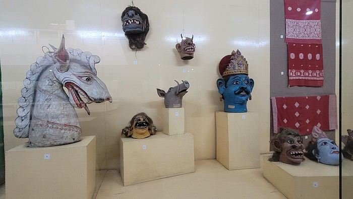

I’m not far from the Brahmaputra River, and the temptation to visit is too strong to resist. I’d hoped to find a promenade along the river, but that doesn’t exist here. I walk back calmly and notice several restaurants in my street. On the doorstep of my accommodation, I spot a pastry shop with cakes that look more like the ones we have in France than the typical ones here in India. A visit is a must, and I’m not disappointed!
Tonight, I’m dining at a restaurant in the street. The menu is a bit disappointing—burgers, pizzas, pasta—nothing very Indian. So, I’ll go with tomato pasta.
Thursday, March 20th. The alarm goes off super early, but I’m already awake—I was too worried I’d sleep through it. I leave the house at 4:00 AM. The rain has stopped, and at this hour, there aren’t many trucks on the road. I arrive at Barcelona Airport easily by 6:20 AM, let the valet know I’m there, and he quickly picks up my car. This time, I’m flying with Etihad Airways again. I booked the ticket during my trip to Cambodia: Barcelona/Kolkata, Delhi/Barcelona for 567 €. At that price, I didn’t hesitate for long—I knew I had to take it. And I’m glad I did because, by the time I returned, the price had gone up to 700 €. I can already hear the reactions: "Wow, how’d you get a ticket for that price? What site did you use? You’re amazing, MarieJo!" One thing’s for sure—I’m really happy with this deal. The flights from Barcelona to Abu Dhabi and Abu Dhabi to Kolkata go smoothly, and we arrive on time at 2:55 AM. There aren’t many people at immigration, so I get through quickly. My luggage isn’t on the carousel yet. After collecting my bag, I check in for my next flight with IndiGo, a 5:40 AM flight to Guwahati, arriving at 7:00 AM. I’m starting to feel pretty tired, so I take a taxi from the airport to Gruham Sojourn Homestay. The house is upstairs, and the neighborhood seems quiet, with restaurants lining the street. The room won’t be ready until 10:00 AM, so I rest on the bench in the meantime. Once in the room, I take a shower—it really helps me feel refreshed. I need to exchange some euros, so I look up a nearby exchange bureau on Google and head out to find it. I locate it easily, and the staff are super friendly. I get a great rate (1 € = 90 INR). I wander around the neighborhood. The train station isn’t far, and small markets line the streets. I head back to my area, walking along the main avenue. About 500 meters from my street, I discover a museum. The visit is fascinating—I see the famous Majuli masks, among other things.
I’m not far from the Brahmaputra River, and the temptation to visit is too strong to resist. I’d hoped to find a promenade along the river, but that doesn’t exist here. I walk back calmly and notice several restaurants in my street. On the doorstep of my accommodation, I spot a pastry shop with cakes that look more like the ones we have in France than the typical ones here in India. A visit is a must, and I’m not disappointed!
Tonight, I’m dining at a restaurant in the street. The menu is a bit disappointing—burgers, pizzas, pasta—nothing very Indian. So, I’ll go with tomato pasta.
So where are they and what are they doing?
This catchy and somewhat mysterious title comes from several questions I’ve been asking myself.
VF has been back open for a reasonable number of weeks and months now. The number of visitors overall matches past averages, but the number of members online in the last 24 hours seems relatively lower than what we used to see.
Yet, to my surprise, I’m seeing fewer travel journals, way fewer messages, and way fewer questions. I don’t see many new registered users online, and I notice a number of members who are logged in but either aren’t participating or have stopped participating.
Something’s not adding up for me because, in my opinion, VF is still appealing, and I don’t see which other sites could really compete.
Was there a real break between pre- and post-Covid? Does it just take more time for some people to discover the site or learn that it’s active again? Do people now prefer quick consumption on sites like FB or others I’m not familiar with? Where have the site’s old-timers gone, and what are they doing with their time now? What’s really going on here?
VF has been back open for a reasonable number of weeks and months now. The number of visitors overall matches past averages, but the number of members online in the last 24 hours seems relatively lower than what we used to see.
Yet, to my surprise, I’m seeing fewer travel journals, way fewer messages, and way fewer questions. I don’t see many new registered users online, and I notice a number of members who are logged in but either aren’t participating or have stopped participating.
Something’s not adding up for me because, in my opinion, VF is still appealing, and I don’t see which other sites could really compete.
Was there a real break between pre- and post-Covid? Does it just take more time for some people to discover the site or learn that it’s active again? Do people now prefer quick consumption on sites like FB or others I’m not familiar with? Where have the site’s old-timers gone, and what are they doing with their time now? What’s really going on here?
Tanzania 2019 - Polé Polé
KARIBUUU
Over 5 years later, I’m finally getting around to writing the travel journal for our first trip to East Africa: Tanzania. *Polé Polé*, as they say! 😎
A trip I’d started planning just 6 years ago, in February 2019, for my post-internship exam vacation. After returning to South Africa in July 2019 with my family, this trip, planned for September 2019, would be all about discovery and a few firsts: first trip with friends, first trek, first time in East Africa. I really wanted to attempt the Kilimanjaro ascent, try to still see some of its "eternal" ice, and Alison wanted to do as much safari as possible. Unlike with the Zulus, Himbas, or San, visiting a Maasai village wasn’t on the agenda. Thanks to the Kessy Brothers agency, who were super responsive, Sandy from VF, and other members who helped prepare our trip, we settled on the following itinerary:
Day -1 (8/30): Departure from Pointe-à-Pitre Day 0 (8/31): Departure from Paris Day 1 (9/01): Arrival at Kilimanjaro Airport / Ameg Lodge (Moshi) DAY 2 (9/02): Machame gate / Machame camp DAY 3 (9/03): Shira / Shira camp DAY 4 (9/04): Baranco / Baranco camp DAY 5 (9/05): Barafu / Barafu camp DAY 6 (9/06): Barafu + Summit at midnight / Mweka camp DAY 7 (9/07): Mweka gate / Sal Salnero Hotel (Moshi) DAY 8 (9/08): Arusha National Park / Kanga camp DAY 9 (9/09): Tarangire National Park / Kanga camp DAY 10 (9/10): Tarangire National Park / Twiga Lodge DAY 11 (9/11): Lake Manyara / Twiga Lodge DAY 12 (9/12): Ngorongoro Crater / Simba campsite DAY 13 (9/13): Serengeti National Park / Seronera campsite DAY 14 (9/14): Serengeti National Park - Uoga Kuria Camp DAY 15 (9/15): Serengeti National Park / Waso campsite DAY 16 (9/16): Lake Natron / Maasai Giraffe Ecolodge DAY 17 (9/17): Kilimanjaro Airport Day 18 (9/18): Zanzibar Day 19 (9/19): Zanzibar Day 20 (9/20): Zanzibar Day 21 (9/21): Zanzibar
As I mentioned in my first travel journal about our South Africa trip, I’ve had a special connection to Tanzania for a long time. Growing up in the Indian Ocean without ever visiting Africa, those wildlife documentaries on TV when I skipped my pharmacy classes... I imagined and dreamed about this land and country so much.
The original plan was to go just the two of us with Alison, but somehow—though I don’t quite remember how—we ended up organizing the trip with our friends Mélissa and Doriane, who joined us in Arusha after our Kilimanjaro trek for the last two weeks and their very first safari. I think it was Melissa who had the idea to crash our trip, and she was right to do so! 😉 Flights: Pointe-à-Pitre-Grand Case and Grand Case-Paris with Air Caraïbes. Flights: Paris-JRO and ZNZ-Paris with Kenya Airways (layover in Nairobi). Flight: JRO-ZNZ with Air Tanzania.
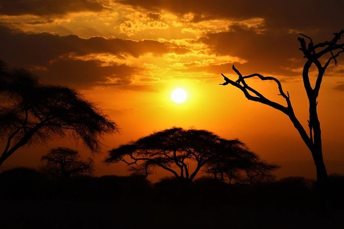
Safe travels! !
Over 5 years later, I’m finally getting around to writing the travel journal for our first trip to East Africa: Tanzania. *Polé Polé*, as they say! 😎
A trip I’d started planning just 6 years ago, in February 2019, for my post-internship exam vacation. After returning to South Africa in July 2019 with my family, this trip, planned for September 2019, would be all about discovery and a few firsts: first trip with friends, first trek, first time in East Africa. I really wanted to attempt the Kilimanjaro ascent, try to still see some of its "eternal" ice, and Alison wanted to do as much safari as possible. Unlike with the Zulus, Himbas, or San, visiting a Maasai village wasn’t on the agenda. Thanks to the Kessy Brothers agency, who were super responsive, Sandy from VF, and other members who helped prepare our trip, we settled on the following itinerary:
Day -1 (8/30): Departure from Pointe-à-Pitre Day 0 (8/31): Departure from Paris Day 1 (9/01): Arrival at Kilimanjaro Airport / Ameg Lodge (Moshi) DAY 2 (9/02): Machame gate / Machame camp DAY 3 (9/03): Shira / Shira camp DAY 4 (9/04): Baranco / Baranco camp DAY 5 (9/05): Barafu / Barafu camp DAY 6 (9/06): Barafu + Summit at midnight / Mweka camp DAY 7 (9/07): Mweka gate / Sal Salnero Hotel (Moshi) DAY 8 (9/08): Arusha National Park / Kanga camp DAY 9 (9/09): Tarangire National Park / Kanga camp DAY 10 (9/10): Tarangire National Park / Twiga Lodge DAY 11 (9/11): Lake Manyara / Twiga Lodge DAY 12 (9/12): Ngorongoro Crater / Simba campsite DAY 13 (9/13): Serengeti National Park / Seronera campsite DAY 14 (9/14): Serengeti National Park - Uoga Kuria Camp DAY 15 (9/15): Serengeti National Park / Waso campsite DAY 16 (9/16): Lake Natron / Maasai Giraffe Ecolodge DAY 17 (9/17): Kilimanjaro Airport Day 18 (9/18): Zanzibar Day 19 (9/19): Zanzibar Day 20 (9/20): Zanzibar Day 21 (9/21): Zanzibar
As I mentioned in my first travel journal about our South Africa trip, I’ve had a special connection to Tanzania for a long time. Growing up in the Indian Ocean without ever visiting Africa, those wildlife documentaries on TV when I skipped my pharmacy classes... I imagined and dreamed about this land and country so much.
The original plan was to go just the two of us with Alison, but somehow—though I don’t quite remember how—we ended up organizing the trip with our friends Mélissa and Doriane, who joined us in Arusha after our Kilimanjaro trek for the last two weeks and their very first safari. I think it was Melissa who had the idea to crash our trip, and she was right to do so! 😉 Flights: Pointe-à-Pitre-Grand Case and Grand Case-Paris with Air Caraïbes. Flights: Paris-JRO and ZNZ-Paris with Kenya Airways (layover in Nairobi). Flight: JRO-ZNZ with Air Tanzania.
Safe travels! !
Photo Safaris in Kenya
Back on the forum, I’m starting to write up two 3-week trips to Kenya in August 2021 and 2023.
In 2021, Quynh and I traveled with Régis (Rjulie95 on VF). Our son joined us in Baringo for the second half of the trip.
In 2023, we went with two friends who’d been dreaming of seeing wild animals ever since we got back from Kenya. We didn’t need much convincing to go with them!
The two itineraries are almost identical (well, when you love something...) but we did make a few tweaks.
- The first part of the trip was with a local driver/guide, Félix, who was recommended by Sylvie56. Sylvie and her husband Ben are Kenya enthusiasts—they’ve been there countless times, always with Félix... and for good reason! He’s fantastic!
- The second part was with Melting Pot Safari, an agency that adapted to our photography needs. Tony Crocetta, the co-founder (along with his Kenyan friend Simon Chebon), is a wildlife photographer himself.
Here are the itineraries for both trips, including accommodations:
In 2021: Day 0: Paris / Nairobi - 67 Airport Hotel Day 1: Nairobi / Amboseli - Simba Cottage Day 2: Amboseli - Simba Cottage Day 3: Amboseli / Aberdares - Fishing Lodge Day 4: Aberdares - Fishing Lodge Day 5: Aberdares - Fishing Lodge Day 6: Aberdares / Samburu - Riverside Camp Day 7: Samburu - Riverside Camp Day 8: Samburu - Riverside Camp Day 9: Samburu / Nakuru - Merica Hotel Day 10: Nakuru / Baringo - Tumbili Cliff Lodge Day 11: Baringo - Tumbili Cliff Lodge Day 12: Baringo - Tumbili Cliff Lodge Day 13: Baringo / Maasai Mara – Meltingpot Bush Camp Day 14 to 18: Maasai Mara – Meltingpot Bush Camp Day 19: Maasai Mara / Nairobi – Roussel Guest House Day 20: Nairobi / Paris
In 2023: Day 0: Lyon / Paris / Nairobi - 67 Airport Hotel Day 1: Nairobi / Meru - Ikweta Camp Day 2: Meru - Ikweta Camp Day 3: Meru - Ikweta Camp Day 4: Meru / Samburu - Riverside Camp Day 5: Samburu – Riverside Camp Day 6: Samburu / Buffalo Springs – Samburu Simba Day 7: Buffalo Springs / Ol Pejeta – Sweetwater Camp Day 8: Ol Pejeta / Amboseli - Simba Cottage Day 9: Amboseli - Simba Cottage Day 10: Amboseli - Simba Cottage Day 11: Amboseli / Nakuru – Lake Nakuru Lodge Day 12: Nakuru / Baringo - Tumbili Cliff Lodge Day 13: Baringo - Tumbili Cliff Lodge Day 14: Baringo - Tumbili Cliff Lodge Day 15: Baringo / Maasai Mara – Meltingpot Bush Camp Day 16 to 20: Maasai Mara – Meltingpot Bush Camp Day 21: Maasai Mara / Nairobi / Paris
Here’s an itinerary—it’s not exactly what we did, but a combination of both.
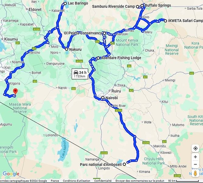
Ready to join us on safari to see some wild animals?
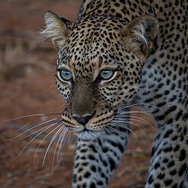
The two itineraries are almost identical (well, when you love something...) but we did make a few tweaks.
- The first part of the trip was with a local driver/guide, Félix, who was recommended by Sylvie56. Sylvie and her husband Ben are Kenya enthusiasts—they’ve been there countless times, always with Félix... and for good reason! He’s fantastic!
- The second part was with Melting Pot Safari, an agency that adapted to our photography needs. Tony Crocetta, the co-founder (along with his Kenyan friend Simon Chebon), is a wildlife photographer himself.
Here are the itineraries for both trips, including accommodations:
In 2021: Day 0: Paris / Nairobi - 67 Airport Hotel Day 1: Nairobi / Amboseli - Simba Cottage Day 2: Amboseli - Simba Cottage Day 3: Amboseli / Aberdares - Fishing Lodge Day 4: Aberdares - Fishing Lodge Day 5: Aberdares - Fishing Lodge Day 6: Aberdares / Samburu - Riverside Camp Day 7: Samburu - Riverside Camp Day 8: Samburu - Riverside Camp Day 9: Samburu / Nakuru - Merica Hotel Day 10: Nakuru / Baringo - Tumbili Cliff Lodge Day 11: Baringo - Tumbili Cliff Lodge Day 12: Baringo - Tumbili Cliff Lodge Day 13: Baringo / Maasai Mara – Meltingpot Bush Camp Day 14 to 18: Maasai Mara – Meltingpot Bush Camp Day 19: Maasai Mara / Nairobi – Roussel Guest House Day 20: Nairobi / Paris
In 2023: Day 0: Lyon / Paris / Nairobi - 67 Airport Hotel Day 1: Nairobi / Meru - Ikweta Camp Day 2: Meru - Ikweta Camp Day 3: Meru - Ikweta Camp Day 4: Meru / Samburu - Riverside Camp Day 5: Samburu – Riverside Camp Day 6: Samburu / Buffalo Springs – Samburu Simba Day 7: Buffalo Springs / Ol Pejeta – Sweetwater Camp Day 8: Ol Pejeta / Amboseli - Simba Cottage Day 9: Amboseli - Simba Cottage Day 10: Amboseli - Simba Cottage Day 11: Amboseli / Nakuru – Lake Nakuru Lodge Day 12: Nakuru / Baringo - Tumbili Cliff Lodge Day 13: Baringo - Tumbili Cliff Lodge Day 14: Baringo - Tumbili Cliff Lodge Day 15: Baringo / Maasai Mara – Meltingpot Bush Camp Day 16 to 20: Maasai Mara – Meltingpot Bush Camp Day 21: Maasai Mara / Nairobi / Paris
Here’s an itinerary—it’s not exactly what we did, but a combination of both.
Ready to join us on safari to see some wild animals?
Western USA Oct 2024 - Arches and Other Delights...
Aaah, I'm so glad Voyage Forum is back up and running. For reading... and for writing...
My last travel journal was from 2019, when I went hiking and backpacking with my son, who was 15 at the time. We visited some places that were still pretty unknown back then! I was supposed to go in April 2020, still solo, with arches as the main focus. I’d spent nearly two months getting physically prepared, and had managed to snag a bunch of permits for CBS, The Needles, and so on... Of course, it all got postponed—first to October 2020, then April 2021, then October 2021, and finally it happened in April 2022. Maybe I’ll write about that in another journal. The thing is, every time, I spend at least 6 to 8 weeks getting physically ready, even though I work out all year. Huge disappointment during that trip—so much had changed because of Covid, kind of like in the mountains back home. Overcrowding, not just in the national parks (we knew about that), but also in a lot of remote, lesser-known spots. Like the French, Americans realized they had a lot of beautiful places in their own country during those travel bans. And they kept exploring... Prices for pretty much everything had already gone up a lot. Gas, restaurants, cars, but especially lodging! Then, after dealing with so much wind in April, I got a little "fed up" with that time of year. It felt like I had strong winds and sandstorms for 3 out of the 3.5 weeks I was there...
So, the next trip was October 2023, to catch the partial eclipse in New Mexico, and of course, a bunch of arches ;). So many arches. Maybe I’ll write about that one too... Then came (among others) April 2024 for the total eclipse, in Texas, but starting from L.A., with my partner Valérie. Since I’d never visited some places I wanted to see further south of my usual loops, it was the perfect opportunity... And here we are at the end of September 2024. Another trip focused on arches—I never get tired of them. Every time I check one off my list, another gets added. Often it’s a photo I’ve seen online or in the NABS (Natural Arches and Bridges Society) magazine, which I’m a member of. I also scour the WAD (World Arches Database) and make a list of arches I want to visit. Fewer and fewer "viewpoints"—I’ve done all the most famous ones, and unless the sky is amazing, the photos all look the same. Since my goal is always photography *and* hiking, I’m always on the lookout. So this time, a packed itinerary—27 days, very busy. In past trips, if I didn’t plan enough and hiked fast, I’d end up with too many "gaps" in my days. This time, I’d rather have too much than too little (like in 2023, actually).
A few stats: - 6,589 km, including +/-1,400 km of off-road trails - 323 km of hiking, 8,829 m of elevation gain - 142 new arches for my collection, including some stunning ones, some less so, and some downright ugly—but all in the WAD. - Two outings with a Navajo guide - Almost no injuries - 8 bivouacs, including 2 backpacking trips - 4 days of backpacking - 22 freeze-dried meals and 15 Subways eaten - 6 thorns in my shoes (long live the tweezers in my backpack) - 3 kg lost (plus the 5 kg lost during prep)
Almost every day, I posted a little update on Facebook for family and friends. So I’ll be copy-pasting those texts here, written "my way" as usual. Some will like it, some won’t—that’s just how it is... 😏
For months, I planned this trip—looking for info, creating GPS tracks on Google Earth, exchanging tips with NABS members and other passionate friends. I snagged permits for The Needles again (4-5 days), for Fiery Furnace, timed entries for Arches National Park (2), and booked just one campsite, a "triple tour" in Monument Valley, and the first night in a motel. This is the first time I haven’t booked 80% of the motels—I was tired of having constraints because of the weather. This time, I want to be able to adjust my plans based on the weather and what I feel like doing more or less of. Camp when the weather’s nice, hotel/motel when it’s crappy.
Here we go...
Day 1
As usual, early morning flights: BRU-AMS, then AMS-SLC. Those who follow me know I’ve been renting a Rubicon from Rugged for years, which "forces" me to land in SLC. Up at 3:30 AM, but I’d been awake since 2:00 AM—the day’s going to be long. Shuttle to the airport. In Brussels, only two check-in counters open. I get there—no cabin baggage weigh-in, while the agent next to me is weighing everyone’s, even kids’ backpacks! A bit of luck, because as usual, if they weighed my backpack *and* my cabin bag, I’d already be over 20 kg. I check two hold bags, since I’ve got a lot of camping/backpacking gear, lots of freeze-dried meals, the backpacking bag, the Bear Canister needed for The Needles, etc. First flight is 30 minutes late, so the second one is already boarding. I’ve got the SSSS mark on my ticket (extra security check), so I head straight to the front when I arrive at the same time as Zone 3, even though I’m Zone 6. I pretend the check will take a while, and it "works"—they didn’t notice! No way I want to board last and risk them making me check my cabin bag. It’s packed with photo gear, laptop, drone, etc.—unthinkable to have to put it in the hold. Always a worry... SLC: baggage claim, customs, and out in 32 minutes. The MPC app makes something that was already quick even faster at this airport. And all the bags are there. That’s always a relief too. Since I drive at least 3 hours straight after landing, losing a hold bag would really mess up the trip and force me to spend the first night closer to SLC. On the way to Rugged. A young French couple from Reims is in the shuttle with me—they discovered Rugged thanks to my post in a Facebook group! Well, the team has changed again, and they lost half the stuff I’d left last October (plastic boxes, pillow, sugar, gas cartridges, folding chair, Crocs, etc.), but at least there are gas cartridges, so I don’t have to go to REI. REI would’ve been at least an hour out of my way. But as far as I know, there are no gas cartridges in Green River. I still get my tent stake hammer back, and a folding chair—different from mine but identical.
20,000 km Rubicon 4Xe, white. I check the tires—they’re in great shape, as requested. I’ll come back to the hybrid later. I didn’t want a hybrid, but that’s all they had this year. Why? Higher fuel consumption, smaller tank, higher cargo floor.
Stop at the Walmart near Provo, whose layout I know like the back of my hand (Walmarts are often similar). Start-of-trip shopping: water, Coke, Gatorade, UHT milk for cereal (not very common in the US), Special K "Almond and Vanilla", cold meds that work well (and don’t exist back home—you never know), two plastic bins, a pillow for the tent, Trail Mix, that’s about it. On the road to Nebo Loop for the fall colors. I’d driven this route last year, in the opposite direction on my way back to SLC, but it was a bit too late. This time, I’m a little early. At the start of the road, the maples are in the sun, so I go up to 2,200 m for the bright yellow aspens, then head back down. Mostly drone shots—no time to go for a walk. After a day like this, 4.5-5 hours of driving is already a lot... Arrived in Green River at 9:00 PM. Organize all the stuff from the bags properly, then sleep.
A few photos from these first few hours.
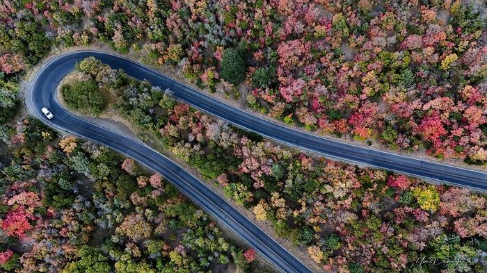
My last travel journal was from 2019, when I went hiking and backpacking with my son, who was 15 at the time. We visited some places that were still pretty unknown back then! I was supposed to go in April 2020, still solo, with arches as the main focus. I’d spent nearly two months getting physically prepared, and had managed to snag a bunch of permits for CBS, The Needles, and so on... Of course, it all got postponed—first to October 2020, then April 2021, then October 2021, and finally it happened in April 2022. Maybe I’ll write about that in another journal. The thing is, every time, I spend at least 6 to 8 weeks getting physically ready, even though I work out all year. Huge disappointment during that trip—so much had changed because of Covid, kind of like in the mountains back home. Overcrowding, not just in the national parks (we knew about that), but also in a lot of remote, lesser-known spots. Like the French, Americans realized they had a lot of beautiful places in their own country during those travel bans. And they kept exploring... Prices for pretty much everything had already gone up a lot. Gas, restaurants, cars, but especially lodging! Then, after dealing with so much wind in April, I got a little "fed up" with that time of year. It felt like I had strong winds and sandstorms for 3 out of the 3.5 weeks I was there...
So, the next trip was October 2023, to catch the partial eclipse in New Mexico, and of course, a bunch of arches ;). So many arches. Maybe I’ll write about that one too... Then came (among others) April 2024 for the total eclipse, in Texas, but starting from L.A., with my partner Valérie. Since I’d never visited some places I wanted to see further south of my usual loops, it was the perfect opportunity... And here we are at the end of September 2024. Another trip focused on arches—I never get tired of them. Every time I check one off my list, another gets added. Often it’s a photo I’ve seen online or in the NABS (Natural Arches and Bridges Society) magazine, which I’m a member of. I also scour the WAD (World Arches Database) and make a list of arches I want to visit. Fewer and fewer "viewpoints"—I’ve done all the most famous ones, and unless the sky is amazing, the photos all look the same. Since my goal is always photography *and* hiking, I’m always on the lookout. So this time, a packed itinerary—27 days, very busy. In past trips, if I didn’t plan enough and hiked fast, I’d end up with too many "gaps" in my days. This time, I’d rather have too much than too little (like in 2023, actually).
A few stats: - 6,589 km, including +/-1,400 km of off-road trails - 323 km of hiking, 8,829 m of elevation gain - 142 new arches for my collection, including some stunning ones, some less so, and some downright ugly—but all in the WAD. - Two outings with a Navajo guide - Almost no injuries - 8 bivouacs, including 2 backpacking trips - 4 days of backpacking - 22 freeze-dried meals and 15 Subways eaten - 6 thorns in my shoes (long live the tweezers in my backpack) - 3 kg lost (plus the 5 kg lost during prep)
Almost every day, I posted a little update on Facebook for family and friends. So I’ll be copy-pasting those texts here, written "my way" as usual. Some will like it, some won’t—that’s just how it is... 😏
For months, I planned this trip—looking for info, creating GPS tracks on Google Earth, exchanging tips with NABS members and other passionate friends. I snagged permits for The Needles again (4-5 days), for Fiery Furnace, timed entries for Arches National Park (2), and booked just one campsite, a "triple tour" in Monument Valley, and the first night in a motel. This is the first time I haven’t booked 80% of the motels—I was tired of having constraints because of the weather. This time, I want to be able to adjust my plans based on the weather and what I feel like doing more or less of. Camp when the weather’s nice, hotel/motel when it’s crappy.
Here we go...
Day 1
As usual, early morning flights: BRU-AMS, then AMS-SLC. Those who follow me know I’ve been renting a Rubicon from Rugged for years, which "forces" me to land in SLC. Up at 3:30 AM, but I’d been awake since 2:00 AM—the day’s going to be long. Shuttle to the airport. In Brussels, only two check-in counters open. I get there—no cabin baggage weigh-in, while the agent next to me is weighing everyone’s, even kids’ backpacks! A bit of luck, because as usual, if they weighed my backpack *and* my cabin bag, I’d already be over 20 kg. I check two hold bags, since I’ve got a lot of camping/backpacking gear, lots of freeze-dried meals, the backpacking bag, the Bear Canister needed for The Needles, etc. First flight is 30 minutes late, so the second one is already boarding. I’ve got the SSSS mark on my ticket (extra security check), so I head straight to the front when I arrive at the same time as Zone 3, even though I’m Zone 6. I pretend the check will take a while, and it "works"—they didn’t notice! No way I want to board last and risk them making me check my cabin bag. It’s packed with photo gear, laptop, drone, etc.—unthinkable to have to put it in the hold. Always a worry... SLC: baggage claim, customs, and out in 32 minutes. The MPC app makes something that was already quick even faster at this airport. And all the bags are there. That’s always a relief too. Since I drive at least 3 hours straight after landing, losing a hold bag would really mess up the trip and force me to spend the first night closer to SLC. On the way to Rugged. A young French couple from Reims is in the shuttle with me—they discovered Rugged thanks to my post in a Facebook group! Well, the team has changed again, and they lost half the stuff I’d left last October (plastic boxes, pillow, sugar, gas cartridges, folding chair, Crocs, etc.), but at least there are gas cartridges, so I don’t have to go to REI. REI would’ve been at least an hour out of my way. But as far as I know, there are no gas cartridges in Green River. I still get my tent stake hammer back, and a folding chair—different from mine but identical.
20,000 km Rubicon 4Xe, white. I check the tires—they’re in great shape, as requested. I’ll come back to the hybrid later. I didn’t want a hybrid, but that’s all they had this year. Why? Higher fuel consumption, smaller tank, higher cargo floor.
Stop at the Walmart near Provo, whose layout I know like the back of my hand (Walmarts are often similar). Start-of-trip shopping: water, Coke, Gatorade, UHT milk for cereal (not very common in the US), Special K "Almond and Vanilla", cold meds that work well (and don’t exist back home—you never know), two plastic bins, a pillow for the tent, Trail Mix, that’s about it. On the road to Nebo Loop for the fall colors. I’d driven this route last year, in the opposite direction on my way back to SLC, but it was a bit too late. This time, I’m a little early. At the start of the road, the maples are in the sun, so I go up to 2,200 m for the bright yellow aspens, then head back down. Mostly drone shots—no time to go for a walk. After a day like this, 4.5-5 hours of driving is already a lot... Arrived in Green River at 9:00 PM. Organize all the stuff from the bags properly, then sleep.
A few photos from these first few hours.
Flânerie le long de la rivière Luangwa English translation pending
Bonjour à toutes et tous,
En avril dernier, à la suite de Régis puis de Claire, nous avions partagé sur ce forum notre pérégrination atypique au Kenya dans la réserve du Masaï-Mara. A l'issue de ce récit, nous avions imaginé repartir soit en randonnée sur les plus hautes terres d'Ethiopie (une dizaine de jours dans les montagnes du Simien lors d'un long séjour en 2009), soit de suivre le cours tranquille de la rivière Luangwa, dans sa partie sud (deux semaines à cheval sur octobre et novembre 2019). Dans le but d'animer les colonnes désertées de Voyage Forum en raison d'une sournoise pandémie, nous avons choisi l'Afrique Australe, précisant que ce texte, destiné à notre entourage ne correspond pas tout à fait à l'esprit "Carnets de Voyages" du site, vous nous en excuserez. Comme la précédente, cette escapade est l'une des rares que nous ayons réalisée avec une agence : y prendrait-on goût ou vieillirait-on ? Pour agrémenter ses longues pages d'écriture (une trentaine pour la partie South Luangwa N P et une dizaine pour la visite de Mosi-oa-Tunya et alentours), Yolande a sélectionné les photos les plus représentatives de cette vadrouille zambienne, dont cette magnifique panthère, rencontrée dès notre entrée dans le sanctuaire.
En route pour le rêve, seule frontière encore ouverte. Bien amicalement. Jety 34.
Impossible de joindre la photo (au secours !), ci-joint le message de VF (??????)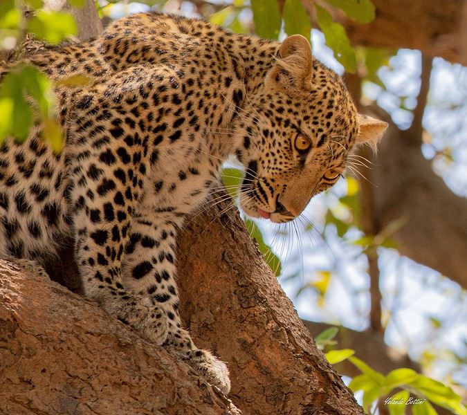
En avril dernier, à la suite de Régis puis de Claire, nous avions partagé sur ce forum notre pérégrination atypique au Kenya dans la réserve du Masaï-Mara. A l'issue de ce récit, nous avions imaginé repartir soit en randonnée sur les plus hautes terres d'Ethiopie (une dizaine de jours dans les montagnes du Simien lors d'un long séjour en 2009), soit de suivre le cours tranquille de la rivière Luangwa, dans sa partie sud (deux semaines à cheval sur octobre et novembre 2019). Dans le but d'animer les colonnes désertées de Voyage Forum en raison d'une sournoise pandémie, nous avons choisi l'Afrique Australe, précisant que ce texte, destiné à notre entourage ne correspond pas tout à fait à l'esprit "Carnets de Voyages" du site, vous nous en excuserez. Comme la précédente, cette escapade est l'une des rares que nous ayons réalisée avec une agence : y prendrait-on goût ou vieillirait-on ? Pour agrémenter ses longues pages d'écriture (une trentaine pour la partie South Luangwa N P et une dizaine pour la visite de Mosi-oa-Tunya et alentours), Yolande a sélectionné les photos les plus représentatives de cette vadrouille zambienne, dont cette magnifique panthère, rencontrée dès notre entrée dans le sanctuaire.
En route pour le rêve, seule frontière encore ouverte. Bien amicalement. Jety 34.
Impossible de joindre la photo (au secours !), ci-joint le message de VF (??????)
Traversée de la Chartreuse en solo English translation pending
Trek solo n°6
On admettra que cette année fut spéciale. Je devais faire la traversée de Majorque en avril et puis... SALUE JE M'APPELLE COVID 19 ET JE VIENS VOUS FAIRE CHIER. Du coup, peu de projets pour cet été, difficile d'estimer les possibilités de voyage à l'étranger, pas très envie non plus de faire circuler cette merde... Alors je me rabats sur mes chères Alpes, ma foi de très bonne qualité. Début juillet, je consulte mon pote David, un normand exilé au pays des montagnes, pour savoir quand il sera chez lui, à Chambéry. Je cale donc un périple fin juillet, de Grenoble à Chambéry, via le massif de la Chartreuse, et en profiterai pour lui rendre visite.
Trajet réservé : départ le 25 juillet en train vers Grenoble, retour le 2 août en bus depuis Chambéry.
Je m'attends pas à quelque chose d'exceptionnel, je sais pas pourquoi. Ça a l'air très joli, mais pas très haut, et pas très sauvage. Mais après ces derniers mois bizarres, ce confinement éprouvant et les longs mois sans nature, un peu de montagne ne peut me faire que du bien. Et au moins, même si la météo n'est pas avec moi, je vais pas crever de froid, pour une fois (les plus hauts sommets sont à 2000m environ).
Après un petit séjour en Normandie natale et quelques trips de Caen, me voici en halte en région parisienne pour faire mon sac, la veille du départ. Ce qui m'inquiète le plus, c'est l'accès à l'eau. Il n'y a pas beaucoup de neige l'hiver (voire pas du tout certaines années), donc très peu de rivières en altitude. Les sources sont pour abreuver les troupeaux et bergers, mais souvent, l'été, elles sont à sec... Je checke quand même les dernières mises à jour des randonneurs sur refuge.info, qui recense tous les abris et les sources, pour voir un peu l'état des lieux. Ça devrait le faire. Je prends quand même 3 gourdes de 75 ml au lieu de 2 habituellement, ce qui me fait au maximum 2,25L d'eau en réserve.
Je blinde mon sac de 50L : 13 kg sans eau. Mh. Je sais pas comment je me démerde pour me retrouver avec autant de poids. Je lis pas mal de carnets de randonneurs qui portent 8 kg. Pourtant, j'ai pas prévu beaucoup de bouffe, peu d'habits, le strict minimum pour l'autonomie... Je comprends pas comment ça peut monter aussi haut pour seulement une semaine, d'ailleurs je me pose la question tous les ans.
On admettra que cette année fut spéciale. Je devais faire la traversée de Majorque en avril et puis... SALUE JE M'APPELLE COVID 19 ET JE VIENS VOUS FAIRE CHIER. Du coup, peu de projets pour cet été, difficile d'estimer les possibilités de voyage à l'étranger, pas très envie non plus de faire circuler cette merde... Alors je me rabats sur mes chères Alpes, ma foi de très bonne qualité. Début juillet, je consulte mon pote David, un normand exilé au pays des montagnes, pour savoir quand il sera chez lui, à Chambéry. Je cale donc un périple fin juillet, de Grenoble à Chambéry, via le massif de la Chartreuse, et en profiterai pour lui rendre visite.
Trajet réservé : départ le 25 juillet en train vers Grenoble, retour le 2 août en bus depuis Chambéry.
Je m'attends pas à quelque chose d'exceptionnel, je sais pas pourquoi. Ça a l'air très joli, mais pas très haut, et pas très sauvage. Mais après ces derniers mois bizarres, ce confinement éprouvant et les longs mois sans nature, un peu de montagne ne peut me faire que du bien. Et au moins, même si la météo n'est pas avec moi, je vais pas crever de froid, pour une fois (les plus hauts sommets sont à 2000m environ).
Après un petit séjour en Normandie natale et quelques trips de Caen, me voici en halte en région parisienne pour faire mon sac, la veille du départ. Ce qui m'inquiète le plus, c'est l'accès à l'eau. Il n'y a pas beaucoup de neige l'hiver (voire pas du tout certaines années), donc très peu de rivières en altitude. Les sources sont pour abreuver les troupeaux et bergers, mais souvent, l'été, elles sont à sec... Je checke quand même les dernières mises à jour des randonneurs sur refuge.info, qui recense tous les abris et les sources, pour voir un peu l'état des lieux. Ça devrait le faire. Je prends quand même 3 gourdes de 75 ml au lieu de 2 habituellement, ce qui me fait au maximum 2,25L d'eau en réserve.
Je blinde mon sac de 50L : 13 kg sans eau. Mh. Je sais pas comment je me démerde pour me retrouver avec autant de poids. Je lis pas mal de carnets de randonneurs qui portent 8 kg. Pourtant, j'ai pas prévu beaucoup de bouffe, peu d'habits, le strict minimum pour l'autonomie... Je comprends pas comment ça peut monter aussi haut pour seulement une semaine, d'ailleurs je me pose la question tous les ans.
Touristikis à la crème de solaris English translation pending
Comme j'ai un peu de temps, je vous livre le récit d'un voyage de 2018 qui traînait sur mon ordinateur :
Il était une fois, par delà les pandémies et les crises économiques, un temps où nous pouvions voyager : 2018. En cette année béni(t)e, il n’y eut pour nous point de virée nord-atlantique dans la chaleur estivale au programme, point de douches gratuites rafraîchissantes, point de températures vivifiantes, point de gastronomie douteuse et point de prix déments. En passant, félicitations à l’Islande et ses pizzas caoutchouteuse à 30 euros. En 2018, non, on va dans un vrai pays où l’on sait ce que signifie avoir chaud, manger et glander à une terrasse : la Grèce. Et comme nous ne sommes quand même pas des stakhanovistes du 40° à l’ombre, nous avons choisi le printemps, avril plus précisément. Pour le terrain de jeu, il s'agira d'Athènes et du Péloponnèse sur un peu plus de deux semaines. A nous, les petites églises, les ruines romantiques et les oliviers scintillants !
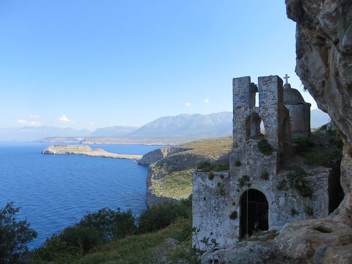 Bien choisir sa photo d'appel pour attirer le chaland. Un bon point et toute mon estime pour celui qui devine où c'est.
Avec la Grèce - pour ceux qui ont lu mes autres carnets qui sont tellement merveilleux qu’il faut les lire immédiatement et que votre vie s’en trouvera changée et éblouie - tout est chamboulé : fini les campings, les dortoirs et les piques-niques miteux de nos voyages dans le nord, place aux hôtels, aux b&b et aux restos. Et en plus, les Grecs ont le bon goût d’être accueillants.
Laissons la parole à du Ballay, parrainé par Alain Deloin et Jean-Michel Apeupré :
Heureux qui comme Ulysse a fait un beau voyage (en Grèce), Ou comme celui-là qui vit le Parthénon, Et puis est retourné, plein d'image et pâmoison, Vivre exubérant le reste de son âge
Et avant d'attaquer le vif du sujet, quelques annonces pour le public innocent : Avertissement : vous lisez ce compte-rendu à vos risques et périls. Toute indignation n’est pas de ma responsabilité. Avertissement bis : non je ne suis pas raciste non je n’ai rien contre les Néerlandais, j’ai d’ailleurs un ami néerlandais non les Grecs ne sont pas des feignants oui les Allemands ont pour passe-temps l’invasion… Ah mince une rechute.
Jour 1
Ayé, c’est parti pour une journée de transport translation Lyon-Athènes via Munich en empruntant la Lufthansa. Le vol est sans encombre, une conversation s’engage avec un voisin grec sympathique autour de la qualité douteuse de la bouffe allemande. J'en profite pour avoir une illumination : la nourriture, voilà ce qui unit les Européens (enfin ceux du sud) ! Eclair de génie, j’ai trouvé comment sauver l’Union européenne « tous unis contre la vie beurk ». Malheureusement, ça risque d’exclure les riches du nord. D’ailleurs c’est peut-être un signe : faut-il mal manger pour être riche ? Faudrait exclure les Japonais de l’équation mais sinon ça marche (pays germaniques, scandinaves et anglo-saxons même combat). Revenons au voisin grec, je tente de donner un tour sportif à la conversation mais malheureusement il n’aime pas le foot « football is shit »… Arrgghh, de quoi vais-je bien pouvoir parler alors ?! Du coup, je parle plus. Alors qu’un petit débat sur le scandale du moment, le président du PAOK Salonique et son flingue, ça, ça aurait été fun .
L’atterrissage se passe sans encombre dans cet aéroport d’Athènes qui a changé de place depuis mon unique passage dans le coin et s’est éloigné du centre-ville. Première prise de contact avec l’alphabet grec, on avait essayé pour le fun de potasser les équivalences mais c’est loin d’être évident ! Combien d'équivalents du O ont-ils dans cet alphabet ?!
Le trajet jusqu’au centre d’Athènes est long, très long et le métro/train se remplit progressivement jusqu’à être bondé à ras bord. Nous sommes tassés, compressés et pour sortir de cette fournaise, c’est la lutte finale, poussons-nous et demain, l’air sera le sauveur du genre humain (note à moi-même : éviter la prochaine fois d’arriver au moment de la sortie du travail)
La chambre chez l’habitant est bien placée, en plein centre sans être très bruyante. On profite de notre premier soir pour une approche de la cuisine grecque et un mauvais choix de commande (que de la friture…). On enchaîne sur une petite balade nocturne pour revenir sur l’impression née du voyage précédent (ie dans les années 90 la voiture reine, une ville bruyante et désagréable). Eh bien en fait, une partie du centre-ville s’est piétonnisé, il y a de la vie, des restos et des cafés avec des terrasses partout, c’est très agréable finalement.
Il était une fois, par delà les pandémies et les crises économiques, un temps où nous pouvions voyager : 2018. En cette année béni(t)e, il n’y eut pour nous point de virée nord-atlantique dans la chaleur estivale au programme, point de douches gratuites rafraîchissantes, point de températures vivifiantes, point de gastronomie douteuse et point de prix déments. En passant, félicitations à l’Islande et ses pizzas caoutchouteuse à 30 euros. En 2018, non, on va dans un vrai pays où l’on sait ce que signifie avoir chaud, manger et glander à une terrasse : la Grèce. Et comme nous ne sommes quand même pas des stakhanovistes du 40° à l’ombre, nous avons choisi le printemps, avril plus précisément. Pour le terrain de jeu, il s'agira d'Athènes et du Péloponnèse sur un peu plus de deux semaines. A nous, les petites églises, les ruines romantiques et les oliviers scintillants !
Bien choisir sa photo d'appel pour attirer le chaland. Un bon point et toute mon estime pour celui qui devine où c'est.Avec la Grèce - pour ceux qui ont lu mes autres carnets qui sont tellement merveilleux qu’il faut les lire immédiatement et que votre vie s’en trouvera changée et éblouie - tout est chamboulé : fini les campings, les dortoirs et les piques-niques miteux de nos voyages dans le nord, place aux hôtels, aux b&b et aux restos. Et en plus, les Grecs ont le bon goût d’être accueillants.
Laissons la parole à du Ballay, parrainé par Alain Deloin et Jean-Michel Apeupré :
Heureux qui comme Ulysse a fait un beau voyage (en Grèce), Ou comme celui-là qui vit le Parthénon, Et puis est retourné, plein d'image et pâmoison, Vivre exubérant le reste de son âge
Et avant d'attaquer le vif du sujet, quelques annonces pour le public innocent : Avertissement : vous lisez ce compte-rendu à vos risques et périls. Toute indignation n’est pas de ma responsabilité. Avertissement bis : non je ne suis pas raciste non je n’ai rien contre les Néerlandais, j’ai d’ailleurs un ami néerlandais non les Grecs ne sont pas des feignants oui les Allemands ont pour passe-temps l’invasion… Ah mince une rechute.
Jour 1
Ayé, c’est parti pour une journée de transport translation Lyon-Athènes via Munich en empruntant la Lufthansa. Le vol est sans encombre, une conversation s’engage avec un voisin grec sympathique autour de la qualité douteuse de la bouffe allemande. J'en profite pour avoir une illumination : la nourriture, voilà ce qui unit les Européens (enfin ceux du sud) ! Eclair de génie, j’ai trouvé comment sauver l’Union européenne « tous unis contre la vie beurk ». Malheureusement, ça risque d’exclure les riches du nord. D’ailleurs c’est peut-être un signe : faut-il mal manger pour être riche ? Faudrait exclure les Japonais de l’équation mais sinon ça marche (pays germaniques, scandinaves et anglo-saxons même combat). Revenons au voisin grec, je tente de donner un tour sportif à la conversation mais malheureusement il n’aime pas le foot « football is shit »… Arrgghh, de quoi vais-je bien pouvoir parler alors ?! Du coup, je parle plus. Alors qu’un petit débat sur le scandale du moment, le président du PAOK Salonique et son flingue, ça, ça aurait été fun .
L’atterrissage se passe sans encombre dans cet aéroport d’Athènes qui a changé de place depuis mon unique passage dans le coin et s’est éloigné du centre-ville. Première prise de contact avec l’alphabet grec, on avait essayé pour le fun de potasser les équivalences mais c’est loin d’être évident ! Combien d'équivalents du O ont-ils dans cet alphabet ?!
Le trajet jusqu’au centre d’Athènes est long, très long et le métro/train se remplit progressivement jusqu’à être bondé à ras bord. Nous sommes tassés, compressés et pour sortir de cette fournaise, c’est la lutte finale, poussons-nous et demain, l’air sera le sauveur du genre humain (note à moi-même : éviter la prochaine fois d’arriver au moment de la sortie du travail)
La chambre chez l’habitant est bien placée, en plein centre sans être très bruyante. On profite de notre premier soir pour une approche de la cuisine grecque et un mauvais choix de commande (que de la friture…). On enchaîne sur une petite balade nocturne pour revenir sur l’impression née du voyage précédent (ie dans les années 90 la voiture reine, une ville bruyante et désagréable). Eh bien en fait, une partie du centre-ville s’est piétonnisé, il y a de la vie, des restos et des cafés avec des terrasses partout, c’est très agréable finalement.
Kenya February 2020: From Tsavo to Samburu via Meru National Park
Good evening everyone,
I hope you're all doing well despite this very unusual time…
Here’s a new travel journal to get you back on the Kenyan trails.
It was a really great idea to buy those flight tickets to Nairobi back in December. When Benoit suggested this new safari in February, I hesitated a little (very little): it was the season with particularly high temperatures, and the short rainy season in November/December had been very heavy, raising concerns about the state of the tracks… Given the current situation, no regrets, of course… We quickly organized the safari with our usual guide, and we booked the accommodations ourselves directly. (If we’d waited just a few more weeks, we might’ve regretted it…)
For once, we were able to leave from the airport near where we live (Lorient - Lann Bihoué), which is really convenient: no driving, no parking… We left home at 2 PM on Tuesday, February 18th, and arrived in Nairobi at 6 AM the next morning—perfect. (With a layover in CDG, of course 😉) Upon arrival, after a forehead temperature check by airport staff, we got our visas very quickly (forms filled out before departure). The customs agents congratulated us on our passports full of Kenyan stamps… but we still had to pay the 40 € for the visa.
All that was left was to collect our luggage, and we’d be ready to leave the airport shortly after landing. But there was a small issue: the baggage conveyor belt was broken… Eventually, the suitcases and bags were brought out by hand… Hakuna Matata, as they say here—no problem, as long as they’re all there. Benoit sent a message to Félix, our guide, to come meet us in the airport parking lot. After catching up with our respective families, we set off toward the Mombasa road, heading to Voi.
Traffic in Nairobi is still as heavy as ever, and the pollution is very noticeable (cars, but also cement factories…). The current lockdown has changed things. On social media, Mount Kenya and Kilimanjaro seem visible from Nairobi now!…
The first stop on this safari was a place we hadn’t visited before: the LUMO Community Wildlife Conservancy lumoconservancy.com/. It’s a small reserve located west of Tsavo West and near the Taita Hills. The reserve is managed by the local community, and entry fees are lower than in Tsavo’s national parks. We had initially planned to spend three days in Tsavo East, but since the accommodation wasn’t available for that long, we ended up choosing this option, which turned out to be a great discovery. Since the reserve is small, I think it’s hard to spend more than two days there. The advantage is that, since it’s not a national park, activities like walks or night safaris can be offered.
Alright, here are a few images to set the mood.
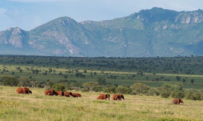
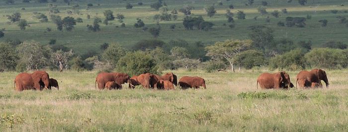
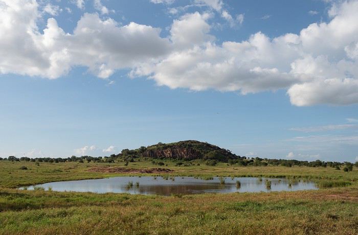
Elephants, but also hartebeests and lots of giraffes in a light we really liked.
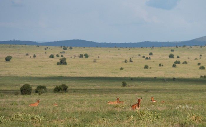
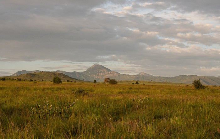
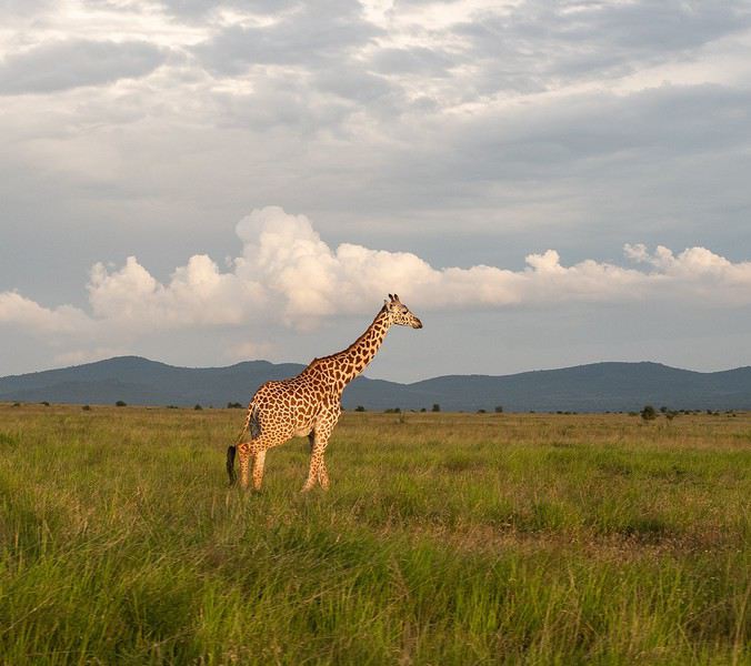
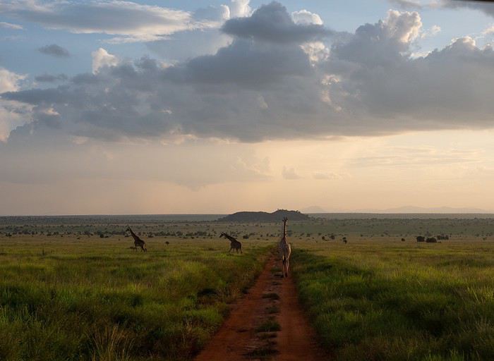
It was a really great idea to buy those flight tickets to Nairobi back in December. When Benoit suggested this new safari in February, I hesitated a little (very little): it was the season with particularly high temperatures, and the short rainy season in November/December had been very heavy, raising concerns about the state of the tracks… Given the current situation, no regrets, of course… We quickly organized the safari with our usual guide, and we booked the accommodations ourselves directly. (If we’d waited just a few more weeks, we might’ve regretted it…)
For once, we were able to leave from the airport near where we live (Lorient - Lann Bihoué), which is really convenient: no driving, no parking… We left home at 2 PM on Tuesday, February 18th, and arrived in Nairobi at 6 AM the next morning—perfect. (With a layover in CDG, of course 😉) Upon arrival, after a forehead temperature check by airport staff, we got our visas very quickly (forms filled out before departure). The customs agents congratulated us on our passports full of Kenyan stamps… but we still had to pay the 40 € for the visa.
All that was left was to collect our luggage, and we’d be ready to leave the airport shortly after landing. But there was a small issue: the baggage conveyor belt was broken… Eventually, the suitcases and bags were brought out by hand… Hakuna Matata, as they say here—no problem, as long as they’re all there. Benoit sent a message to Félix, our guide, to come meet us in the airport parking lot. After catching up with our respective families, we set off toward the Mombasa road, heading to Voi.
Traffic in Nairobi is still as heavy as ever, and the pollution is very noticeable (cars, but also cement factories…). The current lockdown has changed things. On social media, Mount Kenya and Kilimanjaro seem visible from Nairobi now!…
The first stop on this safari was a place we hadn’t visited before: the LUMO Community Wildlife Conservancy lumoconservancy.com/. It’s a small reserve located west of Tsavo West and near the Taita Hills. The reserve is managed by the local community, and entry fees are lower than in Tsavo’s national parks. We had initially planned to spend three days in Tsavo East, but since the accommodation wasn’t available for that long, we ended up choosing this option, which turned out to be a great discovery. Since the reserve is small, I think it’s hard to spend more than two days there. The advantage is that, since it’s not a national park, activities like walks or night safaris can be offered.
Alright, here are a few images to set the mood.
Elephants, but also hartebeests and lots of giraffes in a light we really liked.
Le patron de Ryanair juge «idiotes» les règles de distanciation sociale dans les avions English translation pending
Il n'a peut être pas forcément tort mais comme toujours, l'art et la manière...
Quelques articles... Ryanair boss says airline won't fly with 'idiotic' social distancing rules en anglais.
«Soit le gouvernement paie pour le siège du milieu, soit nous ne volerons pas» ici. Ryanair ne revolera pas si le siège du milieu doit rester vide là. Ryanair : pas de vol avec siège du milieu vacant sur ce lien.
Quelques articles... Ryanair boss says airline won't fly with 'idiotic' social distancing rules en anglais.
«Soit le gouvernement paie pour le siège du milieu, soit nous ne volerons pas» ici. Ryanair ne revolera pas si le siège du milieu doit rester vide là. Ryanair : pas de vol avec siège du milieu vacant sur ce lien.
On part en vadrouille dans les Balkans! English translation pending
Et bien le confinement a de beaux jours devant lui ! Chose promise, chose due (publier une journée de vadrouille par jour de confinement) ! Après le carnet sur un voyage aux Etats-Unis (voyageforum.com/...-americain-d9943984/), après le carnet sur une vadrouille en Jordanie (https://voyageforum.com/discussion/on-part-en-vadrouille-en-jordanie-d9991360/), voici maintenant un carnet dans les balkans, voyage réalisé il y a maintenant quelques années :
Et on garde les bonnes habitudes, publication d'une journée par jour, à chaque fois à 17h30 ! Bonne lecture et n'hésite pas à laisser un commentaire, une question, une remarque, ...
Franck
Et on garde les bonnes habitudes, publication d'une journée par jour, à chaque fois à 17h30 ! Bonne lecture et n'hésite pas à laisser un commentaire, une question, une remarque, ...
Franck
Afrique du Sud 2019: retour en terres africaines et premier road-trip en famille English translation pending
Heureux de retrouver le forum d’Afrique australe pour me replonger dans notre voyage de l’été dernier et le partager avec vous.
Bien que ce fut déjà mon 4ème voyage en Afrique du Sud celui-ci eut, dès la préparation, une saveur toute particulière puisque ça allait être notre premier voyage en famille depuis une éternité, et cette fois-ci les rôles étaient inversés puisque c’est moi qui allais faire découvrir à mes parents ma destination de cœur, l’Afrique. 🙂
La concordance des temps dans cette dernière phrase m’a achevé… Ce carnet s’annonce compliqué. 😄
C’est un voyage que nous avons donc réalisé à 5, mes parents, mes 2 jeunes frères et moi-même. Ma sœur n’ayant pas pu se joindre à nous et Alison, ma copine, ayant gardé ses congés pour notre voyage de Septembre en Tanzanie.
C’est un rêve qui, enfin, se réalisait puisque cela faisait plusieurs années que j’essayais d’organiser quelque chose en famille et c’est en rentrant d’Alaksa en Aout 2018 que mes parents se sont motivés pour visiter l’Afrique du Sud. J’ai donc eu quasiment 1an pour préparer ce magnifique voyage en parallèle de celui en Tanzanie avec Alison.
Le circuit se voulait tant classique que magnifique. 24 jours à travers l’Afrique du Sud, à mes yeux le plus beau pays du monde, de Joburg à Capetown.
J0 (06/07/19) : Paris -> Madrid -> Johannesburg J1 (07/07/19) : OR Tambo Int Airport -> Forever Blyde Canyon J2 (08/07/19) : Blyde River Canyon J3 (09/07/19) : Forever Blyde Canyon –> Kruger National Park J4 (10/07/19) : Kruger National Park J5 (11/07/19) : Kruger National Park J6 (12/07/19) : Kruger National Park J7 (13/07/19) : Kruger National Park J8 (14/07/19) : Kruger National Park -> Santa Lucia J9 (15/07/19) : Isimangaliso wetland Park J10 (16/07/19) : Hluhluwe-iMfolozi J11 (17/07/19) : Hluhluwe-iMfolozi J12 (18/07/19) : Hluhluwe-iMfolozi -> Golden Gate NP J13 (19/07/19) : Golden Gate NP J14 (20/07/19) : Golden Gate NP -> Mountain Zebra NP J15 (21/07/19) : Mountain Zebra NP J16 (22/07/19) : Mountain Zebra NP J17 (23/07/19) : Mountain Zebra NP ->Cambedoo NP J18 (24/07/19) : Cambedoo NP -> Addo Elephant NP J19 (25/07/19) : Addo Elephant NP -> De Hoop NR J20 (26/07/19) : De Hoop NR J21 (27/07/19) : De Hoop NR - Capetown J22 (28/07/19) : Capetown J23 (29/07/19) : Capetown J24 (30/07/19) : Capetown - Johannesburg J25 (31/07/19) : Soweto – Départ
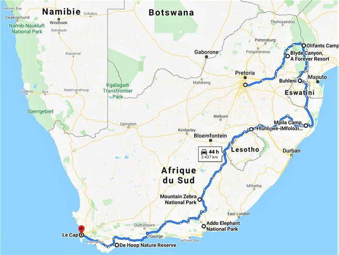
Étant 5 grands gabarits la question du véhicule était délicate puisque c’est dans ce véhicule que nous allions passer le plus de temps, en safari ou sur la route. Nous avons finalement opté pour la location d’un Hyundai H1 chez Budget, option la plus économique et la plus confortable avec 7 places et une plus haute garde au sol pour mieux voir les animaux et le paysage.
Après 11 mois d’attente, début des vacances scolaires et départ de Guadeloupe le vendredi 5 Juillet, pour mes parents et mes frères que je rejoindrai sur Paris le lendemain avant de décoller pour Madrid puis Joburg, tous ensemble, le samedi 6 au soir.
See you in the bush ! (Bilan conseils et budget en fin de carnet.)
Bien que ce fut déjà mon 4ème voyage en Afrique du Sud celui-ci eut, dès la préparation, une saveur toute particulière puisque ça allait être notre premier voyage en famille depuis une éternité, et cette fois-ci les rôles étaient inversés puisque c’est moi qui allais faire découvrir à mes parents ma destination de cœur, l’Afrique. 🙂
La concordance des temps dans cette dernière phrase m’a achevé… Ce carnet s’annonce compliqué. 😄
C’est un voyage que nous avons donc réalisé à 5, mes parents, mes 2 jeunes frères et moi-même. Ma sœur n’ayant pas pu se joindre à nous et Alison, ma copine, ayant gardé ses congés pour notre voyage de Septembre en Tanzanie.
C’est un rêve qui, enfin, se réalisait puisque cela faisait plusieurs années que j’essayais d’organiser quelque chose en famille et c’est en rentrant d’Alaksa en Aout 2018 que mes parents se sont motivés pour visiter l’Afrique du Sud. J’ai donc eu quasiment 1an pour préparer ce magnifique voyage en parallèle de celui en Tanzanie avec Alison.
Le circuit se voulait tant classique que magnifique. 24 jours à travers l’Afrique du Sud, à mes yeux le plus beau pays du monde, de Joburg à Capetown.
J0 (06/07/19) : Paris -> Madrid -> Johannesburg J1 (07/07/19) : OR Tambo Int Airport -> Forever Blyde Canyon J2 (08/07/19) : Blyde River Canyon J3 (09/07/19) : Forever Blyde Canyon –> Kruger National Park J4 (10/07/19) : Kruger National Park J5 (11/07/19) : Kruger National Park J6 (12/07/19) : Kruger National Park J7 (13/07/19) : Kruger National Park J8 (14/07/19) : Kruger National Park -> Santa Lucia J9 (15/07/19) : Isimangaliso wetland Park J10 (16/07/19) : Hluhluwe-iMfolozi J11 (17/07/19) : Hluhluwe-iMfolozi J12 (18/07/19) : Hluhluwe-iMfolozi -> Golden Gate NP J13 (19/07/19) : Golden Gate NP J14 (20/07/19) : Golden Gate NP -> Mountain Zebra NP J15 (21/07/19) : Mountain Zebra NP J16 (22/07/19) : Mountain Zebra NP J17 (23/07/19) : Mountain Zebra NP ->Cambedoo NP J18 (24/07/19) : Cambedoo NP -> Addo Elephant NP J19 (25/07/19) : Addo Elephant NP -> De Hoop NR J20 (26/07/19) : De Hoop NR J21 (27/07/19) : De Hoop NR - Capetown J22 (28/07/19) : Capetown J23 (29/07/19) : Capetown J24 (30/07/19) : Capetown - Johannesburg J25 (31/07/19) : Soweto – Départ
Étant 5 grands gabarits la question du véhicule était délicate puisque c’est dans ce véhicule que nous allions passer le plus de temps, en safari ou sur la route. Nous avons finalement opté pour la location d’un Hyundai H1 chez Budget, option la plus économique et la plus confortable avec 7 places et une plus haute garde au sol pour mieux voir les animaux et le paysage.
Après 11 mois d’attente, début des vacances scolaires et départ de Guadeloupe le vendredi 5 Juillet, pour mes parents et mes frères que je rejoindrai sur Paris le lendemain avant de décoller pour Madrid puis Joburg, tous ensemble, le samedi 6 au soir.
See you in the bush ! (Bilan conseils et budget en fin de carnet.)
Médecins cubains en Europe English translation pending
Une leçon pour nous français "les meilleurs de tous"
Cuba envoie des médecins à Cuba, en Andorre , en Angola et des députés français de tous bords demande que la France demande la venue d'equipe cubaine en France.
L'hiver au pays des merveilles (Maroc) English translation pending
Bonjour,
Je crains que le forum ne soit morose dans les mois à venir , alors pourquoi ne pas faire un nouveau carnet de voyage . J'ai eu la chance de rentrer du Maroc 2 jours avant la suspension des vols et me retrouve donc, comme vous sans doute , en mode confinement total, chez moi, en Basse-Bretagne , avec quelques centaines de photos de mon dernier séjour à sélectionner, recadrer, retravailler .... On s'occupe comme on peut, alors pourquoi ne pas en faire profiter les Forumeurs ?
Je suis resté au Maroc un mois et j'avais organisé un circuit de 10 nuits / 11 jours pour ma plus jeune fille ( 17 ans ) , mon épouse et la grand- mère, ma chère belle-mère, Mina . Ça correspond aux vacances de février en France .
J'avais donc prévu un voyage " simple" sur le papier, mais qui chaque jour et comme toujours allait nous réserver son lot de découvertes, d'émerveillements, de rencontres, de surprises ....
Au programme :
- Départ de Rabat - 2 nuits à Ouarzazate - 2 nuits à N'kob - 2 nuits à Foum Zguid, avec une longue journée 4X4 au plus profond du désert - 4 nuits à Icht / Borj Biramane et retour sur Rabat
Je vais donc essayer d'éviter des redites avec mes précédents carnets, mais le Maroc a tant de richesses à montrer.....
Rabat est une de mes balades urbaines préférées au Maroc . Je découvre toujours de nouveaux endroits, de jolis détails, des points de vue .... Je vais donc m'y balader avec toujours un plaisir renouvelé
Ma première surprise se passe en médina où je découvre avec étonnement que les autorités ont fait le ménage . Tout ce qui encombrait les rues ( déballages sauvages, marchands de tortues et autres lézards, empiétements sur les trottoirs, la rue , etc.... ) a disparu . Plus rien . Même les commerces " en dur " sont "rentrés dans leurs murs" : plus rien sur la voie publique, pas même une chaise.... Une première au Maroc ?
Si le résultat est plutôt agréable dans la rue des consuls ( rue de l'artisanat ) et la rue Souika ( commerces vestimentaires surtout ) , le boulevard Mohamed V, où régnaient les petits restaurants et gargotes , est désormais mort . Ils ont perdu la quasi-totalité de leur ancienne surface commerciale et ne peuvent plus accueillir que quelques clients à la fois . La rue est tuée et il ne me reste plus qu'à chercher un autre endroit où casser la croûte dans la ville . Ce qui est bénéfique dans une rue ( on peut enfin flâner tranquillement ) est catastrophique dans l'autre ( le commerce est mort et le charme est parti ) . A suivre ....
Bon. C'est comme çà . Ici, dans la rue Souika ( à l'heure de la prière ) . Il y a même des poubelles en plastique positionnées dans la rue !
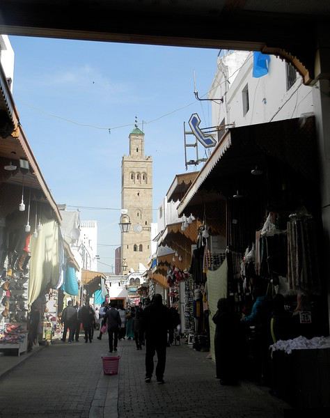
Une autre artère de la médina est la rue Sidi Fatah . Elle donne sur la rue Souika . Une magnifique mosquée y a été restaurée . Si j'en crois mon plan, il s'agit de la mosquée Moulay El Mekki . La porte principale est couverte et on trouve sur chacun des côtés 2 très belles portes ( 4 au total ) . Le minaret octogonal est remarquable . L'ensemble est complété par plusieurs marabout et un peu plus loin se trouve une importante zaouia . C'est vraiment très joli .
L'entrée principale est somptueuse . Le grand art de la peinture sur bois.
Quelques portes latérales
C'est vraiment très agréable de se balader sur la côte atlantique en cette saison ( mi-février ) . Il fait entre 18 et 22 degrés . Temps lumineux . Je n'aurai d'ailleurs pas de pluie pendant un mois ( après avoir eu de la pluie à peu près tous les jours les 5 derniers mois ) : que du bonheur donc ....
Le minaret octogonal
et la rue Sidi Fatah
La rénovation des monuments de la médina est presque terminée . La rue des consuls reprend vie, même si les nombreux fondouks de cette rue sont toujours en travaux . J'ai hâte de les revoir . Je déambule dans les ruelles tranquilles , toujours à l’affût de ces détails qui en font le charme .
Une belle oeuvre de street-art accroche mon œil ....
et cette fenêtre a un charme fou .
Cette fois , mes pas me portent vers les quais ( on pourrait presque dire le port ) de Rabat . Je quitte la médina par un jolie porte : l'ensemble , également restauré, est charmant . J'arrive directement sur l'Oued Bou Regreg .
Au cœur de la capitale subsiste un coin " pêche " . Un petit navire est devenu un restaurant-Lounge , plutôt luxueux ( menu à 790 dirhams pour 2 en cette Saint Valentin ) .
Rabat se donne des airs de petite Essaouira avec ses mouettes, ses bateaux, sa médina au fond, ses filets de pêche .... Le même site à l'horizontale .
Au fond, Les Oudayas
Un " pêche promenade ", me passe sous le nez . C'est mignon . On a envie de le faire la prochaine fois . Il y avait une activité de passeurs entre Rabat et Salé . Mais avec les ponts, le tramway, ..... Certains se sont adaptés , même si çà se fait toujours, plutôt en été ( la plage de Salé est toute proche ) .
Quelques barques rentrent , les unes après les autres et s'amarrent au ponton, côté Salé . Surement les lointains descendants des redoutables corsaires de Salé . Leur univers a été " explosé" ces dernières années avec l'immense projet d'aménagement de l'oued Bou Regreg . Il leur reste un petit ponton , ..... et juste après, on a construit une grande marina pour accueillir les nouveaux jouets de l'aristocratie locale .
et une autre
Tout ceci fait un curieux mélange entre une architecture ancestrale et la plus grande modernité ....
Ci-après, à gauche, le médina sur sa falaise, au fond le toit blanc du nouveau " Grand Théâtre de Rabat ), à côté duquel commence à sortir la future tour Mohamed VI qui sera la plus haute d' Afrique , et à droite la marina côté Salé .
Mais la Kasbah veille toujours sur la capitale
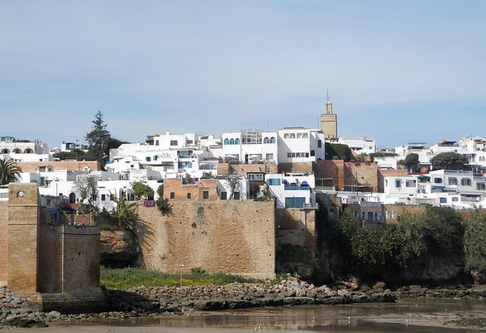
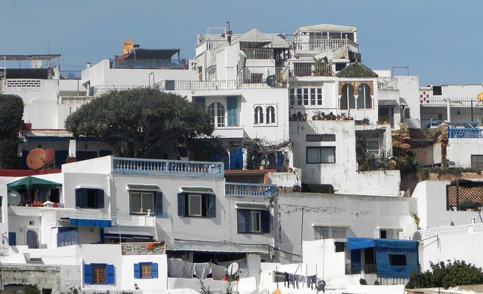
Un dernier regard ...
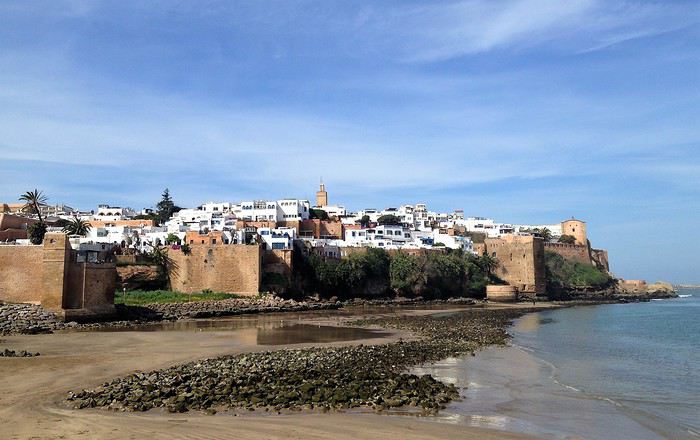
Voila pour ce nouveau coup de projecteur sur la capitale . Faites le détour et surprenez- vous
Demain, j'enfourche ma bonne Dacia Sandero et nous partons à l'assaut de l'Atlas .
Je crains que le forum ne soit morose dans les mois à venir , alors pourquoi ne pas faire un nouveau carnet de voyage . J'ai eu la chance de rentrer du Maroc 2 jours avant la suspension des vols et me retrouve donc, comme vous sans doute , en mode confinement total, chez moi, en Basse-Bretagne , avec quelques centaines de photos de mon dernier séjour à sélectionner, recadrer, retravailler .... On s'occupe comme on peut, alors pourquoi ne pas en faire profiter les Forumeurs ?
Je suis resté au Maroc un mois et j'avais organisé un circuit de 10 nuits / 11 jours pour ma plus jeune fille ( 17 ans ) , mon épouse et la grand- mère, ma chère belle-mère, Mina . Ça correspond aux vacances de février en France .
J'avais donc prévu un voyage " simple" sur le papier, mais qui chaque jour et comme toujours allait nous réserver son lot de découvertes, d'émerveillements, de rencontres, de surprises ....
Au programme :
- Départ de Rabat - 2 nuits à Ouarzazate - 2 nuits à N'kob - 2 nuits à Foum Zguid, avec une longue journée 4X4 au plus profond du désert - 4 nuits à Icht / Borj Biramane et retour sur Rabat
Je vais donc essayer d'éviter des redites avec mes précédents carnets, mais le Maroc a tant de richesses à montrer.....
Rabat est une de mes balades urbaines préférées au Maroc . Je découvre toujours de nouveaux endroits, de jolis détails, des points de vue .... Je vais donc m'y balader avec toujours un plaisir renouvelé
Ma première surprise se passe en médina où je découvre avec étonnement que les autorités ont fait le ménage . Tout ce qui encombrait les rues ( déballages sauvages, marchands de tortues et autres lézards, empiétements sur les trottoirs, la rue , etc.... ) a disparu . Plus rien . Même les commerces " en dur " sont "rentrés dans leurs murs" : plus rien sur la voie publique, pas même une chaise.... Une première au Maroc ?
Si le résultat est plutôt agréable dans la rue des consuls ( rue de l'artisanat ) et la rue Souika ( commerces vestimentaires surtout ) , le boulevard Mohamed V, où régnaient les petits restaurants et gargotes , est désormais mort . Ils ont perdu la quasi-totalité de leur ancienne surface commerciale et ne peuvent plus accueillir que quelques clients à la fois . La rue est tuée et il ne me reste plus qu'à chercher un autre endroit où casser la croûte dans la ville . Ce qui est bénéfique dans une rue ( on peut enfin flâner tranquillement ) est catastrophique dans l'autre ( le commerce est mort et le charme est parti ) . A suivre ....
Bon. C'est comme çà . Ici, dans la rue Souika ( à l'heure de la prière ) . Il y a même des poubelles en plastique positionnées dans la rue !
Une autre artère de la médina est la rue Sidi Fatah . Elle donne sur la rue Souika . Une magnifique mosquée y a été restaurée . Si j'en crois mon plan, il s'agit de la mosquée Moulay El Mekki . La porte principale est couverte et on trouve sur chacun des côtés 2 très belles portes ( 4 au total ) . Le minaret octogonal est remarquable . L'ensemble est complété par plusieurs marabout et un peu plus loin se trouve une importante zaouia . C'est vraiment très joli .
L'entrée principale est somptueuse . Le grand art de la peinture sur bois.
Quelques portes latérales
C'est vraiment très agréable de se balader sur la côte atlantique en cette saison ( mi-février ) . Il fait entre 18 et 22 degrés . Temps lumineux . Je n'aurai d'ailleurs pas de pluie pendant un mois ( après avoir eu de la pluie à peu près tous les jours les 5 derniers mois ) : que du bonheur donc ....
Le minaret octogonal
et la rue Sidi Fatah
La rénovation des monuments de la médina est presque terminée . La rue des consuls reprend vie, même si les nombreux fondouks de cette rue sont toujours en travaux . J'ai hâte de les revoir . Je déambule dans les ruelles tranquilles , toujours à l’affût de ces détails qui en font le charme .
Une belle oeuvre de street-art accroche mon œil ....
et cette fenêtre a un charme fou .
Cette fois , mes pas me portent vers les quais ( on pourrait presque dire le port ) de Rabat . Je quitte la médina par un jolie porte : l'ensemble , également restauré, est charmant . J'arrive directement sur l'Oued Bou Regreg .
Au cœur de la capitale subsiste un coin " pêche " . Un petit navire est devenu un restaurant-Lounge , plutôt luxueux ( menu à 790 dirhams pour 2 en cette Saint Valentin ) .
Rabat se donne des airs de petite Essaouira avec ses mouettes, ses bateaux, sa médina au fond, ses filets de pêche .... Le même site à l'horizontale .
Au fond, Les Oudayas
Un " pêche promenade ", me passe sous le nez . C'est mignon . On a envie de le faire la prochaine fois . Il y avait une activité de passeurs entre Rabat et Salé . Mais avec les ponts, le tramway, ..... Certains se sont adaptés , même si çà se fait toujours, plutôt en été ( la plage de Salé est toute proche ) .
Quelques barques rentrent , les unes après les autres et s'amarrent au ponton, côté Salé . Surement les lointains descendants des redoutables corsaires de Salé . Leur univers a été " explosé" ces dernières années avec l'immense projet d'aménagement de l'oued Bou Regreg . Il leur reste un petit ponton , ..... et juste après, on a construit une grande marina pour accueillir les nouveaux jouets de l'aristocratie locale .
et une autre
Tout ceci fait un curieux mélange entre une architecture ancestrale et la plus grande modernité ....
Ci-après, à gauche, le médina sur sa falaise, au fond le toit blanc du nouveau " Grand Théâtre de Rabat ), à côté duquel commence à sortir la future tour Mohamed VI qui sera la plus haute d' Afrique , et à droite la marina côté Salé .
Mais la Kasbah veille toujours sur la capitale
Un dernier regard ...
Voila pour ce nouveau coup de projecteur sur la capitale . Faites le détour et surprenez- vous
Demain, j'enfourche ma bonne Dacia Sandero et nous partons à l'assaut de l'Atlas .
Cape Town and Kruger: 12 days in February with teens
Hi everyone,
I’d love to share a little travel journal from our 14-day/12-night road trip with our two teens (14 and 17) in February/March 2020. A huge thank you to all of you who helped me plan this trip to South Africa—your patience with my endless questions was amazing!
We left Lyon on Saturday, February 22 at 7:00 AM and arrived in Johannesburg at 10:00 PM after a short layover in Amsterdam. Flights cost 440 € per person (booked in October), with carry-on luggage. We added just one checked bag for the whole family (80 € round-trip with the free Flying Blue membership). Since we’d be moving around a lot, we packed light! In Lyon, we reserved parking at P5 in advance for 70 € for 14 days. The Air France/KLM flight was smooth. When we landed, we picked up our bags and had booked a night at the Aero Guest Lodge, just 5 minutes from the airport, with a free shuttle and breakfast. All you have to do is send a WhatsApp message when you arrive at the airport to let the shuttle driver know. The tricky part? Finding him in the terminal—he wasn’t holding a sign with the hotel’s name. 🤪 A South African called him for me since my English wasn’t great (and I had to get used to the accent 😛), and helped us spot the driver (who was actually less than 5 meters away!) with other guests. When we got to the hotel: all good, except we were 10 people in a van meant for 7. The room was spacious—one king-size bed and two single beds for the kids—with a simple but clean bathroom, a garden, pool, and breakfast (which we didn’t try). All for 65 €, so an awesome value!
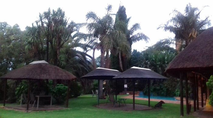 After a restful night, we woke up at 6:00 AM to catch the shuttle back to the airport. Just a heads-up: there’s only one shuttle per hour in the morning, and Kulula canceled our 9:00 AM flight, moving it to 8:00 AM—so no time for breakfast (it starts at 6:30).
We waited 15 minutes in the lovely garden for the driver, who dropped us off at the airport in 5 minutes.
We checked in for our flight to Cape Town, which cost around 40 € (including two checked bags per person).
We grabbed breakfast at the airport instead (less than 20 € for all four of us—one of the nice surprises of South Africa!), and arrived in Cape Town at 10:20 AM.
After a restful night, we woke up at 6:00 AM to catch the shuttle back to the airport. Just a heads-up: there’s only one shuttle per hour in the morning, and Kulula canceled our 9:00 AM flight, moving it to 8:00 AM—so no time for breakfast (it starts at 6:30).
We waited 15 minutes in the lovely garden for the driver, who dropped us off at the airport in 5 minutes.
We checked in for our flight to Cape Town, which cost around 40 € (including two checked bags per person).
We grabbed breakfast at the airport instead (less than 20 € for all four of us—one of the nice surprises of South Africa!), and arrived in Cape Town at 10:20 AM.
 After quickly picking up our bags, we headed to the Avis counter and left with a Toyota Corolla for 80 € for 4 days (rented with the Flying Blue card—free additional driver).
Everything’s on the left... not easy, but it works if you plan your route well.
We drove to our Airbnb in Constantia. We were surprised to see animals, bikes, and pedestrians on the highway!
We arrived around 11:30 AM at our rental—a huge house in the vineyards, in a super secure neighborhood, about 15-20 minutes from Hout Bay. It felt like Beverly Hills, but with super-high walls and barbed wire around the villas. 😕
After quickly picking up our bags, we headed to the Avis counter and left with a Toyota Corolla for 80 € for 4 days (rented with the Flying Blue card—free additional driver).
Everything’s on the left... not easy, but it works if you plan your route well.
We drove to our Airbnb in Constantia. We were surprised to see animals, bikes, and pedestrians on the highway!
We arrived around 11:30 AM at our rental—a huge house in the vineyards, in a super secure neighborhood, about 15-20 minutes from Hout Bay. It felt like Beverly Hills, but with super-high walls and barbed wire around the villas. 😕

We dropped off our bags, changed into shorts (it was around 30°C/86°F), and headed to the Bay Harbour Market in Hout Bay. We had lunch there—such a great vibe! We wandered through the stalls, everyone picked their own dish, and we sat down on the terrace. There was music, artisans of all kinds... a really nice moment.

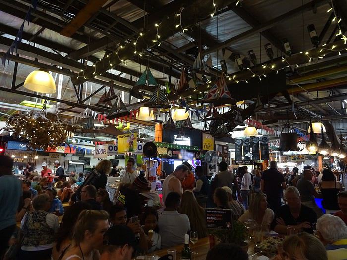
I’d withdrawn 50 € before leaving... and that gave me change to pay the parking attendant. Lunch cost around 30 € for four, including food and drinks.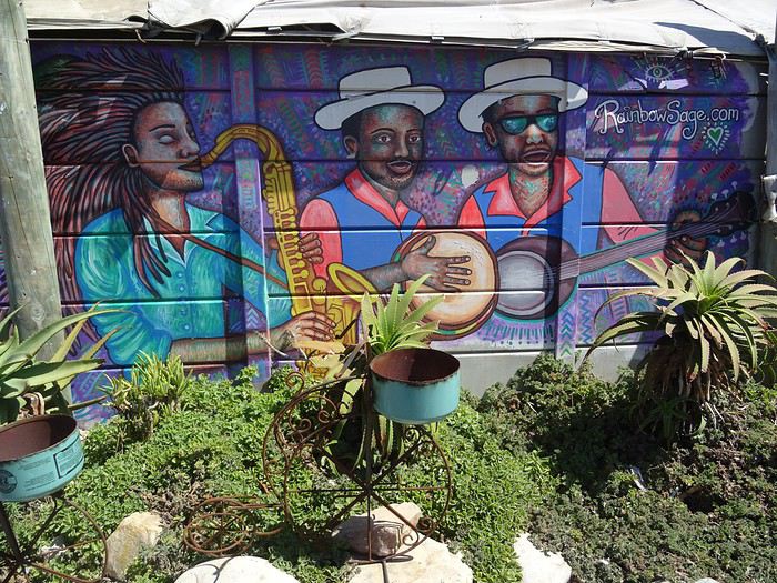

After browsing the artisan stalls, we headed to Hout Bay Beach near the restaurant, Marina Wharf (another small tip for the parking attendant—we’d have to get used to that!). We stopped to admire the sea lions. An ice cream for 1 €? No way we were saying no! 🙂
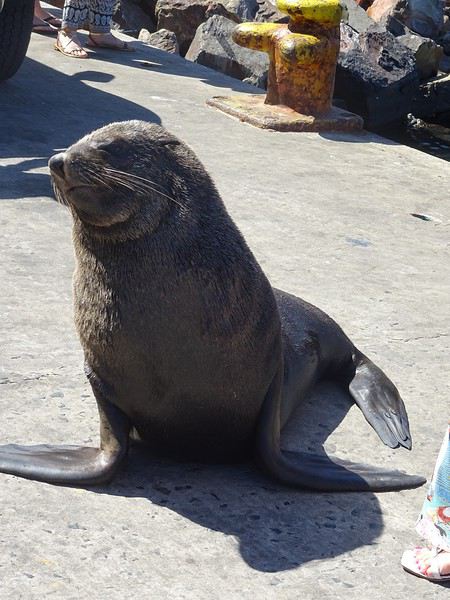
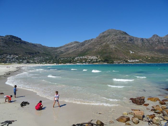
The fatigue was starting to hit, so we headed to the grocery store 10 minutes away (Constantia shopping center) and then had an aperitif in front of the vineyards, opening a delicious bottle of white wine.
I’d love to share a little travel journal from our 14-day/12-night road trip with our two teens (14 and 17) in February/March 2020. A huge thank you to all of you who helped me plan this trip to South Africa—your patience with my endless questions was amazing!
We left Lyon on Saturday, February 22 at 7:00 AM and arrived in Johannesburg at 10:00 PM after a short layover in Amsterdam. Flights cost 440 € per person (booked in October), with carry-on luggage. We added just one checked bag for the whole family (80 € round-trip with the free Flying Blue membership). Since we’d be moving around a lot, we packed light! In Lyon, we reserved parking at P5 in advance for 70 € for 14 days. The Air France/KLM flight was smooth. When we landed, we picked up our bags and had booked a night at the Aero Guest Lodge, just 5 minutes from the airport, with a free shuttle and breakfast. All you have to do is send a WhatsApp message when you arrive at the airport to let the shuttle driver know. The tricky part? Finding him in the terminal—he wasn’t holding a sign with the hotel’s name. 🤪 A South African called him for me since my English wasn’t great (and I had to get used to the accent 😛), and helped us spot the driver (who was actually less than 5 meters away!) with other guests. When we got to the hotel: all good, except we were 10 people in a van meant for 7. The room was spacious—one king-size bed and two single beds for the kids—with a simple but clean bathroom, a garden, pool, and breakfast (which we didn’t try). All for 65 €, so an awesome value!
After a restful night, we woke up at 6:00 AM to catch the shuttle back to the airport. Just a heads-up: there’s only one shuttle per hour in the morning, and Kulula canceled our 9:00 AM flight, moving it to 8:00 AM—so no time for breakfast (it starts at 6:30).
We waited 15 minutes in the lovely garden for the driver, who dropped us off at the airport in 5 minutes.
We checked in for our flight to Cape Town, which cost around 40 € (including two checked bags per person).
We grabbed breakfast at the airport instead (less than 20 € for all four of us—one of the nice surprises of South Africa!), and arrived in Cape Town at 10:20 AM.
After quickly picking up our bags, we headed to the Avis counter and left with a Toyota Corolla for 80 € for 4 days (rented with the Flying Blue card—free additional driver).
Everything’s on the left... not easy, but it works if you plan your route well.
We drove to our Airbnb in Constantia. We were surprised to see animals, bikes, and pedestrians on the highway!
We arrived around 11:30 AM at our rental—a huge house in the vineyards, in a super secure neighborhood, about 15-20 minutes from Hout Bay. It felt like Beverly Hills, but with super-high walls and barbed wire around the villas. 😕We dropped off our bags, changed into shorts (it was around 30°C/86°F), and headed to the Bay Harbour Market in Hout Bay. We had lunch there—such a great vibe! We wandered through the stalls, everyone picked their own dish, and we sat down on the terrace. There was music, artisans of all kinds... a really nice moment.
I’d withdrawn 50 € before leaving... and that gave me change to pay the parking attendant. Lunch cost around 30 € for four, including food and drinks.
After browsing the artisan stalls, we headed to Hout Bay Beach near the restaurant, Marina Wharf (another small tip for the parking attendant—we’d have to get used to that!). We stopped to admire the sea lions. An ice cream for 1 €? No way we were saying no! 🙂
The fatigue was starting to hit, so we headed to the grocery store 10 minutes away (Constantia shopping center) and then had an aperitif in front of the vineyards, opening a delicious bottle of white wine.
Le Sri Lanka, la meilleure destination en Asie pour les safaris? English translation pending
Après le Kenya en 2018 et le Botswana en 2019 (qui m'ont clairement rendu accro aux safaris photo) je cherchais une nouvelle destination, je me dirigeais vers Madagascar et sa faune endémique malheureusement pour une question de budget, cela ne se ferait pas en 2020 😕...
Au fil des semaines le "besoin" se faisait de plus en plus pressant jusqu'au jour ou je suis tombé par hasard sur un article sur internet parlant du Sri Lanka... En creusant un peu j'ai appris que c'était une destination réputé pour l'observation de sa faune et en creusant plus loin je suis tombé sur une agence locale spécialisée dans les voyages safari, notre destination 2020 était choisie.
Après quelques échanges avec l'agence sur nos envies, nous parvenons à un itinéraire qui nous convient et dans notre budget. Voila donc notre voyage booké bien avant la crise du COVID-19...
Notre programme de 15 jours et 14 nuits : J1 : Paris - Colombo par Qatar airways départ à 8h35 arrivée à 1h15 du matin Nuit au Suriya Arana Resort J2 : Route vers le Wilpattu NP, premier safari l'après midi. Nuit Big game camp Wilpattu J3 - J4 : Full day safari à Wilpattu. Nuits au Big game camp Wilpattu J5 : Route jusqu'à Habarana, safari l'après midi dans le Minneriya NP. Nuit au Sorowwa Hotel J6 : Route vers Kandy, visite de la Forteresse de Sigirya puis du temple de la dent à Kandy. Nuit au Thilanka J7 : Route vers le Udawalawe NP et premier safari l'après midi Nuit au Big game camp Udawalawe J8 : Full day safari dans le Udawalawe NP J9 : Route vers Bundala NP - Safari matinal - Route vers Yala - Safari au Yala NP Nuit au au Big game camp Yala J10 - J11 : Full day safari à Yala. Nuits au au Big game camp Yala J12 : safari matinal dans le Yala NP puis route jusqu'à Tangalle observation nocturne des tortues de mer sur la plage de Rekawa Nuit au Cue Ceylon J13 : Route vers Mirissa, obervation des baleines bleues en bateau Nuit au Paradise Beach Club J14 : Route vers Colombo et visite de la ville Vol retour Colombo - Paris par Qatar départ à 1h15 le matin - arrivée à 13h30
Le programme à été modifiée le soir du 10eme jour à Yala, le gouvernement Sri Lankais ayant décidé de fermer tous les parcs nationaux pour deux semaines. nous avons avancé notre départ de Yala pour Tangalle et passé le J11 en farniente (pas trop mon truc d'ailleurs)
Petites infos pratique : - Les trajets sont assez cours entre les points mais les temps de trajet sont long, les routes sont bonnes mais peu de voies rapides, traversées de villes et bien sur la conduite, donc pour 250km comptez 4h à peu près. - Les permis internationaux et Français ne sont pas reconnus, pour avoir le droit de conduire vous devez passer votre permis Sri Lankais donc chauffeur/guide obligatoire. - Les sites sont chers, comptez 35$ pour Sigyria et entre 15 et 25$ l'entrée des parcs nationaux. - Les parcs ouvrent à 6h du matin mais vous aurez de la route à faire donc départ entre 5h15 et 5h30. - Les safaris matinée ou après durent 4h, les full day durent 12h de 6h à 18h.
Au fil des semaines le "besoin" se faisait de plus en plus pressant jusqu'au jour ou je suis tombé par hasard sur un article sur internet parlant du Sri Lanka... En creusant un peu j'ai appris que c'était une destination réputé pour l'observation de sa faune et en creusant plus loin je suis tombé sur une agence locale spécialisée dans les voyages safari, notre destination 2020 était choisie.
Après quelques échanges avec l'agence sur nos envies, nous parvenons à un itinéraire qui nous convient et dans notre budget. Voila donc notre voyage booké bien avant la crise du COVID-19...
Notre programme de 15 jours et 14 nuits : J1 : Paris - Colombo par Qatar airways départ à 8h35 arrivée à 1h15 du matin Nuit au Suriya Arana Resort J2 : Route vers le Wilpattu NP, premier safari l'après midi. Nuit Big game camp Wilpattu J3 - J4 : Full day safari à Wilpattu. Nuits au Big game camp Wilpattu J5 : Route jusqu'à Habarana, safari l'après midi dans le Minneriya NP. Nuit au Sorowwa Hotel J6 : Route vers Kandy, visite de la Forteresse de Sigirya puis du temple de la dent à Kandy. Nuit au Thilanka J7 : Route vers le Udawalawe NP et premier safari l'après midi Nuit au Big game camp Udawalawe J8 : Full day safari dans le Udawalawe NP J9 : Route vers Bundala NP - Safari matinal - Route vers Yala - Safari au Yala NP Nuit au au Big game camp Yala J10 - J11 : Full day safari à Yala. Nuits au au Big game camp Yala J12 : safari matinal dans le Yala NP puis route jusqu'à Tangalle observation nocturne des tortues de mer sur la plage de Rekawa Nuit au Cue Ceylon J13 : Route vers Mirissa, obervation des baleines bleues en bateau Nuit au Paradise Beach Club J14 : Route vers Colombo et visite de la ville Vol retour Colombo - Paris par Qatar départ à 1h15 le matin - arrivée à 13h30
Le programme à été modifiée le soir du 10eme jour à Yala, le gouvernement Sri Lankais ayant décidé de fermer tous les parcs nationaux pour deux semaines. nous avons avancé notre départ de Yala pour Tangalle et passé le J11 en farniente (pas trop mon truc d'ailleurs)
Petites infos pratique : - Les trajets sont assez cours entre les points mais les temps de trajet sont long, les routes sont bonnes mais peu de voies rapides, traversées de villes et bien sur la conduite, donc pour 250km comptez 4h à peu près. - Les permis internationaux et Français ne sont pas reconnus, pour avoir le droit de conduire vous devez passer votre permis Sri Lankais donc chauffeur/guide obligatoire. - Les sites sont chers, comptez 35$ pour Sigyria et entre 15 et 25$ l'entrée des parcs nationaux. - Les parcs ouvrent à 6h du matin mais vous aurez de la route à faire donc départ entre 5h15 et 5h30. - Les safaris matinée ou après durent 4h, les full day durent 12h de 6h à 18h.
Norway to hell English translation pending
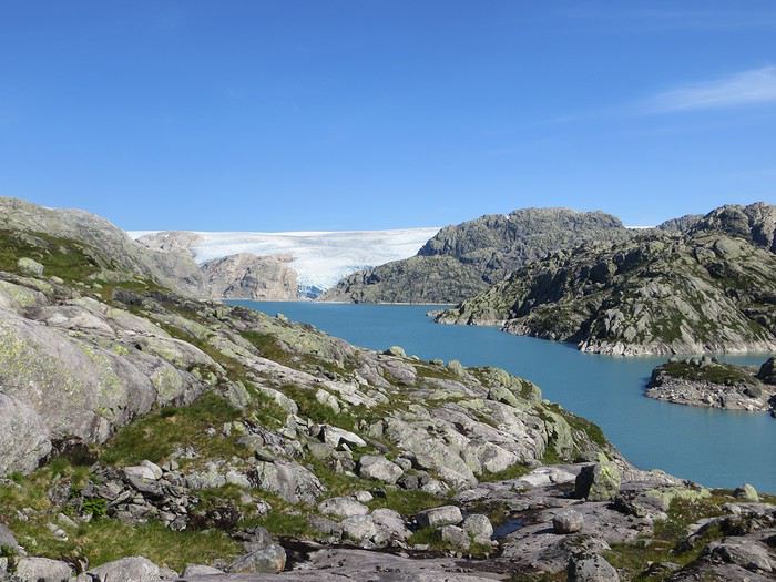
En ces temps coronatroublés, rien ne vaut de se remémorer le dernier voyage touristique que l’on a fait avant le plongeon dans le néant sanitaro-économique. La Norvège, plus précisément sa côte ouest et ses fjords, sera donc le sujet de ce carnet en 31 épisodes dotés chacun d’une bande-son, plutôt rock d’ailleurs. Attention, lecteur, vous vous exposez à un certain nombre de clichés pas du tout exagérés et de blagues pourries. I have nothing to offer but fjord, joy, tears (of the sky) and sweat.
Donc la Norvège, c’est l’apocalypse budgétaire dans votre portefeuille. D’où le titre (c’est tiré par les cheveux mais je ne refuse jamais un jeu de mots). Mais ce n’est pas que cela, c’est aussi fort joli, propre, policé et réellement rempli de charmantes têtes blondes. La Norvège, c’est également une monarchie pétrolière du golfe persique qui s’est égarée sur des terres glacées. Eh oui, c’est tout de suite plus facile d’être riche quand ils ont du pétrole (« mais ils n’ont que ça » aurait ajouté un jaloux), qu’ils sont peu nombreux et pas très partageurs. Allez, quelques détails pour commencer sur un plan aussi bien techeunique que tacqueutique
Le trajet En voiture Simone ! Depuis le Massif Central jusqu’à la Norvège avec une C3. J’avais décrété 2019, année sans avion. Donc c’était la voiture, certes petite mais costaude, où l’on a pu entasser notre matériel de camping. On en a profité pour prendre un covoitureur qui allait se perdre en Norvège pour l’été. Plus on est de fous entassés, plus on rit. Sur place, j'ai limité fortement notre aire d'action géographique. Je le connais le piège de faire une liste longue comme le bras et de courir tout le voyage tel un chien de ferme après un mollet cycliste. Il s'agissait de se cantonner au riz euh pardon à la façade sud-ouest du pays sans aller plus haut qu'Ålesund. Et comme il y avait un certain nombre de lieux qui me faisaient de l’œil, nous avons quand même eu un trajet digne d’une otarie bourrée essayant d’échapper à une orque affamée. On a finalement fait l’essuie-glace obliquement dans l’Ouest : à gauche, à droite, à gauche, à droite, à droite, A DROITE . Il faut dire que les fjords et les montagnes n’arrangent pas les affaires du voyageur adepte des routes rectilignes, et cela malgré la passion tunnelière locale.
Le lien vers la carte du trajet : http://u.osmfr.org/m/434267/
Les Norvégiens Les Norvégiens sont des êtres blonds aux yeux bleus, parfois d’un blond tellement blond qu’on dirait qu’ils ont appliqué de la javel sur leurs cheveux. Effet secondaire qui donne la chair de poule, cela fait disparaître les sourcils… Le Norvégien est réservé et poli. L’été, soit il se balade torse nu, soit il quitte le pays pour des horizons plus propices au rougeoiement de sa peau laiteuse où il pourra faire valoir son pouvoir d’achat dément. La Norvégienne quant à elle a une prédisposition naturelle à se promener en sous-tif ou brassière dès le premier rayon de soleil. Le dimanche, jour du Seigneur et de l’hypocrisie, le Norvégienne ne boit pas (vente d’alcool interdit !) les autres jours, iel se cache pour boire puis déambule cahin-caha entre les maisons de bois à la pelouse verdoyante. La Norvégien apprécie également les sorties familiales du dimanche après-midi où il peut effectuer 1000 mètres de dénivelé en 3,5km avec ses enfants de 7 et 9 ans. Le tout les doigts dans le nez.
Le logement Le logement, c’était principalement notre tente de 2 m² que nous avons montée/démontée dans des campings de qualité très variable pour un prix pas donné. Souvent les sites sont jolis mais plantés en bordure de route malgré l’espace qu’offre le pays. Ca manque quand même d’arbres ou arbustes et d’emplacements un tant soit peu délimités. Ce dernier point permet pendant les nuits les plus chaudes de l’été d’entasser les touristes de passage dans une promiscuité certaine et de rentabiliser un maximum l’espace. Malynx le Norvégynx ! Par contre, les sanitaires sont en général en bon état mais avec douche payante. Bref, le camping c’est le moyen de logement le plus abordable hors camping sauvage mais en général, la qualité est moyennasse au vu des prix. J’ai séché une petite larme en pensant à feus les campings des parcs nationaux et provinciaux canadiens. Requiescat in pace. Pour reprendre notre souffle, nous avons quand même varié les plaisirs avec des logements en b&b, du camping sauvage, des hytter (des petites cabanes souvent présentes dans les campings mais également ailleurs, très pratiques, pas trop chères pour la Norvège et aux prestations variables : électricité, eaux courantes en option par exemple) et une nuit en « refuge ». Les refuges, il y en a partout la plupart sont accessibles à pied, non gardés avec parfois une sorte de self-service payant.
La bouffe Courez en Norvège (ah mince vous êtes confinés) et vous me direz des nouvelles du Brunost . Sinon c’est cher mais pas mauvais globalement, peu porté sur le poisson hors saumon d’élevage et assez roboratif. Et bonne surprise pour moi, il y a quand même une tradition boulangère et même s’il y a peu de boulangeries, on peut trouver pleins de pains et de sorte de viennoiseries dans les supermarchés. Cela égaie les multiples piques-niques.
Avant de commencer le carnet proprement dit, entamons notre hymne norvégien : So many stop signs Speed limit Curves’ gonna slow me down Like a wheel Gonna spin it Tourists’ gonna mess me around Hey, Satan Payin' my tolls Bein’ among sheepin' bands Hey, mamma Look at me I'm on the way to the promised land
Jour 1,5 60 mph – New Order Clermont-Ferrand - Neumünster A nous les petites autoroutes allemandes tant prisées de ce côté du Rhin pour l’absence de limites de vitesse. Parcours Montbéliard – Fribourg – Karlsruhe – Francfort – Kassel – Hannovre – Hambourg – Neumünster. C’est long et pénible avec des travaux publics pas très deutsche Qualität tous les 20 kms, un trafic chargé et des zones limitées sans limite de vitesse qui rendent la conduite dangereuse : à droite ça roule à 90, à gauche à 200 pour les plus fous et comme c’est saturé, ça donne un résultat sportif et désagréable. Je me demande comment ils font pour avoir aussi peu de morts sur les routes en Allemagne. A part ça, le voyage est sans histoire, le colis covoitureur est livré à Fribourg et on arrive entiers et fatigués à Cathédraleneuve.
Jour 2 Seemann – Rammstein Neumünster - Kristiansand
Les autoroutes allemandes c’est rapidement fini, on revient à de la tranquillité avec le Danemark. Nous avons choisi de prendre le ferry Hirtshals-Kristiansand qui permet d'arriver plus rapidement sur la côte ouest Et comme on a beaucoup d’avance sur l’horaire du ferry Hirtshals-Kristiansand, on se permet un détour vers une dune danoise dominant la mer du Nord. Le temps est pas idéal et le coin est assez fréquenté. Bof. Le voyage en ferry est sans histoire, les Norvégiens en profitent pour faire des réserves d’alcool et de legos (les deux produits les plus présents dans les magasins du bateau). Nous voilà enfin en Norvège, 1900 kilomètres plus tard, sur la plage de Christian. Sacré Clavier qui a fait des fidèles un peu partout en Scandinavie.
Jour 3 Why does it always rain on me? - Travis 180 km Kristiansand – Hauge Notre premier jour en Norvège et ça ne s’annonce pas glorieux, plutôt gris tendance pluie. Nous commençons par un rapide passage par un bout de zone payante de Kristiansand juste pour le plaisir et accessoirement quitter cette ville. Je me suis inscrit, par honnêteté, sur le site internet des péages norvégiens (gérés d’ailleurs par une société anglaise) et par la grâce de caméras bien placées, nous allons devoir payer quelques euros pour à peu près 100 mètres dans ladite ville. Pfff. Quant au programme aujourd’hui, nous allons à la conquête de l’ouest, l’ouest de Kristiansand et nos plans capotent très largement. Ca tombe, ça tombe, ça dégouline, dégringole, s’abat, déverse, pleuvoche, tantôt torrentiel, tantôt bruineux. Pas question de faire une rando ou toute autre activité de plein air. Je m’aperçois en plus dans la journée que mon imper n’est plus imperméable et que j’ai oublié mon surpantalon. Prions, mes bien chers Frères, mes bien chères Sœurs pour que la météo soit clémente. Sinon ça va être long. Dans un premier temps, jusqu’à Flekkefjord, nous nous mouvons plus ou moins le long de la côte sans l’apercevoir, d’une parce que c’est complètement bouché, de deux parce qu’il est difficile de distinguer ce qui tient d’un lac ou d’un fjord, de trois parce que la route principale ne suit pas la côte. Nous nous rabattons donc sur la visite sans trop musarder des petites villes blanches du sud de la Norvège, leurs villages blancs andalous à eux mais en différent : avec du bois, de la pluie et de la mer. Premier arrêt à Mandal, un vrai coup dans le cœur. Deuxième arrêt : Flekkefjord, très mignon. Troisième arrêt version hameau, Stornes en entrée de fjord, très, très mignon. Quatrième arrêt : Sognalstranda, très, très, très mignon. C’est le règne de la mignonitude humide. Une maison en bois par ci, un entrepôt en bois par-là, et des garages à bateau à foison.
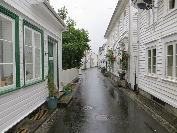 Pas un temps à mettre un chat norvégien dehors (Flekkefjord)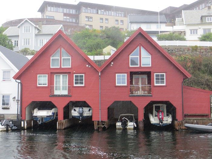
Pas un temps à mettre un bateau norvégien dehors
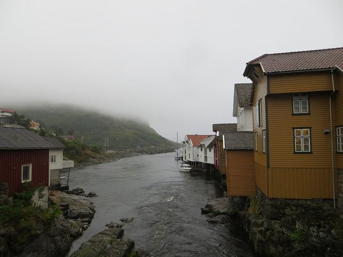 Mais pourquoi on est dehors nous alors ? (Sognalstranda)
Interlude de pipeau très intéressant : ces villes/villages, souvent fondés aux 17ème et 18ème siècle, sont les témoins de la politique mercantiliste du royaume du Danemark. L’État balbutiant entend organiser la production, la commercialisation et l’exportation des ressources comme le bois, les poissons et certains métaux de Norvège. Cette politique passe par la mise en place d’exploitations/manufactures à tendance monopolistique et la spécialisation des ports avec monopole des marchands d’abord hanséatiques (16ème siècle) puis néerlandais (17ème siècle) et enfin danois (17-18ème siècle). C’est d’ailleurs pour cela que le vieux centre de Flekkefjord est surnommé la ville hollandaise. Ce système mercantiliste fera par ailleurs les malheurs de l’Islande forcée de se soumettre pendant deux siècles à une compagnie royale danoise monopolistique à même d’imposer ses tarifs et ses conditions d’échange de marchandise. Les siècles sombres comme les appellent les Islandais ont en grande partie comme origine cette organisation économique très profitable pour la royauté danoise, beaucoup moins pour les habitants de l’île. La route 44 après Flekkefjord vaut par ailleurs son pesant de cacahuètes même si les conditions ne sont pas optimales pour en profiter. Tout le coin a été nommé magma geopark (patrimoine de l’UNESCO) dans une poussée de marketing touristique, des roches de la croûte terrestre d’une zone de subduction ayant fini par apparaître sous l’effet de l’érosion si j’ai bien compris. Point de volcan donc mais des effleurements d’anorthosites qui forment des paysage rocailleux arrondis et stériles comme autour d’Helleren et d’Åna Sira où devait se dérouler notre première randonnée norvégienne, projet qui tombe à l’eau (ahahah), noyé sous les larmes du ciel (ahahah). La partie la plus spectaculaire du trajet se trouve entre Åna Sira et Hauge où la route serpente tant bien mal entre les rochers. Nous goûtons le soir venu à la douceur des campings norvégiens : une espèce de carrière dans un espace réduit entre deux collines, un sol gravillonneux, pas de végétation et roule ma poule. Le seul avantage réside dans la vue en bout de carrière sur la côte. Pas vraiment de cuisine aménagée, des douches payantes : prometteur ! Le coupable aujourd’hui est le Vågan camping (garanti sans viande).
Jour 4 Sous le soleil exactement – Serge Gainsbourg 186km Hauge – Lysebotn Nuit et brouillard ce matin sur la Norvège et pourtant nous gardons espoir, le soleil vaincra. Nous continuons la route côtière pour faire une petite balade (4km aller-retour) jusqu’au Hådyr. C’est humide, boueux, bourbeux, fangeux, marécageux, tourbeux, machineux. C’est également l’occasion de compter la deuxième victime du voyage : le terrain a raison de mes chaussures de marche basses. Flap flap, bain de pieds et macération. Décidément, je suis équipé pour affronter l’humidité scandinave ! Arrivés au rocher censé donner un point de vue sympa sur la côte, c’est la douche froide (avec beaucoup de vapeur d’eau, la douche) : à gauche, du brouillard, à droite, du brouillard, droit devant, du brouillard, derrière, du brouillard et un bruit de ressac à nos pieds. Comme on est patient et qu’on croit en dame météo, nous nous asseyons pour attendre la percée du soleil. Une heure et quelques hésitations plus tard, ça se déchire (très) petit à petit, de quoi entrapercevoir une côte que je qualifierai de dantesque. J’adore ces rochers granitiques usés par les siècles, qui forment des forêts de sentinelles face à la mer.
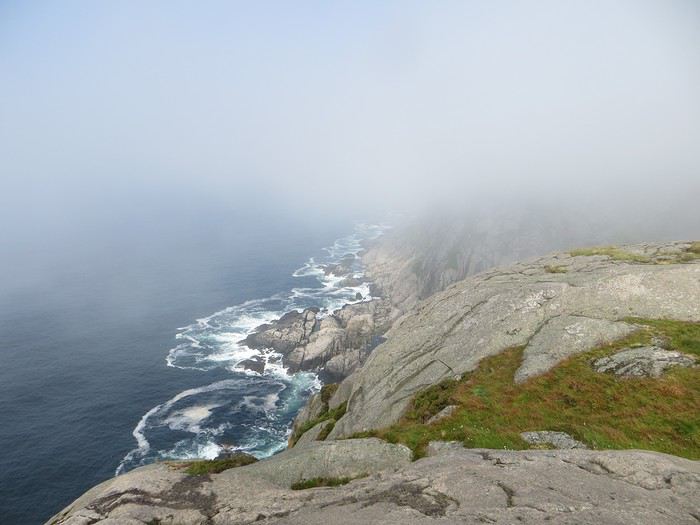 Les portes de l'Hådyr s'ouvrent et pas de cerbères à l'horizon
Et ça tombe bien que j’adore ce paysage puisque pour l’étape suivante (décidément le gentil organisateur a tout prévu !), nous traversons sans s’arrêter Egersund, autre petite ville en bois, pour Eigerøya, son phare et son paysage rocailleux sous le soleil exactement, un soleil de plomb je dirais même plus. La baladounette de l’après-midi de 4 km est sans difficulté sur une autoroute pédestre et permet d’accéder à un point de vue maousse costaud sur l’île d’Eiger et son phare.
Les portes de l'Hådyr s'ouvrent et pas de cerbères à l'horizon
Et ça tombe bien que j’adore ce paysage puisque pour l’étape suivante (décidément le gentil organisateur a tout prévu !), nous traversons sans s’arrêter Egersund, autre petite ville en bois, pour Eigerøya, son phare et son paysage rocailleux sous le soleil exactement, un soleil de plomb je dirais même plus. La baladounette de l’après-midi de 4 km est sans difficulté sur une autoroute pédestre et permet d’accéder à un point de vue maousse costaud sur l’île d’Eiger et son phare.
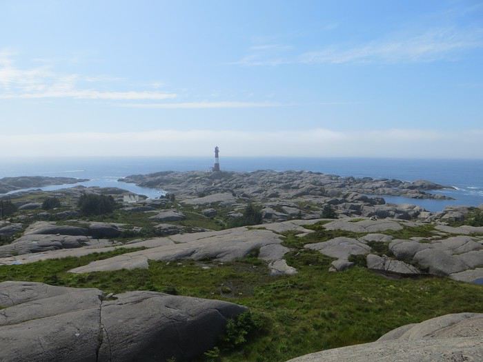 C'est un roc ! C'est un pic ! C'est un cap ! Que dis-je c'est une péninsule !
 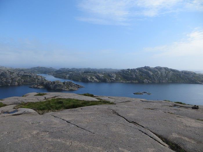 Eigerøya en beauté
Si j’ai bien compris le norvégien, øy est le suffixe pour île et a celui pour « la » en général, même si la langue se scinde en deux types distincts nynorsk et bokmål et en de nombreuses variantes dialectiques locales qui provoquent des orthographes changeantes des panneaux et des cartes. Par exemple, kirke (église en bokmål) s’écrit aussi kyrkje en nynorsk, voire a d’autres déclinaisons locales plus obscures. Le nynorsk, pour ceux qui ne connaissent pas, est issu d’une (re)création linguistique du 19ème siècle type occitan ou breton en France : pour donner à la Norvège une langue pure de toute saleté étrangère, danoise plus particulièrement, des linguistes ont construit une langue sur un mélange des dialectes considérés comme les moins viciés par l’outre-Skagerrak, c’est-à-dire ceux du Telemark et des fjords du sud-ouest. A contrario, le bokmål est un dérivé dédanoiïsé de la langue parlée (du danois grosso modo) dans les villes comme Oslo au début du 19ème siècle. De nos jours, il y a donc deux langues officielles et le nynorsk est très connoté nationaliste et perd du terrain : 13% des Norvégiens, principalement dans l’ouest, le parlent comme langue maternelle. Nous nous dirigeons ensuite vers l’intérieur des terres en direction de Lysebotn, le paysage change, pâturage, forêt et lacs avant de rentrer dans des zones à l’environnement plus âpre et tourmenté. Gloppedalsura (à vos souhaits) est l’occasion d’un arrêt bienvenu pour un point de vue sur un chaos de rochers impressionnant et son lac attenant.
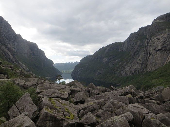 Gloppedalsura, lieu de franche rigolade entre Allemands et Norvégiens pendant la Seconde Guerre Mondiale
Nous remontons ensuite la Øvstabødalen, vallée glaciaire à citer dans toute conférence de géologie de bon niveau pour la perfection de sa forme en auge. Le parcours est varié, peu fréquenté et plaisant avant de plonger sur une zone moins sympa bien dotée en stations de ski et en habitat folklorico-traditionnel, ici des immeubles/chalets en bois sombre et toit végétalisé. L’avantage, au-delà du côté très artificiel des stations, c’est que les bâtiments se fondent dans la végétation.
Gloppedalsura, lieu de franche rigolade entre Allemands et Norvégiens pendant la Seconde Guerre Mondiale
Nous remontons ensuite la Øvstabødalen, vallée glaciaire à citer dans toute conférence de géologie de bon niveau pour la perfection de sa forme en auge. Le parcours est varié, peu fréquenté et plaisant avant de plonger sur une zone moins sympa bien dotée en stations de ski et en habitat folklorico-traditionnel, ici des immeubles/chalets en bois sombre et toit végétalisé. L’avantage, au-delà du côté très artificiel des stations, c’est que les bâtiments se fondent dans la végétation.La dernière partie du trajet, très belle mais pas très agréable à conduire tant la petite route est saturée par la circulation, traverse un plateau rocailleux avant de plonger vers le Lysefjord. Malheureusement, la route de descente, assez connue (elle est le lieu d’une compétition estivale de ski sur route très cotée) une fois passée le restaurant et bien que sûrement impressionnante vue d’un drone, n’offre quasiment aucune vue sur la vallée et le fjord. Ce qu’elle offre par contre, c’est un tunnel en épingle à cheveux, un classique que l’on retrouvera à plusieurs reprises dans les fantaisies souterraines norvégiennes. Le camping du soir, bonsoir, le Kjerag Lysebotn camping, jouit d’un site splendide et est bien équipé (cuisine, sanitaire). Malheureusement, comme on est en Norvège, il n’y a aucun arbre/arbuste et une promiscuité assez forte et accentuée par l’affluence d’un jour de juillet ensoleillé. Bref on se marche dessus comme des manchots en période de reproduction dans leur colonie.
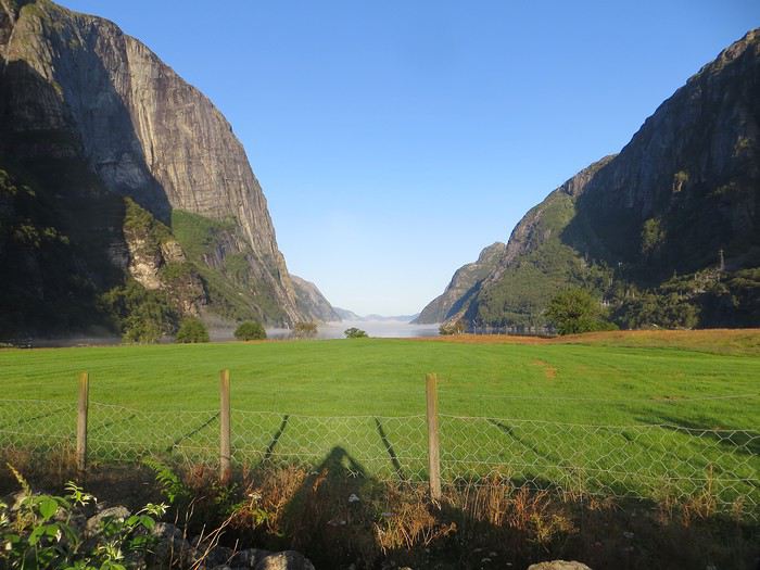 Quand je vous dis que le site est splendide...
Jour 5 Highway song – System of a Down 78km Lysebotn - Hjelmeland Aujourd’hui, c’est notre journée rando de masse dit trek pour ceux qui se sentent une âme d’aventurier, juste une âme, il ne faut pas trop abuser de l’aventure. Donc aujourd’hui, c’est le Kjeragbolten, concession faite à la liste des randonnées obligatoires. La Norvège fait partie de ces pays où la randonnée est l’une des activités touristiques obligatoires y compris pour des personnes qui ne marchent jamais par ailleurs. Pour la Norvège, l’activité s’effectue bien sûr en masse sur les mêmes chemins en cochant les fameuses cases de la to do list comprenant dans l’Ouest Preikestolen, Trolltunga, Kjeragbolten, Bessegen et Aurlandsdalen. Nous nous sommes contentés du rocher suspendu Kjerag, choisi car dans mon esprit, moins facilement accessible au commun du touriste (et moi je suis un touriste hors du commun, un tourista). C’est sûrement vrai mais cela n’empêche pas le monde… Je le savais, je le savais, j’étais prévenu, j’ai râlé avant, j’ai râlé pendant, je râle encore après et pourtant je n’ai pas d’oiseau dans la gorge et il n’y avait pas de genêts dans la balade (cf le râle des genêts pour comprendre la blagounette). La randonnée commence par un parking gigantesque au tarif prohibitif. Nous payons sans moufter nos 30 euros (un repas dans un resto semi gastro en France pour ceux qui n’ont pas le sens des valeurs). J’espère que personne ne s’arrête juste pour voir la vue car de vue il n’y en a point : le point de vue est occupé par un restaurant qui met un point d’honneur à boucher accessoirement la vue. Et pour accéder à sa terrasse/point de vue, il faut payer. Bon, nous, on a du pain sur la planche et quelques montées raidasses en attente. Dont acte. Trafic fluide en ce début de matinée, quelques problèmes de surchauffe moteur pour la première montée puis la vitesse de croisière est atteinte pour une arrivée prévue à 10h30. Ce n’est pas encore un bouchon au niveau du rocher mais la circulation est déjà dense à l’approche. Au retour, le trafic est extrêmement chargé et les comportements touristico-idiots se multiplient (équipement inadéquat, coupage des routes à travers champs, ralentissements dus aux selfies intempestifs. Ne pas utiliser votre téléphone en conduisant, que la sécurité routière vous dit !).
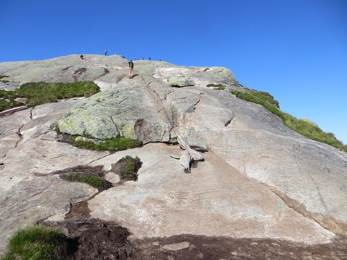
Pas un coin où amener sa traban
Sur le fond, la rando, 12 km et 700 mètres de dénivelée, est très chouette avec de belles vues sur le fjord et Lysebotn en particulier au début de la 3ème montée et tout au bout.
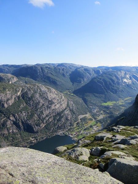
Le Lysefjord
Le caillou est flippant et spectaculaire tout comme la plateforme juste à côté. Une queue au bord d'un à pic de 1000 mètres se forme pour monter dessus (même pas en rêve, je fais un truc pareil).
 Le mythe
La réalité
Il est loisible d’explorer les environs du Kjeragbolten pour profiter d’un peu de la tranquillité des avancées rocheuses spectaculaires et des vues majestueuses sur le fjord. Bref ça claque grave.
 Le Lysefjord n'a pas bougé
On redescend à Lysebotn pour prendre un ferry réservé à l’avance. Et quand on voit le « ferry » arriver, on se dit que la réservation était une bonne idée. Rentrée en marche arrière et tassage de voitures dans un espace réduit pour notre mini-croisière sur le Lysefjord. Très bien la mini-croisière qui permet de s’apercevoir de la hauteur des falaises entourant le Kjeragbolten et d’apercevoir le Preikestolen où nous n’irons pas.
Le Kjeragbolten vu d'en bas. Les 1000 mètres de vide y sont bien
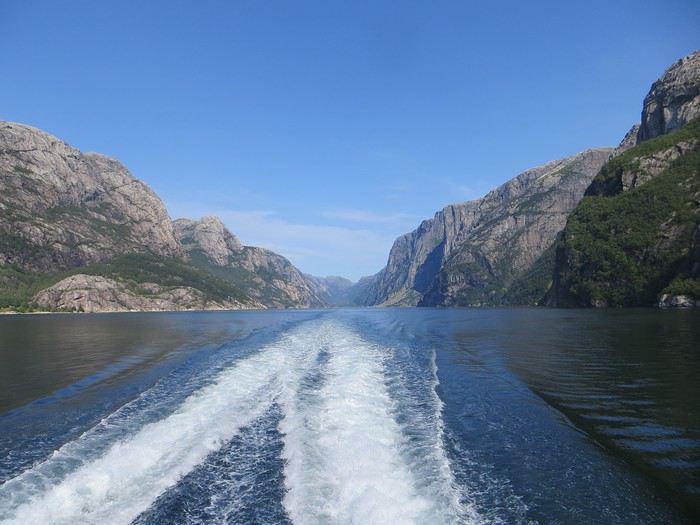 La croisière s'amuse
Le camping du soir se trouve à Hjelmeland et est ingénieusement intitulé Hjelmeland camping. Celui-ci fait dans l’original puisque nous avons planté notre tente dans le parc arboré d’une sorte de manoir qui sert de dortoir. Une chouette vue, une cuisine bien équipée et assez d’espace pour ne pas se marcher dessus (en principe, avec les Norvégiens, on ne sait jamais, ils pourraient parquer votre tente ou votre van à 50 cm du voisin), voilà pour les avantages. Pour les inconvénients, les sanitaires sont peu nombreux, peu pratiques et se salissent vite (forcément).
On part en vadrouille dans l'ouest américain! Oui, encore... English translation pending
En ces temps difficiles qui nous obligent à trouver des occupations, je vous soumets ici un carnet que j'avais rédigé il y a quelques années et que je n'ai jamais publié ici... Bonne lecture (pour ceux que ça intéresse...)...
24 juillet - Itinéraire d’une famille gâtée
Envie de t’évader ? Envie de rêver ? Envie de t’amuser ? Oui ? Alors tu as frappé à la bonne adresse... Plus précisément à l’adresse de celui qui a attrapé un virus… En l’occurrence, moi… Et ce virus, pas question de m’en débarrasser en me bourrant d’antibiotiques. Non seulement, les antibiotiques, ce n’est pas automatique, mais ce virus-là, j’en prends grand soin. Je l’entretiens, même… Ce virus, c’est l’étasunite ! Je l’ai contracté le jour où j’ai posé mes arpions chez l’oncle Sam pour la première fois, il y a une décennie de cela. Tout ça ne me rajeunit pas mais depuis ce fameux jour, lui et moi, nous ne nous sommes plus jamais quittés. Un proverbe dit à ce sujet que si tu vas aux Etats-Unis une fois, tu y reviendras un jour… Ben moi, depuis, j’y suis même retourné deux autres fois ! Et figure-toi que si tu lis ces quelques lignes, c’est que je m’apprête à y retourner pour une quatrième vadrouille !... Pour cette fois-ci, je vais accomplir un de mes rêves ! Me faire la route 66 sur mon Harley avec une belle brune accrochée à ma taille... Manque de bol, ma femme est blonde, je n'ai pas le permis moto et nous avons deux louloutes de quatre et sept ans… Va donc falloir que je revoie mes plans...
Bon, si tu es un lecteur assidu de nos précédentes vadrouilles, nous n’avons plus de secret pour toi, si bien que tu sais déjà que nous sommes quatre, juste un an de plus par rapport à la dernière fois… Il y a bien évidemment Sandrine, ma femme alias le portefeuille ; Sasha, notre petite globetrotteuse de quatre ans ; et Anna notre routarde de sept ans et plus toutes ses dents... Ah, et je m’oubliais ! Moi, Franck, la trentaine bien tassée, alias le conducteur, le tour opérateur, le narrateur, le cuisinier, le… Oui, je sais, moi aussi, j’aimerais bien déléguer… Ah, mais j’oublie encore quelqu’un !… Toi… Mais bon, sauf le respect que je te dois, tu ne seras une nouvelle fois que le spectateur du film que nous allons tourner et interpréter… D’ailleurs, quel en sera le titre ?... Et bien après réflexion, on a le choix entre « Voyage entre geysers et déserts », ou alors « Sous le soleil de Beverly Hills »… Pour ce coup-là, en espérant ne pas les vexer, on décide de poser un lapin à Brandon et Brenda… Car oui, c’est décidé, cette nouvelle édition sera composée d'indiens, de geysers, de trappeurs, de pionniers, de bisons, de chercheurs d'or, de hors-la-loi, de ranchs et de cowboys ! A nous les grands espaces… et les gros hamburgers !!! A nous l’ouest américain et ses films qui donnent tant envie : Délivrance, la colline a des yeux, Shining, The Descent, ...
Mais un voyage comme celui-là, ça se prépare un ‘tiot peu. Premièrement, il faut du blé, du flouze, du fric, du pognon, des pépettes, de la caillasse… Ben oui, ça coûte cher tout ça, donc à moins de faire comme le PSG et te faire subventionner par un investisseur qatari, il va falloir que tu en mettes de côté. Deuxièmement, il faut un minimum de travail de préparation. Et je commencerai mon histoire par un retour dans le passé, un bond dans le temps pour revenir pile poil au moment où Sandrine a enfin craqué sous mes coups de butoir et m’a donné son ô combien précieuse approbation… « Allez, ok, c’est bon, fais-toi plaisir ! » Sans avoir réellement conscience de la portée de ces quelques mots, elle venait de me signer un contrat de travail d’un an ! Car moi, ni une, ni deux, j'ai employé toute une équipe de lutins pour m'aider à préparer mon itinéraire. Lecture de carnets de voyage, questions sur des forums, épluchage de guides, visionnage de films, essorage d’internet, … Au final, je dois dire que je suis plus que satisfait de leur boulot ! Ce qui me permet non pas de faire un bilan puisqu'heureusement, le voyage n'est pas commencé, mais plutôt un petit compte-rendu chiffré de ce qui nous attend. Huit états à traverser ou à effleurer, plus de cinq mille kilomètres à parcourir, vingt jours pleins sur place, deux hôtels, quatorze campings différents, huit heures de décalage... Mes trois blondes vont-elles le supporter ? Optimiste que je suis, je mise sur un grand « Oui » ! D’ailleurs, pour les préparer, j’ai mis en place un programme intensif trois mois avant le départ : Marche autour de notre immense propriété, westerns tous les soirs, Coca et hamburgers à volonté à tous les repas !... Et oui, qui ménage sa monture voyage plus souvent !
Avant de tailler la route, je profite de cette intro pour publier une petite annonce à destination des cambrioleurs amateurs de textes de voyage : passez votre route, ma maison est équipée d’une alarme biométrique avec double varifocale et matrice de commutation. De plus, j’ai loué à un pote du neuf trois son gros pitbull pour l’occasion. Sans compter que pendant nos vacances, ma maison va être occupée par mes parents qui sont tous les deux experts en arts martiaux !... D’ailleurs, pourquoi je te raconte ces bobards alors que tu ne connais même pas mon adresse… C'est le 25, avenue des canaris à Triffouillis-sur-Retourne... Euh, merci de ne pas m’envoyer de carte postale à l'adresse ci-dessus... c'est une fausse !
Bon, chut, ça y est, c’est l’heure de l’évaluation… On va savoir si toute la famille est prête pour le grand départ : « Sandrine, donne-moi les huit états dans lesquels nous allons poser les pieds... - Colorado, Wyoming, Nebraska, Dakota du sud, Montana, Idaho, Utah et... euh... mince, oh, je l’ai sur le bout de la langue… Ah oui, l’Arizona !!!… - Mouais… C’était moins une… Encore un peu et tu n’partais pas avec nous ! Et toi, Anna, cite-moi les quatre présidents sculptés sur le Mont Rushmore ? - Abram Licol, Tomasse Washington, George Jeffessonne et Theodore Rousevelle... - Ok, on va dire que c’est bon… Et toi, Sasha, dans quel pays allons-nous cet été ? - Les Jétajuniiiiis de l’Amérique de Mickey ! » Ok, c’est bon, elles sont fin prêtes ! Attention, départ imminent !
24 juillet - Itinéraire d’une famille gâtée
Envie de t’évader ? Envie de rêver ? Envie de t’amuser ? Oui ? Alors tu as frappé à la bonne adresse... Plus précisément à l’adresse de celui qui a attrapé un virus… En l’occurrence, moi… Et ce virus, pas question de m’en débarrasser en me bourrant d’antibiotiques. Non seulement, les antibiotiques, ce n’est pas automatique, mais ce virus-là, j’en prends grand soin. Je l’entretiens, même… Ce virus, c’est l’étasunite ! Je l’ai contracté le jour où j’ai posé mes arpions chez l’oncle Sam pour la première fois, il y a une décennie de cela. Tout ça ne me rajeunit pas mais depuis ce fameux jour, lui et moi, nous ne nous sommes plus jamais quittés. Un proverbe dit à ce sujet que si tu vas aux Etats-Unis une fois, tu y reviendras un jour… Ben moi, depuis, j’y suis même retourné deux autres fois ! Et figure-toi que si tu lis ces quelques lignes, c’est que je m’apprête à y retourner pour une quatrième vadrouille !... Pour cette fois-ci, je vais accomplir un de mes rêves ! Me faire la route 66 sur mon Harley avec une belle brune accrochée à ma taille... Manque de bol, ma femme est blonde, je n'ai pas le permis moto et nous avons deux louloutes de quatre et sept ans… Va donc falloir que je revoie mes plans...
Bon, si tu es un lecteur assidu de nos précédentes vadrouilles, nous n’avons plus de secret pour toi, si bien que tu sais déjà que nous sommes quatre, juste un an de plus par rapport à la dernière fois… Il y a bien évidemment Sandrine, ma femme alias le portefeuille ; Sasha, notre petite globetrotteuse de quatre ans ; et Anna notre routarde de sept ans et plus toutes ses dents... Ah, et je m’oubliais ! Moi, Franck, la trentaine bien tassée, alias le conducteur, le tour opérateur, le narrateur, le cuisinier, le… Oui, je sais, moi aussi, j’aimerais bien déléguer… Ah, mais j’oublie encore quelqu’un !… Toi… Mais bon, sauf le respect que je te dois, tu ne seras une nouvelle fois que le spectateur du film que nous allons tourner et interpréter… D’ailleurs, quel en sera le titre ?... Et bien après réflexion, on a le choix entre « Voyage entre geysers et déserts », ou alors « Sous le soleil de Beverly Hills »… Pour ce coup-là, en espérant ne pas les vexer, on décide de poser un lapin à Brandon et Brenda… Car oui, c’est décidé, cette nouvelle édition sera composée d'indiens, de geysers, de trappeurs, de pionniers, de bisons, de chercheurs d'or, de hors-la-loi, de ranchs et de cowboys ! A nous les grands espaces… et les gros hamburgers !!! A nous l’ouest américain et ses films qui donnent tant envie : Délivrance, la colline a des yeux, Shining, The Descent, ...
Mais un voyage comme celui-là, ça se prépare un ‘tiot peu. Premièrement, il faut du blé, du flouze, du fric, du pognon, des pépettes, de la caillasse… Ben oui, ça coûte cher tout ça, donc à moins de faire comme le PSG et te faire subventionner par un investisseur qatari, il va falloir que tu en mettes de côté. Deuxièmement, il faut un minimum de travail de préparation. Et je commencerai mon histoire par un retour dans le passé, un bond dans le temps pour revenir pile poil au moment où Sandrine a enfin craqué sous mes coups de butoir et m’a donné son ô combien précieuse approbation… « Allez, ok, c’est bon, fais-toi plaisir ! » Sans avoir réellement conscience de la portée de ces quelques mots, elle venait de me signer un contrat de travail d’un an ! Car moi, ni une, ni deux, j'ai employé toute une équipe de lutins pour m'aider à préparer mon itinéraire. Lecture de carnets de voyage, questions sur des forums, épluchage de guides, visionnage de films, essorage d’internet, … Au final, je dois dire que je suis plus que satisfait de leur boulot ! Ce qui me permet non pas de faire un bilan puisqu'heureusement, le voyage n'est pas commencé, mais plutôt un petit compte-rendu chiffré de ce qui nous attend. Huit états à traverser ou à effleurer, plus de cinq mille kilomètres à parcourir, vingt jours pleins sur place, deux hôtels, quatorze campings différents, huit heures de décalage... Mes trois blondes vont-elles le supporter ? Optimiste que je suis, je mise sur un grand « Oui » ! D’ailleurs, pour les préparer, j’ai mis en place un programme intensif trois mois avant le départ : Marche autour de notre immense propriété, westerns tous les soirs, Coca et hamburgers à volonté à tous les repas !... Et oui, qui ménage sa monture voyage plus souvent !
Avant de tailler la route, je profite de cette intro pour publier une petite annonce à destination des cambrioleurs amateurs de textes de voyage : passez votre route, ma maison est équipée d’une alarme biométrique avec double varifocale et matrice de commutation. De plus, j’ai loué à un pote du neuf trois son gros pitbull pour l’occasion. Sans compter que pendant nos vacances, ma maison va être occupée par mes parents qui sont tous les deux experts en arts martiaux !... D’ailleurs, pourquoi je te raconte ces bobards alors que tu ne connais même pas mon adresse… C'est le 25, avenue des canaris à Triffouillis-sur-Retourne... Euh, merci de ne pas m’envoyer de carte postale à l'adresse ci-dessus... c'est une fausse !
Bon, chut, ça y est, c’est l’heure de l’évaluation… On va savoir si toute la famille est prête pour le grand départ : « Sandrine, donne-moi les huit états dans lesquels nous allons poser les pieds... - Colorado, Wyoming, Nebraska, Dakota du sud, Montana, Idaho, Utah et... euh... mince, oh, je l’ai sur le bout de la langue… Ah oui, l’Arizona !!!… - Mouais… C’était moins une… Encore un peu et tu n’partais pas avec nous ! Et toi, Anna, cite-moi les quatre présidents sculptés sur le Mont Rushmore ? - Abram Licol, Tomasse Washington, George Jeffessonne et Theodore Rousevelle... - Ok, on va dire que c’est bon… Et toi, Sasha, dans quel pays allons-nous cet été ? - Les Jétajuniiiiis de l’Amérique de Mickey ! » Ok, c’est bon, elles sont fin prêtes ! Attention, départ imminent !