Results for "Leyte+|+8+>+191"
3044 results found.
Tous les horaires des train indiens sur Internet English translation pending
786
Avis à la population :
* Les horaires complets des chemins de fer indiens viennent d'être publiés sur Internet. Ils sont valables jusqu'en juin 2005. Pour y accéder directement : http://203.197.214.122/railways/timetable/home.htm Ou passer par la page d'accueil : www.indianrail.gov.in/ Vous aurez besoin du logiciel Acrobat Reader pour lire les horaires (téléchargeable sur le site).
* Attention : le nom de votre destination finale n'est peut-être pas celui de la gare, surtout dans les grandes villes.
BOMBAY : Mumbai Central / CST (anc. Victoria Terminus), Dadar, Bandra, Lokmanya Tilak CALCUTTA : Howrah, Sealdah DELHI : Delhi, New Delhi, (Hazrat) Nizamuddin, Delhi Cantt., Delhi Sarai Rohilla, Delhi Shahdara
Tous les trains portant le nom Rajdhani (= capitale) relient Delhi à une ou plusieurs grandes villes du pays.
Le train 8030 Howrah-Lokmanya Tilak (T) Express relie donc Calcutta à Bombay.
* Vous pouvez ausi faire vos réservations en ligne depuis le site www.irctc.co.in (paiement sécurisé par carte de crédit, surcoût : +1, 8 % du prix total + frais de réservation)
* Un gage à tous ceux qui confondraient ce forum avec un guichet de renseignements. Deux gages à ceux qui leur répondraient des conneries, comme c'est arrivé récemment. Pyaasa
Avis à la population :
* Les horaires complets des chemins de fer indiens viennent d'être publiés sur Internet. Ils sont valables jusqu'en juin 2005. Pour y accéder directement : http://203.197.214.122/railways/timetable/home.htm Ou passer par la page d'accueil : www.indianrail.gov.in/ Vous aurez besoin du logiciel Acrobat Reader pour lire les horaires (téléchargeable sur le site).
* Attention : le nom de votre destination finale n'est peut-être pas celui de la gare, surtout dans les grandes villes.
BOMBAY : Mumbai Central / CST (anc. Victoria Terminus), Dadar, Bandra, Lokmanya Tilak CALCUTTA : Howrah, Sealdah DELHI : Delhi, New Delhi, (Hazrat) Nizamuddin, Delhi Cantt., Delhi Sarai Rohilla, Delhi Shahdara
Tous les trains portant le nom Rajdhani (= capitale) relient Delhi à une ou plusieurs grandes villes du pays.
Le train 8030 Howrah-Lokmanya Tilak (T) Express relie donc Calcutta à Bombay.
* Vous pouvez ausi faire vos réservations en ligne depuis le site www.irctc.co.in (paiement sécurisé par carte de crédit, surcoût : +1, 8 % du prix total + frais de réservation)
* Un gage à tous ceux qui confondraient ce forum avec un guichet de renseignements. Deux gages à ceux qui leur répondraient des conneries, comme c'est arrivé récemment. Pyaasa
En préparation: tour du Manaslu au Népal English translation pending
Bonjour à tous, en vue d'un voyage au népal pour le tour du Manaslu et une partie du tour des Annapurnas à partir du 14 octobre 2004, je voudrais savoir comment notre groupe peut s'entrainer pour être au mieux..
Merci pour tous vos commentaires..
"Demain, ou dans une prochaine vie, on ne sait jamais ce qui arrivera en premier" (Dicton Sherpa).
Merci pour tous vos commentaires..
"Demain, ou dans une prochaine vie, on ne sait jamais ce qui arrivera en premier" (Dicton Sherpa).
Les Alpes du nord au sud English translation pending
bonjour,
qui a fait cette rando, ce trek devrais-je dire?
J'y pense sérieux. Alors quelques questions: la durée totale raisonnable jusqu'à la mer??
Les ravitaillements possibles pour limiter portage? bivouac facile, partout??
Meilleure période? Difficultés particulieres, cols, altitude, meteo??
Les gites, réserver ou pas? camping possible pres des gites pour repas, douches.??
Balisage, orientation? risques?
Merci de vos conseils
JIP
qui a fait cette rando, ce trek devrais-je dire?
J'y pense sérieux. Alors quelques questions: la durée totale raisonnable jusqu'à la mer??
Les ravitaillements possibles pour limiter portage? bivouac facile, partout??
Meilleure période? Difficultés particulieres, cols, altitude, meteo??
Les gites, réserver ou pas? camping possible pres des gites pour repas, douches.??
Balisage, orientation? risques?
Merci de vos conseils
JIP
Allibert Montagne pour le Népal? English translation pending
bonjour,
Desirant partir avec cette agence au Nepal, je desire savoir si quelqu'un sur le forum est deja parti avec eux, si possible au Nepal.
Merci d'avance
😏
Desirant partir avec cette agence au Nepal, je desire savoir si quelqu'un sur le forum est deja parti avec eux, si possible au Nepal.
Merci d'avance
😏
Air pass pour vols intérieurs Brésil? English translation pending
Je pars au Brésil en septembre. J'ai un mois, les distances sont longues et leq trajets en bus parfois interminables. J'aimerais donc me déplacer un peu en avion. J'ai trouvé avec la compagnies VASP un Air Pass de 4 vols intérieurs -où on veut, quand on veut. Seul contrainte: faire ça en 21 jours- pour 290 euros. C'est tellement peu cher que je voulais savoir si ce n'était pas un plan à la "mords-moi-le-noeud"! Est-ce que quelqu'un connaît ou a déjà voyagé avec cette compagnie? Merci, merci!
Sista Dey
Vietnam: après l'imagination... la sérénité retrouvée! English translation pending
30 ans de recherche ... le Vietnam si loin, si inaccessible enfin la famille retrouvée le 25 déc 1998 le + beau cadeau sur terre ! Préparatif voyage en famille 4 soeurs.
Interminable le vol entre Paris et Saïgon... arrivée à l'aéroport... ouffff que se passe t'il ? nous somme le 29 oct 1998, il fait une chaleur mais ce n'est rien cette sensation ! Nous voici toutes les 4 en train de poser le pied sur la terre de nos ancêtres ! Non seulement l'émotion nous envahit mais peu à peu nous nous rendons compte de la réalité. Nous sommes immenses les vietnamiens nous arrivent à l'épaule ! ils sont tous parqués derriere des barrières avec interdiction de les franchir ! c'est impressionnant !
Ah voilà notre nom sur une pancarte et un tout petit bout de femme avec un sourire qui lui fait le tour de la tête nous accueille. Ses deux mains chaleureuse nous rassurent et elles nous guide vers le taxi réservé qui nous conduira jusqu'à notre hôtel. En route, pffff quelle circulation, des cyclos, des motos, des vélos, des taxis et chacun usent et abusent de son klaxon ! Ah mais ils sont fous ils conduisent dans n'importe quel sens, il en vient de tous les côtés ! pfff ça passe à un cheveu ! Impressionnant, stressant mais délicieux à la fois nous n'avions jamais vu ça !
Le lendemain matin nous partons de bonne heure pour O mon village où maman est née. Le taxi nous conduit pendant + de 5 h environ c'est long, tout le monde dort, moi je suis trop excitée par toutes ces nouveautés, ces paysages féériques. J'immortalise vite fait tout ce petit monde dans les bras de morphée et clip clap c'est dans la boîte à photo. Je suis comme une enfant, le nez collé à la vitre et je contemple... oh un bufle je n'en avais jamais vu de si près, il laboure les rizières. et les nénuphars rose qui commencent à s'ouvrir c'est trop beau !
Ah nous nous arrêtons, tiens une guitoune, notre chauffeur paye le droit d'utiliser la route, en fait c'est l'autoroute... vitesse maxi 80 km/h nous roulons au milieu des vélos, des motos tiens un pouss pouss qui traverse l'autoroute... nous ralentissons car un bufle n'a pas terminée sa lente traversée... le riz sèche à même le bitume... arrêt à nouveau cette fois-ci nous traversons un bac et devons sortir de la voiture. Nous sommes assaillis par une multitude de vietnamiens pieds nu qui tentent de nous vendre des légumes, des fruits des boissons des passeoires, des pelles de tout ... Devant notre regard affolé, le chauffeur nous autorise de rester dans le véhicule mais demande aux hommes de traverser à pied. un ouf de soulagement. A travers la vitre, les gens nous dévisagent ils sont peu habitués aux touristes. la traversée dure + d'1/2 heure... nous traversons un autre bac et nous réempruntons une route toute aussi parsemée de couleurs, senteurs, maisons sur pilotis, mes yeux ne savent plus où regarder tellement c'est merveilleux.
Nous approchons le village, oh il y a foule tout le monde nous accueille Tata nous montre le chemin, comme elle ressemble à maman je suis toute émue et mes yeux me trahissent, mais bon je me reprends vite tiens, je scrute mes soeurs...elles se reprennent vite aussi !!!
Tata nous conduit à l'école du village. nous rentrons par un portail et le directeur nous accueille avec quelques professeurs... petit thé... discussion avec ma soeur aînée qui est trésorière d'une association à Lyon en vue d'une création possible d'une classe supplémentaire.
Nous nous retrouvons dans la cour... la cloche sonne et quelque bambins nous rejoignent... puis nous sommes encerclés par une nuée d'enfants... ils sont impressionnés de nous voir... ils nous regardent avec curiosité se demandant qui nous sommes. L'interprète nous indique c'est la 1ère fois qu'il voit un occidental. le village de O mon est perdu dans le delta du mékong et aucun touriste ne se rend jamais là-bas !
Ils crient de plus en plus et bientôt toutes les classes nous encerclent et c'est le brou ha ha total, tous les gamins maintenant veulent toucher le ventre de Bernard notre beau frère il faut dire qu'ils le prennent pour un bouddha avec son ventre bedonnant c'est pas étonnant ! Les enfants sont heureux !
Nous devons nous rendre vers la maison... avec la fin des moussons le sentier est un peu inondé et le voisin nous amène dans son sampan... nous voilà sur un des bras du mékong... le paysage... les petites maisons avec les toits fait en feuilles de palmiers d'eau, les gamins qui s'amusent dans l'eau... un peu plus haut tiens une lessive... en remontant tiens... rien de tel que le mékong pour laver la salade... nous voici arrivés à la maison o% maman est née !!! Moment d'émotion... mes yeux me piquent j'essuie une petite larme... mes soeurs sont dans le même état que moi...
L'autel des ancêtres... nous rendons hommage et pensons très fort à maman... une prière de la plus grande à la plus petite... je suis la dernière et ma prière terminée...enfin maman ton âme peut reposer en paix !
Je reviendrais vous raconter notre périple à l'orphelinat de Sadec !
Bien à vous ! Lotusbleue😊
Ah voilà notre nom sur une pancarte et un tout petit bout de femme avec un sourire qui lui fait le tour de la tête nous accueille. Ses deux mains chaleureuse nous rassurent et elles nous guide vers le taxi réservé qui nous conduira jusqu'à notre hôtel. En route, pffff quelle circulation, des cyclos, des motos, des vélos, des taxis et chacun usent et abusent de son klaxon ! Ah mais ils sont fous ils conduisent dans n'importe quel sens, il en vient de tous les côtés ! pfff ça passe à un cheveu ! Impressionnant, stressant mais délicieux à la fois nous n'avions jamais vu ça !
Le lendemain matin nous partons de bonne heure pour O mon village où maman est née. Le taxi nous conduit pendant + de 5 h environ c'est long, tout le monde dort, moi je suis trop excitée par toutes ces nouveautés, ces paysages féériques. J'immortalise vite fait tout ce petit monde dans les bras de morphée et clip clap c'est dans la boîte à photo. Je suis comme une enfant, le nez collé à la vitre et je contemple... oh un bufle je n'en avais jamais vu de si près, il laboure les rizières. et les nénuphars rose qui commencent à s'ouvrir c'est trop beau !
Ah nous nous arrêtons, tiens une guitoune, notre chauffeur paye le droit d'utiliser la route, en fait c'est l'autoroute... vitesse maxi 80 km/h nous roulons au milieu des vélos, des motos tiens un pouss pouss qui traverse l'autoroute... nous ralentissons car un bufle n'a pas terminée sa lente traversée... le riz sèche à même le bitume... arrêt à nouveau cette fois-ci nous traversons un bac et devons sortir de la voiture. Nous sommes assaillis par une multitude de vietnamiens pieds nu qui tentent de nous vendre des légumes, des fruits des boissons des passeoires, des pelles de tout ... Devant notre regard affolé, le chauffeur nous autorise de rester dans le véhicule mais demande aux hommes de traverser à pied. un ouf de soulagement. A travers la vitre, les gens nous dévisagent ils sont peu habitués aux touristes. la traversée dure + d'1/2 heure... nous traversons un autre bac et nous réempruntons une route toute aussi parsemée de couleurs, senteurs, maisons sur pilotis, mes yeux ne savent plus où regarder tellement c'est merveilleux.
Nous approchons le village, oh il y a foule tout le monde nous accueille Tata nous montre le chemin, comme elle ressemble à maman je suis toute émue et mes yeux me trahissent, mais bon je me reprends vite tiens, je scrute mes soeurs...elles se reprennent vite aussi !!!
Tata nous conduit à l'école du village. nous rentrons par un portail et le directeur nous accueille avec quelques professeurs... petit thé... discussion avec ma soeur aînée qui est trésorière d'une association à Lyon en vue d'une création possible d'une classe supplémentaire.
Nous nous retrouvons dans la cour... la cloche sonne et quelque bambins nous rejoignent... puis nous sommes encerclés par une nuée d'enfants... ils sont impressionnés de nous voir... ils nous regardent avec curiosité se demandant qui nous sommes. L'interprète nous indique c'est la 1ère fois qu'il voit un occidental. le village de O mon est perdu dans le delta du mékong et aucun touriste ne se rend jamais là-bas !
Ils crient de plus en plus et bientôt toutes les classes nous encerclent et c'est le brou ha ha total, tous les gamins maintenant veulent toucher le ventre de Bernard notre beau frère il faut dire qu'ils le prennent pour un bouddha avec son ventre bedonnant c'est pas étonnant ! Les enfants sont heureux !
Nous devons nous rendre vers la maison... avec la fin des moussons le sentier est un peu inondé et le voisin nous amène dans son sampan... nous voilà sur un des bras du mékong... le paysage... les petites maisons avec les toits fait en feuilles de palmiers d'eau, les gamins qui s'amusent dans l'eau... un peu plus haut tiens une lessive... en remontant tiens... rien de tel que le mékong pour laver la salade... nous voici arrivés à la maison o% maman est née !!! Moment d'émotion... mes yeux me piquent j'essuie une petite larme... mes soeurs sont dans le même état que moi...
L'autel des ancêtres... nous rendons hommage et pensons très fort à maman... une prière de la plus grande à la plus petite... je suis la dernière et ma prière terminée...enfin maman ton âme peut reposer en paix !
Je reviendrais vous raconter notre périple à l'orphelinat de Sadec !
Bien à vous ! Lotusbleue😊
Bus at auberges dans les parcs nationaux de l'ouest américain English translation pending
Bonjour à tous,
Je prépare un voyage autour du monde, et ma première étape, en septembre 2004, est Los Angeles, Las Vegas et les parcs nationaux tels que Yosemite, Zyon, Lac Powell, Grand Canyon, Monument Valley, Arches, Bryce Canyon.
Je suis seule à partir pour ce petit périple, et je recherche actuellement la meilleure façon de voyager.
Donc je demande avis aux grands connaisseurs et grands sages de cette région. Est ce que le principe Bus-Auberges de jeunesse est envisageable???
Ou je me demande si le mieux n'est pas encore de louer une voiture à plusieurs, et là je demande avis aux amateurs, coéquipiers intéressés (note: petit budget, séjour de 2 à 3 semaines à partir du 10-15 septembre).
merci d'avance et à très bientot
mathilde
Je prépare un voyage autour du monde, et ma première étape, en septembre 2004, est Los Angeles, Las Vegas et les parcs nationaux tels que Yosemite, Zyon, Lac Powell, Grand Canyon, Monument Valley, Arches, Bryce Canyon.
Je suis seule à partir pour ce petit périple, et je recherche actuellement la meilleure façon de voyager.
Donc je demande avis aux grands connaisseurs et grands sages de cette région. Est ce que le principe Bus-Auberges de jeunesse est envisageable???
Ou je me demande si le mieux n'est pas encore de louer une voiture à plusieurs, et là je demande avis aux amateurs, coéquipiers intéressés (note: petit budget, séjour de 2 à 3 semaines à partir du 10-15 septembre).
merci d'avance et à très bientot
mathilde
France: les Landes à vélo English translation pending
Avec ma fille de onze ans, on a bien user nos vélo (VTC) sur le macadam parisien et on irait bien faire un tour dans les Landes à Pâques, pour une petite semaines. Toutes vos recommandations sont les bienvenues, puisque l'on a jamais fait çà. Toutes les idées d'itinéraires, de gîtes d'étape ou autres petites auberges sur ce parcours entre Bordeaux et Biarritz. Merci
Hôtel Reina Cumayasa English translation pending
Bonjour,
j 'ai réservé pour une semaine en RD à l' hôtel Reina cumayasa pour le moi d 'avril,
ayant parcouru ce forum, je suis un peu inquiète à cause des critiques négatives émises au sujet de l 'hôtel ( pas d'eau pas d'électricité etc etc ... des scorpions des chenilles géantes et nourritures peu variée ... )
c'est la première fois que je pars avec switch mais ma soeur est partie avec eux l 'année dernière à l'ile maurice et ca c'est super bien passé, j'ai donc suivi son exemple
quelqu'un peu me renseigner sur cet hotel ?
je reste confiante malgré tout !!
merci d 'avance
j 'ai réservé pour une semaine en RD à l' hôtel Reina cumayasa pour le moi d 'avril,
ayant parcouru ce forum, je suis un peu inquiète à cause des critiques négatives émises au sujet de l 'hôtel ( pas d'eau pas d'électricité etc etc ... des scorpions des chenilles géantes et nourritures peu variée ... )
c'est la première fois que je pars avec switch mais ma soeur est partie avec eux l 'année dernière à l'ile maurice et ca c'est super bien passé, j'ai donc suivi son exemple
quelqu'un peu me renseigner sur cet hotel ?
je reste confiante malgré tout !!
merci d 'avance
Un travail pour l'été à l'étranger English translation pending
Bonjour
je suis une petite nouvelle sur ce site que je viens de découvrir par hasard. Je ne suis pas une très très grande voyageuse. J'ai bien fait quelques voyages : angleterre, france, hollande (mais à 14 ans!) mexique, usa et, bien sûr, mon Québec!😉 Toutefois, combien de fois ai-je voyager par la voie du rêve !!! Cet été, j'ai décidé que je devais arrêter d'utiliser mon imaginaire et de prendre les grands moyens ! Je suis enseignante et donc en congé pour l'été. Malheureusement, je ne peux me passer d'un salaire et voyager. J'aimerais donc pouvoir aller travailler un mois ou deux dans un autre pays, mais je ne sais trop par où commencer. La destination m'importe peu. J'enseigne le français ici, au Québec; j'imagine que je pourrais le faire ailleurs... On m'a déjà dit qu'on cherchait énormément des profs de français à Bora Bora, mais je n'ai réussi à établir aucun contact... Enfin, si quelqu'un avait une suggestion ou des conseils à me donner, j'apprécierais !🙂 L'idée d'apprendre une langue en même temps me plaît beaucoup. Existe-t-il des agences qui organisent ce genre de voyage et où l'on peut nous proposer des familles d'accueil, des emplois saisonniers, etc.
Merci à tous ceux qui prendront le temps de me répondre ! Annie x x
je suis une petite nouvelle sur ce site que je viens de découvrir par hasard. Je ne suis pas une très très grande voyageuse. J'ai bien fait quelques voyages : angleterre, france, hollande (mais à 14 ans!) mexique, usa et, bien sûr, mon Québec!😉 Toutefois, combien de fois ai-je voyager par la voie du rêve !!! Cet été, j'ai décidé que je devais arrêter d'utiliser mon imaginaire et de prendre les grands moyens ! Je suis enseignante et donc en congé pour l'été. Malheureusement, je ne peux me passer d'un salaire et voyager. J'aimerais donc pouvoir aller travailler un mois ou deux dans un autre pays, mais je ne sais trop par où commencer. La destination m'importe peu. J'enseigne le français ici, au Québec; j'imagine que je pourrais le faire ailleurs... On m'a déjà dit qu'on cherchait énormément des profs de français à Bora Bora, mais je n'ai réussi à établir aucun contact... Enfin, si quelqu'un avait une suggestion ou des conseils à me donner, j'apprécierais !🙂 L'idée d'apprendre une langue en même temps me plaît beaucoup. Existe-t-il des agences qui organisent ce genre de voyage et où l'on peut nous proposer des familles d'accueil, des emplois saisonniers, etc.
Merci à tous ceux qui prendront le temps de me répondre ! Annie x x
Tourisme et droits de l'homme English translation pending
Désolé de venir en plein milieu de"ou trouver des iles desertes" et "peut on boire de la bintang dans un resto muslim", mais j'ai trouvé un message qui merite reflexion ?
Tourisme et Droits de l'Homme (Birmanie)
"Un voyageur m'a remis un livre avant de quitter la Birmanie avec pour consigne : "maintiens celivre en Birmanie. Il ne doit pas sortir des frontières. Tu dois donc à ton tour le transmettre à un autre voyageur avant ton départ ". L'auteur de ce livre : Aung San Suu Kyi, prix nobel de la paix en 1991 et leader du parti "National League for the Democracy (NLD)". Cette femme intègre et courageuse a écrit "Letters from Bruma" entre novembre 1995 et décembre 1996 pendant son assignation à résidence. Ces lettres ont été publiées dans un journal durant l'année 96. Sa détention fut élargie à la ville de Rangoon, qu'elle a interdiction de quitter (interdiction levée depuis avril 2002). Pourquoi une telle peine ? Parce qu'elle a gagné les élection en 1990 contre le parti socialiste qui soutient le régime militaire en place.
J'ai appris dans ce livre des détails passionnants sur la vie quotidienne des birmans. J'avais bien compris qu'il était fortement déconseillé aux locaux d'héberger des étrangers, sous peine d'emprisonnement. C'est considéré comme un acte anti-régime, de propagande pour la démocratie. Mais ce que je viens de lire me sidère !?! Un birman, qui souhaite rester dormir chez un ami, de façon impromptue doit se faire enregistrer au Local Law and Order Restoration Council avant 21h00. Sinon, il risque une peine de prison allant de 2 semaines à 6 mois. Les autorités peuvent venir vous inspecter à n'importe quel moment de la nuit et vérifier le formulaire numéro 10. Le formulaire numéro 10 ? Un papier administratif sur lequel sont enregistrés tous les membres de la famille autorisés à dormir sous le même toit, voire les employés éventuels de la maison ! C'est donc le meilleur moyen d'empêcher les regroupements et réunions politiques. Ce papier était utilisé entre 1962 et 1988 pour évaluer les quantités de denrées de première nécessité auxquels avaient droit les familles. Il définit uniquement à présent, qui est autorisé à dormir sous le même toit sans en référer aux autorités. Hallucinant, non ?
Depuis 1988, de nombreuses peines ont été prononcées. Un hôte a écopé d'une peine de prison d'une semaine (contre deux mois pour son invité), mais cet hôte, pris d'une quinte de toux pour protester faiblement contre ce jugement si dur, a vu sa peine changer en cinq minutes et passer d'une semaine à un mois ! Selon certains, il semblerait que cette règle ait été allégée, mais qui croire ?
(...) Cela se passe quelque part dans le nord de la Birmanie. Un vieux monsieur s'est donné pour mission d'ouvrir le coeur et les yeux des backpackers. Il ne peut porter sa parole vers le monde, alors quand le "monde" vient à lui il en profite. Les voyageurs seront ceux qui transmettront son message pour la démocratie. Et qu'importe si seul, un voyageur sur dix mille l'entend et le propage, celui-là vaut tout l'or du monde. Sa révolution est lente. Il est pour une solution non violente et fédéraliste entre les cinq provinces birmanes. "Il faut convaincre par les mots et non par les armes. Ce serait sinon une extermination au sein d'un même peuple qui s'entretuerait. Alors voyageurs du monde, parlez pour nous et ma plus grande joie serait de voir la démocratie de mon vivant".
A la question : "doit-on ou non venir en Birmanie sous peine de soutenir le régime militaire ?", il vous renvoie la question, expose les éléments pour et contre. A vous d'interroger votre conscience et de savoir quel genre de touriste vous souhaitez être. La vitrine est belle, les rues sont propres, les hôtels ont l'eau chaude (ils doivent être au normes pour accueillir les touristes et donner une bonne image du pays et de son gouvernement s'ils veulent obtenir une licence), les pagodes entretenues et rénovées. Pas de mendiants dans les rues ? Les marchés sont bien fournis, mieux qu'au Cambodge. Mais si vous grattez un peu (ce que déteste le gouvernement), vous verrez le travail forcé des villageois pour construire des routes pour les touristes. Les mendiants sont parqués et cachés à l'extérieur des villes. Les universités viennent de rouvrir officiellement, certes, mais elles sont vides (il est d'ailleurs interdit de les visiter). On encourage l'enseignement à distance car le gouvernement a peur des regroupements. Les étudiants sont donc dispersés par matières aux quatre coins de la ville, loin dans les banlieues, de préférence. Les malades du Sida sont nombreux. Ils sont voués à une mort certaine, parqués eux aussi comme les vagabonds dans des camps. "De toute façon, on ne peut pas guérir cette maladie et les soins coûtent trop chers". Mais apparemment aucune campagne d'information et de prévention n'a été mise en place non plus.
Et vous, pauvres backpackers, tout content de n'avoir changé que 100 dollars à l'aéroport au lieu des 200 exigés (c'est toujours ça de moins dans les caisses de l'état corrompu et illégal, vous vous dites), vous croyez avoir gagné ? Il rit jaune notre digne professeur d'un soir. "C'est une petite bataille. Sachez alors que le gouvernement fait une liste des touristes entrés dans le pays. Cette liste sera, plus tard, montrée aux organisations internationales pour prouver à quel point le pays est stable. Sinon, les touristes ne viendraient pas, n'est-ce-pas ? Vous en témoignerez d'ailleurs en rentrant chez vous et en montrant toutes ces belles photos de gens souriants et de pagodes dorées". Et la cerise sur le gâteau : "Vous avez, certes, changé 50 ou 100 dollars en FEC (monnaie de singe du gouvernement, utilisable uniquement dans l'économie approuvée par le régime, et non utilisable sur le marché local en tout cas). Qu'importe, sur la liste officielle, il est spécifié que chaque touriste a changé 200 dollars. La différence, celle que vous n'avez pas changé, servira donc à blanchir l'argent de la drogue".
Alors, faut-il aller en Birmanie ou pas ? Et là, il sort tous les articles de presse écrits par des anonymes de tous pays, des voyageurs comme vous et moi, et dit : "Je ne pouvais imaginer quel pouvoir de simples voyageurs avaient dans leur pays. Cette liberté d'expression, ils peuvent écrire et faire entendre leur voix, leur opinion. Et cette voix dépasse les frontières. Vous êtes le pouvoir". Ces voyageurs sont allés au delà du miroir et ont témoigné. Une petite goutte pour l'humanité mais un grand espoir pour les birmans : "Mr X, condamné à une peine de prison de sept ans, a été relâché sous la pression internationale. Une touriste ayant récolté 1, 6 millions d'empreintes digitales sur un immense panneau a fait son portrait sur ce même panneau et l'a diffusé en guise de pétition pour sa relâche". Il reste néanmoins beaucoup de prisonniers politiques dans l'ombre et même les journalistes internationaux peuvent à présent encourir une peine de prison. Alors doit-on venir en Birmanie ?…"
(flogo55@hotmail.com - 8/02)
Bons plans pour bosser en Angleterre? English translation pending
Bonjour...g quelques mois devant moi avant de reprendre la fin de ma licence...et g très envie de partir au Royaume-Uni...histoire de bosser, et puis qd même de travailler de mon anglais 😉
Londres me tente bien...mais c très cher...g jeté un coup d'oeil à londonjob.com mais je ne sais pas vraiment ce que ça vaut...y'a t il qq qui soit passé par cet organisme et qui pourrait m'en parler?🙂
sinon...y'a t'il d'autres endroits sympas où je pourrais taffer...?
g envie de partir rapidos...help me if u can
voili voilou...A bientôt Alex
Londres me tente bien...mais c très cher...g jeté un coup d'oeil à londonjob.com mais je ne sais pas vraiment ce que ça vaut...y'a t il qq qui soit passé par cet organisme et qui pourrait m'en parler?🙂
sinon...y'a t'il d'autres endroits sympas où je pourrais taffer...?
g envie de partir rapidos...help me if u can
voili voilou...A bientôt Alex
Tiradentes au Brésil English translation pending
Je cherche des informations (toutes infos, histoire, logement, ...) sur Tiradentes une ville historique à 200 km au sud de Belo Horizonte dans le Minas.
Merci
Georges.
Merci
Georges.
Où partir en novembre-décembre? English translation pending
😇
Hello, je cherche une destination de voyage pour environs 10 jours pour la mi-novembre 2003 ?
Mon problème : pays musulmans = ramadan !
Asie et caraïbes = mousson ?
Mon lieu de départ est la Suisse et je pensais peut-être au Canada Français mais quel temps fait-il ?
Merci pour vos réponses !
Hello, je cherche une destination de voyage pour environs 10 jours pour la mi-novembre 2003 ?
Mon problème : pays musulmans = ramadan !
Asie et caraïbes = mousson ?
Mon lieu de départ est la Suisse et je pensais peut-être au Canada Français mais quel temps fait-il ?
Merci pour vos réponses !
Back to Swedish Lapland: Trekking the Kungsleden and Crossing Sarek
Summer 2022 left me with a sense of unfinished business, so here I am back in Swedish Lapland for summer 2024, ready to attempt the Sarek crossing again—and this time, tackle part of the Kungsleden too.
After much hesitation, my partner Jean Marie and I decided to start with the Kungsleden, which is, from what we’ve read, stunning but very busy (and it really is!!), and finish with the wilder option: SAREK! This park is known as Europe’s last true wilderness—sounds like a dream, right?! The downside of this plan is that there’s no way to resupply in Sarek, and the Kungsleden isn’t exactly set up for long-distance trekking either, so we’ll have to carry a lot of food for the first part of the trip with Sarek in mind. Oh well, we’re motivated!
Our plan is to start in Abisko (the classic route), head to Vakkotavare (also classic, but with some variations to avoid the official trail and the crowds), then continue the Kungsleden from Saltoluokta. Before reaching Aktse, we’ll set off on an east-to-west crossing of Sarek (weather-dependent, since aside from the Skarja hut in the center of the park, there’s no shelter if conditions turn bad). At least we’ll be on the right side of the park to climb Skierfe and enjoy the jaw-dropping view of Rappaladen if we have to bail on Sarek.
All in all, that’s 17 days of trekking, including 1 rest day and 1 buffer day for weather delays.
So if you’re interested, I invite you to follow our fully packed backpacks!
08/03 - Abisko – 5km before Abiskojaure Some info (guides we used for prep, SFT map, sending food to Saltoluokta) 08/04 – 5km before Abiskojaure - on the east shore of Lake Alisjavri 08/05 – East shore of Lake Alisjavri – just before Tjaktja 08/06 – Just before Tjaktja – above the Salka hut via Nallo 08/07 - Salka – just past Singi + side trip to Djalson Lake 08/08 - Singi – Teusajaure 08/09 - Teusajaure - Vakkotavare (end of the first section of the Kungsleden) 08/10 – rest day in Saltoluokta + round trip to the Sámi village of Pietjaure 08/11 – Saltoluokta – Sitojaure 08/12 - Sitojaure - Skierfe - Sarek or no Sarek? 08/13 – Skierfe – somewhere above Rapadalen 08/14 – Somewhere above Rapadalen – above the Skarki hut 08/15 – Above the Skarki hut - Skarja 08/16 – Camping at Skarja 08/17 – Ruohtesvagge 08/18 – Ruohtesvagge - Padjelantaleden 08/19 – Padjelantaleden - Ritsem – End of the trek 08/20–24 - End of the trip (Lullea - Stockholm) And of course, the recap
After much hesitation, my partner Jean Marie and I decided to start with the Kungsleden, which is, from what we’ve read, stunning but very busy (and it really is!!), and finish with the wilder option: SAREK! This park is known as Europe’s last true wilderness—sounds like a dream, right?! The downside of this plan is that there’s no way to resupply in Sarek, and the Kungsleden isn’t exactly set up for long-distance trekking either, so we’ll have to carry a lot of food for the first part of the trip with Sarek in mind. Oh well, we’re motivated!
Our plan is to start in Abisko (the classic route), head to Vakkotavare (also classic, but with some variations to avoid the official trail and the crowds), then continue the Kungsleden from Saltoluokta. Before reaching Aktse, we’ll set off on an east-to-west crossing of Sarek (weather-dependent, since aside from the Skarja hut in the center of the park, there’s no shelter if conditions turn bad). At least we’ll be on the right side of the park to climb Skierfe and enjoy the jaw-dropping view of Rappaladen if we have to bail on Sarek.
All in all, that’s 17 days of trekking, including 1 rest day and 1 buffer day for weather delays.
So if you’re interested, I invite you to follow our fully packed backpacks!
08/03 - Abisko – 5km before Abiskojaure Some info (guides we used for prep, SFT map, sending food to Saltoluokta) 08/04 – 5km before Abiskojaure - on the east shore of Lake Alisjavri 08/05 – East shore of Lake Alisjavri – just before Tjaktja 08/06 – Just before Tjaktja – above the Salka hut via Nallo 08/07 - Salka – just past Singi + side trip to Djalson Lake 08/08 - Singi – Teusajaure 08/09 - Teusajaure - Vakkotavare (end of the first section of the Kungsleden) 08/10 – rest day in Saltoluokta + round trip to the Sámi village of Pietjaure 08/11 – Saltoluokta – Sitojaure 08/12 - Sitojaure - Skierfe - Sarek or no Sarek? 08/13 – Skierfe – somewhere above Rapadalen 08/14 – Somewhere above Rapadalen – above the Skarki hut 08/15 – Above the Skarki hut - Skarja 08/16 – Camping at Skarja 08/17 – Ruohtesvagge 08/18 – Ruohtesvagge - Padjelantaleden 08/19 – Padjelantaleden - Ritsem – End of the trek 08/20–24 - End of the trip (Lullea - Stockholm) And of course, the recap
Off on a winter adventure in the American West!
Day 1 – February 14
We all have two lives. And the second one kicks off the day you realize you only have one, with the determination to spend the time you have left on what truly adds sparkle to your life, Kevin! I like to elegantly introduce a trip with a philosophical quote. First, it gives you the illusion that I’m some kind of deep thinker, and second, it lets me fill up the first few lines of my blank page when I don’t know how to tell you I’m diving back into what really lights up my life: another adventure beyond the horizon! And nearly every other year, like a toxic relationship, my horizon tends to take shape in Uncle Sam’s backyard. And this, despite his cousin Donald calling the shots. Speaking of which, it was partly that impulsive guy who pushed us to be just as impulsive and snag our four flight tickets at a ridiculously low price—a direct result of foreign tourism taking a hit from BetaMax’s repeated antics... Four tickets? Who are the other lucky ones? In this case, our lucky ones are actually lucky ladies: My Flo, always up for exploring the world with me on foot, camelback, or scooter, is obviously in on the fun. The other two seats went to our daughters, Sasha and Luna, both thrilled to be part of this new American adventure...
But what’s the American West like in February?... A gamble. Let’s call it Russian roulette since we’re not landing during peak weather season. That’s why we encouraged our transportation and accommodation to get cozy and produce a little camper van, so we can stay ultra-flexible in the face of any weather tantrums. We’ll be roaming in Kara the van with the motto "Follow the sun!" Bad weather? We bolt. Snow? We speed up. Sunny? We act like it was the plan all along and soak it up.
"Okay, but why keep coming back to the same corner of the globe? After ten American adventures, you must be tired of seeing the same things, right?" But I’m not crazy, you know!... The American West is like making love to your gorgeous wife over and over, always enjoying it just as much. And contrary to what you might think, the American West isn’t just the Grand Canyon, Monument Valley, Las Vegas, and Bryce Canyon. Proof is, after ten trips to the U.S., my retinas are still untouched by three-quarters of the places I scribbled on a napkin for this adventure... Oh, and add to that my wife, who I’ve easily converted to my religion, and boom... relapse is even easier! Because yes, we’ve landed in Los Angeles after a sunny flight over Greenland, still under Danish flag for now. And we’re already heading east through the XXL traffic of L.A.’s eight-lane highways, eager to dive into our first discoveries. But first, night is taking over the sky, and second, we’ve been officially awake for 24 hours, so I suggest wrapping up this intro. I’ll tell you more tomorrow morning. Sound good?


We all have two lives. And the second one kicks off the day you realize you only have one, with the determination to spend the time you have left on what truly adds sparkle to your life, Kevin! I like to elegantly introduce a trip with a philosophical quote. First, it gives you the illusion that I’m some kind of deep thinker, and second, it lets me fill up the first few lines of my blank page when I don’t know how to tell you I’m diving back into what really lights up my life: another adventure beyond the horizon! And nearly every other year, like a toxic relationship, my horizon tends to take shape in Uncle Sam’s backyard. And this, despite his cousin Donald calling the shots. Speaking of which, it was partly that impulsive guy who pushed us to be just as impulsive and snag our four flight tickets at a ridiculously low price—a direct result of foreign tourism taking a hit from BetaMax’s repeated antics... Four tickets? Who are the other lucky ones? In this case, our lucky ones are actually lucky ladies: My Flo, always up for exploring the world with me on foot, camelback, or scooter, is obviously in on the fun. The other two seats went to our daughters, Sasha and Luna, both thrilled to be part of this new American adventure...
But what’s the American West like in February?... A gamble. Let’s call it Russian roulette since we’re not landing during peak weather season. That’s why we encouraged our transportation and accommodation to get cozy and produce a little camper van, so we can stay ultra-flexible in the face of any weather tantrums. We’ll be roaming in Kara the van with the motto "Follow the sun!" Bad weather? We bolt. Snow? We speed up. Sunny? We act like it was the plan all along and soak it up.
"Okay, but why keep coming back to the same corner of the globe? After ten American adventures, you must be tired of seeing the same things, right?" But I’m not crazy, you know!... The American West is like making love to your gorgeous wife over and over, always enjoying it just as much. And contrary to what you might think, the American West isn’t just the Grand Canyon, Monument Valley, Las Vegas, and Bryce Canyon. Proof is, after ten trips to the U.S., my retinas are still untouched by three-quarters of the places I scribbled on a napkin for this adventure... Oh, and add to that my wife, who I’ve easily converted to my religion, and boom... relapse is even easier! Because yes, we’ve landed in Los Angeles after a sunny flight over Greenland, still under Danish flag for now. And we’re already heading east through the XXL traffic of L.A.’s eight-lane highways, eager to dive into our first discoveries. But first, night is taking over the sky, and second, we’ve been officially awake for 24 hours, so I suggest wrapping up this intro. I’ll tell you more tomorrow morning. Sound good?
What mental and physical preparation for a humanitarian trek to Everest Base Camp?
Hi everyone!
New to this forum, I’m planning a pretty big project for 2028. I’m heading to Nepal to do a trek from Kathmandu all the way to Everest Base Camp (a cool 5,300 m 😄). This trek is a bit special because even though I’ll be part of a group, I’m going solo (so far, no problem—I’m used to it). But it’s my first real trek, and it’s also a humanitarian one: once I reach base camp, I’ll stay an extra week to help clean up the waste left by tens of thousands of climbers! Since I’m originally from South America, from two countries that share the Andes, I have a deep respect for mountains—they fascinate me. So Everest… it’s kind of the trip of a lifetime!
So, a little question for those who’ve done treks to Everest before… any tips for good mental preparation (I’m already working on the physical side)?
Thanks in advance for your advice! 🙂
New to this forum, I’m planning a pretty big project for 2028. I’m heading to Nepal to do a trek from Kathmandu all the way to Everest Base Camp (a cool 5,300 m 😄). This trek is a bit special because even though I’ll be part of a group, I’m going solo (so far, no problem—I’m used to it). But it’s my first real trek, and it’s also a humanitarian one: once I reach base camp, I’ll stay an extra week to help clean up the waste left by tens of thousands of climbers! Since I’m originally from South America, from two countries that share the Andes, I have a deep respect for mountains—they fascinate me. So Everest… it’s kind of the trip of a lifetime!
So, a little question for those who’ve done treks to Everest before… any tips for good mental preparation (I’m already working on the physical side)?
Thanks in advance for your advice! 🙂
Practical aspects spring 2026: border to Murmansk, to Pskov, SIM cards, internet.
I took a few days to get some fresh air outside the Schengen-NATO prison. Between March 18, 2026, and March 25, 2026, as shown by the passport stamps:
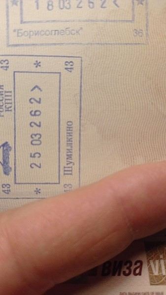
Borisoglebsk is the Russian border checkpoint after Kirkenes, on the road to Murmansk.
Kirkenes is a tiny town with a correspondingly small airport. Nothing has changed there: the minibuses to Murmansk wait on the right as you exit the airport. They’re synchronized with the two daily flights from Oslo—the SAS around 11:00 AM and Norwegian around 11:30 AM. They stop in Kirkenes at the corner of the Scandic for an hour, where other passengers can board, then head straight to the nearby border.
This is the least hassle Frontex/Schengen border. The Norwegian agent quickly scans your passport, and that’s it. No customs, since Norway is Schengen but not in the EU. On the Russian side, there’s a passport check and a quick customs inspection. All in all, crossing both the Norwegian and Russian checkpoints takes about 15 minutes.
A paper visa is required; e-visas aren’t accepted.
Two companies run the route: Avto Ekspress and Borodin: https://ae51.ru/routes/kirkenes-murmansk/ https://borodinbus.com/
The one-way fare is 5,500 ₽. You can either buy it online in rubles with a MIR card or make a formal reservation and pay in NOK cash to the driver. I took Borodin, and the price in NOK was much more expensive than in ₽.
=========================
On March 25, I left from Pskov via the Estonian border post at Luhaama. I spent three days in Murmansk, flew to St. Petersburg (SPB), stayed there for two days, then took an evening train to Pskov.
Since the end of February—and reportedly until the end of May—the Estonians have restricted the opening hours of the two border crossings near Pskov: Koidula (Pechory on the Russian side) and Luhaama (Izborsk on the Russian side). They’re closed at night between 7:00 PM and 7:00 AM. Right now, there’s a bus from Pskov at 7:00 AM to the border. It drops you off at the end of the road where truckers—many Kazakh and Serbian—are parked on the side. You finish the rest on foot to the barrier, where there’s a quick initial check for Ukrainian stamps in passports. Then you walk to the customs building, followed by passport control at the kiosk for motorists. After that, it’s a 500-meter walk to the Estonian checkpoint. At the moment, things seem calmer. Passport control is quick. The usual silly questions in English: "Where were you? Where are you going?" I just gave my most clueless smile: "Sorry, I don’t understand." Yeah, right—I don’t speak English, especially not at an Estonian border with a French passport. If they’re in a mood, though... A very quick bag inspection. Once you exit the Estonian post, walk to the bus stop sign by the road where another coach takes you to Riga.
The catch: in my case, last Wednesday, there were two passengers (Russians) with old Ukrainian stamps in their passports. The bus from the Estonian post to Riga was supposed to leave around 9:30 AM. We ended up leaving around noon after the two were grilled by the FSB. Since it was a weekday outside of holidays, the bus was half-empty. The fuller the bus and the more people with Ukrainian stamps, the worse the nightmare. Don’t book a same-day flight from Riga. I had a flight at 6:00 PM, so it worked out.
=============
The Kirkenes-Murmansk route is still clearly the easiest and fastest. But it’s not the most convenient since it’s way up north.
Next, I’d say the Gdansk-Kaliningrad route in the middle of the week. Avoid weekends and holiday departures/returns.
Avoid the Narva-Ivangorod route during Christmas, Easter, May 9, and *all* summer.
==============
About flights from Murmansk to St. Petersburg: prices are good. I bought my ticket the day before departure on Rossiya for 7,500 ₽, including 10 kg of luggage + a handbag.
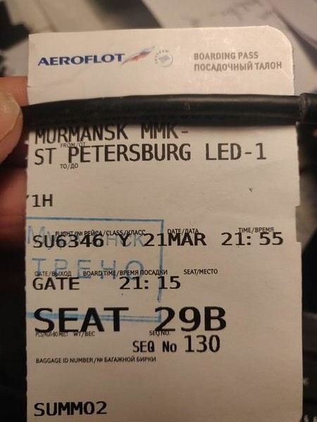
It’s the tail end of the northern lights season, and there were still crowds of Chinese tourists.
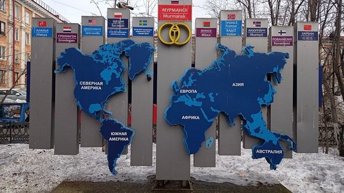
By the way, Murmansk is twinned with Harbin:
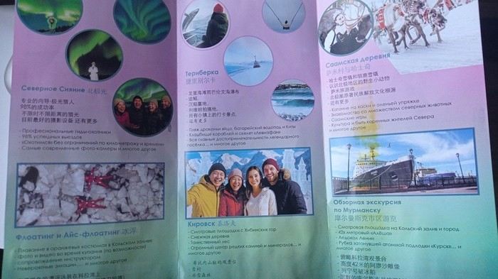
Chinese tourists are the largest foreign group, followed by Indians, then a mix of others from the Far East, Turks, Arabs, etc. Brochures are bilingual—Russian and Chinese:
============================
But let’s talk practical stuff. --
My domestic SIM card was restricted for SMS and internet for 24 hours. After that, if you want to keep using SMS, don’t turn off your phone—restarting triggers another 24-hour purgatory.
My Russian SIM cards (Megafon, MTS, Beeline) were activated as soon as I logged into their respective apps with my credentials.
Internet --
Telegram is heavily slowed down by authorities. To use it, you need to connect through proxy servers, which you load into the latest version of the app. Traffic is then rerouted internally within Telegram to servers outside Russia (Germany, Poland, Sweden, etc.). You can find these proxies on various channels. One is ChatVPN—check their website too.
For general internet use, like browsing the web, VPNs that work right now use the VLESS protocol. You can find several on Telegram by searching "VPN." A few free days, then payment in rubles or crypto.
Rozkomnadzor’s team are experts at this, so things can change. It’s a constant cat-and-mouse game.
Pskov is a special case. The city is near Estonia and has a large military base. Depending on NATO drone swarms launched from the Baltics, Wi-Fi can be completely suspended except for the most essential mobile apps. The drone swarms use the 4G network, and the powerful electronic jamming and drone suppression systems cause periods without Wi-Fi—including in hotels. Wired connections aren’t affected.
Borisoglebsk is the Russian border checkpoint after Kirkenes, on the road to Murmansk.
Kirkenes is a tiny town with a correspondingly small airport. Nothing has changed there: the minibuses to Murmansk wait on the right as you exit the airport. They’re synchronized with the two daily flights from Oslo—the SAS around 11:00 AM and Norwegian around 11:30 AM. They stop in Kirkenes at the corner of the Scandic for an hour, where other passengers can board, then head straight to the nearby border.
This is the least hassle Frontex/Schengen border. The Norwegian agent quickly scans your passport, and that’s it. No customs, since Norway is Schengen but not in the EU. On the Russian side, there’s a passport check and a quick customs inspection. All in all, crossing both the Norwegian and Russian checkpoints takes about 15 minutes.
A paper visa is required; e-visas aren’t accepted.
Two companies run the route: Avto Ekspress and Borodin: https://ae51.ru/routes/kirkenes-murmansk/ https://borodinbus.com/
The one-way fare is 5,500 ₽. You can either buy it online in rubles with a MIR card or make a formal reservation and pay in NOK cash to the driver. I took Borodin, and the price in NOK was much more expensive than in ₽.
=========================
On March 25, I left from Pskov via the Estonian border post at Luhaama. I spent three days in Murmansk, flew to St. Petersburg (SPB), stayed there for two days, then took an evening train to Pskov.
Since the end of February—and reportedly until the end of May—the Estonians have restricted the opening hours of the two border crossings near Pskov: Koidula (Pechory on the Russian side) and Luhaama (Izborsk on the Russian side). They’re closed at night between 7:00 PM and 7:00 AM. Right now, there’s a bus from Pskov at 7:00 AM to the border. It drops you off at the end of the road where truckers—many Kazakh and Serbian—are parked on the side. You finish the rest on foot to the barrier, where there’s a quick initial check for Ukrainian stamps in passports. Then you walk to the customs building, followed by passport control at the kiosk for motorists. After that, it’s a 500-meter walk to the Estonian checkpoint. At the moment, things seem calmer. Passport control is quick. The usual silly questions in English: "Where were you? Where are you going?" I just gave my most clueless smile: "Sorry, I don’t understand." Yeah, right—I don’t speak English, especially not at an Estonian border with a French passport. If they’re in a mood, though... A very quick bag inspection. Once you exit the Estonian post, walk to the bus stop sign by the road where another coach takes you to Riga.
The catch: in my case, last Wednesday, there were two passengers (Russians) with old Ukrainian stamps in their passports. The bus from the Estonian post to Riga was supposed to leave around 9:30 AM. We ended up leaving around noon after the two were grilled by the FSB. Since it was a weekday outside of holidays, the bus was half-empty. The fuller the bus and the more people with Ukrainian stamps, the worse the nightmare. Don’t book a same-day flight from Riga. I had a flight at 6:00 PM, so it worked out.
=============
The Kirkenes-Murmansk route is still clearly the easiest and fastest. But it’s not the most convenient since it’s way up north.
Next, I’d say the Gdansk-Kaliningrad route in the middle of the week. Avoid weekends and holiday departures/returns.
Avoid the Narva-Ivangorod route during Christmas, Easter, May 9, and *all* summer.
==============
About flights from Murmansk to St. Petersburg: prices are good. I bought my ticket the day before departure on Rossiya for 7,500 ₽, including 10 kg of luggage + a handbag.
It’s the tail end of the northern lights season, and there were still crowds of Chinese tourists.
By the way, Murmansk is twinned with Harbin:
Chinese tourists are the largest foreign group, followed by Indians, then a mix of others from the Far East, Turks, Arabs, etc. Brochures are bilingual—Russian and Chinese:
============================
But let’s talk practical stuff. --
My domestic SIM card was restricted for SMS and internet for 24 hours. After that, if you want to keep using SMS, don’t turn off your phone—restarting triggers another 24-hour purgatory.
My Russian SIM cards (Megafon, MTS, Beeline) were activated as soon as I logged into their respective apps with my credentials.
Internet --
Telegram is heavily slowed down by authorities. To use it, you need to connect through proxy servers, which you load into the latest version of the app. Traffic is then rerouted internally within Telegram to servers outside Russia (Germany, Poland, Sweden, etc.). You can find these proxies on various channels. One is ChatVPN—check their website too.
For general internet use, like browsing the web, VPNs that work right now use the VLESS protocol. You can find several on Telegram by searching "VPN." A few free days, then payment in rubles or crypto.
Rozkomnadzor’s team are experts at this, so things can change. It’s a constant cat-and-mouse game.
Pskov is a special case. The city is near Estonia and has a large military base. Depending on NATO drone swarms launched from the Baltics, Wi-Fi can be completely suspended except for the most essential mobile apps. The drone swarms use the 4G network, and the powerful electronic jamming and drone suppression systems cause periods without Wi-Fi—including in hotels. Wired connections aren’t affected.
A Bold Combo: Southern Peru, Bolivia, and Northern Chile
Hello everyone,
For our latest 3-week family trip (yes, the kids are growing up, and two of them are about to enter the working world), we’re heading to South America! For our first time on this continent, I had planned a classic 3-week loop in Peru.
But since we won’t be returning to this part of the world anytime soon, I thought: why not follow in the footsteps of Franck, aka Bibouns51, who, in 18 days, didn’t just stick to Peru but also added two of the planet’s most stunning landscapes to his itinerary... the Salar de Uyuni in Bolivia and its neighbor, the fabulous Atacama Desert in northern Chile !!
So, I set about the tricky task of limiting the regions we’d visit in Peru to those we considered must-sees, to avoid rushing too much. The visit schedules were optimized, including several comfortable overnight buses that have the huge advantage of letting us hop between regions.
So, we’re off on a somewhat adventurous trip with three domestic flights (two on the first day and one on the last), two overnight buses for quick hops, several car rentals, the services of a few drivers to make the trip more comfortable, and even a tour operator for crossing the Salar...
Our main concern is altitude sickness, and we’re bringing Diamox, aspirin, etc., just in case.
Our second worry before departure was not even getting off the ground... Yes, for once, we’re leaving from France—Marseille, to be exact. The week before our departure, with the surprise air traffic controllers’ strike, I remembered why we usually prefer to leave from abroad, like Turin or Barcelona... In the end, it wasn’t the air traffic controllers who made us nervous but the early July wildfires that paralyzed the airport a few days before our departure. Fortunately, the fires were quickly brought under control, and on the big day, everything was smooth sailing!
Detailed itinerary (which changed on Day 1 due to departure hiccups): Day 0: Flight Marseille - Madrid - Lima PERU Theoretical and abandoned Day 1: Flight Lima - Cuzco and visit Cuzco (Puka Pukara, Tambomachay, Cristo Blanco Observatory, Sacsayhuaman sunset) - Night in Cuzco Day 2: Taxi -> Chinchero - Moray - Maras Salt Mines - Ollantaytambo - Train to Aguas Calientes Day 3: Machu Picchu - Return train to Ollantaytambo Day 4: 2-day taxi -> Pisac - Tipon - Andahuaylillas - Huaro - Night in San Pedro Day 5: Palcoyo - Checacupe - Vinicunca - Return and night in Cuzco Day 6: Day in Cuzco (catch-up on Sacsayhuaman, San Blas district, Temple of the Sun) - Overnight bus to Arequipa Day 7: Rental car -> On the road to Colca Canyon, night in Cabanaconde Day 8: Descent to the bottom of Colca Canyon, night at Oasis Sangalle Day 9: Ascent from the canyon - Maca - Chivay - Return and night in Arequipa Day 10: Visit Arequipa (Santa Catalina Convent, La Recoleta Church and Monastery, La Compañía Church, Cathedral) - Overnight bus to Puno Day 11: Lake Titicaca - Night in Puno BOLIVIA Day 12: Shared taxi -> Road to La Paz, visit downtown La Paz - Night 1 in La Paz Day 13: Moon Valley and Las Animas Valley - Night 2 in La Paz Day 14: Day in La Paz - Night 3 in La Paz Day 15: Flight to Uyuni - Day 1 of Salar de Uyuni tour - Night at the edge of the Salar Day 16: Crossing the Lipez region and lagoons - Night near Laguna Colorada Day 17: Sol de Mañana CHILE Day 17 cont.: Pre-booked transfer to SPDA - 4x4 rental - Pukara de Quitor - Stargazing tour - Night 1 in SPDA Day 18: Death Valley and Moon Valley - Night 2 in SPDA Day 19: Miscanti and Miniques Lagoons, Salar de Aguas Calientes and its Piedra Roja, Tebenquiche Lagoon and Quebrada del Diablo - Night 3 in SPDA Day 20: Rainbow Valley and swim in the Puritama River - Night 4 in SPDA Day 21: Tebenquiche Lagoon - Bus to Calama - Flight to Santiago Day 22: Return Santiago - Madrid - Marseille
Day 0 - 11/07: Destination Lima
Our first flight from Marseille went smoothly to our Iberia layover in Madrid.
In Madrid, just after getting off the plane around 8 PM, and as we were walking through the terminal, we got a rude awakening!!
We saw the word "Cancelled" next to our flight number on the display boards. Thinking it must be a glitch, we checked another screen, but the system was stubborn, and the same dreaded word appeared !
So, we headed to the Iberia counter, where an agent confirmed that our Friday evening flight was canceled and rescheduled for the next morning. The reason? A breakdown and no replacement plane, even though we were in Madrid, Iberia’s home base!
To make matters worse, I remembered our super-tight schedule, planned to the minute, with no buffer day in Lima. Since I’m a bit phobic of megacities and hadn’t found anything appealing in the Peruvian capital in our guidebooks, we’d planned to leave Lima as soon as possible for Cusco, the heart of the Sacred Valley, to spend our first day there.
Bad idea, because we already knew the 4-hour buffer wouldn’t be enough, and we’d miss the domestic flight, which was, of course, non-refundable and non-changeable. So, we had to call LATAM from Madrid to find another flight for Saturday evening and negotiate a rate to recover some of our initial outlay.
After an hour on the phone with customer service, several endless holds, and three failed attempts to dictate our credit card number over the phone to a Spaniard speaking English with a thick accent, we finally managed to confirm the transaction, securing our new flight tickets for a moderate extra cost of just 150 € total.
At first, we were pretty bummed about losing a day and incurring extra fees to reschedule the domestic flight, but then, when we learned from an Iberia customer service rep that we’d receive the max compensation of 600 € per traveler, we even ended up grinning... because 3000 € in refunds for only losing the first day in Cusco? We’d sign up for that 10 times over!!
Iberia then took care of us, putting us up in a hotel where we had dinner before a short 5-hour night and an early morning departure. I took the opportunity to improvise a quick day of sightseeing in Lima, focusing on the Barranco and Miraflores districts.
For our latest 3-week family trip (yes, the kids are growing up, and two of them are about to enter the working world), we’re heading to South America! For our first time on this continent, I had planned a classic 3-week loop in Peru.
But since we won’t be returning to this part of the world anytime soon, I thought: why not follow in the footsteps of Franck, aka Bibouns51, who, in 18 days, didn’t just stick to Peru but also added two of the planet’s most stunning landscapes to his itinerary... the Salar de Uyuni in Bolivia and its neighbor, the fabulous Atacama Desert in northern Chile !!
So, I set about the tricky task of limiting the regions we’d visit in Peru to those we considered must-sees, to avoid rushing too much. The visit schedules were optimized, including several comfortable overnight buses that have the huge advantage of letting us hop between regions.
So, we’re off on a somewhat adventurous trip with three domestic flights (two on the first day and one on the last), two overnight buses for quick hops, several car rentals, the services of a few drivers to make the trip more comfortable, and even a tour operator for crossing the Salar...
Our main concern is altitude sickness, and we’re bringing Diamox, aspirin, etc., just in case.
Our second worry before departure was not even getting off the ground... Yes, for once, we’re leaving from France—Marseille, to be exact. The week before our departure, with the surprise air traffic controllers’ strike, I remembered why we usually prefer to leave from abroad, like Turin or Barcelona... In the end, it wasn’t the air traffic controllers who made us nervous but the early July wildfires that paralyzed the airport a few days before our departure. Fortunately, the fires were quickly brought under control, and on the big day, everything was smooth sailing!
Detailed itinerary (which changed on Day 1 due to departure hiccups): Day 0: Flight Marseille - Madrid - Lima PERU Theoretical and abandoned Day 1: Flight Lima - Cuzco and visit Cuzco (Puka Pukara, Tambomachay, Cristo Blanco Observatory, Sacsayhuaman sunset) - Night in Cuzco Day 2: Taxi -> Chinchero - Moray - Maras Salt Mines - Ollantaytambo - Train to Aguas Calientes Day 3: Machu Picchu - Return train to Ollantaytambo Day 4: 2-day taxi -> Pisac - Tipon - Andahuaylillas - Huaro - Night in San Pedro Day 5: Palcoyo - Checacupe - Vinicunca - Return and night in Cuzco Day 6: Day in Cuzco (catch-up on Sacsayhuaman, San Blas district, Temple of the Sun) - Overnight bus to Arequipa Day 7: Rental car -> On the road to Colca Canyon, night in Cabanaconde Day 8: Descent to the bottom of Colca Canyon, night at Oasis Sangalle Day 9: Ascent from the canyon - Maca - Chivay - Return and night in Arequipa Day 10: Visit Arequipa (Santa Catalina Convent, La Recoleta Church and Monastery, La Compañía Church, Cathedral) - Overnight bus to Puno Day 11: Lake Titicaca - Night in Puno BOLIVIA Day 12: Shared taxi -> Road to La Paz, visit downtown La Paz - Night 1 in La Paz Day 13: Moon Valley and Las Animas Valley - Night 2 in La Paz Day 14: Day in La Paz - Night 3 in La Paz Day 15: Flight to Uyuni - Day 1 of Salar de Uyuni tour - Night at the edge of the Salar Day 16: Crossing the Lipez region and lagoons - Night near Laguna Colorada Day 17: Sol de Mañana CHILE Day 17 cont.: Pre-booked transfer to SPDA - 4x4 rental - Pukara de Quitor - Stargazing tour - Night 1 in SPDA Day 18: Death Valley and Moon Valley - Night 2 in SPDA Day 19: Miscanti and Miniques Lagoons, Salar de Aguas Calientes and its Piedra Roja, Tebenquiche Lagoon and Quebrada del Diablo - Night 3 in SPDA Day 20: Rainbow Valley and swim in the Puritama River - Night 4 in SPDA Day 21: Tebenquiche Lagoon - Bus to Calama - Flight to Santiago Day 22: Return Santiago - Madrid - Marseille
Day 0 - 11/07: Destination Lima
Our first flight from Marseille went smoothly to our Iberia layover in Madrid.
In Madrid, just after getting off the plane around 8 PM, and as we were walking through the terminal, we got a rude awakening!!
We saw the word "Cancelled" next to our flight number on the display boards. Thinking it must be a glitch, we checked another screen, but the system was stubborn, and the same dreaded word appeared !
So, we headed to the Iberia counter, where an agent confirmed that our Friday evening flight was canceled and rescheduled for the next morning. The reason? A breakdown and no replacement plane, even though we were in Madrid, Iberia’s home base!
To make matters worse, I remembered our super-tight schedule, planned to the minute, with no buffer day in Lima. Since I’m a bit phobic of megacities and hadn’t found anything appealing in the Peruvian capital in our guidebooks, we’d planned to leave Lima as soon as possible for Cusco, the heart of the Sacred Valley, to spend our first day there.
Bad idea, because we already knew the 4-hour buffer wouldn’t be enough, and we’d miss the domestic flight, which was, of course, non-refundable and non-changeable. So, we had to call LATAM from Madrid to find another flight for Saturday evening and negotiate a rate to recover some of our initial outlay.
After an hour on the phone with customer service, several endless holds, and three failed attempts to dictate our credit card number over the phone to a Spaniard speaking English with a thick accent, we finally managed to confirm the transaction, securing our new flight tickets for a moderate extra cost of just 150 € total.
At first, we were pretty bummed about losing a day and incurring extra fees to reschedule the domestic flight, but then, when we learned from an Iberia customer service rep that we’d receive the max compensation of 600 € per traveler, we even ended up grinning... because 3000 € in refunds for only losing the first day in Cusco? We’d sign up for that 10 times over!!
Iberia then took care of us, putting us up in a hotel where we had dinner before a short 5-hour night and an early morning departure. I took the opportunity to improvise a quick day of sightseeing in Lima, focusing on the Barranco and Miraflores districts.
Back to RUAHA and SELOUS (Southern Tanzania).
...
" We’re ALL different, and so are our expectations when it comes to travel or leisure ". There are—without a doubt—as many ways to experience a trip as there are travelers!! For the two of us, it’s only our love of wild nature that guides us to East Africa. The stated goal of this trip was purely wildlife-focused, and NOT about discovering the country or its people.
...
Hello everyone,
Previously, I shared the account of a trip/safari in southern Tanzania in June 2024, in the Mikumi and Selous reserves.
This time, still in southern Tanzania, I invite you to join us in Ruaha National Park. (Then, depending on the number of images allowed in my quota, at the end of my story, we’ll return to Selous for the second part of the same trip.)
- This trip/safari took place in November 2022. - Our flight started in Marseille, heading to Addis Ababa, then Dar es Salaam (via Ethiopian Airlines). In Dar, we spent one night at a hotel near the airfield.
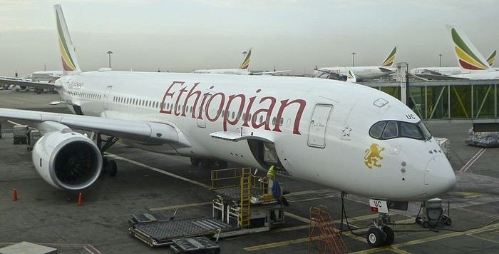
-1- During the layover in Addis Ababa. The Airbus A-350 in the early morning mist.
Reminder: Click on each image to enlarge it, if needed. .
From Dar es Salaam, if you want to go by road to Ruaha, it’ll take a very long and tiring day. 🤪
On previous trips, we’ve always taken a bush plane for this route. In this case, it took just over an hour and a half, with two short intermediate stops to drop off passengers at other bush airstrips.
Since I’m also passionate about aviation, I love these flights where you can admire the landscapes from low altitude while sitting right behind the pilot 🙂.
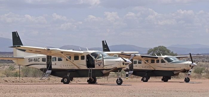
-2- These routes mainly use Cessna 208 Caravans.
At the Msembe airstrip, we’re greeted around 1:30 PM by a guide and a driver from our chosen lodge. They brought a picnic basket, which we enjoy at a nearby picnic area. We’re by the Ruaha River, completely dry—it’s scorching hot.
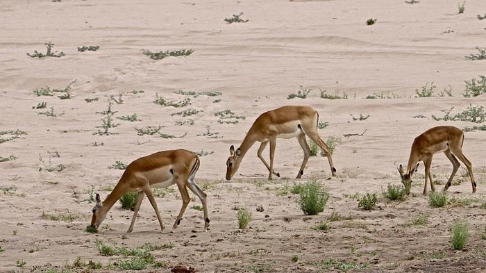
-3- The first mammals we encounter are a pair of female impalas, accompanied by a young male.
Reminder: Click on the image to view it in larger size. 😉
-4- To save the hippopotamus populations from certain death, rangers had to dig holes in the sand with bulldozers. Fortunately, water is present beneath the sand layer.
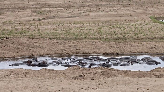
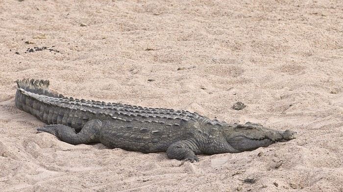
-5- This crocodile doesn’t seem to have been accepted as a swimming neighbor by the hippos...
We’ll explore along the river for 2-3 hours before crossing it at a ford toward the southern part of the reserve.
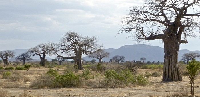
-6- The typical landscape of Ruaha, with its many baobabs.
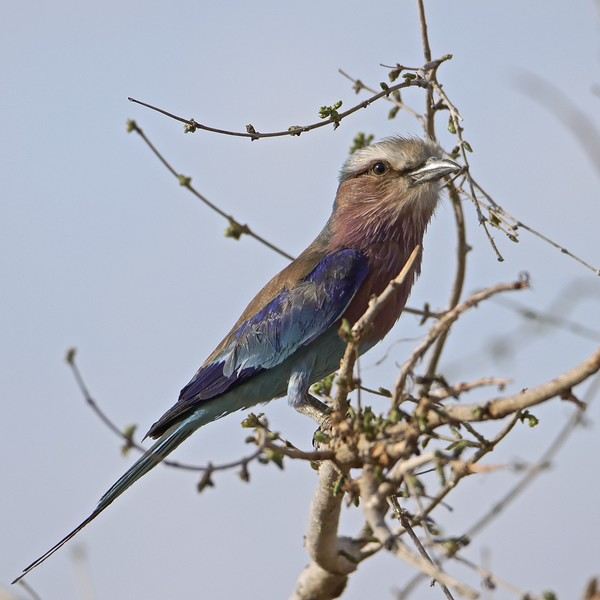
-7- My buddy the R.L.B. is also here to welcome me.... 🙂 🙂
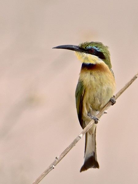
-8- As well as this little bee-eater... 😎
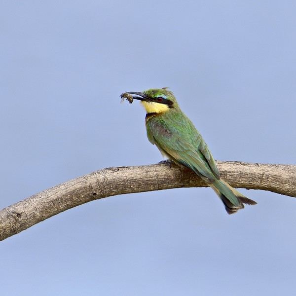
-9- ...which reminds us of the origin of its name...!
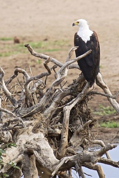
-10- Above a rare waterhole, a fish eagle keeps watch for fish...
...
*** Please wait until the end of the story for any questions or to share your own experiences in Ruaha. (Or via PM.) Thanks in advance for keeping this account smooth and enjoyable. 😉
...
*** I’m not an ornithologist, but birds are an important and unavoidable part of safari discoveries. You’ll find quite a few in the images of my story. 😎
...
" We’re ALL different, and so are our expectations when it comes to travel or leisure ". There are—without a doubt—as many ways to experience a trip as there are travelers!! For the two of us, it’s only our love of wild nature that guides us to East Africa. The stated goal of this trip was purely wildlife-focused, and NOT about discovering the country or its people.
...
Hello everyone,
Previously, I shared the account of a trip/safari in southern Tanzania in June 2024, in the Mikumi and Selous reserves.
This time, still in southern Tanzania, I invite you to join us in Ruaha National Park. (Then, depending on the number of images allowed in my quota, at the end of my story, we’ll return to Selous for the second part of the same trip.)
- This trip/safari took place in November 2022. - Our flight started in Marseille, heading to Addis Ababa, then Dar es Salaam (via Ethiopian Airlines). In Dar, we spent one night at a hotel near the airfield.
-1- During the layover in Addis Ababa. The Airbus A-350 in the early morning mist.
Reminder: Click on each image to enlarge it, if needed. .
From Dar es Salaam, if you want to go by road to Ruaha, it’ll take a very long and tiring day. 🤪
On previous trips, we’ve always taken a bush plane for this route. In this case, it took just over an hour and a half, with two short intermediate stops to drop off passengers at other bush airstrips.
Since I’m also passionate about aviation, I love these flights where you can admire the landscapes from low altitude while sitting right behind the pilot 🙂.
-2- These routes mainly use Cessna 208 Caravans.
At the Msembe airstrip, we’re greeted around 1:30 PM by a guide and a driver from our chosen lodge. They brought a picnic basket, which we enjoy at a nearby picnic area. We’re by the Ruaha River, completely dry—it’s scorching hot.
-3- The first mammals we encounter are a pair of female impalas, accompanied by a young male.
Reminder: Click on the image to view it in larger size. 😉
-4- To save the hippopotamus populations from certain death, rangers had to dig holes in the sand with bulldozers. Fortunately, water is present beneath the sand layer.
-5- This crocodile doesn’t seem to have been accepted as a swimming neighbor by the hippos...
We’ll explore along the river for 2-3 hours before crossing it at a ford toward the southern part of the reserve.
-6- The typical landscape of Ruaha, with its many baobabs.
-7- My buddy the R.L.B. is also here to welcome me.... 🙂 🙂
-8- As well as this little bee-eater... 😎
-9- ...which reminds us of the origin of its name...!
-10- Above a rare waterhole, a fish eagle keeps watch for fish...
...
*** Please wait until the end of the story for any questions or to share your own experiences in Ruaha. (Or via PM.) Thanks in advance for keeping this account smooth and enjoyable. 😉
...
*** I’m not an ornithologist, but birds are an important and unavoidable part of safari discoveries. You’ll find quite a few in the images of my story. 😎
...
Nepal Feedback
NAMASTE NEPAL! PRACTICAL INFO AND EXPERIENCE FEEDBACK
Stay from March 25 to April 16, 2025
· Flight tickets Air India (via Delhi) (via Skyscanner) = 1130 € per person · Planned budget (and respected without too many restrictions and while buying a few small gifts) = 2000 € for the stay for two. Buses, taxis, and entrance fees to various sites represent a budget to consider. Meals are cheap. Drinks like beer/Coke, however, are not cheap and cost the equivalent of a meal. · Exchange rate of the rupee during our stay = 0.0064 € (the exchange rate is almost identical everywhere, including at the airport). · At the airport, purchase of two SIM cards (phone) = 1000 NPR x 2 for 28 days. · Kathmandu: we had booked the hotel upon arrival: Kathmandu Boutique Hotel (+977 015 357 446 – email: booking@kathmanduboutiquehotel.com), very well located in a quiet alley off the street, south of Thamel, a 10-minute walk from Durbar Square. A hotel like Nepal knows how to do, where tall people will have to duck. Night + breakfast = 18 € for two. Very warm welcome, great location, excellent value for money. · Bhaktapur: we had also booked a hotel for the end of our stay because the chance of the year 2025 made the Nepali New Year and Bisket Jatra particularly festive in Bhaktapur: Manju Baha Hotel School (+977 976 7234014 – email: manjubahahotel@gmail.com) located in an old monastery. "A social enterprise transforming an old monastery into a charming hotel, offering professional hospitality training to underprivileged Nepali youth." Night + breakfast = 32 € for two. Beautifully decorated room. Very warm welcome. Don’t miss the Changunarayan site (near Bhaktapur), it’s amazing. And if you’re lucky enough to be in Bhaktapur in mid-April for 3 days, there’s the Bisket Jatra festivities (Newari festival), joyful, noisy, fun, and wild… · Pokhara (hotel recommended by the Kathmandu hotel): Hotel Green Tara, Lakeside, 10th street, set back, quiet (Tel. +977 61 462698 – email: greentara_67@hotmail.com) · Trek permit (Lower Mustang, no need for an agency or guide, permits checked at Ghasa and Jomsom) = 2000 NPR per person (2 ID photos) · Bus Kathmandu/Pokhara and return = 2000 NPR per person · Bus Pokhara/Jomsom, 2 one-way tickets = 2800 NPR. · Taxi: negotiation with a driver we recommend, Vicky (+977 984 075 599). You explain what you want, negotiate the price, and he waits for you during the visit. Very charming, we used him several times. For example: departure from our hotel at 10 AM -> Boudhanath/Pashupatinath/Patan return at 5 PM to the hotel = 6500 NPR – Swayambhunath (round trip) = 1200 NPR · Site prices: https://ntb.gov.np/plan-your-trip/before-you-come/heritage-site-entry-fees o Visitor Pass for Kathmandu Durbar Square (for the duration of the stay, show your visa) = 1000 NPR per person (1 ID photo) o Bhaktapur Durbar Square (old town) = 1800 NPR per person o Patan = 1000 NPR per person o Swayambhu Stupa = 200 NPR per person o Boudha Stupa = 200 NPR per person o Pashupatinath Temple = 1000 NPR per person (interesting to take a guide) o Changunarayan Temple (6 km north of Bhaktapur) = 400 NPR per person o Mountain Museum in Pokhara = 750 NPR per person · E-cigarettes: e-cigarettes are banned in India and confiscated whether they’re in carry-on or checked luggage. On the way there, we had kept them in our carry-on, they were confiscated in Delhi. On the way back, learning from our previous experience, we put them in our checked luggage. Someone came to get us to take them out of our bags and confiscate them… You can find e-cigarettes and products in Kathmandu.
* * *
I’m 74 years old. I went to Nepal in 1982, 1983, and the last time in 1986. I wanted to introduce this beautiful and endearing country to my husband, and it was… now or never. So we decided it was now.
I knew the trek starting from Pokhara: Naudanda/Birethanti/Ghorepani/Tatopani/Kalopani. There was no way I was going to do that trek, especially the 1000-meter staircase to reach Ghorepani… You have to stay humble with age.
Back then, the road didn’t exist. I didn’t consider, with the construction of this road (NH48) along the western bank of the Kali Gandaki, doing a trek along a windy and dusty road. Was there an alternative hiking trail on the eastern bank? No one answered my question on VoyageForum, so I did my research online. And I found this site: "Andrées de Ruiter and Prem Rai - Trekking the Annapurna Circuit, including the new NATT trails that avoid the road - A guide to one of the most beautiful trekking regions in Nepal and the world (2011) - NATT = New Annapurna Trekking Trail".
Phew! A solution was emerging. This circuit from 2011 wasn’t fully marked. The idea was to go from Jomsom to Tatopani, so we needed to make sure the path was well-marked all the way, which we did, and the path exists, marked in red and white!
So, with the walking times information, we built our 8-day circuit:
· Jomsom/Thinigaon · Thinigaon/Chimang · Chimang/Saura · Saura/Kokhetanti · Rest day or, if in good shape: loop to Sekong Lake · Kokhetanti/Jhipra Deurali · Jhipra Deurali/Kopchepani · Kopchepani/Tatopani
It’s a senior trek, after all. So the walking times noted on the sites indicated 3 hours or even 4 hours for the two longest stages. That pace suited us fine.
On March 29, we left Kathmandu (1400m), after visiting the must-see sites, by bus to Pokhara: 200 km and 8.5 hours on a chaotic road under construction. I had a memory of Pokhara where it was the first city where you could see the Himalayan range, especially Machhapuchhare. But the pollution is such, the dust raised by traffic and construction, that no horizon is visible except the first hills around Pokhara.
We stayed 24 hours in Pokhara (820m), and on March 31, we left our luggage at the hotel and set off with our lightest backpacks: change of clothes, toiletries, first aid kit, anti-chafing cream, water bottle, sleeping bag liner, and light shoes for the stages.
We took the bus to Jomsom: 160 km/7.5 hours including stops for bathroom breaks, tea, and lunch. The road is nothing but a chaos of potholes, landslides, construction, dust, rebuilding, and mudslides. In Ghasa, the bus stops, and we’re told we’re at a checkpoint and that the two foreigners in the bus, my husband and I, need to have our permits checked, which takes a few minutes. The driving is rock-and-roll, surprising, and courteous. The drivers have their codes, and on these improbable roads, they’re virtuosos.
We could have chosen the plane, but several reasons dissuaded us: if there’s too much wind, the planes don’t take off; personally, I wasn’t reassured about landing in Jomsom, and this transport has a cost.
We arrived around 2 PM in Jomsom (2720m), and despite the early wake-up, the nearly 8 hours on the bus, and the altitude, we decided to head straight to Thinigaon (2840m). At the Jomsom checkpoint, they told us it was a 30-minute walk. Great! Except we took an hour and a half on an uphill road, bent over to fight a strong wind. But the Himalayan range is there! The Dhaulagiri, the Nilgiri, the Annapurnas as a reward.
In Thinigaon, we found a room at the "Nilgiri View Hotel" run by a didi (big sister in Nepali). From the lodge’s roof, she proudly showed us the different peaks surrounding the village and told us, worried, that it hadn’t snowed here for 3 years. She said there are very few tourists, that the season is rather in September/October/November. It seems there’s not a soul in this village, yet mules pass through the narrow street paved with large flat stones, their bells ringing. We dine at 6 PM and go to bed… Room = 1200 NPR and dinner, breakfast, and drinks = 2560 NPR.
On April 1, we set off at 9 AM, not for Chimang as planned but for Marpha! The didi from the Thinigaon lodge had said it was a 3-hour walk. The first part of this stage is attractive, the mountains are magnificent and imposing, the landscape is superb, there’s no one around, a feeling of being "alone in the world." We follow Dhumbra Tal, this small green lake. The path is a rocky track that climbs steeply. Then, around a hill, we start the big descent that joins the Kali Gandaki. We face the wind head-on, and the violent gusts take our breath away, throw us off balance, and envelop us in dust. We see the road on the other side of the Kali Gandaki. We arrive in the village of Chhairo at 2 PM, completely exhausted and with blistered feet, after 5 hours of walking instead of the planned 3.5 hours.
We’re welcomed by the village nurse, who tells us there’s a lodge in the village. Chhairo is a Tibetan village, a 20-minute walk from Marpha (according to the locals, multiply by 2 or even 3 for us…). We’re going to revise our trek plan and, first of all, spend the night in Chhairo.
The lodge is quite pleasant, and Karma, the hostess, is very friendly. She asks about our plans and suggests we stay in Chhairo the next day, from where we can visit Marpha and also Chimang, a 1-hour walk away, in light mode, meaning without backpacks. She invites us to participate in a village ceremony the next evening.
We immediately accept the proposal, as our feet need rest and the welcome is so warm… Dinner and bed!
We reworked our trek plan, which was too ambitious for our untrained bodies and, let’s face it… no longer in our first youth. In the initial plan, we thought there wouldn’t be too much elevation gain following the Kali Gandaki, but checking the map, we realize there might be significant elevation changes between Sauru and Sirkung. So we plan:
· Tomorrow: visit Marpha (2670m) and Chimang (2744m) · April 3: bus from Chhairo (2700m) to Kalopani (2530m) and continue on foot to Ghasa (2010m) · April 4: Ghasa/Pairataplo (1940m) · April 5: Pairatapla/Gadpar (1580m) · April 6: Gadpar/Narchyang (1510m) · April 7: Narchyang/Tatopani (1190m) · April 8: return to Pokhara.
Normally, it’s all downhill…
April 2, a rest day then… We set off in the morning to explore Marpha. We have to take a temporary bridge because the suspension bridge is closed due to road construction. We join the road and arrive in Marpha, a village famous for its apple orchards, brandy, cider, and apple juice production. This village is magnificent with its stone houses and monastery clinging to the hillside. The road construction spared it. There are people, but very few Western tourists.
We have lunch in Marpha and go back through Chhairo to take the path to Chimang. We cross a fragrant pine forest and find the rocky path; the landscape is splendid. We walk quietly, passing peaceful buffaloes and cows, and arrive at the foot of a stone staircase… 275 steps (which we counted on the way back) leading us to the village of Chimang. Chimang is an isolated Newari village that seems a bit desolate. Despite the slopes, there are crops on every little bit of land. Thankfully, we changed our initial program because there’s no lodge in this village, contrary to what we saw on a map… We wander through the village, which seems very deserted, have coffee in a house from another world, and then head back to Chhairo.
A rest day? = 5 hours of walking!!
Dinner and village ceremony. From what we understand, this ceremony is in honor of the Dalai Lama. Men, women, and children in traditional costumes gather twice a month; they dance, make, and offer small sweet cakes with Tibetan tea (made from tea, yak butter—often rancid—water, and salt). Surprising for first-timers…
Around 10 PM, we leave the ceremony; tomorrow morning, we need to be on the roadside by 7 AM to catch the bus to Kalopani…
This village of Chhairo is very pleasant and welcoming, no tourists, just two motorcyclists who arrived in the evening, one of whom participated in the ceremony and discreetly poured his Tibetan tea outside.
Lodge: "Norsang Tibetan Guesthouse and Restaurant". Total bill for 2 nights, 2 dinners, 2 breakfasts, and drinks = 8000 NPR.
April 3: bus from Chhairo to Kalopani, about 1.5 hours for the 20 km (200 NPR per person). We descend on the right bank of the Kali Gandaki. We find the red and white markings to resume the trek toward Ghasa. We’re in a fragrant pine forest, the Dhaulagiri on one side and the Annapurnas on the other, magnificent, and the path is pleasant and easy. We get a bit lost in this forest, always looking for the markings. Near Lete, two trekkers pass us, and we meet them again a little further on with two very young children, to whom we give the 2 hard-boiled eggs I didn’t eat this morning. They accepted them without hesitation.
We arrive in a village and ask for directions to Ghasa. The young girls point the way. But we come across a forest being logged, trees cut in all directions. We turn back and ask for confirmation. They confirm… But the two young girls catch up with us and clear the way. We have to step over, go around, and cross the felled trees, with no indication at all. Through this pick-up sticks of felled trees, the girls lead us to the top of a stone staircase, indicating that was the path. It’s the only place where we saw rhododendrons in bloom.
We descend the staircase. At the bottom, to the left, there’s a bridge to go toward Choyo, and to the right, a path to Ghasa. We take the right path and join the road. We should normally find the red and white markings, but we don’t… So we continue on the western bank road of the Kali Gandaki.
A little before the village of Misi, we see fumaroles on the opposite bank that seem to come from the ground. We don’t understand. We stopped to eat in the village of Misi (noodle soup = 600 NPR), but it’s hard to communicate with the elderly people running the guesthouse.
We continued on the road, not finding the marked path parallel to the road. Landslides, both on the left and right banks, seem to have taken over the marked routes. It’s a place where the Kali Gandaki gorge narrows, and on the opposite bank, the mountain smokes more and more, and we now hear the crackling of fire. Across from us, the mountain is burning… Our initial plan had us passing on that burning bank right now…
We arrive in Ghasa at 3:30 PM, a 6.5-hour stage but with a 1-hour stop at noon. We’re at the "Florida Guesthouse and Restaurant." From our room, we see the mountain smoking on the other side of the river, and at night, we see the flames. In this village, posters show Himalayan eagles and vultures that seem to be protected species. Indeed, we saw (and heard) 3 eagles circling today.
April 4 – Today, heading to Pairothapla or Kopchepani depending on our feet, accommodation options, and simply our desires.
No more smoke on the mountain this morning. It’s chilly, 7:45 AM, the sky is clear, just a smell of smoke outside.
Price of the lodge = 1000 NPR for the night + 3580 NPR for meals.
We cross Ghasa, which stretches over more than a kilometer. We have a drink at the last guesthouse in the village, and the didi, when she learns our destination, tells us to be careful because the villages we’re going to aren’t safe. Should we distribute our rupees in different pockets? Nah, we kept going.
At the exit of Ghasa, we find the red and white markings and take the suspension bridge to cross the boiling waters of the Kali Gandaki. The passage is impressive because the river is tumultuous. Lots of climbs and even more descents. We’re back on the eastern bank. It’s hot! On the narrow path, we meet a group of buffaloes. Who has the right of way? We decide to stick as close as possible to the rock wall and move forward calmly. The buffaloes look at us, chewing placidly, with no intention of jumping on us. Phew!
After a 5-hour stage (including stops), we arrive in Pairothapla, with hot feet and firm thighs, and decide we won’t go any further. It’s a good thing because there’s a lodge, the most basic so far, but with a great welcome. We have a meal and a short nap. The buffaloes we met on the way belong to this house. They come to drink at the fountain by the path.
Our host, very pleasant, doesn’t know what to do to please us and is very attentive. He wants to chat. He has two children, a 4-year-old girl and a 7-year-old boy. Where do they go to school? Do they go? He tells us that the fires in the mountain are caused by people, but for what reason? We won’t find out, but it’s illegal. From here, we can still see smoke rising in the distance. The wife is a bit less friendly. Corn kernels dry on a woven straw mat on the ground, and the mom sorts them.
From where we are, we overlook the valley and see the road under construction winding along the mountainside on the other bank.
Dinner on the terrace of the house overlooking the path, windbreaker and fleece on: dal bhat chicken for me and chicken curry for my husband: "organic" products, at least local production. There are small vegetable gardens everywhere with all sorts of vegetables.
April 5 – While we’re having breakfast on the terrace of our lodge, 5 porters, straps on their foreheads, heavily loaded, pass by on the path. A few minutes later, a group of 9 people appears. It must be said that since the beginning of our journey, we’ve met very few hikers. Two backpackers in Chhairo, the two hikers near Lete, two female hikers passed us before Pairothapla, a solo female hiker passed us…
The lodge in Pairothapla is called "Bimala Lodge & Thakali Kitchen" – Price for night + 4 meals + 2 breakfasts = 3000 NPR.
The descent toward the Kali Gandaki involves climbs whose steps we didn’t count. Clearly, the landslides on the mountain cause changes to the official ACAP trek marked in red and white, and the marking updates can’t keep up with the pace of these landslides. It’s almost always by chance that we find the markings. Fortunately, we can follow the power line that guides us somewhat.
Drink stop in Kopchepani, the legs are fine, but the feet don’t like being tightly enclosed. A group of trekkers with porters passes on the path. We met buffaloes that we kindly let pass; the path was wide enough, but it was a staircase going up, and we didn’t want to take any risks.
Across, a view of the magnificent Rupse Waterfall on the other bank of the Kali Gandaki, at the bottom, lots of vehicles and people.
Arrival in Gadpar after crossing a rather unwelcoming small village and cultivated gardens between dry stone walls, each better built than the last.
First lodge spotted, first lodge adopted to answer the call of our feet, and a very warm welcome from the owner. Since we hadn’t eaten at noon, we had Tibetan bread/jam. 6-hour stage including 1 hour of stops. Night + dinner + breakfast + drinks = 5060 NPR
April 6 – Today, heading to Narchyang.
For several days, we’ve seen banana trees with their bunches of fruit and even a prickly pear with large fruits ripening.
This stage is quite peaceful and pleasant. We take a suspension bridge to cross a tributary of the Kali Gandaki. While we’re resting for a moment before crossing the bridge, a couple of porters, a man and a woman, arrive and start across the bridge with their wood load in a basket held by a strap on their forehead, making them bend. We set off too… lighter than them.
On the other side of the bridge… a stone staircase, and it climbs steeply. The porter couple didn’t take this staircase; they went right on the path.
At the top of the staircase, we arrive in Narchyang after a 4-hour stage. A magnificent waterfall overlooks the village. We get lost in this fairly large village looking for a lodge. After wandering around for a while, we ask for directions, and an 84-year-old man takes us through the whole village and accompanies us to a very nice lodge run by a woman.
We chat with our hostess, who asks where we’re from and where we’re going. We explain that we want to reach Tatopani the next day and then return to Pokhara. She tells us there are 4x4s going directly to Pokhara and that it would probably be easier than taking a bus that might be full in Tatopani. After a quick consultation, we decide to return to Pokhara the next day by 4x4. She finds us a 4x4 with 2 seats left, departure at 8 AM – 5 hours on the road and 1500 NPR per person. A charming didi who does everything to be pleasant and helpful.
Narchyang community lodge = night + snacks + dinner + breakfast = 3000 NPR.
There you go, our trek ends tomorrow. Many necessary changes and adaptations to our initial trek, but no regrets, it was superb and a great experience that, for my part, I won’t be able to repeat. Always this encounter with the endearing, welcoming, curious, and very kind Nepali people. It was now or never, and we did it!
* * *
In conclusion, 3 full weeks in Nepal is a duration that allows visiting Kathmandu, Patan, and Bhaktapur, enjoying the various sites, and soaking in the atmosphere and urban Nepali life.
The trek, even revised and corrected, allowed us to get close to the impressive Annapurna and Dhaulagiri peaks. One or two acclimatization days might be necessary to get the body in tune with this magical and extraordinary land.
Stay from March 25 to April 16, 2025
· Flight tickets Air India (via Delhi) (via Skyscanner) = 1130 € per person · Planned budget (and respected without too many restrictions and while buying a few small gifts) = 2000 € for the stay for two. Buses, taxis, and entrance fees to various sites represent a budget to consider. Meals are cheap. Drinks like beer/Coke, however, are not cheap and cost the equivalent of a meal. · Exchange rate of the rupee during our stay = 0.0064 € (the exchange rate is almost identical everywhere, including at the airport). · At the airport, purchase of two SIM cards (phone) = 1000 NPR x 2 for 28 days. · Kathmandu: we had booked the hotel upon arrival: Kathmandu Boutique Hotel (+977 015 357 446 – email: booking@kathmanduboutiquehotel.com), very well located in a quiet alley off the street, south of Thamel, a 10-minute walk from Durbar Square. A hotel like Nepal knows how to do, where tall people will have to duck. Night + breakfast = 18 € for two. Very warm welcome, great location, excellent value for money. · Bhaktapur: we had also booked a hotel for the end of our stay because the chance of the year 2025 made the Nepali New Year and Bisket Jatra particularly festive in Bhaktapur: Manju Baha Hotel School (+977 976 7234014 – email: manjubahahotel@gmail.com) located in an old monastery. "A social enterprise transforming an old monastery into a charming hotel, offering professional hospitality training to underprivileged Nepali youth." Night + breakfast = 32 € for two. Beautifully decorated room. Very warm welcome. Don’t miss the Changunarayan site (near Bhaktapur), it’s amazing. And if you’re lucky enough to be in Bhaktapur in mid-April for 3 days, there’s the Bisket Jatra festivities (Newari festival), joyful, noisy, fun, and wild… · Pokhara (hotel recommended by the Kathmandu hotel): Hotel Green Tara, Lakeside, 10th street, set back, quiet (Tel. +977 61 462698 – email: greentara_67@hotmail.com) · Trek permit (Lower Mustang, no need for an agency or guide, permits checked at Ghasa and Jomsom) = 2000 NPR per person (2 ID photos) · Bus Kathmandu/Pokhara and return = 2000 NPR per person · Bus Pokhara/Jomsom, 2 one-way tickets = 2800 NPR. · Taxi: negotiation with a driver we recommend, Vicky (+977 984 075 599). You explain what you want, negotiate the price, and he waits for you during the visit. Very charming, we used him several times. For example: departure from our hotel at 10 AM -> Boudhanath/Pashupatinath/Patan return at 5 PM to the hotel = 6500 NPR – Swayambhunath (round trip) = 1200 NPR · Site prices: https://ntb.gov.np/plan-your-trip/before-you-come/heritage-site-entry-fees o Visitor Pass for Kathmandu Durbar Square (for the duration of the stay, show your visa) = 1000 NPR per person (1 ID photo) o Bhaktapur Durbar Square (old town) = 1800 NPR per person o Patan = 1000 NPR per person o Swayambhu Stupa = 200 NPR per person o Boudha Stupa = 200 NPR per person o Pashupatinath Temple = 1000 NPR per person (interesting to take a guide) o Changunarayan Temple (6 km north of Bhaktapur) = 400 NPR per person o Mountain Museum in Pokhara = 750 NPR per person · E-cigarettes: e-cigarettes are banned in India and confiscated whether they’re in carry-on or checked luggage. On the way there, we had kept them in our carry-on, they were confiscated in Delhi. On the way back, learning from our previous experience, we put them in our checked luggage. Someone came to get us to take them out of our bags and confiscate them… You can find e-cigarettes and products in Kathmandu.
* * *
I’m 74 years old. I went to Nepal in 1982, 1983, and the last time in 1986. I wanted to introduce this beautiful and endearing country to my husband, and it was… now or never. So we decided it was now.
I knew the trek starting from Pokhara: Naudanda/Birethanti/Ghorepani/Tatopani/Kalopani. There was no way I was going to do that trek, especially the 1000-meter staircase to reach Ghorepani… You have to stay humble with age.
Back then, the road didn’t exist. I didn’t consider, with the construction of this road (NH48) along the western bank of the Kali Gandaki, doing a trek along a windy and dusty road. Was there an alternative hiking trail on the eastern bank? No one answered my question on VoyageForum, so I did my research online. And I found this site: "Andrées de Ruiter and Prem Rai - Trekking the Annapurna Circuit, including the new NATT trails that avoid the road - A guide to one of the most beautiful trekking regions in Nepal and the world (2011) - NATT = New Annapurna Trekking Trail".
Phew! A solution was emerging. This circuit from 2011 wasn’t fully marked. The idea was to go from Jomsom to Tatopani, so we needed to make sure the path was well-marked all the way, which we did, and the path exists, marked in red and white!
So, with the walking times information, we built our 8-day circuit:
· Jomsom/Thinigaon · Thinigaon/Chimang · Chimang/Saura · Saura/Kokhetanti · Rest day or, if in good shape: loop to Sekong Lake · Kokhetanti/Jhipra Deurali · Jhipra Deurali/Kopchepani · Kopchepani/Tatopani
It’s a senior trek, after all. So the walking times noted on the sites indicated 3 hours or even 4 hours for the two longest stages. That pace suited us fine.
On March 29, we left Kathmandu (1400m), after visiting the must-see sites, by bus to Pokhara: 200 km and 8.5 hours on a chaotic road under construction. I had a memory of Pokhara where it was the first city where you could see the Himalayan range, especially Machhapuchhare. But the pollution is such, the dust raised by traffic and construction, that no horizon is visible except the first hills around Pokhara.
We stayed 24 hours in Pokhara (820m), and on March 31, we left our luggage at the hotel and set off with our lightest backpacks: change of clothes, toiletries, first aid kit, anti-chafing cream, water bottle, sleeping bag liner, and light shoes for the stages.
We took the bus to Jomsom: 160 km/7.5 hours including stops for bathroom breaks, tea, and lunch. The road is nothing but a chaos of potholes, landslides, construction, dust, rebuilding, and mudslides. In Ghasa, the bus stops, and we’re told we’re at a checkpoint and that the two foreigners in the bus, my husband and I, need to have our permits checked, which takes a few minutes. The driving is rock-and-roll, surprising, and courteous. The drivers have their codes, and on these improbable roads, they’re virtuosos.
We could have chosen the plane, but several reasons dissuaded us: if there’s too much wind, the planes don’t take off; personally, I wasn’t reassured about landing in Jomsom, and this transport has a cost.
We arrived around 2 PM in Jomsom (2720m), and despite the early wake-up, the nearly 8 hours on the bus, and the altitude, we decided to head straight to Thinigaon (2840m). At the Jomsom checkpoint, they told us it was a 30-minute walk. Great! Except we took an hour and a half on an uphill road, bent over to fight a strong wind. But the Himalayan range is there! The Dhaulagiri, the Nilgiri, the Annapurnas as a reward.
In Thinigaon, we found a room at the "Nilgiri View Hotel" run by a didi (big sister in Nepali). From the lodge’s roof, she proudly showed us the different peaks surrounding the village and told us, worried, that it hadn’t snowed here for 3 years. She said there are very few tourists, that the season is rather in September/October/November. It seems there’s not a soul in this village, yet mules pass through the narrow street paved with large flat stones, their bells ringing. We dine at 6 PM and go to bed… Room = 1200 NPR and dinner, breakfast, and drinks = 2560 NPR.
On April 1, we set off at 9 AM, not for Chimang as planned but for Marpha! The didi from the Thinigaon lodge had said it was a 3-hour walk. The first part of this stage is attractive, the mountains are magnificent and imposing, the landscape is superb, there’s no one around, a feeling of being "alone in the world." We follow Dhumbra Tal, this small green lake. The path is a rocky track that climbs steeply. Then, around a hill, we start the big descent that joins the Kali Gandaki. We face the wind head-on, and the violent gusts take our breath away, throw us off balance, and envelop us in dust. We see the road on the other side of the Kali Gandaki. We arrive in the village of Chhairo at 2 PM, completely exhausted and with blistered feet, after 5 hours of walking instead of the planned 3.5 hours.
We’re welcomed by the village nurse, who tells us there’s a lodge in the village. Chhairo is a Tibetan village, a 20-minute walk from Marpha (according to the locals, multiply by 2 or even 3 for us…). We’re going to revise our trek plan and, first of all, spend the night in Chhairo.
The lodge is quite pleasant, and Karma, the hostess, is very friendly. She asks about our plans and suggests we stay in Chhairo the next day, from where we can visit Marpha and also Chimang, a 1-hour walk away, in light mode, meaning without backpacks. She invites us to participate in a village ceremony the next evening.
We immediately accept the proposal, as our feet need rest and the welcome is so warm… Dinner and bed!
We reworked our trek plan, which was too ambitious for our untrained bodies and, let’s face it… no longer in our first youth. In the initial plan, we thought there wouldn’t be too much elevation gain following the Kali Gandaki, but checking the map, we realize there might be significant elevation changes between Sauru and Sirkung. So we plan:
· Tomorrow: visit Marpha (2670m) and Chimang (2744m) · April 3: bus from Chhairo (2700m) to Kalopani (2530m) and continue on foot to Ghasa (2010m) · April 4: Ghasa/Pairataplo (1940m) · April 5: Pairatapla/Gadpar (1580m) · April 6: Gadpar/Narchyang (1510m) · April 7: Narchyang/Tatopani (1190m) · April 8: return to Pokhara.
Normally, it’s all downhill…
April 2, a rest day then… We set off in the morning to explore Marpha. We have to take a temporary bridge because the suspension bridge is closed due to road construction. We join the road and arrive in Marpha, a village famous for its apple orchards, brandy, cider, and apple juice production. This village is magnificent with its stone houses and monastery clinging to the hillside. The road construction spared it. There are people, but very few Western tourists.
We have lunch in Marpha and go back through Chhairo to take the path to Chimang. We cross a fragrant pine forest and find the rocky path; the landscape is splendid. We walk quietly, passing peaceful buffaloes and cows, and arrive at the foot of a stone staircase… 275 steps (which we counted on the way back) leading us to the village of Chimang. Chimang is an isolated Newari village that seems a bit desolate. Despite the slopes, there are crops on every little bit of land. Thankfully, we changed our initial program because there’s no lodge in this village, contrary to what we saw on a map… We wander through the village, which seems very deserted, have coffee in a house from another world, and then head back to Chhairo.
A rest day? = 5 hours of walking!!
Dinner and village ceremony. From what we understand, this ceremony is in honor of the Dalai Lama. Men, women, and children in traditional costumes gather twice a month; they dance, make, and offer small sweet cakes with Tibetan tea (made from tea, yak butter—often rancid—water, and salt). Surprising for first-timers…
Around 10 PM, we leave the ceremony; tomorrow morning, we need to be on the roadside by 7 AM to catch the bus to Kalopani…
This village of Chhairo is very pleasant and welcoming, no tourists, just two motorcyclists who arrived in the evening, one of whom participated in the ceremony and discreetly poured his Tibetan tea outside.
Lodge: "Norsang Tibetan Guesthouse and Restaurant". Total bill for 2 nights, 2 dinners, 2 breakfasts, and drinks = 8000 NPR.
April 3: bus from Chhairo to Kalopani, about 1.5 hours for the 20 km (200 NPR per person). We descend on the right bank of the Kali Gandaki. We find the red and white markings to resume the trek toward Ghasa. We’re in a fragrant pine forest, the Dhaulagiri on one side and the Annapurnas on the other, magnificent, and the path is pleasant and easy. We get a bit lost in this forest, always looking for the markings. Near Lete, two trekkers pass us, and we meet them again a little further on with two very young children, to whom we give the 2 hard-boiled eggs I didn’t eat this morning. They accepted them without hesitation.
We arrive in a village and ask for directions to Ghasa. The young girls point the way. But we come across a forest being logged, trees cut in all directions. We turn back and ask for confirmation. They confirm… But the two young girls catch up with us and clear the way. We have to step over, go around, and cross the felled trees, with no indication at all. Through this pick-up sticks of felled trees, the girls lead us to the top of a stone staircase, indicating that was the path. It’s the only place where we saw rhododendrons in bloom.
We descend the staircase. At the bottom, to the left, there’s a bridge to go toward Choyo, and to the right, a path to Ghasa. We take the right path and join the road. We should normally find the red and white markings, but we don’t… So we continue on the western bank road of the Kali Gandaki.
A little before the village of Misi, we see fumaroles on the opposite bank that seem to come from the ground. We don’t understand. We stopped to eat in the village of Misi (noodle soup = 600 NPR), but it’s hard to communicate with the elderly people running the guesthouse.
We continued on the road, not finding the marked path parallel to the road. Landslides, both on the left and right banks, seem to have taken over the marked routes. It’s a place where the Kali Gandaki gorge narrows, and on the opposite bank, the mountain smokes more and more, and we now hear the crackling of fire. Across from us, the mountain is burning… Our initial plan had us passing on that burning bank right now…
We arrive in Ghasa at 3:30 PM, a 6.5-hour stage but with a 1-hour stop at noon. We’re at the "Florida Guesthouse and Restaurant." From our room, we see the mountain smoking on the other side of the river, and at night, we see the flames. In this village, posters show Himalayan eagles and vultures that seem to be protected species. Indeed, we saw (and heard) 3 eagles circling today.
April 4 – Today, heading to Pairothapla or Kopchepani depending on our feet, accommodation options, and simply our desires.
No more smoke on the mountain this morning. It’s chilly, 7:45 AM, the sky is clear, just a smell of smoke outside.
Price of the lodge = 1000 NPR for the night + 3580 NPR for meals.
We cross Ghasa, which stretches over more than a kilometer. We have a drink at the last guesthouse in the village, and the didi, when she learns our destination, tells us to be careful because the villages we’re going to aren’t safe. Should we distribute our rupees in different pockets? Nah, we kept going.
At the exit of Ghasa, we find the red and white markings and take the suspension bridge to cross the boiling waters of the Kali Gandaki. The passage is impressive because the river is tumultuous. Lots of climbs and even more descents. We’re back on the eastern bank. It’s hot! On the narrow path, we meet a group of buffaloes. Who has the right of way? We decide to stick as close as possible to the rock wall and move forward calmly. The buffaloes look at us, chewing placidly, with no intention of jumping on us. Phew!
After a 5-hour stage (including stops), we arrive in Pairothapla, with hot feet and firm thighs, and decide we won’t go any further. It’s a good thing because there’s a lodge, the most basic so far, but with a great welcome. We have a meal and a short nap. The buffaloes we met on the way belong to this house. They come to drink at the fountain by the path.
Our host, very pleasant, doesn’t know what to do to please us and is very attentive. He wants to chat. He has two children, a 4-year-old girl and a 7-year-old boy. Where do they go to school? Do they go? He tells us that the fires in the mountain are caused by people, but for what reason? We won’t find out, but it’s illegal. From here, we can still see smoke rising in the distance. The wife is a bit less friendly. Corn kernels dry on a woven straw mat on the ground, and the mom sorts them.
From where we are, we overlook the valley and see the road under construction winding along the mountainside on the other bank.
Dinner on the terrace of the house overlooking the path, windbreaker and fleece on: dal bhat chicken for me and chicken curry for my husband: "organic" products, at least local production. There are small vegetable gardens everywhere with all sorts of vegetables.
April 5 – While we’re having breakfast on the terrace of our lodge, 5 porters, straps on their foreheads, heavily loaded, pass by on the path. A few minutes later, a group of 9 people appears. It must be said that since the beginning of our journey, we’ve met very few hikers. Two backpackers in Chhairo, the two hikers near Lete, two female hikers passed us before Pairothapla, a solo female hiker passed us…
The lodge in Pairothapla is called "Bimala Lodge & Thakali Kitchen" – Price for night + 4 meals + 2 breakfasts = 3000 NPR.
The descent toward the Kali Gandaki involves climbs whose steps we didn’t count. Clearly, the landslides on the mountain cause changes to the official ACAP trek marked in red and white, and the marking updates can’t keep up with the pace of these landslides. It’s almost always by chance that we find the markings. Fortunately, we can follow the power line that guides us somewhat.
Drink stop in Kopchepani, the legs are fine, but the feet don’t like being tightly enclosed. A group of trekkers with porters passes on the path. We met buffaloes that we kindly let pass; the path was wide enough, but it was a staircase going up, and we didn’t want to take any risks.
Across, a view of the magnificent Rupse Waterfall on the other bank of the Kali Gandaki, at the bottom, lots of vehicles and people.
Arrival in Gadpar after crossing a rather unwelcoming small village and cultivated gardens between dry stone walls, each better built than the last.
First lodge spotted, first lodge adopted to answer the call of our feet, and a very warm welcome from the owner. Since we hadn’t eaten at noon, we had Tibetan bread/jam. 6-hour stage including 1 hour of stops. Night + dinner + breakfast + drinks = 5060 NPR
April 6 – Today, heading to Narchyang.
For several days, we’ve seen banana trees with their bunches of fruit and even a prickly pear with large fruits ripening.
This stage is quite peaceful and pleasant. We take a suspension bridge to cross a tributary of the Kali Gandaki. While we’re resting for a moment before crossing the bridge, a couple of porters, a man and a woman, arrive and start across the bridge with their wood load in a basket held by a strap on their forehead, making them bend. We set off too… lighter than them.
On the other side of the bridge… a stone staircase, and it climbs steeply. The porter couple didn’t take this staircase; they went right on the path.
At the top of the staircase, we arrive in Narchyang after a 4-hour stage. A magnificent waterfall overlooks the village. We get lost in this fairly large village looking for a lodge. After wandering around for a while, we ask for directions, and an 84-year-old man takes us through the whole village and accompanies us to a very nice lodge run by a woman.
We chat with our hostess, who asks where we’re from and where we’re going. We explain that we want to reach Tatopani the next day and then return to Pokhara. She tells us there are 4x4s going directly to Pokhara and that it would probably be easier than taking a bus that might be full in Tatopani. After a quick consultation, we decide to return to Pokhara the next day by 4x4. She finds us a 4x4 with 2 seats left, departure at 8 AM – 5 hours on the road and 1500 NPR per person. A charming didi who does everything to be pleasant and helpful.
Narchyang community lodge = night + snacks + dinner + breakfast = 3000 NPR.
There you go, our trek ends tomorrow. Many necessary changes and adaptations to our initial trek, but no regrets, it was superb and a great experience that, for my part, I won’t be able to repeat. Always this encounter with the endearing, welcoming, curious, and very kind Nepali people. It was now or never, and we did it!
* * *
In conclusion, 3 full weeks in Nepal is a duration that allows visiting Kathmandu, Patan, and Bhaktapur, enjoying the various sites, and soaking in the atmosphere and urban Nepali life.
The trek, even revised and corrected, allowed us to get close to the impressive Annapurna and Dhaulagiri peaks. One or two acclimatization days might be necessary to get the body in tune with this magical and extraordinary land.
Gosuslugi with biometrics: for SIM cards and banks, among others.
Gosuslugi / Госуслуги is the Russian administrative portal. EBS / ЕБС is the unified biometric system.
Since 2025, foreigners (residents or not) must have a biometric profile in addition to a Gosuslugi profile to obtain SIM cards and open a bank account.
Administrative services are mostly centralized in MFCs, МФЦ (Multi-Functional Center), nicknamed "My Documents" Мои документы.
A non-resident foreigner can register with the pension fund, which provides a social security number, SNILS / СНИЛС. To do this, you must present your passport and a notarized translation at an MFC. The SNILS can be issued on the spot or within a maximum of five days. If not issued immediately, you receive a receipt, and the deadline is communicated by the administrative agent. You return to the MFC after the deadline to collect the certificate with the SNILS.
Once the SNILS is obtained, you revisit an MFC counter to register on the Gosuslugi portal. You must present your passport and notarized translation again, along with a phone number and email. The Gosuslugi portal authenticates users with three pieces of data: SNILS, email or phone number, and password. The agent creates the profile and completes the initial email and SMS confirmations on your phone.
After the Gosuslugi profile is active, you register on the biometric portal. If last year’s law centralization measures are fully implemented, you can do this at any MFC; otherwise, you go to a SBERBANK (or VTB) branch. Again, as always for foreigners, you must present your passport with its translation and show your open Gosuslugi profile on your phone. The employee records your voice (reading a series of numbers) and takes a photo of your face.
After that, you can go to a telecom agency to buy a SIM card. The staff will take your passport details with the translation and your Gosuslugi profile info. Then, they’ll take a photo with their webcam, which is verified by the online EBS biometric portal. However, procedures may vary depending on the provider (Megafon, MTS, Beeline), and some employees may not be familiar with the process.
Potential delays can be caused by network maintenance or slowdowns due to peaks in administrative activity.
I’ll illustrate this process as I experienced it in February and April 2025 in the next post. Just need to gather the photos I took on the spot.
Since 2025, foreigners (residents or not) must have a biometric profile in addition to a Gosuslugi profile to obtain SIM cards and open a bank account.
Administrative services are mostly centralized in MFCs, МФЦ (Multi-Functional Center), nicknamed "My Documents" Мои документы.
A non-resident foreigner can register with the pension fund, which provides a social security number, SNILS / СНИЛС. To do this, you must present your passport and a notarized translation at an MFC. The SNILS can be issued on the spot or within a maximum of five days. If not issued immediately, you receive a receipt, and the deadline is communicated by the administrative agent. You return to the MFC after the deadline to collect the certificate with the SNILS.
Once the SNILS is obtained, you revisit an MFC counter to register on the Gosuslugi portal. You must present your passport and notarized translation again, along with a phone number and email. The Gosuslugi portal authenticates users with three pieces of data: SNILS, email or phone number, and password. The agent creates the profile and completes the initial email and SMS confirmations on your phone.
After the Gosuslugi profile is active, you register on the biometric portal. If last year’s law centralization measures are fully implemented, you can do this at any MFC; otherwise, you go to a SBERBANK (or VTB) branch. Again, as always for foreigners, you must present your passport with its translation and show your open Gosuslugi profile on your phone. The employee records your voice (reading a series of numbers) and takes a photo of your face.
After that, you can go to a telecom agency to buy a SIM card. The staff will take your passport details with the translation and your Gosuslugi profile info. Then, they’ll take a photo with their webcam, which is verified by the online EBS biometric portal. However, procedures may vary depending on the provider (Megafon, MTS, Beeline), and some employees may not be familiar with the process.
Potential delays can be caused by network maintenance or slowdowns due to peaks in administrative activity.
I’ll illustrate this process as I experienced it in February and April 2025 in the next post. Just need to gather the photos I took on the spot.
7 weeks and 150 years between us on a southern Morocco road trip
We arrive in the evening in Marrakesh, and a taxi arranged by our friendly Riad is waiting for us. The driver takes us to the door, where we’re briefly greeted by our hosts. The room is heated—phew—because it’s really cold on this January 17th for our arrival. Riad Alisma, where we’re staying for 2 nights. The next morning, it’s pouring rain when we wake up, but after a good breakfast, the rain has calmed down. Off we go to the medersa, which allows for a relatively sheltered visit. We’d visited this palace 15 years ago—it’s been renovated since then.
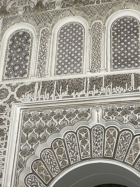
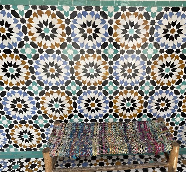
From there, without the rain, we wander aimlessly and eventually end up near the tanneries, but it’s Sunday, and there’s very little activity. Of course, we get hassled by a tout.
Here, the hides after being treated with lime—I love the colors.
We part ways a bit annoyed. He gets a little revenge by giving us bad directions, and we end up outside the city walls. We decide to take a taxi to the new modern art museum—60 dirhams for the 5 km, which is nothing when you think about it. That tout, who we didn’t ask for anything and made it clear we weren’t buying anything, dragged us into a shop supposedly only open that day and demanded 50 dirhams for his "services"! Let’s forget that bad moment and enjoy the exhibition at the MACAL.
The taxi on the way back drops us off at Place des Ferblantiers, not far from our Riad. We’re a little peckish—it’s worth mentioning that at lunchtime, we only ate a plate of beans from a street vendor. So, we buy a bunch of little sweets, each more delicious than the last, at Ajar. We snack while sipping mint tea and watching life go by around us. A final visit to the Museum of Moroccan Cuisine on our way back helps us dodge a few more showers. Then it’s back to the Riad. The atmosphere in the city is heating up—it’s the AFCON final tonight. The temperatures, though? Not so much. We ordered a meal at the Riad, and it was a good call—not only was it really tasty, but the rain also picked up again. Our day in Marrakesh ends under the covers with a good book and some photo sorting. Still, we managed 10,750 steps. View of our Riad
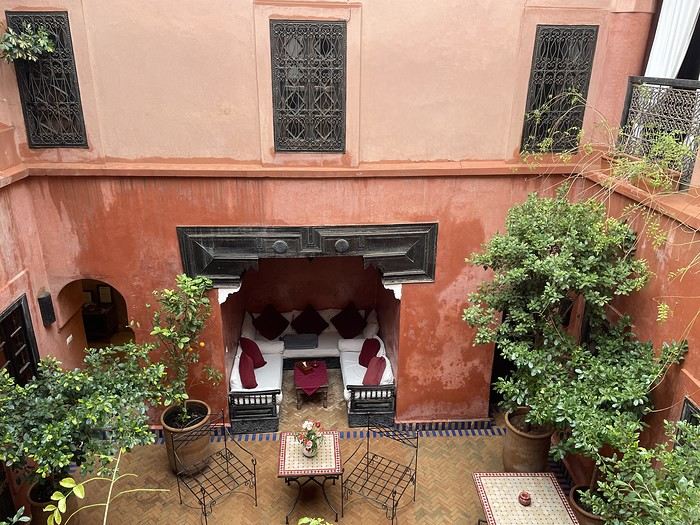
Tomorrow, we’ll pick up our rental car from Medloc and head to Essaouira.
From there, without the rain, we wander aimlessly and eventually end up near the tanneries, but it’s Sunday, and there’s very little activity. Of course, we get hassled by a tout.
Here, the hides after being treated with lime—I love the colors.
We part ways a bit annoyed. He gets a little revenge by giving us bad directions, and we end up outside the city walls. We decide to take a taxi to the new modern art museum—60 dirhams for the 5 km, which is nothing when you think about it. That tout, who we didn’t ask for anything and made it clear we weren’t buying anything, dragged us into a shop supposedly only open that day and demanded 50 dirhams for his "services"! Let’s forget that bad moment and enjoy the exhibition at the MACAL.
The taxi on the way back drops us off at Place des Ferblantiers, not far from our Riad. We’re a little peckish—it’s worth mentioning that at lunchtime, we only ate a plate of beans from a street vendor. So, we buy a bunch of little sweets, each more delicious than the last, at Ajar. We snack while sipping mint tea and watching life go by around us. A final visit to the Museum of Moroccan Cuisine on our way back helps us dodge a few more showers. Then it’s back to the Riad. The atmosphere in the city is heating up—it’s the AFCON final tonight. The temperatures, though? Not so much. We ordered a meal at the Riad, and it was a good call—not only was it really tasty, but the rain also picked up again. Our day in Marrakesh ends under the covers with a good book and some photo sorting. Still, we managed 10,750 steps. View of our Riad
Tomorrow, we’ll pick up our rental car from Medloc and head to Essaouira.
Martine from DD in Arizona and New Mexico
Good evening everyone! 🙂
We’re back from our September 2025 road trip, this time to explore Arizona and New Mexico, and it’s time for me to start my travel journal—especially since everything’s already booked for another trip in September 2026 (to California), and I need to get started on the planning.
I was a little worried this new visit to Uncle Sam’s country might not be as "wow" as the others, but we still discovered some incredible places.
For those who don’t know us, we’re a couple in our seventies who speak very little English, but that didn’t stop us from fully enjoying our stay.
For this 6th road trip in the U.S., we spent 21 nights there, drove 4,160 km by car, and walked nearly 160 km in a loop starting from Phoenix.
We’d been to Arizona before (but not this side) and never to New Mexico. This whole road trip was a huge discovery for us.
In the prices mentioned (some in euros, others in dollars), bank fees and exchange charges are included. The flights, car rental, and parking were all paid for in December 2024 when we booked.
We’d downloaded the MPC (Mobile Passport Control) app, but there wasn’t a dedicated line at Phoenix Airport. Still, we got through quickly with friendly, smiling agents.
I don’t drive at all (I hate it), so the stops were chosen based on activities but also, for some, to limit daily mileage for the sole driver. The kilometers listed in the itinerary are the daily distances.
We traveled from September 9th to 22nd, unfortunately once again without our dear friends Mimi and Maumau.
The itinerary
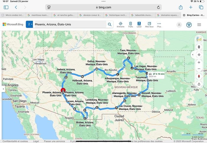
Day 1: Flight Marseille-Paris-Phoenix, then Gold Canyon (133 km) Day 2: Tucson (271 km) Lost Dutchman State Park Day 3: Tucson (155 km) Day 4: Tucson (34 km) Day 5: Bisbee (182 km) Day 6: Lordsburg (345 km) Day 7: Las Cruces (253 km) Day 8: Alamogordo (162 km) Day 9: Roswell (264 km) Day 10: Tucumcari (369 km) Day 11: Las Vegas (281 km) – the one in New Mexico Day 12: Taos (213 km) Day 13: Santa Fe (224 km) Day 14: Albuquerque (123 km) Day 15: Gallup (246 km) Day 16: Holbrook (224 km) Day 17: Flagstaff (179 km) Day 18: Sedona (118 km) Day 19: Sedona (48 km) Day 20: Sedona (41 km) Day 21: Phoenix (256 km) Day 22: Phoenix Airport (35 km)
📊 **Budget**: A little over 7,500 € for both of us, all included. The exchange rate was in our favor (1.17 dollars to 1 €). 📊 **Flights**: Marseille-Paris Charles de Gaulle-Phoenix: 1,787 € for two, with one checked bag each (Air France) 📊 **ESTA**: $42 📊 **America the Beautiful Pass**: $80 📊 **Parking**: 134 € (super eco at Marseille) 📊 **Car rental (Hertz)**: 865 €. Since there were no SUVs left in the reserved category (Nissan Rogue), we got an upgrade (4x4 Ford Explorer). We booked through Air France (15% discount). We’d originally reserved it in December for 1,140 €, but since prices dropped in March, we canceled and rebooked for 865 €. Hertz offers a free Hertz Gold Plus Rewards program, which gives you priority counter service when picking up the car. 📊 **Accommodation**: 2,400 € We stayed in hotels and motels of varying standards (from 60 to 203 € per night, depending on the city), all booked through Booking.com or Hotels.com. Out of 21 nights, only two didn’t include breakfast in the price. Booking.com sometimes offers slightly cheaper rates if you book by phone using the mobile app, and our Genius 3 status on the site also got us some preferential rates. 📊 **Supplementary insurance**: AVA 200 € for medical care if needed 📊 **Cash**: $2,078. We left with 1,000 € exchanged before departure and made two withdrawals of $500. This cash covered: - Evening restaurants and tips - Midday picnics - Gas: $298 for 4,160 km - Museum and private park entries (per person): - Lost Dutchman: $10 - Arizona-Sonora Desert Museum: $28 - Bird Cage Theater: $16 - Tombstone Shootout: $8 - New Mexico Farm & Ranch Museum: $12 - Roswell International UFO Museum: $5 - Billy the Kid Museum: $7 - Rancho de Taos: $22 - West Fork Oak Creek Trail entry: $15 We got a few discounts thanks to our senior age (+65). - Souvenirs and little treats
Like on our previous road trips, we didn’t rent a GPS. We got around using offline GPS apps Here WeGo and Organic Maps, with maps of the states we visited downloaded before we left (on our phones).
❤️❤️❤️ **Highlights** (there are so many!) 📍 Goldfield Ghost Town (even if it’s a reconstruction) 📍 The standing army of Saguaro cacti at Saguaro National Park West 📍 Diving into the cowboy universe of Tombstone 📍 The welcome from Rick and Henry at our guesthouse in Bisbee (Garden at Mile High Ranch) 📍 The tangled rocks of Chiricahua National Monument 📍 The flavored pistachios from Dwayne’s Fresh Jerky and Mac Ginnis Pistachioland 📍 Restaurants: La Posta (Las Cruces), Diner 66 (Albuquerque), and the Haunted Hamburger (Jerome) 📍 The old plazas of New Mexico 📍 The solitude and beauty of the white dunes at White Sands National Park 📍 Stepping back in time at the Billy the Kid Museum (Fort Stanton) 📍 Sections of historic Route 66 and the old motels of Tucumcari, especially at night when all the neon lights are on 📍 Taos Pueblo and diving into Native American culture 📍 After the Rio Grande Bridge, the descent via NM 567 to the very bottom of the Rio Grande Gorge, then the road along the riverbanks to Taos 📍 The tranquility of the Chimayo Sanctuary 📍 Discovering the ingenious native dwellings at Bandelier National Monument and Walnut Canyon National Park 📍 The small towns along the Turquoise Trail 📍 The red rocks of Red Rock Park and the Painted Desert 📍 The extraordinary colors of the petrified trees at Petrified Forest National Park 📍 Sedona, its red rocks, and the reward of the viewpoints at the end of hikes (Devil’s Bridge, The Subway, and West Fork Oak Creek) 📍 The immersion in Mexico when visiting Tlaquepaque 📍 The almost-ghost town of Jerome and its terraced streets 📍 The incredible kindness of Americans, always ready to help and up for a chat ❤️
☹️☹️☹️ **Flops** (there are very few) 📍 Several museums and churches being closed, so we couldn’t visit them 📍 Some museums and visitor centers opening late (10 AM) and closing early (4 PM) 📍 A 64 € phone roaming charge because we got near the Mexican border and picked up their cell tower 📍 The outrageous price ($5.99) for a gallon of gas at the Shell near Phoenix Airport
I hope this helps! Anyway, thanks for reading my long post. Don’t hesitate to reach out, even via PM, if you see I haven’t replied and you’d like more details. Have a great evening, everyone! 🙂
We’re back from our September 2025 road trip, this time to explore Arizona and New Mexico, and it’s time for me to start my travel journal—especially since everything’s already booked for another trip in September 2026 (to California), and I need to get started on the planning.
I was a little worried this new visit to Uncle Sam’s country might not be as "wow" as the others, but we still discovered some incredible places.
For those who don’t know us, we’re a couple in our seventies who speak very little English, but that didn’t stop us from fully enjoying our stay.
For this 6th road trip in the U.S., we spent 21 nights there, drove 4,160 km by car, and walked nearly 160 km in a loop starting from Phoenix.
We’d been to Arizona before (but not this side) and never to New Mexico. This whole road trip was a huge discovery for us.
In the prices mentioned (some in euros, others in dollars), bank fees and exchange charges are included. The flights, car rental, and parking were all paid for in December 2024 when we booked.
We’d downloaded the MPC (Mobile Passport Control) app, but there wasn’t a dedicated line at Phoenix Airport. Still, we got through quickly with friendly, smiling agents.
I don’t drive at all (I hate it), so the stops were chosen based on activities but also, for some, to limit daily mileage for the sole driver. The kilometers listed in the itinerary are the daily distances.
We traveled from September 9th to 22nd, unfortunately once again without our dear friends Mimi and Maumau.
The itinerary
Day 1: Flight Marseille-Paris-Phoenix, then Gold Canyon (133 km) Day 2: Tucson (271 km) Lost Dutchman State Park Day 3: Tucson (155 km) Day 4: Tucson (34 km) Day 5: Bisbee (182 km) Day 6: Lordsburg (345 km) Day 7: Las Cruces (253 km) Day 8: Alamogordo (162 km) Day 9: Roswell (264 km) Day 10: Tucumcari (369 km) Day 11: Las Vegas (281 km) – the one in New Mexico Day 12: Taos (213 km) Day 13: Santa Fe (224 km) Day 14: Albuquerque (123 km) Day 15: Gallup (246 km) Day 16: Holbrook (224 km) Day 17: Flagstaff (179 km) Day 18: Sedona (118 km) Day 19: Sedona (48 km) Day 20: Sedona (41 km) Day 21: Phoenix (256 km) Day 22: Phoenix Airport (35 km)
📊 **Budget**: A little over 7,500 € for both of us, all included. The exchange rate was in our favor (1.17 dollars to 1 €). 📊 **Flights**: Marseille-Paris Charles de Gaulle-Phoenix: 1,787 € for two, with one checked bag each (Air France) 📊 **ESTA**: $42 📊 **America the Beautiful Pass**: $80 📊 **Parking**: 134 € (super eco at Marseille) 📊 **Car rental (Hertz)**: 865 €. Since there were no SUVs left in the reserved category (Nissan Rogue), we got an upgrade (4x4 Ford Explorer). We booked through Air France (15% discount). We’d originally reserved it in December for 1,140 €, but since prices dropped in March, we canceled and rebooked for 865 €. Hertz offers a free Hertz Gold Plus Rewards program, which gives you priority counter service when picking up the car. 📊 **Accommodation**: 2,400 € We stayed in hotels and motels of varying standards (from 60 to 203 € per night, depending on the city), all booked through Booking.com or Hotels.com. Out of 21 nights, only two didn’t include breakfast in the price. Booking.com sometimes offers slightly cheaper rates if you book by phone using the mobile app, and our Genius 3 status on the site also got us some preferential rates. 📊 **Supplementary insurance**: AVA 200 € for medical care if needed 📊 **Cash**: $2,078. We left with 1,000 € exchanged before departure and made two withdrawals of $500. This cash covered: - Evening restaurants and tips - Midday picnics - Gas: $298 for 4,160 km - Museum and private park entries (per person): - Lost Dutchman: $10 - Arizona-Sonora Desert Museum: $28 - Bird Cage Theater: $16 - Tombstone Shootout: $8 - New Mexico Farm & Ranch Museum: $12 - Roswell International UFO Museum: $5 - Billy the Kid Museum: $7 - Rancho de Taos: $22 - West Fork Oak Creek Trail entry: $15 We got a few discounts thanks to our senior age (+65). - Souvenirs and little treats
Like on our previous road trips, we didn’t rent a GPS. We got around using offline GPS apps Here WeGo and Organic Maps, with maps of the states we visited downloaded before we left (on our phones).
❤️❤️❤️ **Highlights** (there are so many!) 📍 Goldfield Ghost Town (even if it’s a reconstruction) 📍 The standing army of Saguaro cacti at Saguaro National Park West 📍 Diving into the cowboy universe of Tombstone 📍 The welcome from Rick and Henry at our guesthouse in Bisbee (Garden at Mile High Ranch) 📍 The tangled rocks of Chiricahua National Monument 📍 The flavored pistachios from Dwayne’s Fresh Jerky and Mac Ginnis Pistachioland 📍 Restaurants: La Posta (Las Cruces), Diner 66 (Albuquerque), and the Haunted Hamburger (Jerome) 📍 The old plazas of New Mexico 📍 The solitude and beauty of the white dunes at White Sands National Park 📍 Stepping back in time at the Billy the Kid Museum (Fort Stanton) 📍 Sections of historic Route 66 and the old motels of Tucumcari, especially at night when all the neon lights are on 📍 Taos Pueblo and diving into Native American culture 📍 After the Rio Grande Bridge, the descent via NM 567 to the very bottom of the Rio Grande Gorge, then the road along the riverbanks to Taos 📍 The tranquility of the Chimayo Sanctuary 📍 Discovering the ingenious native dwellings at Bandelier National Monument and Walnut Canyon National Park 📍 The small towns along the Turquoise Trail 📍 The red rocks of Red Rock Park and the Painted Desert 📍 The extraordinary colors of the petrified trees at Petrified Forest National Park 📍 Sedona, its red rocks, and the reward of the viewpoints at the end of hikes (Devil’s Bridge, The Subway, and West Fork Oak Creek) 📍 The immersion in Mexico when visiting Tlaquepaque 📍 The almost-ghost town of Jerome and its terraced streets 📍 The incredible kindness of Americans, always ready to help and up for a chat ❤️
☹️☹️☹️ **Flops** (there are very few) 📍 Several museums and churches being closed, so we couldn’t visit them 📍 Some museums and visitor centers opening late (10 AM) and closing early (4 PM) 📍 A 64 € phone roaming charge because we got near the Mexican border and picked up their cell tower 📍 The outrageous price ($5.99) for a gallon of gas at the Shell near Phoenix Airport
I hope this helps! Anyway, thanks for reading my long post. Don’t hesitate to reach out, even via PM, if you see I haven’t replied and you’d like more details. Have a great evening, everyone! 🙂
Exploring Senja Island and the Lofoten Archipelago
Hi everyone,
We traveled to Norway in the summer of 2025, from July 17 to 29, to visit Senja Island and the Lofoten archipelago with a rental car. The common thread of these twelve days was clearly hiking, along with a few visits and experiences, and nights spent in a tent or in the car (which made it possible). We chose Narvik Airport for both arrival and departure for several complementary reasons: the desire to visit nearby Senja Island, slightly more affordable airfare, and finally, the rental price of the vehicle—especially the car model we were looking for. We only made one reservation, for the first campsite, as sleeping in a tent made things much easier. But we had the whole structure of the trip planned, a flexible outline that could adapt to the weather conditions we’d encounter. Senja Island isn’t part of the Lofoten archipelago, and during the early stages of planning this trip, we hadn’t planned to visit it. But its relative proximity to Narvik Airport and, above all, its unique geography definitely made us change our minds. We arrived in Evenes, where Narvik Airport is located, nearly 60 km from the city itself. Our first stop was 40 km further in Bjerkvik on the way to Senja, where there’s a Rema 1000 (a very common supermarket chain in Norway). We needed to buy some food and a gas cartridge for our stove. I’d emailed the store manager beforehand, who told me they didn’t sell them but that the two gas stations in the village were likely to have some in stock.
It was only at the Esso station that I found what I needed, but unfortunately, only one cartridge. Luckily, we quickly realized that most campsites (like in Iceland) have a shared kitchen with hotplates. That single small cartridge was just enough for the few nights we spent outside of campsites... We got our first taste of Norway’s characteristic landscapes: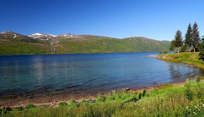
When we arrived at the Senja campsite, it was already 9:30 PM. A sign announced it was full, but luckily, I’d booked it 10 days earlier. By 10:30 PM, as we settled in to eat, it was still broad daylight, and the thermometer read 25°C—despite being at a latitude of 69° North! We went to bed around midnight, exhausted but under the light of a sun that was still very much present. Thanks to Earth’s tilted axis. We’d anticipated this by buying opaque sleep masks because, yes, at this time of year, it’s daylight all the time.
Friday, July 18:
Today, we planned two hikes on the island and a few stops along the way. The map clearly shows that the deepest fjords are in the north and west. Due to time and accessibility, we focused on the northern part of the island. Our first stop was at the viewing platform in Bergbotn:
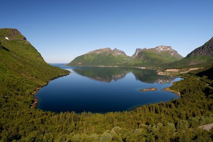
Then we headed toward Skaland, the starting point for our first hike. Along the way, we found plenty of reasons to stop—especially since, on this first day of travel, our thirst for Nordic landscapes was far from quenched.
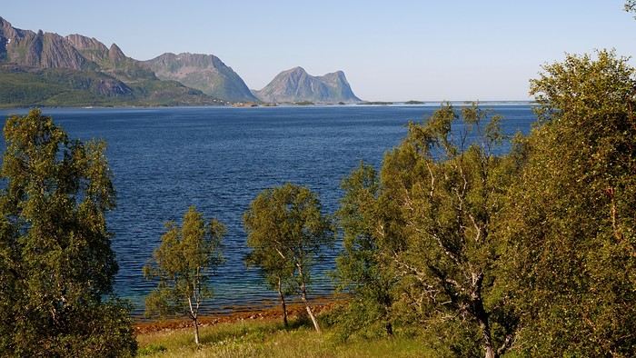
The town of Skaland is very practical: free parking, picnic tables for after the hike, and a Joker convenience store right next door. Our goal was the summit of Husfjellet: 670 m of elevation gain, between 8 and 9 km in length, and an estimated 4 hours and 30 minutes.
This hike offers two major viewpoints. The first overlooks the Bergsoyan islands to the west:
At the summit, the view shifts to the Steinfjorden fjord:
You can even clearly see the "Devil’s Teeth," which we’d see from below later:
In total, the hike took us 4 hours and 30 minutes, including all the breaks. We treated ourselves to an ice cream in Skaland to recharge for the next hike. We hit the road again and stopped at Tungeneset to get a closer look at the Devil’s Teeth:
We continued to Fjordgard, the starting point for our second hike. Fjordgard isn’t very welcoming. There was a time when you could park right at the start of the hike up Mount Segla. Now, everything’s blocked off, and locals have even taken to blocking all possible parking spots nearby. You now have to park outside the town at a paid parking lot (90 NOK for 3 hours), adding an extra 2 km (round trip) of walking. Still, that was just a minor inconvenience because the hike that followed quickly made us forget all about it. The hike is fairly short (2 hours) but still has 520 m of elevation gain. This hike was a stark contrast to the first. This morning, we had sweeping views of the vast landscape. Here, Mount Segla, perched on the edge of the cliff, dominates the foreground:
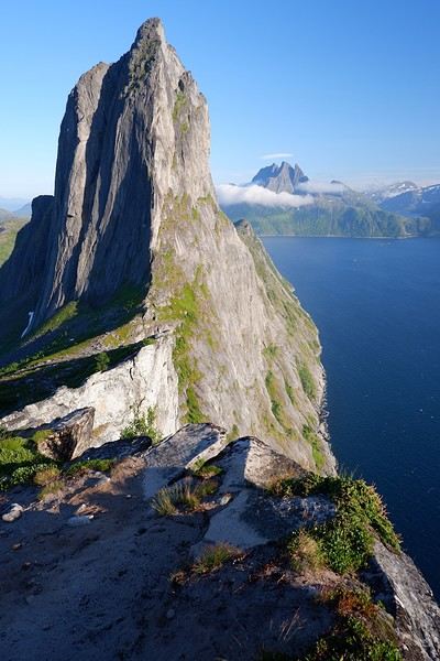
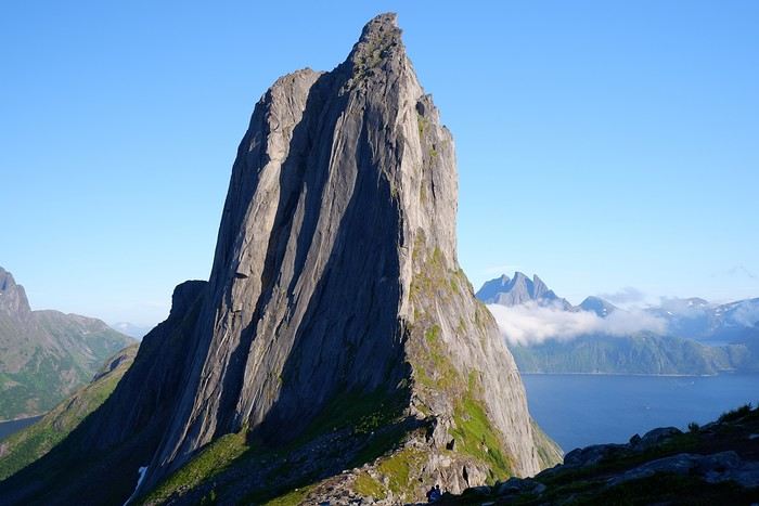
For those prone to vertigo, it might be best to stay at the foot of the mountain, as the trail climbs right along the cliff edge. And from that point on, you quickly understand what verticality really means...
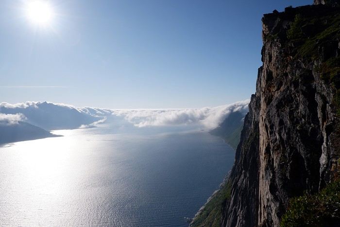
In total, we took 2 hours and 50 minutes, including breaks and the extra walk to the parking lot. The day was already well underway, and with 1,200 m of cumulative elevation gain, it was time to find a spot to eat and sleep. Since we hadn’t made any reservations, we’d planned to bivouac for the night. We weren’t too picky—just practical—so we decided to sleep in the car at the parking lot for tomorrow morning’s hike, just 5 km from Fjordgard.
We traveled to Norway in the summer of 2025, from July 17 to 29, to visit Senja Island and the Lofoten archipelago with a rental car. The common thread of these twelve days was clearly hiking, along with a few visits and experiences, and nights spent in a tent or in the car (which made it possible). We chose Narvik Airport for both arrival and departure for several complementary reasons: the desire to visit nearby Senja Island, slightly more affordable airfare, and finally, the rental price of the vehicle—especially the car model we were looking for. We only made one reservation, for the first campsite, as sleeping in a tent made things much easier. But we had the whole structure of the trip planned, a flexible outline that could adapt to the weather conditions we’d encounter. Senja Island isn’t part of the Lofoten archipelago, and during the early stages of planning this trip, we hadn’t planned to visit it. But its relative proximity to Narvik Airport and, above all, its unique geography definitely made us change our minds. We arrived in Evenes, where Narvik Airport is located, nearly 60 km from the city itself. Our first stop was 40 km further in Bjerkvik on the way to Senja, where there’s a Rema 1000 (a very common supermarket chain in Norway). We needed to buy some food and a gas cartridge for our stove. I’d emailed the store manager beforehand, who told me they didn’t sell them but that the two gas stations in the village were likely to have some in stock.
It was only at the Esso station that I found what I needed, but unfortunately, only one cartridge. Luckily, we quickly realized that most campsites (like in Iceland) have a shared kitchen with hotplates. That single small cartridge was just enough for the few nights we spent outside of campsites... We got our first taste of Norway’s characteristic landscapes:
When we arrived at the Senja campsite, it was already 9:30 PM. A sign announced it was full, but luckily, I’d booked it 10 days earlier. By 10:30 PM, as we settled in to eat, it was still broad daylight, and the thermometer read 25°C—despite being at a latitude of 69° North! We went to bed around midnight, exhausted but under the light of a sun that was still very much present. Thanks to Earth’s tilted axis. We’d anticipated this by buying opaque sleep masks because, yes, at this time of year, it’s daylight all the time.
Friday, July 18:
Today, we planned two hikes on the island and a few stops along the way. The map clearly shows that the deepest fjords are in the north and west. Due to time and accessibility, we focused on the northern part of the island. Our first stop was at the viewing platform in Bergbotn:
Then we headed toward Skaland, the starting point for our first hike. Along the way, we found plenty of reasons to stop—especially since, on this first day of travel, our thirst for Nordic landscapes was far from quenched.
The town of Skaland is very practical: free parking, picnic tables for after the hike, and a Joker convenience store right next door. Our goal was the summit of Husfjellet: 670 m of elevation gain, between 8 and 9 km in length, and an estimated 4 hours and 30 minutes.
This hike offers two major viewpoints. The first overlooks the Bergsoyan islands to the west:
At the summit, the view shifts to the Steinfjorden fjord:
You can even clearly see the "Devil’s Teeth," which we’d see from below later:
In total, the hike took us 4 hours and 30 minutes, including all the breaks. We treated ourselves to an ice cream in Skaland to recharge for the next hike. We hit the road again and stopped at Tungeneset to get a closer look at the Devil’s Teeth:
We continued to Fjordgard, the starting point for our second hike. Fjordgard isn’t very welcoming. There was a time when you could park right at the start of the hike up Mount Segla. Now, everything’s blocked off, and locals have even taken to blocking all possible parking spots nearby. You now have to park outside the town at a paid parking lot (90 NOK for 3 hours), adding an extra 2 km (round trip) of walking. Still, that was just a minor inconvenience because the hike that followed quickly made us forget all about it. The hike is fairly short (2 hours) but still has 520 m of elevation gain. This hike was a stark contrast to the first. This morning, we had sweeping views of the vast landscape. Here, Mount Segla, perched on the edge of the cliff, dominates the foreground:
For those prone to vertigo, it might be best to stay at the foot of the mountain, as the trail climbs right along the cliff edge. And from that point on, you quickly understand what verticality really means...
In total, we took 2 hours and 50 minutes, including breaks and the extra walk to the parking lot. The day was already well underway, and with 1,200 m of cumulative elevation gain, it was time to find a spot to eat and sleep. Since we hadn’t made any reservations, we’d planned to bivouac for the night. We weren’t too picky—just practical—so we decided to sleep in the car at the parking lot for tomorrow morning’s hike, just 5 km from Fjordgard.
A summer in the sun in... Iceland!!
Ah, Iceland and us—it’s quite the story, or rather, a long wait... The first time we considered going was already 7-8 years ago, after reading travel journals describing breathtaking landscapes, countless active and dormant volcanoes, glaciers, and waterfalls with extraordinary flows. In short, this island, made of fire and ice, right at Europe’s doorstep with its own unique culture, had nothing but advantages, and it was urgent to visit without delay 😇
My *Routard* guidebook is actually from 2016. So why did Iceland make us wait so long before we finally gave in to its charms? Yes, why indeed?
Simply because reading other travel journals revealed the cost of living there—and especially the harsh climate, even in the middle of July 🤪! Some journals described entire weeks of rain and foggy weather, making it tricky to explore the island. The budget wasn’t spared either, because in the most touristy areas, especially in the south and around Myvatn, accommodation prices are downright indecent—even outright robbery. 😕
Plus, in the Highlands, there’s literally no permanent lodging, and the only way to spend several nights there is to camp. And camping in winter conditions wasn’t exactly part of our plans... 😄
So, year after year, this trip kept getting postponed...
until August 2023, when prices for Southern Africa, North or South America, or even Asia were all way too high for summer 2024!
That’s when I turned my attention back to the Land of Fire and Ice and scoured all the comparison sites for the best accommodation deals across the country. Planning for 20 nights, I found 13 nights in "proper" lodging for 5 people at an average cost of under 200 €! A miracle, considering that in the southern glacier region, around Vik or Myvatn, prices range from 300 to 1000 € per night 😮 😮!
Still, that means we’ll have to camp for 7 nights, mostly in the Highlands, near Askja or Landmannalaugar. 😎
For once, I built the daily itinerary entirely around the decently priced lodgings I found 11 months in advance! The shortage of places to stay in some areas forced me to plan a few long transition days and make some tough choices. No big deal, though—there’s so much to do on this island 🙂!
Once the main itinerary was set, everyone agreed to the plan: 2/3 in proper lodging and 1/3 camping, even the most camping-averse among us! *Follow my gaze...*
By the time we bought the flight tickets, I had to tweak the itinerary a bit because one or two places were already booked! Plus, it was impossible to wait for a more refined plan to adjust reservations, since almost all bookings are non-refundable!! The harsh law of supply and demand...
For the car rental, we booked a Hyundai Tucson, approved for the Highlands, from Lava Car Rental—a company I’d read good reviews about in a Facebook group—for a cool 2500 € with full insurance. A real 4x4, like a Defender, would’ve been more than double...! Welcome to Iceland 😕...
Activities and excursions also required some tough choices. We had two must-dos: whale watching in Húsavík (60 € pp on Getyourguide) and a Glacier and Summer Treasure Glacier Walk with BlueIceland (165 € pp with discount codes on Getyourguide).
For the baths, we skipped the Blue Lagoon—too expensive—in favor of the Secret Lagoon and the Myvatn Baths, the Blue Lagoon’s equivalent but half the price.
Two baths for the price of one... and even more, since I spotted several free hot-water swimming spots.
Itinerary: Day 1: Arrival in Reykjavik - Hraunfossar Waterfall - Surtshellir Cave Day 2: Grábrók Crater - Snæfellsnes Peninsula Day 3: Stykkishólmur - Sturlungalaug Hot Springs Day 4: Northwest Coast - Akureyri - Goðafoss Day 5: Myvatn Day 6: Myvatn - Dettifoss - Selfoss - Rauðhólar Day 7: Húsavík Whale Watching - Dettifoss - Selfoss Day 8: Stuðlagil Canyon - Seyðisfjörður Day 9: Puffin colony - Störurð Hike Day 10: Hengifoss - East Fjords, Mjóifjörður Day 11: Viking Village - Jökulsárlón - Fjallsárlón Day 12: Glacier Excursion - Svartifoss Day 13: Fjaðrárgljúfur Canyon - Vík Day 14: Þakgil - Lava Show Vík Day 15: Southern Waterfalls Day Day 16: Landmannalaugar - Skalli Hike Day 17: Landmannalaugar - Bláhnjúkur - Brennisteinsalda Day 18: Secret Lagoon, Kerlingarfjöll, and Gullfoss Day 19: Geysir - Reykjavik Day 20: Bruarfoss - Þingvellir - Kerid Crater - Krýsuvík Geothermal Area Day 21: Reykjanes Peninsula
Friday, July 5, 2024, is our last workday before driving up to Alsace overnight to leave the cockers at Grandpa’s for boarding. Then, at 1:30 AM, we’ll head to Frankfurt, where a direct flight to Iceland awaits.
We arrive at 4 AM. Since we leave at 7 AM, the "night" will only last the equivalent of a 30-minute nap 🤪... just enough to get us in the road-trip mood 😏!!
My *Routard* guidebook is actually from 2016. So why did Iceland make us wait so long before we finally gave in to its charms? Yes, why indeed?
Simply because reading other travel journals revealed the cost of living there—and especially the harsh climate, even in the middle of July 🤪! Some journals described entire weeks of rain and foggy weather, making it tricky to explore the island. The budget wasn’t spared either, because in the most touristy areas, especially in the south and around Myvatn, accommodation prices are downright indecent—even outright robbery. 😕
Plus, in the Highlands, there’s literally no permanent lodging, and the only way to spend several nights there is to camp. And camping in winter conditions wasn’t exactly part of our plans... 😄
So, year after year, this trip kept getting postponed...
until August 2023, when prices for Southern Africa, North or South America, or even Asia were all way too high for summer 2024!
That’s when I turned my attention back to the Land of Fire and Ice and scoured all the comparison sites for the best accommodation deals across the country. Planning for 20 nights, I found 13 nights in "proper" lodging for 5 people at an average cost of under 200 €! A miracle, considering that in the southern glacier region, around Vik or Myvatn, prices range from 300 to 1000 € per night 😮 😮!
Still, that means we’ll have to camp for 7 nights, mostly in the Highlands, near Askja or Landmannalaugar. 😎
For once, I built the daily itinerary entirely around the decently priced lodgings I found 11 months in advance! The shortage of places to stay in some areas forced me to plan a few long transition days and make some tough choices. No big deal, though—there’s so much to do on this island 🙂!
Once the main itinerary was set, everyone agreed to the plan: 2/3 in proper lodging and 1/3 camping, even the most camping-averse among us! *Follow my gaze...*
By the time we bought the flight tickets, I had to tweak the itinerary a bit because one or two places were already booked! Plus, it was impossible to wait for a more refined plan to adjust reservations, since almost all bookings are non-refundable!! The harsh law of supply and demand...
For the car rental, we booked a Hyundai Tucson, approved for the Highlands, from Lava Car Rental—a company I’d read good reviews about in a Facebook group—for a cool 2500 € with full insurance. A real 4x4, like a Defender, would’ve been more than double...! Welcome to Iceland 😕...
Activities and excursions also required some tough choices. We had two must-dos: whale watching in Húsavík (60 € pp on Getyourguide) and a Glacier and Summer Treasure Glacier Walk with BlueIceland (165 € pp with discount codes on Getyourguide).
For the baths, we skipped the Blue Lagoon—too expensive—in favor of the Secret Lagoon and the Myvatn Baths, the Blue Lagoon’s equivalent but half the price.
Two baths for the price of one... and even more, since I spotted several free hot-water swimming spots.
Itinerary: Day 1: Arrival in Reykjavik - Hraunfossar Waterfall - Surtshellir Cave Day 2: Grábrók Crater - Snæfellsnes Peninsula Day 3: Stykkishólmur - Sturlungalaug Hot Springs Day 4: Northwest Coast - Akureyri - Goðafoss Day 5: Myvatn Day 6: Myvatn - Dettifoss - Selfoss - Rauðhólar Day 7: Húsavík Whale Watching - Dettifoss - Selfoss Day 8: Stuðlagil Canyon - Seyðisfjörður Day 9: Puffin colony - Störurð Hike Day 10: Hengifoss - East Fjords, Mjóifjörður Day 11: Viking Village - Jökulsárlón - Fjallsárlón Day 12: Glacier Excursion - Svartifoss Day 13: Fjaðrárgljúfur Canyon - Vík Day 14: Þakgil - Lava Show Vík Day 15: Southern Waterfalls Day Day 16: Landmannalaugar - Skalli Hike Day 17: Landmannalaugar - Bláhnjúkur - Brennisteinsalda Day 18: Secret Lagoon, Kerlingarfjöll, and Gullfoss Day 19: Geysir - Reykjavik Day 20: Bruarfoss - Þingvellir - Kerid Crater - Krýsuvík Geothermal Area Day 21: Reykjanes Peninsula
Friday, July 5, 2024, is our last workday before driving up to Alsace overnight to leave the cockers at Grandpa’s for boarding. Then, at 1:30 AM, we’ll head to Frankfurt, where a direct flight to Iceland awaits.
We arrive at 4 AM. Since we leave at 7 AM, the "night" will only last the equivalent of a 30-minute nap 🤪... just enough to get us in the road-trip mood 😏!!
Question about the Bangkok-Vientiane train
Hi there,
I need to take a sleeper train from Bangkok to Vientiane in January. I found some ticket options on 12Go Asia, but booking doesn’t seem possible at the moment. I’ve tried simulations for several dates, but no luck. I’m wondering if it’s already fully booked, if they’ve stopped selling tickets… yet 12Go still features it every day 😕
Has anyone else run into this issue? Can I find tickets on another site? (I tried Baolau, but no sleepers left for January 8th.)
Thanks!
I need to take a sleeper train from Bangkok to Vientiane in January. I found some ticket options on 12Go Asia, but booking doesn’t seem possible at the moment. I’ve tried simulations for several dates, but no luck. I’m wondering if it’s already fully booked, if they’ve stopped selling tickets… yet 12Go still features it every day 😕
Has anyone else run into this issue? Can I find tickets on another site? (I tried Baolau, but no sleepers left for January 8th.)
Thanks!
Mauritian Ti' Punch
The recipe for the cocktail: endless beaches, a dazzling palette of colors, some breathtaking hikes, and excellent cuisine...
For the tasting, follow along in the pages of this travel journal! 😉
Don’t forget your hiking shoes, a swimsuit, sunscreen, but also a sweater, your driver’s license, and your credit card...
Just over 11 hours of flight, and we’ll be setting foot on Mauritian soil!
For the tasting, follow along in the pages of this travel journal! 😉
Don’t forget your hiking shoes, a swimsuit, sunscreen, but also a sweater, your driver’s license, and your credit card...
Just over 11 hours of flight, and we’ll be setting foot on Mauritian soil!
Langtang – Trekking in the Rain
We did the Langtang trek (hike) from September 10th to 17th, with the first and last days being the trip from Kathmandu and back—so 6 days of actual walking. It’s a fairly well-known trek but certainly not as famous or crowded as those in the Annapurna or Everest regions, which is why we chose it.
In theory, it’s mandatory to have a guide for this trek. In reality, it seems there are ways to bypass the regulations: we met at least two people hiking without a guide—a South Korean, a New Zealander, and possibly also a couple of English women and an American couple, though we’re not sure if they had a guide.
The agency we booked with had told us it was an affordable trek for relatively older people in good shape—which is our case (I’m 72 myself). I have to say upfront that we found it quite challenging, maybe because we didn’t have good weather—it was the end of the monsoon season. To be clear, no matter your fitness level, I’d say doing this trek in the middle of the monsoon season would be suicidal.
Day 1 – Journey from Kathmandu to Syapru Besi
On Monday, September 8th, there had been violent protests in Kathmandu against the government, which had, among other things, blocked access to social media and been accused of nepotism and corruption. There were 19 deaths. The situation was very tense on the day of our departure, Wednesday the 10th. The agency warned us that public transport was very unreliable. So, we decided to take a jeep, at an additional cost of $100 ($160 minus what was already budgeted for the bus).
We left a little before 7 a.m. and it took us a good hour just to reach the outskirts of Kathmandu. Along the way, we saw several houses and vehicles set on fire by protesters.
The road to Syapru Besi is only 120 km, but it’s frankly awful. It’s always narrow, winds through endless mountains, and the shoulders range from bad to confusing to nonexistent. Several sections are just dirt tracks. We didn’t regret opting for the jeep, as we could stop several times at our convenience—if only to let Y (my Thai partner) throw up everything she had. She’d taken her usual motion sickness medication, but the constant turns, accelerations, and braking eventually made her terribly carsick.
In Nuwakot, we stopped for breakfast at a nice little restaurant, Jimbu. It was around 8:30 a.m., and we’d barely covered 60 km. The restaurant has a lovely garden overlooking the Trishuli Ganga, the river flowing down from Syapru Besi. First photo: the river in the bottom right corner, mist and clouds over the mountain on the other side.
An hour later, my second photo: the hills along the Trishuli Ganga. You can see the different crops—lush green rice paddies in the lower right and corn, already yellowed and likely harvested, in the foreground on the left. And of course, the mist and clouds through which you can glimpse the mountain on the other side of the river.
In theory, it’s mandatory to have a guide for this trek. In reality, it seems there are ways to bypass the regulations: we met at least two people hiking without a guide—a South Korean, a New Zealander, and possibly also a couple of English women and an American couple, though we’re not sure if they had a guide.
The agency we booked with had told us it was an affordable trek for relatively older people in good shape—which is our case (I’m 72 myself). I have to say upfront that we found it quite challenging, maybe because we didn’t have good weather—it was the end of the monsoon season. To be clear, no matter your fitness level, I’d say doing this trek in the middle of the monsoon season would be suicidal.
Day 1 – Journey from Kathmandu to Syapru Besi
On Monday, September 8th, there had been violent protests in Kathmandu against the government, which had, among other things, blocked access to social media and been accused of nepotism and corruption. There were 19 deaths. The situation was very tense on the day of our departure, Wednesday the 10th. The agency warned us that public transport was very unreliable. So, we decided to take a jeep, at an additional cost of $100 ($160 minus what was already budgeted for the bus).
We left a little before 7 a.m. and it took us a good hour just to reach the outskirts of Kathmandu. Along the way, we saw several houses and vehicles set on fire by protesters.
The road to Syapru Besi is only 120 km, but it’s frankly awful. It’s always narrow, winds through endless mountains, and the shoulders range from bad to confusing to nonexistent. Several sections are just dirt tracks. We didn’t regret opting for the jeep, as we could stop several times at our convenience—if only to let Y (my Thai partner) throw up everything she had. She’d taken her usual motion sickness medication, but the constant turns, accelerations, and braking eventually made her terribly carsick.
In Nuwakot, we stopped for breakfast at a nice little restaurant, Jimbu. It was around 8:30 a.m., and we’d barely covered 60 km. The restaurant has a lovely garden overlooking the Trishuli Ganga, the river flowing down from Syapru Besi. First photo: the river in the bottom right corner, mist and clouds over the mountain on the other side.
An hour later, my second photo: the hills along the Trishuli Ganga. You can see the different crops—lush green rice paddies in the lower right and corn, already yellowed and likely harvested, in the foreground on the left. And of course, the mist and clouds through which you can glimpse the mountain on the other side of the river.
Your recommendations for 20 days in Thailand
Hello,
Our flights are booked, and we’ll arrive in Thailand at the beginning of January.
Originally, we were supposed to spend 14 days there. But after booking the flights and seeing the prices, we’ll now be there for 20 days instead.
Our initial plan was: 2 days in Bangkok 1 day in Ayutthaya 4 days in Chiang Mai 6 days around Krabi
So we have 7 more days to fill. What do you recommend?
An extra day in Bangkok? Adding more days in the north? If so, where? Exploring another region, like Kanchanaburi or Cheow Lan Lake? Traveling north in stages instead of taking the overnight train?
A few extra details about us: For us, vacation isn’t about relaxation—we love walking, exploring, and packed days don’t bother us. Hiking for hours and doing active things is what makes us happy. That said, we also enjoy visiting villages and towns if they’re worth the detour. In Thailand, we’d like to visit temples too. We’re early risers, so our days tend to be long. 🙂 In short, we like to keep things moving during our trips. 😉
Unfortunately, seeing terraced rice fields isn’t possible in January. I read there are rice fields around Sukhothai. Are they green in January?
In the north, do you recommend Doi Inthanon, Huai Nam Dang, or Doi Chiang Dao National Parks? Which one is the most beautiful and best for January?
Our flights are booked, and we’ll arrive in Thailand at the beginning of January.
Originally, we were supposed to spend 14 days there. But after booking the flights and seeing the prices, we’ll now be there for 20 days instead.
Our initial plan was: 2 days in Bangkok 1 day in Ayutthaya 4 days in Chiang Mai 6 days around Krabi
So we have 7 more days to fill. What do you recommend?
An extra day in Bangkok? Adding more days in the north? If so, where? Exploring another region, like Kanchanaburi or Cheow Lan Lake? Traveling north in stages instead of taking the overnight train?
A few extra details about us: For us, vacation isn’t about relaxation—we love walking, exploring, and packed days don’t bother us. Hiking for hours and doing active things is what makes us happy. That said, we also enjoy visiting villages and towns if they’re worth the detour. In Thailand, we’d like to visit temples too. We’re early risers, so our days tend to be long. 🙂 In short, we like to keep things moving during our trips. 😉
Unfortunately, seeing terraced rice fields isn’t possible in January. I read there are rice fields around Sukhothai. Are they green in January?
In the north, do you recommend Doi Inthanon, Huai Nam Dang, or Doi Chiang Dao National Parks? Which one is the most beautiful and best for January?