Results for "frontière+|+8+>+190"
51230 results found.
Meilleure saison pour circuit de 10 jours en Guyane? English translation pending
😉 Nous avons gagné deux billets d'avion pour aller en Guyane avant le 31 septembre 2004.
Nous aimerions savoir quelle est la meilleure période ?
Entre 8 et 10 jours, quel est le meilleur circuit à faire ?
Quelle tenues adoptées ?
Quelle précaution faut il prendre coté santé ?
Merci de vos éclairages,
A bientôt
HORUS
Merci de vos éclairages,
A bientôt
HORUS
Pacific crest trail (États-Unis et Canada) English translation pending
Bonjour, l'idée m'effleure!!! de faire un jour le pacific crest trail(PCT), qui est certainement le plus long chemin de randonnée au monde(frontiere du Mexique à frontiere canadienne, soit 4500 km à pied.)
Les sites internet parlant de ce trek mythique sont bien documentés mais j'aimerais discuté de vive voix(tel ou mail) avec quelqu'un qui l'aurait fait, tout(thru-hike disent les américains) ou partie., en en français c'est plus mieux...
Merci de vos conseils, ou peut-etre seulement de vos projets
Les sites internet parlant de ce trek mythique sont bien documentés mais j'aimerais discuté de vive voix(tel ou mail) avec quelqu'un qui l'aurait fait, tout(thru-hike disent les américains) ou partie., en en français c'est plus mieux...
Merci de vos conseils, ou peut-etre seulement de vos projets
Quel hôtel choisir? English translation pending
bonjour a tous, je desire partir a playa del carmen fin mars, je pensais reserver dans un hotel (formule tout inclus) puis m organiser des sorties.j attends vos conseil sur le choix d un hotel et les astuces pour les locatoion de voiture ainsi que les sites a visiter en priorite. j ai consulter l hotel allegro playacar et le reef club coco beach, el caracol ou iberostar playa paraioso. je ne sais lequel choisir. je parts environ 13jours.merci de vos conseil.
Visas et entrées multiples en Asie du Sud-Est English translation pending
Bonjour,
Je dispose d'un billet d'avion Paris <-> Bangkok. La durée totale de mon voyage est de 12 semaines environ. Ce voyage est de type course et course contre la montre, peu importe...😄
Les chiffres ci-dessous ne sont donnés qu'à titre indicatif. Ne vous en préoccupez pas trop. L'important pour moi n'est pas là.
Le terme "par voie terrestre" désigne par bus, à pieds, ou en train.
Mes finances ne me permettent pas d'utiliser l'avion comme moyen de transport entre les pays.
Je souhaite me procurer les visas seulement lors du passage aux frontières, selon possibilité.
Mon voyage est le suivant (ordre chronologique; de fin février à fin mai):
1- Paris -> Bangkok. 2- Séjour 2 semaines en Thaïlande. 3- Passage Thaïlande -> Laos par voie terrestre. 4- Séjour de quelques jours au Laos. 5- Passage Laos -> Viêtnam par voie terrestre. 6- Séjour 3 semaines au Viêtnam. 7- Passage Viêtnam -> Cambodge par voie terrestre. 8- Séjour de quelques jours au Cambodge. 9- Passage Cambodge -> Thaïlande par voie terrestre. 10- Séjour 2 semaines en Thaïlande. 11- Passage Thaïlande -> Malaisie par voie terrestre. 12- Séjour de quelques jours en Malaisie. 13- Passage Malaisie -> Indonésie (Sumatra) en bateau. 14- Séjour de 3-4 semaines en Indonésie.
Ensuite, selon l'état de mes finances, 2 choix:
a)
15- Avion Indonésie (Jakarta ou Denpasar, Bali) -> Bangkok. 16- Quelques jours à Bangkok et allentours. 17- Bangkok -> Paris.
ou
b)
15- Retour sans arrêt véritable Indonésie -> Singapour (bateau) -> Malaisie (voie terrestre) -> Thaïlande (voie terrestre). 16- Quelques jours à Bangkok et allentours. 17- Bangkok -> Paris.
Ma question est simple: Quels visas me sont nécessaires et où puis-je les obtenir (je veux dire où SUR PLACE, pas en France; de préférence lors du passage des frontières) ? Problèmes/difficultés en vue ou pas ?
Notez que ce voyage nécessite 3 entrées en Thaïlande et, dans le cas b), 2 entrées en malaisie.
Notez aussi que je souhaite économiser le plus possible sur le coût des visas et sur leur délais d'obtention, quand c'est possible.
Info *utile* à savoir: Je voyagerais avec un bonne quantité de matériel photo (1 app photo argentique + 2 optiques, 1 app photo numérique réflex, 1 app photo numérique compact, accessoires pour optique, 1 disque dur externe pour décharge des cartes mémoires APN (petite taille), 1 graveur CDrom externe pour sauvegarde des photos numériques (petite taille), 20-30 CDs pour les gravures, 30-50 pellicules photo argentique, matériel pour recharger les accus des divers accessoires), et peut-être aussi avec un camescope numérique (+15-20 K7). Je ne suis pas journaliste ou autre, juste quelqu'un qui aime beaucoup la photo et la vidéo. 200 photos en moyenne par jour.
Autre question: Un billet d'avion Bangkok -> Paris constitue t'il, hors Thaïlande, un justificatif de poursuite de voyage aux frontières terrestres, fluviales et maritimes (billet retour ou justificatif de poursuite de voyage parfois demandé aux frontières) ?
Merci pour votre aide. 🙂
Michaël
Je dispose d'un billet d'avion Paris <-> Bangkok. La durée totale de mon voyage est de 12 semaines environ. Ce voyage est de type course et course contre la montre, peu importe...😄
Les chiffres ci-dessous ne sont donnés qu'à titre indicatif. Ne vous en préoccupez pas trop. L'important pour moi n'est pas là.
Le terme "par voie terrestre" désigne par bus, à pieds, ou en train.
Mes finances ne me permettent pas d'utiliser l'avion comme moyen de transport entre les pays.
Je souhaite me procurer les visas seulement lors du passage aux frontières, selon possibilité.
Mon voyage est le suivant (ordre chronologique; de fin février à fin mai):
1- Paris -> Bangkok. 2- Séjour 2 semaines en Thaïlande. 3- Passage Thaïlande -> Laos par voie terrestre. 4- Séjour de quelques jours au Laos. 5- Passage Laos -> Viêtnam par voie terrestre. 6- Séjour 3 semaines au Viêtnam. 7- Passage Viêtnam -> Cambodge par voie terrestre. 8- Séjour de quelques jours au Cambodge. 9- Passage Cambodge -> Thaïlande par voie terrestre. 10- Séjour 2 semaines en Thaïlande. 11- Passage Thaïlande -> Malaisie par voie terrestre. 12- Séjour de quelques jours en Malaisie. 13- Passage Malaisie -> Indonésie (Sumatra) en bateau. 14- Séjour de 3-4 semaines en Indonésie.
Ensuite, selon l'état de mes finances, 2 choix:
a)
15- Avion Indonésie (Jakarta ou Denpasar, Bali) -> Bangkok. 16- Quelques jours à Bangkok et allentours. 17- Bangkok -> Paris.
ou
b)
15- Retour sans arrêt véritable Indonésie -> Singapour (bateau) -> Malaisie (voie terrestre) -> Thaïlande (voie terrestre). 16- Quelques jours à Bangkok et allentours. 17- Bangkok -> Paris.
Ma question est simple: Quels visas me sont nécessaires et où puis-je les obtenir (je veux dire où SUR PLACE, pas en France; de préférence lors du passage des frontières) ? Problèmes/difficultés en vue ou pas ?
Notez que ce voyage nécessite 3 entrées en Thaïlande et, dans le cas b), 2 entrées en malaisie.
Notez aussi que je souhaite économiser le plus possible sur le coût des visas et sur leur délais d'obtention, quand c'est possible.
Info *utile* à savoir: Je voyagerais avec un bonne quantité de matériel photo (1 app photo argentique + 2 optiques, 1 app photo numérique réflex, 1 app photo numérique compact, accessoires pour optique, 1 disque dur externe pour décharge des cartes mémoires APN (petite taille), 1 graveur CDrom externe pour sauvegarde des photos numériques (petite taille), 20-30 CDs pour les gravures, 30-50 pellicules photo argentique, matériel pour recharger les accus des divers accessoires), et peut-être aussi avec un camescope numérique (+15-20 K7). Je ne suis pas journaliste ou autre, juste quelqu'un qui aime beaucoup la photo et la vidéo. 200 photos en moyenne par jour.
Autre question: Un billet d'avion Bangkok -> Paris constitue t'il, hors Thaïlande, un justificatif de poursuite de voyage aux frontières terrestres, fluviales et maritimes (billet retour ou justificatif de poursuite de voyage parfois demandé aux frontières) ?
Merci pour votre aide. 🙂
Michaël
Etes-vous déjà allés en Nouvelle-Calédonie? English translation pending
Bonjour,
Je pars en janvier 2004 en Nouvelle-Calédonie pour 8 mois (ou + !). Je vais faire un stage (dans la cadre de ma maîtrise de géographie)au Service Environnement des ïles Loyautés.
Pour l'instant j'hésite entre deux billets d'avions, l'un par la Coréan (attente de 8h à Sydney! et valable 6 mois) et l'autre valable un an par air france à 125 euros de plus.
Si vous êtes déja allé là-bas, pouvez-vous me dire avec quelle compagnie ?
Et sinon ba j'éspère avoir vos suggestions sur le pays en général : ce qu'il y a à voir absolument, est ce qu'on vit bien en tant que métropolitain là-bas ?
Merci pour vos réponses 😉
@+++
Je pars en janvier 2004 en Nouvelle-Calédonie pour 8 mois (ou + !). Je vais faire un stage (dans la cadre de ma maîtrise de géographie)au Service Environnement des ïles Loyautés.
Pour l'instant j'hésite entre deux billets d'avions, l'un par la Coréan (attente de 8h à Sydney! et valable 6 mois) et l'autre valable un an par air france à 125 euros de plus.
Si vous êtes déja allé là-bas, pouvez-vous me dire avec quelle compagnie ?
Et sinon ba j'éspère avoir vos suggestions sur le pays en général : ce qu'il y a à voir absolument, est ce qu'on vit bien en tant que métropolitain là-bas ?
Merci pour vos réponses 😉
@+++
Malaria medication for Namibia
Hi,
I’m planning a trip to Namibia for 3 weeks in November: should I take malaria prophylaxis, which medication, when to take it, and are there any side effects?
At the end of my trip, I’ll spend 5 days up north near the Angolan border and in Etosha National Park.
Thanks for sharing your travel tips and advice!
Martine
Tips for a 20-day Montenegro and Croatia itinerary
hello
I’m looking for advice for a last-minute trip—about 3 weeks (half Montenegro, half Croatia).
I’m traveling solo, backpacker style (low budget, hostels). I’m 40 and love exploring cool spots—cities, beaches, mountains, sports activities, you name it.
I’m torn between renting a car or just going with the flow using buses once I’m there. A car would definitely be more convenient, but it might be pricier—plus, parking (is it paid?) and having to return it to the same place. My plan is to start in Montenegro (flying into Podgorica or Albania) and finish in Croatia, so I’d either need to do short-term rentals per country or one-way.
In Montenegro, here are the spots I’ve noted: - Ulcinj and Velika Plaža beach - A side trip to Lake Skadar and Virpazar - Budva, Sveti Stefan, and Petrovac - Cetinje and Lovćen National Park - Kotor / Perast - Žabljak and Durmitor National Park + rafting in the Tara Canyon Is 8–10 days enough?
And in Croatia, I’ve got: - Dubrovnik - Korčula - Hvar - Split + Trogir and Krka National Park - Zadar - Plitvice Lakes National Park - Croatian Istria / Rovinj / Pula - Zagreb Around 10–12 days.
Any tips on the stops (adding or cutting some from my list) or transportation options?
Thanks in advance!
I’m torn between renting a car or just going with the flow using buses once I’m there. A car would definitely be more convenient, but it might be pricier—plus, parking (is it paid?) and having to return it to the same place. My plan is to start in Montenegro (flying into Podgorica or Albania) and finish in Croatia, so I’d either need to do short-term rentals per country or one-way.
In Montenegro, here are the spots I’ve noted: - Ulcinj and Velika Plaža beach - A side trip to Lake Skadar and Virpazar - Budva, Sveti Stefan, and Petrovac - Cetinje and Lovćen National Park - Kotor / Perast - Žabljak and Durmitor National Park + rafting in the Tara Canyon Is 8–10 days enough?
And in Croatia, I’ve got: - Dubrovnik - Korčula - Hvar - Split + Trogir and Krka National Park - Zadar - Plitvice Lakes National Park - Croatian Istria / Rovinj / Pula - Zagreb Around 10–12 days.
Any tips on the stops (adding or cutting some from my list) or transportation options?
Thanks in advance!
Patagonia Itinerary with a 2.5-Year-Old Baby
Hi there,
We’re a couple traveling with our 2.5-year-old baby. We’re heading to Patagonia in March or April 2026. We don’t have exact dates yet because this will be the start of a long trip around Latin America. We’ll be traveling by public transport, with our backpacks and a baby carrier for support. We’ll take a domestic flight from Buenos Aires to Ushuaia, and the rest will be by bus.
Here’s the itinerary we’ve planned: - Buenos Aires (5 days) - Ushuaia (5 days or more) - El Calafate (3 days) - El Chaltén (5 days) - Los Antiguos + border crossing at Chile Chico - Puerto Río Tranquilo (Chile) (5 days) - Coyhaique (Chile) (3 days) - Chiloé Island (Chile) (10 days) - Puerto Varas (Chile) (3 days) - Bariloche (5 days) - San Martín de los Andes (3 days) - Mendoza (5 days)
After that, we’re thinking of spending a few days in Córdoba, then a month in Salta. We plan to head back down to Santiago (Chile) and then head north along the Chilean side toward Peru.
What do you think of this itinerary (especially the Patagonia part)? Is it doable with a young child just over 2.5 years old? I’d also love to include Esquel and El Bolsón in Argentina, but I’m not sure how to fit them in or if they’re really worth it. The durations are approximate, depending on what there is to do in each place... Do you have any suggestions for improving it or any tips?
We want to do some easy hikes or half-day walks since we won’t be able to carry him all day. That’s why we’ve intentionally left out Torres del Paine National Park (very expensive and not very baby-friendly, I think). Do you know of any hikes that are accessible with a little one?
Thanks in advance! !
We’re a couple traveling with our 2.5-year-old baby. We’re heading to Patagonia in March or April 2026. We don’t have exact dates yet because this will be the start of a long trip around Latin America. We’ll be traveling by public transport, with our backpacks and a baby carrier for support. We’ll take a domestic flight from Buenos Aires to Ushuaia, and the rest will be by bus.
Here’s the itinerary we’ve planned: - Buenos Aires (5 days) - Ushuaia (5 days or more) - El Calafate (3 days) - El Chaltén (5 days) - Los Antiguos + border crossing at Chile Chico - Puerto Río Tranquilo (Chile) (5 days) - Coyhaique (Chile) (3 days) - Chiloé Island (Chile) (10 days) - Puerto Varas (Chile) (3 days) - Bariloche (5 days) - San Martín de los Andes (3 days) - Mendoza (5 days)
After that, we’re thinking of spending a few days in Córdoba, then a month in Salta. We plan to head back down to Santiago (Chile) and then head north along the Chilean side toward Peru.
What do you think of this itinerary (especially the Patagonia part)? Is it doable with a young child just over 2.5 years old? I’d also love to include Esquel and El Bolsón in Argentina, but I’m not sure how to fit them in or if they’re really worth it. The durations are approximate, depending on what there is to do in each place... Do you have any suggestions for improving it or any tips?
We want to do some easy hikes or half-day walks since we won’t be able to carry him all day. That’s why we’ve intentionally left out Torres del Paine National Park (very expensive and not very baby-friendly, I think). Do you know of any hikes that are accessible with a little one?
Thanks in advance! !
Are highways toll roads for motorcycles in Poland?
Hi,
I’d like to know if highways in Poland are toll roads for motorcycles, especially the A4 between WROCLAW and CRACOW.
If so, do you need to buy a vignette? Pay online? Are there toll booths at the entrances/exits? Thanks
If so, do you need to buy a vignette? Pay online? Are there toll booths at the entrances/exits? Thanks
Visa Exemption - Two Entries to Thailand in One Month
Hello,
We’re French nationals planning a tourist trip to Asia with the following itinerary:
First entry into Thailand from Paris: 3 days in Bangkok (visa exemption).
Departure to Cambodia (we have a Cambodia e-visa) then to Laos (we have a Laos e-visa) for 5 days in each country, totaling 10 days outside Thailand.
Second entry into Thailand from Laos: 8 days in Chiang Mai (visa exemption) before returning to Paris.
This means two entries into Thailand in less than a month, with a total stay of 11 days in the country.
**Can you confirm if we can do this trip under the visa exemption policy, or do we need to apply for a double-entry tourist visa?**
Thanks for your help!
We’re French nationals planning a tourist trip to Asia with the following itinerary:
First entry into Thailand from Paris: 3 days in Bangkok (visa exemption).
Departure to Cambodia (we have a Cambodia e-visa) then to Laos (we have a Laos e-visa) for 5 days in each country, totaling 10 days outside Thailand.
Second entry into Thailand from Laos: 8 days in Chiang Mai (visa exemption) before returning to Paris.
This means two entries into Thailand in less than a month, with a total stay of 11 days in the country.
**Can you confirm if we can do this trip under the visa exemption policy, or do we need to apply for a double-entry tourist visa?**
Thanks for your help!
Which island in Thailand for snorkeling and walks over 3 days?
Hi everyone, we’ll be in Thailand from August 2nd to 21st, arriving in Bangkok on the 2nd for a visit.
From the 5th to the 8th: Angkor temples.
Then, starting on the 9th, we’re planning to head to Chiang Mai, and by the 14th or 15th, we’d like to be on an island until the 19th, when we return to Bangkok. Five days in Chiang Mai seems a bit long to us. What do you recommend between the 9th and 15th, and which island? We’re not big fans of sunbathing—we’d love to snorkel and explore the island. Ideally, I’d have liked to find a house to rent, but every time, I end up with places far from the beach, whereas we’d really like to be able to walk to the beach for strolls. By the way, are there a lot of shells? Can we collect them? It seems that in August, swimming can sometimes be tricky due to tides—is that true?
Thanks to all the contributors! 😊
Various questions for a Yukon-Alaska road trip
Hi everyone,
I’m finally heading to the Yukon in May-June 2025 and also Alaska.
My flight is booked, the truck camper too, but I’m a bit stuck on visas:
I’ll arrive in Canada by plane, drive to Alaska by road, and return to Canada by road before flying out again. Is the eTA sufficient?
I’d also love to hear from people who’ve done this trip—great tips, places to stay, warnings, or personal experiences!
What about bear spray? Where can I find it, and how much does it cost?
I’ll be spending a few days in Whitehorse when I arrive on May 8th, and again the weekend of June 20th—any suggestions for accommodation are welcome.
I’m Belgian and flying out of Germany.
The "Must-Sees" of the American West
This adventure began during Covid... Yep, Covid turned a lot of things upside down, but most of all, it kept us cooped up for a few months and stopped us from traveling for a while—even longer for a die-hard fan of the American West like me.
While borders were closed, I started imagining what an ideal itinerary might look like—one that would string together all the Southwest must-sees in just two weeks, during the best time of year: September and October. When the U.S. announced in September 2021 that borders would reopen in the coming weeks, I regained hope and began scouting flight tickets for a departure in September 2022.
But here’s the thing: tackling solo hikes, each one tougher than the last, right in the heart of the Wilderness, could be a risky—even reckless—endeavor for a father of three. After a quick chat with some virtual friends who are just as passionate about the Southwest as I am, with good physical condition and nearly the same list of must-visit spots, Franck and his brother Sullivan were in! 🙂
In November, we snagged flight tickets from Nice to San Francisco for the modest sum of 400 €, and a few days later, I booked a Toyota Tacoma pickup for 840 € !
It’s not cheap for just 15 days, and a pickup isn’t exactly ideal for luggage, but the prices for full-size 4x4s have become totally outrageous! Due to border closures, rental companies had to offload a lot of these big 4x4s, which tourists love. Then, supply and demand did the rest !
Franck and I spent the winter and spring trying to cram the equivalent of three weeks of hikes into two. But even with physical limits, we had to stay reasonable! Three to four months before departure, we entered the lotteries for different must-see spots: The Subway, Coyote Buttes North (home to the famous Wave), and Coyote Buttes South (CBS).
The Wave is the holy grail for any Southwest enthusiast. Since 2015, we’ve tried our luck with the online and on-site lotteries about ten times, but the spots are unfortunately limited: just 20 per day. A glimmer of hope, though—since early 2022, that number has increased to 64 people allowed per day, with 48 spots awarded via the online lottery.
After all three of us tried our luck for The Wave, on June 1st at exactly 5 PM, I got an email that started with, "Congratulations! You were successful in the Coyote Buttes North (The Wave) September 2022 Permit Lottery at Coyote Buttes North (The Wave)...". At 5:01 PM, I called Franck, whose dream it’s been for over 20 years—ever since the first photos were published in a travel magazine! He didn’t believe me when I told him, and I had to forward the email for him to finally accept the unbelievable: we were going to The Wave and all the incredible spots scattered across the protected area of Coyote Buttes North.
I’ve already been to Coyote Buttes South twice, but there are areas I couldn’t explore in the middle of summer because they were too remote. So, I had no trouble letting my buddies convince me to go back for a third time. Plus, given how hard it is to access, we had no trouble securing a permit online as long as we logged in at exactly 8 PM on the dot!
For The Subway, all three of us struck out. No big deal—we won at CBN and CBS!
Among the sites to visit, there are two that I’m particularly attached to because I know my chances of wanting to see them again are slim. The first is Angel Arch, one of the most legendary arches in the Southwest, due to its remoteness from any trace of civilization. To get there, the recommended hike is Upper Salt Creek, and you’re looking at a 50 km round-trip in an area with no water (in September) and populated by bears.
The second site is the Hopi Salt Trail, in Navajo land, which, after a very tough hike, lets you marvel at the turquoise-blue waters of the Little Colorado before it meets the Colorado River. The Hopi Salt Trail is, like The Wave, the holy grail for any Southwest enthusiast, and the windows of opportunity to see the water in that magical color are very short each year. For this, you have to monitor the Little Colorado’s gauges downstream from Cameron: if the level stays at its lowest for 10 consecutive days—meaning no rain—you can hope for turquoise water. The ideal period rarely exceeds 30 days a year, and it’s usually in June that all the stars align.
But unfortunately, one month before departure, while the flow rate at Cameron looked promising, several storms in September dashed our hopes of doing the Hopi Salt Trail, even at the end of the road trip.
We still had two consolation prizes, though:
After a last-minute cancellation, while keeping an eye out for available spots for The Subway, it turned out that three spots opened up exactly on the day we’d planned to go—so we rushed to grab them!! Regarding the 4x4 rental, the prices for full-size models dropped by several hundred dollars, and we ended up finding a Chevrolet Tahoe for less than $1000. A steal and a serious boost in comfort, so we could store all our gear and food without worry!
Here’s the initial plan in a perfect world: D1 The White Domes - Camping D2 Sunrise at The White Domes - The Subway D3 Coyote Buttes North D4 Coyote Buttes South - White Pocket D5 Wahweap Hoodoos - Sidestep Canyon - Colourful Canyon - White Rocks - Sunset at Yellow Rock D6 Broken Bow Arch - Reflection Canyon D7 Coyote Gulch D8 The Volcano (or The Oasis - Zebra Slot Canyon if the weather’s good) - North Caineville Mesa D9 The Needles: Squaw Canyon - Lost Canyon combo - Druid Arch - Chesler Park D10 Upper Salt Creek Day 1 - Camping D11 Upper Salt Creek Day 2 D12 Hopi-Navajo Territory: Ha Ho No Geh Canyon, Coal Mine Canyon, Bends of the Little Colorado D13 Grand Canyon: South Kaibab Trail and Bright Angel Trail D14 Upper East Zion: East Temple Loop, Jughandle Arch, Center of the Universe, and Checkerboard Mesa Summit And several backup options in case of bad weather, including Spencer Trail, West Cove, and Buffington Pockets.
Enough talking—time for action!
While borders were closed, I started imagining what an ideal itinerary might look like—one that would string together all the Southwest must-sees in just two weeks, during the best time of year: September and October. When the U.S. announced in September 2021 that borders would reopen in the coming weeks, I regained hope and began scouting flight tickets for a departure in September 2022.
But here’s the thing: tackling solo hikes, each one tougher than the last, right in the heart of the Wilderness, could be a risky—even reckless—endeavor for a father of three. After a quick chat with some virtual friends who are just as passionate about the Southwest as I am, with good physical condition and nearly the same list of must-visit spots, Franck and his brother Sullivan were in! 🙂
In November, we snagged flight tickets from Nice to San Francisco for the modest sum of 400 €, and a few days later, I booked a Toyota Tacoma pickup for 840 € !
It’s not cheap for just 15 days, and a pickup isn’t exactly ideal for luggage, but the prices for full-size 4x4s have become totally outrageous! Due to border closures, rental companies had to offload a lot of these big 4x4s, which tourists love. Then, supply and demand did the rest !
Franck and I spent the winter and spring trying to cram the equivalent of three weeks of hikes into two. But even with physical limits, we had to stay reasonable! Three to four months before departure, we entered the lotteries for different must-see spots: The Subway, Coyote Buttes North (home to the famous Wave), and Coyote Buttes South (CBS).
The Wave is the holy grail for any Southwest enthusiast. Since 2015, we’ve tried our luck with the online and on-site lotteries about ten times, but the spots are unfortunately limited: just 20 per day. A glimmer of hope, though—since early 2022, that number has increased to 64 people allowed per day, with 48 spots awarded via the online lottery.
After all three of us tried our luck for The Wave, on June 1st at exactly 5 PM, I got an email that started with, "Congratulations! You were successful in the Coyote Buttes North (The Wave) September 2022 Permit Lottery at Coyote Buttes North (The Wave)...". At 5:01 PM, I called Franck, whose dream it’s been for over 20 years—ever since the first photos were published in a travel magazine! He didn’t believe me when I told him, and I had to forward the email for him to finally accept the unbelievable: we were going to The Wave and all the incredible spots scattered across the protected area of Coyote Buttes North.
I’ve already been to Coyote Buttes South twice, but there are areas I couldn’t explore in the middle of summer because they were too remote. So, I had no trouble letting my buddies convince me to go back for a third time. Plus, given how hard it is to access, we had no trouble securing a permit online as long as we logged in at exactly 8 PM on the dot!
For The Subway, all three of us struck out. No big deal—we won at CBN and CBS!
Among the sites to visit, there are two that I’m particularly attached to because I know my chances of wanting to see them again are slim. The first is Angel Arch, one of the most legendary arches in the Southwest, due to its remoteness from any trace of civilization. To get there, the recommended hike is Upper Salt Creek, and you’re looking at a 50 km round-trip in an area with no water (in September) and populated by bears.
The second site is the Hopi Salt Trail, in Navajo land, which, after a very tough hike, lets you marvel at the turquoise-blue waters of the Little Colorado before it meets the Colorado River. The Hopi Salt Trail is, like The Wave, the holy grail for any Southwest enthusiast, and the windows of opportunity to see the water in that magical color are very short each year. For this, you have to monitor the Little Colorado’s gauges downstream from Cameron: if the level stays at its lowest for 10 consecutive days—meaning no rain—you can hope for turquoise water. The ideal period rarely exceeds 30 days a year, and it’s usually in June that all the stars align.
But unfortunately, one month before departure, while the flow rate at Cameron looked promising, several storms in September dashed our hopes of doing the Hopi Salt Trail, even at the end of the road trip.
We still had two consolation prizes, though:
After a last-minute cancellation, while keeping an eye out for available spots for The Subway, it turned out that three spots opened up exactly on the day we’d planned to go—so we rushed to grab them!! Regarding the 4x4 rental, the prices for full-size models dropped by several hundred dollars, and we ended up finding a Chevrolet Tahoe for less than $1000. A steal and a serious boost in comfort, so we could store all our gear and food without worry!
Here’s the initial plan in a perfect world: D1 The White Domes - Camping D2 Sunrise at The White Domes - The Subway D3 Coyote Buttes North D4 Coyote Buttes South - White Pocket D5 Wahweap Hoodoos - Sidestep Canyon - Colourful Canyon - White Rocks - Sunset at Yellow Rock D6 Broken Bow Arch - Reflection Canyon D7 Coyote Gulch D8 The Volcano (or The Oasis - Zebra Slot Canyon if the weather’s good) - North Caineville Mesa D9 The Needles: Squaw Canyon - Lost Canyon combo - Druid Arch - Chesler Park D10 Upper Salt Creek Day 1 - Camping D11 Upper Salt Creek Day 2 D12 Hopi-Navajo Territory: Ha Ho No Geh Canyon, Coal Mine Canyon, Bends of the Little Colorado D13 Grand Canyon: South Kaibab Trail and Bright Angel Trail D14 Upper East Zion: East Temple Loop, Jughandle Arch, Center of the Universe, and Checkerboard Mesa Summit And several backup options in case of bad weather, including Spencer Trail, West Cove, and Buffington Pockets.
Enough talking—time for action!
Itinéraire par la route et les villes au Pays Basque espagnol English translation pending
Bonjour,
En raison du Covid, j'ai dû laisser tomber mes projets voyages en Afrique et je me rabats donc (avec envie tout de même) sur le Pays Basque espagnol pour une petite semaine en novembre. Pour des raisons professionnelles le départ se ferait en voiture de Bordeaux et j'ai imaginé le circuit suivant, si les conditions sanitaires d'ici là le permettent ...
Jour 1 : Départ de Bordeaux pour San Sebastian en voiture, arrivée en début d'après-midi et visite de la ville
Jour 2 : Visite des environs de San Sebastian, avec deux options qui me font hésiter : - visiter l'est entre San Sebastian et la frontière française (Fontarrabie etc.) et revenir dormir sur San Sebastian - visiter l'ouest (Getaria, Zarautz, Orio) et dormir dans ce secteur
Jour 3 : Route vers Bilbao en passant par la côte avec un arrêt vers midi à Gernika et dans l'après midi la visite de San Gaztelugatxe par la route B2235 (a priori non accessible en novembre, y a t'il un intérêt à voir l'endroit ''de loin''?). Nuit à Bilbao avec retour par la route 3101.
Jour 4 : Visite de la biosphère d'Urdaibai dans l'après midi avec une visite de Bilbao dans la matinée.
Jour 5 : Route vers Pampelune en passant plus bas par l'Alava (un autre itinéraire serait-il plus sympa ? Des arrêts à conseiller sur la route ? ). Vaut-il mieux ''tracer'' la veille au soir vers Pampelune pour avoir une journée de plus dans ce secteur ?)
Jour 6 : Visite des Bardenas Reales par l'entrée nord avec un arrêt à Olite. Nuit à Pampelune (ou à Tudela?)
Jour 7 : Ce jour devrait nous permettre de remonter plus au nord, voire en France, pour une dernière halte avant le retour à Bordeaux. Petite hésitation entre passer par une vallée des Pyrénées genre Roncevaux (fin novembre) ou revenir sur la côte et s'arrêter vers Biarritz (peut être répétitif par rapport au reste du voyage ?)
Jour 8 : Route pour Bordeaux où nous devons arriver pour midi !
Voilà en gros ce que mes recherches ont donné avec beaucoup de ''trous''... Je suis ouverte à toutes les suggestions surtout pour les parties un peu floues de mon itinéraire... L'idée n'est pas d'avoir des vacances reposantes. Au niveau voyage, j'aime visiter par la ''route'', les villes sont plutôt pour moi à visiter en soirée autour d'un bon repas sans m'attarder dans les musées etc !
Merci pour votre aide,
Anna
En raison du Covid, j'ai dû laisser tomber mes projets voyages en Afrique et je me rabats donc (avec envie tout de même) sur le Pays Basque espagnol pour une petite semaine en novembre. Pour des raisons professionnelles le départ se ferait en voiture de Bordeaux et j'ai imaginé le circuit suivant, si les conditions sanitaires d'ici là le permettent ...
Jour 1 : Départ de Bordeaux pour San Sebastian en voiture, arrivée en début d'après-midi et visite de la ville
Jour 2 : Visite des environs de San Sebastian, avec deux options qui me font hésiter : - visiter l'est entre San Sebastian et la frontière française (Fontarrabie etc.) et revenir dormir sur San Sebastian - visiter l'ouest (Getaria, Zarautz, Orio) et dormir dans ce secteur
Jour 3 : Route vers Bilbao en passant par la côte avec un arrêt vers midi à Gernika et dans l'après midi la visite de San Gaztelugatxe par la route B2235 (a priori non accessible en novembre, y a t'il un intérêt à voir l'endroit ''de loin''?). Nuit à Bilbao avec retour par la route 3101.
Jour 4 : Visite de la biosphère d'Urdaibai dans l'après midi avec une visite de Bilbao dans la matinée.
Jour 5 : Route vers Pampelune en passant plus bas par l'Alava (un autre itinéraire serait-il plus sympa ? Des arrêts à conseiller sur la route ? ). Vaut-il mieux ''tracer'' la veille au soir vers Pampelune pour avoir une journée de plus dans ce secteur ?)
Jour 6 : Visite des Bardenas Reales par l'entrée nord avec un arrêt à Olite. Nuit à Pampelune (ou à Tudela?)
Jour 7 : Ce jour devrait nous permettre de remonter plus au nord, voire en France, pour une dernière halte avant le retour à Bordeaux. Petite hésitation entre passer par une vallée des Pyrénées genre Roncevaux (fin novembre) ou revenir sur la côte et s'arrêter vers Biarritz (peut être répétitif par rapport au reste du voyage ?)
Jour 8 : Route pour Bordeaux où nous devons arriver pour midi !
Voilà en gros ce que mes recherches ont donné avec beaucoup de ''trous''... Je suis ouverte à toutes les suggestions surtout pour les parties un peu floues de mon itinéraire... L'idée n'est pas d'avoir des vacances reposantes. Au niveau voyage, j'aime visiter par la ''route'', les villes sont plutôt pour moi à visiter en soirée autour d'un bon repas sans m'attarder dans les musées etc !
Merci pour votre aide,
Anna
Quatorze navires Hurtigruten remis en service d'ici septembre English translation pending
La compagnie du célèbre Express Côtier va remettre en service quatorze de ses seize navires d'ici quelques semaines. En plus de la Norvège et de l'Arctique, seront également programmés des itinéraires dans les îles Britanniques.
Lire la suite...
Trouver un billet d'avion du jour pour le lendemain et improviser English translation pending
Bonjour,
Mon rêve pour mon prochain voyage serait de trouver un billet d'avion du jour pour le lendemain et improviser à partir de là. L'idée serait de trouver des billets pas cher évidemment.
Connaissez vous un site qui propose ce type d'offres. Je me demande aussi si c'est réellement dans l'intérêt des compagnies aériennes de brader leurs places invendues dans les dernières heures..
Des idées ?
Merci par avance
Mon rêve pour mon prochain voyage serait de trouver un billet d'avion du jour pour le lendemain et improviser à partir de là. L'idée serait de trouver des billets pas cher évidemment.
Connaissez vous un site qui propose ce type d'offres. Je me demande aussi si c'est réellement dans l'intérêt des compagnies aériennes de brader leurs places invendues dans les dernières heures..
Des idées ?
Merci par avance
Combiné Thaïlande – Cambodge – Laos durant 2 mois English translation pending
Combiné Thaïlande – Cambodge – Laos durant 2 mois début 2021.
Bonjour, Nous prévoyons un voyage de 2 mois, du 15 janvier au 15 mars 2021, avec un AR Nice - Bangkok. Ce voyage sera un combiné Thaïlande – Cambodge – Laos. Nous comptons commencer par la région de Koh Tao durant 15 jours environ, où nous avons de la famille. Nous avons déjà visité la Thaïlande auparavant et nous ne comptons pas le refaire, sauf, après la région de Koh Tao, Bangkok et ses alentours. Puis de Koh Tao, nous pensons remonter sur Bangkok et immédiatement nous diriger vers la frontière du Cambodge, et visiter le Cambodge, que nous ne connaissons pas. Puis ensuite remonter ensuite sur le Laos, et visiter le Laos, que nous ne connaissons pas. Enfin, peut-être prendre un vol Louang Prabang (ou Vientiane) pour Bangkok vers le 11 mars avant notre retour en France. Nous venons vers vous et ce forum pour nous aider, avec votre expérience, à composer ce voyage. Rien n’est réellement figé. Mais nous avons l’habitude de l’Asie, pour la faire depuis 5 ans en formule sacs à dos et Guesthouses (nous sommes un couple de jeunes retraités assez sportifs). Merci de nous indiquer quel circuit nous pourrions faire, avec des visites variées ; nous aimons bien la nature, les paysages, les gens, et découvrir. Comment partager notre temps entre Cambodge et Laos ? Merci beaucoup d’avance de vos conseils, suggestions, remarques et de tout ce que vous voudrez bien nous dire au sujet de ce voyage. Bien cordialement. Chris et Ève.
Bonjour, Nous prévoyons un voyage de 2 mois, du 15 janvier au 15 mars 2021, avec un AR Nice - Bangkok. Ce voyage sera un combiné Thaïlande – Cambodge – Laos. Nous comptons commencer par la région de Koh Tao durant 15 jours environ, où nous avons de la famille. Nous avons déjà visité la Thaïlande auparavant et nous ne comptons pas le refaire, sauf, après la région de Koh Tao, Bangkok et ses alentours. Puis de Koh Tao, nous pensons remonter sur Bangkok et immédiatement nous diriger vers la frontière du Cambodge, et visiter le Cambodge, que nous ne connaissons pas. Puis ensuite remonter ensuite sur le Laos, et visiter le Laos, que nous ne connaissons pas. Enfin, peut-être prendre un vol Louang Prabang (ou Vientiane) pour Bangkok vers le 11 mars avant notre retour en France. Nous venons vers vous et ce forum pour nous aider, avec votre expérience, à composer ce voyage. Rien n’est réellement figé. Mais nous avons l’habitude de l’Asie, pour la faire depuis 5 ans en formule sacs à dos et Guesthouses (nous sommes un couple de jeunes retraités assez sportifs). Merci de nous indiquer quel circuit nous pourrions faire, avec des visites variées ; nous aimons bien la nature, les paysages, les gens, et découvrir. Comment partager notre temps entre Cambodge et Laos ? Merci beaucoup d’avance de vos conseils, suggestions, remarques et de tout ce que vous voudrez bien nous dire au sujet de ce voyage. Bien cordialement. Chris et Ève.
Road trip aux États-Unis début juillet (Brussel Airlines) English translation pending
Bonjour,
nous avons prévus d'aller aux USA du coté des grands parcs (Yellowstone, Grand téton et Mont Rushmore) pour un départ le 3 juillet à destination de Denver (via Montréal par Air canada affrété par Brussels airlines) et un retour le 22 juillet (idem par air canada-brussels airlines). Nous avons acheté nos billets sur gotogate et nous ne savons pas si nous allons pouvoir partir ou pas, nous n'avons aucune informations quand aux fermetures des frontières qui évoluent de jours en jours ! Sur le site de gotogate nous n'avons pas beaucoup d'infos et sur brussel airlines comme nous n'avons pas acheté directement chez eux, ils nous disent qu'il faut se tourner vers le prestataire qui nous a vendu les billets à savoir Gotogate, j'ai lu que plusieurs personnes essayaient déséspérement d'avoir un avoir ou un remboursement en vain ! Que devons-nous faire ? vers qui se retourner ? Faut-il encore attendre le 15 juin, car le gouvernement ne sais pas encore s'il vont réouvrir les frontières jusqu'à cette date. Nous sommes perdus nous aimerions reporter notre voyage d'un an si possible. Nous espérons récupérer l'argent mis dans les billets (plus de 2200 euros). Merci par avance de votre aide !
poutsouch60
Attendre début juin pour acheter son billet d'avion? English translation pending
Bjr,
En l'état actuel des choses il est préférable d'attendre début juin pour acheter son billet. Le gouvernement doit faire des annonces pour les vacances d'été, les 3 semaines de dé confinement jusqu’à début juin sera un test grandeur nature pour voir si on peut supprimé les 100KM de son domicile et partir en vacances en France tout d'abord, en Europe ensuite sous conditions que ces pays ouvrent leurs frontières. Pour les voyages au delà de l'Europe c'est trop aléatoire, fermeture ou ouverture des frontières de ces pays, quarantaine à l'arrivée ou pas, voir quarantaine au retour, ça veut dire 1 mois en tout si cela est le cas. Je pense qu'il est préférable d'attendre le plus tard possible (15 jours avant le départ) pour acheter son billet pour ne pas rentrer dans des galères de remboursements ou bon à valoir, et d'y voir plus clair quand à l'ouverture des frontières Si durant les 3 semaines du 11 mai au 31 mai le dé confinement se passe mal (remonter en flèche des cas covid en réanimation) la messe sera dite pour cet été au moins.😕
Ne pas oublier qu'il faudra sortir couvert (masque)😄 pour l'aéroport et vol, règle qui sera de mise pour les prochains voyages en avion.
En l'état actuel des choses il est préférable d'attendre début juin pour acheter son billet. Le gouvernement doit faire des annonces pour les vacances d'été, les 3 semaines de dé confinement jusqu’à début juin sera un test grandeur nature pour voir si on peut supprimé les 100KM de son domicile et partir en vacances en France tout d'abord, en Europe ensuite sous conditions que ces pays ouvrent leurs frontières. Pour les voyages au delà de l'Europe c'est trop aléatoire, fermeture ou ouverture des frontières de ces pays, quarantaine à l'arrivée ou pas, voir quarantaine au retour, ça veut dire 1 mois en tout si cela est le cas. Je pense qu'il est préférable d'attendre le plus tard possible (15 jours avant le départ) pour acheter son billet pour ne pas rentrer dans des galères de remboursements ou bon à valoir, et d'y voir plus clair quand à l'ouverture des frontières Si durant les 3 semaines du 11 mai au 31 mai le dé confinement se passe mal (remonter en flèche des cas covid en réanimation) la messe sera dite pour cet été au moins.😕
Ne pas oublier qu'il faudra sortir couvert (masque)😄 pour l'aéroport et vol, règle qui sera de mise pour les prochains voyages en avion.
Le Tonkin, une région superbe et accueillante English translation pending
Bonjour à tous,
Voici venu le temps du confinement
et la publication de carnets de voyages d’antan.
J’entre dans la danse également et me voici venue vous conter un séjour de 17 jours dans le nord du Vietnam en décembre 2011.
Présentation rapide : nous partons en couple (nos fils de 4 et 3 ans sont confiés à leurs grands- parents). Habitués à voyager en mode autonome, sans réservations à l’avance et privilégiant la conduite d’un véhicule, nous devons changer nos habitudes en raison de l’interdiction faite aux étrangers de louer des véhicules. Nous décidons donc de faire appel aux services d’une agence locale pour nous permettre de visiter le nord du Vietnam à proximité de la frontière chinoise. Nous (enfin je 😇) ajoutons à ce programme la découverte de la région de Sapa, de Tam Coc (la baie d’Ha Long terrestre) et la baie d’Ha Long (avec une surprise pour mon mari). Peu férus des villes, nous visiterons un peu Hanoi le jour de notre arrivée et avant notre départ.
Jour 0 – dimanche 4 décembre
Après avoir fêté les 60 ans et trois jours de mon beau-père autour d’un déjeuner au restaurant, nous nous rendons en fin de journée à Roissy CDG pour un vol direct Paris – Hanoi sur Vietnam Airlines. Pas de souvenir particulier presque dix ans après ce vol 🙂
Jour 1 – lundi 5 décembre
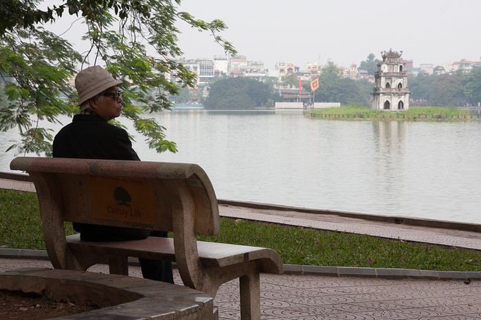
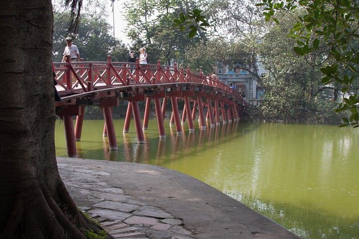
Arrivée matinale à 6h40. J’étais passée par ACA Voyages pour obtenir une lettre d’invitation (24 $) pour nous permettre d’obtenir un visa d’entrée. Les formalités sont vite effectuées au guichet d'immigration (40 € pour nous deux). Après avoir effectué du change (500 euros contre 14 millions de dongs), nous prenons un taxi et nous rendons au Paramount Hotel & Travel, seul hôtel réservé à l’avance pour notre première nuit. Nous débutons notre journée par quelques démarches. Nous nous rendons dans les locaux de l’agence locale pour faire connaissance avec notre conseillère et régler le solde de la prestation. Direction ensuite la gare pour acheter des billets de train pour Tam Coc et Lao Cai. Aucun souci rencontré pour acheter les billets auprès d’un guichetier très aimable. L’après-midi est consacré à la visite d’Hanoi : le lac Hoan Kiem (le lac de l’Epée Restituée) et ses agréables berges.

J’entre dans la danse également et me voici venue vous conter un séjour de 17 jours dans le nord du Vietnam en décembre 2011.
Présentation rapide : nous partons en couple (nos fils de 4 et 3 ans sont confiés à leurs grands- parents). Habitués à voyager en mode autonome, sans réservations à l’avance et privilégiant la conduite d’un véhicule, nous devons changer nos habitudes en raison de l’interdiction faite aux étrangers de louer des véhicules. Nous décidons donc de faire appel aux services d’une agence locale pour nous permettre de visiter le nord du Vietnam à proximité de la frontière chinoise. Nous (enfin je 😇) ajoutons à ce programme la découverte de la région de Sapa, de Tam Coc (la baie d’Ha Long terrestre) et la baie d’Ha Long (avec une surprise pour mon mari). Peu férus des villes, nous visiterons un peu Hanoi le jour de notre arrivée et avant notre départ.
Jour 0 – dimanche 4 décembre
Après avoir fêté les 60 ans et trois jours de mon beau-père autour d’un déjeuner au restaurant, nous nous rendons en fin de journée à Roissy CDG pour un vol direct Paris – Hanoi sur Vietnam Airlines. Pas de souvenir particulier presque dix ans après ce vol 🙂
Jour 1 – lundi 5 décembre
Arrivée matinale à 6h40. J’étais passée par ACA Voyages pour obtenir une lettre d’invitation (24 $) pour nous permettre d’obtenir un visa d’entrée. Les formalités sont vite effectuées au guichet d'immigration (40 € pour nous deux). Après avoir effectué du change (500 euros contre 14 millions de dongs), nous prenons un taxi et nous rendons au Paramount Hotel & Travel, seul hôtel réservé à l’avance pour notre première nuit. Nous débutons notre journée par quelques démarches. Nous nous rendons dans les locaux de l’agence locale pour faire connaissance avec notre conseillère et régler le solde de la prestation. Direction ensuite la gare pour acheter des billets de train pour Tam Coc et Lao Cai. Aucun souci rencontré pour acheter les billets auprès d’un guichetier très aimable. L’après-midi est consacré à la visite d’Hanoi : le lac Hoan Kiem (le lac de l’Epée Restituée) et ses agréables berges.
Itinéraire pour le Cap Nord à moto au départ de Montpellier English translation pending
Bonjour à tous,
En ces temps de confinement (.....), je suis à le recherche de conseils pour un voyage en VFR800 de mi-juin à mi-juillet.
Que me conseillez vous comme itinéraire?
Je partirai de Montpellier en solo, je compte dormir en hôtel économique.
L'équipement du motard?
Le budget?
Merci de votre aide
Patrick
Oregon et Washington, mineur fumeur de 16 ans, que dit la loi? English translation pending
Bonjour,
Je pars un mois au Canada (Vancouver), puis je descends dans le Washington puis l'Oregon.
J'ai 16 ans et suis fumeuse. Que dit la loi de ces Etats? Je n'arrive pas à trouver de vraies reponses...
Merci !
Avis sur voyage depuis la Namibie (Etosha est) jusqu'aux chutes Victoria English translation pending
Bonjour à tous :)
besoin de vos avis et conseils svp.
nous reportons par la force des choses notre séjour en namibie prévu initialement fin juin cette année à l'été prochain.
et histoire de positiver... on aimerait rajouter une semaine à notre voyage prévu :
Nous devions partir 3 semaines et demi. nos dernières nuitées sont à onguma tree top soit partie Est d'etosha.
en rajoutant une semaine, nous aimerions rallier les chutes victoria, que pensez vous de cet itinéraire :
vendredi J22etosha est300samedi J23mahangu safari lodge150dimanche J24mahangu safari lodge150lundi J25camp kwando220mardi J26senyati safari camp250mercredi J27senyati safari camp250jeudi J28chute victoria100vendredi J29chute victoria100samedi J30depart dimanche J31arrivee
sachant que s'il le faut, on peut supprimer la nuit à J22 à onguma ( nous y dormons déjà les 2 nuits précentes ) , donc nuit utilisable ailleurs s'il le faut
colonne tout à droite, le budget estimé pour les lodges.
en terme de budget, pensez vous cela cohérent :
environ 1500 euros concernant les lodges ( et parfois les diners sont inclus )
la location du 4*4 ( à vérifier...) 150 euros pour 8 jours supplémentaires : 1200 euros
j'imagine qu'on aura les billets d'avion un peu plus cher aussi avec un vol multi destination
activités : à la louche : 800 euros ( pas encore regardé ça )
et nourriture, sachant que dans certains lodges certains repas du soir sont compris : 300 euros
soit environ 3800 euros en plus
il faut que je regarde ce qu'il en est pour le passage des différentes frontières ....
l'idée, c'est déjà de savoir si pour vous, c'est réalisable ?
Avez vous des suggestions ? :)
merci :)
besoin de vos avis et conseils svp.
nous reportons par la force des choses notre séjour en namibie prévu initialement fin juin cette année à l'été prochain.
et histoire de positiver... on aimerait rajouter une semaine à notre voyage prévu :
Nous devions partir 3 semaines et demi. nos dernières nuitées sont à onguma tree top soit partie Est d'etosha.
en rajoutant une semaine, nous aimerions rallier les chutes victoria, que pensez vous de cet itinéraire :
vendredi J22etosha est300samedi J23mahangu safari lodge150dimanche J24mahangu safari lodge150lundi J25camp kwando220mardi J26senyati safari camp250mercredi J27senyati safari camp250jeudi J28chute victoria100vendredi J29chute victoria100samedi J30depart dimanche J31arrivee
sachant que s'il le faut, on peut supprimer la nuit à J22 à onguma ( nous y dormons déjà les 2 nuits précentes ) , donc nuit utilisable ailleurs s'il le faut
colonne tout à droite, le budget estimé pour les lodges.
en terme de budget, pensez vous cela cohérent :
environ 1500 euros concernant les lodges ( et parfois les diners sont inclus )
la location du 4*4 ( à vérifier...) 150 euros pour 8 jours supplémentaires : 1200 euros
j'imagine qu'on aura les billets d'avion un peu plus cher aussi avec un vol multi destination
activités : à la louche : 800 euros ( pas encore regardé ça )
et nourriture, sachant que dans certains lodges certains repas du soir sont compris : 300 euros
soit environ 3800 euros en plus
il faut que je regarde ce qu'il en est pour le passage des différentes frontières ....
l'idée, c'est déjà de savoir si pour vous, c'est réalisable ?
Avez vous des suggestions ? :)
merci :)
Le problème c'est de pouvoir rentrer en France à la fin des vacances! English translation pending
Bonjour
Je lis sur les forums de nombreux messages ou l' on se pose la question de partir à l' étranger dans les prochaines semaines .
Mais le problème est surtout de pouvoir revenir en France à la fin de nos vacances .............
En effet certaines compagnies continuent de nous amener dans de nombreuses destinations mais que fait on lorsque les vols retours sont annulés ....??????? sans que l' on vous propose une autre solution ( surtout avec les low coast )
Par exemple , nous rentrons d' Israël ou le gouvernement ferme les frontières progressivement à la majorité des touristes , difficile de rentrer car Easy jet , Ryanair, Air France , Martinair , Lufthansa , El Al et de nombreuses autres compagnies suppriment progressivement leurs vols , après le 14 mars cela va s' averer très compliqué voire très, très compliqué, la frontière avec la Cisjordanie et la Jordanie étant aussi fermée.
Il nous restait peu de solutions passer par Istambul , Athènes, Malte ou Bruxelles .
Nous avons pu partir par Bruxelles à moindre frais .
Il faut donc se poser la question : si l' on part , allons nous pouvoir rentrer ? comment ? et À quel prix ?
Nous étions partis début mars avant que tout s' emballe , mais à présent on a une idée des problèmes :partir s' avéré beaucoup plus simple que rentrer !
On the Silk Road: Chronicles of a Sixty-Something Traveling Completely Independently
From Beijing to Khiva: China, Kyrgyzstan, Tajikistan, Uzbekistan
Chronicle of anecdotes, highlights, and other adventures that marked this eight-week journey in 2018.
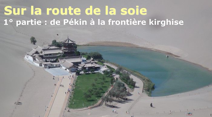
The Chinese Far West More than 30 years after my first trip to eastern China, I finally fulfilled an old dream: traveling solo from Beijing to the far west, discovering Xinjiang, the Uyghur people and the oppression they endure, the oases of Turpan and Kashgar, the Taklamakan Desert, the end of the Great Wall... The route was covered by train.
MENU PART 1: CHINA
1- Beijing (Jiankou) : the authentic Great Wall, without tourists 2- Cycling in Beijing, the best way to get around 3- Beijing : departure for the far west 4- Jiayuguan : getting by without English 5- Jiayuguan : scams and heritage 6- Dunhuang : abundance in the middle of the desert 7- Turpan : the Uyghurs under heavy surveillance 8- Kashgar : love at first sight for the old city 9- Kashgar : China’s recipe for controlling the populace 10- Tashkurgan : what on earth was I thinking going there! Kyrgyz border: a surreal epic Photo album from the 80s, contributions from other travelers (page 2)
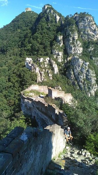
1- JIANKOU Finding the authentic Great Wall, without tourists or a guide Friday, August 24, 2018 Thirty years later, I didn’t feel like revisiting the Great Wall at Badaling or any other overcrowded site. I chose to explore it at Jiankou, in its wildest, most authentic, and unrestored section, starting from a lost village deep in a valley—though it wasn’t *that* lost, since it had everything for communication.
No need to pay for a taxi to get there—by timing it right, you can take the bus for just a few yuan. You have to get off at Xizhazi, the bus terminus. Be careful, there are only two buses a day in each direction. At the Xizhazi bus stop, I met a young couple who’d arrived with zero information about what to expect. We hiked the three of us toward the restored section of Mutianyu.
Still, be cautious With GPS and a topographic map (OpenTopoMap), you can set off without a problem or guide. The trail up to Jiankou is easy and well-marked. The trails down are too. But be careful—once you’re on the Wall, it’s real mountain hiking, with easy but dangerous climbing sections (over sheer drops). Not for amateurs or those afraid of heights! But what a reward. The Wall all to yourself, where it’s at its most daring. Truly mesmerizing.
More photos...
2- BEIJING The best way to get around the capital Sunday, August 26 The best way to explore the city is still by bike. Most are in a bike-share system, but you need to use an app—WeChat, the app that does everything, like monitoring your every move. No way I was installing that.
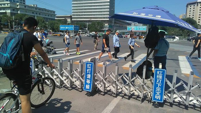
I found one at a rental shop near the hostel. The key is to quickly learn local traffic customs to minimize risks. Bike lanes are wide along the avenues.
But you still have to: - Watch out for anything parked on the bike paths—the most annoying are people napping or talking on the phone in their cars - Keep an eye on everything coming the wrong way—the list is long - The worst is right turns on red, which in Chinese traffic rules seem to have priority Once you get the hang of it, it’s fine. The city is huge but flat, so you can just wing it.
3- BEIJING By train to the far west Sunday, August 26 Beijing West Station is the size and operates like an airport. With your e-ticket from the agency, you first have to pick up your ticket at the special "English" counter, after passing through security. With your ticket in hand, you have to exit and enter through the boarding waiting area—not the platform—after a second security check.
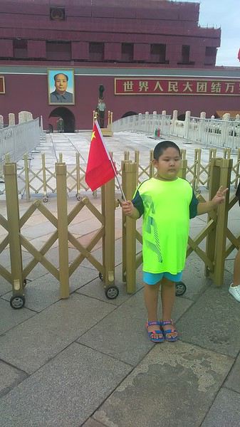 Then you find the right hall and wait for the sign to finally access the platform. In the end, it works pretty well given the incredible number of passengers to manage. Everywhere in Beijing, I saw that the Chinese have mastered crowd flow management.
Nice surprise: second-class carriages are clean, air-conditioned, and bright. Perfect, since I was in for 20 hours. One uniformed attendant per carriage, mobile meal service—luxury! Small downside: no luggage space. Hauling your suitcase up to the top bunk is quite a workout. I was in the middle, so it wasn’t too bad. The landscape, though, whether rural or urban, is pretty bleak. That should change once we leave the eastern plains.
Of course, I got my first police visit, with a thorough passport check and bag search. I was warned—going to the Chinese far west exposes you to this kind of hassle. But they were polite and respectful.
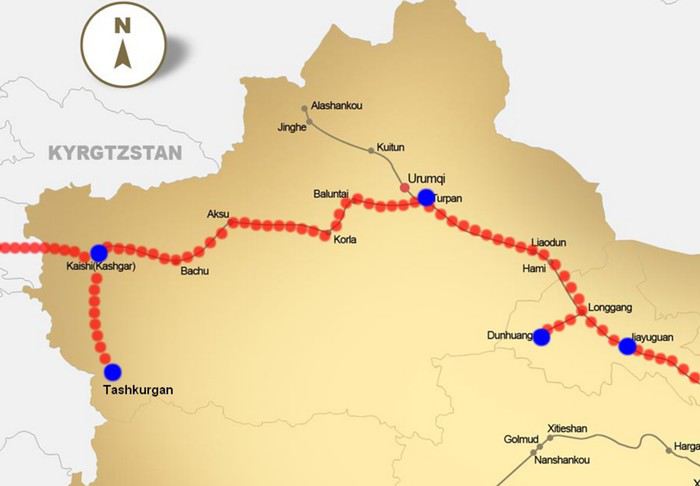 The Chinese Far West
4- JIAYUGUAN Getting by without English Monday, August 27 At the gates of two deserts (Gobi and Taklamakan) and at the foot of the Tibetan highlands, the Great Wall ends at Jiayuguan. Here, I found the deeper China I’d somewhat rediscovered during my bike ride, even if now everyone gets around on electric bikes and I’m no longer stared at like an alien.
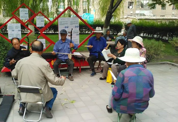
Prices are nothing like Beijing: you can find a full meal for 2 €, and my bike cost 7 € for two days. Plus, few people speak English—neither the owner of the HI hostel where I stayed, nor the ticket sellers at the sites, let alone the servers at the small eateries where I ate. Everything is written in Chinese. So I had to use the little Chinese I know to communicate about essentials. It makes the locals laugh to see a European trying to speak their language, but it earns respect. With Google Translate’s help, I managed.
Rant: With their avenues blocked for construction for kilometers without warning, and new roads not yet on maps, I must’ve taken 15 km of detours. More photos...
5- JIAYUGUAN Scams and heritage Tuesday, August 28 The Great Wall doesn’t exactly end at the fort I visited yesterday but 10 km further, at the entrance to a river gorge at the foot of the mountains. All that’s left is a badly damaged tower (more like a mound of earth) and a section of clay wall, similar to the one I biked yesterday.
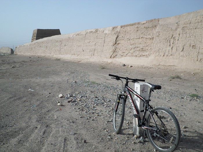
This morning, I hopped on my bike, determined to venture into the desert to see this highly symbolic site. First, you access it via a wide, brand-new road with not a soul in sight. Just before the site, I came across a grand welcome gate, very period-style, but it’s actually the inevitable toll booth.
Behind the gate, the road continues straight to the site, which you can see in the distance—at least 2 km away—the remains of the tower and wall. I had to leave my bike here. Fine. I went to the ticket counter and asked the price: 120 yuan! I couldn’t believe it—over 15 € for a simple mound of earth.
I showed my displeasure to the attendant, who couldn’t care less, and immediately turned back. 120 yuan—that’s the price for a new road, a fancy gate planted 2 km before the site just to force you to take a shuttle, and employees with nothing to do all day... Now I understand why I didn’t meet anyone!
Heritage China is a bit pricey Generally, sites are expensive for the country’s standard of living, but travelers are supposed to have money, so why hold back? I even gave up on the Forbidden City—reservations required days in advance (or on the black market at an impossible price). I prefer to keep the memory of my first visit, when entry must’ve cost a few dozen cents, and there were only a handful of visitors.
This morning, I took a taxi to see remarkable tombs of common people from the 3rd to 6th centuries. They’re small vaulted caves made of painted bricks, depicting scenes of daily life. Very pretty and moving. But even here, though the price was more reasonable, I was left wanting—only one of the 16 tombs is open to visitors, and it’s apparently not the most beautiful.
The authentic China—at least what’s left of it... Wandering the impersonal avenues of the city, you stumble upon a market. There, you still find traditional China—small shops with questionable hygiene, Go players, musicians, and even a dental prosthetist. The last refuge for those untouched by modernity. More photos...
6- DUNHUANG Abundance in the middle of the desert Wednesday, August 29 Well, I thought the landscape would be less bleak as I headed west. Nope. The only distraction in this expanse of dark, clayey sand is the forests of pylons and wind turbines, plus wild camels racing each other.
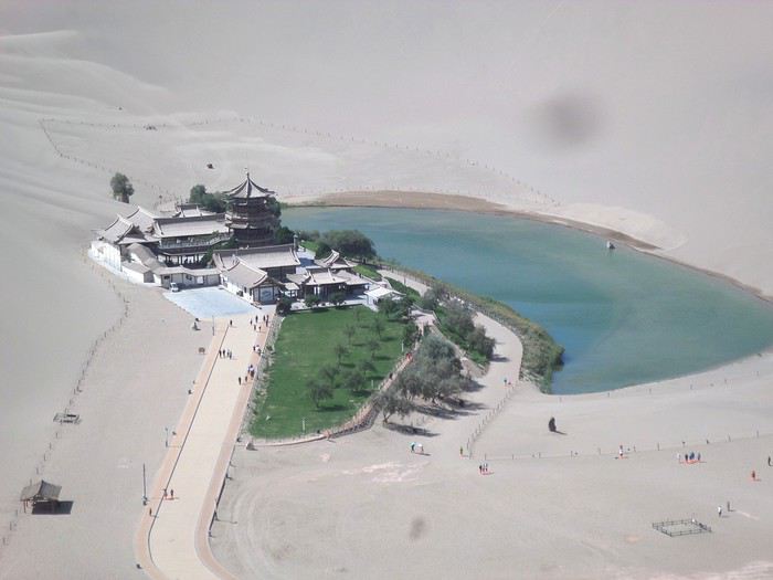 However, Dunhuang, the gateway to the Taklamakan, is by far the most pleasant Chinese city I know. There’s a real city center you can explore on foot. It’s hot but not unbearable, with a light, dry breeze. Much nicer than Beijing. The Han Chinese are still the majority, but the Muslim Uyghurs are more numerous, and the muezzin’s call to prayer echoes around the mosque.
The most surprising thing is the abundance and diversity of fruits and vegetables. You wonder how it all grows here. Well-irrigated, the desert sands are very fertile. Here, raisins have subtle, mysterious flavors, and the lamb really tastes like lamb.
Today, I visited the must-see Mingshashan, a dune complex next to which Pila is a molehill. The Basque Country, but covered in sand... More photos...
7- TURPAN The Uyghurs under heavy surveillance Friday, August 31 Surveillance cameras everywhere in the city, armed police stationed at intersections, in front of public buildings, at the entrance and inside tourist sites, police stations on every corner, patrols on foot or by car, khaki uniforms even for middle schoolers... here, the Han Chinese are in the minority, and you can feel it. Turpan feels like a city under siege.
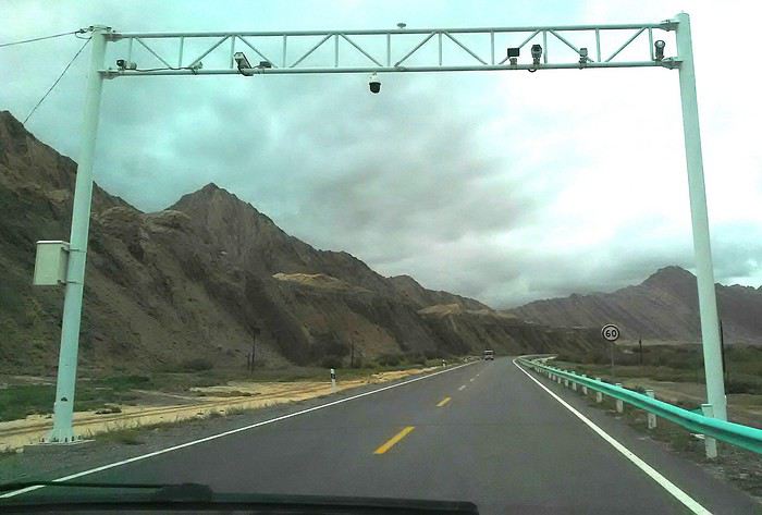
To enter the youth hostel where I stayed, there’s even a security gate, and the receptionist (a Han, like everyone in tourism) wears a bulletproof vest! Reassuring. Still, you don’t feel particularly threatened here, especially as a European. The troublemakers are the Chinese, not the Uyghurs. Generally, China is a very safe country for visitors.
Smile, you’re on camera! I was biking on an avenue when the car in front of me got flashed for driving slowly. I quickly understood why when I got flashed too.
Here, the official time is Beijing time, but it gets dark two hours later. It’ll be even worse in Kashgar. Trickier to manage: everything is displayed in Chinese and Arabic. Nothing in English. Choosing a menu is a shot in the dark. Apart from a few young Chinese, no one here speaks English, and my Chinese doesn’t seem very understandable...
Mogao, the end of the road for the Han Yesterday, near Dunhuang, I went to Mogao, a complex of decorated caves with Buddha sculptures and paintings. Stunning, but so crowded! Luckily, here in Turpan, Chinese tourists barely venture out. So I visited a Silk Road ghost town with only a handful of other visitors and under a howling wind.
The modern Chinese city is swallowing up the old Uyghur neighborhoods—only a museum-like district remains in the center, and pockets of resistance on the outskirts are doomed to disappear soon. More photos...
8- KASHGAR A (relative) love at first sight for the old city Sunday, September 2 After three overnight trains, here I am in the far west of China, nearly 4,000 km from the capital. Despite the omnipresent police and an old city preserved UNESCO-style, Kashgar is my Chinese love at first sight.
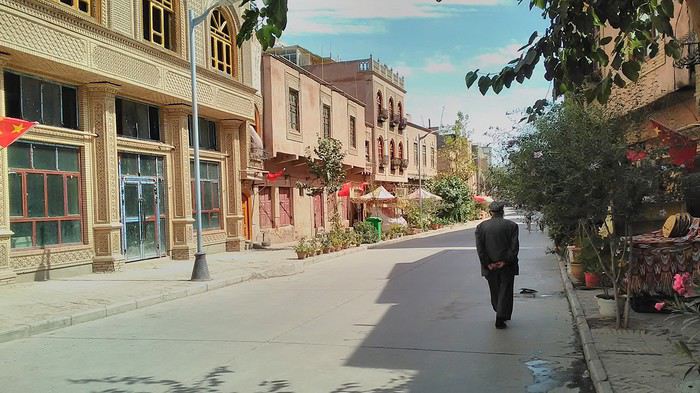
Finally, Chinese... well, sort of, because we’re in Uyghur territory here—a Turkic people with nothing culturally in common with the Han, the eastern Chinese. It started badly yesterday at Turfan station, where after three security gate passes, at least five passport checks, and a bag search, three adorable policewomen confiscated my antibacterial lotion because it had a flammable logo...
Then came the welcoming committee of armed cops at Kashgar station. Once all that was over, they left me alone—except you still have to go through security checks like everyone else to enter the old city, the bazaar, the livestock market... The further west you go, the more the siege mentality is evident. Luckily, the border isn’t far...
Despite the inevitable destruction-reconstruction, the city center has been well preserved. Thankfully, because it’s a very original style, a mix of local and colonial. I love it, even if it’s a bit too artificial, sanitized, and watered-down, and rather empty of residents. On the Silk Road, the city was famous for its great food. And it still is—rarely have I seen such richness and abundance of food! And not just scorpions or snakes. More photos...
9- KASHGAR China’s recipe for controlling the populace Saturday, September 1 Xinjiang, along with Tibet, is a "sensitive" area of rebellion in the eyes of Chinese authorities. As a result, the state has these regions and their populations under total control. Tourists also feel the consequences, even if they’re not at risk of re-education camps.
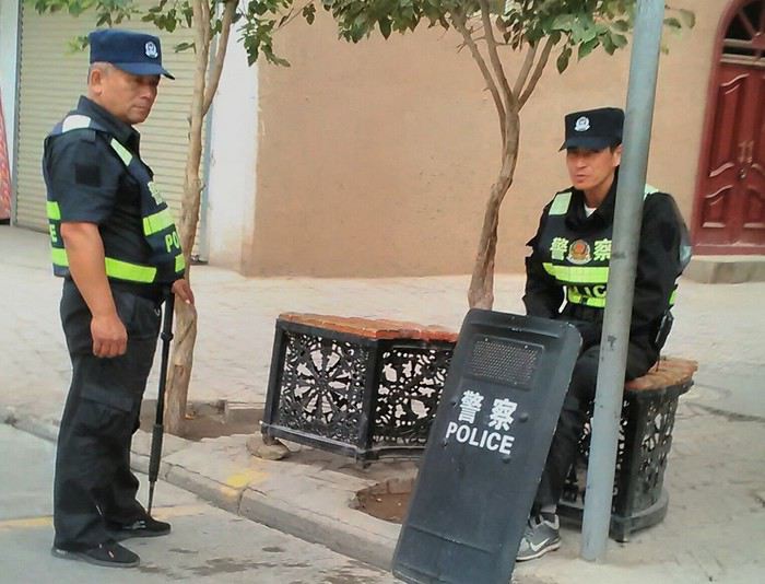 - Putting barbed wire and anti-ramming barriers around sensitive sites (schools, big hotels, government buildings...)
- Installing traffic surveillance gates with cameras and photo flashes (for all vehicles passing, including bikes) throughout the city and even in the countryside
- Posting uniformed guards with tasers, batons, or huge baseball bats every 100 meters
- Training the Han population (ethnic Chinese) in self-defense with sticks, preferably in the morning on the street. Men and women of all ages
- Starting school with the national anthem, doing military exercises, and receiving political indoctrination, all neatly lined up in the courtyard. (The dream school for any teacher)
- Placing a snitch in uniform (a pseudo-guard) in public gathering places, like youth hostels. Mine spends the day loafing around the courtyard
- Putting Chinese flags everywhere on the streets to remind everyone who’s in charge
- Installing security gates at every entrance to areas frequented by tourists (thanks for that) but not just there
- Never photographing cops, or else! I tried, but it’s not easy...
- Putting barbed wire and anti-ramming barriers around sensitive sites (schools, big hotels, government buildings...)
- Installing traffic surveillance gates with cameras and photo flashes (for all vehicles passing, including bikes) throughout the city and even in the countryside
- Posting uniformed guards with tasers, batons, or huge baseball bats every 100 meters
- Training the Han population (ethnic Chinese) in self-defense with sticks, preferably in the morning on the street. Men and women of all ages
- Starting school with the national anthem, doing military exercises, and receiving political indoctrination, all neatly lined up in the courtyard. (The dream school for any teacher)
- Placing a snitch in uniform (a pseudo-guard) in public gathering places, like youth hostels. Mine spends the day loafing around the courtyard
- Putting Chinese flags everywhere on the streets to remind everyone who’s in charge
- Installing security gates at every entrance to areas frequented by tourists (thanks for that) but not just there
- Never photographing cops, or else! I tried, but it’s not easy...
With all that, you can stroll around safely Not much crime! As for the amount the Chinese state spends to maintain such a system, it’s staggering! A third of the Han living in Xinjiang work in security. Today, I wandered freely around old Kashgar, which is quite large after all. More photos...
10- TASHKURGAN What on earth was I thinking going there! Wednesday, September 5 First, there’s the taxi—pretty crappy, with a driver who doesn’t speak a word of English and won’t stop smoking. Over six hours in that... shared with a completely out-of-it American.
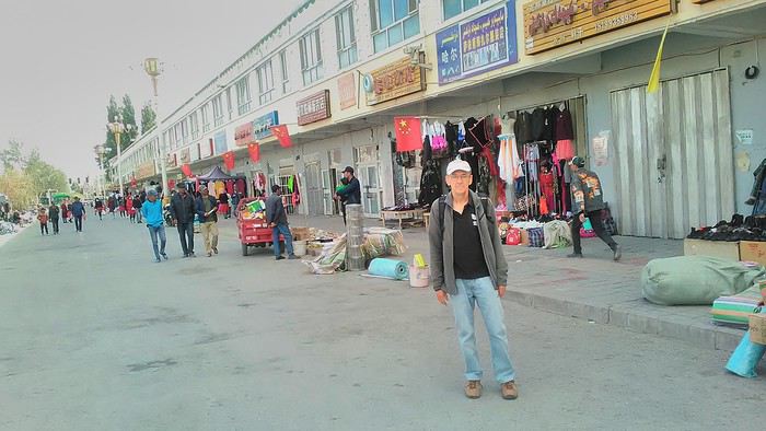
Then there are all the checkpoints along the way. I won’t go on—you know the drill by now.
After that, there’s Tashkurgan—a town with nothing to see, nothing to do. Deserted as soon as night falls. There’s this huge youth hostel and a few lost Chinese tapping away on their smartphones, chain-smoking. This lost American-European crowd, swapping tips on how to enter Pakistan or Tajikistan.
Luckily, there’s the Chinese Pamir Highway, lined with peaks over 7,000m. There’s the feeling of no longer being in China, with a population whose features are Middle Eastern. And these Tajik women with their stunning hairstyles and vibrant costumes. There’s the fact of having reached the westernmost Chinese city, far from crowds and tourist sites. A sort of end of the world. More photos...
11- KYRGYZ BORDER A surreal epic Thursday, September 6 The road from Kashgar to the Kyrgyzstan border is a little over 200 km and passes through beautiful landscapes of colorful, desert-like mountains with acrobatic folds. That’s the bucolic part of the trip.
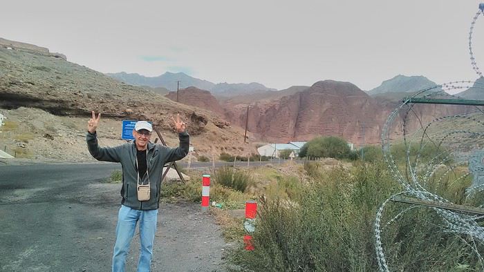 Yesterday, I managed to gather four people to rent a minibus to reach the border more easily: a Spaniard and an Argentine I’d already met in Turpan, and two New Zealanders who responded to the ad left at the hostel.
Absurdity and paranoia of Chinese authorities The highlight was crossing the town of Wuqia, 50 km past Kashgar. After tallying up with my fellow sufferers, we must’ve passed about ten checkpoints with: - Passport checks: 14 times, sometimes by two cops side by side - Bag checks: 4 times - Smartphone checks: 2 times, with deletion of "non-compliant" photos, and registration of your IMEI in the exit log!... Absurd and surreal at the same time, since my camera stayed in my bag, my apps are in French, and my photos have been online for ages...
With all that, we arrived just as the last checkpoint before the no man’s land marking the border between the two countries was on lunch break. And bam! Another 1.5-hour wait, alongside truckers who were much more used to this than we were.
What to think? The cops themselves aren’t fooled. They play the role they’re asked to, but sometimes you can coax a smile out of them—they realize how ridiculous the situation is.
What’s the point? That’s the big question my companions and I were tempted to answer with "to piss people off." To show you your place isn’t here, but with the other tourists, over there in the east, in Shanghai, Xi’an, or Guangzhou.
As for you, a traveler from a democratic country, you really experience this as aggression, humiliation, a violation of your private space. And yet, I’m respected, they speak to me properly. Today, I better understand what a Palestinian or a citizen of an occupied country might feel daily. A unique experience! Thanks, China.
And to top it off, the cherry on the cake! It’s still this glowing button you press to rate your passage after clearing the last obstacle before the exit stamp. I was so surprised it turned off before I could react. The Spaniard, with great humor and irony, had time to vote "excellent." In the end, he wasn’t wrong—you can hardly do better!
PS: I ditched my buddies at the border. They didn’t want to pay for a taxi to continue. So I took a direct taxi to Osh. The first 100 km are fabulous. I couldn’t take many photos, but I’ll be back on Monday to go to Tajikistan.
More photos...
The rest of the Silk Road, Part 2, in these travel journals: Kyrgyzstan, Tajikistan, Uzbekistan.
The Chinese Far West More than 30 years after my first trip to eastern China, I finally fulfilled an old dream: traveling solo from Beijing to the far west, discovering Xinjiang, the Uyghur people and the oppression they endure, the oases of Turpan and Kashgar, the Taklamakan Desert, the end of the Great Wall... The route was covered by train.
MENU PART 1: CHINA
1- Beijing (Jiankou) : the authentic Great Wall, without tourists 2- Cycling in Beijing, the best way to get around 3- Beijing : departure for the far west 4- Jiayuguan : getting by without English 5- Jiayuguan : scams and heritage 6- Dunhuang : abundance in the middle of the desert 7- Turpan : the Uyghurs under heavy surveillance 8- Kashgar : love at first sight for the old city 9- Kashgar : China’s recipe for controlling the populace 10- Tashkurgan : what on earth was I thinking going there! Kyrgyz border: a surreal epic Photo album from the 80s, contributions from other travelers (page 2)
1- JIANKOU Finding the authentic Great Wall, without tourists or a guide Friday, August 24, 2018 Thirty years later, I didn’t feel like revisiting the Great Wall at Badaling or any other overcrowded site. I chose to explore it at Jiankou, in its wildest, most authentic, and unrestored section, starting from a lost village deep in a valley—though it wasn’t *that* lost, since it had everything for communication.
No need to pay for a taxi to get there—by timing it right, you can take the bus for just a few yuan. You have to get off at Xizhazi, the bus terminus. Be careful, there are only two buses a day in each direction. At the Xizhazi bus stop, I met a young couple who’d arrived with zero information about what to expect. We hiked the three of us toward the restored section of Mutianyu.
Still, be cautious With GPS and a topographic map (OpenTopoMap), you can set off without a problem or guide. The trail up to Jiankou is easy and well-marked. The trails down are too. But be careful—once you’re on the Wall, it’s real mountain hiking, with easy but dangerous climbing sections (over sheer drops). Not for amateurs or those afraid of heights! But what a reward. The Wall all to yourself, where it’s at its most daring. Truly mesmerizing.
More photos...
2- BEIJING The best way to get around the capital Sunday, August 26 The best way to explore the city is still by bike. Most are in a bike-share system, but you need to use an app—WeChat, the app that does everything, like monitoring your every move. No way I was installing that.
I found one at a rental shop near the hostel. The key is to quickly learn local traffic customs to minimize risks. Bike lanes are wide along the avenues.
But you still have to: - Watch out for anything parked on the bike paths—the most annoying are people napping or talking on the phone in their cars - Keep an eye on everything coming the wrong way—the list is long - The worst is right turns on red, which in Chinese traffic rules seem to have priority Once you get the hang of it, it’s fine. The city is huge but flat, so you can just wing it.
3- BEIJING By train to the far west Sunday, August 26 Beijing West Station is the size and operates like an airport. With your e-ticket from the agency, you first have to pick up your ticket at the special "English" counter, after passing through security. With your ticket in hand, you have to exit and enter through the boarding waiting area—not the platform—after a second security check.
Then you find the right hall and wait for the sign to finally access the platform. In the end, it works pretty well given the incredible number of passengers to manage. Everywhere in Beijing, I saw that the Chinese have mastered crowd flow management.Nice surprise: second-class carriages are clean, air-conditioned, and bright. Perfect, since I was in for 20 hours. One uniformed attendant per carriage, mobile meal service—luxury! Small downside: no luggage space. Hauling your suitcase up to the top bunk is quite a workout. I was in the middle, so it wasn’t too bad. The landscape, though, whether rural or urban, is pretty bleak. That should change once we leave the eastern plains.
Of course, I got my first police visit, with a thorough passport check and bag search. I was warned—going to the Chinese far west exposes you to this kind of hassle. But they were polite and respectful.
The Chinese Far West4- JIAYUGUAN Getting by without English Monday, August 27 At the gates of two deserts (Gobi and Taklamakan) and at the foot of the Tibetan highlands, the Great Wall ends at Jiayuguan. Here, I found the deeper China I’d somewhat rediscovered during my bike ride, even if now everyone gets around on electric bikes and I’m no longer stared at like an alien.
Prices are nothing like Beijing: you can find a full meal for 2 €, and my bike cost 7 € for two days. Plus, few people speak English—neither the owner of the HI hostel where I stayed, nor the ticket sellers at the sites, let alone the servers at the small eateries where I ate. Everything is written in Chinese. So I had to use the little Chinese I know to communicate about essentials. It makes the locals laugh to see a European trying to speak their language, but it earns respect. With Google Translate’s help, I managed.
Rant: With their avenues blocked for construction for kilometers without warning, and new roads not yet on maps, I must’ve taken 15 km of detours. More photos...
5- JIAYUGUAN Scams and heritage Tuesday, August 28 The Great Wall doesn’t exactly end at the fort I visited yesterday but 10 km further, at the entrance to a river gorge at the foot of the mountains. All that’s left is a badly damaged tower (more like a mound of earth) and a section of clay wall, similar to the one I biked yesterday.
This morning, I hopped on my bike, determined to venture into the desert to see this highly symbolic site. First, you access it via a wide, brand-new road with not a soul in sight. Just before the site, I came across a grand welcome gate, very period-style, but it’s actually the inevitable toll booth.
Behind the gate, the road continues straight to the site, which you can see in the distance—at least 2 km away—the remains of the tower and wall. I had to leave my bike here. Fine. I went to the ticket counter and asked the price: 120 yuan! I couldn’t believe it—over 15 € for a simple mound of earth.
I showed my displeasure to the attendant, who couldn’t care less, and immediately turned back. 120 yuan—that’s the price for a new road, a fancy gate planted 2 km before the site just to force you to take a shuttle, and employees with nothing to do all day... Now I understand why I didn’t meet anyone!
Heritage China is a bit pricey Generally, sites are expensive for the country’s standard of living, but travelers are supposed to have money, so why hold back? I even gave up on the Forbidden City—reservations required days in advance (or on the black market at an impossible price). I prefer to keep the memory of my first visit, when entry must’ve cost a few dozen cents, and there were only a handful of visitors.
This morning, I took a taxi to see remarkable tombs of common people from the 3rd to 6th centuries. They’re small vaulted caves made of painted bricks, depicting scenes of daily life. Very pretty and moving. But even here, though the price was more reasonable, I was left wanting—only one of the 16 tombs is open to visitors, and it’s apparently not the most beautiful.
The authentic China—at least what’s left of it... Wandering the impersonal avenues of the city, you stumble upon a market. There, you still find traditional China—small shops with questionable hygiene, Go players, musicians, and even a dental prosthetist. The last refuge for those untouched by modernity. More photos...
6- DUNHUANG Abundance in the middle of the desert Wednesday, August 29 Well, I thought the landscape would be less bleak as I headed west. Nope. The only distraction in this expanse of dark, clayey sand is the forests of pylons and wind turbines, plus wild camels racing each other.
However, Dunhuang, the gateway to the Taklamakan, is by far the most pleasant Chinese city I know. There’s a real city center you can explore on foot. It’s hot but not unbearable, with a light, dry breeze. Much nicer than Beijing. The Han Chinese are still the majority, but the Muslim Uyghurs are more numerous, and the muezzin’s call to prayer echoes around the mosque.The most surprising thing is the abundance and diversity of fruits and vegetables. You wonder how it all grows here. Well-irrigated, the desert sands are very fertile. Here, raisins have subtle, mysterious flavors, and the lamb really tastes like lamb.
Today, I visited the must-see Mingshashan, a dune complex next to which Pila is a molehill. The Basque Country, but covered in sand... More photos...
7- TURPAN The Uyghurs under heavy surveillance Friday, August 31 Surveillance cameras everywhere in the city, armed police stationed at intersections, in front of public buildings, at the entrance and inside tourist sites, police stations on every corner, patrols on foot or by car, khaki uniforms even for middle schoolers... here, the Han Chinese are in the minority, and you can feel it. Turpan feels like a city under siege.
To enter the youth hostel where I stayed, there’s even a security gate, and the receptionist (a Han, like everyone in tourism) wears a bulletproof vest! Reassuring. Still, you don’t feel particularly threatened here, especially as a European. The troublemakers are the Chinese, not the Uyghurs. Generally, China is a very safe country for visitors.
Smile, you’re on camera! I was biking on an avenue when the car in front of me got flashed for driving slowly. I quickly understood why when I got flashed too.
Here, the official time is Beijing time, but it gets dark two hours later. It’ll be even worse in Kashgar. Trickier to manage: everything is displayed in Chinese and Arabic. Nothing in English. Choosing a menu is a shot in the dark. Apart from a few young Chinese, no one here speaks English, and my Chinese doesn’t seem very understandable...
Mogao, the end of the road for the Han Yesterday, near Dunhuang, I went to Mogao, a complex of decorated caves with Buddha sculptures and paintings. Stunning, but so crowded! Luckily, here in Turpan, Chinese tourists barely venture out. So I visited a Silk Road ghost town with only a handful of other visitors and under a howling wind.
The modern Chinese city is swallowing up the old Uyghur neighborhoods—only a museum-like district remains in the center, and pockets of resistance on the outskirts are doomed to disappear soon. More photos...
8- KASHGAR A (relative) love at first sight for the old city Sunday, September 2 After three overnight trains, here I am in the far west of China, nearly 4,000 km from the capital. Despite the omnipresent police and an old city preserved UNESCO-style, Kashgar is my Chinese love at first sight.
Finally, Chinese... well, sort of, because we’re in Uyghur territory here—a Turkic people with nothing culturally in common with the Han, the eastern Chinese. It started badly yesterday at Turfan station, where after three security gate passes, at least five passport checks, and a bag search, three adorable policewomen confiscated my antibacterial lotion because it had a flammable logo...
Then came the welcoming committee of armed cops at Kashgar station. Once all that was over, they left me alone—except you still have to go through security checks like everyone else to enter the old city, the bazaar, the livestock market... The further west you go, the more the siege mentality is evident. Luckily, the border isn’t far...
Despite the inevitable destruction-reconstruction, the city center has been well preserved. Thankfully, because it’s a very original style, a mix of local and colonial. I love it, even if it’s a bit too artificial, sanitized, and watered-down, and rather empty of residents. On the Silk Road, the city was famous for its great food. And it still is—rarely have I seen such richness and abundance of food! And not just scorpions or snakes. More photos...
9- KASHGAR China’s recipe for controlling the populace Saturday, September 1 Xinjiang, along with Tibet, is a "sensitive" area of rebellion in the eyes of Chinese authorities. As a result, the state has these regions and their populations under total control. Tourists also feel the consequences, even if they’re not at risk of re-education camps.
- Putting barbed wire and anti-ramming barriers around sensitive sites (schools, big hotels, government buildings...)
- Installing traffic surveillance gates with cameras and photo flashes (for all vehicles passing, including bikes) throughout the city and even in the countryside
- Posting uniformed guards with tasers, batons, or huge baseball bats every 100 meters
- Training the Han population (ethnic Chinese) in self-defense with sticks, preferably in the morning on the street. Men and women of all ages
- Starting school with the national anthem, doing military exercises, and receiving political indoctrination, all neatly lined up in the courtyard. (The dream school for any teacher)
- Placing a snitch in uniform (a pseudo-guard) in public gathering places, like youth hostels. Mine spends the day loafing around the courtyard
- Putting Chinese flags everywhere on the streets to remind everyone who’s in charge
- Installing security gates at every entrance to areas frequented by tourists (thanks for that) but not just there
- Never photographing cops, or else! I tried, but it’s not easy...With all that, you can stroll around safely Not much crime! As for the amount the Chinese state spends to maintain such a system, it’s staggering! A third of the Han living in Xinjiang work in security. Today, I wandered freely around old Kashgar, which is quite large after all. More photos...
10- TASHKURGAN What on earth was I thinking going there! Wednesday, September 5 First, there’s the taxi—pretty crappy, with a driver who doesn’t speak a word of English and won’t stop smoking. Over six hours in that... shared with a completely out-of-it American.
Then there are all the checkpoints along the way. I won’t go on—you know the drill by now.
After that, there’s Tashkurgan—a town with nothing to see, nothing to do. Deserted as soon as night falls. There’s this huge youth hostel and a few lost Chinese tapping away on their smartphones, chain-smoking. This lost American-European crowd, swapping tips on how to enter Pakistan or Tajikistan.
Luckily, there’s the Chinese Pamir Highway, lined with peaks over 7,000m. There’s the feeling of no longer being in China, with a population whose features are Middle Eastern. And these Tajik women with their stunning hairstyles and vibrant costumes. There’s the fact of having reached the westernmost Chinese city, far from crowds and tourist sites. A sort of end of the world. More photos...
11- KYRGYZ BORDER A surreal epic Thursday, September 6 The road from Kashgar to the Kyrgyzstan border is a little over 200 km and passes through beautiful landscapes of colorful, desert-like mountains with acrobatic folds. That’s the bucolic part of the trip.
Yesterday, I managed to gather four people to rent a minibus to reach the border more easily: a Spaniard and an Argentine I’d already met in Turpan, and two New Zealanders who responded to the ad left at the hostel.Absurdity and paranoia of Chinese authorities The highlight was crossing the town of Wuqia, 50 km past Kashgar. After tallying up with my fellow sufferers, we must’ve passed about ten checkpoints with: - Passport checks: 14 times, sometimes by two cops side by side - Bag checks: 4 times - Smartphone checks: 2 times, with deletion of "non-compliant" photos, and registration of your IMEI in the exit log!... Absurd and surreal at the same time, since my camera stayed in my bag, my apps are in French, and my photos have been online for ages...
With all that, we arrived just as the last checkpoint before the no man’s land marking the border between the two countries was on lunch break. And bam! Another 1.5-hour wait, alongside truckers who were much more used to this than we were.
What to think? The cops themselves aren’t fooled. They play the role they’re asked to, but sometimes you can coax a smile out of them—they realize how ridiculous the situation is.
What’s the point? That’s the big question my companions and I were tempted to answer with "to piss people off." To show you your place isn’t here, but with the other tourists, over there in the east, in Shanghai, Xi’an, or Guangzhou.
As for you, a traveler from a democratic country, you really experience this as aggression, humiliation, a violation of your private space. And yet, I’m respected, they speak to me properly. Today, I better understand what a Palestinian or a citizen of an occupied country might feel daily. A unique experience! Thanks, China.
And to top it off, the cherry on the cake! It’s still this glowing button you press to rate your passage after clearing the last obstacle before the exit stamp. I was so surprised it turned off before I could react. The Spaniard, with great humor and irony, had time to vote "excellent." In the end, he wasn’t wrong—you can hardly do better!
PS: I ditched my buddies at the border. They didn’t want to pay for a taxi to continue. So I took a direct taxi to Osh. The first 100 km are fabulous. I couldn’t take many photos, but I’ll be back on Monday to go to Tajikistan.
More photos...
The rest of the Silk Road, Part 2, in these travel journals: Kyrgyzstan, Tajikistan, Uzbekistan.
Traverser les Alpes à vélo en partant d'Avignon jusqu'à Turin en avril English translation pending
Bonjour a tous.
J'ai pour projet d'aller a Turin en vélo en partant d'Avignon en Avril, de la je pense aller sur Gap ou Embrun et monter jusqu'à Briançon, mais pour traverser les Alpes j'ai aucune idée des itinéraires conseillés, je suis assez limité dans le temps ( 6 jours ) donc je ne voudrai pas m'attarder, le plus rapide sera le mieux.
Je suis ouvert a vos conseils quel qu’il soit.
Merci d'avance.
J'ai pour projet d'aller a Turin en vélo en partant d'Avignon en Avril, de la je pense aller sur Gap ou Embrun et monter jusqu'à Briançon, mais pour traverser les Alpes j'ai aucune idée des itinéraires conseillés, je suis assez limité dans le temps ( 6 jours ) donc je ne voudrai pas m'attarder, le plus rapide sera le mieux.
Je suis ouvert a vos conseils quel qu’il soit.
Merci d'avance.
Itinéraire Chicago - les Grands Lacs - chutes du Niagara English translation pending
Bonjour à tous
Nous partons 3 semaines en Juillet aux ETATS UNIS
Nous sommes partis plusieurs fois dans cet immense pays, nous partons visiter Chicago, les grands lacs et pourquoi pas les chutes du Niagara.
J'ai déjà acheté les billets d'avions France-Chicago/Chicago-France.
J'aimerais connaître votre avis sur les 2 circuits ci-dessous
Je n'arrive pas à me décider. Ou m'orienter sur Chicago et la régions des grands ou partir vers Detroit, les chutes du Niagara et remonter vers les lacs. Je sais (en ayant potasser le forum )que la route de Chicago à Détroit est monotone. J'ai vu aussi que la douane entre les USA et le Canada peut être longue. J'ai vu aussi que pour la location de la voiture il faut s'orienter sur les compagnies connues pour avoir le droit de traverser la frontières. Mais, est ce un bon choix de rester sur la région des grands lacs ??? Nous aimons la nature et moins les villes.
Qu'en penses-vous ? merci par avance
CIRCUIT 1 CHICAGO/TORONTO/NIAGARA
Jour 1 France / CHICAGO Jour 2 CHICAGO Jour 3 CHICAGO Jour 4 CHICAGO-INDIANA DUNES (80 km) Jour 5 INDIANA DUNES-DETROIT (400 km) Jour 6 DETROIT (visite du musée Ford) Jour 7 DETROIT-NIAGARA Jour 8 Chutes du NIAGARA Jour 9 NIAGARA-TORONTO (200 km) Jour 10 TORONTO visite de la ville Jour 11 TORONTO-PENINSULE DE BRUCE à TOBERMORY (300km) Jour 12 PENINSULE DE BRUCE Jour 13 : PENINSULE DE BRUCE-ILE DE MANITOULIN en FERRY Jour 14 ILE DE MANITOULIN Jour 15 : ILE DE MANITOULIN-SAULT SAINTE MARINE (350 km) Jour 16 : SAULT SAINTE MARIE-MUNISING (200 km) Jour 17 : VISITE DU PARC PICTURED ROCKS NATIONAL LAKESHORE Jour 18 MUNISING-COMTE DE DOOR à EPHRAIM (350km) Jour 19 COMTE DE DOOR- MILWAUKEE (250 km) Jour 20 MILWAUKEE visite de la ville Jour 21 MILWAUKEE-CHICAGO (150 km) VOL en soirée
CIRCUIT 2 CHICAGO ET LES GRANDS LACS
Jour 1: FRANCE-CHICAGO Jour 2 CHICAGO Jour 3 CHICAGO Jour 4 CHICAGO-MILWAUKEE (150 km) Récupérer la voiture de location Jour 5 MIWAUKEE visite de la ville Jour 6 MILWAUKEE-EPHRAIM (3h de route) Jour 7 EPHRAIM Cave Point County Park et Peninsula State Park Peninsula State Park : Visiter le parc à vélo. Belle piste cyclable à travers la forêt en Bord de lac. Halte au phare Eagle Bluff par le Sunset Bike tour en une heure environ Jour 8 EPHRAIM-MARQUETTE (5h de route) Jour 9 PARC PICTURED ROCKS NATIONAL LAKESHORE Dormir à DULUTH Jour 10 DULUTH-GRAND MARAIS (2h de route) Jour 11 GRAND MARAIS-TERACE BAY (3h) Jour 12 TERACE BAY-SAULT SAINTE MARIE 500 km en 2 jours Jour 13 SAULT SAINTE MARIE-SAINT IGNACE (80 km) Jour 14 SAINT IGNACE-MAKINAC ISLAND Ferry Jour 16 MACKINAC ISLAND Jour17 MACKINAC ISLAND-TRAVERSE CITY ferry retour Jour 18 Sleeping Bear Dunes National Park Jour 19 TRAVERSE CITY-SAUGATUCK (3h30) Jour 20 WARREN DUNES STATE PARK Jour 21 WARREN DUNES-CHICAGO (1h30) VOL EN SOIREE
Je n'arrive pas à me décider. Ou m'orienter sur Chicago et la régions des grands ou partir vers Detroit, les chutes du Niagara et remonter vers les lacs. Je sais (en ayant potasser le forum )que la route de Chicago à Détroit est monotone. J'ai vu aussi que la douane entre les USA et le Canada peut être longue. J'ai vu aussi que pour la location de la voiture il faut s'orienter sur les compagnies connues pour avoir le droit de traverser la frontières. Mais, est ce un bon choix de rester sur la région des grands lacs ??? Nous aimons la nature et moins les villes.
Qu'en penses-vous ? merci par avance
CIRCUIT 1 CHICAGO/TORONTO/NIAGARA
Jour 1 France / CHICAGO Jour 2 CHICAGO Jour 3 CHICAGO Jour 4 CHICAGO-INDIANA DUNES (80 km) Jour 5 INDIANA DUNES-DETROIT (400 km) Jour 6 DETROIT (visite du musée Ford) Jour 7 DETROIT-NIAGARA Jour 8 Chutes du NIAGARA Jour 9 NIAGARA-TORONTO (200 km) Jour 10 TORONTO visite de la ville Jour 11 TORONTO-PENINSULE DE BRUCE à TOBERMORY (300km) Jour 12 PENINSULE DE BRUCE Jour 13 : PENINSULE DE BRUCE-ILE DE MANITOULIN en FERRY Jour 14 ILE DE MANITOULIN Jour 15 : ILE DE MANITOULIN-SAULT SAINTE MARINE (350 km) Jour 16 : SAULT SAINTE MARIE-MUNISING (200 km) Jour 17 : VISITE DU PARC PICTURED ROCKS NATIONAL LAKESHORE Jour 18 MUNISING-COMTE DE DOOR à EPHRAIM (350km) Jour 19 COMTE DE DOOR- MILWAUKEE (250 km) Jour 20 MILWAUKEE visite de la ville Jour 21 MILWAUKEE-CHICAGO (150 km) VOL en soirée
CIRCUIT 2 CHICAGO ET LES GRANDS LACS
Jour 1: FRANCE-CHICAGO Jour 2 CHICAGO Jour 3 CHICAGO Jour 4 CHICAGO-MILWAUKEE (150 km) Récupérer la voiture de location Jour 5 MIWAUKEE visite de la ville Jour 6 MILWAUKEE-EPHRAIM (3h de route) Jour 7 EPHRAIM Cave Point County Park et Peninsula State Park Peninsula State Park : Visiter le parc à vélo. Belle piste cyclable à travers la forêt en Bord de lac. Halte au phare Eagle Bluff par le Sunset Bike tour en une heure environ Jour 8 EPHRAIM-MARQUETTE (5h de route) Jour 9 PARC PICTURED ROCKS NATIONAL LAKESHORE Dormir à DULUTH Jour 10 DULUTH-GRAND MARAIS (2h de route) Jour 11 GRAND MARAIS-TERACE BAY (3h) Jour 12 TERACE BAY-SAULT SAINTE MARIE 500 km en 2 jours Jour 13 SAULT SAINTE MARIE-SAINT IGNACE (80 km) Jour 14 SAINT IGNACE-MAKINAC ISLAND Ferry Jour 16 MACKINAC ISLAND Jour17 MACKINAC ISLAND-TRAVERSE CITY ferry retour Jour 18 Sleeping Bear Dunes National Park Jour 19 TRAVERSE CITY-SAUGATUCK (3h30) Jour 20 WARREN DUNES STATE PARK Jour 21 WARREN DUNES-CHICAGO (1h30) VOL EN SOIREE
Avis choix de routes San Diego - Tucson - White Sands en février English translation pending
Bonjour,
Un détour via Julian vaut-il la peine. Si oui quelle serait la meilleure route (paysages), compte tenu que nous serons à la mi février et en voiture ordinaire non SUV.
San Diego route 79, route 78 et route S2 ou via route 111, dormir à Yuma.
Le lendemain nous partirions de Yuma vers Tucson.
Ou bien route directe I8 San Diego jusqu'à Tucson.
Ou bien route I8 jusqu'à Gila Bend, visite rapide le lendemain d'Organ Pipe et route Tucson, mais grand détour pour voir Organ Pipe sans SUV. Sécurité dans ce secteur accolé à la frontière.
Après la visite de Tucson nous nous dirigerons vers White Sands, dans le cadre d'une boucle de trois semaines. Autres questions à venir.
Merci de vos bons conseils.
Ou bien route directe I8 San Diego jusqu'à Tucson.
Ou bien route I8 jusqu'à Gila Bend, visite rapide le lendemain d'Organ Pipe et route Tucson, mais grand détour pour voir Organ Pipe sans SUV. Sécurité dans ce secteur accolé à la frontière.
Après la visite de Tucson nous nous dirigerons vers White Sands, dans le cadre d'une boucle de trois semaines. Autres questions à venir.
Merci de vos bons conseils.
Excursion Kasane - Victoria Falls - Linvingstone English translation pending
Bonjour à tous,
ma compagne et moi partons fin mars pour un roadtrip en Afrique Australe.
Nous passerons 20 jours en Namibie et 12 jours environ répartis entre le nord du Botswana, les Victoria Falls au Zimbabwe et également Livingstone en Zambie.
Ma question concerne ce dernier point. Notre première étape au Botswana est à Kasane où nous avons déjà réservé auprès de notre lodge une visite de Chobe. Nous leur avons aussi soumis une demande concernant les chutes Victoria. Nous aurions souhaité aller à Victoria Falls, traverser la frontière dans l'après-midi pour nous rendre en Zambie et passer le lendemain à Livingston.
Cependant, aucun lodge n'a pu répondre à notre demande. Ceux-ci nous proposent l'aller retour vers VD ou vers Livingstone, mais pas un mix des deux. On nous a suggéré de partir en "excursion" avec les lodges à VF, et de nous débrouiller par nous-mêmes pour le retour. Nous aimerions retourner à Kasane directement depuis Livingston sans repasser par la frontière du Zimbabwé (raisons économiques afin d'éviter le paiement de la double entrée).
Après de nombreuses recherches sur les transports et ce que j'ai pu lire, à part tenter un taxi de Livingstone à Kasungula et refaire la même chose une fois là-bas pour rentrer sur Kasane, je n'ai trouvé aucune option. Cependant, le prix de la course, vu la rareté semble assez élevé.
Quelqu'un pourrait me conseiller d'éventuels transports en commun ou une alternative en vue de pouvoir réaliser cet itinéraire?
Merci d'avance.
Ma question concerne ce dernier point. Notre première étape au Botswana est à Kasane où nous avons déjà réservé auprès de notre lodge une visite de Chobe. Nous leur avons aussi soumis une demande concernant les chutes Victoria. Nous aurions souhaité aller à Victoria Falls, traverser la frontière dans l'après-midi pour nous rendre en Zambie et passer le lendemain à Livingston.
Cependant, aucun lodge n'a pu répondre à notre demande. Ceux-ci nous proposent l'aller retour vers VD ou vers Livingstone, mais pas un mix des deux. On nous a suggéré de partir en "excursion" avec les lodges à VF, et de nous débrouiller par nous-mêmes pour le retour. Nous aimerions retourner à Kasane directement depuis Livingston sans repasser par la frontière du Zimbabwé (raisons économiques afin d'éviter le paiement de la double entrée).
Après de nombreuses recherches sur les transports et ce que j'ai pu lire, à part tenter un taxi de Livingstone à Kasungula et refaire la même chose une fois là-bas pour rentrer sur Kasane, je n'ai trouvé aucune option. Cependant, le prix de la course, vu la rareté semble assez élevé.
Quelqu'un pourrait me conseiller d'éventuels transports en commun ou une alternative en vue de pouvoir réaliser cet itinéraire?
Merci d'avance.
Quelles sont les difficultés pour passer de la Thaïlande au Vietnam? English translation pending
Salut à toutes et tous..
Je vais y faire un séjour d'un mois.
Peut-on aisément partir de la Thaïlande, traverser le Laos pour rejoindre Vietnam et de même pour le retour?
Y a t-il des frais taxes, à payer pour entrer ou sortir?
et milles conseils à me donner…
Merci d'avance.