This adventure began during Covid... Yep, Covid turned a lot of things upside down, but most of all, it kept us cooped up for a few months and stopped us from traveling for a while—even longer for a die-hard fan of the American West like me.
While borders were closed, I started imagining what an ideal itinerary might look like—one that would string together all the Southwest must-sees in just two weeks, during the best time of year: September and October. When the U.S. announced in September 2021 that borders would reopen in the coming weeks, I regained hope and began scouting flight tickets for a departure in September 2022.
But here’s the thing: tackling solo hikes, each one tougher than the last, right in the heart of the Wilderness, could be a risky—even reckless—endeavor for a father of three. After a quick chat with some virtual friends who are just as passionate about the Southwest as I am, with good physical condition and nearly the same list of must-visit spots, Franck and his brother Sullivan were in! 🙂
In November, we snagged flight tickets from Nice to San Francisco for the modest sum of 400 €, and a few days later, I booked a Toyota Tacoma pickup for 840 € !
It’s not cheap for just 15 days, and a pickup isn’t exactly ideal for luggage, but the prices for full-size 4x4s have become totally outrageous! Due to border closures, rental companies had to offload a lot of these big 4x4s, which tourists love. Then, supply and demand did the rest !
Franck and I spent the winter and spring trying to cram the equivalent of three weeks of hikes into two. But even with physical limits, we had to stay reasonable! Three to four months before departure, we entered the lotteries for different must-see spots: The Subway, Coyote Buttes North (home to the famous Wave), and Coyote Buttes South (CBS).
The Wave is the holy grail for any Southwest enthusiast. Since 2015, we’ve tried our luck with the online and on-site lotteries about ten times, but the spots are unfortunately limited: just 20 per day. A glimmer of hope, though—since early 2022, that number has increased to 64 people allowed per day, with 48 spots awarded via the online lottery.
After all three of us tried our luck for The Wave, on June 1st at exactly 5 PM, I got an email that started with, "Congratulations! You were successful in the Coyote Buttes North (The Wave) September 2022 Permit Lottery at Coyote Buttes North (The Wave)...". At 5:01 PM, I called Franck, whose dream it’s been for over 20 years—ever since the first photos were published in a travel magazine! He didn’t believe me when I told him, and I had to forward the email for him to finally accept the unbelievable: we were going to The Wave and all the incredible spots scattered across the protected area of Coyote Buttes North.
I’ve already been to Coyote Buttes South twice, but there are areas I couldn’t explore in the middle of summer because they were too remote. So, I had no trouble letting my buddies convince me to go back for a third time. Plus, given how hard it is to access, we had no trouble securing a permit online as long as we logged in at exactly 8 PM on the dot!
For The Subway, all three of us struck out. No big deal—we won at CBN and CBS!
Among the sites to visit, there are two that I’m particularly attached to because I know my chances of wanting to see them again are slim. The first is Angel Arch, one of the most legendary arches in the Southwest, due to its remoteness from any trace of civilization. To get there, the recommended hike is Upper Salt Creek, and you’re looking at a 50 km round-trip in an area with no water (in September) and populated by bears.
The second site is the Hopi Salt Trail, in Navajo land, which, after a very tough hike, lets you marvel at the turquoise-blue waters of the Little Colorado before it meets the Colorado River. The Hopi Salt Trail is, like The Wave, the holy grail for any Southwest enthusiast, and the windows of opportunity to see the water in that magical color are very short each year. For this, you have to monitor the Little Colorado’s gauges downstream from Cameron: if the level stays at its lowest for 10 consecutive days—meaning no rain—you can hope for turquoise water. The ideal period rarely exceeds 30 days a year, and it’s usually in June that all the stars align.
But unfortunately, one month before departure, while the flow rate at Cameron looked promising, several storms in September dashed our hopes of doing the Hopi Salt Trail, even at the end of the road trip.
We still had two consolation prizes, though:
After a last-minute cancellation, while keeping an eye out for available spots for The Subway, it turned out that three spots opened up exactly on the day we’d planned to go—so we rushed to grab them!!
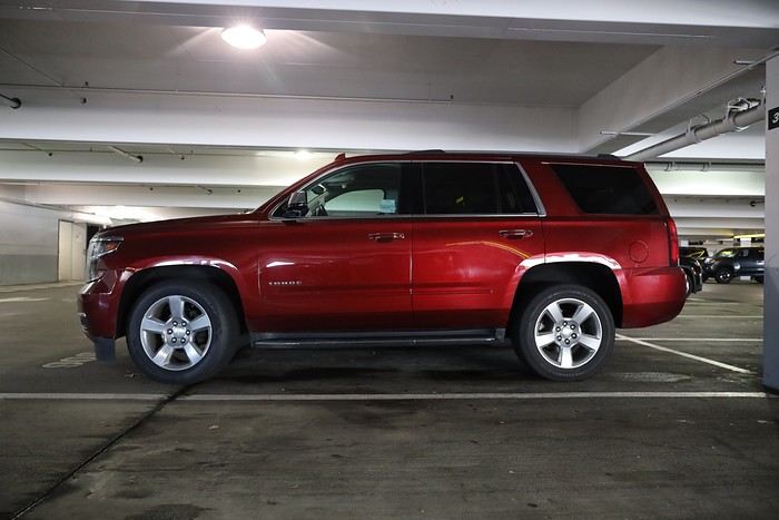
Regarding the 4x4 rental, the prices for full-size models dropped by several hundred dollars, and we ended up finding a Chevrolet Tahoe for less than $1000. A steal and a serious boost in comfort, so we could store all our gear and food without worry!
Here’s the initial plan in a perfect world:
D1 The White Domes - Camping
D2 Sunrise at The White Domes - The Subway
D3 Coyote Buttes North
D4 Coyote Buttes South - White Pocket
D5 Wahweap Hoodoos - Sidestep Canyon - Colourful Canyon - White Rocks - Sunset at Yellow Rock
D6 Broken Bow Arch - Reflection Canyon
D7 Coyote Gulch
D8 The Volcano (or The Oasis - Zebra Slot Canyon if the weather’s good) - North Caineville Mesa
D9 The Needles: Squaw Canyon - Lost Canyon combo - Druid Arch - Chesler Park
D10 Upper Salt Creek Day 1 - Camping
D11 Upper Salt Creek Day 2
D12 Hopi-Navajo Territory: Ha Ho No Geh Canyon, Coal Mine Canyon, Bends of the Little Colorado
D13 Grand Canyon: South Kaibab Trail and Bright Angel Trail
D14 Upper East Zion: East Temple Loop, Jughandle Arch, Center of the Universe, and Checkerboard Mesa Summit
And several backup options in case of bad weather, including Spencer Trail, West Cove, and Buffington Pockets.
Enough talking—time for action!
Original post


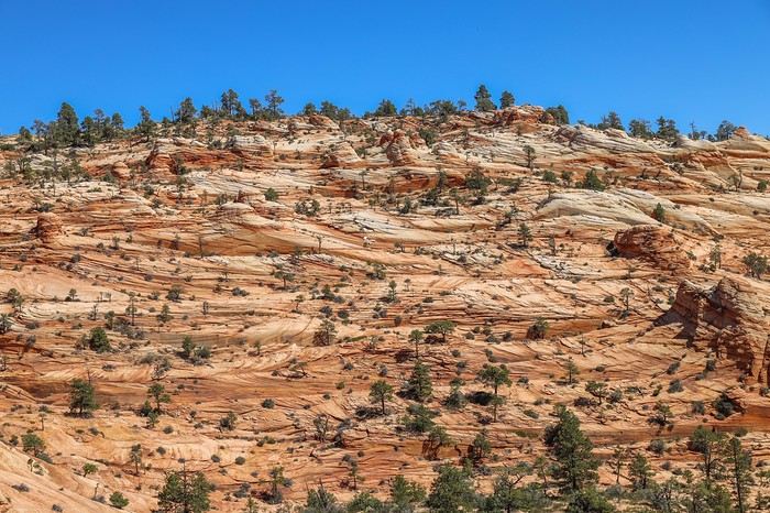
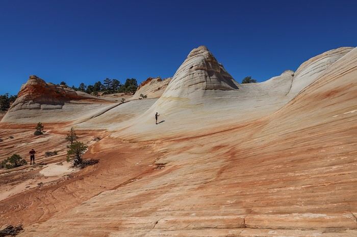

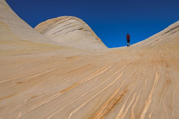 The sun is at its peak, and the rocks appear almost pure white. The base of the domes sometimes shows off orange or even reddish hues—absolutely stunning! It’s magnificent!
The smooth areas alternate with more undulating rock formations.
The sun is at its peak, and the rocks appear almost pure white. The base of the domes sometimes shows off orange or even reddish hues—absolutely stunning! It’s magnificent!
The smooth areas alternate with more undulating rock formations.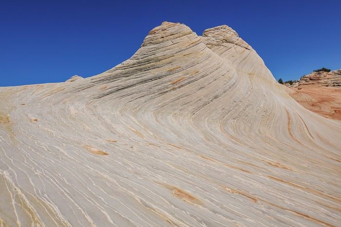
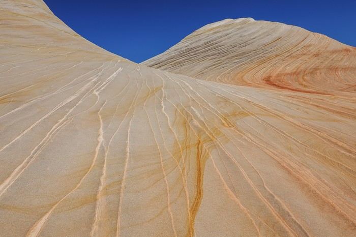
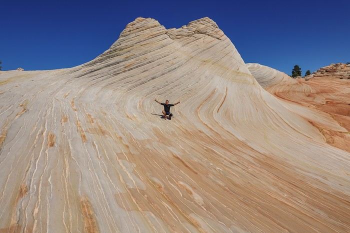
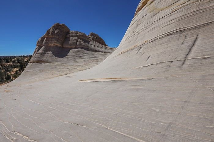
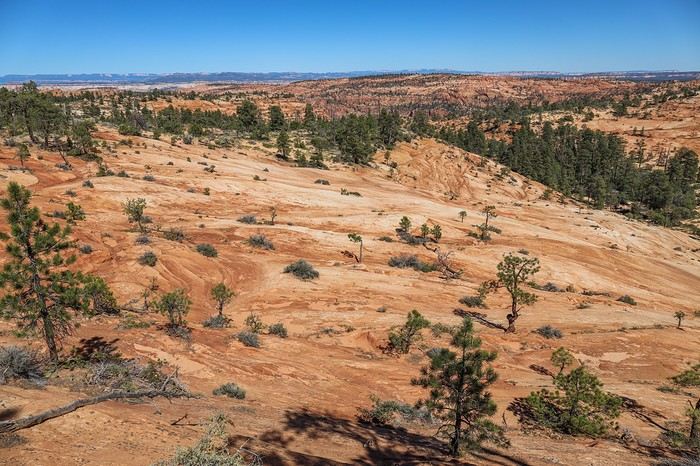 The terrain is trickier than it looks—it keeps pulling us east instead of heading straight north. At one point, we even wonder if the GPS is acting up...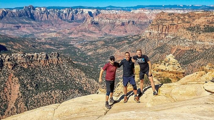

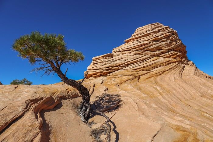
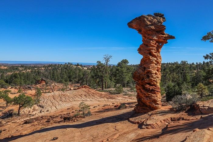
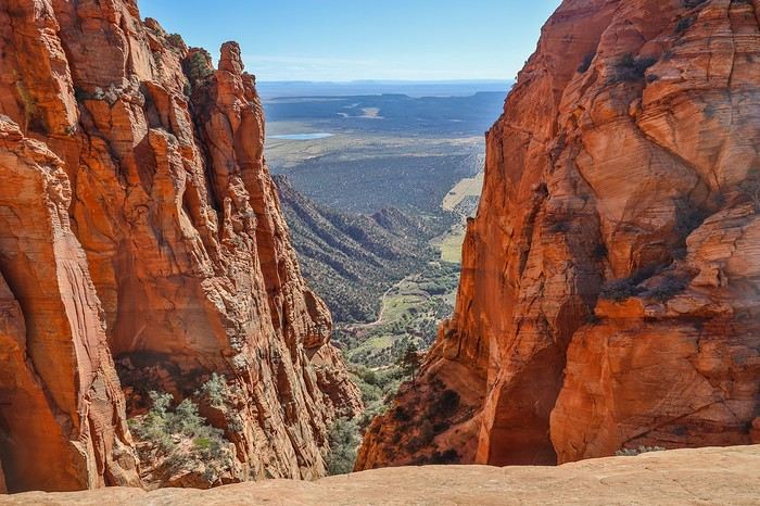
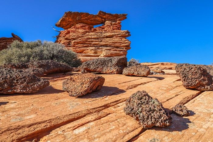 Back at the Domes, we grab our gear and hurry to pitch our tent in one of the few sandy spots. Then, we take advantage of the softer light to admire the White Domes with new hues and deeper contrasts!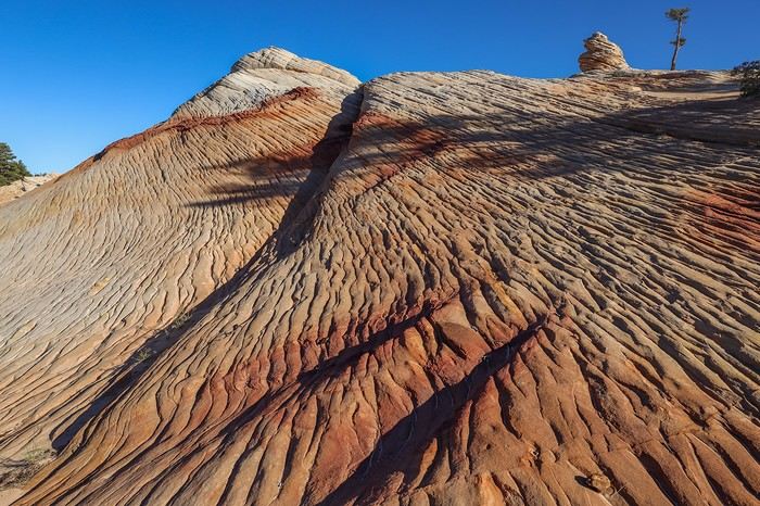
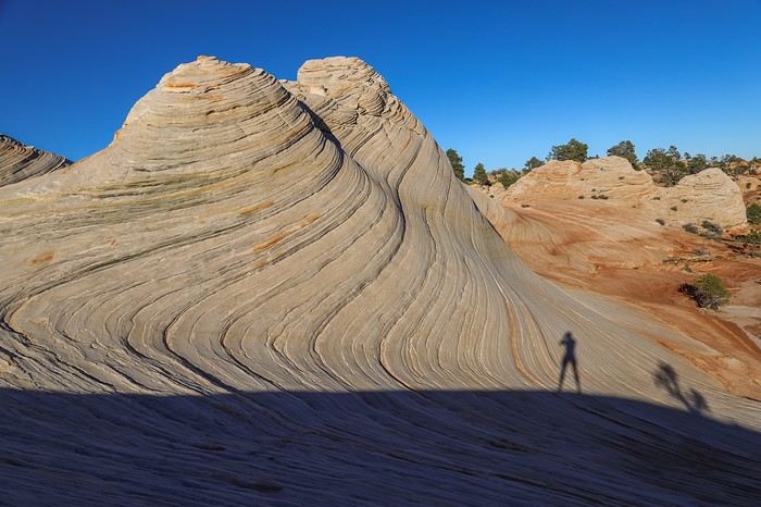
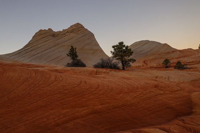 Without the sun, the Domes aren’t quite so "white" anymore. And with the sunrise still to come, there’s a real reason to camp here and enjoy all the different colors and moods the site offers!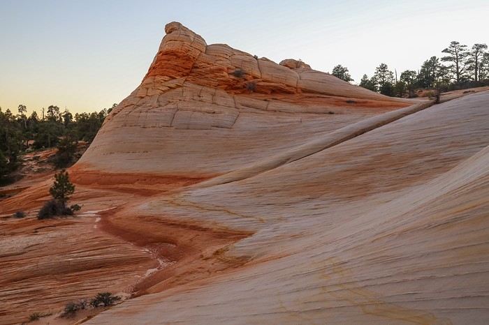
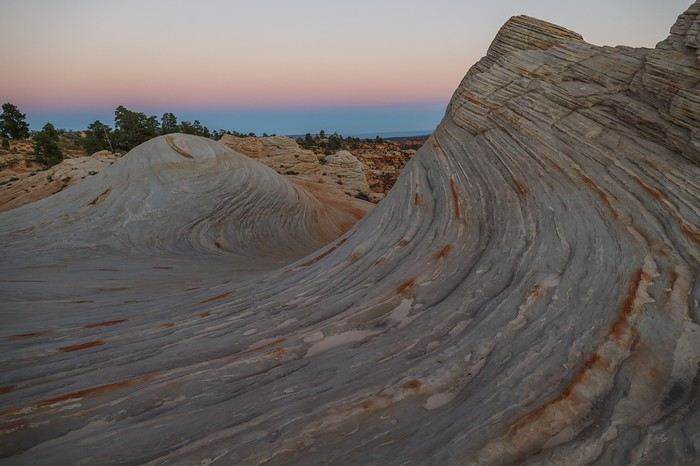
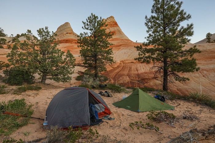
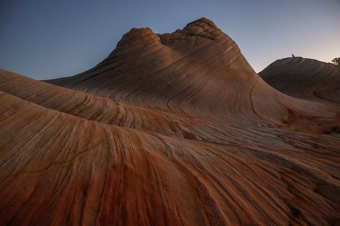
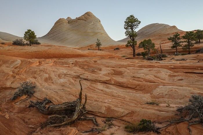 The sun finally peeks out at 7:30 a.m.
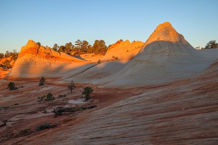 Sullivan takes the chance to fly his drone from the top of a hill, while Franck and I explore the site in every direction.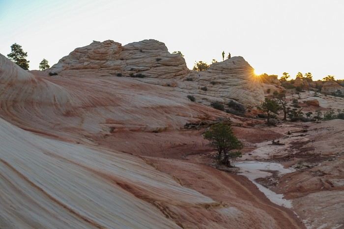
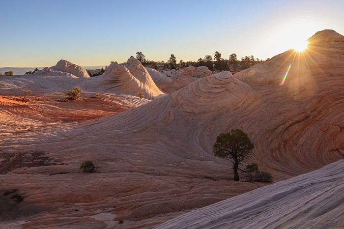 Our intuition from the day before was right... The contrasts, colors, and the overall vibe leave us speechless this morning! What an amazing feeling 😇😇!!
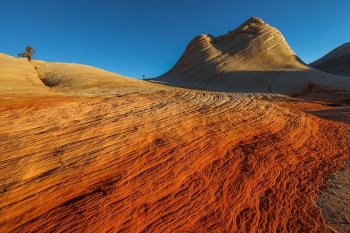 We move through different angles and corners of the site, soaking up every wave of rock.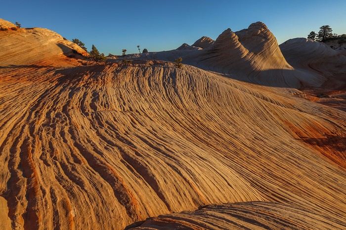
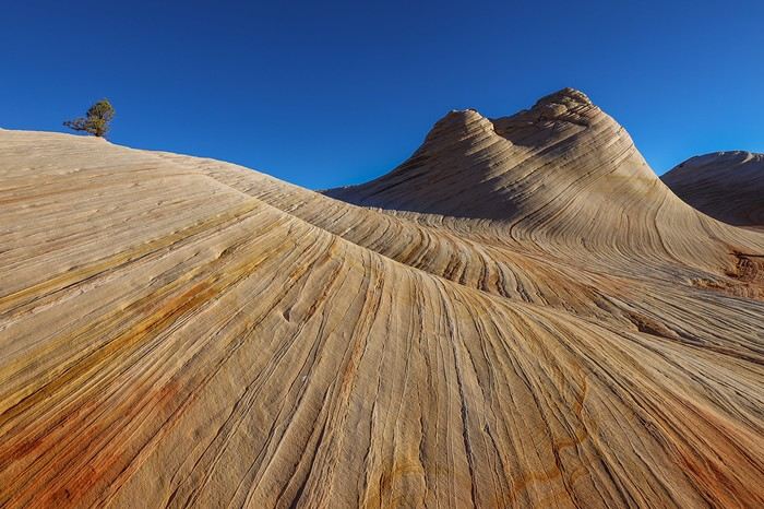 Contrary to what you might think, the site is pretty spread out and isn’t just limited to the most famous Dome.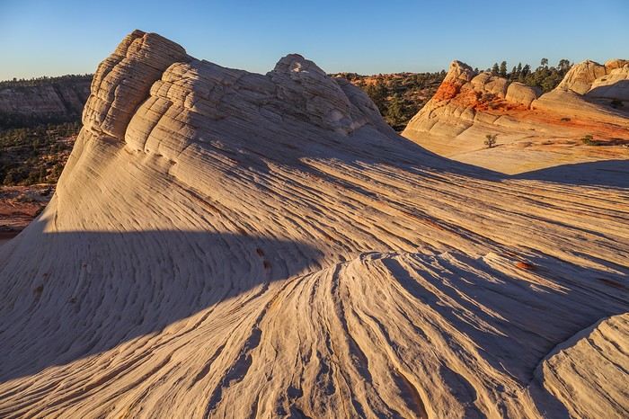
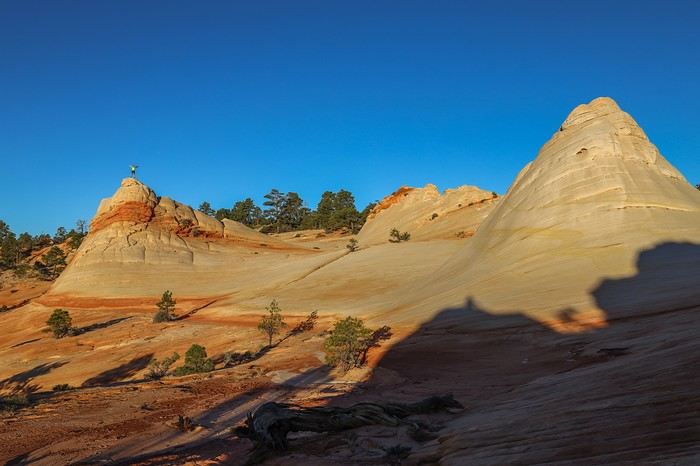 Spotting Franck at the top of the highest hill, I decide to head up there too !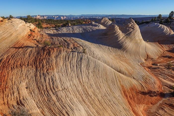
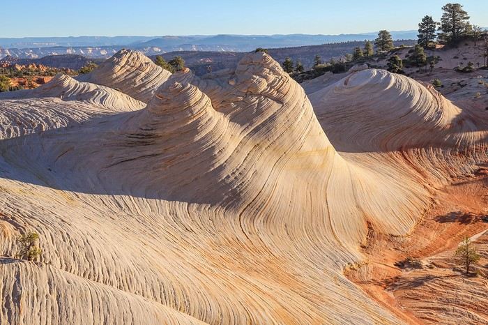 As the minutes pass, the stone hues lighten, and they’ll soon match the colors from yesterday’s midday!
The most beautiful part is definitely the central section with its different ripples, and even a bush playing hide-and-seek depending on the angle.
As the minutes pass, the stone hues lighten, and they’ll soon match the colors from yesterday’s midday!
The most beautiful part is definitely the central section with its different ripples, and even a bush playing hide-and-seek depending on the angle.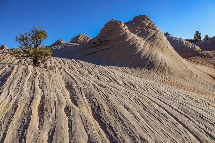 After a solid hour, we gather our things to head back down to civilization—other adventures await us today!
One last glance at this exceptional, unjustly overlooked site. We really made the most of this first visit—certainly not the last...
For the return trip, which is 100% downhill, we don’t dawdle! We even take a more direct route than yesterday and quickly reach the entrance to Water Canyon, which we race down in just a few dozen minutes. A quick refreshing drink stop at the bottom of Water Canyon,
After a solid hour, we gather our things to head back down to civilization—other adventures await us today!
One last glance at this exceptional, unjustly overlooked site. We really made the most of this first visit—certainly not the last...
For the return trip, which is 100% downhill, we don’t dawdle! We even take a more direct route than yesterday and quickly reach the entrance to Water Canyon, which we race down in just a few dozen minutes. A quick refreshing drink stop at the bottom of Water Canyon,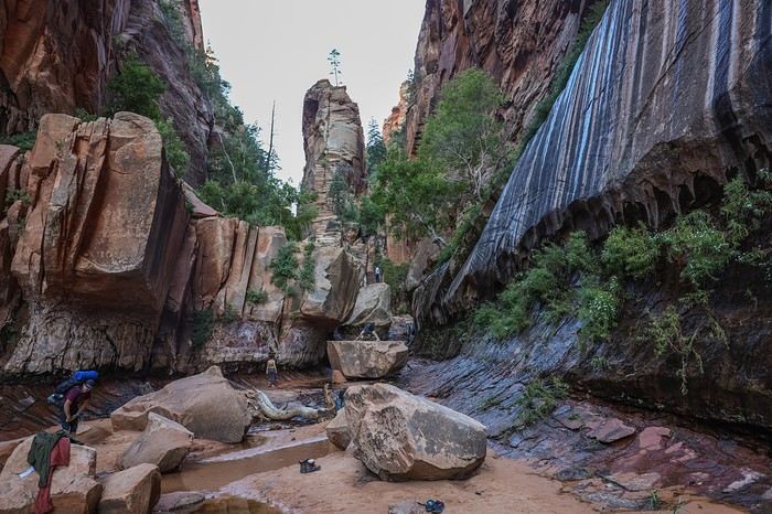 and we’re already back at the car. 8 km of downhill with a few steep sections in just 1h45—we’re not bad at all 😛...
From Hildale, we head back to civilization and make our way to Zion’s Visitor Center to pick up our permits for Left Fork of North Creek, which we lucked into securing a few days before our departure after a last-minute cancellation!
After a good half-hour wait, we get the usual lecture about risking our lives in hostile terrain, needing warm clothes, and how we could die if we get lost... The goal of all these warnings is to discourage tourists from going in flip-flops, which is far from our case.
After an hour wasted on talk, we head out on Kolob Terrace Road and reach The Subway’s parking lot. Darn, it’s packed, and we even have to park on the side of the road... But a full parking lot won’t cool us down or stop us from discovering our second must-see of the trip 😎!!
This 8 km hike along the river—or even *in* the Left Fork of North Creek—is known for being uninteresting for the first... 7 km. Oh, come on! Walking just for the sake of walking isn’t really our thing, so the final spot better be worth it !
Just a few hundred meters in, we reach the start of a steep canyon we have to descend into. We’re already thinking about the climb back up that’ll make our calves burn...
And there we are on a super well-marked trail (impossible to get lost) that we follow on a slight incline without difficulty—except for the length. The trail alternates between sections right by the river, river crossings, and a few rocky stretches farther from the water that slow us down.
I can confirm the first 6 km are boring unless you’re a fan of river water. The only distraction is all the groups of hikers we pass heading back. They must’ve had nothing else to do today. Our schedule was packed—we had Sunrise at White Domes this morning!
And it’s only after 1h15 that we see our first mini waterfall. Twenty minutes later, we come across another one worth the detour.
Then, as the minutes pass, we slow down because the scenery is stunning!
Even this late in the season, the river with its succession of mini waterfalls is super photogenic and worth the hike on its own. Given how fragile the site is, it makes sense why access to The Subway is limited in terms of visitors!
and we’re already back at the car. 8 km of downhill with a few steep sections in just 1h45—we’re not bad at all 😛...
From Hildale, we head back to civilization and make our way to Zion’s Visitor Center to pick up our permits for Left Fork of North Creek, which we lucked into securing a few days before our departure after a last-minute cancellation!
After a good half-hour wait, we get the usual lecture about risking our lives in hostile terrain, needing warm clothes, and how we could die if we get lost... The goal of all these warnings is to discourage tourists from going in flip-flops, which is far from our case.
After an hour wasted on talk, we head out on Kolob Terrace Road and reach The Subway’s parking lot. Darn, it’s packed, and we even have to park on the side of the road... But a full parking lot won’t cool us down or stop us from discovering our second must-see of the trip 😎!!
This 8 km hike along the river—or even *in* the Left Fork of North Creek—is known for being uninteresting for the first... 7 km. Oh, come on! Walking just for the sake of walking isn’t really our thing, so the final spot better be worth it !
Just a few hundred meters in, we reach the start of a steep canyon we have to descend into. We’re already thinking about the climb back up that’ll make our calves burn...
And there we are on a super well-marked trail (impossible to get lost) that we follow on a slight incline without difficulty—except for the length. The trail alternates between sections right by the river, river crossings, and a few rocky stretches farther from the water that slow us down.
I can confirm the first 6 km are boring unless you’re a fan of river water. The only distraction is all the groups of hikers we pass heading back. They must’ve had nothing else to do today. Our schedule was packed—we had Sunrise at White Domes this morning!
And it’s only after 1h15 that we see our first mini waterfall. Twenty minutes later, we come across another one worth the detour.
Then, as the minutes pass, we slow down because the scenery is stunning!
Even this late in the season, the river with its succession of mini waterfalls is super photogenic and worth the hike on its own. Given how fragile the site is, it makes sense why access to The Subway is limited in terms of visitors!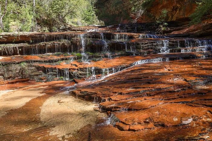
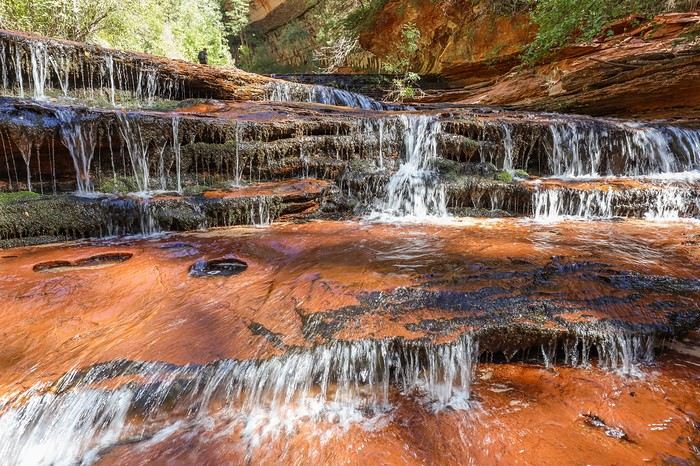 Then we reach the series of bends that mark the entrance to The Subway. We pass a group, hoping they’re the last.
Then we arrive at the entrance to The Subway—unmistakable!
Then we reach the series of bends that mark the entrance to The Subway. We pass a group, hoping they’re the last.
Then we arrive at the entrance to The Subway—unmistakable!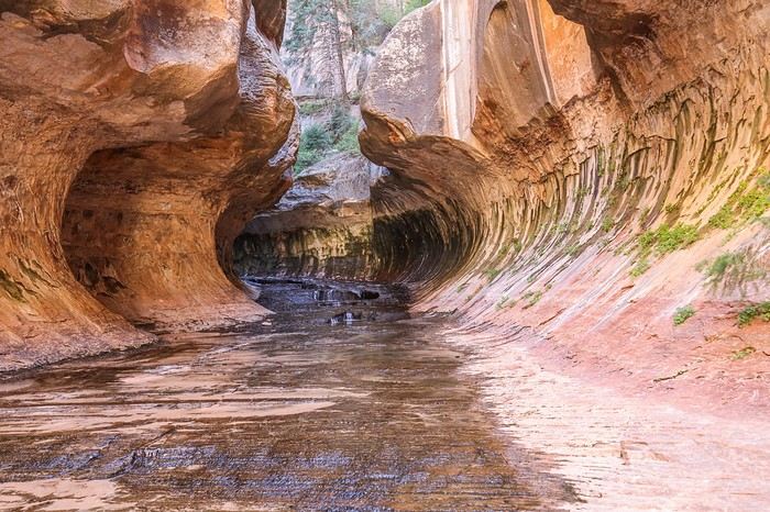 We discover a multitude of icy pools, and we have to move very carefully because the ground is *super* slippery!
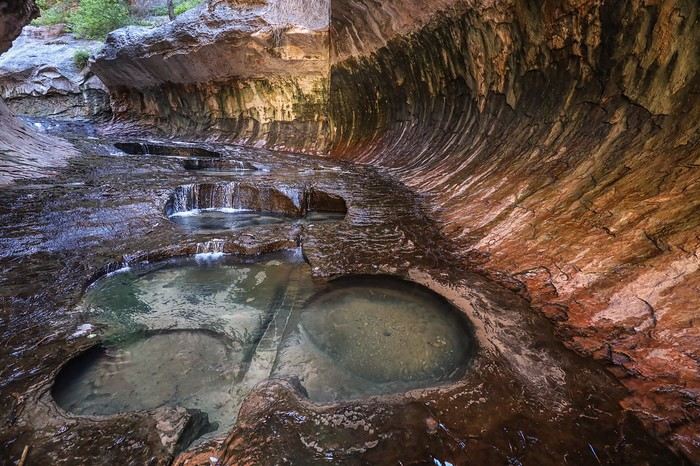 At the very end, we spot hikers descending the canyon doing canyoning. Lucky them!!
We settle for turning around, and then—visual shock! There it is, the famous view of The Subway that we’ve all seen on Windows wallpapers!
At the very end, we spot hikers descending the canyon doing canyoning. Lucky them!!
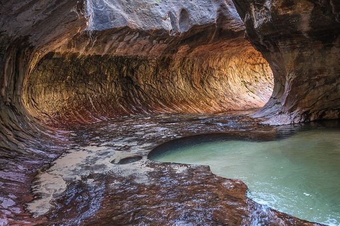
We settle for turning around, and then—visual shock! There it is, the famous view of The Subway that we’ve all seen on Windows wallpapers!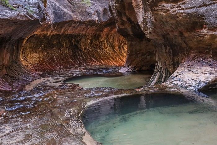 It’s gorgeous, but I have to admit the luminous halo of The Subway is prettier in photos than in person. A bit like Antelope Canyon!
But we’re not going to complain—we shoot this exceptional spot as it deserves! Franck even risks a skinny-dip in an icy pool that’s barely 10°C! I’ll avoid censorship and won’t post the photos...
It’s gorgeous, but I have to admit the luminous halo of The Subway is prettier in photos than in person. A bit like Antelope Canyon!
But we’re not going to complain—we shoot this exceptional spot as it deserves! Franck even risks a skinny-dip in an icy pool that’s barely 10°C! I’ll avoid censorship and won’t post the photos...
 It’s time to head back because, without realizing it, we’ve already covered 16 km, and we still have 8 km to go to reach the car.
For the return trip, we decide to skip the trail with its slightly steep sections and go straight through the river. In math, we’ve always been taught that the shortest distance between two points is a straight line, so we stuff everything from our pockets into our backpacks, and when the sides get too tricky, we make quick progress in the river. The water’s cold, reaching up to our waists at most, but it’s refreshing, especially since we’re still moving at an average of 5 km/h. We pass quite a few people we’d seen on the way in, and on the super steep climb, it’s even worse—we leave them in the dust. Thanks to Sullivan’s military pace at the front, it only takes us 1h30 to cover those 8 km, including the river sections and the steep climb out of the canyon.
It’s time to head back because, without realizing it, we’ve already covered 16 km, and we still have 8 km to go to reach the car.
For the return trip, we decide to skip the trail with its slightly steep sections and go straight through the river. In math, we’ve always been taught that the shortest distance between two points is a straight line, so we stuff everything from our pockets into our backpacks, and when the sides get too tricky, we make quick progress in the river. The water’s cold, reaching up to our waists at most, but it’s refreshing, especially since we’re still moving at an average of 5 km/h. We pass quite a few people we’d seen on the way in, and on the super steep climb, it’s even worse—we leave them in the dust. Thanks to Sullivan’s military pace at the front, it only takes us 1h30 to cover those 8 km, including the river sections and the steep climb out of the canyon.


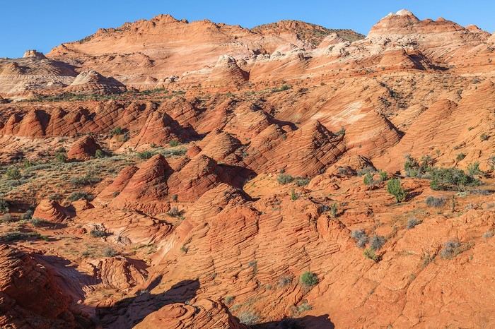
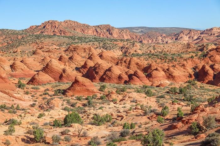 Along the way, we take a slight detour of about a hundred meters to visit The Hooters (N37.00546° W112.00933°), a beautiful amphitheater we walk around. Franck circles the whole thing, following the striations to get as close as possible to the teepees.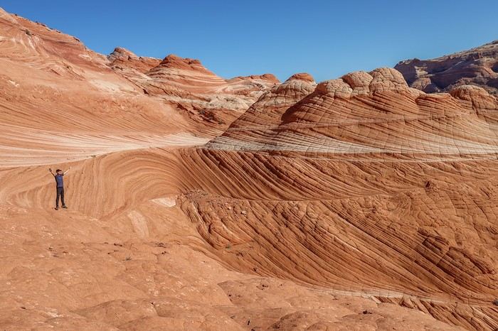
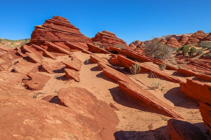
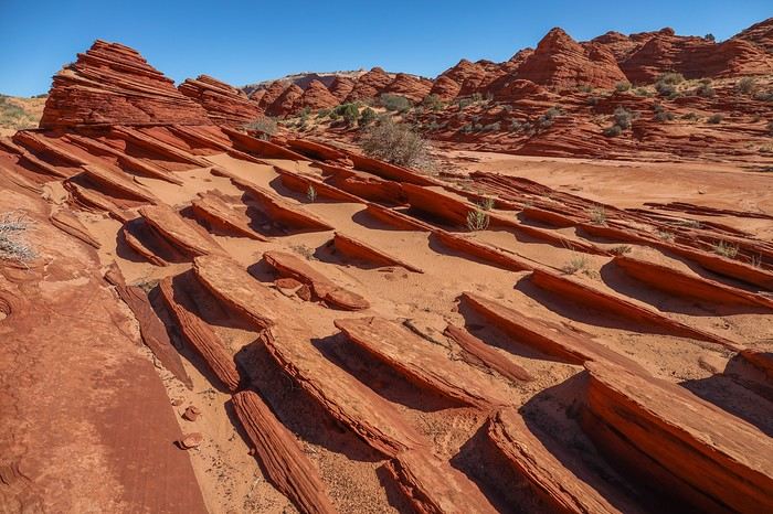 Next up: the Ginger Rocks, a group of hoodoos with unique purplish hues (N36.99744° W112.00544°).
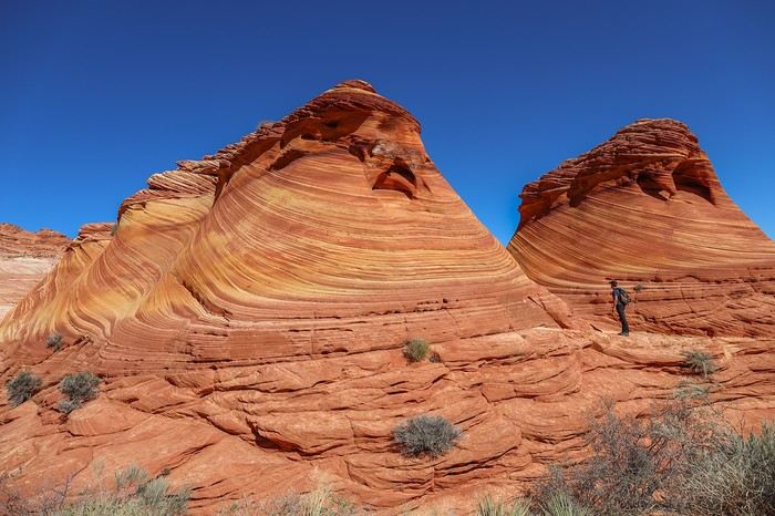 Climbing the slope of these hoodoos isn’t easy, even with the grip of our Speedcross!
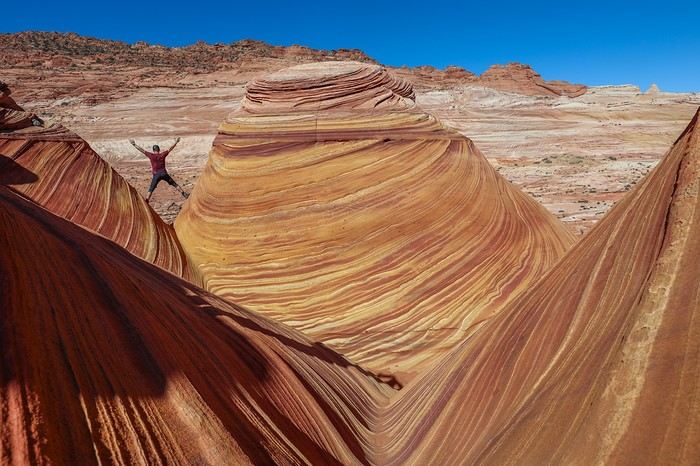 After another fifteen minutes of walking and a final short climb of a few dozen meters, it’s nearly noon, and we arrive at one of the two possible entrances to The Wave.
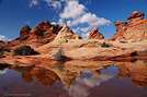
The recent rains have formed a huge pool in front of the entrance, offering super photogenic reflections. We’re over the moon, spending a good twenty minutes snapping as many photos as possible. 😇😇😇
After another fifteen minutes of walking and a final short climb of a few dozen meters, it’s nearly noon, and we arrive at one of the two possible entrances to The Wave.
The recent rains have formed a huge pool in front of the entrance, offering super photogenic reflections. We’re over the moon, spending a good twenty minutes snapping as many photos as possible. 😇😇😇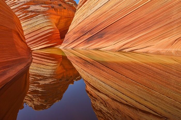
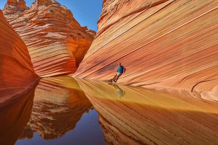 While we’re taking photos, an older gentleman—probably close to 70—arrives, dressed like a ranger. He’s definitely not the type to chase after us if we’d come without a permit and decided to run away.
We start chatting, and seeing how passionate we seemed, he asked if I knew the site Waveinfo. To that, I replied: "Are you William Belvin?!". Huge surprise 😮 😮!! Bill figured I knew his site well and wasn’t a little proud!
Still, he diligently checked our permits... 😏!!
Once our permits were verified, we decided to go around the butte and take a corridor leading to The Wave. Beautiful patterns decorate this passage,
While we’re taking photos, an older gentleman—probably close to 70—arrives, dressed like a ranger. He’s definitely not the type to chase after us if we’d come without a permit and decided to run away.
We start chatting, and seeing how passionate we seemed, he asked if I knew the site Waveinfo. To that, I replied: "Are you William Belvin?!". Huge surprise 😮 😮!! Bill figured I knew his site well and wasn’t a little proud!
Still, he diligently checked our permits... 😏!!
Once our permits were verified, we decided to go around the butte and take a corridor leading to The Wave. Beautiful patterns decorate this passage,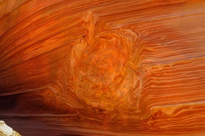 [....]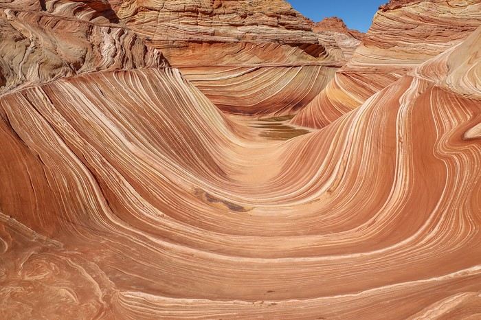
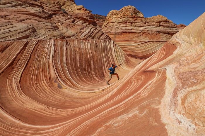
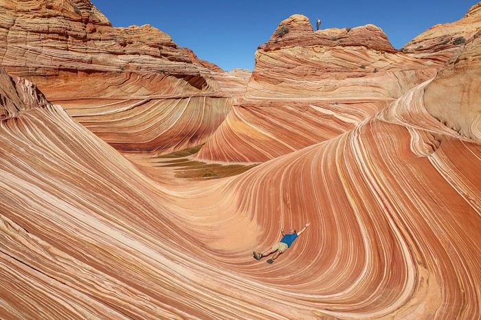 It’s noon, the perfect time, and despite potentially 60 other people being there, we’re almost alone!
Only one group is still around, and two other visible groups are already positioned higher up. Everyone must have rushed to the wave early this morning, and we’re the last ones here, savoring these precious moments!
Bill still being in the area, I take the opportunity to get a photo with him... 🙂
It’s noon, the perfect time, and despite potentially 60 other people being there, we’re almost alone!
Only one group is still around, and two other visible groups are already positioned higher up. Everyone must have rushed to the wave early this morning, and we’re the last ones here, savoring these precious moments!
Bill still being in the area, I take the opportunity to get a photo with him... 🙂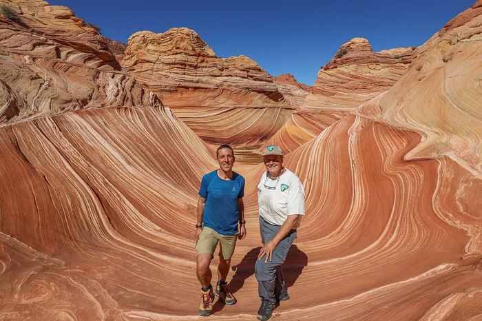 Our stomachs growling with hunger, we have a picnic on the spot with a 5-star view.
Then, we decide to climb to the top of Top Rock for a bird’s-eye view of The Wave.
On the way, we linger in an area with some really cool mushroom-shaped rocks.
Our stomachs growling with hunger, we have a picnic on the spot with a 5-star view.
Then, we decide to climb to the top of Top Rock for a bird’s-eye view of The Wave.
On the way, we linger in an area with some really cool mushroom-shaped rocks.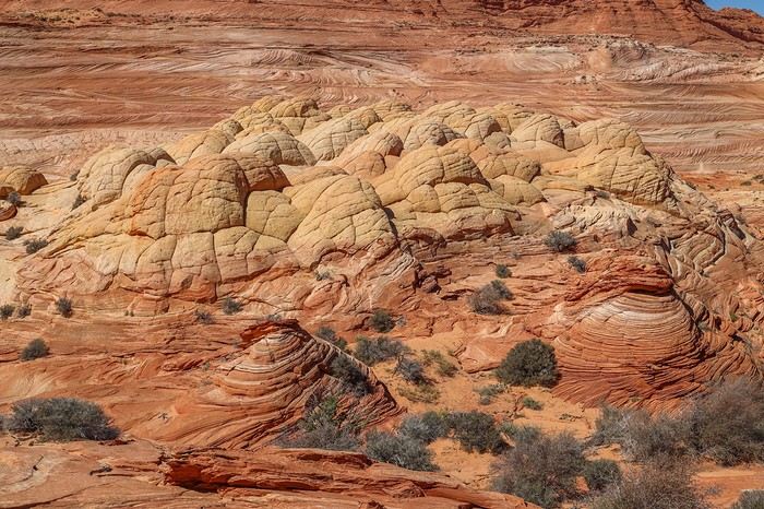 The climb is steep but quick, and from up there, the panoramic view is stunning!
A bird’s-eye view of the heart of the wave, with Bill Belvin having fun taking photos—even though he must’ve been here at least 100 times by now !
The climb is steep but quick, and from up there, the panoramic view is stunning!
A bird’s-eye view of the heart of the wave, with Bill Belvin having fun taking photos—even though he must’ve been here at least 100 times by now !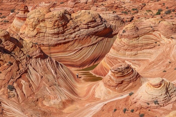
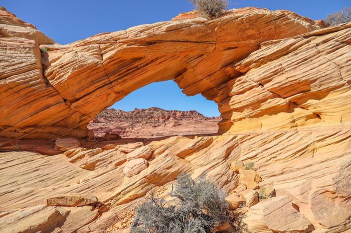
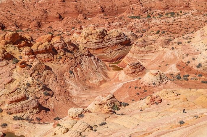 The next stop is The Alcove. Along the way, the rocks are unique with freckle-like spots, then a new arch or window, this time much larger.
 The Alcove is actually a double alcove with a sand dune in the middle. Franck and I had hesitated about including The Great Chamber in our itinerary but ultimately decided against it since I’d already been there with family last July.
No regrets for Franck in the end, as the yellowish and pinkish hues of one of the alcoves are gorgeous. Another spot that’s worth the visit on its own and would be overcrowded if it weren’t for the permit requirement!!
The Alcove is actually a double alcove with a sand dune in the middle. Franck and I had hesitated about including The Great Chamber in our itinerary but ultimately decided against it since I’d already been there with family last July.
No regrets for Franck in the end, as the yellowish and pinkish hues of one of the alcoves are gorgeous. Another spot that’s worth the visit on its own and would be overcrowded if it weren’t for the permit requirement!!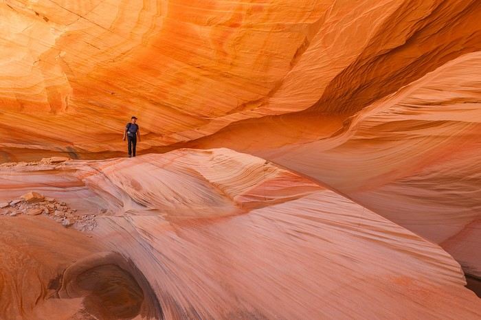
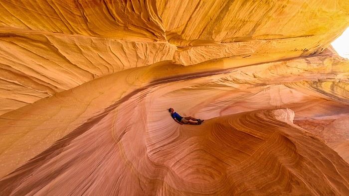 [....]
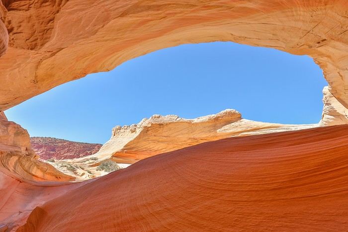 Here’s a view of the second alcove, less deep than the first, but the visual effect is excellent, with a real Great Chamber vibe!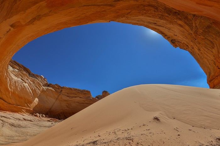
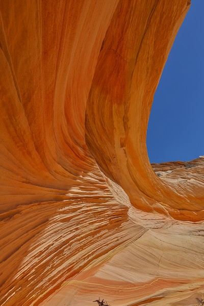 Next, we continue toward Melody Arch (N36.99104° W112.00555°).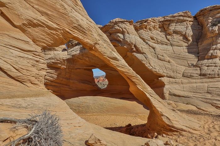
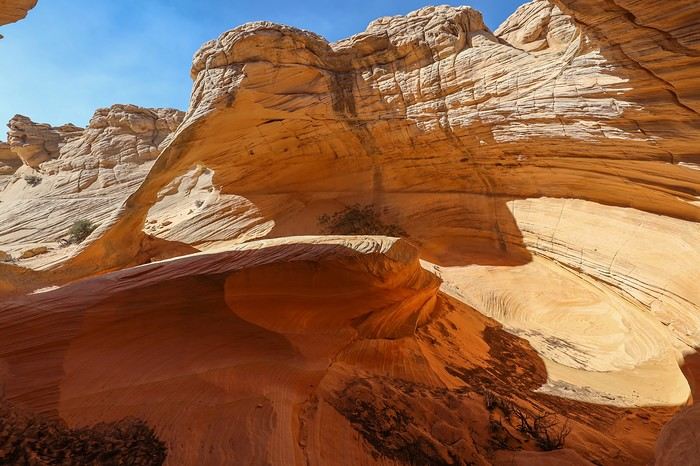
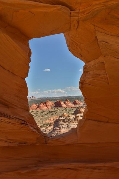 Time’s flying today—it’s already 3:30 PM, and we need to pick up the pace to see Hamburger Rock (N36.98954° W112.00195°).
Moving by feel with only the GPS point for this famous rock, we eventually reach it via a higher plateau. Unfortunately, there’s no way down from this plateau to face Hamburger Rock without taking a huge detour.
Time’s flying today—it’s already 3:30 PM, and we need to pick up the pace to see Hamburger Rock (N36.98954° W112.00195°).
Moving by feel with only the GPS point for this famous rock, we eventually reach it via a higher plateau. Unfortunately, there’s no way down from this plateau to face Hamburger Rock without taking a huge detour.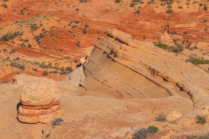
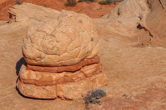 Since it’s 4 PM and we *have* to be at Second Wave for sunset, we decide to settle for this viewpoint and turn back.
More unique rock formations...
Since it’s 4 PM and we *have* to be at Second Wave for sunset, we decide to settle for this viewpoint and turn back.
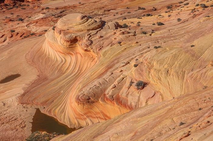
More unique rock formations...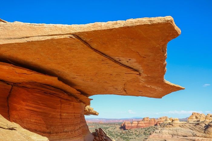 Second Wave comes into view quickly, but we have to descend the entire rock formation, which means we’re "forced" to pass through the Wave again.
 [....]


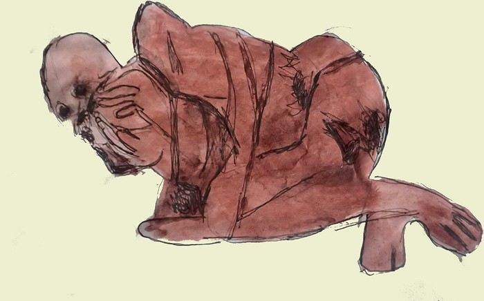
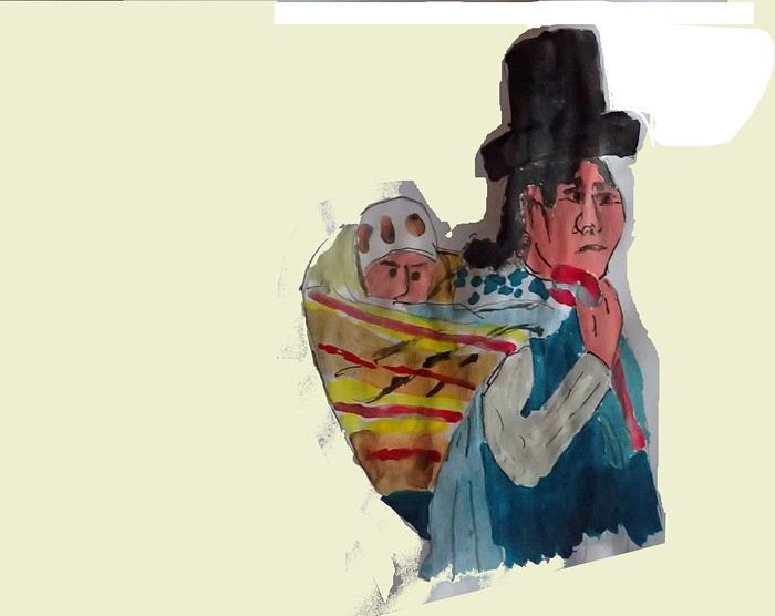
 I’m inviting you on a stroll through my drawings—a completely subjective, far-from-exhaustive, and totally personal take, since it’s based on my own sketches. I put this travel journal together after returning in late 2024, mostly using felt-tip pens and pencils, with a few collages thrown in. I worked from our personal photos.
 And in Kyoto, the Nishiki Market:




 A little sneak peek?




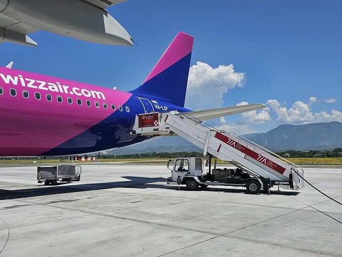 Since Albania isn’t part of Europe when it comes to phone service (at least not yet! :-)), we had to buy a physical SIM card—otherwise, the bill would’ve been sky-high if we’d used our French plan! We got one from Vodafone AL at the airport. You can buy online before leaving with a virtual SIM (e-SIM) for compatible phones, so you don’t have to swap cards. But given the uncertainty about choosing a plan online, we preferred buying one directly at Tirana Airport. Cost: 31 € for 100 GB. That’s way too much—100 GB is overkill. For 40 GB, it’s 27 €, and the plan lasts 21 days. The price difference isn’t huge, and it was cheaper than online. This plan covers all the countries along the Balkan range.
Money tip: All guesthouses and accommodations accept euros. The local currency in Albania is the LEK. In Montenegro, it’s the euro. Bank fees for withdrawing money from an ATM in Albania are pretty steep: 8 € for a withdrawal of 600–700 LEK (about 200 €)! So it’s better to withdraw cash (euros) in France. Oh, and we booked all our accommodations before leaving, but payment is always in cash. Budget around 400–500 € for 9 days of trekking.
Since Albania isn’t part of Europe when it comes to phone service (at least not yet! :-)), we had to buy a physical SIM card—otherwise, the bill would’ve been sky-high if we’d used our French plan! We got one from Vodafone AL at the airport. You can buy online before leaving with a virtual SIM (e-SIM) for compatible phones, so you don’t have to swap cards. But given the uncertainty about choosing a plan online, we preferred buying one directly at Tirana Airport. Cost: 31 € for 100 GB. That’s way too much—100 GB is overkill. For 40 GB, it’s 27 €, and the plan lasts 21 days. The price difference isn’t huge, and it was cheaper than online. This plan covers all the countries along the Balkan range.
Money tip: All guesthouses and accommodations accept euros. The local currency in Albania is the LEK. In Montenegro, it’s the euro. Bank fees for withdrawing money from an ATM in Albania are pretty steep: 8 € for a withdrawal of 600–700 LEK (about 200 €)! So it’s better to withdraw cash (euros) in France. Oh, and we booked all our accommodations before leaving, but payment is always in cash. Budget around 400–500 € for 9 days of trekking.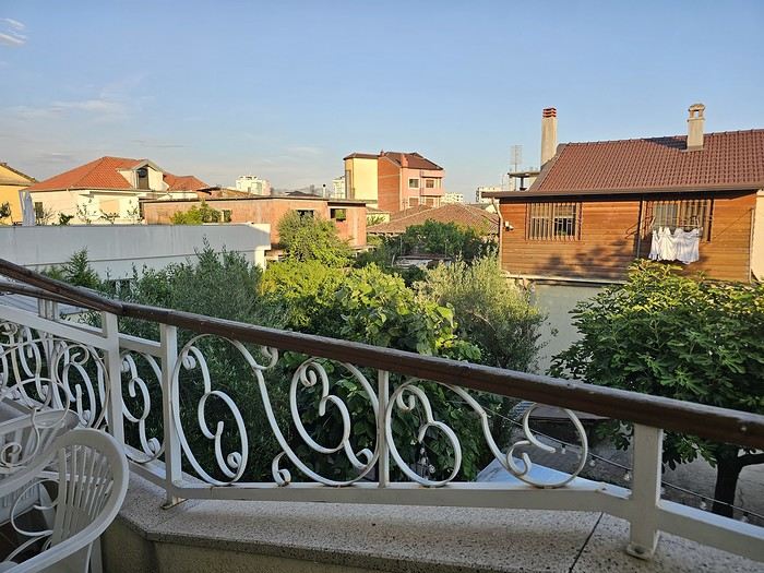 I really liked Shköder, especially its pedestrian street lined with restaurants and lit up at night. It’s a great place to stroll and eat. The food isn’t expensive—two big salads and two beers: 14 € :-) . Fruit prices are also very reasonable: 3 € for a kilo of cherries, compared to 9–10 € in France.
Religions coexist peacefully in these countries—Catholics and Muslims. From our balcony, my friend heard the call to prayer for the first time, coming from one of the city’s mosques.
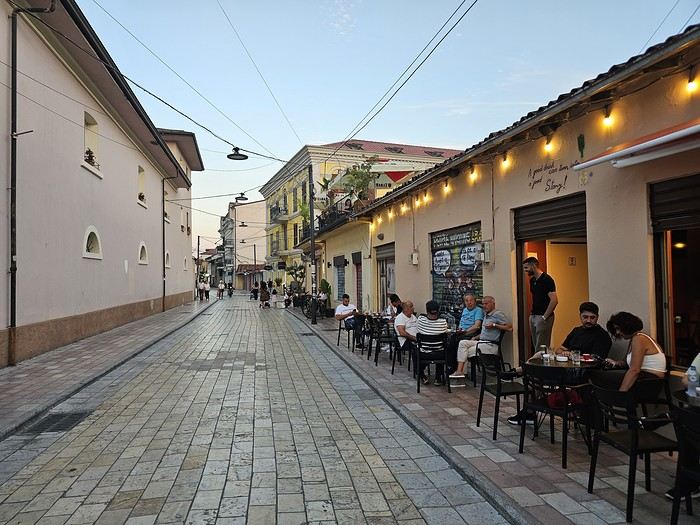
I really liked Shköder, especially its pedestrian street lined with restaurants and lit up at night. It’s a great place to stroll and eat. The food isn’t expensive—two big salads and two beers: 14 € :-) . Fruit prices are also very reasonable: 3 € for a kilo of cherries, compared to 9–10 € in France.
Religions coexist peacefully in these countries—Catholics and Muslims. From our balcony, my friend heard the call to prayer for the first time, coming from one of the city’s mosques.
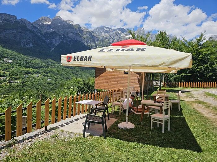
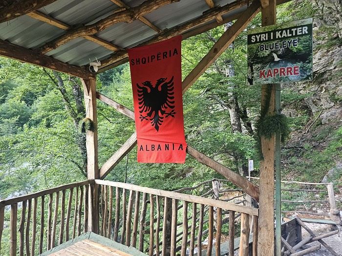
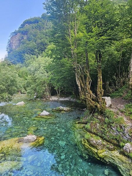
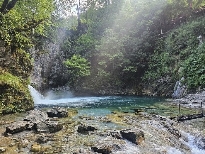
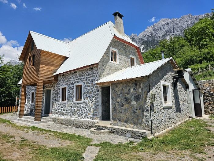 We slept in the heights of Theth at a new guesthouse, "Mountain Vista Shkafi," with an amazing view.




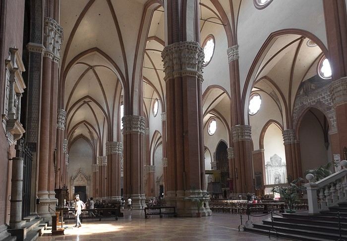
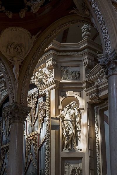
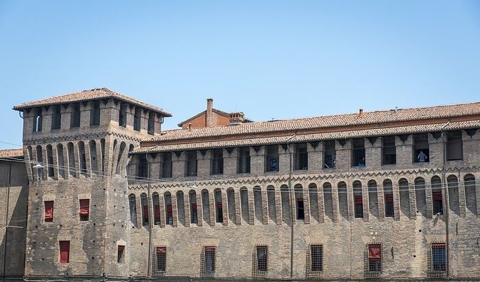 But Bologna’s real charm lies in its porticoes, which were added to the UNESCO World Heritage list in 2021: 62 km of arcades running along buildings, letting you walk sheltered from the sun or rain. Back in 1288, the city required houses to include private arcades for public use. In the city center, you can stroll under 32 km of porticoes in all sorts of styles—some plain, some ornate—with a strong presence of red tones.

















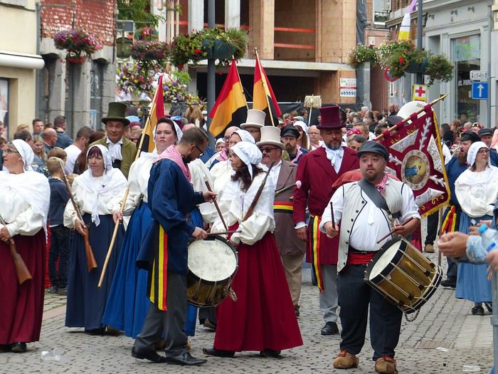
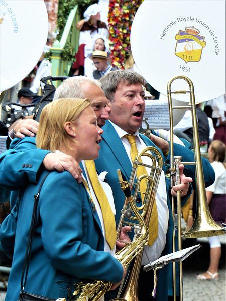
 Ooooooooh, giants!
Oh, how I love them! In the North, we have lots of these giants, like Reuze Papa and Reuze Maman in Cassel, or Gayant, Marie, and their children Binbin, Jacquot, and Fillon in Douai, and many more.
Ooooooooh, giants!
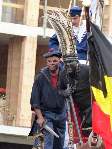
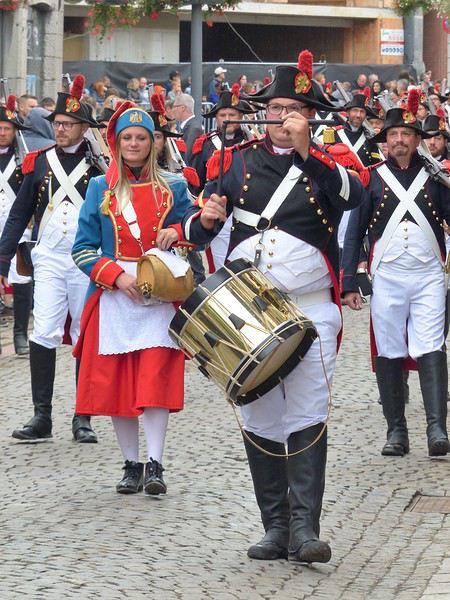
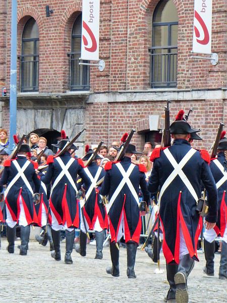
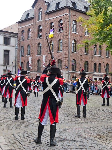
Oh, how I love them! In the North, we have lots of these giants, like Reuze Papa and Reuze Maman in Cassel, or Gayant, Marie, and their children Binbin, Jacquot, and Fillon in Douai, and many more.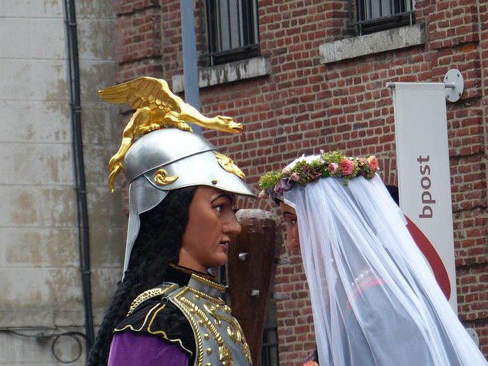 What’s more, the Ducasse of Ath is remarkable for its age and local roots; a procession was first mentioned in 1399, and today the many musical groups are still local (Ath and surrounding towns). The event is extremely popular: a good part of the population is there, all generations mixed together. Everyone knows the groups, floats, and giants, and each has their favorite! Originally, religious groups paraded, illustrating episodes from the Bible or the Golden Legend. Gradually, the parade became secular and kept evolving by adding new giants, historical figures, or allegories linked to local history (Ath, Belgian Hainaut, Belgium).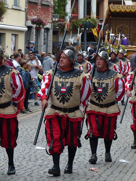
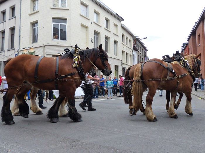 To wrap up this long introduction, know that the Ducasse of Ath lasts several days, but the highlight is the highly codified procession that takes place on the 4th Sunday of August (actually, the procession passes twice, once in the morning and once in the afternoon).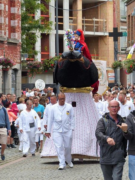
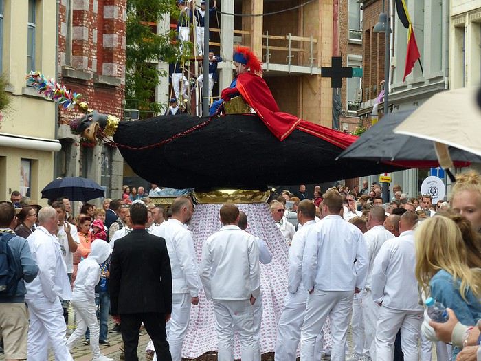
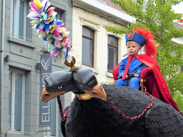
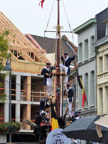
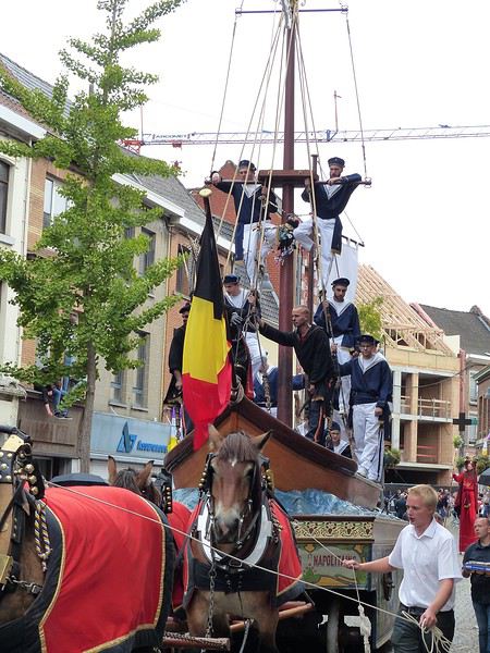
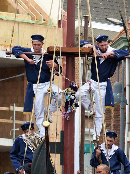
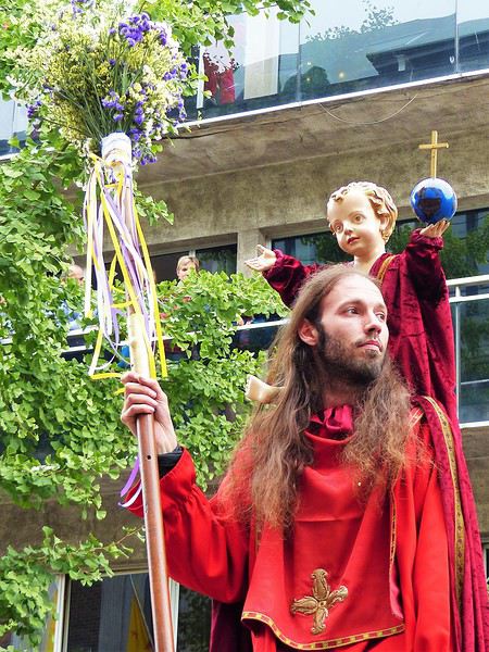
 It’s followed by a human giant on stilts: "Saint Christopher of Flobecq," holding a flowered staff and carrying Christ on his shoulders (this time, not a real child!). It appeared in the 19th century, then disappeared from the procession before being reintroduced in 1976.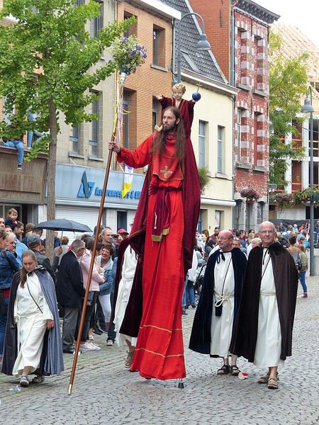



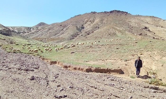
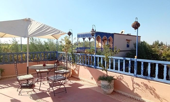
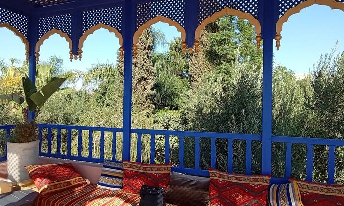 Last October, we landed in Marrakech to spend a few days with family exploring Morocco’s roads.
Transport: a rented Dacia.
Accommodations: small guesthouses.
Last October, we landed in Marrakech to spend a few days with family exploring Morocco’s roads.
Transport: a rented Dacia.
Accommodations: small guesthouses.