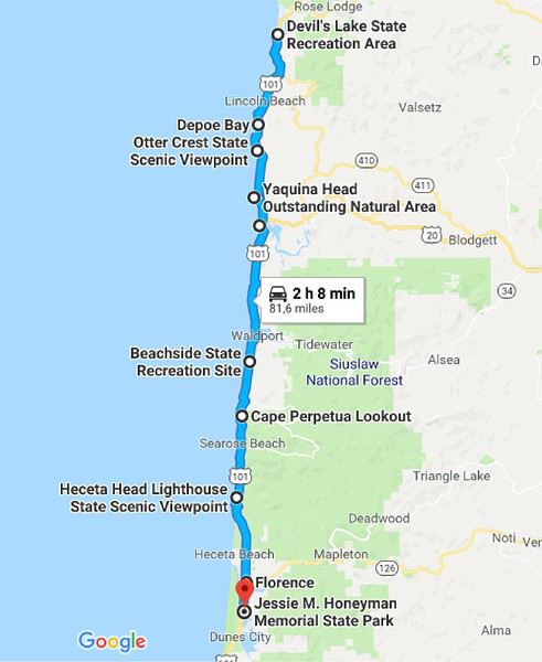
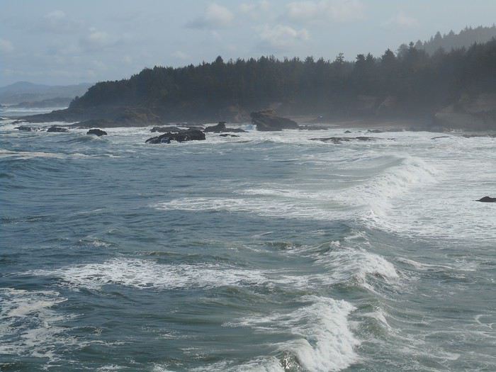
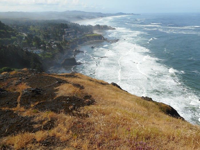
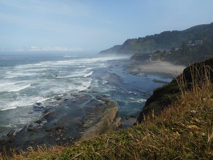
Jour 1 : mercredi 30 mai Journée en avion (la plus longue...) Vol aller : Paris-Manchester par Flybe, le tronçon suivant jusqu'à Los Angeles par Thomas Cook Airlines, Los Angeles-Portland (pour finir) par Alaska Airlines. Premier vol en retard (un peu), deuxième vol en retard (beaucoup) : l'avion pour Portland est parti depuis longtemps à l'arrivée à Los Angeles. Le mot du jour : "delayed" lu des dizaines de fois. Je m'adresse au bureau d'aide qui m'oriente vers le comptoir d'Alaska Airlines (compagnie importante) qui a un autre vol en soirée vers Portland : en 10 minutes tout est réglé, j'ai une carte d'embarquement et j'attends à la porte indiquée. Mais le mot du jour va s'afficher : "delayed", suivi d'une estimation de l'heure de départ qui s'éloigne plusieurs fois. L'avion part enfin ; il va arriver à Portland peu avant minuit ; je récupère mon bagage : j'ai prévu de prendre le MAX , un train-tram qui relie l'aéroport (10kms à l'est du centre) à la ville ; je trouve le terminus : il y a un MAX à quai ; j'achète un billet à un automate et je monte dans le MAX (c'est le dernier). Trois stations plus loin, le MAX stoppe ; les quelques voyageurs descendent, puis le conducteur, qui se dirige vers l'arrière du train pour repartir dans l'autre sens ; je discute avec lui : le dernier MAX ne va pas dans le centre, il repart dans un quartier périphérique de l'est de Portland (Gresham) et reste au dépôt pour la nuit ; il n'y a plus de tram pour le centre. Heureusement le conducteur est serviable ( comme beaucoup d'Américains) ; avant le terminus la ligne passe près d'un arrêt de bus : il vérifie l'heure du dernier bus, m'explique où descendre, comment aller à l'arrêt et me trouve un voyageur qui va "surveiller" depuis sa place que je ne me perds pas ; je me retrouve donc à l'arrêt de bus ; le dernier doit passer à 1h15 ; la quartier est désert : pas de circulation, pas de piéton, environnement glauque. Finalement 2 personnes arriveront (dont une à vélo) et prendront le dernier bus . Le chauffeur, lui aussi serviable, m'indiquera où descendre (19ième avenue) pour rejoindre mon hébergement. 2h30 fin de la première journée
L'Orégon et seulement l'Orégon
by Valmichel86
This discussion is in French, the community’s main language.
Original post
Bonjour, j'ai lu de nombreux carnets de voyage sur les Etats-Unis (sur l'Ouest des Etats-Unis pour être précis) ; beaucoup concernent le Sud-Ouest et/ou Yellowstone.
J'ai fait en 2018 un voyage en Orégon, destination bien moins présente sur le forum ; c'est ce qui me décide à commencer ce carnet de voyage. J'espère aller au bout en avançant petit à petit.
J'ai voyagé seul, avec un budget limité ; l'hébergement s'est fait en camping à l'exception de 2 nuits à l'arrivée et 2 nuits juste avant le retour.
Le voyage a eu lieu du 30 mai 2018 (départ Roissy) au 6 juillet 2018 (retour Roissy).
J'avais pris un billet AR Paris-Portland environ 7 mois avant le départ. Portland est une destination chère, mais c'est la porte d'entrée de l'Oregon par avion. Billet acheté chez Condor 770 euro.
J'avais réservé une voiture chez Thrifty du 1 juin au 4 juillet : Ford fiesta (le plus petit modèle) pour 750 euro.
Le billet d'avion, la voiture de location et 2 fois 2 nuits étaient les seules réservations faites ; l'itinéraire n'était pas fixé, mais j'avais des idées assez précises sur ce que je voulais faire ; le voyage (itinéraire précis, longueur des étapes) s'est construit au fur et à mesure avec une part importante d'improvisation.
Les nuits réservées l'ont été en auberges de jeunesse ou hostel ; il y en a 2 à Portland : j'avais choisi celle située près du centre à l'arrivée (19ième avenue NW), celle plus excentrée (Hawthorne Boulevard SE) avant le retour.
Les photos viendront après avoir quitté Portland. Je m'efforcerai d'être précis sur les lieux, les itinéraires, les routes empruntées.
Jour 1 : mercredi 30 mai Journée en avion (la plus longue...) Vol aller : Paris-Manchester par Flybe, le tronçon suivant jusqu'à Los Angeles par Thomas Cook Airlines, Los Angeles-Portland (pour finir) par Alaska Airlines. Premier vol en retard (un peu), deuxième vol en retard (beaucoup) : l'avion pour Portland est parti depuis longtemps à l'arrivée à Los Angeles. Le mot du jour : "delayed" lu des dizaines de fois. Je m'adresse au bureau d'aide qui m'oriente vers le comptoir d'Alaska Airlines (compagnie importante) qui a un autre vol en soirée vers Portland : en 10 minutes tout est réglé, j'ai une carte d'embarquement et j'attends à la porte indiquée. Mais le mot du jour va s'afficher : "delayed", suivi d'une estimation de l'heure de départ qui s'éloigne plusieurs fois. L'avion part enfin ; il va arriver à Portland peu avant minuit ; je récupère mon bagage : j'ai prévu de prendre le MAX , un train-tram qui relie l'aéroport (10kms à l'est du centre) à la ville ; je trouve le terminus : il y a un MAX à quai ; j'achète un billet à un automate et je monte dans le MAX (c'est le dernier). Trois stations plus loin, le MAX stoppe ; les quelques voyageurs descendent, puis le conducteur, qui se dirige vers l'arrière du train pour repartir dans l'autre sens ; je discute avec lui : le dernier MAX ne va pas dans le centre, il repart dans un quartier périphérique de l'est de Portland (Gresham) et reste au dépôt pour la nuit ; il n'y a plus de tram pour le centre. Heureusement le conducteur est serviable ( comme beaucoup d'Américains) ; avant le terminus la ligne passe près d'un arrêt de bus : il vérifie l'heure du dernier bus, m'explique où descendre, comment aller à l'arrêt et me trouve un voyageur qui va "surveiller" depuis sa place que je ne me perds pas ; je me retrouve donc à l'arrêt de bus ; le dernier doit passer à 1h15 ; la quartier est désert : pas de circulation, pas de piéton, environnement glauque. Finalement 2 personnes arriveront (dont une à vélo) et prendront le dernier bus . Le chauffeur, lui aussi serviable, m'indiquera où descendre (19ième avenue) pour rejoindre mon hébergement. 2h30 fin de la première journée
Valmichel86
Hello !
Mince, je m'étais faite la même réflexion il y a qqes jours sans avoir eu le temps de commencer mon carnet (que j'ai commencé donc aujourd'hui, sans avoir vu que tu avais attaqué le tien hier !).
Et bien cela fera 2 carnets sur l'Oregon .... Remarque, cet Etat vaut bien ça !
Nell & Vince
http://www.nv-de-voyages.com/
Oregon 2018 >> https://voyageforum.com/discussion/oregon-fog-smoke-sun-fun-d9307978/
Je vais suivre ton carnet avec les yeux qui brillent... de tous les états de l'Ouest, l'Oregon reste notre coup de coeur
Une géniale alchimie entre une ambiance décontractée, des activités nature sans limites et faciles d'accès, des paysages incroyablement variés, et une météo au beau fixe tout l'été...
Il y a trois ans venant du Washington puis allant vers l'Idaho on avait parcouru la côte Pacifique puis traversé l'état d'ouest en est en flânant plusieurs semaines dans la chaîne des Cascades et dans le high desert L'été dernier venant de Californie (d'ailleurs la Californie du Nord, limitrophe de l'Oregon, prend également aux tripes) et allant vers le Canada nous avions remonté l'Oregon du sud au nord et passé pas mal de temps dans la région de Bend (on y était fin juin - début juillet) Et il y a de très fortes chances que l'on y soit à nouveau à l'automne prochain...
Jour2 : jeudi 31 mai (Portland)
Ce sera une journée de prise de contact avec Portland.
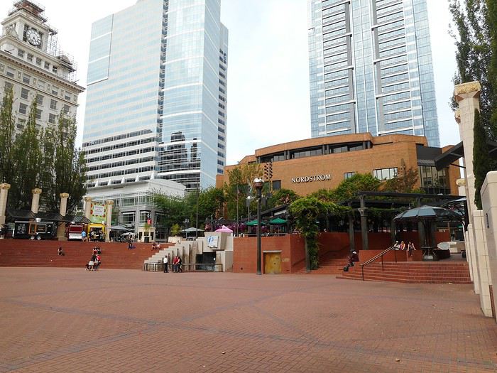
Je vais me promener à pied dans le centre ; je passe à Pioneer Square.


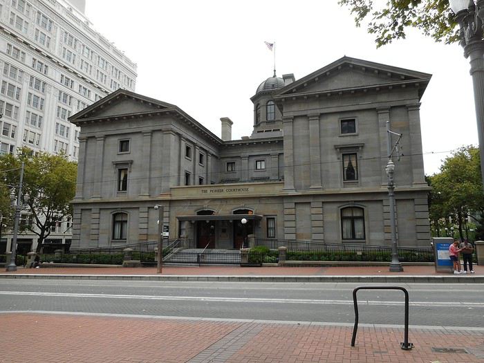
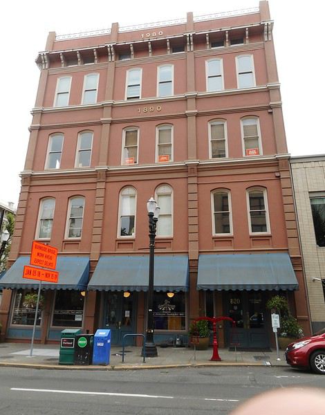
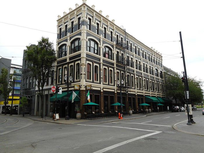
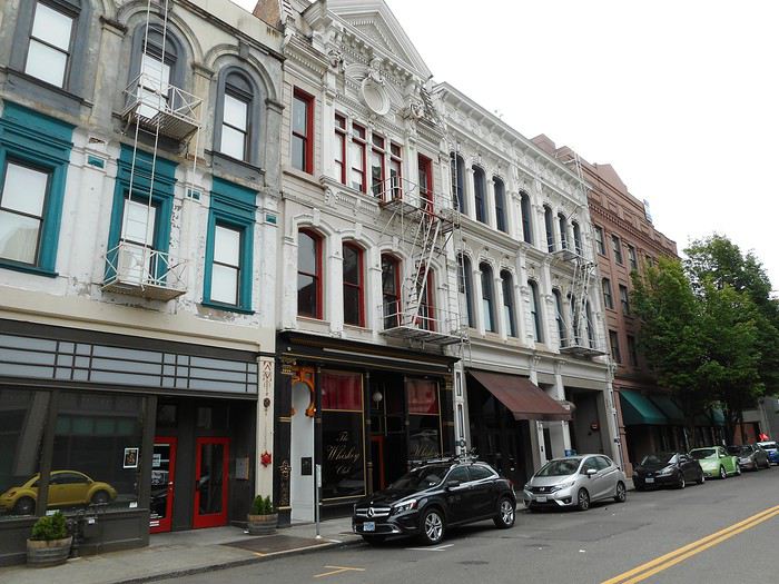
Dans les rues avoisinantes se trouvent les bâtiments historiques de Portland (fin 19ième et début 20ième siècle)


Je visite le Portland Art Museum : on y trouve une collection d'impressionnistes, puis d'art du 20ième siècle, puis d'art contemporain. Je trouve le musée intéressant mais pas exceptionnel. Je me rends à la librairie Powell's ; c'est la plus grande librairie que j'ai jamais vue et il faut prendre le temps de se promener à l'intérieur sur plusieurs étages : cela vaut vraiment le coup. Comme vous pouvez en juger d'après les photos, ce sont plutôt les quartiers historiques qui m'intéressent dans les villes ; je n'attendais donc pas énormément de Portland. Je n'ai parcouru que le centre ; la ville n'est pas oppressante, elle semble aérée, tranquille (pas beaucoup de monde), avec une ambiance décontractée. Je fais également quelques courses et récupère de la documentation touristique. Les prévisions météo annoncent une amélioration à partir de demain et un temps sec sur une période d'une semaine pour la côte pacifique : je décide de commencer mon périple par la côte pacifique du nord jusqu'au sud.
Jour 3 : vendredi 1 juin Je dois prendre la voiture de location en fin de matinée chez le loueur près de l'aéroport ; je me prépare tranquillement, arrive chez Thrifty, ... tout se passe bien jusqu'au moment d'utiliser la carte de crédit (credit card) pour couvrir la franchise (j'avais payé la location au moment de la réservation) et là.... la carte bancaire ne fonctionne pas ! Le personnel (assez affable) passe en multi-tâches : il s'occupe en même temps des autres clients (pour ne pas créer de queue) et de moi ; il réessaye, tente une autre procédure, téléphone, mais au bout du compte il faut que la carte couvre la franchise, et elle ne fonctionne pas... donc pas de voiture. Mon niveau en anglais ne m'a permis de tout comprendre (loin s'en faut), mais j'ai entendu souvent "the card doesn't work" et bien compris qu'il fallait appeler ma banque en France. La navette me ramène à l'aéroport et là (suite à une demande d'aide à un guichet), on m'oriente vers le centre de conférences (PDX conference center) : une Française expatriée m'accueille et va passer plusieurs heures avec moi à essayer de démêler ce problème : rien n'y fera car nous n'en connaissons pas la cause. Nous décidons la seule chose qui reste à faire 1-je prolonge mon hébergement à l'hostel jusqu'au lundi matin 2- je téléphonerai au service client de ma banque dès que possible
Un grand merci à Monique et à sa soeur Jacqueline.
Une grande journée de galère : j'avais déjà utilisé sans problème ma carte depuis mon arrivée et, quand je sais qu'il faut appeler ma banque, le service client est fermé (décalage horaire) ; il sera ouvert le samedi à horaires réduits, puis lundi...
Epilogue : minuit ou 1 heure du matin, je téléphone au service client : il faut que je fasse une opération dans mon espace client sur internet pour résoudre le problème ; je me connecte, quelques clics suffisent. Cela marchera demain (il le faut).
Jour 4 : samedi 2 juin Retour chez Thrifty, tout se passe très rapidement : la carte marche ; un des employés d'hier me donne les clefs, et me dit que la voiture est dans l'allée 3 (ou 5). J'y vais, mais... ce n'est pas une Ford Fiesta.

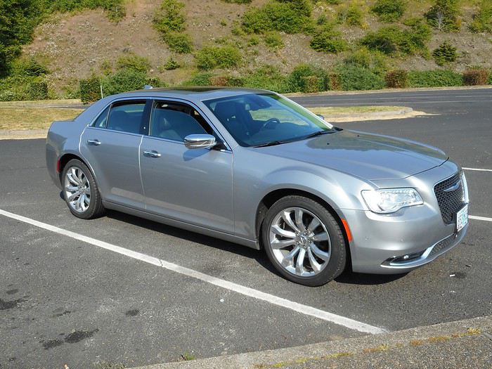
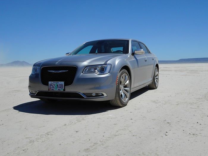
C'est une Chrysler 300 (V6, 280 chevaux) : photo prise quelques jours plus tard. Les employés de Thrifty, qui m'ont vu quasiment détruit la veille, ont voulu me faire un cadeau. Enorme décompression... Un petit tour au bord de la Columbia River. Le périple commence vraiment demain.


Dans les rues avoisinantes se trouvent les bâtiments historiques de Portland (fin 19ième et début 20ième siècle)


Je visite le Portland Art Museum : on y trouve une collection d'impressionnistes, puis d'art du 20ième siècle, puis d'art contemporain. Je trouve le musée intéressant mais pas exceptionnel. Je me rends à la librairie Powell's ; c'est la plus grande librairie que j'ai jamais vue et il faut prendre le temps de se promener à l'intérieur sur plusieurs étages : cela vaut vraiment le coup. Comme vous pouvez en juger d'après les photos, ce sont plutôt les quartiers historiques qui m'intéressent dans les villes ; je n'attendais donc pas énormément de Portland. Je n'ai parcouru que le centre ; la ville n'est pas oppressante, elle semble aérée, tranquille (pas beaucoup de monde), avec une ambiance décontractée. Je fais également quelques courses et récupère de la documentation touristique. Les prévisions météo annoncent une amélioration à partir de demain et un temps sec sur une période d'une semaine pour la côte pacifique : je décide de commencer mon périple par la côte pacifique du nord jusqu'au sud.
Jour 3 : vendredi 1 juin Je dois prendre la voiture de location en fin de matinée chez le loueur près de l'aéroport ; je me prépare tranquillement, arrive chez Thrifty, ... tout se passe bien jusqu'au moment d'utiliser la carte de crédit (credit card) pour couvrir la franchise (j'avais payé la location au moment de la réservation) et là.... la carte bancaire ne fonctionne pas ! Le personnel (assez affable) passe en multi-tâches : il s'occupe en même temps des autres clients (pour ne pas créer de queue) et de moi ; il réessaye, tente une autre procédure, téléphone, mais au bout du compte il faut que la carte couvre la franchise, et elle ne fonctionne pas... donc pas de voiture. Mon niveau en anglais ne m'a permis de tout comprendre (loin s'en faut), mais j'ai entendu souvent "the card doesn't work" et bien compris qu'il fallait appeler ma banque en France. La navette me ramène à l'aéroport et là (suite à une demande d'aide à un guichet), on m'oriente vers le centre de conférences (PDX conference center) : une Française expatriée m'accueille et va passer plusieurs heures avec moi à essayer de démêler ce problème : rien n'y fera car nous n'en connaissons pas la cause. Nous décidons la seule chose qui reste à faire 1-je prolonge mon hébergement à l'hostel jusqu'au lundi matin 2- je téléphonerai au service client de ma banque dès que possible
Un grand merci à Monique et à sa soeur Jacqueline.
Une grande journée de galère : j'avais déjà utilisé sans problème ma carte depuis mon arrivée et, quand je sais qu'il faut appeler ma banque, le service client est fermé (décalage horaire) ; il sera ouvert le samedi à horaires réduits, puis lundi...
Epilogue : minuit ou 1 heure du matin, je téléphone au service client : il faut que je fasse une opération dans mon espace client sur internet pour résoudre le problème ; je me connecte, quelques clics suffisent. Cela marchera demain (il le faut).
Jour 4 : samedi 2 juin Retour chez Thrifty, tout se passe très rapidement : la carte marche ; un des employés d'hier me donne les clefs, et me dit que la voiture est dans l'allée 3 (ou 5). J'y vais, mais... ce n'est pas une Ford Fiesta.

C'est une Chrysler 300 (V6, 280 chevaux) : photo prise quelques jours plus tard. Les employés de Thrifty, qui m'ont vu quasiment détruit la veille, ont voulu me faire un cadeau. Enorme décompression... Un petit tour au bord de la Columbia River. Le périple commence vraiment demain.
Valmichel86
Jour 5 : dimanche 3 juin (Silver Falls State Park)
Itinéraire

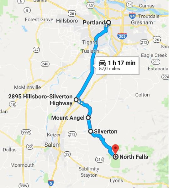
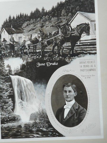
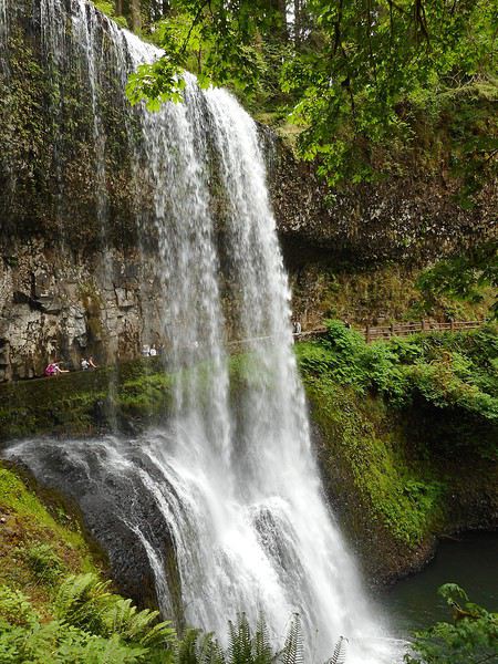
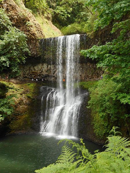
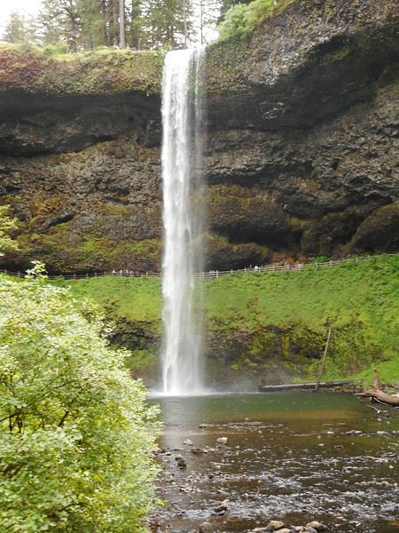
Les mésaventures avec ma carte bancaire me font penser que, dans certaines circonstances, nous avons atteint un niveau de dépendance en temps réel par rapport au système bancaire... absolu. Vous imaginez que les 24 heures de vendredi midi à samedi midi ont été pour moi cauchemardesques, parce qu'elles obéraient tout le voyage et que j'étais démuni face à la situation. J'aborde la suite avec une légèreté d'esprit totale... je ne vivrai plus de situation angoissante pendant le voyage. Ayant mon hébergement à Portland jusqu'à lundi matin, j'ai décidé hier soir de visiter "Silver Falls State Park" et de faire la randonnée des 10 cascades (environ 13 kms). C'est un parc d'état (géré par l'état d'Oregon) situé à une centaine de kms au sud de Portland au pied de la chaîne des Cascades. Je quitte Portland vers le sud par l'Interstate5 (I5), prends la sortie Woodburn : la route211 mène à Woodburn, puis la 214 à Silverton. La ville comporte de nombreux panneaux d'art mural : voici June Drake

Cet habitant de Silverton a essayé dans les années 1920 de faire classer le site des "Silver Falls" ; il a échoué au niveau fédéral et réussi au niveau de l'état d'Oregon : c'est aujourd'hui un "State Park". La route 214 continue jusqu'au parc ; je me gare sur un petit parking à l'entrée nord ; je suis accueilli par un ranger : c'est la journée des parcs d'état en Orégon (cela signifie gratuité), elle me remet un plan et me renseigne sur la randonnée des 10 cascades . En temps ordinaire, il faut acquitter un droit d'entrée par voiture dans les parcs d'état (souvent 5 $) ; ici l'entrée nord n'est pas l'entrée principale et un jour quelconque vous ne trouverez pas de ranger présent . Il y a une pile d'enveloppes à souches : vous glissez le paiement dans l'enveloppe, détachez la souche, glissez l'enveloppe dans une boîte et placez la souche derrière votre pare-brise. Il est donc utile de voyager avec de l'argent liquide permettant de faire l'appoint, car en l'absence de ranger c'est la procédure habituelle. Randonnée des 10 cascades.


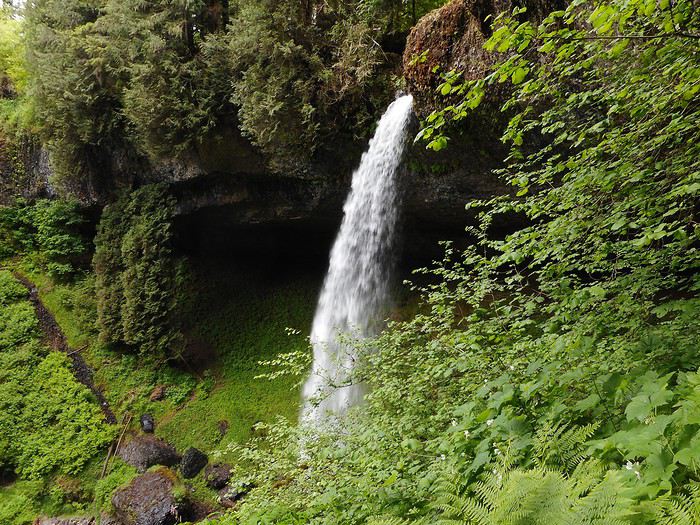
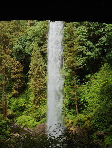
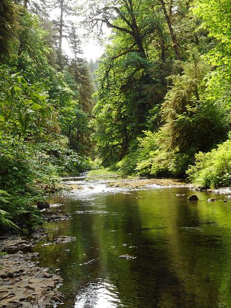
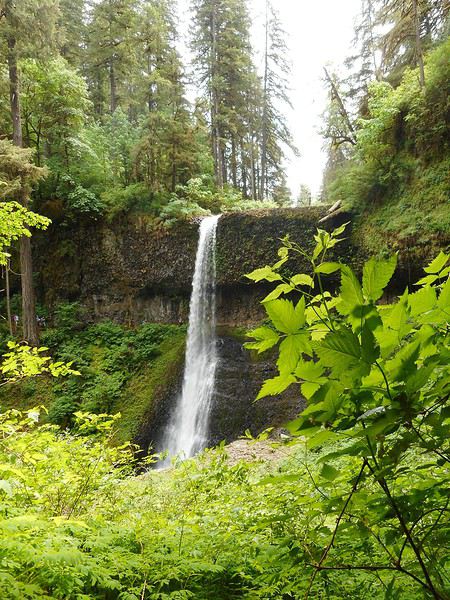
Très belle randonnée ; la végétation est luxuriante(mousses, fougères, multitude de plantes) ; l'eau est partout ; à plusieurs reprises on peut passer entre l'eau et la paroi. Le site est remarquable par le nombre de cascades le long de Silver Creek (north fork et south fork) sur une superficie réduite. On comprend ou plutôt on ressent que cette région est abondamment arrosée. Ce premier contact avec la nature en Oregon, par une journée estivale, est réussi. Retour à Portland par le même itinéraire.

Les mésaventures avec ma carte bancaire me font penser que, dans certaines circonstances, nous avons atteint un niveau de dépendance en temps réel par rapport au système bancaire... absolu. Vous imaginez que les 24 heures de vendredi midi à samedi midi ont été pour moi cauchemardesques, parce qu'elles obéraient tout le voyage et que j'étais démuni face à la situation. J'aborde la suite avec une légèreté d'esprit totale... je ne vivrai plus de situation angoissante pendant le voyage. Ayant mon hébergement à Portland jusqu'à lundi matin, j'ai décidé hier soir de visiter "Silver Falls State Park" et de faire la randonnée des 10 cascades (environ 13 kms). C'est un parc d'état (géré par l'état d'Oregon) situé à une centaine de kms au sud de Portland au pied de la chaîne des Cascades. Je quitte Portland vers le sud par l'Interstate5 (I5), prends la sortie Woodburn : la route211 mène à Woodburn, puis la 214 à Silverton. La ville comporte de nombreux panneaux d'art mural : voici June Drake

Cet habitant de Silverton a essayé dans les années 1920 de faire classer le site des "Silver Falls" ; il a échoué au niveau fédéral et réussi au niveau de l'état d'Oregon : c'est aujourd'hui un "State Park". La route 214 continue jusqu'au parc ; je me gare sur un petit parking à l'entrée nord ; je suis accueilli par un ranger : c'est la journée des parcs d'état en Orégon (cela signifie gratuité), elle me remet un plan et me renseigne sur la randonnée des 10 cascades . En temps ordinaire, il faut acquitter un droit d'entrée par voiture dans les parcs d'état (souvent 5 $) ; ici l'entrée nord n'est pas l'entrée principale et un jour quelconque vous ne trouverez pas de ranger présent . Il y a une pile d'enveloppes à souches : vous glissez le paiement dans l'enveloppe, détachez la souche, glissez l'enveloppe dans une boîte et placez la souche derrière votre pare-brise. Il est donc utile de voyager avec de l'argent liquide permettant de faire l'appoint, car en l'absence de ranger c'est la procédure habituelle. Randonnée des 10 cascades.


Très belle randonnée ; la végétation est luxuriante(mousses, fougères, multitude de plantes) ; l'eau est partout ; à plusieurs reprises on peut passer entre l'eau et la paroi. Le site est remarquable par le nombre de cascades le long de Silver Creek (north fork et south fork) sur une superficie réduite. On comprend ou plutôt on ressent que cette région est abondamment arrosée. Ce premier contact avec la nature en Oregon, par une journée estivale, est réussi. Retour à Portland par le même itinéraire.
Valmichel86
Hello Valmichel !
Que de galères avec cette CB ! Heureusement que tout est rentré dans l'ordre. Dommage pour le temps perdu et le stress occasionné. Nous avons très peu visité Portland qui, pourtant, à la réputation d'être une ville très sympa. La Ten falls Trail sera pour nous en deuxième partie de voyage et je constate qu'il est préférable de se rendre à Silverfalls SP plus tôt dans la saison pour voir des cascades au débit plus impressionnant ! Fin août, certaines se résumaient à un filet d'eau, voir à rien du tout !
Nell & Vince
http://www.nv-de-voyages.com/
Oregon 2018 >> https://voyageforum.com/discussion/oregon-fog-smoke-sun-fun-d9307978/
Bonjour Nell et Vince,
j'avais cherché des renseignements sur le climat en préparant le voyage.
J'avais trouvé le schéma suivant : l'air humide arrive du Pacifique poussé par des vents d'ouest ; il est arrêté par la chaîne côtière (un peu) et principalement par la chaîne des Cascades. Le versant Ouest de celle-ci est donc très arrosé, le versant Est beaucoup moins ; plus à l'Est, climat sec.
Traverser la chaîne des Cascades en Juin illustre de façon spectaculaire l'opposition entre un versant humide et un versant sec.
Votre remarque montre que beaucoup de choses peuvent changer sur le versant humide quand l'été est installé depuis longtemps. La vision des mêmes lieux varie avec les saisons.
Valmichel86
Jour 6 : lundi 4 juin (Portland-Astoria)
Itinéraire

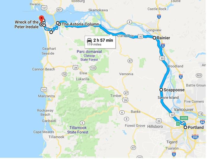
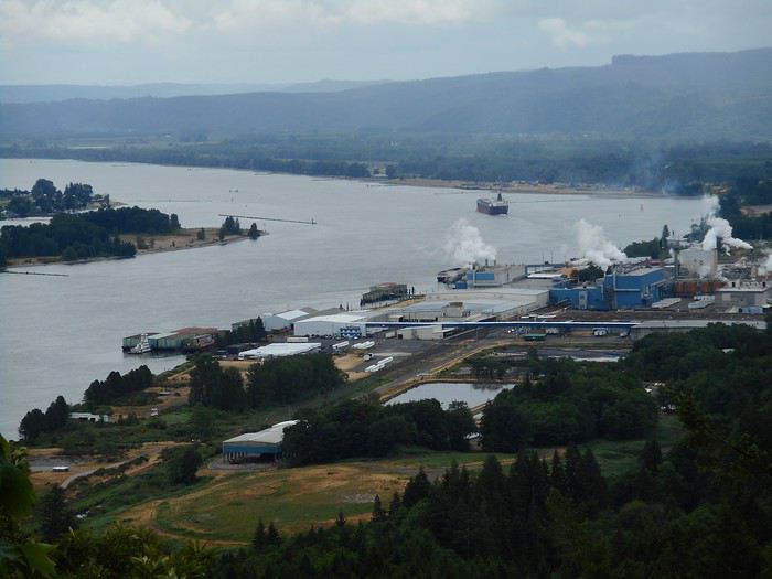
Pour me rendre à Astoria (150 kms au nord-ouest) de Portland, je vais prendre la route 30 ; j'avance dans une campagne verdoyante ; on voit la Columbia River de temps en temps quand la route monte un peu, près de Rainier, ou au "Bradley State Scenic Viewpoint".

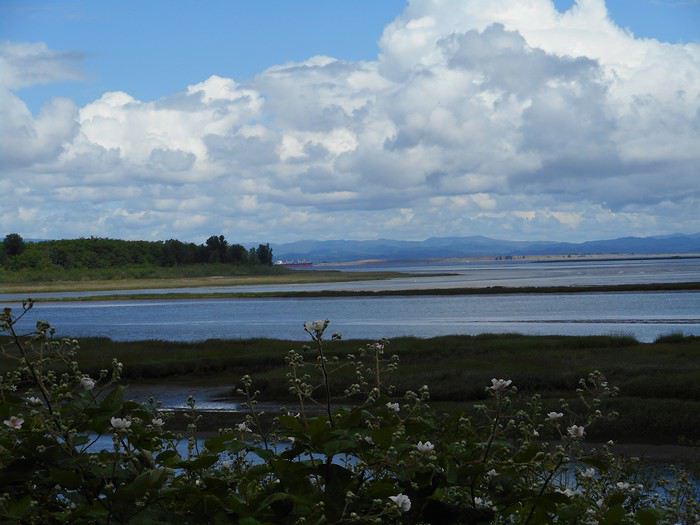
C'est un sacré fleuve, le 5ième du continent nord-américain parait-il, et il donne une impression de puissance (je n'avais fait que l'entrevoir derrière une digue près de l'aéroport de Portland). Près d'Astoria, le paysage est plus plat, le cours du fleuve s'élargit et on distingue au loin l'autre rive.

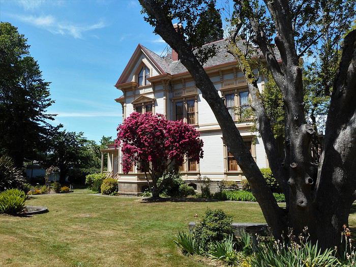
J'atteins Astoria ; je vois quelques maisons victoriennes situées dans un cadre idyllique, ici Flavel House.

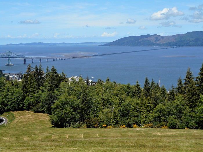
Des petites rues permettent d'atteindre le sommet d'une colline qui touche la ville ; s'y trouve une colonne (Astor Column) au haut de laquelle on peut monter et découvrir une vue étendue sur le fleuve et son estuaire tout au fond vers l'ouest.

Le regard est attiré par le pont (Astoria bridge) : il franchit la Columbia River et relie l'état de Washington (à droite) à l'Oregon (où est prise la photo). Mais surtout, dessus, passe la route US101. Qui n'a pas rêvé à la route 101 ? La route du Pacifique ! La route qui longe la côte du Canada jusqu'au Mexique ! Et je vais la suivre jusqu'à Brookings à la limite de la Californie ! Je ne vais pourtant pas quitter Astoria par l'US101, mais par une variante (Bus101) qui franchit la Young's River, puis la Lewis and Clark River ; une petite route part sur la gauche et conduit à Fort Clatsop (Lewis and Clark National Historical Park). Digression historique (début 19ième siècle). Napoléon vend la Louisiane (territoire aux limites floues) aux Américains. Le président de l'époque Jefferson confie immédiatement à 2 militaires Lewis et Clark la mission de traverser le continent et d'atteindre le Pacifique (en suivant le plus possible les cours d'eau). ils recrutent environ 40 hommes et quittent Saint-Louis au printemps 1804 : l'expédition de Lewis et Clark est née. Ils passent l'hiver sur le cours supérieur du Missouri. Lewis recrute, pour lui servir de guide, un trappeur d'origine française Toussaint Charbonneau, qui est marié à une indienne Sacagawea (ils ont un enfant). L'expédition repart au printemps 1805 avec la famille Charbonneau et arrive dans l'estuaire de la Columbia River à la mi-novembre ; pendant 15 jours, Lewis explore le coin et cherche le meilleur emplacement pour passer l'hiver ; il s'installe sur le site début décembre et commence la construction de "fort Clatsop" ; il y reste jusqu'à fin mars 1806, puis fait le chemin du retour jusqu'à Saint-Louis. Après mon retour de voyage, j'ai l'impression que cette histoire (un des mythes Américains) est pour l'état d'Orégon le premier mythe fondateur.
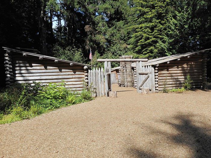
Aujourd'hui il y a : un "visitor center" (où j'ai appris cette histoire) et une reconstitution de fort Clatsop (palissade, cabanes en bois).


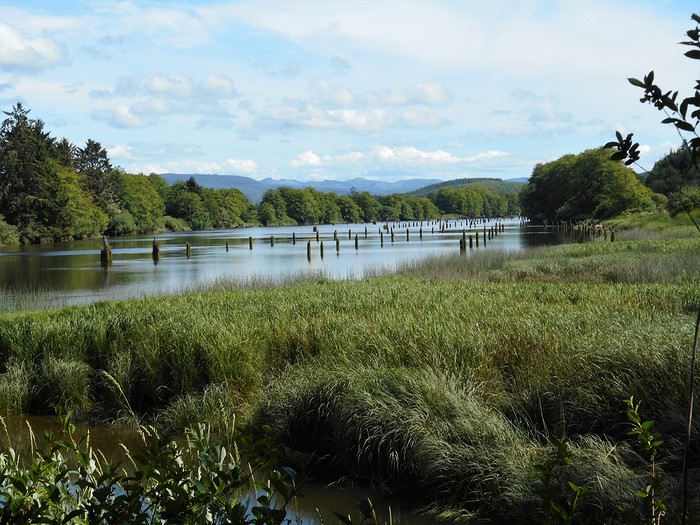
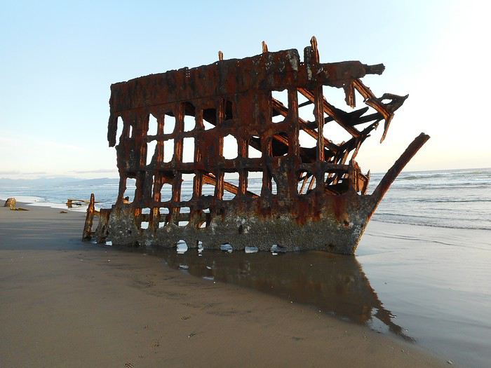
Voici l'endroit où étaient stockés les canoés le long de Lewis and Clark River. J'ai aussi appris dans le "visitor center" qu'en dépouillant le journal de bord de Lewis, on avait établi que, pendant le séjour à Fort Clatsop (début décembre - fin mars), il y avait eu moins de 20 jours sans pluie (je ne me souviens pas du nombre exact). Je me rappelle qu'en préparant mon voyage, j'avais obtenu un avis comme "il vaut mieux attendre début juillet pour assurer le coup sur la côte", et que, à mon arrivée à Portland, j'ai tout de suite regardé si il y avait une fenêtre météo favorable. Je quitte "Fort Clatsop" et arrive en quelques kms à "Fort Stevens State Park" : ce parc comporte un camping et une "day-use area" ; je vais réserver un emplacement pour ce soir et repars visiter le fort (day-use area) vu l'heure. On y trouve des batteries pour placer des pièces d'artillerie, des canons, des casemates et un petit musée ; les seuls obus tombés ici sont quelques obus japonais tirés par un sous-marin en 1941 ; ils n'ont pas fait de dégâts. Je retourne au camping ; comme il était presque complet, on m'a donné un "RV site" (emplacement pour caravane) au lieu d'un "tent site" (emplacement pour tente). Mais l'emplacement est asphalté et il ne reste pas assez d'espace pour planter la tente ; la chrysler 300 va remplacer la tente : il y a assez de place pour mettre le matelas autogonflant dans toute sa longueur. La journée se finit avec ce qui est inévitable : le Pacifique. Un sentier d'1 km en forêt (sunset trail) conduit à Columbia Beach où est échouée l'épave du Peter Iredale.

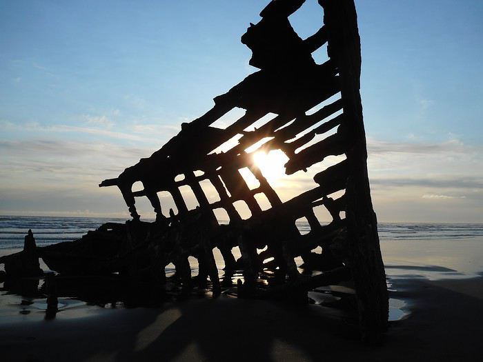
Le soleil arrive à la bonne hauteur

Sunset.

Pour me rendre à Astoria (150 kms au nord-ouest) de Portland, je vais prendre la route 30 ; j'avance dans une campagne verdoyante ; on voit la Columbia River de temps en temps quand la route monte un peu, près de Rainier, ou au "Bradley State Scenic Viewpoint".

C'est un sacré fleuve, le 5ième du continent nord-américain parait-il, et il donne une impression de puissance (je n'avais fait que l'entrevoir derrière une digue près de l'aéroport de Portland). Près d'Astoria, le paysage est plus plat, le cours du fleuve s'élargit et on distingue au loin l'autre rive.

J'atteins Astoria ; je vois quelques maisons victoriennes situées dans un cadre idyllique, ici Flavel House.

Des petites rues permettent d'atteindre le sommet d'une colline qui touche la ville ; s'y trouve une colonne (Astor Column) au haut de laquelle on peut monter et découvrir une vue étendue sur le fleuve et son estuaire tout au fond vers l'ouest.

Le regard est attiré par le pont (Astoria bridge) : il franchit la Columbia River et relie l'état de Washington (à droite) à l'Oregon (où est prise la photo). Mais surtout, dessus, passe la route US101. Qui n'a pas rêvé à la route 101 ? La route du Pacifique ! La route qui longe la côte du Canada jusqu'au Mexique ! Et je vais la suivre jusqu'à Brookings à la limite de la Californie ! Je ne vais pourtant pas quitter Astoria par l'US101, mais par une variante (Bus101) qui franchit la Young's River, puis la Lewis and Clark River ; une petite route part sur la gauche et conduit à Fort Clatsop (Lewis and Clark National Historical Park). Digression historique (début 19ième siècle). Napoléon vend la Louisiane (territoire aux limites floues) aux Américains. Le président de l'époque Jefferson confie immédiatement à 2 militaires Lewis et Clark la mission de traverser le continent et d'atteindre le Pacifique (en suivant le plus possible les cours d'eau). ils recrutent environ 40 hommes et quittent Saint-Louis au printemps 1804 : l'expédition de Lewis et Clark est née. Ils passent l'hiver sur le cours supérieur du Missouri. Lewis recrute, pour lui servir de guide, un trappeur d'origine française Toussaint Charbonneau, qui est marié à une indienne Sacagawea (ils ont un enfant). L'expédition repart au printemps 1805 avec la famille Charbonneau et arrive dans l'estuaire de la Columbia River à la mi-novembre ; pendant 15 jours, Lewis explore le coin et cherche le meilleur emplacement pour passer l'hiver ; il s'installe sur le site début décembre et commence la construction de "fort Clatsop" ; il y reste jusqu'à fin mars 1806, puis fait le chemin du retour jusqu'à Saint-Louis. Après mon retour de voyage, j'ai l'impression que cette histoire (un des mythes Américains) est pour l'état d'Orégon le premier mythe fondateur.
Aujourd'hui il y a : un "visitor center" (où j'ai appris cette histoire) et une reconstitution de fort Clatsop (palissade, cabanes en bois).


Voici l'endroit où étaient stockés les canoés le long de Lewis and Clark River. J'ai aussi appris dans le "visitor center" qu'en dépouillant le journal de bord de Lewis, on avait établi que, pendant le séjour à Fort Clatsop (début décembre - fin mars), il y avait eu moins de 20 jours sans pluie (je ne me souviens pas du nombre exact). Je me rappelle qu'en préparant mon voyage, j'avais obtenu un avis comme "il vaut mieux attendre début juillet pour assurer le coup sur la côte", et que, à mon arrivée à Portland, j'ai tout de suite regardé si il y avait une fenêtre météo favorable. Je quitte "Fort Clatsop" et arrive en quelques kms à "Fort Stevens State Park" : ce parc comporte un camping et une "day-use area" ; je vais réserver un emplacement pour ce soir et repars visiter le fort (day-use area) vu l'heure. On y trouve des batteries pour placer des pièces d'artillerie, des canons, des casemates et un petit musée ; les seuls obus tombés ici sont quelques obus japonais tirés par un sous-marin en 1941 ; ils n'ont pas fait de dégâts. Je retourne au camping ; comme il était presque complet, on m'a donné un "RV site" (emplacement pour caravane) au lieu d'un "tent site" (emplacement pour tente). Mais l'emplacement est asphalté et il ne reste pas assez d'espace pour planter la tente ; la chrysler 300 va remplacer la tente : il y a assez de place pour mettre le matelas autogonflant dans toute sa longueur. La journée se finit avec ce qui est inévitable : le Pacifique. Un sentier d'1 km en forêt (sunset trail) conduit à Columbia Beach où est échouée l'épave du Peter Iredale.

Le soleil arrive à la bonne hauteur

Sunset.
Valmichel86
Bonjour Michel,
Merci pour le partage et ce récit agréable et très détaillé 🙂. Cet État m'attire tout particulièrement, donc je prends des notes, d'autant plus que tu es parti plus d'un mois !
Aaah, le problème des CB ! On a connu la même mésaventure la première fois qu'on s'est aventuré hors de France avec une seule CB. Impossible de payer le plein d'essence en Ecosse. Le stress total, surtout quand on n'a que quelques centaines d'€ en poche.
Depuis, on voyage systématiquement avec plusieurs CB, Visa et MasterCard, parce qu'en plus il y a des pays où l'un ou l'autre type de CB passe mieux...
Guillaume
Jour 3 : vendredi 1 juin
Je dois prendre la voiture de location en fin de matinée chez le loueur près de l'aéroport ; je me prépare tranquillement, arrive chez Thrifty, ... tout se passe bien jusqu'au moment d'utiliser la carte de crédit (credit card) pour couvrir la franchise (j'avais payé la location au moment de la réservation) et là.... la carte bancaire ne fonctionne pas !
Le personnel (assez affable) passe en multi-tâches : il s'occupe en même temps des autres clients (pour ne pas créer de queue) et de moi ; il réessaye, tente une autre procédure, téléphone, mais au bout du compte il faut que la carte couvre la franchise, et elle ne fonctionne pas... donc pas de voiture. Mon niveau en anglais ne m'a permis de tout comprendre (loin s'en faut), mais j'ai entendu souvent "the card doesn't work" et bien compris qu'il fallait appeler ma banque en France.
Hello ! Je vais suivre ce carnet avec grand intérêt.
Au sujet de la CB qui ne marche pas, j'ai eu la même aventure en Avril 2018 sur NYC/WAS DC. En fait, j'avais oublié de prévenir la banque de notre voyage et au vu du paiement des hôtels et diverses résas, la truc bloque. Un coup de fil en France, rien ne fonctionne car pas d'identification possible. Erreur dans le nom, dans l'émail, changement de FAI... Bref. Big Bordel !
Tout s'est réglé le lundi avec la banque de mon épouse (la même que moi) qui a pour nous débloquer la situation.
Moralité : Ne jamais oublier de prévenir sa banque pour les voyages. C'est bête mais c'est comme ça.
Hello ! Je vais suivre ce carnet avec grand intérêt.
Au sujet de la CB qui ne marche pas, j'ai eu la même aventure en Avril 2018 sur NYC/WAS DC. En fait, j'avais oublié de prévenir la banque de notre voyage et au vu du paiement des hôtels et diverses résas, la truc bloque. Un coup de fil en France, rien ne fonctionne car pas d'identification possible. Erreur dans le nom, dans l'émail, changement de FAI... Bref. Big Bordel !
Tout s'est réglé le lundi avec la banque de mon épouse (la même que moi) qui a pour nous débloquer la situation.
Moralité : Ne jamais oublier de prévenir sa banque pour les voyages. C'est bête mais c'est comme ça.
Bonjour Michel !
Vous avons eu l'autre phénomène climatique de l'air frais du pacifique rencontrant l'air (très) chaud des terres : le brouillard épais, très épais ! Et un brouillard persistant sur les "cape" s'évaporant totalement en qqes mètres.
Pour ta journée à Astoria et alentours, je remarque que nous avons suivi le même itinéraire ! La ville, Fort Clatsop et Wreck of the Peter Iredale au couché du soleil ! A fort Clatsop, nous avons assisté à un tire au mousquet, démonstration très vivante du ranger (à 16h). Et nous nous sommes promenés, comme toi sur canoe landing.
Au plaisir de te lire !
Vous avons eu l'autre phénomène climatique de l'air frais du pacifique rencontrant l'air (très) chaud des terres : le brouillard épais, très épais ! Et un brouillard persistant sur les "cape" s'évaporant totalement en qqes mètres.
Pour ta journée à Astoria et alentours, je remarque que nous avons suivi le même itinéraire ! La ville, Fort Clatsop et Wreck of the Peter Iredale au couché du soleil ! A fort Clatsop, nous avons assisté à un tire au mousquet, démonstration très vivante du ranger (à 16h). Et nous nous sommes promenés, comme toi sur canoe landing.
Au plaisir de te lire !
Nell & Vince
http://www.nv-de-voyages.com/
Oregon 2018 >> https://voyageforum.com/discussion/oregon-fog-smoke-sun-fun-d9307978/
Jour 7 : mardi 5 juin (Astoria - Lincoln City)
Itinéraire

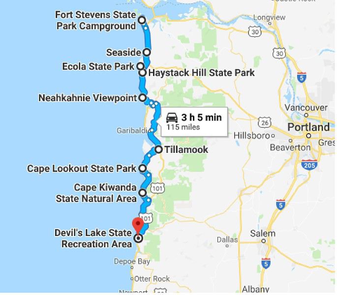
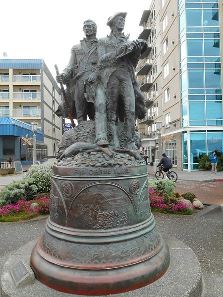
Ce matin le temps est comme hier : beau. Pour ne pas y revenir, ce sera le même temps pour tout mon trajet sur la côte ; du soleil ou un ciel parsemé de nuages blancs non menaçants. Mais la température restera fraîche en ce début juin : pas plus de 16 ou 17 degrés aux heures les plus chaudes. Le vent lui variera d'un jour à l'autre, d'une heure à l'autre, d'un lieu à l'autre : en plus de se ressentir, cela se voit sur les vagues et sur les embruns (présence-absence). Je pars vers le sud et arrive à Seaside ; au bout de la rue principale, j'arrive sur la digue où je trouve une statue.
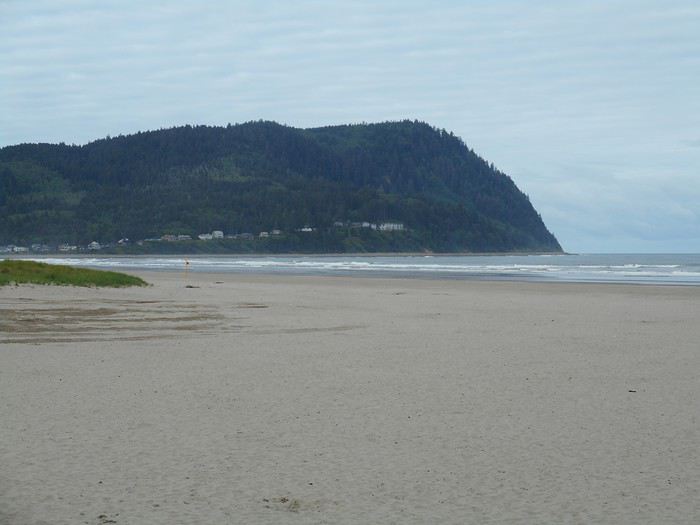
Lewis et Clark avaient installé au bord du Pacifique une annexe de Fort Clatsop ; il y produisaient du sel en faisant bouillir de l'eau de mer. Je me promène sur la plage (déserte) de cette petite station balnéaire : au bout de la plage se dresse Tillamook Head.
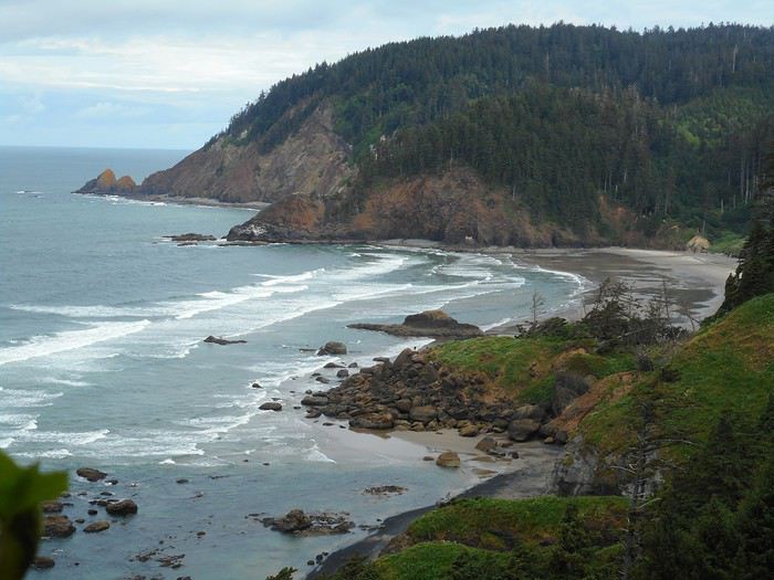
On va arriver sur une côte accidentée : la chaine côtière rencontre le Pacifique. Quelques kms plus loin, j'arrive à "Ecola State Park" . Dans le parc se trouve une plage remarquable : Indian Beach ; on peut y arriver par une route, mais aussi par un sentier (randonnée d'environ 2 heures). Je pars sur le sentier qui serpente en hauteur en foret, et soudain on découvre "Indian Beach".


Atteindre "Indian Beach" demande plus de temps, car le sentier est mal marqué, traverse des passages ravinés ; je descend sur une petite plage en espérant poursuivre au bord de la mer, mais il y trop d'eau ; il faut remonter, traverser d'autres passages ravinés puis redescendre. Depuis le sable, la plage livre une autre impression quand on regarde vers son côté rocheux.

Revenu au parking, je suis tout près du point de vue vers le sud : "Cannon Beach" avec son fameux rocher "Haystack Rock".

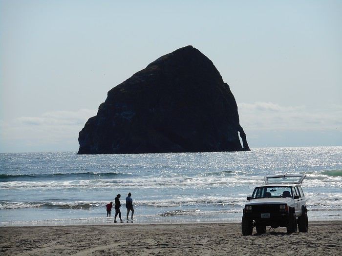
Je reprends la voiture, roule quelques kms jusqu'à Cannon Beach (station balnéaire), me gare et pars sur la plage où, à marée basse, on peut se promener jusqu'au pied de "Haystack Rock".

La côte rocheuse continue au sud de "Cannon Beach", arrive à "Oswald West Viewpoint" , où je découvre le point de vue sur la plage de Manzanita.

A partir de Manzanita, la côte est moins escarpée ; il y a des petites baies, des estuaires et on arrive à Tillamook. A Tillamook, la route US101 continue en passant dans l'intérieur des terres ; je vais prendre une variante, plus proche de la côte, appelée "3 capes scenic drive". La partie desservant le premier cap (Cape Meares) étant fermée, je verrai les deux suivants : Cape Lookout où le panorama est dégagé vers le nord.

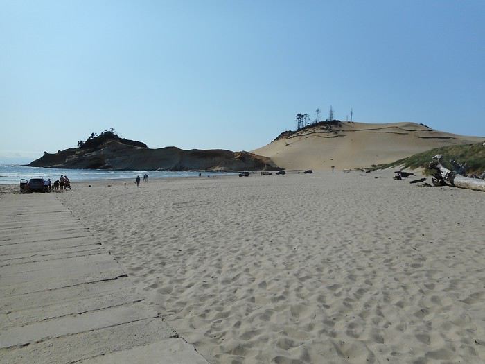
puis Cape Kiwanda ; l'ambiance change : il y a quelques dunes, du sable plus blanc...

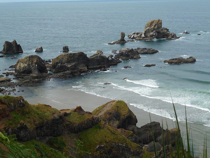
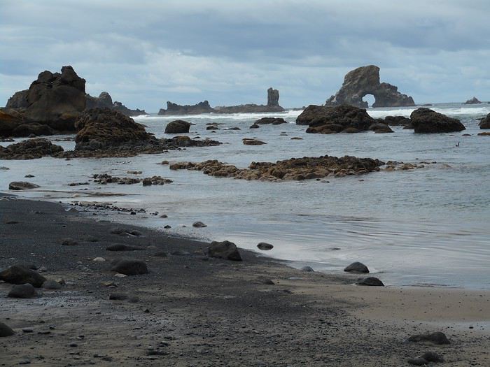
et toujours des rochers qui présentent , quand le soleil tourne à l'ouest, leur côté à l'ombre.

Je vais faire étape 30 kms plus au sud à Lincoln City au Devil's Lake SRA (State Recreation Area) où se trouve un camping dans un environnement boisé près d'un petit lac.

Ce matin le temps est comme hier : beau. Pour ne pas y revenir, ce sera le même temps pour tout mon trajet sur la côte ; du soleil ou un ciel parsemé de nuages blancs non menaçants. Mais la température restera fraîche en ce début juin : pas plus de 16 ou 17 degrés aux heures les plus chaudes. Le vent lui variera d'un jour à l'autre, d'une heure à l'autre, d'un lieu à l'autre : en plus de se ressentir, cela se voit sur les vagues et sur les embruns (présence-absence). Je pars vers le sud et arrive à Seaside ; au bout de la rue principale, j'arrive sur la digue où je trouve une statue.

Lewis et Clark avaient installé au bord du Pacifique une annexe de Fort Clatsop ; il y produisaient du sel en faisant bouillir de l'eau de mer. Je me promène sur la plage (déserte) de cette petite station balnéaire : au bout de la plage se dresse Tillamook Head.

On va arriver sur une côte accidentée : la chaine côtière rencontre le Pacifique. Quelques kms plus loin, j'arrive à "Ecola State Park" . Dans le parc se trouve une plage remarquable : Indian Beach ; on peut y arriver par une route, mais aussi par un sentier (randonnée d'environ 2 heures). Je pars sur le sentier qui serpente en hauteur en foret, et soudain on découvre "Indian Beach".


Atteindre "Indian Beach" demande plus de temps, car le sentier est mal marqué, traverse des passages ravinés ; je descend sur une petite plage en espérant poursuivre au bord de la mer, mais il y trop d'eau ; il faut remonter, traverser d'autres passages ravinés puis redescendre. Depuis le sable, la plage livre une autre impression quand on regarde vers son côté rocheux.

Revenu au parking, je suis tout près du point de vue vers le sud : "Cannon Beach" avec son fameux rocher "Haystack Rock".

Je reprends la voiture, roule quelques kms jusqu'à Cannon Beach (station balnéaire), me gare et pars sur la plage où, à marée basse, on peut se promener jusqu'au pied de "Haystack Rock".

La côte rocheuse continue au sud de "Cannon Beach", arrive à "Oswald West Viewpoint" , où je découvre le point de vue sur la plage de Manzanita.

A partir de Manzanita, la côte est moins escarpée ; il y a des petites baies, des estuaires et on arrive à Tillamook. A Tillamook, la route US101 continue en passant dans l'intérieur des terres ; je vais prendre une variante, plus proche de la côte, appelée "3 capes scenic drive". La partie desservant le premier cap (Cape Meares) étant fermée, je verrai les deux suivants : Cape Lookout où le panorama est dégagé vers le nord.

puis Cape Kiwanda ; l'ambiance change : il y a quelques dunes, du sable plus blanc...

et toujours des rochers qui présentent , quand le soleil tourne à l'ouest, leur côté à l'ombre.

Je vais faire étape 30 kms plus au sud à Lincoln City au Devil's Lake SRA (State Recreation Area) où se trouve un camping dans un environnement boisé près d'un petit lac.
Valmichel86
Bonjour,
Je fais une réponse (collective) sur ce que je sais, crois savoir ou ignore sur la question "carte bancaire" suite à ma mésaventure ; je le tiens de l'appel au service client et de mon espace client.Si cela peut aider...
Il y a 2 types de transactions : celles qui se font en utilisant la puce et celles qui se font en utilisant la piste magnétique ; on voit les les 2 sur la carte (puce et piste).
Quand c'est avec la puce, vous devez utiliser votre code pin.
Cela me semble valoir pour toutes les cartes et toutes les banques.
Quand c'est avec la piste, il y a, accessible depuis l'espace client, un commutateur qui permet de basculer entre 2 zones ""Europe" ou "monde entier". Ma banque présente cela comme une protection offerte à ses clients qui peuvent restreindre la zone de transaction (utilisation frauduleuse). Cela vaut-il pour ma banque ou pour toutes les banques ?
Quand j'arrive chez le loueur, toutes les transactions précédentes étaient des transactions "puce", celle-là est une transaction "piste" et mon commutateur est sur "Europe". D'où le blocage ; je basculerai mon commutateur sur "Monde" après avoir téléphoné au service client.
A posteriori, je pense que la responsabilité est partagée entre la banque et moi. On "doit" connaître tout ce que contient son espace client... mais qui va regarder partout ? Ce point devrait faire l'objet d'une information spécifique plutôt que de laisser les gens découvrir tous seuls.
La banque dit que le commutateur est positionné par défaut sur "monde" : y a-t-il eu une erreur ou est-ce moi
qui l'ai basculé (sans me souvenir de rien) il y a plusieurs années ?
Les employés de Thrifty m'ont bien sur demandé si j'avais une autre carte, mais non... et je n'ai pas dit à l'avance à ma banque où j'allais ; si je l'avais fait, elle m'aurait informé de l'existence du commutateur.
Maintenant, quelles transactions se font par la puce et quelles transactions se font par la piste ? En France, j'ai l'impression que tout se fait par la puce (on doit toujours faire son code pin).
En Oregon c'est selon... mais selon quoi ? je l'ignore. Dans la suite du voyage, j'ai souvent signé sur un ticket (ticket de caisse), j'ai souvent payé sans rien signer du tout, j'ai souvent payé en utilisant le code pin. Est-ce la nature de la transaction ? le choix du commerçant local ? de sa banque ?
Plusieurs fois aussi , le commerçant n'a pas réussi à utiliser la carte et j'ai payé en espèces.
Valmichel86
Bien complexe tout ça.
Aux USA, je n'ai jamais fait mon code PIN sur la GameBoy. Une signature comme tu dis et basta. Passage dans la boite et c'est OK. Je suis tous les ans en Israël, c'est la même chose. Pas de code Pin. En résumé, ma banque me demande de les prévenir pas pour débloquer la puce Monde/Europe, mais pour vérifier que la carte n'a pas été volée. Les grosses sommes d'argent sont sous alerte. Il est possible que tout soit différent en fonction de la banque.
NB : Ma banque est le Crédit Agricole...Merci tout de même à la permanence du WE.
Au final, tant mieux pour toi. 😉
Aux USA, je n'ai jamais fait mon code PIN sur la GameBoy. Une signature comme tu dis et basta. Passage dans la boite et c'est OK. Je suis tous les ans en Israël, c'est la même chose. Pas de code Pin. En résumé, ma banque me demande de les prévenir pas pour débloquer la puce Monde/Europe, mais pour vérifier que la carte n'a pas été volée. Les grosses sommes d'argent sont sous alerte. Il est possible que tout soit différent en fonction de la banque.
NB : Ma banque est le Crédit Agricole...Merci tout de même à la permanence du WE.
Au final, tant mieux pour toi. 😉
bonjour Michel
MERCI pour ce beau récit bien précis. nous serons en Orégon, Washington et Californie du 27 août au 3 octobre.
Nous avons hâte, après 3 voyages dans l'ouest......
bon dimanche et à très vite Sonia
Nous avons hâte, après 3 voyages dans l'ouest......
bon dimanche et à très vite Sonia
Hello je suis le carnet, des idées pour 2020 😎
Roadtrip USA 2017: https://goo.gl/vtYH6H
Roadtrip USA 2018: https://goo.gl/Aig8RN
Roadtrip USA avril 2020: reporté cause Covid
Roadtrip USA Octo 2020: en éloignement ....
https://www.instagram.com/travelingtousa/
On se suit encore dans le déroulé de nos visites.
C'est beau le Cape Kiwanda avec un ciel bleu ! Après notre journée à Ecola SP, nous n'aurons que du brouillard sur l'Oregon coast ! Il faudra attendre notre route vers Crater Lake pour retrouver le soleil.
Nell & Vince
http://www.nv-de-voyages.com/
Oregon 2018 >> https://voyageforum.com/discussion/oregon-fog-smoke-sun-fun-d9307978/
bsr Michel,
Un carnet qui commence bien, décidément ce coin d'Amérique commence a être plus riche en carnet que la Californie, ce qui n'est pas pour me déplaire. D'autant que je commence à préparer un projet de road trip dans cet état et celui de Washington, j'attends la suite avec impatience.
As tu une carte de ton périple et un programme faisant sommaire jour par jour?
Cela est bien utile pour avoir une vision globale de ton voyage.
Merci pour ce partage.
Un carnet qui commence bien, décidément ce coin d'Amérique commence a être plus riche en carnet que la Californie, ce qui n'est pas pour me déplaire. D'autant que je commence à préparer un projet de road trip dans cet état et celui de Washington, j'attends la suite avec impatience.
As tu une carte de ton périple et un programme faisant sommaire jour par jour?
Cela est bien utile pour avoir une vision globale de ton voyage.
Merci pour ce partage.
Jean Maurice
Voyager c'est la seule dépense enrichissante.
Travel with an Airstream travel trailer, and See more, Do more, Live more
Voyager c'est la seule dépense enrichissante.
Travel with an Airstream travel trailer, and See more, Do more, Live more
Bonjour, Nell et Vince
nous allons continuer à suivre nos carnets de voyage respectifs. Vous verrez toute la côte sous le soleil et je verrai Crater Lake sous le soleil.
Valmichel86
Jour 8 : mercredi 6 juin (Lincoln City-Florence)
Itinéraire

Je pars et vais tout de suite faire un petit tour sur la plage de Lincoln City (jolies vagues). Et c'est reparti vers le sud : j'ai prévu de me rendre à "Cape Foulweather".

Il va y avoir de belles vagues dans les grandes baies aujourd'hui. Otter Rock n'est que 2 kms plus loin.

La vue vers le sud. Je me retourne

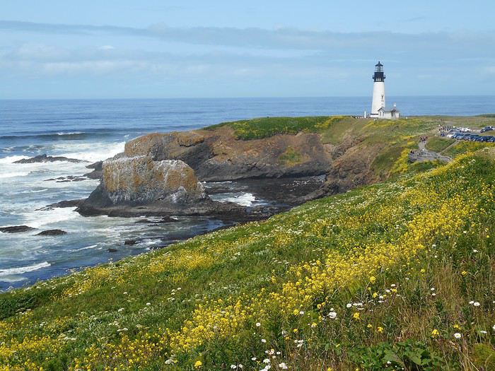
La vue vers le nord. "J'en prends plein les yeux". Je roule encore quelques kms et arrive à la "Yaquina Head Outstanding Natural Area" ; ici il y a un terrain dédié avec parking, centre d'interprétation et de petites balades à faire. Je me rends d'abord au phare (Yaquina Lighthouse), puis tout au bout de la pointe (Yaquina Head).

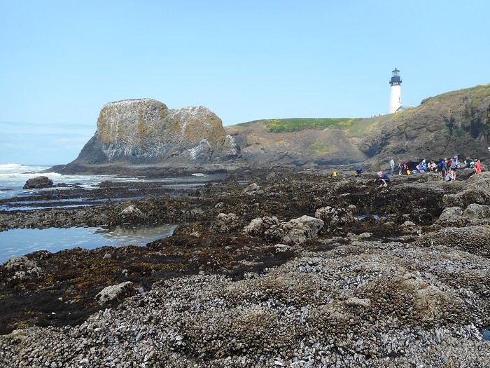
Je descends ensuite sur la plage par un escalier aménagé : c'est le domaine des coquillages, des araignées ; il y a pas mal de monde (ce qui n'est pas fréquent depuis que je suis sur la côte) et tout le monde respecte un balisage au sol qui indique où on peut aller et où c'est interdit (il faut bien qu'ils l'enlèvent quand la marée remonte).

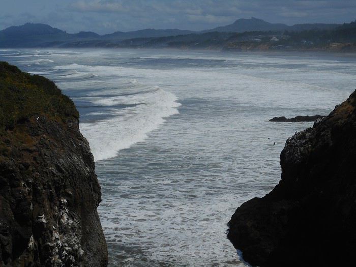
Je remonte sur la falaise par l'escalier, et vais jusqu'à une échancrure qui laisse voir "l'immense plage qui s'étend au nord "Beverly Beach"".

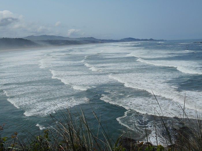
Je vais maintenant me promener à l'autre bout du domaine pour voir "l'immense plage qui s'étend au sud "Agate Beach"".

Je reprends la route ; elle descend, arrive à Newport, franchit la "Yaquina River" sur un pont métallique "Yaquina Bay Bridge". Juste après, je m'engage sur une petite route à droite de l'US101 ; elle fait le tour d'un phare "Yaquina Bay Lighthouse" ; il diffère des autres parce qu'il n'est pas situé sur un cap mais à l'estuaire de la "Yaquina River" et qu'il est en bois. Je reviens sur l'US101, roule quelques minutes et c'est "South Beach State Park" : un parking, une aire de pique-nique, un sentier vers un petit cap, un autre vers la plage.

Voici un autre arrêt : une petite plage dans une ambiance intimiste encadrée par 2 massifs rocheux couverts de sapins.

J'ai noté "Cove Beach" dans ma liste de photos, mais je n'arrive pas à la localiser exactement sur mes cartes (sans doute un peu avant d'arriver à "Cape Perpetua"). La route passe dans des bois ; elle n'est plus en bord de mer ; je dépasse "Cape Perpetua" ; la route revient en bord de mer ; je me retourne : cela doit être "Cape Perpetua".

Quelques kms plus loin, j'arrive à "Heceta Head Viewpoint". La photo est dans tous les dépliants touristiques, on y voit "Heceta Head" et le phare "Heceta Head Lighthouse".

Très peu après , roulant vers le sud, je découvre une "immense plage "Heceta Beach"" ; celle-ci est dans un environnement différent : dunaire, plus plat. La route descend, quitte la zone 'rochers-sapins' et "Heceta Beach" apparait uniquement dans son environnement de dunes.

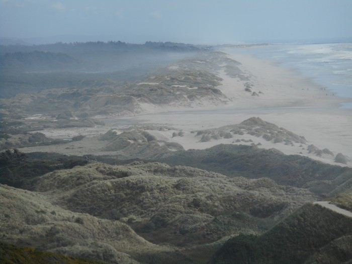
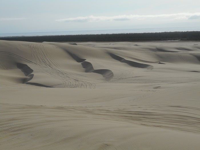
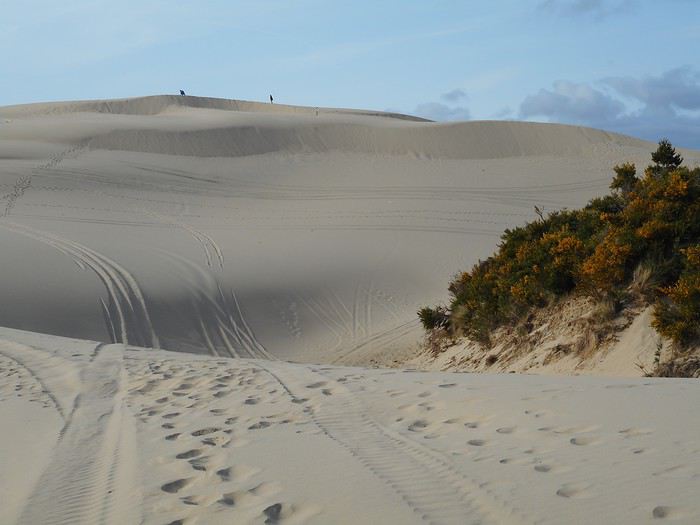
On arrive dans la zone "Oregon Dunes". Je roule jusqu'à Florence et me rends à "Jessie Honeyman Memorial State Park" : c'est un "State Park" avec un camping et une "day-use area". Il touche à la "Oregon Dunes National Recreation Area" et c'est un point de départ pour randonner dans les dunes. Ce sera le point de chute du jour. Je finis par la randonnée dans les dunes ; il ne faut pas compter sur un balisage : itinéraire libre. Ces dunes ne sont pas situées en bordure de plage . Il y a la plage, puis une zone boisée de 3 kms de large, puis la zone de dunes.


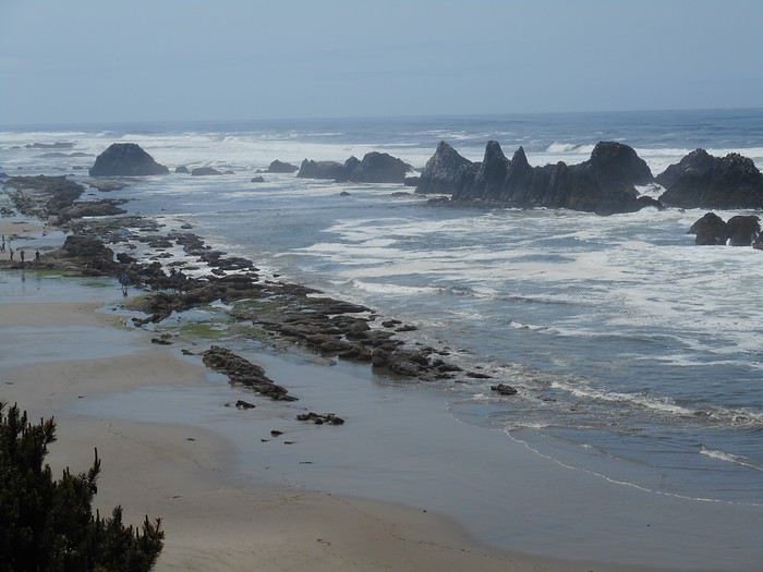
Une journée bien remplie. Si vous pensez, à la lecture, que j'ai fait une dizaine d'arrêts aujourd'hui, vous vous trompez : c'est plutôt une trentaine. A part la randonnée dans les dunes (une bonne heure), les autres balades sont courtes (5 à 20 minutes) ; parfois je me suis à peine éloigné du parking. De Lincoln City à Florence, il y a 130 kms. Si vous aimez, comme moi, vous arrêter dès qu'il y a quelque chose à voir, il faut prévoir de petites étapes.

Je pars et vais tout de suite faire un petit tour sur la plage de Lincoln City (jolies vagues). Et c'est reparti vers le sud : j'ai prévu de me rendre à "Cape Foulweather".

Il va y avoir de belles vagues dans les grandes baies aujourd'hui. Otter Rock n'est que 2 kms plus loin.

La vue vers le sud. Je me retourne

La vue vers le nord. "J'en prends plein les yeux". Je roule encore quelques kms et arrive à la "Yaquina Head Outstanding Natural Area" ; ici il y a un terrain dédié avec parking, centre d'interprétation et de petites balades à faire. Je me rends d'abord au phare (Yaquina Lighthouse), puis tout au bout de la pointe (Yaquina Head).

Je descends ensuite sur la plage par un escalier aménagé : c'est le domaine des coquillages, des araignées ; il y a pas mal de monde (ce qui n'est pas fréquent depuis que je suis sur la côte) et tout le monde respecte un balisage au sol qui indique où on peut aller et où c'est interdit (il faut bien qu'ils l'enlèvent quand la marée remonte).

Je remonte sur la falaise par l'escalier, et vais jusqu'à une échancrure qui laisse voir "l'immense plage qui s'étend au nord "Beverly Beach"".

Je vais maintenant me promener à l'autre bout du domaine pour voir "l'immense plage qui s'étend au sud "Agate Beach"".

Je reprends la route ; elle descend, arrive à Newport, franchit la "Yaquina River" sur un pont métallique "Yaquina Bay Bridge". Juste après, je m'engage sur une petite route à droite de l'US101 ; elle fait le tour d'un phare "Yaquina Bay Lighthouse" ; il diffère des autres parce qu'il n'est pas situé sur un cap mais à l'estuaire de la "Yaquina River" et qu'il est en bois. Je reviens sur l'US101, roule quelques minutes et c'est "South Beach State Park" : un parking, une aire de pique-nique, un sentier vers un petit cap, un autre vers la plage.

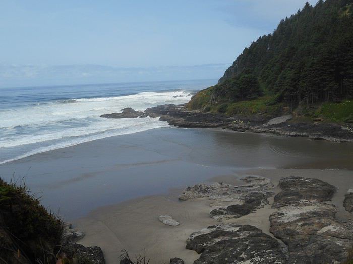
Voici un autre arrêt : une petite plage dans une ambiance intimiste encadrée par 2 massifs rocheux couverts de sapins.

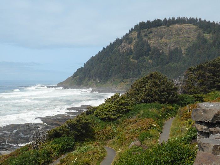
J'ai noté "Cove Beach" dans ma liste de photos, mais je n'arrive pas à la localiser exactement sur mes cartes (sans doute un peu avant d'arriver à "Cape Perpetua"). La route passe dans des bois ; elle n'est plus en bord de mer ; je dépasse "Cape Perpetua" ; la route revient en bord de mer ; je me retourne : cela doit être "Cape Perpetua".

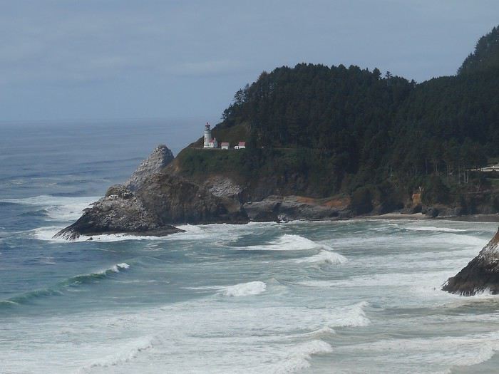
Quelques kms plus loin, j'arrive à "Heceta Head Viewpoint". La photo est dans tous les dépliants touristiques, on y voit "Heceta Head" et le phare "Heceta Head Lighthouse".

Très peu après , roulant vers le sud, je découvre une "immense plage "Heceta Beach"" ; celle-ci est dans un environnement différent : dunaire, plus plat. La route descend, quitte la zone 'rochers-sapins' et "Heceta Beach" apparait uniquement dans son environnement de dunes.

On arrive dans la zone "Oregon Dunes". Je roule jusqu'à Florence et me rends à "Jessie Honeyman Memorial State Park" : c'est un "State Park" avec un camping et une "day-use area". Il touche à la "Oregon Dunes National Recreation Area" et c'est un point de départ pour randonner dans les dunes. Ce sera le point de chute du jour. Je finis par la randonnée dans les dunes ; il ne faut pas compter sur un balisage : itinéraire libre. Ces dunes ne sont pas situées en bordure de plage . Il y a la plage, puis une zone boisée de 3 kms de large, puis la zone de dunes.


Une journée bien remplie. Si vous pensez, à la lecture, que j'ai fait une dizaine d'arrêts aujourd'hui, vous vous trompez : c'est plutôt une trentaine. A part la randonnée dans les dunes (une bonne heure), les autres balades sont courtes (5 à 20 minutes) ; parfois je me suis à peine éloigné du parking. De Lincoln City à Florence, il y a 130 kms. Si vous aimez, comme moi, vous arrêter dès qu'il y a quelque chose à voir, il faut prévoir de petites étapes.
Valmichel86
Bonjour, Nell et Vince
nous allons continuer à suivre nos carnets de voyage respectifs. Vous verrez toute la côte sous le soleil et je verrai Crater Lake sous le soleil.
Sous le soleil ? Hum ... tu verras pourquoi mon carnet s'appelle "fog, smoke, sun & fun" :D Mais sur la route, on a eu du soleil, oui ^^
Nell & Vince
http://www.nv-de-voyages.com/
Oregon 2018 >> https://voyageforum.com/discussion/oregon-fog-smoke-sun-fun-d9307978/
Si vous pensez, à la lecture, que j'ai fait une dizaine d'arrêts aujourd'hui, vous vous trompez : c'est plutôt une trentaine.A part la randonnée dans les dunes (une bonne heure), les autres balades sont courtes (5 à 20 minutes) ; parfois je me suis à peine éloigné du parking.
De Lincoln City à Florence, il y a 130 kms.
Si vous aimez, comme moi, vous arrêter dès qu'il y a quelque chose à voir, il faut prévoir de petites étapes.
Tu as bien résumé l'Oregon Coast.
Nell & Vince
http://www.nv-de-voyages.com/
Oregon 2018 >> https://voyageforum.com/discussion/oregon-fog-smoke-sun-fun-d9307978/
J'avais lu que tu annonçais le brouillard pour le lendemain, mais que tu laissais entendre que vous auriez du soleil à Crate Lake.
Je voulais dire : en lisant mon carnet, tu verras la côte sous le soleil et moi, en lisant le tien, je verrai Crater Lake sous le soleil.
Valmichel86
Jour 9 : jeudi 7 juin (Florence-Brookings)
Itinéraire
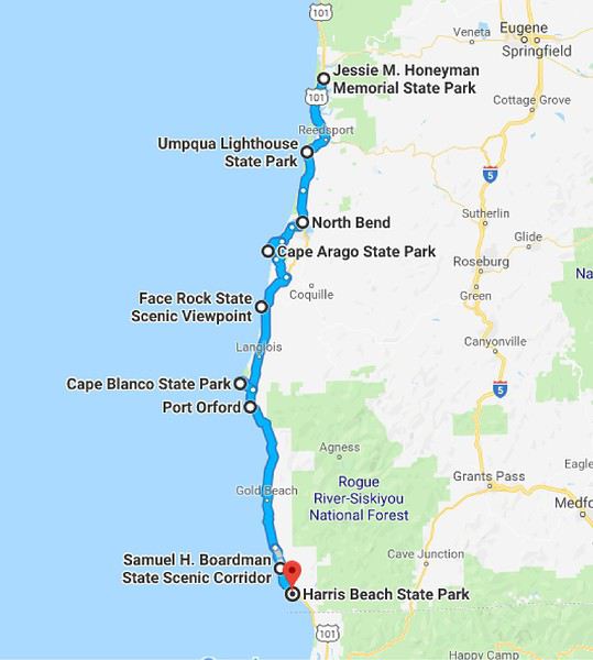
Je quitte "Honeyman SP" et prends la route US101 vers le sud. Dans la zone des Oregon Dunes, l'US101 est à l'intérieur des terres. J'ai fait ma randonnée 'dunes' hier, je vais négliger les accès possibles vers la mer sauf pour jeter un coup d'oeuil à un phare "Umqua River Lighthouse" ; j'arrive ainsi à la fin de la zone des dunes à North Bend (près de Coos Bay). J'ai fait environ 60 kms avec un seul arrêt : cela ne se reproduira pas.
A North Bend, je quitte l'US101 pour prendre une variante plus proche de le côte : la route 540 (Cape Arago Highway).
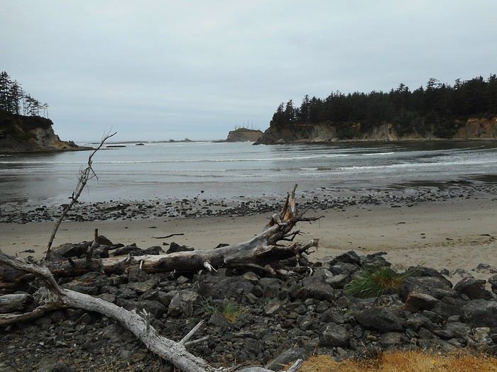
Je passe à Charleston et arrive à Sunset Bay, une plage bien abritée.

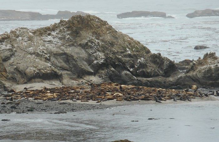
Un peu plus loin, des bénévoles ont installé des longues vues au bord d'un parking. Ils me montrent un rocher (à une centaine de mètres du rivage) avec, devant, un banc de sable: c'est "Simpson Reef". Le banc de sable est entièrement couvert d'animaux marins à touche-touche. Et il y en a autant dans l'eau tout autour dans la zone ; on ne voit que le bout de leur nez. J'ai tout le temps de les regarder à la longue vue. Mon appareil photo permet de prendre le banc de sable, pas mieux.

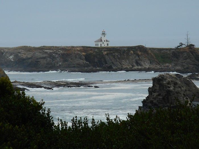
La route se termine un peu plus loin, à "Cape Arago SP" d'où on découvre le phare sur son promontoire.

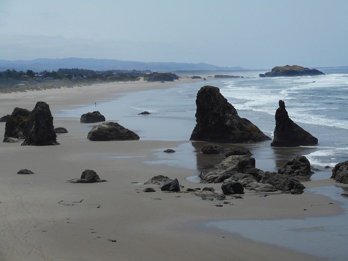
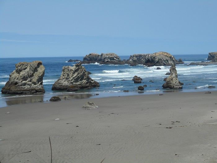
Je reviens en arrière sur plusieurs kms et prends à droite une route qui va ressortir sur l'US101 plus au sud ; je poursuis jusqu'à Bandon. A Bandon, je prends à droite une rue (Beach Loop Drive) qui va à "Coquille Point",

puis, un peu plus loin, à "Face Rock SP".


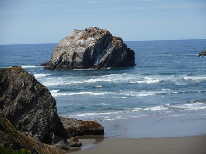
Je trouve le rocher donnant son nom au parc : "Face Rock".

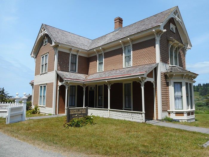
Le prochain détour me conduit à "Cape Blanco". La route passe près d'une maison "Hughes House" ; des fermiers se sont installés ici dans un isolement total ; ils ont prospéré et fait construire cette maison.

Je vais plutôt visiter le phare . Je suis à l'endroit le plus à l'ouest de la côte des USA (hors Alaska) avec cette plage au nord.

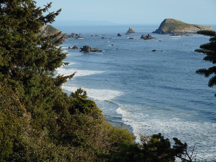
Je passe Gold Beach et stoppe à "Cape Sebastian SP" avec son panorama sur les rochers (offshore rocks) ; la route descend et je retrouve les rochers depuis la plage.


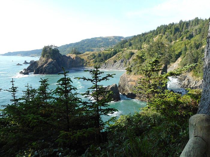
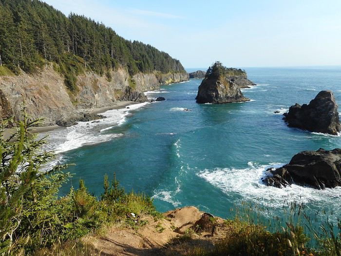
Quelques kms plus loin, c'est "Samuel Boardman SP", un parc tout en longueur (20 kms de côte) avec des tas de haltes possibles : je descends dans une crique, vais voir une arche et accède à des points de vue spectaculaires sur la côte.


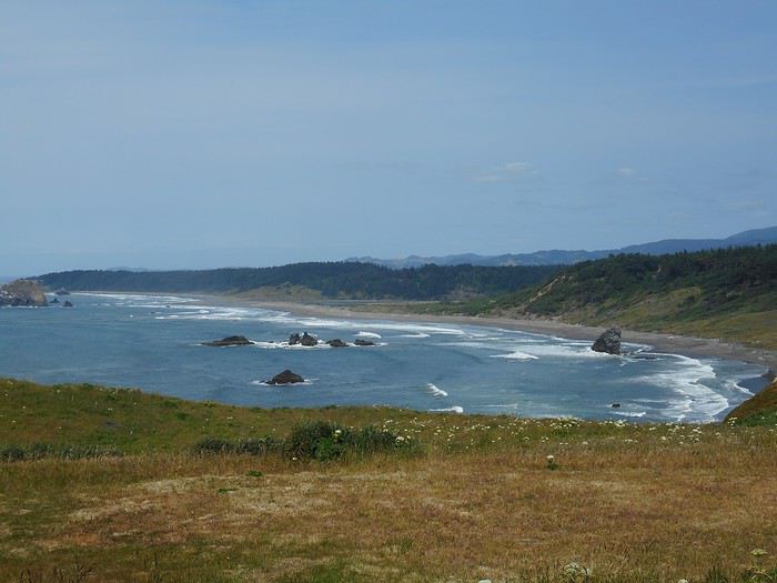
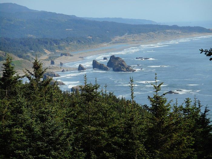
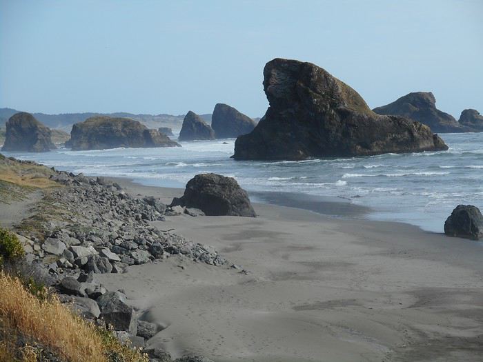
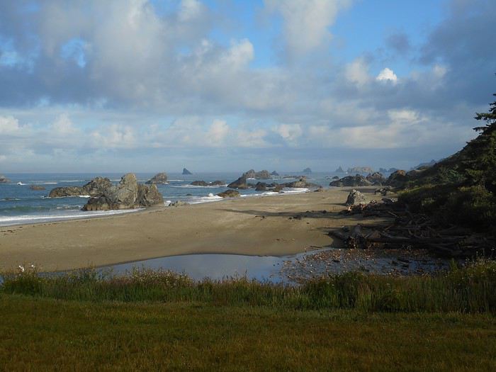
J'arrive juste après à "Harris Beach State Recreation Area" ; je m'installe au camping pour 2 nuits ; je suis à Brookings après avoir parcouru toute la côte de l'Oregon. Et l'eau ? J'ai mis les pieds dedans en me promenant sur les plages, mais pas plus : c'est beaucoup trop froid. J'ai vu en tout 4 personnes dans l'eau : un adulte devant les vagues avec de l'eau à la taille, 3 enfants faisant du bodysurf. Tous portaient des combinaisons.
Je quitte "Honeyman SP" et prends la route US101 vers le sud. Dans la zone des Oregon Dunes, l'US101 est à l'intérieur des terres. J'ai fait ma randonnée 'dunes' hier, je vais négliger les accès possibles vers la mer sauf pour jeter un coup d'oeuil à un phare "Umqua River Lighthouse" ; j'arrive ainsi à la fin de la zone des dunes à North Bend (près de Coos Bay). J'ai fait environ 60 kms avec un seul arrêt : cela ne se reproduira pas.
A North Bend, je quitte l'US101 pour prendre une variante plus proche de le côte : la route 540 (Cape Arago Highway).
Je passe à Charleston et arrive à Sunset Bay, une plage bien abritée.

Un peu plus loin, des bénévoles ont installé des longues vues au bord d'un parking. Ils me montrent un rocher (à une centaine de mètres du rivage) avec, devant, un banc de sable: c'est "Simpson Reef". Le banc de sable est entièrement couvert d'animaux marins à touche-touche. Et il y en a autant dans l'eau tout autour dans la zone ; on ne voit que le bout de leur nez. J'ai tout le temps de les regarder à la longue vue. Mon appareil photo permet de prendre le banc de sable, pas mieux.

La route se termine un peu plus loin, à "Cape Arago SP" d'où on découvre le phare sur son promontoire.

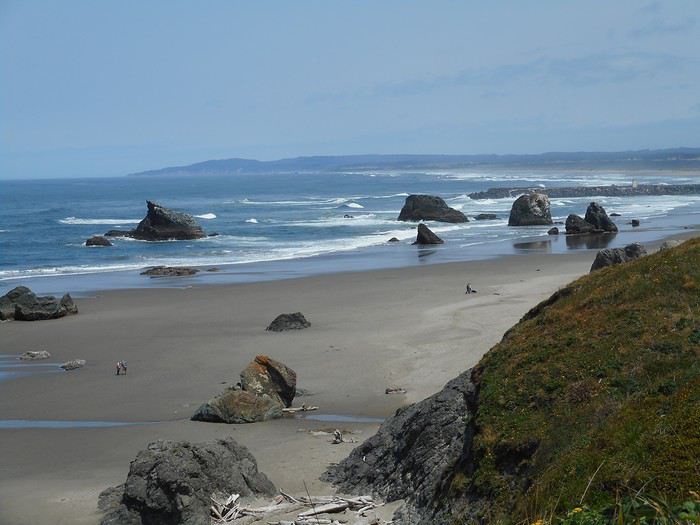
Je reviens en arrière sur plusieurs kms et prends à droite une route qui va ressortir sur l'US101 plus au sud ; je poursuis jusqu'à Bandon. A Bandon, je prends à droite une rue (Beach Loop Drive) qui va à "Coquille Point",

puis, un peu plus loin, à "Face Rock SP".


Je trouve le rocher donnant son nom au parc : "Face Rock".

Le prochain détour me conduit à "Cape Blanco". La route passe près d'une maison "Hughes House" ; des fermiers se sont installés ici dans un isolement total ; ils ont prospéré et fait construire cette maison.

Je vais plutôt visiter le phare . Je suis à l'endroit le plus à l'ouest de la côte des USA (hors Alaska) avec cette plage au nord.

Je passe Gold Beach et stoppe à "Cape Sebastian SP" avec son panorama sur les rochers (offshore rocks) ; la route descend et je retrouve les rochers depuis la plage.


Quelques kms plus loin, c'est "Samuel Boardman SP", un parc tout en longueur (20 kms de côte) avec des tas de haltes possibles : je descends dans une crique, vais voir une arche et accède à des points de vue spectaculaires sur la côte.


J'arrive juste après à "Harris Beach State Recreation Area" ; je m'installe au camping pour 2 nuits ; je suis à Brookings après avoir parcouru toute la côte de l'Oregon. Et l'eau ? J'ai mis les pieds dedans en me promenant sur les plages, mais pas plus : c'est beaucoup trop froid. J'ai vu en tout 4 personnes dans l'eau : un adulte devant les vagues avec de l'eau à la taille, 3 enfants faisant du bodysurf. Tous portaient des combinaisons.
Valmichel86
Jour 10 : vendredi 8 juin (Californie : les "Redwoods")
Itinéraire

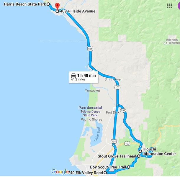
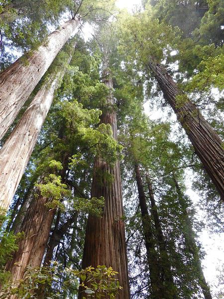
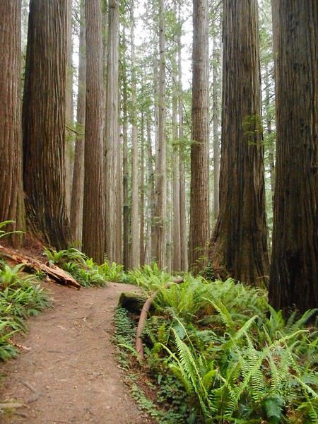
Aujourd'hui, je ne respecte pas le titre du carnet ; je vais en Californie. Je n'ai rien préparé, je sais juste que se trouve là, à quelques kms, le parc des "Redwoods", les arbres les plus hauts du monde. J'irai donc au "visitor center" le plus proche et je suivrai les conseils du ranger. Une dépression est annoncée, mais le beau temps peut tenir pour la journée ; ce matin, le temps est magnifique. C'est l'US101, l'entrée en Californie, puis, à gauche, la route197, puis, un peu plus loin, à gauche à nouveau, la route199, et , juste après, le "visitor center". Je suis au "Jedediah Smith Redwoods State Park". J'apprends qu'il y a plusieurs parcs qui se touchent, celui-ci est un State Park (de Californie). Les arbres sont des "California Redwoods", une espèce de séquoia. Le ranger me conseille 2 randonnées et me remet un plan. Je continue quelques centaines de mètres sur la route 199 ; une petite route part sur la droite et franchit la "Smith River" sur un pont.

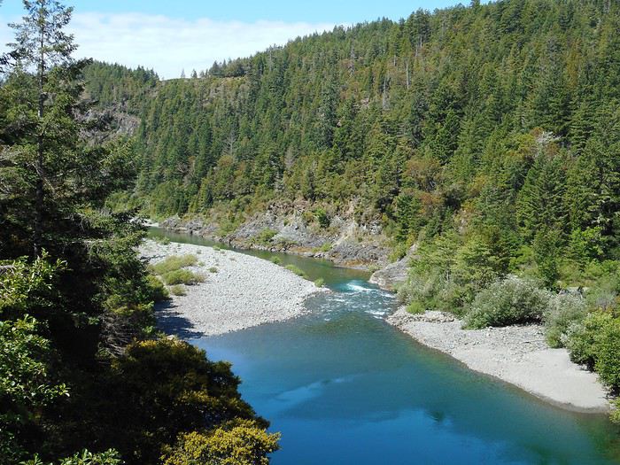
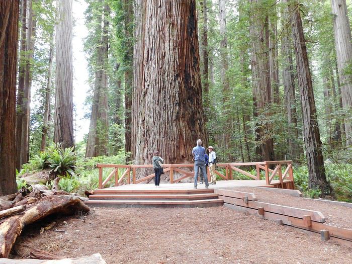
La route devient une piste et arrive à "Stout Grove" ; je suis la promenade, courte, très aménagée ; les arbres sont impressionnants par leur hauteur, mais aussi par leur taille à la base. Je rejoins aussi la berge de la Smith River juste à côté.


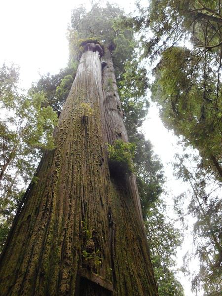
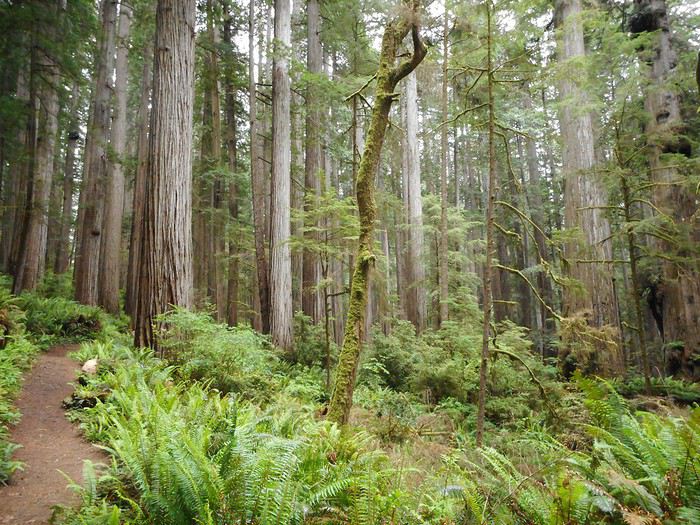
Je continue (en voiture) la piste en terre jusqu'au point de départ de l'autre randonnée (Boy Scout Tree Trail) ; le but est "Boy Scout Tree", un arbre remarquable (trajet aller environ 1 heure). L'arbre est massif avec son tronc double (ou ses 2 troncs jumeaux), mais l'impression la plus forte, pour moi, est celle produite par certains passages du sentier quand il serpente parmi une multitude de troncs qui s'élancent verticalement.


De retour à la voiture, je continue la piste en terre qui va franchir un petit col, puis redescendre sur l'autre versant ; elle redevient route et rejoint l'US101 près de Crescent City. Les premières gouttes se mettent à tomber ; je rentre à Brookings ; la pluie est modérée ; une demi heure plus tard commence un déluge qui va durer 4 heures. Quand on est au sud de l'Oregon, il faut aller voir les "Redwoods".

Aujourd'hui, je ne respecte pas le titre du carnet ; je vais en Californie. Je n'ai rien préparé, je sais juste que se trouve là, à quelques kms, le parc des "Redwoods", les arbres les plus hauts du monde. J'irai donc au "visitor center" le plus proche et je suivrai les conseils du ranger. Une dépression est annoncée, mais le beau temps peut tenir pour la journée ; ce matin, le temps est magnifique. C'est l'US101, l'entrée en Californie, puis, à gauche, la route197, puis, un peu plus loin, à gauche à nouveau, la route199, et , juste après, le "visitor center". Je suis au "Jedediah Smith Redwoods State Park". J'apprends qu'il y a plusieurs parcs qui se touchent, celui-ci est un State Park (de Californie). Les arbres sont des "California Redwoods", une espèce de séquoia. Le ranger me conseille 2 randonnées et me remet un plan. Je continue quelques centaines de mètres sur la route 199 ; une petite route part sur la droite et franchit la "Smith River" sur un pont.

La route devient une piste et arrive à "Stout Grove" ; je suis la promenade, courte, très aménagée ; les arbres sont impressionnants par leur hauteur, mais aussi par leur taille à la base. Je rejoins aussi la berge de la Smith River juste à côté.


Je continue (en voiture) la piste en terre jusqu'au point de départ de l'autre randonnée (Boy Scout Tree Trail) ; le but est "Boy Scout Tree", un arbre remarquable (trajet aller environ 1 heure). L'arbre est massif avec son tronc double (ou ses 2 troncs jumeaux), mais l'impression la plus forte, pour moi, est celle produite par certains passages du sentier quand il serpente parmi une multitude de troncs qui s'élancent verticalement.


De retour à la voiture, je continue la piste en terre qui va franchir un petit col, puis redescendre sur l'autre versant ; elle redevient route et rejoint l'US101 près de Crescent City. Les premières gouttes se mettent à tomber ; je rentre à Brookings ; la pluie est modérée ; une demi heure plus tard commence un déluge qui va durer 4 heures. Quand on est au sud de l'Oregon, il faut aller voir les "Redwoods".
Valmichel86
Stout Grove, je n'en ai entendu que du bien !
Nell & Vince
http://www.nv-de-voyages.com/
Oregon 2018 >> https://voyageforum.com/discussion/oregon-fog-smoke-sun-fun-d9307978/
Merci à tous de vous intéresser à ce carnet.
Je fais une réponse collective.
Je ne me doutais pas à quel point cela demande du temps de faire un carnet.
J'ai beaucoup de mal à rédiger car j'ai l'impression de poursuivre 2 objectifs contradictoires :
- construire un récit qui intéresse
- donner les précisions sur les lieux (routes, dénominations exactes...)
Plus de 6 mois après le retour, je suis obligé de confronter ma mémoire aux documents que j'ai gardés pour préciser des tas de choses. Et je n'avance pas vite...
Je ne sais pas construire une carte que je pourrais coller dans le carnet.
Mais comme mon carnet avance lentement et que mon voyage est long, je posterai peut-être une synthèse de l'itinéraire au lieu d'une page d'une journée bientôt ; puis je repartirai à mon rythme.
Valmichel86
Après avoir posté ma page sur les "Redwoods", je suis allé faire un tour sur ton blog, la partie Californie du nord.
Tu as beaucoup bourlingué dans le secteur, moi pas, et, quand j'arrive à Jedediah Smith SP, le lieu nous laisse exactement la même impression.
Valmichel86
Yep j'embarque pour ce carnet !
Je viens tout juste de reserver nos billets d'avions en vu d'un road trip de 10 jours début aout dans l'oregon !!!
Goooo !!
Jour 11 : samedi 9 Juin (Brookings-Roseburg)
Itinéraire

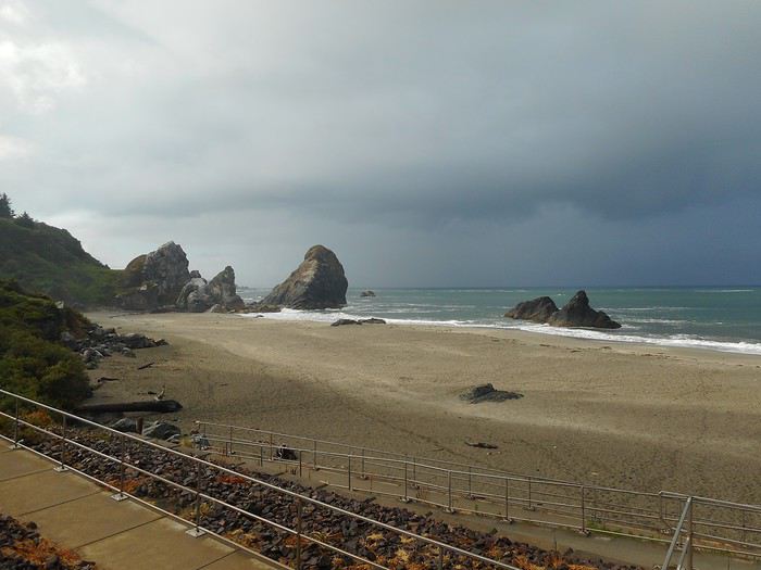
Ce matin il ne pleut plus et je descends sur "Harris Beach" (la plage du State Park) pour une petite promenade. Je trouve les couleurs remarquables, mais le temps bien menaçant.


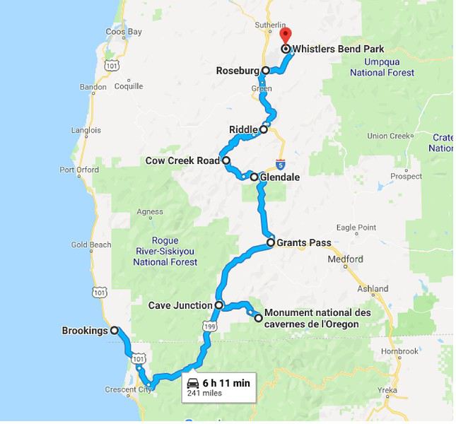
Je pars avec l'idée d'aller à "Crater Lake". Cela veut dire partir comme hier par la Californie, puis suivre la route 199 qui va re-entrer en Oregon 50 kms plus loin. J'arrive à "Cave Junction" ; il pleut depuis un moment, il y a un office de tourisme. Je vais faire le point : - La dépression est là ; elle doit s'évacuer lentement à partir de demain. Cela ne sert à rien d'aller à "Crater Lake". - Je décide de faire étape à Roseburg et d'aller demain vers "Crater Lake" en arrivant du côté nord depuis Roseburg. -Je cherche une activité à l'abri pour meubler la journée ; ce sera une grotte : Oregon Caves National Monument. Il faut faire un aller-retour (2 fois 30 kms) à partir de Cave Junction. Je roule : verte campagne puis verte foret avec les 10 derniers kms en montée sur le flanc de la chaîne des cascades et les arbres qui s'égouttent sur la route. Je vais au "visitor center" pour acheter mon billet ; la ranger s'inquiète de mes capacités physiques (Suis-je trop vieux ? Va-t-elle me demander de faire des flexions ?) ; dans une grotte, il y a des escaliers, des passerelles ; elle veut éviter de se retrouver avec quelqu'un en carafe. Finalement je suis apte et , comme je suis seul, elle m'envoie compléter un groupe qui part immédiatement. Sinon c'était une heure d'attente, car il y a du monde. La visite ne me convainc pas ; c'est une grotte à concrétions, mais pas une belle grotte à concrétions. Un Français qui a visité des grottes dans son pays sera à mon avis déçu. De tout mon voyage en Oregon, c'est la seule chose que je déconseille. Je reviens à "Cave Junction" ; je prends la route 199 jusqu'à "Grants Pass", puis l'interstate 5 (I5) en direction de Roseburg. Il n'est pas tard et cela ne m'intéresse pas de conduire sur l'I5 ; je vais faire un détour ; il y a une "scenic byway" qui va de Glendale à Riddle, la "Cow Creek Tour Route". Les "scenic byways" sont des routes pittoresques répertoriées. Dès la sortie de l'Interstate, la signalisation diminue ; un carrefour sera indiqué, mais au carrefour aucun panneau avec nom de pays ; c'est une signalisation faite pour les locaux ! Eux, ils savent où va une route, ils n'ont pas besoin de panneau ! Ce qui devait arriver arriva ; je me trompe à un carrefour ; je m'en rends compte quand la route devient une piste, humide vu le temps, mais roulante et sans nids de poule : "gravel road well-maintened" comme ils disent en Orégon. La piste ressort finalement près de Riddle sur la bonne route. Fin du trajet jusqu'à Roseburg par l'interstate. Je fais étape à "Whisler's Bend Campground".

Ce matin il ne pleut plus et je descends sur "Harris Beach" (la plage du State Park) pour une petite promenade. Je trouve les couleurs remarquables, mais le temps bien menaçant.


Je pars avec l'idée d'aller à "Crater Lake". Cela veut dire partir comme hier par la Californie, puis suivre la route 199 qui va re-entrer en Oregon 50 kms plus loin. J'arrive à "Cave Junction" ; il pleut depuis un moment, il y a un office de tourisme. Je vais faire le point : - La dépression est là ; elle doit s'évacuer lentement à partir de demain. Cela ne sert à rien d'aller à "Crater Lake". - Je décide de faire étape à Roseburg et d'aller demain vers "Crater Lake" en arrivant du côté nord depuis Roseburg. -Je cherche une activité à l'abri pour meubler la journée ; ce sera une grotte : Oregon Caves National Monument. Il faut faire un aller-retour (2 fois 30 kms) à partir de Cave Junction. Je roule : verte campagne puis verte foret avec les 10 derniers kms en montée sur le flanc de la chaîne des cascades et les arbres qui s'égouttent sur la route. Je vais au "visitor center" pour acheter mon billet ; la ranger s'inquiète de mes capacités physiques (Suis-je trop vieux ? Va-t-elle me demander de faire des flexions ?) ; dans une grotte, il y a des escaliers, des passerelles ; elle veut éviter de se retrouver avec quelqu'un en carafe. Finalement je suis apte et , comme je suis seul, elle m'envoie compléter un groupe qui part immédiatement. Sinon c'était une heure d'attente, car il y a du monde. La visite ne me convainc pas ; c'est une grotte à concrétions, mais pas une belle grotte à concrétions. Un Français qui a visité des grottes dans son pays sera à mon avis déçu. De tout mon voyage en Oregon, c'est la seule chose que je déconseille. Je reviens à "Cave Junction" ; je prends la route 199 jusqu'à "Grants Pass", puis l'interstate 5 (I5) en direction de Roseburg. Il n'est pas tard et cela ne m'intéresse pas de conduire sur l'I5 ; je vais faire un détour ; il y a une "scenic byway" qui va de Glendale à Riddle, la "Cow Creek Tour Route". Les "scenic byways" sont des routes pittoresques répertoriées. Dès la sortie de l'Interstate, la signalisation diminue ; un carrefour sera indiqué, mais au carrefour aucun panneau avec nom de pays ; c'est une signalisation faite pour les locaux ! Eux, ils savent où va une route, ils n'ont pas besoin de panneau ! Ce qui devait arriver arriva ; je me trompe à un carrefour ; je m'en rends compte quand la route devient une piste, humide vu le temps, mais roulante et sans nids de poule : "gravel road well-maintened" comme ils disent en Orégon. La piste ressort finalement près de Riddle sur la bonne route. Fin du trajet jusqu'à Roseburg par l'interstate. Je fais étape à "Whisler's Bend Campground".
Valmichel86
Je poste les étapes du voyage (37 jours).
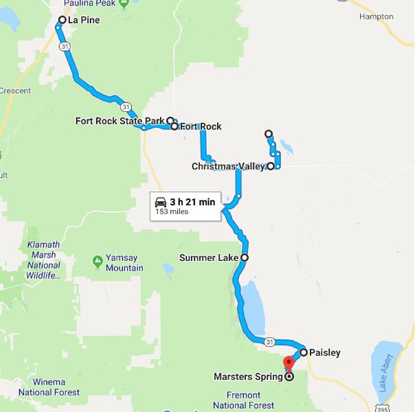
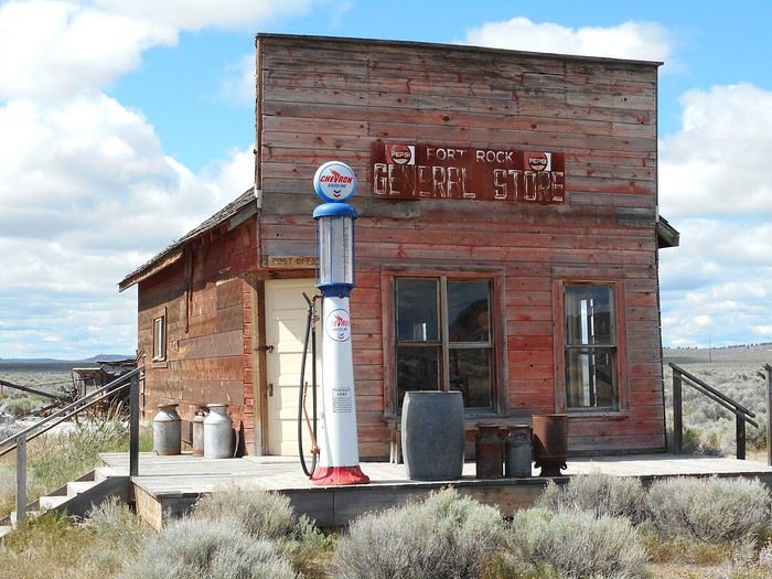
Jour 1 : Paris - Portland Jour 2 : Portland Jour 3 : Portland Jour 4 : Portland Jour 5 : Portland - Silverton - Portland Jour 6 : Portland - Astoria Jour 7 : Astoria - Lincoln City Jour 8 : Lincoln City - Florence Jour 9 : Florence - Brookings Jour 10 : Brookings (les "Redwoods") Jour 11 : Brookings-Roseburg Jour 12 : Roseburg - La Pine (via "Crater Lake") Jour 13 : La Pine - Paisley (via Fort Rock et Christmas Valley) Jour 14 : Paisley - Frenchglen (via Burns) Jour 15 : Frenchglen - Crane (via Alvord Desert) Jour 16 : Crane - Baker City (via Vale et Ontario) Jour 17 : Baker City - Union (via Elkorn Mountains) Jour 18 : Union - Hells Canyon (via Baker City) Jour 19 : Hells Canyon - La Grande (via Joseph) Jour 20 : La Grande -Kimberly (via Ukiah et John Day) Jour 21 : Kimberly- Fossil (via Mitchell) Jour 22 : Fossil-The Cove Palissade SP (via Madras) Jour 23 : The Cove Palissade SP - Smith Rock SP Jour 24 : Smith Rock SP- La Pine Jour 25 : La Pine (Newberry National Volcanic Monument) Jour 26 : La Pine - Sisters Jour 27 : Sisters (randonnée) Jour 28 : Sisters - Sisters ( via Mc Kenzie pass et Santiam pass) Jour 29 : Sisters- Hood River (via Redmond et The Dalles) Jour 30 : Hood River (Columbia Gorge) Jour 31 : Hood River (Mount Hood) Jour 32 : Hood River - Scott Mills ( via Government Camp) Jour 33 : Scott Mills -Salem Jour 34 : Salem Jour 35 : Salem - Portland Jour 36 : Portland Jour 37 : Portland - Paris (arrivée le lendemain)
Valmichel86
Jour 12 : dimanche 10 juin (Roseburg - LaPine)
Itinéraire
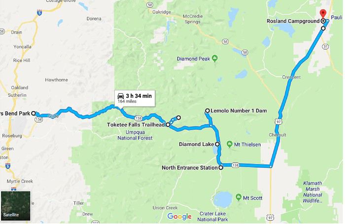
Impossible de tracer la partie dans "Crater Lake NP" car l'entrée nord est fermée.
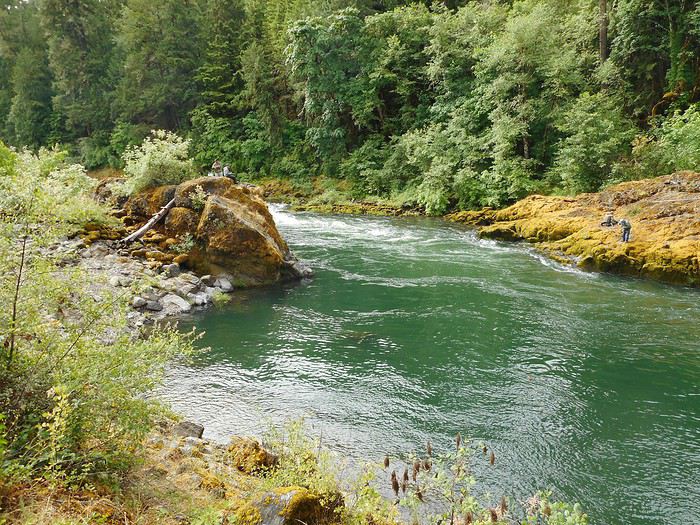
En fait le "whisler's bend campground" se situe à 10 kms de Roseburg le long de "North Umqua River" ; c'est cette vallée que je vais remonter pour aller vers "Crater Lake NP" . Il suffit de suivre la route 138 qui longe la rivière sur presque tout son parcours. Je pars et stoppe sur parking au bord de la rivière ; des dames papotent assises sur leur pliant : une tricote, une autre installe un chevalet. Il y a des pêcheurs plus loin au bord de la rivière ; à ma question, elles répondent qu'ils comptent attraper des "steelhead" ; je comprend que c'est une espèce de truite. La rivière a l'air idéale pour la pêche en effet.

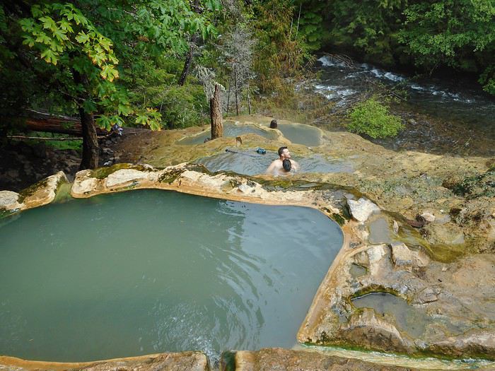
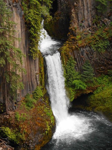
Deux autres arrêts rapides me font penser que cela doit être le paradis des pêcheurs. Mais c'est aussi une rivière à cascades et j'ai prévu de voir "Toketee Falls". Au panneau indicateur, je tourne à gauche, passe sur la rivière : à ma droite le lac, à ma gauche le parking de la cascade (où je reviendrai tout à l'heure), je continue le long du lac. Quelques kms. Je prends à droite une route qui devient une piste ; elle est gorgée d'eau, mais cela passe en berline et j'arrive sur un petit parking.Il y a tout près des sources chaudes "North Umqua Hot Springs". le parking est presque plein ; c'est un parking à "fee" (payant). Le sentier des "Hot Springs" démarre juste après le pont sur la rivière ; la montée est en dévers dans la forêt, glissante vu les pluies récentes et courte ; j'arrive aux "Hot Springs".

Il y a plusieurs bassins reliés par des rigoles . Celui du haut est le plus chaud (vraiment très chaud)... le plus bas est déjà à bonne température. On voit la rivière en contrebas. Je fais trempette un bon moment. Quand je reviens au parking, il est toujours plein. Comme il n'y avait que quelques personnes aux "hot springs", il doit y avoir des pêcheurs dans le coin. Revenu au parking de la cascade, je vais faire la randonnée ; elle est courte et le chemin très aménagé. La caractéristique est qu'on arrive à la cascade par en-dessus ; le sentier descend alors jusqu'à un point de vue en longeant un à-pic sur la gauche ; la cascade est en 2 ressauts, impressionnante ; cela vaut le coup de faire la randonnée.

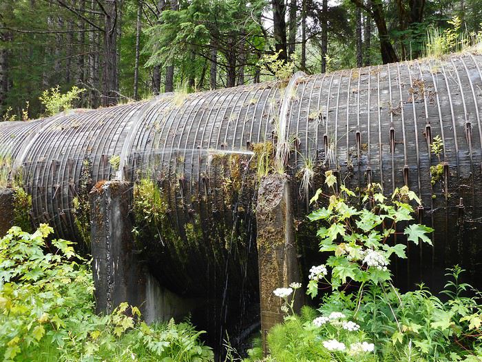
Je reviens pique-niquer sur le parking ; une conduite forcée fuit de partout.

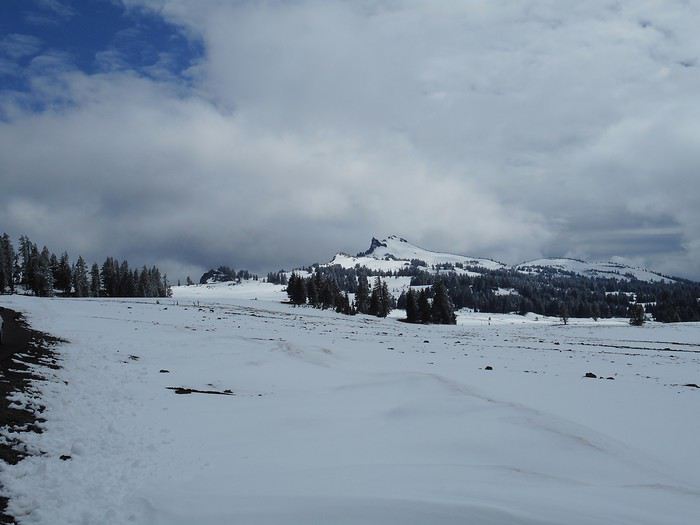
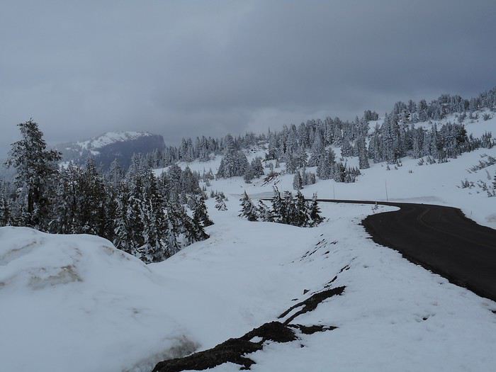
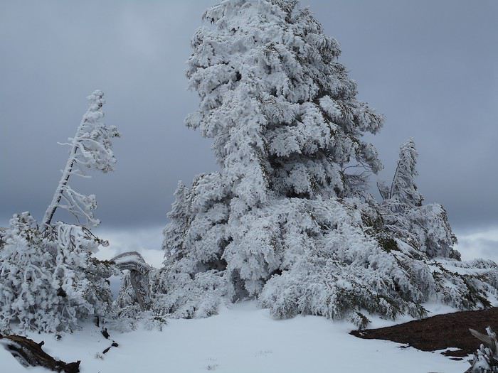
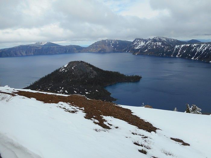
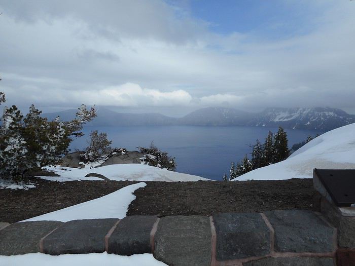
Il doit y avoir une prise d'eau dans le lac et une usine électrique quelques kms plus bas dans la vallée. Manque d'entretien ? En tout cas rafraichissement garanti quand il fait chaud l'été. Je reprends la route, fais 2 petits détours pour voir "Lemolo Lake" et "Diamond Lake" et arrive à l'embranchement qui mène à l'entrée nord de "Crater Lake NP" (on quitte la route 138). En pensant à son nom, on a le schéma du parc : au milieu en bas le lac , tout autour en haut une crête (le "rim") ; sur la crête une route fait le tout du lac ("rim drive") avec des belvédères sur le lac. La partie ouest de la route s'appelle "west rim drive" (un quart du tour complet), tout le reste du tour s'appelle "east rim drive". En venant du côté nord-ouest, on atteint la crête par un grand plateau incliné. Je roule sur ce plateau incliné et au fur et à mesure je me rends compte : quand il pleuvait en bas, ici il neigeait.


et le vent soufflait.


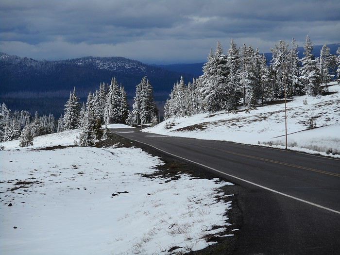
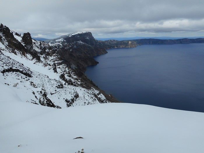
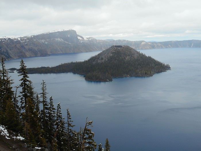
J'atteins la crête. Je vais voir le lac au premier belvédère (au NO), puis je parcours le "west rim drive" jusqu'à Rim Village en m'arrêtant encore une ou 2 fois. Je me réfugie dans le "visitor center" de Rim Village. Il fait 0 degré avec un fort vent d'ouest ; je ne suis pas équipé pour de telles conditions hivernales (dans la grotte cela allait, mais ici c'est autre chose) ; j'étais frigorifié après un arrêt de 5-10 minutes sur un belvédère. Je repars vers l'entrée nord . Nouveaux arrêts sur les belvédères pour compléter les photos.


Et je quitte "Crater Lake NP" par l'entrée nord. Je reprends la route 138 en direction de "Diamond Lake Junction".
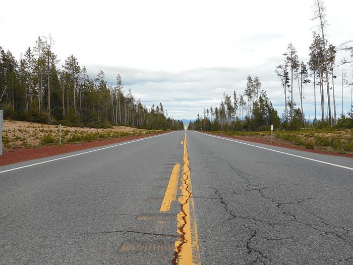
Recette de la "photo du roadtrip dans l'Ouest". Prenez une longue, longue ligne droite sans voiture en face, sans voiture derrière. Arrêtez vous. Descendez de voiture et allez au milieu de la chaussée. Au choix, restez debout, accroupissez vous, agenouillez vous, ou mettez vous à plat ventre et clic.

Je suis sur la route 138 sur le versant est de la chaîne des cascades. C'est la première fois que je peux faire ce type de photo depuis mon arrivée en Oregon.
A "Diamond Lake Junction", je prends la route 97 direction La Pine. Etape à La Pine à "Rosland Campground".
Impossible de tracer la partie dans "Crater Lake NP" car l'entrée nord est fermée.En fait le "whisler's bend campground" se situe à 10 kms de Roseburg le long de "North Umqua River" ; c'est cette vallée que je vais remonter pour aller vers "Crater Lake NP" . Il suffit de suivre la route 138 qui longe la rivière sur presque tout son parcours. Je pars et stoppe sur parking au bord de la rivière ; des dames papotent assises sur leur pliant : une tricote, une autre installe un chevalet. Il y a des pêcheurs plus loin au bord de la rivière ; à ma question, elles répondent qu'ils comptent attraper des "steelhead" ; je comprend que c'est une espèce de truite. La rivière a l'air idéale pour la pêche en effet.

Deux autres arrêts rapides me font penser que cela doit être le paradis des pêcheurs. Mais c'est aussi une rivière à cascades et j'ai prévu de voir "Toketee Falls". Au panneau indicateur, je tourne à gauche, passe sur la rivière : à ma droite le lac, à ma gauche le parking de la cascade (où je reviendrai tout à l'heure), je continue le long du lac. Quelques kms. Je prends à droite une route qui devient une piste ; elle est gorgée d'eau, mais cela passe en berline et j'arrive sur un petit parking.Il y a tout près des sources chaudes "North Umqua Hot Springs". le parking est presque plein ; c'est un parking à "fee" (payant). Le sentier des "Hot Springs" démarre juste après le pont sur la rivière ; la montée est en dévers dans la forêt, glissante vu les pluies récentes et courte ; j'arrive aux "Hot Springs".

Il y a plusieurs bassins reliés par des rigoles . Celui du haut est le plus chaud (vraiment très chaud)... le plus bas est déjà à bonne température. On voit la rivière en contrebas. Je fais trempette un bon moment. Quand je reviens au parking, il est toujours plein. Comme il n'y avait que quelques personnes aux "hot springs", il doit y avoir des pêcheurs dans le coin. Revenu au parking de la cascade, je vais faire la randonnée ; elle est courte et le chemin très aménagé. La caractéristique est qu'on arrive à la cascade par en-dessus ; le sentier descend alors jusqu'à un point de vue en longeant un à-pic sur la gauche ; la cascade est en 2 ressauts, impressionnante ; cela vaut le coup de faire la randonnée.

Je reviens pique-niquer sur le parking ; une conduite forcée fuit de partout.

Il doit y avoir une prise d'eau dans le lac et une usine électrique quelques kms plus bas dans la vallée. Manque d'entretien ? En tout cas rafraichissement garanti quand il fait chaud l'été. Je reprends la route, fais 2 petits détours pour voir "Lemolo Lake" et "Diamond Lake" et arrive à l'embranchement qui mène à l'entrée nord de "Crater Lake NP" (on quitte la route 138). En pensant à son nom, on a le schéma du parc : au milieu en bas le lac , tout autour en haut une crête (le "rim") ; sur la crête une route fait le tout du lac ("rim drive") avec des belvédères sur le lac. La partie ouest de la route s'appelle "west rim drive" (un quart du tour complet), tout le reste du tour s'appelle "east rim drive". En venant du côté nord-ouest, on atteint la crête par un grand plateau incliné. Je roule sur ce plateau incliné et au fur et à mesure je me rends compte : quand il pleuvait en bas, ici il neigeait.


et le vent soufflait.


J'atteins la crête. Je vais voir le lac au premier belvédère (au NO), puis je parcours le "west rim drive" jusqu'à Rim Village en m'arrêtant encore une ou 2 fois. Je me réfugie dans le "visitor center" de Rim Village. Il fait 0 degré avec un fort vent d'ouest ; je ne suis pas équipé pour de telles conditions hivernales (dans la grotte cela allait, mais ici c'est autre chose) ; j'étais frigorifié après un arrêt de 5-10 minutes sur un belvédère. Je repars vers l'entrée nord . Nouveaux arrêts sur les belvédères pour compléter les photos.


Et je quitte "Crater Lake NP" par l'entrée nord. Je reprends la route 138 en direction de "Diamond Lake Junction".
Recette de la "photo du roadtrip dans l'Ouest". Prenez une longue, longue ligne droite sans voiture en face, sans voiture derrière. Arrêtez vous. Descendez de voiture et allez au milieu de la chaussée. Au choix, restez debout, accroupissez vous, agenouillez vous, ou mettez vous à plat ventre et clic.

Je suis sur la route 138 sur le versant est de la chaîne des cascades. C'est la première fois que je peux faire ce type de photo depuis mon arrivée en Oregon.
A "Diamond Lake Junction", je prends la route 97 direction La Pine. Etape à La Pine à "Rosland Campground".
Valmichel86
Cela fait toujours plaisir de voir des personnes apprecier a sa juste valeur ce magnifique etat de l'Oregon. Je confirme c'est le plus bel endroit au monde 😉
Beautiful Oregon.
Elles sont supers ces North Umqua Hot Springs ! J'ai raté ça ! Pour une prochaine fois !
Ton expérience de Crater Lake est tellement différente de la notre ! C'est sur que là, tu ne pouvais pas tenter la baignade à Cleetwood Cove ! J'aimerais bien quand même visiter l'Oregon en hiver La neige à Crater Lake, les cascades gelées ... Ca doit être qqes chose !
Nell & Vince
http://www.nv-de-voyages.com/
Oregon 2018 >> https://voyageforum.com/discussion/oregon-fog-smoke-sun-fun-d9307978/
Cela fait toujours plaisir de voir des personnes apprecier a sa juste valeur ce magnifique etat de l'Oregon. Je confirme c'est le plus bel endroit au monde 😉
Je garde en effet un souvenir inoubliable de mon voyage en Oregon. Si cela transparait dans mon carnet, tant mieux. C'est ce que je voulais. Cet Etat le mérite bien.
Valmichel86
Ton expérience de Crater Lake est tellement différente de la notre ! C'est sur que là, tu ne pouvais pas tenter la baignade à Cleetwood Cove !
Oui, nous avons beaucoup de lieux en commun. Parfois : même lieu, expériences différentes. Parfois : même lieu, impressions identiques... comme à "Great Lava Tube".
Valmichel86
Jour 13 : lundi 11 juin (La Pine - Paisley)
Itinéraire

Ce matin je décide d'aller dans l'est de l'Oregon, et d'y aller en zigzagant via le sud de l'état. Je visiterai l'Oregon Cental tout proche (la région de Bend) en revenant de l'est. Je vais à l'office touristique pour compléter ma documentation et pars sur la route31, direction sud-est. La végétation change rapidement. Je prends une route à gauche pour aller à Fort Rock (je n'ai pas retrouvé de numéro dans ce secteur). A l'entrée du village, je stoppe près d'un petit musée. Il est fermé, mais c'est un musée de plein air et on voit les bâtiments depuis le parking. Ces bâtiments ont été transportés sur ce site depuis leur emplacement d'origine ; il y a des maisons, une église et le "general store".

Mais si le village s'appelle Fort Rock, il y a bien une raison. On voit un ensemble de rochers d'origine volcanique qui s'élèvent au-dessus du plateau. C'est un cercle, les parois extérieures sont verticales faisant penser à un fort circulaire entouré de palissades . C'est grand, plus d'un km de diamètre. Du côté du village, la palissade (les rochers) est inexistante, comme s'il y avait une brèche, et on peut voir l'intérieur du 'fort'.

Une route conduit au pied de l'ensemble ( parking, petit bâtiment, panneaux explicatifs) ; c'est "Fort Rock State Natural Area". Un sentier permet d'aller au centre du 'fort' (cela monte) et, en regardant par la brèche, on voit le plateau.

Le paysage s'appelle "sagebrush" (en français : steppe à armoise), mais " big sagebrush", c'est aussi la plante (armoise argentée). J'ai dû chercher ! Les panneaux incitent le visiteur à regarder le pied de la falaise.

Autrefois Fort Rock a été une île au milieu d'un lac et on peut voir où se trouvait le niveau du lac. Près de Fort Rock il y a une grotte dans laquelle on a trouvé les plus vieilles sandales du monde ; elles sont en écorce d'armoise ; elles ont 9000 ans ! (je ne sais pas si on peut les voir quelque part dans un musée) Qu'est-ce-qu-on apprend sur les panneaux ! Je reprends la route en direction de Christmas Valley. Le paysage est simple : plateau avec steppe à armoise et des grandes taches vertes là où c'est irrigué (fourrage).

A Christmas Valley, la curiosité est "Crack in the ground". Pour s'y rendre il faut prendre une piste de 10kms de long vers le nord ; rien n'est indiqué sur place (pas de panneau) si je me souviens bien. J'y vais ; ici il fait très beau, chaud ; rouler sur piste veut dire nuage de poussière. "Crack in the ground" est une fissure dans le plateau, une entaille ; j'arrive devant l'entrée ;

Je suis la fissure sur environ 500 mètres, tantôt au fond (elle est parfois obstruée par des blocs), tantôt sur le bord du plateau. Il parait qu'elle fait plus de 3 kms de long.

A partir de Christmas Valley, je prends une route qui retombe sur la route31 et, au carrefour, je tourne sur la route 31 direction sud. Je passe un col très peu marqué et j'arrive en vue de "Summer Lake".

Je contourne le lac par la droite, passant entre le lac et les montagnes "Winter Ridge".

Un peu après le bout du lac, il y a des sources chaudes "Summer Lake Hot Springs" . Elles sont exploitées commercialement (cabines, emplacements de camping) ; cela ferait une excellente étape. J'arrive devant l'entrée ; une grande banderole est déployée : "PRIVATE EVENT". Je n'ai pas de chance. Je vais jusqu'à Paisley ; je prends une route à droite qui remonte la "Chewaucan River" sur une bonne dizaine de kilomètres. Elle passe à côté d'un petit camping "Marster Spring" où je vais passer la nuit. Si vous cherchez un camping "paumé de chez paumé", venez ici.

Ce matin je décide d'aller dans l'est de l'Oregon, et d'y aller en zigzagant via le sud de l'état. Je visiterai l'Oregon Cental tout proche (la région de Bend) en revenant de l'est. Je vais à l'office touristique pour compléter ma documentation et pars sur la route31, direction sud-est. La végétation change rapidement. Je prends une route à gauche pour aller à Fort Rock (je n'ai pas retrouvé de numéro dans ce secteur). A l'entrée du village, je stoppe près d'un petit musée. Il est fermé, mais c'est un musée de plein air et on voit les bâtiments depuis le parking. Ces bâtiments ont été transportés sur ce site depuis leur emplacement d'origine ; il y a des maisons, une église et le "general store".

Mais si le village s'appelle Fort Rock, il y a bien une raison. On voit un ensemble de rochers d'origine volcanique qui s'élèvent au-dessus du plateau. C'est un cercle, les parois extérieures sont verticales faisant penser à un fort circulaire entouré de palissades . C'est grand, plus d'un km de diamètre. Du côté du village, la palissade (les rochers) est inexistante, comme s'il y avait une brèche, et on peut voir l'intérieur du 'fort'.

Une route conduit au pied de l'ensemble ( parking, petit bâtiment, panneaux explicatifs) ; c'est "Fort Rock State Natural Area". Un sentier permet d'aller au centre du 'fort' (cela monte) et, en regardant par la brèche, on voit le plateau.

Le paysage s'appelle "sagebrush" (en français : steppe à armoise), mais " big sagebrush", c'est aussi la plante (armoise argentée). J'ai dû chercher ! Les panneaux incitent le visiteur à regarder le pied de la falaise.

Autrefois Fort Rock a été une île au milieu d'un lac et on peut voir où se trouvait le niveau du lac. Près de Fort Rock il y a une grotte dans laquelle on a trouvé les plus vieilles sandales du monde ; elles sont en écorce d'armoise ; elles ont 9000 ans ! (je ne sais pas si on peut les voir quelque part dans un musée) Qu'est-ce-qu-on apprend sur les panneaux ! Je reprends la route en direction de Christmas Valley. Le paysage est simple : plateau avec steppe à armoise et des grandes taches vertes là où c'est irrigué (fourrage).

A Christmas Valley, la curiosité est "Crack in the ground". Pour s'y rendre il faut prendre une piste de 10kms de long vers le nord ; rien n'est indiqué sur place (pas de panneau) si je me souviens bien. J'y vais ; ici il fait très beau, chaud ; rouler sur piste veut dire nuage de poussière. "Crack in the ground" est une fissure dans le plateau, une entaille ; j'arrive devant l'entrée ;

Je suis la fissure sur environ 500 mètres, tantôt au fond (elle est parfois obstruée par des blocs), tantôt sur le bord du plateau. Il parait qu'elle fait plus de 3 kms de long.

A partir de Christmas Valley, je prends une route qui retombe sur la route31 et, au carrefour, je tourne sur la route 31 direction sud. Je passe un col très peu marqué et j'arrive en vue de "Summer Lake".

Je contourne le lac par la droite, passant entre le lac et les montagnes "Winter Ridge".

Un peu après le bout du lac, il y a des sources chaudes "Summer Lake Hot Springs" . Elles sont exploitées commercialement (cabines, emplacements de camping) ; cela ferait une excellente étape. J'arrive devant l'entrée ; une grande banderole est déployée : "PRIVATE EVENT". Je n'ai pas de chance. Je vais jusqu'à Paisley ; je prends une route à droite qui remonte la "Chewaucan River" sur une bonne dizaine de kilomètres. Elle passe à côté d'un petit camping "Marster Spring" où je vais passer la nuit. Si vous cherchez un camping "paumé de chez paumé", venez ici.
Valmichel86
Jour 14 : mardi 12 juin (Paisley - Frenchglen)
Itinéraire

Ce matin il fait frais (3 degrés) ; la température va vite monter et il fera chaud, même très chaud, toute la journée. Je fais une photo de l'emplacement, sous les pins ponderosa au bord de la rivière.

Je redescend à Paisley et repars sur la route 31 jusqu'à Valley Falls où je tourne à gauche.

Je suis prévenu : sur la route 395 la prochaine pompe est à Riley, 40 kms avant Burns. Il n'y a pas de pompe à essence, mais pas de village non plus et pas non plus de maisons isolées (sauf peut-être une ou deux). J'arrive rapidement au bord de Abert Lake ; cette région fait partie du "grand bassin" : les rivières ne coulent pas vers l'océan, mais vers des points bas où se trouvent des lacs ; Summer Lake hier, Abert Lake maintenant, et d'autres encore...

Leur niveau baisse en été, et ils peuvent même s'assécher complètement. Après Abert Lake, je roule dans un paysage de steppe à armoise (comme hier) sur des kilomètres.

Je vais refaire la "photo du roadtrip dans l'ouest" (On peut en faire des dizaines).

Et j'arrive ainsi à Riley, puis Burns. Je passe par hasard devant le Harney County Museum ; par curiosité je vais voir à quoi ressemble un musée d'histoire locale. Il y a de tout : des intérieurs de pièces reconstitués (mobilier), des outils, de la vaisselle commune, beaucoup de photos ( le même lieu photographié à 20 années d'écart présenté en 2 photos juxtaposées, le premier habitant propriétaire d'une voiture photographié à côté de sa voiture, la place le jour de "Independence Day", etc...), des cartes postales. Je tombe sur une carte postale représentant un village de Dordogne : en 1918, un soldat qui se trouvait en Dordogne l'a envoyée à sa famille. Les bénévoles qui s'occupent du musée n'ont jamais accepté que je paye mon entrée. Je quitte Burns par la route 205 en direction de Frenchglen. Je m'arrête à "Buena Vista Overlook" ; d'un côté la steppe à armoise, de l'autre une bande de vert où serpente une rivière qui va se jeter dans un lac (Malheur Lake).


Juste après "Buena Vista Overlook", je prends à gauche "South Diamond Lane", puis, quelques kms plus loin, de nouveau à gauche "Lava Bed Road" pour aller voir une zone volcanique "Diamond Crater Area". J'y vois des petits cratères, des roches volcaniques (que j'essaie de photographier de près) . Il n'y a aucun visiteur sur le site , les explications sont quasi inexistantes, le balisage aussi (on peut marcher où on veut) ; n'étant pas calé en volcanisme, je ne comprends pas bien ce que je vois ; j'aurais besoin de plus d'explications.


Je continue sur "Lava Bed Road" et j'arrive un peu plus loin à "Pete French Round Barn". Cet éleveur-marchand de bestiaux a fait construire un bâtiment circulaire, un corral.

Je reviens sur mes pas jusqu'à la route 205, et 30 kms plus loin, je suis à Frenchglen. Je vais faire étape à "Page Springs Campground" accessible par une piste en terre. Certains doivent se demander : "Mais, qu'est-ce-qu'il va f... ici ?". Eh bien, à l'est de Frenchglen, il y a un massif montagneux, "Steens Moutain", élevé (plus de 3000 mètres d'altitude). Depuis Frenchglen, on peut faire une boucle dans ce massif sur une piste "Steens Loop Tour Route". Cette route monte à 2800 mètres d'altitude ; c'est la route la plus haute d'Oregon. Voila une des raisons qui m'a amené ici. Mais je ne verrai pas , de l'intérieur du massif, les "Steens mountains" ; j'ai appris ce midi que la route est fermée (pas encore entièrement dégagée) et qu'elle ouvrira pendant la 2ième quinzaine de juin. Je fais une petite promenade au bord de la "Donner und Blitzen River" (beaucoup de moustiques). Pourquoi ce nom allemand ? Je reviens dîner au "Frenchglen Hotel".

C'est un hôtel historique (début 20ième siècle) qui appartient à l'état d'Oregon. On peut y dîner (il faut réserver pas trop tard dans l'après-midi). C'est une formule menu unique avec cuisine familiale. Quand j'arrive le patron a installé 2 tablées, une à chaque bout d'une rangée de tables accolées. Il n'y a pas de service à l'assiette ; les plats circulent, chacun se sert ; les convives discutent entre eux. Le plat principal était, ce soir là, du rôti de veau avec plusieurs plats de légumes gratinés au four, le tout, excellent. Il y avait 9 ou 10 convives ; le repas était préparé pour le double. Tout cela se déroule tôt en soirée ; quand les convives ont quitté la salle, il faisait encore jour, et pour longtemps.

Ce matin il fait frais (3 degrés) ; la température va vite monter et il fera chaud, même très chaud, toute la journée. Je fais une photo de l'emplacement, sous les pins ponderosa au bord de la rivière.

Je redescend à Paisley et repars sur la route 31 jusqu'à Valley Falls où je tourne à gauche.

Je suis prévenu : sur la route 395 la prochaine pompe est à Riley, 40 kms avant Burns. Il n'y a pas de pompe à essence, mais pas de village non plus et pas non plus de maisons isolées (sauf peut-être une ou deux). J'arrive rapidement au bord de Abert Lake ; cette région fait partie du "grand bassin" : les rivières ne coulent pas vers l'océan, mais vers des points bas où se trouvent des lacs ; Summer Lake hier, Abert Lake maintenant, et d'autres encore...

Leur niveau baisse en été, et ils peuvent même s'assécher complètement. Après Abert Lake, je roule dans un paysage de steppe à armoise (comme hier) sur des kilomètres.

Je vais refaire la "photo du roadtrip dans l'ouest" (On peut en faire des dizaines).

Et j'arrive ainsi à Riley, puis Burns. Je passe par hasard devant le Harney County Museum ; par curiosité je vais voir à quoi ressemble un musée d'histoire locale. Il y a de tout : des intérieurs de pièces reconstitués (mobilier), des outils, de la vaisselle commune, beaucoup de photos ( le même lieu photographié à 20 années d'écart présenté en 2 photos juxtaposées, le premier habitant propriétaire d'une voiture photographié à côté de sa voiture, la place le jour de "Independence Day", etc...), des cartes postales. Je tombe sur une carte postale représentant un village de Dordogne : en 1918, un soldat qui se trouvait en Dordogne l'a envoyée à sa famille. Les bénévoles qui s'occupent du musée n'ont jamais accepté que je paye mon entrée. Je quitte Burns par la route 205 en direction de Frenchglen. Je m'arrête à "Buena Vista Overlook" ; d'un côté la steppe à armoise, de l'autre une bande de vert où serpente une rivière qui va se jeter dans un lac (Malheur Lake).


Juste après "Buena Vista Overlook", je prends à gauche "South Diamond Lane", puis, quelques kms plus loin, de nouveau à gauche "Lava Bed Road" pour aller voir une zone volcanique "Diamond Crater Area". J'y vois des petits cratères, des roches volcaniques (que j'essaie de photographier de près) . Il n'y a aucun visiteur sur le site , les explications sont quasi inexistantes, le balisage aussi (on peut marcher où on veut) ; n'étant pas calé en volcanisme, je ne comprends pas bien ce que je vois ; j'aurais besoin de plus d'explications.


Je continue sur "Lava Bed Road" et j'arrive un peu plus loin à "Pete French Round Barn". Cet éleveur-marchand de bestiaux a fait construire un bâtiment circulaire, un corral.

Je reviens sur mes pas jusqu'à la route 205, et 30 kms plus loin, je suis à Frenchglen. Je vais faire étape à "Page Springs Campground" accessible par une piste en terre. Certains doivent se demander : "Mais, qu'est-ce-qu'il va f... ici ?". Eh bien, à l'est de Frenchglen, il y a un massif montagneux, "Steens Moutain", élevé (plus de 3000 mètres d'altitude). Depuis Frenchglen, on peut faire une boucle dans ce massif sur une piste "Steens Loop Tour Route". Cette route monte à 2800 mètres d'altitude ; c'est la route la plus haute d'Oregon. Voila une des raisons qui m'a amené ici. Mais je ne verrai pas , de l'intérieur du massif, les "Steens mountains" ; j'ai appris ce midi que la route est fermée (pas encore entièrement dégagée) et qu'elle ouvrira pendant la 2ième quinzaine de juin. Je fais une petite promenade au bord de la "Donner und Blitzen River" (beaucoup de moustiques). Pourquoi ce nom allemand ? Je reviens dîner au "Frenchglen Hotel".

C'est un hôtel historique (début 20ième siècle) qui appartient à l'état d'Oregon. On peut y dîner (il faut réserver pas trop tard dans l'après-midi). C'est une formule menu unique avec cuisine familiale. Quand j'arrive le patron a installé 2 tablées, une à chaque bout d'une rangée de tables accolées. Il n'y a pas de service à l'assiette ; les plats circulent, chacun se sert ; les convives discutent entre eux. Le plat principal était, ce soir là, du rôti de veau avec plusieurs plats de légumes gratinés au four, le tout, excellent. Il y avait 9 ou 10 convives ; le repas était préparé pour le double. Tout cela se déroule tôt en soirée ; quand les convives ont quitté la salle, il faisait encore jour, et pour longtemps.
Valmichel86
Jour 15 : mercredi 13 juin ( Frenchglen - Crane)
Itinéraire

A partir de Frenchglen, je vais continuer sur la route 205 en direction de Fields. C'est mon 3ième jour dans cette partie de l'Oregon : le "High Desert". C'est un pays de plateaux et de montagnes. L'altitude des plateaux doit dépasser 1000 mètres (Une traduction correcte de "high desert" est peut-être "désert d'altitude") ; les montagnes, elles, grimpent beaucoup plus haut.

Fields : c'est un pays sur la carte ; en fait c'est un motel-pompe à essence-magasin, plus quelques maisons. Je fais presque un demi-tour, et me dirige vers le nord sur "East Steens Road".

La route devient rapidement une piste et va le rester sur la majeure partie de sa longueur ; elle file vers les "Steens Mountains" qui sont bien plus imposantes vues d'ici que de Frenchglen. Elle se dévoie pour les contourner par l'est et arrive à proximité de "Alvord Desert".

"Alvord Desert" est un ancien lac très peu profond, à fond plat, aujourd'hui asséché. Je vais descendre sur la 'plage' et accéder au bord par une piste. Le lac mesurant 20 kms de long et 10 kms de large, je suis frappé par l'immensité.

A cette époque de l'année, le sol est dur (même craquelé) et on peut rouler dessus sans problème (une couche de boue peut se former en période plus humide). Je fais un petit tour, tout petit. Deux pratiquants de char à voile filent sur le 'désert'.


Revenu sur "East Steens Road", je vois quelques baraques en bois au bout d'une piste au bord du 'désert' ; c'est "Alvord Desert Hot Springs" , des sources chaudes (je ne m'y rendrai pas). Deux kms plus loin, je prends une mauvaise piste sur la gauche qui conduit au départ d'une randonnée ; c'est payant (le parking ou la randonnée, je ne sais plus) mais il n'y a pas de boîte où déposer le montant et il faut retourner aux "Hot Springs" pour payer ! Cette randonnée (Pike Creek Trail) est longue avec un fort dénivelé d'après les informations obtenues à Burns ; il n'y a pas d'ombre et il fait très très chaud. Elle est en aller-retour ; je préfère renoncer plutôt qu'être amené à faire demi-tour avant le but. La crête des "Steens Mountains" est toujours là sur la gauche. Elle domine de 1500 mètres le plateau où se trouve le 'désert' ; je pourrais être là haut avec une vue plongeante sur "Alvord Desert" si la route avait été ouverte.

Plus loin, à "Man Lake", je fais une halte. La chaleur est étouffante. Deux hommes sortent d'une camionnette et s'installent sur une table pour casser la croûte. Ce sont les 2 premières personnes que je vois depuis que j'ai quitté Frenchglen.

La piste redevient asphaltée à l'approche du croisement avec la route 78.

Je prends la route 78 vers Burns ; je vais m'arrêter avant Burns, à Crane où il y a des sources chaudes "Crystal Crane Hot Springs", avec possibilité d'hébergement (cabines, emplacement de camping) .

L'eau chaude alimente un bassin naturel. Tout autour du domaine, on voit... la steppe à armoise. Le bassin est accessible 24h/24. Baignade sous les étoiles.

A partir de Frenchglen, je vais continuer sur la route 205 en direction de Fields. C'est mon 3ième jour dans cette partie de l'Oregon : le "High Desert". C'est un pays de plateaux et de montagnes. L'altitude des plateaux doit dépasser 1000 mètres (Une traduction correcte de "high desert" est peut-être "désert d'altitude") ; les montagnes, elles, grimpent beaucoup plus haut.

Fields : c'est un pays sur la carte ; en fait c'est un motel-pompe à essence-magasin, plus quelques maisons. Je fais presque un demi-tour, et me dirige vers le nord sur "East Steens Road".

La route devient rapidement une piste et va le rester sur la majeure partie de sa longueur ; elle file vers les "Steens Mountains" qui sont bien plus imposantes vues d'ici que de Frenchglen. Elle se dévoie pour les contourner par l'est et arrive à proximité de "Alvord Desert".

"Alvord Desert" est un ancien lac très peu profond, à fond plat, aujourd'hui asséché. Je vais descendre sur la 'plage' et accéder au bord par une piste. Le lac mesurant 20 kms de long et 10 kms de large, je suis frappé par l'immensité.

A cette époque de l'année, le sol est dur (même craquelé) et on peut rouler dessus sans problème (une couche de boue peut se former en période plus humide). Je fais un petit tour, tout petit. Deux pratiquants de char à voile filent sur le 'désert'.


Revenu sur "East Steens Road", je vois quelques baraques en bois au bout d'une piste au bord du 'désert' ; c'est "Alvord Desert Hot Springs" , des sources chaudes (je ne m'y rendrai pas). Deux kms plus loin, je prends une mauvaise piste sur la gauche qui conduit au départ d'une randonnée ; c'est payant (le parking ou la randonnée, je ne sais plus) mais il n'y a pas de boîte où déposer le montant et il faut retourner aux "Hot Springs" pour payer ! Cette randonnée (Pike Creek Trail) est longue avec un fort dénivelé d'après les informations obtenues à Burns ; il n'y a pas d'ombre et il fait très très chaud. Elle est en aller-retour ; je préfère renoncer plutôt qu'être amené à faire demi-tour avant le but. La crête des "Steens Mountains" est toujours là sur la gauche. Elle domine de 1500 mètres le plateau où se trouve le 'désert' ; je pourrais être là haut avec une vue plongeante sur "Alvord Desert" si la route avait été ouverte.

Plus loin, à "Man Lake", je fais une halte. La chaleur est étouffante. Deux hommes sortent d'une camionnette et s'installent sur une table pour casser la croûte. Ce sont les 2 premières personnes que je vois depuis que j'ai quitté Frenchglen.

La piste redevient asphaltée à l'approche du croisement avec la route 78.

Je prends la route 78 vers Burns ; je vais m'arrêter avant Burns, à Crane où il y a des sources chaudes "Crystal Crane Hot Springs", avec possibilité d'hébergement (cabines, emplacement de camping) .

L'eau chaude alimente un bassin naturel. Tout autour du domaine, on voit... la steppe à armoise. Le bassin est accessible 24h/24. Baignade sous les étoiles.
Valmichel86
Jour 16 : jeudi 14 juin ( Crane - Sumpter)
Itinéraire

Je vais quitter ce matin la région du "High Desert" ; c'est une partie bien individualisée de l'Oregon , différente des autres, qui me laisse un seul regret : ne pas avoir pu faire la boucle en altitude dans les "Steens Mountains". De Crane, je roule plein nord jusqu'à Buchanan ; je prends alors la route US20 et vais la suivre (direction est) jusqu'à Vale. Entre temps, à Juntura, je rejoins la vallée de la "Malheur River".

Vale (une bourgade plutôt qu'une ville) possède une maison historique, "Stone House", la première maison en pierre construite ici ; elle est aménagée en musée (je ne visiterai pas).

Tous les panneaux d'information rappellent sa devise "Born and Raised on the Oregon Trail".

"Oregon Trail", vous avez tous vu l'image (au cinéma ou dans un livre) : la famille de pionniers avec l'attelage de boeufs et le chariot bâché. L'"Oregon Trail", c'est le chemin suivi par ces pionniers. Vale était une étape sur ce chemin, précisément le terme de l'étape Nyssa-Vale. Ils traversaient la "Snake River" à Nyssa, montaient un col ("Keeney Pass") puis redescendaient à Vale au bord de la "Malheur River". Près de "Keeney Pass", il y a un site où on peut voir la piste de l'Oregon Trail ; je monte "Keeney Pass" et, peu après le col, je stoppe sur le parking du site pour aller voir les traces laissées par le passage des chariots.

La végétation n'est pas la même à l'endroit du passage des roues des roues et à côté ; cela laisse une trace où l'herbe est moins dense. Je vais suivre la route jusqu'à Nyssa (elle n'est jamais très loin de la piste de l'Oregon Trail) ; vu la chaleur ambiante, j'aurai une idée de la difficulté de l'étape (les pionniers passaient ici en plein été). J'arrive ensuite à Ontario, traverse la ville et vais faire une pause dans un petit parc au bord de la "Snake River" ; de l'autre côté, c'est l'Idaho.

Puis direction Baker City par l'Interstate I84. Près de Farewell Bend, je sors de l'interstate pour aller voir - la "Snake River" qui rentre dans une gorge (c'est cette gorge qui devient "Hell's Canyon" en aval)

- et un autre site sur l'"Oregon Trail".


Il faut laisser aller son imagination sur ces sites de l'Oregon Trail ; les indices matériels sont légers, l'imagination doit faire le reste ( la ruée vers l'ouest, les chariots, les paysages, la chaleur, la poussière, ... ). J'aurai une vision plus documentée de ce mythe américain dans 2 jours. De retour sur l'Interstate, je vais jusqu'à Baker City ; je quitte la ville en direction de Sumpter (route 7) et m'installe à "Union Creek Campground" , 20 kms plus loin, au bord de "Phillips Lake".

Je vais quitter ce matin la région du "High Desert" ; c'est une partie bien individualisée de l'Oregon , différente des autres, qui me laisse un seul regret : ne pas avoir pu faire la boucle en altitude dans les "Steens Mountains". De Crane, je roule plein nord jusqu'à Buchanan ; je prends alors la route US20 et vais la suivre (direction est) jusqu'à Vale. Entre temps, à Juntura, je rejoins la vallée de la "Malheur River".

Vale (une bourgade plutôt qu'une ville) possède une maison historique, "Stone House", la première maison en pierre construite ici ; elle est aménagée en musée (je ne visiterai pas).

Tous les panneaux d'information rappellent sa devise "Born and Raised on the Oregon Trail".

"Oregon Trail", vous avez tous vu l'image (au cinéma ou dans un livre) : la famille de pionniers avec l'attelage de boeufs et le chariot bâché. L'"Oregon Trail", c'est le chemin suivi par ces pionniers. Vale était une étape sur ce chemin, précisément le terme de l'étape Nyssa-Vale. Ils traversaient la "Snake River" à Nyssa, montaient un col ("Keeney Pass") puis redescendaient à Vale au bord de la "Malheur River". Près de "Keeney Pass", il y a un site où on peut voir la piste de l'Oregon Trail ; je monte "Keeney Pass" et, peu après le col, je stoppe sur le parking du site pour aller voir les traces laissées par le passage des chariots.

La végétation n'est pas la même à l'endroit du passage des roues des roues et à côté ; cela laisse une trace où l'herbe est moins dense. Je vais suivre la route jusqu'à Nyssa (elle n'est jamais très loin de la piste de l'Oregon Trail) ; vu la chaleur ambiante, j'aurai une idée de la difficulté de l'étape (les pionniers passaient ici en plein été). J'arrive ensuite à Ontario, traverse la ville et vais faire une pause dans un petit parc au bord de la "Snake River" ; de l'autre côté, c'est l'Idaho.

Puis direction Baker City par l'Interstate I84. Près de Farewell Bend, je sors de l'interstate pour aller voir - la "Snake River" qui rentre dans une gorge (c'est cette gorge qui devient "Hell's Canyon" en aval)

- et un autre site sur l'"Oregon Trail".


Il faut laisser aller son imagination sur ces sites de l'Oregon Trail ; les indices matériels sont légers, l'imagination doit faire le reste ( la ruée vers l'ouest, les chariots, les paysages, la chaleur, la poussière, ... ). J'aurai une vision plus documentée de ce mythe américain dans 2 jours. De retour sur l'Interstate, je vais jusqu'à Baker City ; je quitte la ville en direction de Sumpter (route 7) et m'installe à "Union Creek Campground" , 20 kms plus loin, au bord de "Phillips Lake".
Valmichel86
Yep j'embarque pour ce carnet !
Je viens tout juste de reserver nos billets d'avions en vu d'un road trip de 10 jours début aout dans l'oregon !!!
Ton voyage étant assez court, tu vas devoir faire de sacrés choix sauf si tu as des centres d'intérêt très ciblés.
Valmichel86
Oui c’est certain, après notre voyage en avion est court quasi pas de décalage horaire on esquive déjà de gros inconvénients par rapport à nos voyages précédents 🤗
Le road trip sera ds les grandes lignes : arrivée à Portland où nous ne resterons pas du tout (on vit aux US les grandes villes américaines on connaît et du coup on va faire l’impasse sur cette ville) direction Multnomah Falls puis le mont Hood et nuit à Madras voir Bend. Ensuite 2 nuits à Crater lake, une nuit près de Klamath Falls (un peu plus au sud je pense) une ou deux nuits à Lassen Volcanic park, et ensuite les 4 nuits restantes se feront tout le long de la côte jusqu’a Cannon Beach.
Je peaufine tout ça justement et je suis un perdue du côté de Lassen les logements sont assez éloignés, on a déjà fait l’ouest plusieurs fois et Yellowstone également j’hesite Presque à ne pas y aller 😕
Bref je m’egare Je reprends la lecture de votre carnet 😊
Goooo !!
Hello Michel !
Tu nous emmènes dans des coins vraiment différents et inconnus !
Nell & Vince
http://www.nv-de-voyages.com/
Oregon 2018 >> https://voyageforum.com/discussion/oregon-fog-smoke-sun-fun-d9307978/
Bonjour,
ton programme me semble bien : une descente vers le sud par l'intérieur , une remontée le long de la côte. Pas trop de kms pour avoir le temps de profiter.
Je ne connais pas Lassen Volcanic ; je ne peux rien en dire. Mais si jamais vous n'alliez pas si au sud, l'Oregon Central propose plein de possibilités et Madras est bien situé pour rayonner dans ce secteur.
Valmichel86
Bonjour,
je quitte mon domicile aujourd'hui et je ne sais pas ce que j'aurai comme liaison internet là où je vais.
Si j'ai une bonne liaison, je continuerai mon carnet, mais encore plus lentement car j'aurai moins de temps.
Si je n'ai pas de liaison correcte, je le reprendrai au plus tard début avril et le terminerai avant la fin avril.
Merci de vous intéresser à ce carnet.
Valmichel86
Bonjour Nell et Vince,
dès que je quitterai l'est de l'Oregon, nous allons nous retrouver dans plein d'endroits :
les 3 sites de "John Day Fossil Beds NM", "Smith Rock State Park", entre autres.
Il y aura des choix différents à Salem.
La statue de Sacagawea ne sera pas la même que la votre.
Valmichel86
Jour 17 : vendredi 15 juin (Sumpter - Union)
Itinéraire

Je commence la journée par une promenade en lisière du camping ; il est situé tout près d'un lac artificiel sur la "Powder River" : "Phillips Lake".

Un camping loin de la ville, en pleine nature, en forêt, à côté d'un lac, d'une rivière ou d'un point de vue. Sur l'emplacement, un foyer ("fire ring") pour faire du feu le soir (quand c'est autorisé). Un confort sommaire. Il y a une multitude de campings de ce type en Oregon. C'est exactement ce que recherchent les Américains de l'Ouest pour camper en tente. Je quitte le camping en direction de Sumpter (route 7, puis route non numérotée). Dans ce coin (NE de l'Oregon), on a trouvé de l'or au début des années 1860. Plusieurs villes se créent, dont Sumpter qui connait un gros boum vers 1900. Vers 1910 une première drague est construite pour exploiter intensivement le lit de la rivière ; cela fonctionne jusqu'au milieu des années 20. En 1934, Roosevelt fixe le prix de l'once d'or à 35 $. L'exploitation reprend avec une nouvelle drague plus puissante ; elle est aujourd'hui restaurée et visible à "Sumpter Valley State Heritage Area". Je vais la visiter.

J'entre à l'intérieur du monstre.

Puis je suis le sentier qui parcourt les sédiments rejetés par la drague.

Sans cette activité touristique, la ville pourrait devenir une ville-fantôme. Une ville-fantôme (Ghost Town), il y en a une 25 kms plus loin : Granite (ici l'église).

En fait c'est une quasi ville-fantôme, car la population, qui a frôlé le zéro il y a 50 ans, a un peu augmenté depuis. Après Granite, la route prend plein nord puis repart vers l'est pour traverser les "Elkhorn Mountains" (altitude environ 2700 mètres). C'est la "Elkhorn Drive Scenic Byway".

Je passe un col (environ 1800 mètres d'altitude) et arrive dans une région de lacs. Voici "La Ronde Lake".

Un peu plus loin, une petite station de ski a été créée près d'"Anthony Lake". J'entame une longue descente qui conduit à "North Powder", puis, par la route 237, je rejoins "Union". Cette ville a gardé dans "Main Street" un ensemble de maisons historiques de la fin du 19ième siècle.

Je quitte "Union" par la route 203 vers le sud ; 10 kms plus loin, je m'arrête à "Catherine Creek SP" dans un camping au bord de "Catherine Creek" (encore une jolie rivière pour la pêche).


Je commence la journée par une promenade en lisière du camping ; il est situé tout près d'un lac artificiel sur la "Powder River" : "Phillips Lake".

Un camping loin de la ville, en pleine nature, en forêt, à côté d'un lac, d'une rivière ou d'un point de vue. Sur l'emplacement, un foyer ("fire ring") pour faire du feu le soir (quand c'est autorisé). Un confort sommaire. Il y a une multitude de campings de ce type en Oregon. C'est exactement ce que recherchent les Américains de l'Ouest pour camper en tente. Je quitte le camping en direction de Sumpter (route 7, puis route non numérotée). Dans ce coin (NE de l'Oregon), on a trouvé de l'or au début des années 1860. Plusieurs villes se créent, dont Sumpter qui connait un gros boum vers 1900. Vers 1910 une première drague est construite pour exploiter intensivement le lit de la rivière ; cela fonctionne jusqu'au milieu des années 20. En 1934, Roosevelt fixe le prix de l'once d'or à 35 $. L'exploitation reprend avec une nouvelle drague plus puissante ; elle est aujourd'hui restaurée et visible à "Sumpter Valley State Heritage Area". Je vais la visiter.

J'entre à l'intérieur du monstre.

Puis je suis le sentier qui parcourt les sédiments rejetés par la drague.

Sans cette activité touristique, la ville pourrait devenir une ville-fantôme. Une ville-fantôme (Ghost Town), il y en a une 25 kms plus loin : Granite (ici l'église).

En fait c'est une quasi ville-fantôme, car la population, qui a frôlé le zéro il y a 50 ans, a un peu augmenté depuis. Après Granite, la route prend plein nord puis repart vers l'est pour traverser les "Elkhorn Mountains" (altitude environ 2700 mètres). C'est la "Elkhorn Drive Scenic Byway".

Je passe un col (environ 1800 mètres d'altitude) et arrive dans une région de lacs. Voici "La Ronde Lake".

Un peu plus loin, une petite station de ski a été créée près d'"Anthony Lake". J'entame une longue descente qui conduit à "North Powder", puis, par la route 237, je rejoins "Union". Cette ville a gardé dans "Main Street" un ensemble de maisons historiques de la fin du 19ième siècle.

Je quitte "Union" par la route 203 vers le sud ; 10 kms plus loin, je m'arrête à "Catherine Creek SP" dans un camping au bord de "Catherine Creek" (encore une jolie rivière pour la pêche).

Valmichel86
Bsr,
Merci pour la publication de tes étapes, cela permet d'avoir une vision globale de ton périple, j'essaierai de le mettre sur une carte google pour mieux le visualiser.
Oui effectivement je trouve aussi que la publication d'un carnet prends beaucoup de temps même si j'y trouve du plaisir, on sait quand on commence on se sait pas quand on fini! D'ailleurs j'ai pris beaucoup de retard dans la publication et la mise au propre et en page de mes 3 derniers voyages.
Merci donc pour la publication du tien.
Merci pour la publication de tes étapes, cela permet d'avoir une vision globale de ton périple, j'essaierai de le mettre sur une carte google pour mieux le visualiser.
Oui effectivement je trouve aussi que la publication d'un carnet prends beaucoup de temps même si j'y trouve du plaisir, on sait quand on commence on se sait pas quand on fini! D'ailleurs j'ai pris beaucoup de retard dans la publication et la mise au propre et en page de mes 3 derniers voyages.
Merci donc pour la publication du tien.
Jean Maurice
Voyager c'est la seule dépense enrichissante.
Travel with an Airstream travel trailer, and See more, Do more, Live more
Voyager c'est la seule dépense enrichissante.
Travel with an Airstream travel trailer, and See more, Do more, Live more
Log in first, then come back to this page.
You might also like
More discussions
This trip had been on my mind for about fifteen years.
But the discomfort of overnight stays, the difficulty of communication, and the prices of the few car rentals kept making me postpone the project.
And then, everything fell into place—I told myself, now’s the time!
Preparations took longer than usual; the destination is still far from mainstream.
A bit of Kazakhstan? Not in the end.
The south or not? Yes, in the end.
Pre-book or play it by ear? Only two stops were a leap into the unknown.
To help me find the ideal route, I made great use of this forum (thanks to everyone for patiently answering my questions!), pored over travel journals and blogs (Christian, Jeff), zoomed in on Google Maps and Yandex, and bought the guide published by OunTravela on this destination (the guide has been updated since).
---/---
You’ve got your passport, international driver’s license, bank cards, and euros?
Off we go to Lyon—just one night left before our early morning flight.
Tomorrow night, we’ll be sleeping in Bishkek! (‘Beefsteak’ for my partner’s mischievous nephews...)

You’ll find here a post with some practical info.
But the discomfort of overnight stays, the difficulty of communication, and the prices of the few car rentals kept making me postpone the project.
And then, everything fell into place—I told myself, now’s the time!
Preparations took longer than usual; the destination is still far from mainstream.
A bit of Kazakhstan? Not in the end.
The south or not? Yes, in the end.
Pre-book or play it by ear? Only two stops were a leap into the unknown.
To help me find the ideal route, I made great use of this forum (thanks to everyone for patiently answering my questions!), pored over travel journals and blogs (Christian, Jeff), zoomed in on Google Maps and Yandex, and bought the guide published by OunTravela on this destination (the guide has been updated since).
---/---
You’ve got your passport, international driver’s license, bank cards, and euros?
Off we go to Lyon—just one night left before our early morning flight.
Tomorrow night, we’ll be sleeping in Bishkek! (‘Beefsteak’ for my partner’s mischievous nephews...)

You’ll find here a post with some practical info.
From Southern Shikoku, between land and sea, to the blue waters of Miyakojima and finally Tokyo’s megacity
Hi everyone,
I have to admit, I really hesitated before deciding to write this travel journal... Writing one takes a lot of time and energy, and since this is my 4th trip, I wondered if it would even interest anyone other than myself (both for the discovery and the writing). But after a few people asked, "Are you going to write a journal?" and especially after rediscovering the joy of reading other travelers’ journals about Japan or elsewhere on this forum, I’ve decided to share my 4th installment in the Land of the Rising Sun here.
The itinerary: 27 full days, from late May to late June 2025, right in the middle of the rainy season, including:
-->13 days in Shikoku, from Kochi (Kochi Prefecture) to Matsuyama (Ehime Prefecture)

-->7 days in Miyakojima (Okinawa Prefecture)

-->7 days in Tokyo

The trip was decided on fairly last-minute again this year.
Since I regularly check flight prices to track fluctuations for this destination even without concrete plans, stumbling upon a slightly cheaper direct flight (900 €) than what I’d seen in previous months (around 1,200–1,400 € on average) for a Paris-Tokyo route with Japanese airline ANA was too tempting to resist the urge to return to this enchanting country. After much hesitation between exploring the San’in region (Matsue, Tottori, Yamaguchi) and Southern Shikoku, the decision was made—I took the plunge! The ticket is booked: Paris to Kochi with a layover in Tokyo, all with ANA, the airline I’d been dreaming of... for 1,120 € per person. Okay, it’s not cheap, but it’s better than in 2023.
Departure in 2 weeks! Now I just have to get everything ready!
Intense prep work over these next 2 weeks to:
finalize a more precise itinerary and reach an agreement—yep, because even though we both love Japan, our preferences differ slightly, and we have to choose between exploring new places or revisiting beloved spots... decide how much time to spend in each area without rushing while still exploring research places that might interest us and watch videos about Japan book accommodations: yes, it’s possible to do this on the spot, but last year, we realized that last-minute options were pretty expensive, so we’re booking ahead—though we’ll keep a few options open in case better deals pop up later reserve rental cars order yen check the weather regularly and wonder if choosing the *tsuyu* (rainy season) was really a good idea—are we going to be drenched the whole time???
"What hard work," you might say! Going to Japan for a month—what a tough life! Despite this being my 4th trip, the excitement is just as intense as the first time.
The only small downside is that when we booked the flight, there weren’t many seats left, so we’re only sitting together on the international return flight. Plus, on the way there, we have middle seats. Another lingering question: what French-language films will be available? According to the internet, the selection seems limited. Oh well, these are just minor details—it’s already time to fly! PS: I’ll be posting slowly and irregularly... so for those interested, be patient, and maybe set an alert...
Hi everyone,
I have to admit, I really hesitated before deciding to write this travel journal... Writing one takes a lot of time and energy, and since this is my 4th trip, I wondered if it would even interest anyone other than myself (both for the discovery and the writing). But after a few people asked, "Are you going to write a journal?" and especially after rediscovering the joy of reading other travelers’ journals about Japan or elsewhere on this forum, I’ve decided to share my 4th installment in the Land of the Rising Sun here.
The itinerary: 27 full days, from late May to late June 2025, right in the middle of the rainy season, including:
-->13 days in Shikoku, from Kochi (Kochi Prefecture) to Matsuyama (Ehime Prefecture)

-->7 days in Miyakojima (Okinawa Prefecture)

-->7 days in Tokyo

The trip was decided on fairly last-minute again this year.
Since I regularly check flight prices to track fluctuations for this destination even without concrete plans, stumbling upon a slightly cheaper direct flight (900 €) than what I’d seen in previous months (around 1,200–1,400 € on average) for a Paris-Tokyo route with Japanese airline ANA was too tempting to resist the urge to return to this enchanting country. After much hesitation between exploring the San’in region (Matsue, Tottori, Yamaguchi) and Southern Shikoku, the decision was made—I took the plunge! The ticket is booked: Paris to Kochi with a layover in Tokyo, all with ANA, the airline I’d been dreaming of... for 1,120 € per person. Okay, it’s not cheap, but it’s better than in 2023.
Departure in 2 weeks! Now I just have to get everything ready!
Intense prep work over these next 2 weeks to:
finalize a more precise itinerary and reach an agreement—yep, because even though we both love Japan, our preferences differ slightly, and we have to choose between exploring new places or revisiting beloved spots... decide how much time to spend in each area without rushing while still exploring research places that might interest us and watch videos about Japan book accommodations: yes, it’s possible to do this on the spot, but last year, we realized that last-minute options were pretty expensive, so we’re booking ahead—though we’ll keep a few options open in case better deals pop up later reserve rental cars order yen check the weather regularly and wonder if choosing the *tsuyu* (rainy season) was really a good idea—are we going to be drenched the whole time???
"What hard work," you might say! Going to Japan for a month—what a tough life! Despite this being my 4th trip, the excitement is just as intense as the first time.
The only small downside is that when we booked the flight, there weren’t many seats left, so we’re only sitting together on the international return flight. Plus, on the way there, we have middle seats. Another lingering question: what French-language films will be available? According to the internet, the selection seems limited. Oh well, these are just minor details—it’s already time to fly! PS: I’ll be posting slowly and irregularly... so for those interested, be patient, and maybe set an alert...
The story of a trip to Morocco, from the first to the last day—otherwise, it wouldn’t have made sense...
Marrakech... then four days on foot in the desert, alone with a guide, a camel driver, and two dromedaries... and Marrakech again.
Everything mattered, even the smallest details, so this is a (very) long story.
Behind the descriptions and anecdotes, there’s emotion, intimacy, and... soul-searching.
All the things it’s strangely easier to share this way, all the things it’s strangely easier to share with people you don’t know...
I have beautiful images in my eyes, but only a few are visible—if you read carefully, you’ll understand why.
The other photos are imagined, created upon returning with souvenirs and a bit of staging.
But everything is authentic.
Since I’ve been back, sometimes at night I open my eyes and don’t know where I am... Sleepless night, starry night, night of communion, connected night... In that suspended moment, between wakefulness and sleep, which makes you so receptive... Communion with whom? Connected to what? Lila gnawa... lila de derdeba.
The desert, a solitary path. You step in, and you’re immediately in the essential...
Wednesday... My companion drops me off at Orly Ouest... There are two hours before boarding. My MP3 player turns on but that’s it. It freezes—no commands work, and nothing fixes it... Smile... A trip without music, then? And the first anchor falls away.
(Photo...) ... Passport, tickets, receipts, labels...
Nose pressed to the window for the entire flight... Descending over Marrakech, at low altitude, a pretty mosaic—shades of pink and ochre dotted with green, but also, to the right, less harmonious, aligned cubes. Housing developments under construction? A bumpy, turbulent landing—the plane circles for a long time before touching down.
Welcomed by the familiar, unchanged sound of creaking doors and seats in the little taxis. In Casablanca, it was red Simca 1000s with meters; here, they’re yellow, and you have to negotiate the price. I have no talent for that, so here’s 100 DH!
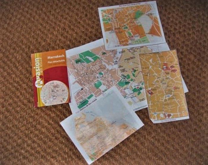
Traversed and forgotten
Marrakech... Sunny, luminous, sensual. Torn between tradition and modernity... Shimmering and fragrant, very noisy... rather polluted? On the road, horses and donkeys still mingle with vehicles... and watch out for traffic when crossing! It’s always a strategic—and athletic—adventure: at what exact moment do you sprint to the opposite sidewalk? And why aren’t any street names marked?
Afternoon on foot, heading to the Bab Doukkala bus station... A landmark: the McDonald’s, then a square with a fountain. Then turn left onto Avenue Hassan II. There’s a bus to Zagora Friday morning, but I can only buy the ticket tomorrow. On the way back to the hotel, at a kiosk on the corner, I buy *Tel Quel*, which I read with great interest online.
Thursday... Early morning, walking to Place Jemaa el-Fna, calm and almost deserted... I don’t get a good deal buying two small daggers for my kids. No talent for haggling—it takes more than charm for that... So I’ll pick the rest of my gifts at the artisan center on Avenue Mohammed V, where prices are marked, and it’s a pleasure to watch the craftsmen work... For my daughter, a satchel and earrings. The satchel smells like goat. The earrings are hand-chiseled in front of me by a very young man with nimble fingers—marvels of delicacy and fragility. Then I linger for a long time in the souk alleys. Scents of leather, thuya and cedar wood, wool and copper... Familiar smells... Childhood memories...
Dear daggers
Earrings
Back at the bus station, an unexpected change: no bus Friday morning, but a departure tonight at 8:30 PM... I have a little time before packing, so I take a long detour: Boulevard de Safi, then right onto Avenue El Mansour to the Majorelle Garden... A quiet pause. Rare plants, all kinds of cacti—smooth, fuzzy, bristling with spines... strange, squat, or stretched-out shapes. An infinite variety of greens, and that famous blue... The song of birds, the sun and shadows playing in the water basins... Time flows lazily. I write postcards—they’ll arrive long after I’m back...
Back to the hotel. Avenue El Mansour, Boulevard Zerktouni—okay, but why are the small street names never marked?!! I get a little lost...
I hope you got my MMS, because before leaving, I left something for you at the front desk...
8 PM, night has already fallen. Arriving at the bus station, and then... Then, a step back... A dense crowd, a tangle of buses... Where to go?... Rare woman, lone foreigner, backpack... I’m quickly spotted, surrounded, poorly guided... Someone with a badge finally points me to the right sidewalk. The bus isn’t there, and the sidewalk is already packed, mostly with men. Will I even get a seat?... Three young men are particularly insistent... They want to know where I’m going and why, if someone is with me, if I’m expected... I answer with a smile. A bit tricky—choosing words, staying polite while evasive... Their French is hesitant, my Arabic is more than rudimentary... Actually, I shouldn’t have tried... Their tone becomes a bit... aggressive, and their eyes light up. Uh-oh... They say they’re students, but what of?... Want to know what I think of the Quran and Allah, what I think of holy war, if I’m "for the Americans," "for the Palestinians"... Other travelers intervene... And the bus still isn’t here... The speech turns fanatical... Then, my smile freezes a little... A small wave of panic, so I send a "freaked out" MMS... (But who else could I send it to?) Then, in this dark crowd, a light dressed in white... Nabila, a young student heading to Zagora for vacation, she speaks French... She plants herself in front of them and scolds them thoroughly. I didn’t catch everything, but it worked! The three troublemakers retreat. Plus, they weren’t on the right sidewalk, and their bus is about to leave without them...
Nabila and I manage to board and sit side by side... The bus leaves two hours late. The trip is long, a bit uncomfortable, slowed by many stops—it was very cold...
Friday... A little stiff, a little dazzled, a little chilled, arriving in Zagora at dawn with the sunrise... Magical! Craving something warm... And then, a heartfelt gift—kindness and hospitality—Nabila invites me to her home. Warm welcome from her mother and siblings, not at all surprised to see me show up so early to share their breakfast! A few hours in their company... We exchange addresses, and the youngest brother, Nouamare, gives me a children’s storybook...
Noon, at *La Fibule du Draa* Lahcen Sarti, the owner... I finally put a smile and a face to an email exchange... He shows me the trek route on the map, laughs when I tell him about my night on the bus, and sends me to rest by the pool... No swimsuit, so a lounge chair and a book... A book that will accompany me into the desert and which I’ll finish in Marrakech, in the Koutoubia Garden...
Saturday, Day 1... When I wake up this morning, I know the desert sand will also absorb my blood...
Early departure for four days and three nights, alone, as I wished, with a young guide, Mohammed, and a younger camel driver, Abdou. We’ll be together 24/7, and we won’t see a soul until we reach the fixed campsite on the third evening. Everything we need is loaded onto two dromedaries. And in those baskets, there are miracles—a *Prévert*-style inventory I’ll discover bit by bit, like... a tray for glasses, a basket for bread, a sugar loaf and small glasses for tea, but... large glasses and sugar cubes for coffee, spices, oranges, vegetables, raw eggs!... That won’t break, *La Vache qui Rit*... And so many other unexpected wonders, so surprising in the middle of the desert... (*La Vache qui Rit* is the desert butter. Every morning for breakfast, it was coffee with Nido powdered milk and *kesra* with *La Vache qui Rit* and Aïcha apricot jam... A delight.)
Start of the journey, and the beginning of a long, long walk... We’ll cover 80 km in three days, crossing all kinds of landscapes until the real desert of sand and dunes... I’ll drink water from wells, eat raw vegetables, sleep on a mattress that saddles the dromedaries by day... I’ll forget all the warnings and all my hygiene references... My body will quiet its complaints. No heat, no thirst, no fatigue, no trouble of any kind... just woken by the cold every morning around 6 AM... I take off my watch. Like my companions, I’ll live by the sun’s rhythm...
Abdou leads the dromedaries, so he walks at their pace. Sometimes, we’re grouped together. Sometimes the two guides are together, and I walk behind. Sometimes we talk. Nothing is forced, no discomfort. It’s a simple, harmonious dance—one foot in front of the other, following your shadow as it turns with the sun... Each step leaves behind the useless, the cumbersome, the superfluous... Room for intimacy... Room for silence... Room for the inner self... Facing yourself... I find seashells, and with my eyes closed, I smell the sea...
... One foot in front of the other...
I take out my camera... Capacity for a hundred shots, but it’ll be 10 photos, no more. It freezes—no commands work, and nothing fixes it... Smile... A trip without photos, then? And the second anchor falls... I think of my MP3 player...
... A few photos among the ten...
Noon... Unsaddling the dromedaries, which immediately wander off in search of food. And before the meal cooked by Mohammed, the mint tea ritual, prepared by Abdou in a tiny teapot... Thick, frothy, very sweet tea... He serves it on a tray with dates, peanuts, and raisins... And it’ll be like this every day, noon and night...
We gradually get to know each other... Mohammed, 25 years old... Calm, very introspective, almost ascetic, he knows the desert well and loves it... So at ease that he’ll walk in slippers or barefoot, no matter the terrain... When I’m behind him, the advertisement on the back of his sweatshirt makes me smile... There’s a date: January 8, 2003... A little wink from life? (I have a clear memory of that day.) Abdou, barely 20, with a round, jovial face. The mint tea master... When he hands me my glass, he says "Bismillah," and I respond in kind... A joker and a foodie. Thrilled that I only eat vegetables, he’ll have double the meat!
... Abdou and his teapot...
... Mohammed...
Late afternoon, a well... Abdou waters the dromedaries, and Mohammed fills the canteens. The caps aren’t watertight, so he wedges a piece of plastic bag found in one of the baskets and screws it on top... Forget all hygiene warnings...
First night in a tent at the foot of Jebel Baní...
... Jebel
Sunday, Day 2... Crossing and ascending Jebel Baní... A mineral, lunar landscape—rocks the color of burnt bread and anthracite gray. I pick up pretty pebbles, and Mohammed finds me a fossilized stone... Lunch in a deserted nomad oasis... When we resume our walk, the wind picks up. A wind that only blows in April, violent, terrible—the *Sahli*... Swirls of sand and gravel. Where’s the sky, where’s the earth... everything is dust, everything is yellow and opaque... The gusts are so strong they make us stagger. At times, we even have to crouch to avoid falling. In the acacia forest, Abdou and the dromedaries are only a few meters ahead, yet we can’t see them... We’ll later learn that on that day, planned excursions were canceled... That a group got lost and had to be picked up by 4x4... But Mohammed has a sense of the desert. He’s calm, he guides us... so we continue, and I trust him. He wraps a *chèche* around my head—a fragile barrier against these onslaughts... We have to keep moving, and it’s difficult... But the desert has accepted me, so without resistance, I accept it... And the sand gets everywhere... in my mouth, crunching between my teeth, in my eyes, ears, and nostrils... in my hair... A fine ochre layer covers my face and body, even under my clothes. I’ve become a sand woman... Communion... Fusion with the mineral. I absorb the desert’s prodigious power, just as the desert absorbs my blood...
We walked for four hours, pushed by this furious wind, before stopping for the night under an acacia... There, we had to set up the tent, which they did with difficulty. Then we had to weigh it down... So the utensils and the mint tea tray served as shovels to cover the edges with sand. Then Abdou took care of the dromedaries, holding one of their front legs bent with a rope to keep them from wandering too far... Then we brought everything into the tent and collapsed... but not for long.
Mohammed prepared kingly meals at noon and night with the wonders in the baskets: finely chopped raw vegetable salad, vegetable tagine, soup (and not from a packet!)... Even the canned sardines were garnished with thin orange slices... After this exhausting day for all of us, I told him that bread with *La Vache qui Rit* would be enough... He looked at me with a big smile and said his evening ritual phrase: "Now, Laurence, sit down, take your time, take your book..." He pulled his sand-filled utensils from the miraculous basket, his stove, some vegetables, and made us couscous (and not from a box!), couscous he rolled between his hands... Meanwhile, Abdou took out his sand-filled teapot, his sugar loaf, the peanuts, the dates... The mint tea ritual, like every day, noon and night...
Outside, the wind keeps blowing, stirring up sand whirlwinds... So I won’t go out like the other night to brush my teeth and hair. Just a wipe on my face to remove the dust... Mohammed turns off the gas lamp, and I curl up in my sleeping bag. The dromedaries have moved closer to my side of the tent, and the moonlight stretches their shadows on the canvas. They’ve settled in and make strange noises... We fall asleep very quickly...
Monday, Day 3... My two companions are still asleep when the cold wakes me at 6 AM, like every morning... Everything seems so calm—the wind has stopped... I untie the tent door and... A pure blue sky, gradually tinted with pink and flaming orange. The sun rises before my dazzled eyes. A day of light begins: no trace of yesterday’s storm, except sand... everywhere.
So, breakfast with sand... Then we shake out everything that can be shaken, sending clouds of dust flying... Then Abdou gives the dromedaries back their fourth leg, and we continue the journey.
After the expanses of stones and shrubs on the first day, the rocky ridges of Jebel Baní, and the acacia forest on the second day, the landscape changes, softens... We arrive in the desert as you imagine it, as you dream it, as you’ve seen in thousands of photos: endless golden dunes, in harmonious hollows and curves... The desert of sand... vast, fascinating...
Last meal for the three of us... Tonight, we’ll arrive at the fixed campsite, and we won’t be alone anymore. The break stretches on... So, a little apart on the smooth sand, I write a few words... an obvious truth... entrusting a secret to the desert. In a small box, I’ll bring back some of this magical sand...

.. A secret in the desert...
Abdou grabs my notebook and draws the dunes. Mohammed draws Abdou and his dromedaries... I learn to do dishes with the contents of a single glass of water... A tiny bird lands on my bag... A bird!... in the middle of nowhere!... The dromedaries seem to relish the acacia branches, thorns and all...
Desert drawings
We set off again... The dunes are higher... Easy to climb, the desert has sensual, feminine curves. A giant’s hand would fit its reliefs like a caress on a soft, supple body... The setting sun gives the landscape colors of amber and spices, cinnamon reflections... The sand offers me pink pebbles and pieces of white quartz that sparkle... I also find a black stone... Mystery...
Pink pebbles, fossilized pebbles, sparkling pebbles, and a black stone
Late afternoon, arrival at the fixed campsite at the foot of Erg Lihoudi... The guardian, Lahcen, a whirlwind of chatter and energy, welcomes us with mint tea. He quickly pegs me: "You do yoga, right?" He tells lots of anecdotes about his "clients," ending every sentence with: "No problem! *Machi mouchkil*... *Machi mouchkil*, no problem!" Around the tents, dozens... hundreds of big black beetles swarm on the sand... As I shudder, Lahcen gently picks one up and wants to put it on my hand: "*Machi mouchkil*! It doesn’t sting!"... I hold out a hesitant palm... Despite Lahcen’s infectious enthusiasm, I don’t like this last evening. Two groups arrived by 4x4 to spend a night in the desert... Noise of engines, cameras, voices, and exclamations... An intrusion into my bubble... I keep my distance... They’ll leave very early the next morning...
Memory of beetles
Tuesday, Day 4... Standing still on a sand dune, I see both the full moon and the sun in the same sky... A luminous face-off. Magical, overwhelming... Then the moon paled, and the sun blazed brighter. It wasn’t quite night anymore, but day wasn’t far off... The Sacred, Mystical universe unfolded before me... A moment of grace that made my heart beat a little faster... Something indescribable gradually filled me, with infinite gentleness, to the depths of my soul... Facing this unlikely encounter, hesitations, reluctance, and fears seem so trivial... What are we if not fragments of this universe where everything is united... everything is connected...
Then comes the intention of a new message: "I’d love to put a face to..." But in this exchange scattered with misunderstandings, could you receive the intention without interpreting it?...
I stayed a long time on that dune, under the spell... Standing, barefoot and rooted... heart open... Receptive... in Unity between the infinitely small grain of sand and the infinitely vast universe... I hadn’t come to seek anything, yet the generous Earth offered its energy, its subtle strength to every cell of my body, and filled my soul with light... In exchange for this blood spilled on the sand over these four days?...
Give to Receive... Receive and Give... like a signed pact.
What exiled me from my life, disrupting all my bearings, drew me here... A necessary passage through space, withdrawal, and silence... for another birth?... The real desert after the symbolic desert... Pausing for a moment, as if at a crossroads. Connecting before continuing... If this path leads to the essential, then this path has a heart and will continue...
At the foot of the dune on the way down, I found a little Fatima’s hand made of beads. A gift from the desert...
Gift from the desert, good luck charm?
Mohammed and Abdou leave Erg Lihoudi with other people—our shared adventure ends here... Emotion... looks and gestures speak louder than any words... Thank you, from the bottom of my heart...
Return to Zagora in a rickety, bumpy 4x4... After the track, we cross a vast palm grove... Shimmering colors, lush vegetation, palm trees growing in wheat fields... Tender green of the ears, faded green of the fronds, all shades of green contrast with the ochre and pink stone walls... My eyes rediscover green... My eyes rediscover colors... On a narrow path, the 4x4 finds itself facing a donkey carrying three children on its back... Impossible to pass. Who will back up?... Well, roaring progress bowed to four-legged tradition: in a cloud of dust, the 4x4 reversed for several hundred meters... The donkey passed calmly... On its back, the three children waved their hands...
Noon, arrival at *La Fibule du Draa*... Smiling welcome from Lahcen. He offers me a shower—I refuse... Even if he seems a little surprised, he has the delicacy not to show it too much... Strangely, I don’t feel dirty. Yet my clothes are the same, and my body hasn’t seen a drop of water since the day I left... But I want to keep the warmth and the smell of sand on my skin... reconnecting with forgotten, instinctive, animal sensations... So, I transfer my meticulousness and civilized conditioning to my bag... I take everything out, empty it, shake it... hunting down the smallest grain of sand... Futile effort! (I still find some today...) The afternoon stretches lazily by the pool... I contemplate my pebbles and make a lovely encounter...
The Zagora-Marrakech bus leaves at 7 PM... It’s the night of the full moon, and as soon as night falls, the sky fills with stars... Points of light without beginning, without duration, without end... Tiny lights so distant and so close...
Wanting to share this moment... And with whom else? If you look up, you’re the only one seeing the same sky as me. So, the intention of another message. But in this fragile, stumbling exchange... marked by misunderstandings... could you receive the intention without interpreting it?
The trip is shorter than on the way there, but barely more comfortable. A speaker right above my seat blares music and incantations the whole way... Halfway through, the same unusual stop in a village lit up and bustling as if it were daytime (Taddart, I think...). Along the main street, the ground is checkered black and white. Butcher stalls display entire beef carcasses... Smells of smoke and grilling... People are busy... Others, seated, are eating... in the middle of the night.
Arrival in Marrakech at 2 AM. Taxi strike, no room until tonight... Uh-oh! My backpack draws attention: a car stops and offers to take me for 80 DH... Trust... Five minutes later, I push open the door of *Le Toulousain*... The guard offers to let me finish the night on one of the lobby benches. I unfold my sleeping bag and slip into the desert’s scent... No sleep. But with my eyes closed, I see the stars... You came to pick up my bulky envelope.
Wednesday... Difficult early morning... Now, I feel dirty, my clothes bother me, my shoes hurt... Craving a long hot shower, wanting to find my body, wash my hair, put on cream, do my nails, and... It’ll be a long shower... cold! The hotel is charming but a bit run-down.
Clothes from 4 days...
Afternoon on foot in the quiet Hivernage district, searching for a childhood memory that may have changed names: the *Holiday Inn* hotel... I didn’t find it, or didn’t recognize it. Long stroll in the Menara Gardens, and return to the hotel at sunset...
Thursday... Last day... Wanting to see the Marrakech Museum because the founder was a friend of my father’s... So, the familiar route: the McDonald’s, the square with the fountain, Avenue Hassan II, Bab Doukkala... but this time, I pass through the ramparts, and in the old city—sensual, charming, enchanting—I get lost, found, and lost again... I tracked down the museum and the Ben Youssef Madrasa at the end of a maze of alleys... Followed scents of mint, olives, honey, and cinnamon... Savored, moved, the same donuts as in my childhood—golden fried dough rings with a hole in the middle, tied together with a blade of grass... (I don’t remember the name...) I filled my eyes with pretty things and exchanged smiles... Received, just like that... A gift... a ring for my little finger... Someone called out to me: "Hey, gazelle," and it made me happy...
.. Still lost!...
Afternoon in the sun in the Koutoubia Gardens. I finish my book—sand falls from between the pages...
.. Started on the plane... read in the desert... finished in Marrakech...
Melancholy of the last evening... So, on the way back to the hotel, I buy *kesra* and *La Vache qui Rit*...
Long, long sleepless night... Flight in a few hours... Happy to see the ones I love again, too.
Thoughts, emotions, sensations, images... Questions... One question... So, more than reason, going over and over the question... What there is to live, it’ll have to be lived...
The desert, a solitary path... like all paths that lead to the essential...
3:30 AM, your message, read by the metallic voice of a voicemail. And you, facing physical failure, past mistakes, fear... A solitary path. Also. Like all paths that lead to the essential...
Since I’ve been back, sometimes at night I open my eyes and don’t know where I am... Sleepless night, starry night, night of communion, connected night... In that suspended moment, between wakefulness and sleep, which makes you so receptive... Communion with whom? Connected to what? Lila gnawa... lila de derdeba.
The desert, a solitary path. You step in, and you’re immediately in the essential...
Wednesday... My companion drops me off at Orly Ouest... There are two hours before boarding. My MP3 player turns on but that’s it. It freezes—no commands work, and nothing fixes it... Smile... A trip without music, then? And the first anchor falls away.
(Photo...) ... Passport, tickets, receipts, labels...
Nose pressed to the window for the entire flight... Descending over Marrakech, at low altitude, a pretty mosaic—shades of pink and ochre dotted with green, but also, to the right, less harmonious, aligned cubes. Housing developments under construction? A bumpy, turbulent landing—the plane circles for a long time before touching down.
Welcomed by the familiar, unchanged sound of creaking doors and seats in the little taxis. In Casablanca, it was red Simca 1000s with meters; here, they’re yellow, and you have to negotiate the price. I have no talent for that, so here’s 100 DH!
Traversed and forgottenMarrakech... Sunny, luminous, sensual. Torn between tradition and modernity... Shimmering and fragrant, very noisy... rather polluted? On the road, horses and donkeys still mingle with vehicles... and watch out for traffic when crossing! It’s always a strategic—and athletic—adventure: at what exact moment do you sprint to the opposite sidewalk? And why aren’t any street names marked?
Afternoon on foot, heading to the Bab Doukkala bus station... A landmark: the McDonald’s, then a square with a fountain. Then turn left onto Avenue Hassan II. There’s a bus to Zagora Friday morning, but I can only buy the ticket tomorrow. On the way back to the hotel, at a kiosk on the corner, I buy *Tel Quel*, which I read with great interest online.
Thursday... Early morning, walking to Place Jemaa el-Fna, calm and almost deserted... I don’t get a good deal buying two small daggers for my kids. No talent for haggling—it takes more than charm for that... So I’ll pick the rest of my gifts at the artisan center on Avenue Mohammed V, where prices are marked, and it’s a pleasure to watch the craftsmen work... For my daughter, a satchel and earrings. The satchel smells like goat. The earrings are hand-chiseled in front of me by a very young man with nimble fingers—marvels of delicacy and fragility. Then I linger for a long time in the souk alleys. Scents of leather, thuya and cedar wood, wool and copper... Familiar smells... Childhood memories...
Dear daggersEarrings
Back at the bus station, an unexpected change: no bus Friday morning, but a departure tonight at 8:30 PM... I have a little time before packing, so I take a long detour: Boulevard de Safi, then right onto Avenue El Mansour to the Majorelle Garden... A quiet pause. Rare plants, all kinds of cacti—smooth, fuzzy, bristling with spines... strange, squat, or stretched-out shapes. An infinite variety of greens, and that famous blue... The song of birds, the sun and shadows playing in the water basins... Time flows lazily. I write postcards—they’ll arrive long after I’m back...

Back to the hotel. Avenue El Mansour, Boulevard Zerktouni—okay, but why are the small street names never marked?!! I get a little lost...
I hope you got my MMS, because before leaving, I left something for you at the front desk...
8 PM, night has already fallen. Arriving at the bus station, and then... Then, a step back... A dense crowd, a tangle of buses... Where to go?... Rare woman, lone foreigner, backpack... I’m quickly spotted, surrounded, poorly guided... Someone with a badge finally points me to the right sidewalk. The bus isn’t there, and the sidewalk is already packed, mostly with men. Will I even get a seat?... Three young men are particularly insistent... They want to know where I’m going and why, if someone is with me, if I’m expected... I answer with a smile. A bit tricky—choosing words, staying polite while evasive... Their French is hesitant, my Arabic is more than rudimentary... Actually, I shouldn’t have tried... Their tone becomes a bit... aggressive, and their eyes light up. Uh-oh... They say they’re students, but what of?... Want to know what I think of the Quran and Allah, what I think of holy war, if I’m "for the Americans," "for the Palestinians"... Other travelers intervene... And the bus still isn’t here... The speech turns fanatical... Then, my smile freezes a little... A small wave of panic, so I send a "freaked out" MMS... (But who else could I send it to?) Then, in this dark crowd, a light dressed in white... Nabila, a young student heading to Zagora for vacation, she speaks French... She plants herself in front of them and scolds them thoroughly. I didn’t catch everything, but it worked! The three troublemakers retreat. Plus, they weren’t on the right sidewalk, and their bus is about to leave without them...
Nabila and I manage to board and sit side by side... The bus leaves two hours late. The trip is long, a bit uncomfortable, slowed by many stops—it was very cold...
Friday... A little stiff, a little dazzled, a little chilled, arriving in Zagora at dawn with the sunrise... Magical! Craving something warm... And then, a heartfelt gift—kindness and hospitality—Nabila invites me to her home. Warm welcome from her mother and siblings, not at all surprised to see me show up so early to share their breakfast! A few hours in their company... We exchange addresses, and the youngest brother, Nouamare, gives me a children’s storybook...
Noon, at *La Fibule du Draa* Lahcen Sarti, the owner... I finally put a smile and a face to an email exchange... He shows me the trek route on the map, laughs when I tell him about my night on the bus, and sends me to rest by the pool... No swimsuit, so a lounge chair and a book... A book that will accompany me into the desert and which I’ll finish in Marrakech, in the Koutoubia Garden...

Saturday, Day 1... When I wake up this morning, I know the desert sand will also absorb my blood...
Early departure for four days and three nights, alone, as I wished, with a young guide, Mohammed, and a younger camel driver, Abdou. We’ll be together 24/7, and we won’t see a soul until we reach the fixed campsite on the third evening. Everything we need is loaded onto two dromedaries. And in those baskets, there are miracles—a *Prévert*-style inventory I’ll discover bit by bit, like... a tray for glasses, a basket for bread, a sugar loaf and small glasses for tea, but... large glasses and sugar cubes for coffee, spices, oranges, vegetables, raw eggs!... That won’t break, *La Vache qui Rit*... And so many other unexpected wonders, so surprising in the middle of the desert... (*La Vache qui Rit* is the desert butter. Every morning for breakfast, it was coffee with Nido powdered milk and *kesra* with *La Vache qui Rit* and Aïcha apricot jam... A delight.)

Start of the journey, and the beginning of a long, long walk... We’ll cover 80 km in three days, crossing all kinds of landscapes until the real desert of sand and dunes... I’ll drink water from wells, eat raw vegetables, sleep on a mattress that saddles the dromedaries by day... I’ll forget all the warnings and all my hygiene references... My body will quiet its complaints. No heat, no thirst, no fatigue, no trouble of any kind... just woken by the cold every morning around 6 AM... I take off my watch. Like my companions, I’ll live by the sun’s rhythm...
Abdou leads the dromedaries, so he walks at their pace. Sometimes, we’re grouped together. Sometimes the two guides are together, and I walk behind. Sometimes we talk. Nothing is forced, no discomfort. It’s a simple, harmonious dance—one foot in front of the other, following your shadow as it turns with the sun... Each step leaves behind the useless, the cumbersome, the superfluous... Room for intimacy... Room for silence... Room for the inner self... Facing yourself... I find seashells, and with my eyes closed, I smell the sea...
... One foot in front of the other...I take out my camera... Capacity for a hundred shots, but it’ll be 10 photos, no more. It freezes—no commands work, and nothing fixes it... Smile... A trip without photos, then? And the second anchor falls... I think of my MP3 player...
... A few photos among the ten...Noon... Unsaddling the dromedaries, which immediately wander off in search of food. And before the meal cooked by Mohammed, the mint tea ritual, prepared by Abdou in a tiny teapot... Thick, frothy, very sweet tea... He serves it on a tray with dates, peanuts, and raisins... And it’ll be like this every day, noon and night...
We gradually get to know each other... Mohammed, 25 years old... Calm, very introspective, almost ascetic, he knows the desert well and loves it... So at ease that he’ll walk in slippers or barefoot, no matter the terrain... When I’m behind him, the advertisement on the back of his sweatshirt makes me smile... There’s a date: January 8, 2003... A little wink from life? (I have a clear memory of that day.) Abdou, barely 20, with a round, jovial face. The mint tea master... When he hands me my glass, he says "Bismillah," and I respond in kind... A joker and a foodie. Thrilled that I only eat vegetables, he’ll have double the meat!
... Abdou and his teapot...
... Mohammed...Late afternoon, a well... Abdou waters the dromedaries, and Mohammed fills the canteens. The caps aren’t watertight, so he wedges a piece of plastic bag found in one of the baskets and screws it on top... Forget all hygiene warnings...
First night in a tent at the foot of Jebel Baní...
... JebelSunday, Day 2... Crossing and ascending Jebel Baní... A mineral, lunar landscape—rocks the color of burnt bread and anthracite gray. I pick up pretty pebbles, and Mohammed finds me a fossilized stone... Lunch in a deserted nomad oasis... When we resume our walk, the wind picks up. A wind that only blows in April, violent, terrible—the *Sahli*... Swirls of sand and gravel. Where’s the sky, where’s the earth... everything is dust, everything is yellow and opaque... The gusts are so strong they make us stagger. At times, we even have to crouch to avoid falling. In the acacia forest, Abdou and the dromedaries are only a few meters ahead, yet we can’t see them... We’ll later learn that on that day, planned excursions were canceled... That a group got lost and had to be picked up by 4x4... But Mohammed has a sense of the desert. He’s calm, he guides us... so we continue, and I trust him. He wraps a *chèche* around my head—a fragile barrier against these onslaughts... We have to keep moving, and it’s difficult... But the desert has accepted me, so without resistance, I accept it... And the sand gets everywhere... in my mouth, crunching between my teeth, in my eyes, ears, and nostrils... in my hair... A fine ochre layer covers my face and body, even under my clothes. I’ve become a sand woman... Communion... Fusion with the mineral. I absorb the desert’s prodigious power, just as the desert absorbs my blood...
We walked for four hours, pushed by this furious wind, before stopping for the night under an acacia... There, we had to set up the tent, which they did with difficulty. Then we had to weigh it down... So the utensils and the mint tea tray served as shovels to cover the edges with sand. Then Abdou took care of the dromedaries, holding one of their front legs bent with a rope to keep them from wandering too far... Then we brought everything into the tent and collapsed... but not for long.
Mohammed prepared kingly meals at noon and night with the wonders in the baskets: finely chopped raw vegetable salad, vegetable tagine, soup (and not from a packet!)... Even the canned sardines were garnished with thin orange slices... After this exhausting day for all of us, I told him that bread with *La Vache qui Rit* would be enough... He looked at me with a big smile and said his evening ritual phrase: "Now, Laurence, sit down, take your time, take your book..." He pulled his sand-filled utensils from the miraculous basket, his stove, some vegetables, and made us couscous (and not from a box!), couscous he rolled between his hands... Meanwhile, Abdou took out his sand-filled teapot, his sugar loaf, the peanuts, the dates... The mint tea ritual, like every day, noon and night...
Outside, the wind keeps blowing, stirring up sand whirlwinds... So I won’t go out like the other night to brush my teeth and hair. Just a wipe on my face to remove the dust... Mohammed turns off the gas lamp, and I curl up in my sleeping bag. The dromedaries have moved closer to my side of the tent, and the moonlight stretches their shadows on the canvas. They’ve settled in and make strange noises... We fall asleep very quickly...
Monday, Day 3... My two companions are still asleep when the cold wakes me at 6 AM, like every morning... Everything seems so calm—the wind has stopped... I untie the tent door and... A pure blue sky, gradually tinted with pink and flaming orange. The sun rises before my dazzled eyes. A day of light begins: no trace of yesterday’s storm, except sand... everywhere.
So, breakfast with sand... Then we shake out everything that can be shaken, sending clouds of dust flying... Then Abdou gives the dromedaries back their fourth leg, and we continue the journey.
After the expanses of stones and shrubs on the first day, the rocky ridges of Jebel Baní, and the acacia forest on the second day, the landscape changes, softens... We arrive in the desert as you imagine it, as you dream it, as you’ve seen in thousands of photos: endless golden dunes, in harmonious hollows and curves... The desert of sand... vast, fascinating...
Last meal for the three of us... Tonight, we’ll arrive at the fixed campsite, and we won’t be alone anymore. The break stretches on... So, a little apart on the smooth sand, I write a few words... an obvious truth... entrusting a secret to the desert. In a small box, I’ll bring back some of this magical sand...
.. A secret in the desert...Abdou grabs my notebook and draws the dunes. Mohammed draws Abdou and his dromedaries... I learn to do dishes with the contents of a single glass of water... A tiny bird lands on my bag... A bird!... in the middle of nowhere!... The dromedaries seem to relish the acacia branches, thorns and all...
Desert drawingsWe set off again... The dunes are higher... Easy to climb, the desert has sensual, feminine curves. A giant’s hand would fit its reliefs like a caress on a soft, supple body... The setting sun gives the landscape colors of amber and spices, cinnamon reflections... The sand offers me pink pebbles and pieces of white quartz that sparkle... I also find a black stone... Mystery...
Pink pebbles, fossilized pebbles, sparkling pebbles, and a black stoneLate afternoon, arrival at the fixed campsite at the foot of Erg Lihoudi... The guardian, Lahcen, a whirlwind of chatter and energy, welcomes us with mint tea. He quickly pegs me: "You do yoga, right?" He tells lots of anecdotes about his "clients," ending every sentence with: "No problem! *Machi mouchkil*... *Machi mouchkil*, no problem!" Around the tents, dozens... hundreds of big black beetles swarm on the sand... As I shudder, Lahcen gently picks one up and wants to put it on my hand: "*Machi mouchkil*! It doesn’t sting!"... I hold out a hesitant palm... Despite Lahcen’s infectious enthusiasm, I don’t like this last evening. Two groups arrived by 4x4 to spend a night in the desert... Noise of engines, cameras, voices, and exclamations... An intrusion into my bubble... I keep my distance... They’ll leave very early the next morning...
Memory of beetlesTuesday, Day 4... Standing still on a sand dune, I see both the full moon and the sun in the same sky... A luminous face-off. Magical, overwhelming... Then the moon paled, and the sun blazed brighter. It wasn’t quite night anymore, but day wasn’t far off... The Sacred, Mystical universe unfolded before me... A moment of grace that made my heart beat a little faster... Something indescribable gradually filled me, with infinite gentleness, to the depths of my soul... Facing this unlikely encounter, hesitations, reluctance, and fears seem so trivial... What are we if not fragments of this universe where everything is united... everything is connected...
Then comes the intention of a new message: "I’d love to put a face to..." But in this exchange scattered with misunderstandings, could you receive the intention without interpreting it?...
I stayed a long time on that dune, under the spell... Standing, barefoot and rooted... heart open... Receptive... in Unity between the infinitely small grain of sand and the infinitely vast universe... I hadn’t come to seek anything, yet the generous Earth offered its energy, its subtle strength to every cell of my body, and filled my soul with light... In exchange for this blood spilled on the sand over these four days?...
Give to Receive... Receive and Give... like a signed pact.
What exiled me from my life, disrupting all my bearings, drew me here... A necessary passage through space, withdrawal, and silence... for another birth?... The real desert after the symbolic desert... Pausing for a moment, as if at a crossroads. Connecting before continuing... If this path leads to the essential, then this path has a heart and will continue...
At the foot of the dune on the way down, I found a little Fatima’s hand made of beads. A gift from the desert...
Gift from the desert, good luck charm?Mohammed and Abdou leave Erg Lihoudi with other people—our shared adventure ends here... Emotion... looks and gestures speak louder than any words... Thank you, from the bottom of my heart...
Return to Zagora in a rickety, bumpy 4x4... After the track, we cross a vast palm grove... Shimmering colors, lush vegetation, palm trees growing in wheat fields... Tender green of the ears, faded green of the fronds, all shades of green contrast with the ochre and pink stone walls... My eyes rediscover green... My eyes rediscover colors... On a narrow path, the 4x4 finds itself facing a donkey carrying three children on its back... Impossible to pass. Who will back up?... Well, roaring progress bowed to four-legged tradition: in a cloud of dust, the 4x4 reversed for several hundred meters... The donkey passed calmly... On its back, the three children waved their hands...
Noon, arrival at *La Fibule du Draa*... Smiling welcome from Lahcen. He offers me a shower—I refuse... Even if he seems a little surprised, he has the delicacy not to show it too much... Strangely, I don’t feel dirty. Yet my clothes are the same, and my body hasn’t seen a drop of water since the day I left... But I want to keep the warmth and the smell of sand on my skin... reconnecting with forgotten, instinctive, animal sensations... So, I transfer my meticulousness and civilized conditioning to my bag... I take everything out, empty it, shake it... hunting down the smallest grain of sand... Futile effort! (I still find some today...) The afternoon stretches lazily by the pool... I contemplate my pebbles and make a lovely encounter...
The Zagora-Marrakech bus leaves at 7 PM... It’s the night of the full moon, and as soon as night falls, the sky fills with stars... Points of light without beginning, without duration, without end... Tiny lights so distant and so close...
Wanting to share this moment... And with whom else? If you look up, you’re the only one seeing the same sky as me. So, the intention of another message. But in this fragile, stumbling exchange... marked by misunderstandings... could you receive the intention without interpreting it?
The trip is shorter than on the way there, but barely more comfortable. A speaker right above my seat blares music and incantations the whole way... Halfway through, the same unusual stop in a village lit up and bustling as if it were daytime (Taddart, I think...). Along the main street, the ground is checkered black and white. Butcher stalls display entire beef carcasses... Smells of smoke and grilling... People are busy... Others, seated, are eating... in the middle of the night.
Arrival in Marrakech at 2 AM. Taxi strike, no room until tonight... Uh-oh! My backpack draws attention: a car stops and offers to take me for 80 DH... Trust... Five minutes later, I push open the door of *Le Toulousain*... The guard offers to let me finish the night on one of the lobby benches. I unfold my sleeping bag and slip into the desert’s scent... No sleep. But with my eyes closed, I see the stars... You came to pick up my bulky envelope.
Wednesday... Difficult early morning... Now, I feel dirty, my clothes bother me, my shoes hurt... Craving a long hot shower, wanting to find my body, wash my hair, put on cream, do my nails, and... It’ll be a long shower... cold! The hotel is charming but a bit run-down.
Clothes from 4 days...Afternoon on foot in the quiet Hivernage district, searching for a childhood memory that may have changed names: the *Holiday Inn* hotel... I didn’t find it, or didn’t recognize it. Long stroll in the Menara Gardens, and return to the hotel at sunset...
Thursday... Last day... Wanting to see the Marrakech Museum because the founder was a friend of my father’s... So, the familiar route: the McDonald’s, the square with the fountain, Avenue Hassan II, Bab Doukkala... but this time, I pass through the ramparts, and in the old city—sensual, charming, enchanting—I get lost, found, and lost again... I tracked down the museum and the Ben Youssef Madrasa at the end of a maze of alleys... Followed scents of mint, olives, honey, and cinnamon... Savored, moved, the same donuts as in my childhood—golden fried dough rings with a hole in the middle, tied together with a blade of grass... (I don’t remember the name...) I filled my eyes with pretty things and exchanged smiles... Received, just like that... A gift... a ring for my little finger... Someone called out to me: "Hey, gazelle," and it made me happy...
.. Still lost!...Afternoon in the sun in the Koutoubia Gardens. I finish my book—sand falls from between the pages...
.. Started on the plane... read in the desert... finished in Marrakech...Melancholy of the last evening... So, on the way back to the hotel, I buy *kesra* and *La Vache qui Rit*...
Long, long sleepless night... Flight in a few hours... Happy to see the ones I love again, too.
Thoughts, emotions, sensations, images... Questions... One question... So, more than reason, going over and over the question... What there is to live, it’ll have to be lived...
The desert, a solitary path... like all paths that lead to the essential...
3:30 AM, your message, read by the metallic voice of a voicemail. And you, facing physical failure, past mistakes, fear... A solitary path. Also. Like all paths that lead to the essential...
Wednesday, April 1st
Hazaribagh I’ve got a meet-up with Adam Iman, a guide and painter. He picks me up from the hotel at 10 AM. Another traveler from Bangalore is supposed to join us, but while we wait for him to arrive, Adam takes me to see the paintings his mother and sister created at Hazaribagh station. The town became famous thanks to these murals, which can also be found in several surrounding villages. This art form has earned recognition and is now protected, a sign of its cultural importance. Once the visit is over, we go to pick up the other traveler and then head to our first village: Belwara, where Sohrai art is practiced. At the entrance, a sign proudly announces that we’re entering an artists’ village, where this art is created by women organized into micro-enterprises. Some even offer workshops for those who’d like to learn this tradition.

Sohrai art is tied to the harvest season, from October to mid-November. The motifs, in natural colors, celebrate fertility and abundance. The artists use pigments from the earth: red oxides, ochre, white kaolin, and black manganese. On the walls, you’ll see animals, fish, birds—all symbols of life and prosperity. As I look closer at the murals, I start to realize that each motif tells a story. Large animals like cows or bulls often take center stage. Their bodies are filled with intricate, almost hypnotic patterns. They symbolize wealth and prosperity for the household, as well as the deep respect for cattle, which are essential to daily life. On some facades, elephants stand out—massive and decorated with the same precision. They evoke quiet strength and protection. But it’s when I stop in front of one of the houses that I really take the time to look. The wall, a soft ochre, is entirely covered in murals. Two large animals stretch out on either side of the door, their elongated bodies fitting the length of the wall. Their silhouettes are filled with geometric patterns and incredibly fine curved lines, as if every space was patiently filled. Around them, stylized plants, flowers, and small decorative elements fill every gap. The door, dark and worn, becomes almost the silent center of the composition, framed by these living, protective forms. To the right, a more colorful motif catches the eye—a flower or a stylized lamp—like a touch of light on the earth. The whole thing gives an impression of perfect balance, between the rigor of the patterns and the freedom of the gesture.

Elsewhere, birds and freer forms bring movement. Peacocks, recognizable by their stylized silhouettes, embody beauty and vitality, while fish symbolize water, fertility, and the continuity of life.
On some paintings, the scenes become almost narrative: you can make out figures, everyday gestures, like a memory of the village inscribed in the walls. The decorative frames around the doors aren’t left to chance either—they symbolically protect the house, like a boundary between the inside and the outside world.


During the Sohrai festival, cattle are led into the jungle in the morning. Meanwhile, the women finish the *aripans*—these floor paintings—and continue the wall murals. Around noon, the animals return to the village, and the bulls’ horns are anointed with oil and vermilion in a gesture of gratitude, amid the vibrant colors adorning the houses. We visit several artists, including Parvat Devi, a well-known woman who has received many awards. Her arms are adorned with intriguing tattoos, which I’ll talk about in more detail later.

On another wall, the style changes completely. Here, no massive animals—just birds occupying the space, light and graceful, as if caught in mid-movement. Two silhouettes face each other, their long necks arched almost like mirrors, while their outstretched wings seem to vibrate with the patterns that compose them.

The design is more graphic, almost airy. The lines are smoother, more fluid, as if drawn in one confident stroke. The birds’ bodies aren’t solid—they’re filled with repetitive motifs like scales, stylized feathers, and spirals, giving a sense of continuous movement. Around them, everything comes to life: flowers burst open, arabesques swirl, and even the simplest shapes seem alive. What strikes me here is the sense of lightness. Where the large animals evoked stability and grounding, these birds bring something freer, almost joyful. They seem to embody movement, the circulation of life, like a breath flowing through the village.

The colors remain the same—deep reds, intense blacks, and chalky white—but the rhythm is different. Faster, more spontaneous. As if each wall had its own personality, while still speaking the same language.
That’s probably why I’m so moved. I’d heard about these paintings from my friend Raja, and last year, I saw an exhibition in a village near my home. That first encounter made me want to come here. But seeing them in person is a whole different experience. These paintings are unique. This ancient art is passed down from mother to daughter, or mother-in-law to daughter-in-law, in a quiet, deeply living continuity. At first glance, it might seem almost childlike in its simplicity and pared-down forms. And yet, everything is thought out, balanced, mastered. Nothing is left to chance.

That apparent simplicity, combined with such rich symbolism, touches me deeply. There’s something sincere and essential in these walls—and that’s what moves me.
Hazaribagh I’ve got a meet-up with Adam Iman, a guide and painter. He picks me up from the hotel at 10 AM. Another traveler from Bangalore is supposed to join us, but while we wait for him to arrive, Adam takes me to see the paintings his mother and sister created at Hazaribagh station. The town became famous thanks to these murals, which can also be found in several surrounding villages. This art form has earned recognition and is now protected, a sign of its cultural importance. Once the visit is over, we go to pick up the other traveler and then head to our first village: Belwara, where Sohrai art is practiced. At the entrance, a sign proudly announces that we’re entering an artists’ village, where this art is created by women organized into micro-enterprises. Some even offer workshops for those who’d like to learn this tradition.

Sohrai art is tied to the harvest season, from October to mid-November. The motifs, in natural colors, celebrate fertility and abundance. The artists use pigments from the earth: red oxides, ochre, white kaolin, and black manganese. On the walls, you’ll see animals, fish, birds—all symbols of life and prosperity. As I look closer at the murals, I start to realize that each motif tells a story. Large animals like cows or bulls often take center stage. Their bodies are filled with intricate, almost hypnotic patterns. They symbolize wealth and prosperity for the household, as well as the deep respect for cattle, which are essential to daily life. On some facades, elephants stand out—massive and decorated with the same precision. They evoke quiet strength and protection. But it’s when I stop in front of one of the houses that I really take the time to look. The wall, a soft ochre, is entirely covered in murals. Two large animals stretch out on either side of the door, their elongated bodies fitting the length of the wall. Their silhouettes are filled with geometric patterns and incredibly fine curved lines, as if every space was patiently filled. Around them, stylized plants, flowers, and small decorative elements fill every gap. The door, dark and worn, becomes almost the silent center of the composition, framed by these living, protective forms. To the right, a more colorful motif catches the eye—a flower or a stylized lamp—like a touch of light on the earth. The whole thing gives an impression of perfect balance, between the rigor of the patterns and the freedom of the gesture.

Elsewhere, birds and freer forms bring movement. Peacocks, recognizable by their stylized silhouettes, embody beauty and vitality, while fish symbolize water, fertility, and the continuity of life.
On some paintings, the scenes become almost narrative: you can make out figures, everyday gestures, like a memory of the village inscribed in the walls. The decorative frames around the doors aren’t left to chance either—they symbolically protect the house, like a boundary between the inside and the outside world.


During the Sohrai festival, cattle are led into the jungle in the morning. Meanwhile, the women finish the *aripans*—these floor paintings—and continue the wall murals. Around noon, the animals return to the village, and the bulls’ horns are anointed with oil and vermilion in a gesture of gratitude, amid the vibrant colors adorning the houses. We visit several artists, including Parvat Devi, a well-known woman who has received many awards. Her arms are adorned with intriguing tattoos, which I’ll talk about in more detail later.

On another wall, the style changes completely. Here, no massive animals—just birds occupying the space, light and graceful, as if caught in mid-movement. Two silhouettes face each other, their long necks arched almost like mirrors, while their outstretched wings seem to vibrate with the patterns that compose them.

The design is more graphic, almost airy. The lines are smoother, more fluid, as if drawn in one confident stroke. The birds’ bodies aren’t solid—they’re filled with repetitive motifs like scales, stylized feathers, and spirals, giving a sense of continuous movement. Around them, everything comes to life: flowers burst open, arabesques swirl, and even the simplest shapes seem alive. What strikes me here is the sense of lightness. Where the large animals evoked stability and grounding, these birds bring something freer, almost joyful. They seem to embody movement, the circulation of life, like a breath flowing through the village.

The colors remain the same—deep reds, intense blacks, and chalky white—but the rhythm is different. Faster, more spontaneous. As if each wall had its own personality, while still speaking the same language.
That’s probably why I’m so moved. I’d heard about these paintings from my friend Raja, and last year, I saw an exhibition in a village near my home. That first encounter made me want to come here. But seeing them in person is a whole different experience. These paintings are unique. This ancient art is passed down from mother to daughter, or mother-in-law to daughter-in-law, in a quiet, deeply living continuity. At first glance, it might seem almost childlike in its simplicity and pared-down forms. And yet, everything is thought out, balanced, mastered. Nothing is left to chance.

That apparent simplicity, combined with such rich symbolism, touches me deeply. There’s something sincere and essential in these walls—and that’s what moves me.
Here’s a little clip we filmed in November–December 2019 (just before Covid) of a trip from Hanoi to Cat Ba Bay and then on to Xishuangbanna via Luang Namtha.
https://youtu.be/suZYN3LvgkQ
Here we go!!!
I left home at 4 AM on October 31st and headed to Barcelona. Driving through Barcelona on the ring road stresses me out a bit, but at 6 AM the traffic is smooth, and I arrive at the airport without any issues. I call the valet, who quickly comes to pick up my car. He takes photos of it from all angles before letting me go.
Baggage check-in hasn’t started yet, and there are already several of us waiting.
Once free, everything happens very quickly. The flight to Abu Dhabi is on time and goes smoothly. I’ve never had any problems with this airline, which I’ve been using for several years.
The flight to Bangkok arrives at 7 AM as scheduled. This is my first time in Thailand and Bangkok. I’m used to traveling in India, and I notice that everything here is well organized—the customs process is quick, and the luggage is already on the carousel.
I booked a taxi on Booking. All I have to do is find the right exit and door based on the agency’s instructions. A large sign with the names of people who booked is posted on a wall. A hostess greets me and calls the taxi, which arrives 5 minutes later. I booked one night at the Lost Inn BKK hotel in the Phra Nakhon district, and we arrive at 9 AM. The welcome isn’t warm, and I have to wait until noon, sitting on a chair, before I can check into my room. I’m exhausted, and sleeping sitting up isn’t ideal. Noon finally arrives—the room is small but clean, which is fine for one night. I quickly take a shower to wake up because I plan to spend the afternoon visiting the Grand Palace. First, I need to exchange some money, and the banks are all close together on the same street, which is very convenient. When I enter one, a hostess gives me a ticket and invites me to sit down. There are about twenty counters, and I wait quietly until my number is called. The exchange is quick, so I can head out to find the Royal Palace. It’s actually very easy, and the walk is pleasant.
Entry to the Royal Palace (500 baht).

It’s magnificent and grand, and there are quite a few of us visiting. The sky is gray, it’s very humid, and a shower interrupts the visit. It’s a vast complex of temples and palaces. The buildings are colorful and sparkling, with a great sense of serenity (without the tourists, of course). I quietly enjoy the place and try to take photos without tourists, which isn’t easy.

Very close to the Grand Palace is Wat Pho, one of the oldest Buddhist temples in the capital.

It’s very famous for its 46-meter-long reclining Buddha statue.


Walking around the temple, you can see different representations of Buddha, all covered in gold leaf.

Inside the temple, on one side, monks recite their prayers, while the other side is reserved for tourists who come to meditate in silence.

Before returning to the hotel, I have dinner at an Indian restaurant. I go to bed early because tomorrow’s wake-up call will be very early again.
Saturday, November 2nd Wake-up at 4 AM, departure from the hotel at 4:30 AM. The taxi I booked via Booking is waiting for me and takes me to the airport. The trip is fairly quick—he takes small roads, and at this hour, there’s no traffic.
The flight to Phnom Penh is on time. Before boarding, I realize I left my fleece jacket on the carousel, but it’s too late to go back for it.
The flight goes well, and customs is quick.
At the exit, I take a tuk-tuk to Julieka’s GH near the museum. The welcome is friendly. I won’t be able to check into my room until noon, so I take the opportunity to exchange some euros on the market street. The street is lined with restaurants, and I’ll have my first meal there.
The museum is right across the street, so I don’t waste any time visiting it.

The representations of Hindu deities are very different from those in India, and I don’t recognize them. Many beautiful Buddhas are on display.

The museum is very pleasant, and there aren’t too many people, which is a plus.
At the exit, I return to the GH, settle into my room—which is decent and clean.
The Royal Palace is 1 km away. I walk along a garden, and at the end of the street is the Tonlé Sap, but I turn right. I arrive at a large esplanade and see the buildings with tiered roofs and glazed tiles. The entrance to the palace is a little further away.
At the entrance, I notice there isn’t the same crowd as at the one in BKK.
Khmer architecture is magnificent. The complex consists of gardens, palaces, pagodas with golden roofs, and slender spires.

The Silver Pagoda houses the small Emerald Buddha, which is actually made of jade. The silver flooring is covered with carpets. Photos are not allowed.
The walls surrounding the pagoda are covered with frescoes depicting scenes from the Ramayana.
Baggage check-in hasn’t started yet, and there are already several of us waiting.
Once free, everything happens very quickly. The flight to Abu Dhabi is on time and goes smoothly. I’ve never had any problems with this airline, which I’ve been using for several years.
The flight to Bangkok arrives at 7 AM as scheduled. This is my first time in Thailand and Bangkok. I’m used to traveling in India, and I notice that everything here is well organized—the customs process is quick, and the luggage is already on the carousel.
I booked a taxi on Booking. All I have to do is find the right exit and door based on the agency’s instructions. A large sign with the names of people who booked is posted on a wall. A hostess greets me and calls the taxi, which arrives 5 minutes later. I booked one night at the Lost Inn BKK hotel in the Phra Nakhon district, and we arrive at 9 AM. The welcome isn’t warm, and I have to wait until noon, sitting on a chair, before I can check into my room. I’m exhausted, and sleeping sitting up isn’t ideal. Noon finally arrives—the room is small but clean, which is fine for one night. I quickly take a shower to wake up because I plan to spend the afternoon visiting the Grand Palace. First, I need to exchange some money, and the banks are all close together on the same street, which is very convenient. When I enter one, a hostess gives me a ticket and invites me to sit down. There are about twenty counters, and I wait quietly until my number is called. The exchange is quick, so I can head out to find the Royal Palace. It’s actually very easy, and the walk is pleasant.
Entry to the Royal Palace (500 baht).

It’s magnificent and grand, and there are quite a few of us visiting. The sky is gray, it’s very humid, and a shower interrupts the visit. It’s a vast complex of temples and palaces. The buildings are colorful and sparkling, with a great sense of serenity (without the tourists, of course). I quietly enjoy the place and try to take photos without tourists, which isn’t easy.

Very close to the Grand Palace is Wat Pho, one of the oldest Buddhist temples in the capital.

It’s very famous for its 46-meter-long reclining Buddha statue.


Walking around the temple, you can see different representations of Buddha, all covered in gold leaf.

Inside the temple, on one side, monks recite their prayers, while the other side is reserved for tourists who come to meditate in silence.

Before returning to the hotel, I have dinner at an Indian restaurant. I go to bed early because tomorrow’s wake-up call will be very early again.
Saturday, November 2nd Wake-up at 4 AM, departure from the hotel at 4:30 AM. The taxi I booked via Booking is waiting for me and takes me to the airport. The trip is fairly quick—he takes small roads, and at this hour, there’s no traffic.
The flight to Phnom Penh is on time. Before boarding, I realize I left my fleece jacket on the carousel, but it’s too late to go back for it.
The flight goes well, and customs is quick.
At the exit, I take a tuk-tuk to Julieka’s GH near the museum. The welcome is friendly. I won’t be able to check into my room until noon, so I take the opportunity to exchange some euros on the market street. The street is lined with restaurants, and I’ll have my first meal there.
The museum is right across the street, so I don’t waste any time visiting it.

The representations of Hindu deities are very different from those in India, and I don’t recognize them. Many beautiful Buddhas are on display.

The museum is very pleasant, and there aren’t too many people, which is a plus.
At the exit, I return to the GH, settle into my room—which is decent and clean.
The Royal Palace is 1 km away. I walk along a garden, and at the end of the street is the Tonlé Sap, but I turn right. I arrive at a large esplanade and see the buildings with tiered roofs and glazed tiles. The entrance to the palace is a little further away.
At the entrance, I notice there isn’t the same crowd as at the one in BKK.
Khmer architecture is magnificent. The complex consists of gardens, palaces, pagodas with golden roofs, and slender spires.

The Silver Pagoda houses the small Emerald Buddha, which is actually made of jade. The silver flooring is covered with carpets. Photos are not allowed.
The walls surrounding the pagoda are covered with frescoes depicting scenes from the Ramayana.
March 2nd — Departure by bus from Latour at 6:50 AM. The journey isn’t direct: we pass through Elne then Corneilla. In Perpignan, I switch to a BlablaBus heading to Barcelona’s northern bus station. Before reaching Le Perthus, French police stop us to check IDs. Several people aren’t in order, but after about fifteen minutes, we’re on our way again. We’re checked again at La Jonquera: this time, the wait lasts almost forty-five minutes while police identify those in violation and wait for a vehicle to pick them up. The driver then tries to make up for lost time; we finally arrive at our destination half an hour late.
I quickly head to the Arc de Triomphe metro station, located 200 meters away: you have to cross the bridge along the bus parking lot, then walk through a large garden; the station is on the right before the garden entrance. The trip to the airport isn’t direct: I have to change at Tomasso and take the line to the airport, where I arrive at 1 PM.
At the Emirates counter, I learn my flight was just canceled due to the war in Iran; they offer me another flight for the next day. I have to wait at the airport until 7 PM before being taken to a hotel; the next morning, I’ll take a flight to Vienna (with an 8-hour layover), then an Air India flight to Delhi, and finally a flight to Kolkata. I agree: I don’t know Vienna, so it’ll be an unexpected discovery.
At 7 PM, a small group is taken to the hotel, 35 minutes from the airport, where we’re served a light dinner upon arrival.
March 3rd — A taxi picks me up at 6:30 AM; the flight to Vienna takes off at 9:30 AM and arrives at noon. I’m free until 7 PM; the metro is direct to the city center. The weather is pleasant and not too cold, luckily, since my clothes are light.
When I exit the metro, I spot the St. Stephen’s Cathedral tower in the distance and approach it: the roof, made of glazed tiles, is remarkable.

Entry is free, and the interior, a mix of Gothic and Baroque styles in the center, is stunning.

Not far from there is St. Anne’s Church

, also Baroque, adorned with beautiful frescoes

—a music concert adds an enchanting atmosphere to the visit. I continue my walk at random through the pedestrian streets lined with magnificent buildings: I’m charmed by the city.


Before heading back to the airport, I stop at a lovely tea salon. My flight will eventually leave with a delay.
Wednesday, March 4th — Delhi and a little luggage scare We arrive in Delhi shortly after noon. Immigration is quick, and good news: my bag was checked through from Barcelona to Kolkata. I head to the connecting terminal and arrive half an hour before boarding: the flight goes smoothly. Upon arrival, the luggage comes out quickly… except mine. After filing a report, I’m told my bag is in Delhi—I have to retrieve it before taking another flight. I didn’t know (or had forgotten): with the delays, I wouldn’t have had time to pick it up and make the connection.
I take a taxi to the Ichamati Hotel. The welcome is warm, and the room is clean but very small. Without my bag, I feel a bit lost—I have nothing to change into.
Tonight, I’m dining with Raja and his friends at a beautiful restaurant, an old colonial house turned into a hotel.


We’re happy to see each other and have a comforting evening together.
I quickly head to the Arc de Triomphe metro station, located 200 meters away: you have to cross the bridge along the bus parking lot, then walk through a large garden; the station is on the right before the garden entrance. The trip to the airport isn’t direct: I have to change at Tomasso and take the line to the airport, where I arrive at 1 PM.
At the Emirates counter, I learn my flight was just canceled due to the war in Iran; they offer me another flight for the next day. I have to wait at the airport until 7 PM before being taken to a hotel; the next morning, I’ll take a flight to Vienna (with an 8-hour layover), then an Air India flight to Delhi, and finally a flight to Kolkata. I agree: I don’t know Vienna, so it’ll be an unexpected discovery.
At 7 PM, a small group is taken to the hotel, 35 minutes from the airport, where we’re served a light dinner upon arrival.
March 3rd — A taxi picks me up at 6:30 AM; the flight to Vienna takes off at 9:30 AM and arrives at noon. I’m free until 7 PM; the metro is direct to the city center. The weather is pleasant and not too cold, luckily, since my clothes are light.
When I exit the metro, I spot the St. Stephen’s Cathedral tower in the distance and approach it: the roof, made of glazed tiles, is remarkable.

Entry is free, and the interior, a mix of Gothic and Baroque styles in the center, is stunning.

Not far from there is St. Anne’s Church

, also Baroque, adorned with beautiful frescoes

—a music concert adds an enchanting atmosphere to the visit. I continue my walk at random through the pedestrian streets lined with magnificent buildings: I’m charmed by the city.


Before heading back to the airport, I stop at a lovely tea salon. My flight will eventually leave with a delay.
Wednesday, March 4th — Delhi and a little luggage scare We arrive in Delhi shortly after noon. Immigration is quick, and good news: my bag was checked through from Barcelona to Kolkata. I head to the connecting terminal and arrive half an hour before boarding: the flight goes smoothly. Upon arrival, the luggage comes out quickly… except mine. After filing a report, I’m told my bag is in Delhi—I have to retrieve it before taking another flight. I didn’t know (or had forgotten): with the delays, I wouldn’t have had time to pick it up and make the connection.
I take a taxi to the Ichamati Hotel. The welcome is warm, and the room is clean but very small. Without my bag, I feel a bit lost—I have nothing to change into.
Tonight, I’m dining with Raja and his friends at a beautiful restaurant, an old colonial house turned into a hotel.


We’re happy to see each other and have a comforting evening together.
Day 1 – February 14
We all have two lives. And the second one kicks off the day you realize you only have one, with the determination to spend the time you have left on what truly adds sparkle to your life, Kevin! I like to elegantly introduce a trip with a philosophical quote. First, it gives you the illusion that I’m some kind of deep thinker, and second, it lets me fill up the first few lines of my blank page when I don’t know how to tell you I’m diving back into what really lights up my life: another adventure beyond the horizon! And nearly every other year, like a toxic relationship, my horizon tends to take shape in Uncle Sam’s backyard. And this, despite his cousin Donald calling the shots. Speaking of which, it was partly that impulsive guy who pushed us to be just as impulsive and snag our four flight tickets at a ridiculously low price—a direct result of foreign tourism taking a hit from BetaMax’s repeated antics... Four tickets? Who are the other lucky ones? In this case, our lucky ones are actually lucky ladies: My Flo, always up for exploring the world with me on foot, camelback, or scooter, is obviously in on the fun. The other two seats went to our daughters, Sasha and Luna, both thrilled to be part of this new American adventure...
But what’s the American West like in February?... A gamble. Let’s call it Russian roulette since we’re not landing during peak weather season. That’s why we encouraged our transportation and accommodation to get cozy and produce a little camper van, so we can stay ultra-flexible in the face of any weather tantrums. We’ll be roaming in Kara the van with the motto "Follow the sun!" Bad weather? We bolt. Snow? We speed up. Sunny? We act like it was the plan all along and soak it up.
"Okay, but why keep coming back to the same corner of the globe? After ten American adventures, you must be tired of seeing the same things, right?" But I’m not crazy, you know!... The American West is like making love to your gorgeous wife over and over, always enjoying it just as much. And contrary to what you might think, the American West isn’t just the Grand Canyon, Monument Valley, Las Vegas, and Bryce Canyon. Proof is, after ten trips to the U.S., my retinas are still untouched by three-quarters of the places I scribbled on a napkin for this adventure... Oh, and add to that my wife, who I’ve easily converted to my religion, and boom... relapse is even easier! Because yes, we’ve landed in Los Angeles after a sunny flight over Greenland, still under Danish flag for now. And we’re already heading east through the XXL traffic of L.A.’s eight-lane highways, eager to dive into our first discoveries. But first, night is taking over the sky, and second, we’ve been officially awake for 24 hours, so I suggest wrapping up this intro. I’ll tell you more tomorrow morning. Sound good?


We all have two lives. And the second one kicks off the day you realize you only have one, with the determination to spend the time you have left on what truly adds sparkle to your life, Kevin! I like to elegantly introduce a trip with a philosophical quote. First, it gives you the illusion that I’m some kind of deep thinker, and second, it lets me fill up the first few lines of my blank page when I don’t know how to tell you I’m diving back into what really lights up my life: another adventure beyond the horizon! And nearly every other year, like a toxic relationship, my horizon tends to take shape in Uncle Sam’s backyard. And this, despite his cousin Donald calling the shots. Speaking of which, it was partly that impulsive guy who pushed us to be just as impulsive and snag our four flight tickets at a ridiculously low price—a direct result of foreign tourism taking a hit from BetaMax’s repeated antics... Four tickets? Who are the other lucky ones? In this case, our lucky ones are actually lucky ladies: My Flo, always up for exploring the world with me on foot, camelback, or scooter, is obviously in on the fun. The other two seats went to our daughters, Sasha and Luna, both thrilled to be part of this new American adventure...
But what’s the American West like in February?... A gamble. Let’s call it Russian roulette since we’re not landing during peak weather season. That’s why we encouraged our transportation and accommodation to get cozy and produce a little camper van, so we can stay ultra-flexible in the face of any weather tantrums. We’ll be roaming in Kara the van with the motto "Follow the sun!" Bad weather? We bolt. Snow? We speed up. Sunny? We act like it was the plan all along and soak it up.
"Okay, but why keep coming back to the same corner of the globe? After ten American adventures, you must be tired of seeing the same things, right?" But I’m not crazy, you know!... The American West is like making love to your gorgeous wife over and over, always enjoying it just as much. And contrary to what you might think, the American West isn’t just the Grand Canyon, Monument Valley, Las Vegas, and Bryce Canyon. Proof is, after ten trips to the U.S., my retinas are still untouched by three-quarters of the places I scribbled on a napkin for this adventure... Oh, and add to that my wife, who I’ve easily converted to my religion, and boom... relapse is even easier! Because yes, we’ve landed in Los Angeles after a sunny flight over Greenland, still under Danish flag for now. And we’re already heading east through the XXL traffic of L.A.’s eight-lane highways, eager to dive into our first discoveries. But first, night is taking over the sky, and second, we’ve been officially awake for 24 hours, so I suggest wrapping up this intro. I’ll tell you more tomorrow morning. Sound good?


Hi everyone, I’m Patrick, 67 years old, a seasoned traveler (already 22 trips outside Europe).
In autumn 2025, I took my first 3-week trip to Japan, with stops in Tokyo, Kamakura, Matsumoto, Kamikochi, Takayama, Kanazawa, Kyoto, Nara, Osaka, Koyasan, Tokyo again, and Nikko.
I wanted to go back in May 2026 and explore some lesser-known places to complement my first trip.
Last year, there were four of us traveling together to discover Japan (a fairly classic itinerary). This time, I’ll be traveling solo for part of the trip and with a couple of French friends for the rest.
The weather was gorgeous in May, averaging around 25°C, with two very hot days in Kyoto and only two rainy days.
As usual, I organized everything myself, gathering plenty of information from various sites, including this one.
Transportation: An ICOCA card is essential. I got a 5-day Kansai-Hiroshima pass because I took the shinkansen between Hiroshima and Osaka three times, and it paid for itself quickly.
Accommodations: Mostly through Booking. No issues at all. Average cost was 46 € per night.
Meals: For breakfast, I alternated between buying food at a konbini to eat in my room or on the train and grabbing something at local cafés. For lunch and dinner, I tried to vary my meals as much as possible—lots of sashimi, sushi, and ramen. Okonomiyaki in Osaka and Hiroshima. Oysters in every form (raw, grilled, fried) in Onomichi and Hiroshima. A variety of seafood (shrimp, shellfish) in Hiroshima and Matsumoto. Fish whose names often escaped me, but notably mackerel and eel (unagi). Tempura and gyoza. Chicken skewers (yakitori) and one teppanyaki meal. One omakase meal (9 different dishes). In the end, not much meat aside from a few yakitori skewers. No splurges on super expensive wagyu or Kobe beef. Average dinner cost: 4,800 yen, drinks included.
The Itinerary: Day 1: Departure from Brussels Day 2: Arrival in Osaka Day 3: To Himeji, then Kurashiki Day 4: To Fukuyama, then Tomo no Ura, then Onomichi Day 5: Cycling the Shimanami Kaido Day 6: To Takahara, then Hiroshima Day 7: To Kyoto to attend the Aoi Matsuri parade Day 8: To Miyajima Day 9: Hiroshima, then Kyoto Day 10: Southern Kyoto Day 11: Northern Kyoto Day 12: Final day in Kyoto, then to Nagatsugawa Day 13: Start of the Nakasendo Trail (Magome to Tsumago) Day 14: Second day of the trail (Kiso Fukushima) Day 15: Third day of the trail (Narai), then Matsumoto Day 16: To Mt. Fuji (Kawaguchiko) Day 17: To Tokyo Day 18: Excursion to Enoshima and Kamakura Day 19: Flight home, with a 10-hour layover in Hong Kong Day 20: Arrival in Brussels
Transportation: An ICOCA card is essential. I got a 5-day Kansai-Hiroshima pass because I took the shinkansen between Hiroshima and Osaka three times, and it paid for itself quickly.
Accommodations: Mostly through Booking. No issues at all. Average cost was 46 € per night.
Meals: For breakfast, I alternated between buying food at a konbini to eat in my room or on the train and grabbing something at local cafés. For lunch and dinner, I tried to vary my meals as much as possible—lots of sashimi, sushi, and ramen. Okonomiyaki in Osaka and Hiroshima. Oysters in every form (raw, grilled, fried) in Onomichi and Hiroshima. A variety of seafood (shrimp, shellfish) in Hiroshima and Matsumoto. Fish whose names often escaped me, but notably mackerel and eel (unagi). Tempura and gyoza. Chicken skewers (yakitori) and one teppanyaki meal. One omakase meal (9 different dishes). In the end, not much meat aside from a few yakitori skewers. No splurges on super expensive wagyu or Kobe beef. Average dinner cost: 4,800 yen, drinks included.
The Itinerary: Day 1: Departure from Brussels Day 2: Arrival in Osaka Day 3: To Himeji, then Kurashiki Day 4: To Fukuyama, then Tomo no Ura, then Onomichi Day 5: Cycling the Shimanami Kaido Day 6: To Takahara, then Hiroshima Day 7: To Kyoto to attend the Aoi Matsuri parade Day 8: To Miyajima Day 9: Hiroshima, then Kyoto Day 10: Southern Kyoto Day 11: Northern Kyoto Day 12: Final day in Kyoto, then to Nagatsugawa Day 13: Start of the Nakasendo Trail (Magome to Tsumago) Day 14: Second day of the trail (Kiso Fukushima) Day 15: Third day of the trail (Narai), then Matsumoto Day 16: To Mt. Fuji (Kawaguchiko) Day 17: To Tokyo Day 18: Excursion to Enoshima and Kamakura Day 19: Flight home, with a 10-hour layover in Hong Kong Day 20: Arrival in Brussels
I’m sharing our three-week trip to Japan from late October to mid-November 2025. There were four of us—my partner and a couple of friends.
I’ve traveled often with my friend Christian (Bolivia, Argentina, Costa Rica, Namibia, Laos), but this time our partners joined us.
The rough itinerary:
Arrival in Tokyo. Visiting Shinjuku/Shibuya districts + day trip to Kamakura
5 days in the Japanese Alps, from Matsumoto to Kanazawa (via Kamikochi, Hirayu Onsen, and Takayama)
5 days in Kyoto
Nara, Osaka, Koyasan
Return to Tokyo (Asakusa district), with a day trip to Nikko
We booked our flights well in advance (9 months ahead): the flight cost 1086 € per person. Compared to over 2000 € if we’d booked for the same dates just 3 months prior.
For accommodations, we mostly used Booking.com. The onsen was booked via Japanican, and in Kyoto, we stayed in an Airbnb.
We also made 5 train reservations a month in advance on Klook or directly on the train’s website.
Day 1: Departure from Brussels (October 24, 2025) Early morning takeoff at 6 AM to Munich (1.5-hour layover) with Lufthansa, then a 12-hour flight with ANA, arriving the next morning at 7 AM at Tokyo Haneda.
Day 2: Arrival in Tokyo Airport formalities were quick. The eSIM we bought before leaving activated as soon as we landed (10 GB plan with Saily—more than enough for our mobile internet needs, mainly Google Maps and Google Translate). We’d received 4 ICOCA cards from our neighbors, which we loaded with 15000 ¥ each. We took the Keihin train, then the Yamanote Line. It’s easy to navigate since everything is in English, and each station is announced on scrolling displays in English too.
We got off the Yamanote Line at the station just after Shinjuku because it’s easier to exit that massive station with our luggage. So we ended up in Shin-Okubo, right in the Korean district. A 10-minute walk took us to Villa Fontaine Hotel. A great hotel, well-located north of the Kabukichō district. The room even seemed bigger than we’d expected.
It was 15°C, but it rained—and kept raining on and off all day. Belgian weather, basically.
We went for a walk in Shinjuku Gyoen Park. Not as pretty in the rain, but the big greenhouse was interesting.

Then our first ramen (hearty and for 1000 ¥—pretty much the price of all our ramen during the trip). We headed back to the hotel since check-in was after 3 PM. Shower and relax before going out for dinner. Dinner was barbecue at Shichirin Yakiniku Anan (1700 ¥ each—good and cheap). Ordering via tablet wasn’t easy, but luckily it was in English.
We ended the evening with a stroll through Kabukichō before a well-deserved sleep.

Day 1: Departure from Brussels (October 24, 2025) Early morning takeoff at 6 AM to Munich (1.5-hour layover) with Lufthansa, then a 12-hour flight with ANA, arriving the next morning at 7 AM at Tokyo Haneda.
Day 2: Arrival in Tokyo Airport formalities were quick. The eSIM we bought before leaving activated as soon as we landed (10 GB plan with Saily—more than enough for our mobile internet needs, mainly Google Maps and Google Translate). We’d received 4 ICOCA cards from our neighbors, which we loaded with 15000 ¥ each. We took the Keihin train, then the Yamanote Line. It’s easy to navigate since everything is in English, and each station is announced on scrolling displays in English too.

We got off the Yamanote Line at the station just after Shinjuku because it’s easier to exit that massive station with our luggage. So we ended up in Shin-Okubo, right in the Korean district. A 10-minute walk took us to Villa Fontaine Hotel. A great hotel, well-located north of the Kabukichō district. The room even seemed bigger than we’d expected.

It was 15°C, but it rained—and kept raining on and off all day. Belgian weather, basically.
We went for a walk in Shinjuku Gyoen Park. Not as pretty in the rain, but the big greenhouse was interesting.

Then our first ramen (hearty and for 1000 ¥—pretty much the price of all our ramen during the trip). We headed back to the hotel since check-in was after 3 PM. Shower and relax before going out for dinner. Dinner was barbecue at Shichirin Yakiniku Anan (1700 ¥ each—good and cheap). Ordering via tablet wasn’t easy, but luckily it was in English.

We ended the evening with a stroll through Kabukichō before a well-deserved sleep.


Namaste!
Here I am live from Delhi, past midnight, at least 30 degrees....
I wanted to post the start of this France travel journal but couldn’t find the time, so here it is live!
Off we go for a third trip, but this time for double the duration—6 weeks with the goal of discovering Ladakh and Spiti, starting with a detour to Varanasi to meet up with Babeli and her family.
Phir milenge for the rest of the adventures...
I'm starting my first travel journal since VF reopened!
This will mostly be to share my impressions and some photos, with a few days' delay, but I'm starting this journal while I'm still here.
First, I'd like to thank those who helped me prepare for this trip.
I was able to organize this stay in one of the most expensive countries in the world thanks to the home-exchange principle. Not necessarily a direct swap, but through a points system, which is more practical for choosing where you want to go without it having to be a reciprocal exchange.
For this trip, there will already be two different accommodations. We'll see how it goes after that.
The first place is near Yverdon-les-Bains, close to Lake Neuchâtel.
So, we're going to explore this area!
We arrived under capricious weather that won’t leave us for the next few days!
We had dinner at a pizzeria recommended by *Le Routard* in Yverdon, then took a little nighttime stroll through the town center before heading inland to settle into our accommodation.
We discovered a very large, quiet house—and especially the cat that stayed behind! Funny for a couple of mice! He’ll be sleeping with us 😹
This will mostly be to share my impressions and some photos, with a few days' delay, but I'm starting this journal while I'm still here.
First, I'd like to thank those who helped me prepare for this trip.
I was able to organize this stay in one of the most expensive countries in the world thanks to the home-exchange principle. Not necessarily a direct swap, but through a points system, which is more practical for choosing where you want to go without it having to be a reciprocal exchange.
For this trip, there will already be two different accommodations. We'll see how it goes after that.
The first place is near Yverdon-les-Bains, close to Lake Neuchâtel.
So, we're going to explore this area!
We arrived under capricious weather that won’t leave us for the next few days!
We had dinner at a pizzeria recommended by *Le Routard* in Yverdon, then took a little nighttime stroll through the town center before heading inland to settle into our accommodation.
We discovered a very large, quiet house—and especially the cat that stayed behind! Funny for a couple of mice! He’ll be sleeping with us 😹
Hi everyone!
If you're looking for great tips and offbeat spots, if you love exploring uncharted parts of a country, if the exotic is your adrenaline, then move along!
Our 15 days in early May in this part of Turkey (a country I first discovered during a city trip to Istanbul in 2017) will only tread well-worn paths and revisit popular routes. Simply because I kept hoping until the very end that our flight to Jordan wouldn’t be canceled. Events in the Gulf proved me wrong, so we left with: Zero preparation. Not a single hotel booked (well, except the first one), no visits planned, just a flight ticket bought three weeks earlier. No guidebook, no app—just the desire to explore southern Turkey and Cappadocia, whose images and the chance to stretch our legs had caught my eye.
Oh, wait—I did bring along a new guide: Gemini! Yes, my friends, generative AI was my chief advisor throughout the trip for sites to visit, accommodations, routes, and even restaurants! An experiment I wanted to try to form my own opinion on using this new technology. And what better way to test it than a Turkish getaway?
The verdict? You’ll have to wait for the trip recap to find out!
The main idea of the trip is also relaxation.
So, the plan is Antalya for a few days, the Turkish Riviera for a few more, Cappadocia as the highlight, and a return via Antalya to wrap up the trip. And it was all planned by AI!
So, if you're ready, fasten your seatbelts—cabin crew, doors to automatic and cross check—boarding for Turkey now!
A little sneak peek?
If you're looking for great tips and offbeat spots, if you love exploring uncharted parts of a country, if the exotic is your adrenaline, then move along!
Our 15 days in early May in this part of Turkey (a country I first discovered during a city trip to Istanbul in 2017) will only tread well-worn paths and revisit popular routes. Simply because I kept hoping until the very end that our flight to Jordan wouldn’t be canceled. Events in the Gulf proved me wrong, so we left with: Zero preparation. Not a single hotel booked (well, except the first one), no visits planned, just a flight ticket bought three weeks earlier. No guidebook, no app—just the desire to explore southern Turkey and Cappadocia, whose images and the chance to stretch our legs had caught my eye.
Oh, wait—I did bring along a new guide: Gemini! Yes, my friends, generative AI was my chief advisor throughout the trip for sites to visit, accommodations, routes, and even restaurants! An experiment I wanted to try to form my own opinion on using this new technology. And what better way to test it than a Turkish getaway?
The verdict? You’ll have to wait for the trip recap to find out!
The main idea of the trip is also relaxation.
So, the plan is Antalya for a few days, the Turkish Riviera for a few more, Cappadocia as the highlight, and a return via Antalya to wrap up the trip. And it was all planned by AI!
So, if you're ready, fasten your seatbelts—cabin crew, doors to automatic and cross check—boarding for Turkey now!
A little sneak peek?We did the Langtang trek (hike) from September 10th to 17th, with the first and last days being the trip from Kathmandu and back—so 6 days of actual walking. It’s a fairly well-known trek but certainly not as famous or crowded as those in the Annapurna or Everest regions, which is why we chose it.
In theory, it’s mandatory to have a guide for this trek. In reality, it seems there are ways to bypass the regulations: we met at least two people hiking without a guide—a South Korean, a New Zealander, and possibly also a couple of English women and an American couple, though we’re not sure if they had a guide.
The agency we booked with had told us it was an affordable trek for relatively older people in good shape—which is our case (I’m 72 myself). I have to say upfront that we found it quite challenging, maybe because we didn’t have good weather—it was the end of the monsoon season. To be clear, no matter your fitness level, I’d say doing this trek in the middle of the monsoon season would be suicidal.
Day 1 – Journey from Kathmandu to Syapru Besi
On Monday, September 8th, there had been violent protests in Kathmandu against the government, which had, among other things, blocked access to social media and been accused of nepotism and corruption. There were 19 deaths. The situation was very tense on the day of our departure, Wednesday the 10th. The agency warned us that public transport was very unreliable. So, we decided to take a jeep, at an additional cost of $100 ($160 minus what was already budgeted for the bus).
We left a little before 7 a.m. and it took us a good hour just to reach the outskirts of Kathmandu. Along the way, we saw several houses and vehicles set on fire by protesters.
The road to Syapru Besi is only 120 km, but it’s frankly awful. It’s always narrow, winds through endless mountains, and the shoulders range from bad to confusing to nonexistent. Several sections are just dirt tracks. We didn’t regret opting for the jeep, as we could stop several times at our convenience—if only to let Y (my Thai partner) throw up everything she had. She’d taken her usual motion sickness medication, but the constant turns, accelerations, and braking eventually made her terribly carsick.
In Nuwakot, we stopped for breakfast at a nice little restaurant, Jimbu. It was around 8:30 a.m., and we’d barely covered 60 km. The restaurant has a lovely garden overlooking the Trishuli Ganga, the river flowing down from Syapru Besi. First photo: the river in the bottom right corner, mist and clouds over the mountain on the other side.
An hour later, my second photo: the hills along the Trishuli Ganga. You can see the different crops—lush green rice paddies in the lower right and corn, already yellowed and likely harvested, in the foreground on the left. And of course, the mist and clouds through which you can glimpse the mountain on the other side of the river.
In theory, it’s mandatory to have a guide for this trek. In reality, it seems there are ways to bypass the regulations: we met at least two people hiking without a guide—a South Korean, a New Zealander, and possibly also a couple of English women and an American couple, though we’re not sure if they had a guide.
The agency we booked with had told us it was an affordable trek for relatively older people in good shape—which is our case (I’m 72 myself). I have to say upfront that we found it quite challenging, maybe because we didn’t have good weather—it was the end of the monsoon season. To be clear, no matter your fitness level, I’d say doing this trek in the middle of the monsoon season would be suicidal.
Day 1 – Journey from Kathmandu to Syapru Besi
On Monday, September 8th, there had been violent protests in Kathmandu against the government, which had, among other things, blocked access to social media and been accused of nepotism and corruption. There were 19 deaths. The situation was very tense on the day of our departure, Wednesday the 10th. The agency warned us that public transport was very unreliable. So, we decided to take a jeep, at an additional cost of $100 ($160 minus what was already budgeted for the bus).
We left a little before 7 a.m. and it took us a good hour just to reach the outskirts of Kathmandu. Along the way, we saw several houses and vehicles set on fire by protesters.
The road to Syapru Besi is only 120 km, but it’s frankly awful. It’s always narrow, winds through endless mountains, and the shoulders range from bad to confusing to nonexistent. Several sections are just dirt tracks. We didn’t regret opting for the jeep, as we could stop several times at our convenience—if only to let Y (my Thai partner) throw up everything she had. She’d taken her usual motion sickness medication, but the constant turns, accelerations, and braking eventually made her terribly carsick.
In Nuwakot, we stopped for breakfast at a nice little restaurant, Jimbu. It was around 8:30 a.m., and we’d barely covered 60 km. The restaurant has a lovely garden overlooking the Trishuli Ganga, the river flowing down from Syapru Besi. First photo: the river in the bottom right corner, mist and clouds over the mountain on the other side.
An hour later, my second photo: the hills along the Trishuli Ganga. You can see the different crops—lush green rice paddies in the lower right and corn, already yellowed and likely harvested, in the foreground on the left. And of course, the mist and clouds through which you can glimpse the mountain on the other side of the river.
Summer 2022 left me with a sense of unfinished business, so here I am back in Swedish Lapland for summer 2024, ready to attempt the Sarek crossing again—and this time, tackle part of the Kungsleden too.
After much hesitation, my partner Jean Marie and I decided to start with the Kungsleden, which is, from what we’ve read, stunning but very busy (and it really is!!), and finish with the wilder option: SAREK! This park is known as Europe’s last true wilderness—sounds like a dream, right?! The downside of this plan is that there’s no way to resupply in Sarek, and the Kungsleden isn’t exactly set up for long-distance trekking either, so we’ll have to carry a lot of food for the first part of the trip with Sarek in mind. Oh well, we’re motivated!
Our plan is to start in Abisko (the classic route), head to Vakkotavare (also classic, but with some variations to avoid the official trail and the crowds), then continue the Kungsleden from Saltoluokta. Before reaching Aktse, we’ll set off on an east-to-west crossing of Sarek (weather-dependent, since aside from the Skarja hut in the center of the park, there’s no shelter if conditions turn bad). At least we’ll be on the right side of the park to climb Skierfe and enjoy the jaw-dropping view of Rappaladen if we have to bail on Sarek.
All in all, that’s 17 days of trekking, including 1 rest day and 1 buffer day for weather delays.
So if you’re interested, I invite you to follow our fully packed backpacks!
08/03 - Abisko – 5km before Abiskojaure Some info (guides we used for prep, SFT map, sending food to Saltoluokta) 08/04 – 5km before Abiskojaure - on the east shore of Lake Alisjavri 08/05 – East shore of Lake Alisjavri – just before Tjaktja 08/06 – Just before Tjaktja – above the Salka hut via Nallo 08/07 - Salka – just past Singi + side trip to Djalson Lake 08/08 - Singi – Teusajaure 08/09 - Teusajaure - Vakkotavare (end of the first section of the Kungsleden) 08/10 – rest day in Saltoluokta + round trip to the Sámi village of Pietjaure 08/11 – Saltoluokta – Sitojaure 08/12 - Sitojaure - Skierfe - Sarek or no Sarek? 08/13 – Skierfe – somewhere above Rapadalen 08/14 – Somewhere above Rapadalen – above the Skarki hut 08/15 – Above the Skarki hut - Skarja 08/16 – Camping at Skarja 08/17 – Ruohtesvagge 08/18 – Ruohtesvagge - Padjelantaleden 08/19 – Padjelantaleden - Ritsem – End of the trek 08/20–24 - End of the trip (Lullea - Stockholm) And of course, the recap
After much hesitation, my partner Jean Marie and I decided to start with the Kungsleden, which is, from what we’ve read, stunning but very busy (and it really is!!), and finish with the wilder option: SAREK! This park is known as Europe’s last true wilderness—sounds like a dream, right?! The downside of this plan is that there’s no way to resupply in Sarek, and the Kungsleden isn’t exactly set up for long-distance trekking either, so we’ll have to carry a lot of food for the first part of the trip with Sarek in mind. Oh well, we’re motivated!
Our plan is to start in Abisko (the classic route), head to Vakkotavare (also classic, but with some variations to avoid the official trail and the crowds), then continue the Kungsleden from Saltoluokta. Before reaching Aktse, we’ll set off on an east-to-west crossing of Sarek (weather-dependent, since aside from the Skarja hut in the center of the park, there’s no shelter if conditions turn bad). At least we’ll be on the right side of the park to climb Skierfe and enjoy the jaw-dropping view of Rappaladen if we have to bail on Sarek.
All in all, that’s 17 days of trekking, including 1 rest day and 1 buffer day for weather delays.
So if you’re interested, I invite you to follow our fully packed backpacks!
08/03 - Abisko – 5km before Abiskojaure Some info (guides we used for prep, SFT map, sending food to Saltoluokta) 08/04 – 5km before Abiskojaure - on the east shore of Lake Alisjavri 08/05 – East shore of Lake Alisjavri – just before Tjaktja 08/06 – Just before Tjaktja – above the Salka hut via Nallo 08/07 - Salka – just past Singi + side trip to Djalson Lake 08/08 - Singi – Teusajaure 08/09 - Teusajaure - Vakkotavare (end of the first section of the Kungsleden) 08/10 – rest day in Saltoluokta + round trip to the Sámi village of Pietjaure 08/11 – Saltoluokta – Sitojaure 08/12 - Sitojaure - Skierfe - Sarek or no Sarek? 08/13 – Skierfe – somewhere above Rapadalen 08/14 – Somewhere above Rapadalen – above the Skarki hut 08/15 – Above the Skarki hut - Skarja 08/16 – Camping at Skarja 08/17 – Ruohtesvagge 08/18 – Ruohtesvagge - Padjelantaleden 08/19 – Padjelantaleden - Ritsem – End of the trek 08/20–24 - End of the trip (Lullea - Stockholm) And of course, the recap
Preamble
June 2024. While hiking with my brother on the GR 36 Tour du Morvan, I catch sight now and then of strange rectangular markers fixed to tree trunks. Against a bright orange background, a deep black Greek tau topped with a white dove. My first encounter with the Assisi Way. The Way of St. Francis: a pilgrimage route linking Vézelay in Burgundy to Assisi in Italy, covering nearly 1,800 km. It felt like an obvious next step—I immediately knew I’d take it on, attempt the adventure solo.

In the months that followed, I talked about my project to everyone—family, friends, my partner. An avalanche of comments, more or less the same but varying depending on each person’s character and life experiences. But deep down, it all boiled down to one legitimate question: why?
And the answers? Hesitant, awkward, partial, even confused. I quickly realized they weren’t so easy to find. It was as if my project seemed more like a whim, a kind of intimate caprice, rather than a well-thought-out plan. Of course, I knew the reasons that pushed me to leave—you always have to give some. Loved ones need to understand to feel reassured, and that’s understandable. But I fear that when I list them, they’ll sound like the same old checklist anyone embarking on this kind of journey might give. Of all the reasons I could mention, I’ll highlight just one here: the call of the road, the solo adventure that brings a powerful sense of freedom. A bit like Monsieur Seguin’s goat, who from her comfortable pen gazes longingly at the unconstrained horizon of the mountain. But if I’m being honest, I think I didn’t really know what I was looking for—or, more importantly, what I’d find. Deep down, when I reflect on it, one word keeps coming up that explains nothing and everything at once: desire.
Now well past sixty, I know that when I ask myself who I am or where I’m going, two things bring me fully back to myself: hiking and writing. And my intention was also to anchor this adventure through words, day by day. Writing down my feelings, emotions, discoveries, and reflections each evening. The famous travel journal that grounds the daily experience in reality. When I discovered the app "Polarstep," which was initially just meant to keep my loved ones updated and reassured, inform them of my progress, and maintain a connection, I found an opportunity to do it a little differently than usual. No retrospective notes polished up after returning, but spontaneous writing—recounting everything that crossed my mind during the day and publishing it immediately. A journey lived in real time.
This text is the exact transcription of my daily writings. Rereading them, I didn’t change a thing—just corrected a few mistakes and tweaked some awkward phrasing here and there. Short texts, fitting the format imposed by this kind of app. Writing as if addressing others.
Now, all that was left was to walk. April 18, 2026 – Vézelay.

June 2024. While hiking with my brother on the GR 36 Tour du Morvan, I catch sight now and then of strange rectangular markers fixed to tree trunks. Against a bright orange background, a deep black Greek tau topped with a white dove. My first encounter with the Assisi Way. The Way of St. Francis: a pilgrimage route linking Vézelay in Burgundy to Assisi in Italy, covering nearly 1,800 km. It felt like an obvious next step—I immediately knew I’d take it on, attempt the adventure solo.

In the months that followed, I talked about my project to everyone—family, friends, my partner. An avalanche of comments, more or less the same but varying depending on each person’s character and life experiences. But deep down, it all boiled down to one legitimate question: why?
And the answers? Hesitant, awkward, partial, even confused. I quickly realized they weren’t so easy to find. It was as if my project seemed more like a whim, a kind of intimate caprice, rather than a well-thought-out plan. Of course, I knew the reasons that pushed me to leave—you always have to give some. Loved ones need to understand to feel reassured, and that’s understandable. But I fear that when I list them, they’ll sound like the same old checklist anyone embarking on this kind of journey might give. Of all the reasons I could mention, I’ll highlight just one here: the call of the road, the solo adventure that brings a powerful sense of freedom. A bit like Monsieur Seguin’s goat, who from her comfortable pen gazes longingly at the unconstrained horizon of the mountain. But if I’m being honest, I think I didn’t really know what I was looking for—or, more importantly, what I’d find. Deep down, when I reflect on it, one word keeps coming up that explains nothing and everything at once: desire.
Now well past sixty, I know that when I ask myself who I am or where I’m going, two things bring me fully back to myself: hiking and writing. And my intention was also to anchor this adventure through words, day by day. Writing down my feelings, emotions, discoveries, and reflections each evening. The famous travel journal that grounds the daily experience in reality. When I discovered the app "Polarstep," which was initially just meant to keep my loved ones updated and reassured, inform them of my progress, and maintain a connection, I found an opportunity to do it a little differently than usual. No retrospective notes polished up after returning, but spontaneous writing—recounting everything that crossed my mind during the day and publishing it immediately. A journey lived in real time.
This text is the exact transcription of my daily writings. Rereading them, I didn’t change a thing—just corrected a few mistakes and tweaked some awkward phrasing here and there. Short texts, fitting the format imposed by this kind of app. Writing as if addressing others.
Now, all that was left was to walk. April 18, 2026 – Vézelay.

You can post your personal photos in the following thread: https://voyageforum.com/forum/quelque-part-en-thailande-d10655574/
This travel journal is therefore intended solely for my photos, to present a consistent style. All the shots were taken with a simple Samsung Galaxy smartphone and with whatever was at hand.
All stays combined, I’ve spent the equivalent of a year at most in Thailand, and I’m no great expert. However, after many trips, lots of reading on VoyageForum and other sites, and conversations with many locals as well as expats, my view of the country is becoming clearer, though it’s constantly evolving. You never stop discovering and learning.
I guess I wanted to deliver a puzzle, mainly for those who want to get an idea of the country here and for those who feel nostalgic about it. I don’t know if this minimalist sharing will interest anyone, but it’ll do me good to put it together. After so many months without traveling and then these other long months with VF closed, there’s plenty of material available.
There’ll be a mix of places, periods, and subjects, but it might well be intentional.

I suspect many Thais have dogs because they make excellent guardians for the home. Nothing better to deter burglars or to signal the presence of a snake. You’ll often see Thais tapping the top of their dog’s head, but don’t be fooled: it’s a sign of affection from them. Judging by the dogs’ reactions, they’re used to it.
Thailand is one of the countries on the planet where rabies is still present, so keep that in mind. It’s not just bites that can be dangerous, so don’t let just any dog lick you. Especially on a wound, of course. Even though dogs often fear humans—this dangerous and unpredictable predator—we still need to stay cautious. Be careful when walking into alleys because the dog will defend its master’s big yard. Be careful at night, and be careful when they’re in packs. It sometimes crosses our minds that Thailand isn’t all that made for walking around, and dogs are one of the reasons. That said, it’s not uncommon to see them chasing bikes or scooters. Cars, though? Much rarer—they’re too big.
It seems Thais prefer to give their dogs freedom by not locking them behind gates. Though sometimes the gate is closed, the little side door is wide open. Oh, and sometimes there’s no gate in front of the property, or it’s been full of holes for years.
You’ll often see dogs sleeping on the roadside, sometimes right on the road. When you approach, they move aside nonchalantly—or not at all. It’s less funny when they suddenly appear from thick vegetation, reminding visitors not to drive too fast. As a result, you’ll notice that dogs with injuries or missing legs aren’t that rare.
Since they believe in reincarnation and respect for all forms of life, they don’t chase dog packs away too much, and they don’t sterilize them enough. When you see a small pack roaming freely in the countryside, you think twice about running into them at the edge of a field. A darker side of this is that euthanasia isn’t often practiced. Twice, we saw dogs at death’s door in temples, enduring terrible suffering with no one to help. The image (and the smell) of one of them, agonizing and exuding the stench of death, still comes back to me sometimes.
Some of you may have seen the YouTube vlog of a French woman living in Phuket who was given a little pig by her Thai friends. The animal, well-fed, quickly became a happy and enormous beast with its own garden. Yet it didn’t take long for it to fall seriously ill and become incurable. In her video, the French woman described how difficult it was to find a vet willing to perform euthanasia.
You’ll often see bowls by the side of the road. Thais leave food and water there for stray cats and dogs. Overall, they have a big heart for animals.
If you ever pop into a shopping mall, you might see people pushing their small dogs in strollers. It’s not just for fun—these strollers are provided for customers to put their pets in, otherwise you can’t bring them inside. It looks a bit odd when you expect to see a baby.
This travel journal is therefore intended solely for my photos, to present a consistent style. All the shots were taken with a simple Samsung Galaxy smartphone and with whatever was at hand.
All stays combined, I’ve spent the equivalent of a year at most in Thailand, and I’m no great expert. However, after many trips, lots of reading on VoyageForum and other sites, and conversations with many locals as well as expats, my view of the country is becoming clearer, though it’s constantly evolving. You never stop discovering and learning.
I guess I wanted to deliver a puzzle, mainly for those who want to get an idea of the country here and for those who feel nostalgic about it. I don’t know if this minimalist sharing will interest anyone, but it’ll do me good to put it together. After so many months without traveling and then these other long months with VF closed, there’s plenty of material available.
There’ll be a mix of places, periods, and subjects, but it might well be intentional.

I suspect many Thais have dogs because they make excellent guardians for the home. Nothing better to deter burglars or to signal the presence of a snake. You’ll often see Thais tapping the top of their dog’s head, but don’t be fooled: it’s a sign of affection from them. Judging by the dogs’ reactions, they’re used to it.
Thailand is one of the countries on the planet where rabies is still present, so keep that in mind. It’s not just bites that can be dangerous, so don’t let just any dog lick you. Especially on a wound, of course. Even though dogs often fear humans—this dangerous and unpredictable predator—we still need to stay cautious. Be careful when walking into alleys because the dog will defend its master’s big yard. Be careful at night, and be careful when they’re in packs. It sometimes crosses our minds that Thailand isn’t all that made for walking around, and dogs are one of the reasons. That said, it’s not uncommon to see them chasing bikes or scooters. Cars, though? Much rarer—they’re too big.
It seems Thais prefer to give their dogs freedom by not locking them behind gates. Though sometimes the gate is closed, the little side door is wide open. Oh, and sometimes there’s no gate in front of the property, or it’s been full of holes for years.
You’ll often see dogs sleeping on the roadside, sometimes right on the road. When you approach, they move aside nonchalantly—or not at all. It’s less funny when they suddenly appear from thick vegetation, reminding visitors not to drive too fast. As a result, you’ll notice that dogs with injuries or missing legs aren’t that rare.
Since they believe in reincarnation and respect for all forms of life, they don’t chase dog packs away too much, and they don’t sterilize them enough. When you see a small pack roaming freely in the countryside, you think twice about running into them at the edge of a field. A darker side of this is that euthanasia isn’t often practiced. Twice, we saw dogs at death’s door in temples, enduring terrible suffering with no one to help. The image (and the smell) of one of them, agonizing and exuding the stench of death, still comes back to me sometimes.
Some of you may have seen the YouTube vlog of a French woman living in Phuket who was given a little pig by her Thai friends. The animal, well-fed, quickly became a happy and enormous beast with its own garden. Yet it didn’t take long for it to fall seriously ill and become incurable. In her video, the French woman described how difficult it was to find a vet willing to perform euthanasia.
You’ll often see bowls by the side of the road. Thais leave food and water there for stray cats and dogs. Overall, they have a big heart for animals.
If you ever pop into a shopping mall, you might see people pushing their small dogs in strollers. It’s not just for fun—these strollers are provided for customers to put their pets in, otherwise you can’t bring them inside. It looks a bit odd when you expect to see a baby.
This travel journal summarizes a trip I took in March to Argentine and Chilean Patagonia. It starts in El Calafate and ends in Ushuaia. During my planning, I considered looking into the Australis cruise from Punta Arenas to Ushuaia, as well as the W trek in Torres del Paine National Park. In both cases, I was put off by the prices. Instead of the cruise, I found two interesting wildlife excursions from Punta Arenas: whale watching in the Strait of Magellan and observing king penguins in Tierra del Fuego. The journey to Ushuaia was by bus. For Torres del Paine, things were a bit confusing, so I reached out to two agencies. In the end, I went with a rental car option, overnight stays on-site, and day hikes. I shared my full itinerary with the agency and ended up being taken care of by a local Argentine agency and a Chilean one.
So, here we go...
Kattegat isn’t just the name of the village in the TV series *Vikings*—it’s also the stretch of water separating Denmark from Sweden... the sea, basically! And further north, you’ve got Norway and its fjords!
Originally, I’d planned to just do a loop around Kattegat, with the *Under* restaurant in Lindesnes as our anniversary treat... but along the way, we thought, why not "push" a little further north, keeping an eye on the budget since we’d chosen to travel by car in June 2025 through Scandinavia.

Why by car when most travelers opt for a camper van, while others prefer the comfort of cruises? Well, because we don’t own a camper van, renting one is pricey, and then you’ve got to add fuel costs (those things guzzle gas!), ferry fees, and other "tolls." All things considered, we went for mostly rentals—especially since there were four of us at the start of the trip. We spent the first week in Denmark with our daughter and son-in-law. Then they flew back to Belgium, and we continued our adventure as a couple. For accommodation, we mainly booked Airbnb apartments, which helped keep costs down and, most importantly, let us prepare our own meals (diet, diet!). In this travel journal, you’ll discover (or rediscover, for those who followed my older ones) our unbridled love for theme parks, museums, unique experiences, and—especially in Denmark—Legos! Unfortunately, we didn’t do any hikes this year because the unpredictable weather had made the trails slippery, and since I’d already taken three tumbles during the trip, I didn’t want to risk another! In the end, we traveled for 32 days, covered 6,200 km, and most importantly, discovered the charming country of Denmark, marveled at Norway’s breathtaking fjords—all without suffering the heatwave that hit France and Belgium that June! If you’ve got any questions, don’t hesitate to ask!

Why by car when most travelers opt for a camper van, while others prefer the comfort of cruises? Well, because we don’t own a camper van, renting one is pricey, and then you’ve got to add fuel costs (those things guzzle gas!), ferry fees, and other "tolls." All things considered, we went for mostly rentals—especially since there were four of us at the start of the trip. We spent the first week in Denmark with our daughter and son-in-law. Then they flew back to Belgium, and we continued our adventure as a couple. For accommodation, we mainly booked Airbnb apartments, which helped keep costs down and, most importantly, let us prepare our own meals (diet, diet!). In this travel journal, you’ll discover (or rediscover, for those who followed my older ones) our unbridled love for theme parks, museums, unique experiences, and—especially in Denmark—Legos! Unfortunately, we didn’t do any hikes this year because the unpredictable weather had made the trails slippery, and since I’d already taken three tumbles during the trip, I didn’t want to risk another! In the end, we traveled for 32 days, covered 6,200 km, and most importantly, discovered the charming country of Denmark, marveled at Norway’s breathtaking fjords—all without suffering the heatwave that hit France and Belgium that June! If you’ve got any questions, don’t hesitate to ask!

Hi there,
Here’s our account of our trip to Malaysia from September 11th to 27th. I hope our tips can help others as much as this forum has helped us!
Day 0:
Departure from Nantes with a transfer in Amsterdam via KLM (720 €).
Day 1:
We arrive at KLIA1 in the early afternoon. First challenge: figuring out where to pick up our luggage. Turns out the answer is right under our noses—we need to take the airport’s internal metro! Once we’ve got our bags, we withdraw some cash from a Maybank ATM right there. Next up: SIM card! Just outside the arrivals hall, several kiosks offer them. We go for a Celcom 5 GB card (70 RM). Then it’s taxi time to get to KL, in the Bukit Bintang area—about 85 RM in a slightly old taxi with weak air conditioning. We check into our Airbnb apartment, which is clean, more spacious than a hotel room, and—best of all—has a charming balcony with a gorgeous nighttime view!

We end up hanging out on that balcony, reviewing our plans for the next day. After dark, we take the monorail just a short walk away to enjoy our first evening on a rooftop at the 34th floor: Hélipad (Raja Chulan station—you have to enter the Menara Tower at the base of the station) with a panoramic view of the city and its iconic towers.


Finally, we head to Jalan Alor to grab a bite in this super busy street. Big sleep ahead! 😴
Here’s our account of our trip to Malaysia from September 11th to 27th. I hope our tips can help others as much as this forum has helped us!
Day 0:
Departure from Nantes with a transfer in Amsterdam via KLM (720 €).
Day 1:
We arrive at KLIA1 in the early afternoon. First challenge: figuring out where to pick up our luggage. Turns out the answer is right under our noses—we need to take the airport’s internal metro! Once we’ve got our bags, we withdraw some cash from a Maybank ATM right there. Next up: SIM card! Just outside the arrivals hall, several kiosks offer them. We go for a Celcom 5 GB card (70 RM). Then it’s taxi time to get to KL, in the Bukit Bintang area—about 85 RM in a slightly old taxi with weak air conditioning. We check into our Airbnb apartment, which is clean, more spacious than a hotel room, and—best of all—has a charming balcony with a gorgeous nighttime view!

We end up hanging out on that balcony, reviewing our plans for the next day. After dark, we take the monorail just a short walk away to enjoy our first evening on a rooftop at the 34th floor: Hélipad (Raja Chulan station—you have to enter the Menara Tower at the base of the station) with a panoramic view of the city and its iconic towers.


Finally, we head to Jalan Alor to grab a bite in this super busy street. Big sleep ahead! 😴
After a pretty disastrous weather-wise trip to Gran Canaria, we’re hoping this time the sun will shine in Puglia.
It’s not a sure thing, though—the weather’s been awful all over Europe in early May.
For those who’d like to (re)read the story without the digressions, it’s here.
Saturday, May 16: This time we’re flying out of Charleroi (Brussels South): the ticket prices, flight times, and proximity all worked for us. The airport (Ryanair) was recently renovated... but it’s still not very well organized. There are hardly any seats in the boarding areas, and... the restrooms cost money!!! The flight goes smoothly, though, and we land in Bari a little late.
We quickly pick up our rental car, a very local-looking Pandina (even more so than the Fiat 500 in this region), and hit the Italian roads... and their unique driving quirks (like the fact that the countless road signs along the streets and in towns are purely decorative 😏, and that Italian cars don’t have turn signals 😮... except for rental cars).
About an hour later, we arrive at our first accommodation, right in the middle of the countryside near Monopoli. The owner isn’t there, but they’ve left us a ton of info via messages and even turned on the space heater, which is a nice touch. We explore the property:

And the next morning before breakfast, its immediate surroundings:


Sunday, May 17: After our "seaside" experience in Gran Canaria last weekend (packed with people and locals), we decide to start inland. After a hearty breakfast,

we head toward Alberobello, a super touristy village famous for its trulli—those stone houses with conical roofs. We easily find a free parking spot on a street near the Aia Piccola district, where some trulli are still lived in year-round.


We almost immediately come across the Trullo Sovrano (the only two-story one), which you can visit (but we skip it—it’s opening time, and there’s already a line).

From there, we head down toward the Basilica of Cosma e Damiano... but we don’t go in because there’s a mass.

Now we’re on the main Piazza del Popolo, which connects the two districts of Alberobello: Rione Aia Piccola and Rione Monti, the more touristy one.
For those who’d like to (re)read the story without the digressions, it’s here.
Saturday, May 16: This time we’re flying out of Charleroi (Brussels South): the ticket prices, flight times, and proximity all worked for us. The airport (Ryanair) was recently renovated... but it’s still not very well organized. There are hardly any seats in the boarding areas, and... the restrooms cost money!!! The flight goes smoothly, though, and we land in Bari a little late.
We quickly pick up our rental car, a very local-looking Pandina (even more so than the Fiat 500 in this region), and hit the Italian roads... and their unique driving quirks (like the fact that the countless road signs along the streets and in towns are purely decorative 😏, and that Italian cars don’t have turn signals 😮... except for rental cars).
About an hour later, we arrive at our first accommodation, right in the middle of the countryside near Monopoli. The owner isn’t there, but they’ve left us a ton of info via messages and even turned on the space heater, which is a nice touch. We explore the property:

And the next morning before breakfast, its immediate surroundings:


Sunday, May 17: After our "seaside" experience in Gran Canaria last weekend (packed with people and locals), we decide to start inland. After a hearty breakfast,

we head toward Alberobello, a super touristy village famous for its trulli—those stone houses with conical roofs. We easily find a free parking spot on a street near the Aia Piccola district, where some trulli are still lived in year-round.


We almost immediately come across the Trullo Sovrano (the only two-story one), which you can visit (but we skip it—it’s opening time, and there’s already a line).

From there, we head down toward the Basilica of Cosma e Damiano... but we don’t go in because there’s a mass.

Now we’re on the main Piazza del Popolo, which connects the two districts of Alberobello: Rione Aia Piccola and Rione Monti, the more touristy one.

Come along, I'm taking you to this country where it's so nice to wander and slow down...This trip was in 2023, but when I wanted to write my travel journal, VF was still closed to contributions... So, now that I've just finished my Japan travel journal here, I figured it was high time to honor this destination we came back from so enchanted. Disclaimer 1: This is a written travel journal. There’ll be text! Too much, for some! Disclaimer 2: This is an illustrated travel journal. There’ll be photos! Too many, for some!
I have to say, every time I try to discipline myself, to keep it shorter, to include fewer photos... I end up adding more. It feels like my dear Aunt Nicole, who exhausted us with her slide-show evenings in the 70s/80s, decided to take her revenge. The upside for you, readers, is that you can slip away anytime without offending Aunt Nicole. I won’t even notice!
Anyway, since I love maps, here’s one to give you an idea of where I’m taking you. As you can see, we only saw a tiny part of Laos (the areas circled in red); we only had 3 weeks for ourselves (my husband’s newly retired, I still work), and we prefer taking our time over rushing around like crazy.

In broad strokes, it was very classic:
First, we “settled in” at Luang Prabang (8 days), because we wanted and needed to. From there, we took three days to venture a little further north—not far in kilometers, but as we know, distances aren’t just about km! Then we flew south to Paksé, letting ourselves drift down to the 4,000 Islands while stopping by the pre-Angkorian archaeological sites. We wrapped up with the Bolaven Plateau.
A few practical notes: We arrived via Bangkok, then took a Bangkok-Luang Prabang flight, having picked up our luggage in Bangkok to check it in for Luang Prabang. No issues—the Bangkok airport, which many of you know, is very well organized. We got our visas on arrival in Luang Prabang. Quick, but to be fair, we were on a “small” plane, and the big flights had arrived earlier, so we weren’t too crowded in line! At the end of our trip, we didn’t fly out of Paksé but from the nearby airport in Thailand, Ubon Ratchathani (a 2.5-hour drive from Paksé), then Bangkok and Paris. You’ll notice we skipped Vientiane to stay longer in Luang Prabang. That said, there’s now a high-speed train between Vientiane and Luang Prabang—good to know—and soon the (Chinese) train will go all the way to Bangkok and even Kuala Lumpur!
With that intro out of the way, let’s dive into the heart of the matter. To be continued: Slowing down the pace... in Luang Prabang
Here’s a little story about my first trip to Japan with my partner.
We went for our first visit from October 29 to November 13, 2024.
I had planned this entire trip back in November 2020, but given the health situation at the time, I had to cancel...
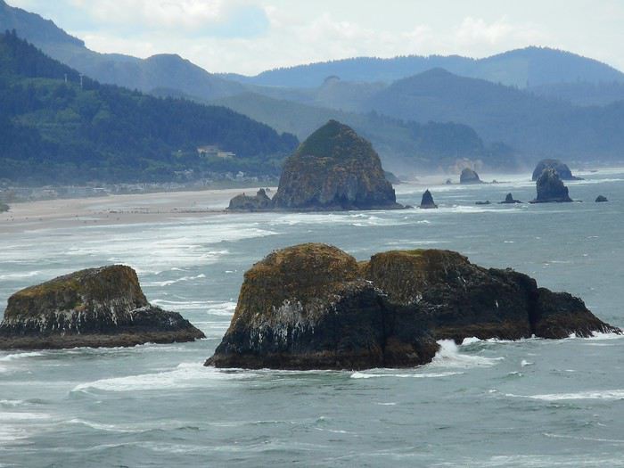
Here’s the classic route we took:
We booked everything ourselves and got a regional pass for the area from Kyoto to Hiroshima. The hotels were reserved 3 months in advance on Book... and Agod... (1030 € for 2 people for 13 nights = 80 €/night). For the flight, we chose a Qatar Airways flight with a layover to break up the long journey (950 € per person). We also got a pass on the same site (Japan-Experience) to take the train connecting Narita Airport to Shibuya Station (the N'EX Narita Express). Since the airport is 75 km from central Tokyo, we opted for this mode of transport, even though there are cheaper alternatives. After reading various posts on VoyageForum, I understood how important it was to have a Welcome Suica card to pay for public transport (subway, tram, bus, boat throughout the country), and we were able to buy one at Narita Airport. It turned out to be super useful! After a long but smooth journey, we found ourselves at Narita Airport in the evening. Even though we had a pass for the Narita Express, we had to go to a counter to make a reservation for the train (mandatory). Then, once we arrived at Shibuya Station, we took the subway for 2 stops and finally reached our hotel, exhausted (Hotel Asia Center of Japan – 270 € for 3 nights with breakfast included).
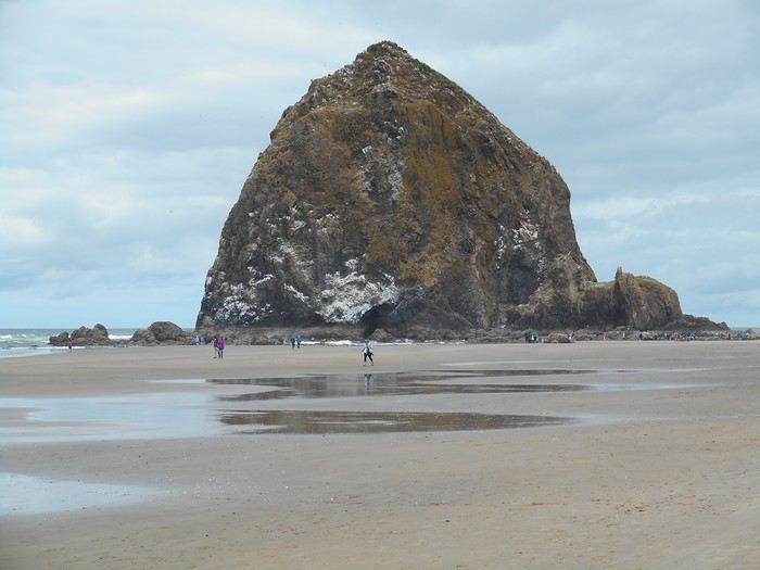
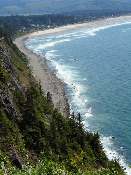
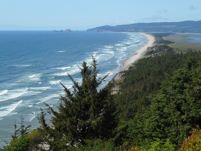
I had planned this entire trip back in November 2020, but given the health situation at the time, I had to cancel...
Here’s the classic route we took:

We booked everything ourselves and got a regional pass for the area from Kyoto to Hiroshima. The hotels were reserved 3 months in advance on Book... and Agod... (1030 € for 2 people for 13 nights = 80 €/night). For the flight, we chose a Qatar Airways flight with a layover to break up the long journey (950 € per person). We also got a pass on the same site (Japan-Experience) to take the train connecting Narita Airport to Shibuya Station (the N'EX Narita Express). Since the airport is 75 km from central Tokyo, we opted for this mode of transport, even though there are cheaper alternatives. After reading various posts on VoyageForum, I understood how important it was to have a Welcome Suica card to pay for public transport (subway, tram, bus, boat throughout the country), and we were able to buy one at Narita Airport. It turned out to be super useful! After a long but smooth journey, we found ourselves at Narita Airport in the evening. Even though we had a pass for the Narita Express, we had to go to a counter to make a reservation for the train (mandatory). Then, once we arrived at Shibuya Station, we took the subway for 2 stops and finally reached our hotel, exhausted (Hotel Asia Center of Japan – 270 € for 3 nights with breakfast included).

Hi there!
I’m inviting you on a stroll through my drawings—a completely subjective, far from exhaustive, and totally personal take, since it’s based on my own sketches. I put this travel journal together after returning in late 2024, mostly using felt-tip pens and pencils, with a few collages thrown in. I worked from our personal photos.
Let’s start with the shotengai...

Our first "wow" moment came as we stepped out of the subway in Asakusa, the Tokyo neighborhood where we’d booked our hotel for our first five nights. Exhausted after our long flight, we finally arrived and took an exit that led straight into a shotengai—one of those covered shopping streets that pop up in city centers and flourished between the 1950s and 1980s.
It was an instant aesthetic shock, like a close encounter of the third kind between the modern city, a typical Asian market with its street stalls, the vintage vibe of the arcade, the sheer abundance of goods, and the bustling crowd—a mix of tourists, pilgrims (thanks to nearby Senso-ji Temple), and locals (it’s a very working-class area). In the end, it set the tone for a feeling we’d experience throughout the trip. Wherever we went, shotengai turned out to be fantastic spots for finding little restaurants, shops, or even fresh produce. Some are like real mazes, like in Kyoto, where we spent ages trying to relocate a restaurant we’d loved ;-)
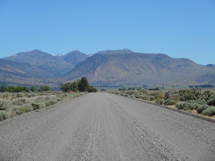
In Kanazawa, the Omicho Market:
And in Kyoto, Nishiki Market:

To be continued...
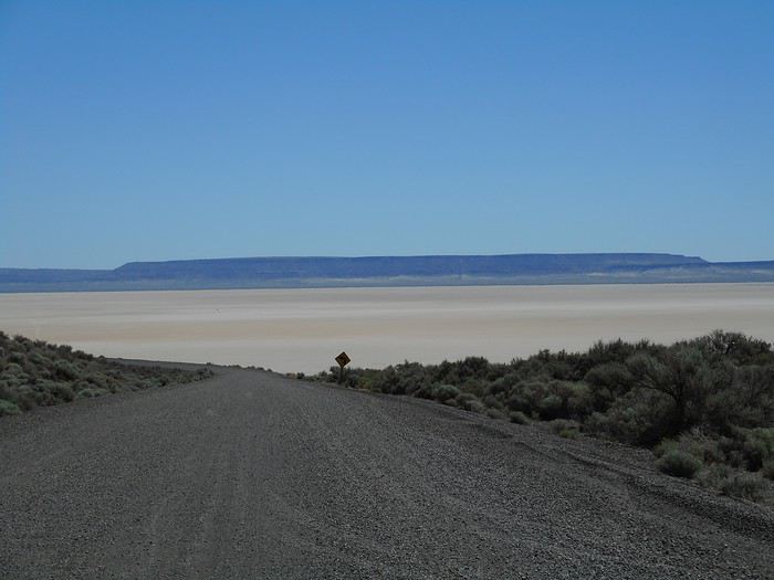
I’m inviting you on a stroll through my drawings—a completely subjective, far from exhaustive, and totally personal take, since it’s based on my own sketches. I put this travel journal together after returning in late 2024, mostly using felt-tip pens and pencils, with a few collages thrown in. I worked from our personal photos.Let’s start with the shotengai...

Our first "wow" moment came as we stepped out of the subway in Asakusa, the Tokyo neighborhood where we’d booked our hotel for our first five nights. Exhausted after our long flight, we finally arrived and took an exit that led straight into a shotengai—one of those covered shopping streets that pop up in city centers and flourished between the 1950s and 1980s.
It was an instant aesthetic shock, like a close encounter of the third kind between the modern city, a typical Asian market with its street stalls, the vintage vibe of the arcade, the sheer abundance of goods, and the bustling crowd—a mix of tourists, pilgrims (thanks to nearby Senso-ji Temple), and locals (it’s a very working-class area). In the end, it set the tone for a feeling we’d experience throughout the trip. Wherever we went, shotengai turned out to be fantastic spots for finding little restaurants, shops, or even fresh produce. Some are like real mazes, like in Kyoto, where we spent ages trying to relocate a restaurant we’d loved ;-)
In Kanazawa, the Omicho Market:
And in Kyoto, Nishiki Market:

To be continued...
Hi everyone,
With my girlfriend Christelle, we’ve chosen South Africa for our first trip to Southern Africa, focusing on safaris—after a long debate with a Cape Town/Kruger combo. But that would’ve meant cutting out St Lucia, which would’ve been harder to fit into another trip. And St Lucia—thanks to Michel and all those travel journals—we really wanted to go there.
So our 11-night itinerary ended up like this, mostly shaped by school holidays: - 3 nights in St Lucia - 1 night in Hluhluwe - 1 night at Mkhaya Game Reserve (Eswatini) - 1 night at Hlane Royal National Park (Eswatini) - 3 nights in Kruger (Berg en Dal / Satara / Tamboti) - 1 night at Shindzela Tented Camp in the Timbavati private reserve - 1 final night in Kruger at Lower Sabie
All of this in the off-season and rainy season, just a month after catastrophic floods that killed over 150 people and seriously damaged Kruger’s infrastructure.
I’ll jump straight to St Lucia and skip the loooong journey to get there (with a layover in Frankfurt, landing in Johannesburg, a domestic flight to Durban, and the rest by rental SUV—First Car Rental, perfect, no complaints).
To motivate readers—especially some familiar faces here—I’ll drop in a first photo.

With my girlfriend Christelle, we’ve chosen South Africa for our first trip to Southern Africa, focusing on safaris—after a long debate with a Cape Town/Kruger combo. But that would’ve meant cutting out St Lucia, which would’ve been harder to fit into another trip. And St Lucia—thanks to Michel and all those travel journals—we really wanted to go there.
So our 11-night itinerary ended up like this, mostly shaped by school holidays: - 3 nights in St Lucia - 1 night in Hluhluwe - 1 night at Mkhaya Game Reserve (Eswatini) - 1 night at Hlane Royal National Park (Eswatini) - 3 nights in Kruger (Berg en Dal / Satara / Tamboti) - 1 night at Shindzela Tented Camp in the Timbavati private reserve - 1 final night in Kruger at Lower Sabie
All of this in the off-season and rainy season, just a month after catastrophic floods that killed over 150 people and seriously damaged Kruger’s infrastructure.
I’ll jump straight to St Lucia and skip the loooong journey to get there (with a layover in Frankfurt, landing in Johannesburg, a domestic flight to Durban, and the rest by rental SUV—First Car Rental, perfect, no complaints).
To motivate readers—especially some familiar faces here—I’ll drop in a first photo.

We went to Albania in August 2025.
Our itinerary included adventure (sporty activities, site visits), naps on the beach interspersed with swims, incredible natural sites, and a bit of culture.
I booked all our accommodations on Booking.com. Note: almost all places ask to be paid in cash!! You can obviously withdraw from banks, but the fees are pretty high. Luckily, we had plenty of cash, and the country is very safe. You can pay in euros most of the time, which avoids exchange fees. We started in Tirana. I’d read a really interesting post about Albania’s bunkers (link in my profile). We chose to visit Bunk’Art with a guide from the agency that wrote the post. It was fascinating—not only to better understand the country’s history but also because her grandfather was repressed by the regime, and she shared her family’s experience with us.
Bunkers are everywhere! In Tirana, Bunk’Art is the most interesting and largest. You’ll see the dictator Enver Hoxha’s office, where he would’ve taken refuge in case of an attack on the country. Bring a sweater—it’s really cold in the underground tunnels and their huge corridors. You can visit other bunkers around the country, in Tirana and elsewhere. Almost all are just abandoned. The cable car up Mount Dajti is right next to Bunk’Art. The view is stunning—you realize Tirana is so close to the mountains and the sea... But otherwise, it’s not that exciting for older teens (17 and 19) and their parents. We picked up a rental car in Tirana—it’d be ours for the next three weeks. We used Goalbania’s agency to avoid any hassles. First, there aren’t many cars available in Albania in summer. Second, French credit cards can be a nightmare abroad. So we preferred to sort that out in advance. After Tirana, we headed to Permet. Just a heads-up: the roads are in great condition except in the mountains. And Albanian drivers aren’t stressful to deal with. Though you might suddenly encounter a herd of goats crossing the road—haha—but if you’re not going too fast, it’s fine. In Permet, I’d been dreaming of rafting on the Vjosa, one of Europe’s last wild rivers. And we did it with a local agency! It’s beautiful, accessible to everyone, not too physical but still a bit lively—just how we like it. You can even jump into the river in some spots. In Permet, we also hiked through a canyon and visited a lovely little church.

And we took a workshop to make their local culinary pride: gliko. It’s a jam with whole fruits inside. We’d seen it on Goalbania’s site, and it was really fun. We were with a family where the secret to making gliko has been passed down for generations... Next, we headed to Gjirokastër. A city we loved: its old traditional houses (Skendulli and Zekate), its grand castle, the Ali Pasha Bridge. Along the way, we stopped for artisanal ice cream at a little shop run by a grandmother who’s been making it herself for ages.

One afternoon, my husband *had* to go to the coast in the south, to Ksamil (he’d read it was better than Sarandë). Verdict: we didn’t like it. Parking is a nightmare, the beaches are super noisy and crowded. The sea is packed with jet skis, boats, pedalos, and ropes. Avoid it.
On the other hand, we really liked Himarë, where we went next. We stayed at a campsite where we rented tents with mattresses and sheets inside. Right by the sea, on a low cliff (about 2 meters high). You can hear the waves at night... Magical!! To swim, you either jump straight into the sea (almost from the tent) or climb down a ladder, which you’ll need to climb back up to get out.

I was a little worried the campsite wouldn’t be very comfortable, so afterward, I’d booked a small place in Gjilek. Turns out, the place was really tiny (one room for four, no kitchen) and pretty expensive (over 100 € a night). We’d drive to the beach or restaurants—it’s on a steep slope, so not very accessible. Parking near the sea is tricky. But the (private) beaches were nice—we’d rent an umbrella not too close to the music and spend the day there. We also went to a wilder beach, harder to reach, via a long path. Behind the beach, there’s an amazing canyon where we’d sometimes climb using ropes (already in place, no need to bring your own) over big boulders rolled around by the stream, which must swell a lot in spring. So, the sea in Albania: it’s nice if you like swimming and relaxing, but it’s not the most interesting part of the country. There are so many other amazing things to see and discover—so many stunning sites! Maybe an agency could’ve helped us find more practical accommodations and avoid Ksamil and its surroundings. We left the coast to head to the beautiful city of Berat and its "thousand windows." We explored the city, its fortress, and its icon museum.

Then we discovered the Osum Canyon—it’s incredible. The view from the top is breathtaking. And at the bottom, it’s magical. There’s little water in summer, so rafting isn’t an option. We weren’t tempted by the big-tube descent offered by an agency—it looked fun, but the group had 40 people. We preferred hiking on our own as a family of four. We scouted the area on Google Maps... and found where to descend. We walked in the water, then it rose to our waists, then our shoulders... We weren’t moving fast. And how to get back up?? Eventually, we followed a group with a guide—the path was hard to find.

After that unforgettable hike, we visited the Bogovë Waterfalls. It’s pretty, and we swam, but the water was *really* cold. We passed through Tirana again and then headed to Shkodër. We explored a bit—its charming little streets, the Rozafa Fortress. There’s a tiny museum where you can see *huge* Ottoman stone cannonballs. And they tell you the (charming) story of the young woman who was walled alive in the castle’s foundations to ensure its strength... Shkodër is mostly a stopover to head into the mountains and discover Theth. Our goal: hiking in the Valbona Valley, from Valbona to Theth. We organized the trip ourselves, without an agency, but it took some time to figure everything out. So I’ll save you the trouble—haha. Book your tickets on the Komanilakeferry website. The ticket includes: 🙂 minibus transfer from downtown Shkodër to Koman 🙂 ferry ticket from Koman to Fierze. This ferry ride is *gorgeous*—between mountain slopes covered in pine trees, and sometimes a little house with a few fields...

🙂 minibus ticket from Fierze to Valbona. Now you’re in the mountains! The minibus drops you off near your accommodation—pick one as close as possible to the start of the hike (if that’s your goal!). The ones at the far end of the village add up to 1.5 hours of walking. Our choice: Guesthouse Dioni. The host is really lovely, it’s in the woods, and it’s basic but great. After a day of hiking, we arrived in Theth. What beautiful mountains! Then we explored Theth and the surrounding area. It’s pretty busy, but you can still enjoy the Blue Eye of Theth and its swim. It’s *so* cold! But so beautiful!

🙂 minibus ticket from Theth back to Shkodër. After a night in Shkodër, we drove to Kepi i Rodonit. A guidebook (I forget which one) raved about its beauty. And it *is* beautiful!

But the view is ruined by plastic bottles and other trash in the bushes, along the paths, and of course on the beaches. The only peaceful spot: the private beach at Kepi i Rodonit, which is cleaned. You can rent an umbrella and have lunch there. That’s where we spent our last few days—very relaxing. In short... Albania turned out to be perfect for us and our teens!
I booked all our accommodations on Booking.com. Note: almost all places ask to be paid in cash!! You can obviously withdraw from banks, but the fees are pretty high. Luckily, we had plenty of cash, and the country is very safe. You can pay in euros most of the time, which avoids exchange fees. We started in Tirana. I’d read a really interesting post about Albania’s bunkers (link in my profile). We chose to visit Bunk’Art with a guide from the agency that wrote the post. It was fascinating—not only to better understand the country’s history but also because her grandfather was repressed by the regime, and she shared her family’s experience with us.

Bunkers are everywhere! In Tirana, Bunk’Art is the most interesting and largest. You’ll see the dictator Enver Hoxha’s office, where he would’ve taken refuge in case of an attack on the country. Bring a sweater—it’s really cold in the underground tunnels and their huge corridors. You can visit other bunkers around the country, in Tirana and elsewhere. Almost all are just abandoned. The cable car up Mount Dajti is right next to Bunk’Art. The view is stunning—you realize Tirana is so close to the mountains and the sea... But otherwise, it’s not that exciting for older teens (17 and 19) and their parents. We picked up a rental car in Tirana—it’d be ours for the next three weeks. We used Goalbania’s agency to avoid any hassles. First, there aren’t many cars available in Albania in summer. Second, French credit cards can be a nightmare abroad. So we preferred to sort that out in advance. After Tirana, we headed to Permet. Just a heads-up: the roads are in great condition except in the mountains. And Albanian drivers aren’t stressful to deal with. Though you might suddenly encounter a herd of goats crossing the road—haha—but if you’re not going too fast, it’s fine. In Permet, I’d been dreaming of rafting on the Vjosa, one of Europe’s last wild rivers. And we did it with a local agency! It’s beautiful, accessible to everyone, not too physical but still a bit lively—just how we like it. You can even jump into the river in some spots. In Permet, we also hiked through a canyon and visited a lovely little church.

And we took a workshop to make their local culinary pride: gliko. It’s a jam with whole fruits inside. We’d seen it on Goalbania’s site, and it was really fun. We were with a family where the secret to making gliko has been passed down for generations... Next, we headed to Gjirokastër. A city we loved: its old traditional houses (Skendulli and Zekate), its grand castle, the Ali Pasha Bridge. Along the way, we stopped for artisanal ice cream at a little shop run by a grandmother who’s been making it herself for ages.

One afternoon, my husband *had* to go to the coast in the south, to Ksamil (he’d read it was better than Sarandë). Verdict: we didn’t like it. Parking is a nightmare, the beaches are super noisy and crowded. The sea is packed with jet skis, boats, pedalos, and ropes. Avoid it.
On the other hand, we really liked Himarë, where we went next. We stayed at a campsite where we rented tents with mattresses and sheets inside. Right by the sea, on a low cliff (about 2 meters high). You can hear the waves at night... Magical!! To swim, you either jump straight into the sea (almost from the tent) or climb down a ladder, which you’ll need to climb back up to get out.

I was a little worried the campsite wouldn’t be very comfortable, so afterward, I’d booked a small place in Gjilek. Turns out, the place was really tiny (one room for four, no kitchen) and pretty expensive (over 100 € a night). We’d drive to the beach or restaurants—it’s on a steep slope, so not very accessible. Parking near the sea is tricky. But the (private) beaches were nice—we’d rent an umbrella not too close to the music and spend the day there. We also went to a wilder beach, harder to reach, via a long path. Behind the beach, there’s an amazing canyon where we’d sometimes climb using ropes (already in place, no need to bring your own) over big boulders rolled around by the stream, which must swell a lot in spring. So, the sea in Albania: it’s nice if you like swimming and relaxing, but it’s not the most interesting part of the country. There are so many other amazing things to see and discover—so many stunning sites! Maybe an agency could’ve helped us find more practical accommodations and avoid Ksamil and its surroundings. We left the coast to head to the beautiful city of Berat and its "thousand windows." We explored the city, its fortress, and its icon museum.

Then we discovered the Osum Canyon—it’s incredible. The view from the top is breathtaking. And at the bottom, it’s magical. There’s little water in summer, so rafting isn’t an option. We weren’t tempted by the big-tube descent offered by an agency—it looked fun, but the group had 40 people. We preferred hiking on our own as a family of four. We scouted the area on Google Maps... and found where to descend. We walked in the water, then it rose to our waists, then our shoulders... We weren’t moving fast. And how to get back up?? Eventually, we followed a group with a guide—the path was hard to find.

After that unforgettable hike, we visited the Bogovë Waterfalls. It’s pretty, and we swam, but the water was *really* cold. We passed through Tirana again and then headed to Shkodër. We explored a bit—its charming little streets, the Rozafa Fortress. There’s a tiny museum where you can see *huge* Ottoman stone cannonballs. And they tell you the (charming) story of the young woman who was walled alive in the castle’s foundations to ensure its strength... Shkodër is mostly a stopover to head into the mountains and discover Theth. Our goal: hiking in the Valbona Valley, from Valbona to Theth. We organized the trip ourselves, without an agency, but it took some time to figure everything out. So I’ll save you the trouble—haha. Book your tickets on the Komanilakeferry website. The ticket includes: 🙂 minibus transfer from downtown Shkodër to Koman 🙂 ferry ticket from Koman to Fierze. This ferry ride is *gorgeous*—between mountain slopes covered in pine trees, and sometimes a little house with a few fields...

🙂 minibus ticket from Fierze to Valbona. Now you’re in the mountains! The minibus drops you off near your accommodation—pick one as close as possible to the start of the hike (if that’s your goal!). The ones at the far end of the village add up to 1.5 hours of walking. Our choice: Guesthouse Dioni. The host is really lovely, it’s in the woods, and it’s basic but great. After a day of hiking, we arrived in Theth. What beautiful mountains! Then we explored Theth and the surrounding area. It’s pretty busy, but you can still enjoy the Blue Eye of Theth and its swim. It’s *so* cold! But so beautiful!

🙂 minibus ticket from Theth back to Shkodër. After a night in Shkodër, we drove to Kepi i Rodonit. A guidebook (I forget which one) raved about its beauty. And it *is* beautiful!

But the view is ruined by plastic bottles and other trash in the bushes, along the paths, and of course on the beaches. The only peaceful spot: the private beach at Kepi i Rodonit, which is cleaned. You can rent an umbrella and have lunch there. That’s where we spent our last few days—very relaxing. In short... Albania turned out to be perfect for us and our teens!
A new work assignment means our vacation dates can't stay the same.
We had planned to go to the Canary Islands, but flight prices are skyrocketing with this new holiday schedule.
So, I’m looking for an alternative to Gran Canaria and El Hierro and found two round-trip flights with Wizz Air to Tirana.
398 €, including baggage and seats—perfect!
Plus, the departure and return times are great, which is pretty rare for a low-cost flight!
All that’s left is to rent a car, plan the route, and book accommodations.
With two weeks, we’ll have to make some choices!
Here’s the final itinerary: Shkodra (2 nights), Valbonë (3 nights), Tirana (1 night), Lake Ohrid (1 night), Korçë (1 night), Përmet (1 night), Gjirokastër (1 night), Himarë (2 nights), Berat (2 nights), and Krujë (1 night).
A mix of countryside and small towns, a bit of the Mediterranean, and some mountains!
Late October isn’t the best season, so let’s keep our fingers crossed for the rest...

We had planned to go to the Canary Islands, but flight prices are skyrocketing with this new holiday schedule.
So, I’m looking for an alternative to Gran Canaria and El Hierro and found two round-trip flights with Wizz Air to Tirana.
398 €, including baggage and seats—perfect!
Plus, the departure and return times are great, which is pretty rare for a low-cost flight!
All that’s left is to rent a car, plan the route, and book accommodations.
With two weeks, we’ll have to make some choices!
Here’s the final itinerary: Shkodra (2 nights), Valbonë (3 nights), Tirana (1 night), Lake Ohrid (1 night), Korçë (1 night), Përmet (1 night), Gjirokastër (1 night), Himarë (2 nights), Berat (2 nights), and Krujë (1 night).
A mix of countryside and small towns, a bit of the Mediterranean, and some mountains!
Late October isn’t the best season, so let’s keep our fingers crossed for the rest...

Hi there,
I’m diving into a recap of our loop—pretty classic, really—Denver-Yellowstone-Denver this past summer, from July 24 to August 17. Given the sheer number of trip reports already out there (or in the works), and since I don’t have the writing chops or the photography skills of many of you, I’ll keep it practical—well, I’ll try, at least—to share our take on some of the less-visited parks and spots.
First off, a huge thank you to everyone whose trip reports, blogs, websites, comments, and more helped us put together this itinerary. Looking back, it could’ve been even better optimized: a few disappointments when we missed out on some great discoveries, often because we were short on time. Plenty of reasons to come back to the area!
We’re traveling with our four (almost) teens—18, 16, 14, and nearly 12 years old. To keep the trip enjoyable for everyone, we had to make compromises on both sides: cutting a visit short to spend more time swimming, waking up at dawn, and so on. But logistics also played a big role—things like laundry, grocery shopping, and keeping luggage organized could’ve quickly become time-consuming without a little planning. And honestly, I think we visited every Walmart along the way! Blame it on the lack of fridges in some accommodations and, more importantly, the *very* limited space in the car, which made it impossible to bring a proper cooler. I’ll come back to the car saga later.
For accommodations, this year we alternated between basic cabins in KOA campgrounds and Yellowstone (when staying more than one night in the same place) and hotels. Always with a pool (except in Yellowstone, of course), which let the kids burn off energy—because they always have reserves, even after packed days!—and, let’s be honest, gave us a chance to relax. No Wi-Fi issues either; we all had plans with 25 GB of data (a big thanks to Gilles for the amazing deal at 0.99 €). It worked perfectly, even for texts and calls between phones—no extra charges.
Now, onto our route: as I mentioned, a classic Denver-Yellowstone-Denver loop. To avoid rushing through the parks or spending all our time on the road, we prioritized staying as close to them as possible, with at least two nights in each place. And I’ve got to say, it’s really nice to settle in, even if it’s just for two nights. It also helped us deal with the weather, which wasn’t always great during this trip. The trade-off? With vacation time being limited, some driving days ended up being long. We knew that going in, but since we kept a relaxed pace with no time constraints (don’t ask me for timings—I don’t keep track of the clock on vacation, except in the morning to get everyone up before noon!), we sometimes ended up with marathon days.
With that said, I’ll dive into the trip itself in the next post.
I’m diving into a recap of our loop—pretty classic, really—Denver-Yellowstone-Denver this past summer, from July 24 to August 17. Given the sheer number of trip reports already out there (or in the works), and since I don’t have the writing chops or the photography skills of many of you, I’ll keep it practical—well, I’ll try, at least—to share our take on some of the less-visited parks and spots.
First off, a huge thank you to everyone whose trip reports, blogs, websites, comments, and more helped us put together this itinerary. Looking back, it could’ve been even better optimized: a few disappointments when we missed out on some great discoveries, often because we were short on time. Plenty of reasons to come back to the area!
We’re traveling with our four (almost) teens—18, 16, 14, and nearly 12 years old. To keep the trip enjoyable for everyone, we had to make compromises on both sides: cutting a visit short to spend more time swimming, waking up at dawn, and so on. But logistics also played a big role—things like laundry, grocery shopping, and keeping luggage organized could’ve quickly become time-consuming without a little planning. And honestly, I think we visited every Walmart along the way! Blame it on the lack of fridges in some accommodations and, more importantly, the *very* limited space in the car, which made it impossible to bring a proper cooler. I’ll come back to the car saga later.
For accommodations, this year we alternated between basic cabins in KOA campgrounds and Yellowstone (when staying more than one night in the same place) and hotels. Always with a pool (except in Yellowstone, of course), which let the kids burn off energy—because they always have reserves, even after packed days!—and, let’s be honest, gave us a chance to relax. No Wi-Fi issues either; we all had plans with 25 GB of data (a big thanks to Gilles for the amazing deal at 0.99 €). It worked perfectly, even for texts and calls between phones—no extra charges.
Now, onto our route: as I mentioned, a classic Denver-Yellowstone-Denver loop. To avoid rushing through the parks or spending all our time on the road, we prioritized staying as close to them as possible, with at least two nights in each place. And I’ve got to say, it’s really nice to settle in, even if it’s just for two nights. It also helped us deal with the weather, which wasn’t always great during this trip. The trade-off? With vacation time being limited, some driving days ended up being long. We knew that going in, but since we kept a relaxed pace with no time constraints (don’t ask me for timings—I don’t keep track of the clock on vacation, except in the morning to get everyone up before noon!), we sometimes ended up with marathon days.
With that said, I’ll dive into the trip itself in the next post.
15 days across Gran Canaria, El Hierro, and a dash of Tenerife under the storm Thérèse!
The planned itinerary will be slightly disrupted...
(The version without discussions is here)
The planned itinerary will be slightly disrupted...
(The version without discussions is here)
And we still haven’t seen everything!
Before setting off for new horizons at the end of this year, it’s time for me to share my trip to Cape Verde this summer 2025.
I particularly love these spontaneous trips, and our stay in Cape Verde is one of those because it was only at the beginning of April that we decided on this getaway, which had been catching our eye for a while, given our love for the mountains.
As always—well, when it’s open—I turned to VF, and I want to immediately thank Marie, aka ptitortue, who helped me a lot in planning this trip through her travel journals and our exchanges!
Because Cape Verde is both small and vast! We decided not to rush from one airport to another, to enjoy the places and the people, but also to relax, since the work backlog from being stuck in May (see my previous travel journal 😅) had to be caught up on in June.
So, 4 islands will be our winners from 06/28 to 07/19:
Santiago first for logistical reasons, as round-trip flights from the capital Praia were the cheapest (650 €/person from Lyon via Lisbon with TAP, still!)
São Vicente, because it’s the gateway to the next one but ultimately more than that...
Santo Antão, pretty much the main goal of the trip since Marie (and the photos) had really sold it to me.
And finally, Sal Island, for some rest—a non-negotiable condition for my other half—and we’ll see that I should’ve listened to Marie...
That said, what a chatterbox I am—buckle up, flight attendants at the doors, off we go on new beautiful escapes! (Thanks to Sophie for the easy loan)
Last note for my eager fan club 😏: yes, there will be alcohol—how could there not be in the land of grogue!
It starts here:
https://voyageforum.com/v.f?post=10790234;a=10790234

I particularly love these spontaneous trips, and our stay in Cape Verde is one of those because it was only at the beginning of April that we decided on this getaway, which had been catching our eye for a while, given our love for the mountains.
As always—well, when it’s open—I turned to VF, and I want to immediately thank Marie, aka ptitortue, who helped me a lot in planning this trip through her travel journals and our exchanges!
Because Cape Verde is both small and vast! We decided not to rush from one airport to another, to enjoy the places and the people, but also to relax, since the work backlog from being stuck in May (see my previous travel journal 😅) had to be caught up on in June.
So, 4 islands will be our winners from 06/28 to 07/19:
Santiago first for logistical reasons, as round-trip flights from the capital Praia were the cheapest (650 €/person from Lyon via Lisbon with TAP, still!)
São Vicente, because it’s the gateway to the next one but ultimately more than that...
Santo Antão, pretty much the main goal of the trip since Marie (and the photos) had really sold it to me.
And finally, Sal Island, for some rest—a non-negotiable condition for my other half—and we’ll see that I should’ve listened to Marie...
That said, what a chatterbox I am—buckle up, flight attendants at the doors, off we go on new beautiful escapes! (Thanks to Sophie for the easy loan)
Last note for my eager fan club 😏: yes, there will be alcohol—how could there not be in the land of grogue!
It starts here:
https://voyageforum.com/v.f?post=10790234;a=10790234