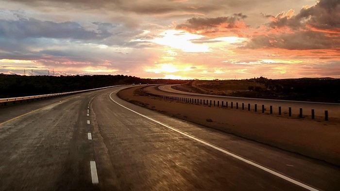
Road Trip - Canadian West
FR

Translated into English.

Original post
PI
After exploring Dawson City, the final stop on our incredible Yukon road trip (see travel journal), it was time to head back to Quebec.

Instead of returning directly, we took advantage of this cross-country drive to make several stops in British Columbia and Alberta.

This part of the trip allowed us to discover some of the most beautiful attractions in Western Canada, from breathtaking landscapes to iconic natural sites that are must-sees in Canada.

Between majestic mountains, turquoise lakes, and jaw-dropping panoramas, every stop added a memorable touch to this already exceptional adventure.

A wonderful way to wrap up this journey across Canada while fully enjoying the richness and diversity of its vast landscapes.

In the upcoming posts, you’ll discover the highlights that marked our journey through the Canadian West.

I invite you to watch the associated videos to fully experience the atmosphere, landscapes, and attractions we were lucky enough to explore.

Here are the links to specific posts:

Adventure on the Alaska Highway: Bald Eagles, Bison & Moose Adventure on the Alaska Highway: Bison, Caribou & Bears Yellowhead Highway (Alberta): Roche Miette, Jasper Lake & Emerald Pond Maligne Lake Road (Jasper) | Moose and Elk Exploring Mount Robson Provincial Park (BC) Must-Sees on the Icefields Parkway - Alberta David Thompson Highway (AB): A Stunning Scenic Route What to See in Yoho National Park (BC) Johnston Canyon: Hike to the Lower & Upper Falls Iconic Sites of East Kootenay, BC Lundbreck Falls - A Spectacular Waterfall in Southern Alberta Trails of Red Rock Canyon & Blakiston Falls - Waterton Waterton Village Under the Snow - A Unique Place Writing-on-Stone: A Park Famous for Its Hoodoos Red Rock Coulee Natural Area, Alberta – A Supernatural Landscape Dinosaur Provincial Park, Alberta - Mysterious Badlands Drumheller: Dinos, Hoodoos & Badlands Interpretive Trail Hike at Horsethief Canyon | Drumheller Badlands Red Deer: Public Art & Murals Downtown Calgary | Public Art, Skyline & Iconic Spots

More to come soon...
PI Pinacoladada Globetrotter ·
Adventure on the Alaska Highway: Bald Eagles, Bison & Moose

🗺️ 60.57682, -134.67869 Rest Stop - Big Blue Bridge 🗺️ 60.55819, -134.45000 Marsh Lake (beach)

Dive into the heart of the legendary Alaska Highway, between Big Blue Bridge and Liard River, one of the most spectacular stretches of the northern route.

In this video, we cross breathtaking landscapes: vast valleys, boreal forests, mountains sculpted by time.

Raw, wild, untouched nature.

Along the way, we were lucky enough to spot:

- a bald eagle perched at the top of a bare tree - several herds of bison by the roadside - a couple of moose - jaw-dropping panoramas throughout the journey

This video captures the very essence of a northern adventure: freedom, vastness, wildlife, and the magic of this legendary road.

If you're planning a road trip to Alaska or the Yukon, this video will give you an authentic preview of what awaits you.

https://youtu.be/0Tjbi6O_pSM
PI Pinacoladada Globetrotter ·
Adventure on the Alaska Highway: Bison, Caribou & Bears

Join us in the heart of the legendary Alaska Highway, between Liard River and Dawson Creek, one of the wildest and most spectacular stretches in Canada.

A legendary road where nature reigns supreme and every turn holds a surprise.

What’s on the agenda:

🐃 Herds of bison by the roadside 🦌 Majestic caribou crossing the highway 🐻 A mama bear and her two cubs—a rare and unforgettable moment 🏞️ Turquoise lakes and rivers, steep mountains, and glacial valleys

✨ Our must-stop spots along the way

🗺️ Liard River Suspension Bridge (59.41414, -126.09510)

A historic suspension bridge dating back to 1944, one of the most impressive on the entire Alaska Highway.

🗺️ Muncho Lake (58.99381, -125.77560)

A lake with an unreal turquoise blue, surrounded by steep mountains. One of the most beautiful landscapes in all of British Columbia.

🗺️ Toad River (58.78237, -125.66896)

The Toad River winds through steep slopes, coniferous forests, and open valleys.

Its water has a truly unique color that surprises many travelers on the Alaska Highway.

🚐 Why is this stretch of the Alaska Highway so special?

- Abundant and easily observable wildlife - Some of the wildest landscapes in Canada - A historic road built in 1942 - A feeling of total isolation and absolute freedom

https://youtu.be/LNDV6CGL3L4
PI Pinacoladada Globetrotter ·
Yellowhead Highway (Alberta): Roche Miette, Jasper Lake & Emerald Pond

Discover one of the most beautiful sections of the Yellowhead Highway (Hwy 16) in Alberta, in the heart of Jasper National Park, through this video.

An adventure among mountains, sand dunes, turquoise lakes, and spectacular viewpoints.

In this video, I take you to explore several must-see stops between Roche Miette and Emerald Pond, passing by the Jasper Lake Sand Dunes.

A perfect stretch of road for lovers of grand landscapes, photography, and wild nature.

🗺️ Detailed itinerary & points of interest

- Roche Miette Viewpoint — Coordinates: 53.16699, -117.97401

An iconic stop offering an incredible view of Roche Miette mountain, a massive peak that dominates the Athabasca Valley.

- Jasper House National Historic Site — Coordinates: 53.14651, -117.97745

A short 300 m round-trip hike leading to an observation point at the former Jasper House trading post.

A place rich in history with a peaceful view of the Athabasca River.

- Jasper Lake Sand Dunes — Coordinates: 53.08971, -118.01743

A unique landscape: sand dunes in the middle of the Rockies.

Here, the Athabasca River spreads out into a shallow lake, creating an almost desert-like setting.

- Emerald Pond — Coordinates: 53.04892, -118.07524

A small pond with an intense emerald-green color, perfect for colorful and peaceful photos.

- P23 Parking — Coordinates: 53.04168, -118.08808

A convenient access point for exploring the surrounding area, including the dunes and wetlands.

🧭 Why is this route a must-see?

The Yellowhead Highway is one of the most photogenic roads in Canada.

Between mountains, rivers, dunes, and lakes, every stop offers a different landscape.

https://youtu.be/sB1NDovmzS8
PI Pinacoladada Globetrotter ·
Maligne Lake Road (Jasper) | Moose and Elk

Join us as we explore one of the most stunning scenic drives in the Canadian Rockies: Maligne Lake Road, located in Jasper National Park, Alberta.

An immersive adventure between turquoise lakes, wildlife, and postcard-perfect landscapes.

Our journey begins at Medicine Lake Lookout (52.87325, -117.80521), a breathtaking viewpoint where the lake seems to appear and disappear depending on the season.

This unique natural phenomenon creates an almost mystical setting, perfect for nature lovers and photographers.

As we continued our drive, we were incredibly lucky to spot a pair of moose grazing peacefully by the roadside.

A rare and magical moment that highlights the richness of Jasper National Park’s wildlife.

Arriving at Maligne Lake Boat House (52.72871, -117.63843), we discovered one of Canada’s most iconic spots: a deep blue glacial lake surrounded by majestic mountains.

It’s also the starting point for excursions to Spirit Island, one of the most photographed places in the world.

On the way back, Maligne Lake Road worked its magic once more. Just a few meters from the road, an elk grazed calmly on the fresh grass, completely unbothered by our presence, giving us one last moment of grace before leaving this wild valley.

A simple encounter, but one that reminds us just how alive and unpredictable Jasper National Park’s nature is.

🌟 Why this road is a must-see

- Varied landscapes: lakes, forests, mountains, glacial valleys - Abundant wildlife: moose, bears, deer, elk - Iconic viewpoints: Medicine Lake, Maligne Lake - Accessible road, perfect for a family or friends road trip

🎬 What you’ll see in this video

- Medicine Lake and its natural drainage phenomenon - A pair of moose in the wild - The famous Maligne Lake Boat House - Spectacular landscapes typical of the Rockies

https://youtu.be/k2GZZ--Fl5w
PI Pinacoladada Globetrotter ·
Exploring Mount Robson Provincial Park (BC)

In this video, I take you to explore several iconic spots in this park:

🦌 Moose Lake (52.93793, -118.84500)

Moose Lake is one of the first treasures you discover when entering Mount Robson Provincial Park, and it immediately sets the tone: peaceful, majestic, and deeply wild.

Located along the Yellowhead Highway, this long glacial lake stretches between the mountains, offering spectacular views at any time of day.

🏞️ Overlander Falls Trail (1.7 mi round trip)

53.03142, -119.20802 Trailhead 53.03142, -119.20802 Viewpoint 53.02598, -119.21428 End of trail

The Overlander Falls trail, accessible and relatively short, quickly plunges into a dense coniferous forest.

The deep roar of the water can be heard long before you catch sight of the falls, creating an almost magnetic anticipation.

As you walk, you’ll find several natural observation points where the river speeds up, narrows, and then plunges into a churning white abyss.

At the main viewpoint, the sight is breathtaking.

🏠🏔️ Berg Lake Trail - Kinney Lake (6.6 mi round trip)

53.03550, -119.22899 Mount Robson Visitor Centre 53.05031, -119.21430 Parking & trailhead 53.08237, -119.18447 Kinney Lake

The Berg Lake Trail offers one of the most stunning immersions in the wild nature of Mount Robson Provincial Park.

From the very first steps, the path follows the Robson River, a powerful and icy waterway flowing directly from the hanging glaciers of Mount Robson.

The river acts as a guiding thread: sometimes calm and turquoise, other times fast and foamy white.

Along the trail, you’ll find several viewpoints where the river reveals itself between the trees, offering spectacular panoramas of rocky cliffs and deep forests.

The sections where the trail hugs the river are among the most memorable: perfect for photography and a chance to fully feel the raw power of nature in this iconic corner of the Canadian Rockies.

Kinney Lake, a milky-blue and almost surreal lake, is fed by the glacial waters of Mount Robson.

The trail skirts part of the lake, allowing you to admire its turquoise hues from different angles.

The steep rocky cliffs, dense forests, and absolute quiet make you feel completely cut off from the world.

It’s the ideal spot to take a break, have a picnic, or simply soak in the grandeur of the Canadian Rockies.

Kinney Lake also marks the transition between an accessible hike and the more challenging sections of the Berg Lake Trail.

For many, it’s the perfect destination for a day trip, offering an exceptional effort-to-view ratio.

📸 Mount Robson Park Sign (53.02834, -119.26143)

You can’t pass by without stopping at the iconic Mount Robson Park sign.

It’s the perfect spot for a souvenir photo with the highest peak in the Canadian Rockies in the background.

🔥 Rearguard Falls (0.4 mi round trip)

52.97539, -119.36447 Parking & trailhead 52.97362, -119.36346 Rearguard Falls

Rearguard Falls is one of the most impressive and symbolic spots in this park.

Just a few minutes’ walk from the road, these powerful falls mark one of the last natural obstacles for the Fraser River before it continues its long journey to the Pacific Ocean.

The short, accessible trail winds through a damp forest before arriving at an observation platform built right above the falls.

From there, you can witness the incredible force of the water rushing through a rocky gorge, creating a continuous roar and a cool mist in the air.

Rearguard Falls is also a place steeped in natural history: it’s here that Pacific salmon end their migration after traveling nearly 750 miles from the ocean.

https://youtu.be/d4LiWzKfX5Q
PI Pinacoladada Globetrotter ·
Must-See Stops on the Icefields Parkway - Alberta

Welcome to this travel vlog along the Icefields Parkway, one of the world’s most stunning scenic drives, nestled between Jasper and Lake Louise in the heart of the Canadian Rockies in Alberta.

🎥 In this video, I’ll take you to discover the waterfalls, glaciers, canyons, and iconic viewpoints that make this route an absolute must-see in Alberta.

🗺️ All stops are geolocated to help you plan your own adventure.

🌊 ATHABASCA FALLS – JASPER NATIONAL PARK

A breathtaking first stop with a powerful waterfall carving through a narrow canyon.

52.66593, -117.88300 Parking 52.66501, -117.88337 Viewpoint 1 52.66459, -117.88402 Viewpoint 2 52.66470, -117.88448 Viewpoint 3 52.66439, -117.88374 Viewpoint 4 52.66452, -117.88573 Pothole 52.66498, -117.88554 Viewpoint 5

🐐 GOATS & GLACIER LOOKOUT

This natural site offers views of snow-capped mountains and the Athabasca River.

🗺️ 52.61666, -117.84640

🔥 SUNWAPTA FALLS

Another must-stop, with a bridge overlooking the upper falls and a trail leading to the Lower Falls.

52.53292, -117.64624 Parking 52.53242, -117.64486 Viewpoint 52.53222, -117.64507 Bridge 52.52539, -117.65640 Lower Sunwapta Falls

❄️ STUTFIELD GLACIER VIEWPOINT

A stunning photo stop with views of hanging glaciers.

🗺️ 52.27384, -117.30845

💦 TANGLE CREEK FALLS

A photogenic waterfall accessible right from the road.

52.26698, -117.28668 Parking

🏔️ MOUNT K2 VIEWPOINT

🗺️ 52.22152, -117.23836

Amazing views of Mount K2, a secondary peak at 3,090 meters.

❄️ GLACIER ATHABASCA – COLUMBIA ICEFIELD

The Athabasca Glacier, stretching 6 km, is one of the most accessible glaciers in the world.

It’s part of the six main outlet glaciers of the Columbia Icefield and is one of the most visited glaciers in North America.

It provides a striking and accessible example of rapid glacial retreat.

52.21277, -117.23284 Parking 52.21991, -117.22414 Viewpoint Jasper National Park Icefield Information Centre

🥾 PARKER RIDGE TRAIL

This short but steep hike offers spectacular views of the Saskatchewan Glacier and the headwaters of the Saskatchewan River.

52.19155, -117.116181 Parking 52.17984, -117.095922 End of trail 5.6 km round trip

🏨 THE CROSSING RESORT

🗺️ 51.97461, -116.74647

The perfect spot to take a break, refuel with gas, snacks, and souvenirs, all while enjoying stunning views.

HOWSE PASS VIEWPOINT

🗺️ 51.97200, -116.73744

Absolutely gorgeous views of the mountains and the North Saskatchewan River Valley.

🌸 MISTAYA CANYON

A beautiful canyon sculpted by water, accessible via a short trail.

51.94150, -116.71719 Trailhead 51.94233, -116.72132 End of trail 0.9 km round trip

🦢 WATERFOWL LAKE VIEWPOINT

🗺️ 51.84967, -116.62858

This viewpoint offers breathtaking panoramas of Waterfowl Lake and the surrounding mountain ranges, including iconic peaks of the Canadian Rockies.

❄️ MT PATTERSON / SNOWBIRD GLACIER VIEWPOINT

🗺️ 51.77116, -116.54998

This viewpoint offers a spectacular panorama of rugged peaks and the majestic Snowbird Glacier.

💙 PEYTO LAKE VIEWPOINT

Peyto Lake, with its vibrant turquoise color, is one of the most photographed lakes in Canada.

51.71715, -116.49950 Parking and trailhead 51.71758, -116.50754 Viewpoint 1 51.71408, -116.50948 Viewpoint 2 2.4 km round trip

🏞️ BOW LAKE VIEWPOINT

51.67917, -116.46426 Parking

From this parking lot, you’ll reach the lake’s edge in just a few minutes and enjoy an incredible view of its crystal-clear waters. It’s a stunning spot.

❄️ CROWFOOT GLACIER VIEWPOINT

🗺️ 51.66299, -116.43868

Easily accessible from the road, this viewpoint offers a spectacular view of the glacier and the turquoise waters of Bow Lake below.

https://youtu.be/Q0e__Rwb4DM
PI Pinacoladada Globetrotter ·
David Thompson Highway 11 (AB): A breathtaking scenic route

Today, we're hitting the road on one of Canada’s most stunning highways: the David Thompson Highway, also known as Highway 11—a wild corridor between mountains, turquoise rivers, and glacial landscapes.

In this video, I’ll take you to the must-see spots: Siffleur Falls Trail, the North Saskatchewan River, the legendary viewpoints of Abraham Lake, Hoodoo Creek Trail, Windy Point, Allstones Lake Staging Area, and so much more.

🌊 North Saskatchewan River & Siffleur Falls Trail

📍 52.051443, -116.412262 Parking & trailhead 📍 52.047826, -116.407013 Suspension bridge

After hiking just 560 m on the Siffleur Falls Trail, a stunning suspension bridge offers a spectacular view of the river and the valley.

💎 Abraham Lake – Preacher’s Point & Cline Landing

📍 52.09098, -116.42448 Preacher’s Point 📍 52.16646, -116.47154 Cline Landing

Next up, the legendary Abraham Lake—a glacial lake with unreal colors. It’s also famous for its frozen methane bubbles in winter.

At Preacher’s Point, the view is wide-open and dramatic, perfect for capturing the lake’s turquoise hues.

At Cline Landing, the water becomes even more crystalline, surrounded by steep mountains.

🥾 Hoodoo Creek Trail – A short scenic hike

📍 52.24604, -116.42917 Parking 📍 52.24627, -116.42962 Trailhead 📍 52.25019, -116.42862 Final viewpoint

A quick 500 m out-and-back hike leads to an incredible overlook of Abraham Lake.

📸 Must-stop photo spots

These stops are among the most photographed in the area.

📍 52.24972, -116.41823 Ice Bubbles Viewpoint

In winter: ice bubbles In summer: turquoise water + mountains

📍 52.25432, -116.39210 Windy Point Parking

Windy Point is the perfect spot for 360° panoramic shots.

📍 52.25868, -116.39146 Abraham Lake Viewpoint

This overlook also offers a stunning view of the lake.

🏔 Allstones Lake Staging Area

📍 52.29128, -116.37395 Parking

A lesser-known but spectacular area.

The overlook provides a sweeping view of Abraham Lake and the surrounding mountains.

Fall colors make the landscape even more beautiful.

https://youtu.be/eBBZJ6T4Tl4
PI Pinacoladada Globetrotter ·
What to See at Yoho National Park (BC)

🏠 Takakkaw Falls - 1.5 km round-trip trail

🗺️ 51.49698, -116.48275 Start 🗺️ 51.49866, -116.47784 End

Takakkaw Falls, one of Canada’s tallest waterfalls, is a breathtaking sight.

The short trail leads to a close-up viewpoint where you can feel the full power of the 373-meter drop.

Between rainbows, mist, and rocky cliffs, it’s the perfect spot to capture stunning images and experience a truly awe-inspiring moment.

🌉 Natural Bridge & Lower Falls

🗺️ 51.38181, -116.53042 Natural Bridge 🗺️ 51.38101, -116.53370 Natural Bridge Lower Falls

We continue our adventure to Natural Bridge, a rock formation carved by the force of the Kicking Horse River.

The water rushes beneath the natural arch, creating a powerful and mesmerizing spectacle.

Just a short walk away, Lower Falls offers a more intimate waterfall, ideal for dynamic photos and feeling the raw power of nature.

💚 Emerald Lake

🗺️ 51.44084, -116.54035

Nestled between mountains and forests, Emerald Lake is one of Canada’s most iconic lakes.

Its intense turquoise color, visible even on cloudy days, creates an otherworldly landscape.

We walk along the trail that circles the lake, discovering perfect viewpoints for photos and quiet reflection.

A moment of pure magic in the Rockies.

🌊 Wapta Falls - 4.6 km round-trip trail

🗺️ 51.20403, -116.58515 Start 🗺️ 51.18758, -116.57667 End

One of the highlights of this video: the hike to Wapta Falls.

This accessible trail winds through dense forest before opening up to a massive 30-meter waterfall.

The roar of the water, the refreshing mist, and the view create an immersive experience.

A must-do hike for lovers of wild nature.

https://youtu.be/cg0RGivZqLc
PI Pinacoladada Globetrotter ·
Johnston Canyon: Hike to the Lower & Upper Falls

Dive into the heart of one of Banff’s most iconic trails with our 5.5 km round-trip hike in Johnston Canyon—a spectacular route featuring suspended walkways, narrow gorges, and powerful waterfalls.

The hike starts at the parking lot (51.24576, -115.83994), your direct access point to the canyon.

After just a few minutes of walking, you’ll reach the Johnson Creek Valley viewpoint (51.24999, -115.83795), offering a panoramic view of the valley and the rock walls carved by time.

The trail continues toward the Lower Falls, with three key viewpoints:

- Lower Falls 1 (51.25454, -115.83740): First glimpse of the waterfall in the gorge - Lower Falls 2 (51.25487, -115.83724): Narrow walkway leading to the rocky tunnel - Lower Falls 3 (51.25506, -115.83752): Close-up view of the falls, perfect for filming the water’s power

Higher up, a viewpoint (51.25955, -115.83434) lets you admire the turquoise river winding through the canyon.

The final climb leads to the Upper Falls, even more impressive:

- Upper Falls 1 (51.26137, -115.83036): First balcony overlooking the falls - Upper Falls 2 (51.26155, -115.83062): Side view of the gorge - Upper Falls 3 (51.26188, -115.83137): Upper platform with a panorama of the vertical cascade

Johnston Canyon is a must-do hike for capturing dynamic images, discovering unique natural formations, and experiencing one of the Canadian Rockies’ most beautiful classics.

https://youtu.be/SqODRby7WNU
ME Mexique40 Regular ·
Hi Pinacoladada, What an amazing trip—it’s stunning, magical!!! A huge thank you for this travel journal, it’s going to inspire more than one person, me first 😊. I’ve got quite a few questions since I’m planning a trip to the Canadian West starting from Montreal in 2027. What time of year did you do this route? What kind of vehicle did you have? How many kilometers did you cover? What temperatures did you experience (I’m French and get cold really easily)? Can you find gas stations or food supplies everywhere? I might be wrong, but I don’t think a 4x4 is necessary? Okay, I’ll stop for tonight here in France, but it’s late afternoon for you 😄. Thanks in advance for the info! Have a great evening, Myl
PI Pinacoladada Globetrotter ·
Iconic Sites of East Kootenay, British Columbia

In this video, we take you on a journey to explore the most beautiful attractions in East Kootenay, all located on the provided map for a complete immersion in one of the gems of British Columbia.

https://maps.app.goo.gl/BCjMTnGQiDHbyoNV8

Discover a spectacular itinerary connecting Banff National Park and Kootenay National Park, with photo stops, canyons, waterfalls, hot springs, and unique geological formations.

The route begins at the stunning Continental Divide Photo Stop (51.22802, -116.04987), where the watershed divides the Pacific and Atlantic basins.

We continue to the Marble Canyon Trailhead (51.18605, -116.12299), a 1.6 km trail that crosses footbridges above a narrow canyon with marble walls.

The midpoint (51.18986, -116.12742) offers an impressive view of the turquoise gorge carved by the Tokumm River.

Further south, stop at Numa Falls (51.13289, -116.13252), a powerful waterfall accessible within seconds from the parking lot.

At 115 m, a footbridge (51.13219, -116.13180) allows you to film the falls from different angles.

At Radium Hot Springs (50.62099, -116.07108), we were lucky enough to spot bighorn sheep along the roadside.

Next, head to the Fairmont Kootenay Hoodoos (50.31088, -115.90001), impressive vertical rock formations.

A convenient stop is possible at Canal Flats Family Foods (50.15628, -115.80918) before reaching the peaceful Tilley Memorial Park (50.17806, -115.81866), a perfect spot for a lakeside break.

The day ends at Lussier Hot Springs, a must-visit:

50.13604, -115.57833 Parking 50.13504, -115.57703 Hot Springs

These natural pools surrounded by rocks offer a unique and relaxing wilderness experience.

Note: These hot springs are reportedly closed at the moment. Check before heading there.

https://youtu.be/dcvVkllq10o
PI Pinacoladada Globetrotter ·
Lundbreck Falls - A Spectacular Waterfall in Southern Alberta

Lundbreck Falls is a stunning waterfall in southern Alberta, easily accessible from Highway 3.

With its powerful waters plunging nearly 12 meters into the Crowsnest River, the site offers several breathtaking viewpoints.

It’s an ideal stop for nature lovers, photography enthusiasts, and anyone on a road trip through the Canadian Rockies.

In this video, we explore the different viewpoints around the falls, from the lookout to the base of the cascade, for a full immersion in this natural gem along the Crowsnest River.

🚗 Parking (49.58326, -114.20808)

Parking area located right next to the falls, perfect for starting your visit.

🪜 Staircase to the base of the falls (49.58337, -114.20778)

A staircase leads down to the lower level to admire the power of the cascade up close.

🌿 Lookout on the opposite bank (49.58304, -114.20744)

Panoramic viewpoint offering a complete perspective of the falls and the river.

https://youtu.be/TTZ_0ZFi764
PI Pinacoladada Globetrotter ·
Red Rock Canyon & Blakiston Falls Trails - Waterton

Explore two of the most beautiful trails in Waterton Lakes National Park: Red Rock Canyon and Blakiston Falls.

In October, we thought we’d see the fall colors… but heavy snowfall turned Red Rock Canyon and Blakiston Falls into a breathtaking, almost surreal landscape.

The red rocks contrast with the pristine white, the turquoise river cuts through the scenery, and every viewpoint offers an unexpected winter atmosphere for the season.

A video where autumn meets winter, creating unique images.

🏞️ Red Rock Canyon

📍 49.13072, -114.02633 Trailhead 📍 49.13356, -114.02585 Mid-way bridge

Red Rock Canyon is a geological wonder formed by layers of red and green sandstone.

The 750 m loop offers an easy, photogenic walk, perfect for capturing the color contrasts and river reflections.

The narrow walls and wooden bridges create a perfectly immersive atmosphere.

💦 Blakiston Falls

📍 49.13072, -114.02633 Trailhead 📍 49.12648, -114.03554 Viewpoint 1 📍 49.12617, -114.03627 Viewpoint 2

From the same starting point, the Blakiston Falls trail stretches 2.4 km round-trip.

An accessible hike leading to two viewpoints with spectacular views of the falls and the forested valley.

The sound of the water, the pines, and the red cliffs create a soothing yet wild atmosphere.

https://youtu.be/r5yHK1cWCug
PI Pinacoladada Globetrotter ·
Waterton Village Under Snow - A Unique Place

In mid-October, we thought we’d find a quiet village with autumn colors, but a sudden snowstorm transformed Waterton Park into a magical setting, with its snow-covered chalets, white-veiled mountains, and its turquoise lake lined with frost.

Throughout the day, we came across herds of deer and several bighorn sheep, completely at ease in this winter landscape.

The snow made every spot even more spectacular and created a magical—and totally unexpected—atmosphere.

🏞️ Cameron Falls (49.05142, -113.91614)

Cameron Falls, covered in a thin layer of snow, offered an incredible contrast between the dark water and the icy rocks.

🚶‍♂️ Waterton Lake – 5.4 km Round Trip Hike

A simple but stunning trail, entirely bordered by the lake and snow-covered mountains.

📍 49.04564, -113.91285 Red Chairs

The park’s famous Red Chairs, facing the turquoise lake, became a magical scene under the fresh snow.

📍 49.05772, -113.90151 End of the Trail

The final panorama revealed a vast, silent lake with snow-capped peaks in the background. An almost surreal atmosphere.

🏨 Prince of Wales Hotel (49.05849, -113.90408)

The legendary Prince of Wales Hotel, perched above the lake, looked like it was straight out of a movie when snow covered its green roofs.

❄️ Cameron Lake – Day Use Area (49.01985, -114.04484)

Cameron Lake is about fifteen kilometers from Waterton Park and is accessible via the Akamina Parkway.

About fifteen kilometers long, the Akamina Parkway winds through coniferous forests, steep rock walls, and glacial valleys, offering one of the park’s most breathtaking natural immersions.

In mid-October, the snowstorm turned the Akamina Parkway into a magical white corridor, where every turn revealed a new winter scene.

The road, quiet and blanketed in fresh snow, felt like driving through an isolated alpine landscape.

A few kilometers before Cameron Lake, a roadblock blocked access, so we turned back.

On the way back, we witnessed incredible scenes. We saw a huge herd of deer, followed by bighorn sheep, wandering along the road.

They seemed completely at ease in the icy atmosphere.

For nature lovers, Waterton Park is much more than just a village: it’s a true wild sanctuary, where every street seems to lead to a grand panorama. Here, nature dominates everything.

The steep mountains, turquoise lakes, deep forests, and abundant wildlife create a unique, almost intimate atmosphere.

Even when the October snowstorm covered the landscape in a white blanket, Waterton didn’t lose any of its magic. On the contrary, the village transformed into a fairy-tale setting!

Waterton is the perfect place for those seeking an authentic connection with nature, far from the noise.

https://youtu.be/c3J1_9G1o78
PI Pinacoladada Globetrotter ·
Writing-on-Stone: a famous park for its hoodoos

Milk River

🗺️49.14309, -112.08039 Visitor Centre (Photo Stop)

The Visitor Centre is closed, but this is the perfect spot for a quick break and to take your first photos of the hoodoos and a big dinosaur that will definitely delight the kids—and the grown-ups too!

Writing-on-Stone Provincial Park

🗺️49.08498, -111.61604 Visitor Centre

The Writing-on-Stone Visitor Centre is an excellent starting point for exploring this UNESCO World Heritage Site.

The centre offers various services, including an information desk, a souvenir shop, a first-aid station, and interpretive displays.

Restrooms are located outside the building, and a water station for pets is available nearby.

Please check the opening hours, as they vary by day and season.

From the visitor centre, take a moment to admire the Milk River Valley.

The Milk River and the many hoodoos provide perfect viewpoints for photography and hiking.

🗺️49.08502, -111.61627 Trailhead

This park is one of the most remarkable cultural and geological sites in the Canadian Prairies.

It protects the largest concentration of rock art in the North American Plains and sandstone formations called hoodoos—a sacred place for the Blackfoot people and other Indigenous nations.

The trail I recommend is just steps from the Visitor Centre. It winds into the valley and immerses you in the heart of the hoodoos, sculpted by time.

These mineral silhouettes stand tall in the valley, like sentinels frozen in time.

Walking among them feels like stepping into a landscape carved by an invisible hand.

Beyond their geological beauty, these formations are part of a sacred landscape, dotted with petroglyphs and sites of significance for Indigenous peoples.

The hoodoos are visual and spiritual landmarks; approaching them with respect, silence, and humility deepens the experience of the place.

Observe the hoodoos from the marked trails and designated viewpoints.

Avoid climbing on the formations or touching the carved surfaces.

During this hike, we were also delighted to spot birds, hares, and mule deer—a lovely reminder of the park’s rich wildlife.

https://youtu.be/r_oOkiNR-8g
PI Pinacoladada Globetrotter ·
Red Rock Coulee Natural Area Alberta – A Supernatural Landscape

📍49.65518, -110.86299

Welcome to Red Rock Coulee Natural Area, a spectacular spot where massive red sandstone spheres—some reaching up to 2.5 m in diameter—rest amid the badlands and rolling terrain.

The concretions at Red Rock Coulee formed millions of years ago within marine and river sediments.

Their origin is tied to a slow geological process called cementation.

🔎 How these enormous red spheres formed

- Initial nucleus

A small irregularity—a shell fragment, grain of sand, or piece of organic matter—serves as the starting point.

This nucleus gradually attracts minerals present in groundwater.

- Progressive cementation

Water circulating through the sediments deposits iron-rich minerals around the nucleus.

The iron oxidizes → giving the characteristic red/orange color.

- Concentric growth

Minerals accumulate in successive layers, like tree rings.

Result: spheres up to 2 to 2.5 meters in diameter, extremely hard and resistant.

- Landscape erosion

The softer sediments around the concretions were eroded by wind, water, and frost.

The harder spheres remained on the surface and now appear as if placed on the ground.

🧭 Why they’re so impressive here

Red Rock Coulee is one of the few places where the concretions are this large, this numerous, and so well exposed.

Erosion has revealed a true field of spheres.

The site is entirely natural and undeveloped: no facilities, no services, just a small parking area and direct access to the rock formations.

You can walk freely to observe the concretions, geological patterns, circular fractures, and visible sediment layers on some rocks.

This video is perfect for travelers who love unusual landscapes, geological sites, and photogenic spots off the beaten path.

https://youtu.be/VM1ybX2IorM
AL AlexPlora ·
What an adventure! You can really feel through this story that going home wasn’t quite on the cards yet… And you made the right call extending the trip by crossing British Columbia and Alberta. Between the bald eagles, bison, moose, vast landscapes, and those roads that sometimes seem to vanish at the edge of the world, there’s something almost surreal about this part of Canada. Hard to imagine a better welcome committee!
PI Pinacoladada Globetrotter ·
Hi Myl,

This travel journal is the logical follow-up to our road trip to the Yukon. Here’s the full itinerary we covered last fall:

Departure: 289905

Day 1 - Sept. 21 - 290873 968 km - Total 968 Rouyn-Noranda

Day 2 - Sept. 22 - 291835 962 km - Total 1,930 Thunder Bay

Day 3 - Sept. 23 - 292568 733 km - Total 2,663 Winnipeg

Day 4 - Sept. 24 - 293211 643 km - Total 3,306 Moose Jaw

Day 5 - Sept. 25 - 293818 607 km - Total 3,913 Lloydminster

Day 6 - Sept. 26 - 294119 301 km - Total 4,214 Spruce Grove

Day 7 - Sept. 27 - 294778 659 km - Total 4,873 Fort St. John

Day 8 - Sept. 28 - 295490 712 km - Total 5,585 Liard River Hot Springs

Day 9 - Sept. 29 - 296131 641 km - Total 6,226 Carcross

Day 10 - Sept. 30 - 296256 125 km - Total 6,351 Whitehorse

Day 11 - Oct. 1 - 296698 442 km - Total 6,793 Gravel Lake Rest Stop

Day 12 - Oct. 2 - 297034 336 km - Total 7,129 Dawson City

Day 13 - Oct. 3 - 297079 45 km - Total 7,174 Dawson City

Day 14 - Oct. 4 - 297662 583 km - Total 7,757 Fish Lake Whitehorse

Day 15 - Oct. 5 - 298307 645 km - Total 8,402 Liard River Hot Springs

Day 16 - Oct. 6 - 299116 809 km - Total 9,211 Dawson Creek

Day 17 - Oct. 7 - 299717 601 km - Total 9,812 Medicine Lake Jasper

Day 18 - Oct. 8 - 299963 246 km - Total 10,058 Jasper RV Park

Day 19 - Oct. 9 - 300172 209 km - Total 10,267 Abraham Lake

Day 20 - Oct. 10 - 300500 328 km - Total 10,595 Lake Louise

Day 21 - Oct. 11 - 300851 351 km - Total 10,946 Cranbrook

Day 22 - Oct. 12 - 301157 306 km - Total 11,252 Waterton

Day 23 - Oct. 13 - 301448 291 km - Total 11,543 Lethbridge

Day 24 - Oct. 14 - 301918 470 km - Total 12,013 Patricia Rest Area

Day 25 - Oct. 15 - 302288 370 km - Total 12,383 Red Deer

Day 26 - Oct. 16 - 302461 173 km - Total 12,556 Calgary

Day 27 - Oct. 17 - 302995 534 km - Total 13,090 Swift Current

Day 28 - Oct. 18 - 303834 839 km - Total 13,929 Winnipeg

Day 29 - Oct. 19 - 304633 799 km - Total 14,728 Nipigon near the marina

Day 30 - Oct. 20 - 305492 859 km - Total 15,587 Rouyn-Noranda

Day 31 - Oct. 21 - 306331 839 km - Total 16,426 Saint-Raymond

The vehicle we used was a Dodge Grand Caravan, which we outfitted simply with a good mattress, a 12V electric cooler, and a portable toilet.

The weather was pleasant throughout the trip—typical seasonal temperatures. Except for the last day in Dawson City, where snowflakes made an appearance, and in Waterton, British Columbia, where we were caught in the middle of an intense snowstorm.

But when we headed back south toward Calgary, the weather was clear and sunny.

The weather’s unpredictable, whether it’s summer or fall. We’d been there several years ago in September.

We’d been warned to bring warm clothes just in case… Well, during our stay, the heat was unbearable, and wildfires were raging in several places.

There’s no problem finding gas stations or rest stops.

A 4x4 isn’t necessary.

I don’t know how long your trip is or what your planned route is, but I invite you to check out the travel journal I posted in 2017 about our 14-day road trip in Western Canada (Alberta and British Columbia): here.

You might find some other useful info for planning your upcoming trip.

Don’t hesitate to reach out if you need any additional details.

Have a great day!

Anne
PI Pinacoladada Globetrotter ·
Dinosaur Provincial Park Alberta - Mysterious Badlands

Dinosaur Provincial Park is one of Canada’s most surreal landscapes.

In this video, we dive into the heart of Alberta’s badlands, a terrain sculpted by millions of years of erosion, where over 150 dinosaur species have been discovered.

You’ll explore open prairies, steep canyons, scenic trails, and fossil-rich zones.

We cover the park’s most iconic trails—this UNESCO World Heritage Site is truly one of a kind: Prairie Trail, Coulee Viewpoint Trail, Badlands Trail, and Trail of the Fossil Hunters.

🏛️ Visitor Centre – 50.75952, -111.51917

Must-see stop: Exhibits, authentic fossils, and geological history—an excellent way to contextualize this video and showcase the site’s paleontological richness.

🌾 Prairie Trail – 50.75305, -111.52743

A gentle start through the park’s rolling prairies. This trail offers a clear view of the vast badlands before descending into steeper terrain.

Perfect for highlighting the contrast between the plains and canyons.

🏜️ Coulee Viewpoint Trail – 900 m (counterclockwise loop)

50.75920, -111.51941 Start of the trail 50.75675, -111.52024 Midpoint

A short but spectacular trail. The views of the coulees, rock formations, and colorful strata are breathtaking.

🏞️ Badlands Trail – 1.3 km loop

50.76060, -111.51162 Start of the trail 50.75725, -111.50832 Midpoint

Probably one of the park’s most photogenic trails. The hoodoos, ravines, and geological textures create an almost otherworldly landscape.

🔎 Trail of the Fossil Hunters – 1.4 km round trip

50.76396, -111.49682 Start of the trail 50.76306, -111.50345 End of the trail

An iconic trail that tells the story of the first fossil hunters.

https://youtu.be/DoW8to_tZfA

Similar discussions

You might also like