I’d like to hike the GR 34 this summer with my 17-year-old son. We’re planning to start at Mont Saint-Michel, aiming for around 20 km/day. We’ll be using a tent.
If anyone’s done this trail before, could you share some insights on how challenging it is, how easy it is to find campsites along the GR, and what the average daily distance is like?
Travel on foot (hiking)
For those who enjoy incorporating hiking into their travels. Tips, suggestions, equipment, etc.
Showing 1–30 of 179 discussions in English.
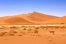
I’d love to know if anyone has done treks in the Rwenzori Mountains and how much it costs on average, what the infrastructure is like, the landscapes, and safety in the area. Thanks so much! I’m really looking forward to your replies.

I set off (on October 9, 2010) with my backpack from the Takijiri-oji bus stop, the starting point of the Nakahechi Route, which takes two days to reach Hongu Taisha temple.
Day 1: 12 km and a cumulative elevation gain (CEG) of 750 m. It was raining heavily, but I was well equipped with lightweight Gore-Tex. Spent the night and had a very Japanese meal at the ryokan Tsuki-no-ya at the entrance of the small village of Chikatsuyu-oji.
Day 2: the toughest day: 25 km and 1,000 m of CEG (just as much in descents...). Beautiful weather. Lots of fairly steep slopes with many stairs. Spent the night and had a meal at B&B Café in Hongu. Check out their English website.
Day 3: a rest day to visit Hongu Taisha Temple, then Yunomine Onsen and Kawayu Onsen, where I spent the night at Ashita-no-mori. They’re charming, speak English, and they were the ones who booked my nights for days 2 and 4 since I don’t speak Japanese. Connections between these three villages are by bus. Beautiful weather.
Day 4: Kogumotori-goe branch, taken in the opposite direction to what many pilgrims do. Beautiful weather. 17 km and 450 m of CEG, with just as much in descents. Fairly steep slopes, sometimes slippery stone slabs, and a few stairway sections. Spent the night and had a meal at Koguchi Shizen-no-le.
Day 5: Cloudy but nice weather. Ogumotori-goe branch to Nachi Taisha. Nearly 17 km and 1,250 m of CEG, with 1,000 m in descents. Similar terrain to the other days. Visited the temple, then returned by bus and train to my "logistics base" in Shirahama.
Things to note: > Don’t carry too much water. There are drink vending machines in many places. Bonus: cold drinks and a sugar boost. > This route is a bit technical, but it’s doable for someone who’s prepared physically. PS: I’m 62 and not a superhuman. > Check out the Tanabe City Tourism Bureau website (www.tb-kumano.jp)—it’s very well done—and ask them to send you the small guide with the trail maps (Pilgrimage Route Maps). There’s a certain Brad Towle, very professional and efficient.
In conclusion: a trek off the beaten path, very rewarding to experience. Early October seems like the perfect time. But May or June should be great too. I didn’t encounter many hikers, except a few during the first two days because Monday was a public holiday. All Japanese.
I highly recommend this trail—the only one, along with the Camino de Santiago, to be listed as a UNESCO World Heritage Site. Feel free to contact me for more details.
Day 1: 12 km and a cumulative elevation gain (CEG) of 750 m. It was raining heavily, but I was well equipped with lightweight Gore-Tex. Spent the night and had a very Japanese meal at the ryokan Tsuki-no-ya at the entrance of the small village of Chikatsuyu-oji.
Day 2: the toughest day: 25 km and 1,000 m of CEG (just as much in descents...). Beautiful weather. Lots of fairly steep slopes with many stairs. Spent the night and had a meal at B&B Café in Hongu. Check out their English website.
Day 3: a rest day to visit Hongu Taisha Temple, then Yunomine Onsen and Kawayu Onsen, where I spent the night at Ashita-no-mori. They’re charming, speak English, and they were the ones who booked my nights for days 2 and 4 since I don’t speak Japanese. Connections between these three villages are by bus. Beautiful weather.
Day 4: Kogumotori-goe branch, taken in the opposite direction to what many pilgrims do. Beautiful weather. 17 km and 450 m of CEG, with just as much in descents. Fairly steep slopes, sometimes slippery stone slabs, and a few stairway sections. Spent the night and had a meal at Koguchi Shizen-no-le.
Day 5: Cloudy but nice weather. Ogumotori-goe branch to Nachi Taisha. Nearly 17 km and 1,250 m of CEG, with 1,000 m in descents. Similar terrain to the other days. Visited the temple, then returned by bus and train to my "logistics base" in Shirahama.
Things to note: > Don’t carry too much water. There are drink vending machines in many places. Bonus: cold drinks and a sugar boost. > This route is a bit technical, but it’s doable for someone who’s prepared physically. PS: I’m 62 and not a superhuman. > Check out the Tanabe City Tourism Bureau website (www.tb-kumano.jp)—it’s very well done—and ask them to send you the small guide with the trail maps (Pilgrimage Route Maps). There’s a certain Brad Towle, very professional and efficient.
In conclusion: a trek off the beaten path, very rewarding to experience. Early October seems like the perfect time. But May or June should be great too. I didn’t encounter many hikers, except a few during the first two days because Monday was a public holiday. All Japanese.
I highly recommend this trail—the only one, along with the Camino de Santiago, to be listed as a UNESCO World Heritage Site. Feel free to contact me for more details.
I’m heading to Réunion from February 20 to March 8, and we’ve planned to spend the first 10 days hiking from north to south. But I’m a little worried about the weather. I live in Guadeloupe, so I’m familiar with humid tropical climates, and we’ll obviously be equipped for rain. I don’t mind walking in the rain sometimes, but hiking through clouds all day and seeing nothing—that’s way less exciting!! Of course, I know good weather isn’t guaranteed, but I’d like to be sure it’s not common knowledge among locals that you shouldn’t expect to enjoy the views during this crossing at this time of year!
We’re planning to camp. Again, the weather worries me: setting up the tent every night in the rain and spending the evening inside with gear that never dries—that’d be a bit of a hassle. Is the risk of rain every evening high?
Thanks for your replies! Emmanuelle
We’re planning to camp. Again, the weather worries me: setting up the tent every night in the rain and spending the evening inside with gear that never dries—that’d be a bit of a hassle. Is the risk of rain every evening high?
Thanks for your replies! Emmanuelle
Hi everyone,
I’m heading to Morocco in August and we’ll start with a stop in Chefchaouen (we’re driving).
My question: can anyone suggest a 5-to-7-day loop hiking route from Chefchaouen in Talassemtane Park, ideally passing by the God’s Bridge? Or a paper guidebook that covers a few options?
We prefer wild camping and guesthouses.
Thanks in advance

Hi everyone. Good evening!
I’m back from Sententon. I’ve recovered now. What a beautiful, beautiful island—did it both ways.
The crossing I’d call the "Madman’s Crossing" (a nod to another well-known one) is the one from Tarrafal to Ponta do Sol, which I did in 4.5 hours without speeding like Gonzalez.
Then there’s what I’d call the "Grogue Diagonal"—the north-south route from Ribeira do Paul to the Janela Lighthouse, passing through Cova, Pico da Cruz, and Silva. A day and a half of pure enjoyment, wrapping up my visit to the island in supreme beauty.
In my opinion, here are the island’s 7 must-dos:
- The most stunning *bordeira* – the *bordeira do norte*
- The most fantastic – the climb from João do Bento to Orgueiro
- The most pleasant – the *vereda* Cova/Pico da Cruz/Silva
- The most overrated – the northern coastal path
- The most beautiful paved section – Ribeira de Penede’s lower part
- The most grueling – Figueira de Cima to Chupador
- The toughest – the climb to Salto Preto
And for any hiker, the Norte plateau is a must. Unfortunately, I couldn’t make it to Tope de Coroa—my only rainy day—but it was still good, even with the summit shrouded in clouds all day.
Here are my initial thoughts. I’m happy to share more with anyone planning the same crossings. I’m currently posting the route details on my blog and might share a few here. Though since the forum’s text editor isn’t top-notch without HTML, I’m not sure how it’ll turn out. In the meantime, you can check it out here --> Cape Verde. Should be of interest to hikers. Bye
And for any hiker, the Norte plateau is a must. Unfortunately, I couldn’t make it to Tope de Coroa—my only rainy day—but it was still good, even with the summit shrouded in clouds all day.
Here are my initial thoughts. I’m happy to share more with anyone planning the same crossings. I’m currently posting the route details on my blog and might share a few here. Though since the forum’s text editor isn’t top-notch without HTML, I’m not sure how it’ll turn out. In the meantime, you can check it out here --> Cape Verde. Should be of interest to hikers. Bye

Hi
I’d like to know if any of you have already traveled with the solidarity tourism association Double Sens and if you could share your thoughts about this org. Maybe via private message to avoid any positive or negative publicity? Thanks in advance
I’d like to know if any of you have already traveled with the solidarity tourism association Double Sens and if you could share your thoughts about this org. Maybe via private message to avoid any positive or negative publicity? Thanks in advance
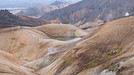
Hi everyone,
I’m new to the forum. I’d love to know if any of you have hiked in the Drakensberg, as I’m thinking of signing up for a trekking trip there.
I’ve heard about the "Sentinel Ladders" to reach the top plateau of the Amphitheatre.
Has anyone here done it? Is it as impressive as it sounds (I sometimes get vertigo)?
Otherwise, what are your impressions of this part of South Africa and Lesotho?
Thanks in advance for your replies.
Elisabeth
Not very well known: Hokkaido Island has national parks that rival those in North America. Hiking there is free (even many mountain huts) and requires no formalities. These treks are described in the LP *Hiking in Japan* guide—you can just buy the Hokkaido PDF. It’s way better than Mount Fuji. Of course, everything depends on the weather, which is very unstable in the Japanese mountains (frequent strong winds). The trails are often obstacle courses.
The Daisetsu Zan traverse is a stunning hike through volcanic terrain with a remote section in the middle that requires at least one night of camping (there are basic huts for the rest, which is popular with Japanese hikers): 4 to 6 days.
The Shiretoko traverse takes 2 days with views including an island in Russia, but the ridge is brown bear territory—there are even more here than in Denali National Park in Alaska (brown bears and grizzlies are the same). I ran into 7 in just 6 hours of hiking!
I’m heading to Rebun and Rishiri Islands next.
The Daisetsu Zan traverse is a stunning hike through volcanic terrain with a remote section in the middle that requires at least one night of camping (there are basic huts for the rest, which is popular with Japanese hikers): 4 to 6 days.
The Shiretoko traverse takes 2 days with views including an island in Russia, but the ridge is brown bear territory—there are even more here than in Denali National Park in Alaska (brown bears and grizzlies are the same). I ran into 7 in just 6 hours of hiking!
I’m heading to Rebun and Rishiri Islands next.
We watched the show "Rendez-vous en terre inconnue" in Guizhou Province, China. Those stunning landscapes really made us want to go trekking in the region.
Do you have any valuable tips to share to help us plan this trip?
hi
I was wondering if there are any nice day hikes from Mestia with potentially great views of Elbrus???
Thanks
Erick
I was wondering if there are any nice day hikes from Mestia with potentially great views of Elbrus???
Thanks
Erick
Hi,
My boyfriend and I are looking to spend a week in the Alps at the end of August. But since we only know the region in winter, I have no idea where to start!
I’d like to avoid the big resorts with apartment blocks and instead head for a typical village, with great hikes (on foot and by bike) and ideally near a lake, river, or water spot.
All suggestions are welcome!!! :)
Morgane.
All suggestions are welcome!!! :)
Morgane.

hi, I'm looking for info on possible transport to Ilam and then Phidim from KTM, as well as details about this trek. I found the PDF but no feedback from those who’ve tried it... have a great day, Aichatou
I'm heading out on a fully self-sufficient trek in Morocco (10 days) from Imilchil to Aghbalou.
Can I find screw-on gas canisters (Coleman, Primus) in Marrakech (any addresses?) or in villages between Imilchil and Aghbalou?
If not, are Butagaz canisters for camping gas (small 230g size) available?
Thanks in advance for your tips!

Hello
A brand-new project has just come up: spending 15 days in Costa Rica. If you have any recommendations for a French-speaking agency or guide, I’d love to hear them. I’m thinking of leaving in late February or early March. There’ll be two of us women on this trip. What are the most beautiful spots to explore? Preferably hiking spots. Véronique
A brand-new project has just come up: spending 15 days in Costa Rica. If you have any recommendations for a French-speaking agency or guide, I’d love to hear them. I’m thinking of leaving in late February or early March. There’ll be two of us women on this trip. What are the most beautiful spots to explore? Preferably hiking spots. Véronique
Hi everyone,
We started hiking the GR 34 a few years ago. At first, we did short hikes starting from our holiday home. Gradually, we had to drive to the starting point where we’d left off. Two years ago, we set off with our four boys (12, 9, 9, and 4 years old) for a 13-day trip, with 10 days of walking. We went from Pont-Aven to Bénodet (100 km). Challenge accomplished! We were so proud—especially the boys—and rightly so! This summer, we want to continue the adventure. We plan to pick up from Bénodet and go all the way to Pointe du Raz (~130 km). The boys are still motivated, though the youngest is a little less so. But he’ll have time to warm up to the idea. Do you know of any spots along this route (presbytery, bivouac, friends, campsites—but *really* cheap ones) where we can pitch our two small tents? Two years ago, we only stayed at campsites, and in the end, the bill was still pretty steep. We’d like to cut costs as much as possible. Thanks so much for your help! See you soon, Marie
We started hiking the GR 34 a few years ago. At first, we did short hikes starting from our holiday home. Gradually, we had to drive to the starting point where we’d left off. Two years ago, we set off with our four boys (12, 9, 9, and 4 years old) for a 13-day trip, with 10 days of walking. We went from Pont-Aven to Bénodet (100 km). Challenge accomplished! We were so proud—especially the boys—and rightly so! This summer, we want to continue the adventure. We plan to pick up from Bénodet and go all the way to Pointe du Raz (~130 km). The boys are still motivated, though the youngest is a little less so. But he’ll have time to warm up to the idea. Do you know of any spots along this route (presbytery, bivouac, friends, campsites—but *really* cheap ones) where we can pitch our two small tents? Two years ago, we only stayed at campsites, and in the end, the bill was still pretty steep. We’d like to cut costs as much as possible. Thanks so much for your help! See you soon, Marie
Hi everyone,
What do you think about visiting Tiger Leaping Gorge in Qiatou? Is it really worth doing? Is it overrated? And how difficult is the trek to get there? Thanks for your replies.
What do you think about visiting Tiger Leaping Gorge in Qiatou? Is it really worth doing? Is it overrated? And how difficult is the trek to get there? Thanks for your replies.

Hi,
During our stay in Luang Prabang, we're considering a 2- to 3-day trek, but we're torn between two options:
- Organized by an agency? Do you know any that offer what I'd call "authentic" experiences at "reasonable" prices?
- Going solo? Can you easily find public transport to get 80 to 150 km away from Luang Prabang without spending all day on the road, and hike to a few villages? (Car rental seems quite expensive, and the driving conditions are unpredictable.)
Do you have any advice on which direction to prioritize from Luang Prabang? North, East, West, or South?
Thanks for your help! Christian
- Organized by an agency? Do you know any that offer what I'd call "authentic" experiences at "reasonable" prices?
- Going solo? Can you easily find public transport to get 80 to 150 km away from Luang Prabang without spending all day on the road, and hike to a few villages? (Car rental seems quite expensive, and the driving conditions are unpredictable.)
Do you have any advice on which direction to prioritize from Luang Prabang? North, East, West, or South?
Thanks for your help! Christian
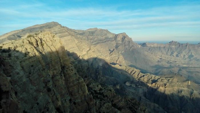
The hike from Misfat AA and Bilad Sayt via W9a, W10 via Ras Al Haraq, and W8 has recently been redone and clearly marked in green. The path is well-built, though W8 remains exposed (W8 is in the shade in the afternoon). You’ll find water at the passes just before and after Ras Al Haraq, which offers the best view. The signage starts on the descent toward the palm grove at the entrance of Misfat AA. In Bilad Sayt, the start is hidden by a construction site.
On the ridge, the W10 west of the intersection with W9a is just a faint trail, only partially marked by cairns. You’ll need to skirt the rocky summits to the south. It’s slow and rugged but without major issues. There’s a building with water 20 minutes before the last pass, where you hit the cliffs of Jbel Shams. At this point, W10 descends onto the northern slopes, continuing along narrow ledges—very adventurous since it’s unmarked. I didn’t continue. From this pass, you can also descend off-trail more directly toward Misfat AA, which is equally adventurous.
For the return, take the track to Shorfet Al Alamin pass (there’s a canal with water along the way—it’s in the shade in the morning), then the W10h and W9 trails. W9 is just a trace, not a proper trail, but it’s very clearly marked.
This makes for a 3-day loop (the goal is to camp up high for the views, sunsets, and sunrises) or a relaxed 4-day trek.
Al Hamra GH is a good place to stay before and after.
On the ridge, the W10 west of the intersection with W9a is just a faint trail, only partially marked by cairns. You’ll need to skirt the rocky summits to the south. It’s slow and rugged but without major issues. There’s a building with water 20 minutes before the last pass, where you hit the cliffs of Jbel Shams. At this point, W10 descends onto the northern slopes, continuing along narrow ledges—very adventurous since it’s unmarked. I didn’t continue. From this pass, you can also descend off-trail more directly toward Misfat AA, which is equally adventurous.
For the return, take the track to Shorfet Al Alamin pass (there’s a canal with water along the way—it’s in the shade in the morning), then the W10h and W9 trails. W9 is just a trace, not a proper trail, but it’s very clearly marked.
This makes for a 3-day loop (the goal is to camp up high for the views, sunsets, and sunrises) or a relaxed 4-day trek.
Al Hamra GH is a good place to stay before and after.
Hi there.
I know this topic has been covered countless times, but I can't seem to find clear answers to my questions.
I'm currently looking into doing the Three Passes Trek, including some adjacent routes like EBC, Kala Patthar, Gokyo Ri, and maybe Chukung Ri. I'm planning to do this trek between April and May.
But I have a few questions.
In terms of difficulty, I think I'm physically up for it—I'm athletic and used to mountain hiking in France—but is there any specific training I should do? Just to note, I did the Annapurna Base Camp last year without any issues.
Is it doable without a guide? I’d prefer to skip a guide and porter so I can really move freely. Is that crazy, or is it common? I’m mostly concerned about the Cho La and Renjo La passes (more about the route and risk of getting lost than safety).
Finally, I’m wondering about the duration. I’m a fast hiker, but I plan to take my time to acclimatize properly and enjoy the scenery (and maybe relax a bit in those landscapes🙂(By the way, does living at 2,000m altitude for 90% of the year help with AMS?) How much time should I budget for the trek to be safe, even if it means spending 2-3 extra days around Lukla-Namche? I was thinking of setting aside 20 days—does that sound reasonable?
Thanks for reading, and sorry in advance for any spelling mistakes. If I think of more questions, I’ll post them in this thread.
Cheers
I'm currently looking into doing the Three Passes Trek, including some adjacent routes like EBC, Kala Patthar, Gokyo Ri, and maybe Chukung Ri. I'm planning to do this trek between April and May.
But I have a few questions.
In terms of difficulty, I think I'm physically up for it—I'm athletic and used to mountain hiking in France—but is there any specific training I should do? Just to note, I did the Annapurna Base Camp last year without any issues.
Is it doable without a guide? I’d prefer to skip a guide and porter so I can really move freely. Is that crazy, or is it common? I’m mostly concerned about the Cho La and Renjo La passes (more about the route and risk of getting lost than safety).
Finally, I’m wondering about the duration. I’m a fast hiker, but I plan to take my time to acclimatize properly and enjoy the scenery (and maybe relax a bit in those landscapes🙂(By the way, does living at 2,000m altitude for 90% of the year help with AMS?) How much time should I budget for the trek to be safe, even if it means spending 2-3 extra days around Lukla-Namche? I was thinking of setting aside 20 days—does that sound reasonable?
Thanks for reading, and sorry in advance for any spelling mistakes. If I think of more questions, I’ll post them in this thread.
Cheers
Hello,
I’m looking for partners to climb Mera Peak (or Island Peak) next October (October 6–27). Thanks for your feedback. Best regards,
Sylvain
Sylvain

Hi there,
I’m heading to Nepal for two months in October/November, including a 20-day trek that I’m planning in Dolpo this time (after the Dhaulagiri Circuit and the Three Passes trek in the Khumbu region in previous years).
1/ Is it possible to organize a trek in Dolpo solo—that is, without going through an agency? (I know permits are mandatory, but I’ve heard conflicting info about whether a guide is required.)
I’m considering one of these two routes: - Lower Dolpo loop + variations - Dunai to Lo Manthang traverse (I’d love any tips if someone’s done this route, especially about resupply points)
2/ If it’s not allowed, are there guides or agencies in Dunai that might offer services? I’d appreciate any local contacts.
3/ Lastly, I’m looking for 1–3 trekking partners. Dates and route to be decided together. Experience with high-altitude trekking would be a plus, but simplicity, a thirst for adventure, and a good sense of humor are non-negotiable. Also, up for a self-sufficient experience (no guide or porters), depending on the answers to the points above.
Thanks in advance for your replies!
Olivier
I’m heading to Nepal for two months in October/November, including a 20-day trek that I’m planning in Dolpo this time (after the Dhaulagiri Circuit and the Three Passes trek in the Khumbu region in previous years).
1/ Is it possible to organize a trek in Dolpo solo—that is, without going through an agency? (I know permits are mandatory, but I’ve heard conflicting info about whether a guide is required.)
I’m considering one of these two routes: - Lower Dolpo loop + variations - Dunai to Lo Manthang traverse (I’d love any tips if someone’s done this route, especially about resupply points)
2/ If it’s not allowed, are there guides or agencies in Dunai that might offer services? I’d appreciate any local contacts.
3/ Lastly, I’m looking for 1–3 trekking partners. Dates and route to be decided together. Experience with high-altitude trekking would be a plus, but simplicity, a thirst for adventure, and a good sense of humor are non-negotiable. Also, up for a self-sufficient experience (no guide or porters), depending on the answers to the points above.
Thanks in advance for your replies!
Olivier
Hi there,
I’m heading to Nepal very soon to do the Three Passes Trek, among other things. Could anyone tell me what the average daily budget is for this trek? From what I’ve heard, this area seems more expensive than others.
Thanks in advance for your replies! :)
I’m heading to Nepal very soon to do the Three Passes Trek, among other things. Could anyone tell me what the average daily budget is for this trek? From what I’ve heard, this area seems more expensive than others.
Thanks in advance for your replies! :)
Hi everyone!
Just back from the Manaslu Circuit in Nepal, and I think for my next trip, I'd love a wilder environment. I'm considering a trek (two to three weeks) in Central Asia. Several agencies organize this kind of trip, and I was initially leaning toward Tajikistan, but after looking at travel photos, the landscapes seem very similar to the Alps, while Kyrgyzstan’s scenery looks more "exotic"—maybe closer to Mongolia? But these are just photos, and I’m struggling to get a real sense of it. I’d love to hear from people who’ve been to these destinations...
Thanks so much! :-)
Hi, I'm looking for experienced hikers to join me on the Peaks of the Balkans (Albania, Montenegro) for a 10-day trek this spring. I already have the full itinerary planned.
Hi there,
I’m planning to go hiking on this island and would like to know the best time to do it. I visited for a few days in November 2018—not for hiking but just to explore—and the weather wasn’t great, especially in the mountains. So, is a star-shaped itinerary doable if I rent a car and maybe use two different accommodations?
I’m not planning to join an organized group—just traveling with one other person and organizing things ourselves—unless you’d recommend a local agency or guide. Finally, even though I’ll be getting maps, a topo guide, and a GPS, I’d really appreciate your top hiking recommendations. Thanks so much for your tips!
I’m not planning to join an organized group—just traveling with one other person and organizing things ourselves—unless you’d recommend a local agency or guide. Finally, even though I’ll be getting maps, a topo guide, and a GPS, I’d really appreciate your top hiking recommendations. Thanks so much for your tips!

Hi everyone,
I usually travel abroad in the summer, but given the circumstances, I think this year I’ll be staying in France. I’d love to know which places you’d recommend for the most stunning mountain landscapes and the best hikes.
Thanks in advance for your help!
😉
I usually travel abroad in the summer, but given the circumstances, I think this year I’ll be staying in France. I’d love to know which places you’d recommend for the most stunning mountain landscapes and the best hikes.
Thanks in advance for your help!
😉
Hi there,
I’d like to go hiking and bivouacking. I’m looking for an association or group in Paris/Île-de-France that organizes regular outings. Any recommendations for organizations with a friendly, active vibe? Have a great day! Latifa
I’d like to go hiking and bivouacking. I’m looking for an association or group in Paris/Île-de-France that organizes regular outings. Any recommendations for organizations with a friendly, active vibe? Have a great day! Latifa

Hi there,
I'm looking for hiking ideas starting from Valbonë.
No more than 500/600m of elevation gain, no more than 15 kilometers.
I don’t plan on doing the hike to Theth.
Thanks! 🙂
I'm looking for hiking ideas starting from Valbonë.
No more than 500/600m of elevation gain, no more than 15 kilometers.
I don’t plan on doing the hike to Theth.
Thanks! 🙂
hi everyone,
we’re a group of 10 adults who hike together every year, and we’re looking for our next destination for October. Our main criterion is avoiding crowds, even if it means not being at the most wow-worthy spot. Is there still a chance to find some solitude in Madeira, or has it become difficult? Would Cape Verde be a better bet if we pick the right islands?
I know it’s a very personal opinion—super subjective depending on how much company you can tolerate—but it’s really our top priority.
Thanks for any recent insights; it seems like tourism in Madeira is really booming!
have a great day,
Sandra
we’re a group of 10 adults who hike together every year, and we’re looking for our next destination for October. Our main criterion is avoiding crowds, even if it means not being at the most wow-worthy spot. Is there still a chance to find some solitude in Madeira, or has it become difficult? Would Cape Verde be a better bet if we pick the right islands?
I know it’s a very personal opinion—super subjective depending on how much company you can tolerate—but it’s really our top priority.
Thanks for any recent insights; it seems like tourism in Madeira is really booming!
have a great day,
Sandra
Recommended for you
 A Few Days in Turkmenistan from Uzbekistan
 Slovak travel journal
 14 Days in Japan – September-October 2026
 Trek in Norway: Jotunheimen and Dovrefjell, you’ll adapt to the rain...
 CARIBBEAN: The island of SAINT-MARTIN, a different perspective
 Northern Morocco, the kingdom of kif?
 Summer 2026 - 3 weeks in the Azores
 The Pearl of Africa - July-August 2026