Skip to content
Atlas Mountains

Travel guide · Morocco

Atlas Mountains

★ 4 · last edited Dec 11, 2019

This mountain range stretching along Morocco and continuing into Algeria and Tunisia forms a "barrier" between the country's coastal and desert regions.

Overview

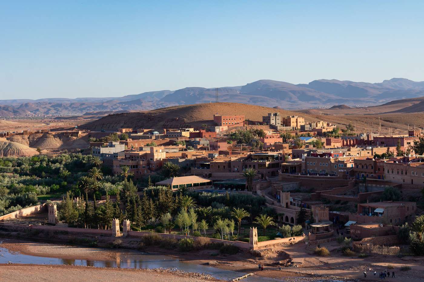
Aït Ben Haddou, Maroc
Aït Ben Haddou, Maroc · © VoyageForum

This mountain range stretching along Morocco and continuing into Algeria and Tunisia forms a "barrier" between the country's coastal and desert regions. In Morocco, it divides into three distinct parts.

The Middle Atlas (around Fez and Meknes) occupies the north with beautiful mountain landscapes, lakes, and several parks offering various outdoor activities. The High Atlas (around Marrakech), in the center, is the highest area, with Toubkal as its peak (4,167 m), and is also the most tourist-friendly due to the appeal of Marrakech and its surroundings, perfect for outdoor adventures. Finally, the Anti-Atlas lies in the southern region, heralding the vast desert expanses.

Main Cities

While this central Moroccan region includes several significant cities, Fez, Meknes, and especially Marrakech tend to overshadow the others, even in terms of tourism. However, other cities worth noting include: Beni Mellal, Ifrane, Moulay Idriss, Taroudant, Tata...

Tourist Attractions

Given its rich heritage and environment, it’s no surprise that the Atlas is one of Morocco’s most attractive regions for tourism. It will undoubtedly delight nature and culture enthusiasts alike.

Cities and Their Heritage

Three "gems" lie within the Atlas and rank among Morocco’s most important tourist sites.

The Middle Atlas is home to the imperial cities of Fez and Meknes, whose cultural heritage has earned them UNESCO status. Since they are very close to each other, visiting both is easy, as is exploring Volubilis (near the holy city of Moulay Idriss), one of North Africa’s best-preserved ancient sites. In a different vein, nestled in the mountains, Ifrane feels distinctly European in both its architecture and surrounding landscapes.

A highlight of the country, Marrakech sits at the heart of the High Atlas with its rich heritage and lively atmosphere. Heading toward Ouarzazate, you can visit two sites showcasing "traditional architecture": Telouet with its kasbah, and especially the ancient fortified village (ksar) of Aït Ben Haddou, a UNESCO World Heritage site. Further south, in the Anti-Atlas, Taroudant, nicknamed the "little Marrakech" with its ramparts and walled city, makes a great stop on the route between Agadir and Marrakech or Ouarzazate.

Nature and Activities

The Atlas is synonymous with mountains, so stunning landscapes and outdoor activities (trekking, fishing, skiing...) abound!

In the north, the entire Ifrane region is worth exploring through the Ifrane National Park with its breathtaking scenery, several lakes, and opportunities for hiking or mountain fishing. Nearby, the Tazekka National Park offers forests, waterfalls, caves, hiking, and caving.

Even more popular, the High Atlas around Marrakech attracts nature lovers in droves. The options are vast: you can discover the Ouzoud Waterfalls, which at 110 meters are the tallest in North Africa, the Lake Lalla Takerkoust, a favorite among swimmers, and above all, the Toubkal National Park, the Aït Bougmez Valley, and the Ourika Valley and Oukaïmeden, with their magnificent landscapes and hiking trails.

In the Anti-Atlas to the south, mountain scenery gradually blends into an environment hinting at the nearby desert. From this meeting point, you can enjoy the setting of the oasis of Amtoudi or Tafraout and the Ammeln Valley, which offer stunning landscapes and endless hiking possibilities.

Climate and Weather

The Atlas region is characterized by a mountain climate with snow and low winter temperatures in its central area. However, this is softened by the sea’s influence in the north (wetter) and the desert’s in the south (more arid). As a result, cities like Marrakech and Fez, with their continental climate, experience hot to very hot summers and winters with relatively mild temperatures.

Fez

A stunning imperial city, on par with Meknes, with a rich cultural heritage and a medina listed as a UNESCO World Heritage site. Overview of Fez Climate and Weather in Fez What to See in Fez Things to Do in Fez Flying to Fez Getting to Fes by Land Getting around Fez Where to Stay and Eat in Fez Living in Fez

Further reading on VoyageForum

View guide page: Fez

Overview of Fez

Overview of the City

Founded in the 9th century and home to the world's oldest university, Fez (or Fez) enjoyed its golden age when it replaced Marrakech as the kingdom's capital. It remained the capital until 1912 and the French Protectorate. Today, the city is the country's third-largest and a major tourist destination, attracting over a million visitors annually, thanks in part to its UNESCO-listed medina since 1981.

Key Facts

  • Type of place: large city.
  • Tourist interest: (must-see or highly recommended).
  • Location: in the north of the country, near Meknès.
  • Population: 1.412 million inhabitants (2017).
  • Area: 320 km².
  • Altitude: 410 m.

History of Fez

Precautions

Useful Addresses

  • Tourist Office:

Services

  • Local agencies:
  • Banks:
  • French Consulate: Av. Abou Obeïda Ibn Al Jarrah, 30000 Fez. Tel.: 535 94 94 00.
  • Hospital:
  • Internet:
  • Laundries:
  • Vehicle rental:
  • Post office:
View guide page: Overview of Fez

What to See in Fez

Fez can generally be visited in a full day. That said, if you're staying in the city, you can always take advantage of your accommodation to explore the surrounding area, which offers plenty to see within a 100-kilometre radius (Meknes, Ifrane, Volubilis,…

Read the full guide: What to See in Fez

Getting to Fes by Land

By Road

By Car

By Bus

Shared Taxis

By Train

Fes is on the ONCF Oujda-Tangier and Oujda-Marrakech lines. The "Fès-Ville" station is located in the north, in the new part of the city.

Main Routes

  • Casablanca:
  • Marrakech: 7h10 journey and 8 trains/day for 200 Dh (approx. 18 €)
  • Meknes: 40-minute journey for 22 Dh (approx. 2.50 €)
  • Oujda:
  • Rabat:
  • Tangier:

Distances

Distances (km) between Fes and major Moroccan cities:

Aga.Casa.Dakh.Erra.Essa.FèsMarra.Mekn.NadorOuar.Oujd.RabatSafiTan-T.Tang.Tét.
Agadir465120068017575527574010603751070600295360800825
Casablanca465163556036029524024560044061090255840340360
Dakhla12001635182013501910141018602200152522201710147084519551970
Errachidia68056018207103405003305253005404656651030665590
Essaouira175360135071070018065010003801020445125530690710
Fès7552951910340700490703156003302005301090285260
Marrakech2752401410500180490480775205790325150600570595
Meknes7402451860330650704803705603851504801040260260
Nador1060600220052510003157753707951355058301390425370
Ouarzazate3754401525300380600205560795820525355670770790
Oujda1070610222054010203307903851358205358601420560480
Rabat600901710465445200325150505525535325890250270
Safi2952551470665125530150480830355860325650570590
Tan Tan3608408451030530109060010401390670142089065011101135
Tangier8003401955665690285570260425770560250570111060
Tétouan8253601970590710260595260370790480270590113560
View guide page: Getting to Fes by Land

Getting around Fez

Getting your bearings

Transport

Car

As in many urban areas, a car isn’t really the best way to get around the old city—or even the new one, for that matter. It’s best to leave your vehicle parked in one of the lots near the centre.

Public transport

Taxis

Urban taxis remain affordable as long as you negotiate the fare beforehand. Expect to pay the equivalent of 1 € to 2 € for a trip within the centre.

Two wheels

On foot

Logically, the medina is best explored on foot. For other points of interest, even if they aren’t too far away, you might consider taking a taxi or bus to get there.

View guide page: Getting around Fez

Climate and Weather in Fez

Climate Overview

Best Time to Visit Fez

Jan.Feb.Mar.Apr.MayJun.Jul.Aug.Sep.Oct.Nov.Dec.
Climate

Climate and Forecast

Additional Information

View guide page: Climate and Weather in Fez

Flying to Fez

Fez Airport

Fez Airport also serves Meknes, which is less than an hour away.

Airport details

  • Name: Fès-Saïss Airport.
  • IATA code: FEZ
  • Hub: No.
  • Number of terminals: 2.
  • Annual passenger capacity: 2.5 million.
  • Passenger traffic: 1,115,595 (2017).
  • Distance from city centre: 15 km south of the city.

Services

Sleeping at the airport

Transport to the city centre

Other nearby airports

There are no other (major) airports truly close to Fez; those in Casablanca, Tangier, or Marrakech are over 300 kilometres away.

From the rest of the country

From Europe

Additional information

View guide page: Flying to Fez

Ifrane

Nestled in the heart of the mountains, the town and its surrounding landscapes resemble Europe. Beyond its distinctive charm, Ifrane is also known for its namesake national park and the nearby Michlifen ski resort. Nestled in the heart of the mountains, the…

Read the full guide: Ifrane

Meknes

It neighbors Fez and, like it, holds imperial city status with a rich historical and cultural heritage that earned it UNESCO recognition. Introduction to Meknes Meknes Climate and Weather What to see in Meknes Things to do in Meknès Getting to Meknes Getting Around Meknès Sleeping and Eating in Meknes Living in Meknes

Further reading on VoyageForum

View guide page: Meknes

Introduction to Meknes

Overview of the city

The city is a neighbor of Fez. Like it, Meknes holds imperial city status with a rich historical and cultural heritage that has earned it a place on the UNESCO list.

Key facts

  • Type of place: large city.
  • Tourist interest: (recommended).
  • Location: in the north of the country, near Fez, about 150 km from the sea.
  • Distances: Fez (60 km to the east), Marrakech (480 km to the southwest), Rabat (150 km to the west), Tangier (260 km to the north).
  • Local time: Heure : 147.
  • Population: 632,079 inhabitants (2014).
  • Area: 370 km².
  • Altitude: 552 m.

History of Meknes

Precautions

Useful addresses

  • Tourist office:

Services

  • Local agencies:
  • Banks:
  • Hospital:
  • Internet:
  • Laundries:
  • Vehicle rental:
  • Post office:
View guide page: Introduction to Meknes

What to see in Meknes

Overview

Meknes can generally be visited in a day. That said, if you're staying there, you can always make the most of your accommodation to explore the surrounding area, which offers plenty to see within a radius of around 100 kilometres, starting with Fez and Volubilis.

UNESCO World Heritage Sites

Ville historique de Meknès, Meknès, Maroc
Historic City of Meknes
With its high walls punctuated by monumental gates, this Hispano-Moorish-style part of the city is considered a remarkable example of 17th-century Maghreb architecture.

Districts

Sites, monuments and architectural ensembles

Museums

Parks and gardens

In the surrounding area

Several things to discover within a 100-kilometre radius of the city:

Azrou, Maroc
Azrou (70 km)
This town built at over 1,200 m is primarily a base for exploring the surrounding area, particularly Ifrane National Park with its fishing and hiking opportunities.
Fès, Maroc
Fez (60 km)
A stunning imperial city, on par with Meknes, with a rich cultural heritage and a medina listed as a UNESCO World Heritage site.
Ifrane, Maroc
Ifrane (70 km)
Nestled in the heart of the mountains, the town and its surrounding landscapes resemble Europe. Beyond its distinctive charm, Ifrane is also known for its namesake national park and the nearby Michlifen ski resort.
Moulay Idriss, Maroc
Moulay Idriss (25 km)
This holy city in Morocco is primarily known for the Roman ruins of Volubilis located on its outskirts.
Parc national d'Ifrane, Maroc
Ifrane National Park (65 km)
Just a few kilometres from Ifrane, the park is home to the largest cedar forest in the Maghreb. It offers stunning landscapes, several lakes, and is a popular spot for hiking and mountain fishing.
Sidi Harazem (75 km)
A thermal spa in the outskirts of Fes, highly popular with Moroccans and renowned for the healing properties of its mineral water.
Volubilis, Maroc
Volubilis (25 km)
This ancient Roman city near Moulay Idriss is a UNESCO World Heritage Site. It is one of the best-preserved ancient sites in all of North Africa.
View guide page: What to see in Meknes

Historic City of Meknes

With its high walls punctuated by monumental gates, this Hispano-Moorish-style part of the city is considered a remarkable example of 17th-century Maghreb architecture.

Overview of the Historic City of Meknes

With its high walls punctuated by monumental gates, this Hispano-Moorish-style part of the city is considered a remarkable example of 17th-century Maghreb architecture.

  • Tourist interest: (recommended).

History of the Old City

What to See

What to Do

Events and Entertainment

Practical Information

  • Location:
  • How to get there:
  • How to get around:

Where to Stay

Where to Eat

What to See Nearby

  1. == Further reading
View guide page: Historic City of Meknes

Getting to Meknes

By air

Meknes does not have a civilian airport. It is actually the airport of Fez, 70 km away, that serves the city by air.

By road

By car

By bus

Shared taxis

By train

Meknes is on the ONCF Oujda-Tangier and Oujda-Marrakech lines. Its station is located in the new part of the city.

Main connections

  • Casablanca:
  • Fez: 40-minute journey for 22 Dh (approx. 2 €)
  • Marrakech: 7h10 journey and 8 trains/day for 200 Dh (approx. 18 €)
  • Oujda:
  • Rabat:
  • Tangier:

Distances

Distances (km) between Meknes and major Moroccan cities:

Agd.Casa.Dakh.Erra.Essa.FezMarra.Mekn.NadorOuar.Oujd.RabatSafiTan-T.Tang.Tét.
Agadir465120068017575527574010603751070600295360800825
Casablanca465163556036029524024560044061090255840340360
Dakhla12001635182013501910141018602200152522201710147084519551970
Errachidia68056018207103405003305253005404656651030665590
Essaouira175360135071070018065010003801020445125530690710
Fez7552951910340700490703156003302005301090285260
Marrakech2752401410500180490480775205790325150600570595
Meknes7402451860330650704803705603851504801040260260
Nador1060600220052510003157753707951355058301390425370
Ouarzazate3754401525300380600205560795820525355670770790
Oujda1070610222054010203307903851358205358601420560480
Rabat600901710465445200325150505525535325890250270
Safi2952551470665125530150480830355860325650570590
Tan Tan3608408451030530109060010401390670142089065011101135
Tangier8003401955665690285570260425770560250570111060
Tétouan8253601970590710260595260370790480270590113560
View guide page: Getting to Meknes

Getting Around Meknès

Getting Your Bearings

Transport

Car

As in many urban areas, a car isn’t really the best way to get around the city and the medina. It’s better to leave your vehicle parked in one of the lots near the centre.

Public Transport

Taxis

Two Wheels

On Foot

By far the best way to get around. The distances between points of interest are quite short, so walking is the best way to explore the city.

View guide page: Getting Around Meknès

Meknes Climate and Weather

Climate Overview

Best Time to Visit Meknes

Jan.Feb.Mar.Apr.MayJun.Jul.Aug.Sep.Oct.Nov.Dec.
Climate

Climate and Forecast

Additional Information

View guide page: Meknes Climate and Weather

Taza

While the town itself has limited tourist appeal, the surrounding area is well worth a visit for its landscapes, particularly the nearby Tazekka National Park.

Overview of Taza

While the town itself has limited tourist appeal, the surrounding area is well worth a visit for its landscapes, particularly the nearby Tazekka National Park.

Key Facts

  • Type of place: city.
  • Tourist interest: (worth a stop if you are in the area).
  • Location: in northeastern Morocco, not far from the Imperial Cities.
  • Local time: Heure : 149.
  • Population: 148,456 inhabitants (2014).
  • Area: 37 km².
  • Altitude: 550 m.

History of Taza

What to See and Do in Taza

  • The town: Taza has an old town with ramparts built in the 12th century.
Parc national de Tazekka, Maroc
Tazekka National Park
This park near Taza is home to a large population of Barbary stags. A tourist circuit lets you discover its natural wonders (forests, waterfalls, caves...). You can also go hiking and caving at the Friouato chasm.

In the Surrounding Area

Sidi Harazem (95 km)
A thermal spa in the outskirts of Fes, highly popular with Moroccans and renowned for the healing properties of its mineral water.

Climate and Weather in Taza

Transport

Getting There

Getting Around

Accommodation

Food

Useful Addresses

Further Reading

View guide page: Taza

Marrakech

Known as Morocco’s "tourism powerhouse," Marrakech boasts a rich heritage, including a UNESCO-listed medina, vibrant atmosphere, and a natural environment packed with outdoor activities and discoveries—making it a must-visit on any trip to the country. Introduction to Marrakech Neighbourhoods of Marrakech History, Culture and Society of Marrakech Marrakech Cuisine Marrakech Climate and Weather What to See in Marrakech Things to Do in Marrakech Tips for Marrakech Flying to Marrakech Getting to Marrakech by Land Getting Around Marrakech Accommodation in Marrakech Other practical information for Marrakech Living in Marrakech
Marrakech, Maroc
Marrakech, Maroc · © VoyageForum

Further reading

View guide page: Marrakech

Introduction to Marrakech

Overview of the City

Marrakech is the fourth-largest city in Morocco. It has served as the country’s capital multiple times and is divided into two parts: the Medina (or historic city) and the new town, which emerged during the French protectorate. It retains a unique splendor and elegance from these bygone eras. The walls of the Medina, built as early as the 12th century, earned it the nickname "red city." These walls stretch for 19 kilometers, feature 200 towers, and are pierced by around fifteen gates providing access to the Medina.

Key Facts

  • Type of place: main city.
  • Location: in the center of the country, about 200 km from the Atlantic.
  • Latitude/longitude: 31.37' N and 8.00' W.
  • Local time: Heure : 154.
  • Population: 928,850 inhabitants (2014).
  • Area: 230 km²
  • Altitude: 450 m.

Tourism

Travel Essentials

  • Tourist interest: (must-see or highly recommended).
  • By air: France-Marrakech for 150/400 €.
  • Backpacker daily budget:
  • Best for accommodation:
  • Best for getting around: on foot, with occasional taxis.
  • Best time for climate/crowds/prices: spring and autumn, while avoiding school holidays and long weekends, which see higher visitor numbers.

Further Reading on VoyageForum

View guide page: Introduction to Marrakech

What to See in Marrakech

Marrakech is a must-visit on any trip to Morocco. With its vibrant atmosphere and rich cultural heritage, it deserves at least two days of exploration on its own. You could also add another two or three days to visit the surrounding areas, which are full of…

Read the full guide: What to See in Marrakech

Things to Do in Marrakech

Marrakech offers an excellent balance of activities. Its international reputation as a "trendy city" ensures a lively atmosphere, with plenty of cultural events and activities. The proximity to the mountains also provides fantastic opportunities for trekkers…

Read the full guide: Things to Do in Marrakech

Tips for Marrakech

Best Times to Visit Marrakech

Spring and autumn are the best times to visit Marrakech and the Moroccan interior in terms of climate. While it can get a bit crowded, the busiest times are during school holidays or long weekends. If possible, it's best to avoid those periods as well.

Jan.Feb.Mar.Apr.MayJun.Jul.Aug.Sep.Oct.Nov.Dec.
Climate/ /

: very favorable | : favorable | : moderately favorable | : unfavorable.

Exploring the City

Must-See

Unique Experiences

Family-Friendly

Based on Length of Stay

Nearby Attractions

There are several points of interest within a 100 km radius of Marrakech that can be visited in a day, at least if you have your own transportation.

  • Amizmiz (55 km): This Berber highland town southwest of Marrakech is known for its weekly Tuesday souk.
  • Lake Lalla Takerkoust (40 km): This artificial lake is located a few kilometers west of Toubkal National Park. Popular with Marrakech residents, it offers opportunities for canoeing and swimming.
  • Toubkal National Park (60 km): At the gates of Marrakech, it is home to the Toubkal Massif, the highest point in Morocco (4,167 m). The area is appreciated for its landscapes, numerous hiking possibilities, and the Oukaimeden ski resort.
  • Tizi-n-Test Pass Road: This is the name of the road linking Marrakech to Taroudant along the western edge of Toubkal National Park. This stunning 100 km route crosses passes over 2,000 m high.
  • Ourika Valley and Oukaïmeden (50 km): This scenic part of Toubkal National Park, close to Marrakech, attracts many visitors for its nature and the well-preserved traditions of its inhabitants. Oukaïmeden is Morocco’s main ski resort at 3,200 m altitude.
View guide page: Tips for Marrakech

Flying to Marrakech

Marrakech-Menara Airport is the country's second busiest, just behind Casablanca . It offers all the facilities and services (currency exchange and more) of major airports. As a holiday destination, Marrakech benefits from numerous seasonal or charter flights…

Read the full guide: Flying to Marrakech

Getting to Marrakech by Land

Marrakech is very well served by public transport. Its bus station is located in the Bab Doukala district (along Boulevard du 11 Janvier), about 2 km from Jemaa el-Fna or the train station. As for shared taxis, their departure point is right next to the bus…

Read the full guide: Getting to Marrakech by Land

Getting Around Marrakech

As in many urban areas, a car isn’t really the best option for the city, especially not in the medina. It’s better to leave your vehicle and use walking, taxis, or buses for your trips, at least in the city center. However, both in the city and at the…

Read the full guide: Getting Around Marrakech

Accommodation in Marrakech

Overview of the offer

Given its tourist vocation, Marrakech has a very large hotel sector with countless establishments of all kinds and for all budgets. Despite this, it is more than useful to book in season.

Hotels of all kinds

Very wide choice. The big chains and high-end hotels are mainly located in the Guéliz district and the new town. More "affordable" or backpacker-friendly establishments are, for their part, on the side of the old city and the medina... as are, incidentally, many riads.

Riad

Riads are large traditional houses with charm, featuring a patio, well restored and converted into small hotels. This is a typically Moroccan specialty, particularly associated with Marrakech, to which the city is increasingly linked. In short, Marrakech has a plethora of riads, mostly in the medina, which doesn’t prevent good opportunities from being rare at certain times of the year, making it preferable to book in advance.

In terms of rates, while you can find options around 50 to 60 € per night for two, expect to pay more like 80 to 100 € for a nice establishment with breakfast included. Although the price may sometimes seem high for Morocco (and can inflate during peak periods), spending even one night in a riad is a great experience and is recommended for any trip to Morocco.

Camping

Other options

Homestays

Apartment or villa rentals

Which accommodation to choose?

Additional information

View guide page: Accommodation in Marrakech

Marrakech Cuisine

What to Eat?

Logically, Marrakech’s cuisine is varied and international. You can easily find Moroccan food, as well as French, Italian, Chinese, Japanese, and more—though prices often reflect the city’s busy tourist scene.

While many hotels have their own restaurants, there’s also a wide range of options, from local eateries to tourist-friendly spots and upscale dining. Don’t miss the grilled skewer stands and other specialties at Jemaa el-Fna square, which keep the area lively from 6:00 PM well into the night.

Local Specialties

Where to Eat?

Several neighborhoods have restaurants. It really depends on what you’re looking for: upscale, tourist-friendly, or local.

Additional Resources on VoyageForum

View guide page: Marrakech Cuisine

Marrakech Climate and Weather

Climate Overview

Marrakech has a very hot climate in summer, with temperatures often exceeding 40°C during the day before dropping in the evening (bring a warm layer). Winter, on the other hand, is pleasant, though November to March is also the rainiest period.

Best Time to Visit Marrakech

Spring and autumn are the best times to visit Marrakech and the Moroccan interior in terms of climate.

Jan.Feb.Mar.Apr.MayJun.Jul.Aug.Sep.Oct.Nov.Dec.
Climate/ /

: very favorable | : favorable | : moderately favorable | : unfavorable.

Climate and Forecasts

Additional Information

View guide page: Marrakech Climate and Weather

Other practical information for Marrakech

Luggage and equipment to bring

Budget

Precautions

Staying in Marrakech doesn’t require any special precautions; risks are very low as long as you don’t act carelessly. The police are there to ensure everything goes smoothly. The biggest issue for visitors tends to be scams or minor rip-offs, especially in "tourist services": from small addition errors in restaurants to overcharged taxi rides (or fares quoted in euros instead of dirhams), including anything that can be monetised around Jemaa el-Fna or the souks.

Another concern is the summer temperatures, which can exceed 40°C, making it essential to protect yourself from the sun and stay hydrated. The most vulnerable should avoid travelling or exerting themselves during the hottest hours of the day.

Consulates

Among the consulates in the city:

  • Belgium: c/o Palmeraie Golf Palace, 40060 Marrakech. Tel.: 524 36 87 61.
  • France: Rue Camille Cabana, Quartier de l'Hivernage, 40000 Marrakech. Tel.: 524 38 82 00.

Opening hours

Communication

Tourist Office

Telephone and internet

Beyond cybercafés, Wi-Fi is widely available in Marrakech, both in accommodations and in bars and restaurants that cater to tourists.

Post office

Laundries

Self-service laundries and dry cleaners have spread throughout the city. So, in principle, there’s no problem finding a place to wash your clothes affordably. Another option is to use your hotel, where laundry can be washed and then hung out to dry on the terrace.

French language use

There’s no language barrier in Marrakech, where you’ll always find people who speak French.

View guide page: Other practical information for Marrakech

Neighbourhoods of Marrakech

Neighbourhoods of Marrakech

Medina de Marrakech, Marrakech, Maroc
Medina de Marrakech, Marrakech, Maroc · © VoyageForum

Further information

View guide page: Neighbourhoods of Marrakech

Tafraout

At an altitude of 1,200 m, the town is dominated by striking granite cliffs. In addition to its orchards, Tafraout is known as the heart of the Almond Valley, which offers stunning landscapes and countless hiking opportunities of all kinds.

Overview of Tafraout

At an altitude of 1,200 m, this Berber town is dominated by striking granite cliffs. In addition to its orchards, Tafraout is known as the heart of the Almond Valley, which offers stunning landscapes and countless hiking opportunities of all kinds.

Key facts

  • Type de lieu: small town.
  • Intérêt touristique: (worth seeing).
  • Localisation: south of Agadir, in the Moroccan Anti-Atlas.
  • Heure locale: Heure : 157.
  • Population: 6,345 inhabitants (2014).
  • Superficie:
  • Altitude: 1,200 m.

History of Tafraout

What to see and do in Tafraout

Vallée des Ammeln, Maroc
Ammeln Valley
Also known as Almond Tree Valley. With Tafraout at its heart, it offers stunning landscapes and countless hiking opportunities.

In the surrounding area

Climate and weather in Tafraout

Transport

Getting there

Getting around

Sleeping

Eating

Useful addresses

Further information

View guide page: Tafraout

Taroudant

Nicknamed the "little Marrakech" with its ramparts and walled city, Taroudant is a great stop for travellers en route between Agadir and Marrakech or Ouarzazate. Nicknamed the "little Marrakech", Taroudant is the former capital of the Sous Valley, where olive…

Read the full guide: Taroudant

Toubkal National Park

On the doorstep of Marrakech, it is home to the Toubkal massif, the highest point in Morocco (4,167 m). The area is prized for its landscapes, numerous hiking opportunities, and the Oukaimeden ski resort. Introduction to Toubkal National Park Climate and Weather in Toubkal National Park Things to see and do in Toubkal National Park Practical information for Toubkal National Park

Further reading on VoyageForum

View guide page: Toubkal National Park

Introduction to Toubkal National Park

Introduction to Toubkal National Park

Toubkal National Park is located in the central part of the High Atlas, almost at the gates of Marrakech. It is home to Jbel Toubkal, the highest peak in Morocco at 4,167 m. The site is popular with visitors for its landscapes, numerous hiking opportunities, and the ski resort at Oukaïmeden.

Key Facts

  • Type of place: major national park.
  • Tourist interest: (must-see or highly recommended).
  • Characteristics: mountain park.
  • Location: about sixty kilometres south of Marrakech.
  • Local time: Heure : 166
  • Annual visitors:
  • Area: 380 km².
  • Altitude: from 1,200 to 4,167 m (Jbel Toubkal).

Environment

Landscape of the Park

Wildlife and Flora

Precautions

View guide page: Introduction to Toubkal National Park

Things to see and do in Toubkal National Park

The nature and landscapes of the High Atlas in all their splendour. Even if the park can get a bit crowded at times, it’s a must-see on any trip to the region. What’s more, its proximity to Marrakech makes it a possible day trip, though spending a few days…

Read the full guide: Things to see and do in Toubkal National Park

Practical information for Toubkal National Park

Getting information

Transport

Getting there

Getting around

Sleeping and eating

As the area is very popular, there are accommodation (and dining) options inside or near the park.

You’ll find everything from small hostels to more "upscale" establishments in Asni (at the park’s "main" entrance), Ouirgane (to the west), the Ourika Valley and Oukaïmeden, and especially in Imlil at its centre. Several mountain huts are also available in the hiking areas where you can also pitch a tent. Since the park is so popular, finding accommodation during peak season or on weekends isn’t always easy.

View guide page: Practical information for Toubkal National Park

Climate and Weather in Toubkal National Park

Climate Overview

Toubkal enjoys strong sunshine year-round. In summer, temperatures are pleasant (with cool nights) thanks to the altitude. However, in winter, temperatures can drop to -20°C at higher elevations, with snow from October to April. In short, whether summer or winter, plan appropriate clothing and gear based on your plans.

Best Time to Visit

Jan.Feb.Mar.Apr.MayJun.Jul.Aug.Sep.Oct.Nov.Dec.
Climate

: very favorable | : favorable | : moderately favorable | : unfavorable.

Climate and Forecasts

Additional Information

View guide page: Climate and Weather in Toubkal National Park

Aït Ben Haddou

À quelques kilomètres de Ouarzazate, l'ancien village fortifié (ksar) est un site remarquable et unique classé au patrimoine mondial de l'Unesco. Si vous faites le trajet Marrakech - Ouarzazate par la superbe Tizi-n-Tichka Pass Road (à plus de 2 200 m),…

Read the full guide: Aït Ben Haddou

Ouzoud Waterfalls

At 110 metres high, these are the most famous waterfalls in Morocco and the tallest in North Africa. They’re one of the major attractions near Marrakech.

Overview

At 110 metres high, these waterfalls formed by the Ouzoud River are the most famous in Morocco and the tallest in North Africa. They’re one of the major attractions near Marrakech, which means the site can get a little crowded on weekends or in summer. The falls are most impressive in late spring.

Key details

  • Type of place: waterfall.
  • Tourist interest: (recommended).
  • Features: waterfalls in a mountainous setting.
  • Location: northeast of Marrakech, not far from Beni Mellal, in the High Atlas.
  • Height: 110 m.
  • Altitude: 1,060 m.
  • Interest of the place: (recommended).

Environment

Precautions

What to see and do

The waterfalls cascade in three drops, the largest of which reaches 75 metres out of the total 110. A walk lets you explore them in 1 to 1.5 hours. The site is open and free, unlike the paid "official" parking lot.

Nearby

Climate and weather

Transport

Getting there

Getting around

The site can only be visited on foot.

Sleeping and eating

Since the site is a tourist hotspot, there are several riads and hotels, as well as restaurants and shops on-site.

Additional information

View guide page: Ouzoud Waterfalls

Aït Bougmez Valley

One of the most beautiful valleys in the High Atlas. Amid stunning landscapes where traditional villages unfold, it offers numerous hiking opportunities. A small road loops around the valley in about a hundred kilometres.

Overview of the Aït Bougmez Valley

This is one of the most beautiful valleys in the High Atlas. Amid stunning landscapes where traditional villages unfold, it offers numerous hiking opportunities. A small road loops around the valley in about a hundred kilometres.

Key details

  • Type of place: valley.
  • Tourist interest: (recommended).
  • Features: broad valley in a mountainous area.
  • Location: in the heart of the country, in the High Atlas.
  • Distances: Azilal (25 km to the north), Beni Mellal (120 km to the north), Marrakech (200 km to the west).
  • Length:
  • Altitude:

Valley environment

Wildlife and flora

Precautions

What to see and do

In the surrounding area

Climate and weather

Transport

Getting there

Getting around

Accommodation

Food

Further information

View guide page: Aït Bougmez Valley

Eastern High Atlas National Park

This is a mountainous and lake-rich area (Isli, Tislit) near Imilchil, known for its diverse wildlife (mouflons, monkeys, birds) and flora.

Overview of the Eastern High Atlas National Park

The Eastern High Atlas National Park is a mountainous and lake-rich area (Isli, Tislit) located between the town of Imilchil and the Jbel Aberdouz peak. It is known for its diverse wildlife (mouflons, monkeys, birds) and flora.

Key details

  • Type of place: national park.
  • Tourist interest: (worth seeing).
  • Features: mountain park.
  • Local time: Heure : 1864
  • Annual visitors:
  • Area: 490 km²
  • Altitude:

Environment

Landscape of the park

Wildlife and flora

Precautions

Climate and weather

What to see and do

In the surrounding area

Practical information

  • Location:
  • Distances:
  • Opening period:
  • Rates:

Getting there

Getting around

Accommodation and dining

Additional information

View guide page: Eastern High Atlas National Park

Amtoudi

This Berber village, quite isolated, is a beautiful oasis nestled at the bottom of a gorge with a magnificent palm grove at the foot of the mountains.

Overview of Amtoudi

This Berber village, quite isolated, is a beautiful oasis nestled at the bottom of a gorge with a magnificent palm grove at the foot of the mountains.

Key Details

  • Type of place: oasis.
  • Tourist interest: (worth seeing).
  • Location: off the main routes, between Guelmim and Tata and not far from the village of Icht.
  • Distances: Agadir (150 miles to the north), Guelmim (71 miles to the southwest), Icht (43 miles to the southeast), Tata (130 miles to the northeast).
  • Local time: Heure : 1872.
  • Population:
  • Area:
  • Altitude: 800 m.
  • Website:

History of Amtoudi

What to See and Do in Amtoudi

In the Surrounding Area

Climate and Weather in Amtoudi

Transportation

Getting There

Getting Around

Accommodation

Eating

Useful Addresses

Further Information

View guide page: Amtoudi

Tata

The "big" city of the region's south. Worth seeing if you have time: its palm grove and the Messalit caves a few kilometers away.

Overview of Tata

Located on the plain, Tata is the capital of the province of the same name. It primarily serves as a base for excursions in its surroundings if you have time, where you can discover its palm grove and the Messalit caves a few kilometers away, as well as the numerous rock engraving sites in the region.

Key Facts

  • Type de lieu: small town.
  • Intérêt touristique: (worth a stop if you are in the area).
  • Heure locale: Heure : 1873.
  • Population: 18,611 inhabitants (2014).
  • Superficie:
  • Altitude: 670 m.
  • Site internet:

History of Tata

What to See and Do in Tata

The town itself has little tourist interest and is usually just a quick stop on the Ouarzazate to Guelmim Route. If you have some time, you might visit:

Tata Palm Grove
North of the town towards Tagmoute, this area is home to several thousand palm trees, part of which was destroyed by a fire in 2018.
Messalit Caves
These are several caves, some quite impressive, located a few kilometres north of Tata.

In the Surroundings

Climate and Weather in Tata

Transport

Getting There

Getting Around

Accommodation

Food

Useful Addresses

Further Information

View guide page: Tata

Tata Palm Grove

North of the town towards Tagmoute, this area is home to several thousand palm trees, part of which was destroyed by a fire in 2018.

Overview of the Tata Palm Grove

North of the town towards Tagmoute, this area is home to several thousand palm trees, part of which was destroyed by a fire in 2018.

Key Details

  • Type of place: forest.
  • Tourist interest: (worth a stop if you are in the area).
  • Characteristics:
  • Location:
  • Area:
  • Altitude:
  • Website:

Environment of the Palm Grove

Wildlife and Flora

Precautions

What to See and Do

In the Surrounding Area

Climate and Weather

Getting There

Sleeping and Eating

  1. == In Addition
View guide page: Tata Palm Grove

Messalit Caves

These are several caves, some quite impressive, located a few kilometres north of Tata.

Overview of the Messalit Caves

These are several caves, some quite impressive, located a few kilometres north of Tata.

Landmarks

  • Type of place: cave.
  • Tourist interest: (worth a stop if you are in the area).
  • Features:
  • Area:

Cave Physiognomy

What to See and Do

Practical Information

  • Location: 7 kilometres north of Tata.
  • Opening hours:
  • Price:
  • Website:

Getting There

Accommodation and Dining

Nearby Attractions

Additional Information

View guide page: Messalit Caves

Moulay Idriss

This holy city in Morocco is primarily known for the Roman ruins of Volubilis located on its outskirts. This holy city in Morocco is primarily known for the Roman ruins of Volubilis located on its outskirts. It is also popular among paragliding enthusiasts.…

Read the full guide: Moulay Idriss

Volubilis

This ancient Roman city near Moulay Idriss is a UNESCO World Heritage Site. It is one of the best-preserved ancient sites in all of North Africa.

Overview of Volubilis

This ancient Roman city, located 2 or 3 kilometres from Moulay Idriss, is a UNESCO World Heritage Site. It is one of the best-preserved ancient sites in all of North Africa.

History of Volubilis

What to See and Do

Volubilis is an ancient Berber city Romanised in the 1st century AD. It has been a UNESCO World Heritage Site since 1997 and is one of the best-preserved ancient sites in all of North Africa.

Practical Information

  • Location:
  • Local time: Heure : 1880.
  • Address:
  • Opening hours:
  • Price:

Transport

Sleeping and Eating

What to See Nearby

Further Reading

View guide page: Volubilis

Ifrane National Park

Just a few kilometres from Ifrane, the park is home to the largest cedar forest in the Maghreb. It offers stunning landscapes, several lakes, and is a popular spot for hiking and mountain fishing.

Overview

Located just a few kilometres from Ifrane, the national park covers over 500 km² and is home to the largest cedar forest in the Maghreb. It also offers stunning landscapes and several lakes.

Key details

  • Type de lieu: national park.
  • Intérêt touristique: (recommended).
  • Caractéristiques:
  • Localisation: in the Middle Atlas region, not far from the Imperial Cities.
  • Distances: Fez (65 km to the north), Ifrane (10 km to the south-east), Marrakech (420 km to the south-west), Meknes (70 km to the north-west).
  • Superficie: 518 km².
  • Altitude:

Environment

Site features

Precautions

Climate and weather

What to see and do

The park is a major local tourism hotspot, highly popular for hiking and mountain fishing.

Nearby

Azrou, Maroc
Azrou (30 km)
This town built at over 1,200 m is primarily a base for exploring the surrounding area, particularly Ifrane National Park with its fishing and hiking opportunities.
Zaouia d'Ifrane Waterfalls (80 km)
Located in a quiet spot not far from Azrou, this village is nestled in a pretty setting with several waterfalls that can be discovered on a hike.
Fès, Maroc
Fez (65 km)
A stunning imperial city, on par with Meknes, with a rich cultural heritage and a medina listed as a UNESCO World Heritage site.
Ifrane, Maroc
Ifrane (10 km)
Nestled in the heart of the mountains, the town and its surrounding landscapes resemble Europe. Beyond its distinctive charm, Ifrane is also known for its namesake national park and the nearby Michlifen ski resort.
Meknès, Maroc
Meknes (70 km)
It neighbors Fez and, like it, holds imperial city status with a rich historical and cultural heritage that earned it UNESCO recognition.

Practical information

Access

Prices and information

Getting around

Accommodation and dining

Further reading

View guide page: Ifrane National Park

Imilchil

This high-altitude village is known for its proximity to the High Atlas Park, but above all for its betrothal festival (moussem), which takes place around the Isli and Tislit lakes.

Overview of Imilchil

This high-altitude village is known for its proximity to the Eastern High Atlas National Park, but above all for its betrothal festival (moussem), which takes place around the Isli and Tislit lakes.

Key details

  • Type de lieu: village.
  • Intérêt touristique: (worth a stop if you are in the area).
  • Localisation: in the heart of the High Atlas, at over 2,000 m altitude.
  • Heure locale: Heure : 1889.
  • Population: 1,850 inhabitants (2013).
  • Superficie:
  • Altitude: 2,119 m.
  • Site internet:

History of Imilchil

What to see and do in Imilchil

Parc national du Haut-Atlas oriental, Maroc
Eastern High Atlas National Park
This is a mountainous and lake-rich area (Isli, Tislit) near Imilchil, known for its diverse wildlife (mouflons, monkeys, birds) and flora.
  • Festival des fiançailles d'Imilchil: Help improve this section by contributing.

In the surrounding area

Climate and weather in Imilchil

Transport

Getting there

Getting around

Accommodation

Food

Useful addresses

Further information

View guide page: Imilchil

Khénifra National Park

Morocco’s newest national park, set in a mountainous area perfect for hiking.

Overview of Khénifra Park

This is the newest of Morocco’s national parks, established in 2008. Located near the city of the same name, it sits in a mountainous area where you can hike and observe a fairly rich wildlife.

Key details

  • Type of place: national park.
  • Tourist interest: (worth seeing).
  • Features: mid-mountain park.
  • Location:
  • Distances: Azrou (80 km to the north), Beni Mellal (140 km to the southwest), Khenifra (20 km to the west).
  • Area: 2,027 km².
  • Altitude:

Environment

Landscape

Precautions

What to see and do

Nearby

Climate and weather

Practical info

Access

Fees and information

Getting around

Accommodation and dining

Further reading

View guide page: Khénifra National Park

Tizi-n-Test Pass Road

This is the name of the road linking Marrakech to Taroudant along the western edge of Toubkal Park. This stunning route spans around a hundred kilometres, crossing passes over 2,000 metres high.

Overview of the Tizi-n-Test Pass Road

This is the name of the road linking Marrakech to Taroudant along the western edge of the Toubkal Park. This stunning route spans around a hundred kilometres, crossing passes over 2,000 metres high.

Key details

  • Type of place: scenic route.
  • Tourist interest: (recommended).
  • Theme:
  • Location:
  • Local time: Heure : 1895
  • Main towns:
  • Length:
  • Altitude:
  • Website:

The road

What to see and do

Route

Nearby

Climate and weather

Transport

Getting there

Getting around

Sleep

Eat

Additional information

View guide page: Tizi-n-Test Pass Road

Lake Lalla Takerkoust

This artificial lake is located a few kilometres west of Toubkal Park. A favourite among Marrakech residents, it offers opportunities for canoeing and swimming.

Overview of Lake Lalla Takerkoust

This artificial lake, created by the construction of a dam, is located a few kilometres west of the Toubkal Park. A favourite spot for Marrakech residents, it offers opportunities for canoeing and swimming.

Key details

  • Type of place: lake.
  • Tourist interest: (worth a stop if you are in the area).
  • Characteristics: mid-mountain artificial lake.
  • Location: a few dozen kilometres south of Marrakech, in the commune of the same name.
  • Surface area:
  • Altitude: 575 m.
  • Website:

Lake environment

Wildlife and flora

Precautions

What to see and do

In the surrounding area

Beyond Marrakech, the must-see:

Amizmiz, Maroc
Amizmiz (20 km)
This Berber highland town, southwest of Marrakech, is known for its weekly Tuesday souk.
Parc national du Toubkal, Maroc
Toubkal National Park (40 km)
On the doorstep of Marrakech, it is home to the Toubkal massif, the highest point in Morocco (4,167 m). The area is prized for its landscapes, numerous hiking opportunities, and the Oukaimeden ski resort.

Climate and weather

Getting there

Sleeping and eating

There are several small restaurants around the lake, as well as a few hostels and guesthouses in the immediate vicinity. Otherwise, Marrakech is not far away.

Further information

View guide page: Lake Lalla Takerkoust

Ammeln Valley

Also known as Almond Tree Valley. With Tafraout at its heart, it offers stunning landscapes and countless hiking opportunities.

Overview of Ammeln Valley

With Tafraout at its heart, this valley—also known as the Almond Tree Valley—offers stunning landscapes and countless hiking opportunities.

Key details

  • Type of place: valley.
  • Tourist interest: (recommended).
  • Features:
  • Length:
  • Altitude: 1,200 m.

Valley environment

Wildlife and flora

Precautions

Climate and weather

What to see

What to do

Practical information

  • Location: south of Agadir, in the Moroccan Anti-Atlas.
  • Website:

Getting there

Getting around

Sleeping and eating

Nearby attractions

Additional information

View guide page: Ammeln Valley

Azrou

This town built at over 1,200 m is primarily a base for exploring the surrounding area, particularly Ifrane National Park with its fishing and hiking opportunities. This town built at over 1,250 m is primarily a base for exploring the surrounding area,…

Read the full guide: Azrou

Midelt

A medium-sized town (and stopover) between Meknes and Errachidia. You can explore the Jaffar Cirque in the surrounding area.

Overview of Midelt

Midelt is a medium-sized town (and stopover) between Meknes and Errachidia. You can explore the Jaffar Cirque in its surroundings.

Key details

  • Type of place: landmark town.
  • Tourist interest: (worth a stop if you are in the area).
  • Location: at the intersection of the Middle Atlas and the Eastern High Atlas, on the Meknes-Errachidia route.
  • Local time: Heure : 1902.
  • Population: 55,304 inhabitants (2014).
  • Area:
  • Altitude: 1,520 m.

History of Midelt

What to see and do in Midelt

Midelt is primarily a stopover town rather than a tourist destination. If anything, you can explore the Jaffar Cirque in its surroundings, heading toward Imilchil. Only accessible by 4x4, the area offers one of the most stunning tracks in the Atlas, with beautiful landscapes where cliffs and cedar forests meet.

In the surrounding area

Climate and weather in Midelt

Transport

Getting there

Getting around

Accommodation

Food

Useful addresses

Further reading

View guide page: Midelt

Beni Mellal

A major town in the country’s centre with a rather beautiful kasbah.

Overview of Beni Mellal

Beni Mellal is a major town in the centre of Morocco with "just" a rather beautiful kasbah as its main tourist attraction.

Key facts

  • Type de lieu: city.
  • Intérêt touristique: (worth a stop if you are in the area).
  • Localisation: in the heart of the country, in the High Atlas.
  • Distances: Casablanca (230 km to the northwest), Fez (290 km to the northeast), Marrakech (200 km to the southwest).
  • Heure locale: Heure : 1903.
  • Population: 192,000 inhabitants (2014).
  • Superficie:
  • Altitude: 620 m.

History of Beni Mellal

What to see and do in Beni Mellal

In the surrounding area

Cascades d'Ouzoud, Maroc
Ouzoud Waterfalls (75 km)
At 110 metres high, these are the most famous waterfalls in Morocco and the tallest in North Africa. They’re one of the major attractions near Marrakech.
Parc national du Haut-Atlas oriental, Maroc
Eastern High Atlas National Park (50 km)
This is a mountainous and lake-rich area (Isli, Tislit) near Imilchil, known for its diverse wildlife (mouflons, monkeys, birds) and flora.

Climate and weather in Beni Mellal

Transport

Getting there

Getting around

Accommodation

Food

Useful addresses

Further information

View guide page: Beni Mellal

Sidi Harazem

A thermal spa in the outskirts of Fes, highly popular with Moroccans and renowned for the healing properties of its mineral water. Sidi Harazem is a thermal spa in the outskirts of Fez . It is highly popular with Moroccans and renowned for the healing…

Read the full guide: Sidi Harazem

Zaouia d'Ifrane Waterfalls

Located in a quiet spot not far from Azrou, this village is nestled in a pretty setting with several waterfalls that can be discovered on a hike.

Overview

This is a beautiful spot with several small waterfalls that can be discovered on a hike in the village of the same name.

  • Type of place: waterfall.
  • Tourist interest: (worth a stop if you are in the area).
  • Features: waterfalls in a mountainous setting.
  • Location: along the Had oued Ifrane river.
  • Distances:
  • Height:
  • Altitude: 1,490 m.

Environment

Site layout

Climate and weather

Practical info

Access

Prices and information

Getting around

Sleeping and eating

What to see and do

  1. == In addition
View guide page: Zaouia d'Ifrane Waterfalls

Imlil

Cette bourgade du massif du Toubkal est LE point de départ de nombreuses randonnées et un lieu d'hébergement pour partir à la découverte de la montagne par soi-même ou en organisé.

Présentation d'Imlil

Cette bourgade du massif du Toubkal est LE point de départ de nombreuses randonnées et un lieu d'hébergement pour partir à la découverte de la montagne par soi-même ou en organisé.

Repères

  • Type de lieu: village.
  • Intérêt touristique: (worth a stop if you are in the area).
  • Distances: Asni (15 km au nord), Marrakech (65 km au nord).
  • Heure locale: Heure : 1908.
  • Population:
  • Superficie:
  • Altitude: 1 740 m.

Histoire de Imlil

À voir, à faire à Imlil

Même si le village a servi de décors au film "7 ans au Tibet", c'est bien évidemment le cadre et les multiples randonnées possibles à faire dans le Toubkal National Park au départ du bourg qui demeurent le principal intérêt.

Dans les environs

Climat et météo de Imlil

Transports

S'y rendre

S'y déplacer

Dormir

Manger

Adresses utiles

En complément

View guide page: Imlil

Ouirgane

A small town on the Tizi-n-Test road, at the gateway to Toubkal National Park. It serves as a starting point for various hikes in the western part of the park.

Overview of Ouirgane

A small Berber town on the Tizi-n-Test Pass Road, at the gateway to Toubkal. It’s also a starting point for various hikes in the park or toward Lake Lalla Takerkoust.

Key details

  • Type of place: small town.
  • Tourist interest: (worth a stop if you are in the area).
  • Local time: Heure : 1909.
  • Population: 6,900 inhabitants (2012).
  • Area:
  • Altitude: 900 m.
  • Website:

History of Ouirgane

What to see and do in Ouirgane

In the surrounding area

Climate and weather in Ouirgane

Transport

Getting there

Getting around

Accommodation

Food

Useful addresses

Further information

View guide page: Ouirgane

Tizi-n-Tichka Pass Road

This is the stunning mountain road connecting Marrakech to Ouarzazate via the pass of the same name.

Overview of the Tizi-n-Tichka Road

This is the stunning mountain road, the N9, connecting Marrakech to Ouarzazate via the pass of the same name, which peaks at 2,160 m. In total, nearly 200 kilometres of breathtaking landscapes with the "option" to leave the main route halfway to reach Ouarzazate via a smaller road that allows you to discover Telouet and especially Aït Ben Haddou along the way.

Landmarks

  • Type of place: scenic route.
  • Tourist interest: (recommended).
  • Theme:
  • Location:
  • Local time: Heure : 1910
  • Main towns:
  • Length:
  • Altitude:
  • Website:

The Road

To see and do

Itinerary

Nearby

Climate and Weather

Transport

Getting There

Getting Around

Sleep

Eat

Additional Information

View guide page: Tizi-n-Tichka Pass Road

Telouet

This slightly off-the-beaten-path Berber village on the Marrakech-Ouarzazate route is home to an ancient kasbah over two centuries old.

Overview of Telouet

This slightly off-the-beaten-path Berber village on the Marrakech-Ouarzazate route is home to an ancient kasbah over two centuries old.

Key Details

  • Type of place: village.
  • Tourist interest: (worth a stop if you are in the area).
  • Local time: Heure : 1911.
  • Population:
  • Area:
  • Altitude: 1,870 m.
  • Website:

History of Telouet

What to See and Do in Telouet

The Kasbah of Telouet

This imposing 19th-century structure is now largely abandoned. Only the reception hall is open to visitors, offering a glimpse of the kasbah’s former grandeur.

In the Surrounding Area

Aït Ben Haddou, Maroc
Aït Ben Haddou (50 km)
À quelques kilomètres de Ouarzazate, l'ancien village fortifié (ksar) est un site remarquable et unique classé au patrimoine mondial de l'Unesco.

Climate and Weather in Telouet

Transportation

Getting There

Telouet is accessible via the P1506 road, a branch off the N9 that runs from Marrakech to Ouarzazate through the stunning Tizi-n-Tichka Pass Road. Continuing on the P1506 leads to Aït Ben Haddou.

Getting Around

Where to Stay

Where to Eat

Useful Addresses

Additional Information

View guide page: Telouet

Icht

A village with underground alleyways between Tata and Guelmim.

Overview of Icht

Icht, between Tata and Guelmim, is a village with underground alleyways. These are the main attraction of the town.

Key Details

  • Type of place: village.
  • Tourist interest: (worth a stop if you are in the area).
  • Location: halfway along the road from Tata to Guelmim, not far from Algeria.
  • Distances: Guelmim (140 km to the west), Tata (145 km to the northeast). Algerian border (approx. 40 km to the southeast).
  • Local time: Heure : 1912.
  • Population:
  • Area:
  • Altitude:
  • Website:

History of Icht

What to See and Do in Icht

The main attraction is visiting the "underground town," which is usually explored with the local children. A torch may come in handy.

In the Surrounding Area

Several sites with rock carvings can be seen around Icht.

Climate and Weather in Icht

Transport

Getting There

Getting Around

The underground alleyways are explored on foot.

Sleep

Eat

Useful Addresses

Further Information

View guide page: Icht

Taliouine

A high-altitude town halfway between Ouarzazate and Taroudant, known for its saffron production.

Overview of Taliouine

This high-altitude town, halfway between Ouarzazate and Taroudant, is known for its saffron production.

Key details

  • Type of place: small town.
  • Tourist interest: (worth a stop if you are in the area).
  • Location: on the N10 road linking Ouarzazate to Taroudant.
  • Local time: Heure : 1913.
  • Population: 7,000 inhabitants (2014).
  • Area:
  • Altitude: 1,027 m.

History of Taliouine

What to see and do in Taliouine

Taliouine’s only tourist draw is its saffron production. A cooperative in the town is usually open to the public.

In the surrounding area

Climate and weather in Taliouine

Transport

Getting there

Getting around

Accommodation

Food

Useful addresses

Further information

View guide page: Taliouine

Ourika Valley and Oukaïmeden

A small valley east of Toubkal Park, inhabited by Berbers and relatively preserved in terms of nature and traditions. Very close to Marrakech, the valley still attracts many visitors, including tourists and Marrakech locals on day trips.

Overview of the valley

This beautiful part of the Toubkal Park, near Marrakech, attracts many visitors for its nature and the well-preserved traditions of its inhabitants. The Oukaïmeden, Morocco’s main ski resort at 3,200 m altitude, is accessible via this valley.

Key details

  • Type of place: valley.
  • Tourist interest: (worth seeing).
  • Features:
  • Location: a few dozen kilometres south of Marrakech, on the northeast edge of the Toubkal.
  • Length:
  • Altitude:

Valley environment

Wildlife and flora

Precautions

What to see and do

In the surrounding area

Climate and weather

Transport

Getting there

Getting around

Sleeping

Eating

Additional information

View guide page: Ourika Valley and Oukaïmeden

Amizmiz

This Berber highland town, southwest of Marrakech, is known for its weekly Tuesday souk.

Overview of Amizmiz

This small Berber highland town, southwest of Marrakech, is known for its weekly Tuesday souk.

Key Facts

  • Type of place: small town.
  • Tourist interest: (worth a stop if you are in the area).
  • Location: south of Marrakech, at the foot of the High Atlas.
  • Local time: Heure : 2019.
  • Population: 21,445 inhabitants (2014).
  • Area:
  • Altitude: 1,148 m.
  • Website:

History of Amizmiz

What to See and Do in Amizmiz

Weekly Souk

Every Tuesday, this souk is one of the most important in the region and attracts the entire population from neighboring Berber villages, which you can also explore while wandering around Amizmiz. This market is the sole reason tourists visit the town.

In the Surroundings

Climate and Weather in Amizmiz

Transportation

Getting There

Amizmiz is easily accessible from Marrakech either by shared taxi or by bus with the L45 from the company Alsa (12 Dh/1 € per trip, about an hour).

Getting Around

Even though taxis exist in the town, you can easily get around on foot.

Accommodation

Food

Useful Addresses

Further Information

View guide page: Amizmiz

Oukaïmeden

Morocco’s top ski resort, located in Toubkal National Park.

Overview

In the municipality of the same name, Oukaïmeden is the main ski resort in Morocco. It peaks at 3,200 m in altitude.

Key details

  • Type de lieu: ski resort.
  • Intérêt touristique: (worth a stop if you are in the area).
  • Distances: Asni (50 km west), Marrakech (85 km north).
  • Population:
  • Altitude: 3,200 m max.

Environment

Precautions

Climate and weather

Facilities and activities

The resort is the snowiest in Morocco, with its ski area spanning between 2,500 and 3,200 m in altitude, featuring two lifts and five or six pistes of up to 3 km. The ski season generally runs from December to March (when there’s snow...), with the best conditions in January-February. Equipment rental is available on-site. A day pass costs around a hundred dirhams (approx. 9 €).

Ski area

  • Période d'ouverture: December to March.
  • Nombre de pistes:
  • Longueur des pistes:
  • Pistes ski de fond:

Other winter activities

Summer activities

Transport

Getting there

Getting around

Accommodation and dining

There are a few hotels on-site and dining options available.

Additional information

View guide page: Oukaïmeden

Tazekka National Park

This park near Taza is home to a large population of Barbary stags. A tourist circuit lets you discover its natural wonders (forests, waterfalls, caves...). You can also go hiking and caving at the Friouato chasm.

Overview of Tazekka Park

This park near Taza is home to a large population of Barbary stags. A tourist circuit lets you discover its natural wonders (forests, waterfalls, caves...). You can also go hiking and caving at the Friouato chasm.

Key details

  • Type de lieu: national park.
  • Intérêt touristique: (worth seeing).
  • Caractéristiques:
  • Localisation: in the eastern Middle Atlas, east of the Imperial Cities.
  • Distances: Fez (90 km to the west), Ifrane (130 km to the southwest), Taza (15 km to the north).
  • Superficie: 120 km².
  • Altitude:

Environment

Landscape

Precautions

What to see and do

Tourist circuit

A 75 km tourist circuit starting from Taza lets you discover the area’s natural wonders: forests, waterfalls, caves...

Hiking

Caving at the Friouato chasm

Nearby

Fès, Maroc
Fez (90 km)
A stunning imperial city, on par with Meknes, with a rich cultural heritage and a medina listed as a UNESCO World Heritage site.
Sidi Harazem (70 km)
A thermal spa in the outskirts of Fes, highly popular with Moroccans and renowned for the healing properties of its mineral water.

Climate and weather

Practical info

Access

Prices and information

Getting around

Sleeping and eating

Further reading

View guide page: Tazekka National Park

Something wrong or out of date? Report this page