Skip to content
Tunisia

Travel guide · Tunisia

Tunisia

★ 4 · last edited Dec 11, 2019

The smallest country in the region with an undeniable tourism tradition trying to regain its "colours" after its Arab Spring.
Amphithéâtre d'El Jem, El Jem, Tunisie
Amphithéâtre d'El Jem, El Jem, Tunisie · © VoyageForum

Further reading on VoyageForum

Overview of Tunisia

Tunisia, the smallest state in the Maghreb, separated from Europe by the Strait of Sicily and its 150 kilometres. The country consists of mountains, steppes, and deserts. The northern/north-western part is mountainous (Jebel Chambi: 1,544 m), while the rest…

Read the full guide: Overview of Tunisia

Regions of Tunisia

The Interior

El Jem, Tunisie
El Jem, Tunisie

Apart from a few specific places (Kairouan, El Jem...), this is the least visited region of the country, nestled against the Algerian border. It is in this part of Tunisia that you’ll find the only elevations, though they barely reach 1,544 m at Jebel Chambi. These are the final extensions of the Atlas mountain range, which begins at Morocco.

    The Coast

    Mahdia, Tunisie
    Mahdia, Tunisie

    From the Algerian to the Libyan border, Tunisia has 1,300 km of coastline, featuring some of the country’s most visited spots like Djerba or the shoreline between Tunis and Monastir.

      The Saharan Zone

      Chebika, Mides et Tamerza, Tunisie
      Chebika, Mides et Tamerza, Tunisie

      This vast desert region occupies over a third of Tunisia in the south, stretching along the Algerian and Libyan borders. Sparsely populated except for a few towns and oases, it’s synonymous with dunes and camel treks, though in many areas, the reality is also one of arid, rocky landscapes perfect for hiking or 4x4 excursions.

      Warning: Some areas in the far south of Tunisia, near the Algerian and Libyan borders, are currently not recommended for security reasons by the French Ministry of Foreign Affairs.

        View guide page: Regions of Tunisia

        Tunisia's Saharan Zone

        This is the vast desert region that occupies over a third of Tunisia in the south, bordering Algeria and Libya. Sparsely populated outside a few towns and oases, the area is synonymous with dunes and camel rides, though in many places the reality is also one of arid, rocky landscapes where you can hike or explore by 4x4.

        Overview

        Chebika, Mides et Tamerza, Tunisie
        Chebika, Mides et Tamerza, Tunisie · © VoyageForum

        This is the vast desert region that occupies over a third of Tunisia in the south, bordering Algeria and Libya. Sparsely populated outside a few towns and oases, the area is synonymous with dunes and camel rides, though in many places the reality is also one of arid, rocky landscapes where you can hike or explore by 4x4.

        Warning: Some areas in the (far) south of Tunisia, near the Algerian and Libyan borders, are currently not recommended for security reasons by the French Ministry of Foreign Affairs.

        Main towns

        Beyond Gafsa, which marks the boundary between the north and south of the country, the Saharan region has few large towns or oases. Tataouine, Douz, Nefta, and Tozeur are the main population centers, with an average of 20,000 to 30,000 inhabitants.

        Tourist attractions

        Oases and their heritage

        Nature and activities

        Climate

        View guide page: Tunisia's Saharan Zone

        Tozeur

        The "big city" of the South with traditional oasis architecture. It most often serves as a base for exploring the surrounding area (villages, desert, salt flats, camel rides). Overview of Tozeur Climate and Weather in Tozeur What to see in Tozeur Things to Do in Tozeur Flying to Tozeur Getting to Tozeur by Land Getting Around Tozeur Sleeping and Eating in Tozeur Living in Tozeur

        Further Information

        View guide page: Tozeur

        Overview of Tozeur

        Overview of Tozeur

        This is the "great southern city" with traditional oasis architecture. It most often serves as a base for exploring the surrounding area (villages, desert, chott, camel rides).

        Key Information

        • Type of place: city.
        • Tourist interest: (worth seeing).
        • Location:
        • Distances:
        • Local time: Heure : 2204.
        • Population: 37,365 inhabitants (2014).
        • Area:
        • Altitude: 42 m.

        History of Tozeur

        Precautions

        Useful Addresses

        • Tourist Office:

        Services

        • Local agencies:
        • Banks:
        • Hospital:
        • Internet:
        • Laundries:
        • Vehicle rental:
        • Post office:
        View guide page: Overview of Tozeur

        Climate and Weather in Tozeur

        Climate Overview

        Best Time to Visit Tozeur

        Jan.Feb.Mar.Apr.MayJun.Jul.Aug.Sep.Oct.Nov.Dec.
        Climate

        Climate and Forecast

        Further Information

        View guide page: Climate and Weather in Tozeur

        Flying to Tozeur

        Preview temporarily unavailable.

        Getting to Tozeur by Land

        Preview temporarily unavailable.

        Getting Around Tozeur

        Preview temporarily unavailable.

        Sleeping and Eating in Tozeur

        Preview temporarily unavailable.

        Living in Tozeur

        Preview temporarily unavailable.

        Nefta

        A small town located on the edge of the Chott el-Jerid, near the Algerian border. Like many oases, it features typical architecture and a vast palm grove perfect for strolling.

        Overview of Nefta

        It's a small town located on the edge of the Chott el-Jerid, near the Algerian border. Like many oases, it boasts typical architecture and a vast palm grove perfect for strolling.

        Key Facts

        • Type of place: oasis.
        • Tourist interest: (worth seeing).
        • Location:
        • Distances:
        • Local time: Heure : 2205.
        • Population: 21,654 inhabitants (2014).
        • Area:
        • Altitude: 55 m.

        History of Nefta

        What to See and Do in Nefta

        In the Surrounding Area

        Climate and Weather in Nefta

        Transportation

        Getting There

        Getting Around

        Accommodation

        Eating Out

        Useful Addresses

        Further Information

        View guide page: Nefta

        Chebika, Mides and Tamerza

        A group of three small mountain oases near Algeria, quite tourist-oriented. They are known for their palm groves, traditional architecture, and the surrounding desert landscapes.

        Overview of Chebika, Mides and Tamerza

        A group of three small mountain oases near Algeria, quite tourist-oriented. They are known for their palm groves, traditional architecture, and the surrounding desert landscapes.

        Key details

        • Type of place: oasis.
        • Tourist interest: (recommended).
        • Location:
        • Distances:
        • Local time: Heure : 2242.
        • Population:
        • Area:
        • Altitude:

        History of Chebika, Mides and Tamerza

        What to see and do

        In the surrounding area

        Climate and weather

        Transport

        Getting there

        Getting around

        Where to stay

        Where to eat

        Useful addresses

        Further information

        View guide page: Chebika, Mides and Tamerza

        Douz

        This town at the edge of the desert has built its reputation on camel treks. Every year, Douz also hosts the International Festival of the Sahara.

        Overview of Douz

        This town at the edge of the desert has built its reputation on camel treks. Every year, Douz also hosts the International Festival of the Sahara.

        Key facts

        • Type of place: small town.
        • Tourist interest: (worth a stop if you are in the area).
        • Location:
        • Distances:
        • Local time: Heure : 2248.
        • Population: 30,245 inhabitants (2014).
        • Area:
        • Altitude:

        History of Douz

        What to see and do in Douz

        In the surrounding area

        Climate and weather in Douz

        Transport

        Getting there

        Getting around

        Accommodation

        Food

        Useful addresses

        Further information

        View guide page: Douz

        Ksar Ghilane

        This is the southernmost oasis in Tunisia and the starting point for camel treks or desert hikes.

        Overview of Ksar Ghilane

        This is the southernmost oasis in Tunisia and the starting point for camel treks or desert hikes.

        Key facts

        • Type of place: oasis.
        • Tourist interest: (worth a stop if you are in the area).
        • Location:
        • Distances:
        • Local time: Heure : 2249.
        • Population:
        • Area:
        • Altitude:

        History of Ksar Ghilane

        What to see and do in Ksar Ghilane

        In the surrounding area

        Climate and weather in Ksar Ghilane

        Transport

        Getting there

        Getting around

        Accommodation

        Eating

        Useful addresses

        Further information

        View guide page: Ksar Ghilane

        Matmata

        This village in the "Deep South" has become a must-see tourist destination thanks to its troglodytic dwellings (and hotels).

        Overview of Matmata

        This village in the "Deep South" has become a must-see tourist destination thanks to its troglodytic dwellings (and hotels).

        Key Facts

        • Type of place: village.
        • Tourist interest: (worth seeing).
        • Location:
        • Distances:
        • Local time: Heure : 2250.
        • Population: 1,847 inhabitants (2014).
        • Area:
        • Altitude: 600 m.

        History of Matmata

        What to See and Do in Matmata

        In the Surrounding Area

        Climate and Weather in Matmata

        Transportation

        Getting There

        Getting Around

        Accommodation

        Dining

        Useful Addresses

        Further Information

        View guide page: Matmata

        Medenine

        A fairly large city in the south and the starting point for various excursions in the surrounding area. Medenine is also home to several beautiful ksour.

        Overview of Medenine

        A fairly large city in the southern Tunisia and the starting point for various excursions in the surrounding area. Medenine is also home to several beautiful ksour.

        Key facts

        • Type of place: city.
        • Tourist interest: (worth a stop if you are in the area).
        • Location:
        • Distances:
        • Local time: Heure : 2251.
        • Population: 71,406 inhabitants (2014).
        • Area: 55 km².
        • Altitude: 81 m.

        History of Medenine

        What to see and do in Medenine

        In the surrounding area

        Climate and weather in Medenine

        Transport

        Getting there

        Getting around

        Sleep

        Eat

        Useful addresses

        Further reading

        View guide page: Medenine

        Ksour Route

        A tourist route between Matmata and Tataouine that lets you discover numerous fortified granaries (ksour) and Berber villages, including Ksar Hadada, Ksar Hallouf, Ksar el Ouled Soltane, Ksar Ouled Debbab, Douiret, and Chenini.

        Overview of the Ksour Route

        This is a tourist route between Matmata and Tataouine that lets you discover numerous fortified granaries (ksour) and Berber villages, including Ksar Hadada, Ksar Hallouf, Ksar el Ouled Soltane, Ksar Ouled Debbab, Douiret, Chenini...

        Key details

        • Type of place: scenic route.
        • Tourist interest: (must-see or highly recommended).
        • Theme:
        • Location:
        • Local time: Heure : 2252
        • Main towns:
        • Length:
        • Altitude:

        The route

        What to see and do

        Itinerary

        Nearby

        Climate and weather

        Transport

        Getting there

        Getting around

        Sleep

        Eat

        Additional information

        View guide page: Ksour Route

        Tataouine

        This is often the base camp city for many travelers visiting the Deep South. From here, you can discover numerous ksour (fortified granaries) and Berber villages (Chenini, Douiret, etc.). The city also boasts beautiful traditional architecture and a lively souk.

        Overview of Tataouine

        This is often the base camp city for many travelers visiting the Deep South. From here, you can discover numerous ksour (fortified granaries) and Berber villages (Chenini, Douiret, etc.). The city also boasts beautiful traditional architecture and a lively souk.

        Key Information

        • Type of place: city.
        • Tourist interest: (worth a stop if you are in the area).
        • Location:
        • Distances:
        • Local time: Heure : 2253.
        • Population: 66,924 inhabitants (2014).
        • Area: 42 km².
        • Altitude: 247 m.

        History of Tataouine

        What to See and Do in Tataouine

        In the Surrounding Area

        Climate and Weather in Tataouine

        Transportation

        Getting There

        Getting Around

        Accommodation

        Food

        Useful Addresses

        Additional Information

        View guide page: Tataouine

        Chott el-Jerid

        This is the most famous chott (saltwater expanse in the desert) in Tunisia. Visitors come for its landscapes and the surrounding oases (Nefta, Tozeur, etc.).

        Overview of Chott el-Jerid

        This is the most famous chott (saltwater expanse in the desert) in Tunisia. Visitors come for its landscapes and the surrounding oases (Nefta, Tozeur, etc.).

        Key details

        • Type of place: desert.
        • Tourist interest: (worth seeing).
        • Features: salt desert.
        • Location:
        • Area: approximately 5,000 km².
        • Altitude: between 10 and 25 m.

        Site environment

        Wildlife and flora

        What to see and do

        In the surrounding area

        Climate and weather

        Precautions

        Getting there

        Sleeping and eating

        Further information

        View guide page: Chott el-Jerid

        Selja Gorge

        A stunning steep-sided valley north of Chott el-Jerid, which you can explore aboard the "Lézard Rouge", a tourist train running from Metlaoui.

        Overview of Selja Gorge

        This is a stunning steep-sided valley north of Chott el-Jerid that you can explore aboard the "Lézard Rouge", a tourist train that runs from Metlaoui.

        Key details

        • Type of place: gorge.
        • Tourist interest: (worth seeing).
        • Features:
        • Length:
        • Depth:
        • Area:
        • Altitude:

        Site environment

        Wildlife and flora

        Climate and weather

        Precautions

        What to see and do

        Nearby attractions

        Practical information

        • Location:
        • Distances:

        Getting there

        Getting around

        Accommodation and dining

        Further information

        View guide page: Selja Gorge

        Great Eastern Erg

        This is the Saharan part of Tunisia with its dunes and oases. It has become a major tourist destination in Tunisia.

        Overview of the Great Eastern Erg

        This is the Saharan part of Tunisia with its dunes and oases. It has become a major tourist destination in Tunisia.

        Key Facts

        • Type of place: desert.
        • Tourist interest: (must-see or highly recommended).
        • Features:
        • Location:
        • Area: 120,000 km².
        • Altitude: 280 m.

        Environment

        Wildlife and flora

        What to see and do

        Nearby

        Climate and weather

        Precautions

        Transport

        Getting there

        Getting around

        Sleeping and eating

        Further information

        View guide page: Great Eastern Erg

        Jbil National Park

        The largest park in Tunisia is located southeast of Chott el-Jerid. It features a mix of vast dunes and rocky formations, home to gazelles, fennecs, and numerous bird species.

        Overview of Jbil Park

        The largest park in Tunisia is located southeast of Chott el-Jerid. It features a mix of vast dunes and rocky formations, home to gazelles, fennecs, and numerous bird species.

        Key Details

        • Type of place: national park.
        • Tourist interest: (recommended).
        • Features:
        • Local time: Heure : 2257
        • Annual visitors:
        • Area: 1,500 km².
        • Altitude:

        Environment

        Landscape of the Park

        Wildlife and Flora

        Climate and Weather

        Precautions

        What to See and Do

        Practical Information

        • Location:
        • Distances:
        • Opening period:
        • Rates:
        • Website:

        Getting There

        Getting Around

        Accommodation and Dining

        Nearby Attractions

        1. == En complément
        View guide page: Jbil National Park

        Sidi Toui National Park

        The place is a lovely mix of dunes and steppes near the Libyan border.

        Overview of Sidi Toui Park

        The place is a lovely mix of dunes and steppes near the Libyan border.

        Key Details

        • Type of place: national park.
        • Tourist interest: (worth a stop if you are in the area).
        • Features:
        • Local time: Heure : 2258
        • Annual visitors:
        • Area: 63.15 km².
        • Altitude:

        Environment

        Landscape of the Park

        Wildlife and Vegetation

        Climate and Weather

        Precautions

        What to See and Do

        Practical Information

        • Location:
        • Distances:
        • Opening period:
        • Rates:

        Getting There

        Getting Around

        Accommodation and Dining

        Nearby Attractions

        1. == En complément
        View guide page: Sidi Toui National Park

        Tunisia's Interior

        This is the least-visited region of the country, bordering Algeria. It is here that you'll find Tunisia's only mountain ranges, though they barely reach 1,544 m at Djebel Chambi. These are the final extensions of the Atlas mountain range, which begins in Morocco.

        Overview

        Amphithéâtre d'El Jem, El Jem, Tunisie
        Amphithéâtre d'El Jem, El Jem, Tunisie · © VoyageForum

        Apart from a few specific places (Kairouan, El Jem...), this is the least-visited region of the country, bordering Algeria. It is here that you'll find Tunisia's only mountain ranges, though they barely reach 1,544 m at Djebel Chambi. These are the final extensions of the Atlas mountain range, which begins in Morocco.

        Main towns

        Tourist attractions

        Towns and their heritage

        Nature and activities

        Climate and weather

        View guide page: Tunisia's Interior

        Dougga

        A UNESCO-listed site, Dougga is a major Roman archaeological site with exceptionally well-preserved ruins.

        Overview of Dougga

        A UNESCO-listed site, Dougga is a major Roman archaeological site with exceptionally well-preserved ruins.

        • Type of place: archaeological site.
        • Tourist interest: (recommended).
        • Features:
        • Area: 70 ha.
        • Altitude:

        History of Dougga

        What to see and do

        Practical information

        • Location:
        • Address: Tunisia.
        • Opening hours:
        • Price:
        • How to get there:

        Nearby attractions

        Additional information

        View guide page: Dougga

        El Jem

        This town, located at the gateway to the Sahel, is home to one of the most magnificent Roman amphitheatres still in existence, which is also a UNESCO World Heritage site. You can round off your visit with the town’s archaeological museum.

        Overview of El Jem

        This town, located at the gateway to the Sahel, is home to one of the most magnificent Roman amphitheatres still in existence, which is also a UNESCO World Heritage site. You can round off your visit with the town’s archaeological museum.

        Key Facts

        • Type of place: small town.
        • Tourist interest: (must-see or highly recommended).
        • Location:
        • Distances:
        • Local time: Heure : 2216.
        • Population: 21,234 inhabitants (2014).
        • Area:
        • Altitude:

        History of El Jem

        What to See and Do in El Jem

        Amphithéâtre d'El Jem, El Jem, Tunisie
        El Jem Amphitheatre
        This 3rd-century Roman structure is one of the best-preserved in the world in its category. A UNESCO World Heritage site, it attracts over half a million visitors each year.

        In the Surrounding Area

        Climate and Weather in El Jem

        Transportation

        Getting There

        Getting Around

        Where to Stay

        Where to Eat

        Useful Addresses

        Further Reading

        View guide page: El Jem

        El Jem Amphitheatre

        This 3rd-century Roman structure is one of the best-preserved in the world in its category. A UNESCO World Heritage site, it attracts over half a million visitors each year.

        Overview of the El Jem Amphitheatre

        This 3rd-century Roman structure is one of the best-preserved in the world in its category. A UNESCO World Heritage site, it attracts over half a million visitors each year.

        • Type of place: historic remains.
        • Tourist interest: (must-see or highly recommended).
        • Features:
        • Area:

        History of the El Jem Amphitheatre

        What to see and do

        Practical information

        • Location:
        • Opening hours:
        • Price:
        • How to get there:

        Nearby attractions

        1. == En complément
        View guide page: El Jem Amphitheatre

        Kairouan

        A holy city of Islam, Kairouan is a UNESCO World Heritage site for its old quarters and its Great Mosque. It is also known as the city of carpets.

        Overview of Kairouan

        A holy city of Islam, Kairouan is a UNESCO World Heritage site for its old quarters and its Great Mosque. It is also known as the city of carpets.

        Key Facts

        • Type de lieu: city.
        • Intérêt touristique: (recommended).
        • Localisation:
        • Distances:
        • Heure locale: Heure : 2218.
        • Population: 139,070 inhabitants (2014).
        • Superficie:
        • Altitude: 68 m.

        History of Kairouan

        What to See and Do in Kairouan

        Medina, Kairouan, Tunisie
        Old Town of Kairouan
        The old part of the city is a UNESCO World Heritage site thanks to its medina, souks, mosques, and other religious buildings.

        In the Surrounding Area

        Climate and Weather in Kairouan

        Transportation

        Getting There

        Getting Around

        Where to Stay

        Where to Eat

        Useful Addresses

        Further Information

        View guide page: Kairouan

        Old Town of Kairouan

        The old part of the city is a UNESCO World Heritage site thanks to its medina, souks, mosques, and other religious buildings.

        Overview of the Old Town of Kairouan

        The old part of the city is a UNESCO World Heritage site thanks to its medina, souks, mosques, and other religious buildings.

        • Tourist interest: (worth seeing).

        History of the Old Town of Kairouan

        What to see and do

        Events and entertainment

        Practical information

        • Location:
        • Website:
        • How to get there:
        • How to get around:

        Eating

        Sleeping

        What to see nearby

        1. == For further information
        View guide page: Old Town of Kairouan

        Aïn Draham

        This high-altitude town near the Algerian border makes a great base for exploring the surrounding area on foot.

        Overview of Aïn Draham

        This high-altitude town near the Algerian border makes a great base for exploring the surrounding area on foot.

        Key details

        • Type of place: small town.
        • Tourist interest: (worth a stop if you are in the area).
        • Location:
        • Distances:
        • Local time: Heure : 2221.
        • Population: 9,659 inhabitants (2014).
        • Area:
        • Altitude: 800 m.

        History of Aïn Draham

        What to see and do in Aïn Draham

        In the surrounding area

        Climate and weather in Aïn Draham

        Transport

        Getting there

        Getting around

        Accommodation

        Eating

        Useful addresses

        Further reading

        View guide page: Aïn Draham

        Bulla Regia

        This is one of the ancient sites in northwestern Tunisia. Another, less significant site, Chemtou, is not far away.

        Overview of Bulla Regia

        This is one of the ancient sites in northwestern Tunisia. Another, less significant site, Chemtou, is not far away.

        • Type of place: archaeological site.
        • Tourist interest: (worth seeing).
        • Features:
        • Area:
        • Altitude:

        History of Bulla Regia

        What to see and do

        Practical information

        • Location:
        • Address: Bulla Regia - C59, Tabarka 8100.
        • Opening hours:
        • Price:
        • How to get there:

        What to see nearby

        1. == En complément
        View guide page: Bulla Regia

        El Kef

        A mid-sized highland city near the Algerian border, completely off the tourist trail. It has a medina and Roman ruins.

        Overview of El Kef

        It’s a mid-sized highland city near the Algerian border and completely off the tourist trail. It has a medina and Roman ruins.

        Key facts

        • Type of place: city.
        • Tourist interest: (worth a stop if you are in the area).
        • Location:
        • Distances:
        • Local time: Heure : 2223.
        • Population: 54,690 inhabitants (2014).
        • Area:
        • Altitude: 627 m.

        History of El Kef

        What to see and do in El Kef

        In the surrounding area

        Climate and weather in El Kef

        Transport

        Getting there

        Getting around

        Accommodation

        Food

        Useful addresses

        Further information

        View guide page: El Kef

        Makthar

        This is a well-preserved archaeological site located next to the town of the same name.

        Overview of Makthar

        This is a well-preserved archaeological site located next to the town of the same name.

        • Type of place: archaeological site.
        • Tourist interest: (worth a stop if you are in the area).
        • Features:
        • Area:
        • Altitude: 900 m.

        History of Makthar

        What to see and do

        Practical information

        • Location:
        • Address: Tunisia.
        • Opening hours:
        • Price:
        • How to get there:

        Nearby attractions

        1. == In addition
        View guide page: Makthar

        Oudna

        This is a little-known Roman archaeological site located south of Tunis.

        Overview of Oudna

        This is a little-known Roman archaeological site located south of Tunis.

        • Type of place: archaeological site.
        • Tourist interest: (worth a stop if you are in the area).
        • Features:
        • Area:
        • Altitude:

        History of Oudna

        What to see and do

        Practical information

        • Location:
        • Address: Tunisia.
        • Opening hours:
        • Price:
        • How to get there:

        Nearby attractions

        1. == En complément
        View guide page: Oudna

        Sbeïtla

        One of the major Roman antique sites in Tunisia. It is located next to the small town of the same name.

        Overview of Sbeïtla

        One of the major Roman antique sites in Tunisia. It is located next to the small town of the same name.

        • Type of place: archaeological site.
        • Tourist interest: (worth seeing).
        • Features:
        • Area:
        • Altitude:

        History of Sbeïtla

        What to see and do

        Practical information

        • Location:
        • Address: Tunisia.
        • Opening hours:
        • Price:
        • How to get there:

        Nearby attractions

        Additional information

        View guide page: Sbeïtla

        Thuburbo Majus

        These Roman ruins are located about sixty kilometres from Tunis.

        Overview of Thuburbo Majus

        These Roman ruins are located about sixty kilometres from Tunis.

        • Type of site: archaeological site.
        • Tourist interest: (worth a stop if you are in the area).
        • Features:
        • Area:
        • Altitude:

        History of Thuburbo Majus

        What to see and do

        Practical information

        • Location:
        • Opening hours:
        • Admission fee:
        • How to get there:

        Nearby attractions

        1. ==
        View guide page: Thuburbo Majus

        Chambi National Park

        A vast high-altitude park near the Algerian border. It’s also home to Tunisia’s highest peak, Djebel Chambi, at 1,544 m.

        Overview of Chambi Park

        A vast high-altitude park near the Algerian border. It’s also home to Tunisia’s highest peak, Tunisia, Djebel Chambi, at 1,544 m.

        Key details

        • Type of place: national park.
        • Tourist interest: (worth a stop if you are in the area).
        • Features:
        • Local time: Heure : 2237
        • Annual visitors:
        • Area: 67.23 km².
        • Altitude:

        Environment

        Landscape of the park

        Wildlife and flora

        Climate and weather

        Precautions

        What to see and do

        Practical information

        • Location:
        • Distances:
        • Opening period:
        • Rates:

        Getting there

        Getting around

        Sleeping and eating

        Nearby attractions

        1. == En complément
        View guide page: Chambi National Park

        Jugurtha Tableland

        A desolate high plateau at 1,271 m altitude on the Algerian border, with sheer cliffs overlooking the surrounding plain.

        Overview of Jugurtha Tableland

        This is a desolate high plateau at 1,271 m altitude on the Algerian border, with sheer cliffs overlooking the surrounding plain.

        Key details

        • Type of place: plateau or plain.
        • Tourist interest: (worth seeing).
        • Features:
        • Location:
        • Area:
        • Altitude: 1,271 m.

        Site environment

        Wildlife and flora

        What to see and do

        In the surrounding area

        Climate and weather

        Precautions

        Getting there

        Sleeping and eating

        1. == En complément
        View guide page: Jugurtha Tableland

        Gafsa

        The town, not particularly touristy, is primarily a road hub between the north and south of the country.

        Overview of Gafsa

        This town, not particularly touristy, is primarily a road hub between the north and south of Tunisia.

        Key facts

        • Type of place: landmark town.
        • Tourist interest: (worth a stop if you are in the area).
        • Location:
        • Distances:
        • Local time: Heure : 2243.
        • Population: 95,242 inhabitants (2014).
        • Area:
        • Altitude: 298 m.

        History of Gafsa

        What to see and do in Gafsa

        In the surrounding area

        Climate and weather in Gafsa

        Transport

        Getting there

        Getting around

        Accommodation

        Eating

        Useful addresses

        Further information

        View guide page: Gafsa

        Tunisian Coast

        From the Algerian to the Libyan border, Tunisia has 1,300 km of coastline with some of the country's most visited spots, such as Djerba or the coast between Tunis and Monastir.

        Overview

        Bizerte, Tunisie
        Bizerte, Tunisie · © VoyageForum

        From the Algerian to the Libyan border, Tunisia has 1,300 km of coastline with some of the country's most visited spots, such as Djerba or the coast between Tunis and Monastir.

        Main Cities

        Almost all of the country's main cities are located on the coast, starting with the capital Tunis. Other coastal cities include Bizerte, Sousse, Monastir, Sfax, Gabès, and Hammamet, to name just the best-known ones.

        Tourist Attractions

        Cities and Their Heritage

        Beaches and Seaside

        Nature and Activities

        Climate and Weather

        View guide page: Tunisian Coast

        Tunis

        Tunisia’s capital offers a wide range of sights, from its museums and souks to its UNESCO-listed medina and other "typical" neighbourhoods. Overview of Tunis Climate and Weather in Tunis What to See in Tunis Things to Do in Tunis Flying to Tunis Getting to Tunis by Land or Sea Getting Around Tunis Sleeping and Eating in Tunis Living in Tunis
        Tunis, Tunisie
        Tunis, Tunisie · © VoyageForum

        Further reading

        View guide page: Tunis

        Overview of Tunis

        Preview temporarily unavailable.

        Climate and Weather in Tunis

        Preview temporarily unavailable.

        What to See in Tunis

        Preview temporarily unavailable.

        Things to Do in Tunis

        Preview temporarily unavailable.

        Flying to Tunis

        Preview temporarily unavailable.

        Getting to Tunis by Land or Sea

        Preview temporarily unavailable.

        Getting Around Tunis

        Preview temporarily unavailable.

        Sleeping and Eating in Tunis

        Preview temporarily unavailable.

        Living in Tunis

        Preview temporarily unavailable.

        Bizerte

        The largest city on Tunisia's northern coast. Visit its kasbah and the remains of an old Spanish fort, and enjoy the nearby beaches.

        Overview of Bizerte

        This is the largest city on Tunisia's northern coast. You can visit its kasbah and the remains of an old Spanish fort, as well as enjoy the nearby beaches.

        Key facts

        • Type de lieu: city.
        • Intérêt touristique: (worth seeing).
        • Localisation:
        • Distances:
        • Heure locale: Heure : 2209.
        • Population: 136,917 inhabitants (2014).
        • Superficie: 34 km²
        • Altitude: sea level.

        History of Bizerte

        What to see and do in Bizerte

        In the surrounding area

        Climate and weather in Bizerte

        The city has a sunny Mediterranean climate, characterised by a cool, rainy season (winter) and a hot, dry season (summer). In between, the mild shoulder seasons are actually ideal for visiting.

        Sea temperature throughout the year

        Jan.Feb.Mar.Apr.MayJun.Jul.Aug.Sep.Oct.Nov.Dec.
        Bizerte151415161820232424221916

        Transport

        Getting there

        Getting around

        Accommodation

        Eating out

        Useful addresses

        Further information

        View guide page: Bizerte

        Sfax

        The medina and the kasbah are the main attractions of this historic coastal city. This is also where ferries depart for the Kerkennah Islands.

        Overview of Sfax

        The medina and the kasbah are the main attractions of this historic city located on the Tunisian coast. This is also where ferries depart for the Kerkennah Islands.

        Key Facts

        • Type of place: city.
        • Tourist interest: (worth a stop if you are in the area).
        • Location:
        • Distances:
        • Local time: Heure : 2210.
        • Population: 272,801 inhabitants (2014).
        • Area: 56 km².
        • Altitude: sea level.

        History of Sfax

        What to See and Do in Sfax

        In the Surrounding Area

        Climate and Weather in Sfax

        The city has a semi-arid Mediterranean climate with plenty of sunshine, characterized by a slightly cool season (winter) and a hot, dry season (summer), with very little rainfall overall. In between, the mild shoulder seasons are actually the best time to visit.

        Sea Temperature Throughout the Year

        Jan.Feb.Mar.Apr.MayJun.Jul.Aug.Sep.Oct.Nov.Dec.
        Sfax151515161821242524232017

        Transportation

        Getting There

        Getting Around

        Accommodation

        Dining

        Useful Addresses

        Additional Information

        View guide page: Sfax

        Carthage

        On the outskirts of Tunis, Carthage is both an upscale suburb and the site of the UNESCO-listed archaeological site of the same name.

        Overview of Carthage

        On the outskirts of Tunis, Carthage is both an upscale suburb and the site of the UNESCO-listed archaeological site (quite spread out) of the same name.

        Key facts

        • Type of place: small town.
        • Tourist interest: (recommended).
        • Location:
        • Distances:
        • Local time: Heure : 2214.
        • Population: 17,010 inhabitants (2014).
        • Area: 180 km².
        • Altitude: sea level.

        History of Carthage

        What to see and do in Carthage

        In the surrounding area

        Climate and weather in Carthage

        The city enjoys a sunny Mediterranean climate, with a cool, rainy season (winter) and a hot, dry season (summer). In between, the mild shoulder seasons are actually ideal for visiting.

        Sea temperature throughout the year

        Jan.Feb.Mar.Apr.MayJun.Jul.Aug.Sep.Oct.Nov.Dec.
        Carthage151415161820232424221916

        Transport

        Getting there

        Getting around

        Accommodation

        Eating

        Useful addresses

        Further information

        View guide page: Carthage

        Ichkeul National Park

        Located not far from Bizerte, the site is a UNESCO World Heritage site. It consists of marshes, a lake, and small mountains that are home to many bird species.

        Overview of Ichkeul National Park

        Located not far from Bizerte, the site is a UNESCO World Heritage site. It consists of marshes, a lake, and small mountains that are home to many bird species.

        Key Details

        • Type of place: national park.
        • Tourist interest: (worth a stop if you are in the area).
        • Features:
        • Local time: Heure : 2217
        • Annual visitors:
        • Area: 126 km².
        • Altitude:

        Environment

        Park Landscape

        Wildlife and Flora

        Climate and Weather

        Precautions

        What to See and Do

        Practical Information

        • Location:
        • Distances:
        • Opening period:
        • Rates:

        Getting There

        Getting Around

        Sleeping and Eating

        What to See Nearby

        Additional Information

        View guide page: Ichkeul National Park

        Kerkouane

        This UNESCO-listed site on the Cap Bon peninsula features the ruins of a Punic city and necropolis.

        Overview of Kerkouane

        This UNESCO-listed site on the Cap Bon peninsula features the ruins of a Punic city and necropolis.

        • Type of place: archaeological site.
        • Tourist interest: (worth a stop if you are in the area).
        • Features:
        • Area:
        • Altitude: sea level.

        History of Kerkouane

        What to see and do

        Practical information

        • Location:
        • Address: Tunisia.
        • Opening hours:
        • Price:
        • How to get there:

        Nearby attractions

        1. == En complément
        View guide page: Kerkouane

        Sousse

        On the coast and highly popular with visitors from Eastern Europe, Sousse is known both for its beaches and its UNESCO-listed medina. Overview of Sousse Climate and Weather in Sousse What to See in Sousse Things to Do in Sousse Getting to Sousse Getting Around in Sousse Sleeping and Eating in Sousse Living in Sousse

        Further Information

        View guide page: Sousse

        Overview of Sousse

        Preview temporarily unavailable.

        Climate and Weather in Sousse

        Preview temporarily unavailable.

        What to See in Sousse

        Preview temporarily unavailable.

        Things to Do in Sousse

        Preview temporarily unavailable.

        Getting to Sousse

        Preview temporarily unavailable.

        Getting Around in Sousse

        Preview temporarily unavailable.

        Sleeping and Eating in Sousse

        Preview temporarily unavailable.

        Living in Sousse

        Preview temporarily unavailable.

        Gammarth

        One of the last seaside resorts built near Tunis.

        Overview of Gammarth

        One of the last seaside resorts built near Tunis.

        Key details

        • Type of place: small town.
        • Tourist interest: (worth a stop if you are in the area).
        • Location:
        • Distances:
        • Local time: Heure : 2224.
        • Population:
        • Area:
        • Altitude: sea level.
        • Website:

        History of Gammarth

        What to see and do in Gammarth

        In the surrounding area

        Climate and weather in Gammarth

        The area enjoys a sunny Mediterranean climate, with a cool, rainy season (winter) and a hot, dry season (summer). In between, the mild shoulder seasons are ideal for visiting.

        Sea temperature throughout the year

        Jan.Feb.Mar.Apr.MayJun.Jul.Aug.Sep.Oct.Nov.Dec.
        Gammarth151415161820232424221916

        Getting around

        How to get there

        Getting around

        Where to stay

        Where to eat

        Useful addresses

        Further reading

        View guide page: Gammarth

        Hammamet

        One of Tunisia’s main seaside resorts, with long beaches and numerous hotels. Overview of Hammamet Climate and Weather in Hammamet What to see in Hammamet Things to Do in Hammamet Flying to Hammamet Getting to Hammamet by Land or Sea Getting Around Hammamet Sleeping and Eating in Hammamet Living in Hammamet

        Further information

        View guide page: Hammamet

        Overview of Hammamet

        Preview temporarily unavailable.

        Climate and Weather in Hammamet

        Preview temporarily unavailable.

        What to see in Hammamet

        Preview temporarily unavailable.

        Things to Do in Hammamet

        Preview temporarily unavailable.

        Flying to Hammamet

        Preview temporarily unavailable.

        Getting to Hammamet by Land or Sea

        Preview temporarily unavailable.

        Getting Around Hammamet

        Preview temporarily unavailable.

        Sleeping and Eating in Hammamet

        Preview temporarily unavailable.

        Living in Hammamet

        Preview temporarily unavailable.

        La Goulette

        One of the country's main ports, next to Tunis. It's also where cruise ships dock.

        Overview of La Goulette

        One of the country's main ports, next to Tunis. It's also where cruise ships dock.

        Key Facts

        • Type of place: small town.
        • Tourist interest: (worth a stop if you are in the area).
        • Location:
        • Distances:
        • Local time: Heure : 2229.
        • Population: 45,711 inhabitants (2014).
        • Area:
        • Altitude: sea level.

        History of La Goulette

        What to See and Do in La Goulette

        In the Surrounding Area

        Climate and Weather in La Goulette

        The city has a sunny Mediterranean climate, characterized by a cool, rainy season (winter) and a hot, dry season (summer). In between, the mild shoulder seasons are actually ideal for visiting.

        Sea Temperature Throughout the Year

        Jan.Feb.Mar.Apr.MayJun.Jul.Aug.Sep.Oct.Nov.Dec.
        La Goulette151415161820232424221916

        Transportation

        Getting There

        Getting Around

        Accommodation

        Eating

        Useful Addresses

        Further Information

        View guide page: La Goulette

        La Marsa

        It’s both a seaside resort and an upscale suburb of Tunis, located about fifteen kilometres northeast of the capital.

        Overview of La Marsa

        It’s both a seaside resort and an upscale suburb of Tunis located about fifteen kilometres northeast of the capital.

        Key facts

        • Type of place: city.
        • Tourist interest: (worth a stop if you are in the area).
        • Location:
        • Distances:
        • Local time: Heure : 2230.
        • Population: 92,987 inhabitants (2014).
        • Area:
        • Altitude: sea level.

        History of La Marsa

        What to see and do in La Marsa

        In the surrounding area

        Climate and weather in La Marsa

        The city enjoys a sunny Mediterranean climate, characterised by a cool, rainy season (winter) and a hot, dry season (summer). In between, the mild shoulder seasons are actually ideal for visiting.

        Sea temperature throughout the year

        Jan.Feb.Mar.Apr.MayJun.Jul.Aug.Sep.Oct.Nov.Dec.
        La Marsa151415161820232424221916

        Transport

        Getting there

        Getting around

        Accommodation

        Eating

        Useful addresses

        Further information

        View guide page: La Marsa

        Mahdia

        A stunning fishing port with a charming historic centre and beaches.

        Overview of Mahdia

        A stunning fishing port with a charming historic centre and beaches.

        Key facts

        • Type of place: city.
        • Tourist interest: (worth seeing).
        • Location:
        • Distances:
        • Local time: Heure : 2231.
        • Population: 51,833 inhabitants (2014).
        • Area:
        • Altitude: sea level.

        History of Mahdia

        What to see and do in Mahdia

        In the surrounding area

        Climate and weather in Mahdia

        The city enjoys a sunny Mediterranean climate with a slightly cool season (winter) and a hot, dry season (summer), with low rainfall overall. In between, the mild shoulder seasons are ideal for visiting.

        Sea temperature throughout the year

        Jan.Feb.Mar.Apr.MayJun.Jul.Aug.Sep.Oct.Nov.Dec.
        Mahdia151515161821242524232017

        Transport

        Getting there

        Getting around

        Accommodation

        Food

        Useful addresses

        Further information

        View guide page: Mahdia

        Monastir

        One of the main tourist destinations on the coast. Beyond the beaches and hotel complexes, you can also visit the Bourguiba Mausoleum and an impressive ribat (fortified monastery) built by the sea. Overview of Monastir Climate and Weather in Monastir What to see in Monastir Things to Do in Monastir Flying to Monastir Getting to Monastir by Land or Sea Getting Around Monastir Sleeping and Eating in Monastir Living in Monastir

        Further Information

        View guide page: Monastir

        Overview of Monastir

        Preview temporarily unavailable.

        Climate and Weather in Monastir

        Preview temporarily unavailable.

        What to see in Monastir

        Preview temporarily unavailable.

        Things to Do in Monastir

        Preview temporarily unavailable.

        Flying to Monastir

        Preview temporarily unavailable.

        Getting to Monastir by Land or Sea

        Preview temporarily unavailable.

        Getting Around Monastir

        Preview temporarily unavailable.

        Sleeping and Eating in Monastir

        Preview temporarily unavailable.

        Living in Monastir

        Preview temporarily unavailable.

        Nabeul

        Built on the Cap Bon peninsula, not far from Hammamet, it's the city of potters. A must-see for its medina, souk, and beaches.

        Overview of Nabeul

        Built on the Cap Bon peninsula, not far from Hammamet, it's the city of potters. A must-see for its medina, souk, and beaches.

        Key Facts

        • Type of place: city.
        • Tourist interest: (worth seeing).
        • Location:
        • Distances:
        • Local time: Heure : 2233.
        • Population: 70,437 inhabitants (2014).
        • Area:
        • Altitude: sea level.

        History of Nabeul

        What to See and Do in Nabeul

        In the Surrounding Area

        Climate and Weather in Nabeul

        The city enjoys a sunny temperate climate, with a slightly cool and rainy season (winter) and a hot, dry season (summer). In between, the pleasant shoulder seasons are ideal for visiting.

        Sea Temperature Throughout the Year

        Jan.Feb.Mar.Apr.MayJun.Jul.Aug.Sep.Oct.Nov.Dec.
        Nabeul151415161820232424221916

        Transportation

        Getting There

        Getting Around

        Accommodation

        Dining

        Useful Addresses

        Additional Information

        View guide page: Nabeul

        Port El Kantaoui

        North of Sousse. It is one of the main seaside resorts on the coast, with beaches, shops, and a marina.

        Overview of Port El Kantaoui

        North of Sousse, it is one of the main seaside resorts on the coast, with beaches, shops, and a marina.

        Key Details

        • Type of place: small town.
        • Tourist interest: (worth a stop if you are in the area).
        • Location:
        • Distances:
        • Local time: Heure : 2234.
        • Population:
        • Area: 3.07 km².
        • Altitude: sea level.

        History of Port El Kantaoui

        What to See and Do in Port El Kantaoui

        In the Surrounding Area

        Climate and Weather in Port El Kantaoui

        The city enjoys a sunny Mediterranean climate, characterized by a slightly cool season (winter) and a hot, dry season (summer), with very little rainfall overall. In between, the mild shoulder seasons are ideal for visiting.

        Sea Temperature Throughout the Year

        Jan.Feb.Mar.Apr.MayJun.Jul.Aug.Sep.Oct.Nov.Dec.
        Port El Kantaoui151515161821242524232017

        Transportation

        Getting There

        Getting Around

        Accommodation

        Dining

        Useful Addresses

        Additional Information

        View guide page: Port El Kantaoui

        Sidi Bou Said

        The small town north of Tunis is known for its beautiful white houses with blue doors and windows. It is very touristy.

        Overview of Sidi Bou Said

        The small town north of Tunis is known for its beautiful white houses with blue doors and windows. It is very touristy.

        Key Facts

        • Type of place: small town.
        • Tourist interest: (worth seeing).
        • Location:
        • Distances:
        • Local time: Heure : 2235.
        • Population: 5,911 inhabitants (2014).
        • Area:
        • Altitude: sea level.

        History of Sidi Bou Said

        What to See and Do in Sidi Bou Said

        In the Surrounding Area

        Climate and Weather in Sidi Bou Said

        The town has a sunny Mediterranean climate, characterized by a cool, rainy season (winter) and a hot, dry season (summer). In between, the mild shoulder seasons are actually ideal for visiting.

        Sea Temperature Throughout the Year

        Jan.Feb.Mar.Apr.MayJun.Jul.Aug.Sep.Oct.Nov.Dec.
        Sidi Bou Said151415161820232424221916

        Transportation

        Getting There

        Getting Around

        Accommodation

        Dining

        Useful Addresses

        Additional Information

        View guide page: Sidi Bou Said

        Tabarka

        The last coastal town before Algeria. It’s mainly visited for its beaches and diving opportunities. Hiking in the surrounding area is also possible.

        Overview of Tabarka

        This is the last coastal town before Algeria. It’s mainly visited for its beaches and diving opportunities. Hiking in the surrounding area is also possible.

        Key facts

        • Type of place: small town.
        • Tourist interest: (worth a stop if you are in the area).
        • Location:
        • Distances:
        • Local time: Heure : 2239.
        • Population: 19,770 inhabitants (2014).
        • Area:
        • Altitude: sea level.

        History of Tabarka

        What to see and do in Tabarka

        In the surrounding area

        Climate and weather in Tabarka

        The town has a sunny Mediterranean climate, characterised by a cool, rainy season (winter) and a hot, dry season (summer). In between, the mild shoulder seasons are ideal for visiting.

        Sea temperature throughout the year

        Jan.Feb.Mar.Apr.MayJun.Jul.Aug.Sep.Oct.Nov.Dec.
        Tabarka151415161820232424221916

        Transport

        Getting there

        Getting around

        Accommodation

        Food

        Useful addresses

        Further information

        View guide page: Tabarka

        Utica

        Roman and Punic ruins at this archaeological site north of the capital.

        Overview of Utica

        Roman and Punic ruins can be found at this archaeological site north of Tunis.

        • Type of place: archaeological site.
        • Tourist interest: (worth a stop if you are in the area).
        • Features:
        • Area:
        • Altitude:

        History of Utica

        What to see and do

        Practical information

        • Location:
        • Opening hours:
        • Price:
        • How to get there:

        What to see nearby

        1. == In addition
        View guide page: Utica

        Cap Bon

        A large peninsula south of Tunis known for its beaches and landscapes.

        Overview of Cap Bon

        This is a large peninsula south of Tunis known for its beaches and landscapes.

        Key Facts

        • Type of place: cape.
        • Tourist interest: (worth seeing).
        • Location:
        • Local time: Heure : 2241.
        • Area: 2,822 km².
        • Highest point: 637 m.

        Environment of Cap Bon

        Wildlife and flora

        Precautions

        What to see and do

        In the surrounding area

        Climate and weather

        The peninsula enjoys a sunny Mediterranean climate, with a cool, rainy season (winter) and a hot, dry season (summer). In between, the mild shoulder seasons are ideal for visiting.

        Sea temperatures throughout the year

        Jan.Feb.Mar.Apr.MayJun.Jul.Aug.Sep.Oct.Nov.Dec.
        Cap Bon151415161820232424221916

        Getting around

        How to get there

        How to get around

        Where to stay and eat

        Additional information

        View guide page: Cap Bon

        Djerba

        This is the large island off the coast, internationally known for its beaches, tourist infrastructure, and package holidays. Beyond that, Djerba still has some quiet spots locally. Introducing Djerba Climate and Weather in Djerba What to See in Djerba Things to Do in Djerba Flying to Djerba Getting to Djerba by Land or Sea Getting Around Djerba Sleeping and Eating in Djerba Living in Djerba

        Additional Information

        View guide page: Djerba

        Introducing Djerba

        Preview temporarily unavailable.

        Climate and Weather in Djerba

        Preview temporarily unavailable.

        What to See in Djerba

        Preview temporarily unavailable.

        Things to Do in Djerba

        Preview temporarily unavailable.

        Flying to Djerba

        Preview temporarily unavailable.

        Getting to Djerba by Land or Sea

        Preview temporarily unavailable.

        Getting Around Djerba

        Preview temporarily unavailable.

        Sleeping and Eating in Djerba

        Preview temporarily unavailable.

        Living in Djerba

        Preview temporarily unavailable.

        Gabès

        A large port city (and oasis) in southern Tunisia, primarily serving as a transport hub. Several beaches nearby.

        Overview of Gabès

        It's a large port city and oasis in the south (or nearly so) of Tunisia, primarily serving as a transport hub. Several beaches nearby.

        Key Facts

        • Type of place: city.
        • Tourist interest: (worth a stop if you are in the area).
        • Location:
        • Distances:
        • Local time: Heure : 2245.
        • Population: 130,984 inhabitants (2014).
        • Area:
        • Altitude: sea level.

        History of Gabès

        What to See and Do in Gabès

        In the Surrounding Area

        Climate and Weather in Gabès

        The city has a semi-arid Mediterranean climate with plenty of sunshine, characterized by a slightly cool season (winter) and a hot, dry season (summer), with very little rainfall overall. In between, the mild shoulder seasons are actually the best time to visit.

        Sea Temperature Throughout the Year

        Jan.Feb.Mar.Apr.MayJun.Jul.Aug.Sep.Oct.Nov.Dec.
        Gabès151515161821242524232017

        Transport

        Getting There

        Getting Around

        Accommodation

        Food

        Useful Addresses

        Further Information

        View guide page: Gabès

        Kerkennah Islands

        A small archipelago off Sfax, appreciated for its beaches and "authentic" charm.

        Overview of the Kerkennah Islands

        A small archipelago off Sfax, appreciated for its beaches and "authentic" charm.

        Key facts

        • Type of place: archipelago.
        • Tourist interest: (worth seeing).
        • Location:
        • Local time: Heure : 2247
        • Number of islands: 14.
        • Main islands: Chergui and Gharbi.
        • Population: 15,501 inhabitants (2014).
        • Area: 160 km².
        • Highest point: unnamed (13 m).
        • Coastline:

        History of the Kerkennah Islands

        Environment of the archipelago

        Wildlife and flora

        Precautions

        What to see and do on the Kerkennah Islands

        In the surrounding area

        Climate and weather in Kerkennah

        The islands have a semi-arid Mediterranean climate with plenty of sunshine, characterized by a slightly cool season (winter) and a hot, dry season (summer), with very little rainfall overall. In between, the mild shoulder seasons are ideal for visiting.

        Sea temperature throughout the year

        Jan.Feb.Mar.Apr.MayJun.Jul.Aug.Sep.Oct.Nov.Dec.
        Kerkennah151515161821242524232017

        Transport

        Getting there

        Getting around

        Accommodation

        Food

        Useful addresses

        Further information

        View guide page: Kerkennah Islands

        Geography and Environment of Tunisia

        Country Overview

        Natural Regions

        Chebika, Mides et Tamerza, Tunisie
        Chebika, Mides et Tamerza, Tunisie · © VoyageForum

        There are around fifteen national parks and as many nature reserves in the country. Among the most "interesting" natural sites for tourism are:

        In the north

        • Ichkeul National Park: located near Bizerte, this UNESCO-listed site consists of marshes, a lake, and small mountains that are home to many bird species.

        In the south

        • Chott el-Jerid: Tunisia’s most famous *chott* (a saltwater expanse in the desert). Visitors come for its landscapes and the surrounding oases (Nefta, Tozeur, etc.).
        • Selja Gorge: a stunning canyon north of Chott el-Jerid, best explored aboard the *Lézard Rouge*, a tourist train departing from Metlaoui.
        • Great Eastern Erg: the Saharan region of Tunisia, known for its dunes and oases. It has become a major tourist destination.
        • Jbil National Park: the largest Tunisian park, southeast of Chott el-Jerid. It features a mix of vast dunes and rocky formations, home to gazelles, fennecs, and numerous bird species.

        Wildlife and Flora

        View guide page: Geography and Environment of Tunisia

        Climate and Weather in Tunisia

        Climate Overview

        Tunisia has a Mediterranean and desert climate. The former is found along the coast and in the north, with hot, dry summers and mild, rainy winters. The closer you get to the Sahara, the more the climate becomes desert-like, with year-round sunshine and extremely high temperatures in summer (over 40 °C) and more bearable conditions in winter, though nights can be particularly cold.

        Best Time to Visit Tunisia

        Generally, the most enjoyable period to explore the country is from early spring to early autumn, avoiding the summer months, which are hot inland (and crowded on the coast). For the south, November to March is ideal in every respect.

        Jan.Feb.Mar.Apr.MayJun.Jul.Aug.Sep.Oct.Nov.Dec.
        Coastal Climate/ /
        Southern Climate/ /

        : very favourable | : favourable | : moderately favourable | : unfavourable.

        Sea Temperatures Throughout the Year

        The Mediterranean Sea is warm enough for swimming almost year-round, though May to November is the most pleasant period.

        Jan.Feb.Mar.Apr.MayJun.Jul.Aug.Sep.Oct.Nov.Dec.
        Bizerte151415161820232424221916
        Djerba151515161821242524232017

        Climate and Weather by Region

        Inland (Kairouan)

        The Coast (Monastir)

        Saharan Zone (Douz)

        Additional Information

        View guide page: Climate and Weather in Tunisia

        History of Tunisia

        Dougga, Tunisie · © VoyageForum 9th–2nd century BC: The Phoenicians, who originally inhabited land populated by Berbers, occupy the region and found the city of Carthage . 146 BC: Destruction of Carthage; the Numidians oppose the Romans for…

        Read the full guide: History of Tunisia

        Society of Tunisia

        Population

        Political Institutions

        Economy

        Religion

        Islam is the official religion of Tunisia. The country has 98% Muslims and around 1% Jews and as many Christians.

        View guide page: Society of Tunisia

        Culture and Customs of Tunisia

        Arts, crafts and architecture

        Arts

        Crafts

        Architecture

        Museums

        Customs and traditions

        Local traditions

        Etiquette

        The main points of etiquette and social norms in Tunisia.

        Attire

        Tunisia is a 99% Muslim country. Although tourism has been widespread for many years, it is advisable to respect certain dress codes when leaving beach areas, especially for women travellers. Avoid mini-skirts, overly revealing outfits, and low-cut tops outside tourist zones or beach areas.

        Behaviour

        • When entering a place with carpeted floors, it is customary to remove your shoes.
        • When it comes to hospitality, it is considered rude to refuse the welcome tea. In some circles, it is common to eat with your fingers at the table. In such cases, only the right hand should be used, as the left is traditionally reserved for ablutions.
        • During Ramadan, even though visitors are allowed to eat and smoke during the day, it is best to do so discreetly.
        • The pace of life in Tunisia differs from that in Europe; the concept of "quick service" is not widely established.
        • For couples, public displays of affection should be "limited".
        • In general, mosques are off-limits to non-Muslims.

        Sensitive or taboo topics

        Languages

        Arabic is the official language. French is very common in Tunisia, especially in cities and tourist areas. It is, in fact, the most widely spoken foreign language in the country. In short, communication should never be a problem.

        Glossary

        A few useful local words and phrases to know when travelling:

        Festivals and events

        Major events and public holidays

        Books, films and music

        View guide page: Culture and Customs of Tunisia

        Tunisian Gastronomy

        Perhaps due to the long French presence in the country, Tunisia has a strong culinary culture. Tunisian gastronomy makes extensive use of olive oil, tomatoes, spices, seafood, and lamb. But it’s not just about couscous... Beyond local specialties, you’ll also…

        Read the full guide: Tunisian Gastronomy

        What to See in Tunisia

        Tunisia has 8 sites inscribed on the UNESCO World Heritage list. They are all located in the northern part of the country: Carthage ★★★ (1979) On the outskirts of Tunis, Carthage is both an upscale suburb and the site of the UNESCO-listed archaeological site…

        Read the full guide: What to See in Tunisia

        Things to Do in Tunisia

        Djerba, Tunisie · © VoyageForum With over a thousand kilometres of coastline, Tunisia remains a renowned and pleasant destination for beach lovers and swimmers. The sea is generally safe, though you should watch out for currents and, occasionally,…

        Read the full guide: Things to Do in Tunisia

        Types of Travel in Tunisia

        Interests (rated ★★★★ ) : Nature ★★★ ; Adventure ★★ ; Culture ★★★ ; Relaxation-holidays ★★★★ . Logically, it’s the Saharan south that offers the most opportunities for nature and adventure lovers, particularly with the famous desert camel treks. Beyond…

        Read the full guide: Types of Travel in Tunisia

        When and Where to Go in Tunisia

        Best Times to Visit Tunisia

        The most favorable times of the year based on climate, crowds, and prices for both travel and accommodation.

        Generally, the best period to enjoy the country is from early spring to early autumn, avoiding the summer months, which are hot inland and crowded on the coast. For the south, November to March is ideal in every respect.

        Jan.Feb.Mar.Apr.MayJun.Jul.Aug.Sep.Oct.Nov.Dec.
        Coastal climate
        Southern climate
        Avoid crowds
        Low prices

        : very favorable | : favorable | : moderately favorable | : unfavorable.

        Where to Go by Travel Style and Interest

        View guide page: When and Where to Go in Tunisia

        Suggested Trips and Itineraries in Tunisia

        Choosing Your Route

        From Tunis

        From Monastir

        From Djerba

        Some Tunisia Itinerary Ideas

        Several "circuit" ideas (add your own!) covering most of the country and requiring between a week and ten days to visit. For longer stays, you can combine these itineraries...

        View guide page: Suggested Trips and Itineraries in Tunisia

        Flying to Tunisia

        Tunisia has around ten airports, with Tunis , Monastir , Hammamet , and Djerba being the main ones. Tunis is also the hub for the national airline Tunisair, just as Monastir is for Nouvelair. From France alone, around ten airports offer direct regular flights…

        Read the full guide: Flying to Tunisia

        Getting to Tunisia by Land or Sea

        By Land

        Borders

        The country shares borders with Algeria (965 km) and Libya (459 km).

        From Neighbouring Countries

        The entire border area with Libya is not recommended for security reasons. As for the border with Algeria, it is open at several points (note that foreigners cannot obtain an Algerian visa from Tunisia). However, the entire southern section should be avoided for security reasons, as well as some areas further north. The crossing at Tabarka remains the best option.

        By Sea

        La Goulette, Tunisie
        La Goulette, Tunisie · © VoyageForum

        Ferries

        Tunisia—or more precisely Tunis—is easily accessible by ferry, mainly from Italy. There is also a route to/from Marseille, which takes roughly a day at sea, with fares generally higher than those for flights.

        Ferry Companies to Tunisia

        CTN, Grandi Navi Veloci, Grimaldi Lines, SNCM, Tirrenia

        Routes to/from France

        • Tunis: Marseille with SNCM + CTN.

        Routes to/from Italy

        • Tunis: Genoa (Grandi Navi Veloci + CTN + Tirrenia); Palermo (Grandi Navi Veloci + Grimaldi Lines); Rome/Civitavecchia (Grandi Navi Veloci + Grimaldi Lines); Salerno (Grimaldi Lines) and Trapani (Grimaldi Lines).

        Cargo

        Several Tunisian ports are accessible by cargo ship; Sfax and Tunis (via its "outlying ports") are the main ones.

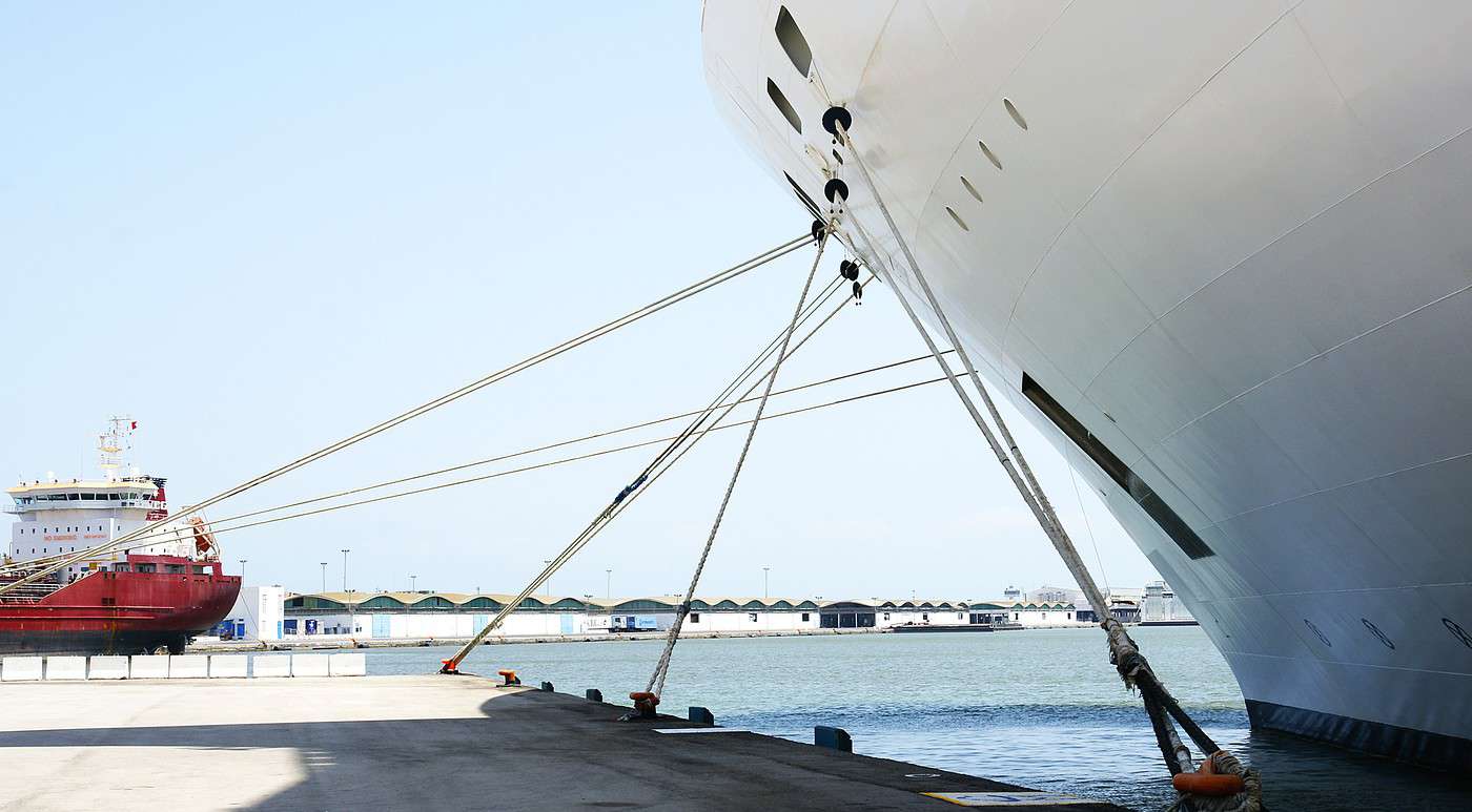
        Cruises

        Tunisia is on the route of many cruise ships sailing the Mediterranean. The port of La Goulette, in the capital’s suburbs, is their main stop in the country.

        Sailboats

        View guide page: Getting to Tunisia by Land or Sea

        Getting Around Tunisia

        Let’s start with Tunisia’s road network and traffic. Tunisian roads are generally in good condition, with a small network of toll highways that are quite affordable. The regulations are the same as in France, with bilingual Arabic-French signage. Speed limits…

        Read the full guide: Getting Around Tunisia

        Accommodation in Tunisia

        Tunisia is a highly touristic country, so the range of accommodation is vast, generally offering good value and lower rates than in Europe, even though prices logically rise (sharply) in season. You’ll find campsites, guesthouses, all kinds of…

        Read the full guide: Accommodation in Tunisia

        Entry Requirements and Visa for Tunisia

        For tourist travel (and even business trips), since 2025, a passport valid for at least 3 months from the date of entry into the country is mandatory. No visa is required for stays of less than 3 months. It is important to note that the national identity card…

        Read the full guide: Entry Requirements and Visa for Tunisia

        Money, Budget, and Shopping for Tunisia

        Currency: Tunisian dinar (1,000 millimes). Banknotes: 5, 10, 20, and 50 dinars. Coins: 5, 10, 20, 50, 100, and 200 millimes + 1/2, 1, 2, and 5 dinars. Exchange: Since the Tunisian dinar is not convertible outside the country, you’ll need to wait until you…

        Read the full guide: Money, Budget, and Shopping for Tunisia

        Health and Safety in Tunisia

        In France, both for individuals and professionals, the "travel advice" from the Ministry of Foreign Affairs regarding precautions for each country has legal value. A similar online travel advice system exists in several countries: Foreign Affairs Belgium…

        Read the full guide: Health and Safety in Tunisia

        Other practical information for Tunisia

        From spring to autumn, pack light clothing plus a woollen layer for evenings, especially in the South. In winter, mid-season clothes will do, along with something warm for the sometimes freezing nights in the desert. Winter is also the rainy season in the…

        Read the full guide: Other practical information for Tunisia

        Something wrong or out of date? Report this page