Skip to content
Brazilian Coast

Travel guide · Brazil

Brazilian Coast

★ 4 · last edited Dec 11, 2019

This is the coastal part of the country and its "hinterland," stretching from the border with Uruguay in the south to nearly the mouth of the Amazon in the north. With cities like Rio de Janeiro, São Paulo, Fortaleza, Salvador, and Recife, it is by far the most populated and tourist-heavy region of the country, differing in many ways from the Amazon region of Brazil.

Overview

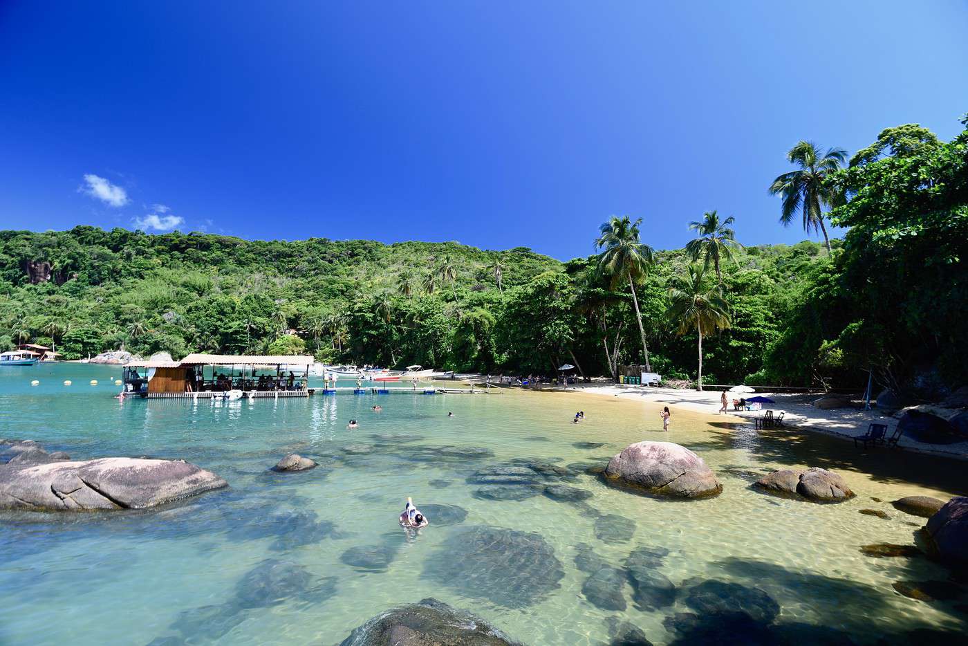
Ilha Grande, Brésil
Ilha Grande, Brésil · © VoyageForum

This is the coastal part of the country and its "hinterland," stretching from the border with Uruguay in the south to nearly the mouth of the Amazon in the north. With cities like Rio de Janeiro, São Paulo, Fortaleza, Salvador, and Recife, it is by far the most populated and tourist-heavy region of the country, differing in many ways from the Amazon region of Brazil.

Major Cities

Tourist Attractions

Cities and Heritage

Beaches and Coastline

Nature and Activities

Climate and Weather on the Brazilian Coast

Best Time to Visit the Coast

Jan.Feb.Mar.Apr.MayJun.Jul.Aug.Sep.Oct.Nov.Dec.
Northern Coast
Southern Coast

: highly favorable | : favorable | : moderately favorable | : unfavorable.

Sea Temperatures Throughout the Year

As expected, while ocean temperatures are pleasant year-round near Salvador, the same isn’t true for the southern coast, where swimming is best enjoyed during the austral summer.

Jan.Feb.Mar.Apr.MayJun.Jul.Aug.Sep.Oct.Nov.Dec.
North (Salvador)272727272626252524252626
South (Sta Catarina)232423222119181617182022

Climate and Weather by Region

Northern Coast (Fortaleza)

Central Coast (Rio)

Southern Coast (Porto Alegre)

Brasília

Brazil’s capital, founded in 1960. Designed and conceived by the architects and urban planners of the time, it is unique in its kind (though not universally loved) and entirely listed as a UNESCO World Heritage site. Overview of Brasília Climate and Weather in Brasília What to See in Brasília Things to Do in Brasília Flying to Brasília Getting to Brasília by Land Getting Around Brasília Sleeping and Eating in Brasília Living in Brasília

Further Information

View guide page: Brasília

Overview of Brasília

Overview of Brasília

The capital of Brazil was inaugurated in 1960. Designed and planned by architects and urban planners of the time, it is unique in its kind (though not universally loved) and is entirely listed as a UNESCO World Heritage site.

Key Facts

  • Type of place: large city.
  • Tourist interest: (worth seeing).
  • Location:
  • Distances:
  • Local time: Heure : 3935.
  • Population: 2,977,216 (2016).
  • Area: 5,802 km².
  • Altitude: 1,172 m.

History of Brasília

Precautions

Useful Addresses

  • Tourist Office:

Services

  • Local agencies:
  • Banks:
  • Hospital:
  • Internet:
  • Laundries:
  • Vehicle rental:
  • Post office:
View guide page: Overview of Brasília

Climate and Weather in Brasília

Climate Overview

Best Time to Visit Brasília

Jan.Feb.Mar.Apr.MayJun.Jul.Aug.Sep.Oct.Nov.Dec.
Climate

Climate and Forecast

Additional Information

View guide page: Climate and Weather in Brasília

Flying to Brasília

Brasília Airport

Airport details

  • Name: Brasília-Presidente Juscelino Kubitschek International.
  • IATA code: BSB
  • Hub:
  • Number of terminals:
  • Annual passenger capacity:
  • Passenger traffic: 17,947,153 (2016).
  • Distance from city centre: 11 km south of the city.

Services

Sleeping at the airport

Transport to the city centre

Other nearby airports

From the rest of the country

From the rest of the continent

From Europe

Additional information

View guide page: Flying to Brasília

Living in Brasília

Preview temporarily unavailable.

Goiânia

Not exactly a tourist hotspot, this city of one and a half million people is the capital of the state of Goiás.

Overview of Goiânia

Not exactly a tourist hotspot, this city of one and a half million people is the capital of the state of Goiás.

Key Facts

  • Type of place: landmark town.
  • Tourist interest: (worth a stop if you are in the area).
  • Location:
  • Distances:
  • Local time: Heure : 13049.
  • Population: 1,466,105 inhabitants (2016).
  • Area: 739 km².
  • Altitude: 749 m.

History of Goiânia

What to See and Do in Goiânia

In the Surrounding Area

Climate and Weather in Goiânia

Transportation

Getting There

Getting Around

Accommodation

Dining

Useful Addresses

Further Information

View guide page: Goiânia

Goiás

Also called Goiás Velho, this small town has preserved its colonial architecture so well that its historic center is a UNESCO World Heritage site.

Overview of Goiás

Also called Goiás Velho, this small town has preserved its colonial architecture so well that its historic center is a UNESCO World Heritage site.

Key facts

  • Type of place: small town.
  • Tourist interest: (recommended).
  • Location:
  • Distances:
  • Local time: Heure : 13050.
  • Population: 24,439 (2015).
  • Area: 3,108 km².
  • Altitude: 496 m.

History of Goiás

What to see and do in Goiás

In the surrounding area

Climate and weather in Goiás

Transportation

Getting there

Getting around

Where to stay

Where to eat

Useful addresses

  1. == Additional information
View guide page: Goiás

Pirenópolis

A historic town with colonial architecture surrounded by around twenty waterfalls. It is located west of Brasília.

Overview of Pirenópolis

A historic town with colonial architecture surrounded by around twenty waterfalls. It is located west of Brasília.

Key Facts

  • Type of place: small town.
  • Tourist interest: (worth seeing).
  • Location:
  • Distances:
  • Local time: Heure : 13051.
  • Population: 24,279 (2014).
  • Area: 2,227 km².
  • Altitude: 770 m.

History of Pirenópolis

What to See and Do in Pirenópolis

In the Surrounding Area

Climate and Weather in Pirenópolis

Transportation

Getting There

Getting Around

Where to Stay

Where to Eat

Useful Addresses

  1. == Additional Information
View guide page: Pirenópolis

Blumenau

This city, founded by Germans, has preserved its Germanic architecture with its half-timbered houses, as well as the customs of its founders, including a major beer festival.

Overview of Blumenau

This city, founded by Germans, has preserved its Germanic architecture with its half-timbered houses, as well as the customs of its founders, including a major beer festival.

Key Facts

  • Type of place: city.
  • Tourist interest: (worth a stop if you are in the area).
  • Location:
  • Distances:
  • Local time: Heure : 13054.
  • Population: 334,002 inhabitants (2014).
  • Area: 519.837 km².
  • Altitude: 21 m.

History of Blumenau

What to See and Do in Blumenau

In the Surrounding Area

Climate and Weather

Transportation

Getting There

Getting Around

Accommodation

Dining

Useful Addresses

  1. == Additional Information
View guide page: Blumenau

Foz do Iguaçu

This is the Brazilian city closest to the Iguazu Falls. That said, Puerto Iguazú on the Argentine side is a much nicer base for visiting.

Overview of Foz do Iguaçu

This is the Brazilian city closest to the Iguazu Falls. That said, Puerto Iguazú, on the Argentine side, is a much nicer base for visiting.

Key Facts

  • Type of place: city.
  • Tourist interest: (worth a stop if you are in the area).
  • Location:
  • Distances:
  • Local time: Heure : 13057.
  • Population: 264,044 (2017).
  • Area: 617.70 km².
  • Altitude: 164 m.

History of Foz do Iguaçu

What to see and do in Foz do Iguaçu

In the surrounding area

Climate and weather

Transport

Getting there

Getting around

Accommodation

Food

Useful addresses

Further information

View guide page: Foz do Iguaçu

Garopaba

One of the main beach resorts in the state of Santa Catarina. A variety of activities are practiced here, such as surfing and windsurfing.

Overview of Garopaba

One of the main beach resorts in the state of Santa Catarina. A variety of activities are practiced here, such as surfing and windsurfing.

Key Facts

  • Type of place: small town.
  • Tourist interest: (worth a stop if you are in the area).
  • Location:
  • Distances:
  • Local time: Heure : 13058.
  • Population: 18,138 inhabitants (2012).
  • Area: 114.7 km².
  • Altitude: sea level.

History of Garopaba

What to See and Do in Garopaba

In the Surrounding Area

Climate and Weather in Garopaba

Transportation

Getting There

Getting Around

Accommodation

Dining

Useful Addresses

  1. == Additional Information
View guide page: Garopaba

Ilha do Mel

A small island off Paranaguá in the state of Paraná. It is popular for its landscapes, beaches, ecotourism, and hiking.

Overview of Ilha do Mel

It’s a small island off Paranaguá in the state of Paraná. It is popular for its landscapes, beaches, ecotourism, and hiking.

Key facts

  • Type of place: island.
  • Tourist interest: (worth seeing).
  • Location:
  • Local time: Heure : 13059
  • Main locality:
  • Population:
  • Area: 27.62 km².
  • Highest point:
  • Coastline: 25 km.

History of Ilha do Mel

Island environment

Wildlife and flora

Precautions

What to see and do

In the area

Climate and weather

Transport

Getting there

Getting around

Accommodation

Eating

Useful addresses

Further information

View guide page: Ilha do Mel

Morretes

A small colonial town near Curitiba. You can also reach it by train from there on the historic Serra Verde Express.

Overview of Morretes

It's a small town near Curitiba. You can also reach it by train from there on the "historic" train Serra Verde Express.

Key Facts

  • Type of place: small town.
  • Tourist interest: (worth seeing).
  • Location:
  • Distances:
  • Local time: Heure : 13060.
  • Population: 15,718 (2011).
  • Area: 684.58 km².
  • Altitude: 8 m.

History of Morretes

What to See and Do in Morretes

In the Surrounding Area

Climate and Weather in Morretes

Transportation

Getting There

Getting Around

Where to Stay

Where to Eat

Useful Addresses

Further Information

View guide page: Morretes

Paranaguá

A coastal city with colorful colonial remnants along its harbor. It is also the terminus of the Serra Verde Express tourist train line connecting it to Curitiba.

Overview of Paranaguá

This is a coastal city with colorful colonial remnants along its harbor. It is also the terminus of the tourist train line Serra Verde Express connecting it to Curitiba.

Key Facts

  • Type of place: city.
  • Tourist interest: (worth a stop if you are in the area).
  • Location:
  • Distances:
  • Local time: Heure : 13061.
  • Population: 151,829 (2016).
  • Area: 827 km².
  • Altitude: sea level.

History of Paranaguá

What to See and Do in Paranaguá

In the Surrounding Area

Climate and Weather in Paranaguá

Transportation

Getting There

Getting Around

Accommodation

Dining

Useful Addresses

Additional Information

View guide page: Paranaguá

Pontal do Paraná

This coastal locality is home to many beautiful beaches that make it a popular destination.

Overview of Pontal do Paraná

This coastal locality is home to many beautiful beaches that make it a popular destination.

Key Information

  • Type of place: small town.
  • Tourist interest: (worth a stop if you are in the area).
  • Location:
  • Distances:
  • Local time: Heure : 13062.
  • Population: 20,920 inhabitants (2011).
  • Area: 199.84 km².
  • Altitude: sea level.
  • Website:

History of Pontal do Paraná

What to See and Do in Pontal do Paraná

In the Surrounding Area

Climate and Weather

Transportation

Getting There

Getting Around

Accommodation

Dining

Useful Addresses

  1. == Additional Information
View guide page: Pontal do Paraná

Porto Alegre

While not a top-tier tourist destination, the large southern metropolis remains pleasant to visit thanks to its architectural blend of styles.

Overview of Porto Alegre

While not a top-tier tourist destination, the large southern Brazilian metropolis remains pleasant to visit thanks to its architectural blend of styles.

Key Facts

  • Type of place: large city.
  • Tourist interest: (worth a stop if you are in the area).
  • Location:
  • Distances:
  • Local time: Heure : 13063.
  • Population: 1,481,019 (2017).
  • Area: 497 km².
  • Altitude: sea level.

History of Porto Alegre

What to See and Do in Porto Alegre

In the Surrounding Area

Climate and Weather in Porto Alegre

Transportation

Getting There

Getting Around

Accommodation

Dining

Useful Addresses

Additional Information

View guide page: Porto Alegre

Santa Catarina

This large island off the southern coast (the main one in an archipelago of about twenty) is connected to the mainland. It is popular for its landscapes, beaches, water activities (including surfing and diving), nightlife, and, secondarily, hiking opportunities.

Overview of Santa Catarina

This large island off the southern coast of Brazil (the main one in an archipelago of about twenty) is connected to the mainland. It is popular for its landscapes, beaches, water activities (including surfing and diving), nightlife, and, secondarily, hiking opportunities.

Key Facts

  • Type de lieu: island.
  • Intérêt touristique: (recommended).
  • Localisation:
  • Heure locale: Heure : 13064
  • Population: 461,524 inhabitants (2014).
  • Area: 424 km².
  • Highest point: Morro do Ribeirão (532 m).
  • Coastline:

History of Santa Catarina

Island Environment

Wildlife and Flora

Precautions

What to See and Do in Santa Catarina

Florianopolis, Brésil
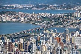
Florianopolis
Located on the island of Santa Catarina, of which it is the capital, Florianopolis boasts a beautiful historic center, several Portuguese forts, and numerous nearby beaches and seaside resorts.

In the Surrounding Area

Climate and Weather in Santa Catarina

Transportation

Getting There

Getting Around

Accommodation

Food

Useful Addresses

Further Reading

View guide page: Santa Catarina

Florianopolis

Preview temporarily unavailable.

São Francisco do Sul

One of Brazil’s oldest cities, founded in 1504. It has preserved its colonial charm.

Overview of São Francisco do Sul

One of the oldest cities in Brazil, founded in 1504. It has preserved its colonial charm.

Key facts

  • Type of place: small town.
  • Tourist interest: (worth seeing).
  • Location:
  • Distances:
  • Local time: Heure : 13065.
  • Population: 42,569 (2011).
  • Area: 540 km².
  • Altitude: sea level.
  • Website:

History of São Francisco do Sul

What to see and do in São Francisco do Sul

In the surrounding area

Climate and weather

Transportation

Getting there

Getting around

Accommodation

Food

Useful addresses

  1. == Additional information
View guide page: São Francisco do Sul

Romantic Route

A tourist route (180 km) in Rio Grande do Sul, through the picturesque rolling hills of the Serra Gaucha region. It lets you discover a dozen villages strongly marked by German presence in the area.

Overview of the Romantic Route

This is a tourist route (180 km) in Rio Grande do Sul, through the picturesque rolling hills of the Serra Gaucha, north of Porto Alegre. It lets you discover a dozen villages strongly marked by German presence in the area.

Key details

  • Type of place: scenic route.
  • Tourist interest: (worth seeing).
  • Theme: ethno-cultural route.
  • Location: between São Leopoldo and São Francisco de Paula.
  • Local time: Heure : 13067
  • Main towns:
  • Length: 184 km.
  • Altitude:

The route

What to see and do

Itinerary

Nearby

Climate and weather

Transport

Getting there

Getting around

Sleep

Eat

  1. == Additional information
View guide page: Romantic Route

Serra Gaucha

This mountainous region of Rio Grande do Sul offers a beautiful mid-mountain environment and trekking opportunities.

Overview of Serra Gaucha

This mountainous region of Rio Grande do Sul offers a beautiful mid-mountain environment and trekking opportunities. It is also home to the Romantic Route, which allows you to discover several "typical" villages of German immigration in Brazil.

Key Details

  • Type of place: mountain range.
  • Tourist interest: (worth seeing).
  • Characteristics:
  • Mountain range:
  • Area:
  • Summit: 1,403 m.

Environment of Serra Gaucha

Wildlife and flora

Population and economic activity

Climate and weather

Precautions

What to see

What to do

Practical information

  • Location:
  • Distances:

Getting there

Getting around

Accommodation and dining

Nearby attractions

  1. == En complément
View guide page: Serra Gaucha

Angra dos Reis

In addition to its countless beautiful beaches, often nestled in picturesque settings, Angra benefits from its connection to Ilha Grande, located just across the way.

Overview of Angra dos Reis

In addition to its countless beautiful beaches, often nestled in picturesque settings, Angra benefits from its connection to Ilha Grande, located just across the way.

Key Facts

  • Type of place: city.
  • Tourist interest: (worth seeing).
  • Location:
  • Distances:
  • Local time: Heure : 13069.
  • Population: 188,276 (2015).
  • Area: 816 km².
  • Altitude: sea level.

History of Angra dos Reis

What to See and Do in Angra dos Reis

In the Surrounding Area

Climate and Weather

Transportation

Getting There

Getting Around

Accommodation

Dining

Useful Addresses

Further Information

View guide page: Angra dos Reis

Belo Horizonte

Brazil’s third-largest city and the capital of Minas Gerais, Belo Horizonte is known for its American-style urban planning and modern architecture, particularly the UNESCO-listed Pampulha district. Overview of Belo Horizonte Climate and Weather in Belo Horizonte What to See in Belo Horizonte Things to Do in Belo Horizonte Flying to Belo Horizonte Getting to Belo Horizonte by Land Getting Around Belo Horizonte Sleeping and Eating in Belo Horizonte Living in Belo Horizonte

Further Information

View guide page: Belo Horizonte

Overview of Belo Horizonte

Preview temporarily unavailable.

Climate and Weather in Belo Horizonte

Preview temporarily unavailable.

What to See in Belo Horizonte

Preview temporarily unavailable.

Things to Do in Belo Horizonte

Preview temporarily unavailable.

Flying to Belo Horizonte

Preview temporarily unavailable.

Getting to Belo Horizonte by Land

Preview temporarily unavailable.

Getting Around Belo Horizonte

Preview temporarily unavailable.

Sleeping and Eating in Belo Horizonte

Preview temporarily unavailable.

Living in Belo Horizonte

Preview temporarily unavailable.

Buzios

Brazil’s Saint-Tropez, not far from Rio, known for its beaches and nightlife.

Introduction to Buzios

Brazil’s Saint-Tropez, not far from Rio, is known for its beaches and nightlife.

Key facts

  • Type of place: small town.
  • Tourist interest: (worth seeing).
  • Location:
  • Distances:
  • Local time: Heure : 13071.
  • Population: 30,439 inhabitants (2014).
  • Area: 69 km².
  • Altitude: sea level.

History of Buzios

What to see and do in Buzios

In the surrounding area

Climate and weather in Buzios

Transport

Getting there

Getting around

Where to stay

Where to eat

Useful addresses

Further reading

View guide page: Buzios

Cabo Frio

A renowned seaside resort located between Rio and Buzios. It’s a popular destination for beaches, diving, surfing, and nightlife.

Overview of Cabo Frio

A renowned seaside resort located between Rio and Buzios. It’s a popular destination for beaches, diving, surfing, and nightlife.

Key Facts

  • Type of place: city.
  • Tourist interest: (worth seeing).
  • Location:
  • Distances:
  • Local time: Heure : 13072.
  • Population: 216,030 (2017).
  • Area: 400 km².
  • Altitude: sea level.

History of Cabo Frio

What to See and Do in Cabo Frio

In the Surrounding Area

Climate and Weather in Cabo Frio

Transportation

Getting There

Getting Around

Where to Stay

Where to Eat

Useful Addresses

Additional Information

View guide page: Cabo Frio

Campos do Jordão

A charming high-altitude town known for its German-Swiss architecture, scenic landscapes, and outdoor activities in the surrounding area (hiking, horseback riding, climbing).

Overview of Campos do Jordão

This is a charming high-altitude town known for its German-Swiss architecture, scenic landscapes, and outdoor activities in the surrounding area (hiking, horseback riding, climbing).

Key Facts

  • Type of place: city.
  • Tourist interest: (worth a stop if you are in the area).
  • Location:
  • Distances:
  • Local time: Heure : 13073.
  • Population: 51,454 (2017).
  • Area: 289 km².
  • Altitude: 1,628 m.

History of Campos do Jordão

What to See and Do in Campos do Jordão

In the Surrounding Area

Climate and Weather in Campos do Jordão

Transportation

Getting There

Getting Around

Accommodation

Dining

Useful Addresses

  1. == Additional Information
View guide page: Campos do Jordão

Congonhas

This colonial city in Minas Gerais is a UNESCO World Heritage site for its beautiful Baroque-style basilica built in 1757.

Overview of Congonhas

This colonial city in Minas Gerais is a UNESCO World Heritage site for its beautiful Baroque-style basilica built in 1757.

Key Facts

  • Type de lieu: small town.
  • Intérêt touristique: (worth seeing).
  • Localisation:
  • Distances:
  • Heure locale: Heure : 13074.
  • Population: 52,827 inhabitants (2015).
  • Superficie: 305 km².
  • Altitude:

History of Congonhas

What to See and Do in Congonhas

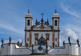
Basilique du Bon Jésus de Congonhas, Congonhas, Brésil
Basilica of the Good Jesus of Congonhas
A beautiful UNESCO-listed Baroque church built in 1757 in the colonial city of Congonhas.

In the Surrounding Area

Climate and Weather in Congonhas

Transportation

Getting There

Getting Around

Where to Stay

Where to Eat

Useful Addresses

Further Reading

View guide page: Congonhas

Basilica of the Good Jesus of Congonhas

Preview temporarily unavailable.

Diamantina

Like Ouro Preto, Diamantina is a jewel of 18th-century Baroque colonial architecture and a UNESCO World Heritage site.

Overview of Diamantina

Like Ouro Preto, Diamantina (which has nothing to do with the Chapada Diamantina park much further north) is a jewel of 18th-century Baroque colonial architecture and a UNESCO World Heritage site.

Key facts

  • Type of place: small town.
  • Tourist interest: (recommended).
  • Location:
  • Distances:
  • Local time: Heure : 13075.
  • Population: 48,230 inhabitants (2017).
  • Area: 3,869 km².
  • Altitude: 1,280 m.

History of Diamantina

What to see and do in Diamantina

In the surrounding area

Climate and weather in Diamantina

Transport

Getting there

Getting around

Where to stay

Where to eat

Useful addresses

  1. == Additional information
View guide page: Diamantina

Domingos Martins

A small town founded by Germans in the 19th century, known for its Germanic architecture and traditions.

Overview of Domingos Martins

A small town founded by Germans in the 19th century, known for its Germanic architecture and traditions.

Key Facts

  • Type of place: small town.
  • Tourist interest: (worth a stop if you are in the area).
  • Location:
  • Distances:
  • Local time: Heure : 13076.
  • Population: 34,329 (2014).
  • Area: 1,225 km².
  • Altitude: 542 m.

History of Domingos Martins

What to See and Do in Domingos Martins

Nearby

Climate and Weather in Domingos Martins

Transportation

Getting There

Getting Around

Accommodation

Dining

Useful Addresses

  1. == Additional Information
View guide page: Domingos Martins

Guarujá

This Atlantic coast city is the favorite beach of São Paulo residents.

Overview of Guarujá

This Atlantic coast city is the favorite beach of São Paulo residents.

Key Facts

  • Type of place: city.
  • Tourist interest: (worth a stop if you are in the area).
  • Location:
  • Distances:
  • Local time: Heure : 13077.
  • Population: 315,563 (2017).
  • Area: 142 km².
  • Altitude: sea level.

History of Guarujá

What to See and Do in Guarujá

In the Surrounding Area

Climate and Weather in Guarujá

Transportation

Getting There

Getting Around

Accommodation

Dining

Useful Addresses

Further Information

View guide page: Guarujá

Ilhabela

It’s a large island (and its eponymous town) not far from São Paulo. Visitors love it for its landscapes, beautiful beaches, diving, whale watching, sailing, and hiking.

Overview of Ilhabela

It’s a large island (and its eponymous town) not far from São Paulo. Visitors love it for its landscapes, beautiful beaches, diving, whale watching, sailing, and hiking.

Key Facts

  • Type of place: island.
  • Tourist interest: (worth seeing).
  • Location:
  • Local time: Heure : 13078
  • Main locality:
  • Population: 32,197 (2015)
  • Area: 347 km².
  • Density: 93 inhabitants/km².
  • Highest point: 378 m.
  • Coastline:

History of Ilhabela

Island Environment

Wildlife and Flora

Precautions

What to See and Do in Ilhabela

In the Surrounding Area

Climate and Weather in Ilhabela

Transportation

Getting There

Getting Around

Accommodation

Dining

Useful Addresses

Further Information

View guide page: Ilhabela

Ilha Grande

This large, well-preserved tropical island (car-free) between Rio and São Paulo is loved for its stunning landscapes blending sea, forests, and mountains, its beaches, and opportunities for diving or hiking.

Overview of Ilha Grande

This large, well-preserved tropical island (car-free) between Rio and São Paulo is loved for its stunning landscapes blending sea, forests, and mountains, its beaches, and opportunities for diving or hiking.

Key facts

  • Type of place: island.
  • Tourist interest: (must-see or highly recommended).
  • Location:
  • Local time: Heure : 13079
  • Main locality: Vila do Abraão (3,000 inhabitants)
  • Population: 5,000 inhabitants (2014).
  • Area: 193 km².
  • Highest point: Pico da Pedra d'Agua (1,031 m).
  • Coastline:

History of Ilha Grande

Island environment

Wildlife and flora

Precautions

What to see and do in Ilha Grande

In the area

Climate and weather

Transport

Getting there

Getting around

Sleep

Eat

Useful addresses

Further reading

View guide page: Ilha Grande

Itaunas

A small locality on the northern coast of Espírito Santo state, known for its beaches and dunes.

Overview of Itaunas

A small locality on the northern coast of Espírito Santo state, known for its beaches and dunes.

Key details

  • Type of place: small town.
  • Tourist interest: (worth a stop if you are in the area).
  • Location:
  • Distances:
  • Local time: Heure : 13080.
  • Population:
  • Area:
  • Altitude: sea level.
  • Website:

History of Itaunas

What to see and do in Itaunas

In the surrounding area

Climate and weather in Itaunas

Transport

Getting there

Getting around

Accommodation

Food

Useful addresses

Further information

View guide page: Itaunas

Mariana

It is one of the beautiful colonial Baroque cities from the 17th–18th centuries in the state of Minas Gerais. It is located a few kilometers east of Ouro Preto.

Overview of Mariana

The town is one of the beautiful colonial Baroque cities from the 17th–18th centuries in the state of Minas Gerais. It is located a few kilometers east of Ouro Preto.

Key Facts

  • Type of place: city.
  • Tourist interest: (worth seeing).
  • Location:
  • Distances:
  • Local time: Heure : 13081.
  • Population: 58,233 (2015).
  • Area: 1,194 km².
  • Altitude: from 598 to 1,772 m.

History of Mariana

What to See and Do in Mariana

In the Surrounding Area

Climate and Weather in Mariana

Transportation

Getting There

Getting Around

Accommodation

Dining

Useful Addresses

  1. == Additional Information
View guide page: Mariana

Niterói

Across the bay from Rio, Niterói offers stunning beaches and a beautiful view of Rio de Janeiro.

Overview of Niterói

Across the bay from Rio, Niterói offers stunning beaches and a beautiful view of Rio de Janeiro.

Key Facts

  • Type of place: large city.
  • Tourist interest: (worth a stop if you are in the area).
  • Location:
  • Distances:
  • Local time: Heure : 13082.
  • Population: 496,696 (2014).
  • Area: 129 km².
  • Altitude: sea level.

History of Niterói

What to See and Do in Niterói

In the Surrounding Area

Climate and Weather in Niterói

Transportation

Getting There

Getting Around

Accommodation

Dining

Useful Addresses

  1. == Additional Information
View guide page: Niterói

Ouro Preto

Surrounded by mountains, the city is considered the most beautiful colonial town in Brazil. It is also a UNESCO World Heritage site for this reason.

Overview of Ouro Preto

Surrounded by mountains, the city is considered the most beautiful colonial town in Brazil. It is also a UNESCO World Heritage site for this reason.

Key Facts

  • Type of place: city.
  • Tourist interest: (must-see or highly recommended).
  • Location:
  • Distances:
  • Local time: Heure : 13083.
  • Population: 74,036 (2015).
  • Area: 1,248.64 km².
  • Altitude: 1,179 m.

History of Ouro Preto

What to See and Do in Ouro Preto

In the Surrounding Area

Climate and Weather in Ouro Preto

Transportation

Getting There

Getting Around

Accommodation

Dining

Useful Addresses

Additional Information

View guide page: Ouro Preto

Paraty

This small historic coastal town, with its stunning 17th- and 18th-century architecture, is surrounded by hills, islands, beaches, and waterfalls, making it a unique destination. The area is a UNESCO World Heritage site.

Overview of Paraty

Also spelled Paraty, this small historic coastal town boasts beautiful 17th- and 18th-century architecture and is surrounded by hills, islands, beaches, and waterfalls, making it a unique destination. The area is a UNESCO World Heritage site.

Key Facts

  • Type of place: small town.
  • Tourist interest: (must-see or highly recommended).
  • Location:
  • Distances:
  • Local time: Heure : 13084.
  • Population: 39,062 inhabitants (2014).
  • Area: 928 km².
  • Altitude: sea level.

History of Paraty

What to See and Do in Paraty

In the Surrounding Area

Climate and Weather in Paraty

Transportation

Getting There

Getting Around

Accommodation

Dining

Useful Addresses

Additional Information

View guide page: Paraty

Penedo

This municipality in Alagoas offers a charming blend of Portuguese and Dutch colonial architecture.

Overview of Penedo

This municipality in Alagoas offers a charming blend of Portuguese and Dutch colonial architecture.

Key Facts

  • Type of place: city.
  • Tourist interest: (worth a stop if you are in the area).
  • Location:
  • Distances:
  • Local time: Heure : 13085.
  • Population: 64,497 inhabitants (2017)
  • Area: 689 km².
  • Altitude: 27 m.

History of Penedo

What to See and Do in Penedo

In the Surrounding Area

Climate and Weather in Penedo

Transportation

Getting There

Getting Around

Where to Stay

Where to Eat

Useful Addresses

  1. == Additional Information
View guide page: Penedo

Petropolis

Known as the "Imperial City of Brazil". Founded in the 19th century near Rio, it is home to the summer palace of Brazil's emperors and is also valued for its natural setting.

Overview of Petropolis

Known as the "Imperial City of Brazil". Founded in the 19th century near Rio, it is home to the summer palace of Brazil's emperors and is also valued for its natural setting.

Key Facts

  • Type of place: city.
  • Tourist interest: (worth seeing).
  • Location:
  • Distances:
  • Local time: Heure : 13086.
  • Population: 298,235 (2017).
  • Area: 796 km².
  • Altitude: 838 m.

History of Petropolis

What to See and Do in Petropolis

Nearby

Climate and Weather in Petropolis

Transportation

Getting There

Getting Around

Where to Stay

Where to Eat

Useful Addresses

  1. == Additional Information
View guide page: Petropolis

Rio de Janeiro

With its Bay, beaches, Sugarloaf Mountain, favelas, Christ the Redeemer, monuments, and Carnival, Rio is a must-see on any trip and the symbol of Brazil. It has been a UNESCO World Heritage site since 2012. Overview of Rio de Janeiro Neighbourhoods of Rio de Janeiro History, Culture, and Society of Rio de Janeiro Rio de Janeiro Cuisine Climate and Weather in Rio de Janeiro What to See in Rio de Janeiro Things to Do in Rio de Janeiro Tips for Rio de Janeiro Flying to Rio de Janeiro Getting to Rio de Janeiro by Land or Sea Getting Around Rio de Janeiro Accommodation in Rio de Janeiro Other practical info for Rio de Janeiro Living in Rio de Janeiro

Further information

View guide page: Rio de Janeiro

Overview of Rio de Janeiro

Preview temporarily unavailable.

Neighbourhoods of Rio de Janeiro

Preview temporarily unavailable.

History, Culture, and Society of Rio de Janeiro

Preview temporarily unavailable.

Rio de Janeiro Cuisine

Preview temporarily unavailable.

Climate and Weather in Rio de Janeiro

Preview temporarily unavailable.

What to See in Rio de Janeiro

Preview temporarily unavailable.

Things to Do in Rio de Janeiro

Preview temporarily unavailable.

Tips for Rio de Janeiro

Preview temporarily unavailable.

Flying to Rio de Janeiro

Preview temporarily unavailable.

Getting to Rio de Janeiro by Land or Sea

Preview temporarily unavailable.

Getting Around Rio de Janeiro

Preview temporarily unavailable.

Accommodation in Rio de Janeiro

Preview temporarily unavailable.

Other practical info for Rio de Janeiro

Preview temporarily unavailable.

Living in Rio de Janeiro

Preview temporarily unavailable.

São João del Rei

This mining town in Minas Gerais has preserved its beautiful 18th-century architecture, including countless churches. A small tourist steam train connects the city to its neighbor Tiradentes (13 km).

Overview of São João del Rei

This mining town in Minas Gerais has preserved its beautiful 18th-century architecture, including countless churches. A small tourist steam train connects the city to its neighbor Tiradentes (13 km).

Key Facts

  • Type of place: city.
  • Tourist interest: (worth seeing).
  • Location:
  • Distances:
  • Local time: Heure : 13088.
  • Population: 90,263 inhabitants (2017).
  • Area: 1,463 km².
  • Altitude: 898 m.

History of São João del Rei

What to See and Do in São João del Rei

In the Surrounding Area

Climate and Weather

Transportation

Getting There

Getting Around

Accommodation

Dining

Useful Addresses

Further Information

View guide page: São João del Rei

São Paulo

This vast metropolis (over 20 million inhabitants) is Brazil’s largest city. It offers a blend of races and cultures, along with a small historic centre featuring a few remarkable buildings amid fairly unbridled urban development. Overview of São Paulo Neighbourhoods of São Paulo History, Culture, and Society of São Paulo São Paulo Gastronomy Climate and Weather in São Paulo What to See in São Paulo Things to Do in São Paulo Tips for São Paulo Flying to São Paulo Getting to São Paulo by Land Getting Around São Paulo Accommodation in São Paulo Other practical information for São Paulo Living in São Paulo

Further Information

View guide page: São Paulo

Overview of São Paulo

Preview temporarily unavailable.

Neighbourhoods of São Paulo

Preview temporarily unavailable.

History, Culture, and Society of São Paulo

Preview temporarily unavailable.

São Paulo Gastronomy

Preview temporarily unavailable.

Climate and Weather in São Paulo

Preview temporarily unavailable.

What to See in São Paulo

Preview temporarily unavailable.

Things to Do in São Paulo

Preview temporarily unavailable.

Tips for São Paulo

Preview temporarily unavailable.

Flying to São Paulo

Preview temporarily unavailable.

Getting to São Paulo by Land

Preview temporarily unavailable.

Getting Around São Paulo

Preview temporarily unavailable.

Accommodation in São Paulo

Preview temporarily unavailable.

Other practical information for São Paulo

Preview temporarily unavailable.

Living in São Paulo

Preview temporarily unavailable.

Tiradentes

One of Brazil’s best-preserved colonial towns. You can reach it from São João del Rei by tourist train.

Overview of Tiradentes

It's one of the best-preserved colonial towns in Brazil. You can reach it from São João del Rei by tourist train.

Key facts

  • Type of place: small town.
  • Tourist interest: (recommended).
  • Location:
  • Distances:
  • Local time: Heure : 13090.
  • Population: 7,002 (2011).
  • Area: 83.5 km².
  • Altitude: 927 m

History of Tiradentes

What to see and do in Tiradentes

In the surrounding area

Climate and weather in Tiradentes

Transport

Getting there

Getting around

Where to stay

Where to eat

Useful addresses

Further reading

View guide page: Tiradentes

Vitória

The capital of Espírito Santo state is renowned for its beaches.

Overview of Vitória

The capital of Espírito Santo state is renowned for its beaches.

Key Facts

  • Type of place: city.
  • Tourist interest: (worth a stop if you are in the area).
  • Location:
  • Distances:
  • Local time: Heure : 13091.
  • Population: 355,875 inhabitants (2015).
  • Area: 93 km².
  • Altitude: sea level.

History of Vitória

What to See and Do in Vitória

In the Surrounding Area

Climate and Weather in Vitória

Transportation

Getting There

Getting Around

Accommodation

Dining

Useful Addresses

Further Information

View guide page: Vitória

Caparaó National Park

Beautiful landscapes and hiking opportunities in this park shared by the states of Minas Gerais and Espírito Santo.

Overview of Caparaó National Park

Beautiful landscapes and hiking opportunities in this park shared by the states of Minas Gerais and Espírito Santo.

Key Facts

  • Type of place: national park.
  • Tourist interest: (worth seeing).
  • Features:
  • Local time: Heure : 13092
  • Annual visitors:
  • Area: 318 km².
  • Altitude: Pico da Bandeira (2,891 m).

Environment

Landscape of the Park

Wildlife and Flora

Climate

Precautions

What to See and Do

Practical Information

  • Location:
  • Distances:
  • Opening period:
  • Rates:

Getting There

Getting Around

Sleeping and Eating

Nearby Attractions

Additional Information

View guide page: Caparaó National Park

Itatiaia National Park

A beautiful region of forests, hills, lakes, and waterfalls where you can hike or go climbing.

Overview of Itatiaia National Park

A beautiful region of forests, hills, lakes, and waterfalls where you can hike or go climbing.

Key details

  • Type of place: national park.
  • Tourist interest: (worth seeing).
  • Features:
  • Local time: Heure : 13093
  • Annual visitors:
  • Area: 281 km².
  • Altitude: Pico das Agulhas Negras (2,790 m).

Environment

Landscape of the park

Wildlife and flora

Climate

Precautions

What to see and do

Practical information

  • Location:
  • Distances:
  • Opening period:
  • Rates:

Getting there

Getting around

Accommodation and dining

Nearby attractions

Additional information

View guide page: Itatiaia National Park

Serra da Canastra National Park

Located in Minas Gerais, this rolling park is known for its landscapes and waterfalls.

Overview of Serra da Canastra Park

Located in Minas Gerais, this rolling park is known for its landscapes and waterfalls.

Key details

  • Type of place: national park.
  • Tourist interest: (worth a stop if you are in the area).
  • Features:
  • Local time: Heure : 13094
  • Annual visitors:
  • Area: 1,978 km².
  • Altitude:

Environment

Park landscape

Wildlife and flora

Climate and weather

Precautions

What to see and do

Practical information

  • Location:
  • Distances:
  • Opening period:
  • Rates:

Getting there

Getting around

Accommodation and dining

Nearby attractions

  1. == Further reading
View guide page: Serra da Canastra National Park

Serra dos Órgãos National Park

A small mountainous area near Rio. Rock climbing and hiking are popular activities here.

Overview of Serra dos Órgãos National Park

A small mountainous area near Rio. Rock climbing and hiking are popular activities here.

Key details

  • Type of place: national park.
  • Tourist interest: (worth seeing).
  • Features:
  • Local time: Heure : 13095
  • Annual visitors:
  • Area: 110 km².
  • Altitude: Pedra do Sino (2,263 m).

Environment

Landscape of the park

Wildlife and vegetation

Climate and weather

Precautions

What to see and do

Practical information

  • Location:
  • Distances:
  • Opening period:
  • Rates:

Getting there

Getting around

Accommodation and dining

Nearby attractions

Additional information

View guide page: Serra dos Órgãos National Park

Serra da Mantiqueira

This mountain range in southern Brazil peaks at 2,798 m and attracts hiking, mountain biking, and climbing enthusiasts.

Overview of the Serra da Mantiqueira

This mountain range in southern Brazil peaks at 2,798 m and attracts hiking, mountain biking, and climbing enthusiasts.

Key facts

  • Type of place: mountain range.
  • Tourist interest: (worth seeing).
  • Features:
  • Massif:
  • Length: 500 km.
  • Width:
  • Summit: Pedra da Mina (2,798 m).

Environment

Wildlife and flora

Population and economic activity

Climate and weather

Precautions

What to see and do

Practical information

  • Location:
  • Distances:
  • Website:

Getting there

Getting around

Accommodation and dining

Nearby attractions

  1. == En complément
View guide page: Serra da Mantiqueira

Cabo de Santo Agostinho

South of Recife, the town offers beautiful beaches and the remains of some sugarcane plantations.

Overview of Cabo de Santo Agostinho

South of Recife, the town offers beautiful beaches and the remains of some sugarcane plantations.

Key Facts

  • Type of place: city.
  • Tourist interest: (worth a stop if you are in the area).
  • Location:
  • Distances:
  • Local time: Heure : 13098.
  • Population: 204,653 inhabitants (2017).
  • Area: 448 km².
  • Altitude: 29 m.

History of Cabo de Santo Agostinho

What to See and Do in Cabo de Santo Agostinho

In the Surrounding Area

Climate and Weather

Transportation

Getting There

Getting Around

Accommodation

Dining

Useful Addresses

  1. == Additional Information
View guide page: Cabo de Santo Agostinho

Cachoeira

Known first and foremost for candomblé, the city also boasts numerous traces of its colonial past.

Overview of Cachoeira

Known first and foremost for candomblé, the city also boasts numerous traces of its colonial past.

Key Facts

  • Type of place: small town.
  • Tourist interest: (worth seeing).
  • Location:
  • Distances:
  • Local time: Heure : 13099.
  • Population: 35,013 (2016).
  • Area: 395 km².
  • Altitude: 50 m.
  • Website:

History of Cachoeira

What to See and Do in Cachoeira

In the Surrounding Area

Climate and Weather in Cachoeira

Transportation

Getting There

Getting Around

Where to Stay

Where to Eat

Useful Addresses

  1. == Additional Information
View guide page: Cachoeira

Fernando de Noronha

This archipelago off the coast of Natal is a UNESCO-listed marine national park. It offers stunning landscapes, beautiful beaches, sea turtles, and marine life to discover while diving.

Overview of Fernando de Noronha

This archipelago off the coast of Natal is a UNESCO-listed marine national park. It offers stunning landscapes, beautiful beaches, sea turtles, and marine life to discover while diving.

Key Facts

  • Type of place: archipelago.
  • Tourist interest: (recommended).
  • Location:
  • Local time: Heure : 13100
  • Number of islands: 21.
  • Main locality:
  • Population: 2,930 inhabitants (2015).
  • Area: 17 km².
  • Highest point:
  • Coastline:

History of Fernando de Noronha

Environment of the Archipelago

Wildlife and Flora

Precautions

What to See and Do in Fernando de Noronha

In the Surrounding Area

Climate and Weather

Transportation

Getting There

Getting Around

Accommodation

Dining

Useful Addresses

Additional Information

View guide page: Fernando de Noronha

Fortaleza

Brazil’s fourth-largest city has restored its colonial architecture. It also offers several beaches and surfing opportunities. Introduction to Fortaleza Fortaleza Climate and Weather What to See in Fortaleza Things to Do in Fortaleza Flying to Fortaleza Getting to Fortaleza by Land or Sea Getting Around Fortaleza Sleeping and Eating in Fortaleza Living in Fortaleza

Further information

View guide page: Fortaleza

Introduction to Fortaleza

Preview temporarily unavailable.

Fortaleza Climate and Weather

Preview temporarily unavailable.

What to See in Fortaleza

Preview temporarily unavailable.

Things to Do in Fortaleza

Preview temporarily unavailable.

Flying to Fortaleza

Preview temporarily unavailable.

Getting to Fortaleza by Land or Sea

Preview temporarily unavailable.

Getting Around Fortaleza

Preview temporarily unavailable.

Sleeping and Eating in Fortaleza

Preview temporarily unavailable.

Living in Fortaleza

Preview temporarily unavailable.

Itaparica

Located in the bay of Salvador, the large island boasts lush vegetation and stunning beaches.

Overview of Itaparica

Located in the bay of Salvador, the large island boasts lush vegetation and stunning beaches.

Key Facts

  • Type of place: island.
  • Tourist interest: (worth seeing).
  • Location:
  • Local time: Heure : 13102
  • Main town: Vera Cruz.
  • Population: 55,000 inhabitants (2010).
  • Area: 239 km².
  • Highest point: 15 m.
  • Coastline:

History of Itaparica

Island Environment

Wildlife and Flora

Precautions

What to See and Do in Itaparica

In the Surrounding Area

Climate and Weather in Itaparica

Transportation

Getting There

Getting Around

Accommodation

Dining

Useful Addresses

Further Information

View guide page: Itaparica

Jericoacoara

This small fishing village in the heart of a natural park is home to one of Brazil’s most beautiful beaches. The spot is also renowned for windsurfing and attracts quite a crowd.

Introduction to Jericoacoara

This small fishing village in the heart of a natural park is home to one of the most beautiful beaches in Brazil. The spot is also renowned for windsurfing and attracts quite a crowd.

Key Facts

  • Type of place: small town.
  • Tourist interest: (worth seeing).
  • Location:
  • Distances:
  • Local time: Heure : 13103.
  • Population: 17,002 inhabitants (2010).
  • Area: 202 km².
  • Altitude: sea level.

History of Jericoacoara

What to See and Do in Jericoacoara

In the Surrounding Area

Climate and Weather

Transportation

Getting There

Getting Around

Accommodation

Food

Useful Addresses

Further Reading

View guide page: Jericoacoara

Joao Pessoa

The easternmost city in the Americas boasts a well-preserved historic center and beautiful beaches.

Overview of Joao Pessoa

The easternmost city in the Americas boasts a well-preserved historic center and beautiful beaches.

Key Facts

  • Type of place: large city.
  • Tourist interest: (worth a stop if you are in the area).
  • Location:
  • Distances:
  • Local time: Heure : 13104.
  • Population: 811,598 (2017).
  • Area: 211 km².
  • Altitude: sea level.

History of Joao Pessoa

What to See and Do in Joao Pessoa

In the Surrounding Area

Climate and Weather

Transportation

Getting There

Getting Around

Accommodation

Food

Useful Addresses

Further Reading

View guide page: Joao Pessoa

Lençóis

This town typically serves as the base for exploring Chapada Diamantina park. Geographically, it has no connection with Lençóis Maranhenses National Park, which is much farther north.

Overview of Lençóis

This town typically serves as the base for exploring the Chapada Diamantina park. Geographically, it has no connection with Lençóis Maranhenses National Park, which is much farther north.

Key facts

  • Type of place: small town.
  • Tourist interest: (worth a stop if you are in the area).
  • Location:
  • Distances:
  • Local time: Heure : 13105.
  • Population: 11,445 inhabitants (2015).
  • Area: 1,240 km².
  • Altitude:

History of Lençóis

What to see and do in Lençóis

In the surrounding area

Climate and weather in Lençóis

Transportation

Getting there

Getting around

Accommodation

Eating

Useful addresses

Further information

View guide page: Lençóis

Maceio

The capital of Alagoas state boasts not only some beautiful historic buildings but also stunning beaches offering opportunities for surfing or diving.

Overview of Maceio

The capital of Alagoas state boasts not only some beautiful historic buildings but also stunning beaches offering opportunities for surfing or diving.

Key facts

  • Type of place: large city.
  • Tourist interest: (worth a stop if you are in the area).
  • Location:
  • Distances:
  • Local time: Heure : 13106.
  • Population: 1,029,129 inhabitants (2017).
  • Area: 509.6 km².
  • Altitude: from sea level to 300 m.

History of Maceio

What to see and do in Maceio

In the surrounding area

Climate and weather in Maceio

Transport

Getting there

Getting around

Where to stay

Where to eat

Useful addresses

Further information

View guide page: Maceio

Olinda

A stunning colonial city facing Recife, with which it is associated. Olinda's historic centre, with its colourful buildings and sloping streets, is a UNESCO World Heritage site.

Overview of Olinda

It's a stunning colonial city facing Recife, with which it is associated. Olinda's historic centre, with its colourful buildings and sloping streets, is a UNESCO World Heritage site.

Key facts

  • Type of place: city.
  • Tourist interest: (recommended).
  • Location:
  • Distances:
  • Local time: Heure : 13108.
  • Population: 389,494 (2015).
  • Area: 29 km².
  • Altitude: sea level.

History of Olinda

What to see and do in Olinda

In the surrounding area

Climate and weather

Transport

Getting there

Getting around

Where to stay

Where to eat

Useful addresses

Further information

View guide page: Olinda

Serra da Capivara National Park

A UNESCO-listed archaeological site in Piauí with over 30,000 prehistoric inscriptions.

Overview of Serra da Capivara

A UNESCO-listed archaeological site in Piauí with over 30,000 prehistoric inscriptions.

  • Type of place: archaeological site.
  • Tourist interest: (worth a stop if you are in the area).
  • Features:
  • Area: 918.5 km².
  • Altitude:

History of the site

What to see and do

Practical information

  • Location:
  • Opening hours:
  • Admission fee:
  • How to get there:

Nearby attractions

  1. == En complément
View guide page: Serra da Capivara National Park

Porto de Galinhas

South of the city of Recife, this is one of Brazil’s most beautiful beaches.

Overview of Porto de Galinhas

South of the city of Recife, this is one of the most beautiful beaches in Brazil.

Key Details

  • Type of place: beach.
  • Tourist interest: (worth seeing).
  • Features:
  • Location:
  • Length:

Environment

Precautions

What to See and Do

Climate and Weather

Practical Information

Getting There

Accommodation and Dining

Nearby Attractions

Additional Information

View guide page: Porto de Galinhas

Porto Seguro

Lovely beaches, diving, and historical remains at the site where Cabral’s 1500 expedition landed, marking the start of Portuguese rule in Brazil.

Overview of Porto Seguro

Lovely beaches, diving, and historical remains at the site where the expedition of Pedro Alvares Cabral landed in 1500, marking the start of the Portuguese era in Brazil.

Key facts

  • Type de lieu: city.
  • Intérêt touristique: (worth a stop if you are in the area).
  • Localisation:
  • Distances:
  • Heure locale: Heure : 13111.
  • Population: 149,324 inhabitants (2017).
  • Superficie: 2,408 km².
  • Altitude: sea level.

History of Porto Seguro

What to see and do in Porto Seguro

Nearby

Climate and weather

Transport

Getting there

Getting around

Sleep

Eat

Useful addresses

Further reading

View guide page: Porto Seguro

Recife

The capital of Pernambuco boasts historic districts and beautiful beaches, but above all, it faces the stunning listed city of Olinda, with which it is associated. Introduction to Recife Climate and Weather in Recife What to See in Recife Things to Do in Recife Flying to Recife Getting to Recife by Land or Sea Getting around Recife Sleeping and Eating in Recife Living in Recife

Further information

View guide page: Recife

Introduction to Recife

Preview temporarily unavailable.

Climate and Weather in Recife

Preview temporarily unavailable.

What to See in Recife

Preview temporarily unavailable.

Things to Do in Recife

Preview temporarily unavailable.

Flying to Recife

Preview temporarily unavailable.

Getting to Recife by Land or Sea

Preview temporarily unavailable.

Getting around Recife

Preview temporarily unavailable.

Sleeping and Eating in Recife

Preview temporarily unavailable.

Living in Recife

Preview temporarily unavailable.

São Cristóvão

A colonial town in Sergipe whose central square and surrounding buildings are UNESCO World Heritage sites.

Overview of São Cristóvão

A colonial town in Sergipe whose stunning central square and surrounding buildings are UNESCO World Heritage sites.

Key facts

  • Type of place: city.
  • Tourist interest: (worth seeing).
  • Location:
  • Distances:
  • Local time: Heure : 13114.
  • Population: 85,814 inhabitants (2014).
  • Area: 436.86 km².
  • Altitude: 47 m.

History of São Cristóvão

What to see and do in São Cristóvão

Nearby

Climate and weather

Transportation

Getting there

Getting around

Accommodation

Food

Useful addresses

  1. == Additional information
View guide page: São Cristóvão

São Luís

The capital of Maranhão remains a stunning colonial city whose well-preserved center is a UNESCO World Heritage site. Overview of São Luís Climate and Weather in São Luís What to See in São Luís Things to Do in São Luís Flying to São Luís Getting to São Luís by Land or Sea Getting Around São Luís Sleeping and Eating in São Luís Living in São Luís

Further information

View guide page: São Luís

Overview of São Luís

Preview temporarily unavailable.

Climate and Weather in São Luís

Preview temporarily unavailable.

What to See in São Luís

Preview temporarily unavailable.

Things to Do in São Luís

Preview temporarily unavailable.

Flying to São Luís

Preview temporarily unavailable.

Getting to São Luís by Land or Sea

Preview temporarily unavailable.

Getting Around São Luís

Preview temporarily unavailable.

Sleeping and Eating in São Luís

Preview temporarily unavailable.

Living in São Luís

Preview temporarily unavailable.

Sete Cidades National Park

This is a park with distinctive rock formations where you can hike.

Overview of Sete Cidades Park

This is a park with distinctive rock formations where you can hike.

Key Details

  • Type of place: national park.
  • Tourist interest: (worth a stop if you are in the area).
  • Features:
  • Local time: Heure : 13116
  • Annual visitors:
  • Area: 63.04 km².
  • Altitude:

Environment

Park Landscape

Wildlife and Flora

Climate and Weather

Precautions

What to See

What to Do

Practical Information

  • Location:
  • Distances:
  • Opening period:
  • Rates:
  • Website:

Getting There

Getting Around

Accommodation and Dining

Nearby Attractions

  1. == En complément
View guide page: Sete Cidades National Park

Chapada Diamantina National Park

This park in the state of Bahia features mountains, valleys, caves, and especially numerous waterfalls, including Brazil’s tallest (Cachoeira da Fumaça; 380 m). Hiking is possible here.

Overview of Chapada Diamantina National Park

This park in the state of Bahia features mountains, valleys, caves, and especially numerous waterfalls, including Brazil’s tallest in Brazil (Cachoeira da Fumaça; 380 m). Hiking is possible here.

Key details

  • Type of place: national park.
  • Tourist interest: (recommended).
  • Features:
  • Local time: Heure : 13117
  • Annual visitors:
  • Area: 1,521.41 km².
  • Altitude:

Environment

Landscape of the park

Wildlife and vegetation

Climate and weather

Precautions

What to see

What to do

Practical information

  • Location:
  • Distances:
  • Opening period:
  • Fees:

Getting there

Getting around

Accommodation and dining

What to see nearby

Additional information

View guide page: Chapada Diamantina National Park

Lençóis Maranhenses National Park

Vast white sand dunes, lagoons, and deserted beaches make up this expansive park in Maranhão, sometimes resembling the Sahara. A truly unique destination! Overview of Lençóis Maranhenses National Park Climate and Weather in Lençóis Maranhenses National Park What to see and do in Lençóis Maranhenses National Park Practical information for Lençóis Maranhenses National Park

Further information

View guide page: Lençóis Maranhenses National Park

Overview of Lençóis Maranhenses National Park

Preview temporarily unavailable.

Climate and Weather in Lençóis Maranhenses National Park

Preview temporarily unavailable.

What to see and do in Lençóis Maranhenses National Park

Preview temporarily unavailable.

Practical information for Lençóis Maranhenses National Park

Preview temporarily unavailable.

Abrolhos Marine National Park

Located between Rio and Salvador, in the archipelago of the same name, the area is home to numerous bird and turtle species, and especially whales that can be observed between July and November. Diving is also possible here.

Overview of the Abrolhos Park

Located between Rio and Salvador, in the archipelago of the same name, the area is home to numerous bird and turtle species, and especially whales that can be observed between July and November. Diving is also possible here.

Key Facts

  • Type of place: national park.
  • Tourist interest: (worth a stop if you are in the area).
  • Features:
  • Local time: Heure : 13111
  • Annual visitors:
  • Area: 879.4 km².
  • Altitude: from sea level to 36 m.

Environment

Park Physiognomy

Wildlife and Flora

Climate and Weather

Precautions

What to See

What to Do

Practical Information

  • Location:
  • Distances:
  • Opening period:
  • Rates:

Getting There

Getting Around

Sleeping and Eating

Nearby Attractions

  1. == In Addition
View guide page: Abrolhos Marine National Park

Curitiba

This large urban area in the state of Paraná is a fine example of successful urban planning (though somewhat "sterile"), which is actually its main attraction.

Overview of Curitiba

This large urban area in the state of Paraná is a fine example of successful urban planning (though somewhat "sterile"), which is actually its main attraction.

Key facts

  • Type of place: large city.
  • Tourist interest: (worth a stop if you are in the area).
  • Location:
  • Distances:
  • Local time: Heure : 20213.
  • Population: 1,879,355 inhabitants (2015).
  • Area: 430 km².
  • Altitude: 935 m.

History of Curitiba

What to see and do in Curitiba

In the surrounding area

Climate and weather in Curitiba

Transport

Getting there

Getting around

Accommodation

Food

Useful addresses

Further information

View guide page: Curitiba

Serra Verde Express

This historic and scenic tourist train runs from Curitiba to Morretes and Paranaguá (3.5-hour journey), offering stunning landscapes where jungle and mountains blend.

Overview of the Serra Verde Express

This historic and scenic tourist train runs from Curitiba to Morretes and Paranaguá (3.5-hour journey), offering stunning landscapes where jungle and mountains blend.

Key Details

  • Type of place: tourist train.
  • Tourist interest: (recommended).
  • Theme:
  • Location:
  • Local time: Heure : 20214
  • Main towns: Curitiba, Morretes, and Paranaguá.
  • Length:
  • Altitude: from 935 m (Curitiba) to sea level (Paranaguá).

The Line

Route

What to See and Do

Nearby Attractions

Climate and Weather

Accommodation and Dining

Additional Information

View guide page: Serra Verde Express

São Miguel das Missões Mission

In the town of the same name, near Argentina, you can visit the beautiful remains of an 18th-century Jesuit mission, a UNESCO World Heritage site alongside similar missions across the border.

Overview of the São Miguel Mission

In the town of the same name, near Argentina, you can visit the beautiful remains of an 18th-century Jesuit mission, a UNESCO World Heritage site alongside similar missions across the border.

  • Tourist interest: (worth seeing).

History of the mission

What to see and do

Practical information

  • Location:
  • Address: R. São Nicolau 601, São Miguel das Missões.
  • Opening hours:
  • Price:
  • How to get there:

What to see nearby

  1. == En complément
View guide page: São Miguel das Missões Mission

Joinville

This large conurbation, shaped by its German and Northern European roots (despite its name), isn’t a major tourist destination, though it boasts the country’s highest standard of living and is locally valued for its proximity to beaches and mountains.

Overview of Joinville

This large conurbation, shaped by its German and Northern European roots (despite its name), isn’t a major tourist destination, though it boasts the country’s highest standard of living and is locally valued for its proximity to beaches and mountains.

Key facts

  • Type of place: large city.
  • Tourist interest: (worth a stop if you are in the area).
  • Location:
  • Distances:
  • Local time: Heure : 20216.
  • Population: 577,077 inhabitants (2017).
  • Area: 1,131 km².
  • Altitude: 4 m.

History of Joinville

What to see and do in Joinville

In the surrounding area

Climate and weather in Joinville

Transport

Getting there

Getting around

Accommodation

Food

Useful addresses

Further information

View guide page: Joinville

Vila Velha Park

A geological site and national park near Curitiba, known for its uniquely shaped rock formations.

Overview of Vila Velha Park

This is a geological site and national park near Curitiba. It is known for its rock formations, which sometimes have strange appearances.

Key Details

  • Type of place: national park.
  • Tourist interest: (worth a stop if you are in the area).
  • Features:
  • Local time: Heure : 20217
  • Annual visitors:
  • Area: 38 km².
  • Altitude:

Environment

Landscape of the Park

Wildlife and Vegetation

Climate and Weather

Precautions

What to See

What to Do

Practical Information

  • Location:
  • Distances:
  • Opening period:
  • Rates:
  • Website:

Getting There

Getting Around

Accommodation and Dining

Nearby Attractions

Further Reading

View guide page: Vila Velha Park

Alcântara (Brazil)

It's a rather pretty colonial town in Maranhão, located on the oceanfront.

Overview of Alcântara

It's a rather pretty colonial town in Maranhão, located on the oceanfront.

Key Facts

  • Type of place: small town.
  • Tourist interest: (worth seeing).
  • Location:
  • Distances:
  • Local time: Heure : 20220.
  • Population: 21,659 inhabitants (2015).
  • Area: 1,483 km².
  • Altitude: sea level.
  • Website:

History of Alcântara

What to See and Do in Alcântara

In the Surrounding Area

Climate and Weather

Transportation

Getting There

Getting Around

Where to Stay

Where to Eat

Useful Addresses

Further Information

View guide page: Alcântara (Brazil)

Salvador da Bahia

With its UNESCO-listed historic centre, famous Carnival, and blend of Indigenous, African, and European culture, the former capital of Brazil nestled in its bay is a must-visit on any trip to the country. Overview of Salvador da Bahia Neighbourhoods of Salvador da Bahia History, culture and society of Salvador Salvador da Bahia Cuisine Climate and Weather in Salvador da Bahia What to See in Salvador da Bahia Things to Do in Salvador da Bahia Tips for Salvador da Bahia Flying to Salvador da Bahia Getting to Salvador da Bahia by Land or Sea Getting Around Salvador da Bahia Accommodation in Salvador da Bahia Other practical information for Salvador da Bahia Living in Salvador da Bahia

Further reading

View guide page: Salvador da Bahia

Overview of Salvador da Bahia

Preview temporarily unavailable.

Neighbourhoods of Salvador da Bahia

Preview temporarily unavailable.

History, Culture and Society of Salvador da Bahia

Preview temporarily unavailable.

Salvador da Bahia Cuisine

Preview temporarily unavailable.

Climate and Weather in Salvador da Bahia

Preview temporarily unavailable.

What to See in Salvador da Bahia

Preview temporarily unavailable.

Things to Do in Salvador da Bahia

Preview temporarily unavailable.

Tips for Salvador da Bahia

Preview temporarily unavailable.

Flying to Salvador da Bahia

Preview temporarily unavailable.

Getting to Salvador da Bahia by Land or Sea

Preview temporarily unavailable.

Getting Around Salvador da Bahia

Preview temporarily unavailable.

Accommodation in Salvador da Bahia

Preview temporarily unavailable.

Other practical information for Salvador da Bahia

Preview temporarily unavailable.

Living in Salvador da Bahia

Preview temporarily unavailable.

Natal (Brazil)

The capital of Rio Grande do Norte is home to a charming historic centre and some beautiful beaches that visitors love.

Overview of Natal

The capital of Rio Grande do Norte is home to a charming historic centre and some beautiful beaches that visitors love.

Key facts

  • Type of place: large city.
  • Tourist interest: (worth a stop if you are in the area).
  • Location:
  • Distances:
  • Local time: Heure : 20223.
  • Population: 885,180 inhabitants (2017).
  • Area: 167.3 km²
  • Altitude: sea level.

History of Natal

What to see and do in Natal

In the surrounding area

Climate and weather

Transport

Getting there

Getting around

Where to stay

Where to eat

Useful addresses

Further information

View guide page: Natal (Brazil)

Something wrong or out of date? Report this page