USA 2022 Road Trip
FR

Translated into English.

Original post
PI
During our first road trip across the United States, we covered 23,000 km and crossed 28 states in 53 days.

Originally, we had planned to drive Route 66 all the way to Oatman in Arizona and visit various national parks in the American West over a two-month period.

This itinerary was planned before our departure, and all the relevant information had been gathered to stick to the schedule.

Everything went so smoothly that we finished visiting the national parks well ahead of our planned return date.

It helped that having a bed, a portable toilet, and a cooler in our vehicle gave us some autonomy since we didn’t have to worry about accommodation.

So, we decided to extend our road trip to the cities of Nashville and Memphis in Tennessee.

We then headed to Louisiana to visit Baton Rouge and New Orleans.

We crossed Mississippi and Alabama before driving along Florida’s west coast all the way to Key West.

We returned via Florida’s east coast and then crossed the eastern U.S. states to get back to Quebec through the Jackman border crossing in Maine.

So, I invite you to keep reading this long recap, which will let you discover the different attractions we visited throughout this amazing journey.

Videos are included throughout the recap. Click on the image to start the video.

To jump to a specific post, here are the relevant links:

Route 66 - Illinois & Missouri Route 66 - St. Louis (Missouri) - Gateway Arch National Park Route 66 - Cuba (Missouri) - City Murals Route 66 - Springfield (Missouri) - Fantastic Caverns Route 66 - Kansas & Oklahoma Route 66 - Texas & Arizona Route 66 - Texas - The Stations of the Cross in Groom Route 66 - Texas - Panhandle - VW Slug Bug Ranch Texas - Palo Duro Canyon State Park - Juniper Trails Texas - Palo Duro Canyon State Park - The Lighthouse Trail Route 66 - Texas - Amarillo - Cadillac Ranch Route 66 - New Mexico - Santa Rosa Blue Hole New Mexico - Bandelier National Monument - Alcove House Trail via Main Loop Trail New Mexico - Bandelier National Monument - Tsankawi Ruins Trail New Mexico - White Rock Overlook Route 66 - New Mexico - Albuquerque - Old Town New Mexico - White Sands National Park New Mexico - White Sands National Park - Dune Life Nature Trail New Mexico - White Sands National Park - Playa Trail New Mexico - White Sands National Park - Interdune Boardwalk New Mexico - Gila Cliff Dwellings National Monument New Mexico - Grants - Ice Cave & Bandera Volcano New Mexico - Gallup - Pyramide Rock Trail & Church Rock Trail Arizona - Holbrook - Painted Desert Arizona - Petrified Forest National Park - Puerco Pueblo & Newspaper Rock Viewpoint Arizona - Petrified Forest National Park - Blue Mesa Arizona - Petrified Forest National Park - The Teepees, Agate Bridge & Jasper Forest Overlook Arizona - Petrified Forest National Park - Crystal Forest Trail Arizona - Petrified Forest National Park - Giant Logs Trail Arizona - Winslow - Two Guns Ghost Town Arizona - Cameron - Little Colorado River Gorge Overlooks Arizona - Grand Canyon National Park - Shoshone Point Trail Arizona - Grand Canyon National Park - Desert View Drive Arizona - Grand Canyon National Park - Rim Route (Orange) & Village Route (Blue) Arizona - Grand Canyon National Park - Hermit Route (Red Line) Route 66 - Arizona - Historic Town of Oatman Arizona - Bullhead City Community Park Nevada - Red Rock Canyon - Calico I & II & Sandstone Quarry Nevada - Red Rock Canyon - Willow Springs Nevada - Red Rock Canyon Lookouts Nevada - Valley of Fire State Park - White Domes Trail Nevada - Valley of Fire State Park - Seven Wonders Trail, Pink Canyon, Fire Wave Nevada - Valley of Fire State Park - Rainbow Vista Trail Nevada - Valley of Fire State Park - Mouse's Tank Trail Nevada - Valley of Fire State Park - Rock Formations Nevada - Valley of Fire State Park - Scenic Routes Nevada - Cathedral Gorge State Park - Slot Canyons Nevada - Cathedral Gorge State Park - Eagle Point & Miller Point Utah - Bryce Canyon National Park - Mossy Cave & Tropic Ditch Waterfall Trail Utah - Bryce Canyon National Park - Scenic Drive Utah - Zion National Park - Pa'rus Trail Utah - Zion National Park - Sand Bench Trail Utah - Zion National Park - Emerald Pools Trail Utah - Zion National Park - West Rim Trail (Trail connecting to Angels Landing) Utah - Zion National Park - Riverside Walk Utah - Zion National Park - Court of The Patriarchs & Big Bend Utah - Zion National Park - Mount Carmel Highway Scenic Drive Utah - Kanab - Jackson Flat Reservoir Utah - Toadstools Trail in Grand Staircase-Escalante National Monument Arizona - Page - Glen Canyon Dam Overlook Arizona - Page - Glen Canyon National Recreation Area Arizona - Page - Horseshoe Bend Overlook Arizona - Page - Upper Antelope Canyon Arizona - Page - Navajo Canyon Boat Tour at Lake Powell Arizona - Page - Antelope Canyon X Arizona - Canyon de Chelly National Monument - Chelly Canyon Arizona - Canyon de Chelly National Monument - Canyon del Muerto Arizona - Monument Valley Navajo Tribal Park Utah - Mexican Hat Utah - Mexican Hat - Goosenecks State Park Utah - Mexican Hat - Valley of the Gods Utah - The Moki Dugway Scenic Backway Utah - Blanding - Natural Bridges National Monument Utah - Lake Powell - Hite Crossing Bridge Utah - Lake Powell - Glen Canyon National Recreation Area - Hite Overlook Utah - Capitol Reef National Park - Chimney Rock Loop Trail Utah - Capitol Reef National Park - Hickman Bridge Trail Utah - Capitol Reef National Park - Grand Wash Trail Utah - Capitol Reef National Park - Sunset Point Trail Utah - Capitol Reef National Park - Goosenecks Trail Utah - Capitol Reef National Park - Viewpoints - Fruita Area Utah - Capitol Reef National Park - Viewpoints - Scenic Drive Utah - Capitol Reef National Park - Cassidy Arch Trail Utah - Capitol Reef National Park - On the way to Capitol Gorge Trailhead Utah - Capitol Reef National Park - Capitol Gorge Trailhead Utah - Monroe - Mystic Hot Springs Utah - Scenic Overlooks on UT-24, UT-119 & I-70 Utah - Arches National Park - Park Avenue Trail Utah - Arches National Park - Courthouse Towers Section's Viewpoints Utah - Arches National Park - Balanced Rock, Pothole Arch, Ham Rock & Garden of Eden Utah - Arches National Park - Double Arch Trail, Cove Arch, Cove of Caves & Panorama Point Utah - Arches National Park - Windows Loop & Turret Arch Trail Utah - Arches National Park - Delicate Arch Trail Utah - Arches National Park - Upper Delicate Arch Viewpoint Trail Utah - Arches National Park - Fiery Furnace Section - Viewpoints Utah - Arches National Park - Sand Dune Arch Trail Utah - Arches National Park - Skyline Arch Trail Utah - Arches National Park - Devils Garden Trail Utah - Dead Horse Point State Park - West Rim Trail Utah - Dead Horse Point State Park - East Rim Trail Utah - Moab - Utah State Route 279 (Potash Road) Utah - Moab - Shafer Trail - Potash Evaporation Ponds Utah - Moab - Potash Road Dinosaur Tracks and Petroglyphs Utah - Moab - Potash Road - Corona, Bowtie & Pinto Arches Trail Utah - Moab - Potash Road - Wall Street Climbing Area Utah - Moab - Kane Springs Road Utah - Moab - Kane Springs Road - Side By Side Adventure Utah - Moab - Kane Springs Road to Moab Utah - Canyonlands National Park - Island in the Sky - Mesa Arch Trail Utah - Canyonlands National Park - Island in the Sky - Aztec Butte Trail Utah - Canyonlands National Park - Island in the Sky - Whale Rock Trail Utah - Canyonlands National Park - Island in the Sky - Upheaval Dome Trail Utah - Canyonlands National Park - Island in the Sky - Grand View Point Overlook Trail Utah - Canyonlands National Park - Island in the Sky - White Rim Overlook Trail Utah - Canyonlands National Park - Island in the Sky - Overlooks Utah - Moab - Wilson Arch Utah - Monticello - Newspaper Rock State Historical Monument Utah - Canyonlands National Park - The Needles - Road Side Ruin Trail Utah - Canyonlands National Park - The Needles - Cave Spring Trail Utah - Canyonlands National Park - The Needles - Pothole Point Trail Utah - Canyonlands National Park - The Needles - Big Spring Canyon Overlook Trail Utah - Canyonlands National Park - The Needles - Overlooks Colorado - Mesa Verde National Park - Mesa Top Ruins Road Colorado - Mesa Verde National Park - Chapin Mesa Road Colorado - Mesa Verde National Park - Mesa Top Loop Colorado - Mesa Verde National Park - Wetherill Mesa Road Colorado - Great Sand Dunes National Park Colorado - Mosca - Zapata Falls Colorado - Colorado Springs - Garden of the Gods Colorado - Black Canyon of the Gunnison National Park Colorado - Gunnison - Curecanti National Recreation Area Colorado - Gunnison - Blue Mesa Dam & Reservoir Colorado - Lake Pueblo State Park (Pueblo Reservoir) Kentucky - Mayfield, 5 months after an EF4 tornado Tennessee - Nashville - Downtown Walking Tour Tennessee - Graceland Mansion - Home of Elvis Presley Tennessee - Graceland - Lisa Marie & Hound Dog II Jets Tennessee - Graceland - Elvis Presley Automobile Museum & Exhibits Tennessee - Exploring Memphis Louisiana - Exploring Baton Rouge Louisiana - Exploring Lafayette Louisiana - Exploring Houma Louisiana - New Orleans - French Quarter Tour Louisiana - New Orleans - Garden District Tour Louisiana - New Orleans - Creole Queen Mississippi River Cruise Florida - Clearwater Beach Florida - Sanibel Island - Bowman's Beach Florida - Siesta Key Beach Florida - Captiva Island - Turner Beach Florida - Key Largo - Sunset Florida - Key West - Smathers Beach Florida - Miami Beach - Art Deco District Florida - Miami Beach South Carolina - Myrtle Beach Virginia - Virginia Beach Maine - Scarborough - Pine Point Beach
PI Pinacoladada Globetrotter ·
ROUTE 66 - ILLINOIS & MISSOURI

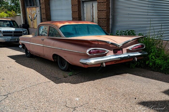
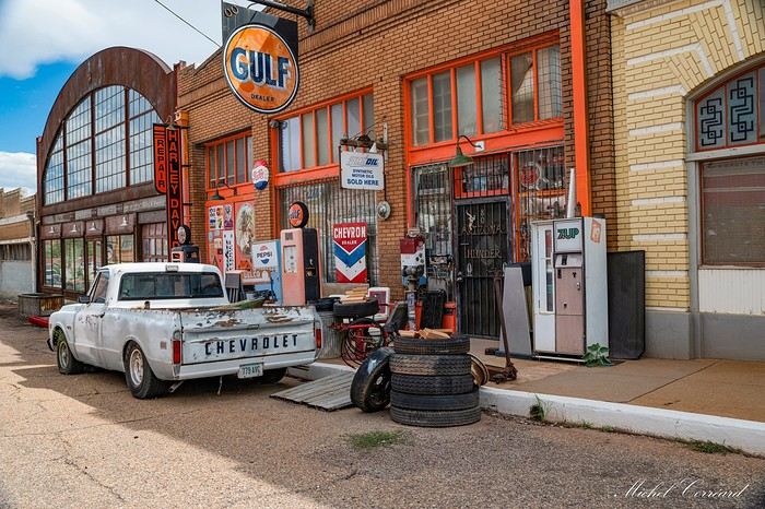
This road has been part of the American myth for decades. It’s worth noting that the highways built over the years led to the disappearance of many businesses along this route, since fewer people used it to travel across the country.

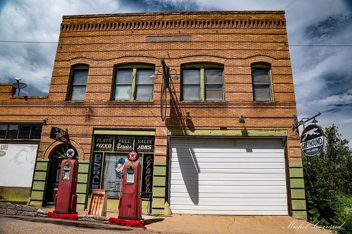
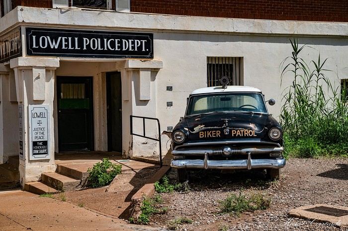
Fortunately, many of these historic landmarks are still visible along the road, making it a pleasant journey that takes you back in time.

I’ll share some of the attractions we spotted along this route, which we took to reach the American West, where we planned to visit several national parks.

Route 66 starts in Chicago, Illinois. It passes through rural towns where you can discover vintage gas stations, old motels and diners, historic bridges, roadside giants, beautiful murals, abandoned villages, and many other amazing attractions.

This first video showcases various sights along or near the route in Illinois and Missouri.

https://youtu.be/PpNt-28rCk0
PI Pinacoladada Globetrotter ·
ROUTE 66 - ST. LOUIS (MISSOURI) - GATEWAY ARCH NATIONAL PARK

GPS coordinates: 38.62220, -90.17357 Malcolm W. Martin Memorial Park GPS coordinates: 38.62475, -90.18501 Arch

The Gateway Arch is located in downtown St. Louis in the state of Missouri, USA. This arch is covered in stainless steel and is an important symbol of the conquest of the West.

Standing at 192 meters tall, it’s the tallest monument in the state, the tallest artificial monument in the country, and the largest arch in the world.

Officially inaugurated in 1968, the arch is situated on the west bank of the Mississippi River.

We first went to Malcolm W. Martin Memorial Park, located on the opposite bank, to get a stunning view of the arch and the city of St. Louis.

Afterward, we parked our vehicle in a paid parking lot ($) near Gateway Arch National Park and took the opportunity to stroll through this very pretty park.

The trees were adorned with beautiful pink flowers that enhanced the scenery.

The arch is enormous. You can actually board a tram ($) that runs inside it, taking you to an observation deck at the top.

We didn’t try the experience. Let’s just say the space inside the tram is very tight, and I’m a bit claustrophobic.

Behind the arch, you’ll find the old courthouse, which has been turned into a museum.

https://youtu.be/e_wo2JC1maY
PI Pinacoladada Globetrotter ·
ROUTE 66 - CUBA (MISSOURI) - TOWN MURALS

GPS coordinates: 38.06187, -91.40644

The town of Cuba, located in the state of Missouri in the United States, is known for its many murals depicting local and national historical events.

This town is even nicknamed "Route 66 Mural City"!

We stopped in this small town and took a walk to discover these works of art that adorn the facades of several buildings.

To learn more about the history of these murals, I invite you to visit this website: https://cubamomurals.com/#murals.

https://youtu.be/s-gdg2K6FCs
PI Pinacoladada Globetrotter ·
ROUTE 66 - SPRINGFIELD (MISSOURI) - FANTASTIC CAVERNS

GPS coordinates: 37.28661, -93.35910

This natural cave is located in Springfield, about eight kilometers from Route 66. The interior temperature stays around 15°C (59°F) all year round.

It lies beneath the rolling hills of the Ozarks in the state of Missouri, USA. It was discovered by a farmer in 1862 when his dog crawled through an entrance.

However, it wasn’t until five years later that the first exploration took place. An ad was published in a newspaper looking for explorers.

Twelve women responded to the ad and ventured into the cave. Their names are still carved on one of the cave walls.

To preserve the cave’s condition, visitors board a tram pulled by a propane-powered jeep that follows the path of an ancient underground river.

The tour, which lasts about an hour, offers a great glimpse of the stunning formations inside the cave. Plus, the guide shares insights about the cave’s origins and its formations.

Several tours run throughout the day. For more info, check out their website: https://fantasticcaverns.com/

We were truly impressed by the cave’s beauty. The formations are beautifully highlighted by lighting that makes them easy to see.

https://youtu.be/rJLC_GvILrQ
PI Pinacoladada Globetrotter ·
ROUTE 66 - KANSAS & OKLAHOMA

There are also several tourist attractions along Route 66 in the states of Kansas and Oklahoma. I’ll show you a few of them in this video.

Kansas has the shortest section of Route 66.

We stopped in Galena, which was once a very prosperous mining town. Several historic buildings around the city give a good glimpse into its past.

A lovely mural at the intersection of Seventh Street and Main Street caught our eye. It features a stunning 1957 powder-blue Chevrolet parked along Main Street near the famous Route 66 stops.

We also visited the former Kan-O-Tex gas station at the north end of Main Street in Galena, now called Cars on the Route.

It was at this old garage that the director of the movie *Cars* saw an old rusty tow truck that later inspired the character Tow Mater.

We also made a stop at Luigi’s Pit Stop on Front Street, where you can see replicas from the *Cars* movie: the sheriff of Radiator Springs, Lightning McQueen, and Luigi.

Next, we crossed the Marsh Arch Brush Creek Bridge (formerly known as the Rainbow Bridge), a historic bridge in Baxter Springs. Built in 1923, this is a single-span Marsh concrete arch bridge and the only one of its kind remaining along the entire former US Route 66.

We also made a few photo stops in Oklahoma to discover other attractions along Route 66.

The Pryor Creek Bridge was built in 1926. In 1932, Route 66 was rerouted just north of this bridge. It was listed on the National Register of Historic Places in 2006.

Ed Galloway’s Totem Pole Park, located 6 km east of Route 66, was listed on the National Register of Historic Places in 1999. Its main totem is the largest concrete totem pole in the world.

The Golden Driller is an icon of Tulsa. Standing 23 meters tall, this statue depicts an oil industry worker. It ranks as the fourth-tallest statue in the United States.

The Route 66 Historical Village in Tulsa is an open-air museum that helps showcase the evolution of rail transportation in the city and explains its historic connection to the oil industry.

Among other things, you can see a Frisco Meteor 4500 steam locomotive, old railroad cars, and the tallest derrick in North America.

And we made a quick stop in Canute to photograph the valiant knight in his shiny armor.

https://youtu.be/D9UcieFnC4c
PI Pinacoladada Globetrotter ·
ROUTE 66 - TEXAS & ARIZONA

Here are some other attractions located on or near Route 66 in the states of Texas, New Mexico, and Arizona in the United States.

Some of these attractions are featured in individual videos.

Texas

The Groom Cross is the largest freestanding cross in the Western Hemisphere.

VW Slug Bug Ranch, located in Panhandle, features five very colorful Volkswagen Beetles partially buried in the ground.

The Second Amendment Cowboy statue is located near Cadillac Ranch, where you’ll find a lineup of 10 old Cadillac cars partially buried in the ground.

These cars are covered in graffiti. You can even buy spray paint on-site if you feel like adding your own artwork to the cars.

In the town of Vega, you’ll find the Magnolia Station, built in 1924 and restored in 2001. It now houses the visitor center, where you can see period photographs and artifacts.

New Mexico

We obviously made a few stops in New Mexico. The various attractions we visited in this state will be featured in individual videos later.

Arizona

At the Geronimo Trading Post in Holbrook, you’ll find what is reportedly the largest petrified tree in the world. It’s in several pieces, and its weight is estimated at around 80 tons.

The historic district of Seligman lets you discover what Route 66 looked like in its early days, with several buildings and numerous vehicles that take you back to the 1950s and 1960s.

The Hackberry General Store and the Cool Springs Station are also must-visit spots, as these places are true museums of the old Route 66.

The Route 66 that leads to Oatman crosses the Sitgreaves Pass and offers beautiful viewpoints of the area.

We also visited several parks in these different states. I’ll share those with you individually.

For more information on all the attractions near Route 66, I invite you to check out the following website: https://roadtrippers.com/the-ultimate-guide-route-66/.

https://youtu.be/DWlkcacjLrA
PI Pinacoladada Globetrotter ·
ROUTE 66 - TEXAS - THE STATIONS OF THE CROSS IN GROOM

GPS coordinates: 35.20992, -101.12340

This freestanding cross, standing 58 meters tall, was erected in 1995 and can be seen from about 30 kilometers away. It’s one of the largest crosses in the world.

Life-sized statues have been placed around its base, depicting the life of Jesus and forming a Stations of the Cross.

Some of these stations are featured in this video, though they’re not necessarily in order.

The site also includes a visitor center, a gift shop, and an amphitheater.

Descriptions of each station of the cross are available on the following website: https://crossministries.net/.

https://youtu.be/4v4oS5-1tQE0
PI Pinacoladada Globetrotter ·
ROUTE 66 - PANHANDLE - VW SLUG BUG RANCH

GPS coordinates: 35.21555, -101.38381

VW Slug Bug Ranch, located in Panhandle, features five brightly colored Volkswagen Beetle wrecks partially buried in the ground.

They were placed there in 2002 to attract visitors to the nearby trading post. At the time, they were painted a bright yellow, and a sign was put up encouraging visitors to "sign" one of the Beetles.

It was a hit for this attraction. However, the trading post closed a year later!

Today, the five cars and the abandoned buildings nearby are covered in graffiti created with spray paint.

https://youtu.be/bUmcN2dxCYg
PI Pinacoladada Globetrotter ·
TEXAS - PALO DURO CANYON STATE PARK - JUNIPER TRAILS

GPS Coordinates: 34.979348, -101.69155 Observation Point GPS Coordinates: 34.979343, -101.69156 Visitor Center

Palo Duro Canyon State Park is the second-longest canyon in the United States. It’s located about 40 kilometers south of Amarillo, Texas.

It’s famous for its steep, multicolored rock walls, similar to those of the Grand Canyon.

You can explore it on foot, by mountain bike, or by car.

For more information about this park, I invite you to check out their website: https://palodurocanyon.com/

Juniper Trails

GPS Coordinates: 34.93696, -101.64690 Parking GPS Coordinates: 34.93690, -101.64640 Juniper Riverside Trail GPS Coordinates: 34.93192, -101.63907 Cross the street GPS Coordinates: 34.93175, -101.63915 Juniper Cliffside Trail GPS Coordinates: 34.93250, -101.64540 The Big Cave GPS Coordinates: 34.93841, -101.65614 Cross the street GPS Coordinates: 34.93842, -101.65613 Sunflower Trail GPS Coordinates: 34.93832, -101.65099 Right junction - Juniper Riverside Trail Back to Parking

We did a 4.4 km loop hike following the Juniper Riverside, Juniper Cliffside, and Sunflower Trails, then returned to the parking lot via another section of the Juniper Riverside Trail.

This easy-level hike offers stunning views of the canyon. Plus, it takes you to a cave nicknamed "The Big Cave."

The section of the trail leading to this mysterious cave is trickier to navigate because it’s covered in loose rocks that can sometimes be unstable. Be careful not to trip!

The cave walls are very high, but it’s not very deep. The scenery in this area is really pretty.

After finishing the hike, we stopped by the pasture at the park entrance to see the Texas Longhorn cattle and deer that were there.

https://youtu.be/hZdlLY442xg
PI Pinacoladada Globetrotter ·
ROUTE 66 - TEXAS - PALO DURO CANYON STATE PARK - THE LIGHTHOUSE TRAIL

GPS Coordinates: 34.95123, -101.66773 Parking and trailhead GPS Coordinates: 34.93659, -101.69683 The Lighthouse Rock

The Lighthouse Trail is without a doubt the most popular trail in this park. It leads to a rock formation that, as its name suggests, looks like a lighthouse.

This 2.9-mile (one-way) linear trail is considered moderate. Most of the trail is flat, but the end includes a steep climb over the last kilometer.
It's best to start the hike as early as possible to avoid the heat and bring plenty of water since there's hardly any shade along the trail.

The hike begins on a trail mostly made of red dirt. It crosses several dry creek beds that were completely dry when we passed through.

We walked past some truly stunning rock formations.

The climb up to the "The Lighthouse" rock formation starts with a fairly steep and eroded section, but it's short-lived. This part of the trail is shaded as it winds through the trees.

There's also a lookout point that offers a beautiful view of the canyon.

The hike continues across a plateau, and a second climb is needed to reach the lighthouse.

Standing nearly 310 feet tall, this rock formation is truly spectacular, and its location gives you a panoramic view of the entire canyon and the valley you just crossed. Absolutely stunning!

We set out early in the morning and only saw four people at the summit. However, on our way back, we ran into several groups of hikers.

So, if you prefer to enjoy the tranquility of this spot, it's best to do this hike early in the morning. Plus, you'll avoid the heat, which can be overwhelming during the day.

We were lucky enough to spot a beautiful northern cardinal during this hike. We also saw several wild turkeys along the roadside.

We made a stop at the pasture near the park entrance to see the Texas Longhorn cattle again.

https://youtu.be/MsgMktH-WM8
PI Pinacoladada Globetrotter ·
ROUTE 66 - TEXAS - AMARILLO - CADILLAC RANCH

GPS coordinates: 35.18729, -101.98706

Cadillac Ranch, located in Amarillo, Texas, is a lineup of 10 old Cadillac cars half-buried in the ground.

The cars are covered in graffiti, and visitors can even buy spray paint on-site to create their own artwork.

They’ve inspired films and videos—Disney’s *Cars* is one example. Bruce Springsteen also mentions it in his 1980 song "Cadillac Ranch."

When we stopped by, the smell of fresh paint was in the air. Several visitors had emptied their spray cans on the cars, constantly changing their appearance.

A free attraction you shouldn’t miss on the famous Route 66.

https://youtu.be/yce-SluCt3k
PI Pinacoladada Globetrotter ·
ROUTE 66 - NEW MEXICO - SANTA ROSA BLUE HOLE

GPS coordinates: 34.94044, -104.67324

The Blue Hole is actually a very deep natural pool created when a cavern collapsed and exposed the groundwater beneath it. It’s located in Santa Rosa near Route 66 in New Mexico.

It’s one of the most popular destinations in the United States for scuba diving training.

The water is crystal clear, and its temperature stays around 17°C (63°F), with a depth of over 24 meters (80 feet) below the surface.

Since this site is at an elevation of 4,616 feet, divers must use high-altitude dive tables to determine decompression stops when diving in this body of water.

There’s also an underwater cave system. The cave entrance was covered with a metal grate in 1976 after two young divers were found trapped in one of these caves.

Since 2013, divers have been allowed to pass through the grate to map this underwater cave system.

This natural pool is open to the public. However, there are no lifeguards on duty.

Given Santa Rosa’s very arid climate, it’s the perfect spot to cool off on hot days since the water is really cold.

If you’d like more information about this attraction, I invite you to visit this website: https://www.santarosabluehole.com/.

https://youtu.be/97CFvJRLRK0
PI Pinacoladada Globetrotter ·
NEW MEXICO - LOS ALAMOS - BANDELIER NATIONAL MONUMENT - ALCOVE HOUSE TRAIL VIA MAIN LOOP TRAIL

GPS Coordinates: 35.77912, -106.27079 Visitor Center

Bandelier National Monument, established in 1916, is located 15 km south of Los Alamos in New Mexico. It protects the ruins of an ancient Anasazi Native American civilization.

It has been determined that these ruins were inhabited from the 11th century until the mid-15th century. The reason for their departure remains unknown to this day. It is thought that it might be linked to drought as well as the decline of agriculture.

The best way to explore this park is by hiking. Several trails, with varying lengths and difficulty levels, allow you to discover the different attractions the park has to offer.

- Alcove House Trail via Main Loop Trail

GPS Coordinates: 35.78218, -106.27413 Tyuonyi Pueblo GPS Coordinates: 35.78305, -106.27371 Talus House GPS Coordinates: 35.78420, -106.27630 Long House GPS Coordinates: 35.78883, -106.28482 Alcove House

We chose to hike the Main Loop Trail, which is the park’s most popular trail, and halfway through, we took a detour to the Alcove House Trail, covering a total distance of 4.2 kilometers.

The Main Loop Trail starts at the Visitor Center and includes 21 stops that let you explore the architecture of these dwellings and the way of life of this ancient Native American people.

One of the first sites you can see is the Great Kiva. This is an underground structure where rituals were performed. It was also the place where traditions were passed down from generation to generation through legends, prayers, and songs.

A little further on, you’ll find the ruins of Tyuonyi Pueblo. It was a village with 400 rooms built on two or three levels. There was only one ground-level entrance. It looks like a vast labyrinth.

We passed by Talus House, where you can see cliff dwellings that are accessible via wooden ladders.

Next, we discovered Long House, which had over 300 rooms spread across several floors. Today, you can only see the rooms carved into the tuff cliffs and the anchor points. You can also spot some petroglyphs there.

When we reached the intersection with the Nature Trail, we turned right to head toward Alcove House.

Located in the cliff, 43 meters high, this large cave is accessible by four wooden ladders and stairs carved into the rock.

Unfortunately, during our visit, access to the ladders wasn’t allowed because work was being done to secure the area.

However, we were able to admire it from the trail and see that the climb is steep and not recommended for those who suffer from vertigo!

A week after our visit, access was allowed again.

On our way back to the visitor center, we encountered some deer near the trail. They didn’t seem bothered by our presence at all.

If you’d like more information about this attraction, I invite you to visit this website: https://www.nps.gov/band/index.htm

https://youtu.be/NXs2fcB5NYE
PI Pinacoladada Globetrotter ·
NEW MEXICO - LOS ALAMOS - BANDELIER NATIONAL MONUMENT - TSANKAWI RUINS TRAIL

GPS coordinates: 35.86011, -106.22454 Parking and trailhead GPS coordinates: 35.86204, -106.21489 Ruins

The Tsankawi Ruins Trail is a trail located in Bandelier National Monument, south of Los Alamos in New Mexico.

This trail is a 2.6 km loop and includes wooden ladders to climb along the way, as well as very narrow and sometimes steep passages.

This section is less well-known than the main part of the park. However, the scenery is stunning, and you can see cliff dwellings, an ancient Pueblo village, and petroglyphs.

The site was occupied by the ancestral Pueblo peoples during the 15th and 16th centuries. Their descendants now live in the adjacent Indian reservation.

https://youtu.be/O285xGGvwpA
PI Pinacoladada Globetrotter ·
NEW MEXICO - WHITE ROCK OVERLOOK

GPS coordinates: 35.82668, -106.17956

This overlook, located in White Rock, New Mexico, is wheelchair-accessible via a short 70-meter trail.

It offers stunning views of the beautiful Rio Grande River winding through the Jemez Mountains. On the opposite side, you can see a waterfall cascading down a cliff.

In the distance, the mountain peaks are still snow-capped.

https://youtu.be/ni0_t-ZMaRY
PI Pinacoladada Globetrotter ·
ROUTE 66 - NEW MEXICO - ALBUQUERQUE - OLD TOWN

GPS coordinates: 35.09663, -106.66980

Old Town is a charming neighborhood in Albuquerque, located in New Mexico. You can recognize the traditional Spanish style of this city by its plaza and church, surrounded by houses and shops.

The narrow streets of Old Town are home to century-old adobe houses that are still inhabited. Many of these have been renovated into boutiques, restaurants, and art galleries.

https://youtu.be/IvwhSeC_s0Q
PI Pinacoladada Globetrotter ·
NEW MEXICO - WHITE SANDS NATIONAL PARK

GPS Coordinates: 32.77961, -106.17245 Visitor Center

White Sands National Park is made up of vast gypsum dunes of an immaculate white that constantly shift with the wind.

A 13 km scenic road starts at the Visitor Center and crosses the park. The road is paved for the first 8 kilometers, while we drive on a hard gypsum sand road for the last 5 kilometers.

The total route is 26 kilometers since you have to return to the Visitor Center to exit the park.

Along the way, you’ll find parking areas, restrooms, picnic spots, and hiking trails.

Many people also come here to go sledding or take a horseback ride.

The sand is so white! It looks like snow! You could easily mistake it for the real thing!

If you'd like more information about this park, I invite you to visit this website: https://www.nps.gov/whsa/index.htm

https://youtu.be/NgKphPIt_mo
PI Pinacoladada Globetrotter ·
NEW MEXICO - WHITE SANDS NATIONAL PARK - DUNE LIFE NATURE TRAIL

GPS Coordinates: 32.79342, -106.21257 Parking and trailhead GPS Coordinates: 32.79195, -106.21264 Loop to be done clockwise

The Dune Life Nature Trail is a moderate 1-mile loop hike. Although it's classified as moderate, we found it pretty easy to walk.

Its classification likely comes from the fact that we have to climb two steep dunes of loose sand.

It's very important to follow the blue markers with a clover symbol to stay on the right path.

All the dunes look alike, and it's easy to stray from the trail since our attention is drawn to the stunning views offered during this hike.

Educational signs are placed at various points along the trail, providing information about the vegetation and wildlife.

Several animals live in these dunes: kit foxes, badgers, reptiles, rodents, birds, and more. That's why we paid special attention to the tracks in the sand.

The only tracks we saw seemed to belong to an insect from the beetle family.

This area of the park is full of plants that play a crucial role in the park's ecosystem. They stabilize the dunes and provide food and shelter for wildlife.

These plants have adapted to the extreme climatic conditions of the Chihuahuan Desert. They must be drought-tolerant and able to survive temperatures below freezing.

The trees and shrubs have also adapted to this environment and are surprisingly tall. The lone Rio Grande cottonwood growing in the sand is a great example and indicates the presence of a reliable water source that allows it to survive in this desert.

We did this hike very early in the day to avoid the extreme heat that can occur in this park.

https://youtu.be/Oy8bsJfPiSM
PI Pinacoladada Globetrotter ·
NEW MEXICO - WHITE SANDS NATIONAL PARK - PLAYA TRAIL

GPS coordinates: 32.79555, -106.21155 Parking lot and trailhead GPS coordinates: 32.79702, -106.21181 Viewpoint 1 GPS coordinates: 32.79789, -106.21155 Viewpoint 2

The Playa Trail is an easy 800-meter round-trip trail with informational signs that let us learn about the unique features of this section of the park.

Just follow the green markers with a heart symbol that indicate the trail direction.

A playa is actually a depression in the ground that temporarily fills with rainwater. Constantly evolving, it serves as a habitat for plants and animals.

The sign at the end of the trail lets us take a trip back in time to see what this region looked like over 10,000 years ago and discover the wildlife that lived here during the Ice Age.

https://youtu.be/71T19wgGvJ4

Similar discussions

You might also like