
NEVADA - RED ROCK CANYON LOOKOUTS
GPS Coordinates: 36.13569, -115.42788 Visitor Center
Red Rock Canyon is located in southwestern Nevada, about 20 kilometers west of Las Vegas.
A 21-kilometer one-way scenic drive runs through this park. You can admire the various rock formations from numerous overlooks along the road or by exploring the different trails in the area.
Entry reservations are required for the scenic drive between October 1st and May 31st for entry between 8 AM and 5 PM. Timed-entry reservations can be made on Recreation.gov by visiting the following website: https://www.recreation.gov/timed-entry/10075177, or by calling (877) 444-6777.
* High Point Overlook
GPS Coordinates: 36.17043, -115.46617
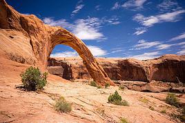
This overlook is the highest point on the scenic drive. It offers stunning 360-degree views of the park. Interpretive signs provide information about the region's geological features.
* Viewpoint
GPS Coordinates: 36.16626, -115.47539
Similar view to the previous overlook.
* Ice Box Canyon
GPS Coordinates: 36.15026, -115.48400
This overlook marks the start of a challenging 3.5 km trail that leads deep into a cool, shaded canyon with seasonal waterfalls.
The canyon is very narrow and rarely sees sunlight. However, to get there, you’ll need to cross open desert and climb over rocks to reach the end of the canyon.
* Red Rock Wash Overlook
GPS Coordinates: 36.14263, -115.47314 Viewpoint
This overlook also offers a fantastic view of the colorful rock formations. We also spotted some pretty flowers and a small lizard here.
* Pine Creek Canyon
GPS Coordinates: 36.12912, -115.47334
The Pine Creek Canyon overlook is located near the southern end of the scenic drive. It provides a stunning panorama of over 24 kilometers of mountainous landscapes.
An easy 5.5 km round-trip trail starts at this overlook and leads into the canyon. The vegetation here is quite varied.
The ponderosa pine forest found at the mouth of the canyon is a remnant of the last ice age. It manages to survive here thanks to the cool air and water flowing through Pine Creek Canyon.
* Lower Red Rock Parking Area
GPS Coordinates: 36.11171, -115.44960
Lower Red Rock is the last overlook on the scenic drive. It offers a breathtaking view of all the rock formations in the park.
* Red Rock Overlook
GPS Coordinates: 36.11709, -115.44481
This overlook is located on Highway 159 and provides an excellent view of the entire protected area. Plus, no entry fee is required to access this overlook.
You can also spot a few Joshua trees here, which are mostly found only in the Mojave Desert in the southwestern United States.
I find this tree quite beautiful—it can withstand the most severe droughts thanks to water captured by its spines and stored in its fibrous trunk.
https://youtu.be/G8YYmSPDFp8



Japan, five weeks between unknown lands and familiar paths

Hello everyone,
I invite you to follow me on this fifth exploration trip to Japan.
Five weeks or so!
For the itinerary, my usual mix: New discoveries, well-known places, and others less so.
At the heart of the trip, a two-week road trip by car. I wavered for a long time between the San'in region, from Tottori to Yamaguchi, and southern Kyushu. By a narrow margin, southern Kyushu won out.
Waterfalls that seem even more impressive. A more exotic atmosphere. Tea-growing lands to savor... Kagoshima will be the starting point. Then a loop from west to east.
And, of course, the must-see stops... Those little Japanese touches. Gourmet cuisine. Japanese, but not only!
And then, the soul of the trip, I hope: Human connections. Big or small.
Otherwise? Several local festivals. Osaka, unexpected. Miyakojima, between beauty and small disappointments. Tokyo... it's Tokyo!
So, travel with me. The suitcase is waiting, with stories that are sometimes generous, but always driven by the love of travel experienced firsthand.
Yōkoso, Nihon! Welcome to Japan!
Hello everyone,
I invite you to follow me on this fifth exploration trip to Japan.
Five weeks or so!
For the itinerary, my usual mix: New discoveries, well-known places, and others less so.
At the heart of the trip, a two-week road trip by car. I wavered for a long time between the San'in region, from Tottori to Yamaguchi, and southern Kyushu. By a narrow margin, southern Kyushu won out.
Waterfalls that seem even more impressive. A more exotic atmosphere. Tea-growing lands to savor... Kagoshima will be the starting point. Then a loop from west to east.
And, of course, the must-see stops... Those little Japanese touches. Gourmet cuisine. Japanese, but not only!
And then, the soul of the trip, I hope: Human connections. Big or small.
Otherwise? Several local festivals. Osaka, unexpected. Miyakojima, between beauty and small disappointments. Tokyo... it's Tokyo!
So, travel with me. The suitcase is waiting, with stories that are sometimes generous, but always driven by the love of travel experienced firsthand.
Yōkoso, Nihon! Welcome to Japan!



















































 Roundabouts are particularly interesting because they feature emblems of Turkmen culture, like the dog, a carpet, the Ahal Teke horse, or Muslim symbols, even though the presence of Islamic artifacts is quite limited.



 Why this country?
After visiting Hungary, Slovenia, Romania, and Poland in recent years, I’ve fallen in love with Eastern European countries. I adore the Slavic soul, its Austro-Hungarian villages, the gentle landscapes, the Carpathian Mountains, and that slightly mysterious atmosphere.
Slovakia evokes a certain imagination with its deep forests, medieval castles, and cobbled villages.
After seeing photos of the High Tatras—especially Lake Štrbské Pleso and Spiš Castle—I thought, "Let’s do it! We’re going!"
So, will Slovakia live up to what I imagine?
We’ll find out together.
We decided to travel as a group of six (five adults and a six-year-old child), by car (we needed two).
Here’s the day-by-day itinerary for this family trip, which started with a 3-day stay in Vienna (see the dedicated travel journal):















 When it comes to the Caribbean island of Saint-Martin, it's customary to praise its coastline and dreamy beaches—and they certainly deserve it.
But in this story, I’d like to highlight other memories, aspects, and impressions for a slightly different change of scenery.
Enjoy the read—some text and, above all, lots of photos.
« Byenveni sou zile Sen Maten! » (Welcome to the island of Saint-Martin)





































 Come along, I'm taking you to this country where it's so nice to wander and slow down...











