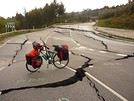
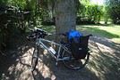
Après une expérience du camino (le Puy-Cap Fisterra-mars et avril 2005)en pédibus,
Je prépare un Bretagne-Cap Fisterra en mars-avril 2009 en pédalus,
contrairement à l'autoroute à pélerins qu'est devenu le camino francès, le camino del norte (les cotes cantabriques) est assez mal renseigné
Le chemin dit historique pratiqué par les pérégrinos-pédibus est difficilement exploitable par les pérégrinos-pédalus.
Je cherche des retours d'expériences de "compostellé(e)s en vélos" sur ce parcours cotier.
"puédase ayodarme en mi busqueda de informationes, gracias"
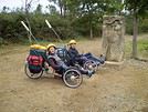
Nous avons fait le pèlerinage par le camino del norte, en septembre 2007, en tricycle couché. Nous avons fait le chois de suivre le chemin pedestre au plus près mais par la route. Ce n'est pas trop difficile, car des routes, il n'y en a qu'une, c'est la nationale qui suit le côte, le reste du terrain entre mer et montagne laisse passer la voie de chemin de fer et l'autoroute. Du coup, la nationale est nettement moins passante. Il y a souvent comme souvent en Espagne une large bande sur les côtés. D'ailleurs, les pedestre la suivent aussi cette route de temps en temps, car il n'y a pas d'autre endroit où faire passer le chemin.
Nous étions en camping, solution pratique jusqu'au 15-20 septembre, plus galère après (campings fermés). De plus, ils sont assez chers, région touristique oblige. Mais les auberges pour pélerins sont biens, du moins celles que nous avons utilisées. Le chemin est plus sympa que le camino frances, les espagnols étant sans doute moins envahis. Nous sommes revenus par le camino frances, et on a bien senti le côté "on voit venir le pélerin de loin". Ce n'était pas le cas sur le camino del norte, et puis nous, on a trouvé les paysages bien plus beaux.
Si tu souhaites plus de précisions sur l'itinéraire, à ta dispo en mp, pour ne pas trop polluer le post.
Amitiés et... Buen Camino, Peregrino.
Bonjour Daniel
Décidément je te suis à la trace car à l'aide de tes renseignements et de ceux de Rando 44, je me suis rendu en Roumanie en 2007. Je compte rejoindre St Jacques en Juin prochain. J'ai trouvé ce site qui comporte des adresses d'hébergement et bien d'autres renseignements qui, peut-être, t'aideront.
Au plaisir de te rencontrer lors d'une de mes sorties vers Malestroit. D'ici le mois de juin je retourne à mes anciennes amours : Je fais cet hiver une transat avec mon frère ; direction : Le Brésil
http://www.verscompostelle.be/coguinor.htm
demat à Cagouille17 et Emiljo
je vous contacte tous les deux en message privé
le site belge dont tu parles est vraiment très bien fait, j'ai déjà contribué comme d'autres à la fabuleuse collection de statues et pélerins de
Pierre et Simone Swalus-Van Goethen (jacquets confirmé(e)s et chaleureux) - ce site mérite vraiment le détour.
Daniel d'Ar Minichi
kénavo
salut DANIEL
BRETON de PARIS, je reviens d'ailleurs en velo d'un PARIS QUIMPER
pour notre SANTIAGO, j'y etais par le camino du nord en velo en 2003
depart de HENDAYE;
la route dans sa totalité est de bitume sauf à l'arrivée pres de SANTIAGO avec quelques kms de pistes faciles
itineraire SAN SEBASTIEN, BILBAO, OVIEDO, LUGO
la route certes montagneuse est super surtout dans les ASTURIES
pour l'hebergement pour moi c'etait le camping car sur cette portion du camino, il y a tres peu d'auberges de pelerins.
le parcours est balisé par le logo du camino
par contre nous sommes la aux antipodes de densité du camino traditionnel
j'ai du rencontrer deux ou trois pelerins sur ce chemin.
pour d'autres informations je suis dispo
l'office du tourisme d ESPAGNE distribue untas de docs sur le camino
kenavo
Ca a tout de même bien changé. Il y a maintenant assez d'auberges pour pélerins sur le chemin. Et un peu plus de pélerins aussi.
Edit : Si tu passes par Lugo, ça grimpe pas mal. Nous on a suivi la côte jusqu'à Ribadeo (très belle auberge), et ensuite plein sud vers St-Jacques par la nationale.
Bonjour, J'ai fait le voyage à Santiago en 2006 (départ de Niort) et comme j'avais et ai toujours la même opinion que toi sur le Camino francese je voulais prendre le chemin du nord mais je n'ai rien trouvé à l'époque. Avec les cartes Michelin j'ai tracé une route entre les deux. Ce fût un voyage formidable. Pour le chemin du nord tu as un site assez bien fait mais en espagnol. Il décrit les étapes pour les marcheurs mais tu dois pouvoir t'en servir. C'est ce que je compte faire en 2010 puisque j'envisage d'y retourner (peut-être en partant de Rome).
Le site : http://www.mundicamino.com/
Tu as aussi un guide : "le chemin côtier" aux éditions "RANDO éditions" ou dans les bonnes librairies
c'est avec un grand interet que j'ai lu votre court résumé de votre "camino del Norte", vers Compostelle.
J'envisage de le faire à vélo des la fin Mars 2009, en partant de mon domicile, prés de Lyon (69780)
Auriez-vous la gentillesse de me renseigner, sur vos étapes, distances, prix et d'une maniere générale, tout ce qui vous à paru interessant au cours de ce voyage.
je pars en mai, juin 2009 de niort sur ce sentier peux tu me donner des indications sur le nombres de jours qui faux pour le parcourir, trouve t on facilement des campings etc
sinon pouvons nous nous rencontrer pour partager le parcours
J'ai mis douze jours pour aller à Santiago plus une journée de repos pour cause d'intempéries.J'ai pris un parcours intermédiaire entre le chemin français et le chemin du nord. Je suis passé dans les monts cantabriques. Je n'ai pas vu un seul pélerin avant Lugo.
Par contre j'ai eu quelques difficultés avec les terrains de camping, tous n'étant pas encore ouvert. Résultat quelques étapes longues.
Il n'y a aucun problème pour nous rencontrer. J'habite à Montigné. Il suffit que tu me préviennes un peu à l'avance.
Tu peux m'appeler quand tu veux de préférence le soir. Mon numéro est dans l'annuaire.
bonjour à vous! :)
dans un mois c'est pour une amie et moi le grand départ pour santiago, par le camino del norte! (départ d'hendaye, on prévoit 2 semaines)
je me demandais si certains d'entres vous avaient des conseils...(climats, fréquentation, camping...)
On appréhende un peu le relief!! pourriez-vous m'en dire plus? (on envisage 60 à 80km par jour...nous sommes donc en plein entrainement 😉)
est ce qu'il y a beaucoup d'auberges et à quel prix? (j'ai une tente et j'hésite un peu encore à l'emmener...)
pour la route, la N634, c'est bien celle-ci qui est la plus aisée à emprunter?
notre retour se fera en car ALSA je pense, il faut reserver en arrivant à santiago ?
merci beaucoup !!!
bonne routes à tous🙂
depuis mon post initial de novembre 2008, je suis parti du Morbihan pour Santiago et le Cap Fistera par le camino del norte en mars et avril 2009
sur mon blog quelques commentaires et photos, si questions autour de ce camino (étapes, distances...), ok
http://danydarminichi.over-blog.com/article-30754226.html
kenavo
bonjour "daniel56"!
merci pour ta réponse, mais j'avais déja consulté ton blog à de multiples reprises! :)
j'aimerai avoir encore quelques conseils...avais-tu le compostella pour aller dans les auberges en espagne?
et quelle est la distance totale entre hendaye et st jacques? 800km?
je commence à avoir des doutes sur nos capacités à cause du relief!? peux-tu m'en dire un peu plus?
merci d'avance 😉
mati7
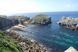
d'Hendaye à Santiago par le Norte, entre 700 et 900kms, suivant l'itinéraire choisi (certains rejoignent la Corogne) et d'autres coupent par les Pics d'Europe (plus hard). Ne te fais pas de soucis pour les difficultés, il faut simplement fermer la porte du domicile, et ensuite tous les tracas et les complications s'estompent au fur et à mesure. Il suffit de pédaler, d'admirer et de rêver....ce n'est que du bonheur....la mer et la plage à droite, les montagnes à gauche !
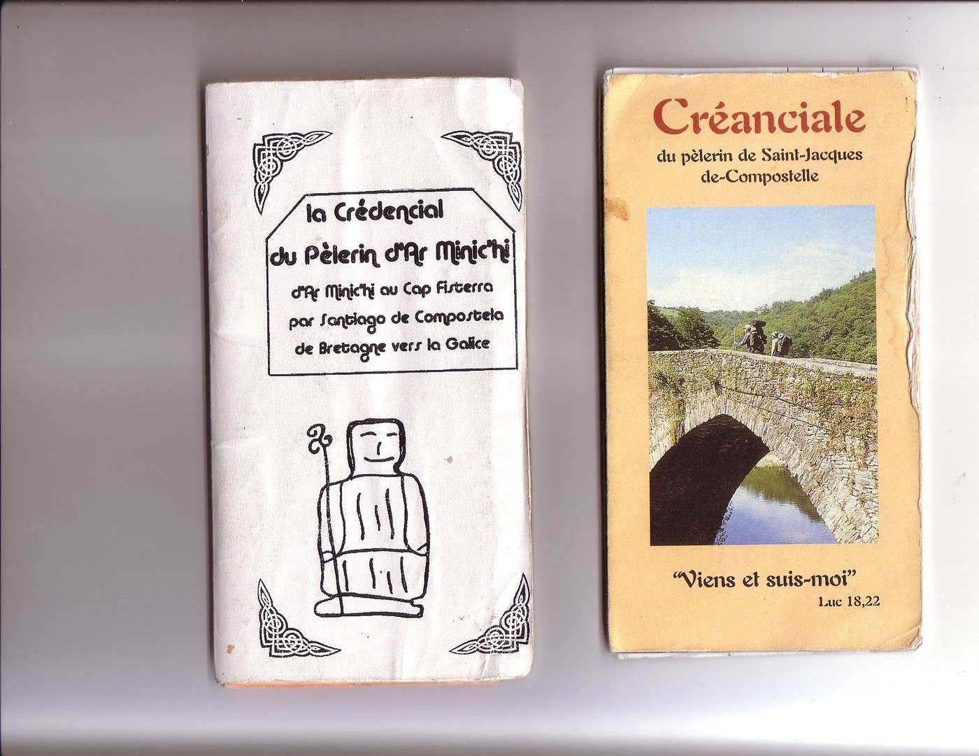
La créanciale (option catho) ou le crédenciale (option laïque) est un passeport- collector qui atteste de ton parcours. Il t'ouvre les portes des albergues en Espagne. La créanciale s'obtient moyennant quelques € (5 à 10€) auprès d'Associations Jacquaires Diocésaines.
En 2005, à pied sur le Camino Francès j'avais une créanciale obtenue au départ du Puy en Velay (à la Sacristie de la Basilique).
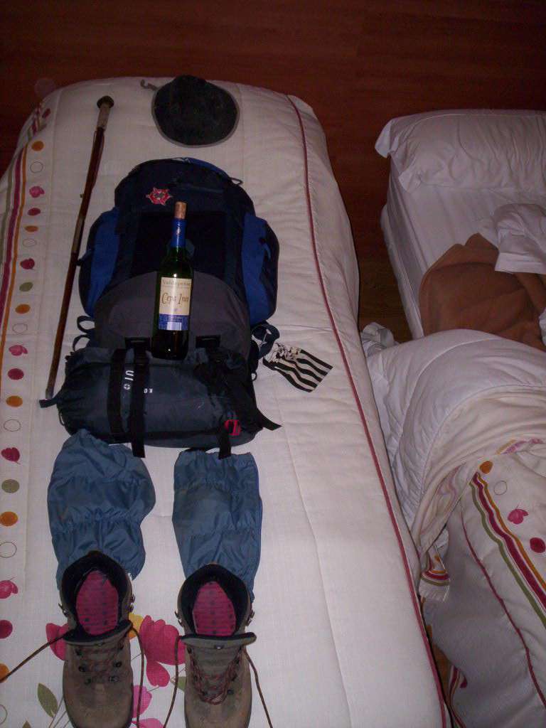
Cette année pour le Camino del Norte je m'étais personnellement "fabriqué" ma CréDentiale. A chaque présentation elle provoquait la "curiosité" des hospitaliers, mais elle ne fut jamais refusée. Lorsque à Santiago, au bureau des "certifications" je la présentai le permanent d'accueil m'offrit une "COMPOSTELLA" , un certificat, une attestation de pérégrination. L'unique rareté du modèle présenté me valait même l'attribution d'une compostella "catholique" que je refusai, préférant la Compostella non religieuse et simplifiée, plus conforme à ma mécréance affichée.
Cette "Compostella" est très recherchée par les fervents catholiques, il leur faut effectuer les 100 derniers kms (à pied) ou les 200 derniers kms (à vélo), attestés par les "sellos" (les tampons ou timbres) pour l'obtenir et à l'arrivée à Santiago au dit-bureau des estampilles c'est une vraie foire folkorique ( en été entre 2000 et 2500 pélerins/jour)
Pour séjourner en albergues de peregrinos, cette créanciale/crédenciale est indispensable. Les pélerins cyclistes ne sont pas prioritaires en albergues, seulement s'il reste de la place après 18h généralement. Le Camino del Norte est moins fréquenté et " saturé" que le francès.
Mais tu trouveras toujours un coin pour te reposer, les Espagnols sont des hôtes extraordinaires de générosité et de disponibilté.
Ta progression moyenne (suivant ta condition physique) sera sans doute de 50 à 80 kms/jour. Pour ma part moyenne de 15-17 kms/h.
Arrêts rencontres, rêveries, photos, renseignements et bavardages en tous genres nombreux.....et la moyenne s'en ressentait.... mais pour le plus grand plaisir de vivre sans l'obsession des chiffres !
en p.j. ma créanciale officielle "bénie" de (2005) et ma perso "mécréante" (2009)
buen camino et bonne prépa.......ultrïea....
merci pour tous ces renseignements "daniel 56"!
je viens d'appeler "L'association des amis de st jacques de Poitou, Charentes et Vendée", un gentil monsieur m'a répondu.
il nous envoie donc 2 créanciales contre 12 euros (6euros l'un), je suis ravie que ce petit souci soit réglé! :)
sinon il m'a dit qu'il y a plus de circulation automobile sur le camino del norte, tu confirmes?
j'ai vraiment hate de prendre le départ!
merci pour tout 🙂
Mati7
Bonjour à tous.
Par le biais de vos questions et de vos réponses j'ai déja pu me faire un début de "book" qui j'espère m'aidera au mieux, en tout cas il me guide bien. Si vous avez des infos plus fraiches ou des choses auquelles vous n'avez pas pensé je suis preneur.
Je vais donc faire le chemin del Norte au mois de septembre 2010. Peut-être rencontrerai-je certains de vous. Dans tous les cas je vais "rouler" dans votre sillage, en me faisant mon propre voyage interne et externe...
Merci à vous tous et continuez à voyager.
Amicalement, Thierry
Quand j'ai préparé mon voyage, j'ai eu énormement de mal à trouver des infos.
J'ai tracé mon itinéraire grace à des cartes michelin et j'ai pu rencontrer papillaut qui m'a bien aidé.
Si les voyageurs sont intéressés j'ai créé un blog ou je raconte mon périple, n'hésitez pas à le consulter et à y déposer vos message.
Je suis intéressé par le Camino del Norte, mais je me pose trois questions:
- Y a-t-il beaucoup de voitures sur la N634?
- Y a-t-il un vent fort et défavorable? Longer l'Atlantique m'inquiète. En Hollande, pour aller d'Amsterdam à la France par l'EV1, j'ai eu beaucoup de mal avec le vent.
- Le long de la mer, est-ce très urbanisé ou y a-t-il des endroits sauvages? Pour ceux qui connaissent, est-ce un peu comme en Croatie le long de l'Adriatique?
Quant au Camino Francès, est-il très vallonné? Y a-t-il vraiment beaucoup de marcheurs sur le sentier? Cela gène t-il à vélo?
Dans les 2 cas, combien y a-t-il de campins en moyenne sur un tronçon de 100 kms?
le Camino del Norte en vélo, tu es obligé d'emprunter la N634, en effet le camino pedestre est quasi-impraticable aux vélos (sauf quelques rares sections)
Il y a effectivement beaucoup de voitures et camions, mais la Nationale possède une bande d'urgence autorisée aux vélos.
l'Autovia (en fin de réalisation je pense en 2011) annexe quelquefois la N634, et oblige de très longs détours par de petites routes côtières magnifiques un peu en montagnes russes.
La Côte Cantabrique est splendide, les villes traversées sympathiques. Les campings sont fréquents le long de la côte mais hélas les tarifs sont excessifs (saison estivale oblige sans doute). Les albergues sont assez bien réparties (3 ou 5€ en donativo) mais toujours avec priorité aux pédestres.
Le bivouac en Espagne est normalement interdit, mais avec intelligence c'est jouable, au cas où.
Le Camino Françès est très, très fréquenté surtout entre juin et septembre, il est devenu un vrai "cirque". Le camino pédestre est praticable aux vélos, à toi de "faire ton chemin" parmi les pérégrinos, sans les incommoder....certains (chrétiens ?) sont excédés de devoir partager . La route n'est jamais loin de toute façon.
Les endroits sauvages ( ! ) existent (petits détours obligent)
Le Camino del Norte de par ses difficultés est nettement moins fréquenté que le Camino Françès, pour avoir fait les deux (l'un en pédestre, l'autre en pédalus) je suis incapable de te conseiller les deux sont d'extraordinaires aventures à vivre (et à partager).....le nec plus ultra....emprunte l'un pour rejoindre Santiago (et le Cap Fisterra) et l'autre pour revenir, tout cela dépendra du temps disponible. Tu peux compter sur des étapes de 50-70 kms /jour.
à plus si autres questions
kenavo
Mille mercis, Daniel! C'est très généreux de ta part de faire partager ton expérience et de venir en aide à ceux qui demandent conseil!
Et pour le vent: ça souffle fort?
Sur le Camino del Norte, concernant les portions "Autovia" à éviter, les petites routes en montagnes russes au bord de la mer doivent être difficiles, mais très jolies, non? Tu crois qu'il est possible de "longer tout le long" l'Atlantique par des petites routes de ce type sans passer par la N634?
Quels sont les prix du camping pour une personne? Et pour deux?
3 ou 5 euros pour les alberges, c'est vraiment "bon marché"! Si j'arrive à 20h dans une alberge, que je prends la dernière place, et que des marcheurs arrivent à 21h devrais-je quitter l'alberge? Est-il autorisé de camper autour des alberges?
Les routes longeant le Camino del Norte sont-elles chargées en circulation automobile ou est-ce vraiment tranquille?
Les routes sinueuses de la côte Cantabrique sont toutes franchissables avec le temps et avec un 22X32 tu arriveras toujours "en haut" !
Pour l'anecdote j'ai pris le risque d'emprunter l'Autovia (section toute nouvelle" dans les 5 mns la Guardia Civile a pointé ses gyrophares et m'a demandé de quitter le billard roulant "no alternativo, senor", il m'a fallu rallonger le parcours de quelques kms par le bord de mer. (ils m'ont dit que j'étais protégé par saint Jacques....ce qui a surpris le mécréant que je suis).
Concernant le vent (contraire) en vélo il faut voir avec la position de l'anticyclone au moment de ton périple, généralement sur l'Atlantique les vents sont d'ouest ou nord/ouest donc de face concernant le Camino del Norte (il est vrai que c'est un peu galère, je viens de terminer Paris/Prague plein vents d'est, assez galère mais le corollaire était un temps ensoleillé permanent....alors ! )
Concernant les albergues, la priorité accordée aux "pédestres" se termine vers 18h, ensuite si tu es installé; l'hospitalier gestionnaire ne te virera pas pour autant.
En Espagne, tout sera fait pour t'héberger, même le bivouac toléré à proximité de l'albergue si surbooking. Pensez à votre "crédenciale ou créanciale" (passeport pèlerin nécessaire pour l'accès aux albergues, à obtenir (environ 5€ auprès des associations "pèlerines")
un site d'amis belges très bien fait sur "tous les Chemins de Compostelle" (adresses albergues et tous renseignements)
http://www.verscompostelle.be/coguibel.htm
Concernant les prix de campings le long de la côte, c'est de l'ordre de 10/12€:personne (un peu onéreux par rapport aux albergues)
Perso j'ai pratiqué le bivouac en Espagne, mais avec beaucoup de précautions et de discrétion (c'est assez mal vu chez les Ibères)
Installation à 20h, départ tôt le matin. Propreté et discrétion, voire autorisation lorsque c'est possible. Question de feeling.
kenavo
J'envisage d'effectuer cette randonnée en juin-juillet 2017. Je souhaite passer par la côte pour ne pas avoir trop de monde sur le chemin et profiter des…
Voyager à vélo › Espagne / France › Sud-Ouest · 1 reply
J'envisage de faire en gravel Irun-St Jacques de compostèle par le camino del norte et retour par le camino frances de mi-aout à fin septembre 2020. Je pense…
Tout est dans le titre! J'envisage le chemin de Compostelle depuis IRUN cet été. J'ai parcouru des topics assez anciens, et je voulais avoir des avis récents.…
I Hola hola! Tout d'abord merci d'avance à ceux qui répondront à ce message... Avec 2 amis, nous comptons faire une partie du pélerinage de St Jacques de…
I’m planning to leave Nice for Toulouse around 10/15 and I’m looking for tips / great deals regarding:
- The route: I was thinking of taking Nice - Grasse - Draguignan - Salernes - Cadarache - Cavaillon - Arles, then the Camargue, Sète, and the Canal du Midi to Toulouse. The idea is to avoid high-traffic roads and too many steep climbs. Are there any spots to avoid or must-see stops? Since it’s been a while since I’ve been on the road, I was thinking that sleeping indoors might be preferable. If you have any budget-friendly accommodation suggestions along part of the route, don’t hesitate!
Thanks in advance, and if you’re in the area around that time, we could ride together... Ciao.
Looking for a female travel companion for a cycling trip (arriving by plane in Porto Alegre, Brazil, and cycling toward Montevideo, Uruguay, returning by plane to France from Buenos Aires, Argentina) – 1,500 km
Hello everyone!
I’m planning a cycling trip across Brazil, Uruguay, and Argentina, with a departure set for late October, November, or December. I’m looking for a travel companion to share this long-distance adventure with.
Experience:
I already have solid experience in bicycle touring in Georgia, Kazakhstan, and Kyrgyzstan. Currently, I maintain excellent physical condition by cycling an average of 250 km over 3 days per week (4 hours a day at 20 km/h).
The trip & the pace:
Daily pace: Between 50 and 80 km per day, to make steady progress while taking time to explore.
Accommodation: Flexible and authentic. We’ll alternate between wild camping, campsites, Warmshowers, small guesthouses, and budget hotels depending on opportunities and the weather.
Looking forward to reading your message and planning this amazing journey together!
Hi,
can anyone give us some tips on how to get to North Cape from Lyon Gerland?
What’s the best route to join the EuroVelo 7?
How many kilometers is it from Lyon to North Cape via EuroVelo 7?
The best month to leave—we’re thinking early May.
Thanks for any advice!
Another long-time dream of Claudio’s: the Petit Mont Cenis pass and the dam at the eponymous lake.
A place where many Italians, including my father, worked in the 1950s–60s.
Faverges → St-Michel-de-Maurienne → Lanslebourg → Petit Mont Cenis → return. 315 km, 3 days. Bivouac at St-Michel-de-M.
Brouter link
Leg One: Faverges → St-Michel-de-Maurienne
Leg Two: St-Michel → Lanslebourg → Mont Cenis Lake → St-Michel
Leg Three: St-Michel → Faverges
And it finally happened in August 2026: in the Maurienne Valley about the famous cycle route known as the V67
17 days, 1,400 km, and 17,500 m of elevation gain cycling in northern Vietnam! 🇻🇳 🚴🇻🇳
From the misty Fansipan to the breathtaking landscapes of the Ha Giang Loop, from remote villages to vibrant markets...
I cycled through the north of the country, getting up close with its people—through mud, heat, endless mountain passes, and unforgettable encounters.
Most importantly, I discovered a Vietnam far different from the usual tourist circuits.
Join me on this adventure through a video that captures these 17 days of travel. :)
If Vietnam calls to you, come ride a stretch with me!
🇷🇼 Cycling in Rwanda: 4 episodes, an off-the-beaten-path adventure
After 3 weeks and nearly 1,200 km by bike across Rwanda, I made 4 videos to share this adventure in a different way: the landscapes, the encounters, the villages… but above all, all those incredible scenes of everyday life.
The 4 episodes are available here:
👉 https://www.youtube.com/playlist?list=PLGnfbxjccWAg
The 4th episode focuses on rural Rwandan life: simple, authentic, and sometimes surprising scenes that you only truly discover when you take the time to travel by bike.
If you have a few minutes, let yourself be transported to Rwanda…
Hi, I'm looking for info on cycling to Nordkapp via the EuroVelo 7. Has anyone done it already, and where’s the best place to start the EuroVelo 7?
Thanks
Hi,
We bought the MSR bike tent model (2-person + large awning that can fit 2 bikes) back in 2005. It’s served us really well, especially during a year-long trip in Africa. Now, one of the poles is broken, and we’d love to replace it since that’s the only issue with the tent—we still love it! The poles are 9.35 mm in diameter, with 8 sections of 49 cm and 2 sections of 28 cm. Total length when assembled: 416 cm. Actually, two large sections are broken: one straight and one curved. It’s a pain to find replacements since this model is no longer sold anywhere.
Would anyone have this model lying around unused and be willing to sell me a pole?
Hi everyone,
In early April, I’m redoing the Vélo Francette (La Rochelle to Ouistreham), and then I’d like to cycle along the Cotentin Peninsula (which I don’t know at all), follow the coast up to Cherbourg, and then head back down to at least Saint-Malo. I’d love to know if it’s pleasant for cycling—are the roads nice? Not too windy? What are the must-see spots? Any great campsites? All your tips and advice are more than welcome, and I thank you in advance.
Hi there,
I’m planning to bike to meet some friends in Côte d’Ivoire in early November.
I’ll be starting in Abidjan and heading to Abengourou, which is close to the Ghana border.
I’d like to take the trails. Does anyone have recent info on eastern Côte d’Ivoire?
Any tips, safety advice, or must-see stops? I’m open to all suggestions.
Thanks in advance for your help!
Fx
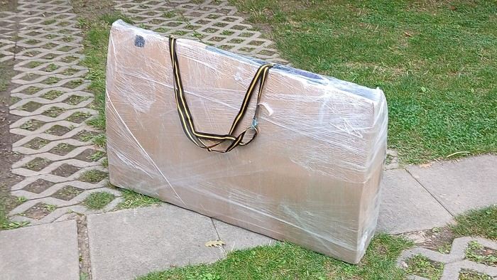
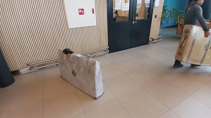
After testing it for three years across various modes of transport, I’m sharing this video of a bike packing case. It’s made from recycled cardboard and shrink-wrapped, with adjustable thickness and added bubble wrap depending on the level of protection you want.
Installing spacers at the fork and chainstays makes the packaging compact. With the fifteen-odd euros for shrink-wrapping at the airport, this case travels really well.
https://youtu.be/_GDJi-GqmkM
- Low bulk (1.10m x 0.70m x 0.25m for a large frame), it fits vertically in train luggage compartments and the total dimensions (x+y+z) don’t exceed 2.40m.
- Two carrying solutions for public transport and easy handling by airport staff (no more tears in the cardboard from openings).
- Discreet packaging when dealing with bus drivers and train conductors, as it looks like an ordinary parcel.
- No need to return to the starting point to retrieve the case from your outbound trip, which you’d otherwise have to store somewhere, or deal with a bulky cover to pack in your panniers.
- You can still check tire pressure through the plastic film without damaging the packaging too much.
Drawbacks: Around 3 hours for this lengthy and meticulous process—removing the wheels, pedals, handlebars, and derailleur without misaligning them, then securing all components to the frame.
If you get a chance to test it, send me your feedback for future improvements.
I just took a trip in Tunisia from Tozeur to Douz, skirting Chott el Jerid to the south. I’m back with the urge to keep going further south via the 4x4 tracks to connect Douz to Ksar Ghilane. Has anyone driven this route recently or explored southern Tunisia?
Thanks for your tips!
fix
😎Fellow traveling cyclists or not, all of you who love travel, the pleasure of physical effort, nature, beautiful machines, people with true passions they seek to fulfill, and who also enjoy reading great literature about all this—the *200* magazine is for you just as it is for me. I should mention I have no financial or other interest in this (in an era where we accuse our politicians of all sorts of vile interests, I prefer to take precautions). I’ve been subscribed since the beginning, and every three months, I get my 130 pages of dreams (the magazine just went from 110 to 130 pages).
It covers everything from the trans-America route to the TCR (Trans Continental Race) from Belgium to a small town in Turkey, with mind-blowing averages—4,000 km and 80,000 m of elevation gain in 8 days and 15 hours for the winner. Let that sink in, and all of it without assistance—accepting a patch could penalize you. There’s also a story about crossing Iran, encountering one of the world’s most welcoming populations, following in the footsteps of Nicolas Bouvier, as well as retirees leisurely traversing France. The common thread in all these stories? Beautiful writing. Take, for example, a stunning article: *"Passengers of the Cold: From Edinburgh to Thurso, at the very north of Scotland, 550 km of moors, coasts, and icy wind. In Thurso, the road ends at a quay, facing the Orkney Islands. We wanted a November trip, off-season. We wanted to surprise winter. Just before the snow."* A sublime piece on the experience of facing adversity and the chance encounters along the road and in the elements.
Before I embarked on my own bike trips, I dreamed a lot about them—from the Atacama to the Gobi, along the Mekong, and not forgetting France. And now, these 130 pages every quarter keep those dreamy vibes alive through stories written in the most beautiful prose.
I’ll stop here because it might sound like I’m advertising, but if you don’t know *200*, I invite you to discover it. It’ll give you wings for the most incredible challenges or simply reinforce your desire for slow rides with your eyes open to others and nature.
A little news to wrap up: Axel Carion and a friend just broke the record for crossing South America from Colombia to Ushuaia in 59 days. On its own, that doesn’t mean much, but I can’t help it—it makes me dream. You should see how he talks about it, the flashes of that wild nature he’s stored away: a snowstorm at Paso Jama and the surreal sight of the suddenly snow-covered Licancabur!
Luc
PS: The magazine is called *200* because a day’s ride starts at 200 km—well, I’ve never done a ride like that since my longest was 167 km (with 18 kg of luggage, mind you), but why not one day? The magazine will explain how to tackle your first 200, and then the question in conclusion: when will you do your first 300?😏
I’ve got my flight ticket sorted—departing in mid-November and returning in mid-March. I’ll arrive in Santiago and leave from Buenos Aires.
I’ve already been to southern Argentina, specifically Torres del Paine National Park, and I’d love to go back to do the full W trek (I only did the shorter version last time).
I also want to do some hiking and maybe even tackle a summit. I climb and occasionally do some mountaineering, so I’ll definitely be going with a guide.
I plan to start around Temuco in Chile, with the idea of heading toward the lakes, then taking the Carretera Austral.
I’m not sure if I’ll go all the way to Ushuaia—it’s supposed to not be *that* worth it, except for the bragging rights of saying you’ve been to the end of the world.
I saw there are lakes in Argentina too.
I don’t have a precise itinerary, but what I’d love is, once I reach the southernmost point of my trip, to take a mini-cruise to see some wildlife. Any tips for that?
What kind of sleeping bag did you take? Is a 0°C (32°F) one enough?
And one last question: white gas stove or can I get by with my gas stove?
I'm developing a free and open-source web app for planning walking and cycling trips (and even car trips). You can create a route by clicking directly on the map to add waypoints, and it can consist of multiple stages. The app provides tools to edit the stages and the overall route, and to display useful information (distances, altitudes, and elevation changes). A relief profile can be shown as a graph for a specific stage or the entire route.
Once the route is ready, it can be exported as a GPX file, which can then be used with a GPS or a mobile navigation app.
The app is built in JavaScript and runs entirely in the web browser. It uses the Leaflet library and several OpenStreetMap-based services. Initially developed for my personal needs (I enjoy hiking and cycle touring), I’d be happy to share it with anyone who might find it useful. It’s free to use, doesn’t require an account, and the source code is available.
hello fellow cycling enthusiasts
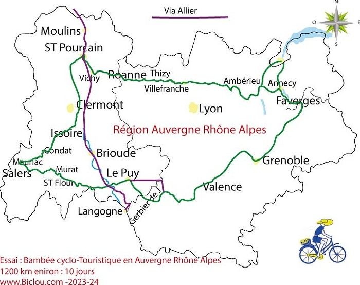
here’s a travel journal of the cycling tour through the Rhône-Alpes Auvergne region by Claudio
zouli
it was the plan
http://cbandiera.free.fr/parcours/auvergne-Ralpes/
the trip was completed
story being posted online soon
1100 km in 11 days
beautiful and varied regions
Hello,
We’d like to go on a 3- to 4-month bike trip starting in December, crossing from Assam (northeast India) to New Delhi via Nepal.
Are there routes with light traffic along the Brahmaputra and through Nepal?
We’re also looking for any info on accommodations, wild camping, local interactions, etc.
Thanks,
Michel
I’m planning to cycle from Morlaix to Brest (via Roscoff and the V45 coastal route). We’ll start riding on August 16th for 13 days (with stops for island visits, surfing, etc.). Is there a lot of traffic at this time of year? I’ve got two kids, 11 and 13, and we don’t like riding in the middle of cars (we’ve already done the Vélomaritime—Caen to Cherbourg—the Loire route from Orléans to Saumur, the Vélodyssée from Nantes to Royans, and the canals like the Nivernais and Bourgogne, where there were plenty of bike-only lanes, which isn’t the case on this route).
Thanks for your help if you’ve already done this route in late August!
Virginie
Hi there,
I’ve been road cycling for several years, and I’m about to switch to gravel in the next few days—I’m waiting for my bike, which should arrive this week.
I’m planning a bikepacking trip in a few weeks along the Véloroute V81, also known as the Vélosud, from Biarritz to Le Barcarès.
Has anyone here already done this route? Any info is welcome, whether it’s about the route itself, gear, or accommodation. I’ll prioritize staying with locals as much as possible. On that note, I just signed up for the brand-new site *Guidon et Couette* ((www.guidon-et-couette.fr)), which offers free accommodation between cyclists across the country, but there’s almost no one listed along my route!
Thanks in advance.
Laurent.
Hi there, I’m planning a cross-Canada bike trip, and I’ve got a question that might seem silly, but could someone tell me how to pack a bike (in a box, with a fragile sticker... I don’t know) for a flight? Thanks in advance!
This summer, we’re planning to cycle along the EV 19 that follows the Meuse River from Langres all the way to Rotterdam.
My question is about getting back to Nantes.
Do any of you know what the best return option might be? I’d love to hear about your experiences.
I saw that FlixBus doesn’t take bikes.
By train, I think it’s possible but would involve multiple local trains.
We were also wondering if there’s a boat from Rotterdam to Saint-Nazaire that could take passengers with bikes.
Any tips or experiences you can share would be really helpful—thanks in advance!
Have a great evening
I’ve gotten used to crossing Europe by bus to return by bike.
It was really convenient to take the bike without having to disassemble it.
But FlixBus no longer accepts bikes...
What alternatives do you know about?
Thanks.
Hi there,
I’m planning to ride the Dutch section of the EuroVelo 19, from Maastricht to Rotterdam.
Since it’s too complicated to bring my bike on the train, I’m looking to rent one locally.
I’d love any tips or bike rental shop recommendations—I’m struggling to find options even in Rotterdam.
The plan is to rent in Rotterdam, take the train to Maastricht with the bike, then cycle back to Rotterdam.
Thanks in advance for any advice or suggestions!
Nath
I’m planning to build a new touring bike.
I want to prioritize lightness.
That said, I’m tempted by a suspension fork that could offer some comfort on rougher roads.
The recent appearance of gravel suspension forks on the market might meet my needs—at least on paper.
I’m particularly considering the RockShox Rudy Ultimate XPLR fork.
Unlike MTB forks, its travel is short: either 30 mm or 40 mm.
It weighs 1400 g, which is 400/500 g more than a steel fork.
Any thoughts or real-world feedback on this?
I’m also wondering about the durability of magnesium (lower leg) for long-distance bike touring.
And what’s the impact of skipping the manufacturer-recommended maintenance every 50 and 200 hours? That’s bound to happen on a long trip unless you carry extra gear.
More generally, how reliable are these kinds of forks?
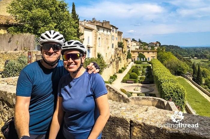
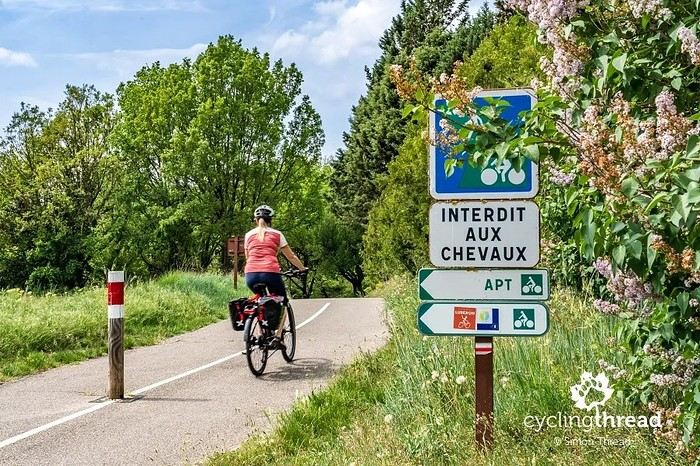
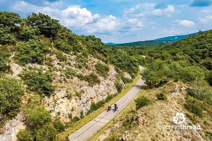
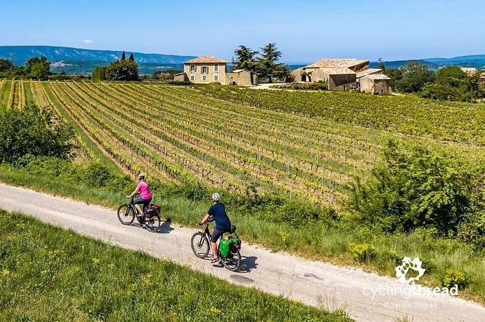
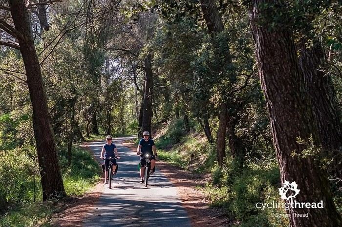
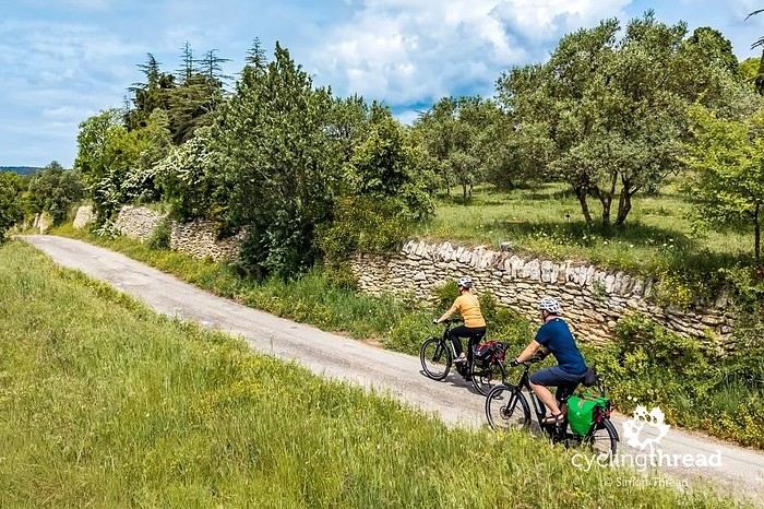
I’m making an exception and creating a separate post this time, since it’s all about France. In May, we spent a week in Provence, specifically in the Luberon, exploring the cycling routes *Autour du Luberon à Vélo*, the *Véloroute du Calavon* (part of EuroVelo 8), and the shorter *Les Ocres à Vélo* route. Together, they gave us an amazing journey through rolling hills, vineyards, lavender fields still green in spring, and some of the most stunning landscapes in southern France.
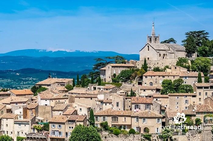
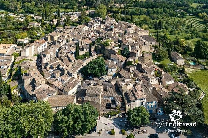
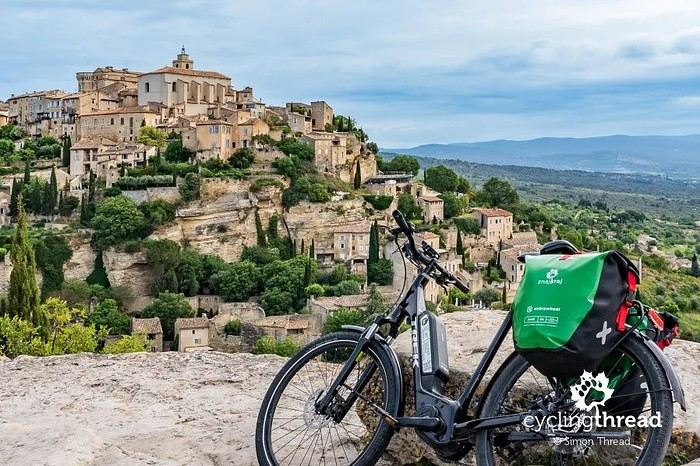
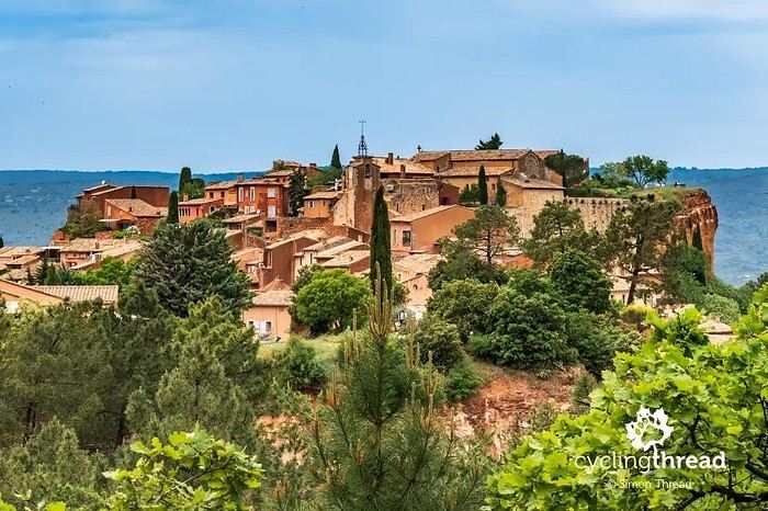
It was, of course, the perched villages that impressed us the most. We visited Gordes, Roussillon, Bonnieux, Lacoste, Lourmarin, Ménerbes, Oppède-le-Vieux, Cucuron, and Lauris. Many of them are among the most beautiful villages in Provence, and it’s hard not to agree with that reputation.
One interesting point is the route of EuroVelo 8 in this part of the region. The official path mainly follows the old railway line of the *Véloroute du Calavon*, which is very comfortable and safe. But in our opinion, cyclists traveling EuroVelo 8 around the Mediterranean would discover even more treasures if the route passed through villages like Bonnieux, Lacoste, or Oppède-le-Vieux.
We were also pleasantly surprised by how safe cycling felt. Most of the route takes small local roads, but traffic is light, drivers are respectful, and road design really takes cyclists into account. It’s one of those places where you can ride peacefully even without separated bike lanes.
Our full story:
Around Luberon by bicycle - the most beautiful villages of Provence
You can also find all our cycling travel stories on the forum:
Cycling Thread - Europe’s most beautiful bike routes
Hi there, we’re a group of 4 cyclists looking to get from Treviso in Italy to Munich with our 4 non-folding bikes. It seems complicated! Are there any solutions? Thanks so much.