Hi everyone,
I’m posting this as a not-so-pleasant experience, but one I think is important to share.
We stayed at MMV Arêches-Beaufort at the end of June 2025 (from the 21st to the 28th), in room 317, as a family with our young daughter.
Everything was fine until the night of June 25th to 26th, when we discovered a bed bug infestation right next to our bedhead.
We’d already slept 4 nights in that infested room without noticing anything. Needless to say, the shock was huge, especially with a little one.
MMV offered to relocate us, but by that point, trust was completely broken. The rest of the stay was spent in constant stress: disinfecting, isolating our belongings, and worrying about bringing these pests home with us.
They refunded our stay (which was the least they could do), but they’d also promised compensation of 150 €, which was never paid. Since then, no news at all.
We felt erased, ignored, and not taken seriously.
I’m sharing this not to stir up controversy, but to warn other travelers.
We thought we were staying in a reliable residence with responsive customer service—it wasn’t the case.
I’m genuinely wondering:
Am I an isolated case with MMV?
Have others experienced similar situations (bed bugs or a lack of consideration when problems arise)?
Thanks to those who take the time to read this.
And above all, be wary when everything seems "too good on paper."
27 similar discussions in English
Hi,
On September 1st, we're heading to Kalimantan for six weeks, probably from Pontianak to the Derawan Islands.
I've scoured this site, which is usually my go-to 😉, and others like VoyageForum, but recent info is pretty scarce.
I'd love any tips on places you've visited—our itinerary is still a work in progress.
We're two couples traveling with backpacks, using buses, boats, guesthouses, and homestays.
Thanks in advance!
Hi there,
I’m planning a 6-day trip from Orléans to Tours.
There are very few detailed maps to figure out the main stages and what you’ll find along the way. Even though I’ve downloaded the Miam Miam Dodo app, it’s pretty tedious (everything is split into small map sections).
I’ve settled on the first leg: Orléans to Meung-sur-Loire, about 18 km. For the next one, I’m hesitating because I’d like to do around 20–25 km, but I see Beaugency is only about 10 km away, and Mer is almost 30 km. So, I’m stuck.
On top of that, I’m torn between taking the GR 3 route or the GR 655 (south).
If any of you know the area or have already done this hike/pilgrimage, I’d love to hear your tips for this section that goes through Blois and ends in Tours.
For the last legs, I’ve planned Blois -> ? Chaumont (no accommodations) -> Amboise -> Tours, knowing the final stage is about 30 km.
Thanks in advance for your help! 😉
Thanks in advance for your help! 😉
Hi there,
I’m heading back to Thailand soon, and from what I’ve been reading, it seems some beaches/islands are infested with these dreaded sandflies!
I’ve noted the remedy: rub the bitten area with 90% alcohol, then apply soothing cream.
But prevention is better than cure!
Which areas should I avoid right now?
Are there seasons that are more prone to these itchy invasions than others?
I’ve already stayed in Hua Hin, Koh Samui, Koh Phangan, Koh Tao, Krabi, and Phuket without any issues like this.
I’d love to keep it that way...
Thanks
In early March, full of carefree joy and happy to return to Morocco, we landed in Marrakech under the sun.
We spent just one night in Marrakech at the Hôtel Toulousain, as we did on our previous trip. And we booked our 3 nights for the end of our trip, the second half of March... Ouch! Ouch! Ouch! But we’re not there yet...
Our first goal is to reach Magdaz, a mountain village in the Tessaout Valley, sometimes called the lost valley. We discovered the village of Magdaz on this forum, and we were charmed by the photos and comments from travelers who came before us. The road is easy—it’s dry, and the tarmac takes us right to the village gates at over 2,000 meters above sea level. We arrive in the afternoon and are left speechless by the beauty of the place. A jewel of Berber architecture! Perfectly restored granaries and kasbahs!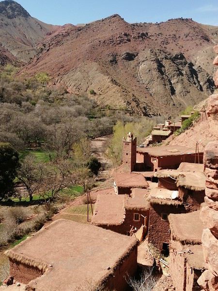
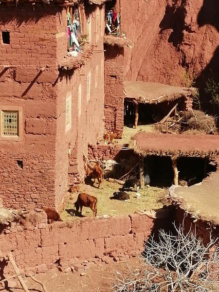
A young man from the village guides us on the visit and opens the doors to the terraces overlooking the village.
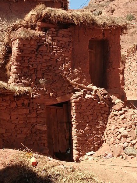 Several magnificent collective granaries have been beautifully restored. The warm colors of the stone capture the light wonderfully. It’s stunning!
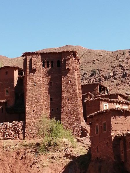
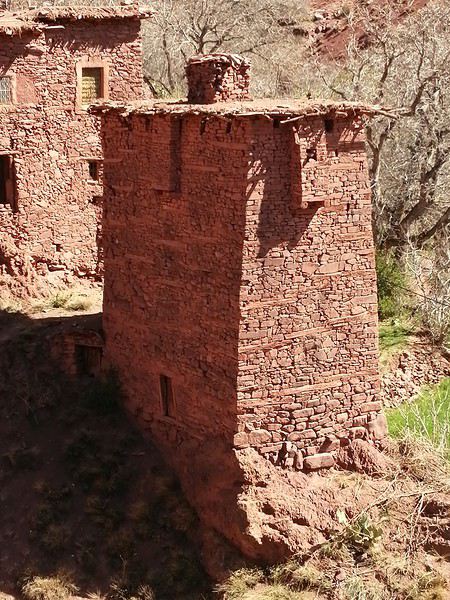
We won’t find anything decent to stay overnight there, so we head back down a bit and settle in at the Assounfou guesthouse. Lovely welcome. The place is in excellent condition and very clean. It’s spacious, but we’re the only ones there. First day full of promise!
Our first goal is to reach Magdaz, a mountain village in the Tessaout Valley, sometimes called the lost valley. We discovered the village of Magdaz on this forum, and we were charmed by the photos and comments from travelers who came before us. The road is easy—it’s dry, and the tarmac takes us right to the village gates at over 2,000 meters above sea level. We arrive in the afternoon and are left speechless by the beauty of the place. A jewel of Berber architecture! Perfectly restored granaries and kasbahs!
A young man from the village guides us on the visit and opens the doors to the terraces overlooking the village.
Several magnificent collective granaries have been beautifully restored. The warm colors of the stone capture the light wonderfully. It’s stunning!
We won’t find anything decent to stay overnight there, so we head back down a bit and settle in at the Assounfou guesthouse. Lovely welcome. The place is in excellent condition and very clean. It’s spacious, but we’re the only ones there. First day full of promise!
Hi,
I’ve read that trains in India are packed and it’s pretty tough to find seats 2-3 days in advance... Apparently, there’s still a small tourist quota for available seats, but they’re limited. Would anyone have more specific info on this?
I’ve read that trains in India are packed and it’s pretty tough to find seats 2-3 days in advance... Apparently, there’s still a small tourist quota for available seats, but they’re limited. Would anyone have more specific info on this?
Hi everyone,
I’m sharing a little recap of this new 4-week trip to China—nothing fancy, just my experience.
We’re taking advantage of the extended visa exemption to return to China for the 4th time. I loved last summer’s trip so much that I’m a bit worried about being disappointed this year. Plus, I’ve had a few hiccups before this departure: my WeChat account got blocked, and I couldn’t recover it (luckily, Alipay still works fine); I couldn’t verify my 12306 account for weeks; Trip.com failed to book our second train; and I’ve got an injury that’ll slow me down during the trip... Ugh, I hate starting a trip with these kinds of issues. Then, oh surprise! Just before leaving, my 12306 account got verified! Super easy to use from that point on—I could book a few train tickets without fees.
We’re sticking with Free’s e-SIMs, which work great in China.
August 2–3
Anyway, on the morning of August 2nd, we took the RER to CDG. As usual, we couldn’t check in online. It’s always a bit frustrating, especially since we didn’t have any checked luggage. We flew with Air China. We arrived at the check-in counter at 9:50 AM, 2 hours and 40 minutes before the flight. The line for our check-in stretched 300 meters across the airport in both directions. What a joke!! We spent 1 hour and 45 minutes in that line just to reach the counter and get our boarding passes. By then, it was 11:35 AM, and boarding had already started at 11:20 AM. The screens showed a 25-minute walk to our gate—on the other side of the airport, of course—plus we had to go through passport control and security... Long story short, the plane didn’t leave without us 🙂 We boarded among the last passengers, and we took off at 12:30 PM. We’d flown Air China four times before, but this time, it felt *really* low-cost. The check-in chaos, the cramped seats (12 seats per row), no music by artists known outside China, mediocre food, and a boarding area at Beijing Airport with only 10 seats—worthy of Ryanair or EasyJet. And yet, the price was sky-high. Again, D.’s vacation requests were denied outside of July and August, so we’re traveling from August 2nd to 30th. We couldn’t have picked a worse time for inflated prices, and with the situation in Iran, we got hit with a 390 € fuel surcharge. I’ve never paid so much for flights—I felt like I’d bought business class, but nope, far from it!!
We landed in Beijing around 4:15 AM. It was 28°C with thick fog. We drove and drove and drove for 20 minutes, as usual in Beijing. Then we went through a first check, a second check, a third check, and waited for our connecting flight at 6:40 AM. A small Airbus A320, but way more space than in the Boeing 777 from the first flight. We landed in Kunming, Yunnan, around 10:15 AM in the rain.
We headed to the subway. You can’t pay at the machines with Alipay here either, so we set up the transport QR code directly in Alipay to scan at the subway gates. The process is a bit long the first time if you haven’t entered your info before, but once it’s done, it’s *so* much easier! We took Line 6 to the terminus for 6 yuan each.
We’d booked a hotel nearby, on the 16th floor. It’s actually studios on different floors of a huge residential building. The view’s pretty nice from here. We settled in quickly—back to those wooden beds, or rather, mattresses as hard as wood, which we *hadn’t* missed... Then we went out for our first bowl of noodles of the trip and wandered through the shopping streets of the old town.
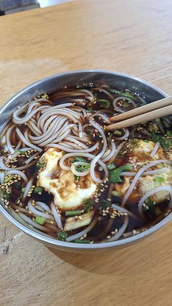
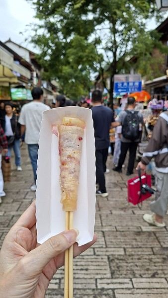
It was crowded, and the weather was cool—around 19–20°C. We tried a local specialty: milk skin, thick, dried, then grilled with rose jam. Yeah... we won’t be having that again. The taste and texture of the milk skin... no thanks.
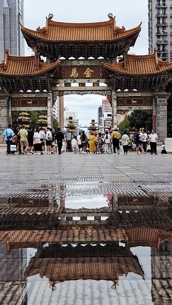
We saw a lot of wild mushroom hotpot too. It’s on our list for later. We also passed through the Jinma and Biji gates, where I played with reflections in puddles. I *love* doing that 🙂
At the end of the day, we headed to a temple advertised as open 24/7 on Amap. Of course, when we got there, it was closed. We’ll go back tomorrow. That was the first of many disappointments with Amap this trip—I hadn’t had that issue on previous visits.
We were exhausted after that sleepless flight. Night was falling, and we decided to grab a quick bite without much appetite. We shared a delicious vegetable fried rice for 12 yuan—we even left half of it. The portions are *huge*.
After a couple of small purchases, we headed back at 9 PM, wiped out, after walking 17 km between the airports and these first steps in Kunming. I expected to see quite a few Western travelers here, but we didn’t spot a single one. Instead, we met lots of curious Chinese people, many of them super friendly and helpful—almost *too* eager, like when they’d run to serve us as fast as possible. It’s a bit much, but it’s great to be back!
I’m sharing a little recap of this new 4-week trip to China—nothing fancy, just my experience.
We’re taking advantage of the extended visa exemption to return to China for the 4th time. I loved last summer’s trip so much that I’m a bit worried about being disappointed this year. Plus, I’ve had a few hiccups before this departure: my WeChat account got blocked, and I couldn’t recover it (luckily, Alipay still works fine); I couldn’t verify my 12306 account for weeks; Trip.com failed to book our second train; and I’ve got an injury that’ll slow me down during the trip... Ugh, I hate starting a trip with these kinds of issues. Then, oh surprise! Just before leaving, my 12306 account got verified! Super easy to use from that point on—I could book a few train tickets without fees.
We’re sticking with Free’s e-SIMs, which work great in China.
August 2–3
Anyway, on the morning of August 2nd, we took the RER to CDG. As usual, we couldn’t check in online. It’s always a bit frustrating, especially since we didn’t have any checked luggage. We flew with Air China. We arrived at the check-in counter at 9:50 AM, 2 hours and 40 minutes before the flight. The line for our check-in stretched 300 meters across the airport in both directions. What a joke!! We spent 1 hour and 45 minutes in that line just to reach the counter and get our boarding passes. By then, it was 11:35 AM, and boarding had already started at 11:20 AM. The screens showed a 25-minute walk to our gate—on the other side of the airport, of course—plus we had to go through passport control and security... Long story short, the plane didn’t leave without us 🙂 We boarded among the last passengers, and we took off at 12:30 PM. We’d flown Air China four times before, but this time, it felt *really* low-cost. The check-in chaos, the cramped seats (12 seats per row), no music by artists known outside China, mediocre food, and a boarding area at Beijing Airport with only 10 seats—worthy of Ryanair or EasyJet. And yet, the price was sky-high. Again, D.’s vacation requests were denied outside of July and August, so we’re traveling from August 2nd to 30th. We couldn’t have picked a worse time for inflated prices, and with the situation in Iran, we got hit with a 390 € fuel surcharge. I’ve never paid so much for flights—I felt like I’d bought business class, but nope, far from it!!
We landed in Beijing around 4:15 AM. It was 28°C with thick fog. We drove and drove and drove for 20 minutes, as usual in Beijing. Then we went through a first check, a second check, a third check, and waited for our connecting flight at 6:40 AM. A small Airbus A320, but way more space than in the Boeing 777 from the first flight. We landed in Kunming, Yunnan, around 10:15 AM in the rain.
We headed to the subway. You can’t pay at the machines with Alipay here either, so we set up the transport QR code directly in Alipay to scan at the subway gates. The process is a bit long the first time if you haven’t entered your info before, but once it’s done, it’s *so* much easier! We took Line 6 to the terminus for 6 yuan each.
We’d booked a hotel nearby, on the 16th floor. It’s actually studios on different floors of a huge residential building. The view’s pretty nice from here. We settled in quickly—back to those wooden beds, or rather, mattresses as hard as wood, which we *hadn’t* missed... Then we went out for our first bowl of noodles of the trip and wandered through the shopping streets of the old town.
It was crowded, and the weather was cool—around 19–20°C. We tried a local specialty: milk skin, thick, dried, then grilled with rose jam. Yeah... we won’t be having that again. The taste and texture of the milk skin... no thanks.
We saw a lot of wild mushroom hotpot too. It’s on our list for later. We also passed through the Jinma and Biji gates, where I played with reflections in puddles. I *love* doing that 🙂
At the end of the day, we headed to a temple advertised as open 24/7 on Amap. Of course, when we got there, it was closed. We’ll go back tomorrow. That was the first of many disappointments with Amap this trip—I hadn’t had that issue on previous visits.
We were exhausted after that sleepless flight. Night was falling, and we decided to grab a quick bite without much appetite. We shared a delicious vegetable fried rice for 12 yuan—we even left half of it. The portions are *huge*.
After a couple of small purchases, we headed back at 9 PM, wiped out, after walking 17 km between the airports and these first steps in Kunming. I expected to see quite a few Western travelers here, but we didn’t spot a single one. Instead, we met lots of curious Chinese people, many of them super friendly and helpful—almost *too* eager, like when they’d run to serve us as fast as possible. It’s a bit much, but it’s great to be back!
Hi everyone,
we’re a couple in our thirties and we’ve decided to visit northwest Vietnam with AmicaTravel for their "meet-up in Lolo Land" circuit. I’m currently looking at the itinerary with the Lonely Planet and reading the many posts on this site, especially Lansay’s, which are really inspiring. Here are the stages of the circuit:
Day 1: Hanoi – arrival
Day 2: Hanoi visit
Day 3: Hanoi – Thac Ba
Day 4: Thac Ba – Luc Yen – Ha Giang
Day 5: Ha Giang – Dong Van
Day 6: Dong Van – Meo Vac – Bao Lac
Day 7: Bao Lac – Ba Be Lake
Day 8: Ba Be visit
Day 9: Ba Be – Cao Bang
Day 10: Cao Bang – Ban Gioc – Cao Bang
Day 11: Cao Bang – Lang Son
Day 12: Lang Son – Halong Bay
Day 13: Halong Bay – Hanoi
Day 14: Hanoi – departure
Otherwise, the period would be from April 21, 2012, to May 5, 2012, but this could vary by a day or two if it’s worth it. I haven’t made the reservation yet because I’m trying to find out if all the stages of the circuit are interesting (thanks to this forum). We’d like to stay with locals as much as possible and maybe spend an extra day in one region to avoid just "passing through"—settle in a bit. We’d also like to do some trekking, and I read in Lansay’s posts that Bac Ha would be a good option for that (this stage isn’t included in the initial circuit), unless other stages of the circuit are just as good for trekking.
Finally, regarding the last stage in Halong Bay, what’s the best way to explore it? It seems very crowded (and I don’t know if the junk boat included in the circuit is designed for a small group or very large groups, which we’d prefer to avoid if possible). I read a post here that I can’t find anymore about a couple who did a stage with a small stay on an island or something like that—it sounded paradise-like.
Generally, we’d like to avoid running into too many tourists (yes, I know it’s a bit paradoxical), but it’s mainly to encourage encounters with locals and maybe with a small group of travelers. If others want to do this circuit, why not... but we’re hoping to travel in a very small group (maximum 6 people).
Otherwise, for the flight, I was thinking of booking with Vietnam Airlines—is that a good choice? Thanks in advance for your great tips.
Vrrrrrm, vrmmmm! (phone on vibrate)
"Hi Mamido, it's Clémence." Clémence, 5 years old, is a giggly, cheerful little girl and the queen of mischief.
"Mom says we're coming to your place until the holidays because we're on vacation tonight."
"Yes, I know. She asked me—do you know why?" "Because of the croronavirus." "And do you know what that is?"
"Oh yeah, at school Théo told me it's like a louse that doesn't itch, that doesn't get in your head but in your lungs, that it's all round with red bumps like raspberries, and that it makes old people die."
"Your friend knows a lot of things."
"His dad showed him a microscope picture, and you—are you old?" "What do you think?" "Well, yeah, but only a little because you always leave on your motorcycle to travel. Are you going traveling?"
"No, because you're coming with your brother and sister."
"Can we go to the little bridge to look for frog eggs? You remember, there were some last year, and we'll make them grow and put the baby frogs in the washhouse, and we'll also make boats to put in the stream so they can go to the sea." "That's a great idea." "And you'll make me the model in print letters so I can write which country my boat is going to." "Where do you want your boat to go?" "To the land of pandas—is it far?" "Oh yes, very far." "Then we have to make the boat strong so it doesn't sink." "Promise, we'll have so much fun." "Mom says in some countries they wear masks. Do you still have the chicken, rabbit, and pig masks in the attic? Can we wear them like that?"
"You know, here there are only trees, birds, and fields—we'll do whatever we want."
"Mom's calling me."
Click, she hangs up, and I laugh.
Hey there, community! Back this weekend, below is my travel journal from my adventure in Indonesia. Enjoy the read!!!
Day 1 - August 10, 2025 New life downloading for three weeks! And for that, Flo and I launched a public tender... A public tender? What’s that got to do with a travel journal???... Well, when you think about it, few destinations tick all the boxes for an August adventure: Meaning, finding a place that’s exotic in the middle of August, not too expensive, not too packed with tourists, warm but not *too* warm, with postcard-perfect landscapes, dreamy beaches, tasty cuisine with a hint of exoticism, friendly and welcoming locals, where you’re free to sleep under the stars among the mosquitos, take transport surrounded by chickens, and even eat from a pig trough if you feel like it—well, turns out it’s not that easy to find! I’d even say, given how thick the list of requirements is, there’s a big risk the tender could be declared unsuccessful for failing to meet just one criterion. Let’s just say the candidates better submit a rock-solid proposal!
After reviewing all the responses and presentations from the candidates, the obvious choice for us is... Indonesia! Except that trying to explore a country as vast as Indonesia and its 17,504 islands in less than five years is a bit like reading the summary of a Proust novel without taking the time to savor each of its 950 pages! Don’t worry, I won’t name them all here. Besides, do they even all have names? No! Only 7,870 have been named—their parents clearly ran out of ideas for the rest. Anyway, our society, which worships the "work more to earn more" mantra, unfortunately limits our adventure time. So we’ll only get to see a small part of Indonesia, and we’ll have to make a tough choice to head for the best of the best in this archipelago of over seventeen thousand islands. Each one has its own selling points: Sumatra, Sulawesi, Java, the Celebes, Bali, Borneo, Papua, Timor, the Moluccas... So many names that smell of adventure... Another tender, another list of requirements, another review of proposals... Drumroll... Splash splash... And the lucky winner is... Ta-da... Java, Bali’s big sister, where I’ve already been eight years ago... Java the programming language. The Java of Broadway. We’re gonna *do* the Java. Java the coffee. And yes, Java is also an island!
This island, four times smaller than France, is home to 136 million people, making it the most populated island in the world! Fun fact: Indonesia, with its 260 million inhabitants, is just shy of the podium for the world’s most populated countries, after the winning trio of India, China, and the United States. And it’s on this island of Java that you’ll find Jakarta, the (soon-to-be-former) capital and main airport of the country, where we’ll soon land after our nineteen-hour flight! Yep, nineteen hours! I mean, Indonesia in general—and Java in particular—is a *tad* farther than going on vacation to Grandma Yoyo’s! Not sure where it is? Easy. Grab a map. Plant your finger on the big island at the bottom right—aka Australia for those who struggle with geography—move it up two centimeters, and bam, welcome to Indonesia!
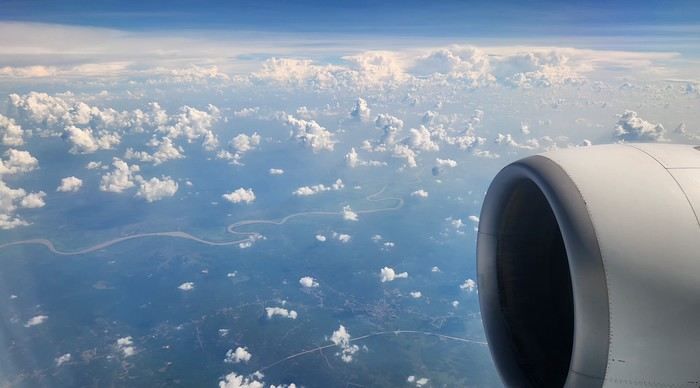
Nice transition, right? Because "Welcome to Indonesia" is exactly what the friendly flight attendant just said to me as we got off the plane! That’s it, our chakras are open, we’ve arrived at our (air)port. Time for rest, pool, cocktails, and a beach with our toes spread out... Wait, if you bought that, you clearly don’t know us yet! Since we still have energy to burn and need to adjust to the flight and time difference, we tackle the long administrative formalities to enter Indonesia, just to earn the right to hop in a 45-minute Grab taxi to the train station. The train station? What train station?... What do you usually do at a train station? Take a train, of course! Off we go for a three-hour train ride to Bandung, where we’ll officially start our adventure tomorrow after our first Indonesian night...
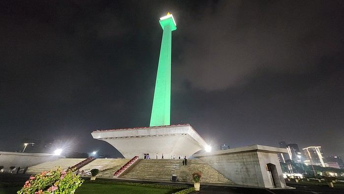
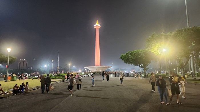
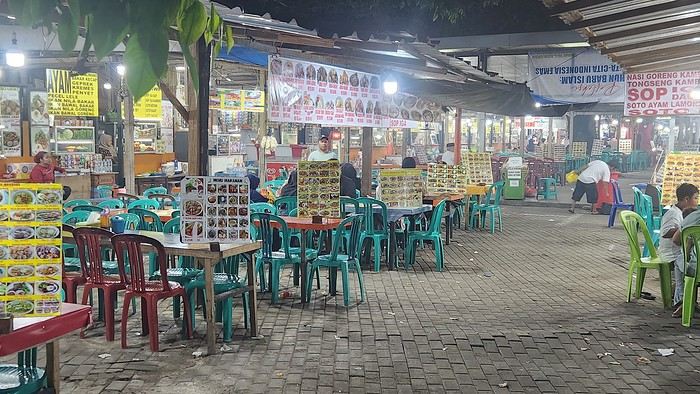
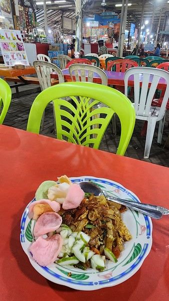
Unfortunately, we were a bit slow off the mark, which meant we missed the 6:25 PM train by two minutes. Oh well, we’ll have to wait until 11 PM. We take the opportunity to stretch our legs in Jakarta, soak up the atmosphere, and enjoy the delicious smells wafting from the *warungs*—those little typical street restaurants. A quick stop at the National Monument, a detour to a night market to devour our first *kwetiaw goreng* and *teh manis* for 60,000 rupiahs (that’s 3 € for two), and just like that, our penalty is lifted, and we’re allowed to hit the road again. Off to Bandung, where we arrive at 2 AM for... a *very* short night...
Day 1 - August 10, 2025 New life downloading for three weeks! And for that, Flo and I launched a public tender... A public tender? What’s that got to do with a travel journal???... Well, when you think about it, few destinations tick all the boxes for an August adventure: Meaning, finding a place that’s exotic in the middle of August, not too expensive, not too packed with tourists, warm but not *too* warm, with postcard-perfect landscapes, dreamy beaches, tasty cuisine with a hint of exoticism, friendly and welcoming locals, where you’re free to sleep under the stars among the mosquitos, take transport surrounded by chickens, and even eat from a pig trough if you feel like it—well, turns out it’s not that easy to find! I’d even say, given how thick the list of requirements is, there’s a big risk the tender could be declared unsuccessful for failing to meet just one criterion. Let’s just say the candidates better submit a rock-solid proposal!
After reviewing all the responses and presentations from the candidates, the obvious choice for us is... Indonesia! Except that trying to explore a country as vast as Indonesia and its 17,504 islands in less than five years is a bit like reading the summary of a Proust novel without taking the time to savor each of its 950 pages! Don’t worry, I won’t name them all here. Besides, do they even all have names? No! Only 7,870 have been named—their parents clearly ran out of ideas for the rest. Anyway, our society, which worships the "work more to earn more" mantra, unfortunately limits our adventure time. So we’ll only get to see a small part of Indonesia, and we’ll have to make a tough choice to head for the best of the best in this archipelago of over seventeen thousand islands. Each one has its own selling points: Sumatra, Sulawesi, Java, the Celebes, Bali, Borneo, Papua, Timor, the Moluccas... So many names that smell of adventure... Another tender, another list of requirements, another review of proposals... Drumroll... Splash splash... And the lucky winner is... Ta-da... Java, Bali’s big sister, where I’ve already been eight years ago... Java the programming language. The Java of Broadway. We’re gonna *do* the Java. Java the coffee. And yes, Java is also an island!
This island, four times smaller than France, is home to 136 million people, making it the most populated island in the world! Fun fact: Indonesia, with its 260 million inhabitants, is just shy of the podium for the world’s most populated countries, after the winning trio of India, China, and the United States. And it’s on this island of Java that you’ll find Jakarta, the (soon-to-be-former) capital and main airport of the country, where we’ll soon land after our nineteen-hour flight! Yep, nineteen hours! I mean, Indonesia in general—and Java in particular—is a *tad* farther than going on vacation to Grandma Yoyo’s! Not sure where it is? Easy. Grab a map. Plant your finger on the big island at the bottom right—aka Australia for those who struggle with geography—move it up two centimeters, and bam, welcome to Indonesia!
Nice transition, right? Because "Welcome to Indonesia" is exactly what the friendly flight attendant just said to me as we got off the plane! That’s it, our chakras are open, we’ve arrived at our (air)port. Time for rest, pool, cocktails, and a beach with our toes spread out... Wait, if you bought that, you clearly don’t know us yet! Since we still have energy to burn and need to adjust to the flight and time difference, we tackle the long administrative formalities to enter Indonesia, just to earn the right to hop in a 45-minute Grab taxi to the train station. The train station? What train station?... What do you usually do at a train station? Take a train, of course! Off we go for a three-hour train ride to Bandung, where we’ll officially start our adventure tomorrow after our first Indonesian night...
Unfortunately, we were a bit slow off the mark, which meant we missed the 6:25 PM train by two minutes. Oh well, we’ll have to wait until 11 PM. We take the opportunity to stretch our legs in Jakarta, soak up the atmosphere, and enjoy the delicious smells wafting from the *warungs*—those little typical street restaurants. A quick stop at the National Monument, a detour to a night market to devour our first *kwetiaw goreng* and *teh manis* for 60,000 rupiahs (that’s 3 € for two), and just like that, our penalty is lifted, and we’re allowed to hit the road again. Off to Bandung, where we arrive at 2 AM for... a *very* short night...
Hi everyone,
The idea of traveling to Bolivia came to me after seeing Jean-François (Max68)’s photos on his website. I thought we *had* to see those stunning landscapes with the colorful lagoons for ourselves. But a self-drive trip didn’t seem doable at first. A few years ago, everyone advised against going to the South Lipez with just one car.
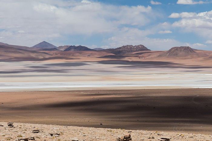 Laguna Kara
It was only after reading Laurent (Lolobe) and Pascal (Pepe874)’s travel journals—who explored the South Lipez solo with a car from Biz Rent a Car—that I thought we might be able to do the same. Meanwhile, we’d already contacted a local agency to organize a trip with a driver and guide. But the idea of a self-drive adventure really appealed to us. With encouragement and tips from Thierry (Tbernay) and Jean-François (Max68), we decided to plan our own self-drive trip. I’d like to thank them for their advice—it was *super* helpful. And a big thanks to all the other forum members for the info shared during our prep!
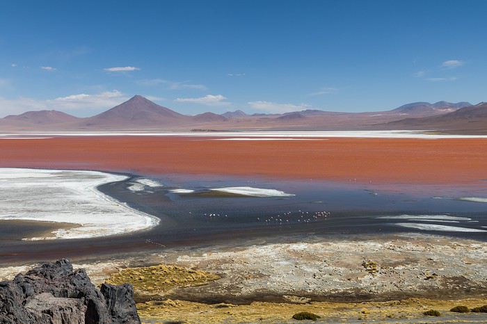 Laguna Colorada
Planning this trip happened during a tough time for our family. My mother-in-law’s illness and passing, plus a few health issues of my own, made us doubt the trip multiple times and nearly scrap the whole thing.
We booked our international flights in February with Swiss. They offered the best balance of travel time and price from Switzerland. Swiss operates Zurich–São Paulo with their own fleet, and São Paulo–Santa Cruz with GOL. In June, GOL canceled the Saturday flight and rebooked us on Sunday. Spending over 24 hours in that huge Brazilian city didn’t work for us at all, so we asked Swiss to put us on the next Zurich–São Paulo flight. Too bad—we lost a day in Bolivia and had to skip the Tarabucco market on Sunday.
Right after, we also booked the car in February. After contacting Imbex and Biz, we went with Biz. Not speaking Spanish, we were relieved to communicate with Alejandra in French. The contact was great—she answered all our questions patiently. Sometimes it took a few days to get a reply, but we could also reach her on WhatsApp. After our trip, we can *only* recommend Biz for rentals in Bolivia. The cars are well-prepped for the South Lipez tracks. The agency is reliable, and the vehicles are new and well-maintained.
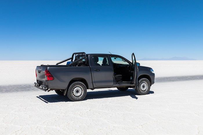 “Our” car, a Toyota Hilux
While planning, we realized the presidential elections would happen while we were in Bolivia. The risk of *bloqueos* (roadblocks and protests) was very real. But in Bolivia, *bloqueos* seem common—you always have to account for that kind of hassle. In late August/early September, Uyuni and the Salar region were blocked for days, leading to food, fuel, and cash shortages. Worried about a blockade in Uyuni and missing the Salar, we decided to visit it first *just in case*.
On election day, the whole country shut down. Planes were grounded, buses and taxis couldn’t circulate, and private cars were banned. There were a few exceptions—ambulances, police, or certain professions—but as tourists, we couldn’t get permission to drive. We asked the embassy, and Biz even requested a permit from the electoral office. So we had to plan to be somewhere with things to do *without* the car.
We decided not to book any accommodations in advance—a first for us. Usually, we plan our stops and reserve lodges, hotels, or campgrounds well ahead. This time, only the room in Sucre was booked, so we’d have a base when we arrived.
In July, Alex (Delhenry) reached out to propose joining part of the trip. He didn’t realize we were leaving in October. Still, we got fresh updates when he returned from the South Lipez. Thanks, Alex—your tips, especially about the Guadalupe–Tupiza stretch, were *super* useful.
In September, we connected with Jean-Louis (Avx) and Anne (Xeta), who were also heading to Bolivia in October, one and two weeks after us. We had dinner with Jean-Louis and his friend after our South Lipez trip and stayed in touch with Anne. It was great to chat with them! Unfortunately, Anne and her husband had a much rockier trip—they got hit hard by post-election issues.
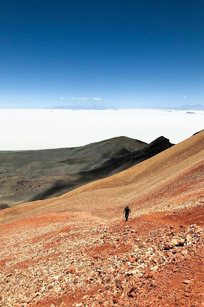 Climbing Volcán Tunupa
Our itinerary wasn’t set in stone—we decided to wing it on the spot. Two weeks before departure, I reconnected with Alejandra at Biz to move the car rental up by a day. With the elections, we wanted to leave Sucre ASAP and focus on the South Lipez. Outside Uyuni and Tupiza, the risk of blockades was zero. We also planned a two-night buffer in Sucre before our flights, just in case. It might sound overcautious, but in hindsight, we made the right call. If we’d left Sucre a day later, we wouldn’t have made it to Potosí—it was completely blocked. On the way back, we *just* dodged blockades in Potosí and elsewhere. Sometimes, you’ve gotta trust your gut.
Here’s our route—only the first two nights in Sucre were booked ahead:
D1 Departure from Switzerland
D2 Sucre (La Selenita)
D3 Sucre (La Selenita)
D4 Colchani (Hotel de Sal Luna Salada)
D5 Jirira (Auberge Doña Lupe)
D6 On the Salar (in the car)
D7 A few kilometers from Estancia Catal (in the car)
D8 Laguna Hedionda (Hotel Los Flamencos)
D9 Laguna Colorada (Lodge by the lagoon)
D10 Middle of nowhere, en route Laguna Verde–Mina Horsu–Quetena Chico (in the car)
D11 Quetena Chico (Lamphaya Lodge Andino)
D12 Quetena Chico (Lamphaya Lodge Andino)
D13 Guadalupe (Guest room at Celia’s)
D14 Along the Rio Grande (in the car)
D15 Tupiza (Hotel Mitru)
D16 Tupiza (Hotel Mitru)
D17 Sucre (La Selenita)
D18 Sucre (La Selenita)
D19 Santa Cruz (Hotel Sun)
D20 Departure from Santa Cruz
D21 Arrival in Switzerland
As you can see, we spent 13 nights in the South Lipez. Initially, we’d planned for nine, but Jean-François (Max68) suggested staying longer. Great advice—we didn’t regret it one bit. We could’ve even added 2–3 more days without getting bored.
Self-driving in the South Lipez takes some prep and a good GPS. We kept it simple and used maps.me to navigate. It’s a solid app—just save your waypoints ahead of time. For some stretches, I used Google Earth to visualize the tracks and sites. If you stick to the tour operator routes, you *almost* can’t get lost. But we often veered off the beaten path and took different routes. Some days, we didn’t see another car. So in case of a breakdown, it’s key to have water and food for several days. In some spots, there’s *zero* signal—your phone won’t work. Another must: it gets *cold* in the South Lipez, and a good sleeping bag is essential. We brought down sleeping bags rated for -10°C and didn’t regret it during our car nights.
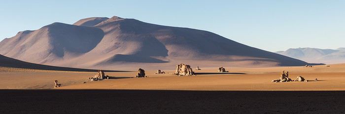 The Dalí Desert
Some tracks are *super* rocky—flat tires are a real risk. On those stretches, maps.me’s estimated travel time was way off. Some sections barely let us go over 15 km/h.
Lots of forum members recommend doing the South Lipez “loop” from Tupiza to Uyuni—ending with the Salar—to avoid Uyuni’s crowds. That might work for organized tours, but for self-drive, the direction *doesn’t* matter. I’ll say this: the few vehicles we saw mostly came from Tupiza and Chile, not Uyuni. So if starting from Uyuni works better for you, go for it! Ending in Tupiza means heading toward warmer weather. For our planned stops and climbs, starting in Uyuni helped with acclimatization. Spending a few nights between 3,600–3,800 m before going over 4,000 m is a smart move.
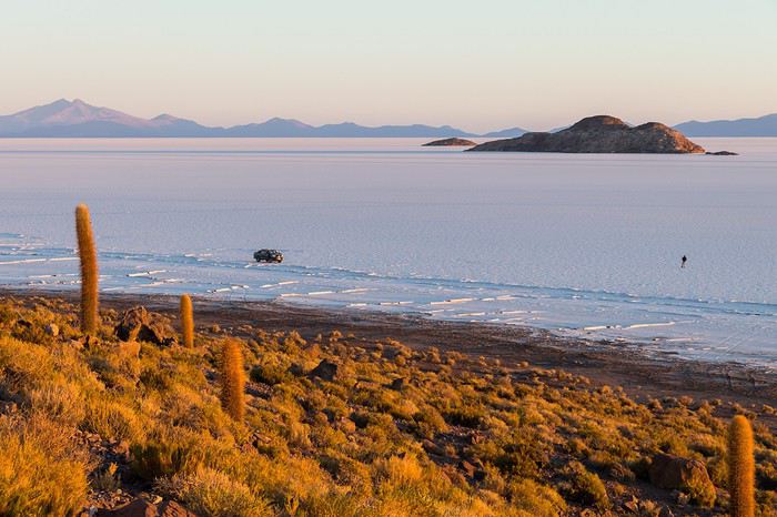 Uyuni Salt Flats in the morning
Overall, we barely saw anyone—except at Laguna Hedionda and Chalviri. There were several tour groups at Hotel Los Flamencos (Laguna Hedionda), but we didn’t cross paths during the day. Hardly anyone on the Salar, on the roads, or at the lodges in the evenings. The *only* place that shocked us was Chalviri. We’d planned to stay there, but it was fully booked—and we counted *forty* tour jeeps on-site. This was around noon! At the Polques hot springs (Chalviri), it was *packed*—we quickly nixed the idea of a dip. Plus, the vibe wasn’t great: soaking right by the road with lodges and restaurants in the background? Meh. Still, lots of tourists love it, so it’s up to you.
For the photos, I kept the colors and mood we saw. The lagoons’ hues are often stunning, but some online photos are *way* over-edited and oversaturated. The South Lipez’s landscapes are breathtaking—no need for excessive retouching.
If you don’t want to read all the details, the start of the travel journal is here: https://voyageforum.com/v.f?post=9888761;a=9888761
The idea of traveling to Bolivia came to me after seeing Jean-François (Max68)’s photos on his website. I thought we *had* to see those stunning landscapes with the colorful lagoons for ourselves. But a self-drive trip didn’t seem doable at first. A few years ago, everyone advised against going to the South Lipez with just one car.
Laguna KaraIt was only after reading Laurent (Lolobe) and Pascal (Pepe874)’s travel journals—who explored the South Lipez solo with a car from Biz Rent a Car—that I thought we might be able to do the same. Meanwhile, we’d already contacted a local agency to organize a trip with a driver and guide. But the idea of a self-drive adventure really appealed to us. With encouragement and tips from Thierry (Tbernay) and Jean-François (Max68), we decided to plan our own self-drive trip. I’d like to thank them for their advice—it was *super* helpful. And a big thanks to all the other forum members for the info shared during our prep!
Laguna ColoradaPlanning this trip happened during a tough time for our family. My mother-in-law’s illness and passing, plus a few health issues of my own, made us doubt the trip multiple times and nearly scrap the whole thing.
We booked our international flights in February with Swiss. They offered the best balance of travel time and price from Switzerland. Swiss operates Zurich–São Paulo with their own fleet, and São Paulo–Santa Cruz with GOL. In June, GOL canceled the Saturday flight and rebooked us on Sunday. Spending over 24 hours in that huge Brazilian city didn’t work for us at all, so we asked Swiss to put us on the next Zurich–São Paulo flight. Too bad—we lost a day in Bolivia and had to skip the Tarabucco market on Sunday.
Right after, we also booked the car in February. After contacting Imbex and Biz, we went with Biz. Not speaking Spanish, we were relieved to communicate with Alejandra in French. The contact was great—she answered all our questions patiently. Sometimes it took a few days to get a reply, but we could also reach her on WhatsApp. After our trip, we can *only* recommend Biz for rentals in Bolivia. The cars are well-prepped for the South Lipez tracks. The agency is reliable, and the vehicles are new and well-maintained.
“Our” car, a Toyota HiluxWhile planning, we realized the presidential elections would happen while we were in Bolivia. The risk of *bloqueos* (roadblocks and protests) was very real. But in Bolivia, *bloqueos* seem common—you always have to account for that kind of hassle. In late August/early September, Uyuni and the Salar region were blocked for days, leading to food, fuel, and cash shortages. Worried about a blockade in Uyuni and missing the Salar, we decided to visit it first *just in case*.
On election day, the whole country shut down. Planes were grounded, buses and taxis couldn’t circulate, and private cars were banned. There were a few exceptions—ambulances, police, or certain professions—but as tourists, we couldn’t get permission to drive. We asked the embassy, and Biz even requested a permit from the electoral office. So we had to plan to be somewhere with things to do *without* the car.
We decided not to book any accommodations in advance—a first for us. Usually, we plan our stops and reserve lodges, hotels, or campgrounds well ahead. This time, only the room in Sucre was booked, so we’d have a base when we arrived.
In July, Alex (Delhenry) reached out to propose joining part of the trip. He didn’t realize we were leaving in October. Still, we got fresh updates when he returned from the South Lipez. Thanks, Alex—your tips, especially about the Guadalupe–Tupiza stretch, were *super* useful.
In September, we connected with Jean-Louis (Avx) and Anne (Xeta), who were also heading to Bolivia in October, one and two weeks after us. We had dinner with Jean-Louis and his friend after our South Lipez trip and stayed in touch with Anne. It was great to chat with them! Unfortunately, Anne and her husband had a much rockier trip—they got hit hard by post-election issues.
Climbing Volcán TunupaOur itinerary wasn’t set in stone—we decided to wing it on the spot. Two weeks before departure, I reconnected with Alejandra at Biz to move the car rental up by a day. With the elections, we wanted to leave Sucre ASAP and focus on the South Lipez. Outside Uyuni and Tupiza, the risk of blockades was zero. We also planned a two-night buffer in Sucre before our flights, just in case. It might sound overcautious, but in hindsight, we made the right call. If we’d left Sucre a day later, we wouldn’t have made it to Potosí—it was completely blocked. On the way back, we *just* dodged blockades in Potosí and elsewhere. Sometimes, you’ve gotta trust your gut.
Here’s our route—only the first two nights in Sucre were booked ahead:
D1 Departure from Switzerland
D2 Sucre (La Selenita)
D3 Sucre (La Selenita)
D4 Colchani (Hotel de Sal Luna Salada)
D5 Jirira (Auberge Doña Lupe)
D6 On the Salar (in the car)
D7 A few kilometers from Estancia Catal (in the car)
D8 Laguna Hedionda (Hotel Los Flamencos)
D9 Laguna Colorada (Lodge by the lagoon)
D10 Middle of nowhere, en route Laguna Verde–Mina Horsu–Quetena Chico (in the car)
D11 Quetena Chico (Lamphaya Lodge Andino)
D12 Quetena Chico (Lamphaya Lodge Andino)
D13 Guadalupe (Guest room at Celia’s)
D14 Along the Rio Grande (in the car)
D15 Tupiza (Hotel Mitru)
D16 Tupiza (Hotel Mitru)
D17 Sucre (La Selenita)
D18 Sucre (La Selenita)
D19 Santa Cruz (Hotel Sun)
D20 Departure from Santa Cruz
D21 Arrival in Switzerland
As you can see, we spent 13 nights in the South Lipez. Initially, we’d planned for nine, but Jean-François (Max68) suggested staying longer. Great advice—we didn’t regret it one bit. We could’ve even added 2–3 more days without getting bored.
Self-driving in the South Lipez takes some prep and a good GPS. We kept it simple and used maps.me to navigate. It’s a solid app—just save your waypoints ahead of time. For some stretches, I used Google Earth to visualize the tracks and sites. If you stick to the tour operator routes, you *almost* can’t get lost. But we often veered off the beaten path and took different routes. Some days, we didn’t see another car. So in case of a breakdown, it’s key to have water and food for several days. In some spots, there’s *zero* signal—your phone won’t work. Another must: it gets *cold* in the South Lipez, and a good sleeping bag is essential. We brought down sleeping bags rated for -10°C and didn’t regret it during our car nights.
The Dalí DesertSome tracks are *super* rocky—flat tires are a real risk. On those stretches, maps.me’s estimated travel time was way off. Some sections barely let us go over 15 km/h.
Lots of forum members recommend doing the South Lipez “loop” from Tupiza to Uyuni—ending with the Salar—to avoid Uyuni’s crowds. That might work for organized tours, but for self-drive, the direction *doesn’t* matter. I’ll say this: the few vehicles we saw mostly came from Tupiza and Chile, not Uyuni. So if starting from Uyuni works better for you, go for it! Ending in Tupiza means heading toward warmer weather. For our planned stops and climbs, starting in Uyuni helped with acclimatization. Spending a few nights between 3,600–3,800 m before going over 4,000 m is a smart move.
Uyuni Salt Flats in the morningOverall, we barely saw anyone—except at Laguna Hedionda and Chalviri. There were several tour groups at Hotel Los Flamencos (Laguna Hedionda), but we didn’t cross paths during the day. Hardly anyone on the Salar, on the roads, or at the lodges in the evenings. The *only* place that shocked us was Chalviri. We’d planned to stay there, but it was fully booked—and we counted *forty* tour jeeps on-site. This was around noon! At the Polques hot springs (Chalviri), it was *packed*—we quickly nixed the idea of a dip. Plus, the vibe wasn’t great: soaking right by the road with lodges and restaurants in the background? Meh. Still, lots of tourists love it, so it’s up to you.
For the photos, I kept the colors and mood we saw. The lagoons’ hues are often stunning, but some online photos are *way* over-edited and oversaturated. The South Lipez’s landscapes are breathtaking—no need for excessive retouching.
If you don’t want to read all the details, the start of the travel journal is here: https://voyageforum.com/v.f?post=9888761;a=9888761
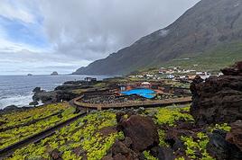
15 days across Gran Canaria, El Hierro, and a dash of Tenerife under the storm Thérèse!
The planned itinerary will be slightly disrupted...
(The version without discussions is here)
The planned itinerary will be slightly disrupted...
(The version without discussions is here)
This three-week trip to Namibia was a big first for us:
- Visiting a country in winter, for someone who starts feeling comfortable at 25°C (77°F).
- Camping, when we usually feel at home in a starred hotel.
- Sleeping on the roof of a car—what an idea... when a comfy bed is waiting just a bit further.
- Grocery shopping, cooking, doing the dishes... all the things we usually avoid to fully enjoy our vacation.
- Washing up when and how we can, when we can’t imagine going a day without a shower.
- Driving a big 4x4 on the left, with a manual transmission, when we usually opt for an automatic for more comfort.
Yep! You guessed it—we stepped way out of our comfort zone during this trip.
I had quite a few doubts while planning this adventure, but the more I read travel journals about Namibia, the more I wanted to go.
Personally, without this forum, I never would’ve dared to hit the Namibian roads in a 4x4. I was really anxious during the planning, so I want to thank everyone who contributed with their journals and forum discussions for helping me leave more peacefully.
At first, I wasn’t even considering sleeping in a tent. But after my husband’s persuasion—and my own curiosity to experience what I’d read in those travel journals—I gave in. So off we went in a double-cab Hilux with a rooftop tent.
And of course, let’s talk about me—the big cold-weather wimp. One of the biggest pre-trip challenges was choosing a sleeping bag. After a while, sleeping bags had no more secrets for me: temperature ratings (comfort, limit, extreme), shapes (mummy, rectangular), fillings (synthetic, down), compression rate, and weight... all these factors were a real puzzle. In the end, to make sure I wouldn’t be put off camping in winter (Australian winter, mind you), I went for a sleeping bag with a comfort rating of -10°C. And just to be *extra* sure I wouldn’t get cold, I bought a liner (never knew what that was before) in Thermolite, which boosts the sleeping bag’s temperature by 11°C. There are liners that add up to 15°C, but let’s not exaggerate—we’re not heading to the North Pole! My husband, on the other hand, got a sleeping bag with a -5°C comfort rating and a silk liner.
Was it enough? You’ll find out soon. In the meantime, another big thank you to everyone who helped me make this choice with their advice and experience.
Over a year in advance, we planned a three-week itinerary for our first trip to Namibia—classic route, nothing too out there. We chose to do the circuit clockwise because we wanted to finish on a high note in Etosha and its wildlife. They say it’s like Noah’s Ark out there! And why not, the cherry on top... some big cats.
We used Tourmaline’s services to book our accommodations and the 4x4.
Here’s our planned itinerary with campsites and lodgings—yes, there are a few solid roofs in there; we didn’t want to push it too far.
Day 1: Windhoek – Windhoek Gardens Guesthouse Day 2: Kalahari Anib Campsite Day 3: Namibrand Family Hideout Day 4: Sesriem Camp Day 5: Sesriem Camp Day 6: Rostock Ritz Camp Day 7: Swakopmund - Sea Breeze Guesthouse Day 8: Swakopmund - Sea Breeze Guesthouse Day 9: Spitzkoppe Camp Tented Day 10: Brandberg White Lady Campsite Day 11: Grootberg Lodge Day 12: Opuwo Country Campsite Day 13: Epupa Camp Day 14: Hobatere Lodge Day 15: Etosha Olifantsrus Camp Day 16: Etosha Okaukuejo Camp Day 17: Etosha Halali Camp Day 18: Etosha Namutoni Camp Day 19: Cheetah Eco Lodge Day 20: Windhoek – Londiningi B&B
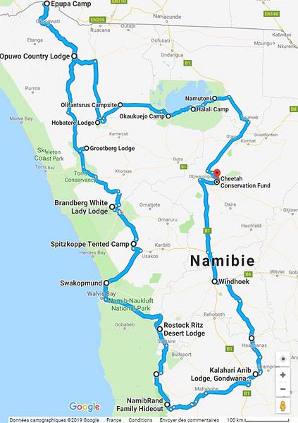
Alright! Are you ready to follow this adventure with us in our Hilux?
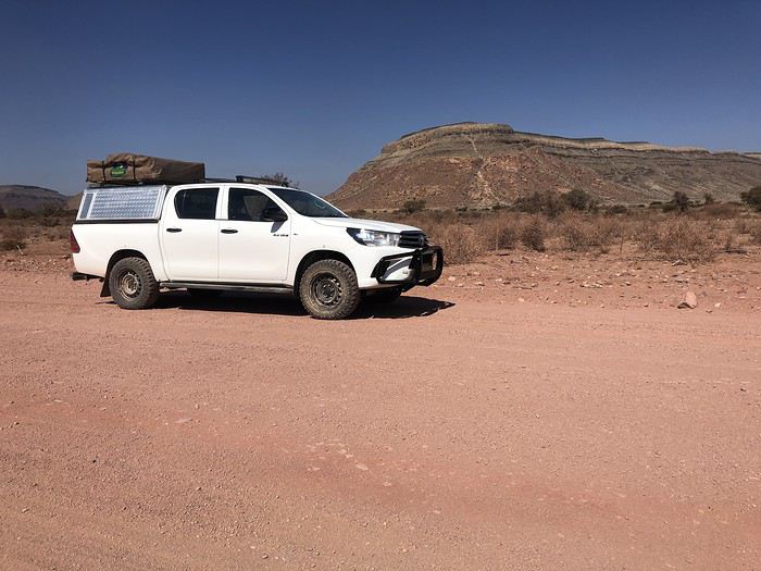
Yep! You guessed it—we stepped way out of our comfort zone during this trip.
I had quite a few doubts while planning this adventure, but the more I read travel journals about Namibia, the more I wanted to go.
Personally, without this forum, I never would’ve dared to hit the Namibian roads in a 4x4. I was really anxious during the planning, so I want to thank everyone who contributed with their journals and forum discussions for helping me leave more peacefully.
At first, I wasn’t even considering sleeping in a tent. But after my husband’s persuasion—and my own curiosity to experience what I’d read in those travel journals—I gave in. So off we went in a double-cab Hilux with a rooftop tent.
And of course, let’s talk about me—the big cold-weather wimp. One of the biggest pre-trip challenges was choosing a sleeping bag. After a while, sleeping bags had no more secrets for me: temperature ratings (comfort, limit, extreme), shapes (mummy, rectangular), fillings (synthetic, down), compression rate, and weight... all these factors were a real puzzle. In the end, to make sure I wouldn’t be put off camping in winter (Australian winter, mind you), I went for a sleeping bag with a comfort rating of -10°C. And just to be *extra* sure I wouldn’t get cold, I bought a liner (never knew what that was before) in Thermolite, which boosts the sleeping bag’s temperature by 11°C. There are liners that add up to 15°C, but let’s not exaggerate—we’re not heading to the North Pole! My husband, on the other hand, got a sleeping bag with a -5°C comfort rating and a silk liner.
Was it enough? You’ll find out soon. In the meantime, another big thank you to everyone who helped me make this choice with their advice and experience.
Over a year in advance, we planned a three-week itinerary for our first trip to Namibia—classic route, nothing too out there. We chose to do the circuit clockwise because we wanted to finish on a high note in Etosha and its wildlife. They say it’s like Noah’s Ark out there! And why not, the cherry on top... some big cats.
We used Tourmaline’s services to book our accommodations and the 4x4.
Here’s our planned itinerary with campsites and lodgings—yes, there are a few solid roofs in there; we didn’t want to push it too far.
Day 1: Windhoek – Windhoek Gardens Guesthouse Day 2: Kalahari Anib Campsite Day 3: Namibrand Family Hideout Day 4: Sesriem Camp Day 5: Sesriem Camp Day 6: Rostock Ritz Camp Day 7: Swakopmund - Sea Breeze Guesthouse Day 8: Swakopmund - Sea Breeze Guesthouse Day 9: Spitzkoppe Camp Tented Day 10: Brandberg White Lady Campsite Day 11: Grootberg Lodge Day 12: Opuwo Country Campsite Day 13: Epupa Camp Day 14: Hobatere Lodge Day 15: Etosha Olifantsrus Camp Day 16: Etosha Okaukuejo Camp Day 17: Etosha Halali Camp Day 18: Etosha Namutoni Camp Day 19: Cheetah Eco Lodge Day 20: Windhoek – Londiningi B&B
Alright! Are you ready to follow this adventure with us in our Hilux?
Lombok, Indonesia: A Forgotten Paradise?
We’ve just returned from 3 weeks (yes, only that!) in Lombok, an island next to Bali, just a few miles away. Since I found very little information before leaving—except about the Gili Islands and organized Rinjani treks—I’ve tried to gather some details that might be useful for a Voyage Forum member looking to explore the area. Nothing exhaustive, but maybe a few great tips.
For those considering a Lonely Planet *Bali & Lombok* guide, be aware that the prices are wrong (expect a 30% increase, especially due to rising fuel costs), much of the info is outdated (the latest edition must be at least 2 or 3 years old), and the real good deals aren’t included. In short, don’t bother weighing down your bag (we already had 17kg of luggage for two—we’re getting soft!). A good map will be far more useful.
Climate: We went in late August to mid-September, so the weather was ideal in this region (best from June to September). It was pleasant, not too hot, with a light breeze keeping the Bintang cold in the evening—pure bliss!
Getting There: The cheapest way is to fly to Kuala Lumpur (Malaysia Airlines), then switch airports (getting to the LCC terminal costs 1.5 ringgit by bus) and take an AirAsia flight to Bali (booked in advance online). Once in Bali, to reach Lombok: either another flight—around 30 €—on a small propeller plane (probably a Dutch legacy); or by boat, but since you have to get to Padangbai in eastern Bali to catch the ferry, you “lose” (a very relative term when traveling) a lot of time (at least 6 hours total) to save a few euros. Since we were already mid-afternoon and didn’t want to spend a night in Bali, we opted for the “tuk-tuk with propellers” 😉. It was the first time I was weighed with my bag before boarding a plane! I know I’ve put on weight lately, but still…
After arriving in the late afternoon in Mataram, Lombok, we decided to find a bed nearby. Headed to Senggigi, Lombok’s main beach resort. We ended up at the first guesthouse, “Lina Cottages,” for 75,000 IDR a night. Exhausted, we headed straight to dreamland. I woke up around midnight, thinking I heard Massimo!??!! I hadn’t even had too much Bintang—was the jet lag giving me hallucinations ? No, I really did hear Massimo belting out a song! After a few seconds of “lost in translation,” I realized the Marina, Senggigi’s trendy bar, had—like every night—a live band playing, and these guys were covering that French classic (sic) you’ve probably heard at least once. Coming all this way just to hear “Massiiiimooooo, Massiiimmoooo, Massiiimmooomooooo…” blasting in your ears like you’re at a campsite in Juan-les-Pins—enough to depress anyone! Anyway, we left ASAP. Just enough time to check out Senggigi: its 4 or 5 bars, 10 restaurants, 3 or 4 luxury hotels—still far from Kuta Bali, but not really our scene anyway. We quickly realized there’s very little organized transport (except for a few Perama bus routes, almost all passing through Senggigi) in Lombok. To avoid spending our 3 weeks in bemos, we quickly opted to rent a car (too old for a two-person motorbike, though we’d done it in Bali… Turns out we made the right call—the roads in Lombok are way too rough for bikes). Senggigi is one of the few places on the island where you can rent a car and withdraw cash. After some tough negotiation, I got a Suzuki Katana for 120,000 IDR/day (instead of the usual 200,000 IDR). I was a bit frustrated—thought it was expensive. A local on vacation in Lombok (he’s lived in Australia for years) later told me he couldn’t even get that rate, saying prices had jumped with the fuel hike (from 2,500 IDR/liter two years ago to 5,000 IDR now).
Anyway, we left Massimo to his interplanetary success and headed south. I was curious to see if we could stay on a small island off Lombok’s southwest peninsula. After 60km and 1.5 hours, we arrived in Taun, where we found a “captain” willing to take us to Gili Nanggu. There seemed to be a guesthouse on the island. After some *very* tough negotiation, we got a round-trip price of 150,000 IDR for two days later (a guide taking tourists to the island for the day later told me he pays 185,000 IDR for the same trip). The island is barely a few hundred meters across, and the only guesthouse, “Gili Nanggu Cottages” (165,000 IDR/night), offered us a charming bungalow in traditional Lombok style. No negotiating possible—we were stuck on the island anyway! By mid-afternoon, the day-trippers (often from Senggigi) left. There were about ten of us staying overnight. The sand was white, the water crystal-clear with fish, and the sunsets stunning… but the coral was pretty damaged.
Next, we headed south to Kuta Lombok. The most direct route via Sepi was marked as “small” on the map… mmm… The Lonely Planet—this was the *only* time it was “useful” (sic)—had a special warning saying many readers had been robbed in the area. Wanting to clear this up for my Voyage Forum friends, we took the plunge! The road was *completely* wrecked—potholes everywhere, and if you ignore the rain-carved ravines, it was like a pothole per square meter! I was searching for tarmac to park my wheels! After 80km and 3 hours of bone-rattling driving, with stunning views of Lombok’s arid southern countryside and deserted turquoise bays, we arrived in Kuta Lombok. On the way, instead of robbers and thieves, we only met schoolchildren with big smiles shouting cheerful “hellloooo’s.” We didn’t see a single other car the whole trip.
Kuta is nothing like its Balinese namesake. It stretches just a few hundred meters along a beautiful round-sand bay (yes, round—it rolls under your feet). About ten deserted restaurants and just as many guesthouses (5% occupancy, I was told—we only saw about ten Westerners in 3 days). No guesthouses face the beach; they’re all on the other side of the road in an inner garden. A bit of a shame. Still, the bay is gorgeous, and a few fishing families live in very basic huts on the beach. We decided to check out the Novotel to get a feel for the area. The lush vegetation contrasted with the surrounding aridity, two pools… all that fresh water being used, plus the Accor flag, made me want to head back to the fishermen’s huts. Finally, we found a guesthouse on the beach at the eastern end of Kuta Bay, just before the Novotel: “Lombok Baru.” It’s the only one on the beach. The bungalow was spotless, right by the sea, for 105,000 IDR/night. The Chinese-Indonesian family running the place told me they’d only been open for 3 years and were growing slowly as they saved up. A new bungalow was under construction, and the “garden” was still a work in progress.
The Tanjung Aan bay, a few kilometers east of Kuta, is stunning—huge, white sand, and almost no one except a few persistent sarong sellers. The bay is definitely worth a visit (if not a sunburn). A toothless old man even tried to sell us a coconut, improvising a song (after my girlfriend started singing to ignore them 😉). With his three words of broken English, he sang: “Coconut mist’errrr… mister coconuttttee… If no coconut, no monyyyy… Coconut mister…” for at least 10 minutes! A rare moment, a beautiful encounter. The song stuck with us for the rest of the trip—even now, I hum it to avoid getting too depressed about being back home. One evening, a Balinese waiter who’d been living in Lombok for 7 years gave us lots of info about the area, the culture, and the people. He talked about the security issues in Kuta—yes, there are frequent thefts (money, cars, etc.). For him, it’s due to the lack of education among many locals, who don’t see beyond their immediate needs and risk scaring tourists away (which is why Kuta is so deserted). After a few days there, you do get the sense that you shouldn’t tempt fate by flashing money or jewelry amid such poverty in southern Lombok. But calling it a “dangerous area” is a stretch! That won’t stop me from going back, though!
Next, we headed east—northeast, actually. I was curious about the small islands on my map, and I hadn’t found *anyone* who’d been there to give me tips. So we drove to Labu Pandan (115km, 3 hours—I may have pushed the Katana a bit…). What looked like a small village was actually just a guesthouse and a few fishing boats on the beach. The “Pondok Gili Lampu” guesthouse also sold basic supplies to locals and had a simple restaurant with 5 or 6 basic bungalows (60,000 IDR/night) and a beautiful deserted black-sand beach. They offered snorkeling trips to Gili Lampu and camping there (organized by the guesthouse), but there were no facilities or water on the island. The strong wind made us decide to stay on the beach—poor visibility for snorkeling and sand in the sleeping bags didn’t sound appealing… The owner, Yanto, didn’t speak a word of English but was absolutely lovely. Another heartwarming encounter that did us so much good. Life was sweet, and we let ourselves drift to the rhythm of faraway relaxation.
Then we headed to Sembalun Lawang, the least crowded starting point for the Rinjani trek (most people start from Senaru). The southern route was fine—we crossed a 1,700m pass. The only person we met was an ice cream vendor on a motorbike overtaking us on the climb—he must’ve been in a hurry, which is ironic for an ice cream seller! After 65km and 1h15 of winding roads, we arrived in Sembalun Lawang and parked our trusty Katana at “Sembalun Nauli,” which had 4 standalone bungalows (90,000 IDR/night) in the middle of nowhere. There was nothing around—just the Rinjani looming ahead, our goal for the next 3 days. The guesthouse arranged our gear (sleeping bags, tent), hired two porters, and bought food. I got a price of 1,400,000 IDR for 2 people for 3 days. I think you could get it down to 1,000,000 or 1,200,000 if you did it yourself, but we hadn’t seen a single person in SL (not a restaurant in sight—even the Rinjani Trekking Center was closed, the guy was supposedly napping…). I didn’t feel like stressing over it. It was a far cry from the 170 USD/person quoted in Senggigi!
The 3-Day Rinjani Trek was a unique experience—not just for the scenery but also for the (relative) “sharing” with the porters: Mister Adi (who spoke a little English) and Mister An (who only spoke Sasak and Indonesian). On the first day, we went from Sembalun to base camp: 1,700m elevation gain under the sun, 6 solid hours of hiking (not counting breaks). My shared backpack, weighing around 10kg, felt heavy on the climb. We took breaks to drink, while our porters smoked!! I don’t know how they did it! The next day, we left at 2:30 AM to reach the summit (1,500m elevation gain) by 6 AM for sunrise. The last 300 meters were brutal—a 35/40° slope, straight up in sand and small stones. Those who say you move a meter forward and slide 50cm back haven’t seen the slope! It’s more like 20cm forward and sometimes 20cm back… tough stuff. But we made it to the summit (3,726m)—not everyone does. A word to the wise: you’d better be in good shape and, above all, have the right mindset! More beautiful than the sunrise was the moonrise—almost full and reddish—around 4 AM. It was stunning! As for vertigo, sure, you’re walking along a ridge, but even for someone like me who’s not a fan of heights, it was fine. Back at base camp, Mister An had made delicious banana pancakes—a local ritual, apparently, and a treat for us! Then we descended to Segara Anak Lake in the crater. It was steep, and with our legs like telephone poles, it wasn’t easy: “Adeng adeng, Mister An!!!” We enjoyed the hot springs (40°C!) and I even swam in the lake itself—the water must’ve been around 20°C, incredibly pure. I was alone facing Gunung Baru, the active volcanic cone: unforgettable! On the third day, we climbed back out of the crater, then descended 2,000m to Senaru, where ojek (motorcycle taxis) were waiting to take us back to Sembalun to retrieve our car, still parked at Sembalun Nauli. Then we drove to Senggigi (2 hours, flat out), where this time we stayed at Dharmarie (150,000 IDR instead of 300,000 IDR)—spotless room, nice bathroom, much quieter than Lina! We returned our Suzuki Katana 3 days late (I thought they’d have a heart attack—they’d been looking for us everywhere, even going to Kuta!). Anyway, I paid for 2 extra days out of the 3, and we headed to catch the Perama boat directly to Gili Air from Senggigi (70,000 IDR/person).
We chose Gili Air based on the posts I’d read on Voyage Forum (thanks 😉). Somehow, we ended up with a French friend at Hotel Gili Air (yes, I know—after our Rinjani adventure, we treated ourselves…) on the north side of the island, where we negotiated the room down to 225,000 IDR/night from the listed 38 USD. The included breakfast was huge, and the seawater pool was a nice touch (if not the hotel staff…). The island was pretty nice—white sand, pretty fish, turtles—but the coral was damaged in many places. Hammock, snorkeling, grilled fish, and Bintang—a simple pleasure
After 3 days, the travel bug bit us again. We wanted to reach Komodo by boat. Two agencies offered 4-day one-way trips to Flores: Perama (1,400,000 IDR/person for deck sleeping) and another (name forgotten) for 850,000 IDR. Couldn’t negotiate with Perama—the next departure was in 5 days (every 6 days, I think). We went with the other one. Everything seemed fine (the boat actually left from Labuhan Lombok, east of Lombok, which we reached by bus from Gili Air) until the agency told us there were only 2 flights a week from Labuan Bajo in Flores back to Bali, which would leave us stuck for 3 days in Flores and make us miss our return flight to Kuala Lumpur. To top it off, the agency lady said we were only 6 people signed up, and the boat wouldn’t leave with fewer than 8… so it fell through. We decided to end our trip with a few days in Bali to see how the island had changed since our last visit in 2003.
I won’t go on about Bali—it’s much better known than Lombok—but here are 3 great spots: - Ubud: So much construction since 2003! You’d think you were in a French city center with all the shops! “Nick’s Pension,” near the top of Monkey Forest—take a small alley to the left as you go up, all the way to the end. A green paradise in the middle of rice fields, quiet, just 50m from Monkey Forest. Nice pool. 300,000 IDR/night, negotiated down to 150,000 IDR. - Amed: “Wa Wa We We II” (120,000 IDR/night)—gorgeous infinity pool, charming bungalows, “relax” vibe. - Jimbaran: “Villa Puri Royan” (from 120,000 IDR)—like a hacienda on 3 levels with a pool in the middle. Right next to the beach warungs. *The* good deal in Jimbaran.
When you go from Lombok to Bali, you notice a clear difference. First, in terms of development. In Lombok, cars are rare outside Mataram/Senggigi. Development is far behind Bali—probably what Bali was like 20 years ago! I heard that construction on an international airport in Praya, central Lombok, started on August 1, 2006… Even if it takes 5 or 10 years to build, maybe it’s time to go. Then there’s the “people” factor—culture or religion plays a role. It’s true that it’s less easy than in Bali (which is so unique…), and relationships can be tougher, even tense at times. Maybe it’s just less accessible for “whirlwind travelers” like us. The car also saved us from many hassles (negotiating bemos, ferry arrivals, etc.). Still, we had some amazing encounters and never felt unsafe. I imagine other experiences could be different, especially if you’re easily intimidated.
I hope you’ll find some useful info in this post. When you visit this part of the world, try to get off the beaten path of the Gili Islands or Senggigi. Lombok and its people are well worth a detour.
Selamat Jalan
This year, we hadn’t planned on going to the United States. After two trips in 2012 and 2014, we needed to refill the piggy bank...
But we didn’t count on luck: one late September afternoon in 2014, while randomly browsing the web, I stumbled upon flight tickets for $753 per person for July 2015! After some calculations and hesitation, we decided to shorten the trip compared to the previous year (22 days this time), cut down on hotel costs (80 € per night on average), and skip expensive activities (no helicopter rides, rafting, or guided tours with outfitters, etc.), but we couldn’t pass up such a great opportunity!
Here’s the budget breakdown: - Flight tickets: 3,012 € for 4 (booked directly on AA’s website). One layover on the way out (CDG / Charlotte / Phoenix) and one on the way back (LAX / London / CDG). - Hotels: 1,685 € for 22 nights, averaging 76.60 € per night. We stuck to our budget (and even did better!), thanks to affordable hotels in NM, bookings made when the exchange rate was still favorable, and 2 free nights used on Hotels.com. - Car: 952 € for 22 days renting a standard SUV (Jeep Grand Cherokee). We went through AutoEurope, and the rental company was Dollar. - Gas: Around $20 per day on average (for 5,440 km). - Food: Just under $70 per day on average (for 4 people). We did a lot of grocery shopping for picnics, ate a lot of fast food, and only went to restaurants a few times. - America the Beautiful Pass: Free (the one we bought in July 2014 was still valid until the end of July 2015). - Not covered by the pass: $175 (entry fees for State Parks, a guided tour at Mesa Verde, Pow Wow entry, etc.).
In total, we spent 7,760 € for 4 people over 22 days. On top of that, we added $50 for the NYNY roller coaster (a gift for Hugo) and $135 for the *Mystère* show (a gift for Calista and me).
Here’s the itinerary: - Lost Dutchman SP, Goldfield Ghost Town, and Apache Trail - Chiricahua NM - White Sands NM - White Sands NM, Valley of Fires SP, and Old Town Albuquerque - Taos Pueblo, Pow Wow, and Chimayo - Bandelier NM and Santa Fe - Kasha Katuwe Tent Rocks NM - Shiprock and Mesa Verde NP - Bluff, Gooseneck SP, Road Canyon, and UT95 - Little Wild Horse Canyon and Goblin Valley SP - Capitol Reef NP (Cohab Canyon and Sulphur Creek) - Burr Trail - Zebra Slot Canyon and Lower Calf Creek Falls - Mossy Cave and Cedar Breaks NM - Kanarra Creek and Zion NP (Kolob Canyons) - Coyote Buttes South (Paw Hole) - Zion NP (Progeny Peak) - Snow Canyon SP - Lake Mead and Las Vegas - Las Vegas - Las Vegas - Los Angeles and the trip back
An 80-Day Tour of Southern Africa
Back in South Africa
January 12, 2013, 5:30 AM, Flight BA043 London-Cape Town
Directly below, Windhoek glittered like a tangle of fairy lights still lit and tossed into a box.
The horizon, edged in purple, was setting up a backup fireworks display, and suddenly, like a cherry on the platter and with unbearable intensity, in less than two minutes the entire sun revealed a gray dam and then a vast, untouched massif.
A few more minutes and the glare to the east of the plane was total. In Africa, the sun is swift.
We still had a France to cross before landing, but it felt as if we were already there. To the west, the raking light revealed what looked like acne and long, swollen scars in a desert region that might be the Swartkloofberg. Further still, straight as far as the eye could see, the two parallel tracks of a dirt road.
At 11,500 meters altitude and 940 km/h, we had a sense of stillness until the Orange River appeared, an incongruous serpent, gray edged with green.
The first South African settlements were dotted with trees providing shade, then rivers highlighted by continuous lines of vegetation.
Water and shade that make life possible.
We’ll return here by the backroads.
Half an hour from Cape Town, the plane tilted toward the sea, crossing plantations (likely citrus) and then an explosion of cultivated greenery in circles on either side of an unruly river. Finally, the coastline was no longer just sand and water—a frothy hem, a suture?
A peninsula came into view, forming two magnificent bays, and... a flight attendant firmly instructed me to return to my seat: we’d arrived!
The Colors of Cape Town
The city was dressed up as I like them—deserted, fluid, free of its vendors.
In the parking lot of the endless beach next to the commercial port north of the city, about two hundred people were unloading their goods in front of their pickups or combis, none of which were from this century: mixed-race, ageless Black people, and white folks who looked like they’d stepped out of another era.
After a few minutes, intrigued, I played a game: first looking at the merchandise, then imagining who was selling it, and finally looking at who was actually manning the stall. Tall Black vendors were selling what they often sell in Europe—leather, sunglasses, watches; mixed-race folks offered discount bundles, and the tanned older white people seemed to have emptied their attics.
We left with an antique tin kettle for morning tea over an open fire, a pack of five exercise books (that’s 600 pages to fill), Bill Bryson’s earliest stories in English, some snoek rillettes (a local fish), and—never seen before—tuna biltong and snoek biltong.
In so-called advanced countries, Sunday is for sports: white cyclists dressed like pros sweating diligently, Black street vendors running in loops at red lights to sell trash bags that day; white golfers losing their balls, which a scantily clad Black man retrieves from the water; under the sails of kite surf boards, it’s all blondes, and in the foam, joyful splashes from a bunch of Black kids.
Searching for an unusual spot for lunch, we drove through the fishing port looking for a dive and, at the end of a dead-end road with no warning, we arrived at the Shimmy Beach Club—quite the program.
The place, open for just three weeks, aims to be ultra-trendy. You could be in San Francisco, Lisbon’s docks, or St. Barth. This time, the "visible" staff was diverse, but the clientele was exclusively white, except for one mixed-race couple.
For this Sunday lunch, the women had pulled out all the stops, and local starlets—who’d make ours look tame—were turning the terrace into a frenzy.
At Cape Town’s port, the girls have *port*. The trend seems to be crochet dresses over swimsuits.
For two hours, a team of employees watered and raked the sand, starting over when they finished. A child in a floaty pink dress and a gold headband, but a future adventurer, stepped onto the freshly raked artificial beach sand for the first time.
A lanky mixed-race man dragged a hose across the ground, followed by a white woman—enchanted?—who then started watering the sand herself, carelessly splashing the glass terrace her colleague had just swept. I suspect a tacit work arrangement to keep everyone employed.
A galleon packed with tourists (are there any in the hold? Does it take tourists to Robben Island?) left the port. A helicopter took off in its wake. Trawlers returned, cutting through a ballet of catamarans, their waterlines well above the water: a bad catch.
If there’s one country where you can’t pretend to ignore skin color, it’s this one. The question is in everyone’s mind, and here more than anywhere else, it’s a decisive economic and political factor.
Columbine of Brittany
200 km north of Cape Town and 9,000 km south of the Breton coast, but on the same cold ocean, we camped on the shore of the Columbine Cape Nature Reserve, sheltered by a rocky chaos that, at first light tomorrow, would transport us to Perros-Guirec.
Our first encounter with wild animals wouldn’t end well for them: it was crayfish season, and they were the size of lobsters at Lorient’s fish market. Bought for R60 (5.5 €) a pair from kids in Pater Noster, they’d end up between two rocks, over a fire. But first, we had to pair the Chenin blanc with some snoek biltong.
With no wood, I lit a fire at dawn with dried seaweed and kelp, as if petrified; it gave off a smell of court-bouillon and... tires. Two hundred fathoms away, on an outpost, an army of cormorants stood at attention, unmoved among the frolicking seals.
At the reserve’s exit, the guard spoke French; Patrick Mwanba had arrived from Congo three years earlier to study, but the cost of living here forced him to drop out. He’d like to return home because life is cheaper there, but the war made him hesitate.
Ding ding dong! Vroom! Arf arf, Woof! Buzz! (A night from hell!)
I’d long planned to visit Calvinia, the center of a region known for extensive sheep farming. An excellent provincial museum, run by an enthusiastic curator, kept us too late to start the drive north.
So we camped in a tiny, charming campsite set up in the garden of a house. A few trees, a patch of resilient grass, and a view of a pretty lit-up steeple—what else?
Well, it turned out to be a sound-and-light show, with the pretty steeple chiming the hours and half-hours. Then suddenly, we were in the VIP stands of the Karoo-Kalahari Truck Race: roaring trucks paraded under our canvas windows, and we realized we were on the main road through town. To top it off, we enjoyed an uninterrupted canine cacophony, from the *arf arf* of little dogs to the *woof* of a mastiff. Oh, and some mosquitoes—the first ones—insisted on keeping us company in the tent, and we hadn’t yet bought the arsenal to neutralize them.
I walked through Calvinia at night; the house gardens weren’t fenced, nor did they have the «Armed Response» signs so common in the country.
The Kalahari Trails
(No, no, I haven’t converted to hiking.)
North of Calvinia, in the south of the Northern Cape, small towns follow one another up to Upington, about a hundred kilometers apart—welcome havens. Between them, with no trees in sight, we stopped in the shade of a motionless cloud: the temperature exceeded 40°C in mid-January.
We were almost out of the High Karoo and into a region of pans drying up, until the first red dunes appeared, precursors of the Kalahari. In the sparse veld vegetation, gatherings of quiver trees in the kopjes, and a caravan of camels without a handler or packs, marching in perfect formation across a pan (no, I hadn’t overdone the Windhoek at the last stop, and no, I wasn’t dehydrated enough to hallucinate).
The historic part of these towns, European in style, was built on the same plans as those in the American Midwest or the Australian Outback: a grid of streets wide enough to turn a wagon pulled by eight pairs of oxen. The architecture was Dutch-inspired, tropicalized with awnings.
Then came more recent housing, functional in style, where the wealthier mixed-race people—who make up the majority of this state—lived, and further on, the township, an assemblage of corrugated iron and plastic, like everywhere else.
Orange, Right Bank
North of Augrabies Falls National Park, on the other side of the Orange River, stretches a rugged and wild territory the size of fifty Groix islands, crisscrossed by a few tracks—the Riemvasmaak.
The inhabitants were driven out half a century ago for a military base, and as soon as President Mandela was elected, he made it a symbol by allowing the exiled populations to return. Several ethnic groups live here on almost nothing, in government-built shacks.
A community camp is set up in a small cirque at the end of a canyon that, while not in the history books, offers a good descent. By mid-afternoon, the air was at 44°C, but luckily there was a spring... except it was a hot spring, with water at 38°C. And they haven’t invented a reversible spring yet. Once the birds and baboons had settled in, in absolute silence and far from any light pollution, we enjoyed the stars like nowhere else (well, that’s what they claim in the region).
The Orange didn’t choose the easy path: arriving from Lesotho, it was almost at the ocean. The terrain to the south and north of this massif seemed easier to cross. Was it to avoid the curse of the Okavango, whose waters disappear into the sands without ever seeing the sea, that it chose this rocky route, thinking that at least the granite wouldn’t steal its water?
I Love You, I Eat You
In the dry bed of the Auob, it lay panting, head raised, alert, between its paws but head-to-tail, a tawny springbok, motionless.
A few minutes earlier, their story had been written in a lightning-fast chase, captured in photos by the driver of the car that alerted us.
It would be a long time before it started eating at the groin without breaking its surveillance.
Earlier, there was a lion lounging in the shade and hundreds of antelopes: springboks and gemsboks (oryx) in herds, hartebeests and steenboks alone. Strange pairs, apart several times, formed by a springbok and a gemsbok.
A few solitary jackals moved slightly sideways, looking furtive. Ostriches, alone, looking a bit dazed.
It was a lucky morning in the Kgalagadi (KTP).
In and Out
Kgalagadi, Nossob Camp.
We were at the very end of the almost-empty camp, ten meters from the fence, whose structure wouldn’t resist an elephant (though there aren’t any here), but it was electrified.
At dusk, on the other side, ten meters away, three lions passed in a row, as if on parade, seemingly focused on their goal and indifferent to the camp, though they glanced at it.
A jackal had gotten into the camp and was trying to get out without success while scavenging. I offered it two pieces of snoek biltong (Don’t feed the animals!) from three meters away—it smelled strong and had bones (bones in biltong!). When it passed by again, it sniffed but didn’t dare approach. Curled up in the chair, motionless, by the faint moonlight, I finally saw it come closer, grab the nearest piece, and move ten meters away to enjoy it (how many jackals know the finer points of sea biltong?). A little reassured, it came back for the second piece.
Another Morning
By morning, the jackal was gone, but our luck hadn’t left us. Two cheetahs again, who found me in the way and slowly moved toward a calmer shadow. Enough birds of prey to form a squadron, but they’re solitary hunters. Two ostriches busy with their dozen unruly chicks. And while we’re at it, a group of four Kalahari lions, sprawled under a thorny bush. Lots of oryx crossing the dunes and herds of red hartebeest. Kori bustards and secretary birds.
It was the first time the Kgalagadi had spoiled us so much.
Hello,
In these post-COVID years, South Africa (SA) has drawn me back again... The long-time forum members will say I'm a bit obsessed (I've now surpassed 20 trips to this country, including 2 in Namibia)... But new readers can find my old travel journals and enjoy this new installment. So, three new trips... each lasting a month... always too short. I’ll try to be pragmatic.
Let’s start with the basics! You can plan your trip from your couch with complete peace of mind. Through any Booking site or directly (sometimes cheaper), I’ve never had any issues with my direct bookings—they’ve always matched what was promised. For national parks outside KwaZulu-Natal (where it’s KZN Wildlife), use the SANparks website, or Nature Reserve for that type of "accommodation." Air France, Lufthansa, or KLM... depending on the year and circumstances. Most flights are overnight, allowing you to arrive early in Joburg and... leave this city I don’t much like as quickly as possible. KLM offers a daytime flight to Cape Town... just arrange your first night’s stay. You drive on the left in SA (you knew that, right?)... you get used to it. Passport: must still be valid for 6 months with several blank pages... Car rental? A car is pretty much essential, whether for short or long trips. It’s safer too. Aside from the secure Gautrain in Joburg and Cape Town (CT from now on), I don’t take the train. Except for the red bus drop-off/pick-up in CT, I don’t take the bus. In this specific case, it’s practical because you can access all of CT’s spots—including the famous Lion’s Head—without worrying about parking or traffic. These past three years, I’ve chosen Around About Cars as my rental company. I’m very satisfied with them. What kind of car? It depends on what you’re doing and your budget. The vast majority of roads don’t require a special vehicle. In a park, the "high ground clearance" of SUVs lets you see animals better and helps avoid potholes (the SA version—ostrich-sized), speed bumps (our "sleeping policemen" with a big belly), and tackle the last few kilometers or 100 meters that can be a bit rough with complete peace of mind. Do your research. For me, it’s 4x2 or 4x4 depending on... South Africans drive fast... and I feel safer that way. International driver’s permit? Legally required! Never asked for by a rental company, only once by the police—but I stood my ground, confident, and it went smoothly. Road checks? Yes, often—at least two every time, but they’re relaxed... Note that if a police officer wants to give you a fine, it must be done at the police station—insist on going there... they’ll usually drop it. If they suggest paying on the spot in cash to "make things easier"... it’s just for their pocket. There’s a special "police alert" number—remind them of it! The rand is the South African currency. Nowadays, cards work in many places. But note: a car rental company will ask for a credit card, not a debit card. Be careful: cash is no longer accepted in SANparks camps and other places (entrances, etc.)! It’s card only! I always carry some cash. I order it from Yeschange (sounds dodgy, but it’s very reliable). Phew... What an introduction!
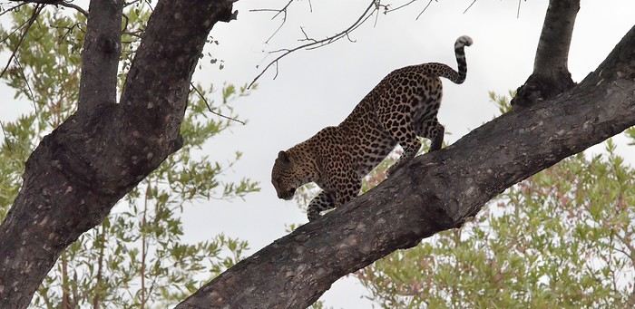
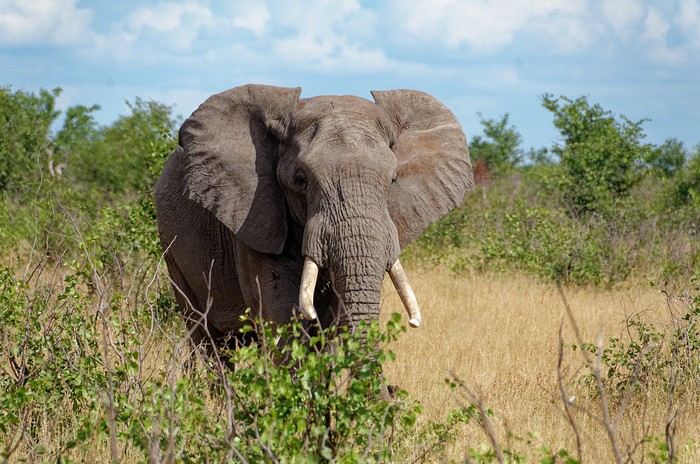
In these post-COVID years, South Africa (SA) has drawn me back again... The long-time forum members will say I'm a bit obsessed (I've now surpassed 20 trips to this country, including 2 in Namibia)... But new readers can find my old travel journals and enjoy this new installment. So, three new trips... each lasting a month... always too short. I’ll try to be pragmatic.
Let’s start with the basics! You can plan your trip from your couch with complete peace of mind. Through any Booking site or directly (sometimes cheaper), I’ve never had any issues with my direct bookings—they’ve always matched what was promised. For national parks outside KwaZulu-Natal (where it’s KZN Wildlife), use the SANparks website, or Nature Reserve for that type of "accommodation." Air France, Lufthansa, or KLM... depending on the year and circumstances. Most flights are overnight, allowing you to arrive early in Joburg and... leave this city I don’t much like as quickly as possible. KLM offers a daytime flight to Cape Town... just arrange your first night’s stay. You drive on the left in SA (you knew that, right?)... you get used to it. Passport: must still be valid for 6 months with several blank pages... Car rental? A car is pretty much essential, whether for short or long trips. It’s safer too. Aside from the secure Gautrain in Joburg and Cape Town (CT from now on), I don’t take the train. Except for the red bus drop-off/pick-up in CT, I don’t take the bus. In this specific case, it’s practical because you can access all of CT’s spots—including the famous Lion’s Head—without worrying about parking or traffic. These past three years, I’ve chosen Around About Cars as my rental company. I’m very satisfied with them. What kind of car? It depends on what you’re doing and your budget. The vast majority of roads don’t require a special vehicle. In a park, the "high ground clearance" of SUVs lets you see animals better and helps avoid potholes (the SA version—ostrich-sized), speed bumps (our "sleeping policemen" with a big belly), and tackle the last few kilometers or 100 meters that can be a bit rough with complete peace of mind. Do your research. For me, it’s 4x2 or 4x4 depending on... South Africans drive fast... and I feel safer that way. International driver’s permit? Legally required! Never asked for by a rental company, only once by the police—but I stood my ground, confident, and it went smoothly. Road checks? Yes, often—at least two every time, but they’re relaxed... Note that if a police officer wants to give you a fine, it must be done at the police station—insist on going there... they’ll usually drop it. If they suggest paying on the spot in cash to "make things easier"... it’s just for their pocket. There’s a special "police alert" number—remind them of it! The rand is the South African currency. Nowadays, cards work in many places. But note: a car rental company will ask for a credit card, not a debit card. Be careful: cash is no longer accepted in SANparks camps and other places (entrances, etc.)! It’s card only! I always carry some cash. I order it from Yeschange (sounds dodgy, but it’s very reliable). Phew... What an introduction!
Time flies: here we are already presenting our tenth travel journal to VoyageForum’s readers!
We discovered Thailand about a dozen years ago, and it quickly became addictive for us. It’s only fair to say that this country stands out from many—if not most—thanks to an extraordinary combination of qualities: a generally smiling, laid-back, and friendly people; a territory dotted with natural beauties of exotic exuberance; a substantial selection of dishes, each more delicious than the last; and an obvious ease in making yourself understood and finding help to organize your activities.
Over the years, it’s been tough to keep things fresh, to continue sparking readers’ interest—and who knows, maybe even enthusiasm. We’re going to try to rise to that challenge.
After revisiting or introducing you to over 120 temples in Thailand, this year Joel and Françoise want to reveal a "Thailand Naturally."
Both in well-known areas and others that are more off the beaten path.
By "natural," we first mean nature itself, with its stunning sites and landscapes. But it’s also about places where Thais love to stroll with family and friends. Sometimes it’s just faces, glances, moments of life, or ceremonies captured on the spot. For the ladies, there’ll certainly be flowers to admire along the way. Uh... for the gentlemen too, who appreciate them (the flowers)... oh, and also for the gentlemen who appreciate gentlemen who appreciate flowers. And even for the ladies who don’t appreciate gentlemen. Alright, let’s go wild—on top of all that, we’ll still include a few places of worship. No matter how hard we try to resist, there’s always someone or something pulling us toward temples. The ever-vibrant popular devotion encourages us, and we never regret it.
To do this, we’ll lead you through six provinces or regions that will reveal themselves as the story unfolds, letting you enjoy the thrill of discovery. Even if we’ve mentioned some of them in previous years, this time it’ll all be new. For a more complete picture of any province we’ve already covered, readers can check out our past travel journals—just click on our username Jojoone1 to see what we’ve published.
One last note before we begin: we’re sticking to our tastes, our preferences, and what brings us joy. We just really wanted to show you multiple facets of the country’s interior—we’ll see if we pull it off...
Hey there, fellow travelers 😎
We’re back from 15 days in northern India.
For our 6th visit to this country, we traveled between Uttar Pradesh and Madhya Pradesh, and let’s just say it was an emotional rollercoaster!!
So if you’re up for it, we’re taking you to Varanasi, Chitrakoot, Khajuraho, Orchha, and Agra.
Ready for takeoff??
WELCOME TO VARANASI

When you leave your sanitized, rigid Western world behind, there’s nothing like diving back into the Indian chaos. And we nailed it—because when it comes to monumental madness, we couldn’t have picked a better place to start than Varanasi 😉!!
Here’s a little recap of our first day in this insane city.
It all starts with landing at the city’s airport.
As soon as we step out, hundreds of Indians stare at us like they’ve never seen white people before (I’d forgotten how intense that is!). There are lots of women covered in black fabric, only their eyes visible—pretty striking, I must say. Turns out they’re Indians working in the Middle East, heading back to "work" after a month’s vacation.
We hop in a taxi, but after a few kilometers, we’re stopped… by the passage of the "state minister." The roads are freshly paved and spotless for his convoy (you can *totally* tell the difference with the roads he didn’t use 😛). We didn’t manage to spot him in the middle of the 25 cars surrounding him, though!!
Then we arrive in front of the mythical Ganges—a peaceful spot, except for a boat full of Indian pilgrims who, once again, stare at us and take our pictures (the mutual curiosity is hilarious!!).
We board a boat, and almost immediately, we pass a cremation ghat!! Oh crap, I wasn’t expecting that so soon—it hits me hard (like, *really* hard 🤪)!! Huge piles of wood, eight massive fires with families gathered around. It lasts as long as the boat ride, and you think you must’ve imagined it… but no!!
You dock and wander through the tiny alleys.
It’s 36°C (97°F) with 90% humidity—you’re dripping.
Cows block the way sometimes. The air smells like incense, then urine, then a woman’s perfume, then rotten fruit, then amazing street food—all within two meters, and *everywhere*!!
Then you step into the main street where pilgrims arrive (60,000 a day—Varanasi is the country’s holiest city!!). The chaos ramps up as you head toward the main road: nonstop honking, a bike whizzing past on your right, a scooter on your left, people brushing against you from all sides, air thick with dust and smoke (diesel *or* cremation!!), beggars of all kinds (kids, elderly, disabled) lined up to appeal to the pilgrims, the suffocating heat, and noise—*so much* noise…
In some areas, people constantly approach you: "Come see my shop," "Need a taxi?" "Want to exchange money?" And then there’s the woman with her baby in her arms, following you for meters, repeating, "No money, milk; no money, milk…" And you’re *dying* inside, but you can’t stop. If you give in, ten more will come running!! You grit your teeth, keep walking, even talk to yourself out loud!!
After half an hour, it feels like you’ve run a marathon, and you don’t even know where you live anymore!
In the evening, you head to the PUJA (public prayers for all the pilgrims) on a boat in the middle of hundreds of others. Two ghats are competing—who can make the most noise. One side is singing, the other chanting, then they switch. They wave flames, the ghats are packed.
After dinner, you head back to your room around 9 PM and see hundreds of people sleeping on the scorching stones—with cows, dogs, and goats!!!!
A huge thank-you to our parents for giving us the mental balance to handle this, because *India drives you crazy*—and we’re right in the thick of it!!!
It’s an ex.tra.or.di.nary place in the truest sense of the word, with incredible beauty—especially in its human diversity—if you can look past what shocks you.
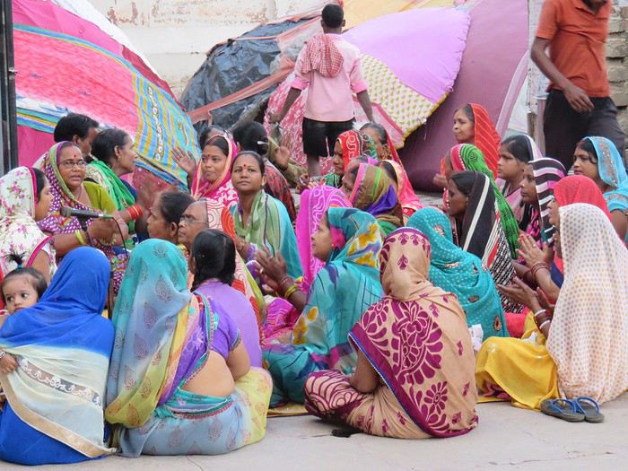
We stayed for 3 days—3 days of unmatched intensity, where the spectacle is *constant*.
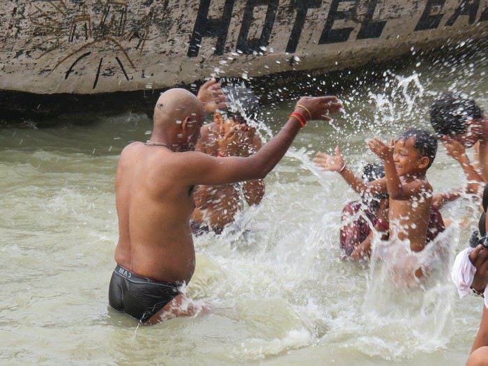
So I *highly* recommend it to all travel lovers, those who embrace difference, and the strange (for us, at least). But definitely *not* for anyone looking for a relaxing vacation!!
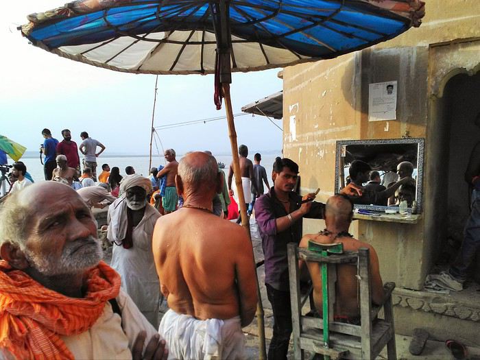
More to come soon if you’re interested!!
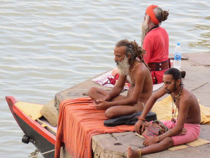
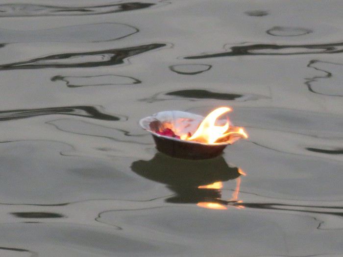
We’re back from 15 days in northern India.
For our 6th visit to this country, we traveled between Uttar Pradesh and Madhya Pradesh, and let’s just say it was an emotional rollercoaster!!
So if you’re up for it, we’re taking you to Varanasi, Chitrakoot, Khajuraho, Orchha, and Agra.
Ready for takeoff??
WELCOME TO VARANASI
When you leave your sanitized, rigid Western world behind, there’s nothing like diving back into the Indian chaos. And we nailed it—because when it comes to monumental madness, we couldn’t have picked a better place to start than Varanasi 😉!!
Here’s a little recap of our first day in this insane city.
It all starts with landing at the city’s airport.
As soon as we step out, hundreds of Indians stare at us like they’ve never seen white people before (I’d forgotten how intense that is!). There are lots of women covered in black fabric, only their eyes visible—pretty striking, I must say. Turns out they’re Indians working in the Middle East, heading back to "work" after a month’s vacation.
We hop in a taxi, but after a few kilometers, we’re stopped… by the passage of the "state minister." The roads are freshly paved and spotless for his convoy (you can *totally* tell the difference with the roads he didn’t use 😛). We didn’t manage to spot him in the middle of the 25 cars surrounding him, though!!
Then we arrive in front of the mythical Ganges—a peaceful spot, except for a boat full of Indian pilgrims who, once again, stare at us and take our pictures (the mutual curiosity is hilarious!!).
We board a boat, and almost immediately, we pass a cremation ghat!! Oh crap, I wasn’t expecting that so soon—it hits me hard (like, *really* hard 🤪)!! Huge piles of wood, eight massive fires with families gathered around. It lasts as long as the boat ride, and you think you must’ve imagined it… but no!!
You dock and wander through the tiny alleys.
It’s 36°C (97°F) with 90% humidity—you’re dripping.
Cows block the way sometimes. The air smells like incense, then urine, then a woman’s perfume, then rotten fruit, then amazing street food—all within two meters, and *everywhere*!!
Then you step into the main street where pilgrims arrive (60,000 a day—Varanasi is the country’s holiest city!!). The chaos ramps up as you head toward the main road: nonstop honking, a bike whizzing past on your right, a scooter on your left, people brushing against you from all sides, air thick with dust and smoke (diesel *or* cremation!!), beggars of all kinds (kids, elderly, disabled) lined up to appeal to the pilgrims, the suffocating heat, and noise—*so much* noise…
In some areas, people constantly approach you: "Come see my shop," "Need a taxi?" "Want to exchange money?" And then there’s the woman with her baby in her arms, following you for meters, repeating, "No money, milk; no money, milk…" And you’re *dying* inside, but you can’t stop. If you give in, ten more will come running!! You grit your teeth, keep walking, even talk to yourself out loud!!
After half an hour, it feels like you’ve run a marathon, and you don’t even know where you live anymore!
In the evening, you head to the PUJA (public prayers for all the pilgrims) on a boat in the middle of hundreds of others. Two ghats are competing—who can make the most noise. One side is singing, the other chanting, then they switch. They wave flames, the ghats are packed.
After dinner, you head back to your room around 9 PM and see hundreds of people sleeping on the scorching stones—with cows, dogs, and goats!!!!
A huge thank-you to our parents for giving us the mental balance to handle this, because *India drives you crazy*—and we’re right in the thick of it!!!
It’s an ex.tra.or.di.nary place in the truest sense of the word, with incredible beauty—especially in its human diversity—if you can look past what shocks you.
We stayed for 3 days—3 days of unmatched intensity, where the spectacle is *constant*.
So I *highly* recommend it to all travel lovers, those who embrace difference, and the strange (for us, at least). But definitely *not* for anyone looking for a relaxing vacation!!
More to come soon if you’re interested!!
I hope this travel journal might interest some people, but since we were completely self-sufficient (tent, sleeping bag, pot, cooking over a wood fire…) almost every day, I don’t have many hotel addresses or great restaurant tips to share! Sorry!
We used the Maio map at 1:50,000 scale. It’s part of the Boa Vista/Sal/Maio map. Bought on Amazon, but currently unavailable as of the latest news.
The people of Maio are extremely welcoming and warm, and we were always more than well received in the villages where we pitched our tent!
We’re usually big hikers, but since Maio is a beach island (gorgeous ones, at that!), we alternated a few hours of walking in the morning with some relaxation in the afternoon: beach, reading, fishing, resting…
1 euro = 110 escudos
Day 1 (Friday) Transfers by plane: Fogo-Praia-Maio We opted for the plane to save some time on transfers, as the boat connections between Fogo and Praia take a while, and those between Praia and Maio are almost nonexistent.
You should budget around 40-50 euros per flight per person.
There are 2 flights per week between Praia and Maio—on Tuesdays and Fridays when we were there (January 2016), but currently on Mondays and Fridays.
Tickets were booked directly and without issue on the TACV website: https://flytacv.com/?lang=en
A bit of a delay leaving Praia, but we arrived on Maio without any problems around 4 PM.
We took an *aluguer* (shared transport, 200 escudos per person) to the center of Vila do Maio, but it’s totally doable on foot with a backpack.
Since it was already a bit late, for this first night, we dropped our bags at Big Game Maio. A standard European-style hotel run by a very nice Italian family. It’s a bit pricey for us (5500 escudos for 2 people with breakfast), but after our 2 weeks in a tent on Fogo, we were happy to find a little comfort. And the breakfast is ultra-generous, with fresh products (cured ham, fruit, cheese, bread) and top quality. The hotel restaurant offers dishes that are a clever mix of Italian and Cape Verdean cuisine. Excellent!
Little tip: We didn’t try it, but Big Game Maio offers big-game fishing trips, diving, and quad rentals.
The hotel is 2 minutes from Vila’s beautiful beach, and we went for a dip at sunset and took a stroll around town. They’re redeveloping the waterfront with pretty sidewalks and light stone walls.
 Vila beach
 Sunset behind Santiago

Day 2 (Saturday): rest day + fishing After 2 weeks of hiking and since Vila is such a peaceful place where it’s nice to take your time, we decided to spend an extra day there. We took the path heading south along the coast to reach Ponta Preta beach in 20 minutes. The path isn’t very pretty because there’s quite a bit of construction going on, which prevents you from really walking along the shore. Lots of real estate agencies, especially Italian ones, have taken over the land. But Ponta Preta beach is a stunning black-sand beach where we had the whole place to ourselves. We decided to go fishing from the rocks.
At 1 PM, the sun was blazing, so we headed back to Vila and dried the fish for the following days.
At 6 PM, we went fishing again, but this time at night from the rocks at the end of Vila beach.
8:30 PM: back to shower and eat at the restaurant.
 The rocks and sea at Ponta Preta
Day 3 (Sunday): from Vila do Maio to Calheta de Baixo, via Monte Batalha (path 101) Hiking time: 5h Since there aren’t many “summits” on Maio, we decided to head to Calheta de Baixo but via Monte Batalha. We left at 8:20 AM and somehow made it to Monte Batalha by 11 AM (2h40 of hiking). But the path is really hard to find in the middle of the dry grass and acacia trees. We kind of cut through randomly, aiming for the summit. Even though it’s not very high (around 300 m), the view is amazing—you can see all of Maio at 360°!
Short 30-minute break. The descent through the “forest” of acacias is even worse for finding your way. We oriented ourselves a bit by the sun to find the road connecting Vila to Calheta. We arrived around 1:30 PM at Calheta de Baixo. A very pretty little seaside village with colorful houses. An idyllic beach, a newly renovated square, and super-friendly people. We pitched our tent facing the sea on the terrace of an abandoned house (after asking the locals for permission).
We cooked some of the dried fish we’d caught the day before, along with fresh beans we’d brought from Fogo (and were still carrying!).
 At the summit of Monte Batalha
 Calheta
 Calheta de Baixo
Day 4 (Monday): From Calheta de Baixo to Morrinho on foot. Hiking time: 3h. Then hitching a bus to Cascabulho, and a car to Pedro Vaz. We left around 9:30 AM heading north (path 201), following the coastline where the beaches just keep coming—each one wilder and more beautiful than the last: Praia de Soca, Calheta Braca, Ponta de Pau Seco, Calhetina. We reached the dunes of Baia de Santana. There’s no real path, so you have to follow the coast, then go around the dunes, and when you spot the 3 coconut trees, head east toward them to find the track leading to Morrinho. Again, we discovered a village with a Wild West vibe, with colorful houses lined up on either side of a paved road. Just enough time to accept a drink offered by a local before jumping onto the passing school bus that took us to Cascabulho. There, we waited for a ride. A political delegation of 10 cars drove right past us without stopping. Luckily, one of the cars had a flat tire and came by 30 minutes later—and that one, thankfully, gave us a lift! They were heading to the inauguration of a water pump in Pedro Vaz. So that’s where we stopped too. After getting permission from the school principal, we pitched our tent in front of the village school… and became the attraction for all the kids who kept us company until nightfall! A woman gave us 2 jugs of water, but with all that company, it was tough to take a peaceful shower!!
Dinner: pasta with beans.
We were woken up by rain during the night and had to rush to bring all our stuff inside the tent!

 The beaches just keep coming...
 The dunes
 The 3 coconut trees, a landmark to find the track
Day 5 (Tuesday): Rest day and fishing at Boca da Ribeira beach We packed up at 8 AM because the kids had school. We filled the 2 water jugs that the woman lent us and headed down to camp at Boca da Ribeira beach, which is a bit further east of Pedro Vaz. It took less than an hour to get there. This time, we really were alone in the world! We pitched the tent and spent the day fishing, reading, playing, and swimming regularly because the sun was beating down hard!!! We caught a nice fish that we grilled over the fire in the evening. With the crabs and shellfish we gathered, we made a seafood rice! Yum! What a feast!
That night, once the tent was zipped up, we felt something like rain on the tent fabric. I decided to go out and gather our things, and then—shock!!! It wasn’t raindrops we were feeling and hearing, but bugs attracted by the light!! Not just a few bugs—a huge swarm of them!!! Thousands of bugs covering the whole tent, the ropes, slipping into the seams and hems! Everywhere! The blue tent had turned green!!! After that, it was a real struggle to get back inside without letting any in! A real challenge, and there were always 3 or 4 that managed to sneak in anyway. Total war!!!
 Boca da Ribeira beach

Day 6 (Wednesday): From Boca da Ribeira to Ribeira Dom João. Hiking time: 3h30 We woke up leisurely and waited for the sun to dry our things, damp from the dew. A man passed by, and we gave him the water jugs we’d borrowed, which saved us a trip back to Pedro Vaz to return them to the woman.
We left around 10 AM. We followed the sea to Alcatraz, then headed toward Pilão Cão. The path runs alongside the small hills on our right, and we passed above Lagoa Cimidor. The terrain is arid, and the path is hard to find among the many goat tracks.
After 3h30 of hiking, we reached Ribeira Dom João with 2 young people we’d met along the way.
Since it was a public holiday in Cape Verde, the kids didn’t have school, and with the principal’s permission, we pitched our tent in the kindergarten. She even kindly opened the school toilets for us. The neighbor gave us the water we needed to wash up and cook. We cooked beef steaks on charcoal. A nice change from fish!! Charcoal is a widespread artisanal product on the island. People almost never cook directly over wood but always with these big chunks of charcoal.
 The hills on our right
 Ribeira Dom João
Day 7 (Thursday): From Ribeira Dom João to Vila do Maio. Hiking time: 3h30 We woke up at 6:30 AM to clear out of the school by 8 AM. The neighbor made us coffee to save time. It took us 2 hours to reach Barreiro, another Wild West-style town! Since we didn’t want to walk on the road, we took the old track and reached Vila do Maio in 1h30.
Last night before taking the plane back to Praia the next day.
 Barreiro
 The old track
 The church in Vila do Maio
That’s where this trip ends!
Maio is truly a magical island! A remote, isolated place with incredible, wild beaches and villages with a Wild West feel—colorful houses on either side of well-paved, well-maintained, and decorated streets. And the locals are so warm and welcoming.
Even for hikers like us, it was a great discovery, and we were able to alternate hiking and relaxation with great pleasure! Too bad the area around Vila do Maio is being overrun by real estate construction—ongoing, unfinished, abandoned…
Safe travels to all!
We used the Maio map at 1:50,000 scale. It’s part of the Boa Vista/Sal/Maio map. Bought on Amazon, but currently unavailable as of the latest news.
The people of Maio are extremely welcoming and warm, and we were always more than well received in the villages where we pitched our tent!
We’re usually big hikers, but since Maio is a beach island (gorgeous ones, at that!), we alternated a few hours of walking in the morning with some relaxation in the afternoon: beach, reading, fishing, resting…
1 euro = 110 escudos
Day 1 (Friday) Transfers by plane: Fogo-Praia-Maio We opted for the plane to save some time on transfers, as the boat connections between Fogo and Praia take a while, and those between Praia and Maio are almost nonexistent.
You should budget around 40-50 euros per flight per person.
There are 2 flights per week between Praia and Maio—on Tuesdays and Fridays when we were there (January 2016), but currently on Mondays and Fridays.
Tickets were booked directly and without issue on the TACV website: https://flytacv.com/?lang=en
A bit of a delay leaving Praia, but we arrived on Maio without any problems around 4 PM.
We took an *aluguer* (shared transport, 200 escudos per person) to the center of Vila do Maio, but it’s totally doable on foot with a backpack.
Since it was already a bit late, for this first night, we dropped our bags at Big Game Maio. A standard European-style hotel run by a very nice Italian family. It’s a bit pricey for us (5500 escudos for 2 people with breakfast), but after our 2 weeks in a tent on Fogo, we were happy to find a little comfort. And the breakfast is ultra-generous, with fresh products (cured ham, fruit, cheese, bread) and top quality. The hotel restaurant offers dishes that are a clever mix of Italian and Cape Verdean cuisine. Excellent!
Little tip: We didn’t try it, but Big Game Maio offers big-game fishing trips, diving, and quad rentals.
The hotel is 2 minutes from Vila’s beautiful beach, and we went for a dip at sunset and took a stroll around town. They’re redeveloping the waterfront with pretty sidewalks and light stone walls.
Vila beach
Sunset behind SantiagoDay 2 (Saturday): rest day + fishing After 2 weeks of hiking and since Vila is such a peaceful place where it’s nice to take your time, we decided to spend an extra day there. We took the path heading south along the coast to reach Ponta Preta beach in 20 minutes. The path isn’t very pretty because there’s quite a bit of construction going on, which prevents you from really walking along the shore. Lots of real estate agencies, especially Italian ones, have taken over the land. But Ponta Preta beach is a stunning black-sand beach where we had the whole place to ourselves. We decided to go fishing from the rocks.
At 1 PM, the sun was blazing, so we headed back to Vila and dried the fish for the following days.
At 6 PM, we went fishing again, but this time at night from the rocks at the end of Vila beach.
8:30 PM: back to shower and eat at the restaurant.
The rocks and sea at Ponta PretaDay 3 (Sunday): from Vila do Maio to Calheta de Baixo, via Monte Batalha (path 101) Hiking time: 5h Since there aren’t many “summits” on Maio, we decided to head to Calheta de Baixo but via Monte Batalha. We left at 8:20 AM and somehow made it to Monte Batalha by 11 AM (2h40 of hiking). But the path is really hard to find in the middle of the dry grass and acacia trees. We kind of cut through randomly, aiming for the summit. Even though it’s not very high (around 300 m), the view is amazing—you can see all of Maio at 360°!
Short 30-minute break. The descent through the “forest” of acacias is even worse for finding your way. We oriented ourselves a bit by the sun to find the road connecting Vila to Calheta. We arrived around 1:30 PM at Calheta de Baixo. A very pretty little seaside village with colorful houses. An idyllic beach, a newly renovated square, and super-friendly people. We pitched our tent facing the sea on the terrace of an abandoned house (after asking the locals for permission).
We cooked some of the dried fish we’d caught the day before, along with fresh beans we’d brought from Fogo (and were still carrying!).
At the summit of Monte Batalha
Calheta
Calheta de BaixoDay 4 (Monday): From Calheta de Baixo to Morrinho on foot. Hiking time: 3h. Then hitching a bus to Cascabulho, and a car to Pedro Vaz. We left around 9:30 AM heading north (path 201), following the coastline where the beaches just keep coming—each one wilder and more beautiful than the last: Praia de Soca, Calheta Braca, Ponta de Pau Seco, Calhetina. We reached the dunes of Baia de Santana. There’s no real path, so you have to follow the coast, then go around the dunes, and when you spot the 3 coconut trees, head east toward them to find the track leading to Morrinho. Again, we discovered a village with a Wild West vibe, with colorful houses lined up on either side of a paved road. Just enough time to accept a drink offered by a local before jumping onto the passing school bus that took us to Cascabulho. There, we waited for a ride. A political delegation of 10 cars drove right past us without stopping. Luckily, one of the cars had a flat tire and came by 30 minutes later—and that one, thankfully, gave us a lift! They were heading to the inauguration of a water pump in Pedro Vaz. So that’s where we stopped too. After getting permission from the school principal, we pitched our tent in front of the village school… and became the attraction for all the kids who kept us company until nightfall! A woman gave us 2 jugs of water, but with all that company, it was tough to take a peaceful shower!!
Dinner: pasta with beans.
We were woken up by rain during the night and had to rush to bring all our stuff inside the tent!
The beaches just keep coming...
The dunes
The 3 coconut trees, a landmark to find the trackDay 5 (Tuesday): Rest day and fishing at Boca da Ribeira beach We packed up at 8 AM because the kids had school. We filled the 2 water jugs that the woman lent us and headed down to camp at Boca da Ribeira beach, which is a bit further east of Pedro Vaz. It took less than an hour to get there. This time, we really were alone in the world! We pitched the tent and spent the day fishing, reading, playing, and swimming regularly because the sun was beating down hard!!! We caught a nice fish that we grilled over the fire in the evening. With the crabs and shellfish we gathered, we made a seafood rice! Yum! What a feast!
That night, once the tent was zipped up, we felt something like rain on the tent fabric. I decided to go out and gather our things, and then—shock!!! It wasn’t raindrops we were feeling and hearing, but bugs attracted by the light!! Not just a few bugs—a huge swarm of them!!! Thousands of bugs covering the whole tent, the ropes, slipping into the seams and hems! Everywhere! The blue tent had turned green!!! After that, it was a real struggle to get back inside without letting any in! A real challenge, and there were always 3 or 4 that managed to sneak in anyway. Total war!!!
Boca da Ribeira beachDay 6 (Wednesday): From Boca da Ribeira to Ribeira Dom João. Hiking time: 3h30 We woke up leisurely and waited for the sun to dry our things, damp from the dew. A man passed by, and we gave him the water jugs we’d borrowed, which saved us a trip back to Pedro Vaz to return them to the woman.
We left around 10 AM. We followed the sea to Alcatraz, then headed toward Pilão Cão. The path runs alongside the small hills on our right, and we passed above Lagoa Cimidor. The terrain is arid, and the path is hard to find among the many goat tracks.
After 3h30 of hiking, we reached Ribeira Dom João with 2 young people we’d met along the way.
Since it was a public holiday in Cape Verde, the kids didn’t have school, and with the principal’s permission, we pitched our tent in the kindergarten. She even kindly opened the school toilets for us. The neighbor gave us the water we needed to wash up and cook. We cooked beef steaks on charcoal. A nice change from fish!! Charcoal is a widespread artisanal product on the island. People almost never cook directly over wood but always with these big chunks of charcoal.
The hills on our right
Ribeira Dom JoãoDay 7 (Thursday): From Ribeira Dom João to Vila do Maio. Hiking time: 3h30 We woke up at 6:30 AM to clear out of the school by 8 AM. The neighbor made us coffee to save time. It took us 2 hours to reach Barreiro, another Wild West-style town! Since we didn’t want to walk on the road, we took the old track and reached Vila do Maio in 1h30.
Last night before taking the plane back to Praia the next day.
Barreiro
The old track
The church in Vila do MaioThat’s where this trip ends!
Maio is truly a magical island! A remote, isolated place with incredible, wild beaches and villages with a Wild West feel—colorful houses on either side of well-paved, well-maintained, and decorated streets. And the locals are so warm and welcoming.
Even for hikers like us, it was a great discovery, and we were able to alternate hiking and relaxation with great pleasure! Too bad the area around Vila do Maio is being overrun by real estate construction—ongoing, unfinished, abandoned…
Safe travels to all!
Hello to all the Thailand regulars.
I’ve been to Thailand several times, but it was about 20 years ago…
There’s a new system in place now, it seems.
TDAC – Thailand Digital Arrival Card.
Before arriving, I apply for a TDAC, okay. If during my stay I cross the border to spend a few days in Malaysia and then re-enter Thailand, do I need to submit a new TDAC application? Do I use the same TDAC as when I first entered the country?
Or do I initially have to pay for a Thai multi-entry visa?
Thanks in advance for your insights—I can’t find the answer online.
Pierre
I could just as easily have written white as marble, white as salt, white as coconut milk...
This month’s theme is white in every way imaginable.
Not just a little touch in the top right corner of the photo!
Nor a white square on a white background...
Also, black and white won’t be allowed.
For the rest, I’ll let the voters be the sole judges of whether the theme is respected!
I’m now borrowing Ragamuffin’s wording for the rules:
Every VF member can submit up to 3 photos, until Sunday, February 23 at 11:59 PM, Clermont-Ferrand time.
Each photo must be posted in a separate message, with its number (1, 2, or 3).
Don’t forget to add a little explanation (comment, location, etc.).
Voting:
Every VF member can vote for the 3 photos they think are the best, based on their own criteria and the theme.
Voting will take place from Monday, February 24 to Friday, February 28 at 2:00 PM, Clermont-Ferrand time.
The chosen photos should be listed in order of preference: - 1st photo: 3 points - 2nd: 2 points - 3rd: 1 point
The winner is the author of the photo with the most points.
Results will be published on February 28 in the late afternoon. In case of a tie, the number of first-place votes will decide. The winner will have the honor of organizing March’s contest.
Photos that have already been nominated (1st, 2nd, or 3rd) in another contest are not eligible to participate in this one.
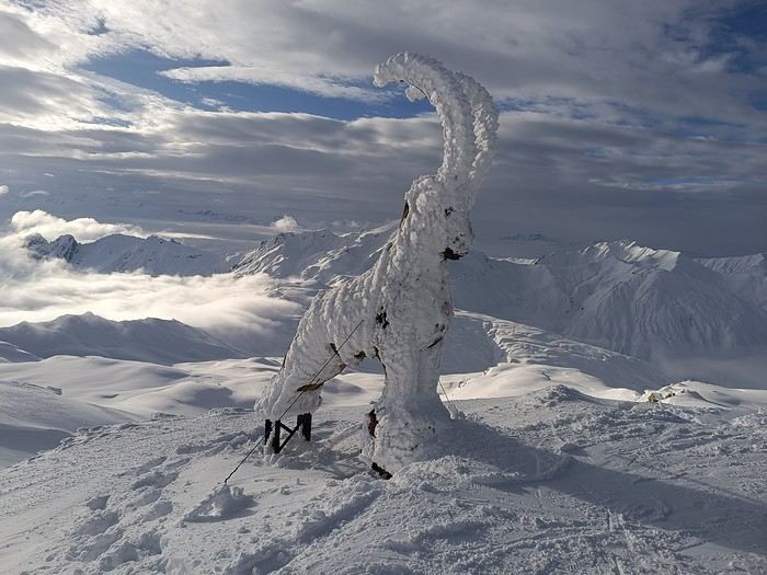
The off-topic contest discussion is happening here
This month’s theme is white in every way imaginable.
Not just a little touch in the top right corner of the photo!
Nor a white square on a white background...
Also, black and white won’t be allowed.
For the rest, I’ll let the voters be the sole judges of whether the theme is respected!
I’m now borrowing Ragamuffin’s wording for the rules:
Every VF member can submit up to 3 photos, until Sunday, February 23 at 11:59 PM, Clermont-Ferrand time.
Each photo must be posted in a separate message, with its number (1, 2, or 3).
Don’t forget to add a little explanation (comment, location, etc.).
Voting:
Every VF member can vote for the 3 photos they think are the best, based on their own criteria and the theme.
Voting will take place from Monday, February 24 to Friday, February 28 at 2:00 PM, Clermont-Ferrand time.
The chosen photos should be listed in order of preference: - 1st photo: 3 points - 2nd: 2 points - 3rd: 1 point
The winner is the author of the photo with the most points.
Results will be published on February 28 in the late afternoon. In case of a tie, the number of first-place votes will decide. The winner will have the honor of organizing March’s contest.
Photos that have already been nominated (1st, 2nd, or 3rd) in another contest are not eligible to participate in this one.
The off-topic contest discussion is happening here
Hi fellow travelers!
I arrive in New Delhi on January 5th, and this is the third time I’ve come across what turns out to be a scam (after some research outside of booking.com): dirty places, fake reviews, etc.
So I’m starting to distrust booking.com because it really doesn’t seem like a reliable site (at least when it comes to booking hotels in New Delhi).
If you have a good place to stay (max 1500 € per night, and I don’t want a dorm) in New Delhi, I’d love to hear about it! :)
Looking forward to your replies!
If you have a good place to stay (max 1500 € per night, and I don’t want a dorm) in New Delhi, I’d love to hear about it! :)
Looking forward to your replies!
New, seen on TV, you won't believe it. Click here.
During my recent trek, I found that my bike—and my luggage—were heavy. Until now, the weight of my gear hadn’t been an issue. Maybe I’m getting old, or maybe I just can’t handle the SNCF’s stairs anymore.
It hit me in Toulouse. A 3-minute stop turned into a 6-hour delay because of a fire that was hard to control between Toulouse and Montauban. Eventually, our train was canceled, and we were told to take another train that was also waiting for the same destination. It was my fourth train of the day. It was 9:30 PM, and I’d left at 9:30 AM that morning. Suddenly, exhaustion took over.
That’s when I met two bike-packers who, without hesitation, lifted their bikes with all their gear attached, carried them down the steps of the Corail train, and then down the stairs to the underground passage. They were young and fit (they smelled like warm sand), and I definitely wasn’t. It was in that scorching heat, struggling up and down all those stairs (Oh Toulouse, as Nougaro would say, may you be cursed for seven generations), that I decided to go on a diet.
It’s a diet anyone can do, it works, and it’s free. So I’m sharing it right away.
No need to exercise or restrict yourself. No, all you have to do is think and do some research. You need a chair, a table, a scale, a computer, and a spreadsheet. Make a list of everything you’ve brought and weigh it all. Set a goal based on the type of trek and your comfort level. Remove everything that doesn’t help you reach that goal.
My goal: - Trekking in France from May to September, in the plains or at most on a plateau like Mont Aubrac, where at 800 m altitude, it can drop to 10 °C at night even in the middle of summer.
- Sleeping in a tent on a good mattress in a sleeping bag (I’m not changing that). Someone suggested I could sleep under the stars on bubble wrap. No way, are you crazy?
- Not cooking. I buy lunch on the way in the morning and dinner on the way in the afternoon (I’m not changing that either). Someone suggested Ducasse delivers everywhere in France. Uh, have you been smoking lemon weed?
That’s how I lost 5 kg, going from 17.7 kg to 12.8 kg, including luggage but not food or water. But I also reduced the volume and quantity of my gear.
Here are the before photos:
https://photos.app.goo.gl/XDfKaoVvHFNxDXrq5
And after:
https://photos.app.goo.gl/STRVKaWuVcNVeCfS9
of my bike.
You can see that a duffel bag is gone, as well as the extra bags behind the panniers. I don’t even use the mesh pockets at the bottom of each pannier anymore. You can also see I’m still carrying my 1 kg U-lock. I know, it’s unforgivable. I’m on the verge of being banned.
So I might do another trek in September to validate my choices.
For the rear panniers, I can save between 1 and 1.5 kg depending on the solution: Arkel Dry-lites (28 L pair, 0.540 kg) or Vaude Aqua Light (38 L pair, 1.080 kg).
I also need to cut down on the tools I bring. I should be able to shave off about 0.5 kg.
And the bike? I’m thinking about it. Someone suggested the folding Savadeck Z2, which only weighs 10 kg. Carbon? Oh, don’t spread the word—it’s even more taboo than aluminum in some circles, and I won’t even mention the belt drive.
Saturday, September 22, 2018
This morning, we woke up at dawn at 6:00 AM. Headed to Letlhakeng, the last town where we could fill up on fuel before starting our crossing of the Kalahari. Our consumption since Johannesburg has been 11L/100 km. We took the direction of Khutse Game Reserve, whose entrance is about a hundred kilometers north of Letlhakeng. Access is via a gravel road along which we saw magnificent pink trees.
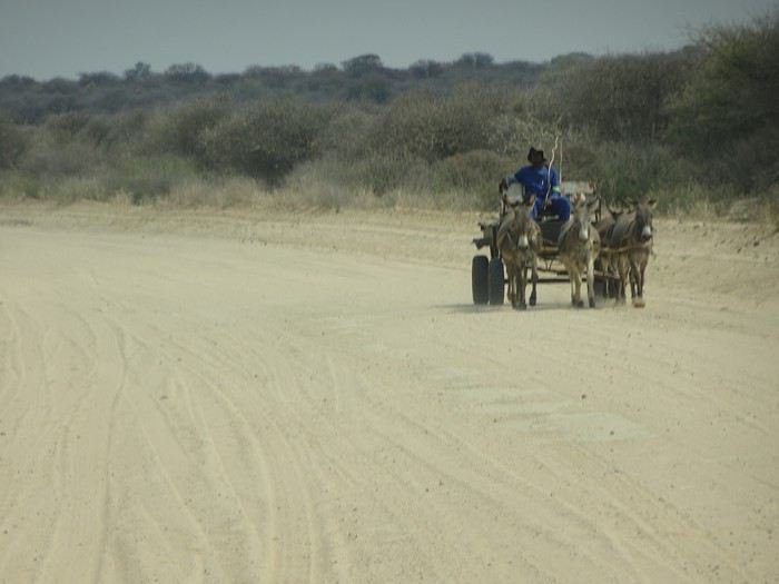
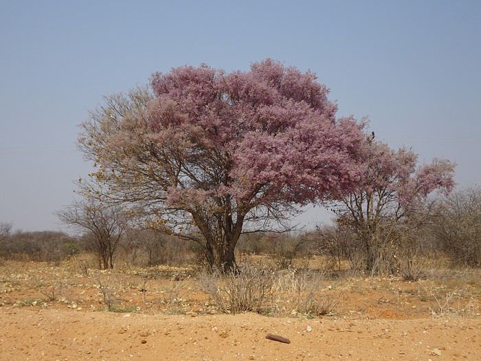
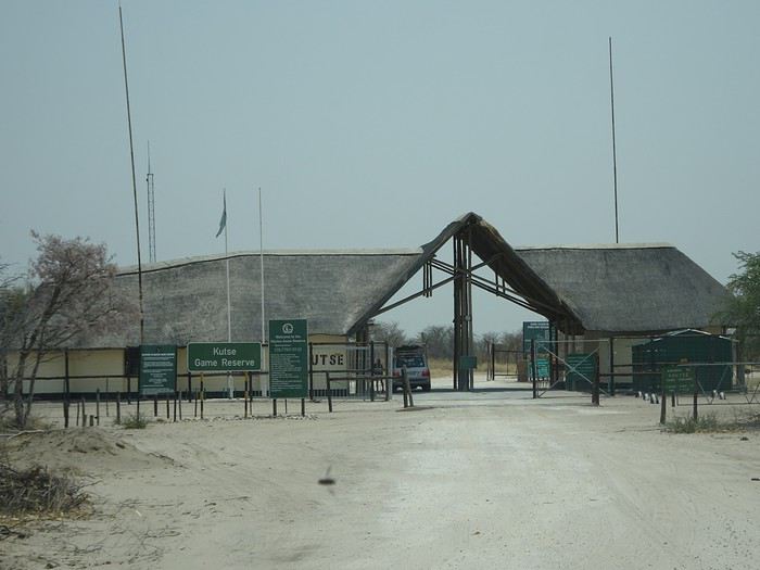
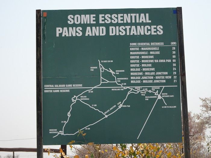
At Khutse Gate, we registered in the entry log and paid the access fees for 6 days: 120 Pulas/day/person and 50 Pulas/day/vehicle. Our stays at the Xaka and Deception Valley campsites had been reserved by our tour operator but not paid, contrary to what they’d told us. So we settled the 2 unpaid days of camping at 30 Pulas/day/person. The park rangers informed us that the southern triangle of Khutse Game Reserve, with its tip at Moreswe Pan, had burned. Note that these two campsites are government-run, which explains the low prices. Private campsites cost ten to fifteen times more. We headed to Khutse campsite, site 5. To enter the parks, you must have a reservation either at a lodge or a campsite. Since the number of spots in the campsites is limited, this means you have to book well in advance. We ate the salad we’d prepared the night before at our campsite. It was very hot—39°C. We made a round trip to Khankhe Pan. On the track, we encountered three South African cars, one of which was stuck in the sand and blocking the way. We helped push the car to get it unstuck. We saw very few animals at Khankhe Pan. We returned to the campsite, which has dry toilets and a shower you have to supply with your own water. We tried out the shower.
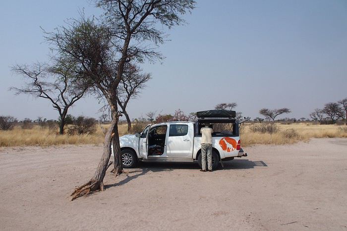
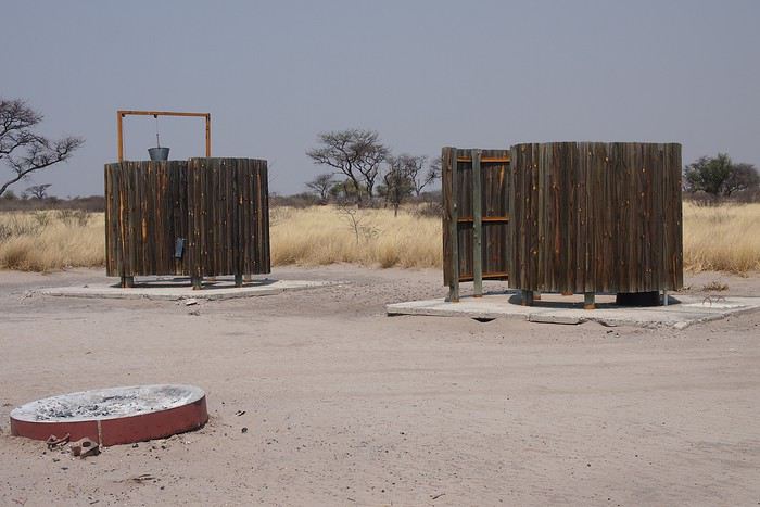
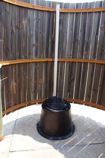
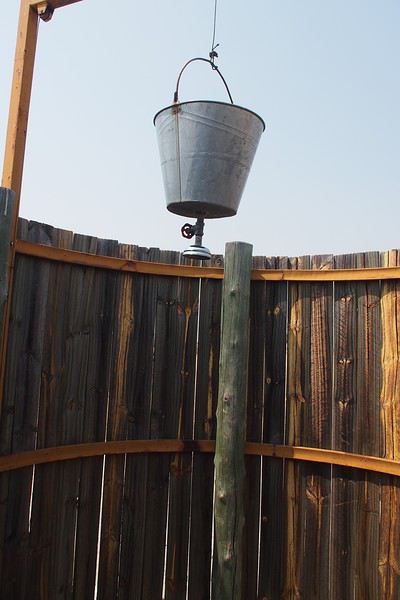
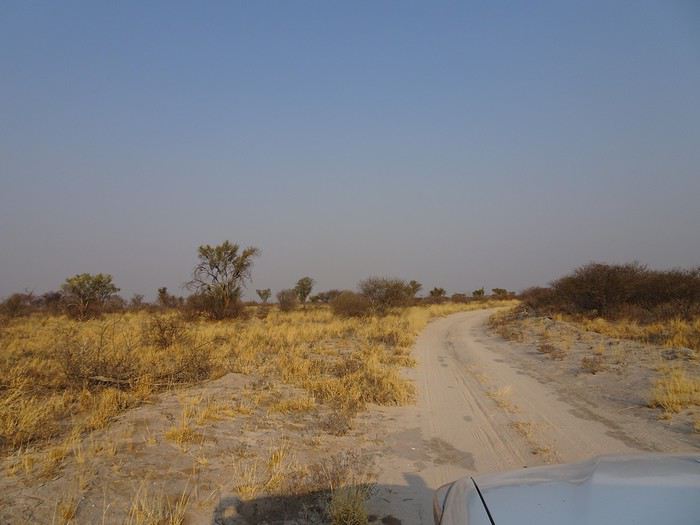
We witnessed our first Kalahari sunset. These sunsets are unmatched, and that didn’t change throughout the trip.
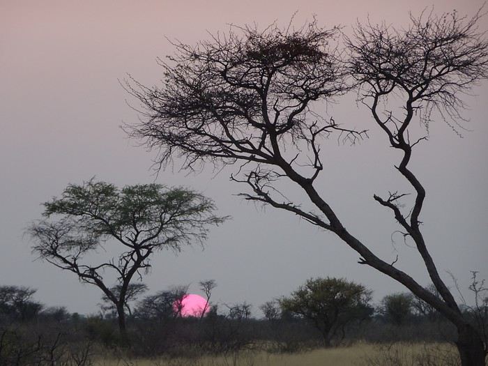
During the trip, we followed the solar rhythm—waking up at 6:00 AM, having dinner at sunset around 6:30 PM, and retiring to our tents by 8:30 PM.
Sunday, September 23, 2018 Up at 6:00 AM. It was 15°C. We were cold last night. Tonight, we’ll use blankets in addition to our sleeping bags. We headed southwest and, past Gwian Pan, turned northwest toward the Molose waterhole, where we saw our first elephants and our first raptor. Indeed, on the track leading to the Molose waterhole, we could see the traces of the massive fire that had ravaged the southern part of Khutse, as the park rangers had warned us.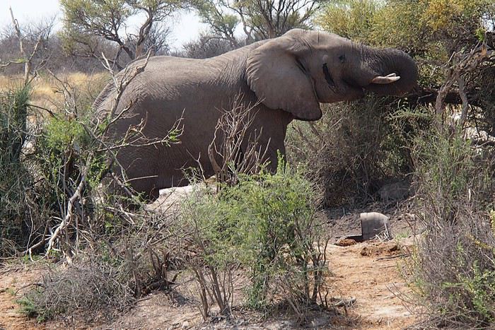
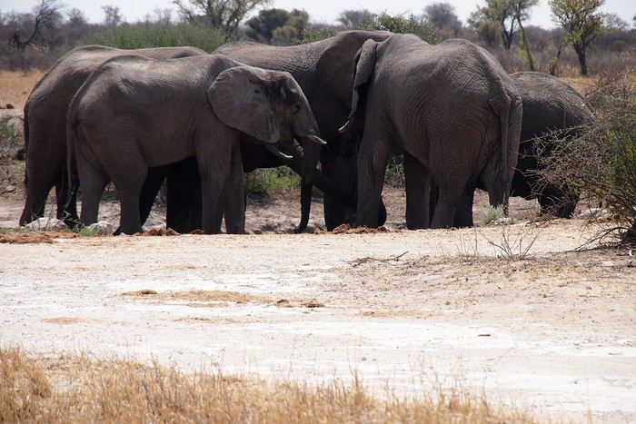
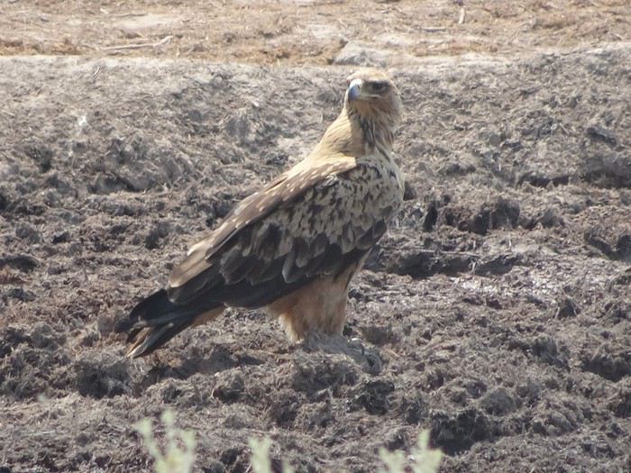
Our first braai at Khankhe campsite.
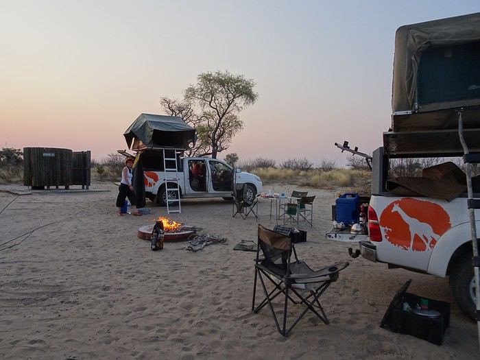
At Khutse Gate, we registered in the entry log and paid the access fees for 6 days: 120 Pulas/day/person and 50 Pulas/day/vehicle. Our stays at the Xaka and Deception Valley campsites had been reserved by our tour operator but not paid, contrary to what they’d told us. So we settled the 2 unpaid days of camping at 30 Pulas/day/person. The park rangers informed us that the southern triangle of Khutse Game Reserve, with its tip at Moreswe Pan, had burned. Note that these two campsites are government-run, which explains the low prices. Private campsites cost ten to fifteen times more. We headed to Khutse campsite, site 5. To enter the parks, you must have a reservation either at a lodge or a campsite. Since the number of spots in the campsites is limited, this means you have to book well in advance. We ate the salad we’d prepared the night before at our campsite. It was very hot—39°C. We made a round trip to Khankhe Pan. On the track, we encountered three South African cars, one of which was stuck in the sand and blocking the way. We helped push the car to get it unstuck. We saw very few animals at Khankhe Pan. We returned to the campsite, which has dry toilets and a shower you have to supply with your own water. We tried out the shower.
We witnessed our first Kalahari sunset. These sunsets are unmatched, and that didn’t change throughout the trip.
During the trip, we followed the solar rhythm—waking up at 6:00 AM, having dinner at sunset around 6:30 PM, and retiring to our tents by 8:30 PM.
Sunday, September 23, 2018 Up at 6:00 AM. It was 15°C. We were cold last night. Tonight, we’ll use blankets in addition to our sleeping bags. We headed southwest and, past Gwian Pan, turned northwest toward the Molose waterhole, where we saw our first elephants and our first raptor. Indeed, on the track leading to the Molose waterhole, we could see the traces of the massive fire that had ravaged the southern part of Khutse, as the park rangers had warned us.
Our first braai at Khankhe campsite.
Practical tips from my 105 days of erratic wandering in India
Day 1 (10/10/2006): arrived in Mumbai around noon. Bus No. 338 5 Rs + 5 Rs (bag) 20' to Andheri station. Train 6 Rs to Dadar. Train 41 Rs to Lonavla 2h30 Hotel Chandralok 500 Rs **
Day 2: bike rental 7 Rs/h (too expensive, normal price 2-3 Rs/h) visit to the caves of Bhaja and Karla.
Day 3: train 28 Rs to Pune 1h20 Hotel National 416 Rs *
Day 4: train 141 Rs (with reservation) to Satara 2h45 Hotel Sagar 364 Rs **
Day 5: bus 110 Rs to Pandharpur 4h Hotel Aishwarya 450 Rs ***
Day 6: bike rental 2 Rs/h
Day 7: bus 125 Rs to Ahmadnagar 4h20 Hotel Parijat 250 Rs *
Day 8: train 151 Rs (!ticket for a mini 600 km trip!) to Jalgaon 5h30 Hotel Plaza 200 Rs **
Day 9: round-trip bus 38 Rs to Ajanta 1h30 + shuttle 6 Rs 5' Site entrance 250 Rs
Day 10: train 47 Rs to Khandwa 3h + bus 40 Rs to Omkareshwar 2h Ganesh G.H. 150 Rs *
Day 11 to 13: Omkareshwar
Day 14: bus 35 Rs to Maheshwar 2h45 Akashdeep Rest House 200 Rs **
Day 15: bus 8 Rs to Dhamnod 20' bus 20 Rs to crossroads 14 km from Mandu 1h40 bus 9 Rs to Mandu 20' Ram Mandir Dharamshala 100 Rs + 5 Rs for hot water *
Day 16: bike rental 3 Rs/h
Day 17: bus 50 Rs to Indore 4h Hotel Neelam 209 Rs
Day 18 to 20: Indore + round-trip bus 30 Rs to Ujjain 1h45
Day 21: train 82 Rs to Bhopal 5h30 Hotel Ranjeet 358 Rs *
Day 22: train 10 Rs to Sanchi 1h20 Jaiswal Lodge 200 Rs + 15 Rs for hot water! *
Day 23 and 24: visit to Sanchi + bike rental to visit the caves of Udayagiri
Day 25: train 69 Rs to Jhansi 5h + tempo 5 Rs to bus station + tempo 10 Rs + 5 Rs (bag) to Orccha 25' Sri Mahant G.H. 200 Rs **
Day 26 and 27: bike rental + train 20 Rs to Datia 30' + bemo 6 Rs to city center. Return bus 15 Rs 1h15
Day 28: bus 100 Rs to Khajuraho 4h Yogi Lodge 150 Rs **
Day 29: bike rental 30 Rs/day to visit the temples
Day 30: bus 70 Rs to Satna 4h + train 56 Rs to Jabalpur 3h Hotel Banjara 350 Rs **
Day 31: bike rental 2 Rs/h and visit to the Marble Rocks (50 km round trip)
Day 32: bus 50 Rs to Mandla 3h Hotel Satyam 250 Rs ** Round-trip bus 15 Rs to Ramnagar 1h15
Day 33: bus 60 Rs to Dindori 4h + bus 45 Rs to Amarkantak 3h (hellish road) Sarvodya Lodge 250 Rs °
Day 34: Amarkantak
Day 35: bus 25 Rs to Pendra Road 1h30 + train 120 Rs + 109 Rs (reservation) to Nagpur 8h Hotel Grand 257 Rs **
Day 36 and 37: bike rental + round-trip 25 Rs to Ramtek 1h40
Day 38: train 141 Rs + 125 Rs to Hyderabad 10h Hotel 3 Castles 200 Rs ° + Hotel Suhail 200 Rs °
Day 39 to 41: stay in Hyderabad
Day 42: train 48 Rs to Warangal 3h30 Hotel Surya 410 Rs **
Day 43: 60 Rs to Vijayawada 4h15 Hotel Sindhuri 275 Rs **
Day 44: round-trip bus 21 Rs to Amaravati 2h
Day 45: train 98 Rs to Visakhapatnam 7h30! (normally 6h) Hotel Sri Sampath Residency 250 Rs **
Day 46: train 111 Rs + 95 Rs to Puri 11h30 Travellers Inn 100 Rs ° + Hotel Z 300 Rs ***
Day 47 to 52: Puri + round-trip to Konarak
Day 53: train 38 Rs to Bhubaneshwar 1h15 Hotel Upasana 275 Rs *
Day 54: train 70 Rs to Balasore 4h bus 26 Rs to Baripada 1h40 Hotel Ambika 225 Rs °
Day 55: bus 25 Rs to Balasore 1h40 train 66 Rs + 68 Rs to Calcutta 6h30 Hotel Paragon 270 Rs * Hotel Crystal 350 Rs **
Day 56 to 62: Calcutta
Day 63: 60 Rs to Bishnupur 5h Hotel Monalisa 200 Rs *
Day 64: stay in Bishnupur no bike rental!
Day 65: bus 20 Rs to Bankura 1h30 bus 20 Rs to Durgapur 1h15 bus 28 Rs to Bolpur 2h15 Hotel Nisa 150 Rs *
Day 66 and 67: visit to Bolpur/Shantiniketan. Refused bike rental at ... 100 Rs/day!!! (Communist state of Bengal!!!)
Day 68: bus 20 Rs to Sainthia bus 35 Rs to Baharampur 4h30 bus 7 Rs to Murshidabad 40' Hotel Manjusha 350 Rs **
Day 69: bike lent by the friendly hotel owner and visit to Murshidabad
Day 70: bus 8 Rs to Baharampur 35' bus 60 Rs to Malda 6h (hellish road) Hotel Pratapaditya 231 Rs **
Day 71: train 66 Rs + 70 Rs to New Jalpaiguri 4h Hotel Holydon 250 Rs °
Day 72: train 52 Rs to Darjeeling 9h30! (normally 7h) Hotel Pineridge 500 Rs **
Day 73 to 75: Darjeeling
Day 76: train to New Jalpaiguri 9h30 + overnight train 271 Rs
Day 77: Patna Hotel President 482 Rs **
Day 78: stay in Patna
Day 79: train 18 Rs to Gaya 3h10 tempo 10 Rs to Bodhgaya 30' Deep G.H. 400 Rs!! °°
Day 80: return to Patna
Day 81: round-trip train 36 Rs to Rajgir 4h! (normally 3h)
Day 82: train 75 Rs to Varanasi 5h! (normally 4h) Yogi Lodge 150 Rs *
Day 83 to 87: Varanasi
Day 88: overnight train 310 Rs to Jaipur Evergreen G.H. 250 Rs **
Day 89: bike rental 30 Rs/day round-trip to Amber
Day 90: bus 59 Rs to Sikar 2h30 bus 23 Rs to Fatehpur 1h30 Rajshri Rest House 300 Rs *
Day 91: round-trip bus 12 Rs to Mandawa 30'
Day 92: round-trip bus 17 Rs to Churu 1h30
Day 93: bus 80 Rs to Jaipur 3h30 Evergreen G.H.
Day 94: bus 105 Rs to Bundi 5h30 Shivam G.H. 200 Rs **
Day 95: bike rental 3 Rs/h
Day 96: auto-rickshaw to station 45 Rs 25' train 44 Rs + 50 Rs to Chittorgarh train 21 Rs to Udaipur (total trip 8h) Badi Haveli 330 Rs **
Day 97 to 99: Udaipur + round-trip bus 45 Rs to Ranakpur 3h30
Day 100: bus 143 Rs to Ahmedabad 5h30 Hotel Manila 300 Rs **
Day 101: Ahmedabad
Day 102: bus 99 Rs to Bhavnagar 4h30 Hotel Vrindavan 200 Rs *
Day 103: round-trip bus 22 Rs to Palitana 1h10
Day 104: bus 85 Rs! to Ahmedabad 5h30 + overnight train ? Rs (feels like the end of the trip!)
Day 105 (January 22, 2007): train 6 Rs from Dadar to Andheri 20' + bus 5 Rs + 5 Rs (bag) to International Airport 20'
More figures British Airways flight price Brussels-London-Mumbai-London-Brussels 576 € Exchange rate from 55 Rs to 58.6 Rs per euro Average room price 272 Rs/night Daily budget 11 € Chai from 1 Rs (Calcutta-Bengal) to 6/7 Rs (Rajasthan) Bottle of water from 6 Rs (Udaipur), 8 Rs (Varanasi) to 12/13 Rs Internet from 8 Rs (Warangal), 10 Rs (Calcutta, Indore, Hyderabad), 20 Rs (often) to 40/60 Rs!! (Rajasthan) Beer in a restaurant from 85/100 Rs (often) to 150/165 Rs (Varanasi/Udaipur) More details on request
More figures British Airways flight price Brussels-London-Mumbai-London-Brussels 576 € Exchange rate from 55 Rs to 58.6 Rs per euro Average room price 272 Rs/night Daily budget 11 € Chai from 1 Rs (Calcutta-Bengal) to 6/7 Rs (Rajasthan) Bottle of water from 6 Rs (Udaipur), 8 Rs (Varanasi) to 12/13 Rs Internet from 8 Rs (Warangal), 10 Rs (Calcutta, Indore, Hyderabad), 20 Rs (often) to 40/60 Rs!! (Rajasthan) Beer in a restaurant from 85/100 Rs (often) to 150/165 Rs (Varanasi/Udaipur) More details on request
Hi everyone!
If you're looking for great tips and offbeat spots, if you love exploring uncharted parts of a country, if the exotic is your adrenaline, then move along!
Our 15 days in early May in this part of Turkey (a country I first discovered during a city trip to Istanbul in 2017) will only tread well-worn paths and revisit popular routes. Simply because I kept hoping until the very end that our flight to Jordan wouldn’t be canceled. Events in the Gulf proved me wrong, so we left with: Zero preparation. Not a single hotel booked (well, except the first one), no visits planned, just a flight ticket bought three weeks earlier. No guidebook, no app—just the desire to explore southern Turkey and Cappadocia, whose images and the chance to stretch our legs had caught my eye.
Oh, wait—I did bring along a new guide: Gemini! Yes, my friends, generative AI was my chief advisor throughout the trip for sites to visit, accommodations, routes, and even restaurants! An experiment I wanted to try to form my own opinion on using this new technology. And what better way to test it than a Turkish getaway?
The verdict? You’ll have to wait for the trip recap to find out!
The main idea of the trip is also relaxation.
So, the plan is Antalya for a few days, the Turkish Riviera for a few more, Cappadocia as the highlight, and a return via Antalya to wrap up the trip. And it was all planned by AI!
So, if you're ready, fasten your seatbelts—cabin crew, doors to automatic and cross check—boarding for Turkey now!
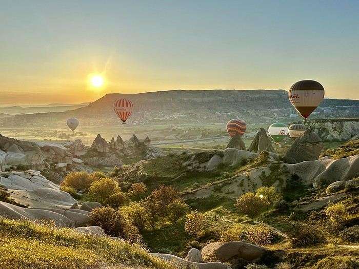 A little sneak peek?
If you're looking for great tips and offbeat spots, if you love exploring uncharted parts of a country, if the exotic is your adrenaline, then move along!
Our 15 days in early May in this part of Turkey (a country I first discovered during a city trip to Istanbul in 2017) will only tread well-worn paths and revisit popular routes. Simply because I kept hoping until the very end that our flight to Jordan wouldn’t be canceled. Events in the Gulf proved me wrong, so we left with: Zero preparation. Not a single hotel booked (well, except the first one), no visits planned, just a flight ticket bought three weeks earlier. No guidebook, no app—just the desire to explore southern Turkey and Cappadocia, whose images and the chance to stretch our legs had caught my eye.
Oh, wait—I did bring along a new guide: Gemini! Yes, my friends, generative AI was my chief advisor throughout the trip for sites to visit, accommodations, routes, and even restaurants! An experiment I wanted to try to form my own opinion on using this new technology. And what better way to test it than a Turkish getaway?
The verdict? You’ll have to wait for the trip recap to find out!
The main idea of the trip is also relaxation.
So, the plan is Antalya for a few days, the Turkish Riviera for a few more, Cappadocia as the highlight, and a return via Antalya to wrap up the trip. And it was all planned by AI!
So, if you're ready, fasten your seatbelts—cabin crew, doors to automatic and cross check—boarding for Turkey now!
A little sneak peek?