IRELAND - INTRODUCTION
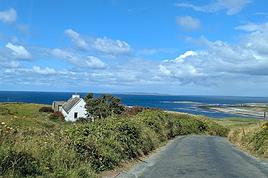
We planned our 15-day trip to Ireland several months in advance to create an itinerary that would let us see a multitude of tourist attractions across various regions of the Republic of Ireland and Northern Ireland.
We researched the main attractions in each region and noted their GPS coordinates.
After that, we used Google Maps to create a packed but realistic daily route. We printed all the itineraries, and they proved extremely useful since some attractions weren’t listed on the GPS a friend lent us, and some roads aren’t clearly marked.
This way, we were able to stick to our daily schedule.
Three months before our departure, we rented a car directly from Autoescape’s website for 136.44 € over 14 days. The rental was with BUDGET, and the car we got was a ŠKODA Citigo.
This rate includes unlimited mileage, collision damage waiver (CDW), theft protection (TP) with a 1,500 € excess, and unlimited third-party liability coverage.
Some roads in Ireland are very narrow, so a compact car is much appreciated. Don’t forget that driving is on the left, and there are plenty of roundabouts.
Luckily, my partner finds driving this way easy, and our travels went smoothly.
It’s worth mentioning how courteous and patient Irish drivers are—it’s truly phenomenal.
Two weeks before our trip, we booked our accommodations at various places like B&Bs, hotels, and university campuses through Hotels.com. We’ll talk more about each of them later.
When we arrived at Dublin Airport, going through customs was quite tedious. There are two lines: one for EU citizens and another for other foreigners. The wait for non-EU travelers is significantly longer.
The car rental isn’t directly at the terminal. You have to take a shuttle to the rental center. Once there, a company representative finalizes the contract and hands over the keys to our rental car.
And off we went on our adventure!
It’s also important to note that some roads have tolls. For most of them, you pay directly at a toll booth, and the fees are usually under 2 €.
However, the M50 motorway around Dublin works differently—it’s a prepaid toll. You’re charged when you drive between Junction 6 (N3 Blanchardstown) and Junction 7 (N4 Lucan). A large purple sign warns you as you approach one of these junctions.
Cameras automatically record your license plate, and fees are applied based on your vehicle category. For a standard car, the fee is 3.10 €.
You have until 8:00 PM the next day to pay at an authorized retailer or online at https://www.eflow.ie/.
We prepaid these fees directly on the site mentioned above.
If you don’t pay within the required time, you’ll be charged substantial penalties.
For dining, most grocery stores and gas stations offer a great selection of hot and cold meals at very reasonable prices. That’s why we mostly bought our food at places like SuperValu, Lidl, Spar, and Centra.
We invite you to keep reading about our adventure in the next section.
526 similar discussions in English
It was exactly 1 year ago today. 22 days in the American West, a beautiful loop starting from San Francisco, with just one place we passed through twice (Death Valley).
Since my first travel journal, recently completed, was very chatty and included lots of photos, I made a big decision this time: 1 day = 1 photo with a comment, that's it!
Before I start, here’s a quick overview of our trip: - San Francisco
- The Pacific Coast (Highway One) from Monterey to Cambria - Death Valley - West Grand Canyon - South Grand Canyon - Vermillion Cliffs - Page (Horseshoe Bend, Antelope Canyon) - Monument Valley
- Moab (Arches Park, Canyonlands) - Bryce Canyon (via Capitol Reef) - Zion Park - Las Vegas - Lone Pine / Alabama Hills (passing through Death Valley again) - Mammoth Lakes - Yosemite - Return to San Francisco via Sonoma.
Here we go! Below are the first 4 photos, for the first 4 days in San Francisco.
Day 1 – Saturday, April 30, around 5:30 PM – Embarcadero, San Francisco

This photo was taken on the long promenade of "The Embarcadero," not far from the Ferry Building. It perfectly captures our state of mind at that moment: the weather is gorgeous, we’ve just dropped off our luggage at the hotel just steps away, and we’re strolling with light hearts, though our eyelids are heavy...
The gleaming vintage trams of the historic line pass by on the boulevard. Soon, the day will fade, and the silhouette of the Bay Bridge spanning the bay will be outlined by thousands of tiny lights... A flavor explosion awaits us nearby at "La Mar Cevicheria," with a delicious local white wine... This trip is off to a great start!
Day 2 - Sunday, May 1, around 3:30 PM, San Francisco Bay

The sun is shining brightly, and we’re on the ferry returning from Sausalito. In this silvery-blue light, everything sparkles, even the steep streets in the background... We’re still amazed to be here.
Day 3 - Monday, May 2, around 4 PM, atop Twin Peaks

A bus line from Haight Ashbury takes you almost to the top of Twin Peaks, winding through incredibly twisty streets. The day has been beautiful again. But the cold wind that just picked up is bringing clouds from the ocean—quick, we’re heading back down...
Tonight, we’re going to see Keith Jarrett at Davies Symphony Hall...
Day 4 - Tuesday, May 3, around 10 AM, National Historical Park

Our first national park! It’s the "Maritime National Historical Park," near Fisherman’s Wharf. Really lovely. Afterward, we’ll grab some delicious fish and chips under the envious gaze of seagulls...
In the afternoon, we pick up our rental car and head to Monterey. Less than 2 hours’ drive.
To be continued!
Since my first travel journal, recently completed, was very chatty and included lots of photos, I made a big decision this time: 1 day = 1 photo with a comment, that's it!
Before I start, here’s a quick overview of our trip: - San Francisco
- The Pacific Coast (Highway One) from Monterey to Cambria - Death Valley - West Grand Canyon - South Grand Canyon - Vermillion Cliffs - Page (Horseshoe Bend, Antelope Canyon) - Monument Valley
- Moab (Arches Park, Canyonlands) - Bryce Canyon (via Capitol Reef) - Zion Park - Las Vegas - Lone Pine / Alabama Hills (passing through Death Valley again) - Mammoth Lakes - Yosemite - Return to San Francisco via Sonoma.
Here we go! Below are the first 4 photos, for the first 4 days in San Francisco.
Day 1 – Saturday, April 30, around 5:30 PM – Embarcadero, San Francisco
This photo was taken on the long promenade of "The Embarcadero," not far from the Ferry Building. It perfectly captures our state of mind at that moment: the weather is gorgeous, we’ve just dropped off our luggage at the hotel just steps away, and we’re strolling with light hearts, though our eyelids are heavy...
The gleaming vintage trams of the historic line pass by on the boulevard. Soon, the day will fade, and the silhouette of the Bay Bridge spanning the bay will be outlined by thousands of tiny lights... A flavor explosion awaits us nearby at "La Mar Cevicheria," with a delicious local white wine... This trip is off to a great start!
Day 2 - Sunday, May 1, around 3:30 PM, San Francisco Bay
The sun is shining brightly, and we’re on the ferry returning from Sausalito. In this silvery-blue light, everything sparkles, even the steep streets in the background... We’re still amazed to be here.
Day 3 - Monday, May 2, around 4 PM, atop Twin Peaks
A bus line from Haight Ashbury takes you almost to the top of Twin Peaks, winding through incredibly twisty streets. The day has been beautiful again. But the cold wind that just picked up is bringing clouds from the ocean—quick, we’re heading back down...
Tonight, we’re going to see Keith Jarrett at Davies Symphony Hall...
Day 4 - Tuesday, May 3, around 10 AM, National Historical Park
Our first national park! It’s the "Maritime National Historical Park," near Fisherman’s Wharf. Really lovely. Afterward, we’ll grab some delicious fish and chips under the envious gaze of seagulls...
In the afternoon, we pick up our rental car and head to Monterey. Less than 2 hours’ drive.
To be continued!
Hello,
We’re planning our trip for October 2017!! (Yes, it’s still far off—but planning it is already like a vacation.) We’re interested in the Ban Gioc Waterfalls, but I can’t quite make up my mind about them. Will there still be water in October? Is this stop worth it? (Even if there’s no water?) Thanks for your replies! Happy travels to everyone, Eric
We’re planning our trip for October 2017!! (Yes, it’s still far off—but planning it is already like a vacation.) We’re interested in the Ban Gioc Waterfalls, but I can’t quite make up my mind about them. Will there still be water in October? Is this stop worth it? (Even if there’s no water?) Thanks for your replies! Happy travels to everyone, Eric
I’m a Burgundian—true, pure, through and through. I’d never want to leave this region, which, objectively speaking, is the most beautiful in the world. It’s overflowing with wonders. But—because there’s always a but—I decided to marry a Breton, a true, pure, tough, stubborn one who only talks about that and has a flag in the hallway (tied to the Burgundian flag on the wall). That’s how my life went off the rails, and this is my story!
January 2014 The trip to Kenya was planned for September. We were deep into researching our future route! For once, I agreed to leave my magnificent region. But then, in the middle of a Manau song (cliché #1), she announces she’s got a bun in the oven. Before she could explain what that expression meant, I asked what kind of candy it was... We canceled the trip because the due date was set for September! Though, I could’ve gone alone. What’s that, my love? You say no? But... there’s no but? Alright, my love! Yes, yes, I’m drinking my herbal tea and going to bed!
April 2015 The trip still wasn’t happening this year either. I preferred to spend my savings on my son, whom I’ll call Mister M! One day, while she’s listening to Celkilt (cliché #2) and drinking Breizh Cola (cliché #3) in front of Breizh TV (cliché #4), she gets a phone call. Her family in Brittany invites us because they want to see Mister M. What joy... I loooooove my in-laws... No, I’m kidding. They’re nice. Yes, yes. Stop teasing me. Okay, fine, it annoys me even though I’m excited to discover the region. The only time I went there, I was 3 years old (in Brittany, not with my in-laws), and it rained a lot (cliché num... nooooo, my dad told me that, it’s not a cliché!). My wife, though, is thrilled to go "home" and show me around. Hmm... We’ll see at the end of the month... I’ve got 15 days of peace left.
Day 1 It’s the big departure. The two cats are at the kennel, the little one is ready, but the wife isn’t yet (I hate whoever invented makeup). The Punto is packed to the brim—one more handbag and it’ll explode. Here we go, off on the open road. We’ll stop in Carnac because with a kid, the drive is long, and my luck is that I’ll see my family before the big dive into the in-laws’ place. The one I’ll call Uncle Racist is on vacation in Carnac with his wife, Auntie PSG! So let’s make a stop there and take the chance to visit, even if my wife thinks the alignments are just "piles of stones." She’ll change her mind. In the meantime, I tease her by asking, when I see a sign, if Nantes is in Brittany. I nearly ended up in the eternal box from the sheer aggression. I’m not getting into that debate. Only my Burgundy interests me.
But we chat, we chat, and here’s Carnac. Uncle Racist welcomes us. It’s late, Mister M has already eaten and gone to bed. For us, it’s a good beef bourguignon (let’s be chauvinistic!) prepared by Auntie PSG. A football evening (my wife is delighted), and it’s time to hit the hay and dream of... Dijon. Really, what a beautiful region!

Just one photo for now, but the rest is coming for Day 2. Yeahhhh, I don’t take photos while driving, come on.
January 2014 The trip to Kenya was planned for September. We were deep into researching our future route! For once, I agreed to leave my magnificent region. But then, in the middle of a Manau song (cliché #1), she announces she’s got a bun in the oven. Before she could explain what that expression meant, I asked what kind of candy it was... We canceled the trip because the due date was set for September! Though, I could’ve gone alone. What’s that, my love? You say no? But... there’s no but? Alright, my love! Yes, yes, I’m drinking my herbal tea and going to bed!
April 2015 The trip still wasn’t happening this year either. I preferred to spend my savings on my son, whom I’ll call Mister M! One day, while she’s listening to Celkilt (cliché #2) and drinking Breizh Cola (cliché #3) in front of Breizh TV (cliché #4), she gets a phone call. Her family in Brittany invites us because they want to see Mister M. What joy... I loooooove my in-laws... No, I’m kidding. They’re nice. Yes, yes. Stop teasing me. Okay, fine, it annoys me even though I’m excited to discover the region. The only time I went there, I was 3 years old (in Brittany, not with my in-laws), and it rained a lot (cliché num... nooooo, my dad told me that, it’s not a cliché!). My wife, though, is thrilled to go "home" and show me around. Hmm... We’ll see at the end of the month... I’ve got 15 days of peace left.
Day 1 It’s the big departure. The two cats are at the kennel, the little one is ready, but the wife isn’t yet (I hate whoever invented makeup). The Punto is packed to the brim—one more handbag and it’ll explode. Here we go, off on the open road. We’ll stop in Carnac because with a kid, the drive is long, and my luck is that I’ll see my family before the big dive into the in-laws’ place. The one I’ll call Uncle Racist is on vacation in Carnac with his wife, Auntie PSG! So let’s make a stop there and take the chance to visit, even if my wife thinks the alignments are just "piles of stones." She’ll change her mind. In the meantime, I tease her by asking, when I see a sign, if Nantes is in Brittany. I nearly ended up in the eternal box from the sheer aggression. I’m not getting into that debate. Only my Burgundy interests me.
But we chat, we chat, and here’s Carnac. Uncle Racist welcomes us. It’s late, Mister M has already eaten and gone to bed. For us, it’s a good beef bourguignon (let’s be chauvinistic!) prepared by Auntie PSG. A football evening (my wife is delighted), and it’s time to hit the hay and dream of... Dijon. Really, what a beautiful region!
Just one photo for now, but the rest is coming for Day 2. Yeahhhh, I don’t take photos while driving, come on.
Here’s a travel journal with photos, different from the ones we usually share with you.
Some of you may have heard about the legendary charm of Alsace, this small region in eastern France, right next to Germany. For those who want to visit, we’re offering this journal. While it’s not exhaustive, it covers many of the most interesting sites, and we’d love to help make your trip a success—or maybe even inspire you to take a trip there.
Introduction
" HOW BEAU-TI-FUL OUR ALSACE IS WITH ITS FRESH VALLEYS IN SUMMER, IT RI-PENS THERE WHEAT, VINES, AND HOPS "
This is the start of a little tune our elementary school teacher used to make us sing in class. That was last century. This refrain and its melody have stayed in my heart because they perfectly capture this region. I know many tourists dream of the Christmas market and the magical snowy landscapes, which makes sense, especially for visitors from the south or those with young kids. As for me, I’d recommend visiting between June and September because everything is so much more pleasant and enjoyable during the warm season.
Alsace is a mix of German organization and French art de vivre. The result? A place beautifully shaped by nature, thoughtfully developed by people, and packed with exceptional restaurants and bakeries. Plus, tourists are generally welcomed with courtesy and expertise.
The heart of the region’s tourism lies between Strasbourg and Colmar, spanning the Haut-Rhin and Bas-Rhin departments. To the west of these cities, often on the slopes between the plain and the hills, winds the famous Wine Route. From north to south, it stretches about 150 to 170 kilometers. A proper visit to Alsace takes about five days to a week—or longer if you’re really into it. I think having a car is best, as the terrain isn’t flat.
Let’s start with northern Alsace, which is less known to tourists—except for the Germans, who love strolling around and enjoying good food there.
Wissembourg sits on the border with Germany, at the very north of the Bas-Rhin, about 60 km from Strasbourg. The tourist office has set up signs near the large free parking lot, so you can take a pleasant walk through this small town. Highlights include the Saint-Pierre Saint-Paul Church (the second-largest in Alsace), the 1741 town hall, the Salt House with its unusual roof, the ramparts, and some fascinating old houses.
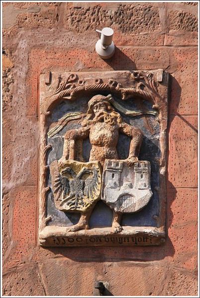
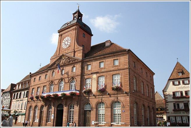


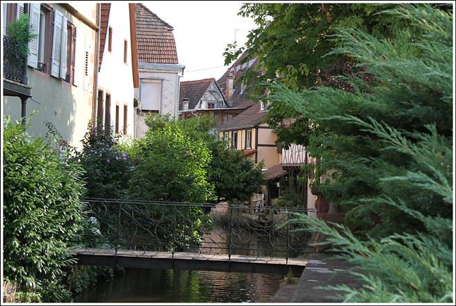
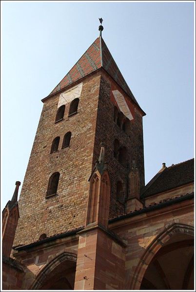
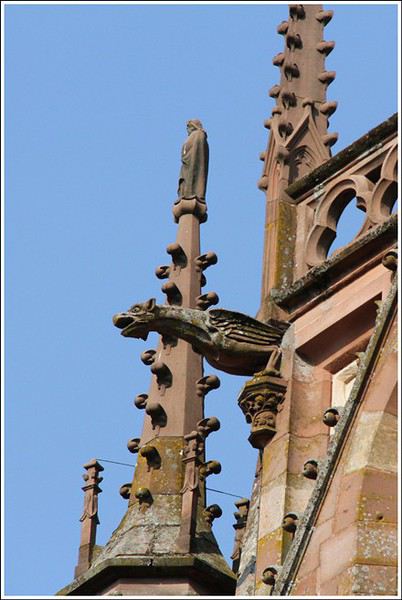
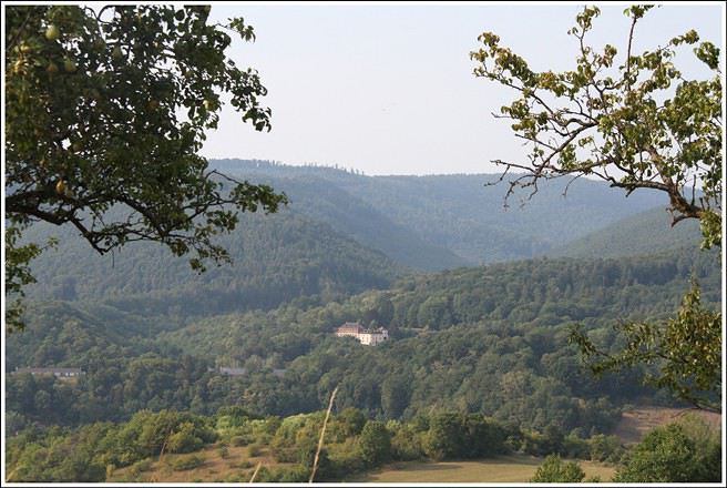
Hills border Alsace along its entire western frontier and also to the north. Countless hikes are possible in these low- and mid-altitude forests, where you can find chanterelles, sheep’s head mushrooms, and blueberries. Here’s a typical view taken above Wissembourg, near the Pigeonnier Pass:
Some of you may have heard about the legendary charm of Alsace, this small region in eastern France, right next to Germany. For those who want to visit, we’re offering this journal. While it’s not exhaustive, it covers many of the most interesting sites, and we’d love to help make your trip a success—or maybe even inspire you to take a trip there.
Introduction
" HOW BEAU-TI-FUL OUR ALSACE IS WITH ITS FRESH VALLEYS IN SUMMER, IT RI-PENS THERE WHEAT, VINES, AND HOPS "
This is the start of a little tune our elementary school teacher used to make us sing in class. That was last century. This refrain and its melody have stayed in my heart because they perfectly capture this region. I know many tourists dream of the Christmas market and the magical snowy landscapes, which makes sense, especially for visitors from the south or those with young kids. As for me, I’d recommend visiting between June and September because everything is so much more pleasant and enjoyable during the warm season.
Alsace is a mix of German organization and French art de vivre. The result? A place beautifully shaped by nature, thoughtfully developed by people, and packed with exceptional restaurants and bakeries. Plus, tourists are generally welcomed with courtesy and expertise.
The heart of the region’s tourism lies between Strasbourg and Colmar, spanning the Haut-Rhin and Bas-Rhin departments. To the west of these cities, often on the slopes between the plain and the hills, winds the famous Wine Route. From north to south, it stretches about 150 to 170 kilometers. A proper visit to Alsace takes about five days to a week—or longer if you’re really into it. I think having a car is best, as the terrain isn’t flat.
Let’s start with northern Alsace, which is less known to tourists—except for the Germans, who love strolling around and enjoying good food there.
Wissembourg sits on the border with Germany, at the very north of the Bas-Rhin, about 60 km from Strasbourg. The tourist office has set up signs near the large free parking lot, so you can take a pleasant walk through this small town. Highlights include the Saint-Pierre Saint-Paul Church (the second-largest in Alsace), the 1741 town hall, the Salt House with its unusual roof, the ramparts, and some fascinating old houses.
Hills border Alsace along its entire western frontier and also to the north. Countless hikes are possible in these low- and mid-altitude forests, where you can find chanterelles, sheep’s head mushrooms, and blueberries. Here’s a typical view taken above Wissembourg, near the Pigeonnier Pass:
Not very well known: Hokkaido Island has national parks that rival those in North America. Hiking there is free (even many mountain huts) and requires no formalities. These treks are described in the LP *Hiking in Japan* guide—you can just buy the Hokkaido PDF. It’s way better than Mount Fuji. Of course, everything depends on the weather, which is very unstable in the Japanese mountains (frequent strong winds). The trails are often obstacle courses.
The Daisetsu Zan traverse is a stunning hike through volcanic terrain with a remote section in the middle that requires at least one night of camping (there are basic huts for the rest, which is popular with Japanese hikers): 4 to 6 days.
The Shiretoko traverse takes 2 days with views including an island in Russia, but the ridge is brown bear territory—there are even more here than in Denali National Park in Alaska (brown bears and grizzlies are the same). I ran into 7 in just 6 hours of hiking!
I’m heading to Rebun and Rishiri Islands next.
The Daisetsu Zan traverse is a stunning hike through volcanic terrain with a remote section in the middle that requires at least one night of camping (there are basic huts for the rest, which is popular with Japanese hikers): 4 to 6 days.
The Shiretoko traverse takes 2 days with views including an island in Russia, but the ridge is brown bear territory—there are even more here than in Denali National Park in Alaska (brown bears and grizzlies are the same). I ran into 7 in just 6 hours of hiking!
I’m heading to Rebun and Rishiri Islands next.
Hey fellow travelers,
As a huge Asia lover, I don’t usually post trip reports here since I find it so easy to get around in those countries (whether online beforehand or on the spot). But after 15 days in Zanzibar, I figured our experience (we’re traveling as a couple) might help some of you.
To sum it up, this island is absolutely stunning but not exactly a walk in the park for independent travelers!
**TRANSPORTATION**
Since we’re not Bill Gates, we have to make choices—especially in Zanzibar, which is way pricier than Asia.
One option was taking the *dalla dalla* (local minibuses) to get around the island, but it was just too complicated for us. For example, going from Nungwi to Matemwe takes half an hour by car but hours by *dalla dalla* because you *have* to go back through the capital!
Taking taxis from one hotel to another didn’t interest us since we see travel as a way to immerse ourselves in the country and get as close to locals as possible (sounds a bit pompous, but I couldn’t find a better way to put it!!).
So, we decided to rent a car to move freely and stop wherever we wanted. If you’re looking for info on the Dolphin Tour, Spice Tour, or Safari Blue… you can skip this part—we didn’t do any of that (I know, it’s a shame, but we can’t do everything, right? 😉). There are agencies everywhere that can organize those for you without any hassle.
Long story short, after some searching, we rented a car from Ally Keys (found on *Le Routard*), a small Toyota 4x4 for $350 for 11 days (we drove about 900 km and spent 80 € on gas).
The roads are basically wide boulevards—just watch out for pedestrians and cyclists constantly. Once you leave Stone Town, though, there’s hardly any traffic.
**The police—quite the love story for us!!** First off, no paranoia needed: police checkpoints stop *every* car, not just the ones with "white" people.
In 11 days of driving around the island, we were stopped… 13 times, no joke!!
Every time, they asked for our international driver’s permit and the Tanzanian permit Ally gave us for free before we left. They were all super friendly and didn’t give us any trouble (a few words in Swahili can help). Except once, when they noticed the insurance had expired *two days* earlier 🤪.
We hadn’t paid attention, and neither had Ally—our bad.
It turned into quite the scene, lasting about 2 hours, but Ally, who we called, negotiated with them. The fine went from $200 down to $20, and Ally even reimbursed us afterward!! Quite the experience, to say the least.
**THE PEOPLE**
Okay, I’ll try to explain our experience *without getting "stoned," please*. I’m not judging anyone—I just want to share what we felt during these 15 days (way too short to really understand, of course).
My go-to motto, "If you smile, they’ll smile back," didn’t really work there. We found the locals weren’t exactly approachable, especially the women.
That said, we *did* meet some genuinely kind and selfless people: one in Stone Town, sometimes in the local eateries where we ate, and with hitchhikers (male and female) we picked up whenever we saw them (the only way we found to share a bit of our "wealth" with them). But overall, I found it *really* tough.
At the same time, it clarified things. Every time someone approached us in a friendly, warm way, they had something to offer (a restaurant, a shop to visit, a snorkeling tour, a taxi…). No issues with them—they were lovely, just like the staff at all the hotels we stayed in.
In Matemwe, we walked through the village every morning and evening for 5 days. I made an effort to smile and say hello every day, morning and night, but even by the end, the best I got was a nod.
We learned a few words in Swahili (hello, how are you…) to break the ice, but it was pretty much a lost cause, with a few exceptions.
Obviously, since I’d never experienced anything like this, I tried to find an explanation—but we were there too briefly to really figure it out. Here are my hypotheses:
- The strong Muslim presence (even little girls wear veils). Maybe they see us white people as "depraved," even though we always dressed modestly.
- Smiling might not be part of their communication style (sounds dumb, but you never know!).
- Maybe there’s some resentment toward white people, which, honestly, I’d totally understand. Let me explain: two worlds share this island without really mixing. 50% of tourists stay in Nungwi and Kendwa, 25% stay in resorts all around the island, 23% go from hotel to hotel by taxi or *dalla dalla*, and maybe 2% travel like we did (totally unscientific stats, obviously).
In 11 days of exploring the island (except Stone Town and the beaches), we *never* saw a white person outside a hotel or taxi (no exaggeration)—never in villages, markets…
Luxury resorts sit right next to villages in extreme poverty (no running water, no electricity, etc.), and the tourism money barely trickles down to locals. It’s enough to make you ashamed of being white—I felt that way more than once!
Anyway, if anyone here knows Zanzibaris well, I’d *love* to hear their perspective.
**PHOTOS**
Given what I just said, you can imagine it wasn’t easy.
The women were the hardest to approach—I gave up on taking their photos after 3 or 4 clear refusals (they’d cover their faces, not angrily, but firmly).
Most men I asked agreed.
With kids, anything goes:
- Some pose for a photo and laugh hysterically when they see themselves.
- Some pose but then demand a dollar, shillings, pens, or even your hair tie if that’s all you’ve got!!
Some happily agree when you ask, while others shout a big "Nooooo" or even threaten to throw rocks at you *before* you’ve even turned on your camera!!
Once again, I put myself in their shoes and watched how "white" people behave. They walk by without a word, raise their camera, snap a shot, and leave without even a wave. When you see yourself in that mirror, it really puts things into perspective!
**STONE TOWN**
Like everyone else, we started our trip in Stone Town—one of the most beautiful cities I’ve ever seen (no exaggeration!). Despite being super touristy, it’s managed to keep its soul, which is pretty rare.
The sea and its *dhows* (boats with triangular sails straight out of another era), colonial buildings everywhere (some renovated, others run-down but still beautiful), narrow alleys with stunning doors (not just in hotels, as I thought), women in colorful veils all over the streets, the call to prayer echoing through the alleys, and, of course, the Darajani Street market—not to be missed if you want even a tiny taste of African life. Pure magic!
The only downside? Quite a few shady guys offering all kinds of services, some of them drug users and a bit unsettling (one even waited for hours outside our hotel after we told him we didn’t need anything). We stayed polite and friendly, and it went fine, but it did create a slightly "sketchy" vibe at times.
For our hotel, we spent the first two nights at Karibu Zanzibar Inn, found online for $65 a night. Right in the heart of the old town, perfect for us—clean, quiet, rooftop terrace for breakfast, welcoming staff. Nothing to complain about, except maybe the price!
For the last two nights before leaving, we found a place on the spot, super well-located, for $45 a night (DM me for details if you’re interested).
We also rented bikes to get around—great for $5 a day per bike.
**MONEY**
Money’s a bit tricky here, I found. Some hotels supposedly only accept dollars (not the ones we stayed in, though), and a lot of prices are listed in that currency. Either way, you can leave your euros at home—several exchange bureaus won’t take them. My advice? Bring enough dollars to avoid credit card fees (you can’t withdraw more than 190 € at a time from ATMs, so you’d pay a fee each time).
For our budget, we spent 800 € per person for 14 days, staying in hotels averaging $45 a night (not easy to find, by the way) and eating often in local eateries (more on that below). Meals in touristy restaurants cost between 6 and 9 € per person, a beer is 2 €, a Coke is 1 €…
Don’t forget, for two people: $100 for visas, $60 for airport-port round-trip taxis, and $160 for Dar-Stone Town round-trip boats.
**FOOD & ACCOMMODATION**
We ate in local restaurants about ten times: chicken or beef skewers with fries or rice for 1.50 € per person. But:
1 – You have to find the "restaurant" that doesn’t look like one (usually a roadside shack).
2 – With a shady spot to sit, which isn’t always possible.
3 – For the squeamish, hygiene conditions are *way* below standard (no fridge, well water used to wash dishes, flies everywhere)!!
We figured if locals eat there, it’s probably a good sign, and honestly, the food was good, and we never got sick.
Plus, it’s the best way to meet Zanzibaris.
Hotels were tough to find under $50. Thankfully, we had the car to scout around (prices in guidebooks had gone up!). We chose to stay 5 days in the north of the island (Matemwe) and 5 days in the south (Jambiani), which let us explore almost the whole island.
We decided that on the spot after checking things out.
In Matemwe, we didn’t overthink it—we stayed at Allykeys Bungalow, whose owner rented us the car! At first, we were a bit wary of his offer, but after checking it out, we loved it. Simple bungalows but with everything we needed, a great setting facing the sea, sun loungers to relax, a restaurant and bar by the water, and—best of all—a very local vibe (about 50 *dhows* leaving for fishing every morning between 5:30 and 6:00, and their return around 1:00 PM with haggling over fish prices on the beach—pure bliss).
Just so you know, it’s pretty noisy (I love the call to prayer, but at 4:30 and 5:30 AM, it’s *early*—especially when it goes on for so long!!), no hot water (just lukewarm), and no Wi-Fi. But for that, there’s a great deal at the Green… at the very north end of the beach. Just by ordering a drink (3 € for a beer, 2 € for a Coke), you can enjoy the Wi-Fi and pool all afternoon. Super friendly welcome at this luxury hotel, even for "bumpkins" like us!!
In Jambiani, we found Pakachi Beach Resort—a dream come true. Listed at over $60 online, they offered us a beachfront bungalow (a big bed downstairs, another upstairs with a sea view and ocean breeze included), a bathroom with hot water, Wi-Fi in common areas, and a pool (low tide is *really* low there!!) for $45 a night. It was so amazing we wondered if they mistook us for *Le Routard* guides since we arrived alone with our car!!
It was also super quiet—only three plugs in use, including ours, which might explain it!!
**THE BEACHES**
Quick rundown:
- The most beautiful aesthetically and for swimming anytime: Kendwa, no question. The downside? Way too many resorts for our taste and no local life. We went for a day before heading back to Matemwe.
- The most tourist-packed: Nungwi, obviously. Not our cup of tea, but I guess it’s great for young people who want to party.
- Best for local life: Matemwe, hands down. The daily fishing returns are a highlight, plus village life, seaweed gatherers, kids on the beach—we *loved* it.
- Best for peace and beauty (but no swimming at low tide): Pongwe, Uroa, Kiwengwa, Jambiani, and a special mention for Dongwe, which we found absolutely gorgeous.
- If you want to feel like you’re in the middle of nowhere but still by the water: Kae Kuu and Unguja Ukuu.
There you go—that’s pretty much everything we saw!
Sorry for the novel. I doubt many of you made it to the end of my "prose." At least no one can say I didn’t share my experience this time 😉.
If you’ve got questions, don’t hesitate.
See you soon, and happy travels!
As a huge Asia lover, I don’t usually post trip reports here since I find it so easy to get around in those countries (whether online beforehand or on the spot). But after 15 days in Zanzibar, I figured our experience (we’re traveling as a couple) might help some of you.
To sum it up, this island is absolutely stunning but not exactly a walk in the park for independent travelers!
**TRANSPORTATION**
Since we’re not Bill Gates, we have to make choices—especially in Zanzibar, which is way pricier than Asia.
One option was taking the *dalla dalla* (local minibuses) to get around the island, but it was just too complicated for us. For example, going from Nungwi to Matemwe takes half an hour by car but hours by *dalla dalla* because you *have* to go back through the capital!
Taking taxis from one hotel to another didn’t interest us since we see travel as a way to immerse ourselves in the country and get as close to locals as possible (sounds a bit pompous, but I couldn’t find a better way to put it!!).
So, we decided to rent a car to move freely and stop wherever we wanted. If you’re looking for info on the Dolphin Tour, Spice Tour, or Safari Blue… you can skip this part—we didn’t do any of that (I know, it’s a shame, but we can’t do everything, right? 😉). There are agencies everywhere that can organize those for you without any hassle.
Long story short, after some searching, we rented a car from Ally Keys (found on *Le Routard*), a small Toyota 4x4 for $350 for 11 days (we drove about 900 km and spent 80 € on gas).
The roads are basically wide boulevards—just watch out for pedestrians and cyclists constantly. Once you leave Stone Town, though, there’s hardly any traffic.
**The police—quite the love story for us!!** First off, no paranoia needed: police checkpoints stop *every* car, not just the ones with "white" people.
In 11 days of driving around the island, we were stopped… 13 times, no joke!!
Every time, they asked for our international driver’s permit and the Tanzanian permit Ally gave us for free before we left. They were all super friendly and didn’t give us any trouble (a few words in Swahili can help). Except once, when they noticed the insurance had expired *two days* earlier 🤪.
We hadn’t paid attention, and neither had Ally—our bad.
It turned into quite the scene, lasting about 2 hours, but Ally, who we called, negotiated with them. The fine went from $200 down to $20, and Ally even reimbursed us afterward!! Quite the experience, to say the least.
**THE PEOPLE**
Okay, I’ll try to explain our experience *without getting "stoned," please*. I’m not judging anyone—I just want to share what we felt during these 15 days (way too short to really understand, of course).
My go-to motto, "If you smile, they’ll smile back," didn’t really work there. We found the locals weren’t exactly approachable, especially the women.
That said, we *did* meet some genuinely kind and selfless people: one in Stone Town, sometimes in the local eateries where we ate, and with hitchhikers (male and female) we picked up whenever we saw them (the only way we found to share a bit of our "wealth" with them). But overall, I found it *really* tough.
At the same time, it clarified things. Every time someone approached us in a friendly, warm way, they had something to offer (a restaurant, a shop to visit, a snorkeling tour, a taxi…). No issues with them—they were lovely, just like the staff at all the hotels we stayed in.
In Matemwe, we walked through the village every morning and evening for 5 days. I made an effort to smile and say hello every day, morning and night, but even by the end, the best I got was a nod.
We learned a few words in Swahili (hello, how are you…) to break the ice, but it was pretty much a lost cause, with a few exceptions.
Obviously, since I’d never experienced anything like this, I tried to find an explanation—but we were there too briefly to really figure it out. Here are my hypotheses:
- The strong Muslim presence (even little girls wear veils). Maybe they see us white people as "depraved," even though we always dressed modestly.
- Smiling might not be part of their communication style (sounds dumb, but you never know!).
- Maybe there’s some resentment toward white people, which, honestly, I’d totally understand. Let me explain: two worlds share this island without really mixing. 50% of tourists stay in Nungwi and Kendwa, 25% stay in resorts all around the island, 23% go from hotel to hotel by taxi or *dalla dalla*, and maybe 2% travel like we did (totally unscientific stats, obviously).
In 11 days of exploring the island (except Stone Town and the beaches), we *never* saw a white person outside a hotel or taxi (no exaggeration)—never in villages, markets…
Luxury resorts sit right next to villages in extreme poverty (no running water, no electricity, etc.), and the tourism money barely trickles down to locals. It’s enough to make you ashamed of being white—I felt that way more than once!
Anyway, if anyone here knows Zanzibaris well, I’d *love* to hear their perspective.
**PHOTOS**
Given what I just said, you can imagine it wasn’t easy.
The women were the hardest to approach—I gave up on taking their photos after 3 or 4 clear refusals (they’d cover their faces, not angrily, but firmly).
Most men I asked agreed.
With kids, anything goes:
- Some pose for a photo and laugh hysterically when they see themselves.
- Some pose but then demand a dollar, shillings, pens, or even your hair tie if that’s all you’ve got!!
Some happily agree when you ask, while others shout a big "Nooooo" or even threaten to throw rocks at you *before* you’ve even turned on your camera!!
Once again, I put myself in their shoes and watched how "white" people behave. They walk by without a word, raise their camera, snap a shot, and leave without even a wave. When you see yourself in that mirror, it really puts things into perspective!
**STONE TOWN**
Like everyone else, we started our trip in Stone Town—one of the most beautiful cities I’ve ever seen (no exaggeration!). Despite being super touristy, it’s managed to keep its soul, which is pretty rare.
The sea and its *dhows* (boats with triangular sails straight out of another era), colonial buildings everywhere (some renovated, others run-down but still beautiful), narrow alleys with stunning doors (not just in hotels, as I thought), women in colorful veils all over the streets, the call to prayer echoing through the alleys, and, of course, the Darajani Street market—not to be missed if you want even a tiny taste of African life. Pure magic!
The only downside? Quite a few shady guys offering all kinds of services, some of them drug users and a bit unsettling (one even waited for hours outside our hotel after we told him we didn’t need anything). We stayed polite and friendly, and it went fine, but it did create a slightly "sketchy" vibe at times.
For our hotel, we spent the first two nights at Karibu Zanzibar Inn, found online for $65 a night. Right in the heart of the old town, perfect for us—clean, quiet, rooftop terrace for breakfast, welcoming staff. Nothing to complain about, except maybe the price!
For the last two nights before leaving, we found a place on the spot, super well-located, for $45 a night (DM me for details if you’re interested).
We also rented bikes to get around—great for $5 a day per bike.
**MONEY**
Money’s a bit tricky here, I found. Some hotels supposedly only accept dollars (not the ones we stayed in, though), and a lot of prices are listed in that currency. Either way, you can leave your euros at home—several exchange bureaus won’t take them. My advice? Bring enough dollars to avoid credit card fees (you can’t withdraw more than 190 € at a time from ATMs, so you’d pay a fee each time).
For our budget, we spent 800 € per person for 14 days, staying in hotels averaging $45 a night (not easy to find, by the way) and eating often in local eateries (more on that below). Meals in touristy restaurants cost between 6 and 9 € per person, a beer is 2 €, a Coke is 1 €…
Don’t forget, for two people: $100 for visas, $60 for airport-port round-trip taxis, and $160 for Dar-Stone Town round-trip boats.
**FOOD & ACCOMMODATION**
We ate in local restaurants about ten times: chicken or beef skewers with fries or rice for 1.50 € per person. But:
1 – You have to find the "restaurant" that doesn’t look like one (usually a roadside shack).
2 – With a shady spot to sit, which isn’t always possible.
3 – For the squeamish, hygiene conditions are *way* below standard (no fridge, well water used to wash dishes, flies everywhere)!!
We figured if locals eat there, it’s probably a good sign, and honestly, the food was good, and we never got sick.
Plus, it’s the best way to meet Zanzibaris.
Hotels were tough to find under $50. Thankfully, we had the car to scout around (prices in guidebooks had gone up!). We chose to stay 5 days in the north of the island (Matemwe) and 5 days in the south (Jambiani), which let us explore almost the whole island.
We decided that on the spot after checking things out.
In Matemwe, we didn’t overthink it—we stayed at Allykeys Bungalow, whose owner rented us the car! At first, we were a bit wary of his offer, but after checking it out, we loved it. Simple bungalows but with everything we needed, a great setting facing the sea, sun loungers to relax, a restaurant and bar by the water, and—best of all—a very local vibe (about 50 *dhows* leaving for fishing every morning between 5:30 and 6:00, and their return around 1:00 PM with haggling over fish prices on the beach—pure bliss).
Just so you know, it’s pretty noisy (I love the call to prayer, but at 4:30 and 5:30 AM, it’s *early*—especially when it goes on for so long!!), no hot water (just lukewarm), and no Wi-Fi. But for that, there’s a great deal at the Green… at the very north end of the beach. Just by ordering a drink (3 € for a beer, 2 € for a Coke), you can enjoy the Wi-Fi and pool all afternoon. Super friendly welcome at this luxury hotel, even for "bumpkins" like us!!
In Jambiani, we found Pakachi Beach Resort—a dream come true. Listed at over $60 online, they offered us a beachfront bungalow (a big bed downstairs, another upstairs with a sea view and ocean breeze included), a bathroom with hot water, Wi-Fi in common areas, and a pool (low tide is *really* low there!!) for $45 a night. It was so amazing we wondered if they mistook us for *Le Routard* guides since we arrived alone with our car!!
It was also super quiet—only three plugs in use, including ours, which might explain it!!
**THE BEACHES**
Quick rundown:
- The most beautiful aesthetically and for swimming anytime: Kendwa, no question. The downside? Way too many resorts for our taste and no local life. We went for a day before heading back to Matemwe.
- The most tourist-packed: Nungwi, obviously. Not our cup of tea, but I guess it’s great for young people who want to party.
- Best for local life: Matemwe, hands down. The daily fishing returns are a highlight, plus village life, seaweed gatherers, kids on the beach—we *loved* it.
- Best for peace and beauty (but no swimming at low tide): Pongwe, Uroa, Kiwengwa, Jambiani, and a special mention for Dongwe, which we found absolutely gorgeous.
- If you want to feel like you’re in the middle of nowhere but still by the water: Kae Kuu and Unguja Ukuu.
There you go—that’s pretty much everything we saw!
Sorry for the novel. I doubt many of you made it to the end of my "prose." At least no one can say I didn’t share my experience this time 😉.
If you’ve got questions, don’t hesitate.
See you soon, and happy travels!
Does visiting Albania (combined with Greece) require renting a 4x4?
If you have any tips on beautiful routes, we’d love to hear them.
Thanks in advance.
Thanks in advance.
As I mentioned before, I’m heading to Istanbul next summer, and I’ve heard there have been quite a few attacks by Kurds in Turkey recently, which is making me hesitate about my trip.
What do you all think? :( I’m wondering if it’s really a good idea to go...
What do you all think? :( I’m wondering if it’s really a good idea to go...
Hi everyone,
Who’d like to share their best and worst travel memories in a few lines? For me, it’s watching the TAJ MAHAL at sunrise and getting chased by dogs at the top of a mountain pass in GREECE on the way back from ISTANBUL. THANKS GUYS
Who’d like to share their best and worst travel memories in a few lines? For me, it’s watching the TAJ MAHAL at sunrise and getting chased by dogs at the top of a mountain pass in GREECE on the way back from ISTANBUL. THANKS GUYS
Preamble
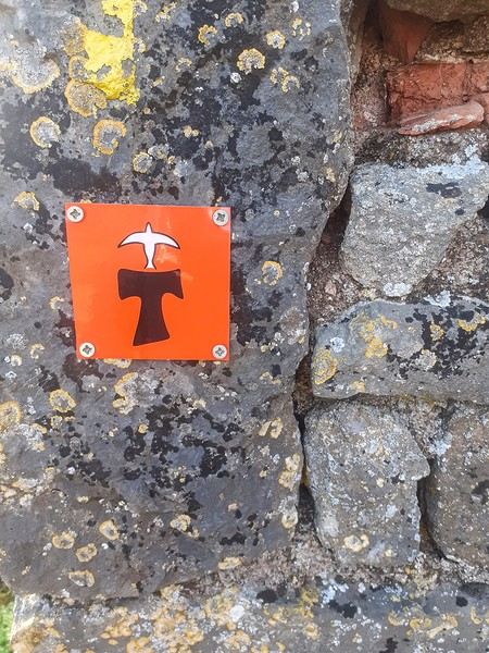
June 2024. While hiking with my brother on the GR 36 Tour du Morvan, I catch sight now and then of strange rectangular markers fixed to tree trunks. Against a bright orange background, a deep black Greek tau topped with a white dove. My first encounter with the Assisi Way. The Way of St. Francis: a pilgrimage route linking Vézelay in Burgundy to Assisi in Italy, covering nearly 1,800 km. It felt like an obvious next step—I immediately knew I’d take it on, attempt the adventure solo.
In the months that followed, I talked about my project to everyone—family, friends, my partner. An avalanche of comments, more or less the same but varying depending on each person’s character and life experiences. But deep down, it all boiled down to one legitimate question: why?
And the answers? Hesitant, awkward, partial, even confused. I quickly realized they weren’t so easy to find. It was as if my project seemed more like a whim, a kind of intimate caprice, rather than a well-thought-out plan. Of course, I knew the reasons that pushed me to leave—you always have to give some. Loved ones need to understand to feel reassured, and that’s understandable. But I fear that when I list them, they’ll sound like the same old checklist anyone embarking on this kind of journey might give. Of all the reasons I could mention, I’ll highlight just one here: the call of the road, the solo adventure that brings a powerful sense of freedom. A bit like Monsieur Seguin’s goat, who from her comfortable pen gazes longingly at the unconstrained horizon of the mountain. But if I’m being honest, I think I didn’t really know what I was looking for—or, more importantly, what I’d find. Deep down, when I reflect on it, one word keeps coming up that explains nothing and everything at once: desire.
Now well past sixty, I know that when I ask myself who I am or where I’m going, two things bring me fully back to myself: hiking and writing. And my intention was also to anchor this adventure through words, day by day. Writing down my feelings, emotions, discoveries, and reflections each evening. The famous travel journal that grounds the daily experience in reality. When I discovered the app "Polarstep," which was initially just meant to keep my loved ones updated and reassured, inform them of my progress, and maintain a connection, I found an opportunity to do it a little differently than usual. No retrospective notes polished up after returning, but spontaneous writing—recounting everything that crossed my mind during the day and publishing it immediately. A journey lived in real time.
This text is the exact transcription of my daily writings. Rereading them, I didn’t change a thing—just corrected a few mistakes and tweaked some awkward phrasing here and there. Short texts, fitting the format imposed by this kind of app. Writing as if addressing others.
Now, all that was left was to walk. April 18, 2026 – Vézelay.
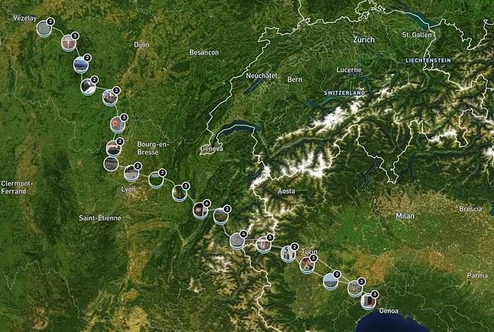
June 2024. While hiking with my brother on the GR 36 Tour du Morvan, I catch sight now and then of strange rectangular markers fixed to tree trunks. Against a bright orange background, a deep black Greek tau topped with a white dove. My first encounter with the Assisi Way. The Way of St. Francis: a pilgrimage route linking Vézelay in Burgundy to Assisi in Italy, covering nearly 1,800 km. It felt like an obvious next step—I immediately knew I’d take it on, attempt the adventure solo.
In the months that followed, I talked about my project to everyone—family, friends, my partner. An avalanche of comments, more or less the same but varying depending on each person’s character and life experiences. But deep down, it all boiled down to one legitimate question: why?
And the answers? Hesitant, awkward, partial, even confused. I quickly realized they weren’t so easy to find. It was as if my project seemed more like a whim, a kind of intimate caprice, rather than a well-thought-out plan. Of course, I knew the reasons that pushed me to leave—you always have to give some. Loved ones need to understand to feel reassured, and that’s understandable. But I fear that when I list them, they’ll sound like the same old checklist anyone embarking on this kind of journey might give. Of all the reasons I could mention, I’ll highlight just one here: the call of the road, the solo adventure that brings a powerful sense of freedom. A bit like Monsieur Seguin’s goat, who from her comfortable pen gazes longingly at the unconstrained horizon of the mountain. But if I’m being honest, I think I didn’t really know what I was looking for—or, more importantly, what I’d find. Deep down, when I reflect on it, one word keeps coming up that explains nothing and everything at once: desire.
Now well past sixty, I know that when I ask myself who I am or where I’m going, two things bring me fully back to myself: hiking and writing. And my intention was also to anchor this adventure through words, day by day. Writing down my feelings, emotions, discoveries, and reflections each evening. The famous travel journal that grounds the daily experience in reality. When I discovered the app "Polarstep," which was initially just meant to keep my loved ones updated and reassured, inform them of my progress, and maintain a connection, I found an opportunity to do it a little differently than usual. No retrospective notes polished up after returning, but spontaneous writing—recounting everything that crossed my mind during the day and publishing it immediately. A journey lived in real time.
This text is the exact transcription of my daily writings. Rereading them, I didn’t change a thing—just corrected a few mistakes and tweaked some awkward phrasing here and there. Short texts, fitting the format imposed by this kind of app. Writing as if addressing others.
Now, all that was left was to walk. April 18, 2026 – Vézelay.
Preamble: Why La Gomera?
When we started looking for a summer destination a few months ago, our first criterion was to avoid extreme heat and heatwaves. We had already been to Norway two years ago and are considering going back in the future for other occasions. So, we had some fun asking ChatGPT which destinations enjoyed a mild climate during the summer without going too far. Among the list provided by the AI were the Canary Islands... The idea of a place we wouldn’t have thought of first, both not too far away and exotic enough, appealed to us: “Hmm, why not?”
This destination had never really attracted me, though Magali was a bit more interested. Five years earlier, COVID had caused a short break in my professional activity, and I had planned a trip because the flight price was attractive, and I was looking for a destination different from what usually appeals to me, more than out of deep interest. From a distance and with a social judgment I acknowledge (it’s not great, but it’s not completely wrong), I had the image of a destination for party-goers enjoying the sun without the slightest interest in local culture, with concrete coastlines and denatured landscapes—everything I detest the most. Still, I had done some quick research on the different islands and spotted Lanzarote for its beautiful volcanic landscapes, hiking trails, beaches, and the impression of a good balance between activity and fewer crowds than Tenerife or Gran Canaria. Then I dropped the idea of going, without ever reconsidering traveling to the Canaries...
Until now! Because we started researching the different islands of the archipelago to see which ones might appeal to us the most. It was La Gomera, the third smallest island of the archipelago, more praised for its hiking trails and preserved nature than for its beaches, away from mass tourism (fifty times fewer tourists than Tenerife) but still a bit more developed than its wild neighbor El Hierro, that caught our attention. Contrary to what might be suggested later, I’m not at all addicted to AI, but I use it from time to time to synthesize quick research or simply for experimentation. Since ChatGPT had started anticipating my tastes lately as if it had become my buddy (often successfully, sometimes off the mark), I asked which Canary Island would suit me best for a trip with my family. The tool answered first with... La Gomera. So, I tested it and teased it a bit to see if this suggestion was well-founded, as the method sometimes makes it contradict itself. But no luck: “You’d appreciate the wild nature of El Hierro, but with family, you’ll find little activity for the kids. You won’t like the touristy vibe of the big islands like Tenerife, Gran Canaria, Lanzarote, and Fuerteventura. You could consider La Palma, but it’s really La Gomera that will suit you best, based on your interests and the criteria given.” So, we dug deeper into our research and were convinced without a shadow of a doubt that this island was the one waiting for us.
Without knowing it, we had Canarians in our circle who revealed their origins when they heard about our travel plans. One from Tenerife insisted we’d be better off choosing Tenerife (obviously...) because it also has preserved spots and that La Gomera, “you can explore it in two or three days, you’ll get bored quickly...” The other, a colleague from Gran Canaria who had never visited La Gomera, still recommended it without hesitation because it turned out her parents had just gone there on vacation: they loved it and had encountered few tourists. She also tended to think this destination was usually the subject of short stays, but according to what her parents told her, taking your time there was also a great idea. However, in our research, the idea that La Gomera is an island you can explore in three or four days max kept coming up. So, we considered combining its visit with La Palma or El Hierro, the other two that caught our eye. But hopping between islands by ferry represents a significant budget for non-Canarians, even more so for a family of four. Then, scrutinizing Google Maps, it seemed obvious that two weeks were too short to discover two islands as they deserve, and that there seemed to be plenty to see in La Gomera, given its very unique culture. After all, we read that some people spend several months a year there, others never even leave... Finally, these landscapes and this atmosphere, which seemed to us a mix of Europe, North Africa, and Latin America, tempted us. So, it would be two weeks in La Gomera, deal!
La Gomera is therefore the second... well, the third smallest island of the Canaries since La Graciosa was recently recognized as a fully inhabited island. It has the shape of a rough circle about 20 to 25 kilometers in diameter and has just over 20,000 inhabitants, half of them in its capital, San Sebastián de la Gomera, the only real town. Like its Canarian sisters, La Gomera is a volcanic formation that rose about 10 million years ago. The island is very mountainous and rugged, covered with red and black rocky landscapes. Geological activity has shaped, between the sprawling massifs that end in steep cliffs in the ocean, six coastal valleys with tropical vegetation that have favored human settlement. They divide the island like slices of a cake; from the north clockwise: the agricultural Vallehermoso, the rustic Agulo, the green, humid, and fertile Hermigua, the sunny capital San Sebastián de la Gomera, the southern and isolated Alajeró-Santiago, and the seaside Valle Gran Rey. They constitute the six municipalities (more like cantons to our French understanding) of the territory.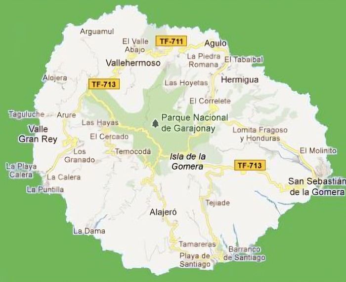 The large solidified magma massifs that shape the heart of the island have created a large depression more protected from the sun at its center, allowing the growth of a vast laurel forest, today grouped within the Garajonay National Park, La Gomera’s green lung, which has earned it the status of a World Biosphere Reserve. Its completely European appearance contrasts sharply with the rocky and tropical landscapes of the rest of the island. Thus, the climate varies greatly from one point to another on the island: in summer, you can quickly go from a dry and sunny valley at 35°C to a humid forest area at altitude at 18°C.
La Gomera was populated late. As with the rest of the Canaries, human presence is thought to have begun about 2,000 years ago. Groups of animist Berbers, probably fleeing persecution, gradually populated the archipelago, especially the western islands and La Gomera, becoming its small aboriginal population: the Guanches (or later Gomeros). The animist and pastoral civilization of the Guanches thrived until the Spanish takeover in the 15th century, which, after a short period of harmony and mixing with the indigenous people, suddenly ended in bloodshed... La Gomera later became the “Columbus Island” after Christopher Columbus’s stopover, increasing the blending of populations. In the 20th century, many Gomeros emigrated to Cuba and other Latin American countries in search of a better life, bringing back a mix of cultures and traits quite palpable in today’s Gomeran culture. It is, however, in La Gomera that the vestiges of Guanche culture seem to have left the most traces, in the language, gastronomy, social practices... Moreover, most Gomeros, especially in remote villages, have a particular identifiable type and proudly claim their ancestral roots, even making La Gomera a bit exotic in the eyes of other Canarians.
Perhaps that’s why it has never really wanted to develop its tourist infrastructure too much. If we set aside the tourists who visit for the day by bus or boat from Tenerife on a marked itinerary (and whom we ultimately rarely encounter), La Gomera has remained a hidden gem, a destination focused on nature discovery that attracts hikers, nature-loving divers, and scientists for its fauna and flora, and to a lesser extent, beachgoers who don’t seek overly developed coastlines. Tourist activity is therefore limited. Roughly speaking, you’ll find a majority of Spaniards, including a substantial number of residents from other Canary Islands, many Germans who have a particular fondness for La Gomera and spend long stays there or own second homes, to the point that the German cultural footprint is clearly noticeable in some places (it’s said to be Angela Merkel’s favorite holiday spot), and still quite a few French. The presence of other nationalities seemed negligible to us. Most travelers come mainly for hiking, but it’s also a prime spot for whale watching. Additionally, the seaside resorts of La Gomera—San Sebastián, Santiago, and especially Valle Gran Rey—are well-known destinations for hippies, especially German ones, ranging from chic boho hippies to old-school hippies who’ve been there for decades, quite similar to those you’d meet in India in Goa, Rishikesh, or Paharganj. Thus, practices like naturism, vegetarianism, and local organic production are quite well established in some areas.
Some practical info: - The round-trip flight from Paris to Tenerife cost us 365 € per person (outbound with Transavia, return with EasyJet), including checked luggage and three seats reserved side by side. - We chose two bases to explore the island: one week in Valle Gran Rey, reputed to be the most pleasant of the three seaside resorts, and one week in Hermigua, more mountainous and close to the natural park. We booked two houses with balconies and views: the first at 120 € per night, the second at 99 €. - The round-trip ferry between Tenerife and La Gomera cost us 270 € with the company Baleària Canarias, including discounts for children aged 4 and 12, but I don’t have the exact details. It was a bit cheaper than with the other company, Fred Olsen. - Finally, we rented a car through the agency Cicar for 360 € for 16 days, which comes to 22.50 € per day. - Apart from that, we didn’t plan anything and decided the day before or even the morning of what we wanted to do. We didn’t invest in any paper guide on the Canaries, as information on La Gomera was scarce, but we used the very comprehensive site La Gomera Travel, a travel guide published by the Canary Islands Tourism Council, a real goldmine of almost exhaustive information on the island.
Alright, off we go for 16 days of adventure discovering La Gomera!
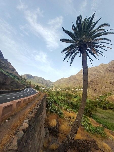
And we start the trip with music!
We start the trip with music!
When we started looking for a summer destination a few months ago, our first criterion was to avoid extreme heat and heatwaves. We had already been to Norway two years ago and are considering going back in the future for other occasions. So, we had some fun asking ChatGPT which destinations enjoyed a mild climate during the summer without going too far. Among the list provided by the AI were the Canary Islands... The idea of a place we wouldn’t have thought of first, both not too far away and exotic enough, appealed to us: “Hmm, why not?”
This destination had never really attracted me, though Magali was a bit more interested. Five years earlier, COVID had caused a short break in my professional activity, and I had planned a trip because the flight price was attractive, and I was looking for a destination different from what usually appeals to me, more than out of deep interest. From a distance and with a social judgment I acknowledge (it’s not great, but it’s not completely wrong), I had the image of a destination for party-goers enjoying the sun without the slightest interest in local culture, with concrete coastlines and denatured landscapes—everything I detest the most. Still, I had done some quick research on the different islands and spotted Lanzarote for its beautiful volcanic landscapes, hiking trails, beaches, and the impression of a good balance between activity and fewer crowds than Tenerife or Gran Canaria. Then I dropped the idea of going, without ever reconsidering traveling to the Canaries...
Until now! Because we started researching the different islands of the archipelago to see which ones might appeal to us the most. It was La Gomera, the third smallest island of the archipelago, more praised for its hiking trails and preserved nature than for its beaches, away from mass tourism (fifty times fewer tourists than Tenerife) but still a bit more developed than its wild neighbor El Hierro, that caught our attention. Contrary to what might be suggested later, I’m not at all addicted to AI, but I use it from time to time to synthesize quick research or simply for experimentation. Since ChatGPT had started anticipating my tastes lately as if it had become my buddy (often successfully, sometimes off the mark), I asked which Canary Island would suit me best for a trip with my family. The tool answered first with... La Gomera. So, I tested it and teased it a bit to see if this suggestion was well-founded, as the method sometimes makes it contradict itself. But no luck: “You’d appreciate the wild nature of El Hierro, but with family, you’ll find little activity for the kids. You won’t like the touristy vibe of the big islands like Tenerife, Gran Canaria, Lanzarote, and Fuerteventura. You could consider La Palma, but it’s really La Gomera that will suit you best, based on your interests and the criteria given.” So, we dug deeper into our research and were convinced without a shadow of a doubt that this island was the one waiting for us.
Without knowing it, we had Canarians in our circle who revealed their origins when they heard about our travel plans. One from Tenerife insisted we’d be better off choosing Tenerife (obviously...) because it also has preserved spots and that La Gomera, “you can explore it in two or three days, you’ll get bored quickly...” The other, a colleague from Gran Canaria who had never visited La Gomera, still recommended it without hesitation because it turned out her parents had just gone there on vacation: they loved it and had encountered few tourists. She also tended to think this destination was usually the subject of short stays, but according to what her parents told her, taking your time there was also a great idea. However, in our research, the idea that La Gomera is an island you can explore in three or four days max kept coming up. So, we considered combining its visit with La Palma or El Hierro, the other two that caught our eye. But hopping between islands by ferry represents a significant budget for non-Canarians, even more so for a family of four. Then, scrutinizing Google Maps, it seemed obvious that two weeks were too short to discover two islands as they deserve, and that there seemed to be plenty to see in La Gomera, given its very unique culture. After all, we read that some people spend several months a year there, others never even leave... Finally, these landscapes and this atmosphere, which seemed to us a mix of Europe, North Africa, and Latin America, tempted us. So, it would be two weeks in La Gomera, deal!
La Gomera is therefore the second... well, the third smallest island of the Canaries since La Graciosa was recently recognized as a fully inhabited island. It has the shape of a rough circle about 20 to 25 kilometers in diameter and has just over 20,000 inhabitants, half of them in its capital, San Sebastián de la Gomera, the only real town. Like its Canarian sisters, La Gomera is a volcanic formation that rose about 10 million years ago. The island is very mountainous and rugged, covered with red and black rocky landscapes. Geological activity has shaped, between the sprawling massifs that end in steep cliffs in the ocean, six coastal valleys with tropical vegetation that have favored human settlement. They divide the island like slices of a cake; from the north clockwise: the agricultural Vallehermoso, the rustic Agulo, the green, humid, and fertile Hermigua, the sunny capital San Sebastián de la Gomera, the southern and isolated Alajeró-Santiago, and the seaside Valle Gran Rey. They constitute the six municipalities (more like cantons to our French understanding) of the territory.
The large solidified magma massifs that shape the heart of the island have created a large depression more protected from the sun at its center, allowing the growth of a vast laurel forest, today grouped within the Garajonay National Park, La Gomera’s green lung, which has earned it the status of a World Biosphere Reserve. Its completely European appearance contrasts sharply with the rocky and tropical landscapes of the rest of the island. Thus, the climate varies greatly from one point to another on the island: in summer, you can quickly go from a dry and sunny valley at 35°C to a humid forest area at altitude at 18°C.La Gomera was populated late. As with the rest of the Canaries, human presence is thought to have begun about 2,000 years ago. Groups of animist Berbers, probably fleeing persecution, gradually populated the archipelago, especially the western islands and La Gomera, becoming its small aboriginal population: the Guanches (or later Gomeros). The animist and pastoral civilization of the Guanches thrived until the Spanish takeover in the 15th century, which, after a short period of harmony and mixing with the indigenous people, suddenly ended in bloodshed... La Gomera later became the “Columbus Island” after Christopher Columbus’s stopover, increasing the blending of populations. In the 20th century, many Gomeros emigrated to Cuba and other Latin American countries in search of a better life, bringing back a mix of cultures and traits quite palpable in today’s Gomeran culture. It is, however, in La Gomera that the vestiges of Guanche culture seem to have left the most traces, in the language, gastronomy, social practices... Moreover, most Gomeros, especially in remote villages, have a particular identifiable type and proudly claim their ancestral roots, even making La Gomera a bit exotic in the eyes of other Canarians.
Perhaps that’s why it has never really wanted to develop its tourist infrastructure too much. If we set aside the tourists who visit for the day by bus or boat from Tenerife on a marked itinerary (and whom we ultimately rarely encounter), La Gomera has remained a hidden gem, a destination focused on nature discovery that attracts hikers, nature-loving divers, and scientists for its fauna and flora, and to a lesser extent, beachgoers who don’t seek overly developed coastlines. Tourist activity is therefore limited. Roughly speaking, you’ll find a majority of Spaniards, including a substantial number of residents from other Canary Islands, many Germans who have a particular fondness for La Gomera and spend long stays there or own second homes, to the point that the German cultural footprint is clearly noticeable in some places (it’s said to be Angela Merkel’s favorite holiday spot), and still quite a few French. The presence of other nationalities seemed negligible to us. Most travelers come mainly for hiking, but it’s also a prime spot for whale watching. Additionally, the seaside resorts of La Gomera—San Sebastián, Santiago, and especially Valle Gran Rey—are well-known destinations for hippies, especially German ones, ranging from chic boho hippies to old-school hippies who’ve been there for decades, quite similar to those you’d meet in India in Goa, Rishikesh, or Paharganj. Thus, practices like naturism, vegetarianism, and local organic production are quite well established in some areas.
Some practical info: - The round-trip flight from Paris to Tenerife cost us 365 € per person (outbound with Transavia, return with EasyJet), including checked luggage and three seats reserved side by side. - We chose two bases to explore the island: one week in Valle Gran Rey, reputed to be the most pleasant of the three seaside resorts, and one week in Hermigua, more mountainous and close to the natural park. We booked two houses with balconies and views: the first at 120 € per night, the second at 99 €. - The round-trip ferry between Tenerife and La Gomera cost us 270 € with the company Baleària Canarias, including discounts for children aged 4 and 12, but I don’t have the exact details. It was a bit cheaper than with the other company, Fred Olsen. - Finally, we rented a car through the agency Cicar for 360 € for 16 days, which comes to 22.50 € per day. - Apart from that, we didn’t plan anything and decided the day before or even the morning of what we wanted to do. We didn’t invest in any paper guide on the Canaries, as information on La Gomera was scarce, but we used the very comprehensive site La Gomera Travel, a travel guide published by the Canary Islands Tourism Council, a real goldmine of almost exhaustive information on the island.
Alright, off we go for 16 days of adventure discovering La Gomera!
And we start the trip with music!
We start the trip with music!
I’d been wanting to discover Sulawesi for years. But then life happened—COVID, the cost of flight tickets, you name it. Long story short, years went by, but we finally set off as a family for a three-week trip in southern Sulawesi: Rammang Rammang, Rantepao, Sengkang, Bira, and Selayar.
I like to spend a good amount of time in the places I visit, giving myself the chance to really get to know the area and meet locals. So no island-hopping this time—just the south. But when I say "just," it’s not restrictive at all, given how rich this island is in landscapes, little encounters, and magical moments.
Wednesday 07/08 - Thursday 07/09: We left Montpellier for what was supposed to be five flights, though we only took four to start, landing in Jakarta. We picked up our luggage there to catch a flight to Makassar the next day. That’s the only way we could get an affordable ticket (702 €). I won’t bore you with the flight details—there’s not much to say. We arrived at 7 PM and considered heading straight to Makassar that evening. But we opted for a recovery night before taking off again. Good thing we did, because my son’s suitcase was missing... First contact with the locals was a bit stressful—a trip without your luggage isn’t exactly fun. But right away, a woman reassured us: the suitcase was just enjoying some extra time in Singapore. Maybe it was doing some last-minute shopping. Anyway, nothing serious—it was supposed to arrive at 9 AM the next day. That gave us some breathing room since our flight wasn’t until noon. So off we went to our hotel (Days Hotel & Suites) near the airport. It was cheap (40 € for three rooms—my kids are older and need their space), but it wasn’t worth much more. The place had definitely seen better days. But no big deal—we were only there for the night, and... we got to watch France beat Morocco in the World Cup live at 3 AM. That’s what really mattered!
Friday 07/10: In search of the lost suitcase First challenge of the morning: finding our missing suitcase. They sent us to the airport basement, to the staff entrance. We were greeted with smiles, and an airport employee led me through the underground corridors back to the baggage claim. Right on time at 9 AM, the suitcase arrived, just like they’d promised. We were finally complete! Off we went to change terminals, grab a well-deserved meal, and board our fifth flight to Makassar. Little side note: I struggled for a while trying to book domestic flights directly on the airlines’ websites with no luck. Without meaning to advertise (though I guess I am a little), I realized it’d be easier to use sites like tiket.com or Traveloka. That turned out to be a great choice—I even ended up booking hotels through them later in the trip. 12:40 PM: We were on our way to Makassar. First good news: we were the only tourists. Well, the only European tourists on the flight, anyway. No, you’re not dreaming—the bag is full of... potato chip packets. To each their own souvenirs, I guess...

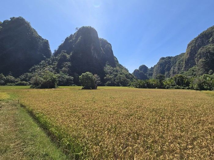
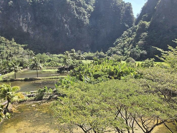
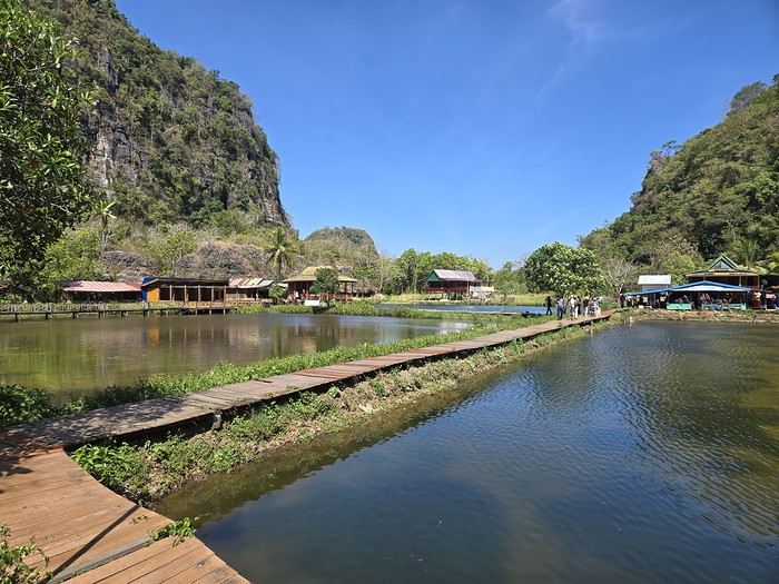
When we arrived in Makassar, a driver was waiting to take us straight to Rammang Rammang: 250,000 IDR (12 €) to our guesthouse (Rammang Rammang House). Forget about meeting people on the bus—we were headed straight to the first stop of our trip, and it was already stunning.
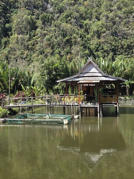
My kids’ guesthouse: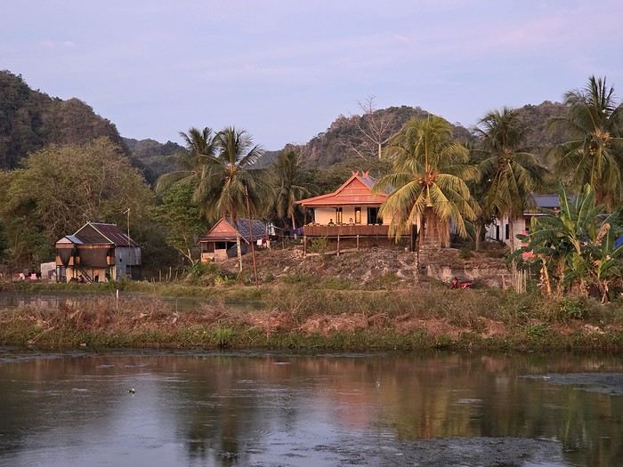
Ours: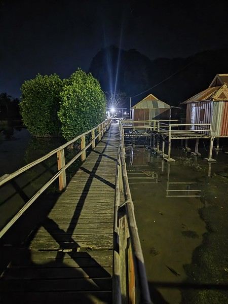
View of the little lake: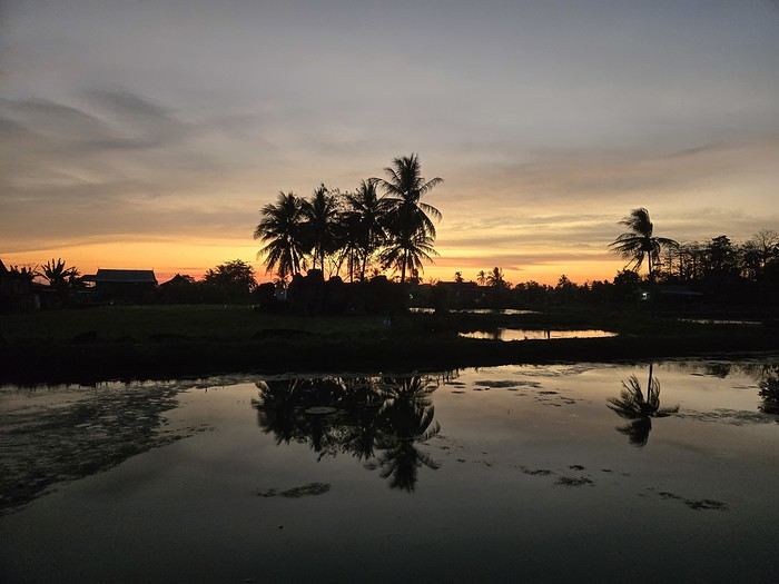
But not everything is straightforward around here. I wanted to get a local SIM card for internet and calls. I found them expensive at Jakarta’s airport (20 € for 20 GB), so I decided to wait. Well, no luck in Rammang Rammang either. You can’t just buy one from the local shop—you need a Telkomsat store (they have the best coverage). So we’d have to wait for Rantepao to get Wi-Fi... When I say "local shop," I mean the little shack around the corner. No big deal—we’d find one easily in Rantepao for 5 € and 25 GB. So there we were, offline, just the four of us enjoying the amazing view.
Saturday 07/11: Rammang Rammang We woke up early to the sound of wedding music blasting through the village (everyone’s invited!). Off we went to explore the area. A little walking, a little boat ride (shared with a French tourist and a Polish one—yes, there *are* tourists here, just not many; 750,000 IDR for up to 8 people) through a lovely canal, and we discovered the karst site. It was peaceful and beautiful. The river: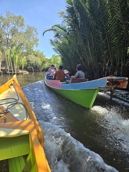 The karst site:
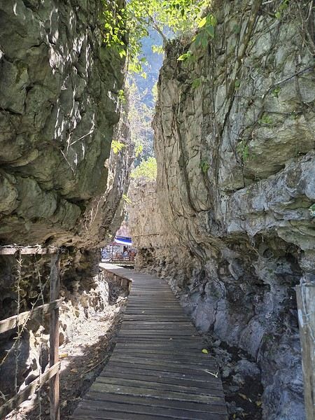
Wednesday 07/08 - Thursday 07/09: We left Montpellier for what was supposed to be five flights, though we only took four to start, landing in Jakarta. We picked up our luggage there to catch a flight to Makassar the next day. That’s the only way we could get an affordable ticket (702 €). I won’t bore you with the flight details—there’s not much to say. We arrived at 7 PM and considered heading straight to Makassar that evening. But we opted for a recovery night before taking off again. Good thing we did, because my son’s suitcase was missing... First contact with the locals was a bit stressful—a trip without your luggage isn’t exactly fun. But right away, a woman reassured us: the suitcase was just enjoying some extra time in Singapore. Maybe it was doing some last-minute shopping. Anyway, nothing serious—it was supposed to arrive at 9 AM the next day. That gave us some breathing room since our flight wasn’t until noon. So off we went to our hotel (Days Hotel & Suites) near the airport. It was cheap (40 € for three rooms—my kids are older and need their space), but it wasn’t worth much more. The place had definitely seen better days. But no big deal—we were only there for the night, and... we got to watch France beat Morocco in the World Cup live at 3 AM. That’s what really mattered!
Friday 07/10: In search of the lost suitcase First challenge of the morning: finding our missing suitcase. They sent us to the airport basement, to the staff entrance. We were greeted with smiles, and an airport employee led me through the underground corridors back to the baggage claim. Right on time at 9 AM, the suitcase arrived, just like they’d promised. We were finally complete! Off we went to change terminals, grab a well-deserved meal, and board our fifth flight to Makassar. Little side note: I struggled for a while trying to book domestic flights directly on the airlines’ websites with no luck. Without meaning to advertise (though I guess I am a little), I realized it’d be easier to use sites like tiket.com or Traveloka. That turned out to be a great choice—I even ended up booking hotels through them later in the trip. 12:40 PM: We were on our way to Makassar. First good news: we were the only tourists. Well, the only European tourists on the flight, anyway. No, you’re not dreaming—the bag is full of... potato chip packets. To each their own souvenirs, I guess...
When we arrived in Makassar, a driver was waiting to take us straight to Rammang Rammang: 250,000 IDR (12 €) to our guesthouse (Rammang Rammang House). Forget about meeting people on the bus—we were headed straight to the first stop of our trip, and it was already stunning.
My kids’ guesthouse:
Ours:
View of the little lake:
But not everything is straightforward around here. I wanted to get a local SIM card for internet and calls. I found them expensive at Jakarta’s airport (20 € for 20 GB), so I decided to wait. Well, no luck in Rammang Rammang either. You can’t just buy one from the local shop—you need a Telkomsat store (they have the best coverage). So we’d have to wait for Rantepao to get Wi-Fi... When I say "local shop," I mean the little shack around the corner. No big deal—we’d find one easily in Rantepao for 5 € and 25 GB. So there we were, offline, just the four of us enjoying the amazing view.
Saturday 07/11: Rammang Rammang We woke up early to the sound of wedding music blasting through the village (everyone’s invited!). Off we went to explore the area. A little walking, a little boat ride (shared with a French tourist and a Polish one—yes, there *are* tourists here, just not many; 750,000 IDR for up to 8 people) through a lovely canal, and we discovered the karst site. It was peaceful and beautiful. The river:
The karst site:
For a long time, the Yukon had been one of those dream travel destinations for us. Its vast wilderness, majestic mountains, and fascinating history tied to the gold rush irresistibly drew us in.
We finally made this ambitious project a reality: a road trip across Canada heading toward the Yukon.
Since the journey from Quebec is considerable, we chose to turn the trip itself into a series of adventures.
Instead of just racking up the kilometers, we made plenty of stops to discover several tourist attractions spread across different provinces.
Along the way, each province offered its share of landscapes and discoveries. We crossed vast forests, admired beautiful lakes, explored historic sites, and visited several local attractions that helped us better appreciate Canada’s diversity.
These breaks made the trip much more enjoyable and allowed us to take the time to fully enjoy each region we visited.
One of the great pleasures of a road trip is the freedom it provides. We could adjust our itinerary based on our mood, extend a visit we particularly enjoyed, or stop spontaneously at a spectacular viewpoint.
Often, it’s these unexpected discoveries that become the best memories.
As we moved northwest, the landscapes became more and more impressive. The roads seemed endless, the mountains drew closer, and nature took on an even greater presence. Traffic gradually thinned out, giving way to a sense of freedom that’s hard to describe.
Arriving in the Yukon marked the culmination of several days of travel. From the first kilometers, we were amazed by the vastness of the territory.
The breathtaking panoramas, the wildlife everywhere, and the unique atmosphere of the Canadian North more than made up for all the kilometers we’d covered.
This road trip to the Yukon reminded us that the destination is important, but the journey is just as much a part of it.
The many stops we made along the way allowed us to discover extraordinary places we probably never would’ve visited otherwise.
Every province we crossed helped make this adventure even more memorable.
The Yukon will certainly remain one of the highlights of our travels, but the memories we gathered along the way hold a special place in our hearts too.
That’s what makes a great Canadian road trip so magical: every kilometer tells a story.
In the upcoming posts, you’ll discover the places that caught our attention throughout this road trip.
Don’t hesitate to watch the videos to complete the experience and explore these attractions as if you were there.
To jump to a specific post, here are the appropriate links:
Roland Lake Falls - Lac-Pythonga (Quebec) | First Stop on the Way to the Yukon Must-See Stops in Ontario Stop at the Center of Canada | Manitoba Stop in Winnipeg (Manitoba) Discovering Regina (Saskatchewan) Stops in Moose Jaw, Chaplin & Saskatoon (Saskatchewan) Stops in Vegreville & Edmonton (Alberta) Stop at West Edmonton Mall, a World of Attractions Under One Roof Stops in Beaverlodge (AB) & Dawson Creek (BC) Adventure on the Alaska Highway: Between Dawson Creek and Liard River (BC) Discovering Liard River Hot Springs (BC) The Sign Post Forest (Watson Lake) Stops at Rancheria Falls, Teslin, and Tagish Discovering Carcross and Its Must-See Spots Carcross Desert Yukon: A Surprising Desert in the Heart of Canada Must-See Stop at Emerald Lake (Yukon) Hike at Miles Canyon (Whitehorse) - Yukon Discovering Whitehorse Spectacular Northern Lights - Fish Lake - Whitehorse (Yukon) Must-See Stops Between Whitehorse and Dawson City Road Trip on the Dempster Highway (Yukon) - 100 km of Adventure Complete Visit of the Historic Town of Dawson City in the Yukon Midnight Dome Dawson City - Magical Northern Lights in the Yukon
We finally made this ambitious project a reality: a road trip across Canada heading toward the Yukon.
Since the journey from Quebec is considerable, we chose to turn the trip itself into a series of adventures.
Instead of just racking up the kilometers, we made plenty of stops to discover several tourist attractions spread across different provinces.
Along the way, each province offered its share of landscapes and discoveries. We crossed vast forests, admired beautiful lakes, explored historic sites, and visited several local attractions that helped us better appreciate Canada’s diversity.
These breaks made the trip much more enjoyable and allowed us to take the time to fully enjoy each region we visited.
One of the great pleasures of a road trip is the freedom it provides. We could adjust our itinerary based on our mood, extend a visit we particularly enjoyed, or stop spontaneously at a spectacular viewpoint.
Often, it’s these unexpected discoveries that become the best memories.
As we moved northwest, the landscapes became more and more impressive. The roads seemed endless, the mountains drew closer, and nature took on an even greater presence. Traffic gradually thinned out, giving way to a sense of freedom that’s hard to describe.
Arriving in the Yukon marked the culmination of several days of travel. From the first kilometers, we were amazed by the vastness of the territory.
The breathtaking panoramas, the wildlife everywhere, and the unique atmosphere of the Canadian North more than made up for all the kilometers we’d covered.
This road trip to the Yukon reminded us that the destination is important, but the journey is just as much a part of it.
The many stops we made along the way allowed us to discover extraordinary places we probably never would’ve visited otherwise.
Every province we crossed helped make this adventure even more memorable.
The Yukon will certainly remain one of the highlights of our travels, but the memories we gathered along the way hold a special place in our hearts too.
That’s what makes a great Canadian road trip so magical: every kilometer tells a story.
In the upcoming posts, you’ll discover the places that caught our attention throughout this road trip.
Don’t hesitate to watch the videos to complete the experience and explore these attractions as if you were there.
To jump to a specific post, here are the appropriate links:
Roland Lake Falls - Lac-Pythonga (Quebec) | First Stop on the Way to the Yukon Must-See Stops in Ontario Stop at the Center of Canada | Manitoba Stop in Winnipeg (Manitoba) Discovering Regina (Saskatchewan) Stops in Moose Jaw, Chaplin & Saskatoon (Saskatchewan) Stops in Vegreville & Edmonton (Alberta) Stop at West Edmonton Mall, a World of Attractions Under One Roof Stops in Beaverlodge (AB) & Dawson Creek (BC) Adventure on the Alaska Highway: Between Dawson Creek and Liard River (BC) Discovering Liard River Hot Springs (BC) The Sign Post Forest (Watson Lake) Stops at Rancheria Falls, Teslin, and Tagish Discovering Carcross and Its Must-See Spots Carcross Desert Yukon: A Surprising Desert in the Heart of Canada Must-See Stop at Emerald Lake (Yukon) Hike at Miles Canyon (Whitehorse) - Yukon Discovering Whitehorse Spectacular Northern Lights - Fish Lake - Whitehorse (Yukon) Must-See Stops Between Whitehorse and Dawson City Road Trip on the Dempster Highway (Yukon) - 100 km of Adventure Complete Visit of the Historic Town of Dawson City in the Yukon Midnight Dome Dawson City - Magical Northern Lights in the Yukon
I don’t know about you, but I’m a huge fan of markets. No matter where I go, in every country or city I visit, I won’t leave without having seen one. I’m mostly talking about food markets. I love the smells, the colors, and watching people from all walks of life stroll around. It’s like a mirror of a country’s culture, and I love soaking it all in.
Thai markets are particularly appealing to me. In my province, there are so many. Maybe more than elsewhere—I’m not sure—but every day, you can find a "Talat Nat." These are traveling markets that set up in specific places on specific days. They only stay open for a few hours. Some attract more shoppers than others because they have more stalls and a wider variety of products. Sometimes, they’re set up in pretty unusual spots: temples, roadside, even on train tracks...
On top of these, there are also markets in the city that stay open all day.
I’d love for you to share your photos of markets, local product stalls, and why not, let’s talk about gastronomy and cuisine too!
I’ll start with my favorite market—it’s 8 kilometers from my place and happens every Tuesday from 2 PM to 5 PM. I never miss a Tuesday unless there’s a downpour... 😉 It’s located in the countryside, in a village famous for its coffee (ThamSing), and inside the grounds of a slightly unusual temple. It’s easy to get to—over the past 10 years, the roads have been paved, which wasn’t the case before and made the trip a bit risky when it rained...
In the first two photos, you’ll see the temple courtyard on a normal day, without the market.
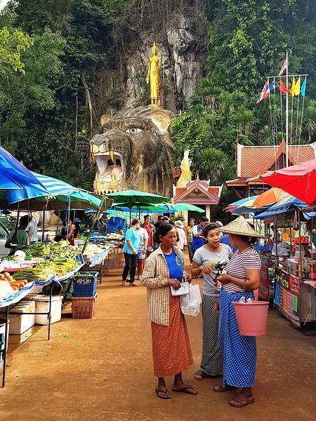
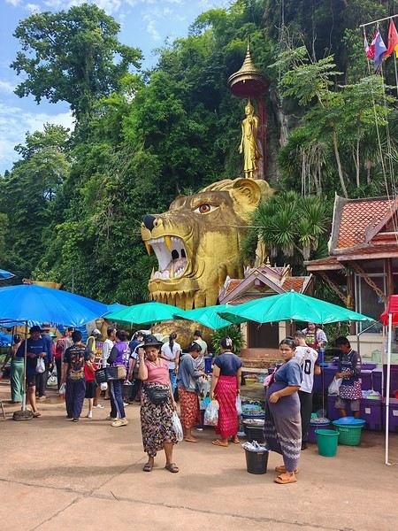
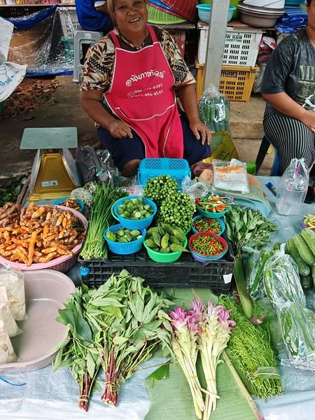
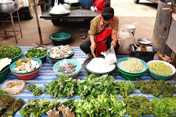
Thai markets are particularly appealing to me. In my province, there are so many. Maybe more than elsewhere—I’m not sure—but every day, you can find a "Talat Nat." These are traveling markets that set up in specific places on specific days. They only stay open for a few hours. Some attract more shoppers than others because they have more stalls and a wider variety of products. Sometimes, they’re set up in pretty unusual spots: temples, roadside, even on train tracks...
On top of these, there are also markets in the city that stay open all day.
I’d love for you to share your photos of markets, local product stalls, and why not, let’s talk about gastronomy and cuisine too!
I’ll start with my favorite market—it’s 8 kilometers from my place and happens every Tuesday from 2 PM to 5 PM. I never miss a Tuesday unless there’s a downpour... 😉 It’s located in the countryside, in a village famous for its coffee (ThamSing), and inside the grounds of a slightly unusual temple. It’s easy to get to—over the past 10 years, the roads have been paved, which wasn’t the case before and made the trip a bit risky when it rained...
In the first two photos, you’ll see the temple courtyard on a normal day, without the market.
I did these two treks in Himachal Pradesh in September 2026. The Pin Parvati trek absolutely must be done before mid-September to have favorable weather conditions, while the Bara Banghal trek can be done until the end of September. In both cases, the weather window is limited because these treks are only feasible between the post-monsoon period (early September) and the more or less early arrival of the first snowfalls (mid-October or even earlier). I chose to do these two treks back-to-back with just a few days in between, taking a welcome break in the village of Kasol, which is really pleasant with its German bakeries on every corner, set in the stunning Parvati Valley—much better than the unremarkable village of Barsheni. From Kasol, there are plenty of bus connections to the Kullu Valley, but they’re long due to the narrow, winding, and sometimes badly damaged roads. From Kullu, Manali is very close and easy to reach.