Discussions similar to: identifier traduire tatouage écriture tibétaine
FR

143 similar discussions in English

In the Land of the Tswana (Botswana)
We’ve been back for a month now, so it’s high time I posted the story of our adventures! 😉 I’d also like to thank everyone who shared their own experiences on this forum (or elsewhere) and gave us tips—it really helped us plan our trip.

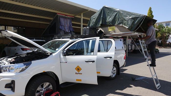
14/09/2019: Johannesburg - Vryburg After months of waiting and reading other travelers’ journals, it’s finally our turn! We arrived in Johannesburg from Nantes and Paris in the morning. We looked for the Bushlore rep—we’d rented our 4x4 from them—but there was no sign with our name! « Bushlore? She’s a woman, I saw her a few minutes ago, » someone told us. A minute later, the Bushlore employee showed up: a man! 🤪 He sped onto the highway, and just 30 minutes later, we arrived at the rental place. It’s a big operation with good organization and lots of vehicles—pretty reassuring. Our 4x4 was there, a classic Toyota Hilux fully equipped for safari: rooftop tent, dual diesel tanks, 60-liter water reserve, two batteries, two spare tires, all the camping gear, plus everything needed for *désensablement* (getting unstuck from sand). Speaking of which, is it "désensablage" or "désensablement"? Best to just avoid getting stuck in the first place! 😏 Good news… or not: the vehicle was brand new, with barely 100 kilometers on the odometer. On one hand, we figured we wouldn’t have mechanical issues or a fridge breakdown, but on the other, we knew it wouldn’t be easy to return it without a single scratch. Either way, it was our first time renting a 4x4, and we were impressed.


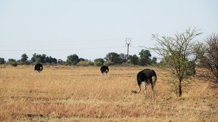
We set off toward Kgalagadi Transfrontier Park—it’s not exactly around the corner! In 1994 (when Mandela had just become President) and 2007, during our two previous trips to South Africa, we loved this park, so we couldn’t imagine going to Botswana without returning. The road was pretty monotonous, with not much to see except a few ostriches.


We stopped for the night in Vryburg at the Kameelboom Lodge campsite. It was a bit noisy since it’s close to the road, and the facilities weren’t great, but it was fine for one night.
Open
Mimi and Maumau, Martine and DD Return! Or the Denver-Denver Loop of the 4 Friends
Hello! 🙂

In 2017, struck by western addiction, our first road trip gave us an irresistible urge to return, which we did from September 2nd to 24th, 2019, on a loop from Denver to Denver via Yellowstone. The westernmost point of this journey, which took us through the geographical center of the USA, brought us within about a hundred kilometers of Moab, which had been the easternmost point of our last trip.

We’ve been back for over a month now, and I realize I’m starting to forget some details—it’s high time I started my travel journal before my brain turns into Swiss cheese and lets everything slip away. As I mentioned in my last story, it’ll take me quite a while to finish, so if any travelers have specific questions, don’t hesitate to message me privately. Once again, I’d like to thank everyone who helped me (and there were many!) prepare our road trip, with a special shout-out to Disneydiddl, Hiacinthe, and Titou (ladies first) as well as Fred and Itat, whom I bombarded with questions for months and who always kindly and patiently gave me tons of great tips. It’s thanks to all of you that this trip was such a success. I was a little worried I wouldn’t recapture the emotion and enthusiasm of our 2017 trip, but this one was just as "Wow" as the last.

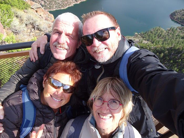
For those who don’t know us, let me introduce our little group. We’re four friends in our sixties (this time, everyone made it, which let us score some "senior" discounts...). We live in the Var region, have known each other for over 20 years, and this was our second trip together to this magical West.

Mimi (Michèle): always the smallest and the funniest. Thank goodness she was there to speak English! Maumau (Maurice): her husband, always with his white hair, his Gallic mustache, his humor, and his Southern accent. He drove every other day. DD (André): the one with the beard, with whom I celebrated our 41st wedding anniversary at Yellowstone. Our second driver appreciated having a peaceful mind since he’s been retired since July. Marcalamar (Martine): that’s me—still blonde with glasses, still talking a lot, and still terrified of messing up the organization of this trip despite all the hours spent on the forum.

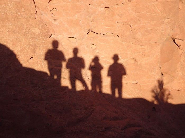
Recognize us? Ha ha ha!!!! No, just kidding!!!! That’s us!!!

Open
Between Réunion and Nosy Bé
Saturday, September 28, 2019

On the Orly-Saint-Denis flight, under the pretext that Air France had paired their delicious chicken with mushrooms meal with a little bottle of rum, Dom noticed that some passengers hadn’t even opened theirs. So he bribed a flight attendant to bring him the abandoned mini bottles! Needless to say, the guy slept like a baby!


Sunday, September 29, 2019 Saint-Pierre

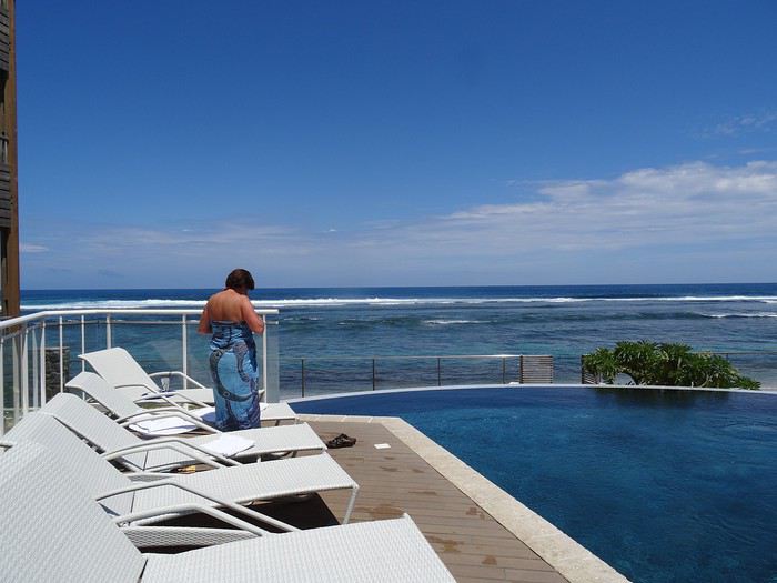
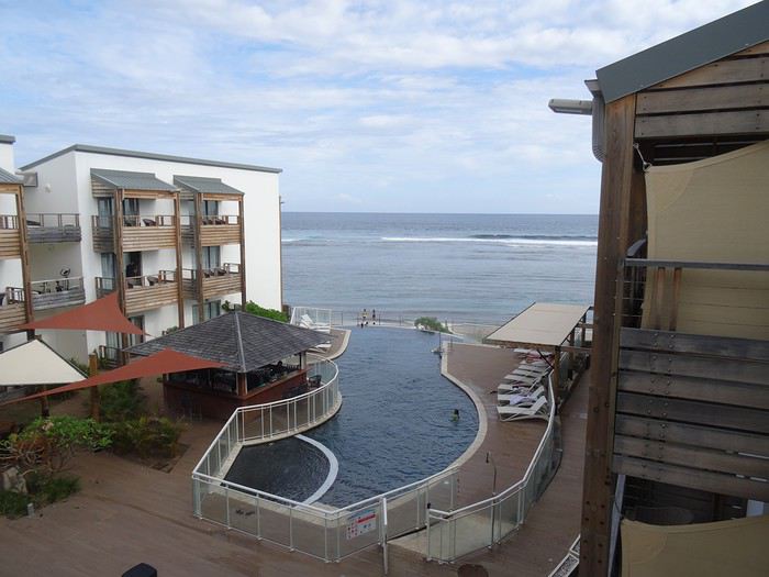
A flawless journey (well, except for a minor distraction in the massive Hertz queue that led me to cut in front of a few young couples, who weren’t too happy about it—though I joked with the agent about it: *"It happens!"*). We ended up at Hôtel Le Battant des Lames in Saint-Pierre, a gorgeous combo of an infinity pool and the Indian Ocean. We rushed straight into the pool—after over ten hours of sitting on a plane, it felt *amazing*!


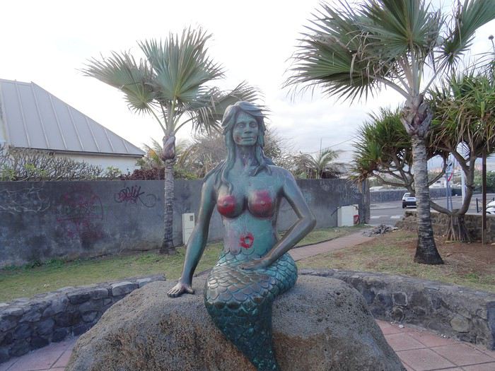
We didn’t waste any time—you know Dom—exploring the city on foot. It’s lovely: the seaside is well-developed, it’s tropical, but with the budget of a wealthy country.


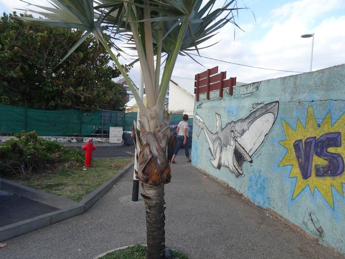
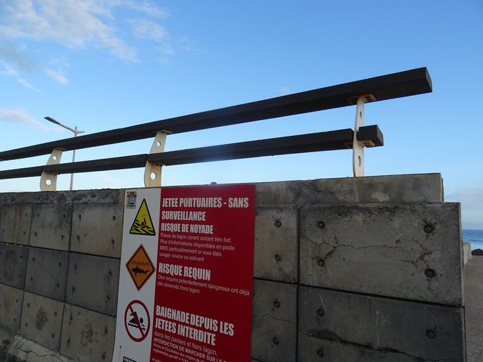
Réunion is also famous for its killer sharks…


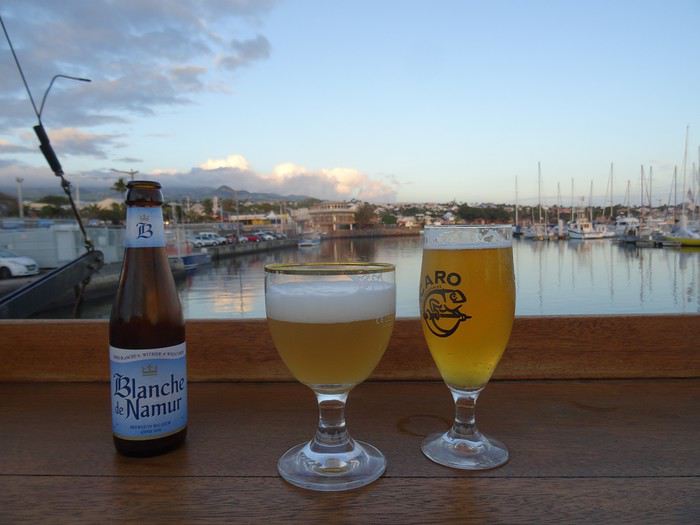
A Creole music group was playing at a seaside bar, so we settled in.


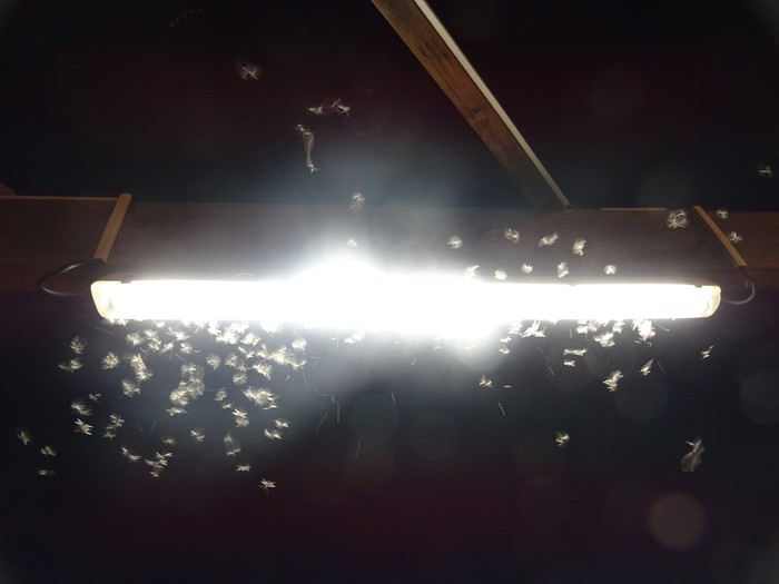
Night fell, and with it, swarms of insects suddenly invaded the city!


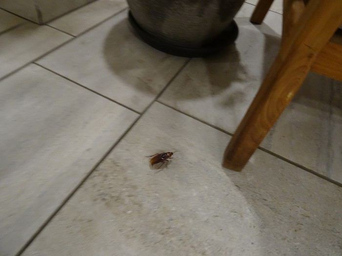
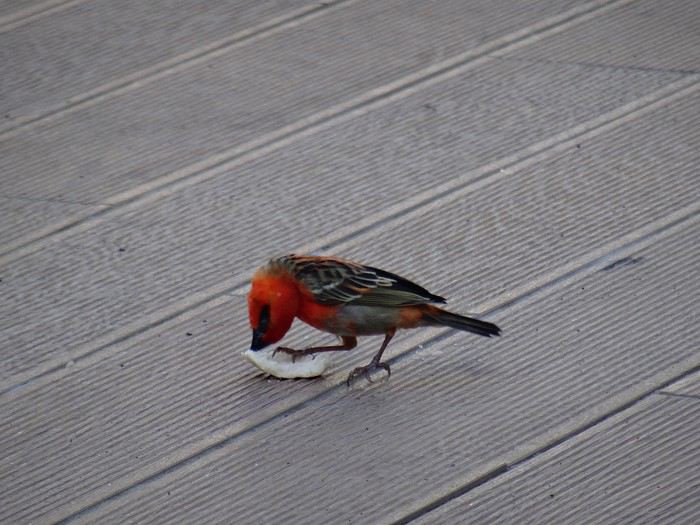
One of the few signs of the tropics here! Insects, geckos, and cockroaches...


Monday, September 30, 2019

Saint-Pierre


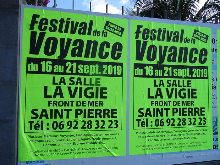
We were disappointed, of course! We could’ve gotten a photo of our *aura* and missed the chance by just a week! In tears, we decided to tackle the island’s most famous site.

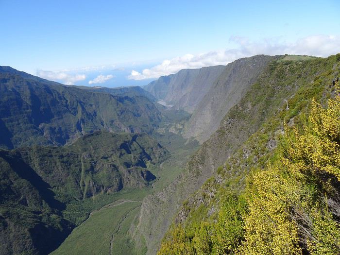
Excursion to Piton de la Fournaise. The plan was to head to one of the nearby parking lots and take a relaxed stroll. But it quickly turned into… something else.

First, I realized the built-in GPS operates on a pretty basic algorithm—like the earliest models. If there’s a bumpy road that even the toughest Mitsubishi 4x4 struggles with, a path through a junkyard, or any shortcut to save a few meters, it’ll proudly suggest it. So instead of taking the main road—the royal route to the famous volcano—we ended up on charming little mountain roads…


Open
Two weeks with a friend in southern Kazakhstan
Hello everyone!

I’m back from two weeks in southern Kazakhstan. I went with a friend, and we organized everything ourselves. We came back enchanted by this trip: stunning landscapes, lots of animals seen in the parks, and above all, top-notch hospitality and welcome... All of this makes me really want to go back and explore the other countries in the region. In the meantime, I’m sharing the story of these two weeks of travel... Don’t hesitate if you have any questions. And if you want more practical info and/or see more photos, you can check out my blog: https://smilingaroundtheworld.com/category/kazakhstan/

Day 1: First Kazakh steps in Shymkent

So here we are in Kazakhstan for two weeks. We had an excellent flight with Air Astana, which instantly made it into my top 3 best airlines! From the airport, the service was top-notch, with very friendly staff who went out of their way to ensure we both got vegetarian meals (my order hadn’t been taken into account when booking the tickets online). The flight to Nur-Sultan (the new name for the capital, formerly Astana, renamed last month in honor of the resigning president) was three-quarters empty, and we each got to stretch out over three seats. We were given an incredible travel kit, including a reversible sleep mask with phosphorescent writing: “Do not disturb” or “Wake me for meals.” Awesome! As for the lighting in the plane, I think the interior cycled through every color to simulate evening, early night, pitch-black night, and then dawn. It was even a bit surreal—those lights and everyone’s glowing masks ^^ The flight was a bit early and too short for us to sleep well, but it was still pleasant :-)

Upon arriving in Nur-Sultan, the atmosphere was a bit colder. There was staff everywhere, and we were under heavy surveillance. A camera even filmed us as we entered the terminal. We got our passports stamped and settled in to wait for our second flight. We eventually realized we were waiting in the wrong place... We were still in the international terminal, while our next flight was domestic. We finally found the right spot—saved! We started our trip in Shymkent, in the south of the country. We dropped our bags at the City Hostel, a super modern youth hostel offering double rooms. The decor is industrial-style, with very high ceilings—we loved it. When we arrived, it was too early for check-in, so we just left our luggage and went for a walk around the neighborhood. There was quite a bit of traffic, and the avenues were very wide. Despite that, there was also a lot of greenery and green spaces, which lightened things up a bit.

We had lunch (pizza + smoothie) on the top floor of a shopping mall, then headed to the pre-Russian quarter, a much quieter area with its little streets and individual houses.

Back at the hostel, after checking in, we treated ourselves to a two-hour nap—it felt great! In the late afternoon, we set out to find the Salman Bazaar. It wasn’t easy to organize—we realized Shymkent isn’t a very touristy destination—but we eventually managed with the help of the hostel receptionist, who called us a taxi. This bazaar is huge and has everything you could need for daily life: clothes, food, household products, toys... We did some shopping for dinner, then took another taxi to Independence Park, inaugurated in 2011 for the 20th anniversary of Kazakhstan’s independence. We really liked this park—it’s very wooded, and the late afternoon light was, as always, beautiful and pleasant... In the center, a large monument resembles the center of a yurt.

We then walked back to the hostel via Independence Square and several parks. We wanted to grab a drink along the way but didn’t find anything inspiring—oh well. We had dinner at the hostel and went straight to bed. Tomorrow, we’re getting up early... We’re heading out for two days to explore Aksou-Jabagly National Park. This park is famous for its landscapes at this time of year—it should be in full bloom, especially with tulips. We’ll see!

Days 2 & 3: Canyon, tulips, and wildlife in Aksou-Jabagly Park

Located two hours from Shymkent, Aksou-Jabagly Park is reputed to be one of the most beautiful in the region. We took a taxi from Shymkent, and upon arrival, we were warmly welcomed by Ruslan and his mother. They live at the entrance to the reserve, at the foot of the mountains, in a house surrounded by poplars. The setting is exceptional, and we immediately fell in love with the place. For our first day, we set off to explore the Aksou Canyon. Ruslan arranged a 4x4 with a driver and a ranger. The ranger speaks a few words of English, and with Coralie’s few words of Russian, we should manage! After a “viewpoint” stop, the road turns into a dirt track. It’s rained a lot lately, and the track is sometimes very muddy—at one point, we even had to cross a river. Four-wheel drive was definitely needed! The ranger pointed out some marmots by the side of the path—they were adorable.

We finally arrived at “Inspector’s House No. 1,” which overlooks the canyon. The view is magnificent, with high cliffs, wildflowers, conifers, and the Aksou River winding far below. While the driver chatted with the inspector, we descended to the bottom of the canyon with the ranger. The tulips I’d been hoping for were there—I was so happy! There were red, yellow, and even bicolor ones...

At the bottom of the canyon, we took a little break by the river. “Aksou” means “white waters” in Kazakh—the water does indeed have a very special color, a blue that’s both very light and very intense, like some South American lagoons. It bubbles around the rocks. The climb back up was easier than we feared. Once at the top, we continued along the canyon. The perspective changed as we progressed, and we never got tired of the view... Eagles circled above us.

After about 2 km, the driver picked us up, and we continued to a small kiosk at the foot of the mountains, where we had a picnic. Ruslan’s mother had prepared vegetarian “lunch boxes”—it was delicious and felt good to eat. However, it had gotten noticeably colder, so we put our jackets and scarves back on! After the meal, the driver walked off with a bucket—we figured he was going mushroom picking with Inspector No. 2, who had a house nearby.

We enjoyed the spot a bit longer while the driver gathered mushrooms, and then we headed back toward Ruslan’s place. Or so we thought... The return trip turned out to be quite long—the park wasn’t as deserted as it seemed, and the driver stopped every five minutes to chat with people we passed. At one point, we ran into Inspector No. 2 on horseback—it looked like there was a problem with a car further ahead... The driver and ranger bolted out of the car, headed toward the other vehicle, and we heard raised voices... When they came back, we tried to figure out what had happened, but no luck. We stopped again at Inspector No. 1’s house (are you following?), and they made us get out, telling us Inspector No. 2 needed the car for a few minutes... They left us stranded with Inspector No. 1, who went home, leaving us in the garden :-D We kept busy with the puppies, and I even took a little nap in the sun... Three-quarters of an hour later, we finally left—we didn’t fully understand what happened and never found out!

We got back (almost) without stopping to Ruslan’s house. Our room was ready, and we settled in quickly before dinner. It was already 6:30 PM, even though we were supposed to be back by 4 PM. Mushroom picking really slows things down ^^ Ruslan’s mother had prepared a delicious meal: vegetable soup, raw vegetable salad, and a mushroom, carrot, and potato stew. We loved it!

We spent the rest of the evening planning the rest of our trip while sipping tea. At one point, Ruslan and his mother signaled that there were wild boars right across from us—we could see them clearly! There were three adults and three piglets. We also took a little walk in the garden, watched the sunset, I did some blogging, and Coralie read... A lovely evening, and an equally lovely ten-hour night! The next morning, after a good breakfast, we set off on foot into the park. The trail starts right next to Ruslan’s house—so convenient! Today, we were with another ranger, two Germans (brother and sister), and their English-speaking guide (who didn’t guide much). We walked on a dirt road—there were even more tulips than yesterday, and the snow-capped mountains in the distance were stunning. After 5 km, we reached a small cabin, then continued another kilometer to Kishy Kaindy, a viewpoint overlooking the Jabagly River waterfalls (Jabagly means “year-old foal”). It was spectacular! We stayed a good while admiring this natural wonder. Like yesterday, the ranger didn’t rush us at all—it was really nice. We also saw eagles and an ibex perched on a ridge.

We had a picnic at the cabin before heading back the same way we came. This time, the snow-capped peaks were facing us—so beautiful! We picked up our bags and said goodbye to Ruslan’s mother. She was really happy today because her granddaughter was there. She told us she was a “babushka”—I understood that! Ruslan then drove us to Turar Ryskulov, where we took a shared taxi back to Shymkent.

In Shymkent, we struggled a bit with our Airbnb. We waited half an hour for the person who was supposed to let us in, then discovered the Wi-Fi wasn’t working—but we had a lot of bookings to make that evening. The lady finally lent us a Kazakh SIM card with data, which Coralie put in her phone in “hotspot” mode so I could get some internet too. All of that took nearly two hours. Phew! We then rushed to do some shopping at the supermarket. On the way back, some lights caught my eye—it was a pedestrian street all decorated with a funfair next to it. It was very lively, and we spent a good while strolling and people-watching! The rest of our evening was studious, between preparing dinner and booking our next stops.

Day 4: Turkestan, Yasawi Mausoleum, and Sauran ruins

This morning, after one last stroll in Shymkent, we headed to Turkestan. When we arrived at the bus station, we were told the next bus was in nearly three hours, but there were minibuses leaving when full. The system was well-oiled, and in just fifteen minutes, our minibus was ready to go. We each had a seat (and one for our luggage since there’s no trunk!), and the minibus was quite new—nothing like Madagascar ;-)

The trip went well despite a few driving scares—the driver was going a bit fast for my liking! Along the road, the fields were full of poppies—so pretty. When we arrived, we headed straight to the Edem hotel, where we wouldn’t be staying (we had a train to Almaty at midnight) but where we wanted to leave our luggage for the day. They agreed easily—great! Once we’d dropped off our bags and suitcases, we started our visits.

We began with the architectural gem and largest pilgrimage site in Kazakhstan: the mausoleum of Khodja Ahmad Yasawi, a great Sufi sage. Yasawi’s original tomb was already a pilgrimage site when Tamerlane ordered the construction of a larger mausoleum in 1390. It’s decorated with white and blue tiles and has a turquoise dome (currently under renovation). The main facade, unfinished at Tamerlane’s death, was left in earth with visible scaffolding. Impressive! The site is UNESCO-listed. Inside, the main hall displays a large cauldron, and other small rooms showcase plates, ancient coins, belts... Yasawi’s tomb is visible via two adjacent corridors.

We then strolled through the park, which includes many other mausoleums and tombs. We visited the old baths, the Friday Mosque, and then the history museum. The underground mosque, where Yasawi’s cell is located (where he retreated at the end of his life), was unfortunately closed for renovations.

We then went back to the Edem hotel to have them call us a taxi, and we set off to visit the ancient fortress of Sauran. This Silk Road city, once prosperous, is now reduced to ruins, with thousands of poppies blooming between them. High walls once surrounded a bustling and pleasant city. Many foundations remain visible. The place is vast, quiet, almost deserted, and imbued with a certain melancholy... The deep red poppies swayed in the wind, between the remnants of this city, reminding us how fleeting things are.

Back in Turkestan, we had dinner at the Edem hotel’s restaurant (we had to thank them somehow ;-)) and then rushed to the station to catch our train... 18 hours of travel awaited us to Almaty!

Day 5: From Turkestan to Almaty, 18 hours by train across the Kazakh steppe

We traveled from Turkestan to Almaty by train. We booked our tickets the day before departure, and only six seats were left: three in second class, not together at all, and three in first class, also not together but in the same carriage. We opted for first class! It was more expensive, but for such a long trip, a little comfort wouldn’t hurt... We wondered if we’d manage to switch cabins to be together, but it resolved itself: when we boarded, the conductor/carriage chief immediately noticed we weren’t together. He literally kicked a young man out of his berth so we could travel in the same cabin. We felt bad for the young man, even though he seemed to take it well... we thanked him with dried fruit (and I can confirm he took it well—the next day, he came to chat with us). In any case, we were really happy to have our own little cabin for this long journey, especially since we were the only foreigners and the only women in the carriage.

Eighteen hours by train might seem long, but these long trips while traveling aren’t wasted time—they’re the breathing space of the journey. They’re the essential moments for digesting what we’ve already experienced and preparing for future discoveries. They’re also privileged moments for reflection. Traveling slowly, to the rhythm of the train, means falling asleep in Turkestan’s outskirts, lulled by the train’s rocking and creaking, and waking up in the steppe. It’s feeling the train slow down and stop, stepping onto the platform for a moment, and watching the women sell food to passengers. It’s taking the time to write, read, think. It’s chatting with our neighbors and, despite the language barrier, managing to communicate a little. It’s picnicking at the little table in our cabin, with the landscape rolling by outside, and listening to music. It’s feeling privileged, imagining ourselves on the Orient Express or the Trans-Siberian. Reminding ourselves that one day, one day for real, we’ll take that Trans-Siberian. And smiling, thinking that in the meantime, in a few months, there’ll be the Trans-Canadian...

Days 6 & 7: Almaty, the “little apple”

The former capital of Kazakhstan, Almaty is known as the most Western and lively city in the country. At first, we had a bit of trouble identifying the city center—it’s more spread out and less dense than what we’re used to in Europe—but once we got our bearings, we really enjoyed strolling along the wide avenues lined with cafés and in the few pedestrian streets. The city’s emblem is the apple, which you’ll find in various forms around the city, from benches to statues to fountains. The original apple, from which all the apples we know today descend, is said to come from the mountains of Kazakhstan.

For nature, Almaty is a pretty green city. It has large parks, like Panfilov Park, which houses the Zenkov Cathedral. Some streets are also very tree-lined, so much so that they almost look like gardens. Often, high mountains peek out from behind the streets...

For shopping, traditional boutiques sit alongside big international brands. We really liked the Green Bazaar, a large market that sells everything. The food section was great, with stalls of pickled vegetables, dried fruits, and beautifully stacked fresh fruits... A feast for the eyes and lots of temptations for me!

For culture, Almaty has several museums. We visited two: the Fine Arts Museum and the National Museum. Both are housed in very Soviet-looking buildings on the outside, but the Fine Arts Museum turned out to be quite modern inside, with a pleasant museography. The National Museum, on the other hand, has stayed true to its roots ^^ Just walking through it was an experience in itself. And we did quite a bit of shopping there... The hall is a giant shop with lots of handicrafts—we treated ourselves.

The Arasan Baths are a must in Almaty. They’re said to be among the most beautiful baths in Central Asia... Architecturally, I didn’t find them amazing (nothing like Budapest’s, for example), but wow, did it feel good to relax there after a day of sightseeing! I happily moved between the sauna, hammam, and Russian sauna, with a preference for the latter—less dry than a traditional sauna and less humid than the hammam. You can buy bundles of leaves to slap yourself (or get slapped) with to boost circulation. The prices are very affordable too... On a weekday evening, we paid 1,800 tenge, or 4.5 euros, for an hour. Note that they add 20 minutes for changing, so you really get a full hour in the baths.

For restaurants, we didn’t try many because we preferred to limit our food budget by cooking ourselves. However, we did try and highly recommend Daredzhani, a great Georgian restaurant where we feasted. We didn’t know Georgian cuisine before, but we really liked it—vegetables cooked in various ways, cheese-filled breads, potato and/or egg-filled breads, and very thin fruit pastes made from grapes. We actually ate there twice because it was so good! We also loved Coffee Delia, where you can enjoy delicious pastries in a very cozy setting.

Besides being a pleasant place to live, Almaty is also a great base for exploring the surrounding area, and we were happy to stay eight days to discover more of the region!

Days 7, 8 & 9: Getting green around Almaty: Kok Tobe, Shymbulak, Medeo, and Big Almaty Lake

During our stay in Almaty, we used a rather unusual means of transport several times: the cable car! Here, it’s called a "gondola," and it allowed us to gain some altitude and breathe in the fresh mountain air surrounding Almaty ;-)

First cable car ride: Kok Tobe. The cable car starts in the city center and takes you to the top of a hill overlooking Almaty. At the top, it’s fairground vibes with an upside-down house, a Ferris wheel, rides, and the inevitable eagle trainer... There’s even a little corner dedicated to the Beatles, complete with music and a statue!

Second ride: Shymbulak. This time, you take a bus to Medeo, then three cable cars to the top of the mountain, at 3,200 meters altitude. Shymbulak is the largest ski resort in Central Asia. We went there to hike, but there was still snow and skiers, so we settled for admiring the view... With the blue sky and sun we had, it was gorgeous! We then treated ourselves to tea on the terrace—chalet vibes... At Paul’s, we weren’t completely out of place ;-)

Before taking the bus back, we stopped by Medeo, where there’s a large ice rink. With 10,000 m², it can host a thousand skaters in winter! This season, it’s closed; part of it is used as a go-kart track, and the other as a landing strip for paragliders.

Located an hour’s drive from the city center, Big Almaty Lake reveals itself at the last moment, around a bend, nestled in a setting of mountains and greenery. With the recent cold snap, it’s frozen, and the edges are snowy—a beautiful winter atmosphere! The ice was starting to melt, though—we could hear the water moving underneath, and when Coralie tried to walk on the ice, it collapsed under her feet. Unfortunately, it’s impossible to walk around it—a ranger keeps an eye out and blocks the adventurous (including us ;-)).

Days 10 & 11: Excursions around Almaty: Charyn Canyon, Issyk, and Turgen

Almaty’s tourism office is very active and organizes outings on weekends and holidays. We went to Charyn Canyon and then to Issyk and Turgen. A great way to discover the Almaty area at a modest cost (the outing costs about 6,000 tenge, or 15 euros per person).

Formed over millennia by erosion and wind, Charyn Canyon is reminiscent of the Colorado and the Grand Canyon. The most touristy part we visited is called the Valley of Castles, referring to the rock formations that resemble towers. We first walked along the ridge, where there are many viewpoints, then descended into the canyon. A three-kilometer walk leads to the banks of the Charyn River. The place seems to be a favorite relaxation spot for Kazakh families, who picnic, play ball, sunbathe... There’s also a hotel, bungalows, yurts, and a restaurant. Issyk is famous for its burial mounds and its Golden Man—maybe even a Golden Woman—found there. A small museum displays some artifacts. A little further on is Issyk Lake, once dried up but now reappearing... Whether naturally or not isn’t very clear!

As for Turgen, it’s a natural park known for its gorges and waterfalls. We didn’t have time to explore it in detail, but the bus drove through some beautiful landscapes, and we still walked to Bear Waterfall. It’s not incredible, but it’s still a nice little hike.

Besides the practical side of these organized excursions from Almaty, we appreciated being able to do an activity that Kazakhs do on weekends. During the Issyk/Turgen excursion, we really hit it off with Karina, a young student dragged there on vacation by her mother. She’s currently studying computer science at the best university in Astana and hopes to go to Europe eventually... A brilliant young woman, and a chance for us to chat in English ;-)

Days 12 & 13: The spectacular landscapes of Altyn-Emel Park

The last stop on our Kazakhstan trip was Altyn-Emel Park. This park is quite hard to access, so we opted for a car with a driver for two days—pure luxury!

Our driver’s name is Andrei. We met him at 7 AM outside our apartment on Wednesday morning. He doesn’t speak English, but a young man from the agency we booked through was also there, and we went over the itinerary together before leaving with Andrei.

Our first stop was Tamgaly Tas, two hours from Almaty. It’s a site where you can see 16th-century petroglyphs depicting Buddha. The place is also known for climbing—there were lots of young people harnessed up and/or climbing. It’s right in the middle of the Kazakh countryside, and we had a bit of trouble finding it!

Even with the language barrier, Andrei turned out to be very friendly. He suggested photo stops from time to time, didn’t rush us, and pointed out animals he saw... We even backed up on the road to see and help a tortoise cross!

It took another two and a half hours to reach Bashi, the “gateway” village to Altyn-Emel Park. After a quick stop at the rangers’, we arrived at the hotel. Our guidebook mentioned modest guesthouses, but things are changing... The hotel is large, brand new, and still being expanded. It reminded me of some Chinese hotels in Laos.

We had a quick lunch with Andrei—he explained that he’s a truck driver normally, delivering clothes and fabrics between Kazakhstan, Afghanistan, and Russia. He also showed us photos of his wife and son and told us he’s recently become a grandfather! We then headed to the park, grabbing a ranger on the way. Like in Aksou-Jabagly, he was dressed in full military gear. We first headed toward the Katutau Mountains. The rocks are reddish, sculpted by wind and erosion—the place reminded us a bit of Charyn Canyon. We had some “free time” to explore—we didn’t need to be told twice... Meanwhile, Andrei and the ranger chatted nonstop—it looked like they’d hit it off!

We got back in the car and continued along the track to the Aktau Mountains. Change of scenery! The mountains weren’t red anymore but white... Or so they appeared from afar. When we got closer, we realized they were actually multicolored, striped with yellow, pink, and ochre veins... It was magnificent, even more so with the late afternoon light. We had time to explore on our own again, and we walked with delight in this almost dreamlike landscape. We thought we’d made the right choice coming here ;-) We made one last stop before heading back to see a 700-year-old willow. It’s in an oasis where other tourists were camping—very tempting... I got the coordinates of their guide for next time ;-) The way back was in beautiful light, between sunset and a distant storm. Nature even treated us to a gorgeous sunset!

It was past 8 PM when we got back to the hotel, but our dinner was still waiting for us. We ate with Andrei, chatted a bit with a Polish woman who spoke both Russian and French (we put her to work chatting with Andrei ;-)), and then had a quiet evening with Wi-Fi, a shower, and reading in our room.

The next day, after breakfast, we met up with the same ranger and headed toward the singing dunes. These dunes are supposed to make a sound when you slide down their slopes. I was more than skeptical, but okay! When we arrived, we discovered a beautiful landscape—the main dune is gigantic, and when we reached the top, the view was extraordinary: it was the first time I’d seen a dune in the desert, snow-capped mountains, and a river all in one glance! A group of Chinese tourists was ahead of us on the dune, but they turned back quickly, and we were alone. After studying the terrain, I chose a slope that seemed good, and I started sliding down on my bottom... Quickly, I heard and felt a strong vibration, which turned into a hum. The dune really sings! It’s completely crazy... We did several tests—the most effective was sliding down side by side. But it works as long as there aren’t too many tourists doing it and the dune has time to rebuild between slides... There are about thirty singing dunes in the world. This phenomenon, already described by Marco Polo, comes from the synchronous movement of sand grains, which must be very round and covered with a varnish called “desert glaze”...

Covered in sand but delighted, we headed back to Bashi. The ranger stopped at a small spring so we could wash up, but it was almost dry. Along the way, we also saw the “Oshaktas,” a place where Genghis Khan’s expedition is said to have camped in 1219 during his conquest of Central Asia. The stones were apparently used to support the cauldron where food was prepared. A little further on, the ranger made us stop: there were antelopes!!! We saw one up close and a herd further away.

When we got back to the hotel, I took a quick shower to get rid of the sand—I felt like I had it everywhere! We had a quick lunch and then hit the road back to Almaty. Andrei drove very well, had a nice playlist, and I let myself be lulled while watching the landscape roll by outside...

For our last night in Kazakhstan, we booked a yurt in the hills above Almaty, not far from Medeo. For one night, we pretended to be nomads... The bed was a bit hard, and the air was a bit chilly, but we loved it! And the welcome was kind, the meal very good—only downside: the horse milk and camel milk, still warm... I almost threw up. Well, it was an experience, and all of this beautifully concluded our Kazakh stay!
Open
Kayaking in Greenland - Disko Bay: Circumnavigation of Arve Princess Island
After two rather rainy kayaking experiences in Alaska at the end of summer in recent years, we chose a slightly drier destination for this late August 2018: the west coast of Greenland. The temperature will certainly be a bit colder, especially at this time of year, but we’re betting on a beautiful end to the season. According to temperature charts, it should be around 5 to 10°C with a few night frosts. The tundra will already have its autumn colors, and by the end of the trip, we might be lucky enough to see the northern lights when the nights get darker.

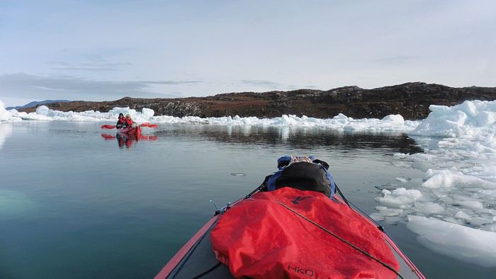
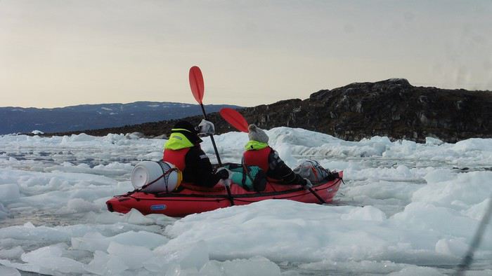
We’re setting off as a group of three in two inflatable double-seater kayaks (Gumotex) brought from France. The plan is to spend two weeks circumnavigating Arve Princess Island, located north of Ilulissat in Disko Bay, with a possible boat drop-off at the southern tip of the island.

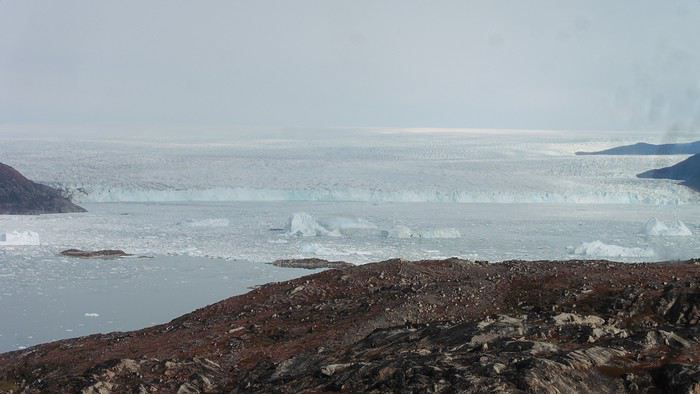
This seems like a fairly classic route in the area—we found several descriptions online (thanks to the authors). With their help and Google Earth, we identified all potential campsites and entered their coordinates into a GPS. The western part of the island, facing the bay, seems ideal for whale watching, while the more rugged eastern side offers access to several glacial walls. We’re somewhat familiar with the area from two winter expeditions on skis and pulkas.

Plus, the commitment is limited due to the island’s proximity to several small villages, including Qeqertaq, Oqaatsut, and even Ilulissat. In fact, we saw fishing boats almost every day. The distance suits us well: 200 kilometers in 16 full days on site, which should leave some leeway in case of bad weather or for hiking.

We booked our flights in June with Air Greenland to Ilulissat for the last week of August and the first week of September. On both the outbound and return trips, we stayed overnight in Copenhagen. The France-Copenhagen flight was with Air France.

We were allowed 3 x 20 kg in the hold. Each kayak with its accessories fits into a 20 kg bag; the last hold bag is for shared gear: tent, stoves, dry bags… We only brought 1.5 kg of semolina for food. In the end, we had 61 kg of gear, and no excess baggage was charged.

Individual gear (clothes and sleeping bags…) was distributed in the cabin luggage.

For the boat transfer, we contacted an agency: Blue Jay, which gave us a number to call upon arrival.

Day 0: Wednesday, August 22 Departure day. After work, I drove from Gap to Marseille’s Marignane Airport for the first leg of the trip to Copenhagen. I enjoyed the rather mild local temperatures: 35°C in the shade. After a layover in Paris, I arrived at the Copenhagen hotel, located two train stops from the airport, where my companions were already settled. No issues—everyone was on time with their luggage.

Day 1 The flight to Greenland was at 9 AM. We had a layover in Kangerlussuaq, where we changed planes, then stopped in Aasiaat before reaching Ilulissat Airport at 3 PM under beautiful sunshine.

We called Blue Jay for the boat transfer: they could take us to the island as early as 6 PM; otherwise, we’d have to wait until the next day. That left us 3 hours to prepare our gear and, most importantly, do our shopping for the two-week trip—it seemed tight, but we gave it a shot.

A quick taxi ride took us to Pisiffik, where we easily found everything we needed: bread, butter, cheese, cold cuts, rice, pasta, jam, muesli… There was no C fuel or methylated spirits for the stoves, but this time we knew the trick: at Stark, a bit uphill from the town, we found the precious liquids. Two hours later, we filled our dry bags and containers with our purchases, and by 5:30 PM, we met Klaus, the Blue Jay manager, directly at the port.

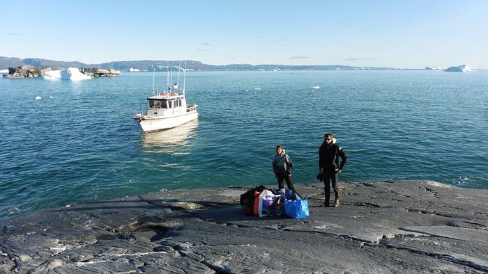
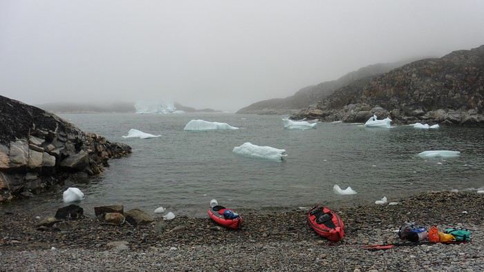
The vacation seemed to truly begin as we sped by boat through the icebergs toward Arve Princess Island. Forty-five minutes later, we spotted a beach lined with rocks where Klaus dropped us off quickly (he had another transfer to make right after).

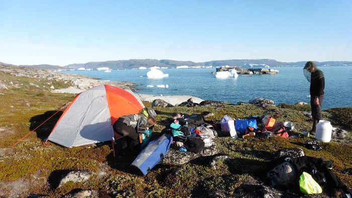
Here we were on the island, in the middle of nowhere, with all our luggage and food to organize, the tent to set up, and the kayaks to inflate—just 10 hours after leaving the Copenhagen hotel. We got to work, bothered by the flies. Despite our head nets, it was barely tolerable—there were so many of them. They swarmed by the dozens into every bag we opened. It was quite mild: 10°C.

Everything was ready by evening, and we were very happy to have completed all these transfers (planes and boat in a single day) as we slipped into our sleeping bags.

During the night, the wind picked up, and we went out several times to check the tent and kayak anchors. We noticed how bright it was—it was still quite twilight even at 1 AM.

Day 2 5:30 AM wake-up—the south wind was still strong, but since we were heading north, we decided to give it a try anyway.

This was also the moment we loaded the kayaks: since there were only three of us for two double-seater kayaks, we filled the hatch of one kayak, which allowed us to fit all our food. It would have been very difficult if there had been four of us for two kayaks.

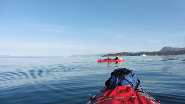
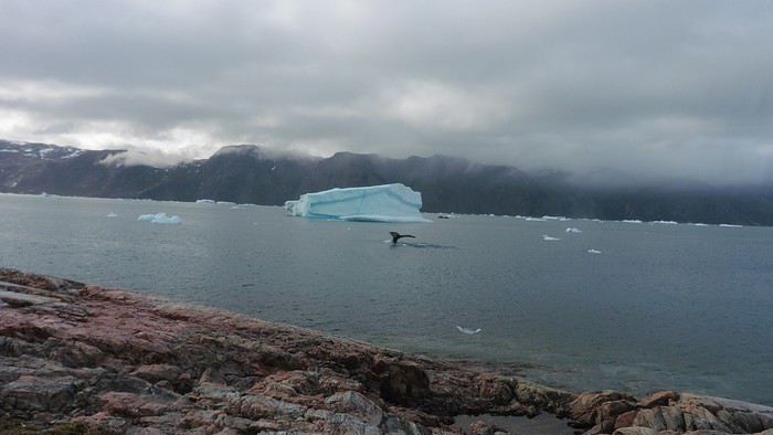
Finally, we set off north along the western coast of the island. The conditions were far from ideal—the sea was rough, and the kayaks had a lot of wind resistance. But the main problem was the spray skirt: the gear on deck weighed it down, and the skirt kept coming off… We’d have to deal with it. Barely underway, and whales were already breaking the surface—it was our first time seeing them, and we were very impressed. Too bad the wind didn’t allow for longer contemplation; stopping paddling was impossible with such strong gusts.

We passed a few headlands and even considered stopping due to the conditions. To find some semblance of shelter, we had to hug the coast closely without cutting across the numerous bays, which significantly lengthened the journey. But as the morning went on, the wind died down, and the sea calmed. We spotted several whales and our first seals. It was almost pleasant during the picnic break. By late afternoon, we reached Kangerup Sarqâ Bay, where we had identified a great campsite with a very large beach and a river. But the wind had shifted—it was now coming from the north, making the last hour difficult due to fatigue and headwinds.

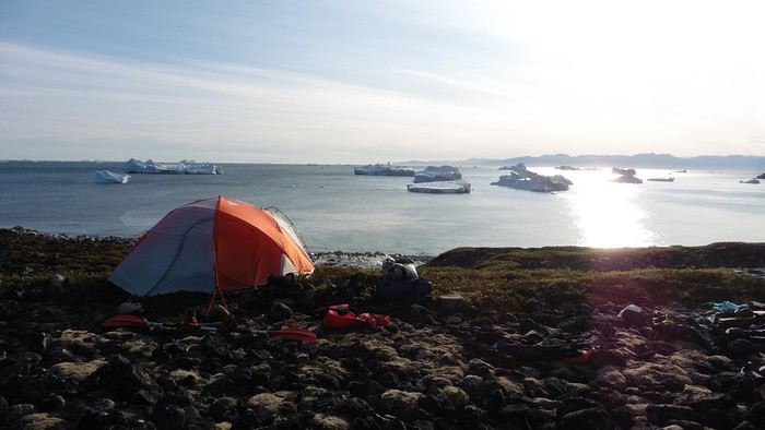
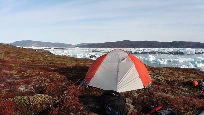
The campsite was ideal and beautiful, facing numerous icebergs grounded in the bay.

The GPS alerted us to another major drawback of inflatable kayaks: their slowness. It took us 7.5 hours of actual paddling (excluding breaks) to cover 28 km, averaging 3.7 km/h—somewhat disappointing. But we knew this before leaving, and once again, we’d have to make do!
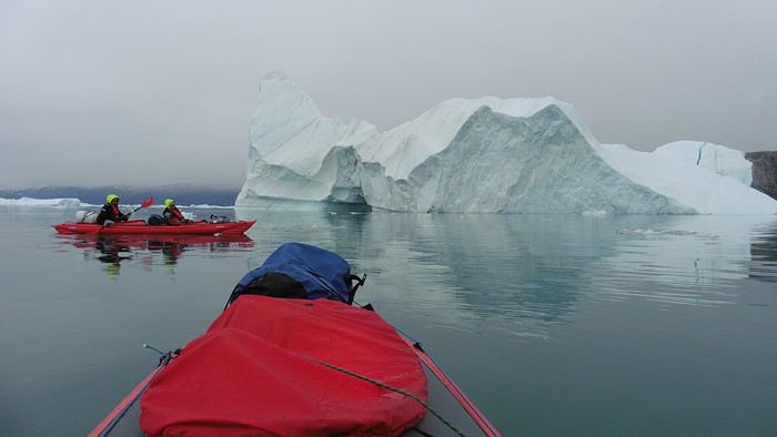
Day 3 Surprise: at 6 AM wake-up, it was raining, foggy, with a south wind, and the sea was choppy even in the bay. It seemed wise to skip paddling, even though stopping on the second day was tough on morale. We went back to sleep, especially since the travel fatigue and the harsh conditions of the previous day had taken their toll.

At 11 AM, the navigation conditions weren’t any better—at the ends of the bay, we saw huge waves crashing onto the rocks, and giving up for the day became obvious. However, the rain had stopped, so we set off for a hike along the large lake bordering the bay. The wind hadn’t let up, and it was quite cold.

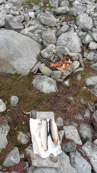
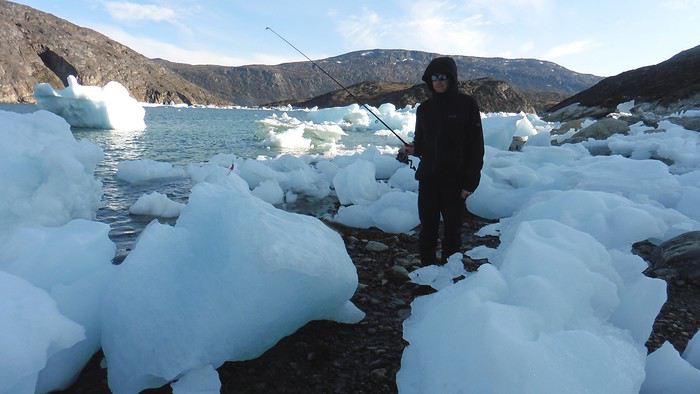
The tundra was starting to take on its autumn colors, and the contrast between the white lichens and the red vegetation was stunning. At the lake, we took out the fishing rods and quickly caught two beautiful Arctic char over 50 cm long.

As the afternoon wore on, the sun seemed closer. Along the beach, we gathered driftwood (mostly old planks) to cook our catch in foil over a fire. Eating our own food in such a beautiful place next to a good fire was comforting after the day’s setback.


In the middle of the night, an Arctic fox entered the tent’s rear awning. It seemed barely intimidated when we shooed it away with loud shouts and then with stones.

Day 4 6:15 AM wake-up—3°C. We were on the water by 8 AM. The wind had dropped significantly, but the sea was shrouded in fog, and it was very cold in these damp conditions.


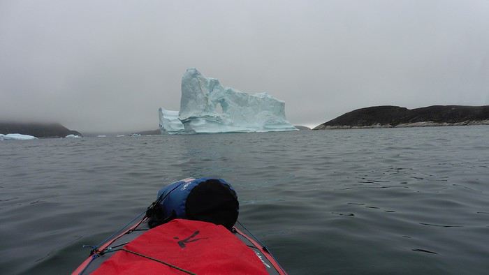
We passed the bay’s headland, Kangea, and headed toward the abandoned village of Agpat. The atmosphere was very austere—we hugged black rocks in fog that limited visibility to 50 meters, revealing large icebergs as we went.

Suddenly, the water’s surface stirred in front of my kayak, and a huge gray back emerged from the sea. The collision was inevitable, but the whale seemed to understand and dove immediately, passing under the kayak and resurfacing a few meters away. I felt the kayak rock in the white foam and quickly paddled to escape the turbulence. What an emotion!

A light wind began to clear the fog, and the sun made beautiful appearances. Despite the cold, we stopped to visit the abandoned village, which left a strange impression. All the houses were still in good condition and wide open—some must have been very spacious in their time. We went back to sea, and in front of the large Kaangerdluk Bay, we hesitated—the headwind was strong, and large waves split the water. The next beach, from the island of Nua where we stopped to think, was over 8 km away. It was barely 2 PM, but caution led us to stop here for the day. We had covered 12 km—exactly the distance needed to stay on schedule. The afternoon was spent hiking on the island’s hills and gathering mussels and wood.


In the evening, we cooked these large Greenlandic mussels over a wood fire and savored them under the beautiful evening light. The weather was now fine, but the thermometer read -5°C in the sun…

Day 5 Bright sunshine, a glassy sea, and -8°C at 6 AM. Everything was green for setting off, even if putting on damp kayaking gear was a bit unpleasant in the cold. It was the first time we’d paddled on a flat sea since the start of the trip, and our average speed increased slightly.


We entered the Smallesund Strait, marking the end of the island’s west coast. We were close to the large Torssukatak Fjord, where two glaciers flow. The access pass to the fjord was very narrow, and numerous ice chunks blocked access to the beaches. The wind had picked up and was now hitting us head-on (again). Just before entering the fjord, we landed on a steep beach made of large pebbles on Oqaitsut Island. It was very cold with the wind, and moving forward became difficult. We decided to stop for the day both because of the conditions and because the next campsite was far away, given how rugged the fjord was.

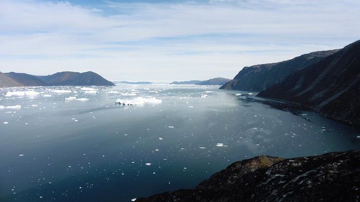
We eventually found a flat spot for the tent despite the steep slope. Even with the wind, the weather was beautiful, and we set off on foot for the northeastern cape of the island, overlooking the fjord. The view was far-reaching and exceptional—up close, the large fjord filled with ice and its steep granite cliffs, and in the distance, the ice cap and glacial walls.

We spotted the village of Qeqertaq, whose network we could pick up, allowing us to check the weather forecast, which was rather good. While securing the kayaks in the evening, I noticed the strange behavior of one kayak at the end of the stage was due to the loss of the skeg—impossible to know where it detached. We’d have to do without it.

Day 6 Still that icy headwind from the northeast. We set off anyway for a long stage to reach the large pass connecting the Torssukatak and Ata Fjords.

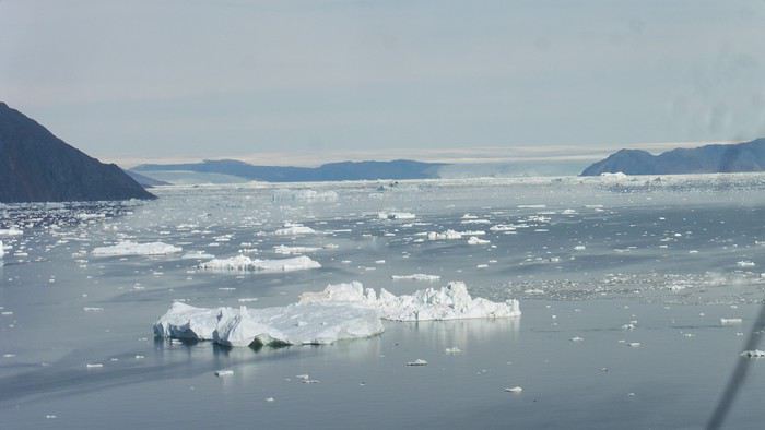
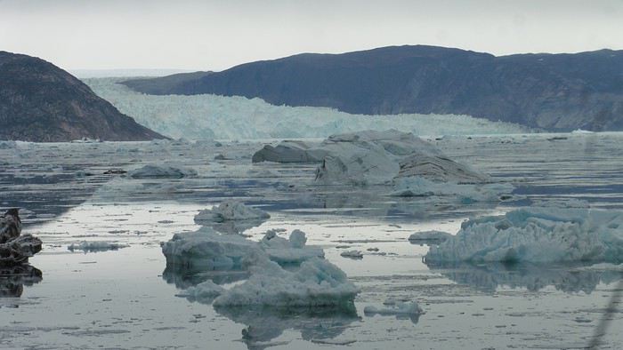
We advanced laboriously along the high cliffs of the fjord’s southern shore. They faced due north and blocked the sun. We felt the cold and dampness of the rock. It was really cold, especially in the extremities. We picnicked on the western cape of Qeqertakavasak Island. The cold didn’t allow us to stop for more than 20 minutes… But the wind dropped, and the sea was now very smooth. It was heavily cluttered with ice between the icebergs and old pack ice. The goal was to reach the large rocky promontory of Anapnuna, wedged between the Kujatdleq and Kangilerngata Glaciers, but the ice made progress difficult. We stopped to gain height on a small island and spot a passage of open water, but all we saw was white—passing seemed impossible. The currents were very complex, and entire sections of ice were being swept in one direction and then another at an impressive speed.


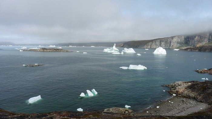
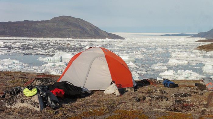
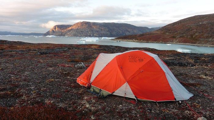
We wandered through this labyrinth until landing on a beach on the small island of Takissut, where we set up camp, exhausted from the 30 km covered and the vigilance required by the abundance of ice. The place was sublime under the evening sun—we were surrounded by ice and mountains, with the Kangilerngata Glacier in the distance. The summer contrasts were striking between the water, icebergs, sky, and flaming tundra—all colors were represented. Absolute calm reigned.

The lack of drinking water at this spot wasn’t too much of a constraint: as soon as we arrived on the beach, we placed containers under the icebergs stranded in the intertidal zone. They were all full by the time we finished setting up.

Day 7 We had to change our plans: we wouldn’t reach the rocky promontory, too well protected by the ice. We set off under the sun for Igdluluarssuit Island. Although we had spotted a passage just before launching, we quickly found ourselves surrounded by ice. It was everywhere, and finding water to paddle became complicated. We tried to force our way in every direction, even retracing our steps. Everything moved at an impressive speed—we were in the middle of a whirlpool of ice.

The tension rose, and each boat had its share of big scares. I was trapped against ice floes that dragged me toward an iceberg—the pressure on the kayak was enormous; it was going to capsize or puncture! But with a few strong strokes and paddling against the ice, I managed to free myself from the trap. Barely 10 minutes later, my companions were sandwiched perpendicularly between two icebergs that were closing in. The situation was desperate—the kayak was bending and twisting more and more, but with some strong paddle strokes, it finally freed itself. After these particularly unpleasant moments, we were completely blocked. The drifting ice floes had tightened, and the kayaks were no longer even in the water… The only solution: wait with the kayaks on these floes, which were too thin to walk on (even though we didn’t try). Within minutes, the situation cleared—a waterway opened, and we rushed into it. We paddled with one goal: find a larger pool of water. After going back and forth, our path took shape—we had to force the passage several times, attacking the ice directly with the kayaks, and finally, we escaped the worst of the labyrinth. We reached land on the west side of the island and saw that the rest would be easier. To reach the island, we just had to cross the Arsiviup Ikera Strait, which was lightly cluttered. We reached the eastern cape of the island, ideal for camping, even though we had only paddled for 3 hours. We set up camp and hiked to the island’s summit, which overlooks the entire pass and the glaciers.

Everything was magnificent, no matter the direction. At 2 PM, we were at the summit—the beauty of the place and the picnic facing the glacier in the sun without wind made us forget the near-disaster from a few hours earlier. It would be impossible to approach the glacier by kayak, but from our summit on foot, it seemed so close, and contemplating it safely on solid ground was a great moment.

The pass was incredibly complex—everything was in motion, and an impassable passage could become open water within minutes. We were delighted when we returned to camp. A slightly lost whale among the ice accompanied us along the shore. The place was truly beautiful, but the temperature dropped again under the clear sky, preventing us from eating outside.

Day 8 Clear and cold at wake-up: -9°C. The sea had frozen in many places. We hesitated about the rest of the trip—should we start heading back to Ilulissat or linger in the pass, especially to approach the Eqi Glacier? After the incidents of the previous day, we decided to think carefully and paddled to the southern cape of our island to check the ice conditions toward Eqi. The weather had clouded over in the meantime, and the sky was quite gray. At the cape, we spotted the glacier’s wall, still 15 km away.


The fjord was quite cluttered, but it seemed passable. However, there was no guarantee the view would be much better 1 km from the glacier than 15 km away, especially since the front was quite active and therefore dangerous. We decided to head south without passing by the glacier. The cold temperatures encountered in the pass also motivated us to move away from the glaciers and the ice cap. We navigated under a threatening sky but without wind. The kayaks cut through the thin layer of ice on the surface with a crinkling paper sound. We reached the Ata campsite in the late afternoon after 5 hours of rowing without a single break…

The wind had picked up, and we discovered a nice surprise: a refuge with a table and a comfortable bench lined with mattresses. Facing the worsening weather, we settled in comfortably. The kerosene stove was too complex for our three brains—we couldn’t get it started, too bad, as it was 0°C inside. The rest of the afternoon was spent fishing in the large lake, where we landed a beautiful Arctic char, more than enough for three. A good night’s sleep without the risk of foxes or the sound of a tent shaking in the wind.

Day 9 6 AM wake-up to the sound of rain hitting the cabin. The decision was made looking out the window—wind, rain, and fog obscured the sea: we went back to sleep.

New wake-up, and the rain had stopped—we could go out and stock up on fish. We set off on foot toward the lake, following its western shore. It was very overcast, and the wind encouraged us to keep moving. We made our way to a smaller lake at the end of the large one, where we caught a huge Arctic char. A small clearing brightened the picnic, and we headed back to our cabin.

This 20 km hike kept us busy all day: walking on slippery scree and the micro-relief of the peat bogs took time.

Day 10 The sky was clear, but a light south wind made paddling intense. We set off southeast to reach the opposite shore of the fjord. It was very cold, and it was impossible to stop paddling for even a moment without immediately losing ground due to the wind. We crossed the Kangerluarsuk Fjord. I recognized the cape I had reached on skis in the winter of 2017. We found a nice campsite on the southern shore of the fjord: Uiartag. It wasn’t even noon, but facing this headwind, we preferred to stop here rather than exhaust ourselves for a few extra kilometers. Like the previous ones, this campsite was very comfortable: the ground was covered with a thick layer of lichens and mosses, very pleasant to lie on.

We set off on a hike to the heights of the cape, where the weather alternated between large clearings and snow showers. We noticed the loss of the thermometer, poorly attached to the backpack. On the way back, in the small bay of our beach, a whale swam calmly 10 meters from the shore—a beautiful surprise.

The sky cleared completely, and the temperature dropped as night approached.
Open
Come discover Ireland with us
IRELAND - INTRODUCTION

We planned our 15-day trip to Ireland several months in advance to create an itinerary that would let us see a multitude of tourist attractions across various regions of the Republic of Ireland and Northern Ireland.

We researched the main attractions in each region and noted their GPS coordinates.

After that, we used Google Maps to create a packed but realistic daily route. We printed all the itineraries, and they proved extremely useful since some attractions weren’t listed on the GPS a friend lent us, and some roads aren’t clearly marked.

This way, we were able to stick to our daily schedule.

Three months before our departure, we rented a car directly from Autoescape’s website for 136.44 € over 14 days. The rental was with BUDGET, and the car we got was a ŠKODA Citigo.

This rate includes unlimited mileage, collision damage waiver (CDW), theft protection (TP) with a 1,500 € excess, and unlimited third-party liability coverage.

Some roads in Ireland are very narrow, so a compact car is much appreciated. Don’t forget that driving is on the left, and there are plenty of roundabouts.

Luckily, my partner finds driving this way easy, and our travels went smoothly.

It’s worth mentioning how courteous and patient Irish drivers are—it’s truly phenomenal.

Two weeks before our trip, we booked our accommodations at various places like B&Bs, hotels, and university campuses through Hotels.com. We’ll talk more about each of them later.

When we arrived at Dublin Airport, going through customs was quite tedious. There are two lines: one for EU citizens and another for other foreigners. The wait for non-EU travelers is significantly longer.

The car rental isn’t directly at the terminal. You have to take a shuttle to the rental center. Once there, a company representative finalizes the contract and hands over the keys to our rental car.

And off we went on our adventure!

It’s also important to note that some roads have tolls. For most of them, you pay directly at a toll booth, and the fees are usually under 2 €.

However, the M50 motorway around Dublin works differently—it’s a prepaid toll. You’re charged when you drive between Junction 6 (N3 Blanchardstown) and Junction 7 (N4 Lucan). A large purple sign warns you as you approach one of these junctions.

Cameras automatically record your license plate, and fees are applied based on your vehicle category. For a standard car, the fee is 3.10 €.

You have until 8:00 PM the next day to pay at an authorized retailer or online at https://www.eflow.ie/.

We prepaid these fees directly on the site mentioned above.

If you don’t pay within the required time, you’ll be charged substantial penalties.

For dining, most grocery stores and gas stations offer a great selection of hot and cold meals at very reasonable prices. That’s why we mostly bought our food at places like SuperValu, Lidl, Spar, and Centra.

We invite you to keep reading about our adventure in the next section.
Open
Inside South Africa
Inside South Africa

The Burst Hose. The passenger is so impatient to arrive that the coachman whips a horse that barely tolerates the mistreatment. I can tell she’s gearing up for a kick, and suddenly, at full gallop, she stops responding. If I press the spur, she cuts out but accepts a half-pressed pedal. She pulled this stunt last year, right in the middle of the Kalahari Desert, and I can guess the trick: she blew a hose! An hour at a slow trot brings us to a Ford garage. A workshop manager, as sullen as he is efficient, has the necessary parts removed to reach the hose, then announces he doesn’t have the spare part and will need a week to get it. I suggest taking advantage of the access to make a temporary repair on the tear, but he refuses, arguing the pressure is so high that the patch would give way immediately—"It’s not a Testarossa, after all!" After reassembly, he refuses to charge us anything and advises us to head to the next town, 200 kilometers away—off we go for another four hours. Semi-trailers overtake us without mercy; I’m reminded of *Duel*. At the Land Rover dealership, we learn the part will take two working days to arrive, and it’s Thursday. I decide to have the hose delivered to the house without wheels—I’ll change it myself. Five hours later, climbing the pass in first gear, we reach the object of her desires. * Hide and Seek In Brittany, my neighbor is a taciturn, touchy fisherman. He’s anchored his old boat in the middle of the estuary that separates two departments and uses it as a storage space. It’s a jumble of nets, buoys, and traps. The old wooden vessel is falling apart, and the hull’s paint is nothing but a distant memory—so much so that the Maritime Affairs Directorate of his department orders him to remove it or repaint it. Asterix also runs a restaurant on the harbor, where he treats customers to his catch. One Sunday afternoon, we see him loading cooks, servers, and dishwashers armed with rollers, brushes, and paint cans into dinghies. Off they go for two hours of slapdash painting and laughter. Once the starboard side is done, everyone returns to prepare for the evening service. The port side will wait until the Maritime Affairs Directorate from the other department reacts. This story came back to me when I got home: the side visible from the road had been repainted, but the other side was left as is. * The Blonde, the Red, the White, and the Black Many workers are paid at the end of each week, but alcohol sales for takeaway are banned on Saturdays and Sundays. So, on Friday nights, the bars are packed, and liquor stores never empty—of people who are already full. Their limited means reduce them to cheap, harsh wines or bland beers. Yet, they still end up wasted.

* Seven In mainland France, you can easily raise seven sheep per hectare. In the Great Karoo, it takes seven hectares of sparse but tasty vegetation to feed just one sheep. Not to mention the energy spent moving around. Add to that the fact that a French sheep produces about one and a half lambs per year, while here, between droughts and jackals, it’s closer to 0.7, and you’ll understand why, with a 7,000-hectare farm—the local basic unit—a South African farmer’s income barely exceeds that of a farm a hundred times smaller in Brittany. This weekend, the annual agricultural show is taking place at the fairgrounds. Some come from far away, so a procession of pickups, trailers, and trucks loaded with sheep makes its way up the main street: we’re definitely in the Karoo. I expected a competition of lean, wiry ascetics, able to pass on traits useful to the environment, but I suspect these bodybuilder show animals don’t just graze on the bush and are doped with alfalfa. Besides, I caught a dealer red-handed with a bag of pellets. * They’re Not Dolls Ken is a professional hunting guide, working independently. When it’s not hunting season, he goes fishing for clients, mainly in the United States. He says Trump’s election—whom he slightly resembles, though younger—would be good for his business, but he doesn’t like Trump, nor, it seems, his clients much. He wanted to be a farmer, but in the post-apartheid context, taking over a farm was a gamble. His wife, who’s more beautiful than Barbie and Melania, silently agrees. * Neighbors That’s the problem with women: their *it girl* side. Within a year of her moving in, we got two new neighbors. One on the other side of the track, the other half an hour away (here, that’s *next door*). One only travels at the controls of his black helicopter, the other aboard his private Boeing 737. The first is a very wealthy farmer from the northeast of the country who’s expanding into the Karoo. He just bought two non-contiguous farms of 6,000 hectares each. I still don’t know what the owner of the farm in between is thinking. The newcomer plans to create a wildlife reserve for breeding purposes; our future neighbors will be giraffes, rhinos, and antelopes, including rare species like the Sable. They say he’s a man in a hurry, determined: when the municipality dragged its feet on his request to refurbish the public track that serves as our border, he just went ahead and did it himself. It was a historic farm, crossed by paths leading to other farms, home to a pond full of birds where water from the mountain ends up after the villagers have taken their share. That’s where the golf course I was about to become the 29th member of was located. Now, it’s all closed off, fenced, and lined with monumental gates. The Wild West in the Western Cape. Is it because his name ends in ‘-ski’ that rumors link him to Slavic mafias and advise against crossing him? The same rumors say he’s involved in the uranium market—well, there’s uranium in the Karoo’s subsoil. The second neighbor is a Saudi prince who just bought a modestly sized farm—3,500 hectares—but don’t think he’s a minor prince. He paid four and a half times the market price to get it! The farm had been in the same family for two centuries, and the owners refused to even consider selling. The prince’s agent—money, in this case, black gold—kept coming back every week despite repeated refusals, finally saying his client wanted this farm at any price. A price they were asked to set. And that’s how you sell your ancestors’ graves. There are plenty of huge farms for sale here, but the prince was looking for a property where he wouldn’t see any roads, tracks, or other houses or farms. He’ll come a few days a year to hunt. However, he’s annoyed: the runway at the nearest airport, two hours away, isn’t long enough for his private jet, so he’ll have to land in Cape Town, like me, and endure nearly two hours by helicopter. That’s how it goes in South Africa. I’d be curious to know what Julius Malema, leader of the EFF (Economic Freedom Fighters), who advocates the Zimbabwean model of land redistribution, thinks about it.

* Biko The autobiography of a journalist and politician of European descent, South African, is published this week. In 1977, this rookie got her editor’s permission to investigate the death in detention of black leader Steve Biko. The apartheid regime’s political police claimed he had died from a hunger strike. The bold young woman discovered that the medical examiners reported a slightly overweight corpse, and later, it was revealed that Biko had died from abuse, if not torture. Under pressure after publishing her investigation, Helen Zille, disillusioned, gave up journalism and turned to politics. She is one of the white South Africans who fought against apartheid, and it’s reassuring that some people have a conscience that transcends class or race. *

You Have the Watches... …we have the time. Anyone who’s worked with Africans knows this response they occasionally throw at us. Willem, the inconsistent gardener, couldn’t stand the observation: running around the place at top speed, even with a pitchfork over his shoulder, wasn’t getting the job done. So Jan replaced him. We share the same first name—no doubt we’ll accomplish great things. He’s known to be reliable, meaning he shows up for work, and he only speaks Afrikaans. We communicate like at the circus: thumbs up, thumbs down. Jan has the build of a bushman but the bone structure and features of a mixed-race person—multiple mixes. He’s a sprite, always moving, sometimes without purpose or destination (the journey is the path). I lose sight of him—it’s not exactly a virgin forest—and he reappears elsewhere, busy. Jan doesn’t understand wasted water—he must think the same of us trying to cultivate the desert. He’s a gardener like I’m a violinist, virtuosos of playback. After a very light lunch, he lies down on the ground in the shadow of the stables and falls asleep. If his arrival time in the morning is variable, it’s never before the agreed hour, but his departure time is unchanging: it’s 3 PM, no matter what. No point trying to fool him; he can count and shows me the fancy watch eating up his thin wrist. * Colours Veldrift, Oyster Catcher, Lobster Red, Namib, Dune, Lion's Den, Kalahari, Bush Fire, Karoo Dawn, Cape Fynbos, Safari Trail, African Pan, Bushveld Plains, African Queen, Karoo Drift. A bestiary? A herbarium? No, the colors offered by the country’s top paint manufacturer. All the shades of the continent from an armchair. * Pets She loves three mastiffs, a meter tall at the withers. Is it for their beauty? Their breed? Their deterrent power, because knowing these beasts exist, no one would dare enter her property without an invitation? A bit of all that, probably. She won’t say. She loves pets but likes other people’s less, especially the poor ones. So, she actively participates in the campaign to sterilize dogs and cats in the neighboring township. Just think, the poor things can’t afford to feed or care for them, meaning they can’t ensure them a decent life. She and others justify the pets section of the local mini-supermarket. Whether your pet is a puppy, adult, or mature, whether it likes fish or prefers beef (no one thought of a dog-based reference from the township?), you’ll find your happiness. While you order, many locals will only have access to the parking lot to beg. * Democracy in Africa

What would Tocqueville say about Democracy in America this fall? After the father, we had the son; after the husband, and by default, we might get the wife. No one else, really? Let’s not talk about France and its current vaudeville. A Ivorian academic believes African peoples aren’t ready for "Western-style" democracy (caricatured as a free T-shirt buying a vote). Does he know the same is true elsewhere, where many voters vote not for a vision, a project, or convictions, but to protect their own interests? Here in South Africa, national elections were held recently, confirming the ANC’s decline in favor of the Democratic Alliance (DA). Historically (since the end of apartheid) seen as the party of whites (who make up less than 10% of the population), it has managed to rally those disillusioned by the clientelism, incompetence, and corruption of Mandela’s unworthy heirs. The DA now governs five of the country’s six largest cities. In the neighboring township, long after the vote ended, ANC and DA T-shirt wearers cross paths courteously. Today, it’s different. The DA’s national leader is holding a rally in a vacant lot. A few hundred people are there, including a good third of children, three-quarters of them ragged. Not an ANC T-shirt in sight amid the smoke of braais and deafening music. Fewer than ten pale faces: the journalist I’m driving, a local official, and activists. A small convoy of limousines arrives—just four, fewer than any of President Zuma’s offspring’s private stables. The crowd stirs, flags wave, and ululations ring out. Mmusi Maimane is a light-skinned mixed-race man, towering over the assembly, which he gently parts, joining in the dances and posing for selfies. He’ll give his speech, half in English, half in Afrikaans, perched on a truck platform—the meeting’s cost must be bearable for taxpayers. A mediocre populist orator, no doubt, but skilled. Two hours later, in the evening, another gathering. This time in a historic town property. A hundred and fifty people, casual chic, all white except for three mixed-race individuals... and the DA President. A Rotary Club vibe: everyone the town has in terms of farmers, shopkeepers, and entrepreneurs has paid their dues to honor Mmusi Maimane’s visit. His admirers see him as a new Mandela or compare him to Obama; his opponents think he’s being manipulated, and his detractors call him a traitor. He’s under forty, intelligent, and his wife is white. The chance he’ll become President of South Africa isn’t zero. * Posh Port Out, Starboard Home. Sonja, who walks the desert at dawn, calls one of her acquaintances posh, meaning snobbish. She’s got a sharp tongue. Wealthy English people (not the ones sent to Australia as convicts one-way) traveling to India would book their cabin on the port side on the way out and starboard on the way back. That way, they had a view of the coast throughout the journey instead of the ocean’s emptiness—whatever Kersauzon says. I didn’t know that by choosing my seat on the plane, depending on the route and time, so the sun lights up the landscape instead of blinding me, I was being posh. * Cosmopolitan Wine Tasting A pale lookalike of Jacob Zuma, a painter teaching his art in Europe; an Antwerp writer in South Africa; a desert gardener with a surfer look; an Irishwoman teaching yoga in the Karoo; an Afrikaner passionate about world history; another, our host, up to his neck in wine; and two French observers—observed observers. Conversations flow, then bottles, just before some hosts leave. Recurring corruption scandals involving President Zuma and his inner circle. A Chenin Blanc. Napoleon, who could have changed the course of South African history. An unwooded Chardonnay. The snake, a puff adder, one found in her garden. A Sauvignon Blanc. The kudu hit by a car at the village exit, which didn’t survive. A Pinotage. The bloody Anglo-Boer War. A Shiraz named Down to Earth. * Little Patagonia A story of pressure or depression, temperature differentials, or perhaps an age-old war between the elements—almost every day at the end of the afternoon, as if tucking in, the wind rushes down the mountain and gives a free haircut. When it falls, you don’t know where, and you hope it hurt itself and won’t get back up. I’m going to build a mast on the house, hoist the sails, trim them, and sail across the desert—it will remember the sea. *

Meeting in the township.


Since a cover is needed (in black and white)...
Open
An 80-Day Tour of Southern Africa

Back in South Africa

January 12, 2013, 5:30 AM, Flight BA043 London-Cape Town

Directly below, Windhoek glittered like a tangle of fairy lights still lit and tossed into a box.

The horizon, edged in purple, was setting up a backup fireworks display, and suddenly, like a cherry on the platter and with unbearable intensity, in less than two minutes the entire sun revealed a gray dam and then a vast, untouched massif.

A few more minutes and the glare to the east of the plane was total. In Africa, the sun is swift.

We still had a France to cross before landing, but it felt as if we were already there. To the west, the raking light revealed what looked like acne and long, swollen scars in a desert region that might be the Swartkloofberg. Further still, straight as far as the eye could see, the two parallel tracks of a dirt road.

At 11,500 meters altitude and 940 km/h, we had a sense of stillness until the Orange River appeared, an incongruous serpent, gray edged with green.

The first South African settlements were dotted with trees providing shade, then rivers highlighted by continuous lines of vegetation.

Water and shade that make life possible.

We’ll return here by the backroads.

Half an hour from Cape Town, the plane tilted toward the sea, crossing plantations (likely citrus) and then an explosion of cultivated greenery in circles on either side of an unruly river. Finally, the coastline was no longer just sand and water—a frothy hem, a suture?

A peninsula came into view, forming two magnificent bays, and... a flight attendant firmly instructed me to return to my seat: we’d arrived!

The Colors of Cape Town

The city was dressed up as I like them—deserted, fluid, free of its vendors.

In the parking lot of the endless beach next to the commercial port north of the city, about two hundred people were unloading their goods in front of their pickups or combis, none of which were from this century: mixed-race, ageless Black people, and white folks who looked like they’d stepped out of another era.

After a few minutes, intrigued, I played a game: first looking at the merchandise, then imagining who was selling it, and finally looking at who was actually manning the stall. Tall Black vendors were selling what they often sell in Europe—leather, sunglasses, watches; mixed-race folks offered discount bundles, and the tanned older white people seemed to have emptied their attics.

We left with an antique tin kettle for morning tea over an open fire, a pack of five exercise books (that’s 600 pages to fill), Bill Bryson’s earliest stories in English, some snoek rillettes (a local fish), and—never seen before—tuna biltong and snoek biltong.

In so-called advanced countries, Sunday is for sports: white cyclists dressed like pros sweating diligently, Black street vendors running in loops at red lights to sell trash bags that day; white golfers losing their balls, which a scantily clad Black man retrieves from the water; under the sails of kite surf boards, it’s all blondes, and in the foam, joyful splashes from a bunch of Black kids.

Searching for an unusual spot for lunch, we drove through the fishing port looking for a dive and, at the end of a dead-end road with no warning, we arrived at the Shimmy Beach Club—quite the program.

The place, open for just three weeks, aims to be ultra-trendy. You could be in San Francisco, Lisbon’s docks, or St. Barth. This time, the "visible" staff was diverse, but the clientele was exclusively white, except for one mixed-race couple.

For this Sunday lunch, the women had pulled out all the stops, and local starlets—who’d make ours look tame—were turning the terrace into a frenzy.

At Cape Town’s port, the girls have *port*. The trend seems to be crochet dresses over swimsuits.

For two hours, a team of employees watered and raked the sand, starting over when they finished. A child in a floaty pink dress and a gold headband, but a future adventurer, stepped onto the freshly raked artificial beach sand for the first time.

A lanky mixed-race man dragged a hose across the ground, followed by a white woman—enchanted?—who then started watering the sand herself, carelessly splashing the glass terrace her colleague had just swept. I suspect a tacit work arrangement to keep everyone employed.

A galleon packed with tourists (are there any in the hold? Does it take tourists to Robben Island?) left the port. A helicopter took off in its wake. Trawlers returned, cutting through a ballet of catamarans, their waterlines well above the water: a bad catch.

If there’s one country where you can’t pretend to ignore skin color, it’s this one. The question is in everyone’s mind, and here more than anywhere else, it’s a decisive economic and political factor.

Columbine of Brittany

200 km north of Cape Town and 9,000 km south of the Breton coast, but on the same cold ocean, we camped on the shore of the Columbine Cape Nature Reserve, sheltered by a rocky chaos that, at first light tomorrow, would transport us to Perros-Guirec.

Our first encounter with wild animals wouldn’t end well for them: it was crayfish season, and they were the size of lobsters at Lorient’s fish market. Bought for R60 (5.5 €) a pair from kids in Pater Noster, they’d end up between two rocks, over a fire. But first, we had to pair the Chenin blanc with some snoek biltong.

With no wood, I lit a fire at dawn with dried seaweed and kelp, as if petrified; it gave off a smell of court-bouillon and... tires. Two hundred fathoms away, on an outpost, an army of cormorants stood at attention, unmoved among the frolicking seals.

At the reserve’s exit, the guard spoke French; Patrick Mwanba had arrived from Congo three years earlier to study, but the cost of living here forced him to drop out. He’d like to return home because life is cheaper there, but the war made him hesitate.

Ding ding dong! Vroom! Arf arf, Woof! Buzz! (A night from hell!)

I’d long planned to visit Calvinia, the center of a region known for extensive sheep farming. An excellent provincial museum, run by an enthusiastic curator, kept us too late to start the drive north.

So we camped in a tiny, charming campsite set up in the garden of a house. A few trees, a patch of resilient grass, and a view of a pretty lit-up steeple—what else?

Well, it turned out to be a sound-and-light show, with the pretty steeple chiming the hours and half-hours. Then suddenly, we were in the VIP stands of the Karoo-Kalahari Truck Race: roaring trucks paraded under our canvas windows, and we realized we were on the main road through town. To top it off, we enjoyed an uninterrupted canine cacophony, from the *arf arf* of little dogs to the *woof* of a mastiff. Oh, and some mosquitoes—the first ones—insisted on keeping us company in the tent, and we hadn’t yet bought the arsenal to neutralize them.

I walked through Calvinia at night; the house gardens weren’t fenced, nor did they have the «Armed Response» signs so common in the country.

The Kalahari Trails

(No, no, I haven’t converted to hiking.)

North of Calvinia, in the south of the Northern Cape, small towns follow one another up to Upington, about a hundred kilometers apart—welcome havens. Between them, with no trees in sight, we stopped in the shade of a motionless cloud: the temperature exceeded 40°C in mid-January.

We were almost out of the High Karoo and into a region of pans drying up, until the first red dunes appeared, precursors of the Kalahari. In the sparse veld vegetation, gatherings of quiver trees in the kopjes, and a caravan of camels without a handler or packs, marching in perfect formation across a pan (no, I hadn’t overdone the Windhoek at the last stop, and no, I wasn’t dehydrated enough to hallucinate).

The historic part of these towns, European in style, was built on the same plans as those in the American Midwest or the Australian Outback: a grid of streets wide enough to turn a wagon pulled by eight pairs of oxen. The architecture was Dutch-inspired, tropicalized with awnings.

Then came more recent housing, functional in style, where the wealthier mixed-race people—who make up the majority of this state—lived, and further on, the township, an assemblage of corrugated iron and plastic, like everywhere else.

Orange, Right Bank

North of Augrabies Falls National Park, on the other side of the Orange River, stretches a rugged and wild territory the size of fifty Groix islands, crisscrossed by a few tracks—the Riemvasmaak.

The inhabitants were driven out half a century ago for a military base, and as soon as President Mandela was elected, he made it a symbol by allowing the exiled populations to return. Several ethnic groups live here on almost nothing, in government-built shacks.

A community camp is set up in a small cirque at the end of a canyon that, while not in the history books, offers a good descent. By mid-afternoon, the air was at 44°C, but luckily there was a spring... except it was a hot spring, with water at 38°C. And they haven’t invented a reversible spring yet. Once the birds and baboons had settled in, in absolute silence and far from any light pollution, we enjoyed the stars like nowhere else (well, that’s what they claim in the region).

The Orange didn’t choose the easy path: arriving from Lesotho, it was almost at the ocean. The terrain to the south and north of this massif seemed easier to cross. Was it to avoid the curse of the Okavango, whose waters disappear into the sands without ever seeing the sea, that it chose this rocky route, thinking that at least the granite wouldn’t steal its water?

I Love You, I Eat You

In the dry bed of the Auob, it lay panting, head raised, alert, between its paws but head-to-tail, a tawny springbok, motionless.

A few minutes earlier, their story had been written in a lightning-fast chase, captured in photos by the driver of the car that alerted us.

It would be a long time before it started eating at the groin without breaking its surveillance.

Earlier, there was a lion lounging in the shade and hundreds of antelopes: springboks and gemsboks (oryx) in herds, hartebeests and steenboks alone. Strange pairs, apart several times, formed by a springbok and a gemsbok.

A few solitary jackals moved slightly sideways, looking furtive. Ostriches, alone, looking a bit dazed.

It was a lucky morning in the Kgalagadi (KTP).

In and Out

Kgalagadi, Nossob Camp.

We were at the very end of the almost-empty camp, ten meters from the fence, whose structure wouldn’t resist an elephant (though there aren’t any here), but it was electrified.

At dusk, on the other side, ten meters away, three lions passed in a row, as if on parade, seemingly focused on their goal and indifferent to the camp, though they glanced at it.

A jackal had gotten into the camp and was trying to get out without success while scavenging. I offered it two pieces of snoek biltong (Don’t feed the animals!) from three meters away—it smelled strong and had bones (bones in biltong!). When it passed by again, it sniffed but didn’t dare approach. Curled up in the chair, motionless, by the faint moonlight, I finally saw it come closer, grab the nearest piece, and move ten meters away to enjoy it (how many jackals know the finer points of sea biltong?). A little reassured, it came back for the second piece.

Another Morning

By morning, the jackal was gone, but our luck hadn’t left us. Two cheetahs again, who found me in the way and slowly moved toward a calmer shadow. Enough birds of prey to form a squadron, but they’re solitary hunters. Two ostriches busy with their dozen unruly chicks. And while we’re at it, a group of four Kalahari lions, sprawled under a thorny bush. Lots of oryx crossing the dunes and herds of red hartebeest. Kori bustards and secretary birds.

It was the first time the Kgalagadi had spoiled us so much.
Open
Cycling Through Provence's Big Climbs

In the autumn of 2011, Provence was hit by apocalyptic weather—torrential rain and a particularly violent east wind, reaching 130 kilometers per hour, whipping up waves as high as seven meters. It wasn’t the best time to venture outside. Yet, I told myself that after the storm, calm would return. I kept an eye on the weather forecast and noticed that starting November 10th, a favorable window should open for a little 600-kilometer cycling trip across Provence. The weather reports promised a high-pressure system that would keep the bad weather at bay over these highlands. That was all I needed to decide to set off. The planned route would take me through Provence’s biggest climbs: Mont Ventoux, Montagne de Lure, the Verdon Gorge, the Massif des Maures, and Sainte-Baume.

And so, despite my doubts, the call of adventure was stronger. The train pulled away, and once again, a journey began at Part-Dieu station. This time, I headed toward Haute-Provence for a cycling adventure. It would be my first solo bike trip. I was a little nervous—cycling with panniers makes you feel vulnerable to theft. I’d already been robbed while traveling in a group in Peru, and that experience left me deeply shaken. Alone, I hesitated. But no need to panic—I’d read accounts from long-distance cyclists who hadn’t been robbed, even if it does happen sometimes. I was particularly thinking of a young schoolteacher who had taken a sabbatical to cycle around the world. Her students had remarked, "Teacher, you’re not sporty—how will you manage to cycle around the world?" This young woman was full of resourcefulness. In South America, before flying to China, she locked her bike to a post to take care of a natural need. When she returned, the post had been torn out, and her bike—along with all her gear—was gone. It was a shock for many, but not for her. She boarded her flight to the Middle Kingdom, bought the essentials (including a new bike) once there, and continued her journey! Remembering this story, I almost felt ashamed of my cowardice. These were the thoughts running through my mind as the Rhône Valley rolled by toward Orange, the starting point of my Provençal adventure through the big climbs.

Day One: Orange to Sault via Mont Ventoux – 90 km

9:30 AM, I stepped off the train. With all my gear, I had to navigate the underground passage—no easy feat, given that my bike and luggage weighed 35 kilos. At this time of year, I expected some areas to be deserted, so I’d packed enough to bivouac comfortably. Once outside the station, the southern light flooded over me. I understood why people dream of retiring in these sun-drenched regions. As always, after disembarking from public transport, I had to get my bearings and decide which way to go. The sun, still low on the horizon, pointed east. The roar of fighter jet engines helped me locate the Air Base 115. That was all I needed to "reset the gyros."

As soon as I started pedaling, all my apprehensions vanished. The joy of discovery and physical effort took over, and euphoria washed over me. It’s amazing how emotions can shift from one moment to the next based on seemingly minor circumstances.

The weather was splendid—the forecast had predicted continuous showers, but it was completely wrong. I quickly left the city behind. Mont Ventoux loomed mysteriously, its dimensions hard to gauge. It was even more enigmatic with its summit hidden beneath swirling, mottled clouds clinging to the ridges. It reminded me of a great South American volcano. I struggled to imagine that in a few hours, I’d be up there under that blanket of mist.

The countryside was shaking off its autumnal nighttime dampness. The vineyards, interspersed with tall cypress hedges, confirmed I was in the magnificent Côtes du Rhône wine region. The distinctive Dentelles de Montmirail were very much in evidence. The air force base wasn’t far. I passed the runway’s end markers. A Mirage 2000 flew overhead in a tight turn, followed by another roaring into takeoff. It came straight at me before climbing sharply with a thunderous roar. Thirty years spent in that captivating world came rushing back. I recalled countless extraordinary human and technical experiences from my time in the service. But the purpose of this post isn’t to promote the air force—though I might post some articles one day about travels among men at war.

I continued on my way, leaving my past loves behind. As I pedaled, delightful names rolled by: Violès, Vacqueyras, Gigondas, Beaumes-de-Venise—the crème de la crème of the Côtes du Rhône Villages appellation. I let myself be enchanted by the vineyards and the little paths crisscrossing them. I started to doubt my route, though the imposing mass of Mont Ventoux in the distance acted like a giant beacon. At a crossroads, a car appeared. I approached to ask the driver for directions, but she didn’t even look at me and sped off, clearly frightened. I’d almost forgotten what a fearful world we live in, no doubt traumatized by all the horrors we see in the news and on TV.

The kilometers started adding up, but was my day’s goal too ambitious? It had been two months since I’d last ridden my bike. True, my last trip had been good training—the Route des Grandes Alpes—but that was two months ago. I can’t just take my bike out for a day trip; I need that sense of adventure to find the courage to exercise.

Two cyclists overtook me. Intrigued by my load, they struck up a conversation. They were skeptical when I told them I planned to cross Mont Ventoux that day. One of them pointed out a small chapel near the summit where I could bivouac sheltered. That motivated me even more to reach the top on this first stage. The chapel also had a mythical name for me—Sainte-Anne, the name of my parents’ villa. It was already noon, and I’d covered 50 kilometers. Malaucène appeared—the sacred village of Ventoux’s mad cyclists. Surprisingly, I didn’t see any other cyclists today. I remembered this place in June, teeming with aspirants for the king of summits. Before tackling the climb ahead, I needed to refuel. I enjoyed a pleasant gastronomic break at Max’s. At 1 PM, I started the most famous climb in cycling—21 kilometers, which would actually be 23. I knew it would be tough, especially with two handicaps: 50 kilometers already in my legs and 20 kilos of luggage. But I was counting on my tiny chainring, which let me climb trees to tackle the steep ramps.

I set off at a brisk pace along a deserted road. My speed held up for the first few kilometers. I quickly rose above the valley, the horizon widening. I was surprised to see no one on this world-renowned route among cycling enthusiasts. During the climb and descent, I’d only see five cyclists—but I’ll come back to that. I passed a sign explaining that the effort would be roughly equivalent to climbing the Col de la Bonnette. Having done the latter in September, I figured I’d be fine. I crossed paths with my first cyclist—a woman speeding downhill. After 12 kilometers, I hit slopes averaging 12%. I don’t know if the number 12 is cursed, but I got such a "bamboo" hit that I’d never experienced before. I thought I wouldn’t make it to the summit today. I stopped. My thighs burned so much I could barely walk—lactic acid overload. I looked for a relatively flat spot to pitch my tent. It was 3:30 PM, with two hours of daylight left. But I found nothing.

I got back on my bike, intending to stop as soon as I found a good bivouac spot. But nothing came up. However, my strength slowly returned, perhaps because the slope eased, though it remained around 10%. I entered the summit mists. A cyclist overtook me. I was in the zone where I had to pass the summit. Dusk caught me in the final difficulties. The atmosphere was downright austere. In the twilight, a kilometer from the summit, a cyclist was fixing his bike. I asked if he needed help. He made it clear he didn’t understand. So I asked, "Do you need some help?" His answer was clear: "No, thank you." He showed me his new inner tube. Inside, I thought, "Phew!" If I’d had to stop, sweating in the falling night with the cold intensifying, I’d have struggled to get going again. But he managed, and I continued into the twilight fog. I could barely make out the summit’s large antennas in the clouds, like immense ghosts trying to evade sight. The bike delivered sensations worthy of mountain racing. My goal was to quickly find the famous chapel in the descent to take shelter. As I glided down the southern slope, two cyclists without lights crossed my path in the night—probably heading to the station above, its lights visible in the fog.

I scanned the roadside in the dark for the chapel but saw nothing. After a kilometer or two, I lost all hope. I stopped to put on more clothes as the cold became intense. I had no idea where I could stop on these steep slopes to set up camp. Between the swirls of mist, I could intermittently see the Rhône Valley below, dotted with illuminated towns and villages. The sight was striking. What was I doing on this mountain at night? Then the miracle happened—the clouds parted, and from the ridge above me to the east, a beautiful full moon emerged, casting enough light to consider a nighttime descent to Sault, 26 kilometers away.

In this eerie atmosphere between the moon’s pale rays and patches of fog, I began my descent through a hazy, almost unreal world. The Ventoux’s characteristic white scree reflected the moonlight faintly, dimmed by the mist. In places, entire mountainsides were plunged into complete darkness, and I lost all sense of the road’s path. Then, around a tight bend caused by a land shift, the light returned. It seemed extreme compared to the darkness I’d left behind. I could once again clearly see the road’s contours, though not its potholes or gravel patches. Still, I let the slope carry me, and the speed felt significant, though the low light prevented me from reading my speedometer. In these moments, concentration was at its peak—all senses alert, reflexes ready to react to the slightest incident that could lead to a fall.

I was relieved to see Sault’s lights growing closer. In less than an hour, I reached it, considering the final little climb that required one last push. This village, bustling in summer, was deserted at this time of year—almost dead. The first hotel I came across was closed. A quick shadow passed in a small sloping street. Before it disappeared into the darkness at a house corner, I chased after it and asked about accommodation options. Very kindly, I was directed to what was probably the only hotel open in November. I quickly found it, and the reception was open. I entered wearing my black balaclava, bought in the Ayacucho region—the birthplace of Peru’s Shining Path. At this late hour, I saw questioning glances directed at me. I prefaced, "This isn’t a hold-up." Clearly, the owners had a sense of humor—they started smiling. I took off my balaclava and asked for a room. No problem, and from that moment, the pressure eased. I really didn’t feel like going back out to find a spot to pitch my tent in the biting cold.

The stage had been nearly 100 kilometers, and it was the first. It had been two months since I’d touched my bike, and I probably lacked even minimal training, even though my last bike trip had been crossing the French Alps. I really had to dig deep to overcome my weakness on Ventoux’s steep section. I don’t remember ever having to search so deeply for the energy to keep going. I knew the stage I’d set for tomorrow was significant, with the climb up Montagne de Lure’s northern slope—Ventoux’s little sister, whose ascent is reputed to be endless, over 25 kilometers. I hoped this first day wouldn’t leave me too sore to avoid suffering excessively tomorrow.

For now, relaxation—a hot shower did me a world of good, followed by a good meal. I ate a delicious andouillette from Troyes, very fine, with a particularly successful herb seasoning. I loved it, and yet I’m from Lyon and pride myself on knowing a thing or two about andouillette—not just a sausage but a whole category! A bit chauvinistic, I had to admit, though reluctantly, that I found it better than the ones I usually eat in the Lyon region!

Day Two: Sault to Forcalquier via Montagne de Lure – 116 km

This morning, the weather was magnificent—the air clear, still, very fresh, and invigorating, as only the late season can offer on these Provençal highlands. In summer, they’re known for their scorching heat and drought, but often overlooked is how harsh they can be with cold and storms. Authors like Giono or Bosco described them and their inhabitants wonderfully in books like "Les Âmes Fortes."

The miracle of the night had worked. I wasn’t sore anywhere and felt in great shape. I set off well-equipped, but the effort and sun soon made me sweat. It was time to shed some layers—hat and gloves. A gentle warmth replaced the cold, making for excellent cycling conditions. On the road to Trinit, there was no traffic—only the occasional hunters’ cars parked in the distance. These vehicles were recognizable by their large cages, used to transport hunting dogs. Sometimes, the silence was broken by a distant gunshot. The deciduous forests were losing their foliage, taking on that dull brown hue of late autumn, though here and there, a tree or shrub still resisted, displaying vivid yellow or red. The meadows, their grass already scorched by the cold, were damp from the night’s heavy humidity. The low sun highlighted thousands of spider webs that had trapped insects during the warm season.

Behind me, Mont Ventoux dominated these vast spaces. As often, its imposing, stony summit was crowned with a blanket of clouds. What an impressive mountain—it’s always so hard to gauge its dimensions. I struggled to realize that last night I’d been at the summit and descended its immense southern ridge in the dark. I hoped to return one day in favorable conditions—daylight and no clouds—to enjoy the vast panorama from this unique summit.

Leaving the very Provençal village of Trinit, I tackled my first climb of the day—the Col de l’Homme Mort. The road rose moderately for five kilometers in gentle warmth. The view over the region widened, and I felt the sheer joy of pedaling. At a good pace, I overcame this first little challenge. Once at the pass, I couldn’t resist the ritual of photographing my bike in front of the sign, giving the name and altitude—1,213 meters.

The northern slope was austere and still in shadow. The cold bit again. The road was wet and covered with leaves in places. It wasn’t impossible that some treacherous patches of black ice lurked around a bend. I descended toward the Jabron Valley with caution. Suddenly, around a bend in a forest clearing, the freshly snow-covered Alps, gleaming in the sun, leapt into view, blocking the horizon. I thought I recognized the distinctive silhouette of the Écrins’ south face above a multitude of jagged peaks.

This snow and these mountains awakened a flood of memories of great joys, but I also thought of the guide and his client who had just lost their lives on the Grandes Jorasses’ north face, at the top of a route called the Linceul. The name comes from the face’s appearance—a great ice slope bordering the Grandes Jorasses’ north wall. It was first climbed by René Desmaison in 1968. He passed away a few years ago and, in his final wishes, asked that his ashes be scattered in the Dévoluy Massif at the foot of Pic de Bure, not far from here in these immense pre-Alpine folds.

At my feet, the Jabron Valley stretched almost endlessly east toward Sisteron. In the distance, the dark mass of Montagne de Lure’s north face loomed. This mountain shares similarities with Mont Ventoux. It has the same summit scree of bright limestone, the same forests climbing up to the final rocky stretch, and that blanket of clouds adding a secretive, austere touch to the scene.

I turned left past the town of Séderon and headed toward the little Col de la Pigière, which in a few kilometers allowed me to truly plunge into the beautiful Jabron Valley. I passed through several villages with charming local names—Saint-Vincent, Noyer-sur-Jabron. The river offered lovely views of its narrow gorges with clear, cold water. Autumn seemed less advanced here than on the plateau I’d just left. Many trees still wore brilliant colors, some revealing extraordinary hues—mixes of crimson, pink, and bright red.

Arriving in Noyer-sur-Jabron, I took a tiny road on the river’s right bank, leading in a few kilometers to the foot of Montagne de Lure. In the village of Valbelle, I picnicked on leftovers I’d brought from home—an old cheese and a somewhat stale loaf of bread. It was 1:30 PM. I began the long climb of about 25 kilometers. According to a friend who’s a cycling expert in the region, this section is tough. No wonder it’s called Ventoux’s little sister—the Mont Blanc of cyclists. The elevation gain on this side is still 1,200 meters, while Ventoux via Malaucène is nearly 1,600 meters.

I hoped to reach the summit before nightfall and avoid reliving a nighttime descent. The route wound through a vast forest, following the terrain’s folds. There was activity—mushroom hunters were busy searching for the coveted chanterelle. The climb, though never very steep (only one kilometer at 9%), was interminable. Though traffic was practically nonexistent, I was overtaken by a group of Harley bikers—I counted about forty. Perched high on their machines, hands in the air on wildly shaped handlebars, some with their feet nearly in the sky due to the high footpegs, they didn’t even glance my way. What’s this idiot doing, unable to ride a motorcycle and forced to climb these mountains on a bike with big bags! I wasn’t offended—real Harley purists often see other motorcyclists as renegades, so bikes are even lower on the totem pole! But I didn’t want to start a debate about motorcycles. In my youth, when I was a wild motorcyclist (22 accidents on two wheels), clans were divided into Japanese, German, Italian, and British bike owners. The latter, on their vibrating, oil-leaking machines, considered themselves the purest. But let’s not fight—there’s a statute of limitations, and it’s been nearly forty years.

As yesterday, a few kilometers below the summit, I entered the fog, and the light dropped suddenly. What a hostile mountain in these conditions! It heightened the sense of living an incredible experience. The conditions we encounter play a major role in how the adventure imprints on our memory. I realized once again that in France, you can feel like you’re very far away. Finally, after this very long climb, the Pas de Graille sign suddenly appeared out of the grayness. Strange! Below the sign, a kilometer marker indicated this same pass was over three kilometers away. Clearly, the climb continued. In these final kilometers through the scree, I gained another 130 meters of elevation. Finally, the road’s high point was reached—1,720 meters. It was cold and damp. I quickly covered up, added my balaclava under my helmet, and put on warm gloves. As I was about to start the descent, a car stopped at the summit, and one of the passengers was surprised to find a bike there in these chilly, twilight conditions.

A 20-kilometer descent led me to the village of Saint-Étienne-les-Orgues. I hoped to find a place to stay for the night. No such luck! Everything was clearly closed—no chance of finding shelter. Tonight was getting complicated. I already had exactly 100 kilometers in my legs and didn’t feel like pedaling anymore, especially at night. But I had even less desire to sleep outside. What to do to avoid it? The town of Forcalquier was 16 kilometers away—I hoped the road would descend. I set off in that direction. The first third was along a beautiful, lightly trafficked departmental road with a slight downhill—I pedaled hard. But it got tougher. I joined a busier road, and night had fallen. A several-kilometer climb finished the journey. I knew my magnetic lights weren’t very powerful—hence the danger. They were even less so on the climb because the slower I went, the less they illuminated. Cars coming the opposite way often saw me late and blinded me with their high beams. After passing, I was plunged into total darkness for a few seconds while my pupils readjusted to the night. I imagined those coming up behind me saw me with little warning, despite my slightly fluorescent jacket. When the roadside was clear, I always positioned myself to quickly jump off the road. But unfortunately, in this long final climb, a guardrail prevented any escape to the right in case of sudden braking behind me. That was even more anxiety-inducing since I was stuck at a snail’s pace. Time seemed long. I pedaled as hard as I could, on the verge of asphyxiation, trying to escape this dangerous situation as quickly as possible. My only reference point was the vehicles in front of me, letting me know the climb wasn’t over. Then suddenly, the ordeal ended—the road’s high point was reached. The town and its lights emerged from the void, and clarity returned. Phew! I glided down toward this little town bathed in light. On November 11th, I hoped to find an open hotel since I’d clearly exceeded 100 kilometers, and the idea of having to leave town to find a bivouac spot somewhat frightened me.

I arrived in the town center. Activity was low. The first hotel was closed, but I spotted a lit sign for another establishment further on. I headed there, got off my bike, and entered. The welcome was immediately friendly—a big cat came to rub against me. For me, that was a very good sign, and the first impression was confirmed. I still had to go out to eat. I covered the minimum distance. A restaurant advertised "Mom’s Cooking." I expected Provençal specialties, but they were Moroccan. I chose a delicious tagine with lime and olives, followed by almond and honey ice cream. Exhausted after this 116-kilometer stage, I returned to my room. As often after intense efforts, it was hard to fall asleep.

Day Three: Forcalquier to Moustiers-Sainte-Marie – 58 km

On this third day, due to the progress made yesterday, the stage would be short. I’d call it a transition between two mountain ranges. Indeed, the next big climb is the Verdon Gorge. I planned to position myself at its foot this evening in preparation for a tough stage tomorrow. I made a few purchases—bread, bananas, and medicine for stomach burns (the midday sausage wasn’t always kind to me). The weather was still perfect. The route began with a long descent toward the Durance. It’s always nice to start a cycling day with a downhill—it boosts morale and allows for a gentle warm-up.

I quickly reached the town of Oraison. Just at its entrance, I crossed the Durance, which still bore traces of last week’s heavy rains along its sandbanks. Indeed, numerous stumps and trunks were scattered along its vast gravel bed, along with less ecological debris like old tires.

A little south of Oraison, I took the D907, a small road heading due east between scrubland and meadows. There it was—the Provence we imagine. This stable autumn weather, with still air, neither hot nor cold, just a fresh feeling when emerging from a shaded valley or a slight warmth under the sun, was ideal for a cyclist. After about ten kilometers at the bottom of a small valley I quickly passed through, the village of Le Brunet appeared on the right. It clung to the slopes leading to the Valensole Plateau. A few steep kilometers along a tiny winding road, and suddenly a vast panorama unfolded as the climb ended.

What a magnificent plateau! Though known for its wind, luckily today was completely calm. Far to the east, the Verdon’s great cliffs blocked the horizon. This allowed me to contemplate part of tomorrow’s stage. This place is full of mysteries—many UFO and extraterrestrial encounter stories are associated with it. Moreover, for about thirty years, France hid its ground-to-ground nuclear ballistic missiles here, grouped in the 1st GMS (Ballistic Missile Group), under the air force. Naturally, these rockets fueled fantasies, and pacifist groups settled in the region to protest this type of armament. This gives many reasons to shroud this austere, deserted land in mystery.

I took a dirt path leading to the heart of this zone and stopped at the forest’s edge for lunch. The silence was total, the view stretched very far. But nothing strange or bizarre manifested. No Martian came to share my frankly moldy cheese, very peppery sausage, or bruised banana—sniff! I resumed my route, and as often when crossing places with strong character, I tended to slow down to enjoy them longer. The immense lavender fields stretched endlessly, not very fragrant at this season. I arrived at a group of truffle oaks protected by a fence, with large red signs warning "Firearm." Clearly, the war for the black diamond was raging in this region. I remembered a novel where an old farmer made buyers believe nothing grew on his land. Every year, he secretly stole the mushrooms from the unsuspecting owners. Then one day, they discovered the truth, catching this "polite" neighbor trying to hide a basket full of beautiful, large truffles!

In these vast spaces, I felt good—a sense of plenitude. It’s strange that I only conceive of cycling through wandering. I struggle to plan a day trip. And if I do, it’s highly likely I won’t get up. I need that sense of adventure to fully appreciate my physical effort. Maybe one day I should get psychoanalyzed, but at my age, it’s probably too late! Today, I had all the time in the world—the stage was half as long as yesterday’s, with very little elevation gain. Not a sound, an impressive calm, a beautiful landscape—I pedaled in a wonderful place. That’s probably happiness!

I reached the village of Puimoisson on the plateau’s eastern edge—only 12 kilometers left to Moustiers. I took my time, sat at a café terrace in the sun, and leisurely enjoyed a coffee while listening to the village come to life. I was delighted by these melodious southern voices, bursting into great laughter. There are places where, despite the anxieties caused by our debt-ridden, dysfunctional societies, some have decided to take life on the bright side and show a saving insouciance.

The rest of the journey was a simple formality—I let the slope carry me toward the pretty little town of Moustiers-Sainte-Marie, clinging to the cliff and famous for its faïence. Arriving early for once, I went to the tourist office to choose a comfortable hotel. Indeed, the Hôtel des Restanques was very comfortable and admirably well-located. But at this time of year, I’d have to return to the village center for dinner. The very kind receptionist reserved a table for me at La Treille Muscate, a restaurant with a magnificently arranged room on the church square. It was only 3:30 PM—I continued to take my time, showering and relaxing in front of the TV. Then I set off to explore—or rather, re-explore—this village I’d visited several times before. But I’d never climbed to its chapel perched in the middle of the great cliff towering over the houses. A stony, aerial path led there. The first mentions of the Notre-Dame de Beauvoir chapel, known in ancient times as Notre-Dame d’Entre-Roches, date back to the 9th century. It’s one of the rare "respite" chapels found in Provence. These are chapels where stillborn children were brought to be revived for a few moments, just long enough to baptize them. They could then be buried religiously, ensuring the salvation of their souls. I was also very moved by reading some ex-votos, like the one from "A mother for her three children returned from the war."

The place was impressive, especially as night fell. I was alone and watched the shadows fill the great cliffs above me. With an old climber’s reflex, I looked for possible climbing routes among these slabs and cracks. But climbing is probably forbidden here, too close to the houses. Then I descended to stroll through the village, admiring the magnificent, finely crafted faïence patterns found in many shops. Finally, dinnertime arrived, and I joined my restaurant, which had been highly recommended. I was delighted by the foie gras ravioli and the pieds et paquets—the chef’s specialty. I’ll come back with family.

Day Four: Moustiers to Fréjus via the Verdon – 122 km

A hearty breakfast prepared me for the day’s tough efforts. Next to me, four Chinese people chatted animatedly. Of course, I didn’t understand a word—it was a language with strange intonations and sounds. I left the dining room and prepared my bike on the terrace. Seeing the volume of my luggage, my Chinese friends rushed over and asked to take turns having their photo taken in front of this funny setup. All laughing, they took photos in front of what they probably considered a French coolie off on some trading business! When they show these photos to their relatives, they’ll likely be perplexed about what motivates some to travel by bike rather than car. For them, the car is a symbol of success—according to an article I read last year, 14,000 cars are registered in China every day!

This morning, the air was fresh. As yesterday, I started with a long descent, this time leading to the edge of Lac de Sainte-Croix. A strong, biting headwind slowed me down. It wouldn’t last, as it was generated by the gorge’s outlet, which I’d reach in a few kilometers. On this cold morning, the lake’s shores exuded great tranquility. The sun was still hidden behind the Verdon’s mountainous mass. Trees with yellow leaves stood out against the water’s pale blue. The bridge marking the gorge’s beginning at the lake’s edge was an ideal spot to admire this natural splendor. At this early hour, the play of light and shadow on the water and the immense cliffs delivered a grandiose spectacle in beautiful harmony. This first contact with the gorges, which I knew well, amazed me.

Once past the bridge, the wind calmed. A little further on, I began the long climb that would take me to the top of this immense natural gash, which water had taken millions of years to carve. I was in good shape and highly motivated by the splendors to come. First, I reached the village of Aiguines, which offered a magnificent viewpoint over the lake. Then I continued toward the Corniche Sublime, where countless breathtaking panoramas unfolded as I progressed. But the climb was sustained and long, requiring effort—though my small chainring worked miracles. I first passed the Col d’Illoire, already 500 meters above the lake. Seeing all these great cliffs, countless climbing memories came flooding back. The classic routes of the Escalès cliff, over 300 meters high, flashed by. Routes with legendary names—La Demande, Les Écureuils, Luna-Bong, and many others. The one that left me with the best memory was ULA—a crack, vertical or even overhanging, of sheer beauty rising above a 40-meter slab in one go for 280 meters of sustained, beautiful climbing on extraordinary rock. It made me want to return to climb there, to immerse myself in the atmosphere of those past times. But climbing habits have changed—now routes are accessed from above by rappel, and people don’t always bother to do these great climbs in their entirety, focusing instead on shorter but technically much more difficult enterprises.

At almost every bend, I stopped and scanned these great cliffs, searching for memories of past experiences and emotions in these secret rock folds. The road climbed well above the pass, exceeding 1,200 meters. It was cool, especially since I was sweating. Finally reaching the high point of the Corniche Sublime, I couldn’t gain speed on the descent—my gaze was always drawn to this astonishing canyon. Around a bend, two cyclists with funny small-wheeled bikes. Wow! It was a couple of Australians doing a year-long tour of France. We chatted passionately about our two-wheeled experiences for a moment. But time was passing, and if I wanted to reach Fréjus before nightfall, I’d have to pedal seriously.

I stopped at the Pont de l’Artuby, where bungee jumping was in full swing. But I quickly set off again toward Comps. The wind was against me, and it was climbing. I started to doubt whether I’d make it to the coast that evening. At 2 PM, I was in Comps-sur-Artuby. I didn’t stop, knowing that before reaching the coast, I’d have no alternative to bivouacking, and I had 70 kilometers left to cover. Sure, it should be downhill, but a few climbs were on the program. After a descent out of the village, I crossed the Artuby River again on the Canjuers military camp. A several-kilometer climb followed, fortunately not too steep. I took the D19 toward Barjols. From there, despite the late hour, I opted for a tiny road passing through Claviers, a small perched village. Time passed quickly, but the kilometers added up. I regained hope. Fifteen kilometers after this last village, I reached Saint-Paul-en-Forêt via a magnificent forested route. I had plenty of time to observe mushroom hunters. I asked one who clearly had some in a plastic bag. He gave me this hilarious answer with a magnificent southern accent: "I only picked the bad ones." No reply was possible. I moved on with a smile. A little further on, another hunter carried a basket. As soon as he saw me, he quickly hid it—just in case I saw what it contained. Arriving at the village involved a steep climb, and I was close to 100 kilometers. I still had a little over 20 kilometers to go before reaching Fréjus. The race against nightfall had begun. Over there to my right, I saw the sun setting behind Roquebrune-sur-Argens’ distinctive rock. The sea appeared. There it was—I was in Fréjus’ industrial zone. On this Sunday evening, traffic was heavy. Indeed, many had taken advantage of the return of good weather after very heavy storms to go for a walk. After quite a few detours, I arrived at the seaside just as night fell. My odometer showed 122 km for the day. I quickly found a simple hotel, ate just as quickly, and went to bed.

Day Five: Fréjus to Solliès-Pont – 92 km

Once again, the night had done its restorative work, and I prepared to cross the Massif des Maures feeling quite fresh. The weather forecast was still favorable for today, but a deterioration was expected tomorrow. I tended to trust it because the east wind was blowing, and in the region, that’s a sign of rain. For now, in the short term, this wind would be very useful—it would push me generously throughout the day.

I started calmly along the harbor quays, looking at the boats. Then I joined the road to Saint-Aygulf and followed the coast for forty kilometers to Port-Grimaud. All these seaside resorts—Saint-Aygulf, Les Issambres, Sainte-Maxime—reminded me of my youth when we spent all our vacations fishing, whether from shore, underwater, or by boat. Looking at the sea roll by, I knew what the seabeds looked like under that surface hiding them. The marine areas we knew best were now under the parking lots and commercial zones of Saint-Raphaël’s new port. In our youth, these infrastructures didn’t exist, and their construction came at the expense of coastal marine areas. Our wonderful fishing spots were permanently buried. I remember seeing the first big trucks that came to dump their loads of earth and rubble, destroying all those wonderful places—sandbanks, seaweed beds, groups of rocky holes teeming with fish that enchanted our youth. Over forty years later, I can still visualize them in my imagination under those parking lots and stores, with the names we gave them—my brothers and I: le casse-croûte, le casse-pipe, les montagnes, la digue, la grille, la mare à mulets, la petite-plage, le trou, etc.

Let’s not be overwhelmed by nostalgia. I left the coast and took the little road through the Maures to Collobrières. The route led from ridge to ridge following the terrain’s movements. At this time of year, the region was admirable. Due to the heavy storms of recent weeks, water was streaming everywhere. Waterfalls and streams murmured all along the way. I didn’t recognize the Maures, which I knew for their dryness causing apocalyptic fires. Indeed, around a bend, I came across a small rest area where a memorial had been erected for three firefighters who lost their lives here while fighting one of those gigantic fires fanned by the mistral.

This forest holds treasures—first, the cork oak, then the arbutus, chestnut trees, and of course, mushrooms that love this granitic soil:

The cork oak can be found all along the road. It’s the forest’s essential element. You can recognize it by its light bark (before exploitation), which forms large bulges along the trunk. But after exploitation, the trunks are much smoother, less voluminous, and dark in color. The arbutus is a large berry with red skin covered in small protuberances, growing on the arbutus tree. This fruit, common in Mediterranean areas, ripens in November. That means today, there were plenty around me. Its flesh is orange, with the consistency of firm purée, and it crushes softly in the mouth. The taste of this berry is sweet and excellent. I didn’t hold back—I gorged myself on them, which served as my midday meal. Sometimes I had to climb embankments to get them.

The chestnut tree, a true industry of the region, brings wealth to the surrounding villages. They make candied chestnuts, ice cream, and other products derived from chestnut flour. Be careful not to stop just anywhere to pick this fruit, as the tree owners might not agree. They even make this clear with signs and surround their chestnut trees with fences. Mushrooms—saffron milk caps and porcini—are highly prized in the area. I saw a few hunters, but it clearly wasn’t miraculous. Supposedly, there had been too much rain?

There’s no time to get bored along this little road, from which you can sometimes see the sea. I passed the Col de Taillude at over 400 meters. I began the descent to Collobrières, the chestnut capital, whose festival attracts many people. Before entering, about a hundred meters from the first houses, a cyclist—probably an agricultural worker—came toward me. As he passed, he cheerfully called out, "Go on, little guy! It’s almost there!" We both smiled. At the end of November, the village was cold and almost deserted. Dead leaves swept the wet streets of the town. You could feel winter on the way. I continued my route to Pierrefeu-du-Var, on the western edge of the Massif des Maures. So I gave my last pedal strokes in this pretty little massif so characteristic of Provence.

I looked for a hotel in Cuers but without success. I descended toward Toulon and finally found one on the outskirts of Solliès-Pont. It catered to people coming to work in the region, so nothing very bucolic. But if the weather were to deteriorate tomorrow and turn to rain, I could quickly reach Hyères or Toulon station, which was a significant advantage. Indeed, November rains aren’t usually very pleasant on a bike.

Day Six: Solliès-Pont to Cassis via Sainte-Baume – 85 km

This morning, contrary to the weather forecast, the weather was beautiful, and the latest bulletin seemed to contradict yesterday’s. So no escape to Toulon—I resumed my route toward Sainte-Baume. I left the hotel via a tiny road that, through ups and downs, led me via shortcuts to the road to Belgentier. My body had gotten used to intense daily efforts, and I felt in Olympic form. At a good pace, I launched into a long climb with a moderate slope. The road was busy, but fortunately, the side lane for cyclists often made the exercise more pleasant. The villages rolled by—Méounes, La Roquebrussanne. Near the latter, I observed a Tiger combat helicopter in training. It hovered motionless for long periods—perhaps the pilots were training to master their increasingly sophisticated weapon systems, requiring even more learning?

I left the busy road and headed via an almost deserted route toward the village of Mazaugues. The climbs became steeper. A long descent, and there I was in this pretty village. A grocery store, which besides selling a few ingredients also served as a café. I sat near the electric heater—it was cold, and I was sweaty. I watched customers come and go and listened to the shopkeeper tell me about village life. The name Mazaugues comes from "water mass," which is why drought doesn’t usually affect this area. Apparently, you can even find mushrooms here in summer! I had a good time, and as I was leaving, a local cyclist started a conversation and told me about her dreams of long bike trips, currently limited by her situation as a mother of terrible children. She settled for day trips with her club, which was already good in this very hilly region. I told her the story of a man who, at 73, cycled solo around Morocco. So no panic—she still had thirty or forty years to realize her wildest dreams!

I was warned that it would be a tough climb to reach Sainte-Baume’s northern slope. Indeed, over eight kilometers, the average slope was sustained, but the landscape was wonderful. Here too, water was streaming everywhere. I passed one of those famous icehouses that used to supply Marseille with ice throughout the year. This northern slope of Sainte-Baume is very cold, and this characteristic was exploited in previous centuries to produce ice. Large cylindrical structures, well-protected to the north and semi-buried, received large quantities of water in late autumn, which froze during winter and was kept cool for months until the following winter. Ice blocks were cut and delivered by cart to the city. That’s how, in ancient times, ice was available in summer to keep fish fresh in Marseille. Did pastis exist at that time? If not, the ice cubes must have been bored!

Once the climb was over, the long ridge of Sainte-Baume appeared, and I could see its characteristic antennas. Nestled at the foot of the cliffs, the magnificent millennial forest revealed itself with its autumn colors. I stopped at the monastery. I’d been there several times before and had even slept there during a long walking trip. The welcome had been first-rate by the Dominicans, especially the sisters in their long immaculate robes. They radiated a serenity that was very contagious. Don’t hesitate to stop there for the night. I struggled to get back on my way—some places have a special spirit.

I was soon at the end of my journey. I continued along this magnificent mountain to the Col de l’Espigoulier. To the north, another immense wave of white limestone rose—Montagne Sainte-Victoire, a high place in Provence that painter Cézanne made world-famous. Once at the pass, the entire city of Marseille spread out at my feet, the Mediterranean coast revealed itself from the Calanques to La Ciotat, passing by the famous Cap Canaille, Europe’s highest sea cliff. Above me, bathed in sunlight, Bartagne’s northwest face, very popular among climbers, showed all its reliefs. With an old climber’s reflex, I spotted the many climbs I’d done there. I let myself be carried into a steep, winding descent toward the village of Gémenos in a beautiful setting full of cliffs.

A few more kilometers of climbing toward the Col de l’Ange, then toward Roquefort-la-Bédoule. In this last climb, I raced with two cyclists, admittedly not very young. Then, in a six-kilometer descent, I reached Cassis station, the endpoint of my six-day journey through this wild Provençal land between sea and mountain. I experienced great pleasure during these 570 kilometers through these renowned yet wild French massifs. As always, when a beautiful project comes to an end, you feel a bit orphaned by a beautiful dream come true. You have to quickly envision the next one to avoid a vague sense of emptiness taking over. My next adventure is already taking shape in my mind, but that’s another story.
Open
Biking (MTB) along the Canal between the Two Seas (France)
Why bike (MTB) along the canal between the Two Seas: the lateral canal of the Garonne from Bordeaux to Toulouse, and the Midi Canal from Toulouse to the Mediterranean?

This canal was created to connect the Mediterranean to the Atlantic without going around Spain, and along its entire length, there’s an old towpath (used to pull barges). Since this path is closed to traffic (except for service vehicles from Voies Navigables de France), no cars drive on it—it’s dangerous, noisy, and polluting. The Canal between the Two Seas was built for transporting goods, so it passes through many towns you can explore without dealing with traffic. You can stock up on supplies or spend the night. You’ll discover the varied landscapes of the countryside, always in the serenity brought by the calm and slow flow of the canal’s water. Most of the time, you’ll be in the shade of trees planted to stabilize the banks with their roots. All you have to do is follow this blue—or rather green—ribbon without needing to consult a map. But the biggest advantage is that it’s flat! Of course, on the Canal du Midi, water flows from the watershed divide at Naurouze eastward to the Mediterranean and westward to Toulouse. On the lateral canal of the Garonne, water flows toward Bordeaux. But this slope is almost imperceptible, which is a huge plus when you want to travel by bike for several days with luggage.

When I say "bike," I really mean MTB because, while the towpath has been replaced in some places by a paved bike path, it mostly resembles a dirt trail—sometimes smooth, sometimes rocky, and often cluttered with roots from the magnificent trees lining it. Since the canal was classified as a UNESCO World Heritage site, improvements have been underway, but it won’t be tomorrow that you’ll be able to ride from Bordeaux to Sète on a road bike. And I’m afraid the first sections of the path will be worn out before the rest is finished. You might even run into construction work for this bike path. That’s what happened to me during the spring of 2007.

Sunday, 03/11 – Valence d'Agen 08:15 to Toulouse (Rangueil) 16:30 97 km in 8h15 (6h on the bike) I started on the recently paved path along the lateral canal of the Garonne. The first locks appeared, and as I approached Moissac, the path turned into a billiard table until Castelsarrasin. After the Cousteau port, I was back on the classic dirt towpath with its rocks, roots, and nutria holes. But not for long—soon, I hit ruts left by backhoes and bulldozers, which, fortunately, were resting for the Sunday. A pile of rubble taller than me blocked the entire width of the path. I didn’t want to turn back to find the previous bridge and ride on the other bank, which was just as impassable (dense grass). It wasn’t easy to carry a bike with full panniers, so I lifted it over several mounds. I kept going, sometimes on foot, unsure how far the construction extended. Another bulldozer—luckily, the ground was dry. The work went all the way to Montech, making the path impassable. I recommend taking the N113, which runs parallel (that’s what I did on the way back). In Montech, the famous water slope was at rest, waiting for tourists. For many kilometers, I was back on the traditional towpath. The closer I got to Toulouse, the better the surface became, and the more cyclists and pedestrians I saw—until the city center, where there was nonstop bike traffic, especially students heading to Rangueil.

Monday, 03/12 – Rangueil 09:10 to Revel 16:30 86 km in 7h20 (5h30 on the bike) As soon as you reach Toulouse, you make a 90° turn to follow the connection between the lateral canal and the Canal du Midi. Heading east, you pass the barge selling the famous Toulouse violet souvenirs. A real bike path has been built for 50 km to Port Lauragais. It’s a true joy for Toulousains and travelers. Restrooms have been installed or shared with highway rest areas, allowing you to refill water (of course, bikes are banned from ASF rest areas, but cleverly placed racks let you secure your bike and walk in). At Port Lauragais, it’s another rest area shared by highway users, cyclists, and boaters. You’ll find a cafeteria, restaurant, hotel, and a shop selling regional souvenirs. But the real pleasure is reaching the watershed divide at Naurouze, where water flows toward the Mediterranean on one side and the Atlantic on the other. There, I decided to leave the Canal du Midi, which continues toward Castelnaudary with a much rougher towpath, to follow the *Rigole* that feeds the canal with water from the Saint-Ferréol basin. For me, it was like returning to the source—a bit like a pilgrimage in honor of the brilliant Pierre-Paul Riquet, the designer of this magnificent work. I followed the service trail along the *Rigole*. It’s actually a variant of the GR 653, leading to Revel alongside this artificial waterway. It’s fed by water from the Montagne Noire, and I was worried about a steep climb. But that wasn’t the case—the *Rigole* winds for 40 km, flowing gently under the trees. It was better than a dream: a smooth dirt path with the crunch of pine needles under the wheels, where I only crossed paths with a few fishermen... And to soothe sore buns, the last kilometers were on packed earth—a paradise (ATVs, stay away!). More walkers and cyclists appeared there.

Tuesday, 03/13 After a restful night in Revel, I started the morning with a walk around Lake Saint-Ferréol. A very pleasant 10 km hike, but I don’t recommend it for mountain bikers unless you’re used to mountain terrain and have strong calves. Otherwise, you can take the road—there are at least two hotels near the lake. In the afternoon, I began the return trip to Tarn-et-Garonne via the same path, with the same pleasure.

Total: 378 km of suffering and bliss, for which I must thank the departmental and regional councils for their funding, Voies Navigables de France for maintenance, and the volunteers who mark the hiking trails. And don’t you think you’re exaggerating a bit with your 378 km of bliss and the paradise of the *Rigole*?

Okay, fine—it wasn’t always idyllic. Sometimes the path was downright *pierrique*... but I had great weather, and the landscapes were so beautiful (water, sun, vegetation). In the rain or mud, it would’ve been less fun. What does *pierrique* even mean?

*Pierrique* is worse than rocky. I know a Pierrick, and he’s tough. And why *Facteur4*?

It’s France’s goal to reduce greenhouse gas emissions by a factor of 4 by 2050. I’m doing my part by biking to work 3 out of 4 times. And your cassoulet?

Guilty as charged. I ate the best cassoulet of my life at the Hôtel du Midi in Revel. But it was very productive in methane. My stomach hurt so much I couldn’t sleep and ended up writing my postcards between 3 and 4 AM. So many great memories!
Open
Villages around Hazaribagh in West Bengal
Wednesday, April 1st

Hazaribagh I’ve got a meet-up with Adam Iman, a guide and painter. He picks me up from the hotel at 10 AM. Another traveler from Bangalore is supposed to join us, but while we wait for him to arrive, Adam takes me to see the paintings his mother and sister created at Hazaribagh station. The town became famous thanks to these murals, which can also be found in several surrounding villages. This art form has earned recognition and is now protected, a sign of its cultural importance. Once the visit is over, we go to pick up the other traveler and then head to our first village: Belwara, where Sohrai art is practiced. At the entrance, a sign proudly announces that we’re entering an artists’ village, where this art is created by women organized into micro-enterprises. Some even offer workshops for those who’d like to learn this tradition.


Sohrai art is tied to the harvest season, from October to mid-November. The motifs, in natural colors, celebrate fertility and abundance. The artists use pigments from the earth: red oxides, ochre, white kaolin, and black manganese. On the walls, you’ll see animals, fish, birds—all symbols of life and prosperity. As I look closer at the murals, I start to realize that each motif tells a story. Large animals like cows or bulls often take center stage. Their bodies are filled with intricate, almost hypnotic patterns. They symbolize wealth and prosperity for the household, as well as the deep respect for cattle, which are essential to daily life. On some facades, elephants stand out—massive and decorated with the same precision. They evoke quiet strength and protection. But it’s when I stop in front of one of the houses that I really take the time to look. The wall, a soft ochre, is entirely covered in murals. Two large animals stretch out on either side of the door, their elongated bodies fitting the length of the wall. Their silhouettes are filled with geometric patterns and incredibly fine curved lines, as if every space was patiently filled. Around them, stylized plants, flowers, and small decorative elements fill every gap. The door, dark and worn, becomes almost the silent center of the composition, framed by these living, protective forms. To the right, a more colorful motif catches the eye—a flower or a stylized lamp—like a touch of light on the earth. The whole thing gives an impression of perfect balance, between the rigor of the patterns and the freedom of the gesture.


Elsewhere, birds and freer forms bring movement. Peacocks, recognizable by their stylized silhouettes, embody beauty and vitality, while fish symbolize water, fertility, and the continuity of life.

On some paintings, the scenes become almost narrative: you can make out figures, everyday gestures, like a memory of the village inscribed in the walls. The decorative frames around the doors aren’t left to chance either—they symbolically protect the house, like a boundary between the inside and the outside world.
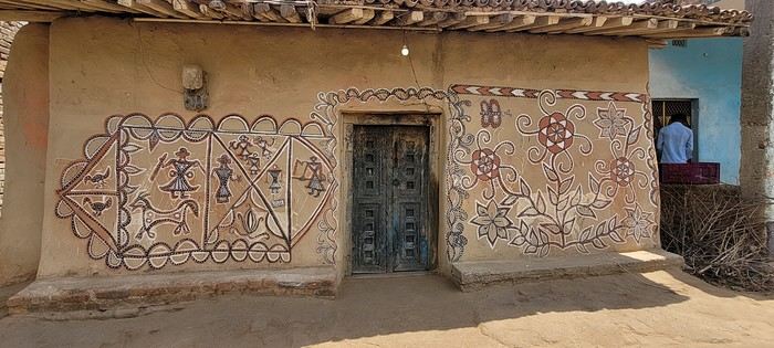
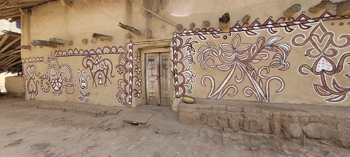
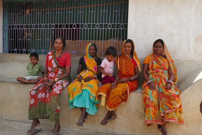
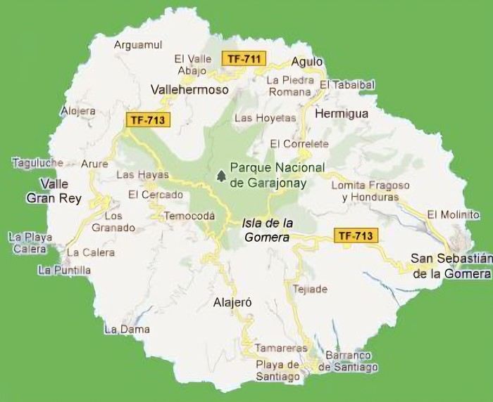
During the Sohrai festival, cattle are led into the jungle in the morning. Meanwhile, the women finish the *aripans*—these floor paintings—and continue the wall murals. Around noon, the animals return to the village, and the bulls’ horns are anointed with oil and vermilion in a gesture of gratitude, amid the vibrant colors adorning the houses. We visit several artists, including Parvat Devi, a well-known woman who has received many awards. Her arms are adorned with intriguing tattoos, which I’ll talk about in more detail later.


On another wall, the style changes completely. Here, no massive animals—just birds occupying the space, light and graceful, as if caught in mid-movement. Two silhouettes face each other, their long necks arched almost like mirrors, while their outstretched wings seem to vibrate with the patterns that compose them.


The design is more graphic, almost airy. The lines are smoother, more fluid, as if drawn in one confident stroke. The birds’ bodies aren’t solid—they’re filled with repetitive motifs like scales, stylized feathers, and spirals, giving a sense of continuous movement. Around them, everything comes to life: flowers burst open, arabesques swirl, and even the simplest shapes seem alive. What strikes me here is the sense of lightness. Where the large animals evoked stability and grounding, these birds bring something freer, almost joyful. They seem to embody movement, the circulation of life, like a breath flowing through the village.


The colors remain the same—deep reds, intense blacks, and chalky white—but the rhythm is different. Faster, more spontaneous. As if each wall had its own personality, while still speaking the same language.

That’s probably why I’m so moved. I’d heard about these paintings from my friend Raja, and last year, I saw an exhibition in a village near my home. That first encounter made me want to come here. But seeing them in person is a whole different experience. These paintings are unique. This ancient art is passed down from mother to daughter, or mother-in-law to daughter-in-law, in a quiet, deeply living continuity. At first glance, it might seem almost childlike in its simplicity and pared-down forms. And yet, everything is thought out, balanced, mastered. Nothing is left to chance.


That apparent simplicity, combined with such rich symbolism, touches me deeply. There’s something sincere and essential in these walls—and that’s what moves me.
Open
Review of our cruise on the Renaissance - August 1-11, 2026
Just back from our first cruise on the Renaissance, and I’d like to share a few thoughts about life on board. Our feelings are mixed—we wanted a change after several MSC cruises, but the value for money on this repositioning cruise left us torn. After taking advantage of successive promotions, we finally secured a well-located balcony cabin for 2600 € (almost 50% off the brochure rate). Given the amenities and the ship’s age, this now feels like the absolute maximum we’d pay for that period. Overall, we were happy with our vacation on board, but a few details—when added up—left us with a somewhat mixed impression.

The pros: - Ship size - Reasonable noise levels, except in the restaurants (aside from the covered pool area) - Spacious balcony cabin (20 + 5 m²) with plenty of storage and a bathtub with jets - Understated, tasteful decor - French language spoken on board - Friendly staff for the most part - 100% French-speaking clientele - Decent food with French dishes (even with an Indian chef) - Tables for two available (though the ship was full, so no changes possible) - Some high-quality shows, thanks to an excellent English-speaking troupe - Interesting lectures (especially on history and cetaceans)

The cons: - Unreliable air conditioning in common areas (you’d go from a freezing lounge to a hot one, as if the system only worked in certain spaces at certain times) - Aging ship with a few glitches (noises, AC, toilet flushes, lights) reported at reception (luckily, our only issue was the bathroom door not closing...) - Industrial, thawed-out bread and pastries (a letdown for a ship with a French image) - Limited fruit selection (often just apples and watermelon/melon) and not much variety in vegetables - Worn, sometimes stained restaurant towels

We’re not ruling out another cruise on the Renaissance—their itineraries are unique—but only at a very competitive price.
Open
16 days with family in La Gomera (Canary Islands)
Preamble: Why La Gomera?

When we started looking for a summer destination a few months ago, our first criterion was to avoid extreme heat and heatwaves. We had already been to Norway two years ago and are considering going back in the future for other occasions. So, we had some fun asking ChatGPT which destinations enjoyed a mild climate during the summer without going too far. Among the list provided by the AI were the Canary Islands... The idea of a place we wouldn’t have thought of first, both not too far away and exotic enough, appealed to us: “Hmm, why not?”

This destination had never really attracted me, though Magali was a bit more interested. Five years earlier, COVID had caused a short break in my professional activity, and I had planned a trip because the flight price was attractive, and I was looking for a destination different from what usually appeals to me, more than out of deep interest. From a distance and with a social judgment I acknowledge (it’s not great, but it’s not completely wrong), I had the image of a destination for party-goers enjoying the sun without the slightest interest in local culture, with concrete coastlines and denatured landscapes—everything I detest the most. Still, I had done some quick research on the different islands and spotted Lanzarote for its beautiful volcanic landscapes, hiking trails, beaches, and the impression of a good balance between activity and fewer crowds than Tenerife or Gran Canaria. Then I dropped the idea of going, without ever reconsidering traveling to the Canaries...

Until now! Because we started researching the different islands of the archipelago to see which ones might appeal to us the most. It was La Gomera, the third smallest island of the archipelago, more praised for its hiking trails and preserved nature than for its beaches, away from mass tourism (fifty times fewer tourists than Tenerife) but still a bit more developed than its wild neighbor El Hierro, that caught our attention. Contrary to what might be suggested later, I’m not at all addicted to AI, but I use it from time to time to synthesize quick research or simply for experimentation. Since ChatGPT had started anticipating my tastes lately as if it had become my buddy (often successfully, sometimes off the mark), I asked which Canary Island would suit me best for a trip with my family. The tool answered first with... La Gomera. So, I tested it and teased it a bit to see if this suggestion was well-founded, as the method sometimes makes it contradict itself. But no luck: “You’d appreciate the wild nature of El Hierro, but with family, you’ll find little activity for the kids. You won’t like the touristy vibe of the big islands like Tenerife, Gran Canaria, Lanzarote, and Fuerteventura. You could consider La Palma, but it’s really La Gomera that will suit you best, based on your interests and the criteria given.” So, we dug deeper into our research and were convinced without a shadow of a doubt that this island was the one waiting for us.

Without knowing it, we had Canarians in our circle who revealed their origins when they heard about our travel plans. One from Tenerife insisted we’d be better off choosing Tenerife (obviously...) because it also has preserved spots and that La Gomera, “you can explore it in two or three days, you’ll get bored quickly...” The other, a colleague from Gran Canaria who had never visited La Gomera, still recommended it without hesitation because it turned out her parents had just gone there on vacation: they loved it and had encountered few tourists. She also tended to think this destination was usually the subject of short stays, but according to what her parents told her, taking your time there was also a great idea. However, in our research, the idea that La Gomera is an island you can explore in three or four days max kept coming up. So, we considered combining its visit with La Palma or El Hierro, the other two that caught our eye. But hopping between islands by ferry represents a significant budget for non-Canarians, even more so for a family of four. Then, scrutinizing Google Maps, it seemed obvious that two weeks were too short to discover two islands as they deserve, and that there seemed to be plenty to see in La Gomera, given its very unique culture. After all, we read that some people spend several months a year there, others never even leave... Finally, these landscapes and this atmosphere, which seemed to us a mix of Europe, North Africa, and Latin America, tempted us. So, it would be two weeks in La Gomera, deal!

La Gomera is therefore the second... well, the third smallest island of the Canaries since La Graciosa was recently recognized as a fully inhabited island. It has the shape of a rough circle about 20 to 25 kilometers in diameter and has just over 20,000 inhabitants, half of them in its capital, San Sebastián de la Gomera, the only real town. Like its Canarian sisters, La Gomera is a volcanic formation that rose about 10 million years ago. The island is very mountainous and rugged, covered with red and black rocky landscapes. Geological activity has shaped, between the sprawling massifs that end in steep cliffs in the ocean, six coastal valleys with tropical vegetation that have favored human settlement. They divide the island like slices of a cake; from the north clockwise: the agricultural Vallehermoso, the rustic Agulo, the green, humid, and fertile Hermigua, the sunny capital San Sebastián de la Gomera, the southern and isolated Alajeró-Santiago, and the seaside Valle Gran Rey. They constitute the six municipalities (more like cantons to our French understanding) of the territory. The large solidified magma massifs that shape the heart of the island have created a large depression more protected from the sun at its center, allowing the growth of a vast laurel forest, today grouped within the Garajonay National Park, La Gomera’s green lung, which has earned it the status of a World Biosphere Reserve. Its completely European appearance contrasts sharply with the rocky and tropical landscapes of the rest of the island. Thus, the climate varies greatly from one point to another on the island: in summer, you can quickly go from a dry and sunny valley at 35°C to a humid forest area at altitude at 18°C.
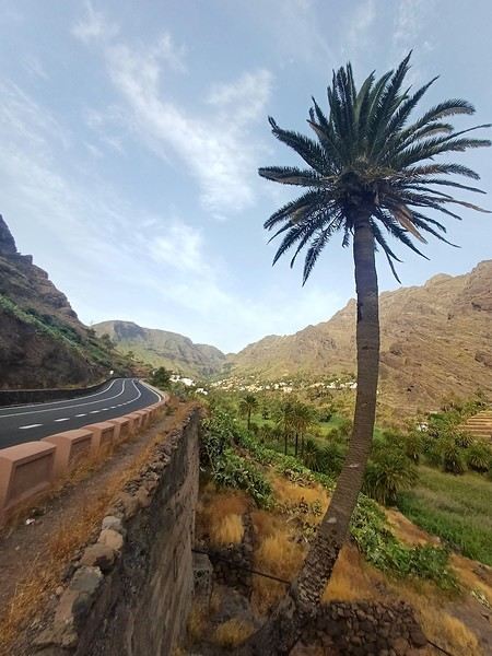
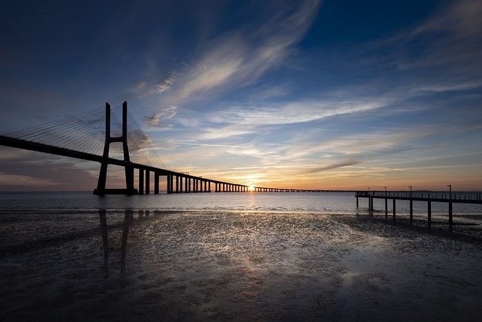
La Gomera was populated late. As with the rest of the Canaries, human presence is thought to have begun about 2,000 years ago. Groups of animist Berbers, probably fleeing persecution, gradually populated the archipelago, especially the western islands and La Gomera, becoming its small aboriginal population: the Guanches (or later Gomeros). The animist and pastoral civilization of the Guanches thrived until the Spanish takeover in the 15th century, which, after a short period of harmony and mixing with the indigenous people, suddenly ended in bloodshed... La Gomera later became the “Columbus Island” after Christopher Columbus’s stopover, increasing the blending of populations. In the 20th century, many Gomeros emigrated to Cuba and other Latin American countries in search of a better life, bringing back a mix of cultures and traits quite palpable in today’s Gomeran culture. It is, however, in La Gomera that the vestiges of Guanche culture seem to have left the most traces, in the language, gastronomy, social practices... Moreover, most Gomeros, especially in remote villages, have a particular identifiable type and proudly claim their ancestral roots, even making La Gomera a bit exotic in the eyes of other Canarians.

Perhaps that’s why it has never really wanted to develop its tourist infrastructure too much. If we set aside the tourists who visit for the day by bus or boat from Tenerife on a marked itinerary (and whom we ultimately rarely encounter), La Gomera has remained a hidden gem, a destination focused on nature discovery that attracts hikers, nature-loving divers, and scientists for its fauna and flora, and to a lesser extent, beachgoers who don’t seek overly developed coastlines. Tourist activity is therefore limited. Roughly speaking, you’ll find a majority of Spaniards, including a substantial number of residents from other Canary Islands, many Germans who have a particular fondness for La Gomera and spend long stays there or own second homes, to the point that the German cultural footprint is clearly noticeable in some places (it’s said to be Angela Merkel’s favorite holiday spot), and still quite a few French. The presence of other nationalities seemed negligible to us. Most travelers come mainly for hiking, but it’s also a prime spot for whale watching. Additionally, the seaside resorts of La Gomera—San Sebastián, Santiago, and especially Valle Gran Rey—are well-known destinations for hippies, especially German ones, ranging from chic boho hippies to old-school hippies who’ve been there for decades, quite similar to those you’d meet in India in Goa, Rishikesh, or Paharganj. Thus, practices like naturism, vegetarianism, and local organic production are quite well established in some areas.

Some practical info: - The round-trip flight from Paris to Tenerife cost us 365 € per person (outbound with Transavia, return with EasyJet), including checked luggage and three seats reserved side by side. - We chose two bases to explore the island: one week in Valle Gran Rey, reputed to be the most pleasant of the three seaside resorts, and one week in Hermigua, more mountainous and close to the natural park. We booked two houses with balconies and views: the first at 120 € per night, the second at 99 €. - The round-trip ferry between Tenerife and La Gomera cost us 270 € with the company Baleària Canarias, including discounts for children aged 4 and 12, but I don’t have the exact details. It was a bit cheaper than with the other company, Fred Olsen. - Finally, we rented a car through the agency Cicar for 360 € for 16 days, which comes to 22.50 € per day. - Apart from that, we didn’t plan anything and decided the day before or even the morning of what we wanted to do. We didn’t invest in any paper guide on the Canaries, as information on La Gomera was scarce, but we used the very comprehensive site La Gomera Travel, a travel guide published by the Canary Islands Tourism Council, a real goldmine of almost exhaustive information on the island.

Alright, off we go for 16 days of adventure discovering La Gomera!


And we start the trip with music!

We start the trip with music!
Open
July 2026 Photo Contest Theme: Bridges of the World
The theme for this July’s photo contest is: Bridges of the World

Vasco da Gama Bridge in Lisbon

Here’s the definition of a bridge: “A structure, typically made of stone, wood, or metal, that spans a depression or obstacle (such as a transportation route or waterway) by connecting the two sides or crossing over the obstacle.”

Viaducts, aqueducts, and footbridges will all be accepted.

Millau Viaduct

To allow for as many original photos as possible, the bridge can be photographed from the side, below, or above—the main thing is that it’s the focal point of the image.

Bridge in the Algarve

Pont du Gard from below
Details are also welcome, as long as you can still recognize it’s a bridge 😊

Brooklyn Bridge

Practical details:

Participation: Each VF member can submit up to 3 photos, until Sunday, 26/07 at 11:59 PM Paris time. Each photo must be posted in a separate message, with its number (1, 2, or 3). Don’t forget to add a little explanation (comment, location, etc.).

Voting: Each VF member can vote for the 3 photos they consider the best, based on their own criteria and the theme.

Voting will take place from Monday, 27/07 to Friday, 31/07 at 11:59 PM Paris time.

Selected photos should be listed in order of preference: - 1st photo: 3 points - 2nd photo: 2 points - 3rd photo: 1 point

The winner is the photographer whose photo receives the most points.

Results will be announced on 01/08. In case of a tie, the number of first-place votes will decide. The winner will have the honor of organizing August 2026’s contest.

Photos that have already been nominated (1st, 2nd, or 3rd place) in another contest are not eligible to participate in this one.

This thread is exclusively for contest submissions. Any discussions or comments should be posted in the following thread: Here
Open
Southwest USA Road Trip Part II
Here we go with this second travel journal dedicated to the American West! It’s a must when you love it! 😊

We had left off in the charming town of Bisbee, which once thrived thanks to its copper mines. Today, mining is a thing of the past, and the town seems a bit sleepy.

Unfortunately, I didn’t dig deep enough on-site to answer all the questions my observations raised. Guess I’ll have to *dig* into the subject a bit more... no pun intended! 😊

Let’s hop back in the car and head a little further south to check out the esplanade that offers a view—if you can call it that—of the impressive open-pit mine. Then, it’s off to the Lowell neighborhood.

Preserved almost exactly as it was, this area must’ve been bustling in its heyday. The vintage cars are still around, storefronts and signs look like they’re straight out of another era, and the whole place has a pretty amazing vibe. You’d almost think you were on Route 66!

Here, we’re not just discovering an old neighborhood—it’s a little slice of American history. And, a detail that’s great for my physical health: the area isn’t too spread out. Lucky me! 😊

I won’t post too many photos here since I think I can turn them into a future photo exhibit. Between these and some shots from Route 66, I should have more than enough material! So, let’s keep a few under wraps... to preserve the surprise. 😊

Open
14 Days in Japan – September-October 2026
I had to leave Thailand as my 60-day visa was coming to an end, and this time I opted for a 14-day visit to Japan. I’d already spent 3 days in Tokyo a few years ago on a business trip, which left me with a great impression. Y, my Thai partner, had never been there. That’s why we chose a fairly classic itinerary, including a few castles and Kyoto among other things.

Before diving into the details of our trip, I’d like to recap the expenses we incurred. This will be useful for some of you, and it’ll help us prepare for our next trip to Japan.

I’ve categorized our expenses into 5 groups: - Hotels: 1150 € (breakfast included) - Transportation: 278 € (trains, buses) - Big expenses: 487 € (souvenirs and a few necessary items) - Excursions: 116 € (museum visits, temples, castles) - Daily expenses: 1125 € (meals, small purchases) Total = 3194 €, or 228 € per day on average. I’m excluding flights, as those depend on everyone’s arrangements (departure location, travel dates, etc.).

Jpeg below: apologies for “hotel” without a circumflex—my software isn’t French!


For hotels, we always chose decent but not luxurious places, well-located to let us walk to and from transportation hubs. We systematically avoided taxis, which are notoriously expensive in Japan. We’ve also gotten into the habit over several trips of traveling with minimal luggage: one duffel bag each (7-8 kg) plus the small carry-on allowed on planes (2-3 kg). This lets us travel with three sets of clothes (what we’re wearing plus two changes). We add a checked bag for the return trip to accommodate the things we buy along the way.

‘Transportation’ and ‘Big expenses’: I’ll give more details in the day-by-day account.

We didn’t do any extravagant excursions, like safaris or sports activities.

Meals and food make up the bulk of our daily expenses. We often ate at izakayas, which offer great value—between 2000 and 6000 yen for two (about 11-12 to 33-34 € for two, usually around 20-25 €). We didn’t hold back, but we also didn’t go to high-end restaurants.

More to come while I gather my photos: General Remarks.
Open
First Questions About Transportation and Accommodation in Japan
Hi everyone,

I’m starting to think about a trip to Japan, though I haven’t yet decided on the exact duration or itinerary, and I have a few questions for those who know the country well or have traveled there recently.

First, about getting around: what do you think are the most economical and reliable ways to travel across Japan and move between cities? I’m thinking of trains, overnight buses, domestic flights, regional passes, etc. I’m not necessarily looking for the fastest option, but rather a good balance between cost, simplicity, and reliability.

I also have a question about the return ticket. Since I don’t yet know how long I’ll stay in Japan—or even if I’ll return directly to France (I might continue to another Asian country)—is it mandatory to have a return or exit ticket before entering Japan? Would a ticket to another Asian country suffice?

Regarding accommodation, I usually prefer staying in youth hostels rather than hotels. Are hostels easy to find all over Japan, including outside Tokyo, Kyoto, and Osaka? And what’s the average budget per night for something clean and well-located?

Finally, I’d like to get an idea of the overall budget for the trip. Is Japan still relatively affordable when traveling simply, or do expenses add up quickly? I’m mainly thinking about:

transportation between cities; local transportation; youth hostels; food; potential domestic flights.

My plan is to travel fairly freely, without necessarily booking everything in advance, so I can adjust my itinerary or stay longer in places I like.

If anyone has traveled this way in Japan, I’d love to hear about your experiences, tips, and maybe an idea of the daily budget to expect.

Thanks in advance!
Open
Korgaljyn (Kazakhstan): guided tour for bird photography
Hi there, I’d like to spend 2–3 days in the Korgaljyn area in May to photograph flamingos and other birds. I’ll be in Astana and I’m looking for a tour that includes accommodation so I can stay for 2 days. I’ve found the buses from Astana and info about the park’s facilities, but no accommodation or guided outings. Has anyone done this? Thanks for your help
Open
Driving Route 1520 in a rental car
Hi everyone, I posted this topic back in March 2023:

I’m asking a question in preparation for a trip (March 2023): is the road identified by Michelin as P1520 paved between Zagora and Tasla? Thanks for your answers—or insights!

I’m heading back in June (2026!) and would love any new info on this Route 1520. Just to clarify, I’ll be in a rental car, so no off-roading. Thanks so much for your replies, and hello to the longtime forum members I still see active here!
Open
Mauritius in July
Hey everyone,

Every year, we love escaping the autumn season—I really can’t stand it—by heading somewhere sunny during the All Saints' holiday.

This year, we were thinking of Mauritius... We’d found a place to stay, but after digging deeper, I realized it’s 40% cheaper in July. And the flights with Emirates aren’t more expensive in the summer, even though it’s peak season for them, compared to October.

Yet, after checking a bunch of sites, I don’t get the impression the weather is bad there in July—maybe just a *tiny* bit less hot than in October, but nothing major... So we’re tempted to go this summer after all.

This big price jump for All Saints' compared to summer is a mystery to me... Did I miss something?

If you’ve got any firsthand experience traveling to Mauritius in July or early August, I’d love to hear about it.

Thanks
Open
Which small-sized touring bike to choose?
Hi, A friend is looking for a bike to embark on a long trip, but the issue is he’s only 1.55m tall. In itself, that’s not a problem 😏, except that finding an XS-sized touring bike isn’t easy. Some start at 1.55m, but it’s still a bit extreme. If anyone knows of brands or models that might work... Thanks in advance
Open
Which health insurance should I choose for a trip to the USA?
Hi everyone. After years of traveling to the USA without any medical insurance subscriptions—and luckily never having any major health issues (though I did get a scorpion sting buried in the sand at CBSouth, 😇)—life has caught up with us, and we’re now being forced into "wisdom" and leaving our carefree days behind.

So, I’m looking for the best compromise for a 2-month health insurance plan. I’ve read the discussions on this topic, but the most recent one is from last year, and I’d love your take on the current situation. I’m familiar with the usual options like Europ Assistance and AXA, but I’ve just discovered Chapka and Heymondo (the latter seems interesting in terms of both price and coverage).

What do you think of these last two? How do they compare in terms of value for money against the bigger companies?

Thanks in advance, everyone.
Open
Family boat trip from Manaus (Brazil) to Yurimaguas (Peru)
Hello,

As part of a 10-month trip to explore and discover South America, we’d like to start our journey in northern Brazil since the timing is perfect for traveling up the Amazon. We’re traveling as a family of five with three kids aged 6, 9, and 18.

Our plan is to leave from Manaus and reach Yurimaguas in Peru via the Amazon, mostly by boat. Since we have plenty of time, we can take breaks to explore the different stops along the way that are worth it. The idea is to eventually head to Colombia via Ecuador later on.

So far, we’ve identified the following stops: - Manaus - Tabatinga - Iquitos - Sumiria Reserve (we’d like to stay there for a week) - Yurimaguas.

We’re thinking of traveling in a cabin/hammock for the longest leg (Manaus to Tabatinga) and just in hammocks for the shorter trips (max 3 days).

I have a few questions: 1. From a safety perspective, is the area we’re planning to cross safe, considering we’ll be with our three kids, the youngest being 6? 2. Isn’t this route a bit too ambitious for our kids? 3. We’re considering adding the Santarém/Manaus leg. Is Santarém a city worth adding to the itinerary? 4. Among the planned stops, which ones deserve a special visit? 5. Do the boat trips always include meals on board, or should we be careful when booking? 6. What would be a reasonable estimate for the duration of this trip to fully enjoy it?

I’ve read quite a bit—like trying to board early to get the best hammock spots, and that travel times can vary depending on currents, stops, and potential technical issues. But that’s not a problem since we have all the time in the world! :)

We’d love to hear from anyone who’s traveled in this area before!

Thanks so much in advance for your help in planning our trip.

Rémy, Céline, Antoine, Sacha, and Paul
Open
Khiva to Bukhara: car or train?
Good evening,

The question on my mind is in the title: is it better to go from Khiva to Bukhara by train or by car?

I love traveling by train (though I’ll have the chance to take it between Bukhara and Samarkand, and then from there to the capital). I’m curious about Uzbek roads, but the excursions I’ve planned will let me satisfy that curiosity over shorter distances than the 500 km of this trip.

I’ve read on this forum that the road can be grueling, though those posts are a bit dated now. I’ve also read (on Advantour—reliable?) that the train connection isn’t daily. For the past few days, the national railway website has only shown me blank pages—I can’t check anything. I *did* spot a train leaving Khiva at 11 AM and arriving in Bukhara at 6 PM this summer, though...

Any recent experiences to share about either option?

Catherine
Open
Photo Contest, September 2020: Departure or Arrival Scenes and Places
Hello everyone, 🙂 This month’s theme is: places, departure or arrival scenes. The places include: train or bus stations, passenger ports, and airports. Here, for example, is Beijing West Railway Station This is Beijing West Railway Station. You can submit a photo of the whole place, a part of it (inside or outside, the platforms), or a detail (like a station clock) as long as it clearly shows it’s a departure or arrival spot—such as a timetable display. Or here’s another example:
Even if you’re not in one of these places, a departure or arrival scene is welcome: Example: Early morning departure from a pagoda at Inle Lake (Myanmar) as people head back to their villages in the surrounding hills

A vehicle about to leave:

People are also allowed, as long as they’re clearly identified as travelers about to depart or who have just arrived. Bus station in Thailand (a photo I’d shared for the "solitude" theme)

Another example: in the foreground, a boat docked, and just above, another that has just left (Rangoon, Myanmar—these boats serve cities in the Irrawaddy Delta, and in some areas, they’re still the only means of transport for locals).

You can also include departures or arrivals from races, but again, it must be at the start or finish, not during the race: Boats before the start of the Route du Rhum in Saint-Malo:

Participation: Each participant can submit up to 3 photos, until Tuesday, September 22 at 11:59 PM Paris time. Each photo must be posted in a separate message, with its number (1, 2, or 3). Don’t forget to add a short description (comment, location, etc.).

Voting: Every VoyageForum member can vote for the 4 photos they think are the best, based on their own criteria and the theme (I’m trying this format this month). Voting will take place from Wednesday, September 23 to Tuesday, September 29 at 11:59 PM Paris time.

Photos should be ranked in order of preference: - 1st photo: 4 points - 2nd: 3 points - 3rd: 2 points - 4th: 1 point

Each member can vote only once for 4 photos. No ties for 4th place with half a point each.

The winner is the photographer whose photo receives the most points. Results will be announced on September 30. In case of a tie, the number of first-place votes will decide. The winner will have the honor of organizing October’s contest.

Give me two or three days to put together the slideshow—I’ll definitely reach out to Masterpo via PM for advice if I’m stuck (and if he’s willing).

Good luck to everyone—may the best photographer win! Let’s get started! For discussion, it’s here
Open
Soundproofing of connecting cabin on MSC Meraviglia
Hi there,

I recently booked a cruise on the MSC MERAVIGLIA in a Yacht Club cabin, and the company assigned me a connecting cabin (with a shared side door to the neighboring cabin, which wasn’t occupied by anyone in our group). I really struggled with the soundproofing compared to the neighboring cabin. Just one door separates the two cabins, and while non-connecting cabins are usually very well soundproofed, the one we had let us hear the neighbors’ conversations and even their toothbrushing. I asked to change cabins, but the ship was fully booked. I think a single door (instead of two) isn’t enough for proper soundproofing, and if it’s even slightly misaligned, it lets air—and therefore sound—through.

If others have experienced this issue, I’d love to hear about it because MSC tells me it’s not a recognized problem (except by me, apparently!)...
Open
New adventures from Perpignan to Ranchi (Jharkhand)
March 2nd — Departure by bus from Latour at 6:50 AM. The journey isn’t direct: we pass through Elne then Corneilla. In Perpignan, I switch to a BlablaBus heading to Barcelona’s northern bus station. Before reaching Le Perthus, French police stop us to check IDs. Several people aren’t in order, but after about fifteen minutes, we’re on our way again. We’re checked again at La Jonquera: this time, the wait lasts almost forty-five minutes while police identify those in violation and wait for a vehicle to pick them up. The driver then tries to make up for lost time; we finally arrive at our destination half an hour late.

I quickly head to the Arc de Triomphe metro station, located 200 meters away: you have to cross the bridge along the bus parking lot, then walk through a large garden; the station is on the right before the garden entrance. The trip to the airport isn’t direct: I have to change at Tomasso and take the line to the airport, where I arrive at 1 PM.

At the Emirates counter, I learn my flight was just canceled due to the war in Iran; they offer me another flight for the next day. I have to wait at the airport until 7 PM before being taken to a hotel; the next morning, I’ll take a flight to Vienna (with an 8-hour layover), then an Air India flight to Delhi, and finally a flight to Kolkata. I agree: I don’t know Vienna, so it’ll be an unexpected discovery.

At 7 PM, a small group is taken to the hotel, 35 minutes from the airport, where we’re served a light dinner upon arrival.

March 3rd — A taxi picks me up at 6:30 AM; the flight to Vienna takes off at 9:30 AM and arrives at noon. I’m free until 7 PM; the metro is direct to the city center. The weather is pleasant and not too cold, luckily, since my clothes are light.

When I exit the metro, I spot the St. Stephen’s Cathedral tower in the distance and approach it: the roof, made of glazed tiles, is remarkable.


Entry is free, and the interior, a mix of Gothic and Baroque styles in the center, is stunning.


Not far from there is St. Anne’s Church


, also Baroque, adorned with beautiful frescoes


—a music concert adds an enchanting atmosphere to the visit. I continue my walk at random through the pedestrian streets lined with magnificent buildings: I’m charmed by the city.


Before heading back to the airport, I stop at a lovely tea salon. My flight will eventually leave with a delay.

Wednesday, March 4th — Delhi and a little luggage scare We arrive in Delhi shortly after noon. Immigration is quick, and good news: my bag was checked through from Barcelona to Kolkata. I head to the connecting terminal and arrive half an hour before boarding: the flight goes smoothly. Upon arrival, the luggage comes out quickly… except mine. After filing a report, I’m told my bag is in Delhi—I have to retrieve it before taking another flight. I didn’t know (or had forgotten): with the delays, I wouldn’t have had time to pick it up and make the connection.

I take a taxi to the Ichamati Hotel. The welcome is warm, and the room is clean but very small. Without my bag, I feel a bit lost—I have nothing to change into.

Tonight, I’m dining with Raja and his friends at a beautiful restaurant, an old colonial house turned into a hotel.


We’re happy to see each other and have a comforting evening together.
Open

You might also like