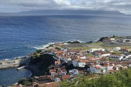
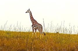
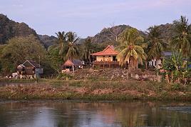
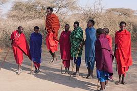
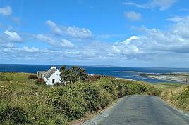
I’ve kept quiet about them... to preserve them.
Those are the words of a passionate traveler who recently wrote to us.
For years, he’s been discovering rare, authentic places... and chooses to say nothing.
Out of respect. Out of fear of ruin. Out of love for secrecy.
What would you do?
966 similar discussions in English
Hi,
Many of us have noticed that bugs have been making it difficult to navigate the forum lately.
I’ll let Kate and Ticapi explain the issue:
I went to your profile to check out the Thailand travel journal, and when I clicked on it, it brought me back here again. All week, I’ve been dealing with bugs like this—it’s really discouraging from continuing on VF.🙁
I had the same thing happen, and multiple times. For me, it was Montagnard’s latest journal that kept coming up no matter which discussion I clicked on.
Hopefully, a solution will be found soon.🙂
Many of us have noticed that bugs have been making it difficult to navigate the forum lately.
I’ll let Kate and Ticapi explain the issue:
I went to your profile to check out the Thailand travel journal, and when I clicked on it, it brought me back here again. All week, I’ve been dealing with bugs like this—it’s really discouraging from continuing on VF.🙁
I had the same thing happen, and multiple times. For me, it was Montagnard’s latest journal that kept coming up no matter which discussion I clicked on.
Hopefully, a solution will be found soon.🙂
Hello everyone,
It’s been a little over a year and a half since we first set foot in South Africa, and ever since, we’ve been dreaming of returning to explore Southern Africa.
First of all, a big thank you to all the forum members—there are so many on this VoyageForum section, some of whom are unconditional and indispensable experts on the destination—for the amazing travel journals that only make you want one thing: to go and discover these stunning lands. The first journal I read was Bruno’s (Montagnard74), and I was completely captivated by the face in the colors of the rainbow nation.

Now it’s my turn to add my small contribution by recounting our two-week trip during the Christmas period in South Africa.
Even though Attila strongly advised against visiting South Africa during the South African summer holidays, we still gave it a try since my husband doesn’t have the option to choose his vacation dates.
So we went during the peak tourist season, with all its drawbacks: difficulties finding accommodations, crowds at certain sites... But on the bright side, it’s the beautiful season in South Africa while it’s gray and cold back home.
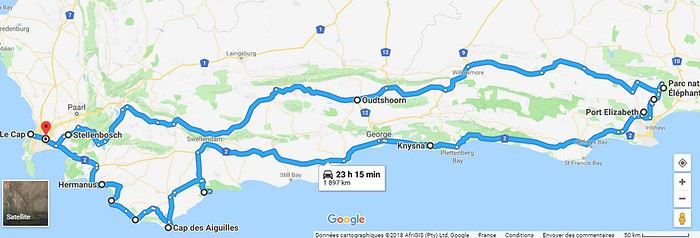
For this trip, we wanted to explore Cape Town and its surroundings, which are already packed with things to see. As a result, we didn’t have time to head north without rushing too much. So we planned the following itinerary, staying in the south:
J1: Lyon/Dubai J2: Dubai/Cape Town J3: Table Mountain – Cape Town J4: Botanic Garden - Robben Island J5: Cape Peninsula J6: Cape Agulhas - Gansbaai J7: De Hoop - Swellendam J8: Garden Route - Knysna J9: Garden Route - Addo NP J10: Addo NP J11: Oudtshoorn J12: Little Karoo J13: Wine Route - Cape Town/Dubai J14: Dubai/Lyon
To give you a taste of what we experienced on the South African roads, here’s a little preview of the wildlife and flora we encountered, as well as the beaches and mountains we glimpsed.
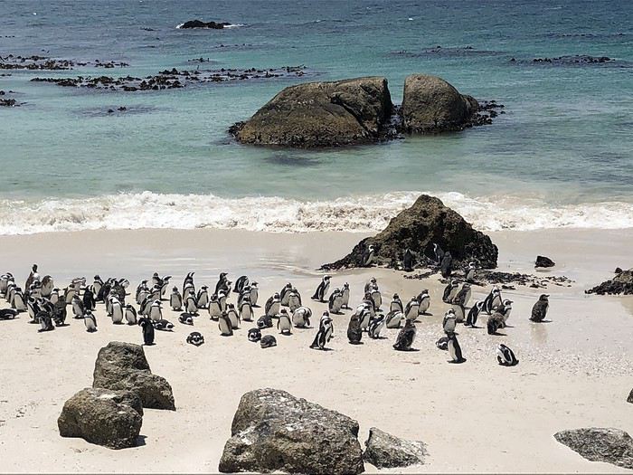
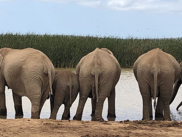
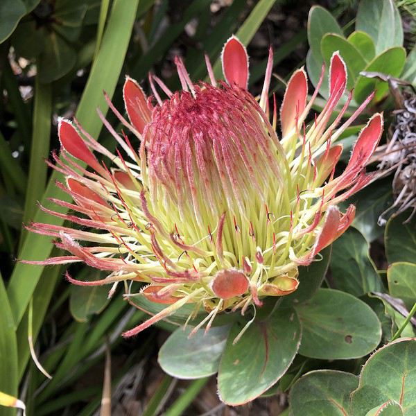
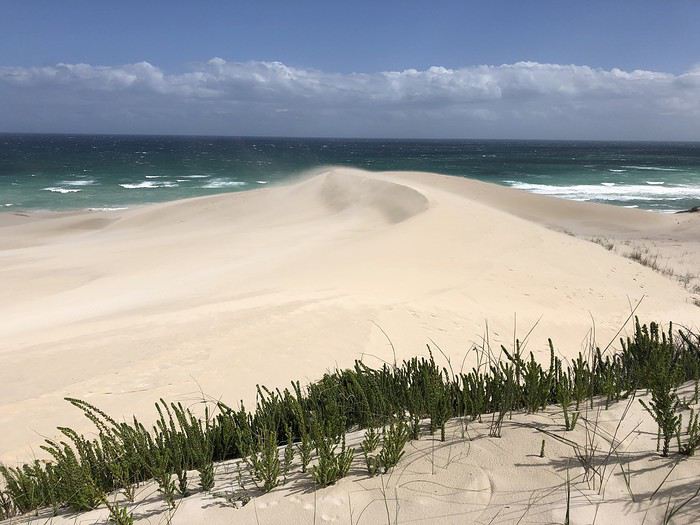
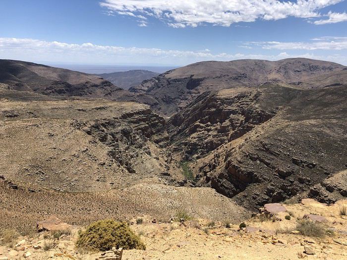
The rest here
First of all, a big thank you to all the forum members—there are so many on this VoyageForum section, some of whom are unconditional and indispensable experts on the destination—for the amazing travel journals that only make you want one thing: to go and discover these stunning lands. The first journal I read was Bruno’s (Montagnard74), and I was completely captivated by the face in the colors of the rainbow nation.
Now it’s my turn to add my small contribution by recounting our two-week trip during the Christmas period in South Africa.
Even though Attila strongly advised against visiting South Africa during the South African summer holidays, we still gave it a try since my husband doesn’t have the option to choose his vacation dates.
So we went during the peak tourist season, with all its drawbacks: difficulties finding accommodations, crowds at certain sites... But on the bright side, it’s the beautiful season in South Africa while it’s gray and cold back home.
For this trip, we wanted to explore Cape Town and its surroundings, which are already packed with things to see. As a result, we didn’t have time to head north without rushing too much. So we planned the following itinerary, staying in the south:
J1: Lyon/Dubai J2: Dubai/Cape Town J3: Table Mountain – Cape Town J4: Botanic Garden - Robben Island J5: Cape Peninsula J6: Cape Agulhas - Gansbaai J7: De Hoop - Swellendam J8: Garden Route - Knysna J9: Garden Route - Addo NP J10: Addo NP J11: Oudtshoorn J12: Little Karoo J13: Wine Route - Cape Town/Dubai J14: Dubai/Lyon
To give you a taste of what we experienced on the South African roads, here’s a little preview of the wildlife and flora we encountered, as well as the beaches and mountains we glimpsed.
The rest here
October 9 - Day 1
There’s an old Chinese proverb I particularly like: "Dú wán juán shù, búrú xing wán li lú." In slightly more familiar terms, it means you always learn more by traveling ten thousand miles than by reading ten thousand books. And I’m the perfect guy for this because, first, I don’t have time to read ten thousand books about our new destination... And second, the proverb is literally made in our new adventure playground: China!
China... or should I say, "Paradox-land"! A country we see everywhere—on the news or on the "Made in China" labels of half the objects around us—but one we actually know very little about. A country hurtling toward the future while still casually chatting with its rich past. A country that, through our Western lens, seems uniform and just filled with Chinese people who all look alike, yet reveals an incredible cultural, natural, demographic, and culinary diversity as soon as you dig a little deeper. A country with a reputation for being logistically tricky for solo travelers, yet where you can book public toilets on your smartphone. In short, a delightful mess of disorienting contradictions—and, of course, a destination that was bound to charm our wandering soles for a while.
That "while" will be two weeks... And the "we," since I wanted the best in the world to join me, will be Flo and me in this backpacking duo stamped with wanderlust! Just the two of us for two weeks to explore a tiny part of this continent-sized country, trying to understand how old wooden stilt houses coexist in the middle of futuristic skyscrapers glowing with lights, tasting all the weird and wonderful things that come our way, and—incidentally—covering the famous ten thousand kilometers from our proverb.
Well... we’ll probably cover a little less than that, but enough to let us write our own travel journal instead of reading others’... Because you know us—between living our lives watching others live theirs by reading ten thousand books, or writing our own by truly roaming the world, we’ve long since chosen our side! And you, who’s reading this—team book or team live?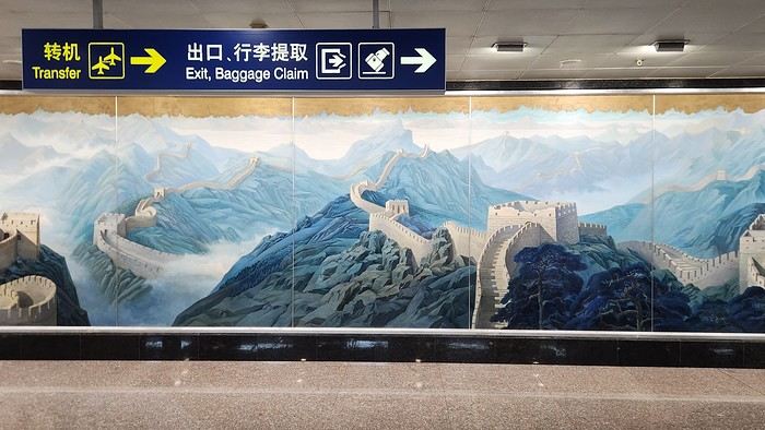
There’s an old Chinese proverb I particularly like: "Dú wán juán shù, búrú xing wán li lú." In slightly more familiar terms, it means you always learn more by traveling ten thousand miles than by reading ten thousand books. And I’m the perfect guy for this because, first, I don’t have time to read ten thousand books about our new destination... And second, the proverb is literally made in our new adventure playground: China!
China... or should I say, "Paradox-land"! A country we see everywhere—on the news or on the "Made in China" labels of half the objects around us—but one we actually know very little about. A country hurtling toward the future while still casually chatting with its rich past. A country that, through our Western lens, seems uniform and just filled with Chinese people who all look alike, yet reveals an incredible cultural, natural, demographic, and culinary diversity as soon as you dig a little deeper. A country with a reputation for being logistically tricky for solo travelers, yet where you can book public toilets on your smartphone. In short, a delightful mess of disorienting contradictions—and, of course, a destination that was bound to charm our wandering soles for a while.
That "while" will be two weeks... And the "we," since I wanted the best in the world to join me, will be Flo and me in this backpacking duo stamped with wanderlust! Just the two of us for two weeks to explore a tiny part of this continent-sized country, trying to understand how old wooden stilt houses coexist in the middle of futuristic skyscrapers glowing with lights, tasting all the weird and wonderful things that come our way, and—incidentally—covering the famous ten thousand kilometers from our proverb.
Well... we’ll probably cover a little less than that, but enough to let us write our own travel journal instead of reading others’... Because you know us—between living our lives watching others live theirs by reading ten thousand books, or writing our own by truly roaming the world, we’ve long since chosen our side! And you, who’s reading this—team book or team live?
A new work assignment means our vacation dates can't stay the same.
We had planned to go to the Canary Islands, but flight prices are skyrocketing with this new holiday schedule.
So, I’m looking for an alternative to Gran Canaria and El Hierro and found two round-trip flights with Wizz Air to Tirana.
398 €, including baggage and seats—perfect!
Plus, the departure and return times are great, which is pretty rare for a low-cost flight!
All that’s left is to rent a car, plan the route, and book accommodations.
With two weeks, we’ll have to make some choices!
Here’s the final itinerary: Shkodra (2 nights), Valbonë (3 nights), Tirana (1 night), Lake Ohrid (1 night), Korçë (1 night), Përmet (1 night), Gjirokastër (1 night), Himarë (2 nights), Berat (2 nights), and Krujë (1 night).
A mix of countryside and small towns, a bit of the Mediterranean, and some mountains!
Late October isn’t the best season, so let’s keep our fingers crossed for the rest...
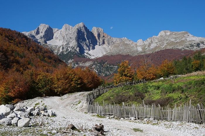
We had planned to go to the Canary Islands, but flight prices are skyrocketing with this new holiday schedule.
So, I’m looking for an alternative to Gran Canaria and El Hierro and found two round-trip flights with Wizz Air to Tirana.
398 €, including baggage and seats—perfect!
Plus, the departure and return times are great, which is pretty rare for a low-cost flight!
All that’s left is to rent a car, plan the route, and book accommodations.
With two weeks, we’ll have to make some choices!
Here’s the final itinerary: Shkodra (2 nights), Valbonë (3 nights), Tirana (1 night), Lake Ohrid (1 night), Korçë (1 night), Përmet (1 night), Gjirokastër (1 night), Himarë (2 nights), Berat (2 nights), and Krujë (1 night).
A mix of countryside and small towns, a bit of the Mediterranean, and some mountains!
Late October isn’t the best season, so let’s keep our fingers crossed for the rest...
Kattegat isn’t just the name of the village in the TV series *Vikings*—it’s also the stretch of water separating Denmark from Sweden... the sea, basically! And further north, you’ve got Norway and its fjords!
Originally, I’d planned to just do a loop around Kattegat, with the *Under* restaurant in Lindesnes as our anniversary treat... but along the way, we thought, why not "push" a little further north, keeping an eye on the budget since we’d chosen to travel by car in June 2025 through Scandinavia.
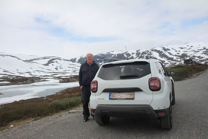
Why by car when most travelers opt for a camper van, while others prefer the comfort of cruises? Well, because we don’t own a camper van, renting one is pricey, and then you’ve got to add fuel costs (those things guzzle gas!), ferry fees, and other "tolls." All things considered, we went for mostly rentals—especially since there were four of us at the start of the trip. We spent the first week in Denmark with our daughter and son-in-law. Then they flew back to Belgium, and we continued our adventure as a couple. For accommodation, we mainly booked Airbnb apartments, which helped keep costs down and, most importantly, let us prepare our own meals (diet, diet!). In this travel journal, you’ll discover (or rediscover, for those who followed my older ones) our unbridled love for theme parks, museums, unique experiences, and—especially in Denmark—Legos! Unfortunately, we didn’t do any hikes this year because the unpredictable weather had made the trails slippery, and since I’d already taken three tumbles during the trip, I didn’t want to risk another! In the end, we traveled for 32 days, covered 6,200 km, and most importantly, discovered the charming country of Denmark, marveled at Norway’s breathtaking fjords—all without suffering the heatwave that hit France and Belgium that June! If you’ve got any questions, don’t hesitate to ask!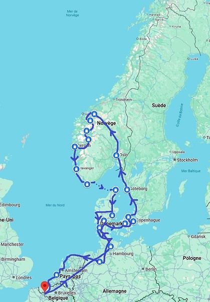
Why by car when most travelers opt for a camper van, while others prefer the comfort of cruises? Well, because we don’t own a camper van, renting one is pricey, and then you’ve got to add fuel costs (those things guzzle gas!), ferry fees, and other "tolls." All things considered, we went for mostly rentals—especially since there were four of us at the start of the trip. We spent the first week in Denmark with our daughter and son-in-law. Then they flew back to Belgium, and we continued our adventure as a couple. For accommodation, we mainly booked Airbnb apartments, which helped keep costs down and, most importantly, let us prepare our own meals (diet, diet!). In this travel journal, you’ll discover (or rediscover, for those who followed my older ones) our unbridled love for theme parks, museums, unique experiences, and—especially in Denmark—Legos! Unfortunately, we didn’t do any hikes this year because the unpredictable weather had made the trails slippery, and since I’d already taken three tumbles during the trip, I didn’t want to risk another! In the end, we traveled for 32 days, covered 6,200 km, and most importantly, discovered the charming country of Denmark, marveled at Norway’s breathtaking fjords—all without suffering the heatwave that hit France and Belgium that June! If you’ve got any questions, don’t hesitate to ask!
Here we go...
It’s been almost a month since we got back, and my head is still over there... Just like every time... For my own sake, I know travel journals are useful for travelers planning a trip to a country. But selfishly, they’re also helpful for me—to put the final stone on each journey and revisit it from time to time, just for the memories...
So, this trip won’t be any different, and I invite you to follow along on our Andean adventure, from Lima to the Southern Lipez, from December 16, 2016, to January 14, 2017. It’s a chronological journal because I don’t know how to approach it any other way. It doesn’t hold any absolute truths—just my experiences and feelings, which are obviously personal and not objective!
But if it inspires you to visit these magical countries (and I assume you’re already interested if you’re here) or gives you a couple of tips, then I’ll consider it a win!
So, let’s hit the road for the land of wide-open spaces!
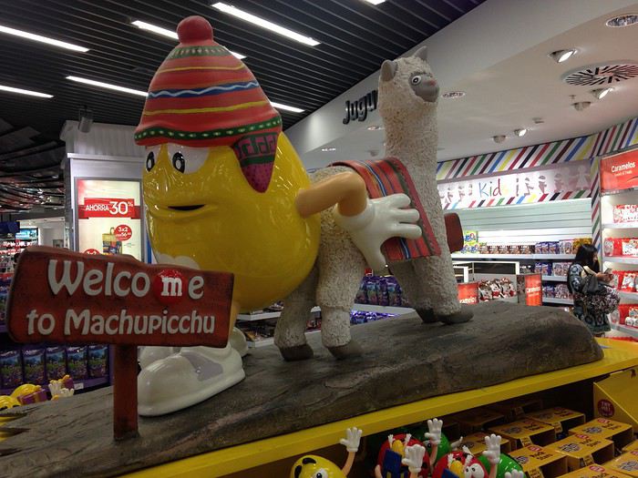
It’s been almost a month since we got back, and my head is still over there... Just like every time... For my own sake, I know travel journals are useful for travelers planning a trip to a country. But selfishly, they’re also helpful for me—to put the final stone on each journey and revisit it from time to time, just for the memories...
So, this trip won’t be any different, and I invite you to follow along on our Andean adventure, from Lima to the Southern Lipez, from December 16, 2016, to January 14, 2017. It’s a chronological journal because I don’t know how to approach it any other way. It doesn’t hold any absolute truths—just my experiences and feelings, which are obviously personal and not objective!
But if it inspires you to visit these magical countries (and I assume you’re already interested if you’re here) or gives you a couple of tips, then I’ll consider it a win!
So, let’s hit the road for the land of wide-open spaces!
Hello everyone,
I imagine many of you have been captivated by the Masai Mara park and/or your safari experience with Tony Crocetta/Melting Pot Safari. Still, I’d like to share my perspective. First, I’m an avid traveler, especially in love with Africa, which my partner and I have explored a bit (Zambia, South Africa, Botswana, Kenya, Zimbabwe, Namibia...). That said, I want to express my deep disappointment with both the Masai Mara and Tony Crocetta’s camp, Melting Pot Safari, where we stayed last year.
First, about the park: it’s stunning, no doubt. But what a highly touristy place! I can’t find the words to describe the horror of being among 30 4x4 vehicles lined up in front of a lioness hunt, let alone encircling her right after her kill while her prey is still alive in her jaws... no respect for wildlife. The same goes for surrounding a young leopard playing with its small prey, a moment when I counted over 50 vehicles, most with their engines running... sickening. I turned away, both my gaze and my camera. What a disaster to see this natural wonder of Africa turned into a tourist hotspot.
Yes, I loved this place on Earth, but no, I won’t "promote" it anywhere or to anyone.
Next, I also wanted to share my dissatisfaction with Tony Crocetta’s famous camp, Melting Pot Safari: where to begin? We booked a private vehicle for four with two friends, and I have no complaints about the vehicle itself (though it obviously came at a cost). The windows and the vehicle weren’t very photo-friendly, but let’s move on. The trip between the sisters’ guesthouse (which was fine) and the camp went smoothly, except we arrived a bit too late. Result: "We’ll leave for the safari an hour later today because the driver has to respect his rest hours." Perfect—with park formalities, we only spent about an hour in the park that evening. The safari got off to a great start... During our 12-day stay, we saw some amazing things. Tony wasn’t at the camp—I don’t know what the atmosphere is like when he’s there, but it was rather cold during our trip. Sylvie, his wife, barely looked at us, never asking how our day, night, or game drive went (I think she spoke to us once during the stay, plus the day we arrived, of course). We felt invisible... (if I were mean, I’d say the money had already been deposited into Melting Pot’s bank account.) The evening meals, if I may say so, were a joke: not enough dessert (aside from fruit, but the few elaborate desserts—like 10 for 18 guests) for everyone, barely enough meat or sides. If you were unlucky like us and ended up with a group of 15 people who decided to skip the starter, you’d better hurry to get your main course, or there might not be any left—and no refills... We always ate our fill, but sometimes we had to serve ourselves in advance. Finally, I want to correct something about the quality of the meals: seriously, this buffet was really mediocre and far from the culinary standards I’d read about in my pre-trip research (see their Facebook page). Anyway, let’s move past the food—after all, the avocados were sublime, and we’re not there primarily to eat.
About the tent: the river views were beautiful, and the beds were very comfortable. No running water, individual showers outside the tent, and dry toilets—but it’s Africa, so we weren’t shocked. However, I’m disappointed that for this "modest" price, I wasn’t warned there’d be no soap (and no, I don’t travel with my own soap—and for the price, a little bar in the tent wouldn’t be a luxury). But let’s move on—the hippo views were fantastic. Oh, and to preserve the Masai Mara’s water (which makes sense) and for hygiene reasons, underwear isn’t washed by the camp staff—fair enough. But then what’s that little sign next to the bed? Oh right, for a hefty sum, underwear suddenly becomes "washable"...
Finally, my biggest gripe is about the essential part: the game drives. In France, they sell you a dream with a "photo safari" (what’s the difference, really? A room with a few more electrical outlets?). They promise guides especially suited for photography (not a given, sorry) and vehicles that can get close to animals and go off-road... but here’s the catch: the guides are bound by park laws and hounded by rangers looking to fine rule-breakers. Result: as soon as a white ranger vehicle is spotted, we have to abandon our spot for a wild chase through the grass. Fun once... The next day, we learned that another group’s guide got caught and had to pay $100 for breaking the rules—a sum he casually asked the travelers in his vehicle to cover... because of course, Melting Pot lures tourists with dreams, the poor rangers try to get close, all while breaking park laws... and they break those laws for Crocetta’s company, which, of course, won’t dip into its profits to pay the fines. Basically, it’s "keep the clients happy, but don’t get fined—or the fines are on you or you’ll have to ask the clients directly." Nice boss! Anyway, there were long discussions about this last year, especially among the guests in the fined vehicle. My partner and I found these practices unacceptable, and we were deeply disappointed by this attitude.
I know many people adore this park and/or this company—maybe you were luckier... or maybe you’re less demanding than we are when it comes to respecting rules, nature, and clients. But after traveling through much of southern Africa, I can tell you we personally came back frustrated from this experience and aren’t eager to return... You’ve been warned.
I imagine many of you have been captivated by the Masai Mara park and/or your safari experience with Tony Crocetta/Melting Pot Safari. Still, I’d like to share my perspective. First, I’m an avid traveler, especially in love with Africa, which my partner and I have explored a bit (Zambia, South Africa, Botswana, Kenya, Zimbabwe, Namibia...). That said, I want to express my deep disappointment with both the Masai Mara and Tony Crocetta’s camp, Melting Pot Safari, where we stayed last year.
First, about the park: it’s stunning, no doubt. But what a highly touristy place! I can’t find the words to describe the horror of being among 30 4x4 vehicles lined up in front of a lioness hunt, let alone encircling her right after her kill while her prey is still alive in her jaws... no respect for wildlife. The same goes for surrounding a young leopard playing with its small prey, a moment when I counted over 50 vehicles, most with their engines running... sickening. I turned away, both my gaze and my camera. What a disaster to see this natural wonder of Africa turned into a tourist hotspot.
Yes, I loved this place on Earth, but no, I won’t "promote" it anywhere or to anyone.
Next, I also wanted to share my dissatisfaction with Tony Crocetta’s famous camp, Melting Pot Safari: where to begin? We booked a private vehicle for four with two friends, and I have no complaints about the vehicle itself (though it obviously came at a cost). The windows and the vehicle weren’t very photo-friendly, but let’s move on. The trip between the sisters’ guesthouse (which was fine) and the camp went smoothly, except we arrived a bit too late. Result: "We’ll leave for the safari an hour later today because the driver has to respect his rest hours." Perfect—with park formalities, we only spent about an hour in the park that evening. The safari got off to a great start... During our 12-day stay, we saw some amazing things. Tony wasn’t at the camp—I don’t know what the atmosphere is like when he’s there, but it was rather cold during our trip. Sylvie, his wife, barely looked at us, never asking how our day, night, or game drive went (I think she spoke to us once during the stay, plus the day we arrived, of course). We felt invisible... (if I were mean, I’d say the money had already been deposited into Melting Pot’s bank account.) The evening meals, if I may say so, were a joke: not enough dessert (aside from fruit, but the few elaborate desserts—like 10 for 18 guests) for everyone, barely enough meat or sides. If you were unlucky like us and ended up with a group of 15 people who decided to skip the starter, you’d better hurry to get your main course, or there might not be any left—and no refills... We always ate our fill, but sometimes we had to serve ourselves in advance. Finally, I want to correct something about the quality of the meals: seriously, this buffet was really mediocre and far from the culinary standards I’d read about in my pre-trip research (see their Facebook page). Anyway, let’s move past the food—after all, the avocados were sublime, and we’re not there primarily to eat.
About the tent: the river views were beautiful, and the beds were very comfortable. No running water, individual showers outside the tent, and dry toilets—but it’s Africa, so we weren’t shocked. However, I’m disappointed that for this "modest" price, I wasn’t warned there’d be no soap (and no, I don’t travel with my own soap—and for the price, a little bar in the tent wouldn’t be a luxury). But let’s move on—the hippo views were fantastic. Oh, and to preserve the Masai Mara’s water (which makes sense) and for hygiene reasons, underwear isn’t washed by the camp staff—fair enough. But then what’s that little sign next to the bed? Oh right, for a hefty sum, underwear suddenly becomes "washable"...
Finally, my biggest gripe is about the essential part: the game drives. In France, they sell you a dream with a "photo safari" (what’s the difference, really? A room with a few more electrical outlets?). They promise guides especially suited for photography (not a given, sorry) and vehicles that can get close to animals and go off-road... but here’s the catch: the guides are bound by park laws and hounded by rangers looking to fine rule-breakers. Result: as soon as a white ranger vehicle is spotted, we have to abandon our spot for a wild chase through the grass. Fun once... The next day, we learned that another group’s guide got caught and had to pay $100 for breaking the rules—a sum he casually asked the travelers in his vehicle to cover... because of course, Melting Pot lures tourists with dreams, the poor rangers try to get close, all while breaking park laws... and they break those laws for Crocetta’s company, which, of course, won’t dip into its profits to pay the fines. Basically, it’s "keep the clients happy, but don’t get fined—or the fines are on you or you’ll have to ask the clients directly." Nice boss! Anyway, there were long discussions about this last year, especially among the guests in the fined vehicle. My partner and I found these practices unacceptable, and we were deeply disappointed by this attitude.
I know many people adore this park and/or this company—maybe you were luckier... or maybe you’re less demanding than we are when it comes to respecting rules, nature, and clients. But after traveling through much of southern Africa, I can tell you we personally came back frustrated from this experience and aren’t eager to return... You’ve been warned.
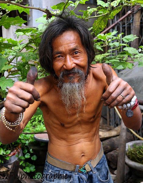
We’re excited to share our sixth travel journal with photos from Southeast Asia, this one entirely dedicated to Thailand. As a reminder, our previous travel journals can be accessed directly by clicking on the username "jojoone1" to the left of each post.
For a change, let’s start with the conclusion: our trip left us with an excellent memory. Very often, everything went like clockwork—short wait times, quick problem-solving, and the curious feeling of being pampered. Sometimes, life isn’t so cruel after all.
It’s only fair to admit that day after day, we encountered Thais who were smiling, helpful, kind, funny, and sometimes even touching. There were a few exceptions, but they were just the trees hiding the (tropical) forest. After this year’s experience, we won’t be the ones to tell you that Thailand isn’t the Land of Smiles or that laughter is just for business. We’ve witnessed so many kind behaviors and gestures that we no longer understand how anyone could complain about the people here—except for bad experiences in ultra-touristy spots packed with travelers lacking any finesse. It got to the point where it made us reflect. And we concluded that we probably have funny, friendly faces (?). We also know we’re the first to smile at them, and every day there, we show respect to everyone we meet. In any case, we have fond thoughts for many of the people we crossed paths with. Thanks to them, our trip took on a whole new human dimension.
A quick note about the photos: last year, the VoyageForum team made a change to how photos are uploaded. This gives us the choice between displaying high-definition photos (but losing ownership rights) or non-HD photos (less sharp, but the originals won’t be spread online without compensation or credit). We opted for the second solution, if only as a matter of principle. It does leave us with some regrets, especially since Françoise switched to the Canon EOS 7D Mark II, whose performance is notably better than the 7D.
Our first trip with Emirates was satisfying but left a mixed impression. Sure, it was the first time all four of our flights were on an Airbus A380. The crews were super friendly, and the meal trays were the best on the first two flights. On the return flights, the meals weren’t great and weren’t filling enough. Overall, the crews seemed disorganized and rushed—clearly some new recruits. The Doha-Paris flight, if memory serves, was on an A380-600, and in that configuration, we were packed in like it hadn’t been in years. In conclusion, it’s hard to say at this stage whether Qatar or Emirates comes out on top.
From our perspective, the journey from northern Thailand to Bangkok can be done via two different routes. This year, we took one of them, which allowed us to alternate between well-known destinations and original visits. Note that some of this year’s visits include cities we’ve already been to. So for a more complete view (Bangkok and Chiang Mai, for example), you’ll need to check out our previous travel journals.
We’ve improved our Thai vocabulary with a few more words and hope next year to move from kindergarten to first grade... For those reading us for the first time, we can only advise against visiting this country on an organized tour or looking for a French-speaking guide. The Thais have organized themselves well—they now have proven tourism practices. Maybe a guidebook for culture, a few basic English words, and a little organization are all you need for a great trip.
CHIANG MAI
Chiang Mai and its region are packed with treasures—so much so that one or two visits might not be enough.
At the airport, you go to a counter that provides a taxi ticket. The fare is 150 baht for a regular car and 200 baht for a larger vehicle. When our turn came, a large vehicle showed up, but we were only charged 150 baht. Okay, fine.
The hotels we’d selected three years ago had significantly increased their rates, so we had to find a new base. In the city center, hotels with large pools are overpriced, and despite the wide selection, it was hard to decide. We ended up at a hotel near the airport, the Baan U Sabai Boutique House. The superior room with a balcony can be negotiated for just under 40 €. It’s a beautiful, fairly new complex in traditional teak style, with very well-kept rooms and a long pool. Given the rather stormy weather in early July, it was the first time in Thailand we swam in cool water. It encouraged us to swim rather than just lounge...
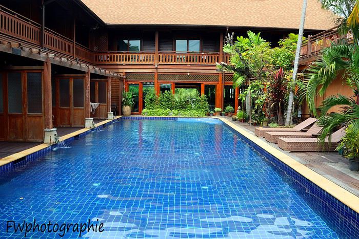
At the end of the hotel street, you come out onto a busy main road where you can hail a songthaew (a kind of shared taxi). It’s easy to be offered a ride to the city center for 2 x 20 baht, but getting a return trip for less than 2 x 40 baht is tough, especially in the evening. Our red songthaew took us straight to Chiang Mai Gate, one of the city’s gates, located southeast of the historic square. We then took Phra Pok Khlao Road for a few dozen meters and chose the first little restaurant that looked nice. Within minutes, we had our dishes and smoothies for a total of 235 baht. Great quality, despite the place looking very touristy. The owner set the tone by handing out smiles left and right.
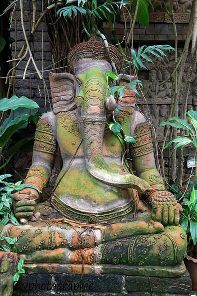
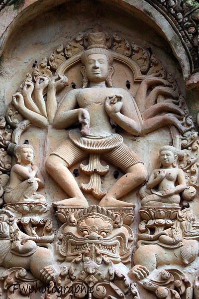
There’s an amazing spot in Chiang Mai to grab a coffee: Baan Phor Liang Meun. Once you reach Chiang Mai Gate, take Phra Pok Khlao Road for a few meters, then turn onto soi 2 (alley 2). It’s actually the first on the left. After a few dozen meters, you’ll find yourself walking alongside what looks like a Khmer temple.
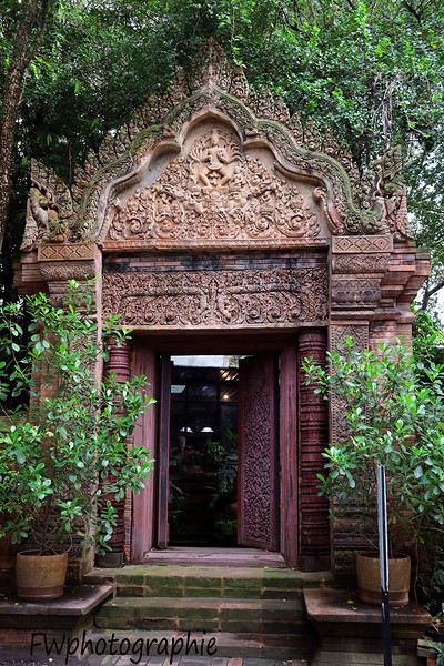
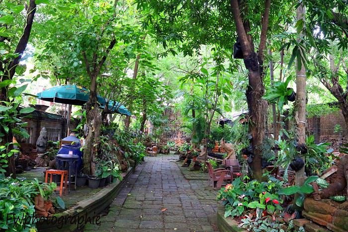
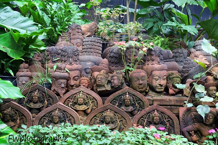
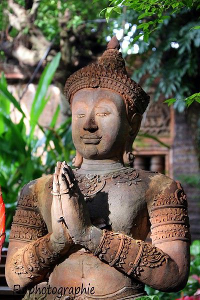
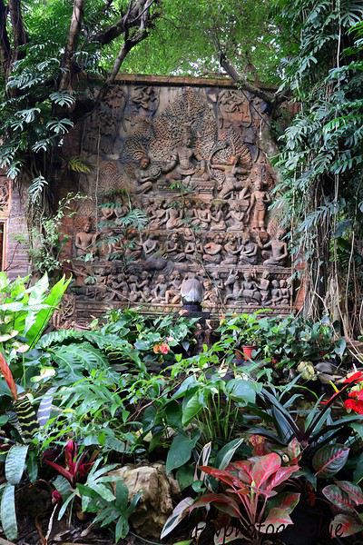
When you enter, you’re in a vast space—like a temple-garden—where you can eat a small dish or sip a good café crème as if you were in Angkor. The tables are far apart, so you’re as close to birds and squirrels as you are to other customers.
In the small building where the staff works, they provide high-quality mosquito repellent for free—something we’ll now buy regularly at 7/11. They’re small plastic bottles, mostly pink or orange, with Thai writing and "floral fragrance" in English. The scent is actually pleasant. Remember to shake the bottle before opening and pressing, or you’ll end up with cream all over your shorts...
The creator of this space has been sculpting terracotta works since the early 1980s using clay from the Lamphun region—the most consistent clay found in all of Thailand. This café is like visiting an ancient temple, with its abundance of statues, high-reliefs, and bas-reliefs. It’s undeniably a romantic spot for couples—a haven of calm in a very lively city.
Beyond Athens' iconic sites and Santorini's popular beaches, Greece reveals its hidden treasures to those who dare venture off the beaten path. FairMoove travel agency offers eco-responsible stays in Greece for an authentic experience at the heart of Hellenic traditions.
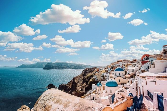
Authentic Peloponnese: A Land of Living Traditions
The Peloponnese peninsula is home to traditional villages where time seems to have stood still. In Dimitsana, perched in the Arcadian mountains, locals keep centuries-old traditions alive in their craft workshops. The cobbled streets echo with the sound of traditional looms, where artisans still create textiles using age-old methods.
In the Mani region, ancient stone towers tell the story of an untamed land. Local families welcome you into their traditional homes to share their culinary art: olive oil preparation, olive bread making, and dolmades crafted according to recipes passed down through generations. The Unknown Islands: Preserved Jewels of the Aegean Sea
Far from Mykonos' hustle and bustle, Ikaria island reveals its longevity secrets. This blue island, known for its inhabitants' exceptional lifespan, invites you to discover a unique way of life. Join the panigiria, traditional festivals where the entire community gathers to dance, sing, and share local dishes prepared in large communal ovens.
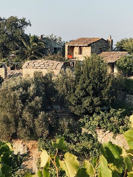
On Lemnos island, fishermen introduce you to their traditional sustainable fishing techniques. The ancient salt pans, still in operation, bear witness to ancestral know-how. In family-run tavernas by the harbor, taste thallasomelo, a unique sea honey produced by bees foraging on wild thyme from coastal cliffs. Greek Macedonia: A Living Heritage
In the northern mountains, the villages of Zagoria preserve their characteristic stone architecture. Eighteenth-century arched bridges still span deep gorges, showcasing a unique construction art. Locals invite you to discover medicinal herb gathering and traditional herbal tea preparation, knowledge passed down through generations.
In Nymfaio, a village perched at 1,350 meters altitude, ecotourism initiatives help preserve the natural habitat of brown bears. Traditional stone guesthouses offer an ideal base for exploring the region and observing wildlife in its natural environment. Agritourism and Authentic Rural Life
Traditional farms in Thessaly open their doors to travelers eager to discover sustainable agriculture. Participate in the autumn olive harvest, traditional feta cheese making, or the cultivation of aromatic herbs that flavor Greek cuisine. These experiences not only support the local economy but also help preserve ancestral farming practices.
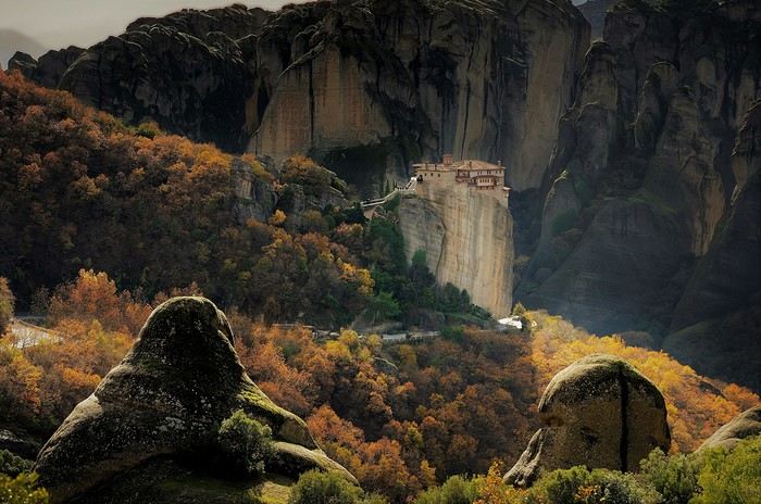
Traditional Festivals and Local Celebrations
The Greek calendar is marked by authentic celebrations that vary by region. In Pelion, the Goat Carnival transforms villages into living theater stages, where pagan traditions blend with Christian folklore. On Syros, the rebetiko festival lets you discover this UNESCO-listed music in its original context. Sustainable Initiatives and Heritage Preservation
Many Greek communities are committed to sustainable tourism projects. On Thirassia, Santorini's lesser-known neighbor, a traditional troglodyte house rehabilitation project allows visitors to stay in authentic dwellings while contributing to architectural heritage preservation. Supporting Local Communities
Women's cooperatives, particularly active in rural areas, offer traditional craft workshops. In Arnaia, Chalkidiki, learn to weave on traditional looms or prepare preserves using age-old methods. These initiatives help women maintain economic independence while preserving local traditions.
For more responsible tourism, many accommodations adopt eco-friendly practices. Using local products, sustainable water management, and solar energy production are among the initiatives that help preserve places' authenticity while respecting the environment.
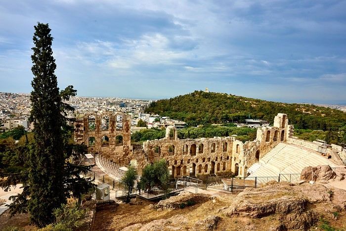
Tips for an Authentic Trip
To discover the real Greece, choose off-season stays from October to April. Milder temperatures and fewer crowds allow for more authentic encounters with locals. Opt for small family-run guesthouses and host tables that offer true immersion in local culture.
Greece's regions thus invite you to discover another facet of this millennia-old country, far from tourist clichés. Each village, each island, each mountain holds authentic treasures waiting to be discovered by travelers who respect traditions and the environment.
Authentic Peloponnese: A Land of Living Traditions
The Peloponnese peninsula is home to traditional villages where time seems to have stood still. In Dimitsana, perched in the Arcadian mountains, locals keep centuries-old traditions alive in their craft workshops. The cobbled streets echo with the sound of traditional looms, where artisans still create textiles using age-old methods.
In the Mani region, ancient stone towers tell the story of an untamed land. Local families welcome you into their traditional homes to share their culinary art: olive oil preparation, olive bread making, and dolmades crafted according to recipes passed down through generations. The Unknown Islands: Preserved Jewels of the Aegean Sea
Far from Mykonos' hustle and bustle, Ikaria island reveals its longevity secrets. This blue island, known for its inhabitants' exceptional lifespan, invites you to discover a unique way of life. Join the panigiria, traditional festivals where the entire community gathers to dance, sing, and share local dishes prepared in large communal ovens.
On Lemnos island, fishermen introduce you to their traditional sustainable fishing techniques. The ancient salt pans, still in operation, bear witness to ancestral know-how. In family-run tavernas by the harbor, taste thallasomelo, a unique sea honey produced by bees foraging on wild thyme from coastal cliffs. Greek Macedonia: A Living Heritage
In the northern mountains, the villages of Zagoria preserve their characteristic stone architecture. Eighteenth-century arched bridges still span deep gorges, showcasing a unique construction art. Locals invite you to discover medicinal herb gathering and traditional herbal tea preparation, knowledge passed down through generations.
In Nymfaio, a village perched at 1,350 meters altitude, ecotourism initiatives help preserve the natural habitat of brown bears. Traditional stone guesthouses offer an ideal base for exploring the region and observing wildlife in its natural environment. Agritourism and Authentic Rural Life
Traditional farms in Thessaly open their doors to travelers eager to discover sustainable agriculture. Participate in the autumn olive harvest, traditional feta cheese making, or the cultivation of aromatic herbs that flavor Greek cuisine. These experiences not only support the local economy but also help preserve ancestral farming practices.
Traditional Festivals and Local Celebrations
The Greek calendar is marked by authentic celebrations that vary by region. In Pelion, the Goat Carnival transforms villages into living theater stages, where pagan traditions blend with Christian folklore. On Syros, the rebetiko festival lets you discover this UNESCO-listed music in its original context. Sustainable Initiatives and Heritage Preservation
Many Greek communities are committed to sustainable tourism projects. On Thirassia, Santorini's lesser-known neighbor, a traditional troglodyte house rehabilitation project allows visitors to stay in authentic dwellings while contributing to architectural heritage preservation. Supporting Local Communities
Women's cooperatives, particularly active in rural areas, offer traditional craft workshops. In Arnaia, Chalkidiki, learn to weave on traditional looms or prepare preserves using age-old methods. These initiatives help women maintain economic independence while preserving local traditions.
For more responsible tourism, many accommodations adopt eco-friendly practices. Using local products, sustainable water management, and solar energy production are among the initiatives that help preserve places' authenticity while respecting the environment.
Tips for an Authentic Trip
To discover the real Greece, choose off-season stays from October to April. Milder temperatures and fewer crowds allow for more authentic encounters with locals. Opt for small family-run guesthouses and host tables that offer true immersion in local culture.
Greece's regions thus invite you to discover another facet of this millennia-old country, far from tourist clichés. Each village, each island, each mountain holds authentic treasures waiting to be discovered by travelers who respect traditions and the environment.
Sometimes a trip to Thailand starts in a hotel near an airport, where guests have misunderstood the meaning of the name easyJet...
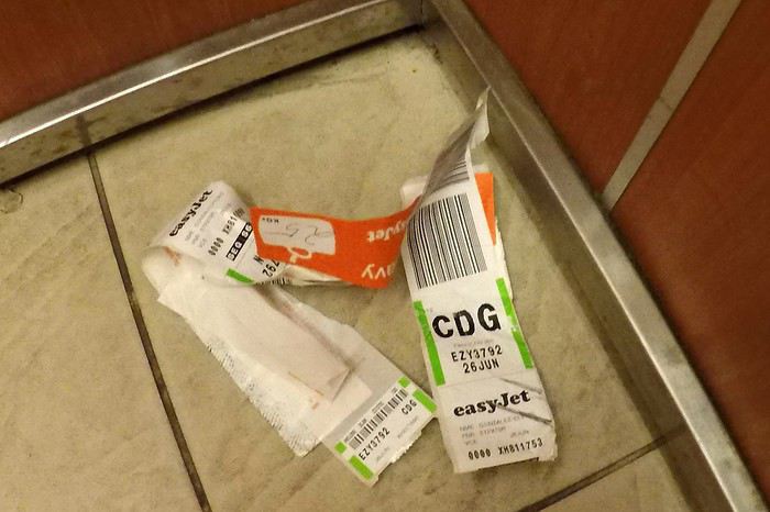
We know all too well that this long flight will leave us a bit jet-lagged when we arrive...
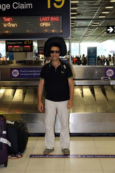
all while hoping we won’t start our stay completely...
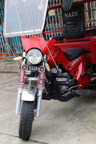
Still, we’re lucid enough to notice that they could’ve at least leveled the ground before adding the decor at the airport:
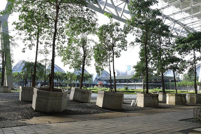
As always, our arrival is under the watchful eye of some...
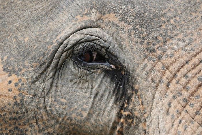
under the frankly curious gaze of others...
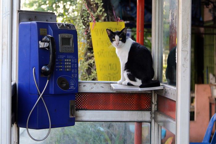
but of course, there are plenty who couldn’t care less...
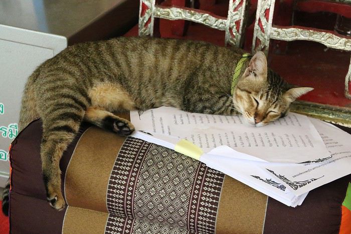
All that’s left is to set off exploring, while staying cautious so we don’t get caught off guard...
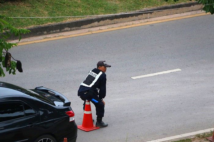
We know all too well that this long flight will leave us a bit jet-lagged when we arrive...
all while hoping we won’t start our stay completely...
Still, we’re lucid enough to notice that they could’ve at least leveled the ground before adding the decor at the airport:
As always, our arrival is under the watchful eye of some...
under the frankly curious gaze of others...
but of course, there are plenty who couldn’t care less...
All that’s left is to set off exploring, while staying cautious so we don’t get caught off guard...
Day 1 – December 6
Our decision is our decision. And it’s firm and final. Next winter, our plane will spread its great wings toward the island of Ceylon! "Wait a minute... Ceylon... Ceylon... that name rings a bell, but I can’t quite place it on the globe Grandma gave me for Christmas! Ceylon... Oh right, I’ve got it: Ceylon is the name of my tea!" Exactly. But the name on your pretty tea box is also the one used until 1972 for this island nation, a speck on the Indian Ocean at the southern tip of the Indian subcontinent: Sri Lanka!
For this new adventure, I’m exceptionally leaving my Flo behind, cowardly replaced by a double dose of testosterone. To write the book of this journey with me, I’m bringing along my brother, who’s used to this kind of thing, and... a guest star: My model of resilience. My dad! All aboard! Or rather, all aboard our tuk-tuk! Yes, you read that right: A real tuk-tuk, a little colorful rolling box that putters along at two miles an hour. The idea? Well, Sri Lanka and its winding roads overlooking the vastness of lush nature are tailor-made for this kind of vehicle. And since it’s one of only two countries in the world that allow foreigners to rent and drive these mini speedsters, we’ll be crisscrossing the island in our two-square-meter rolling box. Plus, adopting this mode of transport is a surefire way to connect directly with the locals, who’ll surely be curious to see a foreigner driving their iconic vehicle. Not to mention the... let’s say... spicy anecdotes it might generate. I mean, heading into a subtropical zone with my jet-black dad and his unpredictable digestive flora while deliberately choosing the tuk-tuk as our *only* means of transport? That’s the winning combo for an unforgettable adventure! "More seriously, Dad, Sullivan, I’m already loving the idea of living this adventure together, the three of us—brothers and father..."
So, does the intro to this new adventure get your salivary glands going? Yes? Too bad. Because unfortunately, the program handed out by the lady at the entrance has been slightly... let’s say *crumpled*. Some might even say "scrunched up and nearly tossed in the trash." First, six days ago, as the countdown echoed in us like a call to adventure, Cyclone Ditwah grabbed Sri Lanka, played with it like a rag doll, and left it battered on the ground. The toll is devastating: over a thousand dead, thousands of homes wiped out by relentless rains, roads and railways swallowed by massive mudslides. A country wounded once again, after the civil war, the 2004 tsunami, and the post-Covid economic crisis.
But as if this weather disaster wasn’t enough to shake our unbreakable adventurer spirit, fate decided to mess with us further by cutting our trio down to two. The victim? My brother, violently turned away because of a simple date on his passport that didn’t match the border officials’ expectations. Return to sender!
So now it’s just the two of us allowed to board the Qatar Airways Airbus A380 for this trip. If he were here, Denis Brognart would say, "And in the end, only one remains!" Except I know you’ll be with us, following our adventures! Right?
Our decision is our decision. And it’s firm and final. Next winter, our plane will spread its great wings toward the island of Ceylon! "Wait a minute... Ceylon... Ceylon... that name rings a bell, but I can’t quite place it on the globe Grandma gave me for Christmas! Ceylon... Oh right, I’ve got it: Ceylon is the name of my tea!" Exactly. But the name on your pretty tea box is also the one used until 1972 for this island nation, a speck on the Indian Ocean at the southern tip of the Indian subcontinent: Sri Lanka!
For this new adventure, I’m exceptionally leaving my Flo behind, cowardly replaced by a double dose of testosterone. To write the book of this journey with me, I’m bringing along my brother, who’s used to this kind of thing, and... a guest star: My model of resilience. My dad! All aboard! Or rather, all aboard our tuk-tuk! Yes, you read that right: A real tuk-tuk, a little colorful rolling box that putters along at two miles an hour. The idea? Well, Sri Lanka and its winding roads overlooking the vastness of lush nature are tailor-made for this kind of vehicle. And since it’s one of only two countries in the world that allow foreigners to rent and drive these mini speedsters, we’ll be crisscrossing the island in our two-square-meter rolling box. Plus, adopting this mode of transport is a surefire way to connect directly with the locals, who’ll surely be curious to see a foreigner driving their iconic vehicle. Not to mention the... let’s say... spicy anecdotes it might generate. I mean, heading into a subtropical zone with my jet-black dad and his unpredictable digestive flora while deliberately choosing the tuk-tuk as our *only* means of transport? That’s the winning combo for an unforgettable adventure! "More seriously, Dad, Sullivan, I’m already loving the idea of living this adventure together, the three of us—brothers and father..."
So, does the intro to this new adventure get your salivary glands going? Yes? Too bad. Because unfortunately, the program handed out by the lady at the entrance has been slightly... let’s say *crumpled*. Some might even say "scrunched up and nearly tossed in the trash." First, six days ago, as the countdown echoed in us like a call to adventure, Cyclone Ditwah grabbed Sri Lanka, played with it like a rag doll, and left it battered on the ground. The toll is devastating: over a thousand dead, thousands of homes wiped out by relentless rains, roads and railways swallowed by massive mudslides. A country wounded once again, after the civil war, the 2004 tsunami, and the post-Covid economic crisis.
But as if this weather disaster wasn’t enough to shake our unbreakable adventurer spirit, fate decided to mess with us further by cutting our trio down to two. The victim? My brother, violently turned away because of a simple date on his passport that didn’t match the border officials’ expectations. Return to sender!
So now it’s just the two of us allowed to board the Qatar Airways Airbus A380 for this trip. If he were here, Denis Brognart would say, "And in the end, only one remains!" Except I know you’ll be with us, following our adventures! Right?
After nearly 2 years of waiting (yeah, like many of you, we wanted to hit the road again as soon as we got back to France... but first, we had to fill up the piggy bank!), here we are at last—July, the month we’ve been waiting for!
We’ve got 30 days of exploring new places ahead of us, as well as revisiting some spots we loved back in 2012.
Here’s the plan: - Joshua Tree NP - Las Vegas - Valley of Fire SP - Yant Flat - Zion NP (Angel’s Landing) - Bryce Canyon NP (Fairyland Loop trail) - Devils Garden on the HITTR - Capitol Reef NP - Grand Teton NP - Yellowstone NP: Old Faithful - Yellowstone NP: Norris Geyser Basin and Mammoth Hot Springs - Yellowstone NP: Grand Canyon of the Yellowstone - West Thumb and Grand Teton NP - Flaming Gorge - Colorado NM and Fisher Towers - Moab: Arches - Moab: Canyonlands and Corona Arch - Moab: Canyonlands - Moab: rafting and Dead Horse Point SP - Natural Bridges NM and Valley of the Gods - Monument Valley and Horseshoe Bend - Coyote Buttes South - Grand Canyon NP (North Rim) - Grand Canyon NP (North Rim) and Navajo Bridge - Sedona - From Sedona to Tucson - Arizona-Sonora Desert Museum and Saguaro NP - Tombstone
Practical details:
- I’d read that it was better to book flight tickets directly on an airline’s website rather than through a comparison site. So, I spent months searching for reasonably priced tickets for two adults and two kids from Paris to Las Vegas for the outbound trip and from Tucson to Paris for the return. I mostly checked Air France, KLM, and British Airways, but prices were always around 4600 €. Not finding anything, we eventually went through a comparison site: Ebookers. We bought our tickets in mid-December: Paris/Atlanta with Air France, then Atlanta/Los Angeles with Delta for the outbound trip, and Tucson/Atlanta with Delta, then Atlanta/Paris with Air France for the return. Total cost: 4300 €. The layover on the outbound trip made me a little nervous because it was only 2 hours and 15 minutes. A month later, we got an email from Ebookers saying the layover had been reduced to 1 hour and 40 minutes! And a few months after that, it was down to just 1 hour and 30 minutes... So, we called Air France directly (we didn’t go through Ebookers, and it wasn’t a problem), and they put us on different flights. The new layover was 2 hours and 10 minutes—still not a ton of time, but I felt better than with 1 hour and 30 minutes. And anyway, we figured we’d see how it went!
- For the car, we tried several comparison sites, and in the end, AutoEurope won this year: 808 € for a 30-day rental of a Chevrolet Impala through Thrifty. The second driver was free for the entire trip since we picked up the car in California.
- We didn’t rent a GPS or buy one—we just downloaded Sygic on our two phones and bought the US map. I don’t remember the exact amount, but it cost us around 30 €.
- For hotels, I either booked directly on the sites (Xanterra, Grand Canyon Lodge, etc.) or used Hotels.com (to earn nights through their Welcome Rewards program) or Booking.com (when hotels weren’t available on Hotels.com). I always compared the price on Hotels.com with the hotel’s direct rate, but they were usually the same. So, for the same price, I’d rather earn a night with Welcome Rewards! We’d set a budget of 100 € per night on average, and we stuck to it pretty well—the final average came out to 101.20 € when including everything (nights + taxes + any nightly fees + parking fees + bank fees).
- As for luggage, we didn’t want to overpack! So, we left with one medium suitcase for Calista, one for me, one large suitcase for Hugo and Yannick, and a sports bag with Calista’s booster seat (we could’ve taken it on the plane with us, but I didn’t want to lug it around the airport during the layover). That sports bag came in handy on the way back, too—because, as everyone knows, you always come back with more than you left with! Each of us also had a backpack as a carry-on.
Before wrapping up this intro and getting into the real details, I’d like to thank everyone who contributed to my discussions and helped me improve our itinerary!
Quick intro for those who don’t know us: Yannick (36), Peggy (36), Hugo (11), and Calista (8).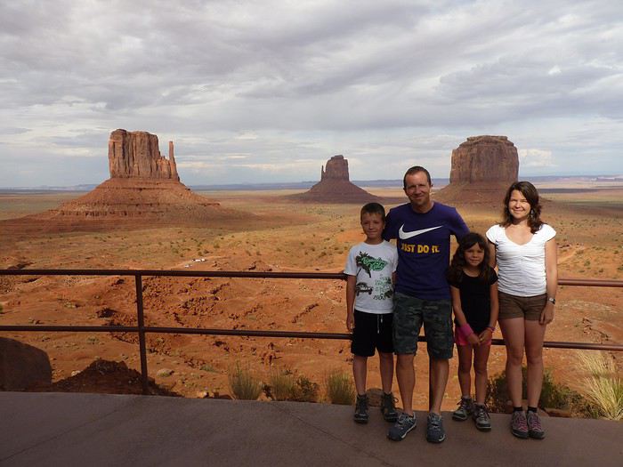
Here’s the plan: - Joshua Tree NP - Las Vegas - Valley of Fire SP - Yant Flat - Zion NP (Angel’s Landing) - Bryce Canyon NP (Fairyland Loop trail) - Devils Garden on the HITTR - Capitol Reef NP - Grand Teton NP - Yellowstone NP: Old Faithful - Yellowstone NP: Norris Geyser Basin and Mammoth Hot Springs - Yellowstone NP: Grand Canyon of the Yellowstone - West Thumb and Grand Teton NP - Flaming Gorge - Colorado NM and Fisher Towers - Moab: Arches - Moab: Canyonlands and Corona Arch - Moab: Canyonlands - Moab: rafting and Dead Horse Point SP - Natural Bridges NM and Valley of the Gods - Monument Valley and Horseshoe Bend - Coyote Buttes South - Grand Canyon NP (North Rim) - Grand Canyon NP (North Rim) and Navajo Bridge - Sedona - From Sedona to Tucson - Arizona-Sonora Desert Museum and Saguaro NP - Tombstone
Practical details:
- I’d read that it was better to book flight tickets directly on an airline’s website rather than through a comparison site. So, I spent months searching for reasonably priced tickets for two adults and two kids from Paris to Las Vegas for the outbound trip and from Tucson to Paris for the return. I mostly checked Air France, KLM, and British Airways, but prices were always around 4600 €. Not finding anything, we eventually went through a comparison site: Ebookers. We bought our tickets in mid-December: Paris/Atlanta with Air France, then Atlanta/Los Angeles with Delta for the outbound trip, and Tucson/Atlanta with Delta, then Atlanta/Paris with Air France for the return. Total cost: 4300 €. The layover on the outbound trip made me a little nervous because it was only 2 hours and 15 minutes. A month later, we got an email from Ebookers saying the layover had been reduced to 1 hour and 40 minutes! And a few months after that, it was down to just 1 hour and 30 minutes... So, we called Air France directly (we didn’t go through Ebookers, and it wasn’t a problem), and they put us on different flights. The new layover was 2 hours and 10 minutes—still not a ton of time, but I felt better than with 1 hour and 30 minutes. And anyway, we figured we’d see how it went!
- For the car, we tried several comparison sites, and in the end, AutoEurope won this year: 808 € for a 30-day rental of a Chevrolet Impala through Thrifty. The second driver was free for the entire trip since we picked up the car in California.
- We didn’t rent a GPS or buy one—we just downloaded Sygic on our two phones and bought the US map. I don’t remember the exact amount, but it cost us around 30 €.
- For hotels, I either booked directly on the sites (Xanterra, Grand Canyon Lodge, etc.) or used Hotels.com (to earn nights through their Welcome Rewards program) or Booking.com (when hotels weren’t available on Hotels.com). I always compared the price on Hotels.com with the hotel’s direct rate, but they were usually the same. So, for the same price, I’d rather earn a night with Welcome Rewards! We’d set a budget of 100 € per night on average, and we stuck to it pretty well—the final average came out to 101.20 € when including everything (nights + taxes + any nightly fees + parking fees + bank fees).
- As for luggage, we didn’t want to overpack! So, we left with one medium suitcase for Calista, one for me, one large suitcase for Hugo and Yannick, and a sports bag with Calista’s booster seat (we could’ve taken it on the plane with us, but I didn’t want to lug it around the airport during the layover). That sports bag came in handy on the way back, too—because, as everyone knows, you always come back with more than you left with! Each of us also had a backpack as a carry-on.
Before wrapping up this intro and getting into the real details, I’d like to thank everyone who contributed to my discussions and helped me improve our itinerary!
Quick intro for those who don’t know us: Yannick (36), Peggy (36), Hugo (11), and Calista (8).
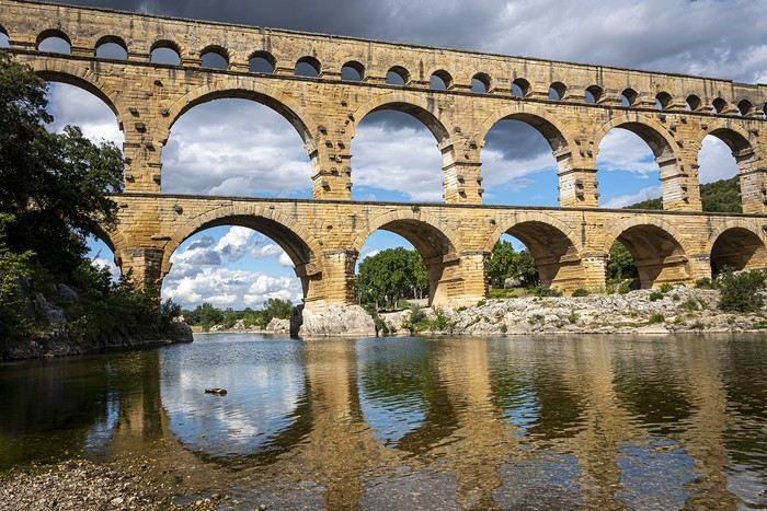
This is where you can chat about bridges... let’s get the conversation started! 😊
Namaste everyone,
We went to Nepal last October and literally fell in love with this country (like so many others, it seems). During our trek, we had the chance to meet and travel with an incredible independent local guide, Apsara Luitel. She told us about a unique project she’s organizing starting mid-May, and we wanted to share it in case it interests anyone. We mentioned it on another travel forum, but just in case, we’re posting it here too to reach as many people as possible.
Apsara, who knows the Api mountain valley (a name as joyful as it is intriguing!) in Nepal’s Far West (on the border between India and Tibet, at the edge of the world) perfectly, is offering an off-the-beaten-path trek for a group of 3 to 8 people max. The program? An authentic and preserved itinerary combining homestays and small mountain lodges, all the way to the Api base camp. Once at base camp, locals will guide us to secret spots only they know, where we’ll harvest yarsagumba (those famous caterpillar-fungi, rare and prized for their medicinal properties in traditional Chinese medicine—they were going for $20,000 per kilo last year!).
Mid-May is the ideal time to discover this almost unexplored region and take part in harvesting these natural treasures. This kind of adventure, led by an inspiring young woman like Apsara, is rare, and we think it could appeal to Nepal lovers and those who enjoy authentic treks far from the usual tourist routes.
No matter how many participants there are (between 3 and 8), there will always be two guides: Apsara, who speaks English (and is learning French!), and a French-speaking guide. The dates are flexible around May 15th, depending on the availability of those who’d like to take on the adventure.
We went to Nepal last October and literally fell in love with this country (like so many others, it seems). During our trek, we had the chance to meet and travel with an incredible independent local guide, Apsara Luitel. She told us about a unique project she’s organizing starting mid-May, and we wanted to share it in case it interests anyone. We mentioned it on another travel forum, but just in case, we’re posting it here too to reach as many people as possible.
Apsara, who knows the Api mountain valley (a name as joyful as it is intriguing!) in Nepal’s Far West (on the border between India and Tibet, at the edge of the world) perfectly, is offering an off-the-beaten-path trek for a group of 3 to 8 people max. The program? An authentic and preserved itinerary combining homestays and small mountain lodges, all the way to the Api base camp. Once at base camp, locals will guide us to secret spots only they know, where we’ll harvest yarsagumba (those famous caterpillar-fungi, rare and prized for their medicinal properties in traditional Chinese medicine—they were going for $20,000 per kilo last year!).
Mid-May is the ideal time to discover this almost unexplored region and take part in harvesting these natural treasures. This kind of adventure, led by an inspiring young woman like Apsara, is rare, and we think it could appeal to Nepal lovers and those who enjoy authentic treks far from the usual tourist routes.
No matter how many participants there are (between 3 and 8), there will always be two guides: Apsara, who speaks English (and is learning French!), and a French-speaking guide. The dates are flexible around May 15th, depending on the availability of those who’d like to take on the adventure.
Hi everyone,
In this age of zero-commission cards and fee-free accounts, I’m curious why some travelers still prefer to set off with a wallet stuffed with bills and exchange money on the spot.
I get it for those whose income comes from undeclared activities, but what about everyone else?
Between the risk of theft, scams at exchange counters, and fees that often end up being higher, I’m really puzzled.
The last time I traveled with a wad of cash was because I had to pay for accommodation in cash only, the local currency was the dollar (easy to exchange at a very low cost), and I was still paying some fees.
I’m still wondering about my next trip to Argentina because the situation there is very specific, but otherwise?
Is it an allergy to modern payment methods?
A budget so tight that an extra 20 € (the fees some local banks charge for withdrawals) on a 2000 € budget would be impossible to manage?
Thanks for shedding some light on this!
In this age of zero-commission cards and fee-free accounts, I’m curious why some travelers still prefer to set off with a wallet stuffed with bills and exchange money on the spot.
I get it for those whose income comes from undeclared activities, but what about everyone else?
Between the risk of theft, scams at exchange counters, and fees that often end up being higher, I’m really puzzled.
The last time I traveled with a wad of cash was because I had to pay for accommodation in cash only, the local currency was the dollar (easy to exchange at a very low cost), and I was still paying some fees.
I’m still wondering about my next trip to Argentina because the situation there is very specific, but otherwise?
Is it an allergy to modern payment methods?
A budget so tight that an extra 20 € (the fees some local banks charge for withdrawals) on a 2000 € budget would be impossible to manage?
Thanks for shedding some light on this!
"The Most Refreshing Way to Travel Around Belgium"
This is the title of the guide published by Pierre Pauquay at Éditions HELVETIQ Sàrl, Lausanne, Switzerland, 2023.
I set off for Belgium with my camper van and my electric-assist bike, eager to deepen both my theoretical and practical knowledge of this country’s emblematic beverage while exploring the land. This guide became my trusted companion throughout the journey, which took place from June 4 to July 4, 2024.
Out of the 40 routes presented, I chose 21, covering a broad swath of Belgium—both Wallonia (14 routes) and Flanders (6 routes), plus one route around the Brussels-Capital region with a visit to the famous Grimbergen brewery.
Every route included a stop at a brewery, whether lesser-known or famous, artisanal or industrial, family-run or Trappist.
In total, I logged 1,111.2 km of biking over 58 hours and 42 minutes of pedaling, averaging 3 hours of cycling per ride of 55.6 km. I visited 21 breweries, toured a few, and had just one flat tire (I didn’t count the number of beers, but I tasted them all...).
I wasn’t always able to park my camper van near the brewery planned for that day’s route, but I made sure to enjoy the famous nectar only after completing the physical exercise required by the loops.
Traveling by camper van, I needed routes that formed a loop, starting and ending in the same place. Except in Brussels, I never had to rely on campsites for a safe night’s stay. I always found a welcoming public or private parking spot, secure enough to prepare for the next day’s ride.
I discovered Belgium from top to bottom, through hills (not very high) and valleys (very flat and often windy), at my own pace. I stopped whenever a photo caught my eye, grabbed a bite or a drink in the villages I passed through, and often felt like I was truly part of the landscape, in sync with the country’s rhythm and curious to see how people lived...
More to come, with photos in a future post...
Thanks for reading...
Hey there, community! Back this weekend, below is my travel journal from my adventure in Indonesia. Enjoy the read!!!
Day 1 - August 10, 2025 New life downloading for three weeks! And for that, Flo and I launched a public tender... A public tender? What’s that got to do with a travel journal???... Well, when you think about it, few destinations tick all the boxes for an August adventure: Meaning, finding a place that’s exotic in the middle of August, not too expensive, not too packed with tourists, warm but not *too* warm, with postcard-perfect landscapes, dreamy beaches, tasty cuisine with a hint of exoticism, friendly and welcoming locals, where you’re free to sleep under the stars among the mosquitos, take transport surrounded by chickens, and even eat from a pig trough if you feel like it—well, turns out it’s not that easy to find! I’d even say, given how thick the list of requirements is, there’s a big risk the tender could be declared unsuccessful for failing to meet just one criterion. Let’s just say the candidates better submit a rock-solid proposal!
After reviewing all the responses and presentations from the candidates, the obvious choice for us is... Indonesia! Except that trying to explore a country as vast as Indonesia and its 17,504 islands in less than five years is a bit like reading the summary of a Proust novel without taking the time to savor each of its 950 pages! Don’t worry, I won’t name them all here. Besides, do they even all have names? No! Only 7,870 have been named—their parents clearly ran out of ideas for the rest. Anyway, our society, which worships the "work more to earn more" mantra, unfortunately limits our adventure time. So we’ll only get to see a small part of Indonesia, and we’ll have to make a tough choice to head for the best of the best in this archipelago of over seventeen thousand islands. Each one has its own selling points: Sumatra, Sulawesi, Java, the Celebes, Bali, Borneo, Papua, Timor, the Moluccas... So many names that smell of adventure... Another tender, another list of requirements, another review of proposals... Drumroll... Splash splash... And the lucky winner is... Ta-da... Java, Bali’s big sister, where I’ve already been eight years ago... Java the programming language. The Java of Broadway. We’re gonna *do* the Java. Java the coffee. And yes, Java is also an island!
This island, four times smaller than France, is home to 136 million people, making it the most populated island in the world! Fun fact: Indonesia, with its 260 million inhabitants, is just shy of the podium for the world’s most populated countries, after the winning trio of India, China, and the United States. And it’s on this island of Java that you’ll find Jakarta, the (soon-to-be-former) capital and main airport of the country, where we’ll soon land after our nineteen-hour flight! Yep, nineteen hours! I mean, Indonesia in general—and Java in particular—is a *tad* farther than going on vacation to Grandma Yoyo’s! Not sure where it is? Easy. Grab a map. Plant your finger on the big island at the bottom right—aka Australia for those who struggle with geography—move it up two centimeters, and bam, welcome to Indonesia!
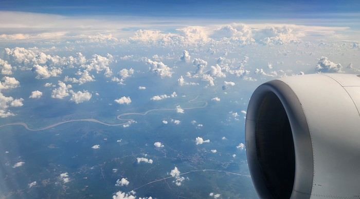
Nice transition, right? Because "Welcome to Indonesia" is exactly what the friendly flight attendant just said to me as we got off the plane! That’s it, our chakras are open, we’ve arrived at our (air)port. Time for rest, pool, cocktails, and a beach with our toes spread out... Wait, if you bought that, you clearly don’t know us yet! Since we still have energy to burn and need to adjust to the flight and time difference, we tackle the long administrative formalities to enter Indonesia, just to earn the right to hop in a 45-minute Grab taxi to the train station. The train station? What train station?... What do you usually do at a train station? Take a train, of course! Off we go for a three-hour train ride to Bandung, where we’ll officially start our adventure tomorrow after our first Indonesian night...
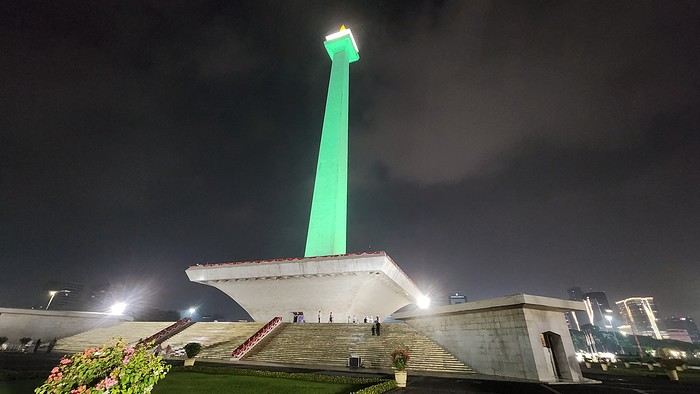
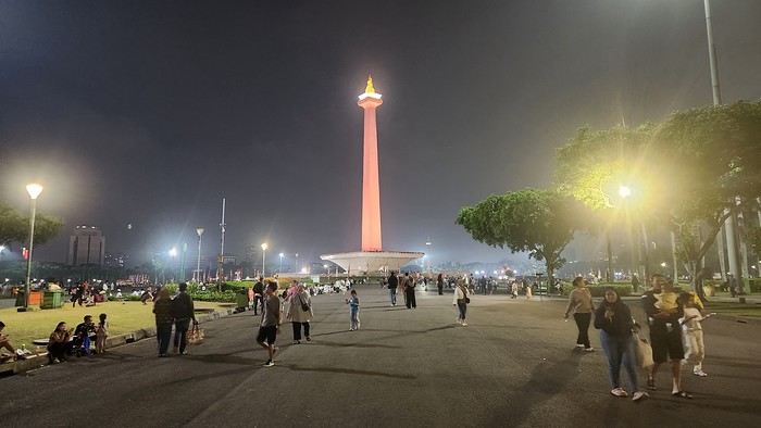
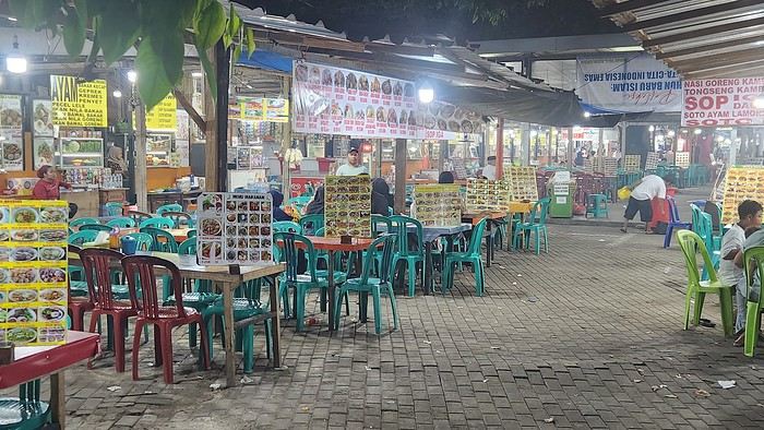
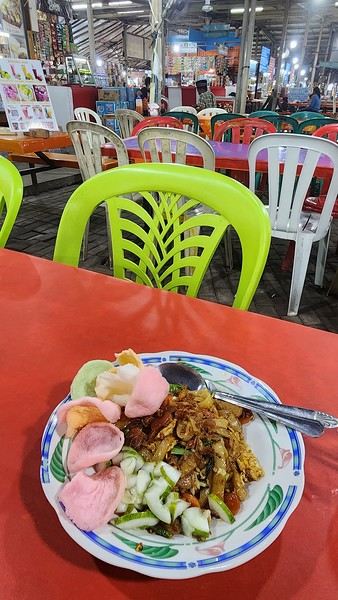
Unfortunately, we were a bit slow off the mark, which meant we missed the 6:25 PM train by two minutes. Oh well, we’ll have to wait until 11 PM. We take the opportunity to stretch our legs in Jakarta, soak up the atmosphere, and enjoy the delicious smells wafting from the *warungs*—those little typical street restaurants. A quick stop at the National Monument, a detour to a night market to devour our first *kwetiaw goreng* and *teh manis* for 60,000 rupiahs (that’s 3 € for two), and just like that, our penalty is lifted, and we’re allowed to hit the road again. Off to Bandung, where we arrive at 2 AM for... a *very* short night...
Day 1 - August 10, 2025 New life downloading for three weeks! And for that, Flo and I launched a public tender... A public tender? What’s that got to do with a travel journal???... Well, when you think about it, few destinations tick all the boxes for an August adventure: Meaning, finding a place that’s exotic in the middle of August, not too expensive, not too packed with tourists, warm but not *too* warm, with postcard-perfect landscapes, dreamy beaches, tasty cuisine with a hint of exoticism, friendly and welcoming locals, where you’re free to sleep under the stars among the mosquitos, take transport surrounded by chickens, and even eat from a pig trough if you feel like it—well, turns out it’s not that easy to find! I’d even say, given how thick the list of requirements is, there’s a big risk the tender could be declared unsuccessful for failing to meet just one criterion. Let’s just say the candidates better submit a rock-solid proposal!
After reviewing all the responses and presentations from the candidates, the obvious choice for us is... Indonesia! Except that trying to explore a country as vast as Indonesia and its 17,504 islands in less than five years is a bit like reading the summary of a Proust novel without taking the time to savor each of its 950 pages! Don’t worry, I won’t name them all here. Besides, do they even all have names? No! Only 7,870 have been named—their parents clearly ran out of ideas for the rest. Anyway, our society, which worships the "work more to earn more" mantra, unfortunately limits our adventure time. So we’ll only get to see a small part of Indonesia, and we’ll have to make a tough choice to head for the best of the best in this archipelago of over seventeen thousand islands. Each one has its own selling points: Sumatra, Sulawesi, Java, the Celebes, Bali, Borneo, Papua, Timor, the Moluccas... So many names that smell of adventure... Another tender, another list of requirements, another review of proposals... Drumroll... Splash splash... And the lucky winner is... Ta-da... Java, Bali’s big sister, where I’ve already been eight years ago... Java the programming language. The Java of Broadway. We’re gonna *do* the Java. Java the coffee. And yes, Java is also an island!
This island, four times smaller than France, is home to 136 million people, making it the most populated island in the world! Fun fact: Indonesia, with its 260 million inhabitants, is just shy of the podium for the world’s most populated countries, after the winning trio of India, China, and the United States. And it’s on this island of Java that you’ll find Jakarta, the (soon-to-be-former) capital and main airport of the country, where we’ll soon land after our nineteen-hour flight! Yep, nineteen hours! I mean, Indonesia in general—and Java in particular—is a *tad* farther than going on vacation to Grandma Yoyo’s! Not sure where it is? Easy. Grab a map. Plant your finger on the big island at the bottom right—aka Australia for those who struggle with geography—move it up two centimeters, and bam, welcome to Indonesia!
Nice transition, right? Because "Welcome to Indonesia" is exactly what the friendly flight attendant just said to me as we got off the plane! That’s it, our chakras are open, we’ve arrived at our (air)port. Time for rest, pool, cocktails, and a beach with our toes spread out... Wait, if you bought that, you clearly don’t know us yet! Since we still have energy to burn and need to adjust to the flight and time difference, we tackle the long administrative formalities to enter Indonesia, just to earn the right to hop in a 45-minute Grab taxi to the train station. The train station? What train station?... What do you usually do at a train station? Take a train, of course! Off we go for a three-hour train ride to Bandung, where we’ll officially start our adventure tomorrow after our first Indonesian night...
Unfortunately, we were a bit slow off the mark, which meant we missed the 6:25 PM train by two minutes. Oh well, we’ll have to wait until 11 PM. We take the opportunity to stretch our legs in Jakarta, soak up the atmosphere, and enjoy the delicious smells wafting from the *warungs*—those little typical street restaurants. A quick stop at the National Monument, a detour to a night market to devour our first *kwetiaw goreng* and *teh manis* for 60,000 rupiahs (that’s 3 € for two), and just like that, our penalty is lifted, and we’re allowed to hit the road again. Off to Bandung, where we arrive at 2 AM for... a *very* short night...
Vrrrrrm, vrmmmm! (phone on vibrate)
"Hi Mamido, it's Clémence." Clémence, 5 years old, is a giggly, cheerful little girl and the queen of mischief.
"Mom says we're coming to your place until the holidays because we're on vacation tonight."
"Yes, I know. She asked me—do you know why?" "Because of the croronavirus." "And do you know what that is?"
"Oh yeah, at school Théo told me it's like a louse that doesn't itch, that doesn't get in your head but in your lungs, that it's all round with red bumps like raspberries, and that it makes old people die."
"Your friend knows a lot of things."
"His dad showed him a microscope picture, and you—are you old?" "What do you think?" "Well, yeah, but only a little because you always leave on your motorcycle to travel. Are you going traveling?"
"No, because you're coming with your brother and sister."
"Can we go to the little bridge to look for frog eggs? You remember, there were some last year, and we'll make them grow and put the baby frogs in the washhouse, and we'll also make boats to put in the stream so they can go to the sea." "That's a great idea." "And you'll make me the model in print letters so I can write which country my boat is going to." "Where do you want your boat to go?" "To the land of pandas—is it far?" "Oh yes, very far." "Then we have to make the boat strong so it doesn't sink." "Promise, we'll have so much fun." "Mom says in some countries they wear masks. Do you still have the chicken, rabbit, and pig masks in the attic? Can we wear them like that?"
"You know, here there are only trees, birds, and fields—we'll do whatever we want."
"Mom's calling me."
Click, she hangs up, and I laugh.
"Hi Mamido, it's Clémence." Clémence, 5 years old, is a giggly, cheerful little girl and the queen of mischief.
"Mom says we're coming to your place until the holidays because we're on vacation tonight."
"Yes, I know. She asked me—do you know why?" "Because of the croronavirus." "And do you know what that is?"
"Oh yeah, at school Théo told me it's like a louse that doesn't itch, that doesn't get in your head but in your lungs, that it's all round with red bumps like raspberries, and that it makes old people die."
"Your friend knows a lot of things."
"His dad showed him a microscope picture, and you—are you old?" "What do you think?" "Well, yeah, but only a little because you always leave on your motorcycle to travel. Are you going traveling?"
"No, because you're coming with your brother and sister."
"Can we go to the little bridge to look for frog eggs? You remember, there were some last year, and we'll make them grow and put the baby frogs in the washhouse, and we'll also make boats to put in the stream so they can go to the sea." "That's a great idea." "And you'll make me the model in print letters so I can write which country my boat is going to." "Where do you want your boat to go?" "To the land of pandas—is it far?" "Oh yes, very far." "Then we have to make the boat strong so it doesn't sink." "Promise, we'll have so much fun." "Mom says in some countries they wear masks. Do you still have the chicken, rabbit, and pig masks in the attic? Can we wear them like that?"
"You know, here there are only trees, birds, and fields—we'll do whatever we want."
"Mom's calling me."
Click, she hangs up, and I laugh.
Hi there,
On this forum, I shared my first trip to Tunisia from mid-February to early March (https://voyageforum.com/forum/impressions-tunisiennes-en-direct-d11460662/), a stay I enjoyed so much that six weeks later, I’m back in Tunisia for a full 15 days (I return on April 27).
This time, I landed in Monastir on a direct flight from Nice, again with Tunisair. We left about ten minutes late, and the flight lasted around 1 hour 30 minutes. A meal was served on board (cucumber salad with Edam-like cheese, carrots, and two small portions of dishes I couldn’t identify—semolina with peppers, olives, and parsley, two small rolls, a square of processed cheese, and a chocolate cake). It’s worth noting because it’s not common on flights this short.
In February, France and Tunisia were in the same time zone, but now Tunisia is one hour behind. This time difference and the flight duration work perfectly for a short 15-day trip since it takes me a few days to adjust to jet lag.
Luckily, I’d asked my hotel about the taxi fare from the airport because the drivers (there were several around me) didn’t hesitate to quote outrageous prices. The actual fare is 20 dinars, but one asked for 120 dinars. I refused, and another offered 60 dinars. I replied, "That’s too expensive—I’ll take the metro!" (Having tried the Tunis metro, I had no desire to repeat the experience in Monastir with a suitcase!). I started walking toward the metro, and one of the drivers caught up with me, saying, "20 dinars is fine!" I’ll skip the details, but the negotiation took a little while. When I arrived at the hotel, I told the receptionist someone had asked for 120 dinars. He put his hands to his head and said, "They’re awful!" He remembered our phone call two days earlier when I’d booked (he’s the one who told me I could take the metro).
The Mezri Hotel isn’t expensive. I got a sea-view room for 75 dinars (22 €). (I’d booked a balcony room for 90 dinars but wouldn’t have had time to enjoy it.) It’s well-located but noisy because there’s no double glazing. The receptionist is a very kind older gentleman. He called a friend whose wife is from Tozeur to find out if I should take a bus or a *louage* tomorrow and what time.
I arrived at the hotel around 7:00 PM and had time to stroll along the corniche to the ribat. Despite some run-down buildings, the seaside seemed livelier and cheerier than Sousse’s.
Monastir is the hometown of former president Bourguiba. I passed his mausoleum by taxi. There are Tunisian flags along the avenue by the sea because every year on April 6—the anniversary of Habib Bourguiba’s death—the president of the Republic visits the Bourguiba Mausoleum in Monastir to pay respects.
The taxi driver mentioned other Tunisian presidents. He complained about rising prices and insecurity, blaming President Kaïs Saïed (I’d already heard that security was better under Ben Ali).
At the end of my stay, I’ll take time to explore Monastir, but tomorrow morning, I’m off to Tozeur—a long bus ride awaits me.
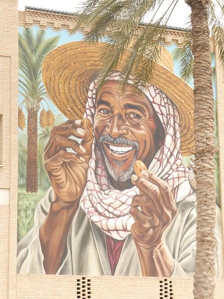

TO BE CONTINUED....
On this forum, I shared my first trip to Tunisia from mid-February to early March (https://voyageforum.com/forum/impressions-tunisiennes-en-direct-d11460662/), a stay I enjoyed so much that six weeks later, I’m back in Tunisia for a full 15 days (I return on April 27).
This time, I landed in Monastir on a direct flight from Nice, again with Tunisair. We left about ten minutes late, and the flight lasted around 1 hour 30 minutes. A meal was served on board (cucumber salad with Edam-like cheese, carrots, and two small portions of dishes I couldn’t identify—semolina with peppers, olives, and parsley, two small rolls, a square of processed cheese, and a chocolate cake). It’s worth noting because it’s not common on flights this short.
In February, France and Tunisia were in the same time zone, but now Tunisia is one hour behind. This time difference and the flight duration work perfectly for a short 15-day trip since it takes me a few days to adjust to jet lag.
Luckily, I’d asked my hotel about the taxi fare from the airport because the drivers (there were several around me) didn’t hesitate to quote outrageous prices. The actual fare is 20 dinars, but one asked for 120 dinars. I refused, and another offered 60 dinars. I replied, "That’s too expensive—I’ll take the metro!" (Having tried the Tunis metro, I had no desire to repeat the experience in Monastir with a suitcase!). I started walking toward the metro, and one of the drivers caught up with me, saying, "20 dinars is fine!" I’ll skip the details, but the negotiation took a little while. When I arrived at the hotel, I told the receptionist someone had asked for 120 dinars. He put his hands to his head and said, "They’re awful!" He remembered our phone call two days earlier when I’d booked (he’s the one who told me I could take the metro).
The Mezri Hotel isn’t expensive. I got a sea-view room for 75 dinars (22 €). (I’d booked a balcony room for 90 dinars but wouldn’t have had time to enjoy it.) It’s well-located but noisy because there’s no double glazing. The receptionist is a very kind older gentleman. He called a friend whose wife is from Tozeur to find out if I should take a bus or a *louage* tomorrow and what time.
I arrived at the hotel around 7:00 PM and had time to stroll along the corniche to the ribat. Despite some run-down buildings, the seaside seemed livelier and cheerier than Sousse’s.
Monastir is the hometown of former president Bourguiba. I passed his mausoleum by taxi. There are Tunisian flags along the avenue by the sea because every year on April 6—the anniversary of Habib Bourguiba’s death—the president of the Republic visits the Bourguiba Mausoleum in Monastir to pay respects.
The taxi driver mentioned other Tunisian presidents. He complained about rising prices and insecurity, blaming President Kaïs Saïed (I’d already heard that security was better under Ben Ali).
At the end of my stay, I’ll take time to explore Monastir, but tomorrow morning, I’m off to Tozeur—a long bus ride awaits me.
TO BE CONTINUED....
Hello everyone,
I’ve wanted to take this Norway cruise for a very long time. The first time I booked it was in July 2020 with Azamara. Unfortunately, it was canceled, as everyone remembers. When I tried to book it again, the prices (already a bit high with Azamara) had simply doubled. So, since then, I’ve been keeping an eye out every year for any opportunities...
The last time we sailed with Princess was eleven years ago, and things didn’t go very well. I came back pretty unhappy with their service and quite disappointed. Despite the $600 they gave me as credit for a future cruise, I’d never set foot on one of their ships again.
But this time, the opportunity arose—a fantastic itinerary with lots of stops, a reasonable price for 16 nights (I’ll share the details in the conclusion), and a ship that’s not too big, so to speak, with only 3,000 passengers. I’m not expecting much from the cruise line this time and am boarding the ship with low expectations beyond the itinerary.
Princess has introduced an app to download before the cruise. It’s essential because online check-in is no longer available, and the agency doesn’t send a travel journal. Everything is done through the app. After completing the check-in on the app, we only know that we’ll need to pick up our key, the Medallion, at embarkation by following the blue line in the terminal and presenting our passport.
Up until our departure, the weather forecast for the coming week in Norway is disastrous—rain, rain, and more rain. It was pretty much the same two years ago before our Iceland cruise, and in the end, the weather turned out fine.
If you’re ready to embark on the Emerald Princess to discover this beautiful cruise and the stunning landscapes of Norway, let’s go!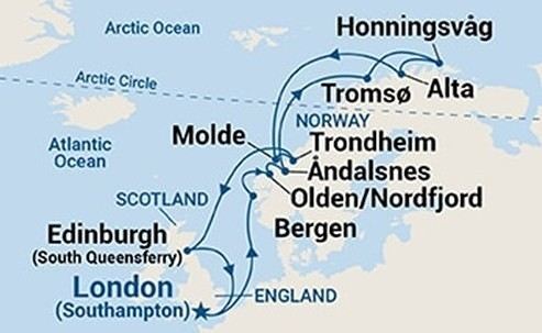
Southampton - Sea day - Bergen - Olden - Åndalsnes - Sea day - Tromsø - Honningsvåg (North Cape) - Alta - Sea day - Molde - Trondheim - Two sea days - Edinburgh - Sea day - Southampton
I’ve wanted to take this Norway cruise for a very long time. The first time I booked it was in July 2020 with Azamara. Unfortunately, it was canceled, as everyone remembers. When I tried to book it again, the prices (already a bit high with Azamara) had simply doubled. So, since then, I’ve been keeping an eye out every year for any opportunities...
The last time we sailed with Princess was eleven years ago, and things didn’t go very well. I came back pretty unhappy with their service and quite disappointed. Despite the $600 they gave me as credit for a future cruise, I’d never set foot on one of their ships again.
But this time, the opportunity arose—a fantastic itinerary with lots of stops, a reasonable price for 16 nights (I’ll share the details in the conclusion), and a ship that’s not too big, so to speak, with only 3,000 passengers. I’m not expecting much from the cruise line this time and am boarding the ship with low expectations beyond the itinerary.
Princess has introduced an app to download before the cruise. It’s essential because online check-in is no longer available, and the agency doesn’t send a travel journal. Everything is done through the app. After completing the check-in on the app, we only know that we’ll need to pick up our key, the Medallion, at embarkation by following the blue line in the terminal and presenting our passport.
Up until our departure, the weather forecast for the coming week in Norway is disastrous—rain, rain, and more rain. It was pretty much the same two years ago before our Iceland cruise, and in the end, the weather turned out fine.
If you’re ready to embark on the Emerald Princess to discover this beautiful cruise and the stunning landscapes of Norway, let’s go!
Southampton - Sea day - Bergen - Olden - Åndalsnes - Sea day - Tromsø - Honningsvåg (North Cape) - Alta - Sea day - Molde - Trondheim - Two sea days - Edinburgh - Sea day - Southampton
April 5 - Day 1
After as many weeks as I have fingers on my right hand, we're hitting the road again, fully recovered from our pharaonic adventure. Back in France to drop off our daughters (sorry, girls!), this time it's just the two of us, ready to be welcomed by a new destination. They say it offers one of the richest cultural heritages in the world for those willing to put in the effort. It's the land of the ancient Silk Road, where we'll follow a journey steeped in history and discoveries straight out of *One Thousand and One Nights*. A former Soviet bloc region independent only since 1991, we'll be walking in the footsteps of Genghis Khan, Tamerlane, Alexander the Great, Marco Polo...
Another fun fact about this country: it's strictly forbidden to import porn on your phone. True story. The same goes for painkillers! Unless it's about sodomy—though the two don’t seem connected, that’s just how it is. Don’t ask me why! Anyway, I’m getting off track. Here’s the big question: Where do you think we’ve just landed?... To give you a hint, the locals are known for being incredibly welcoming. No sooner said than done—our first taxi driver, proud to transport French travelers, refused to let us pay for the ride. Great vibes for these two weeks ahead. So, any guesses? Uzbekistan!!!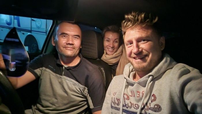
After as many weeks as I have fingers on my right hand, we're hitting the road again, fully recovered from our pharaonic adventure. Back in France to drop off our daughters (sorry, girls!), this time it's just the two of us, ready to be welcomed by a new destination. They say it offers one of the richest cultural heritages in the world for those willing to put in the effort. It's the land of the ancient Silk Road, where we'll follow a journey steeped in history and discoveries straight out of *One Thousand and One Nights*. A former Soviet bloc region independent only since 1991, we'll be walking in the footsteps of Genghis Khan, Tamerlane, Alexander the Great, Marco Polo...
Another fun fact about this country: it's strictly forbidden to import porn on your phone. True story. The same goes for painkillers! Unless it's about sodomy—though the two don’t seem connected, that’s just how it is. Don’t ask me why! Anyway, I’m getting off track. Here’s the big question: Where do you think we’ve just landed?... To give you a hint, the locals are known for being incredibly welcoming. No sooner said than done—our first taxi driver, proud to transport French travelers, refused to let us pay for the ride. Great vibes for these two weeks ahead. So, any guesses? Uzbekistan!!!
Cycling Through Provence's Big Climbs
In the autumn of 2011, Provence was hit by apocalyptic weather—torrential rain and a particularly violent east wind, reaching 130 kilometers per hour, whipping up waves as high as seven meters. It wasn’t the best time to venture outside. Yet, I told myself that after the storm, calm would return. I kept an eye on the weather forecast and noticed that starting November 10th, a favorable window should open for a little 600-kilometer cycling trip across Provence. The weather reports promised a high-pressure system that would keep the bad weather at bay over these highlands. That was all I needed to decide to set off. The planned route would take me through Provence’s biggest climbs: Mont Ventoux, Montagne de Lure, the Verdon Gorge, the Massif des Maures, and Sainte-Baume.
And so, despite my doubts, the call of adventure was stronger. The train pulled away, and once again, a journey began at Part-Dieu station. This time, I headed toward Haute-Provence for a cycling adventure. It would be my first solo bike trip. I was a little nervous—cycling with panniers makes you feel vulnerable to theft. I’d already been robbed while traveling in a group in Peru, and that experience left me deeply shaken. Alone, I hesitated. But no need to panic—I’d read accounts from long-distance cyclists who hadn’t been robbed, even if it does happen sometimes. I was particularly thinking of a young schoolteacher who had taken a sabbatical to cycle around the world. Her students had remarked, "Teacher, you’re not sporty—how will you manage to cycle around the world?" This young woman was full of resourcefulness. In South America, before flying to China, she locked her bike to a post to take care of a natural need. When she returned, the post had been torn out, and her bike—along with all her gear—was gone. It was a shock for many, but not for her. She boarded her flight to the Middle Kingdom, bought the essentials (including a new bike) once there, and continued her journey! Remembering this story, I almost felt ashamed of my cowardice. These were the thoughts running through my mind as the Rhône Valley rolled by toward Orange, the starting point of my Provençal adventure through the big climbs.
Day One: Orange to Sault via Mont Ventoux – 90 km
9:30 AM, I stepped off the train. With all my gear, I had to navigate the underground passage—no easy feat, given that my bike and luggage weighed 35 kilos. At this time of year, I expected some areas to be deserted, so I’d packed enough to bivouac comfortably. Once outside the station, the southern light flooded over me. I understood why people dream of retiring in these sun-drenched regions. As always, after disembarking from public transport, I had to get my bearings and decide which way to go. The sun, still low on the horizon, pointed east. The roar of fighter jet engines helped me locate the Air Base 115. That was all I needed to "reset the gyros."
As soon as I started pedaling, all my apprehensions vanished. The joy of discovery and physical effort took over, and euphoria washed over me. It’s amazing how emotions can shift from one moment to the next based on seemingly minor circumstances.
The weather was splendid—the forecast had predicted continuous showers, but it was completely wrong. I quickly left the city behind. Mont Ventoux loomed mysteriously, its dimensions hard to gauge. It was even more enigmatic with its summit hidden beneath swirling, mottled clouds clinging to the ridges. It reminded me of a great South American volcano. I struggled to imagine that in a few hours, I’d be up there under that blanket of mist.
The countryside was shaking off its autumnal nighttime dampness. The vineyards, interspersed with tall cypress hedges, confirmed I was in the magnificent Côtes du Rhône wine region. The distinctive Dentelles de Montmirail were very much in evidence. The air force base wasn’t far. I passed the runway’s end markers. A Mirage 2000 flew overhead in a tight turn, followed by another roaring into takeoff. It came straight at me before climbing sharply with a thunderous roar. Thirty years spent in that captivating world came rushing back. I recalled countless extraordinary human and technical experiences from my time in the service. But the purpose of this post isn’t to promote the air force—though I might post some articles one day about travels among men at war.
I continued on my way, leaving my past loves behind. As I pedaled, delightful names rolled by: Violès, Vacqueyras, Gigondas, Beaumes-de-Venise—the crème de la crème of the Côtes du Rhône Villages appellation. I let myself be enchanted by the vineyards and the little paths crisscrossing them. I started to doubt my route, though the imposing mass of Mont Ventoux in the distance acted like a giant beacon. At a crossroads, a car appeared. I approached to ask the driver for directions, but she didn’t even look at me and sped off, clearly frightened. I’d almost forgotten what a fearful world we live in, no doubt traumatized by all the horrors we see in the news and on TV.
The kilometers started adding up, but was my day’s goal too ambitious? It had been two months since I’d last ridden my bike. True, my last trip had been good training—the Route des Grandes Alpes—but that was two months ago. I can’t just take my bike out for a day trip; I need that sense of adventure to find the courage to exercise.
Two cyclists overtook me. Intrigued by my load, they struck up a conversation. They were skeptical when I told them I planned to cross Mont Ventoux that day. One of them pointed out a small chapel near the summit where I could bivouac sheltered. That motivated me even more to reach the top on this first stage. The chapel also had a mythical name for me—Sainte-Anne, the name of my parents’ villa. It was already noon, and I’d covered 50 kilometers. Malaucène appeared—the sacred village of Ventoux’s mad cyclists. Surprisingly, I didn’t see any other cyclists today. I remembered this place in June, teeming with aspirants for the king of summits. Before tackling the climb ahead, I needed to refuel. I enjoyed a pleasant gastronomic break at Max’s. At 1 PM, I started the most famous climb in cycling—21 kilometers, which would actually be 23. I knew it would be tough, especially with two handicaps: 50 kilometers already in my legs and 20 kilos of luggage. But I was counting on my tiny chainring, which let me climb trees to tackle the steep ramps.
I set off at a brisk pace along a deserted road. My speed held up for the first few kilometers. I quickly rose above the valley, the horizon widening. I was surprised to see no one on this world-renowned route among cycling enthusiasts. During the climb and descent, I’d only see five cyclists—but I’ll come back to that. I passed a sign explaining that the effort would be roughly equivalent to climbing the Col de la Bonnette. Having done the latter in September, I figured I’d be fine. I crossed paths with my first cyclist—a woman speeding downhill. After 12 kilometers, I hit slopes averaging 12%. I don’t know if the number 12 is cursed, but I got such a "bamboo" hit that I’d never experienced before. I thought I wouldn’t make it to the summit today. I stopped. My thighs burned so much I could barely walk—lactic acid overload. I looked for a relatively flat spot to pitch my tent. It was 3:30 PM, with two hours of daylight left. But I found nothing.
I got back on my bike, intending to stop as soon as I found a good bivouac spot. But nothing came up. However, my strength slowly returned, perhaps because the slope eased, though it remained around 10%. I entered the summit mists. A cyclist overtook me. I was in the zone where I had to pass the summit. Dusk caught me in the final difficulties. The atmosphere was downright austere. In the twilight, a kilometer from the summit, a cyclist was fixing his bike. I asked if he needed help. He made it clear he didn’t understand. So I asked, "Do you need some help?" His answer was clear: "No, thank you." He showed me his new inner tube. Inside, I thought, "Phew!" If I’d had to stop, sweating in the falling night with the cold intensifying, I’d have struggled to get going again. But he managed, and I continued into the twilight fog. I could barely make out the summit’s large antennas in the clouds, like immense ghosts trying to evade sight. The bike delivered sensations worthy of mountain racing. My goal was to quickly find the famous chapel in the descent to take shelter. As I glided down the southern slope, two cyclists without lights crossed my path in the night—probably heading to the station above, its lights visible in the fog.
I scanned the roadside in the dark for the chapel but saw nothing. After a kilometer or two, I lost all hope. I stopped to put on more clothes as the cold became intense. I had no idea where I could stop on these steep slopes to set up camp. Between the swirls of mist, I could intermittently see the Rhône Valley below, dotted with illuminated towns and villages. The sight was striking. What was I doing on this mountain at night? Then the miracle happened—the clouds parted, and from the ridge above me to the east, a beautiful full moon emerged, casting enough light to consider a nighttime descent to Sault, 26 kilometers away.
In this eerie atmosphere between the moon’s pale rays and patches of fog, I began my descent through a hazy, almost unreal world. The Ventoux’s characteristic white scree reflected the moonlight faintly, dimmed by the mist. In places, entire mountainsides were plunged into complete darkness, and I lost all sense of the road’s path. Then, around a tight bend caused by a land shift, the light returned. It seemed extreme compared to the darkness I’d left behind. I could once again clearly see the road’s contours, though not its potholes or gravel patches. Still, I let the slope carry me, and the speed felt significant, though the low light prevented me from reading my speedometer. In these moments, concentration was at its peak—all senses alert, reflexes ready to react to the slightest incident that could lead to a fall.
I was relieved to see Sault’s lights growing closer. In less than an hour, I reached it, considering the final little climb that required one last push. This village, bustling in summer, was deserted at this time of year—almost dead. The first hotel I came across was closed. A quick shadow passed in a small sloping street. Before it disappeared into the darkness at a house corner, I chased after it and asked about accommodation options. Very kindly, I was directed to what was probably the only hotel open in November. I quickly found it, and the reception was open. I entered wearing my black balaclava, bought in the Ayacucho region—the birthplace of Peru’s Shining Path. At this late hour, I saw questioning glances directed at me. I prefaced, "This isn’t a hold-up." Clearly, the owners had a sense of humor—they started smiling. I took off my balaclava and asked for a room. No problem, and from that moment, the pressure eased. I really didn’t feel like going back out to find a spot to pitch my tent in the biting cold.
The stage had been nearly 100 kilometers, and it was the first. It had been two months since I’d touched my bike, and I probably lacked even minimal training, even though my last bike trip had been crossing the French Alps. I really had to dig deep to overcome my weakness on Ventoux’s steep section. I don’t remember ever having to search so deeply for the energy to keep going. I knew the stage I’d set for tomorrow was significant, with the climb up Montagne de Lure’s northern slope—Ventoux’s little sister, whose ascent is reputed to be endless, over 25 kilometers. I hoped this first day wouldn’t leave me too sore to avoid suffering excessively tomorrow.
For now, relaxation—a hot shower did me a world of good, followed by a good meal. I ate a delicious andouillette from Troyes, very fine, with a particularly successful herb seasoning. I loved it, and yet I’m from Lyon and pride myself on knowing a thing or two about andouillette—not just a sausage but a whole category! A bit chauvinistic, I had to admit, though reluctantly, that I found it better than the ones I usually eat in the Lyon region!
Day Two: Sault to Forcalquier via Montagne de Lure – 116 km
This morning, the weather was magnificent—the air clear, still, very fresh, and invigorating, as only the late season can offer on these Provençal highlands. In summer, they’re known for their scorching heat and drought, but often overlooked is how harsh they can be with cold and storms. Authors like Giono or Bosco described them and their inhabitants wonderfully in books like "Les Âmes Fortes."
The miracle of the night had worked. I wasn’t sore anywhere and felt in great shape. I set off well-equipped, but the effort and sun soon made me sweat. It was time to shed some layers—hat and gloves. A gentle warmth replaced the cold, making for excellent cycling conditions. On the road to Trinit, there was no traffic—only the occasional hunters’ cars parked in the distance. These vehicles were recognizable by their large cages, used to transport hunting dogs. Sometimes, the silence was broken by a distant gunshot. The deciduous forests were losing their foliage, taking on that dull brown hue of late autumn, though here and there, a tree or shrub still resisted, displaying vivid yellow or red. The meadows, their grass already scorched by the cold, were damp from the night’s heavy humidity. The low sun highlighted thousands of spider webs that had trapped insects during the warm season.
Behind me, Mont Ventoux dominated these vast spaces. As often, its imposing, stony summit was crowned with a blanket of clouds. What an impressive mountain—it’s always so hard to gauge its dimensions. I struggled to realize that last night I’d been at the summit and descended its immense southern ridge in the dark. I hoped to return one day in favorable conditions—daylight and no clouds—to enjoy the vast panorama from this unique summit.
Leaving the very Provençal village of Trinit, I tackled my first climb of the day—the Col de l’Homme Mort. The road rose moderately for five kilometers in gentle warmth. The view over the region widened, and I felt the sheer joy of pedaling. At a good pace, I overcame this first little challenge. Once at the pass, I couldn’t resist the ritual of photographing my bike in front of the sign, giving the name and altitude—1,213 meters.
The northern slope was austere and still in shadow. The cold bit again. The road was wet and covered with leaves in places. It wasn’t impossible that some treacherous patches of black ice lurked around a bend. I descended toward the Jabron Valley with caution. Suddenly, around a bend in a forest clearing, the freshly snow-covered Alps, gleaming in the sun, leapt into view, blocking the horizon. I thought I recognized the distinctive silhouette of the Écrins’ south face above a multitude of jagged peaks.
This snow and these mountains awakened a flood of memories of great joys, but I also thought of the guide and his client who had just lost their lives on the Grandes Jorasses’ north face, at the top of a route called the Linceul. The name comes from the face’s appearance—a great ice slope bordering the Grandes Jorasses’ north wall. It was first climbed by René Desmaison in 1968. He passed away a few years ago and, in his final wishes, asked that his ashes be scattered in the Dévoluy Massif at the foot of Pic de Bure, not far from here in these immense pre-Alpine folds.
At my feet, the Jabron Valley stretched almost endlessly east toward Sisteron. In the distance, the dark mass of Montagne de Lure’s north face loomed. This mountain shares similarities with Mont Ventoux. It has the same summit scree of bright limestone, the same forests climbing up to the final rocky stretch, and that blanket of clouds adding a secretive, austere touch to the scene.
I turned left past the town of Séderon and headed toward the little Col de la Pigière, which in a few kilometers allowed me to truly plunge into the beautiful Jabron Valley. I passed through several villages with charming local names—Saint-Vincent, Noyer-sur-Jabron. The river offered lovely views of its narrow gorges with clear, cold water. Autumn seemed less advanced here than on the plateau I’d just left. Many trees still wore brilliant colors, some revealing extraordinary hues—mixes of crimson, pink, and bright red.
Arriving in Noyer-sur-Jabron, I took a tiny road on the river’s right bank, leading in a few kilometers to the foot of Montagne de Lure. In the village of Valbelle, I picnicked on leftovers I’d brought from home—an old cheese and a somewhat stale loaf of bread. It was 1:30 PM. I began the long climb of about 25 kilometers. According to a friend who’s a cycling expert in the region, this section is tough. No wonder it’s called Ventoux’s little sister—the Mont Blanc of cyclists. The elevation gain on this side is still 1,200 meters, while Ventoux via Malaucène is nearly 1,600 meters.
I hoped to reach the summit before nightfall and avoid reliving a nighttime descent. The route wound through a vast forest, following the terrain’s folds. There was activity—mushroom hunters were busy searching for the coveted chanterelle. The climb, though never very steep (only one kilometer at 9%), was interminable. Though traffic was practically nonexistent, I was overtaken by a group of Harley bikers—I counted about forty. Perched high on their machines, hands in the air on wildly shaped handlebars, some with their feet nearly in the sky due to the high footpegs, they didn’t even glance my way. What’s this idiot doing, unable to ride a motorcycle and forced to climb these mountains on a bike with big bags! I wasn’t offended—real Harley purists often see other motorcyclists as renegades, so bikes are even lower on the totem pole! But I didn’t want to start a debate about motorcycles. In my youth, when I was a wild motorcyclist (22 accidents on two wheels), clans were divided into Japanese, German, Italian, and British bike owners. The latter, on their vibrating, oil-leaking machines, considered themselves the purest. But let’s not fight—there’s a statute of limitations, and it’s been nearly forty years.
As yesterday, a few kilometers below the summit, I entered the fog, and the light dropped suddenly. What a hostile mountain in these conditions! It heightened the sense of living an incredible experience. The conditions we encounter play a major role in how the adventure imprints on our memory. I realized once again that in France, you can feel like you’re very far away. Finally, after this very long climb, the Pas de Graille sign suddenly appeared out of the grayness. Strange! Below the sign, a kilometer marker indicated this same pass was over three kilometers away. Clearly, the climb continued. In these final kilometers through the scree, I gained another 130 meters of elevation. Finally, the road’s high point was reached—1,720 meters. It was cold and damp. I quickly covered up, added my balaclava under my helmet, and put on warm gloves. As I was about to start the descent, a car stopped at the summit, and one of the passengers was surprised to find a bike there in these chilly, twilight conditions.
A 20-kilometer descent led me to the village of Saint-Étienne-les-Orgues. I hoped to find a place to stay for the night. No such luck! Everything was clearly closed—no chance of finding shelter. Tonight was getting complicated. I already had exactly 100 kilometers in my legs and didn’t feel like pedaling anymore, especially at night. But I had even less desire to sleep outside. What to do to avoid it? The town of Forcalquier was 16 kilometers away—I hoped the road would descend. I set off in that direction. The first third was along a beautiful, lightly trafficked departmental road with a slight downhill—I pedaled hard. But it got tougher. I joined a busier road, and night had fallen. A several-kilometer climb finished the journey. I knew my magnetic lights weren’t very powerful—hence the danger. They were even less so on the climb because the slower I went, the less they illuminated. Cars coming the opposite way often saw me late and blinded me with their high beams. After passing, I was plunged into total darkness for a few seconds while my pupils readjusted to the night. I imagined those coming up behind me saw me with little warning, despite my slightly fluorescent jacket. When the roadside was clear, I always positioned myself to quickly jump off the road. But unfortunately, in this long final climb, a guardrail prevented any escape to the right in case of sudden braking behind me. That was even more anxiety-inducing since I was stuck at a snail’s pace. Time seemed long. I pedaled as hard as I could, on the verge of asphyxiation, trying to escape this dangerous situation as quickly as possible. My only reference point was the vehicles in front of me, letting me know the climb wasn’t over. Then suddenly, the ordeal ended—the road’s high point was reached. The town and its lights emerged from the void, and clarity returned. Phew! I glided down toward this little town bathed in light. On November 11th, I hoped to find an open hotel since I’d clearly exceeded 100 kilometers, and the idea of having to leave town to find a bivouac spot somewhat frightened me.
I arrived in the town center. Activity was low. The first hotel was closed, but I spotted a lit sign for another establishment further on. I headed there, got off my bike, and entered. The welcome was immediately friendly—a big cat came to rub against me. For me, that was a very good sign, and the first impression was confirmed. I still had to go out to eat. I covered the minimum distance. A restaurant advertised "Mom’s Cooking." I expected Provençal specialties, but they were Moroccan. I chose a delicious tagine with lime and olives, followed by almond and honey ice cream. Exhausted after this 116-kilometer stage, I returned to my room. As often after intense efforts, it was hard to fall asleep.
Day Three: Forcalquier to Moustiers-Sainte-Marie – 58 km
On this third day, due to the progress made yesterday, the stage would be short. I’d call it a transition between two mountain ranges. Indeed, the next big climb is the Verdon Gorge. I planned to position myself at its foot this evening in preparation for a tough stage tomorrow. I made a few purchases—bread, bananas, and medicine for stomach burns (the midday sausage wasn’t always kind to me). The weather was still perfect. The route began with a long descent toward the Durance. It’s always nice to start a cycling day with a downhill—it boosts morale and allows for a gentle warm-up.
I quickly reached the town of Oraison. Just at its entrance, I crossed the Durance, which still bore traces of last week’s heavy rains along its sandbanks. Indeed, numerous stumps and trunks were scattered along its vast gravel bed, along with less ecological debris like old tires.
A little south of Oraison, I took the D907, a small road heading due east between scrubland and meadows. There it was—the Provence we imagine. This stable autumn weather, with still air, neither hot nor cold, just a fresh feeling when emerging from a shaded valley or a slight warmth under the sun, was ideal for a cyclist. After about ten kilometers at the bottom of a small valley I quickly passed through, the village of Le Brunet appeared on the right. It clung to the slopes leading to the Valensole Plateau. A few steep kilometers along a tiny winding road, and suddenly a vast panorama unfolded as the climb ended.
What a magnificent plateau! Though known for its wind, luckily today was completely calm. Far to the east, the Verdon’s great cliffs blocked the horizon. This allowed me to contemplate part of tomorrow’s stage. This place is full of mysteries—many UFO and extraterrestrial encounter stories are associated with it. Moreover, for about thirty years, France hid its ground-to-ground nuclear ballistic missiles here, grouped in the 1st GMS (Ballistic Missile Group), under the air force. Naturally, these rockets fueled fantasies, and pacifist groups settled in the region to protest this type of armament. This gives many reasons to shroud this austere, deserted land in mystery.
I took a dirt path leading to the heart of this zone and stopped at the forest’s edge for lunch. The silence was total, the view stretched very far. But nothing strange or bizarre manifested. No Martian came to share my frankly moldy cheese, very peppery sausage, or bruised banana—sniff! I resumed my route, and as often when crossing places with strong character, I tended to slow down to enjoy them longer. The immense lavender fields stretched endlessly, not very fragrant at this season. I arrived at a group of truffle oaks protected by a fence, with large red signs warning "Firearm." Clearly, the war for the black diamond was raging in this region. I remembered a novel where an old farmer made buyers believe nothing grew on his land. Every year, he secretly stole the mushrooms from the unsuspecting owners. Then one day, they discovered the truth, catching this "polite" neighbor trying to hide a basket full of beautiful, large truffles!
In these vast spaces, I felt good—a sense of plenitude. It’s strange that I only conceive of cycling through wandering. I struggle to plan a day trip. And if I do, it’s highly likely I won’t get up. I need that sense of adventure to fully appreciate my physical effort. Maybe one day I should get psychoanalyzed, but at my age, it’s probably too late! Today, I had all the time in the world—the stage was half as long as yesterday’s, with very little elevation gain. Not a sound, an impressive calm, a beautiful landscape—I pedaled in a wonderful place. That’s probably happiness!
I reached the village of Puimoisson on the plateau’s eastern edge—only 12 kilometers left to Moustiers. I took my time, sat at a café terrace in the sun, and leisurely enjoyed a coffee while listening to the village come to life. I was delighted by these melodious southern voices, bursting into great laughter. There are places where, despite the anxieties caused by our debt-ridden, dysfunctional societies, some have decided to take life on the bright side and show a saving insouciance.
The rest of the journey was a simple formality—I let the slope carry me toward the pretty little town of Moustiers-Sainte-Marie, clinging to the cliff and famous for its faïence. Arriving early for once, I went to the tourist office to choose a comfortable hotel. Indeed, the Hôtel des Restanques was very comfortable and admirably well-located. But at this time of year, I’d have to return to the village center for dinner. The very kind receptionist reserved a table for me at La Treille Muscate, a restaurant with a magnificently arranged room on the church square. It was only 3:30 PM—I continued to take my time, showering and relaxing in front of the TV. Then I set off to explore—or rather, re-explore—this village I’d visited several times before. But I’d never climbed to its chapel perched in the middle of the great cliff towering over the houses. A stony, aerial path led there. The first mentions of the Notre-Dame de Beauvoir chapel, known in ancient times as Notre-Dame d’Entre-Roches, date back to the 9th century. It’s one of the rare "respite" chapels found in Provence. These are chapels where stillborn children were brought to be revived for a few moments, just long enough to baptize them. They could then be buried religiously, ensuring the salvation of their souls. I was also very moved by reading some ex-votos, like the one from "A mother for her three children returned from the war."
The place was impressive, especially as night fell. I was alone and watched the shadows fill the great cliffs above me. With an old climber’s reflex, I looked for possible climbing routes among these slabs and cracks. But climbing is probably forbidden here, too close to the houses. Then I descended to stroll through the village, admiring the magnificent, finely crafted faïence patterns found in many shops. Finally, dinnertime arrived, and I joined my restaurant, which had been highly recommended. I was delighted by the foie gras ravioli and the pieds et paquets—the chef’s specialty. I’ll come back with family.
Day Four: Moustiers to Fréjus via the Verdon – 122 km
A hearty breakfast prepared me for the day’s tough efforts. Next to me, four Chinese people chatted animatedly. Of course, I didn’t understand a word—it was a language with strange intonations and sounds. I left the dining room and prepared my bike on the terrace. Seeing the volume of my luggage, my Chinese friends rushed over and asked to take turns having their photo taken in front of this funny setup. All laughing, they took photos in front of what they probably considered a French coolie off on some trading business! When they show these photos to their relatives, they’ll likely be perplexed about what motivates some to travel by bike rather than car. For them, the car is a symbol of success—according to an article I read last year, 14,000 cars are registered in China every day!
This morning, the air was fresh. As yesterday, I started with a long descent, this time leading to the edge of Lac de Sainte-Croix. A strong, biting headwind slowed me down. It wouldn’t last, as it was generated by the gorge’s outlet, which I’d reach in a few kilometers. On this cold morning, the lake’s shores exuded great tranquility. The sun was still hidden behind the Verdon’s mountainous mass. Trees with yellow leaves stood out against the water’s pale blue. The bridge marking the gorge’s beginning at the lake’s edge was an ideal spot to admire this natural splendor. At this early hour, the play of light and shadow on the water and the immense cliffs delivered a grandiose spectacle in beautiful harmony. This first contact with the gorges, which I knew well, amazed me.
Once past the bridge, the wind calmed. A little further on, I began the long climb that would take me to the top of this immense natural gash, which water had taken millions of years to carve. I was in good shape and highly motivated by the splendors to come. First, I reached the village of Aiguines, which offered a magnificent viewpoint over the lake. Then I continued toward the Corniche Sublime, where countless breathtaking panoramas unfolded as I progressed. But the climb was sustained and long, requiring effort—though my small chainring worked miracles. I first passed the Col d’Illoire, already 500 meters above the lake. Seeing all these great cliffs, countless climbing memories came flooding back. The classic routes of the Escalès cliff, over 300 meters high, flashed by. Routes with legendary names—La Demande, Les Écureuils, Luna-Bong, and many others. The one that left me with the best memory was ULA—a crack, vertical or even overhanging, of sheer beauty rising above a 40-meter slab in one go for 280 meters of sustained, beautiful climbing on extraordinary rock. It made me want to return to climb there, to immerse myself in the atmosphere of those past times. But climbing habits have changed—now routes are accessed from above by rappel, and people don’t always bother to do these great climbs in their entirety, focusing instead on shorter but technically much more difficult enterprises.
At almost every bend, I stopped and scanned these great cliffs, searching for memories of past experiences and emotions in these secret rock folds. The road climbed well above the pass, exceeding 1,200 meters. It was cool, especially since I was sweating. Finally reaching the high point of the Corniche Sublime, I couldn’t gain speed on the descent—my gaze was always drawn to this astonishing canyon. Around a bend, two cyclists with funny small-wheeled bikes. Wow! It was a couple of Australians doing a year-long tour of France. We chatted passionately about our two-wheeled experiences for a moment. But time was passing, and if I wanted to reach Fréjus before nightfall, I’d have to pedal seriously.
I stopped at the Pont de l’Artuby, where bungee jumping was in full swing. But I quickly set off again toward Comps. The wind was against me, and it was climbing. I started to doubt whether I’d make it to the coast that evening. At 2 PM, I was in Comps-sur-Artuby. I didn’t stop, knowing that before reaching the coast, I’d have no alternative to bivouacking, and I had 70 kilometers left to cover. Sure, it should be downhill, but a few climbs were on the program. After a descent out of the village, I crossed the Artuby River again on the Canjuers military camp. A several-kilometer climb followed, fortunately not too steep. I took the D19 toward Barjols. From there, despite the late hour, I opted for a tiny road passing through Claviers, a small perched village. Time passed quickly, but the kilometers added up. I regained hope. Fifteen kilometers after this last village, I reached Saint-Paul-en-Forêt via a magnificent forested route. I had plenty of time to observe mushroom hunters. I asked one who clearly had some in a plastic bag. He gave me this hilarious answer with a magnificent southern accent: "I only picked the bad ones." No reply was possible. I moved on with a smile. A little further on, another hunter carried a basket. As soon as he saw me, he quickly hid it—just in case I saw what it contained. Arriving at the village involved a steep climb, and I was close to 100 kilometers. I still had a little over 20 kilometers to go before reaching Fréjus. The race against nightfall had begun. Over there to my right, I saw the sun setting behind Roquebrune-sur-Argens’ distinctive rock. The sea appeared. There it was—I was in Fréjus’ industrial zone. On this Sunday evening, traffic was heavy. Indeed, many had taken advantage of the return of good weather after very heavy storms to go for a walk. After quite a few detours, I arrived at the seaside just as night fell. My odometer showed 122 km for the day. I quickly found a simple hotel, ate just as quickly, and went to bed.
Day Five: Fréjus to Solliès-Pont – 92 km
Once again, the night had done its restorative work, and I prepared to cross the Massif des Maures feeling quite fresh. The weather forecast was still favorable for today, but a deterioration was expected tomorrow. I tended to trust it because the east wind was blowing, and in the region, that’s a sign of rain. For now, in the short term, this wind would be very useful—it would push me generously throughout the day.
I started calmly along the harbor quays, looking at the boats. Then I joined the road to Saint-Aygulf and followed the coast for forty kilometers to Port-Grimaud. All these seaside resorts—Saint-Aygulf, Les Issambres, Sainte-Maxime—reminded me of my youth when we spent all our vacations fishing, whether from shore, underwater, or by boat. Looking at the sea roll by, I knew what the seabeds looked like under that surface hiding them. The marine areas we knew best were now under the parking lots and commercial zones of Saint-Raphaël’s new port. In our youth, these infrastructures didn’t exist, and their construction came at the expense of coastal marine areas. Our wonderful fishing spots were permanently buried. I remember seeing the first big trucks that came to dump their loads of earth and rubble, destroying all those wonderful places—sandbanks, seaweed beds, groups of rocky holes teeming with fish that enchanted our youth. Over forty years later, I can still visualize them in my imagination under those parking lots and stores, with the names we gave them—my brothers and I: le casse-croûte, le casse-pipe, les montagnes, la digue, la grille, la mare à mulets, la petite-plage, le trou, etc.
Let’s not be overwhelmed by nostalgia. I left the coast and took the little road through the Maures to Collobrières. The route led from ridge to ridge following the terrain’s movements. At this time of year, the region was admirable. Due to the heavy storms of recent weeks, water was streaming everywhere. Waterfalls and streams murmured all along the way. I didn’t recognize the Maures, which I knew for their dryness causing apocalyptic fires. Indeed, around a bend, I came across a small rest area where a memorial had been erected for three firefighters who lost their lives here while fighting one of those gigantic fires fanned by the mistral.
This forest holds treasures—first, the cork oak, then the arbutus, chestnut trees, and of course, mushrooms that love this granitic soil:
The cork oak can be found all along the road. It’s the forest’s essential element. You can recognize it by its light bark (before exploitation), which forms large bulges along the trunk. But after exploitation, the trunks are much smoother, less voluminous, and dark in color. The arbutus is a large berry with red skin covered in small protuberances, growing on the arbutus tree. This fruit, common in Mediterranean areas, ripens in November. That means today, there were plenty around me. Its flesh is orange, with the consistency of firm purée, and it crushes softly in the mouth. The taste of this berry is sweet and excellent. I didn’t hold back—I gorged myself on them, which served as my midday meal. Sometimes I had to climb embankments to get them.
The chestnut tree, a true industry of the region, brings wealth to the surrounding villages. They make candied chestnuts, ice cream, and other products derived from chestnut flour. Be careful not to stop just anywhere to pick this fruit, as the tree owners might not agree. They even make this clear with signs and surround their chestnut trees with fences. Mushrooms—saffron milk caps and porcini—are highly prized in the area. I saw a few hunters, but it clearly wasn’t miraculous. Supposedly, there had been too much rain?
There’s no time to get bored along this little road, from which you can sometimes see the sea. I passed the Col de Taillude at over 400 meters. I began the descent to Collobrières, the chestnut capital, whose festival attracts many people. Before entering, about a hundred meters from the first houses, a cyclist—probably an agricultural worker—came toward me. As he passed, he cheerfully called out, "Go on, little guy! It’s almost there!" We both smiled. At the end of November, the village was cold and almost deserted. Dead leaves swept the wet streets of the town. You could feel winter on the way. I continued my route to Pierrefeu-du-Var, on the western edge of the Massif des Maures. So I gave my last pedal strokes in this pretty little massif so characteristic of Provence.
I looked for a hotel in Cuers but without success. I descended toward Toulon and finally found one on the outskirts of Solliès-Pont. It catered to people coming to work in the region, so nothing very bucolic. But if the weather were to deteriorate tomorrow and turn to rain, I could quickly reach Hyères or Toulon station, which was a significant advantage. Indeed, November rains aren’t usually very pleasant on a bike.
Day Six: Solliès-Pont to Cassis via Sainte-Baume – 85 km
This morning, contrary to the weather forecast, the weather was beautiful, and the latest bulletin seemed to contradict yesterday’s. So no escape to Toulon—I resumed my route toward Sainte-Baume. I left the hotel via a tiny road that, through ups and downs, led me via shortcuts to the road to Belgentier. My body had gotten used to intense daily efforts, and I felt in Olympic form. At a good pace, I launched into a long climb with a moderate slope. The road was busy, but fortunately, the side lane for cyclists often made the exercise more pleasant. The villages rolled by—Méounes, La Roquebrussanne. Near the latter, I observed a Tiger combat helicopter in training. It hovered motionless for long periods—perhaps the pilots were training to master their increasingly sophisticated weapon systems, requiring even more learning?
I left the busy road and headed via an almost deserted route toward the village of Mazaugues. The climbs became steeper. A long descent, and there I was in this pretty village. A grocery store, which besides selling a few ingredients also served as a café. I sat near the electric heater—it was cold, and I was sweaty. I watched customers come and go and listened to the shopkeeper tell me about village life. The name Mazaugues comes from "water mass," which is why drought doesn’t usually affect this area. Apparently, you can even find mushrooms here in summer! I had a good time, and as I was leaving, a local cyclist started a conversation and told me about her dreams of long bike trips, currently limited by her situation as a mother of terrible children. She settled for day trips with her club, which was already good in this very hilly region. I told her the story of a man who, at 73, cycled solo around Morocco. So no panic—she still had thirty or forty years to realize her wildest dreams!
I was warned that it would be a tough climb to reach Sainte-Baume’s northern slope. Indeed, over eight kilometers, the average slope was sustained, but the landscape was wonderful. Here too, water was streaming everywhere. I passed one of those famous icehouses that used to supply Marseille with ice throughout the year. This northern slope of Sainte-Baume is very cold, and this characteristic was exploited in previous centuries to produce ice. Large cylindrical structures, well-protected to the north and semi-buried, received large quantities of water in late autumn, which froze during winter and was kept cool for months until the following winter. Ice blocks were cut and delivered by cart to the city. That’s how, in ancient times, ice was available in summer to keep fish fresh in Marseille. Did pastis exist at that time? If not, the ice cubes must have been bored!
Once the climb was over, the long ridge of Sainte-Baume appeared, and I could see its characteristic antennas. Nestled at the foot of the cliffs, the magnificent millennial forest revealed itself with its autumn colors. I stopped at the monastery. I’d been there several times before and had even slept there during a long walking trip. The welcome had been first-rate by the Dominicans, especially the sisters in their long immaculate robes. They radiated a serenity that was very contagious. Don’t hesitate to stop there for the night. I struggled to get back on my way—some places have a special spirit.
I was soon at the end of my journey. I continued along this magnificent mountain to the Col de l’Espigoulier. To the north, another immense wave of white limestone rose—Montagne Sainte-Victoire, a high place in Provence that painter Cézanne made world-famous. Once at the pass, the entire city of Marseille spread out at my feet, the Mediterranean coast revealed itself from the Calanques to La Ciotat, passing by the famous Cap Canaille, Europe’s highest sea cliff. Above me, bathed in sunlight, Bartagne’s northwest face, very popular among climbers, showed all its reliefs. With an old climber’s reflex, I spotted the many climbs I’d done there. I let myself be carried into a steep, winding descent toward the village of Gémenos in a beautiful setting full of cliffs.
A few more kilometers of climbing toward the Col de l’Ange, then toward Roquefort-la-Bédoule. In this last climb, I raced with two cyclists, admittedly not very young. Then, in a six-kilometer descent, I reached Cassis station, the endpoint of my six-day journey through this wild Provençal land between sea and mountain. I experienced great pleasure during these 570 kilometers through these renowned yet wild French massifs. As always, when a beautiful project comes to an end, you feel a bit orphaned by a beautiful dream come true. You have to quickly envision the next one to avoid a vague sense of emptiness taking over. My next adventure is already taking shape in my mind, but that’s another story.
In the autumn of 2011, Provence was hit by apocalyptic weather—torrential rain and a particularly violent east wind, reaching 130 kilometers per hour, whipping up waves as high as seven meters. It wasn’t the best time to venture outside. Yet, I told myself that after the storm, calm would return. I kept an eye on the weather forecast and noticed that starting November 10th, a favorable window should open for a little 600-kilometer cycling trip across Provence. The weather reports promised a high-pressure system that would keep the bad weather at bay over these highlands. That was all I needed to decide to set off. The planned route would take me through Provence’s biggest climbs: Mont Ventoux, Montagne de Lure, the Verdon Gorge, the Massif des Maures, and Sainte-Baume.
And so, despite my doubts, the call of adventure was stronger. The train pulled away, and once again, a journey began at Part-Dieu station. This time, I headed toward Haute-Provence for a cycling adventure. It would be my first solo bike trip. I was a little nervous—cycling with panniers makes you feel vulnerable to theft. I’d already been robbed while traveling in a group in Peru, and that experience left me deeply shaken. Alone, I hesitated. But no need to panic—I’d read accounts from long-distance cyclists who hadn’t been robbed, even if it does happen sometimes. I was particularly thinking of a young schoolteacher who had taken a sabbatical to cycle around the world. Her students had remarked, "Teacher, you’re not sporty—how will you manage to cycle around the world?" This young woman was full of resourcefulness. In South America, before flying to China, she locked her bike to a post to take care of a natural need. When she returned, the post had been torn out, and her bike—along with all her gear—was gone. It was a shock for many, but not for her. She boarded her flight to the Middle Kingdom, bought the essentials (including a new bike) once there, and continued her journey! Remembering this story, I almost felt ashamed of my cowardice. These were the thoughts running through my mind as the Rhône Valley rolled by toward Orange, the starting point of my Provençal adventure through the big climbs.
Day One: Orange to Sault via Mont Ventoux – 90 km
9:30 AM, I stepped off the train. With all my gear, I had to navigate the underground passage—no easy feat, given that my bike and luggage weighed 35 kilos. At this time of year, I expected some areas to be deserted, so I’d packed enough to bivouac comfortably. Once outside the station, the southern light flooded over me. I understood why people dream of retiring in these sun-drenched regions. As always, after disembarking from public transport, I had to get my bearings and decide which way to go. The sun, still low on the horizon, pointed east. The roar of fighter jet engines helped me locate the Air Base 115. That was all I needed to "reset the gyros."
As soon as I started pedaling, all my apprehensions vanished. The joy of discovery and physical effort took over, and euphoria washed over me. It’s amazing how emotions can shift from one moment to the next based on seemingly minor circumstances.
The weather was splendid—the forecast had predicted continuous showers, but it was completely wrong. I quickly left the city behind. Mont Ventoux loomed mysteriously, its dimensions hard to gauge. It was even more enigmatic with its summit hidden beneath swirling, mottled clouds clinging to the ridges. It reminded me of a great South American volcano. I struggled to imagine that in a few hours, I’d be up there under that blanket of mist.
The countryside was shaking off its autumnal nighttime dampness. The vineyards, interspersed with tall cypress hedges, confirmed I was in the magnificent Côtes du Rhône wine region. The distinctive Dentelles de Montmirail were very much in evidence. The air force base wasn’t far. I passed the runway’s end markers. A Mirage 2000 flew overhead in a tight turn, followed by another roaring into takeoff. It came straight at me before climbing sharply with a thunderous roar. Thirty years spent in that captivating world came rushing back. I recalled countless extraordinary human and technical experiences from my time in the service. But the purpose of this post isn’t to promote the air force—though I might post some articles one day about travels among men at war.
I continued on my way, leaving my past loves behind. As I pedaled, delightful names rolled by: Violès, Vacqueyras, Gigondas, Beaumes-de-Venise—the crème de la crème of the Côtes du Rhône Villages appellation. I let myself be enchanted by the vineyards and the little paths crisscrossing them. I started to doubt my route, though the imposing mass of Mont Ventoux in the distance acted like a giant beacon. At a crossroads, a car appeared. I approached to ask the driver for directions, but she didn’t even look at me and sped off, clearly frightened. I’d almost forgotten what a fearful world we live in, no doubt traumatized by all the horrors we see in the news and on TV.
The kilometers started adding up, but was my day’s goal too ambitious? It had been two months since I’d last ridden my bike. True, my last trip had been good training—the Route des Grandes Alpes—but that was two months ago. I can’t just take my bike out for a day trip; I need that sense of adventure to find the courage to exercise.
Two cyclists overtook me. Intrigued by my load, they struck up a conversation. They were skeptical when I told them I planned to cross Mont Ventoux that day. One of them pointed out a small chapel near the summit where I could bivouac sheltered. That motivated me even more to reach the top on this first stage. The chapel also had a mythical name for me—Sainte-Anne, the name of my parents’ villa. It was already noon, and I’d covered 50 kilometers. Malaucène appeared—the sacred village of Ventoux’s mad cyclists. Surprisingly, I didn’t see any other cyclists today. I remembered this place in June, teeming with aspirants for the king of summits. Before tackling the climb ahead, I needed to refuel. I enjoyed a pleasant gastronomic break at Max’s. At 1 PM, I started the most famous climb in cycling—21 kilometers, which would actually be 23. I knew it would be tough, especially with two handicaps: 50 kilometers already in my legs and 20 kilos of luggage. But I was counting on my tiny chainring, which let me climb trees to tackle the steep ramps.
I set off at a brisk pace along a deserted road. My speed held up for the first few kilometers. I quickly rose above the valley, the horizon widening. I was surprised to see no one on this world-renowned route among cycling enthusiasts. During the climb and descent, I’d only see five cyclists—but I’ll come back to that. I passed a sign explaining that the effort would be roughly equivalent to climbing the Col de la Bonnette. Having done the latter in September, I figured I’d be fine. I crossed paths with my first cyclist—a woman speeding downhill. After 12 kilometers, I hit slopes averaging 12%. I don’t know if the number 12 is cursed, but I got such a "bamboo" hit that I’d never experienced before. I thought I wouldn’t make it to the summit today. I stopped. My thighs burned so much I could barely walk—lactic acid overload. I looked for a relatively flat spot to pitch my tent. It was 3:30 PM, with two hours of daylight left. But I found nothing.
I got back on my bike, intending to stop as soon as I found a good bivouac spot. But nothing came up. However, my strength slowly returned, perhaps because the slope eased, though it remained around 10%. I entered the summit mists. A cyclist overtook me. I was in the zone where I had to pass the summit. Dusk caught me in the final difficulties. The atmosphere was downright austere. In the twilight, a kilometer from the summit, a cyclist was fixing his bike. I asked if he needed help. He made it clear he didn’t understand. So I asked, "Do you need some help?" His answer was clear: "No, thank you." He showed me his new inner tube. Inside, I thought, "Phew!" If I’d had to stop, sweating in the falling night with the cold intensifying, I’d have struggled to get going again. But he managed, and I continued into the twilight fog. I could barely make out the summit’s large antennas in the clouds, like immense ghosts trying to evade sight. The bike delivered sensations worthy of mountain racing. My goal was to quickly find the famous chapel in the descent to take shelter. As I glided down the southern slope, two cyclists without lights crossed my path in the night—probably heading to the station above, its lights visible in the fog.
I scanned the roadside in the dark for the chapel but saw nothing. After a kilometer or two, I lost all hope. I stopped to put on more clothes as the cold became intense. I had no idea where I could stop on these steep slopes to set up camp. Between the swirls of mist, I could intermittently see the Rhône Valley below, dotted with illuminated towns and villages. The sight was striking. What was I doing on this mountain at night? Then the miracle happened—the clouds parted, and from the ridge above me to the east, a beautiful full moon emerged, casting enough light to consider a nighttime descent to Sault, 26 kilometers away.
In this eerie atmosphere between the moon’s pale rays and patches of fog, I began my descent through a hazy, almost unreal world. The Ventoux’s characteristic white scree reflected the moonlight faintly, dimmed by the mist. In places, entire mountainsides were plunged into complete darkness, and I lost all sense of the road’s path. Then, around a tight bend caused by a land shift, the light returned. It seemed extreme compared to the darkness I’d left behind. I could once again clearly see the road’s contours, though not its potholes or gravel patches. Still, I let the slope carry me, and the speed felt significant, though the low light prevented me from reading my speedometer. In these moments, concentration was at its peak—all senses alert, reflexes ready to react to the slightest incident that could lead to a fall.
I was relieved to see Sault’s lights growing closer. In less than an hour, I reached it, considering the final little climb that required one last push. This village, bustling in summer, was deserted at this time of year—almost dead. The first hotel I came across was closed. A quick shadow passed in a small sloping street. Before it disappeared into the darkness at a house corner, I chased after it and asked about accommodation options. Very kindly, I was directed to what was probably the only hotel open in November. I quickly found it, and the reception was open. I entered wearing my black balaclava, bought in the Ayacucho region—the birthplace of Peru’s Shining Path. At this late hour, I saw questioning glances directed at me. I prefaced, "This isn’t a hold-up." Clearly, the owners had a sense of humor—they started smiling. I took off my balaclava and asked for a room. No problem, and from that moment, the pressure eased. I really didn’t feel like going back out to find a spot to pitch my tent in the biting cold.
The stage had been nearly 100 kilometers, and it was the first. It had been two months since I’d touched my bike, and I probably lacked even minimal training, even though my last bike trip had been crossing the French Alps. I really had to dig deep to overcome my weakness on Ventoux’s steep section. I don’t remember ever having to search so deeply for the energy to keep going. I knew the stage I’d set for tomorrow was significant, with the climb up Montagne de Lure’s northern slope—Ventoux’s little sister, whose ascent is reputed to be endless, over 25 kilometers. I hoped this first day wouldn’t leave me too sore to avoid suffering excessively tomorrow.
For now, relaxation—a hot shower did me a world of good, followed by a good meal. I ate a delicious andouillette from Troyes, very fine, with a particularly successful herb seasoning. I loved it, and yet I’m from Lyon and pride myself on knowing a thing or two about andouillette—not just a sausage but a whole category! A bit chauvinistic, I had to admit, though reluctantly, that I found it better than the ones I usually eat in the Lyon region!
Day Two: Sault to Forcalquier via Montagne de Lure – 116 km
This morning, the weather was magnificent—the air clear, still, very fresh, and invigorating, as only the late season can offer on these Provençal highlands. In summer, they’re known for their scorching heat and drought, but often overlooked is how harsh they can be with cold and storms. Authors like Giono or Bosco described them and their inhabitants wonderfully in books like "Les Âmes Fortes."
The miracle of the night had worked. I wasn’t sore anywhere and felt in great shape. I set off well-equipped, but the effort and sun soon made me sweat. It was time to shed some layers—hat and gloves. A gentle warmth replaced the cold, making for excellent cycling conditions. On the road to Trinit, there was no traffic—only the occasional hunters’ cars parked in the distance. These vehicles were recognizable by their large cages, used to transport hunting dogs. Sometimes, the silence was broken by a distant gunshot. The deciduous forests were losing their foliage, taking on that dull brown hue of late autumn, though here and there, a tree or shrub still resisted, displaying vivid yellow or red. The meadows, their grass already scorched by the cold, were damp from the night’s heavy humidity. The low sun highlighted thousands of spider webs that had trapped insects during the warm season.
Behind me, Mont Ventoux dominated these vast spaces. As often, its imposing, stony summit was crowned with a blanket of clouds. What an impressive mountain—it’s always so hard to gauge its dimensions. I struggled to realize that last night I’d been at the summit and descended its immense southern ridge in the dark. I hoped to return one day in favorable conditions—daylight and no clouds—to enjoy the vast panorama from this unique summit.
Leaving the very Provençal village of Trinit, I tackled my first climb of the day—the Col de l’Homme Mort. The road rose moderately for five kilometers in gentle warmth. The view over the region widened, and I felt the sheer joy of pedaling. At a good pace, I overcame this first little challenge. Once at the pass, I couldn’t resist the ritual of photographing my bike in front of the sign, giving the name and altitude—1,213 meters.
The northern slope was austere and still in shadow. The cold bit again. The road was wet and covered with leaves in places. It wasn’t impossible that some treacherous patches of black ice lurked around a bend. I descended toward the Jabron Valley with caution. Suddenly, around a bend in a forest clearing, the freshly snow-covered Alps, gleaming in the sun, leapt into view, blocking the horizon. I thought I recognized the distinctive silhouette of the Écrins’ south face above a multitude of jagged peaks.
This snow and these mountains awakened a flood of memories of great joys, but I also thought of the guide and his client who had just lost their lives on the Grandes Jorasses’ north face, at the top of a route called the Linceul. The name comes from the face’s appearance—a great ice slope bordering the Grandes Jorasses’ north wall. It was first climbed by René Desmaison in 1968. He passed away a few years ago and, in his final wishes, asked that his ashes be scattered in the Dévoluy Massif at the foot of Pic de Bure, not far from here in these immense pre-Alpine folds.
At my feet, the Jabron Valley stretched almost endlessly east toward Sisteron. In the distance, the dark mass of Montagne de Lure’s north face loomed. This mountain shares similarities with Mont Ventoux. It has the same summit scree of bright limestone, the same forests climbing up to the final rocky stretch, and that blanket of clouds adding a secretive, austere touch to the scene.
I turned left past the town of Séderon and headed toward the little Col de la Pigière, which in a few kilometers allowed me to truly plunge into the beautiful Jabron Valley. I passed through several villages with charming local names—Saint-Vincent, Noyer-sur-Jabron. The river offered lovely views of its narrow gorges with clear, cold water. Autumn seemed less advanced here than on the plateau I’d just left. Many trees still wore brilliant colors, some revealing extraordinary hues—mixes of crimson, pink, and bright red.
Arriving in Noyer-sur-Jabron, I took a tiny road on the river’s right bank, leading in a few kilometers to the foot of Montagne de Lure. In the village of Valbelle, I picnicked on leftovers I’d brought from home—an old cheese and a somewhat stale loaf of bread. It was 1:30 PM. I began the long climb of about 25 kilometers. According to a friend who’s a cycling expert in the region, this section is tough. No wonder it’s called Ventoux’s little sister—the Mont Blanc of cyclists. The elevation gain on this side is still 1,200 meters, while Ventoux via Malaucène is nearly 1,600 meters.
I hoped to reach the summit before nightfall and avoid reliving a nighttime descent. The route wound through a vast forest, following the terrain’s folds. There was activity—mushroom hunters were busy searching for the coveted chanterelle. The climb, though never very steep (only one kilometer at 9%), was interminable. Though traffic was practically nonexistent, I was overtaken by a group of Harley bikers—I counted about forty. Perched high on their machines, hands in the air on wildly shaped handlebars, some with their feet nearly in the sky due to the high footpegs, they didn’t even glance my way. What’s this idiot doing, unable to ride a motorcycle and forced to climb these mountains on a bike with big bags! I wasn’t offended—real Harley purists often see other motorcyclists as renegades, so bikes are even lower on the totem pole! But I didn’t want to start a debate about motorcycles. In my youth, when I was a wild motorcyclist (22 accidents on two wheels), clans were divided into Japanese, German, Italian, and British bike owners. The latter, on their vibrating, oil-leaking machines, considered themselves the purest. But let’s not fight—there’s a statute of limitations, and it’s been nearly forty years.
As yesterday, a few kilometers below the summit, I entered the fog, and the light dropped suddenly. What a hostile mountain in these conditions! It heightened the sense of living an incredible experience. The conditions we encounter play a major role in how the adventure imprints on our memory. I realized once again that in France, you can feel like you’re very far away. Finally, after this very long climb, the Pas de Graille sign suddenly appeared out of the grayness. Strange! Below the sign, a kilometer marker indicated this same pass was over three kilometers away. Clearly, the climb continued. In these final kilometers through the scree, I gained another 130 meters of elevation. Finally, the road’s high point was reached—1,720 meters. It was cold and damp. I quickly covered up, added my balaclava under my helmet, and put on warm gloves. As I was about to start the descent, a car stopped at the summit, and one of the passengers was surprised to find a bike there in these chilly, twilight conditions.
A 20-kilometer descent led me to the village of Saint-Étienne-les-Orgues. I hoped to find a place to stay for the night. No such luck! Everything was clearly closed—no chance of finding shelter. Tonight was getting complicated. I already had exactly 100 kilometers in my legs and didn’t feel like pedaling anymore, especially at night. But I had even less desire to sleep outside. What to do to avoid it? The town of Forcalquier was 16 kilometers away—I hoped the road would descend. I set off in that direction. The first third was along a beautiful, lightly trafficked departmental road with a slight downhill—I pedaled hard. But it got tougher. I joined a busier road, and night had fallen. A several-kilometer climb finished the journey. I knew my magnetic lights weren’t very powerful—hence the danger. They were even less so on the climb because the slower I went, the less they illuminated. Cars coming the opposite way often saw me late and blinded me with their high beams. After passing, I was plunged into total darkness for a few seconds while my pupils readjusted to the night. I imagined those coming up behind me saw me with little warning, despite my slightly fluorescent jacket. When the roadside was clear, I always positioned myself to quickly jump off the road. But unfortunately, in this long final climb, a guardrail prevented any escape to the right in case of sudden braking behind me. That was even more anxiety-inducing since I was stuck at a snail’s pace. Time seemed long. I pedaled as hard as I could, on the verge of asphyxiation, trying to escape this dangerous situation as quickly as possible. My only reference point was the vehicles in front of me, letting me know the climb wasn’t over. Then suddenly, the ordeal ended—the road’s high point was reached. The town and its lights emerged from the void, and clarity returned. Phew! I glided down toward this little town bathed in light. On November 11th, I hoped to find an open hotel since I’d clearly exceeded 100 kilometers, and the idea of having to leave town to find a bivouac spot somewhat frightened me.
I arrived in the town center. Activity was low. The first hotel was closed, but I spotted a lit sign for another establishment further on. I headed there, got off my bike, and entered. The welcome was immediately friendly—a big cat came to rub against me. For me, that was a very good sign, and the first impression was confirmed. I still had to go out to eat. I covered the minimum distance. A restaurant advertised "Mom’s Cooking." I expected Provençal specialties, but they were Moroccan. I chose a delicious tagine with lime and olives, followed by almond and honey ice cream. Exhausted after this 116-kilometer stage, I returned to my room. As often after intense efforts, it was hard to fall asleep.
Day Three: Forcalquier to Moustiers-Sainte-Marie – 58 km
On this third day, due to the progress made yesterday, the stage would be short. I’d call it a transition between two mountain ranges. Indeed, the next big climb is the Verdon Gorge. I planned to position myself at its foot this evening in preparation for a tough stage tomorrow. I made a few purchases—bread, bananas, and medicine for stomach burns (the midday sausage wasn’t always kind to me). The weather was still perfect. The route began with a long descent toward the Durance. It’s always nice to start a cycling day with a downhill—it boosts morale and allows for a gentle warm-up.
I quickly reached the town of Oraison. Just at its entrance, I crossed the Durance, which still bore traces of last week’s heavy rains along its sandbanks. Indeed, numerous stumps and trunks were scattered along its vast gravel bed, along with less ecological debris like old tires.
A little south of Oraison, I took the D907, a small road heading due east between scrubland and meadows. There it was—the Provence we imagine. This stable autumn weather, with still air, neither hot nor cold, just a fresh feeling when emerging from a shaded valley or a slight warmth under the sun, was ideal for a cyclist. After about ten kilometers at the bottom of a small valley I quickly passed through, the village of Le Brunet appeared on the right. It clung to the slopes leading to the Valensole Plateau. A few steep kilometers along a tiny winding road, and suddenly a vast panorama unfolded as the climb ended.
What a magnificent plateau! Though known for its wind, luckily today was completely calm. Far to the east, the Verdon’s great cliffs blocked the horizon. This allowed me to contemplate part of tomorrow’s stage. This place is full of mysteries—many UFO and extraterrestrial encounter stories are associated with it. Moreover, for about thirty years, France hid its ground-to-ground nuclear ballistic missiles here, grouped in the 1st GMS (Ballistic Missile Group), under the air force. Naturally, these rockets fueled fantasies, and pacifist groups settled in the region to protest this type of armament. This gives many reasons to shroud this austere, deserted land in mystery.
I took a dirt path leading to the heart of this zone and stopped at the forest’s edge for lunch. The silence was total, the view stretched very far. But nothing strange or bizarre manifested. No Martian came to share my frankly moldy cheese, very peppery sausage, or bruised banana—sniff! I resumed my route, and as often when crossing places with strong character, I tended to slow down to enjoy them longer. The immense lavender fields stretched endlessly, not very fragrant at this season. I arrived at a group of truffle oaks protected by a fence, with large red signs warning "Firearm." Clearly, the war for the black diamond was raging in this region. I remembered a novel where an old farmer made buyers believe nothing grew on his land. Every year, he secretly stole the mushrooms from the unsuspecting owners. Then one day, they discovered the truth, catching this "polite" neighbor trying to hide a basket full of beautiful, large truffles!
In these vast spaces, I felt good—a sense of plenitude. It’s strange that I only conceive of cycling through wandering. I struggle to plan a day trip. And if I do, it’s highly likely I won’t get up. I need that sense of adventure to fully appreciate my physical effort. Maybe one day I should get psychoanalyzed, but at my age, it’s probably too late! Today, I had all the time in the world—the stage was half as long as yesterday’s, with very little elevation gain. Not a sound, an impressive calm, a beautiful landscape—I pedaled in a wonderful place. That’s probably happiness!
I reached the village of Puimoisson on the plateau’s eastern edge—only 12 kilometers left to Moustiers. I took my time, sat at a café terrace in the sun, and leisurely enjoyed a coffee while listening to the village come to life. I was delighted by these melodious southern voices, bursting into great laughter. There are places where, despite the anxieties caused by our debt-ridden, dysfunctional societies, some have decided to take life on the bright side and show a saving insouciance.
The rest of the journey was a simple formality—I let the slope carry me toward the pretty little town of Moustiers-Sainte-Marie, clinging to the cliff and famous for its faïence. Arriving early for once, I went to the tourist office to choose a comfortable hotel. Indeed, the Hôtel des Restanques was very comfortable and admirably well-located. But at this time of year, I’d have to return to the village center for dinner. The very kind receptionist reserved a table for me at La Treille Muscate, a restaurant with a magnificently arranged room on the church square. It was only 3:30 PM—I continued to take my time, showering and relaxing in front of the TV. Then I set off to explore—or rather, re-explore—this village I’d visited several times before. But I’d never climbed to its chapel perched in the middle of the great cliff towering over the houses. A stony, aerial path led there. The first mentions of the Notre-Dame de Beauvoir chapel, known in ancient times as Notre-Dame d’Entre-Roches, date back to the 9th century. It’s one of the rare "respite" chapels found in Provence. These are chapels where stillborn children were brought to be revived for a few moments, just long enough to baptize them. They could then be buried religiously, ensuring the salvation of their souls. I was also very moved by reading some ex-votos, like the one from "A mother for her three children returned from the war."
The place was impressive, especially as night fell. I was alone and watched the shadows fill the great cliffs above me. With an old climber’s reflex, I looked for possible climbing routes among these slabs and cracks. But climbing is probably forbidden here, too close to the houses. Then I descended to stroll through the village, admiring the magnificent, finely crafted faïence patterns found in many shops. Finally, dinnertime arrived, and I joined my restaurant, which had been highly recommended. I was delighted by the foie gras ravioli and the pieds et paquets—the chef’s specialty. I’ll come back with family.
Day Four: Moustiers to Fréjus via the Verdon – 122 km
A hearty breakfast prepared me for the day’s tough efforts. Next to me, four Chinese people chatted animatedly. Of course, I didn’t understand a word—it was a language with strange intonations and sounds. I left the dining room and prepared my bike on the terrace. Seeing the volume of my luggage, my Chinese friends rushed over and asked to take turns having their photo taken in front of this funny setup. All laughing, they took photos in front of what they probably considered a French coolie off on some trading business! When they show these photos to their relatives, they’ll likely be perplexed about what motivates some to travel by bike rather than car. For them, the car is a symbol of success—according to an article I read last year, 14,000 cars are registered in China every day!
This morning, the air was fresh. As yesterday, I started with a long descent, this time leading to the edge of Lac de Sainte-Croix. A strong, biting headwind slowed me down. It wouldn’t last, as it was generated by the gorge’s outlet, which I’d reach in a few kilometers. On this cold morning, the lake’s shores exuded great tranquility. The sun was still hidden behind the Verdon’s mountainous mass. Trees with yellow leaves stood out against the water’s pale blue. The bridge marking the gorge’s beginning at the lake’s edge was an ideal spot to admire this natural splendor. At this early hour, the play of light and shadow on the water and the immense cliffs delivered a grandiose spectacle in beautiful harmony. This first contact with the gorges, which I knew well, amazed me.
Once past the bridge, the wind calmed. A little further on, I began the long climb that would take me to the top of this immense natural gash, which water had taken millions of years to carve. I was in good shape and highly motivated by the splendors to come. First, I reached the village of Aiguines, which offered a magnificent viewpoint over the lake. Then I continued toward the Corniche Sublime, where countless breathtaking panoramas unfolded as I progressed. But the climb was sustained and long, requiring effort—though my small chainring worked miracles. I first passed the Col d’Illoire, already 500 meters above the lake. Seeing all these great cliffs, countless climbing memories came flooding back. The classic routes of the Escalès cliff, over 300 meters high, flashed by. Routes with legendary names—La Demande, Les Écureuils, Luna-Bong, and many others. The one that left me with the best memory was ULA—a crack, vertical or even overhanging, of sheer beauty rising above a 40-meter slab in one go for 280 meters of sustained, beautiful climbing on extraordinary rock. It made me want to return to climb there, to immerse myself in the atmosphere of those past times. But climbing habits have changed—now routes are accessed from above by rappel, and people don’t always bother to do these great climbs in their entirety, focusing instead on shorter but technically much more difficult enterprises.
At almost every bend, I stopped and scanned these great cliffs, searching for memories of past experiences and emotions in these secret rock folds. The road climbed well above the pass, exceeding 1,200 meters. It was cool, especially since I was sweating. Finally reaching the high point of the Corniche Sublime, I couldn’t gain speed on the descent—my gaze was always drawn to this astonishing canyon. Around a bend, two cyclists with funny small-wheeled bikes. Wow! It was a couple of Australians doing a year-long tour of France. We chatted passionately about our two-wheeled experiences for a moment. But time was passing, and if I wanted to reach Fréjus before nightfall, I’d have to pedal seriously.
I stopped at the Pont de l’Artuby, where bungee jumping was in full swing. But I quickly set off again toward Comps. The wind was against me, and it was climbing. I started to doubt whether I’d make it to the coast that evening. At 2 PM, I was in Comps-sur-Artuby. I didn’t stop, knowing that before reaching the coast, I’d have no alternative to bivouacking, and I had 70 kilometers left to cover. Sure, it should be downhill, but a few climbs were on the program. After a descent out of the village, I crossed the Artuby River again on the Canjuers military camp. A several-kilometer climb followed, fortunately not too steep. I took the D19 toward Barjols. From there, despite the late hour, I opted for a tiny road passing through Claviers, a small perched village. Time passed quickly, but the kilometers added up. I regained hope. Fifteen kilometers after this last village, I reached Saint-Paul-en-Forêt via a magnificent forested route. I had plenty of time to observe mushroom hunters. I asked one who clearly had some in a plastic bag. He gave me this hilarious answer with a magnificent southern accent: "I only picked the bad ones." No reply was possible. I moved on with a smile. A little further on, another hunter carried a basket. As soon as he saw me, he quickly hid it—just in case I saw what it contained. Arriving at the village involved a steep climb, and I was close to 100 kilometers. I still had a little over 20 kilometers to go before reaching Fréjus. The race against nightfall had begun. Over there to my right, I saw the sun setting behind Roquebrune-sur-Argens’ distinctive rock. The sea appeared. There it was—I was in Fréjus’ industrial zone. On this Sunday evening, traffic was heavy. Indeed, many had taken advantage of the return of good weather after very heavy storms to go for a walk. After quite a few detours, I arrived at the seaside just as night fell. My odometer showed 122 km for the day. I quickly found a simple hotel, ate just as quickly, and went to bed.
Day Five: Fréjus to Solliès-Pont – 92 km
Once again, the night had done its restorative work, and I prepared to cross the Massif des Maures feeling quite fresh. The weather forecast was still favorable for today, but a deterioration was expected tomorrow. I tended to trust it because the east wind was blowing, and in the region, that’s a sign of rain. For now, in the short term, this wind would be very useful—it would push me generously throughout the day.
I started calmly along the harbor quays, looking at the boats. Then I joined the road to Saint-Aygulf and followed the coast for forty kilometers to Port-Grimaud. All these seaside resorts—Saint-Aygulf, Les Issambres, Sainte-Maxime—reminded me of my youth when we spent all our vacations fishing, whether from shore, underwater, or by boat. Looking at the sea roll by, I knew what the seabeds looked like under that surface hiding them. The marine areas we knew best were now under the parking lots and commercial zones of Saint-Raphaël’s new port. In our youth, these infrastructures didn’t exist, and their construction came at the expense of coastal marine areas. Our wonderful fishing spots were permanently buried. I remember seeing the first big trucks that came to dump their loads of earth and rubble, destroying all those wonderful places—sandbanks, seaweed beds, groups of rocky holes teeming with fish that enchanted our youth. Over forty years later, I can still visualize them in my imagination under those parking lots and stores, with the names we gave them—my brothers and I: le casse-croûte, le casse-pipe, les montagnes, la digue, la grille, la mare à mulets, la petite-plage, le trou, etc.
Let’s not be overwhelmed by nostalgia. I left the coast and took the little road through the Maures to Collobrières. The route led from ridge to ridge following the terrain’s movements. At this time of year, the region was admirable. Due to the heavy storms of recent weeks, water was streaming everywhere. Waterfalls and streams murmured all along the way. I didn’t recognize the Maures, which I knew for their dryness causing apocalyptic fires. Indeed, around a bend, I came across a small rest area where a memorial had been erected for three firefighters who lost their lives here while fighting one of those gigantic fires fanned by the mistral.
This forest holds treasures—first, the cork oak, then the arbutus, chestnut trees, and of course, mushrooms that love this granitic soil:
The cork oak can be found all along the road. It’s the forest’s essential element. You can recognize it by its light bark (before exploitation), which forms large bulges along the trunk. But after exploitation, the trunks are much smoother, less voluminous, and dark in color. The arbutus is a large berry with red skin covered in small protuberances, growing on the arbutus tree. This fruit, common in Mediterranean areas, ripens in November. That means today, there were plenty around me. Its flesh is orange, with the consistency of firm purée, and it crushes softly in the mouth. The taste of this berry is sweet and excellent. I didn’t hold back—I gorged myself on them, which served as my midday meal. Sometimes I had to climb embankments to get them.
The chestnut tree, a true industry of the region, brings wealth to the surrounding villages. They make candied chestnuts, ice cream, and other products derived from chestnut flour. Be careful not to stop just anywhere to pick this fruit, as the tree owners might not agree. They even make this clear with signs and surround their chestnut trees with fences. Mushrooms—saffron milk caps and porcini—are highly prized in the area. I saw a few hunters, but it clearly wasn’t miraculous. Supposedly, there had been too much rain?
There’s no time to get bored along this little road, from which you can sometimes see the sea. I passed the Col de Taillude at over 400 meters. I began the descent to Collobrières, the chestnut capital, whose festival attracts many people. Before entering, about a hundred meters from the first houses, a cyclist—probably an agricultural worker—came toward me. As he passed, he cheerfully called out, "Go on, little guy! It’s almost there!" We both smiled. At the end of November, the village was cold and almost deserted. Dead leaves swept the wet streets of the town. You could feel winter on the way. I continued my route to Pierrefeu-du-Var, on the western edge of the Massif des Maures. So I gave my last pedal strokes in this pretty little massif so characteristic of Provence.
I looked for a hotel in Cuers but without success. I descended toward Toulon and finally found one on the outskirts of Solliès-Pont. It catered to people coming to work in the region, so nothing very bucolic. But if the weather were to deteriorate tomorrow and turn to rain, I could quickly reach Hyères or Toulon station, which was a significant advantage. Indeed, November rains aren’t usually very pleasant on a bike.
Day Six: Solliès-Pont to Cassis via Sainte-Baume – 85 km
This morning, contrary to the weather forecast, the weather was beautiful, and the latest bulletin seemed to contradict yesterday’s. So no escape to Toulon—I resumed my route toward Sainte-Baume. I left the hotel via a tiny road that, through ups and downs, led me via shortcuts to the road to Belgentier. My body had gotten used to intense daily efforts, and I felt in Olympic form. At a good pace, I launched into a long climb with a moderate slope. The road was busy, but fortunately, the side lane for cyclists often made the exercise more pleasant. The villages rolled by—Méounes, La Roquebrussanne. Near the latter, I observed a Tiger combat helicopter in training. It hovered motionless for long periods—perhaps the pilots were training to master their increasingly sophisticated weapon systems, requiring even more learning?
I left the busy road and headed via an almost deserted route toward the village of Mazaugues. The climbs became steeper. A long descent, and there I was in this pretty village. A grocery store, which besides selling a few ingredients also served as a café. I sat near the electric heater—it was cold, and I was sweaty. I watched customers come and go and listened to the shopkeeper tell me about village life. The name Mazaugues comes from "water mass," which is why drought doesn’t usually affect this area. Apparently, you can even find mushrooms here in summer! I had a good time, and as I was leaving, a local cyclist started a conversation and told me about her dreams of long bike trips, currently limited by her situation as a mother of terrible children. She settled for day trips with her club, which was already good in this very hilly region. I told her the story of a man who, at 73, cycled solo around Morocco. So no panic—she still had thirty or forty years to realize her wildest dreams!
I was warned that it would be a tough climb to reach Sainte-Baume’s northern slope. Indeed, over eight kilometers, the average slope was sustained, but the landscape was wonderful. Here too, water was streaming everywhere. I passed one of those famous icehouses that used to supply Marseille with ice throughout the year. This northern slope of Sainte-Baume is very cold, and this characteristic was exploited in previous centuries to produce ice. Large cylindrical structures, well-protected to the north and semi-buried, received large quantities of water in late autumn, which froze during winter and was kept cool for months until the following winter. Ice blocks were cut and delivered by cart to the city. That’s how, in ancient times, ice was available in summer to keep fish fresh in Marseille. Did pastis exist at that time? If not, the ice cubes must have been bored!
Once the climb was over, the long ridge of Sainte-Baume appeared, and I could see its characteristic antennas. Nestled at the foot of the cliffs, the magnificent millennial forest revealed itself with its autumn colors. I stopped at the monastery. I’d been there several times before and had even slept there during a long walking trip. The welcome had been first-rate by the Dominicans, especially the sisters in their long immaculate robes. They radiated a serenity that was very contagious. Don’t hesitate to stop there for the night. I struggled to get back on my way—some places have a special spirit.
I was soon at the end of my journey. I continued along this magnificent mountain to the Col de l’Espigoulier. To the north, another immense wave of white limestone rose—Montagne Sainte-Victoire, a high place in Provence that painter Cézanne made world-famous. Once at the pass, the entire city of Marseille spread out at my feet, the Mediterranean coast revealed itself from the Calanques to La Ciotat, passing by the famous Cap Canaille, Europe’s highest sea cliff. Above me, bathed in sunlight, Bartagne’s northwest face, very popular among climbers, showed all its reliefs. With an old climber’s reflex, I spotted the many climbs I’d done there. I let myself be carried into a steep, winding descent toward the village of Gémenos in a beautiful setting full of cliffs.
A few more kilometers of climbing toward the Col de l’Ange, then toward Roquefort-la-Bédoule. In this last climb, I raced with two cyclists, admittedly not very young. Then, in a six-kilometer descent, I reached Cassis station, the endpoint of my six-day journey through this wild Provençal land between sea and mountain. I experienced great pleasure during these 570 kilometers through these renowned yet wild French massifs. As always, when a beautiful project comes to an end, you feel a bit orphaned by a beautiful dream come true. You have to quickly envision the next one to avoid a vague sense of emptiness taking over. My next adventure is already taking shape in my mind, but that’s another story.
February 9 - Day 1
"So, my little wanderers, back at the decks? What’s this mystery destination you’ve got in store for us at the start of the year?"
Yes, the schoolyard bell’s ringing again! We’re hitting the road... or rather, the skies! At first glance, our destination might surprise more than a few. First off, simply because I was here exactly twenty years ago, and I don’t usually like retracing my own footsteps. Secondly, because the name of this place screams mass tourism—basically the opposite of what Flo and I look for.
Despite that, in this land of backsheesh, I’d promised myself I’d come back one day to experience it my way. And since Flo told me, during our wanderer chats, that this destination straddling Africa and the Middle East was in her top 2 travel dreams, the stars aligned for this roots-style trip to quickly make it onto our pharaonic festivities program! Unless you’re totally clueless in general knowledge, you’ve probably guessed by now—we’re off to Egypt! Of course, a few classics will be on our itinerary, but above all, we want to soak up a culture that can’t be appreciated in four-star resorts or on a Nile cruise boat. And let’s be clear, these next two weeks won’t be a walk in the park—neither for our two daughters who are joining us, nor for our bodies!
And that’s clear from the get-go: after our first flight, eight hours of trying (and failing) to sleep on Milan airport’s metal seats, our second flight, landing, passport stamps, our Uber ride, and our first Cairo kilometers, we finally drop our exhaustion at the little guesthouse we booked in Giza. Doesn’t all that energy deserve a little reward?
Oh, absolutely! And here it is: a full-on slap in the face for everyone! But just look at this view from our hotel terrace? For 20 € a night for four, even with this incredible view, I figured the room must be pretty shabby, right? Nope... Is the staff rude, then? Nope... Okay, so what’s the catch? You’re gonna tell me breakfast is included too? Well, yes! Honestly, this Egypt trip is off to a great start.
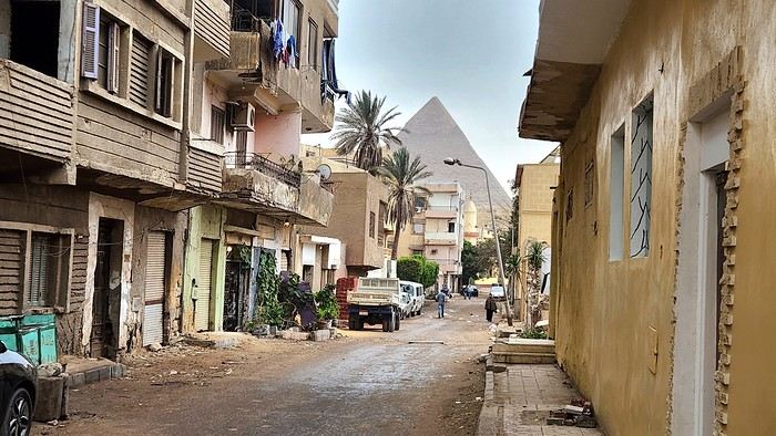
And the rest of the afternoon, spent rubbing shoulders with locals, only confirmed this vibe. After digesting our pyramid view, we dove into the hustle and bustle of our neighborhood with the goal of exchanging money, eating at street stalls, and testing the hospitality of the locals. Ten out of ten!
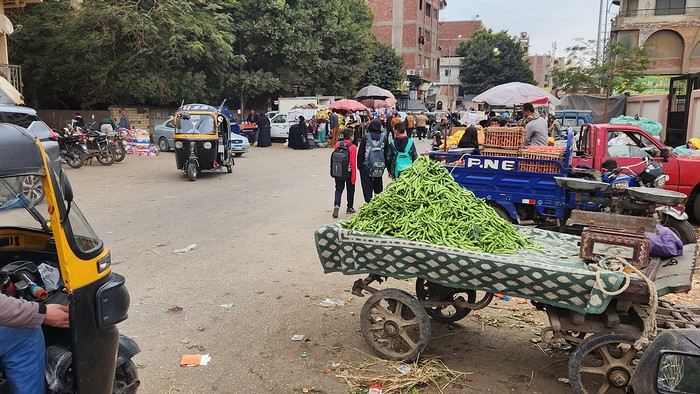
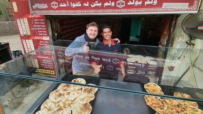
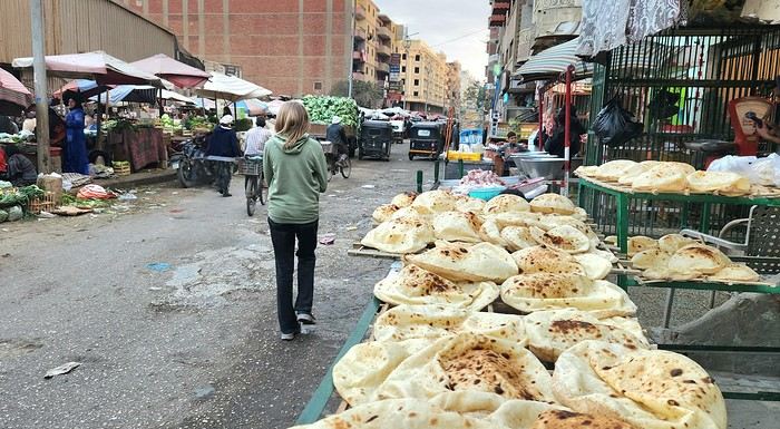
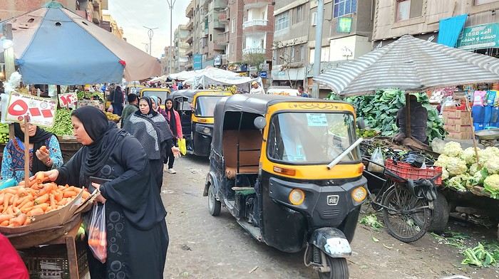
Eight little sun breads with baba ganoush and falafel? 80 pounds, or 1.5 €. A dozen Middle Eastern pastries? Same! 80 pounds! Two hawawshis, those little pita breads stuffed with meat and spices? 10 pounds each, or about twenty cents! Not to mention all those smiles and free "welcomes" left and right!!!
What a welcome! We end this first day with a sunset over the three sisters of Giza—where we’ll obviously be gawking tomorrow...
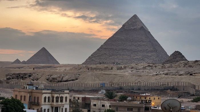
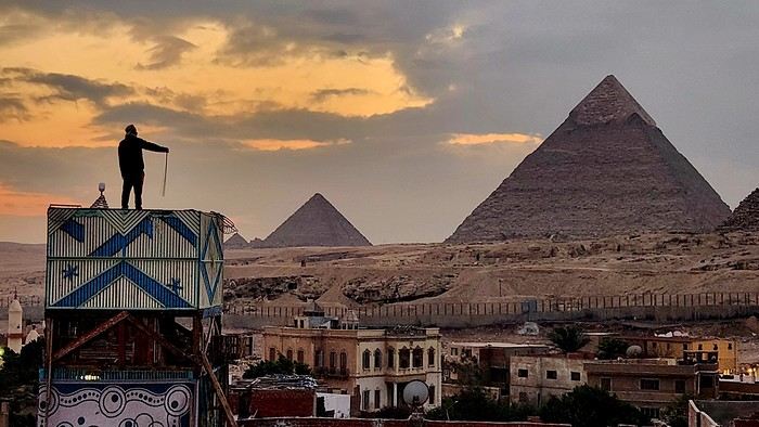
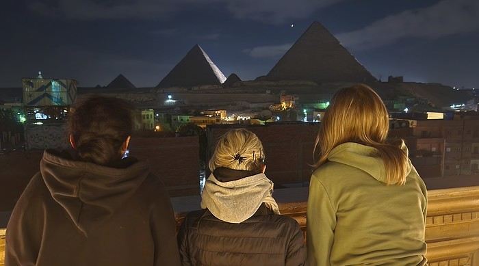
https://voyageforum.com/images/posts/small/1789072399-cCyLDYuFwPLAZTY.jpg
"So, my little wanderers, back at the decks? What’s this mystery destination you’ve got in store for us at the start of the year?"
Yes, the schoolyard bell’s ringing again! We’re hitting the road... or rather, the skies! At first glance, our destination might surprise more than a few. First off, simply because I was here exactly twenty years ago, and I don’t usually like retracing my own footsteps. Secondly, because the name of this place screams mass tourism—basically the opposite of what Flo and I look for.
Despite that, in this land of backsheesh, I’d promised myself I’d come back one day to experience it my way. And since Flo told me, during our wanderer chats, that this destination straddling Africa and the Middle East was in her top 2 travel dreams, the stars aligned for this roots-style trip to quickly make it onto our pharaonic festivities program! Unless you’re totally clueless in general knowledge, you’ve probably guessed by now—we’re off to Egypt! Of course, a few classics will be on our itinerary, but above all, we want to soak up a culture that can’t be appreciated in four-star resorts or on a Nile cruise boat. And let’s be clear, these next two weeks won’t be a walk in the park—neither for our two daughters who are joining us, nor for our bodies!
And that’s clear from the get-go: after our first flight, eight hours of trying (and failing) to sleep on Milan airport’s metal seats, our second flight, landing, passport stamps, our Uber ride, and our first Cairo kilometers, we finally drop our exhaustion at the little guesthouse we booked in Giza. Doesn’t all that energy deserve a little reward?
Oh, absolutely! And here it is: a full-on slap in the face for everyone! But just look at this view from our hotel terrace? For 20 € a night for four, even with this incredible view, I figured the room must be pretty shabby, right? Nope... Is the staff rude, then? Nope... Okay, so what’s the catch? You’re gonna tell me breakfast is included too? Well, yes! Honestly, this Egypt trip is off to a great start.
And the rest of the afternoon, spent rubbing shoulders with locals, only confirmed this vibe. After digesting our pyramid view, we dove into the hustle and bustle of our neighborhood with the goal of exchanging money, eating at street stalls, and testing the hospitality of the locals. Ten out of ten!
Eight little sun breads with baba ganoush and falafel? 80 pounds, or 1.5 €. A dozen Middle Eastern pastries? Same! 80 pounds! Two hawawshis, those little pita breads stuffed with meat and spices? 10 pounds each, or about twenty cents! Not to mention all those smiles and free "welcomes" left and right!!!
What a welcome! We end this first day with a sunset over the three sisters of Giza—where we’ll obviously be gawking tomorrow...
https://voyageforum.com/images/posts/small/1789072399-cCyLDYuFwPLAZTY.jpg
This trip is a more budget-friendly—and shorter—alternative to the 14-day Aranui 5 cruise, which includes a few days at sea and a detour to Bora Bora in the Leeward Islands on the way back. The advantage of the cruise is that it lets you see and visit (though far too quickly) the two islands of Tahuata and Fatu Hiva, which don’t have airports. By plane, you’ll only be able to land on 4 of the 6 islands. However, Tahuata is accessible from Hiva Oa via a day trip (or two-day trip) shuttle. Plan for two extra days in your total time dedicated to the Marquesas Islands (called *Fenua Enata* in Marquesan language).
Our itinerary is perfect for those who aren’t excited by cruises and prefer to get closer to the local communities. This 9-day trip cost us around 2500 € all-inclusive. For a 14-day cruise on the Aranui, expect to pay 2300 € per person for a basic cabin for four, or 3800 € per person for a superior double cabin.
Air Tahiti offers a 4-island Marquesas Pass (Nuku Hiva, Ua Pou, Ua Huka, and Hiva Oa) for 86,000 XPF (about 700 €). The journey is made on an ATR 72 from Tahiti to Nuku Hiva or Hiva Oa, and on a 19-seat Twin Otter between the islands (often only 13 or 15 seats are available due to cargo, so book well in advance). We’re traveling as a couple. We booked our family-run guesthouse stays at the Tourism Fair in early February, where you can meet the owners and make your choice. Stays are almost always half-board or breakfast-only. Transfers are usually included, but you can always book a car or taxi.
**NUKU HIVA**
**A LITTLE GEOGRAPHY** Nuku Hiva (NH) is located about 1,500 km from Tahiti, in the north of French Polynesia. At 387 km², it’s the second-largest island in French Polynesia after Tahiti. It was formed by incredible volcanic phenomena and cataclysms between 1 and 6 million years ago, which lifted the island thousands of meters above the sea. Even after millennia of slow erosion, collapses, and settling, NH remains the most majestic of the Marquesas, with its sheer cliffs, deep valleys featuring immense waterfalls, and black walls that were once the inner walls of enormous volcanoes.
**A LITTLE HISTORY** The first contact between NH’s inhabitants and Europeans was in 1595 with Spanish navigators who only stayed briefly. It wasn’t until the late 18th century that Europeans arrived in greater numbers on NH (and the other Marquesas Islands), disrupting a very fragile social and cultural balance. It’s believed that nearly 100,000 people lived on Nuku Hiva at that time—a population decimated over the decades by epidemics, diseases brought by Europeans, and alcohol used for barter. The disastrous result: by the 1930s, only 2,500 people remained, having largely lost their identity and living in poverty. Today, the island has about 2,600 inhabitants spread across several villages, with Taiohae as the main one.
**NUKU HIVA IN LITERATURE**
1 / One of the famous writers who visited NH and stayed there was Herman Melville, who arrived in July 1842, the author of *Moby Dick*. The island had just come under French protectorate. Seduced by the enchanting *vahinés* and dazzled by his paradisiacal vision of the place, Melville deserted his ship. He ended up a prisoner of a local tribe, the Taipi, in Taipivai, where he stayed for a month and a half until an Australian ship captain secured his release in exchange for a musket and a roll of cotton fabric! Melville wrote a novel about this tumultuous episode in his life, considered a classic of travel literature. The book, *Typee: A Peep at Polynesian Life*, published in 1846 in the United States, was a huge success.
2 / Another famous Scottish writer, Robert Louis Stevenson, arrived in NH aboard a yacht that anchored in Anaho Bay, the island’s most beautiful, in July 1888. Stevenson was already known for two magnificent novels that marked their era: *Treasure Island* and *Dr. Jekyll & Mr. Hyde*. Stevenson, too, was captivated by the island’s natural beauty, though he also noted the devastating decline in identity, socio-cultural life, and physical health of a population ravaged by disease and alcohol. His account of his stay, *In the South Seas: An Account of Experiences and Observations in the Marquesas, Paumotus, and Gilbert Islands During Two Cruises on the Yacht Casco (1888) and the Schooner Equator (1889)*, was published in 1896 in New York, four years after his death in Apia, Western Samoa, where he had settled. It was also published in London in 1900.
3 / In August 1903, Victor Segalen, a French naval doctor, ethnologist, and archaeologist, landed in NH from the ship *La Durance*, sent to Polynesia to recover the possessions of the painter Paul Gauguin, who had died in April of that year. He, too, was enthralled by the Marquesas but lamented the loss of identity, dignity, and pride of the Māori, alienated by a Christianization that destroyed their culture and customs, denied their gods, and erased their past. He wrote about his experience, doubts, and fears in *Les Immémoriaux*.
4 / In December 1907, Jack London arrived in NH aboard the sailboat *Stark*, following in the footsteps of his illustrious predecessor, Herman Melville. London was in poor physical condition, exhausted from his relentless travels that had taken him from the Klondike in Canada to Japan, Australia, and London in Europe. He was appalled and shocked by Nuku Hiva’s degraded health situation: where Melville had encountered over 2,000 vigorous and healthy Marquesan warriors, London found only 12 suffering from various diseases—the rest had been wiped out by tuberculosis! His approach remained humanistic, and he maintained a sharp geopolitical awareness of these traditional Polynesian cultures, weakened by the inexorable advance of modernity in the early 20th century. He continued his journey to the Tuamotu Islands and Tahiti, publishing *Martin Eden*, the moving account of his initiatory voyage in the South Pacific, in 1911.
5 / Finally, Alain Gerbault, a writer, linguist, ethnologist, and tireless traveler, arrived in the Marquesas via the Panama Canal in December 1933. He was completely exhausted after an endless crossing on a small sailboat, the *Firecrest*. Enthralled by his stay in the Marquesas, he continued to the Tuamotu Islands in 1934, then Tahiti in 1935. Gerbault fought for the preservation of traditions, as well as the songs and dances banned by the Churches and the French Administration (these bans lasted over 50 years, mind you...!!!). Bora Bora remained his favorite island. A staunch Pétainist during World War II, he was forced to flee Bora Bora for Samoa, then Tonga, and finally Timor, a half-Portuguese island and thus neutral during the war. His travel accounts, *In Pursuit of the Sun: Logbook from New York to Tahiti* and *A Paradise Is Dying*, were published in the late 1940s. He died in Timor in 1941, and his ashes were repatriated to Bora Bora.
Back to our trip and stay.
**Day 1: April 27**
Departure from Papeete at 6:30 AM—we had to wake up two hours earlier and reach the airport in the dark. Takeoff at dawn, good weather en route, flight duration: 4 hours.
Arrival around 10:30 AM in Nuku Hiva, the first stop of this trip. We booked two nights in half-board at Pension Koku’u, transfers included. Maybe not such a great idea, those included transfers, especially on this unique island where the airport is located on *Terre Déserte*, on the other side of the mountain, opposite and about 45 km from the main village of Taiohae. They’re charged at a steep price. Expect 6,000 XPF round-trip by taxi, but 15,000 XPF charged by guesthouses or hotels. The difference is notable. It wasn’t the best idea, but we can’t go back. Even for residents like us who know how to travel in Polynesia, the Air Tahiti employee who sold me the Pass couldn’t give any useful advice about the stay itself—probably because he’d never been to the Marquesas. It’s really annoying! In short, the good idea to remember is renting a car (like a Suzuki) to be free to manage your time and stop at leisure. The road signage is a bit basic, but you’ll manage just fine. Our host Alvane waits for us—without a sign (sic!)—and after searching for each other for 5 minutes, we’re off on a journey of over an hour (with photo stops) in a Land Rover with smooth tires (luckily, it’s not raining!). The recently paved and marked mountain road is impeccable. No time to catch our breath at the guesthouse; we leave immediately (not a great idea after waking up at dawn plus 4 hours on a plane) for a half-day hike that was also included in the prepaid stay. A sandwich was provided (really pathetic for the physical effort required), we have water, and we fill a few bottles at the spring near the ceremonial site of Taipivai, our first stop. Then the hike begins in the Hanaheu Valley, descending toward Anaho Bay and its namesake beach. A magnificent and wild spot, a few sailboats anchored, we swim—the water is really warm, over 30°C at the shore. That warm is rare and not necessarily pleasant. We then have to climb a very steep slope; this hike is actually quite tough. The air is still, humid, and stifling under the foliage, there’s a bit of mud, and tiny ants (which don’t bite, I’ll have you know), locally called *fofolles*, running over shoes, ankles, and calves. Not very pleasant...! On top of that, there are mosquitoes to protect against! In hindsight, it seems wise to bring energy bars from Papeete if you plan to hike on the afternoon of your arrival day. We weren’t careful... Result: a moment of weakness for me and a hyperventilation attack climbing back up from Anaho Bay!!! We return to the guesthouse at night. There we find Claudine and her four children—Marquesan-style atmosphere, friendly and casual. We share family life. Very simple room with a bathroom, no mosquitoes, we can sleep with the window open, but the night will be noisy, as is often the case in Polynesia. Roosters are everywhere and don’t sleep, dogs bark or whine. So we end up waking up early... like everyone else.
**Day 2: April 28**
We booked a full-day excursion with Thierry: it starts with a 45-minute boat ride to reach Hakatea Beach, hidden in a small secret bay like many along Nuku Hiva’s coasts. From there, the hike lasts all day—11 km round-trip on flat but also rugged terrain (ancient paved and elevated paths over 1,000 years old)—and river crossings. Bring the right shoes (like plastic Crocs with high socks—not very stylish but practical). We cross the former village of Hakaui, walk along the foundations of dwellings, and there are still weathered tikis in the lush vegetation. The ultimate goal of this hike is to reach the tall Vaipo waterfall. The place is magical, with openings in the vegetation and immense trees allowing photos of the treetops and caves where funeral canoes containing the bones of chiefs or great warriors were once placed. We return the same way to the beach and take another boat ride to reach Taihoae’s port. Back at the guesthouse after a glimpse of Taihoae’s waterfront.
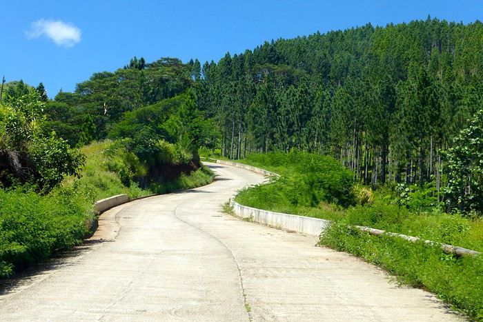
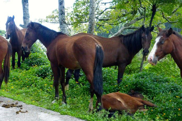
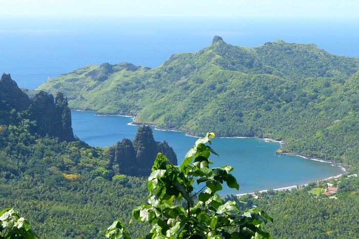
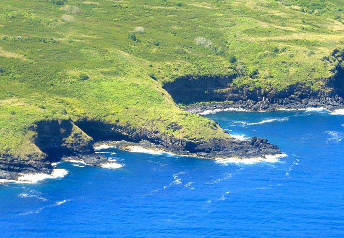
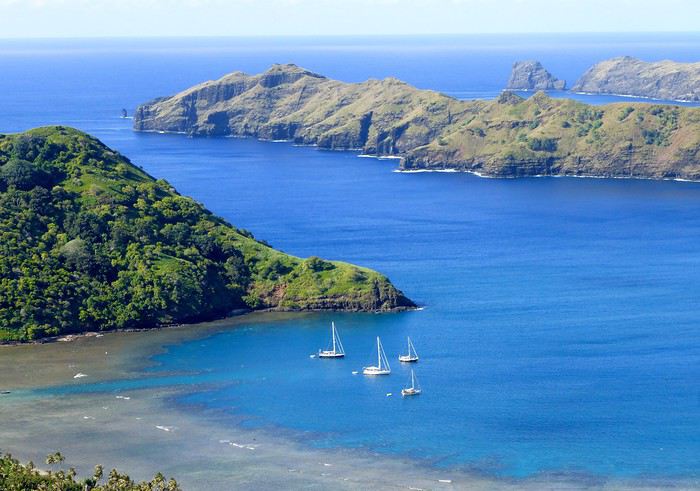
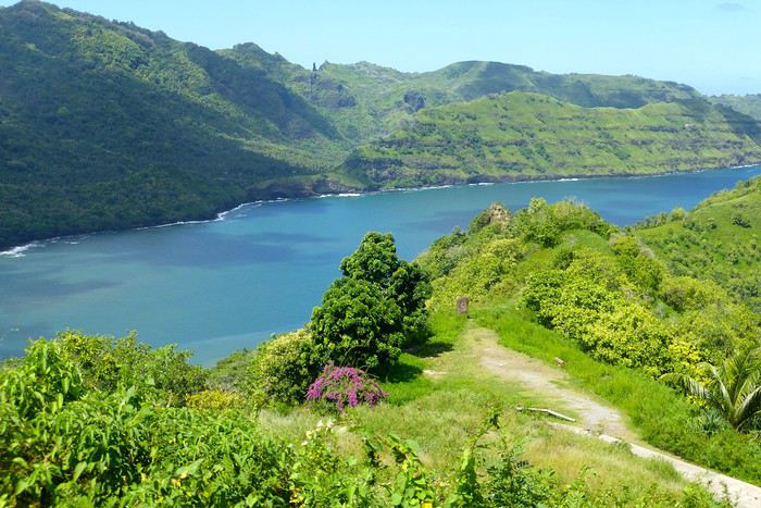
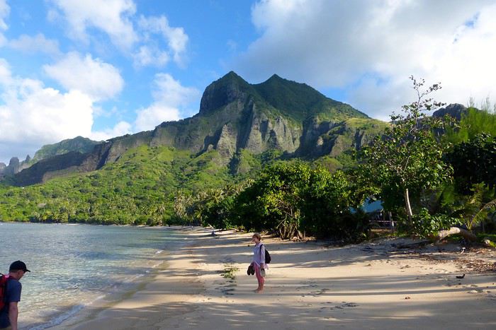
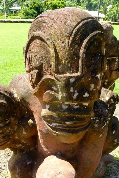
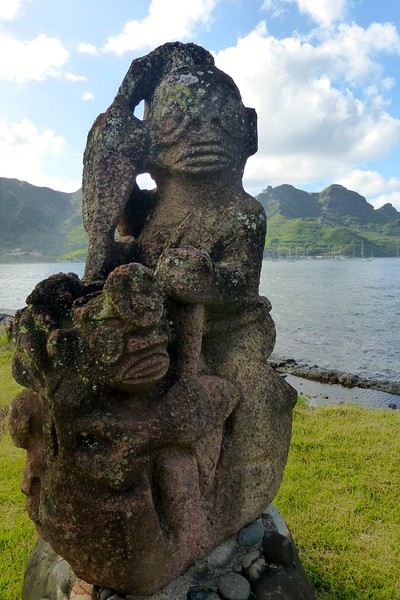
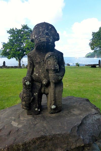
**UA POU**
**Day 3: April 29**
Back to the airport in the late morning for the second flight of the trip to Ua Pou. 20-minute crossing in a Twin Otter (18 seats but only 13 occupied due to cargo between the islands). Beautiful weather, blue sea, nice photos to take upon departure from NH and arrival in UP. We’re greeted by Jérôme, a former military man turned tourism professional, who runs Pension Pukue’e with his wife Elisa, a native of UP. We’re in for two exceptional days. The guesthouse is comfortable, Jérôme and Elisa are very professional and pleasant. Jérôme is also a professional hiker, and Elisa is an excellent cook. We leave quickly for a half-day excursion to Hohoi, after a stop at the archaeological, cultural, and religious site of Maui’a, the Tavaka tribe’s territory. Jérôme is there to explain how Marquesan society functioned at the time and the events that took place on a site still largely buried under vegetation. Then we visit a flower-stone sculptor he knows—the only place in the Marquesas where you’ll find these stones. They’re collected in the river flowing into the sea at Hohoi, sometimes on the beach itself. Back to the guesthouse.
**Day 4: April 30**
A nature hike in the mountains—moderately difficult—toward the Vaiea waterfall is on our program for a good 4 hours. It’s hot, there are mosquitoes, and the dip in the pool under the waterfall (24°C water) is a rare pleasure. Lunch at a friend of Jérôme’s, a former chef for French minister François Fillon, who prepares delicious food. Elisa picks us up by car to return to the guesthouse. Ua Pou is a beautiful and elegant island with its sharp peaks and wild nature. Our favorite, thanks to Jérôme and his wife.
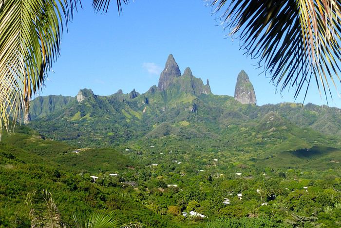
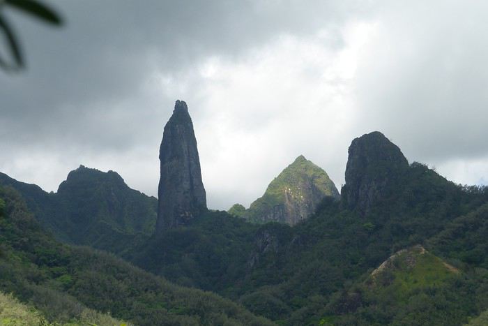
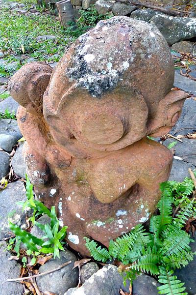
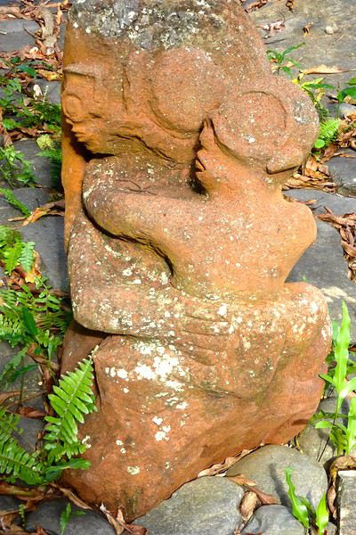
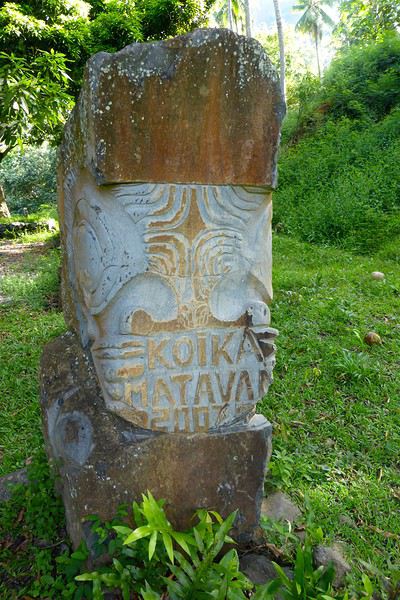
**UA HUKA**
**Day 4: May 1**
Departure for Ua Huka, the smallest inhabited island in the northern group of the Marquesas, located about 1,300 km northeast of Tahiti. Landing is at the oldest airfield in the Marquesas, built in 1972, between the villages of Vaipaee and Hane. Ua Huka has about 680 inhabitants, according to the last census, spread across 3 villages (since the 1870s): Vaipaee, Hane, and Hokatu. The island peaks at Mount Hitikau at only 884 meters. Its origin: a Hawaiian-type shield volcano that—over a few million years—collapsed to become a caldera (or elliptical depression) in which two small volcanoes appeared, the craters of Tahoatikiau and Teepoepo, now part of the Vaikivi Park. The island is rugged and wild, lower than the others, so less cloud-covered and drier. The bays are jagged, the coastline in ochre tones above the intense blue of the sea, and the beaches are constantly disturbed by the powerful surf. The village of Hokatu is only a few kilometers away (just 14 km of road on the island), but Maurice, our host, drives slowly, and it takes time to go up and down. The road is entirely paved or concreted, which isn’t the case on Ua Pou, for example. The guesthouse is disappointing, perched above the village and thus isolated. Beautiful view of the famous Hane motu and the sparkling sea under the bright sun. Apart from that, there are mosquitoes and cockroaches, the bungalow isn’t clean. Meals are taken with Maurice and Delphine in the village—fine dining isn’t on the menu! Ouch!!! We didn’t luck out...
**Day 5: May 2**
Early in the morning, after breakfast, Delphine takes us to the craft center, which turns out to be a letdown—the items for sale are, in my opinion, crude and poorly carved. Nothing like what’s offered at the Marquesas Fair, held twice a year in Papeete, where you can admire and buy small wonders: wood carvings, flower stone, and coral. Delphine is disappointed we’re not interested, and it shows... She’s a bit sulky! These are items meant for Aranui cruise passengers who land on Ua Huka once every two weeks... Solo travelers like us don’t seem to interest her much. The rest of the day—spent with Maurice—is dedicated to visiting cultural centers and small museums, like the Sea Museum in Hane with its ancient canoes, the municipal archaeological museum on the Te Tumu site above the airfield, the petroglyph house near Hokatu Beach, and finally the Papuakeikaraa arboretum, which gathers endemic plants from all over Polynesia and an impressive citrus collection. No excursion planned to Vaikivi Park, toward the previously mentioned craters that recall the island’s volcanic past. Also missing are the viewpoints, the unique endemic vegetation, and especially the petroglyphs. Too bad... at that price!!! Still, in the evening, we go fishing—with sandwiches and drinks in coolers—with other villagers from the dock at the end of the paved road. It’s cool, windy, no mosquitoes, lots of fish caught, and a great atmosphere. Plus, magnificently starry skies.
Ua Huka is one of the rare islands not invaded by the black rat, which has preserved its birdlife, particularly the ultramarine lorikeet (or *pihiti* in Marquesan), which feeds almost exclusively on flower nectar (banana, coconut, hibiscus, mango, guava trees). A dog imported from New Zealand has been specially trained to detect rats: it inspects cargo unloaded from boats and the docks.
I recommend spending two full days on the island—one for visiting the various museums, the other for hiking in the island’s center park, where the archaeological sites are in their raw state: foundations of agricultural terrace walls, gathering places (or *tohua*), dwelling pavements (or *paepae*), sacred sites (or *me’ae* in Marquesan, *marae* in Tahitian) with their tikis and petroglyphs.
To finish, a bit of info on the island’s name, tied to Marquesan oral culture: according to the legend of the creation of the six Marquesas Islands, Ua Huka is the one that puts the finishing touch on the construction of the god Oatea’s house, each island having a defined architectural function. Ua Huka represents the hole (*ua*) where the god deposits what’s left (*huka* in Marquesan) of the unused materials during construction.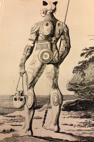
**HIVA OA**
**Day 6: May 3**
Departure in the late morning for Hiva Oa. Maurice—who had other things to do—dropped us off at the airfield 3 hours early... so this stop is a bit of a flop, even if we decided to stay positive! Hiva Oa is the third-largest island in French Polynesia after Tahiti and Nuku Hiva, and before Raiatea in the Leeward Islands. The island is beautiful, lush, verdant, and jagged. The mountains soar into the sky, the sea views are grand, the light is sublime—we’re lucky. Beautiful weather. Tania from Pension Kanahau waits for us at the airport. We’re in for two wonderful days with her. Tania is welcoming, smiling, and dynamic. What a pleasure to be with her, at her place—she cooks divinely and serves the best tuna in the world (the Big Eye reserved for the Japanese) and croquettes made with lobster, shrimp, and crab with breadfruit cubes, for example. Comfortable bungalow, no mosquitoes at night, we can sleep with the window open. It’s fantastic! After settling in, Tania takes us to town in Atuona, a pleasant and well-laid-out little village. We start with lunch—a delicious raw fish in coconut milk—then continue with the must-see attractions: the Catholic cemetery where Paul Gauguin and Jacques Brel’s graves are, overlooking the town; the abandoned Protestant cemetery, reclaimed by the bush, with impressive Marquesan warrior tombs made of huge coral slabs and adorned with a tiki head (harder to find, as no one goes there... ask for directions!); the craft center; the Gauguin Museum (and the Jacques Brel Museum); and the waterfront. While we stroll peacefully, Tania organizes an excursion for the next day, May 4, a full day with Pifa O’Connor, a 36-year-old who knows his island inside out, is passionate about local history, and with whom we’ll hit it off.
**Day 7: May 4**
Pifa arrives at 8 AM sharp at the guesthouse, and we immediately buy sandwiches and water at a small supermarket in Atuona. First, we make a brief stop by the roadside at an unmarked spot, from which we descend a small path through dense vegetation leading to the famous smiling tiki—the only one of its kind in the Marquesas and Polynesia. The place is improbable, the tiki isn’t huge, but it’s beautiful and impressive. Then we’re off on the road that, dizzyingly, runs along and overlooks the island’s northern coast, at the edge of the ancient volcano. Few vehicles pass, the road—now a rocky track—is full of potholes, and we proceed slowly. (Note that this road has been fully paved since 2018.) The panoramas are majestic, with every shade of green against the blue sea. We stop again at the top of a cliff adorned with a huge stone, the *sacrifice stone*, from which young virgin girls were once thrown into the sea to appease angry gods. Another pause for lunch this time, at a small restaurant near the exceptional archaeological site of Puamau. We’ll experience the highlights of this trip during this excursion with our guide, Pifa, who spares no explanations. We discover, on a vast esplanade, the ceremonial complexes of Ta’a Oa and Meae Te I’Ipona, the latter featuring superb tikis, particularly the reclining tiki—or *Maki Taua Pepe*—representing Motherhood, a woman giving birth in a squatting position, as was often the case in many civilizations. Also notable is the *Takaii*, the largest tiki recorded in Polynesia to date. There’s also a huge stone with a now-blunt edge, on which the circumcision of chiefs’ and notables’ pre-adolescent sons was performed. A tough ordeal! But that’s not all! It seems there are more on the mountainside rising steeply behind the archaeological site—overturned tikis, platforms, and, apparently, a giant tiki at the top, which must have fallen but was visible from afar on the sea 30 or 40 years ago, according to the island’s elders. This meeting, worship, and living place—it was actually a small town—is immense. Thousands of people once lived in this part of the island. The site—a religious, social, and cultural sanctuary—would be the size of the largest Mayan sites in Yucatán, but the few concerned owners—two or three families who own the mountainside—don’t want to hear about intensive clearing or tree cutting for now. UNESCO rightly asks for some compliance efforts to grant special treatment to Hiva Oa in particular and the Marquesas in general. We’re not there yet, unfortunately, due to insurmountable local rigidities! This kind of attitude is quite typical in Polynesia: people are afraid to uncover *marae* buried under vegetation—they’re taboo and sometimes said to emit negative and deadly waves, so it’s better not to disturb or anger the ancient spirits or gods who might take revenge. The old religion is never far away in Polynesia, despite the successes of the missionaries.
We return to the guesthouse in the late afternoon. Last night in the Marquesas with Tania, who prepares a fine and delicious meal. Note that dinner costs 2,500 XPF per person.
**Day 8: May 5**
We take the plane as planned, via Nuku Hiva (short stopover). Arrival on time in Papeete.
May this travel journal inspire many of you to visit the Marquesas one day. It’s far, it’s expensive, it’s the trip of a lifetime—it’s unforgettable and unmissable.
Our itinerary is perfect for those who aren’t excited by cruises and prefer to get closer to the local communities. This 9-day trip cost us around 2500 € all-inclusive. For a 14-day cruise on the Aranui, expect to pay 2300 € per person for a basic cabin for four, or 3800 € per person for a superior double cabin.
Air Tahiti offers a 4-island Marquesas Pass (Nuku Hiva, Ua Pou, Ua Huka, and Hiva Oa) for 86,000 XPF (about 700 €). The journey is made on an ATR 72 from Tahiti to Nuku Hiva or Hiva Oa, and on a 19-seat Twin Otter between the islands (often only 13 or 15 seats are available due to cargo, so book well in advance). We’re traveling as a couple. We booked our family-run guesthouse stays at the Tourism Fair in early February, where you can meet the owners and make your choice. Stays are almost always half-board or breakfast-only. Transfers are usually included, but you can always book a car or taxi.
**NUKU HIVA**
**A LITTLE GEOGRAPHY** Nuku Hiva (NH) is located about 1,500 km from Tahiti, in the north of French Polynesia. At 387 km², it’s the second-largest island in French Polynesia after Tahiti. It was formed by incredible volcanic phenomena and cataclysms between 1 and 6 million years ago, which lifted the island thousands of meters above the sea. Even after millennia of slow erosion, collapses, and settling, NH remains the most majestic of the Marquesas, with its sheer cliffs, deep valleys featuring immense waterfalls, and black walls that were once the inner walls of enormous volcanoes.
**A LITTLE HISTORY** The first contact between NH’s inhabitants and Europeans was in 1595 with Spanish navigators who only stayed briefly. It wasn’t until the late 18th century that Europeans arrived in greater numbers on NH (and the other Marquesas Islands), disrupting a very fragile social and cultural balance. It’s believed that nearly 100,000 people lived on Nuku Hiva at that time—a population decimated over the decades by epidemics, diseases brought by Europeans, and alcohol used for barter. The disastrous result: by the 1930s, only 2,500 people remained, having largely lost their identity and living in poverty. Today, the island has about 2,600 inhabitants spread across several villages, with Taiohae as the main one.
**NUKU HIVA IN LITERATURE**
1 / One of the famous writers who visited NH and stayed there was Herman Melville, who arrived in July 1842, the author of *Moby Dick*. The island had just come under French protectorate. Seduced by the enchanting *vahinés* and dazzled by his paradisiacal vision of the place, Melville deserted his ship. He ended up a prisoner of a local tribe, the Taipi, in Taipivai, where he stayed for a month and a half until an Australian ship captain secured his release in exchange for a musket and a roll of cotton fabric! Melville wrote a novel about this tumultuous episode in his life, considered a classic of travel literature. The book, *Typee: A Peep at Polynesian Life*, published in 1846 in the United States, was a huge success.
2 / Another famous Scottish writer, Robert Louis Stevenson, arrived in NH aboard a yacht that anchored in Anaho Bay, the island’s most beautiful, in July 1888. Stevenson was already known for two magnificent novels that marked their era: *Treasure Island* and *Dr. Jekyll & Mr. Hyde*. Stevenson, too, was captivated by the island’s natural beauty, though he also noted the devastating decline in identity, socio-cultural life, and physical health of a population ravaged by disease and alcohol. His account of his stay, *In the South Seas: An Account of Experiences and Observations in the Marquesas, Paumotus, and Gilbert Islands During Two Cruises on the Yacht Casco (1888) and the Schooner Equator (1889)*, was published in 1896 in New York, four years after his death in Apia, Western Samoa, where he had settled. It was also published in London in 1900.
3 / In August 1903, Victor Segalen, a French naval doctor, ethnologist, and archaeologist, landed in NH from the ship *La Durance*, sent to Polynesia to recover the possessions of the painter Paul Gauguin, who had died in April of that year. He, too, was enthralled by the Marquesas but lamented the loss of identity, dignity, and pride of the Māori, alienated by a Christianization that destroyed their culture and customs, denied their gods, and erased their past. He wrote about his experience, doubts, and fears in *Les Immémoriaux*.
4 / In December 1907, Jack London arrived in NH aboard the sailboat *Stark*, following in the footsteps of his illustrious predecessor, Herman Melville. London was in poor physical condition, exhausted from his relentless travels that had taken him from the Klondike in Canada to Japan, Australia, and London in Europe. He was appalled and shocked by Nuku Hiva’s degraded health situation: where Melville had encountered over 2,000 vigorous and healthy Marquesan warriors, London found only 12 suffering from various diseases—the rest had been wiped out by tuberculosis! His approach remained humanistic, and he maintained a sharp geopolitical awareness of these traditional Polynesian cultures, weakened by the inexorable advance of modernity in the early 20th century. He continued his journey to the Tuamotu Islands and Tahiti, publishing *Martin Eden*, the moving account of his initiatory voyage in the South Pacific, in 1911.
5 / Finally, Alain Gerbault, a writer, linguist, ethnologist, and tireless traveler, arrived in the Marquesas via the Panama Canal in December 1933. He was completely exhausted after an endless crossing on a small sailboat, the *Firecrest*. Enthralled by his stay in the Marquesas, he continued to the Tuamotu Islands in 1934, then Tahiti in 1935. Gerbault fought for the preservation of traditions, as well as the songs and dances banned by the Churches and the French Administration (these bans lasted over 50 years, mind you...!!!). Bora Bora remained his favorite island. A staunch Pétainist during World War II, he was forced to flee Bora Bora for Samoa, then Tonga, and finally Timor, a half-Portuguese island and thus neutral during the war. His travel accounts, *In Pursuit of the Sun: Logbook from New York to Tahiti* and *A Paradise Is Dying*, were published in the late 1940s. He died in Timor in 1941, and his ashes were repatriated to Bora Bora.
Back to our trip and stay.
**Day 1: April 27**
Departure from Papeete at 6:30 AM—we had to wake up two hours earlier and reach the airport in the dark. Takeoff at dawn, good weather en route, flight duration: 4 hours.
Arrival around 10:30 AM in Nuku Hiva, the first stop of this trip. We booked two nights in half-board at Pension Koku’u, transfers included. Maybe not such a great idea, those included transfers, especially on this unique island where the airport is located on *Terre Déserte*, on the other side of the mountain, opposite and about 45 km from the main village of Taiohae. They’re charged at a steep price. Expect 6,000 XPF round-trip by taxi, but 15,000 XPF charged by guesthouses or hotels. The difference is notable. It wasn’t the best idea, but we can’t go back. Even for residents like us who know how to travel in Polynesia, the Air Tahiti employee who sold me the Pass couldn’t give any useful advice about the stay itself—probably because he’d never been to the Marquesas. It’s really annoying! In short, the good idea to remember is renting a car (like a Suzuki) to be free to manage your time and stop at leisure. The road signage is a bit basic, but you’ll manage just fine. Our host Alvane waits for us—without a sign (sic!)—and after searching for each other for 5 minutes, we’re off on a journey of over an hour (with photo stops) in a Land Rover with smooth tires (luckily, it’s not raining!). The recently paved and marked mountain road is impeccable. No time to catch our breath at the guesthouse; we leave immediately (not a great idea after waking up at dawn plus 4 hours on a plane) for a half-day hike that was also included in the prepaid stay. A sandwich was provided (really pathetic for the physical effort required), we have water, and we fill a few bottles at the spring near the ceremonial site of Taipivai, our first stop. Then the hike begins in the Hanaheu Valley, descending toward Anaho Bay and its namesake beach. A magnificent and wild spot, a few sailboats anchored, we swim—the water is really warm, over 30°C at the shore. That warm is rare and not necessarily pleasant. We then have to climb a very steep slope; this hike is actually quite tough. The air is still, humid, and stifling under the foliage, there’s a bit of mud, and tiny ants (which don’t bite, I’ll have you know), locally called *fofolles*, running over shoes, ankles, and calves. Not very pleasant...! On top of that, there are mosquitoes to protect against! In hindsight, it seems wise to bring energy bars from Papeete if you plan to hike on the afternoon of your arrival day. We weren’t careful... Result: a moment of weakness for me and a hyperventilation attack climbing back up from Anaho Bay!!! We return to the guesthouse at night. There we find Claudine and her four children—Marquesan-style atmosphere, friendly and casual. We share family life. Very simple room with a bathroom, no mosquitoes, we can sleep with the window open, but the night will be noisy, as is often the case in Polynesia. Roosters are everywhere and don’t sleep, dogs bark or whine. So we end up waking up early... like everyone else.
**Day 2: April 28**
We booked a full-day excursion with Thierry: it starts with a 45-minute boat ride to reach Hakatea Beach, hidden in a small secret bay like many along Nuku Hiva’s coasts. From there, the hike lasts all day—11 km round-trip on flat but also rugged terrain (ancient paved and elevated paths over 1,000 years old)—and river crossings. Bring the right shoes (like plastic Crocs with high socks—not very stylish but practical). We cross the former village of Hakaui, walk along the foundations of dwellings, and there are still weathered tikis in the lush vegetation. The ultimate goal of this hike is to reach the tall Vaipo waterfall. The place is magical, with openings in the vegetation and immense trees allowing photos of the treetops and caves where funeral canoes containing the bones of chiefs or great warriors were once placed. We return the same way to the beach and take another boat ride to reach Taihoae’s port. Back at the guesthouse after a glimpse of Taihoae’s waterfront.
**UA POU**
**Day 3: April 29**
Back to the airport in the late morning for the second flight of the trip to Ua Pou. 20-minute crossing in a Twin Otter (18 seats but only 13 occupied due to cargo between the islands). Beautiful weather, blue sea, nice photos to take upon departure from NH and arrival in UP. We’re greeted by Jérôme, a former military man turned tourism professional, who runs Pension Pukue’e with his wife Elisa, a native of UP. We’re in for two exceptional days. The guesthouse is comfortable, Jérôme and Elisa are very professional and pleasant. Jérôme is also a professional hiker, and Elisa is an excellent cook. We leave quickly for a half-day excursion to Hohoi, after a stop at the archaeological, cultural, and religious site of Maui’a, the Tavaka tribe’s territory. Jérôme is there to explain how Marquesan society functioned at the time and the events that took place on a site still largely buried under vegetation. Then we visit a flower-stone sculptor he knows—the only place in the Marquesas where you’ll find these stones. They’re collected in the river flowing into the sea at Hohoi, sometimes on the beach itself. Back to the guesthouse.
**Day 4: April 30**
A nature hike in the mountains—moderately difficult—toward the Vaiea waterfall is on our program for a good 4 hours. It’s hot, there are mosquitoes, and the dip in the pool under the waterfall (24°C water) is a rare pleasure. Lunch at a friend of Jérôme’s, a former chef for French minister François Fillon, who prepares delicious food. Elisa picks us up by car to return to the guesthouse. Ua Pou is a beautiful and elegant island with its sharp peaks and wild nature. Our favorite, thanks to Jérôme and his wife.
**UA HUKA**
**Day 4: May 1**
Departure for Ua Huka, the smallest inhabited island in the northern group of the Marquesas, located about 1,300 km northeast of Tahiti. Landing is at the oldest airfield in the Marquesas, built in 1972, between the villages of Vaipaee and Hane. Ua Huka has about 680 inhabitants, according to the last census, spread across 3 villages (since the 1870s): Vaipaee, Hane, and Hokatu. The island peaks at Mount Hitikau at only 884 meters. Its origin: a Hawaiian-type shield volcano that—over a few million years—collapsed to become a caldera (or elliptical depression) in which two small volcanoes appeared, the craters of Tahoatikiau and Teepoepo, now part of the Vaikivi Park. The island is rugged and wild, lower than the others, so less cloud-covered and drier. The bays are jagged, the coastline in ochre tones above the intense blue of the sea, and the beaches are constantly disturbed by the powerful surf. The village of Hokatu is only a few kilometers away (just 14 km of road on the island), but Maurice, our host, drives slowly, and it takes time to go up and down. The road is entirely paved or concreted, which isn’t the case on Ua Pou, for example. The guesthouse is disappointing, perched above the village and thus isolated. Beautiful view of the famous Hane motu and the sparkling sea under the bright sun. Apart from that, there are mosquitoes and cockroaches, the bungalow isn’t clean. Meals are taken with Maurice and Delphine in the village—fine dining isn’t on the menu! Ouch!!! We didn’t luck out...
**Day 5: May 2**
Early in the morning, after breakfast, Delphine takes us to the craft center, which turns out to be a letdown—the items for sale are, in my opinion, crude and poorly carved. Nothing like what’s offered at the Marquesas Fair, held twice a year in Papeete, where you can admire and buy small wonders: wood carvings, flower stone, and coral. Delphine is disappointed we’re not interested, and it shows... She’s a bit sulky! These are items meant for Aranui cruise passengers who land on Ua Huka once every two weeks... Solo travelers like us don’t seem to interest her much. The rest of the day—spent with Maurice—is dedicated to visiting cultural centers and small museums, like the Sea Museum in Hane with its ancient canoes, the municipal archaeological museum on the Te Tumu site above the airfield, the petroglyph house near Hokatu Beach, and finally the Papuakeikaraa arboretum, which gathers endemic plants from all over Polynesia and an impressive citrus collection. No excursion planned to Vaikivi Park, toward the previously mentioned craters that recall the island’s volcanic past. Also missing are the viewpoints, the unique endemic vegetation, and especially the petroglyphs. Too bad... at that price!!! Still, in the evening, we go fishing—with sandwiches and drinks in coolers—with other villagers from the dock at the end of the paved road. It’s cool, windy, no mosquitoes, lots of fish caught, and a great atmosphere. Plus, magnificently starry skies.
Ua Huka is one of the rare islands not invaded by the black rat, which has preserved its birdlife, particularly the ultramarine lorikeet (or *pihiti* in Marquesan), which feeds almost exclusively on flower nectar (banana, coconut, hibiscus, mango, guava trees). A dog imported from New Zealand has been specially trained to detect rats: it inspects cargo unloaded from boats and the docks.
I recommend spending two full days on the island—one for visiting the various museums, the other for hiking in the island’s center park, where the archaeological sites are in their raw state: foundations of agricultural terrace walls, gathering places (or *tohua*), dwelling pavements (or *paepae*), sacred sites (or *me’ae* in Marquesan, *marae* in Tahitian) with their tikis and petroglyphs.
To finish, a bit of info on the island’s name, tied to Marquesan oral culture: according to the legend of the creation of the six Marquesas Islands, Ua Huka is the one that puts the finishing touch on the construction of the god Oatea’s house, each island having a defined architectural function. Ua Huka represents the hole (*ua*) where the god deposits what’s left (*huka* in Marquesan) of the unused materials during construction.
**HIVA OA**
**Day 6: May 3**
Departure in the late morning for Hiva Oa. Maurice—who had other things to do—dropped us off at the airfield 3 hours early... so this stop is a bit of a flop, even if we decided to stay positive! Hiva Oa is the third-largest island in French Polynesia after Tahiti and Nuku Hiva, and before Raiatea in the Leeward Islands. The island is beautiful, lush, verdant, and jagged. The mountains soar into the sky, the sea views are grand, the light is sublime—we’re lucky. Beautiful weather. Tania from Pension Kanahau waits for us at the airport. We’re in for two wonderful days with her. Tania is welcoming, smiling, and dynamic. What a pleasure to be with her, at her place—she cooks divinely and serves the best tuna in the world (the Big Eye reserved for the Japanese) and croquettes made with lobster, shrimp, and crab with breadfruit cubes, for example. Comfortable bungalow, no mosquitoes at night, we can sleep with the window open. It’s fantastic! After settling in, Tania takes us to town in Atuona, a pleasant and well-laid-out little village. We start with lunch—a delicious raw fish in coconut milk—then continue with the must-see attractions: the Catholic cemetery where Paul Gauguin and Jacques Brel’s graves are, overlooking the town; the abandoned Protestant cemetery, reclaimed by the bush, with impressive Marquesan warrior tombs made of huge coral slabs and adorned with a tiki head (harder to find, as no one goes there... ask for directions!); the craft center; the Gauguin Museum (and the Jacques Brel Museum); and the waterfront. While we stroll peacefully, Tania organizes an excursion for the next day, May 4, a full day with Pifa O’Connor, a 36-year-old who knows his island inside out, is passionate about local history, and with whom we’ll hit it off.
**Day 7: May 4**
Pifa arrives at 8 AM sharp at the guesthouse, and we immediately buy sandwiches and water at a small supermarket in Atuona. First, we make a brief stop by the roadside at an unmarked spot, from which we descend a small path through dense vegetation leading to the famous smiling tiki—the only one of its kind in the Marquesas and Polynesia. The place is improbable, the tiki isn’t huge, but it’s beautiful and impressive. Then we’re off on the road that, dizzyingly, runs along and overlooks the island’s northern coast, at the edge of the ancient volcano. Few vehicles pass, the road—now a rocky track—is full of potholes, and we proceed slowly. (Note that this road has been fully paved since 2018.) The panoramas are majestic, with every shade of green against the blue sea. We stop again at the top of a cliff adorned with a huge stone, the *sacrifice stone*, from which young virgin girls were once thrown into the sea to appease angry gods. Another pause for lunch this time, at a small restaurant near the exceptional archaeological site of Puamau. We’ll experience the highlights of this trip during this excursion with our guide, Pifa, who spares no explanations. We discover, on a vast esplanade, the ceremonial complexes of Ta’a Oa and Meae Te I’Ipona, the latter featuring superb tikis, particularly the reclining tiki—or *Maki Taua Pepe*—representing Motherhood, a woman giving birth in a squatting position, as was often the case in many civilizations. Also notable is the *Takaii*, the largest tiki recorded in Polynesia to date. There’s also a huge stone with a now-blunt edge, on which the circumcision of chiefs’ and notables’ pre-adolescent sons was performed. A tough ordeal! But that’s not all! It seems there are more on the mountainside rising steeply behind the archaeological site—overturned tikis, platforms, and, apparently, a giant tiki at the top, which must have fallen but was visible from afar on the sea 30 or 40 years ago, according to the island’s elders. This meeting, worship, and living place—it was actually a small town—is immense. Thousands of people once lived in this part of the island. The site—a religious, social, and cultural sanctuary—would be the size of the largest Mayan sites in Yucatán, but the few concerned owners—two or three families who own the mountainside—don’t want to hear about intensive clearing or tree cutting for now. UNESCO rightly asks for some compliance efforts to grant special treatment to Hiva Oa in particular and the Marquesas in general. We’re not there yet, unfortunately, due to insurmountable local rigidities! This kind of attitude is quite typical in Polynesia: people are afraid to uncover *marae* buried under vegetation—they’re taboo and sometimes said to emit negative and deadly waves, so it’s better not to disturb or anger the ancient spirits or gods who might take revenge. The old religion is never far away in Polynesia, despite the successes of the missionaries.
We return to the guesthouse in the late afternoon. Last night in the Marquesas with Tania, who prepares a fine and delicious meal. Note that dinner costs 2,500 XPF per person.
**Day 8: May 5**
We take the plane as planned, via Nuku Hiva (short stopover). Arrival on time in Papeete.
May this travel journal inspire many of you to visit the Marquesas one day. It’s far, it’s expensive, it’s the trip of a lifetime—it’s unforgettable and unmissable.
This three-week trip to Namibia was a big first for us:
- Visiting a country in winter, for someone who starts feeling comfortable at 25°C (77°F).
- Camping, when we usually feel at home in a starred hotel.
- Sleeping on the roof of a car—what an idea... when a comfy bed is waiting just a bit further.
- Grocery shopping, cooking, doing the dishes... all the things we usually avoid to fully enjoy our vacation.
- Washing up when and how we can, when we can’t imagine going a day without a shower.
- Driving a big 4x4 on the left, with a manual transmission, when we usually opt for an automatic for more comfort.
Yep! You guessed it—we stepped way out of our comfort zone during this trip.
I had quite a few doubts while planning this adventure, but the more I read travel journals about Namibia, the more I wanted to go.
Personally, without this forum, I never would’ve dared to hit the Namibian roads in a 4x4. I was really anxious during the planning, so I want to thank everyone who contributed with their journals and forum discussions for helping me leave more peacefully.
At first, I wasn’t even considering sleeping in a tent. But after my husband’s persuasion—and my own curiosity to experience what I’d read in those travel journals—I gave in. So off we went in a double-cab Hilux with a rooftop tent.
And of course, let’s talk about me—the big cold-weather wimp. One of the biggest pre-trip challenges was choosing a sleeping bag. After a while, sleeping bags had no more secrets for me: temperature ratings (comfort, limit, extreme), shapes (mummy, rectangular), fillings (synthetic, down), compression rate, and weight... all these factors were a real puzzle. In the end, to make sure I wouldn’t be put off camping in winter (Australian winter, mind you), I went for a sleeping bag with a comfort rating of -10°C. And just to be *extra* sure I wouldn’t get cold, I bought a liner (never knew what that was before) in Thermolite, which boosts the sleeping bag’s temperature by 11°C. There are liners that add up to 15°C, but let’s not exaggerate—we’re not heading to the North Pole! My husband, on the other hand, got a sleeping bag with a -5°C comfort rating and a silk liner.
Was it enough? You’ll find out soon. In the meantime, another big thank you to everyone who helped me make this choice with their advice and experience.
Over a year in advance, we planned a three-week itinerary for our first trip to Namibia—classic route, nothing too out there. We chose to do the circuit clockwise because we wanted to finish on a high note in Etosha and its wildlife. They say it’s like Noah’s Ark out there! And why not, the cherry on top... some big cats.
We used Tourmaline’s services to book our accommodations and the 4x4.
Here’s our planned itinerary with campsites and lodgings—yes, there are a few solid roofs in there; we didn’t want to push it too far.
Day 1: Windhoek – Windhoek Gardens Guesthouse Day 2: Kalahari Anib Campsite Day 3: Namibrand Family Hideout Day 4: Sesriem Camp Day 5: Sesriem Camp Day 6: Rostock Ritz Camp Day 7: Swakopmund - Sea Breeze Guesthouse Day 8: Swakopmund - Sea Breeze Guesthouse Day 9: Spitzkoppe Camp Tented Day 10: Brandberg White Lady Campsite Day 11: Grootberg Lodge Day 12: Opuwo Country Campsite Day 13: Epupa Camp Day 14: Hobatere Lodge Day 15: Etosha Olifantsrus Camp Day 16: Etosha Okaukuejo Camp Day 17: Etosha Halali Camp Day 18: Etosha Namutoni Camp Day 19: Cheetah Eco Lodge Day 20: Windhoek – Londiningi B&B
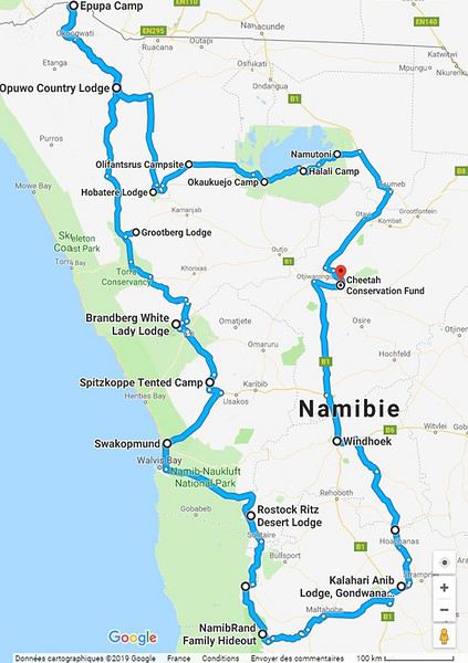
Alright! Are you ready to follow this adventure with us in our Hilux?
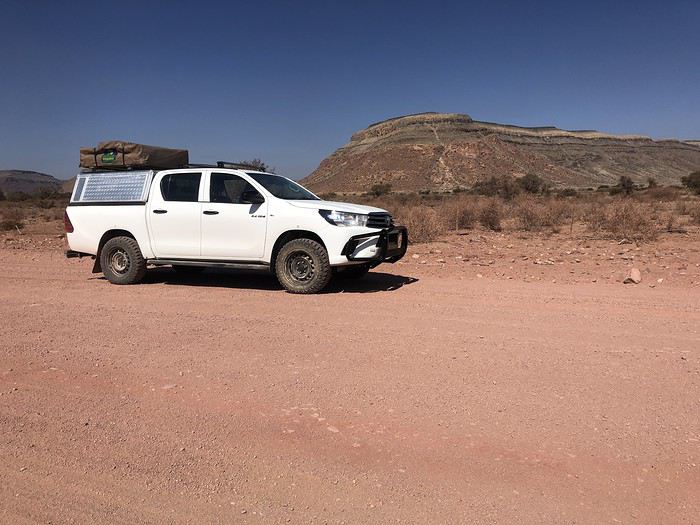
Yep! You guessed it—we stepped way out of our comfort zone during this trip.
I had quite a few doubts while planning this adventure, but the more I read travel journals about Namibia, the more I wanted to go.
Personally, without this forum, I never would’ve dared to hit the Namibian roads in a 4x4. I was really anxious during the planning, so I want to thank everyone who contributed with their journals and forum discussions for helping me leave more peacefully.
At first, I wasn’t even considering sleeping in a tent. But after my husband’s persuasion—and my own curiosity to experience what I’d read in those travel journals—I gave in. So off we went in a double-cab Hilux with a rooftop tent.
And of course, let’s talk about me—the big cold-weather wimp. One of the biggest pre-trip challenges was choosing a sleeping bag. After a while, sleeping bags had no more secrets for me: temperature ratings (comfort, limit, extreme), shapes (mummy, rectangular), fillings (synthetic, down), compression rate, and weight... all these factors were a real puzzle. In the end, to make sure I wouldn’t be put off camping in winter (Australian winter, mind you), I went for a sleeping bag with a comfort rating of -10°C. And just to be *extra* sure I wouldn’t get cold, I bought a liner (never knew what that was before) in Thermolite, which boosts the sleeping bag’s temperature by 11°C. There are liners that add up to 15°C, but let’s not exaggerate—we’re not heading to the North Pole! My husband, on the other hand, got a sleeping bag with a -5°C comfort rating and a silk liner.
Was it enough? You’ll find out soon. In the meantime, another big thank you to everyone who helped me make this choice with their advice and experience.
Over a year in advance, we planned a three-week itinerary for our first trip to Namibia—classic route, nothing too out there. We chose to do the circuit clockwise because we wanted to finish on a high note in Etosha and its wildlife. They say it’s like Noah’s Ark out there! And why not, the cherry on top... some big cats.
We used Tourmaline’s services to book our accommodations and the 4x4.
Here’s our planned itinerary with campsites and lodgings—yes, there are a few solid roofs in there; we didn’t want to push it too far.
Day 1: Windhoek – Windhoek Gardens Guesthouse Day 2: Kalahari Anib Campsite Day 3: Namibrand Family Hideout Day 4: Sesriem Camp Day 5: Sesriem Camp Day 6: Rostock Ritz Camp Day 7: Swakopmund - Sea Breeze Guesthouse Day 8: Swakopmund - Sea Breeze Guesthouse Day 9: Spitzkoppe Camp Tented Day 10: Brandberg White Lady Campsite Day 11: Grootberg Lodge Day 12: Opuwo Country Campsite Day 13: Epupa Camp Day 14: Hobatere Lodge Day 15: Etosha Olifantsrus Camp Day 16: Etosha Okaukuejo Camp Day 17: Etosha Halali Camp Day 18: Etosha Namutoni Camp Day 19: Cheetah Eco Lodge Day 20: Windhoek – Londiningi B&B
Alright! Are you ready to follow this adventure with us in our Hilux?
Hi everyone,
The idea of visiting Japan goes back a year now. I remember because I was looking for cheap flights to Europe from Paris. Surprisingly, the round-trip to Japan with Air China was just as affordable—if not cheaper—than many European destinations.
So, the tickets were booked. Three seats (including one for a 12-year-old), ten days over Easter 2018, AirBnB accommodation. Of course, in ten days, you visit without *really* visiting—you only scratch the surface. Just the classics: Kyoto, temples, moonlit rivers; the Shinkansen; and Tokyo, gardens, wandering, high-tech, and... maids.
I have to admit, we don’t know much about the country, and the thought of how we’d manage is a constant source of worry. What if this trip reveals my inability to open up to other cultures?
We board the first Air China flight with that question on our minds.
The idea of visiting Japan goes back a year now. I remember because I was looking for cheap flights to Europe from Paris. Surprisingly, the round-trip to Japan with Air China was just as affordable—if not cheaper—than many European destinations.
So, the tickets were booked. Three seats (including one for a 12-year-old), ten days over Easter 2018, AirBnB accommodation. Of course, in ten days, you visit without *really* visiting—you only scratch the surface. Just the classics: Kyoto, temples, moonlit rivers; the Shinkansen; and Tokyo, gardens, wandering, high-tech, and... maids.
I have to admit, we don’t know much about the country, and the thought of how we’d manage is a constant source of worry. What if this trip reveals my inability to open up to other cultures?
We board the first Air China flight with that question on our minds.
Hello everyone,
I’ve been to Morocco about fifteen times, but I’ve never posted a travel journal here on Voyage Forum. Why? I have no idea… Maybe because this section was so active, with lots of stories and photos. I thought sharing my adventures in *al Maghrib* wouldn’t be very original. Today, this space feels quieter, so what if I tried to give it a little life back, modestly? With some help…
This trip will be different. From the start of my relationship with Richard, I was determined to introduce him to *my* Morocco. But he was a bit reluctant… He’ll tell you about our 2022 meeting, and I’ll illustrate it with my photos, just like we did with our India travel journal.
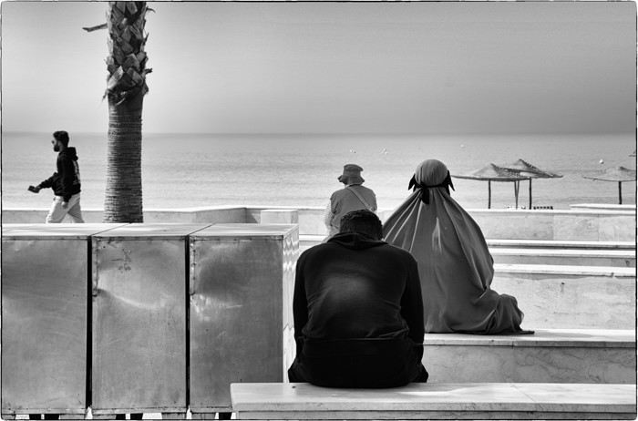
I’ve been to Morocco about fifteen times, but I’ve never posted a travel journal here on Voyage Forum. Why? I have no idea… Maybe because this section was so active, with lots of stories and photos. I thought sharing my adventures in *al Maghrib* wouldn’t be very original. Today, this space feels quieter, so what if I tried to give it a little life back, modestly? With some help…
This trip will be different. From the start of my relationship with Richard, I was determined to introduce him to *my* Morocco. But he was a bit reluctant… He’ll tell you about our 2022 meeting, and I’ll illustrate it with my photos, just like we did with our India travel journal.
Hi everyone,
I usually travel abroad in the summer, but given the circumstances, I think this year I’ll be staying in France. I’d love to know which places you’d recommend for the most stunning mountain landscapes and the best hikes.
Thanks in advance for your help!
😉
I usually travel abroad in the summer, but given the circumstances, I think this year I’ll be staying in France. I’d love to know which places you’d recommend for the most stunning mountain landscapes and the best hikes.
Thanks in advance for your help!
😉
IRELAND - INTRODUCTION
We planned our 15-day trip to Ireland several months in advance to create an itinerary that would let us see a multitude of tourist attractions across various regions of the Republic of Ireland and Northern Ireland.
We researched the main attractions in each region and noted their GPS coordinates.
After that, we used Google Maps to create a packed but realistic daily route. We printed all the itineraries, and they proved extremely useful since some attractions weren’t listed on the GPS a friend lent us, and some roads aren’t clearly marked.
This way, we were able to stick to our daily schedule.
Three months before our departure, we rented a car directly from Autoescape’s website for 136.44 € over 14 days. The rental was with BUDGET, and the car we got was a ŠKODA Citigo.
This rate includes unlimited mileage, collision damage waiver (CDW), theft protection (TP) with a 1,500 € excess, and unlimited third-party liability coverage.
Some roads in Ireland are very narrow, so a compact car is much appreciated. Don’t forget that driving is on the left, and there are plenty of roundabouts.
Luckily, my partner finds driving this way easy, and our travels went smoothly.
It’s worth mentioning how courteous and patient Irish drivers are—it’s truly phenomenal.
Two weeks before our trip, we booked our accommodations at various places like B&Bs, hotels, and university campuses through Hotels.com. We’ll talk more about each of them later.
When we arrived at Dublin Airport, going through customs was quite tedious. There are two lines: one for EU citizens and another for other foreigners. The wait for non-EU travelers is significantly longer.
The car rental isn’t directly at the terminal. You have to take a shuttle to the rental center. Once there, a company representative finalizes the contract and hands over the keys to our rental car.
And off we went on our adventure!
It’s also important to note that some roads have tolls. For most of them, you pay directly at a toll booth, and the fees are usually under 2 €.
However, the M50 motorway around Dublin works differently—it’s a prepaid toll. You’re charged when you drive between Junction 6 (N3 Blanchardstown) and Junction 7 (N4 Lucan). A large purple sign warns you as you approach one of these junctions.
Cameras automatically record your license plate, and fees are applied based on your vehicle category. For a standard car, the fee is 3.10 €.
You have until 8:00 PM the next day to pay at an authorized retailer or online at https://www.eflow.ie/.
We prepaid these fees directly on the site mentioned above.
If you don’t pay within the required time, you’ll be charged substantial penalties.
For dining, most grocery stores and gas stations offer a great selection of hot and cold meals at very reasonable prices. That’s why we mostly bought our food at places like SuperValu, Lidl, Spar, and Centra.
We invite you to keep reading about our adventure in the next section.
We planned our 15-day trip to Ireland several months in advance to create an itinerary that would let us see a multitude of tourist attractions across various regions of the Republic of Ireland and Northern Ireland.
We researched the main attractions in each region and noted their GPS coordinates.
After that, we used Google Maps to create a packed but realistic daily route. We printed all the itineraries, and they proved extremely useful since some attractions weren’t listed on the GPS a friend lent us, and some roads aren’t clearly marked.
This way, we were able to stick to our daily schedule.
Three months before our departure, we rented a car directly from Autoescape’s website for 136.44 € over 14 days. The rental was with BUDGET, and the car we got was a ŠKODA Citigo.
This rate includes unlimited mileage, collision damage waiver (CDW), theft protection (TP) with a 1,500 € excess, and unlimited third-party liability coverage.
Some roads in Ireland are very narrow, so a compact car is much appreciated. Don’t forget that driving is on the left, and there are plenty of roundabouts.
Luckily, my partner finds driving this way easy, and our travels went smoothly.
It’s worth mentioning how courteous and patient Irish drivers are—it’s truly phenomenal.
Two weeks before our trip, we booked our accommodations at various places like B&Bs, hotels, and university campuses through Hotels.com. We’ll talk more about each of them later.
When we arrived at Dublin Airport, going through customs was quite tedious. There are two lines: one for EU citizens and another for other foreigners. The wait for non-EU travelers is significantly longer.
The car rental isn’t directly at the terminal. You have to take a shuttle to the rental center. Once there, a company representative finalizes the contract and hands over the keys to our rental car.
And off we went on our adventure!
It’s also important to note that some roads have tolls. For most of them, you pay directly at a toll booth, and the fees are usually under 2 €.
However, the M50 motorway around Dublin works differently—it’s a prepaid toll. You’re charged when you drive between Junction 6 (N3 Blanchardstown) and Junction 7 (N4 Lucan). A large purple sign warns you as you approach one of these junctions.
Cameras automatically record your license plate, and fees are applied based on your vehicle category. For a standard car, the fee is 3.10 €.
You have until 8:00 PM the next day to pay at an authorized retailer or online at https://www.eflow.ie/.
We prepaid these fees directly on the site mentioned above.
If you don’t pay within the required time, you’ll be charged substantial penalties.
For dining, most grocery stores and gas stations offer a great selection of hot and cold meals at very reasonable prices. That’s why we mostly bought our food at places like SuperValu, Lidl, Spar, and Centra.
We invite you to keep reading about our adventure in the next section.