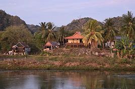
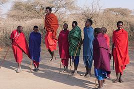
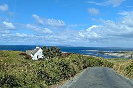
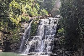
I could just as easily have written white as marble, white as salt, white as coconut milk...
This month’s theme is white in every way imaginable.
Not just a little touch in the top right corner of the photo!
Nor a white square on a white background...
Also, black and white won’t be allowed.
For the rest, I’ll let the voters be the sole judges of whether the theme is respected!
I’m now borrowing Ragamuffin’s wording for the rules:
Every VF member can submit up to 3 photos, until Sunday, February 23 at 11:59 PM, Clermont-Ferrand time.
Each photo must be posted in a separate message, with its number (1, 2, or 3).
Don’t forget to add a little explanation (comment, location, etc.).
Voting:
Every VF member can vote for the 3 photos they think are the best, based on their own criteria and the theme.
Voting will take place from Monday, February 24 to Friday, February 28 at 2:00 PM, Clermont-Ferrand time.
The chosen photos should be listed in order of preference:
- 1st photo: 3 points
- 2nd: 2 points
- 3rd: 1 point
The winner is the author of the photo with the most points.
Results will be published on February 28 in the late afternoon.
In case of a tie, the number of first-place votes will decide.
The winner will have the honor of organizing March’s contest.
Photos that have already been nominated (1st, 2nd, or 3rd) in another contest are not eligible to participate in this one.
The off-topic contest discussion is happening here
In 2017, struck by western addiction, our first road trip gave us an irresistible urge to return, which we did from September 2nd to 24th, 2019, on a loop from Denver to Denver via Yellowstone.
The westernmost point of this journey, which took us through the geographical center of the USA, brought us within about a hundred kilometers of Moab, which had been the easternmost point of our last trip.
We’ve been back for over a month now, and I realize I’m starting to forget some details—it’s high time I started my travel journal before my brain turns into Swiss cheese and lets everything slip away.
As I mentioned in my last story, it’ll take me quite a while to finish, so if any travelers have specific questions, don’t hesitate to message me privately.
Once again, I’d like to thank everyone who helped me (and there were many!) prepare our road trip, with a special shout-out to Disneydiddl, Hiacinthe, and Titou (ladies first) as well as Fred and Itat, whom I bombarded with questions for months and who always kindly and patiently gave me tons of great tips.
It’s thanks to all of you that this trip was such a success.
I was a little worried I wouldn’t recapture the emotion and enthusiasm of our 2017 trip, but this one was just as "Wow" as the last.
For those who don’t know us, let me introduce our little group.
We’re four friends in our sixties (this time, everyone made it, which let us score some "senior" discounts...). We live in the Var region, have known each other for over 20 years, and this was our second trip together to this magical West.
Mimi (Michèle): always the smallest and the funniest. Thank goodness she was there to speak English!
Maumau (Maurice): her husband, always with his white hair, his Gallic mustache, his humor, and his Southern accent. He drove every other day.
DD (André): the one with the beard, with whom I celebrated our 41st wedding anniversary at Yellowstone. Our second driver appreciated having a peaceful mind since he’s been retired since July.
Marcalamar (Martine): that’s me—still blonde with glasses, still talking a lot, and still terrified of messing up the organization of this trip despite all the hours spent on the forum.
Recognize us? Ha ha ha!!!! No, just kidding!!!!
That’s us!!!
Kattegat isn’t just the name of the village in the TV series *Vikings*—it’s also the stretch of water separating Denmark from Sweden... the sea, basically! And further north, you’ve got Norway and its fjords!
Originally, I’d planned to just do a loop around Kattegat, with the *Under* restaurant in Lindesnes as our anniversary treat... but along the way, we thought, why not "push" a little further north, keeping an eye on the budget since we’d chosen to travel by car in June 2025 through Scandinavia.
Why by car when most travelers opt for a camper van, while others prefer the comfort of cruises?
Well, because we don’t own a camper van, renting one is pricey, and then you’ve got to add fuel costs (those things guzzle gas!), ferry fees, and other "tolls." All things considered, we went for mostly rentals—especially since there were four of us at the start of the trip.
We spent the first week in Denmark with our daughter and son-in-law. Then they flew back to Belgium, and we continued our adventure as a couple.
For accommodation, we mainly booked Airbnb apartments, which helped keep costs down and, most importantly, let us prepare our own meals (diet, diet!).
In this travel journal, you’ll discover (or rediscover, for those who followed my older ones) our unbridled love for theme parks, museums, unique experiences, and—especially in Denmark—Legos!
Unfortunately, we didn’t do any hikes this year because the unpredictable weather had made the trails slippery, and since I’d already taken three tumbles during the trip, I didn’t want to risk another!
In the end, we traveled for 32 days, covered 6,200 km, and most importantly, discovered the charming country of Denmark, marveled at Norway’s breathtaking fjords—all without suffering the heatwave that hit France and Belgium that June!
If you’ve got any questions, don’t hesitate to ask!
It’s been almost a month since we got back, and my head is still over there... Just like every time...
For my own sake, I know travel journals are useful for travelers planning a trip to a country. But selfishly, they’re also helpful for me—to put the final stone on each journey and revisit it from time to time, just for the memories...
So, this trip won’t be any different, and I invite you to follow along on our Andean adventure, from Lima to the Southern Lipez, from December 16, 2016, to January 14, 2017.
It’s a chronological journal because I don’t know how to approach it any other way. It doesn’t hold any absolute truths—just my experiences and feelings, which are obviously personal and not objective!
But if it inspires you to visit these magical countries (and I assume you’re already interested if you’re here) or gives you a couple of tips, then I’ll consider it a win!
So, let’s hit the road for the land of wide-open spaces!
I’m not really a regular contributor to VoyageForum, but every time Kate and I travel, she encourages me to write a travel journal and publish it. And I must admit, it’s a very enjoyable intellectual exercise, though not always easy. As a VF contributor whose journals I’ve read once said, this retrospective work not only helps preserve memories but also provides a fruitful moment of introspection by bringing back emotions and feelings.
Kate and I spent a week in Istanbul. For her, who had already visited, it was a return; for me, it was a discovery.
As we’ve now made a habit of, I write the texts, and she posts her photos. We hope this illustrated story, crafted together, will revive beautiful sensations for those who know the city and inspire others to discover it.
Here we go!
After my narrow victory over Herodotos (just one point ahead—I had a close call, even in December in the northern hemisphere!), I’m now honored to organize the next contest, the one for the closing year, whose results will be announced on the first day of the coming year. Out of affection for the poet with wind in his soles, who dreamed of ivory and setting sail, again and again, even in his final hours, I borrow the theme from the first line of a poem dear to me: I embraced the summer dawn.
So, as the year draws to a close, the theme will be: embracing dawn.
The verb here is just as important as the noun. More than just a subject about sunrises or that magical half-hour of pink light before the sun appears (a photographer’s nightmare: either I crank up the ISO and deal with noise, or I lug around a tripod, and say goodbye to spontaneity like a beggar on marble quays), this is about those happy little mornings—the thrill of joy in the soft light of the first hours, whether it’s a landscape, a person, an animal, a plant, architecture, or whatever else. What’s certain is that it makes you want to smile at the day breaking. Even if you go back to bed afterward.
Technical details (shamelessly borrowed from Ragamuffin, thanks!):
Participation
Each VF member can submit up to 3 photos, until Wednesday, 12/25 at 11:59 PM, Milan time.
Each photo must be posted in a separate message, with its number (1, 2, or 3).
Don’t forget to add a little explanation (comment, location, etc.).
Voting:
Each VF member can vote for the 3 photos they consider the best, based on their own criteria and the theme.
Voting will take place from Thursday, 12/26 to Tuesday, 12/31 at 11:59 PM, Milan time.
Selected photos will be ranked in order of preference:
- 1st photo: 3 points
- 2nd photo: 2 points
- 3rd photo: 1 point
The winner is the author of the photo with the most points.
Results will be published on 01/01 (if I’m in any state to do so).
In case of a tie, the number of first-place votes will decide.
The winner will have the honor of organizing December’s contest.
For discussion, it’s here.
That’s all! Let’s welcome Dawn with rosy fingers, dressed in saffron...
Here’s the story of our two-week trip—13 nights, actually—in the national parks of northern and southeastern Kenya, which we took last September at the end of summer. My wife and I planned this trip with a French agency (Bel Africa, Paris), which worked with a local operator in Nairobi (Nadhy Travels & Tours). The latter provided a driver-guide and vouchers, but no aperitif🙁! Our all-inclusive package included animal safaris exclusively in a customized 4x4 vehicle (with a pop-up roof) and accommodations in high-quality lodges that we selected ourselves. It’s great for comfort, but not so much for the wallet. The cost was obviously astronomical for the services provided. But that’s just my usual take on lodging in East and Southern Africa! Our itinerary was a loop starting and ending in Nairobi, passing through Ol Pejeta, Buffalo Springs-Samburu, Meru NP, Amboseli, and Tsavo West.
Trip breakdown:
Day 1 to 3: Ol Pejeta
Day 3 to 7: Buffalo Springs
Day 7 to 8: Meru NP-Nairobi
Day 9 to 11: Nairobi-Amboseli
Day 11 to 14: Tsavo West
Photo gear we brought:
- 1 bridge camera
- 2 DSLR bodies
- 2 telephoto lenses: 70-200mm f/2.8 and 200-500mm f/5.6
- 2 pairs of 10x42 binoculars
What motivated this trip? We wanted to recharge and were looking for a certain tranquility that would be ideal for wildlife observation and photography—our hobbies. That immediately ruled out the parks in the southwest, which are too crowded. Plus, those would have likely been a repeat of what we experienced in Tanzania a few years earlier (see my travel journal "The Great Migration"). Buffalo Springs particularly appealed to us because of the unique animal species it’s home to. It was really their existence that drove our choices. We wanted to see animals we’d never seen before in their natural habitats.
So, on a beautiful late-summer evening, we took off from Paris-CDG for Nairobi. The overnight flight was uneventful, and we landed early in the morning at Jomo Kenyatta International Airport (NBO). But our driver-guide wasn’t waiting for us. Judging by the number of signs being held up, we must have been the only travelers in that situation. Good grief, why wasn’t he there like all the others?
It was totally by chance that I found this cruise while chatting with Alfred in November 2024. It wasn’t planned, but the price was attractive—one of those "great deals" from Ponant that I love and that don’t exist anymore. Since everyone’s wondering, here’s the answer without waiting for the end of the story: after my various loyalty discounts, I paid **3,250 € per person** for 8 nights/9 days on the expedition cruise *The Essentials of the Seychelles*.
Expedition cruises are by far our favorites. The outings are done by Zodiac with the ship’s naturalist guides, everything’s included, and there’s no need to add any excursions or prepare anything.
We’re liking long flights less and less, so to break up the trip, we decided to stop over in Doha for four days on the way there and one day on the way back.
I’m happy to share the good and not-so-good moments, the great surprises, and the disappointments of this trip with you.
For our latest 3-week family trip (yes, the kids are growing up, and two of them are about to enter the working world), we’re heading to South America!
For our first time on this continent, I had planned a classic 3-week loop in Peru.
But since we won’t be returning to this part of the world anytime soon, I thought: why not follow in the footsteps of Franck, aka Bibouns51, who, in 18 days, didn’t just stick to Peru but also added two of the planet’s most stunning landscapes to his itinerary... the Salar de Uyuni in Bolivia and its neighbor, the fabulous Atacama Desert in northern Chile !!
So, I set about the tricky task of limiting the regions we’d visit in Peru to those we considered must-sees, to avoid rushing too much. The visit schedules were optimized, including several comfortable overnight buses that have the huge advantage of letting us hop between regions.
So, we’re off on a somewhat adventurous trip with three domestic flights (two on the first day and one on the last), two overnight buses for quick hops, several car rentals, the services of a few drivers to make the trip more comfortable, and even a tour operator for crossing the Salar...
Our main concern is altitude sickness, and we’re bringing Diamox, aspirin, etc., just in case.
Our second worry before departure was not even getting off the ground... Yes, for once, we’re leaving from France—Marseille, to be exact. The week before our departure, with the surprise air traffic controllers’ strike, I remembered why we usually prefer to leave from abroad, like Turin or Barcelona... In the end, it wasn’t the air traffic controllers who made us nervous but the early July wildfires that paralyzed the airport a few days before our departure. Fortunately, the fires were quickly brought under control, and on the big day, everything was smooth sailing!
Detailed itinerary (which changed on Day 1 due to departure hiccups):
Day 0: Flight Marseille - Madrid - Lima
PERU
Theoretical and abandoned Day 1: Flight Lima - Cuzco and visit Cuzco (Puka Pukara, Tambomachay, Cristo Blanco Observatory, Sacsayhuaman sunset) - Night in Cuzco
Day 2: Taxi -> Chinchero - Moray - Maras Salt Mines - Ollantaytambo - Train to Aguas Calientes
Day 3: Machu Picchu - Return train to Ollantaytambo
Day 4: 2-day taxi -> Pisac - Tipon - Andahuaylillas - Huaro - Night in San Pedro
Day 5: Palcoyo - Checacupe - Vinicunca - Return and night in Cuzco
Day 6: Day in Cuzco (catch-up on Sacsayhuaman, San Blas district, Temple of the Sun) - Overnight bus to Arequipa
Day 7: Rental car -> On the road to Colca Canyon, night in Cabanaconde
Day 8: Descent to the bottom of Colca Canyon, night at Oasis Sangalle
Day 9: Ascent from the canyon - Maca - Chivay - Return and night in Arequipa
Day 10: Visit Arequipa (Santa Catalina Convent, La Recoleta Church and Monastery, La Compañía Church, Cathedral) - Overnight bus to Puno
Day 11: Lake Titicaca - Night in Puno
BOLIVIA
Day 12: Shared taxi -> Road to La Paz, visit downtown La Paz - Night 1 in La Paz
Day 13: Moon Valley and Las Animas Valley - Night 2 in La Paz
Day 14: Day in La Paz - Night 3 in La Paz
Day 15: Flight to Uyuni - Day 1 of Salar de Uyuni tour - Night at the edge of the Salar
Day 16: Crossing the Lipez region and lagoons - Night near Laguna Colorada
Day 17: Sol de Mañana
CHILE
Day 17 cont.: Pre-booked transfer to SPDA - 4x4 rental - Pukara de Quitor - Stargazing tour - Night 1 in SPDA
Day 18: Death Valley and Moon Valley - Night 2 in SPDA
Day 19: Miscanti and Miniques Lagoons, Salar de Aguas Calientes and its Piedra Roja, Tebenquiche Lagoon and Quebrada del Diablo - Night 3 in SPDA
Day 20: Rainbow Valley and swim in the Puritama River - Night 4 in SPDA
Day 21: Tebenquiche Lagoon - Bus to Calama - Flight to Santiago
Day 22: Return Santiago - Madrid - Marseille
Day 0 - 11/07: Destination Lima
Our first flight from Marseille went smoothly to our Iberia layover in Madrid.
In Madrid, just after getting off the plane around 8 PM, and as we were walking through the terminal, we got a rude awakening!!
We saw the word "Cancelled" next to our flight number on the display boards. Thinking it must be a glitch, we checked another screen, but the system was stubborn, and the same dreaded word appeared !
So, we headed to the Iberia counter, where an agent confirmed that our Friday evening flight was canceled and rescheduled for the next morning. The reason? A breakdown and no replacement plane, even though we were in Madrid, Iberia’s home base!
To make matters worse, I remembered our super-tight schedule, planned to the minute, with no buffer day in Lima. Since I’m a bit phobic of megacities and hadn’t found anything appealing in the Peruvian capital in our guidebooks, we’d planned to leave Lima as soon as possible for Cusco, the heart of the Sacred Valley, to spend our first day there.
Bad idea, because we already knew the 4-hour buffer wouldn’t be enough, and we’d miss the domestic flight, which was, of course, non-refundable and non-changeable. So, we had to call LATAM from Madrid to find another flight for Saturday evening and negotiate a rate to recover some of our initial outlay.
After an hour on the phone with customer service, several endless holds, and three failed attempts to dictate our credit card number over the phone to a Spaniard speaking English with a thick accent, we finally managed to confirm the transaction, securing our new flight tickets for a moderate extra cost of just 150 € total.
At first, we were pretty bummed about losing a day and incurring extra fees to reschedule the domestic flight, but then, when we learned from an Iberia customer service rep that we’d receive the max compensation of 600 € per traveler, we even ended up grinning... because 3000 € in refunds for only losing the first day in Cusco? We’d sign up for that 10 times over!!
Iberia then took care of us, putting us up in a hotel where we had dinner before a short 5-hour night and an early morning departure. I took the opportunity to improvise a quick day of sightseeing in Lima, focusing on the Barranco and Miraflores districts.
After several discussions on VF about travel journals from the Philippines, I decided to write this curiosity: a trip report from a journey made in 1984, when traveling to the Philippines was still an adventure.
A curiosity because writing a travel journal about a trip 35 years later isn’t common, but also (mostly?) because exploring the Philippines at that time had little in common with traveling there today.
Obviously, I’ve forgotten a number of facts, most of the details, but with the help of a few notes from that time and a stack of slides (yes, there was life before digital 😊), many memories came back and added to the highlights I’d never forgotten.
The scanned slides aren’t always great quality, but there are still quite a few to brighten up this chatter. Back then, we didn’t snap photos like we do now—film was too expensive—so I don’t have pictures of every place we visited... too bad, comparing some of those spots to how they look today would’ve been interesting.
Why "Adventures"?
Why call it "Adventures" in the Philippines in 1984, a word so often used for a simple exotic trip?
- Because the lack of information (no *Guide du Routard*, no *Lonely Planet*, no *Michelin Guide*, nothing, and obviously no internet) gave this trip what’s at the heart of adventure: the unknown.
- Because the political situation made the stay sometimes dangerous.
- Because transportation conditions were always epic, often perilous.
- Because the question of where we’d spend the night came up almost every evening.
- And for... quite a few other reasons.
That said, we weren’t exactly explorers!
Why the Philippines?
First of all, why go to the Philippines in 1984—a country not exactly set up for tourism and about which we knew very little? How could we get an idea of the beauty of the Philippines and its points of interest when we had no guides or photos?
The idea came to us from Thailand a year earlier, during our first long-haul trip.
After touring the north of the country, we met a Frenchman living in Phuket, where there were only a few tourists in Patong, with just a few small hotels and guesthouses. Kata and Karon had no buildings or roads, Rawai only had three palm-thatched bungalows, including ours, and the other islands were unknown to tourists. There was plenty to discover, and we wanted to return to this beautiful country... but the Frenchman made us dream about the Philippines—a country to explore, with wild landscapes.
Long evenings of discussion over multiple Sprite-Mekong cocktails (what memories of those headaches!) finally convinced us we had to go to the Philippines.
Episode 0: Before Departure
The decision was made: we’d go to the Philippines in May 1984. Our friends and family were surprised when we announced we were going on vacation to the Philippines (a bit like saying today we were going paddleboarding in the Kerguelen Islands 🤪).
These days, preparing for each of our trips takes long evenings of research, planning, and noting down good addresses... etc.
But for the Philippines in 1984, preparation was quick: we had very little information about the country, we were leaving almost at random, and the discovery would only be more exciting.
We still had a few bits of info gathered here and there: the rice terraces in northern Luzon, volcanoes, Negros where we were supposed to visit an acquaintance, Cebu and its marine life (we ended up going elsewhere), and absolutely avoid Mindanao, which was practically at war with the regime. That was about it, but it was already a great itinerary.
Nothing was organized in advance; we’d see day by day. We had no idea about travel times or even the existence of transportation options. The main (and sometimes only) way to connect two islands was by overloaded, rusty ferry. Only the big cities had airports.
Let’s Go: Episode 1: Paris to Manila
My travel journals always start after arriving at the airport—the Europe-to-“Other Continent” trip isn’t interesting—but the flight to the Philippines was already an adventure, so I’ll make an exception.
This was the era when only a few Asian airlines were on par with Western ones: Thai, Singapore Airlines, and Philippine Airlines.
They had beautiful, brand-new planes, and to attract customers (almost exclusively “businessmen”) from the usual airlines (Air France, Lufthansa, British Airways), there was opulence on board: unlimited champagne, all sorts of cocktails... Compared to today’s long-haul flights, there was still one small difference: no personal screens, just one screen at the front of the cabin with one mandatory movie. And I don’t know why, but we only got James Bond films, both ways... that must’ve been the trend at the time.
The tourism boom to Southeast Asia hadn’t started yet, and the “Asian Tigers” weren’t a thing, so there weren’t many business trips. That meant long-haul flights made stops everywhere to fill the planes. Our Philippine Airlines Boeing 747 left London, picked us up in Paris, then stopped in Frankfurt to take on a few Germans.
I don’t know why we then made a stop in Dubai—a totally exotic place at the time. There was nothing to do there... things have changed a lot since.
It was a small town lost in the desert.
The airport was tiny, with just one or two buildings and a supermarket. During the stopover, everyone had to get off the plane and walk to the supermarket. Photo and electronic equipment were dirt cheap—I guess that was the only reason for the stop. Maybe it was their first commercial move.
Emirates didn’t exist yet, as I checked online, but anyway, the idea that such a remote place could have its own airline was unthinkable.
Online, I found this photo of Dubai Airport in 1980. Anyone who’s transited through today’s massive airport with its rows of A380s will appreciate it:
Next stop: New Delhi to drop off some Europeans and pick up a few Indians, and finally, the terminus: Manila. I don’t remember how long the trip took with its five stops—an unimaginable journey today.
Despite all those stops to fill the plane, there was still enough space to stretch out on the four center seats of the 747, something that never happens these days despite all the flights in every direction.
So here we are, finally at Manila Airport around midnight.
Episode 1: Manila and Baguio
To start, a quick note on the political and economic situation in the Philippines in 1984, which had consequences for us as tourists, as we’d soon realize upon arrival.
After several centuries of Spanish colonization, the Philippines became American at the start of the 20th century, then independent. In 1966, Marcos took power, and little by little, his regime sank into corruption and mismanagement, becoming a dictatorship with martial law, all for the benefit of his family and friends, who enriched themselves endlessly.
The peak was the assassination of opposition leader Benigno Aquino in August 1983, which triggered harshly repressed protests. So we arrived a few months later in a very poor country, with omnipresent corruption and an extremely tense political situation, as we’d soon see for ourselves. Major protests took place in the main cities during our trip—I’ll come back to that.
Two years later, Marcos fled to Hawaii after being forced out of power following rigged elections.
This historical context explains a lot of the situations we found ourselves in over the following weeks.
Arriving in the middle of the night isn’t very cheerful. Manila was already a huge city with many slums, where you could find a few business hotels like the Hilton or Intercontinental—way out of our budget—and plenty of run-down hotels.
Luckily, two Indians we’d chatted with on the plane offered to take us to their usual hotel. They came to Manila twice a year for business. We accepted their offer, relieved not to have to look for a place to stay in the middle of the night, figuring the address must be good since they came back every time... we were wrong 🙁
We left the airport and immediately got a taste of the local vibe when we got into the taxi: the police asked for our passports.
We thought: what’s more normal than police in a dictatorship?
But that wasn’t it at all. Our two Indian friends explained that the police were noting our names along with the taxi number and time. Crime in Manila was so bad that the taxi driver would be held responsible if anything happened to us... welcome to the Philippines 😎 😎
Historically, the Philippines was a very violent country, where everything was settled with guns or machetes. Previous governments had banned carrying weapons, but Marcos later allowed the free sale and carrying of guns, and disputes were settled with pistols again (or worse, as we’d discover later).
Since he’d released most of the criminals from prison to form a paramilitary militia at his service (I’ll talk about our encounter with these “heroes” later), it was pretty dangerous to go into many parts of Manila, where these “tonton macoutes” ruled.
We arrived at our hotel without incident... and then things started badly. The room was infested with big cockroaches—exactly what I hate most in those kinds of countries.
No way to find another hotel at that hour.
After the long flight, the urge to take a shower was so strong that we squeezed into the bathroom as best we could.
After that, I don’t remember—I guess we must’ve fallen asleep exhausted under the sheets in the heat... air conditioning wasn’t widespread yet.
The next day, we just wanted to leave that dump as soon as possible.
So we decided to head north right away, stopping in Baguio, and we’d visit Manila a bit on the way back.
When we stepped outside, we discovered a pretty run-down neighborhood with potholed streets.
But we also discovered the jeepneys. They were everywhere, flooding the streets.
They had crazy sound systems, each one blasting louder than the last. The interiors were kitschy but fun. There weren’t many private cars—almost all transportation was by jeepney, with buses reserved for intercity trips.
Before heading to the bus terminal for the north, somewhere on the outskirts of the city, we needed to exchange some money.
I don’t remember how we ended up in a policeman’s jeep who offered his services:
- Exchange money on the black market at a better rate than the banks.
- Take us wherever we wanted, in this case, the bus terminal.
We accepted both offers (we’d still checked the official exchange rate from dollars to pesos). So we found ourselves in his jeep.
After exchanging money, we left in his vehicle and stopped for gas. Without turning off the engine, he calmly smoked a cigarette while filling up. Since we were in a jeep with no doors or roof, we were ready to jump out if things went south, our travel bag in hand.
But we weren’t done with surprises yet.
Once we left the small streets, we ended up in a neighborhood with wide avenues and not much traffic, which didn’t justify his incredible behavior. At every intersection, he made the sign of the cross, closed his eyes, and crossed without looking.
I was more stunned than terrified!
It wasn’t until we got out of the car later that I told Anne-Marie what had happened. I’d seen everything because the cop had put me in the front seat. Luckily, A-Marie hadn’t noticed anything from the back.
Crossing Manila by trusting God rather than the rules of the road was ultimately effective. We were lucky—the trip was off to a good start. 🙂 🙂
We then passed through a neighborhood where slums stretched on for a while, and we left our policeman—friendly but a bit crazy—with relief.
A few hours by bus later, here we are in Baguio, cool in the mountains.
My memories of Baguio are pretty fuzzy.
I remember a small town. After some research while writing this journal, I found that the population was 120,000 in 1980. Given the population density in each home, that confirms my memory of a smallish town.
Outside the “official” district with the president’s summer residence and government buildings, there were two or three paved streets with nice houses. The rest was very dirty and very poor, with lots of slums and dirt roads.
People we met on the street invited us to stay with them. These days, we wouldn’t just show up at strangers’ houses, which we should’ve done in Baguio—it would’ve saved us from an unimaginable and dangerous situation... which I won’t say anything about... !😊
The simple wooden house was on stilts at the edge of a hill with a view of the mountains.
Since it was the start of the rainy season in a city that gets a lot of rain, we saw a lot of water. Our outings in town happened between downpours.
View from our lodging:
Episode 2: Baguio to Bontoc
Aside from the situation briefly mentioned above, it was on the next leg to Bontoc that the adventure really began: an endless and dangerous road, a bus from another era, breathtaking landscapes, and surprising people.
We didn’t know the distance or how long it would take to get to Bontoc.
When we arrived after about ten hours, we learned that Baguio to Bontoc was 140 km.
We got on a bus with wooden seats and settled in, two to a seat meant for two. As the bus filled up, passengers squeezed in three or four per seat, with chickens and baskets full of all sorts of things in the aisle.
A little embarrassed, we didn’t know if we should squeeze in three on our seat. The seats were super tight (luckily, Filipinos are small), and I didn’t know where to put my legs given my height. I don’t remember if we stayed alone on our bench or if we ended up sharing with others.
The “road” was a dirt track (or rather, a mud track) with endless turns. We held on as best we could to our slippery wooden seats—it was shaking in every direction. The woman behind us was carsick and throwing up... gross... but what were we doing there?
Then we plunged into the Sierra Madre... just the name is dreamy!
Rice terraces started to appear:
they took up more and more space along cliffs where we weren’t always reassured,
with lots of waterfalls (all that water had to go somewhere).
A few miserable villages stretched along the track, most often just a few houses balancing between the road and the drop.
The bus stopped in every village—people got on or off and settled inside or on the roof.
Street vendors offered their products to the bus passengers—a common sight in Asia, even today.
We were in another world—villagers were in loincloths, others had spears. The atmosphere was strange... but all good, we wanted exoticism, and we got it:
This so-called traditional outfit was everyday wear—it wasn’t for tourists since there weren’t any.
Hey there, community! Back this weekend, below is my travel journal from my adventure in Indonesia. Enjoy the read!!!
Day 1 - August 10, 2025
New life downloading for three weeks! And for that, Flo and I launched a public tender... A public tender? What’s that got to do with a travel journal???... Well, when you think about it, few destinations tick all the boxes for an August adventure: Meaning, finding a place that’s exotic in the middle of August, not too expensive, not too packed with tourists, warm but not *too* warm, with postcard-perfect landscapes, dreamy beaches, tasty cuisine with a hint of exoticism, friendly and welcoming locals, where you’re free to sleep under the stars among the mosquitos, take transport surrounded by chickens, and even eat from a pig trough if you feel like it—well, turns out it’s not that easy to find! I’d even say, given how thick the list of requirements is, there’s a big risk the tender could be declared unsuccessful for failing to meet just one criterion. Let’s just say the candidates better submit a rock-solid proposal!
After reviewing all the responses and presentations from the candidates, the obvious choice for us is... Indonesia! Except that trying to explore a country as vast as Indonesia and its 17,504 islands in less than five years is a bit like reading the summary of a Proust novel without taking the time to savor each of its 950 pages! Don’t worry, I won’t name them all here. Besides, do they even all have names? No! Only 7,870 have been named—their parents clearly ran out of ideas for the rest. Anyway, our society, which worships the "work more to earn more" mantra, unfortunately limits our adventure time. So we’ll only get to see a small part of Indonesia, and we’ll have to make a tough choice to head for the best of the best in this archipelago of over seventeen thousand islands. Each one has its own selling points: Sumatra, Sulawesi, Java, the Celebes, Bali, Borneo, Papua, Timor, the Moluccas... So many names that smell of adventure... Another tender, another list of requirements, another review of proposals... Drumroll... Splash splash... And the lucky winner is... Ta-da... Java, Bali’s big sister, where I’ve already been eight years ago... Java the programming language. The Java of Broadway. We’re gonna *do* the Java. Java the coffee. And yes, Java is also an island!
This island, four times smaller than France, is home to 136 million people, making it the most populated island in the world! Fun fact: Indonesia, with its 260 million inhabitants, is just shy of the podium for the world’s most populated countries, after the winning trio of India, China, and the United States. And it’s on this island of Java that you’ll find Jakarta, the (soon-to-be-former) capital and main airport of the country, where we’ll soon land after our nineteen-hour flight! Yep, nineteen hours! I mean, Indonesia in general—and Java in particular—is a *tad* farther than going on vacation to Grandma Yoyo’s! Not sure where it is? Easy. Grab a map. Plant your finger on the big island at the bottom right—aka Australia for those who struggle with geography—move it up two centimeters, and bam, welcome to Indonesia!
Nice transition, right? Because "Welcome to Indonesia" is exactly what the friendly flight attendant just said to me as we got off the plane! That’s it, our chakras are open, we’ve arrived at our (air)port. Time for rest, pool, cocktails, and a beach with our toes spread out... Wait, if you bought that, you clearly don’t know us yet! Since we still have energy to burn and need to adjust to the flight and time difference, we tackle the long administrative formalities to enter Indonesia, just to earn the right to hop in a 45-minute Grab taxi to the train station. The train station? What train station?... What do you usually do at a train station? Take a train, of course! Off we go for a three-hour train ride to Bandung, where we’ll officially start our adventure tomorrow after our first Indonesian night...
Unfortunately, we were a bit slow off the mark, which meant we missed the 6:25 PM train by two minutes. Oh well, we’ll have to wait until 11 PM. We take the opportunity to stretch our legs in Jakarta, soak up the atmosphere, and enjoy the delicious smells wafting from the *warungs*—those little typical street restaurants. A quick stop at the National Monument, a detour to a night market to devour our first *kwetiaw goreng* and *teh manis* for 60,000 rupiahs (that’s 3 € for two), and just like that, our penalty is lifted, and we’re allowed to hit the road again. Off to Bandung, where we arrive at 2 AM for... a *very* short night...
Back on the forum, I’m starting to write up two 3-week trips to Kenya in August 2021 and 2023.
In 2021, Quynh and I traveled with Régis (Rjulie95 on VF). Our son joined us in Baringo for the second half of the trip.
In 2023, we went with two friends who’d been dreaming of seeing wild animals ever since we got back from Kenya. We didn’t need much convincing to go with them!
The two itineraries are almost identical (well, when you love something...) but we did make a few tweaks.
- The first part of the trip was with a local driver/guide, Félix, who was recommended by Sylvie56. Sylvie and her husband Ben are Kenya enthusiasts—they’ve been there countless times, always with Félix... and for good reason! He’s fantastic!
- The second part was with Melting Pot Safari, an agency that adapted to our photography needs. Tony Crocetta, the co-founder (along with his Kenyan friend Simon Chebon), is a wildlife photographer himself.
Here are the itineraries for both trips, including accommodations:
In 2021:
Day 0: Paris / Nairobi - 67 Airport Hotel
Day 1: Nairobi / Amboseli - Simba Cottage
Day 2: Amboseli - Simba Cottage
Day 3: Amboseli / Aberdares - Fishing Lodge
Day 4: Aberdares - Fishing Lodge
Day 5: Aberdares - Fishing Lodge
Day 6: Aberdares / Samburu - Riverside Camp
Day 7: Samburu - Riverside Camp
Day 8: Samburu - Riverside Camp
Day 9: Samburu / Nakuru - Merica Hotel
Day 10: Nakuru / Baringo - Tumbili Cliff Lodge
Day 11: Baringo - Tumbili Cliff Lodge
Day 12: Baringo - Tumbili Cliff Lodge
Day 13: Baringo / Maasai Mara – Meltingpot Bush Camp
Day 14 to 18: Maasai Mara – Meltingpot Bush Camp
Day 19: Maasai Mara / Nairobi – Roussel Guest House
Day 20: Nairobi / Paris
In 2023:
Day 0: Lyon / Paris / Nairobi - 67 Airport Hotel
Day 1: Nairobi / Meru - Ikweta Camp
Day 2: Meru - Ikweta Camp
Day 3: Meru - Ikweta Camp
Day 4: Meru / Samburu - Riverside Camp
Day 5: Samburu – Riverside Camp
Day 6: Samburu / Buffalo Springs – Samburu Simba
Day 7: Buffalo Springs / Ol Pejeta – Sweetwater Camp
Day 8: Ol Pejeta / Amboseli - Simba Cottage
Day 9: Amboseli - Simba Cottage
Day 10: Amboseli - Simba Cottage
Day 11: Amboseli / Nakuru – Lake Nakuru Lodge
Day 12: Nakuru / Baringo - Tumbili Cliff Lodge
Day 13: Baringo - Tumbili Cliff Lodge
Day 14: Baringo - Tumbili Cliff Lodge
Day 15: Baringo / Maasai Mara – Meltingpot Bush Camp
Day 16 to 20: Maasai Mara – Meltingpot Bush Camp
Day 21: Maasai Mara / Nairobi / Paris
Here’s an itinerary—it’s not exactly what we did, but a combination of both.
Ready to join us on safari to see some wild animals?
This year, we hadn’t planned on going to the United States. After two trips in 2012 and 2014, we needed to refill the piggy bank...
But we didn’t count on luck: one late September afternoon in 2014, while randomly browsing the web, I stumbled upon flight tickets for $753 per person for July 2015! After some calculations and hesitation, we decided to shorten the trip compared to the previous year (22 days this time), cut down on hotel costs (80 € per night on average), and skip expensive activities (no helicopter rides, rafting, or guided tours with outfitters, etc.), but we couldn’t pass up such a great opportunity!
Here’s the budget breakdown:
- Flight tickets: 3,012 € for 4 (booked directly on AA’s website).
One layover on the way out (CDG / Charlotte / Phoenix) and one on the way back (LAX / London / CDG).
- Hotels: 1,685 € for 22 nights, averaging 76.60 € per night.
We stuck to our budget (and even did better!), thanks to affordable hotels in NM, bookings made when the exchange rate was still favorable, and 2 free nights used on Hotels.com.
- Car: 952 € for 22 days renting a standard SUV (Jeep Grand Cherokee).
We went through AutoEurope, and the rental company was Dollar.
- Gas: Around $20 per day on average (for 5,440 km).
- Food: Just under $70 per day on average (for 4 people). We did a lot of grocery shopping for picnics, ate a lot of fast food, and only went to restaurants a few times.
- America the Beautiful Pass: Free (the one we bought in July 2014 was still valid until the end of July 2015).
- Not covered by the pass: $175 (entry fees for State Parks, a guided tour at Mesa Verde, Pow Wow entry, etc.).
In total, we spent 7,760 € for 4 people over 22 days.
On top of that, we added $50 for the NYNY roller coaster (a gift for Hugo) and $135 for the *Mystère* show (a gift for Calista and me).
Here’s the itinerary:
- Lost Dutchman SP, Goldfield Ghost Town, and Apache Trail
- Chiricahua NM
- White Sands NM
- White Sands NM, Valley of Fires SP, and Old Town Albuquerque
- Taos Pueblo, Pow Wow, and Chimayo
- Bandelier NM and Santa Fe
- Kasha Katuwe Tent Rocks NM
- Shiprock and Mesa Verde NP
- Bluff, Gooseneck SP, Road Canyon, and UT95
- Little Wild Horse Canyon and Goblin Valley SP
- Capitol Reef NP (Cohab Canyon and Sulphur Creek)
- Burr Trail
- Zebra Slot Canyon and Lower Calf Creek Falls
- Mossy Cave and Cedar Breaks NM
- Kanarra Creek and Zion NP (Kolob Canyons)
- Coyote Buttes South (Paw Hole)
- Zion NP (Progeny Peak)
- Snow Canyon SP
- Lake Mead and Las Vegas
- Las Vegas
- Las Vegas
- Los Angeles and the trip back
Great to see VF back in action! However, is it normal that we can’t upload more than 10 photos per post? If so, that’s a real shame!
Looks like I’m the first to post a review, but I’m sure others will follow to keep this forum—our forum—alive. Once again, a BIG thank you for bringing it back!
I got home yesterday but still can’t sleep, so I’d rather share this amazing cruise I just took on the Royal Princess.
Last year, I did almost the same itinerary on the Ovation OTS (Royal Caribbean), and it was mixed at best—let’s just say it was disappointing.
The itinerary:
- Los Angeles
- 5 days at sea
- Honolulu
- Hilo (replaced by Kona)
- 5 days at sea
- Papeete
- Papeete
- Moorea
- 3 days at sea
- Pago Pago (Samoa Islands) = canceled
- 1 day at sea
- International Date Line crossing
- 1 day at sea
- Tauranga
- Tauranga
- Auckland
I booked this cruise over a year in advance through the Logitravel agency. I chose a Balcony Category D cabin because the Cat B cabins on this ship class don’t have a sofa. I like having a couch in the cabin so I don’t have to sit directly on the bed when I come in.
My last cruise with Princess was years ago, and after last year’s disappointment with Royal Caribbean (Ovation OTS), I decided to give Princess another try. Not only did I love the itinerary, but the cruise was longer, and there was a new port for me—Pago Pago—which unfortunately got canceled.
Honestly, I can tell you I didn’t regret my choice for a second—this cruise will stay with me forever. Everything, or almost everything, was PERFECT!
After Oceania, I’d rank Princess in second place, and I think their service is a notch above Celebrity. You’ll see why as you read this review.
From what I remember, Catherine Isa and others have already tried this ship class and loved it.
Here we go!
Day 1:
Departure from Roissy to Los Angeles on an Air France flight.
Last year, I flew Air Tahiti Nui (ATN) for the same route, and I can tell you it was WAY better than AF in terms of comfort and service.
Unfortunately, ATN now flies very few routes to Los Angeles, preferring to transit through Seattle to get to Papeete. So, I had to go with AF.
Back in 2018, I did a Paris/Papeete flight with AF and was a bit disappointed with the 24-hour journey. Anyway!
During this flight, we had one meal and a snack before landing in LA. Drinks were available throughout the flight.
We arrived on time in LA.
Before taking off from Roissy, I downloaded the MPC (Mobile Passport Control) app—a mobile app for travelers with an ESTA to save time at customs (only for those returning to the U.S. at least a second time).
It lets eligible travelers skip the long lines at customs when arriving in the U.S. After filling out a form and answering a few questions about your trip in advance, you get a ticket that lets you access a special line with shorter wait times.
Unfortunately, I didn’t get the ticket, so I had to wait in the regular line. Thirty minutes later, I got the ticket, but it was too late—I was already in the visitor line. It took us 1.5 hours to get through immigration.
Since I’m traveling again in January next year, I’ll try MPC again to see if it works.
After leaving the airport, I took a taxi to my hotel on Hollywood Blvd, but the driver tried to scam me to make more money.
Last year, the same ride cost $50, but this time, he took a long detour to run up the meter. When I saw it hit $80, I told him that last year the same trip cost $50, and we weren’t even there yet. He said, “You’re going to a hotel on Hollywood Blvd, and you’re quibbling over a few dollars?” I told him I wouldn’t pay that much because I saw he took a longer route (via Google Maps), and if needed, I’d call the police. Then he said, “Let’s work something out.” I told him I’d pay $50, just like last year—not a cent more.
When we arrived, he said, “Give me $60, and we’ll call it even.” So, I gave him $60. If I hadn’t said anything, he would’ve charged me over $100. Oh well!
Our hotel (Lowes Hotel) is on Hollywood Blvd. It’s a really nice hotel with a rooftop pool. That said, it’s not worth 330 € per night plus 30 € per person for breakfast. But since we’re on Hollywood Blvd, everything’s overpriced.
We checked into our room with a view of the Hollywood Sign (as requested). We dropped off our things, then relaxed by the pool with a drink before taking a stroll down Hollywood Blvd.
That evening, we went to dinner at the Roosevelt Hotel, just 100 meters from our hotel—a legendary Hollywood hotel where Marilyn Monroe used to stay regularly. In fact, her suite still bears her name.
Honestly, the hotel is really old, and I didn’t think much of it—or the dinner. We headed back to our hotel for a good night’s sleep because tomorrow we had a tour booked to see the stars’ houses and Beverly Hills.
To be continued:
Beverly Hills/Hollywood tour and embarkation.
Who’d like to share their best and worst travel memories in a few lines?
For me, it’s watching the TAJ MAHAL at sunrise and getting chased by dogs at the top of a mountain pass in GREECE on the way back from ISTANBUL.
THANKS GUYS
In the autumn of 2011, Provence was hit by apocalyptic weather—torrential rain and a particularly violent east wind, reaching 130 kilometers per hour, whipping up waves as high as seven meters. It wasn’t the best time to venture outside. Yet, I told myself that after the storm, calm would return. I kept an eye on the weather forecast and noticed that starting November 10th, a favorable window should open for a little 600-kilometer cycling trip across Provence. The weather reports promised a high-pressure system that would keep the bad weather at bay over these highlands. That was all I needed to decide to set off. The planned route would take me through Provence’s biggest climbs: Mont Ventoux, Montagne de Lure, the Verdon Gorge, the Massif des Maures, and Sainte-Baume.
And so, despite my doubts, the call of adventure was stronger. The train pulled away, and once again, a journey began at Part-Dieu station. This time, I headed toward Haute-Provence for a cycling adventure. It would be my first solo bike trip. I was a little nervous—cycling with panniers makes you feel vulnerable to theft. I’d already been robbed while traveling in a group in Peru, and that experience left me deeply shaken. Alone, I hesitated. But no need to panic—I’d read accounts from long-distance cyclists who hadn’t been robbed, even if it does happen sometimes. I was particularly thinking of a young schoolteacher who had taken a sabbatical to cycle around the world. Her students had remarked, "Teacher, you’re not sporty—how will you manage to cycle around the world?" This young woman was full of resourcefulness. In South America, before flying to China, she locked her bike to a post to take care of a natural need. When she returned, the post had been torn out, and her bike—along with all her gear—was gone. It was a shock for many, but not for her. She boarded her flight to the Middle Kingdom, bought the essentials (including a new bike) once there, and continued her journey! Remembering this story, I almost felt ashamed of my cowardice. These were the thoughts running through my mind as the Rhône Valley rolled by toward Orange, the starting point of my Provençal adventure through the big climbs.
Day One: Orange to Sault via Mont Ventoux – 90 km
9:30 AM, I stepped off the train. With all my gear, I had to navigate the underground passage—no easy feat, given that my bike and luggage weighed 35 kilos. At this time of year, I expected some areas to be deserted, so I’d packed enough to bivouac comfortably. Once outside the station, the southern light flooded over me. I understood why people dream of retiring in these sun-drenched regions. As always, after disembarking from public transport, I had to get my bearings and decide which way to go. The sun, still low on the horizon, pointed east. The roar of fighter jet engines helped me locate the Air Base 115. That was all I needed to "reset the gyros."
As soon as I started pedaling, all my apprehensions vanished. The joy of discovery and physical effort took over, and euphoria washed over me. It’s amazing how emotions can shift from one moment to the next based on seemingly minor circumstances.
The weather was splendid—the forecast had predicted continuous showers, but it was completely wrong. I quickly left the city behind. Mont Ventoux loomed mysteriously, its dimensions hard to gauge. It was even more enigmatic with its summit hidden beneath swirling, mottled clouds clinging to the ridges. It reminded me of a great South American volcano. I struggled to imagine that in a few hours, I’d be up there under that blanket of mist.
The countryside was shaking off its autumnal nighttime dampness. The vineyards, interspersed with tall cypress hedges, confirmed I was in the magnificent Côtes du Rhône wine region. The distinctive Dentelles de Montmirail were very much in evidence. The air force base wasn’t far. I passed the runway’s end markers. A Mirage 2000 flew overhead in a tight turn, followed by another roaring into takeoff. It came straight at me before climbing sharply with a thunderous roar. Thirty years spent in that captivating world came rushing back. I recalled countless extraordinary human and technical experiences from my time in the service. But the purpose of this post isn’t to promote the air force—though I might post some articles one day about travels among men at war.
I continued on my way, leaving my past loves behind. As I pedaled, delightful names rolled by: Violès, Vacqueyras, Gigondas, Beaumes-de-Venise—the crème de la crème of the Côtes du Rhône Villages appellation. I let myself be enchanted by the vineyards and the little paths crisscrossing them. I started to doubt my route, though the imposing mass of Mont Ventoux in the distance acted like a giant beacon. At a crossroads, a car appeared. I approached to ask the driver for directions, but she didn’t even look at me and sped off, clearly frightened. I’d almost forgotten what a fearful world we live in, no doubt traumatized by all the horrors we see in the news and on TV.
The kilometers started adding up, but was my day’s goal too ambitious? It had been two months since I’d last ridden my bike. True, my last trip had been good training—the Route des Grandes Alpes—but that was two months ago. I can’t just take my bike out for a day trip; I need that sense of adventure to find the courage to exercise.
Two cyclists overtook me. Intrigued by my load, they struck up a conversation. They were skeptical when I told them I planned to cross Mont Ventoux that day. One of them pointed out a small chapel near the summit where I could bivouac sheltered. That motivated me even more to reach the top on this first stage. The chapel also had a mythical name for me—Sainte-Anne, the name of my parents’ villa. It was already noon, and I’d covered 50 kilometers. Malaucène appeared—the sacred village of Ventoux’s mad cyclists. Surprisingly, I didn’t see any other cyclists today. I remembered this place in June, teeming with aspirants for the king of summits. Before tackling the climb ahead, I needed to refuel. I enjoyed a pleasant gastronomic break at Max’s. At 1 PM, I started the most famous climb in cycling—21 kilometers, which would actually be 23. I knew it would be tough, especially with two handicaps: 50 kilometers already in my legs and 20 kilos of luggage. But I was counting on my tiny chainring, which let me climb trees to tackle the steep ramps.
I set off at a brisk pace along a deserted road. My speed held up for the first few kilometers. I quickly rose above the valley, the horizon widening. I was surprised to see no one on this world-renowned route among cycling enthusiasts. During the climb and descent, I’d only see five cyclists—but I’ll come back to that. I passed a sign explaining that the effort would be roughly equivalent to climbing the Col de la Bonnette. Having done the latter in September, I figured I’d be fine. I crossed paths with my first cyclist—a woman speeding downhill. After 12 kilometers, I hit slopes averaging 12%. I don’t know if the number 12 is cursed, but I got such a "bamboo" hit that I’d never experienced before. I thought I wouldn’t make it to the summit today. I stopped. My thighs burned so much I could barely walk—lactic acid overload. I looked for a relatively flat spot to pitch my tent. It was 3:30 PM, with two hours of daylight left. But I found nothing.
I got back on my bike, intending to stop as soon as I found a good bivouac spot. But nothing came up. However, my strength slowly returned, perhaps because the slope eased, though it remained around 10%. I entered the summit mists. A cyclist overtook me. I was in the zone where I had to pass the summit. Dusk caught me in the final difficulties. The atmosphere was downright austere. In the twilight, a kilometer from the summit, a cyclist was fixing his bike. I asked if he needed help. He made it clear he didn’t understand. So I asked, "Do you need some help?" His answer was clear: "No, thank you." He showed me his new inner tube. Inside, I thought, "Phew!" If I’d had to stop, sweating in the falling night with the cold intensifying, I’d have struggled to get going again. But he managed, and I continued into the twilight fog. I could barely make out the summit’s large antennas in the clouds, like immense ghosts trying to evade sight. The bike delivered sensations worthy of mountain racing. My goal was to quickly find the famous chapel in the descent to take shelter. As I glided down the southern slope, two cyclists without lights crossed my path in the night—probably heading to the station above, its lights visible in the fog.
I scanned the roadside in the dark for the chapel but saw nothing. After a kilometer or two, I lost all hope. I stopped to put on more clothes as the cold became intense. I had no idea where I could stop on these steep slopes to set up camp. Between the swirls of mist, I could intermittently see the Rhône Valley below, dotted with illuminated towns and villages. The sight was striking. What was I doing on this mountain at night? Then the miracle happened—the clouds parted, and from the ridge above me to the east, a beautiful full moon emerged, casting enough light to consider a nighttime descent to Sault, 26 kilometers away.
In this eerie atmosphere between the moon’s pale rays and patches of fog, I began my descent through a hazy, almost unreal world. The Ventoux’s characteristic white scree reflected the moonlight faintly, dimmed by the mist. In places, entire mountainsides were plunged into complete darkness, and I lost all sense of the road’s path. Then, around a tight bend caused by a land shift, the light returned. It seemed extreme compared to the darkness I’d left behind. I could once again clearly see the road’s contours, though not its potholes or gravel patches. Still, I let the slope carry me, and the speed felt significant, though the low light prevented me from reading my speedometer. In these moments, concentration was at its peak—all senses alert, reflexes ready to react to the slightest incident that could lead to a fall.
I was relieved to see Sault’s lights growing closer. In less than an hour, I reached it, considering the final little climb that required one last push. This village, bustling in summer, was deserted at this time of year—almost dead. The first hotel I came across was closed. A quick shadow passed in a small sloping street. Before it disappeared into the darkness at a house corner, I chased after it and asked about accommodation options. Very kindly, I was directed to what was probably the only hotel open in November. I quickly found it, and the reception was open. I entered wearing my black balaclava, bought in the Ayacucho region—the birthplace of Peru’s Shining Path. At this late hour, I saw questioning glances directed at me. I prefaced, "This isn’t a hold-up." Clearly, the owners had a sense of humor—they started smiling. I took off my balaclava and asked for a room. No problem, and from that moment, the pressure eased. I really didn’t feel like going back out to find a spot to pitch my tent in the biting cold.
The stage had been nearly 100 kilometers, and it was the first. It had been two months since I’d touched my bike, and I probably lacked even minimal training, even though my last bike trip had been crossing the French Alps. I really had to dig deep to overcome my weakness on Ventoux’s steep section. I don’t remember ever having to search so deeply for the energy to keep going. I knew the stage I’d set for tomorrow was significant, with the climb up Montagne de Lure’s northern slope—Ventoux’s little sister, whose ascent is reputed to be endless, over 25 kilometers. I hoped this first day wouldn’t leave me too sore to avoid suffering excessively tomorrow.
For now, relaxation—a hot shower did me a world of good, followed by a good meal. I ate a delicious andouillette from Troyes, very fine, with a particularly successful herb seasoning. I loved it, and yet I’m from Lyon and pride myself on knowing a thing or two about andouillette—not just a sausage but a whole category! A bit chauvinistic, I had to admit, though reluctantly, that I found it better than the ones I usually eat in the Lyon region!
Day Two: Sault to Forcalquier via Montagne de Lure – 116 km
This morning, the weather was magnificent—the air clear, still, very fresh, and invigorating, as only the late season can offer on these Provençal highlands. In summer, they’re known for their scorching heat and drought, but often overlooked is how harsh they can be with cold and storms. Authors like Giono or Bosco described them and their inhabitants wonderfully in books like "Les Âmes Fortes."
The miracle of the night had worked. I wasn’t sore anywhere and felt in great shape. I set off well-equipped, but the effort and sun soon made me sweat. It was time to shed some layers—hat and gloves. A gentle warmth replaced the cold, making for excellent cycling conditions. On the road to Trinit, there was no traffic—only the occasional hunters’ cars parked in the distance. These vehicles were recognizable by their large cages, used to transport hunting dogs. Sometimes, the silence was broken by a distant gunshot. The deciduous forests were losing their foliage, taking on that dull brown hue of late autumn, though here and there, a tree or shrub still resisted, displaying vivid yellow or red. The meadows, their grass already scorched by the cold, were damp from the night’s heavy humidity. The low sun highlighted thousands of spider webs that had trapped insects during the warm season.
Behind me, Mont Ventoux dominated these vast spaces. As often, its imposing, stony summit was crowned with a blanket of clouds. What an impressive mountain—it’s always so hard to gauge its dimensions. I struggled to realize that last night I’d been at the summit and descended its immense southern ridge in the dark. I hoped to return one day in favorable conditions—daylight and no clouds—to enjoy the vast panorama from this unique summit.
Leaving the very Provençal village of Trinit, I tackled my first climb of the day—the Col de l’Homme Mort. The road rose moderately for five kilometers in gentle warmth. The view over the region widened, and I felt the sheer joy of pedaling. At a good pace, I overcame this first little challenge. Once at the pass, I couldn’t resist the ritual of photographing my bike in front of the sign, giving the name and altitude—1,213 meters.
The northern slope was austere and still in shadow. The cold bit again. The road was wet and covered with leaves in places. It wasn’t impossible that some treacherous patches of black ice lurked around a bend. I descended toward the Jabron Valley with caution. Suddenly, around a bend in a forest clearing, the freshly snow-covered Alps, gleaming in the sun, leapt into view, blocking the horizon. I thought I recognized the distinctive silhouette of the Écrins’ south face above a multitude of jagged peaks.
This snow and these mountains awakened a flood of memories of great joys, but I also thought of the guide and his client who had just lost their lives on the Grandes Jorasses’ north face, at the top of a route called the Linceul. The name comes from the face’s appearance—a great ice slope bordering the Grandes Jorasses’ north wall. It was first climbed by René Desmaison in 1968. He passed away a few years ago and, in his final wishes, asked that his ashes be scattered in the Dévoluy Massif at the foot of Pic de Bure, not far from here in these immense pre-Alpine folds.
At my feet, the Jabron Valley stretched almost endlessly east toward Sisteron. In the distance, the dark mass of Montagne de Lure’s north face loomed. This mountain shares similarities with Mont Ventoux. It has the same summit scree of bright limestone, the same forests climbing up to the final rocky stretch, and that blanket of clouds adding a secretive, austere touch to the scene.
I turned left past the town of Séderon and headed toward the little Col de la Pigière, which in a few kilometers allowed me to truly plunge into the beautiful Jabron Valley. I passed through several villages with charming local names—Saint-Vincent, Noyer-sur-Jabron. The river offered lovely views of its narrow gorges with clear, cold water. Autumn seemed less advanced here than on the plateau I’d just left. Many trees still wore brilliant colors, some revealing extraordinary hues—mixes of crimson, pink, and bright red.
Arriving in Noyer-sur-Jabron, I took a tiny road on the river’s right bank, leading in a few kilometers to the foot of Montagne de Lure. In the village of Valbelle, I picnicked on leftovers I’d brought from home—an old cheese and a somewhat stale loaf of bread. It was 1:30 PM. I began the long climb of about 25 kilometers. According to a friend who’s a cycling expert in the region, this section is tough. No wonder it’s called Ventoux’s little sister—the Mont Blanc of cyclists. The elevation gain on this side is still 1,200 meters, while Ventoux via Malaucène is nearly 1,600 meters.
I hoped to reach the summit before nightfall and avoid reliving a nighttime descent. The route wound through a vast forest, following the terrain’s folds. There was activity—mushroom hunters were busy searching for the coveted chanterelle. The climb, though never very steep (only one kilometer at 9%), was interminable. Though traffic was practically nonexistent, I was overtaken by a group of Harley bikers—I counted about forty. Perched high on their machines, hands in the air on wildly shaped handlebars, some with their feet nearly in the sky due to the high footpegs, they didn’t even glance my way. What’s this idiot doing, unable to ride a motorcycle and forced to climb these mountains on a bike with big bags! I wasn’t offended—real Harley purists often see other motorcyclists as renegades, so bikes are even lower on the totem pole! But I didn’t want to start a debate about motorcycles. In my youth, when I was a wild motorcyclist (22 accidents on two wheels), clans were divided into Japanese, German, Italian, and British bike owners. The latter, on their vibrating, oil-leaking machines, considered themselves the purest. But let’s not fight—there’s a statute of limitations, and it’s been nearly forty years.
As yesterday, a few kilometers below the summit, I entered the fog, and the light dropped suddenly. What a hostile mountain in these conditions! It heightened the sense of living an incredible experience. The conditions we encounter play a major role in how the adventure imprints on our memory. I realized once again that in France, you can feel like you’re very far away. Finally, after this very long climb, the Pas de Graille sign suddenly appeared out of the grayness. Strange! Below the sign, a kilometer marker indicated this same pass was over three kilometers away. Clearly, the climb continued. In these final kilometers through the scree, I gained another 130 meters of elevation. Finally, the road’s high point was reached—1,720 meters. It was cold and damp. I quickly covered up, added my balaclava under my helmet, and put on warm gloves. As I was about to start the descent, a car stopped at the summit, and one of the passengers was surprised to find a bike there in these chilly, twilight conditions.
A 20-kilometer descent led me to the village of Saint-Étienne-les-Orgues. I hoped to find a place to stay for the night. No such luck! Everything was clearly closed—no chance of finding shelter. Tonight was getting complicated. I already had exactly 100 kilometers in my legs and didn’t feel like pedaling anymore, especially at night. But I had even less desire to sleep outside. What to do to avoid it? The town of Forcalquier was 16 kilometers away—I hoped the road would descend. I set off in that direction. The first third was along a beautiful, lightly trafficked departmental road with a slight downhill—I pedaled hard. But it got tougher. I joined a busier road, and night had fallen. A several-kilometer climb finished the journey. I knew my magnetic lights weren’t very powerful—hence the danger. They were even less so on the climb because the slower I went, the less they illuminated. Cars coming the opposite way often saw me late and blinded me with their high beams. After passing, I was plunged into total darkness for a few seconds while my pupils readjusted to the night. I imagined those coming up behind me saw me with little warning, despite my slightly fluorescent jacket. When the roadside was clear, I always positioned myself to quickly jump off the road. But unfortunately, in this long final climb, a guardrail prevented any escape to the right in case of sudden braking behind me. That was even more anxiety-inducing since I was stuck at a snail’s pace. Time seemed long. I pedaled as hard as I could, on the verge of asphyxiation, trying to escape this dangerous situation as quickly as possible. My only reference point was the vehicles in front of me, letting me know the climb wasn’t over. Then suddenly, the ordeal ended—the road’s high point was reached. The town and its lights emerged from the void, and clarity returned. Phew! I glided down toward this little town bathed in light. On November 11th, I hoped to find an open hotel since I’d clearly exceeded 100 kilometers, and the idea of having to leave town to find a bivouac spot somewhat frightened me.
I arrived in the town center. Activity was low. The first hotel was closed, but I spotted a lit sign for another establishment further on. I headed there, got off my bike, and entered. The welcome was immediately friendly—a big cat came to rub against me. For me, that was a very good sign, and the first impression was confirmed. I still had to go out to eat. I covered the minimum distance. A restaurant advertised "Mom’s Cooking." I expected Provençal specialties, but they were Moroccan. I chose a delicious tagine with lime and olives, followed by almond and honey ice cream. Exhausted after this 116-kilometer stage, I returned to my room. As often after intense efforts, it was hard to fall asleep.
Day Three: Forcalquier to Moustiers-Sainte-Marie – 58 km
On this third day, due to the progress made yesterday, the stage would be short. I’d call it a transition between two mountain ranges. Indeed, the next big climb is the Verdon Gorge. I planned to position myself at its foot this evening in preparation for a tough stage tomorrow. I made a few purchases—bread, bananas, and medicine for stomach burns (the midday sausage wasn’t always kind to me). The weather was still perfect. The route began with a long descent toward the Durance. It’s always nice to start a cycling day with a downhill—it boosts morale and allows for a gentle warm-up.
I quickly reached the town of Oraison. Just at its entrance, I crossed the Durance, which still bore traces of last week’s heavy rains along its sandbanks. Indeed, numerous stumps and trunks were scattered along its vast gravel bed, along with less ecological debris like old tires.
A little south of Oraison, I took the D907, a small road heading due east between scrubland and meadows. There it was—the Provence we imagine. This stable autumn weather, with still air, neither hot nor cold, just a fresh feeling when emerging from a shaded valley or a slight warmth under the sun, was ideal for a cyclist. After about ten kilometers at the bottom of a small valley I quickly passed through, the village of Le Brunet appeared on the right. It clung to the slopes leading to the Valensole Plateau. A few steep kilometers along a tiny winding road, and suddenly a vast panorama unfolded as the climb ended.
What a magnificent plateau! Though known for its wind, luckily today was completely calm. Far to the east, the Verdon’s great cliffs blocked the horizon. This allowed me to contemplate part of tomorrow’s stage. This place is full of mysteries—many UFO and extraterrestrial encounter stories are associated with it. Moreover, for about thirty years, France hid its ground-to-ground nuclear ballistic missiles here, grouped in the 1st GMS (Ballistic Missile Group), under the air force. Naturally, these rockets fueled fantasies, and pacifist groups settled in the region to protest this type of armament. This gives many reasons to shroud this austere, deserted land in mystery.
I took a dirt path leading to the heart of this zone and stopped at the forest’s edge for lunch. The silence was total, the view stretched very far. But nothing strange or bizarre manifested. No Martian came to share my frankly moldy cheese, very peppery sausage, or bruised banana—sniff! I resumed my route, and as often when crossing places with strong character, I tended to slow down to enjoy them longer. The immense lavender fields stretched endlessly, not very fragrant at this season. I arrived at a group of truffle oaks protected by a fence, with large red signs warning "Firearm." Clearly, the war for the black diamond was raging in this region. I remembered a novel where an old farmer made buyers believe nothing grew on his land. Every year, he secretly stole the mushrooms from the unsuspecting owners. Then one day, they discovered the truth, catching this "polite" neighbor trying to hide a basket full of beautiful, large truffles!
In these vast spaces, I felt good—a sense of plenitude. It’s strange that I only conceive of cycling through wandering. I struggle to plan a day trip. And if I do, it’s highly likely I won’t get up. I need that sense of adventure to fully appreciate my physical effort. Maybe one day I should get psychoanalyzed, but at my age, it’s probably too late! Today, I had all the time in the world—the stage was half as long as yesterday’s, with very little elevation gain. Not a sound, an impressive calm, a beautiful landscape—I pedaled in a wonderful place. That’s probably happiness!
I reached the village of Puimoisson on the plateau’s eastern edge—only 12 kilometers left to Moustiers. I took my time, sat at a café terrace in the sun, and leisurely enjoyed a coffee while listening to the village come to life. I was delighted by these melodious southern voices, bursting into great laughter. There are places where, despite the anxieties caused by our debt-ridden, dysfunctional societies, some have decided to take life on the bright side and show a saving insouciance.
The rest of the journey was a simple formality—I let the slope carry me toward the pretty little town of Moustiers-Sainte-Marie, clinging to the cliff and famous for its faïence. Arriving early for once, I went to the tourist office to choose a comfortable hotel. Indeed, the Hôtel des Restanques was very comfortable and admirably well-located. But at this time of year, I’d have to return to the village center for dinner. The very kind receptionist reserved a table for me at La Treille Muscate, a restaurant with a magnificently arranged room on the church square. It was only 3:30 PM—I continued to take my time, showering and relaxing in front of the TV. Then I set off to explore—or rather, re-explore—this village I’d visited several times before. But I’d never climbed to its chapel perched in the middle of the great cliff towering over the houses. A stony, aerial path led there. The first mentions of the Notre-Dame de Beauvoir chapel, known in ancient times as Notre-Dame d’Entre-Roches, date back to the 9th century. It’s one of the rare "respite" chapels found in Provence. These are chapels where stillborn children were brought to be revived for a few moments, just long enough to baptize them. They could then be buried religiously, ensuring the salvation of their souls. I was also very moved by reading some ex-votos, like the one from "A mother for her three children returned from the war."
The place was impressive, especially as night fell. I was alone and watched the shadows fill the great cliffs above me. With an old climber’s reflex, I looked for possible climbing routes among these slabs and cracks. But climbing is probably forbidden here, too close to the houses. Then I descended to stroll through the village, admiring the magnificent, finely crafted faïence patterns found in many shops. Finally, dinnertime arrived, and I joined my restaurant, which had been highly recommended. I was delighted by the foie gras ravioli and the pieds et paquets—the chef’s specialty. I’ll come back with family.
Day Four: Moustiers to Fréjus via the Verdon – 122 km
A hearty breakfast prepared me for the day’s tough efforts. Next to me, four Chinese people chatted animatedly. Of course, I didn’t understand a word—it was a language with strange intonations and sounds. I left the dining room and prepared my bike on the terrace. Seeing the volume of my luggage, my Chinese friends rushed over and asked to take turns having their photo taken in front of this funny setup. All laughing, they took photos in front of what they probably considered a French coolie off on some trading business! When they show these photos to their relatives, they’ll likely be perplexed about what motivates some to travel by bike rather than car. For them, the car is a symbol of success—according to an article I read last year, 14,000 cars are registered in China every day!
This morning, the air was fresh. As yesterday, I started with a long descent, this time leading to the edge of Lac de Sainte-Croix. A strong, biting headwind slowed me down. It wouldn’t last, as it was generated by the gorge’s outlet, which I’d reach in a few kilometers. On this cold morning, the lake’s shores exuded great tranquility. The sun was still hidden behind the Verdon’s mountainous mass. Trees with yellow leaves stood out against the water’s pale blue. The bridge marking the gorge’s beginning at the lake’s edge was an ideal spot to admire this natural splendor. At this early hour, the play of light and shadow on the water and the immense cliffs delivered a grandiose spectacle in beautiful harmony. This first contact with the gorges, which I knew well, amazed me.
Once past the bridge, the wind calmed. A little further on, I began the long climb that would take me to the top of this immense natural gash, which water had taken millions of years to carve. I was in good shape and highly motivated by the splendors to come. First, I reached the village of Aiguines, which offered a magnificent viewpoint over the lake. Then I continued toward the Corniche Sublime, where countless breathtaking panoramas unfolded as I progressed. But the climb was sustained and long, requiring effort—though my small chainring worked miracles. I first passed the Col d’Illoire, already 500 meters above the lake. Seeing all these great cliffs, countless climbing memories came flooding back. The classic routes of the Escalès cliff, over 300 meters high, flashed by. Routes with legendary names—La Demande, Les Écureuils, Luna-Bong, and many others. The one that left me with the best memory was ULA—a crack, vertical or even overhanging, of sheer beauty rising above a 40-meter slab in one go for 280 meters of sustained, beautiful climbing on extraordinary rock. It made me want to return to climb there, to immerse myself in the atmosphere of those past times. But climbing habits have changed—now routes are accessed from above by rappel, and people don’t always bother to do these great climbs in their entirety, focusing instead on shorter but technically much more difficult enterprises.
At almost every bend, I stopped and scanned these great cliffs, searching for memories of past experiences and emotions in these secret rock folds. The road climbed well above the pass, exceeding 1,200 meters. It was cool, especially since I was sweating. Finally reaching the high point of the Corniche Sublime, I couldn’t gain speed on the descent—my gaze was always drawn to this astonishing canyon. Around a bend, two cyclists with funny small-wheeled bikes. Wow! It was a couple of Australians doing a year-long tour of France. We chatted passionately about our two-wheeled experiences for a moment. But time was passing, and if I wanted to reach Fréjus before nightfall, I’d have to pedal seriously.
I stopped at the Pont de l’Artuby, where bungee jumping was in full swing. But I quickly set off again toward Comps. The wind was against me, and it was climbing. I started to doubt whether I’d make it to the coast that evening. At 2 PM, I was in Comps-sur-Artuby. I didn’t stop, knowing that before reaching the coast, I’d have no alternative to bivouacking, and I had 70 kilometers left to cover. Sure, it should be downhill, but a few climbs were on the program. After a descent out of the village, I crossed the Artuby River again on the Canjuers military camp. A several-kilometer climb followed, fortunately not too steep. I took the D19 toward Barjols. From there, despite the late hour, I opted for a tiny road passing through Claviers, a small perched village. Time passed quickly, but the kilometers added up. I regained hope. Fifteen kilometers after this last village, I reached Saint-Paul-en-Forêt via a magnificent forested route. I had plenty of time to observe mushroom hunters. I asked one who clearly had some in a plastic bag. He gave me this hilarious answer with a magnificent southern accent: "I only picked the bad ones." No reply was possible. I moved on with a smile. A little further on, another hunter carried a basket. As soon as he saw me, he quickly hid it—just in case I saw what it contained. Arriving at the village involved a steep climb, and I was close to 100 kilometers. I still had a little over 20 kilometers to go before reaching Fréjus. The race against nightfall had begun. Over there to my right, I saw the sun setting behind Roquebrune-sur-Argens’ distinctive rock. The sea appeared. There it was—I was in Fréjus’ industrial zone. On this Sunday evening, traffic was heavy. Indeed, many had taken advantage of the return of good weather after very heavy storms to go for a walk. After quite a few detours, I arrived at the seaside just as night fell. My odometer showed 122 km for the day. I quickly found a simple hotel, ate just as quickly, and went to bed.
Day Five: Fréjus to Solliès-Pont – 92 km
Once again, the night had done its restorative work, and I prepared to cross the Massif des Maures feeling quite fresh. The weather forecast was still favorable for today, but a deterioration was expected tomorrow. I tended to trust it because the east wind was blowing, and in the region, that’s a sign of rain. For now, in the short term, this wind would be very useful—it would push me generously throughout the day.
I started calmly along the harbor quays, looking at the boats. Then I joined the road to Saint-Aygulf and followed the coast for forty kilometers to Port-Grimaud. All these seaside resorts—Saint-Aygulf, Les Issambres, Sainte-Maxime—reminded me of my youth when we spent all our vacations fishing, whether from shore, underwater, or by boat. Looking at the sea roll by, I knew what the seabeds looked like under that surface hiding them. The marine areas we knew best were now under the parking lots and commercial zones of Saint-Raphaël’s new port. In our youth, these infrastructures didn’t exist, and their construction came at the expense of coastal marine areas. Our wonderful fishing spots were permanently buried. I remember seeing the first big trucks that came to dump their loads of earth and rubble, destroying all those wonderful places—sandbanks, seaweed beds, groups of rocky holes teeming with fish that enchanted our youth. Over forty years later, I can still visualize them in my imagination under those parking lots and stores, with the names we gave them—my brothers and I: le casse-croûte, le casse-pipe, les montagnes, la digue, la grille, la mare à mulets, la petite-plage, le trou, etc.
Let’s not be overwhelmed by nostalgia. I left the coast and took the little road through the Maures to Collobrières. The route led from ridge to ridge following the terrain’s movements. At this time of year, the region was admirable. Due to the heavy storms of recent weeks, water was streaming everywhere. Waterfalls and streams murmured all along the way. I didn’t recognize the Maures, which I knew for their dryness causing apocalyptic fires. Indeed, around a bend, I came across a small rest area where a memorial had been erected for three firefighters who lost their lives here while fighting one of those gigantic fires fanned by the mistral.
This forest holds treasures—first, the cork oak, then the arbutus, chestnut trees, and of course, mushrooms that love this granitic soil:
The cork oak can be found all along the road. It’s the forest’s essential element. You can recognize it by its light bark (before exploitation), which forms large bulges along the trunk. But after exploitation, the trunks are much smoother, less voluminous, and dark in color. The arbutus is a large berry with red skin covered in small protuberances, growing on the arbutus tree. This fruit, common in Mediterranean areas, ripens in November. That means today, there were plenty around me. Its flesh is orange, with the consistency of firm purée, and it crushes softly in the mouth. The taste of this berry is sweet and excellent. I didn’t hold back—I gorged myself on them, which served as my midday meal. Sometimes I had to climb embankments to get them.
The chestnut tree, a true industry of the region, brings wealth to the surrounding villages. They make candied chestnuts, ice cream, and other products derived from chestnut flour. Be careful not to stop just anywhere to pick this fruit, as the tree owners might not agree. They even make this clear with signs and surround their chestnut trees with fences. Mushrooms—saffron milk caps and porcini—are highly prized in the area. I saw a few hunters, but it clearly wasn’t miraculous. Supposedly, there had been too much rain?
There’s no time to get bored along this little road, from which you can sometimes see the sea. I passed the Col de Taillude at over 400 meters. I began the descent to Collobrières, the chestnut capital, whose festival attracts many people. Before entering, about a hundred meters from the first houses, a cyclist—probably an agricultural worker—came toward me. As he passed, he cheerfully called out, "Go on, little guy! It’s almost there!" We both smiled. At the end of November, the village was cold and almost deserted. Dead leaves swept the wet streets of the town. You could feel winter on the way. I continued my route to Pierrefeu-du-Var, on the western edge of the Massif des Maures. So I gave my last pedal strokes in this pretty little massif so characteristic of Provence.
I looked for a hotel in Cuers but without success. I descended toward Toulon and finally found one on the outskirts of Solliès-Pont. It catered to people coming to work in the region, so nothing very bucolic. But if the weather were to deteriorate tomorrow and turn to rain, I could quickly reach Hyères or Toulon station, which was a significant advantage. Indeed, November rains aren’t usually very pleasant on a bike.
Day Six: Solliès-Pont to Cassis via Sainte-Baume – 85 km
This morning, contrary to the weather forecast, the weather was beautiful, and the latest bulletin seemed to contradict yesterday’s. So no escape to Toulon—I resumed my route toward Sainte-Baume. I left the hotel via a tiny road that, through ups and downs, led me via shortcuts to the road to Belgentier. My body had gotten used to intense daily efforts, and I felt in Olympic form. At a good pace, I launched into a long climb with a moderate slope. The road was busy, but fortunately, the side lane for cyclists often made the exercise more pleasant. The villages rolled by—Méounes, La Roquebrussanne. Near the latter, I observed a Tiger combat helicopter in training. It hovered motionless for long periods—perhaps the pilots were training to master their increasingly sophisticated weapon systems, requiring even more learning?
I left the busy road and headed via an almost deserted route toward the village of Mazaugues. The climbs became steeper. A long descent, and there I was in this pretty village. A grocery store, which besides selling a few ingredients also served as a café. I sat near the electric heater—it was cold, and I was sweaty. I watched customers come and go and listened to the shopkeeper tell me about village life. The name Mazaugues comes from "water mass," which is why drought doesn’t usually affect this area. Apparently, you can even find mushrooms here in summer! I had a good time, and as I was leaving, a local cyclist started a conversation and told me about her dreams of long bike trips, currently limited by her situation as a mother of terrible children. She settled for day trips with her club, which was already good in this very hilly region. I told her the story of a man who, at 73, cycled solo around Morocco. So no panic—she still had thirty or forty years to realize her wildest dreams!
I was warned that it would be a tough climb to reach Sainte-Baume’s northern slope. Indeed, over eight kilometers, the average slope was sustained, but the landscape was wonderful. Here too, water was streaming everywhere. I passed one of those famous icehouses that used to supply Marseille with ice throughout the year. This northern slope of Sainte-Baume is very cold, and this characteristic was exploited in previous centuries to produce ice. Large cylindrical structures, well-protected to the north and semi-buried, received large quantities of water in late autumn, which froze during winter and was kept cool for months until the following winter. Ice blocks were cut and delivered by cart to the city. That’s how, in ancient times, ice was available in summer to keep fish fresh in Marseille. Did pastis exist at that time? If not, the ice cubes must have been bored!
Once the climb was over, the long ridge of Sainte-Baume appeared, and I could see its characteristic antennas. Nestled at the foot of the cliffs, the magnificent millennial forest revealed itself with its autumn colors. I stopped at the monastery. I’d been there several times before and had even slept there during a long walking trip. The welcome had been first-rate by the Dominicans, especially the sisters in their long immaculate robes. They radiated a serenity that was very contagious. Don’t hesitate to stop there for the night. I struggled to get back on my way—some places have a special spirit.
I was soon at the end of my journey. I continued along this magnificent mountain to the Col de l’Espigoulier. To the north, another immense wave of white limestone rose—Montagne Sainte-Victoire, a high place in Provence that painter Cézanne made world-famous. Once at the pass, the entire city of Marseille spread out at my feet, the Mediterranean coast revealed itself from the Calanques to La Ciotat, passing by the famous Cap Canaille, Europe’s highest sea cliff. Above me, bathed in sunlight, Bartagne’s northwest face, very popular among climbers, showed all its reliefs. With an old climber’s reflex, I spotted the many climbs I’d done there. I let myself be carried into a steep, winding descent toward the village of Gémenos in a beautiful setting full of cliffs.
A few more kilometers of climbing toward the Col de l’Ange, then toward Roquefort-la-Bédoule. In this last climb, I raced with two cyclists, admittedly not very young. Then, in a six-kilometer descent, I reached Cassis station, the endpoint of my six-day journey through this wild Provençal land between sea and mountain. I experienced great pleasure during these 570 kilometers through these renowned yet wild French massifs. As always, when a beautiful project comes to an end, you feel a bit orphaned by a beautiful dream come true. You have to quickly envision the next one to avoid a vague sense of emptiness taking over. My next adventure is already taking shape in my mind, but that’s another story.
In 2015, for my 50th birthday, my daughter and I went to Kenya and Tanzania for a safari. Ten years later, for my 60th, a new African adventure: returning to Tanzania, this time to attempt the ascent of Mount Meru.
After watching documentaries and films about Everest climbers, I’ve always been drawn to the idea of experiencing something like that. I’m impressed by those who risk their lives just to chase their dreams and push their limits (my partner would say they’re crazy). I’ve never pretended I could climb the roof of the world. My sights were set on Kilimanjaro instead. But when my daughter planned our adventure, she lowered my ambitions by a few meters by choosing Meru—and I get it. We’re both very active, but we’re not seasoned athletes. And our mountains in Quebec, as beautiful as they are, don’t offer the chance to climb very high to test our endurance against the lack of oxygen.
So, to prepare physically, I worked my 60-year-old legs daily by walking and climbing small hills near home. As for altitude sickness, I’ll have to trust my system and my old lungs, but it still stresses me out. The departure is approaching, and there’s no turning back—I tell myself that at worst, I’ll have tried.
February 2nd, departure day. We leave Montreal on an Air France flight as scheduled. Luckily, because we were worried, our flight times were delayed, and our layover at CDG will be tight. After a 6.5-hour flight to Paris, no messing around—we have just enough time to sit for about thirty minutes before boarding another 8.5-hour flight to Zanzibar, still with Air France. In Zanzibar, we stay on the plane while pale-faced passengers disembark, replaced by sun-kissed travelers (it’s sunny and warm in Zanzibar). We then take a short flight to Kilimanjaro Airport, our final destination. Exhausted but happy to step off the big metal bird, a driver from the agency we chose (Soaring Flamingo) waits to take us to our hotel, the Tulia in Arusha. It’s 2 AM when we finally collapse onto the mattress. Tomorrow, we’ll spend the day recovering from the sleepless flight, relaxing by a murky pool in a beautiful flower-filled courtyard, surrounded by palm trees and the everyday sounds of Africa. At that moment, I feel privileged to share this experience with my daughter, and I think about the mountain that awaits us.
I’ve never done a travel journal on VF before... so I’m giving it a go this year 😉. Just to share a bit of my 3-week trip around the West.
Since I couldn’t find anyone to share the trip with this year, I decided to go solo for 3 weeks at the last minute. So, it wasn’t a super organized or original trip—flight tickets booked last-minute, a loosely planned itinerary—but it was a choice I made.
I wanted to book zero hotels and just drive wherever I felt like. No set hikes or specific goals. Just a classic route through places I already knew for the most part, taking the time to soak in the landscapes. So, don’t expect a story about epic hikes leading to caves or hidden arches in unusual spots. It was more like a return to the roots of my first trip, with one twist: I wanted to explore some areas by mountain bike. Just to see things a little differently.
First up, instead of photos, I’ll share a little time-lapse I made during the trip.
Thursday, October 31:
Left Nice early in the morning for Phoenix via London.
The trip was a bit long because I had to wait 5.5 hours in London. My flight ticket was booked kinda late, so I didn’t have much choice.
And then it hit me—when you’re prepping for a trip, you always think you’ll forget something. It was in London that I realized I’d left my driver’s license on my living room shelf. I searched everywhere, but nope, I didn’t bring it.🤪
Luckily, I had an international permit, but the rental contract clearly stated that both licenses had to be presented.
I called a friend to ask her to overnight it to my first hotel, crossing my fingers that the mail wouldn’t take two weeks to arrive.
The flight with British Airways went pretty well. Comfortable enough to watch two movies, eat, take a little nap, and boom—I was in Phoenix.
Around 8 PM local time, I got to the Alamo car rental agency, and surprise—they didn’t care about my license at all. They glanced at the international permit, told me to bring the other one when I got it (basically, they didn’t give a damn), and handed me my car! Woohoo! 😛
I headed to my hotel (the only one I’d booked for my first night), explained to the front desk that my license should arrive by mail so they’d be in the loop, and crashed for a well-deserved first night in the U.S.
Friday, November 1 (And yes! It was a holiday in France, which would complicate my mail situation later.)
I woke up super early with my first goal: find a decent mountain bike at a good price but sturdy enough to handle some national park trails.
As I mentioned earlier, I decided to switch things up this year and explore some mountain bike trails—or just ride whenever I got the chance 😉.
I checked two Walmarts before finally finding a solid bike for under $150. Some might wonder why I bought one—well, the reason’s simple. Renting a bike costs between $40 and $70 a day. My trip lasted 22 days. QED (that’s "quod erat demonstrandum" for those who didn’t get it).
I bought the bike, which fit in my Jeep Compass by folding down the back seats (not super convenient, but it worked).
Off I went on my first adventures.
I decided to head to Apache Junction.
First stop: the Apache Trail at Goldfield Ghost Town. Pretty cute, though super touristy. Some classic Western decor, a little chapel overlooking everything, a museum, a mine, a small Disneyland-style train, souvenir shops, and places to grab a snack. Nothing mind-blowing, but still a fun little visit—especially if you’ve got kids.
I got lucky and explored the ghost town with two school buses—about a hundred excited kids. Total chaos for a ghost town, but hilarious to watch from a distance 😎.
A little further down the Apache Trail, there’s Lost Dutchman State Park. I didn’t linger too long because my goal was to reach the lakes, and after my Walmart adventure and some driving, it was already almost 1 PM. I munched on a bag of chips and hit the road (lots of 20–25 mph speed limits).
I spotted N 1st Water Road along the way, planning to come back in a few days.
My plan to get to the lakes ASAP got derailed when I found a parking lot with a horse trail right in the middle of the saguaros.
I asked a ranger in the lot if I could ride the trail on my mountain bike. He said it’d probably be tough but gave me the green light.
Off I went in my padded shorts and helmet. First bike ride through the cacti with my trusty travel companion (my bike, obviously).
I started off super excited on what seemed like an easy trail, but I quickly realized horse trails don’t account for some key biking challenges 😎—like climbing rocks isn’t exactly a breeze on a mountain bike 😛. No biggie, I carried the bike a few times but got to see my first saguaros up close! A pretty cool way to explore—I don’t regret buying the bike at all!
I got back on the road after drinking 1.5 liters of water (even in November, the sun’s no joke) and headed toward Canyon Lake. With vibes like Lake Powell, I was blown away by the scenery and decided to hang out a bit—just to "soak it in" and enjoy the quiet to end my day.
I didn’t see more of the Apache Trail because night falls fast, and for my first day, I figured that was plenty.
I’d decided not to stress about seeing everything at all costs since I’ve traveled a lot in the U.S. and plan to keep coming back. Whatever I missed, I’d catch next time—but I wanted to fully enjoy a few landscapes.
I drove back to Phoenix, grabbed a good burger, and spent the evening in my hotel room planning the next day. Originally, I was only supposed to stay one night in Phoenix, but with my license still MIA, I changed my plans. In the end, I was solo, no reservations anywhere, so I’d just take it day by day!
Saturday, November 2:
I decided to wake up early and head to Tucson for the day.
The drive from Phoenix was pretty easy. About 2 hours later, I was at the entrance of Saguaro National Park.
And guess what? There was a little trail perfect for mountain biking.
I parked my Jeep at the park entrance and hopped on my bike.
I ended up biking the whole park from start to finish—about 20 kilometers, with a paved main road and a gorgeous central trail right through the saguaros! Stunning!
Even being careful, I still got a few cactus spines in my left arm from brushing too close (it stings!). Not easy to remove, so I’d advise anyone with the same idea to be more careful than I was. You’ll figure it out fast! 😉
I spent most of the day in this amazing park—it’s totally worth the detour. It feels like hundreds of chimneys all lined up at equal distances. A unique landscape you’ve gotta see.
Next, I headed to Tucson to check out the airplane boneyard. I’d seen it in a movie years ago and always wanted to see it for myself. Mission accomplished!
It was pretty intense, but unfortunately, it didn’t seem possible to get to the most interesting plane alignments. There’s a museum with different types of planes and a guided tour. I settled for peeking through the fences at the planes guarded by military patrols.
I left around 6 PM and got back to Phoenix around 7:30–8 PM, super happy with my day of biking through the cacti!
Sunday, November 3:
Morning by the pool, lounging around—pure bliss. Around 11 AM, I headed to the Premium Outlets.
Feeling pretty pleased with myself, I bought 5 pairs of Levi’s for the price of one in France. Just for that, I knew coming to the U.S. was worth it! After that, nothing super exciting—except a cotton field south of Phoenix that I couldn’t stop admiring for a good hour.
I drove around the city—pretty dead on a Sunday—and headed back to the Apache Trail to tackle N 1st Water Road, which I’d spotted two days earlier. A really fun trail to bike if you’ve got a mountain bike 😉.
It gives access to several hikes and offers some great scenery. Highly recommend it.
Alright, this year, we're heading back to South America!
The initial plan was to retrace the route we imagined in the summer of 2020: a trip to northern Argentina starting from Córdoba.
Unfortunately, the flight to Córdoba no longer exists, and airfares to Javier Milei’s country are both outrageously priced and involve multiple layovers.
So, I tweaked Google Flights every which way and finally found a flight within my budget—departing from Clermont-Ferrand!
Not to Argentina, though...
Our transatlantic flight will cross the snow-capped Andes, landing in Santiago, Chile, with a return from Lima!
In between, two domestic flights and a big road trip loop starting from the coastal city of Arica to explore the treasures of northern Chile.
Our mode of transport: a pseudo 4x4 that won’t take us through sand dunes or devilish tracks but will let us tackle the entire secondary network, including unpaved main roads, while still being insured.
Is the suitcase packed with all-season clothes?
Are the driver’s license and passport ready?
Bank cards and a few euros too?
Off we go for just over 3 weeks of southern wanderings!
--/--
To keep all my esteemed readers on track, here are a few maps outlining the Arica-Arica loop!
1- From Arica to San Pedro de Atacama via Pica and the Salar de Huasco
2- Around San Pedro
3- From San Pedro to Cariquima
4- From Cariquima to Putre
5 - From Putre to Arica
Gas stations in this part of Chile are located in Arica, Iquique, Pozo Almonte, Pica, Calama, and San Pedro de Atacama.
Hi everyone. Good evening!
I’m back from Sententon. I’ve recovered now. What a beautiful, beautiful island—did it both ways.
The crossing I’d call the "Madman’s Crossing" (a nod to another well-known one) is the one from Tarrafal to Ponta do Sol, which I did in 4.5 hours without speeding like Gonzalez.
Then there’s what I’d call the "Grogue Diagonal"—the north-south route from Ribeira do Paul to the Janela Lighthouse, passing through Cova, Pico da Cruz, and Silva. A day and a half of pure enjoyment, wrapping up my visit to the island in supreme beauty.
In my opinion, here are the island’s 7 must-dos:
- The most stunning *bordeira* – the *bordeira do norte*
- The most fantastic – the climb from João do Bento to Orgueiro
- The most pleasant – the *vereda* Cova/Pico da Cruz/Silva
- The most overrated – the northern coastal path
- The most beautiful paved section – Ribeira de Penede’s lower part
- The most grueling – Figueira de Cima to Chupador
- The toughest – the climb to Salto Preto
And for any hiker, the Norte plateau is a must. Unfortunately, I couldn’t make it to Tope de Coroa—my only rainy day—but it was still good, even with the summit shrouded in clouds all day.
Here are my initial thoughts. I’m happy to share more with anyone planning the same crossings. I’m currently posting the route details on my blog and might share a few here. Though since the forum’s text editor isn’t top-notch without HTML, I’m not sure how it’ll turn out.
In the meantime, you can check it out here --> Cape Verde. Should be of interest to hikers.
Bye
... and once the clothes are washed, they need to be hung out to dry.
Show us washerwomen, laundry workers, "Mère Denis" types, or "Mr. Clean" figures—scrubbing, wringing, spinning.
In a laundry room, at the washhouse, or by the water’s edge. In a tub, a wash boiler, or even in the river.
Whites and colors all mixed together—soaking, sudsing, rinsing, and splashing!
Show us wet laundry, drying clothes...
Clothespins on a line, socks and little (or big!) underwear flying in the sun, clothes hanging from windows, sheets spread out on the grass, outfits drying near the stove...
The photos can include people, but you can also just show laundry, tubs, bundles, modern laundromats, or ancient washhouses...
Anything related to this age-old, universal chore—traditionally left to one half of humanity while the other half leaves their dirty laundry lying around!
I invite you to share your (clean!) images from around the world until Sunday, January 21st at midnight.
Maximum of 3 photos per participant (😛), each numbered and posted in a separate message. A caption would be great...
Voting from Monday, January 22nd at 00:00 to Sunday, January 28th at midnight (Paris time).
Results announced Monday, January 29th...
Vote for 3 photos, assigning 1, 2, or 3 points. No half-points for this edition.
The photo with the most points gives its creator the honor (or burden!) of proposing a theme for February’s contest.
In case of a tie between two or even three participants, I propose—a perk of my temporary role—a slight tweak to the rules for this contest:
Clause #10177:
In the event of a tie, the winner will be the person who has never organized a contest before or who has fewer previous terms as organizer than their tied counterparts.
(Read slowly if you need to ;-))
The images are here, with Mr. Clean at the slideshow controls... 😊
photos.app.goo.gl/n0avmXB1FEtsPOvH3
The 139th edition of this contest is now open, and this month’s theme is:
« Metal, Metallic».
From ore to rockets, wire to the Eiffel Tower—or in a pinch, even a self-portrait at the bottom of a spoon—the theme is broad enough that you should be able to come up with at least three ideas pretty easily! Sure, things might get tricky when it’s time to vote, but that could just be a sign of a successful contest, right?! But we’re not there yet.
Contest rules:
You can post up to three photos, each in a separate message, clearly indicating their number (1, 2, or 3) along with the location where the photo was taken. Any explanations about your photos are welcome.
You’ll vote for three photos, clearly stating the name of the participant you’ve chosen, followed by the photo number. The first photo in your vote will receive three points, the second two points, and the third one point.
The winner will be the person whose photo earns the most points. In case of a tie, the winner will be the one with the most first-place votes—or, if still tied, the most second-place votes. Finally, if it’s a perfect tie, the winner will be the one who reached their score first. The winner will then have the pleasure of choosing the theme for the April 2026 contest and organizing it. Ties for any position other than first won’t be broken.
Lastly, you don’t need to participate in the contest to vote. However, participants (and I hope there’ll be lots of you!) are strongly encouraged to vote!
Please only post contest photos in this thread, and starting Thursday, March 26 (00:01 Paris time), only votes.
Key dates:
You can submit your photos starting today, Tuesday, March 3, 2026, until Wednesday, March 25, 2026 (23:59 Paris time).
Voting will begin the minute after and end on Monday, March 30 (23:59 Paris time).
Results will be announced on Tuesday, March 31, 2026 ... if all goes well!
A discussion thread for this contest is open HERE:
The photorama can be found HERE
In January 2023, we started our second road trip across the United States. We stayed from January to mid-March, which gave us plenty of time to visit several cities, attractions, and parks in multiple states.
This travel journal will be split into two parts due to the considerable number of places we visited.
This first journal covers the following states: Ohio, Indiana, Missouri, Oklahoma, Texas, New Mexico, Arizona, Nevada, and California, and takes you through the outbound leg of our road trip.
The second journal will showcase the attractions we visited on the return trip, which mainly follows the famous Highway 1 along the Pacific coast.
So, I invite you to keep reading this first journal, which serves as a long recap to help you discover the various attractions we explored throughout this road trip.
Videos are included throughout the recap. Please click on the image to start the video.
Here are the links to jump to a specific post:
OHIO:
WinterLand - Christmas Lights at Cleveland Public Square
Lake View Cemetery - Cleveland - Part 1
Lake View Cemetery - Cleveland - Part 2
Stroll through Columbus
Upper Falls to Lower Falls via Buckeye Trail - Hocking Hills State Park – Logan
Cedar Falls & Whispering Falls Hiking Trail - Hocking Hills State Park – Logan
Ash Cave Hiking Trail - Hocking Hills State Park – Logan
Exploring Cincinnati
INDIANA:
Visiting Indianapolis
MISSOURI:
Exploring St. Louis
OKLAHOMA:
Catoosa Blue Whale
Discovering Tulsa
Exploring Oklahoma City
Ancestral Sites Trail - Pecos National Historical Park
Discovering Santa Fe
The Santuario de Chimayó
Stroll through Los Cerrillos
Walk through the village of Madrid
San Francisco de Asis Catholic Church & The Bottle House - Golden
Albuquerque Murals
66 Diner - Albuquerque
Stroll through Old Town (Albuquerque)
Rinconada Canyon Trail - Petroglyph National Monument
Mesa Point Trail - Boca Negra Canyon - Petroglyph National Monument
Macaw Trail - Boca Negra Canyon - Petroglyph National Monument
Cliff Base Trail - Boca Negra Canyon - Petroglyph National Monument
Piedras Marcadas Canyon - Petroglyph National Monument
Sandstone Bluffs & Ventana Natural Arch - El Malpais National Monument
ARIZONA:
Stewart's Petrified Wood Shop – Holbrook
Stroll through Holbrook
Discovering Joseph City
Exploring Winslow
Grand Falls (The "Chocolate Falls") – Leupp
Island Trail - Walnut Canyon National Monument
Rim Trail - Walnut Canyon National Monument
Wukoki Pueblo Trail – Wupatki National Monument
Wupatki Pueblo Trail – Wupatki National Monument
Doney Mountain Trail – Wupatki National Monument
Citadel & Nalakihu Pueblos Trail – Wupatki National Monument
Lomaki & Box Canyon Pueblos Trail – Wupatki National Monument
Discovering Flagstaff
On the way to Sedona
Slide Rock State Park – Sedona
Midgley Bridge Trail – Wilson Canyon – Sedona
Tlaquepaque Arts & Shopping Village Walking Tour - Sedona
Chapel of the Holy Cross - Sedona
Hiking at Cathedral Rock - Sedona
Hiking the Bell Rock Trail - Sedona
Hiking the Airport Loop Trail - Sedona
Amitabha Stupa and Peace Park - Sedona
Hiking the Boynton Canyon Vortex Trail - Sedona
Hiking the Devil's Bridge Trail - Sedona
Hiking the Birthing Cave Trail - Sedona
Bell Rock Inn - Sedona
On the roads of Sedona - Part 1
On the roads of Sedona - Part 2
Keyhole Sink Hiking Trail - Kaibab National Forest
Discovering Williams
Exploring Ash Fork
Discovering Kingman
Ramada by Wyndham Kingman
Davis Camp Park - Bullhead City
Discovering Yucca
Lake Havasu Boardwalk Tour
A duck catches a lobster – Lake Havasu Boardwalk
CALIFORNIA:
Exploring Needles
Discovering Goffs
Discovering Amboy
Visiting the famous Bagdad Cafe - Newberry Springs
Exploring Barstow
Vehicles from Hell (Mad Max Cars) - Barstow
Peggy Sue's 50's Diner - Yermo
Liberty Sculpture Park - Yermo
Lake Dolores Water Park - Newberry Springs
ZZYZX Road - Mojave National Preserve
Alien Fresh Jerky - Baker
Kelso Dunes Trail - Mojave National Preserve
Hole-in-the-Wall Rings Trail - Mojave National Preserve
Visiting Mitchell Caverns - Mojave National Preserve
Dante's View - Death Valley National Park
Zabriskie Point - Death Valley National Park
Golden Canyon - Death Valley National Park
Artists Drive & Artists Palette - Death Valley National Park
Devil's Golf Course - Death Valley National Park
Natural Bridge Trail - Death Valley National Park
Badwater Basin - Death Valley National Park
Harmony Borax Works - Death Valley National Park
Devil's Cornfield - Death Valley National Park
Mesquite Flat Sand Dunes - Death Valley National Park
Mosaic Canyon Trail - Death Valley National Park
On the road - Death Valley National Park
NEVADA:
Cleveland Clinic Lou Ruvo Center for Brain Health - Las Vegas
Exploring Downtown Las Vegas
SlotZilla Zipline - Fremont Street Experience – Downtown Las Vegas
Viva Vision Light Show 1 - Fremont Street Experience - Downtown Las Vegas
Viva Vision Light Show 2 - Fremont Street Experience - Downtown Las Vegas
Viva Vision Light Show 3 - Fremont Street Experience - Downtown Las Vegas
Viva Vision Light Show 4 - Fremont Street Experience - Downtown Las Vegas
Free Live Music – Fremont Street Experience - Downtown Las Vegas
Chucky – Fremont Street Experience - Downtown Las Vegas
Las Vegas Strip - Part 1
Las Vegas Strip - Part 2
Las Vegas Strip - Part 3
Las Vegas Strip - Part 4
Las Vegas Strip - Part 5
Tom Devlin's Monster Museum - Boulder City
Hoover Dam
Lake Mead - Lakeview Overlook - Boulder City
Nelson Ghost Town - Searchlight
CALIFORNIA:
Scenic Route through Joshua Tree National Park via the North Entrance
Hidden Valley Trail - Joshua Tree National Park
Barker Dam Trail - Joshua Tree National Park
Cap Rock Trail - Joshua Tree National Park
Keys View Trail - Joshua Tree National Park
Hall of Horrors Trail - Joshua Tree National Park
Skull Rock Trail - Joshua Tree National Park
Arch Rock Trail - Joshua Tree National Park
Cholla Cactus Garden Trail - Joshua Tree National Park
Lone Pine - Owens Valley
Miss Alabama & Shark Fin - Alabama Hills - Owens Valley
Lone Ranger Canyon - Alabama Hills - Owens Valley
Mobius Arch Loop Trail (Heart Arch & Lathe Arch) - Alabama Hills - Owens Valley
Eye of the Alabama Hills Arch - Alabama Hills - Owens Valley
Boot & Cyclops Arches - Alabama Hills - Owens Valley
One Mile Arch, Bowling Ball and Pins & Gunga Din Area - Alabama Hills - Owens Valley
Whitney Portal Arch Trailhead - Alabama Hills - Owens Valley
Fish Rocks & Trona Pinnacles - Mojave Desert
Red Cliffs Trail - Red Rock Canyon State Park
Hagen Canyon Nature Trail - Red Rock Canyon State Park
Tour of Historic Downtown Tehachapi
View of the Tehachapi Loop – Monolith
César E. Chávez National Monument – Keene
Discovering Bakersfield
Kern County Museum – Bakersfield
Bravo Farms, Tree House & Petting Zoo - Traver
Walking Tour of Kingsburg
Exploring Fresno
Simonian Farms & Soul Consoling Japanese Internment Tower - Fresno
Duncan Ceramic Products (iLoveToCreate) - Fresno
Walking Tour of Modesto
Wat Dhammararam Buddhist Temple - Stockton
Walking Tour of Stockton
Discovering Stockton
University of the Pacific - Stockton
Visiting Lodi
Sutter's Fort State Historic Park - Sacramento
California State Capitol - Sacramento
Walking Tour - Sacramento
Walking Tour - Winters
Walking Tour - Napa
The Chandelier Tree In Drive-Thru Tree Park - Leggett
One Log House - Garberville
Grandfather Tree - Piercy
The Living Chimney Tree - Avenue of the Giants
Stephens Grove Loop Trail - Avenue of the Giants
Gould Grove Nature Loop Trail - Avenue of the Giants
Fleishmann Grove Trail - Avenue of the Giants
Mahan Plaque Trail - Avenue of the Giants
Founders Grove Nature Loop Trail - Avenue of the Giants
Eternal Tree House & Immortal Tree - Avenue of the Giants
Drury-Chaney Loop Trail - Avenue of the Giants
Walking Tour - Redcrest
Hi everyone,
I’m traveling in April with a layover in the United States.
I filled out the ESTA form but made a mistake by checking the wrong boxes, so my authorization was denied.
I tried again a few days later, this time checking the right boxes, but the application seemed stuck ("AUTHORIZATION DENIED").
I tried one last time a few days ago, and—oh, miracle—"AUTHORIZATION APPROVED".
However, I’m still worried because my first request was denied. Could I still be turned away at immigration?!
Will there be a record of my first application?
Thanks for your help....
The Afrosiyob races through a premature twilight, lashed by a blizzard of thick snow. In the endless gray, a monumental industrial complex occasionally emerges, ghostly. Here and there, in the middle of nowhere, a human silhouette appears (a soldier?), standing motionless by the tracks. On the screen mounted in the middle of the ceiling, a dashing Bollywood cat in vibrant colors writhes in all directions, throwing smoldering glances at a dancer on the verge of fainting. A server moves down the central aisle, offering crepes for sale—ones I suspect are stuffed with ground beef. I’m in Central Asia, in Uzbekistan, somewhere between Bukhara and Samarkand.
I chose the title "notes"—scattered thoughts, rough drafts. I’m not sure what I’ll write, but one thing’s certain: this won’t be a linear travel journal.
And a photo... there must be a photo, so here:
Local tourists between a Bactrian camel and an electric car, in front of ancient walls—it’ll do.
By chance, a bit like Mrs. Attila, my route roughly followed the same paths I took 8 and 6 years ago...
I even thought of various travel journal titles like... "Where the grass has grown back!"
And then. People who know me (and some forum members) must be wondering:
"Why come back so often, almost every year since the 2000s, to this part of the world?"
Usually, I answer:
For the people, the landscapes, the animals.
Because it’s a big country, a very big one where the horizon feels even farther away.
A country with so much variety—deserts, mountains, oceans, cities...
Because it’s a country that’s quite easy for "average" Europeans to navigate in terms of hygiene, food, driving, and way of life...
Because you can plan your entire trip from your living room, all by yourself.
And because there’s still a pioneer spirit in the air.
And most of all, it’s a country that has turned toward the future without forgetting its past, giving the word "forgiveness" its full meaning.
Well, all that... those are just words.
Here comes, little by little, an example of a "classic" itinerary—simple, reliable, efficient, and balanced.
Three weeks of discoveries, a first taste of this country!
We all have two lives. And the second one kicks off the day you realize you only have one, with the determination to spend the time you have left on what truly adds sparkle to your life, Kevin! I like to elegantly introduce a trip with a philosophical quote. First, it gives you the illusion that I’m some kind of deep thinker, and second, it lets me fill up the first few lines of my blank page when I don’t know how to tell you I’m diving back into what really lights up my life: another adventure beyond the horizon! And nearly every other year, like a toxic relationship, my horizon tends to take shape in Uncle Sam’s backyard. And this, despite his cousin Donald calling the shots. Speaking of which, it was partly that impulsive guy who pushed us to be just as impulsive and snag our four flight tickets at a ridiculously low price—a direct result of foreign tourism taking a hit from BetaMax’s repeated antics... Four tickets? Who are the other lucky ones? In this case, our lucky ones are actually lucky ladies: My Flo, always up for exploring the world with me on foot, camelback, or scooter, is obviously in on the fun. The other two seats went to our daughters, Sasha and Luna, both thrilled to be part of this new American adventure...
But what’s the American West like in February?... A gamble. Let’s call it Russian roulette since we’re not landing during peak weather season. That’s why we encouraged our transportation and accommodation to get cozy and produce a little camper van, so we can stay ultra-flexible in the face of any weather tantrums. We’ll be roaming in Kara the van with the motto "Follow the sun!" Bad weather? We bolt. Snow? We speed up. Sunny? We act like it was the plan all along and soak it up.
"Okay, but why keep coming back to the same corner of the globe? After ten American adventures, you must be tired of seeing the same things, right?" But I’m not crazy, you know!... The American West is like making love to your gorgeous wife over and over, always enjoying it just as much. And contrary to what you might think, the American West isn’t just the Grand Canyon, Monument Valley, Las Vegas, and Bryce Canyon. Proof is, after ten trips to the U.S., my retinas are still untouched by three-quarters of the places I scribbled on a napkin for this adventure... Oh, and add to that my wife, who I’ve easily converted to my religion, and boom... relapse is even easier! Because yes, we’ve landed in Los Angeles after a sunny flight over Greenland, still under Danish flag for now. And we’re already heading east through the XXL traffic of L.A.’s eight-lane highways, eager to dive into our first discoveries. But first, night is taking over the sky, and second, we’ve been officially awake for 24 hours, so I suggest wrapping up this intro. I’ll tell you more tomorrow morning. Sound good?
4 years... it’s been so long!!!
What a pleasure to be back on VF and, most of all, to see all the forum members again 🙂
And what a joy to read the travel journals of those travel addicts who were quicker than their own shadow to share their discoveries. Their keyboards and mice must’ve been itching
I’ll admit I’m feeling a bit of that itch too, but I’m way too lazy to dive into the story of our latest trip—last summer in the northwest USA. I’ll probably get to it later, but it might take a while! So, I’m jumping into the short recap of our *way* too short trip to Iceland at the end of April 2024. And even though it’s not the done thing, I’m going to spoil it and start with the conclusion: it was *amazing*!!!
Back in February, on the eve of leaving for a few days’ holiday in Alsace, we started wondering what we could do for Easter break. Scotland and Iceland were the top contenders. The boys are growing up, but they still travel with us often, and they tipped the scales in favor of Iceland. Since we decided a bit late, before booking the flights, I took a quick look at available accommodations. There wasn’t much left, and some were at crazy prices, but I managed to line up a decent itinerary with places that seemed like good value for money. I read travel journals on VF and blogs I could find, picked up bits of info from Facebook groups, and the route quickly took shape—even if I struggled with the place names, mixing them up and forgetting them. The dream could begin...
Bookings
Flight tickets bought directly from Fly Play’s website: 1520 € for the four of us (adult fare), with just two checked bags and one carry-on each. It was the compromise we found to keep costs down while still fitting all the bulky clothes we’d need. Late April isn’t quite winter anymore, but it’s not quite spring either, so we packed for chilly weather.
Fly Play is Icelandair’s low-cost airline. No complaints: check-in was quick, service was efficient, and the flights were on time.
The car. Booked with Golden Circle car rental, a small family-run business with offices just 5 minutes from the airport. I’d read good things about them, and I can confirm everything went smoothly with our Dacia Duster—it wasn’t brand new, but it was reliable and spacious. We paid 463 € for the week, with full insurance included.
The manager picked us up at the airport 10 minutes after I messaged him on WhatsApp to say we’d arrived. For the return trip, since our flight was super early and the agency wasn’t open yet, we agreed to leave the car in the airport parking lot and sent him a photo of the spot so he could find it. Super convenient!
I read *so* many questions on Facebook groups about insurance: *Should I get the max coverage or not? I’ve got a Visa Premier, I’ve never had an accident, it adds 100 €...*
Between sandstorms that can damage the bodywork and skidding off the road due to bad weather (we saw a few cars in ditches!), we decided to go for the rental company’s max insurance to be safe. It was also a requirement for leaving the car in the airport parking lot on our way back, since we couldn’t do the final inspection.
Accommodations were all booked on Booking.com and Hotels.com:
- 2 nights in a cottage at Fossatun Country Hotel, near Borgarnes (we rented the sunset cottage—great spot, with a nice view and separate from the other lodgings)
- 1 night in an apartment at Bakki Hostel and Apartments, in Eyrarbakki (top-notch)
- 1 night in a gorgeous (and pricey!) apartment at Vik Apartments
- 2 nights in a family room at Adventure Hof Hotel (perfect location)
- 1 night at Blue Viking Studio near the airport (meh, but fine for a few hours’ sleep before an early flight)
Total: 1234 €, averaging 176 € per night for 4-person accommodations.
The itinerary
Day 1: Arrival around noon at the airport - Hraunfossar / Night at Fossatun Country Hotel
Day 2: Snæfellsnes Peninsula / Night at Fossatun Country Hotel
Day 3: Bruarfoss - Geysir - Gullfoss - Reykjadalur hot springs / Night in Eyrarbakki
Day 4: Seljalandsfoss and Gljúfrafoss - DC-3 wreck (the one near Seljalandsfoss) - Skógafoss - Kvernufoss - Sólheimajökull (hike to the foot of the glacier) - Dyrhólaey - Reynisfjara Beach / Night in Vík
Day 5: Fjaðrárgljúfur Canyon - Vatnajökull (3-hour hike to Svartifoss and Skaftafell) / Night in Hof
Day 6: Múlagljúfur Canyon (2h45 hike) - Fjallsárlón - Jökulsárlón and Diamond Beach - Svínafellsjökull / Night in Hof
Day 7: Drive back - Reykjavik - Sky Lagoon / Night in Keflavík
Day 8: Flight back at 6 AM
That’s the practical side covered.
I’ll leave you with a photo of our trusty steed.
Let’s stick with the water theme—it’s definitely the season (maybe a bit *too* much for some of those dealing with floods 😕).
After the flowing waters (with varying energy levels), let’s take it easy with still waters:
Lakes (Annecy)
Ponds (near Moustiers Saint Marie)
Lagoons (Bacalar)
If you’ve got nice photos of a pond—or even a puddle—why not?
Natural bodies of water only: no pools or fountains (reservoir lakes are accepted… because they often look like natural lakes ).
The contest rules are the same as always 😉:
Up to 3 photos per member, one photo per post (a little explanation is better), and past winning photos from other VF contests aren’t allowed.
You have until Sunday, February 22nd at 11:59 PM (Paris time) to post your photos.
Voting starts Monday the 23rd at midnight—rank your top 3 photos in order (3, 2, and 1 points). Voting ends Saturday, February 28th at 11:59 PM.
Results will be announced on March 1st.
The winning photo is the one with the most points (in case of a tie, the photo ranked first the most times wins).
The lucky winner gets to organize March’s contest 😎.
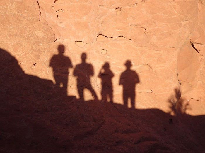 Recognize us? Ha ha ha!!!! No, just kidding!!!!
That’s us!!!
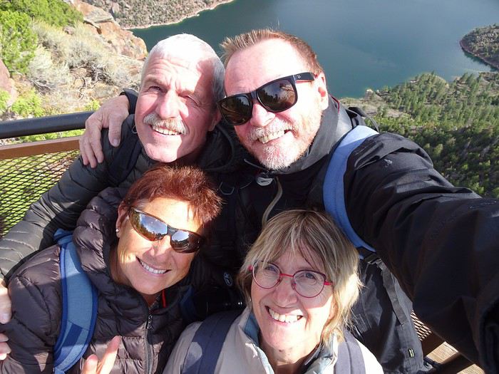
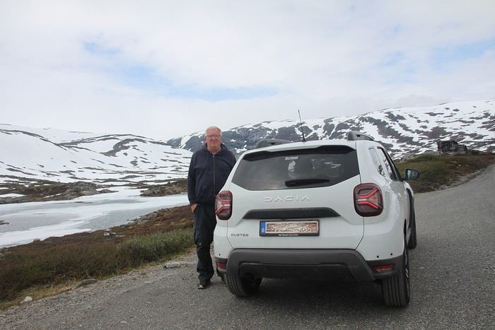
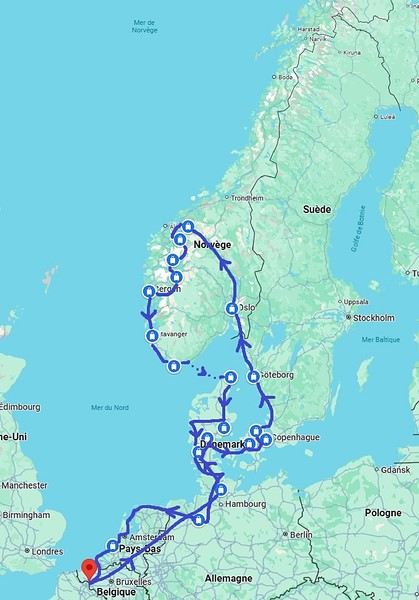
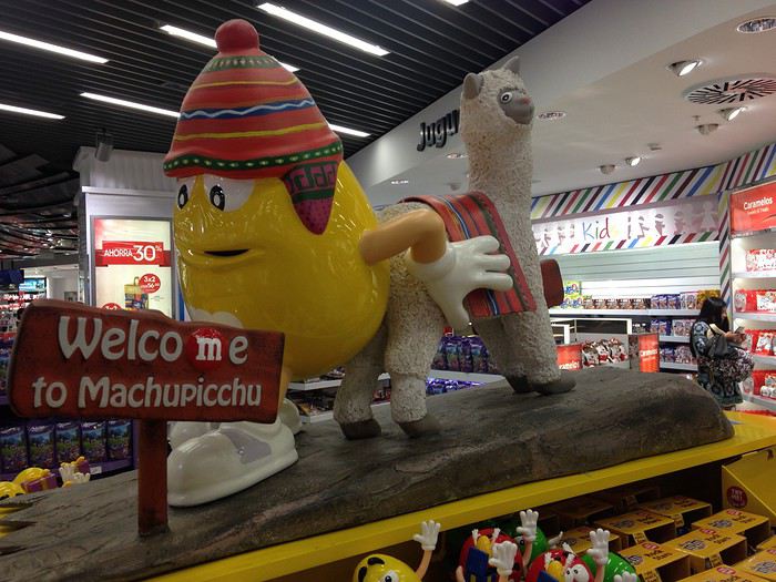
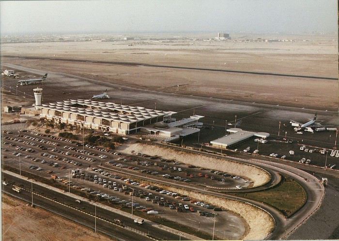
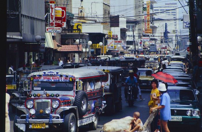
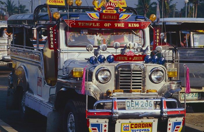
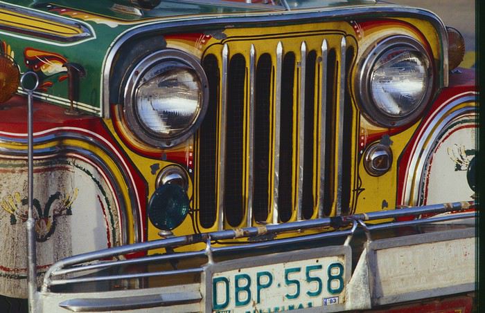
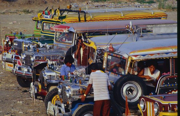
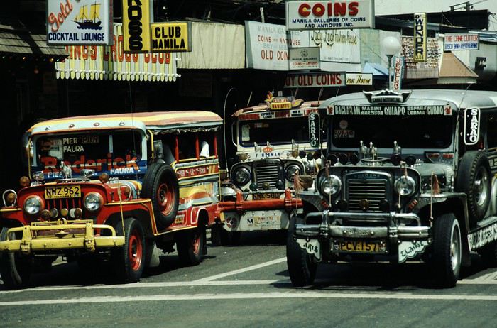
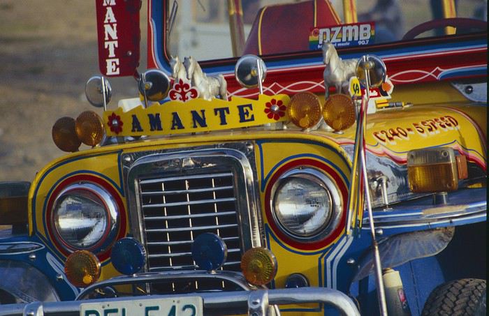
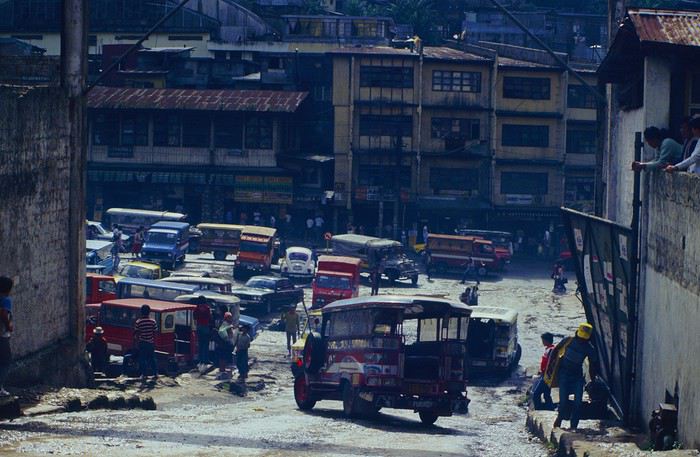
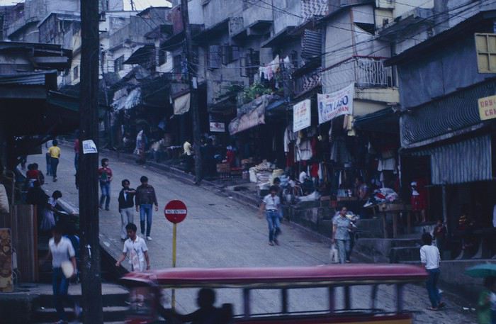
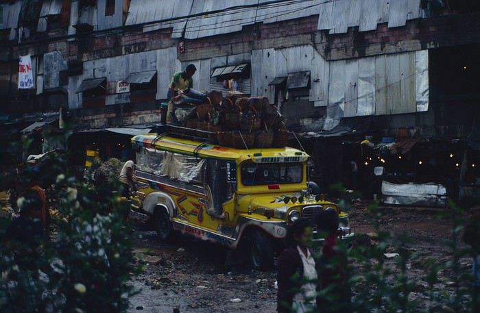
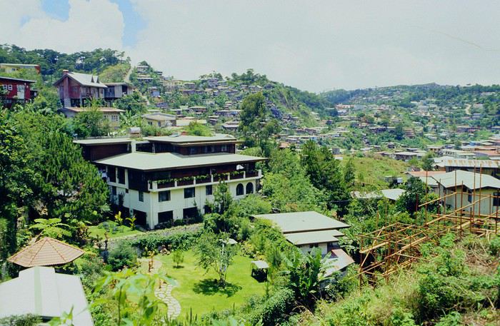
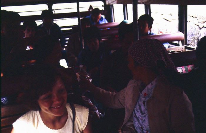
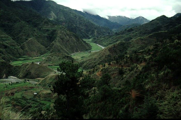
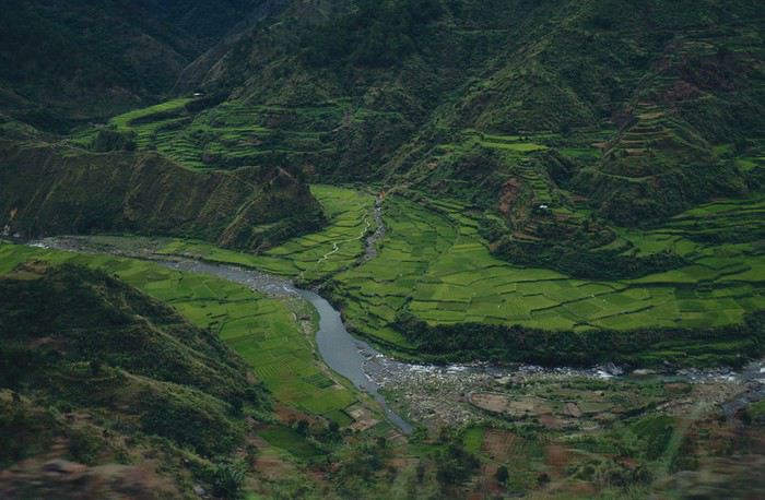
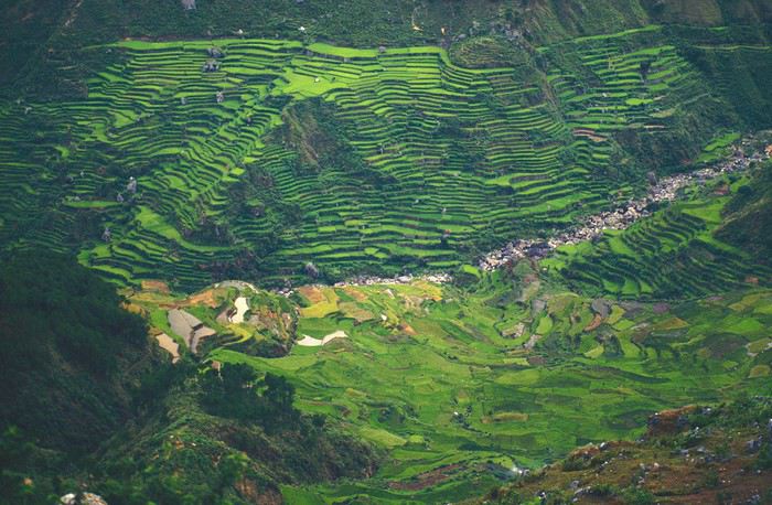
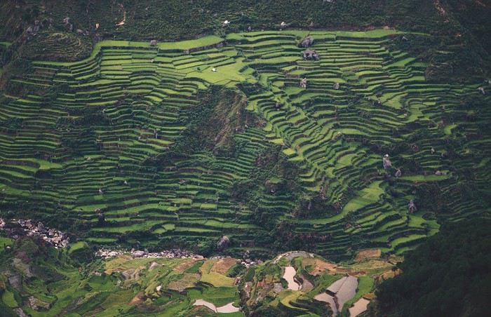
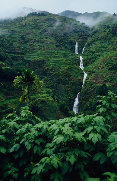
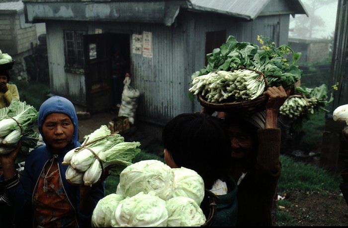
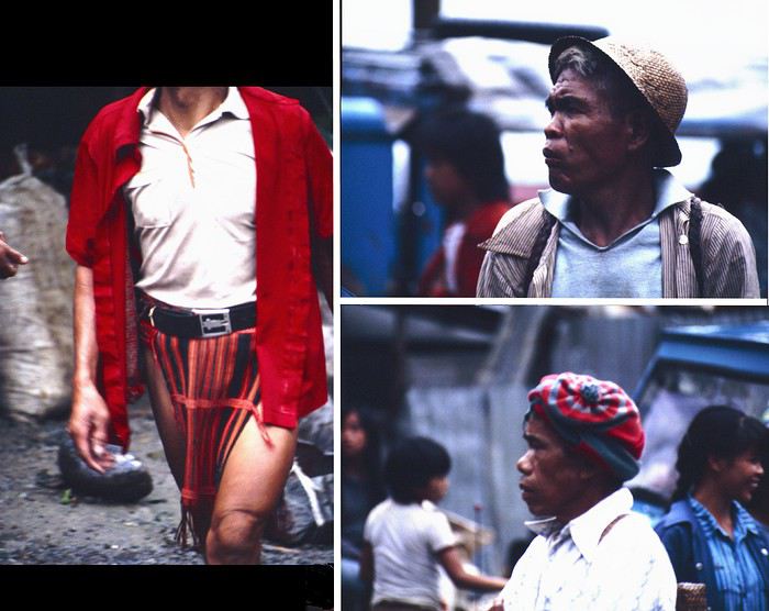
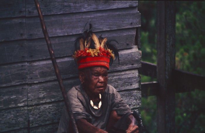
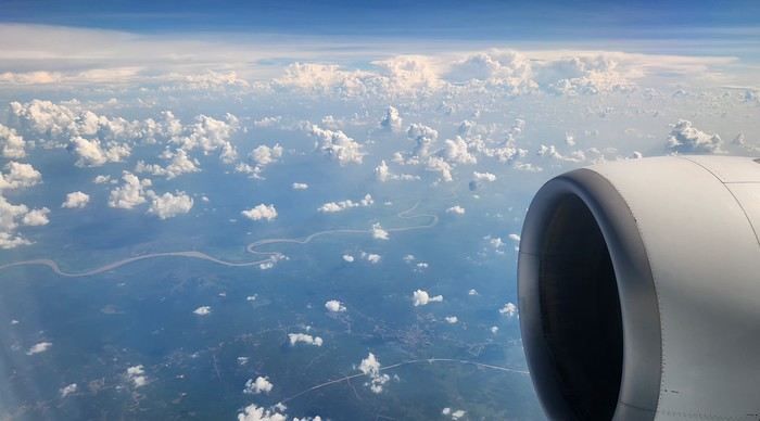
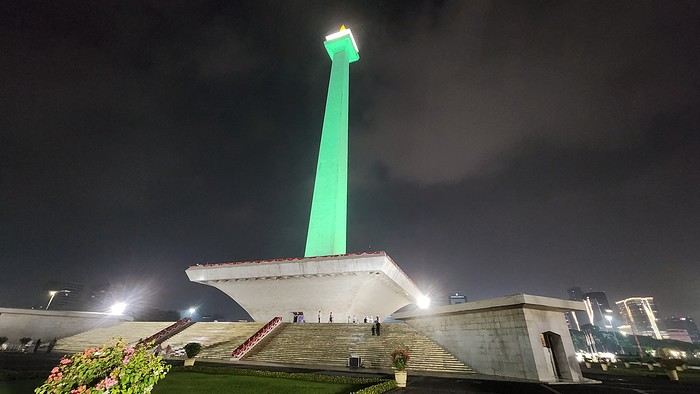
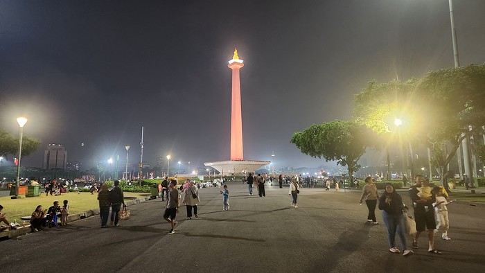
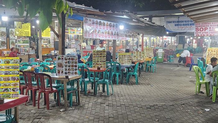
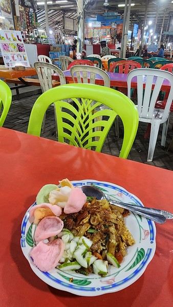
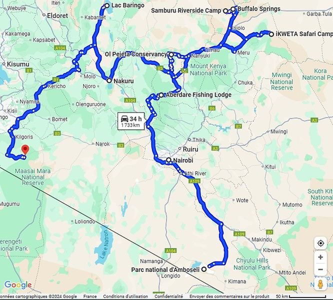
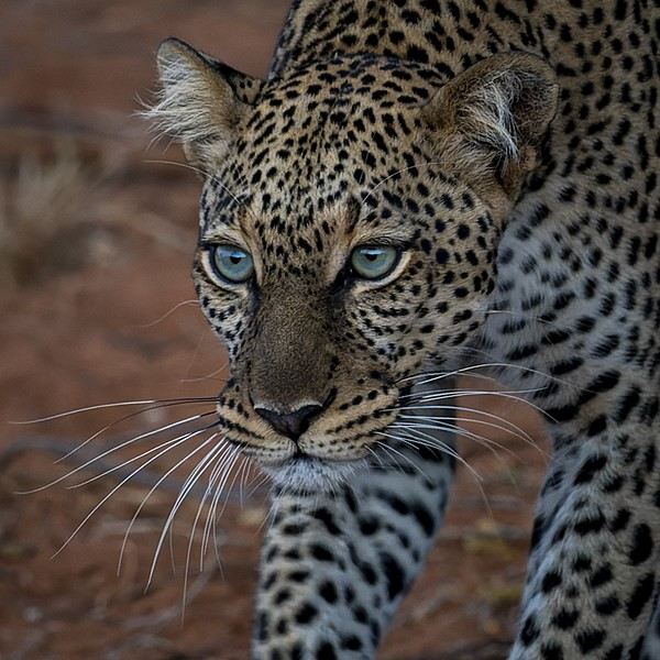
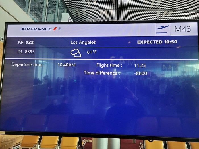
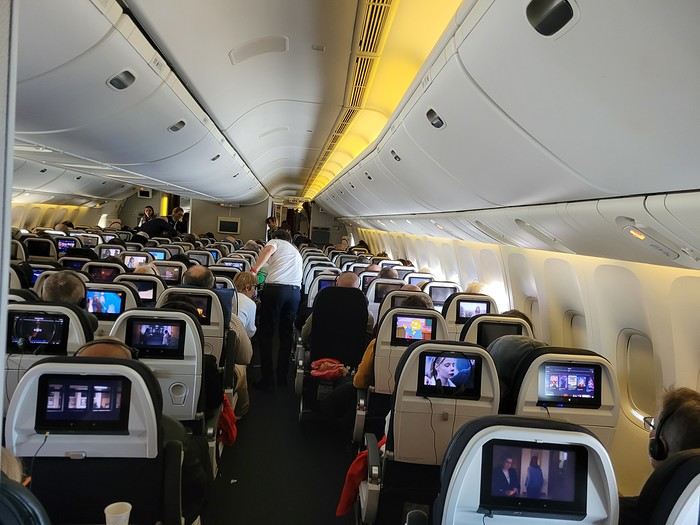
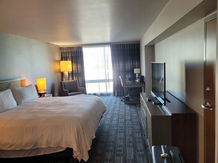
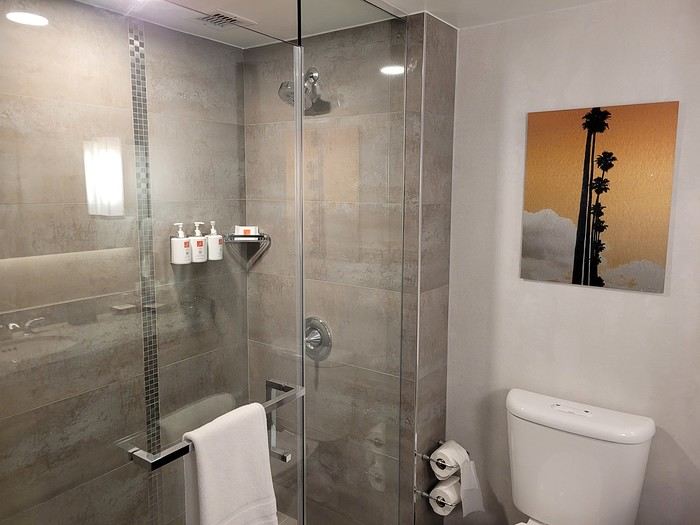
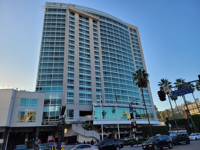
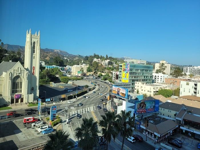
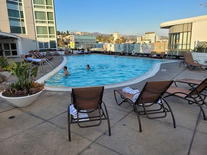
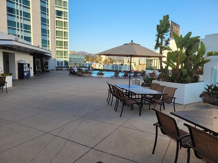
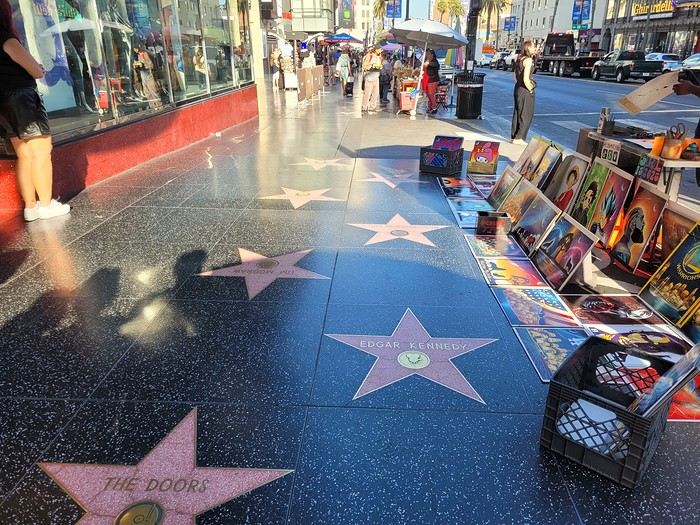


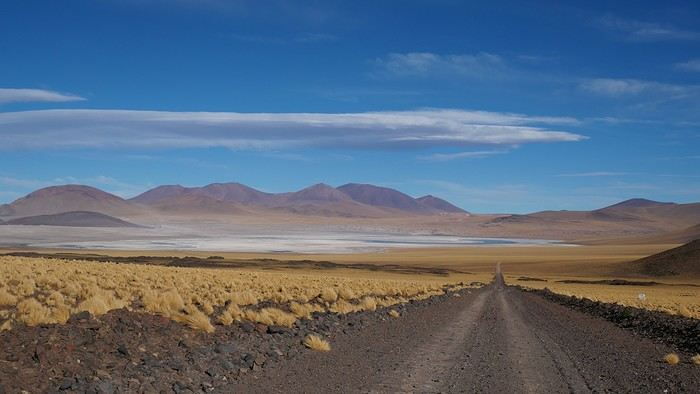
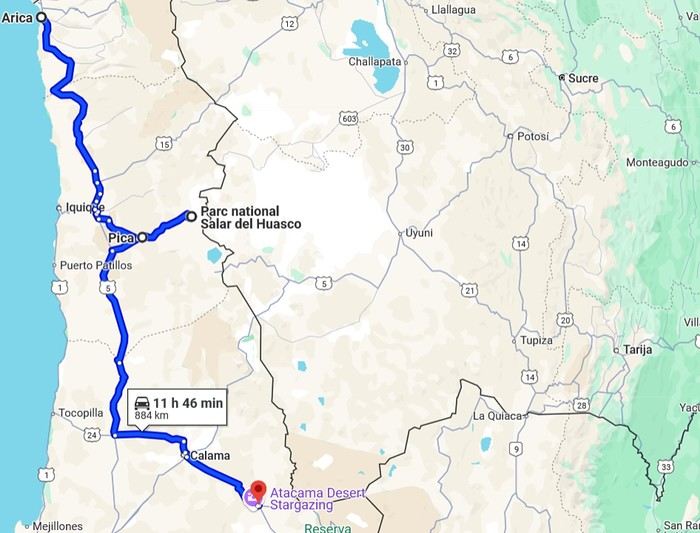 2- Around San Pedro
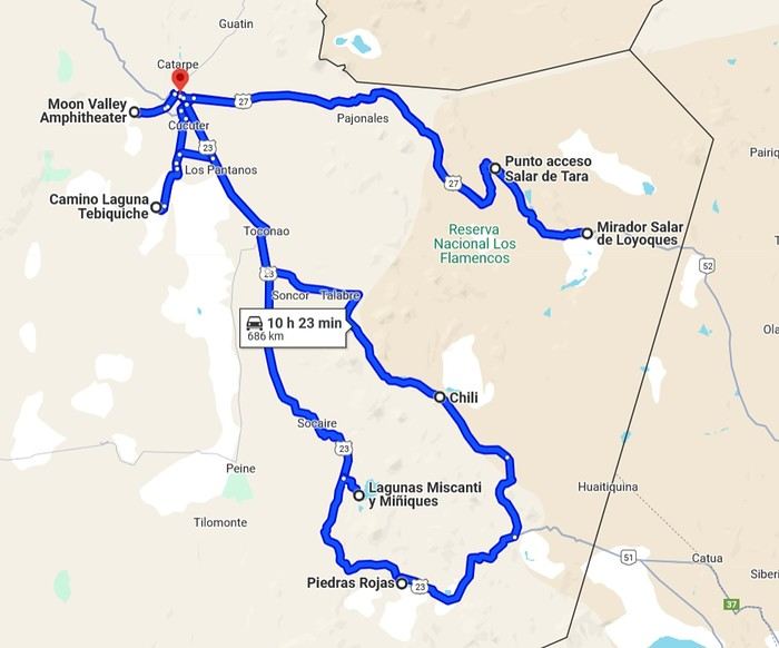
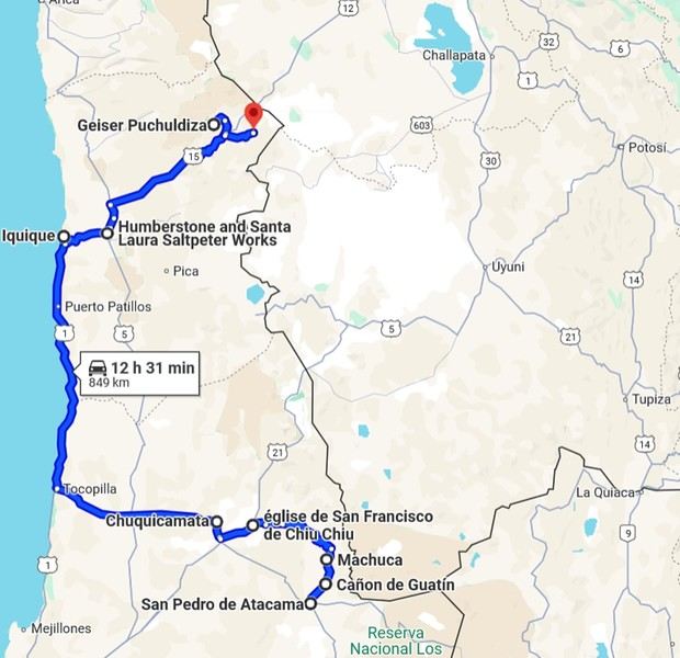
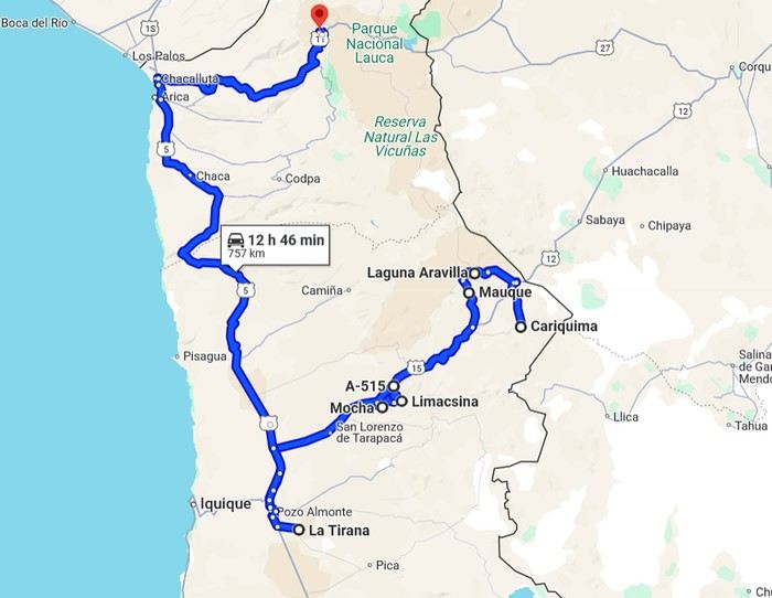
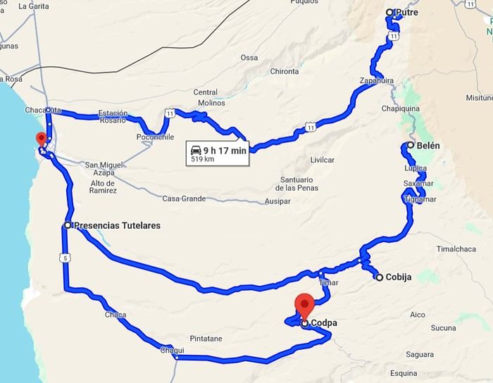
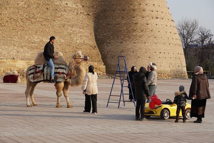
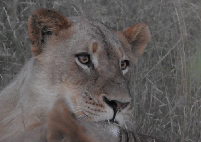
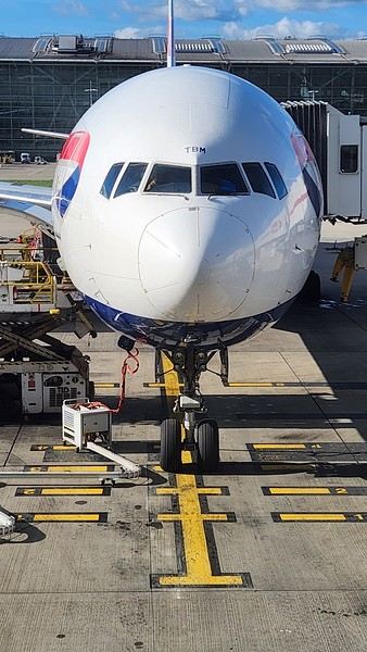

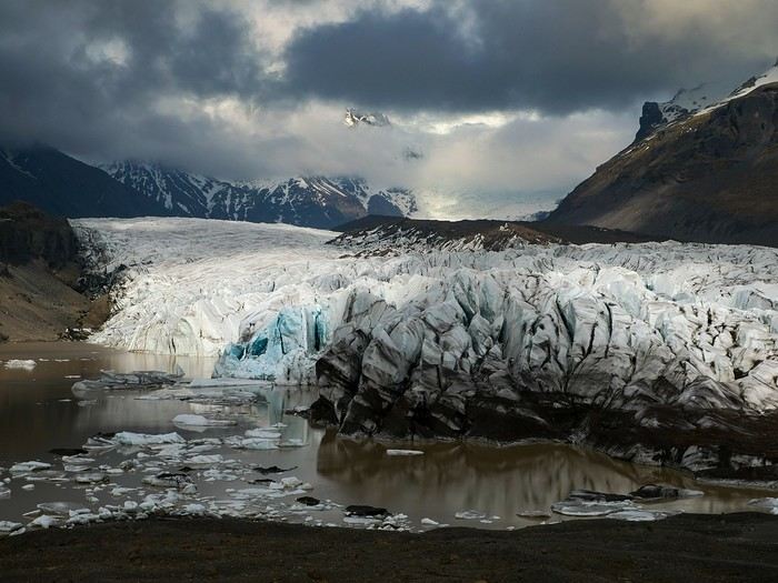
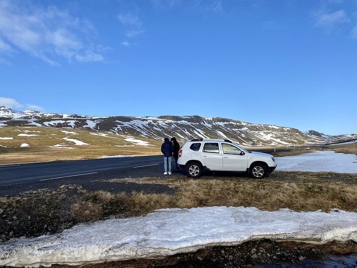
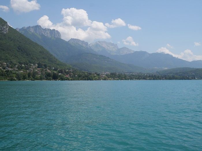 Lakes (Annecy)
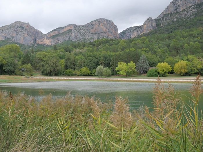 Ponds (near Moustiers Saint Marie)
 Lagoons (Bacalar)