Well, since the lockdown is dragging on, I’m starting a new travel journal following the one I finished publishing yesterday:
https://voyageforum.com/discussion/voyage-pays-perles-voyage-dans-ouest-americain-d9943984/
This time, after the U.S., we’re heading to the Middle East—Jordan!
And we’re keeping up the good habits: one day’s entry published every day at 5:30 PM! Happy reading, and feel free to leave a comment, question, or remark...
Franck
566 similar discussions in English
Inside South Africa
The Burst Hose. The passenger is so impatient to arrive that the coachman whips a horse that barely tolerates the mistreatment. I can tell she’s gearing up for a kick, and suddenly, at full gallop, she stops responding. If I press the spur, she cuts out but accepts a half-pressed pedal. She pulled this stunt last year, right in the middle of the Kalahari Desert, and I can guess the trick: she blew a hose! An hour at a slow trot brings us to a Ford garage. A workshop manager, as sullen as he is efficient, has the necessary parts removed to reach the hose, then announces he doesn’t have the spare part and will need a week to get it. I suggest taking advantage of the access to make a temporary repair on the tear, but he refuses, arguing the pressure is so high that the patch would give way immediately—"It’s not a Testarossa, after all!" After reassembly, he refuses to charge us anything and advises us to head to the next town, 200 kilometers away—off we go for another four hours. Semi-trailers overtake us without mercy; I’m reminded of *Duel*. At the Land Rover dealership, we learn the part will take two working days to arrive, and it’s Thursday. I decide to have the hose delivered to the house without wheels—I’ll change it myself. Five hours later, climbing the pass in first gear, we reach the object of her desires. * Hide and Seek In Brittany, my neighbor is a taciturn, touchy fisherman. He’s anchored his old boat in the middle of the estuary that separates two departments and uses it as a storage space. It’s a jumble of nets, buoys, and traps. The old wooden vessel is falling apart, and the hull’s paint is nothing but a distant memory—so much so that the Maritime Affairs Directorate of his department orders him to remove it or repaint it. Asterix also runs a restaurant on the harbor, where he treats customers to his catch. One Sunday afternoon, we see him loading cooks, servers, and dishwashers armed with rollers, brushes, and paint cans into dinghies. Off they go for two hours of slapdash painting and laughter. Once the starboard side is done, everyone returns to prepare for the evening service. The port side will wait until the Maritime Affairs Directorate from the other department reacts. This story came back to me when I got home: the side visible from the road had been repainted, but the other side was left as is. * The Blonde, the Red, the White, and the Black Many workers are paid at the end of each week, but alcohol sales for takeaway are banned on Saturdays and Sundays. So, on Friday nights, the bars are packed, and liquor stores never empty—of people who are already full. Their limited means reduce them to cheap, harsh wines or bland beers. Yet, they still end up wasted.
* Seven In mainland France, you can easily raise seven sheep per hectare. In the Great Karoo, it takes seven hectares of sparse but tasty vegetation to feed just one sheep. Not to mention the energy spent moving around. Add to that the fact that a French sheep produces about one and a half lambs per year, while here, between droughts and jackals, it’s closer to 0.7, and you’ll understand why, with a 7,000-hectare farm—the local basic unit—a South African farmer’s income barely exceeds that of a farm a hundred times smaller in Brittany. This weekend, the annual agricultural show is taking place at the fairgrounds. Some come from far away, so a procession of pickups, trailers, and trucks loaded with sheep makes its way up the main street: we’re definitely in the Karoo. I expected a competition of lean, wiry ascetics, able to pass on traits useful to the environment, but I suspect these bodybuilder show animals don’t just graze on the bush and are doped with alfalfa. Besides, I caught a dealer red-handed with a bag of pellets. * They’re Not Dolls Ken is a professional hunting guide, working independently. When it’s not hunting season, he goes fishing for clients, mainly in the United States. He says Trump’s election—whom he slightly resembles, though younger—would be good for his business, but he doesn’t like Trump, nor, it seems, his clients much. He wanted to be a farmer, but in the post-apartheid context, taking over a farm was a gamble. His wife, who’s more beautiful than Barbie and Melania, silently agrees. * Neighbors That’s the problem with women: their *it girl* side. Within a year of her moving in, we got two new neighbors. One on the other side of the track, the other half an hour away (here, that’s *next door*). One only travels at the controls of his black helicopter, the other aboard his private Boeing 737. The first is a very wealthy farmer from the northeast of the country who’s expanding into the Karoo. He just bought two non-contiguous farms of 6,000 hectares each. I still don’t know what the owner of the farm in between is thinking. The newcomer plans to create a wildlife reserve for breeding purposes; our future neighbors will be giraffes, rhinos, and antelopes, including rare species like the Sable. They say he’s a man in a hurry, determined: when the municipality dragged its feet on his request to refurbish the public track that serves as our border, he just went ahead and did it himself. It was a historic farm, crossed by paths leading to other farms, home to a pond full of birds where water from the mountain ends up after the villagers have taken their share. That’s where the golf course I was about to become the 29th member of was located. Now, it’s all closed off, fenced, and lined with monumental gates. The Wild West in the Western Cape. Is it because his name ends in ‘-ski’ that rumors link him to Slavic mafias and advise against crossing him? The same rumors say he’s involved in the uranium market—well, there’s uranium in the Karoo’s subsoil. The second neighbor is a Saudi prince who just bought a modestly sized farm—3,500 hectares—but don’t think he’s a minor prince. He paid four and a half times the market price to get it! The farm had been in the same family for two centuries, and the owners refused to even consider selling. The prince’s agent—money, in this case, black gold—kept coming back every week despite repeated refusals, finally saying his client wanted this farm at any price. A price they were asked to set. And that’s how you sell your ancestors’ graves. There are plenty of huge farms for sale here, but the prince was looking for a property where he wouldn’t see any roads, tracks, or other houses or farms. He’ll come a few days a year to hunt. However, he’s annoyed: the runway at the nearest airport, two hours away, isn’t long enough for his private jet, so he’ll have to land in Cape Town, like me, and endure nearly two hours by helicopter. That’s how it goes in South Africa. I’d be curious to know what Julius Malema, leader of the EFF (Economic Freedom Fighters), who advocates the Zimbabwean model of land redistribution, thinks about it.
* Biko The autobiography of a journalist and politician of European descent, South African, is published this week. In 1977, this rookie got her editor’s permission to investigate the death in detention of black leader Steve Biko. The apartheid regime’s political police claimed he had died from a hunger strike. The bold young woman discovered that the medical examiners reported a slightly overweight corpse, and later, it was revealed that Biko had died from abuse, if not torture. Under pressure after publishing her investigation, Helen Zille, disillusioned, gave up journalism and turned to politics. She is one of the white South Africans who fought against apartheid, and it’s reassuring that some people have a conscience that transcends class or race. *
You Have the Watches... …we have the time. Anyone who’s worked with Africans knows this response they occasionally throw at us. Willem, the inconsistent gardener, couldn’t stand the observation: running around the place at top speed, even with a pitchfork over his shoulder, wasn’t getting the job done. So Jan replaced him. We share the same first name—no doubt we’ll accomplish great things. He’s known to be reliable, meaning he shows up for work, and he only speaks Afrikaans. We communicate like at the circus: thumbs up, thumbs down. Jan has the build of a bushman but the bone structure and features of a mixed-race person—multiple mixes. He’s a sprite, always moving, sometimes without purpose or destination (the journey is the path). I lose sight of him—it’s not exactly a virgin forest—and he reappears elsewhere, busy. Jan doesn’t understand wasted water—he must think the same of us trying to cultivate the desert. He’s a gardener like I’m a violinist, virtuosos of playback. After a very light lunch, he lies down on the ground in the shadow of the stables and falls asleep. If his arrival time in the morning is variable, it’s never before the agreed hour, but his departure time is unchanging: it’s 3 PM, no matter what. No point trying to fool him; he can count and shows me the fancy watch eating up his thin wrist. * Colours Veldrift, Oyster Catcher, Lobster Red, Namib, Dune, Lion's Den, Kalahari, Bush Fire, Karoo Dawn, Cape Fynbos, Safari Trail, African Pan, Bushveld Plains, African Queen, Karoo Drift. A bestiary? A herbarium? No, the colors offered by the country’s top paint manufacturer. All the shades of the continent from an armchair. * Pets She loves three mastiffs, a meter tall at the withers. Is it for their beauty? Their breed? Their deterrent power, because knowing these beasts exist, no one would dare enter her property without an invitation? A bit of all that, probably. She won’t say. She loves pets but likes other people’s less, especially the poor ones. So, she actively participates in the campaign to sterilize dogs and cats in the neighboring township. Just think, the poor things can’t afford to feed or care for them, meaning they can’t ensure them a decent life. She and others justify the pets section of the local mini-supermarket. Whether your pet is a puppy, adult, or mature, whether it likes fish or prefers beef (no one thought of a dog-based reference from the township?), you’ll find your happiness. While you order, many locals will only have access to the parking lot to beg. * Democracy in Africa
What would Tocqueville say about Democracy in America this fall? After the father, we had the son; after the husband, and by default, we might get the wife. No one else, really? Let’s not talk about France and its current vaudeville. A Ivorian academic believes African peoples aren’t ready for "Western-style" democracy (caricatured as a free T-shirt buying a vote). Does he know the same is true elsewhere, where many voters vote not for a vision, a project, or convictions, but to protect their own interests? Here in South Africa, national elections were held recently, confirming the ANC’s decline in favor of the Democratic Alliance (DA). Historically (since the end of apartheid) seen as the party of whites (who make up less than 10% of the population), it has managed to rally those disillusioned by the clientelism, incompetence, and corruption of Mandela’s unworthy heirs. The DA now governs five of the country’s six largest cities. In the neighboring township, long after the vote ended, ANC and DA T-shirt wearers cross paths courteously. Today, it’s different. The DA’s national leader is holding a rally in a vacant lot. A few hundred people are there, including a good third of children, three-quarters of them ragged. Not an ANC T-shirt in sight amid the smoke of braais and deafening music. Fewer than ten pale faces: the journalist I’m driving, a local official, and activists. A small convoy of limousines arrives—just four, fewer than any of President Zuma’s offspring’s private stables. The crowd stirs, flags wave, and ululations ring out. Mmusi Maimane is a light-skinned mixed-race man, towering over the assembly, which he gently parts, joining in the dances and posing for selfies. He’ll give his speech, half in English, half in Afrikaans, perched on a truck platform—the meeting’s cost must be bearable for taxpayers. A mediocre populist orator, no doubt, but skilled. Two hours later, in the evening, another gathering. This time in a historic town property. A hundred and fifty people, casual chic, all white except for three mixed-race individuals... and the DA President. A Rotary Club vibe: everyone the town has in terms of farmers, shopkeepers, and entrepreneurs has paid their dues to honor Mmusi Maimane’s visit. His admirers see him as a new Mandela or compare him to Obama; his opponents think he’s being manipulated, and his detractors call him a traitor. He’s under forty, intelligent, and his wife is white. The chance he’ll become President of South Africa isn’t zero. * Posh Port Out, Starboard Home. Sonja, who walks the desert at dawn, calls one of her acquaintances posh, meaning snobbish. She’s got a sharp tongue. Wealthy English people (not the ones sent to Australia as convicts one-way) traveling to India would book their cabin on the port side on the way out and starboard on the way back. That way, they had a view of the coast throughout the journey instead of the ocean’s emptiness—whatever Kersauzon says. I didn’t know that by choosing my seat on the plane, depending on the route and time, so the sun lights up the landscape instead of blinding me, I was being posh. * Cosmopolitan Wine Tasting A pale lookalike of Jacob Zuma, a painter teaching his art in Europe; an Antwerp writer in South Africa; a desert gardener with a surfer look; an Irishwoman teaching yoga in the Karoo; an Afrikaner passionate about world history; another, our host, up to his neck in wine; and two French observers—observed observers. Conversations flow, then bottles, just before some hosts leave. Recurring corruption scandals involving President Zuma and his inner circle. A Chenin Blanc. Napoleon, who could have changed the course of South African history. An unwooded Chardonnay. The snake, a puff adder, one found in her garden. A Sauvignon Blanc. The kudu hit by a car at the village exit, which didn’t survive. A Pinotage. The bloody Anglo-Boer War. A Shiraz named Down to Earth. * Little Patagonia A story of pressure or depression, temperature differentials, or perhaps an age-old war between the elements—almost every day at the end of the afternoon, as if tucking in, the wind rushes down the mountain and gives a free haircut. When it falls, you don’t know where, and you hope it hurt itself and won’t get back up. I’m going to build a mast on the house, hoist the sails, trim them, and sail across the desert—it will remember the sea. *
 Meeting in the township.

Since a cover is needed (in black and white)...
The Burst Hose. The passenger is so impatient to arrive that the coachman whips a horse that barely tolerates the mistreatment. I can tell she’s gearing up for a kick, and suddenly, at full gallop, she stops responding. If I press the spur, she cuts out but accepts a half-pressed pedal. She pulled this stunt last year, right in the middle of the Kalahari Desert, and I can guess the trick: she blew a hose! An hour at a slow trot brings us to a Ford garage. A workshop manager, as sullen as he is efficient, has the necessary parts removed to reach the hose, then announces he doesn’t have the spare part and will need a week to get it. I suggest taking advantage of the access to make a temporary repair on the tear, but he refuses, arguing the pressure is so high that the patch would give way immediately—"It’s not a Testarossa, after all!" After reassembly, he refuses to charge us anything and advises us to head to the next town, 200 kilometers away—off we go for another four hours. Semi-trailers overtake us without mercy; I’m reminded of *Duel*. At the Land Rover dealership, we learn the part will take two working days to arrive, and it’s Thursday. I decide to have the hose delivered to the house without wheels—I’ll change it myself. Five hours later, climbing the pass in first gear, we reach the object of her desires. * Hide and Seek In Brittany, my neighbor is a taciturn, touchy fisherman. He’s anchored his old boat in the middle of the estuary that separates two departments and uses it as a storage space. It’s a jumble of nets, buoys, and traps. The old wooden vessel is falling apart, and the hull’s paint is nothing but a distant memory—so much so that the Maritime Affairs Directorate of his department orders him to remove it or repaint it. Asterix also runs a restaurant on the harbor, where he treats customers to his catch. One Sunday afternoon, we see him loading cooks, servers, and dishwashers armed with rollers, brushes, and paint cans into dinghies. Off they go for two hours of slapdash painting and laughter. Once the starboard side is done, everyone returns to prepare for the evening service. The port side will wait until the Maritime Affairs Directorate from the other department reacts. This story came back to me when I got home: the side visible from the road had been repainted, but the other side was left as is. * The Blonde, the Red, the White, and the Black Many workers are paid at the end of each week, but alcohol sales for takeaway are banned on Saturdays and Sundays. So, on Friday nights, the bars are packed, and liquor stores never empty—of people who are already full. Their limited means reduce them to cheap, harsh wines or bland beers. Yet, they still end up wasted.
* Seven In mainland France, you can easily raise seven sheep per hectare. In the Great Karoo, it takes seven hectares of sparse but tasty vegetation to feed just one sheep. Not to mention the energy spent moving around. Add to that the fact that a French sheep produces about one and a half lambs per year, while here, between droughts and jackals, it’s closer to 0.7, and you’ll understand why, with a 7,000-hectare farm—the local basic unit—a South African farmer’s income barely exceeds that of a farm a hundred times smaller in Brittany. This weekend, the annual agricultural show is taking place at the fairgrounds. Some come from far away, so a procession of pickups, trailers, and trucks loaded with sheep makes its way up the main street: we’re definitely in the Karoo. I expected a competition of lean, wiry ascetics, able to pass on traits useful to the environment, but I suspect these bodybuilder show animals don’t just graze on the bush and are doped with alfalfa. Besides, I caught a dealer red-handed with a bag of pellets. * They’re Not Dolls Ken is a professional hunting guide, working independently. When it’s not hunting season, he goes fishing for clients, mainly in the United States. He says Trump’s election—whom he slightly resembles, though younger—would be good for his business, but he doesn’t like Trump, nor, it seems, his clients much. He wanted to be a farmer, but in the post-apartheid context, taking over a farm was a gamble. His wife, who’s more beautiful than Barbie and Melania, silently agrees. * Neighbors That’s the problem with women: their *it girl* side. Within a year of her moving in, we got two new neighbors. One on the other side of the track, the other half an hour away (here, that’s *next door*). One only travels at the controls of his black helicopter, the other aboard his private Boeing 737. The first is a very wealthy farmer from the northeast of the country who’s expanding into the Karoo. He just bought two non-contiguous farms of 6,000 hectares each. I still don’t know what the owner of the farm in between is thinking. The newcomer plans to create a wildlife reserve for breeding purposes; our future neighbors will be giraffes, rhinos, and antelopes, including rare species like the Sable. They say he’s a man in a hurry, determined: when the municipality dragged its feet on his request to refurbish the public track that serves as our border, he just went ahead and did it himself. It was a historic farm, crossed by paths leading to other farms, home to a pond full of birds where water from the mountain ends up after the villagers have taken their share. That’s where the golf course I was about to become the 29th member of was located. Now, it’s all closed off, fenced, and lined with monumental gates. The Wild West in the Western Cape. Is it because his name ends in ‘-ski’ that rumors link him to Slavic mafias and advise against crossing him? The same rumors say he’s involved in the uranium market—well, there’s uranium in the Karoo’s subsoil. The second neighbor is a Saudi prince who just bought a modestly sized farm—3,500 hectares—but don’t think he’s a minor prince. He paid four and a half times the market price to get it! The farm had been in the same family for two centuries, and the owners refused to even consider selling. The prince’s agent—money, in this case, black gold—kept coming back every week despite repeated refusals, finally saying his client wanted this farm at any price. A price they were asked to set. And that’s how you sell your ancestors’ graves. There are plenty of huge farms for sale here, but the prince was looking for a property where he wouldn’t see any roads, tracks, or other houses or farms. He’ll come a few days a year to hunt. However, he’s annoyed: the runway at the nearest airport, two hours away, isn’t long enough for his private jet, so he’ll have to land in Cape Town, like me, and endure nearly two hours by helicopter. That’s how it goes in South Africa. I’d be curious to know what Julius Malema, leader of the EFF (Economic Freedom Fighters), who advocates the Zimbabwean model of land redistribution, thinks about it.
* Biko The autobiography of a journalist and politician of European descent, South African, is published this week. In 1977, this rookie got her editor’s permission to investigate the death in detention of black leader Steve Biko. The apartheid regime’s political police claimed he had died from a hunger strike. The bold young woman discovered that the medical examiners reported a slightly overweight corpse, and later, it was revealed that Biko had died from abuse, if not torture. Under pressure after publishing her investigation, Helen Zille, disillusioned, gave up journalism and turned to politics. She is one of the white South Africans who fought against apartheid, and it’s reassuring that some people have a conscience that transcends class or race. *
You Have the Watches... …we have the time. Anyone who’s worked with Africans knows this response they occasionally throw at us. Willem, the inconsistent gardener, couldn’t stand the observation: running around the place at top speed, even with a pitchfork over his shoulder, wasn’t getting the job done. So Jan replaced him. We share the same first name—no doubt we’ll accomplish great things. He’s known to be reliable, meaning he shows up for work, and he only speaks Afrikaans. We communicate like at the circus: thumbs up, thumbs down. Jan has the build of a bushman but the bone structure and features of a mixed-race person—multiple mixes. He’s a sprite, always moving, sometimes without purpose or destination (the journey is the path). I lose sight of him—it’s not exactly a virgin forest—and he reappears elsewhere, busy. Jan doesn’t understand wasted water—he must think the same of us trying to cultivate the desert. He’s a gardener like I’m a violinist, virtuosos of playback. After a very light lunch, he lies down on the ground in the shadow of the stables and falls asleep. If his arrival time in the morning is variable, it’s never before the agreed hour, but his departure time is unchanging: it’s 3 PM, no matter what. No point trying to fool him; he can count and shows me the fancy watch eating up his thin wrist. * Colours Veldrift, Oyster Catcher, Lobster Red, Namib, Dune, Lion's Den, Kalahari, Bush Fire, Karoo Dawn, Cape Fynbos, Safari Trail, African Pan, Bushveld Plains, African Queen, Karoo Drift. A bestiary? A herbarium? No, the colors offered by the country’s top paint manufacturer. All the shades of the continent from an armchair. * Pets She loves three mastiffs, a meter tall at the withers. Is it for their beauty? Their breed? Their deterrent power, because knowing these beasts exist, no one would dare enter her property without an invitation? A bit of all that, probably. She won’t say. She loves pets but likes other people’s less, especially the poor ones. So, she actively participates in the campaign to sterilize dogs and cats in the neighboring township. Just think, the poor things can’t afford to feed or care for them, meaning they can’t ensure them a decent life. She and others justify the pets section of the local mini-supermarket. Whether your pet is a puppy, adult, or mature, whether it likes fish or prefers beef (no one thought of a dog-based reference from the township?), you’ll find your happiness. While you order, many locals will only have access to the parking lot to beg. * Democracy in Africa
What would Tocqueville say about Democracy in America this fall? After the father, we had the son; after the husband, and by default, we might get the wife. No one else, really? Let’s not talk about France and its current vaudeville. A Ivorian academic believes African peoples aren’t ready for "Western-style" democracy (caricatured as a free T-shirt buying a vote). Does he know the same is true elsewhere, where many voters vote not for a vision, a project, or convictions, but to protect their own interests? Here in South Africa, national elections were held recently, confirming the ANC’s decline in favor of the Democratic Alliance (DA). Historically (since the end of apartheid) seen as the party of whites (who make up less than 10% of the population), it has managed to rally those disillusioned by the clientelism, incompetence, and corruption of Mandela’s unworthy heirs. The DA now governs five of the country’s six largest cities. In the neighboring township, long after the vote ended, ANC and DA T-shirt wearers cross paths courteously. Today, it’s different. The DA’s national leader is holding a rally in a vacant lot. A few hundred people are there, including a good third of children, three-quarters of them ragged. Not an ANC T-shirt in sight amid the smoke of braais and deafening music. Fewer than ten pale faces: the journalist I’m driving, a local official, and activists. A small convoy of limousines arrives—just four, fewer than any of President Zuma’s offspring’s private stables. The crowd stirs, flags wave, and ululations ring out. Mmusi Maimane is a light-skinned mixed-race man, towering over the assembly, which he gently parts, joining in the dances and posing for selfies. He’ll give his speech, half in English, half in Afrikaans, perched on a truck platform—the meeting’s cost must be bearable for taxpayers. A mediocre populist orator, no doubt, but skilled. Two hours later, in the evening, another gathering. This time in a historic town property. A hundred and fifty people, casual chic, all white except for three mixed-race individuals... and the DA President. A Rotary Club vibe: everyone the town has in terms of farmers, shopkeepers, and entrepreneurs has paid their dues to honor Mmusi Maimane’s visit. His admirers see him as a new Mandela or compare him to Obama; his opponents think he’s being manipulated, and his detractors call him a traitor. He’s under forty, intelligent, and his wife is white. The chance he’ll become President of South Africa isn’t zero. * Posh Port Out, Starboard Home. Sonja, who walks the desert at dawn, calls one of her acquaintances posh, meaning snobbish. She’s got a sharp tongue. Wealthy English people (not the ones sent to Australia as convicts one-way) traveling to India would book their cabin on the port side on the way out and starboard on the way back. That way, they had a view of the coast throughout the journey instead of the ocean’s emptiness—whatever Kersauzon says. I didn’t know that by choosing my seat on the plane, depending on the route and time, so the sun lights up the landscape instead of blinding me, I was being posh. * Cosmopolitan Wine Tasting A pale lookalike of Jacob Zuma, a painter teaching his art in Europe; an Antwerp writer in South Africa; a desert gardener with a surfer look; an Irishwoman teaching yoga in the Karoo; an Afrikaner passionate about world history; another, our host, up to his neck in wine; and two French observers—observed observers. Conversations flow, then bottles, just before some hosts leave. Recurring corruption scandals involving President Zuma and his inner circle. A Chenin Blanc. Napoleon, who could have changed the course of South African history. An unwooded Chardonnay. The snake, a puff adder, one found in her garden. A Sauvignon Blanc. The kudu hit by a car at the village exit, which didn’t survive. A Pinotage. The bloody Anglo-Boer War. A Shiraz named Down to Earth. * Little Patagonia A story of pressure or depression, temperature differentials, or perhaps an age-old war between the elements—almost every day at the end of the afternoon, as if tucking in, the wind rushes down the mountain and gives a free haircut. When it falls, you don’t know where, and you hope it hurt itself and won’t get back up. I’m going to build a mast on the house, hoist the sails, trim them, and sail across the desert—it will remember the sea. *
Meeting in the township.Since a cover is needed (in black and white)...
Hi there,
While reading some travel journals, I notice that we always reflect on the people of the countries we visit.
I’d love to hear your thoughts on which people charmed you the most during your travels?
I’m not looking for controversy, just reflections and personal feelings. Looking forward to reading your replies...
While reading some travel journals, I notice that we always reflect on the people of the countries we visit.
I’d love to hear your thoughts on which people charmed you the most during your travels?
I’m not looking for controversy, just reflections and personal feelings. Looking forward to reading your replies...
After nearly 2 years of waiting (yeah, like many of you, we wanted to hit the road again as soon as we got back to France... but first, we had to fill up the piggy bank!), here we are at last—July, the month we’ve been waiting for!
We’ve got 30 days of exploring new places ahead of us, as well as revisiting some spots we loved back in 2012.
Here’s the plan: - Joshua Tree NP - Las Vegas - Valley of Fire SP - Yant Flat - Zion NP (Angel’s Landing) - Bryce Canyon NP (Fairyland Loop trail) - Devils Garden on the HITTR - Capitol Reef NP - Grand Teton NP - Yellowstone NP: Old Faithful - Yellowstone NP: Norris Geyser Basin and Mammoth Hot Springs - Yellowstone NP: Grand Canyon of the Yellowstone - West Thumb and Grand Teton NP - Flaming Gorge - Colorado NM and Fisher Towers - Moab: Arches - Moab: Canyonlands and Corona Arch - Moab: Canyonlands - Moab: rafting and Dead Horse Point SP - Natural Bridges NM and Valley of the Gods - Monument Valley and Horseshoe Bend - Coyote Buttes South - Grand Canyon NP (North Rim) - Grand Canyon NP (North Rim) and Navajo Bridge - Sedona - From Sedona to Tucson - Arizona-Sonora Desert Museum and Saguaro NP - Tombstone
Practical details:
- I’d read that it was better to book flight tickets directly on an airline’s website rather than through a comparison site. So, I spent months searching for reasonably priced tickets for two adults and two kids from Paris to Las Vegas for the outbound trip and from Tucson to Paris for the return. I mostly checked Air France, KLM, and British Airways, but prices were always around 4600 €. Not finding anything, we eventually went through a comparison site: Ebookers. We bought our tickets in mid-December: Paris/Atlanta with Air France, then Atlanta/Los Angeles with Delta for the outbound trip, and Tucson/Atlanta with Delta, then Atlanta/Paris with Air France for the return. Total cost: 4300 €. The layover on the outbound trip made me a little nervous because it was only 2 hours and 15 minutes. A month later, we got an email from Ebookers saying the layover had been reduced to 1 hour and 40 minutes! And a few months after that, it was down to just 1 hour and 30 minutes... So, we called Air France directly (we didn’t go through Ebookers, and it wasn’t a problem), and they put us on different flights. The new layover was 2 hours and 10 minutes—still not a ton of time, but I felt better than with 1 hour and 30 minutes. And anyway, we figured we’d see how it went!
- For the car, we tried several comparison sites, and in the end, AutoEurope won this year: 808 € for a 30-day rental of a Chevrolet Impala through Thrifty. The second driver was free for the entire trip since we picked up the car in California.
- We didn’t rent a GPS or buy one—we just downloaded Sygic on our two phones and bought the US map. I don’t remember the exact amount, but it cost us around 30 €.
- For hotels, I either booked directly on the sites (Xanterra, Grand Canyon Lodge, etc.) or used Hotels.com (to earn nights through their Welcome Rewards program) or Booking.com (when hotels weren’t available on Hotels.com). I always compared the price on Hotels.com with the hotel’s direct rate, but they were usually the same. So, for the same price, I’d rather earn a night with Welcome Rewards! We’d set a budget of 100 € per night on average, and we stuck to it pretty well—the final average came out to 101.20 € when including everything (nights + taxes + any nightly fees + parking fees + bank fees).
- As for luggage, we didn’t want to overpack! So, we left with one medium suitcase for Calista, one for me, one large suitcase for Hugo and Yannick, and a sports bag with Calista’s booster seat (we could’ve taken it on the plane with us, but I didn’t want to lug it around the airport during the layover). That sports bag came in handy on the way back, too—because, as everyone knows, you always come back with more than you left with! Each of us also had a backpack as a carry-on.
Before wrapping up this intro and getting into the real details, I’d like to thank everyone who contributed to my discussions and helped me improve our itinerary!
Quick intro for those who don’t know us: Yannick (36), Peggy (36), Hugo (11), and Calista (8).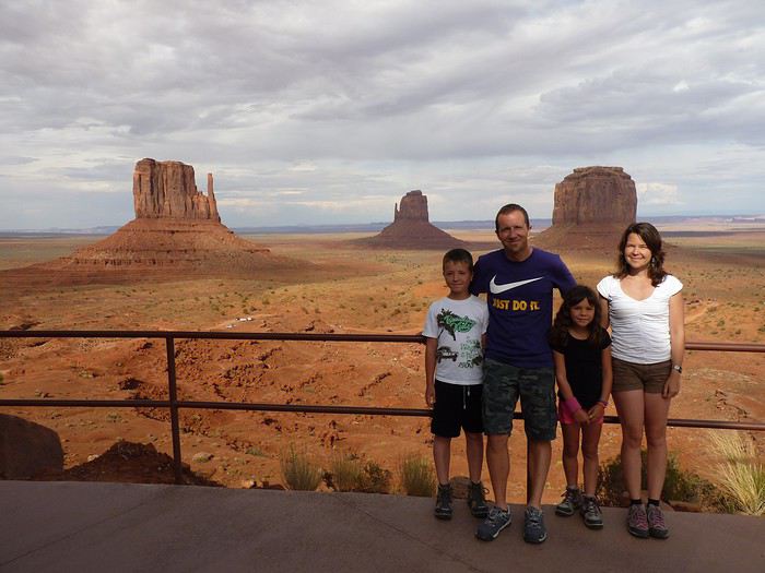
Here’s the plan: - Joshua Tree NP - Las Vegas - Valley of Fire SP - Yant Flat - Zion NP (Angel’s Landing) - Bryce Canyon NP (Fairyland Loop trail) - Devils Garden on the HITTR - Capitol Reef NP - Grand Teton NP - Yellowstone NP: Old Faithful - Yellowstone NP: Norris Geyser Basin and Mammoth Hot Springs - Yellowstone NP: Grand Canyon of the Yellowstone - West Thumb and Grand Teton NP - Flaming Gorge - Colorado NM and Fisher Towers - Moab: Arches - Moab: Canyonlands and Corona Arch - Moab: Canyonlands - Moab: rafting and Dead Horse Point SP - Natural Bridges NM and Valley of the Gods - Monument Valley and Horseshoe Bend - Coyote Buttes South - Grand Canyon NP (North Rim) - Grand Canyon NP (North Rim) and Navajo Bridge - Sedona - From Sedona to Tucson - Arizona-Sonora Desert Museum and Saguaro NP - Tombstone
Practical details:
- I’d read that it was better to book flight tickets directly on an airline’s website rather than through a comparison site. So, I spent months searching for reasonably priced tickets for two adults and two kids from Paris to Las Vegas for the outbound trip and from Tucson to Paris for the return. I mostly checked Air France, KLM, and British Airways, but prices were always around 4600 €. Not finding anything, we eventually went through a comparison site: Ebookers. We bought our tickets in mid-December: Paris/Atlanta with Air France, then Atlanta/Los Angeles with Delta for the outbound trip, and Tucson/Atlanta with Delta, then Atlanta/Paris with Air France for the return. Total cost: 4300 €. The layover on the outbound trip made me a little nervous because it was only 2 hours and 15 minutes. A month later, we got an email from Ebookers saying the layover had been reduced to 1 hour and 40 minutes! And a few months after that, it was down to just 1 hour and 30 minutes... So, we called Air France directly (we didn’t go through Ebookers, and it wasn’t a problem), and they put us on different flights. The new layover was 2 hours and 10 minutes—still not a ton of time, but I felt better than with 1 hour and 30 minutes. And anyway, we figured we’d see how it went!
- For the car, we tried several comparison sites, and in the end, AutoEurope won this year: 808 € for a 30-day rental of a Chevrolet Impala through Thrifty. The second driver was free for the entire trip since we picked up the car in California.
- We didn’t rent a GPS or buy one—we just downloaded Sygic on our two phones and bought the US map. I don’t remember the exact amount, but it cost us around 30 €.
- For hotels, I either booked directly on the sites (Xanterra, Grand Canyon Lodge, etc.) or used Hotels.com (to earn nights through their Welcome Rewards program) or Booking.com (when hotels weren’t available on Hotels.com). I always compared the price on Hotels.com with the hotel’s direct rate, but they were usually the same. So, for the same price, I’d rather earn a night with Welcome Rewards! We’d set a budget of 100 € per night on average, and we stuck to it pretty well—the final average came out to 101.20 € when including everything (nights + taxes + any nightly fees + parking fees + bank fees).
- As for luggage, we didn’t want to overpack! So, we left with one medium suitcase for Calista, one for me, one large suitcase for Hugo and Yannick, and a sports bag with Calista’s booster seat (we could’ve taken it on the plane with us, but I didn’t want to lug it around the airport during the layover). That sports bag came in handy on the way back, too—because, as everyone knows, you always come back with more than you left with! Each of us also had a backpack as a carry-on.
Before wrapping up this intro and getting into the real details, I’d like to thank everyone who contributed to my discussions and helped me improve our itinerary!
Quick intro for those who don’t know us: Yannick (36), Peggy (36), Hugo (11), and Calista (8).
hi everyone 🙂, I’d like to know if any of you have recently—or within the last 2 years—built a house in Thailand and could give me an idea of the all-in price. I’m not looking for luxury, just a comfortable home with 3 bedrooms. I already have the land, which is in the Khorat region for those who know it. I’d really appreciate any info you can share—thanks in advance!
Best regards.
This is where we chat.
Hi everyone,
Actually, we ended up going to Japan almost by chance. I’d caught glimpses of the country during business trips, and it had been on my “wish list” for a while, but I thought we’d go “when the kids were grown up.”
But this summer (2016), the kids couldn’t agree on a destination—their wishes were completely opposite. Then, realizing that flight tickets weren’t outrageously priced—and having read that Japan wasn’t as expensive as people think—we, the parents, suggested Japan… while warning that it would be scorching hot and humid and that no one should complain. Our eldest (18) was immediately thrilled: “Oh! Mom! I’ve always dreamed of going to Japan!” She convinced her brother (16) that it was the perfect destination. Deal sealed: we’re going to Japan, but no one complains about the heat.
After some forum discussions and family brainstorming, I settled on the following itinerary. One non-negotiable shaped part of our choices: being in Hiroshima on August 6th to attend the lantern floating ceremony. To avoid overloading the trip with extra transport, we skipped Nara, Nikko, and Kamakura.
Day 1 - Arrival at 8:30 AM in Osaka – Kyoto - around the station Day 2 - Kyoto - East - night: Kyoto Day 3 - Kyoto - North and center - night: Kyoto Day 4 - Osaka (stroll with Osaka Safari) - Fushimi Inari -night : Kyoto Day 5 - Train - Naoshima - night: Uno Day 6 - Teshima -night: Uno Day 7 - Naoshima – Hiroshima - night: Hiroshima Day 8 - Hiroshima – Commemorations - night: Hiroshima Day 10 - Miyajima- night: Miyajima Day 10 - Miyajima - Himeji Castle - night: Osaka Day 11 - Osaka - night: Osaka Day 12 - Kyoto - West -night: Osaka Day 13 - Kanazawa to Ainokura - night: Ainokura Day 14 - Shirakawa-go - Takayama - night: Takayama Day 15 - Kamikochi night: Takayama Day 16 - Takayama - return to Kanazawa night: Kanazawa Day 17 - Kanazawa -night: Kanazawa Day 18 - Travel to Tokyo (Shibuya) -night: Tokyo Day 19 - Tokyo (visit with Tokyo Free Guide – Yoyogi Park - Meiji Shrine - Harajuku - Takeshita-dori - Omote Sando - Odaiba) - night: Tokyo Day 20 - Tokyo (with Tokyo Safari) - night: Tokyo Day 21 - Tokyo (Tsukiji, Hama-Rikyu Onshi Teien, Asakusa and Senso-ji, Kappabashi, Ameyoko, and Ueno) - night: Tokyo Day 22 - Tokyo (Shibuya-Yoyogi Park again - Ikebukuro - Shinjuku (Tokyo Metropolitan Government Building, Omoide-yokocho, Golden Gai) - night: Tokyo Day 23 - Tokyo (Yanaka – Ueno – Edo-Tokyo Museum - Takashita-Dori again - back to Shibuya) - departure at 10:50 PM for Paris
(You can access the published days directly by clicking on them).
The itinerary perfectly matched our expectations: a good pace, a wide variety of visits, the must-sees, but also a first taste of rural Japan. If we were to do it again, I’d do exactly the same (except for the back-and-forth between Kyoto and Osaka on Days 4 and 12, which were due to my desire to explore Osaka with Osaka Safari). Of course, we had to skip some sights, especially in Kyoto where we missed a few “highlights,” but that was a deliberate choice—I’d limited our time in the city, which is known for being stifling in summer.
For accommodations, we mixed Airbnb apartments and quadruple rooms in guesthouses and ryokan. It worked out perfectly. The apartments gave us more space and the chance to dine in some evenings, while the guesthouses and ryokan helped us experience Japanese customs.
First, a quick recap: all four of us were enchanted by our trip. Japan is a constant source of wonder, just like the preface of *Tokyo Sanpo* by Florent Chavouet describes—I’ll take this opportunity to plug the book, which I read with great pleasure after our vacation. That’s exactly it: everything is a reason for amazement. Everything is so different from home. I wanted to photograph everything around me constantly. I promise, I won’t say “photograph like a Japanese” anymore—during this trip, *I* was the Japanese. And I better understand the culture shock Japanese travelers experience in Europe.
As a friend of mine put it: “It’s simple—they have ten fingers, so they count in base 10. Otherwise, they do everything differently from us.” Well summarized.
Another thing: everything is easy. Everything seems to have its place and be exactly where it should be. The smallest detail seems to have been thought out to make life easier. Things that come to mind: the incredibly well-designed signage in train stations and the subway, the ubiquitous public toilets, designated smoking areas, those hyper-detailed maps with all the useful information available at every place we visited… These maps are so well done that we got into the habit of picking them up systematically. It’s that simple: I came back to Paris with a complete collection. And when we arrived in Takayama by car, our first stop was at the train station to get THE map. But this order goes beyond all these practical elements. There’s a certain *je ne sais quoi* that makes you feel like everything is exactly where it should be. Even during rush hour, in the crowds, people manage to avoid each other in a smooth, collision-free flow—the opposite of the Paris metro. Anyone who’s experienced certain transfers in Paris at certain times will understand.
The exquisite politeness of the Japanese and their desire to be helpful are another highlight of the trip. Every person we met tried to help us and make our lives easier. It was really great.
Oh! I almost forgot: Japan’s hyper-safe side. I’ve rarely felt as safe as I did in Japan. No need to keep an eye on your belongings—they’re not going anywhere. One example among many: in Tokyo, Japanese women leave their bags open with their smartphones casually placed on top. Even I could’ve taken them without them noticing, let alone a pickpocket… No wonder France is seen as dangerous.
That said, I’m not claiming Japanese society is flawless. The role of women and gender relations are downright shocking and archaic from our European perspective. I also don’t think I could live in such a codified society, where the individual is so dissolved into the collective. But for a vacation, it’s simply delightful. On that note, I recommend *Nââânde?!* by Eriko Nakamura, which I discovered after our trip on the recommendation of our eldest’s friend. It’s the story of a Japanese woman married to a Frenchman living in Paris, recounting her astonishment at French habits and customs. Even though I tried to be careful, I’m sure I made quite a few blunders.
As for the climate, it didn’t stop us from enjoying our trip. Sure, we were hot—*really* hot—but by protecting ourselves from the sun (hat for me, caps for the others, plus umbrellas—Japanese-style parasols) and drinking liters and liters of water, it was manageable and didn’t bother us too much, even if we probably had a slower pace than we would’ve with milder weather. That said, with small children, we would’ve struggled more.
Last point before diving into the trip details: the cost. Despite what I’d read, traveling in Japan is still expensive. I’m not talking about our specific trip, where—using our daughter’s 18th birthday and our 20th wedding anniversary as an excuse—I splurged on a few extras that drove up the cost. I was particularly surprised by the price of quadruple rooms, which is roughly the same as two double rooms. So for a family, that’s a significant extra cost. The various paid sites in Kyoto also add up. As for food, it’s generally cheap, but it would be a shame not to budget for a few extras to try some less affordable specialties—like Hida beef in our case.
Actually, we ended up going to Japan almost by chance. I’d caught glimpses of the country during business trips, and it had been on my “wish list” for a while, but I thought we’d go “when the kids were grown up.”
But this summer (2016), the kids couldn’t agree on a destination—their wishes were completely opposite. Then, realizing that flight tickets weren’t outrageously priced—and having read that Japan wasn’t as expensive as people think—we, the parents, suggested Japan… while warning that it would be scorching hot and humid and that no one should complain. Our eldest (18) was immediately thrilled: “Oh! Mom! I’ve always dreamed of going to Japan!” She convinced her brother (16) that it was the perfect destination. Deal sealed: we’re going to Japan, but no one complains about the heat.
After some forum discussions and family brainstorming, I settled on the following itinerary. One non-negotiable shaped part of our choices: being in Hiroshima on August 6th to attend the lantern floating ceremony. To avoid overloading the trip with extra transport, we skipped Nara, Nikko, and Kamakura.
Day 1 - Arrival at 8:30 AM in Osaka – Kyoto - around the station Day 2 - Kyoto - East - night: Kyoto Day 3 - Kyoto - North and center - night: Kyoto Day 4 - Osaka (stroll with Osaka Safari) - Fushimi Inari -night : Kyoto Day 5 - Train - Naoshima - night: Uno Day 6 - Teshima -night: Uno Day 7 - Naoshima – Hiroshima - night: Hiroshima Day 8 - Hiroshima – Commemorations - night: Hiroshima Day 10 - Miyajima- night: Miyajima Day 10 - Miyajima - Himeji Castle - night: Osaka Day 11 - Osaka - night: Osaka Day 12 - Kyoto - West -night: Osaka Day 13 - Kanazawa to Ainokura - night: Ainokura Day 14 - Shirakawa-go - Takayama - night: Takayama Day 15 - Kamikochi night: Takayama Day 16 - Takayama - return to Kanazawa night: Kanazawa Day 17 - Kanazawa -night: Kanazawa Day 18 - Travel to Tokyo (Shibuya) -night: Tokyo Day 19 - Tokyo (visit with Tokyo Free Guide – Yoyogi Park - Meiji Shrine - Harajuku - Takeshita-dori - Omote Sando - Odaiba) - night: Tokyo Day 20 - Tokyo (with Tokyo Safari) - night: Tokyo Day 21 - Tokyo (Tsukiji, Hama-Rikyu Onshi Teien, Asakusa and Senso-ji, Kappabashi, Ameyoko, and Ueno) - night: Tokyo Day 22 - Tokyo (Shibuya-Yoyogi Park again - Ikebukuro - Shinjuku (Tokyo Metropolitan Government Building, Omoide-yokocho, Golden Gai) - night: Tokyo Day 23 - Tokyo (Yanaka – Ueno – Edo-Tokyo Museum - Takashita-Dori again - back to Shibuya) - departure at 10:50 PM for Paris
(You can access the published days directly by clicking on them).
The itinerary perfectly matched our expectations: a good pace, a wide variety of visits, the must-sees, but also a first taste of rural Japan. If we were to do it again, I’d do exactly the same (except for the back-and-forth between Kyoto and Osaka on Days 4 and 12, which were due to my desire to explore Osaka with Osaka Safari). Of course, we had to skip some sights, especially in Kyoto where we missed a few “highlights,” but that was a deliberate choice—I’d limited our time in the city, which is known for being stifling in summer.
For accommodations, we mixed Airbnb apartments and quadruple rooms in guesthouses and ryokan. It worked out perfectly. The apartments gave us more space and the chance to dine in some evenings, while the guesthouses and ryokan helped us experience Japanese customs.
First, a quick recap: all four of us were enchanted by our trip. Japan is a constant source of wonder, just like the preface of *Tokyo Sanpo* by Florent Chavouet describes—I’ll take this opportunity to plug the book, which I read with great pleasure after our vacation. That’s exactly it: everything is a reason for amazement. Everything is so different from home. I wanted to photograph everything around me constantly. I promise, I won’t say “photograph like a Japanese” anymore—during this trip, *I* was the Japanese. And I better understand the culture shock Japanese travelers experience in Europe.
As a friend of mine put it: “It’s simple—they have ten fingers, so they count in base 10. Otherwise, they do everything differently from us.” Well summarized.
Another thing: everything is easy. Everything seems to have its place and be exactly where it should be. The smallest detail seems to have been thought out to make life easier. Things that come to mind: the incredibly well-designed signage in train stations and the subway, the ubiquitous public toilets, designated smoking areas, those hyper-detailed maps with all the useful information available at every place we visited… These maps are so well done that we got into the habit of picking them up systematically. It’s that simple: I came back to Paris with a complete collection. And when we arrived in Takayama by car, our first stop was at the train station to get THE map. But this order goes beyond all these practical elements. There’s a certain *je ne sais quoi* that makes you feel like everything is exactly where it should be. Even during rush hour, in the crowds, people manage to avoid each other in a smooth, collision-free flow—the opposite of the Paris metro. Anyone who’s experienced certain transfers in Paris at certain times will understand.
The exquisite politeness of the Japanese and their desire to be helpful are another highlight of the trip. Every person we met tried to help us and make our lives easier. It was really great.
Oh! I almost forgot: Japan’s hyper-safe side. I’ve rarely felt as safe as I did in Japan. No need to keep an eye on your belongings—they’re not going anywhere. One example among many: in Tokyo, Japanese women leave their bags open with their smartphones casually placed on top. Even I could’ve taken them without them noticing, let alone a pickpocket… No wonder France is seen as dangerous.
That said, I’m not claiming Japanese society is flawless. The role of women and gender relations are downright shocking and archaic from our European perspective. I also don’t think I could live in such a codified society, where the individual is so dissolved into the collective. But for a vacation, it’s simply delightful. On that note, I recommend *Nââânde?!* by Eriko Nakamura, which I discovered after our trip on the recommendation of our eldest’s friend. It’s the story of a Japanese woman married to a Frenchman living in Paris, recounting her astonishment at French habits and customs. Even though I tried to be careful, I’m sure I made quite a few blunders.
As for the climate, it didn’t stop us from enjoying our trip. Sure, we were hot—*really* hot—but by protecting ourselves from the sun (hat for me, caps for the others, plus umbrellas—Japanese-style parasols) and drinking liters and liters of water, it was manageable and didn’t bother us too much, even if we probably had a slower pace than we would’ve with milder weather. That said, with small children, we would’ve struggled more.
Last point before diving into the trip details: the cost. Despite what I’d read, traveling in Japan is still expensive. I’m not talking about our specific trip, where—using our daughter’s 18th birthday and our 20th wedding anniversary as an excuse—I splurged on a few extras that drove up the cost. I was particularly surprised by the price of quadruple rooms, which is roughly the same as two double rooms. So for a family, that’s a significant extra cost. The various paid sites in Kyoto also add up. As for food, it’s generally cheap, but it would be a shame not to budget for a few extras to try some less affordable specialties—like Hida beef in our case.
Some trips are born twice.
Ours was supposed to happen in 2020. Everything was ready: the itinerary, the flight tickets, hotel reservations and Machu Picchu, the rental car, dreams of high altitudes and wide-open spaces. And then the world stopped.
Like so many other plans, our trip to Peru was put on hold. Disappointment was followed by a more concrete reality: paperwork, endless back-and-forth, and battles to recover some of the costs we’d already paid.
The years went by. Life moved on, with its shifting priorities and unexpected twists. Rescheduling this trip wasn’t possible until 2025.
The itinerary stayed mostly true to what we’d imagined five years earlier. One major difference, though—in 2020, we’d planned to rent a car and explore the roads completely independently. Most importantly, we hadn’t included the three-day Ausangate trek, due to lack of time.
For 2025, our plans evolved. 4x4 rental prices had skyrocketed, and when we looked at our schedule more closely, we realized quite a few days didn’t actually need a vehicle. So we made a different choice and opted for private drivers instead. A decision we never regretted. Always punctual, thoughtful, and available... they were so much more than just drivers.
All our reservations were made in January, except for the trek, which we booked in February.
Finding reliable drivers on our own was tough, so we asked Laurent from Tout Pérou to handle it for us. Going through Tout Pérou also gave us a discount on the train ride to Aguas Calientes, so Laurent booked those tickets too. He also bought our Machu Picchu entrance tickets at the same price we would’ve paid on the official website. When comparing domestic flight prices, we found it was cheaper to book from Peru, so Laurent took care of those as well.
This time, nothing was going to stop us. Peru was waiting. And we were ready. 🙂
Ours was supposed to happen in 2020. Everything was ready: the itinerary, the flight tickets, hotel reservations and Machu Picchu, the rental car, dreams of high altitudes and wide-open spaces. And then the world stopped.
Like so many other plans, our trip to Peru was put on hold. Disappointment was followed by a more concrete reality: paperwork, endless back-and-forth, and battles to recover some of the costs we’d already paid.
The years went by. Life moved on, with its shifting priorities and unexpected twists. Rescheduling this trip wasn’t possible until 2025.
The itinerary stayed mostly true to what we’d imagined five years earlier. One major difference, though—in 2020, we’d planned to rent a car and explore the roads completely independently. Most importantly, we hadn’t included the three-day Ausangate trek, due to lack of time.
For 2025, our plans evolved. 4x4 rental prices had skyrocketed, and when we looked at our schedule more closely, we realized quite a few days didn’t actually need a vehicle. So we made a different choice and opted for private drivers instead. A decision we never regretted. Always punctual, thoughtful, and available... they were so much more than just drivers.
All our reservations were made in January, except for the trek, which we booked in February.
Finding reliable drivers on our own was tough, so we asked Laurent from Tout Pérou to handle it for us. Going through Tout Pérou also gave us a discount on the train ride to Aguas Calientes, so Laurent booked those tickets too. He also bought our Machu Picchu entrance tickets at the same price we would’ve paid on the official website. When comparing domestic flight prices, we found it was cheaper to book from Peru, so Laurent took care of those as well.
This time, nothing was going to stop us. Peru was waiting. And we were ready. 🙂
Hi everyone,
The idea of traveling to Bolivia came to me after seeing Jean-François (Max68)’s photos on his website. I thought we *had* to see those stunning landscapes with the colorful lagoons for ourselves. But a self-drive trip didn’t seem doable at first. A few years ago, everyone advised against going to the South Lipez with just one car.
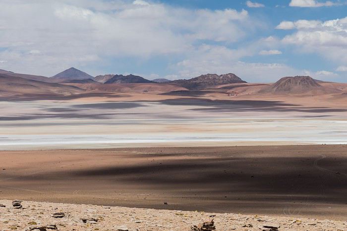 Laguna Kara
It was only after reading Laurent (Lolobe) and Pascal (Pepe874)’s travel journals—who explored the South Lipez solo with a car from Biz Rent a Car—that I thought we might be able to do the same. Meanwhile, we’d already contacted a local agency to organize a trip with a driver and guide. But the idea of a self-drive adventure really appealed to us. With encouragement and tips from Thierry (Tbernay) and Jean-François (Max68), we decided to plan our own self-drive trip. I’d like to thank them for their advice—it was *super* helpful. And a big thanks to all the other forum members for the info shared during our prep!
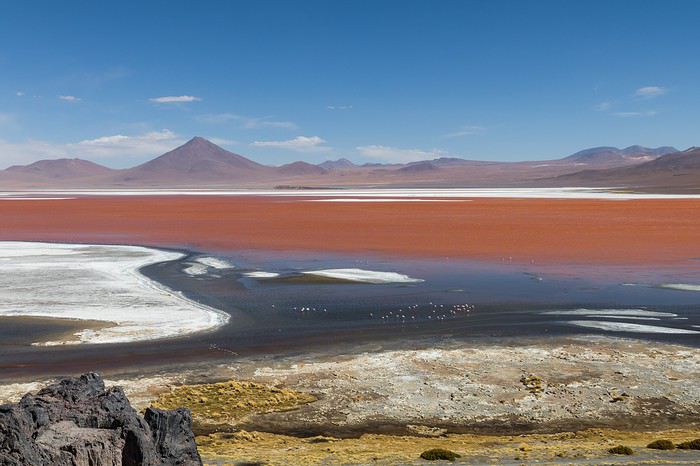 Laguna Colorada
Planning this trip happened during a tough time for our family. My mother-in-law’s illness and passing, plus a few health issues of my own, made us doubt the trip multiple times and nearly scrap the whole thing.
We booked our international flights in February with Swiss. They offered the best balance of travel time and price from Switzerland. Swiss operates Zurich–São Paulo with their own fleet, and São Paulo–Santa Cruz with GOL. In June, GOL canceled the Saturday flight and rebooked us on Sunday. Spending over 24 hours in that huge Brazilian city didn’t work for us at all, so we asked Swiss to put us on the next Zurich–São Paulo flight. Too bad—we lost a day in Bolivia and had to skip the Tarabucco market on Sunday.
Right after, we also booked the car in February. After contacting Imbex and Biz, we went with Biz. Not speaking Spanish, we were relieved to communicate with Alejandra in French. The contact was great—she answered all our questions patiently. Sometimes it took a few days to get a reply, but we could also reach her on WhatsApp. After our trip, we can *only* recommend Biz for rentals in Bolivia. The cars are well-prepped for the South Lipez tracks. The agency is reliable, and the vehicles are new and well-maintained.
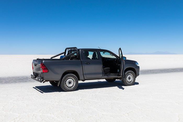 “Our” car, a Toyota Hilux
While planning, we realized the presidential elections would happen while we were in Bolivia. The risk of *bloqueos* (roadblocks and protests) was very real. But in Bolivia, *bloqueos* seem common—you always have to account for that kind of hassle. In late August/early September, Uyuni and the Salar region were blocked for days, leading to food, fuel, and cash shortages. Worried about a blockade in Uyuni and missing the Salar, we decided to visit it first *just in case*.
On election day, the whole country shut down. Planes were grounded, buses and taxis couldn’t circulate, and private cars were banned. There were a few exceptions—ambulances, police, or certain professions—but as tourists, we couldn’t get permission to drive. We asked the embassy, and Biz even requested a permit from the electoral office. So we had to plan to be somewhere with things to do *without* the car.
We decided not to book any accommodations in advance—a first for us. Usually, we plan our stops and reserve lodges, hotels, or campgrounds well ahead. This time, only the room in Sucre was booked, so we’d have a base when we arrived.
In July, Alex (Delhenry) reached out to propose joining part of the trip. He didn’t realize we were leaving in October. Still, we got fresh updates when he returned from the South Lipez. Thanks, Alex—your tips, especially about the Guadalupe–Tupiza stretch, were *super* useful.
In September, we connected with Jean-Louis (Avx) and Anne (Xeta), who were also heading to Bolivia in October, one and two weeks after us. We had dinner with Jean-Louis and his friend after our South Lipez trip and stayed in touch with Anne. It was great to chat with them! Unfortunately, Anne and her husband had a much rockier trip—they got hit hard by post-election issues.
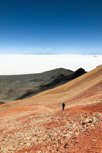 Climbing Volcán Tunupa
Our itinerary wasn’t set in stone—we decided to wing it on the spot. Two weeks before departure, I reconnected with Alejandra at Biz to move the car rental up by a day. With the elections, we wanted to leave Sucre ASAP and focus on the South Lipez. Outside Uyuni and Tupiza, the risk of blockades was zero. We also planned a two-night buffer in Sucre before our flights, just in case. It might sound overcautious, but in hindsight, we made the right call. If we’d left Sucre a day later, we wouldn’t have made it to Potosí—it was completely blocked. On the way back, we *just* dodged blockades in Potosí and elsewhere. Sometimes, you’ve gotta trust your gut.
Here’s our route—only the first two nights in Sucre were booked ahead:
D1 Departure from Switzerland
D2 Sucre (La Selenita)
D3 Sucre (La Selenita)
D4 Colchani (Hotel de Sal Luna Salada)
D5 Jirira (Auberge Doña Lupe)
D6 On the Salar (in the car)
D7 A few kilometers from Estancia Catal (in the car)
D8 Laguna Hedionda (Hotel Los Flamencos)
D9 Laguna Colorada (Lodge by the lagoon)
D10 Middle of nowhere, en route Laguna Verde–Mina Horsu–Quetena Chico (in the car)
D11 Quetena Chico (Lamphaya Lodge Andino)
D12 Quetena Chico (Lamphaya Lodge Andino)
D13 Guadalupe (Guest room at Celia’s)
D14 Along the Rio Grande (in the car)
D15 Tupiza (Hotel Mitru)
D16 Tupiza (Hotel Mitru)
D17 Sucre (La Selenita)
D18 Sucre (La Selenita)
D19 Santa Cruz (Hotel Sun)
D20 Departure from Santa Cruz
D21 Arrival in Switzerland
As you can see, we spent 13 nights in the South Lipez. Initially, we’d planned for nine, but Jean-François (Max68) suggested staying longer. Great advice—we didn’t regret it one bit. We could’ve even added 2–3 more days without getting bored.
Self-driving in the South Lipez takes some prep and a good GPS. We kept it simple and used maps.me to navigate. It’s a solid app—just save your waypoints ahead of time. For some stretches, I used Google Earth to visualize the tracks and sites. If you stick to the tour operator routes, you *almost* can’t get lost. But we often veered off the beaten path and took different routes. Some days, we didn’t see another car. So in case of a breakdown, it’s key to have water and food for several days. In some spots, there’s *zero* signal—your phone won’t work. Another must: it gets *cold* in the South Lipez, and a good sleeping bag is essential. We brought down sleeping bags rated for -10°C and didn’t regret it during our car nights.
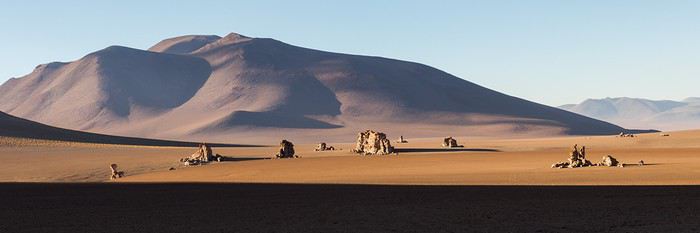 The Dalí Desert
Some tracks are *super* rocky—flat tires are a real risk. On those stretches, maps.me’s estimated travel time was way off. Some sections barely let us go over 15 km/h.
Lots of forum members recommend doing the South Lipez “loop” from Tupiza to Uyuni—ending with the Salar—to avoid Uyuni’s crowds. That might work for organized tours, but for self-drive, the direction *doesn’t* matter. I’ll say this: the few vehicles we saw mostly came from Tupiza and Chile, not Uyuni. So if starting from Uyuni works better for you, go for it! Ending in Tupiza means heading toward warmer weather. For our planned stops and climbs, starting in Uyuni helped with acclimatization. Spending a few nights between 3,600–3,800 m before going over 4,000 m is a smart move.
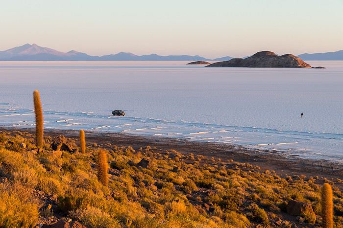 Uyuni Salt Flats in the morning
Overall, we barely saw anyone—except at Laguna Hedionda and Chalviri. There were several tour groups at Hotel Los Flamencos (Laguna Hedionda), but we didn’t cross paths during the day. Hardly anyone on the Salar, on the roads, or at the lodges in the evenings. The *only* place that shocked us was Chalviri. We’d planned to stay there, but it was fully booked—and we counted *forty* tour jeeps on-site. This was around noon! At the Polques hot springs (Chalviri), it was *packed*—we quickly nixed the idea of a dip. Plus, the vibe wasn’t great: soaking right by the road with lodges and restaurants in the background? Meh. Still, lots of tourists love it, so it’s up to you.
For the photos, I kept the colors and mood we saw. The lagoons’ hues are often stunning, but some online photos are *way* over-edited and oversaturated. The South Lipez’s landscapes are breathtaking—no need for excessive retouching.
If you don’t want to read all the details, the start of the travel journal is here: https://voyageforum.com/v.f?post=9888761;a=9888761
The idea of traveling to Bolivia came to me after seeing Jean-François (Max68)’s photos on his website. I thought we *had* to see those stunning landscapes with the colorful lagoons for ourselves. But a self-drive trip didn’t seem doable at first. A few years ago, everyone advised against going to the South Lipez with just one car.
Laguna KaraIt was only after reading Laurent (Lolobe) and Pascal (Pepe874)’s travel journals—who explored the South Lipez solo with a car from Biz Rent a Car—that I thought we might be able to do the same. Meanwhile, we’d already contacted a local agency to organize a trip with a driver and guide. But the idea of a self-drive adventure really appealed to us. With encouragement and tips from Thierry (Tbernay) and Jean-François (Max68), we decided to plan our own self-drive trip. I’d like to thank them for their advice—it was *super* helpful. And a big thanks to all the other forum members for the info shared during our prep!
Laguna ColoradaPlanning this trip happened during a tough time for our family. My mother-in-law’s illness and passing, plus a few health issues of my own, made us doubt the trip multiple times and nearly scrap the whole thing.
We booked our international flights in February with Swiss. They offered the best balance of travel time and price from Switzerland. Swiss operates Zurich–São Paulo with their own fleet, and São Paulo–Santa Cruz with GOL. In June, GOL canceled the Saturday flight and rebooked us on Sunday. Spending over 24 hours in that huge Brazilian city didn’t work for us at all, so we asked Swiss to put us on the next Zurich–São Paulo flight. Too bad—we lost a day in Bolivia and had to skip the Tarabucco market on Sunday.
Right after, we also booked the car in February. After contacting Imbex and Biz, we went with Biz. Not speaking Spanish, we were relieved to communicate with Alejandra in French. The contact was great—she answered all our questions patiently. Sometimes it took a few days to get a reply, but we could also reach her on WhatsApp. After our trip, we can *only* recommend Biz for rentals in Bolivia. The cars are well-prepped for the South Lipez tracks. The agency is reliable, and the vehicles are new and well-maintained.
“Our” car, a Toyota HiluxWhile planning, we realized the presidential elections would happen while we were in Bolivia. The risk of *bloqueos* (roadblocks and protests) was very real. But in Bolivia, *bloqueos* seem common—you always have to account for that kind of hassle. In late August/early September, Uyuni and the Salar region were blocked for days, leading to food, fuel, and cash shortages. Worried about a blockade in Uyuni and missing the Salar, we decided to visit it first *just in case*.
On election day, the whole country shut down. Planes were grounded, buses and taxis couldn’t circulate, and private cars were banned. There were a few exceptions—ambulances, police, or certain professions—but as tourists, we couldn’t get permission to drive. We asked the embassy, and Biz even requested a permit from the electoral office. So we had to plan to be somewhere with things to do *without* the car.
We decided not to book any accommodations in advance—a first for us. Usually, we plan our stops and reserve lodges, hotels, or campgrounds well ahead. This time, only the room in Sucre was booked, so we’d have a base when we arrived.
In July, Alex (Delhenry) reached out to propose joining part of the trip. He didn’t realize we were leaving in October. Still, we got fresh updates when he returned from the South Lipez. Thanks, Alex—your tips, especially about the Guadalupe–Tupiza stretch, were *super* useful.
In September, we connected with Jean-Louis (Avx) and Anne (Xeta), who were also heading to Bolivia in October, one and two weeks after us. We had dinner with Jean-Louis and his friend after our South Lipez trip and stayed in touch with Anne. It was great to chat with them! Unfortunately, Anne and her husband had a much rockier trip—they got hit hard by post-election issues.
Climbing Volcán TunupaOur itinerary wasn’t set in stone—we decided to wing it on the spot. Two weeks before departure, I reconnected with Alejandra at Biz to move the car rental up by a day. With the elections, we wanted to leave Sucre ASAP and focus on the South Lipez. Outside Uyuni and Tupiza, the risk of blockades was zero. We also planned a two-night buffer in Sucre before our flights, just in case. It might sound overcautious, but in hindsight, we made the right call. If we’d left Sucre a day later, we wouldn’t have made it to Potosí—it was completely blocked. On the way back, we *just* dodged blockades in Potosí and elsewhere. Sometimes, you’ve gotta trust your gut.
Here’s our route—only the first two nights in Sucre were booked ahead:
D1 Departure from Switzerland
D2 Sucre (La Selenita)
D3 Sucre (La Selenita)
D4 Colchani (Hotel de Sal Luna Salada)
D5 Jirira (Auberge Doña Lupe)
D6 On the Salar (in the car)
D7 A few kilometers from Estancia Catal (in the car)
D8 Laguna Hedionda (Hotel Los Flamencos)
D9 Laguna Colorada (Lodge by the lagoon)
D10 Middle of nowhere, en route Laguna Verde–Mina Horsu–Quetena Chico (in the car)
D11 Quetena Chico (Lamphaya Lodge Andino)
D12 Quetena Chico (Lamphaya Lodge Andino)
D13 Guadalupe (Guest room at Celia’s)
D14 Along the Rio Grande (in the car)
D15 Tupiza (Hotel Mitru)
D16 Tupiza (Hotel Mitru)
D17 Sucre (La Selenita)
D18 Sucre (La Selenita)
D19 Santa Cruz (Hotel Sun)
D20 Departure from Santa Cruz
D21 Arrival in Switzerland
As you can see, we spent 13 nights in the South Lipez. Initially, we’d planned for nine, but Jean-François (Max68) suggested staying longer. Great advice—we didn’t regret it one bit. We could’ve even added 2–3 more days without getting bored.
Self-driving in the South Lipez takes some prep and a good GPS. We kept it simple and used maps.me to navigate. It’s a solid app—just save your waypoints ahead of time. For some stretches, I used Google Earth to visualize the tracks and sites. If you stick to the tour operator routes, you *almost* can’t get lost. But we often veered off the beaten path and took different routes. Some days, we didn’t see another car. So in case of a breakdown, it’s key to have water and food for several days. In some spots, there’s *zero* signal—your phone won’t work. Another must: it gets *cold* in the South Lipez, and a good sleeping bag is essential. We brought down sleeping bags rated for -10°C and didn’t regret it during our car nights.
The Dalí DesertSome tracks are *super* rocky—flat tires are a real risk. On those stretches, maps.me’s estimated travel time was way off. Some sections barely let us go over 15 km/h.
Lots of forum members recommend doing the South Lipez “loop” from Tupiza to Uyuni—ending with the Salar—to avoid Uyuni’s crowds. That might work for organized tours, but for self-drive, the direction *doesn’t* matter. I’ll say this: the few vehicles we saw mostly came from Tupiza and Chile, not Uyuni. So if starting from Uyuni works better for you, go for it! Ending in Tupiza means heading toward warmer weather. For our planned stops and climbs, starting in Uyuni helped with acclimatization. Spending a few nights between 3,600–3,800 m before going over 4,000 m is a smart move.
Uyuni Salt Flats in the morningOverall, we barely saw anyone—except at Laguna Hedionda and Chalviri. There were several tour groups at Hotel Los Flamencos (Laguna Hedionda), but we didn’t cross paths during the day. Hardly anyone on the Salar, on the roads, or at the lodges in the evenings. The *only* place that shocked us was Chalviri. We’d planned to stay there, but it was fully booked—and we counted *forty* tour jeeps on-site. This was around noon! At the Polques hot springs (Chalviri), it was *packed*—we quickly nixed the idea of a dip. Plus, the vibe wasn’t great: soaking right by the road with lodges and restaurants in the background? Meh. Still, lots of tourists love it, so it’s up to you.
For the photos, I kept the colors and mood we saw. The lagoons’ hues are often stunning, but some online photos are *way* over-edited and oversaturated. The South Lipez’s landscapes are breathtaking—no need for excessive retouching.
If you don’t want to read all the details, the start of the travel journal is here: https://voyageforum.com/v.f?post=9888761;a=9888761
An 80-Day Tour of Southern Africa
Back in South Africa
January 12, 2013, 5:30 AM, Flight BA043 London-Cape Town
Directly below, Windhoek glittered like a tangle of fairy lights still lit and tossed into a box.
The horizon, edged in purple, was setting up a backup fireworks display, and suddenly, like a cherry on the platter and with unbearable intensity, in less than two minutes the entire sun revealed a gray dam and then a vast, untouched massif.
A few more minutes and the glare to the east of the plane was total. In Africa, the sun is swift.
We still had a France to cross before landing, but it felt as if we were already there. To the west, the raking light revealed what looked like acne and long, swollen scars in a desert region that might be the Swartkloofberg. Further still, straight as far as the eye could see, the two parallel tracks of a dirt road.
At 11,500 meters altitude and 940 km/h, we had a sense of stillness until the Orange River appeared, an incongruous serpent, gray edged with green.
The first South African settlements were dotted with trees providing shade, then rivers highlighted by continuous lines of vegetation.
Water and shade that make life possible.
We’ll return here by the backroads.
Half an hour from Cape Town, the plane tilted toward the sea, crossing plantations (likely citrus) and then an explosion of cultivated greenery in circles on either side of an unruly river. Finally, the coastline was no longer just sand and water—a frothy hem, a suture?
A peninsula came into view, forming two magnificent bays, and... a flight attendant firmly instructed me to return to my seat: we’d arrived!
The Colors of Cape Town
The city was dressed up as I like them—deserted, fluid, free of its vendors.
In the parking lot of the endless beach next to the commercial port north of the city, about two hundred people were unloading their goods in front of their pickups or combis, none of which were from this century: mixed-race, ageless Black people, and white folks who looked like they’d stepped out of another era.
After a few minutes, intrigued, I played a game: first looking at the merchandise, then imagining who was selling it, and finally looking at who was actually manning the stall. Tall Black vendors were selling what they often sell in Europe—leather, sunglasses, watches; mixed-race folks offered discount bundles, and the tanned older white people seemed to have emptied their attics.
We left with an antique tin kettle for morning tea over an open fire, a pack of five exercise books (that’s 600 pages to fill), Bill Bryson’s earliest stories in English, some snoek rillettes (a local fish), and—never seen before—tuna biltong and snoek biltong.
In so-called advanced countries, Sunday is for sports: white cyclists dressed like pros sweating diligently, Black street vendors running in loops at red lights to sell trash bags that day; white golfers losing their balls, which a scantily clad Black man retrieves from the water; under the sails of kite surf boards, it’s all blondes, and in the foam, joyful splashes from a bunch of Black kids.
Searching for an unusual spot for lunch, we drove through the fishing port looking for a dive and, at the end of a dead-end road with no warning, we arrived at the Shimmy Beach Club—quite the program.
The place, open for just three weeks, aims to be ultra-trendy. You could be in San Francisco, Lisbon’s docks, or St. Barth. This time, the "visible" staff was diverse, but the clientele was exclusively white, except for one mixed-race couple.
For this Sunday lunch, the women had pulled out all the stops, and local starlets—who’d make ours look tame—were turning the terrace into a frenzy.
At Cape Town’s port, the girls have *port*. The trend seems to be crochet dresses over swimsuits.
For two hours, a team of employees watered and raked the sand, starting over when they finished. A child in a floaty pink dress and a gold headband, but a future adventurer, stepped onto the freshly raked artificial beach sand for the first time.
A lanky mixed-race man dragged a hose across the ground, followed by a white woman—enchanted?—who then started watering the sand herself, carelessly splashing the glass terrace her colleague had just swept. I suspect a tacit work arrangement to keep everyone employed.
A galleon packed with tourists (are there any in the hold? Does it take tourists to Robben Island?) left the port. A helicopter took off in its wake. Trawlers returned, cutting through a ballet of catamarans, their waterlines well above the water: a bad catch.
If there’s one country where you can’t pretend to ignore skin color, it’s this one. The question is in everyone’s mind, and here more than anywhere else, it’s a decisive economic and political factor.
Columbine of Brittany
200 km north of Cape Town and 9,000 km south of the Breton coast, but on the same cold ocean, we camped on the shore of the Columbine Cape Nature Reserve, sheltered by a rocky chaos that, at first light tomorrow, would transport us to Perros-Guirec.
Our first encounter with wild animals wouldn’t end well for them: it was crayfish season, and they were the size of lobsters at Lorient’s fish market. Bought for R60 (5.5 €) a pair from kids in Pater Noster, they’d end up between two rocks, over a fire. But first, we had to pair the Chenin blanc with some snoek biltong.
With no wood, I lit a fire at dawn with dried seaweed and kelp, as if petrified; it gave off a smell of court-bouillon and... tires. Two hundred fathoms away, on an outpost, an army of cormorants stood at attention, unmoved among the frolicking seals.
At the reserve’s exit, the guard spoke French; Patrick Mwanba had arrived from Congo three years earlier to study, but the cost of living here forced him to drop out. He’d like to return home because life is cheaper there, but the war made him hesitate.
Ding ding dong! Vroom! Arf arf, Woof! Buzz! (A night from hell!)
I’d long planned to visit Calvinia, the center of a region known for extensive sheep farming. An excellent provincial museum, run by an enthusiastic curator, kept us too late to start the drive north.
So we camped in a tiny, charming campsite set up in the garden of a house. A few trees, a patch of resilient grass, and a view of a pretty lit-up steeple—what else?
Well, it turned out to be a sound-and-light show, with the pretty steeple chiming the hours and half-hours. Then suddenly, we were in the VIP stands of the Karoo-Kalahari Truck Race: roaring trucks paraded under our canvas windows, and we realized we were on the main road through town. To top it off, we enjoyed an uninterrupted canine cacophony, from the *arf arf* of little dogs to the *woof* of a mastiff. Oh, and some mosquitoes—the first ones—insisted on keeping us company in the tent, and we hadn’t yet bought the arsenal to neutralize them.
I walked through Calvinia at night; the house gardens weren’t fenced, nor did they have the «Armed Response» signs so common in the country.
The Kalahari Trails
(No, no, I haven’t converted to hiking.)
North of Calvinia, in the south of the Northern Cape, small towns follow one another up to Upington, about a hundred kilometers apart—welcome havens. Between them, with no trees in sight, we stopped in the shade of a motionless cloud: the temperature exceeded 40°C in mid-January.
We were almost out of the High Karoo and into a region of pans drying up, until the first red dunes appeared, precursors of the Kalahari. In the sparse veld vegetation, gatherings of quiver trees in the kopjes, and a caravan of camels without a handler or packs, marching in perfect formation across a pan (no, I hadn’t overdone the Windhoek at the last stop, and no, I wasn’t dehydrated enough to hallucinate).
The historic part of these towns, European in style, was built on the same plans as those in the American Midwest or the Australian Outback: a grid of streets wide enough to turn a wagon pulled by eight pairs of oxen. The architecture was Dutch-inspired, tropicalized with awnings.
Then came more recent housing, functional in style, where the wealthier mixed-race people—who make up the majority of this state—lived, and further on, the township, an assemblage of corrugated iron and plastic, like everywhere else.
Orange, Right Bank
North of Augrabies Falls National Park, on the other side of the Orange River, stretches a rugged and wild territory the size of fifty Groix islands, crisscrossed by a few tracks—the Riemvasmaak.
The inhabitants were driven out half a century ago for a military base, and as soon as President Mandela was elected, he made it a symbol by allowing the exiled populations to return. Several ethnic groups live here on almost nothing, in government-built shacks.
A community camp is set up in a small cirque at the end of a canyon that, while not in the history books, offers a good descent. By mid-afternoon, the air was at 44°C, but luckily there was a spring... except it was a hot spring, with water at 38°C. And they haven’t invented a reversible spring yet. Once the birds and baboons had settled in, in absolute silence and far from any light pollution, we enjoyed the stars like nowhere else (well, that’s what they claim in the region).
The Orange didn’t choose the easy path: arriving from Lesotho, it was almost at the ocean. The terrain to the south and north of this massif seemed easier to cross. Was it to avoid the curse of the Okavango, whose waters disappear into the sands without ever seeing the sea, that it chose this rocky route, thinking that at least the granite wouldn’t steal its water?
I Love You, I Eat You
In the dry bed of the Auob, it lay panting, head raised, alert, between its paws but head-to-tail, a tawny springbok, motionless.
A few minutes earlier, their story had been written in a lightning-fast chase, captured in photos by the driver of the car that alerted us.
It would be a long time before it started eating at the groin without breaking its surveillance.
Earlier, there was a lion lounging in the shade and hundreds of antelopes: springboks and gemsboks (oryx) in herds, hartebeests and steenboks alone. Strange pairs, apart several times, formed by a springbok and a gemsbok.
A few solitary jackals moved slightly sideways, looking furtive. Ostriches, alone, looking a bit dazed.
It was a lucky morning in the Kgalagadi (KTP).
In and Out
Kgalagadi, Nossob Camp.
We were at the very end of the almost-empty camp, ten meters from the fence, whose structure wouldn’t resist an elephant (though there aren’t any here), but it was electrified.
At dusk, on the other side, ten meters away, three lions passed in a row, as if on parade, seemingly focused on their goal and indifferent to the camp, though they glanced at it.
A jackal had gotten into the camp and was trying to get out without success while scavenging. I offered it two pieces of snoek biltong (Don’t feed the animals!) from three meters away—it smelled strong and had bones (bones in biltong!). When it passed by again, it sniffed but didn’t dare approach. Curled up in the chair, motionless, by the faint moonlight, I finally saw it come closer, grab the nearest piece, and move ten meters away to enjoy it (how many jackals know the finer points of sea biltong?). A little reassured, it came back for the second piece.
Another Morning
By morning, the jackal was gone, but our luck hadn’t left us. Two cheetahs again, who found me in the way and slowly moved toward a calmer shadow. Enough birds of prey to form a squadron, but they’re solitary hunters. Two ostriches busy with their dozen unruly chicks. And while we’re at it, a group of four Kalahari lions, sprawled under a thorny bush. Lots of oryx crossing the dunes and herds of red hartebeest. Kori bustards and secretary birds.
It was the first time the Kgalagadi had spoiled us so much.
Back in South Africa
January 12, 2013, 5:30 AM, Flight BA043 London-Cape Town
Directly below, Windhoek glittered like a tangle of fairy lights still lit and tossed into a box.
The horizon, edged in purple, was setting up a backup fireworks display, and suddenly, like a cherry on the platter and with unbearable intensity, in less than two minutes the entire sun revealed a gray dam and then a vast, untouched massif.
A few more minutes and the glare to the east of the plane was total. In Africa, the sun is swift.
We still had a France to cross before landing, but it felt as if we were already there. To the west, the raking light revealed what looked like acne and long, swollen scars in a desert region that might be the Swartkloofberg. Further still, straight as far as the eye could see, the two parallel tracks of a dirt road.
At 11,500 meters altitude and 940 km/h, we had a sense of stillness until the Orange River appeared, an incongruous serpent, gray edged with green.
The first South African settlements were dotted with trees providing shade, then rivers highlighted by continuous lines of vegetation.
Water and shade that make life possible.
We’ll return here by the backroads.
Half an hour from Cape Town, the plane tilted toward the sea, crossing plantations (likely citrus) and then an explosion of cultivated greenery in circles on either side of an unruly river. Finally, the coastline was no longer just sand and water—a frothy hem, a suture?
A peninsula came into view, forming two magnificent bays, and... a flight attendant firmly instructed me to return to my seat: we’d arrived!
The Colors of Cape Town
The city was dressed up as I like them—deserted, fluid, free of its vendors.
In the parking lot of the endless beach next to the commercial port north of the city, about two hundred people were unloading their goods in front of their pickups or combis, none of which were from this century: mixed-race, ageless Black people, and white folks who looked like they’d stepped out of another era.
After a few minutes, intrigued, I played a game: first looking at the merchandise, then imagining who was selling it, and finally looking at who was actually manning the stall. Tall Black vendors were selling what they often sell in Europe—leather, sunglasses, watches; mixed-race folks offered discount bundles, and the tanned older white people seemed to have emptied their attics.
We left with an antique tin kettle for morning tea over an open fire, a pack of five exercise books (that’s 600 pages to fill), Bill Bryson’s earliest stories in English, some snoek rillettes (a local fish), and—never seen before—tuna biltong and snoek biltong.
In so-called advanced countries, Sunday is for sports: white cyclists dressed like pros sweating diligently, Black street vendors running in loops at red lights to sell trash bags that day; white golfers losing their balls, which a scantily clad Black man retrieves from the water; under the sails of kite surf boards, it’s all blondes, and in the foam, joyful splashes from a bunch of Black kids.
Searching for an unusual spot for lunch, we drove through the fishing port looking for a dive and, at the end of a dead-end road with no warning, we arrived at the Shimmy Beach Club—quite the program.
The place, open for just three weeks, aims to be ultra-trendy. You could be in San Francisco, Lisbon’s docks, or St. Barth. This time, the "visible" staff was diverse, but the clientele was exclusively white, except for one mixed-race couple.
For this Sunday lunch, the women had pulled out all the stops, and local starlets—who’d make ours look tame—were turning the terrace into a frenzy.
At Cape Town’s port, the girls have *port*. The trend seems to be crochet dresses over swimsuits.
For two hours, a team of employees watered and raked the sand, starting over when they finished. A child in a floaty pink dress and a gold headband, but a future adventurer, stepped onto the freshly raked artificial beach sand for the first time.
A lanky mixed-race man dragged a hose across the ground, followed by a white woman—enchanted?—who then started watering the sand herself, carelessly splashing the glass terrace her colleague had just swept. I suspect a tacit work arrangement to keep everyone employed.
A galleon packed with tourists (are there any in the hold? Does it take tourists to Robben Island?) left the port. A helicopter took off in its wake. Trawlers returned, cutting through a ballet of catamarans, their waterlines well above the water: a bad catch.
If there’s one country where you can’t pretend to ignore skin color, it’s this one. The question is in everyone’s mind, and here more than anywhere else, it’s a decisive economic and political factor.
Columbine of Brittany
200 km north of Cape Town and 9,000 km south of the Breton coast, but on the same cold ocean, we camped on the shore of the Columbine Cape Nature Reserve, sheltered by a rocky chaos that, at first light tomorrow, would transport us to Perros-Guirec.
Our first encounter with wild animals wouldn’t end well for them: it was crayfish season, and they were the size of lobsters at Lorient’s fish market. Bought for R60 (5.5 €) a pair from kids in Pater Noster, they’d end up between two rocks, over a fire. But first, we had to pair the Chenin blanc with some snoek biltong.
With no wood, I lit a fire at dawn with dried seaweed and kelp, as if petrified; it gave off a smell of court-bouillon and... tires. Two hundred fathoms away, on an outpost, an army of cormorants stood at attention, unmoved among the frolicking seals.
At the reserve’s exit, the guard spoke French; Patrick Mwanba had arrived from Congo three years earlier to study, but the cost of living here forced him to drop out. He’d like to return home because life is cheaper there, but the war made him hesitate.
Ding ding dong! Vroom! Arf arf, Woof! Buzz! (A night from hell!)
I’d long planned to visit Calvinia, the center of a region known for extensive sheep farming. An excellent provincial museum, run by an enthusiastic curator, kept us too late to start the drive north.
So we camped in a tiny, charming campsite set up in the garden of a house. A few trees, a patch of resilient grass, and a view of a pretty lit-up steeple—what else?
Well, it turned out to be a sound-and-light show, with the pretty steeple chiming the hours and half-hours. Then suddenly, we were in the VIP stands of the Karoo-Kalahari Truck Race: roaring trucks paraded under our canvas windows, and we realized we were on the main road through town. To top it off, we enjoyed an uninterrupted canine cacophony, from the *arf arf* of little dogs to the *woof* of a mastiff. Oh, and some mosquitoes—the first ones—insisted on keeping us company in the tent, and we hadn’t yet bought the arsenal to neutralize them.
I walked through Calvinia at night; the house gardens weren’t fenced, nor did they have the «Armed Response» signs so common in the country.
The Kalahari Trails
(No, no, I haven’t converted to hiking.)
North of Calvinia, in the south of the Northern Cape, small towns follow one another up to Upington, about a hundred kilometers apart—welcome havens. Between them, with no trees in sight, we stopped in the shade of a motionless cloud: the temperature exceeded 40°C in mid-January.
We were almost out of the High Karoo and into a region of pans drying up, until the first red dunes appeared, precursors of the Kalahari. In the sparse veld vegetation, gatherings of quiver trees in the kopjes, and a caravan of camels without a handler or packs, marching in perfect formation across a pan (no, I hadn’t overdone the Windhoek at the last stop, and no, I wasn’t dehydrated enough to hallucinate).
The historic part of these towns, European in style, was built on the same plans as those in the American Midwest or the Australian Outback: a grid of streets wide enough to turn a wagon pulled by eight pairs of oxen. The architecture was Dutch-inspired, tropicalized with awnings.
Then came more recent housing, functional in style, where the wealthier mixed-race people—who make up the majority of this state—lived, and further on, the township, an assemblage of corrugated iron and plastic, like everywhere else.
Orange, Right Bank
North of Augrabies Falls National Park, on the other side of the Orange River, stretches a rugged and wild territory the size of fifty Groix islands, crisscrossed by a few tracks—the Riemvasmaak.
The inhabitants were driven out half a century ago for a military base, and as soon as President Mandela was elected, he made it a symbol by allowing the exiled populations to return. Several ethnic groups live here on almost nothing, in government-built shacks.
A community camp is set up in a small cirque at the end of a canyon that, while not in the history books, offers a good descent. By mid-afternoon, the air was at 44°C, but luckily there was a spring... except it was a hot spring, with water at 38°C. And they haven’t invented a reversible spring yet. Once the birds and baboons had settled in, in absolute silence and far from any light pollution, we enjoyed the stars like nowhere else (well, that’s what they claim in the region).
The Orange didn’t choose the easy path: arriving from Lesotho, it was almost at the ocean. The terrain to the south and north of this massif seemed easier to cross. Was it to avoid the curse of the Okavango, whose waters disappear into the sands without ever seeing the sea, that it chose this rocky route, thinking that at least the granite wouldn’t steal its water?
I Love You, I Eat You
In the dry bed of the Auob, it lay panting, head raised, alert, between its paws but head-to-tail, a tawny springbok, motionless.
A few minutes earlier, their story had been written in a lightning-fast chase, captured in photos by the driver of the car that alerted us.
It would be a long time before it started eating at the groin without breaking its surveillance.
Earlier, there was a lion lounging in the shade and hundreds of antelopes: springboks and gemsboks (oryx) in herds, hartebeests and steenboks alone. Strange pairs, apart several times, formed by a springbok and a gemsbok.
A few solitary jackals moved slightly sideways, looking furtive. Ostriches, alone, looking a bit dazed.
It was a lucky morning in the Kgalagadi (KTP).
In and Out
Kgalagadi, Nossob Camp.
We were at the very end of the almost-empty camp, ten meters from the fence, whose structure wouldn’t resist an elephant (though there aren’t any here), but it was electrified.
At dusk, on the other side, ten meters away, three lions passed in a row, as if on parade, seemingly focused on their goal and indifferent to the camp, though they glanced at it.
A jackal had gotten into the camp and was trying to get out without success while scavenging. I offered it two pieces of snoek biltong (Don’t feed the animals!) from three meters away—it smelled strong and had bones (bones in biltong!). When it passed by again, it sniffed but didn’t dare approach. Curled up in the chair, motionless, by the faint moonlight, I finally saw it come closer, grab the nearest piece, and move ten meters away to enjoy it (how many jackals know the finer points of sea biltong?). A little reassured, it came back for the second piece.
Another Morning
By morning, the jackal was gone, but our luck hadn’t left us. Two cheetahs again, who found me in the way and slowly moved toward a calmer shadow. Enough birds of prey to form a squadron, but they’re solitary hunters. Two ostriches busy with their dozen unruly chicks. And while we’re at it, a group of four Kalahari lions, sprawled under a thorny bush. Lots of oryx crossing the dunes and herds of red hartebeest. Kori bustards and secretary birds.
It was the first time the Kgalagadi had spoiled us so much.
This trip had been on my mind for about fifteen years.
But the discomfort of overnight stays, the difficulty of communication, and the prices of the few car rental options kept making me postpone the project.
And then, everything suddenly fell into place—I told myself, it’s time!
The preparations took longer than usual; the destination is still far from mainstream.
A bit of Kazakhstan? Not in the end.
The south or not the south? Yes, in the end.
Pre-book or go with the flow? Only two stops were a leap into the unknown.
To help me find the ideal route, I made great use of this forum (thanks to everyone for patiently answering my questions!), pored over travel journals and blogs (Christian, Jeff), zoomed in on Google Maps and Yandex, and bought the guide published by OunTravela about this destination (the guide has been updated since).
---/---
You’ve got your passport, international driver’s license, bank cards, and euros?
Off we go to Lyon—just one night left before our early morning flight.
Tomorrow night, we’ll be sleeping in Bishkek! (Steak for my partner’s mischievous nephews...)
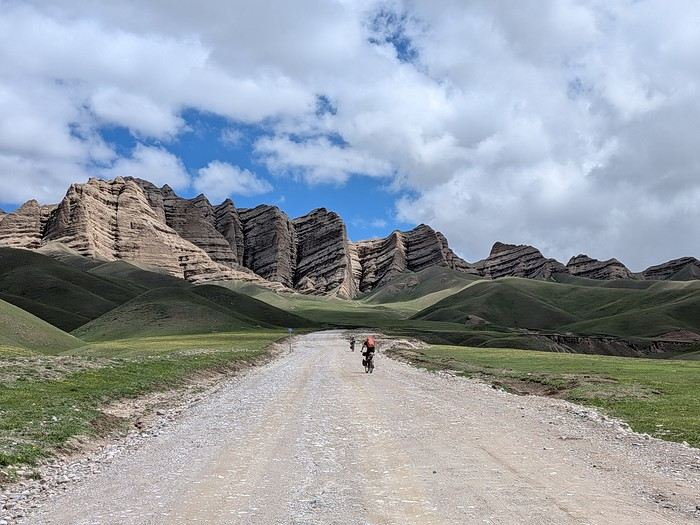
You’ll find here a post with some practical information.
And here, the version of the travel journal without comments.
---/---
As a supplement, the route track. Not necessarily ultra-accurate since Google has serious gaps for this destination...
From Bishkek to Karakol:
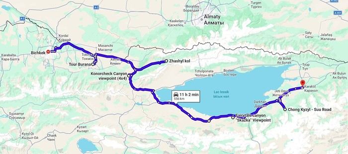
From Karakol to Kochkor:
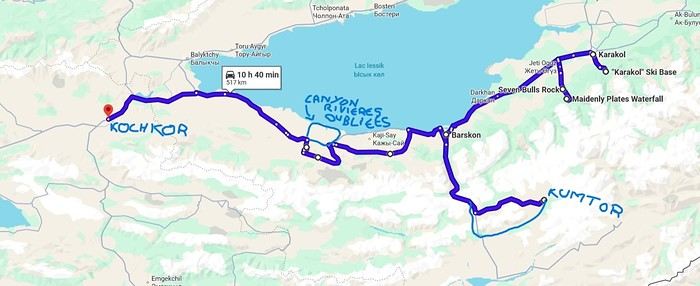
From Kochkor to Baetov:
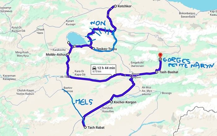
From Baetov to Kara-Köl:
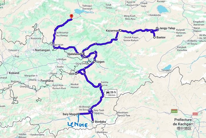
From Kara-Köl to Bishkek:
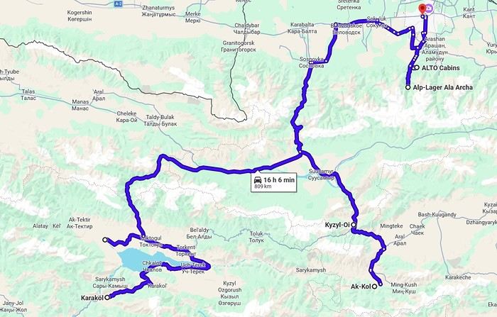

But the discomfort of overnight stays, the difficulty of communication, and the prices of the few car rental options kept making me postpone the project.
And then, everything suddenly fell into place—I told myself, it’s time!
The preparations took longer than usual; the destination is still far from mainstream.
A bit of Kazakhstan? Not in the end.
The south or not the south? Yes, in the end.
Pre-book or go with the flow? Only two stops were a leap into the unknown.
To help me find the ideal route, I made great use of this forum (thanks to everyone for patiently answering my questions!), pored over travel journals and blogs (Christian, Jeff), zoomed in on Google Maps and Yandex, and bought the guide published by OunTravela about this destination (the guide has been updated since).
---/---
You’ve got your passport, international driver’s license, bank cards, and euros?
Off we go to Lyon—just one night left before our early morning flight.
Tomorrow night, we’ll be sleeping in Bishkek! (Steak for my partner’s mischievous nephews...)
You’ll find here a post with some practical information.
And here, the version of the travel journal without comments.
---/---
As a supplement, the route track. Not necessarily ultra-accurate since Google has serious gaps for this destination...
From Bishkek to Karakol:
From Karakol to Kochkor:
From Kochkor to Baetov:
From Baetov to Kara-Köl:
From Kara-Köl to Bishkek:
It all started last December, after another price alert from Gilou for United/Lufthansa flights at 250 € from Paris to San Francisco. Meanwhile, I was planning to spend a week alone with our three kids (Maxime, 14, Rachel, 12, and Timéo, 8) somewhere in France for the February break.
But this time, Gilou really outdid himself—way too tempting! 😮 His great tip worked for both the February and Easter breaks. I know April is the ideal month, especially if you love hiking! But for family reasons, only February would work for us.
Isn’t February a month to avoid for the Southwest? To keep our summer trip budget intact, I was thinking of camping as much as possible. After checking weather sites for temperature histories in key spots (Furnace Creek, Saint George, Page, Sedona), nighttime temps over the past two years ranged from +5 to -2°C. So, it seemed doable...
I started discussing (aka negotiating, even begging) with my better half. The kids caught on fast that there was a chance we’d go, and they were thrilled! She finally gave her consent to make the kids happy 😎. I quickly checked that our ESTAs were still valid, and 48 hours later, I had the tickets in hand 😎😎. But five days later, Laetitia changed her mind—her "Yes" turned back into a "No." No way were we going without her to her favorite country!!
Damn it 🤪! I had to tell her I’d already bought the four tickets (without bringing it up again, of course—a "Yes" is a "Yes," right?). And since the tickets were non-refundable, there was no going back... Apparently, with women, some "Yeses" mean *really* yes, but others mean, "I said yes in principle, but I wasn’t actually on board—and I never thought you’d have the nerve to buy the tickets without telling me!!" I had no idea 🤪!
Us guys? We’re way more straightforward—binary, even monetary... Yes means yes! And no can mean yes too 😏!! Anyway, in a lovely family atmosphere, I opened a thread to start planning and thanked Trois14 and Bluemesa for their help. On Trois14’s advice, I booked 5 nights in motels around St. George-Page at super tempting rates—around $35-40 a night...
On that note, Christmas cost me an arm and a leg... Gotta try to make up for it 😛!
Here’s the theoretical itinerary:
Death Valley (2 days) Valley of Fire The White Dome (hike up and down via Squirrel Canyon) 4 nights in the Kanab-Page area Sedona (2 days) Route 66 Alabama Hills / Trona Pinnacles Drive back to SFO via Highway 1
That’s the plan, at least...
In reality, it turned into a whole different story. I learned that in February, you’ve got to be flexible—*very* flexible sometimes—to dodge the weather. Halfway through, a cold snap made our second week (planned 100% camping) impossible, completely upending the itinerary.
So, a huge thanks to PapJ59, Noyellebis, and especially Caribou44 and Simonic. 🙂 A thousand thanks for your quick responses, availability, and sound advice, which let us have an original and unforgettable second week—Organ Pipe Cactus NM, Yuma, Salvation Mountain, Anza Borrego SP, a palm grove in Joshua Tree, then back to SFO!! Without you, we’d have been miserable on the spot, but instead... 😇
A big shout-out to Thibaut and his famous blog (rightfully praised on VF—it’s one of the few that details Organ Pipe), to travel journal writers for inspiration in general, and to those who helped me prep or during the trip (journals by Pong, Hiacinthe, Zitounet, and Laetitia).
Now, for the story...
But this time, Gilou really outdid himself—way too tempting! 😮 His great tip worked for both the February and Easter breaks. I know April is the ideal month, especially if you love hiking! But for family reasons, only February would work for us.
Isn’t February a month to avoid for the Southwest? To keep our summer trip budget intact, I was thinking of camping as much as possible. After checking weather sites for temperature histories in key spots (Furnace Creek, Saint George, Page, Sedona), nighttime temps over the past two years ranged from +5 to -2°C. So, it seemed doable...
I started discussing (aka negotiating, even begging) with my better half. The kids caught on fast that there was a chance we’d go, and they were thrilled! She finally gave her consent to make the kids happy 😎. I quickly checked that our ESTAs were still valid, and 48 hours later, I had the tickets in hand 😎😎. But five days later, Laetitia changed her mind—her "Yes" turned back into a "No." No way were we going without her to her favorite country!!
Damn it 🤪! I had to tell her I’d already bought the four tickets (without bringing it up again, of course—a "Yes" is a "Yes," right?). And since the tickets were non-refundable, there was no going back... Apparently, with women, some "Yeses" mean *really* yes, but others mean, "I said yes in principle, but I wasn’t actually on board—and I never thought you’d have the nerve to buy the tickets without telling me!!" I had no idea 🤪!
Us guys? We’re way more straightforward—binary, even monetary... Yes means yes! And no can mean yes too 😏!! Anyway, in a lovely family atmosphere, I opened a thread to start planning and thanked Trois14 and Bluemesa for their help. On Trois14’s advice, I booked 5 nights in motels around St. George-Page at super tempting rates—around $35-40 a night...
On that note, Christmas cost me an arm and a leg... Gotta try to make up for it 😛!
Here’s the theoretical itinerary:
Death Valley (2 days) Valley of Fire The White Dome (hike up and down via Squirrel Canyon) 4 nights in the Kanab-Page area Sedona (2 days) Route 66 Alabama Hills / Trona Pinnacles Drive back to SFO via Highway 1
That’s the plan, at least...
In reality, it turned into a whole different story. I learned that in February, you’ve got to be flexible—*very* flexible sometimes—to dodge the weather. Halfway through, a cold snap made our second week (planned 100% camping) impossible, completely upending the itinerary.
So, a huge thanks to PapJ59, Noyellebis, and especially Caribou44 and Simonic. 🙂 A thousand thanks for your quick responses, availability, and sound advice, which let us have an original and unforgettable second week—Organ Pipe Cactus NM, Yuma, Salvation Mountain, Anza Borrego SP, a palm grove in Joshua Tree, then back to SFO!! Without you, we’d have been miserable on the spot, but instead... 😇
A big shout-out to Thibaut and his famous blog (rightfully praised on VF—it’s one of the few that details Organ Pipe), to travel journal writers for inspiration in general, and to those who helped me prep or during the trip (journals by Pong, Hiacinthe, Zitounet, and Laetitia).
Now, for the story...
Hi everyone!
So, I’m putting into action an idea I had two years ago... I’m inviting anyone who’s interested to help build a beautiful collaborative project—a shared travel journal!!!
The concept: one post =
a photo you’ve taken in the American West that means something to you and your thoughts on that photo or about it: where and when it was taken, the story behind it, why it’s special to you...
Grab your pens!!!! (And I hope this doesn’t flop, but if it does, at least I’ll have tried!!!)
And I’ll kick things off in the next post!
So, I’m putting into action an idea I had two years ago... I’m inviting anyone who’s interested to help build a beautiful collaborative project—a shared travel journal!!!
The concept: one post =
a photo you’ve taken in the American West that means something to you and your thoughts on that photo or about it: where and when it was taken, the story behind it, why it’s special to you...
Grab your pens!!!! (And I hope this doesn’t flop, but if it does, at least I’ll have tried!!!)
And I’ll kick things off in the next post!
As soon as I return to France, I catch myself thinking, "it’s better elsewhere."
Wherever we’ve been, I feel this lightness of living—less restriction, less pressure, less sadness—and I start dreaming of somewhere else, of living somewhere else, a simpler life, more authentic, with colors everywhere: markets, clothes, homes...!!! Meeting kindred spirits, genuine people, gentle and kind, and letting go of all this modernism, this technological rat race, the indifference toward others, the confinement, the racism against the elderly in France, against the poor, the weak, the beautiful... fleeing the news, politics, jealousy, meanness, stupidity, greed... And in my moments of clarity, I tell myself that every country, every city has its pros and cons, and that maybe the best of all worlds isn’t down here. But I also remind myself that you have to know how to COME BACK in order to LEAVE again... yet still...!!! IS IT REALLY BETTER ELSEWHERE?😏😏😏
Who are you? Where are you from? Where are you going?
Like last year at this time, a post about bike travel ideas.
How many of us are preparing a trip planned for this year? Probably a lot.
What’s yours—the one you’ve been dying to do for so long, maybe too long? For us, it’s a modest PARIS-MARATHON by bike, followed by MARATHON-ATHENS on foot in June 2010. And you?
May the passion keep growing before, during, and after! Happy planning and safe travels to everyone.
Like last year at this time, a post about bike travel ideas.
How many of us are preparing a trip planned for this year? Probably a lot.
What’s yours—the one you’ve been dying to do for so long, maybe too long? For us, it’s a modest PARIS-MARATHON by bike, followed by MARATHON-ATHENS on foot in June 2010. And you?
May the passion keep growing before, during, and after! Happy planning and safe travels to everyone.
Fellow travelers,
Don’t they say "never two without three"? It seems so. Here I am again on the forum to share—and let’s be honest, indulge a bit of selfish pleasure—by recounting the story of this third installment in the Land of the Rising Sun.
Where? It’s all in the title. On the island of Kyushu in southern Japan, more precisely in the northwest between Fukuoka and Nagasaki. I hope to take you along with me for 19 nights and 18 full days this autumn of 2024. On the itinerary: gastronomy, crafts, festivals, waterfalls, encounters, and leisurely strolls in all simplicity.
A last-minute flight booked just 7 days before departure, and the route evolved regularly based on whims and accommodation availability, eventually settling on this:
- 5 nights in Fukuoka: Fukuoka city, Ukiha, Itoshima, Dazaifu, Yanagawa - 4 nights in Hasami, Nagasaki Prefecture: Okawachiyama, Arita, Takeo, Kashima, Yobuko, Karatsu, Kabeshima - 6 nights in Nagasaki: Ureshino, Higashi-Sonogi, Nagasaki city, Unzen, Sotome - 4 nights in Fukuoka: Karatsu, Fukuoka city
Most of the trip was done by car for practical reasons—easier access to certain places and freedom of movement—but also for the sheer joy of it. Despite slow traffic at times, driving in rural Japan is a delight.
If the program interests you, see you soon for the start of the journey.
Don’t they say "never two without three"? It seems so. Here I am again on the forum to share—and let’s be honest, indulge a bit of selfish pleasure—by recounting the story of this third installment in the Land of the Rising Sun.
Where? It’s all in the title. On the island of Kyushu in southern Japan, more precisely in the northwest between Fukuoka and Nagasaki. I hope to take you along with me for 19 nights and 18 full days this autumn of 2024. On the itinerary: gastronomy, crafts, festivals, waterfalls, encounters, and leisurely strolls in all simplicity.
A last-minute flight booked just 7 days before departure, and the route evolved regularly based on whims and accommodation availability, eventually settling on this:
- 5 nights in Fukuoka: Fukuoka city, Ukiha, Itoshima, Dazaifu, Yanagawa - 4 nights in Hasami, Nagasaki Prefecture: Okawachiyama, Arita, Takeo, Kashima, Yobuko, Karatsu, Kabeshima - 6 nights in Nagasaki: Ureshino, Higashi-Sonogi, Nagasaki city, Unzen, Sotome - 4 nights in Fukuoka: Karatsu, Fukuoka city
Most of the trip was done by car for practical reasons—easier access to certain places and freedom of movement—but also for the sheer joy of it. Despite slow traffic at times, driving in rural Japan is a delight.
If the program interests you, see you soon for the start of the journey.
This catchy and somewhat mysterious title comes from several questions I’ve been asking myself.
VF has been back open for a reasonable number of weeks and months now. The number of visitors overall matches past averages, but the number of members online in the last 24 hours seems relatively lower than what we used to see.
Yet, to my surprise, I’m seeing fewer travel journals, way fewer messages, and way fewer questions. I don’t see many new registered users online, and I notice a number of members who are logged in but either aren’t participating or have stopped participating.
Something’s not adding up for me because, in my opinion, VF is still appealing, and I don’t see which other sites could really compete.
Was there a real break between pre- and post-Covid? Does it just take more time for some people to discover the site or learn that it’s active again? Do people now prefer quick consumption on sites like FB or others I’m not familiar with? Where have the site’s old-timers gone, and what are they doing with their time now? What’s really going on here?
VF has been back open for a reasonable number of weeks and months now. The number of visitors overall matches past averages, but the number of members online in the last 24 hours seems relatively lower than what we used to see.
Yet, to my surprise, I’m seeing fewer travel journals, way fewer messages, and way fewer questions. I don’t see many new registered users online, and I notice a number of members who are logged in but either aren’t participating or have stopped participating.
Something’s not adding up for me because, in my opinion, VF is still appealing, and I don’t see which other sites could really compete.
Was there a real break between pre- and post-Covid? Does it just take more time for some people to discover the site or learn that it’s active again? Do people now prefer quick consumption on sites like FB or others I’m not familiar with? Where have the site’s old-timers gone, and what are they doing with their time now? What’s really going on here?
Hi everyone...
Must be around 5,000 photos to sort through!
Makes sense after 3 intense weeks in SA.
Anyway, to set the mood, here are a few photos... Well, yeah, they’re not amazing!
Suspense, suspense...
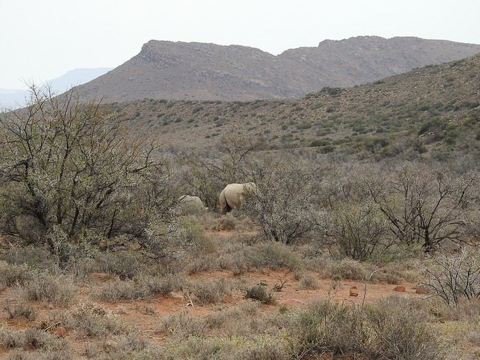
Must be around 5,000 photos to sort through!
Makes sense after 3 intense weeks in SA.
Anyway, to set the mood, here are a few photos... Well, yeah, they’re not amazing!
Suspense, suspense...
I recently took a six-week trip to Mexico with Y, my Thai partner. To be precise, we spent 43 days there plus a final half-day before heading to Mexico City Airport for our return flight to Europe.
I’d already been to Mexico about 40 years ago! But that was only for a week or so, between Mérida and the Belize border.
First off, I should mention that I’ve never seen a beach in Mexico. I say this because discussions about Mexico always seem to revolve around the Costa / Riviera Maya.
Let’s start with an overview of the trip. Our itinerary can be split into two halves:
- First half: Querétaro, San Miguel de Allende, Morelia, Guanajuato, Mexico City “CDMX” (the capital). - Second half: Palenque, San Cristóbal de Las Casas, Chiapa de Corzo, Oaxaca, Puebla, Cholula, and finally Mexico City CDMX.
To move from one part of the trip to the other, we took a flight from Mexico City CDMX to Villahermosa, then a bus to Palenque.
In six weeks, we visited maybe a quarter or a fifth of the country (see the attached maps). Mexico is about three times the size of France! And when I say “visited,” it was really just a quick stop—enough to get a first impression. I understand that some people can only spend one or two weeks on vacation in a given country, but that’s not my idea of travel. Personally, I’d say a country as rich in every way as Mexico deserves several months of travel before you can say you’ve “seen” it.
In my next post, I’ll break down the expenses. That might help future travelers plan their trips. You don’t go to a country for several weeks (or more) without thinking about the budget! Besides, one of those future travelers to Mexico is us—we were so thrilled by Mexico that we’re definitely going back.
I’d already been to Mexico about 40 years ago! But that was only for a week or so, between Mérida and the Belize border.
First off, I should mention that I’ve never seen a beach in Mexico. I say this because discussions about Mexico always seem to revolve around the Costa / Riviera Maya.
Let’s start with an overview of the trip. Our itinerary can be split into two halves:
- First half: Querétaro, San Miguel de Allende, Morelia, Guanajuato, Mexico City “CDMX” (the capital). - Second half: Palenque, San Cristóbal de Las Casas, Chiapa de Corzo, Oaxaca, Puebla, Cholula, and finally Mexico City CDMX.
To move from one part of the trip to the other, we took a flight from Mexico City CDMX to Villahermosa, then a bus to Palenque.
In six weeks, we visited maybe a quarter or a fifth of the country (see the attached maps). Mexico is about three times the size of France! And when I say “visited,” it was really just a quick stop—enough to get a first impression. I understand that some people can only spend one or two weeks on vacation in a given country, but that’s not my idea of travel. Personally, I’d say a country as rich in every way as Mexico deserves several months of travel before you can say you’ve “seen” it.
In my next post, I’ll break down the expenses. That might help future travelers plan their trips. You don’t go to a country for several weeks (or more) without thinking about the budget! Besides, one of those future travelers to Mexico is us—we were so thrilled by Mexico that we’re definitely going back.
Preamble
June 2024. While hiking with my brother on the GR 36 Tour du Morvan, I catch sight now and then of strange rectangular markers fixed to tree trunks. Against a bright orange background, a deep black Greek tau topped with a white dove. My first encounter with the Assisi Way. The Way of St. Francis: a pilgrimage route linking Vézelay in Burgundy to Assisi in Italy, covering nearly 1,800 km. It felt like an obvious next step—I immediately knew I’d take it on, attempt the adventure solo.
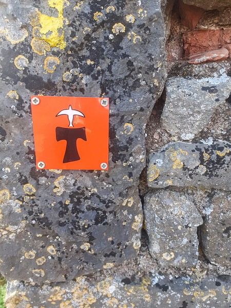
In the months that followed, I talked about my project to everyone—family, friends, my partner. An avalanche of comments, more or less the same but varying depending on each person’s character and life experiences. But deep down, it all boiled down to one legitimate question: why?
And the answers? Hesitant, awkward, partial, even confused. I quickly realized they weren’t so easy to find. It was as if my project seemed more like a whim, a kind of intimate caprice, rather than a well-thought-out plan. Of course, I knew the reasons that pushed me to leave—you always have to give some. Loved ones need to understand to feel reassured, and that’s understandable. But I fear that when I list them, they’ll sound like the same old checklist anyone embarking on this kind of journey might give. Of all the reasons I could mention, I’ll highlight just one here: the call of the road, the solo adventure that brings a powerful sense of freedom. A bit like Monsieur Seguin’s goat, who from her comfortable pen gazes longingly at the unconstrained horizon of the mountain. But if I’m being honest, I think I didn’t really know what I was looking for—or, more importantly, what I’d find. Deep down, when I reflect on it, one word keeps coming up that explains nothing and everything at once: desire.
Now well past sixty, I know that when I ask myself who I am or where I’m going, two things bring me fully back to myself: hiking and writing. And my intention was also to anchor this adventure through words, day by day. Writing down my feelings, emotions, discoveries, and reflections each evening. The famous travel journal that grounds the daily experience in reality. When I discovered the app "Polarstep," which was initially just meant to keep my loved ones updated and reassured, inform them of my progress, and maintain a connection, I found an opportunity to do it a little differently than usual. No retrospective notes polished up after returning, but spontaneous writing—recounting everything that crossed my mind during the day and publishing it immediately. A journey lived in real time.
This text is the exact transcription of my daily writings. Rereading them, I didn’t change a thing—just corrected a few mistakes and tweaked some awkward phrasing here and there. Short texts, fitting the format imposed by this kind of app. Writing as if addressing others.
Now, all that was left was to walk. April 18, 2026 – Vézelay.
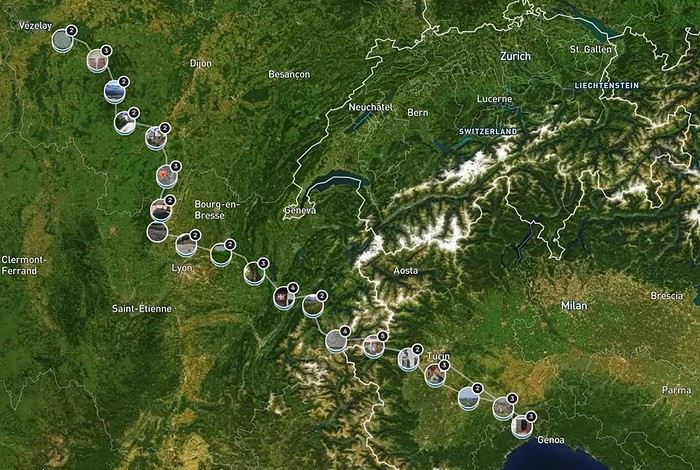
June 2024. While hiking with my brother on the GR 36 Tour du Morvan, I catch sight now and then of strange rectangular markers fixed to tree trunks. Against a bright orange background, a deep black Greek tau topped with a white dove. My first encounter with the Assisi Way. The Way of St. Francis: a pilgrimage route linking Vézelay in Burgundy to Assisi in Italy, covering nearly 1,800 km. It felt like an obvious next step—I immediately knew I’d take it on, attempt the adventure solo.
In the months that followed, I talked about my project to everyone—family, friends, my partner. An avalanche of comments, more or less the same but varying depending on each person’s character and life experiences. But deep down, it all boiled down to one legitimate question: why?
And the answers? Hesitant, awkward, partial, even confused. I quickly realized they weren’t so easy to find. It was as if my project seemed more like a whim, a kind of intimate caprice, rather than a well-thought-out plan. Of course, I knew the reasons that pushed me to leave—you always have to give some. Loved ones need to understand to feel reassured, and that’s understandable. But I fear that when I list them, they’ll sound like the same old checklist anyone embarking on this kind of journey might give. Of all the reasons I could mention, I’ll highlight just one here: the call of the road, the solo adventure that brings a powerful sense of freedom. A bit like Monsieur Seguin’s goat, who from her comfortable pen gazes longingly at the unconstrained horizon of the mountain. But if I’m being honest, I think I didn’t really know what I was looking for—or, more importantly, what I’d find. Deep down, when I reflect on it, one word keeps coming up that explains nothing and everything at once: desire.
Now well past sixty, I know that when I ask myself who I am or where I’m going, two things bring me fully back to myself: hiking and writing. And my intention was also to anchor this adventure through words, day by day. Writing down my feelings, emotions, discoveries, and reflections each evening. The famous travel journal that grounds the daily experience in reality. When I discovered the app "Polarstep," which was initially just meant to keep my loved ones updated and reassured, inform them of my progress, and maintain a connection, I found an opportunity to do it a little differently than usual. No retrospective notes polished up after returning, but spontaneous writing—recounting everything that crossed my mind during the day and publishing it immediately. A journey lived in real time.
This text is the exact transcription of my daily writings. Rereading them, I didn’t change a thing—just corrected a few mistakes and tweaked some awkward phrasing here and there. Short texts, fitting the format imposed by this kind of app. Writing as if addressing others.
Now, all that was left was to walk. April 18, 2026 – Vézelay.
NAMASTE NEPAL! PRACTICAL INFO AND EXPERIENCE FEEDBACK
Stay from March 25 to April 16, 2025
· Flight tickets Air India (via Delhi) (via Skyscanner) = 1130 € per person · Planned budget (and respected without too many restrictions and while buying a few small gifts) = 2000 € for the stay for two. Buses, taxis, and entrance fees to various sites represent a budget to consider. Meals are cheap. Drinks like beer/Coke, however, are not cheap and cost the equivalent of a meal. · Exchange rate of the rupee during our stay = 0.0064 € (the exchange rate is almost identical everywhere, including at the airport). · At the airport, purchase of two SIM cards (phone) = 1000 NPR x 2 for 28 days. · Kathmandu: we had booked the hotel upon arrival: Kathmandu Boutique Hotel (+977 015 357 446 – email: booking@kathmanduboutiquehotel.com), very well located in a quiet alley off the street, south of Thamel, a 10-minute walk from Durbar Square. A hotel like Nepal knows how to do, where tall people will have to duck. Night + breakfast = 18 € for two. Very warm welcome, great location, excellent value for money. · Bhaktapur: we had also booked a hotel for the end of our stay because the chance of the year 2025 made the Nepali New Year and Bisket Jatra particularly festive in Bhaktapur: Manju Baha Hotel School (+977 976 7234014 – email: manjubahahotel@gmail.com) located in an old monastery. "A social enterprise transforming an old monastery into a charming hotel, offering professional hospitality training to underprivileged Nepali youth." Night + breakfast = 32 € for two. Beautifully decorated room. Very warm welcome. Don’t miss the Changunarayan site (near Bhaktapur), it’s amazing. And if you’re lucky enough to be in Bhaktapur in mid-April for 3 days, there’s the Bisket Jatra festivities (Newari festival), joyful, noisy, fun, and wild… · Pokhara (hotel recommended by the Kathmandu hotel): Hotel Green Tara, Lakeside, 10th street, set back, quiet (Tel. +977 61 462698 – email: greentara_67@hotmail.com) · Trek permit (Lower Mustang, no need for an agency or guide, permits checked at Ghasa and Jomsom) = 2000 NPR per person (2 ID photos) · Bus Kathmandu/Pokhara and return = 2000 NPR per person · Bus Pokhara/Jomsom, 2 one-way tickets = 2800 NPR. · Taxi: negotiation with a driver we recommend, Vicky (+977 984 075 599). You explain what you want, negotiate the price, and he waits for you during the visit. Very charming, we used him several times. For example: departure from our hotel at 10 AM -> Boudhanath/Pashupatinath/Patan return at 5 PM to the hotel = 6500 NPR – Swayambhunath (round trip) = 1200 NPR · Site prices: https://ntb.gov.np/plan-your-trip/before-you-come/heritage-site-entry-fees o Visitor Pass for Kathmandu Durbar Square (for the duration of the stay, show your visa) = 1000 NPR per person (1 ID photo) o Bhaktapur Durbar Square (old town) = 1800 NPR per person o Patan = 1000 NPR per person o Swayambhu Stupa = 200 NPR per person o Boudha Stupa = 200 NPR per person o Pashupatinath Temple = 1000 NPR per person (interesting to take a guide) o Changunarayan Temple (6 km north of Bhaktapur) = 400 NPR per person o Mountain Museum in Pokhara = 750 NPR per person · E-cigarettes: e-cigarettes are banned in India and confiscated whether they’re in carry-on or checked luggage. On the way there, we had kept them in our carry-on, they were confiscated in Delhi. On the way back, learning from our previous experience, we put them in our checked luggage. Someone came to get us to take them out of our bags and confiscate them… You can find e-cigarettes and products in Kathmandu.
* * *
I’m 74 years old. I went to Nepal in 1982, 1983, and the last time in 1986. I wanted to introduce this beautiful and endearing country to my husband, and it was… now or never. So we decided it was now.
I knew the trek starting from Pokhara: Naudanda/Birethanti/Ghorepani/Tatopani/Kalopani. There was no way I was going to do that trek, especially the 1000-meter staircase to reach Ghorepani… You have to stay humble with age.
Back then, the road didn’t exist. I didn’t consider, with the construction of this road (NH48) along the western bank of the Kali Gandaki, doing a trek along a windy and dusty road. Was there an alternative hiking trail on the eastern bank? No one answered my question on VoyageForum, so I did my research online. And I found this site: "Andrées de Ruiter and Prem Rai - Trekking the Annapurna Circuit, including the new NATT trails that avoid the road - A guide to one of the most beautiful trekking regions in Nepal and the world (2011) - NATT = New Annapurna Trekking Trail".
Phew! A solution was emerging. This circuit from 2011 wasn’t fully marked. The idea was to go from Jomsom to Tatopani, so we needed to make sure the path was well-marked all the way, which we did, and the path exists, marked in red and white!
So, with the walking times information, we built our 8-day circuit:
· Jomsom/Thinigaon · Thinigaon/Chimang · Chimang/Saura · Saura/Kokhetanti · Rest day or, if in good shape: loop to Sekong Lake · Kokhetanti/Jhipra Deurali · Jhipra Deurali/Kopchepani · Kopchepani/Tatopani
It’s a senior trek, after all. So the walking times noted on the sites indicated 3 hours or even 4 hours for the two longest stages. That pace suited us fine.
On March 29, we left Kathmandu (1400m), after visiting the must-see sites, by bus to Pokhara: 200 km and 8.5 hours on a chaotic road under construction. I had a memory of Pokhara where it was the first city where you could see the Himalayan range, especially Machhapuchhare. But the pollution is such, the dust raised by traffic and construction, that no horizon is visible except the first hills around Pokhara.
We stayed 24 hours in Pokhara (820m), and on March 31, we left our luggage at the hotel and set off with our lightest backpacks: change of clothes, toiletries, first aid kit, anti-chafing cream, water bottle, sleeping bag liner, and light shoes for the stages.
We took the bus to Jomsom: 160 km/7.5 hours including stops for bathroom breaks, tea, and lunch. The road is nothing but a chaos of potholes, landslides, construction, dust, rebuilding, and mudslides. In Ghasa, the bus stops, and we’re told we’re at a checkpoint and that the two foreigners in the bus, my husband and I, need to have our permits checked, which takes a few minutes. The driving is rock-and-roll, surprising, and courteous. The drivers have their codes, and on these improbable roads, they’re virtuosos.
We could have chosen the plane, but several reasons dissuaded us: if there’s too much wind, the planes don’t take off; personally, I wasn’t reassured about landing in Jomsom, and this transport has a cost.
We arrived around 2 PM in Jomsom (2720m), and despite the early wake-up, the nearly 8 hours on the bus, and the altitude, we decided to head straight to Thinigaon (2840m). At the Jomsom checkpoint, they told us it was a 30-minute walk. Great! Except we took an hour and a half on an uphill road, bent over to fight a strong wind. But the Himalayan range is there! The Dhaulagiri, the Nilgiri, the Annapurnas as a reward.
In Thinigaon, we found a room at the "Nilgiri View Hotel" run by a didi (big sister in Nepali). From the lodge’s roof, she proudly showed us the different peaks surrounding the village and told us, worried, that it hadn’t snowed here for 3 years. She said there are very few tourists, that the season is rather in September/October/November. It seems there’s not a soul in this village, yet mules pass through the narrow street paved with large flat stones, their bells ringing. We dine at 6 PM and go to bed… Room = 1200 NPR and dinner, breakfast, and drinks = 2560 NPR.
On April 1, we set off at 9 AM, not for Chimang as planned but for Marpha! The didi from the Thinigaon lodge had said it was a 3-hour walk. The first part of this stage is attractive, the mountains are magnificent and imposing, the landscape is superb, there’s no one around, a feeling of being "alone in the world." We follow Dhumbra Tal, this small green lake. The path is a rocky track that climbs steeply. Then, around a hill, we start the big descent that joins the Kali Gandaki. We face the wind head-on, and the violent gusts take our breath away, throw us off balance, and envelop us in dust. We see the road on the other side of the Kali Gandaki. We arrive in the village of Chhairo at 2 PM, completely exhausted and with blistered feet, after 5 hours of walking instead of the planned 3.5 hours.
We’re welcomed by the village nurse, who tells us there’s a lodge in the village. Chhairo is a Tibetan village, a 20-minute walk from Marpha (according to the locals, multiply by 2 or even 3 for us…). We’re going to revise our trek plan and, first of all, spend the night in Chhairo.
The lodge is quite pleasant, and Karma, the hostess, is very friendly. She asks about our plans and suggests we stay in Chhairo the next day, from where we can visit Marpha and also Chimang, a 1-hour walk away, in light mode, meaning without backpacks. She invites us to participate in a village ceremony the next evening.
We immediately accept the proposal, as our feet need rest and the welcome is so warm… Dinner and bed!
We reworked our trek plan, which was too ambitious for our untrained bodies and, let’s face it… no longer in our first youth. In the initial plan, we thought there wouldn’t be too much elevation gain following the Kali Gandaki, but checking the map, we realize there might be significant elevation changes between Sauru and Sirkung. So we plan:
· Tomorrow: visit Marpha (2670m) and Chimang (2744m) · April 3: bus from Chhairo (2700m) to Kalopani (2530m) and continue on foot to Ghasa (2010m) · April 4: Ghasa/Pairataplo (1940m) · April 5: Pairatapla/Gadpar (1580m) · April 6: Gadpar/Narchyang (1510m) · April 7: Narchyang/Tatopani (1190m) · April 8: return to Pokhara.
Normally, it’s all downhill…
April 2, a rest day then… We set off in the morning to explore Marpha. We have to take a temporary bridge because the suspension bridge is closed due to road construction. We join the road and arrive in Marpha, a village famous for its apple orchards, brandy, cider, and apple juice production. This village is magnificent with its stone houses and monastery clinging to the hillside. The road construction spared it. There are people, but very few Western tourists.
We have lunch in Marpha and go back through Chhairo to take the path to Chimang. We cross a fragrant pine forest and find the rocky path; the landscape is splendid. We walk quietly, passing peaceful buffaloes and cows, and arrive at the foot of a stone staircase… 275 steps (which we counted on the way back) leading us to the village of Chimang. Chimang is an isolated Newari village that seems a bit desolate. Despite the slopes, there are crops on every little bit of land. Thankfully, we changed our initial program because there’s no lodge in this village, contrary to what we saw on a map… We wander through the village, which seems very deserted, have coffee in a house from another world, and then head back to Chhairo.
A rest day? = 5 hours of walking!!
Dinner and village ceremony. From what we understand, this ceremony is in honor of the Dalai Lama. Men, women, and children in traditional costumes gather twice a month; they dance, make, and offer small sweet cakes with Tibetan tea (made from tea, yak butter—often rancid—water, and salt). Surprising for first-timers…
Around 10 PM, we leave the ceremony; tomorrow morning, we need to be on the roadside by 7 AM to catch the bus to Kalopani…
This village of Chhairo is very pleasant and welcoming, no tourists, just two motorcyclists who arrived in the evening, one of whom participated in the ceremony and discreetly poured his Tibetan tea outside.
Lodge: "Norsang Tibetan Guesthouse and Restaurant". Total bill for 2 nights, 2 dinners, 2 breakfasts, and drinks = 8000 NPR.
April 3: bus from Chhairo to Kalopani, about 1.5 hours for the 20 km (200 NPR per person). We descend on the right bank of the Kali Gandaki. We find the red and white markings to resume the trek toward Ghasa. We’re in a fragrant pine forest, the Dhaulagiri on one side and the Annapurnas on the other, magnificent, and the path is pleasant and easy. We get a bit lost in this forest, always looking for the markings. Near Lete, two trekkers pass us, and we meet them again a little further on with two very young children, to whom we give the 2 hard-boiled eggs I didn’t eat this morning. They accepted them without hesitation.
We arrive in a village and ask for directions to Ghasa. The young girls point the way. But we come across a forest being logged, trees cut in all directions. We turn back and ask for confirmation. They confirm… But the two young girls catch up with us and clear the way. We have to step over, go around, and cross the felled trees, with no indication at all. Through this pick-up sticks of felled trees, the girls lead us to the top of a stone staircase, indicating that was the path. It’s the only place where we saw rhododendrons in bloom.
We descend the staircase. At the bottom, to the left, there’s a bridge to go toward Choyo, and to the right, a path to Ghasa. We take the right path and join the road. We should normally find the red and white markings, but we don’t… So we continue on the western bank road of the Kali Gandaki.
A little before the village of Misi, we see fumaroles on the opposite bank that seem to come from the ground. We don’t understand. We stopped to eat in the village of Misi (noodle soup = 600 NPR), but it’s hard to communicate with the elderly people running the guesthouse.
We continued on the road, not finding the marked path parallel to the road. Landslides, both on the left and right banks, seem to have taken over the marked routes. It’s a place where the Kali Gandaki gorge narrows, and on the opposite bank, the mountain smokes more and more, and we now hear the crackling of fire. Across from us, the mountain is burning… Our initial plan had us passing on that burning bank right now…
We arrive in Ghasa at 3:30 PM, a 6.5-hour stage but with a 1-hour stop at noon. We’re at the "Florida Guesthouse and Restaurant." From our room, we see the mountain smoking on the other side of the river, and at night, we see the flames. In this village, posters show Himalayan eagles and vultures that seem to be protected species. Indeed, we saw (and heard) 3 eagles circling today.
April 4 – Today, heading to Pairothapla or Kopchepani depending on our feet, accommodation options, and simply our desires.
No more smoke on the mountain this morning. It’s chilly, 7:45 AM, the sky is clear, just a smell of smoke outside.
Price of the lodge = 1000 NPR for the night + 3580 NPR for meals.
We cross Ghasa, which stretches over more than a kilometer. We have a drink at the last guesthouse in the village, and the didi, when she learns our destination, tells us to be careful because the villages we’re going to aren’t safe. Should we distribute our rupees in different pockets? Nah, we kept going.
At the exit of Ghasa, we find the red and white markings and take the suspension bridge to cross the boiling waters of the Kali Gandaki. The passage is impressive because the river is tumultuous. Lots of climbs and even more descents. We’re back on the eastern bank. It’s hot! On the narrow path, we meet a group of buffaloes. Who has the right of way? We decide to stick as close as possible to the rock wall and move forward calmly. The buffaloes look at us, chewing placidly, with no intention of jumping on us. Phew!
After a 5-hour stage (including stops), we arrive in Pairothapla, with hot feet and firm thighs, and decide we won’t go any further. It’s a good thing because there’s a lodge, the most basic so far, but with a great welcome. We have a meal and a short nap. The buffaloes we met on the way belong to this house. They come to drink at the fountain by the path.
Our host, very pleasant, doesn’t know what to do to please us and is very attentive. He wants to chat. He has two children, a 4-year-old girl and a 7-year-old boy. Where do they go to school? Do they go? He tells us that the fires in the mountain are caused by people, but for what reason? We won’t find out, but it’s illegal. From here, we can still see smoke rising in the distance. The wife is a bit less friendly. Corn kernels dry on a woven straw mat on the ground, and the mom sorts them.
From where we are, we overlook the valley and see the road under construction winding along the mountainside on the other bank.
Dinner on the terrace of the house overlooking the path, windbreaker and fleece on: dal bhat chicken for me and chicken curry for my husband: "organic" products, at least local production. There are small vegetable gardens everywhere with all sorts of vegetables.
April 5 – While we’re having breakfast on the terrace of our lodge, 5 porters, straps on their foreheads, heavily loaded, pass by on the path. A few minutes later, a group of 9 people appears. It must be said that since the beginning of our journey, we’ve met very few hikers. Two backpackers in Chhairo, the two hikers near Lete, two female hikers passed us before Pairothapla, a solo female hiker passed us…
The lodge in Pairothapla is called "Bimala Lodge & Thakali Kitchen" – Price for night + 4 meals + 2 breakfasts = 3000 NPR.
The descent toward the Kali Gandaki involves climbs whose steps we didn’t count. Clearly, the landslides on the mountain cause changes to the official ACAP trek marked in red and white, and the marking updates can’t keep up with the pace of these landslides. It’s almost always by chance that we find the markings. Fortunately, we can follow the power line that guides us somewhat.
Drink stop in Kopchepani, the legs are fine, but the feet don’t like being tightly enclosed. A group of trekkers with porters passes on the path. We met buffaloes that we kindly let pass; the path was wide enough, but it was a staircase going up, and we didn’t want to take any risks.
Across, a view of the magnificent Rupse Waterfall on the other bank of the Kali Gandaki, at the bottom, lots of vehicles and people.
Arrival in Gadpar after crossing a rather unwelcoming small village and cultivated gardens between dry stone walls, each better built than the last.
First lodge spotted, first lodge adopted to answer the call of our feet, and a very warm welcome from the owner. Since we hadn’t eaten at noon, we had Tibetan bread/jam. 6-hour stage including 1 hour of stops. Night + dinner + breakfast + drinks = 5060 NPR
April 6 – Today, heading to Narchyang.
For several days, we’ve seen banana trees with their bunches of fruit and even a prickly pear with large fruits ripening.
This stage is quite peaceful and pleasant. We take a suspension bridge to cross a tributary of the Kali Gandaki. While we’re resting for a moment before crossing the bridge, a couple of porters, a man and a woman, arrive and start across the bridge with their wood load in a basket held by a strap on their forehead, making them bend. We set off too… lighter than them.
On the other side of the bridge… a stone staircase, and it climbs steeply. The porter couple didn’t take this staircase; they went right on the path.
At the top of the staircase, we arrive in Narchyang after a 4-hour stage. A magnificent waterfall overlooks the village. We get lost in this fairly large village looking for a lodge. After wandering around for a while, we ask for directions, and an 84-year-old man takes us through the whole village and accompanies us to a very nice lodge run by a woman.
We chat with our hostess, who asks where we’re from and where we’re going. We explain that we want to reach Tatopani the next day and then return to Pokhara. She tells us there are 4x4s going directly to Pokhara and that it would probably be easier than taking a bus that might be full in Tatopani. After a quick consultation, we decide to return to Pokhara the next day by 4x4. She finds us a 4x4 with 2 seats left, departure at 8 AM – 5 hours on the road and 1500 NPR per person. A charming didi who does everything to be pleasant and helpful.
Narchyang community lodge = night + snacks + dinner + breakfast = 3000 NPR.
There you go, our trek ends tomorrow. Many necessary changes and adaptations to our initial trek, but no regrets, it was superb and a great experience that, for my part, I won’t be able to repeat. Always this encounter with the endearing, welcoming, curious, and very kind Nepali people. It was now or never, and we did it!
* * *
In conclusion, 3 full weeks in Nepal is a duration that allows visiting Kathmandu, Patan, and Bhaktapur, enjoying the various sites, and soaking in the atmosphere and urban Nepali life.
The trek, even revised and corrected, allowed us to get close to the impressive Annapurna and Dhaulagiri peaks. One or two acclimatization days might be necessary to get the body in tune with this magical and extraordinary land.
Stay from March 25 to April 16, 2025
· Flight tickets Air India (via Delhi) (via Skyscanner) = 1130 € per person · Planned budget (and respected without too many restrictions and while buying a few small gifts) = 2000 € for the stay for two. Buses, taxis, and entrance fees to various sites represent a budget to consider. Meals are cheap. Drinks like beer/Coke, however, are not cheap and cost the equivalent of a meal. · Exchange rate of the rupee during our stay = 0.0064 € (the exchange rate is almost identical everywhere, including at the airport). · At the airport, purchase of two SIM cards (phone) = 1000 NPR x 2 for 28 days. · Kathmandu: we had booked the hotel upon arrival: Kathmandu Boutique Hotel (+977 015 357 446 – email: booking@kathmanduboutiquehotel.com), very well located in a quiet alley off the street, south of Thamel, a 10-minute walk from Durbar Square. A hotel like Nepal knows how to do, where tall people will have to duck. Night + breakfast = 18 € for two. Very warm welcome, great location, excellent value for money. · Bhaktapur: we had also booked a hotel for the end of our stay because the chance of the year 2025 made the Nepali New Year and Bisket Jatra particularly festive in Bhaktapur: Manju Baha Hotel School (+977 976 7234014 – email: manjubahahotel@gmail.com) located in an old monastery. "A social enterprise transforming an old monastery into a charming hotel, offering professional hospitality training to underprivileged Nepali youth." Night + breakfast = 32 € for two. Beautifully decorated room. Very warm welcome. Don’t miss the Changunarayan site (near Bhaktapur), it’s amazing. And if you’re lucky enough to be in Bhaktapur in mid-April for 3 days, there’s the Bisket Jatra festivities (Newari festival), joyful, noisy, fun, and wild… · Pokhara (hotel recommended by the Kathmandu hotel): Hotel Green Tara, Lakeside, 10th street, set back, quiet (Tel. +977 61 462698 – email: greentara_67@hotmail.com) · Trek permit (Lower Mustang, no need for an agency or guide, permits checked at Ghasa and Jomsom) = 2000 NPR per person (2 ID photos) · Bus Kathmandu/Pokhara and return = 2000 NPR per person · Bus Pokhara/Jomsom, 2 one-way tickets = 2800 NPR. · Taxi: negotiation with a driver we recommend, Vicky (+977 984 075 599). You explain what you want, negotiate the price, and he waits for you during the visit. Very charming, we used him several times. For example: departure from our hotel at 10 AM -> Boudhanath/Pashupatinath/Patan return at 5 PM to the hotel = 6500 NPR – Swayambhunath (round trip) = 1200 NPR · Site prices: https://ntb.gov.np/plan-your-trip/before-you-come/heritage-site-entry-fees o Visitor Pass for Kathmandu Durbar Square (for the duration of the stay, show your visa) = 1000 NPR per person (1 ID photo) o Bhaktapur Durbar Square (old town) = 1800 NPR per person o Patan = 1000 NPR per person o Swayambhu Stupa = 200 NPR per person o Boudha Stupa = 200 NPR per person o Pashupatinath Temple = 1000 NPR per person (interesting to take a guide) o Changunarayan Temple (6 km north of Bhaktapur) = 400 NPR per person o Mountain Museum in Pokhara = 750 NPR per person · E-cigarettes: e-cigarettes are banned in India and confiscated whether they’re in carry-on or checked luggage. On the way there, we had kept them in our carry-on, they were confiscated in Delhi. On the way back, learning from our previous experience, we put them in our checked luggage. Someone came to get us to take them out of our bags and confiscate them… You can find e-cigarettes and products in Kathmandu.
* * *
I’m 74 years old. I went to Nepal in 1982, 1983, and the last time in 1986. I wanted to introduce this beautiful and endearing country to my husband, and it was… now or never. So we decided it was now.
I knew the trek starting from Pokhara: Naudanda/Birethanti/Ghorepani/Tatopani/Kalopani. There was no way I was going to do that trek, especially the 1000-meter staircase to reach Ghorepani… You have to stay humble with age.
Back then, the road didn’t exist. I didn’t consider, with the construction of this road (NH48) along the western bank of the Kali Gandaki, doing a trek along a windy and dusty road. Was there an alternative hiking trail on the eastern bank? No one answered my question on VoyageForum, so I did my research online. And I found this site: "Andrées de Ruiter and Prem Rai - Trekking the Annapurna Circuit, including the new NATT trails that avoid the road - A guide to one of the most beautiful trekking regions in Nepal and the world (2011) - NATT = New Annapurna Trekking Trail".
Phew! A solution was emerging. This circuit from 2011 wasn’t fully marked. The idea was to go from Jomsom to Tatopani, so we needed to make sure the path was well-marked all the way, which we did, and the path exists, marked in red and white!
So, with the walking times information, we built our 8-day circuit:
· Jomsom/Thinigaon · Thinigaon/Chimang · Chimang/Saura · Saura/Kokhetanti · Rest day or, if in good shape: loop to Sekong Lake · Kokhetanti/Jhipra Deurali · Jhipra Deurali/Kopchepani · Kopchepani/Tatopani
It’s a senior trek, after all. So the walking times noted on the sites indicated 3 hours or even 4 hours for the two longest stages. That pace suited us fine.
On March 29, we left Kathmandu (1400m), after visiting the must-see sites, by bus to Pokhara: 200 km and 8.5 hours on a chaotic road under construction. I had a memory of Pokhara where it was the first city where you could see the Himalayan range, especially Machhapuchhare. But the pollution is such, the dust raised by traffic and construction, that no horizon is visible except the first hills around Pokhara.
We stayed 24 hours in Pokhara (820m), and on March 31, we left our luggage at the hotel and set off with our lightest backpacks: change of clothes, toiletries, first aid kit, anti-chafing cream, water bottle, sleeping bag liner, and light shoes for the stages.
We took the bus to Jomsom: 160 km/7.5 hours including stops for bathroom breaks, tea, and lunch. The road is nothing but a chaos of potholes, landslides, construction, dust, rebuilding, and mudslides. In Ghasa, the bus stops, and we’re told we’re at a checkpoint and that the two foreigners in the bus, my husband and I, need to have our permits checked, which takes a few minutes. The driving is rock-and-roll, surprising, and courteous. The drivers have their codes, and on these improbable roads, they’re virtuosos.
We could have chosen the plane, but several reasons dissuaded us: if there’s too much wind, the planes don’t take off; personally, I wasn’t reassured about landing in Jomsom, and this transport has a cost.
We arrived around 2 PM in Jomsom (2720m), and despite the early wake-up, the nearly 8 hours on the bus, and the altitude, we decided to head straight to Thinigaon (2840m). At the Jomsom checkpoint, they told us it was a 30-minute walk. Great! Except we took an hour and a half on an uphill road, bent over to fight a strong wind. But the Himalayan range is there! The Dhaulagiri, the Nilgiri, the Annapurnas as a reward.
In Thinigaon, we found a room at the "Nilgiri View Hotel" run by a didi (big sister in Nepali). From the lodge’s roof, she proudly showed us the different peaks surrounding the village and told us, worried, that it hadn’t snowed here for 3 years. She said there are very few tourists, that the season is rather in September/October/November. It seems there’s not a soul in this village, yet mules pass through the narrow street paved with large flat stones, their bells ringing. We dine at 6 PM and go to bed… Room = 1200 NPR and dinner, breakfast, and drinks = 2560 NPR.
On April 1, we set off at 9 AM, not for Chimang as planned but for Marpha! The didi from the Thinigaon lodge had said it was a 3-hour walk. The first part of this stage is attractive, the mountains are magnificent and imposing, the landscape is superb, there’s no one around, a feeling of being "alone in the world." We follow Dhumbra Tal, this small green lake. The path is a rocky track that climbs steeply. Then, around a hill, we start the big descent that joins the Kali Gandaki. We face the wind head-on, and the violent gusts take our breath away, throw us off balance, and envelop us in dust. We see the road on the other side of the Kali Gandaki. We arrive in the village of Chhairo at 2 PM, completely exhausted and with blistered feet, after 5 hours of walking instead of the planned 3.5 hours.
We’re welcomed by the village nurse, who tells us there’s a lodge in the village. Chhairo is a Tibetan village, a 20-minute walk from Marpha (according to the locals, multiply by 2 or even 3 for us…). We’re going to revise our trek plan and, first of all, spend the night in Chhairo.
The lodge is quite pleasant, and Karma, the hostess, is very friendly. She asks about our plans and suggests we stay in Chhairo the next day, from where we can visit Marpha and also Chimang, a 1-hour walk away, in light mode, meaning without backpacks. She invites us to participate in a village ceremony the next evening.
We immediately accept the proposal, as our feet need rest and the welcome is so warm… Dinner and bed!
We reworked our trek plan, which was too ambitious for our untrained bodies and, let’s face it… no longer in our first youth. In the initial plan, we thought there wouldn’t be too much elevation gain following the Kali Gandaki, but checking the map, we realize there might be significant elevation changes between Sauru and Sirkung. So we plan:
· Tomorrow: visit Marpha (2670m) and Chimang (2744m) · April 3: bus from Chhairo (2700m) to Kalopani (2530m) and continue on foot to Ghasa (2010m) · April 4: Ghasa/Pairataplo (1940m) · April 5: Pairatapla/Gadpar (1580m) · April 6: Gadpar/Narchyang (1510m) · April 7: Narchyang/Tatopani (1190m) · April 8: return to Pokhara.
Normally, it’s all downhill…
April 2, a rest day then… We set off in the morning to explore Marpha. We have to take a temporary bridge because the suspension bridge is closed due to road construction. We join the road and arrive in Marpha, a village famous for its apple orchards, brandy, cider, and apple juice production. This village is magnificent with its stone houses and monastery clinging to the hillside. The road construction spared it. There are people, but very few Western tourists.
We have lunch in Marpha and go back through Chhairo to take the path to Chimang. We cross a fragrant pine forest and find the rocky path; the landscape is splendid. We walk quietly, passing peaceful buffaloes and cows, and arrive at the foot of a stone staircase… 275 steps (which we counted on the way back) leading us to the village of Chimang. Chimang is an isolated Newari village that seems a bit desolate. Despite the slopes, there are crops on every little bit of land. Thankfully, we changed our initial program because there’s no lodge in this village, contrary to what we saw on a map… We wander through the village, which seems very deserted, have coffee in a house from another world, and then head back to Chhairo.
A rest day? = 5 hours of walking!!
Dinner and village ceremony. From what we understand, this ceremony is in honor of the Dalai Lama. Men, women, and children in traditional costumes gather twice a month; they dance, make, and offer small sweet cakes with Tibetan tea (made from tea, yak butter—often rancid—water, and salt). Surprising for first-timers…
Around 10 PM, we leave the ceremony; tomorrow morning, we need to be on the roadside by 7 AM to catch the bus to Kalopani…
This village of Chhairo is very pleasant and welcoming, no tourists, just two motorcyclists who arrived in the evening, one of whom participated in the ceremony and discreetly poured his Tibetan tea outside.
Lodge: "Norsang Tibetan Guesthouse and Restaurant". Total bill for 2 nights, 2 dinners, 2 breakfasts, and drinks = 8000 NPR.
April 3: bus from Chhairo to Kalopani, about 1.5 hours for the 20 km (200 NPR per person). We descend on the right bank of the Kali Gandaki. We find the red and white markings to resume the trek toward Ghasa. We’re in a fragrant pine forest, the Dhaulagiri on one side and the Annapurnas on the other, magnificent, and the path is pleasant and easy. We get a bit lost in this forest, always looking for the markings. Near Lete, two trekkers pass us, and we meet them again a little further on with two very young children, to whom we give the 2 hard-boiled eggs I didn’t eat this morning. They accepted them without hesitation.
We arrive in a village and ask for directions to Ghasa. The young girls point the way. But we come across a forest being logged, trees cut in all directions. We turn back and ask for confirmation. They confirm… But the two young girls catch up with us and clear the way. We have to step over, go around, and cross the felled trees, with no indication at all. Through this pick-up sticks of felled trees, the girls lead us to the top of a stone staircase, indicating that was the path. It’s the only place where we saw rhododendrons in bloom.
We descend the staircase. At the bottom, to the left, there’s a bridge to go toward Choyo, and to the right, a path to Ghasa. We take the right path and join the road. We should normally find the red and white markings, but we don’t… So we continue on the western bank road of the Kali Gandaki.
A little before the village of Misi, we see fumaroles on the opposite bank that seem to come from the ground. We don’t understand. We stopped to eat in the village of Misi (noodle soup = 600 NPR), but it’s hard to communicate with the elderly people running the guesthouse.
We continued on the road, not finding the marked path parallel to the road. Landslides, both on the left and right banks, seem to have taken over the marked routes. It’s a place where the Kali Gandaki gorge narrows, and on the opposite bank, the mountain smokes more and more, and we now hear the crackling of fire. Across from us, the mountain is burning… Our initial plan had us passing on that burning bank right now…
We arrive in Ghasa at 3:30 PM, a 6.5-hour stage but with a 1-hour stop at noon. We’re at the "Florida Guesthouse and Restaurant." From our room, we see the mountain smoking on the other side of the river, and at night, we see the flames. In this village, posters show Himalayan eagles and vultures that seem to be protected species. Indeed, we saw (and heard) 3 eagles circling today.
April 4 – Today, heading to Pairothapla or Kopchepani depending on our feet, accommodation options, and simply our desires.
No more smoke on the mountain this morning. It’s chilly, 7:45 AM, the sky is clear, just a smell of smoke outside.
Price of the lodge = 1000 NPR for the night + 3580 NPR for meals.
We cross Ghasa, which stretches over more than a kilometer. We have a drink at the last guesthouse in the village, and the didi, when she learns our destination, tells us to be careful because the villages we’re going to aren’t safe. Should we distribute our rupees in different pockets? Nah, we kept going.
At the exit of Ghasa, we find the red and white markings and take the suspension bridge to cross the boiling waters of the Kali Gandaki. The passage is impressive because the river is tumultuous. Lots of climbs and even more descents. We’re back on the eastern bank. It’s hot! On the narrow path, we meet a group of buffaloes. Who has the right of way? We decide to stick as close as possible to the rock wall and move forward calmly. The buffaloes look at us, chewing placidly, with no intention of jumping on us. Phew!
After a 5-hour stage (including stops), we arrive in Pairothapla, with hot feet and firm thighs, and decide we won’t go any further. It’s a good thing because there’s a lodge, the most basic so far, but with a great welcome. We have a meal and a short nap. The buffaloes we met on the way belong to this house. They come to drink at the fountain by the path.
Our host, very pleasant, doesn’t know what to do to please us and is very attentive. He wants to chat. He has two children, a 4-year-old girl and a 7-year-old boy. Where do they go to school? Do they go? He tells us that the fires in the mountain are caused by people, but for what reason? We won’t find out, but it’s illegal. From here, we can still see smoke rising in the distance. The wife is a bit less friendly. Corn kernels dry on a woven straw mat on the ground, and the mom sorts them.
From where we are, we overlook the valley and see the road under construction winding along the mountainside on the other bank.
Dinner on the terrace of the house overlooking the path, windbreaker and fleece on: dal bhat chicken for me and chicken curry for my husband: "organic" products, at least local production. There are small vegetable gardens everywhere with all sorts of vegetables.
April 5 – While we’re having breakfast on the terrace of our lodge, 5 porters, straps on their foreheads, heavily loaded, pass by on the path. A few minutes later, a group of 9 people appears. It must be said that since the beginning of our journey, we’ve met very few hikers. Two backpackers in Chhairo, the two hikers near Lete, two female hikers passed us before Pairothapla, a solo female hiker passed us…
The lodge in Pairothapla is called "Bimala Lodge & Thakali Kitchen" – Price for night + 4 meals + 2 breakfasts = 3000 NPR.
The descent toward the Kali Gandaki involves climbs whose steps we didn’t count. Clearly, the landslides on the mountain cause changes to the official ACAP trek marked in red and white, and the marking updates can’t keep up with the pace of these landslides. It’s almost always by chance that we find the markings. Fortunately, we can follow the power line that guides us somewhat.
Drink stop in Kopchepani, the legs are fine, but the feet don’t like being tightly enclosed. A group of trekkers with porters passes on the path. We met buffaloes that we kindly let pass; the path was wide enough, but it was a staircase going up, and we didn’t want to take any risks.
Across, a view of the magnificent Rupse Waterfall on the other bank of the Kali Gandaki, at the bottom, lots of vehicles and people.
Arrival in Gadpar after crossing a rather unwelcoming small village and cultivated gardens between dry stone walls, each better built than the last.
First lodge spotted, first lodge adopted to answer the call of our feet, and a very warm welcome from the owner. Since we hadn’t eaten at noon, we had Tibetan bread/jam. 6-hour stage including 1 hour of stops. Night + dinner + breakfast + drinks = 5060 NPR
April 6 – Today, heading to Narchyang.
For several days, we’ve seen banana trees with their bunches of fruit and even a prickly pear with large fruits ripening.
This stage is quite peaceful and pleasant. We take a suspension bridge to cross a tributary of the Kali Gandaki. While we’re resting for a moment before crossing the bridge, a couple of porters, a man and a woman, arrive and start across the bridge with their wood load in a basket held by a strap on their forehead, making them bend. We set off too… lighter than them.
On the other side of the bridge… a stone staircase, and it climbs steeply. The porter couple didn’t take this staircase; they went right on the path.
At the top of the staircase, we arrive in Narchyang after a 4-hour stage. A magnificent waterfall overlooks the village. We get lost in this fairly large village looking for a lodge. After wandering around for a while, we ask for directions, and an 84-year-old man takes us through the whole village and accompanies us to a very nice lodge run by a woman.
We chat with our hostess, who asks where we’re from and where we’re going. We explain that we want to reach Tatopani the next day and then return to Pokhara. She tells us there are 4x4s going directly to Pokhara and that it would probably be easier than taking a bus that might be full in Tatopani. After a quick consultation, we decide to return to Pokhara the next day by 4x4. She finds us a 4x4 with 2 seats left, departure at 8 AM – 5 hours on the road and 1500 NPR per person. A charming didi who does everything to be pleasant and helpful.
Narchyang community lodge = night + snacks + dinner + breakfast = 3000 NPR.
There you go, our trek ends tomorrow. Many necessary changes and adaptations to our initial trek, but no regrets, it was superb and a great experience that, for my part, I won’t be able to repeat. Always this encounter with the endearing, welcoming, curious, and very kind Nepali people. It was now or never, and we did it!
* * *
In conclusion, 3 full weeks in Nepal is a duration that allows visiting Kathmandu, Patan, and Bhaktapur, enjoying the various sites, and soaking in the atmosphere and urban Nepali life.
The trek, even revised and corrected, allowed us to get close to the impressive Annapurna and Dhaulagiri peaks. One or two acclimatization days might be necessary to get the body in tune with this magical and extraordinary land.
After my trip to Oregon in 2018 (see Travel Journal "Oregon and Only Oregon"), I vaguely intended to return to the West (the western USA, of course—the west of France is where I almost live) someday, later... with no specific date or plan.
November 2018, I stumbled upon a promotion for round-trip flights from Paris to San Francisco. Well, I *stumbled*—they must’ve collected some "data" on me to make sure this deal crossed my path. And it worked! My ESTA was still valid, and two days later, it was decided: May 13, 2019 (departure from Paris) to June 15, 2019 (return to Paris).
The travel style? Just like last year: low-budget trip, rental car, and accommodation only in campgrounds, with no reservations to stay as free as possible.
Exceptions? 3 nights in a youth hostel upon arrival in downtown San Francisco, and 1 night on the way back (right before flying) in Montara, near Pacifica—a spot that seemed well-located for driving back to the airport in the middle of the night.
Now, to sketch out the rough itinerary. Here’s what it looked like after the trip:
Westernmost point: Montara Lighthouse on the coast, 30 km south of San Francisco (California); Easternmost point: Zion National Park (Utah). Northernmost point: Reno (Nevada). Southernmost point: Spring Mountain Ranch State Park in Blue Diamond, near Las Vegas (Nevada).
Another view:
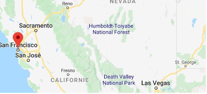
I’ll be spending 33 days in this little area! I’m a slow traveler.
Meanwhile, I realized that in some places I wanted to visit (Las Vegas and National Parks), it was better to book ahead. So, I added to my reservations: - 2 nights in a hostel in Las Vegas - 6 nights of camping in the national parks (2 at Zion NP, 2 at Yosemite NP, 2 at Sequoia-Kings Canyon NP). Between all these dated stops, it’s a choose-your-own-adventure from the ideas I found.
I’m also a slow writer—slow writer, slow traveler—so it’ll take me a while to wrap this up. I’ll start tomorrow.
November 2018, I stumbled upon a promotion for round-trip flights from Paris to San Francisco. Well, I *stumbled*—they must’ve collected some "data" on me to make sure this deal crossed my path. And it worked! My ESTA was still valid, and two days later, it was decided: May 13, 2019 (departure from Paris) to June 15, 2019 (return to Paris).
The travel style? Just like last year: low-budget trip, rental car, and accommodation only in campgrounds, with no reservations to stay as free as possible.
Exceptions? 3 nights in a youth hostel upon arrival in downtown San Francisco, and 1 night on the way back (right before flying) in Montara, near Pacifica—a spot that seemed well-located for driving back to the airport in the middle of the night.
Now, to sketch out the rough itinerary. Here’s what it looked like after the trip:
Westernmost point: Montara Lighthouse on the coast, 30 km south of San Francisco (California); Easternmost point: Zion National Park (Utah). Northernmost point: Reno (Nevada). Southernmost point: Spring Mountain Ranch State Park in Blue Diamond, near Las Vegas (Nevada).
Another view:
I’ll be spending 33 days in this little area! I’m a slow traveler.
Meanwhile, I realized that in some places I wanted to visit (Las Vegas and National Parks), it was better to book ahead. So, I added to my reservations: - 2 nights in a hostel in Las Vegas - 6 nights of camping in the national parks (2 at Zion NP, 2 at Yosemite NP, 2 at Sequoia-Kings Canyon NP). Between all these dated stops, it’s a choose-your-own-adventure from the ideas I found.
I’m also a slow writer—slow writer, slow traveler—so it’ll take me a while to wrap this up. I’ll start tomorrow.
This adventure began during Covid... Yep, Covid turned a lot of things upside down, but most of all, it kept us cooped up for a few months and stopped us from traveling for a while—even longer for a die-hard fan of the American West like me.
While borders were closed, I started imagining what an ideal itinerary might look like—one that would string together all the Southwest must-sees in just two weeks, during the best time of year: September and October. When the U.S. announced in September 2021 that borders would reopen in the coming weeks, I regained hope and began scouting flight tickets for a departure in September 2022.
But here’s the thing: tackling solo hikes, each one tougher than the last, right in the heart of the Wilderness, could be a risky—even reckless—endeavor for a father of three. After a quick chat with some virtual friends who are just as passionate about the Southwest as I am, with good physical condition and nearly the same list of must-visit spots, Franck and his brother Sullivan were in! 🙂
In November, we snagged flight tickets from Nice to San Francisco for the modest sum of 400 €, and a few days later, I booked a Toyota Tacoma pickup for 840 € !
It’s not cheap for just 15 days, and a pickup isn’t exactly ideal for luggage, but the prices for full-size 4x4s have become totally outrageous! Due to border closures, rental companies had to offload a lot of these big 4x4s, which tourists love. Then, supply and demand did the rest !
Franck and I spent the winter and spring trying to cram the equivalent of three weeks of hikes into two. But even with physical limits, we had to stay reasonable! Three to four months before departure, we entered the lotteries for different must-see spots: The Subway, Coyote Buttes North (home to the famous Wave), and Coyote Buttes South (CBS).
The Wave is the holy grail for any Southwest enthusiast. Since 2015, we’ve tried our luck with the online and on-site lotteries about ten times, but the spots are unfortunately limited: just 20 per day. A glimmer of hope, though—since early 2022, that number has increased to 64 people allowed per day, with 48 spots awarded via the online lottery.
After all three of us tried our luck for The Wave, on June 1st at exactly 5 PM, I got an email that started with, "Congratulations! You were successful in the Coyote Buttes North (The Wave) September 2022 Permit Lottery at Coyote Buttes North (The Wave)...". At 5:01 PM, I called Franck, whose dream it’s been for over 20 years—ever since the first photos were published in a travel magazine! He didn’t believe me when I told him, and I had to forward the email for him to finally accept the unbelievable: we were going to The Wave and all the incredible spots scattered across the protected area of Coyote Buttes North.
I’ve already been to Coyote Buttes South twice, but there are areas I couldn’t explore in the middle of summer because they were too remote. So, I had no trouble letting my buddies convince me to go back for a third time. Plus, given how hard it is to access, we had no trouble securing a permit online as long as we logged in at exactly 8 PM on the dot!
For The Subway, all three of us struck out. No big deal—we won at CBN and CBS!
Among the sites to visit, there are two that I’m particularly attached to because I know my chances of wanting to see them again are slim. The first is Angel Arch, one of the most legendary arches in the Southwest, due to its remoteness from any trace of civilization. To get there, the recommended hike is Upper Salt Creek, and you’re looking at a 50 km round-trip in an area with no water (in September) and populated by bears.
The second site is the Hopi Salt Trail, in Navajo land, which, after a very tough hike, lets you marvel at the turquoise-blue waters of the Little Colorado before it meets the Colorado River. The Hopi Salt Trail is, like The Wave, the holy grail for any Southwest enthusiast, and the windows of opportunity to see the water in that magical color are very short each year. For this, you have to monitor the Little Colorado’s gauges downstream from Cameron: if the level stays at its lowest for 10 consecutive days—meaning no rain—you can hope for turquoise water. The ideal period rarely exceeds 30 days a year, and it’s usually in June that all the stars align.
But unfortunately, one month before departure, while the flow rate at Cameron looked promising, several storms in September dashed our hopes of doing the Hopi Salt Trail, even at the end of the road trip.
We still had two consolation prizes, though:
After a last-minute cancellation, while keeping an eye out for available spots for The Subway, it turned out that three spots opened up exactly on the day we’d planned to go—so we rushed to grab them!! Regarding the 4x4 rental, the prices for full-size models dropped by several hundred dollars, and we ended up finding a Chevrolet Tahoe for less than $1000. A steal and a serious boost in comfort, so we could store all our gear and food without worry!
Here’s the initial plan in a perfect world: D1 The White Domes - Camping D2 Sunrise at The White Domes - The Subway D3 Coyote Buttes North D4 Coyote Buttes South - White Pocket D5 Wahweap Hoodoos - Sidestep Canyon - Colourful Canyon - White Rocks - Sunset at Yellow Rock D6 Broken Bow Arch - Reflection Canyon D7 Coyote Gulch D8 The Volcano (or The Oasis - Zebra Slot Canyon if the weather’s good) - North Caineville Mesa D9 The Needles: Squaw Canyon - Lost Canyon combo - Druid Arch - Chesler Park D10 Upper Salt Creek Day 1 - Camping D11 Upper Salt Creek Day 2 D12 Hopi-Navajo Territory: Ha Ho No Geh Canyon, Coal Mine Canyon, Bends of the Little Colorado D13 Grand Canyon: South Kaibab Trail and Bright Angel Trail D14 Upper East Zion: East Temple Loop, Jughandle Arch, Center of the Universe, and Checkerboard Mesa Summit And several backup options in case of bad weather, including Spencer Trail, West Cove, and Buffington Pockets.
Enough talking—time for action!
While borders were closed, I started imagining what an ideal itinerary might look like—one that would string together all the Southwest must-sees in just two weeks, during the best time of year: September and October. When the U.S. announced in September 2021 that borders would reopen in the coming weeks, I regained hope and began scouting flight tickets for a departure in September 2022.
But here’s the thing: tackling solo hikes, each one tougher than the last, right in the heart of the Wilderness, could be a risky—even reckless—endeavor for a father of three. After a quick chat with some virtual friends who are just as passionate about the Southwest as I am, with good physical condition and nearly the same list of must-visit spots, Franck and his brother Sullivan were in! 🙂
In November, we snagged flight tickets from Nice to San Francisco for the modest sum of 400 €, and a few days later, I booked a Toyota Tacoma pickup for 840 € !
It’s not cheap for just 15 days, and a pickup isn’t exactly ideal for luggage, but the prices for full-size 4x4s have become totally outrageous! Due to border closures, rental companies had to offload a lot of these big 4x4s, which tourists love. Then, supply and demand did the rest !
Franck and I spent the winter and spring trying to cram the equivalent of three weeks of hikes into two. But even with physical limits, we had to stay reasonable! Three to four months before departure, we entered the lotteries for different must-see spots: The Subway, Coyote Buttes North (home to the famous Wave), and Coyote Buttes South (CBS).
The Wave is the holy grail for any Southwest enthusiast. Since 2015, we’ve tried our luck with the online and on-site lotteries about ten times, but the spots are unfortunately limited: just 20 per day. A glimmer of hope, though—since early 2022, that number has increased to 64 people allowed per day, with 48 spots awarded via the online lottery.
After all three of us tried our luck for The Wave, on June 1st at exactly 5 PM, I got an email that started with, "Congratulations! You were successful in the Coyote Buttes North (The Wave) September 2022 Permit Lottery at Coyote Buttes North (The Wave)...". At 5:01 PM, I called Franck, whose dream it’s been for over 20 years—ever since the first photos were published in a travel magazine! He didn’t believe me when I told him, and I had to forward the email for him to finally accept the unbelievable: we were going to The Wave and all the incredible spots scattered across the protected area of Coyote Buttes North.
I’ve already been to Coyote Buttes South twice, but there are areas I couldn’t explore in the middle of summer because they were too remote. So, I had no trouble letting my buddies convince me to go back for a third time. Plus, given how hard it is to access, we had no trouble securing a permit online as long as we logged in at exactly 8 PM on the dot!
For The Subway, all three of us struck out. No big deal—we won at CBN and CBS!
Among the sites to visit, there are two that I’m particularly attached to because I know my chances of wanting to see them again are slim. The first is Angel Arch, one of the most legendary arches in the Southwest, due to its remoteness from any trace of civilization. To get there, the recommended hike is Upper Salt Creek, and you’re looking at a 50 km round-trip in an area with no water (in September) and populated by bears.
The second site is the Hopi Salt Trail, in Navajo land, which, after a very tough hike, lets you marvel at the turquoise-blue waters of the Little Colorado before it meets the Colorado River. The Hopi Salt Trail is, like The Wave, the holy grail for any Southwest enthusiast, and the windows of opportunity to see the water in that magical color are very short each year. For this, you have to monitor the Little Colorado’s gauges downstream from Cameron: if the level stays at its lowest for 10 consecutive days—meaning no rain—you can hope for turquoise water. The ideal period rarely exceeds 30 days a year, and it’s usually in June that all the stars align.
But unfortunately, one month before departure, while the flow rate at Cameron looked promising, several storms in September dashed our hopes of doing the Hopi Salt Trail, even at the end of the road trip.
We still had two consolation prizes, though:
After a last-minute cancellation, while keeping an eye out for available spots for The Subway, it turned out that three spots opened up exactly on the day we’d planned to go—so we rushed to grab them!! Regarding the 4x4 rental, the prices for full-size models dropped by several hundred dollars, and we ended up finding a Chevrolet Tahoe for less than $1000. A steal and a serious boost in comfort, so we could store all our gear and food without worry!
Here’s the initial plan in a perfect world: D1 The White Domes - Camping D2 Sunrise at The White Domes - The Subway D3 Coyote Buttes North D4 Coyote Buttes South - White Pocket D5 Wahweap Hoodoos - Sidestep Canyon - Colourful Canyon - White Rocks - Sunset at Yellow Rock D6 Broken Bow Arch - Reflection Canyon D7 Coyote Gulch D8 The Volcano (or The Oasis - Zebra Slot Canyon if the weather’s good) - North Caineville Mesa D9 The Needles: Squaw Canyon - Lost Canyon combo - Druid Arch - Chesler Park D10 Upper Salt Creek Day 1 - Camping D11 Upper Salt Creek Day 2 D12 Hopi-Navajo Territory: Ha Ho No Geh Canyon, Coal Mine Canyon, Bends of the Little Colorado D13 Grand Canyon: South Kaibab Trail and Bright Angel Trail D14 Upper East Zion: East Temple Loop, Jughandle Arch, Center of the Universe, and Checkerboard Mesa Summit And several backup options in case of bad weather, including Spencer Trail, West Cove, and Buffington Pockets.
Enough talking—time for action!
"In one place, in one day, a single deed accomplished,
May hold the theater filled until the end."
- Sunday morning, a chilly dawn - The kitchen - Smell of coffee and toast, a jar of honey on the table.
- Tits pecking at sunflower seeds in the transparent feeder stuck to the window.
- France Musique on the radio: Brahms, violin concerto by the lovely Hilary Hahn - Characters: - An old man in a plush dark blue dressing gown - An old woman in a worn-out duck-blue dressing gown. They dance cheek to cheek, the woman’s head resting on the old man’s broad chest. The old man breathes in the tangled hair of the lady. She smiles. Happy. Tomorrow, they’re off on a trip.
- Sunday morning, a chilly dawn - The kitchen - Smell of coffee and toast, a jar of honey on the table.
- Tits pecking at sunflower seeds in the transparent feeder stuck to the window.
- France Musique on the radio: Brahms, violin concerto by the lovely Hilary Hahn - Characters: - An old man in a plush dark blue dressing gown - An old woman in a worn-out duck-blue dressing gown. They dance cheek to cheek, the woman’s head resting on the old man’s broad chest. The old man breathes in the tangled hair of the lady. She smiles. Happy. Tomorrow, they’re off on a trip.
Preamble: Why La Gomera?
When we started looking for a summer destination a few months ago, our first criterion was to avoid extreme heat and heatwaves. We had already been to Norway two years ago and are considering going back in the future for other occasions. So, we had some fun asking ChatGPT which destinations enjoyed a mild climate during the summer without going too far. Among the list provided by the AI were the Canary Islands... The idea of a place we wouldn’t have thought of first, both not too far away and exotic enough, appealed to us: “Hmm, why not?”
This destination had never really attracted me, though Magali was a bit more interested. Five years earlier, COVID had caused a short break in my professional activity, and I had planned a trip because the flight price was attractive, and I was looking for a destination different from what usually appeals to me, more than out of deep interest. From a distance and with a social judgment I acknowledge (it’s not great, but it’s not completely wrong), I had the image of a destination for party-goers enjoying the sun without the slightest interest in local culture, with concrete coastlines and denatured landscapes—everything I detest the most. Still, I had done some quick research on the different islands and spotted Lanzarote for its beautiful volcanic landscapes, hiking trails, beaches, and the impression of a good balance between activity and fewer crowds than Tenerife or Gran Canaria. Then I dropped the idea of going, without ever reconsidering traveling to the Canaries...
Until now! Because we started researching the different islands of the archipelago to see which ones might appeal to us the most. It was La Gomera, the third smallest island of the archipelago, more praised for its hiking trails and preserved nature than for its beaches, away from mass tourism (fifty times fewer tourists than Tenerife) but still a bit more developed than its wild neighbor El Hierro, that caught our attention. Contrary to what might be suggested later, I’m not at all addicted to AI, but I use it from time to time to synthesize quick research or simply for experimentation. Since ChatGPT had started anticipating my tastes lately as if it had become my buddy (often successfully, sometimes off the mark), I asked which Canary Island would suit me best for a trip with my family. The tool answered first with... La Gomera. So, I tested it and teased it a bit to see if this suggestion was well-founded, as the method sometimes makes it contradict itself. But no luck: “You’d appreciate the wild nature of El Hierro, but with family, you’ll find little activity for the kids. You won’t like the touristy vibe of the big islands like Tenerife, Gran Canaria, Lanzarote, and Fuerteventura. You could consider La Palma, but it’s really La Gomera that will suit you best, based on your interests and the criteria given.” So, we dug deeper into our research and were convinced without a shadow of a doubt that this island was the one waiting for us.
Without knowing it, we had Canarians in our circle who revealed their origins when they heard about our travel plans. One from Tenerife insisted we’d be better off choosing Tenerife (obviously...) because it also has preserved spots and that La Gomera, “you can explore it in two or three days, you’ll get bored quickly...” The other, a colleague from Gran Canaria who had never visited La Gomera, still recommended it without hesitation because it turned out her parents had just gone there on vacation: they loved it and had encountered few tourists. She also tended to think this destination was usually the subject of short stays, but according to what her parents told her, taking your time there was also a great idea. However, in our research, the idea that La Gomera is an island you can explore in three or four days max kept coming up. So, we considered combining its visit with La Palma or El Hierro, the other two that caught our eye. But hopping between islands by ferry represents a significant budget for non-Canarians, even more so for a family of four. Then, scrutinizing Google Maps, it seemed obvious that two weeks were too short to discover two islands as they deserve, and that there seemed to be plenty to see in La Gomera, given its very unique culture. After all, we read that some people spend several months a year there, others never even leave... Finally, these landscapes and this atmosphere, which seemed to us a mix of Europe, North Africa, and Latin America, tempted us. So, it would be two weeks in La Gomera, deal!
La Gomera is therefore the second... well, the third smallest island of the Canaries since La Graciosa was recently recognized as a fully inhabited island. It has the shape of a rough circle about 20 to 25 kilometers in diameter and has just over 20,000 inhabitants, half of them in its capital, San Sebastián de la Gomera, the only real town. Like its Canarian sisters, La Gomera is a volcanic formation that rose about 10 million years ago. The island is very mountainous and rugged, covered with red and black rocky landscapes. Geological activity has shaped, between the sprawling massifs that end in steep cliffs in the ocean, six coastal valleys with tropical vegetation that have favored human settlement. They divide the island like slices of a cake; from the north clockwise: the agricultural Vallehermoso, the rustic Agulo, the green, humid, and fertile Hermigua, the sunny capital San Sebastián de la Gomera, the southern and isolated Alajeró-Santiago, and the seaside Valle Gran Rey. They constitute the six municipalities (more like cantons to our French understanding) of the territory.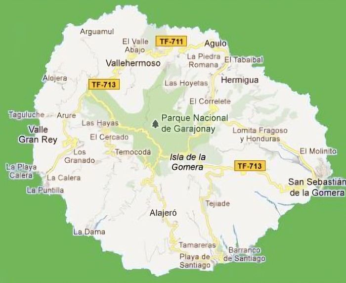 The large solidified magma massifs that shape the heart of the island have created a large depression more protected from the sun at its center, allowing the growth of a vast laurel forest, today grouped within the Garajonay National Park, La Gomera’s green lung, which has earned it the status of a World Biosphere Reserve. Its completely European appearance contrasts sharply with the rocky and tropical landscapes of the rest of the island. Thus, the climate varies greatly from one point to another on the island: in summer, you can quickly go from a dry and sunny valley at 35°C to a humid forest area at altitude at 18°C.
La Gomera was populated late. As with the rest of the Canaries, human presence is thought to have begun about 2,000 years ago. Groups of animist Berbers, probably fleeing persecution, gradually populated the archipelago, especially the western islands and La Gomera, becoming its small aboriginal population: the Guanches (or later Gomeros). The animist and pastoral civilization of the Guanches thrived until the Spanish takeover in the 15th century, which, after a short period of harmony and mixing with the indigenous people, suddenly ended in bloodshed... La Gomera later became the “Columbus Island” after Christopher Columbus’s stopover, increasing the blending of populations. In the 20th century, many Gomeros emigrated to Cuba and other Latin American countries in search of a better life, bringing back a mix of cultures and traits quite palpable in today’s Gomeran culture. It is, however, in La Gomera that the vestiges of Guanche culture seem to have left the most traces, in the language, gastronomy, social practices... Moreover, most Gomeros, especially in remote villages, have a particular identifiable type and proudly claim their ancestral roots, even making La Gomera a bit exotic in the eyes of other Canarians.
Perhaps that’s why it has never really wanted to develop its tourist infrastructure too much. If we set aside the tourists who visit for the day by bus or boat from Tenerife on a marked itinerary (and whom we ultimately rarely encounter), La Gomera has remained a hidden gem, a destination focused on nature discovery that attracts hikers, nature-loving divers, and scientists for its fauna and flora, and to a lesser extent, beachgoers who don’t seek overly developed coastlines. Tourist activity is therefore limited. Roughly speaking, you’ll find a majority of Spaniards, including a substantial number of residents from other Canary Islands, many Germans who have a particular fondness for La Gomera and spend long stays there or own second homes, to the point that the German cultural footprint is clearly noticeable in some places (it’s said to be Angela Merkel’s favorite holiday spot), and still quite a few French. The presence of other nationalities seemed negligible to us. Most travelers come mainly for hiking, but it’s also a prime spot for whale watching. Additionally, the seaside resorts of La Gomera—San Sebastián, Santiago, and especially Valle Gran Rey—are well-known destinations for hippies, especially German ones, ranging from chic boho hippies to old-school hippies who’ve been there for decades, quite similar to those you’d meet in India in Goa, Rishikesh, or Paharganj. Thus, practices like naturism, vegetarianism, and local organic production are quite well established in some areas.
Some practical info: - The round-trip flight from Paris to Tenerife cost us 365 € per person (outbound with Transavia, return with EasyJet), including checked luggage and three seats reserved side by side. - We chose two bases to explore the island: one week in Valle Gran Rey, reputed to be the most pleasant of the three seaside resorts, and one week in Hermigua, more mountainous and close to the natural park. We booked two houses with balconies and views: the first at 120 € per night, the second at 99 €. - The round-trip ferry between Tenerife and La Gomera cost us 270 € with the company Baleària Canarias, including discounts for children aged 4 and 12, but I don’t have the exact details. It was a bit cheaper than with the other company, Fred Olsen. - Finally, we rented a car through the agency Cicar for 360 € for 16 days, which comes to 22.50 € per day. - Apart from that, we didn’t plan anything and decided the day before or even the morning of what we wanted to do. We didn’t invest in any paper guide on the Canaries, as information on La Gomera was scarce, but we used the very comprehensive site La Gomera Travel, a travel guide published by the Canary Islands Tourism Council, a real goldmine of almost exhaustive information on the island.
Alright, off we go for 16 days of adventure discovering La Gomera!
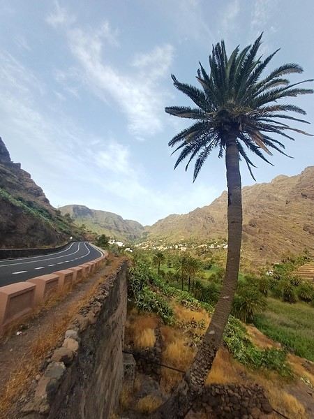
And we start the trip with music!
We start the trip with music!
When we started looking for a summer destination a few months ago, our first criterion was to avoid extreme heat and heatwaves. We had already been to Norway two years ago and are considering going back in the future for other occasions. So, we had some fun asking ChatGPT which destinations enjoyed a mild climate during the summer without going too far. Among the list provided by the AI were the Canary Islands... The idea of a place we wouldn’t have thought of first, both not too far away and exotic enough, appealed to us: “Hmm, why not?”
This destination had never really attracted me, though Magali was a bit more interested. Five years earlier, COVID had caused a short break in my professional activity, and I had planned a trip because the flight price was attractive, and I was looking for a destination different from what usually appeals to me, more than out of deep interest. From a distance and with a social judgment I acknowledge (it’s not great, but it’s not completely wrong), I had the image of a destination for party-goers enjoying the sun without the slightest interest in local culture, with concrete coastlines and denatured landscapes—everything I detest the most. Still, I had done some quick research on the different islands and spotted Lanzarote for its beautiful volcanic landscapes, hiking trails, beaches, and the impression of a good balance between activity and fewer crowds than Tenerife or Gran Canaria. Then I dropped the idea of going, without ever reconsidering traveling to the Canaries...
Until now! Because we started researching the different islands of the archipelago to see which ones might appeal to us the most. It was La Gomera, the third smallest island of the archipelago, more praised for its hiking trails and preserved nature than for its beaches, away from mass tourism (fifty times fewer tourists than Tenerife) but still a bit more developed than its wild neighbor El Hierro, that caught our attention. Contrary to what might be suggested later, I’m not at all addicted to AI, but I use it from time to time to synthesize quick research or simply for experimentation. Since ChatGPT had started anticipating my tastes lately as if it had become my buddy (often successfully, sometimes off the mark), I asked which Canary Island would suit me best for a trip with my family. The tool answered first with... La Gomera. So, I tested it and teased it a bit to see if this suggestion was well-founded, as the method sometimes makes it contradict itself. But no luck: “You’d appreciate the wild nature of El Hierro, but with family, you’ll find little activity for the kids. You won’t like the touristy vibe of the big islands like Tenerife, Gran Canaria, Lanzarote, and Fuerteventura. You could consider La Palma, but it’s really La Gomera that will suit you best, based on your interests and the criteria given.” So, we dug deeper into our research and were convinced without a shadow of a doubt that this island was the one waiting for us.
Without knowing it, we had Canarians in our circle who revealed their origins when they heard about our travel plans. One from Tenerife insisted we’d be better off choosing Tenerife (obviously...) because it also has preserved spots and that La Gomera, “you can explore it in two or three days, you’ll get bored quickly...” The other, a colleague from Gran Canaria who had never visited La Gomera, still recommended it without hesitation because it turned out her parents had just gone there on vacation: they loved it and had encountered few tourists. She also tended to think this destination was usually the subject of short stays, but according to what her parents told her, taking your time there was also a great idea. However, in our research, the idea that La Gomera is an island you can explore in three or four days max kept coming up. So, we considered combining its visit with La Palma or El Hierro, the other two that caught our eye. But hopping between islands by ferry represents a significant budget for non-Canarians, even more so for a family of four. Then, scrutinizing Google Maps, it seemed obvious that two weeks were too short to discover two islands as they deserve, and that there seemed to be plenty to see in La Gomera, given its very unique culture. After all, we read that some people spend several months a year there, others never even leave... Finally, these landscapes and this atmosphere, which seemed to us a mix of Europe, North Africa, and Latin America, tempted us. So, it would be two weeks in La Gomera, deal!
La Gomera is therefore the second... well, the third smallest island of the Canaries since La Graciosa was recently recognized as a fully inhabited island. It has the shape of a rough circle about 20 to 25 kilometers in diameter and has just over 20,000 inhabitants, half of them in its capital, San Sebastián de la Gomera, the only real town. Like its Canarian sisters, La Gomera is a volcanic formation that rose about 10 million years ago. The island is very mountainous and rugged, covered with red and black rocky landscapes. Geological activity has shaped, between the sprawling massifs that end in steep cliffs in the ocean, six coastal valleys with tropical vegetation that have favored human settlement. They divide the island like slices of a cake; from the north clockwise: the agricultural Vallehermoso, the rustic Agulo, the green, humid, and fertile Hermigua, the sunny capital San Sebastián de la Gomera, the southern and isolated Alajeró-Santiago, and the seaside Valle Gran Rey. They constitute the six municipalities (more like cantons to our French understanding) of the territory.
The large solidified magma massifs that shape the heart of the island have created a large depression more protected from the sun at its center, allowing the growth of a vast laurel forest, today grouped within the Garajonay National Park, La Gomera’s green lung, which has earned it the status of a World Biosphere Reserve. Its completely European appearance contrasts sharply with the rocky and tropical landscapes of the rest of the island. Thus, the climate varies greatly from one point to another on the island: in summer, you can quickly go from a dry and sunny valley at 35°C to a humid forest area at altitude at 18°C.La Gomera was populated late. As with the rest of the Canaries, human presence is thought to have begun about 2,000 years ago. Groups of animist Berbers, probably fleeing persecution, gradually populated the archipelago, especially the western islands and La Gomera, becoming its small aboriginal population: the Guanches (or later Gomeros). The animist and pastoral civilization of the Guanches thrived until the Spanish takeover in the 15th century, which, after a short period of harmony and mixing with the indigenous people, suddenly ended in bloodshed... La Gomera later became the “Columbus Island” after Christopher Columbus’s stopover, increasing the blending of populations. In the 20th century, many Gomeros emigrated to Cuba and other Latin American countries in search of a better life, bringing back a mix of cultures and traits quite palpable in today’s Gomeran culture. It is, however, in La Gomera that the vestiges of Guanche culture seem to have left the most traces, in the language, gastronomy, social practices... Moreover, most Gomeros, especially in remote villages, have a particular identifiable type and proudly claim their ancestral roots, even making La Gomera a bit exotic in the eyes of other Canarians.
Perhaps that’s why it has never really wanted to develop its tourist infrastructure too much. If we set aside the tourists who visit for the day by bus or boat from Tenerife on a marked itinerary (and whom we ultimately rarely encounter), La Gomera has remained a hidden gem, a destination focused on nature discovery that attracts hikers, nature-loving divers, and scientists for its fauna and flora, and to a lesser extent, beachgoers who don’t seek overly developed coastlines. Tourist activity is therefore limited. Roughly speaking, you’ll find a majority of Spaniards, including a substantial number of residents from other Canary Islands, many Germans who have a particular fondness for La Gomera and spend long stays there or own second homes, to the point that the German cultural footprint is clearly noticeable in some places (it’s said to be Angela Merkel’s favorite holiday spot), and still quite a few French. The presence of other nationalities seemed negligible to us. Most travelers come mainly for hiking, but it’s also a prime spot for whale watching. Additionally, the seaside resorts of La Gomera—San Sebastián, Santiago, and especially Valle Gran Rey—are well-known destinations for hippies, especially German ones, ranging from chic boho hippies to old-school hippies who’ve been there for decades, quite similar to those you’d meet in India in Goa, Rishikesh, or Paharganj. Thus, practices like naturism, vegetarianism, and local organic production are quite well established in some areas.
Some practical info: - The round-trip flight from Paris to Tenerife cost us 365 € per person (outbound with Transavia, return with EasyJet), including checked luggage and three seats reserved side by side. - We chose two bases to explore the island: one week in Valle Gran Rey, reputed to be the most pleasant of the three seaside resorts, and one week in Hermigua, more mountainous and close to the natural park. We booked two houses with balconies and views: the first at 120 € per night, the second at 99 €. - The round-trip ferry between Tenerife and La Gomera cost us 270 € with the company Baleària Canarias, including discounts for children aged 4 and 12, but I don’t have the exact details. It was a bit cheaper than with the other company, Fred Olsen. - Finally, we rented a car through the agency Cicar for 360 € for 16 days, which comes to 22.50 € per day. - Apart from that, we didn’t plan anything and decided the day before or even the morning of what we wanted to do. We didn’t invest in any paper guide on the Canaries, as information on La Gomera was scarce, but we used the very comprehensive site La Gomera Travel, a travel guide published by the Canary Islands Tourism Council, a real goldmine of almost exhaustive information on the island.
Alright, off we go for 16 days of adventure discovering La Gomera!
And we start the trip with music!
We start the trip with music!
Okay, it wasn’t a total disaster either. Actually, I hesitated before starting this travel journal: is it even worth writing about a holiday that won’t leave an unforgettable memory?
In the end, I went for it (there aren’t many recent travel journals about this destination).
So, read on... or don’t .
Every time we’ve been to the Canary Islands, it’s been by default (basically: where can we go in winter or early spring when we only have a week—so not too far, not too much jet lag, but with decent weather?).
This time, we had two weeks, but the winter plan kept changing: first Thailand (dropped for personal reasons), then Martinique (dropped because of work leave dates that weren’t up to me), and finally, the Canary Islands.
We’ve already been to Tenerife (which we really liked) and Lanzarote (which we liked a little less). This year, two options: Gran Canaria or one of the smaller islands west of Tenerife (La Palma, or even La Gomera or El Hierro). We chose Gran Canaria... not sure it was the right call! Whose fault is it? Storm Thérèse’s! Yes, Storm Thérèse followed us on arrival, and its effects lasted quite a while. We had to adapt, cancel visits, change activities...
But even without Thérèse...
Saturday 21/03 Departure from Orly at 6:10 AM with Transavia. The plane took off on time and landed a little early, tossed around by strong winds before touching down. It had just rained, but it was (almost) no longer raining.
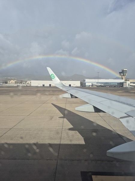
We quickly picked up our luggage and then the car at the Cicar counter. We got a Seat Arona instead of the Corsa we’d booked. Well, while the driving position didn’t feel great at first (I got used to it), the engine’s smoothness and power were much appreciated on the island’s winding and sometimes steep roads.
It was only 10 AM, and we couldn’t theoretically check into our accommodation until 3 PM (the owner promised to message me if it was ready earlier). So, we headed to the (big) *Jardín Botánico Viera y Clavijo*, where we planned to spend a few hours. We found a huge parking lot... empty. The passenger in the car in front of us (yes, we weren’t the only ones at the closed gate—there was a car in front and one behind) went to ask for info: it was closed due to the storm 😕. So, we calmly headed toward Puerto de las Nieves, on the northwest coast of the island.
The plan: go to a restaurant, visit the village, and do some shopping while waiting for early afternoon. As soon as we got out of the car, it started raining... we took shelter under the awning of a shop, waiting for it to pass. But the rain turned into a downpour, and within minutes, awning or not, Gore-Tex or not, we were soaked!
Since we were already wet, we might as well go to the restaurant—they weren’t far! But here’s the thing: contrary to what Google Maps said, they all opened at 1 PM, not noon! Back to the car, wading through 5 cm of water because all the village streets were flooded . The rain let up, we did some shopping, went to eat, and I got a message from the owner saying the accommodation was ready 🙂.
So, off we went to La Suerte, a few kilometers north of Agaete. The downside of the place, especially with luggage, is that you have to climb several flights of stairs via an outdoor staircase (after parking more or less far away on a steep street) to get there 😛). Of course, on the way from the car to the apartment, it started pouring again—the bags got soaked! Enough rain for today! We settled in quietly, and by late afternoon, we could (finally!) go admire the view from the terrace.
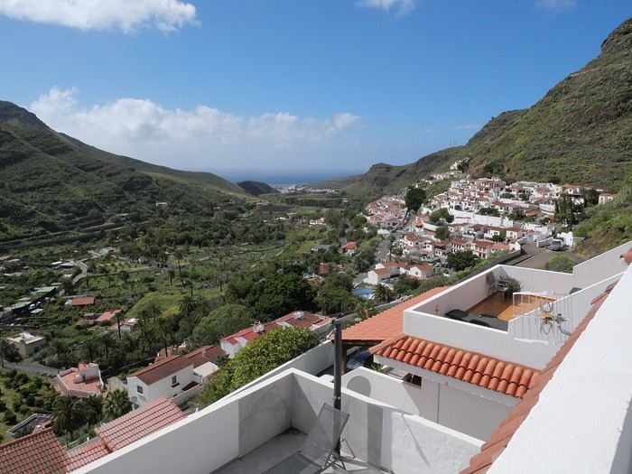
Every time we’ve been to the Canary Islands, it’s been by default (basically: where can we go in winter or early spring when we only have a week—so not too far, not too much jet lag, but with decent weather?).
This time, we had two weeks, but the winter plan kept changing: first Thailand (dropped for personal reasons), then Martinique (dropped because of work leave dates that weren’t up to me), and finally, the Canary Islands.
We’ve already been to Tenerife (which we really liked) and Lanzarote (which we liked a little less). This year, two options: Gran Canaria or one of the smaller islands west of Tenerife (La Palma, or even La Gomera or El Hierro). We chose Gran Canaria... not sure it was the right call! Whose fault is it? Storm Thérèse’s! Yes, Storm Thérèse followed us on arrival, and its effects lasted quite a while. We had to adapt, cancel visits, change activities...
But even without Thérèse...
Saturday 21/03 Departure from Orly at 6:10 AM with Transavia. The plane took off on time and landed a little early, tossed around by strong winds before touching down. It had just rained, but it was (almost) no longer raining.
We quickly picked up our luggage and then the car at the Cicar counter. We got a Seat Arona instead of the Corsa we’d booked. Well, while the driving position didn’t feel great at first (I got used to it), the engine’s smoothness and power were much appreciated on the island’s winding and sometimes steep roads.
It was only 10 AM, and we couldn’t theoretically check into our accommodation until 3 PM (the owner promised to message me if it was ready earlier). So, we headed to the (big) *Jardín Botánico Viera y Clavijo*, where we planned to spend a few hours. We found a huge parking lot... empty. The passenger in the car in front of us (yes, we weren’t the only ones at the closed gate—there was a car in front and one behind) went to ask for info: it was closed due to the storm 😕. So, we calmly headed toward Puerto de las Nieves, on the northwest coast of the island.
The plan: go to a restaurant, visit the village, and do some shopping while waiting for early afternoon. As soon as we got out of the car, it started raining... we took shelter under the awning of a shop, waiting for it to pass. But the rain turned into a downpour, and within minutes, awning or not, Gore-Tex or not, we were soaked!
Since we were already wet, we might as well go to the restaurant—they weren’t far! But here’s the thing: contrary to what Google Maps said, they all opened at 1 PM, not noon! Back to the car, wading through 5 cm of water because all the village streets were flooded . The rain let up, we did some shopping, went to eat, and I got a message from the owner saying the accommodation was ready 🙂.
So, off we went to La Suerte, a few kilometers north of Agaete. The downside of the place, especially with luggage, is that you have to climb several flights of stairs via an outdoor staircase (after parking more or less far away on a steep street) to get there 😛). Of course, on the way from the car to the apartment, it started pouring again—the bags got soaked! Enough rain for today! We settled in quietly, and by late afternoon, we could (finally!) go admire the view from the terrace.
My first trip to Morocco dates back to the early 90s.
Four more followed...
I’d never gone further north than Casablanca, Volubilis, or Fez—it was time to fix that!
So I planned a route that would fill in the gaps while revisiting a few places.
This route is pretty classic—if you’re looking for something original, you might want to skip it!
The starting point of the trip: the city of Rabat.
The stops?
Azrou, Fez, Al Hoceïma, Akchour, Tetouan, Tangier, Asilah, and finally Rabat.
Mostly an urban trip, then.
Too much?
We’ll see at the end of the travel journal!

Four more followed...
I’d never gone further north than Casablanca, Volubilis, or Fez—it was time to fix that!
So I planned a route that would fill in the gaps while revisiting a few places.
This route is pretty classic—if you’re looking for something original, you might want to skip it!
The starting point of the trip: the city of Rabat.
The stops?
Azrou, Fez, Al Hoceïma, Akchour, Tetouan, Tangier, Asilah, and finally Rabat.
Mostly an urban trip, then.
Too much?
We’ll see at the end of the travel journal!
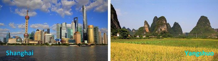
Vast, diverse, and multifaceted China! During a recent journey across part of this fascinating country, I enthusiastically discovered so many aspects of it. But such variety seems hard to condense into a single story. So, for this travel journal, I’ve focused on two main facets of China. First, a modern and urban China—the sprawling city of Shanghai—and then, in a second part, a China that’s the complete opposite: a rural and more traditional side explored around Yangshuo, where nature is absolutely stunning. Ready for a tour of China, city first, then countryside? Travel stories, descriptions, and impressions are on the program, with plenty of room for photos. Enjoy the journey and happy reading!
--
Urban China: Shanghai
As soon as you explore the city, it’s clear: the Chinese wanted to turn Shanghai—once a small fishing village—into a showcase of a modern, powerful, and forward-looking China. The megacity is immense, with around 24 million people bustling through its avenues or stuck in monstrous traffic jams at the foot of some of the world’s tallest skyscrapers. Towers so high they almost touch the sky—well, almost. But this gigantism is just one side of this southern metropolis in the Middle Kingdom.
Away from the towers and business districts, you discover another side of Shanghai—more traditional and, some would say, more human. This is where my travel story begins: on a quiet morning among smiling, relaxed locals. We’re in one of the city’s parks, specifically Fuxing Park.
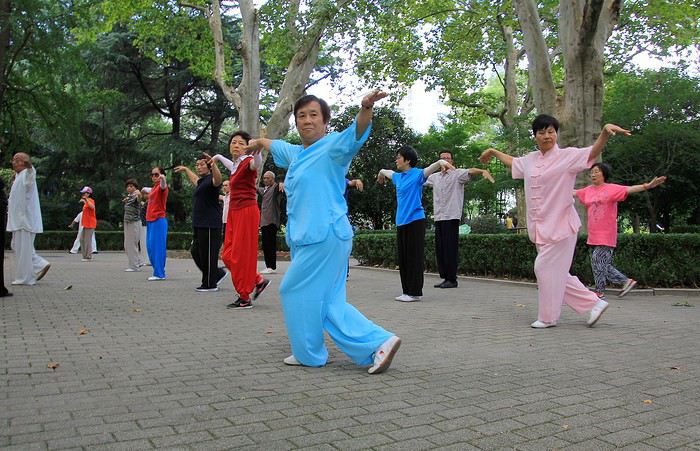
As everyone knows, the Chinese love practicing Tai Chi Chuan, in groups or solo, so it’s no surprise to see so many here, moving slowly and precisely through their sequences. Here’s a first group, their movements and postures perfectly coordinated.
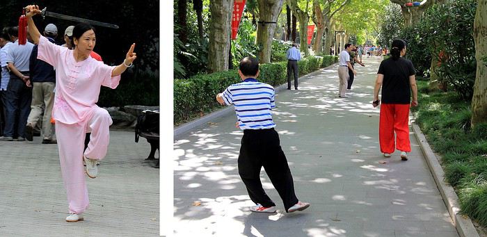
In another alley, a lone practitioner is deep in concentration, executing his movements with focus. I watch him for a few moments, discreetly and from a distance, so as not to disturb him. To his right, a woman in bright red pants keeps walking, almost as if she’s marching in place. A strange ballet: a series of steps forward, then backward, and so on...
Nearby, this elegant athlete (or artist) performs Tai Chi with a sword—almost like a choreography, her movements resembling a true sword dance.
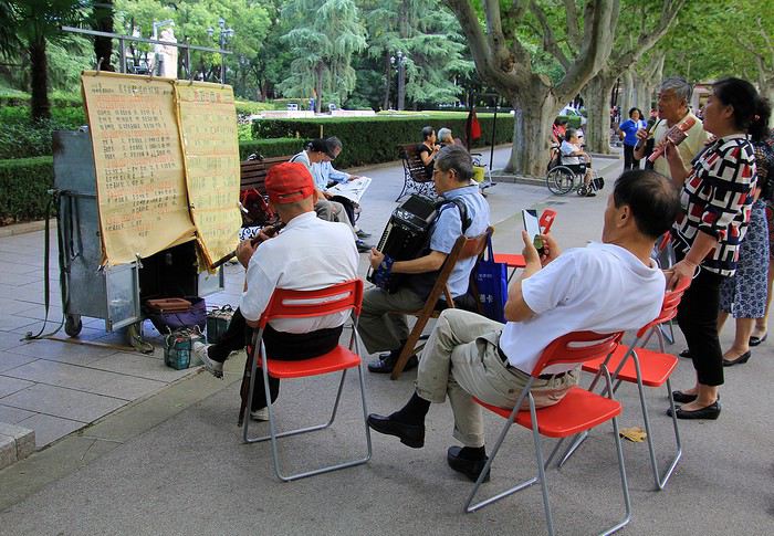
Further on, the atmosphere is more relaxed and melodic. People are playing music and dancing joyfully, like this woman with her colorful, original hairstyle, all smiles with maracas in hand. You almost want to clap along—her energy is so contagious!
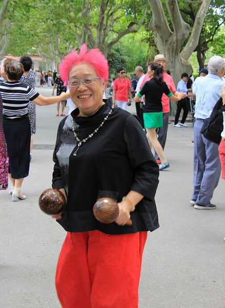
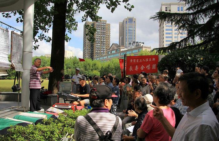
The mood is lighthearted among this group of retirees. Their choir alternates between patriotic hymns and lighter songs. Someone must have told them some French people were watching, because suddenly they start singing an old French tune: « Vive le vent, vive le vent d’hiver... » And the cheerful choir leader invites us to sing along—all together! The result was a fun cacophony: us in French, them in Chinese. But it was so charming!
These Chinese locals definitely passed on their good mood. It’s a joy to see all these retirees—you can imagine them leaving their small apartments to get some fresh air and meet up in the park for these morning activities. But let’s not kid ourselves: while they seem so happy and content with those big smiles, most of them probably didn’t have an easy life. Food shortages, draconian regulations, propaganda, the one-child policy—just to name a few! No, what many endured in their daily lives didn’t always give them reason to smile so brightly. But now, they’re making the most of it, and as I wrote earlier, it’s wonderful to see them like this.
Encouraged by these shared moments, I decide to keep going. Without hesitation, I join a Tai Chi session. I tried my best to follow the movements of my neighbors practicing this traditional exercise, but I’ll admit—it wasn’t easy!
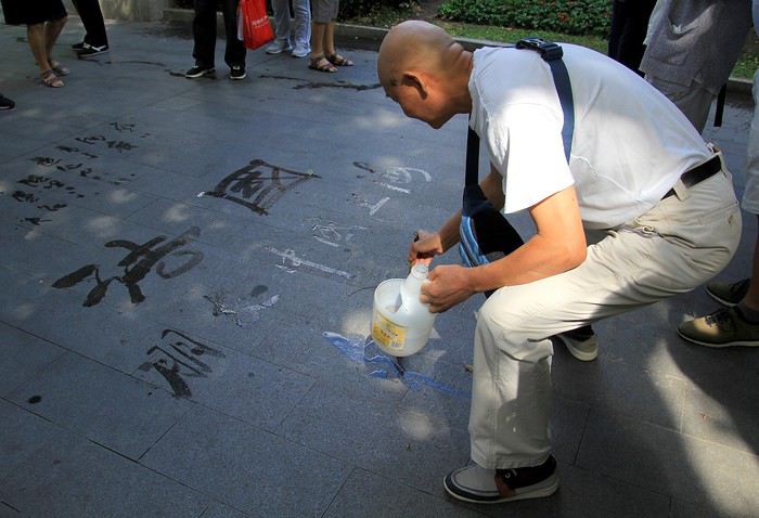
This artist, especially attentive, rewards us with a calligraphed phrase about France. A lover of Chinese calligraphy, he writes these sinograms in ancient characters directly on the ground. Is it writing or drawing? It’s hard to say—the result is so aesthetic. An ephemeral phrase, written in water that slowly fades as it dries, before disappearing entirely.
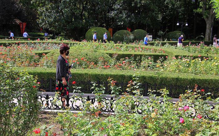
As we walk, we approach one of the park’s exits—so beautifully flowered. These flowerbeds and their blooms hint at the name of this charming place: Parc des Roses—and it’s even written in French!
--
We’re now in the former French Concession of Shanghai, which explains the French inscriptions. The era of foreign concessions in Shanghai is an old story, dating back to the 1840s—a time when China opened its market to international trade. Several nations, including European ones, established trading posts in the city. There were British, American, Japanese, Russian, Italian, German, and French communities. This part of Shanghai was under French administration for a time, starting in 1846.
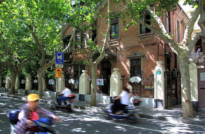
Some buildings in the area still bear witness to that time, like these ones, with bikes and scooters passing by. The architecture popular at the time blended European influences with the style of Shanghai’s elegant residences: stone arches above entrances, brick walls, and pleasant inner courtyards. Large homes often divided into several apartments today.
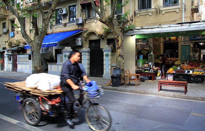
--
Traditional Chinese architecture shines in all its splendor at this tea house. With pagoda-style roofs—corners turned up toward the sky—refined colors and decorations, and a small corner tower on the right, this Huxinting Pavilion dates back to 1784. It was built in the middle of a pond, offering beautiful reflections. A truly charming spot where you can savor the subtle flavors of Oriental teas in the interior rooms.
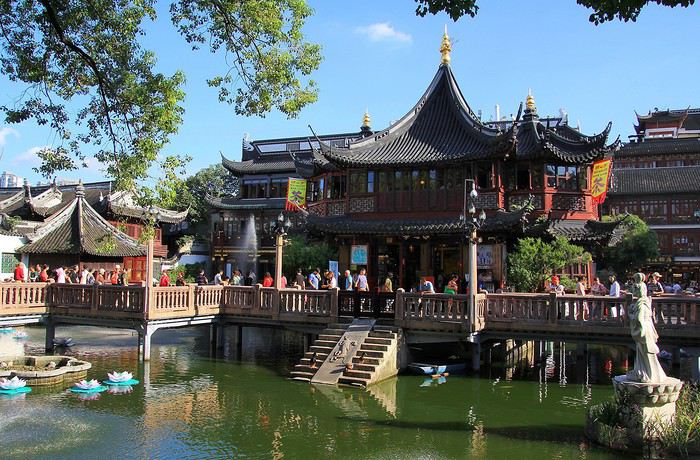
Just steps from this picturesque spot, don’t miss the Yuyuan Pavilions and Garden. The whole complex is stunning and gives a glimpse of imperial-era homes and parks from the Ming Dynasty.
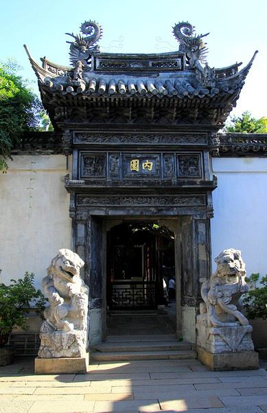
Pass through the entrance gate to enter this opulent property, well protected by a high surrounding wall. On one of them, a dragon sculpture sprawled at full length—about 7 meters—is impressive. The symbol represents power but also happiness.
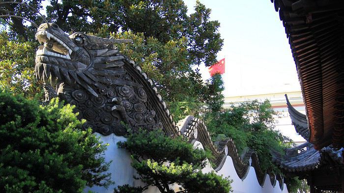
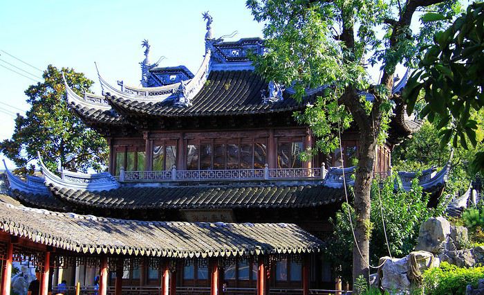
Created in 1577 by the Pan family, wealthy dignitaries of the time, the visit takes you from pavilions with poetic names like the Pavilion of Three Ears to the Pavilion of Spring’s Announcement. Charming!
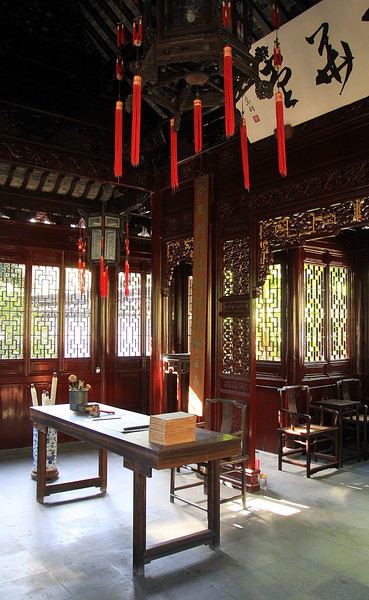
The interiors are decorated with woodwork from walls to ceilings, where beautiful Asian lanterns hang. But the real charm is outside. These shaded gardens, rustling with bamboo, are adorned with several ponds surrounded by impressive rock formations. A world that recreates (in miniature) the mountain and water landscapes of rural China.
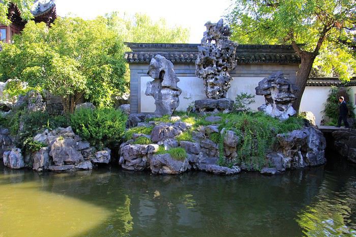
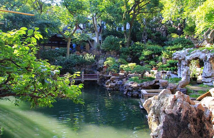
This historic Yuyuan Garden, in the heart of the city, took about 18 years to design and build (pavilions and gardens). Its current appearance is the result of a faithful renovation—much needed, because in 1942, during the so-called Opium War, British officers made it one of their residences. It was partly destroyed by bombings, and later, French troops ransacked it after an attack on their concession.
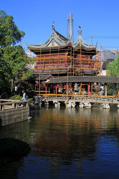
The site is still under construction—maintenance and renovation—with scaffolding as proof. The garden’s enclosure was set to close for work the day after our visit (for a few weeks, until the end of October 2019). That’s probably why crowds of visitors were rushing in, making the atmosphere a bit less peaceful than this beautiful architectural ensemble might suggest. For the photos, I had to be a bit clever, avoiding the crowds to give an impression of tranquility—this historic place deserves it.
--
To be continued in the next post...
After a first trip to South Africa in 2009 that enchanted us, we decided to return to this part of the world this year.
Given how much I enjoy reading others' travel journals, I'm mustering up the courage to try my hand at this kind of exercise (which I'm not used to at all 😕). Thanks, of course, to everyone who answered my questions and helped finalize this trip...
So, it's decided—it'll be Southern Africa... but where, with only two weeks of vacation? Victoria Falls, which we had to cancel in 2009 due to turbulent Zimbabwean elections, was automatically back on the itinerary (yes, I know some say "the falls, meh," but I wanted to see them 😛!). We added South Luangwa and ultimately swapped Chobe and Hwange for Lesotho. We have no experience driving a 4x4, which limited our routes in both countries, especially since it's not yet the dry season... but that didn’t stop us from bringing back amazing memories.
Sunday, April 14: After a smooth flight (and even quite comfortable in BA’s brand-new 747), we land early in the morning in Johannesburg. We pick up the car (a little Micra) and off we go toward Clarens, our first stop. We get back into the swing of driving (moving over to the right—sorry, to the left—to let others pass, flashing lights, hazard signals, "thank you," "you’re welcome"...).
I was expecting a small town, but Clarens looks more like a village: a large grassy square,
a few cars,

and dirt roads as soon as you leave the main street.

Still, we found the same quality of South African B&Bs here. We stayed at Patcham Place (the little white speck in the photo above is our Micra!).

We end the afternoon with a walk around Clarens and its surroundings. No doubt about it—it’s autumn...
Monday, April 15: We set off for Lesotho on nearly deserted roads, heading toward Malealea.

We quickly cross the border at Caledon Poort, and the atmosphere changes: more people on the roadside, animals, scattered huts... and lots of traffic police! We still managed to get stopped four times! Mostly, after checking our driver’s license, it was just to chat for ten minutes or so (police aren’t like that back home!). Well, one officer wanted to fine us for not waiting for him to wave us through after I stopped at a stop sign. After some tough negotiations, he let us go 😇.
We leave the main road and find ourselves in wilder landscapes.

The road narrows until it becomes a dirt track. A short climb to the gates of paradise:
... and then it’s just a matter of descending toward Malealea.
Malealea is like a village within a village. You’ll find different types of accommodations, a canteen-style restaurant (no menu choices, but the food is great, and it’s a fun way to chat with others around big tables), and lots of activities offered in partnership with the locals. We’re shown different rondavels to choose from... we pick this one:

Simple but clean and functional, with a private bathroom. On the bed, "real" Basotho blankets.
We decided to stay two nights to have a full day there.
Tuesday, April 16: We opted for a four-hour pony trek to the waterfall—nothing difficult, everything is done at a walking pace, with just a few "slightly" steep climbs and descents where you have to trust the Basotho ponies (no worries, they’re sure-footed 😏). The landscapes are truly stunning:


We walk down to the waterfall (which isn’t anything special—it’s the trek itself that’s worth it) and take the return path...

... crossing through Malealea village again.

We spend the rest of the day exploring the area, reading in the sun, and sipping marula coffee on the bar terrace. We really loved the family atmosphere in Malealea and how the locals were involved in the activities.
Wednesday, April 17: We hit the road again toward Katse. The owner of Malealea advised us against taking our car through Theba Tseka (I know Chris did it last year around the same time, but since we’re not very adventurous, we’ll go back through Maseru and Leribe—oh well, we’ll just take the same route back from Katse).
Quick aside unrelated to the story: putting together a travel journal is taking even longer than I thought 🤪... so, the rest will come a little later...
Given how much I enjoy reading others' travel journals, I'm mustering up the courage to try my hand at this kind of exercise (which I'm not used to at all 😕). Thanks, of course, to everyone who answered my questions and helped finalize this trip...
So, it's decided—it'll be Southern Africa... but where, with only two weeks of vacation? Victoria Falls, which we had to cancel in 2009 due to turbulent Zimbabwean elections, was automatically back on the itinerary (yes, I know some say "the falls, meh," but I wanted to see them 😛!). We added South Luangwa and ultimately swapped Chobe and Hwange for Lesotho. We have no experience driving a 4x4, which limited our routes in both countries, especially since it's not yet the dry season... but that didn’t stop us from bringing back amazing memories.
Sunday, April 14: After a smooth flight (and even quite comfortable in BA’s brand-new 747), we land early in the morning in Johannesburg. We pick up the car (a little Micra) and off we go toward Clarens, our first stop. We get back into the swing of driving (moving over to the right—sorry, to the left—to let others pass, flashing lights, hazard signals, "thank you," "you’re welcome"...).
I was expecting a small town, but Clarens looks more like a village: a large grassy square,
a few cars,
and dirt roads as soon as you leave the main street.
Still, we found the same quality of South African B&Bs here. We stayed at Patcham Place (the little white speck in the photo above is our Micra!).
We end the afternoon with a walk around Clarens and its surroundings. No doubt about it—it’s autumn...
Monday, April 15: We set off for Lesotho on nearly deserted roads, heading toward Malealea.
We quickly cross the border at Caledon Poort, and the atmosphere changes: more people on the roadside, animals, scattered huts... and lots of traffic police! We still managed to get stopped four times! Mostly, after checking our driver’s license, it was just to chat for ten minutes or so (police aren’t like that back home!). Well, one officer wanted to fine us for not waiting for him to wave us through after I stopped at a stop sign. After some tough negotiations, he let us go 😇.
We leave the main road and find ourselves in wilder landscapes.
The road narrows until it becomes a dirt track. A short climb to the gates of paradise:
... and then it’s just a matter of descending toward Malealea.
Malealea is like a village within a village. You’ll find different types of accommodations, a canteen-style restaurant (no menu choices, but the food is great, and it’s a fun way to chat with others around big tables), and lots of activities offered in partnership with the locals. We’re shown different rondavels to choose from... we pick this one:
Simple but clean and functional, with a private bathroom. On the bed, "real" Basotho blankets.
We decided to stay two nights to have a full day there.
Tuesday, April 16: We opted for a four-hour pony trek to the waterfall—nothing difficult, everything is done at a walking pace, with just a few "slightly" steep climbs and descents where you have to trust the Basotho ponies (no worries, they’re sure-footed 😏). The landscapes are truly stunning:
We walk down to the waterfall (which isn’t anything special—it’s the trek itself that’s worth it) and take the return path...
... crossing through Malealea village again.
We spend the rest of the day exploring the area, reading in the sun, and sipping marula coffee on the bar terrace. We really loved the family atmosphere in Malealea and how the locals were involved in the activities.
Wednesday, April 17: We hit the road again toward Katse. The owner of Malealea advised us against taking our car through Theba Tseka (I know Chris did it last year around the same time, but since we’re not very adventurous, we’ll go back through Maseru and Leribe—oh well, we’ll just take the same route back from Katse).
Quick aside unrelated to the story: putting together a travel journal is taking even longer than I thought 🤪... so, the rest will come a little later...
Many of us longtime members surely remember the little frieze of monuments that used to decorate the top of VF pages.
Eiffel Tower, Statue of Liberty, Taj Mahal...
The famous must-see icons of architectural heritage!
Today, I’m inviting you to dig through your archives and share 3 photos of these international stars made of stone, marble, concrete, or steel.
I can already hear some of you protesting that this theme isn’t very original.
Well, it’s up to you to think outside the box...
So the monument doesn’t have to be the original. It could be its twin in Las Vegas, a matchstick replica made by Uncle Bob, a piece of jewelry, a gorgeous snow globe made in China, and so on.
The monument can be photographed from above, below, in the rain, as a reflection...
Deserted or swarming with visitors...
Montages are also allowed! 😉
In short, a classic topic that’ll become original thanks to your creative take.
Now, there are still 3 rules:
- No selfies (But a photo showing people taking selfies in front of a monument is allowed...🤪)
- Once a monument has been posted by someone, no one else can post it again. I don’t want to see the same thing 10 times...😊
- The theme isn’t about the monument’s originality. Please don’t post a photo of a monument known only to you or almost no one...😏
You can post your photos (one per message) until January 21, 2015, at 11:55 PM
Voting will take place from January 22, 2015, at 12:05 AM to January 29, 2015, at 11:55 PM.
During the vote, you’ll choose your 3 favorite photos, awarding 3 points to your top pick, 2 to your second, and 1 to your third.
Please clearly indicate the photographer’s name and the number of the winning photo!
For the rest, I’m using Cocottte’s rules:
The winner is the one with the most points. In case of a tie, the winner will be the one with the most first-place votes, or, if still tied, the most second-place votes. If there’s a perfect tie, the winner will be the one who reached their score first. The winner will then choose a theme for February’s contest and organize it. Ties for any place other than first won’t be broken.
You can vote without participating, participate without voting, or do neither. Slideshow
Finally, here’s the little off-topic link where all your comments and other expressions of good humor are welcome!
Eiffel Tower, Statue of Liberty, Taj Mahal...
The famous must-see icons of architectural heritage!
Today, I’m inviting you to dig through your archives and share 3 photos of these international stars made of stone, marble, concrete, or steel.
I can already hear some of you protesting that this theme isn’t very original.
Well, it’s up to you to think outside the box...
So the monument doesn’t have to be the original. It could be its twin in Las Vegas, a matchstick replica made by Uncle Bob, a piece of jewelry, a gorgeous snow globe made in China, and so on.
The monument can be photographed from above, below, in the rain, as a reflection...
Deserted or swarming with visitors...
Montages are also allowed! 😉
In short, a classic topic that’ll become original thanks to your creative take.
Now, there are still 3 rules:
- No selfies (But a photo showing people taking selfies in front of a monument is allowed...🤪)
- Once a monument has been posted by someone, no one else can post it again. I don’t want to see the same thing 10 times...😊
- The theme isn’t about the monument’s originality. Please don’t post a photo of a monument known only to you or almost no one...😏
You can post your photos (one per message) until January 21, 2015, at 11:55 PM
Voting will take place from January 22, 2015, at 12:05 AM to January 29, 2015, at 11:55 PM.
During the vote, you’ll choose your 3 favorite photos, awarding 3 points to your top pick, 2 to your second, and 1 to your third.
Please clearly indicate the photographer’s name and the number of the winning photo!
For the rest, I’m using Cocottte’s rules:
The winner is the one with the most points. In case of a tie, the winner will be the one with the most first-place votes, or, if still tied, the most second-place votes. If there’s a perfect tie, the winner will be the one who reached their score first. The winner will then choose a theme for February’s contest and organize it. Ties for any place other than first won’t be broken.
You can vote without participating, participate without voting, or do neither. Slideshow
Finally, here’s the little off-topic link where all your comments and other expressions of good humor are welcome!