Results for "Argentine+hébergement"
About 17,676 results.
More options
Many results are in French, the community’s main language. English translations are added over time.
Search results
Namibia Travel Journal: May 2025 - Trip Review
NAMIBIA TRIP 2025: April 24 to May 20: Feel free to comment or ask us any questions about this amazing journey.
>> Find all our photos and videos for each day on our website here: www.montagne-aventure.net
**DAY 1: Thursday, April 24, 2025: Outbound Flights from Lyon to Windhoek via Munich - Visit to Munich:**

Off we go on a new adventure. The alarm rings at 6:30 AM, the travel bags are packed, and we head to Lyon Airport. We booked our flight tickets with Lufthansa. The first leg to Munich, Germany, is operated by AirBaltic. Departure at 1:05 PM for a 1-hour and 20-minute flight. We arrive at 2:30 PM.
**We now have a 7-hour layover, so we take the opportunity to get some fresh air and explore Munich.** We quickly exit Terminal 2 of the airport and head towards the subway. We buy a group day ticket "Airport-city Day Zone M-5," valid for 2 to 5 people at a price of 30.50 € (instead of 16.30 € per person). We take the S8 line to **Marienplatz** in 35 minutes. **This is the heart of the city.** The weather is overcast, quite cool, but dry. Perfect for a little city trip between two flights while leaving our large luggage in transit at the airport. **Munich is the third-largest German city after Berlin and Hamburg, in the Bavaria region.** **The center has a lot of charm and brings together several religious buildings, easy to explore on foot.** We are impressed by the number of people enjoying these 100% pedestrian streets, which are very pleasant. After Marienplatz, the most famous square with the town hall, we head to the Cathedral of Our Lady, a Gothic church, then continue to **Karlsplatz** and move on to **the food market offering a wide selection of high-end food products in an atmosphere where a certain art of living prevails.** We also visit St. Peter's Church before grabbing a bite to eat. Two good hours were enough for this 10 km city walk. It's time to take the subway back: by 6:30 PM, we are back at the airport. Now, it's time for a bit of waiting and rest. Our second flight is scheduled for 9:35 PM for a 9-hour and 30-minute journey to our final destination in Namibia: **Windhoek.**
> Round-trip flight tickets with Lufthansa from Lyon: 2029 €, or 1,014.50 € per person.
> Lyon Airport parking: 120 €
> Today's expenses: 7 € for 2 pizzas in France / 14 € for the restaurant in Munich / 30.50 € for the daily subway ticket in Munich.
**DAY 2: Friday, April 25, 2024: Arrival in Windhoek, Visit to the Namibian Capital:**
After a 9-hour and 30-minute overnight flight with Discover Airlines, we finally land on Namibian soil just before 7:30 AM. The day is breaking, and the colors are already stunning. We are eager despite the usual fatigue from the flight. The airline was punctual, with friendly staff and good meals, though a bit light. We are the first flight of the day to land, with no more than 15 flights per day here, from 7 AM to 8 PM. We disembark on the tarmac at this airport located in the middle of nowhere, **I finally set foot on African soil for the first time.** We exit among the first from the aircraft to go through the long formalities at the front of the line, as the wait can quickly become endless. Allow at least 5 minutes per person for e-visas. We still wait 45 minutes despite only about twenty people ahead of us. Phew, it's done. We collect our luggage and then withdraw money from an ATM. We make 4 withdrawals of the maximum amount, 2000 NAD $ per withdrawal, for a total of 380 €, or 95.33 € per withdrawal.
Our driver arrives at the same time, perfect timing, we were quick.
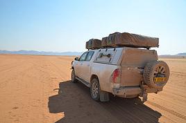
We leave the airport at 8:45 AM. By 9:30 AM, we arrive at the **Gracious Whisp vehicle rental agency**, located at the entrance of Windhoek, small and human-sized with a fleet of recent vehicles. More formalities, then a short wait as our vehicle is not yet ready. Time to decompress, catch our breath, and enjoy the very pleasant morning temperature. Not a cloud in sight. Next, a briefing on the vehicle, always with a bit of apprehension due to our approximate English. Allow 45 minutes of explanations, including setting up the roof tent, camping equipment, technical information in case of a flat tire, driving tips in Namibia, and a tour of the 4x4. We have all the necessary equipment for camping: mattresses, sleeping bags, pillows, table, chairs, gas stove, BBQ grill... as well as 2 spare tires, a compressor, a dual tank, and accessories for removing wheels. Off we go, it's time to muster our courage and get behind the wheel. **Heading to SuperSpar Maerua**, fortunately located less than 10 minutes away. We park with the help of a parking attendant; it's very crowded, the space is narrow, but everything goes well despite the cursed right-hand drive. Today's new mission: stock up on groceries. The store is well-stocked with local and imported products, catering to all tastes. We spend 114 € on groceries, from pasta to meat, BBQ lighters to dishwashing products. Two people load our groceries into two carts and transfer them to our vehicle; we feel compelled to leave a tip, 50 NAD $, as we don't have change yet. Now, we head to the hotel, 15 minutes away. Traffic is difficult at a complicated intersection; this will likely be the only traffic jam in Namibia. **We arrive at Kate's Nest Guesthouse & Backpackers around 1:15 PM, quite tired.** We take some well-deserved rest at this recent establishment, quite calm with secure private parking. After a short nap, we enjoy the quiet by the hotel pool. Night falls between 6:30 PM and 7 PM. We eat quietly in our room tonight before starting this long 4x4 road trip in camping mode in the heart of Namibia.
> Today's grocery expenses: 114 € at Super Spar Marua (2395.21 NAD $).
> Round-trip flight tickets with Lufthansa from Lyon: 2029 €, or 1,014.50 € per person.
> Vehicle rental: 4x4 Toyota with roof tent for 24 days: Gracious Whisp Car Rentals: 2,638 € (N$50,640) or **1,319 €** per person - (https://gwcarrentals.com/)
> Distance driven today: 15 km.
> Accommodation: Kate's Nest Guesthouse & Backpackers - 4 Aristotles Street Academia, 9000 Windhoek - 36 € for two for one night.
> Windhoek International Airport website: (https://www.airports.com.na/)
**DAY 3: Saturday, April 26, 2025: Windhoek to Hardap: Mariental Region - Kalahari Desert:**
After a good, restful night, we wake up leisurely around 7 AM. We enjoy the comfort provided by this first and last hotel before 24 nights under the tent.
**We leave Kate's Nest Guesthouse at 8:30 AM to tackle the Namibian roads.** We quickly leave the capital; in just 30 minutes, we find ourselves almost alone in the world. The landscape is dotted with small domes. We leave the **paved B1** quickly to turn left onto the **C15**. **From there, we won't see more than 10 vehicles all day.** After passing through the few houses of **Lekkerwaterpoort**, we tackle our first gravel road. These road sections are limited to 100 km/h, but even at 70 km/h, I find it already challenging. However, I quickly get used to it and gradually pick up speed to reach my cruising speed of around 80 to 90 km/h. **We are on immense straight lines crossing wild expanses as far as the eye can see.** **We come across two baboons, a few ostriches, and numerous cattle and sheep farms.** We pass through the charming village of **Uhlenhorst** with its typical houses and children with broad smiles waving at us. Life here is already very different from Windhoek. **The thermometer rises quickly from 16°C at 8:30 AM to over 28°C in the early afternoon.**
**We arrive at the Hardap Dam reserve at 2 PM.** We stop at the toll booth at the park entrance to pay the entrance fee: 250 NAD $ for 2 people and 1 vehicle. We continue to the dam and then the camp entrance, located a bit further. We had booked in advance, but this place remains little frequented by foreigners.
We take advantage of the hottest hours to rest by the large pool overlooking the immense lake, a very enjoyable moment. Would this be a bit of a vacation?
Around 4:30 PM, we head to the campsite. We overlook this vast water reserve. We arrive first; we will be only 3 vehicles spending the night here. It's time to get to work and set up our equipment for the first time. It takes us a good 20 minutes to set everything up, with a slight apprehension about unfolding the tent. Once this task is done, which we will have to repeat for almost a month, we will become much more efficient over time. Time for rest and contemplation in total silence. The sun gradually sets, and the heat quickly becomes bearable again. Bliss! **This dam is located 20 km northwest of Mariental in an area dotted with conical hills topped with dolerite buttons (Hardap means "hillock" in Nama). It captures the Fish River, which flows south, creating a large lake in the middle of an arid environment. The contrast is striking.** We enjoy our first sunset facing this 360° otherworldly landscape.
Around 7 PM, we start our first BBQ, or "braai" as it's called here. The temperature is perfect. The sun sets, giving way to a star-filled sky of incredible beauty thanks to the absence of any light pollution. The Milky Way will lull us throughout the evening. After some good sausages and potatoes on the BBQ, we head to our roof tent around 9:30 PM with a complete change of scenery in just 24 hours. France already seems so far away...
This campsite has shared showers and toilets, quite clean and functional, as well as a central area with several BBQs and tables. The sites are arranged in a semicircle, each with an electrical outlet. The sites are close to each other but spacious, some slightly shaded. We are only three vehicles tonight, so it's perfectly comfortable and quiet. Not to mention the large pool near the restaurant. Our trip is off to a great start.
> Today's road itinerary: Windhoek > Head south on the B1 to Rehoboth > Turn left onto the C25 then C15 to Stampriet > C20 to Hardap > Full north on the B1 > Then turn left onto the M93 - 5 hours of driving.
> Distance driven today: 354 km.
> Accommodation: Hardap Recreation Resort - 23.3 € for two - Large pool - GR6W+3M2, Hardap Game Reserve, Mariental, Namibia - (http://www.nwr.com.na/resorts/hardap-resort/)
**DAY 4: Sunday, April 27, 2025: Hardap - Brukkaros Volcano - Keetmanshoop - Quivertree Forest Rest Camp**
Our first night under the tent was very pleasant; the little wind quickly calmed down, giving way to absolute silence. The mattress is decent, more comfortable than some nights in Nepal. The length and width give us enough space for maximum comfort, despite my height (1.91 m). We wake up a little before 7 AM as the sun rises, and the lights dazzle us from the start of the day. We pack up the equipment in 30 minutes, quite easily. Then we enjoy the sun, which warms up quickly while we keep our light fleece on.
At 8:30 AM, **we hit the road again, heading south** to our first stop in **Mariental**. We want to do some shopping at SuperSpar, but once we arrive in the parking lot, a young local is fighting with the supermarket security guards and then threatens to throw stones. We don't want to take any risks right at the start, so despite the baton blows he receives, he doesn't stop. We leave empty-handed but fill up with fuel at the Shell station 1 km further. The price per liter is 21.33 NAD $, we fill our 107-liter tank for 107 €. In Namibia, you get served, and they bring the card machine to the window to pay. It's then customary to leave a tip.
We then take the B1 heading due south on a recently renovated road. Around 11:30 AM, we leave it on our right to take **a wild gravel road, the M98**. Just before **Berseba**, we turn right onto a small track, the **D3904 towards Brukkaros Crater up to a camp at 1588 m altitude**. The track then becomes too bumpy. We stop on the counter-slopes where **a wide panorama unfolds over these immense plains as far as the eye can see**. It's 12:15 PM, time for us to eat a rice and tuna salad facing this landscape.
**We are alone in the world until a vehicle arrives and parks next to us.** A bit of apprehension, 4 men head towards us. It turns out to be 4 shepherds looking for a lost foal. The conversation is pleasant, lost in the middle of nowhere. We find ourselves alone again in this absolute silence. **The heat becomes stifling with a good 30°C**. We get back on the road around 1 PM. Back on the B1, **we continue due south to Keetmanshoop**, which we reach around 3 PM. We stop there to do some shopping for 262 NAD $ (12 eggs, a can of tuna, a can of corn, bread, a soda, and a 5-liter water container), or 12.48 €. Two quite insistent children ask us for money or candy at the store exit, yet we give them a small tip, but they continue to cling to the car. Locals parked next to us tell them to leave us alone. Anyway, we finish the trip to **Quivertree Forest**, 15 km away. We will spend the night in this **pleasant farm run by a German**. Upon arrival, as the day before, and as I suppose in the future, we dive straight into the cool pool to relax after all these kilometers. A bliss. Then we take our 4x4 and choose a spot near these famous trees. After the 33°C this afternoon, once 4 PM passed, the temperature drops again and becomes very pleasant. **We are in the middle of the Kokerboom, one of the most interesting and characteristic plants of hot and arid regions. It's not really a tree but a variant of the aloe plant whose botanical name is Aloe Dichotoma. This Kokerboom has a smooth and thick trunk reaching up to 1 m in thickness and 9 m in height. They bloom for the first time at the age of 20 to 30 years.** The flowers are yellow and reach about thirty centimeters during the season between June and July. **They grow mainly in an environment with a high concentration of black rocks absorbing a large amount of heat (38°C). The rocks also serve to anchor the tree with its tentacle-like roots. It also resists frost. Each is between 200 and 300 years old.**
Around 5 PM, we walk to the farm reception to watch the feeding of **two cheetahs**. Magnificent carnivores taking their time to savor their piece of meat. **Then we return near our campsite to enjoy the sunset among these trees. The colors are sublime, as every evening apparently. A magnificent spectacle with colors evolving from yellow to orange then to pink, before giving way once again to a sky filled with thousands of stars.** Our campsite at Quiver Tree Forest Camp is very comfortable; we have a water supply, a stone table, a small lamp, an electrical outlet, a small tree for shade, and a BBQ that we won't use tonight; we'll cook on gas. The sites are far apart, with some shared facilities scattered around, a very beautiful setting. No reservation possible, no need, just show up directly. **The campsite accommodation for 2 people costs 28 €, including the reserve entrance fee of 5 €**. We finish this second bivouac evening around 9:30 PM, time for some reading and sleep in peaceful silence without wind.
> Today's road itinerary: Mariental > B1 heading south to Brukkaros > At Tses turn right towards Berseba via the M98 > Turn right onto the D3904 > 8 km > Brukkaros Volcano (stop at the lower camp as the track is difficult for 1 hour) > Keetmanshoop > Turn left onto the M29 > Quivertree Forest - 4 hours of driving.
> Distance driven today: 371 km.
> Distance walked today: 6 km.
> Today's expenses: Groceries for 12.48 € (262 NAD $) / Fuel for 107 € (1 liter of diesel for 21.33 NAD $).
> Accommodation: Quivertree Forest Rest Camp, P.O. Box 262, Keetmanshoop, Namibia - BBQ, hot showers, toilets, and electricity - No reservation - Pool - 18 €/Person (N$ 340.00 with park entrance) - (http://www.quivertreeforest.com/)
**DAY 5: Monday, April 28, 2025: Quivertree Forest Rest Camp - Giant's Playground - Keetmanshoop - Fish River Canyon - Canyon Roadhouse:**
After an excellent start to the night, we are woken up by the wind shortly before 6 AM, but the sunrise is not far off. We get up at 6:30 AM to enjoy it. The atmosphere is a bit cooler this morning, but the reward is already here.
The adventure continues. At 7:45 AM, we head towards **Giant's Playground**, 4 km away. We take a 3-kilometer walk through this expanse of blocks and igneous rocks.
We continue south at 8:45 AM, passing through Keetmanshoop again where we do some shopping for 25 €, a big stock-up for a good part of the trip: meats, canned goods, pasta, fruits... At 9:30 AM, we take the B4 to Fish River Canyon.
At 11:30 AM, we arrive at the entrance to the NWR park (350 NAD $ entrance for 2 people and 1 vehicle). The track becomes bumpy immediately upon entering the park. After about ten kilometers, we come upon this landscape carved by nature. In the end, it's well worth the detour. We were at the Grand Canyon in the USA exactly (https://www.montagne-aventure.net/2024/04/29/j21-3-juin-2024-grand-canyon-et-lac-powell/) and can thus confirm that this Fish River Canyon is comparable. We make several stops along the southern flank. **Here, nothing is developed; nature is almost in the wild state.** **With 160 km in length, up to 27 km in width, and a depth of 150 m, it is indeed the second-largest canyon in the world.** The history of the canyon is apparent in its different earth layers and stratification: the antiquity of the place is tangible, and the absence of vegetation is surprising. **It consists of two nested canyons, formed at distinct periods. The first distinct layer of schist, sandstone, and eruptive material surrounding the canyon was formed a few two billion years ago, then transformed due to heat and pressure into more solid rock such as gneiss. The inner canyon, carved more recently by the Fish River, has a depth of 270 m.**
We have a picnic once again alone in the world facing this grand panorama at the **Sulphur Spring View Point**. This is where the hiking trail begins, plunging into this narrow canyon, but it is forbidden to venture there alone without a guide. It's 30°C, but a slight wind makes the atmosphere bearable. At 1 PM, we retrace our steps and continue to the **Main View Point** then to the **Hikers View Point**.
In the south of Namibia, the Fish River Canyon, 160 km long, is a true geological wonder: a canyon nested within another canyon, one of the largest in the world. The first sedimentary layers formed two billion years ago; 500 million years ago, a period of tectonic activity caused these layers to crack and tilt, opening a vast canyon in the Earth's crust. The second canyon, with a depth of 270 m, was carved over time by the passage of the Fish River in this new valley.
At 3 PM, we arrive at our very charming camp for the evening, the **Canyon Road House**. We fill up with fuel right away because tomorrow we have a long day of isolated driving: 55 liters for 1240 NAD $. Then we settle into the campsite we had previously reserved in France. We are assigned site 2, very well set up under a tree with its BBQ and stone table just steps from the pool. We quickly set up the tent and jump straight into the pool for the relaxation moment of the day. As usual, the water is quite cool, but it's a real pleasure. Then we stroll around this Canyon Road House, which recreates the atmosphere of the roadside inns of the 1950s with old car wrecks and vintage gas pumps in a bygone era. **Around 5:45 PM, we start a short walk leading us to the top of a hill overlooking the wide plateau where we are to watch the sunset.**
And finally, to end this beautiful day, it's time for the braai, with grilled sausages and white beans on the evening menu.
> Park entrance: 150 DN/person + 50 DN/vehicle (18 € for two). It is possible to enter at two access points: Hobas in the north and Ai-Ais in the south.
> Today's road itinerary: M29 > Keetmanshoop > B1 > B4 > C12 (track) > After Holoog turn right onto the D601 (C37 track) > Accommodation on our right (stop just to check in before 6 PM) > Continue 30 km (30 minutes of track) to the viewpoints after Hobas where you must pay the entrance fee. Sunset View Point to the left > Return before sunset as the park closes (best lights at sunrise). 3 hours.
> Distance driven today: 228 km.
> Distance walked today: 10 km.
> Today's expenses: 25 € for groceries / 17 € for the Fish River Canyon park entrance / 58 € for fuel.
> Accommodation: Canyon Roadhouse, Gondwana Collection Namibia – 34.4 € for two - Pool - Near Hobas - (http://www.gondwana-collection.com/fr/accommodation/canyon-road-campsite)
**DAY 6: Tuesday, April 29, 2025: Canyon Roadhouse - Orange River - South African Border - Vista Trail - Gondwana Sperrgebiet Park - Aus:**
The night was excellent in this very comfortable campsite. **We wake up to the sound of birds** before the alarm at 6:45 AM. Our little morning routine starts as the sun rises. **A big day of driving awaits us to the South African border. This will be the southernmost point of our journey.** We hit the road at 8 AM via the C37, pass through **Hobas**, then turn onto the D207 to **Aussenkehr.** **We cross a mountainous barrier with some high peaks and perfect cones. The rock varies from orange to pink to black.**
We then cross a lunar desert as far as the eye can see on a giant dome; the track winds through nowhere without meeting anyone for hours. The landscapes are surprising. **We spot several ostriches and a gemsbok.** In the middle of this endless expanse, we come to an improbable intersection and continue right onto the D278.
In the middle of these arid lands, we come across a green zone: a vast vineyard. At 10:30 AM, **we come across a "Road closed" sign, fortunately, a local resident waves us to continue; a bit stressed, we proceed.** We start to follow the beautiful Orange River. On the other side of the bank, just a few meters away, South Africa is there. It is the second-longest river in Southern Africa, after the Zambezi. It flows over 2,000 km to the Atlantic. After passing through narrow gorges, we regain altitude before starting the descent, gently heading back north.
**We now cross and follow the Fish River, which joins the Orange River further south** **along this gorge dating back millennia.** At exactly noon, we take a lunch break by the Fish River, still without meeting a soul in this landscape between greenery and aridity. The temperature here is cooler with a pleasant 23°C on the banks, the perfect spot. **We continue on the track to Rosh Pinah**, where we find a paved road again. **The section along the Orange River and the Fish River was officially closed, but we were able to pass without any issues, avoiding a detour of at least 3 hours.** Phew. We now drive at high speed (limited to 120 km/h) through these vast spaces. We come across many ostriches after the **dozens of monkeys along the Fish River**. Around 3 PM, 3 km after the very small town of **Aus**, we reach **our campsite for the evening at Klein Aus Vista**. A new **small peaceful haven very well set up**. As usual, after checking in at reception, we jump straight into the beautiful pool to get our well-deserved dose of coolness, another good thermal shock that our bodies appreciate. Once this moment of relaxation is over, we take our 4x4 to reach the campsite located a bit higher, set apart at the foot of a hill that overlooks us.
After setting up, **around 5 PM, we head to the Vista Trail to climb to the top of a mountain overlooking the vast plain that surrounds us at 360°**. It takes about 30 minutes to climb. The place is just magical, **the perfect viewpoint to admire the sunset**. **We fully savor the moment. We also spot one of the few wild horses in the world capable of living in the desert.** Their numbers have decreased in recent years due to predation and drought (around 100 to 150). At 7 PM, we return to the camp, time for the braai and preparing the meal in this peaceful little camp.
In the south of Namibia, the Fish River Canyon, 160 km long, is a true geological wonder: a canyon nested within another canyon, one of the largest in the world. The first sedimentary layers formed two billion years ago; 500 million years ago, a period of tectonic activity caused these layers to crack and tilt, opening a vast canyon in the Earth's crust. The second canyon, with a depth of 270 m, was carved over time by the passage of the Fish River in this new valley.
> Today's road itinerary: 5 hours of driving: D324 heading south (track) > turn right onto the C10 (track) > D316 heading south > turn right onto the C13 > In Aus turn left onto the B4 > Campsite via a track on the left.
> Fuel station: Solitaire or Aus.
> Distance driven today: 398 km.
> Distance walked today: 7 km.
> Accommodation: Klein-Aus Vista Desert Horse Campsite - Farm Klein-Aus No 8 on the B4 main road to Luederitz Aus 9000, Aus, Namibia - (http://www.klein-aus-vista.com/accommodation/desert-horse-campsite/) 17908 420 DN - Water + Shared shower (hot water). No electricity.
**DAY 7: Wednesday, April 30, 2025: Aus - Kolmanskop - Diaz Point - Luderitz - Kanaan Desert:**
We wake up around 6:45 AM, with partly cloudy weather for once; we feel the ocean's influence gradually. But the sun isn't far off. At 7 AM, we leave the campsite heading west towards Luderitz via the B4. **First stop of the day: Kolmanskop, the ghost town we reach at 8:30 AM**, entry costs 180 NAD $ per person. We discover this **timeless place** in 1.5 hours, moving from building to building amidst violent sand-laden gusts of wind. There's a lot of charm in these different living spaces. **The sand quickly reclaimed the place after this mining town was abandoned.** This was once the headquarters of Consolidated Diamond Mines. It's hard to believe that this former town, where the diamond industry once flourished, had a hospital, a bowling alley, and a theater. The decline in diamond sales after World War II and the discovery of richer deposits put an end to this golden age. By 1956, the town was already completely deserted, and the sand had reclaimed its rights. **These dilapidated buildings swallowed by shifting dunes have something surreal about them.**
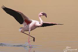
At 10:15 AM, we hit the road again **heading to Luderitz, 22 km away**, and first to **Diaz Point** **facing the Atlantic Ocean**. It's a wind-swept peninsula with its characteristic red and white lighthouse. There's a campsite and a coffee shop on site, but the place doesn't inspire rest without shade or shelter from the wind. We return to the city via the D701 track that runs along the ocean, be careful at low tide. We come across **a few fishermen and a fox as well as flamingos.**
We walk through the few streets of the city, much smaller than I imagined, then climb to the **famous little Lutheran church that overlooks the city, the Felsenkirchr.** **The wind blows very strongly here, and the sand is omnipresent, surrounded by the Namib Desert and the southern Atlantic coast.** **A German colonial relic barely touched by the 21st century, Luderitz seems frozen in the past, giving it both a gloomy and a certain charm. In short, it's certainly one of the most incongruous places in Africa.**
At 1:15 PM, just before leaving Luderitz, we do some shopping for 20.50 € and fill up with fuel: 61.50 €, 1290 NAD $ for 61 liters (21.18 $ per liter).
**We return via the B4 to Aus** (paved), **then via rougher tracks**, the C13 then the D707, magnificent as it runs along a mountain range with multiple colors on our right and an endless flat desert on the other side.
To access our campsite for the evening, we must take a **narrow private track for 7 km** on our right to emerge, in this total vastness, at the **isolated Kanaan Desert Retreat on a small hill**. I don't have time today to jump into the pool near the reception; we arrive at 5 PM at 8 small, isolated, and unique sites with a small kitchen, a shower, and a private toilet under a small tarp shelter. **A crazy charm with a unique view...** **This will be my favorite accommodation of this trip. The photos speak for themselves.** We jump into the outdoor shower while savoring the landscape, then prepare our evening braai while enjoying the colors fading, facing this plateau with bushes turning a vivid orange. **A moment that will remain etched for life.** **Savanna atmosphere under a thin emerging moon. Every minute offers different colors. Facing our meal, we have a natural giant screen.**
We end this day contemplating the stars and admire this thin orange moon setting on the horizon (8:42 PM).
**Ghost town just before Luderitz: Kolmanskop** (open from 8 AM to 3 PM - N$ 180 p.p – 9 €). Once, Kolmanskoppe was organized around diamond mining. After finding new, more prolific spots, the town was abandoned and is now a ghost town. The sand and dunes have reclaimed their rights and buried everything humans had built. Houses, train station, bakery, everything has been covered by sand, which passes through the windows, even though they are 1 meter high.
> Today's road itinerary: 5h30: B4 to Luderitz (paved) > Round trip > Kolmanskop on the left > Return via the previous campsite > Then C13 (track) > Turn left D707 (track) > Then track to the right to the campsite.
> Distance driven today: 438 km.
> Distance walked today: 8 km.
> Today's expenses: Groceries at the Spar in Luderitz for 20.50 € / Fuel fill-up in Luderitz for 61.50 €.
> Official Kolmanskop website: (https://kolmanskuppe.com) (open from 8 AM to 1 PM - N$ 180 p.p – 9 €).
> Accommodation: Night at the south of the Namibrand Nature Reserve: Kanaan Desert Retreat – 26.5 € for two - (http://www.kanaannamibia.com/) - Farm 104 Karas 9000 - Sanitary facilities + BBQ + Water + Pool - No electricity - My favorite accommodation of this trip.
**DAY 8: Thursday, May 1, 2025: Kanaan Desert Retreat - Namib Desert - Crossing the Namibrand Nature Reserve – Sesriem Canyon - Elim Dune - Little Sossus Lodge**
After a cooler night than the previous ones with about 10°C, we wake up around 7 AM. We admire, as usual, the sunrise between the desert and the mountains. **The spot from last night was truly perfect, isolated from the world, in total serenity, with a wake-up call to the sound of birds.**
We hit the road a little after 8 AM, heading north via the D707 to Spes Bona, then the gravel road C27 via Betta to Sesriem. **The landscapes roll by and dazzle us.** **We are right in the heart of the Namibrand reserve**, coming across numerous **zebras**, **impalas**, **ruminants that reproduce in large numbers**, and **gemsboks**. At noon, we stop in the shade of a tree to eat. The spot is so romantic facing orange arid mountains and a vast green plateau. **A landscape full of contrasts, timeless and silent.**
**The Namib Desert is the oldest on the planet; its name means "vast arid plain," and it also gave its name to the entire country: Namibia.** The majority of these arid and semi-arid lands dotted with viewpoints are part of the Namib-Naukluft National Park, which covers 23,000 km².
At 1 PM, we enter the Sossusvlei park. We start with the **Sesriem Canyon**, which is 3 km long and 30 m deep. We enter it with a short 1-hour hike into its depths. **It was carved by the Tsauchab River in an agglomerate of sand and pebbles over 15 million years old.** We retrace our steps back to Sesriem, which means "six belts," referring to the number of leather belts (from ox wagons) needed to draw water from the canyon. This remote locality is mainly the gateway to Sossusvlei but offers a gas station and some accommodations. For our part, we sleep 40 km away tonight.
**We then move on to Elim Dune.** It takes about 45 minutes of walking to reach its summit, and the climb is very breath-taking as we progress in the sand where we almost slide back with each step. **A first grand 360° panorama unfolds. The ochre color of the sand contrasts completely with the yellow plain and the brown and black mountains in the distance.**
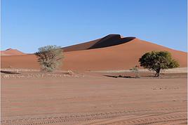
At 3:15 PM, we start the descent facing Sesriem. We were completely alone once again on this dune. **These Namib dunes are composed of colored quartzite sand, presenting hues ranging from cream to orange and from red to purple. Unlike the ancient dunes of the Kalahari, these move with the wind and adopt distinct, ever-changing shapes.** Star dunes resemble stars seen from above, while transverse dunes, like those on the coast south of Walvis Bay, stand perpendicular to the prevailing southwest wind. The most stable dunes, which thus have the most vegetation, are parabolic dunes, due to the variability of the winds. Longitudinal (seif) dunes measure up to 100 m in height, while barchan dunes, crescent-shaped and predominant at the extreme north of the Skeleton Coast and south of Luderitz, are the most mobile, created by unidirectional winds.
**We get back on the road for 45 minutes to our campsite for the evening, Little Sossus, which we reach at 5 PM**, via C27 then right onto C19. As often upon our arrival, I jump into the cool pool to relax after all this driving, then we proceed to set up the camp. As the day before, the campsite consists of 10 fairly distant sites, with private sanitary facilities and a small roof. We are delighted with this crazy charm. The hot water for our shower is wood-heated: a Namibian lights it every evening around 5 PM.
For a change, or not, the menu features a small BBQ with pork ribs and pasta, facing another sunset, this time with partial cloud cover giving equally splendid colors. Time for a well-deserved rest after long corrugated tracks covered in our 4x4 today.
> Today's road itinerary: 4h45 of driving: Find the D707 and head north (track) > At Spesbona turn left onto the C27 (track) > At Sesriem after entering the park, turn left following View Point Sesriem > Continue 4.5 km to the Sesriem Canyon Parking > Return then head towards Elim Dune > Exit the park then take the D826 > Turn right onto the C19 heading SE > Turn right facing the D854 to the campsite (campsite closes at 7 PM).
> Distance driven today: 272 km.
> Distance walked today: 8 km.
> Today's expenses: Entry to the Sossusvlei Namib-Naukluft Park: 17 € for two (with one car).
> Accommodation: Little Sossus Lodge – 35 € for two - At the junction of the C19 and D854 roads Maltahohe 9000, Maltahohe, Namibia - (http://www.littlesossus.net/) - Pool + Private bathroom + Hot water + Electricity + BBQ + Grocery store (bread to order the day before).
**DAY 9: Friday, May 2, 2025: Little Sossus Lodge - Namib-Naukluft National Park – Sesriem - Sossusvlei - Big Daddy – Deadvlei - Tsauchab River Camp**
Today we start the day early to tackle **the famous dunes of Sossusvlei at first light**. The alarm goes off at 6 AM to leave the camp at 6:45 AM. The wind is blowing quite strongly in gusts this morning, but it only woke us up a quarter of an hour before sunrise. The park opens at 7:15 AM. We start with a small encounter: a friendly **jackal lounging by the roadside.**
We first have to cover the 40 km of track to Sesriem, pay the entrance fee (350 NAD $), and drive 65 km on a paved road this time to reach the **vast salt pan (a lake whose sediments are made of salts) of Sossusvlei**. **It appears amidst the gigantic red dunes that rise on either side. The wind constantly changes the shape of the dunes, as well as their colors, which vary with the light. The setting is breathtaking, giving an impression of immensity and timeless grandeur.**
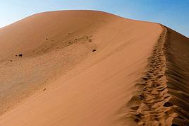
The paved road ends; the last 4 kilometers become technical and are reserved for 4x4s. Phew, I pass without any problems, though not without stress, switching to L4 mode. **We start the ascent to Big Daddy at 8:45 AM, 325 m of elevation gain in the sand nonetheless.** We climb at an excellent speed despite the strong wind, in exactly 1 hour. At 9:45 AM, we are at the summit of what will remain etched for a long time. The 360° view is simply unimaginable; you have to experience it to believe it. The wind blows violently up there, **it feels like being in the high mountains, on a snow ridge, with a strong transport of sand. The atmosphere is magical.** We start the descent running barefoot in the steep sand.
**We then move on to its neighbor, Deadvlei.** **Here, petrified trees stand in the "vlei" (basin) with their dried branches casting desolate shadows on the white ground. The juxtaposition of the deep blue sky and the towering dunes is captivating.**
We return to the 4x4 parking at 11 AM, the stress rises again for the sandy track passage. We retrace our steps and stop at **Dune 45**.
At noon, we take the opportunity to picnic at the foot of **the beautiful Dune 40**, where there is already no one left. We enjoy the quiet again, well, almost, as the wind remains omnipresent.
At 1 PM, we return to **Sesriem**, where we fill up with fuel (21.15 NAD $ per liter), totaling 1630 for 77 liters (78 €), and do some shopping for 245 NAD $ (two nice pieces of pork, 2 cans, 2 sandwiches for tomorrow, and 1 soda), which is 12.48 €. It's 27°C. We hit the road again, heading to a new destination at 2 PM. We take the C19 back to Little Sossus where we spent the night, then turn left onto the gravel road D854 for about 40 km to **Tsauchab River camp**. Finally, we won't be sleeping here; we are redirected 7 km downstream to **Naukluft View Camp**, which also belongs to Tsauchab River Camp.
We arrive at 4 PM, and thankfully, the fatigue was starting to set in. **Our campsite is located under a small forest, providing some protection from the wind that blew strongly all day. The calm does us a world of good. Once again, a lot of charm**, with very spaced-out sites without any visibility. We can't wait to take our shower. It will be possible from 5 PM with, as the day before, water heated by a wood fire. Time to prepare the campsite for the night. And on the menu, a braai with two superb pieces of pork bought in Sesriem and fries!!!!
**The Namib Desert**
An impressive coastal desert stretching from the Atlantic to a high plateau inland, the narrow Namib Desert runs along the southwest African coast for about 1,300 km. **Considered one of the oldest deserts in the world**, it is bordered to the north by the Kaokoland Desert, which extends into Angola, and to the south by South Africa's Karoo. The narrow Namib is mostly less than 160 km wide. Despite this, it is considered to consist of three sections: the coastal strip influenced by the Atlantic; the Outer Namib, occupying what remains of the western half; and the Inner Namib, comprising the eastern half of the desert. Generally called the Skeleton Coast, the coastal Namib receives almost no rain and depends on regular marine fogs for moisture. From sea level, the terrain rises to 900 m, where the desert meets the base of the Great Escarpment to the east. In the Inner Namib, average annual rainfall is only about 50 mm.
The dryness is such a characteristic of the Namib that it is thought to have been in this arid state for at least 55 million years. It is all the more surprising to learn that animals such as vipers, geckos, zebras, and elephants live in this desert. Some areas of the Namib are also rich in flora, including Welwitschia mirabilis, which grows near the ground with seemingly exhausted leaves, extracting moisture from marine fogs and can live over 1,000 years. In the southern Namib, some dunes are up to 32 km long and 240 m high.
**The frequent fog of the Skeleton Coast:** Driving north along the coast of Namibia, the cold Benguela Current in the Atlantic cools the moist air above the ocean, which, upon meeting the warm desert air, leads to the formation of thick fog banks that drift up to 100 km into the center of the Namib before evaporating under the sun.
> Today's road itinerary: 4 hours of driving: C19 towards Sesriem (track) > D826 (paved) > Foot of Big Daddy via a technical sandy track > Return via the same route > D854 to Tsauchab.
> Gas station: Sesriem.
> Distance driven today: 254 km.
> Distance walked today: 12 km.
> Today's expenses: Park entry at Sesriem for 2 people: 17 € / Fuel fill-up: 78 € / Groceries at Sesriem gas station: 12 € (245 NAD $).
> Accommodation: Tsauchab River Camp - Naukluft View Camp - D054 & D850 GPS: S24 26' 37" E16 10' 11" Sossusvlei 22007, Maltahohe, Namibia - BBQ + Private sanitary facilities + Water - www.tsauchab.com
**DAY 10: Saturday, May 3, 2025: Tsauchab River Camp - Naukluft National Park - Olive Trail Hike (10 km) - Ababis Guest Farm**
We pack up the camp at 8 AM and continue our road trip north via the D854, a bumpy track with many corrugated sections. It's cool this morning, 12°C.
**We enter the Naukluft massif, discovering landscapes with very different terrain than before.** We first need to check in at the campsite, 13 km from the entrance at the end of the track: 350 NAD $ for 2 people and 1 vehicle, then return 4 km back. **On the agenda is the lovely Olive Trail, a 10 km hiking loop that starts 4 km northwest of the park office**, along the D854 that we follow. At 9:45 AM, the hike begins with a fairly steep ascent (about 45 minutes) among the **wild olive trees** from which the trail gets its name. **At the summit, we enjoy a view that embraces the Naukluft Valley.** We then turn east and gradually descend into a deep valley, passing over sometimes slippery rocks. We have a snack around 11:30 AM in these small gorges. **Further on, to cross the wall of a canyon in front of us, some chains are fixed to the rock to help us pass.** We finish this superb loop clockwise at 1:15 PM, taking 3.5 hours including 30 minutes of breaks. We only crossed a small group of 3 people on this wild adventure far from everything. At 1:45 PM, we exit the park and take the **D854 track north to Bullsport**. From there, we turn left and take the C14, which **runs along the bed of the Tsondab River.**
**We arrive at our campsite for the evening, Ababis Guest Farm, at 3 PM.** Quite early for once, allowing us to rest a bit in this peaceful farm where many sheep wander around us. We also enjoy the pool under a magnificent sun, less hot than the previous days, it's 22°C. The camp has only 4 spaced-out sites around shared sanitary facilities. **We are in the middle of a vast plain facing the Naukluft massif mountains.** We will have another beautiful sunset on these mountains. For the first time on this trip, **we will be completely alone at this campsite.** **We haven't encountered many people today**, just 3 during the hike and fewer than 10 vehicles all day.
> Today's road itinerary: Head north on the D854 (track) > Turn left to enter the Naukfluft National Park > Continue on the track then turn right to the Olive Trail hike parking lot (1 hour for 45 km). Return to the D854 and continue north > At Bullsport turn left onto the C14 to Ababis (still a track) > The camp is located on the left facing the D1261 (1 hour for 60 km from Olive Trail). Total: 2 hours of driving for 100 km.
> Gas station: No gas station on the route, except in Solitaire.
> Distance driven today: 115 km.
> Distance walked today: 13 km.
> Accommodation: Ababis Gaestefarm - Night booked by email – payment on site: (https://www.ababis-gaestefarm.de/) - P.O.Box 1004, Maltahöhe - N$ 300.00 per person
**DAY 11: Sunday, May 4, 2025: Ababis Gaestefarm - Namib-Naukluft National Park – Solitaire - Gaub Pass - Kuiseb Canyon - Moon Landscape - Walvis Bay**
The night was, for the first time since the start of this road trip, quite difficult. A strong wind accompanied us all night, making the tent flap constantly. A racket that drove us crazy. We still managed to sleep a few hours. The morning sun brings back our smiles. We hit the road for this new stage a little before 7:45 AM.
We start the day with a first stop less than 15 km away **on the C14 in Solitaire** at 8:15 AM. **This town is lost in the middle of nowhere with its small gas station with a western atmosphere adorned with rusted and sand-covered car wrecks.** After a quick supply stop: 86 NAD $, or 4 € for 1 water container and a box of cookies, we continue north still on the C14, **crossing the Tropic of Capricorn** then devouring this **magnificent track up to Gaub Pass**. **A succession of narrow gorges, turns, climbs, and descents breaking the monotony of the previous long straight lines.** We are right in the heart of no man's land for 200 km. We then start the descent to the **Kuiseb Canyon. It houses the wide bed of the eponymous river, dry almost all year.** Even when it flows for 2 to 3 weeks during the rainy season, it doesn't go beyond Gobabeb and then seeps into the sand. **The drinking water that supplies Walvis Bay is pumped at Rooibank from this underground water table.** **We now cross the Kuiseb Desert where impressive dunes roll down.** We make a short stop at a **natural rock arch** reminding us of our (https://www.montagne-aventure.net/2024/04/29/j19-1-juin-2024-canyonlands-national-park-et-arches-national-park/). Then we gradually descend towards **Walvis Bay** where we will spend the night. At noon, we enter the **Dorob National Park**. The thermometer drops 10°C in 10 minutes as we get closer to the Atlantic Ocean.
At 12:45 PM, much earlier than initially planned, we arrive at the **Moon Landscape** (View Point 4, free) to have a snack, via a very recent surprising dual carriageway in the middle of nowhere, then via the C28. We are again in the hinterlands, the temperature has soared: 30°C without a bit of shade. Even if the colors and the panorama must be exceptional at sunrise or sunset, the detour for this 360° panorama is still worth it. Extreme aridity as far as the eye can see. The place lives up to its name; it really feels like being on the moon. We get back on the road at 1:30 PM via the D1991, C28, then again the A2, which is very new. The latter runs along the beautiful dunes up to the **Dune 7**, where we make another stop.
Then we head towards our final destination of the day, **Walvis Bay. Its port is sheltered by a sand spit, a natural breakwater that protects the city from the powerful assaults of the ocean. Its port was long a strategic place: claimed by the Cape Colony in 1795, it was officially annexed by the British in 1878 to counter Germany's ambitions in the region. A colony of fur seals, pelicans, flamingos, and whale terns have made it their home.**
We do a big grocery shopping at the Spar located in the center for 66 €; it's very easy to park there. Then we fill up with fuel at an Engen station right across for 1117 NAD $ for 54 liters (20.6 NAD $ per liter), which is 54 €. We then **enjoy the seaside in the Lagoon neighborhood**, where it's also easy to park. After kilometers in the desert, **this cool break is more than welcome. The outside temperature is 22°C. In the distance, we can clearly see the clouds lingering over Swakopmund.**
We take the 4x4 one last time to the **Lagoon Chalets where we will spend the night**. The spot is well set up and surprising in the heart of a residential neighborhood. The sites are quite large, separated by fences around very comfortable shared sanitary facilities. BBQ, electricity, and shaded area. We settle in quietly before going out on foot to watch the **sunset over the Pacific Ocean along Lagoon Promenade Road**. We can still see this impressive persistent mist in the distance. The neighborhood is very peaceful, certainly without much charm, but with a very well-developed seafront that inspires relaxation after kilometers without meeting anyone in inhospitable lands. We end the day with our traditional braai: grilled chicken thighs and sautéed potatoes in the coolness of a starry sky.
> Today's road itinerary: 5h30 of driving (or 3h30 of driving for 250 km without the Moon Landscape): Head north on the C14 > Cross the Tropic of Capricorn > Gaub Pass > Kuiseb Canyon on our left in a round trip > Continue to Green Valley and leave the C14 to the right on the D1984 > Turn right on the C28 > Then left D1991 to Moon Landscape D1991 View Point 4 > Return via the same road and stop at Dune 7 for sunset > Walvis Bay.
> Gas station: Solitaire or Walvis Bay.
> Distance driven today: 372 km.
> Distance walked today: 5 km.
> Today's expenses: Fuel fill-up for 54 € + Groceries for 66 € at Spar.
> Accommodation: Walvis Bay: Lagoon Chalets – 36.6 € for two - (http://www.lagoonchaletswb.com/) - 8th Road West, Meersig Meersig 9000, Walvis Bay, Namibia - BBQ – Electricity – Shared sanitary facilities.

**DAY 12: Monday, May 5, 2025: Walvis Bay - Swakopmund - Round Trip to Cape Cross (seals) - Wreck of the Zeila en route - Henties Bay - Spitzkoppe Tented Camp & Campsite**
After an excellent night, a bit cooler and more humid than usual, we wake up around 7 AM and leave the camp at 7:45 AM to **follow the Atlantic coast heading north**. We thus leave **Walvis Bay**, a very pleasant stopover town, and follow the ocean via the B2. **We enter the mist and Swakopmund** at 8:40 AM, parking **near the lighthouse**. The atmosphere is very quiet, the streets seem dead with large empty parking lots and very little traffic, but the few open shops are filled with expatriates enjoying their breakfasts, French bakeries, cafes, travel agencies... **We are in this Benguela Current, a fast cold ocean current that flows from South Africa, up the coasts of Namibia and Angola, towards the northwest to join a warm equatorial current. Hence the supply of very fish-rich waters and this tenacious mist depending on the seasons. In the northern part of the Namib Desert, fogs are frequent during the southern winter. It's almost the only source of moisture since the city of Swakopmund receives, on average, only 11 liters of water per m² in December and January.**
**Swakopmund is wedged between the dunes and the Atlantic rollers. It is the Namibian capital of adventure activities and has a ghostly colonial remnant. With its German architecture, its seaside promenade, it resembles a seaside town of the North Sea or the Baltic.** It is also a bustling African city. **Nearly two-thirds of Swakopmund's population live in Mondesa, a township created during apartheid, northeast of the city center, a legacy of the South African mandate.** The heart of the city is located in the area of the pier, at the foot of the lighthouse, better known as the Mole. During the South African occupation of Swakopmund, the port took a back seat to Walvis Bay.
Continuing on this C34, sometimes on salt, we come across the famous **wreck of the Zeila, stranded in 2008**, on our left. We can see it through the thick fog, being very close to the beach. It's 10:15 AM. Further on, Henties Bay is a bay that attracts many fishermen; it's teeming with vehicles equipped with fishing rods. Besides its fish-rich waters, it enjoys a relaxed atmosphere and a large beach suitable for walks.
We continue further north, heading to Cape Cross, this time a round trip because we will turn off later here in Henties Bay to reach Spitzkoppe via good gravel roads that are quiet alternatives to the very busy paved B2 further south. **Henties Bay is part of the Dorob National Park, a multi-purpose park protecting coastal ecosystems and hosting the many renowned recreational activities of the region. The part of the coast north of Swakopmund up to the Ugab is particularly popular with fishermen who come in droves to fish for saltwater fish.** The small concrete buildings spaced at regular intervals are actually toilets for fishermen and campers. The coastline is also dotted with world-renowned surf spots.
Even before arriving, we can already smell it before we come across thousands of seals (population in 2021: 1.5 million). **The Cape Cross Seal Reserve, the most renowned on the Namibian coast, is home to the most famous breeding colony of fur seals, which seems to take full advantage of the high concentrations of fish present in the icy waters of the Benguela Current. We are impressed by the sight of these 100,000 pinnipeds lounging on the beach and frolicking in the waves.** We have a picnic a little away from the smells facing the ocean in the sun.
At 12:45 PM, it's time to hit the road again. We retrace our steps back to Henties Bay. We stop there to do another big grocery run before not encountering any big cities for many days. We will only buy fresh items day by day until the end of the trip; we have 23 € worth. **In the space of 30 minutes, we go from 15 to 36°C. The thermal shock with an amplitude of more than 20°C.** At 1:45 PM, we hit the road again via the D1918, then we try a very small track on our left, the D1925. It becomes narrow and rough; I have a bit of apprehension. We arrive at a gate to open in the middle of nowhere, then young children run up to us asking for water or food... We then drive to **Spitzkoppe. The arrival right in front of the mountains is majestic, off the beaten path. This mountain appears in the distance like a mirage above the dusty plains of southern Damaraland.** We come across a second gate held by a guard. We enter the "Community Camp" campsite without realizing it through the west entrance. We are given a small paper, then we go to the reception passing **at the foot of these gigantic, magnificent rocks.** Once at the reception, we are informed that this is not the camp we had booked. Ours is located just a little further, and in the end, it's better because the latter was packed. We were able to cross the park very close to these rocks without paying. We exit through the main entrance; 5 Himba children cling to our doors and trunk asking for bread and food again. We continue despite them staying attached, worried about hurting them. Phew, more fear than harm. We cross the few houses and arrive at the right camp at 4:30 PM, the Spitzkoppe Tented & Campsite. The spot is much quieter and well set up. We have site C12, cozy to perfection with its sink, a private shower and toilet, as well as electricity, under the shade of a tree and facing the mountains. The sunset and sunrise will be perfect. We set up the tent and, without delay, head to the pool for a big dose of coolness. Then it's time to prepare the BBQ and **contemplate the fading lights on the Spitzkoppe massif.**
> Today's road itinerary: 5 hours of driving: Head north on the B2 (paved) along the ocean > Swakopmund > C34 (paved) still heading north > On the left, the wreck of the Zeila before Henties Bay > Cape Cross round trip > Henties Bay > D1916 heading east (track) > Turn left onto D3716 > Turn left to the campsite.
> Gas station: Swakopmund or Henties Bay.
> Distance driven today: 344 km.
> Distance walked today: 6 km.
> Today's expenses: Groceries in Henties Bay: 23 € + Cape Cross park entry: 17 €.
> Accommodation: Spitzkoppe Tented Camp & Campsite - Spitzkoppe River Valley 00000, Spitzkoppe river valley, Namibia - (http://spitzkoppemountaincamp.com/) - 26 € - Pool - BBQ - Shower and toilet.
**DAY 13: Tuesday, May 6, 2025: Spitzkoppe - Rock Pools - Uis**
It's 6:45 AM, **we wake up at the foot of one of the most emblematic landscapes of the country, Spitzkoppe, which towers over the valley at 1,728 m.** **The Spitzkoppe massif, "pointed hat" in Afrikaans, is actually a set of three rock formations: Big Spitzkoppe, the granite domes of the Pontok Mountains that surround it, and Little Spitzkoppe, to the southwest. It was first climbed in 1946 and has never stopped attracting experienced climbers; it remains one of the most challenging ascents in the country. The climate in the region is hot**, so try to visit during the cooler months, as it can quickly reach 36°C in the sun in the afternoon. **Spitzkoppe is particularly striking at dusk, as it was last night, and at dawn this morning when the low light sets the rocks ablaze with red and orange hues. The spectacle is unique.**
We re-enter the park managed by the local community (160 NAD $ per person), then start with the **arch sector**. We quietly enjoy all the viewpoints under perfect orange colors. We leave this magnificent spot, reminding us of (https://www.montagne-aventure.net/2024/04/29/j19-1-juin-2024-canyonlands-national-park-et-arches-national-park/), but with much less crowding here. Around 10 AM, we head closer to these mythical peaks, including the main one nicknamed the Matterhorn of Namibia. Then we finish with the **ascent of the rock above Rock Pool. The 360° view of the park is a must-see. Small natural pools carved into the rock bring a bit of water to this arid and rocky landscape.** The wind blows strongly up there, and during a photo shoot with a tripod, it falls forward right onto the lens glass, cracking it... Frustration and shouts, these will be the last quality photos of this trip, and a new bill to pay when we return to replace it... Disgusted.
We continue to **Bushmans Paradise**, have a lunch break in the shade of a rock before hitting the road again around 12:30 PM after thoroughly exploring the park, feeling weakened and sad about my passion: photography...
We fill up with fuel as soon as we arrive in Uis at the price of 21 NAD $ per liter, a total of 1021 NAD $ for 50 liters (52 € by card). **Uis is a former mining town. Tin mining ceased in the early 1990s, but the high white mountain where the ore was dumped is clearly visible. The region is rich in amethysts, Brandberg crystals, and other semi-precious stones; we come across many vendors on the roadside.**
We then head to our final destination of the day, the **Daureb Isib Restcamp**. We arrive quite early for once at 2:45 PM in the heat, but the camp is just perfectly set up, surely the most upscale we will have during this trip. We are in a fortunately shaded area under palm leaves, with a table, chairs with cushions, a sink, a hot shower, toilets, a beautiful pool, and of course our private BBQ. Perfect for regaining a bit of a smile after the fall of my DSLR camera. **We are facing the Brandberg massif, the "fire mountain" in Afrikaans, dominated by Königstein (2,573 m), the highest peak in Namibia.** **The Brandberg owes its name to the reddish-orange glow that forms on its slopes at dawn and dusk, when the sun's rays awaken its red granite faces studded with crystals. It also hides a real treasure inside, as it contains an exceptional concentration of prehistoric rock art**, mainly paintings and some petroglyphs, including the most famous of them, the **White Lady in the Tsisab Gorge**. There are over 43,000 in total, dating back 2,000 to 4,000 years, scattered in hundreds of crevices around the mountain.
Time for the usual swim, laundry, and evening cooking. On the braai menu, local sausages with cheese pasta and leftovers for a good salad the next day.
> Today's road itinerary: 1h45: Head north on the D3716 > Then D1930 (gravel and sand track) to Uis.
> Gas station: Uis.
> Distance driven today: 113 km.
> Distance walked today: 6 km.
> Today's expenses: Fuel fill-up in Uis for 52 € (1,021 NAD $).

> Accommodation: Daureb Isib Restcamp - Erf 672 C/O 3rd & 4th Avenue Uis 9000, Uis, Namibia - (http://www.daurebisib.com/) – 31 € - Pool. Comfort with private bathroom + electricity + Wi-Fi at the restaurant. Clear sky for a beautiful starry night.
**DAY 14: Wednesday, May 7, 2025: Brandberg (Namibia's Highest Mountain) - Damaraland:**
**The Brandberg massif is an isolated, dome-shaped mountain, an inselberg, that towers over the gravel plains scorched by the sun of the Namib Desert to the northwest. It measures 23 km long and 20 km wide. It is the highest point in Namibia at 2,573 meters.**
This massif formed about 130 million years ago when a gigantic viscous mass of magma from deep within the Earth's crust rose through the surrounding rock layers before solidifying. Later, the granite mass was exposed by the erosion of the surrounding rocks.
**The Brandberg is the highest mountain in Namibia, peaking at an altitude of 2,573 m. The indigenous San people call it the "burning mountain," as it appears to glow with a red light at sunset. With its considerable height and width, this massif influences the local climate, attracting more rain on its slopes than the desert below.** The rain seeps through the springs. Unique animal and plant species thrive in this high-altitude environment, and prehistoric paintings adorn the rock faces hidden in the ravines around the base of the mountain.
The first night was also hot since the start of this trip, the thermometer did not drop below 20°C. We wake up gently around 8 AM, a pleasant sleep-in, the sun is already out. After a quick morning cleanup of the 4x4, we have time today, we hit the road at 9:30 AM, getting lost in the Brandberg massif. We are now in the **Damaraland, which stretches from the majestic rock formations of the Brandberg in the south, where we are today, to the bushy expanses at the foot of the rugged mountains of Sesfontein in the north, where we will be tomorrow. It is the perfect destination for wildlife and flora observation.**
We take the track heading towards the **White Lady**, but we want an alternative to this guided visit only. So, just before arriving, we turn right towards a viewpoint named on Google Maps **Rastplatz**. We come across **small Himba villages, living in extreme poverty with no natural resources; the inhabitants ask for water with every passing vehicle...** A bit further, we encounter about ten **ostriches** in the middle of the track, magnificent, as we get closer to the mountains in the background, and a few meters further, **a herd of Oryx**. Then we approach the **bed of the Ugab River**. We then go back and have a snack in the middle of nowhere, under the shade of our 4x4, facing the mountainous massif. We get back on the road around noon, while the temperature is at its peak in this very hot region, 35°C on the gauge with very dry air. We go up the C35 slightly then turn left onto the small track D2319 until we reach the Ugab bed again. Back to Uis in the mid-afternoon.
We did not book the same campsite as the previous night; today we are at the Brandberg Rest Camp. Unfortunately, the camp is not at the same level as the previous one, which was perfect. But the price is also much lower. The sites are next to each other, separated by small fences behind the main building. But it will do just fine. We have our BBQ and electricity, the shared sanitary facilities are decent. We then lounge in the large pool. We will then buy some water for 10 € at the supermarket located right across.
> Gas station: Uis.
> Distance driven today: 118 km.
> Today's expenses: Groceries in Uis: 10 €.
> Accommodation: Brandberg Rest Camp Uis - No 3 Uis Street Namibia 9000, Damaraland, Namibia - (http://www.brandbergrestcamp.com/) - Large pool – Shower – Electricity
**DAY 15: Thursday, May 8, 2025: Damaraland: Petrified Forest - Ugab Valley - Palmwag**
The night was excellent and slightly cooler than the previous one. We wake up around 7 AM and hit the road just before 7:45 AM heading to a new destination as we continue this Namibian road trip. **We cross Damaraland today from south to north.** First via the C35 to **Khorixas**, then turning left onto the C39. **We come across some villagers walking kilometers under the scorching sun with only a small water container in their hand... What a tough life, light-years away from ours.** About 40 km west of this town, we arrive at the **Petrified Forest National Monument**. It is a vast expanse of veld (open vegetation area), dotted with petrified tree trunks that can reach 34 m in length and 6 m in circumference, estimated to be over 260 million years old. These trees belonged to the Gymnospermae family, conifers among which we find today's cycads and welwitschias. The absence of roots and branches suggests that the trunks were deposited here during a significant flood. The site has about fifty trees, some half-buried in sandstone, others perfectly petrified in silica with their bark and growth rings. A guide is mandatory at the entrance to visit the site.
We then continue on this C39 due west to the junction of the D2612. We make a round trip to the south to **Twyfelfontein, which means "uncertain spring" or "bubbling spring" in Damara**. The site is a UNESCO World Heritage site, located at the entrance of the grassy Aba Huab Valley and houses one of the largest collections of rock art on the continent. More than **2,500 petroglyphs** have been discovered on over 200 stones, as well as some rock paintings. They date back about 6,000 years and others 2,500 years. Many engravings depict species that have since disappeared from the region, such as elephants, rhinoceroses, giraffes, and lions. The presence of a seal attests to the existence of links with the coastline at the time, now over 100 km away. It is here, as well as at Brandberg, that the human history of Namibia began with these testimonies of ritual and economic practices among hunter-gatherer peoples.
We continue a bit further south on the D3214 then D3254 to visit the **Organ Pipes, "organ pipes"**. The entrance is also paid, much to our regret... 500 NAD $ for two. We take a well-marked trail leading to a small gorge containing dolerite (coarse-grained basalt) columns 4 m high and aligned on an astonishing 100 m long wall. We are in a volcanic chain stretching over a dozen kilometers, a pile of scoria that seems to have been exposed to fire, the Burnt Mountain "burnt mountain" stands in a bleak and desolate landscape where almost nothing grows.
We head back north and return to the C39 then the C43 to **Palmwag where we will spend the night**. **This concession, covering an area of 5,500 km², is a region of red hills and plains, remarkable for its rolling landscapes as well as its rich fauna and flora**. The region serves as a **buffer zone between Etosha and the Skeleton Coast**. We have a good chance of encountering black rhinos, desert elephants, and lions, as well as spotted hyenas, giraffes, gemsboks, and other antelopes.
We pass the sanitary control barrier at 4 PM, just before entering Palmwag. In our direction, from south to north, we are simply asked about our future destinations and to present my French driver's license. A few meters further, there is a small gas station, then on our left our final destination of the day: the Palmwag Lodge Campsites. We are happy to arrive after this long journey. The welcome is very pleasant, and the site is very comfortable with a real brick shelter housing our shower and toilet, as well as water and electricity. We always have a BBQ available, but today we unfortunately no longer have meat due to concerns about the sanitary control, but we were not sure if it was rather in the other direction that the transport of fresh meat and dairy products is prohibited. We now cross our fingers to be able to observe some different animals, as the place is renowned for elephants, giraffes, and rhinos. We first take some time to relax in the pool before going for a walk around the reserve, without encountering anything unfortunately this evening, but the wake-up will be up to par... Time for the sunset, which is always one of the highlights of the day.
> Today's road itinerary: 5h30 of driving: C35 heading north > Then turn left onto the C39 > Petrified Forest > Go down on the D3612 in a round trip to Twyfelfontain (rock paintings and Organ Pipes) > Go back up on the C39 then C43 to Palmwag > Round trip on the C40 to Mount Grootberg Pass.
For info on the C43, there is a sanitary control at the entrance and exit (transporting raw meat is prohibited).
Palmwag: black rhinos (guided or free visit? at sunrise or sunset).
> Gas station: Twyfelfontain or Palmwag (07:00 – 19:00) – Tire repair in Palmwag.
> Distance driven today: 349 km.
> Distance walked today: km.
> Accommodation: North of Palmwag Lodge Campsites - GPS Coordinates -19.88556°, 13.93694° - Pool – Water and electricity – 34 € - (https://gondwana-collection.com/accommodation/palmwag-campsite?LodgeName=PALMWAG%20CAMPSITE)
**DAY 16: Friday, May 9, 2025: Palmwag - Sesfontein - Entry into Kaokoland - Opuwo**
This morning, we take our time watching for wildlife. We can finally observe our first **kudus** as the sun begins to illuminate the plain in front of us (see video and time-lapse of the day). A few minutes later, we also spot **a couple of giraffes with their calf**, moving calmly and serenely.
**We leave Palmwag** at 9 AM, heading to the northernmost point of Damaraland via the C43 to Sesfontein.
A few kilometers on the track, and we come across **a herd of zebras**, 11 to be exact, in the middle of green hills. Even further, it's more than twenty that cross right in front of us, a treat for our eyes. Their gait is majestic; they are very sensitive to noise. Some are more curious than others and don't hesitate to stay close if we remain quiet. We then cross numerous rough riverbeds. We must always stay very attentive at the wheel because we can drive at over 80 km/h on straight lines and then suddenly have to brake to cross these small streams, usually already dry at this time of year. Many antelopes are still present by the side of the track; the heat is already rising, and they are often lying on the ground at this hour.
**We arrive in Sesfontein at 11:15 AM**, just as the children are leaving school. Transportation is done by donkey-drawn carts. The villagers spend their time in the shade of the trees and in front of the few small shops. The atmosphere of its streets is dusty with a laid-back pace; this town has the feel of an oasis located **by the Hoanib River**, the town of six springs from which it gets its name. Founded in 1896, it was a military outpost built after a cattle plague epidemic. This page of its history is reflected in Fort Sesfontein, erected in 1905 to fight cattle diseases, arms smuggling, and poaching.
We take a lunch break at the exit of the village around 11:30 AM in the shade of a tree, so peaceful, it's 32°C. We continue further north, away from the usual tourist routes, and **enter the Kunene region, also called Kaokoland**. The track becomes narrower and more winding. **These are now vast solitary spaces largely devoid of roads, simply crossed by sandy tracks opened by the South African army just a few decades ago.** The fauna and flora have managed to adapt to this harsh and dry environment, like the desert elephant, an endangered species whose slender legs are perfectly suited to the long journeys the animal must make to find water, a rare resource. This region is also the territory of the Himba people, emblematic of the country. Its name comes from the Kunene River, which marks a narrow belt of vegetation at the Angolan border.
**We arrive in Opuwo at 3 PM**, **this town is the capital of the Kunene region**. Its name means "the end" in the Herero language, a fitting term for this dusty collection of commercial buildings surrounded by traditional huts with round thatched roofs.
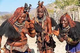
**Opuwo is a strong cultural moment of this trip in Himba territory, this semi-nomadic people traditionally settles in an onganda (small village), moving if necessary to find access to water. Himba women are known for their ochre-colored cream, otjize, a mixture of butterfat and ochre powder, applied to protect and moisturize the skin and hair. Fire and smoke play an important role in their culture.** Smoke, often scented with herbs, is used by women for purification. It can also convey prayers to the supreme being, Muluru. In traditional celebrations, there is always a sacred fire that remains lit between the main hut and the animal enclosure, to maintain ties with the ancestors.
Right upon arrival, we fill up with fuel at the Shell station at the price of 21.48 NAD $ per liter, or 67 liters for 1454 NAD $ (72 €) by card. We then quickly stock up on meat at the Spar **where Himba women with bare breasts mix with us, the only white people shopping in the aisles**. **Since the beginning of this trip, this is where life is most bustling**. There are many people on these dusty streets, after kilometers without seeing anyone, the shock is brutal. There are small markets, poverty but also wealth. The town is quite spread out. There are no white people left, **we finally discover the true, harsh African life.**
We arrive at the **Opuwo Country Lodge at 3:30 PM**, located slightly on the heights. We have site 9 at the end of the property for maximum isolation as we like. Once again, we have private sanitary facilities, a BBQ, and electricity. Once settled, we walk 10 minutes to the reception where the pool is located to cool off. An infinity pool that is just magnificent facing the vast landscape before us. But this contrast between this little comfort and the town below makes us uneasy. The employees walk back down. A guard is present at the entrance of the lodge to ensure security; the park where we are is fenced. We enjoy a good braai, then enjoy the few lights of the town gradually lighting up. The night will be quite noisy for once with very loud music rising from a party below until 2:30 AM... And yet it comes from far away... Maybe a bar? In any case, we rule out what we thought was just a party during our visit here on Friday.
> Today's road itinerary: 4 hours of track: Return via the C43 heading south to Opuwo.
> Gas station: Okangwati or Opuwo
> Distance driven today: 261 km.
> Today's expenses: Fuel fill-up in Opuwo for 72 € + Groceries in Opuwo for 21 €.
> Accommodation: Opuwo Country Hotel - Opuwo Hilltop Opuwo 9000, Opuwo, Namibia - -18.044682 / 13.833861 - (http://www.opuwolodge.com/) - N$600.00 - Pool / Water / Private sanitary facilities / Electricity / BBQ.
**DAY 17: Saturday, May 10, 2025: Opuwo to Epupa Falls:**
We take our time this morning by the **Kunene River**, then we hit the road at 8:45 AM. This is our return trip to Opuwo.
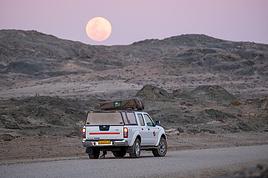
After 4 good hours of driving, **we return to the bustling life of Opuwo**. We refill with fuel at the Shell station (21.48 NAD $ per liter) 820 NAD $ (40 €) for 38 liters and do a quick grocery run at the Spar for 488 NAD $ (24 €). We don't take any meat because we have the **sanitary barrier** to cross tomorrow before entering Etosha Park. We pay for these two expenses in cash for the first time; until now, the credit card was always accepted, so we now have to use the cash we withdrew at the airport. Then we head back to the Opuwo Country Lodge, arriving at the campsite at 2 PM. We are the first to arrive, we rest for a moment before heading to the pool and then end the day around our traditional BBQ with sausages and sautéed potatoes. The full moon accompanies us, perfect for nighttime observations in Etosha starting tomorrow.
The campsite's location should be avoided because we again have infernal music that gets louder from 7 PM to 2:30 AM... And yet it comes from far away... Maybe a bar? In any case, we eliminate what we thought was just a party during our visit here on Friday.
> Today's road itinerary: 4 hours of track: Return via the C43 heading south to Opuwo.
> Gas station: Okangwati or Opuwo
> Distance driven today: 180 km.
> Accommodation: Opuwo Country Hotel - Opuwo Hilltop Opuwo 9000, Opuwo, Namibia - -18.044682 / 13.833861 - (http://www.opuwolodge.com/) - N$600.00 - Pool / Water / Electricity / BBQ
**DAY 18: Sunday, May 11, 2025: Epupa Falls:**
Time for a "vacation" day; we wake up leisurely at 8 AM and take our time this morning. Breakfast and even coffee. The night was good, lulled by the sound of the waterfalls.
In the late morning, we head out on the small path along the banks of the Kunene River, which offers magnificent landscapes. We have a beautiful view of Angola from the opposite bank. The falls extend over about 1.5 km and flow over a series of promontories, the highest of which reaches 37 m.
At noon, we return to our campsite to eat in the shade of the palm trees. On the menu: fried eggs and pasta. We take advantage of this afternoon to rest before the last part of this road trip, with reading, writing, and pool time on the agenda.
In the late afternoon, we return to one of the viewpoints overlooking Epupa Falls to once again enjoy the sunset colors from a different angle. We are over the moon; our thoughts wander in all directions. We discuss future trips, adventures, reminisce about our memories, and think about the world around us... We savor the luck of being here. On the way back, a Himba woman asks if we can give her a ride in our 4x4 to Opuwo tomorrow.
Tonight, we dine on our traditional braai with white beans by the Kunene River. We are lulled by the sound of this powerful river flowing under the song of insects. The coolness sets in, and we fall asleep under the stars.
> Distance driven today: 0 km.
> Distance walked today: 10 km.
> Accommodation: Omarunga Lodge Campsites - 68 € for two nights - Site by the river - (https://gondwana-collection.com/fr/accommodation/omarunga-epupa-falls-campsite?LodgeName=OMARUNGA%20EPUPA-FALLS%20CAMPSITE&hsLang=en)

**DAY 19: Monday, May 12, 2025: Epupa to Opuwo**
We enjoy the morning a bit more by the **Kunene River**, then we hit the road at 8:45 AM. This is our return trip to Opuwo.
After 4 good hours on the road, **we return to the bustling life of Opuwo**. We refill with fuel at the Shell station (21.48 NAD $ per liter) for 820 NAD $ (40 €) for 38 liters and do a quick grocery run at the Spar for 488 NAD $ (24 €). We don't take any meat because we have the **sanitary barrier** to cross tomorrow before entering Etosha Park. We pay in cash for these two expenses for the first time; until now, the credit card was always accepted, so we have to use the cash we withdrew at the airport. Then we head back to the Opuwo Country Lodge, arriving at the campsite at 2:30 PM. We are the first to arrive, rest for a moment before heading to the pool, and then end the day with our traditional BBQ: sausages and sautéed potatoes. The full moon accompanies us, perfect for nighttime observations in Etosha starting tomorrow.
The campsite's location should be avoided, as we again have loud music until 2:30 AM... And it comes from far away... Maybe a bar? In any case, we rule out what we thought was just a party during our visit here on Friday.
> Today's road itinerary: 4 hours of track: Return via the C43 heading south to Opuwo.
> Gas station: Okangwati or Opuwo
> Distance driven today: 180 km.
> Accommodation: Opuwo Country Hotel - Opuwo Hilltop Opuwo 9000, Opuwo, Namibia - -18.044682 / 13.833861 - (http://www.opuwolodge.com/) - N$600.00 - Pool / Water / Private sanitary facilities / Electricity / BBQ
**DAY 20: Tuesday, May 13, 2025: Opuwo – Etosha - Olifantsrus**
We wake up before dawn around 6:30 AM. We pack up the camp at 7:15 AM heading to a first waterhole to watch the sunrise and start our day of observations and discoveries. It's 11°C, and as soon as we leave the campsite, we come across numerous zebras, foxes, and springboks with the sun rising on the horizon. Magnificent images.
**At 8:30 AM, we are still alone**, we witness **one of the most beautiful scenes of this trip: 3 lionesses hunting springboks**. It's thanks to the latter, slowing down, that we manage to spot 4 lionesses' heads barely above the tall grass. They hide, stand up, move slowly... We wait without moving. This is their perfect terrain for camouflage. **We are on the lookout and try to be discreet during this hunting scene**. We leave the area to let them finish their remarkable work and continue the track towards the East. The terrain becomes completely flat. It's now been 3 hours since we left the campsite without noticing the time passing, and especially without meeting anyone. Around 10 AM, near a waterhole, we come across a solitary elephant mixed with zebras, buffaloes, and springboks.
Around 11 AM, we take a lunch break; here, it's us who are enclosed in enclosures. Whether in the campsites or the few small equipped areas, we are fenced in by a gate. The animals are free on their territory. The wind has picked up again, just like the sun. We eat alone in absolute calm in the heart of this incredible, unique park; there are no words to describe what nature offers us here, far from any human activity. We start to see some safari vehicles arriving, but the attendance remains much lower than I had imagined. At most, a total of fifteen throughout the day.
Etosha is also a wonderful reserve of vegetation; you can find multiple mopane groves. But also acacias and other trees appreciated by ruminants. The south and east of the park have the most waterholes, which is where most animals gather. In the West, the vegetation is denser, and the wildlife is harder to spot, but it is well present, especially the black-faced impala and Hartmann's mountain zebra, which are found almost nowhere else. The area being less frequented, the bush feeling is more pronounced.
30 minutes of track after eating, **we come across a solitary male lion. The build compared to the females this morning is noticeable from afar**, even though this one is quite far from us unfortunately, unlike this morning when they were right on top of us.
**Etosha is the preferred habitat of lions in Namibia, with about 330 individuals roaming the park's plains, nearly half of the country's wild lions.** The big cats rest under the trees near waterholes, especially the one at Okaukuejo where we arrive today, but it's also a good spot for elephants and rhinos.
We then enter the territory of buffaloes, which we come across by the dozens now. Wow, the encounters keep coming. Then around 2 PM, we follow this immense **Etosha Pan** for the first time, which we will follow for a good part of tomorrow's day.
We arrive at our campsite at 3:30 PM after more than 8 hours of self-safari filled with discoveries. We sleep tonight at the **Olifantsrus Camp**, which we had previously booked in France. We had to wait and click several times for a spot to open up, as the camp has very few sites, and that's a good thing. It is located in one of the wildest areas of Etosha and has a practical observation tower overlooking a waterhole, offering us great opportunities to spot wildlife after nightfall (see photos). **The sunset is once again memorable.** In the guestbook at the reception, where each visitor can note their observations, 3 lions were seen the day before just a few steps from here (1 male, 1 female, and their cub), on a part of the track we didn't cover today; it will be on tomorrow morning's program. We cross our fingers for these predators.
> Today's road itinerary: 6 hours of driving: Leave Opuwo via the C41 (paved road) > Turn right onto the C35 (paved road) to the Galton Gate > Enter Etosha Park.
> Gas station: Opuwo.
> Distance driven today: 369 km.
> Accommodation: Olifantsrus Camping site - 53.4 € for two – Shared sanitary facilities – Electricity – BBQ – No grocery store - (https://www.etoshanationalpark.org/fr/accommodation/olifantsrus-camp)

**DAY 21: Wednesday, May 14, 2025: Etosha National Park: From Olifantsrus to Okaukuejo:**
We wake up before dawn around 6:30 AM. We pack up the camp at 7:15 AM as the gates open, heading to a first waterhole to watch the sunrise and start our day of observations. It's 11°C, and just outside the campsite, we come across numerous zebras, foxes, and springboks with the sun rising on the horizon. Magnificent scenes.
**At 8:30 AM, we are still alone**, and we witness **one of the most beautiful moments of this trip: three lionesses hunting springboks**. Thanks to the springboks slowing down, we manage to spot four lionesses' heads barely above the tall grass. They hide, stand up, and move slowly... We wait without moving. This is their perfect terrain for camouflage. **We stay alert and try to be discreet during this hunting scene**. We leave the area to let them finish their remarkable work and continue the track towards the east. The terrain becomes completely flat. It's been 3 hours since we left the campsite without noticing the time, and especially without meeting anyone. Around 10 AM, near a waterhole, we come across a solitary elephant mixed with zebras, buffaloes, and springboks.
Around 11 AM, we take a lunch break; here, it's us who are enclosed in enclosures. Whether in the campsites or the few small equipped areas, we are fenced in by a gate. The animals are free on their territory. The wind has picked up again, just like the sun. We eat alone in absolute calm in the heart of this incredible, unique park; there are no words to describe what nature offers us here, far from any human activity. We start to see some safari vehicles arriving, but the attendance remains much lower than I had imagined. At most, a total of fifteen throughout the day.
Etosha is also a wonderful reserve of vegetation; you can find multiple mopane groves. But also acacias and other trees appreciated by ruminants. The south and east of the park have the most waterholes, which is where most animals gather. In the west, the vegetation is denser, and the wildlife is harder to spot, but it is well present, especially the black-faced impala and Hartmann's mountain zebra, which are found almost nowhere else. The area being less frequented, the bush feeling is more pronounced.
Thirty minutes of track after eating, **we come across a solitary male lion. The build compared to the females this morning is noticeable from afar**, even though this one is quite far from us unfortunately, unlike this morning when they were right on top of us.
**Etosha is the preferred habitat of lions in Namibia, with about 330 individuals roaming the park's plains, nearly half of the country's wild lions.** The big cats rest under the trees near waterholes, especially the one at Okaukuejo where we arrive today, but it's also a good spot for elephants and rhinos.
We then enter the territory of buffaloes, which we come across by the dozens now. Wow, the encounters keep coming. Then around 2 PM, we follow this immense **Etosha Pan** for the first time, which we will follow for a good part of tomorrow's day.
We arrive at our campsite at 3:30 PM after more than 8 hours of self-safari filled with discoveries. We sleep tonight at the **Okaukuejo Resort**. Upon arrival, this impression of a small town in the middle of hundreds of kilometers without infrastructure remains shocking. **The atmosphere is quite different from last night in our small wild campsite**. However, even though the attendance is higher, we are lucky to get a site in a corner (number 46). **The lit waterhole will also be a reward**. After checking in, we take advantage of the small grocery store to buy two meats for our next BBQs in the park, 3 pork chops and sausages, as well as a cold drink for 252 NAD $. This locality also offers a gas station, a restaurant, and a nice pool, but our goal during this park stay remains focused on the wildlife, so I won't give in this time. Time to set up, followed by a short rest, then our toilette before heading to the "waterhole" for the sunset around 6 PM. **A new grand spectacle unfolds before us, a hundred zebras come to hydrate right before our eyes at the water reserve facing the sunset in a cloud of dust. Then a couple of lions approach stealthily without managing to fill their stomachs. A third guest arrives, a second male lion also comes to drink. The waterhole now becomes the territory of the lions... We are speechless facing what nature offers us, we savor for over an hour scrutinizing the smallest details. What an intense day, images that will remain forever etched in our minds.** It's our turn to have our meal with three beautiful pork chops on the BBQ accompanied by curry vegetables.
At 9 PM, we decide to return to the waterhole, a wonderful idea because we find **an elephant and two black rhinos courting in the water. The male has a hard time seducing his sweetheart and eventually leaves, but a third rhino appears out of nowhere to join her. The scenes unfold under the spotlights** accompanied by a sky full of stars. We eventually go to bed. Looking forward to the rest of the story tomorrow.
> Today's road itinerary: Camp Olifantsrus > Camp Okaukuejo.
> Gas station: Okaukuejo camp.
> Distance driven today: 229 km. > Today's expenses: Groceries for 12 €.
> Accommodation: Okaukuejo Camping Site - 48.12 € for two - Pool - Gas station - Lit waterhole - Grocery store - (https://www.etoshanationalpark.org/fr/accommodation/okaukuejo)

**DAY 22: Thursday, May 15, 2025: Etosha National Park: From Okaukuejo to Halali:**
We wake up around 5:30 AM to a strange noise getting closer, a few thunderclaps, then heavy rain pours down on us! The first since the start of this trip, we had forgotten its sound and smell. We leave the campsite quickly at 7:13 AM as the gates open, the rain stops just in time!
We are right in the heart of the park today. We arrive at the Etosha Pan, an immense flat salt desert that, a few days a year, transforms into a shallow expanse teeming with flamingos and pelicans. At the end of the dry season, everything, from elephants to grasslands, is covered in the white, chalky dust of Etosha.
Around noon, at the Riedfontein waterhole, we spot two male lions in this picturesque savannah. As we've noticed, the females hunt while the males protect the territory. The males and cubs will benefit first.
The day was less emotional than the previous one. We encounter far fewer animals, often at a greater distance. Is it because of the stormy rain we had at dawn this morning, or is it the area? The tracks were also more exhausting, especially the Rhino Drive without meeting a soul. But the view over the immense salt pan as far as the eye can see is worth seeing. Maybe the waterhole at the campsite will surprise us tonight as it did yesterday?
We arrive at 4 PM at the Halali Resort for our last night in the park. We still have a lit waterhole, more intimate than yesterday's, and we can walk around the park thanks to a hiking trail. The sanitary facilities are shared and quite recent, with each site offering its own BBQ and electrical outlet. After setting up and a quick wash, we head on foot to the Halali waterhole for sunset. Tonight's menu features local sausages (beef and pork) with curry pasta.
> Today's road itinerary: Camp Okaukuejo > Camp Halali.
> Gas station: Halali Camp.
> Distance driven today: 242 km.
> Accommodation: Halali Camping Site - 48.12 € for two - Pool - Gas station - Lit waterhole - Grocery store - (https://www.nwr.com.na/resorts/halali-resort/)

**DAY 23: Friday, May 16, 2025: Etosha National Park: From Halali to Namutoni - Waterberg Park:**
We pack up the camp at 7:15 AM as the gates open. It's 17°C, and the sun is out as usual. **We follow the Etosha Pan, still quite wet at this time of year.** The small track offers different viewpoints under a sun gradually rising higher.
The further east we go, the more we encounter gnus, kudus, and impalas. **We are once again spoiled and delighted by everything we discover this morning.** A majestic **giraffe** appears before our eyes just before arriving at **Namutoni** around 9:45 AM, quickly followed by 4 other companions. From there, we change plans, do the **Fischer's Pan** loop, and then decide to exit through the northern gate, allowing us to cover the entire park. Our last encounters will be with these tallest animals, the giraffes, and what a spectacle to see them spread their legs to hydrate, followed by gnus.
Just before the exit, we take a lunch break at an equipped area at 11:30 AM.
**We leave Etosha National Park with a touch of nostalgia through the King Nehale Iya Mpingana gate** at 12:30 PM. We find the beautiful paved B1 road, which is a great relief. Cows and goats take over; driving at 120 km/h on these single-lane, two-way roads with these animals we brush past requires constant vigilance. We fill up with fuel at 1:30 PM in **Oshivelo** (21.33 $ per liter), 93 liters for 99 € by card. Since we hadn't planned to go so far north out of Etosha, we are surprised to go through a **sanitary check** at the exit of the town, but it turns out to be even quicker than the previous one, a simple glance in the fridge by very smiling women, much more pleasant than the staff at the Etosha entrances and exits.
We pass **near Lake Otjikoto** ("deep hole" in Herero), which is **one of the only two natural lakes in Namibia along with its neighbor Lake Guinas**. In 1851, explorers Charles Andersson and Francis Galton came across this karst lake occupying a limestone cauldron 100 m long, 150 m wide, and 55 m deep. Its steep walls, about 20 m high, are the result of the collapse of the rock roof of the sinkhole under water pressure. This lake is also known for the large quantity of weapons and ammunition found in its depths. Remnants of the region's violent past, they were dumped there in 1915 by the retreating German army, refusing to let South African troops get their hands on them. Unfortunately, it's paid entry, and given the late hour, we continue on our way. To our great surprise, there is a lot of traffic on this B1, including many trucks, the first time we've seen so many people in this country. The landscapes change; we even discover deciduous trees taking on their autumn colors.
We pass through **Tsumeb**, and the road continues to **Otjiwarongo**, which means "pleasant place" in the Herero language, and the town lives up to its name. Prosperous and peaceful, with wide avenues and a relaxed atmosphere, we stop there to do some shopping. We buy some local meat to treat ourselves during these last two remaining camping nights: skewers, pork, and sausages, as well as biscuits, a last water tank, and yogurt for Mimi; 388 NAD $ - 20 €. We get back on the road heading south via the B1 for 15 minutes, then turn left onto the C42, still paved, for 30 minutes and 41 km, then left again onto the D2512, a wavy sandy track for 15 minutes.
**We enter the Waterberg National Park this evening.** The arrival facing this mountainous massif in the middle of the plains under the end-of-day lights of a deep red makes us even more eager to discover it. **Composed of impressive sandstone cliffs, tangles of vines, a canopy teeming with birds, elusive wildlife, and improbable dinosaur footprints. The Waterberg occupies a large sandstone plateau 50 km long and 16 km wide, at an altitude of 150 m above the plain.** It is possible to encounter elands, black wildebeests, roan antelopes, buffaloes, and red hartebeests, and with luck, leopards, as well as 200 identified bird species.
We arrive at the NWR campsite at 6 PM, the first time we arrive so late, just before nightfall. It's from here that various hiking trails start for tomorrow's day, including the **Mountain View Trail** that climbs to the edge of the plateau. We quickly settle into this peaceful camp where calm reigns, no more than 5 vehicles tonight. The place is shaded, with fairly recent shared sanitary facilities, electricity, and a BBQ for each. We savor our second-to-last braai under the stars, hearing our plane that brought us to Frankfurt fly over, every day at the same time over the Waterberg then Etosha. Very rare, as there are very few flights that land or fly over Namibian skies.
> Today's road itinerary: 10 hours of driving: B1 then C42 then D2512.
> Gas station: Exit of Etosha Park, Tsumeb, Otavi, or Waterberg Park.
> Distance driven today: 616 km.
> Accommodation: NWR Waterberg Camping Site - Pool - Water - 45 € for two - (https://www.nwr.com.na/resorts/waterberg-resort/#1577510913112-8f243e49-35a647e7-1997)

**DAY 24: Saturday, May 17, 2025: Waterberg Park - Otjiwa:**
We wake up around 7 AM after a very cool night.
**At sunrise, the cliffs appear even redder, and the cries of baboons echo around us.** We come across about thirty of them. We start the hike around 8:15 AM. **The Mountain View Trail will take us to the Waterberg Plateau.** The temperature is pleasant for walking. **The trail starts in a thick forest where the song of birds resonates.** The path is little frequented, so progress is slow and irregular; we regularly have to duck, step over, and climb rocks. However, in 35 minutes, we reach the top of the plateau. We are once again alone in the world in this Namibian nature. **The 360° panorama extends over a wide plain of green shrubs below, then over these steep red cliffs** giving access to this suspended plateau of the Waterberg. To enter, unfortunately, a special permit is required, and you must be accompanied by a guide. We savor the moment under the already hot sun at 9 AM. After an hour reminiscing about our journey on our rocky promontory, we start the descent at 10 AM, completing a loop back to our starting point. **At 10:30 AM, we pass by the small cemetery of German fighters who died in 1904**, then we hit the road back to the B1. We take a lunch break at noon at one of the tables scattered regularly along the paved roads. We are watched by **baboons** perched in their tree. We then decide to make a **detour through the town of Otjiwarongo**, which we didn't have time to explore properly yesterday. **A quick visit to the train station is a must to see locomotive No. 41, built in 1912 by the German company Henschel. It was transported to Namibia to carry ore between the mines of Tsumeb and the port of Swakopmund before being decommissioned in 1960 when the tracks were modified.**
We return to do some shopping and bring back some souvenirs for 300 NAD $ (14 €). We then take the road south on the B1. I start to feel the end of this immense loop through Namibia. Morale is gradually dropping. But we still have plenty of beautiful things to discover. We arrive at 3 PM at the **Otjiwa Safari Lodge. This will be our last night camping after 22 nights sleeping in the wild to the sound of animals.** The nostalgia is palpable. We enter this high-end private park; we don't really feel at home upon arrival. The reception, the pool, the restaurant, everything is very upscale, unlike anything we've experienced during this road trip. However, the reserve has its charm; we come across our beautiful antelopes again. The 10 sites are very comfortable, spaced apart under some bushes. Each has, of course, its BBQ, electricity, lighting, and sink. Before enjoying our last evening, we need to do a thorough dusting of the 4x4 and a good cleaning and organizing of our belongings. Then it's time for our last perfect braai: chicken and pork skewers, as well as tomato-flavored white beans.
> Today's road itinerary: 1h30 of driving: Waterberg > Otjiwarongo > Okonjima wildlife reserve - D2512 then C22 then B1 then turn right onto a 3 km track.
> Gas station: Waterberg Park.
> Distance driven today: 135 km.
> Distance walked today: 6 km.
> Today's expenses: Souvenirs for 14 €.
> Accommodation: Otjiwa Safari Lodge - B1 main road, west side Otjiwarongo 12001, Otjiwarongo, Namibia - (http://www.otjiwa.com.na/) – 40 € for two – From 3 PM.
**DAY 25: Sunday, May 18, 2025: Otjiwa - Windhoek:**
For this last leg of our Namibian journey, we complete the loop back to our starting point, Windhoek. We leave our last campsite at Otjiwa, later than usual, at 10 AM. We head due south on the B1 in less than 3 hours to the country's capital, not without a touch of nostalgia after all these kilometers traveled through Namibia. The landscapes roll by with a lot of melancholy. We make a stop 60 km north, in Okahandja. We take the opportunity to fill up with fuel (21.10 $ per liter), 500 NAD $ for 23 liters; the card machine wasn't working, so we had to withdraw from an ATM at the next gas station. A local was quite insistent at my window, asking for food or money. Anyway, after 15 minutes, we get back on the road.
From here, we take the new A1, a 2x2 lane highway limited, like the previous roads, to 120 km/h. Then we gradually see some of the country's industries before entering the capital in the blink of an eye. We arrive at 1:45 PM at Chameleon Backpackers. It's a small hostel-style hotel with a central pool, a shared kitchen, secure indoor parking, and a restaurant. They also organize tours (3 Day Express, 3 Day Link, 4 Days Etosha, 7 Day Norbert Adventure), very different from everything we've encountered so far, a kind of atmosphere like in Thailand. There are dormitories, rooms with shared bathrooms, and our little cocoon, the Love Bird, a room located alone on the upper floor with its small balcony, a swing, its bathroom, and its large bed with a thatched roof. A lot of charm while overlooking the pool. We eat before setting off to explore the capital.
Windhoek is a modern and well-maintained city, contrasting completely with the rest of the country. It is heavily influenced by its German colonial heritage, still very present in some streets of the capital. The architecture is colorful and surprising. The skyline is shared between the spires of a neo-baroque cathedral, the unusual silhouette of three castles from the German colonial era, and glass and steel skyscrapers. Office workers head to Zoo Park at lunchtime.
We enjoy the smell of grills at some street corners lined with small single-story houses with zinc roofs.
We first head to Windhoek's emblematic monument, its unofficial symbol: Christuskirche, just a 10-minute walk away. This German Lutheran church rises above the traffic at the center of an intersection. Built in 1907 with local sandstone. The roof and other elements were imported from Europe. The result evokes a gingerbread house.
We then walk along the pedestrian shopping street of **Post Street Mall** to admire African crafts, but on this Sunday, most shops are closed; we'll come back tomorrow. We return via the Wernhil shopping center.
> Today's road itinerary: Return to Windhoek in 3 hours via the B1 then the A1. In the capital, turn left onto Florence Nightingale, then right onto Beethoven Street then C28 then B6, then Bismarck Street. Take Church Street and Trift Street towards Voight Street.
> Gas station: Okahandja or Windhoek.
> Distance driven today: 245 km.
> Accommodation: Chameleon Backpackers & Guesthouse – 49 € for two - 5-7 Voigt St, North Windhoek Central, 9000 Windhoek
**DAY 26: Monday, May 19, 2025: Windhoek, Visit to the Namibian Capital:**
Our last sleep in Namibia... The wake-up is a bit sad; we still enjoy this return to comfort in a real bed. After a hearty breakfast, we check out of our little cocoon at 10 AM. We leave our vehicle in the secure parking lot and return for a walk in the center of Windhoek. On this Monday, the center is immediately livelier while still remaining extremely calm for a capital. The pace of life is slow; employees move slowly without rushing, each task is performed with a slowness that is almost surprising. A few skyscrapers further on, we quickly leave the hyper-center. We retrace our steps to the shopping gallery where we linger for a while. We eat around noon with African music in the background, making us even more nostalgic. Then the trip will gradually come to an end, unfortunately, until the moment when we will have to, not without regret, return our rental vehicle around 3 PM... We stop by the hotel again and then head to the rental agency and then to the airport by shuttle, included in our contract.
At 4:20 PM, we are back at the airport. We see ourselves upon arrival as if it were yesterday... Tears are not far off; we wait, the formalities are much quicker than upon arrival. **We board by walking across the tarmac on foot, escorted by about fifteen Namibians, facing the sunset. It will be there until the end, beautifully drawn on the horizon, to say goodbye to Namibia...**
> Round-trip flight tickets with Lufthansa from Lyon: 2029 €, or **1,014.50 €** per person.
> Vehicle rental: 4x4 Toyota with roof tent for 24 days: Gracious Whisp Car Rentals: 2,638 € (N$50,640) or **1,319 €** per person - (https://gwcarrentals.com/)
**DAY 27: Tuesday, May 20, 2025:** Flight FRA 8:15 AM -> 9:35 AM LYS (Air Dolomite No. 1074)
Total expenses including flight tickets + vehicle rental + visa + Lyon parking + food + fuel:
Cost per person: 3467 € Cost for two: 6935 €
>> All our photos and videos for each day on our website here: (https://www.montagne-aventure.net/voyages-découvertes/namibie-2025/)
>> Find all our photos and videos for each day on our website here: www.montagne-aventure.net
**DAY 1: Thursday, April 24, 2025: Outbound Flights from Lyon to Windhoek via Munich - Visit to Munich:**
Off we go on a new adventure. The alarm rings at 6:30 AM, the travel bags are packed, and we head to Lyon Airport. We booked our flight tickets with Lufthansa. The first leg to Munich, Germany, is operated by AirBaltic. Departure at 1:05 PM for a 1-hour and 20-minute flight. We arrive at 2:30 PM.
**We now have a 7-hour layover, so we take the opportunity to get some fresh air and explore Munich.** We quickly exit Terminal 2 of the airport and head towards the subway. We buy a group day ticket "Airport-city Day Zone M-5," valid for 2 to 5 people at a price of 30.50 € (instead of 16.30 € per person). We take the S8 line to **Marienplatz** in 35 minutes. **This is the heart of the city.** The weather is overcast, quite cool, but dry. Perfect for a little city trip between two flights while leaving our large luggage in transit at the airport. **Munich is the third-largest German city after Berlin and Hamburg, in the Bavaria region.** **The center has a lot of charm and brings together several religious buildings, easy to explore on foot.** We are impressed by the number of people enjoying these 100% pedestrian streets, which are very pleasant. After Marienplatz, the most famous square with the town hall, we head to the Cathedral of Our Lady, a Gothic church, then continue to **Karlsplatz** and move on to **the food market offering a wide selection of high-end food products in an atmosphere where a certain art of living prevails.** We also visit St. Peter's Church before grabbing a bite to eat. Two good hours were enough for this 10 km city walk. It's time to take the subway back: by 6:30 PM, we are back at the airport. Now, it's time for a bit of waiting and rest. Our second flight is scheduled for 9:35 PM for a 9-hour and 30-minute journey to our final destination in Namibia: **Windhoek.**
> Round-trip flight tickets with Lufthansa from Lyon: 2029 €, or 1,014.50 € per person.
> Lyon Airport parking: 120 €
> Today's expenses: 7 € for 2 pizzas in France / 14 € for the restaurant in Munich / 30.50 € for the daily subway ticket in Munich.
**DAY 2: Friday, April 25, 2024: Arrival in Windhoek, Visit to the Namibian Capital:**
After a 9-hour and 30-minute overnight flight with Discover Airlines, we finally land on Namibian soil just before 7:30 AM. The day is breaking, and the colors are already stunning. We are eager despite the usual fatigue from the flight. The airline was punctual, with friendly staff and good meals, though a bit light. We are the first flight of the day to land, with no more than 15 flights per day here, from 7 AM to 8 PM. We disembark on the tarmac at this airport located in the middle of nowhere, **I finally set foot on African soil for the first time.** We exit among the first from the aircraft to go through the long formalities at the front of the line, as the wait can quickly become endless. Allow at least 5 minutes per person for e-visas. We still wait 45 minutes despite only about twenty people ahead of us. Phew, it's done. We collect our luggage and then withdraw money from an ATM. We make 4 withdrawals of the maximum amount, 2000 NAD $ per withdrawal, for a total of 380 €, or 95.33 € per withdrawal.
Our driver arrives at the same time, perfect timing, we were quick.
We leave the airport at 8:45 AM. By 9:30 AM, we arrive at the **Gracious Whisp vehicle rental agency**, located at the entrance of Windhoek, small and human-sized with a fleet of recent vehicles. More formalities, then a short wait as our vehicle is not yet ready. Time to decompress, catch our breath, and enjoy the very pleasant morning temperature. Not a cloud in sight. Next, a briefing on the vehicle, always with a bit of apprehension due to our approximate English. Allow 45 minutes of explanations, including setting up the roof tent, camping equipment, technical information in case of a flat tire, driving tips in Namibia, and a tour of the 4x4. We have all the necessary equipment for camping: mattresses, sleeping bags, pillows, table, chairs, gas stove, BBQ grill... as well as 2 spare tires, a compressor, a dual tank, and accessories for removing wheels. Off we go, it's time to muster our courage and get behind the wheel. **Heading to SuperSpar Maerua**, fortunately located less than 10 minutes away. We park with the help of a parking attendant; it's very crowded, the space is narrow, but everything goes well despite the cursed right-hand drive. Today's new mission: stock up on groceries. The store is well-stocked with local and imported products, catering to all tastes. We spend 114 € on groceries, from pasta to meat, BBQ lighters to dishwashing products. Two people load our groceries into two carts and transfer them to our vehicle; we feel compelled to leave a tip, 50 NAD $, as we don't have change yet. Now, we head to the hotel, 15 minutes away. Traffic is difficult at a complicated intersection; this will likely be the only traffic jam in Namibia. **We arrive at Kate's Nest Guesthouse & Backpackers around 1:15 PM, quite tired.** We take some well-deserved rest at this recent establishment, quite calm with secure private parking. After a short nap, we enjoy the quiet by the hotel pool. Night falls between 6:30 PM and 7 PM. We eat quietly in our room tonight before starting this long 4x4 road trip in camping mode in the heart of Namibia.
> Today's grocery expenses: 114 € at Super Spar Marua (2395.21 NAD $).
> Round-trip flight tickets with Lufthansa from Lyon: 2029 €, or 1,014.50 € per person.
> Vehicle rental: 4x4 Toyota with roof tent for 24 days: Gracious Whisp Car Rentals: 2,638 € (N$50,640) or **1,319 €** per person - (https://gwcarrentals.com/)
> Distance driven today: 15 km.
> Accommodation: Kate's Nest Guesthouse & Backpackers - 4 Aristotles Street Academia, 9000 Windhoek - 36 € for two for one night.
> Windhoek International Airport website: (https://www.airports.com.na/)
**DAY 3: Saturday, April 26, 2025: Windhoek to Hardap: Mariental Region - Kalahari Desert:**
After a good, restful night, we wake up leisurely around 7 AM. We enjoy the comfort provided by this first and last hotel before 24 nights under the tent.
**We leave Kate's Nest Guesthouse at 8:30 AM to tackle the Namibian roads.** We quickly leave the capital; in just 30 minutes, we find ourselves almost alone in the world. The landscape is dotted with small domes. We leave the **paved B1** quickly to turn left onto the **C15**. **From there, we won't see more than 10 vehicles all day.** After passing through the few houses of **Lekkerwaterpoort**, we tackle our first gravel road. These road sections are limited to 100 km/h, but even at 70 km/h, I find it already challenging. However, I quickly get used to it and gradually pick up speed to reach my cruising speed of around 80 to 90 km/h. **We are on immense straight lines crossing wild expanses as far as the eye can see.** **We come across two baboons, a few ostriches, and numerous cattle and sheep farms.** We pass through the charming village of **Uhlenhorst** with its typical houses and children with broad smiles waving at us. Life here is already very different from Windhoek. **The thermometer rises quickly from 16°C at 8:30 AM to over 28°C in the early afternoon.**
**We arrive at the Hardap Dam reserve at 2 PM.** We stop at the toll booth at the park entrance to pay the entrance fee: 250 NAD $ for 2 people and 1 vehicle. We continue to the dam and then the camp entrance, located a bit further. We had booked in advance, but this place remains little frequented by foreigners.
We take advantage of the hottest hours to rest by the large pool overlooking the immense lake, a very enjoyable moment. Would this be a bit of a vacation?
Around 4:30 PM, we head to the campsite. We overlook this vast water reserve. We arrive first; we will be only 3 vehicles spending the night here. It's time to get to work and set up our equipment for the first time. It takes us a good 20 minutes to set everything up, with a slight apprehension about unfolding the tent. Once this task is done, which we will have to repeat for almost a month, we will become much more efficient over time. Time for rest and contemplation in total silence. The sun gradually sets, and the heat quickly becomes bearable again. Bliss! **This dam is located 20 km northwest of Mariental in an area dotted with conical hills topped with dolerite buttons (Hardap means "hillock" in Nama). It captures the Fish River, which flows south, creating a large lake in the middle of an arid environment. The contrast is striking.** We enjoy our first sunset facing this 360° otherworldly landscape.
Around 7 PM, we start our first BBQ, or "braai" as it's called here. The temperature is perfect. The sun sets, giving way to a star-filled sky of incredible beauty thanks to the absence of any light pollution. The Milky Way will lull us throughout the evening. After some good sausages and potatoes on the BBQ, we head to our roof tent around 9:30 PM with a complete change of scenery in just 24 hours. France already seems so far away...
This campsite has shared showers and toilets, quite clean and functional, as well as a central area with several BBQs and tables. The sites are arranged in a semicircle, each with an electrical outlet. The sites are close to each other but spacious, some slightly shaded. We are only three vehicles tonight, so it's perfectly comfortable and quiet. Not to mention the large pool near the restaurant. Our trip is off to a great start.
> Today's road itinerary: Windhoek > Head south on the B1 to Rehoboth > Turn left onto the C25 then C15 to Stampriet > C20 to Hardap > Full north on the B1 > Then turn left onto the M93 - 5 hours of driving.
> Distance driven today: 354 km.
> Accommodation: Hardap Recreation Resort - 23.3 € for two - Large pool - GR6W+3M2, Hardap Game Reserve, Mariental, Namibia - (http://www.nwr.com.na/resorts/hardap-resort/)
**DAY 4: Sunday, April 27, 2025: Hardap - Brukkaros Volcano - Keetmanshoop - Quivertree Forest Rest Camp**
Our first night under the tent was very pleasant; the little wind quickly calmed down, giving way to absolute silence. The mattress is decent, more comfortable than some nights in Nepal. The length and width give us enough space for maximum comfort, despite my height (1.91 m). We wake up a little before 7 AM as the sun rises, and the lights dazzle us from the start of the day. We pack up the equipment in 30 minutes, quite easily. Then we enjoy the sun, which warms up quickly while we keep our light fleece on.
At 8:30 AM, **we hit the road again, heading south** to our first stop in **Mariental**. We want to do some shopping at SuperSpar, but once we arrive in the parking lot, a young local is fighting with the supermarket security guards and then threatens to throw stones. We don't want to take any risks right at the start, so despite the baton blows he receives, he doesn't stop. We leave empty-handed but fill up with fuel at the Shell station 1 km further. The price per liter is 21.33 NAD $, we fill our 107-liter tank for 107 €. In Namibia, you get served, and they bring the card machine to the window to pay. It's then customary to leave a tip.
We then take the B1 heading due south on a recently renovated road. Around 11:30 AM, we leave it on our right to take **a wild gravel road, the M98**. Just before **Berseba**, we turn right onto a small track, the **D3904 towards Brukkaros Crater up to a camp at 1588 m altitude**. The track then becomes too bumpy. We stop on the counter-slopes where **a wide panorama unfolds over these immense plains as far as the eye can see**. It's 12:15 PM, time for us to eat a rice and tuna salad facing this landscape.
**We are alone in the world until a vehicle arrives and parks next to us.** A bit of apprehension, 4 men head towards us. It turns out to be 4 shepherds looking for a lost foal. The conversation is pleasant, lost in the middle of nowhere. We find ourselves alone again in this absolute silence. **The heat becomes stifling with a good 30°C**. We get back on the road around 1 PM. Back on the B1, **we continue due south to Keetmanshoop**, which we reach around 3 PM. We stop there to do some shopping for 262 NAD $ (12 eggs, a can of tuna, a can of corn, bread, a soda, and a 5-liter water container), or 12.48 €. Two quite insistent children ask us for money or candy at the store exit, yet we give them a small tip, but they continue to cling to the car. Locals parked next to us tell them to leave us alone. Anyway, we finish the trip to **Quivertree Forest**, 15 km away. We will spend the night in this **pleasant farm run by a German**. Upon arrival, as the day before, and as I suppose in the future, we dive straight into the cool pool to relax after all these kilometers. A bliss. Then we take our 4x4 and choose a spot near these famous trees. After the 33°C this afternoon, once 4 PM passed, the temperature drops again and becomes very pleasant. **We are in the middle of the Kokerboom, one of the most interesting and characteristic plants of hot and arid regions. It's not really a tree but a variant of the aloe plant whose botanical name is Aloe Dichotoma. This Kokerboom has a smooth and thick trunk reaching up to 1 m in thickness and 9 m in height. They bloom for the first time at the age of 20 to 30 years.** The flowers are yellow and reach about thirty centimeters during the season between June and July. **They grow mainly in an environment with a high concentration of black rocks absorbing a large amount of heat (38°C). The rocks also serve to anchor the tree with its tentacle-like roots. It also resists frost. Each is between 200 and 300 years old.**
Around 5 PM, we walk to the farm reception to watch the feeding of **two cheetahs**. Magnificent carnivores taking their time to savor their piece of meat. **Then we return near our campsite to enjoy the sunset among these trees. The colors are sublime, as every evening apparently. A magnificent spectacle with colors evolving from yellow to orange then to pink, before giving way once again to a sky filled with thousands of stars.** Our campsite at Quiver Tree Forest Camp is very comfortable; we have a water supply, a stone table, a small lamp, an electrical outlet, a small tree for shade, and a BBQ that we won't use tonight; we'll cook on gas. The sites are far apart, with some shared facilities scattered around, a very beautiful setting. No reservation possible, no need, just show up directly. **The campsite accommodation for 2 people costs 28 €, including the reserve entrance fee of 5 €**. We finish this second bivouac evening around 9:30 PM, time for some reading and sleep in peaceful silence without wind.
> Today's road itinerary: Mariental > B1 heading south to Brukkaros > At Tses turn right towards Berseba via the M98 > Turn right onto the D3904 > 8 km > Brukkaros Volcano (stop at the lower camp as the track is difficult for 1 hour) > Keetmanshoop > Turn left onto the M29 > Quivertree Forest - 4 hours of driving.
> Distance driven today: 371 km.
> Distance walked today: 6 km.
> Today's expenses: Groceries for 12.48 € (262 NAD $) / Fuel for 107 € (1 liter of diesel for 21.33 NAD $).
> Accommodation: Quivertree Forest Rest Camp, P.O. Box 262, Keetmanshoop, Namibia - BBQ, hot showers, toilets, and electricity - No reservation - Pool - 18 €/Person (N$ 340.00 with park entrance) - (http://www.quivertreeforest.com/)
**DAY 5: Monday, April 28, 2025: Quivertree Forest Rest Camp - Giant's Playground - Keetmanshoop - Fish River Canyon - Canyon Roadhouse:**
After an excellent start to the night, we are woken up by the wind shortly before 6 AM, but the sunrise is not far off. We get up at 6:30 AM to enjoy it. The atmosphere is a bit cooler this morning, but the reward is already here.
The adventure continues. At 7:45 AM, we head towards **Giant's Playground**, 4 km away. We take a 3-kilometer walk through this expanse of blocks and igneous rocks.
We continue south at 8:45 AM, passing through Keetmanshoop again where we do some shopping for 25 €, a big stock-up for a good part of the trip: meats, canned goods, pasta, fruits... At 9:30 AM, we take the B4 to Fish River Canyon.
At 11:30 AM, we arrive at the entrance to the NWR park (350 NAD $ entrance for 2 people and 1 vehicle). The track becomes bumpy immediately upon entering the park. After about ten kilometers, we come upon this landscape carved by nature. In the end, it's well worth the detour. We were at the Grand Canyon in the USA exactly (https://www.montagne-aventure.net/2024/04/29/j21-3-juin-2024-grand-canyon-et-lac-powell/) and can thus confirm that this Fish River Canyon is comparable. We make several stops along the southern flank. **Here, nothing is developed; nature is almost in the wild state.** **With 160 km in length, up to 27 km in width, and a depth of 150 m, it is indeed the second-largest canyon in the world.** The history of the canyon is apparent in its different earth layers and stratification: the antiquity of the place is tangible, and the absence of vegetation is surprising. **It consists of two nested canyons, formed at distinct periods. The first distinct layer of schist, sandstone, and eruptive material surrounding the canyon was formed a few two billion years ago, then transformed due to heat and pressure into more solid rock such as gneiss. The inner canyon, carved more recently by the Fish River, has a depth of 270 m.**
We have a picnic once again alone in the world facing this grand panorama at the **Sulphur Spring View Point**. This is where the hiking trail begins, plunging into this narrow canyon, but it is forbidden to venture there alone without a guide. It's 30°C, but a slight wind makes the atmosphere bearable. At 1 PM, we retrace our steps and continue to the **Main View Point** then to the **Hikers View Point**.
In the south of Namibia, the Fish River Canyon, 160 km long, is a true geological wonder: a canyon nested within another canyon, one of the largest in the world. The first sedimentary layers formed two billion years ago; 500 million years ago, a period of tectonic activity caused these layers to crack and tilt, opening a vast canyon in the Earth's crust. The second canyon, with a depth of 270 m, was carved over time by the passage of the Fish River in this new valley.
At 3 PM, we arrive at our very charming camp for the evening, the **Canyon Road House**. We fill up with fuel right away because tomorrow we have a long day of isolated driving: 55 liters for 1240 NAD $. Then we settle into the campsite we had previously reserved in France. We are assigned site 2, very well set up under a tree with its BBQ and stone table just steps from the pool. We quickly set up the tent and jump straight into the pool for the relaxation moment of the day. As usual, the water is quite cool, but it's a real pleasure. Then we stroll around this Canyon Road House, which recreates the atmosphere of the roadside inns of the 1950s with old car wrecks and vintage gas pumps in a bygone era. **Around 5:45 PM, we start a short walk leading us to the top of a hill overlooking the wide plateau where we are to watch the sunset.**
And finally, to end this beautiful day, it's time for the braai, with grilled sausages and white beans on the evening menu.
> Park entrance: 150 DN/person + 50 DN/vehicle (18 € for two). It is possible to enter at two access points: Hobas in the north and Ai-Ais in the south.
> Today's road itinerary: M29 > Keetmanshoop > B1 > B4 > C12 (track) > After Holoog turn right onto the D601 (C37 track) > Accommodation on our right (stop just to check in before 6 PM) > Continue 30 km (30 minutes of track) to the viewpoints after Hobas where you must pay the entrance fee. Sunset View Point to the left > Return before sunset as the park closes (best lights at sunrise). 3 hours.
> Distance driven today: 228 km.
> Distance walked today: 10 km.
> Today's expenses: 25 € for groceries / 17 € for the Fish River Canyon park entrance / 58 € for fuel.
> Accommodation: Canyon Roadhouse, Gondwana Collection Namibia – 34.4 € for two - Pool - Near Hobas - (http://www.gondwana-collection.com/fr/accommodation/canyon-road-campsite)
**DAY 6: Tuesday, April 29, 2025: Canyon Roadhouse - Orange River - South African Border - Vista Trail - Gondwana Sperrgebiet Park - Aus:**
The night was excellent in this very comfortable campsite. **We wake up to the sound of birds** before the alarm at 6:45 AM. Our little morning routine starts as the sun rises. **A big day of driving awaits us to the South African border. This will be the southernmost point of our journey.** We hit the road at 8 AM via the C37, pass through **Hobas**, then turn onto the D207 to **Aussenkehr.** **We cross a mountainous barrier with some high peaks and perfect cones. The rock varies from orange to pink to black.**
We then cross a lunar desert as far as the eye can see on a giant dome; the track winds through nowhere without meeting anyone for hours. The landscapes are surprising. **We spot several ostriches and a gemsbok.** In the middle of this endless expanse, we come to an improbable intersection and continue right onto the D278.
In the middle of these arid lands, we come across a green zone: a vast vineyard. At 10:30 AM, **we come across a "Road closed" sign, fortunately, a local resident waves us to continue; a bit stressed, we proceed.** We start to follow the beautiful Orange River. On the other side of the bank, just a few meters away, South Africa is there. It is the second-longest river in Southern Africa, after the Zambezi. It flows over 2,000 km to the Atlantic. After passing through narrow gorges, we regain altitude before starting the descent, gently heading back north.
**We now cross and follow the Fish River, which joins the Orange River further south** **along this gorge dating back millennia.** At exactly noon, we take a lunch break by the Fish River, still without meeting a soul in this landscape between greenery and aridity. The temperature here is cooler with a pleasant 23°C on the banks, the perfect spot. **We continue on the track to Rosh Pinah**, where we find a paved road again. **The section along the Orange River and the Fish River was officially closed, but we were able to pass without any issues, avoiding a detour of at least 3 hours.** Phew. We now drive at high speed (limited to 120 km/h) through these vast spaces. We come across many ostriches after the **dozens of monkeys along the Fish River**. Around 3 PM, 3 km after the very small town of **Aus**, we reach **our campsite for the evening at Klein Aus Vista**. A new **small peaceful haven very well set up**. As usual, after checking in at reception, we jump straight into the beautiful pool to get our well-deserved dose of coolness, another good thermal shock that our bodies appreciate. Once this moment of relaxation is over, we take our 4x4 to reach the campsite located a bit higher, set apart at the foot of a hill that overlooks us.
After setting up, **around 5 PM, we head to the Vista Trail to climb to the top of a mountain overlooking the vast plain that surrounds us at 360°**. It takes about 30 minutes to climb. The place is just magical, **the perfect viewpoint to admire the sunset**. **We fully savor the moment. We also spot one of the few wild horses in the world capable of living in the desert.** Their numbers have decreased in recent years due to predation and drought (around 100 to 150). At 7 PM, we return to the camp, time for the braai and preparing the meal in this peaceful little camp.
In the south of Namibia, the Fish River Canyon, 160 km long, is a true geological wonder: a canyon nested within another canyon, one of the largest in the world. The first sedimentary layers formed two billion years ago; 500 million years ago, a period of tectonic activity caused these layers to crack and tilt, opening a vast canyon in the Earth's crust. The second canyon, with a depth of 270 m, was carved over time by the passage of the Fish River in this new valley.
> Today's road itinerary: 5 hours of driving: D324 heading south (track) > turn right onto the C10 (track) > D316 heading south > turn right onto the C13 > In Aus turn left onto the B4 > Campsite via a track on the left.
> Fuel station: Solitaire or Aus.
> Distance driven today: 398 km.
> Distance walked today: 7 km.
> Accommodation: Klein-Aus Vista Desert Horse Campsite - Farm Klein-Aus No 8 on the B4 main road to Luederitz Aus 9000, Aus, Namibia - (http://www.klein-aus-vista.com/accommodation/desert-horse-campsite/) 17908 420 DN - Water + Shared shower (hot water). No electricity.
**DAY 7: Wednesday, April 30, 2025: Aus - Kolmanskop - Diaz Point - Luderitz - Kanaan Desert:**
We wake up around 6:45 AM, with partly cloudy weather for once; we feel the ocean's influence gradually. But the sun isn't far off. At 7 AM, we leave the campsite heading west towards Luderitz via the B4. **First stop of the day: Kolmanskop, the ghost town we reach at 8:30 AM**, entry costs 180 NAD $ per person. We discover this **timeless place** in 1.5 hours, moving from building to building amidst violent sand-laden gusts of wind. There's a lot of charm in these different living spaces. **The sand quickly reclaimed the place after this mining town was abandoned.** This was once the headquarters of Consolidated Diamond Mines. It's hard to believe that this former town, where the diamond industry once flourished, had a hospital, a bowling alley, and a theater. The decline in diamond sales after World War II and the discovery of richer deposits put an end to this golden age. By 1956, the town was already completely deserted, and the sand had reclaimed its rights. **These dilapidated buildings swallowed by shifting dunes have something surreal about them.**
At 10:15 AM, we hit the road again **heading to Luderitz, 22 km away**, and first to **Diaz Point** **facing the Atlantic Ocean**. It's a wind-swept peninsula with its characteristic red and white lighthouse. There's a campsite and a coffee shop on site, but the place doesn't inspire rest without shade or shelter from the wind. We return to the city via the D701 track that runs along the ocean, be careful at low tide. We come across **a few fishermen and a fox as well as flamingos.**
We walk through the few streets of the city, much smaller than I imagined, then climb to the **famous little Lutheran church that overlooks the city, the Felsenkirchr.** **The wind blows very strongly here, and the sand is omnipresent, surrounded by the Namib Desert and the southern Atlantic coast.** **A German colonial relic barely touched by the 21st century, Luderitz seems frozen in the past, giving it both a gloomy and a certain charm. In short, it's certainly one of the most incongruous places in Africa.**
At 1:15 PM, just before leaving Luderitz, we do some shopping for 20.50 € and fill up with fuel: 61.50 €, 1290 NAD $ for 61 liters (21.18 $ per liter).
**We return via the B4 to Aus** (paved), **then via rougher tracks**, the C13 then the D707, magnificent as it runs along a mountain range with multiple colors on our right and an endless flat desert on the other side.
To access our campsite for the evening, we must take a **narrow private track for 7 km** on our right to emerge, in this total vastness, at the **isolated Kanaan Desert Retreat on a small hill**. I don't have time today to jump into the pool near the reception; we arrive at 5 PM at 8 small, isolated, and unique sites with a small kitchen, a shower, and a private toilet under a small tarp shelter. **A crazy charm with a unique view...** **This will be my favorite accommodation of this trip. The photos speak for themselves.** We jump into the outdoor shower while savoring the landscape, then prepare our evening braai while enjoying the colors fading, facing this plateau with bushes turning a vivid orange. **A moment that will remain etched for life.** **Savanna atmosphere under a thin emerging moon. Every minute offers different colors. Facing our meal, we have a natural giant screen.**
We end this day contemplating the stars and admire this thin orange moon setting on the horizon (8:42 PM).
**Ghost town just before Luderitz: Kolmanskop** (open from 8 AM to 3 PM - N$ 180 p.p – 9 €). Once, Kolmanskoppe was organized around diamond mining. After finding new, more prolific spots, the town was abandoned and is now a ghost town. The sand and dunes have reclaimed their rights and buried everything humans had built. Houses, train station, bakery, everything has been covered by sand, which passes through the windows, even though they are 1 meter high.
> Today's road itinerary: 5h30: B4 to Luderitz (paved) > Round trip > Kolmanskop on the left > Return via the previous campsite > Then C13 (track) > Turn left D707 (track) > Then track to the right to the campsite.
> Distance driven today: 438 km.
> Distance walked today: 8 km.
> Today's expenses: Groceries at the Spar in Luderitz for 20.50 € / Fuel fill-up in Luderitz for 61.50 €.
> Official Kolmanskop website: (https://kolmanskuppe.com) (open from 8 AM to 1 PM - N$ 180 p.p – 9 €).
> Accommodation: Night at the south of the Namibrand Nature Reserve: Kanaan Desert Retreat – 26.5 € for two - (http://www.kanaannamibia.com/) - Farm 104 Karas 9000 - Sanitary facilities + BBQ + Water + Pool - No electricity - My favorite accommodation of this trip.
**DAY 8: Thursday, May 1, 2025: Kanaan Desert Retreat - Namib Desert - Crossing the Namibrand Nature Reserve – Sesriem Canyon - Elim Dune - Little Sossus Lodge**
After a cooler night than the previous ones with about 10°C, we wake up around 7 AM. We admire, as usual, the sunrise between the desert and the mountains. **The spot from last night was truly perfect, isolated from the world, in total serenity, with a wake-up call to the sound of birds.**
We hit the road a little after 8 AM, heading north via the D707 to Spes Bona, then the gravel road C27 via Betta to Sesriem. **The landscapes roll by and dazzle us.** **We are right in the heart of the Namibrand reserve**, coming across numerous **zebras**, **impalas**, **ruminants that reproduce in large numbers**, and **gemsboks**. At noon, we stop in the shade of a tree to eat. The spot is so romantic facing orange arid mountains and a vast green plateau. **A landscape full of contrasts, timeless and silent.**
**The Namib Desert is the oldest on the planet; its name means "vast arid plain," and it also gave its name to the entire country: Namibia.** The majority of these arid and semi-arid lands dotted with viewpoints are part of the Namib-Naukluft National Park, which covers 23,000 km².
At 1 PM, we enter the Sossusvlei park. We start with the **Sesriem Canyon**, which is 3 km long and 30 m deep. We enter it with a short 1-hour hike into its depths. **It was carved by the Tsauchab River in an agglomerate of sand and pebbles over 15 million years old.** We retrace our steps back to Sesriem, which means "six belts," referring to the number of leather belts (from ox wagons) needed to draw water from the canyon. This remote locality is mainly the gateway to Sossusvlei but offers a gas station and some accommodations. For our part, we sleep 40 km away tonight.
**We then move on to Elim Dune.** It takes about 45 minutes of walking to reach its summit, and the climb is very breath-taking as we progress in the sand where we almost slide back with each step. **A first grand 360° panorama unfolds. The ochre color of the sand contrasts completely with the yellow plain and the brown and black mountains in the distance.**
At 3:15 PM, we start the descent facing Sesriem. We were completely alone once again on this dune. **These Namib dunes are composed of colored quartzite sand, presenting hues ranging from cream to orange and from red to purple. Unlike the ancient dunes of the Kalahari, these move with the wind and adopt distinct, ever-changing shapes.** Star dunes resemble stars seen from above, while transverse dunes, like those on the coast south of Walvis Bay, stand perpendicular to the prevailing southwest wind. The most stable dunes, which thus have the most vegetation, are parabolic dunes, due to the variability of the winds. Longitudinal (seif) dunes measure up to 100 m in height, while barchan dunes, crescent-shaped and predominant at the extreme north of the Skeleton Coast and south of Luderitz, are the most mobile, created by unidirectional winds.
**We get back on the road for 45 minutes to our campsite for the evening, Little Sossus, which we reach at 5 PM**, via C27 then right onto C19. As often upon our arrival, I jump into the cool pool to relax after all this driving, then we proceed to set up the camp. As the day before, the campsite consists of 10 fairly distant sites, with private sanitary facilities and a small roof. We are delighted with this crazy charm. The hot water for our shower is wood-heated: a Namibian lights it every evening around 5 PM.
For a change, or not, the menu features a small BBQ with pork ribs and pasta, facing another sunset, this time with partial cloud cover giving equally splendid colors. Time for a well-deserved rest after long corrugated tracks covered in our 4x4 today.
> Today's road itinerary: 4h45 of driving: Find the D707 and head north (track) > At Spesbona turn left onto the C27 (track) > At Sesriem after entering the park, turn left following View Point Sesriem > Continue 4.5 km to the Sesriem Canyon Parking > Return then head towards Elim Dune > Exit the park then take the D826 > Turn right onto the C19 heading SE > Turn right facing the D854 to the campsite (campsite closes at 7 PM).
> Distance driven today: 272 km.
> Distance walked today: 8 km.
> Today's expenses: Entry to the Sossusvlei Namib-Naukluft Park: 17 € for two (with one car).
> Accommodation: Little Sossus Lodge – 35 € for two - At the junction of the C19 and D854 roads Maltahohe 9000, Maltahohe, Namibia - (http://www.littlesossus.net/) - Pool + Private bathroom + Hot water + Electricity + BBQ + Grocery store (bread to order the day before).
**DAY 9: Friday, May 2, 2025: Little Sossus Lodge - Namib-Naukluft National Park – Sesriem - Sossusvlei - Big Daddy – Deadvlei - Tsauchab River Camp**
Today we start the day early to tackle **the famous dunes of Sossusvlei at first light**. The alarm goes off at 6 AM to leave the camp at 6:45 AM. The wind is blowing quite strongly in gusts this morning, but it only woke us up a quarter of an hour before sunrise. The park opens at 7:15 AM. We start with a small encounter: a friendly **jackal lounging by the roadside.**
We first have to cover the 40 km of track to Sesriem, pay the entrance fee (350 NAD $), and drive 65 km on a paved road this time to reach the **vast salt pan (a lake whose sediments are made of salts) of Sossusvlei**. **It appears amidst the gigantic red dunes that rise on either side. The wind constantly changes the shape of the dunes, as well as their colors, which vary with the light. The setting is breathtaking, giving an impression of immensity and timeless grandeur.**
The paved road ends; the last 4 kilometers become technical and are reserved for 4x4s. Phew, I pass without any problems, though not without stress, switching to L4 mode. **We start the ascent to Big Daddy at 8:45 AM, 325 m of elevation gain in the sand nonetheless.** We climb at an excellent speed despite the strong wind, in exactly 1 hour. At 9:45 AM, we are at the summit of what will remain etched for a long time. The 360° view is simply unimaginable; you have to experience it to believe it. The wind blows violently up there, **it feels like being in the high mountains, on a snow ridge, with a strong transport of sand. The atmosphere is magical.** We start the descent running barefoot in the steep sand.
**We then move on to its neighbor, Deadvlei.** **Here, petrified trees stand in the "vlei" (basin) with their dried branches casting desolate shadows on the white ground. The juxtaposition of the deep blue sky and the towering dunes is captivating.**
We return to the 4x4 parking at 11 AM, the stress rises again for the sandy track passage. We retrace our steps and stop at **Dune 45**.
At noon, we take the opportunity to picnic at the foot of **the beautiful Dune 40**, where there is already no one left. We enjoy the quiet again, well, almost, as the wind remains omnipresent.
At 1 PM, we return to **Sesriem**, where we fill up with fuel (21.15 NAD $ per liter), totaling 1630 for 77 liters (78 €), and do some shopping for 245 NAD $ (two nice pieces of pork, 2 cans, 2 sandwiches for tomorrow, and 1 soda), which is 12.48 €. It's 27°C. We hit the road again, heading to a new destination at 2 PM. We take the C19 back to Little Sossus where we spent the night, then turn left onto the gravel road D854 for about 40 km to **Tsauchab River camp**. Finally, we won't be sleeping here; we are redirected 7 km downstream to **Naukluft View Camp**, which also belongs to Tsauchab River Camp.
We arrive at 4 PM, and thankfully, the fatigue was starting to set in. **Our campsite is located under a small forest, providing some protection from the wind that blew strongly all day. The calm does us a world of good. Once again, a lot of charm**, with very spaced-out sites without any visibility. We can't wait to take our shower. It will be possible from 5 PM with, as the day before, water heated by a wood fire. Time to prepare the campsite for the night. And on the menu, a braai with two superb pieces of pork bought in Sesriem and fries!!!!
**The Namib Desert**
An impressive coastal desert stretching from the Atlantic to a high plateau inland, the narrow Namib Desert runs along the southwest African coast for about 1,300 km. **Considered one of the oldest deserts in the world**, it is bordered to the north by the Kaokoland Desert, which extends into Angola, and to the south by South Africa's Karoo. The narrow Namib is mostly less than 160 km wide. Despite this, it is considered to consist of three sections: the coastal strip influenced by the Atlantic; the Outer Namib, occupying what remains of the western half; and the Inner Namib, comprising the eastern half of the desert. Generally called the Skeleton Coast, the coastal Namib receives almost no rain and depends on regular marine fogs for moisture. From sea level, the terrain rises to 900 m, where the desert meets the base of the Great Escarpment to the east. In the Inner Namib, average annual rainfall is only about 50 mm.
The dryness is such a characteristic of the Namib that it is thought to have been in this arid state for at least 55 million years. It is all the more surprising to learn that animals such as vipers, geckos, zebras, and elephants live in this desert. Some areas of the Namib are also rich in flora, including Welwitschia mirabilis, which grows near the ground with seemingly exhausted leaves, extracting moisture from marine fogs and can live over 1,000 years. In the southern Namib, some dunes are up to 32 km long and 240 m high.
**The frequent fog of the Skeleton Coast:** Driving north along the coast of Namibia, the cold Benguela Current in the Atlantic cools the moist air above the ocean, which, upon meeting the warm desert air, leads to the formation of thick fog banks that drift up to 100 km into the center of the Namib before evaporating under the sun.
> Today's road itinerary: 4 hours of driving: C19 towards Sesriem (track) > D826 (paved) > Foot of Big Daddy via a technical sandy track > Return via the same route > D854 to Tsauchab.
> Gas station: Sesriem.
> Distance driven today: 254 km.
> Distance walked today: 12 km.
> Today's expenses: Park entry at Sesriem for 2 people: 17 € / Fuel fill-up: 78 € / Groceries at Sesriem gas station: 12 € (245 NAD $).
> Accommodation: Tsauchab River Camp - Naukluft View Camp - D054 & D850 GPS: S24 26' 37" E16 10' 11" Sossusvlei 22007, Maltahohe, Namibia - BBQ + Private sanitary facilities + Water - www.tsauchab.com
**DAY 10: Saturday, May 3, 2025: Tsauchab River Camp - Naukluft National Park - Olive Trail Hike (10 km) - Ababis Guest Farm**
We pack up the camp at 8 AM and continue our road trip north via the D854, a bumpy track with many corrugated sections. It's cool this morning, 12°C.
**We enter the Naukluft massif, discovering landscapes with very different terrain than before.** We first need to check in at the campsite, 13 km from the entrance at the end of the track: 350 NAD $ for 2 people and 1 vehicle, then return 4 km back. **On the agenda is the lovely Olive Trail, a 10 km hiking loop that starts 4 km northwest of the park office**, along the D854 that we follow. At 9:45 AM, the hike begins with a fairly steep ascent (about 45 minutes) among the **wild olive trees** from which the trail gets its name. **At the summit, we enjoy a view that embraces the Naukluft Valley.** We then turn east and gradually descend into a deep valley, passing over sometimes slippery rocks. We have a snack around 11:30 AM in these small gorges. **Further on, to cross the wall of a canyon in front of us, some chains are fixed to the rock to help us pass.** We finish this superb loop clockwise at 1:15 PM, taking 3.5 hours including 30 minutes of breaks. We only crossed a small group of 3 people on this wild adventure far from everything. At 1:45 PM, we exit the park and take the **D854 track north to Bullsport**. From there, we turn left and take the C14, which **runs along the bed of the Tsondab River.**
**We arrive at our campsite for the evening, Ababis Guest Farm, at 3 PM.** Quite early for once, allowing us to rest a bit in this peaceful farm where many sheep wander around us. We also enjoy the pool under a magnificent sun, less hot than the previous days, it's 22°C. The camp has only 4 spaced-out sites around shared sanitary facilities. **We are in the middle of a vast plain facing the Naukluft massif mountains.** We will have another beautiful sunset on these mountains. For the first time on this trip, **we will be completely alone at this campsite.** **We haven't encountered many people today**, just 3 during the hike and fewer than 10 vehicles all day.
> Today's road itinerary: Head north on the D854 (track) > Turn left to enter the Naukfluft National Park > Continue on the track then turn right to the Olive Trail hike parking lot (1 hour for 45 km). Return to the D854 and continue north > At Bullsport turn left onto the C14 to Ababis (still a track) > The camp is located on the left facing the D1261 (1 hour for 60 km from Olive Trail). Total: 2 hours of driving for 100 km.
> Gas station: No gas station on the route, except in Solitaire.
> Distance driven today: 115 km.
> Distance walked today: 13 km.
> Accommodation: Ababis Gaestefarm - Night booked by email – payment on site: (https://www.ababis-gaestefarm.de/) - P.O.Box 1004, Maltahöhe - N$ 300.00 per person
**DAY 11: Sunday, May 4, 2025: Ababis Gaestefarm - Namib-Naukluft National Park – Solitaire - Gaub Pass - Kuiseb Canyon - Moon Landscape - Walvis Bay**
The night was, for the first time since the start of this road trip, quite difficult. A strong wind accompanied us all night, making the tent flap constantly. A racket that drove us crazy. We still managed to sleep a few hours. The morning sun brings back our smiles. We hit the road for this new stage a little before 7:45 AM.
We start the day with a first stop less than 15 km away **on the C14 in Solitaire** at 8:15 AM. **This town is lost in the middle of nowhere with its small gas station with a western atmosphere adorned with rusted and sand-covered car wrecks.** After a quick supply stop: 86 NAD $, or 4 € for 1 water container and a box of cookies, we continue north still on the C14, **crossing the Tropic of Capricorn** then devouring this **magnificent track up to Gaub Pass**. **A succession of narrow gorges, turns, climbs, and descents breaking the monotony of the previous long straight lines.** We are right in the heart of no man's land for 200 km. We then start the descent to the **Kuiseb Canyon. It houses the wide bed of the eponymous river, dry almost all year.** Even when it flows for 2 to 3 weeks during the rainy season, it doesn't go beyond Gobabeb and then seeps into the sand. **The drinking water that supplies Walvis Bay is pumped at Rooibank from this underground water table.** **We now cross the Kuiseb Desert where impressive dunes roll down.** We make a short stop at a **natural rock arch** reminding us of our (https://www.montagne-aventure.net/2024/04/29/j19-1-juin-2024-canyonlands-national-park-et-arches-national-park/). Then we gradually descend towards **Walvis Bay** where we will spend the night. At noon, we enter the **Dorob National Park**. The thermometer drops 10°C in 10 minutes as we get closer to the Atlantic Ocean.
At 12:45 PM, much earlier than initially planned, we arrive at the **Moon Landscape** (View Point 4, free) to have a snack, via a very recent surprising dual carriageway in the middle of nowhere, then via the C28. We are again in the hinterlands, the temperature has soared: 30°C without a bit of shade. Even if the colors and the panorama must be exceptional at sunrise or sunset, the detour for this 360° panorama is still worth it. Extreme aridity as far as the eye can see. The place lives up to its name; it really feels like being on the moon. We get back on the road at 1:30 PM via the D1991, C28, then again the A2, which is very new. The latter runs along the beautiful dunes up to the **Dune 7**, where we make another stop.
Then we head towards our final destination of the day, **Walvis Bay. Its port is sheltered by a sand spit, a natural breakwater that protects the city from the powerful assaults of the ocean. Its port was long a strategic place: claimed by the Cape Colony in 1795, it was officially annexed by the British in 1878 to counter Germany's ambitions in the region. A colony of fur seals, pelicans, flamingos, and whale terns have made it their home.**
We do a big grocery shopping at the Spar located in the center for 66 €; it's very easy to park there. Then we fill up with fuel at an Engen station right across for 1117 NAD $ for 54 liters (20.6 NAD $ per liter), which is 54 €. We then **enjoy the seaside in the Lagoon neighborhood**, where it's also easy to park. After kilometers in the desert, **this cool break is more than welcome. The outside temperature is 22°C. In the distance, we can clearly see the clouds lingering over Swakopmund.**
We take the 4x4 one last time to the **Lagoon Chalets where we will spend the night**. The spot is well set up and surprising in the heart of a residential neighborhood. The sites are quite large, separated by fences around very comfortable shared sanitary facilities. BBQ, electricity, and shaded area. We settle in quietly before going out on foot to watch the **sunset over the Pacific Ocean along Lagoon Promenade Road**. We can still see this impressive persistent mist in the distance. The neighborhood is very peaceful, certainly without much charm, but with a very well-developed seafront that inspires relaxation after kilometers without meeting anyone in inhospitable lands. We end the day with our traditional braai: grilled chicken thighs and sautéed potatoes in the coolness of a starry sky.
> Today's road itinerary: 5h30 of driving (or 3h30 of driving for 250 km without the Moon Landscape): Head north on the C14 > Cross the Tropic of Capricorn > Gaub Pass > Kuiseb Canyon on our left in a round trip > Continue to Green Valley and leave the C14 to the right on the D1984 > Turn right on the C28 > Then left D1991 to Moon Landscape D1991 View Point 4 > Return via the same road and stop at Dune 7 for sunset > Walvis Bay.
> Gas station: Solitaire or Walvis Bay.
> Distance driven today: 372 km.
> Distance walked today: 5 km.
> Today's expenses: Fuel fill-up for 54 € + Groceries for 66 € at Spar.
> Accommodation: Walvis Bay: Lagoon Chalets – 36.6 € for two - (http://www.lagoonchaletswb.com/) - 8th Road West, Meersig Meersig 9000, Walvis Bay, Namibia - BBQ – Electricity – Shared sanitary facilities.
**DAY 12: Monday, May 5, 2025: Walvis Bay - Swakopmund - Round Trip to Cape Cross (seals) - Wreck of the Zeila en route - Henties Bay - Spitzkoppe Tented Camp & Campsite**
After an excellent night, a bit cooler and more humid than usual, we wake up around 7 AM and leave the camp at 7:45 AM to **follow the Atlantic coast heading north**. We thus leave **Walvis Bay**, a very pleasant stopover town, and follow the ocean via the B2. **We enter the mist and Swakopmund** at 8:40 AM, parking **near the lighthouse**. The atmosphere is very quiet, the streets seem dead with large empty parking lots and very little traffic, but the few open shops are filled with expatriates enjoying their breakfasts, French bakeries, cafes, travel agencies... **We are in this Benguela Current, a fast cold ocean current that flows from South Africa, up the coasts of Namibia and Angola, towards the northwest to join a warm equatorial current. Hence the supply of very fish-rich waters and this tenacious mist depending on the seasons. In the northern part of the Namib Desert, fogs are frequent during the southern winter. It's almost the only source of moisture since the city of Swakopmund receives, on average, only 11 liters of water per m² in December and January.**
**Swakopmund is wedged between the dunes and the Atlantic rollers. It is the Namibian capital of adventure activities and has a ghostly colonial remnant. With its German architecture, its seaside promenade, it resembles a seaside town of the North Sea or the Baltic.** It is also a bustling African city. **Nearly two-thirds of Swakopmund's population live in Mondesa, a township created during apartheid, northeast of the city center, a legacy of the South African mandate.** The heart of the city is located in the area of the pier, at the foot of the lighthouse, better known as the Mole. During the South African occupation of Swakopmund, the port took a back seat to Walvis Bay.
Continuing on this C34, sometimes on salt, we come across the famous **wreck of the Zeila, stranded in 2008**, on our left. We can see it through the thick fog, being very close to the beach. It's 10:15 AM. Further on, Henties Bay is a bay that attracts many fishermen; it's teeming with vehicles equipped with fishing rods. Besides its fish-rich waters, it enjoys a relaxed atmosphere and a large beach suitable for walks.
We continue further north, heading to Cape Cross, this time a round trip because we will turn off later here in Henties Bay to reach Spitzkoppe via good gravel roads that are quiet alternatives to the very busy paved B2 further south. **Henties Bay is part of the Dorob National Park, a multi-purpose park protecting coastal ecosystems and hosting the many renowned recreational activities of the region. The part of the coast north of Swakopmund up to the Ugab is particularly popular with fishermen who come in droves to fish for saltwater fish.** The small concrete buildings spaced at regular intervals are actually toilets for fishermen and campers. The coastline is also dotted with world-renowned surf spots.
Even before arriving, we can already smell it before we come across thousands of seals (population in 2021: 1.5 million). **The Cape Cross Seal Reserve, the most renowned on the Namibian coast, is home to the most famous breeding colony of fur seals, which seems to take full advantage of the high concentrations of fish present in the icy waters of the Benguela Current. We are impressed by the sight of these 100,000 pinnipeds lounging on the beach and frolicking in the waves.** We have a picnic a little away from the smells facing the ocean in the sun.
At 12:45 PM, it's time to hit the road again. We retrace our steps back to Henties Bay. We stop there to do another big grocery run before not encountering any big cities for many days. We will only buy fresh items day by day until the end of the trip; we have 23 € worth. **In the space of 30 minutes, we go from 15 to 36°C. The thermal shock with an amplitude of more than 20°C.** At 1:45 PM, we hit the road again via the D1918, then we try a very small track on our left, the D1925. It becomes narrow and rough; I have a bit of apprehension. We arrive at a gate to open in the middle of nowhere, then young children run up to us asking for water or food... We then drive to **Spitzkoppe. The arrival right in front of the mountains is majestic, off the beaten path. This mountain appears in the distance like a mirage above the dusty plains of southern Damaraland.** We come across a second gate held by a guard. We enter the "Community Camp" campsite without realizing it through the west entrance. We are given a small paper, then we go to the reception passing **at the foot of these gigantic, magnificent rocks.** Once at the reception, we are informed that this is not the camp we had booked. Ours is located just a little further, and in the end, it's better because the latter was packed. We were able to cross the park very close to these rocks without paying. We exit through the main entrance; 5 Himba children cling to our doors and trunk asking for bread and food again. We continue despite them staying attached, worried about hurting them. Phew, more fear than harm. We cross the few houses and arrive at the right camp at 4:30 PM, the Spitzkoppe Tented & Campsite. The spot is much quieter and well set up. We have site C12, cozy to perfection with its sink, a private shower and toilet, as well as electricity, under the shade of a tree and facing the mountains. The sunset and sunrise will be perfect. We set up the tent and, without delay, head to the pool for a big dose of coolness. Then it's time to prepare the BBQ and **contemplate the fading lights on the Spitzkoppe massif.**
> Today's road itinerary: 5 hours of driving: Head north on the B2 (paved) along the ocean > Swakopmund > C34 (paved) still heading north > On the left, the wreck of the Zeila before Henties Bay > Cape Cross round trip > Henties Bay > D1916 heading east (track) > Turn left onto D3716 > Turn left to the campsite.
> Gas station: Swakopmund or Henties Bay.
> Distance driven today: 344 km.
> Distance walked today: 6 km.
> Today's expenses: Groceries in Henties Bay: 23 € + Cape Cross park entry: 17 €.
> Accommodation: Spitzkoppe Tented Camp & Campsite - Spitzkoppe River Valley 00000, Spitzkoppe river valley, Namibia - (http://spitzkoppemountaincamp.com/) - 26 € - Pool - BBQ - Shower and toilet.
**DAY 13: Tuesday, May 6, 2025: Spitzkoppe - Rock Pools - Uis**
It's 6:45 AM, **we wake up at the foot of one of the most emblematic landscapes of the country, Spitzkoppe, which towers over the valley at 1,728 m.** **The Spitzkoppe massif, "pointed hat" in Afrikaans, is actually a set of three rock formations: Big Spitzkoppe, the granite domes of the Pontok Mountains that surround it, and Little Spitzkoppe, to the southwest. It was first climbed in 1946 and has never stopped attracting experienced climbers; it remains one of the most challenging ascents in the country. The climate in the region is hot**, so try to visit during the cooler months, as it can quickly reach 36°C in the sun in the afternoon. **Spitzkoppe is particularly striking at dusk, as it was last night, and at dawn this morning when the low light sets the rocks ablaze with red and orange hues. The spectacle is unique.**
We re-enter the park managed by the local community (160 NAD $ per person), then start with the **arch sector**. We quietly enjoy all the viewpoints under perfect orange colors. We leave this magnificent spot, reminding us of (https://www.montagne-aventure.net/2024/04/29/j19-1-juin-2024-canyonlands-national-park-et-arches-national-park/), but with much less crowding here. Around 10 AM, we head closer to these mythical peaks, including the main one nicknamed the Matterhorn of Namibia. Then we finish with the **ascent of the rock above Rock Pool. The 360° view of the park is a must-see. Small natural pools carved into the rock bring a bit of water to this arid and rocky landscape.** The wind blows strongly up there, and during a photo shoot with a tripod, it falls forward right onto the lens glass, cracking it... Frustration and shouts, these will be the last quality photos of this trip, and a new bill to pay when we return to replace it... Disgusted.
We continue to **Bushmans Paradise**, have a lunch break in the shade of a rock before hitting the road again around 12:30 PM after thoroughly exploring the park, feeling weakened and sad about my passion: photography...
We fill up with fuel as soon as we arrive in Uis at the price of 21 NAD $ per liter, a total of 1021 NAD $ for 50 liters (52 € by card). **Uis is a former mining town. Tin mining ceased in the early 1990s, but the high white mountain where the ore was dumped is clearly visible. The region is rich in amethysts, Brandberg crystals, and other semi-precious stones; we come across many vendors on the roadside.**
We then head to our final destination of the day, the **Daureb Isib Restcamp**. We arrive quite early for once at 2:45 PM in the heat, but the camp is just perfectly set up, surely the most upscale we will have during this trip. We are in a fortunately shaded area under palm leaves, with a table, chairs with cushions, a sink, a hot shower, toilets, a beautiful pool, and of course our private BBQ. Perfect for regaining a bit of a smile after the fall of my DSLR camera. **We are facing the Brandberg massif, the "fire mountain" in Afrikaans, dominated by Königstein (2,573 m), the highest peak in Namibia.** **The Brandberg owes its name to the reddish-orange glow that forms on its slopes at dawn and dusk, when the sun's rays awaken its red granite faces studded with crystals. It also hides a real treasure inside, as it contains an exceptional concentration of prehistoric rock art**, mainly paintings and some petroglyphs, including the most famous of them, the **White Lady in the Tsisab Gorge**. There are over 43,000 in total, dating back 2,000 to 4,000 years, scattered in hundreds of crevices around the mountain.
Time for the usual swim, laundry, and evening cooking. On the braai menu, local sausages with cheese pasta and leftovers for a good salad the next day.
> Today's road itinerary: 1h45: Head north on the D3716 > Then D1930 (gravel and sand track) to Uis.
> Gas station: Uis.
> Distance driven today: 113 km.
> Distance walked today: 6 km.
> Today's expenses: Fuel fill-up in Uis for 52 € (1,021 NAD $).
> Accommodation: Daureb Isib Restcamp - Erf 672 C/O 3rd & 4th Avenue Uis 9000, Uis, Namibia - (http://www.daurebisib.com/) – 31 € - Pool. Comfort with private bathroom + electricity + Wi-Fi at the restaurant. Clear sky for a beautiful starry night.
**DAY 14: Wednesday, May 7, 2025: Brandberg (Namibia's Highest Mountain) - Damaraland:**
**The Brandberg massif is an isolated, dome-shaped mountain, an inselberg, that towers over the gravel plains scorched by the sun of the Namib Desert to the northwest. It measures 23 km long and 20 km wide. It is the highest point in Namibia at 2,573 meters.**
This massif formed about 130 million years ago when a gigantic viscous mass of magma from deep within the Earth's crust rose through the surrounding rock layers before solidifying. Later, the granite mass was exposed by the erosion of the surrounding rocks.
**The Brandberg is the highest mountain in Namibia, peaking at an altitude of 2,573 m. The indigenous San people call it the "burning mountain," as it appears to glow with a red light at sunset. With its considerable height and width, this massif influences the local climate, attracting more rain on its slopes than the desert below.** The rain seeps through the springs. Unique animal and plant species thrive in this high-altitude environment, and prehistoric paintings adorn the rock faces hidden in the ravines around the base of the mountain.
The first night was also hot since the start of this trip, the thermometer did not drop below 20°C. We wake up gently around 8 AM, a pleasant sleep-in, the sun is already out. After a quick morning cleanup of the 4x4, we have time today, we hit the road at 9:30 AM, getting lost in the Brandberg massif. We are now in the **Damaraland, which stretches from the majestic rock formations of the Brandberg in the south, where we are today, to the bushy expanses at the foot of the rugged mountains of Sesfontein in the north, where we will be tomorrow. It is the perfect destination for wildlife and flora observation.**
We take the track heading towards the **White Lady**, but we want an alternative to this guided visit only. So, just before arriving, we turn right towards a viewpoint named on Google Maps **Rastplatz**. We come across **small Himba villages, living in extreme poverty with no natural resources; the inhabitants ask for water with every passing vehicle...** A bit further, we encounter about ten **ostriches** in the middle of the track, magnificent, as we get closer to the mountains in the background, and a few meters further, **a herd of Oryx**. Then we approach the **bed of the Ugab River**. We then go back and have a snack in the middle of nowhere, under the shade of our 4x4, facing the mountainous massif. We get back on the road around noon, while the temperature is at its peak in this very hot region, 35°C on the gauge with very dry air. We go up the C35 slightly then turn left onto the small track D2319 until we reach the Ugab bed again. Back to Uis in the mid-afternoon.
We did not book the same campsite as the previous night; today we are at the Brandberg Rest Camp. Unfortunately, the camp is not at the same level as the previous one, which was perfect. But the price is also much lower. The sites are next to each other, separated by small fences behind the main building. But it will do just fine. We have our BBQ and electricity, the shared sanitary facilities are decent. We then lounge in the large pool. We will then buy some water for 10 € at the supermarket located right across.
> Gas station: Uis.
> Distance driven today: 118 km.
> Today's expenses: Groceries in Uis: 10 €.
> Accommodation: Brandberg Rest Camp Uis - No 3 Uis Street Namibia 9000, Damaraland, Namibia - (http://www.brandbergrestcamp.com/) - Large pool – Shower – Electricity
**DAY 15: Thursday, May 8, 2025: Damaraland: Petrified Forest - Ugab Valley - Palmwag**
The night was excellent and slightly cooler than the previous one. We wake up around 7 AM and hit the road just before 7:45 AM heading to a new destination as we continue this Namibian road trip. **We cross Damaraland today from south to north.** First via the C35 to **Khorixas**, then turning left onto the C39. **We come across some villagers walking kilometers under the scorching sun with only a small water container in their hand... What a tough life, light-years away from ours.** About 40 km west of this town, we arrive at the **Petrified Forest National Monument**. It is a vast expanse of veld (open vegetation area), dotted with petrified tree trunks that can reach 34 m in length and 6 m in circumference, estimated to be over 260 million years old. These trees belonged to the Gymnospermae family, conifers among which we find today's cycads and welwitschias. The absence of roots and branches suggests that the trunks were deposited here during a significant flood. The site has about fifty trees, some half-buried in sandstone, others perfectly petrified in silica with their bark and growth rings. A guide is mandatory at the entrance to visit the site.
We then continue on this C39 due west to the junction of the D2612. We make a round trip to the south to **Twyfelfontein, which means "uncertain spring" or "bubbling spring" in Damara**. The site is a UNESCO World Heritage site, located at the entrance of the grassy Aba Huab Valley and houses one of the largest collections of rock art on the continent. More than **2,500 petroglyphs** have been discovered on over 200 stones, as well as some rock paintings. They date back about 6,000 years and others 2,500 years. Many engravings depict species that have since disappeared from the region, such as elephants, rhinoceroses, giraffes, and lions. The presence of a seal attests to the existence of links with the coastline at the time, now over 100 km away. It is here, as well as at Brandberg, that the human history of Namibia began with these testimonies of ritual and economic practices among hunter-gatherer peoples.
We continue a bit further south on the D3214 then D3254 to visit the **Organ Pipes, "organ pipes"**. The entrance is also paid, much to our regret... 500 NAD $ for two. We take a well-marked trail leading to a small gorge containing dolerite (coarse-grained basalt) columns 4 m high and aligned on an astonishing 100 m long wall. We are in a volcanic chain stretching over a dozen kilometers, a pile of scoria that seems to have been exposed to fire, the Burnt Mountain "burnt mountain" stands in a bleak and desolate landscape where almost nothing grows.
We head back north and return to the C39 then the C43 to **Palmwag where we will spend the night**. **This concession, covering an area of 5,500 km², is a region of red hills and plains, remarkable for its rolling landscapes as well as its rich fauna and flora**. The region serves as a **buffer zone between Etosha and the Skeleton Coast**. We have a good chance of encountering black rhinos, desert elephants, and lions, as well as spotted hyenas, giraffes, gemsboks, and other antelopes.
We pass the sanitary control barrier at 4 PM, just before entering Palmwag. In our direction, from south to north, we are simply asked about our future destinations and to present my French driver's license. A few meters further, there is a small gas station, then on our left our final destination of the day: the Palmwag Lodge Campsites. We are happy to arrive after this long journey. The welcome is very pleasant, and the site is very comfortable with a real brick shelter housing our shower and toilet, as well as water and electricity. We always have a BBQ available, but today we unfortunately no longer have meat due to concerns about the sanitary control, but we were not sure if it was rather in the other direction that the transport of fresh meat and dairy products is prohibited. We now cross our fingers to be able to observe some different animals, as the place is renowned for elephants, giraffes, and rhinos. We first take some time to relax in the pool before going for a walk around the reserve, without encountering anything unfortunately this evening, but the wake-up will be up to par... Time for the sunset, which is always one of the highlights of the day.
> Today's road itinerary: 5h30 of driving: C35 heading north > Then turn left onto the C39 > Petrified Forest > Go down on the D3612 in a round trip to Twyfelfontain (rock paintings and Organ Pipes) > Go back up on the C39 then C43 to Palmwag > Round trip on the C40 to Mount Grootberg Pass.
For info on the C43, there is a sanitary control at the entrance and exit (transporting raw meat is prohibited).
Palmwag: black rhinos (guided or free visit? at sunrise or sunset).
> Gas station: Twyfelfontain or Palmwag (07:00 – 19:00) – Tire repair in Palmwag.
> Distance driven today: 349 km.
> Distance walked today: km.
> Accommodation: North of Palmwag Lodge Campsites - GPS Coordinates -19.88556°, 13.93694° - Pool – Water and electricity – 34 € - (https://gondwana-collection.com/accommodation/palmwag-campsite?LodgeName=PALMWAG%20CAMPSITE)
**DAY 16: Friday, May 9, 2025: Palmwag - Sesfontein - Entry into Kaokoland - Opuwo**
This morning, we take our time watching for wildlife. We can finally observe our first **kudus** as the sun begins to illuminate the plain in front of us (see video and time-lapse of the day). A few minutes later, we also spot **a couple of giraffes with their calf**, moving calmly and serenely.
**We leave Palmwag** at 9 AM, heading to the northernmost point of Damaraland via the C43 to Sesfontein.
A few kilometers on the track, and we come across **a herd of zebras**, 11 to be exact, in the middle of green hills. Even further, it's more than twenty that cross right in front of us, a treat for our eyes. Their gait is majestic; they are very sensitive to noise. Some are more curious than others and don't hesitate to stay close if we remain quiet. We then cross numerous rough riverbeds. We must always stay very attentive at the wheel because we can drive at over 80 km/h on straight lines and then suddenly have to brake to cross these small streams, usually already dry at this time of year. Many antelopes are still present by the side of the track; the heat is already rising, and they are often lying on the ground at this hour.
**We arrive in Sesfontein at 11:15 AM**, just as the children are leaving school. Transportation is done by donkey-drawn carts. The villagers spend their time in the shade of the trees and in front of the few small shops. The atmosphere of its streets is dusty with a laid-back pace; this town has the feel of an oasis located **by the Hoanib River**, the town of six springs from which it gets its name. Founded in 1896, it was a military outpost built after a cattle plague epidemic. This page of its history is reflected in Fort Sesfontein, erected in 1905 to fight cattle diseases, arms smuggling, and poaching.
We take a lunch break at the exit of the village around 11:30 AM in the shade of a tree, so peaceful, it's 32°C. We continue further north, away from the usual tourist routes, and **enter the Kunene region, also called Kaokoland**. The track becomes narrower and more winding. **These are now vast solitary spaces largely devoid of roads, simply crossed by sandy tracks opened by the South African army just a few decades ago.** The fauna and flora have managed to adapt to this harsh and dry environment, like the desert elephant, an endangered species whose slender legs are perfectly suited to the long journeys the animal must make to find water, a rare resource. This region is also the territory of the Himba people, emblematic of the country. Its name comes from the Kunene River, which marks a narrow belt of vegetation at the Angolan border.
**We arrive in Opuwo at 3 PM**, **this town is the capital of the Kunene region**. Its name means "the end" in the Herero language, a fitting term for this dusty collection of commercial buildings surrounded by traditional huts with round thatched roofs.
**Opuwo is a strong cultural moment of this trip in Himba territory, this semi-nomadic people traditionally settles in an onganda (small village), moving if necessary to find access to water. Himba women are known for their ochre-colored cream, otjize, a mixture of butterfat and ochre powder, applied to protect and moisturize the skin and hair. Fire and smoke play an important role in their culture.** Smoke, often scented with herbs, is used by women for purification. It can also convey prayers to the supreme being, Muluru. In traditional celebrations, there is always a sacred fire that remains lit between the main hut and the animal enclosure, to maintain ties with the ancestors.
Right upon arrival, we fill up with fuel at the Shell station at the price of 21.48 NAD $ per liter, or 67 liters for 1454 NAD $ (72 €) by card. We then quickly stock up on meat at the Spar **where Himba women with bare breasts mix with us, the only white people shopping in the aisles**. **Since the beginning of this trip, this is where life is most bustling**. There are many people on these dusty streets, after kilometers without seeing anyone, the shock is brutal. There are small markets, poverty but also wealth. The town is quite spread out. There are no white people left, **we finally discover the true, harsh African life.**
We arrive at the **Opuwo Country Lodge at 3:30 PM**, located slightly on the heights. We have site 9 at the end of the property for maximum isolation as we like. Once again, we have private sanitary facilities, a BBQ, and electricity. Once settled, we walk 10 minutes to the reception where the pool is located to cool off. An infinity pool that is just magnificent facing the vast landscape before us. But this contrast between this little comfort and the town below makes us uneasy. The employees walk back down. A guard is present at the entrance of the lodge to ensure security; the park where we are is fenced. We enjoy a good braai, then enjoy the few lights of the town gradually lighting up. The night will be quite noisy for once with very loud music rising from a party below until 2:30 AM... And yet it comes from far away... Maybe a bar? In any case, we rule out what we thought was just a party during our visit here on Friday.
> Today's road itinerary: 4 hours of track: Return via the C43 heading south to Opuwo.
> Gas station: Okangwati or Opuwo
> Distance driven today: 261 km.
> Today's expenses: Fuel fill-up in Opuwo for 72 € + Groceries in Opuwo for 21 €.
> Accommodation: Opuwo Country Hotel - Opuwo Hilltop Opuwo 9000, Opuwo, Namibia - -18.044682 / 13.833861 - (http://www.opuwolodge.com/) - N$600.00 - Pool / Water / Private sanitary facilities / Electricity / BBQ.
**DAY 17: Saturday, May 10, 2025: Opuwo to Epupa Falls:**
We take our time this morning by the **Kunene River**, then we hit the road at 8:45 AM. This is our return trip to Opuwo.
After 4 good hours of driving, **we return to the bustling life of Opuwo**. We refill with fuel at the Shell station (21.48 NAD $ per liter) 820 NAD $ (40 €) for 38 liters and do a quick grocery run at the Spar for 488 NAD $ (24 €). We don't take any meat because we have the **sanitary barrier** to cross tomorrow before entering Etosha Park. We pay for these two expenses in cash for the first time; until now, the credit card was always accepted, so we now have to use the cash we withdrew at the airport. Then we head back to the Opuwo Country Lodge, arriving at the campsite at 2 PM. We are the first to arrive, we rest for a moment before heading to the pool and then end the day around our traditional BBQ with sausages and sautéed potatoes. The full moon accompanies us, perfect for nighttime observations in Etosha starting tomorrow.
The campsite's location should be avoided because we again have infernal music that gets louder from 7 PM to 2:30 AM... And yet it comes from far away... Maybe a bar? In any case, we eliminate what we thought was just a party during our visit here on Friday.
> Today's road itinerary: 4 hours of track: Return via the C43 heading south to Opuwo.
> Gas station: Okangwati or Opuwo
> Distance driven today: 180 km.
> Accommodation: Opuwo Country Hotel - Opuwo Hilltop Opuwo 9000, Opuwo, Namibia - -18.044682 / 13.833861 - (http://www.opuwolodge.com/) - N$600.00 - Pool / Water / Electricity / BBQ
**DAY 18: Sunday, May 11, 2025: Epupa Falls:**
Time for a "vacation" day; we wake up leisurely at 8 AM and take our time this morning. Breakfast and even coffee. The night was good, lulled by the sound of the waterfalls.
In the late morning, we head out on the small path along the banks of the Kunene River, which offers magnificent landscapes. We have a beautiful view of Angola from the opposite bank. The falls extend over about 1.5 km and flow over a series of promontories, the highest of which reaches 37 m.
At noon, we return to our campsite to eat in the shade of the palm trees. On the menu: fried eggs and pasta. We take advantage of this afternoon to rest before the last part of this road trip, with reading, writing, and pool time on the agenda.
In the late afternoon, we return to one of the viewpoints overlooking Epupa Falls to once again enjoy the sunset colors from a different angle. We are over the moon; our thoughts wander in all directions. We discuss future trips, adventures, reminisce about our memories, and think about the world around us... We savor the luck of being here. On the way back, a Himba woman asks if we can give her a ride in our 4x4 to Opuwo tomorrow.
Tonight, we dine on our traditional braai with white beans by the Kunene River. We are lulled by the sound of this powerful river flowing under the song of insects. The coolness sets in, and we fall asleep under the stars.
> Distance driven today: 0 km.
> Distance walked today: 10 km.
> Accommodation: Omarunga Lodge Campsites - 68 € for two nights - Site by the river - (https://gondwana-collection.com/fr/accommodation/omarunga-epupa-falls-campsite?LodgeName=OMARUNGA%20EPUPA-FALLS%20CAMPSITE&hsLang=en)
**DAY 19: Monday, May 12, 2025: Epupa to Opuwo**
We enjoy the morning a bit more by the **Kunene River**, then we hit the road at 8:45 AM. This is our return trip to Opuwo.
After 4 good hours on the road, **we return to the bustling life of Opuwo**. We refill with fuel at the Shell station (21.48 NAD $ per liter) for 820 NAD $ (40 €) for 38 liters and do a quick grocery run at the Spar for 488 NAD $ (24 €). We don't take any meat because we have the **sanitary barrier** to cross tomorrow before entering Etosha Park. We pay in cash for these two expenses for the first time; until now, the credit card was always accepted, so we have to use the cash we withdrew at the airport. Then we head back to the Opuwo Country Lodge, arriving at the campsite at 2:30 PM. We are the first to arrive, rest for a moment before heading to the pool, and then end the day with our traditional BBQ: sausages and sautéed potatoes. The full moon accompanies us, perfect for nighttime observations in Etosha starting tomorrow.
The campsite's location should be avoided, as we again have loud music until 2:30 AM... And it comes from far away... Maybe a bar? In any case, we rule out what we thought was just a party during our visit here on Friday.
> Today's road itinerary: 4 hours of track: Return via the C43 heading south to Opuwo.
> Gas station: Okangwati or Opuwo
> Distance driven today: 180 km.
> Accommodation: Opuwo Country Hotel - Opuwo Hilltop Opuwo 9000, Opuwo, Namibia - -18.044682 / 13.833861 - (http://www.opuwolodge.com/) - N$600.00 - Pool / Water / Private sanitary facilities / Electricity / BBQ
**DAY 20: Tuesday, May 13, 2025: Opuwo – Etosha - Olifantsrus**
We wake up before dawn around 6:30 AM. We pack up the camp at 7:15 AM heading to a first waterhole to watch the sunrise and start our day of observations and discoveries. It's 11°C, and as soon as we leave the campsite, we come across numerous zebras, foxes, and springboks with the sun rising on the horizon. Magnificent images.
**At 8:30 AM, we are still alone**, we witness **one of the most beautiful scenes of this trip: 3 lionesses hunting springboks**. It's thanks to the latter, slowing down, that we manage to spot 4 lionesses' heads barely above the tall grass. They hide, stand up, move slowly... We wait without moving. This is their perfect terrain for camouflage. **We are on the lookout and try to be discreet during this hunting scene**. We leave the area to let them finish their remarkable work and continue the track towards the East. The terrain becomes completely flat. It's now been 3 hours since we left the campsite without noticing the time passing, and especially without meeting anyone. Around 10 AM, near a waterhole, we come across a solitary elephant mixed with zebras, buffaloes, and springboks.
Around 11 AM, we take a lunch break; here, it's us who are enclosed in enclosures. Whether in the campsites or the few small equipped areas, we are fenced in by a gate. The animals are free on their territory. The wind has picked up again, just like the sun. We eat alone in absolute calm in the heart of this incredible, unique park; there are no words to describe what nature offers us here, far from any human activity. We start to see some safari vehicles arriving, but the attendance remains much lower than I had imagined. At most, a total of fifteen throughout the day.
Etosha is also a wonderful reserve of vegetation; you can find multiple mopane groves. But also acacias and other trees appreciated by ruminants. The south and east of the park have the most waterholes, which is where most animals gather. In the West, the vegetation is denser, and the wildlife is harder to spot, but it is well present, especially the black-faced impala and Hartmann's mountain zebra, which are found almost nowhere else. The area being less frequented, the bush feeling is more pronounced.
30 minutes of track after eating, **we come across a solitary male lion. The build compared to the females this morning is noticeable from afar**, even though this one is quite far from us unfortunately, unlike this morning when they were right on top of us.
**Etosha is the preferred habitat of lions in Namibia, with about 330 individuals roaming the park's plains, nearly half of the country's wild lions.** The big cats rest under the trees near waterholes, especially the one at Okaukuejo where we arrive today, but it's also a good spot for elephants and rhinos.
We then enter the territory of buffaloes, which we come across by the dozens now. Wow, the encounters keep coming. Then around 2 PM, we follow this immense **Etosha Pan** for the first time, which we will follow for a good part of tomorrow's day.
We arrive at our campsite at 3:30 PM after more than 8 hours of self-safari filled with discoveries. We sleep tonight at the **Olifantsrus Camp**, which we had previously booked in France. We had to wait and click several times for a spot to open up, as the camp has very few sites, and that's a good thing. It is located in one of the wildest areas of Etosha and has a practical observation tower overlooking a waterhole, offering us great opportunities to spot wildlife after nightfall (see photos). **The sunset is once again memorable.** In the guestbook at the reception, where each visitor can note their observations, 3 lions were seen the day before just a few steps from here (1 male, 1 female, and their cub), on a part of the track we didn't cover today; it will be on tomorrow morning's program. We cross our fingers for these predators.
> Today's road itinerary: 6 hours of driving: Leave Opuwo via the C41 (paved road) > Turn right onto the C35 (paved road) to the Galton Gate > Enter Etosha Park.
> Gas station: Opuwo.
> Distance driven today: 369 km.
> Accommodation: Olifantsrus Camping site - 53.4 € for two – Shared sanitary facilities – Electricity – BBQ – No grocery store - (https://www.etoshanationalpark.org/fr/accommodation/olifantsrus-camp)
**DAY 21: Wednesday, May 14, 2025: Etosha National Park: From Olifantsrus to Okaukuejo:**
We wake up before dawn around 6:30 AM. We pack up the camp at 7:15 AM as the gates open, heading to a first waterhole to watch the sunrise and start our day of observations. It's 11°C, and just outside the campsite, we come across numerous zebras, foxes, and springboks with the sun rising on the horizon. Magnificent scenes.
**At 8:30 AM, we are still alone**, and we witness **one of the most beautiful moments of this trip: three lionesses hunting springboks**. Thanks to the springboks slowing down, we manage to spot four lionesses' heads barely above the tall grass. They hide, stand up, and move slowly... We wait without moving. This is their perfect terrain for camouflage. **We stay alert and try to be discreet during this hunting scene**. We leave the area to let them finish their remarkable work and continue the track towards the east. The terrain becomes completely flat. It's been 3 hours since we left the campsite without noticing the time, and especially without meeting anyone. Around 10 AM, near a waterhole, we come across a solitary elephant mixed with zebras, buffaloes, and springboks.
Around 11 AM, we take a lunch break; here, it's us who are enclosed in enclosures. Whether in the campsites or the few small equipped areas, we are fenced in by a gate. The animals are free on their territory. The wind has picked up again, just like the sun. We eat alone in absolute calm in the heart of this incredible, unique park; there are no words to describe what nature offers us here, far from any human activity. We start to see some safari vehicles arriving, but the attendance remains much lower than I had imagined. At most, a total of fifteen throughout the day.
Etosha is also a wonderful reserve of vegetation; you can find multiple mopane groves. But also acacias and other trees appreciated by ruminants. The south and east of the park have the most waterholes, which is where most animals gather. In the west, the vegetation is denser, and the wildlife is harder to spot, but it is well present, especially the black-faced impala and Hartmann's mountain zebra, which are found almost nowhere else. The area being less frequented, the bush feeling is more pronounced.
Thirty minutes of track after eating, **we come across a solitary male lion. The build compared to the females this morning is noticeable from afar**, even though this one is quite far from us unfortunately, unlike this morning when they were right on top of us.
**Etosha is the preferred habitat of lions in Namibia, with about 330 individuals roaming the park's plains, nearly half of the country's wild lions.** The big cats rest under the trees near waterholes, especially the one at Okaukuejo where we arrive today, but it's also a good spot for elephants and rhinos.
We then enter the territory of buffaloes, which we come across by the dozens now. Wow, the encounters keep coming. Then around 2 PM, we follow this immense **Etosha Pan** for the first time, which we will follow for a good part of tomorrow's day.
We arrive at our campsite at 3:30 PM after more than 8 hours of self-safari filled with discoveries. We sleep tonight at the **Okaukuejo Resort**. Upon arrival, this impression of a small town in the middle of hundreds of kilometers without infrastructure remains shocking. **The atmosphere is quite different from last night in our small wild campsite**. However, even though the attendance is higher, we are lucky to get a site in a corner (number 46). **The lit waterhole will also be a reward**. After checking in, we take advantage of the small grocery store to buy two meats for our next BBQs in the park, 3 pork chops and sausages, as well as a cold drink for 252 NAD $. This locality also offers a gas station, a restaurant, and a nice pool, but our goal during this park stay remains focused on the wildlife, so I won't give in this time. Time to set up, followed by a short rest, then our toilette before heading to the "waterhole" for the sunset around 6 PM. **A new grand spectacle unfolds before us, a hundred zebras come to hydrate right before our eyes at the water reserve facing the sunset in a cloud of dust. Then a couple of lions approach stealthily without managing to fill their stomachs. A third guest arrives, a second male lion also comes to drink. The waterhole now becomes the territory of the lions... We are speechless facing what nature offers us, we savor for over an hour scrutinizing the smallest details. What an intense day, images that will remain forever etched in our minds.** It's our turn to have our meal with three beautiful pork chops on the BBQ accompanied by curry vegetables.
At 9 PM, we decide to return to the waterhole, a wonderful idea because we find **an elephant and two black rhinos courting in the water. The male has a hard time seducing his sweetheart and eventually leaves, but a third rhino appears out of nowhere to join her. The scenes unfold under the spotlights** accompanied by a sky full of stars. We eventually go to bed. Looking forward to the rest of the story tomorrow.
> Today's road itinerary: Camp Olifantsrus > Camp Okaukuejo.
> Gas station: Okaukuejo camp.
> Distance driven today: 229 km. > Today's expenses: Groceries for 12 €.
> Accommodation: Okaukuejo Camping Site - 48.12 € for two - Pool - Gas station - Lit waterhole - Grocery store - (https://www.etoshanationalpark.org/fr/accommodation/okaukuejo)
**DAY 22: Thursday, May 15, 2025: Etosha National Park: From Okaukuejo to Halali:**
We wake up around 5:30 AM to a strange noise getting closer, a few thunderclaps, then heavy rain pours down on us! The first since the start of this trip, we had forgotten its sound and smell. We leave the campsite quickly at 7:13 AM as the gates open, the rain stops just in time!
We are right in the heart of the park today. We arrive at the Etosha Pan, an immense flat salt desert that, a few days a year, transforms into a shallow expanse teeming with flamingos and pelicans. At the end of the dry season, everything, from elephants to grasslands, is covered in the white, chalky dust of Etosha.
Around noon, at the Riedfontein waterhole, we spot two male lions in this picturesque savannah. As we've noticed, the females hunt while the males protect the territory. The males and cubs will benefit first.
The day was less emotional than the previous one. We encounter far fewer animals, often at a greater distance. Is it because of the stormy rain we had at dawn this morning, or is it the area? The tracks were also more exhausting, especially the Rhino Drive without meeting a soul. But the view over the immense salt pan as far as the eye can see is worth seeing. Maybe the waterhole at the campsite will surprise us tonight as it did yesterday?
We arrive at 4 PM at the Halali Resort for our last night in the park. We still have a lit waterhole, more intimate than yesterday's, and we can walk around the park thanks to a hiking trail. The sanitary facilities are shared and quite recent, with each site offering its own BBQ and electrical outlet. After setting up and a quick wash, we head on foot to the Halali waterhole for sunset. Tonight's menu features local sausages (beef and pork) with curry pasta.
> Today's road itinerary: Camp Okaukuejo > Camp Halali.
> Gas station: Halali Camp.
> Distance driven today: 242 km.
> Accommodation: Halali Camping Site - 48.12 € for two - Pool - Gas station - Lit waterhole - Grocery store - (https://www.nwr.com.na/resorts/halali-resort/)
**DAY 23: Friday, May 16, 2025: Etosha National Park: From Halali to Namutoni - Waterberg Park:**
We pack up the camp at 7:15 AM as the gates open. It's 17°C, and the sun is out as usual. **We follow the Etosha Pan, still quite wet at this time of year.** The small track offers different viewpoints under a sun gradually rising higher.
The further east we go, the more we encounter gnus, kudus, and impalas. **We are once again spoiled and delighted by everything we discover this morning.** A majestic **giraffe** appears before our eyes just before arriving at **Namutoni** around 9:45 AM, quickly followed by 4 other companions. From there, we change plans, do the **Fischer's Pan** loop, and then decide to exit through the northern gate, allowing us to cover the entire park. Our last encounters will be with these tallest animals, the giraffes, and what a spectacle to see them spread their legs to hydrate, followed by gnus.
Just before the exit, we take a lunch break at an equipped area at 11:30 AM.
**We leave Etosha National Park with a touch of nostalgia through the King Nehale Iya Mpingana gate** at 12:30 PM. We find the beautiful paved B1 road, which is a great relief. Cows and goats take over; driving at 120 km/h on these single-lane, two-way roads with these animals we brush past requires constant vigilance. We fill up with fuel at 1:30 PM in **Oshivelo** (21.33 $ per liter), 93 liters for 99 € by card. Since we hadn't planned to go so far north out of Etosha, we are surprised to go through a **sanitary check** at the exit of the town, but it turns out to be even quicker than the previous one, a simple glance in the fridge by very smiling women, much more pleasant than the staff at the Etosha entrances and exits.
We pass **near Lake Otjikoto** ("deep hole" in Herero), which is **one of the only two natural lakes in Namibia along with its neighbor Lake Guinas**. In 1851, explorers Charles Andersson and Francis Galton came across this karst lake occupying a limestone cauldron 100 m long, 150 m wide, and 55 m deep. Its steep walls, about 20 m high, are the result of the collapse of the rock roof of the sinkhole under water pressure. This lake is also known for the large quantity of weapons and ammunition found in its depths. Remnants of the region's violent past, they were dumped there in 1915 by the retreating German army, refusing to let South African troops get their hands on them. Unfortunately, it's paid entry, and given the late hour, we continue on our way. To our great surprise, there is a lot of traffic on this B1, including many trucks, the first time we've seen so many people in this country. The landscapes change; we even discover deciduous trees taking on their autumn colors.
We pass through **Tsumeb**, and the road continues to **Otjiwarongo**, which means "pleasant place" in the Herero language, and the town lives up to its name. Prosperous and peaceful, with wide avenues and a relaxed atmosphere, we stop there to do some shopping. We buy some local meat to treat ourselves during these last two remaining camping nights: skewers, pork, and sausages, as well as biscuits, a last water tank, and yogurt for Mimi; 388 NAD $ - 20 €. We get back on the road heading south via the B1 for 15 minutes, then turn left onto the C42, still paved, for 30 minutes and 41 km, then left again onto the D2512, a wavy sandy track for 15 minutes.
**We enter the Waterberg National Park this evening.** The arrival facing this mountainous massif in the middle of the plains under the end-of-day lights of a deep red makes us even more eager to discover it. **Composed of impressive sandstone cliffs, tangles of vines, a canopy teeming with birds, elusive wildlife, and improbable dinosaur footprints. The Waterberg occupies a large sandstone plateau 50 km long and 16 km wide, at an altitude of 150 m above the plain.** It is possible to encounter elands, black wildebeests, roan antelopes, buffaloes, and red hartebeests, and with luck, leopards, as well as 200 identified bird species.
We arrive at the NWR campsite at 6 PM, the first time we arrive so late, just before nightfall. It's from here that various hiking trails start for tomorrow's day, including the **Mountain View Trail** that climbs to the edge of the plateau. We quickly settle into this peaceful camp where calm reigns, no more than 5 vehicles tonight. The place is shaded, with fairly recent shared sanitary facilities, electricity, and a BBQ for each. We savor our second-to-last braai under the stars, hearing our plane that brought us to Frankfurt fly over, every day at the same time over the Waterberg then Etosha. Very rare, as there are very few flights that land or fly over Namibian skies.
> Today's road itinerary: 10 hours of driving: B1 then C42 then D2512.
> Gas station: Exit of Etosha Park, Tsumeb, Otavi, or Waterberg Park.
> Distance driven today: 616 km.
> Accommodation: NWR Waterberg Camping Site - Pool - Water - 45 € for two - (https://www.nwr.com.na/resorts/waterberg-resort/#1577510913112-8f243e49-35a647e7-1997)
**DAY 24: Saturday, May 17, 2025: Waterberg Park - Otjiwa:**
We wake up around 7 AM after a very cool night.
**At sunrise, the cliffs appear even redder, and the cries of baboons echo around us.** We come across about thirty of them. We start the hike around 8:15 AM. **The Mountain View Trail will take us to the Waterberg Plateau.** The temperature is pleasant for walking. **The trail starts in a thick forest where the song of birds resonates.** The path is little frequented, so progress is slow and irregular; we regularly have to duck, step over, and climb rocks. However, in 35 minutes, we reach the top of the plateau. We are once again alone in the world in this Namibian nature. **The 360° panorama extends over a wide plain of green shrubs below, then over these steep red cliffs** giving access to this suspended plateau of the Waterberg. To enter, unfortunately, a special permit is required, and you must be accompanied by a guide. We savor the moment under the already hot sun at 9 AM. After an hour reminiscing about our journey on our rocky promontory, we start the descent at 10 AM, completing a loop back to our starting point. **At 10:30 AM, we pass by the small cemetery of German fighters who died in 1904**, then we hit the road back to the B1. We take a lunch break at noon at one of the tables scattered regularly along the paved roads. We are watched by **baboons** perched in their tree. We then decide to make a **detour through the town of Otjiwarongo**, which we didn't have time to explore properly yesterday. **A quick visit to the train station is a must to see locomotive No. 41, built in 1912 by the German company Henschel. It was transported to Namibia to carry ore between the mines of Tsumeb and the port of Swakopmund before being decommissioned in 1960 when the tracks were modified.**
We return to do some shopping and bring back some souvenirs for 300 NAD $ (14 €). We then take the road south on the B1. I start to feel the end of this immense loop through Namibia. Morale is gradually dropping. But we still have plenty of beautiful things to discover. We arrive at 3 PM at the **Otjiwa Safari Lodge. This will be our last night camping after 22 nights sleeping in the wild to the sound of animals.** The nostalgia is palpable. We enter this high-end private park; we don't really feel at home upon arrival. The reception, the pool, the restaurant, everything is very upscale, unlike anything we've experienced during this road trip. However, the reserve has its charm; we come across our beautiful antelopes again. The 10 sites are very comfortable, spaced apart under some bushes. Each has, of course, its BBQ, electricity, lighting, and sink. Before enjoying our last evening, we need to do a thorough dusting of the 4x4 and a good cleaning and organizing of our belongings. Then it's time for our last perfect braai: chicken and pork skewers, as well as tomato-flavored white beans.
> Today's road itinerary: 1h30 of driving: Waterberg > Otjiwarongo > Okonjima wildlife reserve - D2512 then C22 then B1 then turn right onto a 3 km track.
> Gas station: Waterberg Park.
> Distance driven today: 135 km.
> Distance walked today: 6 km.
> Today's expenses: Souvenirs for 14 €.
> Accommodation: Otjiwa Safari Lodge - B1 main road, west side Otjiwarongo 12001, Otjiwarongo, Namibia - (http://www.otjiwa.com.na/) – 40 € for two – From 3 PM.
**DAY 25: Sunday, May 18, 2025: Otjiwa - Windhoek:**
For this last leg of our Namibian journey, we complete the loop back to our starting point, Windhoek. We leave our last campsite at Otjiwa, later than usual, at 10 AM. We head due south on the B1 in less than 3 hours to the country's capital, not without a touch of nostalgia after all these kilometers traveled through Namibia. The landscapes roll by with a lot of melancholy. We make a stop 60 km north, in Okahandja. We take the opportunity to fill up with fuel (21.10 $ per liter), 500 NAD $ for 23 liters; the card machine wasn't working, so we had to withdraw from an ATM at the next gas station. A local was quite insistent at my window, asking for food or money. Anyway, after 15 minutes, we get back on the road.
From here, we take the new A1, a 2x2 lane highway limited, like the previous roads, to 120 km/h. Then we gradually see some of the country's industries before entering the capital in the blink of an eye. We arrive at 1:45 PM at Chameleon Backpackers. It's a small hostel-style hotel with a central pool, a shared kitchen, secure indoor parking, and a restaurant. They also organize tours (3 Day Express, 3 Day Link, 4 Days Etosha, 7 Day Norbert Adventure), very different from everything we've encountered so far, a kind of atmosphere like in Thailand. There are dormitories, rooms with shared bathrooms, and our little cocoon, the Love Bird, a room located alone on the upper floor with its small balcony, a swing, its bathroom, and its large bed with a thatched roof. A lot of charm while overlooking the pool. We eat before setting off to explore the capital.
Windhoek is a modern and well-maintained city, contrasting completely with the rest of the country. It is heavily influenced by its German colonial heritage, still very present in some streets of the capital. The architecture is colorful and surprising. The skyline is shared between the spires of a neo-baroque cathedral, the unusual silhouette of three castles from the German colonial era, and glass and steel skyscrapers. Office workers head to Zoo Park at lunchtime.
We enjoy the smell of grills at some street corners lined with small single-story houses with zinc roofs.
We first head to Windhoek's emblematic monument, its unofficial symbol: Christuskirche, just a 10-minute walk away. This German Lutheran church rises above the traffic at the center of an intersection. Built in 1907 with local sandstone. The roof and other elements were imported from Europe. The result evokes a gingerbread house.
We then walk along the pedestrian shopping street of **Post Street Mall** to admire African crafts, but on this Sunday, most shops are closed; we'll come back tomorrow. We return via the Wernhil shopping center.
> Today's road itinerary: Return to Windhoek in 3 hours via the B1 then the A1. In the capital, turn left onto Florence Nightingale, then right onto Beethoven Street then C28 then B6, then Bismarck Street. Take Church Street and Trift Street towards Voight Street.
> Gas station: Okahandja or Windhoek.
> Distance driven today: 245 km.
> Accommodation: Chameleon Backpackers & Guesthouse – 49 € for two - 5-7 Voigt St, North Windhoek Central, 9000 Windhoek
**DAY 26: Monday, May 19, 2025: Windhoek, Visit to the Namibian Capital:**
Our last sleep in Namibia... The wake-up is a bit sad; we still enjoy this return to comfort in a real bed. After a hearty breakfast, we check out of our little cocoon at 10 AM. We leave our vehicle in the secure parking lot and return for a walk in the center of Windhoek. On this Monday, the center is immediately livelier while still remaining extremely calm for a capital. The pace of life is slow; employees move slowly without rushing, each task is performed with a slowness that is almost surprising. A few skyscrapers further on, we quickly leave the hyper-center. We retrace our steps to the shopping gallery where we linger for a while. We eat around noon with African music in the background, making us even more nostalgic. Then the trip will gradually come to an end, unfortunately, until the moment when we will have to, not without regret, return our rental vehicle around 3 PM... We stop by the hotel again and then head to the rental agency and then to the airport by shuttle, included in our contract.
At 4:20 PM, we are back at the airport. We see ourselves upon arrival as if it were yesterday... Tears are not far off; we wait, the formalities are much quicker than upon arrival. **We board by walking across the tarmac on foot, escorted by about fifteen Namibians, facing the sunset. It will be there until the end, beautifully drawn on the horizon, to say goodbye to Namibia...**
> Round-trip flight tickets with Lufthansa from Lyon: 2029 €, or **1,014.50 €** per person.
> Vehicle rental: 4x4 Toyota with roof tent for 24 days: Gracious Whisp Car Rentals: 2,638 € (N$50,640) or **1,319 €** per person - (https://gwcarrentals.com/)
**DAY 27: Tuesday, May 20, 2025:** Flight FRA 8:15 AM -> 9:35 AM LYS (Air Dolomite No. 1074)
Total expenses including flight tickets + vehicle rental + visa + Lyon parking + food + fuel:
Cost per person: 3467 € Cost for two: 6935 €
>> All our photos and videos for each day on our website here: (https://www.montagne-aventure.net/voyages-découvertes/namibie-2025/)
Grand Teton National Park
Every day, I look back at my 2022 trip to Wyoming. And every day, I tell myself I need to start getting ready to go back. Don’t agree? 😎
What are the criteria that make you choose one destination over another?
Hi there,
The title might be a bit long, but I hope it’s completely understandable!
When it comes to choosing your next trip, what tips the scales in favor of Eritrea over Ibiza?
Why pick Canada over French Polynesia?
The price? A magazine or TV report, a travel journal, an Instagram ad? Ease of travel? Minimal time difference? The country that has the most in common with all the trip participants? Activities? Relaxation? The desire to push your limits?
A photo?
What else, I wonder...
Personally, I often prioritize simple destinations (no administrative hassles), where I’m not at risk (nothing extraordinary like getting kidnapped by Daesh or ending up in a jail cell because the current geopolitics aren’t favorable to my passport, etc.), and where I can drive.
Wide-open natural spaces are more my thing than urban anthills.
Finally, I try not to spend three days on a plane to reach my destination, and I aim for a maximum budget of 3500 € (for 3 weeks) in comfortable conditions—that means charming hotels, good meals, etc.
What about you?🙂
The title might be a bit long, but I hope it’s completely understandable!
When it comes to choosing your next trip, what tips the scales in favor of Eritrea over Ibiza?
Why pick Canada over French Polynesia?
The price? A magazine or TV report, a travel journal, an Instagram ad? Ease of travel? Minimal time difference? The country that has the most in common with all the trip participants? Activities? Relaxation? The desire to push your limits?
A photo?
What else, I wonder...
Personally, I often prioritize simple destinations (no administrative hassles), where I’m not at risk (nothing extraordinary like getting kidnapped by Daesh or ending up in a jail cell because the current geopolitics aren’t favorable to my passport, etc.), and where I can drive.
Wide-open natural spaces are more my thing than urban anthills.
Finally, I try not to spend three days on a plane to reach my destination, and I aim for a maximum budget of 3500 € (for 3 weeks) in comfortable conditions—that means charming hotels, good meals, etc.
What about you?🙂
What’s your definition of a nature destination?
Hi,
I’m starting this thread after a digression that began in the India section and continued in a travel journal about Kerala.
The original topic was whether India is—or isn’t—a nature destination.
I’ll let you all discuss and share your own definition of a nature destination. 🙂
I’m starting this thread after a digression that began in the India section and continued in a travel journal about Kerala.
The original topic was whether India is—or isn’t—a nature destination.
I’ll let you all discuss and share your own definition of a nature destination. 🙂
Un choix de vos trois destinations préferées
A cette question si personnelle et difficile je vous propose de choisir 3 destinations que vous conseilleriez.
Si possible en ajoutant quelques mots ouvrant la porte à des questions .
L'idée est une sélection mais pas un classement .
Mon choix : Nouvelle Zélande - Ile du Sud et Australie Probablement un art de vivre et des espaces diversifiés . Polynesie Des paysages exceptionnels , une simplicité de vie aux couleurs chantantes De San Francisco à Los Angeles (route du Grand Canyon- Road trip - Route mythiqueextraordinaire et variété de culture
Mon choix : Nouvelle Zélande - Ile du Sud et Australie Probablement un art de vivre et des espaces diversifiés . Polynesie Des paysages exceptionnels , une simplicité de vie aux couleurs chantantes De San Francisco à Los Angeles (route du Grand Canyon- Road trip - Route mythiqueextraordinaire et variété de culture
Sur les terres mayas
Bonjour à tous les amoureux de voyage,
Je me propose de vous faire partager notre voyage au Guatemala, pays assez peu renseigné sur VF. Je l’agrémenterai de quelques photos (tablette) sans prétention qui se veulent seulement illustratives et je demande par avance votre indulgence.
Initialement nous avions opté pour un périple au Pérou en février. Les agences contactées ont eu l’honnêteté, et nous les en remercions, de nous indiquer que cela n’était pas une bonne période pour se rendre sur les plateaux andins. Après une longue hésitation nous avons orienté nos recherches vers le Guatemala et le Honduras et avons pris des contacts avec 2 agences francophones à Antigua pour des propositions et des devis. Très vite nous avons retenu « Bon Voyage » plus réactive et nettement moins chère que sa consœur. Après plusieurs itérations avec Arnaud (patron de l’agence) nous avons convergé vers un circuit de 16 j entre le 6/2 et le 21/2/2020.
Jour 1 :
Pour les vols internationaux nous avions le choix entre une escale aux USA ou à Madrid. Pour à peine plus cher (660 €/p) et un temps de vol bien plus court nous avons finalement choisi IBERIA au détriment des compagnies et contraintes (ESTA et douane) américaines. De plus les vols IBERIA sont au départ (et retour) d’Orly plus commode pour nous.
L’horaire de départ étant très matinal nous décidons de dormir à Orly. L’hôtel Ibis Budget « cœur d’Orly » fera l’affaire. Disons le, c’est cher pour un hôtel de ce type (entrée de gamme) mais il a le mérite de servir le PdJ à partir de 4 h. Cet horaire nous permet de garer notre voiture dans un parking de la zone industriel de Senia et une navette nous dépose à l’aéroport vers 6h. Le vol Orly - Madrid part à 7h30 et nous attendrons 3h pour prendre celui qui nous mènera à Guatemala City où nous arrivons vers 17 h (heure locale soit – 7h de décalage. Ces vols seront sans histoire ni retard. A notre arrivée, Luis notre chauffeur, nous attend. Son sourire et sa gentillesse nous séduisent de suite. Il est chargé de nous conduire à Antigua. Mais les routes à cette heure sont saturées et nous mettrons plus de 2h pour parvenir à Antigua pourtant distante de moins de 40 km de la capitale. Il nous dépose à l’hôtel Posada San Pedro dans lequel nous résiderons 5 nuits durant notre séjour. L’hôtel n’a que 8 chambres et ne sert pas de PdJ mais il est bien situé (7ième avenue) et il dispose d’un joli jardin intérieur et d’un solarium. La chambre n’est pas très grande mais offre une vue directe sur le volcan Fuego en activité permanente. Des fumées s’en échappent régulièrement et parfois des rougeurs nous signalent des coulées de lave. Sitôt arrivés nous nous couchons pour être d’attaque le lendemain.
Jour 2 :
Notre première tâche est de trouver le lieu de notre PdJ car l’hôtel ne propose pas ce service. Il s’agit du restaurant « Viejo Café » dans la 6ième avenue. Ce lieu regroupe une boulangerie et un joli patio où sont servis les PdJ. L’offre est excellente et le service souriant. Tant mieux car nous y reviendrons à maintes reprises. Nous avons RDV avec notre agent de voyage dont nous faisons la connaissance. Il nous fourni un roadbook très détaillé de notre périple avec une carte détaillée pour chaque ville étape, une liste de restaurants qu’il recommande, les lieux à visiter, les recommandations (sûreté, banques, …) et un téléphone pour le joindre en cas de nécessité. Nous rejoignons ensuite un guide francophone qui nous fait découvrir cette jolie ville d’Antigua classée par l’UNESCO. Il nous fait un historique de la cité bâtie par les Espagnols et nous indique comment s’orienter le plan des rues, toutes pavées, s’apparente à celui des villes américaines et elles se coupent toutes à angle droit. Comme à New York la 5ième avenue est la principale artère de la ville. Nous visitons successivement l’église Merced, son monastère, son jardin et sa terrasse d’où l’on peut contempler les 3 volcans qui entourent la ville. L’église bâtie en 1548 a été détruite puis restaurée plusieurs fois suite aux nombreux séismes qui ont frappé la ville, le plus récent datant de 1976, sa façade est jaune et ornée de nénuphars. Puis notre visite se poursuit par le monastère dont il ne subsiste que des ruines. Au milieu de la cour centrale, on découvre une fontaine monumentale elle aussi en forme de nénuphar.
Pour profiter du panorama sur 3 volcans, nous gravissons les marches qui mènent à la terrasse. Puis nous gagnons la « Plaza mayor » cernée par de beaux édifices bâtis par les Espagnols, allant de la mairie à la cathédrale de la ville.
 Nous passons devant le musée du chocolat avant de faire une halte pour découvrir le plus beau « Mac Do » du monde logé dans une magnifique hacienda d’époque avec un grand patio fleuri.
 Cela change des établissements habituels de cette marque.
On arpente les rues de la ville, occasion de découvrir des demeures coloniales splendides aux patios intérieurs abondamment fleuris,
de voir un nombre impressionnant d’églises détruites par les tremblements de terre. Elles ne sont pas reconstruites faute de moyens pour les entretenir mais elles témoignent de l’emprise de la religion catholique sur le pays.
Notons à ce propos que l’on verra par la suite beaucoup de temples protestants de différentes obédiences, tout comme aux USA.
Je me propose de vous faire partager notre voyage au Guatemala, pays assez peu renseigné sur VF. Je l’agrémenterai de quelques photos (tablette) sans prétention qui se veulent seulement illustratives et je demande par avance votre indulgence.
Initialement nous avions opté pour un périple au Pérou en février. Les agences contactées ont eu l’honnêteté, et nous les en remercions, de nous indiquer que cela n’était pas une bonne période pour se rendre sur les plateaux andins. Après une longue hésitation nous avons orienté nos recherches vers le Guatemala et le Honduras et avons pris des contacts avec 2 agences francophones à Antigua pour des propositions et des devis. Très vite nous avons retenu « Bon Voyage » plus réactive et nettement moins chère que sa consœur. Après plusieurs itérations avec Arnaud (patron de l’agence) nous avons convergé vers un circuit de 16 j entre le 6/2 et le 21/2/2020.
Jour 1 :
Pour les vols internationaux nous avions le choix entre une escale aux USA ou à Madrid. Pour à peine plus cher (660 €/p) et un temps de vol bien plus court nous avons finalement choisi IBERIA au détriment des compagnies et contraintes (ESTA et douane) américaines. De plus les vols IBERIA sont au départ (et retour) d’Orly plus commode pour nous.
L’horaire de départ étant très matinal nous décidons de dormir à Orly. L’hôtel Ibis Budget « cœur d’Orly » fera l’affaire. Disons le, c’est cher pour un hôtel de ce type (entrée de gamme) mais il a le mérite de servir le PdJ à partir de 4 h. Cet horaire nous permet de garer notre voiture dans un parking de la zone industriel de Senia et une navette nous dépose à l’aéroport vers 6h. Le vol Orly - Madrid part à 7h30 et nous attendrons 3h pour prendre celui qui nous mènera à Guatemala City où nous arrivons vers 17 h (heure locale soit – 7h de décalage. Ces vols seront sans histoire ni retard. A notre arrivée, Luis notre chauffeur, nous attend. Son sourire et sa gentillesse nous séduisent de suite. Il est chargé de nous conduire à Antigua. Mais les routes à cette heure sont saturées et nous mettrons plus de 2h pour parvenir à Antigua pourtant distante de moins de 40 km de la capitale. Il nous dépose à l’hôtel Posada San Pedro dans lequel nous résiderons 5 nuits durant notre séjour. L’hôtel n’a que 8 chambres et ne sert pas de PdJ mais il est bien situé (7ième avenue) et il dispose d’un joli jardin intérieur et d’un solarium. La chambre n’est pas très grande mais offre une vue directe sur le volcan Fuego en activité permanente. Des fumées s’en échappent régulièrement et parfois des rougeurs nous signalent des coulées de lave. Sitôt arrivés nous nous couchons pour être d’attaque le lendemain.
Jour 2 :
Notre première tâche est de trouver le lieu de notre PdJ car l’hôtel ne propose pas ce service. Il s’agit du restaurant « Viejo Café » dans la 6ième avenue. Ce lieu regroupe une boulangerie et un joli patio où sont servis les PdJ. L’offre est excellente et le service souriant. Tant mieux car nous y reviendrons à maintes reprises. Nous avons RDV avec notre agent de voyage dont nous faisons la connaissance. Il nous fourni un roadbook très détaillé de notre périple avec une carte détaillée pour chaque ville étape, une liste de restaurants qu’il recommande, les lieux à visiter, les recommandations (sûreté, banques, …) et un téléphone pour le joindre en cas de nécessité. Nous rejoignons ensuite un guide francophone qui nous fait découvrir cette jolie ville d’Antigua classée par l’UNESCO. Il nous fait un historique de la cité bâtie par les Espagnols et nous indique comment s’orienter le plan des rues, toutes pavées, s’apparente à celui des villes américaines et elles se coupent toutes à angle droit. Comme à New York la 5ième avenue est la principale artère de la ville. Nous visitons successivement l’église Merced, son monastère, son jardin et sa terrasse d’où l’on peut contempler les 3 volcans qui entourent la ville. L’église bâtie en 1548 a été détruite puis restaurée plusieurs fois suite aux nombreux séismes qui ont frappé la ville, le plus récent datant de 1976, sa façade est jaune et ornée de nénuphars. Puis notre visite se poursuit par le monastère dont il ne subsiste que des ruines. Au milieu de la cour centrale, on découvre une fontaine monumentale elle aussi en forme de nénuphar.
Pour profiter du panorama sur 3 volcans, nous gravissons les marches qui mènent à la terrasse. Puis nous gagnons la « Plaza mayor » cernée par de beaux édifices bâtis par les Espagnols, allant de la mairie à la cathédrale de la ville.
Nous passons devant le musée du chocolat avant de faire une halte pour découvrir le plus beau « Mac Do » du monde logé dans une magnifique hacienda d’époque avec un grand patio fleuri.
Cela change des établissements habituels de cette marque.On arpente les rues de la ville, occasion de découvrir des demeures coloniales splendides aux patios intérieurs abondamment fleuris,
de voir un nombre impressionnant d’églises détruites par les tremblements de terre. Elles ne sont pas reconstruites faute de moyens pour les entretenir mais elles témoignent de l’emprise de la religion catholique sur le pays.
Notons à ce propos que l’on verra par la suite beaucoup de temples protestants de différentes obédiences, tout comme aux USA.
Mais où qu'il est ce truc là? (3)
Bonjour!
Je reprends donc la main en ouvrant un nouveau sujet.
Où est-ce?
Un indice? Je n'ai pas (encore?) fait de carnet sur ce pays....
À vous de jouer!
Je reprends donc la main en ouvrant un nouveau sujet.
Où est-ce?
Un indice? Je n'ai pas (encore?) fait de carnet sur ce pays....
À vous de jouer!
Croisière Costa Victoria avec départ des Maldives pour Venise le 7 mars 2020
Bonjour
Je dois partir le 7 Mars 2020 de Male aux Maldives sur le Costa Victoria pour 21 jours vers Venise
Je me demande si j y vais ou pas vu ce qu il se passe sur les bateaux de croisiere et a Venise en Croatie en Istael
Pour l instant je pense sue je vais tout annuler
J aimerai avoir vos avis si vous êtes dans la même situation
Au plaisir de vous lire
Marc
Vol Paris - Montréal avec correspondance loupée à Washington: indemnisation possible?
Hello! Tout juste de retour d un séjour au Québec, j ai de petites interrogations suite à mon trajet aller.. J exposé les faits
J ai réservé mon trajet paris CDG Montreal avec escale à Washington IAD directement sur le site air Canada. Premier vol CDG Washington avec United airlines et second air Canada (express me semble). Bref trajet vendu avec correspondance à Washington d 1h30.. Juste certes mais s ils le vendent C est qu ils doivent l honorer non ? Bref le premier vol a ateri avec 15 min de retard en somme rien, sauf que forcément derrière correspondance loupée..
Sur place United airlines et air Canada se sont renvoyés la balle, laissant 11 personnes (dans le même cas que moi) en plan à Washington sans solution (ni placement sur autre vol, ni à boire et manger, ni chambre d hôtel...) nous avons eu un numéro de téléphone à contacter ne répondant pas avant 2h, il était alors 18h nous voulions avoir trouver une solution avant le soir pour s'organiser malgré tout.. Bref après plus de 2 h de forcing auprès d United airlines nous avons réussi à être placé sur un vol air Canada Washington (mais l autre aéroport) Montréal le lendemain..
Bref ma question, nous sommes arrivés à destination finale avec quasi 20h de retard avec un départ partance de l UE, ?pensez vous que l on peut espérer une indemnisation ? Écrire à qui, United airlines car au final ce sont les 15 min de retard qui nous mettent dedans ou à air Canada car ils n ont pas respecté leur billet vendu en correspondance ?
Bref un peu perdu j avoue..
Merci à ceux qui prendront le temps d étudier le cas et de me répondre 😉 sinon le séjour au quebec était au top malgré le jour en moins 😍
Oman, le pays des Mille et Une Merveilles
Qui n’a jamais eu envie de vivre les aventures de Sindbad le marin, qui n’a jamais rêvé de Shéhérazade lors de ses lectures des contes Les Mille et Une Nuits? Ou encore de la reine de Saba...
Eh bien! En parcourant le Sultanat d’Oman, nous allons à leur recherche ou plutôt découvrir ce pays des Mille et Une Merveilles décrites dans les célèbres contes persans dont a fait partie l’actuel Sultanat.
Voici l’itinéraire prévu pour ces deux semaines :
21/12 Lyon – Mascate 22/12 Mascate 23/12 Mascate – Wadi Tiwi 24/12 Wadi Shab – Sour 25/12 Ras Al Jinz – Wadi Bani Kalid 26/12 Wahiba Sands 27/12 Sugar Dunes – Sanctuaire Oryx 28/12 Mirbat 29/12 Wadi Darbat – Salalah 30/12 Mughsayl – Rakyut 31/12 Rub Al Khali - Haima 01/01 Jabreen - Nizwa 02/01 Tanuf - Bahla – Jebel Shams 03/01 Jebel Shams – Al Hamra - Misfat 04/01 Bilad Sayt – Wadi Bani Awf – Mascate 05/01 Mascate - Lyon
Montagnes, Wadis, déserts et plages, chacun y trouvera son bonheur. Voici un petit aperçu de ce qui vous attend.
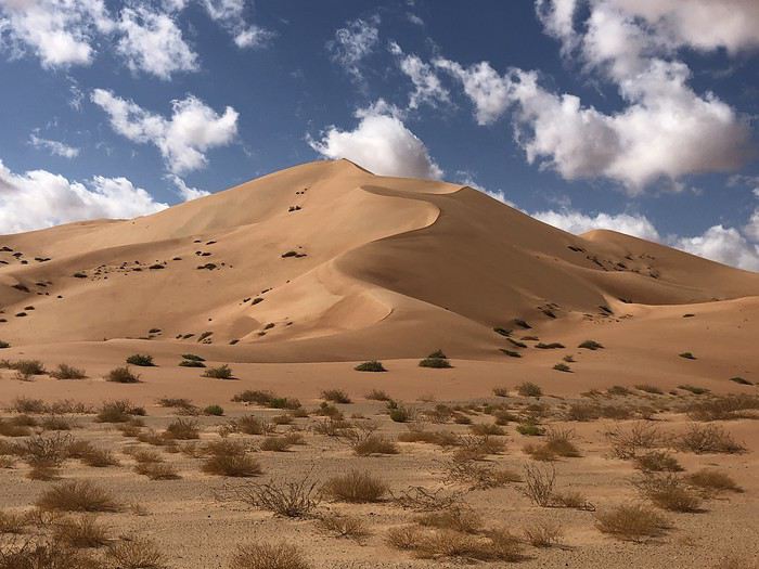
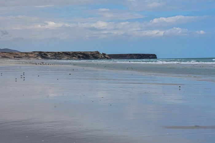
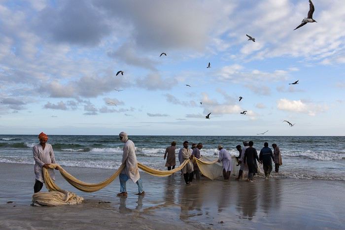
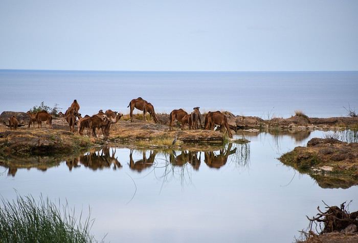
Alors si vous voulez bien me suivre...
Eh bien! En parcourant le Sultanat d’Oman, nous allons à leur recherche ou plutôt découvrir ce pays des Mille et Une Merveilles décrites dans les célèbres contes persans dont a fait partie l’actuel Sultanat.
Voici l’itinéraire prévu pour ces deux semaines :
21/12 Lyon – Mascate 22/12 Mascate 23/12 Mascate – Wadi Tiwi 24/12 Wadi Shab – Sour 25/12 Ras Al Jinz – Wadi Bani Kalid 26/12 Wahiba Sands 27/12 Sugar Dunes – Sanctuaire Oryx 28/12 Mirbat 29/12 Wadi Darbat – Salalah 30/12 Mughsayl – Rakyut 31/12 Rub Al Khali - Haima 01/01 Jabreen - Nizwa 02/01 Tanuf - Bahla – Jebel Shams 03/01 Jebel Shams – Al Hamra - Misfat 04/01 Bilad Sayt – Wadi Bani Awf – Mascate 05/01 Mascate - Lyon
Montagnes, Wadis, déserts et plages, chacun y trouvera son bonheur. Voici un petit aperçu de ce qui vous attend.
Alors si vous voulez bien me suivre...
Bolivia: Exploring the South Lipez by Self-Drive
Hi everyone,
The idea of traveling to Bolivia came to me after seeing Jean-François (Max68)’s photos on his website. I thought we *had* to see those stunning landscapes with the colorful lagoons for ourselves. But a self-drive trip didn’t seem doable at first. A few years ago, everyone advised against going to the South Lipez with just one car.
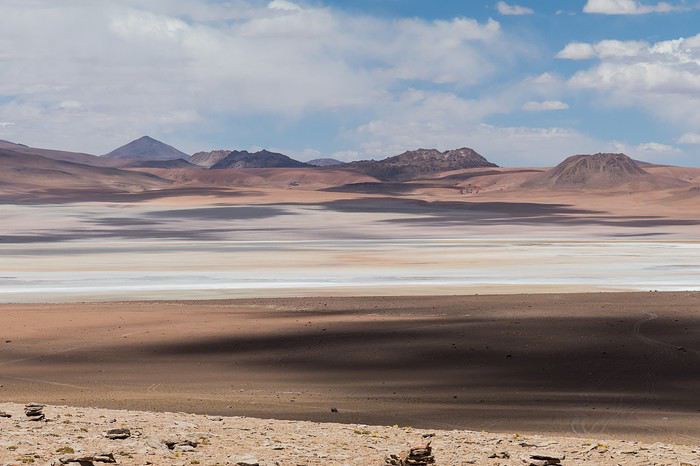 Laguna Kara
It was only after reading Laurent (Lolobe) and Pascal (Pepe874)’s travel journals—who explored the South Lipez solo with a car from Biz Rent a Car—that I thought we might be able to do the same. Meanwhile, we’d already contacted a local agency to organize a trip with a driver and guide. But the idea of a self-drive adventure really appealed to us. With encouragement and tips from Thierry (Tbernay) and Jean-François (Max68), we decided to plan our own self-drive trip. I’d like to thank them for their advice—it was *super* helpful. And a big thanks to all the other forum members for the info shared during our prep!
 Laguna Colorada
Planning this trip happened during a tough time for our family. My mother-in-law’s illness and passing, plus a few health issues of my own, made us doubt the trip multiple times and nearly scrap the whole thing.
We booked our international flights in February with Swiss. They offered the best balance of travel time and price from Switzerland. Swiss operates Zurich–São Paulo with their own fleet, and São Paulo–Santa Cruz with GOL. In June, GOL canceled the Saturday flight and rebooked us on Sunday. Spending over 24 hours in that huge Brazilian city didn’t work for us at all, so we asked Swiss to put us on the next Zurich–São Paulo flight. Too bad—we lost a day in Bolivia and had to skip the Tarabucco market on Sunday.
Right after, we also booked the car in February. After contacting Imbex and Biz, we went with Biz. Not speaking Spanish, we were relieved to communicate with Alejandra in French. The contact was great—she answered all our questions patiently. Sometimes it took a few days to get a reply, but we could also reach her on WhatsApp. After our trip, we can *only* recommend Biz for rentals in Bolivia. The cars are well-prepped for the South Lipez tracks. The agency is reliable, and the vehicles are new and well-maintained.
 “Our” car, a Toyota Hilux
While planning, we realized the presidential elections would happen while we were in Bolivia. The risk of *bloqueos* (roadblocks and protests) was very real. But in Bolivia, *bloqueos* seem common—you always have to account for that kind of hassle. In late August/early September, Uyuni and the Salar region were blocked for days, leading to food, fuel, and cash shortages. Worried about a blockade in Uyuni and missing the Salar, we decided to visit it first *just in case*.
On election day, the whole country shut down. Planes were grounded, buses and taxis couldn’t circulate, and private cars were banned. There were a few exceptions—ambulances, police, or certain professions—but as tourists, we couldn’t get permission to drive. We asked the embassy, and Biz even requested a permit from the electoral office. So we had to plan to be somewhere with things to do *without* the car.
We decided not to book any accommodations in advance—a first for us. Usually, we plan our stops and reserve lodges, hotels, or campgrounds well ahead. This time, only the room in Sucre was booked, so we’d have a base when we arrived.
In July, Alex (Delhenry) reached out to propose joining part of the trip. He didn’t realize we were leaving in October. Still, we got fresh updates when he returned from the South Lipez. Thanks, Alex—your tips, especially about the Guadalupe–Tupiza stretch, were *super* useful.
In September, we connected with Jean-Louis (Avx) and Anne (Xeta), who were also heading to Bolivia in October, one and two weeks after us. We had dinner with Jean-Louis and his friend after our South Lipez trip and stayed in touch with Anne. It was great to chat with them! Unfortunately, Anne and her husband had a much rockier trip—they got hit hard by post-election issues.
 Climbing Volcán Tunupa
Our itinerary wasn’t set in stone—we decided to wing it on the spot. Two weeks before departure, I reconnected with Alejandra at Biz to move the car rental up by a day. With the elections, we wanted to leave Sucre ASAP and focus on the South Lipez. Outside Uyuni and Tupiza, the risk of blockades was zero. We also planned a two-night buffer in Sucre before our flights, just in case. It might sound overcautious, but in hindsight, we made the right call. If we’d left Sucre a day later, we wouldn’t have made it to Potosí—it was completely blocked. On the way back, we *just* dodged blockades in Potosí and elsewhere. Sometimes, you’ve gotta trust your gut.
Here’s our route—only the first two nights in Sucre were booked ahead:
D1 Departure from Switzerland
D2 Sucre (La Selenita)
D3 Sucre (La Selenita)
D4 Colchani (Hotel de Sal Luna Salada)
D5 Jirira (Auberge Doña Lupe)
D6 On the Salar (in the car)
D7 A few kilometers from Estancia Catal (in the car)
D8 Laguna Hedionda (Hotel Los Flamencos)
D9 Laguna Colorada (Lodge by the lagoon)
D10 Middle of nowhere, en route Laguna Verde–Mina Horsu–Quetena Chico (in the car)
D11 Quetena Chico (Lamphaya Lodge Andino)
D12 Quetena Chico (Lamphaya Lodge Andino)
D13 Guadalupe (Guest room at Celia’s)
D14 Along the Rio Grande (in the car)
D15 Tupiza (Hotel Mitru)
D16 Tupiza (Hotel Mitru)
D17 Sucre (La Selenita)
D18 Sucre (La Selenita)
D19 Santa Cruz (Hotel Sun)
D20 Departure from Santa Cruz
D21 Arrival in Switzerland
As you can see, we spent 13 nights in the South Lipez. Initially, we’d planned for nine, but Jean-François (Max68) suggested staying longer. Great advice—we didn’t regret it one bit. We could’ve even added 2–3 more days without getting bored.
Self-driving in the South Lipez takes some prep and a good GPS. We kept it simple and used maps.me to navigate. It’s a solid app—just save your waypoints ahead of time. For some stretches, I used Google Earth to visualize the tracks and sites. If you stick to the tour operator routes, you *almost* can’t get lost. But we often veered off the beaten path and took different routes. Some days, we didn’t see another car. So in case of a breakdown, it’s key to have water and food for several days. In some spots, there’s *zero* signal—your phone won’t work. Another must: it gets *cold* in the South Lipez, and a good sleeping bag is essential. We brought down sleeping bags rated for -10°C and didn’t regret it during our car nights.
 The Dalí Desert
Some tracks are *super* rocky—flat tires are a real risk. On those stretches, maps.me’s estimated travel time was way off. Some sections barely let us go over 15 km/h.
Lots of forum members recommend doing the South Lipez “loop” from Tupiza to Uyuni—ending with the Salar—to avoid Uyuni’s crowds. That might work for organized tours, but for self-drive, the direction *doesn’t* matter. I’ll say this: the few vehicles we saw mostly came from Tupiza and Chile, not Uyuni. So if starting from Uyuni works better for you, go for it! Ending in Tupiza means heading toward warmer weather. For our planned stops and climbs, starting in Uyuni helped with acclimatization. Spending a few nights between 3,600–3,800 m before going over 4,000 m is a smart move.
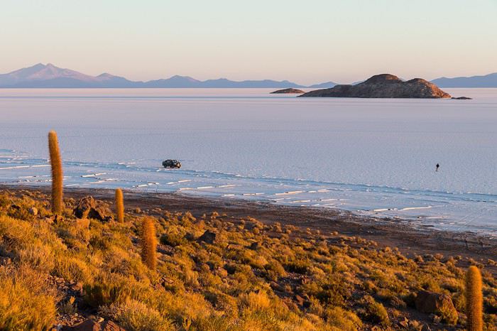 Uyuni Salt Flats in the morning
Overall, we barely saw anyone—except at Laguna Hedionda and Chalviri. There were several tour groups at Hotel Los Flamencos (Laguna Hedionda), but we didn’t cross paths during the day. Hardly anyone on the Salar, on the roads, or at the lodges in the evenings. The *only* place that shocked us was Chalviri. We’d planned to stay there, but it was fully booked—and we counted *forty* tour jeeps on-site. This was around noon! At the Polques hot springs (Chalviri), it was *packed*—we quickly nixed the idea of a dip. Plus, the vibe wasn’t great: soaking right by the road with lodges and restaurants in the background? Meh. Still, lots of tourists love it, so it’s up to you.
For the photos, I kept the colors and mood we saw. The lagoons’ hues are often stunning, but some online photos are *way* over-edited and oversaturated. The South Lipez’s landscapes are breathtaking—no need for excessive retouching.
If you don’t want to read all the details, the start of the travel journal is here: https://voyageforum.com/v.f?post=9888761;a=9888761
The idea of traveling to Bolivia came to me after seeing Jean-François (Max68)’s photos on his website. I thought we *had* to see those stunning landscapes with the colorful lagoons for ourselves. But a self-drive trip didn’t seem doable at first. A few years ago, everyone advised against going to the South Lipez with just one car.
Laguna KaraIt was only after reading Laurent (Lolobe) and Pascal (Pepe874)’s travel journals—who explored the South Lipez solo with a car from Biz Rent a Car—that I thought we might be able to do the same. Meanwhile, we’d already contacted a local agency to organize a trip with a driver and guide. But the idea of a self-drive adventure really appealed to us. With encouragement and tips from Thierry (Tbernay) and Jean-François (Max68), we decided to plan our own self-drive trip. I’d like to thank them for their advice—it was *super* helpful. And a big thanks to all the other forum members for the info shared during our prep!
Laguna ColoradaPlanning this trip happened during a tough time for our family. My mother-in-law’s illness and passing, plus a few health issues of my own, made us doubt the trip multiple times and nearly scrap the whole thing.
We booked our international flights in February with Swiss. They offered the best balance of travel time and price from Switzerland. Swiss operates Zurich–São Paulo with their own fleet, and São Paulo–Santa Cruz with GOL. In June, GOL canceled the Saturday flight and rebooked us on Sunday. Spending over 24 hours in that huge Brazilian city didn’t work for us at all, so we asked Swiss to put us on the next Zurich–São Paulo flight. Too bad—we lost a day in Bolivia and had to skip the Tarabucco market on Sunday.
Right after, we also booked the car in February. After contacting Imbex and Biz, we went with Biz. Not speaking Spanish, we were relieved to communicate with Alejandra in French. The contact was great—she answered all our questions patiently. Sometimes it took a few days to get a reply, but we could also reach her on WhatsApp. After our trip, we can *only* recommend Biz for rentals in Bolivia. The cars are well-prepped for the South Lipez tracks. The agency is reliable, and the vehicles are new and well-maintained.
“Our” car, a Toyota HiluxWhile planning, we realized the presidential elections would happen while we were in Bolivia. The risk of *bloqueos* (roadblocks and protests) was very real. But in Bolivia, *bloqueos* seem common—you always have to account for that kind of hassle. In late August/early September, Uyuni and the Salar region were blocked for days, leading to food, fuel, and cash shortages. Worried about a blockade in Uyuni and missing the Salar, we decided to visit it first *just in case*.
On election day, the whole country shut down. Planes were grounded, buses and taxis couldn’t circulate, and private cars were banned. There were a few exceptions—ambulances, police, or certain professions—but as tourists, we couldn’t get permission to drive. We asked the embassy, and Biz even requested a permit from the electoral office. So we had to plan to be somewhere with things to do *without* the car.
We decided not to book any accommodations in advance—a first for us. Usually, we plan our stops and reserve lodges, hotels, or campgrounds well ahead. This time, only the room in Sucre was booked, so we’d have a base when we arrived.
In July, Alex (Delhenry) reached out to propose joining part of the trip. He didn’t realize we were leaving in October. Still, we got fresh updates when he returned from the South Lipez. Thanks, Alex—your tips, especially about the Guadalupe–Tupiza stretch, were *super* useful.
In September, we connected with Jean-Louis (Avx) and Anne (Xeta), who were also heading to Bolivia in October, one and two weeks after us. We had dinner with Jean-Louis and his friend after our South Lipez trip and stayed in touch with Anne. It was great to chat with them! Unfortunately, Anne and her husband had a much rockier trip—they got hit hard by post-election issues.
Climbing Volcán TunupaOur itinerary wasn’t set in stone—we decided to wing it on the spot. Two weeks before departure, I reconnected with Alejandra at Biz to move the car rental up by a day. With the elections, we wanted to leave Sucre ASAP and focus on the South Lipez. Outside Uyuni and Tupiza, the risk of blockades was zero. We also planned a two-night buffer in Sucre before our flights, just in case. It might sound overcautious, but in hindsight, we made the right call. If we’d left Sucre a day later, we wouldn’t have made it to Potosí—it was completely blocked. On the way back, we *just* dodged blockades in Potosí and elsewhere. Sometimes, you’ve gotta trust your gut.
Here’s our route—only the first two nights in Sucre were booked ahead:
D1 Departure from Switzerland
D2 Sucre (La Selenita)
D3 Sucre (La Selenita)
D4 Colchani (Hotel de Sal Luna Salada)
D5 Jirira (Auberge Doña Lupe)
D6 On the Salar (in the car)
D7 A few kilometers from Estancia Catal (in the car)
D8 Laguna Hedionda (Hotel Los Flamencos)
D9 Laguna Colorada (Lodge by the lagoon)
D10 Middle of nowhere, en route Laguna Verde–Mina Horsu–Quetena Chico (in the car)
D11 Quetena Chico (Lamphaya Lodge Andino)
D12 Quetena Chico (Lamphaya Lodge Andino)
D13 Guadalupe (Guest room at Celia’s)
D14 Along the Rio Grande (in the car)
D15 Tupiza (Hotel Mitru)
D16 Tupiza (Hotel Mitru)
D17 Sucre (La Selenita)
D18 Sucre (La Selenita)
D19 Santa Cruz (Hotel Sun)
D20 Departure from Santa Cruz
D21 Arrival in Switzerland
As you can see, we spent 13 nights in the South Lipez. Initially, we’d planned for nine, but Jean-François (Max68) suggested staying longer. Great advice—we didn’t regret it one bit. We could’ve even added 2–3 more days without getting bored.
Self-driving in the South Lipez takes some prep and a good GPS. We kept it simple and used maps.me to navigate. It’s a solid app—just save your waypoints ahead of time. For some stretches, I used Google Earth to visualize the tracks and sites. If you stick to the tour operator routes, you *almost* can’t get lost. But we often veered off the beaten path and took different routes. Some days, we didn’t see another car. So in case of a breakdown, it’s key to have water and food for several days. In some spots, there’s *zero* signal—your phone won’t work. Another must: it gets *cold* in the South Lipez, and a good sleeping bag is essential. We brought down sleeping bags rated for -10°C and didn’t regret it during our car nights.
The Dalí DesertSome tracks are *super* rocky—flat tires are a real risk. On those stretches, maps.me’s estimated travel time was way off. Some sections barely let us go over 15 km/h.
Lots of forum members recommend doing the South Lipez “loop” from Tupiza to Uyuni—ending with the Salar—to avoid Uyuni’s crowds. That might work for organized tours, but for self-drive, the direction *doesn’t* matter. I’ll say this: the few vehicles we saw mostly came from Tupiza and Chile, not Uyuni. So if starting from Uyuni works better for you, go for it! Ending in Tupiza means heading toward warmer weather. For our planned stops and climbs, starting in Uyuni helped with acclimatization. Spending a few nights between 3,600–3,800 m before going over 4,000 m is a smart move.
Uyuni Salt Flats in the morningOverall, we barely saw anyone—except at Laguna Hedionda and Chalviri. There were several tour groups at Hotel Los Flamencos (Laguna Hedionda), but we didn’t cross paths during the day. Hardly anyone on the Salar, on the roads, or at the lodges in the evenings. The *only* place that shocked us was Chalviri. We’d planned to stay there, but it was fully booked—and we counted *forty* tour jeeps on-site. This was around noon! At the Polques hot springs (Chalviri), it was *packed*—we quickly nixed the idea of a dip. Plus, the vibe wasn’t great: soaking right by the road with lodges and restaurants in the background? Meh. Still, lots of tourists love it, so it’s up to you.
For the photos, I kept the colors and mood we saw. The lagoons’ hues are often stunning, but some online photos are *way* over-edited and oversaturated. The South Lipez’s landscapes are breathtaking—no need for excessive retouching.
If you don’t want to read all the details, the start of the travel journal is here: https://voyageforum.com/v.f?post=9888761;a=9888761
Avis sur itinéraire avec agence locale au Pérou en août
Bonjour,
Nous allons partir cet été avec des amis (nous serons 6) effectuer le circuit classique du Sud Pérou. Les billets d’avion sont déjà pris, donc les dates ne sont plus flexibles, et nous sommes en train de finaliser notre itinéraire. Je me suis tournée vers des agences locales pour nous concocter un tour plus privatif car à 6 ça ne reviens guère plus cher et moins d’organisation sur place que de louer une voiture et faire le circuit seul comme nous en avons l’habitude.
J’aurais besoin de vos avis, de vos suggestions, de vos remarques sur cet itinéraire avant de solliciter les agences pour un devis final :
J1 - Lundi 3 Août : Vol Paris / Montréal / Lima Arrivée 00h55 – Fin nuit Lima
J2 - Mardi 4 Août : Visite Lima Nuit Lima
J3 - Mercredi 5 Août : Matin : bus Paracas (4h) Après-midi : Parc National Paracas Nuit Paracas
J4 - Jeudi 6 Août : Matin : Excursion îles Ballestas (2h30) Après-midi: Ica - Oasis Huacachina (buggy, sandboard) Nuit Huacachina
J5 – Vendredi 7 Août : Matin : Géoglyphes Palpa, Mirador lignes Nasca, Survol lignes Nasca Après-midi : visite Chauchilla, Musée Antononi, aqueduc Cantalloc Nuit bus couchette : départ 22h pour Arequipa (durée 10h)
J6 – Samedi 8 Août : Visite Arequipa Nuit Arequipa
J7 – Dimanche 9 Août : Matin : Route pour Canyon de Colca (4h) – Réserve de Salinas et Aguada Blanca… Après-midi : Acclimatation - Baignade sources d’eaux thermales Nuit Chivay
J8 – Lundi 10 Août : Matin : Belvédère Cruz del Condor, Choquetico, Maca, Achoma, Yanque Après-midi : Bus pour Puno (6h) – Pampa Canahuas, Altiplano, Lagunillas Nuit Puno
J9 – Mardi 11 Août : Matin : Route pour péninsule de Capachica (2h) Après-midi : Promenade sur la péninsule, visite de Llachon Nuit chez l’habitant Llachon
J10 – Mercredi 12 Août : Matin : Visite des îles Titinos Après-midi : Visite de Taquile Nuit Puno
J11 – Jeudi 13 Août : Journée trajet en bus pour Cusco : Musée de Pucara, col de Raya, site de Raqchi, chapelle d’Andahuaylillas Nuit Cusco
J12 – Vendredi 14 Août : Matin : Visite Cusco Après-midi : Saqsayhuaman, Tambomachay, Puka Pukara, Q’enko Nuit Cusco
J13 – Samedi 15 Août : Matin : Site de Moray, Salines de Maras Après-midi : Forteresse d’Ollantaytambo – Train pour Aguas Calientes Nuit Aguas Calientes
J14 – Dimanche 16 Août : Visite Machu Picchu : Montée Huayna Picchu ? – Site Machu Picchu Bus + Train pour Ollantaytambo Nuit Ollantaytambo
J15 – Lundi 17 Août : Matin : Descente à pied de l’Intihuatana vers Pisac (1h30) - Visite site de Pisac – Marché artisanal Après-midi : Retour à Cusco Nuit Cusco
J16 – Mardi 18 Août : Journée montagne Vinicunca – Retour par Red Valley ? Nuit Cusco
J17 – Mercredi 19 Août : Journée randonnée Laguna Humantay ? Qui connait ? Ou journée supplémentaire au canyon de Colca pour faire une randonnée ?? Laquelle ? Nuit Cusco
J18 – Jeudi 20 Août : Matin : Vol Cusco / Lima Après-midi : Lima
J19 – Vendredi 21 Août : Départ Lima 2h40 – Vol Lima / Montréal / Lyon
Je précise que la plupart du temps, nous aurons un véhicule privé avec chauffeur ce qui peut nous permettre plus de flexibilité.
Merci d’avance pour vos réponses,
Isabelle
Nous allons partir cet été avec des amis (nous serons 6) effectuer le circuit classique du Sud Pérou. Les billets d’avion sont déjà pris, donc les dates ne sont plus flexibles, et nous sommes en train de finaliser notre itinéraire. Je me suis tournée vers des agences locales pour nous concocter un tour plus privatif car à 6 ça ne reviens guère plus cher et moins d’organisation sur place que de louer une voiture et faire le circuit seul comme nous en avons l’habitude.
J’aurais besoin de vos avis, de vos suggestions, de vos remarques sur cet itinéraire avant de solliciter les agences pour un devis final :
J1 - Lundi 3 Août : Vol Paris / Montréal / Lima Arrivée 00h55 – Fin nuit Lima
J2 - Mardi 4 Août : Visite Lima Nuit Lima
J3 - Mercredi 5 Août : Matin : bus Paracas (4h) Après-midi : Parc National Paracas Nuit Paracas
J4 - Jeudi 6 Août : Matin : Excursion îles Ballestas (2h30) Après-midi: Ica - Oasis Huacachina (buggy, sandboard) Nuit Huacachina
J5 – Vendredi 7 Août : Matin : Géoglyphes Palpa, Mirador lignes Nasca, Survol lignes Nasca Après-midi : visite Chauchilla, Musée Antononi, aqueduc Cantalloc Nuit bus couchette : départ 22h pour Arequipa (durée 10h)
J6 – Samedi 8 Août : Visite Arequipa Nuit Arequipa
J7 – Dimanche 9 Août : Matin : Route pour Canyon de Colca (4h) – Réserve de Salinas et Aguada Blanca… Après-midi : Acclimatation - Baignade sources d’eaux thermales Nuit Chivay
J8 – Lundi 10 Août : Matin : Belvédère Cruz del Condor, Choquetico, Maca, Achoma, Yanque Après-midi : Bus pour Puno (6h) – Pampa Canahuas, Altiplano, Lagunillas Nuit Puno
J9 – Mardi 11 Août : Matin : Route pour péninsule de Capachica (2h) Après-midi : Promenade sur la péninsule, visite de Llachon Nuit chez l’habitant Llachon
J10 – Mercredi 12 Août : Matin : Visite des îles Titinos Après-midi : Visite de Taquile Nuit Puno
J11 – Jeudi 13 Août : Journée trajet en bus pour Cusco : Musée de Pucara, col de Raya, site de Raqchi, chapelle d’Andahuaylillas Nuit Cusco
J12 – Vendredi 14 Août : Matin : Visite Cusco Après-midi : Saqsayhuaman, Tambomachay, Puka Pukara, Q’enko Nuit Cusco
J13 – Samedi 15 Août : Matin : Site de Moray, Salines de Maras Après-midi : Forteresse d’Ollantaytambo – Train pour Aguas Calientes Nuit Aguas Calientes
J14 – Dimanche 16 Août : Visite Machu Picchu : Montée Huayna Picchu ? – Site Machu Picchu Bus + Train pour Ollantaytambo Nuit Ollantaytambo
J15 – Lundi 17 Août : Matin : Descente à pied de l’Intihuatana vers Pisac (1h30) - Visite site de Pisac – Marché artisanal Après-midi : Retour à Cusco Nuit Cusco
J16 – Mardi 18 Août : Journée montagne Vinicunca – Retour par Red Valley ? Nuit Cusco
J17 – Mercredi 19 Août : Journée randonnée Laguna Humantay ? Qui connait ? Ou journée supplémentaire au canyon de Colca pour faire une randonnée ?? Laquelle ? Nuit Cusco
J18 – Jeudi 20 Août : Matin : Vol Cusco / Lima Après-midi : Lima
J19 – Vendredi 21 Août : Départ Lima 2h40 – Vol Lima / Montréal / Lyon
Je précise que la plupart du temps, nous aurons un véhicule privé avec chauffeur ce qui peut nous permettre plus de flexibilité.
Merci d’avance pour vos réponses,
Isabelle
On part en vadrouille au Pérou / Bolivie / Chili!
Hello les aficionados de voyages ! Un nouveau petit carnet pour vous raconter ma vadrouille au Pérou, en Bolivie et au Chili en 18 jours. Voyage intense, fatigant, mais au combien dépaysant... Je te laisse découvrir ça même si tu peux déjà retrouver la version complète ici :
onpartenvadrouille.over-blog.com/...-pas-l-pero...
Bonne lecture et n'hésite pas à me faire part de tes éventuels remarques / commentaires...
23 octobre C’est pas l’Pérou ? Si ! Quand j’étais petit, je n’étais pas grand… Normal, vas-tu me dire… Et quand j’étais petit, j’étais fasciné par la carte du monde. Comme mes vieux posters de Chris Waddle et de Jean-Pierre Papin, je la fixais comme un ahuri en me posant cette question toute bête : Qu’est-ce qu’il y a là-bas, de l’autre côté de la planète ? Mon envie de voyage a certainement commencé à poindre le bout de son nez à ce moment-là. Malheureusement pour mon porte-monnaie et pour ma femme, elle n’a fait que s’accroître avec le temps. Ma femme, justement, parlons-en !! Le jour (ou plus précisément la nuit) où nous avons dormi (ou plus précisément essayé de dormir) dans une maison (ou plus précisément dans une cabane) mal isolée (ou plus précisément pas isolée du tout) par une température revigorante (ou plus précisément glaciale) au fin fond de la Birmanie, elle a dit « Stop ! Finito ! Terminé ! Kaput ! Les voyages dans ces conditions, ce n’est plus de mon âge ! » Sauf que moi, premièrement, je ne fais pas son âge !!! S’en est donc suivi un voyage à Bali cet été dans des conditions à la brosser dans le sens du poil. Sauf que moi, deuxièmement, ça ne m’a pas comblé mon envie de dormir à l’arrache au milieu des cochons ! Et puis un voyage à quatre à Bali en conditions préférentielles, ça a un coup ! La cigale ayant dépensé tout l’été, se trouva fort dépourvue quand la bise fut venue. Sauf que moi, troisièmement, j’en ai gardé un peu sous le pied. Mais juste un tout p’tit peu… Juste pour une seule personne… Juste pour moi, en fait ! Sauf que moi, quatrièmement, je ne me vois pas partir en solo à l’assaut du monde pour dormir avec des cochons... Partenaire particulier, je cherche partenaire particulière, débloqué, pas trop timide et avec une bonne dose de savoir faire !
Et là, se pointe mon frère. Lors d’une soirée bien arrosée faisant suite à une journée de ski, il nous confesse que le générique des « Mystérieuses cités d’or » le hante au plus profond de son être depuis qu’il est tout petit et qu’il lui faut donc absolument étancher sa soif d’aller toiser le Machu Picchu en tête à tête. « Franck, pourquoi n’y emmènerais-tu pas ton frère ? » Incrédule ou femme parfaite, Dieu seul le sait ! En tout cas, Sandrine a prononcé ces quelques mots à 21h57. Sur le coup, je pense qu’elle ne perçoit pas la portée de ses mots. Crédule ou homme opportuniste, Dieu seul le sait ! En tout cas, je saisis l’opportunité par les deux mains et à 22h25, je suis scotché à mon écran en train de retourner le net pour y dénicher des billets d’avion pas chers. 22h49, emballé, c’est pesé, y’a plus rien à voir, cinq cents euros par personne, départ en octobre prochain !!! C’est ce qu’on appelle « battre le net tant qu’il est encore tôt ! » Je t’annonce donc solennellement que pour ce nouveau voyage, je prends la direction de l'Amérique du Sud, et plus précisément de la Cordillère des Andes, la plus longue chaîne de montagnes du monde... Une traversée de Lima au Pérou, jusqu’à San Pédro de Atacama au Chili en passant par La Paz en Bolivie, pour une durée totale de dix-huit jours sur place, du 23 octobre au 11 novembre. Au programme de ce roadtrip, des noms qui résonnent comme autant de lieux magiques… Les lignes de Nazca, l'incontournable Machu Picchu, la ville ancestrale de Cuzco, le Lac Titicaca, la tentaculaire capitale La Paz, le Salar d’Uyuni, le sud Lipez, le désert d'Atacama, … et bien d’autres de leurs amis qui riment avec Esteban, Tao et Zia ! Et tu l’as donc compris, dans la rubrique « C’est qui qui vient ? », je serai pour cette fois-ci accompagné par mon frère que je m’en vais te présenter de ce pas...
Pour commencer, soit-disant qu’il serait ma copie. Pâle, mais copie quand même dixit les personnes qui nous connaissent… Ensuite et c’est bien là le plus important, dormir avec des cochons ne le rebute pas du tout, bien au contraire ! Ne me fais pas dire ce que je n’ai pas dit, je parle bien de l’animal mâle… Enfin, sache qu’il a une dizaine d’années de moins que moi et qu’il se prénomme Sullivan. Voilà pour les présentations sommaires, tu en sauras plus sur lui en allant consulter son compte Tinder, ou tout au long de notre vadrouille qui débute… maintenant ! Car comme dirait ma grand-mère, « il y a de la route, faut y aller mes gamins ! » Trente minutes de voiture jusqu’à la gare TGV de Reims. Trente minutes supplémentaires de train pour gagner l’aéroport Charles de Gaulle. Neuf heures d’avion pour aller jusqu’à Atlanta, puis sept nouvelles heures de vol pour enfin atterrir à Lima. Ajoute à ça les temps d’attente dont les quatre heures d’escale à Atlanta, secoue le shaker et tu obtiens un résultat de vingt-et-une heures de transport !... Mais on est des oufs, nous ! Car je profite du fait d’être cette fois-ci exonéré de ralentisseurs plaintifs pour pousser le bouchon un peu plus loin. A cela, comprendre que je voyage léger, sans femme ni enfant. Pour gagner du temps, on enchaîne donc direct en arrivant à Lima avec une heure de taxi pour gagner la gare routière, trois heures d’attente sur un banc en pleine nuit, puis cinq heures de bus pour aller jusqu’à Ica. De là, on prend un nouveau taxi et terminus, tout le monde descend !!! Ouf, nous arrivons enfin à notre lieu de villégiature, Huacachina, pas moins de trente-trois heures après avoir regardé ma maison s’éloigner dans mon rétroviseur. Que retenir de ce voyage à part que ce fut extrêmement long ? Pas grand’chose à part qu’à l’immigration américaine, vu qu’on porte logiquement le même nom avec mon frère, on nous a demandé si nous étions mariés ensemble ; qu’on a tué le temps à l’aéroport d’Atlanta à boire des bières à la citrouille d’Halloween ; que nous avons été accueillis par des prostituées pratiquement nues dans les rues de Lima (merci à elles pour cette délicate attention), et que des affiches de Julien Clerc couvraient les murs de la ville. Oui, oui, « Lili voulait aller danser » a apparemment son public là-bas… Allez, maintenant, tu m’excuseras pour le caractère expéditif de cette fin de description de journée, mais le thermomètre ici affiche déjà près de trente degrés. Si on ajoute à l’équation le temps de transport, ainsi que les six heures de décalage horaire, on obtient deux français complètement crevés qui doivent aller se coucher pour être en forme demain. De toute façon, demain est une autre aventure...
Bonne lecture et n'hésite pas à me faire part de tes éventuels remarques / commentaires...
23 octobre C’est pas l’Pérou ? Si ! Quand j’étais petit, je n’étais pas grand… Normal, vas-tu me dire… Et quand j’étais petit, j’étais fasciné par la carte du monde. Comme mes vieux posters de Chris Waddle et de Jean-Pierre Papin, je la fixais comme un ahuri en me posant cette question toute bête : Qu’est-ce qu’il y a là-bas, de l’autre côté de la planète ? Mon envie de voyage a certainement commencé à poindre le bout de son nez à ce moment-là. Malheureusement pour mon porte-monnaie et pour ma femme, elle n’a fait que s’accroître avec le temps. Ma femme, justement, parlons-en !! Le jour (ou plus précisément la nuit) où nous avons dormi (ou plus précisément essayé de dormir) dans une maison (ou plus précisément dans une cabane) mal isolée (ou plus précisément pas isolée du tout) par une température revigorante (ou plus précisément glaciale) au fin fond de la Birmanie, elle a dit « Stop ! Finito ! Terminé ! Kaput ! Les voyages dans ces conditions, ce n’est plus de mon âge ! » Sauf que moi, premièrement, je ne fais pas son âge !!! S’en est donc suivi un voyage à Bali cet été dans des conditions à la brosser dans le sens du poil. Sauf que moi, deuxièmement, ça ne m’a pas comblé mon envie de dormir à l’arrache au milieu des cochons ! Et puis un voyage à quatre à Bali en conditions préférentielles, ça a un coup ! La cigale ayant dépensé tout l’été, se trouva fort dépourvue quand la bise fut venue. Sauf que moi, troisièmement, j’en ai gardé un peu sous le pied. Mais juste un tout p’tit peu… Juste pour une seule personne… Juste pour moi, en fait ! Sauf que moi, quatrièmement, je ne me vois pas partir en solo à l’assaut du monde pour dormir avec des cochons... Partenaire particulier, je cherche partenaire particulière, débloqué, pas trop timide et avec une bonne dose de savoir faire !
Et là, se pointe mon frère. Lors d’une soirée bien arrosée faisant suite à une journée de ski, il nous confesse que le générique des « Mystérieuses cités d’or » le hante au plus profond de son être depuis qu’il est tout petit et qu’il lui faut donc absolument étancher sa soif d’aller toiser le Machu Picchu en tête à tête. « Franck, pourquoi n’y emmènerais-tu pas ton frère ? » Incrédule ou femme parfaite, Dieu seul le sait ! En tout cas, Sandrine a prononcé ces quelques mots à 21h57. Sur le coup, je pense qu’elle ne perçoit pas la portée de ses mots. Crédule ou homme opportuniste, Dieu seul le sait ! En tout cas, je saisis l’opportunité par les deux mains et à 22h25, je suis scotché à mon écran en train de retourner le net pour y dénicher des billets d’avion pas chers. 22h49, emballé, c’est pesé, y’a plus rien à voir, cinq cents euros par personne, départ en octobre prochain !!! C’est ce qu’on appelle « battre le net tant qu’il est encore tôt ! » Je t’annonce donc solennellement que pour ce nouveau voyage, je prends la direction de l'Amérique du Sud, et plus précisément de la Cordillère des Andes, la plus longue chaîne de montagnes du monde... Une traversée de Lima au Pérou, jusqu’à San Pédro de Atacama au Chili en passant par La Paz en Bolivie, pour une durée totale de dix-huit jours sur place, du 23 octobre au 11 novembre. Au programme de ce roadtrip, des noms qui résonnent comme autant de lieux magiques… Les lignes de Nazca, l'incontournable Machu Picchu, la ville ancestrale de Cuzco, le Lac Titicaca, la tentaculaire capitale La Paz, le Salar d’Uyuni, le sud Lipez, le désert d'Atacama, … et bien d’autres de leurs amis qui riment avec Esteban, Tao et Zia ! Et tu l’as donc compris, dans la rubrique « C’est qui qui vient ? », je serai pour cette fois-ci accompagné par mon frère que je m’en vais te présenter de ce pas...
Pour commencer, soit-disant qu’il serait ma copie. Pâle, mais copie quand même dixit les personnes qui nous connaissent… Ensuite et c’est bien là le plus important, dormir avec des cochons ne le rebute pas du tout, bien au contraire ! Ne me fais pas dire ce que je n’ai pas dit, je parle bien de l’animal mâle… Enfin, sache qu’il a une dizaine d’années de moins que moi et qu’il se prénomme Sullivan. Voilà pour les présentations sommaires, tu en sauras plus sur lui en allant consulter son compte Tinder, ou tout au long de notre vadrouille qui débute… maintenant ! Car comme dirait ma grand-mère, « il y a de la route, faut y aller mes gamins ! » Trente minutes de voiture jusqu’à la gare TGV de Reims. Trente minutes supplémentaires de train pour gagner l’aéroport Charles de Gaulle. Neuf heures d’avion pour aller jusqu’à Atlanta, puis sept nouvelles heures de vol pour enfin atterrir à Lima. Ajoute à ça les temps d’attente dont les quatre heures d’escale à Atlanta, secoue le shaker et tu obtiens un résultat de vingt-et-une heures de transport !... Mais on est des oufs, nous ! Car je profite du fait d’être cette fois-ci exonéré de ralentisseurs plaintifs pour pousser le bouchon un peu plus loin. A cela, comprendre que je voyage léger, sans femme ni enfant. Pour gagner du temps, on enchaîne donc direct en arrivant à Lima avec une heure de taxi pour gagner la gare routière, trois heures d’attente sur un banc en pleine nuit, puis cinq heures de bus pour aller jusqu’à Ica. De là, on prend un nouveau taxi et terminus, tout le monde descend !!! Ouf, nous arrivons enfin à notre lieu de villégiature, Huacachina, pas moins de trente-trois heures après avoir regardé ma maison s’éloigner dans mon rétroviseur. Que retenir de ce voyage à part que ce fut extrêmement long ? Pas grand’chose à part qu’à l’immigration américaine, vu qu’on porte logiquement le même nom avec mon frère, on nous a demandé si nous étions mariés ensemble ; qu’on a tué le temps à l’aéroport d’Atlanta à boire des bières à la citrouille d’Halloween ; que nous avons été accueillis par des prostituées pratiquement nues dans les rues de Lima (merci à elles pour cette délicate attention), et que des affiches de Julien Clerc couvraient les murs de la ville. Oui, oui, « Lili voulait aller danser » a apparemment son public là-bas… Allez, maintenant, tu m’excuseras pour le caractère expéditif de cette fin de description de journée, mais le thermomètre ici affiche déjà près de trente degrés. Si on ajoute à l’équation le temps de transport, ainsi que les six heures de décalage horaire, on obtient deux français complètement crevés qui doivent aller se coucher pour être en forme demain. De toute façon, demain est une autre aventure...
Six-week trip to Mexico
I recently took a six-week trip to Mexico with Y, my Thai partner. To be precise, we spent 43 days there plus a final half-day before heading to Mexico City Airport for our return flight to Europe.
I’d already been to Mexico about 40 years ago! But that was only for a week or so, between Mérida and the Belize border.
First off, I should mention that I’ve never seen a beach in Mexico. I say this because discussions about Mexico always seem to revolve around the Costa / Riviera Maya.
Let’s start with an overview of the trip. Our itinerary can be split into two halves:
- First half: Querétaro, San Miguel de Allende, Morelia, Guanajuato, Mexico City “CDMX” (the capital). - Second half: Palenque, San Cristóbal de Las Casas, Chiapa de Corzo, Oaxaca, Puebla, Cholula, and finally Mexico City CDMX.
To move from one part of the trip to the other, we took a flight from Mexico City CDMX to Villahermosa, then a bus to Palenque.
In six weeks, we visited maybe a quarter or a fifth of the country (see the attached maps). Mexico is about three times the size of France! And when I say “visited,” it was really just a quick stop—enough to get a first impression. I understand that some people can only spend one or two weeks on vacation in a given country, but that’s not my idea of travel. Personally, I’d say a country as rich in every way as Mexico deserves several months of travel before you can say you’ve “seen” it.
In my next post, I’ll break down the expenses. That might help future travelers plan their trips. You don’t go to a country for several weeks (or more) without thinking about the budget! Besides, one of those future travelers to Mexico is us—we were so thrilled by Mexico that we’re definitely going back.
I’d already been to Mexico about 40 years ago! But that was only for a week or so, between Mérida and the Belize border.
First off, I should mention that I’ve never seen a beach in Mexico. I say this because discussions about Mexico always seem to revolve around the Costa / Riviera Maya.
Let’s start with an overview of the trip. Our itinerary can be split into two halves:
- First half: Querétaro, San Miguel de Allende, Morelia, Guanajuato, Mexico City “CDMX” (the capital). - Second half: Palenque, San Cristóbal de Las Casas, Chiapa de Corzo, Oaxaca, Puebla, Cholula, and finally Mexico City CDMX.
To move from one part of the trip to the other, we took a flight from Mexico City CDMX to Villahermosa, then a bus to Palenque.
In six weeks, we visited maybe a quarter or a fifth of the country (see the attached maps). Mexico is about three times the size of France! And when I say “visited,” it was really just a quick stop—enough to get a first impression. I understand that some people can only spend one or two weeks on vacation in a given country, but that’s not my idea of travel. Personally, I’d say a country as rich in every way as Mexico deserves several months of travel before you can say you’ve “seen” it.
In my next post, I’ll break down the expenses. That might help future travelers plan their trips. You don’t go to a country for several weeks (or more) without thinking about the budget! Besides, one of those future travelers to Mexico is us—we were so thrilled by Mexico that we’re definitely going back.
Autotour dans l'Ouest américain: par soi-même ou avec une agence?
Bonjour à tous,
Je désire partir avec mon fils de 15 ans aux Etats-Unis, découvrir les parcs de l'Ouest américain. J'hésite entre l'organiser toute seule ou passer par une agence. Je serai la seule à conduire et je ne suis pas super bonne en anglais. J'ai déjà obtenu un devis par une agence et j'ai essayé de comparer le tarif si je réserve moi-même, je pense qu'il y a au moins 2000-2500 Euros que je pourrai économiser en l'organisant moi-même !!! Donc ma question : est-ce qu'un voyage aux Etats-Unis, à deux (1 adulte et un ado) peut s'organiser tout seul ou vaut-il mieux passer par une agence qui propose en cas de problème des aides locales ? Est-ce que quelqu'un parmi vous est parti ainsi à 2, avec un ado ?
Merci pour vos réponses. Laetidjee
Je désire partir avec mon fils de 15 ans aux Etats-Unis, découvrir les parcs de l'Ouest américain. J'hésite entre l'organiser toute seule ou passer par une agence. Je serai la seule à conduire et je ne suis pas super bonne en anglais. J'ai déjà obtenu un devis par une agence et j'ai essayé de comparer le tarif si je réserve moi-même, je pense qu'il y a au moins 2000-2500 Euros que je pourrai économiser en l'organisant moi-même !!! Donc ma question : est-ce qu'un voyage aux Etats-Unis, à deux (1 adulte et un ado) peut s'organiser tout seul ou vaut-il mieux passer par une agence qui propose en cas de problème des aides locales ? Est-ce que quelqu'un parmi vous est parti ainsi à 2, avec un ado ?
Merci pour vos réponses. Laetidjee
Cuba... à la recherche du temps passé
4 juillet : Arrivée à La Havane
Partis ce matin de Marseille, nous sommes arrivés à Cuba ce même jour grâce au décalage horaire. A l'aéroport les formalités n'ont pris que 5 minutes. Pour les bagages nous avons patienté une quarantaine de minutes. Sortis de l'aéroport nous voyons notre nom sur une pancarte. C'est bon le taxi commandé auprès de la casa est bien là. Climatisé OUF! il est 22 h une chaleur écrasante pire que notre canicule du départ. Nous sommes plongés dans l'ambiance direct ! une vieille voiture, il fait nuit, je n'ai pas vu la marque. Nous circulons sur des axes peu éclairés et une trentaine de minutes plus tard nous arrivons chez nos hôtes Maria et Javier. Très bonne impression ce couple est charmant. Notre chambre est spacieuse. Climatisation + ventilateur. Une douche avec peu de pression mais ça il faudra que l'on s'y habitue car c'est souvent à Cuba. Nous nous mettons au lit vers 23h00 soit 4h00 du matin à Marseille à J+1. Le sommeil est long a venir mais finira par nous prendre.
Partis ce matin de Marseille, nous sommes arrivés à Cuba ce même jour grâce au décalage horaire. A l'aéroport les formalités n'ont pris que 5 minutes. Pour les bagages nous avons patienté une quarantaine de minutes. Sortis de l'aéroport nous voyons notre nom sur une pancarte. C'est bon le taxi commandé auprès de la casa est bien là. Climatisé OUF! il est 22 h une chaleur écrasante pire que notre canicule du départ. Nous sommes plongés dans l'ambiance direct ! une vieille voiture, il fait nuit, je n'ai pas vu la marque. Nous circulons sur des axes peu éclairés et une trentaine de minutes plus tard nous arrivons chez nos hôtes Maria et Javier. Très bonne impression ce couple est charmant. Notre chambre est spacieuse. Climatisation + ventilateur. Une douche avec peu de pression mais ça il faudra que l'on s'y habitue car c'est souvent à Cuba. Nous nous mettons au lit vers 23h00 soit 4h00 du matin à Marseille à J+1. Le sommeil est long a venir mais finira par nous prendre.
Avis sur agence Alaya et circuit Chili-Bolivie de 12 jours
Bonjour
Je souhaite un (ou plusieurs) avis sur l'agence Alaya (elle ne fait pas beaucoup parler d'elle pour le circuit de 12 jours suivants. Nous avons demandé un bon équilibre treks et découverte. Les contacts avec l'agence sont très bien, le prix me paraît raisonnable mais si un forumeur à des infos sur le sérieux de l'agence et/ou le circuit, je suis preneur :
Jour 1: AEROPORT DE CALAMA -SAN PEDRO D`ATACAMA 2500 ms Réception á l'aéroport de Calama par votre chauffeur selon votre vol Transfert sur ciel azuré pour le charmant village de San Pedro d'Atacama (110 km, 1h30) . Installation á l'hôtel situé au cœur du village de San Pedro d`Atacama. Le reste de la journée sera libre. van– 1h30 Hôtel Dunas 3*(Ch double) Chauffeur hispanophone Jour 2: SALAR D'ATACAMA - OASIS TOCONAO - LAGUNES ALTIPLANIQUES MISCANTI ET MINIQUES - SAN PEDRO · 2500 ms Journée consacrée à la découverte du salar d'Atacama et des lagunes Altiplaniques. Tout au long de ce périple nous observons une faune andine abondante : Nandous (autruche), vigognes, flamants roses et échassiers, viscaches. Au- delà du désert s'étalent des dépressions qui retiennent l'eau descendue des volcans : les couleurs saturés des Lagunes Altiplaniques multicolores sont accentués par la profondeur des eaux et par les masses ocres, oranges et brunes-foncés des sommets environnants. Découverte des lagunes Miscanti et Miñiques, situées à 138 km de San Pedro de Atacama à une altitude de 4.300 mètres. Plusieurs haltes sont prévues durant le trajet notamment la découverte de l'oasis de Toconao et le village précolombien de Socaire. Le spectacle est grandiose avec les couleurs colorées des lagunes au bleu intense et les volcans imposants en plein coeur du parc national Flamencos. Poursuite dans l'après-midi pour le salar d'Atacama et la laguna Chaxa avant de retourner à San Pedro. Van 8h Hôtel Dunas 3* (Ch double) Repas BL Guide anglophone Jour 3 MACHUCA – TREK RIO GRANDE- SAN PEDRO D’ATACAMA. 2500 ms Nous partons pour la vallée de Machuca a 4000 mètres d’altitude. Ce village traditionnel perdu dans la montagne. C’est aussi le point de départ de notre marche a l’intérieur et sur les hauteurs d’impressionnants canyons peuples de cactus géants dans la cordillère Domeyko. En chemin, nous rencontrons quelques lamas, plusieurs espèces d’oiseaux et viscaches. A mi-chemin arrêt dans un village fantôme pour le déjeuner construit en pierre volcanique, torchis, bois de cactus et paille. Poursuite de notre marches a travers plusieurs champs agricoles des habitants du rio grande (3200 mètres d’altitude). Les plantations et animaux occupent les deux rives de la rivière. Nous entrerons ensuite dans le centre du village, pour nous reposer a l’ombre du patio de l’église andine de rio grande. Retour sur san Pedro. Van 6h Repas BL Hôtel Dunas 3*(Ch double) Trek 5/6h; Guide anglophone Jour 4 SAN PEDRO D'ATACAMA - FRONTIÈRE BOLIVIE - LAGUNA VERDE - DÉSERT DALI - EAUX THERMALES - LAGUNA COLORADA - SILOLI · 4280 m Route en van jusqu'à la frontière Hito Cajón proche du village de San Pedro. Montée sur une piste en Zig- zag jusqu la lagune verte (+ de 2000 ms de montée, 35 km), au pied des volcans Juriques et Licancabur (5960 m alt.).Rencontre avec notre équipe Bolivienne et route sur des pistes en 4x4 longeant la laguna blanca. Au détour d'un virage la spectaculaire laguna Verde. Balade autours de la lagune pour apprécier à sa juste valeur ce lieu unique, de couleur émeraude. Nous poursuivons ensuite pour le désert de Dali (qui rappellent l'un des tableaux du maître) et ses paysages féeriques du Lipez. Continuation pour la laguna Chalviri et ses baignoires d'eaux chaudes (Thermes de Polque) dans lesquelles, on peut se baigner . Spectacle inoubliable en contrebas lorsque l'on découvre la Lagune multicolore "Colorée", réserve de flamants roses et oies sauvages. Celle-ci tient son intense coloration rouge-brique de la présence de millions de crustacés microscopiques. Balade autour de la lagune avant de poursuivre en contrebas pour rejoindre l'Ecolodge Tayka du désert. Van frontière 1h30 Raid 4x4 5h Repas BLD Ecolodge Tayka du désert (Ch quadruple) Guide anglophone Jour 5: 4X4 ROUTE DES JOYAUX - PARC NATIONAL- AVAROA LAGUNES DU LIPEZ- OLLAGUE - SALAR d'UYUNI - JIJIJA (Rive Nord) - 3860 ms On se dirige plein Nord sur une piste d'altitude dans un cocktail de paysages surréalistes. L'un des itinéraires le plus beau des Andes sur "la Route des Joyaux" (désert de Siloli, arbre de pierre..) avec ses nombreuses lagunes multicolores. Lagunes RAMADAS, CHARCOTA, HONDA, HEDIONDA, sanctuaires de 3 variétés de flamants roses et toutes d'une couleur différente. Plus tard nous longeons la chaîne volcanique qui sépare la Bolivie du Chili. La route est jalonnée de volcans, certains en activité tel que le volcan Ollague (5900m). Nous traversons le petit salar de Chiguana, au pied du volcan Tomasamil (5900 m alt.). Continuation pour l'immense salar de Uyuni (véritable banquise de sel situé à 3650 ms d'altitude), reste d'une mer intérieure datant du quaternaire. Le plus grand Salar du monde avec prés de 12.106 Km2 et la plus grande réserve de lithium du monde, plein nord, offrant des vues uniques et magnifiques sur le volcan du Tunupa (5400 ms). Magnifique coucher de soleil sur le salar, l'un des plus beaux moment d e votre voyage. Installation en hostal en bordure du salar d'Uyuni dans le hameau de Jijija Raid 4x4 8h Repas BLD Hostal Jijija (Ch double) Guide/Chauf. hispanophone parlant anglais Jour 6: TREKKING VOLCAN TUNUPA 4727 ms - SALAR D`UYUNI ÌLE DE INCA HUASI - COLCHANE - UYUNI · 3650 m Après le petit déjeuner nous visiterons le centre archéologique des Chullpares (édifices funéraires, momies) de Coquesa et ces alentours. Nous partirons avec un guide local pour monter le Tunupa jusqu'au troisième Belvédère (4727 ms) d'où nous aurons une vue panoramique sur le Salar d'Uyuni et la région des volcans . À la descente nous passerons par les bofedales (pâturage Altiplanique humide) et pourrons observer, dans les accumulations d'eaux aux bords du salar. Dans l'après-midi grande traversée du salar plein Ouest. Passage par l'île de Inca Huasi ou Isla pescado (nombreux cactus géant sur cette étrange île volcanique) d'origine volcanique. Continuez par " los ojos del salar " où l'on peut observer la géologie du Salar. Plus loin nous arrivons sur la bordure du salar et le site d'extraction de sel de Colchani, Nous rejoignons ensuite Uyuni et notre hôtel de sel "Casa andina". Raid 4x4 4h Repas BL 5h; +850/-850 ms Hôtel Casa Andina de sel 3* (Ch double) Guide Trek hispanophone Jour 7 : 4X4 UYUNI - TUPIZA DÈCOUVERTE DES CANYONS · 2950 m Après le petit déjeuner route plein sud. Passage par le cimetière des trains abandonnés à Uyuni avant de poursuivre pour la ville minière d Atocha. On est au cœur des montagnes colorées du Sud bolivien. Arrivée dans le village de Tupiza, aux couleurs chaudes , faits d'ocres et de formations spectaculaires, la région évoque l'atmosphère de far- West. Installation á l hôtel. Dans la fin d'après-midi vous partez dans les canyons multicolores, faits d'ocres et de formations spectaculaires, la région évoque l'atmosphère de far- West. Les couleurs de ses paysages sont accentuées par les profondeurs des eaux et par les masses ocres, oranges et brunes foncés des sommets environnants. Nous traversons dans un premier temps le canyon del Duende, la Valle de los Machos (la vallée des mâles), ainsi appelée car les formations rocheuses ont une forme qui pointe vers le ciel. Montée jusqu à la porte du diable et le canyon de l Inca. Retour à Tupiza Raid 4x4 5h Repas BL hôtel Mitru 3* (Ch double) Guide/Chauf. hispanophone parlant anglais Jour 8: 4x4 TUPIZA - PALALA - CIUDAD ITALIA - GUADALUPPE · · 3650 ms Poursuite matinal de notre périple en 4x4 sur des pistes peu empruntées au milieu de paysages spectaculaires. Montée par la Quebrada de Palala et le sillar, canyons colorés aux formes érodées sur les hauteurs de Tupiza, puis nous rejoignons les crêtes qui offre une vue imprenable sur la région du Nord Lipez et les paysages désertiques avec pour toile de fond les hauts volcans andins. Descente dans une vallée avant le passage d'un col puis descendre jusqu'au village de Guadaluppe bordé par un canyon d'eau turquoise. des couleurs accentué par les nuances de d`ocres et de gris. Poursuite pour le site de Ciudad Italia Ce site impressionnant aux formes de forteresse rocheuses est dominé par les hauts sommets volcaniques de la cordillère du Lipez et vous invite à la contemplation. Tout ici rappelle les premiers âges de la Terre.. Retour dans le village de Guadalupe en fin d'après--midi. C'est dans ce village perdu que nous nous installerons pour la nuit. Raid 4x4 8h Auberge Guadaluppe (Ch double/bain commun) - Repas BLD Guide/Chauffeur hispanophone parlant anglais Jour 9: 4X4 NORD LIPEZ - LAGUNA CELESTE - AMARILLA QUETENA 4200 ms Cap plein Est longeant la chaîne volcanique qui sépare la Bolivie et l'Argentine. Suivant une piste d'altitude vous pourrez apprécier le paysage lunaire du sud Lipez et les lagunes multicolores " Celeste et Amarilla ". Piste peu empruntée nous serons les seuls dans ce monde minéral. Dans les alentours il n'est pas rare admirer la présence de vigognes, autruches appelées Suri, viscaches. La route est jalonnée de volcans. Depuis las lagunillas en arrière plan s’élève le volcan Uturuncu (6008 ms). Nous descendons ensuite sur une piste en zig zag jusqu'au village de Quetena Chico. Raid 4x4 7h Hostal Quetena (Ch double) Repas BLD Guide/Chauffeur hispanophone parlant anglais Jour 10: ASCENSION VOLCAN UTURUNCU 6008 ms – QUETENA CHICO · 4150 ms compagnie du guide local nous partons tôt le matin en direction du volcan Uturuncu (1heure 30). La piste est spectaculaire sur une ancienne route de mineur. Le véhicule nous emmène jusqu' en bout de piste à 5400 / 5700 ms selon l état de la piste. Les geysers sont le point de départ de notre ascension sur les pentes du volcan Uturuncú. Nous suivons un chemin escarpé jonché de blocs de pierres et de quelques passage d' éboulis jusqu'au sommet situé à 6008 ms, 4h. L'effort en vaut la peine car depuis le sommet vous pourrez apprécier le paysage lunaire du sud Lipez et les lagunes multicolores " Mama Khumu et Corante ". Nous descendons par le même itinéraire et retrouvons le véhicule pour retourner au village de Quetena. Raid 4x4 Repas BLD Hostal Quetena (ch. double) 4/6h, +600/-600 ms Guide trek hispanophone Jour 11: 4X4 QUETENA - GEYSERS SOL DE MAÑANA - LAGUNA VERDE -FRONTIÈRE - CHILI SAN PEDRO D'ATACAMA 2500 ms Départ matinal suivant une piste d'altitude en direction des geysers. Tout proche nous pourrons observer toute l'activité volcanique de ce désert d'altitude: geysers Sol de manana, qui est le plus important groupe de geysers et de sulfates des Andes. Le sol est perforé d'évents d'où jaillissent des jets de vapeur d'eau pouvant atteindre 8 à 10 mètres de hauteur. Geysers, marmites bouillonnantes, bulles soufrées, par un col élevé 4900 ms puis passant par la laguna salada et le désert de Dali jusqu'à la spectaculaire Laguna Verde, véritable joyau andin. Le volcan Llicancabur (5990 ms) et ses reflets sur la lagune sont d'une grande beauté. Dans l'après-midi l`on passe la frontière puis vous descendes en van au Chili jusqu'au village de San Pedro d'Atacama. Installation à l'hôtel et le reste de l'après-midi sera libre. Raid 4x4 5h, Van 1h30 BL Hôtel Dunas 3*(Ch double) Guide/chauffeur hispanophone parlant anglais Jour 12: AEROPORT DE CALAMA · 2500 ms
Je souhaite un (ou plusieurs) avis sur l'agence Alaya (elle ne fait pas beaucoup parler d'elle pour le circuit de 12 jours suivants. Nous avons demandé un bon équilibre treks et découverte. Les contacts avec l'agence sont très bien, le prix me paraît raisonnable mais si un forumeur à des infos sur le sérieux de l'agence et/ou le circuit, je suis preneur :
Jour 1: AEROPORT DE CALAMA -SAN PEDRO D`ATACAMA 2500 ms Réception á l'aéroport de Calama par votre chauffeur selon votre vol Transfert sur ciel azuré pour le charmant village de San Pedro d'Atacama (110 km, 1h30) . Installation á l'hôtel situé au cœur du village de San Pedro d`Atacama. Le reste de la journée sera libre. van– 1h30 Hôtel Dunas 3*(Ch double) Chauffeur hispanophone Jour 2: SALAR D'ATACAMA - OASIS TOCONAO - LAGUNES ALTIPLANIQUES MISCANTI ET MINIQUES - SAN PEDRO · 2500 ms Journée consacrée à la découverte du salar d'Atacama et des lagunes Altiplaniques. Tout au long de ce périple nous observons une faune andine abondante : Nandous (autruche), vigognes, flamants roses et échassiers, viscaches. Au- delà du désert s'étalent des dépressions qui retiennent l'eau descendue des volcans : les couleurs saturés des Lagunes Altiplaniques multicolores sont accentués par la profondeur des eaux et par les masses ocres, oranges et brunes-foncés des sommets environnants. Découverte des lagunes Miscanti et Miñiques, situées à 138 km de San Pedro de Atacama à une altitude de 4.300 mètres. Plusieurs haltes sont prévues durant le trajet notamment la découverte de l'oasis de Toconao et le village précolombien de Socaire. Le spectacle est grandiose avec les couleurs colorées des lagunes au bleu intense et les volcans imposants en plein coeur du parc national Flamencos. Poursuite dans l'après-midi pour le salar d'Atacama et la laguna Chaxa avant de retourner à San Pedro. Van 8h Hôtel Dunas 3* (Ch double) Repas BL Guide anglophone Jour 3 MACHUCA – TREK RIO GRANDE- SAN PEDRO D’ATACAMA. 2500 ms Nous partons pour la vallée de Machuca a 4000 mètres d’altitude. Ce village traditionnel perdu dans la montagne. C’est aussi le point de départ de notre marche a l’intérieur et sur les hauteurs d’impressionnants canyons peuples de cactus géants dans la cordillère Domeyko. En chemin, nous rencontrons quelques lamas, plusieurs espèces d’oiseaux et viscaches. A mi-chemin arrêt dans un village fantôme pour le déjeuner construit en pierre volcanique, torchis, bois de cactus et paille. Poursuite de notre marches a travers plusieurs champs agricoles des habitants du rio grande (3200 mètres d’altitude). Les plantations et animaux occupent les deux rives de la rivière. Nous entrerons ensuite dans le centre du village, pour nous reposer a l’ombre du patio de l’église andine de rio grande. Retour sur san Pedro. Van 6h Repas BL Hôtel Dunas 3*(Ch double) Trek 5/6h; Guide anglophone Jour 4 SAN PEDRO D'ATACAMA - FRONTIÈRE BOLIVIE - LAGUNA VERDE - DÉSERT DALI - EAUX THERMALES - LAGUNA COLORADA - SILOLI · 4280 m Route en van jusqu'à la frontière Hito Cajón proche du village de San Pedro. Montée sur une piste en Zig- zag jusqu la lagune verte (+ de 2000 ms de montée, 35 km), au pied des volcans Juriques et Licancabur (5960 m alt.).Rencontre avec notre équipe Bolivienne et route sur des pistes en 4x4 longeant la laguna blanca. Au détour d'un virage la spectaculaire laguna Verde. Balade autours de la lagune pour apprécier à sa juste valeur ce lieu unique, de couleur émeraude. Nous poursuivons ensuite pour le désert de Dali (qui rappellent l'un des tableaux du maître) et ses paysages féeriques du Lipez. Continuation pour la laguna Chalviri et ses baignoires d'eaux chaudes (Thermes de Polque) dans lesquelles, on peut se baigner . Spectacle inoubliable en contrebas lorsque l'on découvre la Lagune multicolore "Colorée", réserve de flamants roses et oies sauvages. Celle-ci tient son intense coloration rouge-brique de la présence de millions de crustacés microscopiques. Balade autour de la lagune avant de poursuivre en contrebas pour rejoindre l'Ecolodge Tayka du désert. Van frontière 1h30 Raid 4x4 5h Repas BLD Ecolodge Tayka du désert (Ch quadruple) Guide anglophone Jour 5: 4X4 ROUTE DES JOYAUX - PARC NATIONAL- AVAROA LAGUNES DU LIPEZ- OLLAGUE - SALAR d'UYUNI - JIJIJA (Rive Nord) - 3860 ms On se dirige plein Nord sur une piste d'altitude dans un cocktail de paysages surréalistes. L'un des itinéraires le plus beau des Andes sur "la Route des Joyaux" (désert de Siloli, arbre de pierre..) avec ses nombreuses lagunes multicolores. Lagunes RAMADAS, CHARCOTA, HONDA, HEDIONDA, sanctuaires de 3 variétés de flamants roses et toutes d'une couleur différente. Plus tard nous longeons la chaîne volcanique qui sépare la Bolivie du Chili. La route est jalonnée de volcans, certains en activité tel que le volcan Ollague (5900m). Nous traversons le petit salar de Chiguana, au pied du volcan Tomasamil (5900 m alt.). Continuation pour l'immense salar de Uyuni (véritable banquise de sel situé à 3650 ms d'altitude), reste d'une mer intérieure datant du quaternaire. Le plus grand Salar du monde avec prés de 12.106 Km2 et la plus grande réserve de lithium du monde, plein nord, offrant des vues uniques et magnifiques sur le volcan du Tunupa (5400 ms). Magnifique coucher de soleil sur le salar, l'un des plus beaux moment d e votre voyage. Installation en hostal en bordure du salar d'Uyuni dans le hameau de Jijija Raid 4x4 8h Repas BLD Hostal Jijija (Ch double) Guide/Chauf. hispanophone parlant anglais Jour 6: TREKKING VOLCAN TUNUPA 4727 ms - SALAR D`UYUNI ÌLE DE INCA HUASI - COLCHANE - UYUNI · 3650 m Après le petit déjeuner nous visiterons le centre archéologique des Chullpares (édifices funéraires, momies) de Coquesa et ces alentours. Nous partirons avec un guide local pour monter le Tunupa jusqu'au troisième Belvédère (4727 ms) d'où nous aurons une vue panoramique sur le Salar d'Uyuni et la région des volcans . À la descente nous passerons par les bofedales (pâturage Altiplanique humide) et pourrons observer, dans les accumulations d'eaux aux bords du salar. Dans l'après-midi grande traversée du salar plein Ouest. Passage par l'île de Inca Huasi ou Isla pescado (nombreux cactus géant sur cette étrange île volcanique) d'origine volcanique. Continuez par " los ojos del salar " où l'on peut observer la géologie du Salar. Plus loin nous arrivons sur la bordure du salar et le site d'extraction de sel de Colchani, Nous rejoignons ensuite Uyuni et notre hôtel de sel "Casa andina". Raid 4x4 4h Repas BL 5h; +850/-850 ms Hôtel Casa Andina de sel 3* (Ch double) Guide Trek hispanophone Jour 7 : 4X4 UYUNI - TUPIZA DÈCOUVERTE DES CANYONS · 2950 m Après le petit déjeuner route plein sud. Passage par le cimetière des trains abandonnés à Uyuni avant de poursuivre pour la ville minière d Atocha. On est au cœur des montagnes colorées du Sud bolivien. Arrivée dans le village de Tupiza, aux couleurs chaudes , faits d'ocres et de formations spectaculaires, la région évoque l'atmosphère de far- West. Installation á l hôtel. Dans la fin d'après-midi vous partez dans les canyons multicolores, faits d'ocres et de formations spectaculaires, la région évoque l'atmosphère de far- West. Les couleurs de ses paysages sont accentuées par les profondeurs des eaux et par les masses ocres, oranges et brunes foncés des sommets environnants. Nous traversons dans un premier temps le canyon del Duende, la Valle de los Machos (la vallée des mâles), ainsi appelée car les formations rocheuses ont une forme qui pointe vers le ciel. Montée jusqu à la porte du diable et le canyon de l Inca. Retour à Tupiza Raid 4x4 5h Repas BL hôtel Mitru 3* (Ch double) Guide/Chauf. hispanophone parlant anglais Jour 8: 4x4 TUPIZA - PALALA - CIUDAD ITALIA - GUADALUPPE · · 3650 ms Poursuite matinal de notre périple en 4x4 sur des pistes peu empruntées au milieu de paysages spectaculaires. Montée par la Quebrada de Palala et le sillar, canyons colorés aux formes érodées sur les hauteurs de Tupiza, puis nous rejoignons les crêtes qui offre une vue imprenable sur la région du Nord Lipez et les paysages désertiques avec pour toile de fond les hauts volcans andins. Descente dans une vallée avant le passage d'un col puis descendre jusqu'au village de Guadaluppe bordé par un canyon d'eau turquoise. des couleurs accentué par les nuances de d`ocres et de gris. Poursuite pour le site de Ciudad Italia Ce site impressionnant aux formes de forteresse rocheuses est dominé par les hauts sommets volcaniques de la cordillère du Lipez et vous invite à la contemplation. Tout ici rappelle les premiers âges de la Terre.. Retour dans le village de Guadalupe en fin d'après--midi. C'est dans ce village perdu que nous nous installerons pour la nuit. Raid 4x4 8h Auberge Guadaluppe (Ch double/bain commun) - Repas BLD Guide/Chauffeur hispanophone parlant anglais Jour 9: 4X4 NORD LIPEZ - LAGUNA CELESTE - AMARILLA QUETENA 4200 ms Cap plein Est longeant la chaîne volcanique qui sépare la Bolivie et l'Argentine. Suivant une piste d'altitude vous pourrez apprécier le paysage lunaire du sud Lipez et les lagunes multicolores " Celeste et Amarilla ". Piste peu empruntée nous serons les seuls dans ce monde minéral. Dans les alentours il n'est pas rare admirer la présence de vigognes, autruches appelées Suri, viscaches. La route est jalonnée de volcans. Depuis las lagunillas en arrière plan s’élève le volcan Uturuncu (6008 ms). Nous descendons ensuite sur une piste en zig zag jusqu'au village de Quetena Chico. Raid 4x4 7h Hostal Quetena (Ch double) Repas BLD Guide/Chauffeur hispanophone parlant anglais Jour 10: ASCENSION VOLCAN UTURUNCU 6008 ms – QUETENA CHICO · 4150 ms compagnie du guide local nous partons tôt le matin en direction du volcan Uturuncu (1heure 30). La piste est spectaculaire sur une ancienne route de mineur. Le véhicule nous emmène jusqu' en bout de piste à 5400 / 5700 ms selon l état de la piste. Les geysers sont le point de départ de notre ascension sur les pentes du volcan Uturuncú. Nous suivons un chemin escarpé jonché de blocs de pierres et de quelques passage d' éboulis jusqu'au sommet situé à 6008 ms, 4h. L'effort en vaut la peine car depuis le sommet vous pourrez apprécier le paysage lunaire du sud Lipez et les lagunes multicolores " Mama Khumu et Corante ". Nous descendons par le même itinéraire et retrouvons le véhicule pour retourner au village de Quetena. Raid 4x4 Repas BLD Hostal Quetena (ch. double) 4/6h, +600/-600 ms Guide trek hispanophone Jour 11: 4X4 QUETENA - GEYSERS SOL DE MAÑANA - LAGUNA VERDE -FRONTIÈRE - CHILI SAN PEDRO D'ATACAMA 2500 ms Départ matinal suivant une piste d'altitude en direction des geysers. Tout proche nous pourrons observer toute l'activité volcanique de ce désert d'altitude: geysers Sol de manana, qui est le plus important groupe de geysers et de sulfates des Andes. Le sol est perforé d'évents d'où jaillissent des jets de vapeur d'eau pouvant atteindre 8 à 10 mètres de hauteur. Geysers, marmites bouillonnantes, bulles soufrées, par un col élevé 4900 ms puis passant par la laguna salada et le désert de Dali jusqu'à la spectaculaire Laguna Verde, véritable joyau andin. Le volcan Llicancabur (5990 ms) et ses reflets sur la lagune sont d'une grande beauté. Dans l'après-midi l`on passe la frontière puis vous descendes en van au Chili jusqu'au village de San Pedro d'Atacama. Installation à l'hôtel et le reste de l'après-midi sera libre. Raid 4x4 5h, Van 1h30 BL Hôtel Dunas 3*(Ch double) Guide/chauffeur hispanophone parlant anglais Jour 12: AEROPORT DE CALAMA · 2500 ms
Kirghizistan, printemps 2019
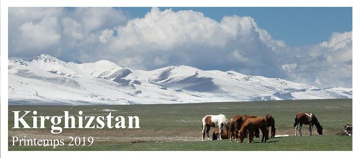
Ce 2ème voyage au Kirghizstan, 10 mois après le 1er, s’est décidé au dernier moment. Nous devions aller en Géorgie mais 1 semaine avant le départ Turkish Airlines nous annonce des modifications des horaires de vol, qui ne nous conviennent plus : j’annule tout et me replonge avec délices dans le Kirghizstan !
Le récit en images est là : CLIC Bonne lecture! Marie
Texte seul :
Préparatifs : Vols sur Turkish (Bâle Mulhouse-Istanbul-Bichkek) : 400 €/pers Location de voiture chez Travelland en espérant avoir une meilleure voiture que celle louée l’année dernière chez Travelexpert : 663 $ pour 12 jours+ 96$ pour la location de table + chaises de camping + 35$ de pick-up/drop off à l’aéroport + 3 cartouches de 230g de gaz à 8$ pièce. Nur guesthouse à Kochkor réservée pour le soir de notre arrivée (31$ dîner et petit-déjeuner inclus) Soluxe hôtel à Bichkek (comme la dernière fois) réservé pour la veille du retour 55 $ y compris dîner et petit-déjeuner. J’utilise comme la dernière fois la carte Gizimaps au 1/750000, télécharge les cartes offline de Maps.me et celles de wikiloc et gros bonus pour cette année, épluche en détail le tout nouveau guide de Overland aventure « Kirghizstan Tadjikistan » de Laurent Bendel et Cécile Miramont. Pour le reste nous improviserons en fonction de la météo et de l’enneigement. Vlad de Travelland et surtout Gulmira du CBT de Naryn me renseignent assez précisément à ce sujet. Je demande à Gulmira de m’établir des permis pour les zones frontalières avec la Chine : 30$/pers. pour les 3 zones : région du Pic Lénine, région du lac Kel Suu et du Torugart pass et extrême Est du pays au-delà de Karakol, 5 jours de délai, que nous récupérerons en passant à Naryn. Nous n’irons pas partout mais serons libres de décider au dernier moment… Côté matériel de camping, je rajoute simplement aux bagages prévus pour la Géorgie une couette double car nous dormirons souvent au-dessus de 3000 m. Pour plus de détails pratiques, se reporter au précédent carnet de voyage
Dimanche 26 mai 2019 arrivée à Bichkek, vers Kochkor Après une nuit dans l’avion (3h de vol de Bâle à Istanbul, 2h30 d’escale puis 6h jusqu’à Bichkek) nous débarquons pas très frais à Bichkek à 10h00 du matin. Retrait de cash à l’ATM (celui qui se situe à côté de la porte de sortie ne marche pas, il y en a d’autres �� 20 m en s’éloignant de la porte vers les escaliers), achat d’une carte SIM data chez Megacom dans l’aéroport (ça ne coûte que qq € pour 20 Go sur 2 semaines, le gars nous l’installe gentiment) puis récupération de la voiture : un Nissan Pathfinder de 2001, 400000 km, pas mieux que l’année dernière donc d’autant plus que les pneus sont des M+S (donc pas très typés tout-terrain) pas mal usés. Un compresseur (fil trop court pour la roue AR en diagonale par rapport à la batterie) et une sangle sont fournis. Nous payons en carte bancaire (5% de frais) afin de bénéficier de l’assurance que celle-ci nous fournit, même si une assurance assez complète est théoriquement incluse dans le prix de location (qui exclut cependant pneus et bris de glace) L’essence n’est pas chère, environ 0,50 €/l. La table et les chaises fournies sont en bon état mais très encombrantes si bien que le coffre ne suffit pas à contenir tout notre matériel, qui investit également la banquette arrière. Nous ne pourrons donc malheureusement pas prendre d’autostoppeurs, ce qui est bien dommage car les occasions ne manquent pas et on a souvent eu des scrupules dans des coins perdus où les voitures sont rares… Donc si vous êtes 4 ou si vous voulez rendre service et rencontrer facilement des kirghizes, demandez un coffre de toit ! Courses assez complètes de bouffe à Asia mall qui dispose d’un parking souterrain bien pratique (le supermarché est au RDC) puis nous prenons la route sous un ciel couvert en direction de Kochkor. Les prévisions météo sont assez bonnes pour la semaine qui s’annonce avec une nette dégradation à partir du week-end prochain : il s’agit donc d’en profiter dès demain ! Nous pique-niquons et faisons une bonne sieste (nuit dans l’avion + 4h de décalage horaire, heureusement que la route est facile) au bord d’une rivière, juste avant l’arrivée de la pluie qui nous accompagne ensuite jusqu’à Kochkor. Accueil sympathique, bon dîner et bonne nuit réparatrice ! Lundi 27 mai 2019 vers le Lac Son Kul Nous nous réveillons en pleine forme, il fait grand beau comme prévu ! Nous quittons Kochkor de bonne heure, irrésistiblement attirés par les paysages qui nous entourent. Ces mélanges de vertes prairies, badlands et sommets enneigés me ravissent autant que la 1ère fois ! C’est le printemps et la période de la transhumance. Nous allons dépasser plusieurs troupeaux de moutons, chèvres, vaches et chevaux en route vers les montagnes. Bergers et chiens font preuve d’une flegme total : c’est aux voitures de se débrouiller pour se faufiler ! La règle est de ne pas dissocier le troupeau en se faufilant sur le bas-côté, quand c’est possible…Le klaxon est sans autre effet que de défouler celui qui l’actionne (de toute façon le nôtre ne fonctionne pas…) Nous remontons la très belle vallée de la Tölök vers le col de Kalmak Ashuu (3446m) Au pied duquel gît est garé l’antique chasse-neige dévolu à ce col. La piste est bonne (je pense qu’à vélo c’est, des 4 cols permettant l’accès au Son Kul, le plus facile) Un troupeau de Dzos grimpe vers le col. Plus haut des chevaux, à la peine dans de profonds névés. Tous en en route vers les pâtures du Son Kul, une sorte de Terre Promise, qui se mérite ! Quand la vallée devient plus encaissée, les animaux rejoignent la piste, D’autant plus que la neige devient profonde. Juste après le passage de cette corniche, nous franchissons le col et découvrons le lac Son Kul. Ses berges ne sont plus enneigées et quelques troupeaux sont déjà arrivés. Certaines yourtes ont déjà pris leurs quartiers d’été, tandis que d’autres arrivent « en kit ». Nous déjeunons à l’est du lac près du pont sur la rivière Son Kul. Furtive rencontre avec un espagnol et son chien qui voyagent avec leur petit camping-car et sont restés bloqués ici pendant 2 jours par le mauvais temps. Nous avons de la chance ! Plus tard dans la journée nous verrons un autre camping-car : cette piste facile du Kalmak Ashuu leur permet de monter au lac sans trop de difficultés. Nous continuons notre tour du lac dans un sens horaire. En face quelques yourtes déjà installées sur la rive nord. Voici les pierres dressées découvertes l’année dernière. Un vautour inspecte notre drone (dont toutes les images sont floues, pb d’autofocus grrr !) Rive sud aussi, les yourtes poussent comme des champignons ! Nous grimpons sur une colline où selon un itinéraire wikiloc https://fr.wikiloc.com/itineraires-randonnee/llac-son-kul-i-petroglifs-19021736 nous devrions trouver des pétroglyphes… trop bien cachés pour nous ! Mais la vue est belle… Nous poursuivons vers l’ouest, alors que le ciel se charge de splendides cumulus. La piste se perd dans des prairies de plus en plus humides et nous faisons finalement demi-tour avant de rester embourbés… Revoilà les pierres. Quel étrange nuage en noir et blanc… Nous trouvons un joli coin pour la nuit au nord du lac près de la rivière Ak Tash. Il pleut partout sauf ici ! Nous sommes sans doute à plusieurs km du lac dont les rives marécageuses sont souvent assez inaccessibles. Superbe coucher de soleil ! Mardi 28 mai 2019 du lac Son Kul au lac Kel Suu Au réveil, tout est gelé après cette nuit claire mais le soleil réchauffe rapidement l’atmosphère… En montant vers le Kalmak Ashuu, nous rencontrons le troupeau de dzos qui a franchi le col durant la nuit. Nous n’avons vu personne le diriger, l’instinct sans doute transmis de génération en génération les pousse vers le Son Kul. On serre les fesses sur un insignifiant petit dévers au niveau du col, complètement verglacé… Nous redescendons dans la très jolie vallée, repassons près du village de Tölök. En voilà un qui attend les ascendances… Nous arrivons rapidement au CBT de Naryn où nous récupérons les permis. Gulmira nous informe que le col Arabel (près de la piste qui va de Barskoon à Kutor) est fermé. Bon à savoir. En route donc pour le lac Kel Suu, qui se situe dans la border-zone (mais nous avons les permis) au sud de la vallée de Ak Say. Ce lac magnifique quand il est en eau (voir google images) a la particularité de parfois se vider très rapidement. Il est réputé vide depuis plusieurs mois, mais le coin a tout de même l’air superbe et semble valoir le détour. Nous traversons le cimetière d’Ak Muz. A l’arrière-plan le massif At Bashi Kirka Tosuu dont nous allons faire le tour. Nous passons rapidement le check point près du col de Kindi Ashuu (3400 m), croisons quelques chameaux en plein mue printanière et découvrons au sud une autre chaîne de montagnes à la frontière chinoise. Nous plongeons dans la vallée jusqu’à la rivière Ak Say que nous longeons vers l’ouest. Son lit est encore parfois englacé. Partout, toujours, des chevaux… Nous prenons ensuite une piste qui file vers le sud, franchit un petit canyon partiellement gelé, remonte une vallée ponctuée de jolis blocs de granit rose et de plissés graphiques où batifolent d’innombrables marmottes. Enfin au terme d’une bonne piste (faisable avec une voiture normale ayant une bonne garde au sol) nous découvrons la belle vallée de la rivière Kel Suu et son petit hameau, que nous dépassons de quelques centaines de mètres pour y passer la nuit. Il est déjà 17h00 et nous nous mettons rapidement en route pour le lac via un joli sentier qui remonte la rivière en rive G (donc à l’ouest) Nous dérangeons quelques oies, passons la confluence de 2 rivières surveillée par cette jolie roulotte. Le lac est quelque part par là… Sans doute derrière ce verrou glaciaire où l’on distingue le zig-zag de la piste (une piste 4X4 mène au lac mais elle traverse la rivière puis des zones de prairie humide avant d’escalader ce verrou : donc pas facile et pas top pour l’environnement) Voilà le massif où se trouve le fameux lac. Un cavalier nous rattrape, nous échangeons quelques mots, chacun dans notre langue (…) puis il traverse la rivière vers son troupeau. Elle est fraîche ! Voici la seule zone plate propice au camping immédiatement en-dessous du verrou rocheux. Vue vers l’aval et les blocs déposés par l’ancien glacier. Surprise en arrivant au lac (3400 m, pff, pff) il n’est pas vide ! Pas vraiment plein non plus d’ailleurs… Réduit à l’état d’une modeste flaque (de 12 km de long tout de même !) de profondeur insuffisante pour générer cette irréelle couleur bleue qui fait la réputation du lac… Est-il en phase de remplissage ou de vidange ? Mystère ? En tout cas le torrent issu du lac coule de bon cœur, pas sûre que les eaux de pluie ou de fonte aient le dessus… Impossible de camper près du lac, c’est boue ou cailloux et en pente…et glacial ! Retour à la voiture en suivant un chemin de bétail, histoire de ne pas retraverser la rivière (on finit quand même les pieds mouillés !) https://fr.wikiloc.com/itineraires-randonnee/kel-suu-28-mai-37531031
La température baisse aussi vite que le soleil et il gèle quand nous arrivons à la voiture. 13 km A/R Nuit pénible (froid + altitude) Mercredi 29 mai Vallée de Ak Say, Chatyr Kul, Kulak Ashuu, Orto Sirt Tout est givré, gelé, congelé au réveil. Un bidon d’eau est percé (ces bidons souples de chez Déc sont vraiment merd…) Ciel limpide et soleil généreux qu’on apprécie au petit déjeuner ! On décolle très tôt car au CBT de Naryn on nous a expliqué que pour rejoindre le Torugart Pass, nous aurions à franchir un gros gué, difficile mais franchissable avant 10h du matin (ensuite, le débit augmente du fait de la fonte des neiges et glaciers) Nous retrouvons la vallée de l’Ak Say qui longe l’imposant massif de At Bashi Kirka. Pas la foule par ici… Sur les 100 km de piste jusqu’au Torugart Pass, nous allons croiser 1 voiture et 1 camionnette qui roulent ensemble. Ambiance désert des Tartares… 1 ou 2 villages +/- abandonnés. 1 ou 2 gués ludiques pour le plaisir de faire de jolies photos, puis nous arrivons vers 8h45 en vue du pont cassé (40°43'23.38"N 75°58'11.30"E)… (environ 2h depuis le lac Kel Suu) La piste alternative bifurque vers le lit de la rivière, nous la suivons, puis elle se sépare en traces de + en + ténues. Bref, à chacun de choisir le meilleur endroit pour traverser. A partir de là on se concentre, on serre les fesses (et les dents car l’eau est fraîche quand il s’agit de reconnaître le lit des méandres en crocs et petite culotte !) donc pas de photos (bien sûr on ne s’en rend compte qu’après quand l’adrénaline est retombée) Bien contents d’avoir déjà quelque expérience en matière de gué en Islande… Bref, c’est passé mais on n’était pas fiers… (environ 40°44'12.61"N 75°59'2.70"E)
C’est vraiment le seul passage délicat sur ce tour du massif y compris le détour vers le lac Kel Suu. On aurait apprécié d’être à 2 voitures (avec une sangle hein !) Encore 2h de piste jusqu’au Torugart Pass (3752 m). Les derniers 20 km sont monotones entre une clôture rouillée (border zone) et une ligne électrique. Du sel affleure à la surface, c’est un coin vraiment inhospitalier. Le Chatyr Kul est encore en partie gelé. Cet autre petit lac ne l’est plus. Passage du check point 1h plus loin avec un militaire qui s’ennuie et prend touuut son temps…mais sans problème. Un peu plus bas nous prenons la piste vers Baetov via le Kulak Ashuu. L’année dernière nous avions découvert une zone très tarabiscotée que la chaleur nous avait empêchés d’explorer. Cette fois il fait un temps idéal et après une pause pic nic, nous commençons à remonter le lit de la rivière. Bonne surprise, la fonte des dernières neiges alimente encore un petit ruisseau saisonnier. La vallée se rétrécit, et nous remontons un canyon de plus en plus étroit. Si étroit et ombragé que les derniers névés instables nous obligent à faire demi-tour après 2 km d’exploration ludique. https://fr.wikiloc.com/itineraires-randonnee/kulak-ashuu-teepees-29-mai-37531061
Retour à la voiture, au fond le massif dont nous avons fait le tour hier et ce matin. Nous reprenons la voiture et passons au sud du massif par le Kulak Ashuu, puis sur son flanc SO. Eclatante falaise rouge à l’entrée de la vallée du hameau de Orto Sirt. Nous allons poser la tente près de la source captée découverte l’année dernière (41°2'34.999" N 75°2'36" E) Visiteur du soir…quel dommage cette barrière de la langue… Un ultime rayon lumineux se faufile à travers le canyon de la Terek. Jeudi 30 mai 2019 Vers Baetov puis Tosor Ce matin les vaches ont remplacé les chevaux. Encore un petit déjeuner au soleil : en général les nuages se forment au fil de la journée puis la nuit purifie le ciel. L’année dernière nous avions bivouaqué quelques km après le début d’une très belle piste qui mène au Tuura Suu Ashuu (3257 m) : l’idée est d’emprunter celle-ci pour rejoindre Baetov plutôt que de prendre la piste « classique » qui passe par le Börülü Ashuu (3262 m) Cap à l’ouest donc en traversant la Terek. 1 km plus loin un bruit de casserole ou plutôt de pot d’échappement… Arrêt pour inspection qui confirme que la soudure à la sortie du pot est cassée. Par la même occasion on constate que le pneu avant gauche est presque à plat. Pff… Impossible de trouver le trou, c’est une crevaison lente. Normal avec ces pneus usés… On regonfle et on continue vers cette belle vallée. 500 m plus loin on trouve miraculeusement sur la piste de quoi faire une réparation provisoire : espérons que le caoutchouc ne fonde pas trop vite au contact du tuyau d’échappement brûlant. En tout cas ça marche : plus de clong-clong à chaque cahot. Nouveau contre-temps quelques km plus loin : un névé encombre le gué sur la rivière. Contournement laborieux… et inutile puisque 100 m plus loin 2 kirghizes juchés sur une hauteur nous font signe que la piste est impraticable plus loin et qu’il faut faire demi-tour. On n’insiste pas…cette piste est très peu fréquentée, et pour cause… Nous repassons donc par Orto Sirt et grimpons en direction du Börülü Ashuu : aucune difficulté par ce col. Voilà les badlands de Baetov et à l’arrière-plan on devine l’encoche dans les montagnes qui mène au Möldo Ashuu puis au lac Son Kul. On aperçoit la piste par laquelle j’avais prévu d’arriver à Baetov et le canyon de la Terek. Nous croisons un camion lourdement chargé en route vers les pâturages. Ici c’est beaucoup plus sec, ambiance « far west ». Pas ou peu d’arbres pour se chauffer : les crottes accumulées dans les enclos sont taillées en briquettes pour le chauffage. Pic nic près d’un vieux caravansérail. Un berger surveille ses moutons qui profitent du lit de la rivière, comme ces quelques arbres. Retour à la civilisation : on visite avec intérêt la décharge de Baetov, à la recherche de fil de fer pour réparer le pot d’échappement. Le caoutchouc tient le coup, mais pour combien de temps encore ? Les Lefèvre en vacances… (27 ans de mariage aujourd’hui, ça se fête !) Jolis paysages le long de la vallée de la Naryn que nous remontons vers l’est. Partout dans le pays, d’astucieux canaux d’irrigation dont beaucoup sont encore entretenus. Les cimetières sont pourtant parfois plus grands que les villages… Grand ménage de printemps ! Tapis et lourdes couvertures sèchent un peu partout ! Les lilas fanés chez nous depuis un mois déjà sont ici à leur apogée ! Quelques km avant Naryn, le clong réapparait… Nous profitons d’un « pont » spécialement prévu pour réparer sa voiture au bord de la route (il y en a régulièrement le long des grands axes, ce qui n’est pas du luxe compte-tenu de la vétusté du parc automobile) un peu au nord de Naryn, en direction de Kochkor, pour réparer cette fois définitivement le bazar, grâce à une tige métallique trouvée dans la décharge. Le soleil se couche alors que nous arrivons vers Tosor, sur la rive sud du lac Issyk Kul. Vendredi 31 mai 2019 Arabel Plateau, vallée de Juuku On a dormi au même endroit que l’année dernière. Le lac est à 1700 m d’altitude et on a eu presque un peu trop chaud ! Fred va payer 100 com soit 1,30 €/pers. (installations inexistantes mais jolie vue sur les montagnes de la rive sud puisque nous sommes sur une presqu’île. Nous sommes les seuls « clients » du « camping ».) tandis que je me balade un peu. La visibilité est bien meilleure qu’en plein été et les montagnes de la rive nord semblent toutes proches. Voici les montagnes où nous allons grimper vers la mine d’or de Kumtor. Plein d’essence à Tamga (la pompe de Barskoon est en panne d’électricité) où le pompiste a bien du mal à nous rendre la monnaie. Il faut payer d’avance mais je crois qu’en général les gens n’achètent que quelques litres à la fois et le gars est bien en peine dans ses calculs… Nous passons le check point où nous nous étions fait refouler l’année dernière (sans doute à cause d’un gros convoi de carburant) L’employé de la mine de Kumtor arrondit ses fins de mois en nous soutirant 100 com chacun de droit de passage, profitant de l’opportune absence momentanée de son collègue. Pas de reçu bien sûr… Excellente piste jusqu’au Barskoon Ashuu (3819 m), entretenue et ouverte toute l’année puisqu’elle mène jusqu’à la mine d’or de Kumtor. Elle grimpe à l’assaut d’une vallée très minérale, puis longe le lac Jashil Kul encore gelé, avant d’arriver sur le plateau d’Arabel, un vaste désert d’altitude, habité par quelques oies aux couleurs du paysage : blanc, ocre et noir. C’est d’ici que part la piste vers le col Arabel et beaucoup plus à l’ouest les sources chaudes de Jiluu Suu. Nous négligeons la piste qui part vers l’est et la mine et continuons plein sud vers le col Sök Ashuu (4024 m)
Une fois franchi ce col (un peu de neige verglacée sur qq mètres), la piste plonge vers le morne plateau de Kara Say, qui nous sépare du massif de Borkoldoy Kirka Tosuu (5060 m). Ce plateau est vraiment désolé et nous renonçons à poursuivre jusqu’au village de Kara Say puis Ak Shyrak car la piste nous semble, peut-être à tort, plutôt monotone. Nous remontons donc la vallée de la Taragay pour effectuer une boucle qui passe en vue de la mine de Kumtor avant de revenir sur la piste principale. Oies et marmottes s’accommodent fort bien de ce désert d’altitude, où nous pique niquons fraichement au pied de montagnes colorées d’allure volcanique, tandis que passe une voiture aux couleurs de la mine qui semble aller vers le village de Kara Say à plusieurs dizaines de km. Nous franchissons ce pont sur la Taragay, près duquel figure ce panneau (si quelqu’un peut traduire ?) tandis que le temps se gâte comme annoncé par la météo. Nous sommes irrésistiblement attirés par un énigmatique roché planté au milieu de la steppe. J’en fais le tour…rien…étonnant ! Je grimpe dessus, bingo ! Il y a plusieurs panels de pétroglyphes, humains et animaux. Le grain se rapproche ! Nous quittons le rocher et poursuivons vers le nord-est et la mine. Serait-ce le mont It-Tish (4808 ms, tien, tiens) ou le Karakol Chokusu qui devrait être plus au nord (5216 m) ? Voilà la mine, une sorte de Mordor avec ce temps… Nous rejoignons la piste qui mène à la mine et tournons vers l’ouest en direction de la piste principale. https://fr.wikiloc.com/itineraires-tout-terrain/kumtor-boucle-31-mai-37531054
Une voiture (tiens c’est la même…) nous dépasse puis nous la recroisons qq km plus loin qui repart vers la mine…je pense que nous étions surveillés… Voici sans doute la vallée qui mène au col de Juuku Ashuu d’où l’on peut à pied redescendre dans la vallée éponyme (il y a cependant une rivière d’un bon débit à traverser dès le départ) Quand nous arrivons à la bifurcation, nous essayons de parcourir le début de la piste qui mène au col Arabel, vite stoppés par un névé cerné de marécages ! Demi-tour, ce col est bel et bien infranchissable pour le moment… Sans doute ce panneau l’indique-t-il ?
Longue descente jusqu’aux rives du lac Issyk Kul puis nous embouquons la vallée suivante (celle de Juuku Suu), jolie vallée colorée, agricole et assez fréquentée (c’est vendredi en pays musulman) donc peu propice à un bivouac tranquille. On prend le temps de dénicher les tumulus décrits dans le guide de Cécile et Laurent, bien camouflés entre champs de sarrasin et arbres fruitiers. Puis nous allons chercher un coin de bivouac sur la péninsule située au nord de Kizil Suu. Cette jolie pinède fera parfaitement l’affaire, avec vue sur les montagnes où nous étions aujourd’hui. Samedi 1er juin 2019 Jeti Ogüz, Karakol De la pluie est annoncée pour la fin de la nuit prochaine et la journée de demain. C’est vers Karakol qu’il fera le moins moche : je réserve donc une chambre pour ce soir au Hillside Karakol Boutique Hotel (41 $). Demain sera une journée de transition pour retourner vers l’ouest mais nous irons de bonne heure voir le marché aux bestiaux qui se tient tous les dimanches dans cette ville. Karakol et ses environs sont assez touristiques, je dois dire que c’est la météo qui nous a poussés par là…finalement comme nous sommes avant la haute saison, nous serons très tranquilles partout et je dois dire qu’il est assez confortable de rencontrer enfin quelques interlocuteurs qui parlent anglais. La ville et la région ne nous ont cependant pas émerveillés, mais peut-être est-ce en partie du à la météo grisouille. Contre toute attente, on se lève avec du soleil, bonne surprise ! En route vers la vallée de Jeti Ogüz, fleuron du tourisme kirghize, dont le principal atout est sa proximité avec la ville de Karakol. Nombreux camions d’apiculteurs en bas de la vallée, puis village touristique fait de bric et de broc (de la yourte au vieux sanatorium défraîchi de l’époque soviétique en passant par la cabane en tôle et la maison en panneaux de particules, le tout saupoudré de tristes chevaux qui attendent le touriste et de quelques alcooliques qui titubent déjà ou encore dès 8h du matin) près des fameuses falaises rouges. Puis la piste grimpe dans la vallée, somme toute assez banale (par rapport aux splendeurs du reste du pays hein ! Dans l’absolu c’est pas moche) et se termine près de quelques cabanes et yourtes destinés à l’hébergement touristique. Nous sommes à peine descendus de la voiture qu’on nous propose de poser avec un pauvre aigle ficelé et de nous guider jusqu’à la cascade (sans insistance) Le sentier, évident, passe dans une prairie parsemée de yourtes, stand de tir, guinguettes, épiceries et mène en 1,5 km jusqu’à la fameuse cascade. Peu de fleurs encore dans la Vallée des Fleurs… https://fr.wikiloc.com/itineraires-randonnee/jeti-oguz-waterfall-37531049 Nous reprenons la voiture et trouvons un coin un peu à l’écart de la piste (assez fréquentée, c’est dimanche) pour pique-niquer. Puis on se laisse tenter par la piste qui monte au-dessus du village de Jeti-Ogüz (à l’est), qui offre un beau point de vue sur le village et les falaises et mène ensuite à de beaux alpages fleuris. Nous espérions pouvoir rejoindre Karakol par là mais la piste se dilue dans les prairies et nous finissons par faire demi-tour. Joli coin ! Check in à notre hôtel de Karakol, sympa, tout neuf, déco typée sport d’hiver (Karakol attire pas mal de skieurs en hiver), une bonne douche (il fait de + en + lourd) puis nous allons faire un tour en ville. Eglise russe Mosquée Dungan Quelques parcs publics toujours décorés de sculptures monumentâles ! La ville ne nous a vraiment pas emballés et comme il semble que partout dans les restos l’attente soit interminable, on se contente de se faire livrer des (bonnes) pizzas à l’hôtel. Notre hôtelier nous indique où se trouve le marché aux bestiaux où nous irons demain à l’aube (42°30'29.61"N 78°22'38.80"E) avant de revenir prendre notre petit-déjeuner. Petit orage en soirée qui rafraichit un peu l’atmosphère… Dimanche 02 juin 2019 Karakol et son marché aux bestiaux Nous sommes accueillis par une bonne averse en arrivant au marché peu avant 6h. Quelques retardataires arrivent encore mais le gros de la troupe est déjà là. Il y a le coin des moutons, celui des vaches et taureaux (gare, ça se chamaille parfois brutalement) et celui des chevaux où les cavaliers essaient leurs futures montures. Pas de souci en cas d’achat impulsif, on trouve tout ce qu’il faut pour harnacher son animal et repartir avec. Un sprinter sinon rien ! Bon il y a quelques exceptions… Le b…l est finalement assez bien organisé. Ça marchande paisiblement. Peu de femmes, Quelques enfants… Une élégante… Passage chez le « pédicure » (quels étranges fers, je pense conçus pour éviter de glisser dans les prairies humides) Nous quittons le marché vers 9h00 alors que l’activité commence à décroître. Je me demande bien à quoi « servent » ces milliers (millions ?) de chevaux qu’on voit partout à travers le pays ? Je pense qu’ils sont là pour le plaisir ou l’ego de leurs propriétaires, comme certains chez nous accumulent vêtements, meubles, bijoux ou voitures. Le K est un vrai pays de cocagne pour les herbivores qui se multiplient et se nourrissent sans difficulté. Certains endroits semblent tout de même à la limite du surpâturage (on ne peut s’empêcher de penser à la Mongolie, « désertifiée » par son bétail, moins arrosée cependant) Retour à l’hôtel, douche (grâce à la pluie on n’a pas bouffé trop de poussière sur le marché), puis très bon petit déjeuner avant de prendre la route vers Kochkor. Voilà à quoi ressemble une aire de repos au Kirghizstan : de quoi requinquer hommes et mécanique ! Petit détour vers un lac salé situé vers l’extrémité ouest du lac Issyk Kul, sur sa rive sud. On y accède par une piste qui longe une étonnante vallée fertile au milieu d’une zone de badlands. Juste avant le lac, une barrière gardée par 3 zigotos désœuvrés, qui nous demandent d’abord 800 com (10 €) par personne, ramenés à 240 en tout quand nous commençons à faire demi-tour(…) Lac tristounet avec cette lumière. Quelques canards et d’innombrables hirondelles égaient l’atmosphère… Drôle de plantes (ce ne sont pas des cactus) le long de la piste. Si quelqu’un connait leur nom ? A Kochkor, le CBT nous informe que la piste du Karakol Pass est fermée, si bien que nous décidons de passer par le Kyzyl Art Pass. Après quelques courses (A cette époque, on trouve facilement un peu partout fraises, cerises et abricots délicieux et « donnés »), nous remontons une belle vallée fertile, hélas gâchée sur son flanc sud par une ligne à haute tension. Nous trouvons un coin de bivouac au nord de la route, avec une jolie vue. Une femme et deux jeunes enfants regagnent juste avant la nuit la ferme située en contrebas. Encore un petit orage ce soir puis le vent tombe. Lundi 03 juin 2019 Vallées de la Kokomeren et de la Karakol Au réveil, le pneu avant droit est dégonflé, ce qui est « normal » (on le regonfle tous les matins depuis qq jours) mais le pneu arrière gauche est complètement à plat. Après regonflage, on constate que la valve n’est plus étanche, même après nettoyage… Kochkor est à 50 km de bonne route : allons-y ! On y a remarqué la veille plusieurs réparateurs de pneus. On choisit le plus « chic » : un container bien rangé et propre. En moins de 10 mn, chronomètre en main, le gars démonte la roue, le pneu, trifouille la valve, regonfle et remonte le tout, pour 100 com (1,20 €) ! On se doute qu’à ce prix il n’a pas du changer la valve (qu’il ne doit de toute façon pas avoir en stock) Nous voilà repartis vers le Kizil Art Pass ou Kizart Ashuusu (2664 m, d’où un trek « classique » mène en 2 jours/30 km à la rive nord du lac Son Kul) A l’occasion d’une petite pause, on se rend compte que le pneu est partiellement dégonflé, flûte ! On regonfle et on repart… Nous poursuivons ensuite vers Chaek (la nouvelle route en construction entre Kazarman et Balikchy arrive jusqu’ici, depuis l’ouest donc) puis goudron jusqu’à Aral (nouvelle pompe toute neuve, Kazarman est indiqué à 92 km) et ensuite sur encore une vingtaine de km vers Kizil Korgon et au-delà vers l’ouest. Pic nic au bord de la Kokomeren (là où nous avions bivouaqué la dernière fois 41°43'1.72"N 74° 7'58.01"E) Puis nous continuons sur la route (goudronnée et déserte) puis la piste (bonne et fréquentée par des engins de chantier) jusqu’à la confluence entre Kokomeren et Naryn. Ce coin est superbe et je pense que la piste jusqu’à Kazarman doit l’être aussi, mais faute de temps nous n’irons pas jusque là) Un p’tit coup de gonflage, puis retour vers l’est jusqu’à la confluence entre Jumgal et Kokomeren, plein d’essence à Aral, puis plein nord dans les gorges de la Kokomeren. Une dizaine de km avant Suusamyr, nous prenons à droite vers le col de Karakol (celui annoncé fermé par le CBT de Kochkor) C’est une ample vallée glaciaire et comme nous sommes au NO du pays, elle est exposée aux dépressions venues de l’ouest, très arrosée, très verte et très fleurie ! Le bas de la vallée, très fertile, profite à quelques fermes tandis que les yourtes se cantonnent aux alpages. C’est un festival de couleurs, bienvenues pour éclaircir un ciel menaçant ! Coin de bivouac idéal au milieu des fleurs ! Bonne pluie de printemps en soirée…on entend l’herbe pousser ! Mardi 04 Juin 2019 lac de Toktogul et environs Les conditions sont idéales pour réparer le pneu AR D : il y a une zone d’eau calme dans notre petit torrent de montagne qui nous permet de trouver la fuite… C’est un petit trou bien sympathique que Fred répare en 2 temps 3 mouvements. Soulagés, nous redescendons un peu la vallée avant de prendre une piste qui grimpe sur un plateau surplombant la rivière. Ici encore, yourtes, troupeaux et même quelques champs cultivés. Il reste même du foin en fin d’hiver ! Nous consultons à nouveau la météo afin d’optimiser ces 2 derniers jours avant l’avion du retour (il y a un bon réseau à la grosse station Gasprom dans la vallée de Suusamyr) En route vers le lac de Toktogul, où le soleil devrait être un peu plus présent qu’ailleurs. Pour le moment nous essuyons un beau grain dans la vallée de Suusamyr, et il nous faut attendre d’avoir franchi le col Alabel Ashuu (3184 m) pour profiter d’une accalmie pour une pause pic nic (pas dans le coin le plus glamour !) Après avoir rechargé cambuse, réservoir et porte-monnaie à Toktogul, suivant les indications du guide de Cécile et Laurent, nous prenons la route qui mène à l’ouest vers Terek Suu puis la piste qui continue au-delà vers le sud-ouest. Petit détour jusqu’aux rives du lac Toktogul dont les badlands sont d’un vert printannier alors que la chaleur déjà estivale pousse les garçons à la baignade, tandis que les filles se promènent de leur côté. Très jolie vallée ponctuée de villages blottis entre d’imposantes falaises dorées et une vivifiante rivière dont les eaux astucieusement dirigées irriguent petites parcelles et jardinets. Ici à 1000 m d’altitude, la vie semble plus douce qu’ailleurs au K… Nous sommes étonnés de voir ici comme ailleurs, des enfants de tous âges, nombreux, qui jouent dehors à toute heure. On se demande quand ils vont à l’école ? Le pays est pourtant réputé avoir un excellent taux d’alphabétisation… reliquat de l’époque soviétique ? Cela va-t-il durer ? Nous suivons la piste qui grimpe dans la montagne et se perd dans des nuages de pluie : demi-tour pour retrouver le soleil de la plaine et un joli bivouac au bord du canyon qui abrite une véritable oasis de fraicheur et où résonnent d’étranges et mélodieux cris d’oiseaux inconnus. Mercredi 05 Juin 2019 vers Talas et le lac de Besh Tash Nuit un peu chaude, grand ciel bleu au réveil. C’est aussi l’heure du petit déjeuner pour ce rapace qui vient de nourrir son petit… L’oasis en contrebas résonne de chants matinaux. Nous retrouvons la piste qui longe les jolies falaises, puis de ferme en ferme nous rapprochons du lac Toktogul. Le village de Chon-Aryk si harmonieux de loin nous donne envie de le visiter. De près même s’il y a quelques jolies maisons, nous constatons comme en beaucoup d’endroits que les rues sont bordées de portails préservant l’intimité des habitants (ça nous rappelle la Mongolie, dans une moindre mesure toutefois) Nous longeons à nouveau le lac et ses vertes collines et à peine 2h plus tard retrouvons la neige au col Alabel (3184 m). Encore 1h et nous filons slalomons entre les troupeaux dans la vallée de Talas, très agricole, où se succèdent les villages. Nous tournons juste avant la ville vers la piste qui mène au lac Besh Tash, traversons une petite zone aride avant de grimper dans une vallée très verte. Petit péage (220 com/personne, prix affiché) puis arrêt pic nic arrosé de qq gouttes de pluie. Ce massif d’Ala Too est très arrosé et la végétation en profite ! Nous croisons une unique voiture qui quitte le lac alors que nous y arrivons, cool. Il faut marcher un peu (dans des éboulis mais sentier bien tracé) pour découvrir un 1er petit lac puis une éclaircie miraculeuse nous accueille alors que nous arrivons en vue du grand lac. Bien sûr on en profite et on continue vers l’extrémité est de celui-ci. Pas de pétroglyphes sur ce gros bloc de granit ! Plus loin un cercle de pierres, sans doute destiné à contenir le bétail. Belle vallée d’altitude (le lac est à 3000 m) Fin de l’éclaircie, on retourne en vitesse à la voiture quand la pluie arrive. En fait les grains se succèdent en remontant la vallée et entre 2 averses, irrésistiblement attirés par une jolie proéminence qui surplombe la rivière, nous décidons de rester là cette nuit et installons le bivouac. Je remarque alors plusieurs tas de cailloux d’aspect peu naturel. Il s’avère qu’en des temps plus anciens, d’autres hommes ont été charmés par l’endroit et ont sans doute décidé d’y inhumer leurs proches. Ça nous fait tout drôle de penser qu’à des centaines (?) d’années d’intervalle, nous ayons eu la même perception de la « magie » de l’endroit. (42°12'38" N 72°27'57" E) En fin de soirée, le temps se dégrade pour de bon alors que l’orage gronde dans la vallée…ambiance… Jeudi 06 juin 2019 retour sur Bichkek Journée annoncée comme pourrie et ça se confirme. Il pleut quand on remballe la tente. Il pleut dans la vallée de Talas alors que nous devons dépasser au bas mot une trentaine de troupeaux qui montent vers les alpages. Il neige au passage des cols. Petite accalmie en arrivant dans la plaine de Bichkek : pic nic et séchage de tente, préparation des sacs pour l’avion. Route entre Kara Balta et Bichkek toujours aussi pénible : trafic et travaux (le tout sans klaxon donc attention et vigilance redoublées !) Chaleur orageuse étouffante, poussière, gaz d’échappement (les camions Kamaz sont une calamité !) tandis que la clim déjà pas vaillante depuis le départ est définitivement HS ! On arrive vers 16h à l’hôtel Soluxe où on commande notre dîner, puis Fred va faire laver la voiture. Petit orage en soirée et bon dîner à l’hôtel. Vendredi 07 Juin Fin du voyage Restitution de la voiture sans problème (et sans excuses de la part de Travelland qui n’a plus donné signe de vie depuis l’envoi des photos du pot d’échappement, malgré un mail pour lui signaler la panne du klaxon et un autre pour celle de la clim. Beaucoup plus prolixe pourtant avant la location…mais bon la voiture nous a menés à bon port sans problème majeur, relativisons…) En conclusion, enchantés de ce 2ème voyage au Kirghistan, décidé 1 semaine avant le départ. J’ai manqué de temps pour préparer plus de randonnées : pas facile d’improviser des randos de quelques heures dans des paysages si vastes où le regard embrasse des dizaines de km d’un coup ! On a trouvé les contacts avec les Kirghizes plus chaleureux la dernière fois alors que nous étions en famille avec nos 2 filles. Effet famille ? Période du ramadan ? Période de transhumance ? Ravis en tout cas d’avoir découvert le pays au printemps, d’autant que nous n’avons pas trop été gênés par la neige. Seuls le col Arabel et celui de la vallée de Karakol (à l’est de Suusamyr) étaient fermés (et j’ai un petit doute pour celui de Karakol, on n’a pas vérifié…) Peut-être avons-nous eu la chance de venir après un hiver peu enneigé, je ne sais pas ? On a essayé de composer avec la météo, en profitant à fond des 1ers jours de beau temps puis en nous adaptant à la recherche du beau temps. C’est finalement assez faisable car les distances ne sont pas énormes et certaines routes tout-à-fait roulantes.
In Search of Warmth in California, Utah, and Arizona in February
It all started last December, after another price alert from Gilou for United/Lufthansa flights at 250 € from Paris to San Francisco. Meanwhile, I was planning to spend a week alone with our three kids (Maxime, 14, Rachel, 12, and Timéo, 8) somewhere in France for the February break.
But this time, Gilou really outdid himself—way too tempting! 😮 His great tip worked for both the February and Easter breaks. I know April is the ideal month, especially if you love hiking! But for family reasons, only February would work for us.
Isn’t February a month to avoid for the Southwest? To keep our summer trip budget intact, I was thinking of camping as much as possible. After checking weather sites for temperature histories in key spots (Furnace Creek, Saint George, Page, Sedona), nighttime temps over the past two years ranged from +5 to -2°C. So, it seemed doable...
I started discussing (aka negotiating, even begging) with my better half. The kids caught on fast that there was a chance we’d go, and they were thrilled! She finally gave her consent to make the kids happy 😎. I quickly checked that our ESTAs were still valid, and 48 hours later, I had the tickets in hand 😎😎. But five days later, Laetitia changed her mind—her "Yes" turned back into a "No." No way were we going without her to her favorite country!!
Damn it 🤪! I had to tell her I’d already bought the four tickets (without bringing it up again, of course—a "Yes" is a "Yes," right?). And since the tickets were non-refundable, there was no going back... Apparently, with women, some "Yeses" mean *really* yes, but others mean, "I said yes in principle, but I wasn’t actually on board—and I never thought you’d have the nerve to buy the tickets without telling me!!" I had no idea 🤪!
Us guys? We’re way more straightforward—binary, even monetary... Yes means yes! And no can mean yes too 😏!! Anyway, in a lovely family atmosphere, I opened a thread to start planning and thanked Trois14 and Bluemesa for their help. On Trois14’s advice, I booked 5 nights in motels around St. George-Page at super tempting rates—around $35-40 a night...
On that note, Christmas cost me an arm and a leg... Gotta try to make up for it 😛!
Here’s the theoretical itinerary:
Death Valley (2 days) Valley of Fire The White Dome (hike up and down via Squirrel Canyon) 4 nights in the Kanab-Page area Sedona (2 days) Route 66 Alabama Hills / Trona Pinnacles Drive back to SFO via Highway 1
That’s the plan, at least...
In reality, it turned into a whole different story. I learned that in February, you’ve got to be flexible—*very* flexible sometimes—to dodge the weather. Halfway through, a cold snap made our second week (planned 100% camping) impossible, completely upending the itinerary.
So, a huge thanks to PapJ59, Noyellebis, and especially Caribou44 and Simonic. 🙂 A thousand thanks for your quick responses, availability, and sound advice, which let us have an original and unforgettable second week—Organ Pipe Cactus NM, Yuma, Salvation Mountain, Anza Borrego SP, a palm grove in Joshua Tree, then back to SFO!! Without you, we’d have been miserable on the spot, but instead... 😇
A big shout-out to Thibaut and his famous blog (rightfully praised on VF—it’s one of the few that details Organ Pipe), to travel journal writers for inspiration in general, and to those who helped me prep or during the trip (journals by Pong, Hiacinthe, Zitounet, and Laetitia).
Now, for the story...
But this time, Gilou really outdid himself—way too tempting! 😮 His great tip worked for both the February and Easter breaks. I know April is the ideal month, especially if you love hiking! But for family reasons, only February would work for us.
Isn’t February a month to avoid for the Southwest? To keep our summer trip budget intact, I was thinking of camping as much as possible. After checking weather sites for temperature histories in key spots (Furnace Creek, Saint George, Page, Sedona), nighttime temps over the past two years ranged from +5 to -2°C. So, it seemed doable...
I started discussing (aka negotiating, even begging) with my better half. The kids caught on fast that there was a chance we’d go, and they were thrilled! She finally gave her consent to make the kids happy 😎. I quickly checked that our ESTAs were still valid, and 48 hours later, I had the tickets in hand 😎😎. But five days later, Laetitia changed her mind—her "Yes" turned back into a "No." No way were we going without her to her favorite country!!
Damn it 🤪! I had to tell her I’d already bought the four tickets (without bringing it up again, of course—a "Yes" is a "Yes," right?). And since the tickets were non-refundable, there was no going back... Apparently, with women, some "Yeses" mean *really* yes, but others mean, "I said yes in principle, but I wasn’t actually on board—and I never thought you’d have the nerve to buy the tickets without telling me!!" I had no idea 🤪!
Us guys? We’re way more straightforward—binary, even monetary... Yes means yes! And no can mean yes too 😏!! Anyway, in a lovely family atmosphere, I opened a thread to start planning and thanked Trois14 and Bluemesa for their help. On Trois14’s advice, I booked 5 nights in motels around St. George-Page at super tempting rates—around $35-40 a night...
On that note, Christmas cost me an arm and a leg... Gotta try to make up for it 😛!
Here’s the theoretical itinerary:
Death Valley (2 days) Valley of Fire The White Dome (hike up and down via Squirrel Canyon) 4 nights in the Kanab-Page area Sedona (2 days) Route 66 Alabama Hills / Trona Pinnacles Drive back to SFO via Highway 1
That’s the plan, at least...
In reality, it turned into a whole different story. I learned that in February, you’ve got to be flexible—*very* flexible sometimes—to dodge the weather. Halfway through, a cold snap made our second week (planned 100% camping) impossible, completely upending the itinerary.
So, a huge thanks to PapJ59, Noyellebis, and especially Caribou44 and Simonic. 🙂 A thousand thanks for your quick responses, availability, and sound advice, which let us have an original and unforgettable second week—Organ Pipe Cactus NM, Yuma, Salvation Mountain, Anza Borrego SP, a palm grove in Joshua Tree, then back to SFO!! Without you, we’d have been miserable on the spot, but instead... 😇
A big shout-out to Thibaut and his famous blog (rightfully praised on VF—it’s one of the few that details Organ Pipe), to travel journal writers for inspiration in general, and to those who helped me prep or during the trip (journals by Pong, Hiacinthe, Zitounet, and Laetitia).
Now, for the story...
Alaska et Yukon 2018: récit, impressions et conseils
Encore une fois, c’est devenu une habitude, j’ai mis beaucoup de temps à venir à bout de mon carnet de voyage… Mais voici, finalement, le récit du périple que j’ai effectué en Alaska avec ma copine de la fin mai à la mi-juin 2018. Au menu : les forêts, montagnes et glaciers de la péninsule de Kenai, la pluvieuse Valdez, une incursion du côté du Yukon et du nord de la Panhandle (Haines), le bled de Chicken (pourquoi pas?), l’incontournable Denali National Park, la région de Palmer et des animaux sauvages à la pelle. J’espère que le tout s’avèrera utile pour celles et ceux qui envisagent d’aller faire un tour dans ces contrées lointaines!
Avion : Vol Montréal / Anchorage réservé via Expedia. Escales à Vancouver à l’aller, à Chicago au retour.
Voiture : 659$ US (865$ CAN / 579 euros). Prise de possession et retour à l’aéroport international d’Anchorage. Réservée chez Enterprise via Costco Voyages. Excellent service. Ayant opté pour un véhicule de catégorie SUV intermédiaire, j’ai eu droit à un Subaru 4x4 Forester spacieux et… énergivore. À bien y penser, un tel véhicule est trop grand pour 2 personnes et coûte cher à la pompe. La fonction 4x4 s’avère quant à elle superflue, considérant l’interdiction d’emprunter les gravel roads. Si vous restez sur les principaux axes routiers une berline bien normale, voire compacte, suffit amplement.
Objectif du voyage : Randonnée pédestre (principalement), photographie et observation de la faune (si la chance nous sourit, et ce sera le cas !).
JOUR 1 : Montréal / Anchorage
Nous avons décidé de dormir à Anchorage, ville qui présente à première vue peu d’intérêt, simplement pour récupérer du voyage, faire le plein de victuailles et acheter quelques trucs à bon prix (glacière, blocs réfrigérants, chasse-moustiques, etc.).
Dodo (1 nuit): My Place Hotel, situé dans un quartier assez glauque de la ville (nombreux itinérants dans le parking). Chambre à la propreté irréprochable cependant, avec cuisinette sans ustensile… Pas très pratique…
https://www.myplacehotels.com/my-place-hotel-anchorage-ak
JOUR 2 : Anchorage / Hope (143 km)
Direction Hope par la Seward Highway. Dès la sortie d’Anchorage, la route longe les montagnes et le Turnagain Arm et, à chaque détour, les points de vue se révèlent époustouflants.
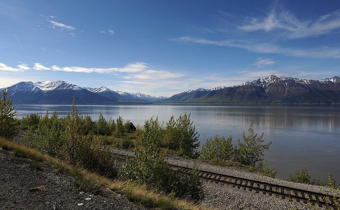
Arrivée en après-midi à Hope, un bled quasi-fantôme de moins de 200 habitants ayant connu de meilleurs jours à l’époque de la ruée vers l’or. L’ensemble possède néanmoins un côté pionnier fort sympathique.
Il y a quelques possibilités de randos aux alentours du village et les gens du coin nous avisent d’être vigilants sur les sentiers : les ours noirs et les grizzlys sont nombreux. Nous optons, non sans quelques appréhensions, pour le sentier menant à Hope Point, qui offre un panorama superbe sur les deux rives du Turnagain Arm. Une belle entrée en matière !
Dodo (1 nuit) : Black Bear B n’ B. Confortable petite maison, très bien équipée. Décor sur le thème de l’ours. La propriétaire, Maggie, est une hôtesse formidable qui connaît bien la région. Elle nous a gracieusement offert une bombonne de bear spray(répulsif anti-ours) ! Je recommande vivement.
http://www.alaskablackbearbnb.com/
JOUR 3 : Hope / Homer (269 km)
Il n’y a pas beaucoup à dire sur la Sterling Highway qui mène à Homer sinon qu’elle est nettement moins spectaculaire que les autres highways d’Alaska, à l’exception peut-être de la descente finale vers Homer.
Petite virée en fin de journée sur le Homer Spit, cette langue de terre bordée de commerces qui s’avance dans la Kachemak Bay et qui fait également office de port. Certes, l’endroit est touristique, mais le décor est époustouflant.
C’est également là que vous trouverez les différents bateaux-taxi (onéreux) qui vous permettront de partir à l’exploration de la baie et du Kachemak Bay State Park. C’est justement le plan pour le lendemain.
Dodo (2 nuits) : Tiny House(location dispo via Booking, VRBO, HomeAway ou AirBnB). Petite maison (comme son nom l’indique) située dans les hauteurs de Homer. Assez bien équipée, patio très agréable avec BBQ et vue les montagnes. Le proprio est très sympa, il nous a même offert une bouteille de vin en guise de bienvenue ! L’étroite « chambre » située dans les combles, accessible via une échelle mobile, ne sera pas au goût de tous…
JOUR 4 : Homer
Direction le Homer Spit pour y prendre un bateau taxi qui nous amènera de l’autre côté de la Kachemak Bay. Objectif : le sentier de Glacier Lake jusqu’au glacier Grewingk, avec retour via la Saddle Trail (et détour via le Alpine Ridge). Le bateau nous dépose au début du sentier Glacier et nous reprendra en fin de journée à la fin de la Saddle Trail. Très pratique, car ça évite de randonner en aller-retour. Quel sentiment étrange (et grisant !) que de se retrouver en pleine nature, au milieu de la forêt et des montagnes, sans possibilité de retour avant plusieurs heures!
Les sentiers qui mènent au glacier (tant le Glacier Lake que la Saddle), ne sont pas des plus spectaculaires. Le lac glaciaire dans lequel se déverse le glacier Grewingk, par contre, vaut à lui seul la randonnée et les dollars investis pour le bateau-taxi. Pour ce qui est du Alpine Ridge, nous avons manqué de temps pour le compléter. Le sentier, assez rustique, était assez boueux en cette fin de printemps. Boue qui nous a toutefois permis de constater des traces fraîches d’ours ! Gloups…
JOUR 5 : Homer / Seward (270 km)
Journée de route tranquille vers Seward. La Seward Highway est nettement plus spectaculaire que la Sterling et la « ville » de Seward en tant que telle, à défaut d’être jolie, est nichée dans un décor magnifique au creux de la Resurrection Bay et des montagnes qui l’enserrent.
Nous nous rendons vers les bureaux de Major Marine et de Kenai Fjords Tours pour obtenir des renseignements sur les excursions en bateau dans le Kenai National Park. Comme ça a l’air un peu l’usine (gros bateaux de 200 passagers), nous décidons de nous payer un luxe : une excursion avec le Alaska Saltwater Lodge, dont les bateaux accueillent une douzaine de passagers, que nous réserverons par téléphone pour le lendemain.
Petit détour en fin de journée vers le Exit Glacier. Le retrait de ce dernier au cours des dernières décennies est impressionnant… et inquiétant… et déprimant… En fait, il n’y a presque plus rien à voir à partir du sentier officiel, à moins d’emprunter celui, plus abrupt, qui mène au Harding Icefield. Mais ça, ça sera pour le surlendemain !
Dodo (3 nuits) : Abode Well Cabins. Cabine correcte, sans plus, située sur la route menant au Exit Glacier et au Harding Icefield (donc un peu excentrée). Légèrement défraîchie et peu équipée (micro-ondes, petit frigo, cafetière). Prix correct. Laveuse-sécheuse dispo pour pas cher.
https://ididaride.com/cabins/
JOUR 6 : Seward
Réveil au petit matin pour l’excursion en bateau. Arrivés au point de rendez-vous, nous donnons nos noms au capitaine et propriétaire du bateau. À son visage ahuri alors qu’il consulte son calepin, nous constatons qu’il y a un problème. Et de fait, sa femme à qui nous avons parlé la veille a pris la réservation sans réaliser que le bateau était déjà plein ! Un gros bravo. Le capitaine ne nous propose rien de plus que de plates excuses, jusqu’à ce que l’un de ses employés suggère d’aller voir si Northern Latitude Adventure aurait de place pour nous. La démarche s’avère positive et nous avons finalement droit à un tour plus dispendieux, sur un petit bateau pouvant accueillir un maximum de 6 personnes (nous serons 4) ! Je conseille vivement.
https://northernlatitudeadventures.com
Le capitaine-propriétaire est fort sympathique et, comme c’était sa première sortie de la saison, ils nous propose l’approche des glaciers Alalik et Holgate (normalement c’est seulement un des deux). La journée est magnifiquement ensoleillée et le reflet des montagnes dans la baie est hypnotique. Durant l’excursion d’une durée de plus de 8 heures, nous verrons des baleines à bosses, des orques, des loutres de mers, un ours noir et des mouflons de Dall accrochés aux parois rocheuses. Bref, la totale.
Avis à celles et ceux qui ont le mal de mer : le golfe d’Alaska, ça brasse pas mal ! J’en ai fait les frais…
Avion : Vol Montréal / Anchorage réservé via Expedia. Escales à Vancouver à l’aller, à Chicago au retour.
Voiture : 659$ US (865$ CAN / 579 euros). Prise de possession et retour à l’aéroport international d’Anchorage. Réservée chez Enterprise via Costco Voyages. Excellent service. Ayant opté pour un véhicule de catégorie SUV intermédiaire, j’ai eu droit à un Subaru 4x4 Forester spacieux et… énergivore. À bien y penser, un tel véhicule est trop grand pour 2 personnes et coûte cher à la pompe. La fonction 4x4 s’avère quant à elle superflue, considérant l’interdiction d’emprunter les gravel roads. Si vous restez sur les principaux axes routiers une berline bien normale, voire compacte, suffit amplement.
Objectif du voyage : Randonnée pédestre (principalement), photographie et observation de la faune (si la chance nous sourit, et ce sera le cas !).
JOUR 1 : Montréal / Anchorage
Nous avons décidé de dormir à Anchorage, ville qui présente à première vue peu d’intérêt, simplement pour récupérer du voyage, faire le plein de victuailles et acheter quelques trucs à bon prix (glacière, blocs réfrigérants, chasse-moustiques, etc.).
Dodo (1 nuit): My Place Hotel, situé dans un quartier assez glauque de la ville (nombreux itinérants dans le parking). Chambre à la propreté irréprochable cependant, avec cuisinette sans ustensile… Pas très pratique…
https://www.myplacehotels.com/my-place-hotel-anchorage-ak
JOUR 2 : Anchorage / Hope (143 km)
Direction Hope par la Seward Highway. Dès la sortie d’Anchorage, la route longe les montagnes et le Turnagain Arm et, à chaque détour, les points de vue se révèlent époustouflants.
Arrivée en après-midi à Hope, un bled quasi-fantôme de moins de 200 habitants ayant connu de meilleurs jours à l’époque de la ruée vers l’or. L’ensemble possède néanmoins un côté pionnier fort sympathique.
Il y a quelques possibilités de randos aux alentours du village et les gens du coin nous avisent d’être vigilants sur les sentiers : les ours noirs et les grizzlys sont nombreux. Nous optons, non sans quelques appréhensions, pour le sentier menant à Hope Point, qui offre un panorama superbe sur les deux rives du Turnagain Arm. Une belle entrée en matière !
Dodo (1 nuit) : Black Bear B n’ B. Confortable petite maison, très bien équipée. Décor sur le thème de l’ours. La propriétaire, Maggie, est une hôtesse formidable qui connaît bien la région. Elle nous a gracieusement offert une bombonne de bear spray(répulsif anti-ours) ! Je recommande vivement.
http://www.alaskablackbearbnb.com/
JOUR 3 : Hope / Homer (269 km)
Il n’y a pas beaucoup à dire sur la Sterling Highway qui mène à Homer sinon qu’elle est nettement moins spectaculaire que les autres highways d’Alaska, à l’exception peut-être de la descente finale vers Homer.
Petite virée en fin de journée sur le Homer Spit, cette langue de terre bordée de commerces qui s’avance dans la Kachemak Bay et qui fait également office de port. Certes, l’endroit est touristique, mais le décor est époustouflant.
C’est également là que vous trouverez les différents bateaux-taxi (onéreux) qui vous permettront de partir à l’exploration de la baie et du Kachemak Bay State Park. C’est justement le plan pour le lendemain.
Dodo (2 nuits) : Tiny House(location dispo via Booking, VRBO, HomeAway ou AirBnB). Petite maison (comme son nom l’indique) située dans les hauteurs de Homer. Assez bien équipée, patio très agréable avec BBQ et vue les montagnes. Le proprio est très sympa, il nous a même offert une bouteille de vin en guise de bienvenue ! L’étroite « chambre » située dans les combles, accessible via une échelle mobile, ne sera pas au goût de tous…
JOUR 4 : Homer
Direction le Homer Spit pour y prendre un bateau taxi qui nous amènera de l’autre côté de la Kachemak Bay. Objectif : le sentier de Glacier Lake jusqu’au glacier Grewingk, avec retour via la Saddle Trail (et détour via le Alpine Ridge). Le bateau nous dépose au début du sentier Glacier et nous reprendra en fin de journée à la fin de la Saddle Trail. Très pratique, car ça évite de randonner en aller-retour. Quel sentiment étrange (et grisant !) que de se retrouver en pleine nature, au milieu de la forêt et des montagnes, sans possibilité de retour avant plusieurs heures!
Les sentiers qui mènent au glacier (tant le Glacier Lake que la Saddle), ne sont pas des plus spectaculaires. Le lac glaciaire dans lequel se déverse le glacier Grewingk, par contre, vaut à lui seul la randonnée et les dollars investis pour le bateau-taxi. Pour ce qui est du Alpine Ridge, nous avons manqué de temps pour le compléter. Le sentier, assez rustique, était assez boueux en cette fin de printemps. Boue qui nous a toutefois permis de constater des traces fraîches d’ours ! Gloups…
JOUR 5 : Homer / Seward (270 km)
Journée de route tranquille vers Seward. La Seward Highway est nettement plus spectaculaire que la Sterling et la « ville » de Seward en tant que telle, à défaut d’être jolie, est nichée dans un décor magnifique au creux de la Resurrection Bay et des montagnes qui l’enserrent.
Nous nous rendons vers les bureaux de Major Marine et de Kenai Fjords Tours pour obtenir des renseignements sur les excursions en bateau dans le Kenai National Park. Comme ça a l’air un peu l’usine (gros bateaux de 200 passagers), nous décidons de nous payer un luxe : une excursion avec le Alaska Saltwater Lodge, dont les bateaux accueillent une douzaine de passagers, que nous réserverons par téléphone pour le lendemain.
Petit détour en fin de journée vers le Exit Glacier. Le retrait de ce dernier au cours des dernières décennies est impressionnant… et inquiétant… et déprimant… En fait, il n’y a presque plus rien à voir à partir du sentier officiel, à moins d’emprunter celui, plus abrupt, qui mène au Harding Icefield. Mais ça, ça sera pour le surlendemain !
Dodo (3 nuits) : Abode Well Cabins. Cabine correcte, sans plus, située sur la route menant au Exit Glacier et au Harding Icefield (donc un peu excentrée). Légèrement défraîchie et peu équipée (micro-ondes, petit frigo, cafetière). Prix correct. Laveuse-sécheuse dispo pour pas cher.
https://ididaride.com/cabins/
JOUR 6 : Seward
Réveil au petit matin pour l’excursion en bateau. Arrivés au point de rendez-vous, nous donnons nos noms au capitaine et propriétaire du bateau. À son visage ahuri alors qu’il consulte son calepin, nous constatons qu’il y a un problème. Et de fait, sa femme à qui nous avons parlé la veille a pris la réservation sans réaliser que le bateau était déjà plein ! Un gros bravo. Le capitaine ne nous propose rien de plus que de plates excuses, jusqu’à ce que l’un de ses employés suggère d’aller voir si Northern Latitude Adventure aurait de place pour nous. La démarche s’avère positive et nous avons finalement droit à un tour plus dispendieux, sur un petit bateau pouvant accueillir un maximum de 6 personnes (nous serons 4) ! Je conseille vivement.
https://northernlatitudeadventures.com
Le capitaine-propriétaire est fort sympathique et, comme c’était sa première sortie de la saison, ils nous propose l’approche des glaciers Alalik et Holgate (normalement c’est seulement un des deux). La journée est magnifiquement ensoleillée et le reflet des montagnes dans la baie est hypnotique. Durant l’excursion d’une durée de plus de 8 heures, nous verrons des baleines à bosses, des orques, des loutres de mers, un ours noir et des mouflons de Dall accrochés aux parois rocheuses. Bref, la totale.
Avis à celles et ceux qui ont le mal de mer : le golfe d’Alaska, ça brasse pas mal ! J’en ai fait les frais…