Results for "Canet+|+127"
29657 results found.
Périple de trois/quatre mois Crouesty - Tel-Aviv (Israël) - Sète à la voile entre février et avril 2011 English translation pending
Je projette de faire sur un First 211 équipé d'un raymarine ST1000 accouplé à une girouette anémometre ST 60,
il y a un sondeur, speed, groupe électrogène, radeau de survie + annexe gonflable enfin tout l'équipement obligatoire.
J'envisage de rajouter un détecteur mer veille, une éolienne, panneau solaire.
Je pars en solitaire du crouesty en prenant le canal du midi, rematage Esteban
Cap D'Agde, Marseille, Lavandou, Monaco, Barcaggio, Campo nell'Elba, Porto Ercole (Italie), Rome(Italie),
Terracina(Italie), Punta Lagno(Italie), Capo Palinuro(Italie), Campora San Giovanni(Italie), Messina(Italie), Canne(Italie),
Patrai(Grèce), Corinth(Grèce), Lavro(Grèce), Syros, Donoussa(Grèce), Paloi(Grèce), Green Platan(Turquie), Kas(Turquie),
Latchi(Chypre), Akrotiri(Chypre), Tel-Aviv(Israël) en vélo Jérusalem(Israël) en vélo Tel-Aviv(Israël), Port Said(Égypte),
Alexandrie(Égypte), Sitia(Crète), Réthymnon(Crète), Kapsali(Crète), Siracusa(Italie), Gzira(Malte), Sidi Daoud(Tunisie),
Teulada(Italie), Portoscuso(Italie), Bosa(Italie), arrivé à Sète.
Voilà le parcours 4500 milles marins ou 8300 kms je pense le faire en 3 à 4 mois.
La date de départ n'est pas encore définie mais je pense entre février et avril 2011.
Si vous avez des idées je suis preneur.
Partir vivre dans le Sud-Ouest français (Perpignan) English translation pending
Bonjour à tous !!!
Mon mari et moi voulons changer de vie ! Nous n'avons rien qui nous retienne dans le nord et nous souhaitons partir vivre à Perpignan.
Mon mari va demander sa mutation là-bas donc question boulot, pas de problème ! Au niveau du logement, j'ai regardé les petites annonces sur le net et à priori c'est le même prix que dans le nord !!! J'en revient pas !
Bref, pourriez-vous me dire si vous connaissez perpignan ou sa région ??
Est ce qu'on y vit si bien ?? Sur le net j'ai trouvé des post où on parle de l'insécurité qui y règne ! Certains me font m'imaginer le pire, on dirait carrément qu'ils parlent du bronx ! 🏴☠️ Je trouve ça un peu gros !!??
Merci d'avance pour vos réponses ! 😉
Mon mari et moi voulons changer de vie ! Nous n'avons rien qui nous retienne dans le nord et nous souhaitons partir vivre à Perpignan.
Mon mari va demander sa mutation là-bas donc question boulot, pas de problème ! Au niveau du logement, j'ai regardé les petites annonces sur le net et à priori c'est le même prix que dans le nord !!! J'en revient pas !
Bref, pourriez-vous me dire si vous connaissez perpignan ou sa région ??
Est ce qu'on y vit si bien ?? Sur le net j'ai trouvé des post où on parle de l'insécurité qui y règne ! Certains me font m'imaginer le pire, on dirait carrément qu'ils parlent du bronx ! 🏴☠️ Je trouve ça un peu gros !!??
Merci d'avance pour vos réponses ! 😉
Des montagnes Rocheuses... aux rivages de l'île de Vancouver (Canada) English translation pending
Vous trouverez ci-dessous le récit de notre voyage d'un mois (24/08 au 24/09/09) dans l'ouest du Canada, de Calgary à Vancouver... en camping-car... pour randonner et pour plonger !

La version complète accompagnée de plus de photos est ici :
sites.google.com/...oyagesouestcanadien/
===========================================================================
Présentation
Après trois voyages en deux ans dans l'Ouest américain, nous avions envie, pour cet été 2009, tout en restant sur le continent nord-américain, d'un parcours plus vert, plus frais ….et l'ouest canadien, avec ses montagnes, ses lacs, ses rivières, ses cascades semblait pouvoir répondre à notre attente.
Dès l'automne 2008, l'itinéraire commence à prendre forme grâce à quelques membres de Voyageforum ayant su nous mettre en appétit par leurs photos et/ou leurs récits de voyage. Merci à eux.
- Grisemote pour son carnet "Les aventures de Grisemote dans l'Ouest Canadien " dont je me suis inspirée pour une partie du circuit. - Vilcanota pour ses nombreux posts que j'ai tous relus et où j'ai pêché bon nombre de conseils. Merci à lui d'avoir pris le temps de relire mon itinéraire définitif. - Philetmap pour ses suggestions de randonnées dans les Rockies et la documentation transmise. - Mcd8 pour les documents sur les randonnées dans Glacier NP - Et tous les intervenants de VF qui m'ont fait partager leur enthousiasme pour la région.
Les grandes lignes se précisent alors, avec un départ à Calgary et puisque nous ne pouvions pas totalement quitter l'ouest américain, il fut décidé de faire une petite incursion dans le Montana afin de découvrir les beautés tant de fois vantées du Glacier NP. Puis remontée vers le nord, Waterton, Kananaskis, Banff, Lake Louise, Yoho, Jasper avant de redescendre vers le Pacifique via Mt Robson, Wells Gray et la Sea to Sky Road. Après avoir longé la Sunshine Coast, traversée vers l'Ile de Vancouver avant de finir par deux jours dans la ville de Vancouver.
Total : environ 3000 kms sur 31 jours ce qui nous laissera suffisamment de temps pour randonner.
Hervé a en tête depuis longtemps de passer des vacances en camping-car. Le parcours a l'air de s'y prêter, routes bitumées, pas de "off road" prévu, alors c'est ok, le Canada se fera en camping-car.
Réservation chez Canadream d'un "Super Van Camper", longueur 21 à 27 feet (en fonction du modèle disponible sur place ! ) largeur 8 feet, hauteur extérieure + de 10 feet. Sensé pouvoir loger deux adultes et deux (petits) enfants, nous y serons à deux très à l'aise.
A part la première nuit à Calgary et les deux dernières nuits à Vancouver (hôtel), nous n'avons rien réservé. Partant hors saison, nous pensons trouver de la place partout. Nous avons dans l'idée d'alterner nuits en camping et nuit hors camping quand cela serait possible.
Enfin le jour du départ arrive !
Lu 24/08/09 Air Transat opère un vol direct depuis le Terminal 3 de Roissy pendant tout l'été, 9h30 de vol jusqu'à Calgary c'est parfait. Rien à redire sur le service à bord. Je dirais même que le repas est meilleur que d'habitude.
Arrivée avec 40 mn d'avance sur l'horaire prévu, passage rapide à l'immigration. Rien à voir avec les Etats-Unis : ici pas de photo, ni d'empreintes, tout juste quelques questions "quel est votre circuit ? combien de temps? …" et l'agent nous souhaite bon voyage avec le sourire, ça fait plaisir!
Les bagages sont récupérés aussitôt et à la sortie de l'aérogare, nous sautons dans le shuttle vers notre hôtel. Température extérieure 17°C à 22h, température prometteuse. D'ailleurs la conductrice du bus nous promet une belle semaine. Espérons qu'elle dise vrai !
Il est 6h du mat' sur notre horloge interne, la chambre du Travelodge n'est pas de première jeunesse, tant pis, c'est pour une nuit, on tombe de sommeil et demain, le réveil risque d'être matinal !
Découverte de Calgary …et de notre camping-car
Ma 25/08/09
Matinal…nous l'avions prévu…mais pas autant. Il est 3 heures du matin et impossible de refermer l'œil. Alors, on s'occupe comme on peut : télé, mails, internet, rangement des valises….essai dodo, mais rien à faire. On patiente encore un peu… puis 7h30 on est dehors en direction de la station "Rundle" pour rejoindre le centre-ville en CTrain (sorte de RER).
Le temps est magnifique. Pourvu que ça dure !
Downtown se caractérise par un noyau de gratte-ciels, nous rappelant un peu New-York, toute proportion gardée, bien sûr. Un ensemble aux formes géométriques assez esthétique.
Et si nous allions voir la ville de plus haut, c'est-à-dire depuis la Calgary Tower. Une vue à 360° sur la ville et au loin sur les Rocheuses.
Et maintenant depuis sa passerelle en verre. Brrr ! 191 m au dessus du plancher des vaches, moi, ça me fait flipper, je ne peux pas m'approcher du bord.
Dans le centre, nous croisons quelques hommes d'affaires….en grande conversation.
Mais pas tant de monde que ça… Mais où sont les Calgary-tes ?
Ah, oui, grâce au pedway, ce système de circuit piétonnier qui relie immeubles et centres commerciaux sur plus de 15 kms en pas moins de 59 passerelles sans jamais mettre le nez dehors, ils sont tous à l'intérieur et en ce début de matinée, tous avec leur mug de café à la main.
Nous expérimentons nous-aussi ce dédale de couloirs à n'en plus finir…
Bientôt saoulés de néons et de tapis roulants (hé, hé, et levés depuis 3h du matin ! ), nous ne tardons pas à avoir envie de verdure. Quelques couloirs et quelques ascenseurs plus loin nous voilà à Prince's Island Park où nous apprécions le calme et la verdure en compagnie de quelques oies.
Mais tiraillés par la faim, nous revenons à la civilisation pour un déjeuner Thaï Express. Délicieux….juste de quoi nous redonner la force pour le trajet retour.
Nous nous affalons sur le canapé de l'hôtel, le temps d'attendre notre transfert chez le loueur de camping-cars. La fatigue commence nettement à se faire sentir !
Sur le parking du loueur, trois véhicules côte à côte : un Van classique, un camping-car "normal" et un "monstre". Devinez lequel sera pour nous ?
Bien vu…c'est le "monstre"! 27 pieds, assurément ! Ah, pour la place, à l'intérieur, pas de problème : un grand lit, un coin-repas, un grand frigo avec congélateur, une plaque de cuisson trois feux et un four, un évier, une douche, un WC, un coin-lavabo et plein de rangements. Précisons que les coins repas et repos s'agrandissent encore après extension. On n'en revient pas !
Et maintenant il va falloir partir avec. Première difficulté : sortir du parking du loueur. Je suggère de profiter de la taille du parking pour faire une grande boucle, la marche-arrière, on expérimentera plus tard.
Nous arrivons tant bien que mal jusqu'au supermarché d'à côté pour les habituelles premières courses et le premier passage à la pompe. Le loueur nous avait mis un quart de réservoir….nous complétons….avec 147, 5 litres. Gloups ! le réservoir fait 200 litres.
Il est 17h maintenant. C'est l'heure de sortie des bureaux à Calgary, une circulation dense pendant les 50 premiers kilomètres et moi, copilote minable, incapable de me retrouver dans ce plan que j'avais pourtant préparé. On a frôlé le divorce !
Hervé est un peu tendu au volant. Normal, il faut à la fois "apprivoiser" le monstre, faire attention à la circulation et gérer la fatigue qui s'accentue d'heure en heure. Vivement qu'on se pose
Après Fort Mac Leod, à 175kms et 2 bonnes heures de route, nous repérons un champ d'éoliennes au loin et gageons qu'une bonne route les dessert. En guise de route c'est finalement une piste gravillonnée mais assez roulante qui nous mène à un coin bucolique à souhait et là, ouf, on décide de se poser.
Au moment de faire le lit, on s'aperçoit qu'on nous a donné 2 couettes mais pas d'oreillers. Pas cool !
Dans le centre de Calgary
Glacier NP : le lac aux icebergs
Me 26/08/09
5 heures au réveil : hé, hé, nous avons gagné deux heures par rapport à hier matin. Levons le camp ! Je me serais bien attardée à marcher dans le coin, il fait si bon, ce matin, mais nous voulons rallier Many Glacier tôt car les places de camping s'octroient aux premiers arrivés.
C'est moi qui me mets au volant et ma foi, l'engin se conduit plutôt facilement (en dehors de toute manœuvre), d'autant que la largeur des voies ici s'y prête. D'ailleurs, il n'y a pas grand monde sur la route à cette heure matinale.
Le poste-frontière de Carway ouvre à 8h. On a droit aux formalités habituelles : photo, empreintes digitales, carte verte à remplir et taxe de 6$ par personne en sus. On nous avait prévenu, ici, pas le droit d'importer fruits et légumes, mais chut ! on a tout de même quelques grappes de raisin et quelques patates dans nos placards. Faut pas le dire !
Après avoir fait le complément de fruits et légumes à Babb et payé notre entrée au parc national de Glacier, nous arrivons au camping à 9h.
20 $ dans une enveloppe et nous voilà garé à l'emplacement 23. Mais Hervé n'a pas encore le compas dans l'œil et scratch ! des branches hautes égratignent le flanc du monstre. Ca commence mal !
Mais que cela n'entame pas notre moral ! Nous avons prévu d'en profiter illico et de partir pour Iceberg Lake (9, 1 miles/ 5à 8h AR, 400m dénivelé). A pied, off course !
Très vite, nous sommes au cœur du décor ! Et quel temps ! Magnifique !
Bientôt rejoints par un "deer" très peu farouche, puisqu'il oblige la file de randonneurs à s'écarter du chemin pour qu'il puisse continuer à brouter.
A mi-chemin les chutes Ptarmigan offrent une halte appréciable.
Le sentier passe dans des prairies recouvertes de fleurs au pied de Ptarmigan Wall.
On marche d'un bon pas et à 12h30, ça y est, le lac est en vue !
En s'approchant …
En y regardant de plus près, il reste quelques petits icebergs.
Surplombant le lac, ces crêtes nous rappellent les Dolomites, pas vrai ?
Quoi de mieux que cette petite crique rocheuse pour nous sustenter et nous reposer.
Il fait si bon qu'on y reste pendant près de deux heures. Autant quitter nos chaussures !
Il faut songer au retour pendant lequel on ne se lasse pas d'admirer ces paysages.
Encore sous le coup du décalage horaire, avec des réveils matinaux deux jours de suite, une randonnée de 16kms dans les jambes, rien d'étonnant à ce que nous soyons lessivés ! Une bonne nuit de sommeil sous les sapins de Many Glacier est la bienvenue !
Iceberg Lake

Glacier NP : le glacier Grinell
Je 27/08/09
Après 2 nuits passés en autonomie (car ici le camping est rudimentaire, pas de branchement), il est temps de se préoccuper de la vidange des réservoirs. C'est Hervé qui s'y colle, armé d'une bonne paire de gants. Tâche pas vraiment agréable mais absolument incontournable !
Bon, une fois la corvée terminée, le camping-car déplacé au parking d'à côté (ce soir, on bouge !), en route pour notre randonnée journalière : aujourd'hui Grinell Glacier Trail, 16kms, autant qu'hier, mais avec un peu plus de dénivelé (488m).
Après avoir longé les berges de deux lacs successifs, Swiffcurrent et Josephine, le sentier prend de la hauteur, laissant apparaître, en contrebas, un troisième lac aux eaux turquoises: Grinell Lake.
D'ici on se rend encore mieux compte de cette enfilade de lacs laissés derrière nous.
Il fait chaud, le sentier se met à grimper de plus belle et quand il passe sous cette cascade, le rafraîchissement est garanti !
Allez, une dernière montée raide dans une ancienne moraine et nous voilà arrivés à Upper Grinell Lake où flottent de gros glaçons.
Après une pause pique-nique, nous nous rapprochons du glacier.
Plus d'une heure à explorer les alentours : fissures, crevasses, pierres remarquables ….et cette curiosité : des algues rouges colorant une petite mare ! Au loin, les 3 lacs.
Sur le chemin du retour, au bord du lac Joséphine, un couple de randonneurs nous avertit de la présence d'un ours. Hervé prépare son appareil-photo.
Nous avançons, les sens aux aguets. Pendant qu'il se baisse pour lacer ses chaussures, je lève le nez vers la pente et lui annonce : "L'ours, il est là ! Non, pas derrière toi, là-haut !"
C'est un grizzli. A environs 60m, dans la pente au-dessus de nous , il est en train de se goinfrer de baies, sans nous prêter la moindre attention. Le bateau-navette sur le lac Joséphine s'est aussitôt déporté de sa trajectoire, les touristes ayant eux aussi vu l'animal.
La photo n'est pas excellente mais la rencontre excitante !
Nous prenons très tard la route vers Ste Mary (la faute à la lessive qui s'éternise) où nous arrivons aux dernières lueurs du jour. Heureusement, le camping est très grand et rarement complet. Il n'y a plus personne à la guérite d'entrée, la consigne est de choisir son emplacement et de payer le lendemain. Aussitôt vu, aussitôt fait ! Ouf !
Grinell Glacier
Glacier NP : Going-to-the-Sun Road
Ve28/08/09
Au programme de cette journée, la découverte de la Going to the Sun Road, un des joyaux du parc.
Point important : tout véhicule de +21 feet de long et + 8 feet de large (ce qui est le cas) est interdit sur une grande partie de la route.
Mais le parc a bien fait les choses avec un système de navettes très efficace. Nous laissons donc notre monstre au camping et rejoignons à pied par un petit sentier le Visitor Center. Il fait frisquet ce matin (3, 5 ° à 7h) mais le soleil ne tarde pas à chauffer.
Nous sommes 4 dans la navette de 8h30 et nous restons dans le bus jusqu'au Logan Pass.
C'est ici que nous avons choisi de faire notre première randonnée de la journée sur Hidden Lake Trail soit 3 miles jusqu'au point de vue ou le double jusqu'au lac. On verra !
Notre regard est immédiatement happé par cette montagne dominant le Visitor Center. C'est à ses pieds que va nous mener la randonnée.
Une passerelle en bois se déroule progressivement jusqu'au col.
Dans des prairies verdoyantes
Les animaux sont au rendez-vous : oiseaux, spermophiles, marmottes.
Mais où sont les "mountain goats" ? Tous les connaisseurs du coin s'interrogent. D'habitude, paraît-il, on peut les voir en nombre sur ces pentes. Ah, les voilà, près de l'overlook !
Le point de vue sur le lac nous laisse sans voix. Que c'est beau !
Un zoom sur les bords du lac nous dévoile une petite île… très tentante. Et si on allait la voir de plus près. C'est parti pour 200m de dénivelé supplémentaire facile, la descente mais il va falloir remonter !).
Une fois arrivés sur la rive du lac (où nous sommes seuls d'ailleurs), il faut pouvoir se rapprocher de l'île vue d'en haut. Pour cela il faut déchausser pour passer un torrent. J'espère que le jeu en vaut la chandelle.
Oui, oui, ça en vaut la peine ! Hervé se met à siffloter quelques airs connus, on n'aimerait pas se retrouver nez à truffe avec un ours. Là, nous apprécions +++ la solitude de Glacier en avançant dans ces prairies en fleurs.
Et au bout…l'île ! Superbe !
La remontée est exigeante mais ponctuée par le sifflement régulier des marmottes, elle se fait à un bon rythme.
De retour au Logan Pass vers 13H30, nous cherchons vainement une aire de pique-nique. A défaut d'en trouver, on s'installe sur des rochers au Highline Trailhead. A peine le temps de sortir nos victuailles que nous nous faisons rappeler à l'ordre par une ranger "Ici, ce n'est pas une aire de pique-nique. Il ne faut pas tenter les animaux …etc" Un peu utopique, car on sait bien qu'ici tout le monde casse la croûte sur les chemins. Bon, puisqu'il faut y aller, levons-nous!
Nous reprenons immédiatement le bus vers notre prochaine étape : le lac Mac Donald. Des travaux sur la route allongent considérablement les délais, il nous faudra 1h15 pour rejoindre le lac.
Le temps d'une glace, au bord du lac …et nous prenons la navette suivante vers Avalanche Creek. Pour la randonnée au lac Avalanche, ce sera trop juste (la faute au détour supplémentaire de ce matin !) alors on se contente d'une petite balade reposante au milieu des cèdres géants "Trail of the Cedars".
Car il faut être de retour au Logan Pass pour la dernière navette à 19h. Nous avons bien un peu de marge mais plus le courage de rien, ce soir. Alors Ste Mary direct pour une soirée confortable dans notre maison roulante.
Hidden Lake
A suivre, quelques posts plus loin !
La version complète accompagnée de plus de photos est ici :
sites.google.com/...oyagesouestcanadien/
===========================================================================
Présentation
Après trois voyages en deux ans dans l'Ouest américain, nous avions envie, pour cet été 2009, tout en restant sur le continent nord-américain, d'un parcours plus vert, plus frais ….et l'ouest canadien, avec ses montagnes, ses lacs, ses rivières, ses cascades semblait pouvoir répondre à notre attente.
Dès l'automne 2008, l'itinéraire commence à prendre forme grâce à quelques membres de Voyageforum ayant su nous mettre en appétit par leurs photos et/ou leurs récits de voyage. Merci à eux.
- Grisemote pour son carnet "Les aventures de Grisemote dans l'Ouest Canadien " dont je me suis inspirée pour une partie du circuit. - Vilcanota pour ses nombreux posts que j'ai tous relus et où j'ai pêché bon nombre de conseils. Merci à lui d'avoir pris le temps de relire mon itinéraire définitif. - Philetmap pour ses suggestions de randonnées dans les Rockies et la documentation transmise. - Mcd8 pour les documents sur les randonnées dans Glacier NP - Et tous les intervenants de VF qui m'ont fait partager leur enthousiasme pour la région.
Les grandes lignes se précisent alors, avec un départ à Calgary et puisque nous ne pouvions pas totalement quitter l'ouest américain, il fut décidé de faire une petite incursion dans le Montana afin de découvrir les beautés tant de fois vantées du Glacier NP. Puis remontée vers le nord, Waterton, Kananaskis, Banff, Lake Louise, Yoho, Jasper avant de redescendre vers le Pacifique via Mt Robson, Wells Gray et la Sea to Sky Road. Après avoir longé la Sunshine Coast, traversée vers l'Ile de Vancouver avant de finir par deux jours dans la ville de Vancouver.
Total : environ 3000 kms sur 31 jours ce qui nous laissera suffisamment de temps pour randonner.
Hervé a en tête depuis longtemps de passer des vacances en camping-car. Le parcours a l'air de s'y prêter, routes bitumées, pas de "off road" prévu, alors c'est ok, le Canada se fera en camping-car.
Réservation chez Canadream d'un "Super Van Camper", longueur 21 à 27 feet (en fonction du modèle disponible sur place ! ) largeur 8 feet, hauteur extérieure + de 10 feet. Sensé pouvoir loger deux adultes et deux (petits) enfants, nous y serons à deux très à l'aise.
A part la première nuit à Calgary et les deux dernières nuits à Vancouver (hôtel), nous n'avons rien réservé. Partant hors saison, nous pensons trouver de la place partout. Nous avons dans l'idée d'alterner nuits en camping et nuit hors camping quand cela serait possible.
Enfin le jour du départ arrive !
Lu 24/08/09 Air Transat opère un vol direct depuis le Terminal 3 de Roissy pendant tout l'été, 9h30 de vol jusqu'à Calgary c'est parfait. Rien à redire sur le service à bord. Je dirais même que le repas est meilleur que d'habitude.
Arrivée avec 40 mn d'avance sur l'horaire prévu, passage rapide à l'immigration. Rien à voir avec les Etats-Unis : ici pas de photo, ni d'empreintes, tout juste quelques questions "quel est votre circuit ? combien de temps? …" et l'agent nous souhaite bon voyage avec le sourire, ça fait plaisir!
Les bagages sont récupérés aussitôt et à la sortie de l'aérogare, nous sautons dans le shuttle vers notre hôtel. Température extérieure 17°C à 22h, température prometteuse. D'ailleurs la conductrice du bus nous promet une belle semaine. Espérons qu'elle dise vrai !
Il est 6h du mat' sur notre horloge interne, la chambre du Travelodge n'est pas de première jeunesse, tant pis, c'est pour une nuit, on tombe de sommeil et demain, le réveil risque d'être matinal !
Découverte de Calgary …et de notre camping-car
Ma 25/08/09
Matinal…nous l'avions prévu…mais pas autant. Il est 3 heures du matin et impossible de refermer l'œil. Alors, on s'occupe comme on peut : télé, mails, internet, rangement des valises….essai dodo, mais rien à faire. On patiente encore un peu… puis 7h30 on est dehors en direction de la station "Rundle" pour rejoindre le centre-ville en CTrain (sorte de RER).
Le temps est magnifique. Pourvu que ça dure !
Downtown se caractérise par un noyau de gratte-ciels, nous rappelant un peu New-York, toute proportion gardée, bien sûr. Un ensemble aux formes géométriques assez esthétique.
Et si nous allions voir la ville de plus haut, c'est-à-dire depuis la Calgary Tower. Une vue à 360° sur la ville et au loin sur les Rocheuses.
Et maintenant depuis sa passerelle en verre. Brrr ! 191 m au dessus du plancher des vaches, moi, ça me fait flipper, je ne peux pas m'approcher du bord.
Dans le centre, nous croisons quelques hommes d'affaires….en grande conversation.
Mais pas tant de monde que ça… Mais où sont les Calgary-tes ?
Ah, oui, grâce au pedway, ce système de circuit piétonnier qui relie immeubles et centres commerciaux sur plus de 15 kms en pas moins de 59 passerelles sans jamais mettre le nez dehors, ils sont tous à l'intérieur et en ce début de matinée, tous avec leur mug de café à la main.
Nous expérimentons nous-aussi ce dédale de couloirs à n'en plus finir…
Bientôt saoulés de néons et de tapis roulants (hé, hé, et levés depuis 3h du matin ! ), nous ne tardons pas à avoir envie de verdure. Quelques couloirs et quelques ascenseurs plus loin nous voilà à Prince's Island Park où nous apprécions le calme et la verdure en compagnie de quelques oies.
Mais tiraillés par la faim, nous revenons à la civilisation pour un déjeuner Thaï Express. Délicieux….juste de quoi nous redonner la force pour le trajet retour.
Nous nous affalons sur le canapé de l'hôtel, le temps d'attendre notre transfert chez le loueur de camping-cars. La fatigue commence nettement à se faire sentir !
Sur le parking du loueur, trois véhicules côte à côte : un Van classique, un camping-car "normal" et un "monstre". Devinez lequel sera pour nous ?
Bien vu…c'est le "monstre"! 27 pieds, assurément ! Ah, pour la place, à l'intérieur, pas de problème : un grand lit, un coin-repas, un grand frigo avec congélateur, une plaque de cuisson trois feux et un four, un évier, une douche, un WC, un coin-lavabo et plein de rangements. Précisons que les coins repas et repos s'agrandissent encore après extension. On n'en revient pas !
Et maintenant il va falloir partir avec. Première difficulté : sortir du parking du loueur. Je suggère de profiter de la taille du parking pour faire une grande boucle, la marche-arrière, on expérimentera plus tard.
Nous arrivons tant bien que mal jusqu'au supermarché d'à côté pour les habituelles premières courses et le premier passage à la pompe. Le loueur nous avait mis un quart de réservoir….nous complétons….avec 147, 5 litres. Gloups ! le réservoir fait 200 litres.
Il est 17h maintenant. C'est l'heure de sortie des bureaux à Calgary, une circulation dense pendant les 50 premiers kilomètres et moi, copilote minable, incapable de me retrouver dans ce plan que j'avais pourtant préparé. On a frôlé le divorce !
Hervé est un peu tendu au volant. Normal, il faut à la fois "apprivoiser" le monstre, faire attention à la circulation et gérer la fatigue qui s'accentue d'heure en heure. Vivement qu'on se pose
Après Fort Mac Leod, à 175kms et 2 bonnes heures de route, nous repérons un champ d'éoliennes au loin et gageons qu'une bonne route les dessert. En guise de route c'est finalement une piste gravillonnée mais assez roulante qui nous mène à un coin bucolique à souhait et là, ouf, on décide de se poser.
Au moment de faire le lit, on s'aperçoit qu'on nous a donné 2 couettes mais pas d'oreillers. Pas cool !
Dans le centre de Calgary
Glacier NP : le lac aux icebergs
Me 26/08/09
5 heures au réveil : hé, hé, nous avons gagné deux heures par rapport à hier matin. Levons le camp ! Je me serais bien attardée à marcher dans le coin, il fait si bon, ce matin, mais nous voulons rallier Many Glacier tôt car les places de camping s'octroient aux premiers arrivés.
C'est moi qui me mets au volant et ma foi, l'engin se conduit plutôt facilement (en dehors de toute manœuvre), d'autant que la largeur des voies ici s'y prête. D'ailleurs, il n'y a pas grand monde sur la route à cette heure matinale.
Le poste-frontière de Carway ouvre à 8h. On a droit aux formalités habituelles : photo, empreintes digitales, carte verte à remplir et taxe de 6$ par personne en sus. On nous avait prévenu, ici, pas le droit d'importer fruits et légumes, mais chut ! on a tout de même quelques grappes de raisin et quelques patates dans nos placards. Faut pas le dire !
Après avoir fait le complément de fruits et légumes à Babb et payé notre entrée au parc national de Glacier, nous arrivons au camping à 9h.
20 $ dans une enveloppe et nous voilà garé à l'emplacement 23. Mais Hervé n'a pas encore le compas dans l'œil et scratch ! des branches hautes égratignent le flanc du monstre. Ca commence mal !
Mais que cela n'entame pas notre moral ! Nous avons prévu d'en profiter illico et de partir pour Iceberg Lake (9, 1 miles/ 5à 8h AR, 400m dénivelé). A pied, off course !
Très vite, nous sommes au cœur du décor ! Et quel temps ! Magnifique !
Bientôt rejoints par un "deer" très peu farouche, puisqu'il oblige la file de randonneurs à s'écarter du chemin pour qu'il puisse continuer à brouter.
A mi-chemin les chutes Ptarmigan offrent une halte appréciable.
Le sentier passe dans des prairies recouvertes de fleurs au pied de Ptarmigan Wall.
On marche d'un bon pas et à 12h30, ça y est, le lac est en vue !
En s'approchant …
En y regardant de plus près, il reste quelques petits icebergs.
Surplombant le lac, ces crêtes nous rappellent les Dolomites, pas vrai ?
Quoi de mieux que cette petite crique rocheuse pour nous sustenter et nous reposer.
Il fait si bon qu'on y reste pendant près de deux heures. Autant quitter nos chaussures !
Il faut songer au retour pendant lequel on ne se lasse pas d'admirer ces paysages.
Encore sous le coup du décalage horaire, avec des réveils matinaux deux jours de suite, une randonnée de 16kms dans les jambes, rien d'étonnant à ce que nous soyons lessivés ! Une bonne nuit de sommeil sous les sapins de Many Glacier est la bienvenue !
Iceberg Lake
Glacier NP : le glacier Grinell
Je 27/08/09
Après 2 nuits passés en autonomie (car ici le camping est rudimentaire, pas de branchement), il est temps de se préoccuper de la vidange des réservoirs. C'est Hervé qui s'y colle, armé d'une bonne paire de gants. Tâche pas vraiment agréable mais absolument incontournable !
Bon, une fois la corvée terminée, le camping-car déplacé au parking d'à côté (ce soir, on bouge !), en route pour notre randonnée journalière : aujourd'hui Grinell Glacier Trail, 16kms, autant qu'hier, mais avec un peu plus de dénivelé (488m).
Après avoir longé les berges de deux lacs successifs, Swiffcurrent et Josephine, le sentier prend de la hauteur, laissant apparaître, en contrebas, un troisième lac aux eaux turquoises: Grinell Lake.
D'ici on se rend encore mieux compte de cette enfilade de lacs laissés derrière nous.
Il fait chaud, le sentier se met à grimper de plus belle et quand il passe sous cette cascade, le rafraîchissement est garanti !
Allez, une dernière montée raide dans une ancienne moraine et nous voilà arrivés à Upper Grinell Lake où flottent de gros glaçons.
Après une pause pique-nique, nous nous rapprochons du glacier.
Plus d'une heure à explorer les alentours : fissures, crevasses, pierres remarquables ….et cette curiosité : des algues rouges colorant une petite mare ! Au loin, les 3 lacs.
Sur le chemin du retour, au bord du lac Joséphine, un couple de randonneurs nous avertit de la présence d'un ours. Hervé prépare son appareil-photo.
Nous avançons, les sens aux aguets. Pendant qu'il se baisse pour lacer ses chaussures, je lève le nez vers la pente et lui annonce : "L'ours, il est là ! Non, pas derrière toi, là-haut !"
C'est un grizzli. A environs 60m, dans la pente au-dessus de nous , il est en train de se goinfrer de baies, sans nous prêter la moindre attention. Le bateau-navette sur le lac Joséphine s'est aussitôt déporté de sa trajectoire, les touristes ayant eux aussi vu l'animal.
La photo n'est pas excellente mais la rencontre excitante !
Nous prenons très tard la route vers Ste Mary (la faute à la lessive qui s'éternise) où nous arrivons aux dernières lueurs du jour. Heureusement, le camping est très grand et rarement complet. Il n'y a plus personne à la guérite d'entrée, la consigne est de choisir son emplacement et de payer le lendemain. Aussitôt vu, aussitôt fait ! Ouf !
Grinell Glacier
Glacier NP : Going-to-the-Sun Road
Ve28/08/09
Au programme de cette journée, la découverte de la Going to the Sun Road, un des joyaux du parc.
Point important : tout véhicule de +21 feet de long et + 8 feet de large (ce qui est le cas) est interdit sur une grande partie de la route.
Mais le parc a bien fait les choses avec un système de navettes très efficace. Nous laissons donc notre monstre au camping et rejoignons à pied par un petit sentier le Visitor Center. Il fait frisquet ce matin (3, 5 ° à 7h) mais le soleil ne tarde pas à chauffer.
Nous sommes 4 dans la navette de 8h30 et nous restons dans le bus jusqu'au Logan Pass.
C'est ici que nous avons choisi de faire notre première randonnée de la journée sur Hidden Lake Trail soit 3 miles jusqu'au point de vue ou le double jusqu'au lac. On verra !
Notre regard est immédiatement happé par cette montagne dominant le Visitor Center. C'est à ses pieds que va nous mener la randonnée.
Une passerelle en bois se déroule progressivement jusqu'au col.
Dans des prairies verdoyantes
Les animaux sont au rendez-vous : oiseaux, spermophiles, marmottes.
Mais où sont les "mountain goats" ? Tous les connaisseurs du coin s'interrogent. D'habitude, paraît-il, on peut les voir en nombre sur ces pentes. Ah, les voilà, près de l'overlook !
Le point de vue sur le lac nous laisse sans voix. Que c'est beau !
Un zoom sur les bords du lac nous dévoile une petite île… très tentante. Et si on allait la voir de plus près. C'est parti pour 200m de dénivelé supplémentaire facile, la descente mais il va falloir remonter !).
Une fois arrivés sur la rive du lac (où nous sommes seuls d'ailleurs), il faut pouvoir se rapprocher de l'île vue d'en haut. Pour cela il faut déchausser pour passer un torrent. J'espère que le jeu en vaut la chandelle.
Oui, oui, ça en vaut la peine ! Hervé se met à siffloter quelques airs connus, on n'aimerait pas se retrouver nez à truffe avec un ours. Là, nous apprécions +++ la solitude de Glacier en avançant dans ces prairies en fleurs.
Et au bout…l'île ! Superbe !
La remontée est exigeante mais ponctuée par le sifflement régulier des marmottes, elle se fait à un bon rythme.
De retour au Logan Pass vers 13H30, nous cherchons vainement une aire de pique-nique. A défaut d'en trouver, on s'installe sur des rochers au Highline Trailhead. A peine le temps de sortir nos victuailles que nous nous faisons rappeler à l'ordre par une ranger "Ici, ce n'est pas une aire de pique-nique. Il ne faut pas tenter les animaux …etc" Un peu utopique, car on sait bien qu'ici tout le monde casse la croûte sur les chemins. Bon, puisqu'il faut y aller, levons-nous!
Nous reprenons immédiatement le bus vers notre prochaine étape : le lac Mac Donald. Des travaux sur la route allongent considérablement les délais, il nous faudra 1h15 pour rejoindre le lac.
Le temps d'une glace, au bord du lac …et nous prenons la navette suivante vers Avalanche Creek. Pour la randonnée au lac Avalanche, ce sera trop juste (la faute au détour supplémentaire de ce matin !) alors on se contente d'une petite balade reposante au milieu des cèdres géants "Trail of the Cedars".
Car il faut être de retour au Logan Pass pour la dernière navette à 19h. Nous avons bien un peu de marge mais plus le courage de rien, ce soir. Alors Ste Mary direct pour une soirée confortable dans notre maison roulante.
Hidden Lake
A suivre, quelques posts plus loin !
Vivre en Inde avec un visa touriste? English translation pending
C'est possible de vivre en Inde en famille en depassant la date du visa touriste de plusieurs années? les controles d'identité sont fréquents ? en cas de controle un billet et ça passe ?
Khao Yai National Park (Thaïlande) - la loi de la jungle English translation pending
Ca fait maintenant 3 jours et demi que je suis à Bangkok.
Comme un chien qui essaye d'attraper sa queue, je commence vraiment à tourner en rond.
En plus, cette fois, plus personne ne me retiens ici, Sylke, Steeve et Andy sont partis, Anna et Charlie sont toujours à Ko chang.
Ne me reste donc plus qu'à me tenir au programme, à me réveiller comme une fleur et partir en foret, Bangkok loin derrière dans le brouillard.
Comme la veille, le réveil est multiple jusqu'à 11h30. Seulement cette fois-ci, rien ne m'arrête. Je file à la gare routière et enfin ça ressemble à la Thaïlande comme je me l'imagine. Je suis le seul farang (occidental) sur les lieux, ça sent la nourriture à tous les étages, c'est un gentil bordel. Dans la gare routière, dans toutes les officines, tout est écrit en thaï, bonjour pour se repérer et trouver ma destination!! Heureusement pour moi, alors que la gare dessert des grandes villes comme Chang Maï, un seul stand affiche un nom avec l'alphabet que nous connaissons : Pak Chong. Ca tombe bien, c'est ma destination!! Je m'acquitte donc de mon billet et attend mon bus. Pendant ce temps, j'ai l'impression que tous les thaïs qui connaissent un peu d'anglais viennent me parler. C'est courtois, intéressé dans le bon sens du terme, plaisant. Je rencontre notamment une professeure, deux étudiants, un marchand, un couple de retraités, tout ce que le pays offre de diversité.
Une heure après, mon bus me prend, je suis à nouveau le seul touriste, grand bol d'air. En trois heures de route, on atteint Pak Chong. La petite ville par sa population est très étendue et il semblerait que tous les hotels du coin se situent au pourtour de la ville, ça va pas être évident de trouver lit à mon cul (comme chaussure à mon pied mais version litterie). Dans le LP qui n'est pas très locace sur les lieux, ils n'indiquent qu'un seul endroit que je m'empresse d'appeler d'une cabine téléphonique. Mais manque de bol, "vous n'avez pas de réservation, réessayez demain". Entre alors dans l'arène une petite bonne femme toute modeste derrière son stand de brochettes à 3 francs 6 sous. Elle est la représentante officielle d'un lodge situé sur la route du parc national de Khao Yai, ma destination finale pour les prochains jours. Sur ses "bons conseils", j'accepte le deal et une voiture vient me prendre. Je ne suis pas perdu, c'est bien là l'essentiel. J'arrive au "Khao Yai garden lodge" juste avant la nuit, juste trop tard pour pouvoir changer d'endroit. Le prix de ma chambre est clairement surévalué, le restaurant est à quelques mètres de la route nationale et un client gueule à la réception qu'il veut son argent sur le champ, ça promet! En tout cas, je ne compte rester qu'une nuit, je réserve un tour d'une journée dans le parc pour le lendemain dans l'optique d'y camper ensuite. Un seul hic, la nuit est tombée maintenant sur les environs et la température peine à accrocher la barre symbolique des 10°. Vous avez dit pays tropical? Heureusement que le népal est passé par là et que j'ai pû m'endurcir la couenne. Heureusement aussi que de ce fait, j'ai tous mes vêtements d'hiver avec moi à la différence des autres touristes de l'hotel qui se demandent s'ils ne sont pas à Paris Plage en janvier...
Je pars donc dans le parc bien équipé le lendemain matin à 8h sonnantes et trébuchantes. On est installé à l'arrière d'un pick-up, le vent souffle, les dents claquent. A 8h30, on entre dans le parc et après quelques centaines de mètres de routes à l'intérieur, un panneau le long de la route attire tous les regards : "attention, passage de cobras"!! Le ton est donné!!! Un autre viendra peu de temps après : "attention, passage d'éléphants". Y'a de la vie derrière les buissons, c'est certain.
On avance lentement à l'intérieur du parc, toujours en voiture sur une route à faire palir d'envie les népalais, à l'affut du moindre son, du moindre indice de passage d'un éléphant sauvage. A un moment, au milieu de la route, tronent quatre belles boulettes encore chaude aux dires du guide, ce sont des crottes, et vue la taille, pas de doutes, c'est pas un nain qui a pondu ça!!! On part donc à la recherche de l'éléphant responsable de cette souillure. Et à pieds cette fois!! Tant mieux parce que la voiture dans un parc naturel, ça me hérisse le poil! On marche donc avec la dizaine de personnes qui ont réservés le tour à travers la forêt. Pas de sentier ici, le jeu consiste à se frayer un chemin à travers les arbres, les lianes et tout ce qui compose ce foutoir végétal qu'est la forêt ici. Rien à voir avec Fontainebleau, je vous assure!! Sur le chemin, d'autres crottes, l'animal est en forme. Le guide nous prévient cependant et c'est à n'y rien comprendre quand on cherche un éléphant, que si on le trouve, il va falloir courir dans l'autre sens car ces bestiaux peuvent se montrer particulièrements agressifs. Et quand un éléphant est agressif, il ne s'embarrasse pas de suivre un chemin, il fonce tête baissée à travers la végétation, plus court moyen pour vous piétiner de plus belle. Et bien , malgré nos efforts, nos oreilles tendues, notre odorat de fin limier, on est revenu bredouille de notre quête du pachiderme. Pas moyen de mettre la main sur cet animal qu'il est bien difficile pourtant de dissimuler, eu égard à un postérieur gros comme le Loir-et-Cher. On retourne donc à la route et à la voiture...
En retrouvant l'asphalte et en attendant notre véhicule, les oiseaux virevoltent tout près. Un oiseau que je remarque en une fraction de seconde alors qu'il passe à moins d'un mètre de moi, fait un drole de bruit alors qu'il devrait être déjà loin. Une sorte de "pouf". L'oiseau en question, une petite chouette, s'est pris le pare-brise d'une voiture qui passait à côté de nous. Bien joué chauffeur!!!! L'animal est seulement amoché. Plus de peur que de mal sauf pour le guide qui l'a pris dans sa main et qui s'est fait picorer les doigts pendant un long moment le temps que tout le monde puisse prendre une photo. La bestiole a ensuite été relachée suffisament en état pour pouvoir voleter jusqu'à une branche j'imagine pour reprendre ses esprits après un choc qui m'aurait surement laissé sur le carreau.
Pendant ce lapse de temps, notre voiture nous a rejoint, on repart. Le long de la route, on croise des dizaines de singes qui préfèrent passer leur journée ici, plutôt qu'à se balancer de branches en branches. C'est à n'y rien comprendre mais c'est comme ça...
On redescend de la voiture après quelques kilomètres pour entamer une vrai marche dans la forêt en suivant un sentier dont je me demande si ça en mérite le nom tant celui-ci est jonché d'arbres couchés, déracinés dont il faut parfois plusieurs dizaines de mètres pour en faire le tour. Au détour du chemin noyé de verdure, on s'arrête aux pieds d'un ficus. Le même que celui qui se trouve peut-être dans votre appartement sauf que celui-ci est là depuis plus de 500 ans. L'arbre est colossale, venu d'un autre temps. Il ne possède non pas un tronc mais des dizaines qui s'entremellent, et dont il faudrait peut-être trente personnes pour en faire le tour en se donnant la main. L'arbre est tellement alambiqué qu'il est possible de le grimper sur au moins 15 mètres (5 étages) pour redescendre à l'intérieur du tronc formé de dizaines de branches. C'est surnaturel comme cet arbre est un authentique labyrinthe et son escalade est un défi autant qu'un authentique plaisir. Il faut se contortionner autant que lui pour en venir à bout.
La marche au total prend 3 heures de temps dont 30 minutes auprès de l'élégant multi-centenaire. Le chant des oiseaux nous entoure comme les papillons qui virevoltent par dizaines. Parfois un singe se laisse surprendre en haut d'un arbre mais il faut bien dire qu'il est beaucoup plus simple de les observer le long de la route (sic).
A 13h, le chemin sort de la foret jusqu'à un parking qui jouxte un restaurant, le contraste est saisissant et peu reluisant, sauf que j'ai faim alors quelque part, ça tombe bien!! La nourriture est abondante et s'absorbe d'autant mieux qu'elle n'est pas faîte que de piments rouges! A quelques minutes à pieds de là se déverse une cascade bien connue des fans de cinéma grand public. C'est là qu'à été tournée une scène de "La Plage" avec Léo Di Caprio, Guillaume Canet et notre Virginie Ledoyen nationale (rrrhhhh). Dans le film, les trois héros se jettent du haut de la chute d'eau. Je gard cette image en tête depuis un bon moment, me disant que cela serait sans doute possible pour moi aussi. Seulement, il y a deux hics. D'une part, il est interdit de nager autour de la cascade. Mon maillot de bain restera au sec. D'autre part, les rochers affleurent à la surface en contrebas de la chute. Impossible de sauter même si on échappe au vertige, c'est du suicide. Ils sont fortiches ces ricains... Cette petite déception passée, il faut quand même dire que la cascade est assez jolie puisque cinégénique. L'eau tombe à pic sur près de 20 mètres et atterrit dans un grand bassin entouré de gros rochers. Y'a pas à dire, ça a de la gueule.
Cette petite pause passée, il est temps de remonter en voiture et de consacrer à nouveau la fin de journée à la recherche des éléphants. Même scénario que ce matin de bout en bout. Les crottes sont là mais pas leur "géniteur". J'ai l'impression de chasser le dahut et que les employés du parc s'évertuent à lacher des crottes sur la route pour entretenir le suspense. On aura beau se donner à fond, pas d'éléphant à se mettre sous l'objectif. Tant pis, ce sera pour plus tard, j'espère... Mon séjour dans le parc ne s'arrête pas là.
En effet, sur les coups de 18h, le 4X4 s'arrête sur une aire de camping, c'est là que le groupe se divise en deux catégories : ceux qui ont un emploi du temps chargé, et ceux qui butinent jusqu'au printemps. Dans cette dernière catégorie, nous ne sommes que deux, Rachel, une américaine de 23 ans enseignant l'anglais à Bangkok depuis 7 mois et temporairement en week-end et moi. Par mesure d'économie, on partagera donc une tente, quelques repas, de belles ballades et rien de plus...
En parlant de repas, ce sera sans doute pour le lendemain car il est 18h30 quand on finit d'installer la tente et le restaurant du camping a déjà fini de servir les estomacs affamés (sic). Pour ce soir, on devra donc se rabattre sur de pauvres paquets de chips et sur des bouteilles d'eau en duc de guise de repas. Et là vous me dîtes : "de l'eau, il est malade c'est pas possible". C'est ce que je croyais moi aussi... Mais alors qu'on retourne à la tente avec nos courses pour le dîner, Rachel croise un type qui s'attarde sur sa veste. Elle arbore l'écusson de son université : "La Crosse". C'est une université minuscule comparée à d'autres universités américaines et le type en question en est lui aussi issu. Coïncidence!! Le type est en week-end lui aussi avec 5 autres jeunes américains tous enseignant l'anglais autour de Bangkok. On est invité à les rejoindre à leur tente et à partager leur trésor de guerre : Moultes bouteilles de whisky. Et bien, c'est pas tombé dans la glotte d'un sobre. La soirée est donc rieuse au possible et on conviendra de passer la journée suivante ensemble si on a pas gelé d'ici là! En effet, il fait 8° dans le parc et comme au Népal, je dors habillé dans mon sac de couchage. J'ai l'habitude, tout roule. Par contre, je n'ai pas l'habitude de dormir à même le sol, ça vous brise un Braïce! Avant ça, au cours de la soirée, je ne compte même plus les visites de biches qui passent de tentes en tentes pour guetter s'il n'y a pas de la nourriture à dérober. Et à chaque fois, la magie opère, je nage dans un bonheur nommé Mère Nature.
Samedi 17, le réveil est matinal. Dès que quelqu'un est réveillé dans le camping tout le monde est réveillé. Les campeurs sont à 95% thaïlandais et ils font ronronner le moteur de leur voiture dès le réveil, sans doute pour se réchauffer. Ca vous sort de l'hibernation aussi sec! Un avantage quand même à se lever tôt, on va enfin pouvoir manger. On file avec Rachel au restaucamp et on commande la seule nourriture disponible : du riz mixé avec de l'omelette, des légumes... Et des épices au kilo!!!! Je n'ai que très rarement mangé quelque chose d'aussi fort. Pour tout dire, je n'ai que très peu mangé tout court. C'est immangeable malgré la faim pour mon palais délicat plus habitué au nutella qu'au chocolat noir à 95% de cacao. Heureusement ou pas, on peut encore acheter des chips...
Au cours de ce bref petit encas, le reste des américains nous rejoignent, il est 9h quand on se met en route. Le but est de retrouver un sentier et de s'y ballader à la rencontre de tout ce qui voudra bien se présenter à nous. Le seul problème, c'est que le sentier est à plusieurs kilomètres, qu'on est huit et que pour faire du stop, ça va pas être pratique... Cela dit, tous les thaïs ou presque présents dans le parc conduisent de gros pick-up. C'est donc finalement sans trop de difficultés qu'on arrive à se faire prendre, tous ensemble à l'arrière d'une de ces énormes voitures.
On commence la randonnée. Le rythme est rapide et le moral est bon. Ca sent bon l'aventure. D'ailleurs, chaque fois qu'on en a l'occasion, on préfère suivre la rivière en sautant de rocher en rocher plutôt que de suivre le sentier. C'est en plus de l'aventure, le meilleur moyen de ne pas rater les cascades qui s'égrènent tout le long du cours d'eau. C'est aussi le meilleur moyen d'apercevoir un crocodile se dorant au soleil sur l'autre rive. Frissons garantis, et si il avait été de notre côté? En tout cas, maintenant c'est sûr, je ne suis pas prêt de me baigner dans cette eau pourtant accueuillante vue la chaleur qui croit au rythme du soleil qui monte dans le ciel. A un autre moment, on aperçoit un gros lézard à l'estomac gonflé. Sans doute n'a-t-il pas mangé au restaurant du camping... Il fait plus d'un mètre de long et pareil que pour le crocodile, ça ne donne pas envie de s'adonner à la brasse coulée.
Après 4 heures de marche, les moins vaillants en ont pleins les pattes alors que notre chemin débouche sur le même restaurant que celui où on a mangé la veille pour le déjeuner. C'est le moment de se repaître!!!! Et comme la cascade dîte de "La Plage" est toujours là, on en profîte pour s'y reposer un moment.
C'est là que le groupe du jour se disloque. Les loques retournent au camping pour une sieste. Les autres dont Rachel et moi faisons partie décident de longer la rivière en aval de la chute d'eau. On est repartie pour l'aventure. Tant qu'on peut avancer, on poursuit. Et si on est bloqué, on rebrousse chemin. Les paysages sublimes se succèdent, on ne croisera personne tout le long du cours d'eau. On est les seuls humains à avoir choisi cette option, et on s'en félicite! Je dis humain car on recroisera d'autres animaux comme des singes, papillons, oiseaux, araignées et un autre gros lézard. Vu que celui-ci est comme celui du matin en position sommeil au soleil, j'essaye de m'en approcher le plus possible pour avoir le bon cliché. Dix mètres, cinq mètres, trois mètres... (c'est très proche, mesurez!!) Et tout à coup, le lézard se réveille et dans la seconde se met à courir littéralement dans ma direction. Il est pas content le pépère et il le fait savoir. C'est que ça court vite ces bestiaux là!!!! Pas aussi vite que moi quand même; pris de panique autant que de surprise, je me lance dans un sprint qui ne laisse, tant mieux pour mes mollets, aucune chance à mon agresseur de saurien. Mais la vache, WHAOUUUU, le palpitant qui palpite c'est pour bibi!!!! J'ai quand même eu ma photo, c'est l'essentiel. Pas moyen que je me rapproche une autre fois de la bête qui s'est bien faite comprendre dans l'opération.
On parviendra malgré l'embuscade à poursuivre notre chemin tortueux sur plusieurs centaines de mètres de défiance aux lois de la gravité jusqu'au moment fatidique où on ne peut plus avancer à moins de se mouiller les pieds. Et vu le bestiaire local, il est pas né celui dans le groupe qui tentera l'affaire!!! On aura quand même vu quelques cascades dans l'opération et je ne parle pas du lézard de mauvais poil.
De retour sur nos pas, on retrouve le restaurant et son parking. Un auto-stop plus tard, il est 17h lorsqu'on rejoint notre camping qui s'est bien garni depuis le matin. Il faut dire qu'on est samedi et que tout le monde est au moins en week-end. La veille, on avait pu jouer au frisbee sur des mètres et des mètres. Aujourd'hui, même les biches ne se montrent plus. Il semblerait que l'amicale des campeurs thaïlandais se soit donner le mot pour tous venir à Khao Yai ce week-end. Cela dit, pas plus d'inconvénients que ça, ils sont tous étonnés de notre présence quand on leur dit qu'on a marché toute la journée et se montrent particulièrement charmants et accueillants. Il faut dire que même dans un parc comme celui-ci, les thaïlandais ne sont pas adeptes de la marche et préfèrent visiter le parc en voiture. Je comprends mieux le fait qu'il y ait plus de routes que de sentiers maintenant!
Encore par rapport à la veille, il est 17h15 quand on se présente pour le dîner, c'est un peu tôt j'en conviens, mais si tu veux être sûr de manger... On a vu précédemment... Cette fois, il y a du choix et je ne suis pas obligé d'appeler les pompiers à la rescousse pour me sortir d'un piège culinaire à la façon pimentée! Le repas englouti, riche mais fatigué de 7 heures de marche, je dis à Rachel que je vais me poser sur les coups de 18h. Et bien, ça durera jusqu'au matin. Treize heures de sommeil, qui dit mieux?
Au réveil du dimanche, il est temps de penser à remballer les affaires, Rachel travaille le lendemain et rentre sur Bangkok dans la journée. Je l'accompagne jusqu'à l'entrée du parc où je trouve un chauffeur pour me déposer à l'hotel où je dois prendre le reste de mes affaires restées sur place. Je pourrais aussi bien rentrer à Bangkok aujourd'hui mais j'ai pas envie. Sale gosse... Au contraire, à Pak Chong, la localité près du parc, un train vers Bangkok passe à peu près toutes les heures et s'arrête à Ayuthaya, l'ancienne capitale Thaï du XIVème au XVIIIème siècle. Ca promet question temple et question gastronomie!! C'est donc mon programme pour les deux jours qui viennent, c'est à dire jusqu'à mardi où une fête monumentale est prévue à Bangkok puisque c'est le dernier soir pour Charlie et Anna qui sont dans le pays depuis maintenant deux mois et qui n'ont d'autre choix que d'aller travailler en Australie. Et y'a pas à tortiller, j'en suis!!!!
Voilà voilà... Pour ceux qui était déçu de ne plus rien recevoir comme nouvelles fraiches, pour ceux qui trouvaient que mon voyage ralentissait un peu trop, j'espère que vous êtes réconciliés avec mon histoire.
En tout cas pour moi, les semaines ont beau passer à une vitesse supersonique, j'ai beau avoir du mal à savoir quel jour on est la plupart du temps, c'est toujours l'heure de vous dire que vous me manquez et que je suis désolé du décallage temporel.
Je vous embrasse aussi fort que le lézard voulait m'attraper les chevilles. Et c'est pas du cinéma.
Comme la veille, le réveil est multiple jusqu'à 11h30. Seulement cette fois-ci, rien ne m'arrête. Je file à la gare routière et enfin ça ressemble à la Thaïlande comme je me l'imagine. Je suis le seul farang (occidental) sur les lieux, ça sent la nourriture à tous les étages, c'est un gentil bordel. Dans la gare routière, dans toutes les officines, tout est écrit en thaï, bonjour pour se repérer et trouver ma destination!! Heureusement pour moi, alors que la gare dessert des grandes villes comme Chang Maï, un seul stand affiche un nom avec l'alphabet que nous connaissons : Pak Chong. Ca tombe bien, c'est ma destination!! Je m'acquitte donc de mon billet et attend mon bus. Pendant ce temps, j'ai l'impression que tous les thaïs qui connaissent un peu d'anglais viennent me parler. C'est courtois, intéressé dans le bon sens du terme, plaisant. Je rencontre notamment une professeure, deux étudiants, un marchand, un couple de retraités, tout ce que le pays offre de diversité.
Une heure après, mon bus me prend, je suis à nouveau le seul touriste, grand bol d'air. En trois heures de route, on atteint Pak Chong. La petite ville par sa population est très étendue et il semblerait que tous les hotels du coin se situent au pourtour de la ville, ça va pas être évident de trouver lit à mon cul (comme chaussure à mon pied mais version litterie). Dans le LP qui n'est pas très locace sur les lieux, ils n'indiquent qu'un seul endroit que je m'empresse d'appeler d'une cabine téléphonique. Mais manque de bol, "vous n'avez pas de réservation, réessayez demain". Entre alors dans l'arène une petite bonne femme toute modeste derrière son stand de brochettes à 3 francs 6 sous. Elle est la représentante officielle d'un lodge situé sur la route du parc national de Khao Yai, ma destination finale pour les prochains jours. Sur ses "bons conseils", j'accepte le deal et une voiture vient me prendre. Je ne suis pas perdu, c'est bien là l'essentiel. J'arrive au "Khao Yai garden lodge" juste avant la nuit, juste trop tard pour pouvoir changer d'endroit. Le prix de ma chambre est clairement surévalué, le restaurant est à quelques mètres de la route nationale et un client gueule à la réception qu'il veut son argent sur le champ, ça promet! En tout cas, je ne compte rester qu'une nuit, je réserve un tour d'une journée dans le parc pour le lendemain dans l'optique d'y camper ensuite. Un seul hic, la nuit est tombée maintenant sur les environs et la température peine à accrocher la barre symbolique des 10°. Vous avez dit pays tropical? Heureusement que le népal est passé par là et que j'ai pû m'endurcir la couenne. Heureusement aussi que de ce fait, j'ai tous mes vêtements d'hiver avec moi à la différence des autres touristes de l'hotel qui se demandent s'ils ne sont pas à Paris Plage en janvier...
Je pars donc dans le parc bien équipé le lendemain matin à 8h sonnantes et trébuchantes. On est installé à l'arrière d'un pick-up, le vent souffle, les dents claquent. A 8h30, on entre dans le parc et après quelques centaines de mètres de routes à l'intérieur, un panneau le long de la route attire tous les regards : "attention, passage de cobras"!! Le ton est donné!!! Un autre viendra peu de temps après : "attention, passage d'éléphants". Y'a de la vie derrière les buissons, c'est certain.
On avance lentement à l'intérieur du parc, toujours en voiture sur une route à faire palir d'envie les népalais, à l'affut du moindre son, du moindre indice de passage d'un éléphant sauvage. A un moment, au milieu de la route, tronent quatre belles boulettes encore chaude aux dires du guide, ce sont des crottes, et vue la taille, pas de doutes, c'est pas un nain qui a pondu ça!!! On part donc à la recherche de l'éléphant responsable de cette souillure. Et à pieds cette fois!! Tant mieux parce que la voiture dans un parc naturel, ça me hérisse le poil! On marche donc avec la dizaine de personnes qui ont réservés le tour à travers la forêt. Pas de sentier ici, le jeu consiste à se frayer un chemin à travers les arbres, les lianes et tout ce qui compose ce foutoir végétal qu'est la forêt ici. Rien à voir avec Fontainebleau, je vous assure!! Sur le chemin, d'autres crottes, l'animal est en forme. Le guide nous prévient cependant et c'est à n'y rien comprendre quand on cherche un éléphant, que si on le trouve, il va falloir courir dans l'autre sens car ces bestiaux peuvent se montrer particulièrements agressifs. Et quand un éléphant est agressif, il ne s'embarrasse pas de suivre un chemin, il fonce tête baissée à travers la végétation, plus court moyen pour vous piétiner de plus belle. Et bien , malgré nos efforts, nos oreilles tendues, notre odorat de fin limier, on est revenu bredouille de notre quête du pachiderme. Pas moyen de mettre la main sur cet animal qu'il est bien difficile pourtant de dissimuler, eu égard à un postérieur gros comme le Loir-et-Cher. On retourne donc à la route et à la voiture...
En retrouvant l'asphalte et en attendant notre véhicule, les oiseaux virevoltent tout près. Un oiseau que je remarque en une fraction de seconde alors qu'il passe à moins d'un mètre de moi, fait un drole de bruit alors qu'il devrait être déjà loin. Une sorte de "pouf". L'oiseau en question, une petite chouette, s'est pris le pare-brise d'une voiture qui passait à côté de nous. Bien joué chauffeur!!!! L'animal est seulement amoché. Plus de peur que de mal sauf pour le guide qui l'a pris dans sa main et qui s'est fait picorer les doigts pendant un long moment le temps que tout le monde puisse prendre une photo. La bestiole a ensuite été relachée suffisament en état pour pouvoir voleter jusqu'à une branche j'imagine pour reprendre ses esprits après un choc qui m'aurait surement laissé sur le carreau.
Pendant ce lapse de temps, notre voiture nous a rejoint, on repart. Le long de la route, on croise des dizaines de singes qui préfèrent passer leur journée ici, plutôt qu'à se balancer de branches en branches. C'est à n'y rien comprendre mais c'est comme ça...
On redescend de la voiture après quelques kilomètres pour entamer une vrai marche dans la forêt en suivant un sentier dont je me demande si ça en mérite le nom tant celui-ci est jonché d'arbres couchés, déracinés dont il faut parfois plusieurs dizaines de mètres pour en faire le tour. Au détour du chemin noyé de verdure, on s'arrête aux pieds d'un ficus. Le même que celui qui se trouve peut-être dans votre appartement sauf que celui-ci est là depuis plus de 500 ans. L'arbre est colossale, venu d'un autre temps. Il ne possède non pas un tronc mais des dizaines qui s'entremellent, et dont il faudrait peut-être trente personnes pour en faire le tour en se donnant la main. L'arbre est tellement alambiqué qu'il est possible de le grimper sur au moins 15 mètres (5 étages) pour redescendre à l'intérieur du tronc formé de dizaines de branches. C'est surnaturel comme cet arbre est un authentique labyrinthe et son escalade est un défi autant qu'un authentique plaisir. Il faut se contortionner autant que lui pour en venir à bout.
La marche au total prend 3 heures de temps dont 30 minutes auprès de l'élégant multi-centenaire. Le chant des oiseaux nous entoure comme les papillons qui virevoltent par dizaines. Parfois un singe se laisse surprendre en haut d'un arbre mais il faut bien dire qu'il est beaucoup plus simple de les observer le long de la route (sic).
A 13h, le chemin sort de la foret jusqu'à un parking qui jouxte un restaurant, le contraste est saisissant et peu reluisant, sauf que j'ai faim alors quelque part, ça tombe bien!! La nourriture est abondante et s'absorbe d'autant mieux qu'elle n'est pas faîte que de piments rouges! A quelques minutes à pieds de là se déverse une cascade bien connue des fans de cinéma grand public. C'est là qu'à été tournée une scène de "La Plage" avec Léo Di Caprio, Guillaume Canet et notre Virginie Ledoyen nationale (rrrhhhh). Dans le film, les trois héros se jettent du haut de la chute d'eau. Je gard cette image en tête depuis un bon moment, me disant que cela serait sans doute possible pour moi aussi. Seulement, il y a deux hics. D'une part, il est interdit de nager autour de la cascade. Mon maillot de bain restera au sec. D'autre part, les rochers affleurent à la surface en contrebas de la chute. Impossible de sauter même si on échappe au vertige, c'est du suicide. Ils sont fortiches ces ricains... Cette petite déception passée, il faut quand même dire que la cascade est assez jolie puisque cinégénique. L'eau tombe à pic sur près de 20 mètres et atterrit dans un grand bassin entouré de gros rochers. Y'a pas à dire, ça a de la gueule.
Cette petite pause passée, il est temps de remonter en voiture et de consacrer à nouveau la fin de journée à la recherche des éléphants. Même scénario que ce matin de bout en bout. Les crottes sont là mais pas leur "géniteur". J'ai l'impression de chasser le dahut et que les employés du parc s'évertuent à lacher des crottes sur la route pour entretenir le suspense. On aura beau se donner à fond, pas d'éléphant à se mettre sous l'objectif. Tant pis, ce sera pour plus tard, j'espère... Mon séjour dans le parc ne s'arrête pas là.
En effet, sur les coups de 18h, le 4X4 s'arrête sur une aire de camping, c'est là que le groupe se divise en deux catégories : ceux qui ont un emploi du temps chargé, et ceux qui butinent jusqu'au printemps. Dans cette dernière catégorie, nous ne sommes que deux, Rachel, une américaine de 23 ans enseignant l'anglais à Bangkok depuis 7 mois et temporairement en week-end et moi. Par mesure d'économie, on partagera donc une tente, quelques repas, de belles ballades et rien de plus...
En parlant de repas, ce sera sans doute pour le lendemain car il est 18h30 quand on finit d'installer la tente et le restaurant du camping a déjà fini de servir les estomacs affamés (sic). Pour ce soir, on devra donc se rabattre sur de pauvres paquets de chips et sur des bouteilles d'eau en duc de guise de repas. Et là vous me dîtes : "de l'eau, il est malade c'est pas possible". C'est ce que je croyais moi aussi... Mais alors qu'on retourne à la tente avec nos courses pour le dîner, Rachel croise un type qui s'attarde sur sa veste. Elle arbore l'écusson de son université : "La Crosse". C'est une université minuscule comparée à d'autres universités américaines et le type en question en est lui aussi issu. Coïncidence!! Le type est en week-end lui aussi avec 5 autres jeunes américains tous enseignant l'anglais autour de Bangkok. On est invité à les rejoindre à leur tente et à partager leur trésor de guerre : Moultes bouteilles de whisky. Et bien, c'est pas tombé dans la glotte d'un sobre. La soirée est donc rieuse au possible et on conviendra de passer la journée suivante ensemble si on a pas gelé d'ici là! En effet, il fait 8° dans le parc et comme au Népal, je dors habillé dans mon sac de couchage. J'ai l'habitude, tout roule. Par contre, je n'ai pas l'habitude de dormir à même le sol, ça vous brise un Braïce! Avant ça, au cours de la soirée, je ne compte même plus les visites de biches qui passent de tentes en tentes pour guetter s'il n'y a pas de la nourriture à dérober. Et à chaque fois, la magie opère, je nage dans un bonheur nommé Mère Nature.
Samedi 17, le réveil est matinal. Dès que quelqu'un est réveillé dans le camping tout le monde est réveillé. Les campeurs sont à 95% thaïlandais et ils font ronronner le moteur de leur voiture dès le réveil, sans doute pour se réchauffer. Ca vous sort de l'hibernation aussi sec! Un avantage quand même à se lever tôt, on va enfin pouvoir manger. On file avec Rachel au restaucamp et on commande la seule nourriture disponible : du riz mixé avec de l'omelette, des légumes... Et des épices au kilo!!!! Je n'ai que très rarement mangé quelque chose d'aussi fort. Pour tout dire, je n'ai que très peu mangé tout court. C'est immangeable malgré la faim pour mon palais délicat plus habitué au nutella qu'au chocolat noir à 95% de cacao. Heureusement ou pas, on peut encore acheter des chips...
Au cours de ce bref petit encas, le reste des américains nous rejoignent, il est 9h quand on se met en route. Le but est de retrouver un sentier et de s'y ballader à la rencontre de tout ce qui voudra bien se présenter à nous. Le seul problème, c'est que le sentier est à plusieurs kilomètres, qu'on est huit et que pour faire du stop, ça va pas être pratique... Cela dit, tous les thaïs ou presque présents dans le parc conduisent de gros pick-up. C'est donc finalement sans trop de difficultés qu'on arrive à se faire prendre, tous ensemble à l'arrière d'une de ces énormes voitures.
On commence la randonnée. Le rythme est rapide et le moral est bon. Ca sent bon l'aventure. D'ailleurs, chaque fois qu'on en a l'occasion, on préfère suivre la rivière en sautant de rocher en rocher plutôt que de suivre le sentier. C'est en plus de l'aventure, le meilleur moyen de ne pas rater les cascades qui s'égrènent tout le long du cours d'eau. C'est aussi le meilleur moyen d'apercevoir un crocodile se dorant au soleil sur l'autre rive. Frissons garantis, et si il avait été de notre côté? En tout cas, maintenant c'est sûr, je ne suis pas prêt de me baigner dans cette eau pourtant accueuillante vue la chaleur qui croit au rythme du soleil qui monte dans le ciel. A un autre moment, on aperçoit un gros lézard à l'estomac gonflé. Sans doute n'a-t-il pas mangé au restaurant du camping... Il fait plus d'un mètre de long et pareil que pour le crocodile, ça ne donne pas envie de s'adonner à la brasse coulée.
Après 4 heures de marche, les moins vaillants en ont pleins les pattes alors que notre chemin débouche sur le même restaurant que celui où on a mangé la veille pour le déjeuner. C'est le moment de se repaître!!!! Et comme la cascade dîte de "La Plage" est toujours là, on en profîte pour s'y reposer un moment.
C'est là que le groupe du jour se disloque. Les loques retournent au camping pour une sieste. Les autres dont Rachel et moi faisons partie décident de longer la rivière en aval de la chute d'eau. On est repartie pour l'aventure. Tant qu'on peut avancer, on poursuit. Et si on est bloqué, on rebrousse chemin. Les paysages sublimes se succèdent, on ne croisera personne tout le long du cours d'eau. On est les seuls humains à avoir choisi cette option, et on s'en félicite! Je dis humain car on recroisera d'autres animaux comme des singes, papillons, oiseaux, araignées et un autre gros lézard. Vu que celui-ci est comme celui du matin en position sommeil au soleil, j'essaye de m'en approcher le plus possible pour avoir le bon cliché. Dix mètres, cinq mètres, trois mètres... (c'est très proche, mesurez!!) Et tout à coup, le lézard se réveille et dans la seconde se met à courir littéralement dans ma direction. Il est pas content le pépère et il le fait savoir. C'est que ça court vite ces bestiaux là!!!! Pas aussi vite que moi quand même; pris de panique autant que de surprise, je me lance dans un sprint qui ne laisse, tant mieux pour mes mollets, aucune chance à mon agresseur de saurien. Mais la vache, WHAOUUUU, le palpitant qui palpite c'est pour bibi!!!! J'ai quand même eu ma photo, c'est l'essentiel. Pas moyen que je me rapproche une autre fois de la bête qui s'est bien faite comprendre dans l'opération.
On parviendra malgré l'embuscade à poursuivre notre chemin tortueux sur plusieurs centaines de mètres de défiance aux lois de la gravité jusqu'au moment fatidique où on ne peut plus avancer à moins de se mouiller les pieds. Et vu le bestiaire local, il est pas né celui dans le groupe qui tentera l'affaire!!! On aura quand même vu quelques cascades dans l'opération et je ne parle pas du lézard de mauvais poil.
De retour sur nos pas, on retrouve le restaurant et son parking. Un auto-stop plus tard, il est 17h lorsqu'on rejoint notre camping qui s'est bien garni depuis le matin. Il faut dire qu'on est samedi et que tout le monde est au moins en week-end. La veille, on avait pu jouer au frisbee sur des mètres et des mètres. Aujourd'hui, même les biches ne se montrent plus. Il semblerait que l'amicale des campeurs thaïlandais se soit donner le mot pour tous venir à Khao Yai ce week-end. Cela dit, pas plus d'inconvénients que ça, ils sont tous étonnés de notre présence quand on leur dit qu'on a marché toute la journée et se montrent particulièrement charmants et accueillants. Il faut dire que même dans un parc comme celui-ci, les thaïlandais ne sont pas adeptes de la marche et préfèrent visiter le parc en voiture. Je comprends mieux le fait qu'il y ait plus de routes que de sentiers maintenant!
Encore par rapport à la veille, il est 17h15 quand on se présente pour le dîner, c'est un peu tôt j'en conviens, mais si tu veux être sûr de manger... On a vu précédemment... Cette fois, il y a du choix et je ne suis pas obligé d'appeler les pompiers à la rescousse pour me sortir d'un piège culinaire à la façon pimentée! Le repas englouti, riche mais fatigué de 7 heures de marche, je dis à Rachel que je vais me poser sur les coups de 18h. Et bien, ça durera jusqu'au matin. Treize heures de sommeil, qui dit mieux?
Au réveil du dimanche, il est temps de penser à remballer les affaires, Rachel travaille le lendemain et rentre sur Bangkok dans la journée. Je l'accompagne jusqu'à l'entrée du parc où je trouve un chauffeur pour me déposer à l'hotel où je dois prendre le reste de mes affaires restées sur place. Je pourrais aussi bien rentrer à Bangkok aujourd'hui mais j'ai pas envie. Sale gosse... Au contraire, à Pak Chong, la localité près du parc, un train vers Bangkok passe à peu près toutes les heures et s'arrête à Ayuthaya, l'ancienne capitale Thaï du XIVème au XVIIIème siècle. Ca promet question temple et question gastronomie!! C'est donc mon programme pour les deux jours qui viennent, c'est à dire jusqu'à mardi où une fête monumentale est prévue à Bangkok puisque c'est le dernier soir pour Charlie et Anna qui sont dans le pays depuis maintenant deux mois et qui n'ont d'autre choix que d'aller travailler en Australie. Et y'a pas à tortiller, j'en suis!!!!
Voilà voilà... Pour ceux qui était déçu de ne plus rien recevoir comme nouvelles fraiches, pour ceux qui trouvaient que mon voyage ralentissait un peu trop, j'espère que vous êtes réconciliés avec mon histoire.
En tout cas pour moi, les semaines ont beau passer à une vitesse supersonique, j'ai beau avoir du mal à savoir quel jour on est la plupart du temps, c'est toujours l'heure de vous dire que vous me manquez et que je suis désolé du décallage temporel.
Je vous embrasse aussi fort que le lézard voulait m'attraper les chevilles. Et c'est pas du cinéma.
Vacances dans les Pyrénées-Orientales: endroits à visiter? English translation pending
Bonjour à tous,
nous sommes un couple belge de 25 ans et nous allons passer une semaine en bord de mer, probablement à port-barcarès. Nous aimerions avoir quelques conseils quant aux endroits à visiter dans la région (max 1h30-2h00 de voiture): villes, paysages naturels, endroits typiques, romantiques, ... Nous irons probablement déja visiter Carcassonne, les chateaux de Peyrepertuse, Quéribus...(je suis sujette au vertige, dois-je m'inquiéter?) Nous partons début septembre, à quel temps devons-nous nous attendre?
Merci d'avance pour vos réponses
lilou
nous sommes un couple belge de 25 ans et nous allons passer une semaine en bord de mer, probablement à port-barcarès. Nous aimerions avoir quelques conseils quant aux endroits à visiter dans la région (max 1h30-2h00 de voiture): villes, paysages naturels, endroits typiques, romantiques, ... Nous irons probablement déja visiter Carcassonne, les chateaux de Peyrepertuse, Quéribus...(je suis sujette au vertige, dois-je m'inquiéter?) Nous partons début septembre, à quel temps devons-nous nous attendre?
Merci d'avance pour vos réponses
lilou
Faire du vélo sur le canal du Midi avec la dernière tempête? (fin janvier 2009) English translation pending
Bonjours à tous, je vais faire le canal du Midi (en vélo) de Toulouse à Sète, fin Février et je recherche des infos concernant la dernière tempête ! 🏴☠️ les chemins de halage sont-ils toujours praticables ? sinon quels secteurs à éviter. Merci !🙂
http://www.ladepeche.fr/Tempete-dans-le-grand-Sud_di221-4.html
http://www.ladepeche.fr/Tempete-dans-le-grand-Sud_di221-4.html
Carnet ATA pour le Sénégal English translation pending
je viens d etre contactee par la chambre de commerce de grenoble, il n est plus possible d obtenir de carnet ata pour le senegal ou sont les tourings clubs qui delivrent carnet passage en douane, car les passavents pour vehicules +de 5 ans ne sont pas delivres a la frontiere merci
Le Sénegal n'accepte plus le carnet ATA (30 octobre 2008) English translation pending
TRES IMPORTANT : pour ceux en partance pour le Sénégal avec un carnet de passage en douane ATA
les douaniers aux frontières ont reçu des directives très fermes de ne délivrer que des passes avant
qui en les renouvelant donnent en tout et pour tout 40 jours pour la voiture sur le territoire Sénégalais
au lieu des 364 jours d'avec le carnet ATA
j'ai ce matin téléphoné au poste de douane de Rosso qui m'a confirmer ce problème alors que les chambres de commerce ne sont pas au courant et continuent de délivrer les carnets et bien sur de les faire payer
Faites circuler la nouvelle car tout peu changer dans l’organisation de ceux qui partent
Retour d'un séjour Québec/Nouvelle Angleterre English translation pending
Bonjour,
On est rentré le 02/08 d'un séjour de 18 jours entre le Quebec et la Nouvelle Angleterre.
Je vous livre nos premières impressions.
Le Quebec c'est surement merveilleux lorsque la météo est clémente, ce qui ne fut pas du tout notre cas, et ceci change la perception et le ressenti.
Lorsque je lis les autres posts sur le sujet, je suis surpris des commentaires sur la ville de Montréal et la comparaison avec Quebec City.
Personnellement, on a beaucoup plus accroché avec Montréal qu'avec Quebec City, ville trop touristique à notre gout avec son cortège d'échoppes "made in china" dans la petite partie historique de la ville, j'ai eu l'impression d'un "décor, d'une bonbonnière", un truc artificiel.
En comparaison, Montréal est une vraie grande ville avec toutes les facettes et toutes les possibilités (culture, histoire, magasinage)
Quelles différences entre la rue Ste Catherine et la rue Notre-Dame...
Sir Paul Mac Cartney était à Quebec, c'était l'évènement de l'année, et chance pour ceux (250 000) qui ont patienté de longues heures, c'était le seul jour de la semaine où il n'y a pas plu!
Les autres jours entre 4 et 6 heures de pluie et température maxi de 17°c...
C'est pas facile dans ces conditons d'apprécier les paysages et les vues, pourtant on en a fait des bornes entre les Laurentides, Charlevoie, les Cantons de l'Est.... C'est bien vert! mais pas facile d'apprécier le charme des parcs dans ces conditiosns.
Sous la pluie et le brouillard c'est pas franchement "folichon", et il nous en reste peu de souvenirs.
Les maisons en rodin que l'on croit canadiennes, sont dénommées là-bas comme des maisons scandinaves !
Ensuite on a préféré écourter notre séjour Quebecois pour partir en direction de Bar-Harbor, York, Cap Cod, Plymouth.(On connaissait déjà Boston et sa région, donc on ne s'est pas arrêté) Le temps était encore un peu orageux, mais la température avait augmenté de 10°c, et surprise c'est là que se retrouvent les Quebecois en vacances, le français est devenu la 2ème langue parlée de cette région des USA et de nombreux panneaux sont traduits en français! C'est aussi vert que le Quebec mais sous le soleil, tout devient plus attrayant, et les parcs et les stations balnéaires ont un côté désuet bien sympathique, et quelle quiètude... par rapport aux stations du sud de la France. Dans cette région des states, les prix sont 30% moins cher qu'au Quebec (hotels, restos, bars) ce qui explique sans doute l'engouement des Quebecois. Un coup de coeur particulier pour Plymouth dans le Massachuset. superbe petite ville pas encore envahie par les touristes avec un joli centre ville, beaucoup de restos différents, et une plage merveilleuse. Un coup de griffe pour la ville de Provincetown (Cap Cod), une grossière imitation de Key West, mais sans les charmes et les côtés festifs.
Ensuite on a préféré écourter notre séjour Quebecois pour partir en direction de Bar-Harbor, York, Cap Cod, Plymouth.(On connaissait déjà Boston et sa région, donc on ne s'est pas arrêté) Le temps était encore un peu orageux, mais la température avait augmenté de 10°c, et surprise c'est là que se retrouvent les Quebecois en vacances, le français est devenu la 2ème langue parlée de cette région des USA et de nombreux panneaux sont traduits en français! C'est aussi vert que le Quebec mais sous le soleil, tout devient plus attrayant, et les parcs et les stations balnéaires ont un côté désuet bien sympathique, et quelle quiètude... par rapport aux stations du sud de la France. Dans cette région des states, les prix sont 30% moins cher qu'au Quebec (hotels, restos, bars) ce qui explique sans doute l'engouement des Quebecois. Un coup de coeur particulier pour Plymouth dans le Massachuset. superbe petite ville pas encore envahie par les touristes avec un joli centre ville, beaucoup de restos différents, et une plage merveilleuse. Un coup de griffe pour la ville de Provincetown (Cap Cod), une grossière imitation de Key West, mais sans les charmes et les côtés festifs.
Croisière "Âge tendre et tête de bois" sur le MSC Fantasia English translation pending
BONJOUR
j'ai reçu une plaquette promotionnelle sur une croisière du 7 déc au 13 déc 2008 sur le MSC FANTASIA avec les 30 artistes de la tournée âge tendre et tête de bois
j'aimerais savoir si parmis vous il y a des personnes qui se sont déjà inscrits, savoir ce que vous en pensez savoir si certains ont déjà vécu une autre expérience semblable avec des artistes sur un bateau (je pense à la croisière SUD RADIO..)
je crois savoir que le bateau est encore en cours de "fabrication" à ST NAZAIRE..
est ce le genre de croisière à faire ou à ne pas faire ?
bref je recherche des renseignements....
d'avance je vous en remercie NORDICA
j'ai reçu une plaquette promotionnelle sur une croisière du 7 déc au 13 déc 2008 sur le MSC FANTASIA avec les 30 artistes de la tournée âge tendre et tête de bois
j'aimerais savoir si parmis vous il y a des personnes qui se sont déjà inscrits, savoir ce que vous en pensez savoir si certains ont déjà vécu une autre expérience semblable avec des artistes sur un bateau (je pense à la croisière SUD RADIO..)
je crois savoir que le bateau est encore en cours de "fabrication" à ST NAZAIRE..
est ce le genre de croisière à faire ou à ne pas faire ?
bref je recherche des renseignements....
d'avance je vous en remercie NORDICA
Animaux dangereux en Thaïlande? English translation pending
Bonjour
J'aimerai savoir s'il y a des animaux dangereux au niveau terrestre et aquatique(bordure de plage)en Thailande(régions phuket, koh lanta, krabi)? Quelqu'un a déjà une mauvaise experiense?
Merci de vos réponse
Philippe
J'aimerai savoir s'il y a des animaux dangereux au niveau terrestre et aquatique(bordure de plage)en Thailande(régions phuket, koh lanta, krabi)? Quelqu'un a déjà une mauvaise experiense?
Merci de vos réponse
Philippe
Carnet ATA sur Dakar English translation pending
bonjour
je voudrais avoir des précisions car je dois emmener mon véhicule par bateau avec un carnet ATA sur dakar. Quelqu'un a t'il deja fait cet envoi et quelles sont les documents à fournir sur place pour les exonérations de droits de douane. Merci pour les renseignements
je voudrais avoir des précisions car je dois emmener mon véhicule par bateau avec un carnet ATA sur dakar. Quelqu'un a t'il deja fait cet envoi et quelles sont les documents à fournir sur place pour les exonérations de droits de douane. Merci pour les renseignements
Vivre à Perpignan ou alentours? (France) English translation pending
car je souhaiterai tout plaquer à paris pour aller m'installer là bas ... mais par quoi commencer si ce n'est le boulot .... les appartements à louer là bas sont-ils raisonnables ??
si vous pouvez m'aider un peu je serais super super enchantée...
merci d'avance pour tout !!!!!!!
si vous pouvez m'aider un peu je serais super super enchantée...
merci d'avance pour tout !!!!!!!
Pyrénées orientales en camping-car English translation pending
nouveaux campicaristes nous desirons decouvrir les pyrennees orientales durant une quinzaine de joursfin septembre toutes les idees sont les bienvenues y a t-il des possibilites de stationner dans les champs merci d'avance
Où partir en août? English translation pending
Bonjour à tous,
Voilà ma question peut paraitre bizarre...
On a envie de paysages, de plage, de décors superbes, bref... de vacances et oublier le bureau pendant 10 jours !
Pour tout vous dire, on n'est pas du tout des baroudeurs. Manque d'expérience, on est tout jeune. On ne se voit pas partir avec couteau suisse au népal par exemple. Donc fatalement, ça coûte un peu plus cher.
On s'est donc penché sur les possibles destinations et au final, je suis un peu perdu :(
Je m'explique. Un voyage pas loin, joli et accessible : la Crête par exemple. Oui, mais c'est saturé de touristes il parait. Et puis quand je vois leur club, ça me fait déprimer, je les trouve moches. Je me trompe ? J'ai ensuite pensé au Kenya en feuilletant les catalogues. Sublime. Mais je me rends un peu compte que je vais être short dans mon budget si je veux profiter sur place. L'année prochaine !
Donc où partir ? L'hivers on peut aller au ski, on peut faire les Maldives, la République Dominicaine et j'en passe pour les clichés, on n'est jamais déçu, les bons plans, ce n'est pas ce qui manque ! Mais où partir en août pour ne pas se faire dépouiller (oui je sais que les prix seront toujours un peu + élevés...), ne pas se taper tous les touristes mais profiter d'un beau séjour pour 1.000 euros ?
Je suis perdu...
Voilà ma question peut paraitre bizarre...
On a envie de paysages, de plage, de décors superbes, bref... de vacances et oublier le bureau pendant 10 jours !
Pour tout vous dire, on n'est pas du tout des baroudeurs. Manque d'expérience, on est tout jeune. On ne se voit pas partir avec couteau suisse au népal par exemple. Donc fatalement, ça coûte un peu plus cher.
On s'est donc penché sur les possibles destinations et au final, je suis un peu perdu :(
Je m'explique. Un voyage pas loin, joli et accessible : la Crête par exemple. Oui, mais c'est saturé de touristes il parait. Et puis quand je vois leur club, ça me fait déprimer, je les trouve moches. Je me trompe ? J'ai ensuite pensé au Kenya en feuilletant les catalogues. Sublime. Mais je me rends un peu compte que je vais être short dans mon budget si je veux profiter sur place. L'année prochaine !
Donc où partir ? L'hivers on peut aller au ski, on peut faire les Maldives, la République Dominicaine et j'en passe pour les clichés, on n'est jamais déçu, les bons plans, ce n'est pas ce qui manque ! Mais où partir en août pour ne pas se faire dépouiller (oui je sais que les prix seront toujours un peu + élevés...), ne pas se taper tous les touristes mais profiter d'un beau séjour pour 1.000 euros ?
Je suis perdu...
Chikungunya à Maurice English translation pending
Je réside à la Réunion où l'épidemie de Chikunguya, largement relayée par les médias, prend en effet une ampleur conséquente.
Les médias locaux commencent également à se faire l'écho du développpement de la maladie sur l'île soeur Maurice.
Ceci n'a rien d'étonnant car les 2 iles sont proches géographiquement avec de nombreux échanges entre elles et des climats identiques. Officiellement le gouvernement mauricien fait état d'une quizaine de malades à ce jour mais ce chiffre serait très largement sous évalué avec en particulier des foyers d'épidémie dans le sud de l'île. Il ne faut pas oublié que les médias mauriciens sont verouillés par un gouvernement pour qui la manne touristique est une ressource vitale et que le développement du pays et le système de santé ne permettent également pas une perception très juste de l'étendue des dégats.
Donc même si actuellement les informations filtrent peu, Maurice est et sera affecté par le Chikunguya pour les mois à venir
Sud de la France: où aller? English translation pending
Bonjour à tous,
Je suis une étudiante de 21 ans et je voyage seule. Mon avion arrive à Paris à la mi-mai et j'ai à peu près un mois à passer en France. Sans m'étaler sur de grandes distances, je préfére visiter une région à fond: j'ai donc choisi le sud de la France.
Sans nécessairement rechercher les grandes villes, j'aimerais plutôt découvrir les petits coins qui sont aussi beaux (sinon plus!). Je pense qu'en un mois je devrais avoir le temps de faire tout le sud, de l'est à l'ouest: mais où m'arrêter, quels villages sont à ne pas manquer? De plus, étant étudiante à temps plein, je n'ai pas d'argent, sinon juste assez pour survivre (eau, baguette et auberge de jeunesse miteuse!). Je suis à la recherche de conseils, suggestions et autres informations sur la région et la meilleure façon de m'y déplacer (j'imagine l'autobus comme étant la meilleure solution.) Merci à l'avance.
Dorothée
Je suis une étudiante de 21 ans et je voyage seule. Mon avion arrive à Paris à la mi-mai et j'ai à peu près un mois à passer en France. Sans m'étaler sur de grandes distances, je préfére visiter une région à fond: j'ai donc choisi le sud de la France.
Sans nécessairement rechercher les grandes villes, j'aimerais plutôt découvrir les petits coins qui sont aussi beaux (sinon plus!). Je pense qu'en un mois je devrais avoir le temps de faire tout le sud, de l'est à l'ouest: mais où m'arrêter, quels villages sont à ne pas manquer? De plus, étant étudiante à temps plein, je n'ai pas d'argent, sinon juste assez pour survivre (eau, baguette et auberge de jeunesse miteuse!). Je suis à la recherche de conseils, suggestions et autres informations sur la région et la meilleure façon de m'y déplacer (j'imagine l'autobus comme étant la meilleure solution.) Merci à l'avance.
Dorothée
Visa mauritanien à l'arrivée? English translation pending
J'entends dire ici ou la que le visa peut se prendre a l'arrivée a l'aeroport, mais le site du ministere des affaires etrangeres stipule que "non". 😠
Qui dit vrai?
Qui dit vrai?
Onur Air + hotel tarhan didim English translation pending
Bonjour
Comme l'autre personne, je pars fin juin à l'hôtel Tarhan Didim en Turquie qui nous a été chaudement recommandé par plusieurs agences de voyages. Si vous avez des infos et/ou conseils, cela me ferait très plaisir. J'aurais souhaité partir en formule "all In" mais pas possible dans cet hôtel. Avez-vous une idée des prix pratiqués sur place pour les boissons ? Nous sommes 5: 2 ad + 3 enf et je voudrais avoir une idée du budget à prévoir. Je suis un peu inquiète au sujet du vol qui sera effectué par Onur Air, surtout au niveau sécurité... J'ai entendu dire par des personnes qualifiées et de confiance que Turkich Airlines "oubliait" souvent les entretiens et "rafistolait" ses engins... J'espère que ce n'est pas le cas pour la compagnie charter Onur...
Travel Journal: A Christmas in Quebec
Hi everyone, we’re sharing our day-by-day travel journal from Quebec in December. 10 days in Montreal and Quebec City during the holiday season and deep winter.
Quebec in winter is something truly exceptional to experience. The Christmas period is magical, especially in Quebec City. We share our story in this travel journal.
Quebec in winter is something truly exceptional to experience. The Christmas period is magical, especially in Quebec City. We share our story in this travel journal.
Travel Journal - 28 Days in China in August 2025
Hi everyone! I’m sharing a modest travel journal from my trip to China in August 2025.
There wasn’t much room for improvisation on this trip—everything was planned in advance. Since August is peak season, I decided to book train tickets early, and once that was set, I reserved all the accommodations too. I got everything on Trip.com.
I bought the flight tickets back in March from Hainan Airlines. They were super expensive, but with these travel dates, I couldn’t exactly dream of a bargain!
I picked up e-SIMs valid for a month from Free just before departure: 10 € for the e-SIM + 19.90 € for a one-month plan with 35 GB of data abroad.
No need for a VPN with these e-SIMs, but D. still got one—a multi-device plan for 5 € with a discount from Let’s VPN, valid for a month. It was for evenings at the hotel on Wi-Fi to avoid burning through the 35 GB with video.
I downloaded Alipay, WeChat, Amap (Baidu Maps), and Trip.com. We also have Google Translate and Maps.me—absolute must-haves.
We’re ready to go!
I’ve been waiting for this day for nearly 15 years!! I travel a lot, but this one—this is MY TRIP 🙂 It’s been postponed so many times: because I wanted to do it with the right person, because I have a Turkish stamp in my passport and heard they don’t issue visas with that, because of COVID... and then China introduced a 30-day visa exemption, and that was the green light! Ugh, they forced us to take our vacation in August this year—far from ideal—but no more delays. Saturday, August 2, 2025: it’s finally the big day!
Days 1 and 2: We got dropped off at Charles de Gaulle at 9:30 AM. I supposedly checked in online, but only for the first flight and without getting the boarding pass... Might as well scrap online check-in in that case. So, we spent over an hour in line at the counter to get them. We didn’t have any checked luggage—just our backpacks as carry-ons—so this was a step we’d never had to deal with before, but whatever, it’s done. No wait at passport control, 5 minutes through security, a quick walk around the terminal, 10 minutes in the boarding area, and it was already time to board. Departure around 12:45 PM, arrival in Chongqing at 4:50 AM. We had a few hours of layover before our next flight. Went through immigration, connecting flight control, and security. Pro tip: check your next flight’s boarding gate right after immigration. We never saw it displayed again anywhere in the terminal.
The Free e-SIMs work—phew!
Took off at 9:30 AM, arrived in Guangzhou (Canton) at 11:20 AM in the rain. I love how Chongqing is translated as "Tchoung King" on the screens in the plane—very French!
During my first two trips to China, we paid for everything in cash, but this time, we’re going all-in on Alipay and WeChat. I still brought the leftover change from previous trips—it might come in handy. At the metro station, they showed us a QR code to buy tickets via WeChat. There were probably machines and even a ticket counter, but we didn’t see them, and buying via WeChat was pretty simple. 8 yuan to Changshu Lu, which is 22 stops. So far, so good. Then, we had to find the hotel, which wasn’t on Google Maps, Maps.me, or Amap... Easy 😎! We found it without too much hassle, though. Dropped off our stuff and went out to eat. 55 yuan for two claypots with fish/eel, rice, cabbage, and purple eggplant. When we left, it was pouring. We grabbed our umbrellas and set off to explore the neighborhood: Enning Road (we’ll come back later to check out a specific spot), Shangxiajiu (the pedestrian shopping street), Baohua Road... The area is pretty diverse—one street to the next, it’s like stepping into a different world.

There weren’t many people around, probably because of the rain. We grabbed a quick street food dinner and went to bed—we were exhausted. We struggled to stay awake until 11 PM to adjust to the time change as quickly as possible. There’s a 6-hour time difference.
There wasn’t much room for improvisation on this trip—everything was planned in advance. Since August is peak season, I decided to book train tickets early, and once that was set, I reserved all the accommodations too. I got everything on Trip.com.
I bought the flight tickets back in March from Hainan Airlines. They were super expensive, but with these travel dates, I couldn’t exactly dream of a bargain!
I picked up e-SIMs valid for a month from Free just before departure: 10 € for the e-SIM + 19.90 € for a one-month plan with 35 GB of data abroad.
No need for a VPN with these e-SIMs, but D. still got one—a multi-device plan for 5 € with a discount from Let’s VPN, valid for a month. It was for evenings at the hotel on Wi-Fi to avoid burning through the 35 GB with video.
I downloaded Alipay, WeChat, Amap (Baidu Maps), and Trip.com. We also have Google Translate and Maps.me—absolute must-haves.
We’re ready to go!
I’ve been waiting for this day for nearly 15 years!! I travel a lot, but this one—this is MY TRIP 🙂 It’s been postponed so many times: because I wanted to do it with the right person, because I have a Turkish stamp in my passport and heard they don’t issue visas with that, because of COVID... and then China introduced a 30-day visa exemption, and that was the green light! Ugh, they forced us to take our vacation in August this year—far from ideal—but no more delays. Saturday, August 2, 2025: it’s finally the big day!
Days 1 and 2: We got dropped off at Charles de Gaulle at 9:30 AM. I supposedly checked in online, but only for the first flight and without getting the boarding pass... Might as well scrap online check-in in that case. So, we spent over an hour in line at the counter to get them. We didn’t have any checked luggage—just our backpacks as carry-ons—so this was a step we’d never had to deal with before, but whatever, it’s done. No wait at passport control, 5 minutes through security, a quick walk around the terminal, 10 minutes in the boarding area, and it was already time to board. Departure around 12:45 PM, arrival in Chongqing at 4:50 AM. We had a few hours of layover before our next flight. Went through immigration, connecting flight control, and security. Pro tip: check your next flight’s boarding gate right after immigration. We never saw it displayed again anywhere in the terminal.
The Free e-SIMs work—phew!
Took off at 9:30 AM, arrived in Guangzhou (Canton) at 11:20 AM in the rain. I love how Chongqing is translated as "Tchoung King" on the screens in the plane—very French!
During my first two trips to China, we paid for everything in cash, but this time, we’re going all-in on Alipay and WeChat. I still brought the leftover change from previous trips—it might come in handy. At the metro station, they showed us a QR code to buy tickets via WeChat. There were probably machines and even a ticket counter, but we didn’t see them, and buying via WeChat was pretty simple. 8 yuan to Changshu Lu, which is 22 stops. So far, so good. Then, we had to find the hotel, which wasn’t on Google Maps, Maps.me, or Amap... Easy 😎! We found it without too much hassle, though. Dropped off our stuff and went out to eat. 55 yuan for two claypots with fish/eel, rice, cabbage, and purple eggplant. When we left, it was pouring. We grabbed our umbrellas and set off to explore the neighborhood: Enning Road (we’ll come back later to check out a specific spot), Shangxiajiu (the pedestrian shopping street), Baohua Road... The area is pretty diverse—one street to the next, it’s like stepping into a different world.
There weren’t many people around, probably because of the rain. We grabbed a quick street food dinner and went to bed—we were exhausted. We struggled to stay awake until 11 PM to adjust to the time change as quickly as possible. There’s a 6-hour time difference.
Slovak travel journal
Hello and welcome aboard this travel journal.
We’re heading to Slovakia together!
 Why this country?
After visiting Hungary, Slovenia, Romania, and Poland in recent years, I’ve fallen in love with Eastern European countries. I adore the Slavic soul, its Austro-Hungarian villages, the gentle landscapes, the Carpathian Mountains, and that slightly mysterious atmosphere.
Slovakia evokes a certain imagination with its deep forests, medieval castles, and cobbled villages.
After seeing photos of the High Tatras—especially Lake Štrbské Pleso and Spiš Castle—I thought, "Let’s do it! We’re going!"
So, will Slovakia live up to what I imagine?
We’ll find out together.
We decided to travel as a group of six (five adults and a six-year-old child), by car (we needed two).
Here’s the day-by-day itinerary for this family trip, which started with a 3-day stay in Vienna (see the dedicated travel journal):
Why this country?
After visiting Hungary, Slovenia, Romania, and Poland in recent years, I’ve fallen in love with Eastern European countries. I adore the Slavic soul, its Austro-Hungarian villages, the gentle landscapes, the Carpathian Mountains, and that slightly mysterious atmosphere.
Slovakia evokes a certain imagination with its deep forests, medieval castles, and cobbled villages.
After seeing photos of the High Tatras—especially Lake Štrbské Pleso and Spiš Castle—I thought, "Let’s do it! We’re going!"
So, will Slovakia live up to what I imagine?
We’ll find out together.
We decided to travel as a group of six (five adults and a six-year-old child), by car (we needed two).
Here’s the day-by-day itinerary for this family trip, which started with a 3-day stay in Vienna (see the dedicated travel journal):
The itinerary: Day 1: Drive from Vienna to Banská Štiavnica and visit the town, then drive to Handlová Day 2: Bojnice Castle, the village of Čičmany, and a walk in the treetops at Bojnice, return to Handlová Day 3: Depart for Orava, visit Orava Castle and the Orava Skansen, drive to Veľký Slavkov Day 4: Visit Slovak Paradise—its gorges, lakes, and ice cave—overnight in Veľký Slavkov Day 5: Visit Bardejov, the "Death Road," wooden churches, and Ľubovňa Castle, overnight in Veľký Slavkov Day 6: Walks and hikes in the High Tatras, Lake Štrbské Pleso, Solisko summit, treetop walk in Ždiar, overnight in Veľký Slavkov Day 7: Drive to Košice, visit Spiš Castle, Tokaj wine route in Veľká Trňa, overnight in Košice Day 8: Visit Košice, overnight in Košice Day 9: Drive to Bratislava, stop at the Aragonite Cave in the Slovak Karst, overnight in Bratislava Day 10: Visit Bratislava, overnight stay Day 11 and 12: Return to France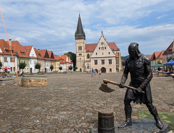
Budget: I’m giving prices for 2 adults / 1 child. Slovakia is more expensive than it seems, and some expenses shouldn’t be underestimated. Transportation: Tolls and gas from France: 500 € round trip Slovak vignette for one month: 17.10 € Gas is fixed at 1.49 € per liter (E10) Parking at sites (all paid by the day, even in the most remote villages, even if you stay for just an hour). Payment is often required in cash upon arrival: total 63 € We didn’t pay at Spiš (we arrived before the cashier) or Ľubovňa (we arrived after the cashier left). Parking at Orava Village was free. In Košice and Bratislava, we parked for free at our accommodations. Public transport in Bratislava and Košice: 1-1.2 € for a bus ticket. Vending machines are available at some stops; otherwise, buy via SMS (Slovak phones only) or official sales points.
Accommodation: We mostly chose houses so we could cook ourselves and save on food. I’ve rated our satisfaction with these accommodations from 1 to 5 stars. Padua: DC Hotel: 1 night, 77 € ***** Handlová: Chata Remata: 2 nights, 120 € ***** Veľký Slavkov: Aplend: 4 nights, 220 € ** Košice: Luxury Old Town Loft 320m²: 2 nights, 120 € ***** Bratislava: Hotel Viktor: 2 nights, 138 € *** Brescia: Hotel Antica Fonte: 1 night, 82 € ***** Total: 757 €
Food: Groceries at Lidl for 5 meals for 3: 100 € (really cheap) Restaurants: 10-15 € per dish, ice cream 1-2.4 € per scoop, crêpes 8-12 €, a glass of wine 6-10 €... total: 500 €
Visits: There are discounts for seniors and children, which is great. We spent nearly 600 € in total, which is a lot. However, it’s a cultural destination with many castles, museums, caves, wine cellars, and nature activities: cable cars, canopy walks, paid hikes (Slovak Paradise gorges)... In the end, this trip to Slovakia cost nearly 2500 € for 3. We also need to add the Vienna portion to that. Now, here’s the day-by-day account of this beautiful journey.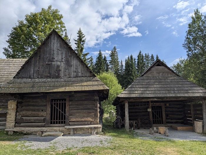
Why this country?
After visiting Hungary, Slovenia, Romania, and Poland in recent years, I’ve fallen in love with Eastern European countries. I adore the Slavic soul, its Austro-Hungarian villages, the gentle landscapes, the Carpathian Mountains, and that slightly mysterious atmosphere.
Slovakia evokes a certain imagination with its deep forests, medieval castles, and cobbled villages.
After seeing photos of the High Tatras—especially Lake Štrbské Pleso and Spiš Castle—I thought, "Let’s do it! We’re going!"
So, will Slovakia live up to what I imagine?
We’ll find out together.
We decided to travel as a group of six (five adults and a six-year-old child), by car (we needed two).
Here’s the day-by-day itinerary for this family trip, which started with a 3-day stay in Vienna (see the dedicated travel journal):
The itinerary: Day 1: Drive from Vienna to Banská Štiavnica and visit the town, then drive to Handlová Day 2: Bojnice Castle, the village of Čičmany, and a walk in the treetops at Bojnice, return to Handlová Day 3: Depart for Orava, visit Orava Castle and the Orava Skansen, drive to Veľký Slavkov Day 4: Visit Slovak Paradise—its gorges, lakes, and ice cave—overnight in Veľký Slavkov Day 5: Visit Bardejov, the "Death Road," wooden churches, and Ľubovňa Castle, overnight in Veľký Slavkov Day 6: Walks and hikes in the High Tatras, Lake Štrbské Pleso, Solisko summit, treetop walk in Ždiar, overnight in Veľký Slavkov Day 7: Drive to Košice, visit Spiš Castle, Tokaj wine route in Veľká Trňa, overnight in Košice Day 8: Visit Košice, overnight in Košice Day 9: Drive to Bratislava, stop at the Aragonite Cave in the Slovak Karst, overnight in Bratislava Day 10: Visit Bratislava, overnight stay Day 11 and 12: Return to France
Budget: I’m giving prices for 2 adults / 1 child. Slovakia is more expensive than it seems, and some expenses shouldn’t be underestimated. Transportation: Tolls and gas from France: 500 € round trip Slovak vignette for one month: 17.10 € Gas is fixed at 1.49 € per liter (E10) Parking at sites (all paid by the day, even in the most remote villages, even if you stay for just an hour). Payment is often required in cash upon arrival: total 63 € We didn’t pay at Spiš (we arrived before the cashier) or Ľubovňa (we arrived after the cashier left). Parking at Orava Village was free. In Košice and Bratislava, we parked for free at our accommodations. Public transport in Bratislava and Košice: 1-1.2 € for a bus ticket. Vending machines are available at some stops; otherwise, buy via SMS (Slovak phones only) or official sales points.
Accommodation: We mostly chose houses so we could cook ourselves and save on food. I’ve rated our satisfaction with these accommodations from 1 to 5 stars. Padua: DC Hotel: 1 night, 77 € ***** Handlová: Chata Remata: 2 nights, 120 € ***** Veľký Slavkov: Aplend: 4 nights, 220 € ** Košice: Luxury Old Town Loft 320m²: 2 nights, 120 € ***** Bratislava: Hotel Viktor: 2 nights, 138 € *** Brescia: Hotel Antica Fonte: 1 night, 82 € ***** Total: 757 €
Food: Groceries at Lidl for 5 meals for 3: 100 € (really cheap) Restaurants: 10-15 € per dish, ice cream 1-2.4 € per scoop, crêpes 8-12 €, a glass of wine 6-10 €... total: 500 €
Visits: There are discounts for seniors and children, which is great. We spent nearly 600 € in total, which is a lot. However, it’s a cultural destination with many castles, museums, caves, wine cellars, and nature activities: cable cars, canopy walks, paid hikes (Slovak Paradise gorges)... In the end, this trip to Slovakia cost nearly 2500 € for 3. We also need to add the Vienna portion to that. Now, here’s the day-by-day account of this beautiful journey.
Namibia Travel Journal: May 2025 - Trip Review
NAMIBIA TRIP 2025: April 24 to May 20: Feel free to comment or ask us any questions about this amazing journey.
>> Find all our photos and videos for each day on our website here: www.montagne-aventure.net
**DAY 1: Thursday, April 24, 2025: Outbound Flights from Lyon to Windhoek via Munich - Visit to Munich:**

Off we go on a new adventure. The alarm rings at 6:30 AM, the travel bags are packed, and we head to Lyon Airport. We booked our flight tickets with Lufthansa. The first leg to Munich, Germany, is operated by AirBaltic. Departure at 1:05 PM for a 1-hour and 20-minute flight. We arrive at 2:30 PM.
**We now have a 7-hour layover, so we take the opportunity to get some fresh air and explore Munich.** We quickly exit Terminal 2 of the airport and head towards the subway. We buy a group day ticket "Airport-city Day Zone M-5," valid for 2 to 5 people at a price of 30.50 € (instead of 16.30 € per person). We take the S8 line to **Marienplatz** in 35 minutes. **This is the heart of the city.** The weather is overcast, quite cool, but dry. Perfect for a little city trip between two flights while leaving our large luggage in transit at the airport. **Munich is the third-largest German city after Berlin and Hamburg, in the Bavaria region.** **The center has a lot of charm and brings together several religious buildings, easy to explore on foot.** We are impressed by the number of people enjoying these 100% pedestrian streets, which are very pleasant. After Marienplatz, the most famous square with the town hall, we head to the Cathedral of Our Lady, a Gothic church, then continue to **Karlsplatz** and move on to **the food market offering a wide selection of high-end food products in an atmosphere where a certain art of living prevails.** We also visit St. Peter's Church before grabbing a bite to eat. Two good hours were enough for this 10 km city walk. It's time to take the subway back: by 6:30 PM, we are back at the airport. Now, it's time for a bit of waiting and rest. Our second flight is scheduled for 9:35 PM for a 9-hour and 30-minute journey to our final destination in Namibia: **Windhoek.**
> Round-trip flight tickets with Lufthansa from Lyon: 2029 €, or 1,014.50 € per person.
> Lyon Airport parking: 120 €
> Today's expenses: 7 € for 2 pizzas in France / 14 € for the restaurant in Munich / 30.50 € for the daily subway ticket in Munich.
**DAY 2: Friday, April 25, 2024: Arrival in Windhoek, Visit to the Namibian Capital:**
After a 9-hour and 30-minute overnight flight with Discover Airlines, we finally land on Namibian soil just before 7:30 AM. The day is breaking, and the colors are already stunning. We are eager despite the usual fatigue from the flight. The airline was punctual, with friendly staff and good meals, though a bit light. We are the first flight of the day to land, with no more than 15 flights per day here, from 7 AM to 8 PM. We disembark on the tarmac at this airport located in the middle of nowhere, **I finally set foot on African soil for the first time.** We exit among the first from the aircraft to go through the long formalities at the front of the line, as the wait can quickly become endless. Allow at least 5 minutes per person for e-visas. We still wait 45 minutes despite only about twenty people ahead of us. Phew, it's done. We collect our luggage and then withdraw money from an ATM. We make 4 withdrawals of the maximum amount, 2000 NAD $ per withdrawal, for a total of 380 €, or 95.33 € per withdrawal.
Our driver arrives at the same time, perfect timing, we were quick.
We leave the airport at 8:45 AM. By 9:30 AM, we arrive at the **Gracious Whisp vehicle rental agency**, located at the entrance of Windhoek, small and human-sized with a fleet of recent vehicles. More formalities, then a short wait as our vehicle is not yet ready. Time to decompress, catch our breath, and enjoy the very pleasant morning temperature. Not a cloud in sight. Next, a briefing on the vehicle, always with a bit of apprehension due to our approximate English. Allow 45 minutes of explanations, including setting up the roof tent, camping equipment, technical information in case of a flat tire, driving tips in Namibia, and a tour of the 4x4. We have all the necessary equipment for camping: mattresses, sleeping bags, pillows, table, chairs, gas stove, BBQ grill... as well as 2 spare tires, a compressor, a dual tank, and accessories for removing wheels. Off we go, it's time to muster our courage and get behind the wheel. **Heading to SuperSpar Maerua**, fortunately located less than 10 minutes away. We park with the help of a parking attendant; it's very crowded, the space is narrow, but everything goes well despite the cursed right-hand drive. Today's new mission: stock up on groceries. The store is well-stocked with local and imported products, catering to all tastes. We spend 114 € on groceries, from pasta to meat, BBQ lighters to dishwashing products. Two people load our groceries into two carts and transfer them to our vehicle; we feel compelled to leave a tip, 50 NAD $, as we don't have change yet. Now, we head to the hotel, 15 minutes away. Traffic is difficult at a complicated intersection; this will likely be the only traffic jam in Namibia. **We arrive at Kate's Nest Guesthouse & Backpackers around 1:15 PM, quite tired.** We take some well-deserved rest at this recent establishment, quite calm with secure private parking. After a short nap, we enjoy the quiet by the hotel pool. Night falls between 6:30 PM and 7 PM. We eat quietly in our room tonight before starting this long 4x4 road trip in camping mode in the heart of Namibia.
> Today's grocery expenses: 114 € at Super Spar Marua (2395.21 NAD $).
> Round-trip flight tickets with Lufthansa from Lyon: 2029 €, or 1,014.50 € per person.
> Vehicle rental: 4x4 Toyota with roof tent for 24 days: Gracious Whisp Car Rentals: 2,638 € (N$50,640) or **1,319 €** per person - (https://gwcarrentals.com/)
> Distance driven today: 15 km.
> Accommodation: Kate's Nest Guesthouse & Backpackers - 4 Aristotles Street Academia, 9000 Windhoek - 36 € for two for one night.
> Windhoek International Airport website: (https://www.airports.com.na/)
**DAY 3: Saturday, April 26, 2025: Windhoek to Hardap: Mariental Region - Kalahari Desert:**
After a good, restful night, we wake up leisurely around 7 AM. We enjoy the comfort provided by this first and last hotel before 24 nights under the tent.
**We leave Kate's Nest Guesthouse at 8:30 AM to tackle the Namibian roads.** We quickly leave the capital; in just 30 minutes, we find ourselves almost alone in the world. The landscape is dotted with small domes. We leave the **paved B1** quickly to turn left onto the **C15**. **From there, we won't see more than 10 vehicles all day.** After passing through the few houses of **Lekkerwaterpoort**, we tackle our first gravel road. These road sections are limited to 100 km/h, but even at 70 km/h, I find it already challenging. However, I quickly get used to it and gradually pick up speed to reach my cruising speed of around 80 to 90 km/h. **We are on immense straight lines crossing wild expanses as far as the eye can see.** **We come across two baboons, a few ostriches, and numerous cattle and sheep farms.** We pass through the charming village of **Uhlenhorst** with its typical houses and children with broad smiles waving at us. Life here is already very different from Windhoek. **The thermometer rises quickly from 16°C at 8:30 AM to over 28°C in the early afternoon.**
**We arrive at the Hardap Dam reserve at 2 PM.** We stop at the toll booth at the park entrance to pay the entrance fee: 250 NAD $ for 2 people and 1 vehicle. We continue to the dam and then the camp entrance, located a bit further. We had booked in advance, but this place remains little frequented by foreigners.
We take advantage of the hottest hours to rest by the large pool overlooking the immense lake, a very enjoyable moment. Would this be a bit of a vacation?
Around 4:30 PM, we head to the campsite. We overlook this vast water reserve. We arrive first; we will be only 3 vehicles spending the night here. It's time to get to work and set up our equipment for the first time. It takes us a good 20 minutes to set everything up, with a slight apprehension about unfolding the tent. Once this task is done, which we will have to repeat for almost a month, we will become much more efficient over time. Time for rest and contemplation in total silence. The sun gradually sets, and the heat quickly becomes bearable again. Bliss! **This dam is located 20 km northwest of Mariental in an area dotted with conical hills topped with dolerite buttons (Hardap means "hillock" in Nama). It captures the Fish River, which flows south, creating a large lake in the middle of an arid environment. The contrast is striking.** We enjoy our first sunset facing this 360° otherworldly landscape.
Around 7 PM, we start our first BBQ, or "braai" as it's called here. The temperature is perfect. The sun sets, giving way to a star-filled sky of incredible beauty thanks to the absence of any light pollution. The Milky Way will lull us throughout the evening. After some good sausages and potatoes on the BBQ, we head to our roof tent around 9:30 PM with a complete change of scenery in just 24 hours. France already seems so far away...
This campsite has shared showers and toilets, quite clean and functional, as well as a central area with several BBQs and tables. The sites are arranged in a semicircle, each with an electrical outlet. The sites are close to each other but spacious, some slightly shaded. We are only three vehicles tonight, so it's perfectly comfortable and quiet. Not to mention the large pool near the restaurant. Our trip is off to a great start.
> Today's road itinerary: Windhoek > Head south on the B1 to Rehoboth > Turn left onto the C25 then C15 to Stampriet > C20 to Hardap > Full north on the B1 > Then turn left onto the M93 - 5 hours of driving.
> Distance driven today: 354 km.
> Accommodation: Hardap Recreation Resort - 23.3 € for two - Large pool - GR6W+3M2, Hardap Game Reserve, Mariental, Namibia - (http://www.nwr.com.na/resorts/hardap-resort/)
**DAY 4: Sunday, April 27, 2025: Hardap - Brukkaros Volcano - Keetmanshoop - Quivertree Forest Rest Camp**
Our first night under the tent was very pleasant; the little wind quickly calmed down, giving way to absolute silence. The mattress is decent, more comfortable than some nights in Nepal. The length and width give us enough space for maximum comfort, despite my height (1.91 m). We wake up a little before 7 AM as the sun rises, and the lights dazzle us from the start of the day. We pack up the equipment in 30 minutes, quite easily. Then we enjoy the sun, which warms up quickly while we keep our light fleece on.
At 8:30 AM, **we hit the road again, heading south** to our first stop in **Mariental**. We want to do some shopping at SuperSpar, but once we arrive in the parking lot, a young local is fighting with the supermarket security guards and then threatens to throw stones. We don't want to take any risks right at the start, so despite the baton blows he receives, he doesn't stop. We leave empty-handed but fill up with fuel at the Shell station 1 km further. The price per liter is 21.33 NAD $, we fill our 107-liter tank for 107 €. In Namibia, you get served, and they bring the card machine to the window to pay. It's then customary to leave a tip.
We then take the B1 heading due south on a recently renovated road. Around 11:30 AM, we leave it on our right to take **a wild gravel road, the M98**. Just before **Berseba**, we turn right onto a small track, the **D3904 towards Brukkaros Crater up to a camp at 1588 m altitude**. The track then becomes too bumpy. We stop on the counter-slopes where **a wide panorama unfolds over these immense plains as far as the eye can see**. It's 12:15 PM, time for us to eat a rice and tuna salad facing this landscape.
**We are alone in the world until a vehicle arrives and parks next to us.** A bit of apprehension, 4 men head towards us. It turns out to be 4 shepherds looking for a lost foal. The conversation is pleasant, lost in the middle of nowhere. We find ourselves alone again in this absolute silence. **The heat becomes stifling with a good 30°C**. We get back on the road around 1 PM. Back on the B1, **we continue due south to Keetmanshoop**, which we reach around 3 PM. We stop there to do some shopping for 262 NAD $ (12 eggs, a can of tuna, a can of corn, bread, a soda, and a 5-liter water container), or 12.48 €. Two quite insistent children ask us for money or candy at the store exit, yet we give them a small tip, but they continue to cling to the car. Locals parked next to us tell them to leave us alone. Anyway, we finish the trip to **Quivertree Forest**, 15 km away. We will spend the night in this **pleasant farm run by a German**. Upon arrival, as the day before, and as I suppose in the future, we dive straight into the cool pool to relax after all these kilometers. A bliss. Then we take our 4x4 and choose a spot near these famous trees. After the 33°C this afternoon, once 4 PM passed, the temperature drops again and becomes very pleasant. **We are in the middle of the Kokerboom, one of the most interesting and characteristic plants of hot and arid regions. It's not really a tree but a variant of the aloe plant whose botanical name is Aloe Dichotoma. This Kokerboom has a smooth and thick trunk reaching up to 1 m in thickness and 9 m in height. They bloom for the first time at the age of 20 to 30 years.** The flowers are yellow and reach about thirty centimeters during the season between June and July. **They grow mainly in an environment with a high concentration of black rocks absorbing a large amount of heat (38°C). The rocks also serve to anchor the tree with its tentacle-like roots. It also resists frost. Each is between 200 and 300 years old.**
Around 5 PM, we walk to the farm reception to watch the feeding of **two cheetahs**. Magnificent carnivores taking their time to savor their piece of meat. **Then we return near our campsite to enjoy the sunset among these trees. The colors are sublime, as every evening apparently. A magnificent spectacle with colors evolving from yellow to orange then to pink, before giving way once again to a sky filled with thousands of stars.** Our campsite at Quiver Tree Forest Camp is very comfortable; we have a water supply, a stone table, a small lamp, an electrical outlet, a small tree for shade, and a BBQ that we won't use tonight; we'll cook on gas. The sites are far apart, with some shared facilities scattered around, a very beautiful setting. No reservation possible, no need, just show up directly. **The campsite accommodation for 2 people costs 28 €, including the reserve entrance fee of 5 €**. We finish this second bivouac evening around 9:30 PM, time for some reading and sleep in peaceful silence without wind.
> Today's road itinerary: Mariental > B1 heading south to Brukkaros > At Tses turn right towards Berseba via the M98 > Turn right onto the D3904 > 8 km > Brukkaros Volcano (stop at the lower camp as the track is difficult for 1 hour) > Keetmanshoop > Turn left onto the M29 > Quivertree Forest - 4 hours of driving.
> Distance driven today: 371 km.
> Distance walked today: 6 km.
> Today's expenses: Groceries for 12.48 € (262 NAD $) / Fuel for 107 € (1 liter of diesel for 21.33 NAD $).
> Accommodation: Quivertree Forest Rest Camp, P.O. Box 262, Keetmanshoop, Namibia - BBQ, hot showers, toilets, and electricity - No reservation - Pool - 18 €/Person (N$ 340.00 with park entrance) - (http://www.quivertreeforest.com/)
**DAY 5: Monday, April 28, 2025: Quivertree Forest Rest Camp - Giant's Playground - Keetmanshoop - Fish River Canyon - Canyon Roadhouse:**
After an excellent start to the night, we are woken up by the wind shortly before 6 AM, but the sunrise is not far off. We get up at 6:30 AM to enjoy it. The atmosphere is a bit cooler this morning, but the reward is already here.
The adventure continues. At 7:45 AM, we head towards **Giant's Playground**, 4 km away. We take a 3-kilometer walk through this expanse of blocks and igneous rocks.
We continue south at 8:45 AM, passing through Keetmanshoop again where we do some shopping for 25 €, a big stock-up for a good part of the trip: meats, canned goods, pasta, fruits... At 9:30 AM, we take the B4 to Fish River Canyon.
At 11:30 AM, we arrive at the entrance to the NWR park (350 NAD $ entrance for 2 people and 1 vehicle). The track becomes bumpy immediately upon entering the park. After about ten kilometers, we come upon this landscape carved by nature. In the end, it's well worth the detour. We were at the Grand Canyon in the USA exactly (https://www.montagne-aventure.net/2024/04/29/j21-3-juin-2024-grand-canyon-et-lac-powell/) and can thus confirm that this Fish River Canyon is comparable. We make several stops along the southern flank. **Here, nothing is developed; nature is almost in the wild state.** **With 160 km in length, up to 27 km in width, and a depth of 150 m, it is indeed the second-largest canyon in the world.** The history of the canyon is apparent in its different earth layers and stratification: the antiquity of the place is tangible, and the absence of vegetation is surprising. **It consists of two nested canyons, formed at distinct periods. The first distinct layer of schist, sandstone, and eruptive material surrounding the canyon was formed a few two billion years ago, then transformed due to heat and pressure into more solid rock such as gneiss. The inner canyon, carved more recently by the Fish River, has a depth of 270 m.**
We have a picnic once again alone in the world facing this grand panorama at the **Sulphur Spring View Point**. This is where the hiking trail begins, plunging into this narrow canyon, but it is forbidden to venture there alone without a guide. It's 30°C, but a slight wind makes the atmosphere bearable. At 1 PM, we retrace our steps and continue to the **Main View Point** then to the **Hikers View Point**.
In the south of Namibia, the Fish River Canyon, 160 km long, is a true geological wonder: a canyon nested within another canyon, one of the largest in the world. The first sedimentary layers formed two billion years ago; 500 million years ago, a period of tectonic activity caused these layers to crack and tilt, opening a vast canyon in the Earth's crust. The second canyon, with a depth of 270 m, was carved over time by the passage of the Fish River in this new valley.
At 3 PM, we arrive at our very charming camp for the evening, the **Canyon Road House**. We fill up with fuel right away because tomorrow we have a long day of isolated driving: 55 liters for 1240 NAD $. Then we settle into the campsite we had previously reserved in France. We are assigned site 2, very well set up under a tree with its BBQ and stone table just steps from the pool. We quickly set up the tent and jump straight into the pool for the relaxation moment of the day. As usual, the water is quite cool, but it's a real pleasure. Then we stroll around this Canyon Road House, which recreates the atmosphere of the roadside inns of the 1950s with old car wrecks and vintage gas pumps in a bygone era. **Around 5:45 PM, we start a short walk leading us to the top of a hill overlooking the wide plateau where we are to watch the sunset.**
And finally, to end this beautiful day, it's time for the braai, with grilled sausages and white beans on the evening menu.
> Park entrance: 150 DN/person + 50 DN/vehicle (18 € for two). It is possible to enter at two access points: Hobas in the north and Ai-Ais in the south.
> Today's road itinerary: M29 > Keetmanshoop > B1 > B4 > C12 (track) > After Holoog turn right onto the D601 (C37 track) > Accommodation on our right (stop just to check in before 6 PM) > Continue 30 km (30 minutes of track) to the viewpoints after Hobas where you must pay the entrance fee. Sunset View Point to the left > Return before sunset as the park closes (best lights at sunrise). 3 hours.
> Distance driven today: 228 km.
> Distance walked today: 10 km.
> Today's expenses: 25 € for groceries / 17 € for the Fish River Canyon park entrance / 58 € for fuel.
> Accommodation: Canyon Roadhouse, Gondwana Collection Namibia – 34.4 € for two - Pool - Near Hobas - (http://www.gondwana-collection.com/fr/accommodation/canyon-road-campsite)
**DAY 6: Tuesday, April 29, 2025: Canyon Roadhouse - Orange River - South African Border - Vista Trail - Gondwana Sperrgebiet Park - Aus:**
The night was excellent in this very comfortable campsite. **We wake up to the sound of birds** before the alarm at 6:45 AM. Our little morning routine starts as the sun rises. **A big day of driving awaits us to the South African border. This will be the southernmost point of our journey.** We hit the road at 8 AM via the C37, pass through **Hobas**, then turn onto the D207 to **Aussenkehr.** **We cross a mountainous barrier with some high peaks and perfect cones. The rock varies from orange to pink to black.**
We then cross a lunar desert as far as the eye can see on a giant dome; the track winds through nowhere without meeting anyone for hours. The landscapes are surprising. **We spot several ostriches and a gemsbok.** In the middle of this endless expanse, we come to an improbable intersection and continue right onto the D278.
In the middle of these arid lands, we come across a green zone: a vast vineyard. At 10:30 AM, **we come across a "Road closed" sign, fortunately, a local resident waves us to continue; a bit stressed, we proceed.** We start to follow the beautiful Orange River. On the other side of the bank, just a few meters away, South Africa is there. It is the second-longest river in Southern Africa, after the Zambezi. It flows over 2,000 km to the Atlantic. After passing through narrow gorges, we regain altitude before starting the descent, gently heading back north.
**We now cross and follow the Fish River, which joins the Orange River further south** **along this gorge dating back millennia.** At exactly noon, we take a lunch break by the Fish River, still without meeting a soul in this landscape between greenery and aridity. The temperature here is cooler with a pleasant 23°C on the banks, the perfect spot. **We continue on the track to Rosh Pinah**, where we find a paved road again. **The section along the Orange River and the Fish River was officially closed, but we were able to pass without any issues, avoiding a detour of at least 3 hours.** Phew. We now drive at high speed (limited to 120 km/h) through these vast spaces. We come across many ostriches after the **dozens of monkeys along the Fish River**. Around 3 PM, 3 km after the very small town of **Aus**, we reach **our campsite for the evening at Klein Aus Vista**. A new **small peaceful haven very well set up**. As usual, after checking in at reception, we jump straight into the beautiful pool to get our well-deserved dose of coolness, another good thermal shock that our bodies appreciate. Once this moment of relaxation is over, we take our 4x4 to reach the campsite located a bit higher, set apart at the foot of a hill that overlooks us.
After setting up, **around 5 PM, we head to the Vista Trail to climb to the top of a mountain overlooking the vast plain that surrounds us at 360°**. It takes about 30 minutes to climb. The place is just magical, **the perfect viewpoint to admire the sunset**. **We fully savor the moment. We also spot one of the few wild horses in the world capable of living in the desert.** Their numbers have decreased in recent years due to predation and drought (around 100 to 150). At 7 PM, we return to the camp, time for the braai and preparing the meal in this peaceful little camp.
In the south of Namibia, the Fish River Canyon, 160 km long, is a true geological wonder: a canyon nested within another canyon, one of the largest in the world. The first sedimentary layers formed two billion years ago; 500 million years ago, a period of tectonic activity caused these layers to crack and tilt, opening a vast canyon in the Earth's crust. The second canyon, with a depth of 270 m, was carved over time by the passage of the Fish River in this new valley.
> Today's road itinerary: 5 hours of driving: D324 heading south (track) > turn right onto the C10 (track) > D316 heading south > turn right onto the C13 > In Aus turn left onto the B4 > Campsite via a track on the left.
> Fuel station: Solitaire or Aus.
> Distance driven today: 398 km.
> Distance walked today: 7 km.
> Accommodation: Klein-Aus Vista Desert Horse Campsite - Farm Klein-Aus No 8 on the B4 main road to Luederitz Aus 9000, Aus, Namibia - (http://www.klein-aus-vista.com/accommodation/desert-horse-campsite/) 17908 420 DN - Water + Shared shower (hot water). No electricity.
**DAY 7: Wednesday, April 30, 2025: Aus - Kolmanskop - Diaz Point - Luderitz - Kanaan Desert:**
We wake up around 6:45 AM, with partly cloudy weather for once; we feel the ocean's influence gradually. But the sun isn't far off. At 7 AM, we leave the campsite heading west towards Luderitz via the B4. **First stop of the day: Kolmanskop, the ghost town we reach at 8:30 AM**, entry costs 180 NAD $ per person. We discover this **timeless place** in 1.5 hours, moving from building to building amidst violent sand-laden gusts of wind. There's a lot of charm in these different living spaces. **The sand quickly reclaimed the place after this mining town was abandoned.** This was once the headquarters of Consolidated Diamond Mines. It's hard to believe that this former town, where the diamond industry once flourished, had a hospital, a bowling alley, and a theater. The decline in diamond sales after World War II and the discovery of richer deposits put an end to this golden age. By 1956, the town was already completely deserted, and the sand had reclaimed its rights. **These dilapidated buildings swallowed by shifting dunes have something surreal about them.**
At 10:15 AM, we hit the road again **heading to Luderitz, 22 km away**, and first to **Diaz Point** **facing the Atlantic Ocean**. It's a wind-swept peninsula with its characteristic red and white lighthouse. There's a campsite and a coffee shop on site, but the place doesn't inspire rest without shade or shelter from the wind. We return to the city via the D701 track that runs along the ocean, be careful at low tide. We come across **a few fishermen and a fox as well as flamingos.**
We walk through the few streets of the city, much smaller than I imagined, then climb to the **famous little Lutheran church that overlooks the city, the Felsenkirchr.** **The wind blows very strongly here, and the sand is omnipresent, surrounded by the Namib Desert and the southern Atlantic coast.** **A German colonial relic barely touched by the 21st century, Luderitz seems frozen in the past, giving it both a gloomy and a certain charm. In short, it's certainly one of the most incongruous places in Africa.**
At 1:15 PM, just before leaving Luderitz, we do some shopping for 20.50 € and fill up with fuel: 61.50 €, 1290 NAD $ for 61 liters (21.18 $ per liter).
**We return via the B4 to Aus** (paved), **then via rougher tracks**, the C13 then the D707, magnificent as it runs along a mountain range with multiple colors on our right and an endless flat desert on the other side.
To access our campsite for the evening, we must take a **narrow private track for 7 km** on our right to emerge, in this total vastness, at the **isolated Kanaan Desert Retreat on a small hill**. I don't have time today to jump into the pool near the reception; we arrive at 5 PM at 8 small, isolated, and unique sites with a small kitchen, a shower, and a private toilet under a small tarp shelter. **A crazy charm with a unique view...** **This will be my favorite accommodation of this trip. The photos speak for themselves.** We jump into the outdoor shower while savoring the landscape, then prepare our evening braai while enjoying the colors fading, facing this plateau with bushes turning a vivid orange. **A moment that will remain etched for life.** **Savanna atmosphere under a thin emerging moon. Every minute offers different colors. Facing our meal, we have a natural giant screen.**
We end this day contemplating the stars and admire this thin orange moon setting on the horizon (8:42 PM).
**Ghost town just before Luderitz: Kolmanskop** (open from 8 AM to 3 PM - N$ 180 p.p – 9 €). Once, Kolmanskoppe was organized around diamond mining. After finding new, more prolific spots, the town was abandoned and is now a ghost town. The sand and dunes have reclaimed their rights and buried everything humans had built. Houses, train station, bakery, everything has been covered by sand, which passes through the windows, even though they are 1 meter high.
> Today's road itinerary: 5h30: B4 to Luderitz (paved) > Round trip > Kolmanskop on the left > Return via the previous campsite > Then C13 (track) > Turn left D707 (track) > Then track to the right to the campsite.
> Distance driven today: 438 km.
> Distance walked today: 8 km.
> Today's expenses: Groceries at the Spar in Luderitz for 20.50 € / Fuel fill-up in Luderitz for 61.50 €.
> Official Kolmanskop website: (https://kolmanskuppe.com) (open from 8 AM to 1 PM - N$ 180 p.p – 9 €).
> Accommodation: Night at the south of the Namibrand Nature Reserve: Kanaan Desert Retreat – 26.5 € for two - (http://www.kanaannamibia.com/) - Farm 104 Karas 9000 - Sanitary facilities + BBQ + Water + Pool - No electricity - My favorite accommodation of this trip.
**DAY 8: Thursday, May 1, 2025: Kanaan Desert Retreat - Namib Desert - Crossing the Namibrand Nature Reserve – Sesriem Canyon - Elim Dune - Little Sossus Lodge**
After a cooler night than the previous ones with about 10°C, we wake up around 7 AM. We admire, as usual, the sunrise between the desert and the mountains. **The spot from last night was truly perfect, isolated from the world, in total serenity, with a wake-up call to the sound of birds.**
We hit the road a little after 8 AM, heading north via the D707 to Spes Bona, then the gravel road C27 via Betta to Sesriem. **The landscapes roll by and dazzle us.** **We are right in the heart of the Namibrand reserve**, coming across numerous **zebras**, **impalas**, **ruminants that reproduce in large numbers**, and **gemsboks**. At noon, we stop in the shade of a tree to eat. The spot is so romantic facing orange arid mountains and a vast green plateau. **A landscape full of contrasts, timeless and silent.**
**The Namib Desert is the oldest on the planet; its name means "vast arid plain," and it also gave its name to the entire country: Namibia.** The majority of these arid and semi-arid lands dotted with viewpoints are part of the Namib-Naukluft National Park, which covers 23,000 km².
At 1 PM, we enter the Sossusvlei park. We start with the **Sesriem Canyon**, which is 3 km long and 30 m deep. We enter it with a short 1-hour hike into its depths. **It was carved by the Tsauchab River in an agglomerate of sand and pebbles over 15 million years old.** We retrace our steps back to Sesriem, which means "six belts," referring to the number of leather belts (from ox wagons) needed to draw water from the canyon. This remote locality is mainly the gateway to Sossusvlei but offers a gas station and some accommodations. For our part, we sleep 40 km away tonight.
**We then move on to Elim Dune.** It takes about 45 minutes of walking to reach its summit, and the climb is very breath-taking as we progress in the sand where we almost slide back with each step. **A first grand 360° panorama unfolds. The ochre color of the sand contrasts completely with the yellow plain and the brown and black mountains in the distance.**
At 3:15 PM, we start the descent facing Sesriem. We were completely alone once again on this dune. **These Namib dunes are composed of colored quartzite sand, presenting hues ranging from cream to orange and from red to purple. Unlike the ancient dunes of the Kalahari, these move with the wind and adopt distinct, ever-changing shapes.** Star dunes resemble stars seen from above, while transverse dunes, like those on the coast south of Walvis Bay, stand perpendicular to the prevailing southwest wind. The most stable dunes, which thus have the most vegetation, are parabolic dunes, due to the variability of the winds. Longitudinal (seif) dunes measure up to 100 m in height, while barchan dunes, crescent-shaped and predominant at the extreme north of the Skeleton Coast and south of Luderitz, are the most mobile, created by unidirectional winds.
**We get back on the road for 45 minutes to our campsite for the evening, Little Sossus, which we reach at 5 PM**, via C27 then right onto C19. As often upon our arrival, I jump into the cool pool to relax after all this driving, then we proceed to set up the camp. As the day before, the campsite consists of 10 fairly distant sites, with private sanitary facilities and a small roof. We are delighted with this crazy charm. The hot water for our shower is wood-heated: a Namibian lights it every evening around 5 PM.
For a change, or not, the menu features a small BBQ with pork ribs and pasta, facing another sunset, this time with partial cloud cover giving equally splendid colors. Time for a well-deserved rest after long corrugated tracks covered in our 4x4 today.
> Today's road itinerary: 4h45 of driving: Find the D707 and head north (track) > At Spesbona turn left onto the C27 (track) > At Sesriem after entering the park, turn left following View Point Sesriem > Continue 4.5 km to the Sesriem Canyon Parking > Return then head towards Elim Dune > Exit the park then take the D826 > Turn right onto the C19 heading SE > Turn right facing the D854 to the campsite (campsite closes at 7 PM).
> Distance driven today: 272 km.
> Distance walked today: 8 km.
> Today's expenses: Entry to the Sossusvlei Namib-Naukluft Park: 17 € for two (with one car).
> Accommodation: Little Sossus Lodge – 35 € for two - At the junction of the C19 and D854 roads Maltahohe 9000, Maltahohe, Namibia - (http://www.littlesossus.net/) - Pool + Private bathroom + Hot water + Electricity + BBQ + Grocery store (bread to order the day before).
**DAY 9: Friday, May 2, 2025: Little Sossus Lodge - Namib-Naukluft National Park – Sesriem - Sossusvlei - Big Daddy – Deadvlei - Tsauchab River Camp**
Today we start the day early to tackle **the famous dunes of Sossusvlei at first light**. The alarm goes off at 6 AM to leave the camp at 6:45 AM. The wind is blowing quite strongly in gusts this morning, but it only woke us up a quarter of an hour before sunrise. The park opens at 7:15 AM. We start with a small encounter: a friendly **jackal lounging by the roadside.**
We first have to cover the 40 km of track to Sesriem, pay the entrance fee (350 NAD $), and drive 65 km on a paved road this time to reach the **vast salt pan (a lake whose sediments are made of salts) of Sossusvlei**. **It appears amidst the gigantic red dunes that rise on either side. The wind constantly changes the shape of the dunes, as well as their colors, which vary with the light. The setting is breathtaking, giving an impression of immensity and timeless grandeur.**
The paved road ends; the last 4 kilometers become technical and are reserved for 4x4s. Phew, I pass without any problems, though not without stress, switching to L4 mode. **We start the ascent to Big Daddy at 8:45 AM, 325 m of elevation gain in the sand nonetheless.** We climb at an excellent speed despite the strong wind, in exactly 1 hour. At 9:45 AM, we are at the summit of what will remain etched for a long time. The 360° view is simply unimaginable; you have to experience it to believe it. The wind blows violently up there, **it feels like being in the high mountains, on a snow ridge, with a strong transport of sand. The atmosphere is magical.** We start the descent running barefoot in the steep sand.
**We then move on to its neighbor, Deadvlei.** **Here, petrified trees stand in the "vlei" (basin) with their dried branches casting desolate shadows on the white ground. The juxtaposition of the deep blue sky and the towering dunes is captivating.**
We return to the 4x4 parking at 11 AM, the stress rises again for the sandy track passage. We retrace our steps and stop at **Dune 45**.
At noon, we take the opportunity to picnic at the foot of **the beautiful Dune 40**, where there is already no one left. We enjoy the quiet again, well, almost, as the wind remains omnipresent.
At 1 PM, we return to **Sesriem**, where we fill up with fuel (21.15 NAD $ per liter), totaling 1630 for 77 liters (78 €), and do some shopping for 245 NAD $ (two nice pieces of pork, 2 cans, 2 sandwiches for tomorrow, and 1 soda), which is 12.48 €. It's 27°C. We hit the road again, heading to a new destination at 2 PM. We take the C19 back to Little Sossus where we spent the night, then turn left onto the gravel road D854 for about 40 km to **Tsauchab River camp**. Finally, we won't be sleeping here; we are redirected 7 km downstream to **Naukluft View Camp**, which also belongs to Tsauchab River Camp.
We arrive at 4 PM, and thankfully, the fatigue was starting to set in. **Our campsite is located under a small forest, providing some protection from the wind that blew strongly all day. The calm does us a world of good. Once again, a lot of charm**, with very spaced-out sites without any visibility. We can't wait to take our shower. It will be possible from 5 PM with, as the day before, water heated by a wood fire. Time to prepare the campsite for the night. And on the menu, a braai with two superb pieces of pork bought in Sesriem and fries!!!!
**The Namib Desert**
An impressive coastal desert stretching from the Atlantic to a high plateau inland, the narrow Namib Desert runs along the southwest African coast for about 1,300 km. **Considered one of the oldest deserts in the world**, it is bordered to the north by the Kaokoland Desert, which extends into Angola, and to the south by South Africa's Karoo. The narrow Namib is mostly less than 160 km wide. Despite this, it is considered to consist of three sections: the coastal strip influenced by the Atlantic; the Outer Namib, occupying what remains of the western half; and the Inner Namib, comprising the eastern half of the desert. Generally called the Skeleton Coast, the coastal Namib receives almost no rain and depends on regular marine fogs for moisture. From sea level, the terrain rises to 900 m, where the desert meets the base of the Great Escarpment to the east. In the Inner Namib, average annual rainfall is only about 50 mm.
The dryness is such a characteristic of the Namib that it is thought to have been in this arid state for at least 55 million years. It is all the more surprising to learn that animals such as vipers, geckos, zebras, and elephants live in this desert. Some areas of the Namib are also rich in flora, including Welwitschia mirabilis, which grows near the ground with seemingly exhausted leaves, extracting moisture from marine fogs and can live over 1,000 years. In the southern Namib, some dunes are up to 32 km long and 240 m high.
**The frequent fog of the Skeleton Coast:** Driving north along the coast of Namibia, the cold Benguela Current in the Atlantic cools the moist air above the ocean, which, upon meeting the warm desert air, leads to the formation of thick fog banks that drift up to 100 km into the center of the Namib before evaporating under the sun.
> Today's road itinerary: 4 hours of driving: C19 towards Sesriem (track) > D826 (paved) > Foot of Big Daddy via a technical sandy track > Return via the same route > D854 to Tsauchab.
> Gas station: Sesriem.
> Distance driven today: 254 km.
> Distance walked today: 12 km.
> Today's expenses: Park entry at Sesriem for 2 people: 17 € / Fuel fill-up: 78 € / Groceries at Sesriem gas station: 12 € (245 NAD $).
> Accommodation: Tsauchab River Camp - Naukluft View Camp - D054 & D850 GPS: S24 26' 37" E16 10' 11" Sossusvlei 22007, Maltahohe, Namibia - BBQ + Private sanitary facilities + Water - www.tsauchab.com
**DAY 10: Saturday, May 3, 2025: Tsauchab River Camp - Naukluft National Park - Olive Trail Hike (10 km) - Ababis Guest Farm**
We pack up the camp at 8 AM and continue our road trip north via the D854, a bumpy track with many corrugated sections. It's cool this morning, 12°C.
**We enter the Naukluft massif, discovering landscapes with very different terrain than before.** We first need to check in at the campsite, 13 km from the entrance at the end of the track: 350 NAD $ for 2 people and 1 vehicle, then return 4 km back. **On the agenda is the lovely Olive Trail, a 10 km hiking loop that starts 4 km northwest of the park office**, along the D854 that we follow. At 9:45 AM, the hike begins with a fairly steep ascent (about 45 minutes) among the **wild olive trees** from which the trail gets its name. **At the summit, we enjoy a view that embraces the Naukluft Valley.** We then turn east and gradually descend into a deep valley, passing over sometimes slippery rocks. We have a snack around 11:30 AM in these small gorges. **Further on, to cross the wall of a canyon in front of us, some chains are fixed to the rock to help us pass.** We finish this superb loop clockwise at 1:15 PM, taking 3.5 hours including 30 minutes of breaks. We only crossed a small group of 3 people on this wild adventure far from everything. At 1:45 PM, we exit the park and take the **D854 track north to Bullsport**. From there, we turn left and take the C14, which **runs along the bed of the Tsondab River.**
**We arrive at our campsite for the evening, Ababis Guest Farm, at 3 PM.** Quite early for once, allowing us to rest a bit in this peaceful farm where many sheep wander around us. We also enjoy the pool under a magnificent sun, less hot than the previous days, it's 22°C. The camp has only 4 spaced-out sites around shared sanitary facilities. **We are in the middle of a vast plain facing the Naukluft massif mountains.** We will have another beautiful sunset on these mountains. For the first time on this trip, **we will be completely alone at this campsite.** **We haven't encountered many people today**, just 3 during the hike and fewer than 10 vehicles all day.
> Today's road itinerary: Head north on the D854 (track) > Turn left to enter the Naukfluft National Park > Continue on the track then turn right to the Olive Trail hike parking lot (1 hour for 45 km). Return to the D854 and continue north > At Bullsport turn left onto the C14 to Ababis (still a track) > The camp is located on the left facing the D1261 (1 hour for 60 km from Olive Trail). Total: 2 hours of driving for 100 km.
> Gas station: No gas station on the route, except in Solitaire.
> Distance driven today: 115 km.
> Distance walked today: 13 km.
> Accommodation: Ababis Gaestefarm - Night booked by email – payment on site: (https://www.ababis-gaestefarm.de/) - P.O.Box 1004, Maltahöhe - N$ 300.00 per person
**DAY 11: Sunday, May 4, 2025: Ababis Gaestefarm - Namib-Naukluft National Park – Solitaire - Gaub Pass - Kuiseb Canyon - Moon Landscape - Walvis Bay**
The night was, for the first time since the start of this road trip, quite difficult. A strong wind accompanied us all night, making the tent flap constantly. A racket that drove us crazy. We still managed to sleep a few hours. The morning sun brings back our smiles. We hit the road for this new stage a little before 7:45 AM.
We start the day with a first stop less than 15 km away **on the C14 in Solitaire** at 8:15 AM. **This town is lost in the middle of nowhere with its small gas station with a western atmosphere adorned with rusted and sand-covered car wrecks.** After a quick supply stop: 86 NAD $, or 4 € for 1 water container and a box of cookies, we continue north still on the C14, **crossing the Tropic of Capricorn** then devouring this **magnificent track up to Gaub Pass**. **A succession of narrow gorges, turns, climbs, and descents breaking the monotony of the previous long straight lines.** We are right in the heart of no man's land for 200 km. We then start the descent to the **Kuiseb Canyon. It houses the wide bed of the eponymous river, dry almost all year.** Even when it flows for 2 to 3 weeks during the rainy season, it doesn't go beyond Gobabeb and then seeps into the sand. **The drinking water that supplies Walvis Bay is pumped at Rooibank from this underground water table.** **We now cross the Kuiseb Desert where impressive dunes roll down.** We make a short stop at a **natural rock arch** reminding us of our (https://www.montagne-aventure.net/2024/04/29/j19-1-juin-2024-canyonlands-national-park-et-arches-national-park/). Then we gradually descend towards **Walvis Bay** where we will spend the night. At noon, we enter the **Dorob National Park**. The thermometer drops 10°C in 10 minutes as we get closer to the Atlantic Ocean.
At 12:45 PM, much earlier than initially planned, we arrive at the **Moon Landscape** (View Point 4, free) to have a snack, via a very recent surprising dual carriageway in the middle of nowhere, then via the C28. We are again in the hinterlands, the temperature has soared: 30°C without a bit of shade. Even if the colors and the panorama must be exceptional at sunrise or sunset, the detour for this 360° panorama is still worth it. Extreme aridity as far as the eye can see. The place lives up to its name; it really feels like being on the moon. We get back on the road at 1:30 PM via the D1991, C28, then again the A2, which is very new. The latter runs along the beautiful dunes up to the **Dune 7**, where we make another stop.
Then we head towards our final destination of the day, **Walvis Bay. Its port is sheltered by a sand spit, a natural breakwater that protects the city from the powerful assaults of the ocean. Its port was long a strategic place: claimed by the Cape Colony in 1795, it was officially annexed by the British in 1878 to counter Germany's ambitions in the region. A colony of fur seals, pelicans, flamingos, and whale terns have made it their home.**
We do a big grocery shopping at the Spar located in the center for 66 €; it's very easy to park there. Then we fill up with fuel at an Engen station right across for 1117 NAD $ for 54 liters (20.6 NAD $ per liter), which is 54 €. We then **enjoy the seaside in the Lagoon neighborhood**, where it's also easy to park. After kilometers in the desert, **this cool break is more than welcome. The outside temperature is 22°C. In the distance, we can clearly see the clouds lingering over Swakopmund.**
We take the 4x4 one last time to the **Lagoon Chalets where we will spend the night**. The spot is well set up and surprising in the heart of a residential neighborhood. The sites are quite large, separated by fences around very comfortable shared sanitary facilities. BBQ, electricity, and shaded area. We settle in quietly before going out on foot to watch the **sunset over the Pacific Ocean along Lagoon Promenade Road**. We can still see this impressive persistent mist in the distance. The neighborhood is very peaceful, certainly without much charm, but with a very well-developed seafront that inspires relaxation after kilometers without meeting anyone in inhospitable lands. We end the day with our traditional braai: grilled chicken thighs and sautéed potatoes in the coolness of a starry sky.
> Today's road itinerary: 5h30 of driving (or 3h30 of driving for 250 km without the Moon Landscape): Head north on the C14 > Cross the Tropic of Capricorn > Gaub Pass > Kuiseb Canyon on our left in a round trip > Continue to Green Valley and leave the C14 to the right on the D1984 > Turn right on the C28 > Then left D1991 to Moon Landscape D1991 View Point 4 > Return via the same road and stop at Dune 7 for sunset > Walvis Bay.
> Gas station: Solitaire or Walvis Bay.
> Distance driven today: 372 km.
> Distance walked today: 5 km.
> Today's expenses: Fuel fill-up for 54 € + Groceries for 66 € at Spar.
> Accommodation: Walvis Bay: Lagoon Chalets – 36.6 € for two - (http://www.lagoonchaletswb.com/) - 8th Road West, Meersig Meersig 9000, Walvis Bay, Namibia - BBQ – Electricity – Shared sanitary facilities.

**DAY 12: Monday, May 5, 2025: Walvis Bay - Swakopmund - Round Trip to Cape Cross (seals) - Wreck of the Zeila en route - Henties Bay - Spitzkoppe Tented Camp & Campsite**
After an excellent night, a bit cooler and more humid than usual, we wake up around 7 AM and leave the camp at 7:45 AM to **follow the Atlantic coast heading north**. We thus leave **Walvis Bay**, a very pleasant stopover town, and follow the ocean via the B2. **We enter the mist and Swakopmund** at 8:40 AM, parking **near the lighthouse**. The atmosphere is very quiet, the streets seem dead with large empty parking lots and very little traffic, but the few open shops are filled with expatriates enjoying their breakfasts, French bakeries, cafes, travel agencies... **We are in this Benguela Current, a fast cold ocean current that flows from South Africa, up the coasts of Namibia and Angola, towards the northwest to join a warm equatorial current. Hence the supply of very fish-rich waters and this tenacious mist depending on the seasons. In the northern part of the Namib Desert, fogs are frequent during the southern winter. It's almost the only source of moisture since the city of Swakopmund receives, on average, only 11 liters of water per m² in December and January.**
**Swakopmund is wedged between the dunes and the Atlantic rollers. It is the Namibian capital of adventure activities and has a ghostly colonial remnant. With its German architecture, its seaside promenade, it resembles a seaside town of the North Sea or the Baltic.** It is also a bustling African city. **Nearly two-thirds of Swakopmund's population live in Mondesa, a township created during apartheid, northeast of the city center, a legacy of the South African mandate.** The heart of the city is located in the area of the pier, at the foot of the lighthouse, better known as the Mole. During the South African occupation of Swakopmund, the port took a back seat to Walvis Bay.
Continuing on this C34, sometimes on salt, we come across the famous **wreck of the Zeila, stranded in 2008**, on our left. We can see it through the thick fog, being very close to the beach. It's 10:15 AM. Further on, Henties Bay is a bay that attracts many fishermen; it's teeming with vehicles equipped with fishing rods. Besides its fish-rich waters, it enjoys a relaxed atmosphere and a large beach suitable for walks.
We continue further north, heading to Cape Cross, this time a round trip because we will turn off later here in Henties Bay to reach Spitzkoppe via good gravel roads that are quiet alternatives to the very busy paved B2 further south. **Henties Bay is part of the Dorob National Park, a multi-purpose park protecting coastal ecosystems and hosting the many renowned recreational activities of the region. The part of the coast north of Swakopmund up to the Ugab is particularly popular with fishermen who come in droves to fish for saltwater fish.** The small concrete buildings spaced at regular intervals are actually toilets for fishermen and campers. The coastline is also dotted with world-renowned surf spots.
Even before arriving, we can already smell it before we come across thousands of seals (population in 2021: 1.5 million). **The Cape Cross Seal Reserve, the most renowned on the Namibian coast, is home to the most famous breeding colony of fur seals, which seems to take full advantage of the high concentrations of fish present in the icy waters of the Benguela Current. We are impressed by the sight of these 100,000 pinnipeds lounging on the beach and frolicking in the waves.** We have a picnic a little away from the smells facing the ocean in the sun.
At 12:45 PM, it's time to hit the road again. We retrace our steps back to Henties Bay. We stop there to do another big grocery run before not encountering any big cities for many days. We will only buy fresh items day by day until the end of the trip; we have 23 € worth. **In the space of 30 minutes, we go from 15 to 36°C. The thermal shock with an amplitude of more than 20°C.** At 1:45 PM, we hit the road again via the D1918, then we try a very small track on our left, the D1925. It becomes narrow and rough; I have a bit of apprehension. We arrive at a gate to open in the middle of nowhere, then young children run up to us asking for water or food... We then drive to **Spitzkoppe. The arrival right in front of the mountains is majestic, off the beaten path. This mountain appears in the distance like a mirage above the dusty plains of southern Damaraland.** We come across a second gate held by a guard. We enter the "Community Camp" campsite without realizing it through the west entrance. We are given a small paper, then we go to the reception passing **at the foot of these gigantic, magnificent rocks.** Once at the reception, we are informed that this is not the camp we had booked. Ours is located just a little further, and in the end, it's better because the latter was packed. We were able to cross the park very close to these rocks without paying. We exit through the main entrance; 5 Himba children cling to our doors and trunk asking for bread and food again. We continue despite them staying attached, worried about hurting them. Phew, more fear than harm. We cross the few houses and arrive at the right camp at 4:30 PM, the Spitzkoppe Tented & Campsite. The spot is much quieter and well set up. We have site C12, cozy to perfection with its sink, a private shower and toilet, as well as electricity, under the shade of a tree and facing the mountains. The sunset and sunrise will be perfect. We set up the tent and, without delay, head to the pool for a big dose of coolness. Then it's time to prepare the BBQ and **contemplate the fading lights on the Spitzkoppe massif.**
> Today's road itinerary: 5 hours of driving: Head north on the B2 (paved) along the ocean > Swakopmund > C34 (paved) still heading north > On the left, the wreck of the Zeila before Henties Bay > Cape Cross round trip > Henties Bay > D1916 heading east (track) > Turn left onto D3716 > Turn left to the campsite.
> Gas station: Swakopmund or Henties Bay.
> Distance driven today: 344 km.
> Distance walked today: 6 km.
> Today's expenses: Groceries in Henties Bay: 23 € + Cape Cross park entry: 17 €.
> Accommodation: Spitzkoppe Tented Camp & Campsite - Spitzkoppe River Valley 00000, Spitzkoppe river valley, Namibia - (http://spitzkoppemountaincamp.com/) - 26 € - Pool - BBQ - Shower and toilet.
**DAY 13: Tuesday, May 6, 2025: Spitzkoppe - Rock Pools - Uis**
It's 6:45 AM, **we wake up at the foot of one of the most emblematic landscapes of the country, Spitzkoppe, which towers over the valley at 1,728 m.** **The Spitzkoppe massif, "pointed hat" in Afrikaans, is actually a set of three rock formations: Big Spitzkoppe, the granite domes of the Pontok Mountains that surround it, and Little Spitzkoppe, to the southwest. It was first climbed in 1946 and has never stopped attracting experienced climbers; it remains one of the most challenging ascents in the country. The climate in the region is hot**, so try to visit during the cooler months, as it can quickly reach 36°C in the sun in the afternoon. **Spitzkoppe is particularly striking at dusk, as it was last night, and at dawn this morning when the low light sets the rocks ablaze with red and orange hues. The spectacle is unique.**
We re-enter the park managed by the local community (160 NAD $ per person), then start with the **arch sector**. We quietly enjoy all the viewpoints under perfect orange colors. We leave this magnificent spot, reminding us of (https://www.montagne-aventure.net/2024/04/29/j19-1-juin-2024-canyonlands-national-park-et-arches-national-park/), but with much less crowding here. Around 10 AM, we head closer to these mythical peaks, including the main one nicknamed the Matterhorn of Namibia. Then we finish with the **ascent of the rock above Rock Pool. The 360° view of the park is a must-see. Small natural pools carved into the rock bring a bit of water to this arid and rocky landscape.** The wind blows strongly up there, and during a photo shoot with a tripod, it falls forward right onto the lens glass, cracking it... Frustration and shouts, these will be the last quality photos of this trip, and a new bill to pay when we return to replace it... Disgusted.
We continue to **Bushmans Paradise**, have a lunch break in the shade of a rock before hitting the road again around 12:30 PM after thoroughly exploring the park, feeling weakened and sad about my passion: photography...
We fill up with fuel as soon as we arrive in Uis at the price of 21 NAD $ per liter, a total of 1021 NAD $ for 50 liters (52 € by card). **Uis is a former mining town. Tin mining ceased in the early 1990s, but the high white mountain where the ore was dumped is clearly visible. The region is rich in amethysts, Brandberg crystals, and other semi-precious stones; we come across many vendors on the roadside.**
We then head to our final destination of the day, the **Daureb Isib Restcamp**. We arrive quite early for once at 2:45 PM in the heat, but the camp is just perfectly set up, surely the most upscale we will have during this trip. We are in a fortunately shaded area under palm leaves, with a table, chairs with cushions, a sink, a hot shower, toilets, a beautiful pool, and of course our private BBQ. Perfect for regaining a bit of a smile after the fall of my DSLR camera. **We are facing the Brandberg massif, the "fire mountain" in Afrikaans, dominated by Königstein (2,573 m), the highest peak in Namibia.** **The Brandberg owes its name to the reddish-orange glow that forms on its slopes at dawn and dusk, when the sun's rays awaken its red granite faces studded with crystals. It also hides a real treasure inside, as it contains an exceptional concentration of prehistoric rock art**, mainly paintings and some petroglyphs, including the most famous of them, the **White Lady in the Tsisab Gorge**. There are over 43,000 in total, dating back 2,000 to 4,000 years, scattered in hundreds of crevices around the mountain.
Time for the usual swim, laundry, and evening cooking. On the braai menu, local sausages with cheese pasta and leftovers for a good salad the next day.
> Today's road itinerary: 1h45: Head north on the D3716 > Then D1930 (gravel and sand track) to Uis.
> Gas station: Uis.
> Distance driven today: 113 km.
> Distance walked today: 6 km.
> Today's expenses: Fuel fill-up in Uis for 52 € (1,021 NAD $).

> Accommodation: Daureb Isib Restcamp - Erf 672 C/O 3rd & 4th Avenue Uis 9000, Uis, Namibia - (http://www.daurebisib.com/) – 31 € - Pool. Comfort with private bathroom + electricity + Wi-Fi at the restaurant. Clear sky for a beautiful starry night.
**DAY 14: Wednesday, May 7, 2025: Brandberg (Namibia's Highest Mountain) - Damaraland:**
**The Brandberg massif is an isolated, dome-shaped mountain, an inselberg, that towers over the gravel plains scorched by the sun of the Namib Desert to the northwest. It measures 23 km long and 20 km wide. It is the highest point in Namibia at 2,573 meters.**
This massif formed about 130 million years ago when a gigantic viscous mass of magma from deep within the Earth's crust rose through the surrounding rock layers before solidifying. Later, the granite mass was exposed by the erosion of the surrounding rocks.
**The Brandberg is the highest mountain in Namibia, peaking at an altitude of 2,573 m. The indigenous San people call it the "burning mountain," as it appears to glow with a red light at sunset. With its considerable height and width, this massif influences the local climate, attracting more rain on its slopes than the desert below.** The rain seeps through the springs. Unique animal and plant species thrive in this high-altitude environment, and prehistoric paintings adorn the rock faces hidden in the ravines around the base of the mountain.
The first night was also hot since the start of this trip, the thermometer did not drop below 20°C. We wake up gently around 8 AM, a pleasant sleep-in, the sun is already out. After a quick morning cleanup of the 4x4, we have time today, we hit the road at 9:30 AM, getting lost in the Brandberg massif. We are now in the **Damaraland, which stretches from the majestic rock formations of the Brandberg in the south, where we are today, to the bushy expanses at the foot of the rugged mountains of Sesfontein in the north, where we will be tomorrow. It is the perfect destination for wildlife and flora observation.**
We take the track heading towards the **White Lady**, but we want an alternative to this guided visit only. So, just before arriving, we turn right towards a viewpoint named on Google Maps **Rastplatz**. We come across **small Himba villages, living in extreme poverty with no natural resources; the inhabitants ask for water with every passing vehicle...** A bit further, we encounter about ten **ostriches** in the middle of the track, magnificent, as we get closer to the mountains in the background, and a few meters further, **a herd of Oryx**. Then we approach the **bed of the Ugab River**. We then go back and have a snack in the middle of nowhere, under the shade of our 4x4, facing the mountainous massif. We get back on the road around noon, while the temperature is at its peak in this very hot region, 35°C on the gauge with very dry air. We go up the C35 slightly then turn left onto the small track D2319 until we reach the Ugab bed again. Back to Uis in the mid-afternoon.
We did not book the same campsite as the previous night; today we are at the Brandberg Rest Camp. Unfortunately, the camp is not at the same level as the previous one, which was perfect. But the price is also much lower. The sites are next to each other, separated by small fences behind the main building. But it will do just fine. We have our BBQ and electricity, the shared sanitary facilities are decent. We then lounge in the large pool. We will then buy some water for 10 € at the supermarket located right across.
> Gas station: Uis.
> Distance driven today: 118 km.
> Today's expenses: Groceries in Uis: 10 €.
> Accommodation: Brandberg Rest Camp Uis - No 3 Uis Street Namibia 9000, Damaraland, Namibia - (http://www.brandbergrestcamp.com/) - Large pool – Shower – Electricity
**DAY 15: Thursday, May 8, 2025: Damaraland: Petrified Forest - Ugab Valley - Palmwag**
The night was excellent and slightly cooler than the previous one. We wake up around 7 AM and hit the road just before 7:45 AM heading to a new destination as we continue this Namibian road trip. **We cross Damaraland today from south to north.** First via the C35 to **Khorixas**, then turning left onto the C39. **We come across some villagers walking kilometers under the scorching sun with only a small water container in their hand... What a tough life, light-years away from ours.** About 40 km west of this town, we arrive at the **Petrified Forest National Monument**. It is a vast expanse of veld (open vegetation area), dotted with petrified tree trunks that can reach 34 m in length and 6 m in circumference, estimated to be over 260 million years old. These trees belonged to the Gymnospermae family, conifers among which we find today's cycads and welwitschias. The absence of roots and branches suggests that the trunks were deposited here during a significant flood. The site has about fifty trees, some half-buried in sandstone, others perfectly petrified in silica with their bark and growth rings. A guide is mandatory at the entrance to visit the site.
We then continue on this C39 due west to the junction of the D2612. We make a round trip to the south to **Twyfelfontein, which means "uncertain spring" or "bubbling spring" in Damara**. The site is a UNESCO World Heritage site, located at the entrance of the grassy Aba Huab Valley and houses one of the largest collections of rock art on the continent. More than **2,500 petroglyphs** have been discovered on over 200 stones, as well as some rock paintings. They date back about 6,000 years and others 2,500 years. Many engravings depict species that have since disappeared from the region, such as elephants, rhinoceroses, giraffes, and lions. The presence of a seal attests to the existence of links with the coastline at the time, now over 100 km away. It is here, as well as at Brandberg, that the human history of Namibia began with these testimonies of ritual and economic practices among hunter-gatherer peoples.
We continue a bit further south on the D3214 then D3254 to visit the **Organ Pipes, "organ pipes"**. The entrance is also paid, much to our regret... 500 NAD $ for two. We take a well-marked trail leading to a small gorge containing dolerite (coarse-grained basalt) columns 4 m high and aligned on an astonishing 100 m long wall. We are in a volcanic chain stretching over a dozen kilometers, a pile of scoria that seems to have been exposed to fire, the Burnt Mountain "burnt mountain" stands in a bleak and desolate landscape where almost nothing grows.
We head back north and return to the C39 then the C43 to **Palmwag where we will spend the night**. **This concession, covering an area of 5,500 km², is a region of red hills and plains, remarkable for its rolling landscapes as well as its rich fauna and flora**. The region serves as a **buffer zone between Etosha and the Skeleton Coast**. We have a good chance of encountering black rhinos, desert elephants, and lions, as well as spotted hyenas, giraffes, gemsboks, and other antelopes.
We pass the sanitary control barrier at 4 PM, just before entering Palmwag. In our direction, from south to north, we are simply asked about our future destinations and to present my French driver's license. A few meters further, there is a small gas station, then on our left our final destination of the day: the Palmwag Lodge Campsites. We are happy to arrive after this long journey. The welcome is very pleasant, and the site is very comfortable with a real brick shelter housing our shower and toilet, as well as water and electricity. We always have a BBQ available, but today we unfortunately no longer have meat due to concerns about the sanitary control, but we were not sure if it was rather in the other direction that the transport of fresh meat and dairy products is prohibited. We now cross our fingers to be able to observe some different animals, as the place is renowned for elephants, giraffes, and rhinos. We first take some time to relax in the pool before going for a walk around the reserve, without encountering anything unfortunately this evening, but the wake-up will be up to par... Time for the sunset, which is always one of the highlights of the day.
> Today's road itinerary: 5h30 of driving: C35 heading north > Then turn left onto the C39 > Petrified Forest > Go down on the D3612 in a round trip to Twyfelfontain (rock paintings and Organ Pipes) > Go back up on the C39 then C43 to Palmwag > Round trip on the C40 to Mount Grootberg Pass.
For info on the C43, there is a sanitary control at the entrance and exit (transporting raw meat is prohibited).
Palmwag: black rhinos (guided or free visit? at sunrise or sunset).
> Gas station: Twyfelfontain or Palmwag (07:00 – 19:00) – Tire repair in Palmwag.
> Distance driven today: 349 km.
> Distance walked today: km.
> Accommodation: North of Palmwag Lodge Campsites - GPS Coordinates -19.88556°, 13.93694° - Pool – Water and electricity – 34 € - (https://gondwana-collection.com/accommodation/palmwag-campsite?LodgeName=PALMWAG%20CAMPSITE)
**DAY 16: Friday, May 9, 2025: Palmwag - Sesfontein - Entry into Kaokoland - Opuwo**
This morning, we take our time watching for wildlife. We can finally observe our first **kudus** as the sun begins to illuminate the plain in front of us (see video and time-lapse of the day). A few minutes later, we also spot **a couple of giraffes with their calf**, moving calmly and serenely.
**We leave Palmwag** at 9 AM, heading to the northernmost point of Damaraland via the C43 to Sesfontein.
A few kilometers on the track, and we come across **a herd of zebras**, 11 to be exact, in the middle of green hills. Even further, it's more than twenty that cross right in front of us, a treat for our eyes. Their gait is majestic; they are very sensitive to noise. Some are more curious than others and don't hesitate to stay close if we remain quiet. We then cross numerous rough riverbeds. We must always stay very attentive at the wheel because we can drive at over 80 km/h on straight lines and then suddenly have to brake to cross these small streams, usually already dry at this time of year. Many antelopes are still present by the side of the track; the heat is already rising, and they are often lying on the ground at this hour.
**We arrive in Sesfontein at 11:15 AM**, just as the children are leaving school. Transportation is done by donkey-drawn carts. The villagers spend their time in the shade of the trees and in front of the few small shops. The atmosphere of its streets is dusty with a laid-back pace; this town has the feel of an oasis located **by the Hoanib River**, the town of six springs from which it gets its name. Founded in 1896, it was a military outpost built after a cattle plague epidemic. This page of its history is reflected in Fort Sesfontein, erected in 1905 to fight cattle diseases, arms smuggling, and poaching.
We take a lunch break at the exit of the village around 11:30 AM in the shade of a tree, so peaceful, it's 32°C. We continue further north, away from the usual tourist routes, and **enter the Kunene region, also called Kaokoland**. The track becomes narrower and more winding. **These are now vast solitary spaces largely devoid of roads, simply crossed by sandy tracks opened by the South African army just a few decades ago.** The fauna and flora have managed to adapt to this harsh and dry environment, like the desert elephant, an endangered species whose slender legs are perfectly suited to the long journeys the animal must make to find water, a rare resource. This region is also the territory of the Himba people, emblematic of the country. Its name comes from the Kunene River, which marks a narrow belt of vegetation at the Angolan border.
**We arrive in Opuwo at 3 PM**, **this town is the capital of the Kunene region**. Its name means "the end" in the Herero language, a fitting term for this dusty collection of commercial buildings surrounded by traditional huts with round thatched roofs.
**Opuwo is a strong cultural moment of this trip in Himba territory, this semi-nomadic people traditionally settles in an onganda (small village), moving if necessary to find access to water. Himba women are known for their ochre-colored cream, otjize, a mixture of butterfat and ochre powder, applied to protect and moisturize the skin and hair. Fire and smoke play an important role in their culture.** Smoke, often scented with herbs, is used by women for purification. It can also convey prayers to the supreme being, Muluru. In traditional celebrations, there is always a sacred fire that remains lit between the main hut and the animal enclosure, to maintain ties with the ancestors.
Right upon arrival, we fill up with fuel at the Shell station at the price of 21.48 NAD $ per liter, or 67 liters for 1454 NAD $ (72 €) by card. We then quickly stock up on meat at the Spar **where Himba women with bare breasts mix with us, the only white people shopping in the aisles**. **Since the beginning of this trip, this is where life is most bustling**. There are many people on these dusty streets, after kilometers without seeing anyone, the shock is brutal. There are small markets, poverty but also wealth. The town is quite spread out. There are no white people left, **we finally discover the true, harsh African life.**
We arrive at the **Opuwo Country Lodge at 3:30 PM**, located slightly on the heights. We have site 9 at the end of the property for maximum isolation as we like. Once again, we have private sanitary facilities, a BBQ, and electricity. Once settled, we walk 10 minutes to the reception where the pool is located to cool off. An infinity pool that is just magnificent facing the vast landscape before us. But this contrast between this little comfort and the town below makes us uneasy. The employees walk back down. A guard is present at the entrance of the lodge to ensure security; the park where we are is fenced. We enjoy a good braai, then enjoy the few lights of the town gradually lighting up. The night will be quite noisy for once with very loud music rising from a party below until 2:30 AM... And yet it comes from far away... Maybe a bar? In any case, we rule out what we thought was just a party during our visit here on Friday.
> Today's road itinerary: 4 hours of track: Return via the C43 heading south to Opuwo.
> Gas station: Okangwati or Opuwo
> Distance driven today: 261 km.
> Today's expenses: Fuel fill-up in Opuwo for 72 € + Groceries in Opuwo for 21 €.
> Accommodation: Opuwo Country Hotel - Opuwo Hilltop Opuwo 9000, Opuwo, Namibia - -18.044682 / 13.833861 - (http://www.opuwolodge.com/) - N$600.00 - Pool / Water / Private sanitary facilities / Electricity / BBQ.
**DAY 17: Saturday, May 10, 2025: Opuwo to Epupa Falls:**
We take our time this morning by the **Kunene River**, then we hit the road at 8:45 AM. This is our return trip to Opuwo.
After 4 good hours of driving, **we return to the bustling life of Opuwo**. We refill with fuel at the Shell station (21.48 NAD $ per liter) 820 NAD $ (40 €) for 38 liters and do a quick grocery run at the Spar for 488 NAD $ (24 €). We don't take any meat because we have the **sanitary barrier** to cross tomorrow before entering Etosha Park. We pay for these two expenses in cash for the first time; until now, the credit card was always accepted, so we now have to use the cash we withdrew at the airport. Then we head back to the Opuwo Country Lodge, arriving at the campsite at 2 PM. We are the first to arrive, we rest for a moment before heading to the pool and then end the day around our traditional BBQ with sausages and sautéed potatoes. The full moon accompanies us, perfect for nighttime observations in Etosha starting tomorrow.
The campsite's location should be avoided because we again have infernal music that gets louder from 7 PM to 2:30 AM... And yet it comes from far away... Maybe a bar? In any case, we eliminate what we thought was just a party during our visit here on Friday.
> Today's road itinerary: 4 hours of track: Return via the C43 heading south to Opuwo.
> Gas station: Okangwati or Opuwo
> Distance driven today: 180 km.
> Accommodation: Opuwo Country Hotel - Opuwo Hilltop Opuwo 9000, Opuwo, Namibia - -18.044682 / 13.833861 - (http://www.opuwolodge.com/) - N$600.00 - Pool / Water / Electricity / BBQ
**DAY 18: Sunday, May 11, 2025: Epupa Falls:**
Time for a "vacation" day; we wake up leisurely at 8 AM and take our time this morning. Breakfast and even coffee. The night was good, lulled by the sound of the waterfalls.
In the late morning, we head out on the small path along the banks of the Kunene River, which offers magnificent landscapes. We have a beautiful view of Angola from the opposite bank. The falls extend over about 1.5 km and flow over a series of promontories, the highest of which reaches 37 m.
At noon, we return to our campsite to eat in the shade of the palm trees. On the menu: fried eggs and pasta. We take advantage of this afternoon to rest before the last part of this road trip, with reading, writing, and pool time on the agenda.
In the late afternoon, we return to one of the viewpoints overlooking Epupa Falls to once again enjoy the sunset colors from a different angle. We are over the moon; our thoughts wander in all directions. We discuss future trips, adventures, reminisce about our memories, and think about the world around us... We savor the luck of being here. On the way back, a Himba woman asks if we can give her a ride in our 4x4 to Opuwo tomorrow.
Tonight, we dine on our traditional braai with white beans by the Kunene River. We are lulled by the sound of this powerful river flowing under the song of insects. The coolness sets in, and we fall asleep under the stars.
> Distance driven today: 0 km.
> Distance walked today: 10 km.
> Accommodation: Omarunga Lodge Campsites - 68 € for two nights - Site by the river - (https://gondwana-collection.com/fr/accommodation/omarunga-epupa-falls-campsite?LodgeName=OMARUNGA%20EPUPA-FALLS%20CAMPSITE&hsLang=en)

**DAY 19: Monday, May 12, 2025: Epupa to Opuwo**
We enjoy the morning a bit more by the **Kunene River**, then we hit the road at 8:45 AM. This is our return trip to Opuwo.
After 4 good hours on the road, **we return to the bustling life of Opuwo**. We refill with fuel at the Shell station (21.48 NAD $ per liter) for 820 NAD $ (40 €) for 38 liters and do a quick grocery run at the Spar for 488 NAD $ (24 €). We don't take any meat because we have the **sanitary barrier** to cross tomorrow before entering Etosha Park. We pay in cash for these two expenses for the first time; until now, the credit card was always accepted, so we have to use the cash we withdrew at the airport. Then we head back to the Opuwo Country Lodge, arriving at the campsite at 2:30 PM. We are the first to arrive, rest for a moment before heading to the pool, and then end the day with our traditional BBQ: sausages and sautéed potatoes. The full moon accompanies us, perfect for nighttime observations in Etosha starting tomorrow.
The campsite's location should be avoided, as we again have loud music until 2:30 AM... And it comes from far away... Maybe a bar? In any case, we rule out what we thought was just a party during our visit here on Friday.
> Today's road itinerary: 4 hours of track: Return via the C43 heading south to Opuwo.
> Gas station: Okangwati or Opuwo
> Distance driven today: 180 km.
> Accommodation: Opuwo Country Hotel - Opuwo Hilltop Opuwo 9000, Opuwo, Namibia - -18.044682 / 13.833861 - (http://www.opuwolodge.com/) - N$600.00 - Pool / Water / Private sanitary facilities / Electricity / BBQ
**DAY 20: Tuesday, May 13, 2025: Opuwo – Etosha - Olifantsrus**
We wake up before dawn around 6:30 AM. We pack up the camp at 7:15 AM heading to a first waterhole to watch the sunrise and start our day of observations and discoveries. It's 11°C, and as soon as we leave the campsite, we come across numerous zebras, foxes, and springboks with the sun rising on the horizon. Magnificent images.
**At 8:30 AM, we are still alone**, we witness **one of the most beautiful scenes of this trip: 3 lionesses hunting springboks**. It's thanks to the latter, slowing down, that we manage to spot 4 lionesses' heads barely above the tall grass. They hide, stand up, move slowly... We wait without moving. This is their perfect terrain for camouflage. **We are on the lookout and try to be discreet during this hunting scene**. We leave the area to let them finish their remarkable work and continue the track towards the East. The terrain becomes completely flat. It's now been 3 hours since we left the campsite without noticing the time passing, and especially without meeting anyone. Around 10 AM, near a waterhole, we come across a solitary elephant mixed with zebras, buffaloes, and springboks.
Around 11 AM, we take a lunch break; here, it's us who are enclosed in enclosures. Whether in the campsites or the few small equipped areas, we are fenced in by a gate. The animals are free on their territory. The wind has picked up again, just like the sun. We eat alone in absolute calm in the heart of this incredible, unique park; there are no words to describe what nature offers us here, far from any human activity. We start to see some safari vehicles arriving, but the attendance remains much lower than I had imagined. At most, a total of fifteen throughout the day.
Etosha is also a wonderful reserve of vegetation; you can find multiple mopane groves. But also acacias and other trees appreciated by ruminants. The south and east of the park have the most waterholes, which is where most animals gather. In the West, the vegetation is denser, and the wildlife is harder to spot, but it is well present, especially the black-faced impala and Hartmann's mountain zebra, which are found almost nowhere else. The area being less frequented, the bush feeling is more pronounced.
30 minutes of track after eating, **we come across a solitary male lion. The build compared to the females this morning is noticeable from afar**, even though this one is quite far from us unfortunately, unlike this morning when they were right on top of us.
**Etosha is the preferred habitat of lions in Namibia, with about 330 individuals roaming the park's plains, nearly half of the country's wild lions.** The big cats rest under the trees near waterholes, especially the one at Okaukuejo where we arrive today, but it's also a good spot for elephants and rhinos.
We then enter the territory of buffaloes, which we come across by the dozens now. Wow, the encounters keep coming. Then around 2 PM, we follow this immense **Etosha Pan** for the first time, which we will follow for a good part of tomorrow's day.
We arrive at our campsite at 3:30 PM after more than 8 hours of self-safari filled with discoveries. We sleep tonight at the **Olifantsrus Camp**, which we had previously booked in France. We had to wait and click several times for a spot to open up, as the camp has very few sites, and that's a good thing. It is located in one of the wildest areas of Etosha and has a practical observation tower overlooking a waterhole, offering us great opportunities to spot wildlife after nightfall (see photos). **The sunset is once again memorable.** In the guestbook at the reception, where each visitor can note their observations, 3 lions were seen the day before just a few steps from here (1 male, 1 female, and their cub), on a part of the track we didn't cover today; it will be on tomorrow morning's program. We cross our fingers for these predators.
> Today's road itinerary: 6 hours of driving: Leave Opuwo via the C41 (paved road) > Turn right onto the C35 (paved road) to the Galton Gate > Enter Etosha Park.
> Gas station: Opuwo.
> Distance driven today: 369 km.
> Accommodation: Olifantsrus Camping site - 53.4 € for two – Shared sanitary facilities – Electricity – BBQ – No grocery store - (https://www.etoshanationalpark.org/fr/accommodation/olifantsrus-camp)

**DAY 21: Wednesday, May 14, 2025: Etosha National Park: From Olifantsrus to Okaukuejo:**
We wake up before dawn around 6:30 AM. We pack up the camp at 7:15 AM as the gates open, heading to a first waterhole to watch the sunrise and start our day of observations. It's 11°C, and just outside the campsite, we come across numerous zebras, foxes, and springboks with the sun rising on the horizon. Magnificent scenes.
**At 8:30 AM, we are still alone**, and we witness **one of the most beautiful moments of this trip: three lionesses hunting springboks**. Thanks to the springboks slowing down, we manage to spot four lionesses' heads barely above the tall grass. They hide, stand up, and move slowly... We wait without moving. This is their perfect terrain for camouflage. **We stay alert and try to be discreet during this hunting scene**. We leave the area to let them finish their remarkable work and continue the track towards the east. The terrain becomes completely flat. It's been 3 hours since we left the campsite without noticing the time, and especially without meeting anyone. Around 10 AM, near a waterhole, we come across a solitary elephant mixed with zebras, buffaloes, and springboks.
Around 11 AM, we take a lunch break; here, it's us who are enclosed in enclosures. Whether in the campsites or the few small equipped areas, we are fenced in by a gate. The animals are free on their territory. The wind has picked up again, just like the sun. We eat alone in absolute calm in the heart of this incredible, unique park; there are no words to describe what nature offers us here, far from any human activity. We start to see some safari vehicles arriving, but the attendance remains much lower than I had imagined. At most, a total of fifteen throughout the day.
Etosha is also a wonderful reserve of vegetation; you can find multiple mopane groves. But also acacias and other trees appreciated by ruminants. The south and east of the park have the most waterholes, which is where most animals gather. In the west, the vegetation is denser, and the wildlife is harder to spot, but it is well present, especially the black-faced impala and Hartmann's mountain zebra, which are found almost nowhere else. The area being less frequented, the bush feeling is more pronounced.
Thirty minutes of track after eating, **we come across a solitary male lion. The build compared to the females this morning is noticeable from afar**, even though this one is quite far from us unfortunately, unlike this morning when they were right on top of us.
**Etosha is the preferred habitat of lions in Namibia, with about 330 individuals roaming the park's plains, nearly half of the country's wild lions.** The big cats rest under the trees near waterholes, especially the one at Okaukuejo where we arrive today, but it's also a good spot for elephants and rhinos.
We then enter the territory of buffaloes, which we come across by the dozens now. Wow, the encounters keep coming. Then around 2 PM, we follow this immense **Etosha Pan** for the first time, which we will follow for a good part of tomorrow's day.
We arrive at our campsite at 3:30 PM after more than 8 hours of self-safari filled with discoveries. We sleep tonight at the **Okaukuejo Resort**. Upon arrival, this impression of a small town in the middle of hundreds of kilometers without infrastructure remains shocking. **The atmosphere is quite different from last night in our small wild campsite**. However, even though the attendance is higher, we are lucky to get a site in a corner (number 46). **The lit waterhole will also be a reward**. After checking in, we take advantage of the small grocery store to buy two meats for our next BBQs in the park, 3 pork chops and sausages, as well as a cold drink for 252 NAD $. This locality also offers a gas station, a restaurant, and a nice pool, but our goal during this park stay remains focused on the wildlife, so I won't give in this time. Time to set up, followed by a short rest, then our toilette before heading to the "waterhole" for the sunset around 6 PM. **A new grand spectacle unfolds before us, a hundred zebras come to hydrate right before our eyes at the water reserve facing the sunset in a cloud of dust. Then a couple of lions approach stealthily without managing to fill their stomachs. A third guest arrives, a second male lion also comes to drink. The waterhole now becomes the territory of the lions... We are speechless facing what nature offers us, we savor for over an hour scrutinizing the smallest details. What an intense day, images that will remain forever etched in our minds.** It's our turn to have our meal with three beautiful pork chops on the BBQ accompanied by curry vegetables.
At 9 PM, we decide to return to the waterhole, a wonderful idea because we find **an elephant and two black rhinos courting in the water. The male has a hard time seducing his sweetheart and eventually leaves, but a third rhino appears out of nowhere to join her. The scenes unfold under the spotlights** accompanied by a sky full of stars. We eventually go to bed. Looking forward to the rest of the story tomorrow.
> Today's road itinerary: Camp Olifantsrus > Camp Okaukuejo.
> Gas station: Okaukuejo camp.
> Distance driven today: 229 km. > Today's expenses: Groceries for 12 €.
> Accommodation: Okaukuejo Camping Site - 48.12 € for two - Pool - Gas station - Lit waterhole - Grocery store - (https://www.etoshanationalpark.org/fr/accommodation/okaukuejo)

**DAY 22: Thursday, May 15, 2025: Etosha National Park: From Okaukuejo to Halali:**
We wake up around 5:30 AM to a strange noise getting closer, a few thunderclaps, then heavy rain pours down on us! The first since the start of this trip, we had forgotten its sound and smell. We leave the campsite quickly at 7:13 AM as the gates open, the rain stops just in time!
We are right in the heart of the park today. We arrive at the Etosha Pan, an immense flat salt desert that, a few days a year, transforms into a shallow expanse teeming with flamingos and pelicans. At the end of the dry season, everything, from elephants to grasslands, is covered in the white, chalky dust of Etosha.
Around noon, at the Riedfontein waterhole, we spot two male lions in this picturesque savannah. As we've noticed, the females hunt while the males protect the territory. The males and cubs will benefit first.
The day was less emotional than the previous one. We encounter far fewer animals, often at a greater distance. Is it because of the stormy rain we had at dawn this morning, or is it the area? The tracks were also more exhausting, especially the Rhino Drive without meeting a soul. But the view over the immense salt pan as far as the eye can see is worth seeing. Maybe the waterhole at the campsite will surprise us tonight as it did yesterday?
We arrive at 4 PM at the Halali Resort for our last night in the park. We still have a lit waterhole, more intimate than yesterday's, and we can walk around the park thanks to a hiking trail. The sanitary facilities are shared and quite recent, with each site offering its own BBQ and electrical outlet. After setting up and a quick wash, we head on foot to the Halali waterhole for sunset. Tonight's menu features local sausages (beef and pork) with curry pasta.
> Today's road itinerary: Camp Okaukuejo > Camp Halali.
> Gas station: Halali Camp.
> Distance driven today: 242 km.
> Accommodation: Halali Camping Site - 48.12 € for two - Pool - Gas station - Lit waterhole - Grocery store - (https://www.nwr.com.na/resorts/halali-resort/)

**DAY 23: Friday, May 16, 2025: Etosha National Park: From Halali to Namutoni - Waterberg Park:**
We pack up the camp at 7:15 AM as the gates open. It's 17°C, and the sun is out as usual. **We follow the Etosha Pan, still quite wet at this time of year.** The small track offers different viewpoints under a sun gradually rising higher.
The further east we go, the more we encounter gnus, kudus, and impalas. **We are once again spoiled and delighted by everything we discover this morning.** A majestic **giraffe** appears before our eyes just before arriving at **Namutoni** around 9:45 AM, quickly followed by 4 other companions. From there, we change plans, do the **Fischer's Pan** loop, and then decide to exit through the northern gate, allowing us to cover the entire park. Our last encounters will be with these tallest animals, the giraffes, and what a spectacle to see them spread their legs to hydrate, followed by gnus.
Just before the exit, we take a lunch break at an equipped area at 11:30 AM.
**We leave Etosha National Park with a touch of nostalgia through the King Nehale Iya Mpingana gate** at 12:30 PM. We find the beautiful paved B1 road, which is a great relief. Cows and goats take over; driving at 120 km/h on these single-lane, two-way roads with these animals we brush past requires constant vigilance. We fill up with fuel at 1:30 PM in **Oshivelo** (21.33 $ per liter), 93 liters for 99 € by card. Since we hadn't planned to go so far north out of Etosha, we are surprised to go through a **sanitary check** at the exit of the town, but it turns out to be even quicker than the previous one, a simple glance in the fridge by very smiling women, much more pleasant than the staff at the Etosha entrances and exits.
We pass **near Lake Otjikoto** ("deep hole" in Herero), which is **one of the only two natural lakes in Namibia along with its neighbor Lake Guinas**. In 1851, explorers Charles Andersson and Francis Galton came across this karst lake occupying a limestone cauldron 100 m long, 150 m wide, and 55 m deep. Its steep walls, about 20 m high, are the result of the collapse of the rock roof of the sinkhole under water pressure. This lake is also known for the large quantity of weapons and ammunition found in its depths. Remnants of the region's violent past, they were dumped there in 1915 by the retreating German army, refusing to let South African troops get their hands on them. Unfortunately, it's paid entry, and given the late hour, we continue on our way. To our great surprise, there is a lot of traffic on this B1, including many trucks, the first time we've seen so many people in this country. The landscapes change; we even discover deciduous trees taking on their autumn colors.
We pass through **Tsumeb**, and the road continues to **Otjiwarongo**, which means "pleasant place" in the Herero language, and the town lives up to its name. Prosperous and peaceful, with wide avenues and a relaxed atmosphere, we stop there to do some shopping. We buy some local meat to treat ourselves during these last two remaining camping nights: skewers, pork, and sausages, as well as biscuits, a last water tank, and yogurt for Mimi; 388 NAD $ - 20 €. We get back on the road heading south via the B1 for 15 minutes, then turn left onto the C42, still paved, for 30 minutes and 41 km, then left again onto the D2512, a wavy sandy track for 15 minutes.
**We enter the Waterberg National Park this evening.** The arrival facing this mountainous massif in the middle of the plains under the end-of-day lights of a deep red makes us even more eager to discover it. **Composed of impressive sandstone cliffs, tangles of vines, a canopy teeming with birds, elusive wildlife, and improbable dinosaur footprints. The Waterberg occupies a large sandstone plateau 50 km long and 16 km wide, at an altitude of 150 m above the plain.** It is possible to encounter elands, black wildebeests, roan antelopes, buffaloes, and red hartebeests, and with luck, leopards, as well as 200 identified bird species.
We arrive at the NWR campsite at 6 PM, the first time we arrive so late, just before nightfall. It's from here that various hiking trails start for tomorrow's day, including the **Mountain View Trail** that climbs to the edge of the plateau. We quickly settle into this peaceful camp where calm reigns, no more than 5 vehicles tonight. The place is shaded, with fairly recent shared sanitary facilities, electricity, and a BBQ for each. We savor our second-to-last braai under the stars, hearing our plane that brought us to Frankfurt fly over, every day at the same time over the Waterberg then Etosha. Very rare, as there are very few flights that land or fly over Namibian skies.
> Today's road itinerary: 10 hours of driving: B1 then C42 then D2512.
> Gas station: Exit of Etosha Park, Tsumeb, Otavi, or Waterberg Park.
> Distance driven today: 616 km.
> Accommodation: NWR Waterberg Camping Site - Pool - Water - 45 € for two - (https://www.nwr.com.na/resorts/waterberg-resort/#1577510913112-8f243e49-35a647e7-1997)

**DAY 24: Saturday, May 17, 2025: Waterberg Park - Otjiwa:**
We wake up around 7 AM after a very cool night.
**At sunrise, the cliffs appear even redder, and the cries of baboons echo around us.** We come across about thirty of them. We start the hike around 8:15 AM. **The Mountain View Trail will take us to the Waterberg Plateau.** The temperature is pleasant for walking. **The trail starts in a thick forest where the song of birds resonates.** The path is little frequented, so progress is slow and irregular; we regularly have to duck, step over, and climb rocks. However, in 35 minutes, we reach the top of the plateau. We are once again alone in the world in this Namibian nature. **The 360° panorama extends over a wide plain of green shrubs below, then over these steep red cliffs** giving access to this suspended plateau of the Waterberg. To enter, unfortunately, a special permit is required, and you must be accompanied by a guide. We savor the moment under the already hot sun at 9 AM. After an hour reminiscing about our journey on our rocky promontory, we start the descent at 10 AM, completing a loop back to our starting point. **At 10:30 AM, we pass by the small cemetery of German fighters who died in 1904**, then we hit the road back to the B1. We take a lunch break at noon at one of the tables scattered regularly along the paved roads. We are watched by **baboons** perched in their tree. We then decide to make a **detour through the town of Otjiwarongo**, which we didn't have time to explore properly yesterday. **A quick visit to the train station is a must to see locomotive No. 41, built in 1912 by the German company Henschel. It was transported to Namibia to carry ore between the mines of Tsumeb and the port of Swakopmund before being decommissioned in 1960 when the tracks were modified.**
We return to do some shopping and bring back some souvenirs for 300 NAD $ (14 €). We then take the road south on the B1. I start to feel the end of this immense loop through Namibia. Morale is gradually dropping. But we still have plenty of beautiful things to discover. We arrive at 3 PM at the **Otjiwa Safari Lodge. This will be our last night camping after 22 nights sleeping in the wild to the sound of animals.** The nostalgia is palpable. We enter this high-end private park; we don't really feel at home upon arrival. The reception, the pool, the restaurant, everything is very upscale, unlike anything we've experienced during this road trip. However, the reserve has its charm; we come across our beautiful antelopes again. The 10 sites are very comfortable, spaced apart under some bushes. Each has, of course, its BBQ, electricity, lighting, and sink. Before enjoying our last evening, we need to do a thorough dusting of the 4x4 and a good cleaning and organizing of our belongings. Then it's time for our last perfect braai: chicken and pork skewers, as well as tomato-flavored white beans.
> Today's road itinerary: 1h30 of driving: Waterberg > Otjiwarongo > Okonjima wildlife reserve - D2512 then C22 then B1 then turn right onto a 3 km track.
> Gas station: Waterberg Park.
> Distance driven today: 135 km.
> Distance walked today: 6 km.
> Today's expenses: Souvenirs for 14 €.
> Accommodation: Otjiwa Safari Lodge - B1 main road, west side Otjiwarongo 12001, Otjiwarongo, Namibia - (http://www.otjiwa.com.na/) – 40 € for two – From 3 PM.
**DAY 25: Sunday, May 18, 2025: Otjiwa - Windhoek:**
For this last leg of our Namibian journey, we complete the loop back to our starting point, Windhoek. We leave our last campsite at Otjiwa, later than usual, at 10 AM. We head due south on the B1 in less than 3 hours to the country's capital, not without a touch of nostalgia after all these kilometers traveled through Namibia. The landscapes roll by with a lot of melancholy. We make a stop 60 km north, in Okahandja. We take the opportunity to fill up with fuel (21.10 $ per liter), 500 NAD $ for 23 liters; the card machine wasn't working, so we had to withdraw from an ATM at the next gas station. A local was quite insistent at my window, asking for food or money. Anyway, after 15 minutes, we get back on the road.
From here, we take the new A1, a 2x2 lane highway limited, like the previous roads, to 120 km/h. Then we gradually see some of the country's industries before entering the capital in the blink of an eye. We arrive at 1:45 PM at Chameleon Backpackers. It's a small hostel-style hotel with a central pool, a shared kitchen, secure indoor parking, and a restaurant. They also organize tours (3 Day Express, 3 Day Link, 4 Days Etosha, 7 Day Norbert Adventure), very different from everything we've encountered so far, a kind of atmosphere like in Thailand. There are dormitories, rooms with shared bathrooms, and our little cocoon, the Love Bird, a room located alone on the upper floor with its small balcony, a swing, its bathroom, and its large bed with a thatched roof. A lot of charm while overlooking the pool. We eat before setting off to explore the capital.
Windhoek is a modern and well-maintained city, contrasting completely with the rest of the country. It is heavily influenced by its German colonial heritage, still very present in some streets of the capital. The architecture is colorful and surprising. The skyline is shared between the spires of a neo-baroque cathedral, the unusual silhouette of three castles from the German colonial era, and glass and steel skyscrapers. Office workers head to Zoo Park at lunchtime.
We enjoy the smell of grills at some street corners lined with small single-story houses with zinc roofs.
We first head to Windhoek's emblematic monument, its unofficial symbol: Christuskirche, just a 10-minute walk away. This German Lutheran church rises above the traffic at the center of an intersection. Built in 1907 with local sandstone. The roof and other elements were imported from Europe. The result evokes a gingerbread house.
We then walk along the pedestrian shopping street of **Post Street Mall** to admire African crafts, but on this Sunday, most shops are closed; we'll come back tomorrow. We return via the Wernhil shopping center.
> Today's road itinerary: Return to Windhoek in 3 hours via the B1 then the A1. In the capital, turn left onto Florence Nightingale, then right onto Beethoven Street then C28 then B6, then Bismarck Street. Take Church Street and Trift Street towards Voight Street.
> Gas station: Okahandja or Windhoek.
> Distance driven today: 245 km.
> Accommodation: Chameleon Backpackers & Guesthouse – 49 € for two - 5-7 Voigt St, North Windhoek Central, 9000 Windhoek
**DAY 26: Monday, May 19, 2025: Windhoek, Visit to the Namibian Capital:**
Our last sleep in Namibia... The wake-up is a bit sad; we still enjoy this return to comfort in a real bed. After a hearty breakfast, we check out of our little cocoon at 10 AM. We leave our vehicle in the secure parking lot and return for a walk in the center of Windhoek. On this Monday, the center is immediately livelier while still remaining extremely calm for a capital. The pace of life is slow; employees move slowly without rushing, each task is performed with a slowness that is almost surprising. A few skyscrapers further on, we quickly leave the hyper-center. We retrace our steps to the shopping gallery where we linger for a while. We eat around noon with African music in the background, making us even more nostalgic. Then the trip will gradually come to an end, unfortunately, until the moment when we will have to, not without regret, return our rental vehicle around 3 PM... We stop by the hotel again and then head to the rental agency and then to the airport by shuttle, included in our contract.
At 4:20 PM, we are back at the airport. We see ourselves upon arrival as if it were yesterday... Tears are not far off; we wait, the formalities are much quicker than upon arrival. **We board by walking across the tarmac on foot, escorted by about fifteen Namibians, facing the sunset. It will be there until the end, beautifully drawn on the horizon, to say goodbye to Namibia...**
> Round-trip flight tickets with Lufthansa from Lyon: 2029 €, or **1,014.50 €** per person.
> Vehicle rental: 4x4 Toyota with roof tent for 24 days: Gracious Whisp Car Rentals: 2,638 € (N$50,640) or **1,319 €** per person - (https://gwcarrentals.com/)
**DAY 27: Tuesday, May 20, 2025:** Flight FRA 8:15 AM -> 9:35 AM LYS (Air Dolomite No. 1074)
Total expenses including flight tickets + vehicle rental + visa + Lyon parking + food + fuel:
Cost per person: 3467 € Cost for two: 6935 €
>> All our photos and videos for each day on our website here: (https://www.montagne-aventure.net/voyages-découvertes/namibie-2025/)
>> Find all our photos and videos for each day on our website here: www.montagne-aventure.net
**DAY 1: Thursday, April 24, 2025: Outbound Flights from Lyon to Windhoek via Munich - Visit to Munich:**
Off we go on a new adventure. The alarm rings at 6:30 AM, the travel bags are packed, and we head to Lyon Airport. We booked our flight tickets with Lufthansa. The first leg to Munich, Germany, is operated by AirBaltic. Departure at 1:05 PM for a 1-hour and 20-minute flight. We arrive at 2:30 PM.
**We now have a 7-hour layover, so we take the opportunity to get some fresh air and explore Munich.** We quickly exit Terminal 2 of the airport and head towards the subway. We buy a group day ticket "Airport-city Day Zone M-5," valid for 2 to 5 people at a price of 30.50 € (instead of 16.30 € per person). We take the S8 line to **Marienplatz** in 35 minutes. **This is the heart of the city.** The weather is overcast, quite cool, but dry. Perfect for a little city trip between two flights while leaving our large luggage in transit at the airport. **Munich is the third-largest German city after Berlin and Hamburg, in the Bavaria region.** **The center has a lot of charm and brings together several religious buildings, easy to explore on foot.** We are impressed by the number of people enjoying these 100% pedestrian streets, which are very pleasant. After Marienplatz, the most famous square with the town hall, we head to the Cathedral of Our Lady, a Gothic church, then continue to **Karlsplatz** and move on to **the food market offering a wide selection of high-end food products in an atmosphere where a certain art of living prevails.** We also visit St. Peter's Church before grabbing a bite to eat. Two good hours were enough for this 10 km city walk. It's time to take the subway back: by 6:30 PM, we are back at the airport. Now, it's time for a bit of waiting and rest. Our second flight is scheduled for 9:35 PM for a 9-hour and 30-minute journey to our final destination in Namibia: **Windhoek.**
> Round-trip flight tickets with Lufthansa from Lyon: 2029 €, or 1,014.50 € per person.
> Lyon Airport parking: 120 €
> Today's expenses: 7 € for 2 pizzas in France / 14 € for the restaurant in Munich / 30.50 € for the daily subway ticket in Munich.
**DAY 2: Friday, April 25, 2024: Arrival in Windhoek, Visit to the Namibian Capital:**
After a 9-hour and 30-minute overnight flight with Discover Airlines, we finally land on Namibian soil just before 7:30 AM. The day is breaking, and the colors are already stunning. We are eager despite the usual fatigue from the flight. The airline was punctual, with friendly staff and good meals, though a bit light. We are the first flight of the day to land, with no more than 15 flights per day here, from 7 AM to 8 PM. We disembark on the tarmac at this airport located in the middle of nowhere, **I finally set foot on African soil for the first time.** We exit among the first from the aircraft to go through the long formalities at the front of the line, as the wait can quickly become endless. Allow at least 5 minutes per person for e-visas. We still wait 45 minutes despite only about twenty people ahead of us. Phew, it's done. We collect our luggage and then withdraw money from an ATM. We make 4 withdrawals of the maximum amount, 2000 NAD $ per withdrawal, for a total of 380 €, or 95.33 € per withdrawal.
Our driver arrives at the same time, perfect timing, we were quick.
We leave the airport at 8:45 AM. By 9:30 AM, we arrive at the **Gracious Whisp vehicle rental agency**, located at the entrance of Windhoek, small and human-sized with a fleet of recent vehicles. More formalities, then a short wait as our vehicle is not yet ready. Time to decompress, catch our breath, and enjoy the very pleasant morning temperature. Not a cloud in sight. Next, a briefing on the vehicle, always with a bit of apprehension due to our approximate English. Allow 45 minutes of explanations, including setting up the roof tent, camping equipment, technical information in case of a flat tire, driving tips in Namibia, and a tour of the 4x4. We have all the necessary equipment for camping: mattresses, sleeping bags, pillows, table, chairs, gas stove, BBQ grill... as well as 2 spare tires, a compressor, a dual tank, and accessories for removing wheels. Off we go, it's time to muster our courage and get behind the wheel. **Heading to SuperSpar Maerua**, fortunately located less than 10 minutes away. We park with the help of a parking attendant; it's very crowded, the space is narrow, but everything goes well despite the cursed right-hand drive. Today's new mission: stock up on groceries. The store is well-stocked with local and imported products, catering to all tastes. We spend 114 € on groceries, from pasta to meat, BBQ lighters to dishwashing products. Two people load our groceries into two carts and transfer them to our vehicle; we feel compelled to leave a tip, 50 NAD $, as we don't have change yet. Now, we head to the hotel, 15 minutes away. Traffic is difficult at a complicated intersection; this will likely be the only traffic jam in Namibia. **We arrive at Kate's Nest Guesthouse & Backpackers around 1:15 PM, quite tired.** We take some well-deserved rest at this recent establishment, quite calm with secure private parking. After a short nap, we enjoy the quiet by the hotel pool. Night falls between 6:30 PM and 7 PM. We eat quietly in our room tonight before starting this long 4x4 road trip in camping mode in the heart of Namibia.
> Today's grocery expenses: 114 € at Super Spar Marua (2395.21 NAD $).
> Round-trip flight tickets with Lufthansa from Lyon: 2029 €, or 1,014.50 € per person.
> Vehicle rental: 4x4 Toyota with roof tent for 24 days: Gracious Whisp Car Rentals: 2,638 € (N$50,640) or **1,319 €** per person - (https://gwcarrentals.com/)
> Distance driven today: 15 km.
> Accommodation: Kate's Nest Guesthouse & Backpackers - 4 Aristotles Street Academia, 9000 Windhoek - 36 € for two for one night.
> Windhoek International Airport website: (https://www.airports.com.na/)
**DAY 3: Saturday, April 26, 2025: Windhoek to Hardap: Mariental Region - Kalahari Desert:**
After a good, restful night, we wake up leisurely around 7 AM. We enjoy the comfort provided by this first and last hotel before 24 nights under the tent.
**We leave Kate's Nest Guesthouse at 8:30 AM to tackle the Namibian roads.** We quickly leave the capital; in just 30 minutes, we find ourselves almost alone in the world. The landscape is dotted with small domes. We leave the **paved B1** quickly to turn left onto the **C15**. **From there, we won't see more than 10 vehicles all day.** After passing through the few houses of **Lekkerwaterpoort**, we tackle our first gravel road. These road sections are limited to 100 km/h, but even at 70 km/h, I find it already challenging. However, I quickly get used to it and gradually pick up speed to reach my cruising speed of around 80 to 90 km/h. **We are on immense straight lines crossing wild expanses as far as the eye can see.** **We come across two baboons, a few ostriches, and numerous cattle and sheep farms.** We pass through the charming village of **Uhlenhorst** with its typical houses and children with broad smiles waving at us. Life here is already very different from Windhoek. **The thermometer rises quickly from 16°C at 8:30 AM to over 28°C in the early afternoon.**
**We arrive at the Hardap Dam reserve at 2 PM.** We stop at the toll booth at the park entrance to pay the entrance fee: 250 NAD $ for 2 people and 1 vehicle. We continue to the dam and then the camp entrance, located a bit further. We had booked in advance, but this place remains little frequented by foreigners.
We take advantage of the hottest hours to rest by the large pool overlooking the immense lake, a very enjoyable moment. Would this be a bit of a vacation?
Around 4:30 PM, we head to the campsite. We overlook this vast water reserve. We arrive first; we will be only 3 vehicles spending the night here. It's time to get to work and set up our equipment for the first time. It takes us a good 20 minutes to set everything up, with a slight apprehension about unfolding the tent. Once this task is done, which we will have to repeat for almost a month, we will become much more efficient over time. Time for rest and contemplation in total silence. The sun gradually sets, and the heat quickly becomes bearable again. Bliss! **This dam is located 20 km northwest of Mariental in an area dotted with conical hills topped with dolerite buttons (Hardap means "hillock" in Nama). It captures the Fish River, which flows south, creating a large lake in the middle of an arid environment. The contrast is striking.** We enjoy our first sunset facing this 360° otherworldly landscape.
Around 7 PM, we start our first BBQ, or "braai" as it's called here. The temperature is perfect. The sun sets, giving way to a star-filled sky of incredible beauty thanks to the absence of any light pollution. The Milky Way will lull us throughout the evening. After some good sausages and potatoes on the BBQ, we head to our roof tent around 9:30 PM with a complete change of scenery in just 24 hours. France already seems so far away...
This campsite has shared showers and toilets, quite clean and functional, as well as a central area with several BBQs and tables. The sites are arranged in a semicircle, each with an electrical outlet. The sites are close to each other but spacious, some slightly shaded. We are only three vehicles tonight, so it's perfectly comfortable and quiet. Not to mention the large pool near the restaurant. Our trip is off to a great start.
> Today's road itinerary: Windhoek > Head south on the B1 to Rehoboth > Turn left onto the C25 then C15 to Stampriet > C20 to Hardap > Full north on the B1 > Then turn left onto the M93 - 5 hours of driving.
> Distance driven today: 354 km.
> Accommodation: Hardap Recreation Resort - 23.3 € for two - Large pool - GR6W+3M2, Hardap Game Reserve, Mariental, Namibia - (http://www.nwr.com.na/resorts/hardap-resort/)
**DAY 4: Sunday, April 27, 2025: Hardap - Brukkaros Volcano - Keetmanshoop - Quivertree Forest Rest Camp**
Our first night under the tent was very pleasant; the little wind quickly calmed down, giving way to absolute silence. The mattress is decent, more comfortable than some nights in Nepal. The length and width give us enough space for maximum comfort, despite my height (1.91 m). We wake up a little before 7 AM as the sun rises, and the lights dazzle us from the start of the day. We pack up the equipment in 30 minutes, quite easily. Then we enjoy the sun, which warms up quickly while we keep our light fleece on.
At 8:30 AM, **we hit the road again, heading south** to our first stop in **Mariental**. We want to do some shopping at SuperSpar, but once we arrive in the parking lot, a young local is fighting with the supermarket security guards and then threatens to throw stones. We don't want to take any risks right at the start, so despite the baton blows he receives, he doesn't stop. We leave empty-handed but fill up with fuel at the Shell station 1 km further. The price per liter is 21.33 NAD $, we fill our 107-liter tank for 107 €. In Namibia, you get served, and they bring the card machine to the window to pay. It's then customary to leave a tip.
We then take the B1 heading due south on a recently renovated road. Around 11:30 AM, we leave it on our right to take **a wild gravel road, the M98**. Just before **Berseba**, we turn right onto a small track, the **D3904 towards Brukkaros Crater up to a camp at 1588 m altitude**. The track then becomes too bumpy. We stop on the counter-slopes where **a wide panorama unfolds over these immense plains as far as the eye can see**. It's 12:15 PM, time for us to eat a rice and tuna salad facing this landscape.
**We are alone in the world until a vehicle arrives and parks next to us.** A bit of apprehension, 4 men head towards us. It turns out to be 4 shepherds looking for a lost foal. The conversation is pleasant, lost in the middle of nowhere. We find ourselves alone again in this absolute silence. **The heat becomes stifling with a good 30°C**. We get back on the road around 1 PM. Back on the B1, **we continue due south to Keetmanshoop**, which we reach around 3 PM. We stop there to do some shopping for 262 NAD $ (12 eggs, a can of tuna, a can of corn, bread, a soda, and a 5-liter water container), or 12.48 €. Two quite insistent children ask us for money or candy at the store exit, yet we give them a small tip, but they continue to cling to the car. Locals parked next to us tell them to leave us alone. Anyway, we finish the trip to **Quivertree Forest**, 15 km away. We will spend the night in this **pleasant farm run by a German**. Upon arrival, as the day before, and as I suppose in the future, we dive straight into the cool pool to relax after all these kilometers. A bliss. Then we take our 4x4 and choose a spot near these famous trees. After the 33°C this afternoon, once 4 PM passed, the temperature drops again and becomes very pleasant. **We are in the middle of the Kokerboom, one of the most interesting and characteristic plants of hot and arid regions. It's not really a tree but a variant of the aloe plant whose botanical name is Aloe Dichotoma. This Kokerboom has a smooth and thick trunk reaching up to 1 m in thickness and 9 m in height. They bloom for the first time at the age of 20 to 30 years.** The flowers are yellow and reach about thirty centimeters during the season between June and July. **They grow mainly in an environment with a high concentration of black rocks absorbing a large amount of heat (38°C). The rocks also serve to anchor the tree with its tentacle-like roots. It also resists frost. Each is between 200 and 300 years old.**
Around 5 PM, we walk to the farm reception to watch the feeding of **two cheetahs**. Magnificent carnivores taking their time to savor their piece of meat. **Then we return near our campsite to enjoy the sunset among these trees. The colors are sublime, as every evening apparently. A magnificent spectacle with colors evolving from yellow to orange then to pink, before giving way once again to a sky filled with thousands of stars.** Our campsite at Quiver Tree Forest Camp is very comfortable; we have a water supply, a stone table, a small lamp, an electrical outlet, a small tree for shade, and a BBQ that we won't use tonight; we'll cook on gas. The sites are far apart, with some shared facilities scattered around, a very beautiful setting. No reservation possible, no need, just show up directly. **The campsite accommodation for 2 people costs 28 €, including the reserve entrance fee of 5 €**. We finish this second bivouac evening around 9:30 PM, time for some reading and sleep in peaceful silence without wind.
> Today's road itinerary: Mariental > B1 heading south to Brukkaros > At Tses turn right towards Berseba via the M98 > Turn right onto the D3904 > 8 km > Brukkaros Volcano (stop at the lower camp as the track is difficult for 1 hour) > Keetmanshoop > Turn left onto the M29 > Quivertree Forest - 4 hours of driving.
> Distance driven today: 371 km.
> Distance walked today: 6 km.
> Today's expenses: Groceries for 12.48 € (262 NAD $) / Fuel for 107 € (1 liter of diesel for 21.33 NAD $).
> Accommodation: Quivertree Forest Rest Camp, P.O. Box 262, Keetmanshoop, Namibia - BBQ, hot showers, toilets, and electricity - No reservation - Pool - 18 €/Person (N$ 340.00 with park entrance) - (http://www.quivertreeforest.com/)
**DAY 5: Monday, April 28, 2025: Quivertree Forest Rest Camp - Giant's Playground - Keetmanshoop - Fish River Canyon - Canyon Roadhouse:**
After an excellent start to the night, we are woken up by the wind shortly before 6 AM, but the sunrise is not far off. We get up at 6:30 AM to enjoy it. The atmosphere is a bit cooler this morning, but the reward is already here.
The adventure continues. At 7:45 AM, we head towards **Giant's Playground**, 4 km away. We take a 3-kilometer walk through this expanse of blocks and igneous rocks.
We continue south at 8:45 AM, passing through Keetmanshoop again where we do some shopping for 25 €, a big stock-up for a good part of the trip: meats, canned goods, pasta, fruits... At 9:30 AM, we take the B4 to Fish River Canyon.
At 11:30 AM, we arrive at the entrance to the NWR park (350 NAD $ entrance for 2 people and 1 vehicle). The track becomes bumpy immediately upon entering the park. After about ten kilometers, we come upon this landscape carved by nature. In the end, it's well worth the detour. We were at the Grand Canyon in the USA exactly (https://www.montagne-aventure.net/2024/04/29/j21-3-juin-2024-grand-canyon-et-lac-powell/) and can thus confirm that this Fish River Canyon is comparable. We make several stops along the southern flank. **Here, nothing is developed; nature is almost in the wild state.** **With 160 km in length, up to 27 km in width, and a depth of 150 m, it is indeed the second-largest canyon in the world.** The history of the canyon is apparent in its different earth layers and stratification: the antiquity of the place is tangible, and the absence of vegetation is surprising. **It consists of two nested canyons, formed at distinct periods. The first distinct layer of schist, sandstone, and eruptive material surrounding the canyon was formed a few two billion years ago, then transformed due to heat and pressure into more solid rock such as gneiss. The inner canyon, carved more recently by the Fish River, has a depth of 270 m.**
We have a picnic once again alone in the world facing this grand panorama at the **Sulphur Spring View Point**. This is where the hiking trail begins, plunging into this narrow canyon, but it is forbidden to venture there alone without a guide. It's 30°C, but a slight wind makes the atmosphere bearable. At 1 PM, we retrace our steps and continue to the **Main View Point** then to the **Hikers View Point**.
In the south of Namibia, the Fish River Canyon, 160 km long, is a true geological wonder: a canyon nested within another canyon, one of the largest in the world. The first sedimentary layers formed two billion years ago; 500 million years ago, a period of tectonic activity caused these layers to crack and tilt, opening a vast canyon in the Earth's crust. The second canyon, with a depth of 270 m, was carved over time by the passage of the Fish River in this new valley.
At 3 PM, we arrive at our very charming camp for the evening, the **Canyon Road House**. We fill up with fuel right away because tomorrow we have a long day of isolated driving: 55 liters for 1240 NAD $. Then we settle into the campsite we had previously reserved in France. We are assigned site 2, very well set up under a tree with its BBQ and stone table just steps from the pool. We quickly set up the tent and jump straight into the pool for the relaxation moment of the day. As usual, the water is quite cool, but it's a real pleasure. Then we stroll around this Canyon Road House, which recreates the atmosphere of the roadside inns of the 1950s with old car wrecks and vintage gas pumps in a bygone era. **Around 5:45 PM, we start a short walk leading us to the top of a hill overlooking the wide plateau where we are to watch the sunset.**
And finally, to end this beautiful day, it's time for the braai, with grilled sausages and white beans on the evening menu.
> Park entrance: 150 DN/person + 50 DN/vehicle (18 € for two). It is possible to enter at two access points: Hobas in the north and Ai-Ais in the south.
> Today's road itinerary: M29 > Keetmanshoop > B1 > B4 > C12 (track) > After Holoog turn right onto the D601 (C37 track) > Accommodation on our right (stop just to check in before 6 PM) > Continue 30 km (30 minutes of track) to the viewpoints after Hobas where you must pay the entrance fee. Sunset View Point to the left > Return before sunset as the park closes (best lights at sunrise). 3 hours.
> Distance driven today: 228 km.
> Distance walked today: 10 km.
> Today's expenses: 25 € for groceries / 17 € for the Fish River Canyon park entrance / 58 € for fuel.
> Accommodation: Canyon Roadhouse, Gondwana Collection Namibia – 34.4 € for two - Pool - Near Hobas - (http://www.gondwana-collection.com/fr/accommodation/canyon-road-campsite)
**DAY 6: Tuesday, April 29, 2025: Canyon Roadhouse - Orange River - South African Border - Vista Trail - Gondwana Sperrgebiet Park - Aus:**
The night was excellent in this very comfortable campsite. **We wake up to the sound of birds** before the alarm at 6:45 AM. Our little morning routine starts as the sun rises. **A big day of driving awaits us to the South African border. This will be the southernmost point of our journey.** We hit the road at 8 AM via the C37, pass through **Hobas**, then turn onto the D207 to **Aussenkehr.** **We cross a mountainous barrier with some high peaks and perfect cones. The rock varies from orange to pink to black.**
We then cross a lunar desert as far as the eye can see on a giant dome; the track winds through nowhere without meeting anyone for hours. The landscapes are surprising. **We spot several ostriches and a gemsbok.** In the middle of this endless expanse, we come to an improbable intersection and continue right onto the D278.
In the middle of these arid lands, we come across a green zone: a vast vineyard. At 10:30 AM, **we come across a "Road closed" sign, fortunately, a local resident waves us to continue; a bit stressed, we proceed.** We start to follow the beautiful Orange River. On the other side of the bank, just a few meters away, South Africa is there. It is the second-longest river in Southern Africa, after the Zambezi. It flows over 2,000 km to the Atlantic. After passing through narrow gorges, we regain altitude before starting the descent, gently heading back north.
**We now cross and follow the Fish River, which joins the Orange River further south** **along this gorge dating back millennia.** At exactly noon, we take a lunch break by the Fish River, still without meeting a soul in this landscape between greenery and aridity. The temperature here is cooler with a pleasant 23°C on the banks, the perfect spot. **We continue on the track to Rosh Pinah**, where we find a paved road again. **The section along the Orange River and the Fish River was officially closed, but we were able to pass without any issues, avoiding a detour of at least 3 hours.** Phew. We now drive at high speed (limited to 120 km/h) through these vast spaces. We come across many ostriches after the **dozens of monkeys along the Fish River**. Around 3 PM, 3 km after the very small town of **Aus**, we reach **our campsite for the evening at Klein Aus Vista**. A new **small peaceful haven very well set up**. As usual, after checking in at reception, we jump straight into the beautiful pool to get our well-deserved dose of coolness, another good thermal shock that our bodies appreciate. Once this moment of relaxation is over, we take our 4x4 to reach the campsite located a bit higher, set apart at the foot of a hill that overlooks us.
After setting up, **around 5 PM, we head to the Vista Trail to climb to the top of a mountain overlooking the vast plain that surrounds us at 360°**. It takes about 30 minutes to climb. The place is just magical, **the perfect viewpoint to admire the sunset**. **We fully savor the moment. We also spot one of the few wild horses in the world capable of living in the desert.** Their numbers have decreased in recent years due to predation and drought (around 100 to 150). At 7 PM, we return to the camp, time for the braai and preparing the meal in this peaceful little camp.
In the south of Namibia, the Fish River Canyon, 160 km long, is a true geological wonder: a canyon nested within another canyon, one of the largest in the world. The first sedimentary layers formed two billion years ago; 500 million years ago, a period of tectonic activity caused these layers to crack and tilt, opening a vast canyon in the Earth's crust. The second canyon, with a depth of 270 m, was carved over time by the passage of the Fish River in this new valley.
> Today's road itinerary: 5 hours of driving: D324 heading south (track) > turn right onto the C10 (track) > D316 heading south > turn right onto the C13 > In Aus turn left onto the B4 > Campsite via a track on the left.
> Fuel station: Solitaire or Aus.
> Distance driven today: 398 km.
> Distance walked today: 7 km.
> Accommodation: Klein-Aus Vista Desert Horse Campsite - Farm Klein-Aus No 8 on the B4 main road to Luederitz Aus 9000, Aus, Namibia - (http://www.klein-aus-vista.com/accommodation/desert-horse-campsite/) 17908 420 DN - Water + Shared shower (hot water). No electricity.
**DAY 7: Wednesday, April 30, 2025: Aus - Kolmanskop - Diaz Point - Luderitz - Kanaan Desert:**
We wake up around 6:45 AM, with partly cloudy weather for once; we feel the ocean's influence gradually. But the sun isn't far off. At 7 AM, we leave the campsite heading west towards Luderitz via the B4. **First stop of the day: Kolmanskop, the ghost town we reach at 8:30 AM**, entry costs 180 NAD $ per person. We discover this **timeless place** in 1.5 hours, moving from building to building amidst violent sand-laden gusts of wind. There's a lot of charm in these different living spaces. **The sand quickly reclaimed the place after this mining town was abandoned.** This was once the headquarters of Consolidated Diamond Mines. It's hard to believe that this former town, where the diamond industry once flourished, had a hospital, a bowling alley, and a theater. The decline in diamond sales after World War II and the discovery of richer deposits put an end to this golden age. By 1956, the town was already completely deserted, and the sand had reclaimed its rights. **These dilapidated buildings swallowed by shifting dunes have something surreal about them.**
At 10:15 AM, we hit the road again **heading to Luderitz, 22 km away**, and first to **Diaz Point** **facing the Atlantic Ocean**. It's a wind-swept peninsula with its characteristic red and white lighthouse. There's a campsite and a coffee shop on site, but the place doesn't inspire rest without shade or shelter from the wind. We return to the city via the D701 track that runs along the ocean, be careful at low tide. We come across **a few fishermen and a fox as well as flamingos.**
We walk through the few streets of the city, much smaller than I imagined, then climb to the **famous little Lutheran church that overlooks the city, the Felsenkirchr.** **The wind blows very strongly here, and the sand is omnipresent, surrounded by the Namib Desert and the southern Atlantic coast.** **A German colonial relic barely touched by the 21st century, Luderitz seems frozen in the past, giving it both a gloomy and a certain charm. In short, it's certainly one of the most incongruous places in Africa.**
At 1:15 PM, just before leaving Luderitz, we do some shopping for 20.50 € and fill up with fuel: 61.50 €, 1290 NAD $ for 61 liters (21.18 $ per liter).
**We return via the B4 to Aus** (paved), **then via rougher tracks**, the C13 then the D707, magnificent as it runs along a mountain range with multiple colors on our right and an endless flat desert on the other side.
To access our campsite for the evening, we must take a **narrow private track for 7 km** on our right to emerge, in this total vastness, at the **isolated Kanaan Desert Retreat on a small hill**. I don't have time today to jump into the pool near the reception; we arrive at 5 PM at 8 small, isolated, and unique sites with a small kitchen, a shower, and a private toilet under a small tarp shelter. **A crazy charm with a unique view...** **This will be my favorite accommodation of this trip. The photos speak for themselves.** We jump into the outdoor shower while savoring the landscape, then prepare our evening braai while enjoying the colors fading, facing this plateau with bushes turning a vivid orange. **A moment that will remain etched for life.** **Savanna atmosphere under a thin emerging moon. Every minute offers different colors. Facing our meal, we have a natural giant screen.**
We end this day contemplating the stars and admire this thin orange moon setting on the horizon (8:42 PM).
**Ghost town just before Luderitz: Kolmanskop** (open from 8 AM to 3 PM - N$ 180 p.p – 9 €). Once, Kolmanskoppe was organized around diamond mining. After finding new, more prolific spots, the town was abandoned and is now a ghost town. The sand and dunes have reclaimed their rights and buried everything humans had built. Houses, train station, bakery, everything has been covered by sand, which passes through the windows, even though they are 1 meter high.
> Today's road itinerary: 5h30: B4 to Luderitz (paved) > Round trip > Kolmanskop on the left > Return via the previous campsite > Then C13 (track) > Turn left D707 (track) > Then track to the right to the campsite.
> Distance driven today: 438 km.
> Distance walked today: 8 km.
> Today's expenses: Groceries at the Spar in Luderitz for 20.50 € / Fuel fill-up in Luderitz for 61.50 €.
> Official Kolmanskop website: (https://kolmanskuppe.com) (open from 8 AM to 1 PM - N$ 180 p.p – 9 €).
> Accommodation: Night at the south of the Namibrand Nature Reserve: Kanaan Desert Retreat – 26.5 € for two - (http://www.kanaannamibia.com/) - Farm 104 Karas 9000 - Sanitary facilities + BBQ + Water + Pool - No electricity - My favorite accommodation of this trip.
**DAY 8: Thursday, May 1, 2025: Kanaan Desert Retreat - Namib Desert - Crossing the Namibrand Nature Reserve – Sesriem Canyon - Elim Dune - Little Sossus Lodge**
After a cooler night than the previous ones with about 10°C, we wake up around 7 AM. We admire, as usual, the sunrise between the desert and the mountains. **The spot from last night was truly perfect, isolated from the world, in total serenity, with a wake-up call to the sound of birds.**
We hit the road a little after 8 AM, heading north via the D707 to Spes Bona, then the gravel road C27 via Betta to Sesriem. **The landscapes roll by and dazzle us.** **We are right in the heart of the Namibrand reserve**, coming across numerous **zebras**, **impalas**, **ruminants that reproduce in large numbers**, and **gemsboks**. At noon, we stop in the shade of a tree to eat. The spot is so romantic facing orange arid mountains and a vast green plateau. **A landscape full of contrasts, timeless and silent.**
**The Namib Desert is the oldest on the planet; its name means "vast arid plain," and it also gave its name to the entire country: Namibia.** The majority of these arid and semi-arid lands dotted with viewpoints are part of the Namib-Naukluft National Park, which covers 23,000 km².
At 1 PM, we enter the Sossusvlei park. We start with the **Sesriem Canyon**, which is 3 km long and 30 m deep. We enter it with a short 1-hour hike into its depths. **It was carved by the Tsauchab River in an agglomerate of sand and pebbles over 15 million years old.** We retrace our steps back to Sesriem, which means "six belts," referring to the number of leather belts (from ox wagons) needed to draw water from the canyon. This remote locality is mainly the gateway to Sossusvlei but offers a gas station and some accommodations. For our part, we sleep 40 km away tonight.
**We then move on to Elim Dune.** It takes about 45 minutes of walking to reach its summit, and the climb is very breath-taking as we progress in the sand where we almost slide back with each step. **A first grand 360° panorama unfolds. The ochre color of the sand contrasts completely with the yellow plain and the brown and black mountains in the distance.**
At 3:15 PM, we start the descent facing Sesriem. We were completely alone once again on this dune. **These Namib dunes are composed of colored quartzite sand, presenting hues ranging from cream to orange and from red to purple. Unlike the ancient dunes of the Kalahari, these move with the wind and adopt distinct, ever-changing shapes.** Star dunes resemble stars seen from above, while transverse dunes, like those on the coast south of Walvis Bay, stand perpendicular to the prevailing southwest wind. The most stable dunes, which thus have the most vegetation, are parabolic dunes, due to the variability of the winds. Longitudinal (seif) dunes measure up to 100 m in height, while barchan dunes, crescent-shaped and predominant at the extreme north of the Skeleton Coast and south of Luderitz, are the most mobile, created by unidirectional winds.
**We get back on the road for 45 minutes to our campsite for the evening, Little Sossus, which we reach at 5 PM**, via C27 then right onto C19. As often upon our arrival, I jump into the cool pool to relax after all this driving, then we proceed to set up the camp. As the day before, the campsite consists of 10 fairly distant sites, with private sanitary facilities and a small roof. We are delighted with this crazy charm. The hot water for our shower is wood-heated: a Namibian lights it every evening around 5 PM.
For a change, or not, the menu features a small BBQ with pork ribs and pasta, facing another sunset, this time with partial cloud cover giving equally splendid colors. Time for a well-deserved rest after long corrugated tracks covered in our 4x4 today.
> Today's road itinerary: 4h45 of driving: Find the D707 and head north (track) > At Spesbona turn left onto the C27 (track) > At Sesriem after entering the park, turn left following View Point Sesriem > Continue 4.5 km to the Sesriem Canyon Parking > Return then head towards Elim Dune > Exit the park then take the D826 > Turn right onto the C19 heading SE > Turn right facing the D854 to the campsite (campsite closes at 7 PM).
> Distance driven today: 272 km.
> Distance walked today: 8 km.
> Today's expenses: Entry to the Sossusvlei Namib-Naukluft Park: 17 € for two (with one car).
> Accommodation: Little Sossus Lodge – 35 € for two - At the junction of the C19 and D854 roads Maltahohe 9000, Maltahohe, Namibia - (http://www.littlesossus.net/) - Pool + Private bathroom + Hot water + Electricity + BBQ + Grocery store (bread to order the day before).
**DAY 9: Friday, May 2, 2025: Little Sossus Lodge - Namib-Naukluft National Park – Sesriem - Sossusvlei - Big Daddy – Deadvlei - Tsauchab River Camp**
Today we start the day early to tackle **the famous dunes of Sossusvlei at first light**. The alarm goes off at 6 AM to leave the camp at 6:45 AM. The wind is blowing quite strongly in gusts this morning, but it only woke us up a quarter of an hour before sunrise. The park opens at 7:15 AM. We start with a small encounter: a friendly **jackal lounging by the roadside.**
We first have to cover the 40 km of track to Sesriem, pay the entrance fee (350 NAD $), and drive 65 km on a paved road this time to reach the **vast salt pan (a lake whose sediments are made of salts) of Sossusvlei**. **It appears amidst the gigantic red dunes that rise on either side. The wind constantly changes the shape of the dunes, as well as their colors, which vary with the light. The setting is breathtaking, giving an impression of immensity and timeless grandeur.**
The paved road ends; the last 4 kilometers become technical and are reserved for 4x4s. Phew, I pass without any problems, though not without stress, switching to L4 mode. **We start the ascent to Big Daddy at 8:45 AM, 325 m of elevation gain in the sand nonetheless.** We climb at an excellent speed despite the strong wind, in exactly 1 hour. At 9:45 AM, we are at the summit of what will remain etched for a long time. The 360° view is simply unimaginable; you have to experience it to believe it. The wind blows violently up there, **it feels like being in the high mountains, on a snow ridge, with a strong transport of sand. The atmosphere is magical.** We start the descent running barefoot in the steep sand.
**We then move on to its neighbor, Deadvlei.** **Here, petrified trees stand in the "vlei" (basin) with their dried branches casting desolate shadows on the white ground. The juxtaposition of the deep blue sky and the towering dunes is captivating.**
We return to the 4x4 parking at 11 AM, the stress rises again for the sandy track passage. We retrace our steps and stop at **Dune 45**.
At noon, we take the opportunity to picnic at the foot of **the beautiful Dune 40**, where there is already no one left. We enjoy the quiet again, well, almost, as the wind remains omnipresent.
At 1 PM, we return to **Sesriem**, where we fill up with fuel (21.15 NAD $ per liter), totaling 1630 for 77 liters (78 €), and do some shopping for 245 NAD $ (two nice pieces of pork, 2 cans, 2 sandwiches for tomorrow, and 1 soda), which is 12.48 €. It's 27°C. We hit the road again, heading to a new destination at 2 PM. We take the C19 back to Little Sossus where we spent the night, then turn left onto the gravel road D854 for about 40 km to **Tsauchab River camp**. Finally, we won't be sleeping here; we are redirected 7 km downstream to **Naukluft View Camp**, which also belongs to Tsauchab River Camp.
We arrive at 4 PM, and thankfully, the fatigue was starting to set in. **Our campsite is located under a small forest, providing some protection from the wind that blew strongly all day. The calm does us a world of good. Once again, a lot of charm**, with very spaced-out sites without any visibility. We can't wait to take our shower. It will be possible from 5 PM with, as the day before, water heated by a wood fire. Time to prepare the campsite for the night. And on the menu, a braai with two superb pieces of pork bought in Sesriem and fries!!!!
**The Namib Desert**
An impressive coastal desert stretching from the Atlantic to a high plateau inland, the narrow Namib Desert runs along the southwest African coast for about 1,300 km. **Considered one of the oldest deserts in the world**, it is bordered to the north by the Kaokoland Desert, which extends into Angola, and to the south by South Africa's Karoo. The narrow Namib is mostly less than 160 km wide. Despite this, it is considered to consist of three sections: the coastal strip influenced by the Atlantic; the Outer Namib, occupying what remains of the western half; and the Inner Namib, comprising the eastern half of the desert. Generally called the Skeleton Coast, the coastal Namib receives almost no rain and depends on regular marine fogs for moisture. From sea level, the terrain rises to 900 m, where the desert meets the base of the Great Escarpment to the east. In the Inner Namib, average annual rainfall is only about 50 mm.
The dryness is such a characteristic of the Namib that it is thought to have been in this arid state for at least 55 million years. It is all the more surprising to learn that animals such as vipers, geckos, zebras, and elephants live in this desert. Some areas of the Namib are also rich in flora, including Welwitschia mirabilis, which grows near the ground with seemingly exhausted leaves, extracting moisture from marine fogs and can live over 1,000 years. In the southern Namib, some dunes are up to 32 km long and 240 m high.
**The frequent fog of the Skeleton Coast:** Driving north along the coast of Namibia, the cold Benguela Current in the Atlantic cools the moist air above the ocean, which, upon meeting the warm desert air, leads to the formation of thick fog banks that drift up to 100 km into the center of the Namib before evaporating under the sun.
> Today's road itinerary: 4 hours of driving: C19 towards Sesriem (track) > D826 (paved) > Foot of Big Daddy via a technical sandy track > Return via the same route > D854 to Tsauchab.
> Gas station: Sesriem.
> Distance driven today: 254 km.
> Distance walked today: 12 km.
> Today's expenses: Park entry at Sesriem for 2 people: 17 € / Fuel fill-up: 78 € / Groceries at Sesriem gas station: 12 € (245 NAD $).
> Accommodation: Tsauchab River Camp - Naukluft View Camp - D054 & D850 GPS: S24 26' 37" E16 10' 11" Sossusvlei 22007, Maltahohe, Namibia - BBQ + Private sanitary facilities + Water - www.tsauchab.com
**DAY 10: Saturday, May 3, 2025: Tsauchab River Camp - Naukluft National Park - Olive Trail Hike (10 km) - Ababis Guest Farm**
We pack up the camp at 8 AM and continue our road trip north via the D854, a bumpy track with many corrugated sections. It's cool this morning, 12°C.
**We enter the Naukluft massif, discovering landscapes with very different terrain than before.** We first need to check in at the campsite, 13 km from the entrance at the end of the track: 350 NAD $ for 2 people and 1 vehicle, then return 4 km back. **On the agenda is the lovely Olive Trail, a 10 km hiking loop that starts 4 km northwest of the park office**, along the D854 that we follow. At 9:45 AM, the hike begins with a fairly steep ascent (about 45 minutes) among the **wild olive trees** from which the trail gets its name. **At the summit, we enjoy a view that embraces the Naukluft Valley.** We then turn east and gradually descend into a deep valley, passing over sometimes slippery rocks. We have a snack around 11:30 AM in these small gorges. **Further on, to cross the wall of a canyon in front of us, some chains are fixed to the rock to help us pass.** We finish this superb loop clockwise at 1:15 PM, taking 3.5 hours including 30 minutes of breaks. We only crossed a small group of 3 people on this wild adventure far from everything. At 1:45 PM, we exit the park and take the **D854 track north to Bullsport**. From there, we turn left and take the C14, which **runs along the bed of the Tsondab River.**
**We arrive at our campsite for the evening, Ababis Guest Farm, at 3 PM.** Quite early for once, allowing us to rest a bit in this peaceful farm where many sheep wander around us. We also enjoy the pool under a magnificent sun, less hot than the previous days, it's 22°C. The camp has only 4 spaced-out sites around shared sanitary facilities. **We are in the middle of a vast plain facing the Naukluft massif mountains.** We will have another beautiful sunset on these mountains. For the first time on this trip, **we will be completely alone at this campsite.** **We haven't encountered many people today**, just 3 during the hike and fewer than 10 vehicles all day.
> Today's road itinerary: Head north on the D854 (track) > Turn left to enter the Naukfluft National Park > Continue on the track then turn right to the Olive Trail hike parking lot (1 hour for 45 km). Return to the D854 and continue north > At Bullsport turn left onto the C14 to Ababis (still a track) > The camp is located on the left facing the D1261 (1 hour for 60 km from Olive Trail). Total: 2 hours of driving for 100 km.
> Gas station: No gas station on the route, except in Solitaire.
> Distance driven today: 115 km.
> Distance walked today: 13 km.
> Accommodation: Ababis Gaestefarm - Night booked by email – payment on site: (https://www.ababis-gaestefarm.de/) - P.O.Box 1004, Maltahöhe - N$ 300.00 per person
**DAY 11: Sunday, May 4, 2025: Ababis Gaestefarm - Namib-Naukluft National Park – Solitaire - Gaub Pass - Kuiseb Canyon - Moon Landscape - Walvis Bay**
The night was, for the first time since the start of this road trip, quite difficult. A strong wind accompanied us all night, making the tent flap constantly. A racket that drove us crazy. We still managed to sleep a few hours. The morning sun brings back our smiles. We hit the road for this new stage a little before 7:45 AM.
We start the day with a first stop less than 15 km away **on the C14 in Solitaire** at 8:15 AM. **This town is lost in the middle of nowhere with its small gas station with a western atmosphere adorned with rusted and sand-covered car wrecks.** After a quick supply stop: 86 NAD $, or 4 € for 1 water container and a box of cookies, we continue north still on the C14, **crossing the Tropic of Capricorn** then devouring this **magnificent track up to Gaub Pass**. **A succession of narrow gorges, turns, climbs, and descents breaking the monotony of the previous long straight lines.** We are right in the heart of no man's land for 200 km. We then start the descent to the **Kuiseb Canyon. It houses the wide bed of the eponymous river, dry almost all year.** Even when it flows for 2 to 3 weeks during the rainy season, it doesn't go beyond Gobabeb and then seeps into the sand. **The drinking water that supplies Walvis Bay is pumped at Rooibank from this underground water table.** **We now cross the Kuiseb Desert where impressive dunes roll down.** We make a short stop at a **natural rock arch** reminding us of our (https://www.montagne-aventure.net/2024/04/29/j19-1-juin-2024-canyonlands-national-park-et-arches-national-park/). Then we gradually descend towards **Walvis Bay** where we will spend the night. At noon, we enter the **Dorob National Park**. The thermometer drops 10°C in 10 minutes as we get closer to the Atlantic Ocean.
At 12:45 PM, much earlier than initially planned, we arrive at the **Moon Landscape** (View Point 4, free) to have a snack, via a very recent surprising dual carriageway in the middle of nowhere, then via the C28. We are again in the hinterlands, the temperature has soared: 30°C without a bit of shade. Even if the colors and the panorama must be exceptional at sunrise or sunset, the detour for this 360° panorama is still worth it. Extreme aridity as far as the eye can see. The place lives up to its name; it really feels like being on the moon. We get back on the road at 1:30 PM via the D1991, C28, then again the A2, which is very new. The latter runs along the beautiful dunes up to the **Dune 7**, where we make another stop.
Then we head towards our final destination of the day, **Walvis Bay. Its port is sheltered by a sand spit, a natural breakwater that protects the city from the powerful assaults of the ocean. Its port was long a strategic place: claimed by the Cape Colony in 1795, it was officially annexed by the British in 1878 to counter Germany's ambitions in the region. A colony of fur seals, pelicans, flamingos, and whale terns have made it their home.**
We do a big grocery shopping at the Spar located in the center for 66 €; it's very easy to park there. Then we fill up with fuel at an Engen station right across for 1117 NAD $ for 54 liters (20.6 NAD $ per liter), which is 54 €. We then **enjoy the seaside in the Lagoon neighborhood**, where it's also easy to park. After kilometers in the desert, **this cool break is more than welcome. The outside temperature is 22°C. In the distance, we can clearly see the clouds lingering over Swakopmund.**
We take the 4x4 one last time to the **Lagoon Chalets where we will spend the night**. The spot is well set up and surprising in the heart of a residential neighborhood. The sites are quite large, separated by fences around very comfortable shared sanitary facilities. BBQ, electricity, and shaded area. We settle in quietly before going out on foot to watch the **sunset over the Pacific Ocean along Lagoon Promenade Road**. We can still see this impressive persistent mist in the distance. The neighborhood is very peaceful, certainly without much charm, but with a very well-developed seafront that inspires relaxation after kilometers without meeting anyone in inhospitable lands. We end the day with our traditional braai: grilled chicken thighs and sautéed potatoes in the coolness of a starry sky.
> Today's road itinerary: 5h30 of driving (or 3h30 of driving for 250 km without the Moon Landscape): Head north on the C14 > Cross the Tropic of Capricorn > Gaub Pass > Kuiseb Canyon on our left in a round trip > Continue to Green Valley and leave the C14 to the right on the D1984 > Turn right on the C28 > Then left D1991 to Moon Landscape D1991 View Point 4 > Return via the same road and stop at Dune 7 for sunset > Walvis Bay.
> Gas station: Solitaire or Walvis Bay.
> Distance driven today: 372 km.
> Distance walked today: 5 km.
> Today's expenses: Fuel fill-up for 54 € + Groceries for 66 € at Spar.
> Accommodation: Walvis Bay: Lagoon Chalets – 36.6 € for two - (http://www.lagoonchaletswb.com/) - 8th Road West, Meersig Meersig 9000, Walvis Bay, Namibia - BBQ – Electricity – Shared sanitary facilities.
**DAY 12: Monday, May 5, 2025: Walvis Bay - Swakopmund - Round Trip to Cape Cross (seals) - Wreck of the Zeila en route - Henties Bay - Spitzkoppe Tented Camp & Campsite**
After an excellent night, a bit cooler and more humid than usual, we wake up around 7 AM and leave the camp at 7:45 AM to **follow the Atlantic coast heading north**. We thus leave **Walvis Bay**, a very pleasant stopover town, and follow the ocean via the B2. **We enter the mist and Swakopmund** at 8:40 AM, parking **near the lighthouse**. The atmosphere is very quiet, the streets seem dead with large empty parking lots and very little traffic, but the few open shops are filled with expatriates enjoying their breakfasts, French bakeries, cafes, travel agencies... **We are in this Benguela Current, a fast cold ocean current that flows from South Africa, up the coasts of Namibia and Angola, towards the northwest to join a warm equatorial current. Hence the supply of very fish-rich waters and this tenacious mist depending on the seasons. In the northern part of the Namib Desert, fogs are frequent during the southern winter. It's almost the only source of moisture since the city of Swakopmund receives, on average, only 11 liters of water per m² in December and January.**
**Swakopmund is wedged between the dunes and the Atlantic rollers. It is the Namibian capital of adventure activities and has a ghostly colonial remnant. With its German architecture, its seaside promenade, it resembles a seaside town of the North Sea or the Baltic.** It is also a bustling African city. **Nearly two-thirds of Swakopmund's population live in Mondesa, a township created during apartheid, northeast of the city center, a legacy of the South African mandate.** The heart of the city is located in the area of the pier, at the foot of the lighthouse, better known as the Mole. During the South African occupation of Swakopmund, the port took a back seat to Walvis Bay.
Continuing on this C34, sometimes on salt, we come across the famous **wreck of the Zeila, stranded in 2008**, on our left. We can see it through the thick fog, being very close to the beach. It's 10:15 AM. Further on, Henties Bay is a bay that attracts many fishermen; it's teeming with vehicles equipped with fishing rods. Besides its fish-rich waters, it enjoys a relaxed atmosphere and a large beach suitable for walks.
We continue further north, heading to Cape Cross, this time a round trip because we will turn off later here in Henties Bay to reach Spitzkoppe via good gravel roads that are quiet alternatives to the very busy paved B2 further south. **Henties Bay is part of the Dorob National Park, a multi-purpose park protecting coastal ecosystems and hosting the many renowned recreational activities of the region. The part of the coast north of Swakopmund up to the Ugab is particularly popular with fishermen who come in droves to fish for saltwater fish.** The small concrete buildings spaced at regular intervals are actually toilets for fishermen and campers. The coastline is also dotted with world-renowned surf spots.
Even before arriving, we can already smell it before we come across thousands of seals (population in 2021: 1.5 million). **The Cape Cross Seal Reserve, the most renowned on the Namibian coast, is home to the most famous breeding colony of fur seals, which seems to take full advantage of the high concentrations of fish present in the icy waters of the Benguela Current. We are impressed by the sight of these 100,000 pinnipeds lounging on the beach and frolicking in the waves.** We have a picnic a little away from the smells facing the ocean in the sun.
At 12:45 PM, it's time to hit the road again. We retrace our steps back to Henties Bay. We stop there to do another big grocery run before not encountering any big cities for many days. We will only buy fresh items day by day until the end of the trip; we have 23 € worth. **In the space of 30 minutes, we go from 15 to 36°C. The thermal shock with an amplitude of more than 20°C.** At 1:45 PM, we hit the road again via the D1918, then we try a very small track on our left, the D1925. It becomes narrow and rough; I have a bit of apprehension. We arrive at a gate to open in the middle of nowhere, then young children run up to us asking for water or food... We then drive to **Spitzkoppe. The arrival right in front of the mountains is majestic, off the beaten path. This mountain appears in the distance like a mirage above the dusty plains of southern Damaraland.** We come across a second gate held by a guard. We enter the "Community Camp" campsite without realizing it through the west entrance. We are given a small paper, then we go to the reception passing **at the foot of these gigantic, magnificent rocks.** Once at the reception, we are informed that this is not the camp we had booked. Ours is located just a little further, and in the end, it's better because the latter was packed. We were able to cross the park very close to these rocks without paying. We exit through the main entrance; 5 Himba children cling to our doors and trunk asking for bread and food again. We continue despite them staying attached, worried about hurting them. Phew, more fear than harm. We cross the few houses and arrive at the right camp at 4:30 PM, the Spitzkoppe Tented & Campsite. The spot is much quieter and well set up. We have site C12, cozy to perfection with its sink, a private shower and toilet, as well as electricity, under the shade of a tree and facing the mountains. The sunset and sunrise will be perfect. We set up the tent and, without delay, head to the pool for a big dose of coolness. Then it's time to prepare the BBQ and **contemplate the fading lights on the Spitzkoppe massif.**
> Today's road itinerary: 5 hours of driving: Head north on the B2 (paved) along the ocean > Swakopmund > C34 (paved) still heading north > On the left, the wreck of the Zeila before Henties Bay > Cape Cross round trip > Henties Bay > D1916 heading east (track) > Turn left onto D3716 > Turn left to the campsite.
> Gas station: Swakopmund or Henties Bay.
> Distance driven today: 344 km.
> Distance walked today: 6 km.
> Today's expenses: Groceries in Henties Bay: 23 € + Cape Cross park entry: 17 €.
> Accommodation: Spitzkoppe Tented Camp & Campsite - Spitzkoppe River Valley 00000, Spitzkoppe river valley, Namibia - (http://spitzkoppemountaincamp.com/) - 26 € - Pool - BBQ - Shower and toilet.
**DAY 13: Tuesday, May 6, 2025: Spitzkoppe - Rock Pools - Uis**
It's 6:45 AM, **we wake up at the foot of one of the most emblematic landscapes of the country, Spitzkoppe, which towers over the valley at 1,728 m.** **The Spitzkoppe massif, "pointed hat" in Afrikaans, is actually a set of three rock formations: Big Spitzkoppe, the granite domes of the Pontok Mountains that surround it, and Little Spitzkoppe, to the southwest. It was first climbed in 1946 and has never stopped attracting experienced climbers; it remains one of the most challenging ascents in the country. The climate in the region is hot**, so try to visit during the cooler months, as it can quickly reach 36°C in the sun in the afternoon. **Spitzkoppe is particularly striking at dusk, as it was last night, and at dawn this morning when the low light sets the rocks ablaze with red and orange hues. The spectacle is unique.**
We re-enter the park managed by the local community (160 NAD $ per person), then start with the **arch sector**. We quietly enjoy all the viewpoints under perfect orange colors. We leave this magnificent spot, reminding us of (https://www.montagne-aventure.net/2024/04/29/j19-1-juin-2024-canyonlands-national-park-et-arches-national-park/), but with much less crowding here. Around 10 AM, we head closer to these mythical peaks, including the main one nicknamed the Matterhorn of Namibia. Then we finish with the **ascent of the rock above Rock Pool. The 360° view of the park is a must-see. Small natural pools carved into the rock bring a bit of water to this arid and rocky landscape.** The wind blows strongly up there, and during a photo shoot with a tripod, it falls forward right onto the lens glass, cracking it... Frustration and shouts, these will be the last quality photos of this trip, and a new bill to pay when we return to replace it... Disgusted.
We continue to **Bushmans Paradise**, have a lunch break in the shade of a rock before hitting the road again around 12:30 PM after thoroughly exploring the park, feeling weakened and sad about my passion: photography...
We fill up with fuel as soon as we arrive in Uis at the price of 21 NAD $ per liter, a total of 1021 NAD $ for 50 liters (52 € by card). **Uis is a former mining town. Tin mining ceased in the early 1990s, but the high white mountain where the ore was dumped is clearly visible. The region is rich in amethysts, Brandberg crystals, and other semi-precious stones; we come across many vendors on the roadside.**
We then head to our final destination of the day, the **Daureb Isib Restcamp**. We arrive quite early for once at 2:45 PM in the heat, but the camp is just perfectly set up, surely the most upscale we will have during this trip. We are in a fortunately shaded area under palm leaves, with a table, chairs with cushions, a sink, a hot shower, toilets, a beautiful pool, and of course our private BBQ. Perfect for regaining a bit of a smile after the fall of my DSLR camera. **We are facing the Brandberg massif, the "fire mountain" in Afrikaans, dominated by Königstein (2,573 m), the highest peak in Namibia.** **The Brandberg owes its name to the reddish-orange glow that forms on its slopes at dawn and dusk, when the sun's rays awaken its red granite faces studded with crystals. It also hides a real treasure inside, as it contains an exceptional concentration of prehistoric rock art**, mainly paintings and some petroglyphs, including the most famous of them, the **White Lady in the Tsisab Gorge**. There are over 43,000 in total, dating back 2,000 to 4,000 years, scattered in hundreds of crevices around the mountain.
Time for the usual swim, laundry, and evening cooking. On the braai menu, local sausages with cheese pasta and leftovers for a good salad the next day.
> Today's road itinerary: 1h45: Head north on the D3716 > Then D1930 (gravel and sand track) to Uis.
> Gas station: Uis.
> Distance driven today: 113 km.
> Distance walked today: 6 km.
> Today's expenses: Fuel fill-up in Uis for 52 € (1,021 NAD $).
> Accommodation: Daureb Isib Restcamp - Erf 672 C/O 3rd & 4th Avenue Uis 9000, Uis, Namibia - (http://www.daurebisib.com/) – 31 € - Pool. Comfort with private bathroom + electricity + Wi-Fi at the restaurant. Clear sky for a beautiful starry night.
**DAY 14: Wednesday, May 7, 2025: Brandberg (Namibia's Highest Mountain) - Damaraland:**
**The Brandberg massif is an isolated, dome-shaped mountain, an inselberg, that towers over the gravel plains scorched by the sun of the Namib Desert to the northwest. It measures 23 km long and 20 km wide. It is the highest point in Namibia at 2,573 meters.**
This massif formed about 130 million years ago when a gigantic viscous mass of magma from deep within the Earth's crust rose through the surrounding rock layers before solidifying. Later, the granite mass was exposed by the erosion of the surrounding rocks.
**The Brandberg is the highest mountain in Namibia, peaking at an altitude of 2,573 m. The indigenous San people call it the "burning mountain," as it appears to glow with a red light at sunset. With its considerable height and width, this massif influences the local climate, attracting more rain on its slopes than the desert below.** The rain seeps through the springs. Unique animal and plant species thrive in this high-altitude environment, and prehistoric paintings adorn the rock faces hidden in the ravines around the base of the mountain.
The first night was also hot since the start of this trip, the thermometer did not drop below 20°C. We wake up gently around 8 AM, a pleasant sleep-in, the sun is already out. After a quick morning cleanup of the 4x4, we have time today, we hit the road at 9:30 AM, getting lost in the Brandberg massif. We are now in the **Damaraland, which stretches from the majestic rock formations of the Brandberg in the south, where we are today, to the bushy expanses at the foot of the rugged mountains of Sesfontein in the north, where we will be tomorrow. It is the perfect destination for wildlife and flora observation.**
We take the track heading towards the **White Lady**, but we want an alternative to this guided visit only. So, just before arriving, we turn right towards a viewpoint named on Google Maps **Rastplatz**. We come across **small Himba villages, living in extreme poverty with no natural resources; the inhabitants ask for water with every passing vehicle...** A bit further, we encounter about ten **ostriches** in the middle of the track, magnificent, as we get closer to the mountains in the background, and a few meters further, **a herd of Oryx**. Then we approach the **bed of the Ugab River**. We then go back and have a snack in the middle of nowhere, under the shade of our 4x4, facing the mountainous massif. We get back on the road around noon, while the temperature is at its peak in this very hot region, 35°C on the gauge with very dry air. We go up the C35 slightly then turn left onto the small track D2319 until we reach the Ugab bed again. Back to Uis in the mid-afternoon.
We did not book the same campsite as the previous night; today we are at the Brandberg Rest Camp. Unfortunately, the camp is not at the same level as the previous one, which was perfect. But the price is also much lower. The sites are next to each other, separated by small fences behind the main building. But it will do just fine. We have our BBQ and electricity, the shared sanitary facilities are decent. We then lounge in the large pool. We will then buy some water for 10 € at the supermarket located right across.
> Gas station: Uis.
> Distance driven today: 118 km.
> Today's expenses: Groceries in Uis: 10 €.
> Accommodation: Brandberg Rest Camp Uis - No 3 Uis Street Namibia 9000, Damaraland, Namibia - (http://www.brandbergrestcamp.com/) - Large pool – Shower – Electricity
**DAY 15: Thursday, May 8, 2025: Damaraland: Petrified Forest - Ugab Valley - Palmwag**
The night was excellent and slightly cooler than the previous one. We wake up around 7 AM and hit the road just before 7:45 AM heading to a new destination as we continue this Namibian road trip. **We cross Damaraland today from south to north.** First via the C35 to **Khorixas**, then turning left onto the C39. **We come across some villagers walking kilometers under the scorching sun with only a small water container in their hand... What a tough life, light-years away from ours.** About 40 km west of this town, we arrive at the **Petrified Forest National Monument**. It is a vast expanse of veld (open vegetation area), dotted with petrified tree trunks that can reach 34 m in length and 6 m in circumference, estimated to be over 260 million years old. These trees belonged to the Gymnospermae family, conifers among which we find today's cycads and welwitschias. The absence of roots and branches suggests that the trunks were deposited here during a significant flood. The site has about fifty trees, some half-buried in sandstone, others perfectly petrified in silica with their bark and growth rings. A guide is mandatory at the entrance to visit the site.
We then continue on this C39 due west to the junction of the D2612. We make a round trip to the south to **Twyfelfontein, which means "uncertain spring" or "bubbling spring" in Damara**. The site is a UNESCO World Heritage site, located at the entrance of the grassy Aba Huab Valley and houses one of the largest collections of rock art on the continent. More than **2,500 petroglyphs** have been discovered on over 200 stones, as well as some rock paintings. They date back about 6,000 years and others 2,500 years. Many engravings depict species that have since disappeared from the region, such as elephants, rhinoceroses, giraffes, and lions. The presence of a seal attests to the existence of links with the coastline at the time, now over 100 km away. It is here, as well as at Brandberg, that the human history of Namibia began with these testimonies of ritual and economic practices among hunter-gatherer peoples.
We continue a bit further south on the D3214 then D3254 to visit the **Organ Pipes, "organ pipes"**. The entrance is also paid, much to our regret... 500 NAD $ for two. We take a well-marked trail leading to a small gorge containing dolerite (coarse-grained basalt) columns 4 m high and aligned on an astonishing 100 m long wall. We are in a volcanic chain stretching over a dozen kilometers, a pile of scoria that seems to have been exposed to fire, the Burnt Mountain "burnt mountain" stands in a bleak and desolate landscape where almost nothing grows.
We head back north and return to the C39 then the C43 to **Palmwag where we will spend the night**. **This concession, covering an area of 5,500 km², is a region of red hills and plains, remarkable for its rolling landscapes as well as its rich fauna and flora**. The region serves as a **buffer zone between Etosha and the Skeleton Coast**. We have a good chance of encountering black rhinos, desert elephants, and lions, as well as spotted hyenas, giraffes, gemsboks, and other antelopes.
We pass the sanitary control barrier at 4 PM, just before entering Palmwag. In our direction, from south to north, we are simply asked about our future destinations and to present my French driver's license. A few meters further, there is a small gas station, then on our left our final destination of the day: the Palmwag Lodge Campsites. We are happy to arrive after this long journey. The welcome is very pleasant, and the site is very comfortable with a real brick shelter housing our shower and toilet, as well as water and electricity. We always have a BBQ available, but today we unfortunately no longer have meat due to concerns about the sanitary control, but we were not sure if it was rather in the other direction that the transport of fresh meat and dairy products is prohibited. We now cross our fingers to be able to observe some different animals, as the place is renowned for elephants, giraffes, and rhinos. We first take some time to relax in the pool before going for a walk around the reserve, without encountering anything unfortunately this evening, but the wake-up will be up to par... Time for the sunset, which is always one of the highlights of the day.
> Today's road itinerary: 5h30 of driving: C35 heading north > Then turn left onto the C39 > Petrified Forest > Go down on the D3612 in a round trip to Twyfelfontain (rock paintings and Organ Pipes) > Go back up on the C39 then C43 to Palmwag > Round trip on the C40 to Mount Grootberg Pass.
For info on the C43, there is a sanitary control at the entrance and exit (transporting raw meat is prohibited).
Palmwag: black rhinos (guided or free visit? at sunrise or sunset).
> Gas station: Twyfelfontain or Palmwag (07:00 – 19:00) – Tire repair in Palmwag.
> Distance driven today: 349 km.
> Distance walked today: km.
> Accommodation: North of Palmwag Lodge Campsites - GPS Coordinates -19.88556°, 13.93694° - Pool – Water and electricity – 34 € - (https://gondwana-collection.com/accommodation/palmwag-campsite?LodgeName=PALMWAG%20CAMPSITE)
**DAY 16: Friday, May 9, 2025: Palmwag - Sesfontein - Entry into Kaokoland - Opuwo**
This morning, we take our time watching for wildlife. We can finally observe our first **kudus** as the sun begins to illuminate the plain in front of us (see video and time-lapse of the day). A few minutes later, we also spot **a couple of giraffes with their calf**, moving calmly and serenely.
**We leave Palmwag** at 9 AM, heading to the northernmost point of Damaraland via the C43 to Sesfontein.
A few kilometers on the track, and we come across **a herd of zebras**, 11 to be exact, in the middle of green hills. Even further, it's more than twenty that cross right in front of us, a treat for our eyes. Their gait is majestic; they are very sensitive to noise. Some are more curious than others and don't hesitate to stay close if we remain quiet. We then cross numerous rough riverbeds. We must always stay very attentive at the wheel because we can drive at over 80 km/h on straight lines and then suddenly have to brake to cross these small streams, usually already dry at this time of year. Many antelopes are still present by the side of the track; the heat is already rising, and they are often lying on the ground at this hour.
**We arrive in Sesfontein at 11:15 AM**, just as the children are leaving school. Transportation is done by donkey-drawn carts. The villagers spend their time in the shade of the trees and in front of the few small shops. The atmosphere of its streets is dusty with a laid-back pace; this town has the feel of an oasis located **by the Hoanib River**, the town of six springs from which it gets its name. Founded in 1896, it was a military outpost built after a cattle plague epidemic. This page of its history is reflected in Fort Sesfontein, erected in 1905 to fight cattle diseases, arms smuggling, and poaching.
We take a lunch break at the exit of the village around 11:30 AM in the shade of a tree, so peaceful, it's 32°C. We continue further north, away from the usual tourist routes, and **enter the Kunene region, also called Kaokoland**. The track becomes narrower and more winding. **These are now vast solitary spaces largely devoid of roads, simply crossed by sandy tracks opened by the South African army just a few decades ago.** The fauna and flora have managed to adapt to this harsh and dry environment, like the desert elephant, an endangered species whose slender legs are perfectly suited to the long journeys the animal must make to find water, a rare resource. This region is also the territory of the Himba people, emblematic of the country. Its name comes from the Kunene River, which marks a narrow belt of vegetation at the Angolan border.
**We arrive in Opuwo at 3 PM**, **this town is the capital of the Kunene region**. Its name means "the end" in the Herero language, a fitting term for this dusty collection of commercial buildings surrounded by traditional huts with round thatched roofs.
**Opuwo is a strong cultural moment of this trip in Himba territory, this semi-nomadic people traditionally settles in an onganda (small village), moving if necessary to find access to water. Himba women are known for their ochre-colored cream, otjize, a mixture of butterfat and ochre powder, applied to protect and moisturize the skin and hair. Fire and smoke play an important role in their culture.** Smoke, often scented with herbs, is used by women for purification. It can also convey prayers to the supreme being, Muluru. In traditional celebrations, there is always a sacred fire that remains lit between the main hut and the animal enclosure, to maintain ties with the ancestors.
Right upon arrival, we fill up with fuel at the Shell station at the price of 21.48 NAD $ per liter, or 67 liters for 1454 NAD $ (72 €) by card. We then quickly stock up on meat at the Spar **where Himba women with bare breasts mix with us, the only white people shopping in the aisles**. **Since the beginning of this trip, this is where life is most bustling**. There are many people on these dusty streets, after kilometers without seeing anyone, the shock is brutal. There are small markets, poverty but also wealth. The town is quite spread out. There are no white people left, **we finally discover the true, harsh African life.**
We arrive at the **Opuwo Country Lodge at 3:30 PM**, located slightly on the heights. We have site 9 at the end of the property for maximum isolation as we like. Once again, we have private sanitary facilities, a BBQ, and electricity. Once settled, we walk 10 minutes to the reception where the pool is located to cool off. An infinity pool that is just magnificent facing the vast landscape before us. But this contrast between this little comfort and the town below makes us uneasy. The employees walk back down. A guard is present at the entrance of the lodge to ensure security; the park where we are is fenced. We enjoy a good braai, then enjoy the few lights of the town gradually lighting up. The night will be quite noisy for once with very loud music rising from a party below until 2:30 AM... And yet it comes from far away... Maybe a bar? In any case, we rule out what we thought was just a party during our visit here on Friday.
> Today's road itinerary: 4 hours of track: Return via the C43 heading south to Opuwo.
> Gas station: Okangwati or Opuwo
> Distance driven today: 261 km.
> Today's expenses: Fuel fill-up in Opuwo for 72 € + Groceries in Opuwo for 21 €.
> Accommodation: Opuwo Country Hotel - Opuwo Hilltop Opuwo 9000, Opuwo, Namibia - -18.044682 / 13.833861 - (http://www.opuwolodge.com/) - N$600.00 - Pool / Water / Private sanitary facilities / Electricity / BBQ.
**DAY 17: Saturday, May 10, 2025: Opuwo to Epupa Falls:**
We take our time this morning by the **Kunene River**, then we hit the road at 8:45 AM. This is our return trip to Opuwo.
After 4 good hours of driving, **we return to the bustling life of Opuwo**. We refill with fuel at the Shell station (21.48 NAD $ per liter) 820 NAD $ (40 €) for 38 liters and do a quick grocery run at the Spar for 488 NAD $ (24 €). We don't take any meat because we have the **sanitary barrier** to cross tomorrow before entering Etosha Park. We pay for these two expenses in cash for the first time; until now, the credit card was always accepted, so we now have to use the cash we withdrew at the airport. Then we head back to the Opuwo Country Lodge, arriving at the campsite at 2 PM. We are the first to arrive, we rest for a moment before heading to the pool and then end the day around our traditional BBQ with sausages and sautéed potatoes. The full moon accompanies us, perfect for nighttime observations in Etosha starting tomorrow.
The campsite's location should be avoided because we again have infernal music that gets louder from 7 PM to 2:30 AM... And yet it comes from far away... Maybe a bar? In any case, we eliminate what we thought was just a party during our visit here on Friday.
> Today's road itinerary: 4 hours of track: Return via the C43 heading south to Opuwo.
> Gas station: Okangwati or Opuwo
> Distance driven today: 180 km.
> Accommodation: Opuwo Country Hotel - Opuwo Hilltop Opuwo 9000, Opuwo, Namibia - -18.044682 / 13.833861 - (http://www.opuwolodge.com/) - N$600.00 - Pool / Water / Electricity / BBQ
**DAY 18: Sunday, May 11, 2025: Epupa Falls:**
Time for a "vacation" day; we wake up leisurely at 8 AM and take our time this morning. Breakfast and even coffee. The night was good, lulled by the sound of the waterfalls.
In the late morning, we head out on the small path along the banks of the Kunene River, which offers magnificent landscapes. We have a beautiful view of Angola from the opposite bank. The falls extend over about 1.5 km and flow over a series of promontories, the highest of which reaches 37 m.
At noon, we return to our campsite to eat in the shade of the palm trees. On the menu: fried eggs and pasta. We take advantage of this afternoon to rest before the last part of this road trip, with reading, writing, and pool time on the agenda.
In the late afternoon, we return to one of the viewpoints overlooking Epupa Falls to once again enjoy the sunset colors from a different angle. We are over the moon; our thoughts wander in all directions. We discuss future trips, adventures, reminisce about our memories, and think about the world around us... We savor the luck of being here. On the way back, a Himba woman asks if we can give her a ride in our 4x4 to Opuwo tomorrow.
Tonight, we dine on our traditional braai with white beans by the Kunene River. We are lulled by the sound of this powerful river flowing under the song of insects. The coolness sets in, and we fall asleep under the stars.
> Distance driven today: 0 km.
> Distance walked today: 10 km.
> Accommodation: Omarunga Lodge Campsites - 68 € for two nights - Site by the river - (https://gondwana-collection.com/fr/accommodation/omarunga-epupa-falls-campsite?LodgeName=OMARUNGA%20EPUPA-FALLS%20CAMPSITE&hsLang=en)
**DAY 19: Monday, May 12, 2025: Epupa to Opuwo**
We enjoy the morning a bit more by the **Kunene River**, then we hit the road at 8:45 AM. This is our return trip to Opuwo.
After 4 good hours on the road, **we return to the bustling life of Opuwo**. We refill with fuel at the Shell station (21.48 NAD $ per liter) for 820 NAD $ (40 €) for 38 liters and do a quick grocery run at the Spar for 488 NAD $ (24 €). We don't take any meat because we have the **sanitary barrier** to cross tomorrow before entering Etosha Park. We pay in cash for these two expenses for the first time; until now, the credit card was always accepted, so we have to use the cash we withdrew at the airport. Then we head back to the Opuwo Country Lodge, arriving at the campsite at 2:30 PM. We are the first to arrive, rest for a moment before heading to the pool, and then end the day with our traditional BBQ: sausages and sautéed potatoes. The full moon accompanies us, perfect for nighttime observations in Etosha starting tomorrow.
The campsite's location should be avoided, as we again have loud music until 2:30 AM... And it comes from far away... Maybe a bar? In any case, we rule out what we thought was just a party during our visit here on Friday.
> Today's road itinerary: 4 hours of track: Return via the C43 heading south to Opuwo.
> Gas station: Okangwati or Opuwo
> Distance driven today: 180 km.
> Accommodation: Opuwo Country Hotel - Opuwo Hilltop Opuwo 9000, Opuwo, Namibia - -18.044682 / 13.833861 - (http://www.opuwolodge.com/) - N$600.00 - Pool / Water / Private sanitary facilities / Electricity / BBQ
**DAY 20: Tuesday, May 13, 2025: Opuwo – Etosha - Olifantsrus**
We wake up before dawn around 6:30 AM. We pack up the camp at 7:15 AM heading to a first waterhole to watch the sunrise and start our day of observations and discoveries. It's 11°C, and as soon as we leave the campsite, we come across numerous zebras, foxes, and springboks with the sun rising on the horizon. Magnificent images.
**At 8:30 AM, we are still alone**, we witness **one of the most beautiful scenes of this trip: 3 lionesses hunting springboks**. It's thanks to the latter, slowing down, that we manage to spot 4 lionesses' heads barely above the tall grass. They hide, stand up, move slowly... We wait without moving. This is their perfect terrain for camouflage. **We are on the lookout and try to be discreet during this hunting scene**. We leave the area to let them finish their remarkable work and continue the track towards the East. The terrain becomes completely flat. It's now been 3 hours since we left the campsite without noticing the time passing, and especially without meeting anyone. Around 10 AM, near a waterhole, we come across a solitary elephant mixed with zebras, buffaloes, and springboks.
Around 11 AM, we take a lunch break; here, it's us who are enclosed in enclosures. Whether in the campsites or the few small equipped areas, we are fenced in by a gate. The animals are free on their territory. The wind has picked up again, just like the sun. We eat alone in absolute calm in the heart of this incredible, unique park; there are no words to describe what nature offers us here, far from any human activity. We start to see some safari vehicles arriving, but the attendance remains much lower than I had imagined. At most, a total of fifteen throughout the day.
Etosha is also a wonderful reserve of vegetation; you can find multiple mopane groves. But also acacias and other trees appreciated by ruminants. The south and east of the park have the most waterholes, which is where most animals gather. In the West, the vegetation is denser, and the wildlife is harder to spot, but it is well present, especially the black-faced impala and Hartmann's mountain zebra, which are found almost nowhere else. The area being less frequented, the bush feeling is more pronounced.
30 minutes of track after eating, **we come across a solitary male lion. The build compared to the females this morning is noticeable from afar**, even though this one is quite far from us unfortunately, unlike this morning when they were right on top of us.
**Etosha is the preferred habitat of lions in Namibia, with about 330 individuals roaming the park's plains, nearly half of the country's wild lions.** The big cats rest under the trees near waterholes, especially the one at Okaukuejo where we arrive today, but it's also a good spot for elephants and rhinos.
We then enter the territory of buffaloes, which we come across by the dozens now. Wow, the encounters keep coming. Then around 2 PM, we follow this immense **Etosha Pan** for the first time, which we will follow for a good part of tomorrow's day.
We arrive at our campsite at 3:30 PM after more than 8 hours of self-safari filled with discoveries. We sleep tonight at the **Olifantsrus Camp**, which we had previously booked in France. We had to wait and click several times for a spot to open up, as the camp has very few sites, and that's a good thing. It is located in one of the wildest areas of Etosha and has a practical observation tower overlooking a waterhole, offering us great opportunities to spot wildlife after nightfall (see photos). **The sunset is once again memorable.** In the guestbook at the reception, where each visitor can note their observations, 3 lions were seen the day before just a few steps from here (1 male, 1 female, and their cub), on a part of the track we didn't cover today; it will be on tomorrow morning's program. We cross our fingers for these predators.
> Today's road itinerary: 6 hours of driving: Leave Opuwo via the C41 (paved road) > Turn right onto the C35 (paved road) to the Galton Gate > Enter Etosha Park.
> Gas station: Opuwo.
> Distance driven today: 369 km.
> Accommodation: Olifantsrus Camping site - 53.4 € for two – Shared sanitary facilities – Electricity – BBQ – No grocery store - (https://www.etoshanationalpark.org/fr/accommodation/olifantsrus-camp)
**DAY 21: Wednesday, May 14, 2025: Etosha National Park: From Olifantsrus to Okaukuejo:**
We wake up before dawn around 6:30 AM. We pack up the camp at 7:15 AM as the gates open, heading to a first waterhole to watch the sunrise and start our day of observations. It's 11°C, and just outside the campsite, we come across numerous zebras, foxes, and springboks with the sun rising on the horizon. Magnificent scenes.
**At 8:30 AM, we are still alone**, and we witness **one of the most beautiful moments of this trip: three lionesses hunting springboks**. Thanks to the springboks slowing down, we manage to spot four lionesses' heads barely above the tall grass. They hide, stand up, and move slowly... We wait without moving. This is their perfect terrain for camouflage. **We stay alert and try to be discreet during this hunting scene**. We leave the area to let them finish their remarkable work and continue the track towards the east. The terrain becomes completely flat. It's been 3 hours since we left the campsite without noticing the time, and especially without meeting anyone. Around 10 AM, near a waterhole, we come across a solitary elephant mixed with zebras, buffaloes, and springboks.
Around 11 AM, we take a lunch break; here, it's us who are enclosed in enclosures. Whether in the campsites or the few small equipped areas, we are fenced in by a gate. The animals are free on their territory. The wind has picked up again, just like the sun. We eat alone in absolute calm in the heart of this incredible, unique park; there are no words to describe what nature offers us here, far from any human activity. We start to see some safari vehicles arriving, but the attendance remains much lower than I had imagined. At most, a total of fifteen throughout the day.
Etosha is also a wonderful reserve of vegetation; you can find multiple mopane groves. But also acacias and other trees appreciated by ruminants. The south and east of the park have the most waterholes, which is where most animals gather. In the west, the vegetation is denser, and the wildlife is harder to spot, but it is well present, especially the black-faced impala and Hartmann's mountain zebra, which are found almost nowhere else. The area being less frequented, the bush feeling is more pronounced.
Thirty minutes of track after eating, **we come across a solitary male lion. The build compared to the females this morning is noticeable from afar**, even though this one is quite far from us unfortunately, unlike this morning when they were right on top of us.
**Etosha is the preferred habitat of lions in Namibia, with about 330 individuals roaming the park's plains, nearly half of the country's wild lions.** The big cats rest under the trees near waterholes, especially the one at Okaukuejo where we arrive today, but it's also a good spot for elephants and rhinos.
We then enter the territory of buffaloes, which we come across by the dozens now. Wow, the encounters keep coming. Then around 2 PM, we follow this immense **Etosha Pan** for the first time, which we will follow for a good part of tomorrow's day.
We arrive at our campsite at 3:30 PM after more than 8 hours of self-safari filled with discoveries. We sleep tonight at the **Okaukuejo Resort**. Upon arrival, this impression of a small town in the middle of hundreds of kilometers without infrastructure remains shocking. **The atmosphere is quite different from last night in our small wild campsite**. However, even though the attendance is higher, we are lucky to get a site in a corner (number 46). **The lit waterhole will also be a reward**. After checking in, we take advantage of the small grocery store to buy two meats for our next BBQs in the park, 3 pork chops and sausages, as well as a cold drink for 252 NAD $. This locality also offers a gas station, a restaurant, and a nice pool, but our goal during this park stay remains focused on the wildlife, so I won't give in this time. Time to set up, followed by a short rest, then our toilette before heading to the "waterhole" for the sunset around 6 PM. **A new grand spectacle unfolds before us, a hundred zebras come to hydrate right before our eyes at the water reserve facing the sunset in a cloud of dust. Then a couple of lions approach stealthily without managing to fill their stomachs. A third guest arrives, a second male lion also comes to drink. The waterhole now becomes the territory of the lions... We are speechless facing what nature offers us, we savor for over an hour scrutinizing the smallest details. What an intense day, images that will remain forever etched in our minds.** It's our turn to have our meal with three beautiful pork chops on the BBQ accompanied by curry vegetables.
At 9 PM, we decide to return to the waterhole, a wonderful idea because we find **an elephant and two black rhinos courting in the water. The male has a hard time seducing his sweetheart and eventually leaves, but a third rhino appears out of nowhere to join her. The scenes unfold under the spotlights** accompanied by a sky full of stars. We eventually go to bed. Looking forward to the rest of the story tomorrow.
> Today's road itinerary: Camp Olifantsrus > Camp Okaukuejo.
> Gas station: Okaukuejo camp.
> Distance driven today: 229 km. > Today's expenses: Groceries for 12 €.
> Accommodation: Okaukuejo Camping Site - 48.12 € for two - Pool - Gas station - Lit waterhole - Grocery store - (https://www.etoshanationalpark.org/fr/accommodation/okaukuejo)
**DAY 22: Thursday, May 15, 2025: Etosha National Park: From Okaukuejo to Halali:**
We wake up around 5:30 AM to a strange noise getting closer, a few thunderclaps, then heavy rain pours down on us! The first since the start of this trip, we had forgotten its sound and smell. We leave the campsite quickly at 7:13 AM as the gates open, the rain stops just in time!
We are right in the heart of the park today. We arrive at the Etosha Pan, an immense flat salt desert that, a few days a year, transforms into a shallow expanse teeming with flamingos and pelicans. At the end of the dry season, everything, from elephants to grasslands, is covered in the white, chalky dust of Etosha.
Around noon, at the Riedfontein waterhole, we spot two male lions in this picturesque savannah. As we've noticed, the females hunt while the males protect the territory. The males and cubs will benefit first.
The day was less emotional than the previous one. We encounter far fewer animals, often at a greater distance. Is it because of the stormy rain we had at dawn this morning, or is it the area? The tracks were also more exhausting, especially the Rhino Drive without meeting a soul. But the view over the immense salt pan as far as the eye can see is worth seeing. Maybe the waterhole at the campsite will surprise us tonight as it did yesterday?
We arrive at 4 PM at the Halali Resort for our last night in the park. We still have a lit waterhole, more intimate than yesterday's, and we can walk around the park thanks to a hiking trail. The sanitary facilities are shared and quite recent, with each site offering its own BBQ and electrical outlet. After setting up and a quick wash, we head on foot to the Halali waterhole for sunset. Tonight's menu features local sausages (beef and pork) with curry pasta.
> Today's road itinerary: Camp Okaukuejo > Camp Halali.
> Gas station: Halali Camp.
> Distance driven today: 242 km.
> Accommodation: Halali Camping Site - 48.12 € for two - Pool - Gas station - Lit waterhole - Grocery store - (https://www.nwr.com.na/resorts/halali-resort/)
**DAY 23: Friday, May 16, 2025: Etosha National Park: From Halali to Namutoni - Waterberg Park:**
We pack up the camp at 7:15 AM as the gates open. It's 17°C, and the sun is out as usual. **We follow the Etosha Pan, still quite wet at this time of year.** The small track offers different viewpoints under a sun gradually rising higher.
The further east we go, the more we encounter gnus, kudus, and impalas. **We are once again spoiled and delighted by everything we discover this morning.** A majestic **giraffe** appears before our eyes just before arriving at **Namutoni** around 9:45 AM, quickly followed by 4 other companions. From there, we change plans, do the **Fischer's Pan** loop, and then decide to exit through the northern gate, allowing us to cover the entire park. Our last encounters will be with these tallest animals, the giraffes, and what a spectacle to see them spread their legs to hydrate, followed by gnus.
Just before the exit, we take a lunch break at an equipped area at 11:30 AM.
**We leave Etosha National Park with a touch of nostalgia through the King Nehale Iya Mpingana gate** at 12:30 PM. We find the beautiful paved B1 road, which is a great relief. Cows and goats take over; driving at 120 km/h on these single-lane, two-way roads with these animals we brush past requires constant vigilance. We fill up with fuel at 1:30 PM in **Oshivelo** (21.33 $ per liter), 93 liters for 99 € by card. Since we hadn't planned to go so far north out of Etosha, we are surprised to go through a **sanitary check** at the exit of the town, but it turns out to be even quicker than the previous one, a simple glance in the fridge by very smiling women, much more pleasant than the staff at the Etosha entrances and exits.
We pass **near Lake Otjikoto** ("deep hole" in Herero), which is **one of the only two natural lakes in Namibia along with its neighbor Lake Guinas**. In 1851, explorers Charles Andersson and Francis Galton came across this karst lake occupying a limestone cauldron 100 m long, 150 m wide, and 55 m deep. Its steep walls, about 20 m high, are the result of the collapse of the rock roof of the sinkhole under water pressure. This lake is also known for the large quantity of weapons and ammunition found in its depths. Remnants of the region's violent past, they were dumped there in 1915 by the retreating German army, refusing to let South African troops get their hands on them. Unfortunately, it's paid entry, and given the late hour, we continue on our way. To our great surprise, there is a lot of traffic on this B1, including many trucks, the first time we've seen so many people in this country. The landscapes change; we even discover deciduous trees taking on their autumn colors.
We pass through **Tsumeb**, and the road continues to **Otjiwarongo**, which means "pleasant place" in the Herero language, and the town lives up to its name. Prosperous and peaceful, with wide avenues and a relaxed atmosphere, we stop there to do some shopping. We buy some local meat to treat ourselves during these last two remaining camping nights: skewers, pork, and sausages, as well as biscuits, a last water tank, and yogurt for Mimi; 388 NAD $ - 20 €. We get back on the road heading south via the B1 for 15 minutes, then turn left onto the C42, still paved, for 30 minutes and 41 km, then left again onto the D2512, a wavy sandy track for 15 minutes.
**We enter the Waterberg National Park this evening.** The arrival facing this mountainous massif in the middle of the plains under the end-of-day lights of a deep red makes us even more eager to discover it. **Composed of impressive sandstone cliffs, tangles of vines, a canopy teeming with birds, elusive wildlife, and improbable dinosaur footprints. The Waterberg occupies a large sandstone plateau 50 km long and 16 km wide, at an altitude of 150 m above the plain.** It is possible to encounter elands, black wildebeests, roan antelopes, buffaloes, and red hartebeests, and with luck, leopards, as well as 200 identified bird species.
We arrive at the NWR campsite at 6 PM, the first time we arrive so late, just before nightfall. It's from here that various hiking trails start for tomorrow's day, including the **Mountain View Trail** that climbs to the edge of the plateau. We quickly settle into this peaceful camp where calm reigns, no more than 5 vehicles tonight. The place is shaded, with fairly recent shared sanitary facilities, electricity, and a BBQ for each. We savor our second-to-last braai under the stars, hearing our plane that brought us to Frankfurt fly over, every day at the same time over the Waterberg then Etosha. Very rare, as there are very few flights that land or fly over Namibian skies.
> Today's road itinerary: 10 hours of driving: B1 then C42 then D2512.
> Gas station: Exit of Etosha Park, Tsumeb, Otavi, or Waterberg Park.
> Distance driven today: 616 km.
> Accommodation: NWR Waterberg Camping Site - Pool - Water - 45 € for two - (https://www.nwr.com.na/resorts/waterberg-resort/#1577510913112-8f243e49-35a647e7-1997)
**DAY 24: Saturday, May 17, 2025: Waterberg Park - Otjiwa:**
We wake up around 7 AM after a very cool night.
**At sunrise, the cliffs appear even redder, and the cries of baboons echo around us.** We come across about thirty of them. We start the hike around 8:15 AM. **The Mountain View Trail will take us to the Waterberg Plateau.** The temperature is pleasant for walking. **The trail starts in a thick forest where the song of birds resonates.** The path is little frequented, so progress is slow and irregular; we regularly have to duck, step over, and climb rocks. However, in 35 minutes, we reach the top of the plateau. We are once again alone in the world in this Namibian nature. **The 360° panorama extends over a wide plain of green shrubs below, then over these steep red cliffs** giving access to this suspended plateau of the Waterberg. To enter, unfortunately, a special permit is required, and you must be accompanied by a guide. We savor the moment under the already hot sun at 9 AM. After an hour reminiscing about our journey on our rocky promontory, we start the descent at 10 AM, completing a loop back to our starting point. **At 10:30 AM, we pass by the small cemetery of German fighters who died in 1904**, then we hit the road back to the B1. We take a lunch break at noon at one of the tables scattered regularly along the paved roads. We are watched by **baboons** perched in their tree. We then decide to make a **detour through the town of Otjiwarongo**, which we didn't have time to explore properly yesterday. **A quick visit to the train station is a must to see locomotive No. 41, built in 1912 by the German company Henschel. It was transported to Namibia to carry ore between the mines of Tsumeb and the port of Swakopmund before being decommissioned in 1960 when the tracks were modified.**
We return to do some shopping and bring back some souvenirs for 300 NAD $ (14 €). We then take the road south on the B1. I start to feel the end of this immense loop through Namibia. Morale is gradually dropping. But we still have plenty of beautiful things to discover. We arrive at 3 PM at the **Otjiwa Safari Lodge. This will be our last night camping after 22 nights sleeping in the wild to the sound of animals.** The nostalgia is palpable. We enter this high-end private park; we don't really feel at home upon arrival. The reception, the pool, the restaurant, everything is very upscale, unlike anything we've experienced during this road trip. However, the reserve has its charm; we come across our beautiful antelopes again. The 10 sites are very comfortable, spaced apart under some bushes. Each has, of course, its BBQ, electricity, lighting, and sink. Before enjoying our last evening, we need to do a thorough dusting of the 4x4 and a good cleaning and organizing of our belongings. Then it's time for our last perfect braai: chicken and pork skewers, as well as tomato-flavored white beans.
> Today's road itinerary: 1h30 of driving: Waterberg > Otjiwarongo > Okonjima wildlife reserve - D2512 then C22 then B1 then turn right onto a 3 km track.
> Gas station: Waterberg Park.
> Distance driven today: 135 km.
> Distance walked today: 6 km.
> Today's expenses: Souvenirs for 14 €.
> Accommodation: Otjiwa Safari Lodge - B1 main road, west side Otjiwarongo 12001, Otjiwarongo, Namibia - (http://www.otjiwa.com.na/) – 40 € for two – From 3 PM.
**DAY 25: Sunday, May 18, 2025: Otjiwa - Windhoek:**
For this last leg of our Namibian journey, we complete the loop back to our starting point, Windhoek. We leave our last campsite at Otjiwa, later than usual, at 10 AM. We head due south on the B1 in less than 3 hours to the country's capital, not without a touch of nostalgia after all these kilometers traveled through Namibia. The landscapes roll by with a lot of melancholy. We make a stop 60 km north, in Okahandja. We take the opportunity to fill up with fuel (21.10 $ per liter), 500 NAD $ for 23 liters; the card machine wasn't working, so we had to withdraw from an ATM at the next gas station. A local was quite insistent at my window, asking for food or money. Anyway, after 15 minutes, we get back on the road.
From here, we take the new A1, a 2x2 lane highway limited, like the previous roads, to 120 km/h. Then we gradually see some of the country's industries before entering the capital in the blink of an eye. We arrive at 1:45 PM at Chameleon Backpackers. It's a small hostel-style hotel with a central pool, a shared kitchen, secure indoor parking, and a restaurant. They also organize tours (3 Day Express, 3 Day Link, 4 Days Etosha, 7 Day Norbert Adventure), very different from everything we've encountered so far, a kind of atmosphere like in Thailand. There are dormitories, rooms with shared bathrooms, and our little cocoon, the Love Bird, a room located alone on the upper floor with its small balcony, a swing, its bathroom, and its large bed with a thatched roof. A lot of charm while overlooking the pool. We eat before setting off to explore the capital.
Windhoek is a modern and well-maintained city, contrasting completely with the rest of the country. It is heavily influenced by its German colonial heritage, still very present in some streets of the capital. The architecture is colorful and surprising. The skyline is shared between the spires of a neo-baroque cathedral, the unusual silhouette of three castles from the German colonial era, and glass and steel skyscrapers. Office workers head to Zoo Park at lunchtime.
We enjoy the smell of grills at some street corners lined with small single-story houses with zinc roofs.
We first head to Windhoek's emblematic monument, its unofficial symbol: Christuskirche, just a 10-minute walk away. This German Lutheran church rises above the traffic at the center of an intersection. Built in 1907 with local sandstone. The roof and other elements were imported from Europe. The result evokes a gingerbread house.
We then walk along the pedestrian shopping street of **Post Street Mall** to admire African crafts, but on this Sunday, most shops are closed; we'll come back tomorrow. We return via the Wernhil shopping center.
> Today's road itinerary: Return to Windhoek in 3 hours via the B1 then the A1. In the capital, turn left onto Florence Nightingale, then right onto Beethoven Street then C28 then B6, then Bismarck Street. Take Church Street and Trift Street towards Voight Street.
> Gas station: Okahandja or Windhoek.
> Distance driven today: 245 km.
> Accommodation: Chameleon Backpackers & Guesthouse – 49 € for two - 5-7 Voigt St, North Windhoek Central, 9000 Windhoek
**DAY 26: Monday, May 19, 2025: Windhoek, Visit to the Namibian Capital:**
Our last sleep in Namibia... The wake-up is a bit sad; we still enjoy this return to comfort in a real bed. After a hearty breakfast, we check out of our little cocoon at 10 AM. We leave our vehicle in the secure parking lot and return for a walk in the center of Windhoek. On this Monday, the center is immediately livelier while still remaining extremely calm for a capital. The pace of life is slow; employees move slowly without rushing, each task is performed with a slowness that is almost surprising. A few skyscrapers further on, we quickly leave the hyper-center. We retrace our steps to the shopping gallery where we linger for a while. We eat around noon with African music in the background, making us even more nostalgic. Then the trip will gradually come to an end, unfortunately, until the moment when we will have to, not without regret, return our rental vehicle around 3 PM... We stop by the hotel again and then head to the rental agency and then to the airport by shuttle, included in our contract.
At 4:20 PM, we are back at the airport. We see ourselves upon arrival as if it were yesterday... Tears are not far off; we wait, the formalities are much quicker than upon arrival. **We board by walking across the tarmac on foot, escorted by about fifteen Namibians, facing the sunset. It will be there until the end, beautifully drawn on the horizon, to say goodbye to Namibia...**
> Round-trip flight tickets with Lufthansa from Lyon: 2029 €, or **1,014.50 €** per person.
> Vehicle rental: 4x4 Toyota with roof tent for 24 days: Gracious Whisp Car Rentals: 2,638 € (N$50,640) or **1,319 €** per person - (https://gwcarrentals.com/)
**DAY 27: Tuesday, May 20, 2025:** Flight FRA 8:15 AM -> 9:35 AM LYS (Air Dolomite No. 1074)
Total expenses including flight tickets + vehicle rental + visa + Lyon parking + food + fuel:
Cost per person: 3467 € Cost for two: 6935 €
>> All our photos and videos for each day on our website here: (https://www.montagne-aventure.net/voyages-découvertes/namibie-2025/)
DPD Carnet or ATA Carnet for West Africa
We’re crossing West Africa all the way to Togo. Is a DPD carnet required, or is an ATA carnet enough?
Where can I get one? I’d love some advice from seasoned travelers on this.
Thanks
Travel Journal in the Nordic Countries
Hello,
Just a little update on November 1st, 2024!
Back in 2003, we traveled through Norway all the way to the Lofoten Islands, and four years later in 2007, we set off again to explore Finland and Norway in Lapland.
In 2018, we revisited Denmark, Sweden, and Norway.
I hope you get the chance to discover these wonderful Nordic countries one day. Feel free to ask me any questions.
Happy reading,
Vivien
Just a little update on November 1st, 2024!
Back in 2003, we traveled through Norway all the way to the Lofoten Islands, and four years later in 2007, we set off again to explore Finland and Norway in Lapland.
In 2018, we revisited Denmark, Sweden, and Norway.
I hope you get the chance to discover these wonderful Nordic countries one day. Feel free to ask me any questions.
Happy reading,
Vivien
Carnet de voyage de 15 jours en Ouganda en février 2020 English translation pending
Bonsoir à tous,
Nous voilà de retour en France après 15 jours passés en Ouganda (février 2020), en selfdrive (sans chauffeur pour les non-bilingues 🤪), sans guide, et sans réservation. Je vous fais part de mon retour d’expérience, d’une forme de compte rendu de voyage, mais surtout d’information que j’aurais aimé trouver AVANT de partir, et que je trouve manquante sur les différents forums de discussion que j’ai arpentés durant mon départ.
Si ça peut aider certain, avec plaisir 🙂
Je vais donc commencer par aborder des aspects pratiques:
ARGENT: À l’aéroport, vous trouverez des bureaux de change (ouvert à 23h lors de notre arrivée, je pense que ça fonctionne h24). Ils prennent les euros ! J’avais changé des euros en dollars, pour les changer à nouveau en shilling ougandais, 2 conversions, 2 fois les frais… Attention: en Ouganda, on n’accepte pas les dollars américains « ancien », que les nouveaux. Ça c’est indiqué dans des guides, mais je me suis fait avoir.
Les cartes Mastercard fonctionnent aussi bien que Visa contrairement à ce que j’ai pu lire. Toutefois, en dehors des parcs nationaux, des villes de Fort Portal / Jinja / Kampala / Entebbe, et d’établissement hôtelier un peu huppé, ça va être difficile de s’en servir. Prévoyez du liquide, anticipez les étapes pour retirer de l’argent, augmentez votre cashflow bancaire avant de partir (montant maximum de retrait par semaine de votre CB).
Il est possible de payer en dollars l’hébergement, certains restaurants, le loueur de voitures. Mais il vaut mieux payer en shilling, ne serait-ce que les petits achats type souvenir ou fruit et légume en bord de route.
VOITURE: Il faut clairement dénoncer la compagnie Alpha Rent A Car. Ce sont les seuls populaires en France, en raison d’un encart publicitaire dans le Petit Futé il y a plusieurs années maintenant. Les témoignages de problème sont nombreux, et nous avons croisé des français sur place qui n’ont eu que des problèmes. Un pépin sur une voiture, ça peut arriver. Mais perdre une roue comme je l’ai lu sur ce forum, ou avoir un véhicule avec le volant à gauche (au lieu d’à droite en Ouganda) comme je l’ai vu sur place, c’est inacceptable.
De plus, il y a beaucoup d’autres compagnies de location de voiture. Je les ai toutes contactées: aucune ne demande des frais de réservation. Seul Alpha Rent en exige (et encore, pas tout le temps, allez comprendre). En vrac, vous trouverez: Rent a Car Uganda Auto Rental Uganda Holiday Car Rentals Selfdrive In Uganda Rent Cars Uganda Your Drive Uganda 4x4 car rentals road trips in east africa Uganda Car Rental Alpha Rent a Car Car Rental Uganda Uganda Self Drive Roadtrip Africa Pour un Landcruiser avec tente sur le toit, les prix varient entre 68$/jours et 140$/jours. Nous avons fait le choix de la compagnie Uganda Car Rental à 90$/jours.
Attention: les loueurs de voitures s’échangent les véhicules entre eux (notre voiture était logotée d’une autre compagnie), et le personnel change souvent. Échangez avec eux, mettez-les à l’épreuve de leur réactivité, soyez exigeant et précis sur vos attentes, faites vous confirmer plusieurs fois les choses.
Attention n°2: alors que nous n’avions rien demandé d’autre que la tente sur le toit et chaise et table de camping, nous avons eu plein d’options en plus (frigo, plein de matos pratique, mais demandé au départ). Bonne nouvelle ? Oui, car nous étions que 2. Mais pas de coffre par conséquent, nos bagages sur les sièges arrière…. Faites attention si vous êtes plus de 2 dans la voiture, à bien le préciser. Histoire que vos enfants (ou amis) puissent avoir une petite place à l’arrière.
CONDUITE: Bien que de plus en plus de routes soient goudronnées, il reste encore beaucoup de routes de terre, qui se transforment en route de boue quand il pleut (et il pleut souvent, même si pas longtemps). Un 4x4 est indispensable. On peut toujours faire autrement (la preuve, les Ougandais ont des voitures classiques, surchargées, pneus lisses…), mais c’est une question de sécurité, et surtout de ne pas gérer des emmerdes en vacance.
Par expérience de conduite, j’ai exigé: un landrover, 2 roues de secours, des pneus 4x4 (et pas des pneus route comme ils font souvent), du matériel de traction (sangle minimum), un compresseur, câbles pour batterie, boite manuelle (pas indispensable), diesel (plus puissant), double réservoir (pas indispensable, mais pratique).
Attention: pour les novices, conduire un 4x4 ça s’apprend. Il faut savoir quand passer en 4 roues motrices (c’est déjà trop tard si vous êtes déjà enlisé), savoir utiliser les vitesses courtes, savoir quand utiliser le différentiel et son blocage… Rien de compliquer, mais un landcruiser en 2 roues motrices, c’est juste une grosse voiture surélevée qui peine à monter un trottoir. Renseignez-vous avant de partir, ça sera plus simple.
Les petites motos (bodas) ne sont pas vraiment un problème. Il ne faut pas trop se préoccuper d’eux, ils se glissent dans la circulation et gèrent très bien leur affaire. Le plus dangereux reste les autres voitures et camions, qui peuvent mordre votre côté de la route sous prétexte d’un dépassement ou d’un obstacle. Il faut gérer ça. La circulation peut être très dense en ville, mais rien d’alarmant non plus. Prendre son mal en patience, s’imposer et faire pareil que les autres, ça reste le meilleur conseil. Une habitude de conduite en heure de pointe dans à Marseille est suffisante pour survivre au chaos ougandais 😆.
NAVIGATION ET TEMPS DE TRAJET: Il n’y a AUCUN panneau de signalisation en Ouganda. Aucune ville indiquée, aucun lodge ou camping fléché. Un vague panneau une fois sur place si vous avez de la chance. Oubliez les cartes papier, aucune n’est à jour (ou en tout cas je n’en ai pas trouvé). Oubliez les maps.me, les cartes ne sont pas assez récentes non plus, on s’est retrouvé en rade entre Entebbe et Kampala dès le premier jour. Oubliez Garmin, la voiture était proposée avec un GPS Garmin, la carte n’était pas à jour (peut-être que la version était ancienne, je ne sais pas).
La très bonne nouvelle, c’est que Google Maps fonctionne très bien. On peut télécharger la carte pour une navigation hors ligne (il faut le faire un plusieurs fois sur iPhone, on ne peut pas télécharger la carte en entier d’un seul coup). Les temps de trajet sont fiables (hors circulation dans Kampala), avec une bonne prise en considération du terrain. Une bonne surprise.
Les temps de trajet sont longs. Très long. Rien d’insurmontable, mais il faut aimer se faire secouer durant des heures. Moi j’adore cette conduite, mais ça peut gâcher les vacances si ce n’est pas votre cas. Quelques exemples de temps de trajet:
Entebbe => Mburo Lake: 5h00, 224km Mburo => Bunyonyi Lake: 5h30, 272km
Encore une fois, Google Maps est assez précis, vous pouvez vous fier aux estimations en rajoutant un peu de marge (météo, pause déjeuner, etc…)
=> CONCLUSION CONDUITE: Pas besoin d’être un pilote du Paris - Dakar pour s’en sortir en Ouganda. Mais il faut aimer la conduite sur piste, et le prendre comme une aventure avec son lot d’imprévu. Nous avons eu un incident sur une route boueuse après une grosse pluie entre Bwindi NP et Queen Elisabeth NP, avec 3 poids lourds enlisés et des voitures tentant leur chance au milieu. Nous sommes restés coincés 1h30. Pour moi c’était une super anecdote, j’ai pu faire de super photo, parler avec des personnes… Pour d’autres, ça peut être vécu comme un enfer, une galère qui gâche les vacances, une angoisse… prenez un chauffeur 😉
CORRUPTION: Les barrages de police sont nombreux, mais globalement ils n’arrêtent pas les touristes. 50km/h en ville, 80km/h sur les routes. Les occasions de faire un excès de vitesse sont rares, donc pas de problème de ce côté-là. Attention, tous les villages ne sont pas clairement délimités à 50km/h, avec un policier qui contrôle pourtant… c’est le seul cas d’excès de vitesse délicat.
Il y a un barrage de police toujours au même endroit, où il y a de la corruption. Voici les données GPS: https://goo.gl/maps/hiENjY9UfC86EZLA6 Ce barrage est indiqué sur différentes applications communautaires, et nous ne sommes pas passés au travers.
Connaissant le barrage, j’ai particulièrement fait attention à ma vitesse. Le policier m’arrête, prétend à un excès de vitesse à 62km/h au lieu de 50km/h. La démarche officiel est de suivre le policier jusqu’à une banque, et de payer devant lui une contravention officielle. Il propose tout de suite si on pense à une autre solution… je vous laisse deviner pourquoi.
Nous avons négocié l’amende de 200 000 shilling (50 euros) à 100 000 (25 euros). À ce prix-là, je n’ai pas cherché plus loin. Nous avons croisé des Belges qui ont négocié à 50 000 shilling 2 jours plus tôt. Une technique qui semble bien fonctionner est de faire semblant de ne pas parler anglais. Le policier s’agace, ne pouvant pas proposer sa transaction corrompue, et vous laisse partir. Bref, à chacun sa technique, au pire ça ne vous coutera pas bien cher, et ça n’est arrivé qu’une seule fois.
SÉCURITÉ: Si on parle de la population, il n’y a rien à craindre en Ouganda. Les gens sont peaceful comme ils le disent eux-mêmes. On vous regarde un peu de travers quand vous arrivez dans un village, mais parce que vous êtes la curiosité de la journée (ou de la semaine). On viendra souvent vous parler, juste pour savoir qui vous êtes, ce que vous faites, d’où vous venez, et puis c’est tout. Les rares fois où nous avons entendu « give me money », un simple « non » a suffi à terminer la discussion. Même dans les villages les plus isolé, on ne vous pousse pas à la consommation, on ne vient pas vous embêter, c’est très agréable. Libre à vous d’en profiter pour échanger ou non avec des locaux. C’était un objectif de voyage pour nous, chacun ses priorités. Nous n’avons jamais assisté à une dispute, à un mouvement de foule, à une bagarre (ça doit bien sûr arriver, je ne dis pas non plus le contraire).
Nous n’avons pas fait le Nord Est du pays, où il semblerait que la population à la frontière du Kenya ait une culture proche des Mazaïs. Ils ont la réputation d’être plus hostiles, d’être armés (mais les Américains aussi, ça n’empêche pas le tourisme), mais nous avons eu des discours contradictoires. À découvrir lors d’un prochain voyage.
10 000 shillings ougandais représentent à peu près 2,50 euros. Les billets les plus courants sont de 10 000, 20 000 et 50 000. Autant vous dire que pour payer un plein d’essence, vous allez sortir de grosse liasse de billets. Là aussi, aucun problème de sécurité. Je me balade toujours avec caméra et appareil photo autour du coup, plus téléphone. Je n’ai jamais eu de problème non plus.
Si on parle d’animaux, il y a une volonté de tout sécuriser dans les parcs… enfin, de mettre des personnes armées pour vous protéger. Les dangers existent (les hippos font des morts, c’est connu), mais ce qui est en réalité une prestation de service pour que le touriste se sente en sécurité peut tourner en paranoïa chez ce même touriste. Si vous dormez avec une tente sur le toit, il n’y a rien à craindre. Et même au sol dans un camping, il n’y a pas grand-chose à craindre. Les singes sont des pics assiettes, donc on ne laisse pas sa voiture ouverte, pas de nourriture dehors, etc…
MALADIES: Je ne suis pas médecin, je vais juste livrer mon expérience. En annonçant notre souhait de voyage en Ouganda, les craintes de notre entourage étaient nombreuses. Je suppose que nous ne sommes pas les seuls.
PALUDISME (malaria): très peu de moustiques à cette période de l’année, le pays est en altitude. Aucune piqûre à déplorer en 15 jours, ni pour ma femme ni pour moi. Les 2 seules zones à moustiques sont à Queen Elisabeth et aux Murchison Falls, au bord de l’eau. Mais on est très loin de la Camargue, on a vu 2 ou 3 moustiques nous tourner autour durant le diner. Les moustiques vecteurs du paludisme piquent que la nuit. Donc au coucher du soleil, on met de la crème, on met des vêtements préalablement imbibés de produit, on dort sous une moustiquaire. Pour ce qui est de la malarone, je vous laisse voir. Moi je ne l’ai pas toléré et ai stoppé au bout de 5 jours (Pr Raoult, si tu nous lis…). Sur une quinzaine de touristes interrogés (touriste européen ou américain, mais pas français), mon expérience me montre que très peu de gens prennent la malarone qui est décrit comme un poison. Je vous laisse voir.
EBOLA: il y a une crise en RDC, à 10km à vol d’oiseau des zones touristiques de l’Est ougandais. Beaucoup d’inquiétude là dessus, mais rien à signaler une fois sur place. Précision de l’OMS: Ebola est contagieux au contact de sécession humaine (vomis, selles, urine, salive, sperme, sang…), uniquement quand la maladie est déclarée (donc quand le patient à 40 de fièvre ne tient plus debout, et est en train de se vider…). Ebola n’est pas contagieux durant la période d’incubation. Bref, je ne minimise pas la dangerosité de cette maladie dramatique, mais sauf voyage humanitaire, la probabilité est plus que faible dans un trip touristique classique.
RAGE: valable dans tous les pays du monde, si vous ne voulez pas de problème, ne touchez pas les animaux. Même le joli petit chat du camping, ou l’adorable chien de l’hôtel. À vous de mesurer derrière votre inquiétude sur le sujet.
BILHARZIOSE: parasite qu’on attrape en se baignant en eau douce. Aucun problème pour l’océan ou les piscines (si correctement entretenu, mais en général ça se voit). Si vous ne voulez pas prendre de risque, ne vous baignez pas dans les lacs et rivières. A priori, le lac Bunyonyi est une curiosité scientifique non expliquée, car absence de bilharziose. Nous n’avons pas eu envie de nous baigner, et je ne sais pas si j’aurais pris le risque dans le cas contraire. À vous de voir.
INTOXICATION: comme dans tous les pays de ce type, ne buvez pas l’eau du robinet. Après, à chacun son inquiétude par rapport à une bonne diarrhée. Nous nous sommes lavé les dents à l’eau du robinet, nous avons mangé local en achetant dans les petits villages, et tout s’est très bien passé. Si vous êtes inquiet, il y a des soupes lyophilisées dans les supermarchés d’Entebbe et Kampala, mais c’est dommage 😄.
NOURITURE: Enfin un pays d’Afrique où l’on trouve à manger partout (le voyage précédent était la Namibie, c’était plus compliqué). Avocat, choux, tomate, courgette, concombre, courge, manioc, banane, mangue, ananas, papaye, jack fruit…. sont en abondance en bord de route. Ainsi que les chapatis (sorte de galette de pain, comme en Inde). Les prix sont dérisoires (en centimes d’euros). Pour nous, cela suffisait pour petit déjeuner et déjeuner. Pour le diner, les restaurants des lodges et campings proposent entré / plat / dessert pour 10$ par personne. C’était dans notre budget et une solution de confort.
Attention: on ne trouve plus rien à acheter autour du parc de Murchison Falls. Il faut impérativement faire le plein avant.
Pour l’eau, il est difficile de trouver de grosses bouteilles de 5 litres en dehors de Entebbe, Kampala et Fort Portal. Mais pas de problème pour trouver des bouteilles de 1 ou 2 litres. Anticipez également, sinon vous n’allez boire que du Coca ou du Pepsi.
STATION-SERVICE: Ce n’est pas un problème, on en trouve globalement partout, diesel ou essence. Le prix pour le Diesel est à moins d’1 euro le litre… ça va vite quand même, notre voiture fait du 15l au 100km avec un double réservoir de 150 litres… N’attendez pas la réserve, mais pas de problème particulier.
PARCS NATIONAUX: Comme souvent en Afrique, les parcs sont chers, les tarifs calqués sur le Kenya voisin, alors que les prestations ne sont pas comparables (pas du tout même). C’est le jeu, mais il devient frustrant de payer pour tout assez rapidement. Comptez 90$ pour 2 personnes + voitures à Queen Elisabeth et Murchison Falls (40$ par personne plus environ 10$ la voiture). Les gorilles sont très chers, et ça va encore augmenter (dixit un guide croisé sur place). À Bwindi, la simple randonnée de 10km aller / retour pour aller voir une cascade coute 70$ par personne pour une durée entre 1 et 3 heures de marche selon niveau.
HERBERGEMENT: On va parler de ce qu’on connait uniquement. Il est possible, avec une tente sur le toit, de dormir dans les lodges qui accepteront facilement de vous laisser sur le parking, et de vous ouvrir les sanitaires et le restaurant. Environ 10$ par personne par nuit.
Les nuits sont bruyantes: entre les insectes, les oiseaux, la fête de vendredi à dimanche dans les villages, les gardes pour votre sécurité qui déambulent, prévoyez les boules quies en fonction de la légèreté de votre sommeil.
Le camping sauvage n’est absolument pas interdit contrairement à ce que j’ai pu lire à de nombreuses reprisent. Il faut néanmoins prendre le temps de demander l’autorisation, ou prendre le risque de se faire déloger en pleine nuit. Et accepter le bruit de la population: les Ougandais se couchent tard et se lèvent tôt. Il est bien sûr déconseillé par les tours opérateurs qui préfèrent vous vendre un hébergement.
Les lodges peuvent être abordables ou assez cher, en ayant un confort sonore pas meilleur qu’une tente… quitte à ne pas bien dormir, autant que ça ne coute pas cher, c’est mon point de vue.
CLIMAT: La seule information que je possède est pour ma période de voyage. La saison des pluies commence en février, décembre janvier et février sont donc une période sèche. On aura toutefois eu des passages pluvieux 5 jours sur 12 sur place. Nous avons eu chaud, parfois même une chaleur humide (à Bwindi et Murchison Falls), qui ne redescend pas la nuit. Bonnet et veste sont restés dans les valises, pantalons et t-shirts manche longue supportable certains soirs.
Ne vous fatiguez pas à demander la météo sur place, nous n’avons jamais eu une autre réponse que: weather is unpredictable.
NOTRE PARCOURS: Maintenant que j’ai fait un préambule très long, je vous parle un peu du voyage !
Arrivée à Entebbe un samedi soir, 22h30 heure local. Nous avons adopté une stratégie de prendre un hôtel confortable à Entebbe, avec une personne venu nous chercher. Le chauffeur est à l’heure, on attend 40 minutes un autre couple de touriste, l’occasion de laisser nos bagages à ce dernier et d’aller acheter à manger juste à côté, de changer de l’argent dans l’aeroport, et d’acheter une carte SIM pour téléphone et data internet, sécurité supplémentaire.
Je précise à ce stade qu’en dehors de cet hôtel du premier soir et de la location de voiture, les 2 sans aucune confirmation par paiement, nous n’avons rien réservé. Un vague trajet idéal, mais rien de définitif, aucune réservation. C’est notre façon de voyager. Nous n’avons jamais été confronté à des établissements complets. Et nous avions fait la même chose sans problème au mois d’août en Namibie, là où beaucoup prétendent que c’est impossible (également pour Etosha).
Dimanche matin, j’avais donné RDV au loueur de voitures à l’hôtel en début de matinée. De quoi faire le check-in au calme, de charger les bagages, de prendre nos marques. Je n’avais pas exclu d’être déçu par le véhicule et de le refuser. Encore une fois, les agences de locations sont nombreuses, je ne connais pas l’étendue du parc automobile ougandais, mais je refuse de me mettre en danger pour un véhicule vétuste et mal entretenu. Fin de matinée, on quitte l’hôtel avec la voiture qui se révèle parfaite, on fait le point, un stop dans un Mall pour faire acheter de l’eau, et d’autres choses qui ne se révèleront pas très utiles (des pattes et du riz, quelques fruits plus cher et moins bon que sur la route, des bières alors que tous les campings en proposent à bon prix, du produit vaisselle et une éponge - qu’il y avait dans la voiture, mais que nous n’avions pas vu). On prend la route pour le lac Mburo. Nous arrivons suffisamment tôt pour ne pas entrer dans le parc (camping en dehors), mais profiter des environs, faire quelques photos, nous installer confortablement.
Mieux que des mots, des images. Je ne fais pas la promotion de ma vidéo de souvenir de voyage familial, je partage une expérience, point (j’anticipe certaines mauvaises langues sur ce forum comme partout). Si ça vous intéresse, faites-vous plaisir.
Le parcours a donc été Mburo, Bunyonyi, Bundi, Queen Elizabeth, Fort Portal, Murchison Falls, Jinja, Kamapala. Rien de prévu, aucune réservation, on restait plus longtemps si c’était bien, moins longtemps si ça ne nous plaisait pas.
FIN DE SÉJOUR: Héritage familial, je suis stressé de louper un avion. Surtout au retour, il faut rendre la voiture, faire le check out, repackager les valises, arriver en avance, passer les diverses sécurités, et surtout se rendre à l’aéroport…
Bref, on s’est offert un autre luxe: départ vendredi soir 22h00, on a rendu la voiture à Kamapala la veille au soir. 1 journée de moins de location qui paye sans problème la nuit d’hôtel à la capital. Pas grand-chose à visiter à Kampala de mon point de vue, tout en reconnaissant qu’il pleuvait ce vendredi-là et que nous avons profiter de la piscine de l’hôtel toute la journée avant de rentrer et reprendre le travail…
Du coup le transfère vers l’aéroport est géré par l’hôtel qui a l’habitude des horaires et des temps de trajet. Un vendredi soir, il prévoyait 3h au lieu d’1h… Finalement nous aurons mis 1h45. Nous ne regrettons pas cette option, même si j’aurais aimé me promener un peu dans Kampala avec un Boda.
CONCLUSION: La conclusion sera subjective, et n'a donc pas vocation à mettre en garde ou à encourager. Nous avons ADORE l'Ouganda. Parce que nous avions déjà fait des pays plus facile et propice pour voir des animaux (Afrique du Sud, Namibie...) Parce que j'adore conduire, et que me mettre dans une situation délicate n'est pas un problème (sans aller chercher l'extrême non plus) Parce que l'Ouganda est encore un pays mal organisé pour le tourisme, avec ses incohérences et parfois ses excès. Parce qu'on peut y voyager sans avoir tout planifié, et qu'il y a toujours un bout de terrain sur lequel on peut dormir. Parce que rencontrer des gens et comprendre un peu leur culture est un sujet qui nous intéresse.
Je ne conseillerai pas forcément l'Ouganda comme première destination africaine. Ni comme première destination en selfdrive. Il y a plus facile, plus "efficace", plus varié (mais du coup plus grand), plus carrossable... mais de fait, moins authentique.
Nous voilà de retour en France après 15 jours passés en Ouganda (février 2020), en selfdrive (sans chauffeur pour les non-bilingues 🤪), sans guide, et sans réservation. Je vous fais part de mon retour d’expérience, d’une forme de compte rendu de voyage, mais surtout d’information que j’aurais aimé trouver AVANT de partir, et que je trouve manquante sur les différents forums de discussion que j’ai arpentés durant mon départ.
Si ça peut aider certain, avec plaisir 🙂
Je vais donc commencer par aborder des aspects pratiques:
ARGENT: À l’aéroport, vous trouverez des bureaux de change (ouvert à 23h lors de notre arrivée, je pense que ça fonctionne h24). Ils prennent les euros ! J’avais changé des euros en dollars, pour les changer à nouveau en shilling ougandais, 2 conversions, 2 fois les frais… Attention: en Ouganda, on n’accepte pas les dollars américains « ancien », que les nouveaux. Ça c’est indiqué dans des guides, mais je me suis fait avoir.
Les cartes Mastercard fonctionnent aussi bien que Visa contrairement à ce que j’ai pu lire. Toutefois, en dehors des parcs nationaux, des villes de Fort Portal / Jinja / Kampala / Entebbe, et d’établissement hôtelier un peu huppé, ça va être difficile de s’en servir. Prévoyez du liquide, anticipez les étapes pour retirer de l’argent, augmentez votre cashflow bancaire avant de partir (montant maximum de retrait par semaine de votre CB).
Il est possible de payer en dollars l’hébergement, certains restaurants, le loueur de voitures. Mais il vaut mieux payer en shilling, ne serait-ce que les petits achats type souvenir ou fruit et légume en bord de route.
VOITURE: Il faut clairement dénoncer la compagnie Alpha Rent A Car. Ce sont les seuls populaires en France, en raison d’un encart publicitaire dans le Petit Futé il y a plusieurs années maintenant. Les témoignages de problème sont nombreux, et nous avons croisé des français sur place qui n’ont eu que des problèmes. Un pépin sur une voiture, ça peut arriver. Mais perdre une roue comme je l’ai lu sur ce forum, ou avoir un véhicule avec le volant à gauche (au lieu d’à droite en Ouganda) comme je l’ai vu sur place, c’est inacceptable.
De plus, il y a beaucoup d’autres compagnies de location de voiture. Je les ai toutes contactées: aucune ne demande des frais de réservation. Seul Alpha Rent en exige (et encore, pas tout le temps, allez comprendre). En vrac, vous trouverez: Rent a Car Uganda Auto Rental Uganda Holiday Car Rentals Selfdrive In Uganda Rent Cars Uganda Your Drive Uganda 4x4 car rentals road trips in east africa Uganda Car Rental Alpha Rent a Car Car Rental Uganda Uganda Self Drive Roadtrip Africa Pour un Landcruiser avec tente sur le toit, les prix varient entre 68$/jours et 140$/jours. Nous avons fait le choix de la compagnie Uganda Car Rental à 90$/jours.
Attention: les loueurs de voitures s’échangent les véhicules entre eux (notre voiture était logotée d’une autre compagnie), et le personnel change souvent. Échangez avec eux, mettez-les à l’épreuve de leur réactivité, soyez exigeant et précis sur vos attentes, faites vous confirmer plusieurs fois les choses.
Attention n°2: alors que nous n’avions rien demandé d’autre que la tente sur le toit et chaise et table de camping, nous avons eu plein d’options en plus (frigo, plein de matos pratique, mais demandé au départ). Bonne nouvelle ? Oui, car nous étions que 2. Mais pas de coffre par conséquent, nos bagages sur les sièges arrière…. Faites attention si vous êtes plus de 2 dans la voiture, à bien le préciser. Histoire que vos enfants (ou amis) puissent avoir une petite place à l’arrière.
CONDUITE: Bien que de plus en plus de routes soient goudronnées, il reste encore beaucoup de routes de terre, qui se transforment en route de boue quand il pleut (et il pleut souvent, même si pas longtemps). Un 4x4 est indispensable. On peut toujours faire autrement (la preuve, les Ougandais ont des voitures classiques, surchargées, pneus lisses…), mais c’est une question de sécurité, et surtout de ne pas gérer des emmerdes en vacance.
Par expérience de conduite, j’ai exigé: un landrover, 2 roues de secours, des pneus 4x4 (et pas des pneus route comme ils font souvent), du matériel de traction (sangle minimum), un compresseur, câbles pour batterie, boite manuelle (pas indispensable), diesel (plus puissant), double réservoir (pas indispensable, mais pratique).
Attention: pour les novices, conduire un 4x4 ça s’apprend. Il faut savoir quand passer en 4 roues motrices (c’est déjà trop tard si vous êtes déjà enlisé), savoir utiliser les vitesses courtes, savoir quand utiliser le différentiel et son blocage… Rien de compliquer, mais un landcruiser en 2 roues motrices, c’est juste une grosse voiture surélevée qui peine à monter un trottoir. Renseignez-vous avant de partir, ça sera plus simple.
Les petites motos (bodas) ne sont pas vraiment un problème. Il ne faut pas trop se préoccuper d’eux, ils se glissent dans la circulation et gèrent très bien leur affaire. Le plus dangereux reste les autres voitures et camions, qui peuvent mordre votre côté de la route sous prétexte d’un dépassement ou d’un obstacle. Il faut gérer ça. La circulation peut être très dense en ville, mais rien d’alarmant non plus. Prendre son mal en patience, s’imposer et faire pareil que les autres, ça reste le meilleur conseil. Une habitude de conduite en heure de pointe dans à Marseille est suffisante pour survivre au chaos ougandais 😆.
NAVIGATION ET TEMPS DE TRAJET: Il n’y a AUCUN panneau de signalisation en Ouganda. Aucune ville indiquée, aucun lodge ou camping fléché. Un vague panneau une fois sur place si vous avez de la chance. Oubliez les cartes papier, aucune n’est à jour (ou en tout cas je n’en ai pas trouvé). Oubliez les maps.me, les cartes ne sont pas assez récentes non plus, on s’est retrouvé en rade entre Entebbe et Kampala dès le premier jour. Oubliez Garmin, la voiture était proposée avec un GPS Garmin, la carte n’était pas à jour (peut-être que la version était ancienne, je ne sais pas).
La très bonne nouvelle, c’est que Google Maps fonctionne très bien. On peut télécharger la carte pour une navigation hors ligne (il faut le faire un plusieurs fois sur iPhone, on ne peut pas télécharger la carte en entier d’un seul coup). Les temps de trajet sont fiables (hors circulation dans Kampala), avec une bonne prise en considération du terrain. Une bonne surprise.
Les temps de trajet sont longs. Très long. Rien d’insurmontable, mais il faut aimer se faire secouer durant des heures. Moi j’adore cette conduite, mais ça peut gâcher les vacances si ce n’est pas votre cas. Quelques exemples de temps de trajet:
Entebbe => Mburo Lake: 5h00, 224km Mburo => Bunyonyi Lake: 5h30, 272km
Encore une fois, Google Maps est assez précis, vous pouvez vous fier aux estimations en rajoutant un peu de marge (météo, pause déjeuner, etc…)
=> CONCLUSION CONDUITE: Pas besoin d’être un pilote du Paris - Dakar pour s’en sortir en Ouganda. Mais il faut aimer la conduite sur piste, et le prendre comme une aventure avec son lot d’imprévu. Nous avons eu un incident sur une route boueuse après une grosse pluie entre Bwindi NP et Queen Elisabeth NP, avec 3 poids lourds enlisés et des voitures tentant leur chance au milieu. Nous sommes restés coincés 1h30. Pour moi c’était une super anecdote, j’ai pu faire de super photo, parler avec des personnes… Pour d’autres, ça peut être vécu comme un enfer, une galère qui gâche les vacances, une angoisse… prenez un chauffeur 😉
CORRUPTION: Les barrages de police sont nombreux, mais globalement ils n’arrêtent pas les touristes. 50km/h en ville, 80km/h sur les routes. Les occasions de faire un excès de vitesse sont rares, donc pas de problème de ce côté-là. Attention, tous les villages ne sont pas clairement délimités à 50km/h, avec un policier qui contrôle pourtant… c’est le seul cas d’excès de vitesse délicat.
Il y a un barrage de police toujours au même endroit, où il y a de la corruption. Voici les données GPS: https://goo.gl/maps/hiENjY9UfC86EZLA6 Ce barrage est indiqué sur différentes applications communautaires, et nous ne sommes pas passés au travers.
Connaissant le barrage, j’ai particulièrement fait attention à ma vitesse. Le policier m’arrête, prétend à un excès de vitesse à 62km/h au lieu de 50km/h. La démarche officiel est de suivre le policier jusqu’à une banque, et de payer devant lui une contravention officielle. Il propose tout de suite si on pense à une autre solution… je vous laisse deviner pourquoi.
Nous avons négocié l’amende de 200 000 shilling (50 euros) à 100 000 (25 euros). À ce prix-là, je n’ai pas cherché plus loin. Nous avons croisé des Belges qui ont négocié à 50 000 shilling 2 jours plus tôt. Une technique qui semble bien fonctionner est de faire semblant de ne pas parler anglais. Le policier s’agace, ne pouvant pas proposer sa transaction corrompue, et vous laisse partir. Bref, à chacun sa technique, au pire ça ne vous coutera pas bien cher, et ça n’est arrivé qu’une seule fois.
SÉCURITÉ: Si on parle de la population, il n’y a rien à craindre en Ouganda. Les gens sont peaceful comme ils le disent eux-mêmes. On vous regarde un peu de travers quand vous arrivez dans un village, mais parce que vous êtes la curiosité de la journée (ou de la semaine). On viendra souvent vous parler, juste pour savoir qui vous êtes, ce que vous faites, d’où vous venez, et puis c’est tout. Les rares fois où nous avons entendu « give me money », un simple « non » a suffi à terminer la discussion. Même dans les villages les plus isolé, on ne vous pousse pas à la consommation, on ne vient pas vous embêter, c’est très agréable. Libre à vous d’en profiter pour échanger ou non avec des locaux. C’était un objectif de voyage pour nous, chacun ses priorités. Nous n’avons jamais assisté à une dispute, à un mouvement de foule, à une bagarre (ça doit bien sûr arriver, je ne dis pas non plus le contraire).
Nous n’avons pas fait le Nord Est du pays, où il semblerait que la population à la frontière du Kenya ait une culture proche des Mazaïs. Ils ont la réputation d’être plus hostiles, d’être armés (mais les Américains aussi, ça n’empêche pas le tourisme), mais nous avons eu des discours contradictoires. À découvrir lors d’un prochain voyage.
10 000 shillings ougandais représentent à peu près 2,50 euros. Les billets les plus courants sont de 10 000, 20 000 et 50 000. Autant vous dire que pour payer un plein d’essence, vous allez sortir de grosse liasse de billets. Là aussi, aucun problème de sécurité. Je me balade toujours avec caméra et appareil photo autour du coup, plus téléphone. Je n’ai jamais eu de problème non plus.
Si on parle d’animaux, il y a une volonté de tout sécuriser dans les parcs… enfin, de mettre des personnes armées pour vous protéger. Les dangers existent (les hippos font des morts, c’est connu), mais ce qui est en réalité une prestation de service pour que le touriste se sente en sécurité peut tourner en paranoïa chez ce même touriste. Si vous dormez avec une tente sur le toit, il n’y a rien à craindre. Et même au sol dans un camping, il n’y a pas grand-chose à craindre. Les singes sont des pics assiettes, donc on ne laisse pas sa voiture ouverte, pas de nourriture dehors, etc…
MALADIES: Je ne suis pas médecin, je vais juste livrer mon expérience. En annonçant notre souhait de voyage en Ouganda, les craintes de notre entourage étaient nombreuses. Je suppose que nous ne sommes pas les seuls.
PALUDISME (malaria): très peu de moustiques à cette période de l’année, le pays est en altitude. Aucune piqûre à déplorer en 15 jours, ni pour ma femme ni pour moi. Les 2 seules zones à moustiques sont à Queen Elisabeth et aux Murchison Falls, au bord de l’eau. Mais on est très loin de la Camargue, on a vu 2 ou 3 moustiques nous tourner autour durant le diner. Les moustiques vecteurs du paludisme piquent que la nuit. Donc au coucher du soleil, on met de la crème, on met des vêtements préalablement imbibés de produit, on dort sous une moustiquaire. Pour ce qui est de la malarone, je vous laisse voir. Moi je ne l’ai pas toléré et ai stoppé au bout de 5 jours (Pr Raoult, si tu nous lis…). Sur une quinzaine de touristes interrogés (touriste européen ou américain, mais pas français), mon expérience me montre que très peu de gens prennent la malarone qui est décrit comme un poison. Je vous laisse voir.
EBOLA: il y a une crise en RDC, à 10km à vol d’oiseau des zones touristiques de l’Est ougandais. Beaucoup d’inquiétude là dessus, mais rien à signaler une fois sur place. Précision de l’OMS: Ebola est contagieux au contact de sécession humaine (vomis, selles, urine, salive, sperme, sang…), uniquement quand la maladie est déclarée (donc quand le patient à 40 de fièvre ne tient plus debout, et est en train de se vider…). Ebola n’est pas contagieux durant la période d’incubation. Bref, je ne minimise pas la dangerosité de cette maladie dramatique, mais sauf voyage humanitaire, la probabilité est plus que faible dans un trip touristique classique.
RAGE: valable dans tous les pays du monde, si vous ne voulez pas de problème, ne touchez pas les animaux. Même le joli petit chat du camping, ou l’adorable chien de l’hôtel. À vous de mesurer derrière votre inquiétude sur le sujet.
BILHARZIOSE: parasite qu’on attrape en se baignant en eau douce. Aucun problème pour l’océan ou les piscines (si correctement entretenu, mais en général ça se voit). Si vous ne voulez pas prendre de risque, ne vous baignez pas dans les lacs et rivières. A priori, le lac Bunyonyi est une curiosité scientifique non expliquée, car absence de bilharziose. Nous n’avons pas eu envie de nous baigner, et je ne sais pas si j’aurais pris le risque dans le cas contraire. À vous de voir.
INTOXICATION: comme dans tous les pays de ce type, ne buvez pas l’eau du robinet. Après, à chacun son inquiétude par rapport à une bonne diarrhée. Nous nous sommes lavé les dents à l’eau du robinet, nous avons mangé local en achetant dans les petits villages, et tout s’est très bien passé. Si vous êtes inquiet, il y a des soupes lyophilisées dans les supermarchés d’Entebbe et Kampala, mais c’est dommage 😄.
NOURITURE: Enfin un pays d’Afrique où l’on trouve à manger partout (le voyage précédent était la Namibie, c’était plus compliqué). Avocat, choux, tomate, courgette, concombre, courge, manioc, banane, mangue, ananas, papaye, jack fruit…. sont en abondance en bord de route. Ainsi que les chapatis (sorte de galette de pain, comme en Inde). Les prix sont dérisoires (en centimes d’euros). Pour nous, cela suffisait pour petit déjeuner et déjeuner. Pour le diner, les restaurants des lodges et campings proposent entré / plat / dessert pour 10$ par personne. C’était dans notre budget et une solution de confort.
Attention: on ne trouve plus rien à acheter autour du parc de Murchison Falls. Il faut impérativement faire le plein avant.
Pour l’eau, il est difficile de trouver de grosses bouteilles de 5 litres en dehors de Entebbe, Kampala et Fort Portal. Mais pas de problème pour trouver des bouteilles de 1 ou 2 litres. Anticipez également, sinon vous n’allez boire que du Coca ou du Pepsi.
STATION-SERVICE: Ce n’est pas un problème, on en trouve globalement partout, diesel ou essence. Le prix pour le Diesel est à moins d’1 euro le litre… ça va vite quand même, notre voiture fait du 15l au 100km avec un double réservoir de 150 litres… N’attendez pas la réserve, mais pas de problème particulier.
PARCS NATIONAUX: Comme souvent en Afrique, les parcs sont chers, les tarifs calqués sur le Kenya voisin, alors que les prestations ne sont pas comparables (pas du tout même). C’est le jeu, mais il devient frustrant de payer pour tout assez rapidement. Comptez 90$ pour 2 personnes + voitures à Queen Elisabeth et Murchison Falls (40$ par personne plus environ 10$ la voiture). Les gorilles sont très chers, et ça va encore augmenter (dixit un guide croisé sur place). À Bwindi, la simple randonnée de 10km aller / retour pour aller voir une cascade coute 70$ par personne pour une durée entre 1 et 3 heures de marche selon niveau.
HERBERGEMENT: On va parler de ce qu’on connait uniquement. Il est possible, avec une tente sur le toit, de dormir dans les lodges qui accepteront facilement de vous laisser sur le parking, et de vous ouvrir les sanitaires et le restaurant. Environ 10$ par personne par nuit.
Les nuits sont bruyantes: entre les insectes, les oiseaux, la fête de vendredi à dimanche dans les villages, les gardes pour votre sécurité qui déambulent, prévoyez les boules quies en fonction de la légèreté de votre sommeil.
Le camping sauvage n’est absolument pas interdit contrairement à ce que j’ai pu lire à de nombreuses reprisent. Il faut néanmoins prendre le temps de demander l’autorisation, ou prendre le risque de se faire déloger en pleine nuit. Et accepter le bruit de la population: les Ougandais se couchent tard et se lèvent tôt. Il est bien sûr déconseillé par les tours opérateurs qui préfèrent vous vendre un hébergement.
Les lodges peuvent être abordables ou assez cher, en ayant un confort sonore pas meilleur qu’une tente… quitte à ne pas bien dormir, autant que ça ne coute pas cher, c’est mon point de vue.
CLIMAT: La seule information que je possède est pour ma période de voyage. La saison des pluies commence en février, décembre janvier et février sont donc une période sèche. On aura toutefois eu des passages pluvieux 5 jours sur 12 sur place. Nous avons eu chaud, parfois même une chaleur humide (à Bwindi et Murchison Falls), qui ne redescend pas la nuit. Bonnet et veste sont restés dans les valises, pantalons et t-shirts manche longue supportable certains soirs.
Ne vous fatiguez pas à demander la météo sur place, nous n’avons jamais eu une autre réponse que: weather is unpredictable.
NOTRE PARCOURS: Maintenant que j’ai fait un préambule très long, je vous parle un peu du voyage !
Arrivée à Entebbe un samedi soir, 22h30 heure local. Nous avons adopté une stratégie de prendre un hôtel confortable à Entebbe, avec une personne venu nous chercher. Le chauffeur est à l’heure, on attend 40 minutes un autre couple de touriste, l’occasion de laisser nos bagages à ce dernier et d’aller acheter à manger juste à côté, de changer de l’argent dans l’aeroport, et d’acheter une carte SIM pour téléphone et data internet, sécurité supplémentaire.
Je précise à ce stade qu’en dehors de cet hôtel du premier soir et de la location de voiture, les 2 sans aucune confirmation par paiement, nous n’avons rien réservé. Un vague trajet idéal, mais rien de définitif, aucune réservation. C’est notre façon de voyager. Nous n’avons jamais été confronté à des établissements complets. Et nous avions fait la même chose sans problème au mois d’août en Namibie, là où beaucoup prétendent que c’est impossible (également pour Etosha).
Dimanche matin, j’avais donné RDV au loueur de voitures à l’hôtel en début de matinée. De quoi faire le check-in au calme, de charger les bagages, de prendre nos marques. Je n’avais pas exclu d’être déçu par le véhicule et de le refuser. Encore une fois, les agences de locations sont nombreuses, je ne connais pas l’étendue du parc automobile ougandais, mais je refuse de me mettre en danger pour un véhicule vétuste et mal entretenu. Fin de matinée, on quitte l’hôtel avec la voiture qui se révèle parfaite, on fait le point, un stop dans un Mall pour faire acheter de l’eau, et d’autres choses qui ne se révèleront pas très utiles (des pattes et du riz, quelques fruits plus cher et moins bon que sur la route, des bières alors que tous les campings en proposent à bon prix, du produit vaisselle et une éponge - qu’il y avait dans la voiture, mais que nous n’avions pas vu). On prend la route pour le lac Mburo. Nous arrivons suffisamment tôt pour ne pas entrer dans le parc (camping en dehors), mais profiter des environs, faire quelques photos, nous installer confortablement.
Mieux que des mots, des images. Je ne fais pas la promotion de ma vidéo de souvenir de voyage familial, je partage une expérience, point (j’anticipe certaines mauvaises langues sur ce forum comme partout). Si ça vous intéresse, faites-vous plaisir.
Le parcours a donc été Mburo, Bunyonyi, Bundi, Queen Elizabeth, Fort Portal, Murchison Falls, Jinja, Kamapala. Rien de prévu, aucune réservation, on restait plus longtemps si c’était bien, moins longtemps si ça ne nous plaisait pas.
FIN DE SÉJOUR: Héritage familial, je suis stressé de louper un avion. Surtout au retour, il faut rendre la voiture, faire le check out, repackager les valises, arriver en avance, passer les diverses sécurités, et surtout se rendre à l’aéroport…
Bref, on s’est offert un autre luxe: départ vendredi soir 22h00, on a rendu la voiture à Kamapala la veille au soir. 1 journée de moins de location qui paye sans problème la nuit d’hôtel à la capital. Pas grand-chose à visiter à Kampala de mon point de vue, tout en reconnaissant qu’il pleuvait ce vendredi-là et que nous avons profiter de la piscine de l’hôtel toute la journée avant de rentrer et reprendre le travail…
Du coup le transfère vers l’aéroport est géré par l’hôtel qui a l’habitude des horaires et des temps de trajet. Un vendredi soir, il prévoyait 3h au lieu d’1h… Finalement nous aurons mis 1h45. Nous ne regrettons pas cette option, même si j’aurais aimé me promener un peu dans Kampala avec un Boda.
CONCLUSION: La conclusion sera subjective, et n'a donc pas vocation à mettre en garde ou à encourager. Nous avons ADORE l'Ouganda. Parce que nous avions déjà fait des pays plus facile et propice pour voir des animaux (Afrique du Sud, Namibie...) Parce que j'adore conduire, et que me mettre dans une situation délicate n'est pas un problème (sans aller chercher l'extrême non plus) Parce que l'Ouganda est encore un pays mal organisé pour le tourisme, avec ses incohérences et parfois ses excès. Parce qu'on peut y voyager sans avoir tout planifié, et qu'il y a toujours un bout de terrain sur lequel on peut dormir. Parce que rencontrer des gens et comprendre un peu leur culture est un sujet qui nous intéresse.
Je ne conseillerai pas forcément l'Ouganda comme première destination africaine. Ni comme première destination en selfdrive. Il y a plus facile, plus "efficace", plus varié (mais du coup plus grand), plus carrossable... mais de fait, moins authentique.
Carnet de passage en douane - valeur vénale du véhicule (en 4x4) English translation pending
Bonsoir à tous !
J'espère ne pas avoir raté d'infos dans les discussions déjà existantes et m'excuse d'avance la question est redondante.
Mon copain et moi avons acheté un pickup et souhaitons nous lancer dans un voyage autour du monde. Nous allons très certainement traverser des pays où le carnet de passage en douane est recommandé voire obligatoire. Dans la demande de CPD, il faut renseigner la valeur vénale du véhicule. L'automobile club nous a dit qu'il faut demandé une estimation via un garagiste ou un concessionnaire (pour un véhicule de plus de 10 ans). Mon assureur me conseille d'aller voire 3-4 annonces sur internet en indiquant le modèle de véhicule, l'année et le kilométrage. Sauf qu'on tombe sur tout et n'importe quoi pour les prix, et ça ne colle jamais à tous nos critères, forcément. Pour info, nous avons un Toyota landcruiser HZJ75 année 1999 de 410 000 km (le moteur a été modifié pour un du modèle HDJ80).
Si vous avez été dans un cas similaire au notre, comment avez-vous fait vous définir la valeur vénale de votre véhicule ?
Si cette valeur est mal estimée (d'ailleurs, qui peut prétendre ce que ça vaut pour ce genre de véhicule ??...), que risque-t-il de se passer aux douanes ? Amende ? L'automobile club dit que le document d'un concessionnaire ou garagiste n'aurait pas vraiment de valeur... Alors à quoi bon ?... Ceux qui sont passés par ces démarches et peut-être ce cas, un grand merci de votre aide !
Carnet de voyages sur la Colombie English translation pending
Hello à tous,
Il y a 1 an et demi, nous avons voyagé à travers la Colombie pendant 15 jours et voici notre récit ici
https://wildwildtrip.travel.blog/2019/12/30/colombie/
Si ca peut aider quelqu'un :)
Bonne soirée à tous
Il y a 1 an et demi, nous avons voyagé à travers la Colombie pendant 15 jours et voici notre récit ici
https://wildwildtrip.travel.blog/2019/12/30/colombie/
Si ca peut aider quelqu'un :)
Bonne soirée à tous
Carnet de voyage de 6 jours à New York English translation pending
Bonjour,
Je vous propose mon carnet de voyage de 6 jours à New York, avec le planning de mes visites, mes conseils, mes adresses...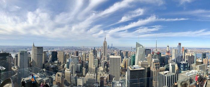
Il est disponible ici : https://lesvoyagesdetaco.fr/6-jours-a-new-york-planning-conseils-bonnes-adresses/
N'hésitez pas à me poser vos questions si besoin 🙂
Je vous propose mon carnet de voyage de 6 jours à New York, avec le planning de mes visites, mes conseils, mes adresses...
Il est disponible ici : https://lesvoyagesdetaco.fr/6-jours-a-new-york-planning-conseils-bonnes-adresses/
N'hésitez pas à me poser vos questions si besoin 🙂