Results for "Gorges+Tigre+|+112+>+171"
15636 results found.
Langtang – Trekking in the Rain
We did the Langtang trek (hike) from September 10th to 17th, with the first and last days being the trip from Kathmandu and back—so 6 days of actual walking. It’s a fairly well-known trek but certainly not as famous or crowded as those in the Annapurna or Everest regions, which is why we chose it.
In theory, it’s mandatory to have a guide for this trek. In reality, it seems there are ways to bypass the regulations: we met at least two people hiking without a guide—a South Korean, a New Zealander, and possibly also a couple of English women and an American couple, though we’re not sure if they had a guide.
The agency we booked with had told us it was an affordable trek for relatively older people in good shape—which is our case (I’m 72 myself). I have to say upfront that we found it quite challenging, maybe because we didn’t have good weather—it was the end of the monsoon season. To be clear, no matter your fitness level, I’d say doing this trek in the middle of the monsoon season would be suicidal.
Day 1 – Journey from Kathmandu to Syapru Besi
On Monday, September 8th, there had been violent protests in Kathmandu against the government, which had, among other things, blocked access to social media and been accused of nepotism and corruption. There were 19 deaths. The situation was very tense on the day of our departure, Wednesday the 10th. The agency warned us that public transport was very unreliable. So, we decided to take a jeep, at an additional cost of $100 ($160 minus what was already budgeted for the bus).
We left a little before 7 a.m. and it took us a good hour just to reach the outskirts of Kathmandu. Along the way, we saw several houses and vehicles set on fire by protesters.
The road to Syapru Besi is only 120 km, but it’s frankly awful. It’s always narrow, winds through endless mountains, and the shoulders range from bad to confusing to nonexistent. Several sections are just dirt tracks. We didn’t regret opting for the jeep, as we could stop several times at our convenience—if only to let Y (my Thai partner) throw up everything she had. She’d taken her usual motion sickness medication, but the constant turns, accelerations, and braking eventually made her terribly carsick.
In Nuwakot, we stopped for breakfast at a nice little restaurant, Jimbu. It was around 8:30 a.m., and we’d barely covered 60 km. The restaurant has a lovely garden overlooking the Trishuli Ganga, the river flowing down from Syapru Besi. First photo: the river in the bottom right corner, mist and clouds over the mountain on the other side.
An hour later, my second photo: the hills along the Trishuli Ganga. You can see the different crops—lush green rice paddies in the lower right and corn, already yellowed and likely harvested, in the foreground on the left. And of course, the mist and clouds through which you can glimpse the mountain on the other side of the river.
In theory, it’s mandatory to have a guide for this trek. In reality, it seems there are ways to bypass the regulations: we met at least two people hiking without a guide—a South Korean, a New Zealander, and possibly also a couple of English women and an American couple, though we’re not sure if they had a guide.
The agency we booked with had told us it was an affordable trek for relatively older people in good shape—which is our case (I’m 72 myself). I have to say upfront that we found it quite challenging, maybe because we didn’t have good weather—it was the end of the monsoon season. To be clear, no matter your fitness level, I’d say doing this trek in the middle of the monsoon season would be suicidal.
Day 1 – Journey from Kathmandu to Syapru Besi
On Monday, September 8th, there had been violent protests in Kathmandu against the government, which had, among other things, blocked access to social media and been accused of nepotism and corruption. There were 19 deaths. The situation was very tense on the day of our departure, Wednesday the 10th. The agency warned us that public transport was very unreliable. So, we decided to take a jeep, at an additional cost of $100 ($160 minus what was already budgeted for the bus).
We left a little before 7 a.m. and it took us a good hour just to reach the outskirts of Kathmandu. Along the way, we saw several houses and vehicles set on fire by protesters.
The road to Syapru Besi is only 120 km, but it’s frankly awful. It’s always narrow, winds through endless mountains, and the shoulders range from bad to confusing to nonexistent. Several sections are just dirt tracks. We didn’t regret opting for the jeep, as we could stop several times at our convenience—if only to let Y (my Thai partner) throw up everything she had. She’d taken her usual motion sickness medication, but the constant turns, accelerations, and braking eventually made her terribly carsick.
In Nuwakot, we stopped for breakfast at a nice little restaurant, Jimbu. It was around 8:30 a.m., and we’d barely covered 60 km. The restaurant has a lovely garden overlooking the Trishuli Ganga, the river flowing down from Syapru Besi. First photo: the river in the bottom right corner, mist and clouds over the mountain on the other side.
An hour later, my second photo: the hills along the Trishuli Ganga. You can see the different crops—lush green rice paddies in the lower right and corn, already yellowed and likely harvested, in the foreground on the left. And of course, the mist and clouds through which you can glimpse the mountain on the other side of the river.
Trip to Israel / Holy Land in 2022
For once, given the destination, the author can’t set aside their religious beliefs, which inevitably shape this kind of journey.
The Trip
Early in the morning at Orly Airport, in the departure lounge for Tel Aviv, a group of about forty young men arrives, all looking identical! The same neatly trimmed beards, the same identical haircuts, the same outfits with a touch of whimsy… The effect of seeing these forty “clones” is striking and raises questions! Why such perfect uniformity among this group of guys? Do they belong to the same family, sports club, cultural association, or religious group? A mystery! At the same time, the waiting area fills up with men who are more expected, given our destination: they wear large felt hats and dress in black suits with white shirts—Hassidim? The ones I’ve glimpsed fleetingly in Paris or New York, who have always been a mystery to me. More discreet-looking women accompany them.
I’m already in Israel without even setting foot there! Plus, I witness the preparations for an improvised show.
The “clones” start a flash mob at seven in the morning in a Paris airport departure lounge! Some pull out musical instruments, others begin singing and dancing. A music with strange, unfamiliar sounds enchants the waiting passengers.
The flight crew finally arrives, cutting through the flash mob, bringing us back to the reality of the moment: waiting to take off soon for this so troubling and mysterious Middle East. We go through passport control, presenting our faces to the scanners that operate the exit gate. The group of “identical” young men gets held up by the system: logically, a scanner let the first one through but blocked the second because of his perfect resemblance to the first. To the machine, the same person shouldn’t be able to cross the border twice? But eventually, the whole group makes it through the glass doors, leaving the Republic behind. My simplistic explanation is left looking ridiculous.
At every new destination, I ask myself countless questions, revealing a certain anxiety tied to the unknown: fear of attacks (one just happened at a bus station in Jerusalem), possible police pressure, unexpected events. Israel isn’t known for being a relaxing destination. In reality, if I did face a serious difficulty in this country, it wasn’t one I had anticipated—and it wasn’t particularly tied to Israel!
I take my seat by the window, which is already occupied by a little girl. Her father, a Hassidic man, politely asks if I’d be willing to give up my seat for his daughter. I tell him I’d be happy to make her happy. Seeing me masked, he asks if I’d like him and his daughter to wear masks too. In response, I take off my mask so as not to impose any constraints on them and wish them a good flight.
It was the first time I’d approached and spoken to a Hassidic man. He didn’t speak the way I might have expected after watching *Rabbi Jacob* with Louis de Funès; he spoke perfectly without an accent, just like you and me! Beware of stereotypes! Throughout the flight, I sneak glances at my strange neighbor: he prayed silently without stopping for a minute. His daughter, as good as gold, never interrupted him. He used several religious accessories during his three-hour continuous prayer: a kippa, a prayer shawl, and a rosary?… I left that plane deeply impressed, me, who has a very distant relationship with my Creator and only prays now and then.
The Trip
Early in the morning at Orly Airport, in the departure lounge for Tel Aviv, a group of about forty young men arrives, all looking identical! The same neatly trimmed beards, the same identical haircuts, the same outfits with a touch of whimsy… The effect of seeing these forty “clones” is striking and raises questions! Why such perfect uniformity among this group of guys? Do they belong to the same family, sports club, cultural association, or religious group? A mystery! At the same time, the waiting area fills up with men who are more expected, given our destination: they wear large felt hats and dress in black suits with white shirts—Hassidim? The ones I’ve glimpsed fleetingly in Paris or New York, who have always been a mystery to me. More discreet-looking women accompany them.
I’m already in Israel without even setting foot there! Plus, I witness the preparations for an improvised show.
The “clones” start a flash mob at seven in the morning in a Paris airport departure lounge! Some pull out musical instruments, others begin singing and dancing. A music with strange, unfamiliar sounds enchants the waiting passengers.
The flight crew finally arrives, cutting through the flash mob, bringing us back to the reality of the moment: waiting to take off soon for this so troubling and mysterious Middle East. We go through passport control, presenting our faces to the scanners that operate the exit gate. The group of “identical” young men gets held up by the system: logically, a scanner let the first one through but blocked the second because of his perfect resemblance to the first. To the machine, the same person shouldn’t be able to cross the border twice? But eventually, the whole group makes it through the glass doors, leaving the Republic behind. My simplistic explanation is left looking ridiculous.
At every new destination, I ask myself countless questions, revealing a certain anxiety tied to the unknown: fear of attacks (one just happened at a bus station in Jerusalem), possible police pressure, unexpected events. Israel isn’t known for being a relaxing destination. In reality, if I did face a serious difficulty in this country, it wasn’t one I had anticipated—and it wasn’t particularly tied to Israel!
I take my seat by the window, which is already occupied by a little girl. Her father, a Hassidic man, politely asks if I’d be willing to give up my seat for his daughter. I tell him I’d be happy to make her happy. Seeing me masked, he asks if I’d like him and his daughter to wear masks too. In response, I take off my mask so as not to impose any constraints on them and wish them a good flight.
It was the first time I’d approached and spoken to a Hassidic man. He didn’t speak the way I might have expected after watching *Rabbi Jacob* with Louis de Funès; he spoke perfectly without an accent, just like you and me! Beware of stereotypes! Throughout the flight, I sneak glances at my strange neighbor: he prayed silently without stopping for a minute. His daughter, as good as gold, never interrupted him. He used several religious accessories during his three-hour continuous prayer: a kippa, a prayer shawl, and a rosary?… I left that plane deeply impressed, me, who has a very distant relationship with my Creator and only prays now and then.
Kattegat Tour and Norway’s Majestic Fjords – 32 Days (Denmark, Sweden, Norway)
Kattegat isn’t just the name of the village in the TV series *Vikings*—it’s also the stretch of water separating Denmark from Sweden... the sea, basically! And further north, you’ve got Norway and its fjords!
Originally, I’d planned to just do a loop around Kattegat, with the *Under* restaurant in Lindesnes as our anniversary treat... but along the way, we thought, why not "push" a little further north, keeping an eye on the budget since we’d chosen to travel by car in June 2025 through Scandinavia.
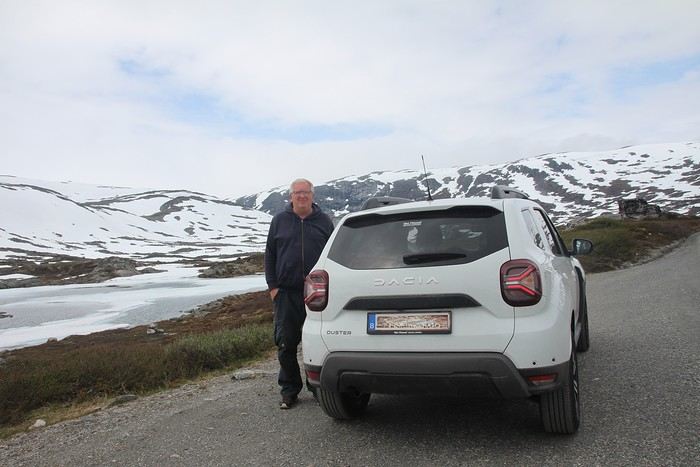
Why by car when most travelers opt for a camper van, while others prefer the comfort of cruises? Well, because we don’t own a camper van, renting one is pricey, and then you’ve got to add fuel costs (those things guzzle gas!), ferry fees, and other "tolls." All things considered, we went for mostly rentals—especially since there were four of us at the start of the trip. We spent the first week in Denmark with our daughter and son-in-law. Then they flew back to Belgium, and we continued our adventure as a couple. For accommodation, we mainly booked Airbnb apartments, which helped keep costs down and, most importantly, let us prepare our own meals (diet, diet!). In this travel journal, you’ll discover (or rediscover, for those who followed my older ones) our unbridled love for theme parks, museums, unique experiences, and—especially in Denmark—Legos! Unfortunately, we didn’t do any hikes this year because the unpredictable weather had made the trails slippery, and since I’d already taken three tumbles during the trip, I didn’t want to risk another! In the end, we traveled for 32 days, covered 6,200 km, and most importantly, discovered the charming country of Denmark, marveled at Norway’s breathtaking fjords—all without suffering the heatwave that hit France and Belgium that June! If you’ve got any questions, don’t hesitate to ask!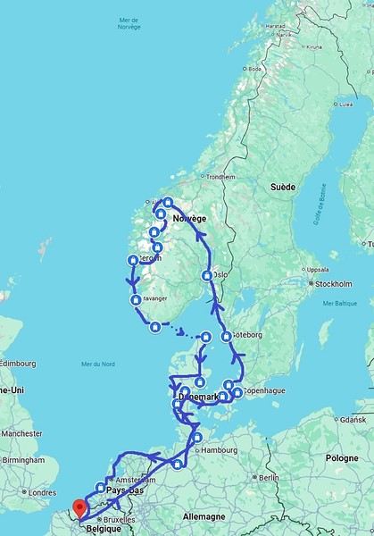
Why by car when most travelers opt for a camper van, while others prefer the comfort of cruises? Well, because we don’t own a camper van, renting one is pricey, and then you’ve got to add fuel costs (those things guzzle gas!), ferry fees, and other "tolls." All things considered, we went for mostly rentals—especially since there were four of us at the start of the trip. We spent the first week in Denmark with our daughter and son-in-law. Then they flew back to Belgium, and we continued our adventure as a couple. For accommodation, we mainly booked Airbnb apartments, which helped keep costs down and, most importantly, let us prepare our own meals (diet, diet!). In this travel journal, you’ll discover (or rediscover, for those who followed my older ones) our unbridled love for theme parks, museums, unique experiences, and—especially in Denmark—Legos! Unfortunately, we didn’t do any hikes this year because the unpredictable weather had made the trails slippery, and since I’d already taken three tumbles during the trip, I didn’t want to risk another! In the end, we traveled for 32 days, covered 6,200 km, and most importantly, discovered the charming country of Denmark, marveled at Norway’s breathtaking fjords—all without suffering the heatwave that hit France and Belgium that June! If you’ve got any questions, don’t hesitate to ask!
Zambia in Summer 2024 – Self-Drive Trip
Well, here we go,
despite the lack of info on Zambia, I managed to pull off this pretty special trip.
I’d posted asking for tips but got very few replies. So I leaned heavily on Giradhino’s travel journal to plan the route.
The context: After visiting Kenya, then Namibia, then Botswana, I wanted to see another Southern African country—hence Zambia. This time, we’re two couples: us (of course) and our friends we’ve traveled with to the last two countries mentioned. The idea was to do a self-drive trip, picking up a 4x4 at the airport and figuring it out as we went.
We rented our fully equipped vehicle from Hemingways, an agency in Livingstone. Great agency (really), I’ll talk more about them later. It came with rooftop tents and all the gear for cooking and everything... However, our goal was to sleep in lodges and only use the tents as a last resort. Mission accomplished—we never even unfolded the tents. Guess we’re getting old 🙂
The route (summary): Lusaka - Kasanka NP - Bangweulu NP - Mutinondo - Kapishya - North Luangwa - South Luangwa and back to Lusaka.
That said, let’s hit the road for this travel journal of a pretty lively trip. Reminder: I’m more of a filmmaker, so I’ve got tons of footage but very few photos. The ones I have were taken on my phone, so they’re not great quality. My wife’s the one who handles that side of things.
Day 1:
At 9 a.m. sharp (or close enough), we leave the Lyon area, heading to Paris CDG. Our flight’s at 9:30 p.m., but it’s a busy Saturday with holiday traffic, so we play it safe to avoid jams—especially since the Olympics (hosted in Paris, in case you didn’t know) are causing extra traffic issues.
We’re relaxed and happy to be on our way. The drive goes smoothly. We take the eastern route around Paris to reach a hotel with parking at a better price than the airport lots. We leave the car there, and a shuttle takes us to Terminal 2. Bad luck—we’re actually flying from Terminal 1! The transfer between terminals is quick, though, so no stress.
After the usual formalities (with Rwandair), we end up in the Duty Free.
A rare rant-free moment: Usually, I let off steam in my travel journals now and then, but this time it’s the opposite. I had a terrible memory of CDG and had been avoiding it for years. But this time—Olympics effect? A big change? What a pleasant surprise! The staff were plentiful and super friendly at every pre-flight step, making everything easier. Comfortable seats for waiting to board. Well done, CDG!
We buy Ricard, Jack Daniel’s, and Get 27 to handle any situation that might come up. We board on time, and that’s when our adventures with Rwandair really begin. Yep, the first hiccup!
We’d booked our tickets back in October and (since we don’t hold back!) had paid extra for preferred seats on all our flights. Since October, we’d received emails about schedule changes—just a few minutes here and there. Unfortunately, we never got an email saying that *on top of* the schedule change, the plane’s configuration had also changed. So when we boarded with our seats (all four of us together at row 25), we were furious to see that the preferred seats were now row 23. We’d been *completely* scammed. We’d paid extra to end up in seats we’d been trying to avoid! You could say Rwandair double-dipped on the same seats. What a rip-off! We tried to negotiate an upgrade, but the flight was full. So our flight to Kigali started with a real sense of anger.
The +: We’re on our way The -: Rwandair
The context: After visiting Kenya, then Namibia, then Botswana, I wanted to see another Southern African country—hence Zambia. This time, we’re two couples: us (of course) and our friends we’ve traveled with to the last two countries mentioned. The idea was to do a self-drive trip, picking up a 4x4 at the airport and figuring it out as we went.
We rented our fully equipped vehicle from Hemingways, an agency in Livingstone. Great agency (really), I’ll talk more about them later. It came with rooftop tents and all the gear for cooking and everything... However, our goal was to sleep in lodges and only use the tents as a last resort. Mission accomplished—we never even unfolded the tents. Guess we’re getting old 🙂
The route (summary): Lusaka - Kasanka NP - Bangweulu NP - Mutinondo - Kapishya - North Luangwa - South Luangwa and back to Lusaka.
That said, let’s hit the road for this travel journal of a pretty lively trip. Reminder: I’m more of a filmmaker, so I’ve got tons of footage but very few photos. The ones I have were taken on my phone, so they’re not great quality. My wife’s the one who handles that side of things.
Day 1:
At 9 a.m. sharp (or close enough), we leave the Lyon area, heading to Paris CDG. Our flight’s at 9:30 p.m., but it’s a busy Saturday with holiday traffic, so we play it safe to avoid jams—especially since the Olympics (hosted in Paris, in case you didn’t know) are causing extra traffic issues.
We’re relaxed and happy to be on our way. The drive goes smoothly. We take the eastern route around Paris to reach a hotel with parking at a better price than the airport lots. We leave the car there, and a shuttle takes us to Terminal 2. Bad luck—we’re actually flying from Terminal 1! The transfer between terminals is quick, though, so no stress.
After the usual formalities (with Rwandair), we end up in the Duty Free.
A rare rant-free moment: Usually, I let off steam in my travel journals now and then, but this time it’s the opposite. I had a terrible memory of CDG and had been avoiding it for years. But this time—Olympics effect? A big change? What a pleasant surprise! The staff were plentiful and super friendly at every pre-flight step, making everything easier. Comfortable seats for waiting to board. Well done, CDG!
We buy Ricard, Jack Daniel’s, and Get 27 to handle any situation that might come up. We board on time, and that’s when our adventures with Rwandair really begin. Yep, the first hiccup!
We’d booked our tickets back in October and (since we don’t hold back!) had paid extra for preferred seats on all our flights. Since October, we’d received emails about schedule changes—just a few minutes here and there. Unfortunately, we never got an email saying that *on top of* the schedule change, the plane’s configuration had also changed. So when we boarded with our seats (all four of us together at row 25), we were furious to see that the preferred seats were now row 23. We’d been *completely* scammed. We’d paid extra to end up in seats we’d been trying to avoid! You could say Rwandair double-dipped on the same seats. What a rip-off! We tried to negotiate an upgrade, but the flight was full. So our flight to Kigali started with a real sense of anger.
The +: We’re on our way The -: Rwandair
Uzbekistan - Finally made it - Summer 2022
Another trip planned during Covid. Actually, for 2020, I had three trips booked, with tickets purchased and everything.
This one to Uzbekistan was planned for April 2020. We postponed it to April 2021, but it was canceled again, and we couldn’t reschedule for April 2022 because our friends who were coming with us were busy. So, we chose summer, knowing the temperatures would likely be very high.
We left as a group of five: a couple we usually travel with and one of their friends, whom I knew. She was traveling alone and had dreamed of this trip but didn’t want to go by herself.
For organization, we went through an agency to handle the train tickets and our trip to the Aral Sea. It’s not my usual style, but back in 2020, we were already in touch with them, and they were very understanding during the two cancellations. It wasn’t easy, given the economic crisis Covid caused, especially in Uzbekistan.
Again, I’m writing this travel journal from memory since I didn’t take any notes. (It’s good to give your brain a workout now and then!)
Day 1: Off to Tashkent
We flew in the afternoon to Istanbul, had a 2-hour-15-minute layover in Turkey, and then took an overnight flight to arrive early in the morning in Tashkent. Problem (again): just before taking off from Saint-Exupéry, the plane had an issue with the landing gear. We waited two hours, and after a few hammer and wrench adjustments, we finally took off. Of course, by the time we arrived in Istanbul, it was a mad dash through the airport to catch our connecting flight. We landed at 7:30 AM in Tashkent, and of the five suitcases in our little group, two were missing (one of ours and the solo traveler’s). Big problem because we were leaving at 2:30 PM by train for the Aral Sea, and we wouldn’t be near an airport again for three days. Plus, at the small airport in the Uzbek capital, no one spoke English (or French, or the Ardèche dialect). Fortunately, we had booked a guide for a quick morning tour of the capital. We had seven hours to kill, and it seemed smart to do it this way (and yes, sometimes we do think ahead). With him speaking English and, more importantly, Uzbek, the delivery of our suitcases was arranged.
So, we set off to explore the capital. It’s very Soviet in design—wide avenues and ugly buildings.
We visited the Khasti Imam historical complex (first name to pronounce at your own risk—there will be plenty more during the trip). Lots of "oohs" and "aahs" about how beautiful it was, but in the end, compared to what we saw later, it was really just small potatoes.
We checked out Chorsu Bazaar, the city’s large covered market. The guide was friendly and gave us plenty of tips for the rest of the trip. He suggested a restaurant, which we accepted, so we could get familiar with local customs. The good thing was, it didn’t seem like a tourist trap.
Next, we headed to the train station because our train was at 2:30 PM. The guide left us, and then another problem arose. While going through security, one of the staff made it clear that our train was canceled and our ticket needed to be changed to the train leaving around 8:20 PM. Heatwave moment (it was 38°C). Our issue was that we were supposed to arrive in Nukus (our destination) at 6:00 AM and take a minibus for a round trip to Moynaq and the Aral Sea (four hours each way). The plan was to spend 2-3 hours there and return, so a 10-11-hour timeline. Leaving at 6:00 AM made it doable, but with the train now leaving at 8:20 PM, we’d arrive in Nukus at noon, which messed up the rest of the plan.
I was fuming at the agency (I really don’t like using agencies), so I called the local contact, who quickly sent our guide back (because trying to communicate, change tickets, and get information was tough).
I asked the manager to find us flight tickets to make up for the delay, but nothing—zilch—was possible. We were stuck! My buddy and I were determined to get to Moynaq, but the women in the group were less motivated.
No choice but to board the train for an overnight journey. We had a cabin for two (and our friend had one to herself). Big scare at first—no AC, and it felt like 150°. They told us it would work once the train started moving, which it did. A frugal meal in the dining car (spaghetti with meat—the only dish on offer) and we had a good night’s sleep.
The +: Finally, we’re here! The -: A lot of hassles to start the trip
We left as a group of five: a couple we usually travel with and one of their friends, whom I knew. She was traveling alone and had dreamed of this trip but didn’t want to go by herself.
For organization, we went through an agency to handle the train tickets and our trip to the Aral Sea. It’s not my usual style, but back in 2020, we were already in touch with them, and they were very understanding during the two cancellations. It wasn’t easy, given the economic crisis Covid caused, especially in Uzbekistan.
Again, I’m writing this travel journal from memory since I didn’t take any notes. (It’s good to give your brain a workout now and then!)
Day 1: Off to Tashkent
We flew in the afternoon to Istanbul, had a 2-hour-15-minute layover in Turkey, and then took an overnight flight to arrive early in the morning in Tashkent. Problem (again): just before taking off from Saint-Exupéry, the plane had an issue with the landing gear. We waited two hours, and after a few hammer and wrench adjustments, we finally took off. Of course, by the time we arrived in Istanbul, it was a mad dash through the airport to catch our connecting flight. We landed at 7:30 AM in Tashkent, and of the five suitcases in our little group, two were missing (one of ours and the solo traveler’s). Big problem because we were leaving at 2:30 PM by train for the Aral Sea, and we wouldn’t be near an airport again for three days. Plus, at the small airport in the Uzbek capital, no one spoke English (or French, or the Ardèche dialect). Fortunately, we had booked a guide for a quick morning tour of the capital. We had seven hours to kill, and it seemed smart to do it this way (and yes, sometimes we do think ahead). With him speaking English and, more importantly, Uzbek, the delivery of our suitcases was arranged.
So, we set off to explore the capital. It’s very Soviet in design—wide avenues and ugly buildings.
We visited the Khasti Imam historical complex (first name to pronounce at your own risk—there will be plenty more during the trip). Lots of "oohs" and "aahs" about how beautiful it was, but in the end, compared to what we saw later, it was really just small potatoes.
We checked out Chorsu Bazaar, the city’s large covered market. The guide was friendly and gave us plenty of tips for the rest of the trip. He suggested a restaurant, which we accepted, so we could get familiar with local customs. The good thing was, it didn’t seem like a tourist trap.
Next, we headed to the train station because our train was at 2:30 PM. The guide left us, and then another problem arose. While going through security, one of the staff made it clear that our train was canceled and our ticket needed to be changed to the train leaving around 8:20 PM. Heatwave moment (it was 38°C). Our issue was that we were supposed to arrive in Nukus (our destination) at 6:00 AM and take a minibus for a round trip to Moynaq and the Aral Sea (four hours each way). The plan was to spend 2-3 hours there and return, so a 10-11-hour timeline. Leaving at 6:00 AM made it doable, but with the train now leaving at 8:20 PM, we’d arrive in Nukus at noon, which messed up the rest of the plan.
I was fuming at the agency (I really don’t like using agencies), so I called the local contact, who quickly sent our guide back (because trying to communicate, change tickets, and get information was tough).
I asked the manager to find us flight tickets to make up for the delay, but nothing—zilch—was possible. We were stuck! My buddy and I were determined to get to Moynaq, but the women in the group were less motivated.
No choice but to board the train for an overnight journey. We had a cabin for two (and our friend had one to herself). Big scare at first—no AC, and it felt like 150°. They told us it would work once the train started moving, which it did. A frugal meal in the dining car (spaghetti with meat—the only dish on offer) and we had a good night’s sleep.
The +: Finally, we’re here! The -: A lot of hassles to start the trip
In MIKUMI and SELOUS, Southern Tanzania (June 2024)
Hi everyone,
I’m a newbie to this forum, passionate about wildlife, the landscapes of East Africa, and Tanzania in particular. This June 2024 trip/safari is our 7th visit to Tanzania and our 5th in the south, which has drawn us more than the north ever since we discovered it in 2015.
In 2024, the entrance fees for the reserves and services have gone up again since our last visit. I chose to return first to Mikumi Reserve, which was the very first one we visited in the south. Then, we’ll head to Selous (J. Nyerere N. P.) as usual. Initially, we wanted to spend 2/3 days on Mafia Island at the end of the trip, but it made the total cost too high, so we gave up... We usually go to Ruaha and Selous, but I wanted to mix it up a bit—also to save some money...
As for the timing, June is a new experience for us. I thought it might be interesting to come just after the lodges reopen... hoping for some great wildlife encounters??
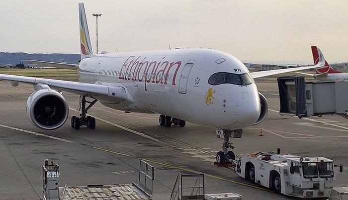
The trip starts in Marseille with our first flight on Ethiopian Airlines to Addis Ababa, then continues to Dar es Salaam, where we’ll finally set foot on Tanzanian soil again.
In Addis... "our" A-350.
.....
After arriving in Dar, we spent one night at a hotel near the airport. The next morning, we headed to the domestic flights terminal, which hasn’t changed in years.
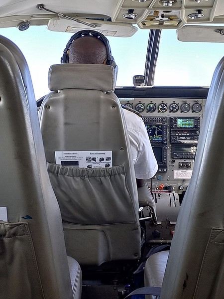
By mid-morning, we boarded a Cessna 208B Caravan with Safari Air Link, heading to the Kikoboga bush airstrip in Mikumi, which we reached 45 minutes later. Fun fact: the pilot was the same one as on our return flight two years ago.
Welcome on board:
Of course, a driver/guide team from our chosen lodge was waiting for us upon arrival:
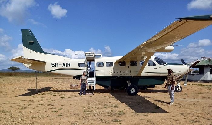
I was surprised to see so many aircraft parked there... even twin-engine Embraer Brasilias?? As a fan of vintage planes, I loved it...
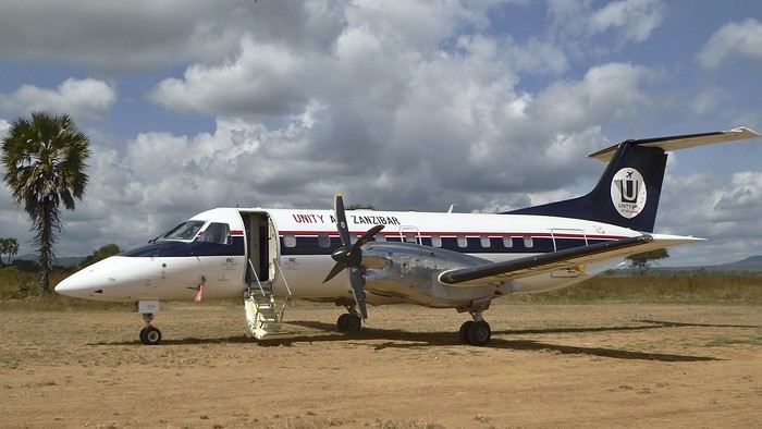
On the other hand, the light was incredibly harsh.....!! Our guides only speak English. We knew that in advance. In the south, it’s very rare to find someone who speaks French. This’ll force us to dig into our high school English memories... from 60 years ago... at least.
It’s noon, and we head toward the lodge. Near the airstrip, next to the Mikumi rangers’ base, there are quite a few herbivores. They find a bit more peace here—the big cats don’t venture this way...
Our first encounter was a group of Masai giraffes.
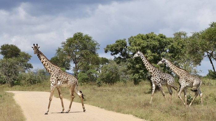
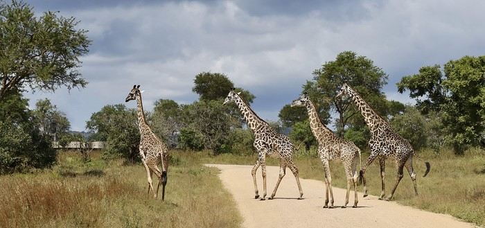
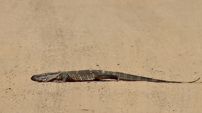
Rarer (for us), a savanna monitor lizard basking in the sun right in the middle of the track...??
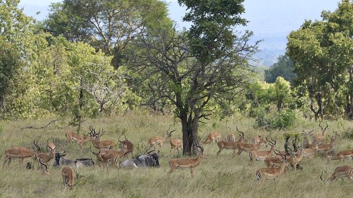
A large gathering of impalas (mostly males) along with a few blue wildebeest:

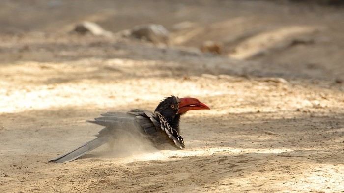
Also unusual: a African crowned hornbill taking a dust bath in the middle of the track...!!
When it comes to identifying mammals or birds, I don’t know everything... so I might make mistakes. Please forgive me. I’m counting on my friend Blesl’s active participation... 😉
...
I’m a newbie to this forum, passionate about wildlife, the landscapes of East Africa, and Tanzania in particular. This June 2024 trip/safari is our 7th visit to Tanzania and our 5th in the south, which has drawn us more than the north ever since we discovered it in 2015.
In 2024, the entrance fees for the reserves and services have gone up again since our last visit. I chose to return first to Mikumi Reserve, which was the very first one we visited in the south. Then, we’ll head to Selous (J. Nyerere N. P.) as usual. Initially, we wanted to spend 2/3 days on Mafia Island at the end of the trip, but it made the total cost too high, so we gave up... We usually go to Ruaha and Selous, but I wanted to mix it up a bit—also to save some money...
As for the timing, June is a new experience for us. I thought it might be interesting to come just after the lodges reopen... hoping for some great wildlife encounters??
The trip starts in Marseille with our first flight on Ethiopian Airlines to Addis Ababa, then continues to Dar es Salaam, where we’ll finally set foot on Tanzanian soil again.
In Addis... "our" A-350.
.....
After arriving in Dar, we spent one night at a hotel near the airport. The next morning, we headed to the domestic flights terminal, which hasn’t changed in years.
By mid-morning, we boarded a Cessna 208B Caravan with Safari Air Link, heading to the Kikoboga bush airstrip in Mikumi, which we reached 45 minutes later. Fun fact: the pilot was the same one as on our return flight two years ago.
Welcome on board:
Of course, a driver/guide team from our chosen lodge was waiting for us upon arrival:
I was surprised to see so many aircraft parked there... even twin-engine Embraer Brasilias?? As a fan of vintage planes, I loved it...
On the other hand, the light was incredibly harsh.....!! Our guides only speak English. We knew that in advance. In the south, it’s very rare to find someone who speaks French. This’ll force us to dig into our high school English memories... from 60 years ago... at least.
It’s noon, and we head toward the lodge. Near the airstrip, next to the Mikumi rangers’ base, there are quite a few herbivores. They find a bit more peace here—the big cats don’t venture this way...
Our first encounter was a group of Masai giraffes.
Rarer (for us), a savanna monitor lizard basking in the sun right in the middle of the track...??
A large gathering of impalas (mostly males) along with a few blue wildebeest:
Also unusual: a African crowned hornbill taking a dust bath in the middle of the track...!!
When it comes to identifying mammals or birds, I don’t know everything... so I might make mistakes. Please forgive me. I’m counting on my friend Blesl’s active participation... 😉
...
Recap of 17 days between São Paulo, Rio de Janeiro, and Iguaçu/Puerto Iguazu
I’ll repost here the comments I gave in reply to Camidav – see their post https://voyageforum.com/forum/partir-10-jours-bresil-en-autonomie-d10702249/.
As we’ve said several times, 10 days is short for Brazil! But it’s still enough for a “little introduction.” My very recent experience (April 2025) with a 2½-week itinerary might give you some ideas. To start, here’s the route:
- - Saturday, March 29: departure from Lisbon and arrival in São Paulo with LATAM
- - 2 nights in São Paulo
- - Monday, March 31: bus from São Paulo to Paraty
- - Monday 31, Tuesday 1st, and Wednesday, April 2: 3 nights in Paraty
- - Thursday, April 3: bus from Paraty to Angra dos Reis, then ferry > Ilha Grande
- - Thursday 3, Friday 4, and Saturday, April 5: 3 nights in Abraão, on Ilha Grande
- - Sunday, April 6: speedboat > Conceição de Jacareí, then bus > Rio de Janeiro
- - Sunday 6, Monday 7, Tuesday 8, and Wednesday, April 9: 4 nights in Rio
- - Thursday, April 10: flight with LATAM from Rio to Foz do Iguaçu
- - Thursday, April 10: one night in Foz do Iguaçu
- - Friday, April 11: visit to Iguaçu Falls on the Brazilian side, then crossing the border to Puerto Iguazu
- - Friday 11 and Saturday, April 12: 2 nights in Puerto Iguazu
- - Saturday, April 12: visit to the falls on the Argentine side
- - Sunday, April 13: return to Brazil, LATAM flight > São Paulo
- - Sunday 13 and Monday, April 14: 2 nights in São Paulo
- - Tuesday, April 15: flight from São Paulo > Lisbon with LATAM, arriving Wednesday the 16th.
So, it’s clear I’m writing this now from Puerto Iguazu (Argentina), and the end of the trip is near: back to São Paulo and then the flight to Lisbon. I’ll of course share more about all this in the following messages.
Trek in Nepal's Far West: Between Mountains and Yarsagumba Harvesting
Namaste everyone,
We went to Nepal last October and literally fell in love with this country (like so many others, it seems). During our trek, we had the chance to meet and travel with an incredible independent local guide, Apsara Luitel. She told us about a unique project she’s organizing starting mid-May, and we wanted to share it in case it interests anyone. We mentioned it on another travel forum, but just in case, we’re posting it here too to reach as many people as possible.
Apsara, who knows the Api mountain valley (a name as joyful as it is intriguing!) in Nepal’s Far West (on the border between India and Tibet, at the edge of the world) perfectly, is offering an off-the-beaten-path trek for a group of 3 to 8 people max. The program? An authentic and preserved itinerary combining homestays and small mountain lodges, all the way to the Api base camp. Once at base camp, locals will guide us to secret spots only they know, where we’ll harvest yarsagumba (those famous caterpillar-fungi, rare and prized for their medicinal properties in traditional Chinese medicine—they were going for $20,000 per kilo last year!).
Mid-May is the ideal time to discover this almost unexplored region and take part in harvesting these natural treasures. This kind of adventure, led by an inspiring young woman like Apsara, is rare, and we think it could appeal to Nepal lovers and those who enjoy authentic treks far from the usual tourist routes.
No matter how many participants there are (between 3 and 8), there will always be two guides: Apsara, who speaks English (and is learning French!), and a French-speaking guide. The dates are flexible around May 15th, depending on the availability of those who’d like to take on the adventure.
We went to Nepal last October and literally fell in love with this country (like so many others, it seems). During our trek, we had the chance to meet and travel with an incredible independent local guide, Apsara Luitel. She told us about a unique project she’s organizing starting mid-May, and we wanted to share it in case it interests anyone. We mentioned it on another travel forum, but just in case, we’re posting it here too to reach as many people as possible.
Apsara, who knows the Api mountain valley (a name as joyful as it is intriguing!) in Nepal’s Far West (on the border between India and Tibet, at the edge of the world) perfectly, is offering an off-the-beaten-path trek for a group of 3 to 8 people max. The program? An authentic and preserved itinerary combining homestays and small mountain lodges, all the way to the Api base camp. Once at base camp, locals will guide us to secret spots only they know, where we’ll harvest yarsagumba (those famous caterpillar-fungi, rare and prized for their medicinal properties in traditional Chinese medicine—they were going for $20,000 per kilo last year!).
Mid-May is the ideal time to discover this almost unexplored region and take part in harvesting these natural treasures. This kind of adventure, led by an inspiring young woman like Apsara, is rare, and we think it could appeal to Nepal lovers and those who enjoy authentic treks far from the usual tourist routes.
No matter how many participants there are (between 3 and 8), there will always be two guides: Apsara, who speaks English (and is learning French!), and a French-speaking guide. The dates are flexible around May 15th, depending on the availability of those who’d like to take on the adventure.
Tanzania 2019 - Polé Polé
KARIBUUU
Over 5 years later, I’m finally getting around to writing the travel journal for our first trip to East Africa: Tanzania. *Polé Polé*, as they say! 😎
A trip I’d started planning just 6 years ago, in February 2019, for my post-internship exam vacation. After returning to South Africa in July 2019 with my family, this trip, planned for September 2019, would be all about discovery and a few firsts: first trip with friends, first trek, first time in East Africa. I really wanted to attempt the Kilimanjaro ascent, try to still see some of its "eternal" ice, and Alison wanted to do as much safari as possible. Unlike with the Zulus, Himbas, or San, visiting a Maasai village wasn’t on the agenda. Thanks to the Kessy Brothers agency, who were super responsive, Sandy from VF, and other members who helped prepare our trip, we settled on the following itinerary:
Day -1 (8/30): Departure from Pointe-à-Pitre Day 0 (8/31): Departure from Paris Day 1 (9/01): Arrival at Kilimanjaro Airport / Ameg Lodge (Moshi) DAY 2 (9/02): Machame gate / Machame camp DAY 3 (9/03): Shira / Shira camp DAY 4 (9/04): Baranco / Baranco camp DAY 5 (9/05): Barafu / Barafu camp DAY 6 (9/06): Barafu + Summit at midnight / Mweka camp DAY 7 (9/07): Mweka gate / Sal Salnero Hotel (Moshi) DAY 8 (9/08): Arusha National Park / Kanga camp DAY 9 (9/09): Tarangire National Park / Kanga camp DAY 10 (9/10): Tarangire National Park / Twiga Lodge DAY 11 (9/11): Lake Manyara / Twiga Lodge DAY 12 (9/12): Ngorongoro Crater / Simba campsite DAY 13 (9/13): Serengeti National Park / Seronera campsite DAY 14 (9/14): Serengeti National Park - Uoga Kuria Camp DAY 15 (9/15): Serengeti National Park / Waso campsite DAY 16 (9/16): Lake Natron / Maasai Giraffe Ecolodge DAY 17 (9/17): Kilimanjaro Airport Day 18 (9/18): Zanzibar Day 19 (9/19): Zanzibar Day 20 (9/20): Zanzibar Day 21 (9/21): Zanzibar
As I mentioned in my first travel journal about our South Africa trip, I’ve had a special connection to Tanzania for a long time. Growing up in the Indian Ocean without ever visiting Africa, those wildlife documentaries on TV when I skipped my pharmacy classes... I imagined and dreamed about this land and country so much.
The original plan was to go just the two of us with Alison, but somehow—though I don’t quite remember how—we ended up organizing the trip with our friends Mélissa and Doriane, who joined us in Arusha after our Kilimanjaro trek for the last two weeks and their very first safari. I think it was Melissa who had the idea to crash our trip, and she was right to do so! 😉 Flights: Pointe-à-Pitre-Grand Case and Grand Case-Paris with Air Caraïbes. Flights: Paris-JRO and ZNZ-Paris with Kenya Airways (layover in Nairobi). Flight: JRO-ZNZ with Air Tanzania.
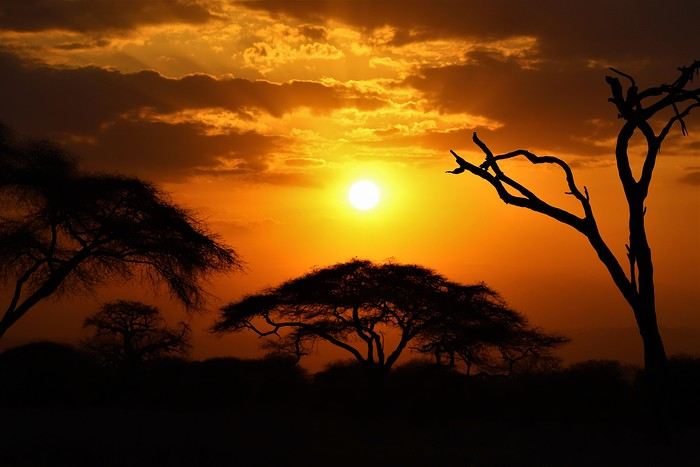
Safe travels! !
Over 5 years later, I’m finally getting around to writing the travel journal for our first trip to East Africa: Tanzania. *Polé Polé*, as they say! 😎
A trip I’d started planning just 6 years ago, in February 2019, for my post-internship exam vacation. After returning to South Africa in July 2019 with my family, this trip, planned for September 2019, would be all about discovery and a few firsts: first trip with friends, first trek, first time in East Africa. I really wanted to attempt the Kilimanjaro ascent, try to still see some of its "eternal" ice, and Alison wanted to do as much safari as possible. Unlike with the Zulus, Himbas, or San, visiting a Maasai village wasn’t on the agenda. Thanks to the Kessy Brothers agency, who were super responsive, Sandy from VF, and other members who helped prepare our trip, we settled on the following itinerary:
Day -1 (8/30): Departure from Pointe-à-Pitre Day 0 (8/31): Departure from Paris Day 1 (9/01): Arrival at Kilimanjaro Airport / Ameg Lodge (Moshi) DAY 2 (9/02): Machame gate / Machame camp DAY 3 (9/03): Shira / Shira camp DAY 4 (9/04): Baranco / Baranco camp DAY 5 (9/05): Barafu / Barafu camp DAY 6 (9/06): Barafu + Summit at midnight / Mweka camp DAY 7 (9/07): Mweka gate / Sal Salnero Hotel (Moshi) DAY 8 (9/08): Arusha National Park / Kanga camp DAY 9 (9/09): Tarangire National Park / Kanga camp DAY 10 (9/10): Tarangire National Park / Twiga Lodge DAY 11 (9/11): Lake Manyara / Twiga Lodge DAY 12 (9/12): Ngorongoro Crater / Simba campsite DAY 13 (9/13): Serengeti National Park / Seronera campsite DAY 14 (9/14): Serengeti National Park - Uoga Kuria Camp DAY 15 (9/15): Serengeti National Park / Waso campsite DAY 16 (9/16): Lake Natron / Maasai Giraffe Ecolodge DAY 17 (9/17): Kilimanjaro Airport Day 18 (9/18): Zanzibar Day 19 (9/19): Zanzibar Day 20 (9/20): Zanzibar Day 21 (9/21): Zanzibar
As I mentioned in my first travel journal about our South Africa trip, I’ve had a special connection to Tanzania for a long time. Growing up in the Indian Ocean without ever visiting Africa, those wildlife documentaries on TV when I skipped my pharmacy classes... I imagined and dreamed about this land and country so much.
The original plan was to go just the two of us with Alison, but somehow—though I don’t quite remember how—we ended up organizing the trip with our friends Mélissa and Doriane, who joined us in Arusha after our Kilimanjaro trek for the last two weeks and their very first safari. I think it was Melissa who had the idea to crash our trip, and she was right to do so! 😉 Flights: Pointe-à-Pitre-Grand Case and Grand Case-Paris with Air Caraïbes. Flights: Paris-JRO and ZNZ-Paris with Kenya Airways (layover in Nairobi). Flight: JRO-ZNZ with Air Tanzania.
Safe travels! !
Southwest Part 2: 55 Days in Colorado, New Mexico, Arizona, Nevada, and Utah
This travel journal is the second part of the trip whose first part you can find here: 1st part...
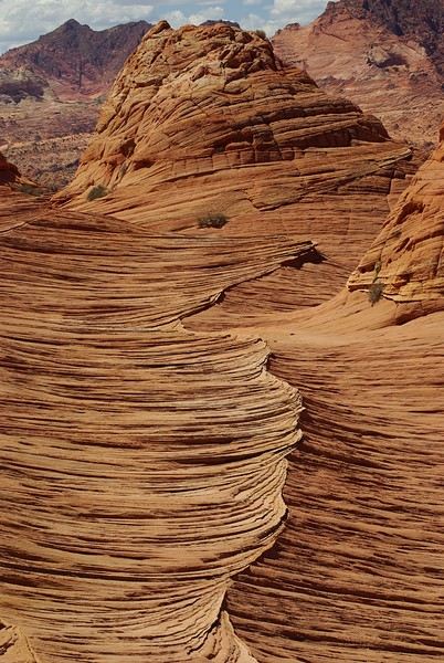
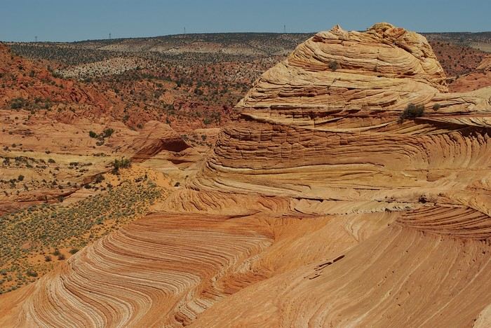
Sunday, August 7: the day we discover a magical place... Edmaier's Secret...
We got up at 8:00 AM, had breakfast on the terrace of our tiny house, and then set off again toward yesterday’s trail. This time, we stopped after 4.5 miles on House Rock Valley Road at the Buckskin Gulch Trail parking lot. We weren’t interested in that trail today—the slot canyon is muddy anyway after the recent storms...
Instead, we explored a lesser-known area that became our playground. And what a playground it was, folks—an out-of-this-world spot, THE highlight of our trip!!! 😏
Just imagine being in the middle of these landscapes, and the cherry on top... no one else around!!!!! Well, we did meet a couple who were coming back—it was 9:30 AM 😮. Did they camp there? Did they turn back? 🙁
After paying the entry permit online, we set off with plenty of water (6L for the four of us) plus a gallon we hid along the way for the return trip. 😉 After a one-hour approach hike along a wash, we reached the sea of sand.
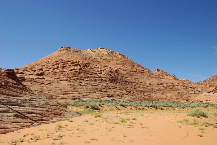
We had to cross it to reach our goal: a strip about 2 km long and 1 km wide that you can explore freely since there’s no marked trail... We entered a few GPS points into our Garmin Etrex, and off we went!!! 😎 It was... magical, enchanting, a true love-at-first-sight moment!
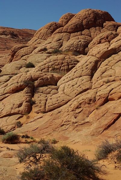
Brain Rock, waves, fine and brittle rock, colors—it goes up, it goes down.
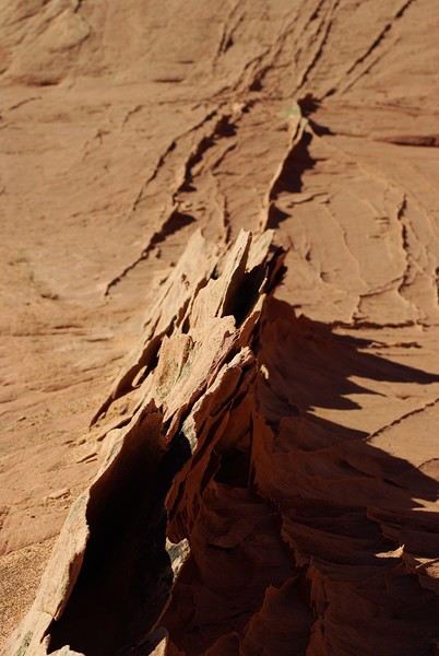
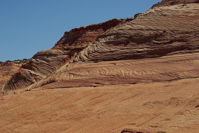
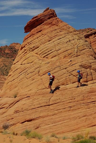
Just thinking about it gives me chills... I remember sitting still for two minutes, taking in these wonders with such emotion that I teared up...
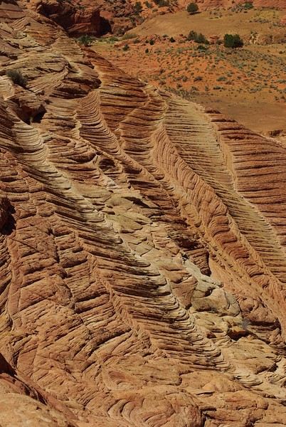
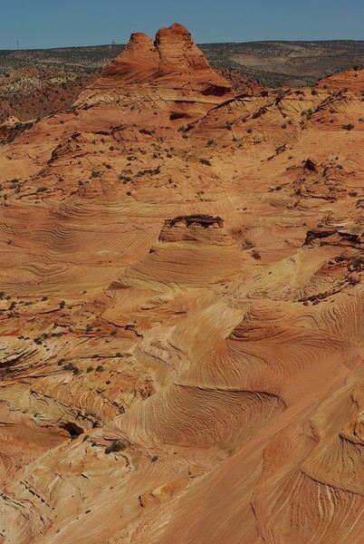
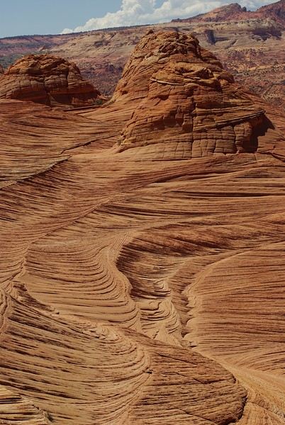
Sunday, August 7: the day we discover a magical place... Edmaier's Secret...
We got up at 8:00 AM, had breakfast on the terrace of our tiny house, and then set off again toward yesterday’s trail. This time, we stopped after 4.5 miles on House Rock Valley Road at the Buckskin Gulch Trail parking lot. We weren’t interested in that trail today—the slot canyon is muddy anyway after the recent storms...
Instead, we explored a lesser-known area that became our playground. And what a playground it was, folks—an out-of-this-world spot, THE highlight of our trip!!! 😏
Just imagine being in the middle of these landscapes, and the cherry on top... no one else around!!!!! Well, we did meet a couple who were coming back—it was 9:30 AM 😮. Did they camp there? Did they turn back? 🙁
After paying the entry permit online, we set off with plenty of water (6L for the four of us) plus a gallon we hid along the way for the return trip. 😉 After a one-hour approach hike along a wash, we reached the sea of sand.
We had to cross it to reach our goal: a strip about 2 km long and 1 km wide that you can explore freely since there’s no marked trail... We entered a few GPS points into our Garmin Etrex, and off we went!!! 😎 It was... magical, enchanting, a true love-at-first-sight moment!
Brain Rock, waves, fine and brittle rock, colors—it goes up, it goes down.
Just thinking about it gives me chills... I remember sitting still for two minutes, taking in these wonders with such emotion that I teared up...
21-Day Trip to La Gomera and La Palma
Travel Journal: 21 Days in La Gomera and La Palma
From February 6 to February 26, 2024
Tuesday, February 6 We left around 9 AM with our car, along with Pierre-Paul and Patricia, heading to the Bluepark parking lot in Bartenheim. As expected, we were awaited and left promptly for EuroAirport Basel. Took off at 12:25 PM for a 4-hour-15-minute flight under excellent conditions. Beautiful arrival in Tenerife with Teide in sight under a clear blue sky. Fifteen minutes later, we waited for bus No. 40 to Los Cristianos with quite a few other tourists, but we managed to find four seats. From the bus station, it was a 20-minute walk to our hotel. We checked into a lovely apartment for the four of us, complete with all the comforts. Outside, it was quite warm—at least 25°C! After dropping off our luggage, we went for a stroll. The immediate surroundings of the hotel held no interest for us: a modern, concrete area filled with hotels, bars, tourist agencies, and unappealing restaurants all offering the same bland international cuisine. Pat went to cool off at the pool, unfortunately overrun by loud, drunk English tourists. I took a walk to the paseo maritimo that leads to the port, skirting the seafront. The promenade was pleasant, but it could have been any seaside resort in the world—same old scene: a succession of bars with blaring music where many elderly people sipped cold beers waiting for the sunset, the backdrop a wall of resort-style hotels resembling rabbit hutches! Upon reaching the port, I scouted the route we’d take the next day to the Fred Olsen ferry. Back at the apartment, in the early evening, we looked for a non-touristy restaurant for dinner. Monique stopped a woman to ask her opinion! In this area, she told us, there’s no restaurant that serves Canarian or Spanish cuisine! The only place with decent restaurants is at the port. Off we went to the port, where we sat down at Al Bordo restaurant and ordered a seafood paella for four. Excellent, and at a very reasonable price (36 € for two). We returned to the hotel along the seafront.
Wednesday, February 7
Woke up at 6 AM. Had breakfast in the apartment with what we’d bought the day before at a supermarket. It was still dark when we left on foot toward the port, walking along the calm seafront at this early hour. Forty minutes later, we arrived and waited 10 minutes before the ferry docked. At 9:30 AM, we left the port of Los Cristianos for a 50-minute crossing on a calm sea under a beautiful blue sky. There were quite a few people on this large ferry, but many had no luggage, meaning they were visiting La Gomera for the day and would take the ferry back in the evening. Upon disembarking, we went straight to our rental car agency to pick up the car we’d booked online a few months earlier. It was a nice Peugeot 2008, spacious enough for the four of us and our luggage. We immediately took the beautiful road from San Sebastián that climbs directly into the mountains toward our rental in Vallehermoso. The road was in perfect condition—it seemed brand new, like all the others we’d take on this island later. This side of the island is very arid with little vegetation, and the terrain is particularly rugged, as it is throughout the island. We stopped at our first miradors, which would be followed by many more throughout our Canarian trip. Our first visit was to the small village of Agulo, perched on a promontory above the sea and at the foot of a high cliff. The village features typical Canarian houses with windows flush with the façade and black volcanic stone masonry on white or reddish-brown walls. The first recommended restaurant was already booked for a group, so we settled for the shaded terrace of the excellent El Alameda bar-restaurant. From Agulo, you can access the Abrante viewpoint via a winding road, where the view of Agulo, 600 meters below, is exceptional. A glass ledge over the void lets you test your fear of heights!
We drove to Vallehermoso to do our grocery shopping at the supermarket—a habit that would continue until the end of the trip. Our little house, "Casa rural El Encatadora," is located in a beautiful flower-filled valley a few kilometers west of Vallehermoso. Each of us had a bedroom with an en-suite bathroom, plus a living room, kitchen, and a small terrace overlooking the quiet street at the valley’s end, which didn’t bother us at all.
Thursday, February 8 The good weather seemed to follow us since our arrival in the Canary Islands. This morning, we took the road—still as beautiful and new—toward Arure, high up to the west. The landscape was magnificent, with breathtaking glimpses of the sea far below. In Arure, we parked in front of Conchita’s bar, where a hike (Rother No. 30) starts toward two viewpoints: Alojera, which we reached after 45 minutes on a lovely path. Monique, tired from the first steep climb, stopped at the first viewpoint and hitchhiked back to Arure. Meanwhile, we continued toward the second viewpoint, Los Barranquillos, where the view of the surroundings was partially hidden by misty clouds rising from the sea. The entire mountain is sculpted by ancient, endless terraces climbing until the slope becomes too steep for construction—visible traces of the hard work of past inhabitants trying to survive in a harsh environment. We had a decent lunch at La Conchita bar, then drove to the small seaside town of Puerto la Caleta, sheltered by an immense cliff plunging into the sea. Black sand beach, rough sea—despite our encouragement, Pat didn’t dare to swim! As for the old village of Caleta, it’s perched on the mountainside, and visiting it requires climbing steep, stair-filled alleys to discover a few traditional houses. Back at the casa, dinner in, and card games...
 Vallehermoso
Friday, February 9 This morning, the sky was overcast, and the peaks around us were shrouded in clouds. We took the same road as yesterday to hike Las Creces. Quickly gaining altitude, we entered a thick fog—visibility was very limited. We stopped at the Las Creces parking lot; visibility improved, and the sun wasn’t far off. The hike is entirely within a beautiful laurel forest, with the sun playing hide-and-seek, but it wasn’t cold despite the altitude. After finishing the loop trail, we decided to picnic—not there, as it was too chilly—but on Vallehermoso’s beach, where we found a nice picnic area sheltered by large black rocks. A short digestive walk on the surrounding hill to admire the little beach from above. Back in Vallehermoso, we did some grocery shopping, then tried to return to the casa—only to find ourselves locked out because we’d left the key in the lock inside! After several attempts and with the help of Yéli, a relative of the owner we called for help, we were finally able to get back in!
Saturday, February 10
It rained last night, and the sky remained overcast. Monique decided to rest this morning. PP, Pat, and I set off on the hike that starts from the house toward the Marichal reservoir. The sun wasn’t far off, and by 11 AM, it was fully out. The pleasant hike passed by many flower-filled gardens and orchards—orange, lemon, and mandarin trees in fruit. The path climbed gently toward the reservoir, where the view of the Cano rock dominating the landscape was magnificent. The last part of the climb was a bit tough, overgrown with lush vegetation, and the trail was slippery from last night’s rain. We descended via a different, much more pleasant path and returned to the casa just in time for lunch, prepared by Monique. This valley is rich with its many farmers and market gardeners who’ve cultivated the entire valley, taking advantage of the water flowing down from the mountain, captured upstream and redistributed through countless pipes snaking along the paths. Numerous tanks also store water during dry periods. The houses are scattered across both sides of the valley, and these colorful little homes add a beautiful touch to the landscape. The many palm trees give this valley a distinctly tropical feel—you could almost imagine yourself in the Caribbean. Add to that some salsa music drifting from a hut where farmers were working, and the picture is complete. A well-chilled beer apéro capped off a lovely morning. The afternoon was dedicated to rest, relaxation, reading, and games.
Sunday, February 11 The blue sky returned, though a few clouds still capped the highest peaks. Today, we visited Garajonay National Park, which covers the highest central mountains. Up there, we were above the clouds, and the panoramas from the various viewpoints were stunning: first, Cherelepin, accessible from the Laguna Grande parking lot, then Alto de Garajonay, offering an exceptional view of Teide—over 3,000 meters high—emerging from the clouds on Tenerife, far in the distance. We continued to the Los Roques viewpoints, then stopped for lunch at the Degollada de Peraza restaurant, where the view of the barranco was impressive. We descended toward San Sebastián and checked into our new lodging, La Cabezada, located in the countryside about 3 km above San Sebastián. It’s a small apartment adjacent to the owner’s, with a lovely terrace overlooking the surrounding mountains and surrounded by a beautiful garden. Apéro, then dinner on our beautiful terrace.
Monday, February 12 This morning, we went down to visit San Sebastián de La Gomera: its old tower, main street with some beautiful traditional houses, and the Church of the Assumption. Back at the casa for lunch. In the afternoon, Pat, PP, and I set off on the short hike from San Sebastián beach to La Guancha beach. We drove down and parked on the beach. The path climbs along the hill overlooking San Sebastián, passes by the tall Christ statue dominating the landscape, and roughly follows the coast down to the isolated Guancha beach. A beautiful hike under a hot sun, and a swim was welcome, even if the beach and sea access weren’t very comfortable due to large pebbles and quickly deepening water. Apart from two nudist bathers, there was no one on this beach. We returned the same way.
Tuesday, February 13 Rest day. We went down to town to stroll and do some shopping. I took the opportunity to visit the parador, beautifully situated above the city in a lovely garden overlooking the port and town. Together, we went for a cuba libre at the "Cuba Libre" bar, then had lunch at Breñusca (mediocre paella!). Back at the casa, then we went back down to town to see a carnival parade, a "passacalles," which actually passed an hour earlier than scheduled. Oh well.
Wednesday, February 14 Each to their own program this morning. Pat went swimming at San Sebastián beach, Monique rested at the casa, and PP and I set off on the hike from Playa de Avalos to the Ermita de Guadalupe on Playa del Cangrejo. It wasn’t easy to find the right road or the parking spot, but we managed. The path seemed to have suffered landslides, according to a sign at the trailhead! We decided to check it out, ready to turn back if it seemed too dangerous. In the end, apart from one or two slightly tricky spots where we had to climb a pile of rocks, the trail remained passable, though a bit vertigo-inducing in places. The narrow path clings to very vertical cliffs nearly 300 meters above sea level! But what a magnificent view. At one point, the trail runs alongside a wall of basaltic pipes. We returned via the drivable track that parallels the trail a bit lower. Back at the house for lunch. In the late afternoon, we returned to town to attend the "Entierro de las Sardinas" (Burial of the Sardine), which closes the Canarian carnival festivities. While waiting, we strolled through the parador’s gardens and had mojitos in town. Around 9 PM, we heard the noise and cries of the mourners. The procession advanced, led by a large papier-mâché sardine on a float, surrounded by wailing mourners. The procession headed toward the sea, where the sardine was burned, and a mini fireworks display ended the procession. It was all very good-natured, and everyone had fun. We ended the evening with dinner at a good fish restaurant, El Pajar.
 Entierro de la Sardina in San Sebastián de La Gomera
Thursday, February 15
Woke up at 5:15 AM. The only suitable ferry was at 7 AM, which would get us to La Palma by late morning rather than evening. We packed our bags, had breakfast, then headed to the port, left our rental car, and boarded the ferry to Tenerife, from where we’d continue to La Palma. Calm sea, beautiful sun—by 10:30 AM, we disembarked in La Palma. We picked up our car and immediately headed to our new apartment in Breña Alta. It’s a large apartment with a superb terrace facing the sea, fully equipped and very comfortable. The hosts recommended Casa Goyo restaurant, near the airport and close to us. It’s a restaurant with many small rooms, some of which can be reserved for families. The fish-based cuisine (chipirones, pulpo) was excellent, hearty, and reasonably priced. Since it’s in the airport’s flight path, we occasionally heard planes landing. Quick and efficient service. Afterward, we visited Santa Cruz de La Palma, which reminded us of the historic quarters of La Orotava in Tenerife or the capital of Gran Canaria.
Friday, February 16
Beautiful weather, blue sky. We headed to the San Bartolo viewpoint toward the northeast coast, then to the lovely village of San Andrés, which we explored. From there, we walked along the shore to the natural pools of Charco Azul, where we swam in the cool but "swimmable" sea. Back in San Andrés for lunch at the "San Andrés" restaurant on the beautiful church square. Very good fish-based meal. We got back in the car and continued along the north coast to the port of Espindola and the natural pools of Fajana near the Cumplida lighthouse. A fairly strong wind whipped up beautiful waves crashing onto the rocky coast in bursts of foam. Back in Santa Cruz, we stopped at the Mercadona supermarket to buy fresh shrimp for dinner. San Andrés
Saturday, February 17
Uniform blue sky, even on the heights. We took the beautiful road that winds up to the summit of the Caldera de Taburiente. Several viewpoints offer 360° views of the entire island and beyond: you can make out La Gomera, El Hierro, and, of course, Tenerife with the perfect triangle of Teide. We parked at the Los Andes viewpoint parking lot and started our hike to Pico de la Cruz along a trail following the ridge, offering superb views into the caldera. We got back in the car and passed by the Roque de los Muchachos astronomical complex, composed of numerous observatories, some with very aesthetic mirror telescopes. We hiked from the Roque de los Muchachos parking lot to the various viewpoints, always as impressive. Picnic on site, then back to Santa Cruz. We stopped by our car dealer because the oil warning light came on—better safe than sorry. The representative reassured us but preferred to give us a Fiat Cross SUV instead. The Caldera de Taburiente
Sunday, February 18 The weather was a bit mixed, with cloudy patches. We set off to hike the Barranco de la Cuba de Galga. Unfortunately, the Los Tilos trail had been closed for several months due to a major landslide. The parking lot by the road was already quite full, and indeed, we crossed paths with many hikers along the way—it’s an easy hike with little elevation gain, which is rare here in La Palma! The beautiful path winds through a very narrow, deep gorge covered in lush tropical vegetation—you’d think you were in a Southeast Asian forest, especially with the humidity in the gorge bringing out earthy and floral scents. Halfway through, Monique turned back while the rest of us continued to the Cuba de Galga. A light drizzle accompanied us on the return. For lunch, we went to Chipi Chipi restaurant in the heights of Santa Cruz. The cool air forced us to leave the lovely terrace for the slightly noisy dining room. The meal was very good and hearty. Afternoon spent resting at our house.
 La Cuba de la Galga
Monday, February 19 A few clouds still clung to the nearby mountain peaks. We headed south to Los Canarios. We stopped in front of the small San Antonio Abad church, where a path leads to the viewpoint in 15 minutes. Then we visited the San Antonio Volcano Interpretation Center and climbed to the viewpoint via the trail along the crater’s edge, offering a plunging view into the crater. Then PP, Pat, and I headed toward the Teneguía volcano but turned back given the remaining distance and the intense heat bearing down on us! Plus, the landscape was rather arid and not very interesting. We got back in the car and drove down to the salt flats at the island’s southern tip. The ocean crashes here in large waves, exploding against the volcanic rocks and feeding a "blowhole" carved into the rock. We stopped for drinks at the salt flats restaurant, then headed home. The salt flats in Fuencaliente
Tuesday, February 20 Beautiful weather with a few clouds clinging to the mountains, as usual. A relaxed morning since my parking reservation at La Cumbrecita didn’t start until 1 PM. It takes about 30 minutes from Santa Cruz to reach the valley floor via a beautiful but narrow road toward the end, though there’s very little traffic. Meanwhile, the clouds had disappeared, and the view from the La Cumbrecita viewpoint was superb. We recognized Pico de la Cruz in the distance, where we’d been a few days earlier. We then took the path leading to the Las Chozas viewpoint through a magnificent Canarian pine forest. We picnicked on site, then took the path to the Los Roques viewpoint. We returned the same way since the direct route was closed for construction. Back in Santa Cruz, we visited the Sanctuary of Las Nieves, with its beautiful golden Baroque altar. Hike from La Cumbrecita
Wednesday, February 21 After packing our things and loading the car, we left Santa Cruz under a very blue sky for Los Llanos de Aridane, where we stopped to visit this lovely town. The Church of Nuestra Señora de los Remedios has a beautiful coffered ceiling and an original papier-mâché Christ statue from the 16th century. Around it, colorful old Canarian houses brighten the streets of the town center. We took the opportunity to stroll, do some shopping, and finally sat down at La Pergola restaurant for a mediocre lunch. We got back in the car to check into our new house in Arecida. On the way, we stopped at the Mirador del Time, which once again offered an impressive panorama, allowing us—for the first time—to see the damage caused by the Tajogaite volcano eruption in 2021. You can clearly see the still-smoking crater and the large black lava flow covering the landscape down to the sea. We really liked our new accommodation: a local house that’s been renovated on the heights of Arecida, not far from the Canarian pine forest. From several terraces, we have a 360° view of the sea and mountains. We even have a private pool! There are two beautiful, brand-new bedrooms, each with its own bathroom—the best. Plus, we’re on the GR 131 trail that runs along the Barranco de las Angustias toward the northeast.
 Los Llanos de Aridane
Thursday, February 22 Once again, beautiful weather greeted us when we woke up. We started the GR 131 with the goal of reaching the Torre del Time viewpoint—about 400 meters of elevation gain. The path, quite steep at first, winds through a superb Canarian pine forest. A few viewpoints let you appreciate the sheer drop of the Barranco de las Angustias—watch out for vertigo! At the Torre del Time viewpoint, there’s a nearly 1,000-meter vertical drop. We returned via another path, the PLP1, which meanders first through this beautiful forest, then along lovely flower-filled gardens adjacent to beautiful properties that cascade from the forest down to the road serving these neighborhoods. This afternoon, we tried to get closer to the area devastated by the 2021 lava flows. Several roads are still closed or reserved for residents, while others—brand new—have been rebuilt to open up this densely populated and cultivated region. In some places, the lava flow slightly diverted, sparing some properties that logically should have disappeared. Now, they’re encircled by a massive cooled lava field. In other spots, twisted and charred metal scraps or greenhouse remains protrude from the lava—all that’s left of the former banana plantations. A little higher up, you can see the slightly smoking crater of Tajogaite, responsible for this disaster. Back to Casa Barreros.
 View of Los Llanos and, in the background, the 2021 lava flow
Friday, February 23
Though the sky was still blue, the temperature had dropped due to a chilly wind. By midday, it still rose to 22°C. Today, we headed north, specifically to the town of Tijarafe, where a very narrow road descends to the small port, Porís de Candelaria. The 3.7-kilometer road drops 700 meters in elevation, with gradients up to 30%—it was going to be intense! Indeed, the descent was scary, with the void right next to the very narrow road where passing was impossible except at a few rare spots. Everything went well—there was little traffic at this early hour. From the parking lot at the bottom, a path leads to Porís de Candelaria. It’s surprising to see this small fishing hamlet nestled in the shelter of an immense cave opening onto the sea, which was quite rough today. The sun, at this time of year, would appear late in the cave, which remained in shadow for much of the day. We returned via the same road, strolled through the small town of Puntagorda, and had lunch at El Jardín de los Naranjos restaurant—excellent meal. Fishing hamlet of Candelaria
Saturday, February 24 The air was still cool, but the sun was beautiful. While Monique stayed home to rest, the three of us headed to the village of Las Tricias to hike the Buracas Caves trail. We left the car parked on the LP1 road and took the small paved road down to the sign marking the trail’s start. The signage for all the trails we took here, as in La Gomera, was very well done. The path descended steadily, then more steeply toward the caves where the island’s first inhabitants lived—some petroglyphs are still visible in certain caves. The path then climbed back up, passing magnificent dragon trees and more or less elaborate huts occupied by Germans who’ve lived here for many years. Back at Casa Barreros for some rest.
Sunday, February 25 The weather once again blessed us with a beautiful day. This morning, we visited the local produce market held on weekends in Puntagorda. You’ll find agricultural products, crafts, and food to keep you going. A little further on, there’s a glass viewpoint overlooking the barranco plunging toward the sea, with a view of the thrill-seekers trying the zip line right next to it. Lunch at Naranjos—definitely a good spot—with their shrimp and spice tagliatelle. Back home for an afternoon of relaxation.
Monday, February 26 We left Arecida under a cloudy sky. Driving up from Los Llanos de Aridane toward the east, an enormous cascade of clouds poured from the mountain peaks into the Los Llanos plain—very impressive. Arriving in Santa Cruz, we went for a stroll, did some last-minute shopping, then had a final good-quality paella at La Chalana on the paseo maritimo. We left the car in the parking lot and took the 5 PM Olsen ferry to Tenerife on a slightly choppy sea, but the ferry didn’t rock too much. Arriving at 7:15 PM, we dropped off our things near the port in our reserved apartment and went for dinner at Abordo—rubbery chipirones. A digestive stroll among the ever-increasing number of tourists in Los Cristianos—restaurants were packed to the brim, the season is in full swing here. Gone is the calm of La Gomera and La Palma, and the laid-back tourism of German hikers among whom a few French were hiding!
Tuesday, February 27 To make our homemade breakfast more enjoyable, we went to buy pastries at the local bakery, then took one last walk on the paseo along the beaches, mingling with the many mobility scooters driven by elderly or disabled people, joggers, and tourists. Last apéro near the bus station, then off to the airport. After a smooth 4-hour-30-minute flight, we arrived in Basel-Mulhouse at 10:20 PM.
THE END
Conclusion A fantastic trip to two islands with magnificent and diverse nature, where landscapes range from desert-like to tropical depending on exposure to winds and clouds. Thanks to the many beautiful viewpoints, you can truly appreciate these exceptionally dynamic reliefs. A hiker’s paradise, the trails are all very well marked, though the choice of easy or moderate paths for "casual walkers" is quite limited. Another notable advantage, in our opinion, is that these islands are very lightly developed—you’ll hardly see any of those ugly hotel blocks that spoil the landscapes of some other Canary Islands. It’s true that the beaches on these two islands don’t meet traditional international tourism criteria: they’re small, with black sand, and often difficult to access. Special mention for the quality of the road network (except for a few small local roads), which seems brand new, well-paved, and well-signposted. We also enjoyed exceptional weather for February, with fewer than three days of gray or rainy weather out of 21.
Almost all the accommodations we chose met or exceeded our expectations, often at reasonable prices: an average of 98 € per night for an apartment or house with two bedrooms for four people.
All photos can be viewed by clicking this link: https://photos.app.goo.gl/G44pPk4g9PW1rNzg8
Tuesday, February 6 We left around 9 AM with our car, along with Pierre-Paul and Patricia, heading to the Bluepark parking lot in Bartenheim. As expected, we were awaited and left promptly for EuroAirport Basel. Took off at 12:25 PM for a 4-hour-15-minute flight under excellent conditions. Beautiful arrival in Tenerife with Teide in sight under a clear blue sky. Fifteen minutes later, we waited for bus No. 40 to Los Cristianos with quite a few other tourists, but we managed to find four seats. From the bus station, it was a 20-minute walk to our hotel. We checked into a lovely apartment for the four of us, complete with all the comforts. Outside, it was quite warm—at least 25°C! After dropping off our luggage, we went for a stroll. The immediate surroundings of the hotel held no interest for us: a modern, concrete area filled with hotels, bars, tourist agencies, and unappealing restaurants all offering the same bland international cuisine. Pat went to cool off at the pool, unfortunately overrun by loud, drunk English tourists. I took a walk to the paseo maritimo that leads to the port, skirting the seafront. The promenade was pleasant, but it could have been any seaside resort in the world—same old scene: a succession of bars with blaring music where many elderly people sipped cold beers waiting for the sunset, the backdrop a wall of resort-style hotels resembling rabbit hutches! Upon reaching the port, I scouted the route we’d take the next day to the Fred Olsen ferry. Back at the apartment, in the early evening, we looked for a non-touristy restaurant for dinner. Monique stopped a woman to ask her opinion! In this area, she told us, there’s no restaurant that serves Canarian or Spanish cuisine! The only place with decent restaurants is at the port. Off we went to the port, where we sat down at Al Bordo restaurant and ordered a seafood paella for four. Excellent, and at a very reasonable price (36 € for two). We returned to the hotel along the seafront.
Wednesday, February 7
Woke up at 6 AM. Had breakfast in the apartment with what we’d bought the day before at a supermarket. It was still dark when we left on foot toward the port, walking along the calm seafront at this early hour. Forty minutes later, we arrived and waited 10 minutes before the ferry docked. At 9:30 AM, we left the port of Los Cristianos for a 50-minute crossing on a calm sea under a beautiful blue sky. There were quite a few people on this large ferry, but many had no luggage, meaning they were visiting La Gomera for the day and would take the ferry back in the evening. Upon disembarking, we went straight to our rental car agency to pick up the car we’d booked online a few months earlier. It was a nice Peugeot 2008, spacious enough for the four of us and our luggage. We immediately took the beautiful road from San Sebastián that climbs directly into the mountains toward our rental in Vallehermoso. The road was in perfect condition—it seemed brand new, like all the others we’d take on this island later. This side of the island is very arid with little vegetation, and the terrain is particularly rugged, as it is throughout the island. We stopped at our first miradors, which would be followed by many more throughout our Canarian trip. Our first visit was to the small village of Agulo, perched on a promontory above the sea and at the foot of a high cliff. The village features typical Canarian houses with windows flush with the façade and black volcanic stone masonry on white or reddish-brown walls. The first recommended restaurant was already booked for a group, so we settled for the shaded terrace of the excellent El Alameda bar-restaurant. From Agulo, you can access the Abrante viewpoint via a winding road, where the view of Agulo, 600 meters below, is exceptional. A glass ledge over the void lets you test your fear of heights!
We drove to Vallehermoso to do our grocery shopping at the supermarket—a habit that would continue until the end of the trip. Our little house, "Casa rural El Encatadora," is located in a beautiful flower-filled valley a few kilometers west of Vallehermoso. Each of us had a bedroom with an en-suite bathroom, plus a living room, kitchen, and a small terrace overlooking the quiet street at the valley’s end, which didn’t bother us at all.
Thursday, February 8 The good weather seemed to follow us since our arrival in the Canary Islands. This morning, we took the road—still as beautiful and new—toward Arure, high up to the west. The landscape was magnificent, with breathtaking glimpses of the sea far below. In Arure, we parked in front of Conchita’s bar, where a hike (Rother No. 30) starts toward two viewpoints: Alojera, which we reached after 45 minutes on a lovely path. Monique, tired from the first steep climb, stopped at the first viewpoint and hitchhiked back to Arure. Meanwhile, we continued toward the second viewpoint, Los Barranquillos, where the view of the surroundings was partially hidden by misty clouds rising from the sea. The entire mountain is sculpted by ancient, endless terraces climbing until the slope becomes too steep for construction—visible traces of the hard work of past inhabitants trying to survive in a harsh environment. We had a decent lunch at La Conchita bar, then drove to the small seaside town of Puerto la Caleta, sheltered by an immense cliff plunging into the sea. Black sand beach, rough sea—despite our encouragement, Pat didn’t dare to swim! As for the old village of Caleta, it’s perched on the mountainside, and visiting it requires climbing steep, stair-filled alleys to discover a few traditional houses. Back at the casa, dinner in, and card games...
VallehermosoFriday, February 9 This morning, the sky was overcast, and the peaks around us were shrouded in clouds. We took the same road as yesterday to hike Las Creces. Quickly gaining altitude, we entered a thick fog—visibility was very limited. We stopped at the Las Creces parking lot; visibility improved, and the sun wasn’t far off. The hike is entirely within a beautiful laurel forest, with the sun playing hide-and-seek, but it wasn’t cold despite the altitude. After finishing the loop trail, we decided to picnic—not there, as it was too chilly—but on Vallehermoso’s beach, where we found a nice picnic area sheltered by large black rocks. A short digestive walk on the surrounding hill to admire the little beach from above. Back in Vallehermoso, we did some grocery shopping, then tried to return to the casa—only to find ourselves locked out because we’d left the key in the lock inside! After several attempts and with the help of Yéli, a relative of the owner we called for help, we were finally able to get back in!
Saturday, February 10
It rained last night, and the sky remained overcast. Monique decided to rest this morning. PP, Pat, and I set off on the hike that starts from the house toward the Marichal reservoir. The sun wasn’t far off, and by 11 AM, it was fully out. The pleasant hike passed by many flower-filled gardens and orchards—orange, lemon, and mandarin trees in fruit. The path climbed gently toward the reservoir, where the view of the Cano rock dominating the landscape was magnificent. The last part of the climb was a bit tough, overgrown with lush vegetation, and the trail was slippery from last night’s rain. We descended via a different, much more pleasant path and returned to the casa just in time for lunch, prepared by Monique. This valley is rich with its many farmers and market gardeners who’ve cultivated the entire valley, taking advantage of the water flowing down from the mountain, captured upstream and redistributed through countless pipes snaking along the paths. Numerous tanks also store water during dry periods. The houses are scattered across both sides of the valley, and these colorful little homes add a beautiful touch to the landscape. The many palm trees give this valley a distinctly tropical feel—you could almost imagine yourself in the Caribbean. Add to that some salsa music drifting from a hut where farmers were working, and the picture is complete. A well-chilled beer apéro capped off a lovely morning. The afternoon was dedicated to rest, relaxation, reading, and games.
Sunday, February 11 The blue sky returned, though a few clouds still capped the highest peaks. Today, we visited Garajonay National Park, which covers the highest central mountains. Up there, we were above the clouds, and the panoramas from the various viewpoints were stunning: first, Cherelepin, accessible from the Laguna Grande parking lot, then Alto de Garajonay, offering an exceptional view of Teide—over 3,000 meters high—emerging from the clouds on Tenerife, far in the distance. We continued to the Los Roques viewpoints, then stopped for lunch at the Degollada de Peraza restaurant, where the view of the barranco was impressive. We descended toward San Sebastián and checked into our new lodging, La Cabezada, located in the countryside about 3 km above San Sebastián. It’s a small apartment adjacent to the owner’s, with a lovely terrace overlooking the surrounding mountains and surrounded by a beautiful garden. Apéro, then dinner on our beautiful terrace.
Monday, February 12 This morning, we went down to visit San Sebastián de La Gomera: its old tower, main street with some beautiful traditional houses, and the Church of the Assumption. Back at the casa for lunch. In the afternoon, Pat, PP, and I set off on the short hike from San Sebastián beach to La Guancha beach. We drove down and parked on the beach. The path climbs along the hill overlooking San Sebastián, passes by the tall Christ statue dominating the landscape, and roughly follows the coast down to the isolated Guancha beach. A beautiful hike under a hot sun, and a swim was welcome, even if the beach and sea access weren’t very comfortable due to large pebbles and quickly deepening water. Apart from two nudist bathers, there was no one on this beach. We returned the same way.
Tuesday, February 13 Rest day. We went down to town to stroll and do some shopping. I took the opportunity to visit the parador, beautifully situated above the city in a lovely garden overlooking the port and town. Together, we went for a cuba libre at the "Cuba Libre" bar, then had lunch at Breñusca (mediocre paella!). Back at the casa, then we went back down to town to see a carnival parade, a "passacalles," which actually passed an hour earlier than scheduled. Oh well.
Wednesday, February 14 Each to their own program this morning. Pat went swimming at San Sebastián beach, Monique rested at the casa, and PP and I set off on the hike from Playa de Avalos to the Ermita de Guadalupe on Playa del Cangrejo. It wasn’t easy to find the right road or the parking spot, but we managed. The path seemed to have suffered landslides, according to a sign at the trailhead! We decided to check it out, ready to turn back if it seemed too dangerous. In the end, apart from one or two slightly tricky spots where we had to climb a pile of rocks, the trail remained passable, though a bit vertigo-inducing in places. The narrow path clings to very vertical cliffs nearly 300 meters above sea level! But what a magnificent view. At one point, the trail runs alongside a wall of basaltic pipes. We returned via the drivable track that parallels the trail a bit lower. Back at the house for lunch. In the late afternoon, we returned to town to attend the "Entierro de las Sardinas" (Burial of the Sardine), which closes the Canarian carnival festivities. While waiting, we strolled through the parador’s gardens and had mojitos in town. Around 9 PM, we heard the noise and cries of the mourners. The procession advanced, led by a large papier-mâché sardine on a float, surrounded by wailing mourners. The procession headed toward the sea, where the sardine was burned, and a mini fireworks display ended the procession. It was all very good-natured, and everyone had fun. We ended the evening with dinner at a good fish restaurant, El Pajar.
Entierro de la Sardina in San Sebastián de La GomeraThursday, February 15
Woke up at 5:15 AM. The only suitable ferry was at 7 AM, which would get us to La Palma by late morning rather than evening. We packed our bags, had breakfast, then headed to the port, left our rental car, and boarded the ferry to Tenerife, from where we’d continue to La Palma. Calm sea, beautiful sun—by 10:30 AM, we disembarked in La Palma. We picked up our car and immediately headed to our new apartment in Breña Alta. It’s a large apartment with a superb terrace facing the sea, fully equipped and very comfortable. The hosts recommended Casa Goyo restaurant, near the airport and close to us. It’s a restaurant with many small rooms, some of which can be reserved for families. The fish-based cuisine (chipirones, pulpo) was excellent, hearty, and reasonably priced. Since it’s in the airport’s flight path, we occasionally heard planes landing. Quick and efficient service. Afterward, we visited Santa Cruz de La Palma, which reminded us of the historic quarters of La Orotava in Tenerife or the capital of Gran Canaria.
Friday, February 16
Beautiful weather, blue sky. We headed to the San Bartolo viewpoint toward the northeast coast, then to the lovely village of San Andrés, which we explored. From there, we walked along the shore to the natural pools of Charco Azul, where we swam in the cool but "swimmable" sea. Back in San Andrés for lunch at the "San Andrés" restaurant on the beautiful church square. Very good fish-based meal. We got back in the car and continued along the north coast to the port of Espindola and the natural pools of Fajana near the Cumplida lighthouse. A fairly strong wind whipped up beautiful waves crashing onto the rocky coast in bursts of foam. Back in Santa Cruz, we stopped at the Mercadona supermarket to buy fresh shrimp for dinner.
San AndrésSaturday, February 17
Uniform blue sky, even on the heights. We took the beautiful road that winds up to the summit of the Caldera de Taburiente. Several viewpoints offer 360° views of the entire island and beyond: you can make out La Gomera, El Hierro, and, of course, Tenerife with the perfect triangle of Teide. We parked at the Los Andes viewpoint parking lot and started our hike to Pico de la Cruz along a trail following the ridge, offering superb views into the caldera. We got back in the car and passed by the Roque de los Muchachos astronomical complex, composed of numerous observatories, some with very aesthetic mirror telescopes. We hiked from the Roque de los Muchachos parking lot to the various viewpoints, always as impressive. Picnic on site, then back to Santa Cruz. We stopped by our car dealer because the oil warning light came on—better safe than sorry. The representative reassured us but preferred to give us a Fiat Cross SUV instead.
The Caldera de TaburienteSunday, February 18 The weather was a bit mixed, with cloudy patches. We set off to hike the Barranco de la Cuba de Galga. Unfortunately, the Los Tilos trail had been closed for several months due to a major landslide. The parking lot by the road was already quite full, and indeed, we crossed paths with many hikers along the way—it’s an easy hike with little elevation gain, which is rare here in La Palma! The beautiful path winds through a very narrow, deep gorge covered in lush tropical vegetation—you’d think you were in a Southeast Asian forest, especially with the humidity in the gorge bringing out earthy and floral scents. Halfway through, Monique turned back while the rest of us continued to the Cuba de Galga. A light drizzle accompanied us on the return. For lunch, we went to Chipi Chipi restaurant in the heights of Santa Cruz. The cool air forced us to leave the lovely terrace for the slightly noisy dining room. The meal was very good and hearty. Afternoon spent resting at our house.
La Cuba de la GalgaMonday, February 19 A few clouds still clung to the nearby mountain peaks. We headed south to Los Canarios. We stopped in front of the small San Antonio Abad church, where a path leads to the viewpoint in 15 minutes. Then we visited the San Antonio Volcano Interpretation Center and climbed to the viewpoint via the trail along the crater’s edge, offering a plunging view into the crater. Then PP, Pat, and I headed toward the Teneguía volcano but turned back given the remaining distance and the intense heat bearing down on us! Plus, the landscape was rather arid and not very interesting. We got back in the car and drove down to the salt flats at the island’s southern tip. The ocean crashes here in large waves, exploding against the volcanic rocks and feeding a "blowhole" carved into the rock. We stopped for drinks at the salt flats restaurant, then headed home.
The salt flats in FuencalienteTuesday, February 20 Beautiful weather with a few clouds clinging to the mountains, as usual. A relaxed morning since my parking reservation at La Cumbrecita didn’t start until 1 PM. It takes about 30 minutes from Santa Cruz to reach the valley floor via a beautiful but narrow road toward the end, though there’s very little traffic. Meanwhile, the clouds had disappeared, and the view from the La Cumbrecita viewpoint was superb. We recognized Pico de la Cruz in the distance, where we’d been a few days earlier. We then took the path leading to the Las Chozas viewpoint through a magnificent Canarian pine forest. We picnicked on site, then took the path to the Los Roques viewpoint. We returned the same way since the direct route was closed for construction. Back in Santa Cruz, we visited the Sanctuary of Las Nieves, with its beautiful golden Baroque altar.
Hike from La CumbrecitaWednesday, February 21 After packing our things and loading the car, we left Santa Cruz under a very blue sky for Los Llanos de Aridane, where we stopped to visit this lovely town. The Church of Nuestra Señora de los Remedios has a beautiful coffered ceiling and an original papier-mâché Christ statue from the 16th century. Around it, colorful old Canarian houses brighten the streets of the town center. We took the opportunity to stroll, do some shopping, and finally sat down at La Pergola restaurant for a mediocre lunch. We got back in the car to check into our new house in Arecida. On the way, we stopped at the Mirador del Time, which once again offered an impressive panorama, allowing us—for the first time—to see the damage caused by the Tajogaite volcano eruption in 2021. You can clearly see the still-smoking crater and the large black lava flow covering the landscape down to the sea. We really liked our new accommodation: a local house that’s been renovated on the heights of Arecida, not far from the Canarian pine forest. From several terraces, we have a 360° view of the sea and mountains. We even have a private pool! There are two beautiful, brand-new bedrooms, each with its own bathroom—the best. Plus, we’re on the GR 131 trail that runs along the Barranco de las Angustias toward the northeast.
Los Llanos de AridaneThursday, February 22 Once again, beautiful weather greeted us when we woke up. We started the GR 131 with the goal of reaching the Torre del Time viewpoint—about 400 meters of elevation gain. The path, quite steep at first, winds through a superb Canarian pine forest. A few viewpoints let you appreciate the sheer drop of the Barranco de las Angustias—watch out for vertigo! At the Torre del Time viewpoint, there’s a nearly 1,000-meter vertical drop. We returned via another path, the PLP1, which meanders first through this beautiful forest, then along lovely flower-filled gardens adjacent to beautiful properties that cascade from the forest down to the road serving these neighborhoods. This afternoon, we tried to get closer to the area devastated by the 2021 lava flows. Several roads are still closed or reserved for residents, while others—brand new—have been rebuilt to open up this densely populated and cultivated region. In some places, the lava flow slightly diverted, sparing some properties that logically should have disappeared. Now, they’re encircled by a massive cooled lava field. In other spots, twisted and charred metal scraps or greenhouse remains protrude from the lava—all that’s left of the former banana plantations. A little higher up, you can see the slightly smoking crater of Tajogaite, responsible for this disaster. Back to Casa Barreros.
View of Los Llanos and, in the background, the 2021 lava flowFriday, February 23
Though the sky was still blue, the temperature had dropped due to a chilly wind. By midday, it still rose to 22°C. Today, we headed north, specifically to the town of Tijarafe, where a very narrow road descends to the small port, Porís de Candelaria. The 3.7-kilometer road drops 700 meters in elevation, with gradients up to 30%—it was going to be intense! Indeed, the descent was scary, with the void right next to the very narrow road where passing was impossible except at a few rare spots. Everything went well—there was little traffic at this early hour. From the parking lot at the bottom, a path leads to Porís de Candelaria. It’s surprising to see this small fishing hamlet nestled in the shelter of an immense cave opening onto the sea, which was quite rough today. The sun, at this time of year, would appear late in the cave, which remained in shadow for much of the day. We returned via the same road, strolled through the small town of Puntagorda, and had lunch at El Jardín de los Naranjos restaurant—excellent meal.
Fishing hamlet of CandelariaSaturday, February 24 The air was still cool, but the sun was beautiful. While Monique stayed home to rest, the three of us headed to the village of Las Tricias to hike the Buracas Caves trail. We left the car parked on the LP1 road and took the small paved road down to the sign marking the trail’s start. The signage for all the trails we took here, as in La Gomera, was very well done. The path descended steadily, then more steeply toward the caves where the island’s first inhabitants lived—some petroglyphs are still visible in certain caves. The path then climbed back up, passing magnificent dragon trees and more or less elaborate huts occupied by Germans who’ve lived here for many years. Back at Casa Barreros for some rest.
Sunday, February 25 The weather once again blessed us with a beautiful day. This morning, we visited the local produce market held on weekends in Puntagorda. You’ll find agricultural products, crafts, and food to keep you going. A little further on, there’s a glass viewpoint overlooking the barranco plunging toward the sea, with a view of the thrill-seekers trying the zip line right next to it. Lunch at Naranjos—definitely a good spot—with their shrimp and spice tagliatelle. Back home for an afternoon of relaxation.
Monday, February 26 We left Arecida under a cloudy sky. Driving up from Los Llanos de Aridane toward the east, an enormous cascade of clouds poured from the mountain peaks into the Los Llanos plain—very impressive. Arriving in Santa Cruz, we went for a stroll, did some last-minute shopping, then had a final good-quality paella at La Chalana on the paseo maritimo. We left the car in the parking lot and took the 5 PM Olsen ferry to Tenerife on a slightly choppy sea, but the ferry didn’t rock too much. Arriving at 7:15 PM, we dropped off our things near the port in our reserved apartment and went for dinner at Abordo—rubbery chipirones. A digestive stroll among the ever-increasing number of tourists in Los Cristianos—restaurants were packed to the brim, the season is in full swing here. Gone is the calm of La Gomera and La Palma, and the laid-back tourism of German hikers among whom a few French were hiding!
Tuesday, February 27 To make our homemade breakfast more enjoyable, we went to buy pastries at the local bakery, then took one last walk on the paseo along the beaches, mingling with the many mobility scooters driven by elderly or disabled people, joggers, and tourists. Last apéro near the bus station, then off to the airport. After a smooth 4-hour-30-minute flight, we arrived in Basel-Mulhouse at 10:20 PM.
THE END
Conclusion A fantastic trip to two islands with magnificent and diverse nature, where landscapes range from desert-like to tropical depending on exposure to winds and clouds. Thanks to the many beautiful viewpoints, you can truly appreciate these exceptionally dynamic reliefs. A hiker’s paradise, the trails are all very well marked, though the choice of easy or moderate paths for "casual walkers" is quite limited. Another notable advantage, in our opinion, is that these islands are very lightly developed—you’ll hardly see any of those ugly hotel blocks that spoil the landscapes of some other Canary Islands. It’s true that the beaches on these two islands don’t meet traditional international tourism criteria: they’re small, with black sand, and often difficult to access. Special mention for the quality of the road network (except for a few small local roads), which seems brand new, well-paved, and well-signposted. We also enjoyed exceptional weather for February, with fewer than three days of gray or rainy weather out of 21.
Almost all the accommodations we chose met or exceeded our expectations, often at reasonable prices: an average of 98 € per night for an apartment or house with two bedrooms for four people.
All photos can be viewed by clicking this link: https://photos.app.goo.gl/G44pPk4g9PW1rNzg8
Western USA Oct 2024 - Arches and Other Delights...
Aaah, I'm so glad Voyage Forum is back up and running. For reading... and for writing...
My last travel journal was from 2019, when I went hiking and backpacking with my son, who was 15 at the time. We visited some places that were still pretty unknown back then! I was supposed to go in April 2020, still solo, with arches as the main focus. I’d spent nearly two months getting physically prepared, and had managed to snag a bunch of permits for CBS, The Needles, and so on... Of course, it all got postponed—first to October 2020, then April 2021, then October 2021, and finally it happened in April 2022. Maybe I’ll write about that in another journal. The thing is, every time, I spend at least 6 to 8 weeks getting physically ready, even though I work out all year. Huge disappointment during that trip—so much had changed because of Covid, kind of like in the mountains back home. Overcrowding, not just in the national parks (we knew about that), but also in a lot of remote, lesser-known spots. Like the French, Americans realized they had a lot of beautiful places in their own country during those travel bans. And they kept exploring... Prices for pretty much everything had already gone up a lot. Gas, restaurants, cars, but especially lodging! Then, after dealing with so much wind in April, I got a little "fed up" with that time of year. It felt like I had strong winds and sandstorms for 3 out of the 3.5 weeks I was there...
So, the next trip was October 2023, to catch the partial eclipse in New Mexico, and of course, a bunch of arches ;). So many arches. Maybe I’ll write about that one too... Then came (among others) April 2024 for the total eclipse, in Texas, but starting from L.A., with my partner Valérie. Since I’d never visited some places I wanted to see further south of my usual loops, it was the perfect opportunity... And here we are at the end of September 2024. Another trip focused on arches—I never get tired of them. Every time I check one off my list, another gets added. Often it’s a photo I’ve seen online or in the NABS (Natural Arches and Bridges Society) magazine, which I’m a member of. I also scour the WAD (World Arches Database) and make a list of arches I want to visit. Fewer and fewer "viewpoints"—I’ve done all the most famous ones, and unless the sky is amazing, the photos all look the same. Since my goal is always photography *and* hiking, I’m always on the lookout. So this time, a packed itinerary—27 days, very busy. In past trips, if I didn’t plan enough and hiked fast, I’d end up with too many "gaps" in my days. This time, I’d rather have too much than too little (like in 2023, actually).
A few stats: - 6,589 km, including +/-1,400 km of off-road trails - 323 km of hiking, 8,829 m of elevation gain - 142 new arches for my collection, including some stunning ones, some less so, and some downright ugly—but all in the WAD. - Two outings with a Navajo guide - Almost no injuries - 8 bivouacs, including 2 backpacking trips - 4 days of backpacking - 22 freeze-dried meals and 15 Subways eaten - 6 thorns in my shoes (long live the tweezers in my backpack) - 3 kg lost (plus the 5 kg lost during prep)
Almost every day, I posted a little update on Facebook for family and friends. So I’ll be copy-pasting those texts here, written "my way" as usual. Some will like it, some won’t—that’s just how it is... 😏
For months, I planned this trip—looking for info, creating GPS tracks on Google Earth, exchanging tips with NABS members and other passionate friends. I snagged permits for The Needles again (4-5 days), for Fiery Furnace, timed entries for Arches National Park (2), and booked just one campsite, a "triple tour" in Monument Valley, and the first night in a motel. This is the first time I haven’t booked 80% of the motels—I was tired of having constraints because of the weather. This time, I want to be able to adjust my plans based on the weather and what I feel like doing more or less of. Camp when the weather’s nice, hotel/motel when it’s crappy.
Here we go...
Day 1
As usual, early morning flights: BRU-AMS, then AMS-SLC. Those who follow me know I’ve been renting a Rubicon from Rugged for years, which "forces" me to land in SLC. Up at 3:30 AM, but I’d been awake since 2:00 AM—the day’s going to be long. Shuttle to the airport. In Brussels, only two check-in counters open. I get there—no cabin baggage weigh-in, while the agent next to me is weighing everyone’s, even kids’ backpacks! A bit of luck, because as usual, if they weighed my backpack *and* my cabin bag, I’d already be over 20 kg. I check two hold bags, since I’ve got a lot of camping/backpacking gear, lots of freeze-dried meals, the backpacking bag, the Bear Canister needed for The Needles, etc. First flight is 30 minutes late, so the second one is already boarding. I’ve got the SSSS mark on my ticket (extra security check), so I head straight to the front when I arrive at the same time as Zone 3, even though I’m Zone 6. I pretend the check will take a while, and it "works"—they didn’t notice! No way I want to board last and risk them making me check my cabin bag. It’s packed with photo gear, laptop, drone, etc.—unthinkable to have to put it in the hold. Always a worry... SLC: baggage claim, customs, and out in 32 minutes. The MPC app makes something that was already quick even faster at this airport. And all the bags are there. That’s always a relief too. Since I drive at least 3 hours straight after landing, losing a hold bag would really mess up the trip and force me to spend the first night closer to SLC. On the way to Rugged. A young French couple from Reims is in the shuttle with me—they discovered Rugged thanks to my post in a Facebook group! Well, the team has changed again, and they lost half the stuff I’d left last October (plastic boxes, pillow, sugar, gas cartridges, folding chair, Crocs, etc.), but at least there are gas cartridges, so I don’t have to go to REI. REI would’ve been at least an hour out of my way. But as far as I know, there are no gas cartridges in Green River. I still get my tent stake hammer back, and a folding chair—different from mine but identical.
20,000 km Rubicon 4Xe, white. I check the tires—they’re in great shape, as requested. I’ll come back to the hybrid later. I didn’t want a hybrid, but that’s all they had this year. Why? Higher fuel consumption, smaller tank, higher cargo floor.
Stop at the Walmart near Provo, whose layout I know like the back of my hand (Walmarts are often similar). Start-of-trip shopping: water, Coke, Gatorade, UHT milk for cereal (not very common in the US), Special K "Almond and Vanilla", cold meds that work well (and don’t exist back home—you never know), two plastic bins, a pillow for the tent, Trail Mix, that’s about it. On the road to Nebo Loop for the fall colors. I’d driven this route last year, in the opposite direction on my way back to SLC, but it was a bit too late. This time, I’m a little early. At the start of the road, the maples are in the sun, so I go up to 2,200 m for the bright yellow aspens, then head back down. Mostly drone shots—no time to go for a walk. After a day like this, 4.5-5 hours of driving is already a lot... Arrived in Green River at 9:00 PM. Organize all the stuff from the bags properly, then sleep.
A few photos from these first few hours.
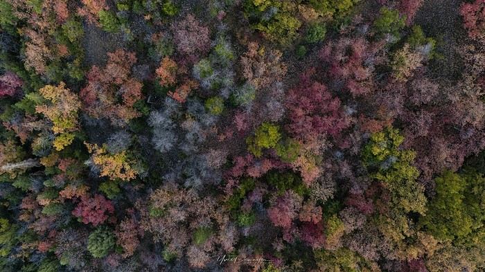
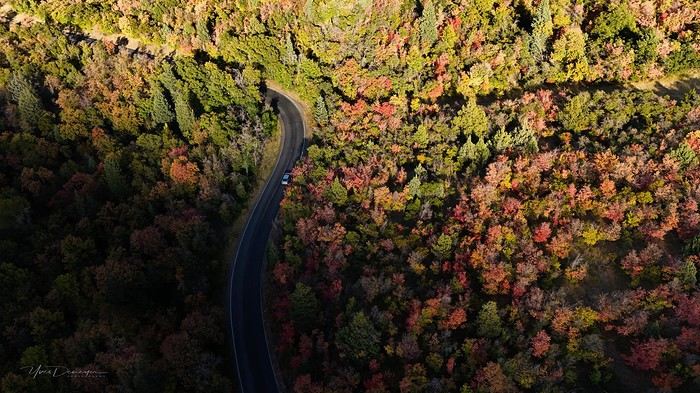
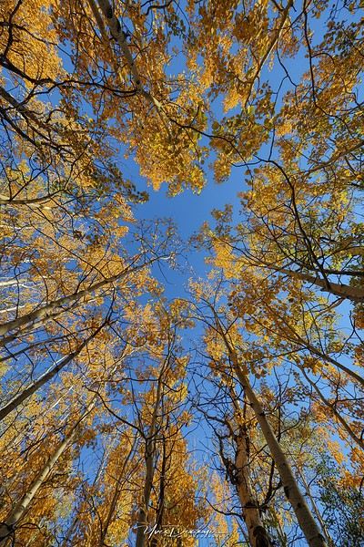
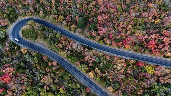
My last travel journal was from 2019, when I went hiking and backpacking with my son, who was 15 at the time. We visited some places that were still pretty unknown back then! I was supposed to go in April 2020, still solo, with arches as the main focus. I’d spent nearly two months getting physically prepared, and had managed to snag a bunch of permits for CBS, The Needles, and so on... Of course, it all got postponed—first to October 2020, then April 2021, then October 2021, and finally it happened in April 2022. Maybe I’ll write about that in another journal. The thing is, every time, I spend at least 6 to 8 weeks getting physically ready, even though I work out all year. Huge disappointment during that trip—so much had changed because of Covid, kind of like in the mountains back home. Overcrowding, not just in the national parks (we knew about that), but also in a lot of remote, lesser-known spots. Like the French, Americans realized they had a lot of beautiful places in their own country during those travel bans. And they kept exploring... Prices for pretty much everything had already gone up a lot. Gas, restaurants, cars, but especially lodging! Then, after dealing with so much wind in April, I got a little "fed up" with that time of year. It felt like I had strong winds and sandstorms for 3 out of the 3.5 weeks I was there...
So, the next trip was October 2023, to catch the partial eclipse in New Mexico, and of course, a bunch of arches ;). So many arches. Maybe I’ll write about that one too... Then came (among others) April 2024 for the total eclipse, in Texas, but starting from L.A., with my partner Valérie. Since I’d never visited some places I wanted to see further south of my usual loops, it was the perfect opportunity... And here we are at the end of September 2024. Another trip focused on arches—I never get tired of them. Every time I check one off my list, another gets added. Often it’s a photo I’ve seen online or in the NABS (Natural Arches and Bridges Society) magazine, which I’m a member of. I also scour the WAD (World Arches Database) and make a list of arches I want to visit. Fewer and fewer "viewpoints"—I’ve done all the most famous ones, and unless the sky is amazing, the photos all look the same. Since my goal is always photography *and* hiking, I’m always on the lookout. So this time, a packed itinerary—27 days, very busy. In past trips, if I didn’t plan enough and hiked fast, I’d end up with too many "gaps" in my days. This time, I’d rather have too much than too little (like in 2023, actually).
A few stats: - 6,589 km, including +/-1,400 km of off-road trails - 323 km of hiking, 8,829 m of elevation gain - 142 new arches for my collection, including some stunning ones, some less so, and some downright ugly—but all in the WAD. - Two outings with a Navajo guide - Almost no injuries - 8 bivouacs, including 2 backpacking trips - 4 days of backpacking - 22 freeze-dried meals and 15 Subways eaten - 6 thorns in my shoes (long live the tweezers in my backpack) - 3 kg lost (plus the 5 kg lost during prep)
Almost every day, I posted a little update on Facebook for family and friends. So I’ll be copy-pasting those texts here, written "my way" as usual. Some will like it, some won’t—that’s just how it is... 😏
For months, I planned this trip—looking for info, creating GPS tracks on Google Earth, exchanging tips with NABS members and other passionate friends. I snagged permits for The Needles again (4-5 days), for Fiery Furnace, timed entries for Arches National Park (2), and booked just one campsite, a "triple tour" in Monument Valley, and the first night in a motel. This is the first time I haven’t booked 80% of the motels—I was tired of having constraints because of the weather. This time, I want to be able to adjust my plans based on the weather and what I feel like doing more or less of. Camp when the weather’s nice, hotel/motel when it’s crappy.
Here we go...
Day 1
As usual, early morning flights: BRU-AMS, then AMS-SLC. Those who follow me know I’ve been renting a Rubicon from Rugged for years, which "forces" me to land in SLC. Up at 3:30 AM, but I’d been awake since 2:00 AM—the day’s going to be long. Shuttle to the airport. In Brussels, only two check-in counters open. I get there—no cabin baggage weigh-in, while the agent next to me is weighing everyone’s, even kids’ backpacks! A bit of luck, because as usual, if they weighed my backpack *and* my cabin bag, I’d already be over 20 kg. I check two hold bags, since I’ve got a lot of camping/backpacking gear, lots of freeze-dried meals, the backpacking bag, the Bear Canister needed for The Needles, etc. First flight is 30 minutes late, so the second one is already boarding. I’ve got the SSSS mark on my ticket (extra security check), so I head straight to the front when I arrive at the same time as Zone 3, even though I’m Zone 6. I pretend the check will take a while, and it "works"—they didn’t notice! No way I want to board last and risk them making me check my cabin bag. It’s packed with photo gear, laptop, drone, etc.—unthinkable to have to put it in the hold. Always a worry... SLC: baggage claim, customs, and out in 32 minutes. The MPC app makes something that was already quick even faster at this airport. And all the bags are there. That’s always a relief too. Since I drive at least 3 hours straight after landing, losing a hold bag would really mess up the trip and force me to spend the first night closer to SLC. On the way to Rugged. A young French couple from Reims is in the shuttle with me—they discovered Rugged thanks to my post in a Facebook group! Well, the team has changed again, and they lost half the stuff I’d left last October (plastic boxes, pillow, sugar, gas cartridges, folding chair, Crocs, etc.), but at least there are gas cartridges, so I don’t have to go to REI. REI would’ve been at least an hour out of my way. But as far as I know, there are no gas cartridges in Green River. I still get my tent stake hammer back, and a folding chair—different from mine but identical.
20,000 km Rubicon 4Xe, white. I check the tires—they’re in great shape, as requested. I’ll come back to the hybrid later. I didn’t want a hybrid, but that’s all they had this year. Why? Higher fuel consumption, smaller tank, higher cargo floor.
Stop at the Walmart near Provo, whose layout I know like the back of my hand (Walmarts are often similar). Start-of-trip shopping: water, Coke, Gatorade, UHT milk for cereal (not very common in the US), Special K "Almond and Vanilla", cold meds that work well (and don’t exist back home—you never know), two plastic bins, a pillow for the tent, Trail Mix, that’s about it. On the road to Nebo Loop for the fall colors. I’d driven this route last year, in the opposite direction on my way back to SLC, but it was a bit too late. This time, I’m a little early. At the start of the road, the maples are in the sun, so I go up to 2,200 m for the bright yellow aspens, then head back down. Mostly drone shots—no time to go for a walk. After a day like this, 4.5-5 hours of driving is already a lot... Arrived in Green River at 9:00 PM. Organize all the stuff from the bags properly, then sleep.
A few photos from these first few hours.
4 friends discover a piece of North India
Hello fellow travelers!
I’m adding my small contribution to the reopening celebration by posting this travel journal from India, made in January 2024. We’re 4 friends (2 couples), and we did a 3-week loop in Rajasthan, stopping by Delhi and Agra (which, as everyone knows, aren’t in Rajasthan 😛). Delhi - Agra - Jaipur - Bundi - Udaipur - Jodhpur - Jaisalmer - Delhi
We rented a car with a driver from Agra to Jaisalmer, 550 € for 14 days. https://chauffeurpriveeninde.com/fr/
We took the train from Delhi to Agra and the plane (Spicejet) from Jaisalmer to Delhi.
Most of the accommodations were booked on Booking before we left.
I’m sharing this story written by Richard and illustrated by me. We dedicate it to Nathalie and Bruno, our amazing travel companions.
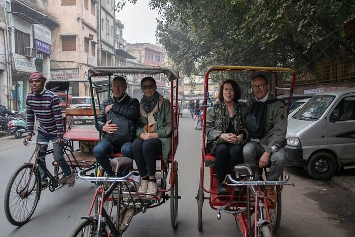
I’m adding my small contribution to the reopening celebration by posting this travel journal from India, made in January 2024. We’re 4 friends (2 couples), and we did a 3-week loop in Rajasthan, stopping by Delhi and Agra (which, as everyone knows, aren’t in Rajasthan 😛). Delhi - Agra - Jaipur - Bundi - Udaipur - Jodhpur - Jaisalmer - Delhi
We rented a car with a driver from Agra to Jaisalmer, 550 € for 14 days. https://chauffeurpriveeninde.com/fr/
We took the train from Delhi to Agra and the plane (Spicejet) from Jaisalmer to Delhi.
Most of the accommodations were booked on Booking before we left.
I’m sharing this story written by Richard and illustrated by me. We dedicate it to Nathalie and Bruno, our amazing travel companions.
Discussion parallèle au concours photo d'août: "Noir & Blanc" English translation pending
Je vous donne rendez-vous ici pour vos photos hors concours, pour discuter, échanger, conseiller, apprendre et s'amuser 😛
Le concours se passe par-là: https://voyageforum.com/v.f?post=10330487;a=10330487
Le concours se passe par-là: https://voyageforum.com/v.f?post=10330487;a=10330487
Plan de reprise des croisières Costa English translation pending
Bonjour
Voilà ce qui serait prévu à partir de la mi-août :
http://crew-center.com/costa-cruises-plans-re-start-voyages-7-ships-5-phases
Cordialement
Voilà ce qui serait prévu à partir de la mi-août :
http://crew-center.com/costa-cruises-plans-re-start-voyages-7-ships-5-phases
Cordialement
Concours photo de juillet 2020: Verticale(s) English translation pending
Bonjour 🙂
Après déjà dix ans depuis la première édition, nous voici au lancement du 120ème concours.
J’aime l'idée de garder la surprise des photos qui pourront être proposées, c’est pourquoi j’ai choisi un thème ouvert : Verticale(s). Il n’y aura pas de contrôle au fil à plomb, ça pourra pencher un peu mais raisonnablement. Pour accompagner le démarrage du concours, vous trouverez quelques pistes en bas de ce message.
Vous pourrez participer jusqu’au samedi 25 juillet à 23h59, heure de Paris. Chaque participant est autorisé à poster jusqu’à trois photos, numérotées de 1 à 3, en précisant le lieu de prise de vue. N’hésitez pas à accompagner vos photos de quelques lignes.
Le vote aura lieu du dimanche 26 juillet 0h01 au jeudi 30 juillet à 22h. Il est accessible à tous, participants ou non, dans la limite d’un vote, et se fera par l’attribution d’un total de six points répartis sur 3 ou 4 photos : Photo n°1 : 3 points Photo n°2 : 2 points Photo n°3 : 1 point - OU - Photo n°3A et photo n°3B : 1/2 point chacune
La photo gagnante sera celle qui aura remporté le plus de points. En cas d’égalité pour la première position, les photos seront départagées par le nombre de votes à 3 points, puis , si l'égalité persiste, par le nombre de votes à 2 points, etc.
Le ou la gagnant(e) aura le privilège d’organiser le concours suivant.
Ce fil est réservé aux photos participantes et aux votes. Pour le blabla ça se passe ici ! Le diaporama arrivera dans quelques jours et figurera dans ma signature.
C’est parti 🙂
Après déjà dix ans depuis la première édition, nous voici au lancement du 120ème concours.
J’aime l'idée de garder la surprise des photos qui pourront être proposées, c’est pourquoi j’ai choisi un thème ouvert : Verticale(s). Il n’y aura pas de contrôle au fil à plomb, ça pourra pencher un peu mais raisonnablement. Pour accompagner le démarrage du concours, vous trouverez quelques pistes en bas de ce message.
Vous pourrez participer jusqu’au samedi 25 juillet à 23h59, heure de Paris. Chaque participant est autorisé à poster jusqu’à trois photos, numérotées de 1 à 3, en précisant le lieu de prise de vue. N’hésitez pas à accompagner vos photos de quelques lignes.
Le vote aura lieu du dimanche 26 juillet 0h01 au jeudi 30 juillet à 22h. Il est accessible à tous, participants ou non, dans la limite d’un vote, et se fera par l’attribution d’un total de six points répartis sur 3 ou 4 photos : Photo n°1 : 3 points Photo n°2 : 2 points Photo n°3 : 1 point - OU - Photo n°3A et photo n°3B : 1/2 point chacune
La photo gagnante sera celle qui aura remporté le plus de points. En cas d’égalité pour la première position, les photos seront départagées par le nombre de votes à 3 points, puis , si l'égalité persiste, par le nombre de votes à 2 points, etc.
Le ou la gagnant(e) aura le privilège d’organiser le concours suivant.
Ce fil est réservé aux photos participantes et aux votes. Pour le blabla ça se passe ici ! Le diaporama arrivera dans quelques jours et figurera dans ma signature.
C’est parti 🙂
La "non-honnêteté" des Vietnamiens English translation pending
Est-ce quelqu'un peut me dire pourquoi ils manque de franchise à ce point ?
J'ai fait 2 voyages, j'y ai passé plusieurs mois, j'en ai jamais rencontré un seul d'honnête, j'en viens à me demander si ils connaissent ce terme.
Souvent c'est bête. Dernier exemple en date. Je demande à une copine ou plutôt pas en tout cas je ne doit pas être son ami malgré que sa mère me dise qu'elle aime m'avoir en ami si un n° est son Zalo. C'est pas dur de me dire oui ou non ou oui mais je ne m'en sert plus (vrai ou pas) et bien non elle a lu mais pas répondu, sa mère pareil.Elles utilisent les mêmes compte, c'est compliqué de savoir à qui je parle. Elle veux pas m'ajouter sur Zalo mais en même temps elle ne veux pas me mentir donc elle ne réponds pas.
J'ai pris cette exemple car c'est le plus récent mais en gros c'est ça : ne pas répondre, ne pas être honnête pour ne pas blesser. Ça part peut-être d'un bon sentiment mais c'est flagrant qu'ils ne sont pas honnête, ça me blesse encore plus.
J'ai fait 2 voyages, j'y ai passé plusieurs mois, j'en ai jamais rencontré un seul d'honnête, j'en viens à me demander si ils connaissent ce terme.
Souvent c'est bête. Dernier exemple en date. Je demande à une copine ou plutôt pas en tout cas je ne doit pas être son ami malgré que sa mère me dise qu'elle aime m'avoir en ami si un n° est son Zalo. C'est pas dur de me dire oui ou non ou oui mais je ne m'en sert plus (vrai ou pas) et bien non elle a lu mais pas répondu, sa mère pareil.Elles utilisent les mêmes compte, c'est compliqué de savoir à qui je parle. Elle veux pas m'ajouter sur Zalo mais en même temps elle ne veux pas me mentir donc elle ne réponds pas.
J'ai pris cette exemple car c'est le plus récent mais en gros c'est ça : ne pas répondre, ne pas être honnête pour ne pas blesser. Ça part peut-être d'un bon sentiment mais c'est flagrant qu'ils ne sont pas honnête, ça me blesse encore plus.
Un choix de vos trois destinations préferées English translation pending
A cette question si personnelle et difficile je vous propose de choisir 3 destinations que vous conseilleriez.
Si possible en ajoutant quelques mots ouvrant la porte à des questions .
L'idée est une sélection mais pas un classement .
Mon choix : Nouvelle Zélande - Ile du Sud et Australie Probablement un art de vivre et des espaces diversifiés . Polynesie Des paysages exceptionnels , une simplicité de vie aux couleurs chantantes De San Francisco à Los Angeles (route du Grand Canyon- Road trip - Route mythiqueextraordinaire et variété de culture
Mon choix : Nouvelle Zélande - Ile du Sud et Australie Probablement un art de vivre et des espaces diversifiés . Polynesie Des paysages exceptionnels , une simplicité de vie aux couleurs chantantes De San Francisco à Los Angeles (route du Grand Canyon- Road trip - Route mythiqueextraordinaire et variété de culture
Kenya February 2020: From Tsavo to Samburu via Meru National Park
Good evening everyone,
I hope you're all doing well despite this very unusual time…
Here’s a new travel journal to get you back on the Kenyan trails.
It was a really great idea to buy those flight tickets to Nairobi back in December. When Benoit suggested this new safari in February, I hesitated a little (very little): it was the season with particularly high temperatures, and the short rainy season in November/December had been very heavy, raising concerns about the state of the tracks… Given the current situation, no regrets, of course… We quickly organized the safari with our usual guide, and we booked the accommodations ourselves directly. (If we’d waited just a few more weeks, we might’ve regretted it…)
For once, we were able to leave from the airport near where we live (Lorient - Lann Bihoué), which is really convenient: no driving, no parking… We left home at 2 PM on Tuesday, February 18th, and arrived in Nairobi at 6 AM the next morning—perfect. (With a layover in CDG, of course 😉) Upon arrival, after a forehead temperature check by airport staff, we got our visas very quickly (forms filled out before departure). The customs agents congratulated us on our passports full of Kenyan stamps… but we still had to pay the 40 € for the visa.
All that was left was to collect our luggage, and we’d be ready to leave the airport shortly after landing. But there was a small issue: the baggage conveyor belt was broken… Eventually, the suitcases and bags were brought out by hand… Hakuna Matata, as they say here—no problem, as long as they’re all there. Benoit sent a message to Félix, our guide, to come meet us in the airport parking lot. After catching up with our respective families, we set off toward the Mombasa road, heading to Voi.
Traffic in Nairobi is still as heavy as ever, and the pollution is very noticeable (cars, but also cement factories…). The current lockdown has changed things. On social media, Mount Kenya and Kilimanjaro seem visible from Nairobi now!…
The first stop on this safari was a place we hadn’t visited before: the LUMO Community Wildlife Conservancy lumoconservancy.com/. It’s a small reserve located west of Tsavo West and near the Taita Hills. The reserve is managed by the local community, and entry fees are lower than in Tsavo’s national parks. We had initially planned to spend three days in Tsavo East, but since the accommodation wasn’t available for that long, we ended up choosing this option, which turned out to be a great discovery. Since the reserve is small, I think it’s hard to spend more than two days there. The advantage is that, since it’s not a national park, activities like walks or night safaris can be offered.
Alright, here are a few images to set the mood.
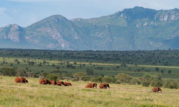
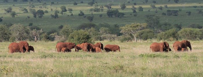
Elephants, but also hartebeests and lots of giraffes in a light we really liked.
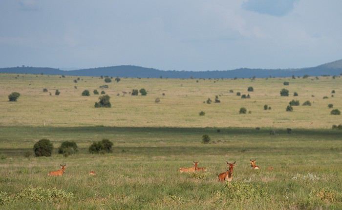
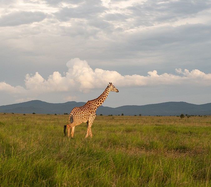
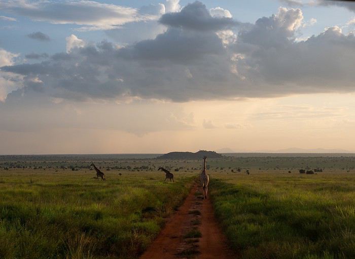
It was a really great idea to buy those flight tickets to Nairobi back in December. When Benoit suggested this new safari in February, I hesitated a little (very little): it was the season with particularly high temperatures, and the short rainy season in November/December had been very heavy, raising concerns about the state of the tracks… Given the current situation, no regrets, of course… We quickly organized the safari with our usual guide, and we booked the accommodations ourselves directly. (If we’d waited just a few more weeks, we might’ve regretted it…)
For once, we were able to leave from the airport near where we live (Lorient - Lann Bihoué), which is really convenient: no driving, no parking… We left home at 2 PM on Tuesday, February 18th, and arrived in Nairobi at 6 AM the next morning—perfect. (With a layover in CDG, of course 😉) Upon arrival, after a forehead temperature check by airport staff, we got our visas very quickly (forms filled out before departure). The customs agents congratulated us on our passports full of Kenyan stamps… but we still had to pay the 40 € for the visa.
All that was left was to collect our luggage, and we’d be ready to leave the airport shortly after landing. But there was a small issue: the baggage conveyor belt was broken… Eventually, the suitcases and bags were brought out by hand… Hakuna Matata, as they say here—no problem, as long as they’re all there. Benoit sent a message to Félix, our guide, to come meet us in the airport parking lot. After catching up with our respective families, we set off toward the Mombasa road, heading to Voi.
Traffic in Nairobi is still as heavy as ever, and the pollution is very noticeable (cars, but also cement factories…). The current lockdown has changed things. On social media, Mount Kenya and Kilimanjaro seem visible from Nairobi now!…
The first stop on this safari was a place we hadn’t visited before: the LUMO Community Wildlife Conservancy lumoconservancy.com/. It’s a small reserve located west of Tsavo West and near the Taita Hills. The reserve is managed by the local community, and entry fees are lower than in Tsavo’s national parks. We had initially planned to spend three days in Tsavo East, but since the accommodation wasn’t available for that long, we ended up choosing this option, which turned out to be a great discovery. Since the reserve is small, I think it’s hard to spend more than two days there. The advantage is that, since it’s not a national park, activities like walks or night safaris can be offered.
Alright, here are a few images to set the mood.
Elephants, but also hartebeests and lots of giraffes in a light we really liked.
Littérature de voyage, échos du changement English translation pending
Bonjour,
Et si finalement on donnait la parole à d'autres ?
Aux écrivains qui nous sont chers, à tous ceux qui dans leurs livres ont évoqué bien mieux que nous les interrogations, les doutes, le changement, la mue et l'adaptation dans le voyage ?
Et si leur expérience et leurs mots à eux, en quelques paragraphes ou phrases isolées que vous publierez ici, éclairaient un peu notre lanterne pour les mois ou les années à venir ?
L.
--
Nicolas Bouvier. Retour d'Inde. Publié dans " Bleu Immortel. Voyages en Afghanistan ". Editions Zoe. 2003.
--
" Revenir d'Asie pose des problèmes très précis. En Suisse, retour d'Inde et du Japon, je me suis longtemps senti mal à l'aise. Les magasins, les rues m'inspiraient une répulsion irraisonnée. Noël qui approchait, la foule des acheteurs, les farces tartinées de santé, le bruit des sous, la couperose me donnaient le cafard. Le seul endroit où je respirais, où je croisais de vrais regards c'était -- tenez-vous bien -- l'hôpital. Pourtant, c'était mon pays que je m'étais réjoui de revoir, pourtant on m'avait partout accueilli avec une gentillesse qui ne se démentait pas. Alors ? Je crois que c'était l'argent qui me gênait. L'argent engorgeait tout. Et à cause de cet argent, il n'y avait plus de foule ; elle était rompue, divisée comme une étendue de sable par les mailles éparses d'un filet. Il n'y avait que de petites fortunes, de petites coquilles, de petites solitudes meublées, feutrées, équipées, mais solitudes quand même. Dans les salles de billard, dans les autobus, j'entendais souvent cette phrase qui me paraissait stupéfiante : " Moi, je n'ai besoin de personne. " La communauté n'existait plus -- communauté : le sentiment profond que le sort de n'importe lequel de vos semblables vous concerne et vous affecte en quelque façon, la conscience d'une interdépendance -- , et pour qu'elle se recrée il fallait un de ces chocs -- accident mortel sur la route, révolution hongroise -- qui montrent bien que l'argent n'est pas tout et que ce qui nous rapproche le plus des autres est plus fondamental que ce qui nous en éloigne. Autrement, et en temps normal, on n'avait besoin de personne. Ce n'était que trop vrai, et quelle indigence. L'Hindou et le Chinois exposés en permanence à manquer de riz et de galette ont perpétuellement besoin du voisin, et le voisin d'eux. Le paysan du Dekkan a beau avoir l'oeil vide et feindre l'indifférence ; mendier de la farine, prêter de la farine, voir -- à cause d'une rivière qui déborde à 200 kilomètres de là -- sa maison soudain remplie d'inconnus, et pour longtemps, il ne connaît que ça, c'est son ordinaire. Voilà qui fait des foules. La misère se partage, et c'est grâce à cela que les misérables vivent encore. L'égoïsme n'est pas dans leurs moyens, trop coûteux. La prospérité ne se partage pas. Il faut cependant quitter la misère. Les Indiens y travaillent et on leur souhaite de réussir. Je leur souhaite aussi de conserver alors le coeur qu'ils avaient quand ils n'avaient que ça. "
Et si finalement on donnait la parole à d'autres ?
Aux écrivains qui nous sont chers, à tous ceux qui dans leurs livres ont évoqué bien mieux que nous les interrogations, les doutes, le changement, la mue et l'adaptation dans le voyage ?
Et si leur expérience et leurs mots à eux, en quelques paragraphes ou phrases isolées que vous publierez ici, éclairaient un peu notre lanterne pour les mois ou les années à venir ?
L.
--
Nicolas Bouvier. Retour d'Inde. Publié dans " Bleu Immortel. Voyages en Afghanistan ". Editions Zoe. 2003.
--
" Revenir d'Asie pose des problèmes très précis. En Suisse, retour d'Inde et du Japon, je me suis longtemps senti mal à l'aise. Les magasins, les rues m'inspiraient une répulsion irraisonnée. Noël qui approchait, la foule des acheteurs, les farces tartinées de santé, le bruit des sous, la couperose me donnaient le cafard. Le seul endroit où je respirais, où je croisais de vrais regards c'était -- tenez-vous bien -- l'hôpital. Pourtant, c'était mon pays que je m'étais réjoui de revoir, pourtant on m'avait partout accueilli avec une gentillesse qui ne se démentait pas. Alors ? Je crois que c'était l'argent qui me gênait. L'argent engorgeait tout. Et à cause de cet argent, il n'y avait plus de foule ; elle était rompue, divisée comme une étendue de sable par les mailles éparses d'un filet. Il n'y avait que de petites fortunes, de petites coquilles, de petites solitudes meublées, feutrées, équipées, mais solitudes quand même. Dans les salles de billard, dans les autobus, j'entendais souvent cette phrase qui me paraissait stupéfiante : " Moi, je n'ai besoin de personne. " La communauté n'existait plus -- communauté : le sentiment profond que le sort de n'importe lequel de vos semblables vous concerne et vous affecte en quelque façon, la conscience d'une interdépendance -- , et pour qu'elle se recrée il fallait un de ces chocs -- accident mortel sur la route, révolution hongroise -- qui montrent bien que l'argent n'est pas tout et que ce qui nous rapproche le plus des autres est plus fondamental que ce qui nous en éloigne. Autrement, et en temps normal, on n'avait besoin de personne. Ce n'était que trop vrai, et quelle indigence. L'Hindou et le Chinois exposés en permanence à manquer de riz et de galette ont perpétuellement besoin du voisin, et le voisin d'eux. Le paysan du Dekkan a beau avoir l'oeil vide et feindre l'indifférence ; mendier de la farine, prêter de la farine, voir -- à cause d'une rivière qui déborde à 200 kilomètres de là -- sa maison soudain remplie d'inconnus, et pour longtemps, il ne connaît que ça, c'est son ordinaire. Voilà qui fait des foules. La misère se partage, et c'est grâce à cela que les misérables vivent encore. L'égoïsme n'est pas dans leurs moyens, trop coûteux. La prospérité ne se partage pas. Il faut cependant quitter la misère. Les Indiens y travaillent et on leur souhaite de réussir. Je leur souhaite aussi de conserver alors le coeur qu'ils avaient quand ils n'avaient que ça. "
Dans quel pays aimeriez-vous vous expatrier? English translation pending
Je saisis au vol cette remarque d'Attila (que je partage!)
Franchement, je serais le gouvernement, je demanderais l'asile en ...?... et dirais aux français, démerdez vous.
et cette autre :
On fait le coucou dans les discussions mais jamais on n'en entame une...
pour proposer un nouveau post sur un mode très différent de voyager.
Où aimeriez-vous partir vivre?
Bien sûr vous choisissez votre pays ou région d'accueil, on part du principe que ce n'est pas une obligation que l'on vous fait.
Et vous avez besoin de vous éloigner momentanément de votre lieu de vie habituel, pour quelque raison que ce soit.
Quels seraient les atouts locaux importants pour vous de cette nouvelle installation : population, climat, paysages, archéologie, autres .... ?
Franchement, je serais le gouvernement, je demanderais l'asile en ...?... et dirais aux français, démerdez vous.
et cette autre :
On fait le coucou dans les discussions mais jamais on n'en entame une...
pour proposer un nouveau post sur un mode très différent de voyager.
Où aimeriez-vous partir vivre?
Bien sûr vous choisissez votre pays ou région d'accueil, on part du principe que ce n'est pas une obligation que l'on vous fait.
Et vous avez besoin de vous éloigner momentanément de votre lieu de vie habituel, pour quelque raison que ce soit.
Quels seraient les atouts locaux importants pour vous de cette nouvelle installation : population, climat, paysages, archéologie, autres .... ?
On part en vadrouille dans les Balkans! English translation pending
Et bien le confinement a de beaux jours devant lui ! Chose promise, chose due (publier une journée de vadrouille par jour de confinement) ! Après le carnet sur un voyage aux Etats-Unis (voyageforum.com/...-americain-d9943984/), après le carnet sur une vadrouille en Jordanie (https://voyageforum.com/discussion/on-part-en-vadrouille-en-jordanie-d9991360/), voici maintenant un carnet dans les balkans, voyage réalisé il y a maintenant quelques années :
Et on garde les bonnes habitudes, publication d'une journée par jour, à chaque fois à 17h30 ! Bonne lecture et n'hésite pas à laisser un commentaire, une question, une remarque, ...
Franck
Et on garde les bonnes habitudes, publication d'une journée par jour, à chaque fois à 17h30 ! Bonne lecture et n'hésite pas à laisser un commentaire, une question, une remarque, ...
Franck
Adventures of a Bygone Era: The Philippines in 1984
After several discussions on VF about travel journals from the Philippines, I decided to write this curiosity: a trip report from a journey made in 1984, when traveling to the Philippines was still an adventure.
A curiosity because writing a travel journal about a trip 35 years later isn’t common, but also (mostly?) because exploring the Philippines at that time had little in common with traveling there today.
Obviously, I’ve forgotten a number of facts, most of the details, but with the help of a few notes from that time and a stack of slides (yes, there was life before digital 😊), many memories came back and added to the highlights I’d never forgotten. The scanned slides aren’t always great quality, but there are still quite a few to brighten up this chatter. Back then, we didn’t snap photos like we do now—film was too expensive—so I don’t have pictures of every place we visited... too bad, comparing some of those spots to how they look today would’ve been interesting.
Why "Adventures"? Why call it "Adventures" in the Philippines in 1984, a word so often used for a simple exotic trip? - Because the lack of information (no *Guide du Routard*, no *Lonely Planet*, no *Michelin Guide*, nothing, and obviously no internet) gave this trip what’s at the heart of adventure: the unknown. - Because the political situation made the stay sometimes dangerous. - Because transportation conditions were always epic, often perilous. - Because the question of where we’d spend the night came up almost every evening. - And for... quite a few other reasons.
That said, we weren’t exactly explorers!
Why the Philippines? First of all, why go to the Philippines in 1984—a country not exactly set up for tourism and about which we knew very little? How could we get an idea of the beauty of the Philippines and its points of interest when we had no guides or photos?
The idea came to us from Thailand a year earlier, during our first long-haul trip. After touring the north of the country, we met a Frenchman living in Phuket, where there were only a few tourists in Patong, with just a few small hotels and guesthouses. Kata and Karon had no buildings or roads, Rawai only had three palm-thatched bungalows, including ours, and the other islands were unknown to tourists. There was plenty to discover, and we wanted to return to this beautiful country... but the Frenchman made us dream about the Philippines—a country to explore, with wild landscapes.
Long evenings of discussion over multiple Sprite-Mekong cocktails (what memories of those headaches!) finally convinced us we had to go to the Philippines.
Episode 0: Before Departure The decision was made: we’d go to the Philippines in May 1984. Our friends and family were surprised when we announced we were going on vacation to the Philippines (a bit like saying today we were going paddleboarding in the Kerguelen Islands 🤪).
These days, preparing for each of our trips takes long evenings of research, planning, and noting down good addresses... etc. But for the Philippines in 1984, preparation was quick: we had very little information about the country, we were leaving almost at random, and the discovery would only be more exciting.
We still had a few bits of info gathered here and there: the rice terraces in northern Luzon, volcanoes, Negros where we were supposed to visit an acquaintance, Cebu and its marine life (we ended up going elsewhere), and absolutely avoid Mindanao, which was practically at war with the regime. That was about it, but it was already a great itinerary.
Nothing was organized in advance; we’d see day by day. We had no idea about travel times or even the existence of transportation options. The main (and sometimes only) way to connect two islands was by overloaded, rusty ferry. Only the big cities had airports.
Let’s Go: Episode 1: Paris to Manila My travel journals always start after arriving at the airport—the Europe-to-“Other Continent” trip isn’t interesting—but the flight to the Philippines was already an adventure, so I’ll make an exception.
This was the era when only a few Asian airlines were on par with Western ones: Thai, Singapore Airlines, and Philippine Airlines. They had beautiful, brand-new planes, and to attract customers (almost exclusively “businessmen”) from the usual airlines (Air France, Lufthansa, British Airways), there was opulence on board: unlimited champagne, all sorts of cocktails... Compared to today’s long-haul flights, there was still one small difference: no personal screens, just one screen at the front of the cabin with one mandatory movie. And I don’t know why, but we only got James Bond films, both ways... that must’ve been the trend at the time.
The tourism boom to Southeast Asia hadn’t started yet, and the “Asian Tigers” weren’t a thing, so there weren’t many business trips. That meant long-haul flights made stops everywhere to fill the planes. Our Philippine Airlines Boeing 747 left London, picked us up in Paris, then stopped in Frankfurt to take on a few Germans. I don’t know why we then made a stop in Dubai—a totally exotic place at the time. There was nothing to do there... things have changed a lot since. It was a small town lost in the desert. The airport was tiny, with just one or two buildings and a supermarket. During the stopover, everyone had to get off the plane and walk to the supermarket. Photo and electronic equipment were dirt cheap—I guess that was the only reason for the stop. Maybe it was their first commercial move. Emirates didn’t exist yet, as I checked online, but anyway, the idea that such a remote place could have its own airline was unthinkable.
Online, I found this photo of Dubai Airport in 1980. Anyone who’s transited through today’s massive airport with its rows of A380s will appreciate it: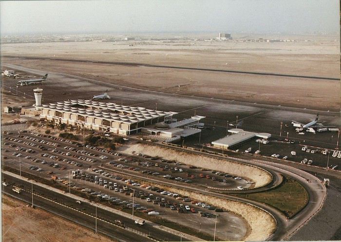
Next stop: New Delhi to drop off some Europeans and pick up a few Indians, and finally, the terminus: Manila. I don’t remember how long the trip took with its five stops—an unimaginable journey today. Despite all those stops to fill the plane, there was still enough space to stretch out on the four center seats of the 747, something that never happens these days despite all the flights in every direction.
So here we are, finally at Manila Airport around midnight.
Episode 1: Manila and Baguio To start, a quick note on the political and economic situation in the Philippines in 1984, which had consequences for us as tourists, as we’d soon realize upon arrival.
After several centuries of Spanish colonization, the Philippines became American at the start of the 20th century, then independent. In 1966, Marcos took power, and little by little, his regime sank into corruption and mismanagement, becoming a dictatorship with martial law, all for the benefit of his family and friends, who enriched themselves endlessly. The peak was the assassination of opposition leader Benigno Aquino in August 1983, which triggered harshly repressed protests. So we arrived a few months later in a very poor country, with omnipresent corruption and an extremely tense political situation, as we’d soon see for ourselves. Major protests took place in the main cities during our trip—I’ll come back to that. Two years later, Marcos fled to Hawaii after being forced out of power following rigged elections. This historical context explains a lot of the situations we found ourselves in over the following weeks.
Arriving in the middle of the night isn’t very cheerful. Manila was already a huge city with many slums, where you could find a few business hotels like the Hilton or Intercontinental—way out of our budget—and plenty of run-down hotels. Luckily, two Indians we’d chatted with on the plane offered to take us to their usual hotel. They came to Manila twice a year for business. We accepted their offer, relieved not to have to look for a place to stay in the middle of the night, figuring the address must be good since they came back every time... we were wrong 🙁
We left the airport and immediately got a taste of the local vibe when we got into the taxi: the police asked for our passports. We thought: what’s more normal than police in a dictatorship?
But that wasn’t it at all. Our two Indian friends explained that the police were noting our names along with the taxi number and time. Crime in Manila was so bad that the taxi driver would be held responsible if anything happened to us... welcome to the Philippines 😎 😎
Historically, the Philippines was a very violent country, where everything was settled with guns or machetes. Previous governments had banned carrying weapons, but Marcos later allowed the free sale and carrying of guns, and disputes were settled with pistols again (or worse, as we’d discover later). Since he’d released most of the criminals from prison to form a paramilitary militia at his service (I’ll talk about our encounter with these “heroes” later), it was pretty dangerous to go into many parts of Manila, where these “tonton macoutes” ruled.
We arrived at our hotel without incident... and then things started badly. The room was infested with big cockroaches—exactly what I hate most in those kinds of countries. No way to find another hotel at that hour. After the long flight, the urge to take a shower was so strong that we squeezed into the bathroom as best we could. After that, I don’t remember—I guess we must’ve fallen asleep exhausted under the sheets in the heat... air conditioning wasn’t widespread yet.
The next day, we just wanted to leave that dump as soon as possible. So we decided to head north right away, stopping in Baguio, and we’d visit Manila a bit on the way back.
When we stepped outside, we discovered a pretty run-down neighborhood with potholed streets. But we also discovered the jeepneys. They were everywhere, flooding the streets.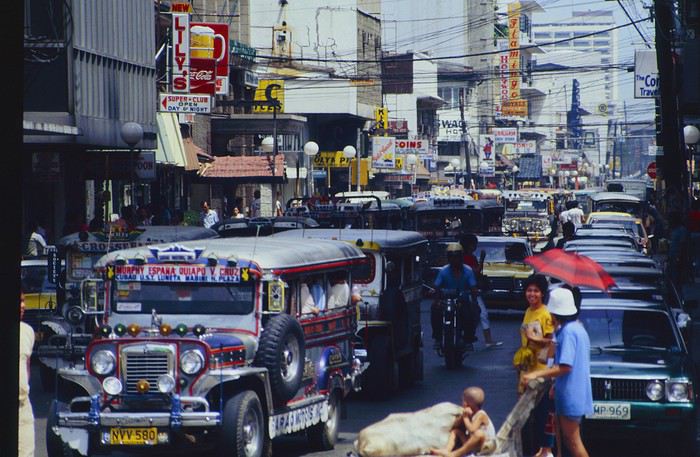
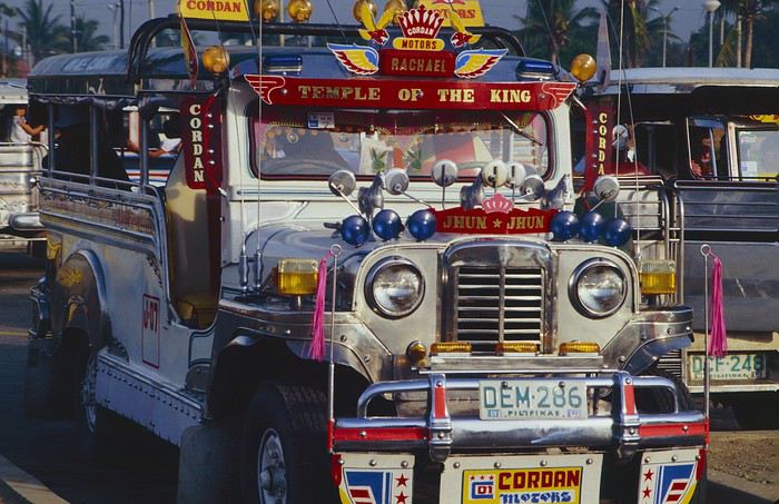
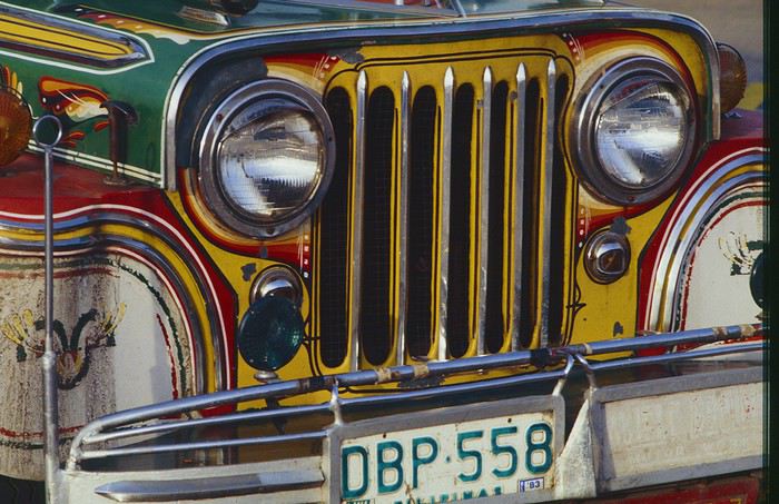
They had crazy sound systems, each one blasting louder than the last. The interiors were kitschy but fun. There weren’t many private cars—almost all transportation was by jeepney, with buses reserved for intercity trips.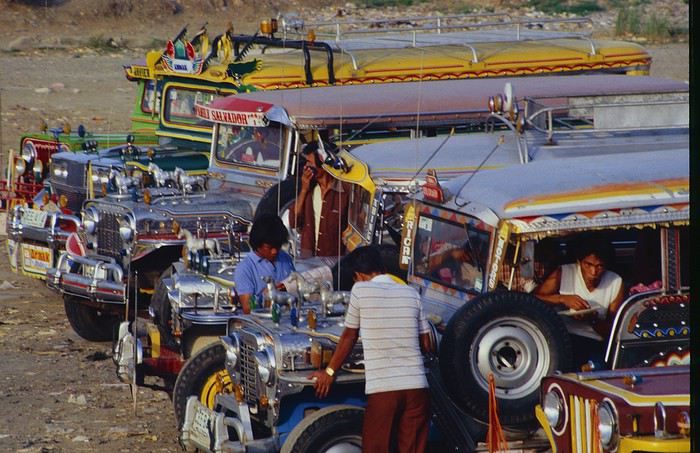
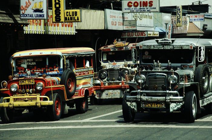
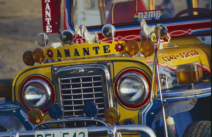
Before heading to the bus terminal for the north, somewhere on the outskirts of the city, we needed to exchange some money. I don’t remember how we ended up in a policeman’s jeep who offered his services: - Exchange money on the black market at a better rate than the banks. - Take us wherever we wanted, in this case, the bus terminal.
We accepted both offers (we’d still checked the official exchange rate from dollars to pesos). So we found ourselves in his jeep. After exchanging money, we left in his vehicle and stopped for gas. Without turning off the engine, he calmly smoked a cigarette while filling up. Since we were in a jeep with no doors or roof, we were ready to jump out if things went south, our travel bag in hand.
But we weren’t done with surprises yet. Once we left the small streets, we ended up in a neighborhood with wide avenues and not much traffic, which didn’t justify his incredible behavior. At every intersection, he made the sign of the cross, closed his eyes, and crossed without looking. I was more stunned than terrified! It wasn’t until we got out of the car later that I told Anne-Marie what had happened. I’d seen everything because the cop had put me in the front seat. Luckily, A-Marie hadn’t noticed anything from the back. Crossing Manila by trusting God rather than the rules of the road was ultimately effective. We were lucky—the trip was off to a good start. 🙂 🙂
We then passed through a neighborhood where slums stretched on for a while, and we left our policeman—friendly but a bit crazy—with relief.
A few hours by bus later, here we are in Baguio, cool in the mountains. My memories of Baguio are pretty fuzzy. I remember a small town. After some research while writing this journal, I found that the population was 120,000 in 1980. Given the population density in each home, that confirms my memory of a smallish town. Outside the “official” district with the president’s summer residence and government buildings, there were two or three paved streets with nice houses. The rest was very dirty and very poor, with lots of slums and dirt roads.
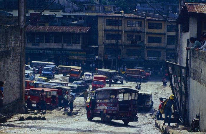
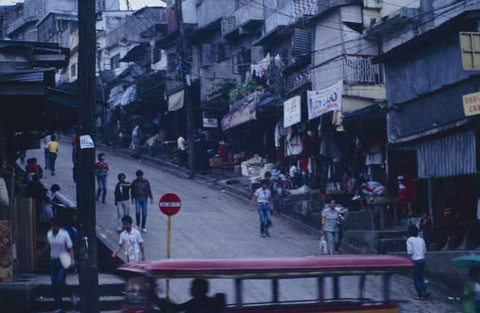
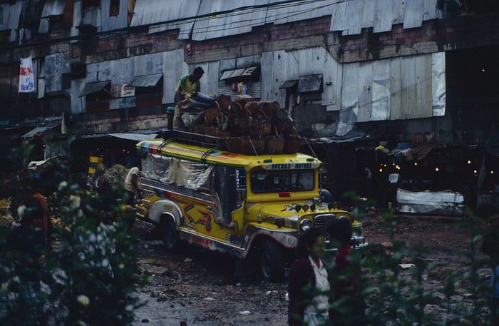
People we met on the street invited us to stay with them. These days, we wouldn’t just show up at strangers’ houses, which we should’ve done in Baguio—it would’ve saved us from an unimaginable and dangerous situation... which I won’t say anything about... !😊
The simple wooden house was on stilts at the edge of a hill with a view of the mountains. Since it was the start of the rainy season in a city that gets a lot of rain, we saw a lot of water. Our outings in town happened between downpours.
View from our lodging: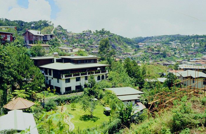
Episode 2: Baguio to Bontoc Aside from the situation briefly mentioned above, it was on the next leg to Bontoc that the adventure really began: an endless and dangerous road, a bus from another era, breathtaking landscapes, and surprising people.
We didn’t know the distance or how long it would take to get to Bontoc. When we arrived after about ten hours, we learned that Baguio to Bontoc was 140 km.
We got on a bus with wooden seats and settled in, two to a seat meant for two. As the bus filled up, passengers squeezed in three or four per seat, with chickens and baskets full of all sorts of things in the aisle. A little embarrassed, we didn’t know if we should squeeze in three on our seat. The seats were super tight (luckily, Filipinos are small), and I didn’t know where to put my legs given my height. I don’t remember if we stayed alone on our bench or if we ended up sharing with others.
The “road” was a dirt track (or rather, a mud track) with endless turns. We held on as best we could to our slippery wooden seats—it was shaking in every direction. The woman behind us was carsick and throwing up... gross... but what were we doing there? Then we plunged into the Sierra Madre... just the name is dreamy!
Rice terraces started to appear: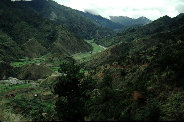
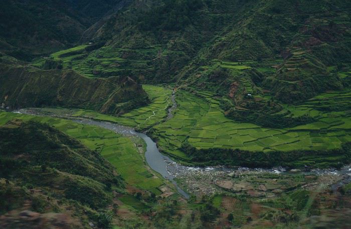
they took up more and more space along cliffs where we weren’t always reassured,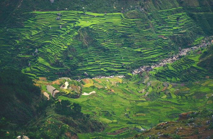
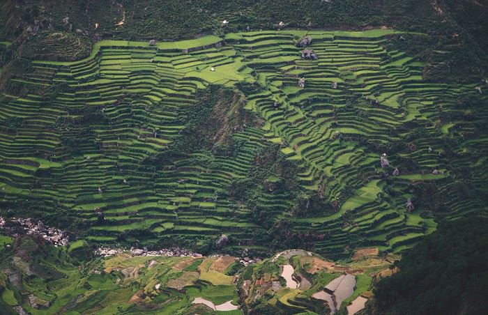
with lots of waterfalls (all that water had to go somewhere).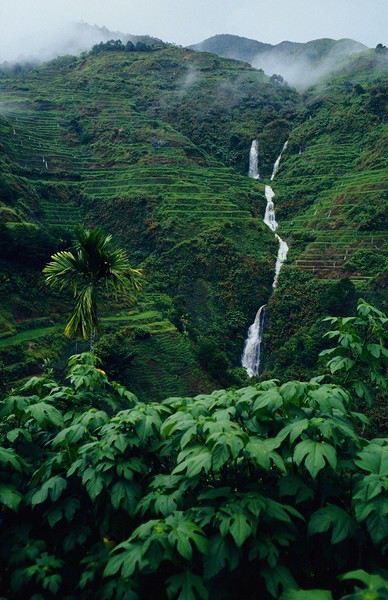
A few miserable villages stretched along the track, most often just a few houses balancing between the road and the drop. The bus stopped in every village—people got on or off and settled inside or on the roof. Street vendors offered their products to the bus passengers—a common sight in Asia, even today.
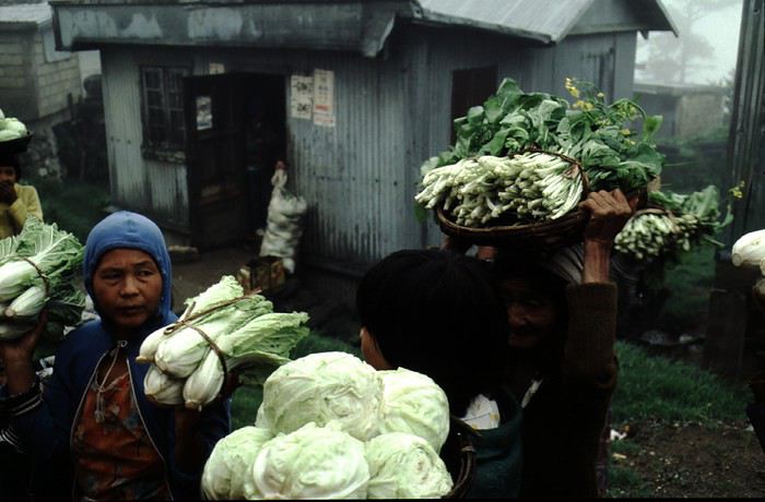
We were in another world—villagers were in loincloths, others had spears. The atmosphere was strange... but all good, we wanted exoticism, and we got it: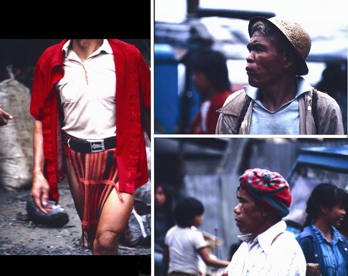
This so-called traditional outfit was everyday wear—it wasn’t for tourists since there weren’t any.
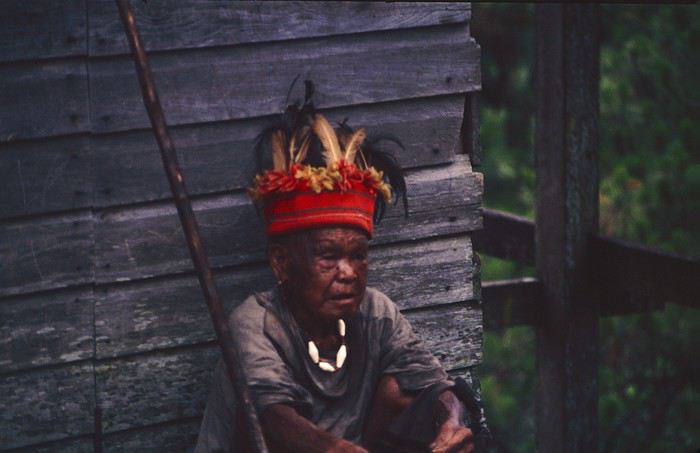
A curiosity because writing a travel journal about a trip 35 years later isn’t common, but also (mostly?) because exploring the Philippines at that time had little in common with traveling there today.
Obviously, I’ve forgotten a number of facts, most of the details, but with the help of a few notes from that time and a stack of slides (yes, there was life before digital 😊), many memories came back and added to the highlights I’d never forgotten. The scanned slides aren’t always great quality, but there are still quite a few to brighten up this chatter. Back then, we didn’t snap photos like we do now—film was too expensive—so I don’t have pictures of every place we visited... too bad, comparing some of those spots to how they look today would’ve been interesting.
Why "Adventures"? Why call it "Adventures" in the Philippines in 1984, a word so often used for a simple exotic trip? - Because the lack of information (no *Guide du Routard*, no *Lonely Planet*, no *Michelin Guide*, nothing, and obviously no internet) gave this trip what’s at the heart of adventure: the unknown. - Because the political situation made the stay sometimes dangerous. - Because transportation conditions were always epic, often perilous. - Because the question of where we’d spend the night came up almost every evening. - And for... quite a few other reasons.
That said, we weren’t exactly explorers!
Why the Philippines? First of all, why go to the Philippines in 1984—a country not exactly set up for tourism and about which we knew very little? How could we get an idea of the beauty of the Philippines and its points of interest when we had no guides or photos?
The idea came to us from Thailand a year earlier, during our first long-haul trip. After touring the north of the country, we met a Frenchman living in Phuket, where there were only a few tourists in Patong, with just a few small hotels and guesthouses. Kata and Karon had no buildings or roads, Rawai only had three palm-thatched bungalows, including ours, and the other islands were unknown to tourists. There was plenty to discover, and we wanted to return to this beautiful country... but the Frenchman made us dream about the Philippines—a country to explore, with wild landscapes.
Long evenings of discussion over multiple Sprite-Mekong cocktails (what memories of those headaches!) finally convinced us we had to go to the Philippines.
Episode 0: Before Departure The decision was made: we’d go to the Philippines in May 1984. Our friends and family were surprised when we announced we were going on vacation to the Philippines (a bit like saying today we were going paddleboarding in the Kerguelen Islands 🤪).
These days, preparing for each of our trips takes long evenings of research, planning, and noting down good addresses... etc. But for the Philippines in 1984, preparation was quick: we had very little information about the country, we were leaving almost at random, and the discovery would only be more exciting.
We still had a few bits of info gathered here and there: the rice terraces in northern Luzon, volcanoes, Negros where we were supposed to visit an acquaintance, Cebu and its marine life (we ended up going elsewhere), and absolutely avoid Mindanao, which was practically at war with the regime. That was about it, but it was already a great itinerary.
Nothing was organized in advance; we’d see day by day. We had no idea about travel times or even the existence of transportation options. The main (and sometimes only) way to connect two islands was by overloaded, rusty ferry. Only the big cities had airports.
Let’s Go: Episode 1: Paris to Manila My travel journals always start after arriving at the airport—the Europe-to-“Other Continent” trip isn’t interesting—but the flight to the Philippines was already an adventure, so I’ll make an exception.
This was the era when only a few Asian airlines were on par with Western ones: Thai, Singapore Airlines, and Philippine Airlines. They had beautiful, brand-new planes, and to attract customers (almost exclusively “businessmen”) from the usual airlines (Air France, Lufthansa, British Airways), there was opulence on board: unlimited champagne, all sorts of cocktails... Compared to today’s long-haul flights, there was still one small difference: no personal screens, just one screen at the front of the cabin with one mandatory movie. And I don’t know why, but we only got James Bond films, both ways... that must’ve been the trend at the time.
The tourism boom to Southeast Asia hadn’t started yet, and the “Asian Tigers” weren’t a thing, so there weren’t many business trips. That meant long-haul flights made stops everywhere to fill the planes. Our Philippine Airlines Boeing 747 left London, picked us up in Paris, then stopped in Frankfurt to take on a few Germans. I don’t know why we then made a stop in Dubai—a totally exotic place at the time. There was nothing to do there... things have changed a lot since. It was a small town lost in the desert. The airport was tiny, with just one or two buildings and a supermarket. During the stopover, everyone had to get off the plane and walk to the supermarket. Photo and electronic equipment were dirt cheap—I guess that was the only reason for the stop. Maybe it was their first commercial move. Emirates didn’t exist yet, as I checked online, but anyway, the idea that such a remote place could have its own airline was unthinkable.
Online, I found this photo of Dubai Airport in 1980. Anyone who’s transited through today’s massive airport with its rows of A380s will appreciate it:
Next stop: New Delhi to drop off some Europeans and pick up a few Indians, and finally, the terminus: Manila. I don’t remember how long the trip took with its five stops—an unimaginable journey today. Despite all those stops to fill the plane, there was still enough space to stretch out on the four center seats of the 747, something that never happens these days despite all the flights in every direction.
So here we are, finally at Manila Airport around midnight.
Episode 1: Manila and Baguio To start, a quick note on the political and economic situation in the Philippines in 1984, which had consequences for us as tourists, as we’d soon realize upon arrival.
After several centuries of Spanish colonization, the Philippines became American at the start of the 20th century, then independent. In 1966, Marcos took power, and little by little, his regime sank into corruption and mismanagement, becoming a dictatorship with martial law, all for the benefit of his family and friends, who enriched themselves endlessly. The peak was the assassination of opposition leader Benigno Aquino in August 1983, which triggered harshly repressed protests. So we arrived a few months later in a very poor country, with omnipresent corruption and an extremely tense political situation, as we’d soon see for ourselves. Major protests took place in the main cities during our trip—I’ll come back to that. Two years later, Marcos fled to Hawaii after being forced out of power following rigged elections. This historical context explains a lot of the situations we found ourselves in over the following weeks.
Arriving in the middle of the night isn’t very cheerful. Manila was already a huge city with many slums, where you could find a few business hotels like the Hilton or Intercontinental—way out of our budget—and plenty of run-down hotels. Luckily, two Indians we’d chatted with on the plane offered to take us to their usual hotel. They came to Manila twice a year for business. We accepted their offer, relieved not to have to look for a place to stay in the middle of the night, figuring the address must be good since they came back every time... we were wrong 🙁
We left the airport and immediately got a taste of the local vibe when we got into the taxi: the police asked for our passports. We thought: what’s more normal than police in a dictatorship?
But that wasn’t it at all. Our two Indian friends explained that the police were noting our names along with the taxi number and time. Crime in Manila was so bad that the taxi driver would be held responsible if anything happened to us... welcome to the Philippines 😎 😎
Historically, the Philippines was a very violent country, where everything was settled with guns or machetes. Previous governments had banned carrying weapons, but Marcos later allowed the free sale and carrying of guns, and disputes were settled with pistols again (or worse, as we’d discover later). Since he’d released most of the criminals from prison to form a paramilitary militia at his service (I’ll talk about our encounter with these “heroes” later), it was pretty dangerous to go into many parts of Manila, where these “tonton macoutes” ruled.
We arrived at our hotel without incident... and then things started badly. The room was infested with big cockroaches—exactly what I hate most in those kinds of countries. No way to find another hotel at that hour. After the long flight, the urge to take a shower was so strong that we squeezed into the bathroom as best we could. After that, I don’t remember—I guess we must’ve fallen asleep exhausted under the sheets in the heat... air conditioning wasn’t widespread yet.
The next day, we just wanted to leave that dump as soon as possible. So we decided to head north right away, stopping in Baguio, and we’d visit Manila a bit on the way back.
When we stepped outside, we discovered a pretty run-down neighborhood with potholed streets. But we also discovered the jeepneys. They were everywhere, flooding the streets.
They had crazy sound systems, each one blasting louder than the last. The interiors were kitschy but fun. There weren’t many private cars—almost all transportation was by jeepney, with buses reserved for intercity trips.
Before heading to the bus terminal for the north, somewhere on the outskirts of the city, we needed to exchange some money. I don’t remember how we ended up in a policeman’s jeep who offered his services: - Exchange money on the black market at a better rate than the banks. - Take us wherever we wanted, in this case, the bus terminal.
We accepted both offers (we’d still checked the official exchange rate from dollars to pesos). So we found ourselves in his jeep. After exchanging money, we left in his vehicle and stopped for gas. Without turning off the engine, he calmly smoked a cigarette while filling up. Since we were in a jeep with no doors or roof, we were ready to jump out if things went south, our travel bag in hand.
But we weren’t done with surprises yet. Once we left the small streets, we ended up in a neighborhood with wide avenues and not much traffic, which didn’t justify his incredible behavior. At every intersection, he made the sign of the cross, closed his eyes, and crossed without looking. I was more stunned than terrified! It wasn’t until we got out of the car later that I told Anne-Marie what had happened. I’d seen everything because the cop had put me in the front seat. Luckily, A-Marie hadn’t noticed anything from the back. Crossing Manila by trusting God rather than the rules of the road was ultimately effective. We were lucky—the trip was off to a good start. 🙂 🙂
We then passed through a neighborhood where slums stretched on for a while, and we left our policeman—friendly but a bit crazy—with relief.
A few hours by bus later, here we are in Baguio, cool in the mountains. My memories of Baguio are pretty fuzzy. I remember a small town. After some research while writing this journal, I found that the population was 120,000 in 1980. Given the population density in each home, that confirms my memory of a smallish town. Outside the “official” district with the president’s summer residence and government buildings, there were two or three paved streets with nice houses. The rest was very dirty and very poor, with lots of slums and dirt roads.
People we met on the street invited us to stay with them. These days, we wouldn’t just show up at strangers’ houses, which we should’ve done in Baguio—it would’ve saved us from an unimaginable and dangerous situation... which I won’t say anything about... !😊
The simple wooden house was on stilts at the edge of a hill with a view of the mountains. Since it was the start of the rainy season in a city that gets a lot of rain, we saw a lot of water. Our outings in town happened between downpours.
View from our lodging:
Episode 2: Baguio to Bontoc Aside from the situation briefly mentioned above, it was on the next leg to Bontoc that the adventure really began: an endless and dangerous road, a bus from another era, breathtaking landscapes, and surprising people.
We didn’t know the distance or how long it would take to get to Bontoc. When we arrived after about ten hours, we learned that Baguio to Bontoc was 140 km.
We got on a bus with wooden seats and settled in, two to a seat meant for two. As the bus filled up, passengers squeezed in three or four per seat, with chickens and baskets full of all sorts of things in the aisle. A little embarrassed, we didn’t know if we should squeeze in three on our seat. The seats were super tight (luckily, Filipinos are small), and I didn’t know where to put my legs given my height. I don’t remember if we stayed alone on our bench or if we ended up sharing with others.
The “road” was a dirt track (or rather, a mud track) with endless turns. We held on as best we could to our slippery wooden seats—it was shaking in every direction. The woman behind us was carsick and throwing up... gross... but what were we doing there? Then we plunged into the Sierra Madre... just the name is dreamy!
Rice terraces started to appear:
they took up more and more space along cliffs where we weren’t always reassured,
with lots of waterfalls (all that water had to go somewhere).
A few miserable villages stretched along the track, most often just a few houses balancing between the road and the drop. The bus stopped in every village—people got on or off and settled inside or on the roof. Street vendors offered their products to the bus passengers—a common sight in Asia, even today.
We were in another world—villagers were in loincloths, others had spears. The atmosphere was strange... but all good, we wanted exoticism, and we got it:
This so-called traditional outfit was everyday wear—it wasn’t for tourists since there weren’t any.
27 jours à travers le Nord-ouest américain English translation pending
Plusieurs mois ont passé depuis notre retour du Nord-Ouest américain, et cette période un peu particulière est l’occasion rêvée de me consacrer enfin à la rédaction de ce carnet de voyage !
Quatrième roadtrip aux USA. C’est en Août 2019 que nous décollons pour Seattle. Cette fois, nous explorons la partie Nord-Ouest des USA, ce pays qui nous passionne depuis le premier roadtrip en 2014. 27 jours de voyage, au travers le Washington, l’Idaho, le Montana, le Wyoming et l’Oregon…ça promet encore de magnifiques découvertes 🙂 Cette année, certains grands parcs sont au programme comme Glacier NP ou encore Yellowstone (non, on ne s’en lassera jamais !), mais nous avons aussi mis sur notre parcours des State Park bien moins touristiques et des petits endroits isolés mais magnifiques comme on adore !
JOUR 1
Ma maman et mon frère sont arrivés chez moi la veille car ils vivent en province, et ce matin pas question d’avoir du retard. C’est le grand jour ! Celui qu’on prépare depuis un an !
Vers 5h du matin, nous recevons un mail de la compagnie aérienne qui nous indique 1h de retard au décollage, on se laisse donc 1h de sommeil supplémentaire.
Porte K49 - 11h10 l’avion décolle. Nous avons choisi à nouveau de voler avec Delta Airlines, et mis à part ce retard de 50min, nous n’avons, comme d’habitude rien à signaler. Les services sont au rendez-vous.
Cette année, nous avons un peu moins de chance que les voyages passés, en ce qui concerne la météo. Nous n’avons pas la chance de voir le Groenland, les côtes canadiennes.
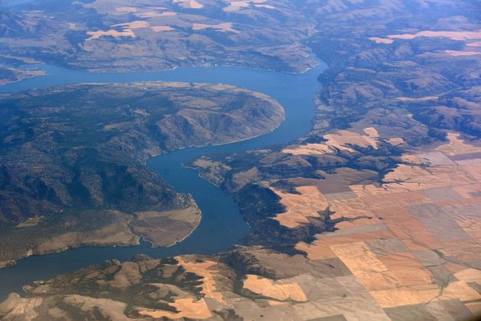
Nous atterrissons à Seattle en début d’après-midi. Il fait gris, et froid ! On attend un moment près du hangar Alaska Airlines, et ben, étant donné la météo, on pourrait se croire en Alaska 😉
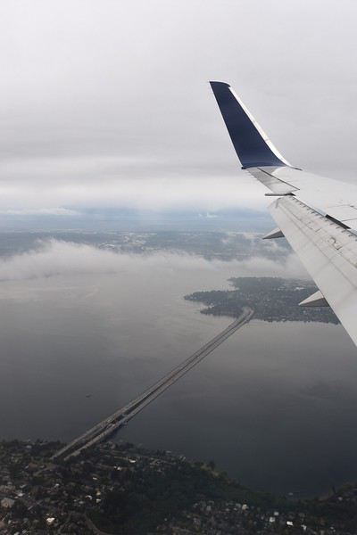
On arrive à la douane, ils nous séparent pour nous interroger un par un. Seul problème, maman parle très mal anglais, voire pas du tout ! Ce qu’on signale immédiatement, mais ils tiennent absolument à ce qu’elle réponse par elle-même aux questions. Ce qui après unpeu d’angoisse nous laisse un souvenir mémorable lorsque le douanier demande si elle a de la nourriture avec elle, sa réponse : « oui bonbonsss » 😄
Tout ça derrière nous, on se dirige vers le bâtiment qui regroupe tous les loueurs de voiture. Tout est très bien fléché dans l’aéroport de Seattle. Nous savons qu’il nous faut prendre un shuttle. Il y a la queue, et nous sommes sous la pluie ! Welcome !
Arrivé au guichet Hertz, pas d’attente. Nous sommes plutôt satisfaits de notre réservation car quelques jours avant le départ, je me reconnecte sur leur site pour vérifier que tout est en ordre. Je réalise alors que les tarifs pour notre catégorie de véhicule ont bien changé et qu’ils sont plus intéressants que lors de notre réservation il y a plusieurs mois. J’appelle Hertz qui constate également, modifie la réservation et s’engage immédiatement à rembourser les 400€ d’écart. Au guichet nous avons également une discussion concernant les assurances des passagers de la voiture. Et la personne est très à l’écoute, se renseigne plusieurs fois à notre demande, pour finalement nous éviter un surcoût, très peu courant chez les loueurs américains ça !!!
C’est donc de bonne humeur que nous descendons au parking, retrouver le véhicule qui nous est attribué. C’est un Chevrolet TAHOE. Maman fait quelques pas en arrière, stupéfaite. « Mais je ne pourrais jamais conduire cet engin !!! ». Avec mon frère Raphaël, nous, nous sommes ravis ! Après les contrôles d’usage, rayures, essuie-glace, niveaux, roue de secours… cette fois EN ROUTE !
On ne change pas les bonnes habitudes, premier arrêt, Walmart ! Il est à peine à 10min de l’aéroport. Nous arrivons sous une pluie battante, 30 secondes dehors pour rejoindre le magasin suffisent à nous tremper ! Nous sommes fatigués du voyage donc la liste de courses préparée à l’avance est bien utile. Seul petit problème, impossible de trouver une bombonne de gaz pour notre réchaud, et ce malgré l’aide d’un vendeur. Cette année, nous avons amené avec nous les barres de céréales pour les randos, on avait un mauvais souvenir des versions américaines et on a bien fait ! On arrive à la voiture, on se dit comme dans la pub, on va utiliser le pied pour ouvrir le coffre car nous sommes chargés et il pleut toujours. Mais rien ne fonctionne. La clé nous permet d’ouvrir chaque porte, chaque fenêtre, mais on ne trouve pas dans la précipitation comment ouvrir le coffre 😕 Quelques minutes plus tard, problème résolu, courses rangées… mais nous sommes trempés comme des soupes 😎
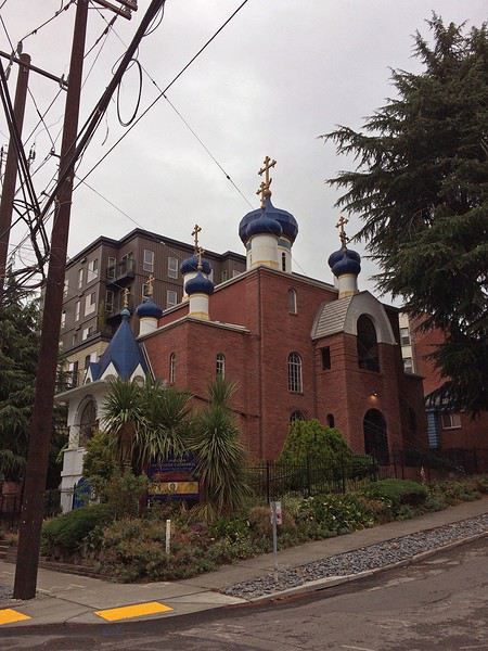
Maintenant, direction REI. C’est certainement notre seule occasion d’y faire un tour pendant ce voyage. Et puis, on a toujours besoin de gaz pour le réchaud. 25min plus tard, on arrive au parking sous-terrain, il est gratuit pendant 1h puis 2$ pour 3h. On a adoré ce magasin ! Et on a trouvé les quelques articles qui nous manquaient. Mais il est temps de partir. Nous avons décidé de ne pas dormir à Seattle, pour économiser un peu. Résultat, encore un peu de route.
Après 30min, nous arrivons au Best Value Inn de Lynnwood. Petit motel sans prétention, mais propre, personnel accueillant. Parfait pour une nuit d’après voyage. Une fois les bagages déchargés, on range les courses dans les glacières. Et on ne se fait pas prier pour se mettre au lit !
Quatrième roadtrip aux USA. C’est en Août 2019 que nous décollons pour Seattle. Cette fois, nous explorons la partie Nord-Ouest des USA, ce pays qui nous passionne depuis le premier roadtrip en 2014. 27 jours de voyage, au travers le Washington, l’Idaho, le Montana, le Wyoming et l’Oregon…ça promet encore de magnifiques découvertes 🙂 Cette année, certains grands parcs sont au programme comme Glacier NP ou encore Yellowstone (non, on ne s’en lassera jamais !), mais nous avons aussi mis sur notre parcours des State Park bien moins touristiques et des petits endroits isolés mais magnifiques comme on adore !
JOUR 1
Ma maman et mon frère sont arrivés chez moi la veille car ils vivent en province, et ce matin pas question d’avoir du retard. C’est le grand jour ! Celui qu’on prépare depuis un an !
Vers 5h du matin, nous recevons un mail de la compagnie aérienne qui nous indique 1h de retard au décollage, on se laisse donc 1h de sommeil supplémentaire.
Porte K49 - 11h10 l’avion décolle. Nous avons choisi à nouveau de voler avec Delta Airlines, et mis à part ce retard de 50min, nous n’avons, comme d’habitude rien à signaler. Les services sont au rendez-vous.
Cette année, nous avons un peu moins de chance que les voyages passés, en ce qui concerne la météo. Nous n’avons pas la chance de voir le Groenland, les côtes canadiennes.
Nous atterrissons à Seattle en début d’après-midi. Il fait gris, et froid ! On attend un moment près du hangar Alaska Airlines, et ben, étant donné la météo, on pourrait se croire en Alaska 😉
On arrive à la douane, ils nous séparent pour nous interroger un par un. Seul problème, maman parle très mal anglais, voire pas du tout ! Ce qu’on signale immédiatement, mais ils tiennent absolument à ce qu’elle réponse par elle-même aux questions. Ce qui après unpeu d’angoisse nous laisse un souvenir mémorable lorsque le douanier demande si elle a de la nourriture avec elle, sa réponse : « oui bonbonsss » 😄
Tout ça derrière nous, on se dirige vers le bâtiment qui regroupe tous les loueurs de voiture. Tout est très bien fléché dans l’aéroport de Seattle. Nous savons qu’il nous faut prendre un shuttle. Il y a la queue, et nous sommes sous la pluie ! Welcome !
Arrivé au guichet Hertz, pas d’attente. Nous sommes plutôt satisfaits de notre réservation car quelques jours avant le départ, je me reconnecte sur leur site pour vérifier que tout est en ordre. Je réalise alors que les tarifs pour notre catégorie de véhicule ont bien changé et qu’ils sont plus intéressants que lors de notre réservation il y a plusieurs mois. J’appelle Hertz qui constate également, modifie la réservation et s’engage immédiatement à rembourser les 400€ d’écart. Au guichet nous avons également une discussion concernant les assurances des passagers de la voiture. Et la personne est très à l’écoute, se renseigne plusieurs fois à notre demande, pour finalement nous éviter un surcoût, très peu courant chez les loueurs américains ça !!!
C’est donc de bonne humeur que nous descendons au parking, retrouver le véhicule qui nous est attribué. C’est un Chevrolet TAHOE. Maman fait quelques pas en arrière, stupéfaite. « Mais je ne pourrais jamais conduire cet engin !!! ». Avec mon frère Raphaël, nous, nous sommes ravis ! Après les contrôles d’usage, rayures, essuie-glace, niveaux, roue de secours… cette fois EN ROUTE !
On ne change pas les bonnes habitudes, premier arrêt, Walmart ! Il est à peine à 10min de l’aéroport. Nous arrivons sous une pluie battante, 30 secondes dehors pour rejoindre le magasin suffisent à nous tremper ! Nous sommes fatigués du voyage donc la liste de courses préparée à l’avance est bien utile. Seul petit problème, impossible de trouver une bombonne de gaz pour notre réchaud, et ce malgré l’aide d’un vendeur. Cette année, nous avons amené avec nous les barres de céréales pour les randos, on avait un mauvais souvenir des versions américaines et on a bien fait ! On arrive à la voiture, on se dit comme dans la pub, on va utiliser le pied pour ouvrir le coffre car nous sommes chargés et il pleut toujours. Mais rien ne fonctionne. La clé nous permet d’ouvrir chaque porte, chaque fenêtre, mais on ne trouve pas dans la précipitation comment ouvrir le coffre 😕 Quelques minutes plus tard, problème résolu, courses rangées… mais nous sommes trempés comme des soupes 😎
Maintenant, direction REI. C’est certainement notre seule occasion d’y faire un tour pendant ce voyage. Et puis, on a toujours besoin de gaz pour le réchaud. 25min plus tard, on arrive au parking sous-terrain, il est gratuit pendant 1h puis 2$ pour 3h. On a adoré ce magasin ! Et on a trouvé les quelques articles qui nous manquaient. Mais il est temps de partir. Nous avons décidé de ne pas dormir à Seattle, pour économiser un peu. Résultat, encore un peu de route.
Après 30min, nous arrivons au Best Value Inn de Lynnwood. Petit motel sans prétention, mais propre, personnel accueillant. Parfait pour une nuit d’après voyage. Une fois les bagages déchargés, on range les courses dans les glacières. Et on ne se fait pas prier pour se mettre au lit !
Cape Town and Kruger: 12 days in February with teens
Hi everyone,
I’d love to share a little travel journal from our 14-day/12-night road trip with our two teens (14 and 17) in February/March 2020. A huge thank you to all of you who helped me plan this trip to South Africa—your patience with my endless questions was amazing!
We left Lyon on Saturday, February 22 at 7:00 AM and arrived in Johannesburg at 10:00 PM after a short layover in Amsterdam. Flights cost 440 € per person (booked in October), with carry-on luggage. We added just one checked bag for the whole family (80 € round-trip with the free Flying Blue membership). Since we’d be moving around a lot, we packed light! In Lyon, we reserved parking at P5 in advance for 70 € for 14 days. The Air France/KLM flight was smooth. When we landed, we picked up our bags and had booked a night at the Aero Guest Lodge, just 5 minutes from the airport, with a free shuttle and breakfast. All you have to do is send a WhatsApp message when you arrive at the airport to let the shuttle driver know. The tricky part? Finding him in the terminal—he wasn’t holding a sign with the hotel’s name. 🤪 A South African called him for me since my English wasn’t great (and I had to get used to the accent 😛), and helped us spot the driver (who was actually less than 5 meters away!) with other guests. When we got to the hotel: all good, except we were 10 people in a van meant for 7. The room was spacious—one king-size bed and two single beds for the kids—with a simple but clean bathroom, a garden, pool, and breakfast (which we didn’t try). All for 65 €, so an awesome value!
 After a restful night, we woke up at 6:00 AM to catch the shuttle back to the airport. Just a heads-up: there’s only one shuttle per hour in the morning, and Kulula canceled our 9:00 AM flight, moving it to 8:00 AM—so no time for breakfast (it starts at 6:30).
We waited 15 minutes in the lovely garden for the driver, who dropped us off at the airport in 5 minutes.
We checked in for our flight to Cape Town, which cost around 40 € (including two checked bags per person).
We grabbed breakfast at the airport instead (less than 20 € for all four of us—one of the nice surprises of South Africa!), and arrived in Cape Town at 10:20 AM.
After a restful night, we woke up at 6:00 AM to catch the shuttle back to the airport. Just a heads-up: there’s only one shuttle per hour in the morning, and Kulula canceled our 9:00 AM flight, moving it to 8:00 AM—so no time for breakfast (it starts at 6:30).
We waited 15 minutes in the lovely garden for the driver, who dropped us off at the airport in 5 minutes.
We checked in for our flight to Cape Town, which cost around 40 € (including two checked bags per person).
We grabbed breakfast at the airport instead (less than 20 € for all four of us—one of the nice surprises of South Africa!), and arrived in Cape Town at 10:20 AM.
 After quickly picking up our bags, we headed to the Avis counter and left with a Toyota Corolla for 80 € for 4 days (rented with the Flying Blue card—free additional driver).
Everything’s on the left... not easy, but it works if you plan your route well.
We drove to our Airbnb in Constantia. We were surprised to see animals, bikes, and pedestrians on the highway!
We arrived around 11:30 AM at our rental—a huge house in the vineyards, in a super secure neighborhood, about 15-20 minutes from Hout Bay. It felt like Beverly Hills, but with super-high walls and barbed wire around the villas. 😕
After quickly picking up our bags, we headed to the Avis counter and left with a Toyota Corolla for 80 € for 4 days (rented with the Flying Blue card—free additional driver).
Everything’s on the left... not easy, but it works if you plan your route well.
We drove to our Airbnb in Constantia. We were surprised to see animals, bikes, and pedestrians on the highway!
We arrived around 11:30 AM at our rental—a huge house in the vineyards, in a super secure neighborhood, about 15-20 minutes from Hout Bay. It felt like Beverly Hills, but with super-high walls and barbed wire around the villas. 😕

We dropped off our bags, changed into shorts (it was around 30°C/86°F), and headed to the Bay Harbour Market in Hout Bay. We had lunch there—such a great vibe! We wandered through the stalls, everyone picked their own dish, and we sat down on the terrace. There was music, artisans of all kinds... a really nice moment.

I’d withdrawn 50 € before leaving... and that gave me change to pay the parking attendant. Lunch cost around 30 € for four, including food and drinks.

After browsing the artisan stalls, we headed to Hout Bay Beach near the restaurant, Marina Wharf (another small tip for the parking attendant—we’d have to get used to that!). We stopped to admire the sea lions. An ice cream for 1 €? No way we were saying no! 🙂
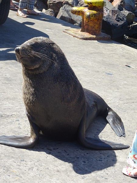
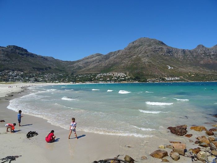
The fatigue was starting to hit, so we headed to the grocery store 10 minutes away (Constantia shopping center) and then had an aperitif in front of the vineyards, opening a delicious bottle of white wine.
I’d love to share a little travel journal from our 14-day/12-night road trip with our two teens (14 and 17) in February/March 2020. A huge thank you to all of you who helped me plan this trip to South Africa—your patience with my endless questions was amazing!
We left Lyon on Saturday, February 22 at 7:00 AM and arrived in Johannesburg at 10:00 PM after a short layover in Amsterdam. Flights cost 440 € per person (booked in October), with carry-on luggage. We added just one checked bag for the whole family (80 € round-trip with the free Flying Blue membership). Since we’d be moving around a lot, we packed light! In Lyon, we reserved parking at P5 in advance for 70 € for 14 days. The Air France/KLM flight was smooth. When we landed, we picked up our bags and had booked a night at the Aero Guest Lodge, just 5 minutes from the airport, with a free shuttle and breakfast. All you have to do is send a WhatsApp message when you arrive at the airport to let the shuttle driver know. The tricky part? Finding him in the terminal—he wasn’t holding a sign with the hotel’s name. 🤪 A South African called him for me since my English wasn’t great (and I had to get used to the accent 😛), and helped us spot the driver (who was actually less than 5 meters away!) with other guests. When we got to the hotel: all good, except we were 10 people in a van meant for 7. The room was spacious—one king-size bed and two single beds for the kids—with a simple but clean bathroom, a garden, pool, and breakfast (which we didn’t try). All for 65 €, so an awesome value!
After a restful night, we woke up at 6:00 AM to catch the shuttle back to the airport. Just a heads-up: there’s only one shuttle per hour in the morning, and Kulula canceled our 9:00 AM flight, moving it to 8:00 AM—so no time for breakfast (it starts at 6:30).
We waited 15 minutes in the lovely garden for the driver, who dropped us off at the airport in 5 minutes.
We checked in for our flight to Cape Town, which cost around 40 € (including two checked bags per person).
We grabbed breakfast at the airport instead (less than 20 € for all four of us—one of the nice surprises of South Africa!), and arrived in Cape Town at 10:20 AM.
After quickly picking up our bags, we headed to the Avis counter and left with a Toyota Corolla for 80 € for 4 days (rented with the Flying Blue card—free additional driver).
Everything’s on the left... not easy, but it works if you plan your route well.
We drove to our Airbnb in Constantia. We were surprised to see animals, bikes, and pedestrians on the highway!
We arrived around 11:30 AM at our rental—a huge house in the vineyards, in a super secure neighborhood, about 15-20 minutes from Hout Bay. It felt like Beverly Hills, but with super-high walls and barbed wire around the villas. 😕We dropped off our bags, changed into shorts (it was around 30°C/86°F), and headed to the Bay Harbour Market in Hout Bay. We had lunch there—such a great vibe! We wandered through the stalls, everyone picked their own dish, and we sat down on the terrace. There was music, artisans of all kinds... a really nice moment.
I’d withdrawn 50 € before leaving... and that gave me change to pay the parking attendant. Lunch cost around 30 € for four, including food and drinks.
After browsing the artisan stalls, we headed to Hout Bay Beach near the restaurant, Marina Wharf (another small tip for the parking attendant—we’d have to get used to that!). We stopped to admire the sea lions. An ice cream for 1 €? No way we were saying no! 🙂
The fatigue was starting to hit, so we headed to the grocery store 10 minutes away (Constantia shopping center) and then had an aperitif in front of the vineyards, opening a delicious bottle of white wine.
A breath of fresh air!
Vrrrrrm, vrmmmm! (phone on vibrate)
"Hi Mamido, it's Clémence." Clémence, 5 years old, is a giggly, cheerful little girl and the queen of mischief.
"Mom says we're coming to your place until the holidays because we're on vacation tonight."
"Yes, I know. She asked me—do you know why?" "Because of the croronavirus." "And do you know what that is?"
"Oh yeah, at school Théo told me it's like a louse that doesn't itch, that doesn't get in your head but in your lungs, that it's all round with red bumps like raspberries, and that it makes old people die."
"Your friend knows a lot of things."
"His dad showed him a microscope picture, and you—are you old?" "What do you think?" "Well, yeah, but only a little because you always leave on your motorcycle to travel. Are you going traveling?"
"No, because you're coming with your brother and sister."
"Can we go to the little bridge to look for frog eggs? You remember, there were some last year, and we'll make them grow and put the baby frogs in the washhouse, and we'll also make boats to put in the stream so they can go to the sea." "That's a great idea." "And you'll make me the model in print letters so I can write which country my boat is going to." "Where do you want your boat to go?" "To the land of pandas—is it far?" "Oh yes, very far." "Then we have to make the boat strong so it doesn't sink." "Promise, we'll have so much fun." "Mom says in some countries they wear masks. Do you still have the chicken, rabbit, and pig masks in the attic? Can we wear them like that?"
"You know, here there are only trees, birds, and fields—we'll do whatever we want."
"Mom's calling me."
Click, she hangs up, and I laugh.
"Hi Mamido, it's Clémence." Clémence, 5 years old, is a giggly, cheerful little girl and the queen of mischief.
"Mom says we're coming to your place until the holidays because we're on vacation tonight."
"Yes, I know. She asked me—do you know why?" "Because of the croronavirus." "And do you know what that is?"
"Oh yeah, at school Théo told me it's like a louse that doesn't itch, that doesn't get in your head but in your lungs, that it's all round with red bumps like raspberries, and that it makes old people die."
"Your friend knows a lot of things."
"His dad showed him a microscope picture, and you—are you old?" "What do you think?" "Well, yeah, but only a little because you always leave on your motorcycle to travel. Are you going traveling?"
"No, because you're coming with your brother and sister."
"Can we go to the little bridge to look for frog eggs? You remember, there were some last year, and we'll make them grow and put the baby frogs in the washhouse, and we'll also make boats to put in the stream so they can go to the sea." "That's a great idea." "And you'll make me the model in print letters so I can write which country my boat is going to." "Where do you want your boat to go?" "To the land of pandas—is it far?" "Oh yes, very far." "Then we have to make the boat strong so it doesn't sink." "Promise, we'll have so much fun." "Mom says in some countries they wear masks. Do you still have the chicken, rabbit, and pig masks in the attic? Can we wear them like that?"
"You know, here there are only trees, birds, and fields—we'll do whatever we want."
"Mom's calling me."
Click, she hangs up, and I laugh.
De retour du Ladakh, 3 semaines de Leh à Delhi English translation pending
De retour d’un premier séjour au Ladakh…je me décide enfin à écrire quelques lignes.
En effet le voyage date déjà de quelques mois, l’été 2019. Mieux vaut tard que jamais…
Beaucoup de montagnards chevronnés sur cette destination (il y a peut être une certaine logique à cela), je dois avouer que je n’entre pas dans cette catégorie… ce qui ne m’empêche pas d’apprécier de grandioses paysages de montagne !! Mes motivations premières pour cette destination étaient donc : la découverte de la région et des ses habitants, bien entendu ; l’Himalaya bien sûr, mais sans forcément penser à faire de grandes marches / de grands escalades ; les monastères bouddhistes, cela va sans dire ; et les routes mythiques, en particulier la route ralliant Leh à Manali qui est bien haut dans ma wish-list depuis un certain nombre d’années…
Avant de rentrer dans le vif du sujet, un grand merci à tous ceux qui ont répondu à mes messages et m’ont aidé à dans ma préparation. Et des very special thanks au grand spécialiste de la destination, Djullé84, qui, m’a grandement aidé dans mon itinéraire, et qui a aussi influé sur le contenu de mon voyage. On en reparlera !
Donc, les grandes lignes de ce voyage ont été : - Leh (inévitablement) et les monastères de la vallée de l’Indus - Le festival de Lamayuru - Le trek de la Markha - Une virée dans la vallée de la Nubra - Le trajet de retour en bus de Leh à Delhi. Pour les déplacements, les transports publics sont privilégiés, autant que possible.
Durée / période : ~3 semaines, fin juin / mi-juillet
Le voyage jusqu'à Leh : vol jusqu’à Delhi sur Lufthansa via Munich (Lufthansa est très concurrentiel vers les destinations asiatiques depuis ma province). Arrivée Delhi peu avant minuit, passage à l’immigration sans problème pour valider mon visa à entrées multiples sur un an obtenu sur internet. Je traîne quelques heures dans l’aéroport puis je m’aperçois qu’il me faut changer de terminal pour prendre mon vol SpiceJet du petit matin. Le terminal 1D est loin, la navette en bus est gratuite en montrant sa carte d’embarquement du vol précédent et sa réservation du vol suivant (à prendre près du pilier 10 accessible par la sortie 4, le monsieur dans la cabane donne le ticket). Heureusement, j’avais été attentif lors de ma réservation et je n’avais pas acheté mon billet avec une CB virtuelle : il faut effectivement montrer la CB avec laquelle on a fait l’achat pour obtenir sa boarding card…(Spicejet) Vol sans histoire, mais… le ciel très couvert ne permet aucun spectacle, c’est une déception car ça aurait pu être pire : le vol n’a pas été annulé… Avion jusqu'à Leh, donc : d'une part en juin, c'est encore tôt dans la saison pour prendre la route ; et d'autre part, la route Delhi-Manali-Leh me paraît très haute pour l'emprunter sans aucune acclimatation, je la réserve pour le retour... Et l'autre possibilité par Amritsar et Srinagar était très tentante, mais d'une part elle exigeait beaucoup de temps, et d'autre part cet itinéraire fait emprunter des trajets qui se situent dans la zone rouge du ministère des affaires étrangères...
Depuis l'aéroport, le taxi pour le centre de Leh coûte 450 Rs (flat price), installation à la GH, réservée sur booking, dans le vieux Leh, entre le terrain de polo et la rue principale.
La 1ère journée se passe au ralenti, sous un ciel couvert, il me faut récupérer du voyage et de la nuit dans l’aéroport de Delhi, et m’acclimater à l’altitude. Premières découvertes de Leh qui au premier abord et sous le ciel gris, n’est pas vraiment enthousiasmante (ça me rassure un peu d’avoir lu quelque part (n’est ce pas, Djullé84) que « chaque journée passée à Leh est une journée de moins passée au Ladakh »…). Ah tous ces toutous en train de roupiller… La première nuit est un peu difficile, mal de tête avec l’altitude… Et les chiens donnent un concert dès le coucher du soleil. Je comprends pourquoi les chiens dormaient dans la journée : à Leh, le chien est un animal nocturne, qui dort le jour et qui passe ses nuits à aboyer… Ah, il y a le chant du muezzin aussi…
Temps pluvieux le matin (et j’apprends qu’il n’y a aucun vol depuis/vers Leh aujourd’hui…), il me faut récupérer des infos pratiques pour organiser la suite du voyage (les jours et heures des bus, en particulier …). Le temps s’arrange, location de scooter l’après midi, je parviens à en obtenir un bien que je n’aie pas pu avoir mon permis de conduire international en temps et en heure. Je vais aller jusqu’à Phyang. Une fois sorti des embouteillages et du bazar de Leh, la ballade permet les premières vues spectaculaires sur les montagnes himalayennes et sur l’Indus. Et les premiers convois militaires à croiser aussi, ils seront omniprésents sur les routes…Et la possibilité de voir de près le 1er monastère ! (mais pas de le visiter à l’heure de mon arrivée) Côté organisation, j’ai pu planifier les choses : dans les prochains jours, ce sera une virée Alchi – Likir – Lamayuru et retour sur Leh : le lendemain je prendrai un premier bus pour Alchi ; mon périple continuera en prenant le bus qui repart pour Leh ; en descendant à la bifurcation pour Likir, je pourrai ensuite monter à pied pour la fin d’après-midi et la nuit à Likir. Le jour suivant je redescendrai à pied à la highway prendre le bus pour Lamayuru, où je resterai deux jours et demi (dont une pleine journée de festival) avant de rentrer en bus pour Leh. J’en repartirai le lendemain pour la vallée de la Markha. Leh sera donc ma plaque tournante, ce qui me permet de m’alléger en demandant à la GH de garder une partie de mes affaires lors de chacune de mes escapades.
(à suivre)
En effet le voyage date déjà de quelques mois, l’été 2019. Mieux vaut tard que jamais…
Beaucoup de montagnards chevronnés sur cette destination (il y a peut être une certaine logique à cela), je dois avouer que je n’entre pas dans cette catégorie… ce qui ne m’empêche pas d’apprécier de grandioses paysages de montagne !! Mes motivations premières pour cette destination étaient donc : la découverte de la région et des ses habitants, bien entendu ; l’Himalaya bien sûr, mais sans forcément penser à faire de grandes marches / de grands escalades ; les monastères bouddhistes, cela va sans dire ; et les routes mythiques, en particulier la route ralliant Leh à Manali qui est bien haut dans ma wish-list depuis un certain nombre d’années…
Avant de rentrer dans le vif du sujet, un grand merci à tous ceux qui ont répondu à mes messages et m’ont aidé à dans ma préparation. Et des very special thanks au grand spécialiste de la destination, Djullé84, qui, m’a grandement aidé dans mon itinéraire, et qui a aussi influé sur le contenu de mon voyage. On en reparlera !
Donc, les grandes lignes de ce voyage ont été : - Leh (inévitablement) et les monastères de la vallée de l’Indus - Le festival de Lamayuru - Le trek de la Markha - Une virée dans la vallée de la Nubra - Le trajet de retour en bus de Leh à Delhi. Pour les déplacements, les transports publics sont privilégiés, autant que possible.
Durée / période : ~3 semaines, fin juin / mi-juillet
Le voyage jusqu'à Leh : vol jusqu’à Delhi sur Lufthansa via Munich (Lufthansa est très concurrentiel vers les destinations asiatiques depuis ma province). Arrivée Delhi peu avant minuit, passage à l’immigration sans problème pour valider mon visa à entrées multiples sur un an obtenu sur internet. Je traîne quelques heures dans l’aéroport puis je m’aperçois qu’il me faut changer de terminal pour prendre mon vol SpiceJet du petit matin. Le terminal 1D est loin, la navette en bus est gratuite en montrant sa carte d’embarquement du vol précédent et sa réservation du vol suivant (à prendre près du pilier 10 accessible par la sortie 4, le monsieur dans la cabane donne le ticket). Heureusement, j’avais été attentif lors de ma réservation et je n’avais pas acheté mon billet avec une CB virtuelle : il faut effectivement montrer la CB avec laquelle on a fait l’achat pour obtenir sa boarding card…(Spicejet) Vol sans histoire, mais… le ciel très couvert ne permet aucun spectacle, c’est une déception car ça aurait pu être pire : le vol n’a pas été annulé… Avion jusqu'à Leh, donc : d'une part en juin, c'est encore tôt dans la saison pour prendre la route ; et d'autre part, la route Delhi-Manali-Leh me paraît très haute pour l'emprunter sans aucune acclimatation, je la réserve pour le retour... Et l'autre possibilité par Amritsar et Srinagar était très tentante, mais d'une part elle exigeait beaucoup de temps, et d'autre part cet itinéraire fait emprunter des trajets qui se situent dans la zone rouge du ministère des affaires étrangères...
Depuis l'aéroport, le taxi pour le centre de Leh coûte 450 Rs (flat price), installation à la GH, réservée sur booking, dans le vieux Leh, entre le terrain de polo et la rue principale.
La 1ère journée se passe au ralenti, sous un ciel couvert, il me faut récupérer du voyage et de la nuit dans l’aéroport de Delhi, et m’acclimater à l’altitude. Premières découvertes de Leh qui au premier abord et sous le ciel gris, n’est pas vraiment enthousiasmante (ça me rassure un peu d’avoir lu quelque part (n’est ce pas, Djullé84) que « chaque journée passée à Leh est une journée de moins passée au Ladakh »…). Ah tous ces toutous en train de roupiller… La première nuit est un peu difficile, mal de tête avec l’altitude… Et les chiens donnent un concert dès le coucher du soleil. Je comprends pourquoi les chiens dormaient dans la journée : à Leh, le chien est un animal nocturne, qui dort le jour et qui passe ses nuits à aboyer… Ah, il y a le chant du muezzin aussi…
Temps pluvieux le matin (et j’apprends qu’il n’y a aucun vol depuis/vers Leh aujourd’hui…), il me faut récupérer des infos pratiques pour organiser la suite du voyage (les jours et heures des bus, en particulier …). Le temps s’arrange, location de scooter l’après midi, je parviens à en obtenir un bien que je n’aie pas pu avoir mon permis de conduire international en temps et en heure. Je vais aller jusqu’à Phyang. Une fois sorti des embouteillages et du bazar de Leh, la ballade permet les premières vues spectaculaires sur les montagnes himalayennes et sur l’Indus. Et les premiers convois militaires à croiser aussi, ils seront omniprésents sur les routes…Et la possibilité de voir de près le 1er monastère ! (mais pas de le visiter à l’heure de mon arrivée) Côté organisation, j’ai pu planifier les choses : dans les prochains jours, ce sera une virée Alchi – Likir – Lamayuru et retour sur Leh : le lendemain je prendrai un premier bus pour Alchi ; mon périple continuera en prenant le bus qui repart pour Leh ; en descendant à la bifurcation pour Likir, je pourrai ensuite monter à pied pour la fin d’après-midi et la nuit à Likir. Le jour suivant je redescendrai à pied à la highway prendre le bus pour Lamayuru, où je resterai deux jours et demi (dont une pleine journée de festival) avant de rentrer en bus pour Leh. J’en repartirai le lendemain pour la vallée de la Markha. Leh sera donc ma plaque tournante, ce qui me permet de m’alléger en demandant à la GH de garder une partie de mes affaires lors de chacune de mes escapades.
(à suivre)
Voyage solo-rando de 4 semaines dans l'Ouest des États-Unis English translation pending
En guise de préambule
Voici un nouveau carnet - un énième, me diriez-vous mais c'est mon premier, soyez indulgent svp. 🙂 - qui décrit mon voyage à l’Ouest des Etats-Unis en solo en été 2018 et qui ne sera probablement pas un carnet comme les autres car je l’écris tout d’abord et principalement pour mes enfants qui n’ont pas pu y participer. Je me suis dit que leur parler de tout ça serait trop long et à un moment donné ils en auront assez tandis qu’un carnet peut se lire quand on veut. J’aurais pu l’écrire et leur donner en direct sans passer par le site mais je pense que les enfants d’aujourd’hui liront avec davantage d’intérêt quelque chose publié sur un site que sous fichier Word comme ils lisent plus volontiers les blogs que des romans, pourtant mille fois plus intéressants. Ce carnet aura donc beaucoup de sentiments personnels, du ressenti qui n’intéressera peut-être pas les gens qui cherchent avant tout de l’info pratique. Je vais tout de même tacher d’y mettre quelque renseignements de ce genre dans la mesure qu’il me paraîtrait important d’expliquer certaines choses ou les choix que j’ai fait ou pas. Évidemment toutes mes réflexions et analyses sont des avis personnels et ne seront sans doute pas entièrement partagés par tout le monde.😉 Et juste la dernière chose avant d'entrer dans le vif du sujet: le voyage était fait il y a un an et demi, certaines choses se sont effacés du disque dur (ou mou, c'est à voir) de mon cerveau mais je vais essayer de retracer l'essentiel en espérant que cela servira à quelqu'un sur ce forum et à mes enfants de mieux connaitre leur père.
La genèse
Après avoir fait un premier voyage à l’Ouest des US en famille qui comportait tous les lieux classiques visités habituellement et qui était une grande réussite au niveau de la diversité des lieux vus 😇 mais un peu moins au niveau des intensités des balades 🙁 j’ai voulu approfondir l’expérience et sortir des sentiers battus. Il m’a vite apparu que pour des diverses raisons il ne serait pas possible de le faire en famille. 🙁 Ma femme que je remercie infiniment m’a permis de partir tout seul pendant un mois prenant sur elle les enfants. Sans son soutien ce voyage n’aurait pas été possible.
Les préparatifs
Un voyage solo hors les sentiers battus – relativement bien sûr - demande plus de préparatifs qu’un voyage classique ou plutôt il demande de le préparer différemment. J’ai passé donc beaucoup de temps pendant plusieurs mois avant le départ à établir mon circuit, chercher les informations, créer des itinéraires. J’expliquerai plus tard mon avis sur ce travail fastidieux. Comme à toute la personne qui cherche à faire un voyage à l’Ouest des US une question s’est posée à moi si je dois faire une boucle ou arriver dans un endroit et repartir d’un autre. Les deux options ont leurs avantages et leurs inconvénients – laisser la voiture dans une autre agence que celle où elle a été prise va augmenter la facture de 200-400$ (sauf en Californie), l’arrivée et le départ des différents aéroports peut aussi coûter plus cher bien que j’ai entendu des avis contraires. Mais cela vous permet de ne pas revenir sur vos pas en passant par les endroits qui ne seront pas spécialement intéressants au retour, vous économiserez donc du temps. En faisant une boucle on roule presque toujours un peu trop juste parce qu’il faut revenir.
Le problème éternel est également qu’il faut s’y prendre assez tôt à l’avance pour bénéficier des billets et de la location voiture pas trop chers et généralement sauf être super bien organisé et avoir commencé les préparatifs très en amont (ce qui n’était pas mon cas), au moment d’achat de billets le circuit n’est pas entièrement établi. Généralement on ne conseille pas prendre les billets avant de faire le planning (voir les commandements de Pong 😉, bien faits). Je ne suis pas de cette avis : il est parfaitement possible d’avoir une trame de circuit plus ou moins bien faite et de prendre les billets, ensuite il suffit juste d’avoir beaucoup d’options à sa disposition et de ne pas essayer de mettre tout ce qu’on a envie de voir car cela ne marchera pas. Et c’est ça, le plus difficile ! :-) 🙂
Bref comme vous avez compris, mon circuit était loin d’être fini au moment de recherche et d’achat de billet. J’avais plus ou moins une bonne idée des régions ou des lieux que je voulais visiter mais je n’avais pas de planning exact.
Le départ était prévu pour le mois d’août, j’ai pris mes billets en mars. Les recherches étaient fastidieuses : il me fallait me décider sur le lieu d’arrivée et du départ et sur la location de voiture. Finalement tous facteurs pesés mon choix s’est porté sur la boucle à partir de Denver (la première fois on a fait la boucle à partir de Las Vegas). J’ai longuement hésité sur les vols mais en mars les prix des meilleurs vols avec les horaires potables étaient déjà prohibitifs, je me suis donc décidé à faire des vols avec des longues escales pour passer la nuit à Montréal en aller et à Vancouver au retour. Je donnerai mon avis là dessus plus tard.
Etant donné que j’envisageais de faire beaucoup de pistes j’ai choisi une SUV en espérant avoir un vrai 4x4 au moment de location sur place. Comme j’ai pensé dormir parfois dans la voiture je n’ai pas pris le plus petit modèle. Par ailleurs je me suis fixé comme objectif faire –ou essayer de faire – un voyage vraiment près de la nature, dormir le maximum dans les campings, il me fallait donc avoir un peu de place dans la voiture pour mettre tout le matériel.
Une fois les billets pris j’ai commençais vraiment à construire mon circuit ayant déjà une idée bien précise d’endroits que je voulais absolument visiter. Comme dit plus haut je me suis fixé l’objectif de ne pas dormir dans les hôtels/motels mais de m’arrêter dans les campings. Or en commençant construire mon circuit et en regardant les campings dans les endroits où je voulais dormir il m’est vite apparu que soit les bons campings étaient déjà pleins soit les autres n’étaient pas terribles et de surcroit assez chers juste pour mettre une tente (30-35$ la nuit sans douche en tenant compte de frais de résa que Recreation.gouv ou autres site vous sucrent au passage). J’ai réservé donc les deux premières nuits et ensuite me suis dit que payer aussi cher sans avoir la douche juste pour dormir dans les endroits probablement moyennement sympathiques n’était sans doute pas le meilleur choix et que j’allais essayer de trouver autre chose. Je donnerai mon avis sur ce choix pour chaque jour de voyage.
Ensuite ont commencé les vrais mois de préparation car je ne voulais pas perdre du temps sur place, être tributaire du temps, donc il fallait des plans B, comme tout le monde je voulais faire le max des choses, bref vers la fin du mois de juin j’étais carrément épuisè par mes recherches d’info, des endroits, des itinéraires au point que je n’absorbais plus l’info, j’ai frôlé l’indigestion...
Etant donné que je voulais visiter les endroits où je ne risquais pas voir beaucoup de monde et dans les conditions climatiques assez difficiles (chaleur) j’ai décide d’acheter un navigateur de randonnée. Mon choix après un certain temps de recherches s’est porté sur Etrex 30x pour sa robustesse, son poids, son côté pratique pour la randonnée et son prix (200€ tout de même). J’étais très surpris par le caractère très peu pratique de cet appareil, qui demande à s’habituer à sa manière de fonctionner et ne pas du tout user friendly. Ayant été habitué à la maniabilité des téléphones portables j’ai trouvé cet appareil d’un autre age, et je me demande comment on arrive à vendre aujourd’hui au prix fort ces machins si peu pratique. Cela me rappelait les bons vieux modems de l’époque préADSL qui ramaient pas possible... Par ailleurs il s’est trouvé très énergivore et il fallait constamment penser à avoir les piles supplémentaires sous peine de se trouver avec l’appareil mort. Cela dit je ne regrette pas mon achat car il m’a servi à plusieurs reprises pour me repérer au milieu de nulle part et je pense que sans lui j’aurai pu vraiment m’y perdre ou tout simplement et moins tragiquement de ne pas trouver ce que je cherchais.
Enfin en parlant de préparatifs je ne peux ne pas mentionner les ressources inestimables que j’ai trouvé sur ce forum et sur les sites de ces membres, que je remercie, notamment Thierry (wavemaster), dont le site reste une référence par son exhaustivité des lieux à visiter mais qu’il faut souvent compléter par le recoupement d’info d’ordre pratique, Julien (ju45) qui donne dans ses carnets pas mal d’info justement pratiques – la distance, le temps, l’appréciation – et qui met beaucoup de belles photos ce qui est très appréciables pour se faire une idée, Yves (mycovtt) dont les nombreux carnets et les aventures ainsi que des magnifiques photos m’ont beaucoup inspiré, Pierre (pong) pour ces récits instructifs et les photos, Jean Philippe (orionide) pour ses sites très bein faits, Michèle et Jean-Michel dont les magnifiques photos sont une source inépuisable d’envies et beaucoup d’autres dont j’ai parcouru assidument les carnets.
Je voudrais remercier plus particulièrement Patrice (jdakota), Olivier (oliv2019), Valérie (veileen) et Guillaume (Marati) dont les carnets super détaillés et les photos magnifiques m’ont directement inspiré et qui ont eu la gentillesse et la patience de me donner leurs tracés de GPS et leurs conseils et encouragements. Ce carnet est autant l’hommage à leur gentillesse et le sens de partage.
Et juste le dernier mot pour expliquer ce qui va suivre : je suis arrivé aux US dans l’état de fatigue très avancé, l’année était très dure et le manque de sommeil cumulé tel que parfois je dormais debout dans le métro. Cela explique certaines choses que vous allez trouver dans ce carnet.
Et pour comprendre vraiment le manque de belles photos dans ce carnet il faut savoir que pour moi marcher vitedans ces beaux endroits est un plaisir plus grand que de les voir, ce qui doit me faire rater énormément de choses que je n’ai pas le temps d’apercevoir et/ou de contempler. C’est sans doute bête mais c’est comme ça, j’aime bien marcher et marcher vite. Un Forest Gump, quoi... 😉 😊
La genèse
Après avoir fait un premier voyage à l’Ouest des US en famille qui comportait tous les lieux classiques visités habituellement et qui était une grande réussite au niveau de la diversité des lieux vus 😇 mais un peu moins au niveau des intensités des balades 🙁 j’ai voulu approfondir l’expérience et sortir des sentiers battus. Il m’a vite apparu que pour des diverses raisons il ne serait pas possible de le faire en famille. 🙁 Ma femme que je remercie infiniment m’a permis de partir tout seul pendant un mois prenant sur elle les enfants. Sans son soutien ce voyage n’aurait pas été possible.
Les préparatifs
Un voyage solo hors les sentiers battus – relativement bien sûr - demande plus de préparatifs qu’un voyage classique ou plutôt il demande de le préparer différemment. J’ai passé donc beaucoup de temps pendant plusieurs mois avant le départ à établir mon circuit, chercher les informations, créer des itinéraires. J’expliquerai plus tard mon avis sur ce travail fastidieux. Comme à toute la personne qui cherche à faire un voyage à l’Ouest des US une question s’est posée à moi si je dois faire une boucle ou arriver dans un endroit et repartir d’un autre. Les deux options ont leurs avantages et leurs inconvénients – laisser la voiture dans une autre agence que celle où elle a été prise va augmenter la facture de 200-400$ (sauf en Californie), l’arrivée et le départ des différents aéroports peut aussi coûter plus cher bien que j’ai entendu des avis contraires. Mais cela vous permet de ne pas revenir sur vos pas en passant par les endroits qui ne seront pas spécialement intéressants au retour, vous économiserez donc du temps. En faisant une boucle on roule presque toujours un peu trop juste parce qu’il faut revenir.
Le problème éternel est également qu’il faut s’y prendre assez tôt à l’avance pour bénéficier des billets et de la location voiture pas trop chers et généralement sauf être super bien organisé et avoir commencé les préparatifs très en amont (ce qui n’était pas mon cas), au moment d’achat de billets le circuit n’est pas entièrement établi. Généralement on ne conseille pas prendre les billets avant de faire le planning (voir les commandements de Pong 😉, bien faits). Je ne suis pas de cette avis : il est parfaitement possible d’avoir une trame de circuit plus ou moins bien faite et de prendre les billets, ensuite il suffit juste d’avoir beaucoup d’options à sa disposition et de ne pas essayer de mettre tout ce qu’on a envie de voir car cela ne marchera pas. Et c’est ça, le plus difficile ! :-) 🙂
Bref comme vous avez compris, mon circuit était loin d’être fini au moment de recherche et d’achat de billet. J’avais plus ou moins une bonne idée des régions ou des lieux que je voulais visiter mais je n’avais pas de planning exact.
Le départ était prévu pour le mois d’août, j’ai pris mes billets en mars. Les recherches étaient fastidieuses : il me fallait me décider sur le lieu d’arrivée et du départ et sur la location de voiture. Finalement tous facteurs pesés mon choix s’est porté sur la boucle à partir de Denver (la première fois on a fait la boucle à partir de Las Vegas). J’ai longuement hésité sur les vols mais en mars les prix des meilleurs vols avec les horaires potables étaient déjà prohibitifs, je me suis donc décidé à faire des vols avec des longues escales pour passer la nuit à Montréal en aller et à Vancouver au retour. Je donnerai mon avis là dessus plus tard.
Etant donné que j’envisageais de faire beaucoup de pistes j’ai choisi une SUV en espérant avoir un vrai 4x4 au moment de location sur place. Comme j’ai pensé dormir parfois dans la voiture je n’ai pas pris le plus petit modèle. Par ailleurs je me suis fixé comme objectif faire –ou essayer de faire – un voyage vraiment près de la nature, dormir le maximum dans les campings, il me fallait donc avoir un peu de place dans la voiture pour mettre tout le matériel.
Une fois les billets pris j’ai commençais vraiment à construire mon circuit ayant déjà une idée bien précise d’endroits que je voulais absolument visiter. Comme dit plus haut je me suis fixé l’objectif de ne pas dormir dans les hôtels/motels mais de m’arrêter dans les campings. Or en commençant construire mon circuit et en regardant les campings dans les endroits où je voulais dormir il m’est vite apparu que soit les bons campings étaient déjà pleins soit les autres n’étaient pas terribles et de surcroit assez chers juste pour mettre une tente (30-35$ la nuit sans douche en tenant compte de frais de résa que Recreation.gouv ou autres site vous sucrent au passage). J’ai réservé donc les deux premières nuits et ensuite me suis dit que payer aussi cher sans avoir la douche juste pour dormir dans les endroits probablement moyennement sympathiques n’était sans doute pas le meilleur choix et que j’allais essayer de trouver autre chose. Je donnerai mon avis sur ce choix pour chaque jour de voyage.
Ensuite ont commencé les vrais mois de préparation car je ne voulais pas perdre du temps sur place, être tributaire du temps, donc il fallait des plans B, comme tout le monde je voulais faire le max des choses, bref vers la fin du mois de juin j’étais carrément épuisè par mes recherches d’info, des endroits, des itinéraires au point que je n’absorbais plus l’info, j’ai frôlé l’indigestion...
Etant donné que je voulais visiter les endroits où je ne risquais pas voir beaucoup de monde et dans les conditions climatiques assez difficiles (chaleur) j’ai décide d’acheter un navigateur de randonnée. Mon choix après un certain temps de recherches s’est porté sur Etrex 30x pour sa robustesse, son poids, son côté pratique pour la randonnée et son prix (200€ tout de même). J’étais très surpris par le caractère très peu pratique de cet appareil, qui demande à s’habituer à sa manière de fonctionner et ne pas du tout user friendly. Ayant été habitué à la maniabilité des téléphones portables j’ai trouvé cet appareil d’un autre age, et je me demande comment on arrive à vendre aujourd’hui au prix fort ces machins si peu pratique. Cela me rappelait les bons vieux modems de l’époque préADSL qui ramaient pas possible... Par ailleurs il s’est trouvé très énergivore et il fallait constamment penser à avoir les piles supplémentaires sous peine de se trouver avec l’appareil mort. Cela dit je ne regrette pas mon achat car il m’a servi à plusieurs reprises pour me repérer au milieu de nulle part et je pense que sans lui j’aurai pu vraiment m’y perdre ou tout simplement et moins tragiquement de ne pas trouver ce que je cherchais.
Enfin en parlant de préparatifs je ne peux ne pas mentionner les ressources inestimables que j’ai trouvé sur ce forum et sur les sites de ces membres, que je remercie, notamment Thierry (wavemaster), dont le site reste une référence par son exhaustivité des lieux à visiter mais qu’il faut souvent compléter par le recoupement d’info d’ordre pratique, Julien (ju45) qui donne dans ses carnets pas mal d’info justement pratiques – la distance, le temps, l’appréciation – et qui met beaucoup de belles photos ce qui est très appréciables pour se faire une idée, Yves (mycovtt) dont les nombreux carnets et les aventures ainsi que des magnifiques photos m’ont beaucoup inspiré, Pierre (pong) pour ces récits instructifs et les photos, Jean Philippe (orionide) pour ses sites très bein faits, Michèle et Jean-Michel dont les magnifiques photos sont une source inépuisable d’envies et beaucoup d’autres dont j’ai parcouru assidument les carnets.
Je voudrais remercier plus particulièrement Patrice (jdakota), Olivier (oliv2019), Valérie (veileen) et Guillaume (Marati) dont les carnets super détaillés et les photos magnifiques m’ont directement inspiré et qui ont eu la gentillesse et la patience de me donner leurs tracés de GPS et leurs conseils et encouragements. Ce carnet est autant l’hommage à leur gentillesse et le sens de partage.
Et juste le dernier mot pour expliquer ce qui va suivre : je suis arrivé aux US dans l’état de fatigue très avancé, l’année était très dure et le manque de sommeil cumulé tel que parfois je dormais debout dans le métro. Cela explique certaines choses que vous allez trouver dans ce carnet.
Et pour comprendre vraiment le manque de belles photos dans ce carnet il faut savoir que pour moi marcher vitedans ces beaux endroits est un plaisir plus grand que de les voir, ce qui doit me faire rater énormément de choses que je n’ai pas le temps d’apercevoir et/ou de contempler. C’est sans doute bête mais c’est comme ça, j’aime bien marcher et marcher vite. Un Forest Gump, quoi... 😉 😊
Le camping-car en Namibie c'est bien English translation pending
bonjour,
juste un petit post et retour d'expérience sur la possibilité de voyager en camping car en Namibie. Lors de la préparation de notre voyage je n'avais rien trouvé de satisfaisant sur ce forum. Dire donc: oui c'est possible ! Et avec des enfants cela est même souhaitable. Parcourir la Namibie cela implique de rouler, souvent longtemps, plus longtemps que prévu vu l'état des routes, la beauté des paysages et la recherche des animaux sauvages. L'espace a disposition dans le camping car est alors le bienvenu. Par ailleurs la hauteur, le nombre de fenêtres sont des atouts bien appréciés lors de la visite du parc Etosha mais aussi en d'autres circonstances. Reste les inconvénients : la poussière qui s'infiltre dans le véhicule ( prévoir de grands sacs poubelles pour enfermer vos affaires) et oblige a un ménage complet a chaque étape(problème que rencontrent aussi les 4x4) et les vibrations qui vous font parfois croire que le véhicule va se fendre en deux... Nous avons vécu deux crevaisons et un ensablement. J'en profite pour signaler que nous avons reçu alors l'aide précieuse d'un sud africain voyageant avec son propre véhicule et connaissant le terrain qui a su nous sortir de là. Les autres touristes équipés de 4x4 flambant neuf étaient bien en peine pour nous aider, s'agaçant plutôt que nous obstruions le passage, les retardant sur leurs parcours et programme bien huilé... Certes les 4x4 roulent plus vite...Mais a quoi bon...
juste un petit post et retour d'expérience sur la possibilité de voyager en camping car en Namibie. Lors de la préparation de notre voyage je n'avais rien trouvé de satisfaisant sur ce forum. Dire donc: oui c'est possible ! Et avec des enfants cela est même souhaitable. Parcourir la Namibie cela implique de rouler, souvent longtemps, plus longtemps que prévu vu l'état des routes, la beauté des paysages et la recherche des animaux sauvages. L'espace a disposition dans le camping car est alors le bienvenu. Par ailleurs la hauteur, le nombre de fenêtres sont des atouts bien appréciés lors de la visite du parc Etosha mais aussi en d'autres circonstances. Reste les inconvénients : la poussière qui s'infiltre dans le véhicule ( prévoir de grands sacs poubelles pour enfermer vos affaires) et oblige a un ménage complet a chaque étape(problème que rencontrent aussi les 4x4) et les vibrations qui vous font parfois croire que le véhicule va se fendre en deux... Nous avons vécu deux crevaisons et un ensablement. J'en profite pour signaler que nous avons reçu alors l'aide précieuse d'un sud africain voyageant avec son propre véhicule et connaissant le terrain qui a su nous sortir de là. Les autres touristes équipés de 4x4 flambant neuf étaient bien en peine pour nous aider, s'agaçant plutôt que nous obstruions le passage, les retardant sur leurs parcours et programme bien huilé... Certes les 4x4 roulent plus vite...Mais a quoi bon...
Compte rendu croisière aux Antilles sur Costa Favolosa janvier 2020 English translation pending
bonjour
Notre Itinéraire 25 janv départ de Pointe à Pitre 26 janv en mer 27 janv la Romana 28 janv Catalina (ile face à la Romana) 29 janv Tortola 30 janv St Martin 31 janv Martinique Fort de France 1 fev Pointe à pitre
Nous avions réservé début 2019 cette croisière pour deux personnes et nous avions comme à l’habitude acheté nos vols A/R séparément au départ de Roissy avec la compagnie Xl airways.🤪
Malheureusement la compagnie ayant fait faillite en novembre nous avons dû remplacer nos transferts vers la Guadeloupe avec la compagnie Corsair avec un départ de Orly.
Un inconvénient supplémentaire pour nous qui demeurons près de Lille, car nous avons un accès direct à l’aéroport Charles de gaule via le TGV. Étant donné l’horaire de départ de notre vol à Orly nous avons donc réservé une chambre à Ibis cœur de Paris.
Finalement nous sommes partis avec un couple d’amis ayant l’opportunité d’avoir une cabine sur le même bateau à un bon prix.😎
Nos transferts : Nous sommes partis donc le 21 janv en TGV de Lille vers Paris Charles de Gaulle et pensions prendre le RER B et l’Orlyval pour rejoindre Orly.
Mais en cette période de grève nous avons finalement opté pour le Bus Direct assurant la liaison CDG ligne 3 vers Orly, ce que nous n’avons pas regretté, car pas de bousculade et les valises posées une fois pour toutes dans le coffre du bus. 22€ l’aller mais 19€ si vous êtes 4 en payant au chauffeur.
Arrivé à Orly T4 , nous avons pris l’ascenseur de la passerelle qui nous conduisait directement vers l’ibis cœur de Paris.
Aucun problème d’enregistrement à notre arrivée pour nous, mais pour mes amis, la réceptionniste ne trouvant pas leur réservation sur internet, une erreur sur la date (21/2 au lieu de 21/1) les taxa de 50% du prix de la chambre. Pas très commercial comme accueil surtout qu’il restait bien des chambres de libres.🤪
Nous passerons l’après-midi dans cet hôtel, et prendrons l’apéro au bar en attendant le dîner de 19H. La chambre bien insonorisée malgré la proximité de l’aéroport est confortable, la literie aussi. Le choix des repas est assez limité, c’est un hôtel de transit, les plats sont corrects le service à table efficace si vous ne prenez pas les formules buffets, malgré tout il y a pas mal de monde et trouver une place pour 4 c’est laborieux.
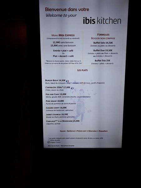
Une bonne nuit et nous prendrons notre petit-déjeuner vers 7H compris dans notre réservation , que nos amis devront eux repayer, leur réservation ayant été annulée.🤪
Nous reprendrons la grande passerelle couverte vers le terminal 4 juste en face pour déposer nos bagages pour le vol Corsair.
Notre enregistrement ayant déjà été fait la veille sur internet, il nous manquait seulement les porte étiquettes pour les valises, afin de glisser dedans nos feuilles comportant le code-barres relatif à notre vol vers Pointe à pitre. Une hôtesse Corsair devant les caisses d’enregistrement automatique nous donna les porte étiquettes plastifiés afin de déposer les valises sur le tapis d’enregistrement vite fait bien fait.
Notre vol a eu quand même une petite heure de retard au décollage mais nous étions déjà assis dans l’avion et pouvions profiter des écrans et films vidéo (j’ai donc prévenu notre taxi Ruddy à Pointe à pitre de notre probable retard).
Retard final de 15mn à l’atterrissage avec un vol très correct, nous étions assis derrière l’espace central où sont distribuées les boissons. J’en profitais pour demander s’il était possible d’avoir le seul « kit apéro payant » avant le repas que nous avons eu tout loisir de déguster.😉
Le plateau est correct, poulet ou poisson, servit avec du vin ou de la bière ou des sodas et de l’eau. Les boissons au repas sont incluses dans le prix du billet, un plus par rapport à XLairways où tout était payant sauf l’eau.
à suivre
Notre Itinéraire 25 janv départ de Pointe à Pitre 26 janv en mer 27 janv la Romana 28 janv Catalina (ile face à la Romana) 29 janv Tortola 30 janv St Martin 31 janv Martinique Fort de France 1 fev Pointe à pitre
Nous avions réservé début 2019 cette croisière pour deux personnes et nous avions comme à l’habitude acheté nos vols A/R séparément au départ de Roissy avec la compagnie Xl airways.🤪
Malheureusement la compagnie ayant fait faillite en novembre nous avons dû remplacer nos transferts vers la Guadeloupe avec la compagnie Corsair avec un départ de Orly.
Un inconvénient supplémentaire pour nous qui demeurons près de Lille, car nous avons un accès direct à l’aéroport Charles de gaule via le TGV. Étant donné l’horaire de départ de notre vol à Orly nous avons donc réservé une chambre à Ibis cœur de Paris.
Finalement nous sommes partis avec un couple d’amis ayant l’opportunité d’avoir une cabine sur le même bateau à un bon prix.😎
Nos transferts : Nous sommes partis donc le 21 janv en TGV de Lille vers Paris Charles de Gaulle et pensions prendre le RER B et l’Orlyval pour rejoindre Orly.
Mais en cette période de grève nous avons finalement opté pour le Bus Direct assurant la liaison CDG ligne 3 vers Orly, ce que nous n’avons pas regretté, car pas de bousculade et les valises posées une fois pour toutes dans le coffre du bus. 22€ l’aller mais 19€ si vous êtes 4 en payant au chauffeur.
Arrivé à Orly T4 , nous avons pris l’ascenseur de la passerelle qui nous conduisait directement vers l’ibis cœur de Paris.
Aucun problème d’enregistrement à notre arrivée pour nous, mais pour mes amis, la réceptionniste ne trouvant pas leur réservation sur internet, une erreur sur la date (21/2 au lieu de 21/1) les taxa de 50% du prix de la chambre. Pas très commercial comme accueil surtout qu’il restait bien des chambres de libres.🤪
Nous passerons l’après-midi dans cet hôtel, et prendrons l’apéro au bar en attendant le dîner de 19H. La chambre bien insonorisée malgré la proximité de l’aéroport est confortable, la literie aussi. Le choix des repas est assez limité, c’est un hôtel de transit, les plats sont corrects le service à table efficace si vous ne prenez pas les formules buffets, malgré tout il y a pas mal de monde et trouver une place pour 4 c’est laborieux.
Une bonne nuit et nous prendrons notre petit-déjeuner vers 7H compris dans notre réservation , que nos amis devront eux repayer, leur réservation ayant été annulée.🤪
Nous reprendrons la grande passerelle couverte vers le terminal 4 juste en face pour déposer nos bagages pour le vol Corsair.
Notre enregistrement ayant déjà été fait la veille sur internet, il nous manquait seulement les porte étiquettes pour les valises, afin de glisser dedans nos feuilles comportant le code-barres relatif à notre vol vers Pointe à pitre. Une hôtesse Corsair devant les caisses d’enregistrement automatique nous donna les porte étiquettes plastifiés afin de déposer les valises sur le tapis d’enregistrement vite fait bien fait.
Notre vol a eu quand même une petite heure de retard au décollage mais nous étions déjà assis dans l’avion et pouvions profiter des écrans et films vidéo (j’ai donc prévenu notre taxi Ruddy à Pointe à pitre de notre probable retard).
Retard final de 15mn à l’atterrissage avec un vol très correct, nous étions assis derrière l’espace central où sont distribuées les boissons. J’en profitais pour demander s’il était possible d’avoir le seul « kit apéro payant » avant le repas que nous avons eu tout loisir de déguster.😉
Le plateau est correct, poulet ou poisson, servit avec du vin ou de la bière ou des sodas et de l’eau. Les boissons au repas sont incluses dans le prix du billet, un plus par rapport à XLairways où tout était payant sauf l’eau.
à suivre