Durant notre périple vers Singapour nous allons passer au Tadjikistan, en espérant que d'ici l'été prochain ils se soient un peu détendus...
En gros, les deux itinéraires classiques pour rejoindre l'Irkeshtam pass sont soit :La Pamir Highway dans son intégralité
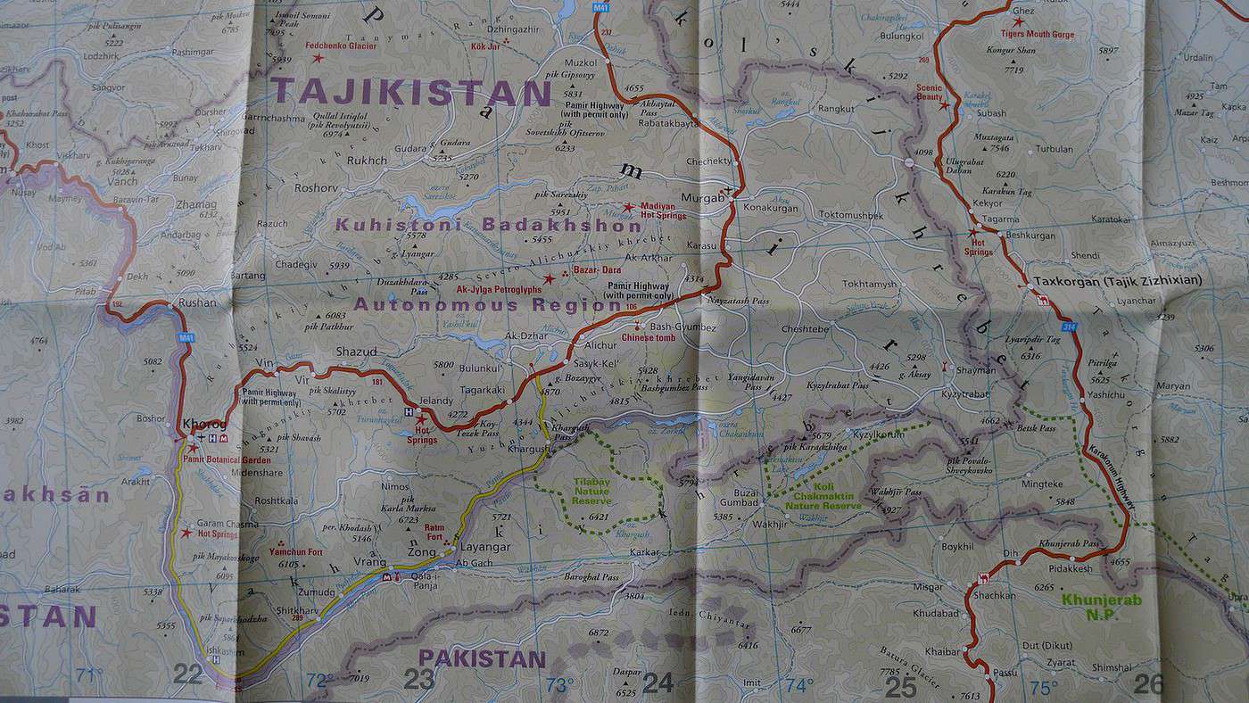
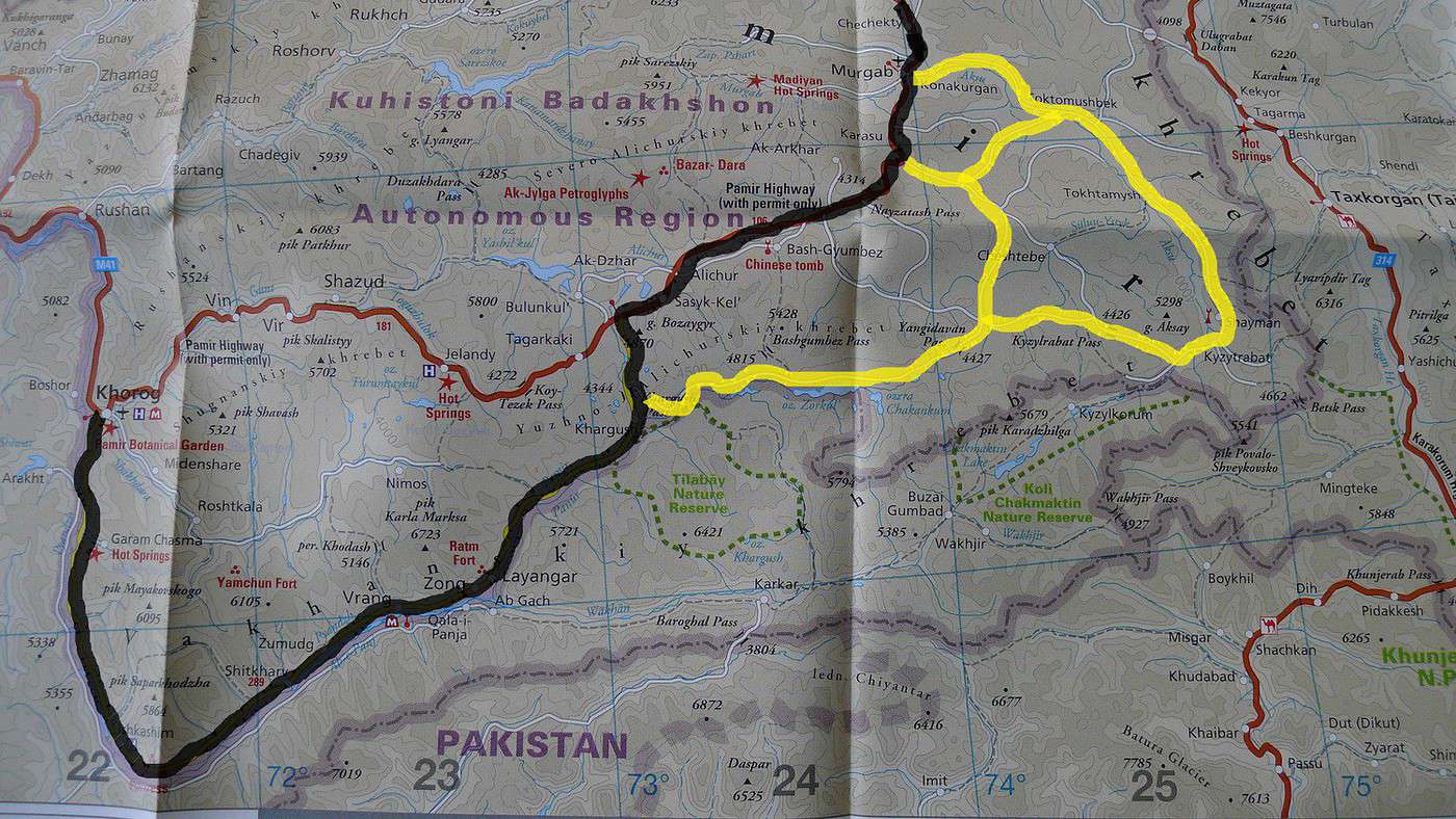
Le corridor de Wakhan jusqu'à Khargush puis retrouver la M41 par le Khargush passOr, sur ma belle carte du Tadjikistan, je trouve une route qui continue après Khargush pour passer un col, le Yangidavan pass puis rejoindre un réseau de route, piste. J'ai trouvé très peu d'informations sur cette région et notamment sur l'état des pistes. Je sais juste que la route qui relie Tokhtamysh à Murghab est à priori asphaltée.
J'aimerai bien avoir un peu plus d'infos sur le coin pour voir si une exploration de cette région est jouable ou si on devra comme tout le monde mettre le clignotant une fois à Khargush.
Salut !
Au bout de la route du Wakhan, à l'endroit où tu quittes la vallée pour monter le Khargoush pass, il y a un checkpoint et la route qui continue dans la vallée n'est pas ouverte aux étrangers. Il faudrait un permis spécial. J'avais rencontré un tajik qui allait chasser les mouflons de marco polo et pêcher dans les lacs. Mais pour les touristes, c'est pas possible. Donc passage pas le Khargoush pass obligatoire.
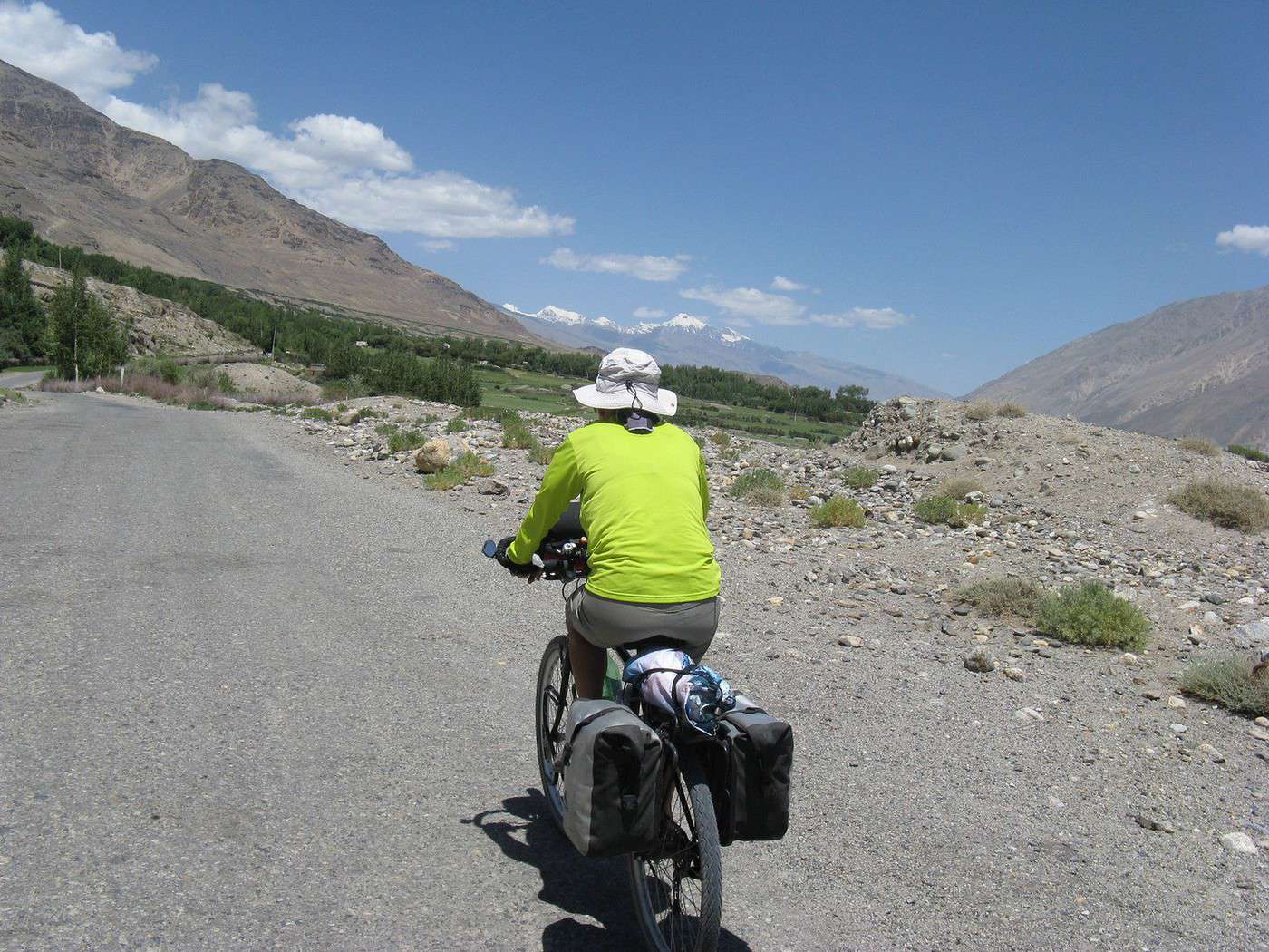
Pour avoir fait les deux itinéraires, je conseille franchement la vallée de Wakhan plutôt que la Pamir Highway (même si la montée du Khargoush est plus dure que l'autre). La vallée est vraiment sublime entre Ishkashim et le check point de Khargoush.
PS : j'ai jeté un oeil à votre blog, j'ai fait le parcours que vous voulez faire il y a 2 ans (jsq Tadjikistan)... si vous voulez des infos, n'hésitez pas en MP.
Gaël
http://www.sionjouait.com
"Peut-être que la seule façon de ne pas perdre son temps, c'est tout simplement de le prendre" (Claude MARTHALER)
Perso je n'ai pas trainer jusque là mais par ouï dires c'est faisable par le nord, en effet en arrivant par Kargush il y a un poste de contrôle qui demande une autorisation( une de plus après le gbao) pour la région, semble-t-il pas facile à obtenir, alors qu'en arrivant par le nord il n'y a pas de problèmes, donc: clignotant!
chalambert
N'ayant pu faire cet itinéraire cet été à cause des troubles dans la région du Pamir, je suis intéressé par toute l'actualité de cette région. J'espère pouvoir faire ce périple pour l'été 2013...
A suivre!
L'été dernier nous étions à vélo dans ces parages: de Khorog nous avions traversé la vallée de Wakhan sans passer le Karghush. Nous avons repris la direction de Khorog puis emprunté la M41 pour rejoindre Alichur. Cette vallée est tout aussi magnifique et évidemment très accueillante.
A Murghab nous avions croisé un cyclo français qui voulait passer dans la vallée de Wakhan par ton itinéraire. Nous ne savons pas s'il a réussi.
Un autre cycliste n'avait pas pu passer par la piste du Yangidavan, refoulé par l'armée tadjike sur le Kargush Pass.
Espérons que la situation te permette de traverser ces superbes contrées.
Salut, documente bien au près des voyageurs rencontrés sur la route, il me semble que toute cette zone est encore fermée, depuis deux mois, et depuis l'assaulte des talibans au sud du tadjikistan, g des amis qui ont été bloqués de passages, mais g d'autre qui ont reussi a passé, ce qui est sur c'est a l'ambassade du tadj, ils sont en train de retarder l'octroi des visas au max
Je te conseille aussi de privilégier le col de Khargusht. Les militaires dans la caserne en contre-bas(côté Langar) limitaient sérieusement l'accès à la vallée qui rejoint Jarty-gumbez, par contre, dans l'autre sens c'est libre...
Murgab-Toktamish asphaltée?
Tant mieux mais il y a 2ans elle l'était partiellement jusqu'à la jonction vers le Kulma pass et plus du tout après. C'était du gravier ondulé, la section la plus horrible de mon périple, une ligne droite sans vie où l'on avance pas en transpirant sous le soleil et la poussière...J'ai du mal à imaginer l'intéret pour l'état, d'asphalter ce cul de sac qui rejoint Shaymak où ils sont encore plus pauvres.
Il y a aussi une caserne sur la route de Kysylrabot, comme ailleurs remplie d'abrutis frustrés qui voulaient mon passeport pour que je puisse aller à la source chaude et qui m’empêchaient d'accéder à la piste vers Jarty-Gumbez. J'ai perdu du temps à insister pour ne pas me retaper le gravier...
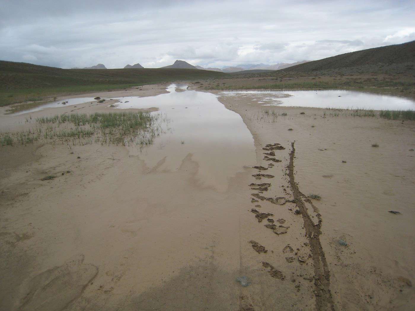
Au delà de Kyzylrabot, c'est de la montagne où il faut deviner la piste de nombreuses fois et franchir des rivières en se déchaussant. Ce qui ne se voit pas sur la jolie carte, c'est la nature du sol. Car il a suffit d'une journée de pluie, pour que la terre se transforme en argile collante qui s'immisce partout:freins, gardes-boue...Il faut pousser le vélo, le laver 20 fois par jour pour ôter la pâte qui ruine jantes et patins de frein...
Il faut disposer de temps pour cette boucle.
Perso, je recommande la source chaude de Jarty-Gumbez (Logement et repas possibles)depuis la M41 et de n'aller plus loin que par temps sec.
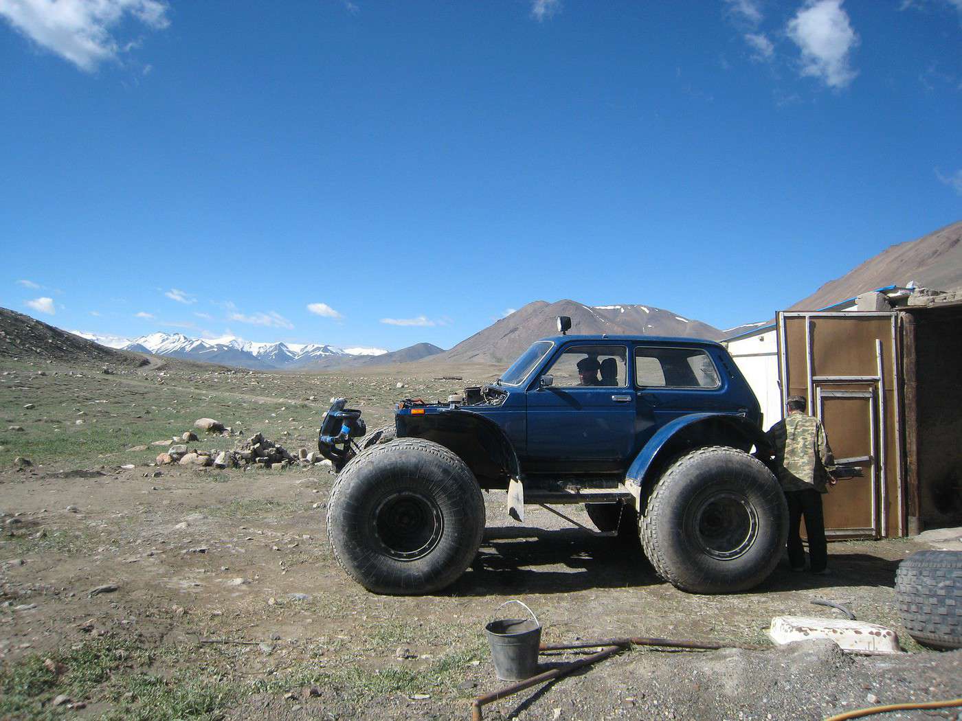
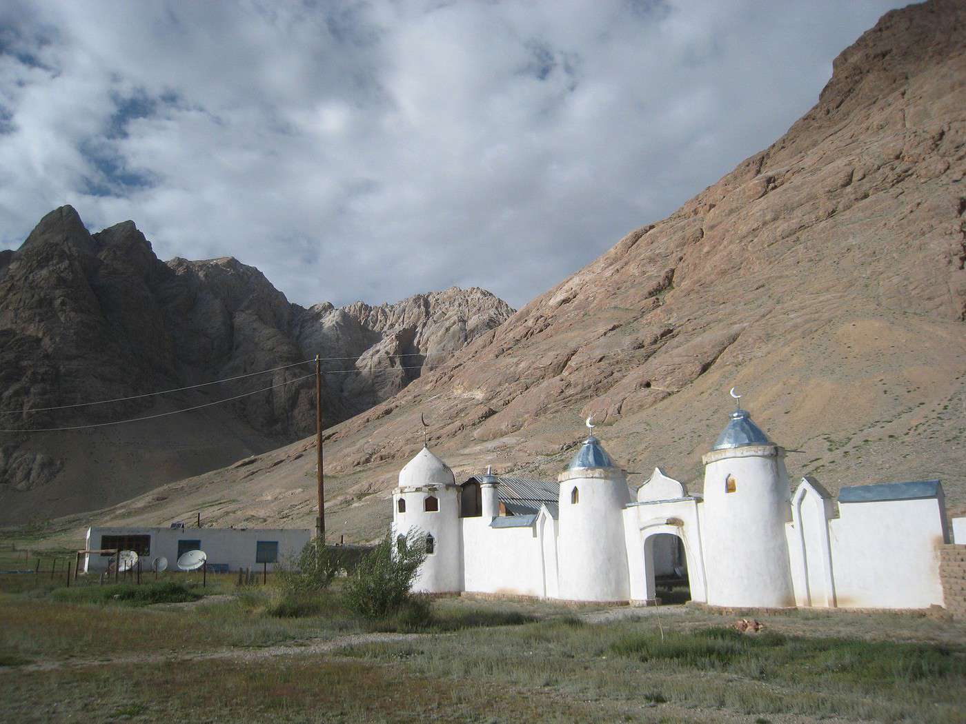
En photo les étendues de boue, les Niva qu'ils utilisent là-haut et la mosquée de Shaymak.
Nico
Crains qu'un jour un train ne t'émeuve plus...
Guillaume Apollinaire
Je te souhaite de réussir à traverser la région l'été prochain, j'ai fait partie, avec 2 autres copains, des cyclos qui se sont pris un rateau suite aux "évènements". Heureusement, le Pamir n'était pas le seul but du voyage à vélo...
Pour tous ceux que la question de l'accès au Pamir intéresse, sachez qu'encore assez tard cet été (mi-aout), il était possible de rejoindre Khorog en avion depuis Dushanbe et de rester dans la région de la Wakhan. Au Kirghizstan, nous avons rencontré deux américains qui avaient fait 10 jours de backpacking dans la Wakahn et sur la M41 vers Sary Tash, sans être inquiété plus que ça... On a aussi entendu le cas de 2 cylcos français qui ont pu faire la M41 de la même façon, début août.
Maintenant, et j'écris cela d'après des discussions qu'on a eues avec des tadjiks, il faut potentiellement se préparer à ce que le conflit là-bas dure, autrement dit, mieux vaut penser à un plan B dès maintenant, même pour l'été prochain...
Même si le message est assez vieux, je pose la question sait-on jamais.
Quelle est la carte papier utilisée pour les images du premier message de ce post ?
Merci
Nicolas
Botswana 2011
Par ici, d'autres récits des voyages effectués (USA, Namibie ...)
je ne suis pas tout-à-fait sûre de quelle carte est photographiée ici, mais la carte papier du Pamir la plus précise et facilement disponible en Europe (commande en ligne possible) est celle de Markus Hauser, éditions Gecko. Elle ressemble beaucoup à la photo du premier message. Il faut mieux l'acheter avant de partir : en 2015, je n'avais pas vu d'équivalent en vente à Dushanbe ; mais l'office du tourisme de Khorog avait quelques exemplaires de cette carte, et d'une autre de qualité équivalente.
NB : les "routes" indiquées sur la carte sont souvent non asphaltées dans les montagnes tadjikes, et pas toujours en très bon état...
Oui, essaye absolument de te la procurer avant de partir: là haut il n’y a rien ou alors c’est importé d’europe. Hors de la M41, que des pistes et quasi pas de ravitaillement alors assurez vous d’avoir du temps...
Crains qu'un jour un train ne t'émeuve plus...
Guillaume Apollinaire
L'attaque qui a eu lieu dimanche dans la région de Danghara, à 150 kilomètres au sud de la capitale du Tadjikistan et qui a fait quatre mort, a été revendiquée…
Me tourne vers vous pour l année prochaine nous sommes un couple. en prenant la route nord donc la M41 jusqu a korog et en zappant le couloir de wakam puis…
En juillet 2019, J'aimerais faire une belle boucle à vélo au Tajikistan: Duschanbe, Khorog, Wakhan Valley, Murghab, Karakul, Bartang Valley, Duschanbe. Que…
I'm developing a free and open-source web app for planning walking and cycling trips (and even car trips). You can create a route by clicking directly on the map to add waypoints, and it can consist of multiple stages. The app provides tools to edit the stages and the overall route, and to display useful information (distances, altitudes, and elevation changes). A relief profile can be shown as a graph for a specific stage or the entire route.
Once the route is ready, it can be exported as a GPX file, which can then be used with a GPS or a mobile navigation app.
The app is built in JavaScript and runs entirely in the web browser. It uses the Leaflet library and several OpenStreetMap-based services. Initially developed for my personal needs (I enjoy hiking and cycle touring), I’d be happy to share it with anyone who might find it useful. It’s free to use, doesn’t require an account, and the source code is available.
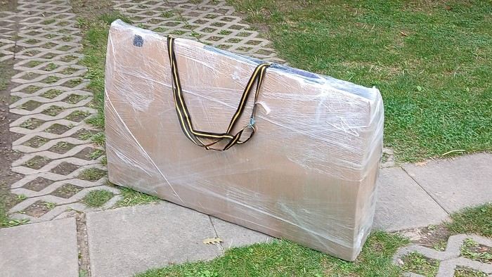
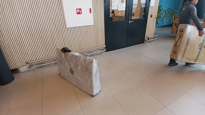
Après l’avoir tester 3 ans sur plusieurs moyens de transport, je partage cette vidéo d’un emballage vélo. Il est en carton de recyclage et filmé, modulable en épaisseur et ajout de papier bulle selon la protection souhaitée.
La pose d’entretoises à la fourche et haubans rend l’emballage compact. Avec la quinzaine d’ €uros d’un filmage en aérogare, cet emballage voyage très bien.
https://youtu.be/_GDJi-GqmkM
- Faible encombrement (1,10mx 0.70mx 0.25m pour un grand cadre) , il tient verticalement dans les compartiment à bagage des trains et la taille totale x+y+z ne dépasse pas 2,40m.
- 2 solutions de portage pour les déplacements en transports en commun et manutention aisée par les agents aéroportuaire (il n’y a plus d’ouvertures dans le carton qui se déchirent).
- Emballage discret quand il s’agit du bon vouloir des chauffeurs de bus et contrôleurs de train car il a l’aspect d’un colis ordinaire.
-Plus d’obligation de retour au point de départ pour retrouver le carton du voyage aller qu’il a bien fallut stocker quelque part ou d’une housse encombrante à ranger dans ses sacoches
- le contrôle de la pression des pneus à travers le film plastique sans trop abimer l’emballage reste possible
Inconvénients : Environ 3 h pour ce travail long et méticuleux, démontage des roues, pédalier, guidon et dérailleur sans déréglage puis fixation de tous les composants au cadre.
Si vous avez l’occasion de le tester, retournez-moi vos commentaires pour de futures améliorations.
I’ve got my flight ticket sorted—departing in mid-November and returning in mid-March. I’ll arrive in Santiago and leave from Buenos Aires.
I’ve already been to southern Argentina, specifically Torres del Paine National Park, and I’d love to go back to do the full W trek (I only did the shorter version last time).
I also want to do some hiking and maybe even tackle a summit. I climb and occasionally do some mountaineering, so I’ll definitely be going with a guide.
I plan to start around Temuco in Chile, with the idea of heading toward the lakes, then taking the Carretera Austral.
I’m not sure if I’ll go all the way to Ushuaia—it’s supposed to not be *that* worth it, except for the bragging rights of saying you’ve been to the end of the world.
I saw there are lakes in Argentina too.
I don’t have a precise itinerary, but what I’d love is, once I reach the southernmost point of my trip, to take a mini-cruise to see some wildlife. Any tips for that?
What kind of sleeping bag did you take? Is a 0°C (32°F) one enough?
And one last question: white gas stove or can I get by with my gas stove?
Hi there,
I’ve been road cycling for several years, and I’m about to switch to gravel in the next few days—I’m waiting for my bike, which should arrive this week.
I’m planning a bikepacking trip in a few weeks along the Véloroute V81, also known as the Vélosud, from Biarritz to Le Barcarès.
Has anyone here already done this route? Any info is welcome, whether it’s about the route itself, gear, or accommodation. I’ll prioritize staying with locals as much as possible. On that note, I just signed up for the brand-new site *Guidon et Couette* ((www.guidon-et-couette.fr)), which offers free accommodation between cyclists across the country, but there’s almost no one listed along my route!
Thanks in advance.
Laurent.
Hi there, I’m planning a cross-Canada bike trip, and I’ve got a question that might seem silly, but could someone tell me how to pack a bike (in a box, with a fragile sticker... I don’t know) for a flight? Thanks in advance!
This summer, we’re planning to cycle along the EV 19 that follows the Meuse River from Langres all the way to Rotterdam.
My question is about getting back to Nantes.
Do any of you know what the best return option might be? I’d love to hear about your experiences.
I saw that FlixBus doesn’t take bikes.
By train, I think it’s possible but would involve multiple local trains.
We were also wondering if there’s a boat from Rotterdam to Saint-Nazaire that could take passengers with bikes.
Any tips or experiences you can share would be really helpful—thanks in advance!
Have a great evening
I’ve gotten used to crossing Europe by bus to return by bike.
It was really convenient to take the bike without having to disassemble it.
But FlixBus no longer accepts bikes...
What alternatives do you know about?
Thanks.
Hi there,
I’m planning to ride the Dutch section of the EuroVelo 19, from Maastricht to Rotterdam.
Since it’s too complicated to bring my bike on the train, I’m looking to rent one locally.
I’d love any tips or bike rental shop recommendations—I’m struggling to find options even in Rotterdam.
The plan is to rent in Rotterdam, take the train to Maastricht with the bike, then cycle back to Rotterdam.
Thanks in advance for any advice or suggestions!
Nath
I’m planning to cycle from Morlaix to Brest (via Roscoff and the V45 coastal route). We’ll start riding on August 16th for 13 days (with stops for island visits, surfing, etc.). Is there a lot of traffic at this time of year? I’ve got two kids, 11 and 13, and we don’t like riding in the middle of cars (we’ve already done the Vélomaritime—Caen to Cherbourg—the Loire route from Orléans to Saumur, the Vélodyssée from Nantes to Royans, and the canals like the Nivernais and Bourgogne, where there were plenty of bike-only lanes, which isn’t the case on this route).
Thanks for your help if you’ve already done this route in late August!
Virginie
I’m planning to build a new touring bike.
I want to prioritize lightness.
That said, I’m tempted by a suspension fork that could offer some comfort on rougher roads.
The recent appearance of gravel suspension forks on the market might meet my needs—at least on paper.
I’m particularly considering the RockShox Rudy Ultimate XPLR fork.
Unlike MTB forks, its travel is short: either 30 mm or 40 mm.
It weighs 1400 g, which is 400/500 g more than a steel fork.
Any thoughts or real-world feedback on this?
I’m also wondering about the durability of magnesium (lower leg) for long-distance bike touring.
And what’s the impact of skipping the manufacturer-recommended maintenance every 50 and 200 hours? That’s bound to happen on a long trip unless you carry extra gear.
More generally, how reliable are these kinds of forks?
Hi everyone,
I wanted to share with you the incredible feat my friend José, who’s 72 years old, is currently undertaking. He left Auterive near Toulouse on Monday, May 18, 2026, on his non-electric bike, heading for the North Cape in Norway!
You can follow his route on the link below—he’s currently in Sweden:
https://thierry-thomas.travelmap.net/jose-de-toulouse-a-nord-cap-2026
You can zoom in on the map and click on each stopover town to see the photos
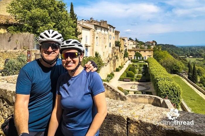
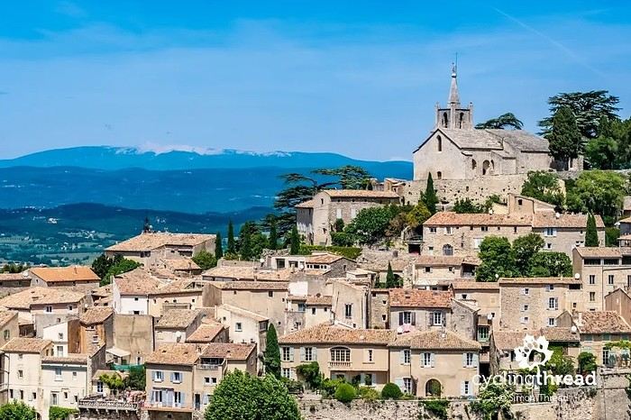
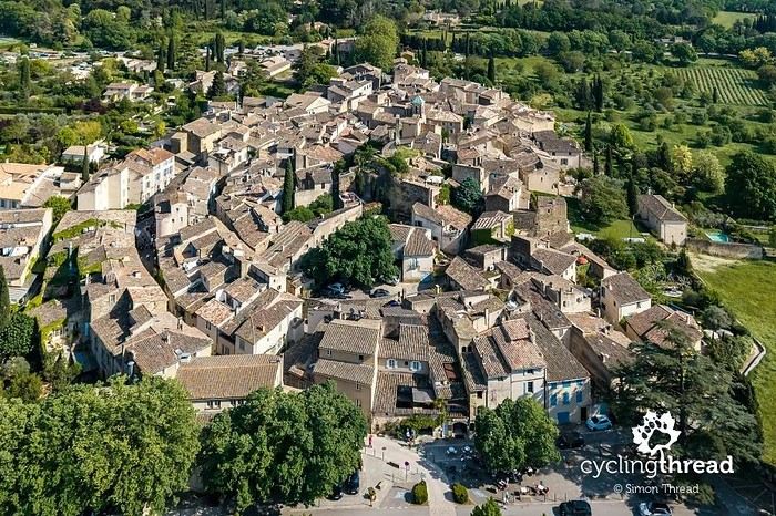
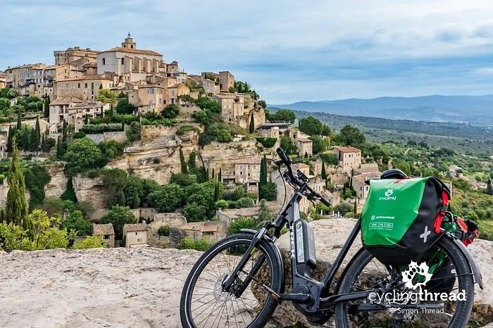
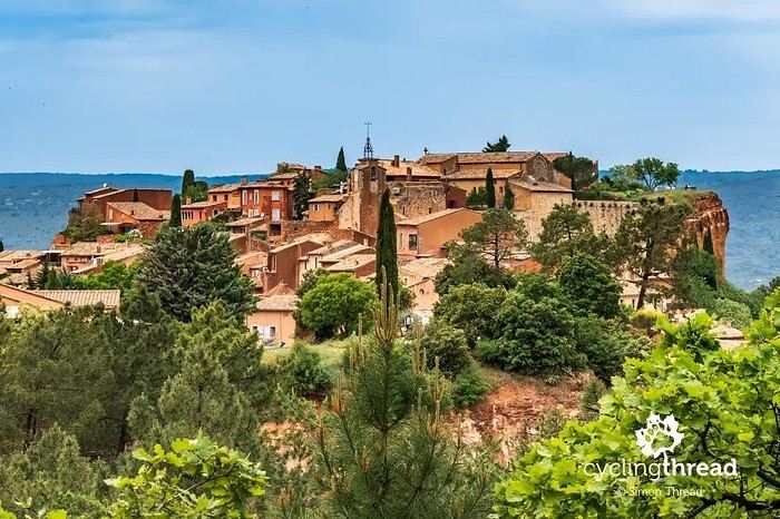
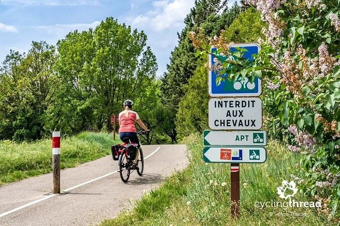
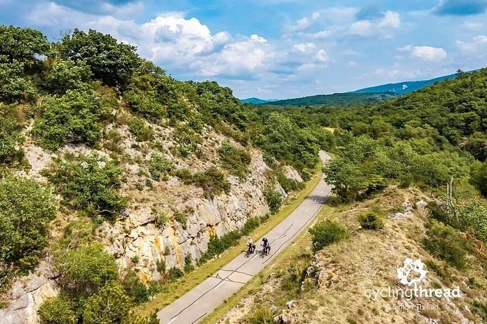
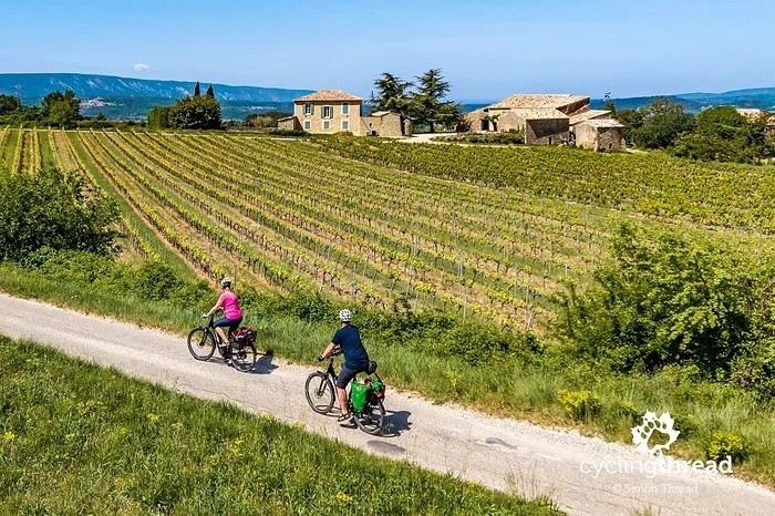
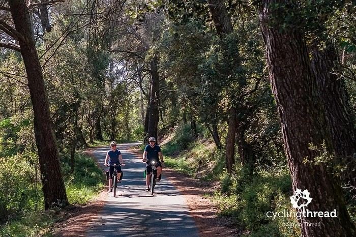
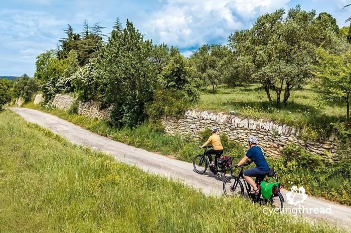
I’m making an exception and creating a separate post this time, since it’s all about France. In May, we spent a week in Provence, specifically in the Luberon, exploring the cycling routes *Autour du Luberon à Vélo*, the *Véloroute du Calavon* (part of EuroVelo 8), and the shorter *Les Ocres à Vélo* route. Together, they gave us an amazing journey through rolling hills, vineyards, lavender fields still green in spring, and some of the most stunning landscapes in southern France.
It was, of course, the perched villages that impressed us the most. We visited Gordes, Roussillon, Bonnieux, Lacoste, Lourmarin, Ménerbes, Oppède-le-Vieux, Cucuron, and Lauris. Many of them are among the most beautiful villages in Provence, and it’s hard not to agree with that reputation.
One interesting point is the route of EuroVelo 8 in this part of the region. The official path mainly follows the old railway line of the *Véloroute du Calavon*, which is very comfortable and safe. But in our opinion, cyclists traveling EuroVelo 8 around the Mediterranean would discover even more treasures if the route passed through villages like Bonnieux, Lacoste, or Oppède-le-Vieux.
We were also pleasantly surprised by how safe cycling felt. Most of the route takes small local roads, but traffic is light, drivers are respectful, and road design really takes cyclists into account. It’s one of those places where you can ride peacefully even without separated bike lanes.
Our full story:
Around Luberon by bicycle - the most beautiful villages of Provence
You can also find all our cycling travel stories on the forum:
Cycling Thread - Europe’s most beautiful bike routes
Hi there, we’re a group of 4 cyclists looking to get from Treviso in Italy to Munich with our 4 non-folding bikes. It seems complicated! Are there any solutions? Thanks so much.
hello fellow cycling enthusiasts
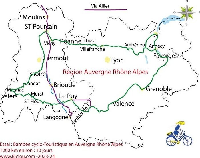
here’s a travel journal of the cycling tour through the Rhône-Alpes Auvergne region by Claudio
zouli
it was the plan
http://cbandiera.free.fr/parcours/auvergne-Ralpes/
the trip was completed
story being posted online soon
1100 km in 11 days
beautiful and varied regions
Hi there, we’re planning a Munich to Venice bike trip at the end of June 2026. Getting back from Venice to Toulouse by train with 4 bikes isn’t straightforward. What return options have others who’ve done this trip chosen? Any tips or great deals would be much appreciated. Thanks a bunch! !
Hi everyone,
Happy owner of a Pegasus Estremo bike with a Rohloff hub, which is giving me trouble with the SF11-NCX-FT-E-LITE 700C TS 300/0 fork (serial number TD01329060). It’s starting to show its age, and I’d like to repair it to extend the life of my beloved bike.
The suspension is gone, and there’s an oil leak from the seals.
Does anyone know how to repair it? Where can I find parts that are about fifteen years old? Or where to find an identical replacement fork? Just to clarify, the Magura HS11 brakes are mounted using Firm Tech, meaning they’re on pivots behind the fork, facing the frame.
Hi, I'd like to know if anyone has done this route recently or has reliable info.
Does the track exist, and most importantly, is there sand (for biking)?
Any info is welcome.
Cheers,
diego ambilobe: mangaoka, manondro, ramena
vohemar sambava: masondrono, tanambao
Hi there,
New to bike touring,
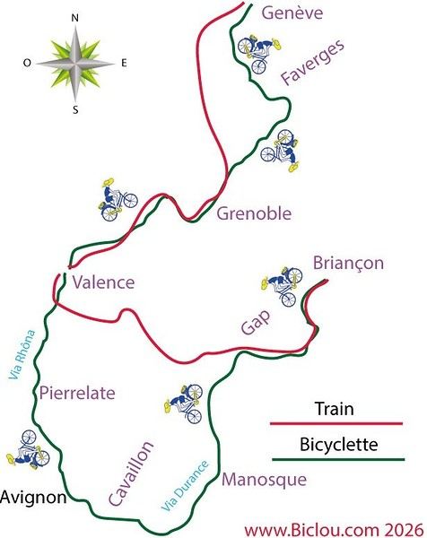
I’d love to start with a section of the Via Rhona to explore and share (route to be decided).
Looking forward to exchanging tips!
I’m landing in Madagascar with a buddy before the end of April 2026. We’re planning to bike around for about twenty days or so. We don’t have a specific goal other than exploring the country and meeting the locals.
Ideally, we’d prefer a loop route starting from Antananarivo with a good chunk of it along the coast. On the bike side, we’re used to riding 6 to 8 hours a day, depending on the needs, encounters, and mood 😉 Any feedback or tips from trips around this length?
A big thank you to Lazarou for all the info you share in this forum!
I'm passionate about Morocco, which I cycled through back in 2009.
Last year, my wife and I explored the High Atlas by tandem. Completely smitten, we're heading back in April (Anti Atlas) and May (High and Middle Atlas), still on our tandem.
Do you have any info on the track between Amezri and Ali Ait Nito? Are the river crossings in the Tessaout still there? It's not easy to navigate with a loaded tandem... especially if the river level is high due to this year's heavy snowmelt!
Thanks in advance for any tips you might have, and best wishes for health in this new year!
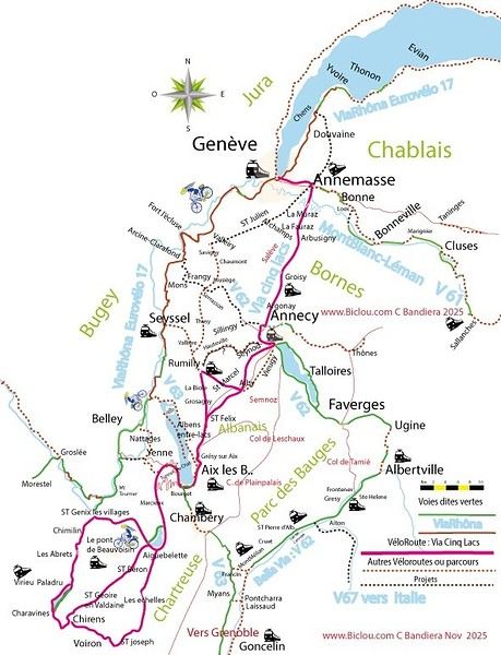
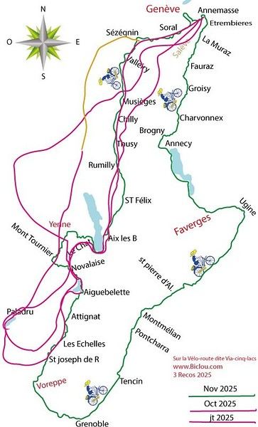
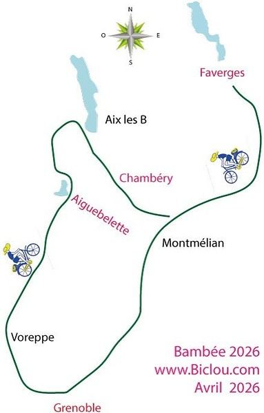
Claudio specializes in the route of the Savoie lakes
Here are his travels
Between Bornes, Chartreuse, the Savoie foothills, and Dauphiné
Five lakes: Léman, Annecy, Paladru, Aiguebelette, Bourget, not to mention a few ponds along the way
Plenty of accommodation options: camping, hotels, and more...
A lovely route not far from his place
Rural and quite peaceful
A road cycling route created by Serge B...
First of all... happy New Year! Wishing you great roads in 2017!
I’ve been traveling for a few years now with a high-quality mountain bike, but it’s equipped with hydraulic disc brakes. I live (pedal) with the constant worry of a breakdown (leak, air bubble, heat causing the fluid to...). My bike mechanic tells me it’s impossible to switch them out for V-brakes.
What do you all think? Am I taking a big risk continuing (alone) with these brakes? Thanks in advance for your great tips!
First post here to share a quick recap of our west-to-east bike trip along Algeria’s coast in January 2025.
It was just the two of us—my partner and I—with French passports and not a word of Arabic. No friends or welcoming hosts in the country.
Under those conditions, we’d strongly advise against going.
Our original plan was to follow the coast from Algiers to Tunis. We ended up cycling from Algiers to Béjaia, then took the train from Béjaia to Annaba (with a stop in Constantine), and finally biked to the border.
We were tailed by police the whole way—whether on our bikes, on the train, or even on foot while exploring towns. On top of that, we couldn’t wild camp and were limited to the few state-approved hotels that accept foreigners. Under those circumstances, connecting with locals was especially tough.
With such an omnipresent and intrusive police presence, we’d definitely recommend against this destination for bike touring. A really sad situation that completely cuts you off from the local population...
We’d been warned, we went to check it out, and we weren’t disappointed!
Hi there,
I’m planning the route to cycle from Lille to Nordkapp with my partner.
Duration: 3 months, from May 1st to July 31st, 2026.
In the attached details below, I need to add some "non-riding" days (rest days, basically).
So I’m looking to "shorten" the trip by taking ferries or trains for some stretches. Which areas could I skip?
Thanks in advance for your great tips.
Have a good evening.
https://www.komoot.com/fr-fr/collection/4023980/-lille-cap-nord-1er-mai-au-31-juillet-2026?ref=collection
I’m planning to bike back from Poland this summer. Does anyone know a way to ship it there without having to take it apart? Otherwise, it’s a real hassle to fine-tune all the settings before departure!
Thanks in advance.
Hi, has anyone recently bought Primus or Butagaz gas, possibly puncture-style, in Dubrovnik or the surrounding area? Same question for Albania... thanks. aichatou