Skip to content
Tunisian Coast

Travel guide · Tunisia

Tunisian Coast

★ 4 · last edited Dec 11, 2019

From the Algerian to the Libyan border, Tunisia has 1,300 km of coastline with some of the country's most visited spots, such as Djerba or the coast between Tunis and Monastir.

Overview

Bizerte, Tunisie
Bizerte, Tunisie · © VoyageForum

From the Algerian to the Libyan border, Tunisia has 1,300 km of coastline with some of the country's most visited spots, such as Djerba or the coast between Tunis and Monastir.

Main Cities

Almost all of the country's main cities are located on the coast, starting with the capital Tunis. Other coastal cities include Bizerte, Sousse, Monastir, Sfax, Gabès, and Hammamet, to name just the best-known ones.

Tourist Attractions

Cities and Their Heritage

Beaches and Seaside

Nature and Activities

Climate and Weather

Tunis

Tunisia’s capital offers a wide range of sights, from its museums and souks to its UNESCO-listed medina and other "typical" neighbourhoods. Overview of Tunis Climate and Weather in Tunis What to See in Tunis Things to Do in Tunis Flying to Tunis Getting to Tunis by Land or Sea Getting Around Tunis Sleeping and Eating in Tunis Living in Tunis
Tunis, Tunisie
Tunis, Tunisie · © VoyageForum

Further reading

View guide page: Tunis

Overview of Tunis

Overview of Tunis

Tunisia’s capital offers a wide range of sights, including its museums, souks, UNESCO-listed medina, and other "typical" neighbourhoods.

Landmarks

  • Type of place: large city.
  • Tourist interest: (recommended).
  • Location:
  • Distances:
  • Local time: Heure : 2207.
  • Population: 1,066,961 inhabitants, with over double that for the greater urban area (2017).
  • Area: 212.63 km².
  • Altitude: from sea level to 41 m.

History of Tunis

Precautions

Useful addresses

  • Tourist Office:

Services

  • Local agencies:
  • Banks:
  • Hospital:
  • Internet:
  • Laundries:
  • Vehicle rental:
  • Post office:
View guide page: Overview of Tunis

Climate and Weather in Tunis

Climate Overview

The city has a sunny Mediterranean climate characterized by a cool, rainy season (winter) and a hot, dry season (summer). In between, there are pleasant shoulder seasons that are actually ideal for visiting.

Best Time to Visit Tunis Weather-Wise

Jan.Feb.Mar.Apr.MayJun.Jul.Aug.Sep.Oct.Nov.Dec.
Climate/ /

Sea Temperature Throughout the Year

The Mediterranean sea temperature allows for swimming almost year-round, though May to November remains the most pleasant period.

Jan.Feb.Mar.Apr.MayJun.Jul.Aug.Sep.Oct.Nov.Dec.
Tunis151415161820232424221916

Climate and Forecast

Additional Information

View guide page: Climate and Weather in Tunis

What to See in Tunis

Tunis Medina ★★★★ This is the historic heart of the capital, with its souks and UNESCO-listed old buildings. It’s also the most visited place in the city. Avenue Bourguiba ★ This is the main thoroughfare of Tunis. With its shaded central walkway, it stretches…

Read the full guide: What to See in Tunis

Flying to Tunis

Tunis Airport

Airport details

  • Name: Tunis-Carthage International Airport.
  • IATA code: TUN
  • Hub:
  • Number of terminals: 2.
  • Annual passenger capacity:
  • Passenger traffic: 5,146,000 (2014).
  • Distance from city centre: 8 km northeast of the city.

Services

Sleeping at the airport

Transport to the city centre

Other nearby airports

From the rest of Africa

From France and Europe

From elsewhere

Additional information

View guide page: Flying to Tunis

Bizerte

The largest city on Tunisia's northern coast. Visit its kasbah and the remains of an old Spanish fort, and enjoy the nearby beaches.

Overview of Bizerte

This is the largest city on Tunisia's northern coast. You can visit its kasbah and the remains of an old Spanish fort, as well as enjoy the nearby beaches.

Key facts

  • Type de lieu: city.
  • Intérêt touristique: (worth seeing).
  • Localisation:
  • Distances:
  • Heure locale: Heure : 2209.
  • Population: 136,917 inhabitants (2014).
  • Superficie: 34 km²
  • Altitude: sea level.

History of Bizerte

What to see and do in Bizerte

In the surrounding area

Climate and weather in Bizerte

The city has a sunny Mediterranean climate, characterised by a cool, rainy season (winter) and a hot, dry season (summer). In between, the mild shoulder seasons are actually ideal for visiting.

Sea temperature throughout the year

Jan.Feb.Mar.Apr.MayJun.Jul.Aug.Sep.Oct.Nov.Dec.
Bizerte151415161820232424221916

Transport

Getting there

Getting around

Accommodation

Eating out

Useful addresses

Further information

View guide page: Bizerte

Sfax

The medina and the kasbah are the main attractions of this historic coastal city. This is also where ferries depart for the Kerkennah Islands.

Overview of Sfax

The medina and the kasbah are the main attractions of this historic city located on the Tunisian coast. This is also where ferries depart for the Kerkennah Islands.

Key Facts

  • Type of place: city.
  • Tourist interest: (worth a stop if you are in the area).
  • Location:
  • Distances:
  • Local time: Heure : 2210.
  • Population: 272,801 inhabitants (2014).
  • Area: 56 km².
  • Altitude: sea level.

History of Sfax

What to See and Do in Sfax

In the Surrounding Area

Climate and Weather in Sfax

The city has a semi-arid Mediterranean climate with plenty of sunshine, characterized by a slightly cool season (winter) and a hot, dry season (summer), with very little rainfall overall. In between, the mild shoulder seasons are actually the best time to visit.

Sea Temperature Throughout the Year

Jan.Feb.Mar.Apr.MayJun.Jul.Aug.Sep.Oct.Nov.Dec.
Sfax151515161821242524232017

Transportation

Getting There

Getting Around

Accommodation

Dining

Useful Addresses

Additional Information

View guide page: Sfax

Carthage

On the outskirts of Tunis, Carthage is both an upscale suburb and the site of the UNESCO-listed archaeological site of the same name.

Overview of Carthage

On the outskirts of Tunis, Carthage is both an upscale suburb and the site of the UNESCO-listed archaeological site (quite spread out) of the same name.

Key facts

  • Type of place: small town.
  • Tourist interest: (recommended).
  • Location:
  • Distances:
  • Local time: Heure : 2214.
  • Population: 17,010 inhabitants (2014).
  • Area: 180 km².
  • Altitude: sea level.

History of Carthage

What to see and do in Carthage

In the surrounding area

Climate and weather in Carthage

The city enjoys a sunny Mediterranean climate, with a cool, rainy season (winter) and a hot, dry season (summer). In between, the mild shoulder seasons are actually ideal for visiting.

Sea temperature throughout the year

Jan.Feb.Mar.Apr.MayJun.Jul.Aug.Sep.Oct.Nov.Dec.
Carthage151415161820232424221916

Transport

Getting there

Getting around

Accommodation

Eating

Useful addresses

Further information

View guide page: Carthage

Ichkeul National Park

Located not far from Bizerte, the site is a UNESCO World Heritage site. It consists of marshes, a lake, and small mountains that are home to many bird species.

Overview of Ichkeul National Park

Located not far from Bizerte, the site is a UNESCO World Heritage site. It consists of marshes, a lake, and small mountains that are home to many bird species.

Key Details

  • Type of place: national park.
  • Tourist interest: (worth a stop if you are in the area).
  • Features:
  • Local time: Heure : 2217
  • Annual visitors:
  • Area: 126 km².
  • Altitude:

Environment

Park Landscape

Wildlife and Flora

Climate and Weather

Precautions

What to See and Do

Practical Information

  • Location:
  • Distances:
  • Opening period:
  • Rates:

Getting There

Getting Around

Sleeping and Eating

What to See Nearby

Additional Information

View guide page: Ichkeul National Park

Kerkouane

This UNESCO-listed site on the Cap Bon peninsula features the ruins of a Punic city and necropolis.

Overview of Kerkouane

This UNESCO-listed site on the Cap Bon peninsula features the ruins of a Punic city and necropolis.

  • Type of place: archaeological site.
  • Tourist interest: (worth a stop if you are in the area).
  • Features:
  • Area:
  • Altitude: sea level.

History of Kerkouane

What to see and do

Practical information

  • Location:
  • Address: Tunisia.
  • Opening hours:
  • Price:
  • How to get there:

Nearby attractions

  1. == En complément
View guide page: Kerkouane

Sousse

On the coast and highly popular with visitors from Eastern Europe, Sousse is known both for its beaches and its UNESCO-listed medina. Overview of Sousse Climate and Weather in Sousse What to See in Sousse Things to Do in Sousse Getting to Sousse Getting Around in Sousse Sleeping and Eating in Sousse Living in Sousse

Further Information

View guide page: Sousse

Overview of Sousse

Overview of Sousse

On the coast and highly popular with visitors from Eastern Europe, Sousse is renowned for both its beaches and its UNESCO-listed medina.

Key Facts

  • Type of place: large city.
  • Tourist interest: (worth seeing).
  • Location:
  • Distances:
  • Local time: Heure : 2220.
  • Population: 221,530 inhabitants (2014).
  • Area: 45 km².
  • Altitude: sea level.

History of Sousse

Precautions

Useful Addresses

  • Tourist Office:

Services

  • Local agencies:
  • Banks:
  • Hospital:
  • Internet:
  • Laundries:
  • Vehicle rental:
  • Post office:
View guide page: Overview of Sousse

Climate and Weather in Sousse

Climate Overview

The city enjoys a sunny Mediterranean climate characterised by a slightly cool season (winter) and a hot, dry season (summer), with relatively low rainfall overall. In between, the shoulder seasons are pleasant and can be ideal for visiting.

Best Time to Visit Sousse Weather-Wise

Jan.Feb.Mar.Apr.MayJun.Jul.Aug.Sep.Oct.Nov.Dec.
Climate/ /

Sea Temperatures Throughout the Year

Jan.Feb.Mar.Apr.MayJun.Jul.Aug.Sep.Oct.Nov.Dec.
Sousse151515161821242524232017

Climate and Forecast

Further Information

View guide page: Climate and Weather in Sousse

What to See in Sousse

Overview

UNESCO World Heritage

Grande mosquée et médina de Sousse, Tunisie
Medina of Sousse
The historic heart of the city is a UNESCO World Heritage site. It is a prime example of the cities of the early centuries of Islam in the Maghreb.

Districts

Sites, Monuments and Architectural Ensembles

Religious Buildings

Museums

Parks and Gardens

In the Surrounding Area

Additional Information

View guide page: What to See in Sousse

Medina of Sousse

The historic heart of the city is a UNESCO World Heritage site. It is a prime example of the cities of the early centuries of Islam in the Maghreb.

Overview of the Medina of Sousse

The historic heart of the city is a UNESCO World Heritage site. It is a prime example of the cities of the early centuries of Islam in the Maghreb.

  • Tourist interest: (worth seeing).

History of the Medina of Sousse

What to see and do

Events and entertainment

Practical information

  • Location:
  • Website:
  • How to get there:
  • How to get around:

Eat

Sleep

What to see nearby

  1. == To complement
View guide page: Medina of Sousse

Getting to Sousse

By air

If the city doesn’t have its own airport, those in Hammamet and especially Monastir are right nearby.

By land

By bus

By train

Distances

By sea

Ferries

Cargo

Cruises

Sailboats

View guide page: Getting to Sousse

Gammarth

One of the last seaside resorts built near Tunis.

Overview of Gammarth

One of the last seaside resorts built near Tunis.

Key details

  • Type of place: small town.
  • Tourist interest: (worth a stop if you are in the area).
  • Location:
  • Distances:
  • Local time: Heure : 2224.
  • Population:
  • Area:
  • Altitude: sea level.
  • Website:

History of Gammarth

What to see and do in Gammarth

In the surrounding area

Climate and weather in Gammarth

The area enjoys a sunny Mediterranean climate, with a cool, rainy season (winter) and a hot, dry season (summer). In between, the mild shoulder seasons are ideal for visiting.

Sea temperature throughout the year

Jan.Feb.Mar.Apr.MayJun.Jul.Aug.Sep.Oct.Nov.Dec.
Gammarth151415161820232424221916

Getting around

How to get there

Getting around

Where to stay

Where to eat

Useful addresses

Further reading

View guide page: Gammarth

Hammamet

One of Tunisia’s main seaside resorts, with long beaches and numerous hotels. Overview of Hammamet Climate and Weather in Hammamet What to see in Hammamet Things to Do in Hammamet Flying to Hammamet Getting to Hammamet by Land or Sea Getting Around Hammamet Sleeping and Eating in Hammamet Living in Hammamet

Further information

View guide page: Hammamet

Overview of Hammamet

Overview of Hammamet

It's one of the main seaside resorts in Tunisia with long beaches and numerous hotel complexes.

Landmarks

  • Type of place: city.
  • Tourist interest: (worth a stop if you are in the area).
  • Location:
  • Distances:
  • Local time: Heure : 2225.
  • Population: 73,236 inhabitants (2014).
  • Area: 36 km².
  • Altitude: sea level.

History of Hammamet

Precautions

Useful addresses

  • Tourist Office:

Services

  • Local agencies:
  • Banks:
  • Hospital:
  • Internet:
  • Laundries:
  • Vehicle rental:
  • Post office:
View guide page: Overview of Hammamet

Climate and Weather in Hammamet

Climate Overview

The city enjoys a sunny temperate climate, with a slightly cool and rainy season (winter) and a hot, dry season (summer). In between, the shoulder seasons are pleasant and can be ideal for visiting.

Best Time to Visit Hammamet

Jan.Feb.Mar.Apr.MayJun.Jul.Aug.Sep.Oct.Nov.Dec.
Climate/ /

Sea Temperatures Throughout the Year

Jan.Feb.Mar.Apr.MayJun.Jul.Aug.Sep.Oct.Nov.Dec.
Hammamet151515161821242524232017

Climate and Forecast

Additional Information

View guide page: Climate and Weather in Hammamet

Flying to Hammamet

Hammamet Airport

Airport details

  • Name: Enfidha-Hammamet International Airport.
  • IATA code: NBE
  • Hub: no.
  • Number of terminals: 1.
  • Annual passenger capacity: 7 million.
  • Passenger traffic: 700,000 (2017).
  • Distance from city centre:

Services

Sleeping at the airport

Transport to the city centre

Other nearby airports

From Europe

From elsewhere

Additional information

View guide page: Flying to Hammamet

La Goulette

One of the country's main ports, next to Tunis. It's also where cruise ships dock.

Overview of La Goulette

One of the country's main ports, next to Tunis. It's also where cruise ships dock.

Key Facts

  • Type of place: small town.
  • Tourist interest: (worth a stop if you are in the area).
  • Location:
  • Distances:
  • Local time: Heure : 2229.
  • Population: 45,711 inhabitants (2014).
  • Area:
  • Altitude: sea level.

History of La Goulette

What to See and Do in La Goulette

In the Surrounding Area

Climate and Weather in La Goulette

The city has a sunny Mediterranean climate, characterized by a cool, rainy season (winter) and a hot, dry season (summer). In between, the mild shoulder seasons are actually ideal for visiting.

Sea Temperature Throughout the Year

Jan.Feb.Mar.Apr.MayJun.Jul.Aug.Sep.Oct.Nov.Dec.
La Goulette151415161820232424221916

Transportation

Getting There

Getting Around

Accommodation

Eating

Useful Addresses

Further Information

View guide page: La Goulette

La Marsa

It’s both a seaside resort and an upscale suburb of Tunis, located about fifteen kilometres northeast of the capital.

Overview of La Marsa

It’s both a seaside resort and an upscale suburb of Tunis located about fifteen kilometres northeast of the capital.

Key facts

  • Type of place: city.
  • Tourist interest: (worth a stop if you are in the area).
  • Location:
  • Distances:
  • Local time: Heure : 2230.
  • Population: 92,987 inhabitants (2014).
  • Area:
  • Altitude: sea level.

History of La Marsa

What to see and do in La Marsa

In the surrounding area

Climate and weather in La Marsa

The city enjoys a sunny Mediterranean climate, characterised by a cool, rainy season (winter) and a hot, dry season (summer). In between, the mild shoulder seasons are actually ideal for visiting.

Sea temperature throughout the year

Jan.Feb.Mar.Apr.MayJun.Jul.Aug.Sep.Oct.Nov.Dec.
La Marsa151415161820232424221916

Transport

Getting there

Getting around

Accommodation

Eating

Useful addresses

Further information

View guide page: La Marsa

Mahdia

A stunning fishing port with a charming historic centre and beaches.

Overview of Mahdia

A stunning fishing port with a charming historic centre and beaches.

Key facts

  • Type of place: city.
  • Tourist interest: (worth seeing).
  • Location:
  • Distances:
  • Local time: Heure : 2231.
  • Population: 51,833 inhabitants (2014).
  • Area:
  • Altitude: sea level.

History of Mahdia

What to see and do in Mahdia

In the surrounding area

Climate and weather in Mahdia

The city enjoys a sunny Mediterranean climate with a slightly cool season (winter) and a hot, dry season (summer), with low rainfall overall. In between, the mild shoulder seasons are ideal for visiting.

Sea temperature throughout the year

Jan.Feb.Mar.Apr.MayJun.Jul.Aug.Sep.Oct.Nov.Dec.
Mahdia151515161821242524232017

Transport

Getting there

Getting around

Accommodation

Food

Useful addresses

Further information

View guide page: Mahdia

Monastir

One of the main tourist destinations on the coast. Beyond the beaches and hotel complexes, you can also visit the Bourguiba Mausoleum and an impressive ribat (fortified monastery) built by the sea. Overview of Monastir Climate and Weather in Monastir What to see in Monastir Things to Do in Monastir Flying to Monastir Getting to Monastir by Land or Sea Getting Around Monastir Sleeping and Eating in Monastir Living in Monastir

Further Information

View guide page: Monastir

Overview of Monastir

Overview of Monastir

It’s one of the main tourist destinations on the Tunisian coast. Beyond the beaches and hotel complexes, you can also visit the Bourguiba Mausoleum and an impressive ribat (fortified monastery) built by the sea.

Key details

  • Type of place: large city.
  • Tourist interest: (worth seeing).
  • Location:
  • Distances:
  • Local time: Heure : 2232.
  • Population: 104,535 inhabitants (2014).
  • Area:
  • Altitude: sea level.

History of Monastir

Precautions

Useful addresses

  • Tourist Office:

Services

  • Local agencies:
  • Banks:
  • Hospital:
  • Internet:
  • Laundries:
  • Vehicle rental:
  • Post office:
View guide page: Overview of Monastir

Climate and Weather in Monastir

Climate Overview

The city enjoys a sunny Mediterranean climate characterised by a slightly cool season (winter) and a hot, dry season (summer), with relatively low rainfall overall. Between these, the shoulder seasons are pleasant and can be ideal for visiting.

Best Climate Period for Monastir

Jan.Feb.Mar.Apr.MayJun.Jul.Aug.Sep.Oct.Nov.Dec.
Climate/ /

Sea Temperature Throughout the Year

Jan.Feb.Mar.Apr.MayJun.Jul.Aug.Sep.Oct.Nov.Dec.
Monastir151515161821242524232017

Climate and Forecast

Additional Information

View guide page: Climate and Weather in Monastir

Flying to Monastir

Monastir Airport

Airport details

  • Name: Monastir Habib Bourguiba International Airport.
  • IATA code: MIR
  • Hub: Nouvelair.
  • Number of terminals: 1.
  • Passenger capacity/year: 3.5 million.
  • Passenger traffic:
  • Distance to city centre:

Services

Sleeping at the airport

Transport to the city centre

Other nearby airports

From France

From the rest of Europe

From elsewhere

Additional information

View guide page: Flying to Monastir

Nabeul

Built on the Cap Bon peninsula, not far from Hammamet, it's the city of potters. A must-see for its medina, souk, and beaches.

Overview of Nabeul

Built on the Cap Bon peninsula, not far from Hammamet, it's the city of potters. A must-see for its medina, souk, and beaches.

Key Facts

  • Type of place: city.
  • Tourist interest: (worth seeing).
  • Location:
  • Distances:
  • Local time: Heure : 2233.
  • Population: 70,437 inhabitants (2014).
  • Area:
  • Altitude: sea level.

History of Nabeul

What to See and Do in Nabeul

In the Surrounding Area

Climate and Weather in Nabeul

The city enjoys a sunny temperate climate, with a slightly cool and rainy season (winter) and a hot, dry season (summer). In between, the pleasant shoulder seasons are ideal for visiting.

Sea Temperature Throughout the Year

Jan.Feb.Mar.Apr.MayJun.Jul.Aug.Sep.Oct.Nov.Dec.
Nabeul151415161820232424221916

Transportation

Getting There

Getting Around

Accommodation

Dining

Useful Addresses

Additional Information

View guide page: Nabeul

Port El Kantaoui

North of Sousse. It is one of the main seaside resorts on the coast, with beaches, shops, and a marina.

Overview of Port El Kantaoui

North of Sousse, it is one of the main seaside resorts on the coast, with beaches, shops, and a marina.

Key Details

  • Type of place: small town.
  • Tourist interest: (worth a stop if you are in the area).
  • Location:
  • Distances:
  • Local time: Heure : 2234.
  • Population:
  • Area: 3.07 km².
  • Altitude: sea level.

History of Port El Kantaoui

What to See and Do in Port El Kantaoui

In the Surrounding Area

Climate and Weather in Port El Kantaoui

The city enjoys a sunny Mediterranean climate, characterized by a slightly cool season (winter) and a hot, dry season (summer), with very little rainfall overall. In between, the mild shoulder seasons are ideal for visiting.

Sea Temperature Throughout the Year

Jan.Feb.Mar.Apr.MayJun.Jul.Aug.Sep.Oct.Nov.Dec.
Port El Kantaoui151515161821242524232017

Transportation

Getting There

Getting Around

Accommodation

Dining

Useful Addresses

Additional Information

View guide page: Port El Kantaoui

Sidi Bou Said

The small town north of Tunis is known for its beautiful white houses with blue doors and windows. It is very touristy.

Overview of Sidi Bou Said

The small town north of Tunis is known for its beautiful white houses with blue doors and windows. It is very touristy.

Key Facts

  • Type of place: small town.
  • Tourist interest: (worth seeing).
  • Location:
  • Distances:
  • Local time: Heure : 2235.
  • Population: 5,911 inhabitants (2014).
  • Area:
  • Altitude: sea level.

History of Sidi Bou Said

What to See and Do in Sidi Bou Said

In the Surrounding Area

Climate and Weather in Sidi Bou Said

The town has a sunny Mediterranean climate, characterized by a cool, rainy season (winter) and a hot, dry season (summer). In between, the mild shoulder seasons are actually ideal for visiting.

Sea Temperature Throughout the Year

Jan.Feb.Mar.Apr.MayJun.Jul.Aug.Sep.Oct.Nov.Dec.
Sidi Bou Said151415161820232424221916

Transportation

Getting There

Getting Around

Accommodation

Dining

Useful Addresses

Additional Information

View guide page: Sidi Bou Said

Tabarka

The last coastal town before Algeria. It’s mainly visited for its beaches and diving opportunities. Hiking in the surrounding area is also possible.

Overview of Tabarka

This is the last coastal town before Algeria. It’s mainly visited for its beaches and diving opportunities. Hiking in the surrounding area is also possible.

Key facts

  • Type of place: small town.
  • Tourist interest: (worth a stop if you are in the area).
  • Location:
  • Distances:
  • Local time: Heure : 2239.
  • Population: 19,770 inhabitants (2014).
  • Area:
  • Altitude: sea level.

History of Tabarka

What to see and do in Tabarka

In the surrounding area

Climate and weather in Tabarka

The town has a sunny Mediterranean climate, characterised by a cool, rainy season (winter) and a hot, dry season (summer). In between, the mild shoulder seasons are ideal for visiting.

Sea temperature throughout the year

Jan.Feb.Mar.Apr.MayJun.Jul.Aug.Sep.Oct.Nov.Dec.
Tabarka151415161820232424221916

Transport

Getting there

Getting around

Accommodation

Food

Useful addresses

Further information

View guide page: Tabarka

Utica

Roman and Punic ruins at this archaeological site north of the capital.

Overview of Utica

Roman and Punic ruins can be found at this archaeological site north of Tunis.

  • Type of place: archaeological site.
  • Tourist interest: (worth a stop if you are in the area).
  • Features:
  • Area:
  • Altitude:

History of Utica

What to see and do

Practical information

  • Location:
  • Opening hours:
  • Price:
  • How to get there:

What to see nearby

  1. == In addition
View guide page: Utica

Cap Bon

A large peninsula south of Tunis known for its beaches and landscapes.

Overview of Cap Bon

This is a large peninsula south of Tunis known for its beaches and landscapes.

Key Facts

  • Type of place: cape.
  • Tourist interest: (worth seeing).
  • Location:
  • Local time: Heure : 2241.
  • Area: 2,822 km².
  • Highest point: 637 m.

Environment of Cap Bon

Wildlife and flora

Precautions

What to see and do

In the surrounding area

Climate and weather

The peninsula enjoys a sunny Mediterranean climate, with a cool, rainy season (winter) and a hot, dry season (summer). In between, the mild shoulder seasons are ideal for visiting.

Sea temperatures throughout the year

Jan.Feb.Mar.Apr.MayJun.Jul.Aug.Sep.Oct.Nov.Dec.
Cap Bon151415161820232424221916

Getting around

How to get there

How to get around

Where to stay and eat

Additional information

View guide page: Cap Bon

Djerba

This is the large island off the coast, internationally known for its beaches, tourist infrastructure, and package holidays. Beyond that, Djerba still has some quiet spots locally. Introducing Djerba Climate and Weather in Djerba What to See in Djerba Things to Do in Djerba Flying to Djerba Getting to Djerba by Land or Sea Getting Around Djerba Sleeping and Eating in Djerba Living in Djerba

Additional Information

View guide page: Djerba

Introducing Djerba

Overview of Djerba

It's the largest island off the coast (though connected to the mainland by road) and is internationally known for its beaches, tourist infrastructure, and package holidays. Beyond that, Djerba still has some quiet spots locally.

Key Facts

  • Type of place: main island.
  • Tourist interest: (recommended).
  • Location:
  • Local time: Heure : 2244.
  • Population: 163,726 (2014).
  • Area: 514 km².
  • Highest point: Dhahret Guellala (53 m).
  • Coastline: 150 km.

History of Djerba

Precautions

Useful Addresses

View guide page: Introducing Djerba

Climate and Weather in Djerba

Climate Overview

The island has a semi-arid Mediterranean climate, slightly windy and sunny, characterized by a somewhat "cool" season (winter) and a hot, dry season (summer). Rainfall is very light overall. Between these, the shoulder seasons are pleasant and can be ideal for visiting.

Best Time to Visit Djerba

Jan.Feb.Mar.Apr.MayJun.Jul.Aug.Sep.Oct.Nov.Dec.
Climate

Sea Temperatures Throughout the Year

Jan.Feb.Mar.Apr.MayJun.Jul.Aug.Sep.Oct.Nov.Dec.
Djerba151515161821242624232017

Climate and Forecasts

Additional Information

View guide page: Climate and Weather in Djerba

What to See in Djerba

Overview

Towns and Cultural Heritage

Houmt Souk, Tunisie
Houmt Souk
The "capital" of Djerba, the city features traditional architecture and a few buildings from the colonial era.

Natural Heritage

In the Surrounding Area

Further Information

View guide page: What to See in Djerba

Houmt Souk

The "capital" of Djerba, the city features traditional architecture and a few buildings from the colonial era.

Overview of Houmt Souk

The "capital" of Djerba, the city features traditional architecture and a few buildings from the colonial era.

Key Facts

  • Type of place: city.
  • Tourist interest: (worth seeing).
  • Location:
  • Distances:
  • Local time: Heure : 2246.
  • Population: 75,904 inhabitants (2014).
  • Area:
  • Altitude: sea level.

History of Houmt Souk

What to See and Do in Houmt Souk

In the Surrounding Area

Climate and Weather in Houmt Souk

The area has a semi-arid Mediterranean climate, slightly windy and sunny, characterized by a somewhat "cool" season (winter) and a hot, dry season (summer), with very little rainfall overall. In between, the mild shoulder seasons are actually ideal for visiting.

Sea Temperature Throughout the Year

Jan.Feb.Mar.Apr.MayJun.Jul.Aug.Sep.Oct.Nov.Dec.
Djerba151515161821242624232017

Transportation

Getting There

Getting Around

Accommodation

Dining

Useful Addresses

Further Information

View guide page: Houmt Souk

Things to Do in Djerba

Overview

Beaches and Water Sports

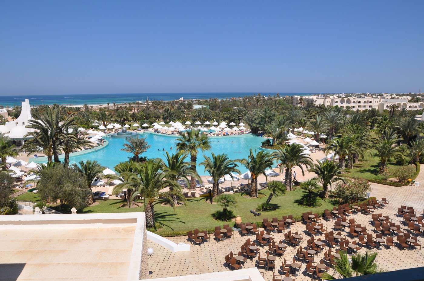
Djerba, Tunisie
Djerba, Tunisie · © VoyageForum

Other Activities

Hiking

Other

Life and Cultural Activities

Bars and Nightlife

Shopping and Markets

View guide page: Things to Do in Djerba

Flying to Djerba

Djerba Airport

Airport details

  • Name: Djerba-Zarzis International Airport.
  • IATA code: DJE
  • Hub: no.
  • Number of terminals:
  • Passenger capacity/year: 4 million/year.
  • Passenger traffic: 1,781,000 (2012).
  • Distance from city: 9 km west of Houmt Souk.

Services

Sleeping at the airport

Transport to the city centre

Other nearby airports

From France

From the rest of Europe

From elsewhere

Additional information

View guide page: Flying to Djerba

Gabès

A large port city (and oasis) in southern Tunisia, primarily serving as a transport hub. Several beaches nearby.

Overview of Gabès

It's a large port city and oasis in the south (or nearly so) of Tunisia, primarily serving as a transport hub. Several beaches nearby.

Key Facts

  • Type of place: city.
  • Tourist interest: (worth a stop if you are in the area).
  • Location:
  • Distances:
  • Local time: Heure : 2245.
  • Population: 130,984 inhabitants (2014).
  • Area:
  • Altitude: sea level.

History of Gabès

What to See and Do in Gabès

In the Surrounding Area

Climate and Weather in Gabès

The city has a semi-arid Mediterranean climate with plenty of sunshine, characterized by a slightly cool season (winter) and a hot, dry season (summer), with very little rainfall overall. In between, the mild shoulder seasons are actually the best time to visit.

Sea Temperature Throughout the Year

Jan.Feb.Mar.Apr.MayJun.Jul.Aug.Sep.Oct.Nov.Dec.
Gabès151515161821242524232017

Transport

Getting There

Getting Around

Accommodation

Food

Useful Addresses

Further Information

View guide page: Gabès

Kerkennah Islands

A small archipelago off Sfax, appreciated for its beaches and "authentic" charm.

Overview of the Kerkennah Islands

A small archipelago off Sfax, appreciated for its beaches and "authentic" charm.

Key facts

  • Type of place: archipelago.
  • Tourist interest: (worth seeing).
  • Location:
  • Local time: Heure : 2247
  • Number of islands: 14.
  • Main islands: Chergui and Gharbi.
  • Population: 15,501 inhabitants (2014).
  • Area: 160 km².
  • Highest point: unnamed (13 m).
  • Coastline:

History of the Kerkennah Islands

Environment of the archipelago

Wildlife and flora

Precautions

What to see and do on the Kerkennah Islands

In the surrounding area

Climate and weather in Kerkennah

The islands have a semi-arid Mediterranean climate with plenty of sunshine, characterized by a slightly cool season (winter) and a hot, dry season (summer), with very little rainfall overall. In between, the mild shoulder seasons are ideal for visiting.

Sea temperature throughout the year

Jan.Feb.Mar.Apr.MayJun.Jul.Aug.Sep.Oct.Nov.Dec.
Kerkennah151515161821242524232017

Transport

Getting there

Getting around

Accommodation

Food

Useful addresses

Further information

View guide page: Kerkennah Islands

Something wrong or out of date? Report this page