09/29/2022: Day 6 - Broken Bow Arch - Reflection Canyon
It seems like the heat is lingering later and later into September or October. But this morning, at sunrise, that wasn’t the case! At 6:30 AM, the humidity and morning chill jolted us awake from our restful sleep 🤪!
Bad luck, because if there’s one day we need to be in top shape, it’s today.
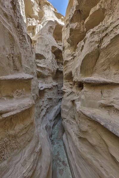
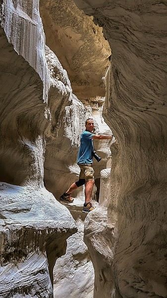
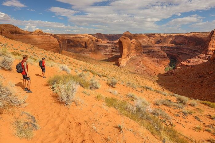
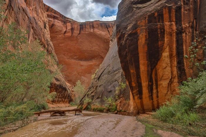
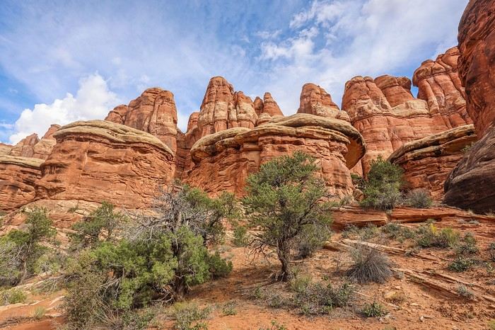
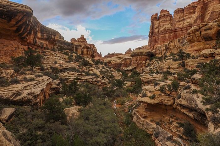
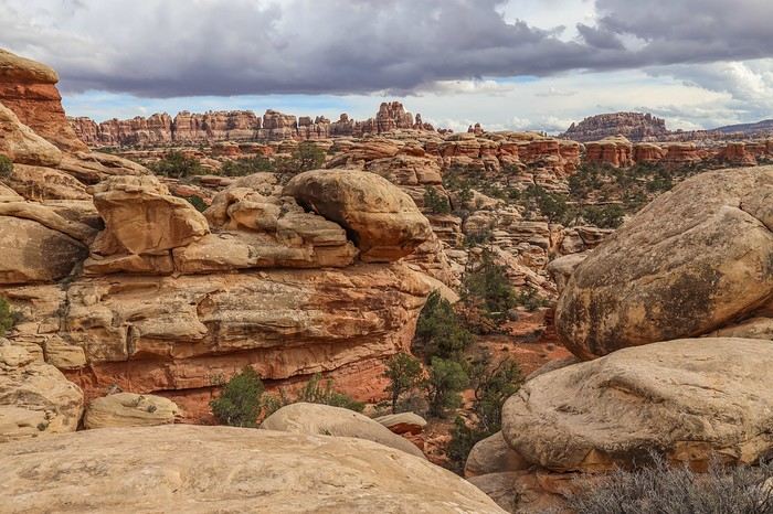
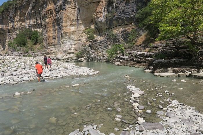
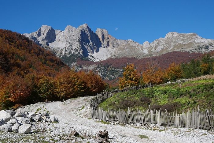
After the morning chores—packing up camp and breakfast—we hit the Hole-in-the-Road, an 80 km track that cuts through the Grand Staircase Escalante monument. There are about twenty spots to see along this route, and we decided to go for the most remote ones, at the very end of the track, where the road is notoriously rough toward the finish!
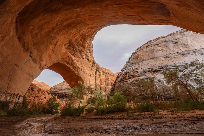
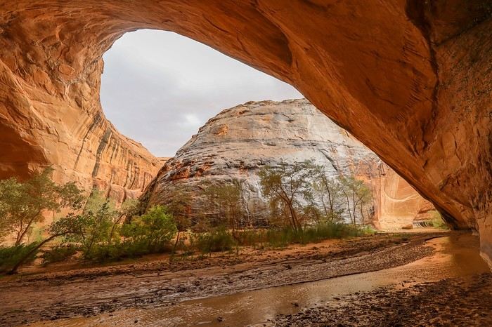
Our first stop of the day is Broken Bow Arch, a massive arch at the end of Willow Creek.
It takes us a good 1.5 hours to cover the 70 km to the trailhead. Only the last few kilometers are a bit tricky; otherwise, the HIRR is smooth driving!
The hike is only 6 km, so we each take very little water.
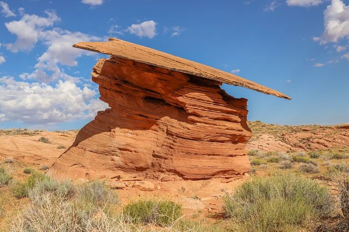
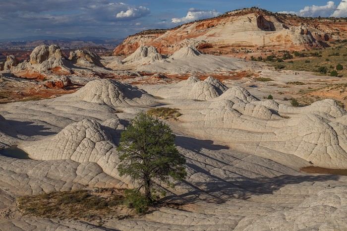
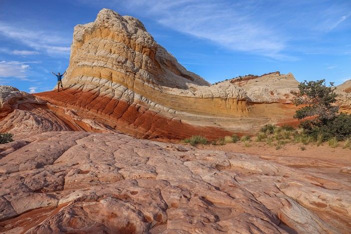
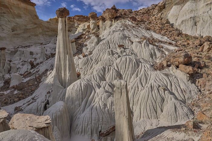
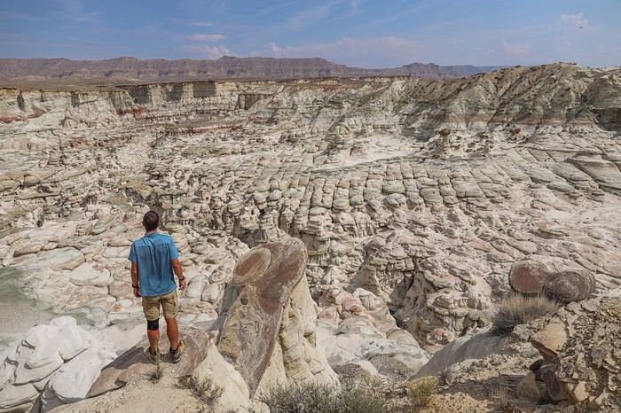
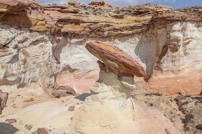
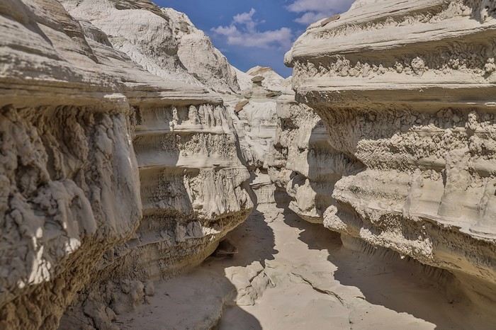
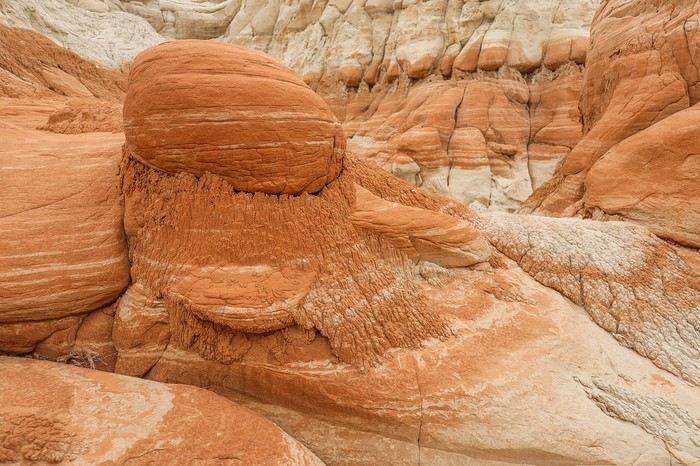
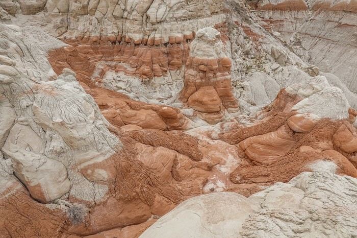
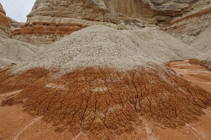
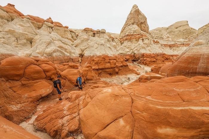
The fun starts as soon as we begin descending into Willow Gulch canyon, with the quirky Mortarboard Rock, a hoodoo named after the cap worn by American students during graduation ceremonies.
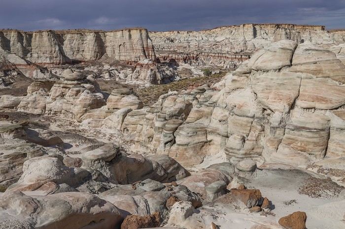
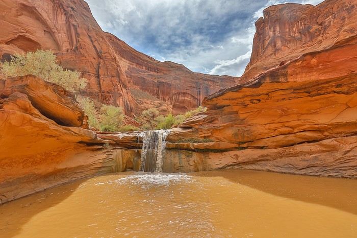
The canyon is easy to navigate, with a well-marked trail and few steep sections. At this time of year, there’s no water at the bottom of the canyon—not even a pool... Which is fine by us because we make quick progress.
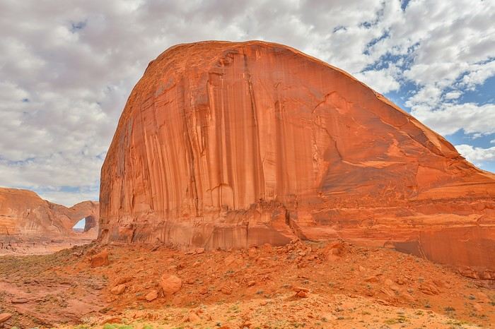
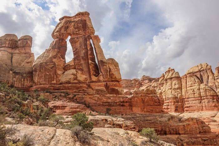
After half an hour of walking and 3 km covered, we spot the stunning and massive Broken Bow Arch! 😎
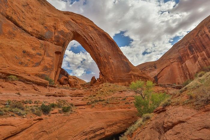
It’s a good thirty meters wide and tall! Photos don’t do justice to the immensity of the arch amid the red sandstone cliffs.
We head back, and—overconfident—we take a wrong turn at a canyon fork we hadn’t noticed on the way in. On another day, the few hundred meters wasted wouldn’t have mattered, but today, we need to be careful... because we still have a big chunk left to explore!
To reach the trailhead for the next hike, we only have about ten kilometers of track left. But the road quality deteriorates sharply, with lots of loose rocks and boulders forcing us to drive very slowly. Not to mention the infamous Tahoe’s mud flap that keeps catching on every wash crossing 🤪. What’s the point of building a 4x4 with high ground clearance if you’re just going to lower the front of the body more than necessary and add a flap!
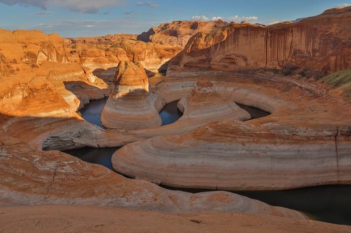
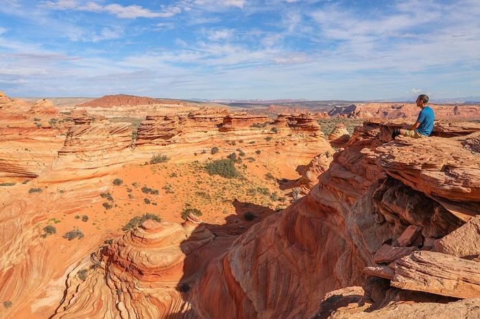
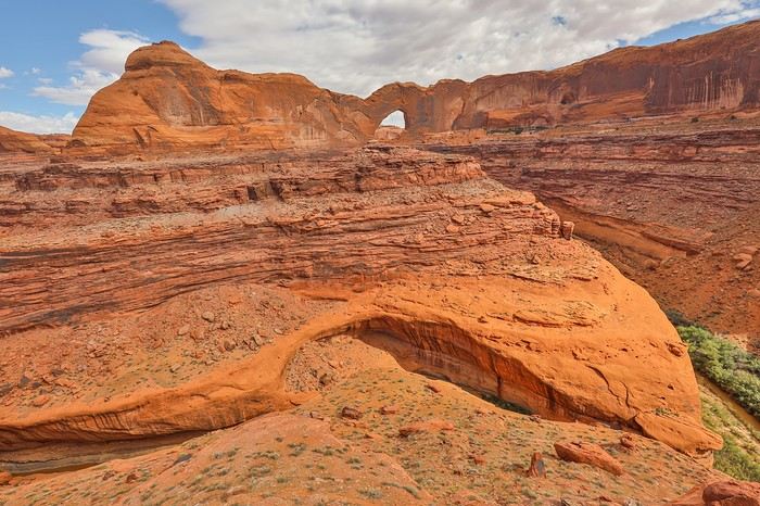
Anyway, we finally reach the trailhead for the legendary hike to Reflection Canyon. I call it "legendary" because this viewpoint over a Lake Powell meander is 13 km from the parking lot, and I’ve read plenty of stories about hikers struggling—or even getting dehydrated—in the scorching heat. Most people do this hike over two days to enjoy the soft evening and morning light.
Two factors made us consider another option. First, a few weeks before the trip, I saw recent photos of Lake Powell, and they showed that this viewpoint was just a shadow of its former self—unless you fly a drone to gain precious meters in height to recapture the old perspective.
Second, bivouacking on-site and hiking back in the morning would cut into our next day’s plans, which are impossible to do in just half a day. And since there was no way we were wasting half a day hanging around Coyote Gulch, we decided to take the bold gamble of enjoying the sunset at Reflection Canyon and then hiking back that same night—or rather, in the dark...
By late September, temperatures are much more pleasant, and when it comes to packing our backpacks, there are two teams: the "No Fear" team with just one gallon of water split into different bottles with ice, and the "I’m Not Feeling It" team with 6.5 L of water—which isn’t negligible given the fast-paced hike-run we’re about to do! Franck and Sullivan are on Team "No Fear," while I’m more of a "belt and suspenders" kind of guy...
Before setting off, we have a light lunch by the car to avoid side stitches later.
We start around 1 PM. The beginning is tough—uphill on slickrock—and we struggle to find the right trail. Eventually, we spot the faint path we’ll follow for most of the way.
We walk at a good pace, around 5 km/h, and with every valley crossing, we take advantage of the downhill to run and tackle the uphill without breaking a sweat—still running.
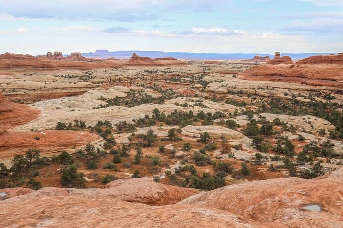
The landscapes we cross aren’t mind-blowing, but they’re not as dull as I’d read.
Time flies, and our little game is to guess the direction of Reflection Canyon without using the GPS. It’s impossible to imagine what awaits us at the end, and we can’t even see Lake Powell yet.
The last section of the hike requires a GPS—it’s super easy to get lost! We regularly set a bearing to follow so we don’t stray from the final goal, which remains invisible...
Finally, after 2.5 hours of fast hiking, we spot Lake Powell. It’s truly breathtaking!
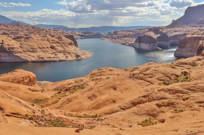
Climbing up a small hill, we see the famous lake meander, though the angle isn’t the one everyone knows!
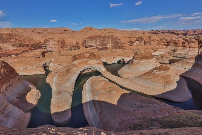
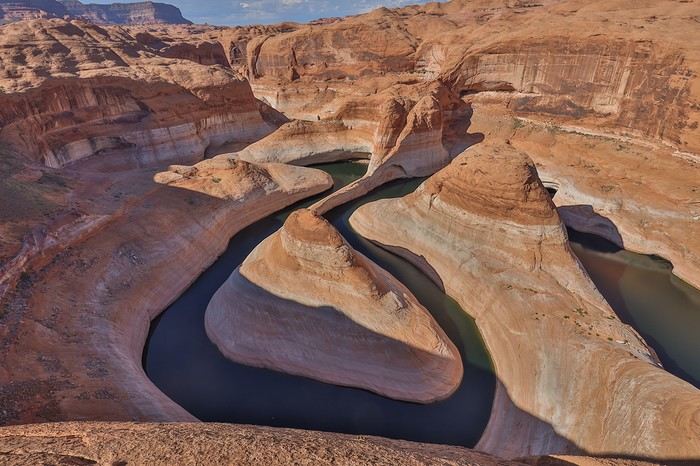
Then, we round the cliff, and there it is—the viewpoint we’ve dreamed about, Franck and I...
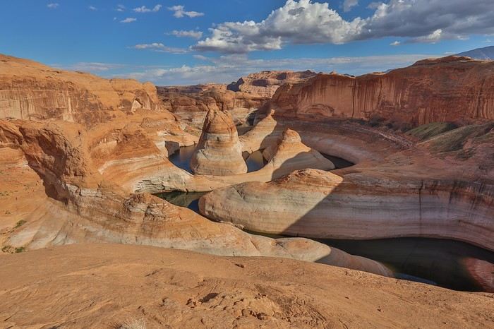
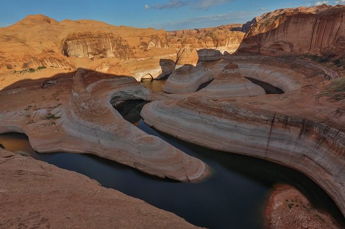
It’s magnificent 🙂, the site is vast, but I have to admit that with the current water level, Reflection Canyon doesn’t give me that "wow" effect. We can’t get any closer to the edge—the slope is too steep...
We spend 1.5 hours there, soaking in the view while lounging on the slickrock to recharge before the sun sets.
Around 6 PM, the shadows stretch dramatically, and the sun won’t be far from setting...
Our last photos before heading back:
Without a tripod, we decide there’s no point staying longer and that it’s better to take advantage of the blue hour to make progress on the return trip and cover as much ground as possible toward the car! After all, we’re not sure our headlamps will last 3 hours!!
Shortly after 6 PM, we set off, devouring the 5 km of confusing slickrock in about an hour. The twilight deepens, and 2-3 km later, it’s pitch black, and the real challenge begins.
Having pushed the pace a bit too hard, our water reserves dwindle—especially for Franck and Sullivan, who probably have only half a liter left by the halfway point.
We switch to commando mode: Sullivan, our metronome, sets the pace at the front; Franck follows in his footsteps; and I bring up the rear with the GPS, regularly checking we’re on the right track. But with night fallen, what was easy on the way in is now much harder. We keep losing the trail and struggle to find the best path. We’re exhausted, wasting precious meters, adding unnecessary elevation, and getting slowed down by bushes and brambles 😊...
In short, 3 km from the end, Franck and Sullivan’s bottles are empty 🏴☠️, while we still have a good hour of walking ahead, over 30 km already logged, and we absolutely need to avoid dehydration... Luckily, I still have nearly 2 L left, so we share the remaining water to finish the last kilometers of this legendary hike smoothly!
We’re full of energy when we find our beloved Tahoe, and after 34 km hiked in this insane day, we quickly slip into flip-flops to prepare our feast!
It took us 2.5 hours to get there and 3 hours to return—nearly half the usual times I’ve read about. So it’s doable, at least this late in the season. In the middle of July, I wouldn’t necessarily risk it unless I was ready to carry 10 L of water 😊.
To make up for the calories burned, we have pasta, chicken, and a big can of pineapple for each of us. Tonight, in addition to our swollen feet, we’ll sleep with full bellies and a head full of memories...
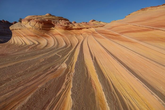
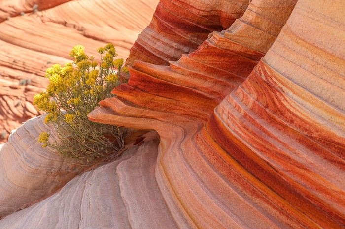
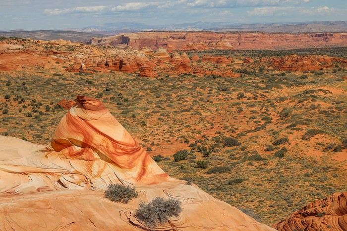
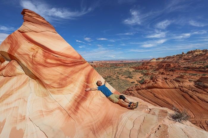
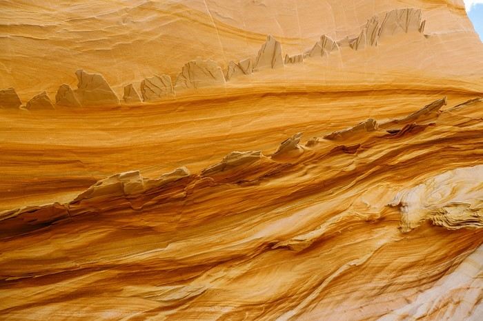
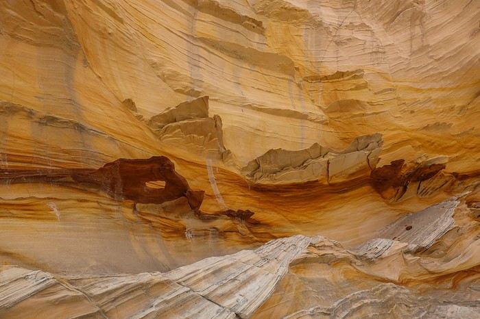
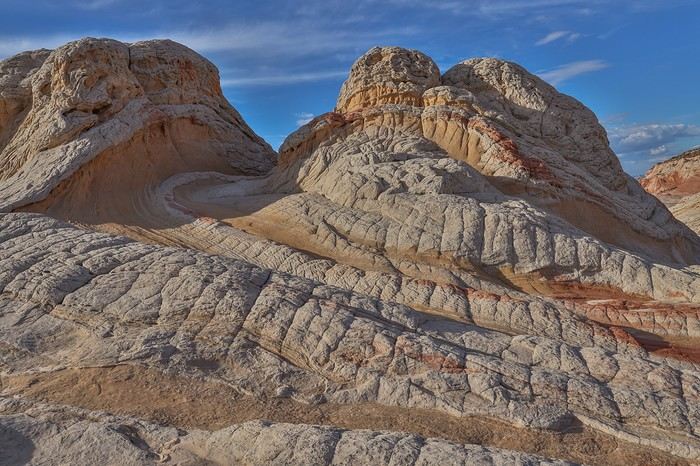
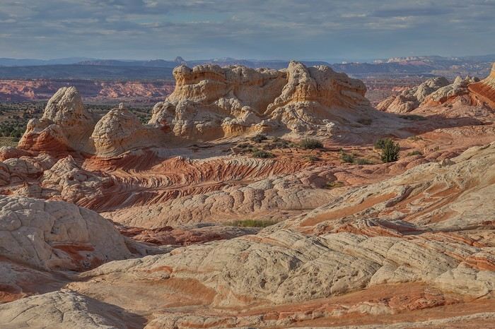
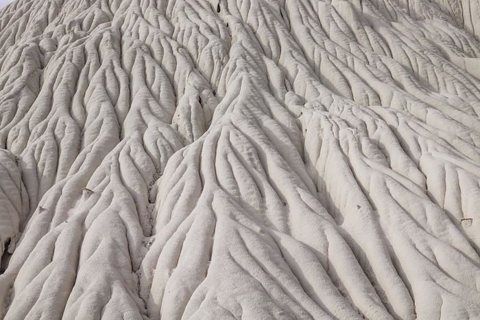
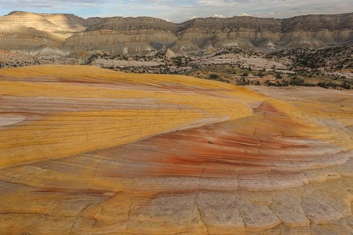
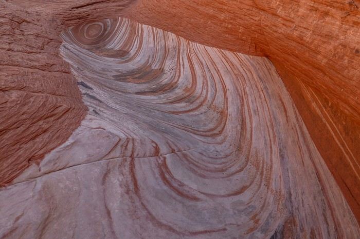
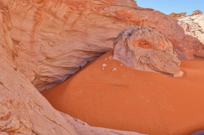
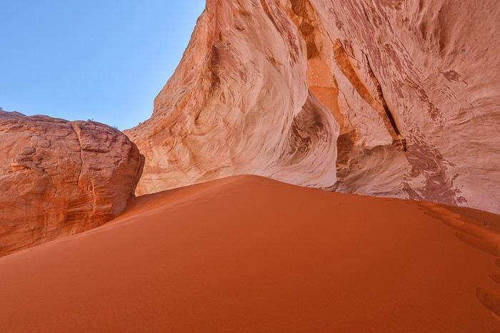
 A few original striations
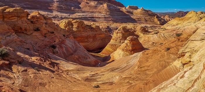
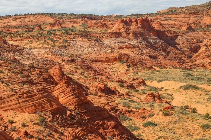
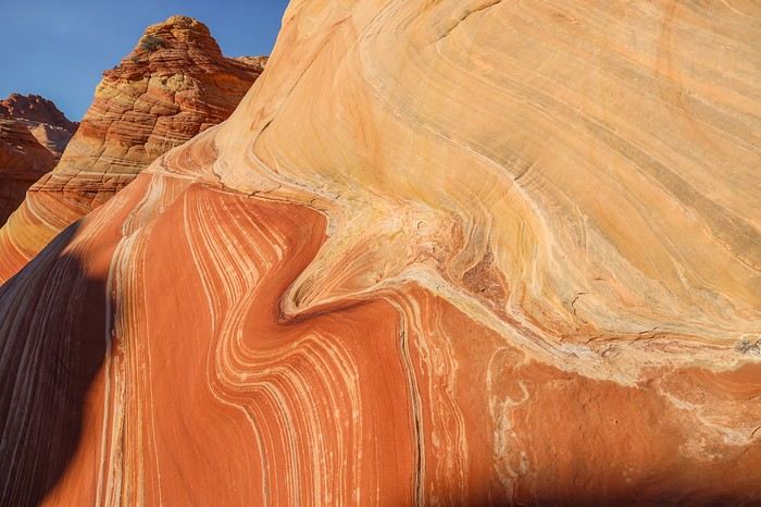 Just before Second Wave, we can already see the canyon we’ll use to leave Coyote Buttes North later...
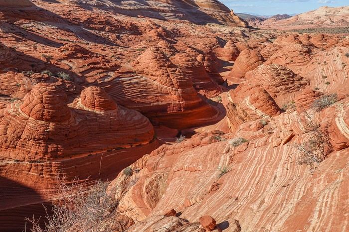 Oh, and I almost forgot to mention that from The Alcove onward, we didn’t run into a single person. When we arrive at Second Wave (N36.99345° W112.00813°), we’re alone again—even though at sunset, this wave is nearly as stunning as The Wave!!
Too bad for the 60 clueless folks who wasted their permit’s potential, and lucky for us—we get to soak up this incredible spot to the max!!
Oh, and I almost forgot to mention that from The Alcove onward, we didn’t run into a single person. When we arrive at Second Wave (N36.99345° W112.00813°), we’re alone again—even though at sunset, this wave is nearly as stunning as The Wave!!
Too bad for the 60 clueless folks who wasted their permit’s potential, and lucky for us—we get to soak up this incredible spot to the max!!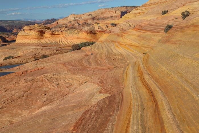 The succession of waves is breathtaking with the setting sun!
 Just before sunset, we start heading back, stars in our eyes.
To do so, we take a small slot canyon that’s completely in the shade. I’d noted other spots to visit in the area, but the late hour won’t let us do more.
Just before sunset, we start heading back, stars in our eyes.
To do so, we take a small slot canyon that’s completely in the shade. I’d noted other spots to visit in the area, but the late hour won’t let us do more.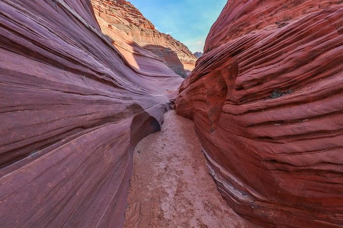 The return trip is easy, and when we reach the parking lot, our Tahoe is the last vehicle left. Instead of heading north, we drive further south on House Rock Valley Road, take Pine Tree Road, and set up camp at the intersection with the track leading to Cottonwood Cove.
An improvised shower with a water jug, a simple meal of pasta with chicken bits, and then a great night’s sleep to recover.
The return trip is easy, and when we reach the parking lot, our Tahoe is the last vehicle left. Instead of heading north, we drive further south on House Rock Valley Road, take Pine Tree Road, and set up camp at the intersection with the track leading to Cottonwood Cove.
An improvised shower with a water jug, a simple meal of pasta with chicken bits, and then a great night’s sleep to recover.

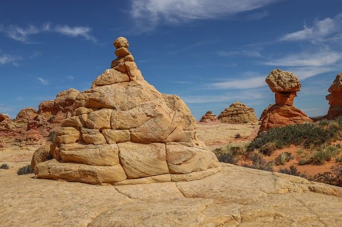
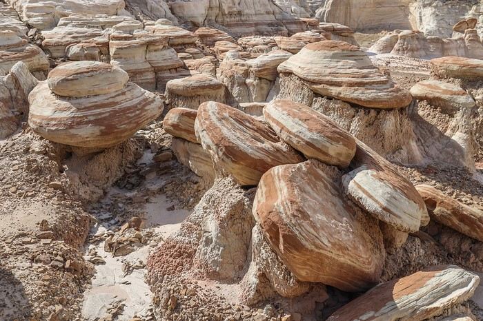
 We then head to the westernmost hoodoo area of the site, down below. There’s even a mini-wave—nothing like the ones from the day before, but still cool!
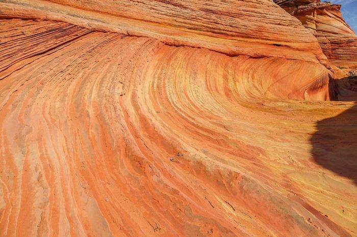
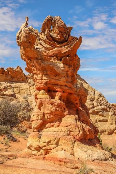
 Along the way, a few rocks are worth the detour!
 And finally, we arrive at The Beauty—a rock with a shape, texture, and colors that stand out from everything around it! Gorgeous!!
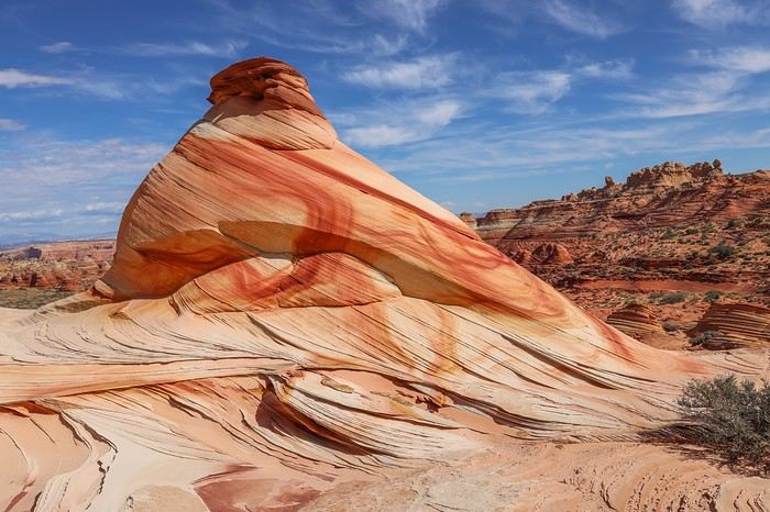
 [....]
 Then we head back toward the trailhead.
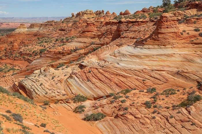
 It’s nearly 2 PM when we reach Tahoe, after about 5 hours of exploring 🙂! After scarfing down a few sandwiches, we head to White Pocket via the direct route between the two areas. The road is rougher, and we cross paths with our first 4x4—a tour operator’s vehicle. Luckily, it was in a section where passing was possible. The last stretch is a steep descent with deep sand, and Sedonax had warned me not to take it the other way to avoid getting stuck.
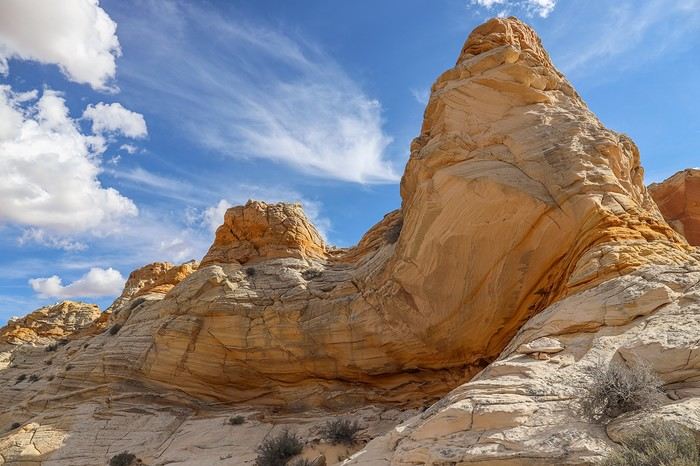
 The monolith also offers a different view of White Pocket’s main area!
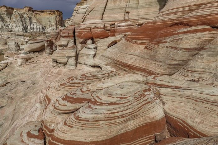
 then I explore the sector where rocks in shades of pink, white, and yellow intertwine with shapes, twists, and striations that are just unimaginable!
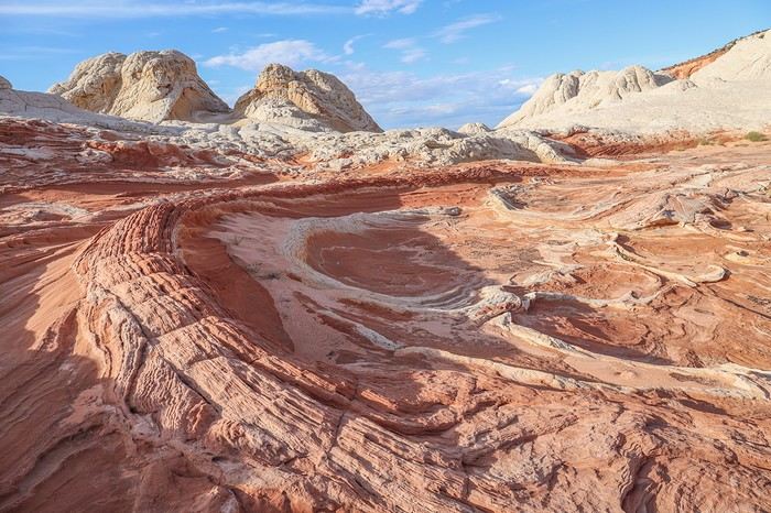
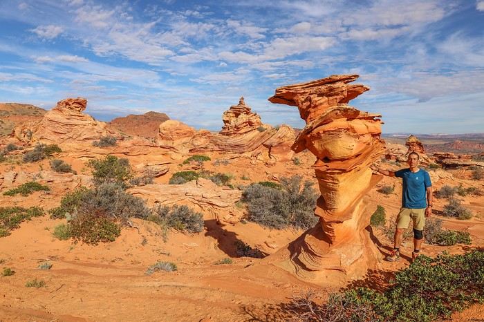
 My favorite rock, and my avatar by the way, is The Swirl 😎 !!
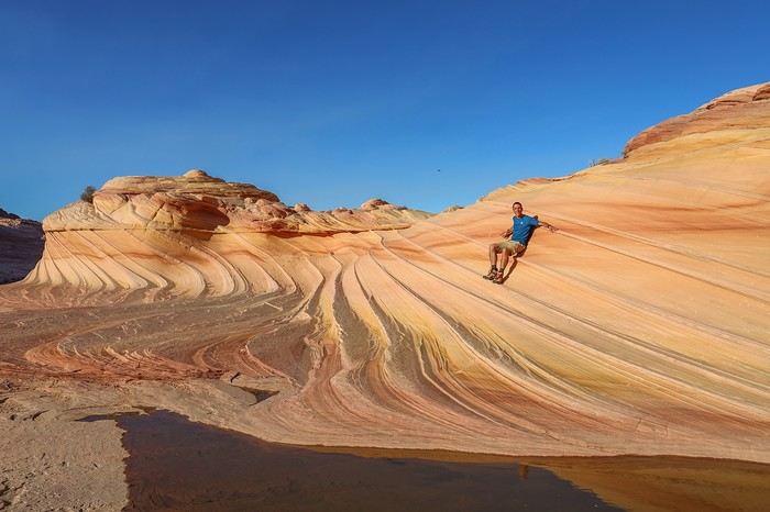
A photo with me on it to give you an idea of its size!
My favorite rock, and my avatar by the way, is The Swirl 😎 !!
A photo with me on it to give you an idea of its size!
 The area all around The Swirl is nice too, with brainrocks—literally "brain rocks"...
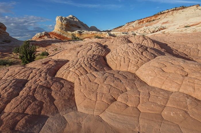
 After sunset, we stay a while longer to soak it all in! Franck and Sullivan really liked it, but they admit they didn’t fall in love with White Pocket, which for me is my favorite site in the American West, after The Wave, of course!
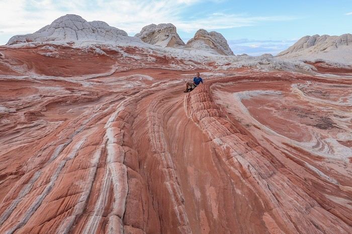 Instead of camping on-site, we quickly head back down the trail, taking a long detour to the south to avoid getting stuck in the sand—especially at night.
On the way, we stop for groceries in Kanab, then grab burgers and all-you-can-drink Dr Pepper at a Denny’s!
Instead of camping on-site, we quickly head back down the trail, taking a long detour to the south to avoid getting stuck in the sand—especially at night.
On the way, we stop for groceries in Kanab, then grab burgers and all-you-can-drink Dr Pepper at a Denny’s!
 then enter the crevice, the prelude to a promising slot canyon!
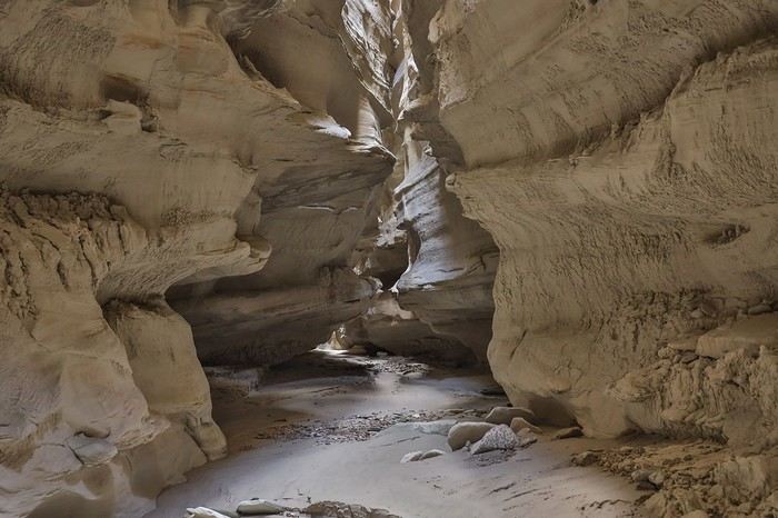 It’s not very long but impressive with its intricately carved rocks.
 A quick drone flight for Sullivan, then we move on to Colourful Canyon, a small canyon with some pretty cool multicolored rocks. It’s not the most photogenic area,
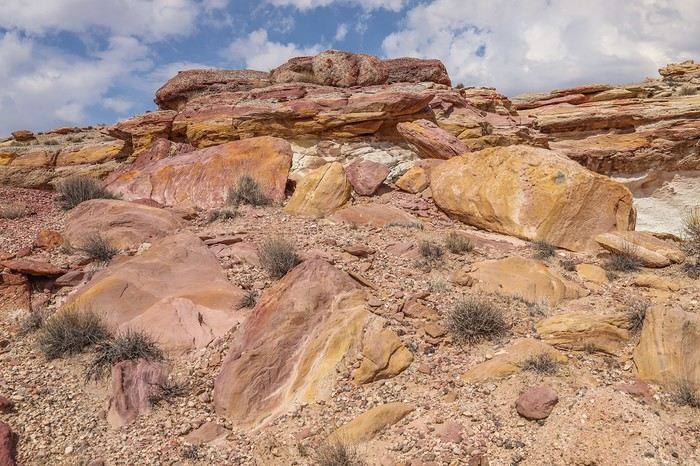
 but it lets us continue our loop toward the White Rocks.
The route is pretty intuitive, and we weave through some really unique rock formations!
but it lets us continue our loop toward the White Rocks.
The route is pretty intuitive, and we weave through some really unique rock formations!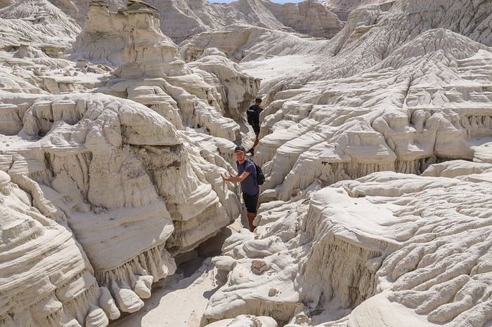
 At the end of the hike, I’d noted a detour to see Camel Hoodoo, but we strayed from the planned route, and it would’ve meant an extra 3 km just for one hoodoo. Even though Franck and I know this massive hoodoo is worth the detour, we don’t have the energy to push our legs any harder. So we decide to head back to the car.
This unforgettable loop still required hiking 25 km. If we’d prepared better, we could’ve avoided that 3 km detour this morning 🤪.
At the end of the hike, I’d noted a detour to see Camel Hoodoo, but we strayed from the planned route, and it would’ve meant an extra 3 km just for one hoodoo. Even though Franck and I know this massive hoodoo is worth the detour, we don’t have the energy to push our legs any harder. So we decide to head back to the car.
This unforgettable loop still required hiking 25 km. If we’d prepared better, we could’ve avoided that 3 km detour this morning 🤪.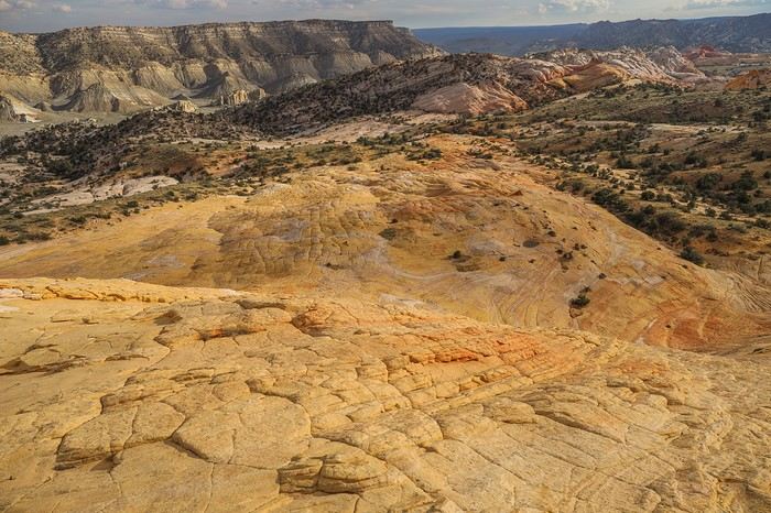
 With stars in our eyes, after an incredibly discovery-packed day and a solid 28 km under our belts, we head to a campsite in Escalante.
Too late for a burger—all the restaurants close early—but not too late for a couple of beers at the local pub. Then, a proper hot shower, laundry time, a huge plate of pasta to recharge, and a deep sleep... because after a few days of training, we’ve planned to up our hiking distance tomorrow... 😏
With stars in our eyes, after an incredibly discovery-packed day and a solid 28 km under our belts, we head to a campsite in Escalante.
Too late for a burger—all the restaurants close early—but not too late for a couple of beers at the local pub. Then, a proper hot shower, laundry time, a huge plate of pasta to recharge, and a deep sleep... because after a few days of training, we’ve planned to up our hiking distance tomorrow... 😏
 From up high, you better understand where its name comes from, and you wouldn’t even think of taking a dip in that brackish water. Nothing exceptional either, so we head back the way we came.
Even though the scenery is stunning, you have to admit that winding over 10 km through the river’s meanders gets pretty long. Not all areas are as open as this one!
From up high, you better understand where its name comes from, and you wouldn’t even think of taking a dip in that brackish water. Nothing exceptional either, so we head back the way we came.
Even though the scenery is stunning, you have to admit that winding over 10 km through the river’s meanders gets pretty long. Not all areas are as open as this one! To add a bit of variety, here’s Coyote Natural Bridge 🙂
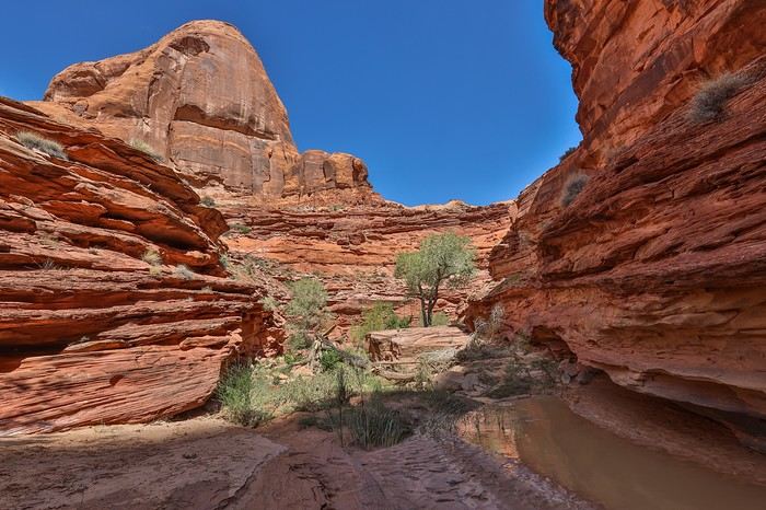
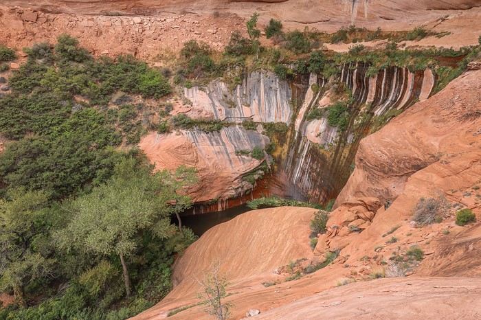
 We still haven’t seen the arch, the main goal of the hike, but this alcove alone is worth all those hours spent walking...
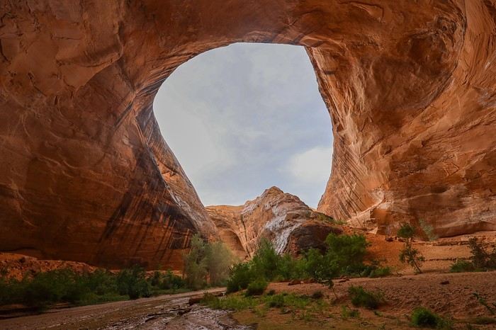
 After a solid half-hour of continuous rain, the weather calms down, and we decide to retrace our steps to the recorded point to exit the canyon. With Franck in the photo, you get a better sense of the cliff heights!! Everything is gigantic around here!
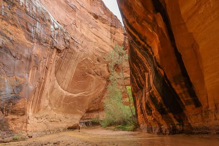
 At the base of the cliff, as expected, everything is soaked, and the first few meters on the slickrock don’t bode well. The rocks are slippery. After 30 seconds of discussion, we all agree: no way are we hiking another 5 hours back the other way—we’ve got to make it through here... 🤪
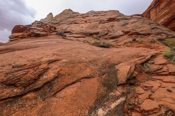
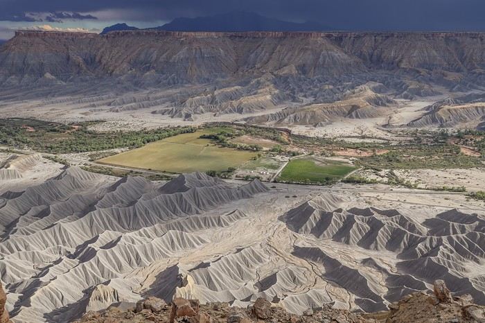
 After a 5 km hike, we arrive at The Volcano from above. The crater is massive.
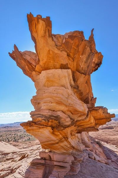 Fun fact: Sedonax saw this photo in a ranger’s office about twenty years ago but never knew where it was taken. It wasn’t until a few years back that he discovered the location thanks to new photos circulating online.
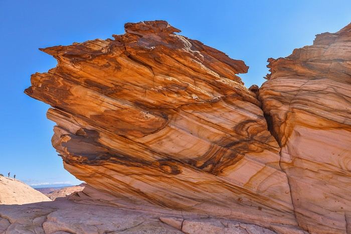 I eventually catch up with my friends and descend into The Volcano.
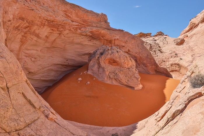
 After circling the crater, we head back out calmly to start the return trip.
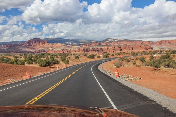 After a solid 2.5-hour drive, we reach the yellow truck that marks the starting point for our next adventure: climbing to the top of North Caineville Mesa.
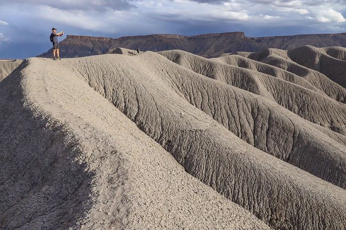
 I tell Franck and Sullivan about Yves, who recently challenged himself to time his climb to the top of the Mesa. Sullivan isn’t tempted by the idea of pushing himself for no reason, but Franck and I are way more childish—total kids 😛—and we’re curious to see how long it’ll take us to tackle the 320 m elevation gain over just 1.5 km. Plus, it’s a light hiking day, a transition before the big Canyonlands adventure planned for tomorrow.
 As we get closer to the top, the mesas gain more definition—it’s gorgeous, especially with the dramatic sky!
 In the distance, the sky unleashes a massive storm rolling across the plain from west to east.
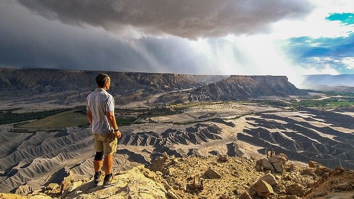 Stormy downpours are hitting just behind the parking lot where our Tahoe is parked—it’s seriously impressive!
 We end up staying up there for nearly an hour, not realizing we could’ve climbed the last rocky section—a few meters higher—to wander around the plateau at the very top. Guess we’ll have to come back!
 Since we’re craving a burger in Moab, we don’t waste any time heading back down, much more relaxed this time, stopping to snap some photos with the lengthening shadows—and even a rainbow!
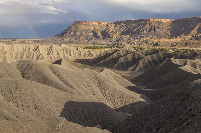 The mesas are just as photogenic from the summit as they are when wandering along the ridges. What a fantastic surprise—North Caineville Mesa totally lived up to our expectations!
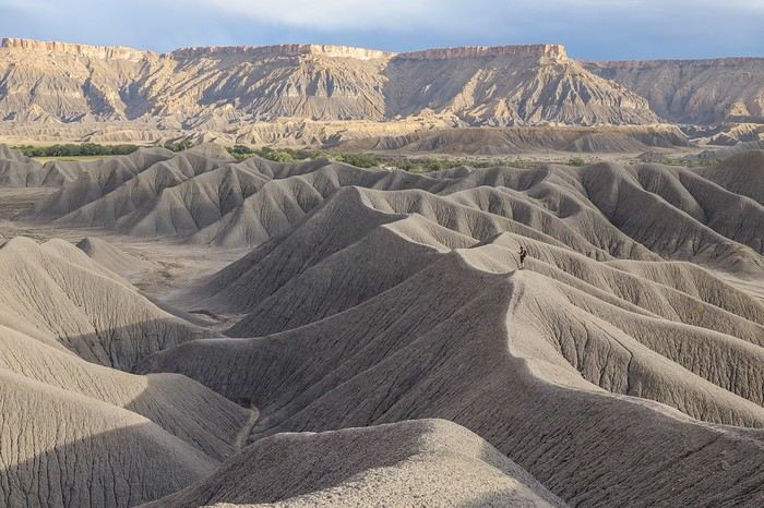
 A quick look back, and it’s hard to believe we actually found a way to climb all the way up here.
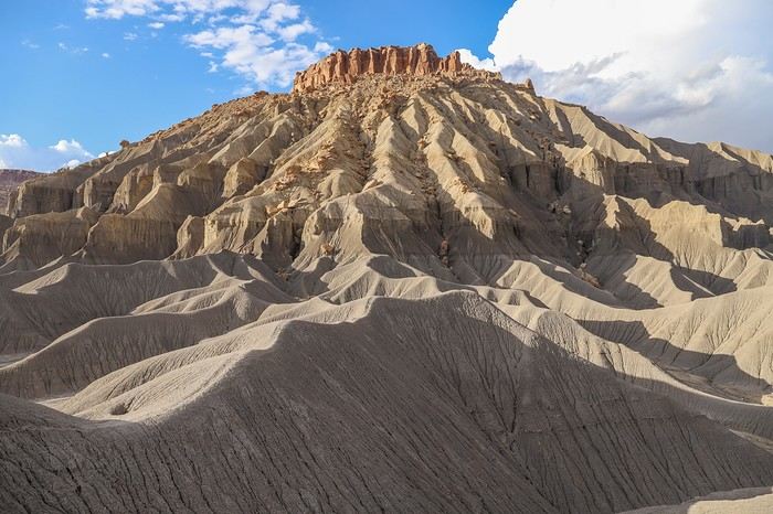 After another 2 hours on the road (yeah, the Southwest is *huge*!), we finally arrive in Moab to grab a burger at Wendy’s, washing it down with all the Dr Pepper we can handle—same as always.
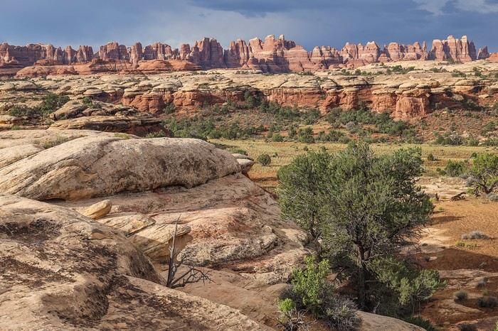 The trail then takes us along a rock wall leading to a cirque.
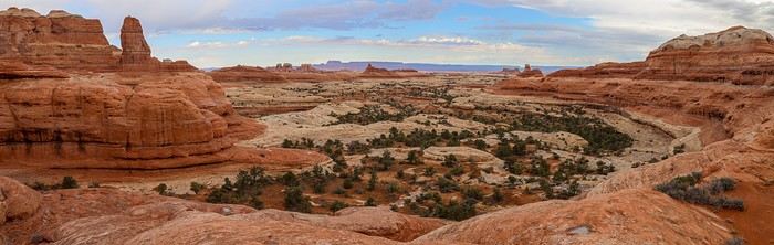
 This fairly exposed section gives us constant, sweeping views of the Needles and endless landscapes.
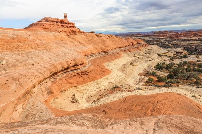 As we approach the southern end of Big Spring, the trail starts winding through the canyons.
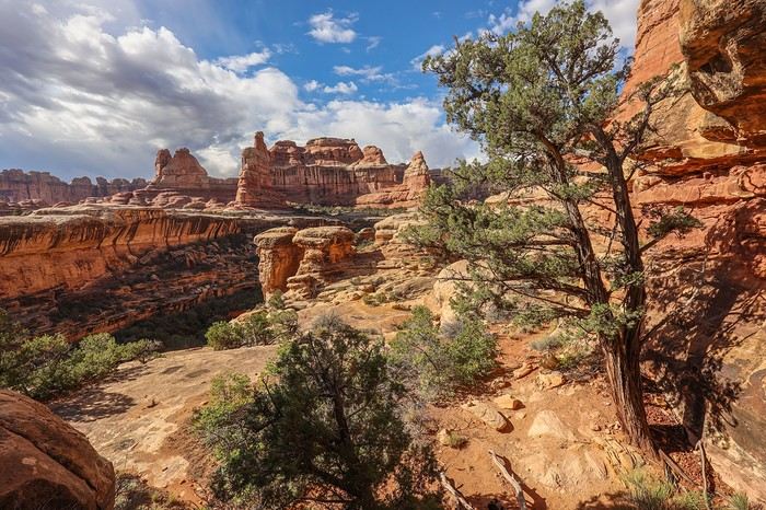 There are even a few metal staircases built to help cross from one canyon to another. The kids would love it here...
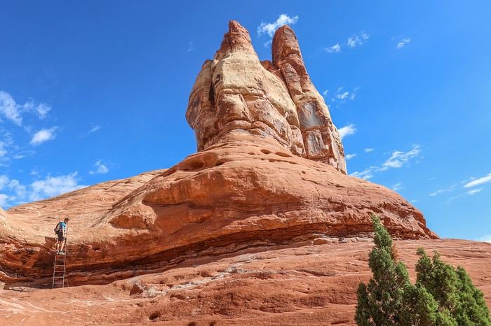 Crossing over the ridge, a new spectacle unfolds before us. It’s breathtaking!
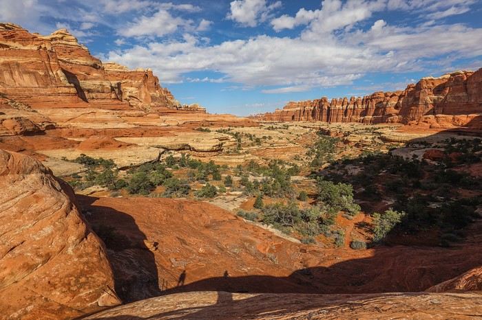
 We then reach the fork leading to Druid Arch. This section is less enjoyable since we’re hiking at the bottom of a canyon with limited visibility, but it’s still beautiful.
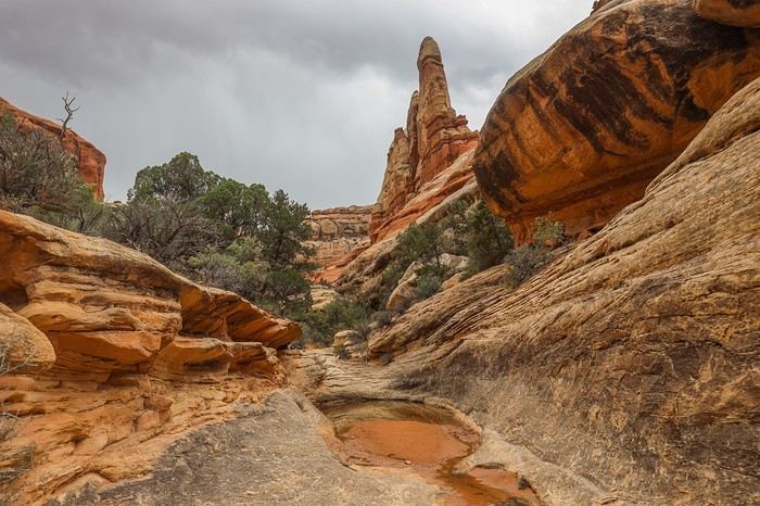
 We take the opportunity to have lunch on a large natural terrace at the foot of Druid Arch. It’s not just the arch that’s impressive—the surrounding scenery is just as stunning.
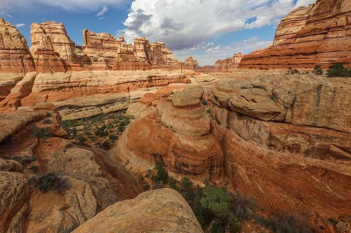 We then head back through the canyon in the opposite direction before turning west via Lost Canyon.
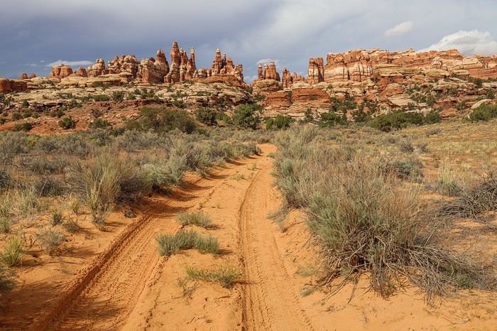
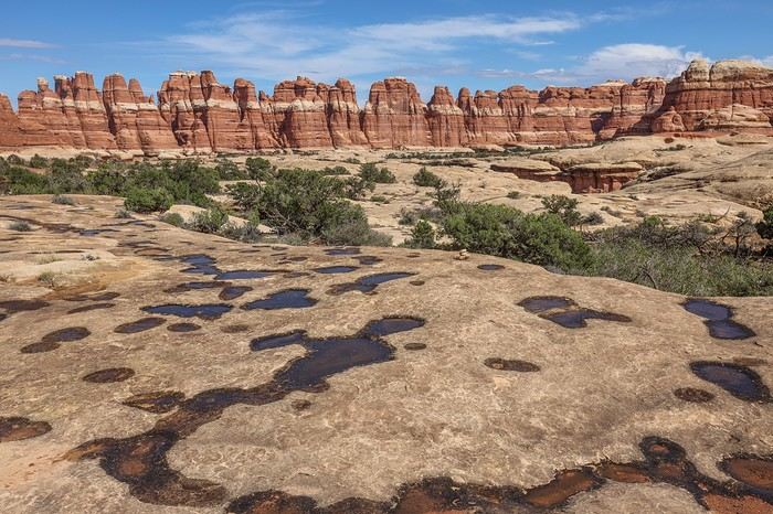 Eventually, we reach Chesler Park, a vast grassy plain with brush at the heart of hundreds of ochre and cream-colored needles and rock spires.
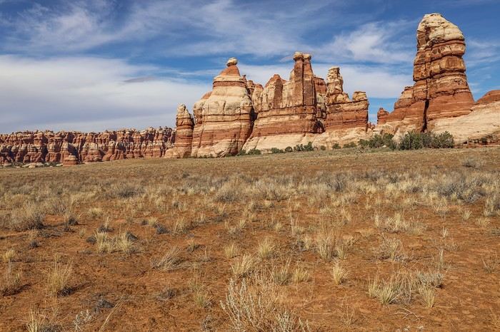
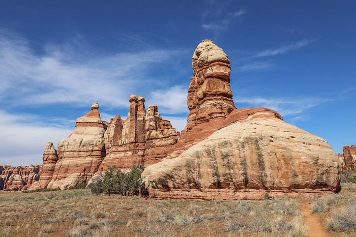 Here’s the wall of needles we saw at the start of the hike, but this time from the other side.
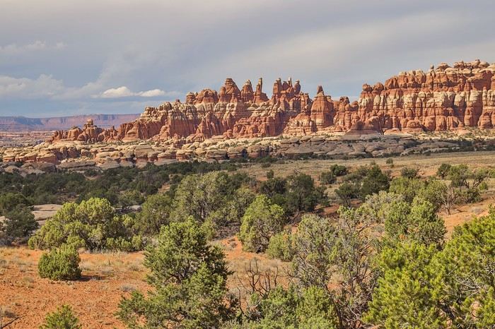 To leave Chesler Park, we take Join Trail, a very narrow crevice where you walk between two towering walls. At the end, you emerge into a bright slit that creates beautiful contrasts.
 We’ll come back to this area with our families since it’s possible to do just 18 km by sticking to this zone.
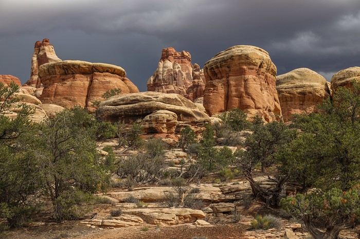
 By late afternoon, the sky is pitch black in the background! And if the Rangers’ forecasts were right 🏴☠️...
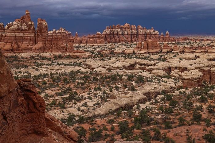 We’re just hoping we don’t get caught in a downpour, because we’re heading straight toward the stormy area!
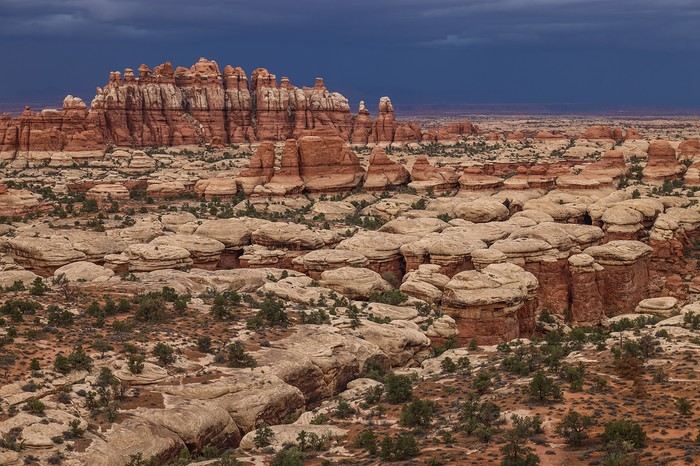 The end of the hike via Big Loop (North) gets really long, and our legs feel heaviest of all. In the end, after those never-ending last kilometers, we finally reach the parking lot at 6:40 PM—34 km in 9 hours and 20 minutes.
 We manage to get a bit of elevation for a plunging view of the amphitheater.
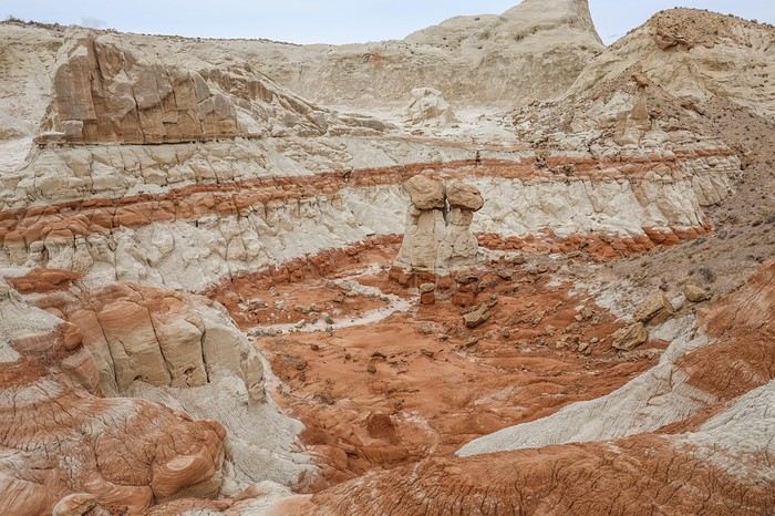
 The loop is relatively quick, so we backtrack to wander through the heart of the badlands.
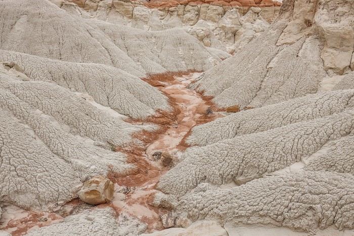
 In the end, West Cove was a bit of a letdown—not quite what we’d hoped for or worth the detour today, even if the site itself is pleasant to visit.
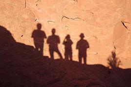


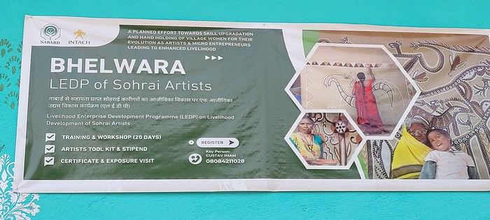
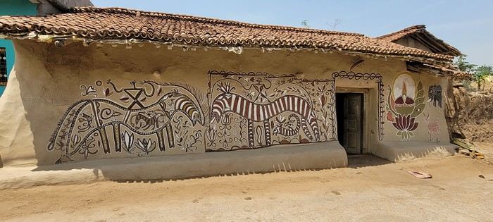
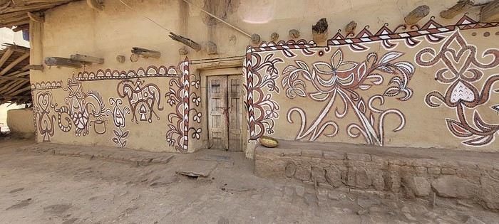
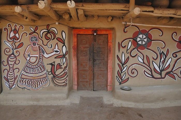
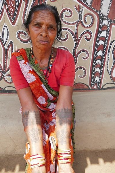
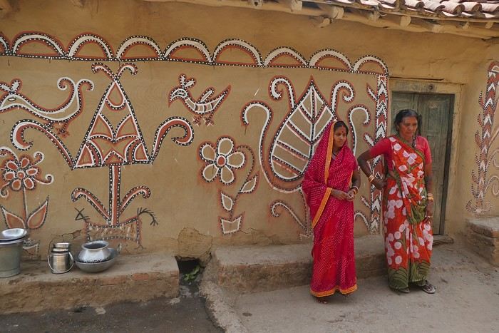
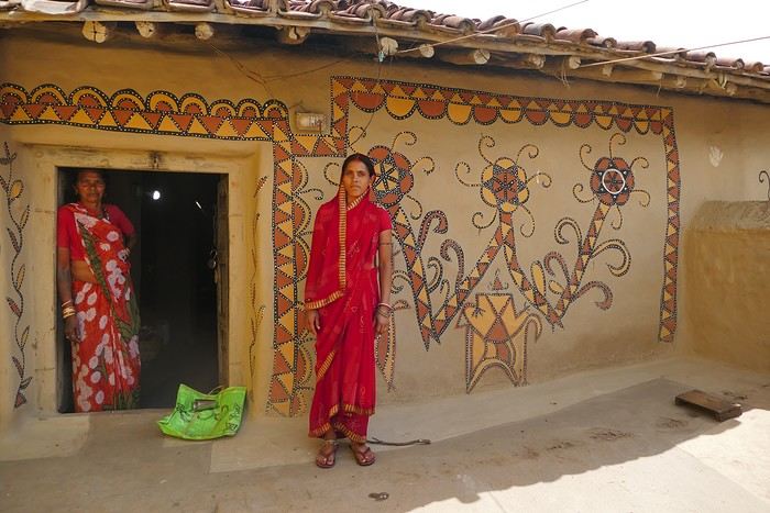
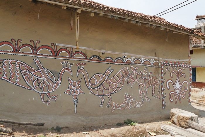 On some paintings, the scenes become almost narrative: you can make out figures, everyday gestures, like a memory of the village inscribed in the walls. The decorative frames around the doors aren’t left to chance either—they symbolically protect the house, like a boundary between the inside and the outside world.
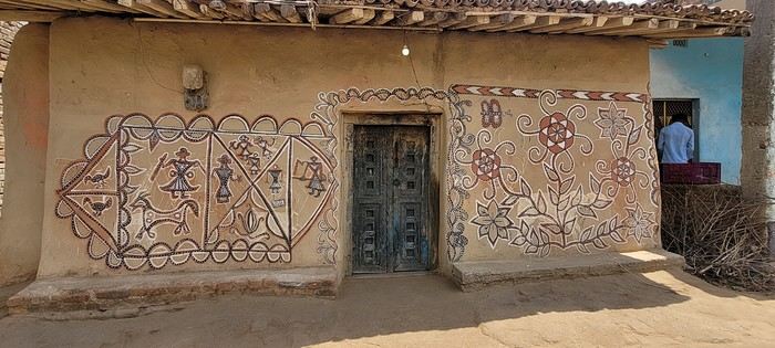
 A little sneak peek?
 Come along, I'm taking you to this country where it's so nice to wander and slow down...
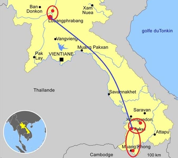

 I’m inviting you on a stroll through my drawings—a completely subjective, far from exhaustive, and totally personal take, since it’s based on my own sketches. I put this travel journal together after returning in late 2024, mostly using felt-tip pens and pencils, with a few collages thrown in. I worked from our personal photos.
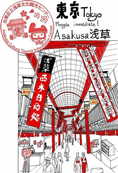
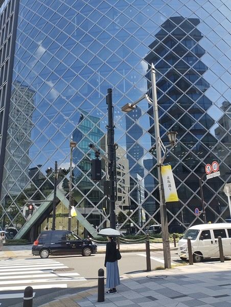
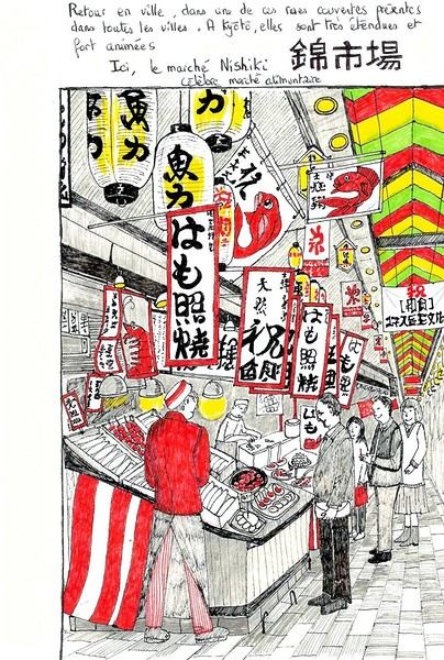
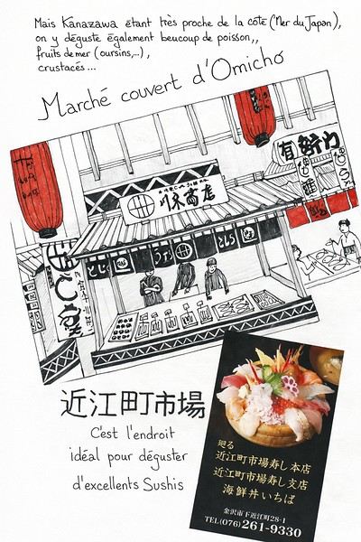 And in Kyoto, Nishiki Market:

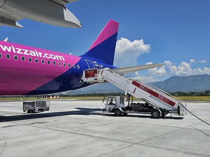 Since Albania isn’t part of Europe when it comes to phone service (at least not yet! :-)), we had to buy a physical SIM card—otherwise, the bill would’ve been sky-high if we’d used our French plan! We got one from Vodafone AL at the airport. You can buy online before leaving with a virtual SIM (e-SIM) for compatible phones, so you don’t have to swap cards. But given the uncertainty about choosing a plan online, we preferred buying one directly at Tirana Airport. Cost: 31 € for 100 GB. That’s way too much—100 GB is overkill. For 40 GB, it’s 27 €, and the plan lasts 21 days. The price difference isn’t huge, and it was cheaper than online. This plan covers all the countries along the Balkan range.
Money tip: All guesthouses and accommodations accept euros. The local currency in Albania is the LEK. In Montenegro, it’s the euro. Bank fees for withdrawing money from an ATM in Albania are pretty steep: 8 € for a withdrawal of 600–700 LEK (about 200 €)! So it’s better to withdraw cash (euros) in France. Oh, and we booked all our accommodations before leaving, but payment is always in cash. Budget around 400–500 € for 9 days of trekking.
Since Albania isn’t part of Europe when it comes to phone service (at least not yet! :-)), we had to buy a physical SIM card—otherwise, the bill would’ve been sky-high if we’d used our French plan! We got one from Vodafone AL at the airport. You can buy online before leaving with a virtual SIM (e-SIM) for compatible phones, so you don’t have to swap cards. But given the uncertainty about choosing a plan online, we preferred buying one directly at Tirana Airport. Cost: 31 € for 100 GB. That’s way too much—100 GB is overkill. For 40 GB, it’s 27 €, and the plan lasts 21 days. The price difference isn’t huge, and it was cheaper than online. This plan covers all the countries along the Balkan range.
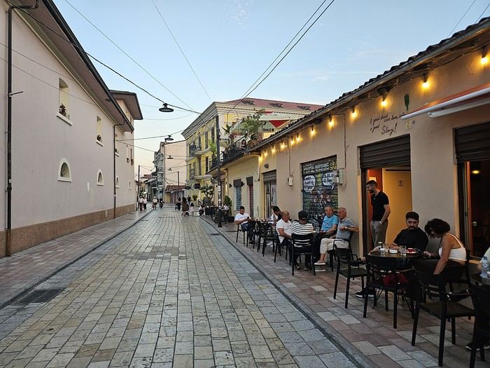
Money tip: All guesthouses and accommodations accept euros. The local currency in Albania is the LEK. In Montenegro, it’s the euro. Bank fees for withdrawing money from an ATM in Albania are pretty steep: 8 € for a withdrawal of 600–700 LEK (about 200 €)! So it’s better to withdraw cash (euros) in France. Oh, and we booked all our accommodations before leaving, but payment is always in cash. Budget around 400–500 € for 9 days of trekking.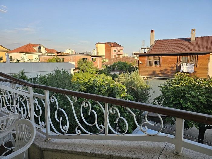 I really liked Shköder, especially its pedestrian street lined with restaurants and lit up at night. It’s a great place to stroll and eat. The food isn’t expensive—two big salads and two beers: 14 € :-) . Fruit prices are also very reasonable: 3 € for a kilo of cherries, compared to 9–10 € in France.
Religions coexist peacefully in these countries—Catholics and Muslims. From our balcony, my friend heard the call to prayer for the first time, coming from one of the city’s mosques.
I really liked Shköder, especially its pedestrian street lined with restaurants and lit up at night. It’s a great place to stroll and eat. The food isn’t expensive—two big salads and two beers: 14 € :-) . Fruit prices are also very reasonable: 3 € for a kilo of cherries, compared to 9–10 € in France.
Religions coexist peacefully in these countries—Catholics and Muslims. From our balcony, my friend heard the call to prayer for the first time, coming from one of the city’s mosques.
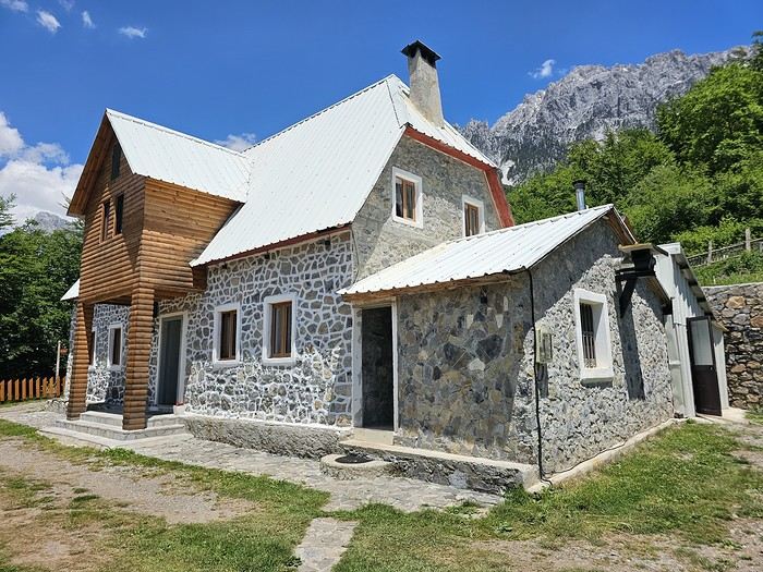 We slept in the heights of Theth at a new guesthouse, "Mountain Vista Shkafi," with an amazing view.

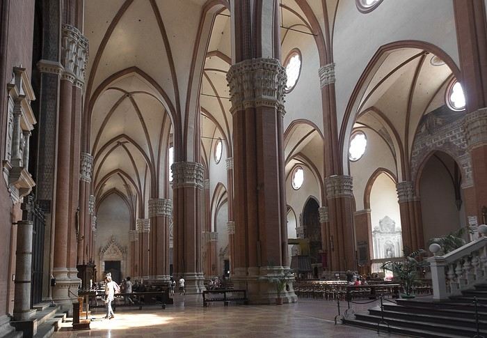
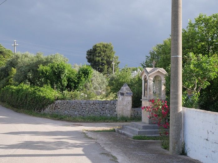
 But Bologna’s real charm lies in its porticoes, which were added to the UNESCO World Heritage list in 2021: 62 km of arcades running along buildings, letting you walk sheltered from the sun or rain. Back in 1288, the city required houses to include private arcades for public use. In the city center, you can stroll under 32 km of porticoes in all sorts of styles—some plain, some ornate—with a strong presence of red tones.