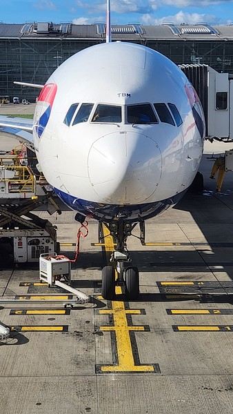
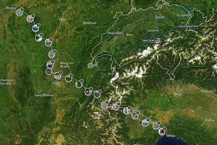
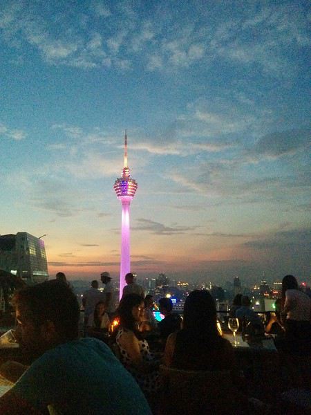
As I’ve mentioned elsewhere, I inherited my love of travel from my parents and some of my grandparents. A strong passion, but one that was unfortunately limited by our family’s modest resources. Back then, living in northern Alsace, a simple trip to the southern part of the region—with the Wine Route as our destination—felt like an extraordinary journey to a land of plenty for the little boy I was in the late 60s and early 70s.
Everything seemed so huge when you were still just a kid.
Back then, I was overwhelmed by countless sensations—I was already highly sensitive, with a keen mind and a nose and taste buds that were developing like a pro’s. Which, as I’d later realize, wasn’t always an advantage.
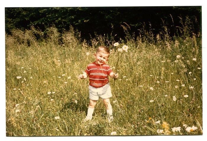
Those magical days always began with a gentle late-spring or midsummer morning. The interior of the white Peugeot 404, license plate 210 LZ 67, had already soaked up the sun before the engine purred to life, and the cabin gave off a scent I could still recognize today—a fragrance I found so pleasant. Back then, I had no idea it was just the smell of warm plastic from the car’s interior.
Yes, the scents of the 404 on sunny days became my madeleine de Proust...
What’s more, the whole family was unusually cheerful because those moments of relaxation and leisure were rare. Everyone worked, and no one had an easy job or was well paid. Without the *Trente Glorieuses*, these experiences might never have happened.
Once we crossed the canton’s borders, I felt like I was light-years away from my everyday surroundings, and every kilometer plunged me deeper into *terra incognita*. It was thrilling. Far from my so-called "medium-sized" town, wheat fields, cornfields, and cabbage patches stretched out, punctuated by tall poles connected by long wires and topped with vegetation—like giant clotheslines without laundry, where magical beanstalks might grow to touch the sky. Back then, I was still far from tasting their product, which was simply beer. At the time, there was still a significant local hop production. Fun fact: it wasn’t until 2002 that Anglo-Saxon scientists proved hops and cannabis belong to the same biological family.
After the fields, the landscape took another step up as it rolled past the little boy’s eyes, often glued to the windows. First came modest hills, then a succession of rolling slopes that soon formed an unbroken chain. Their 700 meters in altitude felt like Himalayan peaks to me—impressive, inert giants, a whole new world. Gazing at them, an intense emotion welled up somewhere between my stomach and lungs, nearly taking my breath away. What mysteries, what treasures did these heights hold?
And then there were the cherries on top—the crowning touch that made the scene even more magical: proud, majestic castles perched on the summits like impassive sentinels. Monuments from the past, yet firmly rooted in the present on their rocky spurs.
The little boy’s eyes sparkled—he’d been given a castle for Christmas, complete with battlements, towers, a drawbridge, and fully armed knights. He’d watched and lived *Ivanhoe* on the only French TV channel that existed back then.
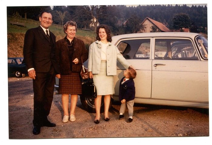
Only once did my paternal grandfather join us on one of these trips. A tall, intelligent man with a face that could shift from stern to mischievous, clearly full of humor and charisma. Sadly, his relationship with alcohol had taken a toll on his life and, by extension, those of his loved ones. He had a strong personality—if his boss crossed the line, he wouldn’t hesitate to punch him, which meant he went through a lot of different jobs. Back then, you could quit one job and easily find another. It was quite something to see him in his final stages, hallucinating pink elephants and even drinking perfume when he had nothing else left. The last time I saw him, he’d slipped away from the doctors and nurses while hospitalized in pretty bad shape—at least, I assume his liver was the issue. We were sitting down for a family lunch when the door burst open, and there he stood in his pajamas, eyes twinkling with mischief, clearly pleased with the dramatic entrance. That theatrical moment didn’t spare us from burying him a few months later at the age of 71. One day, my mother told me the family doctor had quietly remarked that it was a shame—with his robust constitution, he could’ve lived to be a hundred. Yes, the family doctor—this was the man who’d come treat you any day, at almost any hour, just for a phone call. It really existed, it’s not a myth!
That day, his wife—my paternal grandmother—was also along for the ride. Everyone agreed that Jeannette was a good woman. She worked as a waitress at *Le Tigre*, the biggest brasserie in town, right in the center. Most customers preferred to be served by her, including local dignitaries and even the mayor. As a kid, I didn’t find her very fun, open, or warm—she seemed a bit stern. Back then, women in their fifties already had the face and build of grandmothers. Same went for men, don’t get me wrong. I had no idea about the struggles she faced because of her husband. I didn’t know that 30 years earlier, she’d had to flee Alsace while pregnant, under threat from Nazi fighter-bombers. I didn’t know she’d had several miscarriages, and that my father—her only surviving child, born prematurely in March 1940 at the other end of France—weighed less than a kilo at birth and was so tiny he could fit in a shoebox. Hard to imagine he’d grow into a strapping man nearly 1.80 meters tall, tipping the scales at 100 kilos.
When you come back from summer camp in early August and ask why she didn’t pick you up with your parents, and they gently tell you she’s "in heaven," you don’t realize she passed away at 54 after suffering greatly from stomach cancer that had spread.
Back to that family outing, that enchanted parenthesis. I even remembered where we’d had lunch when I passed through Dambach-la-Ville decades later. One of those charming, flower-filled towns Alsace produces in abundance—and preserves so well. This one sits high on a hill, and I was a bit stunned on the parking lot because the view stretched far, revealing the Alsace plain below—its fields, villages, hills, and forests. The world seemed so vast and enticing that day, even though I was only glimpsing a tiny fraction of it.
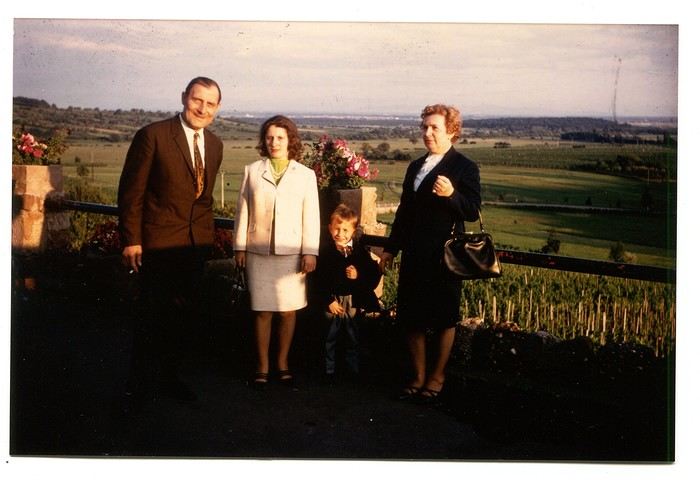
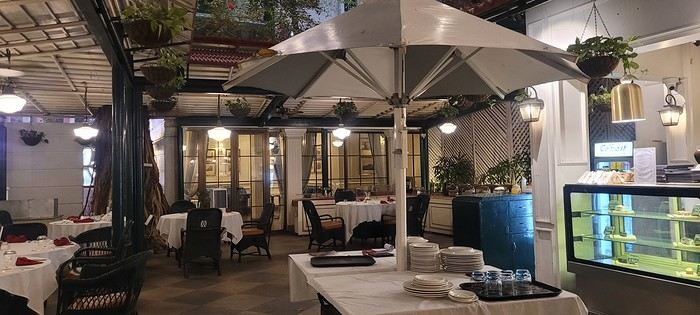
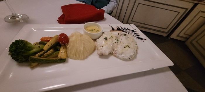
The region was already very touristy, but I wouldn’t notice the downsides until much later. That Sunday noon, I discovered a large restaurant filled with diners. I can still see the enormous piece of meat they served me, decorated with a little wooden skewer topped with a flag. I kept that one for a long time. Those were the golden days of rich, flowing, thick sauces—so flavorful—and the era of the world’s best fries, made on the spot with the best potatoes. To top it off, I was *exceptionally* allowed a small bottle of apple juice, Orangina, or—even better if possible—Sinalco. Yes, Sinalco—like Orangina, but better. A brand that must’ve disappeared in the 70s, but why, and what a shame! Since then, Orangina’s little bubbles have taken the brand to the other side of the planet—it’s now Japanese.
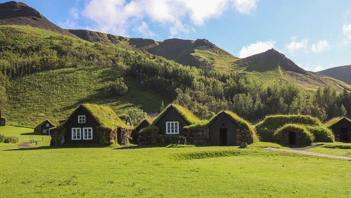
Year after year, I’d eagerly await that ecstatic moment when the most beautiful castle in Alsace, the Haut-Koenigsbourg, appeared in my field of vision. The perfect model, the archetype that blended into the landscape at the height of a child’s dreams.
The trip home always felt like a reality check—less jarring than an alarm clock, but more diffuse and melancholic. From then on, there was only one wish: *When do we leave again?*
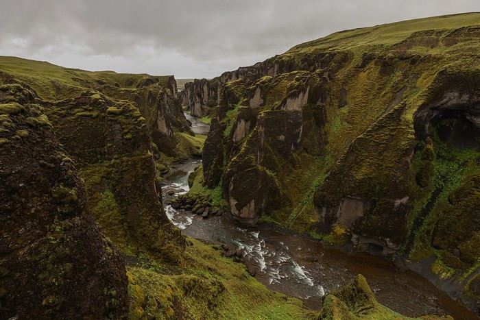
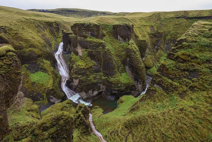
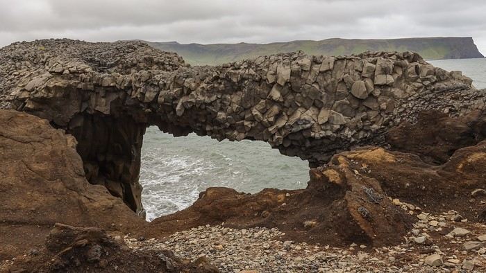
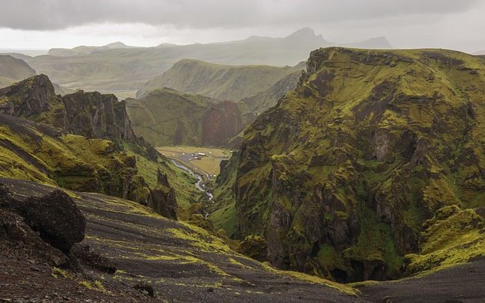
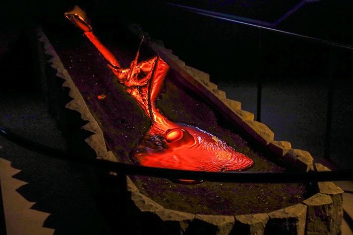
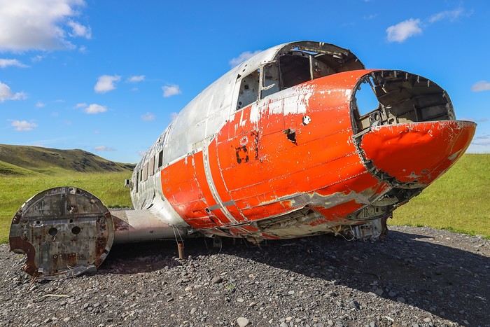
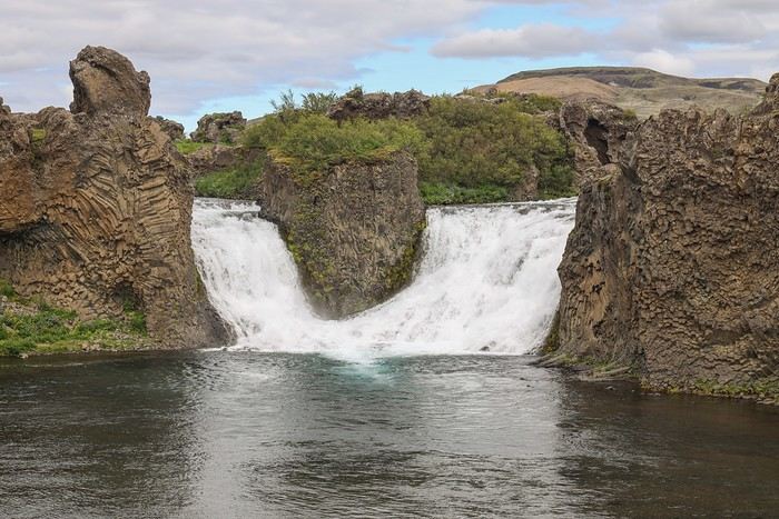
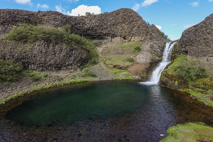
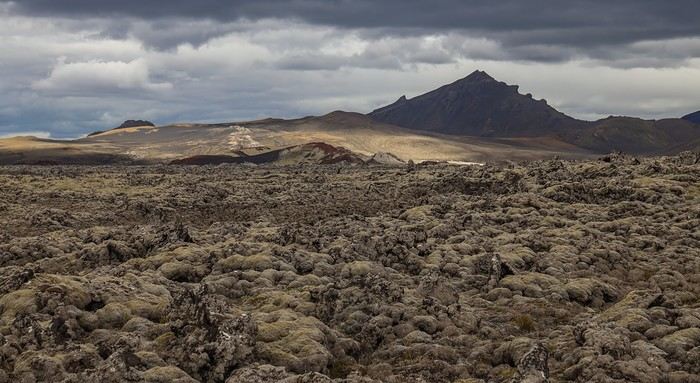
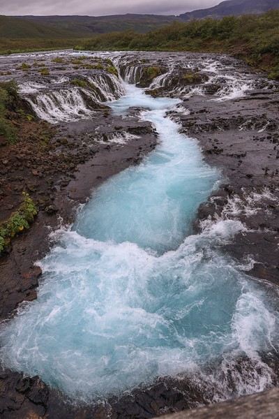
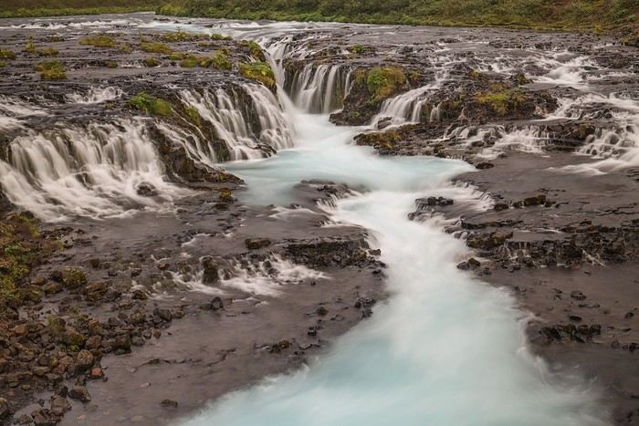
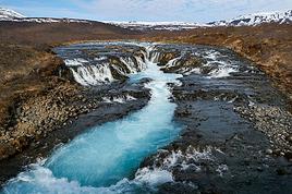
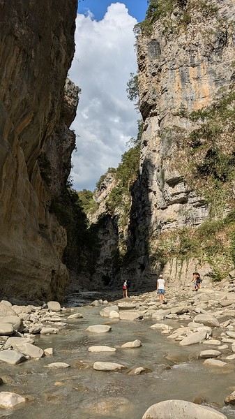
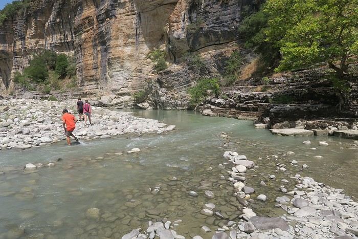
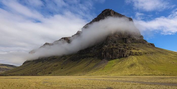 Around 10 AM, we reach the start of the track leading to Laki. Since the sky is clear, we take the opportunity to visit Fjaðrárgljúfur Canyon, which became famous thanks to a music video by a singer whose name I’ve forgotten.
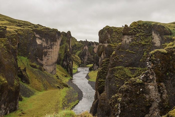
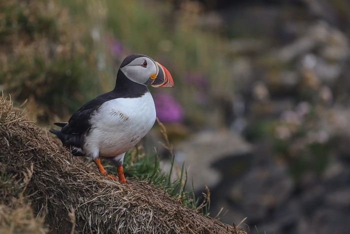
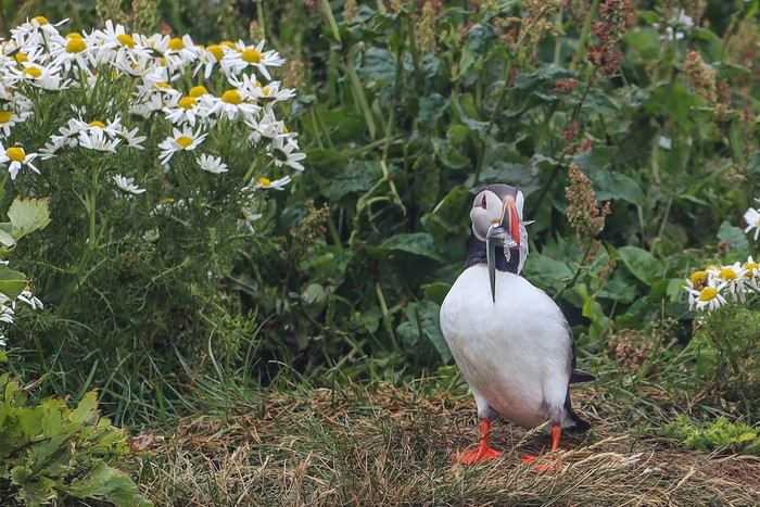
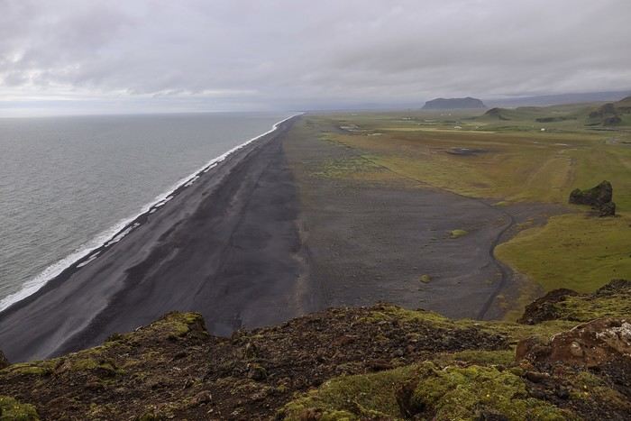
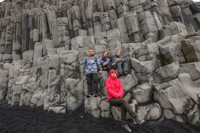
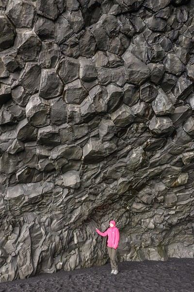
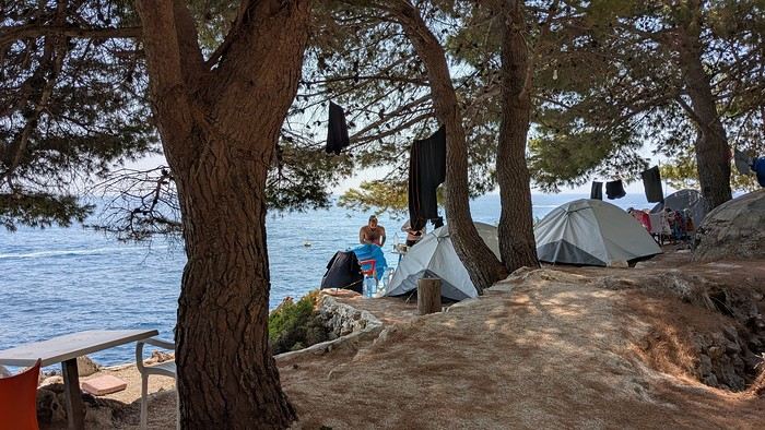
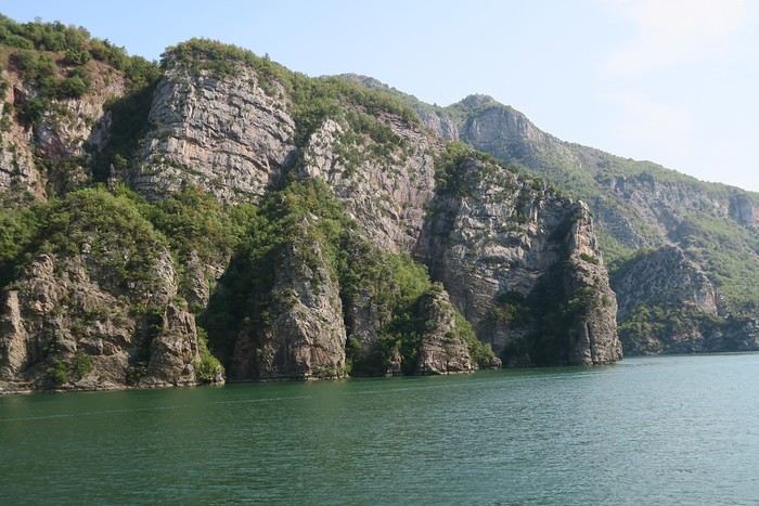
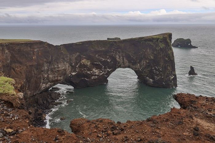 But this spot is really worth it for its exceptional viewpoints over two beaches where swimming is strongly discouraged due to treacherous sea currents.
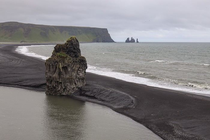
 After dinner at an excellent Vietnamese restaurant—where one of the chefs is French and offers great prices for the country—
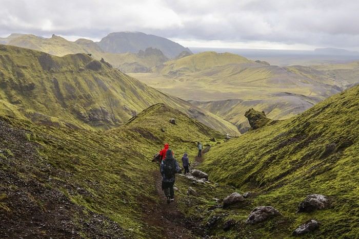
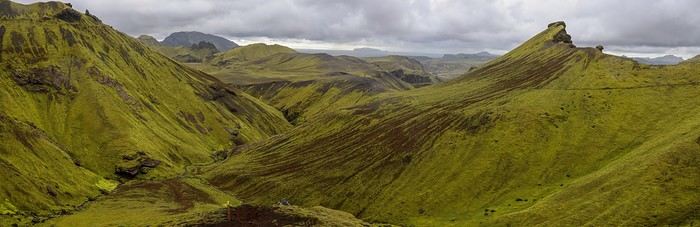
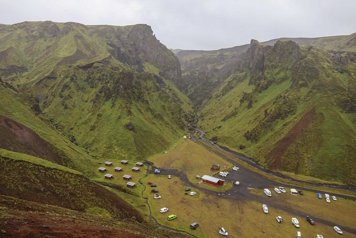 We then move along a ridge.
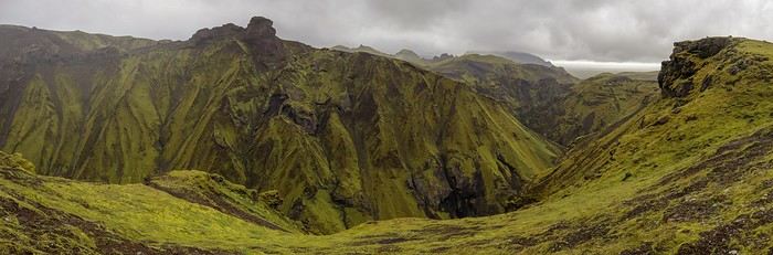
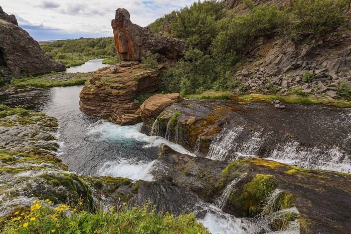
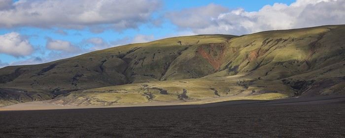
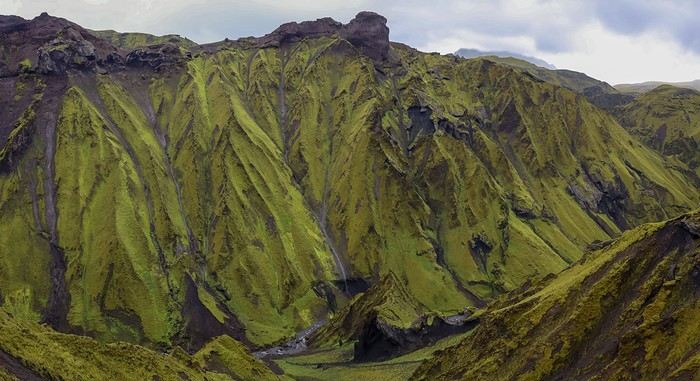 Everything around us is green, but the shades of green are so varied!
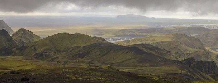
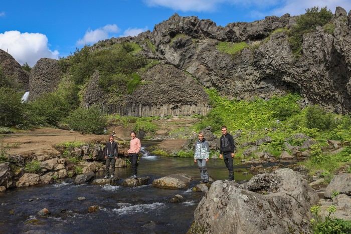
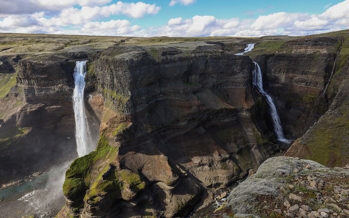
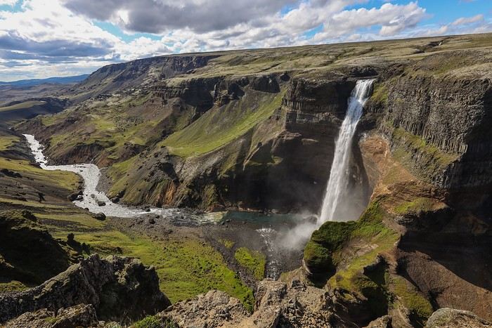
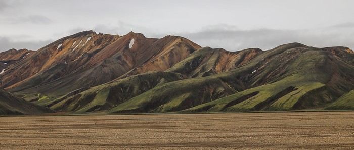
 We never get tired of these landscapes and panoramas—each one more majestic than the last!!
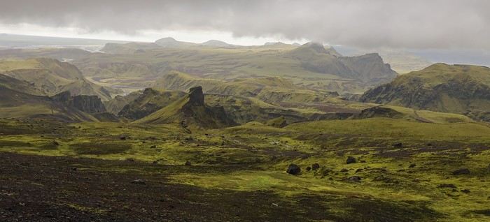
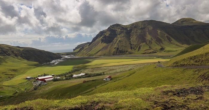
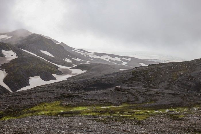
 We can’t help but feel regret over the terrible weather for this Þakgil hike... but apparently, Iceland is magnificent in all weather. I’m not personally convinced 😕.
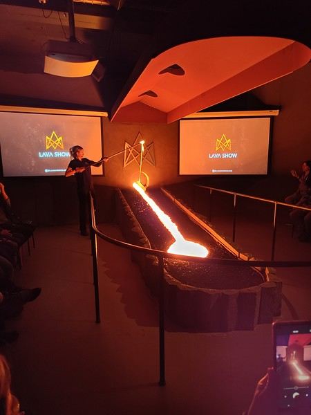
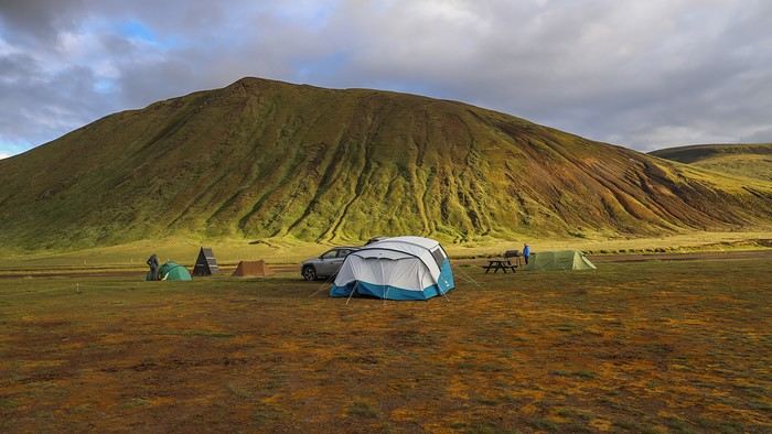
 Next, we head to our charming cottage, Mid-Hvoll Cottages, near Vik, which is heated to the max—even in summer—thanks to geothermal energy. We’re forced to step out onto the terrace just to cool off a little...
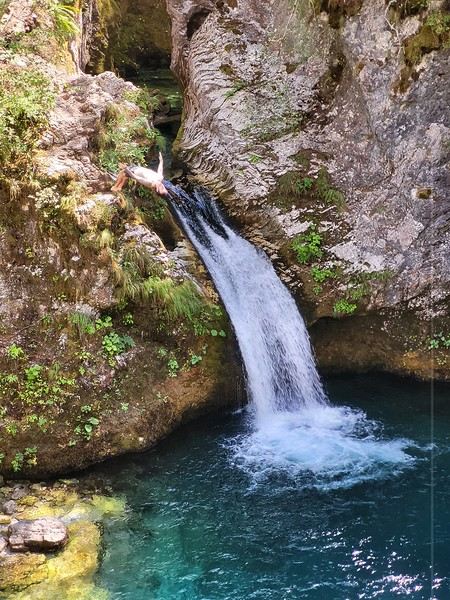
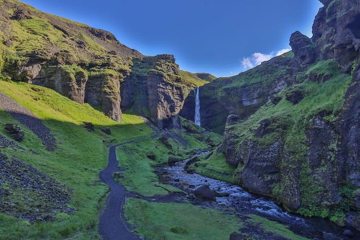 You can walk behind the waterfall without getting too wet, for a unique viewpoint.
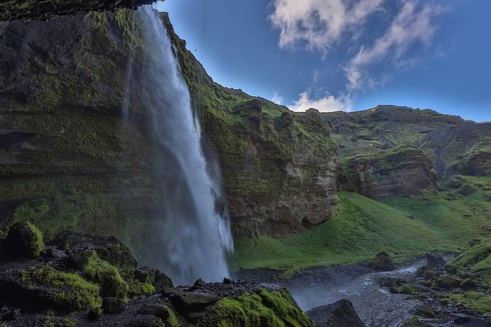
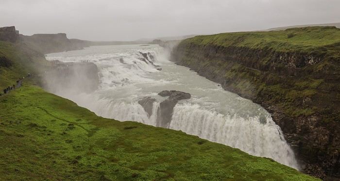
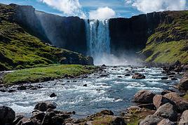
 The next waterfall, Skógafoss, is located at the end of a huge campsite. The big plus? For once, parking and access are free, even though Skógafoss is a major tourist site in the South!
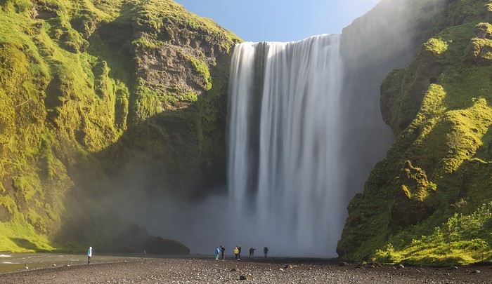 A path to the right of the waterfall lets you climb up for a view from the top. After 400 steps, we’re rewarded with a beautiful rainbow.
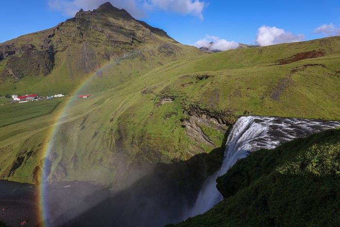 This path isn’t just for seeing Skogafoss from above—it’s also the starting point for the famous Laugavegur trek. On the way down, we run into dozens of hikers setting off on the adventure!
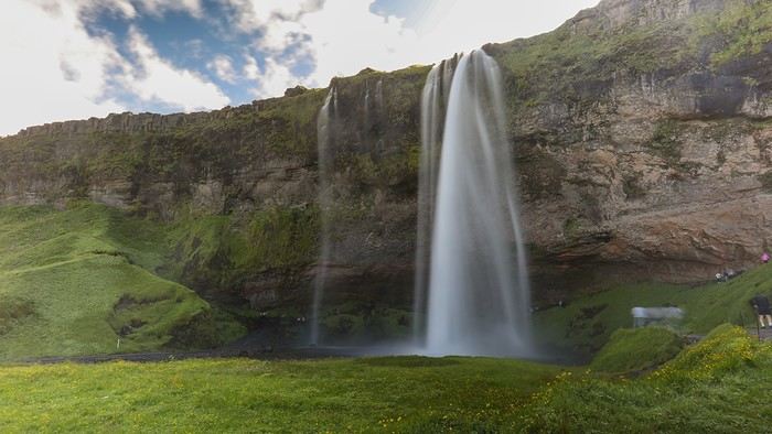 Walking behind the waterfall, the contrasts of the blue sky, green meadows, and water are super photogenic. A rain jacket or at least a windbreaker is a must to avoid getting soaked.
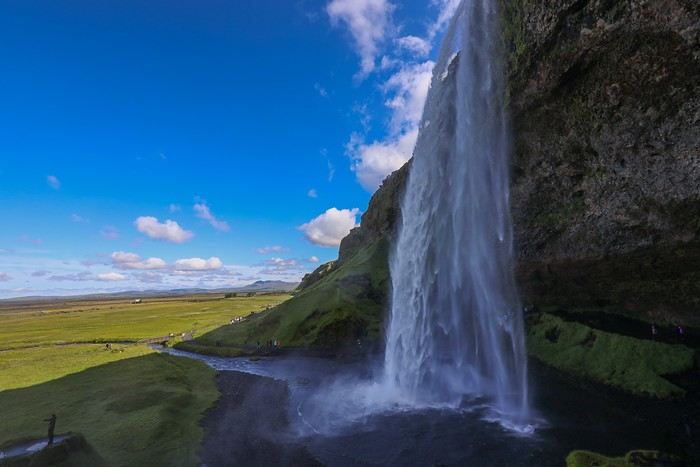 What a sight, though!!
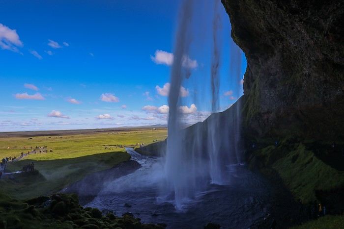 The trail then leads us to Gljufrafoss, hidden at the end of a small canyon. To get there, you have to hop from rock to rock along the little river, then be willing to get your camera or phone wet for the shot!
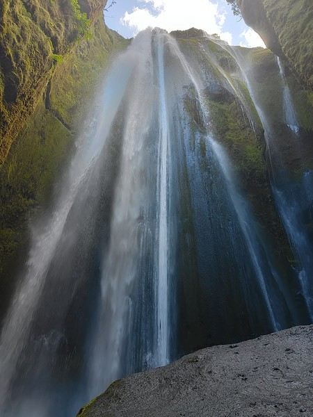
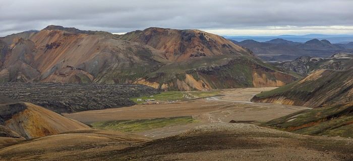
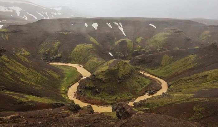
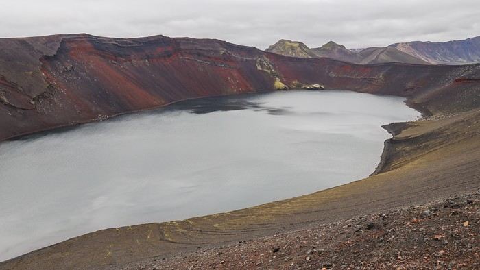 Then, just a few kilometers from Landmannalaugar, a small pass gives us a beautiful view of a lake and an extinct volcano, the Stútur Crater.
 Some mosses take on an original fluorescent green hue without the sun.
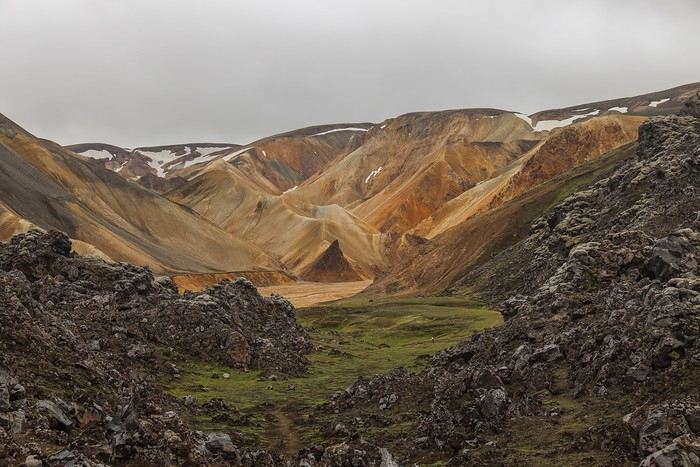
At the end of the long climb, we’re rewarded with some gorgeous panoramas!
Some mosses take on an original fluorescent green hue without the sun.
At the end of the long climb, we’re rewarded with some gorgeous panoramas!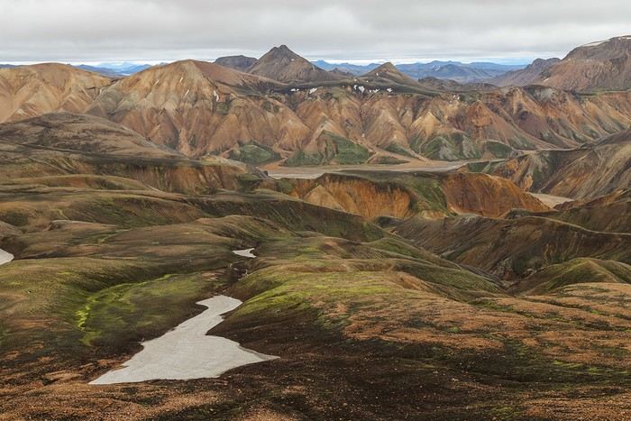 Like two days ago, as we approach the summit, it starts raining—but this time, we’ve got our ponchos, which we quickly put on. The reward is worth the effort, with beautiful views of the snow-capped peaks.
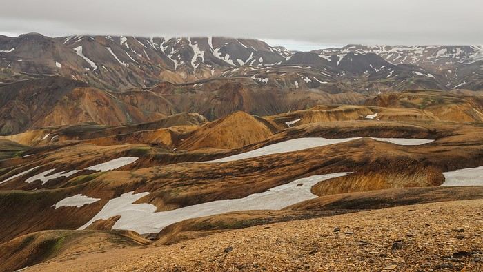
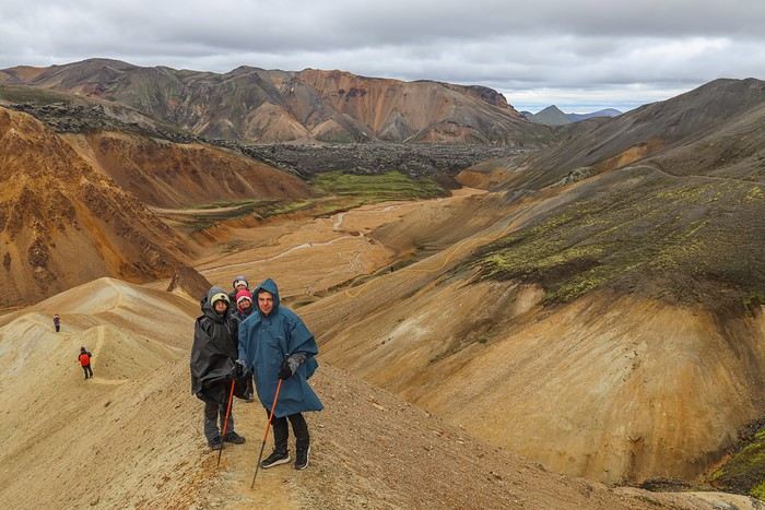
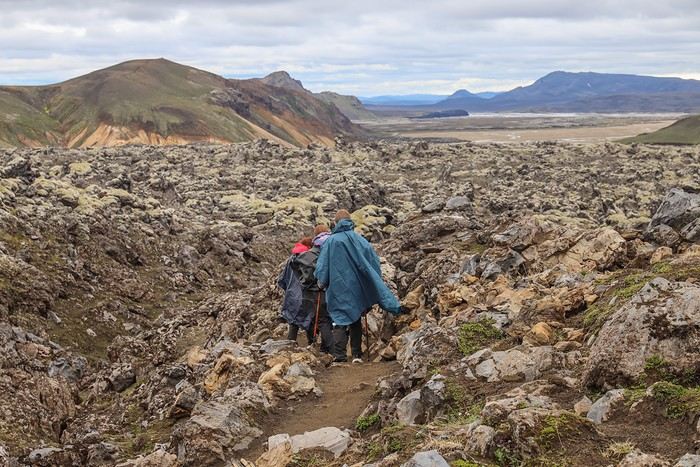
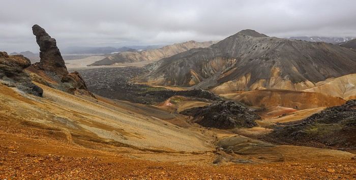
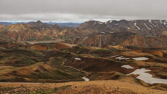 But the best is yet to come when we take the shortcut on the way back, plunging onto a ridge trail into the heart of the sculpted, multicolored rocks, right above Bláhnúkur!
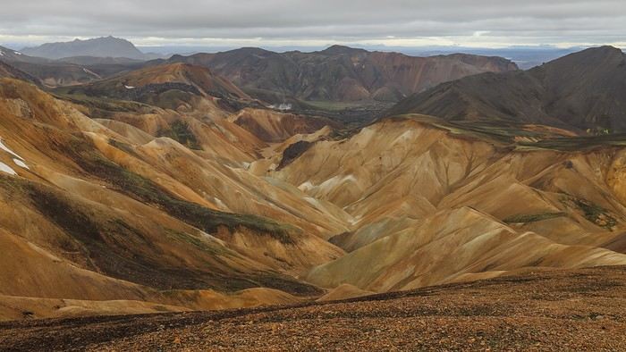 We soak in the multicolored viewpoints from the heights,
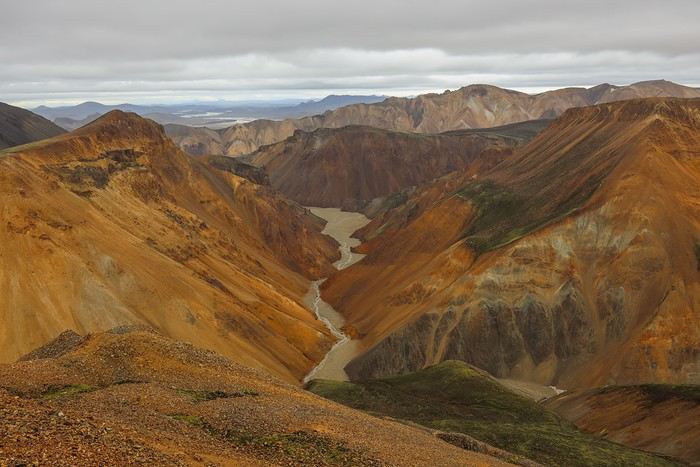
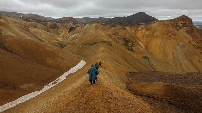 We can only imagine what this panorama would look like under a radiant sky. Even in the rain, it’s unforgettable!
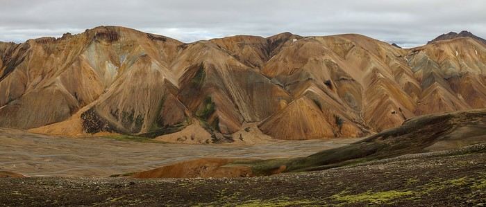
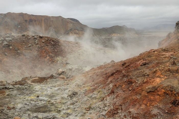
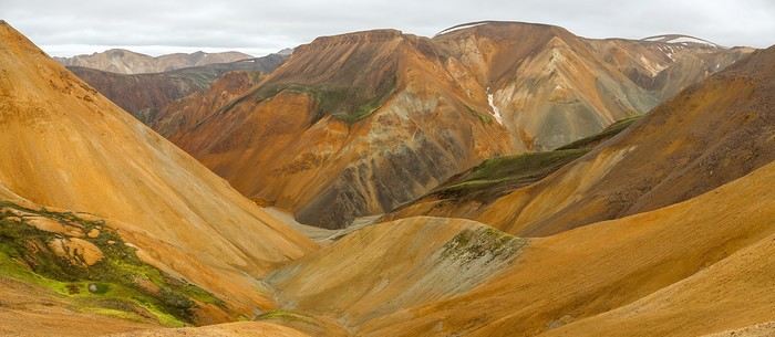 The colors become more varied as we approach Brennisteinsalda, with gray hues and a few fumaroles reminding us we’re in a volcanic zone.
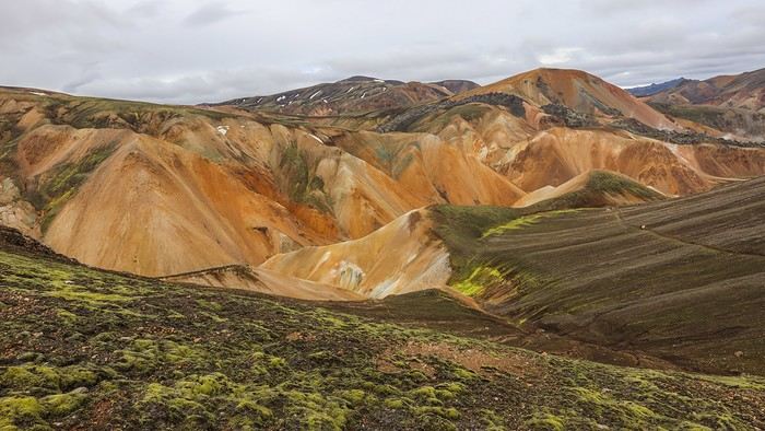 Brennisteinsalda, in the distance, stands out from the other mountains with its red and yellow colors.
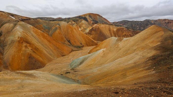
 Oh right, I almost forgot—it’s still raining, and our feet are soaked 😏!
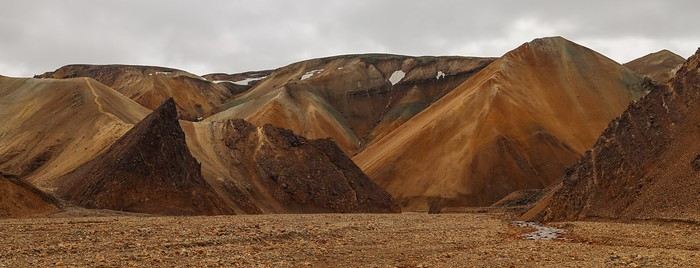
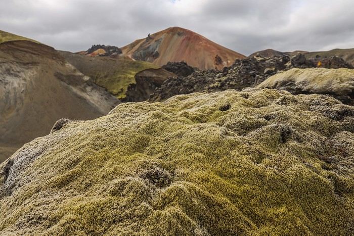 Some green rocks remind us of Death Valley in California.
 At the summit of Brennisteinsalda, the wind is almost as strong as on Bláhnákur! Despite the wind, we still enjoy the stunning colors of the massif !!
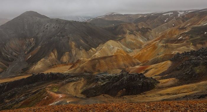
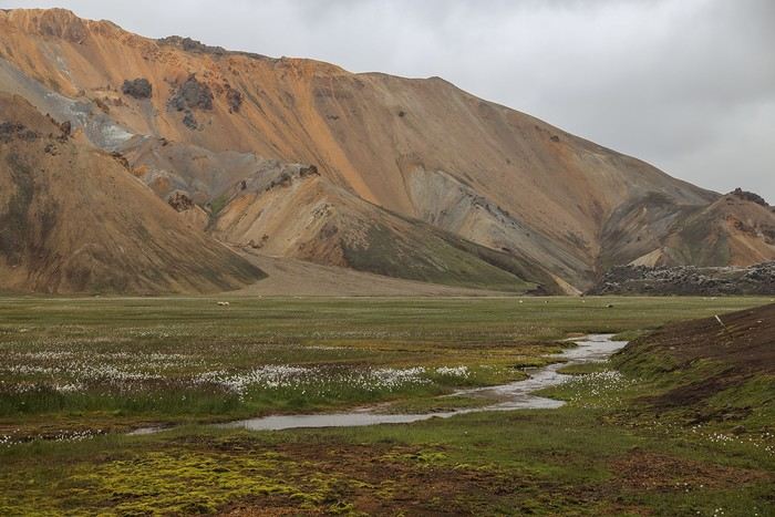 In the late afternoon, we warm up for a good hour in Landmannalaugar’s hot spring. One of the most pleasant of the trip—and free...
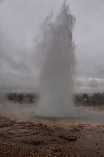
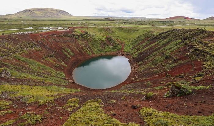
 Then, another dip in the geothermal springs at Secret Lagoon.
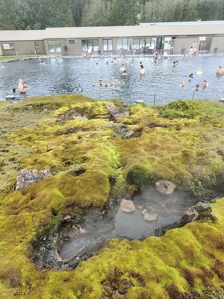
 All around, there are pools and fumaroles—pale copies of what you can see in Yellowstone. But it’s still nice to walk around in this environment.
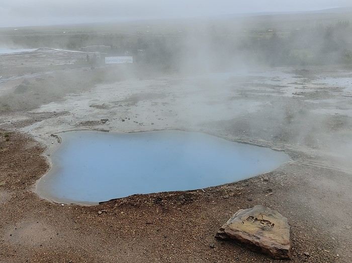
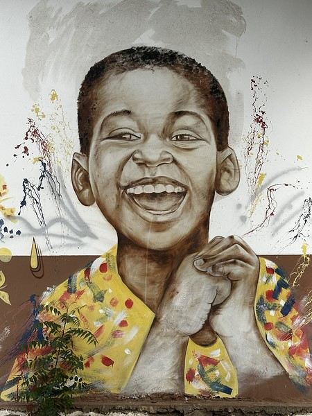
 What really stands out in the city is the street art. There are quite a few murals and graffiti decorating various houses.
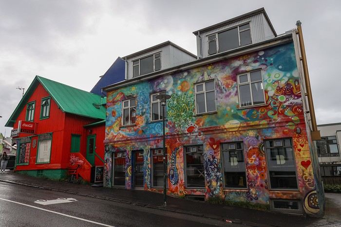

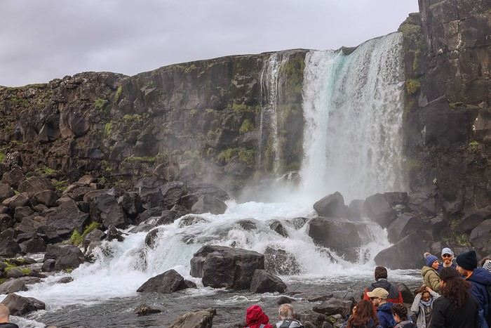
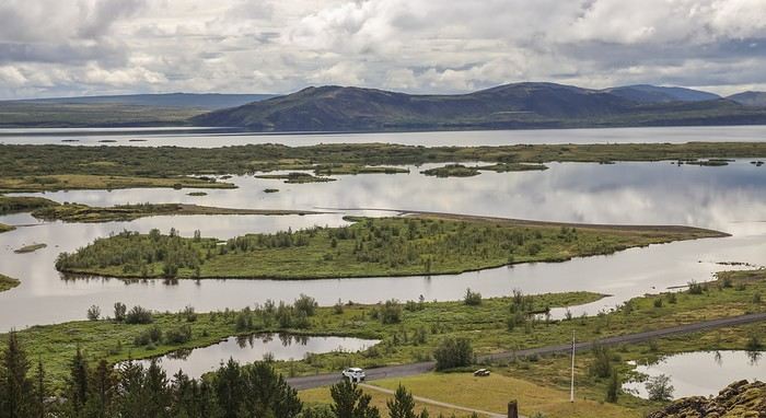
 Next, we visit the third site of the Golden Circle triptych, Þingvellir. This busy spot is known for the Althing, the site of the Icelandic Parliament from the 10th to the 18th century. But really, the main attraction is seeing the boundary between the two tectonic plates, with cliffs and fissures.
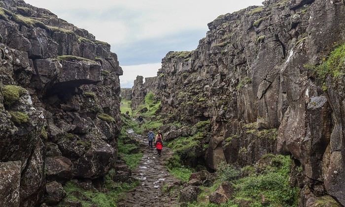
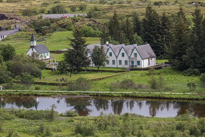 The church is closed to the public, but peeking through the windows, there’s nothing remarkable inside.
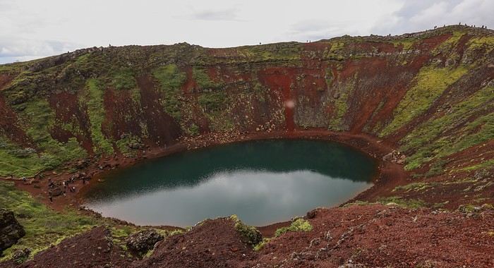
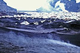
 Our next planned visit is the Hveradalir geothermal area, but it’s a big letdown—there’s almost nothing to see except a few fumaroles...
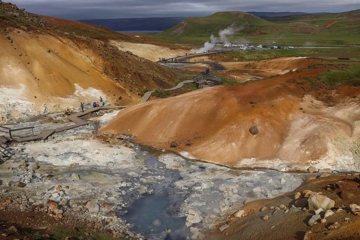
 On the way to Reykjavik, we make one last stop by a lake where Tim and Max have a skipping stones contest
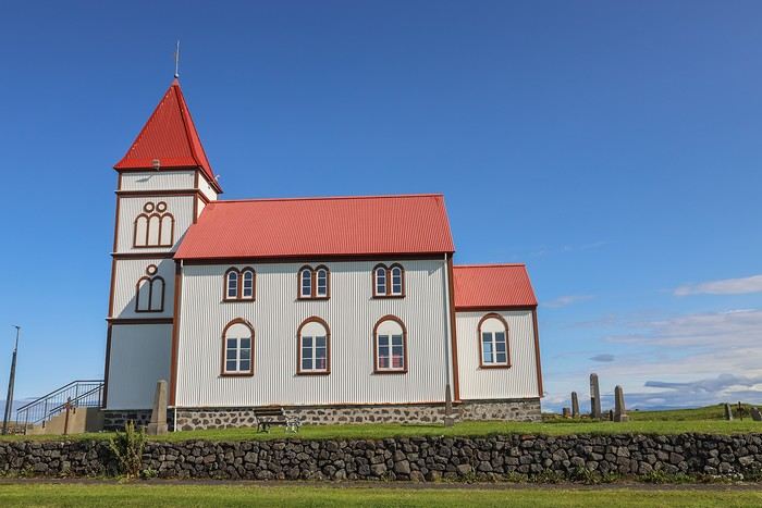 a stroll along the seafront at the foot of a lighthouse,
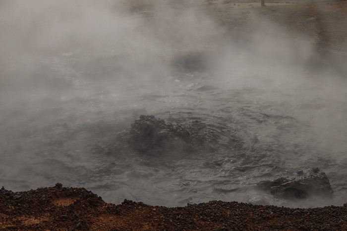
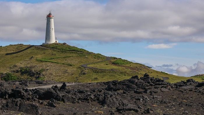 and especially the geothermal area of Gunnuhver. It’s simply one of the hottest geothermal zones in the region, with temperatures recorded at 300°C. You’ll find mud pots and other fumaroles there.
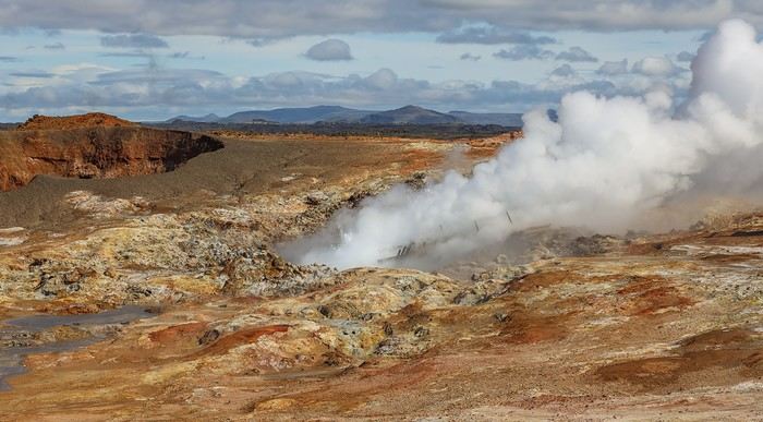 All this energy is harnessed by geothermal plants built right next to it.
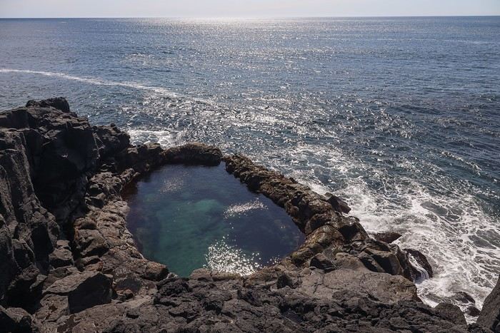 A few kilometers from the new lava field, and as we suspected, the road is blocked, preventing us from getting any closer. No question of breaking the rules, so we turn back and head to the western tip of the peninsula.
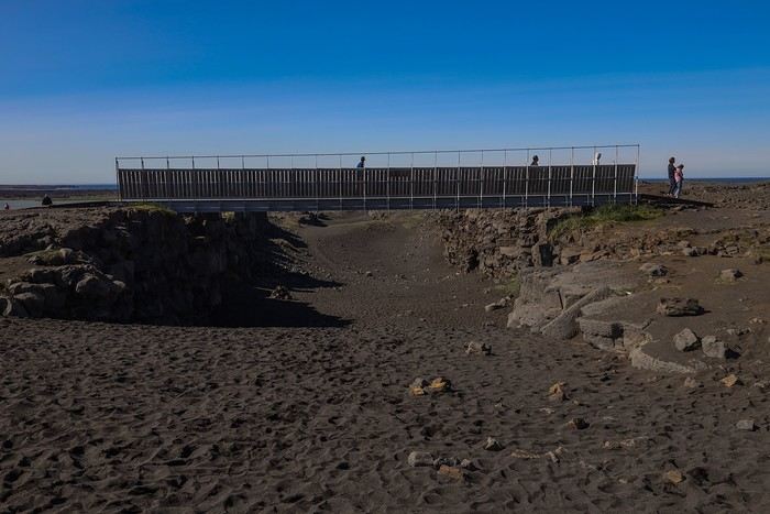 and we visit one last remarkable church built from volcanic stone, Hvalneskirkja.
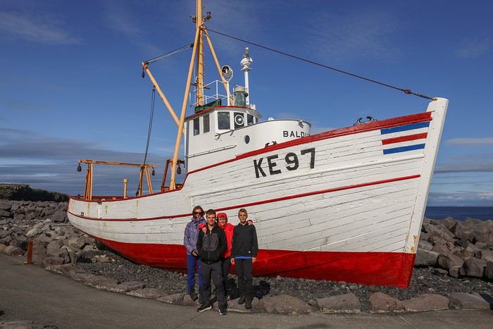
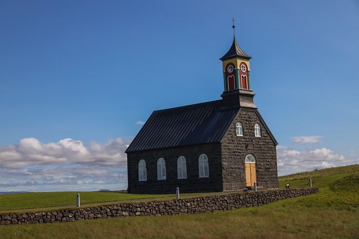 We have lunch in the early afternoon at a Thai restaurant in Keflavik, then wander around the village looking for something to do. Not much to see except for a few murals, a walk along the pier with a nice anchor, and a restored boat.
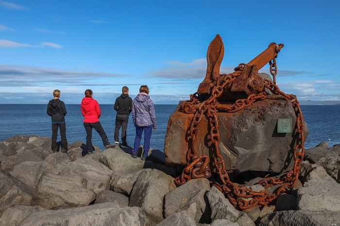
 It’s then time to clean the car, return it, and calmly head to our return flight at 12:30 AM, bound for Frankfurt.
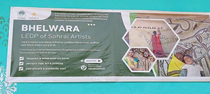
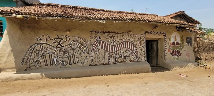
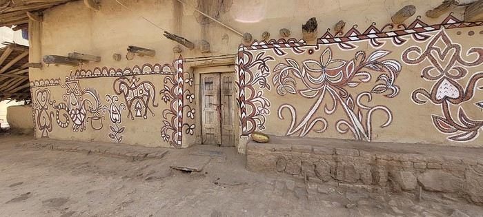
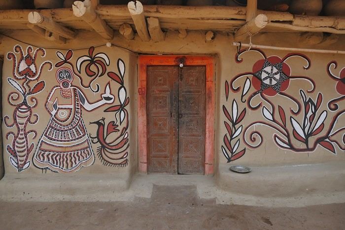
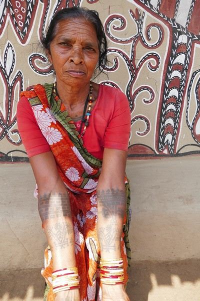
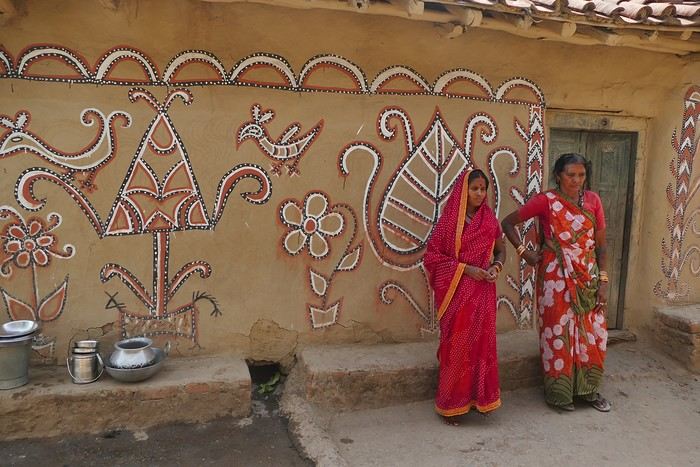
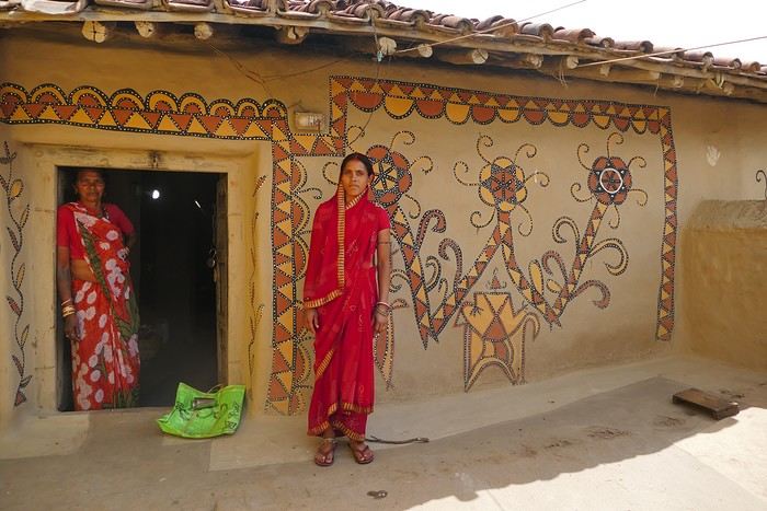
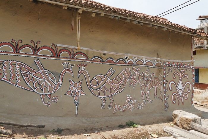 On some paintings, the scenes become almost narrative: you can make out figures, everyday gestures, like a memory of the village inscribed in the walls. The decorative frames around the doors aren’t left to chance either—they symbolically protect the house, like a boundary between the inside and the outside world.
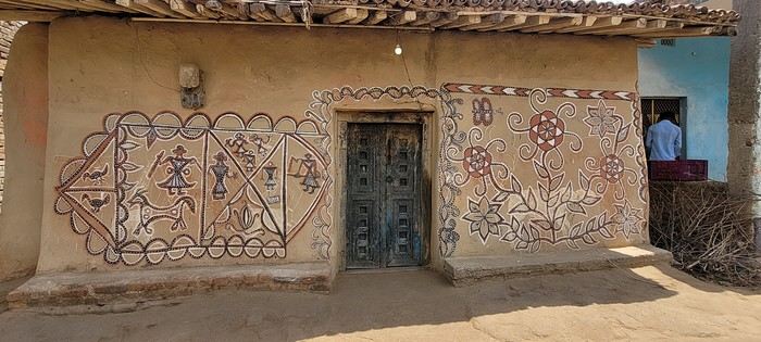

 A little sneak peek?
 Come along, I'm taking you to this country where it's so nice to wander and slow down...
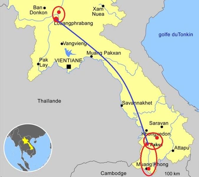

 I’m inviting you on a stroll through my drawings—a completely subjective, far from exhaustive, and totally personal take, since it’s based on my own sketches. I put this travel journal together after returning in late 2024, mostly using felt-tip pens and pencils, with a few collages thrown in. I worked from our personal photos.
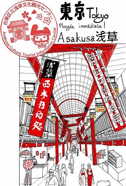
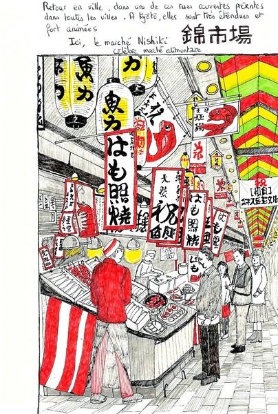
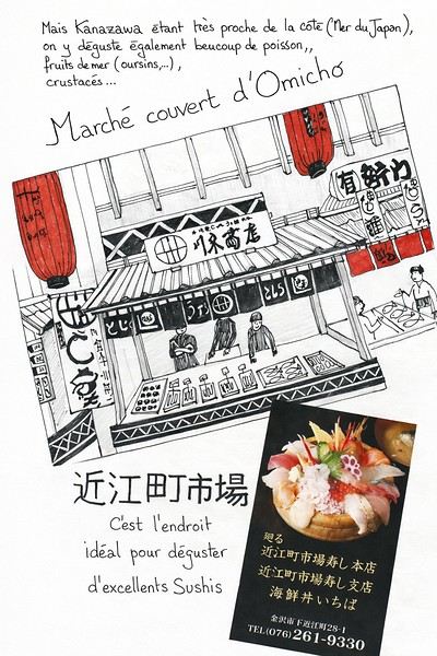 And in Kyoto, Nishiki Market:
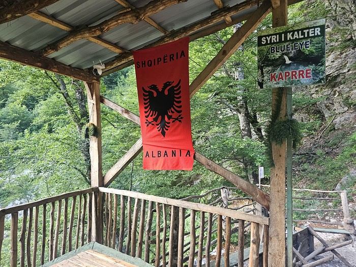
 Since Albania isn’t part of Europe when it comes to phone service (at least not yet! :-)), we had to buy a physical SIM card—otherwise, the bill would’ve been sky-high if we’d used our French plan! We got one from Vodafone AL at the airport. You can buy online before leaving with a virtual SIM (e-SIM) for compatible phones, so you don’t have to swap cards. But given the uncertainty about choosing a plan online, we preferred buying one directly at Tirana Airport. Cost: 31 € for 100 GB. That’s way too much—100 GB is overkill. For 40 GB, it’s 27 €, and the plan lasts 21 days. The price difference isn’t huge, and it was cheaper than online. This plan covers all the countries along the Balkan range.
Money tip: All guesthouses and accommodations accept euros. The local currency in Albania is the LEK. In Montenegro, it’s the euro. Bank fees for withdrawing money from an ATM in Albania are pretty steep: 8 € for a withdrawal of 600–700 LEK (about 200 €)! So it’s better to withdraw cash (euros) in France. Oh, and we booked all our accommodations before leaving, but payment is always in cash. Budget around 400–500 € for 9 days of trekking.
Since Albania isn’t part of Europe when it comes to phone service (at least not yet! :-)), we had to buy a physical SIM card—otherwise, the bill would’ve been sky-high if we’d used our French plan! We got one from Vodafone AL at the airport. You can buy online before leaving with a virtual SIM (e-SIM) for compatible phones, so you don’t have to swap cards. But given the uncertainty about choosing a plan online, we preferred buying one directly at Tirana Airport. Cost: 31 € for 100 GB. That’s way too much—100 GB is overkill. For 40 GB, it’s 27 €, and the plan lasts 21 days. The price difference isn’t huge, and it was cheaper than online. This plan covers all the countries along the Balkan range.
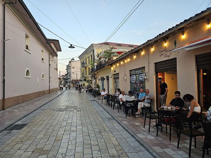
Money tip: All guesthouses and accommodations accept euros. The local currency in Albania is the LEK. In Montenegro, it’s the euro. Bank fees for withdrawing money from an ATM in Albania are pretty steep: 8 € for a withdrawal of 600–700 LEK (about 200 €)! So it’s better to withdraw cash (euros) in France. Oh, and we booked all our accommodations before leaving, but payment is always in cash. Budget around 400–500 € for 9 days of trekking.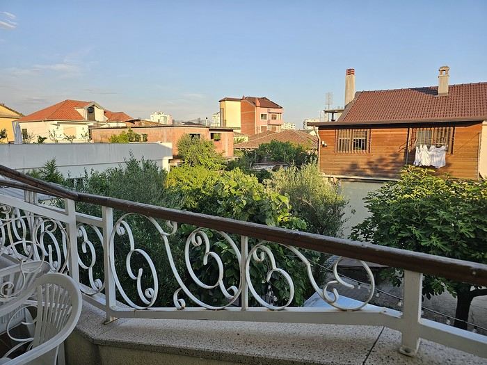 I really liked Shköder, especially its pedestrian street lined with restaurants and lit up at night. It’s a great place to stroll and eat. The food isn’t expensive—two big salads and two beers: 14 € :-) . Fruit prices are also very reasonable: 3 € for a kilo of cherries, compared to 9–10 € in France.
Religions coexist peacefully in these countries—Catholics and Muslims. From our balcony, my friend heard the call to prayer for the first time, coming from one of the city’s mosques.
I really liked Shköder, especially its pedestrian street lined with restaurants and lit up at night. It’s a great place to stroll and eat. The food isn’t expensive—two big salads and two beers: 14 € :-) . Fruit prices are also very reasonable: 3 € for a kilo of cherries, compared to 9–10 € in France.
Religions coexist peacefully in these countries—Catholics and Muslims. From our balcony, my friend heard the call to prayer for the first time, coming from one of the city’s mosques.
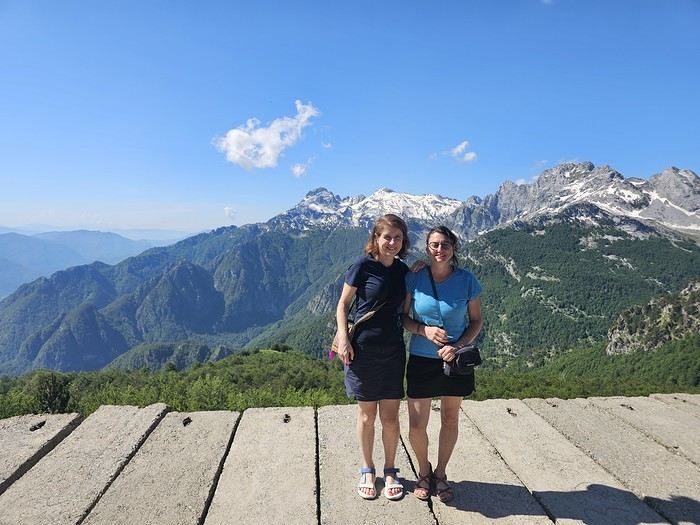
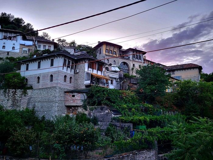
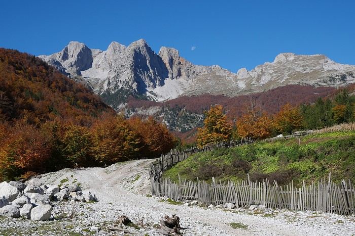
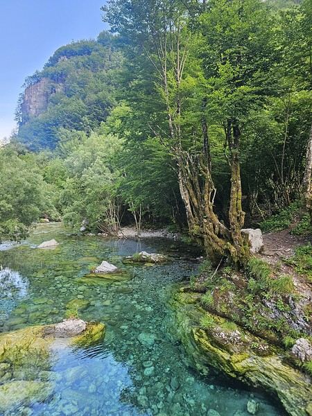
 We slept in the heights of Theth at a new guesthouse, "Mountain Vista Shkafi," with an amazing view.

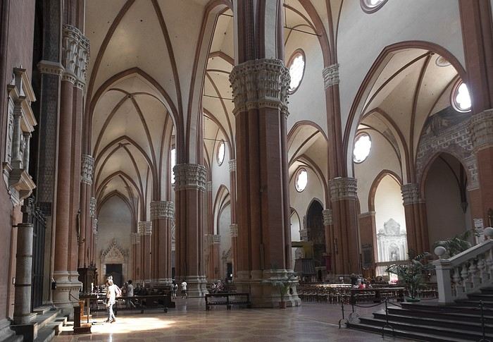
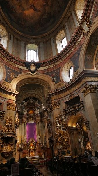
 But Bologna’s real charm lies in its porticoes, which were added to the UNESCO World Heritage list in 2021: 62 km of arcades running along buildings, letting you walk sheltered from the sun or rain. Back in 1288, the city required houses to include private arcades for public use. In the city center, you can stroll under 32 km of porticoes in all sorts of styles—some plain, some ornate—with a strong presence of red tones.