California! Nevada! Utah! Oh!
FR

Translated into English.

DI Diamina Globetrotter ·
Hey Guillaume,

Nothing ventured, nothing gained. If it doesn’t cost anything, might as well give it a try.
Nord Chili, NOA, Sud Lipez, La Paz août 2012 https://voyageforum.com/forum/mois_dans_andes_peripeties_en_altitude_D5526293/ Apologie du southwest en hiver https://voyageforum.com/forum/apologie_sud-ouest_etats-unis_en_hiver_D5851267/ Impressions d'Afrique et de Namibie
VO VoyageForum Globetrotter ·
Hi Diamina,

Thanks for your reply.

Regarding a possible subscription model, many sites have tried, but it’s never enough. The conversion rate remains practically zero because people don’t want to pay for every site they use (understandable). Plus, it requires an automated billing system and a lot of programming around credit card payments (security), not to mention all the accounting involved and moderation issues ("I paid to access the site, so you can’t close my account..."). Honestly, I don’t believe in it. We’d maybe get a few thousand subscribers, but it really wouldn’t be enough to cover the site’s expenses.

That said, I feel like we’ll pull through... 🙂 just barely, but we’ll make it. We’re cutting costs everywhere we can (the photo limit per travel journal is part of that) and completely rethinking how to make the site profitable. Sometimes, a crisis forces you to come up with entirely new solutions. I won’t say more because our competitors are reading too... 😉 Back to coding... 🙂

Best regards,

François, administrator
MyAtlas Group VoyageForum.com · MyAtlas.com
DI Diamina Globetrotter ·
Good luck and all the best to you, François. 😄
Nord Chili, NOA, Sud Lipez, La Paz août 2012 https://voyageforum.com/forum/mois_dans_andes_peripeties_en_altitude_D5526293/ Apologie du southwest en hiver https://voyageforum.com/forum/apologie_sud-ouest_etats-unis_en_hiver_D5851267/ Impressions d'Afrique et de Namibie
MA Marati Globetrotter ·
Hi François, I just saw your reply (my previous message crossed with yours).

VoyageForum is one of the sites that applies the least compression to photos, to the point where it's practically imperceptible. Grab a 4K screen (or a tablet with a high-DPI resolution) and open/enlarge a beautiful photo from a travel journal by clicking on it. The photo that appears will have a resolution of 2,000 pixels wide (the photo file itself) to ensure maximum sharpness for the screen's resolution.

My mistake—it *did* seem that way when I viewed my photos, or others'. I wasn't the only one with that impression, but clearly, it was wrong. I apologize for that.

As for the financial issues, which are far more serious, I'm sorry that a fundraiser can't happen without financial or administrative hurdles. Even though more and more people "consume" the forum nonstop, jumping from one site to another without even taking the time to say thanks, others are attached to it and would be willing to contribute much more than 1 € 😕. Hang in there.
VO VoyageForum Globetrotter ·
Hi Guillaume,

My mistake—it really did seem that way when I looked at my photos or others. I wasn’t the only one with that impression, but clearly it was wrong.

For example, the photo on your profile is 377 KB on the site in 4K resolution (the highest we offer for this type of screen) when you click on it. But on your computer, the original photo must be between 3 and 5 MB—so 10 to 15 times larger. There’s necessarily a reduction in resolution and compression; it’d be crazy to display the original file on a website... However, this shouldn’t be noticeable at the same display size if you have a good screen (ideally a 4K one to see everything the site can offer in terms of photo quality) and, most importantly, if your browser or operating system isn’t automatically zooming in on the site’s pages (this zoom enlarges not just the text but also the photos without increasing their resolution... making them look blurrier). There’s also an option in your member profile: “Display site images at their maximum resolution/density”; it should be set to the “recommended” option (worth checking). Finally, the site can’t display better quality than the original photo... Some big-budget sites automatically tweak photos to fix contrast, color, or sharpness issues—something we don’t do on VoyageForum.
I’m a photography enthusiast, and I can assure you that VoyageForum meets the highest standards for displaying photos online (without altering the original photo, though). If you ever get the chance to see the site’s photos on a 4K screen (especially the enlarged version after clicking on them) and without browser zoom, you’ll understand what I mean. 🙂

Best regards,

François, administrator
MyAtlas Group VoyageForum.com · MyAtlas.com
BI Bibouns51 Globetrotter ·
Hi François, I just saw your reply (my previous message crossed with yours)

VoyageForum is one of the sites that applies the least compression to photos, to the point where it's practically imperceptible. Grab a 4K screen (or a tablet with a high-DPI resolution) and open/enlarge a beautiful photo from a travel journal by clicking on it. The photo that appears will have a resolution of 2000 pixels wide (the photo file itself) to ensure the sharpest possible display for your screen's resolution.

My mistake—it *did* seem that way when I viewed my photos, or others'. I wasn’t the only one with that impression, but clearly, it was wrong. I apologize for that.

As for the financial issues, which are far more serious, I’m sorry that a fundraiser can’t happen without financial or administrative hurdles. Even though more and more people "consume" the forum nonstop, jumping from one site to another without even taking the time to say thanks, others are attached to it and would be willing to contribute way more than 1 € 😕. Hang in there.

Totally agree with Guillaume! If a fundraiser can save VF, I’m in (given how much time I spend here...) !
http://onpartenvadrouille.over-blog.com Carnets de route "décalés" : Jordanie, Balkans, Thaïlande, ouest américain, Birmanie, Pérou, Cambodge, ...
VO VoyageForum Globetrotter ·
Totally agree with Guillaume! If a fundraiser can save VF, I'm in (given how much time I spend here...) !

Thanks Franck and everyone else for your support, encouragement, and willingness to help VF! It really touches us! 🙂

In a few weeks, we’ll come back to you with a proposal to help us out. 🙂 We won’t ask you to give us money directly, but to help us generate more, which would be ideal for VF’s long-term survival. I won’t say more for now. 🙂

Thanks again!! 🙂

François, administrator and founder
MyAtlas Group VoyageForum.com · MyAtlas.com
VA Valmichel86 Regular ·
Good evening; I’m coming back to VoyageForum’s decision to limit travel journals to 300 photos. I’m not contesting the decision itself, nor its economic reasons; however, I do regret how it was applied—specifically that it affects journals started before the effective date. From my perspective (as a member writing a journal), here’s how I see it: I chose a writing style that "interwove text and photos as much as possible." Let me explain with an example—day 26, which I wrote on March 8, so it’s still fresh in my mind: text, photo, text, photo, text, two photos, text, photo. I wanted to convey the feeling and atmosphere of being there: the vibe (wintery vs. spring-like) changes completely as you move from one lake to another, depending on the terrain, orientation, and wind. I know this style uses a lot of photos. If I’d known about the 300-photo limit, I would’ve thought: 33 days, so 9 photos per day. Keeping the daily itinerary post would leave me with 8 photos per day. I’d have realized I couldn’t stick with this style and would’ve had to find another approach. But to do that, I’d have needed to know the limit before starting the journal. So, I suggest that in the future, if constraints change, ongoing journals at the effective date shouldn’t be affected. Finally, I join others in hoping for improvements to VoyageForum’s situation.
Valmichel86
DI Diamina Globetrotter ·
Hey François,

We’re waiting for your ideas so we can help VF.... Since upcoming trips might be a bit compromised, traveling through others’ travel journals and photos could be a great substitute. I’d hate to miss out on that! See you soon!
Nord Chili, NOA, Sud Lipez, La Paz août 2012 https://voyageforum.com/forum/mois_dans_andes_peripeties_en_altitude_D5526293/ Apologie du southwest en hiver https://voyageforum.com/forum/apologie_sud-ouest_etats-unis_en_hiver_D5851267/ Impressions d'Afrique et de Namibie
VO VoyageForum Globetrotter ·
Hi Michel,

I understand your frustration. However, we had to set a limit for all travel journals, past and future, because several older journals (some over a year old) kept receiving new photos, sometimes by the hundreds... Some members really went overboard... 😕 It’s also very difficult for us to determine whether a journal is truly finished or not to apply the limit.

That said, I’ve just increased the limit for your journal to 500 photos. For those in the same situation as you—meaning those who were in the process of writing their journal as of March 9—you can contact us by email using the “Contacts” link at the bottom of the site’s pages to make the request. However, we won’t go above 500 photos per journal.

Thanks for your understanding.

Best regards,

François, administrator
MyAtlas Group VoyageForum.com · MyAtlas.com
VO VoyageForum Globetrotter ·
Hi again Michel,

In the end, we went with something simpler: 500 photos for all the old travel journals and a maximum of 300 photos for new ones (from today onward).

Best regards,

François, administrator
MyAtlas Group VoyageForum.com · MyAtlas.com
BI Bibouns51 Globetrotter ·
Hi again Michel,

In the end, we went with something simpler: 500 photos for all the old travel journals and a maximum of 300 photos for new ones (starting today).

Best regards,

François, administrator

Great decision! I say that because I’m also working on a travel journal I’m about to finish, and I’d already gone over the 300-photo limit... See you, Franck
http://onpartenvadrouille.over-blog.com Carnets de route "décalés" : Jordanie, Balkans, Thaïlande, ouest américain, Birmanie, Pérou, Cambodge, ...
MU Muriel18 Globetrotter ·
Hi there

I’d missed this post earlier. Thanks for the explanations—they really help clear things up.

If I can help out sometime soon… 🙂 Muriel
Si tu diffères de moi, mon frère, loin de me léser, tu m'enrichis (Saint Exupéry)
TI Ticapi Globetrotter ·
Hi there,

I just saw all these messages about the photo restrictions. I totally get that we need to limit the number, but you inevitably take more photos on a 4-week trip than on a one-week stay.

I'm sorry to hear that VF isn't doing well. I hope the forum can overcome its problems and find solutions.

Quick question—some members are in the habit of inserting their own photos into other people's travel journals. Do these photos count toward the limit?

Have a great weekend. Carmen
VA Valmichel86 Regular ·
Hello again Michel,

In the end, we went with something simpler: 500 photos for all the old travel journals and a maximum of 300 photos for new ones (from today onward).

Best regards,

François, administrator

Thanks for taking my request into account. Some forum members (like me) will now be able to finish the travel journal they’d started.
Valmichel86
VA Valmichel86 Regular ·
I'm picking up where I left off with Day 26: Friday, June 7.

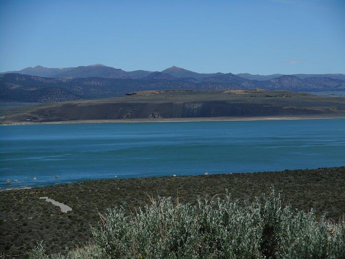
The Mono Basin Visitor Center in Lee Vining has a commanding view over the lake. View of the northern part of the lake from the Visitor Center (the part behind the black cliffs is called "Blackpoint").


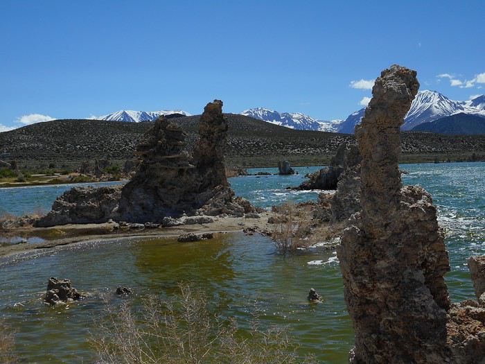
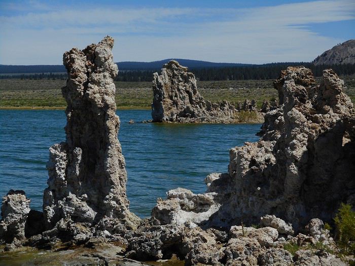
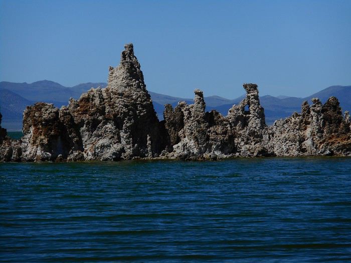
Mono Lake is part of the Great Basin, so it's a low point. It's famous for its "tufa towers," clay towers cemented together by freshwater springs bubbling up into the lake's salty, alkaline waters. These towers became visible when the lake level dropped: in 1941, tributaries feeding the lake were diverted to supply Los Angeles, and the level started to fall. I check out the northern part, Mono Lake County Park (3 km north of Lee Vining via US-395), where there's a small cluster of tufa towers that isn't the most interesting. Right after, I head to South Tufa Area—5 km south of Lee Vining, take Route 120, drive about 5 km, and you're there. At the start of the walk, there's a sign marking 6,392 feet ??? The locals weren’t happy to see the lake level drop: they mobilized, and in 1994, a decision was made to save the lake and raise its level (by stopping the diversion of tributaries). 6,392 feet is the target level for the lake—25 feet below the 1941 level, but it hasn’t been reached yet. So, you can walk along the shore and admire the tufa towers with the Sierra Nevada (west) in the background for some and the desert (east) for others.


When the target level is reached, these towers will be farther from the shore (others, dry today, will appear between the shore and these). Which parts will stay visible? The top, but how much? I didn’t find the lake’s current level in the visitor info, so it’s still a bit of a mystery to me.

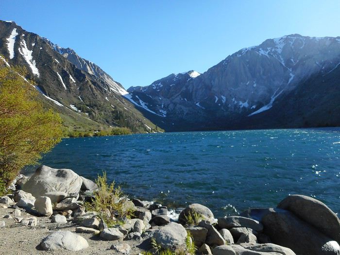
After Mono Lake, Crowley Lake, lined with stone columns. I head south, leave the Great Basin, and return to the Owens River Valley. About 5 miles southwest of the Mammoth Lakes junction, Benton Crossing Road turns left, crosses the Owens River, heads south, and approaches Crowley Lake. Suddenly, it turns due east and moves away from the lake. I count 2 miles, and on the right, a track (03S151A) branches off and runs alongside the road for half a mile. From this section, the track (03S151) leads to the edge of Crowley Lake. Unfortunately, the sedan’s undercarriage scrapes the ground within the first few meters—I decide not to go any farther (I think a 4x4 is necessary). Plus, it’s too late to hike the 2.5 miles to the lake’s beach, explore the site, and return. I’m disappointed—I got the detailed info this morning in Mammoth Lakes. If I’d known the track wasn’t sedan-friendly, I could’ve visited Crowley Lake first on foot and then gone to South Tufa Area with a bit less leisurely pacing. I can’t come back tomorrow because the improvised part of my trip is over—I need to be in Yosemite (reservation) tomorrow evening. There’s also the fact that I’m writing in feet and miles now—I won’t do that again. Hill Top Hot Springs will replace Crowley Lake. These hot springs are located near Benton Crossing Road, just under 5 km from the US-395 junction. At the foot of a hill, a short track leads to a small parking lot (200 meters from the road). On foot, via a wooden boardwalk, I reach the pool—a big bathtub for about 6 people. Four Californians are already there, sipping cans. They make room for me, and I end up staying for an hour, chatting. "Driving around the area, finding a hot springs site, and spending the day in the hot water gazing at the Sierra"—that’s the Californian *dolce far niente*. Leaving the hot springs, I head back to the foot of the mountain to see one last lake nestled in a valley: Convict Lake. The setting is wild—the other end of the lake, accessible on foot (1.5 km away), is right below Laurel Mountain’s cliffs. The lake is at 7,546 feet, the temperature is cool, and it’s windy.


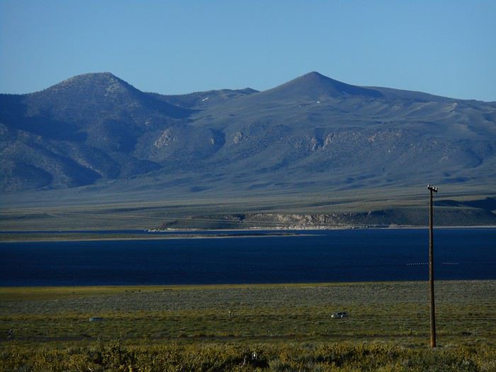
Back at Crowley Lake BLM Campground. The sun is setting, the campground is already in the mountain’s shadow, but Crowley Lake isn’t yet.

Valmichel86
SW Swimmer Veteran ·
Hey Michel, glad you can continue your trip report! 🙂
Pascal
VA Valmichel86 Regular ·
Day 27: Saturday, June 8 (Lake Crowley - Summerdale Campground )

Crossing the Sierra and diving into the furnace.

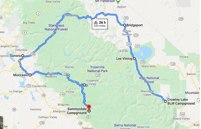
Route.


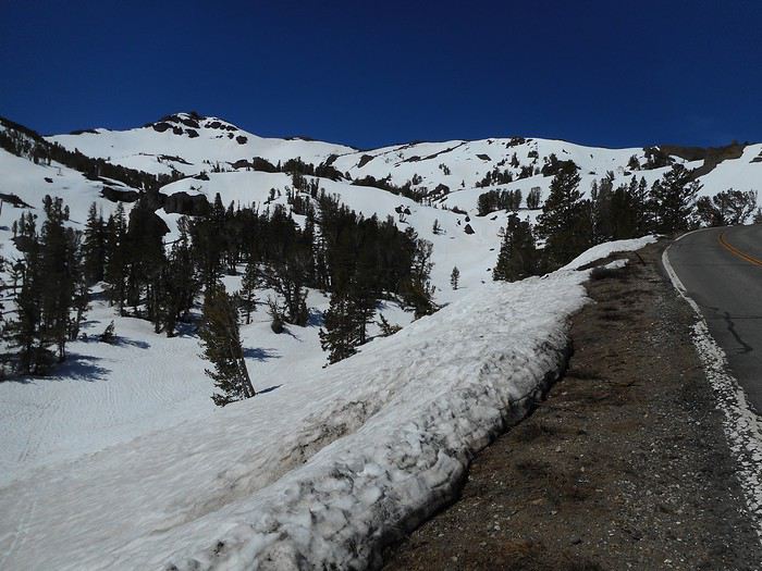
Departure at 7:10 AM (earlier than usual) because there’s a lot of road ahead. Bright sunshine and a cool temperature that will drop even more at the small pass between Mammoth Lakes and Lee Vining (only 2°C). I have breakfast at "Lee Vining Solar Project," a well-equipped picnic area with green spaces (I picnicked there yesterday; there was a school gathering with meals, outdoor games, and sports, including soccer—mostly girls). Twenty kilometers past Bridgeport, I turn left onto Route 108 toward "Sonora Pass" and Sonora. Yes! I didn’t mention it earlier. The direct route via "Tioga Pass" is closed (it won’t open until July 1, 2019). So I have to take a long detour to the north and cross "Sonora Pass" (2,935 meters), which opened on May 30. The climb to the pass starts at 2,200 meters in a pine forest; snow appears on the ground and becomes more and more present as I approach the pass. The mountain is accessible, and the pass is wide open (no steep walls or drop-offs). Ski tourers and snowshoers have parked their vehicles all over and set off into the area (3°C, June sunshine, not a breath of wind).


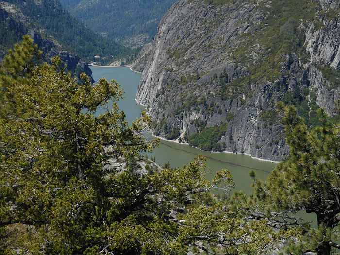
The western slope is steeper; the road descends to "Stanislaus River," crosses it, then stays along the mountainside. The river plunges into a gorge where a dam was built, creating "Donnell Lake."


Then it’s a long... long drive to Sonora. The temperature rises until it becomes stifling (what a contrast in the same day! The descent takes you from 2,900 meters to about 500 meters). This entire landscape of hills (Sonora, Jamestown, Moccasin) is scorching, even if "Lake Don Pedro" looks refreshing.


Meanwhile... the snow is melting in the Sierra.

Yosemite is still far away; hills, plateaus, rivers, a few villages (Groveland, Buck Meadows), and the scenery gradually shifts from yellow tones to green. And here’s "Big Oak Flat Entrance": three toll booths on a fairly wide road in a forested setting that might remind you of the Jura (on a scorching day) if you don’t look too closely at the conifer species, which must be different. I receive the "National Park Service" tourist brochure and a newspaper, "Yosemite Guide," published monthly on real newsprint (20 pages, May 15 - June 18). After the "Tioga Road" intersection, on a winding stretch, I realize I’ve arrived in Yosemite.


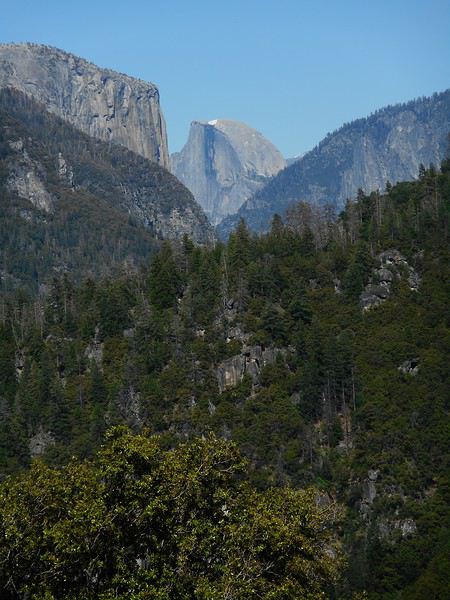
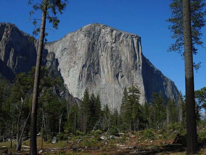
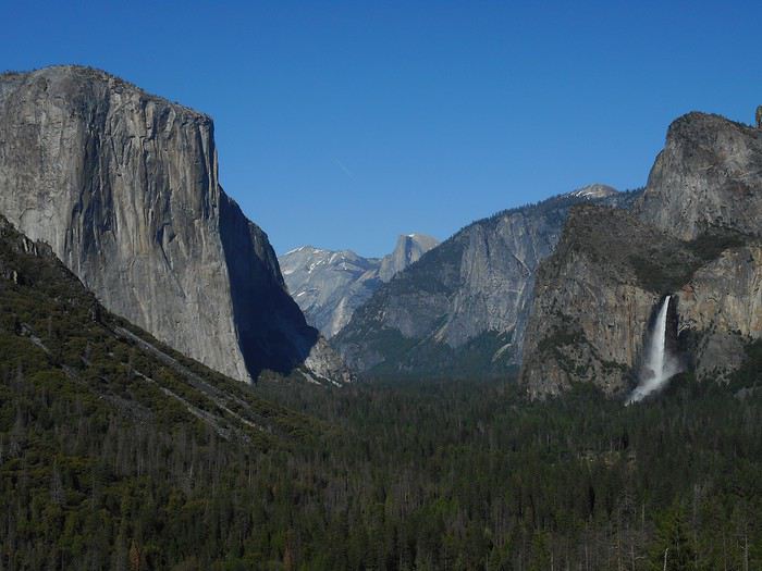
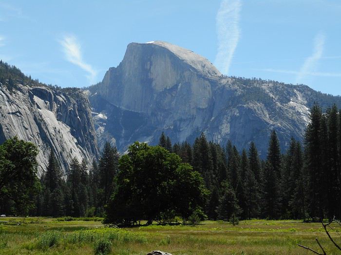
I recognize "Half Dome" and "El Capitan"; the road descends, crosses the bridge over the river, and is lined by a pedestrian trail following the valley floor. The banks of the trail are submerged by the flow of the "Merced River," which is overflowing generously. In this area, as soon as you step out from under the trees, "El Capitan" dominates the space.


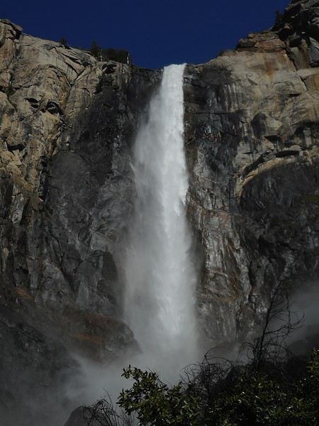
I don’t venture deeper into the valley and stop at one of the few available spots in the "Bridalveil Fall" parking lot. An easy trail leads to the waterfall.


How tempting it is to get closer! However, the ground is already damp at the end of the parking lot and becomes muddy on the unpaved sections. The stream flowing from the waterfall to the river is carrying a lot of water. But when you look up, you see... or rather, you don’t see anything. Should I post a photo that shows this? Probably not. A cloud of droplets obscures the sky, the waterfall, and all the rocks except those in the foreground. The density of the droplets is such that, in addition to not seeing anything, I’m quickly soaked, which is rather pleasant given the temperature. Next, I go to "Tunnel View." "El Capitan" on the left, "Bridalveil Fall" on the right, "Yosemite Valley" in the middle: an iconic photo of the park.


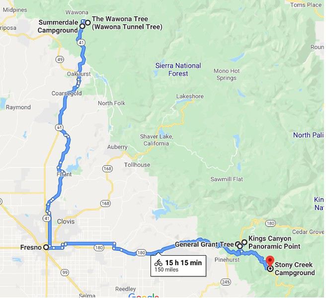
I’ll come back tomorrow; for now, I cross the tunnel, drive the full length of "Wawona Road," and just after exiting the park, arrive at "Summerdale Campground," where I’ve reserved a spot for two nights.

How did I end up at this campground? Here’s the story—it might be useful. I had planned to book at one of the park’s campgrounds near "Half Dome Village." Reservations opened on January 15 or 16 at 3 PM (French time). I logged in at the scheduled time; since I’d already booked at Zion NP, my account was already set up on the site. When I tried to finalize the reservation, the site told me that the phone number on my account (my mobile number) was invalid . It wanted a valid U.S. number (and not just any random one; I tried). I didn’t have one on me. Failure. I logged back in the next day; I had to go to "Summerdale Campground" to find an available spot.
Valmichel86
VA Valmichel86 Regular ·
Hi Monique, Thanks (better late than never) for your message. "Death Valley" is definitely a park where you need to do more than just drive through. From what I saw, my top pick is the "Golden Canyon + Badlands Loop" hikes.
Valmichel86
MA Marati Globetrotter ·
El Capitan takes on a whole new dimension once you've seen Alex Honnold's incredible feat in *Free Solo*. Ever since I watched that documentary, which follows his mind-blowing (or reckless?) free solo ascent, I get chills every time I see a new photo of this monument!
VA Valmichel86 Regular ·
Day 28: Sunday, June 9 (Yosemite) The waterfalls of Yosemite: snow melting in the Sierra.

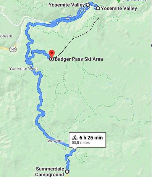
Itinerary.


Almost the entire end of the trip (nearly until the return) will take place during a heatwave; it would feel like a heatwave in France, maybe not so much in California. I’ll experience it as someone who’s mostly traveled at high altitudes.

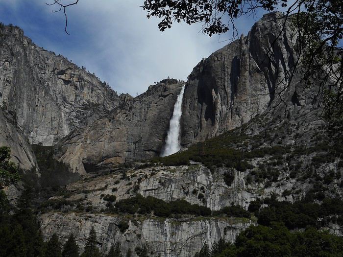
I leave fairly early, but not early enough, because when I arrive at "Yosemite Valley," I realize there’s no point counting on the parking lots scattered around the two villages. There are already lots of vehicles parked along the roads where it’s not explicitly forbidden. A car leaves a spot, and I take it immediately. Twenty minutes later, rangers posted at intersections are trying to direct visitors and regulate traffic. On this Sunday, the park is packed. Without the shuttle system in the valley that lets you move from one place to another, I think it would be total gridlock. Are Sundays during this time of year (snowmelt) peak days for crowds? I first visit "Yosemite Village" (Visitor Center, museum, exhibit, reconstructed Native American village). I continue on foot toward "Lower and Upper Yosemite Falls." "Upper Yosemite Fall" seen from the bottom of the valley, surrounded by its granite walls.


I don’t go right up to the waterfalls because I’ve chosen a different hike. So I take the shuttle back to my car, which is in a rural area near "Merced River," with a view of the "Yosemite Falls" and, in another direction, "Half Dome."


I have an early picnic and will have plenty of time for the planned hike. The shuttle drops me off at the starting point. The route is Vernal Fall, Nevada Fall, John Muir Trail.

The trail gently climbs through the gorge to the bridge over "Merced River." Along the way, in the distance at the bottom of a side valley, I spot "Illilouette Fall." Just past the bridge, at a trail junction, a ranger is stationed. From this point, I’ll do a loop: up via the waterfalls, down via the "John Muir Trail."

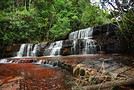
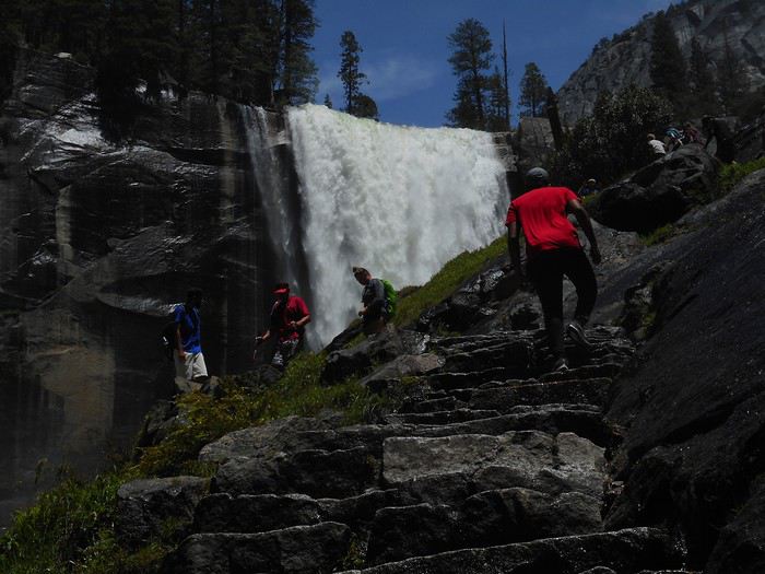
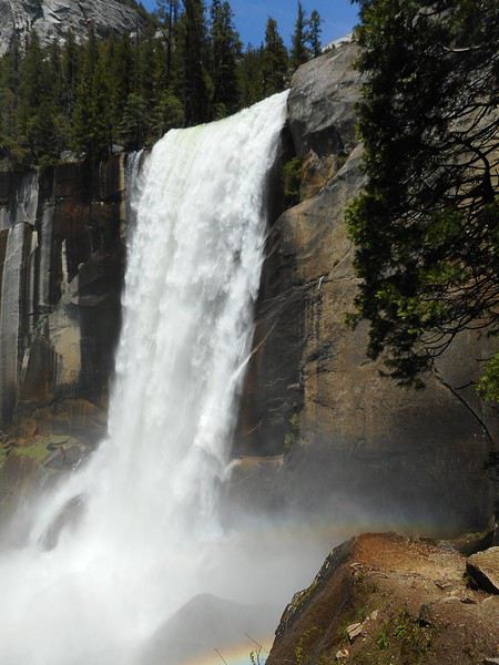
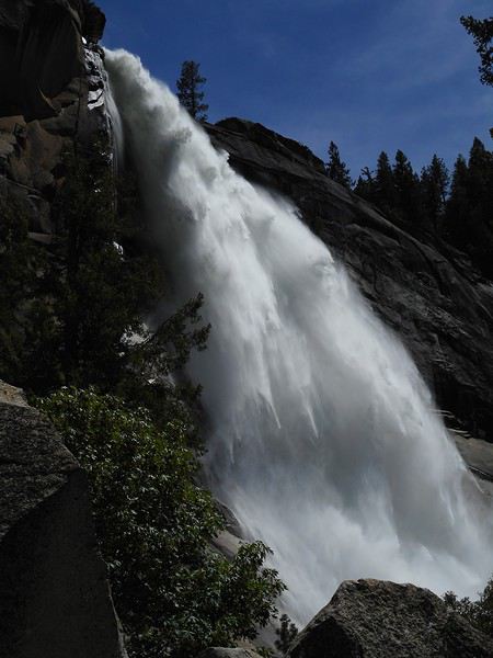
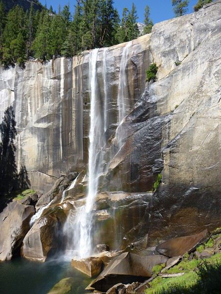
I’ll be blown away by what I see. I’ve practically always lived in western France and have often been to the Alps in winter and summer, but for family and work reasons, I’ve never been there in May or June. So I’ve never seen waterfalls with such massive flows. I remember "Toketee Falls" during my trip to Oregon last year, but the flow was reduced due to hydroelectric power. The trail starts to climb steeply. It’s very well developed (steps built with blocks), heavily trafficked, with narrow passages. There’s so much to see—it’s stunning—and there are bottlenecks on the trail because hikers are going both ways. The trail quickly gets soaked from a cloud of mist, like yesterday. Since the trail doesn’t go to the base of the waterfall but climbs along the side to offset the height of the drop, nothing is in the mist once you’ve climbed a bit. The amount of water plunging into the void is unimaginable.


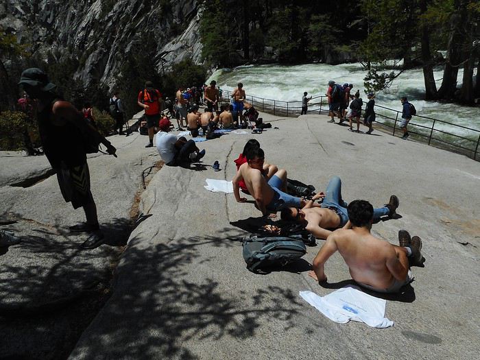
When I reach the top of the waterfall, I ask myself the same question as many others: is it better to let the T-shirt dry on me or on the hot rock?


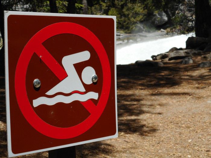
A few dozen meters from the top of the waterfall, the National Park Service put up this sign. Why did they do it?


Possibility 1: It’s a joke. Possibility 2: It’s serious. At the end of summer, the flow is reduced, and pools form in the stream bed. People unaware of the remaining current might venture in. Note: I made up possibility 2 without having the slightest idea of the situation at the end of summer.

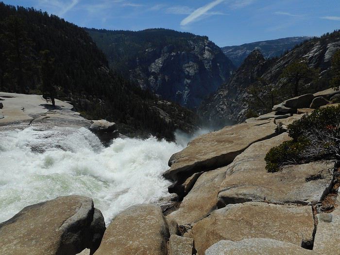
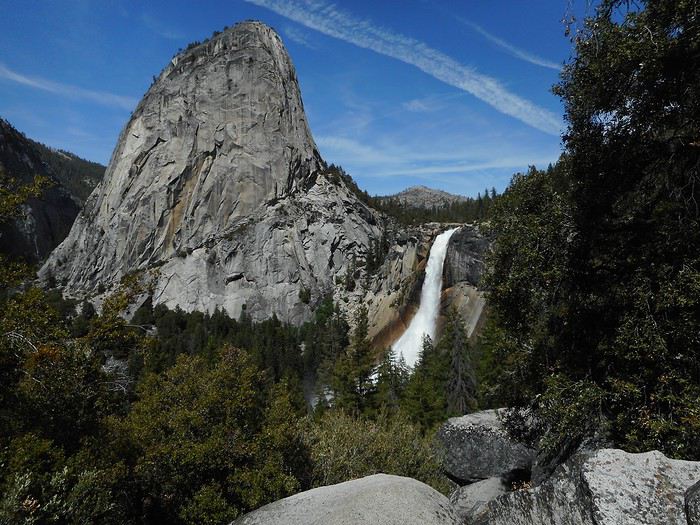
That was "Vernal Fall." The next waterfall is "Nevada Fall." The trail crosses "Merced River" and gets closer to the waterfall, but it doesn’t approach as closely as it did for "Vernal Fall," either at the base or during the climb (you can’t see the waterfall anymore). "Nevada Fall."


At the top of the waterfall, one trail leads to "Half Dome," another follows the wider, flatter valley toward "Merced Lake." A bridge lets you cross the river and return via the "John Muir Trail." The top of "Nevada Fall" is different from "Vernal Fall": you can’t see the bottom of the waterfall at all.


The trail starts to descend gently. It will go through a second damp section (an unavoidable shower). The rock face is vertical on the left; the trail is paved (about a meter wide) with a low wall on the right. The rock on the left has a slight overhang that reaches the vertical midpoint of the trail. Water constantly flows from the overhang, ensuring the shower and turning the trail into a stream, all over about 100 meters. In my opinion, when water isn’t flowing from the overhang, you don’t notice anything. The descent offers many panoramic views of the "Nevada Fall" site.


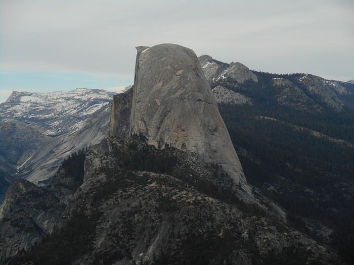
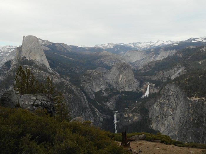
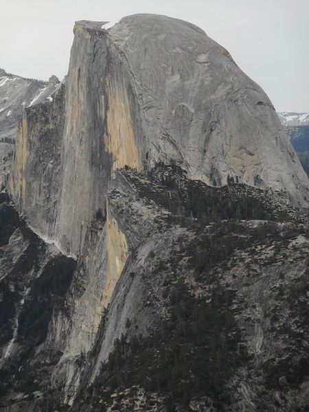
It’s a 600-meter elevation gain hike (4 to 5 hours without rushing, including all breaks and photos) and was exceptional under the conditions I experienced. I then go to "Half Dome Village" (accommodations, shops, etc.), among other things to take a shower at the "shower house," since there are no showers at the campground where I’m staying or in the park’s other campgrounds. Traffic is now flowing smoothly. I’ll end the day by driving up to "Glacier Point." On the itinerary posted at the beginning of the message, it’s at the end of the black line starting from "Badger Pass Ski Area." It’s about 50 km from Yosemite. I stop at "Washburn Point" first. The advantage of this viewpoint is that it’s in the vertical plane of "Half Dome," so the face of "Half Dome" appears as a vertical line.


The sky has turned milky, and the sun is gone. From up here, I also see the part of the park where I hiked this afternoon and its waterfalls, "Vernal Fall" and "Nevada Fall."


About 1 km farther, I arrive at "Glacier Point," the end of the road and probably the park’s most famous viewpoint. The face of "Half Dome" is visible (offset from "Washburn Point"), and photographers with tripods are waiting for it to be lit by the setting sun.


I think they’re waiting for nothing, but actually, they’ll be right—the sky will clear completely while I’m heading back to "Summerdale Campground."
Valmichel86
VA Valmichel86 Regular ·
El Capitan takes on a whole new dimension once you've seen Alex Honnold's incredible feat in Free Solo. Ever since I watched that documentary, which recounts his dizzying (or reckless) free solo ascent, I get chills every time I see a new photo of this monument!

Hi Guillaume, I watched some clips from the documentary. I also found an article about a record-breaking duo ascent with Caldwell: El Capitan climbed in under 2 hours! Should I watch the whole documentary, even though I'm not really into climbing?
Valmichel86
SN Snakeyes Regular ·
Here's what it looks like in August!


The walk is definitely amazing, though it’s pretty crowded.

It’s funny—I still remember (back in 2014) thinking, "Too bad they wrote 'no swimming,' I would’ve loved to cool off a bit, it was so hot!" !
VA Valmichel86 Regular ·
Day 29: Monday, June 10 (Summerdale Campground - Stony Creek Campground, Sequoia National Forest)

Two parks - one tree.

Route.


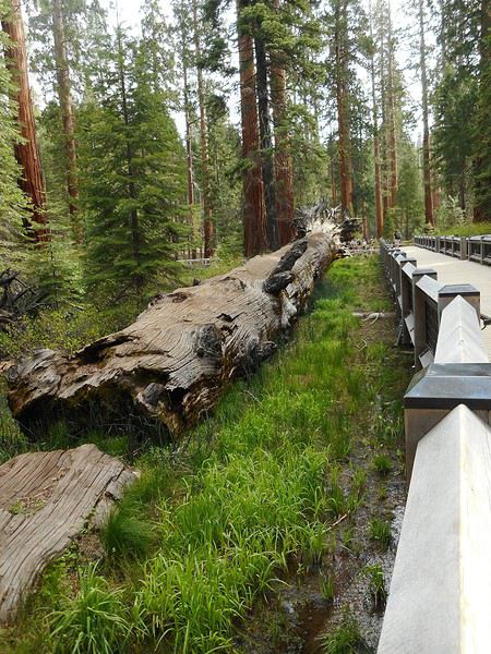
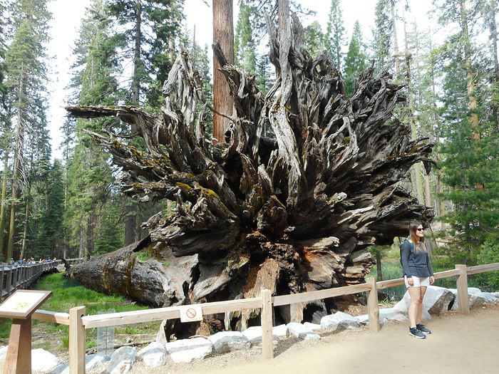
I re-enter the park to visit the area where the sequoias are: "Mariposa Grove." About a kilometer past the park entrance booths, there’s a visitor center where the shuttles (mandatory route) depart; they take visitors up to a parking lot that serves as the starting point for hikes. The trail initially overlaps with several other hikes; it quickly reaches a sequoia that fell over 300 years ago.


It’s called "Fallen Monarch" (there’s probably also a "Fallen Monarch" in Sequoia NP and maybe other places). My camera jams—I forgot to recharge the battery. So no photos of the other remarkable trees. A bit frustrated, I opt for a short hike (under an hour): the "Grizzly Giant Loop Trail." If I hadn’t been so careless, I might’ve been tempted by a longer loop, the "Mariposa Grove Trail," which goes up to an area with even more trees. Highway 41 exits the park, passes through a mid-sized town, "Oakhurst," and goes to a larger city, "Fresno," which you cross via the freeway. With the same weather as yesterday, the temperature in Fresno hits 38°C. The route turns east (Highway 180) toward "Sequoia and Kings Canyon NP," two parks that are actually one (joint management). At "Big Stump Entrance," I receive, like at Yosemite, a brochure and a newspaper, and head to the Visitor Center at "Grant Grove Village." While reading the newspaper (Summer 2019 edition), I find the explanation for why so few campgrounds are open in early June (I booked 2 nights). Drought, rising temperatures, and an increase in insects over the past few years have affected many trees, mainly pines and firs. (For the insects: bark beetle, possibly "scolyte" in French). It’s necessary to cut, top, and prune trees for safety, but staffing shortages mean openings are delayed this year, 2019.

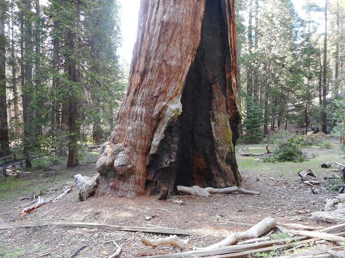
I visit "General Grant Grove." This group of sequoias (parking 1.5 km from the Visitor Center) is truly remarkable, with a trail running through it. I pass by another "Fallen Monarch" (I should say "inside" it, since the trunk is hollowed out), "Gamlin Cabin," and "Centennial Stump."


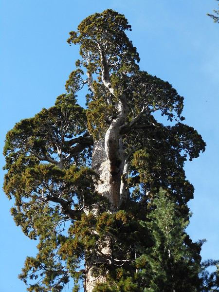
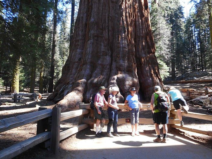
The tree that gives the grove its name is the "General Grant Tree."


It’s 3,000 years old; it’s the second-largest sequoia in the world and was named after a general (later president) after the Civil War. Near the parking lot, the sequoia trunks catch the late-afternoon sun.


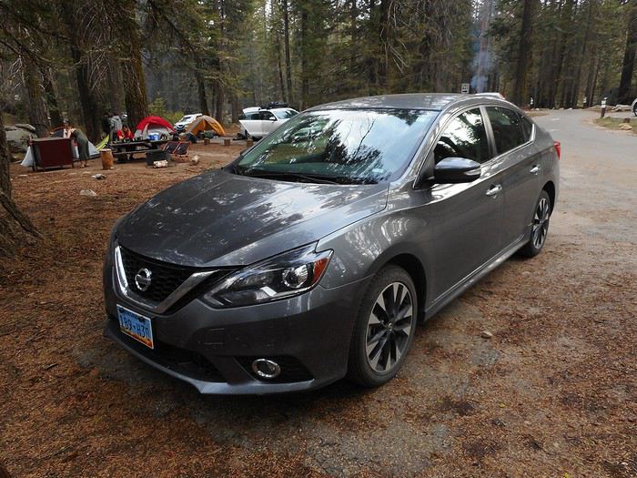
Next, I drive up to a viewpoint, "Kings Canyon Panoramic Point," at 2,133 meters, via a narrow, steep road: "Hume Lake" surrounded by forests, and farther away, "Kings Canyon" and all the snow-capped peaks of the Sierra. To get to the campground, I take "Generals Highway," a road connecting the two parks ("Kings Canyon" and "Sequoia") through "Sequoia National Forest." That’s where "Stony Creek Campground" (1,950 meters elevation) is located, by the creek I can hear flowing from my site. The weather is unusually mild for the altitude. The road-trip car: Nissan Sentra.

Valmichel86
VA Valmichel86 Regular ·
Day 30: Tuesday, June 11 (Kings Canyon and Sequoia NP)

Kings River: snow melting in the Sierra.

Route.


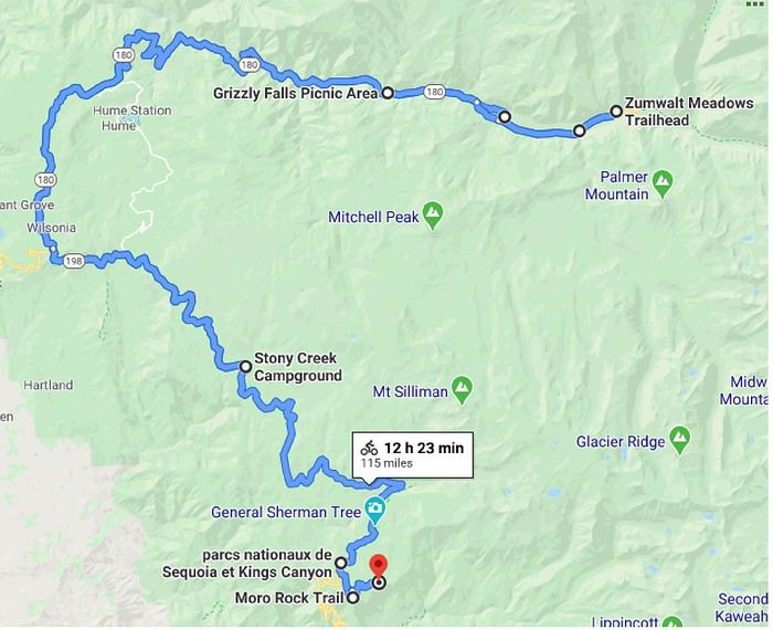
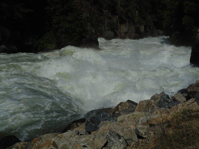
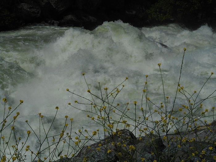
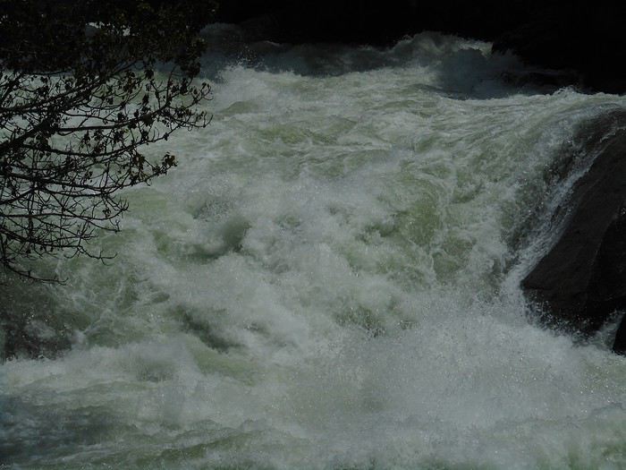
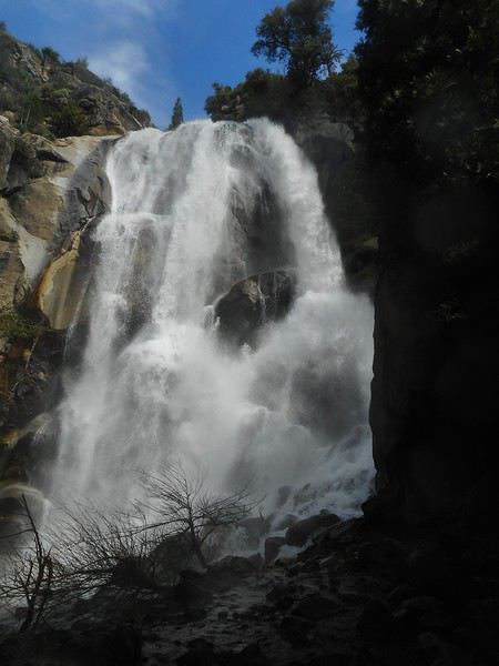
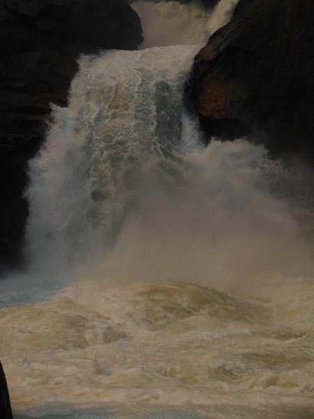
I’ll spend the entire morning—and even longer—in "Kings Canyon NP." Starting from "Grant Grove Village," the road first stays at a high elevation, then descends steeply (with great views) toward Kings River, dropping from 2,000 meters to about 1,000 meters in altitude. I then enter a gorge (a V-shaped valley carved by water) that the "Kings Canyon Scenic Byway" follows for 5 to 10 km. It takes me a long time to cover this stretch because I make so many stops. I’ve already mentioned how impressed I was by the waterfalls in Yosemite; Kings Canyon’s gorge might be even more breathtaking. The road is well laid out with plenty of places to pull over, letting you take in the scenery—I’m left speechless.


I don’t think my photos do justice to the river’s power and flow. On the right bank, a torrent called "Grizzly Creek" feeds into the river, forming "Grizzly Fall."


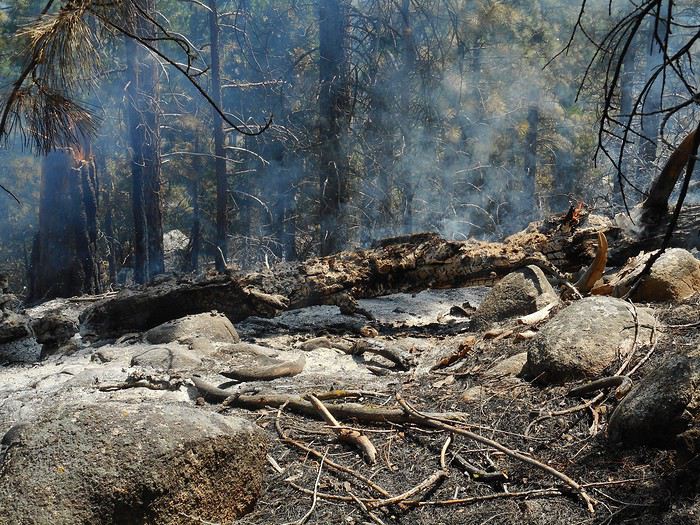
Just beyond this spot, over a very short distance, the valley shifts from a V-shape (downstream, steep slope) to a U-shape (upstream, glacial origin, gentler slope). I continue to "Cedar Grove" (another Visitor Center). I take the opportunity to ask the inevitable question I’ve had since stopping in the gorge: what’s the river’s flow rate here today? To clarify: this is the South Fork Kings River before it meets the Middle Fork Kings River, about 60 km from its source (rough estimate from a map). At the Visitor Center, I ask my question using a roundabout phrase for "flow rate," since I don’t know the word. The ranger replies, "There’s almost 7 feet of water in the river (almost 2.10 meters)"; I must’ve been unclear—she gave me the water level measured on a nearby gauge. I rephrase my question, specifying that in the U.S., they measure this in cubic feet per second. She understands but says she doesn’t know, that she’d like to know because the situation has been unusual these past few days, and suggests I ask at the Grant Grove Visitor Center (they might have the answer). The end of our conversation helps me decide what to do in the upper part of the valley. I head back toward the end of the valley and cross, for about 2 km, an area where low-intensity fires have been set to maintain the forest.


The temporary signage is up, but no foresters are present at the moment. Next, I arrive at the "Roaring Falls" parking lot. A short walk (a few hundred meters) leads to the waterfall: not much height, but what a flow!


In the "Roaring Fall" parking lot, a van is parked with informational panels. The man running the stand points out that you don’t often see the valley like this (with such strong torrent flows), then explains he’s there to educate visitors about low-intensity fires. For a century, the parks’ forests were maintained without fires; about thirty years ago, they realized this technique was better for germination, tree growth—whether sequoias, pines, or firs—and it’s now the standard practice.

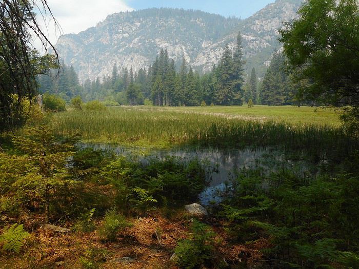
I stop a little farther on to hike the "Zumwalt Meadow" trail—or rather, a variation of it. The path crosses the river; upstream, this large meadow stretches out, occupying a flat area beside the river (it’s a U-shaped valley). Only part of the loop is open—the section along the slope: slight elevation gain, rocky terrain. The part by the river on the other side of the meadow is inaccessible because the meadow is underwater.


I continue upstream to a bridge (which lets you return to the starting bank), not forgetting to also admire the valley’s sides. There are towering cliffs, but also much lower sections broken into geometric facets and blocks.


Back to the car along the road. On the way back to "Cedar Grove," the foresters are working in the area they’re maintaining; traffic is alternating, in a convoy behind a vehicle. There are two tanker trucks, other vehicles, and lots of smoke; few people are visible—they must be in the forest.

The return trip through the "Kings River" gorge is another chance for stops, just like on the way in. I arrive at "Grant Grove Village"... heading to the Visitor Center to ask about the "Kings River" flow rate again. The ranger doesn’t know... she asks a colleague who remembers her husband mentioning "14 something" last night. She goes to check, disappears into an office, and returns a few minutes later with the info. The day before yesterday: 12,000 cubic feet/sec. Yesterday: 14,000 cubic feet/sec, which is 396 cubic meters/sec (let’s say 400). I hope this is the right spot. While writing this, I had time to look for a comparison with France (during lockdown). I found the Isère River in Grenoble for June (when the flow is strongest). The elevation (200 meters) is much lower, it’s much farther from the source, and the watershed must be much larger—so the comparison isn’t ideal... but I couldn’t find data for Aime or Moûtiers, for example. Average monthly flow in June: 286 cubic meters/sec Maximum monthly flow in June: 549 cubic meters/sec (in 1970).

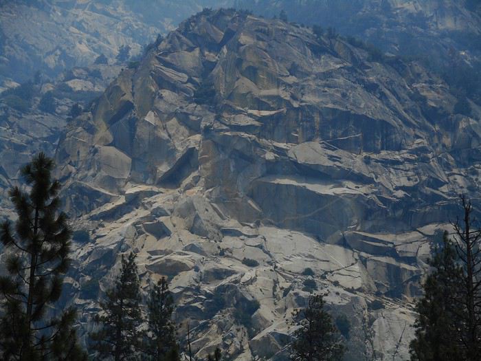
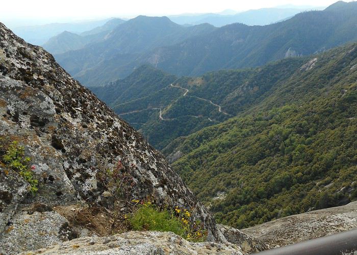
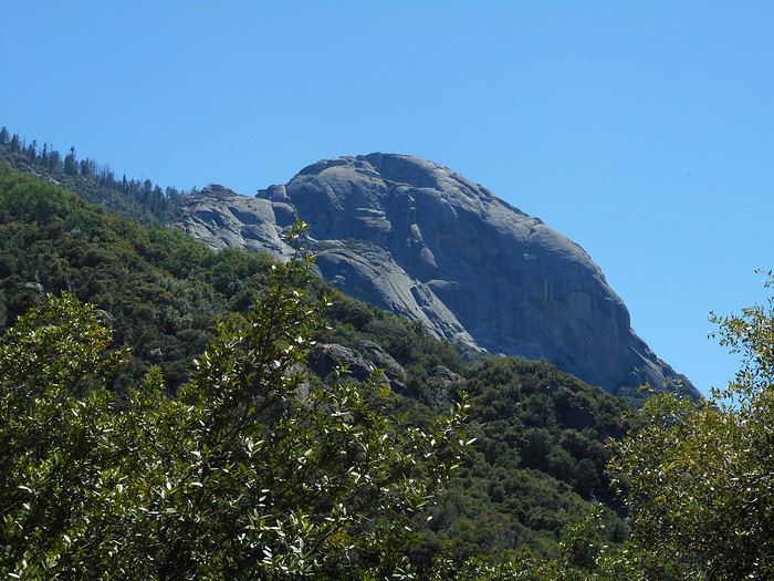
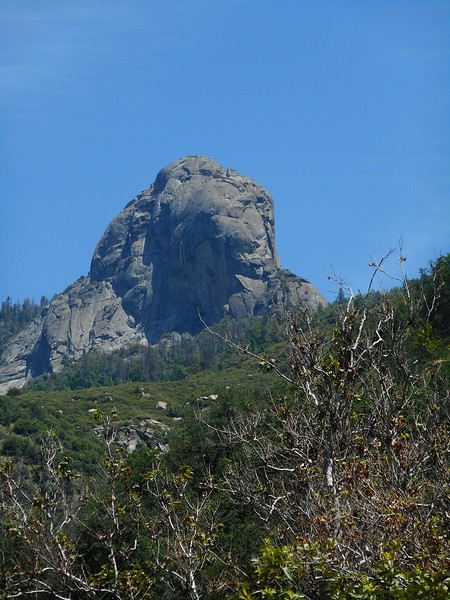
I’ll end the day at "Sequoia NP." I park near the "Giant Forest Museum" and take the shuttle to "Moro Rock." Lots of people here, with three main points of interest: - The rock itself, with its bizarre shape and the structures allowing access to the summit - The panorama to the east toward the snow-capped Sierra peaks - The landscape below, especially the road I’ll take tomorrow to descend into the valley.


The shuttle continues to "Crescent Meadow." The environment and atmosphere change completely. No more open views—just forest and a beautiful meadow; no other visitors (it’s late afternoon, and I’ll return on the last shuttle). I hike the trail to "Tharp's Log," which loops around the meadow, winds through the forest, and ends at a cabin built inside the trunk of a fallen or felled sequoia.


Back to "Stony Creek Campground."
Valmichel86
VA Valmichel86 Regular ·
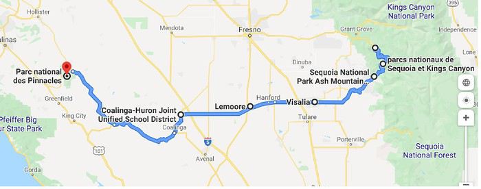
Day 31: Wednesday, June 12 (Sequoia NP - Pinnacles NP)

Goodbye, giants.

Route.


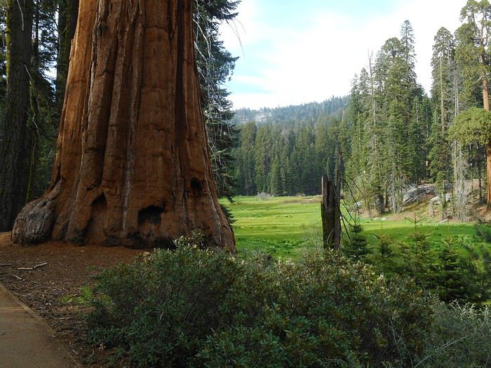
The morning is dedicated to the sequoias; I head to the parking lot near the "Giant Forest Museum" (visit), take a short hike to see the trees in the area, then take a shuttle to the trailhead for the "General Sherman Tree." The area around the tree has plenty of informational signs and amenities.


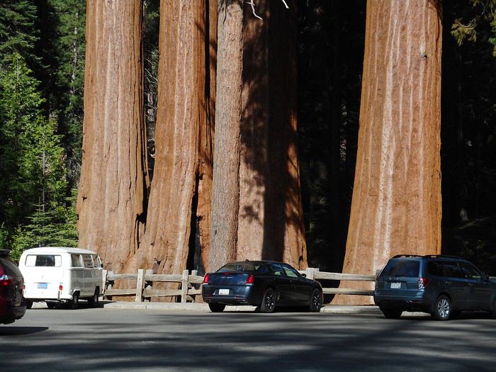
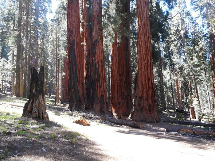
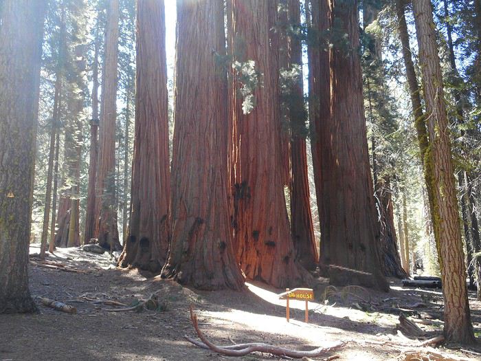
From this spot, a loop trail called the "Congress Trail" starts, lined with many remarkable trees, especially those that have grown in groups.


Now, I’m heading down into the "Kaweah River" valley. Views of "Moro Rock" from the descent.


In my opinion, the approach road to "Sequoia NP" stands out for its scenery and the impression it leaves. The approaches to "Yosemite NP" via Route 120 (Groveland) or Route 41 (Oakhurst), and to "Kings Canyon NP" via Route 180 (Fresno), are pretty ordinary, unlike the parks themselves (I couldn’t take "Tioga Road" since it was closed). The approach to "Sequoia NP" via Route 198 (Visalia) is completely different: a stunning mountain road with a steep elevation change and interesting views. It’s definitely a priority route for entering (or exiting) the park.

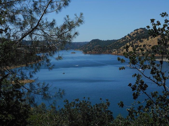
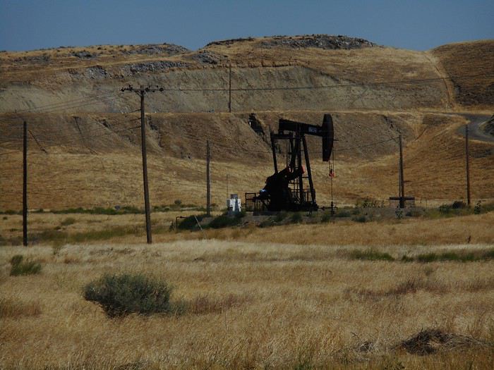
All that’s left is to follow Route 198 in the scorching heat: "Lake Kaweah" (I look back to see the lake and, one last time, the Sierra Nevada), Visalia, San Joaquin Valley, a bit of oil fields...


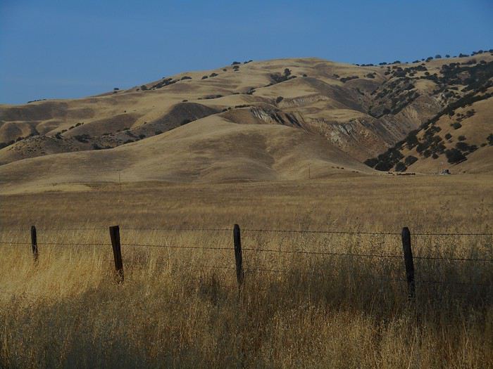
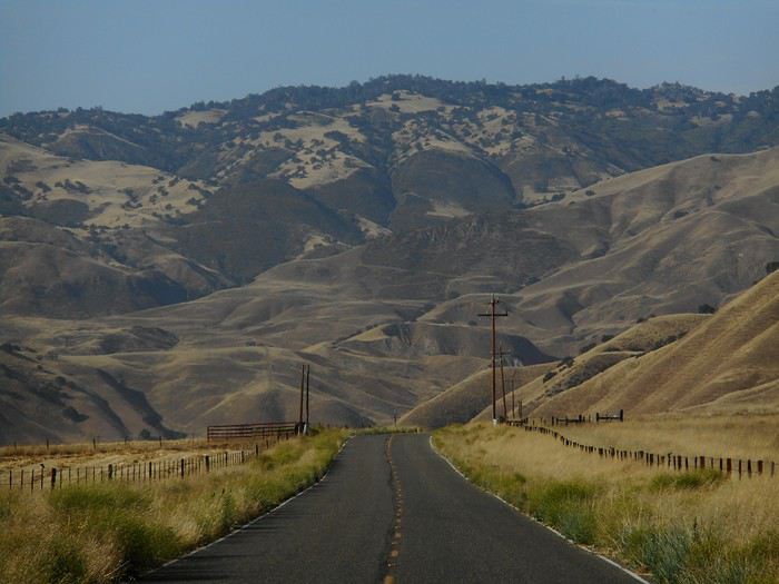
I’m near Coalinga, a small town with all the services. Further on, the "Coast Range" is as sparsely populated as some parts of Nevada.


And I arrive at "Pinnacles NP." It’s extremely hot despite the late hour (setting up camp and a welcome shower).
Valmichel86
BE Bertoni Regular ·
Thanks for making us dream, especially right now.
brigitte
VA Valmichel86 Regular ·
Hi Fabien, thanks (better late than never) for your message from March 23rd. Your photo lets us compare "Vernal Fall" with water and "Vernal Fall" without water—it’s a completely different scene!
Valmichel86
VA Valmichel86 Regular ·
Day 32: Thursday, June 13 (Pinnacles NP - Montara Lighthouse)

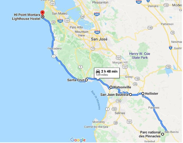
Route.


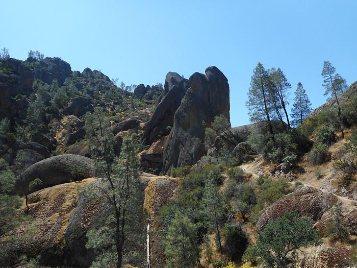
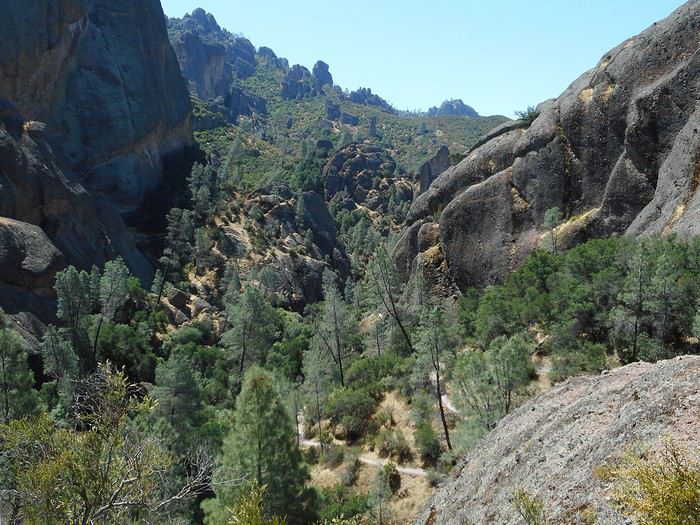
I messed up last night because I didn’t see where the Visitor Center had left the park brochures. So I’m waiting for it to open, which means I’ll have to go for a hike I wouldn’t have chosen if I’d left earlier. I set off from "Old Pinnacles Trailhead" on the "Balconies Cave Trail." This hike follows a dry creek bed with no elevation gain. I move quickly except for the small loop at the end: I went toward the cliffs on the way out and returned through the "cave," which is actually a dry underground river—though the underground part only lasts a few dozen meters (at the entrance, I thought it was a dead end). It’s nothing special, and it’s probably better to choose the "High Peaks" area instead (I didn’t check).


Next, I head to "Montara Lighthouse." The only notable thing is a complete weather change: - Heat and sun like yesterday until Hollister - Sun and very strong wind from Hollister to Watsonville - Gray skies, low clouds, little light, and a light sea breeze until Montara.

The hostel is well located, right on the cliff with the ocean below. Even though the sky is gray and low, the mist isn’t thick fog, so you can still see the landscape from the dining room through a large picture window. I fill up the gas tank and grab a few groceries for dinner tonight and the flight home. The one essential precaution left: being able to leave the hostel during the night. The hostel and parking area are enclosed, and there’s no night staff. So you have to open and close a sliding gate on a rail, secured by what you might call a padlock—but way, way more complicated. The procedure is described on an A4 sheet with several annotated diagrams in English (that’s really necessary). After reading and rereading, I ask myself: *Are you sure you understood and can open it in the middle of the night?* Answer: no. So I do a practice run with the receptionist. I ask myself again; answer: yes. The receptionist tells me that since she’s been in Montara, the weather’s almost always the same—it’s depressing, and she doesn’t think she’ll stay long (she’s from Southern California). Everything’s ready for tomorrow.

Day 33? It’s already been posted—it’s message 91. That’s it, it’s over.

Thanks to all the readers (whether you commented or not) who followed along during this long write-up.

I’ll post a message about the trip budget in a few days.
Valmichel86
CH Cheesecake14 Regular ·
Thanks Michel for taking the time to share your trip in detail. It's an interesting way to travel—few people take the time to do it like this.
VA Valmichel86 Regular ·
Travel budget.Low-budget trip from 05/13 to 06/15/2019 (32 nights on site). Accommodation: 6 nights in a youth hostel, 6 nights camping in national parks, and the remaining 20 nights camping elsewhere.

Services in France (transport + accommodation) 115 € Flight ticket 400 € Car rental (29 days) 698 € National park camping 157 € Alcatraz visit 34 € On-site expenses 1,386 €

Total budget 2,790 €

On-site expenses include everything else (all nights outside national parks, gas, etc.). Since I used a debit card and cash and didn’t keep track, I can’t provide a breakdown by category.

Estimated gas: around 340 €—imprecise because prices vary quite a bit between California and Nevada.

I bought two passes (included in on-site expenses): - "America the Beautiful" $80 (72 €) - "Nevada State Parks annual all-access permit" $200 (180 €) This pass gives unlimited access to all Nevada state parks for a year from the purchase date, including camping where available. I broke even without saving much (a few dozen dollars, roughly). It could be a great tip for someone staying in Nevada for a long time.
Valmichel86
DA Dajcbe Regular ·
Really interesting story! We’ve visited several of the places you mentioned over multiple trips. In September 2019, we saw Pinnacles NP, but only partially because it was way too hot—we don’t do camping! We’ve got a few ideas for the two parks near Las Vegas, maybe in October if COVID-19 (I had no idea *virus* was feminine!) is at a minimum in the US and France, and as long as the borders are open. Great spelling, by the way! And the photos, of course!
DocHP
MA Masterpo Globetrotter ·
COVID-19 (I didn’t know viruses were feminine!)

The virus (SARS-CoV-2) is actually masculine in this case—it’s the disease (COVID-19) that’s feminine (a late decision by the Académie Française).
MA Marcalamar Veteran ·
Hi Michel 🙂 Thanks for this amazing travel journal with your texts, photos, and all those detailed explanations—it’s really helping me prepare for my upcoming road trip this September. I loved reading your post! Marcalamar 🙂
Vivre et laisser vivre
VA Valmichel86 Regular ·
Hi Martine, Thanks for your kind comment. I’m always happy when a travel journal (or a reply in a discussion) helps with trip planning. You’ll have a different impression of Yosemite and Kings Canyon than I did, since you’ll be there when the flow is much closer to base level... When I think back, I’m still amazed by the flows we saw in early June 2019! Happy final prep and have a great trip.
Valmichel86

Similar discussions

You might also like