Second trip to Iceland

Translated into English.

Original post
PI
We stayed in Iceland from August 27 to September 13, 2023. Actually, this was our second trip to the island.

During our first visit, we rented a camper van from Snail Motorhome Rental, a family-run business that provided outstanding service.

Unfortunately, we discovered that this company no longer exists.

So, we rented a camper van through a third party, specifically via the Nordic Travel Group website.

We chose City Car Rental, located near Keflavik Airport, because the rental cost was really appealing.

Apart from the quality of the sleeping bags and the size of the pillows we rented, our experience with this company was very positive.

We noticed a significant increase in tourism since our last trip in 2015.

Several sites have been redeveloped, and parking is now paid in many places.

Accommodations have multiplied, not only near major cities but also in remote areas.

One notable advantage, however, was discovering the wide variety of food products available in supermarkets. In 2015, the selection was very limited.

I invite you to continue reading this travel journal and watch the videos that will let you explore this destination, which has everything to charm outdoor enthusiasts.

Videos are embedded throughout the summary. Click on the image to start the video.

To jump to a specific post, here are the relevant links:

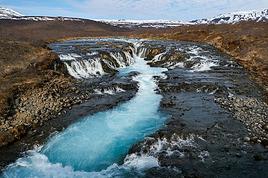
Hlauptungufoss, Midfoss and Bruarfoss Geysir, Blesi and Strokkur Gullfoss Brúarhlöð Canyon Faxafoss Kiðjabergsvöllur – Belvedere Kerið Crater Reykjadalur Valley – Hike to the hot springs Seljalandsfoss Gljúfrabúi Waterfall Seljavallalaug – One of Iceland’s oldest geothermal pools 
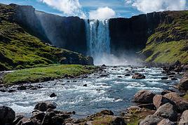
Skógafoss – Fimmvörðuháls hiking trail (partial) Kvernufoss Plane wreck at Solheimasandur Dyrhólaey Peninsula Reynisfjara Beach – Puffins and seals Vík í Mýrdal Fjaðrárgljúfur Canyon Skaftafell National Park – Svartifoss, Magnusarfoss & Hundafoss Svínafellsjökull Glacier
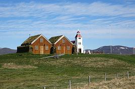
 Hofskirkja Church Fjallsárlón Glacial Lagoon (West) Fjallsárlón Glacial Lagoon (East) 
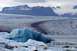
Jökulsárlón Glacial Lagoon Litlanefsfoss and Hengifoss Rjúkandi (Rjúkandafoss) Stuðlagil Canyon Selfoss and Dettifoss 
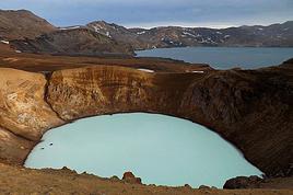
Krafla – Viti Crater Lake Krafla – Leirhnjúkur Lava Field 
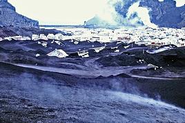
Hverir Geothermal Site (Námafjall) Hverir – Hverarönd Geothermal Site – Blue Lagoon Grjótagjá – Hot Spring Cave Stóragjá – Hot Spring Cave Goðafoss Akureyri Zipline Hofsós – Pool by the Skagafjörður Fjord Víðimýrarkirkja Church Hvítserkur Rock – The Troll of Northwest Iceland Gislahellir (Gisli's Cave) Dynjandi (Fjallfoss) – One of Iceland’s most beautiful waterfalls Hellulaug (Natural hot spring pool) Stykkishólmur – Stykkishólmshöfn Port 
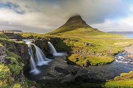
Kirkjufell & Kirkjufellsfoss Ólafsvík – Bugsfoss Lóndrangar Basalt Columns Arnarstapi Ytri-Tunga Farm – Seal watching Deildartunguhver Hot Spring Hraunfossar & Barnafoss Exploring Reykjavik 
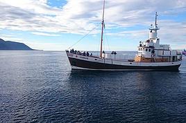
Reykjavik – Whale Safari – Whale watching Raufarholshellir Lava Tunnel Gígvatnsvatn Lake (Green Lake/Graenevatn) Seltún Geothermal Site (Krýsuvík) Kleifarvatn Lake Blue Lagoon Thermal Spa Gunnuhver Geothermal Site Reykjanes Peninsula – Reykjanesviti Lighthouse Reykjanes Peninsula – Valahnúkamöl – Reykjanestá Ægissíðufoss Super Jeep excursion to Landmannalaugar Hiking in Landmannalaugar Scenery along the way
Anne Blogue: https://deuxnomades.blogspot.com/ YouTube: https://www.youtube.com/c/SouthAngelVideo?sub_confirmation=1
PI Pinacoladada Globetrotter ·
HLAUPTUNGUFOSS, MIDFOSS AND BRUARFOSS

Location:

64.24020, -20.52420 Parking and trailhead 64.25340, -20.51690 Hlauptungufoss 64.25792, -20.51521 Midfoss 64.26420, -20.51570 Bruarfoss

An easy 6.2 km round-trip hike (total). Beautiful waterfalls with a clear turquoise blue color. Absolutely stunning!

https://youtu.be/mXvowTPUJNU
Anne Blogue: https://deuxnomades.blogspot.com/ YouTube: https://www.youtube.com/c/SouthAngelVideo?sub_confirmation=1
PI Pinacoladada Globetrotter ·
GEYSIR, BLESI AND STROKKUR

Location:

64.30908, -20.30080 Parking 64.31382, -20.29950 Geysir 64.313451, -20.3013 Blesi 64.31268, -20.30076 Strokkur

This site is home to several geothermal phenomena such as geysers, hot springs, fumaroles, solfataras, and more.

As soon as you approach the site, the strong smell of sulfur seeps into your nostrils.

Strokkur is without a doubt the most spectacular geyser. It erupts every 8 to 10 minutes.

A blue bubble forms first on the surface of the earth, followed by a column of water shooting up into the sky.

https://youtu.be/lbiN7gR1uLo
Anne Blogue: https://deuxnomades.blogspot.com/ YouTube: https://www.youtube.com/c/SouthAngelVideo?sub_confirmation=1
PI Pinacoladada Globetrotter ·
GULLFOSS

Location:

64.32484, -20.12549 Parking 64.32709, -20.12121 Viewpoint 1 64.32618, -20.12444 Observation platform 64.32759, -20.12152 Viewpoint 2

Hike of about 2 km round trip. This waterfall is often included in tours from Reykjavik, so it can get pretty crowded.

That said, its popularity is well-deserved—it’s truly breathtaking. It consists of two cascades plunging into the stunning canyon below.

There are two walkways: one that runs alongside the falls and another higher up. Viewing platforms are also set up for panoramic views of the site.

It’s a good idea to wear a rain jacket if you plan to get close to the banks, as the wind can carry mist and soak your clothes.

https://youtu.be/li3XMn6R-Kc
Anne Blogue: https://deuxnomades.blogspot.com/ YouTube: https://www.youtube.com/c/SouthAngelVideo?sub_confirmation=1
PI Pinacoladada Globetrotter ·
BRÚARHLÖÐ CANYON

Location:

64.26011, -20.22220 Parking 64.25922, -20.22508 Viewpoint

Brúarhlöð is located next to Route 30, which connects Geysir and Gullfoss to Fludir via a bridge over the Hvita River.

As you cross the river, you’ll notice it narrows into a tight gorge.

On the east bank, there’s a parking area, and a short trail lets you explore the canyon.

https://youtu.be/9baMMCRifcc
Anne Blogue: https://deuxnomades.blogspot.com/ YouTube: https://www.youtube.com/c/SouthAngelVideo?sub_confirmation=1
PI Pinacoladada Globetrotter ·
FAXAFOSS

Location:

64.22623, -20.33905 Parking 64.22588, -20.33847 Viewpoint 1 64.22591, -20.33736 Viewpoint 2

Another beautiful waterfall that’s easily accessible since it’s right by the road. It’s near a campsite.

A great spot to relax and have a picnic.

Right by the parking lot, there’s a small trail that leads to the base of the waterfall.

https://youtu.be/BCMQNXWAy2w
Anne Blogue: https://deuxnomades.blogspot.com/ YouTube: https://www.youtube.com/c/SouthAngelVideo?sub_confirmation=1
PI Pinacoladada Globetrotter ·
KIÐJABERGSVÖLLUR – BELVEDERE

Location:

63.99285, -20.78859 Parking 63.99186, -20.78967 Belvedere

A short trail leads to a belvedere at the top of a small hill.

It offers stunning views of the golf course and the Hvítá River flowing west of the course.

The scenery is really pretty.

https://youtu.be/Oi8cyVltOMs
Anne Blogue: https://deuxnomades.blogspot.com/ YouTube: https://www.youtube.com/c/SouthAngelVideo?sub_confirmation=1
PI Pinacoladada Globetrotter ·
KERIÐ CRATER

Location:

64.04183, -20.88676 Parking

This crater was formed a few thousand years ago. However, it is very well preserved.

At the top of the crater, there’s a trail that lets you walk around it. You get a beautiful panoramic view of the area when you’re at the top.

The crater’s walls are made of red volcanic rock. At the bottom, there’s a stunning emerald-colored lake.

By the way, near the entrance, there’s a trail that takes you down close to the lake.

https://youtu.be/0PYKz8xxCz4
Anne Blogue: https://deuxnomades.blogspot.com/ YouTube: https://www.youtube.com/c/SouthAngelVideo?sub_confirmation=1
PI Pinacoladada Globetrotter ·
REYKJADALUR VALLEY - HIKE TO THE HOT SPRINGS

Location:

64.02230, -21.21150 Parking 64.02274, -21.21165 Trailhead 64.03650, -21.22210 Waterfall 64.04790, -21.22232 Natural pools

Hike of about 7.6 km round trip (total).

The small town of Hveragerði and the Reykjadalur Valley are located in a geothermal area.

In fact, you can see fumaroles and boiling mud pots in several places.

The start of the hike requires some effort because the climb is steady. It’ll be easier on the way back!

But what a pleasure to discover a beautiful valley filled with sheep. In its heart, a small river has made its way. Smoke rises from it in certain spots.

In fact, as soon as we arrived near the river, a sign warned us of danger because the water temperature is 100°C. Swimming would have to wait!

We continued along the river until we discovered several dams forming small pools. We’d arrived at our destination.

The site is much busier now compared to our first visit, when we found ourselves alone with the sheep.

Despite this, the valley remains just as amazing.

https://youtu.be/lThxuscrnF4
Anne Blogue: https://deuxnomades.blogspot.com/ YouTube: https://www.youtube.com/c/SouthAngelVideo?sub_confirmation=1
PI Pinacoladada Globetrotter ·
SELJALANDSFOSS

Location:

63.61524, -19.99393 Parking 63.61543, -19.98815 Seljalandsfoss

Easy to access and very popular. This waterfall is truly stunning and has a unique feature: there’s a path behind the waterfall, so you can walk behind the curtain of water. You’ll need a raincoat and boots if you venture back there.

While walking along the cliff, you can also discover other waterfalls.

https://youtu.be/Cx9X8r3wDjk
Anne Blogue: https://deuxnomades.blogspot.com/ YouTube: https://www.youtube.com/c/SouthAngelVideo?sub_confirmation=1
PI Pinacoladada Globetrotter ·
CASCADE GLJÚFRABÚI

Location:

63.62088, -19.98708 Start of the trail 63.62075, -19.98649 Gljúfrabúi

A ±1.2 km round-trip hike (total) from Seljalandsfoss. The trail runs along high cliffs where a few waterfalls cascade down.

After about 600 meters, you’ll spot Gljúfrabúi waterfall, tucked at the back of a small canyon. It’s really pretty, and the whole spot is super picturesque.

It’s best to wear a rain jacket because the waterfall’s spray will quickly soak you.

At the canyon entrance, just hop from stone to stone to keep your feet dry. The access is easy and only takes a few minutes.

The waterfall flows down the walls of a tall, lush cliff. A big rock in front of the falls is the perfect spot to capture the moment.

https://youtu.be/Bamiz6BQ0qQ
Anne Blogue: https://deuxnomades.blogspot.com/ YouTube: https://www.youtube.com/c/SouthAngelVideo?sub_confirmation=1
PI Pinacoladada Globetrotter ·
SELJAVALLALAUG - ONE OF ICELAND'S OLDEST GEOTHERMAL POOLS

Location:

63.56090, -19.61915 Parking 63.56609, -19.60772 Pool

Hike of 1.7 km round trip in total.

Seljavallalaug pool is located in Iceland, tucked away in a majestic valley and fed by a natural hot spring. The water temperature stays around 30 to 34°C.

Built in 1923, it’s one of the oldest pools in Iceland. The changing rooms are pretty basic, and there are no bathrooms.

Many people have trouble finding it. Here’s some info that’ll definitely help: From Route 1, take Route 242, which is 20 km from Seljalandsfoss waterfall. Then, drive about 3 km on this road to reach the parking lot for the new pool.

From this parking lot, you can’t see the pool. You’ll need to start a 20-minute hike into the valley.

Facing the valley, on your left, there’s a trail at the base of the cliff. Otherwise, just follow the river and cross it by hopping from stone to stone. The water is shallow. We had boots, so it was relatively easy for us.

The scenery feels truly magical. What a treat to end the day enjoying the peaceful quiet of this place!

https://youtu.be/BphXDHYYTdQ
Anne Blogue: https://deuxnomades.blogspot.com/ YouTube: https://www.youtube.com/c/SouthAngelVideo?sub_confirmation=1
PI Pinacoladada Globetrotter ·
SKÓGAFOSS - FIMMVÖRÐUHÁLS HIKING TRAIL (PARTIAL)

Location:

63.52901, -19.51315 Parking 63.53208, -19.51128 Skógafoss 63.53187, -19.51062 Upper viewpoint (stairs) 63.53331, -19.50768 Hestavaðsfoss 63.53555, -19.50243 Fosstortufoss 63.53802, -19.50207 Steinbogafoss 63.54320, -19.49970 Fremri-Fellsfoss 63.54450, -19.50150 Innri-Fellsfoss 63.54590, -19.50070 Rollutorfufoss 63.54880, -19.49590 Skalabrekkufoss 63.54940, -19.49470 Kaefufoss 63.52655, -19.49289 Skógar Museum

Easy to access, it’s also one of Iceland’s most visited waterfalls. At 60 meters high and 25 meters wide, Skógafoss is truly impressive.

On sunny days, it’s common to see multiple rainbows.

We climbed the hundred or so steps of the staircase leading to the top of the waterfall. The panoramic view of the area is simply stunning!

At the top of the waterfall, right after a barbed-wire fence, there’s a 25 km mountain trail (one way) called Fimmvörðuháls that leads to Thórsmörk, an incredible valley.

This trail passes between two glaciers in southern Iceland: Mýrdalsjökull and Eyjafjallajökull.

We only hiked a tiny portion of it, following the river, and were able to see several other magnificent waterfalls.

We did a 5.4 km round-trip hike (total) starting from the upper viewpoint of Skógafoss waterfall.

Actually, we made it as far as Kaefufoss waterfall and then turned back.

On the way back, we stopped at the Skógar Museum to photograph the traditional little houses.

https://youtu.be/ZFTZxYEWfT0
Anne Blogue: https://deuxnomades.blogspot.com/ YouTube: https://www.youtube.com/c/SouthAngelVideo?sub_confirmation=1
PI Pinacoladada Globetrotter ·
KVERNUFOSS

Location: 63.52580, -19.49263 Parking 63.52530, -19.49060 Start of the trail 63.52866, -19.48054 Kvernufoss

The Kvernufoss waterfall is located near the Skógar Museum.

The hike is very short—only about 800 m (1.6 km round trip) from the parking lot.

The trail is easy and mostly crosses a meadow before climbing slightly toward the gorge.

Like Seljalandsfoss, Kvernufoss has the unique feature of being a waterfall you can walk behind.

It’s definitely worth the experience!

https://youtu.be/QW2NvWw_ST0
Anne Blogue: https://deuxnomades.blogspot.com/ YouTube: https://www.youtube.com/c/SouthAngelVideo?sub_confirmation=1
PI Pinacoladada Globetrotter ·
PLANE WRECK AT SOLHEIMASANDUR

Location:

63.49060, -19.36400 Parking 63.45910, -19.36480 Plane wreck

A 3.6 km (one-way) hike along a gravel road leading to the wreck of an old DC-3 that crashed on a black sand beach on Iceland’s south coast.

Since the plane is far from Route 1, there used to be a track allowing access by car, but it’s now closed to the public.

However, a shuttle ($) is available from the parking lot for those who’d rather not make the effort.

The hike is easy as there’s no elevation gain. The path is flat.

The plane has obviously weathered the years. Only the fuselage remains—the wings, nose, and tail of the aircraft are gone.

Despite that, the site is impressive, and the surrounding landscape is perfect for taking great photos.

https://youtu.be/VKHbxxJzAu8
Anne Blogue: https://deuxnomades.blogspot.com/ YouTube: https://www.youtube.com/c/SouthAngelVideo?sub_confirmation=1
PI Pinacoladada Globetrotter ·
DYRHÓLAEY PENINSULA

Location:

63.40410, -19.12900 Parking 63.40470, -19.12970 Viewpoint 1 63.40180, -19.13070 Viewpoint 2 63.40194, -19.12984 Viewpoint 3

The Dyrhólaey Peninsula is located in Iceland, and this spot is easy to access and very popular. It’s a 120-meter-high promontory. You’ll need to take a very steep, winding slope to reach the top.

From the top of this cliff, you get an amazing view of the surrounding black sand beaches.

Dyrhólaey has its own sea arch. It’s also a protected nature reserve. During May and June, puffins come here to nest.

https://youtu.be/C6hH1oWBNCs
Anne Blogue: https://deuxnomades.blogspot.com/ YouTube: https://www.youtube.com/c/SouthAngelVideo?sub_confirmation=1
PI Pinacoladada Globetrotter ·
REYNISFJARA BEACH - PUFFINS AND SEALS

Location:

63.40440, -19.04531 Parking

Reynisfjara is a black sand beach in Iceland. This spot is easy to access and very popular.

In 1991, this stunning black sand beach was named one of the ten most beautiful beaches in the world.

It’s bordered by a cliff from which a tall basalt column wall emerges. This cliff also shelters a huge cave.

At the end of the beach, there are a few massive rock stacks. Legend has it that these were trolls turned to stone by the light of dawn.

We were lucky enough to discover that a colony of puffins was still present on the cliffs overlooking the beach.

It’s always a joy to watch these beautiful seabirds!

There were also a few seals swimming along the shore. We saw them several times catching fish.

https://youtu.be/ntNcUu8pujA
Anne Blogue: https://deuxnomades.blogspot.com/ YouTube: https://www.youtube.com/c/SouthAngelVideo?sub_confirmation=1
PI Pinacoladada Globetrotter ·
VÍK Í MÝRDAL

Location:

63.42055, -19.00286 Church 63.42183, -19.00147 Cemetery and stunning panoramic view of the area

Vík í Mýrdal is a lovely little town in Iceland. It’s an easy-to-reach spot and very popular.

This charming town is nestled in an impressive valley. Its church sits high up on the cliff. We went there to get a panoramic view of the region.

In the distance, you can see the beautiful black sand beach of Vik and the rocky peaks we’d seen from a different angle at Reynisfjara Beach.

The town is basically a restocking point—you’ll find a gas station, supermarket, souvenir shops, and more.

https://youtu.be/hRq1M5RwTcc
Anne Blogue: https://deuxnomades.blogspot.com/ YouTube: https://www.youtube.com/c/SouthAngelVideo?sub_confirmation=1
PI Pinacoladada Globetrotter ·
CANYON DE FJAÐRÁRGLJÚFURVÍK Í MÝRDAL

Location:

63.77113, -18.17181 Parking 63.77129, -18.17189 Trailhead 63.77354, -18.17405 Viewpoint 1 63.77500, -18.17460 Viewpoint 2 63.77896, -18.17676 Viewpoint 3 63.77908, -18.17681 Viewpoint 4 63.77922, -18.17904 Mogarfoss

Fjaðrárgljúfur Canyon is located in Iceland. Easy to access and very popular. A 2 km round-trip hike (total). Definitely a must-see! It's a canyon with a depth of 100 m. The Fjaðrá River flows at the bottom of this canyon.

The canyon was formed by glacial water seeping into the rocky walls over a period of several thousand years.

There’s a trail that runs along the canyon, leading to different viewpoints throughout the route. There’s also a stunning waterfall flowing down the cliff.

From the parking lot, you can also hike directly into the canyon. Just cross the small bridge and follow the river. Boots are required since you’ll need to cross the river in a few spots. The water isn’t very deep.

https://youtu.be/Ll_4JmjQloE
Anne Blogue: https://deuxnomades.blogspot.com/ YouTube: https://www.youtube.com/c/SouthAngelVideo?sub_confirmation=1
PI Pinacoladada Globetrotter ·
SKAFTAFELL NATIONAL PARK - SVARTIFOSS, MAGNUSARFOSS & HUNDAFOSS

Location:

64.01428, -16.96889 Parking 64.01640, -16.96740 Trailhead 64.01885, -16.97805 Right turn 64.02080, -16.97350 Viewpoint of a waterfall 64.02490, -16.96360 Left turn 64.02738, -16.97492 Svartifoss 64.02691, -16.97469 Footbridge (for the view of the waterfall) 64.02124, -16.97949 Viewpoint of Magnusarfoss 64.02157, -16.98022 Footbridge 64.01950, -16.98090 Viewpoint of Hundafoss 64.01718, -16.98240 Return to parking 64.01652, -16.97175 Camping

Easy access and very busy. At the park entrance, there’s an information center where you can get details about the activities on offer. There are several very interesting panels with historical information and photos.

You’ll also find a campsite, a cafeteria, and a small supermarket.

We opted for trail S2, a 5 km loop that takes about 2 hours and includes the following highlights: the waterfalls Svartifoss, Magnusarfoss, and Hundafoss.

Svartifoss is set in a truly exceptional environment. Basalt columns formed from the slow cooling of a lava flow, and over time, water has eroded this layer of lava.

A small bridge was built over the river to let us cross to the other side. Head there for a lovely viewpoint of Svartifoss.

On the way back, we discovered Magnúsarfoss, the smallest of these waterfalls, and then Hundafoss, which is actually the largest.

Hundafoss is a stunning waterfall. It plunges vertically from the top of a high cliff.

Its name means "waterfall of the dogs" because in the past, the farm path ran along the edge of this waterfall. Dogs were sometimes swept away by sudden floods.

After that, the trail crosses the campsite, which by the way seems really nice, and brings us directly back to the information center, our starting point.

https://youtu.be/b3ikxeohlJc
Anne Blogue: https://deuxnomades.blogspot.com/ YouTube: https://www.youtube.com/c/SouthAngelVideo?sub_confirmation=1
PI Pinacoladada Globetrotter ·
GLACIER SVÍNAFELLSJÖKULL

Location:

64.00018, -16.89382 Parking 63.99950, -16.89350 Start of the trail

Loop hike of about 2.5 km.

Easy access. The proximity to the glacier is a major plus. Many icebergs are also trapped in the lake formed by the glacier’s melt. A really picturesque spot.

https://youtu.be/ewfV_UYWYAE
Anne Blogue: https://deuxnomades.blogspot.com/ YouTube: https://www.youtube.com/c/SouthAngelVideo?sub_confirmation=1
PI Pinacoladada Globetrotter ·
HOFSKIRKJA CHURCH

Location: 63.90703, -16.70674

Built in 1884, it’s the last sod church to be constructed. In Iceland, there are six sod churches that are part of the cultural heritage, including this one. Even today, it still serves as a parish church.

Like in all these small churches, there’s a real sense of peace and serenity.

It’s surrounded by a cemetery where many graves are covered with a layer of vegetation, making the landscape truly unique.

https://youtu.be/INHGxBgTJp8
Anne Blogue: https://deuxnomades.blogspot.com/ YouTube: https://www.youtube.com/c/SouthAngelVideo?sub_confirmation=1
PI Pinacoladada Globetrotter ·
GLACIAL LAGOON FJALLSÁRLÓN (WEST)

Location:

63.99920, -16.37610 Turn left after 1.8 km 64.01090, -16.38845 Parking and start of the 300 m trail (one way) 64.01193, -16.39376 End of the trail

I’ll let you in on a little secret to get closer to this lake formed by the Fjallsjökull glacier. You need to take the road to the left right after the Hrútá river bridge. More precisely, this road is located between the Hrútá and Fjallsá river bridges.

Drive about 2 km on this gravel road and continue left when it splits until you reach a small parking area. There’s a trail starting from the parking lot that leads directly to the lake.

Another glacier, you might say? It’s impossible to stay indifferent in front of such natural beauty.

The lake sits at the base of a massive glacier, and several blue-tinted icebergs make the scene even more breathtaking.

https://youtu.be/G4VPhCd6FNc
Anne Blogue: https://deuxnomades.blogspot.com/ YouTube: https://www.youtube.com/c/SouthAngelVideo?sub_confirmation=1
PI Pinacoladada Globetrotter ·
FJALLSÁRLÓN GLACIAL LAGOON (EAST)

Location:

64.01350, -16.35560 Left side 64.01630, -16.36510 Parking 64.01660, -16.36590 Start of the trail 64.01703, -16.37030 Viewpoint 1 64.01420, -16.37220 Viewpoint 2 64.01589, -16.36616 End of the trail

A 1.5 km loop trail that offers lovely viewpoints over the Fjallsárlón glacial lagoon, fed by the Fjallsjökull glacier.

https://youtu.be/BfExVXSRHms
Anne Blogue: https://deuxnomades.blogspot.com/ YouTube: https://www.youtube.com/c/SouthAngelVideo?sub_confirmation=1
PI Pinacoladada Globetrotter ·
JÖKULSÁRLÓN GLACIAL LAGOON

Location: 64.04803, -16.17955

Easy to access and very popular. This site is truly exceptional, which is why it’s one of the most visited places in Iceland. You’ll find restaurants, shops, and agencies offering boat tours.

It’s a small lagoon with a bluish hue, filled with massive icebergs that have broken off from the Breiðamerkurjökull glacier. Some icebergs drift toward the sea via the Jökulsá River, which connects the lagoon to the ocean.

https://youtu.be/yljh_Fs8aPU
Anne Blogue: https://deuxnomades.blogspot.com/ YouTube: https://www.youtube.com/c/SouthAngelVideo?sub_confirmation=1
PI Pinacoladada Globetrotter ·
LITLANEFSFOSS AND HENGIFOSS

Location: 65.07331, -14.88057 Parking 65.07365, -14.88095 Trailhead 65.08306, -14.88320 Litlanefsfoss 65.09510, -14.88970 Hengifoss 65.08684, -14.88414 Footbridge Back to the parking lot

A 4.9 km loop hike that lets us discover the Litlanefsfoss and Hengifoss waterfalls.

Perseverance is key to get there since most of the trail is uphill. It’ll be easier on the way back!

From the parking lot, there’s a series of steps to climb. After that, a gravel trail leads us to a stunning waterfall: Litlanefsfoss. This waterfall is about 1.3 km from the parking lot.

Litlanefsfoss is surrounded by tall basalt columns. It’s truly breathtaking. I would’ve been just as enchanted if this was the only waterfall I saw. But the goal of our hike was to see Hengifoss, one of Iceland’s tallest waterfalls. So, we continued along a small dirt trail. By the way, you can spot its summit in the distance.

We walked and climbed... Finally, we got closer to Hengifoss. Just before reaching the waterfall, the trail runs along a steep slope beside the river.

When we went, the trail was in excellent condition. But since it’s a dirt path, I imagine it could be trickier to access in spring or after heavy rain.

Hengifoss is also set in a magical landscape. The surrounding rock displays different colored layers formed by ancient volcanic eruptions.

On the way back, we took a detour to the footbridge, which let us cross to the other side of the river. This gave us different viewpoints of both waterfalls.

We also discovered other waterfalls that weren’t visible from the opposite side.

The return trip offers stunning views of the valley.

https://youtu.be/scw6z0DDUtc
Anne Blogue: https://deuxnomades.blogspot.com/ YouTube: https://www.youtube.com/c/SouthAngelVideo?sub_confirmation=1
PI Pinacoladada Globetrotter ·
RJÚKANDI (RJÚKANDAFOSS)

Location:

65.33110, -15.07380 Parking 65.33350, -15.07950 Rjúkandi

Rjúkandi, also known as Rjúkandafoss, is the twelfth tallest waterfall in Iceland. It has a total height of 93 m.

Its impressive height makes it hard to miss. Despite being one of the few major waterfalls visible directly from the northern part of the main Route 1 (Ring Road), it sees few visitors.

A 0.6 km round-trip trail (total) leads to the base of this majestic waterfall.

https://youtu.be/RouX976mL6I
Anne Blogue: https://deuxnomades.blogspot.com/ YouTube: https://www.youtube.com/c/SouthAngelVideo?sub_confirmation=1
PI Pinacoladada Globetrotter ·
STUÐLAGIL CANYON

Location:

65.17516, -15.27079 Parking 65.17390, -15.27290 Stuðlafoss 65.16347, -15.30585 Viewpoint 1 65.16253, -15.30782 Viewpoint 2 65.16091, -15.31272 End of the trail

A 6 km round-trip hike to explore Stuðlagil Canyon, located in the middle of the Jökla River in eastern Iceland.

Stuðlagil is definitely one of Iceland’s most beautiful canyons, with its stunning volcanic organ pipes (basalt columns) and the turquoise color of the surrounding water.

The river’s color can vary depending on the season—from blue-green in summer to gray-brown when the Karahnjukar dam is overflowing and snow is melting into the river.

When we visited, the water was more of a gray color, but that didn’t affect the beauty of the landscape at all.

https://youtu.be/4ucndtp3rnU
Anne Blogue: https://deuxnomades.blogspot.com/ YouTube: https://www.youtube.com/c/SouthAngelVideo?sub_confirmation=1
PI Pinacoladada Globetrotter ·
SELFOSS AND DETTIFOSS

Location:

65.81212, -16.40068 Parking and trailhead 65.81347, -16.38620 Viewpoint 1 65.81468, -16.38591 Viewpoint 2 65.81564, -16.38765 Viewpoint 3 65.81604, -16.38740 Viewpoint 4

There are two roads leading to these waterfalls: Route 862 (west side) and Route 864 (east side). Route 862 is paved, unlike Route 864, which is gravel and in pretty rough shape. We chose Route 862.

There’s a 2.5 km (1-hour walk) trail starting from the parking lot. Dettifoss waterfall is about a 15-minute walk from the parking area.

Nearby, you’ll also find Selfoss waterfall. It’s made up of several smaller falls.

https://youtu.be/jVQYKo7CBvs

At the start of this hike, nothing suggests there are waterfalls in the area. The landscape is desert-like, with just big rocks in sight.

But the awe is complete when you get close to Dettifoss. It’s the most powerful waterfall in Europe. You can really feel its power up close.

Rainbows form when the sun is out. We were lucky enough to see quite a few.

https://youtu.be/L9Wj7JUeHO0
Anne Blogue: https://deuxnomades.blogspot.com/ YouTube: https://www.youtube.com/c/SouthAngelVideo?sub_confirmation=1
PI Pinacoladada Globetrotter ·
KRAFLA - VITI CRATER LAKE

Location:

65.71770, -16.75760 Parking 65.71766, -16.75655 Viewpoint 1 65.71570, -16.75218 Viewpoint 2 (end of the trail)

Krafla is a volcanic area still active today. The Viti crater is part of it.

We hiked to the top of the Viti crater. The climb is very easy, and we had a spectacular view of the area.

An emerald-colored lake fills the bottom of the crater. It's truly a magnificent spot!

In the past, we could hike around the crater. That’s no longer possible.

https://youtu.be/RP8-4CwoMU0
Anne Blogue: https://deuxnomades.blogspot.com/ YouTube: https://www.youtube.com/c/SouthAngelVideo?sub_confirmation=1
PI Pinacoladada Globetrotter ·
KRAFLA - LEIRHNJÚKUR LAVA FIELD

Location:

65.71314, -16.77461 Parking and trailhead 65.72199, -16.78780 Viewpoint 1 65.72160, -16.78870 Viewpoint 2 65.72610, -16.79250 Landmark 65.72221, -16.79517 Viewpoint 3 65.71937, -16.79127 Viewpoint 4 65.71843, -16.79089 Viewpoint 5

Easy 4.8 km loop hike.

The Leirhnjúkur lava field is part of the Krafla volcanic zone. This area is covered in lava ejected during the 1984 volcanic eruption.

We start our hike on a dirt trail. Later, a wooden boardwalk was built to cross a field of fumaroles and solfataras. It’s really important not to stray off the marked paths because the ground can be unstable and very hot.

Throughout the hike, you’ll see sulfur deposits on the ground, smoke rising from the earth, and bubbling mud pools. The landscape is incredibly colorful in this area.

However, the scenery changes completely as you approach the lava field. Everything turns black, and the landscape looks totally transformed—like a massive bombing left everything scorched. It’s truly indescribable. You’ll feel like you’re on another planet.

https://youtu.be/h6KyMBsap-M
Anne Blogue: https://deuxnomades.blogspot.com/ YouTube: https://www.youtube.com/c/SouthAngelVideo?sub_confirmation=1
PI Pinacoladada Globetrotter ·
GEOTHERMAL SITE HVERIR (NÁMAFJALL)

Location:

65.64161, -16.80707 Parking 65.64135, -16.80814 Viewpoint

This geothermal site at the foot of Námafjall mountain is truly impressive. As soon as we arrived, the rotten egg smell hit us by surprise. A little scarf is a good idea for more sensitive noses!

A festival of colors unfolds before our eyes. The ground displays shades of yellow, orange, and gray. It’s dotted with huge solfataras and mud pots.

You need to be very careful and stay on the marked trails because the ground can be deceptive.

In some spots, you can really feel the underground activity. The steam escaping from a hole in the ground is accompanied by a deafening noise. You can’t even imagine the power that’s coming from it.

https://youtu.be/N89APoKI5Yo
Anne Blogue: https://deuxnomades.blogspot.com/ YouTube: https://www.youtube.com/c/SouthAngelVideo?sub_confirmation=1
PI Pinacoladada Globetrotter ·
HVERIR - GEOTHERMAL SITE HVERARÖND - BLUE LAGOON

65.63949, -16.84471 Parking

A stunning lake with a supernatural color is located near the Hverir geothermal site. The urge to take a dip fades pretty quickly when you see a sign warning that the water feeding the lake is over 100°C.

https://youtu.be/HJfktllz2No
Anne Blogue: https://deuxnomades.blogspot.com/ YouTube: https://www.youtube.com/c/SouthAngelVideo?sub_confirmation=1
PI Pinacoladada Globetrotter ·
GRJÓTAGJÁ - HOT SPRING CAVE

Location: 65.62639, -16.88299

The Grjótagjá cave is located along the same fissure as the Stóragjá cave in Iceland. The two caves are two kilometers apart.

At the entrance of the cave, it’s indicated that the water temperature stays between 43 and 46°C. Swimming is prohibited, and entering the cave is at your own risk due to the danger of falling rocks.

You’re only allowed to enter for observation or to take photos.

We ventured inside. The access is still easy. The interior of the cave is stunning. The multicolored walls reflect in the crystal-clear blue water, creating a breathtaking sight.

https://youtu.be/REP5ozv9Y7I
Anne Blogue: https://deuxnomades.blogspot.com/ YouTube: https://www.youtube.com/c/SouthAngelVideo?sub_confirmation=1
PI Pinacoladada Globetrotter ·
STÓRAGJÁ - HOT SPRING CAVE

Location: 65.63825, -16.91005

Stóragjá is a cave located in Iceland. A long and immense fissure runs through this region, and the Stóragjá cave is situated along it. We went to visit it.

You have to go down a staircase that leads to the cave's entrance. After looking around a bit, you’ll find the entrance and spot a small ladder that lets you climb down inside.

The water temperature stays around 29°C. In the past, people could bathe here, but today it’s not recommended because the water may contain bacteria.

Note: When we were there, some people were bathing, and they mentioned the water wasn’t actually warm.

https://youtu.be/S_yXgGhaTFQ
Anne Blogue: https://deuxnomades.blogspot.com/ YouTube: https://www.youtube.com/c/SouthAngelVideo?sub_confirmation=1
PI Pinacoladada Globetrotter ·
GOÐAFOSS

Location:

65.68530, -17.54620 Parking and trailhead 65.68370, -17.54940 Viewpoint 1 65.68530, -17.54230 Viewpoint 2 65.68557, -17.54164 Viewpoint 3 65.68614, -17.54168 Footbridge 65.68344, -17.54807 Viewpoint 4 65.68297, -17.54858 Viewpoint 5

Hike of about 3 km round trip.

This waterfall is a very popular spot with tourists. We went there very early in the morning to avoid the crowds.

There’s a trail running along each side of the river, which lets you see the waterfall from different angles.

It’s truly remarkable because it’s made up of several cascades with an emerald-green hue.

Along the way, you can spot several caves carved into the rocks.

Goðafoss means "Waterfall of the Gods." According to legend, Þorgeir Þorkelsson, a lawmaker, is said to have thrown statues of the old Norse gods into this waterfall after Iceland’s parliament decided to convert the country to Christianity.

https://youtu.be/WBz5I2JX4hM
Anne Blogue: https://deuxnomades.blogspot.com/ YouTube: https://www.youtube.com/c/SouthAngelVideo?sub_confirmation=1
GE Gerdid ·
Thanks so much for this super detailed account and the videos—they’ll really help us with our trip planned for July. Have a great evening
PI Pinacoladada Globetrotter ·
ZIPLINE AKUREYRI

Location: 65.67842, -18.12628

This fantastic activity, supervised by very enthusiastic professional guides, takes place in the Glerárgil river canyon that runs through the center of Akureyri in Iceland. The scenery is truly stunning.

It includes an adventure course with five ziplines, forest trails, and educational stories.

The activity lasts 1 to 2 hours, depending on the group size and activity level.

https://youtu.be/ya7gJPmG750
Anne Blogue: https://deuxnomades.blogspot.com/ YouTube: https://www.youtube.com/c/SouthAngelVideo?sub_confirmation=1
PI Pinacoladada Globetrotter ·
HOFSÓS - POOL BY THE SKAGAFJÖRÐUR FJORD

Location: 65.89580, -19.41096

Hofsós is a beautiful little village located by the Skagafjörður fjord in Iceland. Sure, this destination takes us a bit out of our way, but we really wanted to relax in the warm waters of their pool right by the fjord.

It’s good to know that all pools in Iceland use geothermal energy, allowing them to keep the water at a high temperature all year round.

There are a few steps to follow before each swim. First, you have to undress completely and take a shower. Most showers are in a shared space, and you need to thoroughly clean your private areas.

This pool is set in a magical landscape, straight out of a postcard. We enjoyed a wonderful moment of relaxation in the warm, soothing water.

https://youtu.be/dIbsIvchZ2k
Anne Blogue: https://deuxnomades.blogspot.com/ YouTube: https://www.youtube.com/c/SouthAngelVideo?sub_confirmation=1
PI Pinacoladada Globetrotter ·
VÍÐIMÝRARKIRKJA CHURCH

Location: 65.53880, -19.47041

Free to visit, except for the interior. When you see this church, you really feel like you’re stepping back into the Viking era. It dates back to 1834 and is dedicated to the Virgin Mary and St. Peter.

The turf roof is regularly renewed, but much of the church’s framework is original.

If you want to visit the inside, you’ll need to get the key from the house next to the church. There’s a fee.

As for us, we just took a quick peek inside through the windows!

Behind the church, there’s a tiny cemetery set in an enchanting landscape. The place is so peaceful!

https://youtu.be/wfbEmPvMGzw
Anne Blogue: https://deuxnomades.blogspot.com/ YouTube: https://www.youtube.com/c/SouthAngelVideo?sub_confirmation=1
PI Pinacoladada Globetrotter ·
HVÍTSERKUR ROCK - THE TROLL OF NORTHWEST ICELAND

Location:

65.60370, -20.63968 Parking 65.60587, -20.63732 Viewpoint 1 65.60589, -20.63663 Viewpoint 2 65.59740, -20.62890 Seals

This rock is located in Húnaflói Bay in northern Iceland. Standing 15 meters tall, it rises near the shore of a beautiful long beach.

Erosion has shaped the rock into a strange form. In fact, legend has it that it’s a troll that was paralyzed and turned to stone by the rays of the rising sun as it was about to attack the Thingeyrar monastery.

The Icelandic name for this rock means "white shirt" because of the many droppings left by nesting birds.

Near the parking area, there’s a small trail leading to an observation point at the top of the cliff. There are also several paths leading to the beach. Be careful, as the slope can be steep and slippery in some spots.

Heading to the right, you might spot seals lounging by the water’s edge. However, we didn’t see any during our visit, unlike our first trip to Iceland when we were able to observe them in this very spot.

https://youtu.be/TZZKukM1cZM
Anne Blogue: https://deuxnomades.blogspot.com/ YouTube: https://www.youtube.com/c/SouthAngelVideo?sub_confirmation=1
PI Pinacoladada Globetrotter ·
GISLAHELLIR (GISLI'S CAVE)

Location: 65.5502, -23.1354 A short trail leads to the small cave of Gíslahellir west of Fossá, where the Öskjudalur valley begins. Legend has it that the outlaw Gísli Súrsson lived here for some time.

It’s actually an underground rocky cave with an entrance through a sort of hole. So, anyone wanting to go in has to slide in feet first.

The cave seems to be very dark, but the opening lets in a glimmer of light. We didn’t try the experience ourselves.

https://youtu.be/-2CIWPXjYGU
Anne Blogue: https://deuxnomades.blogspot.com/ YouTube: https://www.youtube.com/c/SouthAngelVideo?sub_confirmation=1
PI Pinacoladada Globetrotter ·
DYNJANDI (FJALLFOSS) - ONE OF ICELAND'S MOST BEAUTIFUL WATERFALLS

65.73660, -23.20970 Parking

The last 30 kilometers to reach this series of waterfalls are unpaved. However, the road is easily accessible. Just check the weather before heading there.

It’s without a doubt one of the most beautiful and impressive waterfalls in Iceland.

Dynjandi is a waterfall that, at first, flows down the rocky cliff like a bridal veil. It then spills into a small lagoon before splitting into several other equally stunning falls (Bæjarfoss, Hundafoss, Kvíslarfoss, Hrísvaðsfoss, Göngumannafoss, Strompgljúfrafoss, and Hæstahjallafoss).

https://youtu.be/6LVFou0DTUY
Anne Blogue: https://deuxnomades.blogspot.com/ YouTube: https://www.youtube.com/c/SouthAngelVideo?sub_confirmation=1
PI Pinacoladada Globetrotter ·
HELLULAUG (NATURAL HOT WATER POOL)

Location:

65.57744, -23.15950 Parking 65.57716, -23.15956 Pool (free)

Hellulaug hot spring is a small, secluded geothermal pool located in the Westfjords region of Iceland. It’s about 60 cm deep.

It’s not visible from the road, but you can spot the parking area right by the roadside.

The pool is open year-round and there’s no entry fee. However, there’s a donation box in the parking lot, and small contributions are encouraged to help with maintenance costs.

The pool’s water is naturally heated by geothermal activity and stays around 38°C all year. There are no changing rooms or showers.

Its location at the mouth of Vatnsfjordur fjord offers a stunning view of the Atlantic Ocean.

https://youtu.be/Q6Dtadh38sM
Anne Blogue: https://deuxnomades.blogspot.com/ YouTube: https://www.youtube.com/c/SouthAngelVideo?sub_confirmation=1
PI Pinacoladada Globetrotter ·
STYKKISHÓLMUR - PORT OF STYKKISHÓLMSHÖFN

Location:

5.079670, -22.72437 Parking 65.07997, -22.72323 Viewpoint 1 65.08026, -22.72331 Lighthouse 65.08078, -22.72181 Viewpoint 2

Stykkishólmur is the largest town on the Snæfellsnes peninsula. There’s a small islet that protects the harbor from bad weather. A 650-meter loop trail runs past the little orange lighthouse that stands at the very top of this islet.

The colorful houses brighten up the landscape, which is often darkened by gray skies. In the distance, you can spot a building with a futuristic look—it’s the Stykkishólmur church.

https://youtu.be/RwEQblmILEg
Anne Blogue: https://deuxnomades.blogspot.com/ YouTube: https://www.youtube.com/c/SouthAngelVideo?sub_confirmation=1
PI Pinacoladada Globetrotter ·
KIRKJUFELL & KIRKJUFELLSFOSS

Location:

64.92770, -23.31310 Parking 64.92615, -23.31234 Kirkjufellsfoss 64.93980, -23.30750 Kirkjufell

Grundarfjörður is a small town located in the northern part of the Snæfellsnes Peninsula in Iceland.

It has two major tourist attractions: a stunning waterfall (Kirkjufellsfoss) and a mountain (Kirkjufell) whose shape resembles that of a church.

https://youtu.be/y84U-GlSzEg
Anne Blogue: https://deuxnomades.blogspot.com/ YouTube: https://www.youtube.com/c/SouthAngelVideo?sub_confirmation=1
PI Pinacoladada Globetrotter ·
ÓLAFSVÍK - BUGFOSS

Location: 64.8844, -23.6442

Bugsfoss is a long and beautiful waterfall located near the town of Ólafsvík on the Snæfellsnes Peninsula in Iceland.

You can also see another waterfall to the right of Bugsfoss.

They’re visible from the main road. However, it’s possible to get closer to Bugsfoss.

Just drive about 300 m down the side road and park by the side of the path. From there, a short hike takes you to the base of the waterfall.

https://youtu.be/14g5D8JzpaU
Anne Blogue: https://deuxnomades.blogspot.com/ YouTube: https://www.youtube.com/c/SouthAngelVideo?sub_confirmation=1
PI Pinacoladada Globetrotter ·
BASALT COLUMNS OF LÓNDRANGAR

Location:

64.73755, -23.77592 Parking 64.73510, -23.77430 Viewpoint 1 64.73470, -23.77760 Viewpoint 2

We follow a walkway that takes us to a promontory by the sea.

Lóndrangar consists of two basalt rocks named Kristnidrangur (Christian pillar) and Heiðnidrangur (Pagan pillar). These rocks are the remains of an ancient volcanic cone eroded by the ocean.

The waves constantly cover the base of the cliffs with a perpetual back-and-forth motion. When the waves retreat, small waterfalls emerge here and there through the rocks. It’s truly spectacular!

https://youtu.be/F1vUo_72DLU
Anne Blogue: https://deuxnomades.blogspot.com/ YouTube: https://www.youtube.com/c/SouthAngelVideo?sub_confirmation=1
PI Pinacoladada Globetrotter ·
ARNARSTAPI

Location:

64.76635, -23.62791 Parking 64.76563, -23.62713 Bárður Snæfellsás (statue) 64.76550, -23.62189 Gatklettur (arch) 64.76733, -23.61691 Natural bridge 64.77039, -23.62122 Harbor

Back in 2015, we hiked the trail from Hellnar to Arnarstapi. Here’s a glimpse in this video:

https://youtu.be/2PaThG2Jp3g The trail follows the coast through strange rock formations, and you can spot several basalt arches and sinkholes along the way.

However, during our second visit, the weather was absolutely awful. The wind was incredibly strong, and the rain was pouring down.

So, we decided to drive straight to Arnarstapi and take a short hike to see the main attractions nearby: its picturesque harbor, Gatklettur (basalt arch), Bárður Snæfellsás (stone statue), and a natural bridge right by the ocean.

https://youtu.be/Rac3VvnGTVY
Anne Blogue: https://deuxnomades.blogspot.com/ YouTube: https://www.youtube.com/c/SouthAngelVideo?sub_confirmation=1
PI Pinacoladada Globetrotter ·
YTRI-TUNGA FARM - SEAL WATCHING

Location:

64.80376, -23.08104 Parking 64.80270, -23.08000 Seal watching on the beach (low tide)

We stopped at Ytri-Tunga farm. This place is really well-known for seal watching.

https://youtu.be/PCRrVvDndsA
Anne Blogue: https://deuxnomades.blogspot.com/ YouTube: https://www.youtube.com/c/SouthAngelVideo?sub_confirmation=1

You might also like