Veneto: Dolomites and Opera
FR

Translated into English.

Original post
VA
I'm starting a new travel journal in Italy. It's about a month-long trip (from September 3, 2025, to October 4, 2025), or rather a part of it. This section matches the title: an opera festival in Verona (one evening) and the Dolomites in the Veneto region. I'm posting the part of the trip I think will interest French-speaking readers the most (since this is where I saw the most French travelers). Here’s a quick summary: - Trip in September 2025 - Solo travel with camping (caravan) - Small geographic area: besides Verona, the surroundings of the Marmolada massif and Cortina d'Ampezzo. - Main but not exclusive activity: hiking.

Since I have limited internet access where I am now, I’ll be writing slowly. Here we go!
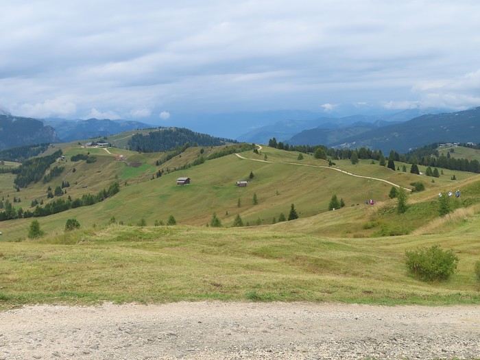
Day 1: Thursday, September 4, 2025

I arrived in Veneto under the sun and with warm weather. I drove to Verona and tried to find a spot at the campsite (Verona Village) located south of the city. Unfortunately, it was full. Booking on the website was mandatory, but when I tried to reserve a few days ago, the site never moved from the "reservation" step to the "payment" step (I don’t know why—it’s always like that in these cases). I found another solution over the phone; the drive from southern Verona to the northeast was a bit long, but I finally settled at the "Oro Verde" campsite. It’s an "agricampeggio" (farm camping or rural campsite) on the outskirts of the city, and its name (green gold) suggests they produce olives there. Since it wasn’t late, I biked to the Adige River, following the recommended route into the city.
VA Valmichel86 Regular ·
Day 2: Friday, September 5, 2025

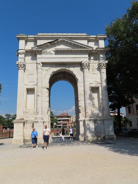
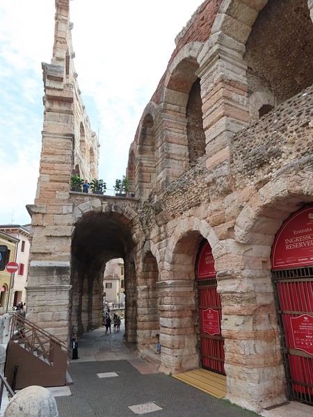
I planned a very relaxed day because the reason for stopping in Verona is the opera festival at the Arena; I’ve booked a seat for tonight. I’m going for a walk in the center of Verona, a stroll that will turn into a bad memory of the trip. I park my mountain bike less than 5 meters from the entrance of the tourist info point and head out for a short hour-long walk without intending to visit anything. As I approach the Adige River, I arrive in front of the Arch of the Gavi (arco dei Gavi), a triumphal arch built in honor of members of a family.


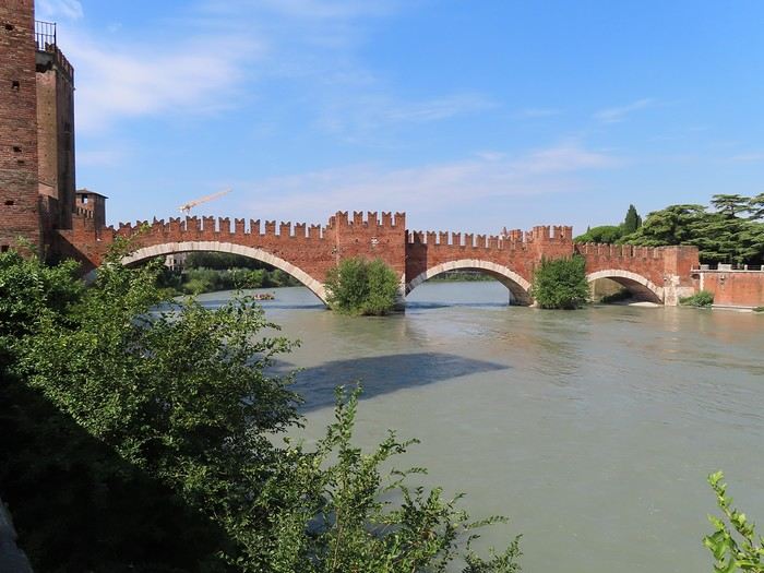
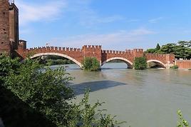
Behind the arch, you reach a terrace by the Adige where you can admire the "ponte di Castelvecchio" (Scaliger Bridge), a medieval bridge with its three uneven arches.


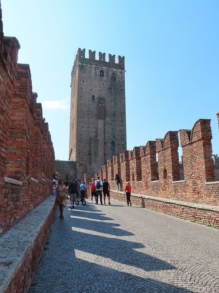
You can cross this bridge, which in the Middle Ages connected the castle to the countryside.


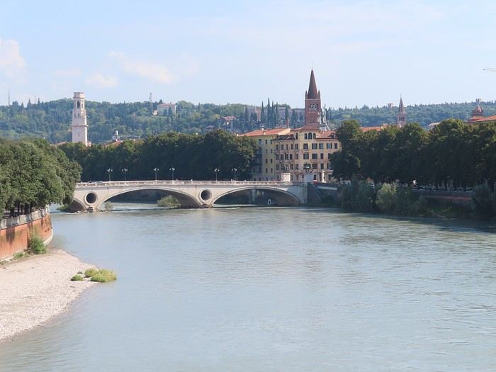
The restoration preserved or restored its medieval appearance; by climbing onto the benches, you can see the Adige flowing and, downstream, the next bridge (Ponte della Vittoria), which marks the start of the loop surrounding the city center.


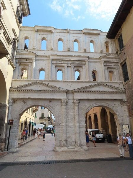
The city center was already the heart of the Roman city in the 1st century AD. I enter it by passing under a monumental gate once part of the Roman walls: porta Borsari. Only the outer facade remains; it’s not marble but local white limestone.


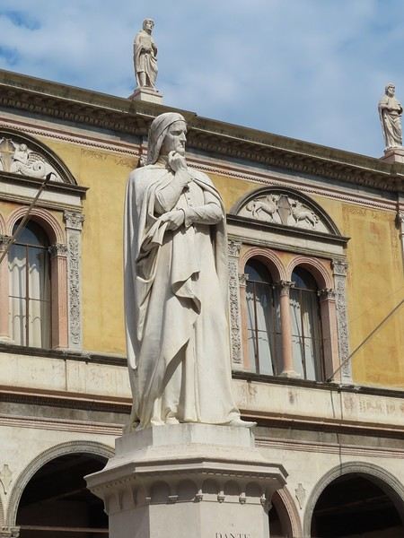
Through narrower, pedestrian streets, I reach the Herb Square (piazza delle erbe) and then the Lords’ Square (piazza dei Signori), at the center of which stands a statue of Dante.


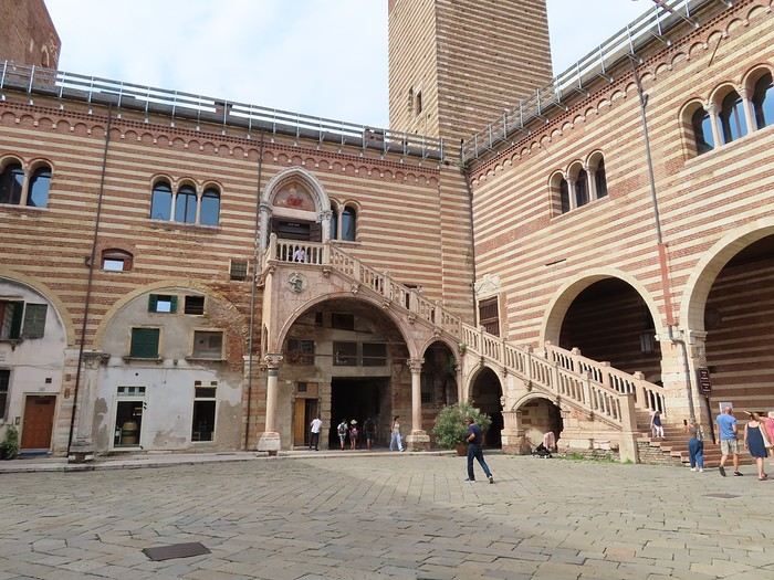
Right next door, the Old Market Courtyard (cortile del Mercato Vecchio) is bordered by the Palace of Reason (Palazzo della Ragione).


These two squares and the Old Market Courtyard are only a few dozen meters apart and form the heart of the city. On my way back to the arena, I pass through the main street of the center (via Giuseppe Mazzini) and return to the starting point.


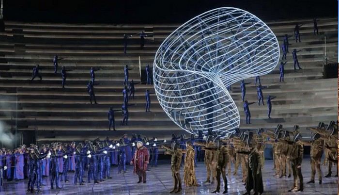
And then... my mountain bike is gone. It was stolen while I was away. I’ll later learn, once back at the campsite, that this type of theft is common in Verona. I’m really upset, both because I liked that bike and because of the consequences for the trip; I’ll have to get around either by car or on foot, without using a bike, which I’m not used to. A few errands and some downtime in the afternoon in preparation for the evening at the Verona Arena. The opera on the program is *Nabucco* by Giuseppe Verdi, directed by Stefano Poda. The temperature is perfect. From the very beginning of the show (and even before it starts), it’s clear that the deliberate choice is to go beyond a traditional opera performance and offer a total spectacle with a very futuristic vision. And even before that... because two large structures (metal or fiber, with neon or laser lights) are suspended above the stage, floating in space. Imagine a tennis ball.


A closed curve (where there’s no yellow felt) is drawn on the ball’s surface. Cut the ball (with a cutter) along this curve. You get two surfaces, parts of a sphere. They’re not what we call hemispheres, but we’ve still divided the sphere into two equal parts—let’s say semi-spheres. Now, think in 3D: draw segments from the center of the sphere to any point on the edge of these two parts (these segments are like radii). That’s what’s floating above the stage in the Verona Arena—two semi-spheres.

Here’s one during the show (I chose a photo where these segments—the radii—are visible).


Two things from my personal history made the geometric identification of these shapes immediate and obvious. And I knew, even before the show started, that at some point they would come together and fit into each other to form a sphere or a ball... This happened at the end of the opera, during the final reconciliation-expiation scene. For those without the key (a tennis ball and sphere geometry), I suppose the presence of such unidentified structures must be puzzling... you might think they resemble mollusk shells like those you’d see in natural history museums. Two months after writing the above, I’ll add this: in my opinion, these structures look like cashew nuts (I couldn’t find a better intuitive comparison).

For most of the show, the immense stage was filled with hundreds of choristers, dancers, and extras. The costumes are beautiful—either timeless or futuristic. The mass effect is used to the fullest, highlighted by special effects for masks, swords, foldable mobile structures (prisons), etc. "Vanity" sits atop an enormous hourglass; it will flow into it, and down the staircase extending below, in glowing letters but also in flesh and blood when certain protagonists descend the stairs to enter the stage. Hundreds of other hourglasses will appear on stage, brought by adults or children, held vertically or horizontally. There will also be an atomic explosion when Nebuchadnezzar, abandoning his status as King, proclaims himself God. The use of the stage space is captivating, dazzling (perhaps because I’d never seen an opera presented this way), and visually stunning. Being seated high up, near the front, on the side, posed no problem for taking in the whole scene. As for the music and voices, the magic of the arena makes everything work. The effect of distance is still noticeable for the voices, though. There was, however, one aspect of the staging that really bothered me—literally. Identifying the protagonists on stage, where there are often many people, isn’t easy; you have to search, sometimes for a while, to first find a group (the protagonists often have an entourage around them), then the protagonist within the group. Plus, the similarity of the costumes doesn’t make it easy to "separate" the protagonist from their entourage. Is it more natural and easier with a frontal view? I don’t know, but it would be preferable. In the end, I’m left with the memory of an exceptional performance, marking my return to the arena 60 years after my first visit. I saw *Aida* here in the mid-1960s. To see and hear—to experience—the show, search for ‘Nabucco Verona 2025’ on YouTube. You’ll find a 2-hour, 15-minute recording. It’s a capture by RAI from the premiere in June (it starts with the Italian national anthem, as it was the festival’s opening night).
VA Valmichel86 Regular ·
Day 3: Saturday, September 6, 2025

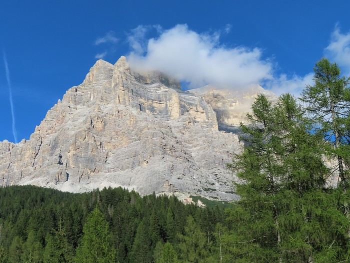
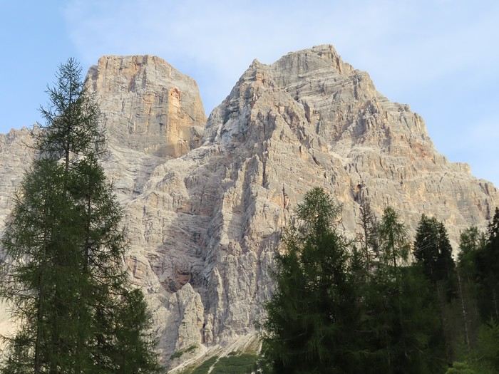
To get a normal-length night’s sleep, I decide not to leave early and take my time hitting the road to the Dolomites. The drive is slow, and the end of the bypass around Vicenza is very poorly signposted. The scenery gets beautiful as I reach the Piave River, whose valley I’ll follow upstream. The signage helps me avoid the town of Belluno; the climb up the “fiume Piave” valley continues to Longarone, where I turn into Val di Zoldo—a lovely valley with a string of villages. I go all the way to the last hamlet before the pass, called Palafavera, above Zoldo Alto. I set up at the campsite. It’s located between 1,500 and 1,550 meters in altitude. Across the road, there are ski lifts, biathlon facilities (a shooting range), and two mountain huts. The road then climbs to Forcella Staulanza (1,773 m) to switch valleys (I’ll do that tomorrow). The site is dominated by Monte Pelmo (3,168 m), basking in the late-afternoon sun on its southwest face.


I chose this spot over Cortina d’Ampezzo because it’s a bit closer to the Marmolada massif, where I’ve planned my first hikes.

You’ll find maps in post 36 (end of the travel journal) to locate the different places mentioned in the Dolomites.
SI Sinforosa Veteran ·
Hi there,

I went to Verona back in 2021, and a friend had recommended I see a show at the Arena. I didn’t do it, and now I regret it—I’ll have to go someday. Anyway, your description of the stage and the opera is really detailed and gives a great idea of the show. I took a quick look at the YouTube video, and I can see why you called it "exceptional."

I also didn’t bother waiting in line for Juliet’s house—I guess the queue is still just as long for that tourist trap.

You weren’t lucky with your mountain bike—getting it stolen on the second day!

I’ll be following the rest of your travel journal with interest—I don’t know the Dolomites at all.
DO Doogy76 ·
Thanks for this travel journal.
VA Valmichel86 Regular ·
Hi Marie, thanks for your interest in this travel journal. The opera festival in Verona’s arenas is world-famous; just so you know, I booked my seat on the website only 10 days before the show—I hadn’t locked in my travel dates any earlier.
VA Valmichel86 Regular ·
Day 4: Sunday, September 7, 2025

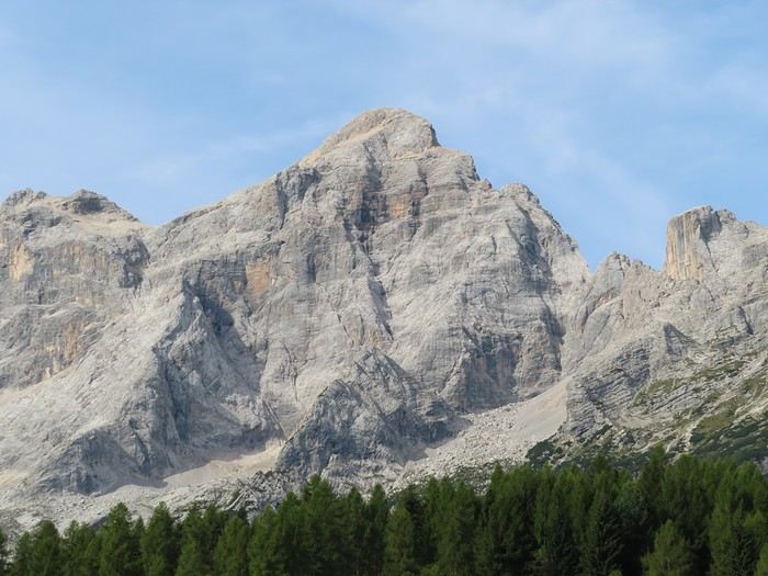
Today’s hike takes place under bright sunshine and summer-like temperatures. But before setting off, Monte Civetta (3,220m) is bathed in the morning sun.


Palafavera is indeed a unique spot between Monte Pelmo (to the east, sunny in the afternoon) and Monte Civetta (to the west, sunny in the morning).

The planned hike doesn’t start from Palafavera but from Arabba (a village at the foot of Passo Pordoi). It’s a stage of the “Sentiero Italia”: Rifugio Castiglioni Pian di Fedaia - Arabba (I have the GPX track), the best balcony hike in front of the Marmolada massif. The start and finish points are in two different valleys, so I’ve adapted the route as follows: Start in Arabba - Take the cable car up to Porta Vescovo - Descend to Pian di Fedaia (trail 698) - Then the Sentiero Italia stage: climb via trail 698 - Variant via the geological trail to Passo Padon (trail 680A then trail 680) - Trail 699 to the cable car’s intermediate station - Trail 698 from the intermediate station back to Arabba.

There’s traffic this morning, but even more people at Forcella Staulanza (a starting point for hikes), the pass connecting Val di Zoldo to Val d’Agordo. The road to Arabba is very scenic the whole way. In Arabba, parking is paid throughout the village (they’re really strict about this in the Dolomites). I find a spot just before entering the village and start from there.

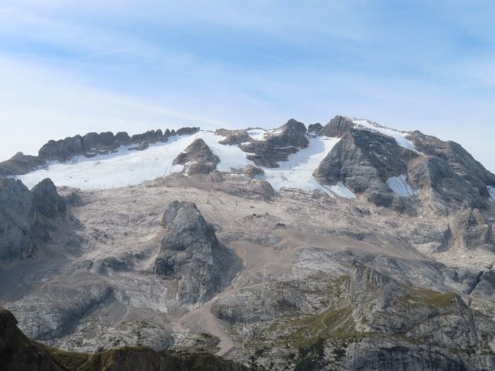
I head to the cable car, buy a one-way ticket to Porta Vescovo (17.50 € according to my notes), and get into a cabin. It’s not crowded: just 2 other people in my cabin, a mountain biker in the previous one, and no one else around. At the top, about ten people are admiring the view of the Marmolada massif with its glacier on the north face. The entire hike up to Passo Padon unfolds with this view of the Marmolada; only the altitude (we’re almost at the highest point) and the position (we’re moving east) change.


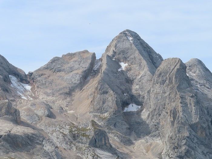
A little further west in the Marmolada massif, Gran Vernel is impressive from every angle.


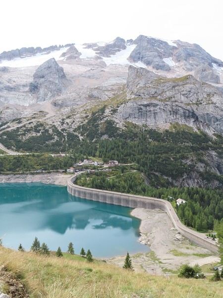
I start the descent toward the dam of the artificial lake (Pian di Fedaia), where I ended my hike during my 2021 trip to Trentino.


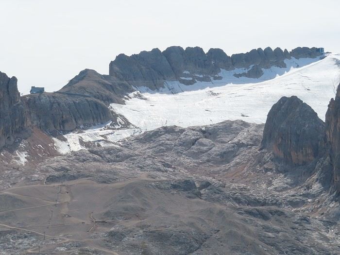
After a few photos near the dam, I head back up the same path to a trail junction. Most of the elevation gain is done, and I head toward Passo Padon and the namesake refuge, staying between 2,300 and 2,400 meters. I’ll comment on the eastern part of the glacier, where people ski in winter. To the left, the second intermediate station of the cable car is on its rock (2,800 meters); to the right, you can make out the upper station (3,200 meters). The connection between the two is via a cable with a single pylon (on the rock near the intermediate station). I’ll come back to all this tomorrow.


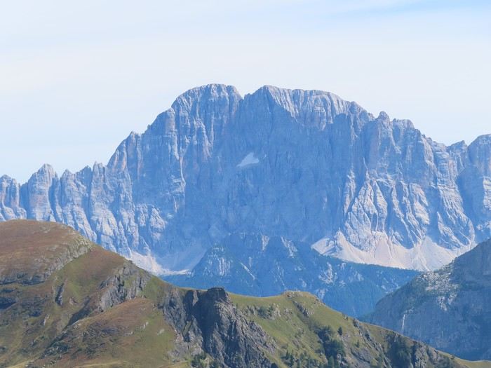
Passo Padon offers sweeping views of the peaks to the east. We see Monte Civetta again, from a different angle than this morning. The northwest face, which is vertical, isn’t in the sun yet.


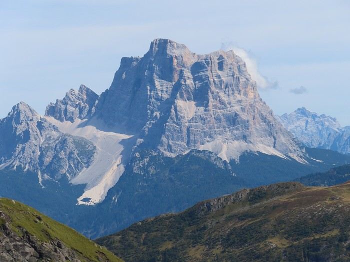
Monte Pelmo is a little further away (zoomed-in photo); it’s also seen from a different angle than the one at Palafavera.


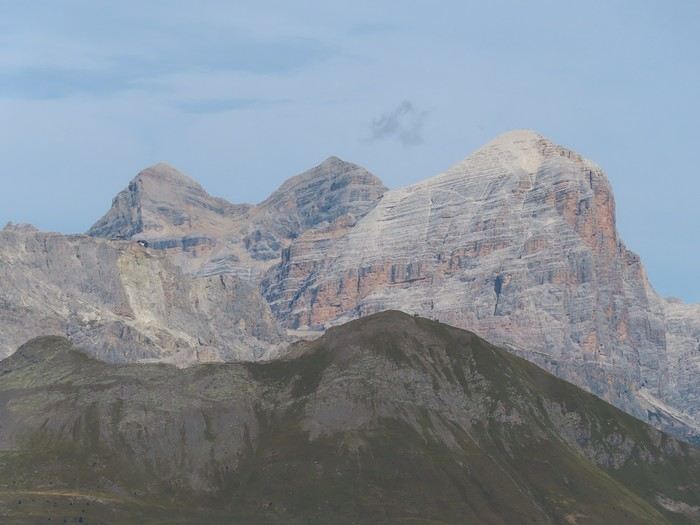
Once the pass is crossed, the landscape opens up to the north, both east and west. In the distance, you can see the “Tofane,” three iconic peaks above Cortina d’Ampezzo (heavily zoomed-in photo).


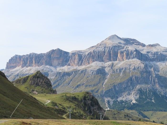
From here, I start descending toward Arabba (I only lose altitude gradually and am in the Arabba ski area), with the Sella massif in front of me, peaking at Piz Boé (3,152 meters). The peak in the background to the left (you can make out a cable car station) is Sass Pordoi above Passo Pordoi.


Behind me, Monte Padon towers over the pass I’ve just crossed. Its particularity is that it’s of volcanic origin, even though it’s in the Dolomites.


More to come in the next post.
VA Valmichel86 Regular ·
Day 4: Sunday, September 7, 2025 (continued) This part of the descent (the upper section) is full of marmots; they’re very wary and hard to photograph. Once I reached the intermediate cable car station, I continued the descent to Arabba; this second part (intermediate station - Arabba) is much steeper than the upper section (Passo Padon - intermediate station).

On the way back to Palafavera, I stopped twice. First stop at the Colle Santa Lucia viewpoint, set up to admire Monte Civetta above and Val d’Agordo below. The sun had shifted and was now hitting the northwest face.


On the climb toward Passo Staulanza, a second stop with another view of Monte Pelmo.


I got back pretty late since I took my time on the hike. Hardly any other hikers around, especially on the return stretch from Passo Padon to Arabba.
VA Valmichel86 Regular ·
Day 5: Monday, September 8, 2025

Today, I’m not hiking; I decided to head to the top of Marmolada by cable car—well, almost to the top, since the cable car reaches 3,265 meters, while the summit is at 3,343 meters. I drive to Malga Ciapela (1,450 meters), where the cable car starts. Of course, the parking lot right next to the lower station is paid—a real shame when you think that 95% of the people parking here are taking a round-trip from Malga Ciapela to Marmolada for 38 € (they’ve got to fill all the cash registers). Free parking (for now) near the campervan area, about 800 meters from the cable car departure.

The first section, Malga Ciapela to Banc d’Antermoia, is truly impressive: a single span with a 900-meter elevation gain.


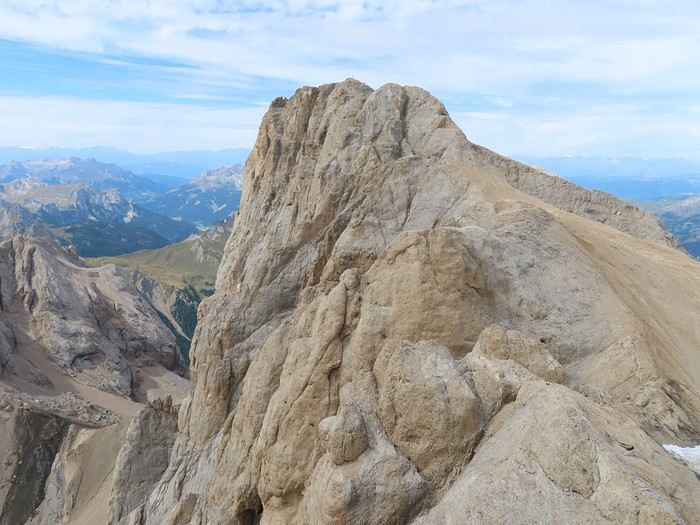
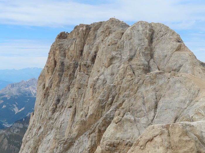
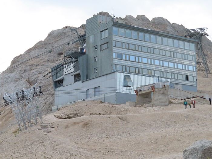
I just switch cabins at Banc d’Antermoia and, a few minutes later, arrive at the Serauta station (2,950 meters). I’ll spend some time there on the way down, but for now, it’s straight to the top—Punta Rocca (3,265 meters). The panoramic terrace is built on the roof of the cable car station, with a view of Punta Penia, the highest point in the Dolomites, and its 1,000-meter vertical drop on the southern side.


You can see the cross at the summit.


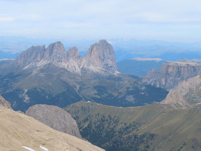
Below, I spot Lake Fedaia and the trails from yesterday’s hike, from Porta Vescovo to Passo Padon. Among the massifs visible from here (but not from yesterday’s route) is Sassolungo, above Canazei.


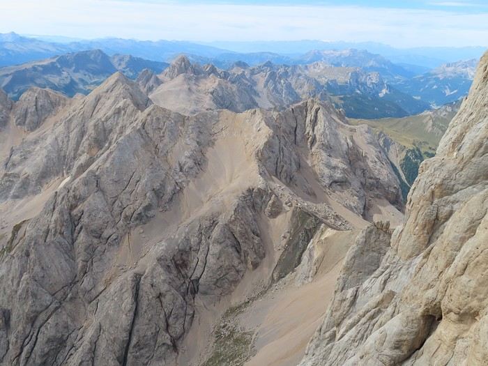
South of Punta Penia, the Ombretta massif has a very rugged appearance. The pass in the foreground (Passo dell’Ombretta) lies just below Punta Penia, connecting Val Contrin with Malga Ciapela. It’s probably tough to access given the slope and scree on both sides.


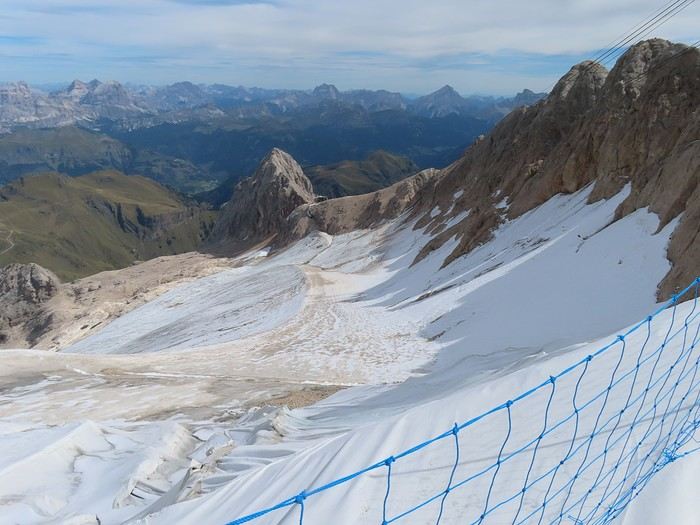
You can also see the Madonna Grotto, carved into the rock, which you reach from inside the cable car station. The inevitable Pope John Paul II visited it. Finally, you can take a few steps on the glacier—it’s a glacier on borrowed time, and recent trends suggest it’ll disappear completely between 2040 and 2050 (thanks to climate change). This is the top of the Marmolada ski slopes, heading in the direction of the photo. After practicing identifying them yesterday, I recognize Monte Civetta, Monte Pelmo, and the “Tofane” (in the photo). An orientation table helps with the other peaks. This photo is taken from the top of the third section of the cable car; the glacier is below the cable, similar to the photo I took yesterday near Passo Padon (it’s the same glacial tongue seen from two different spots).


I head back down to the intermediate station (Serauta), where I have a picnic and visit the Great War Museum.


The museum has an indoor section dedicated to the war at high altitude: fighting took place here from 1915 to 1917 (lots of artifacts, photos, and archival films). Among other things I learned, the Austrians had dug a network of trenches into the glacier (invisible from the surface since they were entirely within the ice) to provide shelter for soldiers. Since the idea didn’t stay secret, glaciers were bombed during this war—here and in Adamello (another site of the “White War” at around 3,000 meters).

The outdoor section of the museum occupies the slope of Punta Serauta, where the Italians had set up a system of pathways, shelters, and firing positions.


I return to Malga Ciapela. The road back down follows the valley floor, and I stop at the first village, Sottoguda. You have to park downstream and walk back up through the pedestrian-only village: cobblestone streets, a church, traditional houses, a tourist office where I buy Dolomites posters, and a small grocery store where I do some shopping.


A few hundred meters past the top of the village, on this abandoned road, you can access the “Serrai di Sottoguda,” which I won’t do since the site just closed. The old road to Passo Fedaia used to pass through here: crossing the village, then entering a very narrow gorge 2.5 km long that led to Malga Ciapela. The modern road bypasses the village, crosses a bridge, and goes through a tunnel. The old road, originally a mule track, has become a walkway (paid access), likely very shady given how narrow the “Serrai di Sottoguda” gorges are. Weather-wise, it’s a pretty nice day: the sky is overcast (at very high altitude) but very bright. Unusually mild for this elevation (3,200 and 2,950 meters). A change in weather is forecast for tomorrow.
VA Valmichel86 Regular ·
Good evening Doogy76, Thanks for following this travel journal. I’ll keep writing, and it’ll be mountains... and more mountains.
VA Valmichel86 Regular ·
Day 6; Tuesday, September 9, 2025

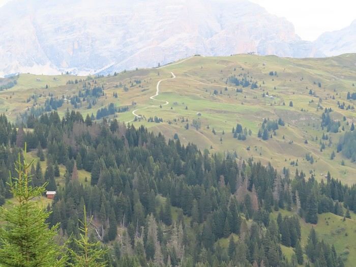
Back to hiking today; the weather forecast predicts overcast skies, but rain isn’t expected until 4 PM. I’m planning a shorter route, following the one from the day before yesterday on the "Sentiero Italia": Arabba - Pralongià. I’m cutting the route even shorter by skipping the climb from Arabba to Passo di Campolongo, the pass between Arabba and Corvara. I should’ve done the climb and descent on foot since I no longer have my bike, but I’m opting for the shorter route: Passo di Campolongo - Pralongià (round trip). The altitude is moderate: 1,875 meters at the pass, 2,140 meters at Pralongià. The trail is easy, located in Corvara’s ski area, passing through forests and mostly alpine pastures. The view extends over the Sella massif (see the day before yesterday) and the Puez-Odle range. Below, the Corvara valley and the Puez-Odle massif.


A zoomed-in view of "Punta di Puez" (2,913 meters, still). This massif is in Alto-Adige, and I won’t be going that way at all for the rest of the trip.


Now I can see Pralongià, the goal of the hike (where I’ll turn back), on the ridge above the dirt road. The scenery looks like this from start to finish.


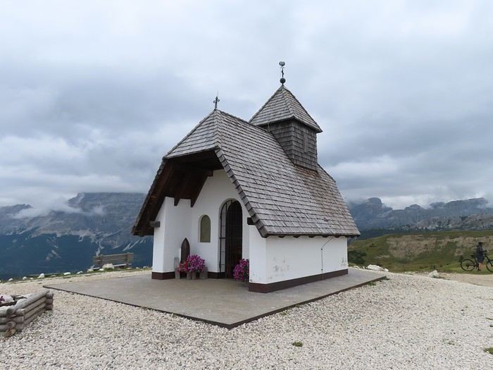
At Pralongià, the small St. Anthony’s Chapel (1977) sits between the chairlifts and the refuge.


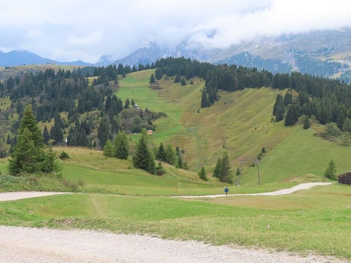
The alpine pastures of Corvara and San Cassiano surround the Pralongià plateau.


I’ll head back up this small valley, which I descended on the way out, to the trees at the top.


Shortly after, the first raindrops start falling. It’s around 12:30 PM, and I take shelter in a hut 50 meters off the trail. Inside are members of a family—grandparents and grandchildren—who, like me, are waiting for the rain to stop. They come here every year the week before school starts. Since the rain doesn’t let up, everyone has a picnic, and the wait continues.

Suddenly, one of the kids, who had gone outside, comes back in announcing there’s a naked man outside. A few seconds later, the man enters the hut. He’s wearing hiking shoes and shorts, bare-chested, no hat. Since it’s been raining for over an hour, water is streaming off him from head to toe, yet he doesn’t seem to feel the cold at all. It’s really not warm out, and I’d been hiking in multiple layers before putting on a rain jacket when the rain started. Unbelievable! He’s mushroom picking and shows us a bag with several kilos inside (I recognized porcini among other species). He leaves again, still acting like it’s 25°C and sunny. I know Italians are crazy about mushrooms, but I’d never seen anything like this before.

Around 2:30 PM, I decide to walk in the rain for the 40 minutes it’ll take to get back to the car. The rain will continue until evening…

Once back, I check the weather forecast. "Tomorrow, rain all day; then very unsettled weather until the end of the week." I’ll leave the Dolomites tomorrow morning. I’ll come back as soon as the weather improves.
GA Gaura Veteran ·
It's so beautiful!
VA Valmichel86 Regular ·
Day 7: Wednesday, September 10, 2025

It rained all night, and it’s still raining this morning. I set off and head down to about 10 km from Belluno, then turn toward Vittorio Veneto. I settle a few kilometers from this town in a hilly area, wedged between the plain and the Prealps. I’m going to explore this little region (the Prosecco region) and the towns of Conegliano and Vittorio Veneto—it’s in the northern part of the province of Treviso. It’s not in the Dolomites, so it won’t be in my travel journal. I’ll check the weather forecast daily for Cortina d'Ampezzo and the surrounding area. I don’t want to ruin the hikes I’ve planned around this town—I’ll head back up to Cortina on Sunday, September 14.
VA Valmichel86 Regular ·
Hi Noëlle, I think the hikes around Cortina d'Ampezzo are even more beautiful than the ones at the start of the trip; the weather will also be much sunnier in the upcoming part.
VA Valmichel86 Regular ·
Day 11: Sunday, September 14, 2025

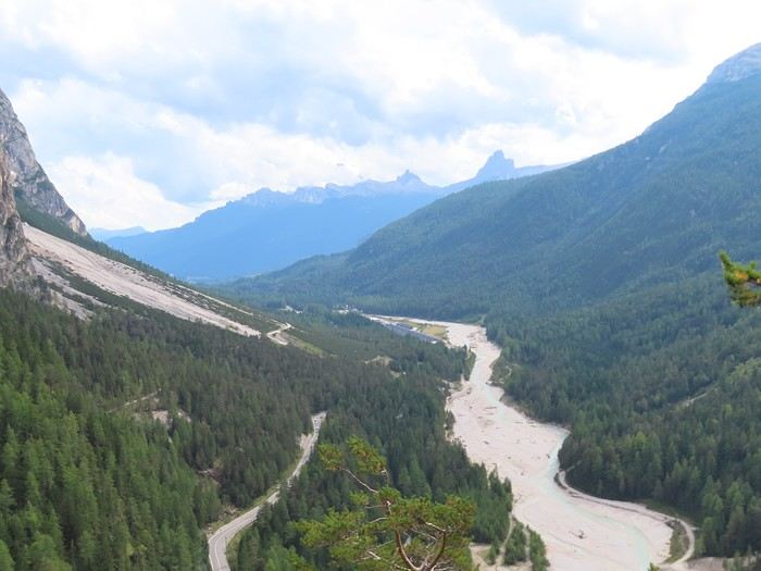
I’m back in the Dolomites. The last cloud remnants cleared in the morning while I was making my way to Cortina d’Ampezzo. It’s an easier climb compared to Val di Zoldo: more kilometers but a slightly lower altitude of just over 1,200 meters (instead of the 1,500 meters reached at Palafavera).

The camping area is located downstream from the town center, quite far from it, near the "torrente Boite" stream that flows just a few steps away. Three campgrounds are set up in this area; they’re called "Cortina," "Dolomiti," and "Rocchetta," and they operate without reservations (good to know for anyone planning to come in August). I chose the "Cortina" campground because it stays open, while the other two close during or at the end of the week. There’s a fourth campground in Cortina d’Ampezzo, located about 4 km north of the town on the road to Dobbiaco (not sure how it operates?).

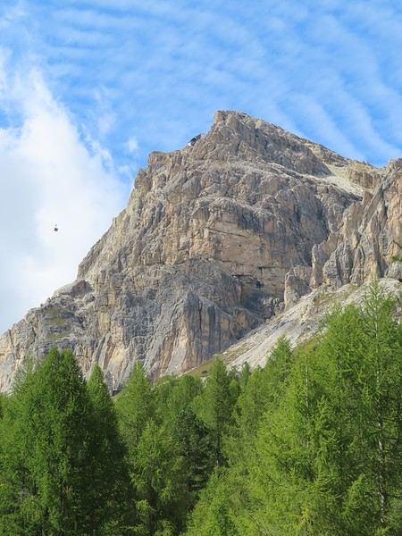
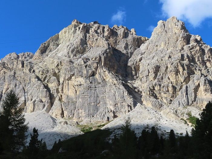
I arrived before 1 p.m. and had the afternoon free to pick up some mountain activities again. I decided to visit a castle, the Castello d’Andraz, which is only open on Saturdays and Sundays in September. To get there, you have to climb the Passo del Falzarego, one of the legendary passes in the Cortina d’Ampezzo area. It’s really beautiful as soon as you leave town, and I think it gets even more stunning a few kilometers before the pass. You can see the Lagazuoi and the cable car that goes up from Passo Falzarego.


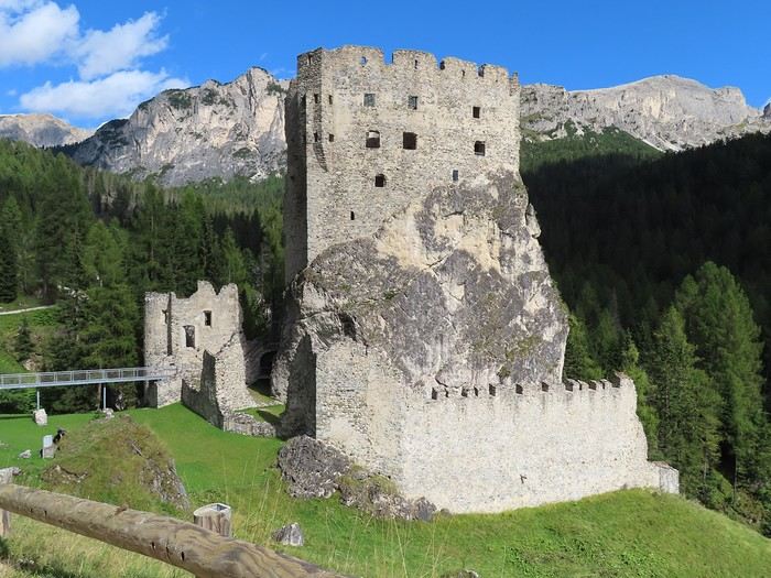
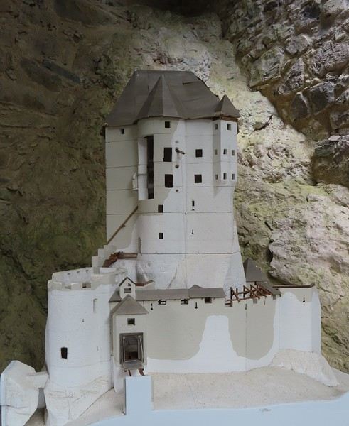
I crossed the pass and started descending toward Val d’Agordo, which is just as beautiful as the Cortina side. After 5 km, a small road on the right (a dead end) leads to Castello d’Andraz. From this angle, the background of the photo is dominated by the Averau-Nuvolau massif. A different shot would show the Lagazuoi, which is further to the left. The castle overlooks the valley and is built against a massive rock. Below the rock, there’s a forecourt (which isn’t an entrance to the castle) preceded by a fortification, and the actual south façade is built above the rock’s ridge. On the north side, a stream flows at the bottom of a sheer gorge, and they had to build the access level right away (a single access via a drawbridge, whose location you can still make out).


The model below helps you better understand the elevation of the structure.


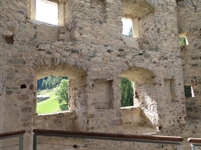
A detailed audio guide provides historical information and insights into the construction (let’s call them architectural details). It was a border between the possessions of the Bishop of Bressanone and those of the Republic of Venice, and a small garrison was stationed there. Abandoned (around 1800), looted (19th century), bombed (World War I), collapsed, the castle was restored without opting for reconstruction, which is why there are metal structures allowing you to move around the ruins, especially to go from one level to another. Here’s a room that served as the living quarters for the Captain commanding the garrison.


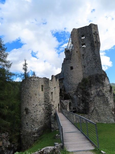
You can even climb up to a glass terrace at the level of the former granary, offering a great view of the nearest massifs (Averau-Nuvolau, Sasso di Stria, Lagazuoi). Below is a view of the castle from the entrance/exit; you can see the glass terrace and what remains of the north-side structures. It’s no surprise there were so many "restructurings" over time, nor that a large part of the castle collapsed.

VA Valmichel86 Regular ·
Day 11: Sunday, September 14, 2025 (continued)

I head back up to "Passo Falzarego"; I’ve planned a short hike for the second half of the afternoon. Parking at the pass is paid (at least one large lot) or free on the roadside with a somewhat chaotic vehicle arrangement. I park 500 meters from the pass in the direction of Cortina. The paid parking operates with the day divided into two time slots (daytime, nighttime), with a flat rate for each slot (no hourly rate within a slot).

I planned to go to Valparola Pass and then to Lake Valparola. The route can be done by road, but this road is closed (construction) on the descent toward San Cassiano, after the lake. As a result, traffic is very light since it’s a dead end during the works. So, I’ll walk the outbound trip along the road and return via the trail that runs through the valley below the road.

The Lagazuoi seen from a different angle than the first photo of the day.


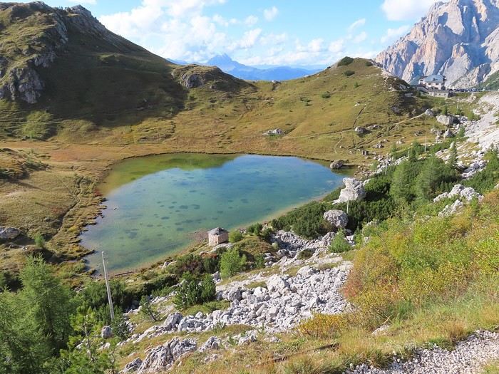
Afternoon is the best time to have the sun well-positioned when you’re at the foot of Lagazuoi. 80 meters of elevation gain over 2 km isn’t too difficult to reach Valparola Pass. Shortly after starting the descent, you arrive at an old fort (Great War Museum) and the small Lake Valparola.


Beyond the lake, there’s a refuge and, further on, the entire Varella massif, part of the Fanes group.

I return to Passo Falzarego via the "Sentiero Italia" (here, trail 424). It runs through the valley between Lagazuoi and Sass di Stria. It’s now in the shade, so it’s better to hike it a little earlier in the afternoon. You can see "Passo Falzarego" and, in the background, the rocky block of Averau dominating the scene.
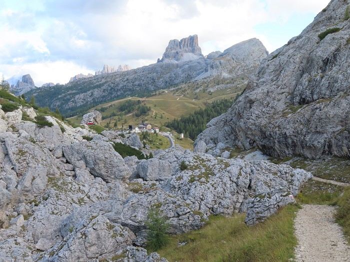
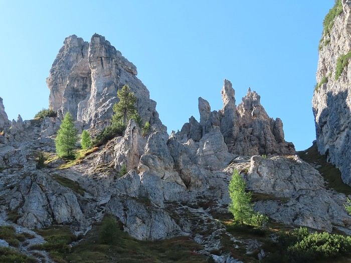
That’s all I could identify when I took the photo. I’ll be spending the week in Cortina d’Ampezzo and doing four iconic hikes in the area. This lets me identify, in hindsight: - In the far background, to the extreme left, the "Cinque Torri" - In the center, way in the back, a jagged ridge, the "Croda da Lago" massif.

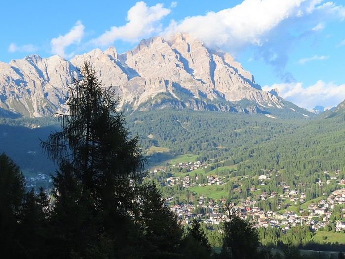
Back at Falzarego Pass, I return to Cortina d’Ampezzo. It’s the same road as on the way there, but in the opposite direction, so the landscapes look different. In the lower part of the descent, after Pocol, there’s a viewpoint by the road: a view of Cortina d’Ampezzo and the Cristallo massif, bathed in late-afternoon sun.

VA Valmichel86 Regular ·
Day 12: Monday, September 15, 2025

I decided last night to head to the "Tre Cime di Lavaredo" to start with THE hike in the Dolomites.

This hike starts from the Auronzo hut (2,330 meters), located at the end of an access road that begins in Misurina (1,750 meters). It’s extremely well-known and notorious for being overcrowded, regardless of its appeal in terms of mountain scenery. I was expecting a particular vibe, which started with the approach logistics. The access road has been toll-based for several years (with plenty of parking near the hut).

This year, it’s mandatory to book your vehicle’s passage online; the website assigns a time slot during which you must arrive at the toll barrier. The toll fee is set at 40 euro (no typo there). I ruled out the toll road and opted for another solution: parking at the base of the climb and taking a shuttle round-trip to the Auronzo hut, based on info suggesting shuttles run every half-hour. Another option is taking the bus round-trip from Cortina d’Ampezzo to the Auronzo hut. I didn’t look into this, so I don’t know the schedules or fares.

That was the situation when I left Cortina d’Ampezzo and took the road to "Passo Tre Croci." At the top of the pass, I headed down the east side, then took a left onto a road that quickly (about 2 km) leads to Lake Misurina. Right away, I noticed that parking is paid everywhere in Misurina, and any space that might allow free parking is formally and/or physically blocked off (barriers, chains). I headed toward the access road, at the base of which are the shuttle departure point and a large parking lot (for cars and RVs). Along the way, an LED sign displayed "sold out" (referring to the access road). New arrivals wouldn’t rush to their smartphones to book a last-minute passage. Italians wouldn’t get the privilege of seeing this info in their own language, as the display stayed stuck on "sold out." I arrived at the "parking-shuttle" area, where they’d just put up a barrier because the lot was full. About 100 people were queuing for a shuttle, and the attendant at a checkpoint made me turn around (they weren’t letting vehicles onto the toll road). I went back to the nearest parking lot in Misurina, parked, and headed to the payment terminal. The accepted payment methods were coins and contactless bank cards. The daily rate (until 6 PM) was either 12 or 14 euro—I can’t remember which. Everything went wrong: I didn’t have enough coins, and my bank card doesn’t work contactless (a personal security choice). If I parked without paying for the full day, I was sure to get a fine. The day was ruined. I left the area toward Dobbiaco, and—miracle!—a van pulled out of a small roadside spot (accessible since there was no chain), and I took its place. The neighbors in the next van were having breakfast in the sun; they’d been there for two days and hadn’t been bothered. The hike could finally begin. I walked to the shuttle departure point (not far), where about 150 people were now in line (it was 9 AM). I decided to hike up to the Auronzo hut on foot.
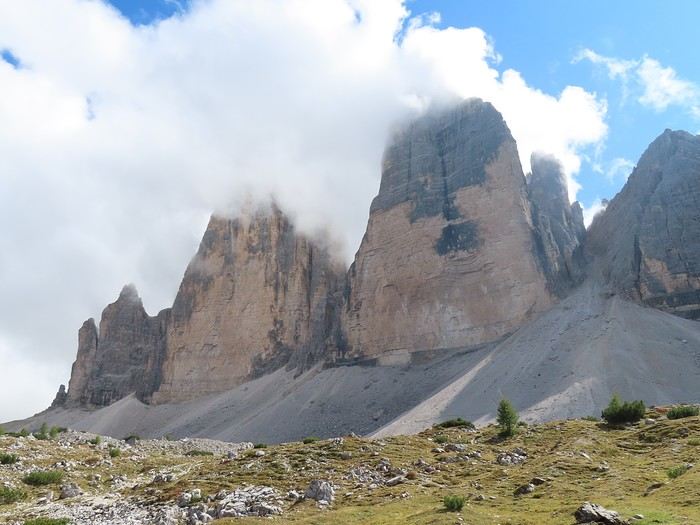
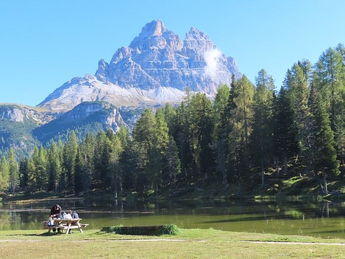
The first stop was Lake Antorno, with the "Tre Cime" massif in the background. From here (and during all the open sections of the climb outside the forest), you can see the west peak (left) and the great peak (right), but not the small peak (further east).


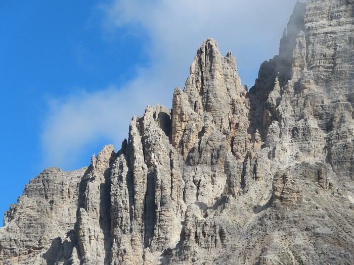
A little higher up, the trail veers off the road and runs alongside a Dolomite group, the "Cadini di Misurina." I had a GPX track from Lake Antorno, but it wasn’t necessary—the signage was excellent. Needles in the "Cadini di Misurina."


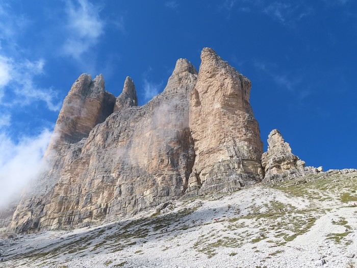
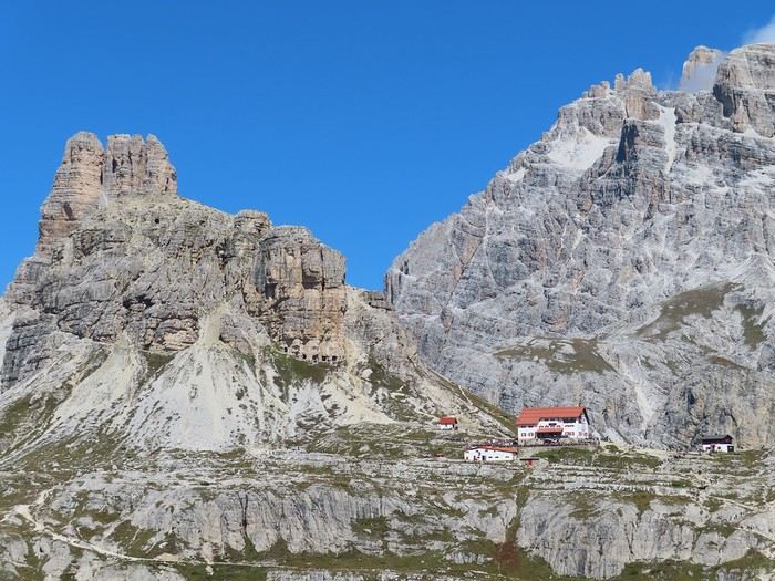
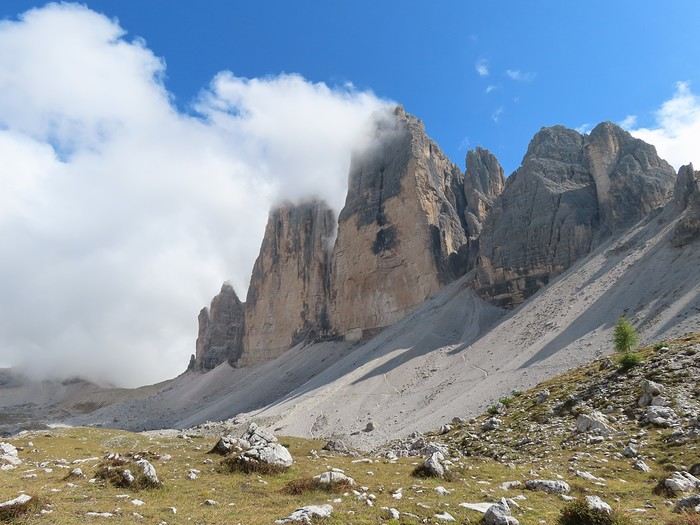
The trail crosses the access road, and you get closer to the hut, which is now visible. The two peaks mentioned (west and great) dominate the view (note the appearance of these south faces). The ascent trail was moderately busy: about ten people passing me or being passed by me during breaks.


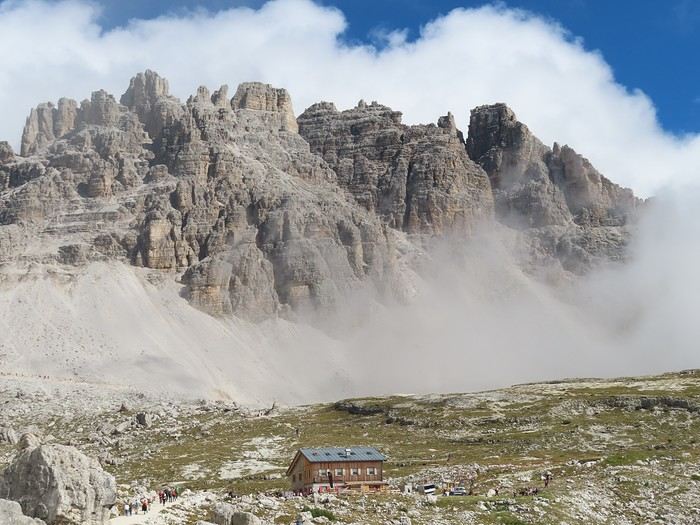
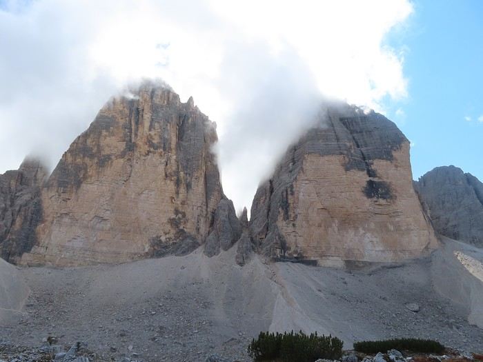
About half an hour later, I reached the hut, but visibility was zero—a cloud rising from the Auronzo valley blocked everything. I waited fifteen minutes, but nothing changed, so I decided to start the loop around the three peaks. I could only see people within 10 meters of me, and there were plenty—it was a real procession on a road wide enough for 4x4s (which use it to supply the huts along the way). The Santa Maria Ausiliatrice chapel and the "Piano di Lavaredo" were both in the clouds, so I didn’t get the classic photo of the three peaks from the "Piano di Lavaredo." The cloud lifted all at once just before the Lavaredo hut, revealing the Monte Paterno massif in the background. The Tre Cime massif was still shrouded in clouds at that point. Some of the procession participants turned back here.


I waited near the hut for the cloud covering the Tre Cime massif to clear. Gradually, visibility improved.


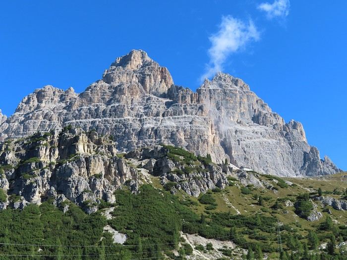
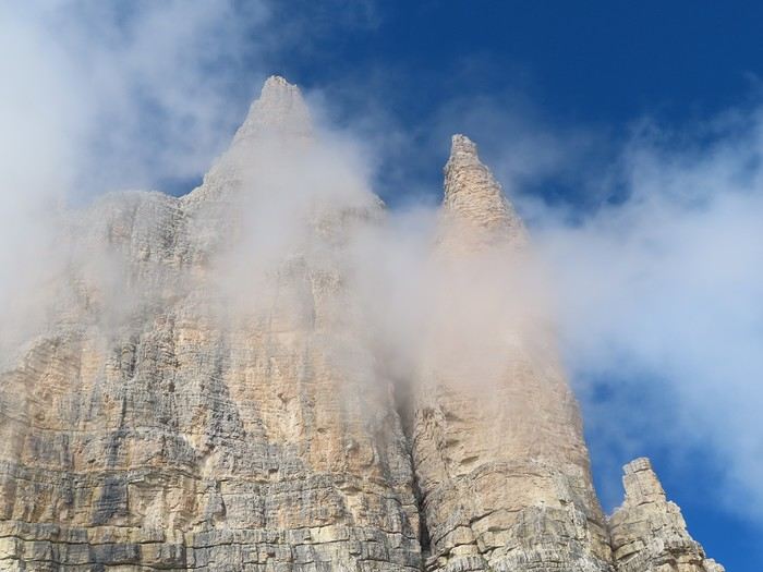
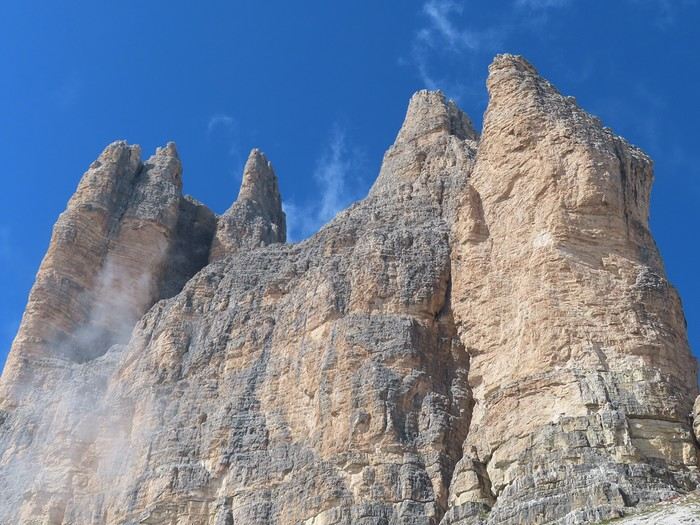
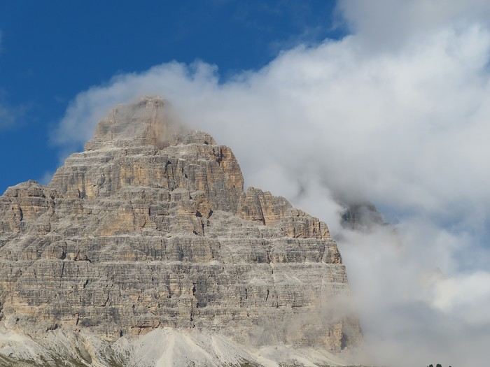
What you see in the photos above is the small peak ("Piccola Cima") and the secondary summits connected to it (Punta di Frida, Cima Piccolissima). From the Lavaredo hut, that’s the only peak visible. I continued the loop around the three peaks, climbing to "Forcella Lavaredo," a pass to the right of the previous photo (you can see the trail leading up to it). The landscape changes completely here. You move from the south side (Veneto region) to the north side (Trentino Alto Adige or Süd Tyrol region), revealing the view north of the Tre Cime—and most importantly, you get the full lineup of the "Tre Cime di Lavaredo": Piccola Cima, Cima Grande (2,999 meters), and Cima Ovest. The "pillars, obelisks, limestone pyramids" aspect defines this north side of the Tre Cime.


There was a real crowd at the pass; many visitors were hesitant, and some turned back. The procession toward the next hut on the classic route (Locatelli hut) thinned out, though we were still on a 4x4 road. I chose to leave the classic route (and the procession) to take a trail marked on a plateau between the three peaks and the classic route. The picnic break was along this trail, about fifteen minutes from the pass. To the north, the Locatelli hut sits at the foot of a spur (Torre di Toblin), with the "Tre Scarperi" massif in the background.


More to come in the next post.
VA Valmichel86 Regular ·
Day 12: Monday, September 15, 2025 (continued)

To the northwest, the Dolomiti di Sesto group (which includes the Three Peaks) offers other summits: in the foreground, the isolated "Torre dei Scarperi"; further away, the southeast face in the shadow of a cloud, the "Croda dei Rondoi".


The entire circuit I’m covering today and all the mountains in the photos are part of Group 5 (Northern Dolomites), a UNESCO World Heritage site. North of the plateau, two of the Three Peaks: Cima Grande and Cima Ovest.


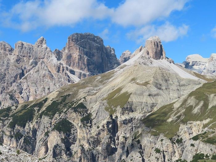
I continue along this trail toward "Malga Langalm". Behind me lies the Monte Paterno massif, with its characteristic Dolomite formations.


As I advance across the plateau, the Three Peaks come into view just before reaching "Malga Langalm".


At "Malga Langalm", I reconnect with the classic route (longer and farther from the Three Peaks) coming from the Locatelli hut. Many people turned back at the hut, so the final stretch of the Three Peaks loop is much less crowded—though it’s still busy, it no longer feels like a procession. The trail keeps climbing as it circles the peaks.


Continuing this way, you reach a spot where the "Tre Cime di Lavaredo" line up perfectly, with Cima Ovest in the foreground. It’s a bit like the counterpart to Forcella Lavaredo but on the west side of the massif.


After a stretch across scree, I quickly reach the pass (Forcella di Mezzo), which leads to the southern side. The trail descends gently back to the Auronzo hut. You arrive at the hut by skirting the parking lot, giving you a sense of its massive size. There’s even a spot where half a dozen 50-seat coaches park—tour operators bring entire busloads of visitors here! I take a break to look down at the valley where the morning mist rose and enveloped everything.


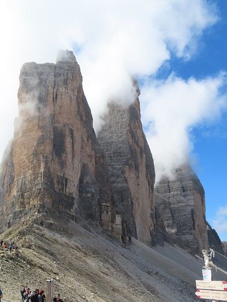
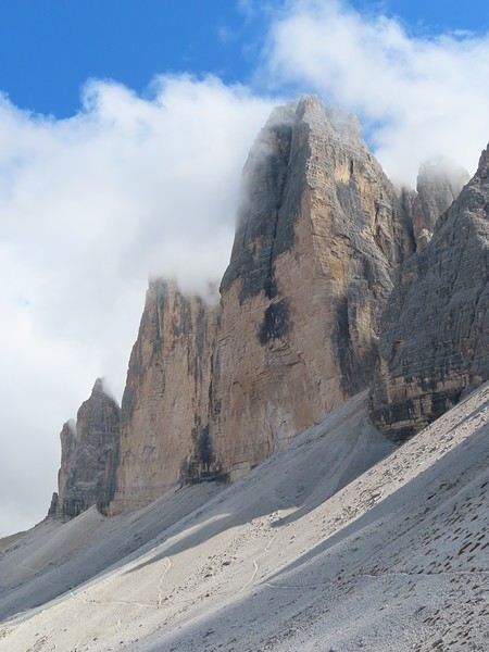
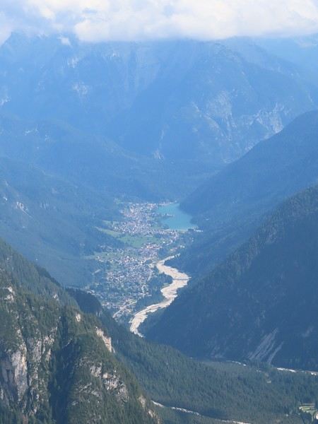
It’s the Val Marzòn, at the end of which you can see Lake Santa Caterina and the town of Auronzo di Cadore. All that’s left is to descend from the hut to Misurina. I take my time, glancing back now and then to admire the south face of Cima Grande (zoomed-in photo) and compare it to the north side.


Back at the car between 5:15 and 5:30 PM. Ascent to the hut: 2 hours (same for the descent). Loop around the "Tre Cime di Lavaredo": 4 hours. In terms of elevation: 2350–1750 = 600 meters of ascent to the Auronzo hut, and the same descent; 260 meters of ascent for the Three Peaks loop, and the same descent since it’s a circuit.

This is an exceptional, unforgettable hike. The conditions under which it can (or can’t) be done call for a few observations: 1 - The option I took (doing everything on foot from the valley) applies to only a tiny fraction of visitors or hikers. It’s negligible in terms of foot traffic. Plus, I only "chose" it "by default"—I didn’t want to wait for the 3rd or 4th shuttle (one every 30 minutes, a rhythm confirmed by hikers I met in the afternoon). 2 - The access managers (I think it’s the municipality of Auronzo di Cadore, but this needs verifying) may have been overwhelmed in the past, but they’re not anymore this year. They now almost fully control the number of people on-site. They decide how many cars and shuttles are allowed per day (and possibly, to some extent, how many buses come from Cortina or Dobbiaco). They set prices to steer traffic. If you’re a group of 3 or more, driving up is the better deal (40 €). If you’re alone or a pair, parking at the bottom (12 or 14 €) and taking the shuttle (10 € per person) makes more sense. At most, they might misjudge the average number of passengers per car or how many shuttles won’t be full (especially from late morning or early afternoon onward). Either way, they know and control the maximum number of people who can be at the "Tre Cime" site in a day. 3 - Given point 2, I think today’s crowds (mid-September, so quite late in the season) were similar to those in July or August: all car passes sold out, long lines for shuttles (unless the shuttle frequency was reduced compared to peak season). The turnout is massive—too massive for my taste. 4 - The principle of making mountain access paid through all sorts of tolls is really unpleasant (a mild way to put it). 5 - The prices, which are very high (another understatement), are worrying for the future. If the manager’s priority weren’t maximizing revenue, they could charge less. Since they control the flow (number of cars, shuttles), lower prices wouldn’t affect overcrowding. That’s clearly not their choice, so I fear prices will keep rising in the coming years as long as this hike "sells out."
VA Valmichel86 Regular ·
Day 13: Tuesday, September 16, 2025

This will be a transition day; the weather isn’t great for a full-day hike. It’s overcast in the morning, then there’s a solid hour of heavy rain (pouring down). Everything clears up around 10:30 AM, so I head out to visit Cortina d’Ampezzo. Parking is paid almost everywhere; there’s only one free parking lot (via dello stadio) open, and of course, it’s not enough. A second free parking lot exists, but it’s being used to store construction equipment (preparations for the Olympic Games). The sun comes back with a blue sky and pleasant temperature, so I stroll around the center and visit the modern art museum (I bought a ticket for all three museums in Cortina d’Ampezzo). This museum features 20th-century Italian painters, a beautiful collection of paintings put together by a collector from Cortina who personally knew many of these artists. One work to remember: *La Zolfara* (*The Sulfur Mine*) by Renato Guttuso. No photos—I forgot to bring my camera.

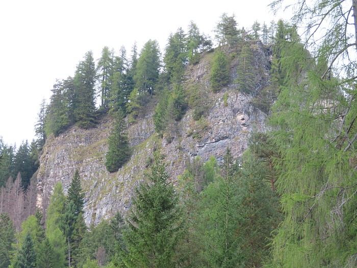
In the afternoon, I take a short hike near Castello di Botestagno, 5 km north of Cortina toward Dobbiaco. This medieval castle, or what little remains of it, sits above the confluence of two streams: *torrente Boite* (which flows toward Cortina) and *torrente Felizon*, a tributary of the former. To get there, I take a small road to the left of the SS51 after the hamlet of Fiames; it leads to the information point of the *Parco delle Dolomiti d’Ampezzo*, where I park (free parking). A loop trail goes up to the top of the rock, the site of the former fortress.


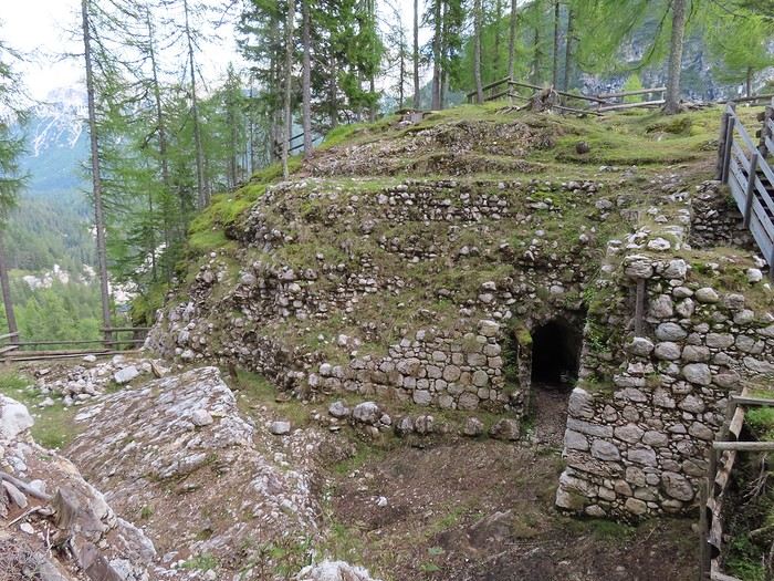
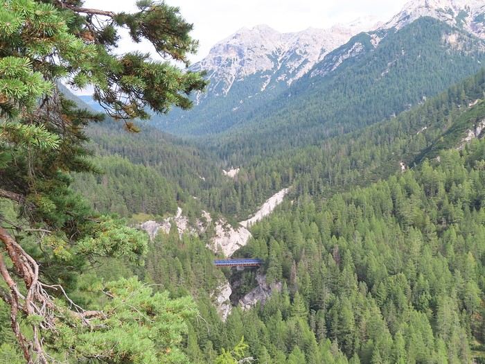
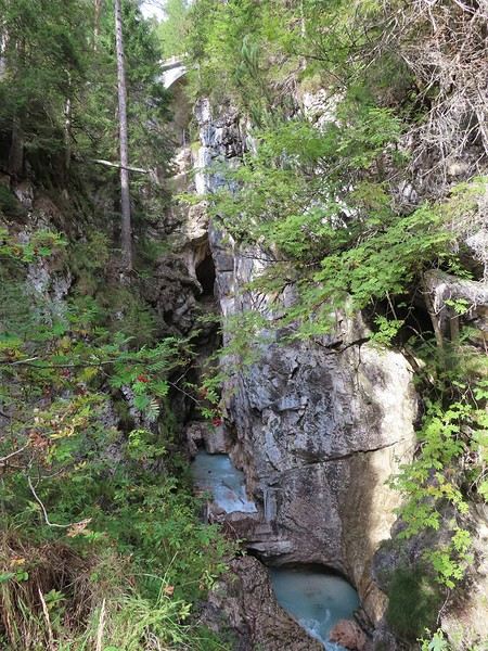
The uphill trail stays close to the gorge carved by *torrente Felizon*. It goes as far as the old railway bridge over the stream and continues to the summit. There are still foundations, uncovered during recent excavations, but nothing above ground.


However, the view overlooks the stream’s gorge with the railway bridge mentioned above. The old railway line has been replaced by the Dobbiaco–Cortina d’Ampezzo bike path.


Toward Cortina, it’s the *torrente Boite* valley, with a powerful flow swollen by this morning’s rain.


The return takes a forest road that runs alongside the main road. About a hundred meters before the end of the loop, you cross *torrente Felizon* at the gorge’s exit.


This hike takes about 1.5 hours (from memory, very approximate since I didn’t take notes). The elevation gain is 180 meters up and the same down (it’s a loop).

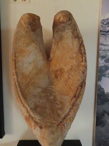
Afterward, I visit the paleontology museum in Cortina d’Ampezzo, born from the passion of an amateur (Rinaldo Zardini) and the incredible fossil wealth of the Dolomites. Here’s a fossil piece of *(Neo) Megalodon*, a species that went extinct 3.5 million years ago (known as the largest shark to ever exist). But what part of the body is this? Mostly Megalodon teeth have been found, but while the shape is intriguing, the massive size of the pieces in this museum doesn’t match the size of teeth found elsewhere. So, is it a tooth, a vertebra, or part of the skull? I don’t know and couldn’t find anything online to clarify.


Back at the campsite with high spirits for the coming days (the weather forecast is perfect).
GA Gaura Veteran ·
Looking at these photos, I regret not going to the Dolomites when I had the health for it! Now I can mostly do nearly flat terrain and downhill walks. In Switzerland, I know some amazing hikes near Interlaken—you take a train and then a cable car up to altitude, then hike back down on the trails. I’ll check if something like that exists in the Dolomites.

Similar discussions

You might also like