It all started last December, after another price alert from Gilou for United/Lufthansa flights at 250 € from Paris to San Francisco. Meanwhile, I was planning to spend a week alone with our three kids (Maxime, 14, Rachel, 12, and Timéo, 8) somewhere in France for the February break.
But this time, Gilou really outdid himself—way too tempting! 😮 His great tip worked for both the February and Easter breaks. I know April is the ideal month, especially if you love hiking! But for family reasons, only February would work for us.
Isn’t February a month to avoid for the Southwest? To keep our summer trip budget intact, I was thinking of camping as much as possible. After checking weather sites for temperature histories in key spots (Furnace Creek, Saint George, Page, Sedona), nighttime temps over the past two years ranged from +5 to -2°C. So, it seemed doable...
I started discussing (aka negotiating, even begging) with my better half. The kids caught on fast that there was a chance we’d go, and they were thrilled! She finally gave her consent to make the kids happy 😎. I quickly checked that our ESTAs were still valid, and 48 hours later, I had the tickets in hand 😎😎. But five days later, Laetitia changed her mind—her "Yes" turned back into a "No." No way were we going without her to her favorite country!!
Damn it 🤪! I had to tell her I’d already bought the four tickets (without bringing it up again, of course—a "Yes" is a "Yes," right?). And since the tickets were non-refundable, there was no going back... Apparently, with women, some "Yeses" mean *really* yes, but others mean, "I said yes in principle, but I wasn’t actually on board—and I never thought you’d have the nerve to buy the tickets without telling me!!" I had no idea 🤪!
Us guys? We’re way more straightforward—binary, even monetary... Yes means yes! And no can mean yes too 😏!! Anyway, in a lovely family atmosphere, I opened a thread to start planning and thanked Trois14 and Bluemesa for their help. On Trois14’s advice, I booked 5 nights in motels around St. George-Page at super tempting rates—around $35-40 a night...
On that note, Christmas cost me an arm and a leg... Gotta try to make up for it 😛!
Here’s the theoretical itinerary:
Death Valley (2 days)
Valley of Fire
The White Dome (hike up and down via Squirrel Canyon)
4 nights in the Kanab-Page area
Sedona (2 days)
Route 66
Alabama Hills / Trona Pinnacles
Drive back to SFO via Highway 1
That’s the plan, at least...
In reality, it turned into a whole different story. I learned that in February, you’ve got to be flexible—*very* flexible sometimes—to dodge the weather. Halfway through, a cold snap made our second week (planned 100% camping) impossible, completely upending the itinerary.
So, a huge thanks to PapJ59, Noyellebis, and especially Caribou44 and Simonic. 🙂 A thousand thanks for your quick responses, availability, and sound advice, which let us have an original and unforgettable second week—Organ Pipe Cactus NM, Yuma, Salvation Mountain, Anza Borrego SP, a palm grove in Joshua Tree, then back to SFO!! Without you, we’d have been miserable on the spot, but instead... 😇
A big shout-out to Thibaut and his famous blog (rightfully praised on VF—it’s one of the few that details Organ Pipe), to travel journal writers for inspiration in general, and to those who helped me prep or during the trip (journals by Pong, Hiacinthe, Zitounet, and Laetitia).
Now, for the story...
819 similar discussions in English
Some trips are born twice.
Ours was supposed to happen in 2020. Everything was ready: the itinerary, the flight tickets, hotel reservations and Machu Picchu, the rental car, dreams of high altitudes and wide-open spaces. And then the world stopped.
Like so many other plans, our trip to Peru was put on hold. Disappointment was followed by a more concrete reality: paperwork, endless back-and-forth, and battles to recover some of the costs we’d already paid.
The years went by. Life moved on, with its shifting priorities and unexpected twists. Rescheduling this trip wasn’t possible until 2025.
The itinerary stayed mostly true to what we’d imagined five years earlier. One major difference, though—in 2020, we’d planned to rent a car and explore the roads completely independently. Most importantly, we hadn’t included the three-day Ausangate trek, due to lack of time.
For 2025, our plans evolved. 4x4 rental prices had skyrocketed, and when we looked at our schedule more closely, we realized quite a few days didn’t actually need a vehicle. So we made a different choice and opted for private drivers instead. A decision we never regretted. Always punctual, thoughtful, and available... they were so much more than just drivers.
All our reservations were made in January, except for the trek, which we booked in February.
Finding reliable drivers on our own was tough, so we asked Laurent from Tout Pérou to handle it for us. Going through Tout Pérou also gave us a discount on the train ride to Aguas Calientes, so Laurent booked those tickets too. He also bought our Machu Picchu entrance tickets at the same price we would’ve paid on the official website. When comparing domestic flight prices, we found it was cheaper to book from Peru, so Laurent took care of those as well.
This time, nothing was going to stop us. Peru was waiting. And we were ready. 🙂
After nearly 2 years of waiting (yeah, like many of you, we wanted to hit the road again as soon as we got back to France... but first, we had to fill up the piggy bank!), here we are at last—July, the month we’ve been waiting for!
We’ve got 30 days of exploring new places ahead of us, as well as revisiting some spots we loved back in 2012.
Here’s the plan: - Joshua Tree NP - Las Vegas - Valley of Fire SP - Yant Flat - Zion NP (Angel’s Landing) - Bryce Canyon NP (Fairyland Loop trail) - Devils Garden on the HITTR - Capitol Reef NP - Grand Teton NP - Yellowstone NP: Old Faithful - Yellowstone NP: Norris Geyser Basin and Mammoth Hot Springs - Yellowstone NP: Grand Canyon of the Yellowstone - West Thumb and Grand Teton NP - Flaming Gorge - Colorado NM and Fisher Towers - Moab: Arches - Moab: Canyonlands and Corona Arch - Moab: Canyonlands - Moab: rafting and Dead Horse Point SP - Natural Bridges NM and Valley of the Gods - Monument Valley and Horseshoe Bend - Coyote Buttes South - Grand Canyon NP (North Rim) - Grand Canyon NP (North Rim) and Navajo Bridge - Sedona - From Sedona to Tucson - Arizona-Sonora Desert Museum and Saguaro NP - Tombstone
Practical details:
- I’d read that it was better to book flight tickets directly on an airline’s website rather than through a comparison site. So, I spent months searching for reasonably priced tickets for two adults and two kids from Paris to Las Vegas for the outbound trip and from Tucson to Paris for the return. I mostly checked Air France, KLM, and British Airways, but prices were always around 4600 €. Not finding anything, we eventually went through a comparison site: Ebookers. We bought our tickets in mid-December: Paris/Atlanta with Air France, then Atlanta/Los Angeles with Delta for the outbound trip, and Tucson/Atlanta with Delta, then Atlanta/Paris with Air France for the return. Total cost: 4300 €. The layover on the outbound trip made me a little nervous because it was only 2 hours and 15 minutes. A month later, we got an email from Ebookers saying the layover had been reduced to 1 hour and 40 minutes! And a few months after that, it was down to just 1 hour and 30 minutes... So, we called Air France directly (we didn’t go through Ebookers, and it wasn’t a problem), and they put us on different flights. The new layover was 2 hours and 10 minutes—still not a ton of time, but I felt better than with 1 hour and 30 minutes. And anyway, we figured we’d see how it went!
- For the car, we tried several comparison sites, and in the end, AutoEurope won this year: 808 € for a 30-day rental of a Chevrolet Impala through Thrifty. The second driver was free for the entire trip since we picked up the car in California.
- We didn’t rent a GPS or buy one—we just downloaded Sygic on our two phones and bought the US map. I don’t remember the exact amount, but it cost us around 30 €.
- For hotels, I either booked directly on the sites (Xanterra, Grand Canyon Lodge, etc.) or used Hotels.com (to earn nights through their Welcome Rewards program) or Booking.com (when hotels weren’t available on Hotels.com). I always compared the price on Hotels.com with the hotel’s direct rate, but they were usually the same. So, for the same price, I’d rather earn a night with Welcome Rewards! We’d set a budget of 100 € per night on average, and we stuck to it pretty well—the final average came out to 101.20 € when including everything (nights + taxes + any nightly fees + parking fees + bank fees).
- As for luggage, we didn’t want to overpack! So, we left with one medium suitcase for Calista, one for me, one large suitcase for Hugo and Yannick, and a sports bag with Calista’s booster seat (we could’ve taken it on the plane with us, but I didn’t want to lug it around the airport during the layover). That sports bag came in handy on the way back, too—because, as everyone knows, you always come back with more than you left with! Each of us also had a backpack as a carry-on.
Before wrapping up this intro and getting into the real details, I’d like to thank everyone who contributed to my discussions and helped me improve our itinerary!
Quick intro for those who don’t know us: Yannick (36), Peggy (36), Hugo (11), and Calista (8).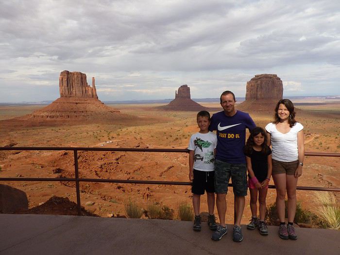
Here’s the plan: - Joshua Tree NP - Las Vegas - Valley of Fire SP - Yant Flat - Zion NP (Angel’s Landing) - Bryce Canyon NP (Fairyland Loop trail) - Devils Garden on the HITTR - Capitol Reef NP - Grand Teton NP - Yellowstone NP: Old Faithful - Yellowstone NP: Norris Geyser Basin and Mammoth Hot Springs - Yellowstone NP: Grand Canyon of the Yellowstone - West Thumb and Grand Teton NP - Flaming Gorge - Colorado NM and Fisher Towers - Moab: Arches - Moab: Canyonlands and Corona Arch - Moab: Canyonlands - Moab: rafting and Dead Horse Point SP - Natural Bridges NM and Valley of the Gods - Monument Valley and Horseshoe Bend - Coyote Buttes South - Grand Canyon NP (North Rim) - Grand Canyon NP (North Rim) and Navajo Bridge - Sedona - From Sedona to Tucson - Arizona-Sonora Desert Museum and Saguaro NP - Tombstone
Practical details:
- I’d read that it was better to book flight tickets directly on an airline’s website rather than through a comparison site. So, I spent months searching for reasonably priced tickets for two adults and two kids from Paris to Las Vegas for the outbound trip and from Tucson to Paris for the return. I mostly checked Air France, KLM, and British Airways, but prices were always around 4600 €. Not finding anything, we eventually went through a comparison site: Ebookers. We bought our tickets in mid-December: Paris/Atlanta with Air France, then Atlanta/Los Angeles with Delta for the outbound trip, and Tucson/Atlanta with Delta, then Atlanta/Paris with Air France for the return. Total cost: 4300 €. The layover on the outbound trip made me a little nervous because it was only 2 hours and 15 minutes. A month later, we got an email from Ebookers saying the layover had been reduced to 1 hour and 40 minutes! And a few months after that, it was down to just 1 hour and 30 minutes... So, we called Air France directly (we didn’t go through Ebookers, and it wasn’t a problem), and they put us on different flights. The new layover was 2 hours and 10 minutes—still not a ton of time, but I felt better than with 1 hour and 30 minutes. And anyway, we figured we’d see how it went!
- For the car, we tried several comparison sites, and in the end, AutoEurope won this year: 808 € for a 30-day rental of a Chevrolet Impala through Thrifty. The second driver was free for the entire trip since we picked up the car in California.
- We didn’t rent a GPS or buy one—we just downloaded Sygic on our two phones and bought the US map. I don’t remember the exact amount, but it cost us around 30 €.
- For hotels, I either booked directly on the sites (Xanterra, Grand Canyon Lodge, etc.) or used Hotels.com (to earn nights through their Welcome Rewards program) or Booking.com (when hotels weren’t available on Hotels.com). I always compared the price on Hotels.com with the hotel’s direct rate, but they were usually the same. So, for the same price, I’d rather earn a night with Welcome Rewards! We’d set a budget of 100 € per night on average, and we stuck to it pretty well—the final average came out to 101.20 € when including everything (nights + taxes + any nightly fees + parking fees + bank fees).
- As for luggage, we didn’t want to overpack! So, we left with one medium suitcase for Calista, one for me, one large suitcase for Hugo and Yannick, and a sports bag with Calista’s booster seat (we could’ve taken it on the plane with us, but I didn’t want to lug it around the airport during the layover). That sports bag came in handy on the way back, too—because, as everyone knows, you always come back with more than you left with! Each of us also had a backpack as a carry-on.
Before wrapping up this intro and getting into the real details, I’d like to thank everyone who contributed to my discussions and helped me improve our itinerary!
Quick intro for those who don’t know us: Yannick (36), Peggy (36), Hugo (11), and Calista (8).
Hello,
Thinking this might be useful for VF members who, like me, want to get their French driver’s license translated for a car rental in Japan, here’s the email I received this morning from the consular authorities in Tokyo:
Dear Sir,
You can obtain the translation from the Japan Automobile Federation (JAF). Address: 2-2-17 Shiba, Minato-ku, Tokyo 105-8562 Phone: 81-3-6833-9100 Email: kchosa@jaf.or.jp Website: http://www.jaf.or.jp/e/trans_f.htm (To find their office in Sapporo: http://www.jaf.or.jp/e/list_translation.htm)
Information about driver’s licenses is available on our website: http://www.ambafrance-jp.org/spip.php?article781&var_recherche=driver’s%20license The consular section can no longer provide driver’s license translation services.
Best regards,
Consular Section
So, according to this message, no more mail-in translations through the consular authorities.
Sayonara.
Hi everyone,
We traveled to Norway in the summer of 2025, from July 17 to 29, to visit Senja Island and the Lofoten archipelago with a rental car. The common thread of these twelve days was clearly hiking, along with a few visits and experiences, and nights spent in a tent or in the car (which made it possible). We chose Narvik Airport for both arrival and departure for several complementary reasons: the desire to visit nearby Senja Island, slightly more affordable airfare, and finally, the rental price of the vehicle—especially the car model we were looking for. We only made one reservation, for the first campsite, as sleeping in a tent made things much easier. But we had the whole structure of the trip planned, a flexible outline that could adapt to the weather conditions we’d encounter. Senja Island isn’t part of the Lofoten archipelago, and during the early stages of planning this trip, we hadn’t planned to visit it. But its relative proximity to Narvik Airport and, above all, its unique geography definitely made us change our minds. We arrived in Evenes, where Narvik Airport is located, nearly 60 km from the city itself. Our first stop was 40 km further in Bjerkvik on the way to Senja, where there’s a Rema 1000 (a very common supermarket chain in Norway). We needed to buy some food and a gas cartridge for our stove. I’d emailed the store manager beforehand, who told me they didn’t sell them but that the two gas stations in the village were likely to have some in stock.
It was only at the Esso station that I found what I needed, but unfortunately, only one cartridge. Luckily, we quickly realized that most campsites (like in Iceland) have a shared kitchen with hotplates. That single small cartridge was just enough for the few nights we spent outside of campsites... We got our first taste of Norway’s characteristic landscapes: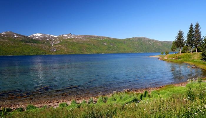
When we arrived at the Senja campsite, it was already 9:30 PM. A sign announced it was full, but luckily, I’d booked it 10 days earlier. By 10:30 PM, as we settled in to eat, it was still broad daylight, and the thermometer read 25°C—despite being at a latitude of 69° North! We went to bed around midnight, exhausted but under the light of a sun that was still very much present. Thanks to Earth’s tilted axis. We’d anticipated this by buying opaque sleep masks because, yes, at this time of year, it’s daylight all the time.
Friday, July 18:
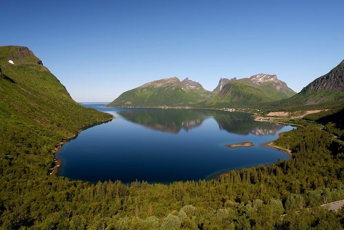
Today, we planned two hikes on the island and a few stops along the way. The map clearly shows that the deepest fjords are in the north and west. Due to time and accessibility, we focused on the northern part of the island. Our first stop was at the viewing platform in Bergbotn:
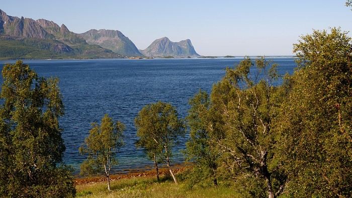
Then we headed toward Skaland, the starting point for our first hike. Along the way, we found plenty of reasons to stop—especially since, on this first day of travel, our thirst for Nordic landscapes was far from quenched.
The town of Skaland is very practical: free parking, picnic tables for after the hike, and a Joker convenience store right next door. Our goal was the summit of Husfjellet: 670 m of elevation gain, between 8 and 9 km in length, and an estimated 4 hours and 30 minutes.
This hike offers two major viewpoints. The first overlooks the Bergsoyan islands to the west:
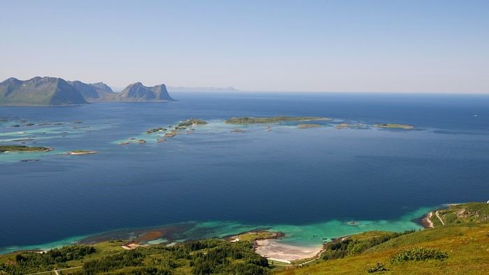
At the summit, the view shifts to the Steinfjorden fjord:
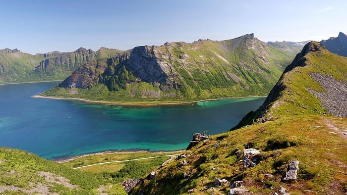
You can even clearly see the "Devil’s Teeth," which we’d see from below later:
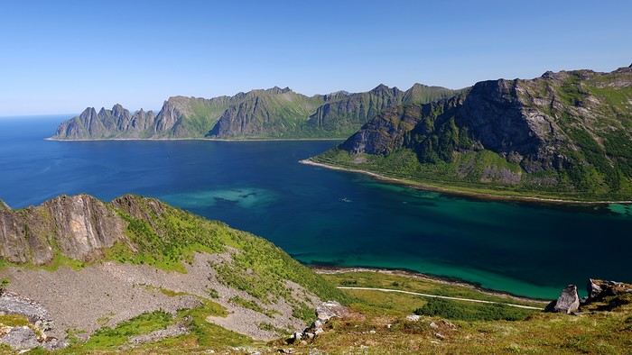
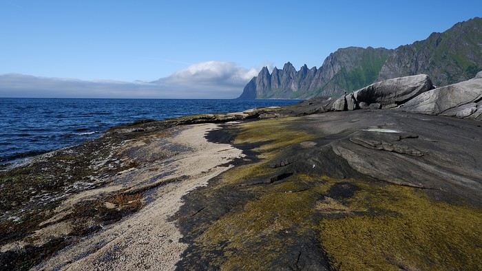
In total, the hike took us 4 hours and 30 minutes, including all the breaks. We treated ourselves to an ice cream in Skaland to recharge for the next hike. We hit the road again and stopped at Tungeneset to get a closer look at the Devil’s Teeth:
We continued to Fjordgard, the starting point for our second hike. Fjordgard isn’t very welcoming. There was a time when you could park right at the start of the hike up Mount Segla. Now, everything’s blocked off, and locals have even taken to blocking all possible parking spots nearby. You now have to park outside the town at a paid parking lot (90 NOK for 3 hours), adding an extra 2 km (round trip) of walking. Still, that was just a minor inconvenience because the hike that followed quickly made us forget all about it. The hike is fairly short (2 hours) but still has 520 m of elevation gain. This hike was a stark contrast to the first. This morning, we had sweeping views of the vast landscape. Here, Mount Segla, perched on the edge of the cliff, dominates the foreground:
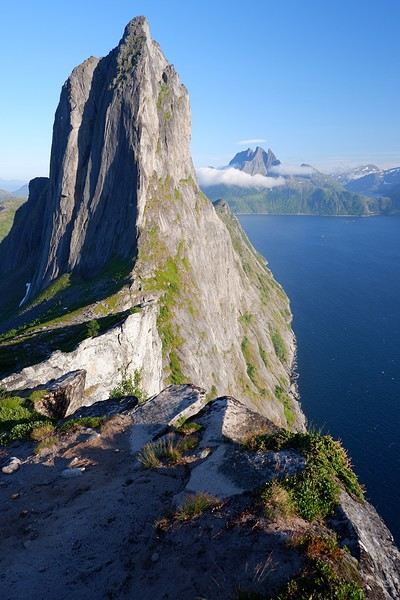
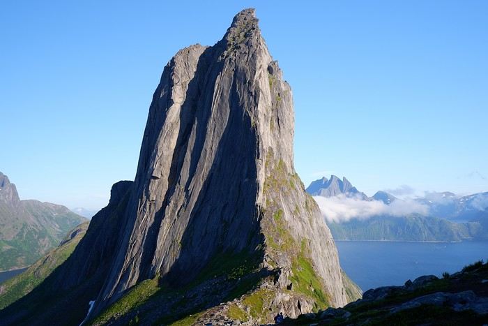
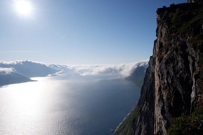
For those prone to vertigo, it might be best to stay at the foot of the mountain, as the trail climbs right along the cliff edge. And from that point on, you quickly understand what verticality really means...
In total, we took 2 hours and 50 minutes, including breaks and the extra walk to the parking lot. The day was already well underway, and with 1,200 m of cumulative elevation gain, it was time to find a spot to eat and sleep. Since we hadn’t made any reservations, we’d planned to bivouac for the night. We weren’t too picky—just practical—so we decided to sleep in the car at the parking lot for tomorrow morning’s hike, just 5 km from Fjordgard.
We traveled to Norway in the summer of 2025, from July 17 to 29, to visit Senja Island and the Lofoten archipelago with a rental car. The common thread of these twelve days was clearly hiking, along with a few visits and experiences, and nights spent in a tent or in the car (which made it possible). We chose Narvik Airport for both arrival and departure for several complementary reasons: the desire to visit nearby Senja Island, slightly more affordable airfare, and finally, the rental price of the vehicle—especially the car model we were looking for. We only made one reservation, for the first campsite, as sleeping in a tent made things much easier. But we had the whole structure of the trip planned, a flexible outline that could adapt to the weather conditions we’d encounter. Senja Island isn’t part of the Lofoten archipelago, and during the early stages of planning this trip, we hadn’t planned to visit it. But its relative proximity to Narvik Airport and, above all, its unique geography definitely made us change our minds. We arrived in Evenes, where Narvik Airport is located, nearly 60 km from the city itself. Our first stop was 40 km further in Bjerkvik on the way to Senja, where there’s a Rema 1000 (a very common supermarket chain in Norway). We needed to buy some food and a gas cartridge for our stove. I’d emailed the store manager beforehand, who told me they didn’t sell them but that the two gas stations in the village were likely to have some in stock.
It was only at the Esso station that I found what I needed, but unfortunately, only one cartridge. Luckily, we quickly realized that most campsites (like in Iceland) have a shared kitchen with hotplates. That single small cartridge was just enough for the few nights we spent outside of campsites... We got our first taste of Norway’s characteristic landscapes:
When we arrived at the Senja campsite, it was already 9:30 PM. A sign announced it was full, but luckily, I’d booked it 10 days earlier. By 10:30 PM, as we settled in to eat, it was still broad daylight, and the thermometer read 25°C—despite being at a latitude of 69° North! We went to bed around midnight, exhausted but under the light of a sun that was still very much present. Thanks to Earth’s tilted axis. We’d anticipated this by buying opaque sleep masks because, yes, at this time of year, it’s daylight all the time.
Friday, July 18:
Today, we planned two hikes on the island and a few stops along the way. The map clearly shows that the deepest fjords are in the north and west. Due to time and accessibility, we focused on the northern part of the island. Our first stop was at the viewing platform in Bergbotn:
Then we headed toward Skaland, the starting point for our first hike. Along the way, we found plenty of reasons to stop—especially since, on this first day of travel, our thirst for Nordic landscapes was far from quenched.
The town of Skaland is very practical: free parking, picnic tables for after the hike, and a Joker convenience store right next door. Our goal was the summit of Husfjellet: 670 m of elevation gain, between 8 and 9 km in length, and an estimated 4 hours and 30 minutes.
This hike offers two major viewpoints. The first overlooks the Bergsoyan islands to the west:
At the summit, the view shifts to the Steinfjorden fjord:
You can even clearly see the "Devil’s Teeth," which we’d see from below later:
In total, the hike took us 4 hours and 30 minutes, including all the breaks. We treated ourselves to an ice cream in Skaland to recharge for the next hike. We hit the road again and stopped at Tungeneset to get a closer look at the Devil’s Teeth:
We continued to Fjordgard, the starting point for our second hike. Fjordgard isn’t very welcoming. There was a time when you could park right at the start of the hike up Mount Segla. Now, everything’s blocked off, and locals have even taken to blocking all possible parking spots nearby. You now have to park outside the town at a paid parking lot (90 NOK for 3 hours), adding an extra 2 km (round trip) of walking. Still, that was just a minor inconvenience because the hike that followed quickly made us forget all about it. The hike is fairly short (2 hours) but still has 520 m of elevation gain. This hike was a stark contrast to the first. This morning, we had sweeping views of the vast landscape. Here, Mount Segla, perched on the edge of the cliff, dominates the foreground:
For those prone to vertigo, it might be best to stay at the foot of the mountain, as the trail climbs right along the cliff edge. And from that point on, you quickly understand what verticality really means...
In total, we took 2 hours and 50 minutes, including breaks and the extra walk to the parking lot. The day was already well underway, and with 1,200 m of cumulative elevation gain, it was time to find a spot to eat and sleep. Since we hadn’t made any reservations, we’d planned to bivouac for the night. We weren’t too picky—just practical—so we decided to sleep in the car at the parking lot for tomorrow morning’s hike, just 5 km from Fjordgard.
Hi there, 🙂
I’m thinking of taking a trip to these two countries in 2026 (late spring to early summer).
I’d arrive in Almaty and leave from Bishkek, and I’d be driving myself.
I plan to spend 1 week in Kazakhstan and 2 in Kyrgyzstan. The itinerary isn’t set yet.
My preliminary questions are about formalities, hassle levels, and the car.
From what I understand, no visa is needed, the passport must be valid for 6 months after entry, and there’s no longer a requirement to register with the authorities at each stop. In short, once you’re in, no administrative headaches.
Except for permits needed to drive in certain regions?
---/---
About crossing between the two countries:
- On foot - In a rental car
Quick? Easy?
---/---
Are both countries safe? (Meaning you don’t have to stay on guard all the time.) Are the cops corrupt? (A little, a lot, passionately, not at all?)
---/---
Is it better to rent a car for both countries or rent a vehicle in each country?
A 4x4 or something else?
Is accommodation plentiful enough that I can skip a rooftop tent, or is it better to rent a 4x4 with one?
I’ll definitely have more questions later...😉
Thanks for your answers !
Hi everyone!!!
I’m finally getting around to writing about this 20-day trip to southern Italy: we didn’t travel this summer, and luckily, we found beautiful light and dreamy weather there at the end of September.
First, here’s the context of the trip: we’re both "confirmed seniors" but still curious and alert enough to enjoy the itinerary we’d imagined! We wanted a mix of discoveries—culture, cities, and nature—with guaranteed sunshine and the occasional short hike... We’re flying to Naples, round-trip, because the flight times work better for us. We rented a car online, picked it up at the airport (details to come... and it won’t be the highlight of the trip!), and booked our hotels in advance.
A quick overview of the itinerary: leaving Naples on September 15th, early in the morning, we’ll drive straight across the boot of Italy to Bari. After 11 days in Puglia, we’ll head back toward our starting point, taking our time: Matera in Basilicata, Maratea by the sea, and finally Paestum with its incredible temples.
Day 1: Brussels-Naples flight (Brussels Airlines) went smoothly; it landed an hour early, and we were thrilled, thinking we could use that time for a quick visit or two... Everything went well until we left the airport. We took the shuttle to the car rental offices, and at first glance, we realized this wouldn’t be smooth sailing!!! In front of every office (they’re side by side), there were already lines and kids sitting on suitcases—everyone looked exhausted... We resigned ourselves to waiting: nothing moved until tempers flared at the counters, and two people nearly came to blows. Things sped up a little, and after 2 (two...) hours of waiting, we finally got our chariot: a black Fiat Tipo, dirty, with a few dents and scratches that we made sure to note in the contract... but it ran!
Off to Bari, then: no time for sightseeing along the way! From there, we headed straight to our hotel in the countryside near Polignano a Mare.
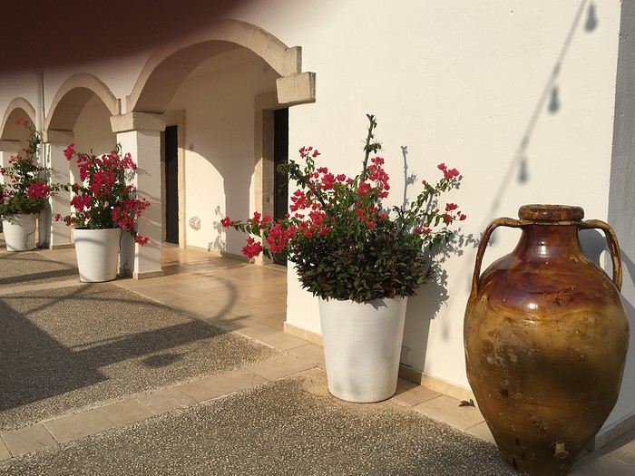
A recurring detail: this happened constantly during our travels. We’d installed our own GPS, fully updated... In recent years, many dirt roads have become drivable, and lots of hotels and hostels have opened in the outskirts of towns. It was extremely rare for our ‘guide’ to recognize the street—let alone the number—we entered. Often, we got by calling the hotel reception: it might seem like a small thing, but it happened so often it became frustrating. In hindsight, it seems like without Google Maps, we’d have been lost!
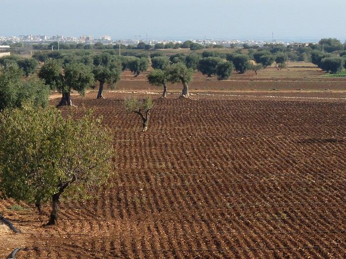
Anyway, we were beautifully settled, with a terrace overlooking olive groves and the sea in the distance: all was well.
To be continued...
I’m finally getting around to writing about this 20-day trip to southern Italy: we didn’t travel this summer, and luckily, we found beautiful light and dreamy weather there at the end of September.
First, here’s the context of the trip: we’re both "confirmed seniors" but still curious and alert enough to enjoy the itinerary we’d imagined! We wanted a mix of discoveries—culture, cities, and nature—with guaranteed sunshine and the occasional short hike... We’re flying to Naples, round-trip, because the flight times work better for us. We rented a car online, picked it up at the airport (details to come... and it won’t be the highlight of the trip!), and booked our hotels in advance.
A quick overview of the itinerary: leaving Naples on September 15th, early in the morning, we’ll drive straight across the boot of Italy to Bari. After 11 days in Puglia, we’ll head back toward our starting point, taking our time: Matera in Basilicata, Maratea by the sea, and finally Paestum with its incredible temples.
Day 1: Brussels-Naples flight (Brussels Airlines) went smoothly; it landed an hour early, and we were thrilled, thinking we could use that time for a quick visit or two... Everything went well until we left the airport. We took the shuttle to the car rental offices, and at first glance, we realized this wouldn’t be smooth sailing!!! In front of every office (they’re side by side), there were already lines and kids sitting on suitcases—everyone looked exhausted... We resigned ourselves to waiting: nothing moved until tempers flared at the counters, and two people nearly came to blows. Things sped up a little, and after 2 (two...) hours of waiting, we finally got our chariot: a black Fiat Tipo, dirty, with a few dents and scratches that we made sure to note in the contract... but it ran!
Off to Bari, then: no time for sightseeing along the way! From there, we headed straight to our hotel in the countryside near Polignano a Mare.
A recurring detail: this happened constantly during our travels. We’d installed our own GPS, fully updated... In recent years, many dirt roads have become drivable, and lots of hotels and hostels have opened in the outskirts of towns. It was extremely rare for our ‘guide’ to recognize the street—let alone the number—we entered. Often, we got by calling the hotel reception: it might seem like a small thing, but it happened so often it became frustrating. In hindsight, it seems like without Google Maps, we’d have been lost!
Anyway, we were beautifully settled, with a terrace overlooking olive groves and the sea in the distance: all was well.
To be continued...
After my trip to Oregon in 2018 (see Travel Journal "Oregon and Only Oregon"), I vaguely intended to return to the West (the western USA, of course—the west of France is where I almost live) someday, later... with no specific date or plan.
November 2018, I stumbled upon a promotion for round-trip flights from Paris to San Francisco. Well, I *stumbled*—they must’ve collected some "data" on me to make sure this deal crossed my path. And it worked! My ESTA was still valid, and two days later, it was decided: May 13, 2019 (departure from Paris) to June 15, 2019 (return to Paris).
The travel style? Just like last year: low-budget trip, rental car, and accommodation only in campgrounds, with no reservations to stay as free as possible.
Exceptions? 3 nights in a youth hostel upon arrival in downtown San Francisco, and 1 night on the way back (right before flying) in Montara, near Pacifica—a spot that seemed well-located for driving back to the airport in the middle of the night.
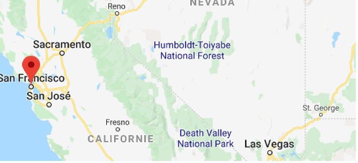
Now, to sketch out the rough itinerary. Here’s what it looked like after the trip:
Westernmost point: Montara Lighthouse on the coast, 30 km south of San Francisco (California); Easternmost point: Zion National Park (Utah). Northernmost point: Reno (Nevada). Southernmost point: Spring Mountain Ranch State Park in Blue Diamond, near Las Vegas (Nevada).
Another view:
I’ll be spending 33 days in this little area! I’m a slow traveler.
Meanwhile, I realized that in some places I wanted to visit (Las Vegas and National Parks), it was better to book ahead. So, I added to my reservations: - 2 nights in a hostel in Las Vegas - 6 nights of camping in the national parks (2 at Zion NP, 2 at Yosemite NP, 2 at Sequoia-Kings Canyon NP). Between all these dated stops, it’s a choose-your-own-adventure from the ideas I found.
I’m also a slow writer—slow writer, slow traveler—so it’ll take me a while to wrap this up. I’ll start tomorrow.
November 2018, I stumbled upon a promotion for round-trip flights from Paris to San Francisco. Well, I *stumbled*—they must’ve collected some "data" on me to make sure this deal crossed my path. And it worked! My ESTA was still valid, and two days later, it was decided: May 13, 2019 (departure from Paris) to June 15, 2019 (return to Paris).
The travel style? Just like last year: low-budget trip, rental car, and accommodation only in campgrounds, with no reservations to stay as free as possible.
Exceptions? 3 nights in a youth hostel upon arrival in downtown San Francisco, and 1 night on the way back (right before flying) in Montara, near Pacifica—a spot that seemed well-located for driving back to the airport in the middle of the night.
Now, to sketch out the rough itinerary. Here’s what it looked like after the trip:
Westernmost point: Montara Lighthouse on the coast, 30 km south of San Francisco (California); Easternmost point: Zion National Park (Utah). Northernmost point: Reno (Nevada). Southernmost point: Spring Mountain Ranch State Park in Blue Diamond, near Las Vegas (Nevada).
Another view:
I’ll be spending 33 days in this little area! I’m a slow traveler.
Meanwhile, I realized that in some places I wanted to visit (Las Vegas and National Parks), it was better to book ahead. So, I added to my reservations: - 2 nights in a hostel in Las Vegas - 6 nights of camping in the national parks (2 at Zion NP, 2 at Yosemite NP, 2 at Sequoia-Kings Canyon NP). Between all these dated stops, it’s a choose-your-own-adventure from the ideas I found.
I’m also a slow writer—slow writer, slow traveler—so it’ll take me a while to wrap this up. I’ll start tomorrow.
Hi everyone,
With my girlfriend Christelle, we’ve chosen South Africa for our first trip to Southern Africa, focusing on safaris—after a long debate with a Cape Town/Kruger combo. But that would’ve meant cutting out St Lucia, which would’ve been harder to fit into another trip. And St Lucia—thanks to Michel and all those travel journals—we really wanted to go there.
So our 11-night itinerary ended up like this, mostly shaped by school holidays: - 3 nights in St Lucia - 1 night in Hluhluwe - 1 night at Mkhaya Game Reserve (Eswatini) - 1 night at Hlane Royal National Park (Eswatini) - 3 nights in Kruger (Berg en Dal / Satara / Tamboti) - 1 night at Shindzela Tented Camp in the Timbavati private reserve - 1 final night in Kruger at Lower Sabie
All of this in the off-season and rainy season, just a month after catastrophic floods that killed over 150 people and seriously damaged Kruger’s infrastructure.
I’ll jump straight to St Lucia and skip the loooong journey to get there (with a layover in Frankfurt, landing in Johannesburg, a domestic flight to Durban, and the rest by rental SUV—First Car Rental, perfect, no complaints).
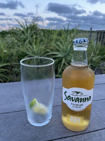
To motivate readers—especially some familiar faces here—I’ll drop in a first photo.
With my girlfriend Christelle, we’ve chosen South Africa for our first trip to Southern Africa, focusing on safaris—after a long debate with a Cape Town/Kruger combo. But that would’ve meant cutting out St Lucia, which would’ve been harder to fit into another trip. And St Lucia—thanks to Michel and all those travel journals—we really wanted to go there.
So our 11-night itinerary ended up like this, mostly shaped by school holidays: - 3 nights in St Lucia - 1 night in Hluhluwe - 1 night at Mkhaya Game Reserve (Eswatini) - 1 night at Hlane Royal National Park (Eswatini) - 3 nights in Kruger (Berg en Dal / Satara / Tamboti) - 1 night at Shindzela Tented Camp in the Timbavati private reserve - 1 final night in Kruger at Lower Sabie
All of this in the off-season and rainy season, just a month after catastrophic floods that killed over 150 people and seriously damaged Kruger’s infrastructure.
I’ll jump straight to St Lucia and skip the loooong journey to get there (with a layover in Frankfurt, landing in Johannesburg, a domestic flight to Durban, and the rest by rental SUV—First Car Rental, perfect, no complaints).
To motivate readers—especially some familiar faces here—I’ll drop in a first photo.
Hi everyone,
The idea of traveling to Bolivia came to me after seeing Jean-François (Max68)’s photos on his website. I thought we *had* to see those stunning landscapes with the colorful lagoons for ourselves. But a self-drive trip didn’t seem doable at first. A few years ago, everyone advised against going to the South Lipez with just one car.
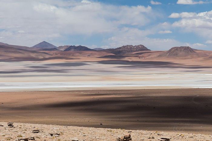 Laguna Kara
It was only after reading Laurent (Lolobe) and Pascal (Pepe874)’s travel journals—who explored the South Lipez solo with a car from Biz Rent a Car—that I thought we might be able to do the same. Meanwhile, we’d already contacted a local agency to organize a trip with a driver and guide. But the idea of a self-drive adventure really appealed to us. With encouragement and tips from Thierry (Tbernay) and Jean-François (Max68), we decided to plan our own self-drive trip. I’d like to thank them for their advice—it was *super* helpful. And a big thanks to all the other forum members for the info shared during our prep!
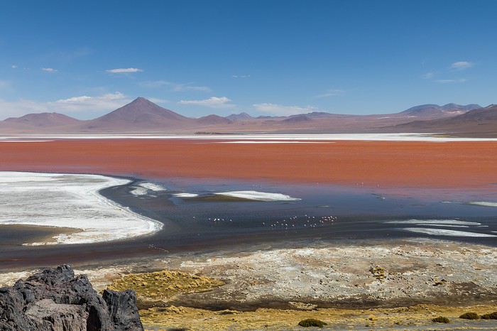 Laguna Colorada
Planning this trip happened during a tough time for our family. My mother-in-law’s illness and passing, plus a few health issues of my own, made us doubt the trip multiple times and nearly scrap the whole thing.
We booked our international flights in February with Swiss. They offered the best balance of travel time and price from Switzerland. Swiss operates Zurich–São Paulo with their own fleet, and São Paulo–Santa Cruz with GOL. In June, GOL canceled the Saturday flight and rebooked us on Sunday. Spending over 24 hours in that huge Brazilian city didn’t work for us at all, so we asked Swiss to put us on the next Zurich–São Paulo flight. Too bad—we lost a day in Bolivia and had to skip the Tarabucco market on Sunday.
Right after, we also booked the car in February. After contacting Imbex and Biz, we went with Biz. Not speaking Spanish, we were relieved to communicate with Alejandra in French. The contact was great—she answered all our questions patiently. Sometimes it took a few days to get a reply, but we could also reach her on WhatsApp. After our trip, we can *only* recommend Biz for rentals in Bolivia. The cars are well-prepped for the South Lipez tracks. The agency is reliable, and the vehicles are new and well-maintained.
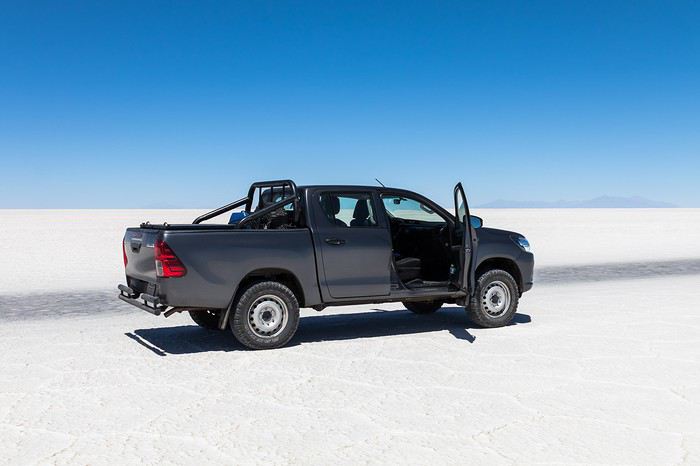 “Our” car, a Toyota Hilux
While planning, we realized the presidential elections would happen while we were in Bolivia. The risk of *bloqueos* (roadblocks and protests) was very real. But in Bolivia, *bloqueos* seem common—you always have to account for that kind of hassle. In late August/early September, Uyuni and the Salar region were blocked for days, leading to food, fuel, and cash shortages. Worried about a blockade in Uyuni and missing the Salar, we decided to visit it first *just in case*.
On election day, the whole country shut down. Planes were grounded, buses and taxis couldn’t circulate, and private cars were banned. There were a few exceptions—ambulances, police, or certain professions—but as tourists, we couldn’t get permission to drive. We asked the embassy, and Biz even requested a permit from the electoral office. So we had to plan to be somewhere with things to do *without* the car.
We decided not to book any accommodations in advance—a first for us. Usually, we plan our stops and reserve lodges, hotels, or campgrounds well ahead. This time, only the room in Sucre was booked, so we’d have a base when we arrived.
In July, Alex (Delhenry) reached out to propose joining part of the trip. He didn’t realize we were leaving in October. Still, we got fresh updates when he returned from the South Lipez. Thanks, Alex—your tips, especially about the Guadalupe–Tupiza stretch, were *super* useful.
In September, we connected with Jean-Louis (Avx) and Anne (Xeta), who were also heading to Bolivia in October, one and two weeks after us. We had dinner with Jean-Louis and his friend after our South Lipez trip and stayed in touch with Anne. It was great to chat with them! Unfortunately, Anne and her husband had a much rockier trip—they got hit hard by post-election issues.
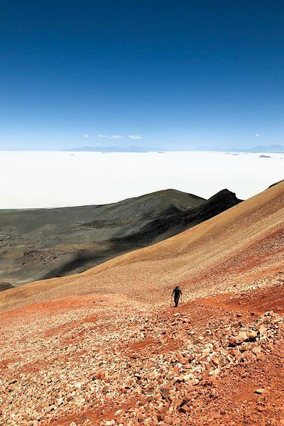 Climbing Volcán Tunupa
Our itinerary wasn’t set in stone—we decided to wing it on the spot. Two weeks before departure, I reconnected with Alejandra at Biz to move the car rental up by a day. With the elections, we wanted to leave Sucre ASAP and focus on the South Lipez. Outside Uyuni and Tupiza, the risk of blockades was zero. We also planned a two-night buffer in Sucre before our flights, just in case. It might sound overcautious, but in hindsight, we made the right call. If we’d left Sucre a day later, we wouldn’t have made it to Potosí—it was completely blocked. On the way back, we *just* dodged blockades in Potosí and elsewhere. Sometimes, you’ve gotta trust your gut.
Here’s our route—only the first two nights in Sucre were booked ahead:
D1 Departure from Switzerland
D2 Sucre (La Selenita)
D3 Sucre (La Selenita)
D4 Colchani (Hotel de Sal Luna Salada)
D5 Jirira (Auberge Doña Lupe)
D6 On the Salar (in the car)
D7 A few kilometers from Estancia Catal (in the car)
D8 Laguna Hedionda (Hotel Los Flamencos)
D9 Laguna Colorada (Lodge by the lagoon)
D10 Middle of nowhere, en route Laguna Verde–Mina Horsu–Quetena Chico (in the car)
D11 Quetena Chico (Lamphaya Lodge Andino)
D12 Quetena Chico (Lamphaya Lodge Andino)
D13 Guadalupe (Guest room at Celia’s)
D14 Along the Rio Grande (in the car)
D15 Tupiza (Hotel Mitru)
D16 Tupiza (Hotel Mitru)
D17 Sucre (La Selenita)
D18 Sucre (La Selenita)
D19 Santa Cruz (Hotel Sun)
D20 Departure from Santa Cruz
D21 Arrival in Switzerland
As you can see, we spent 13 nights in the South Lipez. Initially, we’d planned for nine, but Jean-François (Max68) suggested staying longer. Great advice—we didn’t regret it one bit. We could’ve even added 2–3 more days without getting bored.
Self-driving in the South Lipez takes some prep and a good GPS. We kept it simple and used maps.me to navigate. It’s a solid app—just save your waypoints ahead of time. For some stretches, I used Google Earth to visualize the tracks and sites. If you stick to the tour operator routes, you *almost* can’t get lost. But we often veered off the beaten path and took different routes. Some days, we didn’t see another car. So in case of a breakdown, it’s key to have water and food for several days. In some spots, there’s *zero* signal—your phone won’t work. Another must: it gets *cold* in the South Lipez, and a good sleeping bag is essential. We brought down sleeping bags rated for -10°C and didn’t regret it during our car nights.
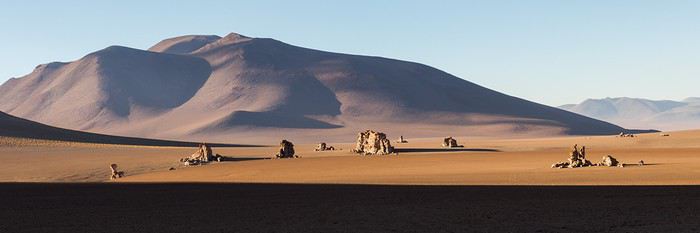 The Dalí Desert
Some tracks are *super* rocky—flat tires are a real risk. On those stretches, maps.me’s estimated travel time was way off. Some sections barely let us go over 15 km/h.
Lots of forum members recommend doing the South Lipez “loop” from Tupiza to Uyuni—ending with the Salar—to avoid Uyuni’s crowds. That might work for organized tours, but for self-drive, the direction *doesn’t* matter. I’ll say this: the few vehicles we saw mostly came from Tupiza and Chile, not Uyuni. So if starting from Uyuni works better for you, go for it! Ending in Tupiza means heading toward warmer weather. For our planned stops and climbs, starting in Uyuni helped with acclimatization. Spending a few nights between 3,600–3,800 m before going over 4,000 m is a smart move.
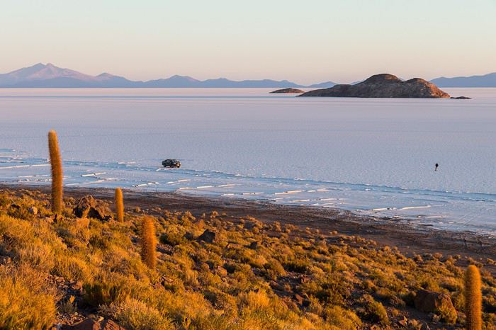 Uyuni Salt Flats in the morning
Overall, we barely saw anyone—except at Laguna Hedionda and Chalviri. There were several tour groups at Hotel Los Flamencos (Laguna Hedionda), but we didn’t cross paths during the day. Hardly anyone on the Salar, on the roads, or at the lodges in the evenings. The *only* place that shocked us was Chalviri. We’d planned to stay there, but it was fully booked—and we counted *forty* tour jeeps on-site. This was around noon! At the Polques hot springs (Chalviri), it was *packed*—we quickly nixed the idea of a dip. Plus, the vibe wasn’t great: soaking right by the road with lodges and restaurants in the background? Meh. Still, lots of tourists love it, so it’s up to you.
For the photos, I kept the colors and mood we saw. The lagoons’ hues are often stunning, but some online photos are *way* over-edited and oversaturated. The South Lipez’s landscapes are breathtaking—no need for excessive retouching.
If you don’t want to read all the details, the start of the travel journal is here: https://voyageforum.com/v.f?post=9888761;a=9888761
The idea of traveling to Bolivia came to me after seeing Jean-François (Max68)’s photos on his website. I thought we *had* to see those stunning landscapes with the colorful lagoons for ourselves. But a self-drive trip didn’t seem doable at first. A few years ago, everyone advised against going to the South Lipez with just one car.
Laguna KaraIt was only after reading Laurent (Lolobe) and Pascal (Pepe874)’s travel journals—who explored the South Lipez solo with a car from Biz Rent a Car—that I thought we might be able to do the same. Meanwhile, we’d already contacted a local agency to organize a trip with a driver and guide. But the idea of a self-drive adventure really appealed to us. With encouragement and tips from Thierry (Tbernay) and Jean-François (Max68), we decided to plan our own self-drive trip. I’d like to thank them for their advice—it was *super* helpful. And a big thanks to all the other forum members for the info shared during our prep!
Laguna ColoradaPlanning this trip happened during a tough time for our family. My mother-in-law’s illness and passing, plus a few health issues of my own, made us doubt the trip multiple times and nearly scrap the whole thing.
We booked our international flights in February with Swiss. They offered the best balance of travel time and price from Switzerland. Swiss operates Zurich–São Paulo with their own fleet, and São Paulo–Santa Cruz with GOL. In June, GOL canceled the Saturday flight and rebooked us on Sunday. Spending over 24 hours in that huge Brazilian city didn’t work for us at all, so we asked Swiss to put us on the next Zurich–São Paulo flight. Too bad—we lost a day in Bolivia and had to skip the Tarabucco market on Sunday.
Right after, we also booked the car in February. After contacting Imbex and Biz, we went with Biz. Not speaking Spanish, we were relieved to communicate with Alejandra in French. The contact was great—she answered all our questions patiently. Sometimes it took a few days to get a reply, but we could also reach her on WhatsApp. After our trip, we can *only* recommend Biz for rentals in Bolivia. The cars are well-prepped for the South Lipez tracks. The agency is reliable, and the vehicles are new and well-maintained.
“Our” car, a Toyota HiluxWhile planning, we realized the presidential elections would happen while we were in Bolivia. The risk of *bloqueos* (roadblocks and protests) was very real. But in Bolivia, *bloqueos* seem common—you always have to account for that kind of hassle. In late August/early September, Uyuni and the Salar region were blocked for days, leading to food, fuel, and cash shortages. Worried about a blockade in Uyuni and missing the Salar, we decided to visit it first *just in case*.
On election day, the whole country shut down. Planes were grounded, buses and taxis couldn’t circulate, and private cars were banned. There were a few exceptions—ambulances, police, or certain professions—but as tourists, we couldn’t get permission to drive. We asked the embassy, and Biz even requested a permit from the electoral office. So we had to plan to be somewhere with things to do *without* the car.
We decided not to book any accommodations in advance—a first for us. Usually, we plan our stops and reserve lodges, hotels, or campgrounds well ahead. This time, only the room in Sucre was booked, so we’d have a base when we arrived.
In July, Alex (Delhenry) reached out to propose joining part of the trip. He didn’t realize we were leaving in October. Still, we got fresh updates when he returned from the South Lipez. Thanks, Alex—your tips, especially about the Guadalupe–Tupiza stretch, were *super* useful.
In September, we connected with Jean-Louis (Avx) and Anne (Xeta), who were also heading to Bolivia in October, one and two weeks after us. We had dinner with Jean-Louis and his friend after our South Lipez trip and stayed in touch with Anne. It was great to chat with them! Unfortunately, Anne and her husband had a much rockier trip—they got hit hard by post-election issues.
Climbing Volcán TunupaOur itinerary wasn’t set in stone—we decided to wing it on the spot. Two weeks before departure, I reconnected with Alejandra at Biz to move the car rental up by a day. With the elections, we wanted to leave Sucre ASAP and focus on the South Lipez. Outside Uyuni and Tupiza, the risk of blockades was zero. We also planned a two-night buffer in Sucre before our flights, just in case. It might sound overcautious, but in hindsight, we made the right call. If we’d left Sucre a day later, we wouldn’t have made it to Potosí—it was completely blocked. On the way back, we *just* dodged blockades in Potosí and elsewhere. Sometimes, you’ve gotta trust your gut.
Here’s our route—only the first two nights in Sucre were booked ahead:
D1 Departure from Switzerland
D2 Sucre (La Selenita)
D3 Sucre (La Selenita)
D4 Colchani (Hotel de Sal Luna Salada)
D5 Jirira (Auberge Doña Lupe)
D6 On the Salar (in the car)
D7 A few kilometers from Estancia Catal (in the car)
D8 Laguna Hedionda (Hotel Los Flamencos)
D9 Laguna Colorada (Lodge by the lagoon)
D10 Middle of nowhere, en route Laguna Verde–Mina Horsu–Quetena Chico (in the car)
D11 Quetena Chico (Lamphaya Lodge Andino)
D12 Quetena Chico (Lamphaya Lodge Andino)
D13 Guadalupe (Guest room at Celia’s)
D14 Along the Rio Grande (in the car)
D15 Tupiza (Hotel Mitru)
D16 Tupiza (Hotel Mitru)
D17 Sucre (La Selenita)
D18 Sucre (La Selenita)
D19 Santa Cruz (Hotel Sun)
D20 Departure from Santa Cruz
D21 Arrival in Switzerland
As you can see, we spent 13 nights in the South Lipez. Initially, we’d planned for nine, but Jean-François (Max68) suggested staying longer. Great advice—we didn’t regret it one bit. We could’ve even added 2–3 more days without getting bored.
Self-driving in the South Lipez takes some prep and a good GPS. We kept it simple and used maps.me to navigate. It’s a solid app—just save your waypoints ahead of time. For some stretches, I used Google Earth to visualize the tracks and sites. If you stick to the tour operator routes, you *almost* can’t get lost. But we often veered off the beaten path and took different routes. Some days, we didn’t see another car. So in case of a breakdown, it’s key to have water and food for several days. In some spots, there’s *zero* signal—your phone won’t work. Another must: it gets *cold* in the South Lipez, and a good sleeping bag is essential. We brought down sleeping bags rated for -10°C and didn’t regret it during our car nights.
The Dalí DesertSome tracks are *super* rocky—flat tires are a real risk. On those stretches, maps.me’s estimated travel time was way off. Some sections barely let us go over 15 km/h.
Lots of forum members recommend doing the South Lipez “loop” from Tupiza to Uyuni—ending with the Salar—to avoid Uyuni’s crowds. That might work for organized tours, but for self-drive, the direction *doesn’t* matter. I’ll say this: the few vehicles we saw mostly came from Tupiza and Chile, not Uyuni. So if starting from Uyuni works better for you, go for it! Ending in Tupiza means heading toward warmer weather. For our planned stops and climbs, starting in Uyuni helped with acclimatization. Spending a few nights between 3,600–3,800 m before going over 4,000 m is a smart move.
Uyuni Salt Flats in the morningOverall, we barely saw anyone—except at Laguna Hedionda and Chalviri. There were several tour groups at Hotel Los Flamencos (Laguna Hedionda), but we didn’t cross paths during the day. Hardly anyone on the Salar, on the roads, or at the lodges in the evenings. The *only* place that shocked us was Chalviri. We’d planned to stay there, but it was fully booked—and we counted *forty* tour jeeps on-site. This was around noon! At the Polques hot springs (Chalviri), it was *packed*—we quickly nixed the idea of a dip. Plus, the vibe wasn’t great: soaking right by the road with lodges and restaurants in the background? Meh. Still, lots of tourists love it, so it’s up to you.
For the photos, I kept the colors and mood we saw. The lagoons’ hues are often stunning, but some online photos are *way* over-edited and oversaturated. The South Lipez’s landscapes are breathtaking—no need for excessive retouching.
If you don’t want to read all the details, the start of the travel journal is here: https://voyageforum.com/v.f?post=9888761;a=9888761
Saturday, September 22, 2018
This morning, we woke up at dawn at 6:00 AM. Headed to Letlhakeng, the last town where we could fill up on fuel before starting our crossing of the Kalahari. Our consumption since Johannesburg has been 11L/100 km. We took the direction of Khutse Game Reserve, whose entrance is about a hundred kilometers north of Letlhakeng. Access is via a gravel road along which we saw magnificent pink trees.
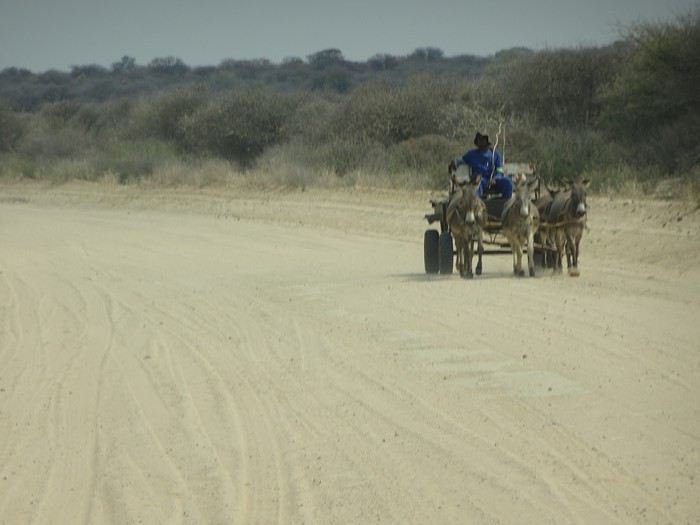
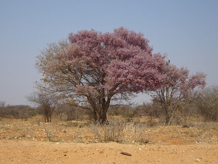
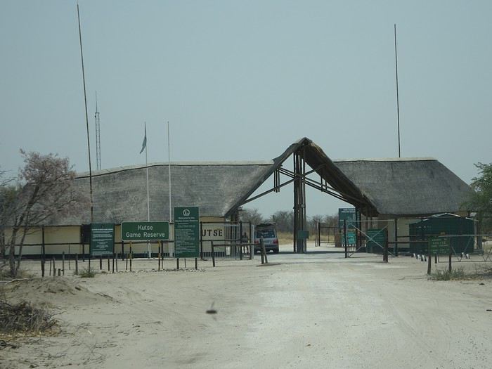
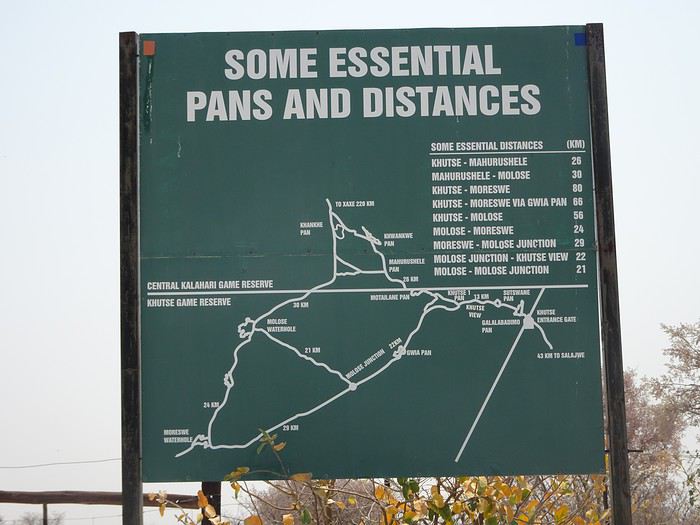
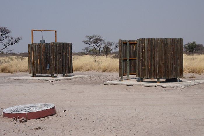
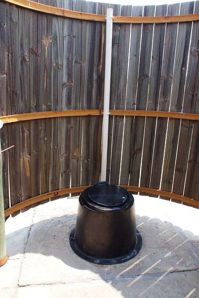
At Khutse Gate, we registered in the entry log and paid the access fees for 6 days: 120 Pulas/day/person and 50 Pulas/day/vehicle. Our stays at the Xaka and Deception Valley campsites had been reserved by our tour operator but not paid, contrary to what they’d told us. So we settled the 2 unpaid days of camping at 30 Pulas/day/person. The park rangers informed us that the southern triangle of Khutse Game Reserve, with its tip at Moreswe Pan, had burned. Note that these two campsites are government-run, which explains the low prices. Private campsites cost ten to fifteen times more. We headed to Khutse campsite, site 5. To enter the parks, you must have a reservation either at a lodge or a campsite. Since the number of spots in the campsites is limited, this means you have to book well in advance. We ate the salad we’d prepared the night before at our campsite. It was very hot—39°C. We made a round trip to Khankhe Pan. On the track, we encountered three South African cars, one of which was stuck in the sand and blocking the way. We helped push the car to get it unstuck. We saw very few animals at Khankhe Pan. We returned to the campsite, which has dry toilets and a shower you have to supply with your own water. We tried out the shower.
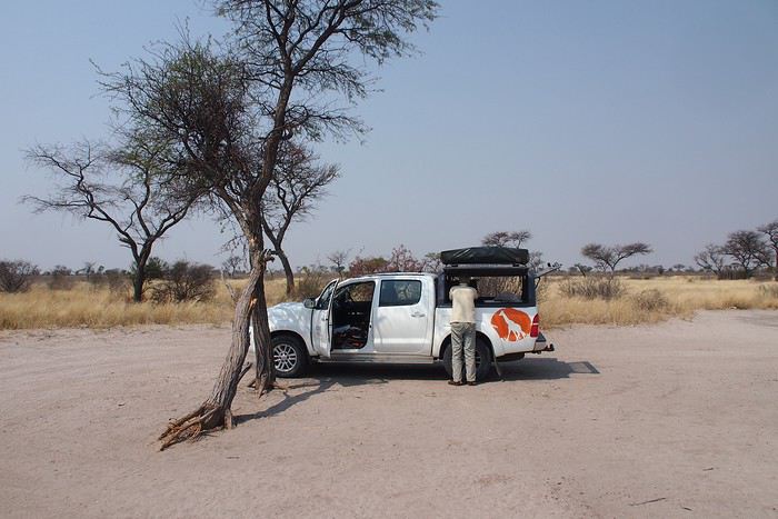
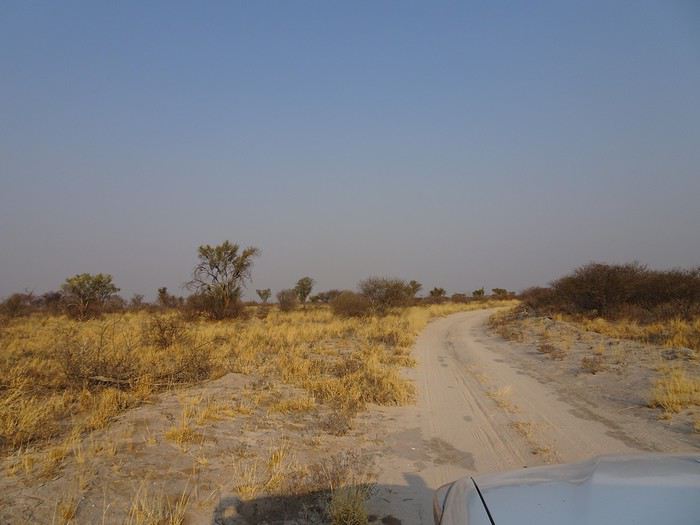
We witnessed our first Kalahari sunset. These sunsets are unmatched, and that didn’t change throughout the trip.
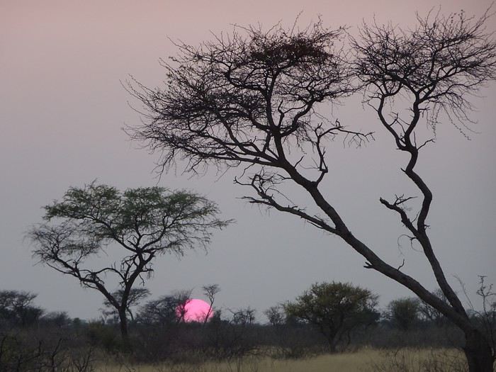
During the trip, we followed the solar rhythm—waking up at 6:00 AM, having dinner at sunset around 6:30 PM, and retiring to our tents by 8:30 PM.
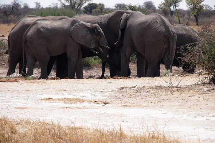
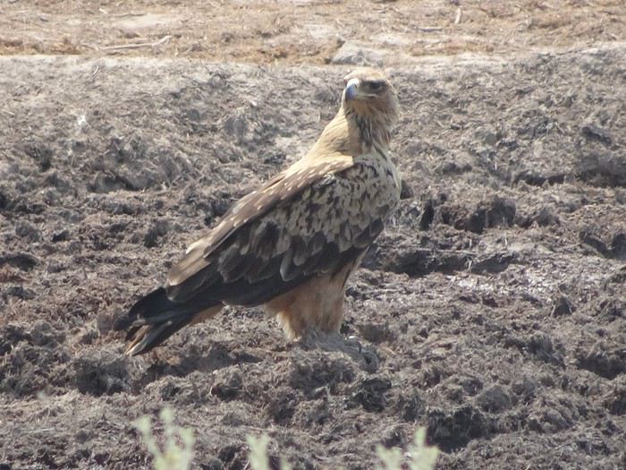
Sunday, September 23, 2018 Up at 6:00 AM. It was 15°C. We were cold last night. Tonight, we’ll use blankets in addition to our sleeping bags. We headed southwest and, past Gwian Pan, turned northwest toward the Molose waterhole, where we saw our first elephants and our first raptor. Indeed, on the track leading to the Molose waterhole, we could see the traces of the massive fire that had ravaged the southern part of Khutse, as the park rangers had warned us.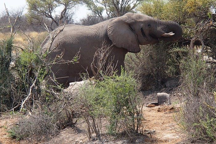
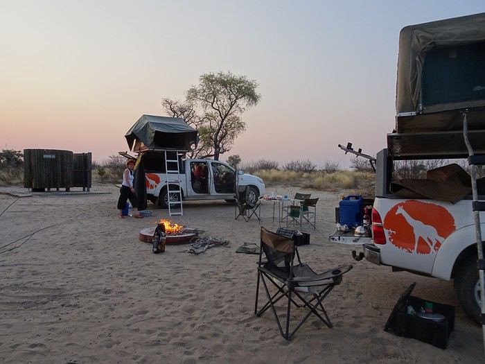
Our first braai at Khankhe campsite.
At Khutse Gate, we registered in the entry log and paid the access fees for 6 days: 120 Pulas/day/person and 50 Pulas/day/vehicle. Our stays at the Xaka and Deception Valley campsites had been reserved by our tour operator but not paid, contrary to what they’d told us. So we settled the 2 unpaid days of camping at 30 Pulas/day/person. The park rangers informed us that the southern triangle of Khutse Game Reserve, with its tip at Moreswe Pan, had burned. Note that these two campsites are government-run, which explains the low prices. Private campsites cost ten to fifteen times more. We headed to Khutse campsite, site 5. To enter the parks, you must have a reservation either at a lodge or a campsite. Since the number of spots in the campsites is limited, this means you have to book well in advance. We ate the salad we’d prepared the night before at our campsite. It was very hot—39°C. We made a round trip to Khankhe Pan. On the track, we encountered three South African cars, one of which was stuck in the sand and blocking the way. We helped push the car to get it unstuck. We saw very few animals at Khankhe Pan. We returned to the campsite, which has dry toilets and a shower you have to supply with your own water. We tried out the shower.
We witnessed our first Kalahari sunset. These sunsets are unmatched, and that didn’t change throughout the trip.
During the trip, we followed the solar rhythm—waking up at 6:00 AM, having dinner at sunset around 6:30 PM, and retiring to our tents by 8:30 PM.
Sunday, September 23, 2018 Up at 6:00 AM. It was 15°C. We were cold last night. Tonight, we’ll use blankets in addition to our sleeping bags. We headed southwest and, past Gwian Pan, turned northwest toward the Molose waterhole, where we saw our first elephants and our first raptor. Indeed, on the track leading to the Molose waterhole, we could see the traces of the massive fire that had ravaged the southern part of Khutse, as the park rangers had warned us.
Our first braai at Khankhe campsite.
Well, since the lockdown is dragging on, I’m starting a new travel journal following the one I finished publishing yesterday:
https://voyageforum.com/discussion/voyage-pays-perles-voyage-dans-ouest-americain-d9943984/
This time, after the U.S., we’re heading to the Middle East—Jordan!
And we’re keeping up the good habits: one day’s entry published every day at 5:30 PM! Happy reading, and feel free to leave a comment, question, or remark...
Franck
Franck
We’ve been back for a month now, so it’s high time I posted the story of our adventures! 😉 I’d also like to thank everyone who shared their own experiences on this forum (or elsewhere) and gave us tips—it really helped us plan our trip.
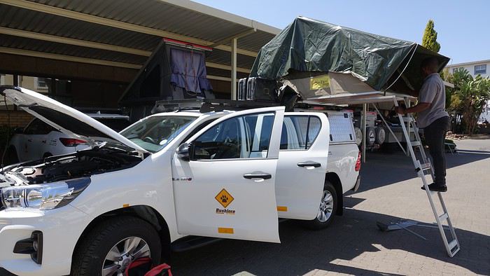
14/09/2019: Johannesburg - Vryburg After months of waiting and reading other travelers’ journals, it’s finally our turn! We arrived in Johannesburg from Nantes and Paris in the morning. We looked for the Bushlore rep—we’d rented our 4x4 from them—but there was no sign with our name! « Bushlore? She’s a woman, I saw her a few minutes ago, » someone told us. A minute later, the Bushlore employee showed up: a man! 🤪 He sped onto the highway, and just 30 minutes later, we arrived at the rental place. It’s a big operation with good organization and lots of vehicles—pretty reassuring. Our 4x4 was there, a classic Toyota Hilux fully equipped for safari: rooftop tent, dual diesel tanks, 60-liter water reserve, two batteries, two spare tires, all the camping gear, plus everything needed for *désensablement* (getting unstuck from sand). Speaking of which, is it "désensablage" or "désensablement"? Best to just avoid getting stuck in the first place! 😏 Good news… or not: the vehicle was brand new, with barely 100 kilometers on the odometer. On one hand, we figured we wouldn’t have mechanical issues or a fridge breakdown, but on the other, we knew it wouldn’t be easy to return it without a single scratch. Either way, it was our first time renting a 4x4, and we were impressed.
We set off toward Kgalagadi Transfrontier Park—it’s not exactly around the corner! In 1994 (when Mandela had just become President) and 2007, during our two previous trips to South Africa, we loved this park, so we couldn’t imagine going to Botswana without returning. The road was pretty monotonous, with not much to see except a few ostriches.
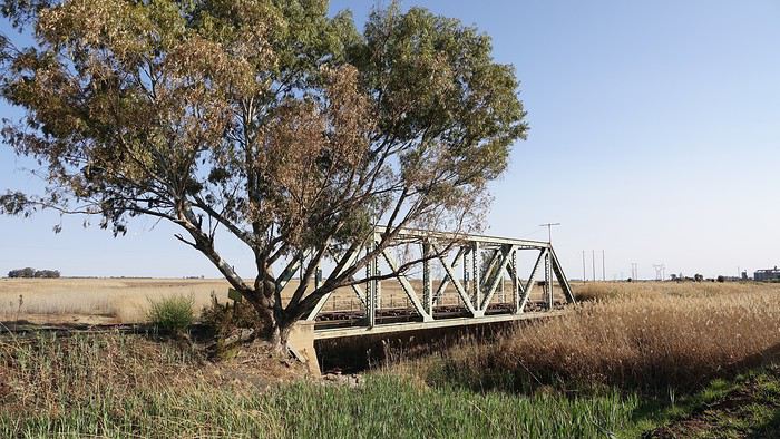
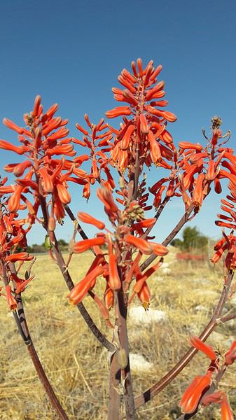
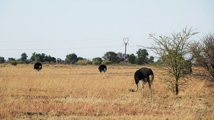
We stopped for the night in Vryburg at the Kameelboom Lodge campsite. It was a bit noisy since it’s close to the road, and the facilities weren’t great, but it was fine for one night.
14/09/2019: Johannesburg - Vryburg After months of waiting and reading other travelers’ journals, it’s finally our turn! We arrived in Johannesburg from Nantes and Paris in the morning. We looked for the Bushlore rep—we’d rented our 4x4 from them—but there was no sign with our name! « Bushlore? She’s a woman, I saw her a few minutes ago, » someone told us. A minute later, the Bushlore employee showed up: a man! 🤪 He sped onto the highway, and just 30 minutes later, we arrived at the rental place. It’s a big operation with good organization and lots of vehicles—pretty reassuring. Our 4x4 was there, a classic Toyota Hilux fully equipped for safari: rooftop tent, dual diesel tanks, 60-liter water reserve, two batteries, two spare tires, all the camping gear, plus everything needed for *désensablement* (getting unstuck from sand). Speaking of which, is it "désensablage" or "désensablement"? Best to just avoid getting stuck in the first place! 😏 Good news… or not: the vehicle was brand new, with barely 100 kilometers on the odometer. On one hand, we figured we wouldn’t have mechanical issues or a fridge breakdown, but on the other, we knew it wouldn’t be easy to return it without a single scratch. Either way, it was our first time renting a 4x4, and we were impressed.
We set off toward Kgalagadi Transfrontier Park—it’s not exactly around the corner! In 1994 (when Mandela had just become President) and 2007, during our two previous trips to South Africa, we loved this park, so we couldn’t imagine going to Botswana without returning. The road was pretty monotonous, with not much to see except a few ostriches.
We stopped for the night in Vryburg at the Kameelboom Lodge campsite. It was a bit noisy since it’s close to the road, and the facilities weren’t great, but it was fine for one night.
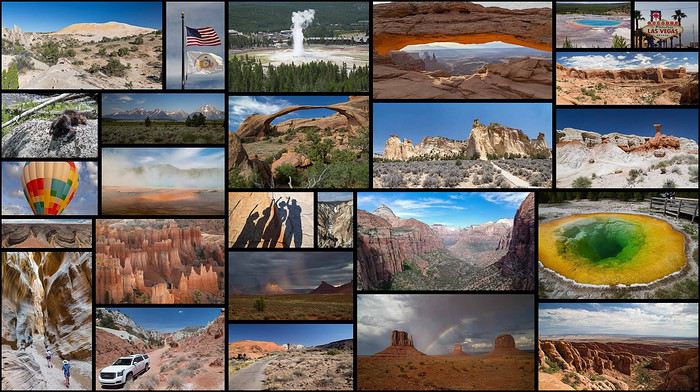
Nine Bretons in the USA from June 24 to July 20, 2018: Greenery and mosquitoes in the North, heat and storms in the South
Choosing the trip:
After returning from the USA in 2014 (travel journal here), it was clear we’d go back, this time with the firm intention of bringing our kids. 😇
2015 was the year of Scotland (travel journal here), 2016 was a work year, and 2017 was the discovery of Aragon in Spain (travel journal here)… Meanwhile, our kids’ age still seemed like a hurdle for this kind of trip. The long wait turned out to be an advantage, letting us refine the project and rally others: what started as a two-week trip for four turned into three weeks for nine!! JF’s parents (M&P, who’d already been in 2014) and JF’s brother (C&D&Y) joined our little family (C&JF&A&L)!!😎 After plenty of family discussions, route tweaks, travel journal reads, and advice from VF (plus some specialized books like Photographing the Southwest by Laurent Martrès), we made up our minds—fully aware of the constraints—and split the trip in two:
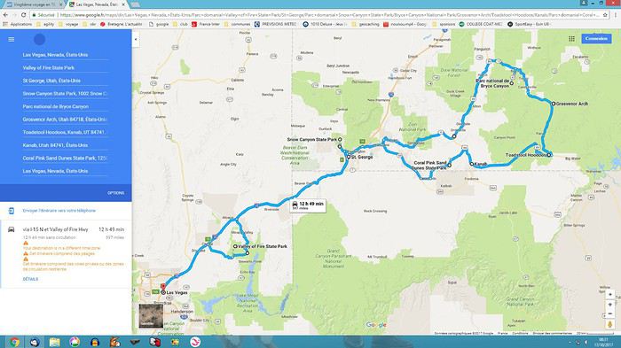
- First week, just the four of us in an SUV + hotels, looping from LV (Valley of Fire, Saint George, Bryce, Kanab), focusing on rocky, sandy, and colorful hikes:
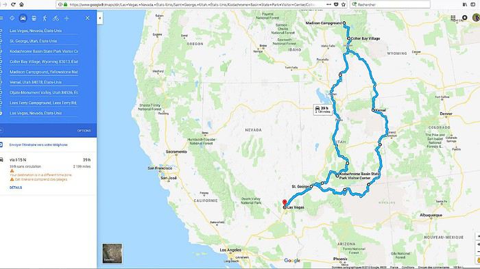
 - Followed by two weeks with nine people in 2 RVs + campgrounds, as close to nature as possible in the parks (Snow Canyon, Kodachrome, Yellowstone, Arches, Canyonlands, Dead Horse, Monument Valley, Grand Canyon):
 🙂Before going further, we want to thank the forum members who took the time to answer our questions. Your patience and kindness are amazing! We might forget someone, but thank you all: Jpg13, Mlefebvre, Kast13,Glll2012New, PCecile, Aquilegia, Adumas4, Ju45, Mycovtt, Natb72, Soula1, Orionide, Simonic, Hiacinthe, etc.
Traveling with nine people (ages 9 to 76, including three kids!!) requires some serious logistics and near-perfect timing to avoid wasting time. The plan went off without a hitch😎… well, almost—we’ll get into the details later…😛🏴☠️🙂 In the end, we came back enchanted and happy!! 🙂The family aspect played a big part, but we also discovered spots that were much less crowded, definitely less known to the general public and the hordes of Asian tourists… The kids returned with stars in their eyes, and the adults with just as many memories (plus around 1,200 photos and 130 GB of GoPro video to sort through)!!😎 We’re already feeling the itch to go back—a Denver loop is starting to take shape…😇
Thoughts on the Americans we met and places we visited: They haven’t changed since 2014… Still cool, optimistic, and smiling, always ready to strike up a conversation and offer help—even without the lure of our tourist dollars. (Only two cold locals at Monument Valley clearly made little effort to help us.) We noticed a few changes in the parks😕: some infrastructure was less well-maintained (wobbly wooden walkways, for example), French info pamphlets disappeared from entrance huts, and there were fewer rangers (Lee’s Ferry ranger station was closed). These changes are likely due to Trump’s restrictive policies toward national parks. On the economic side, gas prices rose by 30% since 2014, now around 0.85 € per liter, and with the current exchange rate, conditions are much less favorable for European tourists than in 2014. But this area is so beautiful—too bad Americans have such an idiot for a president!😠
The flights: Round-trip Paris CDG to Las Vegas LAS Roissy to Los Angeles with Air Tahiti Nui, then American Airlines for Los Angeles to Las Vegas. The A340s were impeccable, and service was great with Air Tahiti Nui (the tiare flower given at boarding), and no complaints about AA either.🙂
The hotels: All booked in advance, either through Hotels.com or directly on the hotel’s website (like the Planet Hollywood in Las Vegas). No surprises, everything met expectations.🙂 It’s a real plus for a family of four to have two beds in every room… Still rare in France.
The campgrounds: Except for one night at Lee’s Ferry, all were booked from France through NPS, Xanterra, and KOA sites. No surprises here either—everything met expectations and was well-organized (fire rings and tables at every site, for example).🙂
The vehicles:
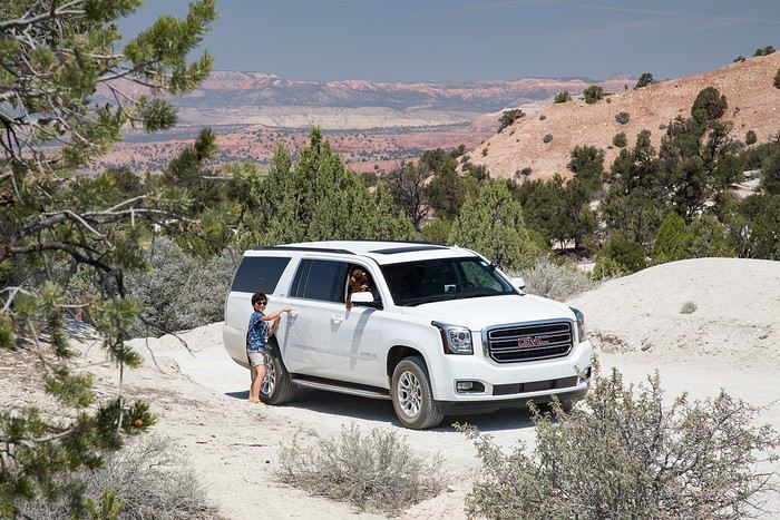
First week: Four people in a GMC Yukon XL from HERTZ, at Las Vegas airport for 327 €, unlimited miles, second driver, and insurance. A typically American beast—355 hp, seven seats: it’s long, big, wide, and tall😮😎😎!! Impeccable condition, quiet, super comfortable with tons of safety features and gadgets (like weather updates tied to GPS!!), and it averaged about 12 L/100 km in 2WD (in 4WD, we nearly hit 19 L on the Stukumpah Road…). A total win thanks to the HERTZ GOLD card, following Jpg13’s advice (Jean-Pierre, you’re my idol!!😎). It let us skip the counter lines (we didn’t even stop there!), pick up the car, and leave the parking lot in under seven minutes… Even less time for the return!
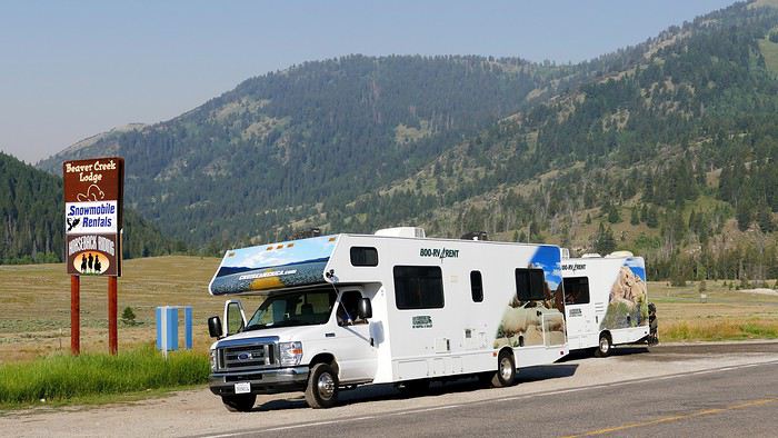
 Second and third weeks: Nine people in two RVs. A 30-foot RV + a 25-foot RV from CRUISE AMERICA in Las Vegas for 5000 €, unlimited miles, kitchenware, and linens/towels/comforters.
A love story in 2014 with this same agency, but unfortunately, this year was much more mixed: aging RVs, ineffective AC in the C30, a leak in the C25’s skylight, a leak in the C25’s toilet drain valve (imagine the dump every time we opened the drain plug…😠🙁), late delivery of both RVs (after 5 PM, though the contract said 4 PM max), abnormal wear on the front tires (we’d discover that later😠), trouble closing the door, etc.In short, a disappointment.😠
Note that other rental companies (El Monte and Road Bear) are probably gaining market share—we saw a lot of their vehicles on the road, and they offer much newer models (at least on the outside) for similar prices…🙂
But setting aside those issues, the vehicles still did their job: letting us sleep as close to nature as possible in the parks and enjoy beautiful sunrises/sunsets with family campfires and marshmallows flambéed with Jack Daniel’s Tennessee Honey😇!!😎 Also worth noting: Cruise America’s solid roadside assistance (we’ll talk more about that later), and how easy it was to drive these beasts—nearly 10 meters long! (Our walkie-talkies were super handy for communication between the two RVs.)
 And for the last day, a Ford Transit 12-seater from Hertz, at Las Vegas airport for 145 € for 24 hours. Perfect for a day with nine people and nine suitcases + nine bags!! Everything fit in the trunk, and it let us explore LV independently (including a trip to the outlet) for less than three taxis would’ve cost…😎
There you have it—the scene is set! If you’re interested in the rest, feel free to join in. The travel journal is done on the computer, and we’re up to day 11 for photos… We should be posting daily!!🙂
See you soon. Christelle & JF
Why bike (MTB) along the canal between the Two Seas: the lateral canal of the Garonne from Bordeaux to Toulouse, and the Midi Canal from Toulouse to the Mediterranean?
This canal was created to connect the Mediterranean to the Atlantic without going around Spain, and along its entire length, there’s an old towpath (used to pull barges). Since this path is closed to traffic (except for service vehicles from Voies Navigables de France), no cars drive on it—it’s dangerous, noisy, and polluting. The Canal between the Two Seas was built for transporting goods, so it passes through many towns you can explore without dealing with traffic. You can stock up on supplies or spend the night. You’ll discover the varied landscapes of the countryside, always in the serenity brought by the calm and slow flow of the canal’s water. Most of the time, you’ll be in the shade of trees planted to stabilize the banks with their roots. All you have to do is follow this blue—or rather green—ribbon without needing to consult a map. But the biggest advantage is that it’s flat! Of course, on the Canal du Midi, water flows from the watershed divide at Naurouze eastward to the Mediterranean and westward to Toulouse. On the lateral canal of the Garonne, water flows toward Bordeaux. But this slope is almost imperceptible, which is a huge plus when you want to travel by bike for several days with luggage.
When I say "bike," I really mean MTB because, while the towpath has been replaced in some places by a paved bike path, it mostly resembles a dirt trail—sometimes smooth, sometimes rocky, and often cluttered with roots from the magnificent trees lining it. Since the canal was classified as a UNESCO World Heritage site, improvements have been underway, but it won’t be tomorrow that you’ll be able to ride from Bordeaux to Sète on a road bike. And I’m afraid the first sections of the path will be worn out before the rest is finished. You might even run into construction work for this bike path. That’s what happened to me during the spring of 2007.
Sunday, 03/11 – Valence d'Agen 08:15 to Toulouse (Rangueil) 16:30 97 km in 8h15 (6h on the bike) I started on the recently paved path along the lateral canal of the Garonne. The first locks appeared, and as I approached Moissac, the path turned into a billiard table until Castelsarrasin. After the Cousteau port, I was back on the classic dirt towpath with its rocks, roots, and nutria holes. But not for long—soon, I hit ruts left by backhoes and bulldozers, which, fortunately, were resting for the Sunday. A pile of rubble taller than me blocked the entire width of the path. I didn’t want to turn back to find the previous bridge and ride on the other bank, which was just as impassable (dense grass). It wasn’t easy to carry a bike with full panniers, so I lifted it over several mounds. I kept going, sometimes on foot, unsure how far the construction extended. Another bulldozer—luckily, the ground was dry. The work went all the way to Montech, making the path impassable. I recommend taking the N113, which runs parallel (that’s what I did on the way back). In Montech, the famous water slope was at rest, waiting for tourists. For many kilometers, I was back on the traditional towpath. The closer I got to Toulouse, the better the surface became, and the more cyclists and pedestrians I saw—until the city center, where there was nonstop bike traffic, especially students heading to Rangueil.
Monday, 03/12 – Rangueil 09:10 to Revel 16:30 86 km in 7h20 (5h30 on the bike) As soon as you reach Toulouse, you make a 90° turn to follow the connection between the lateral canal and the Canal du Midi. Heading east, you pass the barge selling the famous Toulouse violet souvenirs. A real bike path has been built for 50 km to Port Lauragais. It’s a true joy for Toulousains and travelers. Restrooms have been installed or shared with highway rest areas, allowing you to refill water (of course, bikes are banned from ASF rest areas, but cleverly placed racks let you secure your bike and walk in). At Port Lauragais, it’s another rest area shared by highway users, cyclists, and boaters. You’ll find a cafeteria, restaurant, hotel, and a shop selling regional souvenirs. But the real pleasure is reaching the watershed divide at Naurouze, where water flows toward the Mediterranean on one side and the Atlantic on the other. There, I decided to leave the Canal du Midi, which continues toward Castelnaudary with a much rougher towpath, to follow the *Rigole* that feeds the canal with water from the Saint-Ferréol basin. For me, it was like returning to the source—a bit like a pilgrimage in honor of the brilliant Pierre-Paul Riquet, the designer of this magnificent work. I followed the service trail along the *Rigole*. It’s actually a variant of the GR 653, leading to Revel alongside this artificial waterway. It’s fed by water from the Montagne Noire, and I was worried about a steep climb. But that wasn’t the case—the *Rigole* winds for 40 km, flowing gently under the trees. It was better than a dream: a smooth dirt path with the crunch of pine needles under the wheels, where I only crossed paths with a few fishermen... And to soothe sore buns, the last kilometers were on packed earth—a paradise (ATVs, stay away!). More walkers and cyclists appeared there.
Tuesday, 03/13 After a restful night in Revel, I started the morning with a walk around Lake Saint-Ferréol. A very pleasant 10 km hike, but I don’t recommend it for mountain bikers unless you’re used to mountain terrain and have strong calves. Otherwise, you can take the road—there are at least two hotels near the lake. In the afternoon, I began the return trip to Tarn-et-Garonne via the same path, with the same pleasure.
Total: 378 km of suffering and bliss, for which I must thank the departmental and regional councils for their funding, Voies Navigables de France for maintenance, and the volunteers who mark the hiking trails. And don’t you think you’re exaggerating a bit with your 378 km of bliss and the paradise of the *Rigole*?
Okay, fine—it wasn’t always idyllic. Sometimes the path was downright *pierrique*... but I had great weather, and the landscapes were so beautiful (water, sun, vegetation). In the rain or mud, it would’ve been less fun. What does *pierrique* even mean?
*Pierrique* is worse than rocky. I know a Pierrick, and he’s tough. And why *Facteur4*?
It’s France’s goal to reduce greenhouse gas emissions by a factor of 4 by 2050. I’m doing my part by biking to work 3 out of 4 times. And your cassoulet?
Guilty as charged. I ate the best cassoulet of my life at the Hôtel du Midi in Revel. But it was very productive in methane. My stomach hurt so much I couldn’t sleep and ended up writing my postcards between 3 and 4 AM. So many great memories!
Alright, this year, we're heading back to South America!
The initial plan was to retrace the route we imagined in the summer of 2020: a trip to northern Argentina starting from Córdoba.
Unfortunately, the flight to Córdoba no longer exists, and airfares to Javier Milei’s country are both outrageously priced and involve multiple layovers.
So, I tweaked Google Flights every which way and finally found a flight within my budget—departing from Clermont-Ferrand!
Not to Argentina, though...
Our transatlantic flight will cross the snow-capped Andes, landing in Santiago, Chile, with a return from Lima!
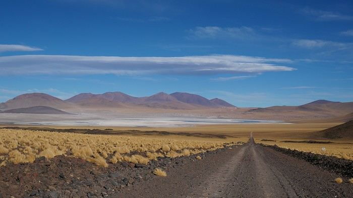
In between, two domestic flights and a big road trip loop starting from the coastal city of Arica to explore the treasures of northern Chile.
Our mode of transport: a pseudo 4x4 that won’t take us through sand dunes or devilish tracks but will let us tackle the entire secondary network, including unpaved main roads, while still being insured.
Is the suitcase packed with all-season clothes?
Are the driver’s license and passport ready?
Bank cards and a few euros too?
Off we go for just over 3 weeks of southern wanderings!
--/--
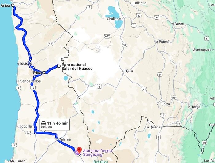
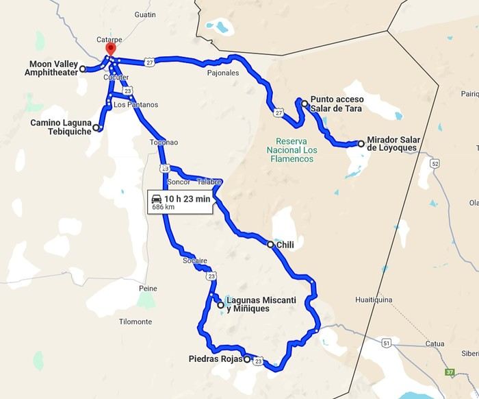
To keep all my esteemed readers on track, here are a few maps outlining the Arica-Arica loop!
1- From Arica to San Pedro de Atacama via Pica and the Salar de Huasco
 2- Around San Pedro
3- From San Pedro to Cariquima
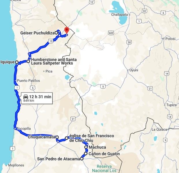
4- From Cariquima to Putre
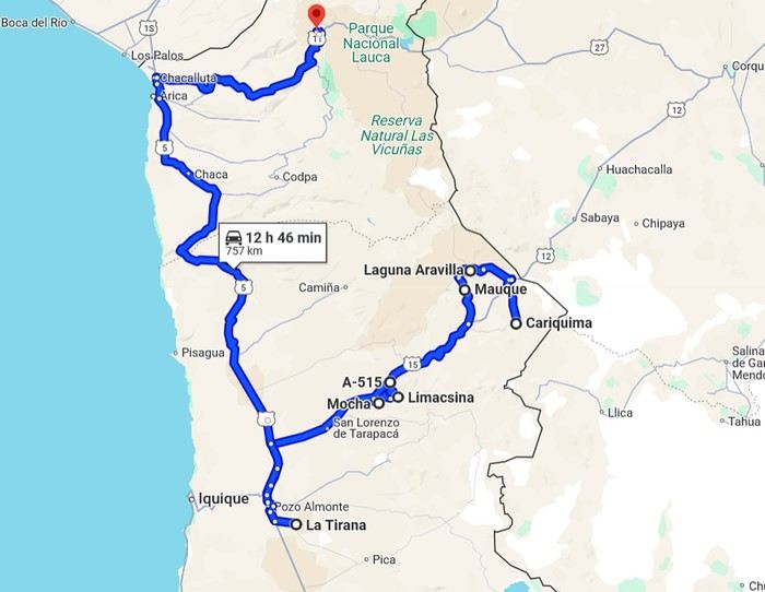
5 - From Putre to Arica
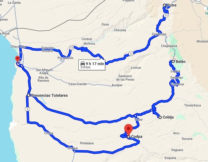
Gas stations in this part of Chile are located in Arica, Iquique, Pozo Almonte, Pica, Calama, and San Pedro de Atacama.
The initial plan was to retrace the route we imagined in the summer of 2020: a trip to northern Argentina starting from Córdoba.
Unfortunately, the flight to Córdoba no longer exists, and airfares to Javier Milei’s country are both outrageously priced and involve multiple layovers.
So, I tweaked Google Flights every which way and finally found a flight within my budget—departing from Clermont-Ferrand!
Not to Argentina, though...
Our transatlantic flight will cross the snow-capped Andes, landing in Santiago, Chile, with a return from Lima!
In between, two domestic flights and a big road trip loop starting from the coastal city of Arica to explore the treasures of northern Chile.
Our mode of transport: a pseudo 4x4 that won’t take us through sand dunes or devilish tracks but will let us tackle the entire secondary network, including unpaved main roads, while still being insured.
Is the suitcase packed with all-season clothes?
Are the driver’s license and passport ready?
Bank cards and a few euros too?
Off we go for just over 3 weeks of southern wanderings!
--/--
To keep all my esteemed readers on track, here are a few maps outlining the Arica-Arica loop!
1- From Arica to San Pedro de Atacama via Pica and the Salar de Huasco
2- Around San Pedro3- From San Pedro to Cariquima
4- From Cariquima to Putre
5 - From Putre to Arica
Gas stations in this part of Chile are located in Arica, Iquique, Pozo Almonte, Pica, Calama, and San Pedro de Atacama.
Preamble:
For summer 2019, the idea was to return to Africa. We had already been to Namibia in 2017 (+ a few days in Botswana and the end of the trip at Victoria Falls), which we loved, and a trip to Asia in 2018 (Borneo, Perhentian, and Singapore), a nature-focused trip but a bit disappointing due to environmental destruction. The desire to return to Africa was very strong. We wanted a change of scenery, nature, discoveries, to step out of our little comfort zone (a bit, anyway!) and experience travel differently. In short, we dreamed of authenticity, and we weren’t disappointed.
We traveled as a family of four with our daughters, aged 19 and 17. When the urge for Africa hit, Uganda quickly stood out, especially for the chance to see rare animals, particularly the famous mountain gorillas. When I looked into the budget, I was quickly disheartened. It’s really expensive. Too expensive… Then, after reading a few trip reports on "VoyageForum" (thanks Muriel J!), I decided to ask a local agency for a quote. The first contact was very friendly and responsive, and the initial offer for two weeks fit our budget :). A few images gathered from the internet (especially Sipi Falls) finally convinced us all. I asked for an adapted offer with a few more sites to extend the trip to three weeks and cover a fairly complete visit to the country (which, of course, increased the budget! To stay within an acceptable range, we prioritized activities over accommodations and regularly chose the cheapest options, with 2-3 nice lodges in between). It’s booked! We were in October 2018, and the first thing to do was reserve permits to see the gorillas and chimpanzees. Then, the agency took care of all the bookings except for the international flights, which we booked with Ethiopian Airlines. A few months of waiting to look forward to… and a little worry too! Two events didn’t reassure us: the kidnapping of an American tourist by four men at the DRC border and the Ebola outbreak in Congo, with confirmed cases in Uganda by mid-June…
Here we are in July, and departure is approaching. The suitcases are packed (warm clothes, long, short, dark, light, practical, sun, rain, hiking/trekking shoes, flip-flops—clothes for every situation! Don’t forget: headlamp (essential!), binoculars, cameras), and we’re ready.
One day before departure, our agency Mpolampola, through its manager Paul, informs us that he won’t be the one taking care of us during the trip but another guide named Moses. He has a big problem with a vehicle and can’t do otherwise. For us, as long as everything is okay, no worries, especially since I had read glowing reviews about Moses, who turned out to be a very pleasant guide, cautious (most important) on the road, clear about all the activities, and an expert on birds, his specialty. We briefly met Paul in the middle of the trip, who is also very friendly. In short, we 100% recommend this agency. Flights to Entebbe went smoothly; we arrived around 10:30 AM, filled out health forms (Ebola information signs everywhere), visas, baggage claim, and met Moses, who took us directly to the vehicle. It was in pretty good condition with huge tires (we’d understand why later!), but it had quite a few miles (400,000 on the odometer!). Just missing a seatbelt… Okay, it’s Africa!
Now, here’s our day-by-day itinerary, which I’ll summarize briefly with ratings for each activity: ****TOPISSIME (Amazing) ***Very good **Good *Meh
Day 1) Departure from the airport at 11:45 AM for some currency exchange. Stop along the way at the equator for a meal and souvenir photo! Arrival at Lake Mburo Park *** around 5:00 PM. Even before entering the park, we saw lots of antelopes, zebras, elks, etc.—it’s magnificent. On the way, we had already encountered many goats and cows, and we were impressed by their enormous horns. We enjoyed a nice game drive until about 7:00 PM, when we reached our lodge, one of the nicest of the trip, Eagle’s Nest ****, with a magnificent view, a tent with a nice bathroom/shower, and a very good meal.
Day 2) Departure at 7:00 AM for a game drive; we encountered many animals again, especially antelopes, zebras, and birds. There are no giraffes, lions, or cheetahs in this park. We didn’t get lucky enough to see a leopard… :-) Then, we continued to Lake Bunyonyi ***, where the road and views are very beautiful, but we were shocked to see locals (mostly women and children) breaking stones by hand on the mountainside in very precarious safety conditions. There are regularly dramatic accidents because, over time, entire sections detach and cause landslides. These stones are then used for road construction… Another world… This was the only place we saw this. Lake Bunyonyi is a nice stop (but less exotic in our opinion since we have many lakes back home too!). We took a boat to our accommodation, Byoona Amagara ***, which has a lot of charm. We stayed in huts called "geodomes," completely open to nature, so it was very cool at night. To reach the toilets located below, you had to be brave! The meal consisted of lake shrimp—good but a bit bland.
Day 3) After a good breakfast, departure at 9:00 AM to visit three islands. We took several nice walks with beautiful views of the lake and islands. A local meal was served on the last island. At 1:00 PM, we met Moses for the rest of the program and headed to Ruhija in Bwindi Forest****. The landscapes are breathtaking. After two hours of driving and many photo stops, we arrived at our accommodation near the trekking starting point, Ruhija Gorilla Friends Resort **. We stayed in a room instead of the initially planned tents, which was just as well because there was a lot of wind during the night. We still had time for an activity and decided to meet the Bwata pygmies despite the bad reviews in the guide… The first part of the visit was quite nice, with a visit to a school where the children gave us a very joyful welcome. We had a great time listening to them sing and dance! Then we met the Bwata pygmies who live on the edge of the forest. When Bwindi Forest was declared a national park, they had to leave their habitat because their activities weren’t compatible with nature and wildlife protection. We left on a somewhat sad note… The visit ended with a local doctor explaining different medicinal plants, and we watched the making of local beer from sorghum. Good meal. We had butterflies in our stomachs—tomorrow was a big day! I admit I was a bit stressed, not entirely confident in my physical abilities…
Day 4) After a short night due to excitement, breakfast, and departure at 7:30 AM. First, it started calmly with singing and dancing. Then, a 15-minute briefing and group assignments. No one asked if we had any physical problems or anything (when booking, I had inquired a bit, and they told me groups were assigned based on physical abilities). We were assigned to the Mukiza group. At first, I was pretty happy—it was a fairly large group with babies :). The ranger explained that for now, they didn’t know where the gorillas were… the trackers couldn’t find them… Oh… (that’s not a good sign!!!) We set off at a good pace, first on a reasonably sloped path. We were accompanied by a family of four Italians and five porters (four for us!). After an hour, the ranger stopped us and informed us they still couldn’t find them—they had fought with another group the day before and scattered throughout the forest, so they were very far away, and we needed to move faster… Hmm… we picked up the pace (we weren’t going slowly before!!!) and walked for another good hour—down, up, down again, up again, we kept going, but always more or less on paths. Then another stop. A 10-minute break waiting for news. The news wasn’t very precise, it seemed! The ranger decided to cut through the forest—machetes were used to clear the path. We descended unimaginable slopes, then climbed back up. Our stick kept getting stuck; luckily, our porter helped us, held our hands, and the terrain was vertical! An hour later, another stop: we heard gorilla cries (yay!!!). False hope—we waited again for news from the trackers, who informed our ranger that it was a non-habituated family, so we couldn’t see them. Cold shower—we had to go all the way back up and return to the starting point to maybe see another group. But time was running out… We arrived around 1:30 PM; all the other groups had already left long ago. Our guide was worried because we still had a long drive ahead. We quickly ate a banana, and off we went for another trek (I was exhausted!). Luckily, this group was close—about 45 minutes of steep descent (I was already thinking about the climb back and considering being adopted by a gorilla ). The forest was sublime, with magnificent tree ferns—the place was truly splendid. Finally, we were there. The porters stayed behind, we grabbed our cameras, and followed the ranger. The progress wasn’t easy, but suddenly, a female was in front of us, curled up in a little ball, eating—so cute. The emotion overwhelmed us. But she moved away—it’s hard to observe them; they move constantly, and the terrain is very steep and uneven. We saw a female descending from a tree with a baby on her back—too adorable. Then, here was the silverback, enormous, incredible, yet so calm and peaceful. He ate quietly and gave us a nice demonstration of nostril exploration! We could observe them for a good hour, but photographing them wasn’t easy because they kept moving, and we could barely stand! Toward the end, a large male (black back) suddenly stood up and decided to pass right where I was! I ended up in the bushes, and the male passed in front of me just a few centimeters away (he stepped on one of my daughters’ feet!) followed by the whole family. Just an exceptional moment. It was time to leave; we had to climb back up. I dreaded it because, I admit, I was exhausted. We finished the hike after 4:00 PM, exhausted but happy. The ranger gave us diplomas, and we didn’t linger because we still had a long drive—we needed to reach Ishasha before nightfall. Our guide was a bit stressed. If we were to do it again, we’d spend an extra night in Bwindi. However, it seems finishing so late is exceptional—it never happens, according to our guide! The road between Bwindi and Ishasha is sublime, with extraordinary landscapes, and despite the late hour, we regularly asked our guide to stop for photos. We arrived at Enjojo *** Lodge around 6:00 PM. The huts are located quite far from the reception and the bathrooms, a bit far from the huts, but otherwise, it was very nice.
Day 5) Departure at 8:00 AM after a good breakfast with the hope of seeing tree-climbing lions (no luck!). Overall, there weren’t many animals, and we arrived around 12:45 PM at our next stop, Parkview Safari Lodge ****, with a magnificent view, a beautiful family bungalow, and a good meal. We enjoyed a short relaxation by the lovely pool. At 4:00 PM, we left to see Kyambura Gorge *** and hike there. Unfortunately, this activity is no longer available, so we walked around the area—it was very beautiful. Back at the hotel, a little rest after the previous day wasn’t a bad idea! Reading, swimming, meals, and dances made the end of the day enjoyable.
Day 6) Departure at 6:30 AM—one of our daughters was sick (stomachache, cold sweats…). Safari in Queen Elizabeth ** (Kaseny Plains)—a bit disappointing. Stop by the salt lake with a nice view. A small market, but we weren’t thrilled by the crafts (overall, apart from some beautiful baskets/plates, there wasn’t much, and the wooden objects were, in our opinion, much less pretty than in Namibia). Then we took the crater road (27 km long) **** with magnificent landscapes. However, you absolutely must close the windows because it’s infested with tsetse flies. At noon, we arrived at Mweya, where we stayed in basic rooms, but the restaurant was well-placed with a beautiful view of the Kazinga Channel. At 2:00 PM, we enjoyed a magnificent cruise **** on the channel. Elephants, antelopes, crocodiles, hippos (including adorable babies), buffaloes, all kinds of birds. Wow!!! Two hours of pure bliss. Quiet end of the day playing cards with a view of the channel and elephants.
Day 7) Departure at 6:00 AM—still sick, we weren’t sure if it was due to the preventive treatment (Malarone) or something else… Another game drive in Queen Elizabeth (Kaseny Plains) and breakfast by the salt lake. Overall, we were a bit disappointed by this park. Then we took the road to Crater Lakes***, again with very beautiful landscapes. A hike of about an hour and a half allowed us to discover these beautiful crater lakes (the water mainly comes from the Rwenzoris). We crossed pretty villages and had nice encounters. End of the day at Tinka’s Home ****, with a family. We loved this place—very welcoming, where we took a cooking class with our hosts. A really great time. After the meal, we enjoyed African stories and dances. Really awesome.
Day 8) Departure at 7:30 AM for another highly anticipated discovery—the chimpanzees in Kibale Forest ****. We went to the meeting point and were split into groups of six, each with a guide. We saw three different groups, and for the last group, we followed a chimpanzee (slightly more comfortable running in the forest than we were!) that led us to the group. Their cries are very impressive, and we could observe them well, even though they were often high up in the trees. We were lucky enough to see two on the ground, very close to us. It was magnificent. End of the encounter and return to the starting point—it was noon. We went back to Tinka’s Home for the meal (delicious!). At 2:00 PM, we hiked in Bigodi Swamp ***, a marsh surrounded by beautiful vegetation, especially huge papyrus, and inhabited by many birds and monkeys. We saw, among others, black-and-white colobus monkeys, red colobus monkeys, and vervet monkeys. We also visited a basket-weaving workshop where we bought two beautiful baskets. Then a short stop in Fort Portal, where we stayed for two nights at Ruwenzori View Guesthouse ***, a nice place with a family room and very good communal meals.
Day 9) Departure at 8:00 AM for a hike in the Rwenzori****—it was a bit chaotic today. First, we had to exchange shillings because we wouldn’t have another chance in the following days. At the bank, employees went to get the bills by motorcycle from other buildings—it was quite surreal! And it took time! Then there was a misunderstanding between the organizer and me… I really wanted to see the region where chameleons are found in the Rwenzori—this region is south of the mountain range, and we were in the north! Anyway, the program included an ascent in the northern part with a positive elevation gain of over 1,500 meters… Talking to the guide scheduled for this hike (Noah), we explained that we really wanted to discover the vegetation and these famous chameleons, not necessarily achieve a physical feat… (we’d had enough!). The decision was made to go south, which meant quite a bit of driving. The hike was really enjoyable, with magnificent vegetation by the river. We saw three of the four chameleon species present, including the famous three-horned chameleon. The region is superb. We ended with a drink at Ruboni Camp, which has a magnificent view of the region (ideally, we should have stayed there). Two hours of driving to finish, and a good meal :).
Day 10) Departure at 8:00 AM—we had a long drive to Ziwa Rhino Ranch****. We passed through Hoima, had lunch in Masindi, and arrived in time for the rhino tracking walk. We could approach them closely on foot—it was impressive. We saw eight. Since we were staying on-site in the guesthouse **, we received precise safety instructions for moving between the rooms and the restaurant. And we quickly understood why!
Day 11) Departure at 6:00 AM for breakfast—surprise, in front of our room, several large rhinos were sleeping (we had also heard a lot of animal noises during the night—rhinos but also what seemed to be predators). So we had to take a detour to reach the restaurant! Second surprise—next to the restaurant, just three meters away at most, two mothers and their baby were also sleeping! Memorable! Then we had an appointment for the shoebill trek and canoe ride **** (package with the previous day’s walk). So there we were, in our boots, splashing through 30 cm of water in search of the shoebill (I really wanted to see one :))! It was really fun, and luck was on our side—a shoebill had just landed in the distance! We approached as best we could and observed it from afar. What a strange bird! There are very few left, and Uganda is one of the countries where the chances of seeing one are quite good. The tour continued with a canoe cruise where we saw a herd of cows (the famous ones with enormous horns) being swum as a dowry to the father of the future bride! A funny spectacle. This stop wasn’t the most anticipated, but we all thought it was really worth the detour. Road to Murchison Falls Park, and arrival around noon at Red Chili Rest Camp **, where we stayed for two nights (family banda). Good meal. Then a cruise to Murchison Falls*** where we disembarked and continued on foot. It was pretty. Back to Red Chili.
Day 12) This morning, early departure for a cruise in search of the shoebill*** (booked in case we didn’t see one at Ziwa). The landscapes were pretty, but there weren’t many birds in the end. We spotted the chosen one from afar after the first 10 minutes—so the suspense didn’t last long :-) It was a nice activity but quite long—5 hours. In the afternoon, safari in Murchison Park****—this park is sublime, the landscapes fabulous. Really one of our favorite parts of the trip. Lots of animals and even a leopard spotted with binoculars because it was far away! Night at Red Chili.
Day 13) Departure for the first morning ferry—it was drizzling, the sky was threatening at first, so the landscape was spectacular! Beautiful contrasts. In the middle of the morning, we were lucky to observe a whole group of lions, first from afar, then with a little patience, the whole group approached until they passed beside and in front of our vehicle. What emotion and excitement! We could then observe large groups of giraffes. They were magnificent. The morning was incredible. Then we headed to our lodge, Fort Murchison ****, and on the way, we saw a whole group of elephants—the view was magnificent. We had a very good meal and enjoyed the pool a bit. We also met Paul, the organizer of our trip. Very nice :). In the late afternoon, off for a short safari in the park. We slept in very well-equipped tents.
Day 14) Today, we had a long drive to Kidepo Park. It was raining, which didn’t help our guide—according to him, the tracks near Kidepo turn to mud with rain and become difficult to navigate. We saw, among other things, a bus in a bad situation in the ditch. Some sections were really tricky, and we were glad to have a driver. The end of the trip—the landscape was spectacular and original, and we saw some traditional villages. We arrived at Kidepo quite late. Short safari in the park before reaching the accommodation. We booked two simple bandas in the park camp**. It was clean but didn’t hold up well in the rain . The restaurant was very nice, though.
Day 15) The day was dedicated to discovering Kidepo Park **** where the landscapes were again superb. First encounter with a lioness resting on a rock. We saw other lions later and observed them for a long time. There were almost no other tourists in the park. Our daughter wasn’t feeling well, and by the time we arrived at the lodge, she had a temperature of 39.5°C (103.1°F)… A nap was necessary. In the late afternoon, we returned to the spot where we had seen the lions that morning, and they were still there—they weren’t happy because rain was threatening! It was a great photo opportunity. Then came the downpour, and our driver urged us to return quickly because the tracks were becoming impassable. Indeed, a jeep was in the ditch… The return was eventful, and several times we slid without being able to do anything… Wow, what a day!
Day 16) No safari this morning because of impassable tracks—the road to Kotido*** was longer than expected as we had to take a detour. The landscapes along the way were surprising. We finally arrived around 1:00 PM at the accommodation and left at 3:00 PM to visit the largest manyatta in East Africa with two translators. It was incredible—a very beautiful experience. The manyatta is immense and has 28,000 inhabitants. Night at Karamojaarts guesthouse*—very average meal.
Day 17) Departure for Moroto****—on the way, we saw many bird species. Moroto doesn’t look like other Ugandan cities. Life there seems very pleasant. We arrived at Kara-Tunga and had a bite to eat. At 4:00 PM, we left to visit a Karamojong village. We enjoyed beautiful dances and watched communal games—it was fun and so authentic. Then we headed to a kraal (where shepherds and herds are) to set up our camp. Moses had to get used to the idea of sleeping in the tribe in a tent! It was incredible to find ourselves in this universe. The place was beautiful, and we had a great time with the Karamojong. Some had never seen white people… had never been in a car… Their culture is incredible. During the evening, around the fire, to our guide’s dismay (a bird enthusiast), they grilled hornbills! On our side, we ate a meal prepared by Kara-Tunga for our sensitive stomachs! Night in a tent.
Day 18) Dawn wake-up in the fog—the atmosphere was quite strange. Our daughter was attacked by a cow—fortunately, more fear than harm, but she ended up with a lot of thorns in her buttocks and thighs ! Then we left for the Mount Elgon region, specifically Sipi Falls****. Lacam Lodge****, perched on the edge of the cliff with a direct view of one of the falls, was just magnificent. The view and landscapes were fabulous. Big favorite. We had dinner and then went for a hike to visit the three falls in the region, partly in the rain. The landscapes were breathtaking! Sunset at Lacam Lodge with the sun setting over the waterfall. We couldn’t get enough and stayed to admire until nightfall!
Day 19) Visit to coffee plantations*** where we were given all the useful explanations to understand the culture and the incredible work required for this product, which is ultimately not very glorified. The visit was very interesting, and we drank very good coffee with the owners. Last photos at Lacam Lodge, and then departure for Jinja, where we arrived in the middle of the afternoon. We took a small cruise to see the source of the Nile*. Very touristy and not at all to our taste… Then a meal at Jinja Base Camp** where we enjoyed guacamole. Our guide Moses left us because another group was waiting for him!
Day 20) Road to Kampala***, the market, the Gaddafi Mosque. Short but interesting visit. Last meal in Entebbe by Lake Victoria, where we almost felt like we were by the sea. Transfer to the airport and return to Switzerland…
Epilogue: All four of us were enchanted by this trip, which will undoubtedly remain one of the most beautiful we’ve ever taken. Talking about it gives me chills and brings tears to my eyes. It was simply a magnificent experience. However, I wouldn’t recommend this trip to everyone because you often have to overlook small inconveniences like toilets (the worst of my life) and certain comfort details that, for us, remain details but could be important to others.
Our favorites: - The gorilla trek - The cruise on Kazinga Channel - The Fort Portal region - The Rwenzori Mountains - The chimpanzee trek - Murchison Falls - Kidepo - Spending time with the Karamojong tribe - The Sipi Falls region - The accommodations: Eagle’s Nest, Byonna Amagara, Parkview Lodge, Tinka’s Home, Rwenzori Guesthouse, Fort Murchison, Night in the kraal, and Lacam Lodge
What we liked less: - Queen Elizabeth Park - Jinja - The accommodations: Ziwa Rhino Ranch, Karamojaarts Guesthouse
I’ll try to post some photos later. If you have any questions about a future trip, I’d be happy to answer them.
Hi everyone,
Since the safety reports on Peru are sometimes a bit outdated, I got curious and checked the Ministry of Foreign Affairs website for travel advice.
It’s honestly pretty worrying!!
Here’s the link: https://www.diplomatie.gouv.fr/fr/conseils-aux-voyageurs/conseils-par-pays/perou/
Among other things, they don’t just mention fake taxis that rob you or express kidnappings (especially in Arequipa), but also drugs that can be slipped into your drink if left unattended, "with the risk of scopolamine being added."
They’ve marked the Cuzco region as a red zone (formally avoid!!) and central Lima as an orange zone, "to avoid after dark."
What do those who’ve been there recently think?
Hi everyone,
So great to be back on our forum!...
For the past few years, I’ve been traveling on a budget, especially by sleeping as often as possible in campgrounds or in my car... If I can help, I’d be happy to.
For the past few years, I’ve been traveling on a budget, especially by sleeping as often as possible in campgrounds or in my car... If I can help, I’d be happy to.
Hi there,
We’re heading to Puglia from July 30 to August 31, 2020. I’ve booked a rental with a pool in Locorontondo.
But the more I read guides and forums, the more I regret booking the flight to Bari. I can still cancel the other reservations, but I’d face penalties for the flight.
It’s packed, avoid August at all costs—traffic jams, stifling heat, price hikes… I’m really having second thoughts. Our goal isn’t necessarily to hit the beach. I’m thinking we’ll get up early to go where we want and head back during the hottest part of the day.
Is it *that* bad? Thanks for sharing your experiences.
Hi everyone,
What great news to read that Voyage Forum is back up and running—I’m so happy! 🙂 I need some advice for a trip we’re planning in 2025: New Caledonia and Australia.
We’ll arrive in Australia on September 1, 2025, and the plan is to spend 2 nights in Melbourne to explore the city, then rent a car to drive from Melbourne to Sydney, where we’ll arrive on September 12. Unfortunately, we won’t have time for the Great Ocean Road
I’ve checked several blogs for this route and here’s the itinerary I’ve put together:
9/4: Melbourne to Philip Island (140 km) – 1 night 9/5: Philip Island to Wilsons Promontory National Park – 2 nights 9/7: Raymond Island (free ferry to cross a 200 m sea channel) – Lakes Entrance – 1 night 9/8: Drive to Narooma (stop at Quarry Beach) – 1 night at "Bodalla Park Forest Rest Area" 9/9: Batemans Bay – Pebbly Beach – Dolphin Point – Jervis Bay – 1 night (to be found) 9/10: Jervis Bay and surroundings – 1 night at Bendeela Picnic Area 9/11: Blue Mountains National Park (1 hour from Sydney) – 1 night (to be found) 9/12: Arrival in Sydney
I know we won’t be able to see everything, and this 9-day route is just a starting point. The goal is to avoid rushing—if we see a place we like, we’ll stop, even if it means seeing less. A vacation where we don’t watch the clock too much! 🙂 Does this route (a mix of several blogs where not all stops are noted) seem realistic or too ambitious? Are there certain spots that are more worth prioritizing over the ones I’ve listed? For example, in one of the blogs I read, travelers skipped Blue Mountains National Park because they chose another site (which I’ve forgotten 😎).
For accommodation, we’ll likely be camping (free or paid), so if you have any suggestions, I’d love to hear them! 😎
Our arrival in Sydney on September 12 depends on my hope to participate in the marathon on September 15, 2025. After that, we’ll leave Sydney on September 17 for Ayers Rock.
Thanks in advance for your tips and ideas—it’s always tricky to plan a route from a distance when time is limited.
And long live this site, which I’ve missed so much since 2020! 😎🙂
Sunday, October 1st, 2023
Mulhouse-London
We dumped our trash on our neighbors. We hugged, overflowing with emotion. Then Léa from Taxis S showed up. She knows us well. For ages, she’s been our driver. She was practically the official taxiwoman for the trips of the company where Dom and I met. She knew us when we were single! Almost teenagers! She knows everyone and fills in the biographies of people we’d forgotten.
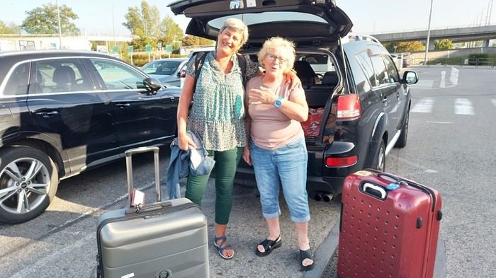 Across the street, while we loaded the luggage, S., perched in his window frame, waved a handkerchief. This wasn’t just any trip.
 Then things got tricky. It’s funny how fate sinks its teeth into our happy moments—there’s this whole intermediate phase where the poison seeps in unnoticed because you’re still in the dark...
First, there was a delay on our flight to London. Dom immediately went on high alert, while I stayed calm. In my mind, we had two hours. I knew we had to go from Terminal 5 to Terminal 4, but two hours—come on, that’s plenty, right?
Bad calculation! Because those two hours were between the first flight’s landing and the second’s takeoff. But flights close at least half an hour before departure. Getting from one terminal to another means taking a shuttle bus. We waited for the one going to Terminal 4... until a young guy paid to direct people (who hadn’t seen us) informed us it was no longer possible to access Terminal 4 without going through Terminal 2 first for a connection! That really cranked up the pressure. We started installing a mental countdown with a programmed explosion at the end—guaranteed stress with added beads of sweat. The terminal bus was driven by a young Pakistani guy. We were *so* tense we bombarded him with our frantic, repetitive questions. “So? When are we getting there? What’s happening? Why aren’t we moving?” Our eyes were glued to our watches. The poor guy knew. Perfectly. Because it was obvious—no way around it. We weren’t going to make it. It was impossible. But Dom and I stubbornly refused to believe it. Then the kid stopped the bus. Me, hysterical: “What are you doing? What’s going on? Our plane takes off in... in... 4 minutes!!!! We’re gonna miss iiiiiit!” He wasn’t calm either. “You’ve already missed it!” He explained we had to cross a zone that required an escort car to clear a path through the runways. Impossible to do without. It’s forbidden. We had to WAIT (!!!). Then he got a radio call—he had to rush to Terminal 3 to pick up a passenger who was *super* tight on time. “Amir!!!! It’s RIGHT NOW!” they yelled in his already-red ears, thanks to the complaints of two hysterical Frenchies. Dom and I were in overdrive, hallucinating! We wanted to stop him, maybe even hit him to prevent him from turning around. He picked up the girl, whom we instantly hated like the most despicable witch. I turned on my data, searched for Malaysia Airlines’ number at Terminal 4, called, and actually got someone—quite a feat. A woman cut off my frantic rambling with a blunt “It’s over, the check-in is closed, the plane is about to take off.” I heard her but refused to accept it. I yelled, “We’re coming!” She shot back her monolithic “It’s over.” Finally at the doors of that damn Terminal 4, we ran—*really* ran—a marathon, Gate 6, security checks, pat-downs, “Take off your belts,” we asked questions, everyone seemed confident, we ran with one hand holding up our pants, the other clutching our belt, Gate 6—the room was empty. A girl was sitting there, calmly on the phone. We pounced on her. She calmed us down. Little by little, the light came back. Our brains rebooted. We finally understood it was over. We’d have to start crafting a new plan with the new reality. It started with a return to Terminal 5 to talk to British Airways, which took a good hour. With the same driver as before. We were alone with him. He took the time to apologize, to assure us it wasn’t his fault, that our problem had no solution, that nothing could’ve changed the outcome. At BA, we were exhausted. We were greeted by a handsome young man in a navy-blue uniform with gold stripes everywhere. We could’ve made a scene, but we were just relieved to find someone who’d take charge of our story. It was a minimal response, but it was *a* response. I suppose we could’ve demanded a business-class upgrade or a free trip, but we were just happy with a few vouchers for food, a hotel room with breakfast, and a little bag with plastic toys, a razor, toothbrush, hygiene products, and a T-shirt... Trinkets... But we were fine with it all—we said thank you eagerly because the essential was assured. He found us seats on flights tomorrow. *Tomorrow.* We were afraid to hope! We had the exact same flights but a day later. The same crappy times, but it was all good. We felt saved from the shipwreck, like survivors. - And what about the luggage? - .... !!!!
Monday, October 2nd, 2023 London - Kuala Lumpur
It wasn’t the Ritz, but with exhaustion on our side, we slept well. The continental breakfast was way better than we’d expected from an Ibis Budget. Still, it wasn’t enough to restore my joy for life. The course correction had turned into an arduous obstacle course. I scoured the car rental site every which way. Couldn’t reschedule the car. I’d done it before, but this time... Not to mention the laptop battery was complaining—the Brits have this quirk of making their power outlets incompatible with our chargers. Frustrated, I called them but ended up with a girl who declared herself incompetent and offered to have someone from Avis in Perth call me back—someone who’d supposedly handle rentals better. I decided to wait while taking a bath. Barely settled in, the phone rang. I was soaking wet, of course, and asked Dom to answer. Unfortunately, she’s known for disliking my phone, and in a clumsy move, she hung up. We got annoyed. She put dry towels on the edge of the bathtub, but—another false move—they fell in the water. The phone rang again... I completely redid the plans for the next two days, then transferred the files to my phone to consult them later offline. I plugged in my USB cable... *Plop!* The battery died abruptly—my PC shut down without any of the usual polite warnings! I looked around, hoping to find someone to strangle... Long story short, you can tell the day started under the worst omens. I was in a foul mood and spread my bad vibes to Dominique, who was initially in much better spirits... I called Mastercard, hoping to get a refund for the non-refundable night in Perth we’d already paid for. Same old song: “We’ll call you back”... Then... I’ll cut it short—buses, trains, lots of waiting... We rushed to reach the infamous Terminal 4.
We tried new options and convinced ourselves that a delayed departure flight is unrecoverable, no matter the scenario. We were furious that BA hadn’t bothered to tell us, leaving us to run around like rats in a burning house.
Tuesday, October 3rd, 2023 Kuala Lumpur-Perth
The flight was pretty nice. 13 hours, though. Dom and I were facing each other across the aisle. We could get up easily whenever we wanted without bothering anyone and chat when we felt like it. Besides, their chicken was amazing. They were kind enough to offer Dom a truly remarkable glass of rum. Good movies too, including the excellent *Prisoners* by Denis Villeneuve. At KL, during boarding, we developed a nagging worry about our luggage. We checked with some Malaysian Airlines staff. I sensed their hesitation. They made calls. Then changed their minds, giving us smiles and thumbs up...
Wednesday, October 4th, 2023 Perth
*Happy is the man who, like Ulysses, has had a fine voyage.* Well, for us, it wasn’t that. Finally arrived, we experienced the loneliness of tourists watching the baggage carousel spin, emptying of its precious containers one by one, until only a handful of travelers were left, staring at each other in disbelief. Without luggage, you’re kinda screwed. Not even a change of socks—our feet had been swimming in the same shoes for 3 days. No adapter, so no laptop. No toiletries. We could’ve cried! The lost luggage guy played his part. If you want compensation, fill out the disclaimer on the website made for that. And then, “Don’t worry, your luggage will arrive tomorrow!” “Don’t worry?!” From the start of the trip, we’ve been jerked around, fed lies. Tomorrow is the *absolute* last chance to get them back. Beyond that, we’d have to scramble a whole new trip. And lose a lot in the process! I have no idea how to go about it. Tomorrow... OMG... Tomorrow... We landed at 1 AM. Avis, the car rental place, opens at 6:30. Luckily, we found some decent breakfast. It cheered us up and gave us a second wind. Incorrigible, we started believing again! Well, then we just killed time. What else was there to do?

In front of Avis’s little shack, we were freezing. We’d been there since dawn. The girl who showed up, a Latina, immediately saw us as a nuisance who’d ruin her hopes of a peaceful start. Her face and tone were as unwelcoming as possible. You know us—it ended with hugs. She gave us a gorgeous, brand-new car! A hybrid with ultra-sophisticated features, all buttons you shouldn’t touch if you want to drive this thing without causing irreparable damage! We’re off! Driving on the left is easy at first. You think about it constantly. It’s counterintuitive, it takes effort. It’s later, when you get used to it and confidence sets in, that it becomes dangerous—old reflexes can send you into a wall. Anyway, the car and I immediately clicked.
In Perth, underground parking next to the hotel, friendly welcome—we ended up forgetting all the morning’s mishaps. Should we go sightseeing?
https://voyageforum.com/images/posts/small/1733767537-5Nwk6t3DsBZNOzf.jpg
Across the street, while we loaded the luggage, S., perched in his window frame, waved a handkerchief. This wasn’t just any trip.
Then things got tricky. It’s funny how fate sinks its teeth into our happy moments—there’s this whole intermediate phase where the poison seeps in unnoticed because you’re still in the dark...
First, there was a delay on our flight to London. Dom immediately went on high alert, while I stayed calm. In my mind, we had two hours. I knew we had to go from Terminal 5 to Terminal 4, but two hours—come on, that’s plenty, right?
Bad calculation! Because those two hours were between the first flight’s landing and the second’s takeoff. But flights close at least half an hour before departure. Getting from one terminal to another means taking a shuttle bus. We waited for the one going to Terminal 4... until a young guy paid to direct people (who hadn’t seen us) informed us it was no longer possible to access Terminal 4 without going through Terminal 2 first for a connection! That really cranked up the pressure. We started installing a mental countdown with a programmed explosion at the end—guaranteed stress with added beads of sweat. The terminal bus was driven by a young Pakistani guy. We were *so* tense we bombarded him with our frantic, repetitive questions. “So? When are we getting there? What’s happening? Why aren’t we moving?” Our eyes were glued to our watches. The poor guy knew. Perfectly. Because it was obvious—no way around it. We weren’t going to make it. It was impossible. But Dom and I stubbornly refused to believe it. Then the kid stopped the bus. Me, hysterical: “What are you doing? What’s going on? Our plane takes off in... in... 4 minutes!!!! We’re gonna miss iiiiiit!” He wasn’t calm either. “You’ve already missed it!” He explained we had to cross a zone that required an escort car to clear a path through the runways. Impossible to do without. It’s forbidden. We had to WAIT (!!!). Then he got a radio call—he had to rush to Terminal 3 to pick up a passenger who was *super* tight on time. “Amir!!!! It’s RIGHT NOW!” they yelled in his already-red ears, thanks to the complaints of two hysterical Frenchies. Dom and I were in overdrive, hallucinating! We wanted to stop him, maybe even hit him to prevent him from turning around. He picked up the girl, whom we instantly hated like the most despicable witch. I turned on my data, searched for Malaysia Airlines’ number at Terminal 4, called, and actually got someone—quite a feat. A woman cut off my frantic rambling with a blunt “It’s over, the check-in is closed, the plane is about to take off.” I heard her but refused to accept it. I yelled, “We’re coming!” She shot back her monolithic “It’s over.” Finally at the doors of that damn Terminal 4, we ran—*really* ran—a marathon, Gate 6, security checks, pat-downs, “Take off your belts,” we asked questions, everyone seemed confident, we ran with one hand holding up our pants, the other clutching our belt, Gate 6—the room was empty. A girl was sitting there, calmly on the phone. We pounced on her. She calmed us down. Little by little, the light came back. Our brains rebooted. We finally understood it was over. We’d have to start crafting a new plan with the new reality. It started with a return to Terminal 5 to talk to British Airways, which took a good hour. With the same driver as before. We were alone with him. He took the time to apologize, to assure us it wasn’t his fault, that our problem had no solution, that nothing could’ve changed the outcome. At BA, we were exhausted. We were greeted by a handsome young man in a navy-blue uniform with gold stripes everywhere. We could’ve made a scene, but we were just relieved to find someone who’d take charge of our story. It was a minimal response, but it was *a* response. I suppose we could’ve demanded a business-class upgrade or a free trip, but we were just happy with a few vouchers for food, a hotel room with breakfast, and a little bag with plastic toys, a razor, toothbrush, hygiene products, and a T-shirt... Trinkets... But we were fine with it all—we said thank you eagerly because the essential was assured. He found us seats on flights tomorrow. *Tomorrow.* We were afraid to hope! We had the exact same flights but a day later. The same crappy times, but it was all good. We felt saved from the shipwreck, like survivors. - And what about the luggage? - .... !!!!
Monday, October 2nd, 2023 London - Kuala Lumpur
It wasn’t the Ritz, but with exhaustion on our side, we slept well. The continental breakfast was way better than we’d expected from an Ibis Budget. Still, it wasn’t enough to restore my joy for life. The course correction had turned into an arduous obstacle course. I scoured the car rental site every which way. Couldn’t reschedule the car. I’d done it before, but this time... Not to mention the laptop battery was complaining—the Brits have this quirk of making their power outlets incompatible with our chargers. Frustrated, I called them but ended up with a girl who declared herself incompetent and offered to have someone from Avis in Perth call me back—someone who’d supposedly handle rentals better. I decided to wait while taking a bath. Barely settled in, the phone rang. I was soaking wet, of course, and asked Dom to answer. Unfortunately, she’s known for disliking my phone, and in a clumsy move, she hung up. We got annoyed. She put dry towels on the edge of the bathtub, but—another false move—they fell in the water. The phone rang again... I completely redid the plans for the next two days, then transferred the files to my phone to consult them later offline. I plugged in my USB cable... *Plop!* The battery died abruptly—my PC shut down without any of the usual polite warnings! I looked around, hoping to find someone to strangle... Long story short, you can tell the day started under the worst omens. I was in a foul mood and spread my bad vibes to Dominique, who was initially in much better spirits... I called Mastercard, hoping to get a refund for the non-refundable night in Perth we’d already paid for. Same old song: “We’ll call you back”... Then... I’ll cut it short—buses, trains, lots of waiting... We rushed to reach the infamous Terminal 4.
We tried new options and convinced ourselves that a delayed departure flight is unrecoverable, no matter the scenario. We were furious that BA hadn’t bothered to tell us, leaving us to run around like rats in a burning house.
Tuesday, October 3rd, 2023 Kuala Lumpur-Perth
The flight was pretty nice. 13 hours, though. Dom and I were facing each other across the aisle. We could get up easily whenever we wanted without bothering anyone and chat when we felt like it. Besides, their chicken was amazing. They were kind enough to offer Dom a truly remarkable glass of rum. Good movies too, including the excellent *Prisoners* by Denis Villeneuve. At KL, during boarding, we developed a nagging worry about our luggage. We checked with some Malaysian Airlines staff. I sensed their hesitation. They made calls. Then changed their minds, giving us smiles and thumbs up...
Wednesday, October 4th, 2023 Perth
*Happy is the man who, like Ulysses, has had a fine voyage.* Well, for us, it wasn’t that. Finally arrived, we experienced the loneliness of tourists watching the baggage carousel spin, emptying of its precious containers one by one, until only a handful of travelers were left, staring at each other in disbelief. Without luggage, you’re kinda screwed. Not even a change of socks—our feet had been swimming in the same shoes for 3 days. No adapter, so no laptop. No toiletries. We could’ve cried! The lost luggage guy played his part. If you want compensation, fill out the disclaimer on the website made for that. And then, “Don’t worry, your luggage will arrive tomorrow!” “Don’t worry?!” From the start of the trip, we’ve been jerked around, fed lies. Tomorrow is the *absolute* last chance to get them back. Beyond that, we’d have to scramble a whole new trip. And lose a lot in the process! I have no idea how to go about it. Tomorrow... OMG... Tomorrow... We landed at 1 AM. Avis, the car rental place, opens at 6:30. Luckily, we found some decent breakfast. It cheered us up and gave us a second wind. Incorrigible, we started believing again! Well, then we just killed time. What else was there to do?
In front of Avis’s little shack, we were freezing. We’d been there since dawn. The girl who showed up, a Latina, immediately saw us as a nuisance who’d ruin her hopes of a peaceful start. Her face and tone were as unwelcoming as possible. You know us—it ended with hugs. She gave us a gorgeous, brand-new car! A hybrid with ultra-sophisticated features, all buttons you shouldn’t touch if you want to drive this thing without causing irreparable damage! We’re off! Driving on the left is easy at first. You think about it constantly. It’s counterintuitive, it takes effort. It’s later, when you get used to it and confidence sets in, that it becomes dangerous—old reflexes can send you into a wall. Anyway, the car and I immediately clicked.
In Perth, underground parking next to the hotel, friendly welcome—we ended up forgetting all the morning’s mishaps. Should we go sightseeing?
https://voyageforum.com/images/posts/small/1733767537-5Nwk6t3DsBZNOzf.jpg
This adventure began during Covid... Yep, Covid turned a lot of things upside down, but most of all, it kept us cooped up for a few months and stopped us from traveling for a while—even longer for a die-hard fan of the American West like me.
While borders were closed, I started imagining what an ideal itinerary might look like—one that would string together all the Southwest must-sees in just two weeks, during the best time of year: September and October. When the U.S. announced in September 2021 that borders would reopen in the coming weeks, I regained hope and began scouting flight tickets for a departure in September 2022.
But here’s the thing: tackling solo hikes, each one tougher than the last, right in the heart of the Wilderness, could be a risky—even reckless—endeavor for a father of three. After a quick chat with some virtual friends who are just as passionate about the Southwest as I am, with good physical condition and nearly the same list of must-visit spots, Franck and his brother Sullivan were in! 🙂
In November, we snagged flight tickets from Nice to San Francisco for the modest sum of 400 €, and a few days later, I booked a Toyota Tacoma pickup for 840 € !
It’s not cheap for just 15 days, and a pickup isn’t exactly ideal for luggage, but the prices for full-size 4x4s have become totally outrageous! Due to border closures, rental companies had to offload a lot of these big 4x4s, which tourists love. Then, supply and demand did the rest !
Franck and I spent the winter and spring trying to cram the equivalent of three weeks of hikes into two. But even with physical limits, we had to stay reasonable! Three to four months before departure, we entered the lotteries for different must-see spots: The Subway, Coyote Buttes North (home to the famous Wave), and Coyote Buttes South (CBS).
The Wave is the holy grail for any Southwest enthusiast. Since 2015, we’ve tried our luck with the online and on-site lotteries about ten times, but the spots are unfortunately limited: just 20 per day. A glimmer of hope, though—since early 2022, that number has increased to 64 people allowed per day, with 48 spots awarded via the online lottery.
After all three of us tried our luck for The Wave, on June 1st at exactly 5 PM, I got an email that started with, "Congratulations! You were successful in the Coyote Buttes North (The Wave) September 2022 Permit Lottery at Coyote Buttes North (The Wave)...". At 5:01 PM, I called Franck, whose dream it’s been for over 20 years—ever since the first photos were published in a travel magazine! He didn’t believe me when I told him, and I had to forward the email for him to finally accept the unbelievable: we were going to The Wave and all the incredible spots scattered across the protected area of Coyote Buttes North.
I’ve already been to Coyote Buttes South twice, but there are areas I couldn’t explore in the middle of summer because they were too remote. So, I had no trouble letting my buddies convince me to go back for a third time. Plus, given how hard it is to access, we had no trouble securing a permit online as long as we logged in at exactly 8 PM on the dot!
For The Subway, all three of us struck out. No big deal—we won at CBN and CBS!
Among the sites to visit, there are two that I’m particularly attached to because I know my chances of wanting to see them again are slim. The first is Angel Arch, one of the most legendary arches in the Southwest, due to its remoteness from any trace of civilization. To get there, the recommended hike is Upper Salt Creek, and you’re looking at a 50 km round-trip in an area with no water (in September) and populated by bears.
The second site is the Hopi Salt Trail, in Navajo land, which, after a very tough hike, lets you marvel at the turquoise-blue waters of the Little Colorado before it meets the Colorado River. The Hopi Salt Trail is, like The Wave, the holy grail for any Southwest enthusiast, and the windows of opportunity to see the water in that magical color are very short each year. For this, you have to monitor the Little Colorado’s gauges downstream from Cameron: if the level stays at its lowest for 10 consecutive days—meaning no rain—you can hope for turquoise water. The ideal period rarely exceeds 30 days a year, and it’s usually in June that all the stars align.
But unfortunately, one month before departure, while the flow rate at Cameron looked promising, several storms in September dashed our hopes of doing the Hopi Salt Trail, even at the end of the road trip.
We still had two consolation prizes, though:
After a last-minute cancellation, while keeping an eye out for available spots for The Subway, it turned out that three spots opened up exactly on the day we’d planned to go—so we rushed to grab them!! Regarding the 4x4 rental, the prices for full-size models dropped by several hundred dollars, and we ended up finding a Chevrolet Tahoe for less than $1000. A steal and a serious boost in comfort, so we could store all our gear and food without worry!
Here’s the initial plan in a perfect world: D1 The White Domes - Camping D2 Sunrise at The White Domes - The Subway D3 Coyote Buttes North D4 Coyote Buttes South - White Pocket D5 Wahweap Hoodoos - Sidestep Canyon - Colourful Canyon - White Rocks - Sunset at Yellow Rock D6 Broken Bow Arch - Reflection Canyon D7 Coyote Gulch D8 The Volcano (or The Oasis - Zebra Slot Canyon if the weather’s good) - North Caineville Mesa D9 The Needles: Squaw Canyon - Lost Canyon combo - Druid Arch - Chesler Park D10 Upper Salt Creek Day 1 - Camping D11 Upper Salt Creek Day 2 D12 Hopi-Navajo Territory: Ha Ho No Geh Canyon, Coal Mine Canyon, Bends of the Little Colorado D13 Grand Canyon: South Kaibab Trail and Bright Angel Trail D14 Upper East Zion: East Temple Loop, Jughandle Arch, Center of the Universe, and Checkerboard Mesa Summit And several backup options in case of bad weather, including Spencer Trail, West Cove, and Buffington Pockets.
Enough talking—time for action!
Hey there, forum friends 😉
Some of you have mentioned missing the activity on this Indian "page," so let’s try to liven things up a bit—with joy and good vibes (mandatory with me 😜). Plus, it’ll make Jojoone happy 😊.
As big lovers of India—we’ve been six times—my co-traveler husband and I decided to explore Rajasthan this time around. The reason we waited so long to come here? We were dreading the tourist crowds in this state. But thanks to the timing (late March to early April 2024, which is starting to get pretty hot) and Aleph’s great tips, we were *very* far from mass tourism.
We spent three weeks getting around on our own for transport: mostly taxis and trains.
And I’ll admit, we had a rather "Arabian Nights" experience, far from the "real" India (Marien, if you’re reading this 😉). So this travel journal makes no claims other than to share what we saw, experienced, and felt—with all our ignorance about this country (which I’m fully aware of).
But fair warning: I go overboard with emojis, and this journal is super casual because it’s the one I share, almost in "live" mode, with our loved ones.
So, if you’re here, consider yourself almost part of the family 😄.
See you soon and....
After five trips to the American West, we had planned to switch countries and continents to visit Turkey. However, by the time we made up our minds, flight ticket prices had nearly doubled, reaching 400 € for a round-trip ticket. A bit disappointed, I started looking at transatlantic flight prices and stumbled upon discounted tickets from Basel-Mulhouse to Dallas—at the same price as our tickets to Turkey!
No hesitation needed; we bought the five tickets for a total of 1,860 € excluding baggage!
From Fort Worth Airport, we had two options: - Head west on a loop through Texas, New Mexico, and southern Colorado - Head east to change the scenery and explore East Texas, Louisiana, with a possible detour into Florida.
The latter option won unanimously, so here we are, off to discover new states, mainly Louisiana and Texas.
One of the main post-COVID challenges is finding a reasonably priced car rental. After an initial booking around 1,300 €, we kept an eye on prices a few weeks before departure and managed to snag a better deal at around 900 € for a comfortable sedan.
Yes, this summer will also be a first: no 4x4, no camping, and plenty of restaurants!
As always, I’ve planned a packed itinerary, ready to adjust on the go. A few weeks before departure, we learned we’d be at full capacity—our eldest son, Maxime, got his first-year med school results. By finishing as a top admit, he avoided the mandatory July-August internship that would’ve kept him from joining us. Instead, he wrapped up his internship at the last minute the night before our big departure.
We’ll get to savor these special moments together.
The itinerary: Day 1 - 07/15: Fort Worth Day 2: Dallas Day 3: Jefferson - Caddo Lake Day 4: Black Bayou Lake - Natchez - Stanton Hall and Rosalie Mansion Day 5: St. Francisville - Rosedown Plantation - Cat Island Wildlife Refuge Day 6: Mobile - USS Alabama Battleship Memorial Park Day 7 - 8: Pensacola Beach Day 9: Bellingrath Gardens - New Orleans Day 10 - 11: New Orleans Day 12: Plantation Route Day 13: Jungle Gardens - Tabasco Factory - Vermilionville - Lake Martin Day 14: Baton Rouge - USS Kidd Day 15: Houma - Cajun Man's Swamp Tour Day 16: Galveston, Texas Day 17: Space Center Houston - Painted Churches Day 18: San Antonio Day 19: Texas Hill Country Day 20: Texas Hill Country and evening in San Antonio Day 21: Austin and Waco
Day 0 - 07/14: The departure timing isn’t exactly relaxing. On Thursday late afternoon, we hit the road to Alsace, aiming to drop off our two cockers with family before reaching the airport at 2 AM for a 3-hour power nap. Not exactly fresh, we arrive at the terminal looking for a British Airways counter. None in sight, so we try our luck at a United Airlines counter—who knows, maybe it’ll work out. And bingo! The agent checks us in. We didn’t quite understand why, but maybe there’s some agreement between airlines. For the first time, we’re traveling without checked baggage, so no extra fees. Not a huge feat, given the scorching temperatures awaiting us!
The connecting flight to London goes smoothly.
During the layover, liquid checks get stricter—now requiring small bottles to be in a pre-approved clear bag, with only one bag allowed per passenger. Normally, no big deal, but between deodorant, sunscreen, after-sun lotion, hand sanitizer, contact lens solution, etc., we spend 20 minutes optimizing the arrangement! When we finally succeed, one of the security staff bursts out laughing and congratulates us!
With our stomachs growling, we grab an American breakfast before browsing the airport shops.
We then discover our plane for the long-haul flight and are thrilled to see it’s an A380—a first for Laetitia, though the rest of the family experienced it during our winter getaway. Still just as impressive!
With a hint of uncertainty, we take off for the States—my third trip in barely 12 months. This time, no endless badlands, canyons, slot canyons, hoodoos, or brain rocks, but a journey through five states (Texas, Louisiana, a quick stop in Mississippi, Alabama, and the northwest tip of Florida), where we hope to soak up a unique vibe... with a packed schedule of diverse visits.
Arrival at Fort Worth Airport and customs go smoothly. Since we have no checked baggage, we’re first in line at the Dollar counter. In just 3 minutes, the formalities are done. We decline the Toll Pass, which I don’t think we’ll need based on my "calculations," and head to the Dollar parking lot, where an employee tells us we can pick any car we want!
There are about thirty cars waiting. Too many choices!
After last year’s mishap in Oakland, where our 4x4’s trunk was broken into, we’re looking for a sedan to hide our luggage this time. Unfortunately, there are none—only SUVs. We finally settle on a comfortable 7-seater Ford SUV with a massive trunk when set up for five.
On the road from Fort Worth to Dallas, we accidentally take a toll highway without realizing until it’s too late to exit. Let’s hope Dollar doesn’t charge us a week’s worth of their pricey Toll Pass for a $2 toll. We’ll see... In the meantime, Maxime sets up Google Maps to avoid toll roads.
Since it’s not too late, we stop by the nearest Walmart for groceries before checking into our hotel room for three nights in East Dallas suburb.
Passionate about travel, animals (furry, feathered, scaly), and my partner’s love for photography, it was in 2014, after encountering orangutans in Gunung Leuser National Park in Sumatra, that I felt the urge to see other great apes in their natural habitat and in the wild. For my 40th birthday, I dreamed of only one thing... seeing gorillas. I still had four years to wait and four years to save up.
At the time, I had only heard of the Virunga Mountains, particularly the part in Rwanda. To be honest, Uganda had never really struck me as a destination I’d ever set foot in, and the DRC, for security reasons, didn’t particularly appeal to me.
But then, one day, I heard that Rwanda was going to increase the price of gorilla permits to USD 1,500 per person. Ouch... that seemed way overpriced, especially since we were going as a couple and I really wanted to see them twice. $6,000 for two days... Okay, it’s for my 40th birthday, but still...
At the end of 2017, I started looking more closely into our trip planned for December 2018. A stroke of luck in my schedule meant my former English teacher sent me a link to an article she’d written for her travel agency about her encounter with gorillas in Uganda. Hmm, Uganda? It was the first time I’d read about the country. Why not?
I scoured various forums in French and English and re-discovered voyageforum.com. And most importantly, I came across Ticapi’s travel journal, which I devoured in one evening, and a few months later, Muriel18’s, whose release I eagerly awaited. Wow!!! Not only can you see gorillas in Uganda, but also chimpanzees and the shoebill, not to mention the savannah and the chance to go on more classic safaris.
All that’s left is to convince my better half that Uganda is a safe country...
Usually, and now more than ever, we prefer independent travel and self-drive trips in particular. But given the proximity to the DRC border, the potentially impassable roads after rain, and rental cars that aren’t always in the best condition, we hired a guide for two weeks in December 2018. The months passed, and the excitement grew.
Three weeks before departure, I fell ill after a work trip to Asia. Darn! This time, I didn’t waste any time—I quickly saw a doctor and got rid of that virus. That was the plan! Flu or malaria? (I’d been to the Amazon six months earlier.) The doctor didn’t know; the cough only appeared a few days later. We did blood tests two days in a row to rule out malaria. So it was the flu or... pneumonia :-( ...?
The X-rays spoke for themselves—it was pneumonia, and it was already quite advanced. No big deal, I still had two weeks to recover! I religiously took my antibiotics, downed loads of vitamin C, but nothing worked—the antibiotics didn’t seem to be doing anything. I was coughing so hard I thought my lungs would come up, I was short of breath, exhausted. I’d dreamed of this trip for so long... it seemed unthinkable not to go. Five days before departure, my doctor hospitalized me—the pneumonia had worsened, and my blood oxygen levels were dangerously low. I was in tears but still in denial about what was happening to me. Besides, I’d still taken my anti-malarial, because I was determined to leave.
I spent the first day in the emergency room on oxygen 24/7. The germ causing my pneumonia was unknown to the infectious disease and pulmonary specialists. They tried a combination of antibiotics. No big deal, in four days, I’d be leaving. I harassed the doctor, who must have thought I was crazy, to find out when I could be discharged—"because, you see, doctor, I have a flight to Uganda on Saturday." On Thursday, the doctor was firm: I’d still be hospitalized on Saturday... deep down, I knew it but didn’t want to admit it. My partner handled canceling the flights, contacted our travel insurance (thankfully we had some), and I wrote to our guide (who, in the meantime, had become our tour operator) who could hardly believe it. And neither could I! We told ourselves it was just postponed and that we’d take this long-awaited trip at the end of 2019!
March 2019, the tour operator reached out to us: "Didn’t you say you wanted to go to Uganda this year? You’d better hurry and book the gorilla permits before they run out."
Oh yes, we wanted to see the gorillas. But we hesitated about rebooking. I still hoped to do this trip as a self-drive. The thing is, this year, we managed to take three weeks off, and we also wanted to spend a week in Rwanda. My partner still didn’t feel comfortable driving there. Yet, he’s driven all over the world. I respected his feelings, especially since he’s the only one who drives.
Anyway, we went back and forth but neither of us really said what we were thinking: "What if we used someone else to organize our trip?" In the end, we went with him again, made a first deposit for four gorilla permits (two days each) (not the best idea we’ve ever had), and looked into adding Rwanda to our itinerary. We’d have a guide/driver for the whole trip with mid-range accommodations.
After several back-and-forths, the itinerary was supposed to look something like this. To be honest, I got fed up after a while.
Day 1: Arrival in Kigali in the evening Day 2: Transfer from Kigali to Akagera NP Day 3: Safari in Akagera NP Day 4: Akagera NP and night in Nyagatare Day 5: Transfer from Nyagatare to Nyungwe Forest Day 6: Nyungwe Day 7: Nyungwe Day 8: Transfer from Nyungwe to Lake Kivu, Rubavu/Gisenyi Day 9: Transfer from Rubavu/Gisenyi to Kisoro/Uganda via the Cyanika border Day 10: Gorilla tracking in Mgahinga NP Day 11: Golden Monkey tracking in Mgahinga NP, night at Lake Mutanda Day 12: Gorilla tracking in Bwindi, Ruhija (later changed to Rushaga) Day 13: Queen Elizabeth NP, Ishasha sector in the morning and Kazinga Channel in the afternoon Day 14: No clear answer on activities for that day. After three attempts, I gave up. I shouldn’t have... Day 15: Chimpanzee tracking in Kyambura Gorge, night at Lake Nkuruba Day 16: Lake Nkuruba, morning activities around the lake and Bigodi Swamps in the afternoon Day 17: Transfer from Lake Nkuruba to Murchison Falls Day 18: Murchison Falls Day 19: Murchison Falls Day 20: Transfer from Murchison Falls via Ziwa Rhino Sanctuary, night in Entebbe Day 21: Entebbe – Mabamba Swamps Day 22: Mabamba Swamps in the morning, Botanical Garden in Entebbe in the afternoon, and transfer to the airport for the overnight return flight.
In April, he asked us for a substantial deposit for the accommodations and some park activities, as one of his colleagues was doing the same tour in May and it would be good if he could secure the already-made reservations by paying the bill.
A week before departure, just like in 2018, we paid the remaining balance of the agreed amount. Three days later, since I hadn’t heard from him (the TO is based in Germany), I sent him a message to confirm he’d received the payment.
My partner joked, "And that’s when he tells us he closed the account we sent the money to." I forced a laugh... and even more so when the TO asked me which account I’d sent the balance to... "Uh, the same one as before." And then he told me he’d closed that account and maybe should’ve mentioned it earlier... uh, you think?! And of course, he needed the money sent again quickly. "Well, buddy, you’ll have to wait until I get it back!!!
It was already late, and my bank had been closed for hours. The next morning, first thing, I called my bank and explained the situation.
"Unfortunately, we can’t do anything for you; you’ll have to wait for the money to be returned." "But how long will that take?" "A few days or weeks, depending on the banks, and you should expect transfer fees."
Brilliant! :-(
After nearly 10 years of traveling almost exclusively without traditional travel agencies, had we just been scammed? I went back to the forums to reread posts about this TO from other travelers. They were all positive; no one mentioned a scam.
The next day, I searched online for the contact details of his bank in Germany. I wrote to the generic email address in English, explaining that I’d made a transfer without knowing that this gentleman had closed his bank account. The employee replied in impeccable English that the bank only responded to emails written in German. Grrr! I used a well-known translator since my German is, let’s say, rusty, and resent my email in German. The same agent replied in German that unfortunately, they couldn’t do anything for me—that if the account had been closed, an automatic rule would return the money to the sender... period, end of story!
Well, our money is lost somewhere in the "cloud," or so we hope! Wait and see!
No news from our TO, and we didn’t reach out either—we were too annoyed by the whole situation.
“Hey, your Marker... - My Marker? - The one you used to make hitchhiking signs.”
The marker in question is sitting proudly on the kitchen table. Marielle found it at the bottom of a moving box.
I’ve been meaning to tell the long story of my love affair with hitchhiking for years. Here we go.
To be honest, I’m not quite sure when it started. My earliest memory goes back to a fair with a bike race in my maternal grandparents’ village. I was with my cousin, my little sister, and three girl cousins. There were six of us, ages ranging from six or seven to thirteen or fourteen. Our parents stayed at the fair, and we’d had enough. So we decided to walk home. Only it was four kilometers away. So we hitchhiked. A guy driving an old car picked us all up and dropped us off at the farm. He probably found it amusing to see us thumbing a ride by the side of the road, but maybe it also worried him a bit. With everything you read in the papers...
Around fifteen or sixteen, I started hitchhiking regularly, alone or with a friend, to go to the nearby town. But it was especially when I started boarding school in Orléans that it became more regular. The first year, I’d leave Monday morning and come back Saturday noon by bus. It was an old, uncomfortable bus where we froze in winter. To make matters worse, I often got motion sickness if, as was too often the case, I ended up sitting in the back. In the spring, a high school friend suggested I hitchhike back. It meant a slight detour, but the advantage was taking only national roads.
So that’s how, from the end of tenth grade to twelfth grade, I’d thumb a ride every Saturday on the Pont de Bourgogne. Drivers were used to seeing young people hitchhiking, and it worked pretty well. Our biggest fear? Soldiers! At that time, military service was still mandatory, and on weekends, it wasn’t rare to see them competing with us. They’d keep their uniforms on to go home. That gave people confidence—with everything you read in the papers—and they’d rarely wait more than five minutes. We, with our long hair, were definitely less popular. From time to time, three big red-faced guys in a van coming back from a construction site would flip us off, yelling things like “go get a haircut, you bums!” Those were the good old days.
We still had a good laugh, though. Patrice, the friend I’d hitchhike back from school with on Saturdays, is a musician—I’d later discover he’s an excellent composer. A die-hard Beatles fan, he knows their repertoire by heart and spends his time singing at the top of his lungs while we thumb a ride. One Saturday late morning, we’d been waiting for a while at the exit of Châteauneuf-sur-Loire when a little lady came up to him and asked if he could please sing a little quieter: a baby was sleeping in the house. He put on the most sorry face: “Oh, sorry ma’am, we didn’t realize.” No sooner had the lady gone back inside than he started again. Luckily, a car stopped just then, sparing me the embarrassment of seeing the lady come back out.
Saturday was also the day when the cigarette pack was dangerously low. So before leaving, we’d go buy some “Parisiennes,” the “P4s” as we called them back then. They were slightly thinner cigarettes with a mix of tobacco scraps. Sometimes they tasted like light tobacco, sometimes like dark. Not great, but by the end of the week, our pocket money was gone. They were sold in small packs of four, hence the name P4. We’d only pay 20 centimes. On Saturdays, it was rare for the two of us to manage to scrape together 1.50 F to buy a whole pack of Gauloises...
The last twenty kilometers, I’d usually do alone, Patrice having reached his destination. From time to time, luck would smile on me: an acquaintance would just happen to pass by and stop. One January Saturday, at the exit of Gien, I ran into another guy from Argenton whom I knew a little. That day, the weather was nice, but the temperature was well below zero. It was around noon, and it was the off-peak hour. We were shivering, stamping our feet by the side of the road, when a Citroën “Tube” arrived: it was his father’s boss’s, a mason. They were both sitting in the front, but since they were obese, they had us climb onto the open back. Even though we huddled against the cab to shelter from the wind, the twenty kilometers felt very long, especially since we were only going sixty kilometers an hour. Our hands and cheeks were blue when we finally arrived.
The year I took my baccalaureate, a friend with a 2CV would take me Monday mornings with one or two others we’d pick up in nearby villages. We’d share the gas costs, but it was still cheaper than the bus. And in winter, the bus was my nightmare. You had to get up at five to catch it at six. Not enough sleep, and outside it was freezing or raining—or both. The 2CV was luxury. Plus, Philippe would pick me up at home. On the other hand, since I didn’t have class Saturday mornings—well, I did, but we only had PE the first two hours and nothing after—I’d skip class and slip out right after breakfast to thumb a ride at the Pont de Bourgogne.
Those three high school years were formative in this optional subject that was hitchhiking. Little by little, I learned the rules of the game. First, you shouldn’t walk along the road while thumbing. Cars go too fast and can’t stop easily. Accepting a ride that’s too short is also a no-go. The guy who offers to take you a little way but drops you off at some vague crossroads in the middle of nowhere? No thanks. You need to get dropped off in a town. If it’s a fairly big city, you often have to cross it from one end to the other, but it’s better. At the exit, you have to choose your spot well. Actually, you have to put yourself in the driver’s shoes: they need to see you early enough, not be going too fast, and be able to stop easily without risking an accident. So when leaving a city, it’s better not to go too far. It’s wiser to find a spot where cars go slowly and can stop easily. And preferably near a café. The café is for when you still have a few coins for a coffee and need to warm up. From time to time, you’d run into someone nice who’d make a detour to drop you off at a better spot to start again. Finally, if possible, avoid hitchhiking on Sundays. Cars are packed with whole families who, most of the time, aren’t going far. And then there’s the little worry of those people who rarely leave home: with everything you read in the papers...
During those high school years, it was only short trips, rarely exceeding a hundred kilometers. Later, I aimed bigger, and things were a bit different. In 1973-74, I crossed part of France for the first time on two or three occasions, coming back from the German border or returning to Bordeaux, where we lived briefly. Since there weren’t many highways back then, we took national roads. It was during these trips that I realized it was better to leave in the evening. As I said earlier, Sunday is to be avoided, but on weekdays, there’s another problem: if you leave in the morning, you only make short hops. First, it often takes longer to get going because drivers are people going to work nearby. Which brings us back to those who drop you off in a bad spot, far from everything. There, you have to know how to refuse. You thank the driver for stopping—oh, if only everyone could be like you—while explaining why you’d rather stay put. People don’t take offense, by the way. Those who pick up hitchhikers often hitchhiked themselves when they were in the military or before they had a car. In the late afternoon, you’d often run into salespeople or truckers, in other words, people who drive a lot. At that time, salespeople no longer had appointments and were more relaxed. They wanted to talk about something other than the merits of their products. On the radio, it was time for *Les Grosses Têtes*. You’d also quite often run into small business owners, professionals, or even hippies. The conversations were pleasant and often enriching. A little later in the evening, truckers would take over. They’d already driven a few hundred kilometers, and the depot or customs was still far away. So they’d gladly take a hitchhiker to stay awake at the wheel and chat. The radio with Max Ménier’s show *Les routiers sont sympas*, you’d eventually get tired of it. So a hitchhiker was a change. Others, who’d hit the road at midnight to be at their destination by morning, were nice and offered to let you lie down on the bunk while they drove. When you’d been hitchhiking since six in the evening, freezing in the wind between two vehicles, you weren’t unhappy to take a little nap.
Speaking of Max Ménier, he’d often make announcements for hitchhikers. One evening, I called him. It was getting late, and I still had quite a way to go. No luck: the show had ended for good the day before!
In short, it’s better not to rush, sleep in, and leave after lunch, or better yet, in the late afternoon. Obviously, I’m talking about when you have several hundred kilometers to cover. That’s when you have to play it pro.
First thing, especially at night, but it also applies in the middle of summer when the light is blinding: dress to be seen from far away. I’ll admit I have an advantage over most other hitchhikers: I’m small and don’t scare people. To balance that out, racist drivers often take me for an Arab and are less likely to pick me up, but overall, the balance tips in my favor. Back to the need to be seen: at night, I wear light-colored clothes. In headlights, you can see me from far away.
Second thing: travel light. Forget the big backpack with a frame. Drivers don’t always have room in the trunk or on the back seat, especially if it’s rained and the ground is wet. Plus, it forces them to get out of the car. If they’re nice enough to pick up a hitchhiker, you shouldn’t ask for too much either.
Third thing: bring a cardboard sign and a big marker—like the ones in the photo at the start of this post—to write the name of your destination. In the early 80s, I ran a tourist house in the Cher, but I lived in the Netherlands. In the off-season, it was only open on weekends. On Fridays, I’d leave Holland and return on Mondays. 1200 km round trip. On the way there, in Paris, I’d stand at Porte de la Chapelle. At that spot, the road is very wide, and drivers could stop easily. Obviously, on the sign, I didn’t write Eindhoven, which not everyone knows, and even less Amsterdam because of its seedy reputation. In that case, you’d expect to see a police car stop and two officers in kepis ask for your papers. So as a first destination, I’d write Compiègne. We were well out of Paris, and since it wasn’t too far, a trucker or salesperson was less reluctant to stop. Once past Compiègne, I’d take out my Lille sign. Once in Belgium, it wasn’t really necessary to use a sign anymore, since everyone was going in the same direction. Usually, the guy who picked me up at Porte de la Chapelle would say he wasn’t going far but could take me a little way. Before that, I’d still ask if there was a gas station on the highway where he could drop me off before exiting. While talking, the guy would realize he wasn’t dealing with a dangerous criminal. He’d pretend to check his watch, think for a moment, then say that actually, he was going to Belgium and could take me to the border or a little beyond. To leave Paris on the way back, I’d take the train to Melun, where it was easier to hitchhike than at Porte d’Italie.
Over all those years, I think I was pretty lucky. Or maybe philosophical enough not to imagine a car would stop after a few minutes. An hour’s wait was average. Sure, I sometimes waited three, four, or five hours. Most often at odd hours and in terrible weather. When it doesn’t work, it doesn’t work. But there’s always a moment when things pick up. Sure, when you’re soaked in freezing rain in the early morning after a sleepless night, you’re less philosophical than when I’m writing these lines comfortably at my computer, but it still holds true.
Earlier, I mentioned clothing and the importance of being well-rested before leaving. When you’ve eaten well and just gotten out of the shower, shaved, you’re in a better mood. And somehow, drivers sense it. Or at least, that’s the impression I’ve always had. It’s better to look in shape than disgusted at standing there, half-heartedly thumbing a ride. In short, when I’d start to get fed up with waiting, I’d go into the first café I saw for a coffee. Coming back out, I’d be refreshed, and most of the time, a car would stop within minutes. I’ve often said that when I stood by the side of the road thumbing a ride, I felt a bit like a gambler in front of a slot machine. It was a matter of giving luck a chance. And well, it worked out pretty well.
Then, there are countries where hitchhiking works really well and others where it’s harder. In the 70s-80s, it worked best in Germany and England. In the late afternoon, it wasn’t rare to be invited for tea. Well, that was in England. Tea meant being offered room and board. In Germany, they’d offer you coffee. Once there, they’d first show you the guest room and point out the bathroom before sitting you down in front of a big plate of cold cuts. In the evening, they’d go out in town, and the next morning, they’d usually drop you off at a good spot for hitchhiking. On the other hand, in Mediterranean and Scandinavian countries, you’d better be patient. In Spain or Italy, it’s better to take the train, which was dirt cheap back then. However, if you’re a couple traveling light, it’s already easier in most countries.
In 1982, I went on a trip around Turkey with my girlfriend. We only had two small bags, which was plenty. It was November-December, and we wore our warm, bulky clothes. Leaving Eindhoven at nine in the morning, we arrived in Graz, near the Yugoslav border, at eleven at night. 1300 km in a day! In just four or five vehicles. One to the German border, about fifty kilometers from Eindhoven, the second to Hagen in the Ruhr, the third to Salzburg, and the last to Graz at the Yugoslav border. Record broken. During the night crossing of Yugoslavia, we ran into a trucker close to retirement who lent us the truck’s bunk. So we arrived fresh and rested near Skopje the next morning. We continued to Thessaloniki in northern Greece before taking the train to Istanbul. In Turkey, we traveled a good part of the country by hitchhiking too. With truckers in old, overloaded, slow trucks that climbed hills at fifteen kilometers an hour, but also in cars where five or six people were already crammed in. And every time, we were invited for tea. Once, we were even picked up by a big shot in his Mercedes with a chauffeur. Until then, the average speed was around fifty kilometers an hour. There, we were going two hundred. On a national road, not a nice European highway.
I’ve also hitchhiked in Nepal, from Lumbini, Buddha’s birthplace, to a village on the way to Pokhara. It must have been midday. No bus until the next day. I gave it a try. A small truck overloaded with rice sacks, with two or three young people already perched on top, stopped. I rode on the roof of the cab. At fifty kilometers an hour when it was going well, with a breathtaking view. Coming back from India, I also crossed part of Iran by hitchhiking, from Tehran to the Turkish border. I did this trip with an Austrian I met at the hotel who, like me, had to watch his pennies. We gave it a shot. There was almost no traffic, but to our great surprise, the first car that passed in the area would always stop. They’d just ask for a modest contribution for gas, and it cost next to nothing.
Sometimes, you get scared too. After leaving Turkey in early December 82, we spent about two weeks in the southern Peloponnese harvesting olives. A few days before Christmas, we hitchhiked back to Holland. A girl picked us up in her little Fiat 500. We were driving on a mountain road, and that morning there was a bit of black ice. After crossing a pass, we saw the old Ford Taunus ahead of us at fifty meters start to skid. The driver let out a “heeee!” while grabbing my knees. I reflexively grabbed the wheel. Finally, the Taunus got back on track. And we didn’t swerve. But those few seconds felt very long.
In January 77, while I’d been living in Germany for a few months, I decided to spend a few days in Italy. By hitchhiking, of course. I left in the early afternoon, and by ten at night, I wasn’t far from Frankfurt. I saw a big Mercedes stop. The four or five young people crammed inside were listening to Schlager at full volume. Beer cans littered the floor. They didn’t have a precise destination, and as long as they were going south, that was fine with me. They’d finished their military service that very day and had clearly already celebrated their discharge. The driver was going 160, zigzagging dangerously from one side of the highway to the other. I should have realized he wasn’t entirely sober either. Luckily, there was almost no traffic. Finally, I managed to get dropped off at a gas station just before Frankfurt, relieved. I hope their trip didn’t end tragically.
Another time, coming back from Holland with my wife, we were picked up early in the morning near Senlis by two guys from Lille. They were going to work near Tours and could drop us off at Porte d’Italie. Apparently, they were coworkers but barely knew each other. The driver offered us a beer—at six in the morning, sure!—before opening another can for himself. He was clearly having trouble staying in the right lane. We politely declined, the passenger too. Everyone was tense. Luckily, it was rush hour on the ring road, and we were going slowly. When we got out of the car, the passenger said goodbye with the look of a guy being offered the condemned man’s rum and cigarette.
Finally, there are the annoying remarks from drivers who are either gay when you’re alone or turned on by the sight of your girlfriend when you’re a couple. In those cases, I’d get in the back so the guy wouldn’t feel too confident. And if the conversation got a little too suggestive, we’d deflect until we got dropped off.
And luckily, there are the times, not so rare after all, when you run into really nice people who invite you to eat and sleep at their place and drive you to a good spot the next morning. In Germany and England, that was common. And then there are the big strokes of luck, like during our trip to Turkey when we crossed most of Germany in one car, or that other time when some Germans drove me from the exit of Geneva all the way to the Costa Brava.
Going back to “with everything you read in the papers” and its variant “with everything you see on TV”—and now on the internet—it’s always left me perplexed. Personally, I’ve never heard of hitchhikers assaulting drivers, even if it may have happened. On the other hand, what was most common were hitchhikers being assaulted, especially girls. Anyway, even armed, it seems a bit stupid to assault the driver—wouldn’t that risk causing an accident?
Finally, since that time, I’ve occasionally wanted to hitchhike somewhere far away in France. Most often, too busy with work, it never happened, but the nostalgia hasn’t completely disappeared.
* * *
Other Hitchhikers
And then one day, I... settled down to become a driver myself. Ten years had passed, and you saw fewer and fewer hitchhikers. Or maybe I saw fewer because I had a regular job and wasn’t traveling the same way. And then I understood a few things.
Several times, I was tempted to pick up a hitchhiker, but they didn’t meet the required conditions. They were walking along the road instead of staying at the exit of the previous town. Hard to stop without risking an accident. Or the guy looked really scruffy. Or he was sulking, if not both. Then you think of that famous “with everything you read in the papers.” Not that I was scared, but unfortunately, the few hitchhikers I did pick up later were rarely interesting.
A few years ago, we picked up a young guy at the exit of a small town in Sologne. Not an easy spot for hitchhiking. Bad luck, he was a pretentious little jerk. He was barely 20 or 25 and talked like a bitter old man. He was a waiter in a restaurant. According to him, it was lucky he was there, otherwise the boss would have closed up shop long ago. You’d think he had thirty or forty years of professional experience behind him. As we approached Blois, he started ranting about Arabs, blaming them for all evils. And he laid it on thick. That morning, we were going to a teenager’s funeral who had just committed suicide, so he really got on our nerves, Mr. Know-It-All. Out of anger, I dropped him off next to a shopping center a few kilometers from downtown. Not nice, but it felt good.
Some time ago, we were driving around the Limousin on a Sunday to try out the used Twingo we’d just bought. We picked up a guy in his forties. A German who spoke French well. He started talking about the environment. He was a green Khmer. He got worked up all by himself with his pseudo-eco rant and, after a few kilometers, was almost yelling at us. As we were about to leave the main road for a small one, I dropped him off at a crossroads in the middle of nowhere. Normally, I would have made a little detour to take him to a better spot, but this time, I didn’t feel like doing the... eco-warrior a favor.
On the other hand, I’ve still done my good deed a few times. One June morning, coming back from Orléans, I saw a man in his sixties hitchhiking. The poor guy had had a rough time. He was from Montpellier and was coming back from Caen, where he’d been promised a job. Once there, they bluntly told him the position was already taken, and he had to go back. Except he didn’t have enough money left for the train. He’d spent the night hitchhiking without success. I could only take him as far as Lamotte-Beuvron, where I dropped him off near the fire station. Apparently, there was some vague shelter there or something, but it only opened a few hours later. In the meantime, he settled on the grass in a corner to sleep a little. While he was doing that, I quickly went to the train station to check the price of a ticket to Montpellier. It was within my means. Since he was sound asleep, I slipped the train ticket and 100 francs into his pocket. I couldn’t imagine him continuing to hitchhike all the way to Montpellier. And I bet he didn’t even have a piece of cardboard and a marker!
When we go to Brazil, we usually rent a small car. One day, we were coming back from Paracuru to Fortaleza when we saw a whole family hitchhiking. Two adults and two or three small children. Here near the equator, the sun sets very quickly, and it would soon be night. There was little traffic, and trucks wouldn’t stop because there was no room in the cab. As for the rich people driving big 4x4s, they wouldn’t stoop to picking up the lower classes. The only hope for this kind of family was usually a farmer or artisan who’d let them ride in the back of his pickup. Obviously, they were a bit surprised to see us. Everyone crammed in as best they could in the back of our little car. When we dropped them off, we got a whole string of “Deus lhes abençõe”—God bless you.
Still in Brazil, we were on the road from Barreirinhas to São Luís do Maranhão. About 150 km of deserted road with an isolated mud house here and there. A young woman flagged us down. She was very pregnant and had to get to the clinic twenty or thirty kilometers away to give birth. Someone was supposed to drive her, but the first signs of labor started earlier than expected, and the driver was unavailable. Even driving fast, we weren’t feeling great: it would be just our luck if she gave birth in the car!
Today, we’re in the age of smartphones and carpooling apps. Safety. With everything you see on TV... Three or four years ago, we signed up on a platform. Our first, and only, “client” was a little jerk who didn’t say a word the whole trip. No hello, no goodbye, and certainly no thank you. The next day, we found his Ray-Bans in the car. We didn’t run after him to give them back. Ha!
hi everyone,
my flight’s all booked (Sept 19–Oct 4), with 1.5 days in Montreal + 1.5 days in Quebec City...
then I’ve got 11 days starting from Quebec City for a road trip—what route do you recommend?
(I’ve seen these stops come up a lot: Parc Omega, Charlevoix, Tadoussac, Bas-Saint-Laurent, Saguenay, Parc de la Gaspésie, Parc Forillon, Mauricie...)
The idea is no more than 2–3 hours of driving per day on average.
I’m traveling solo :-( (if you’re in the area around the same dates, hit me up!)
45 years old, I love sports (so I’m hoping to do hikes, kayaking, and other activities, see whales...discover beautiful landscapes). I’m not sure if there are any events in the area during those dates, but I’d also like to meet some people...
Thanks in advance for your tips!
Hi everyone,
Here’s a recap of our self-drive trip in Tanzania.
Tanzania is a stunning country, but it’s changing fast, which means that any self-drive info you gather in advance might be outdated by the time you travel.
Still, here’s some info for future self-drivers.
The vehicle: After lots of research, thinking, and calculations, we had our 4x4 with roof tents shipped from South Africa through our rental company of two years, Safari4x4Hire. The price for 31 days came to $247.00 per day. That’s cheaper than some Tanzanian rental companies (Shawsafaris: $380.00 per day, total with 18% tax) and just a little more expensive than others (Tanzanian Pionners), but with the guarantee of having a well-maintained and reliable vehicle. You can check out the discussion I started: here
Traffic: The speed limit is 80 km/h on roads and 50 km/h in villages. Watch out—there are lots of police checks at village entrances (speed radar). In villages and towns, also be careful with minibuses, which are everywhere and stop and start without signaling. As for paved roads, most are in good condition, and many tracks are brand new or being renovated (the Chinese are in the area!).
Campsites: It’s very easy to find a spot in Tanzanian campsites (few self-drivers), so no need to book in advance (we were often alone in campsites outside the parks). Inside the parks, it’s easy to book public campsites at the gates. With roof tents, the downside is that sites are usually designed for travelers with ground tents, but we always found space for our vehicle. Another downside is making a fire—it’s nearly impossible to find wood (Tanzanians don’t usually make fires for cooking or ambiance). Campsite prices outside the parks range from $5.00 to $15.00 (price with 18% tax). I’ll list the prices for campsites inside the parks below.
Food: There are very few supermarkets in Tanzania, and prices can be steep if you’re not careful (European brands). For fruits and vegetables, you can easily find roadside vendors. For other groceries, you can shop at supermarkets (Dar es Salaam, Arusha). In Arusha, there’s a brand-new Shoppers Supermarket—clean and well-stocked—and for meat, don’t hesitate to visit the Meat King butcher. It’s also often possible to eat well at campsites with restaurants for around $10.00 (price with 18% tax).
Some other info: 1. At gas stations, you almost always pay in cash, usually in Tanzanian shillings.
2. Park entries, campsites, and Ngorongoro are paid with a card (Visa, etc.) directly at the gates. Exception: Selous, where you need a permit in advance (we didn’t have one when we arrived at the north gate, but we were still able to enter thanks to the kindness of the gate attendant).
3. Watch out—some regions outside the parks have a tax: the Wildlife Management Fee. Payment is a bit unclear: - For Lake Chala, we paid at the gate in cash. - For Lake Natron, you can’t pay at the gate—we had to arrange it with the campsite. - For the area between Tarangire Gate and Lake Burungi (to reach a campsite), you can’t pass the gate without paying in Arusha first.
4. For divers, you can do amazing dives in Pangani with Kasa Divers.
Park entry and campsite prices in July/August 2018:
Saadani National Park:
Park entry per person: $30 + 18% (for 24 hours)
Park entry for vehicle (under 2000 kg): $40 + 18% (for 24 hours)
Night at Public Campsite per person: $30 + 18%
Arusha National Park:
Park entry per person: $45 + 18% (for 24 hours)
Park entry for vehicle (under 2000 kg): $40 + 18% (for 24 hours)
We slept outside the park.
Serengeti National Park:
Park entry per person: $60 + 18% (for 24 hours)
Park entry for vehicle (under 2000 kg): $40 + 18% (for 24 hours)
Night at Public Campsite per person: $30 + 18%
We couldn’t get a night in a Special Campsite.
Ngorongoro Conservation Area:
Park entry per person: $60 + 18% (for 24 hours)
Park entry for vehicle (under 2000 kg): $40 + 18% (for 24 hours)
Night at Public Campsite per person: $30 + 18%
Night at Special Campsite per person: $60 + 18%
Descent into the crater for vehicle: $250 + 18% (you don’t need a guide to go into the crater).
Tarangire National Park:
Park entry per person: $45 + 18% (for 24 hours)
Park entry for vehicle (under 2000 kg): $40 + 18% (for 24 hours)
Night at Public Campsite per person: $30 + 18%
Ruaha National Park:
Park entry per person: $30 + 18% (for 24 hours)
Park entry for vehicle (under 2000 kg): $40 + 18% (for 24 hours)
Night at Public Campsite per person: $30 + 18%
Selous Game Reserve:
Park entry per person: $75 + 18% (for 24 hours)
Park entry for vehicle (under 2000 kg): $50 + 18% (for 24 hours)
Night at public campsite per person: $30 + 18% (You don’t need a guide to visit Selous, but a GPS with the Tracks4Africa map is essential—there are lots of tracks).
Conclusion: We loved the northern parks, but they’re really crowded, especially with safari vehicles (though that does make it easier to spot wildlife—just follow the cars). Still, we preferred the southern parks—they’re wilder, less crowded, and almost no safari vehicles. In the campsites, you can often find yourself alone (just how we like it 😏!). But both north and south have amazing wildlife and friendly people!
If you’re interested in more info about Tanzania, I’d be happy to help.
This three-week trip to Namibia was a big first for us:
- Visiting a country in winter, for someone who starts feeling comfortable at 25°C (77°F).
- Camping, when we usually feel at home in a starred hotel.
- Sleeping on the roof of a car—what an idea... when a comfy bed is waiting just a bit further.
- Grocery shopping, cooking, doing the dishes... all the things we usually avoid to fully enjoy our vacation.
- Washing up when and how we can, when we can’t imagine going a day without a shower.
- Driving a big 4x4 on the left, with a manual transmission, when we usually opt for an automatic for more comfort.
Yep! You guessed it—we stepped way out of our comfort zone during this trip.
I had quite a few doubts while planning this adventure, but the more I read travel journals about Namibia, the more I wanted to go.
Personally, without this forum, I never would’ve dared to hit the Namibian roads in a 4x4. I was really anxious during the planning, so I want to thank everyone who contributed with their journals and forum discussions for helping me leave more peacefully.
At first, I wasn’t even considering sleeping in a tent. But after my husband’s persuasion—and my own curiosity to experience what I’d read in those travel journals—I gave in. So off we went in a double-cab Hilux with a rooftop tent.
And of course, let’s talk about me—the big cold-weather wimp. One of the biggest pre-trip challenges was choosing a sleeping bag. After a while, sleeping bags had no more secrets for me: temperature ratings (comfort, limit, extreme), shapes (mummy, rectangular), fillings (synthetic, down), compression rate, and weight... all these factors were a real puzzle. In the end, to make sure I wouldn’t be put off camping in winter (Australian winter, mind you), I went for a sleeping bag with a comfort rating of -10°C. And just to be *extra* sure I wouldn’t get cold, I bought a liner (never knew what that was before) in Thermolite, which boosts the sleeping bag’s temperature by 11°C. There are liners that add up to 15°C, but let’s not exaggerate—we’re not heading to the North Pole! My husband, on the other hand, got a sleeping bag with a -5°C comfort rating and a silk liner.
Was it enough? You’ll find out soon. In the meantime, another big thank you to everyone who helped me make this choice with their advice and experience.
Over a year in advance, we planned a three-week itinerary for our first trip to Namibia—classic route, nothing too out there. We chose to do the circuit clockwise because we wanted to finish on a high note in Etosha and its wildlife. They say it’s like Noah’s Ark out there! And why not, the cherry on top... some big cats.
We used Tourmaline’s services to book our accommodations and the 4x4.
Here’s our planned itinerary with campsites and lodgings—yes, there are a few solid roofs in there; we didn’t want to push it too far.
Day 1: Windhoek – Windhoek Gardens Guesthouse Day 2: Kalahari Anib Campsite Day 3: Namibrand Family Hideout Day 4: Sesriem Camp Day 5: Sesriem Camp Day 6: Rostock Ritz Camp Day 7: Swakopmund - Sea Breeze Guesthouse Day 8: Swakopmund - Sea Breeze Guesthouse Day 9: Spitzkoppe Camp Tented Day 10: Brandberg White Lady Campsite Day 11: Grootberg Lodge Day 12: Opuwo Country Campsite Day 13: Epupa Camp Day 14: Hobatere Lodge Day 15: Etosha Olifantsrus Camp Day 16: Etosha Okaukuejo Camp Day 17: Etosha Halali Camp Day 18: Etosha Namutoni Camp Day 19: Cheetah Eco Lodge Day 20: Windhoek – Londiningi B&B
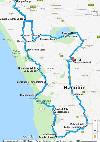
Alright! Are you ready to follow this adventure with us in our Hilux?
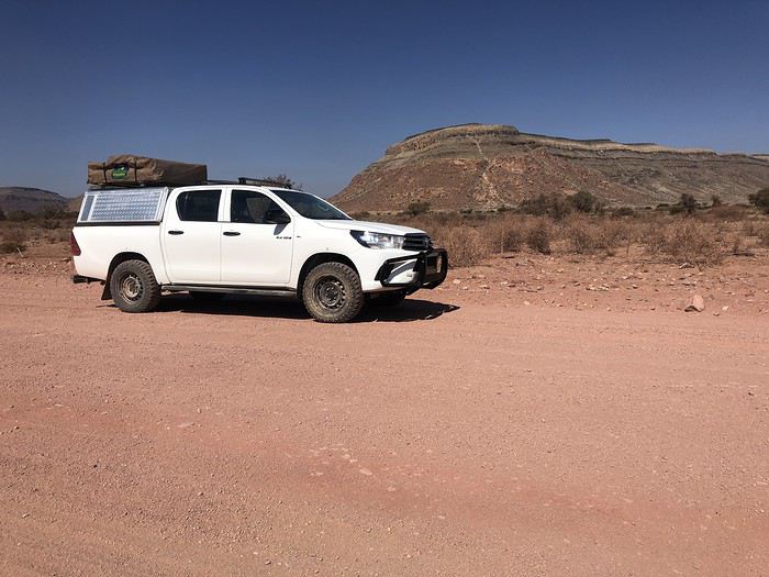
Yep! You guessed it—we stepped way out of our comfort zone during this trip.
I had quite a few doubts while planning this adventure, but the more I read travel journals about Namibia, the more I wanted to go.
Personally, without this forum, I never would’ve dared to hit the Namibian roads in a 4x4. I was really anxious during the planning, so I want to thank everyone who contributed with their journals and forum discussions for helping me leave more peacefully.
At first, I wasn’t even considering sleeping in a tent. But after my husband’s persuasion—and my own curiosity to experience what I’d read in those travel journals—I gave in. So off we went in a double-cab Hilux with a rooftop tent.
And of course, let’s talk about me—the big cold-weather wimp. One of the biggest pre-trip challenges was choosing a sleeping bag. After a while, sleeping bags had no more secrets for me: temperature ratings (comfort, limit, extreme), shapes (mummy, rectangular), fillings (synthetic, down), compression rate, and weight... all these factors were a real puzzle. In the end, to make sure I wouldn’t be put off camping in winter (Australian winter, mind you), I went for a sleeping bag with a comfort rating of -10°C. And just to be *extra* sure I wouldn’t get cold, I bought a liner (never knew what that was before) in Thermolite, which boosts the sleeping bag’s temperature by 11°C. There are liners that add up to 15°C, but let’s not exaggerate—we’re not heading to the North Pole! My husband, on the other hand, got a sleeping bag with a -5°C comfort rating and a silk liner.
Was it enough? You’ll find out soon. In the meantime, another big thank you to everyone who helped me make this choice with their advice and experience.
Over a year in advance, we planned a three-week itinerary for our first trip to Namibia—classic route, nothing too out there. We chose to do the circuit clockwise because we wanted to finish on a high note in Etosha and its wildlife. They say it’s like Noah’s Ark out there! And why not, the cherry on top... some big cats.
We used Tourmaline’s services to book our accommodations and the 4x4.
Here’s our planned itinerary with campsites and lodgings—yes, there are a few solid roofs in there; we didn’t want to push it too far.
Day 1: Windhoek – Windhoek Gardens Guesthouse Day 2: Kalahari Anib Campsite Day 3: Namibrand Family Hideout Day 4: Sesriem Camp Day 5: Sesriem Camp Day 6: Rostock Ritz Camp Day 7: Swakopmund - Sea Breeze Guesthouse Day 8: Swakopmund - Sea Breeze Guesthouse Day 9: Spitzkoppe Camp Tented Day 10: Brandberg White Lady Campsite Day 11: Grootberg Lodge Day 12: Opuwo Country Campsite Day 13: Epupa Camp Day 14: Hobatere Lodge Day 15: Etosha Olifantsrus Camp Day 16: Etosha Okaukuejo Camp Day 17: Etosha Halali Camp Day 18: Etosha Namutoni Camp Day 19: Cheetah Eco Lodge Day 20: Windhoek – Londiningi B&B
Alright! Are you ready to follow this adventure with us in our Hilux?