Hi everyone,
Two years ago, I got a 5-year visa. But I had to change my plans and haven’t used it yet.
Do you think it’s still valid? I’d like to go to India at the beginning of the year.
I’ve got a big doubt. Do you know where I can find this info?
Thanks a bunch!
813 similar discussions in English
Hello everyone,
So happy to be back on this Forum!
We’re heading off on another cruise—our 7th—after a 5-year break...
We’ll be leaving from Venice on April 26th with stops in Kotor, Mykonos, Santorini, and Ancona.
Could you help me plan the stops by sharing tips, tricks, and advice?
For those who already know me, you know we prefer not to take the cruise line’s excursions but instead organize everything ourselves.
Thanks in advance to everyone, and looking forward to chatting with you all!
Hi there,
I’m leaving in February and want to explore the West Coast via Route 200 from Puerto Vallarta to Puerto Escondido.
- For transport, I don’t want to rent a car. I’d like to travel the coast using *colectivos* from village to village over a few weeks. Are they available everywhere along the coast? Is this doable, or is it unrealistic? If not, is it possible to do it by bus? Do they stop everywhere?
- Do you have any places, accommodations, beaches, attractions, or great tips of any kind to recommend along this route?
- Regarding safety, do you have any concerns about certain areas? Guerrero and Michoacán don’t exactly have a great reputation, and neither does Acapulco… Should I be worried?
- Any other relevant info is welcome! 😄
Thanks for your advice!
P.S.: Really happy the forum’s back up. Thanks
I’m leaving in February and want to explore the West Coast via Route 200 from Puerto Vallarta to Puerto Escondido.
- For transport, I don’t want to rent a car. I’d like to travel the coast using *colectivos* from village to village over a few weeks. Are they available everywhere along the coast? Is this doable, or is it unrealistic? If not, is it possible to do it by bus? Do they stop everywhere?
- Do you have any places, accommodations, beaches, attractions, or great tips of any kind to recommend along this route?
- Regarding safety, do you have any concerns about certain areas? Guerrero and Michoacán don’t exactly have a great reputation, and neither does Acapulco… Should I be worried?
- Any other relevant info is welcome! 😄
Thanks for your advice!
P.S.: Really happy the forum’s back up. Thanks
Hi everyone, I’m restarting my travel reports with my 2023 trip that took me from Costa Rica to Suriname over a month and a half.
First stop: Costa Rica. I arrived in late September in San José, a city I know well and never linger in. As soon as I got off the early-morning flight, I headed to the domestic airport—just a 5-minute walk away—to catch a 45-minute flight to Puerto Limón on the Caribbean coast. The 40-minute flight in a small Cessna was fun, especially since we landed on a tiny airstrip right by the sea—it felt like landing on the beach, which immediately set the mood. Plus, I wasn’t keen on enduring the 4–5-hour bus ride to Cahuita, especially since large sections of the road were under renovation. In Cahuita (where I’ve been going every year since 2015), I stayed at Kenaki Lodge on Playa Grande. It’s a great lodge, about a 45-minute walk from Cahuita’s center, but you’re just 50 meters from the beach and usually have it all to yourself. The lodge is run by Béa, a Frenchwoman, and depending on the season, you can help release baby turtles on the beach. The room was 55 €, very spacious, and you can use the outdoor kitchen. I’d recommend it for anyone looking for peace and quiet and a private beach.
After 5 days there, I flew to Cartagena but didn’t stay overnight. Instead, I headed straight to Rincón del Mar, a 3-hour bus ride from CTG. I’d mostly heard about it from a friend who lives there and runs El Ché, a beachfront restaurant. Rincón del Mar is a tiny seaside village, very peaceful, with a pretty nice beach. There are lots of small hotels and restaurants, and it’s a spot that’s likely to grow quickly in the coming years. Note: there’s no ATM there, so you’ll need to withdraw cash in San Onofre, about 30 minutes away by moto-taxi. The round trip costs around 25,000 COP. That’s also where you catch the bus to Cartagena. For accommodations, rooms were roughly 70,000–90,000 COP, with a so-so value for the price. As for things to do, I’d recommend the tour that takes you to watch the sunset in front of Bird Island, followed by a swim in a lagoon with bioluminescent plankton. The excursion (if I remember correctly) cost around 90,000 COP.
After a week in Rincón del Mar, I headed back to Cartagena and decided to fly to Yopal to visit the Río Meta. In Yopal, you’ll need to go to the bus terminal (10 minutes by taxi from the airport). From there, I took a bus to Orocué (50,000 COP) for about a 4-hour trip—it felt endless because the road was in terrible condition. Orocué is a tiny town on the banks of the Río Meta, but it has all the essentials (hotels, restaurants, ATMs). It’s lovely to stroll along the river at sunset. There are a few small bars, the area is very natural, the sunsets are stunning, and when there are distant storms, it’s just breathtaking. For lodging, I stayed at Hotel Brisas de San Miguel. It wasn’t bad—fan-cooled room for 70,000 COP. There were quite a few mosquitoes. I spent 3 days in Orocué. If you want to swim, head to the bridge (the only one), Cano San Miguel, and on the right, there’s a swimming spot. With the heat, it’s a great way to cool off.
From Orocué, I took a fast *lancha* (boat) up the Río Meta to Puerto Carreño, in the Vichada department at the far end of Colombia. This brings you to the majestic Orinoco River, right across from Venezuela. The boat ride is long—10 hours—and costs about 60 €. We left around 6 AM, with a few stops for bathroom breaks and meals along the way. But you *must* book your spot 1–2 days in advance. To do that, go to the small square above the dock—there’s a "navigation office" there. The trip was long but enjoyable. I never get tired of river journeys.
I was happy to finally arrive in Puerto Carreño, a small border town with Venezuela. No surprise that half the population was Venezuelan. In Puerto Carreño, I stayed at Hotel Delfines del Orinoco. The room was 80,000 COP, decent, with A/C, and the best part was the pool. I spent 2 nights there. One thing you *must* do—morning and evening—is hike to the top of Cerro de la Bandera (the *cerros* are huge rock formations typical of the Orinoco region, and there are many in the area). From the summit, you get amazing 360° views of the savanna and jungle. Sunrise is especially incredible. The trail is well-marked—from downtown Puerto Carreño, it takes about 20 minutes.
Next, I spent 3 nights at Rancho Barú. About an hour by boat from Puerto Carreño, you get off at Casuarito, and someone from the lodge picks you up by motorcycle for a 30-minute ride. The ranch is in the middle of the savanna, with a river/rapids beach just a 5-minute walk away. You can also fish—bites come quickly. For the lodge, one night (room or hammock) with shared bathrooms, three meals included, one excursion, plus the round-trip motorcycle ride costs 245,000 COP. An extra night without an excursion is around 100,000 COP, but you need to let the lodge know in advance so they can prepare enough food—there’s absolutely nothing for miles around.
After those 3 great days at the ranch, I took a canoe to cross into Venezuela, since Casuarito is right across from Puerto Ayacucho. The crossing costs 10,000 COP, but I got shaken down by Venezuelan immigration, who invented a violation and made me pay $40 USD. Puerto Ayacucho didn’t inspire me much. The city felt sketchy, with many hotels closed. Dealing with currency exchange was the hardest part—you *must* bring cash (USD or Colombian pesos), know the exchange rate, and find someone with enough money to exchange with you. It took me at least 2 hours. I stayed in a decent hotel downtown for $20 USD a night, but I’ll admit that going out at night—even in Puerto Ayacucho—felt pretty dodgy. All the buildings have bars on the windows, and there weren’t many people outside. I didn’t linger and found my plans to continue south too complicated. The next day, I took a bus across the country to the Brazilian border at Santa Elena de Uairén. The trip took a day and a night, with countless military checkpoints where they made everyone get off, unload all the luggage, etc. Not exactly a fun ride.
Photos: - 2 sunrises near the Orocué dock - Storm over the savanna at Rancho Barú - View of the savanna and Orinoco near Casuarito - Photo taken during the Río Meta boat trip
First stop: Costa Rica. I arrived in late September in San José, a city I know well and never linger in. As soon as I got off the early-morning flight, I headed to the domestic airport—just a 5-minute walk away—to catch a 45-minute flight to Puerto Limón on the Caribbean coast. The 40-minute flight in a small Cessna was fun, especially since we landed on a tiny airstrip right by the sea—it felt like landing on the beach, which immediately set the mood. Plus, I wasn’t keen on enduring the 4–5-hour bus ride to Cahuita, especially since large sections of the road were under renovation. In Cahuita (where I’ve been going every year since 2015), I stayed at Kenaki Lodge on Playa Grande. It’s a great lodge, about a 45-minute walk from Cahuita’s center, but you’re just 50 meters from the beach and usually have it all to yourself. The lodge is run by Béa, a Frenchwoman, and depending on the season, you can help release baby turtles on the beach. The room was 55 €, very spacious, and you can use the outdoor kitchen. I’d recommend it for anyone looking for peace and quiet and a private beach.
After 5 days there, I flew to Cartagena but didn’t stay overnight. Instead, I headed straight to Rincón del Mar, a 3-hour bus ride from CTG. I’d mostly heard about it from a friend who lives there and runs El Ché, a beachfront restaurant. Rincón del Mar is a tiny seaside village, very peaceful, with a pretty nice beach. There are lots of small hotels and restaurants, and it’s a spot that’s likely to grow quickly in the coming years. Note: there’s no ATM there, so you’ll need to withdraw cash in San Onofre, about 30 minutes away by moto-taxi. The round trip costs around 25,000 COP. That’s also where you catch the bus to Cartagena. For accommodations, rooms were roughly 70,000–90,000 COP, with a so-so value for the price. As for things to do, I’d recommend the tour that takes you to watch the sunset in front of Bird Island, followed by a swim in a lagoon with bioluminescent plankton. The excursion (if I remember correctly) cost around 90,000 COP.
After a week in Rincón del Mar, I headed back to Cartagena and decided to fly to Yopal to visit the Río Meta. In Yopal, you’ll need to go to the bus terminal (10 minutes by taxi from the airport). From there, I took a bus to Orocué (50,000 COP) for about a 4-hour trip—it felt endless because the road was in terrible condition. Orocué is a tiny town on the banks of the Río Meta, but it has all the essentials (hotels, restaurants, ATMs). It’s lovely to stroll along the river at sunset. There are a few small bars, the area is very natural, the sunsets are stunning, and when there are distant storms, it’s just breathtaking. For lodging, I stayed at Hotel Brisas de San Miguel. It wasn’t bad—fan-cooled room for 70,000 COP. There were quite a few mosquitoes. I spent 3 days in Orocué. If you want to swim, head to the bridge (the only one), Cano San Miguel, and on the right, there’s a swimming spot. With the heat, it’s a great way to cool off.
From Orocué, I took a fast *lancha* (boat) up the Río Meta to Puerto Carreño, in the Vichada department at the far end of Colombia. This brings you to the majestic Orinoco River, right across from Venezuela. The boat ride is long—10 hours—and costs about 60 €. We left around 6 AM, with a few stops for bathroom breaks and meals along the way. But you *must* book your spot 1–2 days in advance. To do that, go to the small square above the dock—there’s a "navigation office" there. The trip was long but enjoyable. I never get tired of river journeys.
I was happy to finally arrive in Puerto Carreño, a small border town with Venezuela. No surprise that half the population was Venezuelan. In Puerto Carreño, I stayed at Hotel Delfines del Orinoco. The room was 80,000 COP, decent, with A/C, and the best part was the pool. I spent 2 nights there. One thing you *must* do—morning and evening—is hike to the top of Cerro de la Bandera (the *cerros* are huge rock formations typical of the Orinoco region, and there are many in the area). From the summit, you get amazing 360° views of the savanna and jungle. Sunrise is especially incredible. The trail is well-marked—from downtown Puerto Carreño, it takes about 20 minutes.
Next, I spent 3 nights at Rancho Barú. About an hour by boat from Puerto Carreño, you get off at Casuarito, and someone from the lodge picks you up by motorcycle for a 30-minute ride. The ranch is in the middle of the savanna, with a river/rapids beach just a 5-minute walk away. You can also fish—bites come quickly. For the lodge, one night (room or hammock) with shared bathrooms, three meals included, one excursion, plus the round-trip motorcycle ride costs 245,000 COP. An extra night without an excursion is around 100,000 COP, but you need to let the lodge know in advance so they can prepare enough food—there’s absolutely nothing for miles around.
After those 3 great days at the ranch, I took a canoe to cross into Venezuela, since Casuarito is right across from Puerto Ayacucho. The crossing costs 10,000 COP, but I got shaken down by Venezuelan immigration, who invented a violation and made me pay $40 USD. Puerto Ayacucho didn’t inspire me much. The city felt sketchy, with many hotels closed. Dealing with currency exchange was the hardest part—you *must* bring cash (USD or Colombian pesos), know the exchange rate, and find someone with enough money to exchange with you. It took me at least 2 hours. I stayed in a decent hotel downtown for $20 USD a night, but I’ll admit that going out at night—even in Puerto Ayacucho—felt pretty dodgy. All the buildings have bars on the windows, and there weren’t many people outside. I didn’t linger and found my plans to continue south too complicated. The next day, I took a bus across the country to the Brazilian border at Santa Elena de Uairén. The trip took a day and a night, with countless military checkpoints where they made everyone get off, unload all the luggage, etc. Not exactly a fun ride.
Photos: - 2 sunrises near the Orocué dock - Storm over the savanna at Rancho Barú - View of the savanna and Orinoco near Casuarito - Photo taken during the Río Meta boat trip
Hi everyone,
I’m taking advantage of the forum’s long-awaited reopening to dive back into my memories and start my first travel journal, destination Uganda!
Why Uganda?
Choosing this destination was almost by chance. I’d already traveled to East Africa two years earlier, to Kenya, and loved the experience. Of course, I wanted to return to the region and see that abundant wildlife I’d enjoyed so much. But Uganda wasn’t really on my radar... While looking for a destination for a two-week trip in May 2023, I came across cheap flights (~400 €) with Kenya Airways to Entebbe. Why not, I thought? I started looking into the country.
How did the trip go?
Most travelers whose posts I read had organized their trip with an agency and/or rented a vehicle, with or without a driver. That’s not at all how I like to explore a country... and besides, I don’t have a license ! Digging a little deeper, I saw that it seemed possible to reach the main sights using local transport, as long as I was ready to put up with the discomfort of the journeys. Challenge accepted! On the other hand, the budget accommodations near the parks that I’d managed to find in Kenya seemed much less common here. The trip was shaping up to be expensive, especially since the highlight—gorilla trekking—requires a permit costing several hundred dollars. Yikes, sticking to a reasonable budget was going to be tricky... In the end, I found a solution. Almost all lodges offer the option to pitch a tent on their grounds for a modest price (between $10 and $20 per night). That would let me enjoy the safaris while keeping this trip "relatively" affordable.
My itinerary
After studying the Lonely Planet East Africa guide, various travel journals and blogs, and the excellent site Safari Bookings, I finally settled on an itinerary (not counting the travel days):
Entebbe – 1 day Ziwa Rhino Sanctuary – 1 day Murchison Falls National Park – 2 days Crater Lakes – 1 day Queen Elizabeth National Park – 2 days Bwindi – 3 days Lake Bunyonyi – 1 day Kampala – 1 day
See you soon for the first stop in Entebbe!
Why Uganda?
Choosing this destination was almost by chance. I’d already traveled to East Africa two years earlier, to Kenya, and loved the experience. Of course, I wanted to return to the region and see that abundant wildlife I’d enjoyed so much. But Uganda wasn’t really on my radar... While looking for a destination for a two-week trip in May 2023, I came across cheap flights (~400 €) with Kenya Airways to Entebbe. Why not, I thought? I started looking into the country.
How did the trip go?
Most travelers whose posts I read had organized their trip with an agency and/or rented a vehicle, with or without a driver. That’s not at all how I like to explore a country... and besides, I don’t have a license ! Digging a little deeper, I saw that it seemed possible to reach the main sights using local transport, as long as I was ready to put up with the discomfort of the journeys. Challenge accepted! On the other hand, the budget accommodations near the parks that I’d managed to find in Kenya seemed much less common here. The trip was shaping up to be expensive, especially since the highlight—gorilla trekking—requires a permit costing several hundred dollars. Yikes, sticking to a reasonable budget was going to be tricky... In the end, I found a solution. Almost all lodges offer the option to pitch a tent on their grounds for a modest price (between $10 and $20 per night). That would let me enjoy the safaris while keeping this trip "relatively" affordable.
My itinerary
After studying the Lonely Planet East Africa guide, various travel journals and blogs, and the excellent site Safari Bookings, I finally settled on an itinerary (not counting the travel days):
Entebbe – 1 day Ziwa Rhino Sanctuary – 1 day Murchison Falls National Park – 2 days Crater Lakes – 1 day Queen Elizabeth National Park – 2 days Bwindi – 3 days Lake Bunyonyi – 1 day Kampala – 1 day
See you soon for the first stop in Entebbe!
I’m not going back, the trip is in the past. I’m posting it anyway because the country probably hasn’t changed enough to make the story outdated, and the astonishing beauty of the place deserves to be shared here.
Saturday, May 31, 2014 Mulhouse - Marrakech
A flight that drags on for three and a half hours. Everything goes smoothly until immigration. Like almost everywhere, you have to fill out a little form with your details and arrival address. The problem comes when you hand it to the customs officer with your passport. Right away, you see the lines are way too long for the number of officers working. I steer Dom toward a line further to the left that’s clearly moving faster than the middle ones. Then I firmly pull him to the far left where I think I spotted a new counter opening. Big mistake. Huge. Because that line is notorious for how slowly the security agent checks each person. At 10 minutes per person, with about fifteen ahead of us, we’re looking at two and a half hours. The wait becomes torture. Everyone gets edgy. We watch enviously as people who were way behind us initially zip through the other lines. You feel like complaining. My advice? Don’t. You have no idea how much a pissed-off customs officer can ruin your day! The rule: stay calm and suck it up. Once that hurdle’s over, a taxi and boom, we’re at the Gallia, a no-frills but charming hotel just steps from Jemaa El Fna square. This place is insane! It’s teeming with people. You stick out like a sore thumb with your camera—suddenly, a ton of people want to be your best friend! You’re basically a walking wallet!
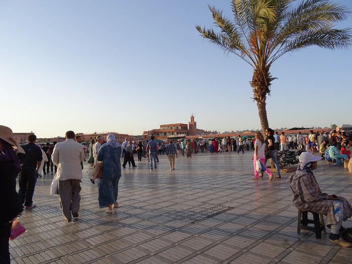
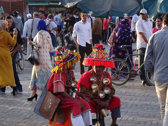
We’ve got a meet-up with friends who are here on a work trip with their company’s social committee.
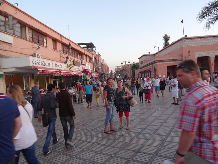
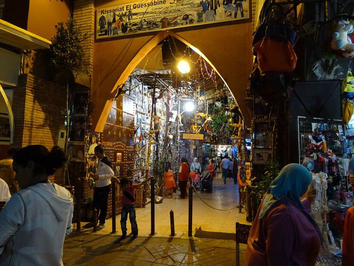
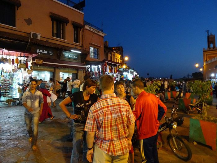
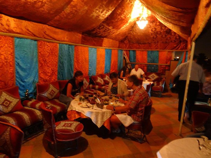
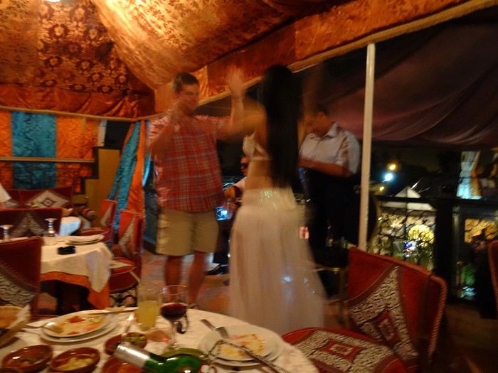
We fully embrace our tourist roles—eating at restaurants made for us, with belly dancers who insist we join in. We go with the flow, we’re not prudes, we have a great evening, no way we’re missing out on the fun...
Sunday, June 1, 2014 Marrakech
Super nice breakfast in the hotel’s patio, a real riad, beautifully decorated.
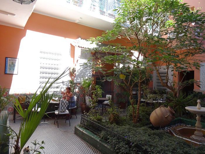
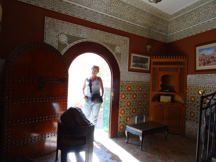
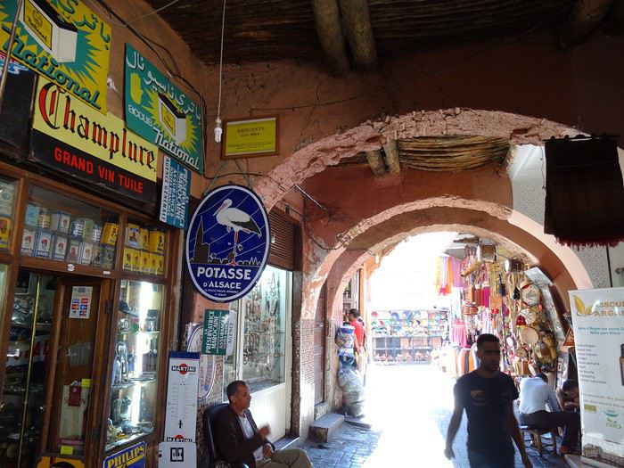
Originally, we’d planned a trip to the Atlas Mountains, but we ended up wandering around the city instead. Before we knew it, we were in the middle of the central souk’s labyrinth. It’s a feast for the eyes, ears, and especially the nose!
Saturday, May 31, 2014 Mulhouse - Marrakech
A flight that drags on for three and a half hours. Everything goes smoothly until immigration. Like almost everywhere, you have to fill out a little form with your details and arrival address. The problem comes when you hand it to the customs officer with your passport. Right away, you see the lines are way too long for the number of officers working. I steer Dom toward a line further to the left that’s clearly moving faster than the middle ones. Then I firmly pull him to the far left where I think I spotted a new counter opening. Big mistake. Huge. Because that line is notorious for how slowly the security agent checks each person. At 10 minutes per person, with about fifteen ahead of us, we’re looking at two and a half hours. The wait becomes torture. Everyone gets edgy. We watch enviously as people who were way behind us initially zip through the other lines. You feel like complaining. My advice? Don’t. You have no idea how much a pissed-off customs officer can ruin your day! The rule: stay calm and suck it up. Once that hurdle’s over, a taxi and boom, we’re at the Gallia, a no-frills but charming hotel just steps from Jemaa El Fna square. This place is insane! It’s teeming with people. You stick out like a sore thumb with your camera—suddenly, a ton of people want to be your best friend! You’re basically a walking wallet!
We’ve got a meet-up with friends who are here on a work trip with their company’s social committee.
We fully embrace our tourist roles—eating at restaurants made for us, with belly dancers who insist we join in. We go with the flow, we’re not prudes, we have a great evening, no way we’re missing out on the fun...
Sunday, June 1, 2014 Marrakech
Super nice breakfast in the hotel’s patio, a real riad, beautifully decorated.
Originally, we’d planned a trip to the Atlas Mountains, but we ended up wandering around the city instead. Before we knew it, we were in the middle of the central souk’s labyrinth. It’s a feast for the eyes, ears, and especially the nose!
I’ve been putting off posting my Quebec travel experience for a long time. Two years later, I’ve finally decided to share it. The memories are still vivid. I hope this gives you the urge to visit this beautiful region, which I literally fell in love with.
We’re traveling as four adults: my brother Guy, my sister-in-law Martine, my friend Pascal, and myself (Christian).
We entrusted the flight, hotel, and car reservations to the travel agency Amplitudes in Toulouse. Planning the day-to-day activities was up to us. We scheduled a few must-see visits, but for the rest, we’d figure it out on the spot.
Our itinerary: Quebec City / Rimouski / Carleton-sur-Mer / Percé / Sainte-Anne-des-Monts / Matane / Tadoussac / Sainte-Rose-du-Nord / Chambord / Saint-Alexis-des-Monts / Montreal
06/25 Here we are at Roissy Charles de Gaulle for the usual pre-flight formalities. Everything goes smoothly and quickly. The hardest part is waiting for takeoff. After an uneventful flight on an Air Canada Boeing 777-300ER, we land at Montréal-Pierre Elliott Trudeau Airport (YUL) in the early afternoon.
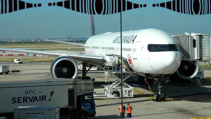
At customs, a surprise—no grumpy officer, but a smiling customs agent who jokingly asks me to name three tourist spots in Quebec, or else he won’t let me in. I pass the test easily and enter Quebec!
We head to the Alamo counter at Trudeau Airport to pick up our car: a Ford Escape with only 300 kilometers on the odometer.
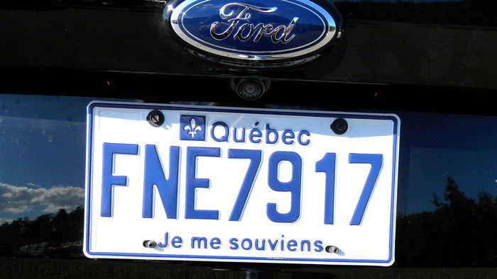
We decided to head straight to Quebec City, saving Montreal for the end of the trip. Pascal takes the wheel and gets on the Trans-Canada Highway E20 for a 255 km drive, taking about 2 hours and 45 minutes. With the time difference, we’re already feeling hungry, so we stop for our first poutine at a highway restaurant.

When we arrive in Quebec City, we go straight to the Clarendon Hotel, located right in the heart of Old Quebec. We’ll be staying there for three nights. Tonight, no restaurant—just a short walk around the hotel before bed. We discover a square with pretty colored water fountains near the city hall.
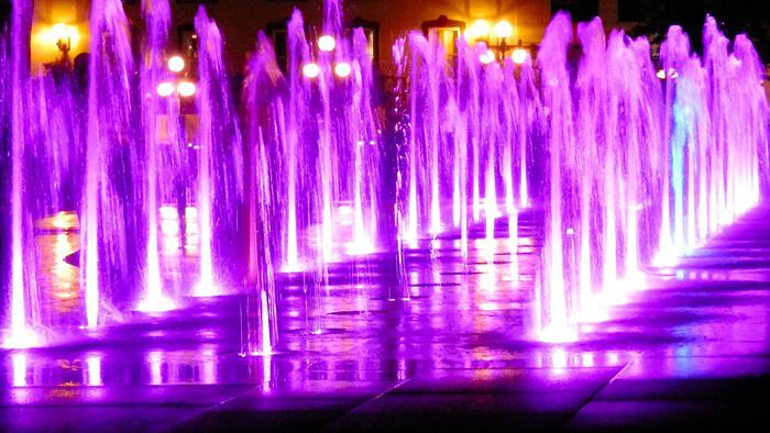 It’s only 9 PM, but our body clocks say it’s 3 AM.
We’re traveling as four adults: my brother Guy, my sister-in-law Martine, my friend Pascal, and myself (Christian).
We entrusted the flight, hotel, and car reservations to the travel agency Amplitudes in Toulouse. Planning the day-to-day activities was up to us. We scheduled a few must-see visits, but for the rest, we’d figure it out on the spot.
Our itinerary: Quebec City / Rimouski / Carleton-sur-Mer / Percé / Sainte-Anne-des-Monts / Matane / Tadoussac / Sainte-Rose-du-Nord / Chambord / Saint-Alexis-des-Monts / Montreal
06/25 Here we are at Roissy Charles de Gaulle for the usual pre-flight formalities. Everything goes smoothly and quickly. The hardest part is waiting for takeoff. After an uneventful flight on an Air Canada Boeing 777-300ER, we land at Montréal-Pierre Elliott Trudeau Airport (YUL) in the early afternoon.
At customs, a surprise—no grumpy officer, but a smiling customs agent who jokingly asks me to name three tourist spots in Quebec, or else he won’t let me in. I pass the test easily and enter Quebec!
We head to the Alamo counter at Trudeau Airport to pick up our car: a Ford Escape with only 300 kilometers on the odometer.
We decided to head straight to Quebec City, saving Montreal for the end of the trip. Pascal takes the wheel and gets on the Trans-Canada Highway E20 for a 255 km drive, taking about 2 hours and 45 minutes. With the time difference, we’re already feeling hungry, so we stop for our first poutine at a highway restaurant.
When we arrive in Quebec City, we go straight to the Clarendon Hotel, located right in the heart of Old Quebec. We’ll be staying there for three nights. Tonight, no restaurant—just a short walk around the hotel before bed. We discover a square with pretty colored water fountains near the city hall.
It’s only 9 PM, but our body clocks say it’s 3 AM.Welcome everyone!
It’s been a while since I last wrote a travel journal, but this recent trip to Iceland reignited my urge to write—both for the breathtaking landscapes we discovered and our adventure full of twists and turns!
This Iceland trip is part of our world tour, which we started back in August 2019. We (Sandrine and Flo) left by plane with our baby, Lena, who was barely 5 months old at the time. We backpacked around the Pacific for 5 months before returning home for a short break to see family. That was just before COVID hit, in late January 2020.
What followed was a bit chaotic... For the second part of our world tour, we were supposed to pick up a new vehicle: a brand-new pickup with a camper cell we planned to live in for several years. Due to lockdown, we received the cell weeks late, and with borders closing, we had to rethink all our plans.
So, we postponed our Iceland departure by over a month and a half, jumping on the first ferry accessible to French travelers after lockdown! Our goal is to spend 3 months there, from early July to late September, in our new camper cell. Our base vehicle is a Toyota Hilux we bought new, fitted with a flatbed where the cell sits, and we’ve prepped it for this trip (reinforced springs + airbags, snorkel, chassis protection, and off-road tires...). The aim is to tackle as many off-road tracks in Iceland as possible, knowing this is already our 3rd trip there (3 weeks in summer 2016 with a Durango, then 1 week in winter 2018).
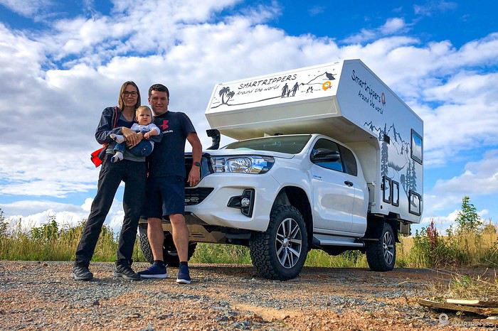
I’m kicking off our travel journal here! Along with photos, I’ll also include our vlogs, which we’ve been posting weekly since our departure in June—hope you enjoy them too! :-)
TRAVEL JOURNAL SUMMARY The journey up to Denmark The horrible ferry crossing The south of the Eastern Fjords
It’s been a while since I last wrote a travel journal, but this recent trip to Iceland reignited my urge to write—both for the breathtaking landscapes we discovered and our adventure full of twists and turns!
This Iceland trip is part of our world tour, which we started back in August 2019. We (Sandrine and Flo) left by plane with our baby, Lena, who was barely 5 months old at the time. We backpacked around the Pacific for 5 months before returning home for a short break to see family. That was just before COVID hit, in late January 2020.
What followed was a bit chaotic... For the second part of our world tour, we were supposed to pick up a new vehicle: a brand-new pickup with a camper cell we planned to live in for several years. Due to lockdown, we received the cell weeks late, and with borders closing, we had to rethink all our plans.
So, we postponed our Iceland departure by over a month and a half, jumping on the first ferry accessible to French travelers after lockdown! Our goal is to spend 3 months there, from early July to late September, in our new camper cell. Our base vehicle is a Toyota Hilux we bought new, fitted with a flatbed where the cell sits, and we’ve prepped it for this trip (reinforced springs + airbags, snorkel, chassis protection, and off-road tires...). The aim is to tackle as many off-road tracks in Iceland as possible, knowing this is already our 3rd trip there (3 weeks in summer 2016 with a Durango, then 1 week in winter 2018).
I’m kicking off our travel journal here! Along with photos, I’ll also include our vlogs, which we’ve been posting weekly since our departure in June—hope you enjoy them too! :-)
TRAVEL JOURNAL SUMMARY The journey up to Denmark The horrible ferry crossing The south of the Eastern Fjords
Hi,
I bought a flight ticket to Colombia with Lufthansa, but I’m giving up on this trip because of the pandemic in South America. The airline is only offering to refund the airport taxes.
Is this normal?
Has anyone else run into this issue?
Thanks for your replies!
Anne-Elise
Leaving in 15 days for Brittany, specifically the southern Finistère and Bénodet...
Tourists expected to boost the culinary restaurant industry!
Haven’t read the guide for latecomers yet, and I’m really wary of online reviews. Where can I eat without getting ripped off, enjoy quality food—crêperies, seafood, nice atmosphere... Thanks to all you savvy foodies!
Tourists expected to boost the culinary restaurant industry!
Haven’t read the guide for latecomers yet, and I’m really wary of online reviews. Where can I eat without getting ripped off, enjoy quality food—crêperies, seafood, nice atmosphere... Thanks to all you savvy foodies!
Hello everyone.
Preamble:
Sooner or later, you’ve got to take the plunge! I thought lockdown would be the perfect time to start this travel journal, but between working from home and gardening, I just didn’t have the time (or the motivation). Plus, long-haul trips weren’t really on the cards back then... But then I stumbled upon my photos and thought, "I’ve got to share my latest adventure in Brazil—you guessed it!"
First, a little flashback: some of you (yes, really, in DMs!) pointed out the big gaps in my travel journals—India in 2019, Vietnam in 2018, so many missed opportunities!
Truth is, for India, I traveled with a private guide and honestly didn’t have much to add to the tons of well-documented journals already out there. Plus, I still haven’t decided if I love or hate India... So, how do you share your feelings when you’re not even sure yourself? As for Vietnam, I had plenty to say—even though the itinerary was pretty classic—but I’ll admit the vibe on this part of the forum at the time kinda put me off for a while... And time flies, and memories fade... Anyway, just wanted to clear that up for my (many or few) readers. *Tudo bem*, let’s get started!!
Preamble:
Sooner or later, you’ve got to take the plunge! I thought lockdown would be the perfect time to start this travel journal, but between working from home and gardening, I just didn’t have the time (or the motivation). Plus, long-haul trips weren’t really on the cards back then... But then I stumbled upon my photos and thought, "I’ve got to share my latest adventure in Brazil—you guessed it!"
First, a little flashback: some of you (yes, really, in DMs!) pointed out the big gaps in my travel journals—India in 2019, Vietnam in 2018, so many missed opportunities!
Truth is, for India, I traveled with a private guide and honestly didn’t have much to add to the tons of well-documented journals already out there. Plus, I still haven’t decided if I love or hate India... So, how do you share your feelings when you’re not even sure yourself? As for Vietnam, I had plenty to say—even though the itinerary was pretty classic—but I’ll admit the vibe on this part of the forum at the time kinda put me off for a while... And time flies, and memories fade... Anyway, just wanted to clear that up for my (many or few) readers. *Tudo bem*, let’s get started!!
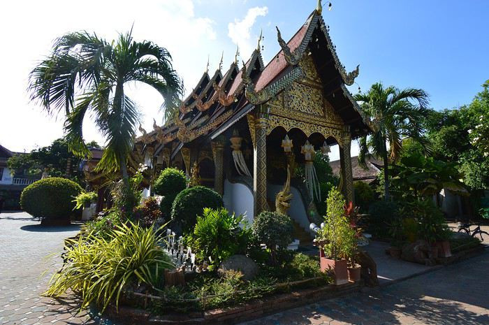
Hi everyone,
In these dark times, and after two months of lockdown, I thought now would be a good moment to write up the travel journal of our last trip to Thailand, to (maybe) help some of you escape a little. The idea is also, and above all, to give back to this forum, and I hope my tips or ideas will help future travelers. Don’t hesitate to contact me via private message or in the comments if you have any questions.
Before I start this story, I must warmly thank the people who patiently informed, advised, and guided us. Jojoone, Jodelavega, Jungletrool, DearPatsy, Tarajellow, and the others—thank you so much. This trip wouldn’t have been as wonderful without your help.
We’re a couple in our thirties who love traveling (we did a round-the-world trip several years ago now), and we’re big fans of Thailand, where we’ve been multiple times. We’re used to backpacking and even have a bit of wanderlust! But this year, everything was different since we were traveling for the first time with our baby, who was just under 2 years old (22 months). This raised HUGE questions for us, as we usually travel pretty casually and intuitively. While I found some answers on this forum, there was still a lot of information I couldn’t find, so I apologize in advance to those who travel without young kids—I plan to address that with a dedicated section. Generally, I think preparation is the key to a successful trip with a little one. For us, lots of questions beforehand meant no stress during the trip—everything was simple, and there were no bad surprises.
For those in a hurry, here’s a summary: 3-week stay (09/30/19 to 10/18/2019) Flight tickets (2 adults, 1 baby without a seat): 1052 € Itinerary: Bangkok 5 days, Chiang Mai 5 days, Lampang 3 days, Kanchanaburi 3 days, Bangkok 2 days.
General info about traveling with babies:
Here are the topics that caused us the most concern, our choices, and our observations after the trip.
1- Choosing the itinerary / road safety
This was THE biggest concern for us. Living in France with a top-rated rear-facing car seat, we were terrified at the idea of putting our baby in a car, bus, or any vehicle without protection (not to mention Thailand’s terrible reputation for road safety). We ended up making a radical decision that removed all our stress and let us enjoy a fantastic trip: no road travel (though you’ll see later that we had to bend this rule once, and everything went fine). We decided to follow the railway route heading north (for safety reasons, we didn’t consider the south and its islands with a baby) and chose our stops based on that. The train is a super comfortable way to travel with a young child. Sure, it’s slow—we were warned—but the best advice I can give is to take your time with a little one. Thailand is hot, noisy, and crowded—everything is tiring. Taking it slow is the best way to enjoy your trip. And I think (this is just my opinion) trying to keep an adult’s pace would only lead to frustration and exhaustion for everyone. The only car trips we took were short transfers in the city, and for those, we brought a sling (like a pre-tied baby carrier) so the baby was strapped to one of us, and we were both buckled up with the seatbelt passing between the baby and the parent carrying them. In case of a crash, there was no risk of crushing the baby (though obviously, it wasn’t completely safe, but we figured at city speeds, it was manageable).
2- Gear / what to pack?
In everyday life, we already keep things simple, so for travel, it was obvious we wouldn’t overpack. Crib, stroller, car seat, etc.—we decided to bring almost nothing and didn’t regret it. In my opinion, a stroller isn’t useful in Thailand. The sidewalks are unusable, packed with people and stalls. In busy places like night markets, you’ll prefer having your child close to you, at adult height, rather than in the crowd. Of course, it depends on where you go, but generally, a stroller will be more of a hassle than a help. We opted for a small, non-bulky hiking backpack and a sling (which fit in the backpack’s pocket) made of thin fabric for car trips. In hindsight, I think this was the perfect choice.
For cribs, high chairs, etc., there’s no need to bring your own—every place finds solutions for babies, and you can even contact them beforehand to put your mind at ease. During our stay, we were offered a baby crib, a futon on the floor, a single bed (not suitable for a baby, though), and always a solution for seating at meals. Only one hotel in Chiang Mai refused to help and asked for an outrageous extra fee, but I think that’s unusual, and we generally have mixed memories of that place. We brought a small fabric seat that attaches to any chair—it takes up the space of a folded raincoat and was very useful (though you can manage just fine by having the baby eat on your lap).
For baby food, diapers, etc., we didn’t bring anything. Just enough to last two days while we got settled, and that was plenty—no need to overpack. You can easily find diapers at Tesco, Lotus, or even 7/11. For food, we’d gotten our daughter used to eating pieces a few months before the trip, and we ordered broths to “dilute” the dishes. She loved it, tried everything with pleasure, and never had any issues. That said, I don’t know about milk—my daughter doesn’t drink it.
Here’s our “packing list” for 3 weeks with a 22-month-old:
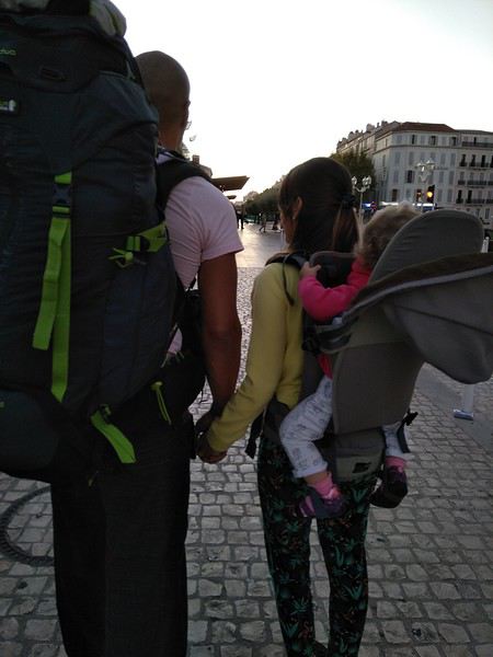
My partner: 1 travel backpack and a small empty (cabin-sized) rolling suitcase for shopping on the way back. For me: baby in a hiking backpack (with a sling and the small folded seat in the backpack’s pocket). It was simple for getting around, and I think if we’d packed more, we would’ve struggled without gaining any extra comfort.
3- Mosquitoes / Malaria / Dengue / Vaccines
As if on purpose, just months before our trip, a flood of articles on the forum and online warned us that Thailand was in the middle of a dengue epidemic, and locals advised us to be careful. Not exactly reassuring when traveling with a baby…🤪 After much hesitation, we decided to bring a small mosquito net (recommended by a mom on the forum—shoutout to Popinette) that opens like a pop-up tent (and folds just as easily). For how little space it took up, we didn’t regret it. It was attached to the back of the travel backpack and let us sleep soundly :p If it helps anyone, here’s the one we had: Deryan Peuter model.
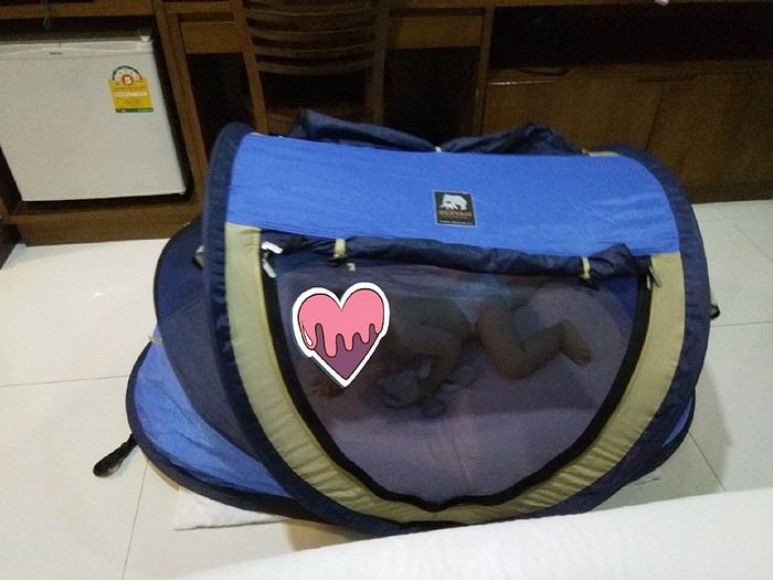
We also brought a mosquito net for ourselves but didn’t end up using it—with precautions, we didn’t have any mosquitoes at night.
For protection, we chose Insect Ecran (tropical version, the red one) because it doesn’t contain DEET but uses Icaridin, which is less toxic for little ones. We also pre-treated our clothes with Insect Ecran textile spray. We also decided to dress our daughter in light, long-sleeved outfits (covering arms and legs), and she wasn’t any hotter but was protected. It was a great choice, and we ended up dressing like her. Contrary to what I’d read, I didn’t find the smell strong—I actually thought it was quite discreet. My daughter and my partner didn’t get a single bite. As for me, I still got bites on exposed areas (I’m *very* prone to mosquito bites), so I switched to a local product—less well-formulated but apparently more effective for me.
We had our daughter vaccinated against Hepatitis A. We got conflicting advice on this: the pediatrician said it was unnecessary if she didn’t eat from street stalls (where dishes are washed in questionable water), but my GP said the opposite. We decided to book an appointment at a travel vaccination center, and the doctor was clear—she needed the vaccine.
4- Book in advance?
Finally, a question that had never crossed our minds before: should we book in advance? Again, this is just my opinion, but I think yes. It makes things much easier. Since we wanted to minimize road travel, it was much simpler to find well-located accommodations that let us do everything on foot (and with a baby, reducing travel and lightening the schedule is really helpful). Booking ahead meant no bad surprises, no fully booked places, and no hassle walking around with luggage and a baby. We booked everything in advance via Booking and Agoda, and by comparing with on-site prices, we didn’t pay more (we were traveling in the low season).
Here’s our feedback and observations. If they can help other parents prepare for their trip, I’d be thrilled.
With all that said, time for vacation!
hi
thanks for sharing if you'd like, your photos and cool spots!
first up, obviously my favorite village!
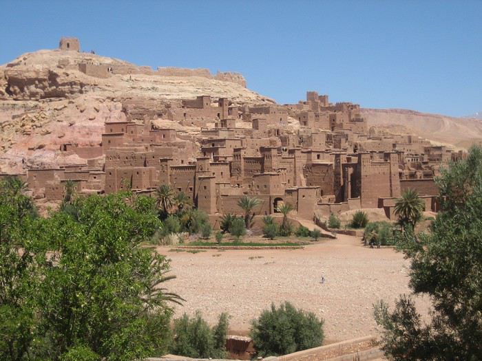
Aït Benhaddou, discovered in 2015... 2 or 3 hostels back then! I stayed at La Baraka! at the entrance of the village! it was so cool at that time! I used to cook with Mohamed the cook, in the hostel's kitchen!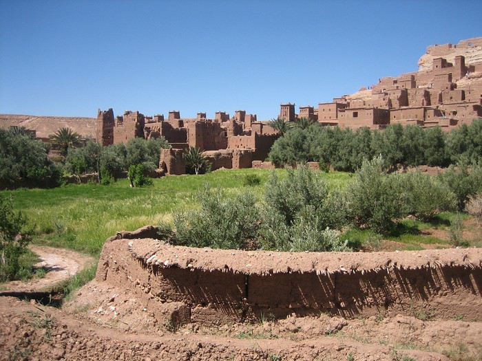
the team at the hostel "La Baraka"
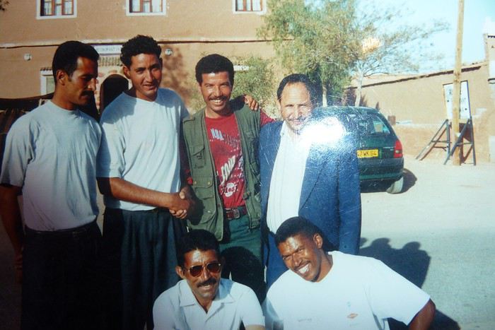 On the left, Brahim Bolkaid who's the owner of the current guesthouse "Maison d'Hôtes Panoramic"
at the bottom right, the cook!
I spent so many hours in that kitchen!
back then, there were huge buses of Germans who arrived with all their own food!
they barely consumed anything!
but we mostly served them fresh salads, drinks...
they'd stay for 3 hours: drinks, bathroom break, visit the ksar, and off they went!
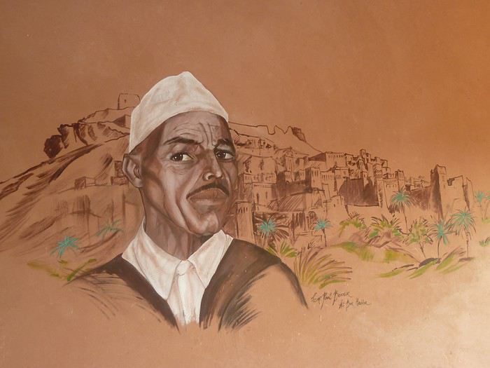
the mural at Brahim's!
Aït Benhaddou, discovered in 2015... 2 or 3 hostels back then! I stayed at La Baraka! at the entrance of the village! it was so cool at that time! I used to cook with Mohamed the cook, in the hostel's kitchen!
the team at the hostel "La Baraka"
On the left, Brahim Bolkaid who's the owner of the current guesthouse "Maison d'Hôtes Panoramic"
at the bottom right, the cook!
I spent so many hours in that kitchen!
back then, there were huge buses of Germans who arrived with all their own food!
they barely consumed anything!
but we mostly served them fresh salads, drinks...
they'd stay for 3 hours: drinks, bathroom break, visit the ksar, and off they went!the mural at Brahim's!
Hi there.
We’re planning a trip to Lofoten in July 2021 with our two kids, who’ll be 11 and 8. We’ve already booked our accommodations (yes, we’re planners!): - the first week in Reine. - the second in Henningsvær.
The idea is to explore the southern part of the archipelago, which seems the most interesting based on all the research I’ve done.
We’ve been considering extending our trip by another week. What would you recommend? Staying an extra week in Lofoten? Heading to Senja Island? The Lyngen Alps? Or somewhere else entirely?
Thanks in advance for your tips!
Cyril
We’re planning a trip to Lofoten in July 2021 with our two kids, who’ll be 11 and 8. We’ve already booked our accommodations (yes, we’re planners!): - the first week in Reine. - the second in Henningsvær.
The idea is to explore the southern part of the archipelago, which seems the most interesting based on all the research I’ve done.
We’ve been considering extending our trip by another week. What would you recommend? Staying an extra week in Lofoten? Heading to Senja Island? The Lyngen Alps? Or somewhere else entirely?
Thanks in advance for your tips!
Cyril
Well, since the lockdown is dragging on, I’m starting a new travel journal following the one I finished publishing yesterday:
https://voyageforum.com/discussion/voyage-pays-perles-voyage-dans-ouest-americain-d9943984/
This time, after the U.S., we’re heading to the Middle East—Jordan!
And we’re keeping up the good habits: one day’s entry published every day at 5:30 PM! Happy reading, and feel free to leave a comment, question, or remark...
Franck
Franck
(October 2018).
This account of a short stay in Kenya was originally meant for our friends and family, but to pass the time—for both us and you—and to add some content to the increasingly quiet columns of Voyage Forum during these weeks of confinement, when travelers can only journey in their minds, we decided to share the 25 pages of my ramblings, illustrated with Yolande’s photos, from an extraordinary stay in the Maasai Mara National Reserve. We waited until the two previous discussions on this same topic, filled with stunning photos and started by Régis and then Claire—sometimes in agreement, sometimes differing but always full of insights—had quieted down a bit before jumping in. Well, we’ll give it a try.
Let’s clarify: one of us claims to be a beginner photographer, and the other is just an unrepentant dreamer and modest writer. We often pursued our passions separately—Yolande with her mentor and me with an incomparable tracker—so sometimes the photos don’t quite match the text, or vice versa.
We hope you enjoy reading this lengthy post, which is longer than usual in VF’s sections (except, of course, for Mr. Voyajou). A thousand apologies for straying off the beaten path.
Alright, here we go!
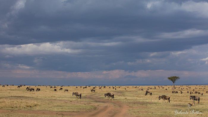
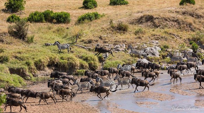
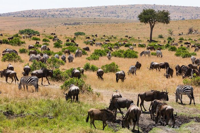
This account of a short stay in Kenya was originally meant for our friends and family, but to pass the time—for both us and you—and to add some content to the increasingly quiet columns of Voyage Forum during these weeks of confinement, when travelers can only journey in their minds, we decided to share the 25 pages of my ramblings, illustrated with Yolande’s photos, from an extraordinary stay in the Maasai Mara National Reserve. We waited until the two previous discussions on this same topic, filled with stunning photos and started by Régis and then Claire—sometimes in agreement, sometimes differing but always full of insights—had quieted down a bit before jumping in. Well, we’ll give it a try.
Let’s clarify: one of us claims to be a beginner photographer, and the other is just an unrepentant dreamer and modest writer. We often pursued our passions separately—Yolande with her mentor and me with an incomparable tracker—so sometimes the photos don’t quite match the text, or vice versa.
We hope you enjoy reading this lengthy post, which is longer than usual in VF’s sections (except, of course, for Mr. Voyajou). A thousand apologies for straying off the beaten path.
Alright, here we go!
From Beijing to Khiva: China, Kyrgyzstan, Tajikistan, Uzbekistan
Chronicle of anecdotes, highlights, and other adventures that marked this eight-week journey in 2018.
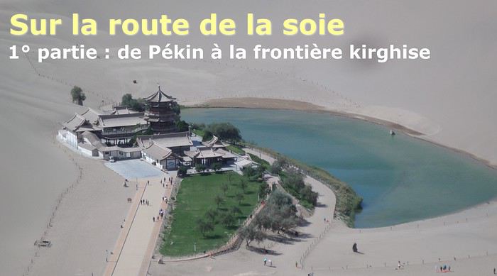
The Chinese Far West More than 30 years after my first trip to eastern China, I finally fulfilled an old dream: traveling solo from Beijing to the far west, discovering Xinjiang, the Uyghur people and the oppression they endure, the oases of Turpan and Kashgar, the Taklamakan Desert, the end of the Great Wall... The route was covered by train.
MENU PART 1: CHINA
1- Beijing (Jiankou) : the authentic Great Wall, without tourists 2- Cycling in Beijing, the best way to get around 3- Beijing : departure for the far west 4- Jiayuguan : getting by without English 5- Jiayuguan : scams and heritage 6- Dunhuang : abundance in the middle of the desert 7- Turpan : the Uyghurs under heavy surveillance 8- Kashgar : love at first sight for the old city 9- Kashgar : China’s recipe for controlling the populace 10- Tashkurgan : what on earth was I thinking going there! Kyrgyz border: a surreal epic Photo album from the 80s, contributions from other travelers (page 2)
1- JIANKOU Finding the authentic Great Wall, without tourists or a guide Friday, August 24, 2018 Thirty years later, I didn’t feel like revisiting the Great Wall at Badaling or any other overcrowded site. I chose to explore it at Jiankou, in its wildest, most authentic, and unrestored section, starting from a lost village deep in a valley—though it wasn’t *that* lost, since it had everything for communication.
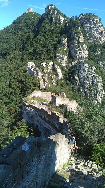
No need to pay for a taxi to get there—by timing it right, you can take the bus for just a few yuan. You have to get off at Xizhazi, the bus terminus. Be careful, there are only two buses a day in each direction. At the Xizhazi bus stop, I met a young couple who’d arrived with zero information about what to expect. We hiked the three of us toward the restored section of Mutianyu.
Still, be cautious With GPS and a topographic map (OpenTopoMap), you can set off without a problem or guide. The trail up to Jiankou is easy and well-marked. The trails down are too. But be careful—once you’re on the Wall, it’s real mountain hiking, with easy but dangerous climbing sections (over sheer drops). Not for amateurs or those afraid of heights! But what a reward. The Wall all to yourself, where it’s at its most daring. Truly mesmerizing.
More photos...
2- BEIJING The best way to get around the capital Sunday, August 26 The best way to explore the city is still by bike. Most are in a bike-share system, but you need to use an app—WeChat, the app that does everything, like monitoring your every move. No way I was installing that.
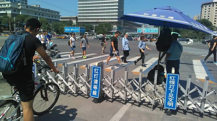
I found one at a rental shop near the hostel. The key is to quickly learn local traffic customs to minimize risks. Bike lanes are wide along the avenues.
But you still have to: - Watch out for anything parked on the bike paths—the most annoying are people napping or talking on the phone in their cars - Keep an eye on everything coming the wrong way—the list is long - The worst is right turns on red, which in Chinese traffic rules seem to have priority Once you get the hang of it, it’s fine. The city is huge but flat, so you can just wing it.
3- BEIJING By train to the far west Sunday, August 26 Beijing West Station is the size and operates like an airport. With your e-ticket from the agency, you first have to pick up your ticket at the special "English" counter, after passing through security. With your ticket in hand, you have to exit and enter through the boarding waiting area—not the platform—after a second security check.
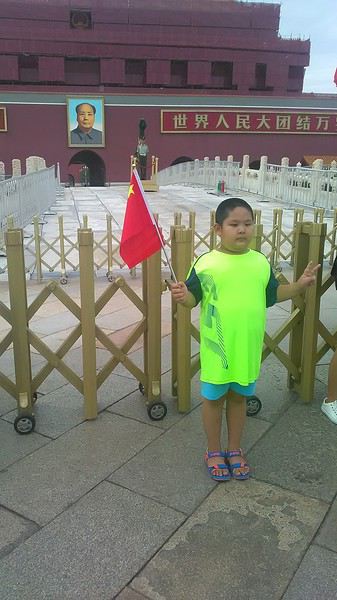 Then you find the right hall and wait for the sign to finally access the platform. In the end, it works pretty well given the incredible number of passengers to manage. Everywhere in Beijing, I saw that the Chinese have mastered crowd flow management.
Nice surprise: second-class carriages are clean, air-conditioned, and bright. Perfect, since I was in for 20 hours. One uniformed attendant per carriage, mobile meal service—luxury! Small downside: no luggage space. Hauling your suitcase up to the top bunk is quite a workout. I was in the middle, so it wasn’t too bad. The landscape, though, whether rural or urban, is pretty bleak. That should change once we leave the eastern plains.
Of course, I got my first police visit, with a thorough passport check and bag search. I was warned—going to the Chinese far west exposes you to this kind of hassle. But they were polite and respectful.
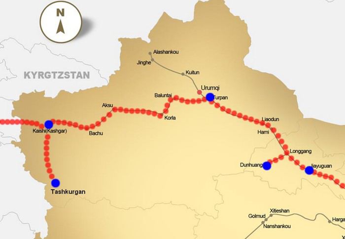 The Chinese Far West
4- JIAYUGUAN Getting by without English Monday, August 27 At the gates of two deserts (Gobi and Taklamakan) and at the foot of the Tibetan highlands, the Great Wall ends at Jiayuguan. Here, I found the deeper China I’d somewhat rediscovered during my bike ride, even if now everyone gets around on electric bikes and I’m no longer stared at like an alien.
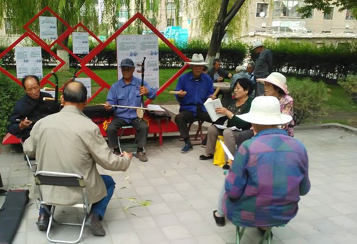
Prices are nothing like Beijing: you can find a full meal for 2 €, and my bike cost 7 € for two days. Plus, few people speak English—neither the owner of the HI hostel where I stayed, nor the ticket sellers at the sites, let alone the servers at the small eateries where I ate. Everything is written in Chinese. So I had to use the little Chinese I know to communicate about essentials. It makes the locals laugh to see a European trying to speak their language, but it earns respect. With Google Translate’s help, I managed.
Rant: With their avenues blocked for construction for kilometers without warning, and new roads not yet on maps, I must’ve taken 15 km of detours. More photos...
5- JIAYUGUAN Scams and heritage Tuesday, August 28 The Great Wall doesn’t exactly end at the fort I visited yesterday but 10 km further, at the entrance to a river gorge at the foot of the mountains. All that’s left is a badly damaged tower (more like a mound of earth) and a section of clay wall, similar to the one I biked yesterday.
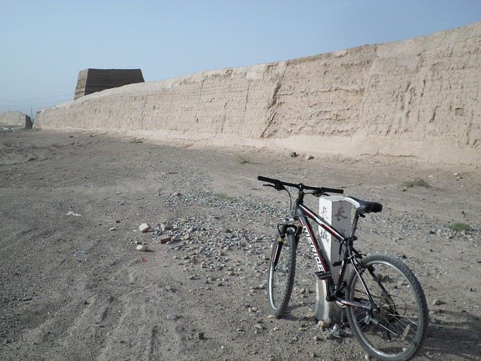
This morning, I hopped on my bike, determined to venture into the desert to see this highly symbolic site. First, you access it via a wide, brand-new road with not a soul in sight. Just before the site, I came across a grand welcome gate, very period-style, but it’s actually the inevitable toll booth.
Behind the gate, the road continues straight to the site, which you can see in the distance—at least 2 km away—the remains of the tower and wall. I had to leave my bike here. Fine. I went to the ticket counter and asked the price: 120 yuan! I couldn’t believe it—over 15 € for a simple mound of earth.
I showed my displeasure to the attendant, who couldn’t care less, and immediately turned back. 120 yuan—that’s the price for a new road, a fancy gate planted 2 km before the site just to force you to take a shuttle, and employees with nothing to do all day... Now I understand why I didn’t meet anyone!
Heritage China is a bit pricey Generally, sites are expensive for the country’s standard of living, but travelers are supposed to have money, so why hold back? I even gave up on the Forbidden City—reservations required days in advance (or on the black market at an impossible price). I prefer to keep the memory of my first visit, when entry must’ve cost a few dozen cents, and there were only a handful of visitors.
This morning, I took a taxi to see remarkable tombs of common people from the 3rd to 6th centuries. They’re small vaulted caves made of painted bricks, depicting scenes of daily life. Very pretty and moving. But even here, though the price was more reasonable, I was left wanting—only one of the 16 tombs is open to visitors, and it’s apparently not the most beautiful.
The authentic China—at least what’s left of it... Wandering the impersonal avenues of the city, you stumble upon a market. There, you still find traditional China—small shops with questionable hygiene, Go players, musicians, and even a dental prosthetist. The last refuge for those untouched by modernity. More photos...
6- DUNHUANG Abundance in the middle of the desert Wednesday, August 29 Well, I thought the landscape would be less bleak as I headed west. Nope. The only distraction in this expanse of dark, clayey sand is the forests of pylons and wind turbines, plus wild camels racing each other.
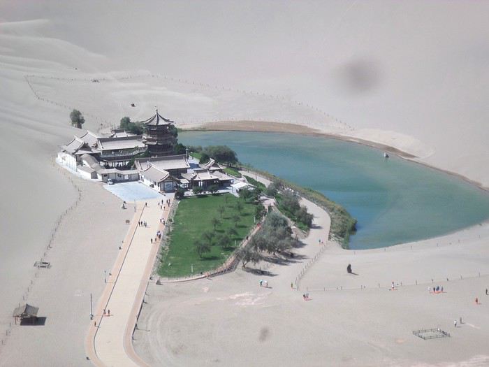 However, Dunhuang, the gateway to the Taklamakan, is by far the most pleasant Chinese city I know. There’s a real city center you can explore on foot. It’s hot but not unbearable, with a light, dry breeze. Much nicer than Beijing. The Han Chinese are still the majority, but the Muslim Uyghurs are more numerous, and the muezzin’s call to prayer echoes around the mosque.
The most surprising thing is the abundance and diversity of fruits and vegetables. You wonder how it all grows here. Well-irrigated, the desert sands are very fertile. Here, raisins have subtle, mysterious flavors, and the lamb really tastes like lamb.
Today, I visited the must-see Mingshashan, a dune complex next to which Pila is a molehill. The Basque Country, but covered in sand... More photos...
7- TURPAN The Uyghurs under heavy surveillance Friday, August 31 Surveillance cameras everywhere in the city, armed police stationed at intersections, in front of public buildings, at the entrance and inside tourist sites, police stations on every corner, patrols on foot or by car, khaki uniforms even for middle schoolers... here, the Han Chinese are in the minority, and you can feel it. Turpan feels like a city under siege.
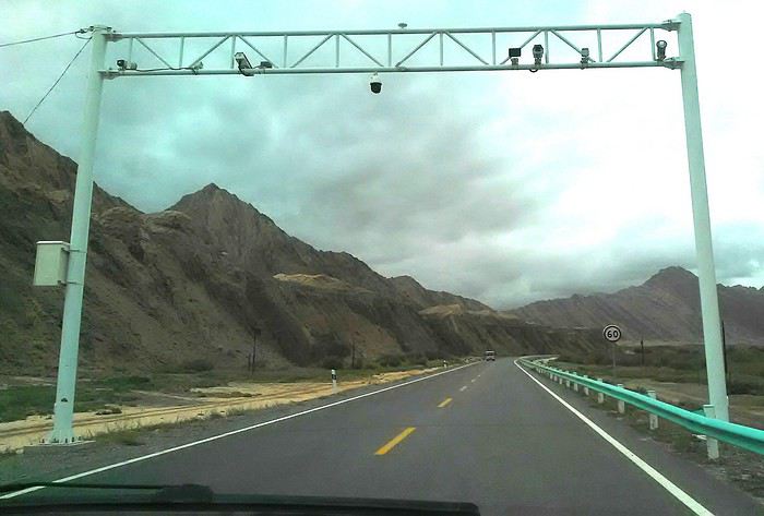
To enter the youth hostel where I stayed, there’s even a security gate, and the receptionist (a Han, like everyone in tourism) wears a bulletproof vest! Reassuring. Still, you don’t feel particularly threatened here, especially as a European. The troublemakers are the Chinese, not the Uyghurs. Generally, China is a very safe country for visitors.
Smile, you’re on camera! I was biking on an avenue when the car in front of me got flashed for driving slowly. I quickly understood why when I got flashed too.
Here, the official time is Beijing time, but it gets dark two hours later. It’ll be even worse in Kashgar. Trickier to manage: everything is displayed in Chinese and Arabic. Nothing in English. Choosing a menu is a shot in the dark. Apart from a few young Chinese, no one here speaks English, and my Chinese doesn’t seem very understandable...
Mogao, the end of the road for the Han Yesterday, near Dunhuang, I went to Mogao, a complex of decorated caves with Buddha sculptures and paintings. Stunning, but so crowded! Luckily, here in Turpan, Chinese tourists barely venture out. So I visited a Silk Road ghost town with only a handful of other visitors and under a howling wind.
The modern Chinese city is swallowing up the old Uyghur neighborhoods—only a museum-like district remains in the center, and pockets of resistance on the outskirts are doomed to disappear soon. More photos...
8- KASHGAR A (relative) love at first sight for the old city Sunday, September 2 After three overnight trains, here I am in the far west of China, nearly 4,000 km from the capital. Despite the omnipresent police and an old city preserved UNESCO-style, Kashgar is my Chinese love at first sight.
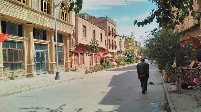
Finally, Chinese... well, sort of, because we’re in Uyghur territory here—a Turkic people with nothing culturally in common with the Han, the eastern Chinese. It started badly yesterday at Turfan station, where after three security gate passes, at least five passport checks, and a bag search, three adorable policewomen confiscated my antibacterial lotion because it had a flammable logo...
Then came the welcoming committee of armed cops at Kashgar station. Once all that was over, they left me alone—except you still have to go through security checks like everyone else to enter the old city, the bazaar, the livestock market... The further west you go, the more the siege mentality is evident. Luckily, the border isn’t far...
Despite the inevitable destruction-reconstruction, the city center has been well preserved. Thankfully, because it’s a very original style, a mix of local and colonial. I love it, even if it’s a bit too artificial, sanitized, and watered-down, and rather empty of residents. On the Silk Road, the city was famous for its great food. And it still is—rarely have I seen such richness and abundance of food! And not just scorpions or snakes. More photos...
9- KASHGAR China’s recipe for controlling the populace Saturday, September 1 Xinjiang, along with Tibet, is a "sensitive" area of rebellion in the eyes of Chinese authorities. As a result, the state has these regions and their populations under total control. Tourists also feel the consequences, even if they’re not at risk of re-education camps.
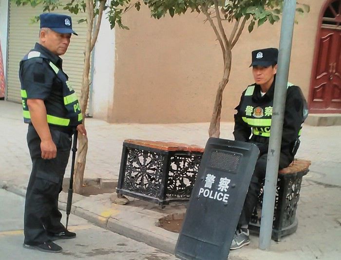 - Putting barbed wire and anti-ramming barriers around sensitive sites (schools, big hotels, government buildings...)
- Installing traffic surveillance gates with cameras and photo flashes (for all vehicles passing, including bikes) throughout the city and even in the countryside
- Posting uniformed guards with tasers, batons, or huge baseball bats every 100 meters
- Training the Han population (ethnic Chinese) in self-defense with sticks, preferably in the morning on the street. Men and women of all ages
- Starting school with the national anthem, doing military exercises, and receiving political indoctrination, all neatly lined up in the courtyard. (The dream school for any teacher)
- Placing a snitch in uniform (a pseudo-guard) in public gathering places, like youth hostels. Mine spends the day loafing around the courtyard
- Putting Chinese flags everywhere on the streets to remind everyone who’s in charge
- Installing security gates at every entrance to areas frequented by tourists (thanks for that) but not just there
- Never photographing cops, or else! I tried, but it’s not easy...
With all that, you can stroll around safely Not much crime! As for the amount the Chinese state spends to maintain such a system, it’s staggering! A third of the Han living in Xinjiang work in security. Today, I wandered freely around old Kashgar, which is quite large after all. More photos...
10- TASHKURGAN What on earth was I thinking going there! Wednesday, September 5 First, there’s the taxi—pretty crappy, with a driver who doesn’t speak a word of English and won’t stop smoking. Over six hours in that... shared with a completely out-of-it American.
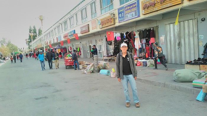
Then there are all the checkpoints along the way. I won’t go on—you know the drill by now.
After that, there’s Tashkurgan—a town with nothing to see, nothing to do. Deserted as soon as night falls. There’s this huge youth hostel and a few lost Chinese tapping away on their smartphones, chain-smoking. This lost American-European crowd, swapping tips on how to enter Pakistan or Tajikistan.
Luckily, there’s the Chinese Pamir Highway, lined with peaks over 7,000m. There’s the feeling of no longer being in China, with a population whose features are Middle Eastern. And these Tajik women with their stunning hairstyles and vibrant costumes. There’s the fact of having reached the westernmost Chinese city, far from crowds and tourist sites. A sort of end of the world. More photos...
11- KYRGYZ BORDER A surreal epic Thursday, September 6 The road from Kashgar to the Kyrgyzstan border is a little over 200 km and passes through beautiful landscapes of colorful, desert-like mountains with acrobatic folds. That’s the bucolic part of the trip.
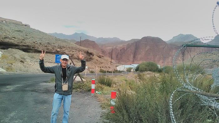 Yesterday, I managed to gather four people to rent a minibus to reach the border more easily: a Spaniard and an Argentine I’d already met in Turpan, and two New Zealanders who responded to the ad left at the hostel.
Absurdity and paranoia of Chinese authorities The highlight was crossing the town of Wuqia, 50 km past Kashgar. After tallying up with my fellow sufferers, we must’ve passed about ten checkpoints with: - Passport checks: 14 times, sometimes by two cops side by side - Bag checks: 4 times - Smartphone checks: 2 times, with deletion of "non-compliant" photos, and registration of your IMEI in the exit log!... Absurd and surreal at the same time, since my camera stayed in my bag, my apps are in French, and my photos have been online for ages...
With all that, we arrived just as the last checkpoint before the no man’s land marking the border between the two countries was on lunch break. And bam! Another 1.5-hour wait, alongside truckers who were much more used to this than we were.
What to think? The cops themselves aren’t fooled. They play the role they’re asked to, but sometimes you can coax a smile out of them—they realize how ridiculous the situation is.
What’s the point? That’s the big question my companions and I were tempted to answer with "to piss people off." To show you your place isn’t here, but with the other tourists, over there in the east, in Shanghai, Xi’an, or Guangzhou.
As for you, a traveler from a democratic country, you really experience this as aggression, humiliation, a violation of your private space. And yet, I’m respected, they speak to me properly. Today, I better understand what a Palestinian or a citizen of an occupied country might feel daily. A unique experience! Thanks, China.
And to top it off, the cherry on the cake! It’s still this glowing button you press to rate your passage after clearing the last obstacle before the exit stamp. I was so surprised it turned off before I could react. The Spaniard, with great humor and irony, had time to vote "excellent." In the end, he wasn’t wrong—you can hardly do better!
PS: I ditched my buddies at the border. They didn’t want to pay for a taxi to continue. So I took a direct taxi to Osh. The first 100 km are fabulous. I couldn’t take many photos, but I’ll be back on Monday to go to Tajikistan.
More photos...
The rest of the Silk Road, Part 2, in these travel journals: Kyrgyzstan, Tajikistan, Uzbekistan.
The Chinese Far West More than 30 years after my first trip to eastern China, I finally fulfilled an old dream: traveling solo from Beijing to the far west, discovering Xinjiang, the Uyghur people and the oppression they endure, the oases of Turpan and Kashgar, the Taklamakan Desert, the end of the Great Wall... The route was covered by train.
MENU PART 1: CHINA
1- Beijing (Jiankou) : the authentic Great Wall, without tourists 2- Cycling in Beijing, the best way to get around 3- Beijing : departure for the far west 4- Jiayuguan : getting by without English 5- Jiayuguan : scams and heritage 6- Dunhuang : abundance in the middle of the desert 7- Turpan : the Uyghurs under heavy surveillance 8- Kashgar : love at first sight for the old city 9- Kashgar : China’s recipe for controlling the populace 10- Tashkurgan : what on earth was I thinking going there! Kyrgyz border: a surreal epic Photo album from the 80s, contributions from other travelers (page 2)
1- JIANKOU Finding the authentic Great Wall, without tourists or a guide Friday, August 24, 2018 Thirty years later, I didn’t feel like revisiting the Great Wall at Badaling or any other overcrowded site. I chose to explore it at Jiankou, in its wildest, most authentic, and unrestored section, starting from a lost village deep in a valley—though it wasn’t *that* lost, since it had everything for communication.
No need to pay for a taxi to get there—by timing it right, you can take the bus for just a few yuan. You have to get off at Xizhazi, the bus terminus. Be careful, there are only two buses a day in each direction. At the Xizhazi bus stop, I met a young couple who’d arrived with zero information about what to expect. We hiked the three of us toward the restored section of Mutianyu.
Still, be cautious With GPS and a topographic map (OpenTopoMap), you can set off without a problem or guide. The trail up to Jiankou is easy and well-marked. The trails down are too. But be careful—once you’re on the Wall, it’s real mountain hiking, with easy but dangerous climbing sections (over sheer drops). Not for amateurs or those afraid of heights! But what a reward. The Wall all to yourself, where it’s at its most daring. Truly mesmerizing.
More photos...
2- BEIJING The best way to get around the capital Sunday, August 26 The best way to explore the city is still by bike. Most are in a bike-share system, but you need to use an app—WeChat, the app that does everything, like monitoring your every move. No way I was installing that.
I found one at a rental shop near the hostel. The key is to quickly learn local traffic customs to minimize risks. Bike lanes are wide along the avenues.
But you still have to: - Watch out for anything parked on the bike paths—the most annoying are people napping or talking on the phone in their cars - Keep an eye on everything coming the wrong way—the list is long - The worst is right turns on red, which in Chinese traffic rules seem to have priority Once you get the hang of it, it’s fine. The city is huge but flat, so you can just wing it.
3- BEIJING By train to the far west Sunday, August 26 Beijing West Station is the size and operates like an airport. With your e-ticket from the agency, you first have to pick up your ticket at the special "English" counter, after passing through security. With your ticket in hand, you have to exit and enter through the boarding waiting area—not the platform—after a second security check.
Then you find the right hall and wait for the sign to finally access the platform. In the end, it works pretty well given the incredible number of passengers to manage. Everywhere in Beijing, I saw that the Chinese have mastered crowd flow management.Nice surprise: second-class carriages are clean, air-conditioned, and bright. Perfect, since I was in for 20 hours. One uniformed attendant per carriage, mobile meal service—luxury! Small downside: no luggage space. Hauling your suitcase up to the top bunk is quite a workout. I was in the middle, so it wasn’t too bad. The landscape, though, whether rural or urban, is pretty bleak. That should change once we leave the eastern plains.
Of course, I got my first police visit, with a thorough passport check and bag search. I was warned—going to the Chinese far west exposes you to this kind of hassle. But they were polite and respectful.
The Chinese Far West4- JIAYUGUAN Getting by without English Monday, August 27 At the gates of two deserts (Gobi and Taklamakan) and at the foot of the Tibetan highlands, the Great Wall ends at Jiayuguan. Here, I found the deeper China I’d somewhat rediscovered during my bike ride, even if now everyone gets around on electric bikes and I’m no longer stared at like an alien.
Prices are nothing like Beijing: you can find a full meal for 2 €, and my bike cost 7 € for two days. Plus, few people speak English—neither the owner of the HI hostel where I stayed, nor the ticket sellers at the sites, let alone the servers at the small eateries where I ate. Everything is written in Chinese. So I had to use the little Chinese I know to communicate about essentials. It makes the locals laugh to see a European trying to speak their language, but it earns respect. With Google Translate’s help, I managed.
Rant: With their avenues blocked for construction for kilometers without warning, and new roads not yet on maps, I must’ve taken 15 km of detours. More photos...
5- JIAYUGUAN Scams and heritage Tuesday, August 28 The Great Wall doesn’t exactly end at the fort I visited yesterday but 10 km further, at the entrance to a river gorge at the foot of the mountains. All that’s left is a badly damaged tower (more like a mound of earth) and a section of clay wall, similar to the one I biked yesterday.
This morning, I hopped on my bike, determined to venture into the desert to see this highly symbolic site. First, you access it via a wide, brand-new road with not a soul in sight. Just before the site, I came across a grand welcome gate, very period-style, but it’s actually the inevitable toll booth.
Behind the gate, the road continues straight to the site, which you can see in the distance—at least 2 km away—the remains of the tower and wall. I had to leave my bike here. Fine. I went to the ticket counter and asked the price: 120 yuan! I couldn’t believe it—over 15 € for a simple mound of earth.
I showed my displeasure to the attendant, who couldn’t care less, and immediately turned back. 120 yuan—that’s the price for a new road, a fancy gate planted 2 km before the site just to force you to take a shuttle, and employees with nothing to do all day... Now I understand why I didn’t meet anyone!
Heritage China is a bit pricey Generally, sites are expensive for the country’s standard of living, but travelers are supposed to have money, so why hold back? I even gave up on the Forbidden City—reservations required days in advance (or on the black market at an impossible price). I prefer to keep the memory of my first visit, when entry must’ve cost a few dozen cents, and there were only a handful of visitors.
This morning, I took a taxi to see remarkable tombs of common people from the 3rd to 6th centuries. They’re small vaulted caves made of painted bricks, depicting scenes of daily life. Very pretty and moving. But even here, though the price was more reasonable, I was left wanting—only one of the 16 tombs is open to visitors, and it’s apparently not the most beautiful.
The authentic China—at least what’s left of it... Wandering the impersonal avenues of the city, you stumble upon a market. There, you still find traditional China—small shops with questionable hygiene, Go players, musicians, and even a dental prosthetist. The last refuge for those untouched by modernity. More photos...
6- DUNHUANG Abundance in the middle of the desert Wednesday, August 29 Well, I thought the landscape would be less bleak as I headed west. Nope. The only distraction in this expanse of dark, clayey sand is the forests of pylons and wind turbines, plus wild camels racing each other.
However, Dunhuang, the gateway to the Taklamakan, is by far the most pleasant Chinese city I know. There’s a real city center you can explore on foot. It’s hot but not unbearable, with a light, dry breeze. Much nicer than Beijing. The Han Chinese are still the majority, but the Muslim Uyghurs are more numerous, and the muezzin’s call to prayer echoes around the mosque.The most surprising thing is the abundance and diversity of fruits and vegetables. You wonder how it all grows here. Well-irrigated, the desert sands are very fertile. Here, raisins have subtle, mysterious flavors, and the lamb really tastes like lamb.
Today, I visited the must-see Mingshashan, a dune complex next to which Pila is a molehill. The Basque Country, but covered in sand... More photos...
7- TURPAN The Uyghurs under heavy surveillance Friday, August 31 Surveillance cameras everywhere in the city, armed police stationed at intersections, in front of public buildings, at the entrance and inside tourist sites, police stations on every corner, patrols on foot or by car, khaki uniforms even for middle schoolers... here, the Han Chinese are in the minority, and you can feel it. Turpan feels like a city under siege.
To enter the youth hostel where I stayed, there’s even a security gate, and the receptionist (a Han, like everyone in tourism) wears a bulletproof vest! Reassuring. Still, you don’t feel particularly threatened here, especially as a European. The troublemakers are the Chinese, not the Uyghurs. Generally, China is a very safe country for visitors.
Smile, you’re on camera! I was biking on an avenue when the car in front of me got flashed for driving slowly. I quickly understood why when I got flashed too.
Here, the official time is Beijing time, but it gets dark two hours later. It’ll be even worse in Kashgar. Trickier to manage: everything is displayed in Chinese and Arabic. Nothing in English. Choosing a menu is a shot in the dark. Apart from a few young Chinese, no one here speaks English, and my Chinese doesn’t seem very understandable...
Mogao, the end of the road for the Han Yesterday, near Dunhuang, I went to Mogao, a complex of decorated caves with Buddha sculptures and paintings. Stunning, but so crowded! Luckily, here in Turpan, Chinese tourists barely venture out. So I visited a Silk Road ghost town with only a handful of other visitors and under a howling wind.
The modern Chinese city is swallowing up the old Uyghur neighborhoods—only a museum-like district remains in the center, and pockets of resistance on the outskirts are doomed to disappear soon. More photos...
8- KASHGAR A (relative) love at first sight for the old city Sunday, September 2 After three overnight trains, here I am in the far west of China, nearly 4,000 km from the capital. Despite the omnipresent police and an old city preserved UNESCO-style, Kashgar is my Chinese love at first sight.
Finally, Chinese... well, sort of, because we’re in Uyghur territory here—a Turkic people with nothing culturally in common with the Han, the eastern Chinese. It started badly yesterday at Turfan station, where after three security gate passes, at least five passport checks, and a bag search, three adorable policewomen confiscated my antibacterial lotion because it had a flammable logo...
Then came the welcoming committee of armed cops at Kashgar station. Once all that was over, they left me alone—except you still have to go through security checks like everyone else to enter the old city, the bazaar, the livestock market... The further west you go, the more the siege mentality is evident. Luckily, the border isn’t far...
Despite the inevitable destruction-reconstruction, the city center has been well preserved. Thankfully, because it’s a very original style, a mix of local and colonial. I love it, even if it’s a bit too artificial, sanitized, and watered-down, and rather empty of residents. On the Silk Road, the city was famous for its great food. And it still is—rarely have I seen such richness and abundance of food! And not just scorpions or snakes. More photos...
9- KASHGAR China’s recipe for controlling the populace Saturday, September 1 Xinjiang, along with Tibet, is a "sensitive" area of rebellion in the eyes of Chinese authorities. As a result, the state has these regions and their populations under total control. Tourists also feel the consequences, even if they’re not at risk of re-education camps.
- Putting barbed wire and anti-ramming barriers around sensitive sites (schools, big hotels, government buildings...)
- Installing traffic surveillance gates with cameras and photo flashes (for all vehicles passing, including bikes) throughout the city and even in the countryside
- Posting uniformed guards with tasers, batons, or huge baseball bats every 100 meters
- Training the Han population (ethnic Chinese) in self-defense with sticks, preferably in the morning on the street. Men and women of all ages
- Starting school with the national anthem, doing military exercises, and receiving political indoctrination, all neatly lined up in the courtyard. (The dream school for any teacher)
- Placing a snitch in uniform (a pseudo-guard) in public gathering places, like youth hostels. Mine spends the day loafing around the courtyard
- Putting Chinese flags everywhere on the streets to remind everyone who’s in charge
- Installing security gates at every entrance to areas frequented by tourists (thanks for that) but not just there
- Never photographing cops, or else! I tried, but it’s not easy...With all that, you can stroll around safely Not much crime! As for the amount the Chinese state spends to maintain such a system, it’s staggering! A third of the Han living in Xinjiang work in security. Today, I wandered freely around old Kashgar, which is quite large after all. More photos...
10- TASHKURGAN What on earth was I thinking going there! Wednesday, September 5 First, there’s the taxi—pretty crappy, with a driver who doesn’t speak a word of English and won’t stop smoking. Over six hours in that... shared with a completely out-of-it American.
Then there are all the checkpoints along the way. I won’t go on—you know the drill by now.
After that, there’s Tashkurgan—a town with nothing to see, nothing to do. Deserted as soon as night falls. There’s this huge youth hostel and a few lost Chinese tapping away on their smartphones, chain-smoking. This lost American-European crowd, swapping tips on how to enter Pakistan or Tajikistan.
Luckily, there’s the Chinese Pamir Highway, lined with peaks over 7,000m. There’s the feeling of no longer being in China, with a population whose features are Middle Eastern. And these Tajik women with their stunning hairstyles and vibrant costumes. There’s the fact of having reached the westernmost Chinese city, far from crowds and tourist sites. A sort of end of the world. More photos...
11- KYRGYZ BORDER A surreal epic Thursday, September 6 The road from Kashgar to the Kyrgyzstan border is a little over 200 km and passes through beautiful landscapes of colorful, desert-like mountains with acrobatic folds. That’s the bucolic part of the trip.
Yesterday, I managed to gather four people to rent a minibus to reach the border more easily: a Spaniard and an Argentine I’d already met in Turpan, and two New Zealanders who responded to the ad left at the hostel.Absurdity and paranoia of Chinese authorities The highlight was crossing the town of Wuqia, 50 km past Kashgar. After tallying up with my fellow sufferers, we must’ve passed about ten checkpoints with: - Passport checks: 14 times, sometimes by two cops side by side - Bag checks: 4 times - Smartphone checks: 2 times, with deletion of "non-compliant" photos, and registration of your IMEI in the exit log!... Absurd and surreal at the same time, since my camera stayed in my bag, my apps are in French, and my photos have been online for ages...
With all that, we arrived just as the last checkpoint before the no man’s land marking the border between the two countries was on lunch break. And bam! Another 1.5-hour wait, alongside truckers who were much more used to this than we were.
What to think? The cops themselves aren’t fooled. They play the role they’re asked to, but sometimes you can coax a smile out of them—they realize how ridiculous the situation is.
What’s the point? That’s the big question my companions and I were tempted to answer with "to piss people off." To show you your place isn’t here, but with the other tourists, over there in the east, in Shanghai, Xi’an, or Guangzhou.
As for you, a traveler from a democratic country, you really experience this as aggression, humiliation, a violation of your private space. And yet, I’m respected, they speak to me properly. Today, I better understand what a Palestinian or a citizen of an occupied country might feel daily. A unique experience! Thanks, China.
And to top it off, the cherry on the cake! It’s still this glowing button you press to rate your passage after clearing the last obstacle before the exit stamp. I was so surprised it turned off before I could react. The Spaniard, with great humor and irony, had time to vote "excellent." In the end, he wasn’t wrong—you can hardly do better!
PS: I ditched my buddies at the border. They didn’t want to pay for a taxi to continue. So I took a direct taxi to Osh. The first 100 km are fabulous. I couldn’t take many photos, but I’ll be back on Monday to go to Tajikistan.
More photos...
The rest of the Silk Road, Part 2, in these travel journals: Kyrgyzstan, Tajikistan, Uzbekistan.
Hi there, I’ve traveled for work and taken several leisure trips with my late partner, and now friends are scarce at 74. I’d love to do more budget travel, either solo or with travel companions, but I don’t know where to start. Any help would be greatly appreciated! I’m from Quebec, Canada, and I speak French and a little English. Hervé
We’ve been back for a month now, so it’s high time I posted the story of our adventures! 😉 I’d also like to thank everyone who shared their own experiences on this forum (or elsewhere) and gave us tips—it really helped us plan our trip.
14/09/2019: Johannesburg - Vryburg After months of waiting and reading other travelers’ journals, it’s finally our turn! We arrived in Johannesburg from Nantes and Paris in the morning. We looked for the Bushlore rep—we’d rented our 4x4 from them—but there was no sign with our name! « Bushlore? She’s a woman, I saw her a few minutes ago, » someone told us. A minute later, the Bushlore employee showed up: a man! 🤪 He sped onto the highway, and just 30 minutes later, we arrived at the rental place. It’s a big operation with good organization and lots of vehicles—pretty reassuring. Our 4x4 was there, a classic Toyota Hilux fully equipped for safari: rooftop tent, dual diesel tanks, 60-liter water reserve, two batteries, two spare tires, all the camping gear, plus everything needed for *désensablement* (getting unstuck from sand). Speaking of which, is it "désensablage" or "désensablement"? Best to just avoid getting stuck in the first place! 😏 Good news… or not: the vehicle was brand new, with barely 100 kilometers on the odometer. On one hand, we figured we wouldn’t have mechanical issues or a fridge breakdown, but on the other, we knew it wouldn’t be easy to return it without a single scratch. Either way, it was our first time renting a 4x4, and we were impressed.
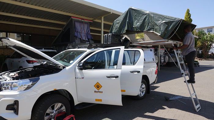
We set off toward Kgalagadi Transfrontier Park—it’s not exactly around the corner! In 1994 (when Mandela had just become President) and 2007, during our two previous trips to South Africa, we loved this park, so we couldn’t imagine going to Botswana without returning. The road was pretty monotonous, with not much to see except a few ostriches.
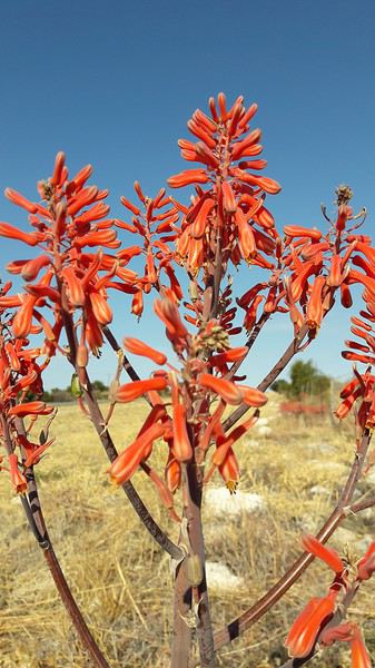
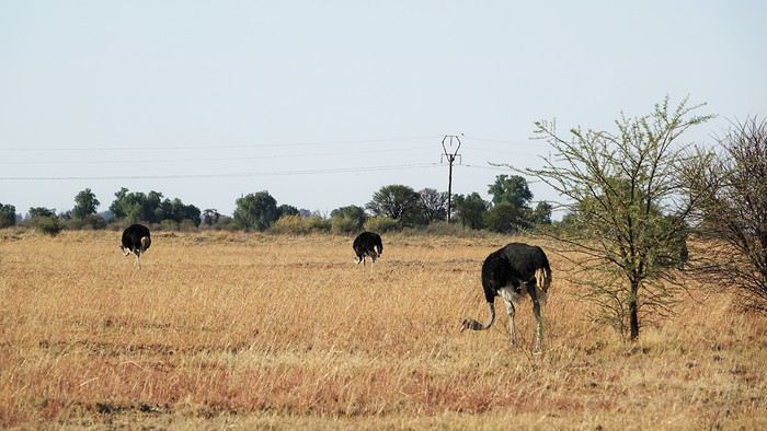
We stopped for the night in Vryburg at the Kameelboom Lodge campsite. It was a bit noisy since it’s close to the road, and the facilities weren’t great, but it was fine for one night.
14/09/2019: Johannesburg - Vryburg After months of waiting and reading other travelers’ journals, it’s finally our turn! We arrived in Johannesburg from Nantes and Paris in the morning. We looked for the Bushlore rep—we’d rented our 4x4 from them—but there was no sign with our name! « Bushlore? She’s a woman, I saw her a few minutes ago, » someone told us. A minute later, the Bushlore employee showed up: a man! 🤪 He sped onto the highway, and just 30 minutes later, we arrived at the rental place. It’s a big operation with good organization and lots of vehicles—pretty reassuring. Our 4x4 was there, a classic Toyota Hilux fully equipped for safari: rooftop tent, dual diesel tanks, 60-liter water reserve, two batteries, two spare tires, all the camping gear, plus everything needed for *désensablement* (getting unstuck from sand). Speaking of which, is it "désensablage" or "désensablement"? Best to just avoid getting stuck in the first place! 😏 Good news… or not: the vehicle was brand new, with barely 100 kilometers on the odometer. On one hand, we figured we wouldn’t have mechanical issues or a fridge breakdown, but on the other, we knew it wouldn’t be easy to return it without a single scratch. Either way, it was our first time renting a 4x4, and we were impressed.
We set off toward Kgalagadi Transfrontier Park—it’s not exactly around the corner! In 1994 (when Mandela had just become President) and 2007, during our two previous trips to South Africa, we loved this park, so we couldn’t imagine going to Botswana without returning. The road was pretty monotonous, with not much to see except a few ostriches.
We stopped for the night in Vryburg at the Kameelboom Lodge campsite. It was a bit noisy since it’s close to the road, and the facilities weren’t great, but it was fine for one night.
Hi there,
I’m heading to Nepal very soon to do the Three Passes Trek, among other things. Could anyone tell me what the average daily budget is for this trek? From what I’ve heard, this area seems more expensive than others.
Thanks in advance for your replies! :)
I’m heading to Nepal very soon to do the Three Passes Trek, among other things. Could anyone tell me what the average daily budget is for this trek? From what I’ve heard, this area seems more expensive than others.
Thanks in advance for your replies! :)
S🙂wasdee!
Kicking off the thread with an informative article about Phra Kreuang, protective amulets (according to local belief) that Thai people of all kinds wear around their necks:
https://www.objetsdevasion.com/guides/objet-bouddhiste/amulette-bouddha/les-amulettes-bouddhiques-thailandaises.html
You can find them all over the Kingdom: in temples, at markets, in specialty shops, and even in mail-order flyers at Seven/Eleven.
Also, heads up for those in Paris—from October 11th to 20th, there’s a collective exhibition featuring Thai artists: https://phenixwebtv.com/2019/07/23/facets-of-thailand-une-exposition-collective-de-cinq-artistes-de-la-scene-contemporaine-thailandaise/?fbclid=IwAR28PCY1t48M2DiwVlnc5uZvT20FnsxNLMppOb8d1pSfOjiw_sW_htV2CnI
@ ++, for the *sanouk* debrief from our last trip to the Land of the Free, as it’s so beautifully nicknamed.
Sânouk3😎
Kicking off the thread with an informative article about Phra Kreuang, protective amulets (according to local belief) that Thai people of all kinds wear around their necks:
https://www.objetsdevasion.com/guides/objet-bouddhiste/amulette-bouddha/les-amulettes-bouddhiques-thailandaises.html
You can find them all over the Kingdom: in temples, at markets, in specialty shops, and even in mail-order flyers at Seven/Eleven.
Also, heads up for those in Paris—from October 11th to 20th, there’s a collective exhibition featuring Thai artists: https://phenixwebtv.com/2019/07/23/facets-of-thailand-une-exposition-collective-de-cinq-artistes-de-la-scene-contemporaine-thailandaise/?fbclid=IwAR28PCY1t48M2DiwVlnc5uZvT20FnsxNLMppOb8d1pSfOjiw_sW_htV2CnI
@ ++, for the *sanouk* debrief from our last trip to the Land of the Free, as it’s so beautifully nicknamed.
Sânouk3😎
Hi there,
We’ll be driving the route from Hluhluwe Imfolozi to Didima Camp in the Drakensberg this September.
Our GPS app suggests a few different routes:
Either along the coast to Durban, then heading back up via Pietermaritzburg. Or further inland through Dundee.
Which route would you recommend in terms of road quality and safety?
Thanks so much in advance for your tips!
We’ll be driving the route from Hluhluwe Imfolozi to Didima Camp in the Drakensberg this September.
Our GPS app suggests a few different routes:
Either along the coast to Durban, then heading back up via Pietermaritzburg. Or further inland through Dundee.
Which route would you recommend in terms of road quality and safety?
Thanks so much in advance for your tips!
Valérie (Alexval2) convinced me to publish this travel journal about our trip to Rajasthan, so here I go, sharing what will be my first travel journal! 🙂
But first, why India? This question has already been discussed on the forum. For me, I had these idealized images in mind: maharajahs, palaces, elephants, and friends who gave me glowing reviews. We’ve already been to Asia and wanted to do something different. We weren’t disappointed.
So, after spending what felt like hundreds of hours 😛 researching forums, blogs, and various guides, the Rajasthan region stood out as the perfect choice for a first discovery.
We managed to plan this itinerary, which is quite classic but structured around a must-see: the Pushkar Camel Fair. I’d read reviews and watched videos about it, all very enticing. We’ll see later how it turned out.
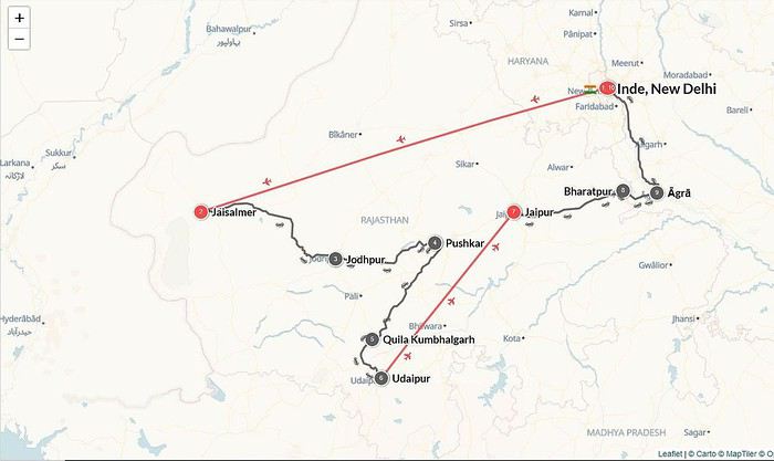
As usual, I had everything booked in advance because I don’t like wasting time looking for solutions once we’re there.
Our Air France flight arrived on time at 11:15 PM. We’d read the recommendations, and after collecting our luggage, we headed to the prepaid taxi booth. We got the receipt, and two charming guys took our suitcases to the taxi. When we arrived at the taxi, they asked for 500 INR for the porter service. Of course, I resisted, and with the driver’s help, we settled on 200 INR. Welcome to India.
We agreed with the friendly driver that he’d pick us up from the hotel (Ibis, great breakfast) for our flight to Jaisalmer. It was 2 AM, we collapsed into bed, but the night was short since we had to wake up at 5 AM.
But first, why India? This question has already been discussed on the forum. For me, I had these idealized images in mind: maharajahs, palaces, elephants, and friends who gave me glowing reviews. We’ve already been to Asia and wanted to do something different. We weren’t disappointed.
So, after spending what felt like hundreds of hours 😛 researching forums, blogs, and various guides, the Rajasthan region stood out as the perfect choice for a first discovery.
We managed to plan this itinerary, which is quite classic but structured around a must-see: the Pushkar Camel Fair. I’d read reviews and watched videos about it, all very enticing. We’ll see later how it turned out.
As usual, I had everything booked in advance because I don’t like wasting time looking for solutions once we’re there.
Our Air France flight arrived on time at 11:15 PM. We’d read the recommendations, and after collecting our luggage, we headed to the prepaid taxi booth. We got the receipt, and two charming guys took our suitcases to the taxi. When we arrived at the taxi, they asked for 500 INR for the porter service. Of course, I resisted, and with the driver’s help, we settled on 200 INR. Welcome to India.
We agreed with the friendly driver that he’d pick us up from the hotel (Ibis, great breakfast) for our flight to Jaisalmer. It was 2 AM, we collapsed into bed, but the night was short since we had to wake up at 5 AM.
After several trips to Tenerife, we’re finally discovering the beautiful island of Lanzarote this year!
We fell in love with this small island with its magnificent volcanoes and white villages without large hotel complexes!

I won’t be writing a day-by-day travel journal, but rather giving an overview of our experience! For hiking, we chose trails that were about an hour long and accessible for my mom, but we noted some longer ones to do if we come back—I’ll talk about those later!
To visit the sites, depending on the places you choose, you can get BONOS for discounts: more details here: https://turismolanzarote.com/fr/cact-lanzarote-tarifs-et-abonnements/ We bought ours at the first site we visited (Montañas del Fuego), but you have to ask for them—otherwise, they won’t offer them. Make sure to plan ahead which places to include.
Our favorites were the volcanic discoveries and other landscapes of the island: EL PARQUE TIMANFAYA: Las Montañas del Fuego ****
Stunning colors—it’s absolutely breathtaking! Our only regret is not being able to hike through these incredible landscapes!
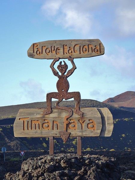
GPS: 29°00'21.6"N 13°45'11.7"W 9 AM - 5:45 PM
We’d noted, “Best to go early in the morning or late in the evening.” We arrived 5 minutes before the park opened. We’d barely parked when we hopped on the first bus for the mandatory 14 km tour included in the ticket. Perfect—no waiting! We sat on the right side of the bus for the best views.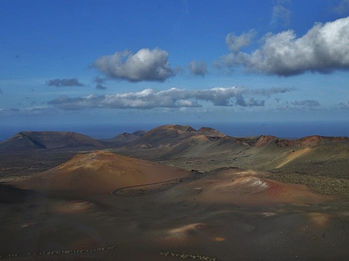
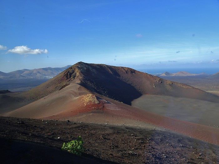 Afterward, we watched the geothermal demonstrations. It’s amazing how hot those little rocks picked up from the ground feel in your hand!
When we left, we saw how right the advice to arrive early was! Newcomers had to queue first to pay at the entrance, then again to access the parking (which was full, so they only let cars in when a spot opened up), and yet again to board the bus! We wouldn’t have wanted to deal with all that!
MONTAÑA CUERVO*** (Crow Mountain) Hike: 1-2 hours / 4 km GPS: 28°59'46.7"N 13°41'04.5"W
A small crater where wild geraniums grow! The hike is short, easy, and very pleasant. It follows a lava field covered in pale-green lichens before entering the crater. To avoid crowds, don’t go too late! We were lucky to have the parking lot almost to ourselves—lots of people were arriving later, even buses!


MONTANA COLORADA*** Hike: 1 hour – beautiful and easy, peaceful, no crowds. GPS: 29°00'18.0"N 13°41'01.7"W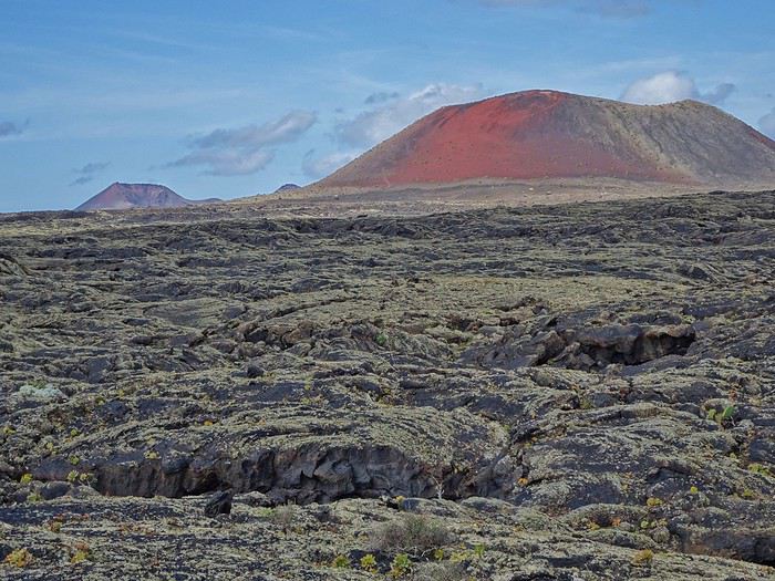 The trail loops around this stunning red mountain. Gorgeous colors, striking contrasts, and amazing volcanic rocks! Keep an eye on the ground—you’ll find little “green gems” in the small volcanic stones!


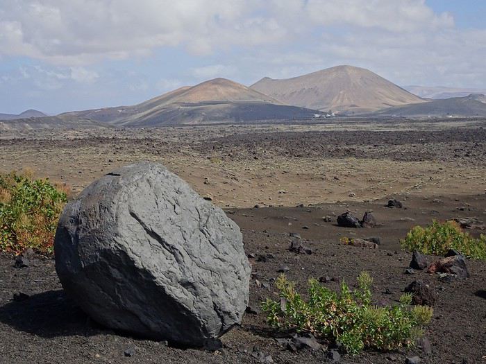
CUEVAS DE LOS VERDES*** We were more drawn to Las Cuevas, which felt more natural, than Los Jameos—though some might find the latter more beautiful, it’s more developed. GPS: 29°09'38.9"N 13°26'19.2"W 10 AM - 6 PM. Guided tour lasts just under an hour. Avoid late morning or early afternoon visits—it gets crowded. A tunnel and volcanic tube formed by an eruption of Monte Corona. The cave is named after the Verdes family, who once owned it. The space is often wide but sometimes narrow! The visit is very impressive, with a great surprise at the end!


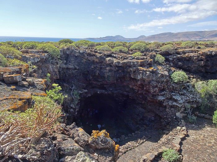

VOLCANO MONTAÑA ROJA** in Playa Blanca A hike you can do on foot from our hotel! Beautiful views from the top of the volcano. You can walk around it, see amazing rocks, and even descend into the crater (a different perspective with stunning colors).
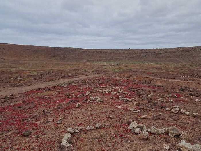

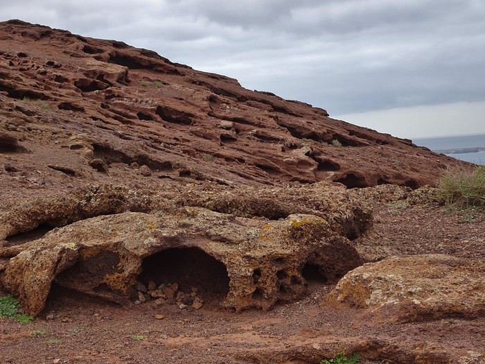
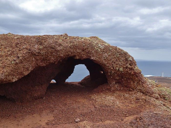
I won’t be writing a day-by-day travel journal, but rather giving an overview of our experience! For hiking, we chose trails that were about an hour long and accessible for my mom, but we noted some longer ones to do if we come back—I’ll talk about those later!
To visit the sites, depending on the places you choose, you can get BONOS for discounts: more details here: https://turismolanzarote.com/fr/cact-lanzarote-tarifs-et-abonnements/ We bought ours at the first site we visited (Montañas del Fuego), but you have to ask for them—otherwise, they won’t offer them. Make sure to plan ahead which places to include.
Our favorites were the volcanic discoveries and other landscapes of the island: EL PARQUE TIMANFAYA: Las Montañas del Fuego ****
Stunning colors—it’s absolutely breathtaking! Our only regret is not being able to hike through these incredible landscapes!
GPS: 29°00'21.6"N 13°45'11.7"W 9 AM - 5:45 PM
We’d noted, “Best to go early in the morning or late in the evening.” We arrived 5 minutes before the park opened. We’d barely parked when we hopped on the first bus for the mandatory 14 km tour included in the ticket. Perfect—no waiting! We sat on the right side of the bus for the best views.
Afterward, we watched the geothermal demonstrations. It’s amazing how hot those little rocks picked up from the ground feel in your hand!When we left, we saw how right the advice to arrive early was! Newcomers had to queue first to pay at the entrance, then again to access the parking (which was full, so they only let cars in when a spot opened up), and yet again to board the bus! We wouldn’t have wanted to deal with all that!
MONTAÑA CUERVO*** (Crow Mountain) Hike: 1-2 hours / 4 km GPS: 28°59'46.7"N 13°41'04.5"W
A small crater where wild geraniums grow! The hike is short, easy, and very pleasant. It follows a lava field covered in pale-green lichens before entering the crater. To avoid crowds, don’t go too late! We were lucky to have the parking lot almost to ourselves—lots of people were arriving later, even buses!
MONTANA COLORADA*** Hike: 1 hour – beautiful and easy, peaceful, no crowds. GPS: 29°00'18.0"N 13°41'01.7"W
The trail loops around this stunning red mountain. Gorgeous colors, striking contrasts, and amazing volcanic rocks! Keep an eye on the ground—you’ll find little “green gems” in the small volcanic stones!CUEVAS DE LOS VERDES*** We were more drawn to Las Cuevas, which felt more natural, than Los Jameos—though some might find the latter more beautiful, it’s more developed. GPS: 29°09'38.9"N 13°26'19.2"W 10 AM - 6 PM. Guided tour lasts just under an hour. Avoid late morning or early afternoon visits—it gets crowded. A tunnel and volcanic tube formed by an eruption of Monte Corona. The cave is named after the Verdes family, who once owned it. The space is often wide but sometimes narrow! The visit is very impressive, with a great surprise at the end!
VOLCANO MONTAÑA ROJA** in Playa Blanca A hike you can do on foot from our hotel! Beautiful views from the top of the volcano. You can walk around it, see amazing rocks, and even descend into the crater (a different perspective with stunning colors).
Tuesday, September 12
We had to get up early that day to leave our house at 3:30 AM, as our flight from Lyon Saint-Exupéry was scheduled for 6:35 AM. In the end, our Transavia flight took off with a delay.

I’d found a round-trip flight from Lyon to Porto on the Transavia website for 58 € per person, including only a carry-on bag.

Before landing at Porto Airport, we flew over the Douro River and the famous bridge between Porto and Vila Nova de Gaia.

The Douro flows into the Atlantic Ocean.
From the airport, we took the metro, which starts above ground before diving into Porto’s underground.

Once we’d dropped off our bags at the hotel, we set off to explore Porto.
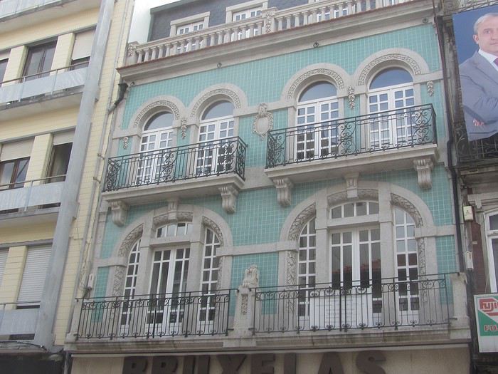
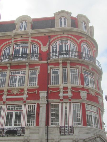

 You can’t go to Portugal without riding a tram—it’s a must! So we took an old tram (Line 1) to the beach.
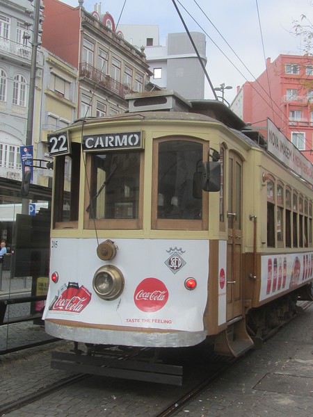


The Guindais Funicular connects Praça da Batalha, high up in the city, to Ribeira in the historic center near the quays.
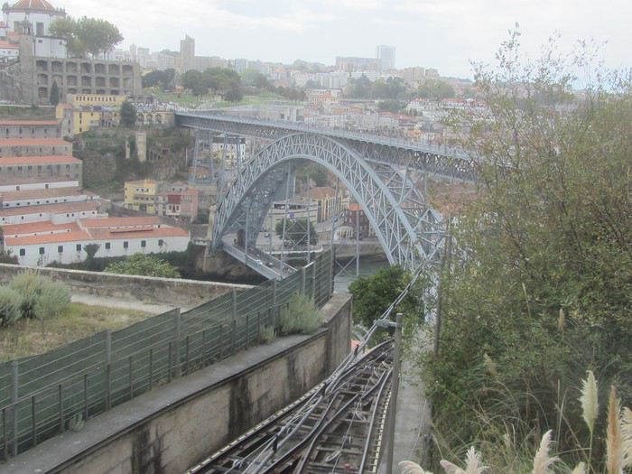
We didn’t take it—going down the stairs was fine. A one-way ticket costs 2.5 €.
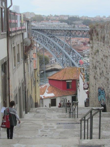
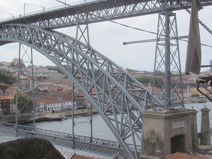
The Dom Luís I Bridge is one of the city’s icons. Built between 1881 and 1886 by engineer Théophile Seyrig, a disciple of Gustave Eiffel,


The historic Ribeira district, once run-down, is undergoing an urban revival. Porto is gradually regaining its former splendor.

Old mansions with crests are being restored, splendid façades adorned with azulejos, Baroque-style churches, yellow trams, ancient shops, trendy restaurants, hip bars, boutiques, and design hotels!
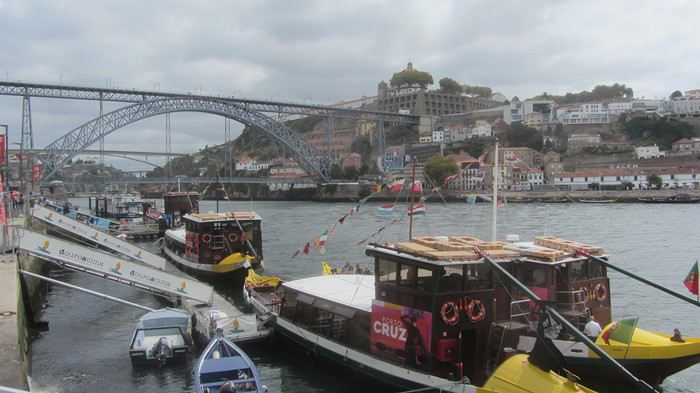

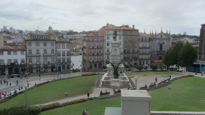
I’d found a round-trip flight from Lyon to Porto on the Transavia website for 58 € per person, including only a carry-on bag.
Before landing at Porto Airport, we flew over the Douro River and the famous bridge between Porto and Vila Nova de Gaia.
The Douro flows into the Atlantic Ocean.
From the airport, we took the metro, which starts above ground before diving into Porto’s underground.
Once we’d dropped off our bags at the hotel, we set off to explore Porto.
You can’t go to Portugal without riding a tram—it’s a must! So we took an old tram (Line 1) to the beach.The Guindais Funicular connects Praça da Batalha, high up in the city, to Ribeira in the historic center near the quays.
We didn’t take it—going down the stairs was fine. A one-way ticket costs 2.5 €.
The Dom Luís I Bridge is one of the city’s icons. Built between 1881 and 1886 by engineer Théophile Seyrig, a disciple of Gustave Eiffel,
The historic Ribeira district, once run-down, is undergoing an urban revival. Porto is gradually regaining its former splendor.
Old mansions with crests are being restored, splendid façades adorned with azulejos, Baroque-style churches, yellow trams, ancient shops, trendy restaurants, hip bars, boutiques, and design hotels!
I’d heard—and rightly so—about the incredible kindness of Taiwanese people. I had just spent a few weeks in Korea, a country of teddy bears, where the locals loved telling me about a place full of… more teddy bears. It was going in circles.
So I arrived in Taipei with stars in my eyes, ready to face all that generosity. Yet, surprisingly, the guard posted in front of the presidential palace wasn’t exactly courteous. And then, the countless military vehicles really struck me. Have you ever seen a teddy bear driving a tank?
I spent most of my evenings in a bar along a very large avenue. I’d go alone and always find company—men, women, it didn’t matter as long as I could blend into this new country, discover its people, their culture, their history.
The heat made me sweat nonstop, my beard had grown back, I was wearing a black T-shirt as worn-out as possible, and my face bore the marks of several months in Russia and Korea. In short, I looked like the perfect globetrotter—the kind I’d probably dreamed of being as a kid.
So there I was, sitting at the bar, deep in conversation with a Taiwanese friend, when a fight broke out between an Italian and an American—two drunk, stupid beasts. Shouting, shoving, we kicked them out. Well, *we* didn’t. My friend didn’t move; I was the only one who reacted, letting my temper get the better of me. He looked at me and said, without malice, that white guys had also fought two days earlier. I turned my head toward the room—I was the only foreigner. I was used to it, but tonight was different. The looks in the mirror were full of distrust. I felt like an idiot for all the others. I felt like an idiot. I said goodbye to my friend; I was convinced I’d never see him again. As I headed toward my hostel, my brain was racing. Asia had confronted me with a side of travel I didn’t know. I’d always managed to blend in, to go unnoticed, but when your features and skin color prevent that, the game changes. And this hyper-globalization, this hyper-communication, the fact that poor guys like me can enjoy travel—is it really a good thing? Does it create an expectation, a need for a mass of tourists who couldn’t care less about the country they’re visiting? No, really, I felt like an idiot. And then all those damn tanks, and what’s with those dozen tents in front of the presidential palace? It intrigued me. It was late, but there was movement. Hey! Hey! How are you? Good, just a little drunk. Ha ah aha! What are you doing here? Why are there so many military personnel around you? Ha ha ah! You can come if you want! Oh really? Yeah, yeah!
I climbed over the fence and learned. I learned that in the mountains to the east of the island, the island’s natives still live. I learned that their culture is disappearing, that they themselves are disappearing. That nothing is being done to preserve the very origin of this country. That all those tanks and military personnel were there for about thirty cheerful troublemakers who had made the trip. Because by being there, they were announcing: *Yes, we’re still here.* I spent the rest of the evening with them until early morning. They showed me how to weave my own shoes (flip-flops), plied me with endless coffee, laughed when a cop took my picture and I shouted, *Yes, I’m a French spy*, and gave me a bracelet. I left with a new look in my eyes. This trip will end as it began, but the next one will be different. I’ll be prepared; it won’t just be an escape or an adventure. Travelers destroy more than they preserve—it’s not easy to tip the scales, but I’m going to try anyway.
So I arrived in Taipei with stars in my eyes, ready to face all that generosity. Yet, surprisingly, the guard posted in front of the presidential palace wasn’t exactly courteous. And then, the countless military vehicles really struck me. Have you ever seen a teddy bear driving a tank?
I spent most of my evenings in a bar along a very large avenue. I’d go alone and always find company—men, women, it didn’t matter as long as I could blend into this new country, discover its people, their culture, their history.
The heat made me sweat nonstop, my beard had grown back, I was wearing a black T-shirt as worn-out as possible, and my face bore the marks of several months in Russia and Korea. In short, I looked like the perfect globetrotter—the kind I’d probably dreamed of being as a kid.
So there I was, sitting at the bar, deep in conversation with a Taiwanese friend, when a fight broke out between an Italian and an American—two drunk, stupid beasts. Shouting, shoving, we kicked them out. Well, *we* didn’t. My friend didn’t move; I was the only one who reacted, letting my temper get the better of me. He looked at me and said, without malice, that white guys had also fought two days earlier. I turned my head toward the room—I was the only foreigner. I was used to it, but tonight was different. The looks in the mirror were full of distrust. I felt like an idiot for all the others. I felt like an idiot. I said goodbye to my friend; I was convinced I’d never see him again. As I headed toward my hostel, my brain was racing. Asia had confronted me with a side of travel I didn’t know. I’d always managed to blend in, to go unnoticed, but when your features and skin color prevent that, the game changes. And this hyper-globalization, this hyper-communication, the fact that poor guys like me can enjoy travel—is it really a good thing? Does it create an expectation, a need for a mass of tourists who couldn’t care less about the country they’re visiting? No, really, I felt like an idiot. And then all those damn tanks, and what’s with those dozen tents in front of the presidential palace? It intrigued me. It was late, but there was movement. Hey! Hey! How are you? Good, just a little drunk. Ha ah aha! What are you doing here? Why are there so many military personnel around you? Ha ha ah! You can come if you want! Oh really? Yeah, yeah!
I climbed over the fence and learned. I learned that in the mountains to the east of the island, the island’s natives still live. I learned that their culture is disappearing, that they themselves are disappearing. That nothing is being done to preserve the very origin of this country. That all those tanks and military personnel were there for about thirty cheerful troublemakers who had made the trip. Because by being there, they were announcing: *Yes, we’re still here.* I spent the rest of the evening with them until early morning. They showed me how to weave my own shoes (flip-flops), plied me with endless coffee, laughed when a cop took my picture and I shouted, *Yes, I’m a French spy*, and gave me a bracelet. I left with a new look in my eyes. This trip will end as it began, but the next one will be different. I’ll be prepared; it won’t just be an escape or an adventure. Travelers destroy more than they preserve—it’s not easy to tip the scales, but I’m going to try anyway.
Hi everyone,
What do you think about visiting Tiger Leaping Gorge in Qiatou? Is it really worth doing? Is it overrated? And how difficult is the trek to get there? Thanks for your replies.
What do you think about visiting Tiger Leaping Gorge in Qiatou? Is it really worth doing? Is it overrated? And how difficult is the trek to get there? Thanks for your replies.
Sometimes fantasy and a change of scenery are right near home! I love exploring the four corners of the planet, but there can also be a whole world just a little farther than the end of your street—or even the tip of your nose! So I’ll share with you in pictures the beautiful kermesse of Ath, which we only discovered last August, even though we’re neighbors (we live in Lille).
I could have subtitled this travel journal: "Ferme eut’bouc tin nez va quer eud’dans"; it’s an expression in Picard language, literally “Close your mouth or your nose will fall in,” said to someone who’s amazed—and amazed I was!!!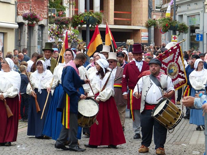
 Ooooooooh, giants!
Oh, how I love them! In the North, we have lots of these giants, like Reuze Papa and Reuze Maman in Cassel, or Gayant, Marie, and their children Binbin, Jacquot, and Fillon in Douai, and many more.
Huh? What? You don’t know what a Géant du Nord is?
Well, it’s a benevolent hero, a legendary figure, a protector, a symbol tied to a city that parades through it, walking and dancing during carnival or the local festival. The tradition is said to have originated in Portugal in the 13th century (at least that’s where we have the first records), then we see them in the Netherlands starting in the 15th century. In the North, the oldest are Gayant and Marie of Douai (16th century), but many new ones have appeared since the 1980s with the revival of carnivals. In practice, it’s a large character (or animal figure) several meters tall; the structure is made of wicker, the body is often papier-mâché, but the head can be wood, as in Ath (lime wood), and the clothes and accessories are made of fabric, leather, and wood. The flared robe (for both male and female giants) allows one or more carriers to slip underneath to move it using only their arms, shoulders, and legs—and even make it dance! There are over 1,500 giants in Belgium and 450 in Hauts-de-France, mostly in the Nord and Pas-de-Calais departments.
In Ath, there are giants—LOTS of them! I’ve never seen so many at once. And each one is carried by only one man at a time (except for Bayard, you’ll see why later), even though the structure weighs over 100 kilos—so the carriers take turns quickly! The Ducasse of Ath and its giants have been inscribed on the UNESCO Intangible Cultural Heritage list since 2008, as part of the "Processional Giants and Dragons of Belgium and France."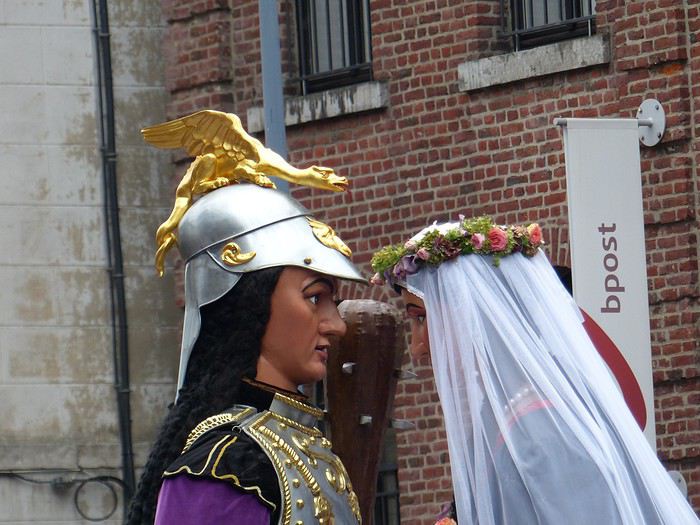 What’s more, the Ducasse of Ath is remarkable for its age and local roots; a procession was first mentioned in 1399, and today the many musical groups are still local (Ath and surrounding towns). The event is extremely popular: a good part of the population is there, all generations mixed together. Everyone knows the groups, floats, and giants, and each has their favorite! Originally, religious groups paraded, illustrating episodes from the Bible or the Golden Legend. Gradually, the parade became secular and kept evolving by adding new giants, historical figures, or allegories linked to local history (Ath, Belgian Hainaut, Belgium).
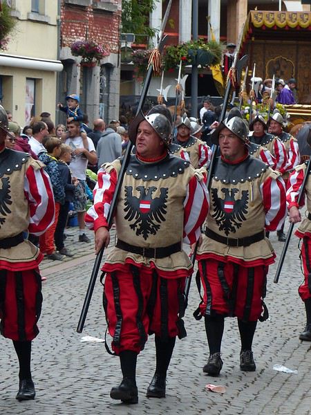
Finally, the beautiful floats are all pulled by magnificent draft horses, and that’s extraordinary! The town council itself rides in fine carriages that close the parade.
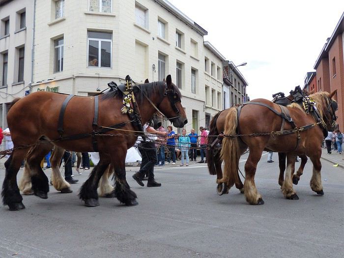 To wrap up this long introduction, know that the Ducasse of Ath lasts several days, but the highlight is the highly codified procession that takes place on the 4th Sunday of August (actually, the procession passes twice, once in the morning and once in the afternoon).
So, let’s go!
On this Sunday, August 26th, we’re in Ath in the early afternoon to see the procession. What a popular enthusiasm! Everyone is wearing the city’s colors (purple, yellow, and white), often with a twisted fabric necklace. Everyone is happy, smiling, from the giggling toddler to the sprightly centenarian sipping beer with her rosy-cheeked cousin and the pretty freckled blonde niece. People call out to each other, laugh, hum, and congratulate each other all around.
People start positioning themselves at strategic spots along the route—wider areas where the giants stop to perform a dance to the tunes of the brass bands accompanying them. And there are brass bands—at least one per giant and float!
The wait passes quickly in this joyful atmosphere. Suddenly, the music grows louder, and here comes the first giant at last! It’s the "two-headed eagle," with a child (a real one) sitting safely on a little chair.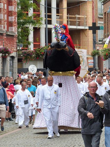
Present in the procession since the late 17th century, it originally had only one head (normal, right?) and accompanied the tailors’ guild. It gained a second head during the royal visit of 1854 (go figure why!). It’s 3.30 meters tall and weighs 115 kilos (without the child). All the men you see in white are carriers taking turns. Its dance consists of spinning the bird around—you’d think that little kid up there must be getting dizzy!
Next is the "Neapolitan fishermen’s boat." It’s a magnificent float representing a ship, with handsome sailors clinging to its rigging. This float first appeared in the parade in 1856.
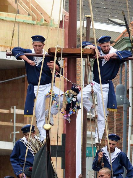
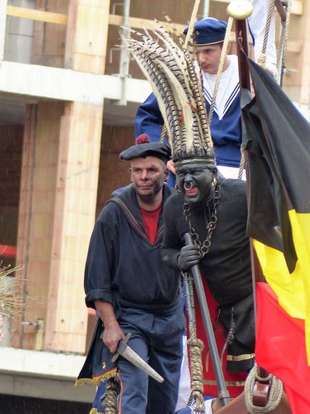 It’s followed by a human giant on stilts: "Saint Christopher of Flobecq," holding a flowered staff and carrying Christ on his shoulders (this time, not a real child!). It appeared in the 19th century, then disappeared from the procession before being reintroduced in 1976.
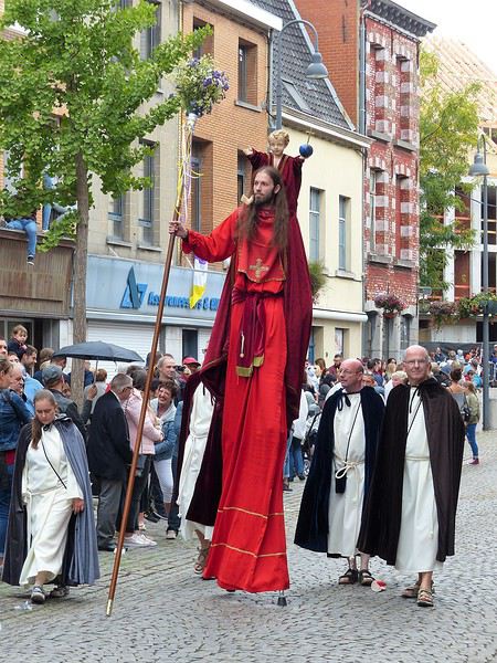
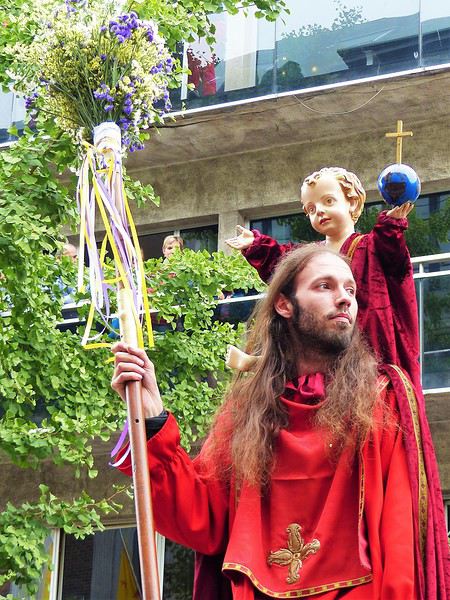
Now here come the "Blues," dressed in French uniforms. This group is the heir of the former cannon-arquebusier company, and they punctuate their parade with gun salutes!
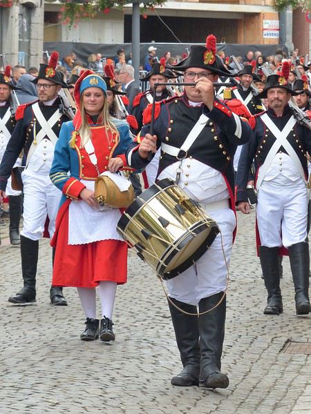
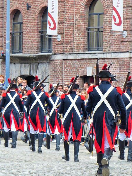
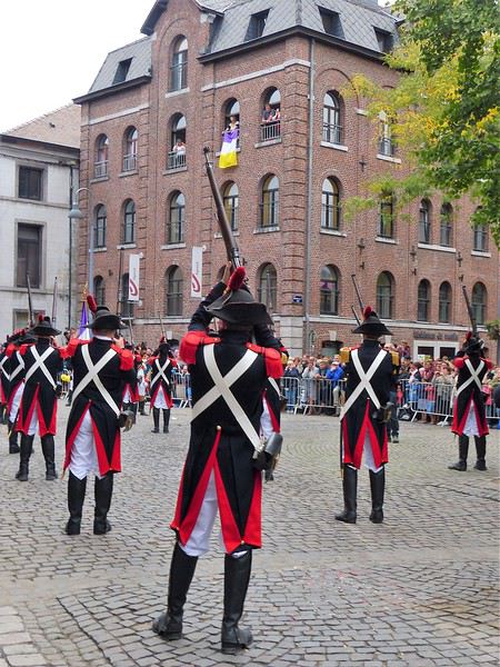

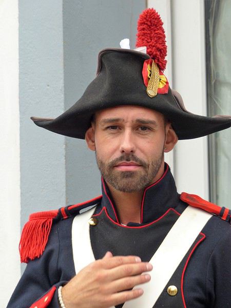
To be continued: the giant Samson!
I could have subtitled this travel journal: "Ferme eut’bouc tin nez va quer eud’dans"; it’s an expression in Picard language, literally “Close your mouth or your nose will fall in,” said to someone who’s amazed—and amazed I was!!!
Ooooooooh, giants!
Oh, how I love them! In the North, we have lots of these giants, like Reuze Papa and Reuze Maman in Cassel, or Gayant, Marie, and their children Binbin, Jacquot, and Fillon in Douai, and many more.Huh? What? You don’t know what a Géant du Nord is?
Well, it’s a benevolent hero, a legendary figure, a protector, a symbol tied to a city that parades through it, walking and dancing during carnival or the local festival. The tradition is said to have originated in Portugal in the 13th century (at least that’s where we have the first records), then we see them in the Netherlands starting in the 15th century. In the North, the oldest are Gayant and Marie of Douai (16th century), but many new ones have appeared since the 1980s with the revival of carnivals. In practice, it’s a large character (or animal figure) several meters tall; the structure is made of wicker, the body is often papier-mâché, but the head can be wood, as in Ath (lime wood), and the clothes and accessories are made of fabric, leather, and wood. The flared robe (for both male and female giants) allows one or more carriers to slip underneath to move it using only their arms, shoulders, and legs—and even make it dance! There are over 1,500 giants in Belgium and 450 in Hauts-de-France, mostly in the Nord and Pas-de-Calais departments.
In Ath, there are giants—LOTS of them! I’ve never seen so many at once. And each one is carried by only one man at a time (except for Bayard, you’ll see why later), even though the structure weighs over 100 kilos—so the carriers take turns quickly! The Ducasse of Ath and its giants have been inscribed on the UNESCO Intangible Cultural Heritage list since 2008, as part of the "Processional Giants and Dragons of Belgium and France."
What’s more, the Ducasse of Ath is remarkable for its age and local roots; a procession was first mentioned in 1399, and today the many musical groups are still local (Ath and surrounding towns). The event is extremely popular: a good part of the population is there, all generations mixed together. Everyone knows the groups, floats, and giants, and each has their favorite! Originally, religious groups paraded, illustrating episodes from the Bible or the Golden Legend. Gradually, the parade became secular and kept evolving by adding new giants, historical figures, or allegories linked to local history (Ath, Belgian Hainaut, Belgium).Finally, the beautiful floats are all pulled by magnificent draft horses, and that’s extraordinary! The town council itself rides in fine carriages that close the parade.
To wrap up this long introduction, know that the Ducasse of Ath lasts several days, but the highlight is the highly codified procession that takes place on the 4th Sunday of August (actually, the procession passes twice, once in the morning and once in the afternoon).So, let’s go!
On this Sunday, August 26th, we’re in Ath in the early afternoon to see the procession. What a popular enthusiasm! Everyone is wearing the city’s colors (purple, yellow, and white), often with a twisted fabric necklace. Everyone is happy, smiling, from the giggling toddler to the sprightly centenarian sipping beer with her rosy-cheeked cousin and the pretty freckled blonde niece. People call out to each other, laugh, hum, and congratulate each other all around.
People start positioning themselves at strategic spots along the route—wider areas where the giants stop to perform a dance to the tunes of the brass bands accompanying them. And there are brass bands—at least one per giant and float!
The wait passes quickly in this joyful atmosphere. Suddenly, the music grows louder, and here comes the first giant at last! It’s the "two-headed eagle," with a child (a real one) sitting safely on a little chair.
Present in the procession since the late 17th century, it originally had only one head (normal, right?) and accompanied the tailors’ guild. It gained a second head during the royal visit of 1854 (go figure why!). It’s 3.30 meters tall and weighs 115 kilos (without the child). All the men you see in white are carriers taking turns. Its dance consists of spinning the bird around—you’d think that little kid up there must be getting dizzy!
Next is the "Neapolitan fishermen’s boat." It’s a magnificent float representing a ship, with handsome sailors clinging to its rigging. This float first appeared in the parade in 1856.
It’s followed by a human giant on stilts: "Saint Christopher of Flobecq," holding a flowered staff and carrying Christ on his shoulders (this time, not a real child!). It appeared in the 19th century, then disappeared from the procession before being reintroduced in 1976.
Now here come the "Blues," dressed in French uniforms. This group is the heir of the former cannon-arquebusier company, and they punctuate their parade with gun salutes!
To be continued: the giant Samson!
When I set off for Bolivia, like many Europeans, I was full of illusions (fed by the propaganda of President Evo Morales, a would-be dictator with limited intelligence). I quickly became disillusioned—everything there seems to be built on lies: political disaster, ecological disaster, economic disaster despite drug trafficking and smuggling with China, dietary disaster, intellectual disaster... Its only saving grace is being a vast, sparsely populated country, so nature lovers can still find rich, relatively untouched landscapes far from human settlements (but for how long?)
Where humans dominate, the disaster worsens year by year: water, soil, and air are contaminated, meat is pumped full of hormones, GMOs are everywhere, fish are loaded with lead and mercury (thousands of tons of waste are dumped into Lake Titicaca on both the Bolivian and Peruvian sides), and the food is ultra-artificial (all the additives banned in Europe are abundant there). For example, out of 50 fruit yogurts, only two actually contain fruit... In short, don’t expect to go there for a health retreat.
As for its capital, even though you’ll see "wonderful" written everywhere, the city is ugly, extremely polluted, and not particularly interesting. But since few Bolivians leave Bolivia and the public education system is one of the dumbest in the world, they don’t care. A stupid law decreeing that taxes are only paid once construction is finished means thousands of buildings will never be completed... Anyway, you’ve probably gathered by now that it’s not worth wasting too much time there. If you decide to go to Bolivia, it’s best to know what you’re getting into...
So what should you do? A stop in Copacabana is pleasant, as is one in Tiwanaku. A stay in Samaipata is nice, and the cities of Sucre and Potosí still have charm. The Uyuni salt flats are also worth seeing. Venture off the beaten path, even if transportation is complicated and sometimes dangerous.
Don’t be surprised by the omnipresent police (many of whom are corrupt) and military, or by the almost daily protests... These are just some of Bolivia’s characteristics. But when you pass through quickly, you tend to see what you want to see.
On the gastronomy front, aside from the fact that in many places the food is a cocktail of pesticides, GMOs, heavy metals, and dangerous additives—all washed down with plenty of Coca-Cola—don’t expect refined cuisine... That said, like everywhere, you’ll find kind people (though relationships are often superficial) and stunning landscapes. There you go—just offering a different perspective from the dazzled accounts of tourists who only scratch the surface without understanding the harsh realities. And I haven’t even touched on the administrations, social disparities, the TIPNIS conflict, disappearances (girls for prostitution and boys for organ trafficking), etc...
Where humans dominate, the disaster worsens year by year: water, soil, and air are contaminated, meat is pumped full of hormones, GMOs are everywhere, fish are loaded with lead and mercury (thousands of tons of waste are dumped into Lake Titicaca on both the Bolivian and Peruvian sides), and the food is ultra-artificial (all the additives banned in Europe are abundant there). For example, out of 50 fruit yogurts, only two actually contain fruit... In short, don’t expect to go there for a health retreat.
As for its capital, even though you’ll see "wonderful" written everywhere, the city is ugly, extremely polluted, and not particularly interesting. But since few Bolivians leave Bolivia and the public education system is one of the dumbest in the world, they don’t care. A stupid law decreeing that taxes are only paid once construction is finished means thousands of buildings will never be completed... Anyway, you’ve probably gathered by now that it’s not worth wasting too much time there. If you decide to go to Bolivia, it’s best to know what you’re getting into...
So what should you do? A stop in Copacabana is pleasant, as is one in Tiwanaku. A stay in Samaipata is nice, and the cities of Sucre and Potosí still have charm. The Uyuni salt flats are also worth seeing. Venture off the beaten path, even if transportation is complicated and sometimes dangerous.
Don’t be surprised by the omnipresent police (many of whom are corrupt) and military, or by the almost daily protests... These are just some of Bolivia’s characteristics. But when you pass through quickly, you tend to see what you want to see.
On the gastronomy front, aside from the fact that in many places the food is a cocktail of pesticides, GMOs, heavy metals, and dangerous additives—all washed down with plenty of Coca-Cola—don’t expect refined cuisine... That said, like everywhere, you’ll find kind people (though relationships are often superficial) and stunning landscapes. There you go—just offering a different perspective from the dazzled accounts of tourists who only scratch the surface without understanding the harsh realities. And I haven’t even touched on the administrations, social disparities, the TIPNIS conflict, disappearances (girls for prostitution and boys for organ trafficking), etc...
Hello everyone!
This travel journal aims to help future travelers (well, I hope so!), since there’s so little information available about this remote archipelago. Big thanks to Lolodesiles and Ayis for answering my questions while I planned this trip!
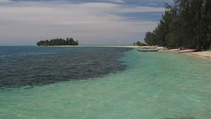
Context This is our fourth trip to Indonesia as a couple—after Java-Bali in 2011, Flores-Komodo in 2013, and Sulawesi in 2016—each time for three weeks. It’s also our tenth trip to Southeast Asia overall.
We’re traveling like we have in previous years: with a rough itinerary that often changes based on who we meet, tips from other travelers, how tired we are, or what we’re feeling in the moment. In the Moluccas, it’ll change constantly, mostly depending on transportation.
Our only accommodation booking: the first few nights in Ambon when we arrive.
Planned route (to be refined on the spot): Ambon - Banda Islands - Lease Islands - Ternate - Tidore - Halmahera (between Sofifi and Tobelo) - Morotai and the neighboring unnamed archipelago.
Flights: Lyon-Paris-Singapore on Air France (428 € round-trip), with good meals, champagne, and wine (we like our little comforts when going on vacation 😏). Then Singapore-Jakarta-Ambon on Air Asia and Garuda. Return flight: Ternate-Jakarta-Singapore on Lion Air, with a 3-day stopover in Singapore before heading home.
Episode 1: Ambon to Banda Our guesthouse, booked two days before departure, is 45 minutes from Ambon Airport, near Natsepa Beach (northeast of Leihitu). It’s a pretty average beach—quiet on weekdays but packed on Sundays (we saw the difference). It’s lined with warungs. This rainy day helps us readjust to the atmosphere of this country we love so much.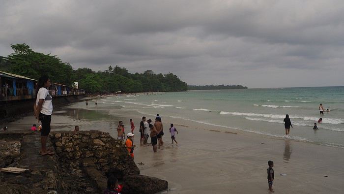
Our “Solim Guesthouse” is a lovely house with a living/dining room and garden, costing 15 € per night for two, including a hearty breakfast. Dinner is at Gaba Gaba, a great restaurant just a short walk away, right by the water, recommended by our host. Fun fact: it’s in the Lonely Planet, and it might be the only LP-listed spot in the Moluccas that actually matches the description (the others either don’t exist or have nothing to do with what’s advertised 😠).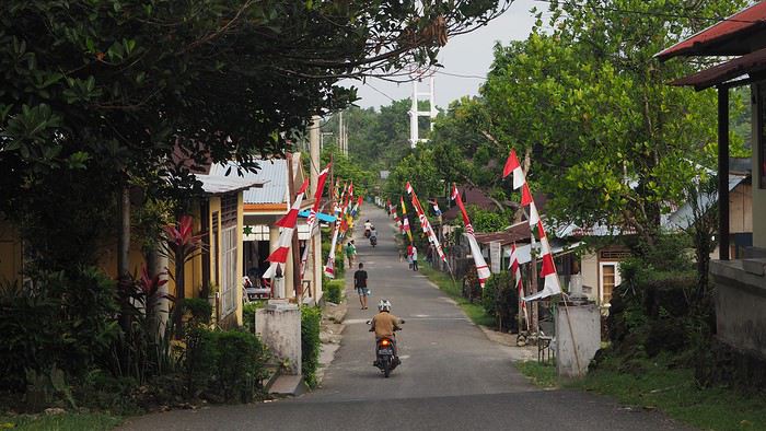
For the next two days, the super-friendly owner lends us his scooter. We set off to explore the coastal villages in northern Leihitu (the western part of Ambon Island, which has a weird shape).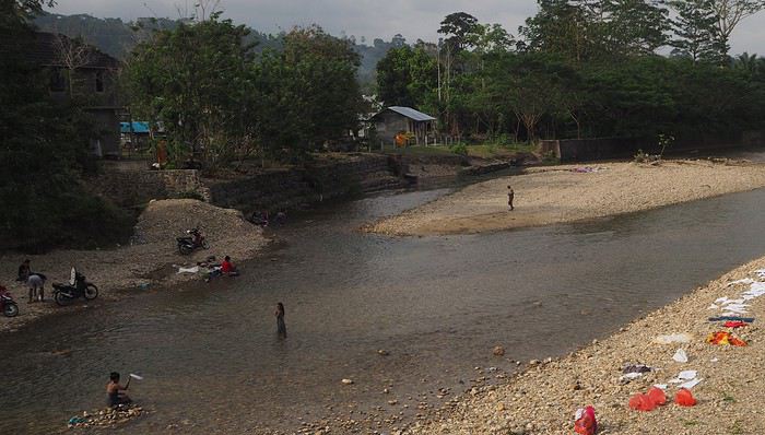 Laundry and trucks washed in the same stream.
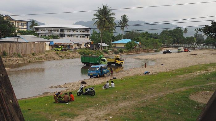
Liang Beach, described as the island’s most beautiful, is almost gone (climate change or something else?), but the colors are magical.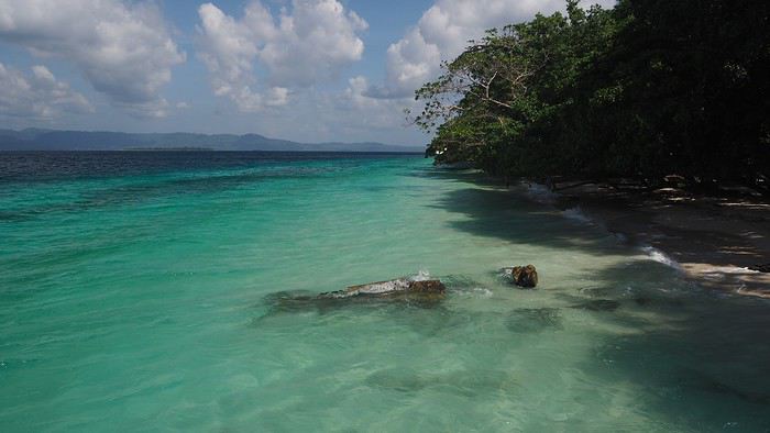
We continue 25 km toward a snorkeling spot our host recommended, taking a gorgeous, deserted little road through tiny villages in clove plantations (oh, those unforgettable scents!), stunning coves, and dense forest.
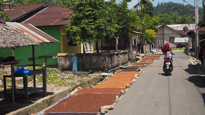
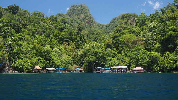 We’re greeted dozens of times with “Hello Mister”—a daily routine in the Moluccas. Every time we stop, we pose for photos to be saved on locals’ smartphones. They don’t see tourists often.
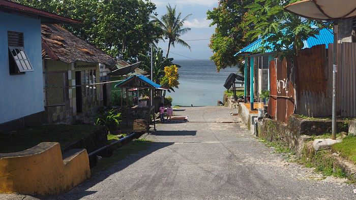
We ask for directions to the snorkeling spot (not easy—we only know basic Indonesian like *Selamat pagi*, *siang*, *sore*, and other polite phrases). Not many people know where it is (especially since we never know which village we’re in), but we eventually reach a small village that seems to be the right place. 🙂
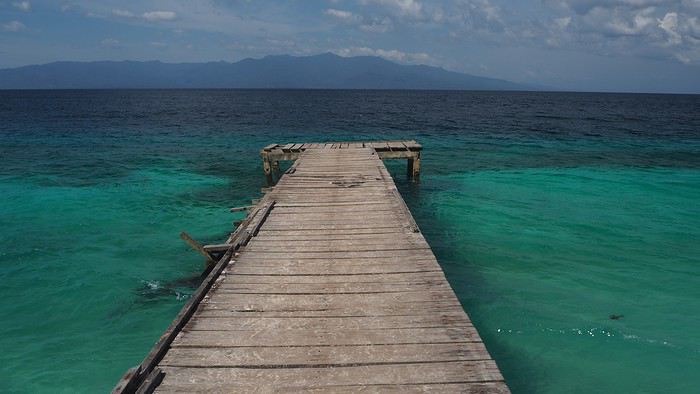
We ask a local to take us there by boat (it’s not reachable by land).
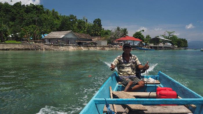
The spot is at most 100 meters long, but the coral is in good condition (apparently not dynamited by fishermen, unlike in other parts of this beautiful country where fishing methods are destructive and nature pays the price 😠). The fish are plentiful and diverse. It’s a great start before heading to Banda. We’re happy to have the place to ourselves… though we don’t yet realize we won’t see a single tourist for the rest of the trip!
After two days of rest, we head to Tulehu Port in the morning, aiming for the Banda Islands. We know the journey is often tricky: the Pelni ferry runs twice a month but doesn’t match our dates, the 10-seat Suzi Air plane is always full (you can’t book—you have to show up on Mondays and Fridays), and it’s often canceled due to weather. So we opt for the Tuesday speedboat (which also gets canceled if there are waves or wind), with the next one on Saturday. We’re used to Indonesian ports—crowded, rusty boats, no English speakers—but we still feel lost. When I ask about the speedboat to Bandaneira, people gesture wildly, someone takes me to the “harbor office,” then tells me there’s no boat, others try to sell me tickets, and some just say, “No boat.”
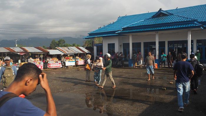
Luckily, an English-speaking local approaches us and confirms the speedboat is broken. The next one will be Saturday *if* it’s fixed—otherwise, even later. 🤪 😠 We’re crushed. We came here for the Banda Islands… 🙁 We decide waiting five days for a maybe-boat isn’t an option, so we decide to head straight to North Moluccas, which was planned for later. We’re so disappointed we don’t even want to stay in the area. The Lease Islands don’t appeal to us despite what we’ve read, and Seram would deserve its own trip with its remote mountain tribes. Huge disappointment—we’d been dreaming of Banda for months, with its incredible drop-offs like Bunaken, its islands covered in nutmeg trees, etc. I’d read that Banda is in the world’s top 5, alongside Bunaken (amazing—we went in 2016), Komodo (incredible—we went in 2013), Sipadan, and another spot I’ve forgotten.
We take a taxi back to Ambon (45 minutes) to a travel agency to buy plane tickets to Ternate. There’s a daily ATR72 flight at noon—perfect timing. Ambon is the capital of South Moluccas (or Central, depending on who you ask!) with 300,000 people. The city doesn’t seem unpleasant, but we don’t stop. On the plane, there are only about ten passengers for 72 seats. The flight attendants are stunning, as always with Wings Air—clearly, they’re hired for their looks. 😊

Stopover in Bacan—a runway in the middle of coconut trees serving a tiny town—then we fly over countless volcanoes, the last one towering over Ternate.
Next episode coming soon: Ternate.
This travel journal aims to help future travelers (well, I hope so!), since there’s so little information available about this remote archipelago. Big thanks to Lolodesiles and Ayis for answering my questions while I planned this trip!
Context This is our fourth trip to Indonesia as a couple—after Java-Bali in 2011, Flores-Komodo in 2013, and Sulawesi in 2016—each time for three weeks. It’s also our tenth trip to Southeast Asia overall.
We’re traveling like we have in previous years: with a rough itinerary that often changes based on who we meet, tips from other travelers, how tired we are, or what we’re feeling in the moment. In the Moluccas, it’ll change constantly, mostly depending on transportation.
Our only accommodation booking: the first few nights in Ambon when we arrive.
Planned route (to be refined on the spot): Ambon - Banda Islands - Lease Islands - Ternate - Tidore - Halmahera (between Sofifi and Tobelo) - Morotai and the neighboring unnamed archipelago.
Flights: Lyon-Paris-Singapore on Air France (428 € round-trip), with good meals, champagne, and wine (we like our little comforts when going on vacation 😏). Then Singapore-Jakarta-Ambon on Air Asia and Garuda. Return flight: Ternate-Jakarta-Singapore on Lion Air, with a 3-day stopover in Singapore before heading home.
Episode 1: Ambon to Banda Our guesthouse, booked two days before departure, is 45 minutes from Ambon Airport, near Natsepa Beach (northeast of Leihitu). It’s a pretty average beach—quiet on weekdays but packed on Sundays (we saw the difference). It’s lined with warungs. This rainy day helps us readjust to the atmosphere of this country we love so much.
Our “Solim Guesthouse” is a lovely house with a living/dining room and garden, costing 15 € per night for two, including a hearty breakfast. Dinner is at Gaba Gaba, a great restaurant just a short walk away, right by the water, recommended by our host. Fun fact: it’s in the Lonely Planet, and it might be the only LP-listed spot in the Moluccas that actually matches the description (the others either don’t exist or have nothing to do with what’s advertised 😠).
For the next two days, the super-friendly owner lends us his scooter. We set off to explore the coastal villages in northern Leihitu (the western part of Ambon Island, which has a weird shape).
Laundry and trucks washed in the same stream.
Liang Beach, described as the island’s most beautiful, is almost gone (climate change or something else?), but the colors are magical.
We continue 25 km toward a snorkeling spot our host recommended, taking a gorgeous, deserted little road through tiny villages in clove plantations (oh, those unforgettable scents!), stunning coves, and dense forest.
We’re greeted dozens of times with “Hello Mister”—a daily routine in the Moluccas. Every time we stop, we pose for photos to be saved on locals’ smartphones. They don’t see tourists often.We ask for directions to the snorkeling spot (not easy—we only know basic Indonesian like *Selamat pagi*, *siang*, *sore*, and other polite phrases). Not many people know where it is (especially since we never know which village we’re in), but we eventually reach a small village that seems to be the right place. 🙂
We ask a local to take us there by boat (it’s not reachable by land).
The spot is at most 100 meters long, but the coral is in good condition (apparently not dynamited by fishermen, unlike in other parts of this beautiful country where fishing methods are destructive and nature pays the price 😠). The fish are plentiful and diverse. It’s a great start before heading to Banda. We’re happy to have the place to ourselves… though we don’t yet realize we won’t see a single tourist for the rest of the trip!
After two days of rest, we head to Tulehu Port in the morning, aiming for the Banda Islands. We know the journey is often tricky: the Pelni ferry runs twice a month but doesn’t match our dates, the 10-seat Suzi Air plane is always full (you can’t book—you have to show up on Mondays and Fridays), and it’s often canceled due to weather. So we opt for the Tuesday speedboat (which also gets canceled if there are waves or wind), with the next one on Saturday. We’re used to Indonesian ports—crowded, rusty boats, no English speakers—but we still feel lost. When I ask about the speedboat to Bandaneira, people gesture wildly, someone takes me to the “harbor office,” then tells me there’s no boat, others try to sell me tickets, and some just say, “No boat.”
Luckily, an English-speaking local approaches us and confirms the speedboat is broken. The next one will be Saturday *if* it’s fixed—otherwise, even later. 🤪 😠 We’re crushed. We came here for the Banda Islands… 🙁 We decide waiting five days for a maybe-boat isn’t an option, so we decide to head straight to North Moluccas, which was planned for later. We’re so disappointed we don’t even want to stay in the area. The Lease Islands don’t appeal to us despite what we’ve read, and Seram would deserve its own trip with its remote mountain tribes. Huge disappointment—we’d been dreaming of Banda for months, with its incredible drop-offs like Bunaken, its islands covered in nutmeg trees, etc. I’d read that Banda is in the world’s top 5, alongside Bunaken (amazing—we went in 2016), Komodo (incredible—we went in 2013), Sipadan, and another spot I’ve forgotten.
We take a taxi back to Ambon (45 minutes) to a travel agency to buy plane tickets to Ternate. There’s a daily ATR72 flight at noon—perfect timing. Ambon is the capital of South Moluccas (or Central, depending on who you ask!) with 300,000 people. The city doesn’t seem unpleasant, but we don’t stop. On the plane, there are only about ten passengers for 72 seats. The flight attendants are stunning, as always with Wings Air—clearly, they’re hired for their looks. 😊
Stopover in Bacan—a runway in the middle of coconut trees serving a tiny town—then we fly over countless volcanoes, the last one towering over Ternate.
Next episode coming soon: Ternate.