Hi everyone,
Here’s a recap of our self-drive trip in Tanzania.
Tanzania is a stunning country, but it’s changing fast, which means that any self-drive info you gather in advance might be outdated by the time you travel.
Still, here’s some info for future self-drivers.
The vehicle:
After lots of research, thinking, and calculations, we had our 4x4 with roof tents shipped from South Africa through our rental company of two years, Safari4x4Hire. The price for 31 days came to $247.00 per day. That’s cheaper than some Tanzanian rental companies (Shawsafaris: $380.00 per day, total with 18% tax) and just a little more expensive than others (Tanzanian Pionners), but with the guarantee of having a well-maintained and reliable vehicle. You can check out the discussion I started: here
Traffic:
The speed limit is 80 km/h on roads and 50 km/h in villages. Watch out—there are lots of police checks at village entrances (speed radar). In villages and towns, also be careful with minibuses, which are everywhere and stop and start without signaling. As for paved roads, most are in good condition, and many tracks are brand new or being renovated (the Chinese are in the area!).
Campsites:
It’s very easy to find a spot in Tanzanian campsites (few self-drivers), so no need to book in advance (we were often alone in campsites outside the parks). Inside the parks, it’s easy to book public campsites at the gates. With roof tents, the downside is that sites are usually designed for travelers with ground tents, but we always found space for our vehicle. Another downside is making a fire—it’s nearly impossible to find wood (Tanzanians don’t usually make fires for cooking or ambiance). Campsite prices outside the parks range from $5.00 to $15.00 (price with 18% tax). I’ll list the prices for campsites inside the parks below.
Food:
There are very few supermarkets in Tanzania, and prices can be steep if you’re not careful (European brands). For fruits and vegetables, you can easily find roadside vendors. For other groceries, you can shop at supermarkets (Dar es Salaam, Arusha). In Arusha, there’s a brand-new Shoppers Supermarket—clean and well-stocked—and for meat, don’t hesitate to visit the Meat King butcher. It’s also often possible to eat well at campsites with restaurants for around $10.00 (price with 18% tax).
Some other info:
1. At gas stations, you almost always pay in cash, usually in Tanzanian shillings.
2. Park entries, campsites, and Ngorongoro are paid with a card (Visa, etc.) directly at the gates. Exception: Selous, where you need a permit in advance (we didn’t have one when we arrived at the north gate, but we were still able to enter thanks to the kindness of the gate attendant).
3. Watch out—some regions outside the parks have a tax: the Wildlife Management Fee. Payment is a bit unclear:
- For Lake Chala, we paid at the gate in cash.
- For Lake Natron, you can’t pay at the gate—we had to arrange it with the campsite.
- For the area between Tarangire Gate and Lake Burungi (to reach a campsite), you can’t pass the gate without paying in Arusha first.
4. For divers, you can do amazing dives in Pangani with Kasa Divers.
Park entry and campsite prices in July/August 2018:
Saadani National Park:
Park entry per person: $30 + 18% (for 24 hours)
Park entry for vehicle (under 2000 kg): $40 + 18% (for 24 hours)
Night at Public Campsite per person: $30 + 18%
Arusha National Park:
Park entry per person: $45 + 18% (for 24 hours)
Park entry for vehicle (under 2000 kg): $40 + 18% (for 24 hours)
We slept outside the park.
Serengeti National Park:
Park entry per person: $60 + 18% (for 24 hours)
Park entry for vehicle (under 2000 kg): $40 + 18% (for 24 hours)
Night at Public Campsite per person: $30 + 18%
We couldn’t get a night in a Special Campsite.
Ngorongoro Conservation Area:
Park entry per person: $60 + 18% (for 24 hours)
Park entry for vehicle (under 2000 kg): $40 + 18% (for 24 hours)
Night at Public Campsite per person: $30 + 18%
Night at Special Campsite per person: $60 + 18%
Descent into the crater for vehicle: $250 + 18% (you don’t need a guide to go into the crater).
Tarangire National Park:
Park entry per person: $45 + 18% (for 24 hours)
Park entry for vehicle (under 2000 kg): $40 + 18% (for 24 hours)
Night at Public Campsite per person: $30 + 18%
Ruaha National Park:
Park entry per person: $30 + 18% (for 24 hours)
Park entry for vehicle (under 2000 kg): $40 + 18% (for 24 hours)
Night at Public Campsite per person: $30 + 18%
Selous Game Reserve:
Park entry per person: $75 + 18% (for 24 hours)
Park entry for vehicle (under 2000 kg): $50 + 18% (for 24 hours)
Night at public campsite per person: $30 + 18%
(You don’t need a guide to visit Selous, but a GPS with the Tracks4Africa map is essential—there are lots of tracks).
Conclusion:
We loved the northern parks, but they’re really crowded, especially with safari vehicles (though that does make it easier to spot wildlife—just follow the cars). Still, we preferred the southern parks—they’re wilder, less crowded, and almost no safari vehicles. In the campsites, you can often find yourself alone (just how we like it 😏!). But both north and south have amazing wildlife and friendly people!
If you’re interested in more info about Tanzania, I’d be happy to help.
813 similar discussions in English
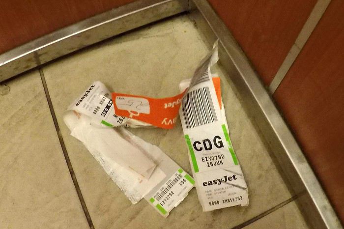
Sometimes a trip to Thailand starts in a hotel near an airport, where guests have misunderstood the meaning of the name easyJet...
We know all too well that this long flight will leave us a bit jet-lagged when we arrive...
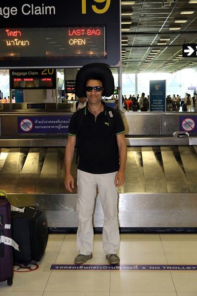
all while hoping we won’t start our stay completely...
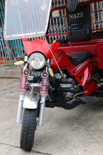
Still, we’re lucid enough to notice that they could’ve at least leveled the ground before adding the decor at the airport:
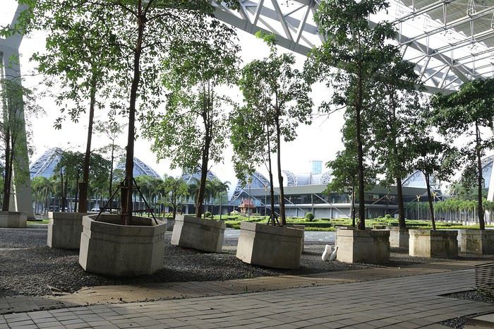
As always, our arrival is under the watchful eye of some...
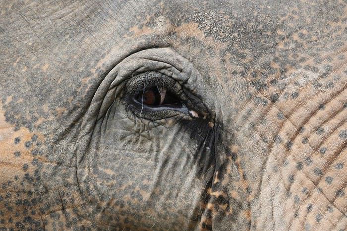
under the frankly curious gaze of others...
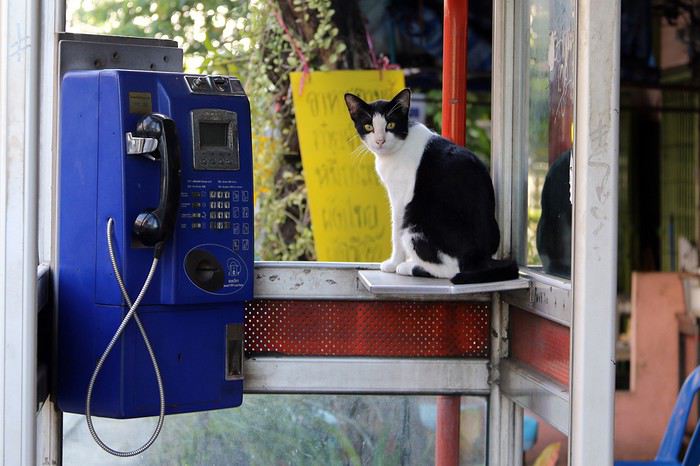
but of course, there are plenty who couldn’t care less...
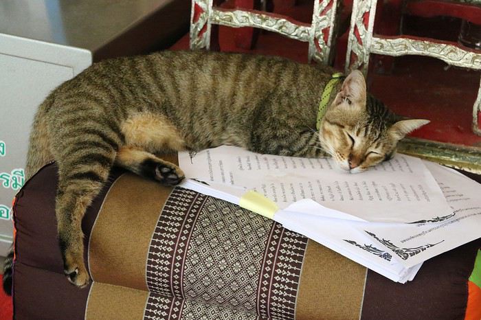
All that’s left is to set off exploring, while staying cautious so we don’t get caught off guard...
We know all too well that this long flight will leave us a bit jet-lagged when we arrive...
all while hoping we won’t start our stay completely...
Still, we’re lucid enough to notice that they could’ve at least leveled the ground before adding the decor at the airport:
As always, our arrival is under the watchful eye of some...
under the frankly curious gaze of others...
but of course, there are plenty who couldn’t care less...
All that’s left is to set off exploring, while staying cautious so we don’t get caught off guard...
Well, here goes—I’m taking the plunge. This is my first blog on VF, so I hope I don’t make too many blunders. In advance, you’ll have to excuse me because they’ll definitely happen anyway
Here’s the context of our trip:
- Project started: December 2015 ... yeah, that’s a while ago
- Family of 4: 2 adults, 1 teen (17) and a 10-year-old boy
- First trip to Southern Africa
Originally, we’d planned to go to Namibia. But after watching a TV documentary, we took a slight detour to the right and ended up in Botswana 🙂 Don’t worry, we’ll still do Namibia—just a bit later. It’s definitely not off the table. Quite the opposite!!
After that big decision, the question was: "Should we go alone or with an agency?" Through my son, who’s into music, we were lucky enough to meet some VF members who love Botswana: Marygabrielle and Yves (I won’t name-drop, but you know who you are). They were amazing and helped us with every aspect of our trip. We can’t thank them enough 😉 So, I didn’t even need to ask VF for all my questions 😛
For a first time in Southern Africa, and especially for Botswana, they easily convinced us to use a small local agency for at least part of the tour we wanted to do. After multiple conversations online—and thanks to Marygabrielle acting as our translator (our English is *terrible* )—our itinerary was finalized, and ... we ended up spending our entire vacation with this local agency:
Letsatsi Safaris (email for those interested: letsatsisafaris@gmail.com, website: www.letsatsisafarilodge.com, phone: +267 71692093/71351892) Joe and William (the owners) are brothers and true Batswana.
Since Marygabrielle and Yves knew them well, we set off with them in complete confidence. Everything was planned and paid for in advance, so all we had to do was relax once we arrived. Pure bliss for me—real vacation time without having to prepare meals 😛 and being able to fully enjoy everything. Everything was included: guides (them, in this case), accommodation (mostly in tents), and a cook. All we had to do was help set up and take down the tents. Indiana Jones better watch out—we’re going camping in the wild too 🙂 A dream come true!
Of course, there’s an extra cost compared to traveling solo. But this time, we splurged, and we don’t regret that choice at all.
They were all fantastic—professional, friendly—and it was a huge joy for us. We had an amazing time thanks to them. A big thank you to Joe, William, and all their staff we met: Jonah, Junien, and Doris.
Now, time for the story!
Originally, we’d planned to go to Namibia. But after watching a TV documentary, we took a slight detour to the right and ended up in Botswana 🙂 Don’t worry, we’ll still do Namibia—just a bit later. It’s definitely not off the table. Quite the opposite!!
After that big decision, the question was: "Should we go alone or with an agency?" Through my son, who’s into music, we were lucky enough to meet some VF members who love Botswana: Marygabrielle and Yves (I won’t name-drop, but you know who you are). They were amazing and helped us with every aspect of our trip. We can’t thank them enough 😉 So, I didn’t even need to ask VF for all my questions 😛
For a first time in Southern Africa, and especially for Botswana, they easily convinced us to use a small local agency for at least part of the tour we wanted to do. After multiple conversations online—and thanks to Marygabrielle acting as our translator (our English is *terrible* )—our itinerary was finalized, and ... we ended up spending our entire vacation with this local agency:
Letsatsi Safaris (email for those interested: letsatsisafaris@gmail.com, website: www.letsatsisafarilodge.com, phone: +267 71692093/71351892) Joe and William (the owners) are brothers and true Batswana.
Since Marygabrielle and Yves knew them well, we set off with them in complete confidence. Everything was planned and paid for in advance, so all we had to do was relax once we arrived. Pure bliss for me—real vacation time without having to prepare meals 😛 and being able to fully enjoy everything. Everything was included: guides (them, in this case), accommodation (mostly in tents), and a cook. All we had to do was help set up and take down the tents. Indiana Jones better watch out—we’re going camping in the wild too 🙂 A dream come true!
Of course, there’s an extra cost compared to traveling solo. But this time, we splurged, and we don’t regret that choice at all.
They were all fantastic—professional, friendly—and it was a huge joy for us. We had an amazing time thanks to them. A big thank you to Joe, William, and all their staff we met: Jonah, Junien, and Doris.
Now, time for the story!
Hi everyone...
Must be around 5,000 photos to sort through!
Makes sense after 3 intense weeks in SA.
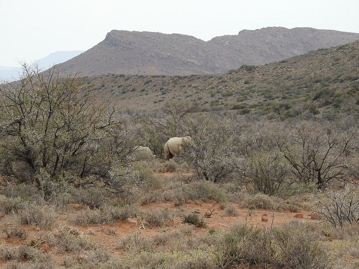
Anyway, to set the mood, here are a few photos... Well, yeah, they’re not amazing!
Suspense, suspense...
Must be around 5,000 photos to sort through!
Makes sense after 3 intense weeks in SA.
Anyway, to set the mood, here are a few photos... Well, yeah, they’re not amazing!
Suspense, suspense...
Hello,
My daughter (22) and I set off to explore a bit of her grandfather’s homeland. We left on July 26 from Roissy and arrived in Rabat with Air France. We had a few hiccups retrieving our luggage—1.5 hours of waiting and a mini interrogation at customs about our host’s address (they asked for a reference) and questions about a Moroccan ID card I’ve never applied for. Next time, I’d better have it—dual nationals get extra scrutiny.
We headed to the ONCF station to catch the train to Marrakech. First-class tickets cost 195 MAD, with assigned seats and decent comfort… the catch? The train was delayed, so we arrived at 2:50 AM instead of 12:10 AM.
We chose the Ibis Gare, located between the ONCF station and the Supratours bus terminal. We booked two nights from France for 79.85 €. To avoid the premium-rate call, just dial the hotel directly—they’ll handle the reservation. I’d signed up on the Ibis website beforehand for a discount (free and comes with perks).
On-site, we added 44 MAD for the tourist tax (11 MAD x 4 nights). We skipped breakfast—too pricey at 6.50 € per person. The hotel has a nice pool and a pleasant setting. The shower seals weren’t perfect, but the bedding was comfy, the linens soft, and the AC worked (though it was noisy). We were overall happy with it.
We had breakfast and lunch at a café/restaurant right across from the hotel—affordable and tasty.
For phones, we bought two Inwi SIM cards for 30 MAD each and a 5 GB internet top-up for 50 MAD—more than enough for our 16-day trip. Later, we added two 20 MAD call top-ups. Total phone budget for both of us: 150 MAD.
Taxis in Marrakech: No issues. We always asked for the meter—if a driver refused, we’d just move on. No haggling for us!
Day 1: We visited the Majorelle Garden (70 MAD per person). It was beautiful and peaceful. We walked there. In the afternoon, we took a taxi to Jemaa el-Fnaa square. The constant solicitations were exhausting—I felt like a guard dog fending people off. The worst part? We got lured deep into the medina to some sketchy spot under the pretense of seeing "Berber tanneries"—"last day!"—then had a guy grab our arms, demanding 200 MAD. I offered 50 MAD max since we hadn’t asked for anything. When he insisted, I threatened to go to the police. He finally let go for the 50 MAD. We headed back to the hotel to enjoy the pool before returning to the square for the evening. It was lively but noisy, and I found the vendors *way* too pushy. We walked back to the hotel—an hour-long stroll that was actually really nice. We kept no more than 150 MAD in our wallet at a time. We stuffed ourselves with smoothies—they’re *so* good.
Day 2: We left at 8:30 AM for Tinghir with Supratours, arriving at 4:45 PM instead of 4:00 PM (lots of roadwork). Tickets were 130 MAD per person + 5 MAD per checked bag. We stayed one night at the "Retour au Calme" hostel—super cozy! 150 MAD for a room with a private shower and toilet. AC was an extra 80 MAD per night (not mandatory) but worked great. Phone: +212 5248-34924. Breakfast was 30 MAD, and they offer tons of options, including budget-friendly choices like a couch for 80 MAD per person with shared showers/toilets. Half-board and full-board are also available. Mohamed and Alexandra are lovely. I booked by phone and paid on-site—they even picked us up from the bus station!
We took a taxi to the Todra Gorge—a breath of fresh air! It’s stunning and humbling. You feel tiny there. Shared taxis cost 8 MAD per person (fixed price). The organization was impressive. To get from the city center to the bus station: 3 MAD per person.
Day 3: We left at 4:00 PM for Merzouga, arriving at 9:30 PM. Tickets were 80 MAD per person + 5 MAD per checked bag. Upon arrival, we were greeted by Houssein, one of five brothers running the "Auberge Océan des Dunes." We had a lovely room with a private bathroom and kitchen access. Two rooms are available in this unit for 190 MAD per night for two, including breakfast.
My daughter (22) and I set off to explore a bit of her grandfather’s homeland. We left on July 26 from Roissy and arrived in Rabat with Air France. We had a few hiccups retrieving our luggage—1.5 hours of waiting and a mini interrogation at customs about our host’s address (they asked for a reference) and questions about a Moroccan ID card I’ve never applied for. Next time, I’d better have it—dual nationals get extra scrutiny.
We headed to the ONCF station to catch the train to Marrakech. First-class tickets cost 195 MAD, with assigned seats and decent comfort… the catch? The train was delayed, so we arrived at 2:50 AM instead of 12:10 AM.
We chose the Ibis Gare, located between the ONCF station and the Supratours bus terminal. We booked two nights from France for 79.85 €. To avoid the premium-rate call, just dial the hotel directly—they’ll handle the reservation. I’d signed up on the Ibis website beforehand for a discount (free and comes with perks).
On-site, we added 44 MAD for the tourist tax (11 MAD x 4 nights). We skipped breakfast—too pricey at 6.50 € per person. The hotel has a nice pool and a pleasant setting. The shower seals weren’t perfect, but the bedding was comfy, the linens soft, and the AC worked (though it was noisy). We were overall happy with it.
We had breakfast and lunch at a café/restaurant right across from the hotel—affordable and tasty.
For phones, we bought two Inwi SIM cards for 30 MAD each and a 5 GB internet top-up for 50 MAD—more than enough for our 16-day trip. Later, we added two 20 MAD call top-ups. Total phone budget for both of us: 150 MAD.
Taxis in Marrakech: No issues. We always asked for the meter—if a driver refused, we’d just move on. No haggling for us!
Day 1: We visited the Majorelle Garden (70 MAD per person). It was beautiful and peaceful. We walked there. In the afternoon, we took a taxi to Jemaa el-Fnaa square. The constant solicitations were exhausting—I felt like a guard dog fending people off. The worst part? We got lured deep into the medina to some sketchy spot under the pretense of seeing "Berber tanneries"—"last day!"—then had a guy grab our arms, demanding 200 MAD. I offered 50 MAD max since we hadn’t asked for anything. When he insisted, I threatened to go to the police. He finally let go for the 50 MAD. We headed back to the hotel to enjoy the pool before returning to the square for the evening. It was lively but noisy, and I found the vendors *way* too pushy. We walked back to the hotel—an hour-long stroll that was actually really nice. We kept no more than 150 MAD in our wallet at a time. We stuffed ourselves with smoothies—they’re *so* good.
Day 2: We left at 8:30 AM for Tinghir with Supratours, arriving at 4:45 PM instead of 4:00 PM (lots of roadwork). Tickets were 130 MAD per person + 5 MAD per checked bag. We stayed one night at the "Retour au Calme" hostel—super cozy! 150 MAD for a room with a private shower and toilet. AC was an extra 80 MAD per night (not mandatory) but worked great. Phone: +212 5248-34924. Breakfast was 30 MAD, and they offer tons of options, including budget-friendly choices like a couch for 80 MAD per person with shared showers/toilets. Half-board and full-board are also available. Mohamed and Alexandra are lovely. I booked by phone and paid on-site—they even picked us up from the bus station!
We took a taxi to the Todra Gorge—a breath of fresh air! It’s stunning and humbling. You feel tiny there. Shared taxis cost 8 MAD per person (fixed price). The organization was impressive. To get from the city center to the bus station: 3 MAD per person.
Day 3: We left at 4:00 PM for Merzouga, arriving at 9:30 PM. Tickets were 80 MAD per person + 5 MAD per checked bag. Upon arrival, we were greeted by Houssein, one of five brothers running the "Auberge Océan des Dunes." We had a lovely room with a private bathroom and kitchen access. Two rooms are available in this unit for 190 MAD per night for two, including breakfast.
April 5, 2017 The airline Air Austral announces the signing of a memorandum of understanding with Air Madagascar!
Darn it, I’d switched from Air M**ad** to Austral to avoid any more hassles (back in 2015: stuck for 4 days at Ivato, compensation offered was 150 € to use on the next flight—I threw their letter back in their faces and vowed never to fly with them again).
Today, it’s ruined—Air Madagascar’s problems are already rubbing off on Air Austral.
April 26, 2017 Air Austral’s plane leaves Roissy nearly an hour late, even though passengers had been boarded for ages. The captain announces: technical issues with the plane that would be resolved quickly.
April 27 We arrive in Réunion over an hour late, only to learn that the plane supposed to take us to Tamatave—coming from Mauritius—had technical issues mid-flight and is now under review. They promise to update us by 11 AM, which was the original departure time. 11:30 AM, still nothing—we go ask for news, and nothing! By noon, they decide to give us a "royal sandwich" for 3 € and a soft drink. A little later, they finally tell us the flight is canceled and rescheduled for 7 AM the next day. Off to the hotels—some of us won’t eat that evening because not all hotels have restaurants.
April 28 Up at 4 AM to catch the 5 AM bus back to the airport. The same ATR that broke down the day before takes off 20 minutes late for Tamatave—a ten-minute flight over the Indian Ocean before turning right back to Réunion due to *more* technical issues. Back in the airport, no one to greet us. The hall is packed, and we have no idea where to go, so we head upstairs to squat in a private, air-conditioned lounge with leather chairs. There are about twenty of us, so they can’t kick us out and immediately notify Air Austral that we’ve taken over a service provider’s space. We stay there for about 2 hours, but no one from Air Austral dares to come in and update us. We go back downstairs to demand to see a company manager. In private, some staff tell us about Air Austral’s recurring issues—later, we’ll learn that another flight to Mauritius was also postponed until the evening.
After an hour of back-and-forth, someone finally decides to talk to us—it’s already 11 AM. They inform us that a spare part is arriving from Paris tomorrow and promise a 1:20 PM departure. We all stand together and demand a new plane because we’ve lost all trust. They respond that all options have been considered, but unfortunately, the ATRs from Air Madagascar and Air Mauritius are also grounded—how reassuring! (FYI, large planes can’t land on Tamatave’s runway.)
The manager’s only goal is to break us up because as a group, we’re a force they can’t handle. Orders must have been given because 7 or 8 Air Austral staff circle us, handing out hotel vouchers. Unfortunately, everyone’s only thinking about themselves, and they manage to split us up. So, back to the hotels for another night in Saint-Denis.
9 PM: new message—the flight is now pushed to 3 PM, and it keeps going… To be continued tomorrow!
I find Air Austral’s management behavior absolutely unacceptable and shameful! They’re playing fast and loose with their passengers’ lives.
Darn it, I’d switched from Air M**ad** to Austral to avoid any more hassles (back in 2015: stuck for 4 days at Ivato, compensation offered was 150 € to use on the next flight—I threw their letter back in their faces and vowed never to fly with them again).
Today, it’s ruined—Air Madagascar’s problems are already rubbing off on Air Austral.
April 26, 2017 Air Austral’s plane leaves Roissy nearly an hour late, even though passengers had been boarded for ages. The captain announces: technical issues with the plane that would be resolved quickly.
April 27 We arrive in Réunion over an hour late, only to learn that the plane supposed to take us to Tamatave—coming from Mauritius—had technical issues mid-flight and is now under review. They promise to update us by 11 AM, which was the original departure time. 11:30 AM, still nothing—we go ask for news, and nothing! By noon, they decide to give us a "royal sandwich" for 3 € and a soft drink. A little later, they finally tell us the flight is canceled and rescheduled for 7 AM the next day. Off to the hotels—some of us won’t eat that evening because not all hotels have restaurants.
April 28 Up at 4 AM to catch the 5 AM bus back to the airport. The same ATR that broke down the day before takes off 20 minutes late for Tamatave—a ten-minute flight over the Indian Ocean before turning right back to Réunion due to *more* technical issues. Back in the airport, no one to greet us. The hall is packed, and we have no idea where to go, so we head upstairs to squat in a private, air-conditioned lounge with leather chairs. There are about twenty of us, so they can’t kick us out and immediately notify Air Austral that we’ve taken over a service provider’s space. We stay there for about 2 hours, but no one from Air Austral dares to come in and update us. We go back downstairs to demand to see a company manager. In private, some staff tell us about Air Austral’s recurring issues—later, we’ll learn that another flight to Mauritius was also postponed until the evening.
After an hour of back-and-forth, someone finally decides to talk to us—it’s already 11 AM. They inform us that a spare part is arriving from Paris tomorrow and promise a 1:20 PM departure. We all stand together and demand a new plane because we’ve lost all trust. They respond that all options have been considered, but unfortunately, the ATRs from Air Madagascar and Air Mauritius are also grounded—how reassuring! (FYI, large planes can’t land on Tamatave’s runway.)
The manager’s only goal is to break us up because as a group, we’re a force they can’t handle. Orders must have been given because 7 or 8 Air Austral staff circle us, handing out hotel vouchers. Unfortunately, everyone’s only thinking about themselves, and they manage to split us up. So, back to the hotels for another night in Saint-Denis.
9 PM: new message—the flight is now pushed to 3 PM, and it keeps going… To be continued tomorrow!
I find Air Austral’s management behavior absolutely unacceptable and shameful! They’re playing fast and loose with their passengers’ lives.
hi, I'm looking for info on possible transport to Ilam and then Phidim from KTM, as well as details about this trek. I found the PDF but no feedback from those who’ve tried it... have a great day, Aichatou
Hi there!
After scouring the forum, reading several guides, and browsing websites, here are a few questions about our upcoming trip to Ecuador this summer.
We’re planning to travel with our 16-month-old son (he’s already been to Russia, Argentina, and Uruguay in his first three months), and here are some questions we have.
The big question: What type of baby carrier would you recommend? (We have a JPMBB, but I’ve never really been able to use it—it digs into my shoulders and isn’t comfortable. For short walks or strolls with the baby, we need something solid!)
Roughly, we’d arrive in Quito and return from Guayaquil (with the end of the trip in the Galápagos). The route would be something like this: Quito, Quilotoa, Papallacta, Cotopaxi, Baños, Riobamba, Chimborazo, Cuenca, Guayaquil, and the Galápagos.
For the Galápagos, we were thinking of 8 days—does that seem reasonable?
Regarding transportation, what are the buses like in Ecuador? (More like Argentina/Chile or more like Bolivia/Nicaragua?) How manageable is it with a baby?
Does the itinerary seem doable, and how much time would you roughly spend in each place? It’s clear we won’t be doing any major ascents, but we enjoy walking—a 2-3 hour hike to see the wildlife and flora at the foot of Chimborazo doesn’t scare us.
Without a baby, what do you think of the Baños-Puyo route? Some recommend the Chimborazo descent instead. With a baby, is the Baños-Puyo route doable? Is it possible to have a baby carrier on the bike?
Thanks so much! :)
After scouring the forum, reading several guides, and browsing websites, here are a few questions about our upcoming trip to Ecuador this summer.
We’re planning to travel with our 16-month-old son (he’s already been to Russia, Argentina, and Uruguay in his first three months), and here are some questions we have.
The big question: What type of baby carrier would you recommend? (We have a JPMBB, but I’ve never really been able to use it—it digs into my shoulders and isn’t comfortable. For short walks or strolls with the baby, we need something solid!)
Roughly, we’d arrive in Quito and return from Guayaquil (with the end of the trip in the Galápagos). The route would be something like this: Quito, Quilotoa, Papallacta, Cotopaxi, Baños, Riobamba, Chimborazo, Cuenca, Guayaquil, and the Galápagos.
For the Galápagos, we were thinking of 8 days—does that seem reasonable?
Regarding transportation, what are the buses like in Ecuador? (More like Argentina/Chile or more like Bolivia/Nicaragua?) How manageable is it with a baby?
Does the itinerary seem doable, and how much time would you roughly spend in each place? It’s clear we won’t be doing any major ascents, but we enjoy walking—a 2-3 hour hike to see the wildlife and flora at the foot of Chimborazo doesn’t scare us.
Without a baby, what do you think of the Baños-Puyo route? Some recommend the Chimborazo descent instead. With a baby, is the Baños-Puyo route doable? Is it possible to have a baby carrier on the bike?
Thanks so much! :)
The prime minister has just announced the death of the King of Thailand.
RIP
We watched the show "Rendez-vous en terre inconnue" in Guizhou Province, China. Those stunning landscapes really made us want to go trekking in the region.
Do you have any valuable tips to share to help us plan this trip?
Hi everyone,
So, big departure for me next week—I can’t wait! +++
Here’s my itinerary; feel free to leave your comments. Just to let you know, skipping Jiuzhaigou was a choice on our part :/. And if you have any updated prices, since the ones I noted are from the internet and might not be current.
-21: Arrival at 16:25 in Beijing °The Sanlitun Inn -22: Beijing Ming Tombs (20¥) °The Sanlitun Inn -23: Beijing
°Night train to Xi’an
-24: Xi’an -Terracotta Army (45¥ Steven, 90¥ me) -Night market in the Muslim Quarter °Xi’an Guoha Hotel Apartment -25: Xi’an -Big Wild Goose Pagoda (31¥) °Xi’an Guoha Hotel Apartment -26: Xi’an -City Walls (20¥ Steven, 40¥ me)
°Night train to Chengdu
-27: Chengdu -Giant Panda Research Base (58¥) °Hanting Hotel Chengdu Huayang Branch -28: Chengdu -Qingyang Taoist Palace (5¥) °Hanting Hotel Chengdu Huayang Branch
-29: Departure for Mount Emei °Mount Emei Hongxiu Hotel -30: Mount Emei -Wannian Temple (180¥ me, 90¥ Steven) °Mount Emei Hongxiu Hotel -31: Mount Emei °Mount Emei Hongxiu Hotel
-1: Departure for Leshan °Le Cheng Hotel -2: Leshan -Leshan Giant Buddha (50¥ by boat) °Le Cheng Hotel
-3: Departure for Chongqing °Hanting Hotel Chongqing Chengjiaping Branch
-4: Departure for Dazu -Dazu Rock Carvings (80¥) °Kaka Theme Apartment
-5: Departure for Chongqing °Letu Hostel
-6: Chongqing -Eling Park -Ancient town of Ciqikou °Letu Hostel -7: Chongqing -Hongyadong shopping street °Letu Hostel -8: Chongqing
°Night train to Zhengzhou
-9: Zhengzhou -Shaolin Temple (130¥) °Love Home Apartment -10: Zhengzhou -Mount Song Shan
°Night train to Beijing
-11: Beijing °The Sanlitun Inn -12: Beijing °The Sanlitun Inn -13: Beijing -Great Wall of China (64¥ with bus) °The Sanlitun Inn -14: Beijing Summer Palace (40-50¥) °The Sanlitun Inn -15: Beijing -Forbidden City (80¥ with audio guide) °The Sanlitun Inn -16: Beijing
°Departure at 01:00 for Paris :’(
-21: Arrival at 16:25 in Beijing °The Sanlitun Inn -22: Beijing Ming Tombs (20¥) °The Sanlitun Inn -23: Beijing
°Night train to Xi’an
-24: Xi’an -Terracotta Army (45¥ Steven, 90¥ me) -Night market in the Muslim Quarter °Xi’an Guoha Hotel Apartment -25: Xi’an -Big Wild Goose Pagoda (31¥) °Xi’an Guoha Hotel Apartment -26: Xi’an -City Walls (20¥ Steven, 40¥ me)
°Night train to Chengdu
-27: Chengdu -Giant Panda Research Base (58¥) °Hanting Hotel Chengdu Huayang Branch -28: Chengdu -Qingyang Taoist Palace (5¥) °Hanting Hotel Chengdu Huayang Branch
-29: Departure for Mount Emei °Mount Emei Hongxiu Hotel -30: Mount Emei -Wannian Temple (180¥ me, 90¥ Steven) °Mount Emei Hongxiu Hotel -31: Mount Emei °Mount Emei Hongxiu Hotel
-1: Departure for Leshan °Le Cheng Hotel -2: Leshan -Leshan Giant Buddha (50¥ by boat) °Le Cheng Hotel
-3: Departure for Chongqing °Hanting Hotel Chongqing Chengjiaping Branch
-4: Departure for Dazu -Dazu Rock Carvings (80¥) °Kaka Theme Apartment
-5: Departure for Chongqing °Letu Hostel
-6: Chongqing -Eling Park -Ancient town of Ciqikou °Letu Hostel -7: Chongqing -Hongyadong shopping street °Letu Hostel -8: Chongqing
°Night train to Zhengzhou
-9: Zhengzhou -Shaolin Temple (130¥) °Love Home Apartment -10: Zhengzhou -Mount Song Shan
°Night train to Beijing
-11: Beijing °The Sanlitun Inn -12: Beijing °The Sanlitun Inn -13: Beijing -Great Wall of China (64¥ with bus) °The Sanlitun Inn -14: Beijing Summer Palace (40-50¥) °The Sanlitun Inn -15: Beijing -Forbidden City (80¥ with audio guide) °The Sanlitun Inn -16: Beijing
°Departure at 01:00 for Paris :’(
It's all in the title—I'm 70, and I've been traveling by bike (tent and camp stove) for five years now. Statistically, how many more years do I have left to plan my destinations and see (almost) everything?
Question is half realistic, half humorous.
To keep it simple: how old are you, fellow senior cyclists still on the road? And what are your biggest challenges?
Personally, I'm in good physical shape, though my cruising speed has dropped from 3–4 km/h over the past five years.
But arthritis (hip) is starting to make it tricky to swing my leg over the frame.
Many of us longtime members surely remember the little frieze of monuments that used to decorate the top of VF pages.
Eiffel Tower, Statue of Liberty, Taj Mahal...
The famous must-see icons of architectural heritage!
Today, I’m inviting you to dig through your archives and share 3 photos of these international stars made of stone, marble, concrete, or steel.
I can already hear some of you protesting that this theme isn’t very original.
Well, it’s up to you to think outside the box...
So the monument doesn’t have to be the original. It could be its twin in Las Vegas, a matchstick replica made by Uncle Bob, a piece of jewelry, a gorgeous snow globe made in China, and so on.
The monument can be photographed from above, below, in the rain, as a reflection...
Deserted or swarming with visitors...
Montages are also allowed! 😉
In short, a classic topic that’ll become original thanks to your creative take.
Now, there are still 3 rules:
- No selfies (But a photo showing people taking selfies in front of a monument is allowed...🤪)
- Once a monument has been posted by someone, no one else can post it again. I don’t want to see the same thing 10 times...😊
- The theme isn’t about the monument’s originality. Please don’t post a photo of a monument known only to you or almost no one...😏
You can post your photos (one per message) until January 21, 2015, at 11:55 PM
Voting will take place from January 22, 2015, at 12:05 AM to January 29, 2015, at 11:55 PM.
During the vote, you’ll choose your 3 favorite photos, awarding 3 points to your top pick, 2 to your second, and 1 to your third.
Please clearly indicate the photographer’s name and the number of the winning photo!
For the rest, I’m using Cocottte’s rules:
The winner is the one with the most points. In case of a tie, the winner will be the one with the most first-place votes, or, if still tied, the most second-place votes. If there’s a perfect tie, the winner will be the one who reached their score first. The winner will then choose a theme for February’s contest and organize it. Ties for any place other than first won’t be broken.
You can vote without participating, participate without voting, or do neither. Slideshow
Finally, here’s the little off-topic link where all your comments and other expressions of good humor are welcome!
Eiffel Tower, Statue of Liberty, Taj Mahal...
The famous must-see icons of architectural heritage!
Today, I’m inviting you to dig through your archives and share 3 photos of these international stars made of stone, marble, concrete, or steel.
I can already hear some of you protesting that this theme isn’t very original.
Well, it’s up to you to think outside the box...
So the monument doesn’t have to be the original. It could be its twin in Las Vegas, a matchstick replica made by Uncle Bob, a piece of jewelry, a gorgeous snow globe made in China, and so on.
The monument can be photographed from above, below, in the rain, as a reflection...
Deserted or swarming with visitors...
Montages are also allowed! 😉
In short, a classic topic that’ll become original thanks to your creative take.
Now, there are still 3 rules:
- No selfies (But a photo showing people taking selfies in front of a monument is allowed...🤪)
- Once a monument has been posted by someone, no one else can post it again. I don’t want to see the same thing 10 times...😊
- The theme isn’t about the monument’s originality. Please don’t post a photo of a monument known only to you or almost no one...😏
You can post your photos (one per message) until January 21, 2015, at 11:55 PM
Voting will take place from January 22, 2015, at 12:05 AM to January 29, 2015, at 11:55 PM.
During the vote, you’ll choose your 3 favorite photos, awarding 3 points to your top pick, 2 to your second, and 1 to your third.
Please clearly indicate the photographer’s name and the number of the winning photo!
For the rest, I’m using Cocottte’s rules:
The winner is the one with the most points. In case of a tie, the winner will be the one with the most first-place votes, or, if still tied, the most second-place votes. If there’s a perfect tie, the winner will be the one who reached their score first. The winner will then choose a theme for February’s contest and organize it. Ties for any place other than first won’t be broken.
You can vote without participating, participate without voting, or do neither. Slideshow
Finally, here’s the little off-topic link where all your comments and other expressions of good humor are welcome!
This travel journal is our second on VoyageForum, following last year’s where we recounted our four weeks in Vietnam.
The goal remains the same: since some members on this site share tips, experiences, and great deals that help us prepare for our trips, we do the same after returning—both to give back a little and in the hope that our experiences might be useful to others in some way.
Our route was as follows: Bangkok, Siem Reap, Krabi, Suratthani, Koh Phangan, Koh Tao, Chumphon, Bang Saphan, Prachuab Khiri Khan, Sam Roi Yod, Hua Hin, Phetchaburi, Bangkok.
Beyond rediscovering Bangkok, our objectives were the long-held dream of seeing Angkor and exploring southern Thailand, much of which isn’t overly touristy.
A quick big thank-you to Barbot, who took the time to answer several of our questions.
12/07/2013
The cheapest flight we found earlier this year was a Paris-Bangkok route with a layover in Moscow for 1440 €, total for two people. So, this time we tried Aeroflot. Airbus A318 for the first leg, A330 for the second. Nothing particularly annoying to report—the passengers were very calm, the cabin temperature was comfortable, and we had enough legroom. That said, the quality of the meal trays was pretty mediocre, and the flight attendants weren’t exactly comedians.
We’d like to remind everyone that it’s best to exchange as little money as possible at the airport upon arrival, since the rate is about 5% worse than at city banks.
Of course, we made sure to take the airport exit where you can catch official taxis to avoid getting scammed. So, we queued up, a little lady gave us the ticket, and off we went with the driver. Generally, this system works well because these drivers are registered, know their duties, and the risks they face if they break the rules. Except that day, right off the bat, we got the scammer of the day. His first move was to snatch the ticket from my wife’s hands—the one you’re supposed to keep in case of a complaint. My husband saw it, but after a full day of travel, we were a bit out of it, and honestly, there was no reason to be suspicious. But once we started driving, the guy refused to turn on the meter. We insisted more and more firmly, but nothing. So, I used the famous method of opening the door and starting to step out of the car. At 40 km/h, that scares the driver more than the passenger. He finally turned on the meter, but that didn’t calm him down—quite the opposite. For the next half-hour, he ruined the ride by demanding extra fees here and there. Having dealt with several scam attempts last year in Vietnam, this wasn’t exactly new, and we were proud of ourselves for staying pretty zen. Still, this guy was a little scary—he was completely wired and aggressive. Honestly, it was hard not to think he was on something. He’d be perfect for a *Scarface* remake. When we finally arrived at the hotel, he followed us to the entrance. We paid the two tolls (25 and 45 baht), gave him the usual 100 baht extra for the ride, and stayed polite but firm. So, meter: 245 baht + 100 baht + 25 and 45 baht for tolls—we paid the exact amount, no way we were tipping this guy. He left furious, but he was already like that before picking us up... Anyway, avoid Mr. Chartree Chidchen, number 089 826 7308, car E2663!
We were so relieved to finally settle in at Feung Nakorn Balcony hotel in the temple district. 42 € per night, great reception, all the staff is friendly. The AC works fine, the bed seemed hard at first but turned out to be comfortable. The hotel is quiet, away from the nightlife, but at this time of year, many places are less crowded than in high season. Even with a nice fish pond and outdoor breakfast area, it’s a decent hotel, though we felt we could’ve found something better.
After a night on the plane, the first afternoon is always a bit of a slog. We napped for a few hours, and when we woke up—guess what—we were starving. We visited a temple across from the hotel (nothing special) and then decided to take the Chao Phraya Express, the river shuttle that serves many piers along the river. It was a really enjoyable experience. The steel gangway wobbles when you board and disembark, the boat sits low in the water, and sometimes you get splashed. During peak times, you’re packed in like sardines, but most of all, there’s that exotic urban landscape passing by, especially the temple rooftops.
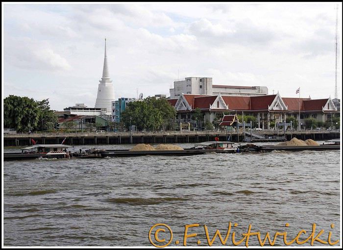
At that exact moment, the boat was packed. We didn’t see a ticket booth at the pier, and we tried in vain to pay the few baht for the ride. The cashier on the boat was too busy, and another employee we called didn’t have time to help us. Oh well, we weren’t going to force the issue. Still, this mode of transport is super practical for avoiding traffic, and at the piers, the lines with station names are clearly marked, with colors matching the flags on the boats. Combined with a map like the *Routard* guide, it’s easy to navigate.
We easily made it to the restaurant *Harmonique*, located near one of these piers. It’s a unanimous favorite on this forum, and let us tell you—it’s well-deserved. What a wonderful experience that evening! We only saw the outdoor gazebo because there was no way we were dining inside. It’s not flashy, so those looking for a luxurious setting should look elsewhere.
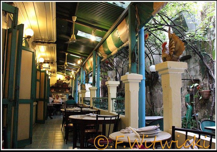
That night, the staff was a bit slow, and we had to track them down several times to move things along. But oh, my friends—what a feast on the plate! Start with the appetizer platter for two at 250 baht, featuring four specialties, each more tempting than the last, followed by their famous crab curry for 200 baht. There’s *so much* crab in there! The dish is so delicious and rich that when you finish, you feel—how to put it—like it was almost *too* good, to the point where you’re almost put off eating for days. And also, oh yes, we *will* be back. Their satay chicken is just as amazing, and it would be a crime not to mention their generous dessert with ice cream, warm banana, and chocolate, plus their *excellent* almond milkshake.
Later, we took a taxi to Kao San Road, mainly to book a Ko Tao-Chumphon trip for 600 baht per person at the Lomprayah counter. In hindsight, we should’ve booked all three of our trips there right away.
Kao San Road is *ultra*-touristy—better for younger crowds, but it’s still worth seeing. There’s rock ‘n’ roll, hippies, and crowds everywhere.
We walked back to the hotel, and when we got a little lost near a canal, a really nice older Thai man spontaneously appeared out of the night to kindly point us in the right direction.
Finally, a real long night of sleep ahead—we cranked up the AC. Sweet, the vacation has begun!
Our route was as follows: Bangkok, Siem Reap, Krabi, Suratthani, Koh Phangan, Koh Tao, Chumphon, Bang Saphan, Prachuab Khiri Khan, Sam Roi Yod, Hua Hin, Phetchaburi, Bangkok.
Beyond rediscovering Bangkok, our objectives were the long-held dream of seeing Angkor and exploring southern Thailand, much of which isn’t overly touristy.
A quick big thank-you to Barbot, who took the time to answer several of our questions.
12/07/2013
The cheapest flight we found earlier this year was a Paris-Bangkok route with a layover in Moscow for 1440 €, total for two people. So, this time we tried Aeroflot. Airbus A318 for the first leg, A330 for the second. Nothing particularly annoying to report—the passengers were very calm, the cabin temperature was comfortable, and we had enough legroom. That said, the quality of the meal trays was pretty mediocre, and the flight attendants weren’t exactly comedians.
We’d like to remind everyone that it’s best to exchange as little money as possible at the airport upon arrival, since the rate is about 5% worse than at city banks.
Of course, we made sure to take the airport exit where you can catch official taxis to avoid getting scammed. So, we queued up, a little lady gave us the ticket, and off we went with the driver. Generally, this system works well because these drivers are registered, know their duties, and the risks they face if they break the rules. Except that day, right off the bat, we got the scammer of the day. His first move was to snatch the ticket from my wife’s hands—the one you’re supposed to keep in case of a complaint. My husband saw it, but after a full day of travel, we were a bit out of it, and honestly, there was no reason to be suspicious. But once we started driving, the guy refused to turn on the meter. We insisted more and more firmly, but nothing. So, I used the famous method of opening the door and starting to step out of the car. At 40 km/h, that scares the driver more than the passenger. He finally turned on the meter, but that didn’t calm him down—quite the opposite. For the next half-hour, he ruined the ride by demanding extra fees here and there. Having dealt with several scam attempts last year in Vietnam, this wasn’t exactly new, and we were proud of ourselves for staying pretty zen. Still, this guy was a little scary—he was completely wired and aggressive. Honestly, it was hard not to think he was on something. He’d be perfect for a *Scarface* remake. When we finally arrived at the hotel, he followed us to the entrance. We paid the two tolls (25 and 45 baht), gave him the usual 100 baht extra for the ride, and stayed polite but firm. So, meter: 245 baht + 100 baht + 25 and 45 baht for tolls—we paid the exact amount, no way we were tipping this guy. He left furious, but he was already like that before picking us up... Anyway, avoid Mr. Chartree Chidchen, number 089 826 7308, car E2663!
We were so relieved to finally settle in at Feung Nakorn Balcony hotel in the temple district. 42 € per night, great reception, all the staff is friendly. The AC works fine, the bed seemed hard at first but turned out to be comfortable. The hotel is quiet, away from the nightlife, but at this time of year, many places are less crowded than in high season. Even with a nice fish pond and outdoor breakfast area, it’s a decent hotel, though we felt we could’ve found something better.
After a night on the plane, the first afternoon is always a bit of a slog. We napped for a few hours, and when we woke up—guess what—we were starving. We visited a temple across from the hotel (nothing special) and then decided to take the Chao Phraya Express, the river shuttle that serves many piers along the river. It was a really enjoyable experience. The steel gangway wobbles when you board and disembark, the boat sits low in the water, and sometimes you get splashed. During peak times, you’re packed in like sardines, but most of all, there’s that exotic urban landscape passing by, especially the temple rooftops.
At that exact moment, the boat was packed. We didn’t see a ticket booth at the pier, and we tried in vain to pay the few baht for the ride. The cashier on the boat was too busy, and another employee we called didn’t have time to help us. Oh well, we weren’t going to force the issue. Still, this mode of transport is super practical for avoiding traffic, and at the piers, the lines with station names are clearly marked, with colors matching the flags on the boats. Combined with a map like the *Routard* guide, it’s easy to navigate.
We easily made it to the restaurant *Harmonique*, located near one of these piers. It’s a unanimous favorite on this forum, and let us tell you—it’s well-deserved. What a wonderful experience that evening! We only saw the outdoor gazebo because there was no way we were dining inside. It’s not flashy, so those looking for a luxurious setting should look elsewhere.
That night, the staff was a bit slow, and we had to track them down several times to move things along. But oh, my friends—what a feast on the plate! Start with the appetizer platter for two at 250 baht, featuring four specialties, each more tempting than the last, followed by their famous crab curry for 200 baht. There’s *so much* crab in there! The dish is so delicious and rich that when you finish, you feel—how to put it—like it was almost *too* good, to the point where you’re almost put off eating for days. And also, oh yes, we *will* be back. Their satay chicken is just as amazing, and it would be a crime not to mention their generous dessert with ice cream, warm banana, and chocolate, plus their *excellent* almond milkshake.
Later, we took a taxi to Kao San Road, mainly to book a Ko Tao-Chumphon trip for 600 baht per person at the Lomprayah counter. In hindsight, we should’ve booked all three of our trips there right away.
Kao San Road is *ultra*-touristy—better for younger crowds, but it’s still worth seeing. There’s rock ‘n’ roll, hippies, and crowds everywhere.
We walked back to the hotel, and when we got a little lost near a canal, a really nice older Thai man spontaneously appeared out of the night to kindly point us in the right direction.
Finally, a real long night of sleep ahead—we cranked up the AC. Sweet, the vacation has begun!
Hello,
We’re planning to set off at the end of September with our beloved tandem to cycle along the southern coast of Portugal (the Algarve) and the west coast up to Lisbon. One little detail is worrying me a bit: WHAT ABOUT THE WIND? Let’s just say we’re on the Atlantic coast, and there’s nothing worse for a cycle tourist than wind. Basically, we’d just like to avoid a nightmare of battling the wind in Portugal. If you’ve already done this route or know a bit about the wind conditions in the area (strength, direction, etc.), it’d be great to get some more info on that. Also, I’ve read quite a few forums about trains. How’s the rail network between the south and west of Portugal? No issues with taking bikes on board? Thanks in advance for any info you can share! We’re heading into the unknown since we don’t know the region at all, so if you have any useful tips for cycle tourists, please send them our way!!!
Mic
We’re planning to set off at the end of September with our beloved tandem to cycle along the southern coast of Portugal (the Algarve) and the west coast up to Lisbon. One little detail is worrying me a bit: WHAT ABOUT THE WIND? Let’s just say we’re on the Atlantic coast, and there’s nothing worse for a cycle tourist than wind. Basically, we’d just like to avoid a nightmare of battling the wind in Portugal. If you’ve already done this route or know a bit about the wind conditions in the area (strength, direction, etc.), it’d be great to get some more info on that. Also, I’ve read quite a few forums about trains. How’s the rail network between the south and west of Portugal? No issues with taking bikes on board? Thanks in advance for any info you can share! We’re heading into the unknown since we don’t know the region at all, so if you have any useful tips for cycle tourists, please send them our way!!!
Mic
A big thank you to the VoyageForum members who shared their experiences with us! We spent 3 wonderful days at "La Kasbah la Palmeraie" in Skoura. Coming from Marrakech (a stunning drive after the Tichka Pass via Telouet and Ait-Benhaddou), our stay at the Palmeraie was pure bliss: Mohammed and Ghizlane’s warm welcome, delicious breakfasts on the terrace overlooking the palm grove (wood-fired bread, honey pancakes made by Ghizlane), and equally delicious and hearty evening meals shared as a family around a cozy fire. We felt right at home and learned so much about the local way of life. The excursions offered were always interesting and off the beaten tourist track—from there, we explored the Dades Valley and Gorges, the Almond Blossom Valley (gorgeous!), and the palm grove. The region is home to magnificent kasbahs, including our hosts’. A different way to "visit" Morocco!
Cycling Through Provence's Big Climbs
In the autumn of 2011, Provence was hit by apocalyptic weather—torrential rain and a particularly violent east wind, reaching 130 kilometers per hour, whipping up waves as high as seven meters. It wasn’t the best time to venture outside. Yet, I told myself that after the storm, calm would return. I kept an eye on the weather forecast and noticed that starting November 10th, a favorable window should open for a little 600-kilometer cycling trip across Provence. The weather reports promised a high-pressure system that would keep the bad weather at bay over these highlands. That was all I needed to decide to set off. The planned route would take me through Provence’s biggest climbs: Mont Ventoux, Montagne de Lure, the Verdon Gorge, the Massif des Maures, and Sainte-Baume.
And so, despite my doubts, the call of adventure was stronger. The train pulled away, and once again, a journey began at Part-Dieu station. This time, I headed toward Haute-Provence for a cycling adventure. It would be my first solo bike trip. I was a little nervous—cycling with panniers makes you feel vulnerable to theft. I’d already been robbed while traveling in a group in Peru, and that experience left me deeply shaken. Alone, I hesitated. But no need to panic—I’d read accounts from long-distance cyclists who hadn’t been robbed, even if it does happen sometimes. I was particularly thinking of a young schoolteacher who had taken a sabbatical to cycle around the world. Her students had remarked, "Teacher, you’re not sporty—how will you manage to cycle around the world?" This young woman was full of resourcefulness. In South America, before flying to China, she locked her bike to a post to take care of a natural need. When she returned, the post had been torn out, and her bike—along with all her gear—was gone. It was a shock for many, but not for her. She boarded her flight to the Middle Kingdom, bought the essentials (including a new bike) once there, and continued her journey! Remembering this story, I almost felt ashamed of my cowardice. These were the thoughts running through my mind as the Rhône Valley rolled by toward Orange, the starting point of my Provençal adventure through the big climbs.
Day One: Orange to Sault via Mont Ventoux – 90 km
9:30 AM, I stepped off the train. With all my gear, I had to navigate the underground passage—no easy feat, given that my bike and luggage weighed 35 kilos. At this time of year, I expected some areas to be deserted, so I’d packed enough to bivouac comfortably. Once outside the station, the southern light flooded over me. I understood why people dream of retiring in these sun-drenched regions. As always, after disembarking from public transport, I had to get my bearings and decide which way to go. The sun, still low on the horizon, pointed east. The roar of fighter jet engines helped me locate the Air Base 115. That was all I needed to "reset the gyros."
As soon as I started pedaling, all my apprehensions vanished. The joy of discovery and physical effort took over, and euphoria washed over me. It’s amazing how emotions can shift from one moment to the next based on seemingly minor circumstances.
The weather was splendid—the forecast had predicted continuous showers, but it was completely wrong. I quickly left the city behind. Mont Ventoux loomed mysteriously, its dimensions hard to gauge. It was even more enigmatic with its summit hidden beneath swirling, mottled clouds clinging to the ridges. It reminded me of a great South American volcano. I struggled to imagine that in a few hours, I’d be up there under that blanket of mist.
The countryside was shaking off its autumnal nighttime dampness. The vineyards, interspersed with tall cypress hedges, confirmed I was in the magnificent Côtes du Rhône wine region. The distinctive Dentelles de Montmirail were very much in evidence. The air force base wasn’t far. I passed the runway’s end markers. A Mirage 2000 flew overhead in a tight turn, followed by another roaring into takeoff. It came straight at me before climbing sharply with a thunderous roar. Thirty years spent in that captivating world came rushing back. I recalled countless extraordinary human and technical experiences from my time in the service. But the purpose of this post isn’t to promote the air force—though I might post some articles one day about travels among men at war.
I continued on my way, leaving my past loves behind. As I pedaled, delightful names rolled by: Violès, Vacqueyras, Gigondas, Beaumes-de-Venise—the crème de la crème of the Côtes du Rhône Villages appellation. I let myself be enchanted by the vineyards and the little paths crisscrossing them. I started to doubt my route, though the imposing mass of Mont Ventoux in the distance acted like a giant beacon. At a crossroads, a car appeared. I approached to ask the driver for directions, but she didn’t even look at me and sped off, clearly frightened. I’d almost forgotten what a fearful world we live in, no doubt traumatized by all the horrors we see in the news and on TV.
The kilometers started adding up, but was my day’s goal too ambitious? It had been two months since I’d last ridden my bike. True, my last trip had been good training—the Route des Grandes Alpes—but that was two months ago. I can’t just take my bike out for a day trip; I need that sense of adventure to find the courage to exercise.
Two cyclists overtook me. Intrigued by my load, they struck up a conversation. They were skeptical when I told them I planned to cross Mont Ventoux that day. One of them pointed out a small chapel near the summit where I could bivouac sheltered. That motivated me even more to reach the top on this first stage. The chapel also had a mythical name for me—Sainte-Anne, the name of my parents’ villa. It was already noon, and I’d covered 50 kilometers. Malaucène appeared—the sacred village of Ventoux’s mad cyclists. Surprisingly, I didn’t see any other cyclists today. I remembered this place in June, teeming with aspirants for the king of summits. Before tackling the climb ahead, I needed to refuel. I enjoyed a pleasant gastronomic break at Max’s. At 1 PM, I started the most famous climb in cycling—21 kilometers, which would actually be 23. I knew it would be tough, especially with two handicaps: 50 kilometers already in my legs and 20 kilos of luggage. But I was counting on my tiny chainring, which let me climb trees to tackle the steep ramps.
I set off at a brisk pace along a deserted road. My speed held up for the first few kilometers. I quickly rose above the valley, the horizon widening. I was surprised to see no one on this world-renowned route among cycling enthusiasts. During the climb and descent, I’d only see five cyclists—but I’ll come back to that. I passed a sign explaining that the effort would be roughly equivalent to climbing the Col de la Bonnette. Having done the latter in September, I figured I’d be fine. I crossed paths with my first cyclist—a woman speeding downhill. After 12 kilometers, I hit slopes averaging 12%. I don’t know if the number 12 is cursed, but I got such a "bamboo" hit that I’d never experienced before. I thought I wouldn’t make it to the summit today. I stopped. My thighs burned so much I could barely walk—lactic acid overload. I looked for a relatively flat spot to pitch my tent. It was 3:30 PM, with two hours of daylight left. But I found nothing.
I got back on my bike, intending to stop as soon as I found a good bivouac spot. But nothing came up. However, my strength slowly returned, perhaps because the slope eased, though it remained around 10%. I entered the summit mists. A cyclist overtook me. I was in the zone where I had to pass the summit. Dusk caught me in the final difficulties. The atmosphere was downright austere. In the twilight, a kilometer from the summit, a cyclist was fixing his bike. I asked if he needed help. He made it clear he didn’t understand. So I asked, "Do you need some help?" His answer was clear: "No, thank you." He showed me his new inner tube. Inside, I thought, "Phew!" If I’d had to stop, sweating in the falling night with the cold intensifying, I’d have struggled to get going again. But he managed, and I continued into the twilight fog. I could barely make out the summit’s large antennas in the clouds, like immense ghosts trying to evade sight. The bike delivered sensations worthy of mountain racing. My goal was to quickly find the famous chapel in the descent to take shelter. As I glided down the southern slope, two cyclists without lights crossed my path in the night—probably heading to the station above, its lights visible in the fog.
I scanned the roadside in the dark for the chapel but saw nothing. After a kilometer or two, I lost all hope. I stopped to put on more clothes as the cold became intense. I had no idea where I could stop on these steep slopes to set up camp. Between the swirls of mist, I could intermittently see the Rhône Valley below, dotted with illuminated towns and villages. The sight was striking. What was I doing on this mountain at night? Then the miracle happened—the clouds parted, and from the ridge above me to the east, a beautiful full moon emerged, casting enough light to consider a nighttime descent to Sault, 26 kilometers away.
In this eerie atmosphere between the moon’s pale rays and patches of fog, I began my descent through a hazy, almost unreal world. The Ventoux’s characteristic white scree reflected the moonlight faintly, dimmed by the mist. In places, entire mountainsides were plunged into complete darkness, and I lost all sense of the road’s path. Then, around a tight bend caused by a land shift, the light returned. It seemed extreme compared to the darkness I’d left behind. I could once again clearly see the road’s contours, though not its potholes or gravel patches. Still, I let the slope carry me, and the speed felt significant, though the low light prevented me from reading my speedometer. In these moments, concentration was at its peak—all senses alert, reflexes ready to react to the slightest incident that could lead to a fall.
I was relieved to see Sault’s lights growing closer. In less than an hour, I reached it, considering the final little climb that required one last push. This village, bustling in summer, was deserted at this time of year—almost dead. The first hotel I came across was closed. A quick shadow passed in a small sloping street. Before it disappeared into the darkness at a house corner, I chased after it and asked about accommodation options. Very kindly, I was directed to what was probably the only hotel open in November. I quickly found it, and the reception was open. I entered wearing my black balaclava, bought in the Ayacucho region—the birthplace of Peru’s Shining Path. At this late hour, I saw questioning glances directed at me. I prefaced, "This isn’t a hold-up." Clearly, the owners had a sense of humor—they started smiling. I took off my balaclava and asked for a room. No problem, and from that moment, the pressure eased. I really didn’t feel like going back out to find a spot to pitch my tent in the biting cold.
The stage had been nearly 100 kilometers, and it was the first. It had been two months since I’d touched my bike, and I probably lacked even minimal training, even though my last bike trip had been crossing the French Alps. I really had to dig deep to overcome my weakness on Ventoux’s steep section. I don’t remember ever having to search so deeply for the energy to keep going. I knew the stage I’d set for tomorrow was significant, with the climb up Montagne de Lure’s northern slope—Ventoux’s little sister, whose ascent is reputed to be endless, over 25 kilometers. I hoped this first day wouldn’t leave me too sore to avoid suffering excessively tomorrow.
For now, relaxation—a hot shower did me a world of good, followed by a good meal. I ate a delicious andouillette from Troyes, very fine, with a particularly successful herb seasoning. I loved it, and yet I’m from Lyon and pride myself on knowing a thing or two about andouillette—not just a sausage but a whole category! A bit chauvinistic, I had to admit, though reluctantly, that I found it better than the ones I usually eat in the Lyon region!
Day Two: Sault to Forcalquier via Montagne de Lure – 116 km
This morning, the weather was magnificent—the air clear, still, very fresh, and invigorating, as only the late season can offer on these Provençal highlands. In summer, they’re known for their scorching heat and drought, but often overlooked is how harsh they can be with cold and storms. Authors like Giono or Bosco described them and their inhabitants wonderfully in books like "Les Âmes Fortes."
The miracle of the night had worked. I wasn’t sore anywhere and felt in great shape. I set off well-equipped, but the effort and sun soon made me sweat. It was time to shed some layers—hat and gloves. A gentle warmth replaced the cold, making for excellent cycling conditions. On the road to Trinit, there was no traffic—only the occasional hunters’ cars parked in the distance. These vehicles were recognizable by their large cages, used to transport hunting dogs. Sometimes, the silence was broken by a distant gunshot. The deciduous forests were losing their foliage, taking on that dull brown hue of late autumn, though here and there, a tree or shrub still resisted, displaying vivid yellow or red. The meadows, their grass already scorched by the cold, were damp from the night’s heavy humidity. The low sun highlighted thousands of spider webs that had trapped insects during the warm season.
Behind me, Mont Ventoux dominated these vast spaces. As often, its imposing, stony summit was crowned with a blanket of clouds. What an impressive mountain—it’s always so hard to gauge its dimensions. I struggled to realize that last night I’d been at the summit and descended its immense southern ridge in the dark. I hoped to return one day in favorable conditions—daylight and no clouds—to enjoy the vast panorama from this unique summit.
Leaving the very Provençal village of Trinit, I tackled my first climb of the day—the Col de l’Homme Mort. The road rose moderately for five kilometers in gentle warmth. The view over the region widened, and I felt the sheer joy of pedaling. At a good pace, I overcame this first little challenge. Once at the pass, I couldn’t resist the ritual of photographing my bike in front of the sign, giving the name and altitude—1,213 meters.
The northern slope was austere and still in shadow. The cold bit again. The road was wet and covered with leaves in places. It wasn’t impossible that some treacherous patches of black ice lurked around a bend. I descended toward the Jabron Valley with caution. Suddenly, around a bend in a forest clearing, the freshly snow-covered Alps, gleaming in the sun, leapt into view, blocking the horizon. I thought I recognized the distinctive silhouette of the Écrins’ south face above a multitude of jagged peaks.
This snow and these mountains awakened a flood of memories of great joys, but I also thought of the guide and his client who had just lost their lives on the Grandes Jorasses’ north face, at the top of a route called the Linceul. The name comes from the face’s appearance—a great ice slope bordering the Grandes Jorasses’ north wall. It was first climbed by René Desmaison in 1968. He passed away a few years ago and, in his final wishes, asked that his ashes be scattered in the Dévoluy Massif at the foot of Pic de Bure, not far from here in these immense pre-Alpine folds.
At my feet, the Jabron Valley stretched almost endlessly east toward Sisteron. In the distance, the dark mass of Montagne de Lure’s north face loomed. This mountain shares similarities with Mont Ventoux. It has the same summit scree of bright limestone, the same forests climbing up to the final rocky stretch, and that blanket of clouds adding a secretive, austere touch to the scene.
I turned left past the town of Séderon and headed toward the little Col de la Pigière, which in a few kilometers allowed me to truly plunge into the beautiful Jabron Valley. I passed through several villages with charming local names—Saint-Vincent, Noyer-sur-Jabron. The river offered lovely views of its narrow gorges with clear, cold water. Autumn seemed less advanced here than on the plateau I’d just left. Many trees still wore brilliant colors, some revealing extraordinary hues—mixes of crimson, pink, and bright red.
Arriving in Noyer-sur-Jabron, I took a tiny road on the river’s right bank, leading in a few kilometers to the foot of Montagne de Lure. In the village of Valbelle, I picnicked on leftovers I’d brought from home—an old cheese and a somewhat stale loaf of bread. It was 1:30 PM. I began the long climb of about 25 kilometers. According to a friend who’s a cycling expert in the region, this section is tough. No wonder it’s called Ventoux’s little sister—the Mont Blanc of cyclists. The elevation gain on this side is still 1,200 meters, while Ventoux via Malaucène is nearly 1,600 meters.
I hoped to reach the summit before nightfall and avoid reliving a nighttime descent. The route wound through a vast forest, following the terrain’s folds. There was activity—mushroom hunters were busy searching for the coveted chanterelle. The climb, though never very steep (only one kilometer at 9%), was interminable. Though traffic was practically nonexistent, I was overtaken by a group of Harley bikers—I counted about forty. Perched high on their machines, hands in the air on wildly shaped handlebars, some with their feet nearly in the sky due to the high footpegs, they didn’t even glance my way. What’s this idiot doing, unable to ride a motorcycle and forced to climb these mountains on a bike with big bags! I wasn’t offended—real Harley purists often see other motorcyclists as renegades, so bikes are even lower on the totem pole! But I didn’t want to start a debate about motorcycles. In my youth, when I was a wild motorcyclist (22 accidents on two wheels), clans were divided into Japanese, German, Italian, and British bike owners. The latter, on their vibrating, oil-leaking machines, considered themselves the purest. But let’s not fight—there’s a statute of limitations, and it’s been nearly forty years.
As yesterday, a few kilometers below the summit, I entered the fog, and the light dropped suddenly. What a hostile mountain in these conditions! It heightened the sense of living an incredible experience. The conditions we encounter play a major role in how the adventure imprints on our memory. I realized once again that in France, you can feel like you’re very far away. Finally, after this very long climb, the Pas de Graille sign suddenly appeared out of the grayness. Strange! Below the sign, a kilometer marker indicated this same pass was over three kilometers away. Clearly, the climb continued. In these final kilometers through the scree, I gained another 130 meters of elevation. Finally, the road’s high point was reached—1,720 meters. It was cold and damp. I quickly covered up, added my balaclava under my helmet, and put on warm gloves. As I was about to start the descent, a car stopped at the summit, and one of the passengers was surprised to find a bike there in these chilly, twilight conditions.
A 20-kilometer descent led me to the village of Saint-Étienne-les-Orgues. I hoped to find a place to stay for the night. No such luck! Everything was clearly closed—no chance of finding shelter. Tonight was getting complicated. I already had exactly 100 kilometers in my legs and didn’t feel like pedaling anymore, especially at night. But I had even less desire to sleep outside. What to do to avoid it? The town of Forcalquier was 16 kilometers away—I hoped the road would descend. I set off in that direction. The first third was along a beautiful, lightly trafficked departmental road with a slight downhill—I pedaled hard. But it got tougher. I joined a busier road, and night had fallen. A several-kilometer climb finished the journey. I knew my magnetic lights weren’t very powerful—hence the danger. They were even less so on the climb because the slower I went, the less they illuminated. Cars coming the opposite way often saw me late and blinded me with their high beams. After passing, I was plunged into total darkness for a few seconds while my pupils readjusted to the night. I imagined those coming up behind me saw me with little warning, despite my slightly fluorescent jacket. When the roadside was clear, I always positioned myself to quickly jump off the road. But unfortunately, in this long final climb, a guardrail prevented any escape to the right in case of sudden braking behind me. That was even more anxiety-inducing since I was stuck at a snail’s pace. Time seemed long. I pedaled as hard as I could, on the verge of asphyxiation, trying to escape this dangerous situation as quickly as possible. My only reference point was the vehicles in front of me, letting me know the climb wasn’t over. Then suddenly, the ordeal ended—the road’s high point was reached. The town and its lights emerged from the void, and clarity returned. Phew! I glided down toward this little town bathed in light. On November 11th, I hoped to find an open hotel since I’d clearly exceeded 100 kilometers, and the idea of having to leave town to find a bivouac spot somewhat frightened me.
I arrived in the town center. Activity was low. The first hotel was closed, but I spotted a lit sign for another establishment further on. I headed there, got off my bike, and entered. The welcome was immediately friendly—a big cat came to rub against me. For me, that was a very good sign, and the first impression was confirmed. I still had to go out to eat. I covered the minimum distance. A restaurant advertised "Mom’s Cooking." I expected Provençal specialties, but they were Moroccan. I chose a delicious tagine with lime and olives, followed by almond and honey ice cream. Exhausted after this 116-kilometer stage, I returned to my room. As often after intense efforts, it was hard to fall asleep.
Day Three: Forcalquier to Moustiers-Sainte-Marie – 58 km
On this third day, due to the progress made yesterday, the stage would be short. I’d call it a transition between two mountain ranges. Indeed, the next big climb is the Verdon Gorge. I planned to position myself at its foot this evening in preparation for a tough stage tomorrow. I made a few purchases—bread, bananas, and medicine for stomach burns (the midday sausage wasn’t always kind to me). The weather was still perfect. The route began with a long descent toward the Durance. It’s always nice to start a cycling day with a downhill—it boosts morale and allows for a gentle warm-up.
I quickly reached the town of Oraison. Just at its entrance, I crossed the Durance, which still bore traces of last week’s heavy rains along its sandbanks. Indeed, numerous stumps and trunks were scattered along its vast gravel bed, along with less ecological debris like old tires.
A little south of Oraison, I took the D907, a small road heading due east between scrubland and meadows. There it was—the Provence we imagine. This stable autumn weather, with still air, neither hot nor cold, just a fresh feeling when emerging from a shaded valley or a slight warmth under the sun, was ideal for a cyclist. After about ten kilometers at the bottom of a small valley I quickly passed through, the village of Le Brunet appeared on the right. It clung to the slopes leading to the Valensole Plateau. A few steep kilometers along a tiny winding road, and suddenly a vast panorama unfolded as the climb ended.
What a magnificent plateau! Though known for its wind, luckily today was completely calm. Far to the east, the Verdon’s great cliffs blocked the horizon. This allowed me to contemplate part of tomorrow’s stage. This place is full of mysteries—many UFO and extraterrestrial encounter stories are associated with it. Moreover, for about thirty years, France hid its ground-to-ground nuclear ballistic missiles here, grouped in the 1st GMS (Ballistic Missile Group), under the air force. Naturally, these rockets fueled fantasies, and pacifist groups settled in the region to protest this type of armament. This gives many reasons to shroud this austere, deserted land in mystery.
I took a dirt path leading to the heart of this zone and stopped at the forest’s edge for lunch. The silence was total, the view stretched very far. But nothing strange or bizarre manifested. No Martian came to share my frankly moldy cheese, very peppery sausage, or bruised banana—sniff! I resumed my route, and as often when crossing places with strong character, I tended to slow down to enjoy them longer. The immense lavender fields stretched endlessly, not very fragrant at this season. I arrived at a group of truffle oaks protected by a fence, with large red signs warning "Firearm." Clearly, the war for the black diamond was raging in this region. I remembered a novel where an old farmer made buyers believe nothing grew on his land. Every year, he secretly stole the mushrooms from the unsuspecting owners. Then one day, they discovered the truth, catching this "polite" neighbor trying to hide a basket full of beautiful, large truffles!
In these vast spaces, I felt good—a sense of plenitude. It’s strange that I only conceive of cycling through wandering. I struggle to plan a day trip. And if I do, it’s highly likely I won’t get up. I need that sense of adventure to fully appreciate my physical effort. Maybe one day I should get psychoanalyzed, but at my age, it’s probably too late! Today, I had all the time in the world—the stage was half as long as yesterday’s, with very little elevation gain. Not a sound, an impressive calm, a beautiful landscape—I pedaled in a wonderful place. That’s probably happiness!
I reached the village of Puimoisson on the plateau’s eastern edge—only 12 kilometers left to Moustiers. I took my time, sat at a café terrace in the sun, and leisurely enjoyed a coffee while listening to the village come to life. I was delighted by these melodious southern voices, bursting into great laughter. There are places where, despite the anxieties caused by our debt-ridden, dysfunctional societies, some have decided to take life on the bright side and show a saving insouciance.
The rest of the journey was a simple formality—I let the slope carry me toward the pretty little town of Moustiers-Sainte-Marie, clinging to the cliff and famous for its faïence. Arriving early for once, I went to the tourist office to choose a comfortable hotel. Indeed, the Hôtel des Restanques was very comfortable and admirably well-located. But at this time of year, I’d have to return to the village center for dinner. The very kind receptionist reserved a table for me at La Treille Muscate, a restaurant with a magnificently arranged room on the church square. It was only 3:30 PM—I continued to take my time, showering and relaxing in front of the TV. Then I set off to explore—or rather, re-explore—this village I’d visited several times before. But I’d never climbed to its chapel perched in the middle of the great cliff towering over the houses. A stony, aerial path led there. The first mentions of the Notre-Dame de Beauvoir chapel, known in ancient times as Notre-Dame d’Entre-Roches, date back to the 9th century. It’s one of the rare "respite" chapels found in Provence. These are chapels where stillborn children were brought to be revived for a few moments, just long enough to baptize them. They could then be buried religiously, ensuring the salvation of their souls. I was also very moved by reading some ex-votos, like the one from "A mother for her three children returned from the war."
The place was impressive, especially as night fell. I was alone and watched the shadows fill the great cliffs above me. With an old climber’s reflex, I looked for possible climbing routes among these slabs and cracks. But climbing is probably forbidden here, too close to the houses. Then I descended to stroll through the village, admiring the magnificent, finely crafted faïence patterns found in many shops. Finally, dinnertime arrived, and I joined my restaurant, which had been highly recommended. I was delighted by the foie gras ravioli and the pieds et paquets—the chef’s specialty. I’ll come back with family.
Day Four: Moustiers to Fréjus via the Verdon – 122 km
A hearty breakfast prepared me for the day’s tough efforts. Next to me, four Chinese people chatted animatedly. Of course, I didn’t understand a word—it was a language with strange intonations and sounds. I left the dining room and prepared my bike on the terrace. Seeing the volume of my luggage, my Chinese friends rushed over and asked to take turns having their photo taken in front of this funny setup. All laughing, they took photos in front of what they probably considered a French coolie off on some trading business! When they show these photos to their relatives, they’ll likely be perplexed about what motivates some to travel by bike rather than car. For them, the car is a symbol of success—according to an article I read last year, 14,000 cars are registered in China every day!
This morning, the air was fresh. As yesterday, I started with a long descent, this time leading to the edge of Lac de Sainte-Croix. A strong, biting headwind slowed me down. It wouldn’t last, as it was generated by the gorge’s outlet, which I’d reach in a few kilometers. On this cold morning, the lake’s shores exuded great tranquility. The sun was still hidden behind the Verdon’s mountainous mass. Trees with yellow leaves stood out against the water’s pale blue. The bridge marking the gorge’s beginning at the lake’s edge was an ideal spot to admire this natural splendor. At this early hour, the play of light and shadow on the water and the immense cliffs delivered a grandiose spectacle in beautiful harmony. This first contact with the gorges, which I knew well, amazed me.
Once past the bridge, the wind calmed. A little further on, I began the long climb that would take me to the top of this immense natural gash, which water had taken millions of years to carve. I was in good shape and highly motivated by the splendors to come. First, I reached the village of Aiguines, which offered a magnificent viewpoint over the lake. Then I continued toward the Corniche Sublime, where countless breathtaking panoramas unfolded as I progressed. But the climb was sustained and long, requiring effort—though my small chainring worked miracles. I first passed the Col d’Illoire, already 500 meters above the lake. Seeing all these great cliffs, countless climbing memories came flooding back. The classic routes of the Escalès cliff, over 300 meters high, flashed by. Routes with legendary names—La Demande, Les Écureuils, Luna-Bong, and many others. The one that left me with the best memory was ULA—a crack, vertical or even overhanging, of sheer beauty rising above a 40-meter slab in one go for 280 meters of sustained, beautiful climbing on extraordinary rock. It made me want to return to climb there, to immerse myself in the atmosphere of those past times. But climbing habits have changed—now routes are accessed from above by rappel, and people don’t always bother to do these great climbs in their entirety, focusing instead on shorter but technically much more difficult enterprises.
At almost every bend, I stopped and scanned these great cliffs, searching for memories of past experiences and emotions in these secret rock folds. The road climbed well above the pass, exceeding 1,200 meters. It was cool, especially since I was sweating. Finally reaching the high point of the Corniche Sublime, I couldn’t gain speed on the descent—my gaze was always drawn to this astonishing canyon. Around a bend, two cyclists with funny small-wheeled bikes. Wow! It was a couple of Australians doing a year-long tour of France. We chatted passionately about our two-wheeled experiences for a moment. But time was passing, and if I wanted to reach Fréjus before nightfall, I’d have to pedal seriously.
I stopped at the Pont de l’Artuby, where bungee jumping was in full swing. But I quickly set off again toward Comps. The wind was against me, and it was climbing. I started to doubt whether I’d make it to the coast that evening. At 2 PM, I was in Comps-sur-Artuby. I didn’t stop, knowing that before reaching the coast, I’d have no alternative to bivouacking, and I had 70 kilometers left to cover. Sure, it should be downhill, but a few climbs were on the program. After a descent out of the village, I crossed the Artuby River again on the Canjuers military camp. A several-kilometer climb followed, fortunately not too steep. I took the D19 toward Barjols. From there, despite the late hour, I opted for a tiny road passing through Claviers, a small perched village. Time passed quickly, but the kilometers added up. I regained hope. Fifteen kilometers after this last village, I reached Saint-Paul-en-Forêt via a magnificent forested route. I had plenty of time to observe mushroom hunters. I asked one who clearly had some in a plastic bag. He gave me this hilarious answer with a magnificent southern accent: "I only picked the bad ones." No reply was possible. I moved on with a smile. A little further on, another hunter carried a basket. As soon as he saw me, he quickly hid it—just in case I saw what it contained. Arriving at the village involved a steep climb, and I was close to 100 kilometers. I still had a little over 20 kilometers to go before reaching Fréjus. The race against nightfall had begun. Over there to my right, I saw the sun setting behind Roquebrune-sur-Argens’ distinctive rock. The sea appeared. There it was—I was in Fréjus’ industrial zone. On this Sunday evening, traffic was heavy. Indeed, many had taken advantage of the return of good weather after very heavy storms to go for a walk. After quite a few detours, I arrived at the seaside just as night fell. My odometer showed 122 km for the day. I quickly found a simple hotel, ate just as quickly, and went to bed.
Day Five: Fréjus to Solliès-Pont – 92 km
Once again, the night had done its restorative work, and I prepared to cross the Massif des Maures feeling quite fresh. The weather forecast was still favorable for today, but a deterioration was expected tomorrow. I tended to trust it because the east wind was blowing, and in the region, that’s a sign of rain. For now, in the short term, this wind would be very useful—it would push me generously throughout the day.
I started calmly along the harbor quays, looking at the boats. Then I joined the road to Saint-Aygulf and followed the coast for forty kilometers to Port-Grimaud. All these seaside resorts—Saint-Aygulf, Les Issambres, Sainte-Maxime—reminded me of my youth when we spent all our vacations fishing, whether from shore, underwater, or by boat. Looking at the sea roll by, I knew what the seabeds looked like under that surface hiding them. The marine areas we knew best were now under the parking lots and commercial zones of Saint-Raphaël’s new port. In our youth, these infrastructures didn’t exist, and their construction came at the expense of coastal marine areas. Our wonderful fishing spots were permanently buried. I remember seeing the first big trucks that came to dump their loads of earth and rubble, destroying all those wonderful places—sandbanks, seaweed beds, groups of rocky holes teeming with fish that enchanted our youth. Over forty years later, I can still visualize them in my imagination under those parking lots and stores, with the names we gave them—my brothers and I: le casse-croûte, le casse-pipe, les montagnes, la digue, la grille, la mare à mulets, la petite-plage, le trou, etc.
Let’s not be overwhelmed by nostalgia. I left the coast and took the little road through the Maures to Collobrières. The route led from ridge to ridge following the terrain’s movements. At this time of year, the region was admirable. Due to the heavy storms of recent weeks, water was streaming everywhere. Waterfalls and streams murmured all along the way. I didn’t recognize the Maures, which I knew for their dryness causing apocalyptic fires. Indeed, around a bend, I came across a small rest area where a memorial had been erected for three firefighters who lost their lives here while fighting one of those gigantic fires fanned by the mistral.
This forest holds treasures—first, the cork oak, then the arbutus, chestnut trees, and of course, mushrooms that love this granitic soil:
The cork oak can be found all along the road. It’s the forest’s essential element. You can recognize it by its light bark (before exploitation), which forms large bulges along the trunk. But after exploitation, the trunks are much smoother, less voluminous, and dark in color. The arbutus is a large berry with red skin covered in small protuberances, growing on the arbutus tree. This fruit, common in Mediterranean areas, ripens in November. That means today, there were plenty around me. Its flesh is orange, with the consistency of firm purée, and it crushes softly in the mouth. The taste of this berry is sweet and excellent. I didn’t hold back—I gorged myself on them, which served as my midday meal. Sometimes I had to climb embankments to get them.
The chestnut tree, a true industry of the region, brings wealth to the surrounding villages. They make candied chestnuts, ice cream, and other products derived from chestnut flour. Be careful not to stop just anywhere to pick this fruit, as the tree owners might not agree. They even make this clear with signs and surround their chestnut trees with fences. Mushrooms—saffron milk caps and porcini—are highly prized in the area. I saw a few hunters, but it clearly wasn’t miraculous. Supposedly, there had been too much rain?
There’s no time to get bored along this little road, from which you can sometimes see the sea. I passed the Col de Taillude at over 400 meters. I began the descent to Collobrières, the chestnut capital, whose festival attracts many people. Before entering, about a hundred meters from the first houses, a cyclist—probably an agricultural worker—came toward me. As he passed, he cheerfully called out, "Go on, little guy! It’s almost there!" We both smiled. At the end of November, the village was cold and almost deserted. Dead leaves swept the wet streets of the town. You could feel winter on the way. I continued my route to Pierrefeu-du-Var, on the western edge of the Massif des Maures. So I gave my last pedal strokes in this pretty little massif so characteristic of Provence.
I looked for a hotel in Cuers but without success. I descended toward Toulon and finally found one on the outskirts of Solliès-Pont. It catered to people coming to work in the region, so nothing very bucolic. But if the weather were to deteriorate tomorrow and turn to rain, I could quickly reach Hyères or Toulon station, which was a significant advantage. Indeed, November rains aren’t usually very pleasant on a bike.
Day Six: Solliès-Pont to Cassis via Sainte-Baume – 85 km
This morning, contrary to the weather forecast, the weather was beautiful, and the latest bulletin seemed to contradict yesterday’s. So no escape to Toulon—I resumed my route toward Sainte-Baume. I left the hotel via a tiny road that, through ups and downs, led me via shortcuts to the road to Belgentier. My body had gotten used to intense daily efforts, and I felt in Olympic form. At a good pace, I launched into a long climb with a moderate slope. The road was busy, but fortunately, the side lane for cyclists often made the exercise more pleasant. The villages rolled by—Méounes, La Roquebrussanne. Near the latter, I observed a Tiger combat helicopter in training. It hovered motionless for long periods—perhaps the pilots were training to master their increasingly sophisticated weapon systems, requiring even more learning?
I left the busy road and headed via an almost deserted route toward the village of Mazaugues. The climbs became steeper. A long descent, and there I was in this pretty village. A grocery store, which besides selling a few ingredients also served as a café. I sat near the electric heater—it was cold, and I was sweaty. I watched customers come and go and listened to the shopkeeper tell me about village life. The name Mazaugues comes from "water mass," which is why drought doesn’t usually affect this area. Apparently, you can even find mushrooms here in summer! I had a good time, and as I was leaving, a local cyclist started a conversation and told me about her dreams of long bike trips, currently limited by her situation as a mother of terrible children. She settled for day trips with her club, which was already good in this very hilly region. I told her the story of a man who, at 73, cycled solo around Morocco. So no panic—she still had thirty or forty years to realize her wildest dreams!
I was warned that it would be a tough climb to reach Sainte-Baume’s northern slope. Indeed, over eight kilometers, the average slope was sustained, but the landscape was wonderful. Here too, water was streaming everywhere. I passed one of those famous icehouses that used to supply Marseille with ice throughout the year. This northern slope of Sainte-Baume is very cold, and this characteristic was exploited in previous centuries to produce ice. Large cylindrical structures, well-protected to the north and semi-buried, received large quantities of water in late autumn, which froze during winter and was kept cool for months until the following winter. Ice blocks were cut and delivered by cart to the city. That’s how, in ancient times, ice was available in summer to keep fish fresh in Marseille. Did pastis exist at that time? If not, the ice cubes must have been bored!
Once the climb was over, the long ridge of Sainte-Baume appeared, and I could see its characteristic antennas. Nestled at the foot of the cliffs, the magnificent millennial forest revealed itself with its autumn colors. I stopped at the monastery. I’d been there several times before and had even slept there during a long walking trip. The welcome had been first-rate by the Dominicans, especially the sisters in their long immaculate robes. They radiated a serenity that was very contagious. Don’t hesitate to stop there for the night. I struggled to get back on my way—some places have a special spirit.
I was soon at the end of my journey. I continued along this magnificent mountain to the Col de l’Espigoulier. To the north, another immense wave of white limestone rose—Montagne Sainte-Victoire, a high place in Provence that painter Cézanne made world-famous. Once at the pass, the entire city of Marseille spread out at my feet, the Mediterranean coast revealed itself from the Calanques to La Ciotat, passing by the famous Cap Canaille, Europe’s highest sea cliff. Above me, bathed in sunlight, Bartagne’s northwest face, very popular among climbers, showed all its reliefs. With an old climber’s reflex, I spotted the many climbs I’d done there. I let myself be carried into a steep, winding descent toward the village of Gémenos in a beautiful setting full of cliffs.
A few more kilometers of climbing toward the Col de l’Ange, then toward Roquefort-la-Bédoule. In this last climb, I raced with two cyclists, admittedly not very young. Then, in a six-kilometer descent, I reached Cassis station, the endpoint of my six-day journey through this wild Provençal land between sea and mountain. I experienced great pleasure during these 570 kilometers through these renowned yet wild French massifs. As always, when a beautiful project comes to an end, you feel a bit orphaned by a beautiful dream come true. You have to quickly envision the next one to avoid a vague sense of emptiness taking over. My next adventure is already taking shape in my mind, but that’s another story.
In the autumn of 2011, Provence was hit by apocalyptic weather—torrential rain and a particularly violent east wind, reaching 130 kilometers per hour, whipping up waves as high as seven meters. It wasn’t the best time to venture outside. Yet, I told myself that after the storm, calm would return. I kept an eye on the weather forecast and noticed that starting November 10th, a favorable window should open for a little 600-kilometer cycling trip across Provence. The weather reports promised a high-pressure system that would keep the bad weather at bay over these highlands. That was all I needed to decide to set off. The planned route would take me through Provence’s biggest climbs: Mont Ventoux, Montagne de Lure, the Verdon Gorge, the Massif des Maures, and Sainte-Baume.
And so, despite my doubts, the call of adventure was stronger. The train pulled away, and once again, a journey began at Part-Dieu station. This time, I headed toward Haute-Provence for a cycling adventure. It would be my first solo bike trip. I was a little nervous—cycling with panniers makes you feel vulnerable to theft. I’d already been robbed while traveling in a group in Peru, and that experience left me deeply shaken. Alone, I hesitated. But no need to panic—I’d read accounts from long-distance cyclists who hadn’t been robbed, even if it does happen sometimes. I was particularly thinking of a young schoolteacher who had taken a sabbatical to cycle around the world. Her students had remarked, "Teacher, you’re not sporty—how will you manage to cycle around the world?" This young woman was full of resourcefulness. In South America, before flying to China, she locked her bike to a post to take care of a natural need. When she returned, the post had been torn out, and her bike—along with all her gear—was gone. It was a shock for many, but not for her. She boarded her flight to the Middle Kingdom, bought the essentials (including a new bike) once there, and continued her journey! Remembering this story, I almost felt ashamed of my cowardice. These were the thoughts running through my mind as the Rhône Valley rolled by toward Orange, the starting point of my Provençal adventure through the big climbs.
Day One: Orange to Sault via Mont Ventoux – 90 km
9:30 AM, I stepped off the train. With all my gear, I had to navigate the underground passage—no easy feat, given that my bike and luggage weighed 35 kilos. At this time of year, I expected some areas to be deserted, so I’d packed enough to bivouac comfortably. Once outside the station, the southern light flooded over me. I understood why people dream of retiring in these sun-drenched regions. As always, after disembarking from public transport, I had to get my bearings and decide which way to go. The sun, still low on the horizon, pointed east. The roar of fighter jet engines helped me locate the Air Base 115. That was all I needed to "reset the gyros."
As soon as I started pedaling, all my apprehensions vanished. The joy of discovery and physical effort took over, and euphoria washed over me. It’s amazing how emotions can shift from one moment to the next based on seemingly minor circumstances.
The weather was splendid—the forecast had predicted continuous showers, but it was completely wrong. I quickly left the city behind. Mont Ventoux loomed mysteriously, its dimensions hard to gauge. It was even more enigmatic with its summit hidden beneath swirling, mottled clouds clinging to the ridges. It reminded me of a great South American volcano. I struggled to imagine that in a few hours, I’d be up there under that blanket of mist.
The countryside was shaking off its autumnal nighttime dampness. The vineyards, interspersed with tall cypress hedges, confirmed I was in the magnificent Côtes du Rhône wine region. The distinctive Dentelles de Montmirail were very much in evidence. The air force base wasn’t far. I passed the runway’s end markers. A Mirage 2000 flew overhead in a tight turn, followed by another roaring into takeoff. It came straight at me before climbing sharply with a thunderous roar. Thirty years spent in that captivating world came rushing back. I recalled countless extraordinary human and technical experiences from my time in the service. But the purpose of this post isn’t to promote the air force—though I might post some articles one day about travels among men at war.
I continued on my way, leaving my past loves behind. As I pedaled, delightful names rolled by: Violès, Vacqueyras, Gigondas, Beaumes-de-Venise—the crème de la crème of the Côtes du Rhône Villages appellation. I let myself be enchanted by the vineyards and the little paths crisscrossing them. I started to doubt my route, though the imposing mass of Mont Ventoux in the distance acted like a giant beacon. At a crossroads, a car appeared. I approached to ask the driver for directions, but she didn’t even look at me and sped off, clearly frightened. I’d almost forgotten what a fearful world we live in, no doubt traumatized by all the horrors we see in the news and on TV.
The kilometers started adding up, but was my day’s goal too ambitious? It had been two months since I’d last ridden my bike. True, my last trip had been good training—the Route des Grandes Alpes—but that was two months ago. I can’t just take my bike out for a day trip; I need that sense of adventure to find the courage to exercise.
Two cyclists overtook me. Intrigued by my load, they struck up a conversation. They were skeptical when I told them I planned to cross Mont Ventoux that day. One of them pointed out a small chapel near the summit where I could bivouac sheltered. That motivated me even more to reach the top on this first stage. The chapel also had a mythical name for me—Sainte-Anne, the name of my parents’ villa. It was already noon, and I’d covered 50 kilometers. Malaucène appeared—the sacred village of Ventoux’s mad cyclists. Surprisingly, I didn’t see any other cyclists today. I remembered this place in June, teeming with aspirants for the king of summits. Before tackling the climb ahead, I needed to refuel. I enjoyed a pleasant gastronomic break at Max’s. At 1 PM, I started the most famous climb in cycling—21 kilometers, which would actually be 23. I knew it would be tough, especially with two handicaps: 50 kilometers already in my legs and 20 kilos of luggage. But I was counting on my tiny chainring, which let me climb trees to tackle the steep ramps.
I set off at a brisk pace along a deserted road. My speed held up for the first few kilometers. I quickly rose above the valley, the horizon widening. I was surprised to see no one on this world-renowned route among cycling enthusiasts. During the climb and descent, I’d only see five cyclists—but I’ll come back to that. I passed a sign explaining that the effort would be roughly equivalent to climbing the Col de la Bonnette. Having done the latter in September, I figured I’d be fine. I crossed paths with my first cyclist—a woman speeding downhill. After 12 kilometers, I hit slopes averaging 12%. I don’t know if the number 12 is cursed, but I got such a "bamboo" hit that I’d never experienced before. I thought I wouldn’t make it to the summit today. I stopped. My thighs burned so much I could barely walk—lactic acid overload. I looked for a relatively flat spot to pitch my tent. It was 3:30 PM, with two hours of daylight left. But I found nothing.
I got back on my bike, intending to stop as soon as I found a good bivouac spot. But nothing came up. However, my strength slowly returned, perhaps because the slope eased, though it remained around 10%. I entered the summit mists. A cyclist overtook me. I was in the zone where I had to pass the summit. Dusk caught me in the final difficulties. The atmosphere was downright austere. In the twilight, a kilometer from the summit, a cyclist was fixing his bike. I asked if he needed help. He made it clear he didn’t understand. So I asked, "Do you need some help?" His answer was clear: "No, thank you." He showed me his new inner tube. Inside, I thought, "Phew!" If I’d had to stop, sweating in the falling night with the cold intensifying, I’d have struggled to get going again. But he managed, and I continued into the twilight fog. I could barely make out the summit’s large antennas in the clouds, like immense ghosts trying to evade sight. The bike delivered sensations worthy of mountain racing. My goal was to quickly find the famous chapel in the descent to take shelter. As I glided down the southern slope, two cyclists without lights crossed my path in the night—probably heading to the station above, its lights visible in the fog.
I scanned the roadside in the dark for the chapel but saw nothing. After a kilometer or two, I lost all hope. I stopped to put on more clothes as the cold became intense. I had no idea where I could stop on these steep slopes to set up camp. Between the swirls of mist, I could intermittently see the Rhône Valley below, dotted with illuminated towns and villages. The sight was striking. What was I doing on this mountain at night? Then the miracle happened—the clouds parted, and from the ridge above me to the east, a beautiful full moon emerged, casting enough light to consider a nighttime descent to Sault, 26 kilometers away.
In this eerie atmosphere between the moon’s pale rays and patches of fog, I began my descent through a hazy, almost unreal world. The Ventoux’s characteristic white scree reflected the moonlight faintly, dimmed by the mist. In places, entire mountainsides were plunged into complete darkness, and I lost all sense of the road’s path. Then, around a tight bend caused by a land shift, the light returned. It seemed extreme compared to the darkness I’d left behind. I could once again clearly see the road’s contours, though not its potholes or gravel patches. Still, I let the slope carry me, and the speed felt significant, though the low light prevented me from reading my speedometer. In these moments, concentration was at its peak—all senses alert, reflexes ready to react to the slightest incident that could lead to a fall.
I was relieved to see Sault’s lights growing closer. In less than an hour, I reached it, considering the final little climb that required one last push. This village, bustling in summer, was deserted at this time of year—almost dead. The first hotel I came across was closed. A quick shadow passed in a small sloping street. Before it disappeared into the darkness at a house corner, I chased after it and asked about accommodation options. Very kindly, I was directed to what was probably the only hotel open in November. I quickly found it, and the reception was open. I entered wearing my black balaclava, bought in the Ayacucho region—the birthplace of Peru’s Shining Path. At this late hour, I saw questioning glances directed at me. I prefaced, "This isn’t a hold-up." Clearly, the owners had a sense of humor—they started smiling. I took off my balaclava and asked for a room. No problem, and from that moment, the pressure eased. I really didn’t feel like going back out to find a spot to pitch my tent in the biting cold.
The stage had been nearly 100 kilometers, and it was the first. It had been two months since I’d touched my bike, and I probably lacked even minimal training, even though my last bike trip had been crossing the French Alps. I really had to dig deep to overcome my weakness on Ventoux’s steep section. I don’t remember ever having to search so deeply for the energy to keep going. I knew the stage I’d set for tomorrow was significant, with the climb up Montagne de Lure’s northern slope—Ventoux’s little sister, whose ascent is reputed to be endless, over 25 kilometers. I hoped this first day wouldn’t leave me too sore to avoid suffering excessively tomorrow.
For now, relaxation—a hot shower did me a world of good, followed by a good meal. I ate a delicious andouillette from Troyes, very fine, with a particularly successful herb seasoning. I loved it, and yet I’m from Lyon and pride myself on knowing a thing or two about andouillette—not just a sausage but a whole category! A bit chauvinistic, I had to admit, though reluctantly, that I found it better than the ones I usually eat in the Lyon region!
Day Two: Sault to Forcalquier via Montagne de Lure – 116 km
This morning, the weather was magnificent—the air clear, still, very fresh, and invigorating, as only the late season can offer on these Provençal highlands. In summer, they’re known for their scorching heat and drought, but often overlooked is how harsh they can be with cold and storms. Authors like Giono or Bosco described them and their inhabitants wonderfully in books like "Les Âmes Fortes."
The miracle of the night had worked. I wasn’t sore anywhere and felt in great shape. I set off well-equipped, but the effort and sun soon made me sweat. It was time to shed some layers—hat and gloves. A gentle warmth replaced the cold, making for excellent cycling conditions. On the road to Trinit, there was no traffic—only the occasional hunters’ cars parked in the distance. These vehicles were recognizable by their large cages, used to transport hunting dogs. Sometimes, the silence was broken by a distant gunshot. The deciduous forests were losing their foliage, taking on that dull brown hue of late autumn, though here and there, a tree or shrub still resisted, displaying vivid yellow or red. The meadows, their grass already scorched by the cold, were damp from the night’s heavy humidity. The low sun highlighted thousands of spider webs that had trapped insects during the warm season.
Behind me, Mont Ventoux dominated these vast spaces. As often, its imposing, stony summit was crowned with a blanket of clouds. What an impressive mountain—it’s always so hard to gauge its dimensions. I struggled to realize that last night I’d been at the summit and descended its immense southern ridge in the dark. I hoped to return one day in favorable conditions—daylight and no clouds—to enjoy the vast panorama from this unique summit.
Leaving the very Provençal village of Trinit, I tackled my first climb of the day—the Col de l’Homme Mort. The road rose moderately for five kilometers in gentle warmth. The view over the region widened, and I felt the sheer joy of pedaling. At a good pace, I overcame this first little challenge. Once at the pass, I couldn’t resist the ritual of photographing my bike in front of the sign, giving the name and altitude—1,213 meters.
The northern slope was austere and still in shadow. The cold bit again. The road was wet and covered with leaves in places. It wasn’t impossible that some treacherous patches of black ice lurked around a bend. I descended toward the Jabron Valley with caution. Suddenly, around a bend in a forest clearing, the freshly snow-covered Alps, gleaming in the sun, leapt into view, blocking the horizon. I thought I recognized the distinctive silhouette of the Écrins’ south face above a multitude of jagged peaks.
This snow and these mountains awakened a flood of memories of great joys, but I also thought of the guide and his client who had just lost their lives on the Grandes Jorasses’ north face, at the top of a route called the Linceul. The name comes from the face’s appearance—a great ice slope bordering the Grandes Jorasses’ north wall. It was first climbed by René Desmaison in 1968. He passed away a few years ago and, in his final wishes, asked that his ashes be scattered in the Dévoluy Massif at the foot of Pic de Bure, not far from here in these immense pre-Alpine folds.
At my feet, the Jabron Valley stretched almost endlessly east toward Sisteron. In the distance, the dark mass of Montagne de Lure’s north face loomed. This mountain shares similarities with Mont Ventoux. It has the same summit scree of bright limestone, the same forests climbing up to the final rocky stretch, and that blanket of clouds adding a secretive, austere touch to the scene.
I turned left past the town of Séderon and headed toward the little Col de la Pigière, which in a few kilometers allowed me to truly plunge into the beautiful Jabron Valley. I passed through several villages with charming local names—Saint-Vincent, Noyer-sur-Jabron. The river offered lovely views of its narrow gorges with clear, cold water. Autumn seemed less advanced here than on the plateau I’d just left. Many trees still wore brilliant colors, some revealing extraordinary hues—mixes of crimson, pink, and bright red.
Arriving in Noyer-sur-Jabron, I took a tiny road on the river’s right bank, leading in a few kilometers to the foot of Montagne de Lure. In the village of Valbelle, I picnicked on leftovers I’d brought from home—an old cheese and a somewhat stale loaf of bread. It was 1:30 PM. I began the long climb of about 25 kilometers. According to a friend who’s a cycling expert in the region, this section is tough. No wonder it’s called Ventoux’s little sister—the Mont Blanc of cyclists. The elevation gain on this side is still 1,200 meters, while Ventoux via Malaucène is nearly 1,600 meters.
I hoped to reach the summit before nightfall and avoid reliving a nighttime descent. The route wound through a vast forest, following the terrain’s folds. There was activity—mushroom hunters were busy searching for the coveted chanterelle. The climb, though never very steep (only one kilometer at 9%), was interminable. Though traffic was practically nonexistent, I was overtaken by a group of Harley bikers—I counted about forty. Perched high on their machines, hands in the air on wildly shaped handlebars, some with their feet nearly in the sky due to the high footpegs, they didn’t even glance my way. What’s this idiot doing, unable to ride a motorcycle and forced to climb these mountains on a bike with big bags! I wasn’t offended—real Harley purists often see other motorcyclists as renegades, so bikes are even lower on the totem pole! But I didn’t want to start a debate about motorcycles. In my youth, when I was a wild motorcyclist (22 accidents on two wheels), clans were divided into Japanese, German, Italian, and British bike owners. The latter, on their vibrating, oil-leaking machines, considered themselves the purest. But let’s not fight—there’s a statute of limitations, and it’s been nearly forty years.
As yesterday, a few kilometers below the summit, I entered the fog, and the light dropped suddenly. What a hostile mountain in these conditions! It heightened the sense of living an incredible experience. The conditions we encounter play a major role in how the adventure imprints on our memory. I realized once again that in France, you can feel like you’re very far away. Finally, after this very long climb, the Pas de Graille sign suddenly appeared out of the grayness. Strange! Below the sign, a kilometer marker indicated this same pass was over three kilometers away. Clearly, the climb continued. In these final kilometers through the scree, I gained another 130 meters of elevation. Finally, the road’s high point was reached—1,720 meters. It was cold and damp. I quickly covered up, added my balaclava under my helmet, and put on warm gloves. As I was about to start the descent, a car stopped at the summit, and one of the passengers was surprised to find a bike there in these chilly, twilight conditions.
A 20-kilometer descent led me to the village of Saint-Étienne-les-Orgues. I hoped to find a place to stay for the night. No such luck! Everything was clearly closed—no chance of finding shelter. Tonight was getting complicated. I already had exactly 100 kilometers in my legs and didn’t feel like pedaling anymore, especially at night. But I had even less desire to sleep outside. What to do to avoid it? The town of Forcalquier was 16 kilometers away—I hoped the road would descend. I set off in that direction. The first third was along a beautiful, lightly trafficked departmental road with a slight downhill—I pedaled hard. But it got tougher. I joined a busier road, and night had fallen. A several-kilometer climb finished the journey. I knew my magnetic lights weren’t very powerful—hence the danger. They were even less so on the climb because the slower I went, the less they illuminated. Cars coming the opposite way often saw me late and blinded me with their high beams. After passing, I was plunged into total darkness for a few seconds while my pupils readjusted to the night. I imagined those coming up behind me saw me with little warning, despite my slightly fluorescent jacket. When the roadside was clear, I always positioned myself to quickly jump off the road. But unfortunately, in this long final climb, a guardrail prevented any escape to the right in case of sudden braking behind me. That was even more anxiety-inducing since I was stuck at a snail’s pace. Time seemed long. I pedaled as hard as I could, on the verge of asphyxiation, trying to escape this dangerous situation as quickly as possible. My only reference point was the vehicles in front of me, letting me know the climb wasn’t over. Then suddenly, the ordeal ended—the road’s high point was reached. The town and its lights emerged from the void, and clarity returned. Phew! I glided down toward this little town bathed in light. On November 11th, I hoped to find an open hotel since I’d clearly exceeded 100 kilometers, and the idea of having to leave town to find a bivouac spot somewhat frightened me.
I arrived in the town center. Activity was low. The first hotel was closed, but I spotted a lit sign for another establishment further on. I headed there, got off my bike, and entered. The welcome was immediately friendly—a big cat came to rub against me. For me, that was a very good sign, and the first impression was confirmed. I still had to go out to eat. I covered the minimum distance. A restaurant advertised "Mom’s Cooking." I expected Provençal specialties, but they were Moroccan. I chose a delicious tagine with lime and olives, followed by almond and honey ice cream. Exhausted after this 116-kilometer stage, I returned to my room. As often after intense efforts, it was hard to fall asleep.
Day Three: Forcalquier to Moustiers-Sainte-Marie – 58 km
On this third day, due to the progress made yesterday, the stage would be short. I’d call it a transition between two mountain ranges. Indeed, the next big climb is the Verdon Gorge. I planned to position myself at its foot this evening in preparation for a tough stage tomorrow. I made a few purchases—bread, bananas, and medicine for stomach burns (the midday sausage wasn’t always kind to me). The weather was still perfect. The route began with a long descent toward the Durance. It’s always nice to start a cycling day with a downhill—it boosts morale and allows for a gentle warm-up.
I quickly reached the town of Oraison. Just at its entrance, I crossed the Durance, which still bore traces of last week’s heavy rains along its sandbanks. Indeed, numerous stumps and trunks were scattered along its vast gravel bed, along with less ecological debris like old tires.
A little south of Oraison, I took the D907, a small road heading due east between scrubland and meadows. There it was—the Provence we imagine. This stable autumn weather, with still air, neither hot nor cold, just a fresh feeling when emerging from a shaded valley or a slight warmth under the sun, was ideal for a cyclist. After about ten kilometers at the bottom of a small valley I quickly passed through, the village of Le Brunet appeared on the right. It clung to the slopes leading to the Valensole Plateau. A few steep kilometers along a tiny winding road, and suddenly a vast panorama unfolded as the climb ended.
What a magnificent plateau! Though known for its wind, luckily today was completely calm. Far to the east, the Verdon’s great cliffs blocked the horizon. This allowed me to contemplate part of tomorrow’s stage. This place is full of mysteries—many UFO and extraterrestrial encounter stories are associated with it. Moreover, for about thirty years, France hid its ground-to-ground nuclear ballistic missiles here, grouped in the 1st GMS (Ballistic Missile Group), under the air force. Naturally, these rockets fueled fantasies, and pacifist groups settled in the region to protest this type of armament. This gives many reasons to shroud this austere, deserted land in mystery.
I took a dirt path leading to the heart of this zone and stopped at the forest’s edge for lunch. The silence was total, the view stretched very far. But nothing strange or bizarre manifested. No Martian came to share my frankly moldy cheese, very peppery sausage, or bruised banana—sniff! I resumed my route, and as often when crossing places with strong character, I tended to slow down to enjoy them longer. The immense lavender fields stretched endlessly, not very fragrant at this season. I arrived at a group of truffle oaks protected by a fence, with large red signs warning "Firearm." Clearly, the war for the black diamond was raging in this region. I remembered a novel where an old farmer made buyers believe nothing grew on his land. Every year, he secretly stole the mushrooms from the unsuspecting owners. Then one day, they discovered the truth, catching this "polite" neighbor trying to hide a basket full of beautiful, large truffles!
In these vast spaces, I felt good—a sense of plenitude. It’s strange that I only conceive of cycling through wandering. I struggle to plan a day trip. And if I do, it’s highly likely I won’t get up. I need that sense of adventure to fully appreciate my physical effort. Maybe one day I should get psychoanalyzed, but at my age, it’s probably too late! Today, I had all the time in the world—the stage was half as long as yesterday’s, with very little elevation gain. Not a sound, an impressive calm, a beautiful landscape—I pedaled in a wonderful place. That’s probably happiness!
I reached the village of Puimoisson on the plateau’s eastern edge—only 12 kilometers left to Moustiers. I took my time, sat at a café terrace in the sun, and leisurely enjoyed a coffee while listening to the village come to life. I was delighted by these melodious southern voices, bursting into great laughter. There are places where, despite the anxieties caused by our debt-ridden, dysfunctional societies, some have decided to take life on the bright side and show a saving insouciance.
The rest of the journey was a simple formality—I let the slope carry me toward the pretty little town of Moustiers-Sainte-Marie, clinging to the cliff and famous for its faïence. Arriving early for once, I went to the tourist office to choose a comfortable hotel. Indeed, the Hôtel des Restanques was very comfortable and admirably well-located. But at this time of year, I’d have to return to the village center for dinner. The very kind receptionist reserved a table for me at La Treille Muscate, a restaurant with a magnificently arranged room on the church square. It was only 3:30 PM—I continued to take my time, showering and relaxing in front of the TV. Then I set off to explore—or rather, re-explore—this village I’d visited several times before. But I’d never climbed to its chapel perched in the middle of the great cliff towering over the houses. A stony, aerial path led there. The first mentions of the Notre-Dame de Beauvoir chapel, known in ancient times as Notre-Dame d’Entre-Roches, date back to the 9th century. It’s one of the rare "respite" chapels found in Provence. These are chapels where stillborn children were brought to be revived for a few moments, just long enough to baptize them. They could then be buried religiously, ensuring the salvation of their souls. I was also very moved by reading some ex-votos, like the one from "A mother for her three children returned from the war."
The place was impressive, especially as night fell. I was alone and watched the shadows fill the great cliffs above me. With an old climber’s reflex, I looked for possible climbing routes among these slabs and cracks. But climbing is probably forbidden here, too close to the houses. Then I descended to stroll through the village, admiring the magnificent, finely crafted faïence patterns found in many shops. Finally, dinnertime arrived, and I joined my restaurant, which had been highly recommended. I was delighted by the foie gras ravioli and the pieds et paquets—the chef’s specialty. I’ll come back with family.
Day Four: Moustiers to Fréjus via the Verdon – 122 km
A hearty breakfast prepared me for the day’s tough efforts. Next to me, four Chinese people chatted animatedly. Of course, I didn’t understand a word—it was a language with strange intonations and sounds. I left the dining room and prepared my bike on the terrace. Seeing the volume of my luggage, my Chinese friends rushed over and asked to take turns having their photo taken in front of this funny setup. All laughing, they took photos in front of what they probably considered a French coolie off on some trading business! When they show these photos to their relatives, they’ll likely be perplexed about what motivates some to travel by bike rather than car. For them, the car is a symbol of success—according to an article I read last year, 14,000 cars are registered in China every day!
This morning, the air was fresh. As yesterday, I started with a long descent, this time leading to the edge of Lac de Sainte-Croix. A strong, biting headwind slowed me down. It wouldn’t last, as it was generated by the gorge’s outlet, which I’d reach in a few kilometers. On this cold morning, the lake’s shores exuded great tranquility. The sun was still hidden behind the Verdon’s mountainous mass. Trees with yellow leaves stood out against the water’s pale blue. The bridge marking the gorge’s beginning at the lake’s edge was an ideal spot to admire this natural splendor. At this early hour, the play of light and shadow on the water and the immense cliffs delivered a grandiose spectacle in beautiful harmony. This first contact with the gorges, which I knew well, amazed me.
Once past the bridge, the wind calmed. A little further on, I began the long climb that would take me to the top of this immense natural gash, which water had taken millions of years to carve. I was in good shape and highly motivated by the splendors to come. First, I reached the village of Aiguines, which offered a magnificent viewpoint over the lake. Then I continued toward the Corniche Sublime, where countless breathtaking panoramas unfolded as I progressed. But the climb was sustained and long, requiring effort—though my small chainring worked miracles. I first passed the Col d’Illoire, already 500 meters above the lake. Seeing all these great cliffs, countless climbing memories came flooding back. The classic routes of the Escalès cliff, over 300 meters high, flashed by. Routes with legendary names—La Demande, Les Écureuils, Luna-Bong, and many others. The one that left me with the best memory was ULA—a crack, vertical or even overhanging, of sheer beauty rising above a 40-meter slab in one go for 280 meters of sustained, beautiful climbing on extraordinary rock. It made me want to return to climb there, to immerse myself in the atmosphere of those past times. But climbing habits have changed—now routes are accessed from above by rappel, and people don’t always bother to do these great climbs in their entirety, focusing instead on shorter but technically much more difficult enterprises.
At almost every bend, I stopped and scanned these great cliffs, searching for memories of past experiences and emotions in these secret rock folds. The road climbed well above the pass, exceeding 1,200 meters. It was cool, especially since I was sweating. Finally reaching the high point of the Corniche Sublime, I couldn’t gain speed on the descent—my gaze was always drawn to this astonishing canyon. Around a bend, two cyclists with funny small-wheeled bikes. Wow! It was a couple of Australians doing a year-long tour of France. We chatted passionately about our two-wheeled experiences for a moment. But time was passing, and if I wanted to reach Fréjus before nightfall, I’d have to pedal seriously.
I stopped at the Pont de l’Artuby, where bungee jumping was in full swing. But I quickly set off again toward Comps. The wind was against me, and it was climbing. I started to doubt whether I’d make it to the coast that evening. At 2 PM, I was in Comps-sur-Artuby. I didn’t stop, knowing that before reaching the coast, I’d have no alternative to bivouacking, and I had 70 kilometers left to cover. Sure, it should be downhill, but a few climbs were on the program. After a descent out of the village, I crossed the Artuby River again on the Canjuers military camp. A several-kilometer climb followed, fortunately not too steep. I took the D19 toward Barjols. From there, despite the late hour, I opted for a tiny road passing through Claviers, a small perched village. Time passed quickly, but the kilometers added up. I regained hope. Fifteen kilometers after this last village, I reached Saint-Paul-en-Forêt via a magnificent forested route. I had plenty of time to observe mushroom hunters. I asked one who clearly had some in a plastic bag. He gave me this hilarious answer with a magnificent southern accent: "I only picked the bad ones." No reply was possible. I moved on with a smile. A little further on, another hunter carried a basket. As soon as he saw me, he quickly hid it—just in case I saw what it contained. Arriving at the village involved a steep climb, and I was close to 100 kilometers. I still had a little over 20 kilometers to go before reaching Fréjus. The race against nightfall had begun. Over there to my right, I saw the sun setting behind Roquebrune-sur-Argens’ distinctive rock. The sea appeared. There it was—I was in Fréjus’ industrial zone. On this Sunday evening, traffic was heavy. Indeed, many had taken advantage of the return of good weather after very heavy storms to go for a walk. After quite a few detours, I arrived at the seaside just as night fell. My odometer showed 122 km for the day. I quickly found a simple hotel, ate just as quickly, and went to bed.
Day Five: Fréjus to Solliès-Pont – 92 km
Once again, the night had done its restorative work, and I prepared to cross the Massif des Maures feeling quite fresh. The weather forecast was still favorable for today, but a deterioration was expected tomorrow. I tended to trust it because the east wind was blowing, and in the region, that’s a sign of rain. For now, in the short term, this wind would be very useful—it would push me generously throughout the day.
I started calmly along the harbor quays, looking at the boats. Then I joined the road to Saint-Aygulf and followed the coast for forty kilometers to Port-Grimaud. All these seaside resorts—Saint-Aygulf, Les Issambres, Sainte-Maxime—reminded me of my youth when we spent all our vacations fishing, whether from shore, underwater, or by boat. Looking at the sea roll by, I knew what the seabeds looked like under that surface hiding them. The marine areas we knew best were now under the parking lots and commercial zones of Saint-Raphaël’s new port. In our youth, these infrastructures didn’t exist, and their construction came at the expense of coastal marine areas. Our wonderful fishing spots were permanently buried. I remember seeing the first big trucks that came to dump their loads of earth and rubble, destroying all those wonderful places—sandbanks, seaweed beds, groups of rocky holes teeming with fish that enchanted our youth. Over forty years later, I can still visualize them in my imagination under those parking lots and stores, with the names we gave them—my brothers and I: le casse-croûte, le casse-pipe, les montagnes, la digue, la grille, la mare à mulets, la petite-plage, le trou, etc.
Let’s not be overwhelmed by nostalgia. I left the coast and took the little road through the Maures to Collobrières. The route led from ridge to ridge following the terrain’s movements. At this time of year, the region was admirable. Due to the heavy storms of recent weeks, water was streaming everywhere. Waterfalls and streams murmured all along the way. I didn’t recognize the Maures, which I knew for their dryness causing apocalyptic fires. Indeed, around a bend, I came across a small rest area where a memorial had been erected for three firefighters who lost their lives here while fighting one of those gigantic fires fanned by the mistral.
This forest holds treasures—first, the cork oak, then the arbutus, chestnut trees, and of course, mushrooms that love this granitic soil:
The cork oak can be found all along the road. It’s the forest’s essential element. You can recognize it by its light bark (before exploitation), which forms large bulges along the trunk. But after exploitation, the trunks are much smoother, less voluminous, and dark in color. The arbutus is a large berry with red skin covered in small protuberances, growing on the arbutus tree. This fruit, common in Mediterranean areas, ripens in November. That means today, there were plenty around me. Its flesh is orange, with the consistency of firm purée, and it crushes softly in the mouth. The taste of this berry is sweet and excellent. I didn’t hold back—I gorged myself on them, which served as my midday meal. Sometimes I had to climb embankments to get them.
The chestnut tree, a true industry of the region, brings wealth to the surrounding villages. They make candied chestnuts, ice cream, and other products derived from chestnut flour. Be careful not to stop just anywhere to pick this fruit, as the tree owners might not agree. They even make this clear with signs and surround their chestnut trees with fences. Mushrooms—saffron milk caps and porcini—are highly prized in the area. I saw a few hunters, but it clearly wasn’t miraculous. Supposedly, there had been too much rain?
There’s no time to get bored along this little road, from which you can sometimes see the sea. I passed the Col de Taillude at over 400 meters. I began the descent to Collobrières, the chestnut capital, whose festival attracts many people. Before entering, about a hundred meters from the first houses, a cyclist—probably an agricultural worker—came toward me. As he passed, he cheerfully called out, "Go on, little guy! It’s almost there!" We both smiled. At the end of November, the village was cold and almost deserted. Dead leaves swept the wet streets of the town. You could feel winter on the way. I continued my route to Pierrefeu-du-Var, on the western edge of the Massif des Maures. So I gave my last pedal strokes in this pretty little massif so characteristic of Provence.
I looked for a hotel in Cuers but without success. I descended toward Toulon and finally found one on the outskirts of Solliès-Pont. It catered to people coming to work in the region, so nothing very bucolic. But if the weather were to deteriorate tomorrow and turn to rain, I could quickly reach Hyères or Toulon station, which was a significant advantage. Indeed, November rains aren’t usually very pleasant on a bike.
Day Six: Solliès-Pont to Cassis via Sainte-Baume – 85 km
This morning, contrary to the weather forecast, the weather was beautiful, and the latest bulletin seemed to contradict yesterday’s. So no escape to Toulon—I resumed my route toward Sainte-Baume. I left the hotel via a tiny road that, through ups and downs, led me via shortcuts to the road to Belgentier. My body had gotten used to intense daily efforts, and I felt in Olympic form. At a good pace, I launched into a long climb with a moderate slope. The road was busy, but fortunately, the side lane for cyclists often made the exercise more pleasant. The villages rolled by—Méounes, La Roquebrussanne. Near the latter, I observed a Tiger combat helicopter in training. It hovered motionless for long periods—perhaps the pilots were training to master their increasingly sophisticated weapon systems, requiring even more learning?
I left the busy road and headed via an almost deserted route toward the village of Mazaugues. The climbs became steeper. A long descent, and there I was in this pretty village. A grocery store, which besides selling a few ingredients also served as a café. I sat near the electric heater—it was cold, and I was sweaty. I watched customers come and go and listened to the shopkeeper tell me about village life. The name Mazaugues comes from "water mass," which is why drought doesn’t usually affect this area. Apparently, you can even find mushrooms here in summer! I had a good time, and as I was leaving, a local cyclist started a conversation and told me about her dreams of long bike trips, currently limited by her situation as a mother of terrible children. She settled for day trips with her club, which was already good in this very hilly region. I told her the story of a man who, at 73, cycled solo around Morocco. So no panic—she still had thirty or forty years to realize her wildest dreams!
I was warned that it would be a tough climb to reach Sainte-Baume’s northern slope. Indeed, over eight kilometers, the average slope was sustained, but the landscape was wonderful. Here too, water was streaming everywhere. I passed one of those famous icehouses that used to supply Marseille with ice throughout the year. This northern slope of Sainte-Baume is very cold, and this characteristic was exploited in previous centuries to produce ice. Large cylindrical structures, well-protected to the north and semi-buried, received large quantities of water in late autumn, which froze during winter and was kept cool for months until the following winter. Ice blocks were cut and delivered by cart to the city. That’s how, in ancient times, ice was available in summer to keep fish fresh in Marseille. Did pastis exist at that time? If not, the ice cubes must have been bored!
Once the climb was over, the long ridge of Sainte-Baume appeared, and I could see its characteristic antennas. Nestled at the foot of the cliffs, the magnificent millennial forest revealed itself with its autumn colors. I stopped at the monastery. I’d been there several times before and had even slept there during a long walking trip. The welcome had been first-rate by the Dominicans, especially the sisters in their long immaculate robes. They radiated a serenity that was very contagious. Don’t hesitate to stop there for the night. I struggled to get back on my way—some places have a special spirit.
I was soon at the end of my journey. I continued along this magnificent mountain to the Col de l’Espigoulier. To the north, another immense wave of white limestone rose—Montagne Sainte-Victoire, a high place in Provence that painter Cézanne made world-famous. Once at the pass, the entire city of Marseille spread out at my feet, the Mediterranean coast revealed itself from the Calanques to La Ciotat, passing by the famous Cap Canaille, Europe’s highest sea cliff. Above me, bathed in sunlight, Bartagne’s northwest face, very popular among climbers, showed all its reliefs. With an old climber’s reflex, I spotted the many climbs I’d done there. I let myself be carried into a steep, winding descent toward the village of Gémenos in a beautiful setting full of cliffs.
A few more kilometers of climbing toward the Col de l’Ange, then toward Roquefort-la-Bédoule. In this last climb, I raced with two cyclists, admittedly not very young. Then, in a six-kilometer descent, I reached Cassis station, the endpoint of my six-day journey through this wild Provençal land between sea and mountain. I experienced great pleasure during these 570 kilometers through these renowned yet wild French massifs. As always, when a beautiful project comes to an end, you feel a bit orphaned by a beautiful dream come true. You have to quickly envision the next one to avoid a vague sense of emptiness taking over. My next adventure is already taking shape in my mind, but that’s another story.
Can you tell me if the site promocroisières is reliable, since that's where I got the (great) deal? Thanks so much!
🙂
Hi,
so I’m heading off solo through China and I’d like to stay for a good while (about a year—do you think that’d be enough to pick up a bit of the language???).
I’d love to know if there’s a website, or if someone can help me live, that teaches the basics:
to understand the alphabet and characters.
to understand how a sentence is formed.
just the super simple basics, really.
Thanks for your help! ^o^
PS: My goal is to speak a tiny bit—not to write or anything—but still be able to read a little too...
PS: My goal is to speak a tiny bit—not to write or anything—but still be able to read a little too...
Reading an excerpt from "The Art of Boring People by Telling Your Travel Stories" by Matthias Debureaux first made me smile, then got me thinking… Are we "travel-bores" with our travel stories?
"Annoying is the one who, like Ulysses, had a wonderful trip. Because for every silver-tongued storyteller with marvelous tales, how many bores and nuisances… The traveler, drunk on grand images and magical encounters, has only one thing on their mind: pelting us with anecdotes, life lessons, and ideals. They’ll paint the most beautiful and distant Edens… the traveler has an endless pharmacy of stories. But nothing is designed to immunize us against travel tales. We should impose a quarantine on returning travelers. At least a dozen hours in a sobering cell. What’s the point? Months, years later, they’ll never miss an opportunity to reminisce. The evocation of their odyssey is a perpetual fireplace fire."
A provocative text, sure, but isn’t the person telling their travel story doing it mostly for themselves? Just to relive the joy of their trip? At friendly gatherings or with family, we sometimes have to endure the enthusiast… without necessarily sharing their passion for the destination!
The advantage of writing—and also of exchanges on sites like VF—is that only those who want to read a story do so… with the option to skip it anytime!
So, what do you think, authors and fans of travel stories published online?
Jean
P.S.: "The Art of Boring People by Telling Your Travel Stories" by Matthias Debureaux, Éditions Cavatines, 2005 Excerpts read in "The Taste of Travel" Éditions Mercure de France, 2008
P.S.: As a little wink… I still invite you to check out my latest travel story about a trip to the Aeolian Islands… see the story and photos by following this link: http://voyageforum.com/v.f?post=4409520;page=unread#unread
I hope I didn’t "bore" you too much with this story 😉
"Annoying is the one who, like Ulysses, had a wonderful trip. Because for every silver-tongued storyteller with marvelous tales, how many bores and nuisances… The traveler, drunk on grand images and magical encounters, has only one thing on their mind: pelting us with anecdotes, life lessons, and ideals. They’ll paint the most beautiful and distant Edens… the traveler has an endless pharmacy of stories. But nothing is designed to immunize us against travel tales. We should impose a quarantine on returning travelers. At least a dozen hours in a sobering cell. What’s the point? Months, years later, they’ll never miss an opportunity to reminisce. The evocation of their odyssey is a perpetual fireplace fire."
A provocative text, sure, but isn’t the person telling their travel story doing it mostly for themselves? Just to relive the joy of their trip? At friendly gatherings or with family, we sometimes have to endure the enthusiast… without necessarily sharing their passion for the destination!
The advantage of writing—and also of exchanges on sites like VF—is that only those who want to read a story do so… with the option to skip it anytime!
So, what do you think, authors and fans of travel stories published online?
Jean
P.S.: "The Art of Boring People by Telling Your Travel Stories" by Matthias Debureaux, Éditions Cavatines, 2005 Excerpts read in "The Taste of Travel" Éditions Mercure de France, 2008
P.S.: As a little wink… I still invite you to check out my latest travel story about a trip to the Aeolian Islands… see the story and photos by following this link: http://voyageforum.com/v.f?post=4409520;page=unread#unread
I hope I didn’t "bore" you too much with this story 😉
Hi there, I’m planning to visit the Raja Ampat Islands next June. It’s pretty tricky to organize. What’s the best gateway to get there? Do you know of any places to stay if I don’t want to go diving? Which agencies can provide information? Thanks so much for your help!
While researching this topic myself, I came across a discussion thread http://voyageforum.com/voyage/est_t_il_possible_gagner_un_peu_argent_avec_tres_belles_photos_D2577539/ that I found a bit disheartening...
First off, I want to say that this recurring dream isn’t impossible:
http://www.pixfan.com/entretien-avec-eric-lafforgue/
That said, it won’t just fall into your lap by chance! ;-) Believe me, just because no degree is required doesn’t mean you can approach this project as an amateur.
You’ll need to be a technical expert, invest thousands of euros in gear and software, have a unique aesthetic vision, sharp business sense, and a rigorous approach at every stage of your work—because this *is* a profession. Without a minimum of commitment and professionalism, you won’t get far... But then again, other careers aren’t exactly easier...
So, for those who already have a portfolio that triggers uncontrollable gasps of wonder at every slide show at Aunt Monique’s place, here are some great places to test your determination and skills:
http://www.lonelyplanetimages.com/prospective_photographers
http://www.theimageworks.com/cu_prosphoto.php
http://www.pacificstock.com/photographer_guidelines.asp
For those who think they’ve already created some high-resolution masterpieces, you can also invest in internationally renowned competitions:
http://worldinfocuscontest.com/
http://www.tpoty.com/2009/about.html
http://www.thecolorawards.com/
http://journals.worldnomads.com/scholarships/post/32554.aspx
Finally, you might want to start by simply showcasing your work online at low cost and submitting your photos to a massive, not-always-agreeable-but-not-hostile audience for feedback:
http://www.flickr.com/photos/28421453@N07/sets/72157614525899920/
By the way, I hope you're already fluent in English...
Happy travels!
First off, I want to say that this recurring dream isn’t impossible:
http://www.pixfan.com/entretien-avec-eric-lafforgue/
That said, it won’t just fall into your lap by chance! ;-) Believe me, just because no degree is required doesn’t mean you can approach this project as an amateur.
You’ll need to be a technical expert, invest thousands of euros in gear and software, have a unique aesthetic vision, sharp business sense, and a rigorous approach at every stage of your work—because this *is* a profession. Without a minimum of commitment and professionalism, you won’t get far... But then again, other careers aren’t exactly easier...
So, for those who already have a portfolio that triggers uncontrollable gasps of wonder at every slide show at Aunt Monique’s place, here are some great places to test your determination and skills:
http://www.lonelyplanetimages.com/prospective_photographers
http://www.theimageworks.com/cu_prosphoto.php
http://www.pacificstock.com/photographer_guidelines.asp
For those who think they’ve already created some high-resolution masterpieces, you can also invest in internationally renowned competitions:
http://worldinfocuscontest.com/
http://www.tpoty.com/2009/about.html
http://www.thecolorawards.com/
http://journals.worldnomads.com/scholarships/post/32554.aspx
Finally, you might want to start by simply showcasing your work online at low cost and submitting your photos to a massive, not-always-agreeable-but-not-hostile audience for feedback:
http://www.flickr.com/photos/28421453@N07/sets/72157614525899920/
By the way, I hope you're already fluent in English...
Happy travels!
Good evening!!! 🙂
When you travel, do you watch where you step?
A little post for those who aren’t clueless... 😛
1) Florence, Italy 2) Rome, Italy 3) Madrid, Spain 4) Prague, Czech Republic 5) Ljubljana, Slovenia
Stef
When you travel, do you watch where you step?
A little post for those who aren’t clueless... 😛
1) Florence, Italy 2) Rome, Italy 3) Madrid, Spain 4) Prague, Czech Republic 5) Ljubljana, Slovenia
Stef
Good evening everyone,
This is my 15,000th post, and it's a message I would have preferred never to write.
Patrick—Yangguizi—won’t be returning from his trek in Uganda. His health betrayed him in the mountains.
Like many of you, I laughed until I couldn’t anymore at his travel stories. I met him in Shanghai, then in Istanbul... We scoured restaurants—he was an incredible expert on world cuisines. We relived Korea, China. Always brilliant, so sharp, so funny, so down-to-earth. Being even a little bit his friend was something to be proud of. I think I envied him.
Patrick is still out there, of course... He found his happiness running across the world. He’s on his path. He never doubted that "the traveler doesn’t even know if he’ll return one day."
Not sure this would’ve suited him, but his departure devastates me.
Alright, Farewell, you foreign devil. Safe travels.
Michel
This is my 15,000th post, and it's a message I would have preferred never to write.
Patrick—Yangguizi—won’t be returning from his trek in Uganda. His health betrayed him in the mountains.
Like many of you, I laughed until I couldn’t anymore at his travel stories. I met him in Shanghai, then in Istanbul... We scoured restaurants—he was an incredible expert on world cuisines. We relived Korea, China. Always brilliant, so sharp, so funny, so down-to-earth. Being even a little bit his friend was something to be proud of. I think I envied him.
Patrick is still out there, of course... He found his happiness running across the world. He’s on his path. He never doubted that "the traveler doesn’t even know if he’ll return one day."
Not sure this would’ve suited him, but his departure devastates me.
Alright, Farewell, you foreign devil. Safe travels.
Michel
I'm arriving at Chicago O'Hare Airport on April 23rd at Terminal 5 and need to catch another flight at Terminal 3—is it complicated? Could someone guide me? Thanks
Hi there,
I’m posting this because my friend and I would love to spend a weekend discovering Istanbul, but I’d like some info about the city (must-see sights, etc.), and which tour operators offer weekend trips there! Basically, any tips on this destination!!!!!!!!!
Thanks everyone!
Have a great evening, Aurélie
I’m posting this because my friend and I would love to spend a weekend discovering Istanbul, but I’d like some info about the city (must-see sights, etc.), and which tour operators offer weekend trips there! Basically, any tips on this destination!!!!!!!!!
Thanks everyone!
Have a great evening, Aurélie
Hi there,
I’m heading to Blau Costa Verde next February and I’d like to rent a scooter to explore the area. Are the roads around Holguín in good condition? I’m thinking of renting one for 1–2 or 3 days to visit Holguín, Gibara, and Banes on my own. Do you recommend it (I’ve got a great sense of direction)? How much does it usually cost to rent a scooter for 2 or 3 days (or a car, though I’d prefer a scooter)? Also, are there any other interesting spots nearby you’d suggest checking out?
Are there any excursions to Santiago, and how much do they typically cost?
Thanks! :)
I’m heading to Blau Costa Verde next February and I’d like to rent a scooter to explore the area. Are the roads around Holguín in good condition? I’m thinking of renting one for 1–2 or 3 days to visit Holguín, Gibara, and Banes on my own. Do you recommend it (I’ve got a great sense of direction)? How much does it usually cost to rent a scooter for 2 or 3 days (or a car, though I’d prefer a scooter)? Also, are there any other interesting spots nearby you’d suggest checking out?
Are there any excursions to Santiago, and how much do they typically cost?
Thanks! :)
It's all in the title: I want to convert a van for traveling far, to places like Morocco, Tunisia, and Libya (among others!)
Indeed, 4x4 vehicles are too small and too conspicuous (and too expensive)
So I need a van with a 4x4 platform; but there are very few of them: a few Mercedes, the Citroën Jumper I think, and that's about it!
What can you recommend to me, knowing I can't spend too many dollars?
Thanks for your advice
See you soon
Indeed, 4x4 vehicles are too small and too conspicuous (and too expensive)
So I need a van with a 4x4 platform; but there are very few of them: a few Mercedes, the Citroën Jumper I think, and that's about it!
What can you recommend to me, knowing I can't spend too many dollars?
Thanks for your advice
See you soon
Hi everyone!
If you're looking for great tips and offbeat spots, if you love exploring uncharted parts of a country, if the exotic is your adrenaline, then move along!
Our 15 days in early May in this part of Turkey (a country I first discovered during a city trip to Istanbul in 2017) will only tread well-worn paths and revisit popular routes. Simply because I kept hoping until the very end that our flight to Jordan wouldn’t be canceled. Events in the Gulf proved me wrong, so we left with: Zero preparation. Not a single hotel booked (well, except the first one), no visits planned, just a flight ticket bought three weeks earlier. No guidebook, no app—just the desire to explore southern Turkey and Cappadocia, whose images and the chance to stretch our legs had caught my eye.
Oh, wait—I did bring along a new guide: Gemini! Yes, my friends, generative AI was my chief advisor throughout the trip for sites to visit, accommodations, routes, and even restaurants! An experiment I wanted to try to form my own opinion on using this new technology. And what better way to test it than a Turkish getaway?
The verdict? You’ll have to wait for the trip recap to find out!
The main idea of the trip is also relaxation.
So, the plan is Antalya for a few days, the Turkish Riviera for a few more, Cappadocia as the highlight, and a return via Antalya to wrap up the trip. And it was all planned by AI!
So, if you're ready, fasten your seatbelts—cabin crew, doors to automatic and cross check—boarding for Turkey now!
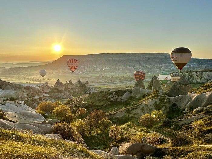 A little sneak peek?
If you're looking for great tips and offbeat spots, if you love exploring uncharted parts of a country, if the exotic is your adrenaline, then move along!
Our 15 days in early May in this part of Turkey (a country I first discovered during a city trip to Istanbul in 2017) will only tread well-worn paths and revisit popular routes. Simply because I kept hoping until the very end that our flight to Jordan wouldn’t be canceled. Events in the Gulf proved me wrong, so we left with: Zero preparation. Not a single hotel booked (well, except the first one), no visits planned, just a flight ticket bought three weeks earlier. No guidebook, no app—just the desire to explore southern Turkey and Cappadocia, whose images and the chance to stretch our legs had caught my eye.
Oh, wait—I did bring along a new guide: Gemini! Yes, my friends, generative AI was my chief advisor throughout the trip for sites to visit, accommodations, routes, and even restaurants! An experiment I wanted to try to form my own opinion on using this new technology. And what better way to test it than a Turkish getaway?
The verdict? You’ll have to wait for the trip recap to find out!
The main idea of the trip is also relaxation.
So, the plan is Antalya for a few days, the Turkish Riviera for a few more, Cappadocia as the highlight, and a return via Antalya to wrap up the trip. And it was all planned by AI!
So, if you're ready, fasten your seatbelts—cabin crew, doors to automatic and cross check—boarding for Turkey now!
A little sneak peek?Hi everyone,
Could you share your thoughts on my 3-week itinerary?
We’re a small group (family + friends) of 12 people, planning to leave around January 21, 2027.
Here’s my itinerary:
3 nights in Bangkok
4 nights in Chiang Mai
3 nights on Koh Samui
3 nights on Koh Phangan
4 nights in Krabi
4 nights in Phuket
I’m also open to any great tips you might have...
Thanks, everyone! Alain.