Hello.
I’m a 56-year-old man who’s done several treks in Nepal and elsewhere. Also passionate about photography.
I’m looking for one or more people to form a group for a trek in Nepal. The trek is the Annapurna and Manaslu circuit (24 days), including a stop at Tilicho Lake. I’ve got a great itinerary and the local company seems solid. The price is around $1600.
I’ll be in Nepal from April 5 to May 12, 2026, so the trek would need to happen within those dates.
Daniel, Québec, Canada
2,077 similar discussions in English
Hello,
We’re planning to travel at the beginning of 2026 (a couple) to visit these two countries (Laos and Cambodia). We’re looking for local travel agencies to organize our trip with a driver and vehicle.
For accommodation, staying with locals suits us just fine.
If any seasoned travelers have reliable recommendations, we’d love to hear them.
Thanks!
Best regards,
Lionel 1946
Introduction
In this travel journal, you’ll find a list of all the activities we did during our road trip through the Gaspésie.
Videos are embedded throughout the summary. Just click on the image to start the video.
To jump to a specific post, here are the relevant links:
Gaspé - Forillon National Park - Interpretation Center Gaspé - Forillon National Park - Mont-Saint-Alban Trail Gaspé - Forillon National Park - La Chute Trail Gaspé - Forillon National Park - Les Graves Trail Percé - Rivière-aux-Émeraudes Waterfall Percé - Bonaventure Island National Park Percé - Hike at the Foot of Percé Rock Percé Geopark - Suspended Glass Platform Percé Geopark - Magic Forest Loop Percé Geopark - Belvedere Trails Percé Geopark - Springs and Les Pieds Croches Trails Percé Geopark - Crevasse Trail Percé Geopark - Grande Coupe Trail Percé Geopark - Grotto Path Bonaventure - Le Malin de la Rivière Bonaventure Maria - Grand Sault Waterfall Carleton-sur-Mer - Les Saults Waterfall - Éperlan Trail Matapédia - Two Rivers Belvedere Saint-Alexis-de-Matapédia - Dream Horizon Belvedere Saint-André-de-Restigouche - Heart of the Plateaus Belvedere Saint-André-de-Restigouche - Picot Waterfalls Saint-Alexis-de-Matapédia - Robitaille Stream Waterfalls Trail Saint-Alexandre-des-Lacs - Philomène Waterfall Saint-Ulric - Ti-Mé Waterfall
INTRODUCTION
Creating a masterpiece like Gros Morne National Park wasn’t done overnight. So, when you first discover this extraordinary place, it’s easy to understand why Mother Nature took over 485 million years to bring it to life.
Here, glacial valleys, forests, rugged coastline, beaches, and peat bogs follow one another and intertwine to form a unique ecosystem, one that’s rare in the world. After all, this is where geologists found tangible evidence of the theory of continental drift, and it’s one of the few places on Earth where you can see—and even walk on—the Earth’s mantle. This site is a true celebration of the raw, enigmatic power and beauty of the physical world.
Designated a national park in 1973 and later a UNESCO World Heritage Site in 1987, it’s an 1,805 km² playground just waiting for the adventurer in you. Whether you’re traveling solo, with family, or with friends, for a few days or several weeks, you won’t run out of things to do here.
Source: https://www.exploretnl.ca/parc-national-gros-morne
The hikes we did in this region are listed below. Each hike has a link so you can quickly access more information about it.
Videos are embedded throughout the summary. Click on the image to start the video.
Stanleyville Trail Trout River Pond Trail Trout River Pond Trail (Return) Green Gardens Trail Tablelands Trail Scenic Route 431 Lookout Hills Trail Southeast Brook Falls Trail Gros Morne Mountain Trail (James Callaghan Trail) Berry Hill Trail Baker's Brook Falls Trail Berry Hill Pond Trail Western Brook Pond Trail Boat Tour on Western Brook Pond Steve’s Trail Shallow Bay Beach
With the $CAD/EUR exchange rate already worse than ever (thanks, Mr. Trump and his annexation threats), imagine my surprise when I found out that the EuroBank ATM (same for Alpha Bank) charged a 9% commission on the transaction. That pushed the exchange rate from the official 1.60$ to 1.77$ per euro. It’s better to buy euros in Canada or at a currency exchange office, or just pay by credit card, which I did (at a rate between 1.61$ and 1.63$).
Hi everyone! 🙂
We’re on the Roswell–Tucumcari leg. We’ll go through Fort Sumner. After visiting, there are two ways to reach Tucumcari:
Take US 84 to Santa Rosa, see its Blue Hole, then the almost ghost towns on the historic Route 66 (Cuervo, Newkirk, and Montoya). We won’t visit the Route 66 auto museum (we’ll do the one in Tucumcari). The other option is to take 252 and then 209.
The next day, we plan to head to our next stop in Las Vegas (the one in NM) by going up the Mesalands Scenic Byway (104).
Is the detour to Santa Rosa worth it? Are the historic Route 66 sections drivable?
Thanks for your tips! Marcalamar 🙂
Hello,
I’ve planned a 3.5-week trip to Chile in February/March 2025, with the goal of driving the Carretera Austral from Puerto Montt to Caleta Tortel in a rented 4x4. The itinerary is set, accommodations are booked, and the 4x4 is reserved. We could still tweak things a bit, but it’s getting harder to find available lodging in some spots.
Here’s the planned route: - 1 night in Puerto Montt on arrival day - 2 nights in Castro (Chiloé Island) - 2 nights near Ensenada - 1 night in Horniporén - 1 night in Chaitén - 3 nights in Puyuhuapi - 2 nights in Coyhaique - 3 nights between Puerto Bertrand and Cochrane - 2 nights in Caleta Tortel - 3 nights in Puerto Guadal - 1 night in Chile Chico (to take the ferry across the lake) - 1 night in Villa Cerro Castillo before flying out from Balmaceda
I have a few questions about the activities we’d like to do:
The **Marble Caves**: I’d love an option that lets us "go inside" them. From what I’ve read, this depends on the water level, wind, and type of boat. Any tips or advice? We’d like to do an **excursion to see condors**. We were thinking of doing this while in Coyhaique (we’re staying 2 nights). Has anyone done this? With which agency? We’re spending 3 nights between Puerto Bertrand and Cochrane. The idea is to **explore the vast Patagonia Park and its wildlife**. But I’m not sure where to start. Any recommendations for day hikes or itineraries? I read somewhere that you can do a day trip with a guide that includes a boat ride on Lake Cochrane, but I can’t find the booking info. An agency for **glacier exploration** (we were thinking of **Lake Leones Glacier**). I contacted Ruta León but haven’t heard back. Any agencies to recommend?
Thanks so much! Pascale
FOREWORD
In July 2018, we decided to go on a road trip to Prince Edward Island. We had four days off, so it was the perfect opportunity to set off on an adventure.
This time, I hadn’t had much time to prepare an itinerary. I’d only done a bit of research online to try and find tourist attractions that might interest us.
I should say that it wasn’t our first visit to the island, and since our stay was quite short, we decided to complete the island loop by making stops along the coast to admire the lighthouses, small fishing villages, beaches, and the stunning steep cliffs.
We also made a few stops at lookouts along the road and even went for a hike in Greenwich National Park.
Our trip was more of an escape into nature. When we travel, we feel best when we’re far from the noise and crowds.
So, I invite you to discover the fabulous landscapes of Prince Edward Island.
To get there, we had to cover nearly 1,000 km. It took us a full day, and we had to cross parts of Quebec and New Brunswick.
The roads are beautiful. However, there isn’t much to see except the vast forests lining the highways.
The Confederation Bridge, which is 12.9 kilometers long, connects New Brunswick to Prince Edward Island.
There’s no fee to enter the island when you cross this bridge. However, a toll must be paid when leaving the island.
https://www.confederationbridge.com/fr/tolls-fees
https://youtu.be/UWhn5bqLONU
Hello, we’d like to travel as a family to Madagascar (2 parents, 2 kids aged 10 and 12). A first trip over 15 years ago completely amazed and moved me with its beauty, kindness, and life experiences—but also its poverty and hardship. That’s why I think it’s possible to introduce our kids to this island while also doing something useful through volunteering. The window is short—15 days in March 2020—which means avoiding the north and east of the island due to cyclones and focusing on the south instead. Some ecovolunteering projects exist online, but the cost is sometimes prohibitive, and kids are rarely accepted. Do you have any ideas or contacts? Thanks in advance!
Hi everyone,
We started hiking the GR 34 a few years ago. At first, we did short hikes starting from our holiday home. Gradually, we had to drive to the starting point where we’d left off. Two years ago, we set off with our four boys (12, 9, 9, and 4 years old) for a 13-day trip, with 10 days of walking. We went from Pont-Aven to Bénodet (100 km). Challenge accomplished! We were so proud—especially the boys—and rightly so! This summer, we want to continue the adventure. We plan to pick up from Bénodet and go all the way to Pointe du Raz (~130 km). The boys are still motivated, though the youngest is a little less so. But he’ll have time to warm up to the idea. Do you know of any spots along this route (presbytery, bivouac, friends, campsites—but *really* cheap ones) where we can pitch our two small tents? Two years ago, we only stayed at campsites, and in the end, the bill was still pretty steep. We’d like to cut costs as much as possible. Thanks so much for your help! See you soon, Marie
We started hiking the GR 34 a few years ago. At first, we did short hikes starting from our holiday home. Gradually, we had to drive to the starting point where we’d left off. Two years ago, we set off with our four boys (12, 9, 9, and 4 years old) for a 13-day trip, with 10 days of walking. We went from Pont-Aven to Bénodet (100 km). Challenge accomplished! We were so proud—especially the boys—and rightly so! This summer, we want to continue the adventure. We plan to pick up from Bénodet and go all the way to Pointe du Raz (~130 km). The boys are still motivated, though the youngest is a little less so. But he’ll have time to warm up to the idea. Do you know of any spots along this route (presbytery, bivouac, friends, campsites—but *really* cheap ones) where we can pitch our two small tents? Two years ago, we only stayed at campsites, and in the end, the bill was still pretty steep. We’d like to cut costs as much as possible. Thanks so much for your help! See you soon, Marie
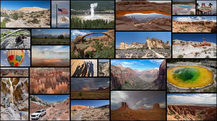
Nine Bretons in the USA from June 24 to July 20, 2018: Greenery and mosquitoes in the North, heat and storms in the South
Choosing the trip:
After returning from the USA in 2014 (travel journal here), it was clear we’d go back, this time with the firm intention of bringing our kids. 😇
2015 was the year of Scotland (travel journal here), 2016 was a work year, and 2017 was the discovery of Aragon in Spain (travel journal here)… Meanwhile, our kids’ age still seemed like a hurdle for this kind of trip. The long wait turned out to be an advantage, letting us refine the project and rally others: what started as a two-week trip for four turned into three weeks for nine!! JF’s parents (M&P, who’d already been in 2014) and JF’s brother (C&D&Y) joined our little family (C&JF&A&L)!!😎 After plenty of family discussions, route tweaks, travel journal reads, and advice from VF (plus some specialized books like Photographing the Southwest by Laurent Martrès), we made up our minds—fully aware of the constraints—and split the trip in two:
- First week, just the four of us in an SUV + hotels, looping from LV (Valley of Fire, Saint George, Bryce, Kanab), focusing on rocky, sandy, and colorful hikes:
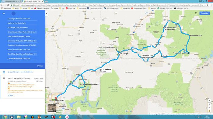 - Followed by two weeks with nine people in 2 RVs + campgrounds, as close to nature as possible in the parks (Snow Canyon, Kodachrome, Yellowstone, Arches, Canyonlands, Dead Horse, Monument Valley, Grand Canyon):
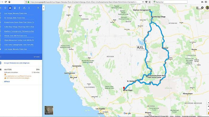 🙂Before going further, we want to thank the forum members who took the time to answer our questions. Your patience and kindness are amazing! We might forget someone, but thank you all: Jpg13, Mlefebvre, Kast13,Glll2012New, PCecile, Aquilegia, Adumas4, Ju45, Mycovtt, Natb72, Soula1, Orionide, Simonic, Hiacinthe, etc.
Traveling with nine people (ages 9 to 76, including three kids!!) requires some serious logistics and near-perfect timing to avoid wasting time. The plan went off without a hitch😎… well, almost—we’ll get into the details later…😛🏴☠️🙂 In the end, we came back enchanted and happy!! 🙂The family aspect played a big part, but we also discovered spots that were much less crowded, definitely less known to the general public and the hordes of Asian tourists… The kids returned with stars in their eyes, and the adults with just as many memories (plus around 1,200 photos and 130 GB of GoPro video to sort through)!!😎 We’re already feeling the itch to go back—a Denver loop is starting to take shape…😇
Thoughts on the Americans we met and places we visited: They haven’t changed since 2014… Still cool, optimistic, and smiling, always ready to strike up a conversation and offer help—even without the lure of our tourist dollars. (Only two cold locals at Monument Valley clearly made little effort to help us.) We noticed a few changes in the parks😕: some infrastructure was less well-maintained (wobbly wooden walkways, for example), French info pamphlets disappeared from entrance huts, and there were fewer rangers (Lee’s Ferry ranger station was closed). These changes are likely due to Trump’s restrictive policies toward national parks. On the economic side, gas prices rose by 30% since 2014, now around 0.85 € per liter, and with the current exchange rate, conditions are much less favorable for European tourists than in 2014. But this area is so beautiful—too bad Americans have such an idiot for a president!😠
The flights: Round-trip Paris CDG to Las Vegas LAS Roissy to Los Angeles with Air Tahiti Nui, then American Airlines for Los Angeles to Las Vegas. The A340s were impeccable, and service was great with Air Tahiti Nui (the tiare flower given at boarding), and no complaints about AA either.🙂
The hotels: All booked in advance, either through Hotels.com or directly on the hotel’s website (like the Planet Hollywood in Las Vegas). No surprises, everything met expectations.🙂 It’s a real plus for a family of four to have two beds in every room… Still rare in France.
The campgrounds: Except for one night at Lee’s Ferry, all were booked from France through NPS, Xanterra, and KOA sites. No surprises here either—everything met expectations and was well-organized (fire rings and tables at every site, for example).🙂
The vehicles:
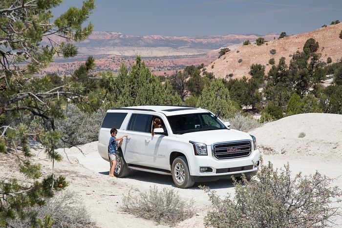
First week: Four people in a GMC Yukon XL from HERTZ, at Las Vegas airport for 327 €, unlimited miles, second driver, and insurance. A typically American beast—355 hp, seven seats: it’s long, big, wide, and tall😮😎😎!! Impeccable condition, quiet, super comfortable with tons of safety features and gadgets (like weather updates tied to GPS!!), and it averaged about 12 L/100 km in 2WD (in 4WD, we nearly hit 19 L on the Stukumpah Road…). A total win thanks to the HERTZ GOLD card, following Jpg13’s advice (Jean-Pierre, you’re my idol!!😎). It let us skip the counter lines (we didn’t even stop there!), pick up the car, and leave the parking lot in under seven minutes… Even less time for the return!
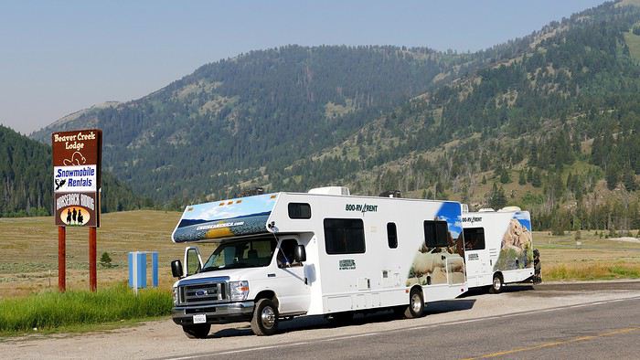
 Second and third weeks: Nine people in two RVs. A 30-foot RV + a 25-foot RV from CRUISE AMERICA in Las Vegas for 5000 €, unlimited miles, kitchenware, and linens/towels/comforters.
A love story in 2014 with this same agency, but unfortunately, this year was much more mixed: aging RVs, ineffective AC in the C30, a leak in the C25’s skylight, a leak in the C25’s toilet drain valve (imagine the dump every time we opened the drain plug…😠🙁), late delivery of both RVs (after 5 PM, though the contract said 4 PM max), abnormal wear on the front tires (we’d discover that later😠), trouble closing the door, etc.In short, a disappointment.😠
Note that other rental companies (El Monte and Road Bear) are probably gaining market share—we saw a lot of their vehicles on the road, and they offer much newer models (at least on the outside) for similar prices…🙂
But setting aside those issues, the vehicles still did their job: letting us sleep as close to nature as possible in the parks and enjoy beautiful sunrises/sunsets with family campfires and marshmallows flambéed with Jack Daniel’s Tennessee Honey😇!!😎 Also worth noting: Cruise America’s solid roadside assistance (we’ll talk more about that later), and how easy it was to drive these beasts—nearly 10 meters long! (Our walkie-talkies were super handy for communication between the two RVs.)
 And for the last day, a Ford Transit 12-seater from Hertz, at Las Vegas airport for 145 € for 24 hours. Perfect for a day with nine people and nine suitcases + nine bags!! Everything fit in the trunk, and it let us explore LV independently (including a trip to the outlet) for less than three taxis would’ve cost…😎
There you have it—the scene is set! If you’re interested in the rest, feel free to join in. The travel journal is done on the computer, and we’re up to day 11 for photos… We should be posting daily!!🙂
See you soon. Christelle & JF
Hello,
Thinking this might be useful for VF members who, like me, want to get their French driver’s license translated for a car rental in Japan, here’s the email I received this morning from the consular authorities in Tokyo:
Dear Sir,
You can obtain the translation from the Japan Automobile Federation (JAF). Address: 2-2-17 Shiba, Minato-ku, Tokyo 105-8562 Phone: 81-3-6833-9100 Email: kchosa@jaf.or.jp Website: http://www.jaf.or.jp/e/trans_f.htm (To find their office in Sapporo: http://www.jaf.or.jp/e/list_translation.htm)
Information about driver’s licenses is available on our website: http://www.ambafrance-jp.org/spip.php?article781&var_recherche=driver’s%20license The consular section can no longer provide driver’s license translation services.
Best regards,
Consular Section
So, according to this message, no more mail-in translations through the consular authorities.
Sayonara.
It's all in the title: I want to convert a van for traveling far, to places like Morocco, Tunisia, and Libya (among others!)
Indeed, 4x4 vehicles are too small and too conspicuous (and too expensive)
So I need a van with a 4x4 platform; but there are very few of them: a few Mercedes, the Citroën Jumper I think, and that's about it!
What can you recommend to me, knowing I can't spend too many dollars?
Thanks for your advice
See you soon
Hi, I’d like to go on a trip of about 14 days to Ladakh, with Dharamsala or Nepal as possible alternatives.
One of my goals is to authentically explore Tibetan Buddhism: understand its principles, attend one or a few teachings, visit monasteries, and if possible, meet a monk or teacher.
I’d like to dedicate a significant part of the trip to discovering local life: villages, families, cuisine, culture, nature, and interacting with the locals.
Is anyone planning a similar trip in the near future? I’m looking for someone who could join me. Whether we meet there or travel together from France.
Thanks a lot.
Hello everyone!
This travel journal aims to help future travelers (well, I hope so!), since there’s so little information available about this remote archipelago. Big thanks to Lolodesiles and Ayis for answering my questions while I planned this trip!
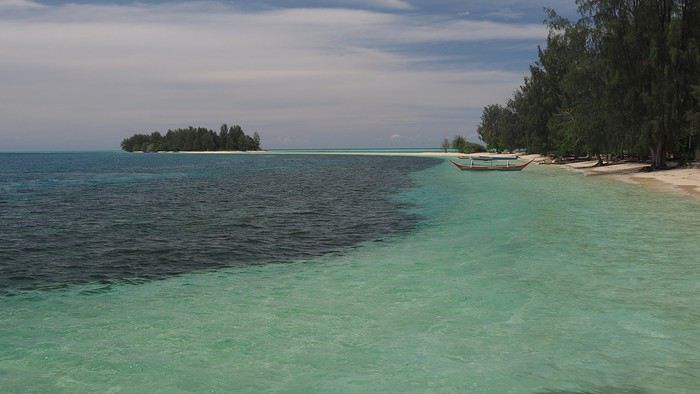
Context This is our fourth trip to Indonesia as a couple—after Java-Bali in 2011, Flores-Komodo in 2013, and Sulawesi in 2016—each time for three weeks. It’s also our tenth trip to Southeast Asia overall.
We’re traveling like we have in previous years: with a rough itinerary that often changes based on who we meet, tips from other travelers, how tired we are, or what we’re feeling in the moment. In the Moluccas, it’ll change constantly, mostly depending on transportation.
Our only accommodation booking: the first few nights in Ambon when we arrive.
Planned route (to be refined on the spot): Ambon - Banda Islands - Lease Islands - Ternate - Tidore - Halmahera (between Sofifi and Tobelo) - Morotai and the neighboring unnamed archipelago.
Flights: Lyon-Paris-Singapore on Air France (428 € round-trip), with good meals, champagne, and wine (we like our little comforts when going on vacation 😏). Then Singapore-Jakarta-Ambon on Air Asia and Garuda. Return flight: Ternate-Jakarta-Singapore on Lion Air, with a 3-day stopover in Singapore before heading home.
Episode 1: Ambon to Banda Our guesthouse, booked two days before departure, is 45 minutes from Ambon Airport, near Natsepa Beach (northeast of Leihitu). It’s a pretty average beach—quiet on weekdays but packed on Sundays (we saw the difference). It’s lined with warungs. This rainy day helps us readjust to the atmosphere of this country we love so much.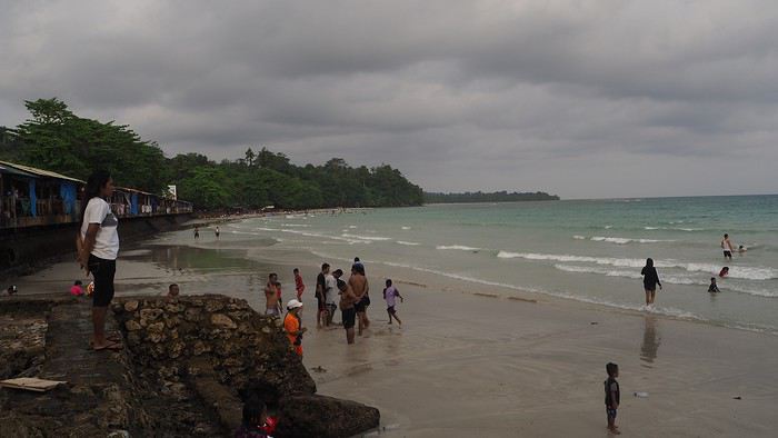
Our “Solim Guesthouse” is a lovely house with a living/dining room and garden, costing 15 € per night for two, including a hearty breakfast. Dinner is at Gaba Gaba, a great restaurant just a short walk away, right by the water, recommended by our host. Fun fact: it’s in the Lonely Planet, and it might be the only LP-listed spot in the Moluccas that actually matches the description (the others either don’t exist or have nothing to do with what’s advertised 😠).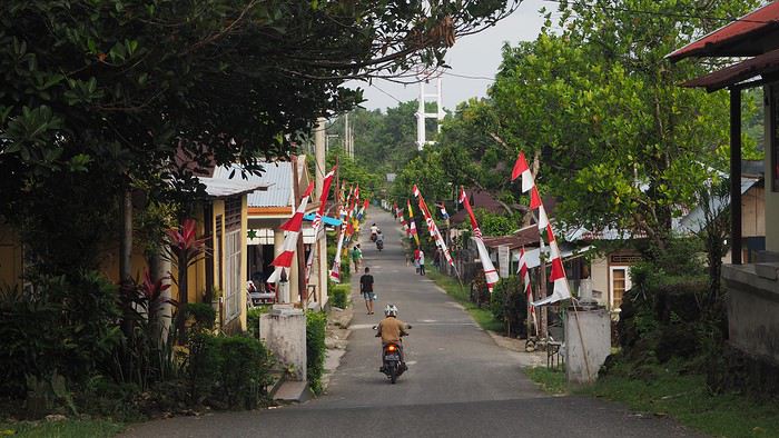
For the next two days, the super-friendly owner lends us his scooter. We set off to explore the coastal villages in northern Leihitu (the western part of Ambon Island, which has a weird shape).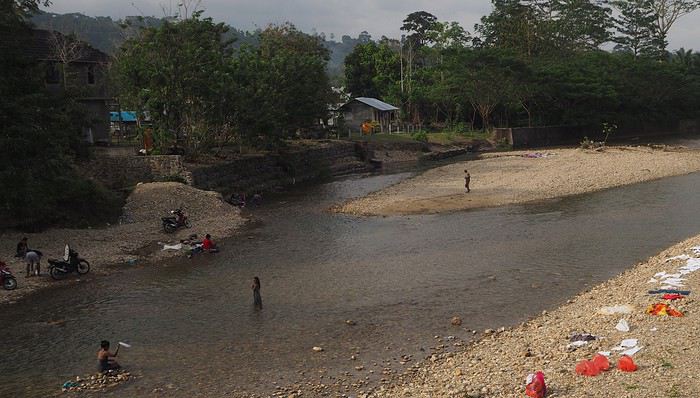 Laundry and trucks washed in the same stream.
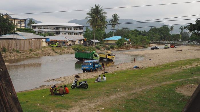
Liang Beach, described as the island’s most beautiful, is almost gone (climate change or something else?), but the colors are magical.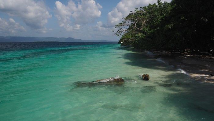
We continue 25 km toward a snorkeling spot our host recommended, taking a gorgeous, deserted little road through tiny villages in clove plantations (oh, those unforgettable scents!), stunning coves, and dense forest.
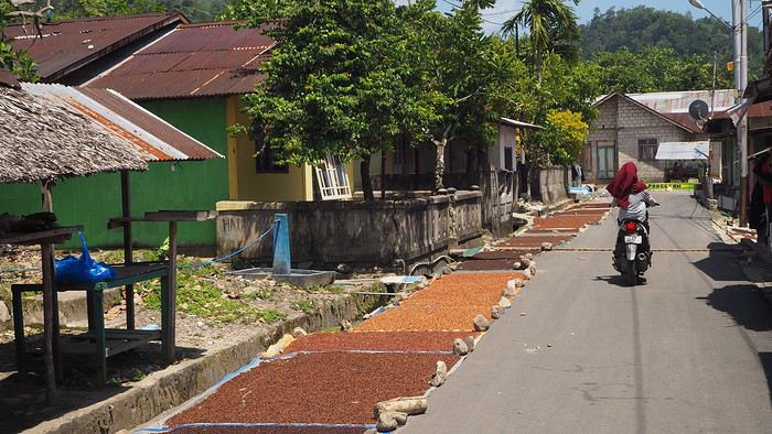
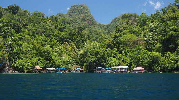 We’re greeted dozens of times with “Hello Mister”—a daily routine in the Moluccas. Every time we stop, we pose for photos to be saved on locals’ smartphones. They don’t see tourists often.
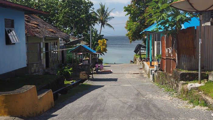
We ask for directions to the snorkeling spot (not easy—we only know basic Indonesian like *Selamat pagi*, *siang*, *sore*, and other polite phrases). Not many people know where it is (especially since we never know which village we’re in), but we eventually reach a small village that seems to be the right place. 🙂
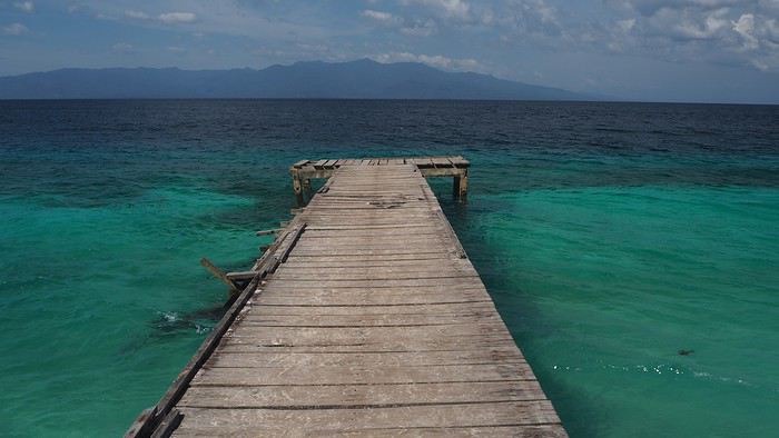
We ask a local to take us there by boat (it’s not reachable by land).
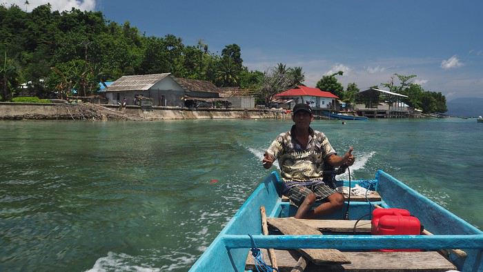
The spot is at most 100 meters long, but the coral is in good condition (apparently not dynamited by fishermen, unlike in other parts of this beautiful country where fishing methods are destructive and nature pays the price 😠). The fish are plentiful and diverse. It’s a great start before heading to Banda. We’re happy to have the place to ourselves… though we don’t yet realize we won’t see a single tourist for the rest of the trip!
After two days of rest, we head to Tulehu Port in the morning, aiming for the Banda Islands. We know the journey is often tricky: the Pelni ferry runs twice a month but doesn’t match our dates, the 10-seat Suzi Air plane is always full (you can’t book—you have to show up on Mondays and Fridays), and it’s often canceled due to weather. So we opt for the Tuesday speedboat (which also gets canceled if there are waves or wind), with the next one on Saturday. We’re used to Indonesian ports—crowded, rusty boats, no English speakers—but we still feel lost. When I ask about the speedboat to Bandaneira, people gesture wildly, someone takes me to the “harbor office,” then tells me there’s no boat, others try to sell me tickets, and some just say, “No boat.”
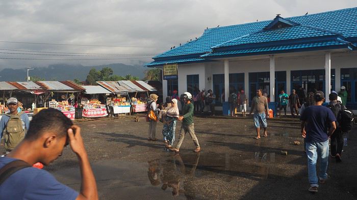
Luckily, an English-speaking local approaches us and confirms the speedboat is broken. The next one will be Saturday *if* it’s fixed—otherwise, even later. 🤪 😠 We’re crushed. We came here for the Banda Islands… 🙁 We decide waiting five days for a maybe-boat isn’t an option, so we decide to head straight to North Moluccas, which was planned for later. We’re so disappointed we don’t even want to stay in the area. The Lease Islands don’t appeal to us despite what we’ve read, and Seram would deserve its own trip with its remote mountain tribes. Huge disappointment—we’d been dreaming of Banda for months, with its incredible drop-offs like Bunaken, its islands covered in nutmeg trees, etc. I’d read that Banda is in the world’s top 5, alongside Bunaken (amazing—we went in 2016), Komodo (incredible—we went in 2013), Sipadan, and another spot I’ve forgotten.
We take a taxi back to Ambon (45 minutes) to a travel agency to buy plane tickets to Ternate. There’s a daily ATR72 flight at noon—perfect timing. Ambon is the capital of South Moluccas (or Central, depending on who you ask!) with 300,000 people. The city doesn’t seem unpleasant, but we don’t stop. On the plane, there are only about ten passengers for 72 seats. The flight attendants are stunning, as always with Wings Air—clearly, they’re hired for their looks. 😊

Stopover in Bacan—a runway in the middle of coconut trees serving a tiny town—then we fly over countless volcanoes, the last one towering over Ternate.
Next episode coming soon: Ternate.
This travel journal aims to help future travelers (well, I hope so!), since there’s so little information available about this remote archipelago. Big thanks to Lolodesiles and Ayis for answering my questions while I planned this trip!
Context This is our fourth trip to Indonesia as a couple—after Java-Bali in 2011, Flores-Komodo in 2013, and Sulawesi in 2016—each time for three weeks. It’s also our tenth trip to Southeast Asia overall.
We’re traveling like we have in previous years: with a rough itinerary that often changes based on who we meet, tips from other travelers, how tired we are, or what we’re feeling in the moment. In the Moluccas, it’ll change constantly, mostly depending on transportation.
Our only accommodation booking: the first few nights in Ambon when we arrive.
Planned route (to be refined on the spot): Ambon - Banda Islands - Lease Islands - Ternate - Tidore - Halmahera (between Sofifi and Tobelo) - Morotai and the neighboring unnamed archipelago.
Flights: Lyon-Paris-Singapore on Air France (428 € round-trip), with good meals, champagne, and wine (we like our little comforts when going on vacation 😏). Then Singapore-Jakarta-Ambon on Air Asia and Garuda. Return flight: Ternate-Jakarta-Singapore on Lion Air, with a 3-day stopover in Singapore before heading home.
Episode 1: Ambon to Banda Our guesthouse, booked two days before departure, is 45 minutes from Ambon Airport, near Natsepa Beach (northeast of Leihitu). It’s a pretty average beach—quiet on weekdays but packed on Sundays (we saw the difference). It’s lined with warungs. This rainy day helps us readjust to the atmosphere of this country we love so much.
Our “Solim Guesthouse” is a lovely house with a living/dining room and garden, costing 15 € per night for two, including a hearty breakfast. Dinner is at Gaba Gaba, a great restaurant just a short walk away, right by the water, recommended by our host. Fun fact: it’s in the Lonely Planet, and it might be the only LP-listed spot in the Moluccas that actually matches the description (the others either don’t exist or have nothing to do with what’s advertised 😠).
For the next two days, the super-friendly owner lends us his scooter. We set off to explore the coastal villages in northern Leihitu (the western part of Ambon Island, which has a weird shape).
Laundry and trucks washed in the same stream.
Liang Beach, described as the island’s most beautiful, is almost gone (climate change or something else?), but the colors are magical.
We continue 25 km toward a snorkeling spot our host recommended, taking a gorgeous, deserted little road through tiny villages in clove plantations (oh, those unforgettable scents!), stunning coves, and dense forest.
We’re greeted dozens of times with “Hello Mister”—a daily routine in the Moluccas. Every time we stop, we pose for photos to be saved on locals’ smartphones. They don’t see tourists often.We ask for directions to the snorkeling spot (not easy—we only know basic Indonesian like *Selamat pagi*, *siang*, *sore*, and other polite phrases). Not many people know where it is (especially since we never know which village we’re in), but we eventually reach a small village that seems to be the right place. 🙂
We ask a local to take us there by boat (it’s not reachable by land).
The spot is at most 100 meters long, but the coral is in good condition (apparently not dynamited by fishermen, unlike in other parts of this beautiful country where fishing methods are destructive and nature pays the price 😠). The fish are plentiful and diverse. It’s a great start before heading to Banda. We’re happy to have the place to ourselves… though we don’t yet realize we won’t see a single tourist for the rest of the trip!
After two days of rest, we head to Tulehu Port in the morning, aiming for the Banda Islands. We know the journey is often tricky: the Pelni ferry runs twice a month but doesn’t match our dates, the 10-seat Suzi Air plane is always full (you can’t book—you have to show up on Mondays and Fridays), and it’s often canceled due to weather. So we opt for the Tuesday speedboat (which also gets canceled if there are waves or wind), with the next one on Saturday. We’re used to Indonesian ports—crowded, rusty boats, no English speakers—but we still feel lost. When I ask about the speedboat to Bandaneira, people gesture wildly, someone takes me to the “harbor office,” then tells me there’s no boat, others try to sell me tickets, and some just say, “No boat.”
Luckily, an English-speaking local approaches us and confirms the speedboat is broken. The next one will be Saturday *if* it’s fixed—otherwise, even later. 🤪 😠 We’re crushed. We came here for the Banda Islands… 🙁 We decide waiting five days for a maybe-boat isn’t an option, so we decide to head straight to North Moluccas, which was planned for later. We’re so disappointed we don’t even want to stay in the area. The Lease Islands don’t appeal to us despite what we’ve read, and Seram would deserve its own trip with its remote mountain tribes. Huge disappointment—we’d been dreaming of Banda for months, with its incredible drop-offs like Bunaken, its islands covered in nutmeg trees, etc. I’d read that Banda is in the world’s top 5, alongside Bunaken (amazing—we went in 2016), Komodo (incredible—we went in 2013), Sipadan, and another spot I’ve forgotten.
We take a taxi back to Ambon (45 minutes) to a travel agency to buy plane tickets to Ternate. There’s a daily ATR72 flight at noon—perfect timing. Ambon is the capital of South Moluccas (or Central, depending on who you ask!) with 300,000 people. The city doesn’t seem unpleasant, but we don’t stop. On the plane, there are only about ten passengers for 72 seats. The flight attendants are stunning, as always with Wings Air—clearly, they’re hired for their looks. 😊
Stopover in Bacan—a runway in the middle of coconut trees serving a tiny town—then we fly over countless volcanoes, the last one towering over Ternate.
Next episode coming soon: Ternate.
After nearly 2 years of waiting (yeah, like many of you, we wanted to hit the road again as soon as we got back to France... but first, we had to fill up the piggy bank!), here we are at last—July, the month we’ve been waiting for!
We’ve got 30 days of exploring new places ahead of us, as well as revisiting some spots we loved back in 2012.
Here’s the plan: - Joshua Tree NP - Las Vegas - Valley of Fire SP - Yant Flat - Zion NP (Angel’s Landing) - Bryce Canyon NP (Fairyland Loop trail) - Devils Garden on the HITTR - Capitol Reef NP - Grand Teton NP - Yellowstone NP: Old Faithful - Yellowstone NP: Norris Geyser Basin and Mammoth Hot Springs - Yellowstone NP: Grand Canyon of the Yellowstone - West Thumb and Grand Teton NP - Flaming Gorge - Colorado NM and Fisher Towers - Moab: Arches - Moab: Canyonlands and Corona Arch - Moab: Canyonlands - Moab: rafting and Dead Horse Point SP - Natural Bridges NM and Valley of the Gods - Monument Valley and Horseshoe Bend - Coyote Buttes South - Grand Canyon NP (North Rim) - Grand Canyon NP (North Rim) and Navajo Bridge - Sedona - From Sedona to Tucson - Arizona-Sonora Desert Museum and Saguaro NP - Tombstone
Practical details:
- I’d read that it was better to book flight tickets directly on an airline’s website rather than through a comparison site. So, I spent months searching for reasonably priced tickets for two adults and two kids from Paris to Las Vegas for the outbound trip and from Tucson to Paris for the return. I mostly checked Air France, KLM, and British Airways, but prices were always around 4600 €. Not finding anything, we eventually went through a comparison site: Ebookers. We bought our tickets in mid-December: Paris/Atlanta with Air France, then Atlanta/Los Angeles with Delta for the outbound trip, and Tucson/Atlanta with Delta, then Atlanta/Paris with Air France for the return. Total cost: 4300 €. The layover on the outbound trip made me a little nervous because it was only 2 hours and 15 minutes. A month later, we got an email from Ebookers saying the layover had been reduced to 1 hour and 40 minutes! And a few months after that, it was down to just 1 hour and 30 minutes... So, we called Air France directly (we didn’t go through Ebookers, and it wasn’t a problem), and they put us on different flights. The new layover was 2 hours and 10 minutes—still not a ton of time, but I felt better than with 1 hour and 30 minutes. And anyway, we figured we’d see how it went!
- For the car, we tried several comparison sites, and in the end, AutoEurope won this year: 808 € for a 30-day rental of a Chevrolet Impala through Thrifty. The second driver was free for the entire trip since we picked up the car in California.
- We didn’t rent a GPS or buy one—we just downloaded Sygic on our two phones and bought the US map. I don’t remember the exact amount, but it cost us around 30 €.
- For hotels, I either booked directly on the sites (Xanterra, Grand Canyon Lodge, etc.) or used Hotels.com (to earn nights through their Welcome Rewards program) or Booking.com (when hotels weren’t available on Hotels.com). I always compared the price on Hotels.com with the hotel’s direct rate, but they were usually the same. So, for the same price, I’d rather earn a night with Welcome Rewards! We’d set a budget of 100 € per night on average, and we stuck to it pretty well—the final average came out to 101.20 € when including everything (nights + taxes + any nightly fees + parking fees + bank fees).
- As for luggage, we didn’t want to overpack! So, we left with one medium suitcase for Calista, one for me, one large suitcase for Hugo and Yannick, and a sports bag with Calista’s booster seat (we could’ve taken it on the plane with us, but I didn’t want to lug it around the airport during the layover). That sports bag came in handy on the way back, too—because, as everyone knows, you always come back with more than you left with! Each of us also had a backpack as a carry-on.
Before wrapping up this intro and getting into the real details, I’d like to thank everyone who contributed to my discussions and helped me improve our itinerary!
Quick intro for those who don’t know us: Yannick (36), Peggy (36), Hugo (11), and Calista (8).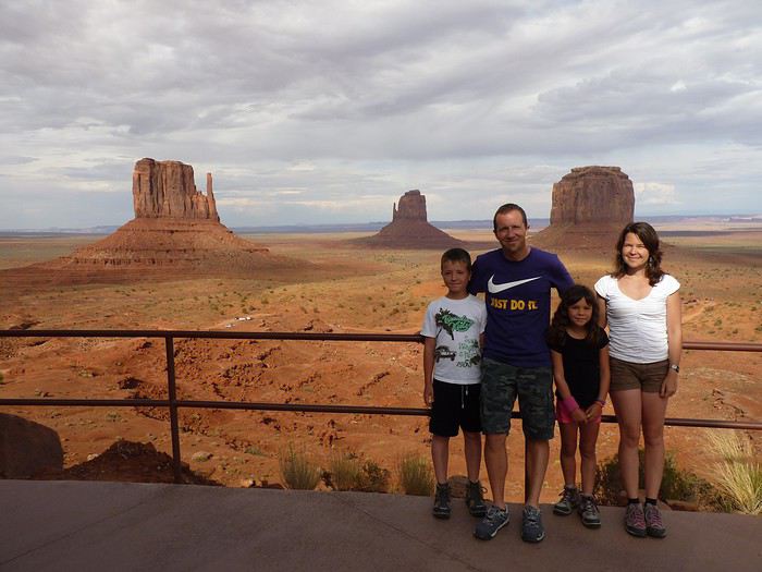
Here’s the plan: - Joshua Tree NP - Las Vegas - Valley of Fire SP - Yant Flat - Zion NP (Angel’s Landing) - Bryce Canyon NP (Fairyland Loop trail) - Devils Garden on the HITTR - Capitol Reef NP - Grand Teton NP - Yellowstone NP: Old Faithful - Yellowstone NP: Norris Geyser Basin and Mammoth Hot Springs - Yellowstone NP: Grand Canyon of the Yellowstone - West Thumb and Grand Teton NP - Flaming Gorge - Colorado NM and Fisher Towers - Moab: Arches - Moab: Canyonlands and Corona Arch - Moab: Canyonlands - Moab: rafting and Dead Horse Point SP - Natural Bridges NM and Valley of the Gods - Monument Valley and Horseshoe Bend - Coyote Buttes South - Grand Canyon NP (North Rim) - Grand Canyon NP (North Rim) and Navajo Bridge - Sedona - From Sedona to Tucson - Arizona-Sonora Desert Museum and Saguaro NP - Tombstone
Practical details:
- I’d read that it was better to book flight tickets directly on an airline’s website rather than through a comparison site. So, I spent months searching for reasonably priced tickets for two adults and two kids from Paris to Las Vegas for the outbound trip and from Tucson to Paris for the return. I mostly checked Air France, KLM, and British Airways, but prices were always around 4600 €. Not finding anything, we eventually went through a comparison site: Ebookers. We bought our tickets in mid-December: Paris/Atlanta with Air France, then Atlanta/Los Angeles with Delta for the outbound trip, and Tucson/Atlanta with Delta, then Atlanta/Paris with Air France for the return. Total cost: 4300 €. The layover on the outbound trip made me a little nervous because it was only 2 hours and 15 minutes. A month later, we got an email from Ebookers saying the layover had been reduced to 1 hour and 40 minutes! And a few months after that, it was down to just 1 hour and 30 minutes... So, we called Air France directly (we didn’t go through Ebookers, and it wasn’t a problem), and they put us on different flights. The new layover was 2 hours and 10 minutes—still not a ton of time, but I felt better than with 1 hour and 30 minutes. And anyway, we figured we’d see how it went!
- For the car, we tried several comparison sites, and in the end, AutoEurope won this year: 808 € for a 30-day rental of a Chevrolet Impala through Thrifty. The second driver was free for the entire trip since we picked up the car in California.
- We didn’t rent a GPS or buy one—we just downloaded Sygic on our two phones and bought the US map. I don’t remember the exact amount, but it cost us around 30 €.
- For hotels, I either booked directly on the sites (Xanterra, Grand Canyon Lodge, etc.) or used Hotels.com (to earn nights through their Welcome Rewards program) or Booking.com (when hotels weren’t available on Hotels.com). I always compared the price on Hotels.com with the hotel’s direct rate, but they were usually the same. So, for the same price, I’d rather earn a night with Welcome Rewards! We’d set a budget of 100 € per night on average, and we stuck to it pretty well—the final average came out to 101.20 € when including everything (nights + taxes + any nightly fees + parking fees + bank fees).
- As for luggage, we didn’t want to overpack! So, we left with one medium suitcase for Calista, one for me, one large suitcase for Hugo and Yannick, and a sports bag with Calista’s booster seat (we could’ve taken it on the plane with us, but I didn’t want to lug it around the airport during the layover). That sports bag came in handy on the way back, too—because, as everyone knows, you always come back with more than you left with! Each of us also had a backpack as a carry-on.
Before wrapping up this intro and getting into the real details, I’d like to thank everyone who contributed to my discussions and helped me improve our itinerary!
Quick intro for those who don’t know us: Yannick (36), Peggy (36), Hugo (11), and Calista (8).
After staying in Aruba in November 2023, we picked up our camper van, which we had left in a hotel parking lot in Miami, Florida.
This isn’t our first road trip across the United States. Since we’re retired, we took the opportunity to travel along the American West Coast, starting with the Everglades in Florida to visit a few parks where we could spot alligators.
We also made a few stops in Mississippi and Texas to explore the most important cities in those states.
Did you know that Austin is home to the world’s largest urban bat colony? It’s truly impressive to see thousands of them take flight at dusk.
I invite you to keep reading this travel journal and watch the videos that’ll give you a little more insight into these different destinations.
Videos are embedded throughout the summary. Just click on the image to start the video.
To jump to a specific post, here are the relevant links:
FLORIDA:
Big Cypress National Preserve - Ochopee Captain Mitch's Everglades Airboat Tours Marco Island
MISSISSIPPI:
Exploring Biloxi
TEXAS:
Downtown Houston Corpus Christi San Antonio Attractions McNutt Sculpture Garden - San Antonio Mission San José - San Antonio Austin Attractions The World’s Largest Urban Bat Colony - Austin Downtown Fort Worth Attractions Downtown Dallas
Hi there,
Last February, I made a trip using "public transport" from France to southern Senegal via Spain, Morocco, Western Sahara, and Mauritania.
It’s a journey of about 5,000 km, where I took trains (as far as Marrakech), ferries (to cross Gibraltar and then to reach Casamance from Dakar), and mostly buses on the long desert straightaways. I hadn’t planned any stops in advance or booked any hotels, except for the very first train to Spain, which left plenty of room for the unexpected. Why travel by land and sea? In recent years, flight-free travel has been gaining popularity. On social media, posts explaining how to cross Europe by train as quickly as possible go viral. Traveling without flying—and making sure people know about it—has become a great way to earn a badge of eco-responsibility: an essential totem for anyone wanting to prove both their dedication to the ecological cause and the wisdom of slow travel. I haven’t flown in years, and this journey to West Africa could easily be filed under "responsible travel." But it wouldn’t be honest to say that: in reality, it wasn’t really my aversion to flying that motivated this long trek. I see overland travel primarily as a way to experience the world’s geography at a grounded, earthly pace—the pace of the locals. Besides, I’ll be flying back, which disqualifies any claim to being a model of sustainability. So no eco-badge, and no adventurer’s badge either: you won’t find any heroic tales of camel rides in lost lands or mineral train wagons in this account (popular with influencers, the Mauritania iron ore train now attracts tourists from all over the world, turning "the experience" into something you "have to do at least once in your life"). This five-part story, written on the road, has no other ambition than to recount a journey through places and people, and to share the thoughts they inspire in me. As simply and, I hope, as humbly as possible.
I’m posting the episodes here, which you can also find on my blog (with more photos) at the following links:
Episode 1: Spain, from Avignon to Algeciras
Episode 2: Morocco, from Tangier to Tarfaya
Episode 3: Western Sahara, from Tarfaya to Guerguerat
Episode 4: Mauritania, from Guerguerat to Nouakchott
Episode 5: Senegal, from Rosso to Saloulou
To help those who might want to make the same trip, I’ve also put together a summary of the route with recommendations—you can read it at the end of the story and on the blog: From France to Senegal Without Flying: Route and Itinerary Recommendations
Happy reading, and safe travels!
HIGHWAY 1
Highway 1 runs along the Pacific coast of California from Leggett in the north to Dana Point in the south. It's the longest state route in California, stretching 1,050 km.
It's famous for its breathtaking ocean views. That’s actually why it’s become such a popular route for road trips, with tons of attractions and points of interest all along the way.
After crossing the U.S. interior on our way out (see Road Trip USA 2023 - Part 1), we’re starting our return trip along this route from Leggett.
Videos are embedded throughout the summary. Please click on the image to start the video. To jump to a specific post, here are the appropriate links:
CALIFORNIA:
Scenic Overlooks on Route 1 Between Leggett and Fort Bragg The Pudding Creek Trestle Bridge in Fort Bragg Glass Beach - Fort Bragg Jenner Lookout Point - Highway 1 Goat Rock Beach - Sonoma Coast State Park - Jenner Point Reyes National Seashore - White House Pool Trail Point Reyes National Seashore - Limantour Beach Point Reyes National Seashore - Point Reyes Shipwreck Point Reyes National Seashore - Kehoe Beach Trail Point Reyes National Seashore - McClures Beach Trail Point Reyes National Seashore - Cypress Tree Tunnel Point Reyes National Seashore - Point Reyes Beach North Point Reyes National Seashore - Elephant Seals on Drakes Beach Point Reyes National Seashore - Point Reyes Beach South Point Reyes National Seashore – Elephant Seals Overlooks Point Reyes National Seashore - Chimney Rock Trail Point Reyes National Seashore - Point Reyes Lighthouse Trail Point Reyes National Seashore – Tule Elk Observation Point Bonita Lighthouse Trail - Sausalito Hawk Hill - Sausalito Battery Spencer Trail - Sausalito Rodeo Beach - Sausalito Point Cavallo - Golden Gate View - Sausalito Exploring Downtown Sausalito Visiting Sausalito’s Houseboats Crossing the Golden Gate Bridge - San Francisco Golden Gate Bridge Viewpoints - San Francisco Cruise to Alcatraz Island - San Francisco Visiting Alcatraz Island - San Francisco Civic Center - Downtown San Francisco Market Street & Yerba Buena Gardens - Downtown San Francisco Union Square & Financial District - Downtown San Francisco Fisherman's Wharf, Pier 39 & Embarcadero - San Francisco Sea Lion Observation - Pier 39 - San Francisco Lombard Street & Cable Car - Russian Hill - San Francisco Macondray Lane Historic District - Russian Hill - San Francisco Grace Cathedral & Huntington Park - Nob Hill - San Francisco Telegraph Hill - San Francisco Chinatown - San Francisco Alamo Square & Painted Ladies - Western Addition - San Francisco Palace of Fine Arts - Marina District - San Francisco Presidio of San Francisco California Coastal Trail - Lincoln Park - San Francisco California Palace of the Legion of Honor - Lincoln Park - San Francisco Sutro Baths - Lincoln Park - San Francisco Queen Wilhelmina Garden - Golden Gate Park - San Francisco Bison Paddock - Golden Gate Park - San Francisco Portals of the Past - Golden Gate Park - San Francisco Strawberry Hill - Golden Gate Park – San Francisco Prayerbook Cross & Robin Williams Meadow - Golden Gate Park - San Francisco Hidden Garden Steps & 16th Avenue Tiled Steps - San Francisco Grandview Park - San Francisco Hike - Twin Peaks Three Summits - San Francisco Longboarding Down Twin Peaks Blvd in San Francisco Haight-Ashbury - San Francisco Corona Heights Park - San Francisco Mission Dolores - San Francisco Mural Frescoes (Part 1) - Mission District - San Francisco Mural Frescoes (Part 2) - Mission District - San Francisco Devil's Slide Bunker - Pacifica Mavericks Beach - Half Moon Bay Martins Beach - Half Moon Bay Pigeon Point Lighthouse State Historic Park - Pescadero What to See in Santa Cruz Visiting Capitola What to See in Monterey Carmel-by-the-Sea Lovers Point Park - Pacific Grove Castle Rock, Hurricane Point & Little Sur River Viewpoints Pfeiffer Falls Trail Julia Pfeiffer Burns State Park Vista Point & McWay Falls Highway 1 - Big Sur Viewpoints Salmon Creek Falls San Carpoforo Creek Trail Elephant Seal Vista Point - San Simeon San Simeon Pier Moonstone Beach Boardwalk Shipwreck - Estero Bluffs State Park Surfing Competition in Morro Bay Port San Luis Pier - San Luis Obispo Pismo Beach Monarch Butterfly Grove - Pismo State Beach Nojoqui Falls Park - Solvang Arroyo Hondo Vista Point Solvang, a Charming Danish Town in California Chumash Painted Cave - Santa Barbara Goleta San Marcos Rd & Cachuma Lake Vista Points - Santa Barbara Old Santa Barbara Mission Walking Tour of Santa Barbara’s Historic Downtown West Beach - Santa Barbara What to See in Ventura Paradise Falls - Wildwood Regional Park - Thousand Oaks Sandy Dune & El Matador State Beach - Malibu Point Dume Nature Reserve - Malibu Malibu Pier Road Trip in the Malibu Mountains Los Liones Trail - Santa Monica Santa Monica Pier Rodeo Drive - Beverly Hills Greystone Mansion - Beverly Hills Hollywood Walk of Fame - Los Angeles Griffith Observatory - Los Angeles Hollywood Forever Cemetery - Los Angeles What to See in Venice Beach Venice Beach Skatepark ShoreLine Aquatic Park - Long Beach Alamitos Beach - Long Beach Naples Island - Long Beach Crescent Bay Point Park & Helser Park Kiosk - Laguna Beach Shell Beach at Twin Points - Laguna Beach Prairie Dogs at Agra Vista Point Top Gun House & Oceanside Pier Annie's Canyon Trail - Solana Beach (Via North Rios Trailhead Loop) Old Town San Diego La Jolla Coastal Trail - San Diego Balboa Park - San Diego Pacific Beach - San Diego Mission Beach - San Diego Ocean Beach Tide Pools - San Diego Sunset Cliffs Natural Park - San Diego Tuna Harbor Park - San Diego Seaport Village & Embarcadero Marina Park - San Diego Gaslamp Quarter - Downtown San Diego Coronado Island - San Diego Dead Dolly Lane - Alpine Galleta Meadows Metal Sculptures - Borrego Springs What to See in Palm Springs Robolights - Palm Springs Andreas Canyon Trail - Indian Canyons - Palm Springs Palm Canyon Trail - Indian Canyons - Palm Springs West Fork Falls Trail - Indian Canyons - Palm Springs Tahquitz Canyon Loop Trail - Indian Canyons - Palm Springs Desert Christ Park - Yucca Valley Pioneertown Salvation Mountain - Niland Slab City - Niland
We did the Langtang trek (hike) from September 10th to 17th, with the first and last days being the trip from Kathmandu and back—so 6 days of actual walking. It’s a fairly well-known trek but certainly not as famous or crowded as those in the Annapurna or Everest regions, which is why we chose it.
In theory, it’s mandatory to have a guide for this trek. In reality, it seems there are ways to bypass the regulations: we met at least two people hiking without a guide—a South Korean, a New Zealander, and possibly also a couple of English women and an American couple, though we’re not sure if they had a guide.
The agency we booked with had told us it was an affordable trek for relatively older people in good shape—which is our case (I’m 72 myself). I have to say upfront that we found it quite challenging, maybe because we didn’t have good weather—it was the end of the monsoon season. To be clear, no matter your fitness level, I’d say doing this trek in the middle of the monsoon season would be suicidal.
Day 1 – Journey from Kathmandu to Syapru Besi
On Monday, September 8th, there had been violent protests in Kathmandu against the government, which had, among other things, blocked access to social media and been accused of nepotism and corruption. There were 19 deaths. The situation was very tense on the day of our departure, Wednesday the 10th. The agency warned us that public transport was very unreliable. So, we decided to take a jeep, at an additional cost of $100 ($160 minus what was already budgeted for the bus).
We left a little before 7 a.m. and it took us a good hour just to reach the outskirts of Kathmandu. Along the way, we saw several houses and vehicles set on fire by protesters.
The road to Syapru Besi is only 120 km, but it’s frankly awful. It’s always narrow, winds through endless mountains, and the shoulders range from bad to confusing to nonexistent. Several sections are just dirt tracks. We didn’t regret opting for the jeep, as we could stop several times at our convenience—if only to let Y (my Thai partner) throw up everything she had. She’d taken her usual motion sickness medication, but the constant turns, accelerations, and braking eventually made her terribly carsick.
In Nuwakot, we stopped for breakfast at a nice little restaurant, Jimbu. It was around 8:30 a.m., and we’d barely covered 60 km. The restaurant has a lovely garden overlooking the Trishuli Ganga, the river flowing down from Syapru Besi. First photo: the river in the bottom right corner, mist and clouds over the mountain on the other side.
An hour later, my second photo: the hills along the Trishuli Ganga. You can see the different crops—lush green rice paddies in the lower right and corn, already yellowed and likely harvested, in the foreground on the left. And of course, the mist and clouds through which you can glimpse the mountain on the other side of the river.
In January 2023, we started our second road trip across the United States. We stayed from January to mid-March, which gave us plenty of time to visit several cities, attractions, and parks in multiple states.
This travel journal will be split into two parts due to the considerable number of places we visited.
This first journal covers the following states: Ohio, Indiana, Missouri, Oklahoma, Texas, New Mexico, Arizona, Nevada, and California, and takes you through the outbound leg of our road trip.
The second journal will showcase the attractions we visited on the return trip, which mainly follows the famous Highway 1 along the Pacific coast.
So, I invite you to keep reading this first journal, which serves as a long recap to help you discover the various attractions we explored throughout this road trip.
Videos are included throughout the recap. Please click on the image to start the video.
Here are the links to jump to a specific post:
OHIO:
WinterLand - Christmas Lights at Cleveland Public Square Lake View Cemetery - Cleveland - Part 1 Lake View Cemetery - Cleveland - Part 2 Stroll through Columbus Upper Falls to Lower Falls via Buckeye Trail - Hocking Hills State Park – Logan Cedar Falls & Whispering Falls Hiking Trail - Hocking Hills State Park – Logan Ash Cave Hiking Trail - Hocking Hills State Park – Logan Exploring Cincinnati
INDIANA:
Visiting Indianapolis
MISSOURI:
Exploring St. Louis
OKLAHOMA:
Catoosa Blue Whale Discovering Tulsa Exploring Oklahoma City
TEXAS:
Exploring Shamrock Discovering McLean Exploring Amarillo
NEW MEXICO:
Ancestral Sites Trail - Pecos National Historical Park Discovering Santa Fe The Santuario de Chimayó Stroll through Los Cerrillos Walk through the village of Madrid San Francisco de Asis Catholic Church & The Bottle House - Golden Albuquerque Murals 66 Diner - Albuquerque Stroll through Old Town (Albuquerque) Rinconada Canyon Trail - Petroglyph National Monument Mesa Point Trail - Boca Negra Canyon - Petroglyph National Monument Macaw Trail - Boca Negra Canyon - Petroglyph National Monument Cliff Base Trail - Boca Negra Canyon - Petroglyph National Monument Piedras Marcadas Canyon - Petroglyph National Monument Sandstone Bluffs & Ventana Natural Arch - El Malpais National Monument
ARIZONA:
Stewart's Petrified Wood Shop – Holbrook Stroll through Holbrook Discovering Joseph City Exploring Winslow Grand Falls (The "Chocolate Falls") – Leupp Island Trail - Walnut Canyon National Monument Rim Trail - Walnut Canyon National Monument Wukoki Pueblo Trail – Wupatki National Monument Wupatki Pueblo Trail – Wupatki National Monument Doney Mountain Trail – Wupatki National Monument Citadel & Nalakihu Pueblos Trail – Wupatki National Monument Lomaki & Box Canyon Pueblos Trail – Wupatki National Monument Discovering Flagstaff On the way to Sedona Slide Rock State Park – Sedona Midgley Bridge Trail – Wilson Canyon – Sedona Tlaquepaque Arts & Shopping Village Walking Tour - Sedona Chapel of the Holy Cross - Sedona Hiking at Cathedral Rock - Sedona Hiking the Bell Rock Trail - Sedona Hiking the Airport Loop Trail - Sedona Amitabha Stupa and Peace Park - Sedona Hiking the Boynton Canyon Vortex Trail - Sedona Hiking the Devil's Bridge Trail - Sedona Hiking the Birthing Cave Trail - Sedona Bell Rock Inn - Sedona On the roads of Sedona - Part 1 On the roads of Sedona - Part 2 Keyhole Sink Hiking Trail - Kaibab National Forest Discovering Williams Exploring Ash Fork Discovering Kingman Ramada by Wyndham Kingman Davis Camp Park - Bullhead City Discovering Yucca Lake Havasu Boardwalk Tour A duck catches a lobster – Lake Havasu Boardwalk
CALIFORNIA:
Exploring Needles Discovering Goffs Discovering Amboy Visiting the famous Bagdad Cafe - Newberry Springs Exploring Barstow Vehicles from Hell (Mad Max Cars) - Barstow Peggy Sue's 50's Diner - Yermo Liberty Sculpture Park - Yermo Lake Dolores Water Park - Newberry Springs ZZYZX Road - Mojave National Preserve Alien Fresh Jerky - Baker Kelso Dunes Trail - Mojave National Preserve Hole-in-the-Wall Rings Trail - Mojave National Preserve Visiting Mitchell Caverns - Mojave National Preserve Dante's View - Death Valley National Park Zabriskie Point - Death Valley National Park Golden Canyon - Death Valley National Park Artists Drive & Artists Palette - Death Valley National Park Devil's Golf Course - Death Valley National Park Natural Bridge Trail - Death Valley National Park Badwater Basin - Death Valley National Park Harmony Borax Works - Death Valley National Park Devil's Cornfield - Death Valley National Park Mesquite Flat Sand Dunes - Death Valley National Park Mosaic Canyon Trail - Death Valley National Park On the road - Death Valley National Park
NEVADA:
Cleveland Clinic Lou Ruvo Center for Brain Health - Las Vegas Exploring Downtown Las Vegas SlotZilla Zipline - Fremont Street Experience – Downtown Las Vegas Viva Vision Light Show 1 - Fremont Street Experience - Downtown Las Vegas Viva Vision Light Show 2 - Fremont Street Experience - Downtown Las Vegas Viva Vision Light Show 3 - Fremont Street Experience - Downtown Las Vegas Viva Vision Light Show 4 - Fremont Street Experience - Downtown Las Vegas Free Live Music – Fremont Street Experience - Downtown Las Vegas Chucky – Fremont Street Experience - Downtown Las Vegas Las Vegas Strip - Part 1 Las Vegas Strip - Part 2 Las Vegas Strip - Part 3 Las Vegas Strip - Part 4 Las Vegas Strip - Part 5 Tom Devlin's Monster Museum - Boulder City Hoover Dam Lake Mead - Lakeview Overlook - Boulder City Nelson Ghost Town - Searchlight
CALIFORNIA:
Scenic Route through Joshua Tree National Park via the North Entrance Hidden Valley Trail - Joshua Tree National Park Barker Dam Trail - Joshua Tree National Park Cap Rock Trail - Joshua Tree National Park Keys View Trail - Joshua Tree National Park Hall of Horrors Trail - Joshua Tree National Park Skull Rock Trail - Joshua Tree National Park Arch Rock Trail - Joshua Tree National Park Cholla Cactus Garden Trail - Joshua Tree National Park Lone Pine - Owens Valley Miss Alabama & Shark Fin - Alabama Hills - Owens Valley Lone Ranger Canyon - Alabama Hills - Owens Valley Mobius Arch Loop Trail (Heart Arch & Lathe Arch) - Alabama Hills - Owens Valley Eye of the Alabama Hills Arch - Alabama Hills - Owens Valley Boot & Cyclops Arches - Alabama Hills - Owens Valley One Mile Arch, Bowling Ball and Pins & Gunga Din Area - Alabama Hills - Owens Valley Whitney Portal Arch Trailhead - Alabama Hills - Owens Valley Fish Rocks & Trona Pinnacles - Mojave Desert Red Cliffs Trail - Red Rock Canyon State Park Hagen Canyon Nature Trail - Red Rock Canyon State Park Tour of Historic Downtown Tehachapi View of the Tehachapi Loop – Monolith César E. Chávez National Monument – Keene Discovering Bakersfield Kern County Museum – Bakersfield Bravo Farms, Tree House & Petting Zoo - Traver Walking Tour of Kingsburg Exploring Fresno Simonian Farms & Soul Consoling Japanese Internment Tower - Fresno Duncan Ceramic Products (iLoveToCreate) - Fresno Walking Tour of Modesto Wat Dhammararam Buddhist Temple - Stockton Walking Tour of Stockton Discovering Stockton University of the Pacific - Stockton Visiting Lodi Sutter's Fort State Historic Park - Sacramento California State Capitol - Sacramento Walking Tour - Sacramento Walking Tour - Winters Walking Tour - Napa The Chandelier Tree In Drive-Thru Tree Park - Leggett One Log House - Garberville Grandfather Tree - Piercy The Living Chimney Tree - Avenue of the Giants Stephens Grove Loop Trail - Avenue of the Giants Gould Grove Nature Loop Trail - Avenue of the Giants Fleishmann Grove Trail - Avenue of the Giants Mahan Plaque Trail - Avenue of the Giants Founders Grove Nature Loop Trail - Avenue of the Giants Eternal Tree House & Immortal Tree - Avenue of the Giants Drury-Chaney Loop Trail - Avenue of the Giants Walking Tour - Redcrest
COMING UP NEXT:
USA Road Trip 2023 - Part 2
During our first road trip across the United States, we covered 23,000 km and crossed 28 states in 53 days.
Originally, we had planned to drive Route 66 all the way to Oatman in Arizona and visit various national parks in the American West over a two-month period.
This itinerary was planned before our departure, and all the relevant information had been gathered to stick to the schedule.
Everything went so smoothly that we finished visiting the national parks well ahead of our planned return date.
It helped that having a bed, a portable toilet, and a cooler in our vehicle gave us some autonomy since we didn’t have to worry about accommodation.
So, we decided to extend our road trip to the cities of Nashville and Memphis in Tennessee.
We then headed to Louisiana to visit Baton Rouge and New Orleans.
We crossed Mississippi and Alabama before driving along Florida’s west coast all the way to Key West.
We returned via Florida’s east coast and then crossed the eastern U.S. states to get back to Quebec through the Jackman border crossing in Maine.
So, I invite you to keep reading this long recap, which will let you discover the different attractions we visited throughout this amazing journey.
Videos are included throughout the recap. Click on the image to start the video.
To jump to a specific post, here are the relevant links:
Route 66 - Illinois & Missouri Route 66 - St. Louis (Missouri) - Gateway Arch National Park Route 66 - Cuba (Missouri) - City Murals Route 66 - Springfield (Missouri) - Fantastic Caverns Route 66 - Kansas & Oklahoma Route 66 - Texas & Arizona Route 66 - Texas - The Stations of the Cross in Groom Route 66 - Texas - Panhandle - VW Slug Bug Ranch Texas - Palo Duro Canyon State Park - Juniper Trails Texas - Palo Duro Canyon State Park - The Lighthouse Trail Route 66 - Texas - Amarillo - Cadillac Ranch Route 66 - New Mexico - Santa Rosa Blue Hole New Mexico - Bandelier National Monument - Alcove House Trail via Main Loop Trail New Mexico - Bandelier National Monument - Tsankawi Ruins Trail New Mexico - White Rock Overlook Route 66 - New Mexico - Albuquerque - Old Town New Mexico - White Sands National Park New Mexico - White Sands National Park - Dune Life Nature Trail New Mexico - White Sands National Park - Playa Trail New Mexico - White Sands National Park - Interdune Boardwalk New Mexico - Gila Cliff Dwellings National Monument New Mexico - Grants - Ice Cave & Bandera Volcano New Mexico - Gallup - Pyramide Rock Trail & Church Rock Trail Arizona - Holbrook - Painted Desert Arizona - Petrified Forest National Park - Puerco Pueblo & Newspaper Rock Viewpoint Arizona - Petrified Forest National Park - Blue Mesa Arizona - Petrified Forest National Park - The Teepees, Agate Bridge & Jasper Forest Overlook Arizona - Petrified Forest National Park - Crystal Forest Trail Arizona - Petrified Forest National Park - Giant Logs Trail Arizona - Winslow - Two Guns Ghost Town Arizona - Cameron - Little Colorado River Gorge Overlooks Arizona - Grand Canyon National Park - Shoshone Point Trail Arizona - Grand Canyon National Park - Desert View Drive Arizona - Grand Canyon National Park - Rim Route (Orange) & Village Route (Blue) Arizona - Grand Canyon National Park - Hermit Route (Red Line) Route 66 - Arizona - Historic Town of Oatman Arizona - Bullhead City Community Park Nevada - Red Rock Canyon - Calico I & II & Sandstone Quarry Nevada - Red Rock Canyon - Willow Springs Nevada - Red Rock Canyon Lookouts Nevada - Valley of Fire State Park - White Domes Trail Nevada - Valley of Fire State Park - Seven Wonders Trail, Pink Canyon, Fire Wave Nevada - Valley of Fire State Park - Rainbow Vista Trail Nevada - Valley of Fire State Park - Mouse's Tank Trail Nevada - Valley of Fire State Park - Rock Formations Nevada - Valley of Fire State Park - Scenic Routes Nevada - Cathedral Gorge State Park - Slot Canyons Nevada - Cathedral Gorge State Park - Eagle Point & Miller Point Utah - Bryce Canyon National Park - Mossy Cave & Tropic Ditch Waterfall Trail Utah - Bryce Canyon National Park - Scenic Drive Utah - Zion National Park - Pa'rus Trail Utah - Zion National Park - Sand Bench Trail Utah - Zion National Park - Emerald Pools Trail Utah - Zion National Park - West Rim Trail (Trail connecting to Angels Landing) Utah - Zion National Park - Riverside Walk Utah - Zion National Park - Court of The Patriarchs & Big Bend Utah - Zion National Park - Mount Carmel Highway Scenic Drive Utah - Kanab - Jackson Flat Reservoir Utah - Toadstools Trail in Grand Staircase-Escalante National Monument Arizona - Page - Glen Canyon Dam Overlook Arizona - Page - Glen Canyon National Recreation Area Arizona - Page - Horseshoe Bend Overlook Arizona - Page - Upper Antelope Canyon Arizona - Page - Navajo Canyon Boat Tour at Lake Powell Arizona - Page - Antelope Canyon X Arizona - Canyon de Chelly National Monument - Chelly Canyon Arizona - Canyon de Chelly National Monument - Canyon del Muerto Arizona - Monument Valley Navajo Tribal Park Utah - Mexican Hat Utah - Mexican Hat - Goosenecks State Park Utah - Mexican Hat - Valley of the Gods Utah - The Moki Dugway Scenic Backway Utah - Blanding - Natural Bridges National Monument Utah - Lake Powell - Hite Crossing Bridge Utah - Lake Powell - Glen Canyon National Recreation Area - Hite Overlook Utah - Capitol Reef National Park - Chimney Rock Loop Trail Utah - Capitol Reef National Park - Hickman Bridge Trail Utah - Capitol Reef National Park - Grand Wash Trail Utah - Capitol Reef National Park - Sunset Point Trail Utah - Capitol Reef National Park - Goosenecks Trail Utah - Capitol Reef National Park - Viewpoints - Fruita Area Utah - Capitol Reef National Park - Viewpoints - Scenic Drive Utah - Capitol Reef National Park - Cassidy Arch Trail Utah - Capitol Reef National Park - On the way to Capitol Gorge Trailhead Utah - Capitol Reef National Park - Capitol Gorge Trailhead Utah - Monroe - Mystic Hot Springs Utah - Scenic Overlooks on UT-24, UT-119 & I-70 Utah - Arches National Park - Park Avenue Trail Utah - Arches National Park - Courthouse Towers Section's Viewpoints Utah - Arches National Park - Balanced Rock, Pothole Arch, Ham Rock & Garden of Eden Utah - Arches National Park - Double Arch Trail, Cove Arch, Cove of Caves & Panorama Point Utah - Arches National Park - Windows Loop & Turret Arch Trail Utah - Arches National Park - Delicate Arch Trail Utah - Arches National Park - Upper Delicate Arch Viewpoint Trail Utah - Arches National Park - Fiery Furnace Section - Viewpoints Utah - Arches National Park - Sand Dune Arch Trail Utah - Arches National Park - Skyline Arch Trail Utah - Arches National Park - Devils Garden Trail Utah - Dead Horse Point State Park - West Rim Trail Utah - Dead Horse Point State Park - East Rim Trail Utah - Moab - Utah State Route 279 (Potash Road) Utah - Moab - Shafer Trail - Potash Evaporation Ponds Utah - Moab - Potash Road Dinosaur Tracks and Petroglyphs Utah - Moab - Potash Road - Corona, Bowtie & Pinto Arches Trail Utah - Moab - Potash Road - Wall Street Climbing Area Utah - Moab - Kane Springs Road Utah - Moab - Kane Springs Road - Side By Side Adventure Utah - Moab - Kane Springs Road to Moab Utah - Canyonlands National Park - Island in the Sky - Mesa Arch Trail Utah - Canyonlands National Park - Island in the Sky - Aztec Butte Trail Utah - Canyonlands National Park - Island in the Sky - Whale Rock Trail Utah - Canyonlands National Park - Island in the Sky - Upheaval Dome Trail Utah - Canyonlands National Park - Island in the Sky - Grand View Point Overlook Trail Utah - Canyonlands National Park - Island in the Sky - White Rim Overlook Trail Utah - Canyonlands National Park - Island in the Sky - Overlooks Utah - Moab - Wilson Arch Utah - Monticello - Newspaper Rock State Historical Monument Utah - Canyonlands National Park - The Needles - Road Side Ruin Trail Utah - Canyonlands National Park - The Needles - Cave Spring Trail Utah - Canyonlands National Park - The Needles - Pothole Point Trail Utah - Canyonlands National Park - The Needles - Big Spring Canyon Overlook Trail Utah - Canyonlands National Park - The Needles - Overlooks Colorado - Mesa Verde National Park - Mesa Top Ruins Road Colorado - Mesa Verde National Park - Chapin Mesa Road Colorado - Mesa Verde National Park - Mesa Top Loop Colorado - Mesa Verde National Park - Wetherill Mesa Road Colorado - Great Sand Dunes National Park Colorado - Mosca - Zapata Falls Colorado - Colorado Springs - Garden of the Gods Colorado - Black Canyon of the Gunnison National Park Colorado - Gunnison - Curecanti National Recreation Area Colorado - Gunnison - Blue Mesa Dam & Reservoir Colorado - Lake Pueblo State Park (Pueblo Reservoir) Kentucky - Mayfield, 5 months after an EF4 tornado Tennessee - Nashville - Downtown Walking Tour Tennessee - Graceland Mansion - Home of Elvis Presley Tennessee - Graceland - Lisa Marie & Hound Dog II Jets Tennessee - Graceland - Elvis Presley Automobile Museum & Exhibits Tennessee - Exploring Memphis Louisiana - Exploring Baton Rouge Louisiana - Exploring Lafayette Louisiana - Exploring Houma Louisiana - New Orleans - French Quarter Tour Louisiana - New Orleans - Garden District Tour Louisiana - New Orleans - Creole Queen Mississippi River Cruise Florida - Clearwater Beach Florida - Sanibel Island - Bowman's Beach Florida - Siesta Key Beach Florida - Captiva Island - Turner Beach Florida - Key Largo - Sunset Florida - Key West - Smathers Beach Florida - Miami Beach - Art Deco District Florida - Miami Beach South Carolina - Myrtle Beach Virginia - Virginia Beach Maine - Scarborough - Pine Point Beach
After visiting Newfoundland Island, we took the ferry to Blanc-Sablon, a municipality located on the Lower North Shore in Quebec, Canada.
Instead of heading back to Quebec via Sydney in Nova Scotia, we decided to explore the Lower North Shore—the least-known region of Quebec—as well as Labrador, which is part of the province of Newfoundland and Labrador.
From Blanc-Sablon, we drove to the municipality of Vieux-Fort via Route 138. This road ends in that municipality.
Afterward, we crossed Labrador to return to the Old Capital. Only one road allows this route. It wasn’t fully paved during our trip, but it is now.
We made stops in different areas to go on hikes that let us discover some incredible landscapes.
I hope this travel journal inspires you to venture into these stunning regions.
Videos are embedded throughout the summary. Click on the image to start the video.
Lower North Shore:
Lower North Shore - Blanc-Sablon - Brador Falls Lookout Lower North Shore - Blanc-Sablon - Astragalus Trail (Milk-Vetch Trail) Lower North Shore - Bonne-Espérance - Granny Hill Trail
Labrador:
Red Bay - Tracey Hill Trail Mary's Harbour - White Water Falls Trail Mary's Harbour - Gin Cove Hiking Trail Mary's Harbour - Dr. Moret Hiking Trail Happy Valley-Goose Bay - Birch Island Walk North West River - Sunday Hill Lookout Trail Churchill Falls - Bowdoin Canyon Nature Trail Labrador City - Tanya Lake Loop Trail Labrador City - Crystal Falls Hiking Trail
North Shore
North Shore - Manic 2, 3, 5 Hydroelectric Plants and Daniel-Johnson Dam Baie-Comeau - Pioneers Park Tadoussac Village
**********
More landscapes of the Lower North Shore, Labrador, and the North Shore
The Avalon Peninsula, located in the southeast of Newfoundland Island, isn't just a picturesque place—it's also teeming with natural wonders: icebergs, whales, migratory seabirds, and wild caribou.
It was the first region of the province to be settled. Moreover, it's rich in legends, traditions, and the history of the early adventurers who conquered the New World.
St. John's, the capital, is one of the oldest and easternmost cities in North America. With its colorful houses nestled in the heart of steep rocky hills, it has the traditional charm of a small port town.
Below are the hikes we did in this region. A link is attached to each hike to give you quicker access to the relevant information.
Videos are embedded throughout the summary. Please click on the image to start the video.
Chance Cove Coastal Hiking Trail Cape St. Mary's Ecological Reserve Holyrood - Salmonier Nature Park La Manche Provincial Park - Suspension Bridge Trail Cape Spear - Lighthouse Trail St. John's - Deadman's Bay Trail Quidi Vidi - Sugarloaf Trail St. John's - Signal Hill National Historic Site St. John's - North Head Trail Loop - Signal Hill Salmon Cove - Salmon Cove Sands Provincial Park
Hi there,
We’re planning a 15-day family trip in February 2026 (with 3 teens). We’ll be visiting friends who live in Puebla. Initially, I was thinking of the Yucatán, but after reading up on it, I don’t think it’s the right fit for us (too crowded, too touristy). So, we’re leaning toward something like this: - Mexico City: 2 days (Teotihuacán + city) - Puebla: 3 days - Tehuacán: 2 days (to break up the trip—is this a good choice? Is there enough to do for 2 days?) - Oaxaca: 3 days (Hierve el Agua, Monte Albán, city/tours) - Pacific Coast: 4 days (snorkeling, excursions)
Does this seem balanced? We’d like to end on the coast for some relaxation, ocean time, and fun for the kids. I’ve seen lots of excursions offered along the coast but can’t decide where to stay. Puerto Escondido? Huatulco? The beaches seem better for snorkeling in Huatulco, but I’ve read mixed things, and it’s farther away. What do you think?
For transportation, is this doable by bus? I’m struggling to find a decent bus between Tehuacán and Oaxaca (overnight schedules), and I’m not sure how to get around the coast. Also, how do we handle luggage between cities? We usually rent a car.
Finally, I’d love feedback on the Pacific Coast excursions—I get the feeling some are worth it and others aren’t. Is bioluminescence really magical? Are dolphin-watching tours ethical and not too "factory-like"? (We skipped them in Quebec and just watched whales from shore.) Can you see sea turtles up close?
Thanks for your help!
INTRODUCTION
Travel journal updated in MAY 2025
Since our travel plans outside Canada were canceled due to Covid-19, we decided to take our vacation in Quebec this summer and cover over 5,270 kilometers to explore the various tourist attractions of the North Shore and Gaspésie.
This summary will cover our experiences on the North Shore, while Gaspésie will be the subject of a future summary.
The North Shore, known for its stunning nature, is the perfect spot for outdoor enthusiasts since you can enjoy activities like hiking, wildlife observation, sea kayaking, fishing, and hunting (to name just a few).
It’s also one of the best places in the world to see whales.
Our journey along the North Shore took place between the villages of Tadoussac and Kegaska, as Route 138 ends at the beautiful, long beach in Kegaska.
Hi everyone, I’d love to know if anyone has tips for learning English easily. Thanks in advance to anyone who shares theirs!
English: Hello everyone, I’d like to know if anyone has tips for learning English easily. Thanks to all who share them with me.
English: Hello everyone, I’d like to know if anyone has tips for learning English easily. Thanks to all who share them with me.
Hi everyone. Good evening!
I’m back from Sententon. I’ve recovered now. What a beautiful, beautiful island—did it both ways.
The crossing I’d call the "Madman’s Crossing" (a nod to another well-known one) is the one from Tarrafal to Ponta do Sol, which I did in 4.5 hours without speeding like Gonzalez.
Then there’s what I’d call the "Grogue Diagonal"—the north-south route from Ribeira do Paul to the Janela Lighthouse, passing through Cova, Pico da Cruz, and Silva. A day and a half of pure enjoyment, wrapping up my visit to the island in supreme beauty.
In my opinion, here are the island’s 7 must-dos:
- The most stunning *bordeira* – the *bordeira do norte*
- The most fantastic – the climb from João do Bento to Orgueiro
- The most pleasant – the *vereda* Cova/Pico da Cruz/Silva
- The most overrated – the northern coastal path
- The most beautiful paved section – Ribeira de Penede’s lower part
- The most grueling – Figueira de Cima to Chupador
- The toughest – the climb to Salto Preto
And for any hiker, the Norte plateau is a must. Unfortunately, I couldn’t make it to Tope de Coroa—my only rainy day—but it was still good, even with the summit shrouded in clouds all day.
Here are my initial thoughts. I’m happy to share more with anyone planning the same crossings. I’m currently posting the route details on my blog and might share a few here. Though since the forum’s text editor isn’t top-notch without HTML, I’m not sure how it’ll turn out. In the meantime, you can check it out here --> Cape Verde. Should be of interest to hikers. Bye
Hi everyone,
I’m planning to leave Nice for Toulouse around 10/15 and I’m looking for tips / great deals regarding: - The route: I was thinking of taking Nice - Grasse - Draguignan - Salernes - Cadarache - Cavaillon - Arles, then the Camargue, Sète, and the Canal du Midi to Toulouse. The idea is to avoid high-traffic roads and too many steep climbs. Are there any spots to avoid or must-see stops? Since it’s been a while since I’ve been on the road, I was thinking that sleeping indoors might be preferable. If you have any budget-friendly accommodation suggestions along part of the route, don’t hesitate!
Thanks in advance, and if you’re in the area around that time, we could ride together... Ciao.
Good evening everyone,
This is my 15,000th post, and it's a message I would have preferred never to write.
Patrick—Yangguizi—won’t be returning from his trek in Uganda. His health betrayed him in the mountains.
Like many of you, I laughed until I couldn’t anymore at his travel stories. I met him in Shanghai, then in Istanbul... We scoured restaurants—he was an incredible expert on world cuisines. We relived Korea, China. Always brilliant, so sharp, so funny, so down-to-earth. Being even a little bit his friend was something to be proud of. I think I envied him.
Patrick is still out there, of course... He found his happiness running across the world. He’s on his path. He never doubted that "the traveler doesn’t even know if he’ll return one day."
Not sure this would’ve suited him, but his departure devastates me.
Alright, Farewell, you foreign devil. Safe travels.
Michel