Results for "Namibie+souvenir+artisanat"
About 6,461 results.
More options
Many results are in French, the community’s main language. English translations are added over time.
Search results
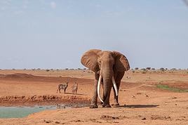
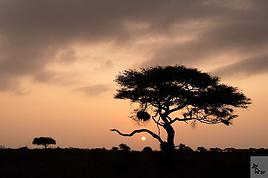
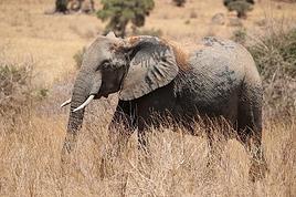
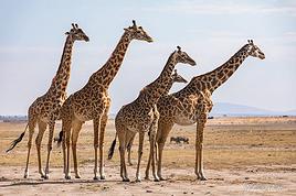
In the midst of Kenya's wildlife, October 2025
Hello everyone,
After sharing some safari photos from southern Tanzania, I’d like to show you those from our latest safari in Kenya in October 2025.
First, I’d like to thank Sylvie56, whose previous travel journals about this country inspired our trip choices. Thanks also for the info you sent us via PM. THANK YOU!
The following account is from a simple wildlife enthusiast. You won’t find anything here but images of landscapes, mammals, and birds. The stated purpose of this trip was purely and solely wildlife-focused. (It was in no way a discovery of the country or its people).
This stay/safari began (and ended) in Nairobi, with flights between France and Kenya operated by Qatar Airways departing from Nice.
Over two weeks, we first visited the reserves of Tsavo West and Tsavo East, then after a long road trip, the two reserves of Buffalo Springs and Samburu.
= Please wait until the end of the journal to ask any specific questions (or send them via PM) to keep the story flowing without interruptions or off-topic comments.
Thanks for your understanding.
...
Previous Kenya safari trip in 2017, here:
http://www.image-nature.com/forum/viewtopic.php?f=162&t=61119
...
After sharing some safari photos from southern Tanzania, I’d like to show you those from our latest safari in Kenya in October 2025.
First, I’d like to thank Sylvie56, whose previous travel journals about this country inspired our trip choices. Thanks also for the info you sent us via PM. THANK YOU!
The following account is from a simple wildlife enthusiast. You won’t find anything here but images of landscapes, mammals, and birds. The stated purpose of this trip was purely and solely wildlife-focused. (It was in no way a discovery of the country or its people).
This stay/safari began (and ended) in Nairobi, with flights between France and Kenya operated by Qatar Airways departing from Nice.
Over two weeks, we first visited the reserves of Tsavo West and Tsavo East, then after a long road trip, the two reserves of Buffalo Springs and Samburu.
= Please wait until the end of the journal to ask any specific questions (or send them via PM) to keep the story flowing without interruptions or off-topic comments.
Thanks for your understanding.
...
Previous Kenya safari trip in 2017, here:
http://www.image-nature.com/forum/viewtopic.php?f=162&t=61119
...
Off on an adventure to Java (and a bit of Bali)
Hey there, community! Back this weekend, below is my travel journal from my adventure in Indonesia. Enjoy the read!!!
Day 1 - August 10, 2025 New life downloading for three weeks! And for that, Flo and I launched a public tender... A public tender? What’s that got to do with a travel journal???... Well, when you think about it, few destinations tick all the boxes for an August adventure: Meaning, finding a place that’s exotic in the middle of August, not too expensive, not too packed with tourists, warm but not *too* warm, with postcard-perfect landscapes, dreamy beaches, tasty cuisine with a hint of exoticism, friendly and welcoming locals, where you’re free to sleep under the stars among the mosquitos, take transport surrounded by chickens, and even eat from a pig trough if you feel like it—well, turns out it’s not that easy to find! I’d even say, given how thick the list of requirements is, there’s a big risk the tender could be declared unsuccessful for failing to meet just one criterion. Let’s just say the candidates better submit a rock-solid proposal!
After reviewing all the responses and presentations from the candidates, the obvious choice for us is... Indonesia! Except that trying to explore a country as vast as Indonesia and its 17,504 islands in less than five years is a bit like reading the summary of a Proust novel without taking the time to savor each of its 950 pages! Don’t worry, I won’t name them all here. Besides, do they even all have names? No! Only 7,870 have been named—their parents clearly ran out of ideas for the rest. Anyway, our society, which worships the "work more to earn more" mantra, unfortunately limits our adventure time. So we’ll only get to see a small part of Indonesia, and we’ll have to make a tough choice to head for the best of the best in this archipelago of over seventeen thousand islands. Each one has its own selling points: Sumatra, Sulawesi, Java, the Celebes, Bali, Borneo, Papua, Timor, the Moluccas... So many names that smell of adventure... Another tender, another list of requirements, another review of proposals... Drumroll... Splash splash... And the lucky winner is... Ta-da... Java, Bali’s big sister, where I’ve already been eight years ago... Java the programming language. The Java of Broadway. We’re gonna *do* the Java. Java the coffee. And yes, Java is also an island!
This island, four times smaller than France, is home to 136 million people, making it the most populated island in the world! Fun fact: Indonesia, with its 260 million inhabitants, is just shy of the podium for the world’s most populated countries, after the winning trio of India, China, and the United States. And it’s on this island of Java that you’ll find Jakarta, the (soon-to-be-former) capital and main airport of the country, where we’ll soon land after our nineteen-hour flight! Yep, nineteen hours! I mean, Indonesia in general—and Java in particular—is a *tad* farther than going on vacation to Grandma Yoyo’s! Not sure where it is? Easy. Grab a map. Plant your finger on the big island at the bottom right—aka Australia for those who struggle with geography—move it up two centimeters, and bam, welcome to Indonesia!
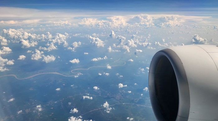
Nice transition, right? Because "Welcome to Indonesia" is exactly what the friendly flight attendant just said to me as we got off the plane! That’s it, our chakras are open, we’ve arrived at our (air)port. Time for rest, pool, cocktails, and a beach with our toes spread out... Wait, if you bought that, you clearly don’t know us yet! Since we still have energy to burn and need to adjust to the flight and time difference, we tackle the long administrative formalities to enter Indonesia, just to earn the right to hop in a 45-minute Grab taxi to the train station. The train station? What train station?... What do you usually do at a train station? Take a train, of course! Off we go for a three-hour train ride to Bandung, where we’ll officially start our adventure tomorrow after our first Indonesian night...
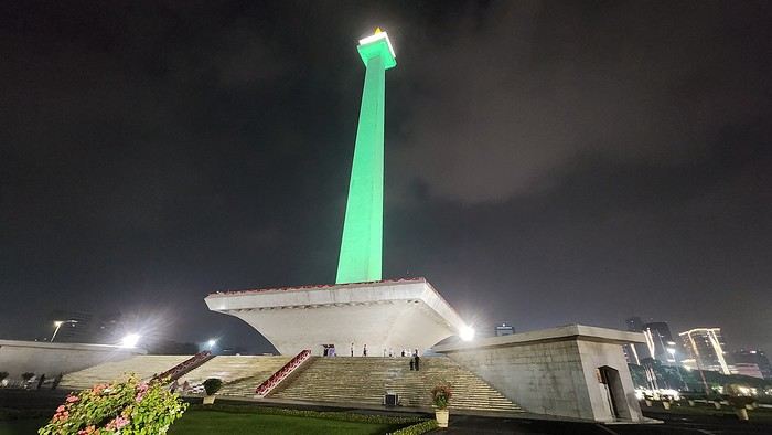
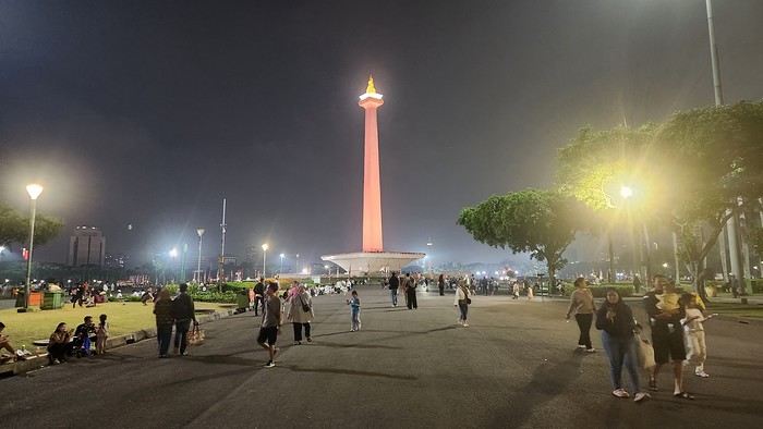
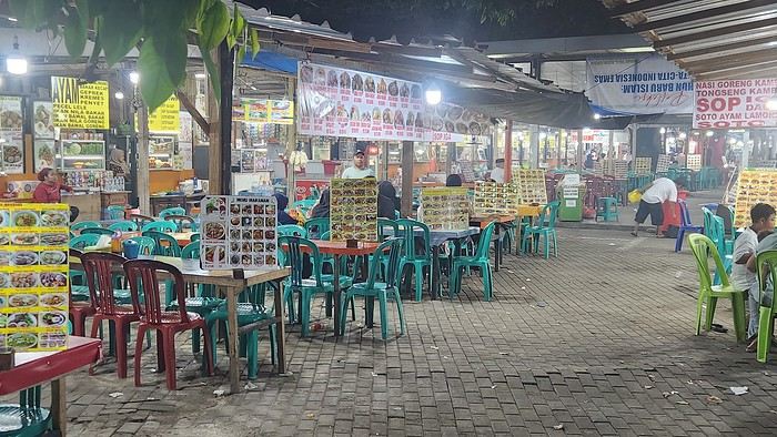
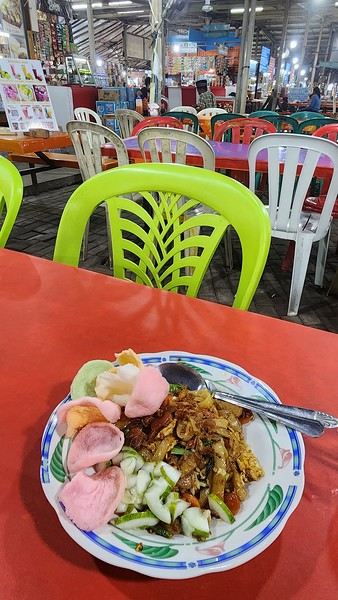
Unfortunately, we were a bit slow off the mark, which meant we missed the 6:25 PM train by two minutes. Oh well, we’ll have to wait until 11 PM. We take the opportunity to stretch our legs in Jakarta, soak up the atmosphere, and enjoy the delicious smells wafting from the *warungs*—those little typical street restaurants. A quick stop at the National Monument, a detour to a night market to devour our first *kwetiaw goreng* and *teh manis* for 60,000 rupiahs (that’s 3 € for two), and just like that, our penalty is lifted, and we’re allowed to hit the road again. Off to Bandung, where we arrive at 2 AM for... a *very* short night...
Day 1 - August 10, 2025 New life downloading for three weeks! And for that, Flo and I launched a public tender... A public tender? What’s that got to do with a travel journal???... Well, when you think about it, few destinations tick all the boxes for an August adventure: Meaning, finding a place that’s exotic in the middle of August, not too expensive, not too packed with tourists, warm but not *too* warm, with postcard-perfect landscapes, dreamy beaches, tasty cuisine with a hint of exoticism, friendly and welcoming locals, where you’re free to sleep under the stars among the mosquitos, take transport surrounded by chickens, and even eat from a pig trough if you feel like it—well, turns out it’s not that easy to find! I’d even say, given how thick the list of requirements is, there’s a big risk the tender could be declared unsuccessful for failing to meet just one criterion. Let’s just say the candidates better submit a rock-solid proposal!
After reviewing all the responses and presentations from the candidates, the obvious choice for us is... Indonesia! Except that trying to explore a country as vast as Indonesia and its 17,504 islands in less than five years is a bit like reading the summary of a Proust novel without taking the time to savor each of its 950 pages! Don’t worry, I won’t name them all here. Besides, do they even all have names? No! Only 7,870 have been named—their parents clearly ran out of ideas for the rest. Anyway, our society, which worships the "work more to earn more" mantra, unfortunately limits our adventure time. So we’ll only get to see a small part of Indonesia, and we’ll have to make a tough choice to head for the best of the best in this archipelago of over seventeen thousand islands. Each one has its own selling points: Sumatra, Sulawesi, Java, the Celebes, Bali, Borneo, Papua, Timor, the Moluccas... So many names that smell of adventure... Another tender, another list of requirements, another review of proposals... Drumroll... Splash splash... And the lucky winner is... Ta-da... Java, Bali’s big sister, where I’ve already been eight years ago... Java the programming language. The Java of Broadway. We’re gonna *do* the Java. Java the coffee. And yes, Java is also an island!
This island, four times smaller than France, is home to 136 million people, making it the most populated island in the world! Fun fact: Indonesia, with its 260 million inhabitants, is just shy of the podium for the world’s most populated countries, after the winning trio of India, China, and the United States. And it’s on this island of Java that you’ll find Jakarta, the (soon-to-be-former) capital and main airport of the country, where we’ll soon land after our nineteen-hour flight! Yep, nineteen hours! I mean, Indonesia in general—and Java in particular—is a *tad* farther than going on vacation to Grandma Yoyo’s! Not sure where it is? Easy. Grab a map. Plant your finger on the big island at the bottom right—aka Australia for those who struggle with geography—move it up two centimeters, and bam, welcome to Indonesia!
Nice transition, right? Because "Welcome to Indonesia" is exactly what the friendly flight attendant just said to me as we got off the plane! That’s it, our chakras are open, we’ve arrived at our (air)port. Time for rest, pool, cocktails, and a beach with our toes spread out... Wait, if you bought that, you clearly don’t know us yet! Since we still have energy to burn and need to adjust to the flight and time difference, we tackle the long administrative formalities to enter Indonesia, just to earn the right to hop in a 45-minute Grab taxi to the train station. The train station? What train station?... What do you usually do at a train station? Take a train, of course! Off we go for a three-hour train ride to Bandung, where we’ll officially start our adventure tomorrow after our first Indonesian night...
Unfortunately, we were a bit slow off the mark, which meant we missed the 6:25 PM train by two minutes. Oh well, we’ll have to wait until 11 PM. We take the opportunity to stretch our legs in Jakarta, soak up the atmosphere, and enjoy the delicious smells wafting from the *warungs*—those little typical street restaurants. A quick stop at the National Monument, a detour to a night market to devour our first *kwetiaw goreng* and *teh manis* for 60,000 rupiahs (that’s 3 € for two), and just like that, our penalty is lifted, and we’re allowed to hit the road again. Off to Bandung, where we arrive at 2 AM for... a *very* short night...
What are the criteria that make you choose one destination over another?
Hi there,
The title might be a bit long, but I hope it’s completely understandable!
When it comes to choosing your next trip, what tips the scales in favor of Eritrea over Ibiza?
Why pick Canada over French Polynesia?
The price? A magazine or TV report, a travel journal, an Instagram ad? Ease of travel? Minimal time difference? The country that has the most in common with all the trip participants? Activities? Relaxation? The desire to push your limits?
A photo?
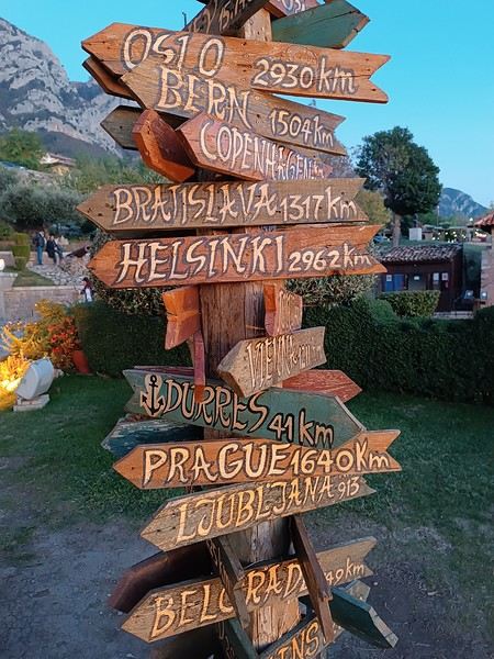
What else, I wonder...
Personally, I often prioritize simple destinations (no administrative hassles), where I’m not at risk (nothing extraordinary like getting kidnapped by Daesh or ending up in a jail cell because the current geopolitics aren’t favorable to my passport, etc.), and where I can drive.
Wide-open natural spaces are more my thing than urban anthills.
Finally, I try not to spend three days on a plane to reach my destination, and I aim for a maximum budget of 3500 € (for 3 weeks) in comfortable conditions—that means charming hotels, good meals, etc.
What about you?🙂
The title might be a bit long, but I hope it’s completely understandable!
When it comes to choosing your next trip, what tips the scales in favor of Eritrea over Ibiza?
Why pick Canada over French Polynesia?
The price? A magazine or TV report, a travel journal, an Instagram ad? Ease of travel? Minimal time difference? The country that has the most in common with all the trip participants? Activities? Relaxation? The desire to push your limits?
A photo?
What else, I wonder...
Personally, I often prioritize simple destinations (no administrative hassles), where I’m not at risk (nothing extraordinary like getting kidnapped by Daesh or ending up in a jail cell because the current geopolitics aren’t favorable to my passport, etc.), and where I can drive.
Wide-open natural spaces are more my thing than urban anthills.
Finally, I try not to spend three days on a plane to reach my destination, and I aim for a maximum budget of 3500 € (for 3 weeks) in comfortable conditions—that means charming hotels, good meals, etc.
What about you?🙂
Tanzania 2019 - Polé Polé
KARIBUUU
Over 5 years later, I’m finally getting around to writing the travel journal for our first trip to East Africa: Tanzania. *Polé Polé*, as they say! 😎
A trip I’d started planning just 6 years ago, in February 2019, for my post-internship exam vacation. After returning to South Africa in July 2019 with my family, this trip, planned for September 2019, would be all about discovery and a few firsts: first trip with friends, first trek, first time in East Africa. I really wanted to attempt the Kilimanjaro ascent, try to still see some of its "eternal" ice, and Alison wanted to do as much safari as possible. Unlike with the Zulus, Himbas, or San, visiting a Maasai village wasn’t on the agenda. Thanks to the Kessy Brothers agency, who were super responsive, Sandy from VF, and other members who helped prepare our trip, we settled on the following itinerary:
Day -1 (8/30): Departure from Pointe-à-Pitre Day 0 (8/31): Departure from Paris Day 1 (9/01): Arrival at Kilimanjaro Airport / Ameg Lodge (Moshi) DAY 2 (9/02): Machame gate / Machame camp DAY 3 (9/03): Shira / Shira camp DAY 4 (9/04): Baranco / Baranco camp DAY 5 (9/05): Barafu / Barafu camp DAY 6 (9/06): Barafu + Summit at midnight / Mweka camp DAY 7 (9/07): Mweka gate / Sal Salnero Hotel (Moshi) DAY 8 (9/08): Arusha National Park / Kanga camp DAY 9 (9/09): Tarangire National Park / Kanga camp DAY 10 (9/10): Tarangire National Park / Twiga Lodge DAY 11 (9/11): Lake Manyara / Twiga Lodge DAY 12 (9/12): Ngorongoro Crater / Simba campsite DAY 13 (9/13): Serengeti National Park / Seronera campsite DAY 14 (9/14): Serengeti National Park - Uoga Kuria Camp DAY 15 (9/15): Serengeti National Park / Waso campsite DAY 16 (9/16): Lake Natron / Maasai Giraffe Ecolodge DAY 17 (9/17): Kilimanjaro Airport Day 18 (9/18): Zanzibar Day 19 (9/19): Zanzibar Day 20 (9/20): Zanzibar Day 21 (9/21): Zanzibar
As I mentioned in my first travel journal about our South Africa trip, I’ve had a special connection to Tanzania for a long time. Growing up in the Indian Ocean without ever visiting Africa, those wildlife documentaries on TV when I skipped my pharmacy classes... I imagined and dreamed about this land and country so much.
The original plan was to go just the two of us with Alison, but somehow—though I don’t quite remember how—we ended up organizing the trip with our friends Mélissa and Doriane, who joined us in Arusha after our Kilimanjaro trek for the last two weeks and their very first safari. I think it was Melissa who had the idea to crash our trip, and she was right to do so! 😉 Flights: Pointe-à-Pitre-Grand Case and Grand Case-Paris with Air Caraïbes. Flights: Paris-JRO and ZNZ-Paris with Kenya Airways (layover in Nairobi). Flight: JRO-ZNZ with Air Tanzania.
Safe travels! !
Over 5 years later, I’m finally getting around to writing the travel journal for our first trip to East Africa: Tanzania. *Polé Polé*, as they say! 😎
A trip I’d started planning just 6 years ago, in February 2019, for my post-internship exam vacation. After returning to South Africa in July 2019 with my family, this trip, planned for September 2019, would be all about discovery and a few firsts: first trip with friends, first trek, first time in East Africa. I really wanted to attempt the Kilimanjaro ascent, try to still see some of its "eternal" ice, and Alison wanted to do as much safari as possible. Unlike with the Zulus, Himbas, or San, visiting a Maasai village wasn’t on the agenda. Thanks to the Kessy Brothers agency, who were super responsive, Sandy from VF, and other members who helped prepare our trip, we settled on the following itinerary:
Day -1 (8/30): Departure from Pointe-à-Pitre Day 0 (8/31): Departure from Paris Day 1 (9/01): Arrival at Kilimanjaro Airport / Ameg Lodge (Moshi) DAY 2 (9/02): Machame gate / Machame camp DAY 3 (9/03): Shira / Shira camp DAY 4 (9/04): Baranco / Baranco camp DAY 5 (9/05): Barafu / Barafu camp DAY 6 (9/06): Barafu + Summit at midnight / Mweka camp DAY 7 (9/07): Mweka gate / Sal Salnero Hotel (Moshi) DAY 8 (9/08): Arusha National Park / Kanga camp DAY 9 (9/09): Tarangire National Park / Kanga camp DAY 10 (9/10): Tarangire National Park / Twiga Lodge DAY 11 (9/11): Lake Manyara / Twiga Lodge DAY 12 (9/12): Ngorongoro Crater / Simba campsite DAY 13 (9/13): Serengeti National Park / Seronera campsite DAY 14 (9/14): Serengeti National Park - Uoga Kuria Camp DAY 15 (9/15): Serengeti National Park / Waso campsite DAY 16 (9/16): Lake Natron / Maasai Giraffe Ecolodge DAY 17 (9/17): Kilimanjaro Airport Day 18 (9/18): Zanzibar Day 19 (9/19): Zanzibar Day 20 (9/20): Zanzibar Day 21 (9/21): Zanzibar
As I mentioned in my first travel journal about our South Africa trip, I’ve had a special connection to Tanzania for a long time. Growing up in the Indian Ocean without ever visiting Africa, those wildlife documentaries on TV when I skipped my pharmacy classes... I imagined and dreamed about this land and country so much.
The original plan was to go just the two of us with Alison, but somehow—though I don’t quite remember how—we ended up organizing the trip with our friends Mélissa and Doriane, who joined us in Arusha after our Kilimanjaro trek for the last two weeks and their very first safari. I think it was Melissa who had the idea to crash our trip, and she was right to do so! 😉 Flights: Pointe-à-Pitre-Grand Case and Grand Case-Paris with Air Caraïbes. Flights: Paris-JRO and ZNZ-Paris with Kenya Airways (layover in Nairobi). Flight: JRO-ZNZ with Air Tanzania.
Safe travels! !
Texas, Louisiana, and a Touch of Florida
After five trips to the American West, we had planned to switch countries and continents to visit Turkey. However, by the time we made up our minds, flight ticket prices had nearly doubled, reaching 400 € for a round-trip ticket. A bit disappointed, I started looking at transatlantic flight prices and stumbled upon discounted tickets from Basel-Mulhouse to Dallas—at the same price as our tickets to Turkey!
No hesitation needed; we bought the five tickets for a total of 1,860 € excluding baggage!
From Fort Worth Airport, we had two options: - Head west on a loop through Texas, New Mexico, and southern Colorado - Head east to change the scenery and explore East Texas, Louisiana, with a possible detour into Florida.
The latter option won unanimously, so here we are, off to discover new states, mainly Louisiana and Texas.
One of the main post-COVID challenges is finding a reasonably priced car rental. After an initial booking around 1,300 €, we kept an eye on prices a few weeks before departure and managed to snag a better deal at around 900 € for a comfortable sedan.
Yes, this summer will also be a first: no 4x4, no camping, and plenty of restaurants!
As always, I’ve planned a packed itinerary, ready to adjust on the go. A few weeks before departure, we learned we’d be at full capacity—our eldest son, Maxime, got his first-year med school results. By finishing as a top admit, he avoided the mandatory July-August internship that would’ve kept him from joining us. Instead, he wrapped up his internship at the last minute the night before our big departure.
We’ll get to savor these special moments together.
The itinerary: Day 1 - 07/15: Fort Worth Day 2: Dallas Day 3: Jefferson - Caddo Lake Day 4: Black Bayou Lake - Natchez - Stanton Hall and Rosalie Mansion Day 5: St. Francisville - Rosedown Plantation - Cat Island Wildlife Refuge Day 6: Mobile - USS Alabama Battleship Memorial Park Day 7 - 8: Pensacola Beach Day 9: Bellingrath Gardens - New Orleans Day 10 - 11: New Orleans Day 12: Plantation Route Day 13: Jungle Gardens - Tabasco Factory - Vermilionville - Lake Martin Day 14: Baton Rouge - USS Kidd Day 15: Houma - Cajun Man's Swamp Tour Day 16: Galveston, Texas Day 17: Space Center Houston - Painted Churches Day 18: San Antonio Day 19: Texas Hill Country Day 20: Texas Hill Country and evening in San Antonio Day 21: Austin and Waco
Day 0 - 07/14: The departure timing isn’t exactly relaxing. On Thursday late afternoon, we hit the road to Alsace, aiming to drop off our two cockers with family before reaching the airport at 2 AM for a 3-hour power nap. Not exactly fresh, we arrive at the terminal looking for a British Airways counter. None in sight, so we try our luck at a United Airlines counter—who knows, maybe it’ll work out. And bingo! The agent checks us in. We didn’t quite understand why, but maybe there’s some agreement between airlines. For the first time, we’re traveling without checked baggage, so no extra fees. Not a huge feat, given the scorching temperatures awaiting us!
The connecting flight to London goes smoothly.
During the layover, liquid checks get stricter—now requiring small bottles to be in a pre-approved clear bag, with only one bag allowed per passenger. Normally, no big deal, but between deodorant, sunscreen, after-sun lotion, hand sanitizer, contact lens solution, etc., we spend 20 minutes optimizing the arrangement! When we finally succeed, one of the security staff bursts out laughing and congratulates us!
With our stomachs growling, we grab an American breakfast before browsing the airport shops.
We then discover our plane for the long-haul flight and are thrilled to see it’s an A380—a first for Laetitia, though the rest of the family experienced it during our winter getaway. Still just as impressive!
With a hint of uncertainty, we take off for the States—my third trip in barely 12 months. This time, no endless badlands, canyons, slot canyons, hoodoos, or brain rocks, but a journey through five states (Texas, Louisiana, a quick stop in Mississippi, Alabama, and the northwest tip of Florida), where we hope to soak up a unique vibe... with a packed schedule of diverse visits.
Arrival at Fort Worth Airport and customs go smoothly. Since we have no checked baggage, we’re first in line at the Dollar counter. In just 3 minutes, the formalities are done. We decline the Toll Pass, which I don’t think we’ll need based on my "calculations," and head to the Dollar parking lot, where an employee tells us we can pick any car we want!
There are about thirty cars waiting. Too many choices!
After last year’s mishap in Oakland, where our 4x4’s trunk was broken into, we’re looking for a sedan to hide our luggage this time. Unfortunately, there are none—only SUVs. We finally settle on a comfortable 7-seater Ford SUV with a massive trunk when set up for five.
On the road from Fort Worth to Dallas, we accidentally take a toll highway without realizing until it’s too late to exit. Let’s hope Dollar doesn’t charge us a week’s worth of their pricey Toll Pass for a $2 toll. We’ll see... In the meantime, Maxime sets up Google Maps to avoid toll roads.
Since it’s not too late, we stop by the nearest Walmart for groceries before checking into our hotel room for three nights in East Dallas suburb.
No hesitation needed; we bought the five tickets for a total of 1,860 € excluding baggage!
From Fort Worth Airport, we had two options: - Head west on a loop through Texas, New Mexico, and southern Colorado - Head east to change the scenery and explore East Texas, Louisiana, with a possible detour into Florida.
The latter option won unanimously, so here we are, off to discover new states, mainly Louisiana and Texas.
One of the main post-COVID challenges is finding a reasonably priced car rental. After an initial booking around 1,300 €, we kept an eye on prices a few weeks before departure and managed to snag a better deal at around 900 € for a comfortable sedan.
Yes, this summer will also be a first: no 4x4, no camping, and plenty of restaurants!
As always, I’ve planned a packed itinerary, ready to adjust on the go. A few weeks before departure, we learned we’d be at full capacity—our eldest son, Maxime, got his first-year med school results. By finishing as a top admit, he avoided the mandatory July-August internship that would’ve kept him from joining us. Instead, he wrapped up his internship at the last minute the night before our big departure.
We’ll get to savor these special moments together.
The itinerary: Day 1 - 07/15: Fort Worth Day 2: Dallas Day 3: Jefferson - Caddo Lake Day 4: Black Bayou Lake - Natchez - Stanton Hall and Rosalie Mansion Day 5: St. Francisville - Rosedown Plantation - Cat Island Wildlife Refuge Day 6: Mobile - USS Alabama Battleship Memorial Park Day 7 - 8: Pensacola Beach Day 9: Bellingrath Gardens - New Orleans Day 10 - 11: New Orleans Day 12: Plantation Route Day 13: Jungle Gardens - Tabasco Factory - Vermilionville - Lake Martin Day 14: Baton Rouge - USS Kidd Day 15: Houma - Cajun Man's Swamp Tour Day 16: Galveston, Texas Day 17: Space Center Houston - Painted Churches Day 18: San Antonio Day 19: Texas Hill Country Day 20: Texas Hill Country and evening in San Antonio Day 21: Austin and Waco
Day 0 - 07/14: The departure timing isn’t exactly relaxing. On Thursday late afternoon, we hit the road to Alsace, aiming to drop off our two cockers with family before reaching the airport at 2 AM for a 3-hour power nap. Not exactly fresh, we arrive at the terminal looking for a British Airways counter. None in sight, so we try our luck at a United Airlines counter—who knows, maybe it’ll work out. And bingo! The agent checks us in. We didn’t quite understand why, but maybe there’s some agreement between airlines. For the first time, we’re traveling without checked baggage, so no extra fees. Not a huge feat, given the scorching temperatures awaiting us!
The connecting flight to London goes smoothly.
During the layover, liquid checks get stricter—now requiring small bottles to be in a pre-approved clear bag, with only one bag allowed per passenger. Normally, no big deal, but between deodorant, sunscreen, after-sun lotion, hand sanitizer, contact lens solution, etc., we spend 20 minutes optimizing the arrangement! When we finally succeed, one of the security staff bursts out laughing and congratulates us!
With our stomachs growling, we grab an American breakfast before browsing the airport shops.
We then discover our plane for the long-haul flight and are thrilled to see it’s an A380—a first for Laetitia, though the rest of the family experienced it during our winter getaway. Still just as impressive!
With a hint of uncertainty, we take off for the States—my third trip in barely 12 months. This time, no endless badlands, canyons, slot canyons, hoodoos, or brain rocks, but a journey through five states (Texas, Louisiana, a quick stop in Mississippi, Alabama, and the northwest tip of Florida), where we hope to soak up a unique vibe... with a packed schedule of diverse visits.
Arrival at Fort Worth Airport and customs go smoothly. Since we have no checked baggage, we’re first in line at the Dollar counter. In just 3 minutes, the formalities are done. We decline the Toll Pass, which I don’t think we’ll need based on my "calculations," and head to the Dollar parking lot, where an employee tells us we can pick any car we want!
There are about thirty cars waiting. Too many choices!
After last year’s mishap in Oakland, where our 4x4’s trunk was broken into, we’re looking for a sedan to hide our luggage this time. Unfortunately, there are none—only SUVs. We finally settle on a comfortable 7-seater Ford SUV with a massive trunk when set up for five.
On the road from Fort Worth to Dallas, we accidentally take a toll highway without realizing until it’s too late to exit. Let’s hope Dollar doesn’t charge us a week’s worth of their pricey Toll Pass for a $2 toll. We’ll see... In the meantime, Maxime sets up Google Maps to avoid toll roads.
Since it’s not too late, we stop by the nearest Walmart for groceries before checking into our hotel room for three nights in East Dallas suburb.
Photo Safaris in Kenya
Back on the forum, I’m starting to write up two 3-week trips to Kenya in August 2021 and 2023.
In 2021, Quynh and I traveled with Régis (Rjulie95 on VF). Our son joined us in Baringo for the second half of the trip.
In 2023, we went with two friends who’d been dreaming of seeing wild animals ever since we got back from Kenya. We didn’t need much convincing to go with them!
The two itineraries are almost identical (well, when you love something...) but we did make a few tweaks.
- The first part of the trip was with a local driver/guide, Félix, who was recommended by Sylvie56. Sylvie and her husband Ben are Kenya enthusiasts—they’ve been there countless times, always with Félix... and for good reason! He’s fantastic!
- The second part was with Melting Pot Safari, an agency that adapted to our photography needs. Tony Crocetta, the co-founder (along with his Kenyan friend Simon Chebon), is a wildlife photographer himself.
Here are the itineraries for both trips, including accommodations:
In 2021: Day 0: Paris / Nairobi - 67 Airport Hotel Day 1: Nairobi / Amboseli - Simba Cottage Day 2: Amboseli - Simba Cottage Day 3: Amboseli / Aberdares - Fishing Lodge Day 4: Aberdares - Fishing Lodge Day 5: Aberdares - Fishing Lodge Day 6: Aberdares / Samburu - Riverside Camp Day 7: Samburu - Riverside Camp Day 8: Samburu - Riverside Camp Day 9: Samburu / Nakuru - Merica Hotel Day 10: Nakuru / Baringo - Tumbili Cliff Lodge Day 11: Baringo - Tumbili Cliff Lodge Day 12: Baringo - Tumbili Cliff Lodge Day 13: Baringo / Maasai Mara – Meltingpot Bush Camp Day 14 to 18: Maasai Mara – Meltingpot Bush Camp Day 19: Maasai Mara / Nairobi – Roussel Guest House Day 20: Nairobi / Paris
In 2023: Day 0: Lyon / Paris / Nairobi - 67 Airport Hotel Day 1: Nairobi / Meru - Ikweta Camp Day 2: Meru - Ikweta Camp Day 3: Meru - Ikweta Camp Day 4: Meru / Samburu - Riverside Camp Day 5: Samburu – Riverside Camp Day 6: Samburu / Buffalo Springs – Samburu Simba Day 7: Buffalo Springs / Ol Pejeta – Sweetwater Camp Day 8: Ol Pejeta / Amboseli - Simba Cottage Day 9: Amboseli - Simba Cottage Day 10: Amboseli - Simba Cottage Day 11: Amboseli / Nakuru – Lake Nakuru Lodge Day 12: Nakuru / Baringo - Tumbili Cliff Lodge Day 13: Baringo - Tumbili Cliff Lodge Day 14: Baringo - Tumbili Cliff Lodge Day 15: Baringo / Maasai Mara – Meltingpot Bush Camp Day 16 to 20: Maasai Mara – Meltingpot Bush Camp Day 21: Maasai Mara / Nairobi / Paris
Here’s an itinerary—it’s not exactly what we did, but a combination of both.
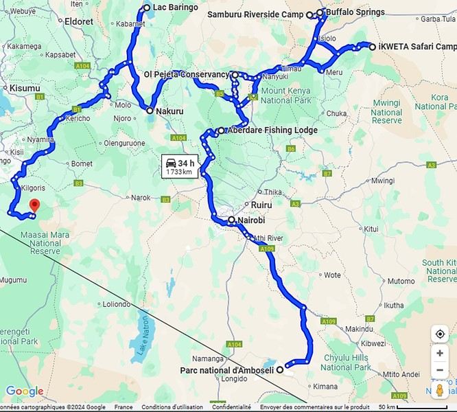
Ready to join us on safari to see some wild animals?
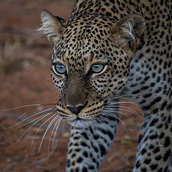
The two itineraries are almost identical (well, when you love something...) but we did make a few tweaks.
- The first part of the trip was with a local driver/guide, Félix, who was recommended by Sylvie56. Sylvie and her husband Ben are Kenya enthusiasts—they’ve been there countless times, always with Félix... and for good reason! He’s fantastic!
- The second part was with Melting Pot Safari, an agency that adapted to our photography needs. Tony Crocetta, the co-founder (along with his Kenyan friend Simon Chebon), is a wildlife photographer himself.
Here are the itineraries for both trips, including accommodations:
In 2021: Day 0: Paris / Nairobi - 67 Airport Hotel Day 1: Nairobi / Amboseli - Simba Cottage Day 2: Amboseli - Simba Cottage Day 3: Amboseli / Aberdares - Fishing Lodge Day 4: Aberdares - Fishing Lodge Day 5: Aberdares - Fishing Lodge Day 6: Aberdares / Samburu - Riverside Camp Day 7: Samburu - Riverside Camp Day 8: Samburu - Riverside Camp Day 9: Samburu / Nakuru - Merica Hotel Day 10: Nakuru / Baringo - Tumbili Cliff Lodge Day 11: Baringo - Tumbili Cliff Lodge Day 12: Baringo - Tumbili Cliff Lodge Day 13: Baringo / Maasai Mara – Meltingpot Bush Camp Day 14 to 18: Maasai Mara – Meltingpot Bush Camp Day 19: Maasai Mara / Nairobi – Roussel Guest House Day 20: Nairobi / Paris
In 2023: Day 0: Lyon / Paris / Nairobi - 67 Airport Hotel Day 1: Nairobi / Meru - Ikweta Camp Day 2: Meru - Ikweta Camp Day 3: Meru - Ikweta Camp Day 4: Meru / Samburu - Riverside Camp Day 5: Samburu – Riverside Camp Day 6: Samburu / Buffalo Springs – Samburu Simba Day 7: Buffalo Springs / Ol Pejeta – Sweetwater Camp Day 8: Ol Pejeta / Amboseli - Simba Cottage Day 9: Amboseli - Simba Cottage Day 10: Amboseli - Simba Cottage Day 11: Amboseli / Nakuru – Lake Nakuru Lodge Day 12: Nakuru / Baringo - Tumbili Cliff Lodge Day 13: Baringo - Tumbili Cliff Lodge Day 14: Baringo - Tumbili Cliff Lodge Day 15: Baringo / Maasai Mara – Meltingpot Bush Camp Day 16 to 20: Maasai Mara – Meltingpot Bush Camp Day 21: Maasai Mara / Nairobi / Paris
Here’s an itinerary—it’s not exactly what we did, but a combination of both.
Ready to join us on safari to see some wild animals?
Iceland: A Week on the Land of Ice and Fire in April
4 years... it’s been so long!!!
What a pleasure to be back on VF and, most of all, to see all the forum members again 🙂
And what a joy to read the travel journals of those travel addicts who were quicker than their own shadow to share their discoveries. Their keyboards and mice must’ve been itching
I’ll admit I’m feeling a bit of that itch too, but I’m way too lazy to dive into the story of our latest trip—last summer in the northwest USA. I’ll probably get to it later, but it might take a while! So, I’m jumping into the short recap of our *way* too short trip to Iceland at the end of April 2024. And even though it’s not the done thing, I’m going to spoil it and start with the conclusion: it was *amazing*!!!
Back in February, on the eve of leaving for a few days’ holiday in Alsace, we started wondering what we could do for Easter break. Scotland and Iceland were the top contenders. The boys are growing up, but they still travel with us often, and they tipped the scales in favor of Iceland. Since we decided a bit late, before booking the flights, I took a quick look at available accommodations. There wasn’t much left, and some were at crazy prices, but I managed to line up a decent itinerary with places that seemed like good value for money. I read travel journals on VF and blogs I could find, picked up bits of info from Facebook groups, and the route quickly took shape—even if I struggled with the place names, mixing them up and forgetting them. The dream could begin...
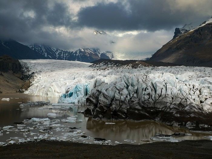
Bookings
Flight tickets bought directly from Fly Play’s website: 1520 € for the four of us (adult fare), with just two checked bags and one carry-on each. It was the compromise we found to keep costs down while still fitting all the bulky clothes we’d need. Late April isn’t quite winter anymore, but it’s not quite spring either, so we packed for chilly weather. Fly Play is Icelandair’s low-cost airline. No complaints: check-in was quick, service was efficient, and the flights were on time.
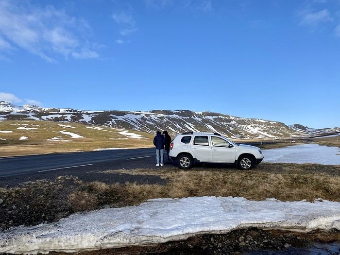
The car. Booked with Golden Circle car rental, a small family-run business with offices just 5 minutes from the airport. I’d read good things about them, and I can confirm everything went smoothly with our Dacia Duster—it wasn’t brand new, but it was reliable and spacious. We paid 463 € for the week, with full insurance included. The manager picked us up at the airport 10 minutes after I messaged him on WhatsApp to say we’d arrived. For the return trip, since our flight was super early and the agency wasn’t open yet, we agreed to leave the car in the airport parking lot and sent him a photo of the spot so he could find it. Super convenient! I read *so* many questions on Facebook groups about insurance: *Should I get the max coverage or not? I’ve got a Visa Premier, I’ve never had an accident, it adds 100 €...* Between sandstorms that can damage the bodywork and skidding off the road due to bad weather (we saw a few cars in ditches!), we decided to go for the rental company’s max insurance to be safe. It was also a requirement for leaving the car in the airport parking lot on our way back, since we couldn’t do the final inspection.
Accommodations were all booked on Booking.com and Hotels.com: - 2 nights in a cottage at Fossatun Country Hotel, near Borgarnes (we rented the sunset cottage—great spot, with a nice view and separate from the other lodgings) - 1 night in an apartment at Bakki Hostel and Apartments, in Eyrarbakki (top-notch) - 1 night in a gorgeous (and pricey!) apartment at Vik Apartments - 2 nights in a family room at Adventure Hof Hotel (perfect location) - 1 night at Blue Viking Studio near the airport (meh, but fine for a few hours’ sleep before an early flight) Total: 1234 €, averaging 176 € per night for 4-person accommodations.
The itinerary Day 1: Arrival around noon at the airport - Hraunfossar / Night at Fossatun Country Hotel Day 2: Snæfellsnes Peninsula / Night at Fossatun Country Hotel Day 3: Bruarfoss - Geysir - Gullfoss - Reykjadalur hot springs / Night in Eyrarbakki Day 4: Seljalandsfoss and Gljúfrafoss - DC-3 wreck (the one near Seljalandsfoss) - Skógafoss - Kvernufoss - Sólheimajökull (hike to the foot of the glacier) - Dyrhólaey - Reynisfjara Beach / Night in Vík Day 5: Fjaðrárgljúfur Canyon - Vatnajökull (3-hour hike to Svartifoss and Skaftafell) / Night in Hof Day 6: Múlagljúfur Canyon (2h45 hike) - Fjallsárlón - Jökulsárlón and Diamond Beach - Svínafellsjökull / Night in Hof Day 7: Drive back - Reykjavik - Sky Lagoon / Night in Keflavík Day 8: Flight back at 6 AM
That’s the practical side covered. I’ll leave you with a photo of our trusty steed.
And what a joy to read the travel journals of those travel addicts who were quicker than their own shadow to share their discoveries. Their keyboards and mice must’ve been itching
I’ll admit I’m feeling a bit of that itch too, but I’m way too lazy to dive into the story of our latest trip—last summer in the northwest USA. I’ll probably get to it later, but it might take a while! So, I’m jumping into the short recap of our *way* too short trip to Iceland at the end of April 2024. And even though it’s not the done thing, I’m going to spoil it and start with the conclusion: it was *amazing*!!!
Back in February, on the eve of leaving for a few days’ holiday in Alsace, we started wondering what we could do for Easter break. Scotland and Iceland were the top contenders. The boys are growing up, but they still travel with us often, and they tipped the scales in favor of Iceland. Since we decided a bit late, before booking the flights, I took a quick look at available accommodations. There wasn’t much left, and some were at crazy prices, but I managed to line up a decent itinerary with places that seemed like good value for money. I read travel journals on VF and blogs I could find, picked up bits of info from Facebook groups, and the route quickly took shape—even if I struggled with the place names, mixing them up and forgetting them. The dream could begin...
Bookings
Flight tickets bought directly from Fly Play’s website: 1520 € for the four of us (adult fare), with just two checked bags and one carry-on each. It was the compromise we found to keep costs down while still fitting all the bulky clothes we’d need. Late April isn’t quite winter anymore, but it’s not quite spring either, so we packed for chilly weather. Fly Play is Icelandair’s low-cost airline. No complaints: check-in was quick, service was efficient, and the flights were on time.
The car. Booked with Golden Circle car rental, a small family-run business with offices just 5 minutes from the airport. I’d read good things about them, and I can confirm everything went smoothly with our Dacia Duster—it wasn’t brand new, but it was reliable and spacious. We paid 463 € for the week, with full insurance included. The manager picked us up at the airport 10 minutes after I messaged him on WhatsApp to say we’d arrived. For the return trip, since our flight was super early and the agency wasn’t open yet, we agreed to leave the car in the airport parking lot and sent him a photo of the spot so he could find it. Super convenient! I read *so* many questions on Facebook groups about insurance: *Should I get the max coverage or not? I’ve got a Visa Premier, I’ve never had an accident, it adds 100 €...* Between sandstorms that can damage the bodywork and skidding off the road due to bad weather (we saw a few cars in ditches!), we decided to go for the rental company’s max insurance to be safe. It was also a requirement for leaving the car in the airport parking lot on our way back, since we couldn’t do the final inspection.
Accommodations were all booked on Booking.com and Hotels.com: - 2 nights in a cottage at Fossatun Country Hotel, near Borgarnes (we rented the sunset cottage—great spot, with a nice view and separate from the other lodgings) - 1 night in an apartment at Bakki Hostel and Apartments, in Eyrarbakki (top-notch) - 1 night in a gorgeous (and pricey!) apartment at Vik Apartments - 2 nights in a family room at Adventure Hof Hotel (perfect location) - 1 night at Blue Viking Studio near the airport (meh, but fine for a few hours’ sleep before an early flight) Total: 1234 €, averaging 176 € per night for 4-person accommodations.
The itinerary Day 1: Arrival around noon at the airport - Hraunfossar / Night at Fossatun Country Hotel Day 2: Snæfellsnes Peninsula / Night at Fossatun Country Hotel Day 3: Bruarfoss - Geysir - Gullfoss - Reykjadalur hot springs / Night in Eyrarbakki Day 4: Seljalandsfoss and Gljúfrafoss - DC-3 wreck (the one near Seljalandsfoss) - Skógafoss - Kvernufoss - Sólheimajökull (hike to the foot of the glacier) - Dyrhólaey - Reynisfjara Beach / Night in Vík Day 5: Fjaðrárgljúfur Canyon - Vatnajökull (3-hour hike to Svartifoss and Skaftafell) / Night in Hof Day 6: Múlagljúfur Canyon (2h45 hike) - Fjallsárlón - Jökulsárlón and Diamond Beach - Svínafellsjökull / Night in Hof Day 7: Drive back - Reykjavik - Sky Lagoon / Night in Keflavík Day 8: Flight back at 6 AM
That’s the practical side covered. I’ll leave you with a photo of our trusty steed.
The "Must-Sees" of the American West
This adventure began during Covid... Yep, Covid turned a lot of things upside down, but most of all, it kept us cooped up for a few months and stopped us from traveling for a while—even longer for a die-hard fan of the American West like me.
While borders were closed, I started imagining what an ideal itinerary might look like—one that would string together all the Southwest must-sees in just two weeks, during the best time of year: September and October. When the U.S. announced in September 2021 that borders would reopen in the coming weeks, I regained hope and began scouting flight tickets for a departure in September 2022.
But here’s the thing: tackling solo hikes, each one tougher than the last, right in the heart of the Wilderness, could be a risky—even reckless—endeavor for a father of three. After a quick chat with some virtual friends who are just as passionate about the Southwest as I am, with good physical condition and nearly the same list of must-visit spots, Franck and his brother Sullivan were in! 🙂
In November, we snagged flight tickets from Nice to San Francisco for the modest sum of 400 €, and a few days later, I booked a Toyota Tacoma pickup for 840 € !
It’s not cheap for just 15 days, and a pickup isn’t exactly ideal for luggage, but the prices for full-size 4x4s have become totally outrageous! Due to border closures, rental companies had to offload a lot of these big 4x4s, which tourists love. Then, supply and demand did the rest !
Franck and I spent the winter and spring trying to cram the equivalent of three weeks of hikes into two. But even with physical limits, we had to stay reasonable! Three to four months before departure, we entered the lotteries for different must-see spots: The Subway, Coyote Buttes North (home to the famous Wave), and Coyote Buttes South (CBS).
The Wave is the holy grail for any Southwest enthusiast. Since 2015, we’ve tried our luck with the online and on-site lotteries about ten times, but the spots are unfortunately limited: just 20 per day. A glimmer of hope, though—since early 2022, that number has increased to 64 people allowed per day, with 48 spots awarded via the online lottery.
After all three of us tried our luck for The Wave, on June 1st at exactly 5 PM, I got an email that started with, "Congratulations! You were successful in the Coyote Buttes North (The Wave) September 2022 Permit Lottery at Coyote Buttes North (The Wave)...". At 5:01 PM, I called Franck, whose dream it’s been for over 20 years—ever since the first photos were published in a travel magazine! He didn’t believe me when I told him, and I had to forward the email for him to finally accept the unbelievable: we were going to The Wave and all the incredible spots scattered across the protected area of Coyote Buttes North.
I’ve already been to Coyote Buttes South twice, but there are areas I couldn’t explore in the middle of summer because they were too remote. So, I had no trouble letting my buddies convince me to go back for a third time. Plus, given how hard it is to access, we had no trouble securing a permit online as long as we logged in at exactly 8 PM on the dot!
For The Subway, all three of us struck out. No big deal—we won at CBN and CBS!
Among the sites to visit, there are two that I’m particularly attached to because I know my chances of wanting to see them again are slim. The first is Angel Arch, one of the most legendary arches in the Southwest, due to its remoteness from any trace of civilization. To get there, the recommended hike is Upper Salt Creek, and you’re looking at a 50 km round-trip in an area with no water (in September) and populated by bears.
The second site is the Hopi Salt Trail, in Navajo land, which, after a very tough hike, lets you marvel at the turquoise-blue waters of the Little Colorado before it meets the Colorado River. The Hopi Salt Trail is, like The Wave, the holy grail for any Southwest enthusiast, and the windows of opportunity to see the water in that magical color are very short each year. For this, you have to monitor the Little Colorado’s gauges downstream from Cameron: if the level stays at its lowest for 10 consecutive days—meaning no rain—you can hope for turquoise water. The ideal period rarely exceeds 30 days a year, and it’s usually in June that all the stars align.
But unfortunately, one month before departure, while the flow rate at Cameron looked promising, several storms in September dashed our hopes of doing the Hopi Salt Trail, even at the end of the road trip.
We still had two consolation prizes, though:
After a last-minute cancellation, while keeping an eye out for available spots for The Subway, it turned out that three spots opened up exactly on the day we’d planned to go—so we rushed to grab them!! Regarding the 4x4 rental, the prices for full-size models dropped by several hundred dollars, and we ended up finding a Chevrolet Tahoe for less than $1000. A steal and a serious boost in comfort, so we could store all our gear and food without worry!
Here’s the initial plan in a perfect world: D1 The White Domes - Camping D2 Sunrise at The White Domes - The Subway D3 Coyote Buttes North D4 Coyote Buttes South - White Pocket D5 Wahweap Hoodoos - Sidestep Canyon - Colourful Canyon - White Rocks - Sunset at Yellow Rock D6 Broken Bow Arch - Reflection Canyon D7 Coyote Gulch D8 The Volcano (or The Oasis - Zebra Slot Canyon if the weather’s good) - North Caineville Mesa D9 The Needles: Squaw Canyon - Lost Canyon combo - Druid Arch - Chesler Park D10 Upper Salt Creek Day 1 - Camping D11 Upper Salt Creek Day 2 D12 Hopi-Navajo Territory: Ha Ho No Geh Canyon, Coal Mine Canyon, Bends of the Little Colorado D13 Grand Canyon: South Kaibab Trail and Bright Angel Trail D14 Upper East Zion: East Temple Loop, Jughandle Arch, Center of the Universe, and Checkerboard Mesa Summit And several backup options in case of bad weather, including Spencer Trail, West Cove, and Buffington Pockets.
Enough talking—time for action!
While borders were closed, I started imagining what an ideal itinerary might look like—one that would string together all the Southwest must-sees in just two weeks, during the best time of year: September and October. When the U.S. announced in September 2021 that borders would reopen in the coming weeks, I regained hope and began scouting flight tickets for a departure in September 2022.
But here’s the thing: tackling solo hikes, each one tougher than the last, right in the heart of the Wilderness, could be a risky—even reckless—endeavor for a father of three. After a quick chat with some virtual friends who are just as passionate about the Southwest as I am, with good physical condition and nearly the same list of must-visit spots, Franck and his brother Sullivan were in! 🙂
In November, we snagged flight tickets from Nice to San Francisco for the modest sum of 400 €, and a few days later, I booked a Toyota Tacoma pickup for 840 € !
It’s not cheap for just 15 days, and a pickup isn’t exactly ideal for luggage, but the prices for full-size 4x4s have become totally outrageous! Due to border closures, rental companies had to offload a lot of these big 4x4s, which tourists love. Then, supply and demand did the rest !
Franck and I spent the winter and spring trying to cram the equivalent of three weeks of hikes into two. But even with physical limits, we had to stay reasonable! Three to four months before departure, we entered the lotteries for different must-see spots: The Subway, Coyote Buttes North (home to the famous Wave), and Coyote Buttes South (CBS).
The Wave is the holy grail for any Southwest enthusiast. Since 2015, we’ve tried our luck with the online and on-site lotteries about ten times, but the spots are unfortunately limited: just 20 per day. A glimmer of hope, though—since early 2022, that number has increased to 64 people allowed per day, with 48 spots awarded via the online lottery.
After all three of us tried our luck for The Wave, on June 1st at exactly 5 PM, I got an email that started with, "Congratulations! You were successful in the Coyote Buttes North (The Wave) September 2022 Permit Lottery at Coyote Buttes North (The Wave)...". At 5:01 PM, I called Franck, whose dream it’s been for over 20 years—ever since the first photos were published in a travel magazine! He didn’t believe me when I told him, and I had to forward the email for him to finally accept the unbelievable: we were going to The Wave and all the incredible spots scattered across the protected area of Coyote Buttes North.
I’ve already been to Coyote Buttes South twice, but there are areas I couldn’t explore in the middle of summer because they were too remote. So, I had no trouble letting my buddies convince me to go back for a third time. Plus, given how hard it is to access, we had no trouble securing a permit online as long as we logged in at exactly 8 PM on the dot!
For The Subway, all three of us struck out. No big deal—we won at CBN and CBS!
Among the sites to visit, there are two that I’m particularly attached to because I know my chances of wanting to see them again are slim. The first is Angel Arch, one of the most legendary arches in the Southwest, due to its remoteness from any trace of civilization. To get there, the recommended hike is Upper Salt Creek, and you’re looking at a 50 km round-trip in an area with no water (in September) and populated by bears.
The second site is the Hopi Salt Trail, in Navajo land, which, after a very tough hike, lets you marvel at the turquoise-blue waters of the Little Colorado before it meets the Colorado River. The Hopi Salt Trail is, like The Wave, the holy grail for any Southwest enthusiast, and the windows of opportunity to see the water in that magical color are very short each year. For this, you have to monitor the Little Colorado’s gauges downstream from Cameron: if the level stays at its lowest for 10 consecutive days—meaning no rain—you can hope for turquoise water. The ideal period rarely exceeds 30 days a year, and it’s usually in June that all the stars align.
But unfortunately, one month before departure, while the flow rate at Cameron looked promising, several storms in September dashed our hopes of doing the Hopi Salt Trail, even at the end of the road trip.
We still had two consolation prizes, though:
After a last-minute cancellation, while keeping an eye out for available spots for The Subway, it turned out that three spots opened up exactly on the day we’d planned to go—so we rushed to grab them!! Regarding the 4x4 rental, the prices for full-size models dropped by several hundred dollars, and we ended up finding a Chevrolet Tahoe for less than $1000. A steal and a serious boost in comfort, so we could store all our gear and food without worry!
Here’s the initial plan in a perfect world: D1 The White Domes - Camping D2 Sunrise at The White Domes - The Subway D3 Coyote Buttes North D4 Coyote Buttes South - White Pocket D5 Wahweap Hoodoos - Sidestep Canyon - Colourful Canyon - White Rocks - Sunset at Yellow Rock D6 Broken Bow Arch - Reflection Canyon D7 Coyote Gulch D8 The Volcano (or The Oasis - Zebra Slot Canyon if the weather’s good) - North Caineville Mesa D9 The Needles: Squaw Canyon - Lost Canyon combo - Druid Arch - Chesler Park D10 Upper Salt Creek Day 1 - Camping D11 Upper Salt Creek Day 2 D12 Hopi-Navajo Territory: Ha Ho No Geh Canyon, Coal Mine Canyon, Bends of the Little Colorado D13 Grand Canyon: South Kaibab Trail and Bright Angel Trail D14 Upper East Zion: East Temple Loop, Jughandle Arch, Center of the Universe, and Checkerboard Mesa Summit And several backup options in case of bad weather, including Spencer Trail, West Cove, and Buffington Pockets.
Enough talking—time for action!
Our trip recap: searching for primates in Uganda
Hi everyone,
As I mentioned a few days ago in the comments on ArXplorateur’s post (https://voyageforum.com/forum/deux-semaines-en-ouganda-en-solo-en-transports-d10553168/) —which was the first to reopen the forum’s Africa section—I wanted to share our feedback on our three weeks in Uganda. We recently traveled between late August and mid-September with the Mpolampola agency, which many of you know, run by Paul. I’m editing a one-hour film about this trip, which I’ll be uploading soon to our travel-focused YouTube channel: https://www.youtube.com/@lolodetoul54
It’s almost finished and ready to be uploaded.
We planned an ambitious itinerary (maybe *too* ambitious?).
Here’s the breakdown of our packed schedule:
D0 Saturday 24/08: Departure from Paris to Uganda via Kigali with Rwandair D1 Sunday 25/08: Arrival in Entebbe Sunday morning. Departure for Lake Mburo National Park. Night at Rwakobo Lodge D2 Monday 26/08: Lake Mburo National Park. Walking safari and boat tour of the lake. Night at Rwakobo Lodge D3 Tuesday 27/08: Departure for Lake Bunyonyi. Night at Birdnest Overseas D4 Wednesday 28/08: Boat and walking tour of the lake, then drive to Lake Mutanda Lodge D5 Thursday 29/08: Hike to see the golden monkeys, then departure for Nkuringo Bwindi Gorilla Lodge D6 Friday 30/08: Hike to see the gorillas. Night again at Nkuringo Bwindi Gorilla Lodge D7 Saturday 31/08: Drive to Queen Elizabeth National Park. Night at Twin Lakes Safari Lodge D8 Sunday 01/09: Vehicle safari and boat tour on the Kazinga Channel. Night at Twin Lakes Safari Lodge D9 Monday 02/09: Drive to Kibale Forest and walk around Crater Lake. Night at Isunga Lodge D10 Tuesday 03/09: Chimpanzee trek in Kibale Forest and walk in Bigodi Swamp. Night at Isunga Lodge D11 Wednesday 04/09: On the road to Murchison Falls National Park. Walking tour with rhinos at Ziwa Rhino Sanctuary. Night at Murchison River Lodge D12 Thursday 05/09: Vehicle safari in Murchison Falls National Park and boat ride to the falls. Night at Murchison River Lodge D13 Friday 06/09: Drive to Chobe Lodge by the Nile D14 Saturday 07/09: Long road trip to Kidepo Valley National Park. Night at Adere Lodge D15 & D16: Safari in Kidepo Valley National Park. Nights at Adere Lodge D17 Tuesday 10/09: Very long drive to Sipi Falls (Mount Elgon). Night at Lacam Lodge D18 Wednesday 11/09: Visit to the falls, then drive to Jinja (source of the Nile). Night at Haven Lodge D19 Thursday 12/09: Drive to Kampala. Night at Latitude 0. D20 Friday 13/09: Discovering shoebills in Mabamba Swamp. Evening flight back to France via Kigali, Rwanda.
That’s the teaser done! I’ll be back with more details soon. Looking forward to sharing! Loïc
As I mentioned a few days ago in the comments on ArXplorateur’s post (https://voyageforum.com/forum/deux-semaines-en-ouganda-en-solo-en-transports-d10553168/) —which was the first to reopen the forum’s Africa section—I wanted to share our feedback on our three weeks in Uganda. We recently traveled between late August and mid-September with the Mpolampola agency, which many of you know, run by Paul. I’m editing a one-hour film about this trip, which I’ll be uploading soon to our travel-focused YouTube channel: https://www.youtube.com/@lolodetoul54
It’s almost finished and ready to be uploaded.
We planned an ambitious itinerary (maybe *too* ambitious?).
Here’s the breakdown of our packed schedule:
D0 Saturday 24/08: Departure from Paris to Uganda via Kigali with Rwandair D1 Sunday 25/08: Arrival in Entebbe Sunday morning. Departure for Lake Mburo National Park. Night at Rwakobo Lodge D2 Monday 26/08: Lake Mburo National Park. Walking safari and boat tour of the lake. Night at Rwakobo Lodge D3 Tuesday 27/08: Departure for Lake Bunyonyi. Night at Birdnest Overseas D4 Wednesday 28/08: Boat and walking tour of the lake, then drive to Lake Mutanda Lodge D5 Thursday 29/08: Hike to see the golden monkeys, then departure for Nkuringo Bwindi Gorilla Lodge D6 Friday 30/08: Hike to see the gorillas. Night again at Nkuringo Bwindi Gorilla Lodge D7 Saturday 31/08: Drive to Queen Elizabeth National Park. Night at Twin Lakes Safari Lodge D8 Sunday 01/09: Vehicle safari and boat tour on the Kazinga Channel. Night at Twin Lakes Safari Lodge D9 Monday 02/09: Drive to Kibale Forest and walk around Crater Lake. Night at Isunga Lodge D10 Tuesday 03/09: Chimpanzee trek in Kibale Forest and walk in Bigodi Swamp. Night at Isunga Lodge D11 Wednesday 04/09: On the road to Murchison Falls National Park. Walking tour with rhinos at Ziwa Rhino Sanctuary. Night at Murchison River Lodge D12 Thursday 05/09: Vehicle safari in Murchison Falls National Park and boat ride to the falls. Night at Murchison River Lodge D13 Friday 06/09: Drive to Chobe Lodge by the Nile D14 Saturday 07/09: Long road trip to Kidepo Valley National Park. Night at Adere Lodge D15 & D16: Safari in Kidepo Valley National Park. Nights at Adere Lodge D17 Tuesday 10/09: Very long drive to Sipi Falls (Mount Elgon). Night at Lacam Lodge D18 Wednesday 11/09: Visit to the falls, then drive to Jinja (source of the Nile). Night at Haven Lodge D19 Thursday 12/09: Drive to Kampala. Night at Latitude 0. D20 Friday 13/09: Discovering shoebills in Mabamba Swamp. Evening flight back to France via Kigali, Rwanda.
That’s the teaser done! I’ll be back with more details soon. Looking forward to sharing! Loïc
First trips after...
A turbulent period came to an end around 2022.
Many of us have returned to big trips after making only very small ones—or none at all. For a little anecdote, my dentist told me that due to the lack of travel, a lot of clients treated themselves to implants they would’ve otherwise skipped. The joy of traveling again probably gave some vacationers smiles they hadn’t dared to show before!
Here, you can share what’s on your mind: Have these new, real trips disappointed you, rejuvenated you, or just relieved a long frustration?
For my part, not being so young anymore, there was definitely relief but no explosion of joy. I just had the feeling of picking up the thread of life after a foggy pause, with the bitter taste that 2 or 3 years of my life had been partly stolen from me.
Many of us have returned to big trips after making only very small ones—or none at all. For a little anecdote, my dentist told me that due to the lack of travel, a lot of clients treated themselves to implants they would’ve otherwise skipped. The joy of traveling again probably gave some vacationers smiles they hadn’t dared to show before!
Here, you can share what’s on your mind: Have these new, real trips disappointed you, rejuvenated you, or just relieved a long frustration?
For my part, not being so young anymore, there was definitely relief but no explosion of joy. I just had the feeling of picking up the thread of life after a foggy pause, with the bitter taste that 2 or 3 years of my life had been partly stolen from me.
Les Cyclades en juillet: Anafi, Amorgos, Astypaléa
GENESE
Comme tous, le COVID a chamboulé nos plans. Normalement nous devions aller à Madagascar pendant un mois, projet reporté à l’année prochaine. Seulement, n’ayant jamais arrêté de travailler, malgré le confinement et le Covid j’avais réellement besoin de faire une « pause ».
Souhaitant limiter les risques de restrictions de déplacements nous ne quitterons pas l’Europe en nous centrant sur des endroits que nous avons toujours voulu visiter, mais habituellement trop fréquentés pour nous. Il y avait la Suisse avec ses montagnes et ses trains de légende, l’Islande et les îles Grecques.
Au final c’est l’attrait du soleil qui l’a emporté … enfin surtout auprès de madame ! Nous avions « entrevu » Santorin et Myconos lors d’une croisière en méditerranée en 2007 avec les enfants. Nous avions adoré … sauf la fréquentation !
Le premier élément à choisir est le point d’entrée, accessible en avion. Il y a Santorin et Myconos dans les Cyclades. Comme je rêvais de revoir la caldera de Santorin, le choix fut rapide. Ensuite je voulais des îles peu fréquentées ne nécessitant pas de trop long trajet en ferry. Sur 2 semaines 3 îles m’a paru être le bon choix. Avec le recul je confirme que c’est un bon dosage. Je me suis beaucoup servi du site Hellenica et Cycladen.be, qui sont très bien, pour faire mes choix.
La première sera Anafi, dans la catégorie « peu fréquentée » elle est très bien placée, en plus elle est petite, montagneuse et avec de belles plages. Une des raisons de sa faible fréquentation est le peu de liaison maritimes, ce sera donc à partir de cette contrainte que s’articulera le voyage.
Le second choix sera Astypalea car il y a un aéroport pour repartir, en plus c’est aussi une île peu fréquentée par les étrangers. Elle fait partie des Dodécanèse mais géographique se trouve proche des Cyclades.
Amorgos se glissera très naturellement entre les deux.
Une fois le planning établi j’ai réservé les vols chez Volotea qui a le bon goût de partir de Strasbourg … mauvais choix car les vols seront annulés 2 semaines plus tard.🏴☠️ Je me suis retourné vers Easy Jet qui part de Bâle Mulhouse, finalement tout aussi proche de chez nous que Strasbourg. Il faut dire qu’en Alsace nous avons la chance d’avoir pas mal d’aéroports dans un rayon de 3 heures autour de chez nous (en plus des deux précités il y a surtout Zurich et Frankfurt). Nous ferons donc BSL – Athènes – Santorin puis Astypalea – Athènes – BSL.
J’ai réservé par internet en direct les pensions : Villa Kalamiotissa pour Anafi Emprostiada Traditional Guest House et Pano Gitonia pour Amorgos Studio Killindra pour Astypalea Je réserve aussi une voiture à Amorgos puisque l’île est assez grande … et au final, suite à un échange avec mon logeur, également à Anafi.
Le roadbook sera assez rapide à établir … tant mieux car je n’ai que très peu de temps disponible, relancer mon entreprise suite au Covid-19 a accaparé tout mon temps.
En voiture ... pour ceux qui veulent 🙂
Comme tous, le COVID a chamboulé nos plans. Normalement nous devions aller à Madagascar pendant un mois, projet reporté à l’année prochaine. Seulement, n’ayant jamais arrêté de travailler, malgré le confinement et le Covid j’avais réellement besoin de faire une « pause ».
Souhaitant limiter les risques de restrictions de déplacements nous ne quitterons pas l’Europe en nous centrant sur des endroits que nous avons toujours voulu visiter, mais habituellement trop fréquentés pour nous. Il y avait la Suisse avec ses montagnes et ses trains de légende, l’Islande et les îles Grecques.
Au final c’est l’attrait du soleil qui l’a emporté … enfin surtout auprès de madame ! Nous avions « entrevu » Santorin et Myconos lors d’une croisière en méditerranée en 2007 avec les enfants. Nous avions adoré … sauf la fréquentation !
Le premier élément à choisir est le point d’entrée, accessible en avion. Il y a Santorin et Myconos dans les Cyclades. Comme je rêvais de revoir la caldera de Santorin, le choix fut rapide. Ensuite je voulais des îles peu fréquentées ne nécessitant pas de trop long trajet en ferry. Sur 2 semaines 3 îles m’a paru être le bon choix. Avec le recul je confirme que c’est un bon dosage. Je me suis beaucoup servi du site Hellenica et Cycladen.be, qui sont très bien, pour faire mes choix.
La première sera Anafi, dans la catégorie « peu fréquentée » elle est très bien placée, en plus elle est petite, montagneuse et avec de belles plages. Une des raisons de sa faible fréquentation est le peu de liaison maritimes, ce sera donc à partir de cette contrainte que s’articulera le voyage.
Le second choix sera Astypalea car il y a un aéroport pour repartir, en plus c’est aussi une île peu fréquentée par les étrangers. Elle fait partie des Dodécanèse mais géographique se trouve proche des Cyclades.
Amorgos se glissera très naturellement entre les deux.
Une fois le planning établi j’ai réservé les vols chez Volotea qui a le bon goût de partir de Strasbourg … mauvais choix car les vols seront annulés 2 semaines plus tard.🏴☠️ Je me suis retourné vers Easy Jet qui part de Bâle Mulhouse, finalement tout aussi proche de chez nous que Strasbourg. Il faut dire qu’en Alsace nous avons la chance d’avoir pas mal d’aéroports dans un rayon de 3 heures autour de chez nous (en plus des deux précités il y a surtout Zurich et Frankfurt). Nous ferons donc BSL – Athènes – Santorin puis Astypalea – Athènes – BSL.
J’ai réservé par internet en direct les pensions : Villa Kalamiotissa pour Anafi Emprostiada Traditional Guest House et Pano Gitonia pour Amorgos Studio Killindra pour Astypalea Je réserve aussi une voiture à Amorgos puisque l’île est assez grande … et au final, suite à un échange avec mon logeur, également à Anafi.
Le roadbook sera assez rapide à établir … tant mieux car je n’ai que très peu de temps disponible, relancer mon entreprise suite au Covid-19 a accaparé tout mon temps.
En voiture ... pour ceux qui veulent 🙂
Suisse, pays de lacs et montagnes du 16 au 28 mai 2020
Bonjour,
Comme pour beaucoup de voyageurs, le Coronavirus a perturbé nos plans pour cette année. Notre road trip au Pérou est tombé à l’eau et la fermeture des frontières ne nous permettait pas de quitter la Suisse.
Heureusement, en Suisse, nous n’avons pas subi un confinement strict et nous pouvions nous déplacer librement dans le pays, en respectant certaines règles (distance de 2 mètres entres les personnes, rassemblements de maximum 5 personnes). De plus, une semaine avant notre départ, les magasins, restaurants et musées pouvaient ouvrir. Par contre, les campings, télécabines et télésièges sont restés fermés jusqu’au 6 juin.
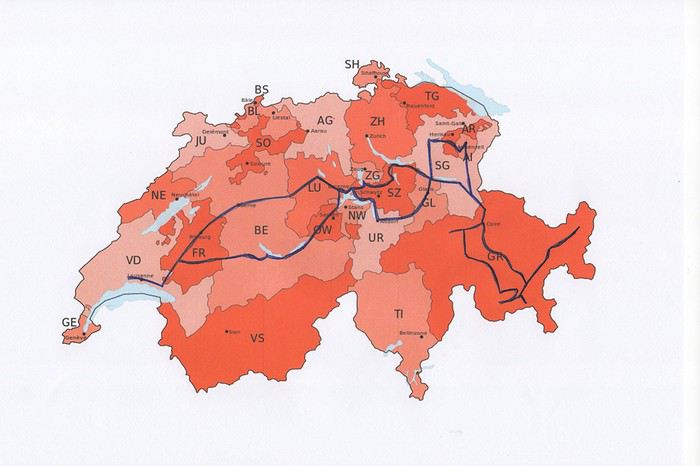
Nous avons décidé de ne pas préparer un itinéraire fixe. Le but principal était le canton des Grisons que nous connaissions très peu. Pour y aller et pour revenir, nous avons traversé d’autres cantons où nous avons profité de faire des visites et randonnées. Certains endroits nous étaient bien connus, mais les voir sans les touristes habituels, asiatiques, indiens et américains, change complètement la perception des lieux. Imaginez, le fameux pont de la Chapelle à Lucerne, sans les hordes de touristes asiatiques qui l’envahissent tous les jours.
Nous avons loué un van, afin d’être autonome et libre. Notre choix s’est porté sur le VW California Ocean. Ce van est passe-partout, on peut facilement emprunter toutes les petites routes de montagnes et se parquer partout. Seul inconvénient, il n’a pas de salle de bain. La douche se fait à l’extérieur (eau froide), mais nous avons des toilettes portables. Le California Ocean est équipé avec une petite cuisine (un réchaud à gaz avec deux feux, un frigo de 42 litres, un petit évier). Il y a des placards sous la cuisine, au-dessus de la banquette et à l’arrière, ainsi qu’un grand tiroir sous la banquette. Les sièges avant se tournent, il y a deux tables, une à l’intérieur et une autre, encastrée dans la portière, pour l’extérieur. Les deux chaises pour l’extérieur sont encastrées dans la porte du coffre. Le toit se lève, on peut donc se mettre debout à l’intérieur du van. Le lit sous le toit est confortable, avec son sommier sur lequel sont fixé des ressorts. Un store extérieur nous protège du soleil lorsqu’on est à l’arrêt. Le chauffage stationnaire est bien agréable pour chauffer l’habitacle lorsqu’il fait froid. Il y a aussi plusieurs prises, dont une qui fonctionne avec la deuxième batterie et permet de charger le téléphone, tablette, etc. la nuit. Bref, ce petit van est vraiment fonctionnel.
Au dernier moment, nous avons décidé de prendre notre chien Tidou avec nous. Il a fallu adapter nos randonnées et visites. Eh oui, notre Tidou n’est plus tout jeune et il a des soucis avec son dos. Nous avons acheté un sac à dos spécifique, pour pouvoir le porter en terrain abrupte et lorsqu’il sera trop fatigué.
Nous avons chargé l’application park4night sur nos iPhones. Cette application est bien utile pour trouver des emplacements pour passer la nuit. Contrairement, à ce que l’on peut souvent lire, nous n’avons rencontré aucune difficulté pour passer la nuit. Le camping sauvage est donc possible en Suisse, si on ne s’installe pas pour plusieurs jours au même endroit. Concernant l’eau potable, on trouve de nombreuses fontaines, le plus souvent avec de l’eau potable.
Comme pour beaucoup de voyageurs, le Coronavirus a perturbé nos plans pour cette année. Notre road trip au Pérou est tombé à l’eau et la fermeture des frontières ne nous permettait pas de quitter la Suisse.
Heureusement, en Suisse, nous n’avons pas subi un confinement strict et nous pouvions nous déplacer librement dans le pays, en respectant certaines règles (distance de 2 mètres entres les personnes, rassemblements de maximum 5 personnes). De plus, une semaine avant notre départ, les magasins, restaurants et musées pouvaient ouvrir. Par contre, les campings, télécabines et télésièges sont restés fermés jusqu’au 6 juin.
Nous avons décidé de ne pas préparer un itinéraire fixe. Le but principal était le canton des Grisons que nous connaissions très peu. Pour y aller et pour revenir, nous avons traversé d’autres cantons où nous avons profité de faire des visites et randonnées. Certains endroits nous étaient bien connus, mais les voir sans les touristes habituels, asiatiques, indiens et américains, change complètement la perception des lieux. Imaginez, le fameux pont de la Chapelle à Lucerne, sans les hordes de touristes asiatiques qui l’envahissent tous les jours.
Nous avons loué un van, afin d’être autonome et libre. Notre choix s’est porté sur le VW California Ocean. Ce van est passe-partout, on peut facilement emprunter toutes les petites routes de montagnes et se parquer partout. Seul inconvénient, il n’a pas de salle de bain. La douche se fait à l’extérieur (eau froide), mais nous avons des toilettes portables. Le California Ocean est équipé avec une petite cuisine (un réchaud à gaz avec deux feux, un frigo de 42 litres, un petit évier). Il y a des placards sous la cuisine, au-dessus de la banquette et à l’arrière, ainsi qu’un grand tiroir sous la banquette. Les sièges avant se tournent, il y a deux tables, une à l’intérieur et une autre, encastrée dans la portière, pour l’extérieur. Les deux chaises pour l’extérieur sont encastrées dans la porte du coffre. Le toit se lève, on peut donc se mettre debout à l’intérieur du van. Le lit sous le toit est confortable, avec son sommier sur lequel sont fixé des ressorts. Un store extérieur nous protège du soleil lorsqu’on est à l’arrêt. Le chauffage stationnaire est bien agréable pour chauffer l’habitacle lorsqu’il fait froid. Il y a aussi plusieurs prises, dont une qui fonctionne avec la deuxième batterie et permet de charger le téléphone, tablette, etc. la nuit. Bref, ce petit van est vraiment fonctionnel.
Au dernier moment, nous avons décidé de prendre notre chien Tidou avec nous. Il a fallu adapter nos randonnées et visites. Eh oui, notre Tidou n’est plus tout jeune et il a des soucis avec son dos. Nous avons acheté un sac à dos spécifique, pour pouvoir le porter en terrain abrupte et lorsqu’il sera trop fatigué.
Nous avons chargé l’application park4night sur nos iPhones. Cette application est bien utile pour trouver des emplacements pour passer la nuit. Contrairement, à ce que l’on peut souvent lire, nous n’avons rencontré aucune difficulté pour passer la nuit. Le camping sauvage est donc possible en Suisse, si on ne s’installe pas pour plusieurs jours au même endroit. Concernant l’eau potable, on trouve de nombreuses fontaines, le plus souvent avec de l’eau potable.
Concours photo de mai 2020: "Défilés et Cortèges"
Salut à tou(te)s.
Gagnant du concours d'avril 2020 il m'échoit de vous proposer celui de mai 2020 :
En ce mois de mai propice aux défilés, surtout le 1er en temps normal (sans pandémie donc sans distanciation physique), je vous propose le sujet du concours de photo du mois « Défilés et Cortèges » avec les précautions suivantes :
Ce sera celui de participants au défilé en nombre, en extérieur, pour une cause explicite dans l'image proposée (pancarte ou slogan, costumes, décor...). Ce ne sera donc ni la déambulation d'une foule, même bigarrée, ni une file d'attente, mais un cortège de rue qu'il soit religieux, militaire, funéraire, festif, revendicatif, exprimant joie ou peine, colère ou détermination. La foule qui peut l'accompagner ne sera pas l'objet central de la photo mais son complément (prouvant son audience). Voir l'introduction de l'article Défilé sur Wikipédia : On l'aura compris : pas de défilé d'animaux, de chars, ni de roches fracturées : des gens qui se réunissent pour une cause explicite, affichant leurs costumes, leurs uniformes.
Exemples : Cortège du Palio de Sienne (août 2012) :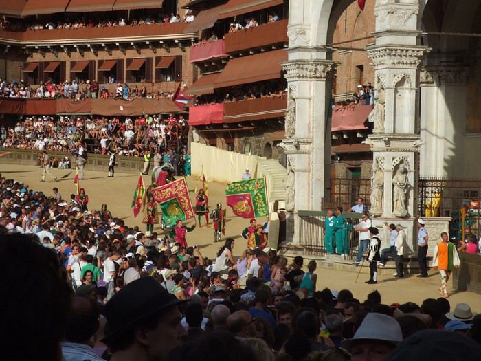
Fête des vignerons 2019 à Vevey, bout de fanfare :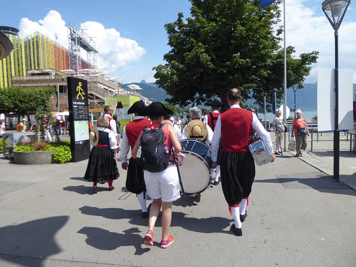
Fête des saintes patronnes de Santa Fiora (Toscane - juillet 2009). Toutes obédiences des autorités municipales à la fin de la procession :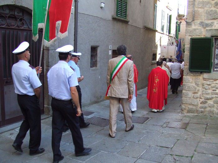
Participation Chaque participant(e) peut proposer jusqu'à 3 photos, et ce jusqu'au vendredi 22/05 à 20h00, heure de Paris. Chaque photo sera présentée dans un seul message, en indiquant son numéro (1, 2 ou 3). Pensez à ajouter une petite explication, commentaire, localisation, date de prise de vue.
Vote Chaque membre VF peut voter pour les 3 photos qu'il ou elle juge les meilleures selon ses propres critères et en tenant compte du thème.
Les votes se feront du samedi 23/05 au vendredi 29/05 à 20h00, heure de Paris. Les photos choisies seront citées dans l'ordre de préférence : - la 1re photo : 3 points - la 2e : 2 points - la 3e : 1 point
Un seul et unique vote pour 3 photos est accepté par membre.
Conclusion Le vainqueur est l'auteur de la photo ayant reçu le plus de points. Les résultats seront publiés le 30/05. En cas d'égalité, le nombre de premières places prévaudra. Le vainqueur aura l'honneur d'organiser le concours du mois de juin.
Le diaporama est là. La discussion est là
À vous de jouer !
En ce mois de mai propice aux défilés, surtout le 1er en temps normal (sans pandémie donc sans distanciation physique), je vous propose le sujet du concours de photo du mois « Défilés et Cortèges » avec les précautions suivantes :
Ce sera celui de participants au défilé en nombre, en extérieur, pour une cause explicite dans l'image proposée (pancarte ou slogan, costumes, décor...). Ce ne sera donc ni la déambulation d'une foule, même bigarrée, ni une file d'attente, mais un cortège de rue qu'il soit religieux, militaire, funéraire, festif, revendicatif, exprimant joie ou peine, colère ou détermination. La foule qui peut l'accompagner ne sera pas l'objet central de la photo mais son complément (prouvant son audience). Voir l'introduction de l'article Défilé sur Wikipédia : On l'aura compris : pas de défilé d'animaux, de chars, ni de roches fracturées : des gens qui se réunissent pour une cause explicite, affichant leurs costumes, leurs uniformes.
Exemples : Cortège du Palio de Sienne (août 2012) :
Fête des vignerons 2019 à Vevey, bout de fanfare :
Fête des saintes patronnes de Santa Fiora (Toscane - juillet 2009). Toutes obédiences des autorités municipales à la fin de la procession :
Participation Chaque participant(e) peut proposer jusqu'à 3 photos, et ce jusqu'au vendredi 22/05 à 20h00, heure de Paris. Chaque photo sera présentée dans un seul message, en indiquant son numéro (1, 2 ou 3). Pensez à ajouter une petite explication, commentaire, localisation, date de prise de vue.
Vote Chaque membre VF peut voter pour les 3 photos qu'il ou elle juge les meilleures selon ses propres critères et en tenant compte du thème.
Les votes se feront du samedi 23/05 au vendredi 29/05 à 20h00, heure de Paris. Les photos choisies seront citées dans l'ordre de préférence : - la 1re photo : 3 points - la 2e : 2 points - la 3e : 1 point
Un seul et unique vote pour 3 photos est accepté par membre.
Conclusion Le vainqueur est l'auteur de la photo ayant reçu le plus de points. Les résultats seront publiés le 30/05. En cas d'égalité, le nombre de premières places prévaudra. Le vainqueur aura l'honneur d'organiser le concours du mois de juin.
Le diaporama est là. La discussion est là
À vous de jouer !
Porto Rico: 10 lieux à découvrir à San Juan
Le temps d'une escale à San Juan de Porto Rico, j'ai récemment découvert quelques lieux parmi les plus intéressants à visiter dans la capitale de cette île du nord des Caraïbes.
Bienvenue à Puerto Rrrrrico ! A prononcer avec un accent chantant et en faisant rouler les « r » comme aiment tant le faire les habitants de l'île.
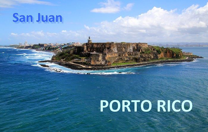
Abordées par la mer, les côtes portoricaines se dévoilent peu à peu … l'agglomération de San Juan est maintenant bien en vue. Des fortifications dominent la ville, sur un versant de falaise apparaît un quartier haut en couleurs, plus loin, on distingue dans la brume des plages et un alignement de buildings.

A mesure que l'on progresse dans la rade, c'est la vieille ville fondée par les conquistadors que l'on détaille du regard : une imbrication d'habitations et une imposante demeure blanche, celle des gouverneurs du territoire.

Voici 5 lieux au programme de nos visites, il en reste 5 autres à découvrir en suivant notre itinéraire d'une dizaine d'étapes dans cette agglomération de plus de deux millions d'habitants.
--
Viejo San Juan, le cœur historique de la ville
A placer en tête des visites à effectuer à San Juan de Porto Rico, celle de son Vieux quartier. Pour y apprécier notamment le charme de ses anciens monuments et de ses habitations au style colonial espagnol et pour y côtoyer également la décontraction de ses habitants au comportement très latino.
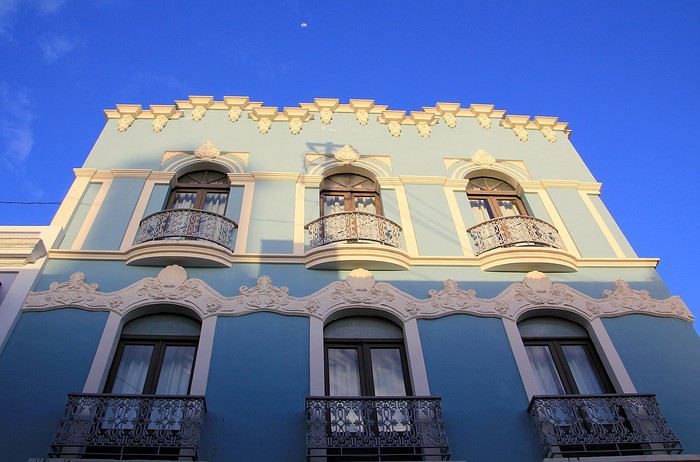
Il faut parcourir les rues de ce secteur historique, arpenter la rue SantoCristo ou Fortaleza, les plus fréquentées, les plus animées. Mais bien entendu, on ne doit pas hésiter à cheminer vers les petites rues de traverse, quitte à tomber sur une impasse ou à s'y égarer.

On y découvre des façades aux multiples couleurs, de belles décorations murales, des balcons et des ferronneries ouvragées. Un style inspiré par la lointaine Espagne, nous voilà plongés dans l'atmosphère coloniale du Nouveau Monde, celle des conquistadors des XVe au XVIe siècle.

Des maisons coloniales et des commerces longent les rues principales. Restaurants, bars, boutiques de souvenirs, galeries d'art et quelques magasins d'articles de luxe. Un exemple parmi d'autres avec au 202 de la RueSanto Cristo, une entrée par un porche qui dévoile une cour intérieure, un vrai patio qui ne détonnerait pas en Andalousie.

On continue la flânerie en battant le pavé du Viejo San Juan. Justement, au sujet de ces pavés, leur teinte bleutée étonne. On apprendra que ces pavés étaient utilisés comme ballast dans les cales des navires marchands à l'époque de la colonisation et que leurs reflets bleus satinés sont dus à l'usure du temps.

La façade inondée de lumière de la Cathédrale de San Juan domine de sa hauteur tout le quartier. Le premier édifice édifié ici date de 1521 mais il n'a pas résisté aux ouragans tropicaux fréquents sous ces latitudes. L'aspect actuel est plus récent, précisément de 1917.
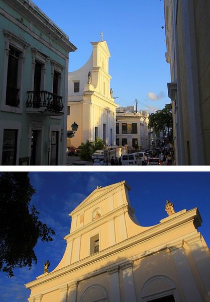
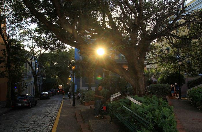
Plus loin, notre déambulation nous mène de rue en rue, de la place ombragée de l'édifice catholique à la Place de l'Hôtel de ville. Là encore, la plupart des bâtiments témoignent du passé colonial de la ville les bâtisses restaurées dans le pure style de l'époque, il n'en manque pas dans le Viejo San Juan, on en compterait près de quatre cents.

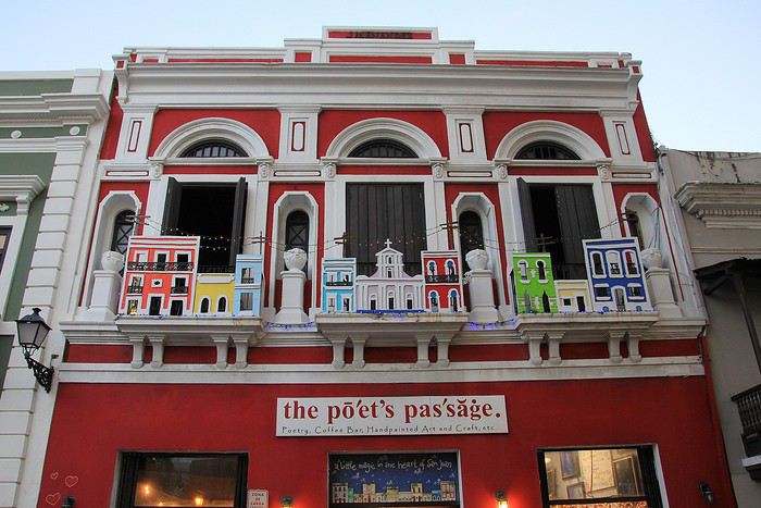
A l'extrémité de la rue Fortaleza, on parvient à cette imposante maison blanche appelée aussi « Fortaleza ». Perchée sur les falaises, elle domine toute la baie de San Juan. Sur la photo, on ne voit qu'une partie seulement du bâtiment construit à partir de 1533. L'édifice rénovée depuis son origine a été utilisé à certaines périodes d'arsenal et de prison.
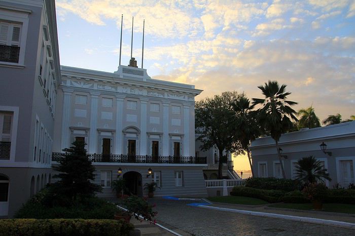
Une bâtisse où résident les Gouverneurs de l'île. Ainsi, ce sont quelques 170 Gouverneurs qui se sont succédé à la tête de cette colonie ultramarine.. L'île de Porto Rico s'honore d'être la première colonie espagnole du Nouveau Monde. Sur une des places de la ville trône la statue de l'illustre Ponce de Leon, un vaillant explorateur qui fut le premier Gouverneur de Porto Rico en 1509.

Après la guerre hispano-américaine, l'île est passée sous domination américaine, c'était en 1898. De nos jours Porto Rico a un statut particulier au sein des USA. Un État libre mais associé aux États-Unis. Les Porto Ricains ont la nationalité américaine mais ils ne votent pas pour les élections présidentielles des États-Unis. Le Gouverneur de l'île bénéficie d'une large autonomie de gestion de son territoire insulaire.
--
Les couleurs portoricaines
Là, il ne s'agit pas d'un lieu précis à voir mais plutôt d'une vision qui s'impose au regard lorsque l'on se balade dans les rues de San Juan. La ville est pavoisée presque à chaque coin de rue de drapeaux aux couleurs portoricaines.
Dans une des rues passantes de la vieille ville il y a même un immense drapeau qui concurrence le bleu du ciel. Immense, ce voile fait office de décor et tamise les chauds rayons du soleil tropical. Ce drapeau local avec ses teintes bleues, blanches et rouges n'est pas sans en évoquer un autre, celui de l'île sœur, la proche Cuba. En effet, le graphisme est identique entre les deux étendards mais les couleurs sont inversées. Triangle bleu et alternance de bandes horizontales blanches et rouges pour Porto Rico et tout l'inverse pour celui de Cuba (triangle rouge et bandes blanches et bleues). Une certaine harmonie donc mais dans la différence, une idée inspirée à l'origine par le parti révolutionnaire cubain. La signification de ces teintes ? Le bleu pour le ciel et la mer, le blanc évoque la paix et le rouge le sang versé pour la patrie.
--
La Perla, un quartier populaire haut en couleur
Une vraie mosaïque aux teintes éclatantes, ce quartier de « La Perla » accroché aux falaises qui font face à l'océan. Il vaut assurément le coup d’œil et même un peu plus.
La meilleure vision est celle que l'on a depuis la mer, d'ailleurs on en avait bénéficié en arrivant depuis le large. A présent, nous longeons ce quartier ouvrier en parcourant la route de la corniche. Quel bric-à-brac avec ses modestes maisons dont certaines sont en piteux états … mais les couleurs sont là, tentant d'égayer à grand renfort de coups de pinceaux. La misère semble plus belle en technicolor. Tenez, là ! une façade est parée des couleurs de l'étendard portoricain, une tradition sur cette île.
Longtemps ce quartier populaire de San Juan a eu une mauvaise réputation : trafic de drogue et insécurité … autant dire que les visiteurs évitaient de s'y aventurer. Mais depuis 2017 la situation a changé, beaucoup de touristes vont y faire un tour et pas seulement pour sa palette de couleurs vives. Connaissez-vous Luis Fonsi ? Et la musique entêtante de son titre phare, « Despacito * » ? Ce chanteur portoricain a tourné son clip dans les ruelles de La Perla, aussi, des amateurs de ce morceau très « caliente », véritable hymne à la séduction latino, sont attirés ici. Ce clip de janvier 2017 a été un tube mondial et serait même le plus « streamé » de l'histoire !
--
Imposantes et dissuasives forteresses
Après la visite de la vielle ville, il faut en faire le tour, on pourrait presque parler de balade sur un long chemin de ronde tellement la périphérie du quartier est protégée de fortifications et de murailles. Les conquistadors savaient que leur colonie était convoitée, ils ont fait en sorte de bien la préserver. Quelques mots d'histoire à ce sujet. En 1595, ce sont les troupes de la marine anglaise qui attaquent, sans succès ! Puis c'est au tour des Hollandais en 1625 de tenter la prise de San Juan, ils réussirent à accéder à une partie de la cité mais furent repoussés par des Espagnols, ardents défenseurs de leur possession. En 1797, un nouvel assaut des Britanniques et un nouvel échec. Mais face aux bombardements américains de 1898, les militaires espagnols ont cette fois capitulés … San Juan et l'île de Porto Rico passèrent ainsi sous domination des États-Unis.
La route sur la corniche nord fait passer au pied d'imposantes murailles. Voici le Fort San Cristobal, une forteresse qui avait de bons atouts pour dissuader toutes attaques étrangères. Construit à partir de 1634, ce massif château fort fait honneur évidemment au célébrissime explorateur Christophe Colomb. Perché sur une colline, il domine l'ensemble de la ville, les falaises et surtout l'océan. Depuis le large, les éventuels assaillants l'apercevaient ainsi de très loin, aussi ils comprenaient vite ce a quoi il devaient s'attendre !
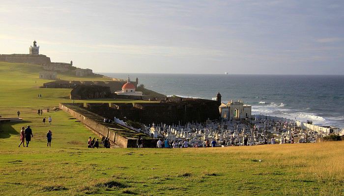
Tout au bout de la corniche, juché sur un promontoire rocheux on voit maintenant plein cadre le Fort San Felipe del Morro. Cette autre forteresse est idéalement située à l'entrée de la rade. Sa construction est antérieure à celle du Fort San Cristobal elle a débuté en 1539. A cette époque, il était facile de trouver de la main-d’œuvre … on parle de centaines d'esclaves enrôlés dans ces gigantesques travaux ! Un fort, un phare et à proximité une église et son cimetière au nom à rallonge : Santa Maria Magdalena de Pazzis. Un cimetière avec vue privilégié sur l'horizon marin, dommage que les morts qui y reposent en paix ne puissent en profiter ! L'impression de puissance que dégage le château amplement fortifié par ses murailles est contrebalancée par la douceur de la luminosité et par cette étendue verdoyante. La colline couverte d'herbe fait penser à un green de golf. On ne peut pas mieux dire … en effet, plus tard, lorsque ce lieu défensif a été investi par les troupes américaines, sur ces pelouses un terrain de golf a été aménagé pour les loisirs des soldats US !
Abordées par la mer, les côtes portoricaines se dévoilent peu à peu … l'agglomération de San Juan est maintenant bien en vue. Des fortifications dominent la ville, sur un versant de falaise apparaît un quartier haut en couleurs, plus loin, on distingue dans la brume des plages et un alignement de buildings.
A mesure que l'on progresse dans la rade, c'est la vieille ville fondée par les conquistadors que l'on détaille du regard : une imbrication d'habitations et une imposante demeure blanche, celle des gouverneurs du territoire.
Voici 5 lieux au programme de nos visites, il en reste 5 autres à découvrir en suivant notre itinéraire d'une dizaine d'étapes dans cette agglomération de plus de deux millions d'habitants.
--
Viejo San Juan, le cœur historique de la ville
A placer en tête des visites à effectuer à San Juan de Porto Rico, celle de son Vieux quartier. Pour y apprécier notamment le charme de ses anciens monuments et de ses habitations au style colonial espagnol et pour y côtoyer également la décontraction de ses habitants au comportement très latino.
Il faut parcourir les rues de ce secteur historique, arpenter la rue SantoCristo ou Fortaleza, les plus fréquentées, les plus animées. Mais bien entendu, on ne doit pas hésiter à cheminer vers les petites rues de traverse, quitte à tomber sur une impasse ou à s'y égarer.
On y découvre des façades aux multiples couleurs, de belles décorations murales, des balcons et des ferronneries ouvragées. Un style inspiré par la lointaine Espagne, nous voilà plongés dans l'atmosphère coloniale du Nouveau Monde, celle des conquistadors des XVe au XVIe siècle.
Des maisons coloniales et des commerces longent les rues principales. Restaurants, bars, boutiques de souvenirs, galeries d'art et quelques magasins d'articles de luxe. Un exemple parmi d'autres avec au 202 de la RueSanto Cristo, une entrée par un porche qui dévoile une cour intérieure, un vrai patio qui ne détonnerait pas en Andalousie.
On continue la flânerie en battant le pavé du Viejo San Juan. Justement, au sujet de ces pavés, leur teinte bleutée étonne. On apprendra que ces pavés étaient utilisés comme ballast dans les cales des navires marchands à l'époque de la colonisation et que leurs reflets bleus satinés sont dus à l'usure du temps.
La façade inondée de lumière de la Cathédrale de San Juan domine de sa hauteur tout le quartier. Le premier édifice édifié ici date de 1521 mais il n'a pas résisté aux ouragans tropicaux fréquents sous ces latitudes. L'aspect actuel est plus récent, précisément de 1917.
Plus loin, notre déambulation nous mène de rue en rue, de la place ombragée de l'édifice catholique à la Place de l'Hôtel de ville. Là encore, la plupart des bâtiments témoignent du passé colonial de la ville les bâtisses restaurées dans le pure style de l'époque, il n'en manque pas dans le Viejo San Juan, on en compterait près de quatre cents.
A l'extrémité de la rue Fortaleza, on parvient à cette imposante maison blanche appelée aussi « Fortaleza ». Perchée sur les falaises, elle domine toute la baie de San Juan. Sur la photo, on ne voit qu'une partie seulement du bâtiment construit à partir de 1533. L'édifice rénovée depuis son origine a été utilisé à certaines périodes d'arsenal et de prison.
Une bâtisse où résident les Gouverneurs de l'île. Ainsi, ce sont quelques 170 Gouverneurs qui se sont succédé à la tête de cette colonie ultramarine.. L'île de Porto Rico s'honore d'être la première colonie espagnole du Nouveau Monde. Sur une des places de la ville trône la statue de l'illustre Ponce de Leon, un vaillant explorateur qui fut le premier Gouverneur de Porto Rico en 1509.
Après la guerre hispano-américaine, l'île est passée sous domination américaine, c'était en 1898. De nos jours Porto Rico a un statut particulier au sein des USA. Un État libre mais associé aux États-Unis. Les Porto Ricains ont la nationalité américaine mais ils ne votent pas pour les élections présidentielles des États-Unis. Le Gouverneur de l'île bénéficie d'une large autonomie de gestion de son territoire insulaire.
--
Les couleurs portoricaines
Là, il ne s'agit pas d'un lieu précis à voir mais plutôt d'une vision qui s'impose au regard lorsque l'on se balade dans les rues de San Juan. La ville est pavoisée presque à chaque coin de rue de drapeaux aux couleurs portoricaines.
Dans une des rues passantes de la vieille ville il y a même un immense drapeau qui concurrence le bleu du ciel. Immense, ce voile fait office de décor et tamise les chauds rayons du soleil tropical. Ce drapeau local avec ses teintes bleues, blanches et rouges n'est pas sans en évoquer un autre, celui de l'île sœur, la proche Cuba. En effet, le graphisme est identique entre les deux étendards mais les couleurs sont inversées. Triangle bleu et alternance de bandes horizontales blanches et rouges pour Porto Rico et tout l'inverse pour celui de Cuba (triangle rouge et bandes blanches et bleues). Une certaine harmonie donc mais dans la différence, une idée inspirée à l'origine par le parti révolutionnaire cubain. La signification de ces teintes ? Le bleu pour le ciel et la mer, le blanc évoque la paix et le rouge le sang versé pour la patrie.
--
La Perla, un quartier populaire haut en couleur
Une vraie mosaïque aux teintes éclatantes, ce quartier de « La Perla » accroché aux falaises qui font face à l'océan. Il vaut assurément le coup d’œil et même un peu plus.
La meilleure vision est celle que l'on a depuis la mer, d'ailleurs on en avait bénéficié en arrivant depuis le large. A présent, nous longeons ce quartier ouvrier en parcourant la route de la corniche. Quel bric-à-brac avec ses modestes maisons dont certaines sont en piteux états … mais les couleurs sont là, tentant d'égayer à grand renfort de coups de pinceaux. La misère semble plus belle en technicolor. Tenez, là ! une façade est parée des couleurs de l'étendard portoricain, une tradition sur cette île.
Longtemps ce quartier populaire de San Juan a eu une mauvaise réputation : trafic de drogue et insécurité … autant dire que les visiteurs évitaient de s'y aventurer. Mais depuis 2017 la situation a changé, beaucoup de touristes vont y faire un tour et pas seulement pour sa palette de couleurs vives. Connaissez-vous Luis Fonsi ? Et la musique entêtante de son titre phare, « Despacito * » ? Ce chanteur portoricain a tourné son clip dans les ruelles de La Perla, aussi, des amateurs de ce morceau très « caliente », véritable hymne à la séduction latino, sont attirés ici. Ce clip de janvier 2017 a été un tube mondial et serait même le plus « streamé » de l'histoire !
--
Imposantes et dissuasives forteresses
Après la visite de la vielle ville, il faut en faire le tour, on pourrait presque parler de balade sur un long chemin de ronde tellement la périphérie du quartier est protégée de fortifications et de murailles. Les conquistadors savaient que leur colonie était convoitée, ils ont fait en sorte de bien la préserver. Quelques mots d'histoire à ce sujet. En 1595, ce sont les troupes de la marine anglaise qui attaquent, sans succès ! Puis c'est au tour des Hollandais en 1625 de tenter la prise de San Juan, ils réussirent à accéder à une partie de la cité mais furent repoussés par des Espagnols, ardents défenseurs de leur possession. En 1797, un nouvel assaut des Britanniques et un nouvel échec. Mais face aux bombardements américains de 1898, les militaires espagnols ont cette fois capitulés … San Juan et l'île de Porto Rico passèrent ainsi sous domination des États-Unis.
La route sur la corniche nord fait passer au pied d'imposantes murailles. Voici le Fort San Cristobal, une forteresse qui avait de bons atouts pour dissuader toutes attaques étrangères. Construit à partir de 1634, ce massif château fort fait honneur évidemment au célébrissime explorateur Christophe Colomb. Perché sur une colline, il domine l'ensemble de la ville, les falaises et surtout l'océan. Depuis le large, les éventuels assaillants l'apercevaient ainsi de très loin, aussi ils comprenaient vite ce a quoi il devaient s'attendre !
Tout au bout de la corniche, juché sur un promontoire rocheux on voit maintenant plein cadre le Fort San Felipe del Morro. Cette autre forteresse est idéalement située à l'entrée de la rade. Sa construction est antérieure à celle du Fort San Cristobal elle a débuté en 1539. A cette époque, il était facile de trouver de la main-d’œuvre … on parle de centaines d'esclaves enrôlés dans ces gigantesques travaux ! Un fort, un phare et à proximité une église et son cimetière au nom à rallonge : Santa Maria Magdalena de Pazzis. Un cimetière avec vue privilégié sur l'horizon marin, dommage que les morts qui y reposent en paix ne puissent en profiter ! L'impression de puissance que dégage le château amplement fortifié par ses murailles est contrebalancée par la douceur de la luminosité et par cette étendue verdoyante. La colline couverte d'herbe fait penser à un green de golf. On ne peut pas mieux dire … en effet, plus tard, lorsque ce lieu défensif a été investi par les troupes américaines, sur ces pelouses un terrain de golf a été aménagé pour les loisirs des soldats US !
Adventures of a Bygone Era: The Philippines in 1984
After several discussions on VF about travel journals from the Philippines, I decided to write this curiosity: a trip report from a journey made in 1984, when traveling to the Philippines was still an adventure.
A curiosity because writing a travel journal about a trip 35 years later isn’t common, but also (mostly?) because exploring the Philippines at that time had little in common with traveling there today.
Obviously, I’ve forgotten a number of facts, most of the details, but with the help of a few notes from that time and a stack of slides (yes, there was life before digital 😊), many memories came back and added to the highlights I’d never forgotten. The scanned slides aren’t always great quality, but there are still quite a few to brighten up this chatter. Back then, we didn’t snap photos like we do now—film was too expensive—so I don’t have pictures of every place we visited... too bad, comparing some of those spots to how they look today would’ve been interesting.
Why "Adventures"? Why call it "Adventures" in the Philippines in 1984, a word so often used for a simple exotic trip? - Because the lack of information (no *Guide du Routard*, no *Lonely Planet*, no *Michelin Guide*, nothing, and obviously no internet) gave this trip what’s at the heart of adventure: the unknown. - Because the political situation made the stay sometimes dangerous. - Because transportation conditions were always epic, often perilous. - Because the question of where we’d spend the night came up almost every evening. - And for... quite a few other reasons.
That said, we weren’t exactly explorers!
Why the Philippines? First of all, why go to the Philippines in 1984—a country not exactly set up for tourism and about which we knew very little? How could we get an idea of the beauty of the Philippines and its points of interest when we had no guides or photos?
The idea came to us from Thailand a year earlier, during our first long-haul trip. After touring the north of the country, we met a Frenchman living in Phuket, where there were only a few tourists in Patong, with just a few small hotels and guesthouses. Kata and Karon had no buildings or roads, Rawai only had three palm-thatched bungalows, including ours, and the other islands were unknown to tourists. There was plenty to discover, and we wanted to return to this beautiful country... but the Frenchman made us dream about the Philippines—a country to explore, with wild landscapes.
Long evenings of discussion over multiple Sprite-Mekong cocktails (what memories of those headaches!) finally convinced us we had to go to the Philippines.
Episode 0: Before Departure The decision was made: we’d go to the Philippines in May 1984. Our friends and family were surprised when we announced we were going on vacation to the Philippines (a bit like saying today we were going paddleboarding in the Kerguelen Islands 🤪).
These days, preparing for each of our trips takes long evenings of research, planning, and noting down good addresses... etc. But for the Philippines in 1984, preparation was quick: we had very little information about the country, we were leaving almost at random, and the discovery would only be more exciting.
We still had a few bits of info gathered here and there: the rice terraces in northern Luzon, volcanoes, Negros where we were supposed to visit an acquaintance, Cebu and its marine life (we ended up going elsewhere), and absolutely avoid Mindanao, which was practically at war with the regime. That was about it, but it was already a great itinerary.
Nothing was organized in advance; we’d see day by day. We had no idea about travel times or even the existence of transportation options. The main (and sometimes only) way to connect two islands was by overloaded, rusty ferry. Only the big cities had airports.
Let’s Go: Episode 1: Paris to Manila My travel journals always start after arriving at the airport—the Europe-to-“Other Continent” trip isn’t interesting—but the flight to the Philippines was already an adventure, so I’ll make an exception.
This was the era when only a few Asian airlines were on par with Western ones: Thai, Singapore Airlines, and Philippine Airlines. They had beautiful, brand-new planes, and to attract customers (almost exclusively “businessmen”) from the usual airlines (Air France, Lufthansa, British Airways), there was opulence on board: unlimited champagne, all sorts of cocktails... Compared to today’s long-haul flights, there was still one small difference: no personal screens, just one screen at the front of the cabin with one mandatory movie. And I don’t know why, but we only got James Bond films, both ways... that must’ve been the trend at the time.
The tourism boom to Southeast Asia hadn’t started yet, and the “Asian Tigers” weren’t a thing, so there weren’t many business trips. That meant long-haul flights made stops everywhere to fill the planes. Our Philippine Airlines Boeing 747 left London, picked us up in Paris, then stopped in Frankfurt to take on a few Germans. I don’t know why we then made a stop in Dubai—a totally exotic place at the time. There was nothing to do there... things have changed a lot since. It was a small town lost in the desert. The airport was tiny, with just one or two buildings and a supermarket. During the stopover, everyone had to get off the plane and walk to the supermarket. Photo and electronic equipment were dirt cheap—I guess that was the only reason for the stop. Maybe it was their first commercial move. Emirates didn’t exist yet, as I checked online, but anyway, the idea that such a remote place could have its own airline was unthinkable.
Online, I found this photo of Dubai Airport in 1980. Anyone who’s transited through today’s massive airport with its rows of A380s will appreciate it: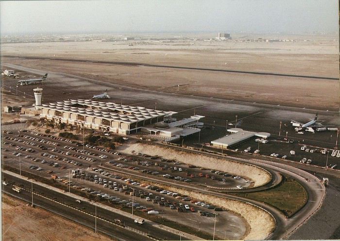
Next stop: New Delhi to drop off some Europeans and pick up a few Indians, and finally, the terminus: Manila. I don’t remember how long the trip took with its five stops—an unimaginable journey today. Despite all those stops to fill the plane, there was still enough space to stretch out on the four center seats of the 747, something that never happens these days despite all the flights in every direction.
So here we are, finally at Manila Airport around midnight.
Episode 1: Manila and Baguio To start, a quick note on the political and economic situation in the Philippines in 1984, which had consequences for us as tourists, as we’d soon realize upon arrival.
After several centuries of Spanish colonization, the Philippines became American at the start of the 20th century, then independent. In 1966, Marcos took power, and little by little, his regime sank into corruption and mismanagement, becoming a dictatorship with martial law, all for the benefit of his family and friends, who enriched themselves endlessly. The peak was the assassination of opposition leader Benigno Aquino in August 1983, which triggered harshly repressed protests. So we arrived a few months later in a very poor country, with omnipresent corruption and an extremely tense political situation, as we’d soon see for ourselves. Major protests took place in the main cities during our trip—I’ll come back to that. Two years later, Marcos fled to Hawaii after being forced out of power following rigged elections. This historical context explains a lot of the situations we found ourselves in over the following weeks.
Arriving in the middle of the night isn’t very cheerful. Manila was already a huge city with many slums, where you could find a few business hotels like the Hilton or Intercontinental—way out of our budget—and plenty of run-down hotels. Luckily, two Indians we’d chatted with on the plane offered to take us to their usual hotel. They came to Manila twice a year for business. We accepted their offer, relieved not to have to look for a place to stay in the middle of the night, figuring the address must be good since they came back every time... we were wrong 🙁
We left the airport and immediately got a taste of the local vibe when we got into the taxi: the police asked for our passports. We thought: what’s more normal than police in a dictatorship?
But that wasn’t it at all. Our two Indian friends explained that the police were noting our names along with the taxi number and time. Crime in Manila was so bad that the taxi driver would be held responsible if anything happened to us... welcome to the Philippines 😎 😎
Historically, the Philippines was a very violent country, where everything was settled with guns or machetes. Previous governments had banned carrying weapons, but Marcos later allowed the free sale and carrying of guns, and disputes were settled with pistols again (or worse, as we’d discover later). Since he’d released most of the criminals from prison to form a paramilitary militia at his service (I’ll talk about our encounter with these “heroes” later), it was pretty dangerous to go into many parts of Manila, where these “tonton macoutes” ruled.
We arrived at our hotel without incident... and then things started badly. The room was infested with big cockroaches—exactly what I hate most in those kinds of countries. No way to find another hotel at that hour. After the long flight, the urge to take a shower was so strong that we squeezed into the bathroom as best we could. After that, I don’t remember—I guess we must’ve fallen asleep exhausted under the sheets in the heat... air conditioning wasn’t widespread yet.
The next day, we just wanted to leave that dump as soon as possible. So we decided to head north right away, stopping in Baguio, and we’d visit Manila a bit on the way back.
When we stepped outside, we discovered a pretty run-down neighborhood with potholed streets. But we also discovered the jeepneys. They were everywhere, flooding the streets.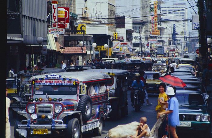
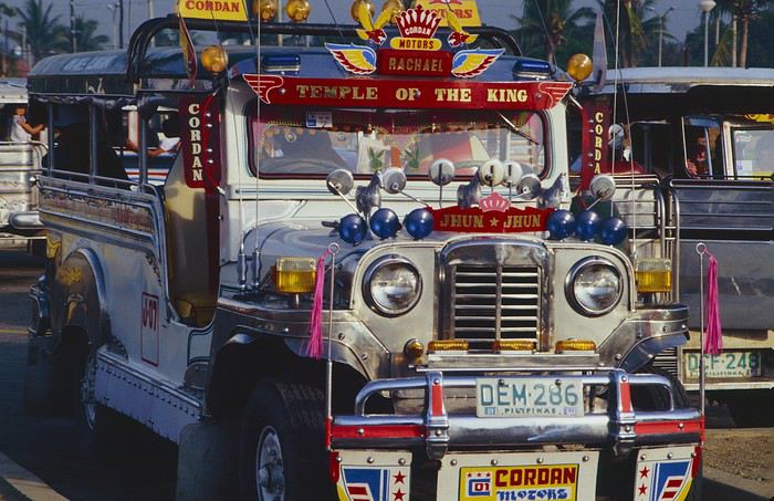
They had crazy sound systems, each one blasting louder than the last. The interiors were kitschy but fun. There weren’t many private cars—almost all transportation was by jeepney, with buses reserved for intercity trips.
Before heading to the bus terminal for the north, somewhere on the outskirts of the city, we needed to exchange some money. I don’t remember how we ended up in a policeman’s jeep who offered his services: - Exchange money on the black market at a better rate than the banks. - Take us wherever we wanted, in this case, the bus terminal.
We accepted both offers (we’d still checked the official exchange rate from dollars to pesos). So we found ourselves in his jeep. After exchanging money, we left in his vehicle and stopped for gas. Without turning off the engine, he calmly smoked a cigarette while filling up. Since we were in a jeep with no doors or roof, we were ready to jump out if things went south, our travel bag in hand.
But we weren’t done with surprises yet. Once we left the small streets, we ended up in a neighborhood with wide avenues and not much traffic, which didn’t justify his incredible behavior. At every intersection, he made the sign of the cross, closed his eyes, and crossed without looking. I was more stunned than terrified! It wasn’t until we got out of the car later that I told Anne-Marie what had happened. I’d seen everything because the cop had put me in the front seat. Luckily, A-Marie hadn’t noticed anything from the back. Crossing Manila by trusting God rather than the rules of the road was ultimately effective. We were lucky—the trip was off to a good start. 🙂 🙂
We then passed through a neighborhood where slums stretched on for a while, and we left our policeman—friendly but a bit crazy—with relief.
A few hours by bus later, here we are in Baguio, cool in the mountains. My memories of Baguio are pretty fuzzy. I remember a small town. After some research while writing this journal, I found that the population was 120,000 in 1980. Given the population density in each home, that confirms my memory of a smallish town. Outside the “official” district with the president’s summer residence and government buildings, there were two or three paved streets with nice houses. The rest was very dirty and very poor, with lots of slums and dirt roads.
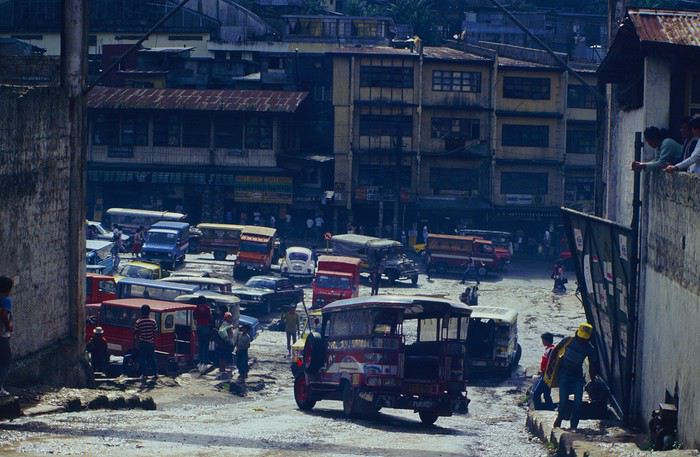
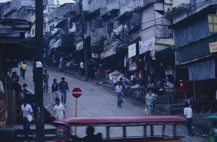
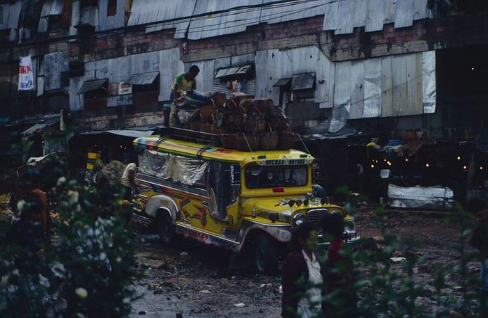
People we met on the street invited us to stay with them. These days, we wouldn’t just show up at strangers’ houses, which we should’ve done in Baguio—it would’ve saved us from an unimaginable and dangerous situation... which I won’t say anything about... !😊
The simple wooden house was on stilts at the edge of a hill with a view of the mountains. Since it was the start of the rainy season in a city that gets a lot of rain, we saw a lot of water. Our outings in town happened between downpours.
View from our lodging: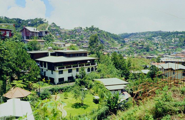
Episode 2: Baguio to Bontoc Aside from the situation briefly mentioned above, it was on the next leg to Bontoc that the adventure really began: an endless and dangerous road, a bus from another era, breathtaking landscapes, and surprising people.
We didn’t know the distance or how long it would take to get to Bontoc. When we arrived after about ten hours, we learned that Baguio to Bontoc was 140 km.
We got on a bus with wooden seats and settled in, two to a seat meant for two. As the bus filled up, passengers squeezed in three or four per seat, with chickens and baskets full of all sorts of things in the aisle. A little embarrassed, we didn’t know if we should squeeze in three on our seat. The seats were super tight (luckily, Filipinos are small), and I didn’t know where to put my legs given my height. I don’t remember if we stayed alone on our bench or if we ended up sharing with others.
The “road” was a dirt track (or rather, a mud track) with endless turns. We held on as best we could to our slippery wooden seats—it was shaking in every direction. The woman behind us was carsick and throwing up... gross... but what were we doing there? Then we plunged into the Sierra Madre... just the name is dreamy!
Rice terraces started to appear: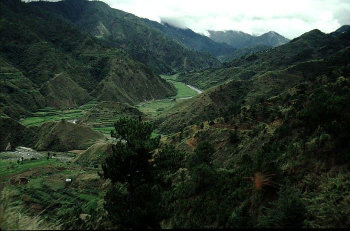
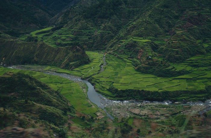
they took up more and more space along cliffs where we weren’t always reassured,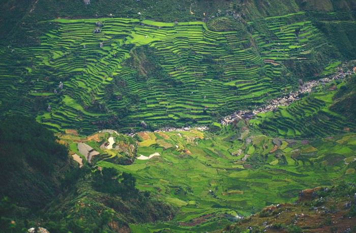
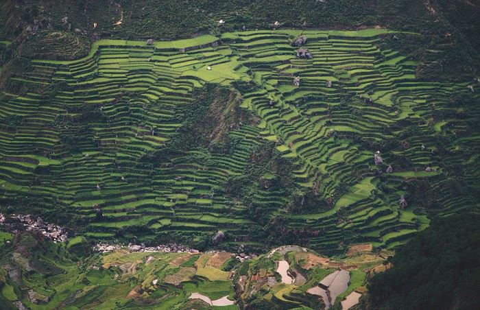
with lots of waterfalls (all that water had to go somewhere).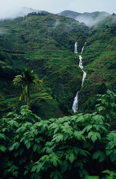
A few miserable villages stretched along the track, most often just a few houses balancing between the road and the drop. The bus stopped in every village—people got on or off and settled inside or on the roof. Street vendors offered their products to the bus passengers—a common sight in Asia, even today.
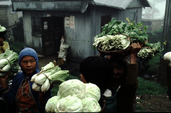
We were in another world—villagers were in loincloths, others had spears. The atmosphere was strange... but all good, we wanted exoticism, and we got it: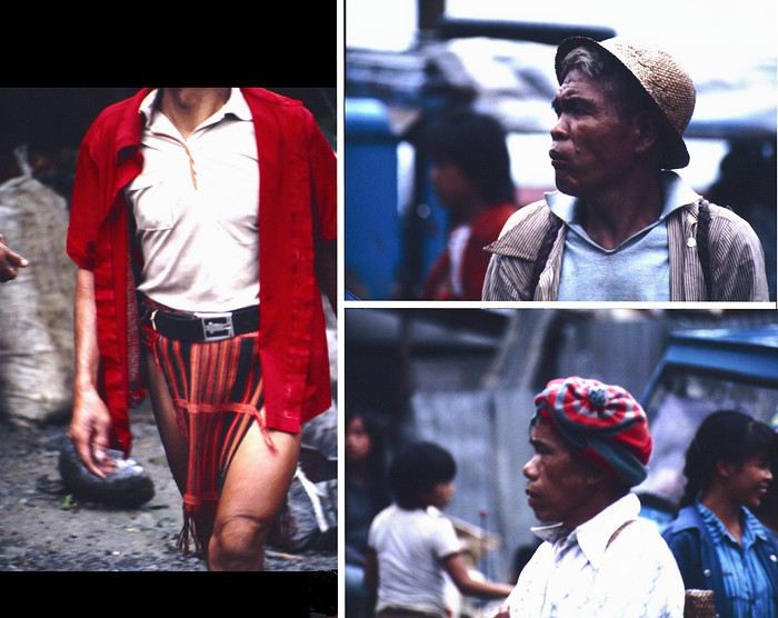
This so-called traditional outfit was everyday wear—it wasn’t for tourists since there weren’t any.
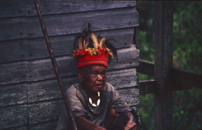
A curiosity because writing a travel journal about a trip 35 years later isn’t common, but also (mostly?) because exploring the Philippines at that time had little in common with traveling there today.
Obviously, I’ve forgotten a number of facts, most of the details, but with the help of a few notes from that time and a stack of slides (yes, there was life before digital 😊), many memories came back and added to the highlights I’d never forgotten. The scanned slides aren’t always great quality, but there are still quite a few to brighten up this chatter. Back then, we didn’t snap photos like we do now—film was too expensive—so I don’t have pictures of every place we visited... too bad, comparing some of those spots to how they look today would’ve been interesting.
Why "Adventures"? Why call it "Adventures" in the Philippines in 1984, a word so often used for a simple exotic trip? - Because the lack of information (no *Guide du Routard*, no *Lonely Planet*, no *Michelin Guide*, nothing, and obviously no internet) gave this trip what’s at the heart of adventure: the unknown. - Because the political situation made the stay sometimes dangerous. - Because transportation conditions were always epic, often perilous. - Because the question of where we’d spend the night came up almost every evening. - And for... quite a few other reasons.
That said, we weren’t exactly explorers!
Why the Philippines? First of all, why go to the Philippines in 1984—a country not exactly set up for tourism and about which we knew very little? How could we get an idea of the beauty of the Philippines and its points of interest when we had no guides or photos?
The idea came to us from Thailand a year earlier, during our first long-haul trip. After touring the north of the country, we met a Frenchman living in Phuket, where there were only a few tourists in Patong, with just a few small hotels and guesthouses. Kata and Karon had no buildings or roads, Rawai only had three palm-thatched bungalows, including ours, and the other islands were unknown to tourists. There was plenty to discover, and we wanted to return to this beautiful country... but the Frenchman made us dream about the Philippines—a country to explore, with wild landscapes.
Long evenings of discussion over multiple Sprite-Mekong cocktails (what memories of those headaches!) finally convinced us we had to go to the Philippines.
Episode 0: Before Departure The decision was made: we’d go to the Philippines in May 1984. Our friends and family were surprised when we announced we were going on vacation to the Philippines (a bit like saying today we were going paddleboarding in the Kerguelen Islands 🤪).
These days, preparing for each of our trips takes long evenings of research, planning, and noting down good addresses... etc. But for the Philippines in 1984, preparation was quick: we had very little information about the country, we were leaving almost at random, and the discovery would only be more exciting.
We still had a few bits of info gathered here and there: the rice terraces in northern Luzon, volcanoes, Negros where we were supposed to visit an acquaintance, Cebu and its marine life (we ended up going elsewhere), and absolutely avoid Mindanao, which was practically at war with the regime. That was about it, but it was already a great itinerary.
Nothing was organized in advance; we’d see day by day. We had no idea about travel times or even the existence of transportation options. The main (and sometimes only) way to connect two islands was by overloaded, rusty ferry. Only the big cities had airports.
Let’s Go: Episode 1: Paris to Manila My travel journals always start after arriving at the airport—the Europe-to-“Other Continent” trip isn’t interesting—but the flight to the Philippines was already an adventure, so I’ll make an exception.
This was the era when only a few Asian airlines were on par with Western ones: Thai, Singapore Airlines, and Philippine Airlines. They had beautiful, brand-new planes, and to attract customers (almost exclusively “businessmen”) from the usual airlines (Air France, Lufthansa, British Airways), there was opulence on board: unlimited champagne, all sorts of cocktails... Compared to today’s long-haul flights, there was still one small difference: no personal screens, just one screen at the front of the cabin with one mandatory movie. And I don’t know why, but we only got James Bond films, both ways... that must’ve been the trend at the time.
The tourism boom to Southeast Asia hadn’t started yet, and the “Asian Tigers” weren’t a thing, so there weren’t many business trips. That meant long-haul flights made stops everywhere to fill the planes. Our Philippine Airlines Boeing 747 left London, picked us up in Paris, then stopped in Frankfurt to take on a few Germans. I don’t know why we then made a stop in Dubai—a totally exotic place at the time. There was nothing to do there... things have changed a lot since. It was a small town lost in the desert. The airport was tiny, with just one or two buildings and a supermarket. During the stopover, everyone had to get off the plane and walk to the supermarket. Photo and electronic equipment were dirt cheap—I guess that was the only reason for the stop. Maybe it was their first commercial move. Emirates didn’t exist yet, as I checked online, but anyway, the idea that such a remote place could have its own airline was unthinkable.
Online, I found this photo of Dubai Airport in 1980. Anyone who’s transited through today’s massive airport with its rows of A380s will appreciate it:
Next stop: New Delhi to drop off some Europeans and pick up a few Indians, and finally, the terminus: Manila. I don’t remember how long the trip took with its five stops—an unimaginable journey today. Despite all those stops to fill the plane, there was still enough space to stretch out on the four center seats of the 747, something that never happens these days despite all the flights in every direction.
So here we are, finally at Manila Airport around midnight.
Episode 1: Manila and Baguio To start, a quick note on the political and economic situation in the Philippines in 1984, which had consequences for us as tourists, as we’d soon realize upon arrival.
After several centuries of Spanish colonization, the Philippines became American at the start of the 20th century, then independent. In 1966, Marcos took power, and little by little, his regime sank into corruption and mismanagement, becoming a dictatorship with martial law, all for the benefit of his family and friends, who enriched themselves endlessly. The peak was the assassination of opposition leader Benigno Aquino in August 1983, which triggered harshly repressed protests. So we arrived a few months later in a very poor country, with omnipresent corruption and an extremely tense political situation, as we’d soon see for ourselves. Major protests took place in the main cities during our trip—I’ll come back to that. Two years later, Marcos fled to Hawaii after being forced out of power following rigged elections. This historical context explains a lot of the situations we found ourselves in over the following weeks.
Arriving in the middle of the night isn’t very cheerful. Manila was already a huge city with many slums, where you could find a few business hotels like the Hilton or Intercontinental—way out of our budget—and plenty of run-down hotels. Luckily, two Indians we’d chatted with on the plane offered to take us to their usual hotel. They came to Manila twice a year for business. We accepted their offer, relieved not to have to look for a place to stay in the middle of the night, figuring the address must be good since they came back every time... we were wrong 🙁
We left the airport and immediately got a taste of the local vibe when we got into the taxi: the police asked for our passports. We thought: what’s more normal than police in a dictatorship?
But that wasn’t it at all. Our two Indian friends explained that the police were noting our names along with the taxi number and time. Crime in Manila was so bad that the taxi driver would be held responsible if anything happened to us... welcome to the Philippines 😎 😎
Historically, the Philippines was a very violent country, where everything was settled with guns or machetes. Previous governments had banned carrying weapons, but Marcos later allowed the free sale and carrying of guns, and disputes were settled with pistols again (or worse, as we’d discover later). Since he’d released most of the criminals from prison to form a paramilitary militia at his service (I’ll talk about our encounter with these “heroes” later), it was pretty dangerous to go into many parts of Manila, where these “tonton macoutes” ruled.
We arrived at our hotel without incident... and then things started badly. The room was infested with big cockroaches—exactly what I hate most in those kinds of countries. No way to find another hotel at that hour. After the long flight, the urge to take a shower was so strong that we squeezed into the bathroom as best we could. After that, I don’t remember—I guess we must’ve fallen asleep exhausted under the sheets in the heat... air conditioning wasn’t widespread yet.
The next day, we just wanted to leave that dump as soon as possible. So we decided to head north right away, stopping in Baguio, and we’d visit Manila a bit on the way back.
When we stepped outside, we discovered a pretty run-down neighborhood with potholed streets. But we also discovered the jeepneys. They were everywhere, flooding the streets.
They had crazy sound systems, each one blasting louder than the last. The interiors were kitschy but fun. There weren’t many private cars—almost all transportation was by jeepney, with buses reserved for intercity trips.
Before heading to the bus terminal for the north, somewhere on the outskirts of the city, we needed to exchange some money. I don’t remember how we ended up in a policeman’s jeep who offered his services: - Exchange money on the black market at a better rate than the banks. - Take us wherever we wanted, in this case, the bus terminal.
We accepted both offers (we’d still checked the official exchange rate from dollars to pesos). So we found ourselves in his jeep. After exchanging money, we left in his vehicle and stopped for gas. Without turning off the engine, he calmly smoked a cigarette while filling up. Since we were in a jeep with no doors or roof, we were ready to jump out if things went south, our travel bag in hand.
But we weren’t done with surprises yet. Once we left the small streets, we ended up in a neighborhood with wide avenues and not much traffic, which didn’t justify his incredible behavior. At every intersection, he made the sign of the cross, closed his eyes, and crossed without looking. I was more stunned than terrified! It wasn’t until we got out of the car later that I told Anne-Marie what had happened. I’d seen everything because the cop had put me in the front seat. Luckily, A-Marie hadn’t noticed anything from the back. Crossing Manila by trusting God rather than the rules of the road was ultimately effective. We were lucky—the trip was off to a good start. 🙂 🙂
We then passed through a neighborhood where slums stretched on for a while, and we left our policeman—friendly but a bit crazy—with relief.
A few hours by bus later, here we are in Baguio, cool in the mountains. My memories of Baguio are pretty fuzzy. I remember a small town. After some research while writing this journal, I found that the population was 120,000 in 1980. Given the population density in each home, that confirms my memory of a smallish town. Outside the “official” district with the president’s summer residence and government buildings, there were two or three paved streets with nice houses. The rest was very dirty and very poor, with lots of slums and dirt roads.
People we met on the street invited us to stay with them. These days, we wouldn’t just show up at strangers’ houses, which we should’ve done in Baguio—it would’ve saved us from an unimaginable and dangerous situation... which I won’t say anything about... !😊
The simple wooden house was on stilts at the edge of a hill with a view of the mountains. Since it was the start of the rainy season in a city that gets a lot of rain, we saw a lot of water. Our outings in town happened between downpours.
View from our lodging:
Episode 2: Baguio to Bontoc Aside from the situation briefly mentioned above, it was on the next leg to Bontoc that the adventure really began: an endless and dangerous road, a bus from another era, breathtaking landscapes, and surprising people.
We didn’t know the distance or how long it would take to get to Bontoc. When we arrived after about ten hours, we learned that Baguio to Bontoc was 140 km.
We got on a bus with wooden seats and settled in, two to a seat meant for two. As the bus filled up, passengers squeezed in three or four per seat, with chickens and baskets full of all sorts of things in the aisle. A little embarrassed, we didn’t know if we should squeeze in three on our seat. The seats were super tight (luckily, Filipinos are small), and I didn’t know where to put my legs given my height. I don’t remember if we stayed alone on our bench or if we ended up sharing with others.
The “road” was a dirt track (or rather, a mud track) with endless turns. We held on as best we could to our slippery wooden seats—it was shaking in every direction. The woman behind us was carsick and throwing up... gross... but what were we doing there? Then we plunged into the Sierra Madre... just the name is dreamy!
Rice terraces started to appear:
they took up more and more space along cliffs where we weren’t always reassured,
with lots of waterfalls (all that water had to go somewhere).
A few miserable villages stretched along the track, most often just a few houses balancing between the road and the drop. The bus stopped in every village—people got on or off and settled inside or on the roof. Street vendors offered their products to the bus passengers—a common sight in Asia, even today.
We were in another world—villagers were in loincloths, others had spears. The atmosphere was strange... but all good, we wanted exoticism, and we got it:
This so-called traditional outfit was everyday wear—it wasn’t for tourists since there weren’t any.
Mais où qu'il est ce truc là (4)
Off to explore Jordan!
Well, since the lockdown is dragging on, I’m starting a new travel journal following the one I finished publishing yesterday:
https://voyageforum.com/discussion/voyage-pays-perles-voyage-dans-ouest-americain-d9943984/
This time, after the U.S., we’re heading to the Middle East—Jordan!
And we’re keeping up the good habits: one day’s entry published every day at 5:30 PM! Happy reading, and feel free to leave a comment, question, or remark...
Franck
Franck
Voyager sans connaître la destination? Nous voilà inscrits...
Nous sommes à un mois de notre départ et nous ne connaissons pas la destination puisque c'est un voyage mystère que nous avons réservé par l'agence CAP MYSTERE....
Nous avons donc rempli un questionnaire assez détaillé sur notre type de voyage, nos envies , nos budget...
C'est donc un voyage lointain avec une destination au soleil alliant la faune et la flore et hors des sentiers battus.
Nous allons bientôt recevoir le premier indice.
Nous sommes méga surexcités et en ce qui me concerne (moins mon conjoint plus sage) , je ne cesse de chercher les vols possibles avec les éléments que j'ai....
Arghhhh c'est horriblement dure d'attendre.
Nous avons donc rempli un questionnaire assez détaillé sur notre type de voyage, nos envies , nos budget...
C'est donc un voyage lointain avec une destination au soleil alliant la faune et la flore et hors des sentiers battus.
Nous allons bientôt recevoir le premier indice.
Nous sommes méga surexcités et en ce qui me concerne (moins mon conjoint plus sage) , je ne cesse de chercher les vols possibles avec les éléments que j'ai....
Arghhhh c'est horriblement dure d'attendre.
Bolivia: Exploring the South Lipez by Self-Drive
Hi everyone,
The idea of traveling to Bolivia came to me after seeing Jean-François (Max68)’s photos on his website. I thought we *had* to see those stunning landscapes with the colorful lagoons for ourselves. But a self-drive trip didn’t seem doable at first. A few years ago, everyone advised against going to the South Lipez with just one car.
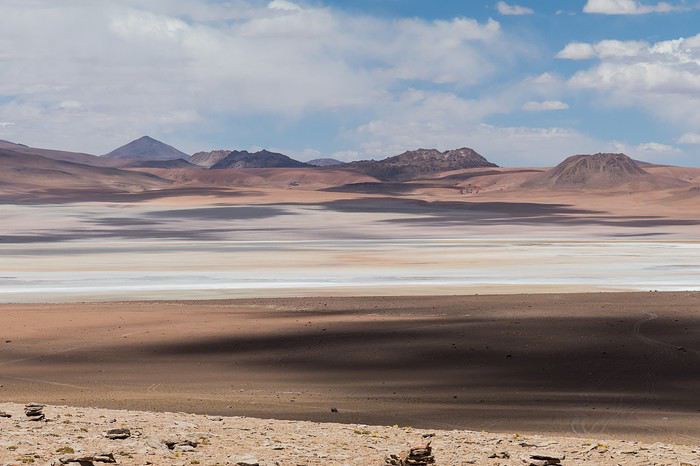 Laguna Kara
It was only after reading Laurent (Lolobe) and Pascal (Pepe874)’s travel journals—who explored the South Lipez solo with a car from Biz Rent a Car—that I thought we might be able to do the same. Meanwhile, we’d already contacted a local agency to organize a trip with a driver and guide. But the idea of a self-drive adventure really appealed to us. With encouragement and tips from Thierry (Tbernay) and Jean-François (Max68), we decided to plan our own self-drive trip. I’d like to thank them for their advice—it was *super* helpful. And a big thanks to all the other forum members for the info shared during our prep!
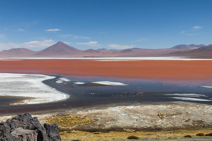 Laguna Colorada
Planning this trip happened during a tough time for our family. My mother-in-law’s illness and passing, plus a few health issues of my own, made us doubt the trip multiple times and nearly scrap the whole thing.
We booked our international flights in February with Swiss. They offered the best balance of travel time and price from Switzerland. Swiss operates Zurich–São Paulo with their own fleet, and São Paulo–Santa Cruz with GOL. In June, GOL canceled the Saturday flight and rebooked us on Sunday. Spending over 24 hours in that huge Brazilian city didn’t work for us at all, so we asked Swiss to put us on the next Zurich–São Paulo flight. Too bad—we lost a day in Bolivia and had to skip the Tarabucco market on Sunday.
Right after, we also booked the car in February. After contacting Imbex and Biz, we went with Biz. Not speaking Spanish, we were relieved to communicate with Alejandra in French. The contact was great—she answered all our questions patiently. Sometimes it took a few days to get a reply, but we could also reach her on WhatsApp. After our trip, we can *only* recommend Biz for rentals in Bolivia. The cars are well-prepped for the South Lipez tracks. The agency is reliable, and the vehicles are new and well-maintained.
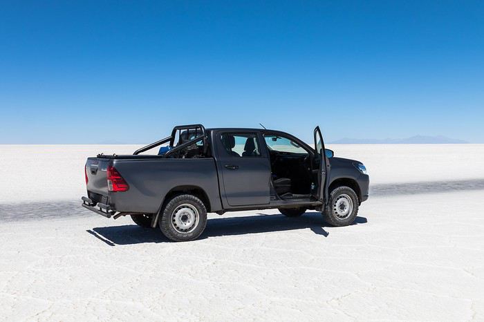 “Our” car, a Toyota Hilux
While planning, we realized the presidential elections would happen while we were in Bolivia. The risk of *bloqueos* (roadblocks and protests) was very real. But in Bolivia, *bloqueos* seem common—you always have to account for that kind of hassle. In late August/early September, Uyuni and the Salar region were blocked for days, leading to food, fuel, and cash shortages. Worried about a blockade in Uyuni and missing the Salar, we decided to visit it first *just in case*.
On election day, the whole country shut down. Planes were grounded, buses and taxis couldn’t circulate, and private cars were banned. There were a few exceptions—ambulances, police, or certain professions—but as tourists, we couldn’t get permission to drive. We asked the embassy, and Biz even requested a permit from the electoral office. So we had to plan to be somewhere with things to do *without* the car.
We decided not to book any accommodations in advance—a first for us. Usually, we plan our stops and reserve lodges, hotels, or campgrounds well ahead. This time, only the room in Sucre was booked, so we’d have a base when we arrived.
In July, Alex (Delhenry) reached out to propose joining part of the trip. He didn’t realize we were leaving in October. Still, we got fresh updates when he returned from the South Lipez. Thanks, Alex—your tips, especially about the Guadalupe–Tupiza stretch, were *super* useful.
In September, we connected with Jean-Louis (Avx) and Anne (Xeta), who were also heading to Bolivia in October, one and two weeks after us. We had dinner with Jean-Louis and his friend after our South Lipez trip and stayed in touch with Anne. It was great to chat with them! Unfortunately, Anne and her husband had a much rockier trip—they got hit hard by post-election issues.
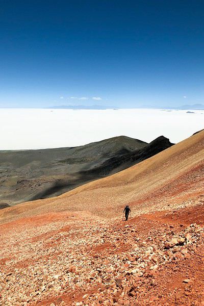 Climbing Volcán Tunupa
Our itinerary wasn’t set in stone—we decided to wing it on the spot. Two weeks before departure, I reconnected with Alejandra at Biz to move the car rental up by a day. With the elections, we wanted to leave Sucre ASAP and focus on the South Lipez. Outside Uyuni and Tupiza, the risk of blockades was zero. We also planned a two-night buffer in Sucre before our flights, just in case. It might sound overcautious, but in hindsight, we made the right call. If we’d left Sucre a day later, we wouldn’t have made it to Potosí—it was completely blocked. On the way back, we *just* dodged blockades in Potosí and elsewhere. Sometimes, you’ve gotta trust your gut.
Here’s our route—only the first two nights in Sucre were booked ahead:
D1 Departure from Switzerland
D2 Sucre (La Selenita)
D3 Sucre (La Selenita)
D4 Colchani (Hotel de Sal Luna Salada)
D5 Jirira (Auberge Doña Lupe)
D6 On the Salar (in the car)
D7 A few kilometers from Estancia Catal (in the car)
D8 Laguna Hedionda (Hotel Los Flamencos)
D9 Laguna Colorada (Lodge by the lagoon)
D10 Middle of nowhere, en route Laguna Verde–Mina Horsu–Quetena Chico (in the car)
D11 Quetena Chico (Lamphaya Lodge Andino)
D12 Quetena Chico (Lamphaya Lodge Andino)
D13 Guadalupe (Guest room at Celia’s)
D14 Along the Rio Grande (in the car)
D15 Tupiza (Hotel Mitru)
D16 Tupiza (Hotel Mitru)
D17 Sucre (La Selenita)
D18 Sucre (La Selenita)
D19 Santa Cruz (Hotel Sun)
D20 Departure from Santa Cruz
D21 Arrival in Switzerland
As you can see, we spent 13 nights in the South Lipez. Initially, we’d planned for nine, but Jean-François (Max68) suggested staying longer. Great advice—we didn’t regret it one bit. We could’ve even added 2–3 more days without getting bored.
Self-driving in the South Lipez takes some prep and a good GPS. We kept it simple and used maps.me to navigate. It’s a solid app—just save your waypoints ahead of time. For some stretches, I used Google Earth to visualize the tracks and sites. If you stick to the tour operator routes, you *almost* can’t get lost. But we often veered off the beaten path and took different routes. Some days, we didn’t see another car. So in case of a breakdown, it’s key to have water and food for several days. In some spots, there’s *zero* signal—your phone won’t work. Another must: it gets *cold* in the South Lipez, and a good sleeping bag is essential. We brought down sleeping bags rated for -10°C and didn’t regret it during our car nights.
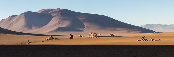 The Dalí Desert
Some tracks are *super* rocky—flat tires are a real risk. On those stretches, maps.me’s estimated travel time was way off. Some sections barely let us go over 15 km/h.
Lots of forum members recommend doing the South Lipez “loop” from Tupiza to Uyuni—ending with the Salar—to avoid Uyuni’s crowds. That might work for organized tours, but for self-drive, the direction *doesn’t* matter. I’ll say this: the few vehicles we saw mostly came from Tupiza and Chile, not Uyuni. So if starting from Uyuni works better for you, go for it! Ending in Tupiza means heading toward warmer weather. For our planned stops and climbs, starting in Uyuni helped with acclimatization. Spending a few nights between 3,600–3,800 m before going over 4,000 m is a smart move.
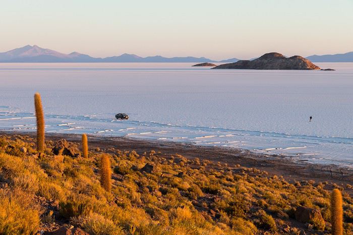 Uyuni Salt Flats in the morning
Overall, we barely saw anyone—except at Laguna Hedionda and Chalviri. There were several tour groups at Hotel Los Flamencos (Laguna Hedionda), but we didn’t cross paths during the day. Hardly anyone on the Salar, on the roads, or at the lodges in the evenings. The *only* place that shocked us was Chalviri. We’d planned to stay there, but it was fully booked—and we counted *forty* tour jeeps on-site. This was around noon! At the Polques hot springs (Chalviri), it was *packed*—we quickly nixed the idea of a dip. Plus, the vibe wasn’t great: soaking right by the road with lodges and restaurants in the background? Meh. Still, lots of tourists love it, so it’s up to you.
For the photos, I kept the colors and mood we saw. The lagoons’ hues are often stunning, but some online photos are *way* over-edited and oversaturated. The South Lipez’s landscapes are breathtaking—no need for excessive retouching.
If you don’t want to read all the details, the start of the travel journal is here: https://voyageforum.com/v.f?post=9888761;a=9888761
The idea of traveling to Bolivia came to me after seeing Jean-François (Max68)’s photos on his website. I thought we *had* to see those stunning landscapes with the colorful lagoons for ourselves. But a self-drive trip didn’t seem doable at first. A few years ago, everyone advised against going to the South Lipez with just one car.
Laguna KaraIt was only after reading Laurent (Lolobe) and Pascal (Pepe874)’s travel journals—who explored the South Lipez solo with a car from Biz Rent a Car—that I thought we might be able to do the same. Meanwhile, we’d already contacted a local agency to organize a trip with a driver and guide. But the idea of a self-drive adventure really appealed to us. With encouragement and tips from Thierry (Tbernay) and Jean-François (Max68), we decided to plan our own self-drive trip. I’d like to thank them for their advice—it was *super* helpful. And a big thanks to all the other forum members for the info shared during our prep!
Laguna ColoradaPlanning this trip happened during a tough time for our family. My mother-in-law’s illness and passing, plus a few health issues of my own, made us doubt the trip multiple times and nearly scrap the whole thing.
We booked our international flights in February with Swiss. They offered the best balance of travel time and price from Switzerland. Swiss operates Zurich–São Paulo with their own fleet, and São Paulo–Santa Cruz with GOL. In June, GOL canceled the Saturday flight and rebooked us on Sunday. Spending over 24 hours in that huge Brazilian city didn’t work for us at all, so we asked Swiss to put us on the next Zurich–São Paulo flight. Too bad—we lost a day in Bolivia and had to skip the Tarabucco market on Sunday.
Right after, we also booked the car in February. After contacting Imbex and Biz, we went with Biz. Not speaking Spanish, we were relieved to communicate with Alejandra in French. The contact was great—she answered all our questions patiently. Sometimes it took a few days to get a reply, but we could also reach her on WhatsApp. After our trip, we can *only* recommend Biz for rentals in Bolivia. The cars are well-prepped for the South Lipez tracks. The agency is reliable, and the vehicles are new and well-maintained.
“Our” car, a Toyota HiluxWhile planning, we realized the presidential elections would happen while we were in Bolivia. The risk of *bloqueos* (roadblocks and protests) was very real. But in Bolivia, *bloqueos* seem common—you always have to account for that kind of hassle. In late August/early September, Uyuni and the Salar region were blocked for days, leading to food, fuel, and cash shortages. Worried about a blockade in Uyuni and missing the Salar, we decided to visit it first *just in case*.
On election day, the whole country shut down. Planes were grounded, buses and taxis couldn’t circulate, and private cars were banned. There were a few exceptions—ambulances, police, or certain professions—but as tourists, we couldn’t get permission to drive. We asked the embassy, and Biz even requested a permit from the electoral office. So we had to plan to be somewhere with things to do *without* the car.
We decided not to book any accommodations in advance—a first for us. Usually, we plan our stops and reserve lodges, hotels, or campgrounds well ahead. This time, only the room in Sucre was booked, so we’d have a base when we arrived.
In July, Alex (Delhenry) reached out to propose joining part of the trip. He didn’t realize we were leaving in October. Still, we got fresh updates when he returned from the South Lipez. Thanks, Alex—your tips, especially about the Guadalupe–Tupiza stretch, were *super* useful.
In September, we connected with Jean-Louis (Avx) and Anne (Xeta), who were also heading to Bolivia in October, one and two weeks after us. We had dinner with Jean-Louis and his friend after our South Lipez trip and stayed in touch with Anne. It was great to chat with them! Unfortunately, Anne and her husband had a much rockier trip—they got hit hard by post-election issues.
Climbing Volcán TunupaOur itinerary wasn’t set in stone—we decided to wing it on the spot. Two weeks before departure, I reconnected with Alejandra at Biz to move the car rental up by a day. With the elections, we wanted to leave Sucre ASAP and focus on the South Lipez. Outside Uyuni and Tupiza, the risk of blockades was zero. We also planned a two-night buffer in Sucre before our flights, just in case. It might sound overcautious, but in hindsight, we made the right call. If we’d left Sucre a day later, we wouldn’t have made it to Potosí—it was completely blocked. On the way back, we *just* dodged blockades in Potosí and elsewhere. Sometimes, you’ve gotta trust your gut.
Here’s our route—only the first two nights in Sucre were booked ahead:
D1 Departure from Switzerland
D2 Sucre (La Selenita)
D3 Sucre (La Selenita)
D4 Colchani (Hotel de Sal Luna Salada)
D5 Jirira (Auberge Doña Lupe)
D6 On the Salar (in the car)
D7 A few kilometers from Estancia Catal (in the car)
D8 Laguna Hedionda (Hotel Los Flamencos)
D9 Laguna Colorada (Lodge by the lagoon)
D10 Middle of nowhere, en route Laguna Verde–Mina Horsu–Quetena Chico (in the car)
D11 Quetena Chico (Lamphaya Lodge Andino)
D12 Quetena Chico (Lamphaya Lodge Andino)
D13 Guadalupe (Guest room at Celia’s)
D14 Along the Rio Grande (in the car)
D15 Tupiza (Hotel Mitru)
D16 Tupiza (Hotel Mitru)
D17 Sucre (La Selenita)
D18 Sucre (La Selenita)
D19 Santa Cruz (Hotel Sun)
D20 Departure from Santa Cruz
D21 Arrival in Switzerland
As you can see, we spent 13 nights in the South Lipez. Initially, we’d planned for nine, but Jean-François (Max68) suggested staying longer. Great advice—we didn’t regret it one bit. We could’ve even added 2–3 more days without getting bored.
Self-driving in the South Lipez takes some prep and a good GPS. We kept it simple and used maps.me to navigate. It’s a solid app—just save your waypoints ahead of time. For some stretches, I used Google Earth to visualize the tracks and sites. If you stick to the tour operator routes, you *almost* can’t get lost. But we often veered off the beaten path and took different routes. Some days, we didn’t see another car. So in case of a breakdown, it’s key to have water and food for several days. In some spots, there’s *zero* signal—your phone won’t work. Another must: it gets *cold* in the South Lipez, and a good sleeping bag is essential. We brought down sleeping bags rated for -10°C and didn’t regret it during our car nights.
The Dalí DesertSome tracks are *super* rocky—flat tires are a real risk. On those stretches, maps.me’s estimated travel time was way off. Some sections barely let us go over 15 km/h.
Lots of forum members recommend doing the South Lipez “loop” from Tupiza to Uyuni—ending with the Salar—to avoid Uyuni’s crowds. That might work for organized tours, but for self-drive, the direction *doesn’t* matter. I’ll say this: the few vehicles we saw mostly came from Tupiza and Chile, not Uyuni. So if starting from Uyuni works better for you, go for it! Ending in Tupiza means heading toward warmer weather. For our planned stops and climbs, starting in Uyuni helped with acclimatization. Spending a few nights between 3,600–3,800 m before going over 4,000 m is a smart move.
Uyuni Salt Flats in the morningOverall, we barely saw anyone—except at Laguna Hedionda and Chalviri. There were several tour groups at Hotel Los Flamencos (Laguna Hedionda), but we didn’t cross paths during the day. Hardly anyone on the Salar, on the roads, or at the lodges in the evenings. The *only* place that shocked us was Chalviri. We’d planned to stay there, but it was fully booked—and we counted *forty* tour jeeps on-site. This was around noon! At the Polques hot springs (Chalviri), it was *packed*—we quickly nixed the idea of a dip. Plus, the vibe wasn’t great: soaking right by the road with lodges and restaurants in the background? Meh. Still, lots of tourists love it, so it’s up to you.
For the photos, I kept the colors and mood we saw. The lagoons’ hues are often stunning, but some online photos are *way* over-edited and oversaturated. The South Lipez’s landscapes are breathtaking—no need for excessive retouching.
If you don’t want to read all the details, the start of the travel journal is here: https://voyageforum.com/v.f?post=9888761;a=9888761
Voyage décevant au Sri Lanka
Bonjour,
Juste une reflexion, après 13 ans passé tous les ans au sri lanka, nous revenons juste d'un xème séjour au sri Lanka au mois de décembre.
Après un circuit avec un chauffeur local parlant Français, cela s'est très bien passé. Autant pour le circuit que pour les hébergements. Nous avons continué avec 2 semaines de balnéaire dans le sud du pays.
Constat amer : Nous constatons au fur et à mesure des années que le sri lanka change énormément. Autant les habitants, attirés par l'argent des touristes, que le pays, envahis par les touristes des pays de l'est. Le sri lanka se meurt doucement, les touristes Européens ne reviennent pas dans le pays, à cause des dégâts qu'occasionnent les touristes de l'est qui démolissent de plus en plus le pays. Des hôtels se bâtissent dans tous les sens, malgré le manque de touristes Européens. Tout est fait pour faire venir le touriste, même le visa gratuit. Mais rien y fait. Nous mêmes n'y reviendrons plus malheureusement. Chassés d'un hôtel à cause des locaux qui priment sur les touristes, malgré 2 nuits de payées, nous avons dû quitter après 1 nuit. Trop bruyant et sans respect pour le touriste. Malgré leurs dires, que les touristes sont leur priorité, cela n'a jmais été le cas. Nous avions hâte de quitter le pays après 3 semaines, cela est bien malheureux. Nous avons connu le SL il y a bien des années. Aujourd'hui nous ne le reconnaissons pas. Ce pays est merveilleux, mais fait fuir de plus en plus le touriste européens. Le SRI LANKA doit faire un choix un moment donné, les locaux ou les touristes dans les hôtels dotés d'une piscine. A chaque hôtel , nous avons eu les mêmes problèmes. Jusqu'au bout pour le prix du taxi pour l'aéroport, connaisseur du prix, il a été presque doublé à l'arrivée à l'aéroport….. QUELLE ENORME DECEPTION 🙁 Au Revoir le SRI LANKA.
Juste une reflexion, après 13 ans passé tous les ans au sri lanka, nous revenons juste d'un xème séjour au sri Lanka au mois de décembre.
Après un circuit avec un chauffeur local parlant Français, cela s'est très bien passé. Autant pour le circuit que pour les hébergements. Nous avons continué avec 2 semaines de balnéaire dans le sud du pays.
Constat amer : Nous constatons au fur et à mesure des années que le sri lanka change énormément. Autant les habitants, attirés par l'argent des touristes, que le pays, envahis par les touristes des pays de l'est. Le sri lanka se meurt doucement, les touristes Européens ne reviennent pas dans le pays, à cause des dégâts qu'occasionnent les touristes de l'est qui démolissent de plus en plus le pays. Des hôtels se bâtissent dans tous les sens, malgré le manque de touristes Européens. Tout est fait pour faire venir le touriste, même le visa gratuit. Mais rien y fait. Nous mêmes n'y reviendrons plus malheureusement. Chassés d'un hôtel à cause des locaux qui priment sur les touristes, malgré 2 nuits de payées, nous avons dû quitter après 1 nuit. Trop bruyant et sans respect pour le touriste. Malgré leurs dires, que les touristes sont leur priorité, cela n'a jmais été le cas. Nous avions hâte de quitter le pays après 3 semaines, cela est bien malheureux. Nous avons connu le SL il y a bien des années. Aujourd'hui nous ne le reconnaissons pas. Ce pays est merveilleux, mais fait fuir de plus en plus le touriste européens. Le SRI LANKA doit faire un choix un moment donné, les locaux ou les touristes dans les hôtels dotés d'une piscine. A chaque hôtel , nous avons eu les mêmes problèmes. Jusqu'au bout pour le prix du taxi pour l'aéroport, connaisseur du prix, il a été presque doublé à l'arrivée à l'aéroport….. QUELLE ENORME DECEPTION 🙁 Au Revoir le SRI LANKA.