Results for "Birmanie+souvenir+artisanat"
About 11,506 results.
More options
Many results are in French, the community’s main language. English translations are added over time.
Search results
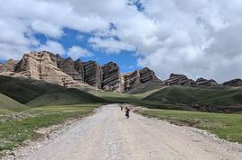
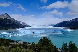
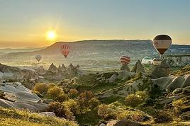
June 2026 Photo Contest Theme: Such a Beautiful Landscape
Hello,
It might not be very original, but I see it hasn’t been suggested—or at least not for a very long time. I’d like to invite you to discover the beauty of the great outdoors through landscape photos. Whether they’re desert, sea, countryside, or mountain scenes—with or without other elements (people, buildings, animals, etc.)—they should make us want to dive right in without hesitation.
To participate: Photo submissions until Wednesday, June 24 at 11:59 PM You can post up to 3 photos, numbered and shared in separate messages, along with a short description of the place and the story behind it.
To vote: from Thursday, June 25 at 12:01 AM to Monday, June 29 at 11:59 PM After the deadline, it’s too late!
Please include the photo number, username, and the points awarded: Photo #1 = 3 pts Photo #2 = 2 pts Photo #3 = 1 pt
All VF members can vote (even those who didn’t submit photos). In case of a tie for first place, the winning photo will be the one with the most first-place votes, then second-place votes! The lucky winner will get to organize July 2026’s photo contest.
For discussions about the theme, it’s here: Discussion thread for June 2026’s theme: Such a Beautiful Landscape
Good luck to everyone!
Philippe
Chumphon, Thailand: Doi Tapang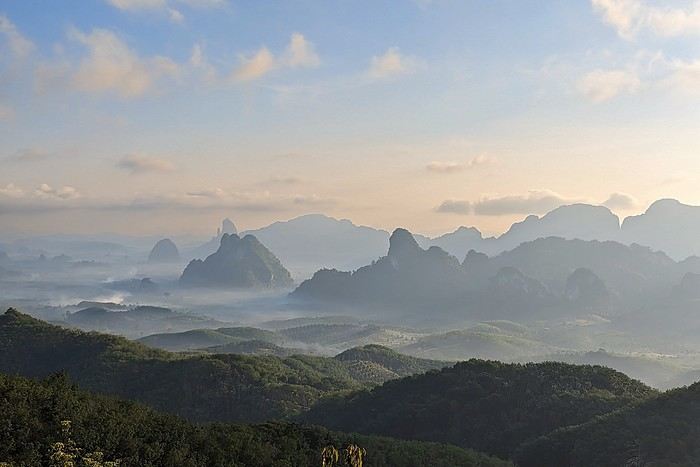
It might not be very original, but I see it hasn’t been suggested—or at least not for a very long time. I’d like to invite you to discover the beauty of the great outdoors through landscape photos. Whether they’re desert, sea, countryside, or mountain scenes—with or without other elements (people, buildings, animals, etc.)—they should make us want to dive right in without hesitation.
To participate: Photo submissions until Wednesday, June 24 at 11:59 PM You can post up to 3 photos, numbered and shared in separate messages, along with a short description of the place and the story behind it.
To vote: from Thursday, June 25 at 12:01 AM to Monday, June 29 at 11:59 PM After the deadline, it’s too late!
Please include the photo number, username, and the points awarded: Photo #1 = 3 pts Photo #2 = 2 pts Photo #3 = 1 pt
All VF members can vote (even those who didn’t submit photos). In case of a tie for first place, the winning photo will be the one with the most first-place votes, then second-place votes! The lucky winner will get to organize July 2026’s photo contest.
For discussions about the theme, it’s here: Discussion thread for June 2026’s theme: Such a Beautiful Landscape
Good luck to everyone!
Philippe
Chumphon, Thailand: Doi Tapang
Societal Evolution
Hello everyone,
It’s something we often notice in this forum—and many others—this behavioral shift.
A long-time member, or even a new one, asks a question. They get one or more answers, some brief, some detailed, and then... nothing???
Not even a simple thank you!!!
From what I’ve gathered, if the answers don’t align with what they wanted to hear, it seems natural for the asker to just disappear!! 😕 Unless—(and I fear this is the case)—basic politeness is no longer part of our society????
Please forgive my little rant.
Wishing everyone all the best. Cheers,
Puma2A

...
It’s something we often notice in this forum—and many others—this behavioral shift.
A long-time member, or even a new one, asks a question. They get one or more answers, some brief, some detailed, and then... nothing???
Not even a simple thank you!!!
From what I’ve gathered, if the answers don’t align with what they wanted to hear, it seems natural for the asker to just disappear!! 😕 Unless—(and I fear this is the case)—basic politeness is no longer part of our society????
Please forgive my little rant.
Wishing everyone all the best. Cheers,
Puma2A
...
What's the best way to get around Northern India?
Hi,
I’m leaving this Saturday for Northern India from 15/02 to 27/02. I’m planning to visit New Delhi, Agra, Chand Baori, Jaipur, Ranthambore, Bundi, Udaipur, and Jodhpur.
What’s the best way to get around? I was thinking of doing everything by train. Maybe taking the bus for some stretches?
As for renting a car with a driver, it seems expensive, so I’ve pretty much ruled that out. Unless someone’s got space for the same dates?
Thanks for your insights!
What’s the best way to get around? I was thinking of doing everything by train. Maybe taking the bus for some stretches?
As for renting a car with a driver, it seems expensive, so I’ve pretty much ruled that out. Unless someone’s got space for the same dates?
Thanks for your insights!
Langtang – Trekking in the Rain
We did the Langtang trek (hike) from September 10th to 17th, with the first and last days being the trip from Kathmandu and back—so 6 days of actual walking. It’s a fairly well-known trek but certainly not as famous or crowded as those in the Annapurna or Everest regions, which is why we chose it.
In theory, it’s mandatory to have a guide for this trek. In reality, it seems there are ways to bypass the regulations: we met at least two people hiking without a guide—a South Korean, a New Zealander, and possibly also a couple of English women and an American couple, though we’re not sure if they had a guide.
The agency we booked with had told us it was an affordable trek for relatively older people in good shape—which is our case (I’m 72 myself). I have to say upfront that we found it quite challenging, maybe because we didn’t have good weather—it was the end of the monsoon season. To be clear, no matter your fitness level, I’d say doing this trek in the middle of the monsoon season would be suicidal.
Day 1 – Journey from Kathmandu to Syapru Besi
On Monday, September 8th, there had been violent protests in Kathmandu against the government, which had, among other things, blocked access to social media and been accused of nepotism and corruption. There were 19 deaths. The situation was very tense on the day of our departure, Wednesday the 10th. The agency warned us that public transport was very unreliable. So, we decided to take a jeep, at an additional cost of $100 ($160 minus what was already budgeted for the bus).
We left a little before 7 a.m. and it took us a good hour just to reach the outskirts of Kathmandu. Along the way, we saw several houses and vehicles set on fire by protesters.
The road to Syapru Besi is only 120 km, but it’s frankly awful. It’s always narrow, winds through endless mountains, and the shoulders range from bad to confusing to nonexistent. Several sections are just dirt tracks. We didn’t regret opting for the jeep, as we could stop several times at our convenience—if only to let Y (my Thai partner) throw up everything she had. She’d taken her usual motion sickness medication, but the constant turns, accelerations, and braking eventually made her terribly carsick.
In Nuwakot, we stopped for breakfast at a nice little restaurant, Jimbu. It was around 8:30 a.m., and we’d barely covered 60 km. The restaurant has a lovely garden overlooking the Trishuli Ganga, the river flowing down from Syapru Besi. First photo: the river in the bottom right corner, mist and clouds over the mountain on the other side.
An hour later, my second photo: the hills along the Trishuli Ganga. You can see the different crops—lush green rice paddies in the lower right and corn, already yellowed and likely harvested, in the foreground on the left. And of course, the mist and clouds through which you can glimpse the mountain on the other side of the river.
In theory, it’s mandatory to have a guide for this trek. In reality, it seems there are ways to bypass the regulations: we met at least two people hiking without a guide—a South Korean, a New Zealander, and possibly also a couple of English women and an American couple, though we’re not sure if they had a guide.
The agency we booked with had told us it was an affordable trek for relatively older people in good shape—which is our case (I’m 72 myself). I have to say upfront that we found it quite challenging, maybe because we didn’t have good weather—it was the end of the monsoon season. To be clear, no matter your fitness level, I’d say doing this trek in the middle of the monsoon season would be suicidal.
Day 1 – Journey from Kathmandu to Syapru Besi
On Monday, September 8th, there had been violent protests in Kathmandu against the government, which had, among other things, blocked access to social media and been accused of nepotism and corruption. There were 19 deaths. The situation was very tense on the day of our departure, Wednesday the 10th. The agency warned us that public transport was very unreliable. So, we decided to take a jeep, at an additional cost of $100 ($160 minus what was already budgeted for the bus).
We left a little before 7 a.m. and it took us a good hour just to reach the outskirts of Kathmandu. Along the way, we saw several houses and vehicles set on fire by protesters.
The road to Syapru Besi is only 120 km, but it’s frankly awful. It’s always narrow, winds through endless mountains, and the shoulders range from bad to confusing to nonexistent. Several sections are just dirt tracks. We didn’t regret opting for the jeep, as we could stop several times at our convenience—if only to let Y (my Thai partner) throw up everything she had. She’d taken her usual motion sickness medication, but the constant turns, accelerations, and braking eventually made her terribly carsick.
In Nuwakot, we stopped for breakfast at a nice little restaurant, Jimbu. It was around 8:30 a.m., and we’d barely covered 60 km. The restaurant has a lovely garden overlooking the Trishuli Ganga, the river flowing down from Syapru Besi. First photo: the river in the bottom right corner, mist and clouds over the mountain on the other side.
An hour later, my second photo: the hills along the Trishuli Ganga. You can see the different crops—lush green rice paddies in the lower right and corn, already yellowed and likely harvested, in the foreground on the left. And of course, the mist and clouds through which you can glimpse the mountain on the other side of the river.
Discovering South India: Tamil Nadu and Kerala
Hello everyone!
We're off! After exploring the north, the four friends have now discovered the south. We’re excited to share this new travel journal, dedicated to our little group and our strong friendship, written by Richard and illustrated with Kate’s photos. I’ll chime in from time to time with practical tips.
First of all, a big thank you to everyone on VoyageForum who helped us plan this trip. It would’ve been quite different if we’d just relied on guidebooks.
The itinerary lasted just over 3 weeks: Mahabalipuram, Pondicherry, Thanjavur, the Chettinad region, Madurai, Munnar, Munroe Island, Cochin, and Chennai. We traveled by train, taxi, and private car with a driver, took a domestic flight, and stayed in guesthouses, Airbnb apartments, and hotels. For each of us, including flights, the total budget barely reached 2000 €, and we didn’t hold back—knowing we avoid resorts and love street food and small Indian restaurants.
We're off! After exploring the north, the four friends have now discovered the south. We’re excited to share this new travel journal, dedicated to our little group and our strong friendship, written by Richard and illustrated with Kate’s photos. I’ll chime in from time to time with practical tips.
First of all, a big thank you to everyone on VoyageForum who helped us plan this trip. It would’ve been quite different if we’d just relied on guidebooks.
The itinerary lasted just over 3 weeks: Mahabalipuram, Pondicherry, Thanjavur, the Chettinad region, Madurai, Munnar, Munroe Island, Cochin, and Chennai. We traveled by train, taxi, and private car with a driver, took a domestic flight, and stayed in guesthouses, Airbnb apartments, and hotels. For each of us, including flights, the total budget barely reached 2000 €, and we didn’t hold back—knowing we avoid resorts and love street food and small Indian restaurants.
Discussion sur le thème (concours septembre 2020): lieux, scènes de départ ou d'arrivée
Rebonjour, 🙂
C'est ici que l'on discute , échange, sur le thème: lieux, scènes de départ ou d'arrivée.
Pour revenir au concours, c'est ici
Un choix de vos trois destinations préferées
A cette question si personnelle et difficile je vous propose de choisir 3 destinations que vous conseilleriez.
Si possible en ajoutant quelques mots ouvrant la porte à des questions .
L'idée est une sélection mais pas un classement .
Mon choix : Nouvelle Zélande - Ile du Sud et Australie Probablement un art de vivre et des espaces diversifiés . Polynesie Des paysages exceptionnels , une simplicité de vie aux couleurs chantantes De San Francisco à Los Angeles (route du Grand Canyon- Road trip - Route mythiqueextraordinaire et variété de culture
Mon choix : Nouvelle Zélande - Ile du Sud et Australie Probablement un art de vivre et des espaces diversifiés . Polynesie Des paysages exceptionnels , une simplicité de vie aux couleurs chantantes De San Francisco à Los Angeles (route du Grand Canyon- Road trip - Route mythiqueextraordinaire et variété de culture
Dans quel pays aimeriez-vous vous expatrier?
Je saisis au vol cette remarque d'Attila (que je partage!)
Franchement, je serais le gouvernement, je demanderais l'asile en ...?... et dirais aux français, démerdez vous.
et cette autre :
On fait le coucou dans les discussions mais jamais on n'en entame une...
pour proposer un nouveau post sur un mode très différent de voyager.
Où aimeriez-vous partir vivre?
Bien sûr vous choisissez votre pays ou région d'accueil, on part du principe que ce n'est pas une obligation que l'on vous fait.
Et vous avez besoin de vous éloigner momentanément de votre lieu de vie habituel, pour quelque raison que ce soit.
Quels seraient les atouts locaux importants pour vous de cette nouvelle installation : population, climat, paysages, archéologie, autres .... ?
Franchement, je serais le gouvernement, je demanderais l'asile en ...?... et dirais aux français, démerdez vous.
et cette autre :
On fait le coucou dans les discussions mais jamais on n'en entame une...
pour proposer un nouveau post sur un mode très différent de voyager.
Où aimeriez-vous partir vivre?
Bien sûr vous choisissez votre pays ou région d'accueil, on part du principe que ce n'est pas une obligation que l'on vous fait.
Et vous avez besoin de vous éloigner momentanément de votre lieu de vie habituel, pour quelque raison que ce soit.
Quels seraient les atouts locaux importants pour vous de cette nouvelle installation : population, climat, paysages, archéologie, autres .... ?
Concours photo de mai 2020: "Défilés et Cortèges"
Salut à tou(te)s.
Gagnant du concours d'avril 2020 il m'échoit de vous proposer celui de mai 2020 :
En ce mois de mai propice aux défilés, surtout le 1er en temps normal (sans pandémie donc sans distanciation physique), je vous propose le sujet du concours de photo du mois « Défilés et Cortèges » avec les précautions suivantes :
Ce sera celui de participants au défilé en nombre, en extérieur, pour une cause explicite dans l'image proposée (pancarte ou slogan, costumes, décor...). Ce ne sera donc ni la déambulation d'une foule, même bigarrée, ni une file d'attente, mais un cortège de rue qu'il soit religieux, militaire, funéraire, festif, revendicatif, exprimant joie ou peine, colère ou détermination. La foule qui peut l'accompagner ne sera pas l'objet central de la photo mais son complément (prouvant son audience). Voir l'introduction de l'article Défilé sur Wikipédia : On l'aura compris : pas de défilé d'animaux, de chars, ni de roches fracturées : des gens qui se réunissent pour une cause explicite, affichant leurs costumes, leurs uniformes.
Exemples : Cortège du Palio de Sienne (août 2012) :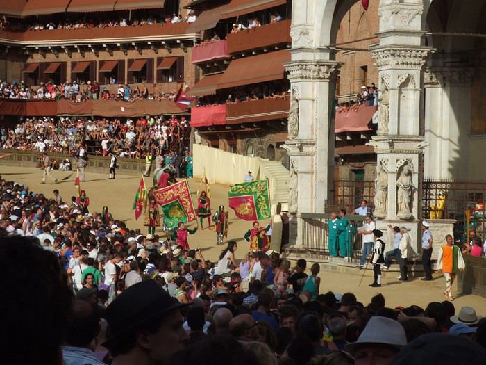
Fête des vignerons 2019 à Vevey, bout de fanfare :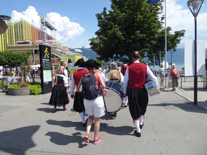
Fête des saintes patronnes de Santa Fiora (Toscane - juillet 2009). Toutes obédiences des autorités municipales à la fin de la procession :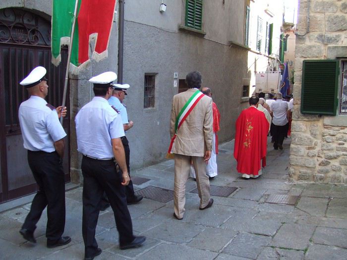
Participation Chaque participant(e) peut proposer jusqu'à 3 photos, et ce jusqu'au vendredi 22/05 à 20h00, heure de Paris. Chaque photo sera présentée dans un seul message, en indiquant son numéro (1, 2 ou 3). Pensez à ajouter une petite explication, commentaire, localisation, date de prise de vue.
Vote Chaque membre VF peut voter pour les 3 photos qu'il ou elle juge les meilleures selon ses propres critères et en tenant compte du thème.
Les votes se feront du samedi 23/05 au vendredi 29/05 à 20h00, heure de Paris. Les photos choisies seront citées dans l'ordre de préférence : - la 1re photo : 3 points - la 2e : 2 points - la 3e : 1 point
Un seul et unique vote pour 3 photos est accepté par membre.
Conclusion Le vainqueur est l'auteur de la photo ayant reçu le plus de points. Les résultats seront publiés le 30/05. En cas d'égalité, le nombre de premières places prévaudra. Le vainqueur aura l'honneur d'organiser le concours du mois de juin.
Le diaporama est là. La discussion est là
À vous de jouer !
En ce mois de mai propice aux défilés, surtout le 1er en temps normal (sans pandémie donc sans distanciation physique), je vous propose le sujet du concours de photo du mois « Défilés et Cortèges » avec les précautions suivantes :
Ce sera celui de participants au défilé en nombre, en extérieur, pour une cause explicite dans l'image proposée (pancarte ou slogan, costumes, décor...). Ce ne sera donc ni la déambulation d'une foule, même bigarrée, ni une file d'attente, mais un cortège de rue qu'il soit religieux, militaire, funéraire, festif, revendicatif, exprimant joie ou peine, colère ou détermination. La foule qui peut l'accompagner ne sera pas l'objet central de la photo mais son complément (prouvant son audience). Voir l'introduction de l'article Défilé sur Wikipédia : On l'aura compris : pas de défilé d'animaux, de chars, ni de roches fracturées : des gens qui se réunissent pour une cause explicite, affichant leurs costumes, leurs uniformes.
Exemples : Cortège du Palio de Sienne (août 2012) :
Fête des vignerons 2019 à Vevey, bout de fanfare :
Fête des saintes patronnes de Santa Fiora (Toscane - juillet 2009). Toutes obédiences des autorités municipales à la fin de la procession :
Participation Chaque participant(e) peut proposer jusqu'à 3 photos, et ce jusqu'au vendredi 22/05 à 20h00, heure de Paris. Chaque photo sera présentée dans un seul message, en indiquant son numéro (1, 2 ou 3). Pensez à ajouter une petite explication, commentaire, localisation, date de prise de vue.
Vote Chaque membre VF peut voter pour les 3 photos qu'il ou elle juge les meilleures selon ses propres critères et en tenant compte du thème.
Les votes se feront du samedi 23/05 au vendredi 29/05 à 20h00, heure de Paris. Les photos choisies seront citées dans l'ordre de préférence : - la 1re photo : 3 points - la 2e : 2 points - la 3e : 1 point
Un seul et unique vote pour 3 photos est accepté par membre.
Conclusion Le vainqueur est l'auteur de la photo ayant reçu le plus de points. Les résultats seront publiés le 30/05. En cas d'égalité, le nombre de premières places prévaudra. Le vainqueur aura l'honneur d'organiser le concours du mois de juin.
Le diaporama est là. La discussion est là
À vous de jouer !
Adventures of a Bygone Era: The Philippines in 1984
After several discussions on VF about travel journals from the Philippines, I decided to write this curiosity: a trip report from a journey made in 1984, when traveling to the Philippines was still an adventure.
A curiosity because writing a travel journal about a trip 35 years later isn’t common, but also (mostly?) because exploring the Philippines at that time had little in common with traveling there today.
Obviously, I’ve forgotten a number of facts, most of the details, but with the help of a few notes from that time and a stack of slides (yes, there was life before digital 😊), many memories came back and added to the highlights I’d never forgotten. The scanned slides aren’t always great quality, but there are still quite a few to brighten up this chatter. Back then, we didn’t snap photos like we do now—film was too expensive—so I don’t have pictures of every place we visited... too bad, comparing some of those spots to how they look today would’ve been interesting.
Why "Adventures"? Why call it "Adventures" in the Philippines in 1984, a word so often used for a simple exotic trip? - Because the lack of information (no *Guide du Routard*, no *Lonely Planet*, no *Michelin Guide*, nothing, and obviously no internet) gave this trip what’s at the heart of adventure: the unknown. - Because the political situation made the stay sometimes dangerous. - Because transportation conditions were always epic, often perilous. - Because the question of where we’d spend the night came up almost every evening. - And for... quite a few other reasons.
That said, we weren’t exactly explorers!
Why the Philippines? First of all, why go to the Philippines in 1984—a country not exactly set up for tourism and about which we knew very little? How could we get an idea of the beauty of the Philippines and its points of interest when we had no guides or photos?
The idea came to us from Thailand a year earlier, during our first long-haul trip. After touring the north of the country, we met a Frenchman living in Phuket, where there were only a few tourists in Patong, with just a few small hotels and guesthouses. Kata and Karon had no buildings or roads, Rawai only had three palm-thatched bungalows, including ours, and the other islands were unknown to tourists. There was plenty to discover, and we wanted to return to this beautiful country... but the Frenchman made us dream about the Philippines—a country to explore, with wild landscapes.
Long evenings of discussion over multiple Sprite-Mekong cocktails (what memories of those headaches!) finally convinced us we had to go to the Philippines.
Episode 0: Before Departure The decision was made: we’d go to the Philippines in May 1984. Our friends and family were surprised when we announced we were going on vacation to the Philippines (a bit like saying today we were going paddleboarding in the Kerguelen Islands 🤪).
These days, preparing for each of our trips takes long evenings of research, planning, and noting down good addresses... etc. But for the Philippines in 1984, preparation was quick: we had very little information about the country, we were leaving almost at random, and the discovery would only be more exciting.
We still had a few bits of info gathered here and there: the rice terraces in northern Luzon, volcanoes, Negros where we were supposed to visit an acquaintance, Cebu and its marine life (we ended up going elsewhere), and absolutely avoid Mindanao, which was practically at war with the regime. That was about it, but it was already a great itinerary.
Nothing was organized in advance; we’d see day by day. We had no idea about travel times or even the existence of transportation options. The main (and sometimes only) way to connect two islands was by overloaded, rusty ferry. Only the big cities had airports.
Let’s Go: Episode 1: Paris to Manila My travel journals always start after arriving at the airport—the Europe-to-“Other Continent” trip isn’t interesting—but the flight to the Philippines was already an adventure, so I’ll make an exception.
This was the era when only a few Asian airlines were on par with Western ones: Thai, Singapore Airlines, and Philippine Airlines. They had beautiful, brand-new planes, and to attract customers (almost exclusively “businessmen”) from the usual airlines (Air France, Lufthansa, British Airways), there was opulence on board: unlimited champagne, all sorts of cocktails... Compared to today’s long-haul flights, there was still one small difference: no personal screens, just one screen at the front of the cabin with one mandatory movie. And I don’t know why, but we only got James Bond films, both ways... that must’ve been the trend at the time.
The tourism boom to Southeast Asia hadn’t started yet, and the “Asian Tigers” weren’t a thing, so there weren’t many business trips. That meant long-haul flights made stops everywhere to fill the planes. Our Philippine Airlines Boeing 747 left London, picked us up in Paris, then stopped in Frankfurt to take on a few Germans. I don’t know why we then made a stop in Dubai—a totally exotic place at the time. There was nothing to do there... things have changed a lot since. It was a small town lost in the desert. The airport was tiny, with just one or two buildings and a supermarket. During the stopover, everyone had to get off the plane and walk to the supermarket. Photo and electronic equipment were dirt cheap—I guess that was the only reason for the stop. Maybe it was their first commercial move. Emirates didn’t exist yet, as I checked online, but anyway, the idea that such a remote place could have its own airline was unthinkable.
Online, I found this photo of Dubai Airport in 1980. Anyone who’s transited through today’s massive airport with its rows of A380s will appreciate it: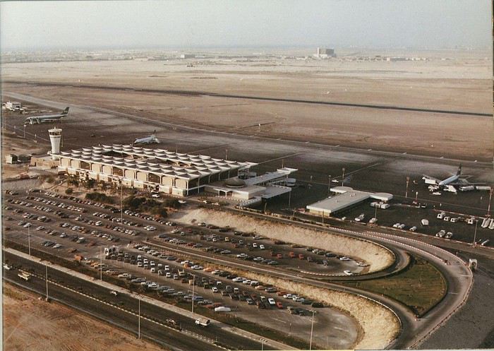
Next stop: New Delhi to drop off some Europeans and pick up a few Indians, and finally, the terminus: Manila. I don’t remember how long the trip took with its five stops—an unimaginable journey today. Despite all those stops to fill the plane, there was still enough space to stretch out on the four center seats of the 747, something that never happens these days despite all the flights in every direction.
So here we are, finally at Manila Airport around midnight.
Episode 1: Manila and Baguio To start, a quick note on the political and economic situation in the Philippines in 1984, which had consequences for us as tourists, as we’d soon realize upon arrival.
After several centuries of Spanish colonization, the Philippines became American at the start of the 20th century, then independent. In 1966, Marcos took power, and little by little, his regime sank into corruption and mismanagement, becoming a dictatorship with martial law, all for the benefit of his family and friends, who enriched themselves endlessly. The peak was the assassination of opposition leader Benigno Aquino in August 1983, which triggered harshly repressed protests. So we arrived a few months later in a very poor country, with omnipresent corruption and an extremely tense political situation, as we’d soon see for ourselves. Major protests took place in the main cities during our trip—I’ll come back to that. Two years later, Marcos fled to Hawaii after being forced out of power following rigged elections. This historical context explains a lot of the situations we found ourselves in over the following weeks.
Arriving in the middle of the night isn’t very cheerful. Manila was already a huge city with many slums, where you could find a few business hotels like the Hilton or Intercontinental—way out of our budget—and plenty of run-down hotels. Luckily, two Indians we’d chatted with on the plane offered to take us to their usual hotel. They came to Manila twice a year for business. We accepted their offer, relieved not to have to look for a place to stay in the middle of the night, figuring the address must be good since they came back every time... we were wrong 🙁
We left the airport and immediately got a taste of the local vibe when we got into the taxi: the police asked for our passports. We thought: what’s more normal than police in a dictatorship?
But that wasn’t it at all. Our two Indian friends explained that the police were noting our names along with the taxi number and time. Crime in Manila was so bad that the taxi driver would be held responsible if anything happened to us... welcome to the Philippines 😎 😎
Historically, the Philippines was a very violent country, where everything was settled with guns or machetes. Previous governments had banned carrying weapons, but Marcos later allowed the free sale and carrying of guns, and disputes were settled with pistols again (or worse, as we’d discover later). Since he’d released most of the criminals from prison to form a paramilitary militia at his service (I’ll talk about our encounter with these “heroes” later), it was pretty dangerous to go into many parts of Manila, where these “tonton macoutes” ruled.
We arrived at our hotel without incident... and then things started badly. The room was infested with big cockroaches—exactly what I hate most in those kinds of countries. No way to find another hotel at that hour. After the long flight, the urge to take a shower was so strong that we squeezed into the bathroom as best we could. After that, I don’t remember—I guess we must’ve fallen asleep exhausted under the sheets in the heat... air conditioning wasn’t widespread yet.
The next day, we just wanted to leave that dump as soon as possible. So we decided to head north right away, stopping in Baguio, and we’d visit Manila a bit on the way back.
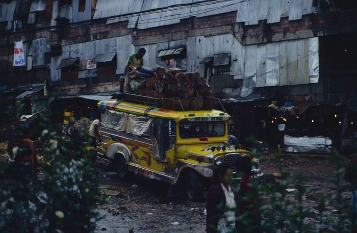
When we stepped outside, we discovered a pretty run-down neighborhood with potholed streets. But we also discovered the jeepneys. They were everywhere, flooding the streets.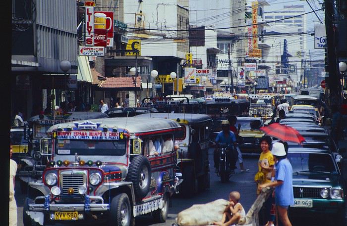
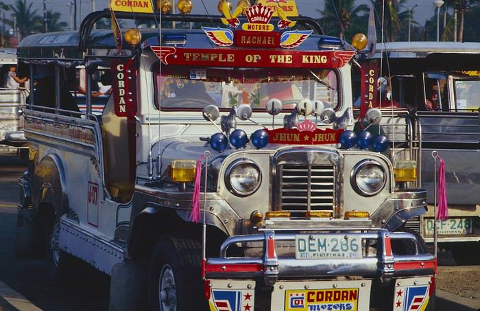
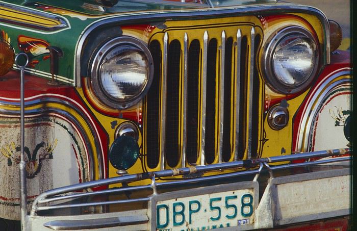
They had crazy sound systems, each one blasting louder than the last. The interiors were kitschy but fun. There weren’t many private cars—almost all transportation was by jeepney, with buses reserved for intercity trips.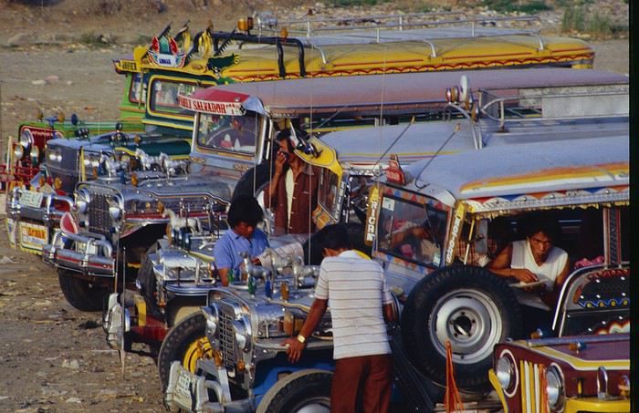
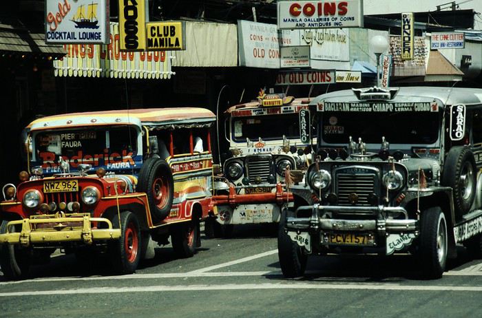
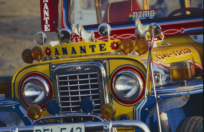
Before heading to the bus terminal for the north, somewhere on the outskirts of the city, we needed to exchange some money. I don’t remember how we ended up in a policeman’s jeep who offered his services: - Exchange money on the black market at a better rate than the banks. - Take us wherever we wanted, in this case, the bus terminal.
We accepted both offers (we’d still checked the official exchange rate from dollars to pesos). So we found ourselves in his jeep. After exchanging money, we left in his vehicle and stopped for gas. Without turning off the engine, he calmly smoked a cigarette while filling up. Since we were in a jeep with no doors or roof, we were ready to jump out if things went south, our travel bag in hand.
But we weren’t done with surprises yet. Once we left the small streets, we ended up in a neighborhood with wide avenues and not much traffic, which didn’t justify his incredible behavior. At every intersection, he made the sign of the cross, closed his eyes, and crossed without looking. I was more stunned than terrified! It wasn’t until we got out of the car later that I told Anne-Marie what had happened. I’d seen everything because the cop had put me in the front seat. Luckily, A-Marie hadn’t noticed anything from the back. Crossing Manila by trusting God rather than the rules of the road was ultimately effective. We were lucky—the trip was off to a good start. 🙂 🙂
We then passed through a neighborhood where slums stretched on for a while, and we left our policeman—friendly but a bit crazy—with relief.
A few hours by bus later, here we are in Baguio, cool in the mountains. My memories of Baguio are pretty fuzzy. I remember a small town. After some research while writing this journal, I found that the population was 120,000 in 1980. Given the population density in each home, that confirms my memory of a smallish town. Outside the “official” district with the president’s summer residence and government buildings, there were two or three paved streets with nice houses. The rest was very dirty and very poor, with lots of slums and dirt roads.
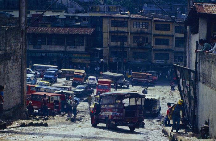
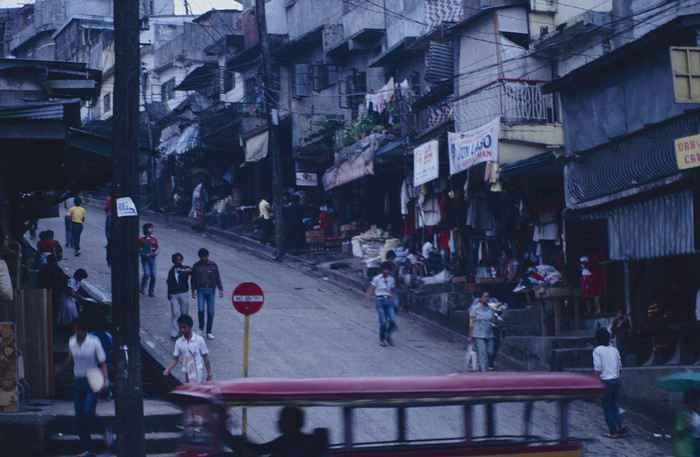
People we met on the street invited us to stay with them. These days, we wouldn’t just show up at strangers’ houses, which we should’ve done in Baguio—it would’ve saved us from an unimaginable and dangerous situation... which I won’t say anything about... !😊
The simple wooden house was on stilts at the edge of a hill with a view of the mountains. Since it was the start of the rainy season in a city that gets a lot of rain, we saw a lot of water. Our outings in town happened between downpours.
View from our lodging: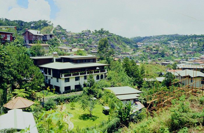
Episode 2: Baguio to Bontoc Aside from the situation briefly mentioned above, it was on the next leg to Bontoc that the adventure really began: an endless and dangerous road, a bus from another era, breathtaking landscapes, and surprising people.
We didn’t know the distance or how long it would take to get to Bontoc. When we arrived after about ten hours, we learned that Baguio to Bontoc was 140 km.
We got on a bus with wooden seats and settled in, two to a seat meant for two. As the bus filled up, passengers squeezed in three or four per seat, with chickens and baskets full of all sorts of things in the aisle. A little embarrassed, we didn’t know if we should squeeze in three on our seat. The seats were super tight (luckily, Filipinos are small), and I didn’t know where to put my legs given my height. I don’t remember if we stayed alone on our bench or if we ended up sharing with others.
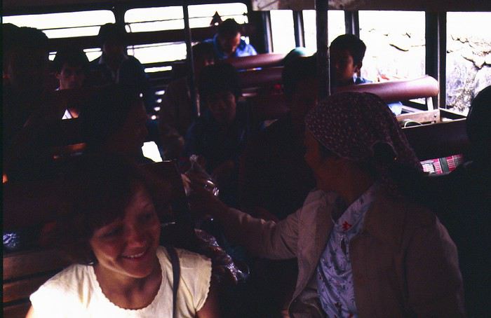
The “road” was a dirt track (or rather, a mud track) with endless turns. We held on as best we could to our slippery wooden seats—it was shaking in every direction. The woman behind us was carsick and throwing up... gross... but what were we doing there? Then we plunged into the Sierra Madre... just the name is dreamy!
Rice terraces started to appear: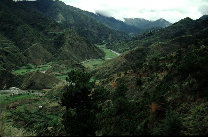
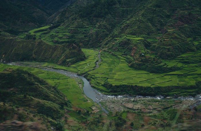
they took up more and more space along cliffs where we weren’t always reassured,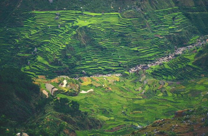
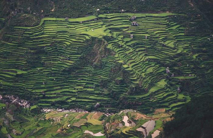
with lots of waterfalls (all that water had to go somewhere).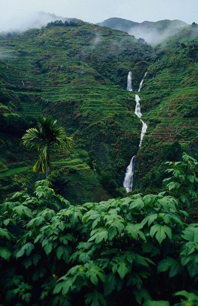
A few miserable villages stretched along the track, most often just a few houses balancing between the road and the drop. The bus stopped in every village—people got on or off and settled inside or on the roof. Street vendors offered their products to the bus passengers—a common sight in Asia, even today.
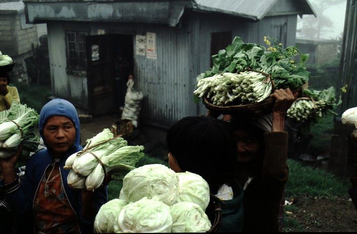
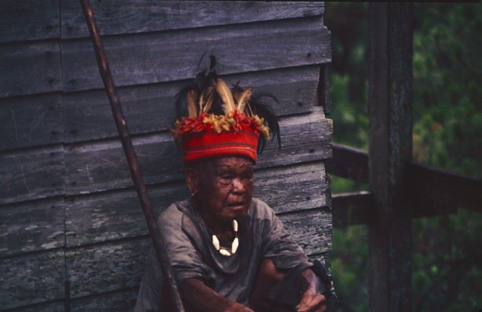
We were in another world—villagers were in loincloths, others had spears. The atmosphere was strange... but all good, we wanted exoticism, and we got it: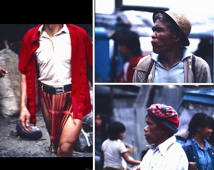
This so-called traditional outfit was everyday wear—it wasn’t for tourists since there weren’t any.
A curiosity because writing a travel journal about a trip 35 years later isn’t common, but also (mostly?) because exploring the Philippines at that time had little in common with traveling there today.
Obviously, I’ve forgotten a number of facts, most of the details, but with the help of a few notes from that time and a stack of slides (yes, there was life before digital 😊), many memories came back and added to the highlights I’d never forgotten. The scanned slides aren’t always great quality, but there are still quite a few to brighten up this chatter. Back then, we didn’t snap photos like we do now—film was too expensive—so I don’t have pictures of every place we visited... too bad, comparing some of those spots to how they look today would’ve been interesting.
Why "Adventures"? Why call it "Adventures" in the Philippines in 1984, a word so often used for a simple exotic trip? - Because the lack of information (no *Guide du Routard*, no *Lonely Planet*, no *Michelin Guide*, nothing, and obviously no internet) gave this trip what’s at the heart of adventure: the unknown. - Because the political situation made the stay sometimes dangerous. - Because transportation conditions were always epic, often perilous. - Because the question of where we’d spend the night came up almost every evening. - And for... quite a few other reasons.
That said, we weren’t exactly explorers!
Why the Philippines? First of all, why go to the Philippines in 1984—a country not exactly set up for tourism and about which we knew very little? How could we get an idea of the beauty of the Philippines and its points of interest when we had no guides or photos?
The idea came to us from Thailand a year earlier, during our first long-haul trip. After touring the north of the country, we met a Frenchman living in Phuket, where there were only a few tourists in Patong, with just a few small hotels and guesthouses. Kata and Karon had no buildings or roads, Rawai only had three palm-thatched bungalows, including ours, and the other islands were unknown to tourists. There was plenty to discover, and we wanted to return to this beautiful country... but the Frenchman made us dream about the Philippines—a country to explore, with wild landscapes.
Long evenings of discussion over multiple Sprite-Mekong cocktails (what memories of those headaches!) finally convinced us we had to go to the Philippines.
Episode 0: Before Departure The decision was made: we’d go to the Philippines in May 1984. Our friends and family were surprised when we announced we were going on vacation to the Philippines (a bit like saying today we were going paddleboarding in the Kerguelen Islands 🤪).
These days, preparing for each of our trips takes long evenings of research, planning, and noting down good addresses... etc. But for the Philippines in 1984, preparation was quick: we had very little information about the country, we were leaving almost at random, and the discovery would only be more exciting.
We still had a few bits of info gathered here and there: the rice terraces in northern Luzon, volcanoes, Negros where we were supposed to visit an acquaintance, Cebu and its marine life (we ended up going elsewhere), and absolutely avoid Mindanao, which was practically at war with the regime. That was about it, but it was already a great itinerary.
Nothing was organized in advance; we’d see day by day. We had no idea about travel times or even the existence of transportation options. The main (and sometimes only) way to connect two islands was by overloaded, rusty ferry. Only the big cities had airports.
Let’s Go: Episode 1: Paris to Manila My travel journals always start after arriving at the airport—the Europe-to-“Other Continent” trip isn’t interesting—but the flight to the Philippines was already an adventure, so I’ll make an exception.
This was the era when only a few Asian airlines were on par with Western ones: Thai, Singapore Airlines, and Philippine Airlines. They had beautiful, brand-new planes, and to attract customers (almost exclusively “businessmen”) from the usual airlines (Air France, Lufthansa, British Airways), there was opulence on board: unlimited champagne, all sorts of cocktails... Compared to today’s long-haul flights, there was still one small difference: no personal screens, just one screen at the front of the cabin with one mandatory movie. And I don’t know why, but we only got James Bond films, both ways... that must’ve been the trend at the time.
The tourism boom to Southeast Asia hadn’t started yet, and the “Asian Tigers” weren’t a thing, so there weren’t many business trips. That meant long-haul flights made stops everywhere to fill the planes. Our Philippine Airlines Boeing 747 left London, picked us up in Paris, then stopped in Frankfurt to take on a few Germans. I don’t know why we then made a stop in Dubai—a totally exotic place at the time. There was nothing to do there... things have changed a lot since. It was a small town lost in the desert. The airport was tiny, with just one or two buildings and a supermarket. During the stopover, everyone had to get off the plane and walk to the supermarket. Photo and electronic equipment were dirt cheap—I guess that was the only reason for the stop. Maybe it was their first commercial move. Emirates didn’t exist yet, as I checked online, but anyway, the idea that such a remote place could have its own airline was unthinkable.
Online, I found this photo of Dubai Airport in 1980. Anyone who’s transited through today’s massive airport with its rows of A380s will appreciate it:
Next stop: New Delhi to drop off some Europeans and pick up a few Indians, and finally, the terminus: Manila. I don’t remember how long the trip took with its five stops—an unimaginable journey today. Despite all those stops to fill the plane, there was still enough space to stretch out on the four center seats of the 747, something that never happens these days despite all the flights in every direction.
So here we are, finally at Manila Airport around midnight.
Episode 1: Manila and Baguio To start, a quick note on the political and economic situation in the Philippines in 1984, which had consequences for us as tourists, as we’d soon realize upon arrival.
After several centuries of Spanish colonization, the Philippines became American at the start of the 20th century, then independent. In 1966, Marcos took power, and little by little, his regime sank into corruption and mismanagement, becoming a dictatorship with martial law, all for the benefit of his family and friends, who enriched themselves endlessly. The peak was the assassination of opposition leader Benigno Aquino in August 1983, which triggered harshly repressed protests. So we arrived a few months later in a very poor country, with omnipresent corruption and an extremely tense political situation, as we’d soon see for ourselves. Major protests took place in the main cities during our trip—I’ll come back to that. Two years later, Marcos fled to Hawaii after being forced out of power following rigged elections. This historical context explains a lot of the situations we found ourselves in over the following weeks.
Arriving in the middle of the night isn’t very cheerful. Manila was already a huge city with many slums, where you could find a few business hotels like the Hilton or Intercontinental—way out of our budget—and plenty of run-down hotels. Luckily, two Indians we’d chatted with on the plane offered to take us to their usual hotel. They came to Manila twice a year for business. We accepted their offer, relieved not to have to look for a place to stay in the middle of the night, figuring the address must be good since they came back every time... we were wrong 🙁
We left the airport and immediately got a taste of the local vibe when we got into the taxi: the police asked for our passports. We thought: what’s more normal than police in a dictatorship?
But that wasn’t it at all. Our two Indian friends explained that the police were noting our names along with the taxi number and time. Crime in Manila was so bad that the taxi driver would be held responsible if anything happened to us... welcome to the Philippines 😎 😎
Historically, the Philippines was a very violent country, where everything was settled with guns or machetes. Previous governments had banned carrying weapons, but Marcos later allowed the free sale and carrying of guns, and disputes were settled with pistols again (or worse, as we’d discover later). Since he’d released most of the criminals from prison to form a paramilitary militia at his service (I’ll talk about our encounter with these “heroes” later), it was pretty dangerous to go into many parts of Manila, where these “tonton macoutes” ruled.
We arrived at our hotel without incident... and then things started badly. The room was infested with big cockroaches—exactly what I hate most in those kinds of countries. No way to find another hotel at that hour. After the long flight, the urge to take a shower was so strong that we squeezed into the bathroom as best we could. After that, I don’t remember—I guess we must’ve fallen asleep exhausted under the sheets in the heat... air conditioning wasn’t widespread yet.
The next day, we just wanted to leave that dump as soon as possible. So we decided to head north right away, stopping in Baguio, and we’d visit Manila a bit on the way back.
When we stepped outside, we discovered a pretty run-down neighborhood with potholed streets. But we also discovered the jeepneys. They were everywhere, flooding the streets.
They had crazy sound systems, each one blasting louder than the last. The interiors were kitschy but fun. There weren’t many private cars—almost all transportation was by jeepney, with buses reserved for intercity trips.
Before heading to the bus terminal for the north, somewhere on the outskirts of the city, we needed to exchange some money. I don’t remember how we ended up in a policeman’s jeep who offered his services: - Exchange money on the black market at a better rate than the banks. - Take us wherever we wanted, in this case, the bus terminal.
We accepted both offers (we’d still checked the official exchange rate from dollars to pesos). So we found ourselves in his jeep. After exchanging money, we left in his vehicle and stopped for gas. Without turning off the engine, he calmly smoked a cigarette while filling up. Since we were in a jeep with no doors or roof, we were ready to jump out if things went south, our travel bag in hand.
But we weren’t done with surprises yet. Once we left the small streets, we ended up in a neighborhood with wide avenues and not much traffic, which didn’t justify his incredible behavior. At every intersection, he made the sign of the cross, closed his eyes, and crossed without looking. I was more stunned than terrified! It wasn’t until we got out of the car later that I told Anne-Marie what had happened. I’d seen everything because the cop had put me in the front seat. Luckily, A-Marie hadn’t noticed anything from the back. Crossing Manila by trusting God rather than the rules of the road was ultimately effective. We were lucky—the trip was off to a good start. 🙂 🙂
We then passed through a neighborhood where slums stretched on for a while, and we left our policeman—friendly but a bit crazy—with relief.
A few hours by bus later, here we are in Baguio, cool in the mountains. My memories of Baguio are pretty fuzzy. I remember a small town. After some research while writing this journal, I found that the population was 120,000 in 1980. Given the population density in each home, that confirms my memory of a smallish town. Outside the “official” district with the president’s summer residence and government buildings, there were two or three paved streets with nice houses. The rest was very dirty and very poor, with lots of slums and dirt roads.
People we met on the street invited us to stay with them. These days, we wouldn’t just show up at strangers’ houses, which we should’ve done in Baguio—it would’ve saved us from an unimaginable and dangerous situation... which I won’t say anything about... !😊
The simple wooden house was on stilts at the edge of a hill with a view of the mountains. Since it was the start of the rainy season in a city that gets a lot of rain, we saw a lot of water. Our outings in town happened between downpours.
View from our lodging:
Episode 2: Baguio to Bontoc Aside from the situation briefly mentioned above, it was on the next leg to Bontoc that the adventure really began: an endless and dangerous road, a bus from another era, breathtaking landscapes, and surprising people.
We didn’t know the distance or how long it would take to get to Bontoc. When we arrived after about ten hours, we learned that Baguio to Bontoc was 140 km.
We got on a bus with wooden seats and settled in, two to a seat meant for two. As the bus filled up, passengers squeezed in three or four per seat, with chickens and baskets full of all sorts of things in the aisle. A little embarrassed, we didn’t know if we should squeeze in three on our seat. The seats were super tight (luckily, Filipinos are small), and I didn’t know where to put my legs given my height. I don’t remember if we stayed alone on our bench or if we ended up sharing with others.
The “road” was a dirt track (or rather, a mud track) with endless turns. We held on as best we could to our slippery wooden seats—it was shaking in every direction. The woman behind us was carsick and throwing up... gross... but what were we doing there? Then we plunged into the Sierra Madre... just the name is dreamy!
Rice terraces started to appear:
they took up more and more space along cliffs where we weren’t always reassured,
with lots of waterfalls (all that water had to go somewhere).
A few miserable villages stretched along the track, most often just a few houses balancing between the road and the drop. The bus stopped in every village—people got on or off and settled inside or on the roof. Street vendors offered their products to the bus passengers—a common sight in Asia, even today.
We were in another world—villagers were in loincloths, others had spears. The atmosphere was strange... but all good, we wanted exoticism, and we got it:
This so-called traditional outfit was everyday wear—it wasn’t for tourists since there weren’t any.
Merveilles d'Abyssinie
Au moment de Noël 2019, c'est l'occasion de me faire un cadeau. Je fouille une nouvelle fois dans mes rêves d'enfant et l'Abyssinie sort de mon chapeau.
Toute la magie à l'évocation de ce nom me revient en pleine face : Les hauts plateaux, le loup, la reine Saba, Salomon, Lalibela, l'homme aux semelles de vent ...
Et puis je ne suis plus allé en Afrique depuis 2011. Cela me manque.
C'est décidé, j'irai en Ethiopie avant la saison des pluies. Je peux poser 2 semaines de vacances après le 7 mars.
Je me rapproche d'une agence avec qui je définis un itinéraire classique dans le Nord du Pays qui sera affiné grâce aux renseignements et conseils glanés sur ce forum. Je précise que je me mets bien avec un 4x4, un chauffeur et un guide francophone.
Le 9 mars, je suis donc à CDG dans la file d'enregistrement du vol Ethiopian Airlines avec mon sac léger : quelques affaires, quelques médicaments, du saucisson sec et des pastilles Ricola à l'orange, le livre l'Abyssin de Ruffier, le guide Olizane, et mon smartphone ( je regrette de ne pas avoir pris un vrai appareil photo !!!) . J'ai aussi un bon paquet de tshirt et sweat, des paquets de stylos qui alourdissent mon bagage mais qui feront nombre d'heureux sur les routes des hauts plateaux.
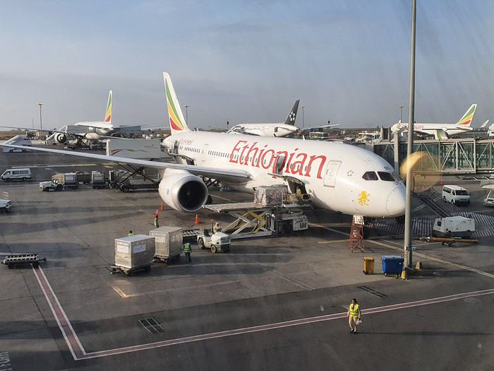
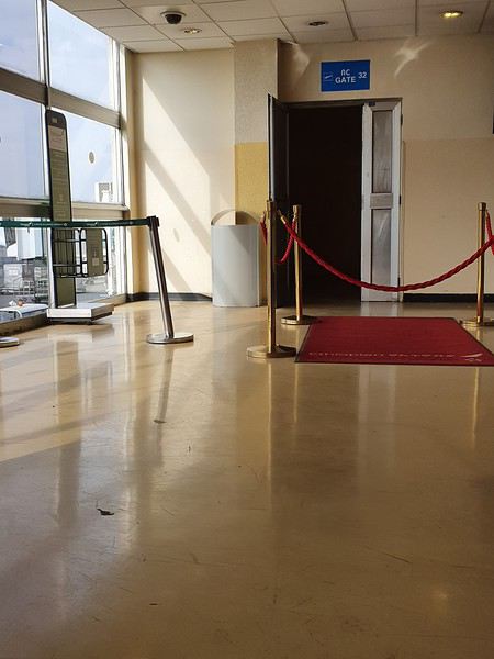
Le 10 mars au petit matin, après avoir changé des euros au rutilant terminal international de l'aéroport d'Adis , je rejoins le terminal des vols domestiques, moins rutilant. Je cherche un peu pour rejoindre ce terminal, je repasse par les contrôles de sécurité par lesquels je viens de passer mais cette fois ci à l'envers.
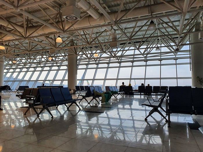
Et j'attends mon vol pour Lalibela. Attendre, c'est aussi ce que j'aime en Afrique, cette conception du temps tellement différente de la notre. Je m'y cale rapidement et éprouve une certaine joie à contempler tantôt le monde extérieur, tantôt mon monde intérieur. Je dois contempler trop longtemps une jolie jeune fille. Quelques minutes après, elle vient briser mon silence et s’asseoir à coté de moi. La salle d'embarquement se vide, le vol pour Baher Dar va décoller. Ma jolie voisine reste, elle habite Lalibela et va prendre comme moi le prochain vol.
Je me rapproche d'une agence avec qui je définis un itinéraire classique dans le Nord du Pays qui sera affiné grâce aux renseignements et conseils glanés sur ce forum. Je précise que je me mets bien avec un 4x4, un chauffeur et un guide francophone.
Le 9 mars, je suis donc à CDG dans la file d'enregistrement du vol Ethiopian Airlines avec mon sac léger : quelques affaires, quelques médicaments, du saucisson sec et des pastilles Ricola à l'orange, le livre l'Abyssin de Ruffier, le guide Olizane, et mon smartphone ( je regrette de ne pas avoir pris un vrai appareil photo !!!) . J'ai aussi un bon paquet de tshirt et sweat, des paquets de stylos qui alourdissent mon bagage mais qui feront nombre d'heureux sur les routes des hauts plateaux.
Le 10 mars au petit matin, après avoir changé des euros au rutilant terminal international de l'aéroport d'Adis , je rejoins le terminal des vols domestiques, moins rutilant. Je cherche un peu pour rejoindre ce terminal, je repasse par les contrôles de sécurité par lesquels je viens de passer mais cette fois ci à l'envers.
Et j'attends mon vol pour Lalibela. Attendre, c'est aussi ce que j'aime en Afrique, cette conception du temps tellement différente de la notre. Je m'y cale rapidement et éprouve une certaine joie à contempler tantôt le monde extérieur, tantôt mon monde intérieur. Je dois contempler trop longtemps une jolie jeune fille. Quelques minutes après, elle vient briser mon silence et s’asseoir à coté de moi. La salle d'embarquement se vide, le vol pour Baher Dar va décoller. Ma jolie voisine reste, elle habite Lalibela et va prendre comme moi le prochain vol.
Off to explore Jordan!
Well, since the lockdown is dragging on, I’m starting a new travel journal following the one I finished publishing yesterday:
https://voyageforum.com/discussion/voyage-pays-perles-voyage-dans-ouest-americain-d9943984/
This time, after the U.S., we’re heading to the Middle East—Jordan!
And we’re keeping up the good habits: one day’s entry published every day at 5:30 PM! Happy reading, and feel free to leave a comment, question, or remark...
Franck
Franck
Un petit tour au Tamil Nadu
Au milieu de toute cette morosité, je me lance dans un nouveau carnet indien qui vous changera les idées, je l’espère. Un nouveau séjour de deux semaines pendant les vacances d’hiver, du 21 au 6 mars. Mon 15ème voyage en Inde, mais mon 1er dans le grand sud.
Cette année, ce sera une petite partie du Tamil Nadu, un petit tour de 1000 km à peu près, de Chennai à Chennai (Kanchipuram, Gingee, Tirunmavallai, Chidambaram, Tranquebar, Kumbakonam, Trichy, le Chettinad, Tanjore, Pondichery et Mahabalipuram) avec une amie. Nous avons volontairement zappé Madurai et Rameshvaram, ce sera pour une autre fois, nous n’avions pas envie de faire trop de km et nous avons déjà beaucoup de chose au programme... Comme d’habitude, location d’une voiture avec chauffeur, et nous ne le regrettons pas, tant nous avons vu de lieux, quelquefois bien perdus, que nous n’aurions jamais pu atteindre en transport en commun, ou certainement pas en 14 jours.
J’ai consulté les carnets et blogs de Pagaljavad et Yann55 entre autre et je les remercie pour leurs tuyaux. J’ai eu des conseils d’Aleph, qui quand elle écumait le Tamil Nadu, ne postait pas encore de carnet. J’ai lu et relu les pages sur le Tamil Nadu sur le site Purattatva, un must pour moi depuis toujours. Et cherché, lu et relu, sur internet et sur papier (j’ai un vieux guide bleu de 1984 trouvé sur une brocante que je conserve précieusement et consulte pour chaque voyage car la qualité des guides a bien baissé culturellement depuis …)
A l’aéroport de Chennai, nous faisons connaissance avec notre chauffeur, Pandi. Départ immédiat pour Kanchipuram, à 65 km de là. Chennai sera pour une prochaine fois … Nous arrivons en fin de journée, il fait quasi nuit. Après le dîner, nous nous lançons à l’assaut des petites rues de Kanchipuram pour aller au temple de Kamaskhi, (une forme de Parvati), le plus proche, avec ses gopurams illuminés, son bassin sacré, des familles indiennes.
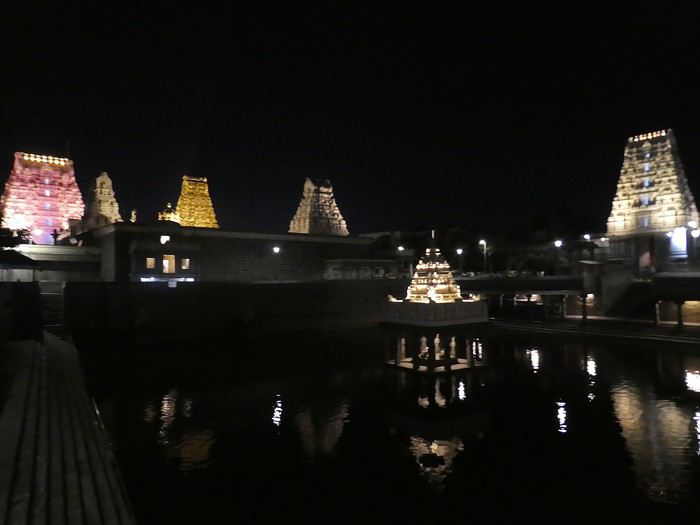
La photo n'est pas terrible car mon APN ne gère pas bien l'obscurité ...
Cette année, ce sera une petite partie du Tamil Nadu, un petit tour de 1000 km à peu près, de Chennai à Chennai (Kanchipuram, Gingee, Tirunmavallai, Chidambaram, Tranquebar, Kumbakonam, Trichy, le Chettinad, Tanjore, Pondichery et Mahabalipuram) avec une amie. Nous avons volontairement zappé Madurai et Rameshvaram, ce sera pour une autre fois, nous n’avions pas envie de faire trop de km et nous avons déjà beaucoup de chose au programme... Comme d’habitude, location d’une voiture avec chauffeur, et nous ne le regrettons pas, tant nous avons vu de lieux, quelquefois bien perdus, que nous n’aurions jamais pu atteindre en transport en commun, ou certainement pas en 14 jours.
J’ai consulté les carnets et blogs de Pagaljavad et Yann55 entre autre et je les remercie pour leurs tuyaux. J’ai eu des conseils d’Aleph, qui quand elle écumait le Tamil Nadu, ne postait pas encore de carnet. J’ai lu et relu les pages sur le Tamil Nadu sur le site Purattatva, un must pour moi depuis toujours. Et cherché, lu et relu, sur internet et sur papier (j’ai un vieux guide bleu de 1984 trouvé sur une brocante que je conserve précieusement et consulte pour chaque voyage car la qualité des guides a bien baissé culturellement depuis …)
A l’aéroport de Chennai, nous faisons connaissance avec notre chauffeur, Pandi. Départ immédiat pour Kanchipuram, à 65 km de là. Chennai sera pour une prochaine fois … Nous arrivons en fin de journée, il fait quasi nuit. Après le dîner, nous nous lançons à l’assaut des petites rues de Kanchipuram pour aller au temple de Kamaskhi, (une forme de Parvati), le plus proche, avec ses gopurams illuminés, son bassin sacré, des familles indiennes.
La photo n'est pas terrible car mon APN ne gère pas bien l'obscurité ...
Visa double entrées 2020 pour la Thaïlande et exemption depuis le Laos
Bonjour,
Je cherche des infos complémentaires au sujet de ce visa double entrées 2020.
https://cmdecidela.com/2019/12/19/thailande-du-nouveau-sur-le-front-des-visas/
Est-ce quelqu’un a les infos manquantes ?
Par exemple son prix ? Est-ce qu’au terme des 90 jours , si on passe la frontière du Laos , par exemple , on pourra bénéficier d’une exemption de visa de 30 jours lorsqu’on reviendra etc...
Merci 🙏
Je cherche des infos complémentaires au sujet de ce visa double entrées 2020.
https://cmdecidela.com/2019/12/19/thailande-du-nouveau-sur-le-front-des-visas/
Est-ce quelqu’un a les infos manquantes ?
Par exemple son prix ? Est-ce qu’au terme des 90 jours , si on passe la frontière du Laos , par exemple , on pourra bénéficier d’une exemption de visa de 30 jours lorsqu’on reviendra etc...
Merci 🙏
Voyager sans connaître la destination? Nous voilà inscrits...
Nous sommes à un mois de notre départ et nous ne connaissons pas la destination puisque c'est un voyage mystère que nous avons réservé par l'agence CAP MYSTERE....
Nous avons donc rempli un questionnaire assez détaillé sur notre type de voyage, nos envies , nos budget...
C'est donc un voyage lointain avec une destination au soleil alliant la faune et la flore et hors des sentiers battus.
Nous allons bientôt recevoir le premier indice.
Nous sommes méga surexcités et en ce qui me concerne (moins mon conjoint plus sage) , je ne cesse de chercher les vols possibles avec les éléments que j'ai....
Arghhhh c'est horriblement dure d'attendre.
Nous avons donc rempli un questionnaire assez détaillé sur notre type de voyage, nos envies , nos budget...
C'est donc un voyage lointain avec une destination au soleil alliant la faune et la flore et hors des sentiers battus.
Nous allons bientôt recevoir le premier indice.
Nous sommes méga surexcités et en ce qui me concerne (moins mon conjoint plus sage) , je ne cesse de chercher les vols possibles avec les éléments que j'ai....
Arghhhh c'est horriblement dure d'attendre.
L'importance des voyages pour vous
Bonjour
Nous sommes bien sûr tous des voyageurs et c'est ce qui nous rassemble ici.
Mais nous avons tous une vision différente du voyage et n'y accordons pas la même importance.
Quelle place accordez vous au voyage dans votre vie ?
Est ce un loisir comme un autre ? Une passion ? Un vrai besoin ? Pouvez vous vous en passer facilement ?
Nous sommes bien sûr tous des voyageurs et c'est ce qui nous rassemble ici.
Mais nous avons tous une vision différente du voyage et n'y accordons pas la même importance.
Quelle place accordez vous au voyage dans votre vie ?
Est ce un loisir comme un autre ? Une passion ? Un vrai besoin ? Pouvez vous vous en passer facilement ?
Voyage décevant au Sri Lanka
Bonjour,
Juste une reflexion, après 13 ans passé tous les ans au sri lanka, nous revenons juste d'un xème séjour au sri Lanka au mois de décembre.
Après un circuit avec un chauffeur local parlant Français, cela s'est très bien passé. Autant pour le circuit que pour les hébergements. Nous avons continué avec 2 semaines de balnéaire dans le sud du pays.
Constat amer : Nous constatons au fur et à mesure des années que le sri lanka change énormément. Autant les habitants, attirés par l'argent des touristes, que le pays, envahis par les touristes des pays de l'est. Le sri lanka se meurt doucement, les touristes Européens ne reviennent pas dans le pays, à cause des dégâts qu'occasionnent les touristes de l'est qui démolissent de plus en plus le pays. Des hôtels se bâtissent dans tous les sens, malgré le manque de touristes Européens. Tout est fait pour faire venir le touriste, même le visa gratuit. Mais rien y fait. Nous mêmes n'y reviendrons plus malheureusement. Chassés d'un hôtel à cause des locaux qui priment sur les touristes, malgré 2 nuits de payées, nous avons dû quitter après 1 nuit. Trop bruyant et sans respect pour le touriste. Malgré leurs dires, que les touristes sont leur priorité, cela n'a jmais été le cas. Nous avions hâte de quitter le pays après 3 semaines, cela est bien malheureux. Nous avons connu le SL il y a bien des années. Aujourd'hui nous ne le reconnaissons pas. Ce pays est merveilleux, mais fait fuir de plus en plus le touriste européens. Le SRI LANKA doit faire un choix un moment donné, les locaux ou les touristes dans les hôtels dotés d'une piscine. A chaque hôtel , nous avons eu les mêmes problèmes. Jusqu'au bout pour le prix du taxi pour l'aéroport, connaisseur du prix, il a été presque doublé à l'arrivée à l'aéroport….. QUELLE ENORME DECEPTION 🙁 Au Revoir le SRI LANKA.
Juste une reflexion, après 13 ans passé tous les ans au sri lanka, nous revenons juste d'un xème séjour au sri Lanka au mois de décembre.
Après un circuit avec un chauffeur local parlant Français, cela s'est très bien passé. Autant pour le circuit que pour les hébergements. Nous avons continué avec 2 semaines de balnéaire dans le sud du pays.
Constat amer : Nous constatons au fur et à mesure des années que le sri lanka change énormément. Autant les habitants, attirés par l'argent des touristes, que le pays, envahis par les touristes des pays de l'est. Le sri lanka se meurt doucement, les touristes Européens ne reviennent pas dans le pays, à cause des dégâts qu'occasionnent les touristes de l'est qui démolissent de plus en plus le pays. Des hôtels se bâtissent dans tous les sens, malgré le manque de touristes Européens. Tout est fait pour faire venir le touriste, même le visa gratuit. Mais rien y fait. Nous mêmes n'y reviendrons plus malheureusement. Chassés d'un hôtel à cause des locaux qui priment sur les touristes, malgré 2 nuits de payées, nous avons dû quitter après 1 nuit. Trop bruyant et sans respect pour le touriste. Malgré leurs dires, que les touristes sont leur priorité, cela n'a jmais été le cas. Nous avions hâte de quitter le pays après 3 semaines, cela est bien malheureux. Nous avons connu le SL il y a bien des années. Aujourd'hui nous ne le reconnaissons pas. Ce pays est merveilleux, mais fait fuir de plus en plus le touriste européens. Le SRI LANKA doit faire un choix un moment donné, les locaux ou les touristes dans les hôtels dotés d'une piscine. A chaque hôtel , nous avons eu les mêmes problèmes. Jusqu'au bout pour le prix du taxi pour l'aéroport, connaisseur du prix, il a été presque doublé à l'arrivée à l'aéroport….. QUELLE ENORME DECEPTION 🙁 Au Revoir le SRI LANKA.
De Vadodara (Gujarat) à Jaipur (Rajasthan)
Le vol Toulouse -Mumbai avec la Lufthansa s'est bien passé et nous arrivons même une demi heure en avance .
L'enregistrement du e-visa de 5 ans se fait sans problème.
Mon sac récupéré, je m'installe dans le hall pour attendre mon train qui part de la gare Bandra qui n'est pas très loin de l'aéroport. J'ai eu une bonne idée d'attendre à l'aéroport car cette gare est très petite , et les personnes présentes sont étendues au sol et dorment.
Mon train pour Vadodara part à 05h10 et est à l'heure.
J'ai réservé un billet en 2ème classe ce qui me permet d'avoir une couchette et de bien me reposer pour arriver en forme à Vadodara à 10h45.
J'ai réservé une chambre à l'hôtel 7 apple qui est à moins de 2 kms de la gare. Cet hôtel est accueillant, propre avec un restaurant et un supermarché .
Une fois bien installée, douchée je pars découvrir cette ville . Je pars à pieds avec l'aide de google maps à la recherche d'un bureau de change.
De là, je prends un rickshaw qui me conduit au Palais Laxmi Vilas.(entrée 500rs ).
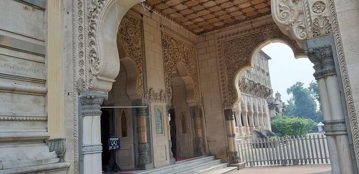
Ce palais a été construit en 1890 par le Maharaja Sayajirao Gaekwad III et ce sur un ancien palais, de style indo-saracenic, et il fait quatre fois le Bukingham Palace.
Il est interdit de faire des photos à l'intérieur et uniquement avec le téléphone à l'extérieur.
C'est le plus grand palais de l'Inde avec 170 chambres et plusieurs ascenseurs.
en arrivant dans le parc du palais nous tombons sur cette façade qui donne envie d'en voir un peu plus

sur le coté
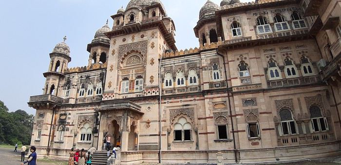
à la sortie
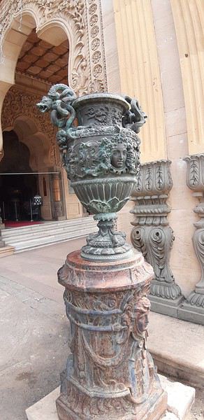
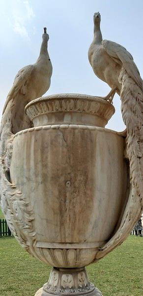
la vue sur les jardins et le terrain de golf où l'on ne peut pas accéder




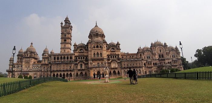
la vue d'ensemble tout de même ...ça jette
La visite terminée je quitte le parc et au bout d'un petit moment je réalise que je n'ai pas vu le baori. Je reviens donc sur mes pas à sa recherche , je vais demander au guichet et on ne peux plus y accéder car il est en travaux. dommage. Je trouve dans la rue des stands où l'on peut manger des omelettes et je m'y arrête avant de rentrer me reposer à l'hôtel. La première journée a bien commencé et je me sens bien à Vadodara .
en arrivant dans le parc du palais nous tombons sur cette façade qui donne envie d'en voir un peu plus
sur le coté
à la sortie
la vue sur les jardins et le terrain de golf où l'on ne peut pas accéder
la vue d'ensemble tout de même ...ça jette
La visite terminée je quitte le parc et au bout d'un petit moment je réalise que je n'ai pas vu le baori. Je reviens donc sur mes pas à sa recherche , je vais demander au guichet et on ne peux plus y accéder car il est en travaux. dommage. Je trouve dans la rue des stands où l'on peut manger des omelettes et je m'y arrête avant de rentrer me reposer à l'hôtel. La première journée a bien commencé et je me sens bien à Vadodara .
Brelan d'as dans les Stans: Kirghizistan, Tadjikistan et Ouzbekistan
Hello tous,
C'est avec plaisir que je vous fait partager notre voyage de l'été 2019 dans les pays en stan.🙂
La version complète est ici, elle se construit au même rythme que je fais paraitre mes posts
GENESE Mais quelle idée d’aller dans les stan ! En fait, à l’origine cela devait être le Ladakh (joliment raconté par Diamina et Ticapi que je salue). Mais la crainte de ne pas arriver à tenir sur des treks de longues durées et le fait de ne pas pouvoir conduire moi-même m’ont incité à chercher une alternative. C’est là que Marie(Mlefevre) a eu le bon goût de publier un carnet sur le Kirghizistan et Perju de relater son voyage dans les stans, les deux en self drive …. C’est bon on tient notre destination 2019 ! Au niveau pays, ambiance, c’est d‘abord le corridor de Wakham et le Pamir qui m’ont séduit et ce sera le « centre » du voyage. En revanche je n’ai pas trouvé grand-chose au niveau véhicule de location au Tadjikistan. Comme ce voyage se faisait avec des amis de longues dates (avec qui on a déjà sillonné la Bolivie et le nord-ouest de la Namibie) j’ai trouvé intéressant d’y adjoindre un petit bout de Kirghizistan qui leur permettait de voir un autre type de paysage et en plus il est beaucoup plus facile de louer un véhicule à Bishkek. Lorsque ma chère et tendre a vu que nous n’étions pas loin de Samarcande (qu’on avait admiré en 2007) elle a souhaité y retourner. Du coup cela nous a fait un voyage avec 3 ambiances différentes, ce qui est génial pour nous. Niveau durée il a fallu rajouter un petit bout aux 3 semaines initialement prévues pour arriver à tout faire tenir.

PREPARATION
A partir de là j’ai commencé à construire notre parcours. En parallèle j’ai fait des recherches (et demandes) pour le véhicule. Au final, j’ai retenu une agence Ouzbek francophone qui a tout de suite compris nos problématiques d’Européens (véhicule récent, avec matériel de camping, avec les différents transferts et qui prend en charge les quelques réservations d’hôtels, guides, etc, ..). Le véhicule sera donc un Toyota Prado de 2012. La compagnie aérienne sera Turkish Airline qui dessert très bien les pays en Stan (même un vol Samarcande - Istanbul) Visas: pour le Kirghizistan il est délivré directement à l'aéroport, en revanche pour le Tadjikistan il faut le demander à l'avance. ATTENTION, le Pamir nécessite un permis particulier (comme c'est une région semi-autonome), il faut le demander en même temps que le visa en cochant la case permit GBAO (région autonome duHaut-Badakhchan).
OUTILS Comme c'est une destination encore peu couru en self drive je vais développer un peu plus que d'hab. Au niveau guide papier: Je n'ai pas mis de "S" car il n’y en a eu quasiment qu’un, mais qui pour le coup est parfait pour qui veut voyager comme nous : le nouveau guide de Cecile Miramont et Laurent Bendel : KIRGHIZISTAN TADJIKISTAN, qui a été écrit à destination des self-drivers et qui propose différents itinéraires commentés. Mon conseil, après le voyage : le guide n’enjolive pas les choses et s’adresse plutôt aux personnes ayant déjà des notions de « off road » ou de voyage « solitaire », donc quand ils écrivent "difficile" ça l’est vraiment, même "moyen" c’est déjà costaud. Par forcément au niveau difficulté de la piste elle-même mais par la dangerosité liée à la solitude, le peu de traces et le risque de croiser des gués plus ou moins remplis. Au niveau carte: il y en a une très belle et complète pour le Pamir, il s'agit de celle de Markus Hauser édité par Gekco Maps.
Comme je suis très GPS j'ai fait pas mal de recherches. Pour Garmin je n'ai pas été plus séduit que ça. Du coup je me suis penché sur les applications Android. Je connaissais déjà MAPS.ME qui est très bien mais sans courbe de niveaux, j'ai donc aussi testé GAIA, OSMAND, TERRA MAP et SOVIET MILITARY MAPS. Cette dernière est celle qui offre le plus de possibilités de cartographie plus ou moins détaillée, dont les fameuses cartes militaires Russes ultra détaillées. Mais au final c'est OSMAND que j'ai utilisé le plus pendant le voyage, je pense même que cette application remplacera GARMIN dans mon véhicule. MAPS.ME est très bien, mais au niveau topographie elle est un cran en dessous et je l'ai trouvé moins pratique pour gérer les itinéraires. Ce qui est dommage, c'est que toutes ces applications n'ont pas leur pendant sur PC, ce qui aurait été pratique pour préparer le voyage. Du coup je fais tout sur Mapsource et je transfers ensuite les waypoints sur les applications. J'ai aussi utilisé une application où les voyageurs indiquent les lieux de bivouac (ou autre) qui leur ont plu. Il s'agit de IOVERLANDER, très bonne application également. Dernier outil et non des moindres: les CBT, ce sont les offices de tourisme version Kirghize, il y en a dans les principales villes touristiques. Ils sont du grande aide et ont bien souvent un site internet, par exemple sur celui de Nryn on peut acheter, à l'avance, les permis pour la zone frontalière. Ils peuvent aussi vous indiquer des randonnées, en organiser avec des guides, gérer les hébergements, ... Pour le Pamir vous avez l'équivalent qui se nomme PECTA, nous y achèterons les permis pour circuler dans le parc de Zorgul. Il y a aussi le site visitpamirs.com qui regroupe un certain nombre d'informations.
RAVITAILLEMENT et EQUIPEMENT : au Kirghizistan aucun problème, en revanche au Tadjikistan c’est une autre histoire, sur les hauts plateaux très peu de choses disponibles, mais comme on s’y attendait on avait amené des « sachets de graines ». Au niveau vestimentaire il faut de quoi résister au froid (polaire, doudoune, bonnet) mais sans que ce soit extrême non plus (je crois que nous n'avons jamais eu des températures négatives). EN revanche pour la nuit vaut mieux avoir de bon duvets, il a fait entre 0° et 15° suivant l'altitude et la localisation.
Compagnie Turkish Airline qui dessert très bien les pays en Stan (même un vol Samarcande - Istanbul)
GENESE Mais quelle idée d’aller dans les stan ! En fait, à l’origine cela devait être le Ladakh (joliment raconté par Diamina et Ticapi que je salue). Mais la crainte de ne pas arriver à tenir sur des treks de longues durées et le fait de ne pas pouvoir conduire moi-même m’ont incité à chercher une alternative. C’est là que Marie(Mlefevre) a eu le bon goût de publier un carnet sur le Kirghizistan et Perju de relater son voyage dans les stans, les deux en self drive …. C’est bon on tient notre destination 2019 ! Au niveau pays, ambiance, c’est d‘abord le corridor de Wakham et le Pamir qui m’ont séduit et ce sera le « centre » du voyage. En revanche je n’ai pas trouvé grand-chose au niveau véhicule de location au Tadjikistan. Comme ce voyage se faisait avec des amis de longues dates (avec qui on a déjà sillonné la Bolivie et le nord-ouest de la Namibie) j’ai trouvé intéressant d’y adjoindre un petit bout de Kirghizistan qui leur permettait de voir un autre type de paysage et en plus il est beaucoup plus facile de louer un véhicule à Bishkek. Lorsque ma chère et tendre a vu que nous n’étions pas loin de Samarcande (qu’on avait admiré en 2007) elle a souhaité y retourner. Du coup cela nous a fait un voyage avec 3 ambiances différentes, ce qui est génial pour nous. Niveau durée il a fallu rajouter un petit bout aux 3 semaines initialement prévues pour arriver à tout faire tenir.
PREPARATION
A partir de là j’ai commencé à construire notre parcours. En parallèle j’ai fait des recherches (et demandes) pour le véhicule. Au final, j’ai retenu une agence Ouzbek francophone qui a tout de suite compris nos problématiques d’Européens (véhicule récent, avec matériel de camping, avec les différents transferts et qui prend en charge les quelques réservations d’hôtels, guides, etc, ..). Le véhicule sera donc un Toyota Prado de 2012. La compagnie aérienne sera Turkish Airline qui dessert très bien les pays en Stan (même un vol Samarcande - Istanbul) Visas: pour le Kirghizistan il est délivré directement à l'aéroport, en revanche pour le Tadjikistan il faut le demander à l'avance. ATTENTION, le Pamir nécessite un permis particulier (comme c'est une région semi-autonome), il faut le demander en même temps que le visa en cochant la case permit GBAO (région autonome duHaut-Badakhchan).
OUTILS Comme c'est une destination encore peu couru en self drive je vais développer un peu plus que d'hab. Au niveau guide papier: Je n'ai pas mis de "S" car il n’y en a eu quasiment qu’un, mais qui pour le coup est parfait pour qui veut voyager comme nous : le nouveau guide de Cecile Miramont et Laurent Bendel : KIRGHIZISTAN TADJIKISTAN, qui a été écrit à destination des self-drivers et qui propose différents itinéraires commentés. Mon conseil, après le voyage : le guide n’enjolive pas les choses et s’adresse plutôt aux personnes ayant déjà des notions de « off road » ou de voyage « solitaire », donc quand ils écrivent "difficile" ça l’est vraiment, même "moyen" c’est déjà costaud. Par forcément au niveau difficulté de la piste elle-même mais par la dangerosité liée à la solitude, le peu de traces et le risque de croiser des gués plus ou moins remplis. Au niveau carte: il y en a une très belle et complète pour le Pamir, il s'agit de celle de Markus Hauser édité par Gekco Maps.
Comme je suis très GPS j'ai fait pas mal de recherches. Pour Garmin je n'ai pas été plus séduit que ça. Du coup je me suis penché sur les applications Android. Je connaissais déjà MAPS.ME qui est très bien mais sans courbe de niveaux, j'ai donc aussi testé GAIA, OSMAND, TERRA MAP et SOVIET MILITARY MAPS. Cette dernière est celle qui offre le plus de possibilités de cartographie plus ou moins détaillée, dont les fameuses cartes militaires Russes ultra détaillées. Mais au final c'est OSMAND que j'ai utilisé le plus pendant le voyage, je pense même que cette application remplacera GARMIN dans mon véhicule. MAPS.ME est très bien, mais au niveau topographie elle est un cran en dessous et je l'ai trouvé moins pratique pour gérer les itinéraires. Ce qui est dommage, c'est que toutes ces applications n'ont pas leur pendant sur PC, ce qui aurait été pratique pour préparer le voyage. Du coup je fais tout sur Mapsource et je transfers ensuite les waypoints sur les applications. J'ai aussi utilisé une application où les voyageurs indiquent les lieux de bivouac (ou autre) qui leur ont plu. Il s'agit de IOVERLANDER, très bonne application également. Dernier outil et non des moindres: les CBT, ce sont les offices de tourisme version Kirghize, il y en a dans les principales villes touristiques. Ils sont du grande aide et ont bien souvent un site internet, par exemple sur celui de Nryn on peut acheter, à l'avance, les permis pour la zone frontalière. Ils peuvent aussi vous indiquer des randonnées, en organiser avec des guides, gérer les hébergements, ... Pour le Pamir vous avez l'équivalent qui se nomme PECTA, nous y achèterons les permis pour circuler dans le parc de Zorgul. Il y a aussi le site visitpamirs.com qui regroupe un certain nombre d'informations.
RAVITAILLEMENT et EQUIPEMENT : au Kirghizistan aucun problème, en revanche au Tadjikistan c’est une autre histoire, sur les hauts plateaux très peu de choses disponibles, mais comme on s’y attendait on avait amené des « sachets de graines ». Au niveau vestimentaire il faut de quoi résister au froid (polaire, doudoune, bonnet) mais sans que ce soit extrême non plus (je crois que nous n'avons jamais eu des températures négatives). EN revanche pour la nuit vaut mieux avoir de bon duvets, il a fait entre 0° et 15° suivant l'altitude et la localisation.
Compagnie Turkish Airline qui dessert très bien les pays en Stan (même un vol Samarcande - Istanbul)
Y a-t-il plus de monde le week-end aux temples d'Angkor?
Bonjour,
Y a t'il plus de monde pour visiter le temple d'Angkor à Siem Reap le samedi et le dimanche ?
J'ai vu un billet d'avion pas cher mais il me fait arriver pour la visite du temple d'Angkor un samedi et un dimanche. Merci pour votre réponse rapide car j'hésite à le prendre.
Bromovol