Results for "Pays-Bas+souvenir+artisanat"
About 169,861 results.
More options
Many results are in French, the community’s main language. English translations are added over time.
Search results
Amérique du Sud en camping car
bonjour à tous
je vais partir en argentine, chili et pérou pour 10 mois avec mon camping car mais je galère (sérieusement) pour trouver des infos pour l'assurance du véhicule et médical pour moi et ma copine. De plus, je n'arrive pas à me faire une idée de l'état des routes.
A tout ceux qui liront ce message, nous sommes preneurs de toute info (même si ce n'est pas en rapport avec nos questions, si vous voulez nous indiquer des endroits à ne pas louper...)
Merci et à bientot
Népal: libération de 200 opposants, dont un ex-Premier ministre influent
😎😎Népal: libération de 200 opposants, dont un ex-Premier ministre influent  1 avril 2005 16:40
Les autorités népalaises ont annoncé vendredi la libération de plus de 200 opposants, dont un ex-Premier ministre influent, qui étaient emprisonnés ou assignés à résidence depuis le coup de force, il y a deux mois, du roi du Népal soumis depuis à une forte pression internationale.
"Dans l'ensemble du Népal, un peu plus de 200 personnes ont été libérées", a dit un haut responsable de la police.
Parmi elles se trouvent Girija Prasad Koirala, ancien Premier ministre et chef du principal parti d'opposition, le Congrès népalais.
M. Koirala, 82 ans, premier chef de gouvernement népalais issu d'une chambre élue, était assigné à résidence depuis que le roi Gyanendra a limogé son gouvernement le 1er février, pris les pleins pouvoirs et instauré l'état d'urgence.
"Je suis content, je me sens bien", a-t-il dit à l'AFP peu après sa libération en fin d'après-midi.
Les membres de son parti ont estimé que sa libération allait donner un coup de fouet au mouvement d'opposition contre le roi, pour le moment ténu, en raison de l'état d'urgence et de l'arrestation de nombreux dirigeants politiques, syndicaux ou étudiants.
L'état d'urgence suspend toutes les libertés fondamentales, notamment les droits d'expression, de rassemblement et de la presse.
"Désormais nous allons renforcer notre mouvement contre le coup du roi", a déclaré une dirigeante étudiante du Congrès Népalais, Shrijana Karki. "Nous attendons qu'il (M. Koirala) nous guide pour les plans à venir", a-t-elle ajouté.
Sa libération va donner "une nouvelle dynamique et apporter de l'énergie" au mouvement anti-monarchique, a également estimé Harihar Dahal, avocat de M. Koirala. Le roi a été forcer d'agir ainsi "en raison de la pression maintenue du public", a-t-il ajouté.
Ces libérations font suite à d'intenses pressions de la communauté internationale, et notamment des pays et organismes donateurs, pour un retour à la démocratie au Népal, un des pays les plus pauvres du monde.
Après l'Inde et la Grande-Bretagne, qui ont cessé leur aide militaire vitale pour le royaume, la Banque mondiale a gelé le déblocage de fonds, des gestes considérés comme un moyen de pression sur Katmandou.
L'Inde a immédiatement "salué" la libération de l'ancien Premier ministre.
Le gouvernement indien espère que cette libération sera suivie par celle "d'autres responsables et cadres politiques, militants des droits de l'Homme, dirigeants étudiants, membres des media et représentants de la société civile actuellement détenus en vertu de l'état d'urgence", a ajouté le ministère indien des Affaires étrangères dans un communiqué.
Plusieurs centaines de personnes ont été arrêtées depuis le coup de force royal, selon les partis politiques et les organisations de défense des droits de l'Homme.
Depuis, certaines ont été libérées. Vingt-quatre, dont Sher Bahadur Deuba qui dirigeait le gouvernement de coalition limogé, ont ainsi été relâchées en mars. D'autres l'avaient été plus tôt en février.
Mais dans le même temps, les autorités ont poursuivi les arrestations d'opposants au roi.
Ainsi, près de 190 militants qui manifestaient contre le souverain ont été arrêtés lundi et mardi. La semaine dernière, au moins 149 militants avaient subi le même sort pour avoir protesté publiquement contre le monarque.
Le roi Gyanendra avait expliqué avoir limogé son gouvernement parce qu'il avait, selon lui, échoué à entamer des négociations avec les maoïstes et à organiser des élections législatives. Il a promis de rétablir la démocratie d'ici trois ans une fois matée l'insurrection maoïste lancée en 1996.
L'armée népalaise, mal équipée, dépend largement de l'assistance extérieure pour mener ses opérations.
L'annonce de ces libérations a été faite alors que les maoïstes ont appelé à une nouvelle grève générale de onze jours à compter de samedi.AFP
1 avril 2005 16:40 Les autorités népalaises ont annoncé vendredi la libération de plus de 200 opposants, dont un ex-Premier ministre influent, qui étaient emprisonnés ou assignés à résidence depuis le coup de force, il y a deux mois, du roi du Népal soumis depuis à une forte pression internationale."Dans l'ensemble du Népal, un peu plus de 200 personnes ont été libérées", a dit un haut responsable de la police.
Parmi elles se trouvent Girija Prasad Koirala, ancien Premier ministre et chef du principal parti d'opposition, le Congrès népalais.
M. Koirala, 82 ans, premier chef de gouvernement népalais issu d'une chambre élue, était assigné à résidence depuis que le roi Gyanendra a limogé son gouvernement le 1er février, pris les pleins pouvoirs et instauré l'état d'urgence.
"Je suis content, je me sens bien", a-t-il dit à l'AFP peu après sa libération en fin d'après-midi.
Les membres de son parti ont estimé que sa libération allait donner un coup de fouet au mouvement d'opposition contre le roi, pour le moment ténu, en raison de l'état d'urgence et de l'arrestation de nombreux dirigeants politiques, syndicaux ou étudiants.
L'état d'urgence suspend toutes les libertés fondamentales, notamment les droits d'expression, de rassemblement et de la presse.
"Désormais nous allons renforcer notre mouvement contre le coup du roi", a déclaré une dirigeante étudiante du Congrès Népalais, Shrijana Karki. "Nous attendons qu'il (M. Koirala) nous guide pour les plans à venir", a-t-elle ajouté.
Sa libération va donner "une nouvelle dynamique et apporter de l'énergie" au mouvement anti-monarchique, a également estimé Harihar Dahal, avocat de M. Koirala. Le roi a été forcer d'agir ainsi "en raison de la pression maintenue du public", a-t-il ajouté.
Ces libérations font suite à d'intenses pressions de la communauté internationale, et notamment des pays et organismes donateurs, pour un retour à la démocratie au Népal, un des pays les plus pauvres du monde.
Après l'Inde et la Grande-Bretagne, qui ont cessé leur aide militaire vitale pour le royaume, la Banque mondiale a gelé le déblocage de fonds, des gestes considérés comme un moyen de pression sur Katmandou.
L'Inde a immédiatement "salué" la libération de l'ancien Premier ministre.
Le gouvernement indien espère que cette libération sera suivie par celle "d'autres responsables et cadres politiques, militants des droits de l'Homme, dirigeants étudiants, membres des media et représentants de la société civile actuellement détenus en vertu de l'état d'urgence", a ajouté le ministère indien des Affaires étrangères dans un communiqué.
Plusieurs centaines de personnes ont été arrêtées depuis le coup de force royal, selon les partis politiques et les organisations de défense des droits de l'Homme.
Depuis, certaines ont été libérées. Vingt-quatre, dont Sher Bahadur Deuba qui dirigeait le gouvernement de coalition limogé, ont ainsi été relâchées en mars. D'autres l'avaient été plus tôt en février.
Mais dans le même temps, les autorités ont poursuivi les arrestations d'opposants au roi.
Ainsi, près de 190 militants qui manifestaient contre le souverain ont été arrêtés lundi et mardi. La semaine dernière, au moins 149 militants avaient subi le même sort pour avoir protesté publiquement contre le monarque.
Le roi Gyanendra avait expliqué avoir limogé son gouvernement parce qu'il avait, selon lui, échoué à entamer des négociations avec les maoïstes et à organiser des élections législatives. Il a promis de rétablir la démocratie d'ici trois ans une fois matée l'insurrection maoïste lancée en 1996.
L'armée népalaise, mal équipée, dépend largement de l'assistance extérieure pour mener ses opérations.
L'annonce de ces libérations a été faite alors que les maoïstes ont appelé à une nouvelle grève générale de onze jours à compter de samedi.AFP
Inde du Sud - 1
En cette fin d'année 1995, mon père arbore la rosette de la Légion d'Honneur fraîchement épinglée au revers de son costume de fête par un préfet vendéen, pour honorer ce vétéran de la grande guerre. C'est son jour de gloire car il souffle les cent bougies de son gateau d'anniversaire avec l'aide de ses arrières petits-enfants. Ses cinquante descendants se sont réunis pour cet événement exceptionnel... qui précède notre départ vers Bombay.
A bord d'un avion Air-India, on retrouve les saveurs des plats indiens servis à bord par de belles hôtesses en sari. C'est sous un soleil levant voilé de brume jaunâtre que l'avion s'approche de Bombay-Mumbai. On n'en croit pas ses yeux : un gigantesque bidonville déferle tout contre les grillages qui limitent le tarmac. Quelques pilotes de nos amis disent qu'ils ont, à chaque fois, le même choc : ils plongent droit sur les baraques qui entourent la piste où ils posent leurs monstres rugissants... Les malheureux qui survivent dans ces bicoques sont certainement devenus sourds et aveugles pour résister à ces agressions incessantes.
Lourde chaleur humide, plus de 30°, le contraste est violent pour nous qui avons quitté un Paris glacé. Mêmes formalités de douane, police, contrôles de passeports et visas, change de dollars en roupies, et taxi pour l'Hôtel Ritz, point de chute de nos trois premières nuits. La vieille guimbarde saute et bringuebale sur une route poussiéreuse qui traverse le chaos du plus grand bidonville du monde. Douze à quinze millions d'habitants dans la mégapole, qui a rejeté le plus loin possible du centre les sans-ressources agglutinés sur des kilomètres dans cette banlieue pourrie.
Le Ritz est situé près de la gare Churchgate qui dessert principalement les environs de Bombay. Une foule de travailleurs envahit les trottoirs à heures fixes, avec un objectif commun qui s'inverse en fin de journée.
C'est le dernier jour de l'année 1995, comment les Indiens fêtent-ils la nuit de la St-Sylvestre ? Nous aurons la réponse le soir même. Nous partons explorer le coeur de Bombay dès l'aube. Le quartier historique a été édifié par les britanniques à la gloire de leurs souverains. Si l'on en juge le style de construction en briques de la Victoria Station, c'est à leur reine-impératrice des Indes qu'ils ont également dédié les monuments officiels tels que l'Université et la Haute Cour de Justice, pur XIXème siècle rococo-anglais. La célèbre India Gate, sur le front de mer, est un arc de gloire offert au roi George V et à la reine Mary lors de leur visite en 1911.
Face à la mer d'Oman, le plus prestigieux palace de l'Inde, le Taj Mahal Hôtel, se dresse de toute son imposante structure de pierres, surmontée de coupoles qui rappellent vaguement son homonyme d'Agra. Quand on pénètre dans le hall, un immense sapin de Noël paré de boules scintillantes nous indique immédiatement que les riches indiens ont ajouté cette chrétienne tradition à leurs innombrables fêtes locales. Plusieurs grands salons de réception où des fauteuils profonds accueillent les clients fortunés. Ameublement luxueux, lustres monumentaux, miroirs et tableaux ornent les murs de ce temple dédié à la déesse Lakshmi, grande prêtresse du fric dans la mythologie hindoue. Une hôtesse nous guide au dernier étage pour contempler le panorama époustouflant sur la ville et la mer à nos pieds...
Une armée de serviteurs en tenue d'apparat s'affaire autour de nous, souriant sans obséquiosité, prêts à nous aider dans le choix d'un restaurant parmi les quatre du palace. C'est au Sharmiana que nous nous régalons de spécialités, revues et corrigées pour nos palais fragiles par un chef qui a beaucoup voyagé. Comme dans tous les établissements de ce type, la galerie marchande présente les plus beaux objets d'art, des vêtements traditionnels, livres, cartes postales, souvenirs divers dont nous faisons une première moisson. J'admire, une fois de plus, les superbes tapis cachemiris...
Quelques pas dans les jolis jardins suspendus (Hanging Gardens), où les familles promènent leurs enfants qui jouent comme tous les enfants du monde à la balançoire et au toboggan.
Intrigués par de drôles de coutumes, nous espérons apercevoir les fameuses Tours du silence au sommet desquelles les Parsis déposent leurs morts, offerts en pâture à de gras vautours. On a beau écarquiller les yeux, on ne voit strictement rien car de hauts murs dissimulent ces rites étranges aux regards indiscrets.
Dans le Temple Jaïna, par contre, nous sommes autorisés à pénétrer pour assister aux cérémonies de l'après-midi en compagnie d'une foule de fidèles en costumes bariolés, les bras chargés d'offrandes et d'énormes bouquets de fleurs. Tintements de clochettes, chants rituels, trompettes et cymbales rythment les différentes phases de la "messe". Photos autorisées.
Arrive l'heure du souper : à la réception du Ritz, on nous rappelle que c'est le réveillon, ce soir, et qu'un dîner-spectacle va être servi, moyennant supplément. Effectivement, lorsqu'on pénètre dans la salle à manger, revêtus l'un et l'autre de nos plus beaux habits, il y a déjà de nombreux convives indiens, très élégants, assis à table pour fêter l'année nouvelle. Un orchestre joue des airs discos et les plus jeunes dansent joue contre joue ou sautillent en cadence sur la piste, entre les plats du dîner. C'est très long... Nous irions bien dormir, lorsque l'animateur annonce le tirage d'une loterie : il déplie un papier et claironne le nom des gagnants :... oui, on a bien entendu, sous les applaudissements, il nous offre une charmante pendulette qui fera le bonheur, à coup sûr, de nos petits enfants ! Nous sommes émus par la gentillesse de cette joyeuse assemblée. Souvenir touchant, mais encombrant, que nous allons promener durant quatre semaines dans nos bagages, jusqu'à notre retour en France.
L'Ile Elephanta est notre destination en ce premier de l'an 1996. De nombreux bateaux proposent l'excursion. Embarquement sur un vieux rafiot qui en a vu d'autres d'une joyeuse bande d'indiens en goguette qui montent à bord, chantent et chahutent dans un tonitruant charivari. La traversée dure une heure dans la baie peuplée d'énormes navires de tous les pays. Au loin, on distingue une centrale nucléaire édifiée sur un îlot. L'eau est noire et visqueuse et n'incite pas à la baignade. Mais comme toujours, en Inde, la beauté de l'île Elephanta fait oublier la pollution industrielle de l'immense port de commerce.
Les grands arbres exotiques forment une voûte exquise où il fait bon escalader les hautes marches qui mènent aux grottes sculptées entre le Vème et le VIIIème siècles, consacrées au dieu Shiva. La montée est accompagnée par les multiples vendeurs de souvenirs qui interpellent les visiteurs. Certains proposent de jolis colliers de grenat et d'améthyste. Quelques cristaux de quartz feront le bonheur de notre petit fils, grand amateur de minéraux.
Les indiens sont en congé, aujourd'hui, et ils sont venus très nombreux sur l'île, chargés de volumineux paniers de pique-nique. Assis à l'ombre des arbres, c'est un monde haut en couleurs qui a fui la grande ville pour goûter la fraîcheur de ce petit paradis.
Dans les grottes bien trop sombres, les photos sont décevantes, nul éclairage n'a été prévu pour mettre en valeur les splendides statues qu'on devine plus qu'on ne les voit au fond des galeries. Mais il règne une atmosphère étrange, mystérieuse et magique, qui nous enveloppe et nous fascine. Le visage de Shiva, dont les trois faces expriment la complexité du dieu, est si imposant avec ses cinq mètres de hauteur qu'on est écrasé au sol comme une fourmi devant un éléphant ! L'oppression se dissipe quand on retrouve le soleil et les sarabandes de singes qui accourent vers nous, curieux et affamés. Biscuits, bonbons, fruits, ils attrapent tout avec frénésie, se réfugiant dans les arbres pour dévorer ces friandises.
La faim nous tenaille : point de restauration alléchante sur place. Il est temps de rejoindre la terre ferme avant le retour massif des randonneurs. La mer est légèrement houleuse, il fait une chaleur poisseuse et nous accostons devant la porte de l'Inde vers 14 heures. Déjeuner délicieux au "Rangoli", bistro typique dont le buffet regorge de mets irrésistibles.
Notre hôtel est situé dans le quartier le plus touristique de la ville, et dès que nous sortons dans la rue, une nuée de quémandeurs fonce sur nous... Méfiance : la veille, on s'est laissés amadouer par un "étudiant" qui nous a entraînés dans la cour d'une morgue... Pas d'argent pour payer le bois du bûcher... Impossible d'échapper à quelques bonshommes d'apparence religieuse, armés d'un cahier de donations obligatoires. Que cela nous serve de leçon pour la suite du voyage.
Derrière le luxueux Taj Mahal, des ruelles immondes sont envahies d'une foule mêlée de touristes en quête d'émotions fortes. Le sol est jonché de détritus ignobles, des tas d'ordures jamais ramassées sont visités par quelques miséreux qui disputent aux rats les débris encore récupérables. Nausée, dégoût, immense pitié pour les laissés-pour compte qui n'ont plus que ça pour survivre. Au milieu de ce cloaque, quelques vestiges de la splendeur britannique subsistent comme des hâvres de paix au milieu de l'enfer.
Le restaurant "Vintage" surprend par sa relative propreté et la qualité du service à l'anglaise. Ce qu'on y mange n'est pas aussi mauvais qu'on pourrait le craindre. La cuisine grande-bretonne, en général, n'a pas très bonne réputation auprès des frenchies. Nous avions connu bien pire à Londres, il n'y a pas si longtemps !..
A bord d'un avion Air-India, on retrouve les saveurs des plats indiens servis à bord par de belles hôtesses en sari. C'est sous un soleil levant voilé de brume jaunâtre que l'avion s'approche de Bombay-Mumbai. On n'en croit pas ses yeux : un gigantesque bidonville déferle tout contre les grillages qui limitent le tarmac. Quelques pilotes de nos amis disent qu'ils ont, à chaque fois, le même choc : ils plongent droit sur les baraques qui entourent la piste où ils posent leurs monstres rugissants... Les malheureux qui survivent dans ces bicoques sont certainement devenus sourds et aveugles pour résister à ces agressions incessantes.
Lourde chaleur humide, plus de 30°, le contraste est violent pour nous qui avons quitté un Paris glacé. Mêmes formalités de douane, police, contrôles de passeports et visas, change de dollars en roupies, et taxi pour l'Hôtel Ritz, point de chute de nos trois premières nuits. La vieille guimbarde saute et bringuebale sur une route poussiéreuse qui traverse le chaos du plus grand bidonville du monde. Douze à quinze millions d'habitants dans la mégapole, qui a rejeté le plus loin possible du centre les sans-ressources agglutinés sur des kilomètres dans cette banlieue pourrie.
Le Ritz est situé près de la gare Churchgate qui dessert principalement les environs de Bombay. Une foule de travailleurs envahit les trottoirs à heures fixes, avec un objectif commun qui s'inverse en fin de journée.
C'est le dernier jour de l'année 1995, comment les Indiens fêtent-ils la nuit de la St-Sylvestre ? Nous aurons la réponse le soir même. Nous partons explorer le coeur de Bombay dès l'aube. Le quartier historique a été édifié par les britanniques à la gloire de leurs souverains. Si l'on en juge le style de construction en briques de la Victoria Station, c'est à leur reine-impératrice des Indes qu'ils ont également dédié les monuments officiels tels que l'Université et la Haute Cour de Justice, pur XIXème siècle rococo-anglais. La célèbre India Gate, sur le front de mer, est un arc de gloire offert au roi George V et à la reine Mary lors de leur visite en 1911.
Face à la mer d'Oman, le plus prestigieux palace de l'Inde, le Taj Mahal Hôtel, se dresse de toute son imposante structure de pierres, surmontée de coupoles qui rappellent vaguement son homonyme d'Agra. Quand on pénètre dans le hall, un immense sapin de Noël paré de boules scintillantes nous indique immédiatement que les riches indiens ont ajouté cette chrétienne tradition à leurs innombrables fêtes locales. Plusieurs grands salons de réception où des fauteuils profonds accueillent les clients fortunés. Ameublement luxueux, lustres monumentaux, miroirs et tableaux ornent les murs de ce temple dédié à la déesse Lakshmi, grande prêtresse du fric dans la mythologie hindoue. Une hôtesse nous guide au dernier étage pour contempler le panorama époustouflant sur la ville et la mer à nos pieds...
Une armée de serviteurs en tenue d'apparat s'affaire autour de nous, souriant sans obséquiosité, prêts à nous aider dans le choix d'un restaurant parmi les quatre du palace. C'est au Sharmiana que nous nous régalons de spécialités, revues et corrigées pour nos palais fragiles par un chef qui a beaucoup voyagé. Comme dans tous les établissements de ce type, la galerie marchande présente les plus beaux objets d'art, des vêtements traditionnels, livres, cartes postales, souvenirs divers dont nous faisons une première moisson. J'admire, une fois de plus, les superbes tapis cachemiris...
Quelques pas dans les jolis jardins suspendus (Hanging Gardens), où les familles promènent leurs enfants qui jouent comme tous les enfants du monde à la balançoire et au toboggan.
Intrigués par de drôles de coutumes, nous espérons apercevoir les fameuses Tours du silence au sommet desquelles les Parsis déposent leurs morts, offerts en pâture à de gras vautours. On a beau écarquiller les yeux, on ne voit strictement rien car de hauts murs dissimulent ces rites étranges aux regards indiscrets.
Dans le Temple Jaïna, par contre, nous sommes autorisés à pénétrer pour assister aux cérémonies de l'après-midi en compagnie d'une foule de fidèles en costumes bariolés, les bras chargés d'offrandes et d'énormes bouquets de fleurs. Tintements de clochettes, chants rituels, trompettes et cymbales rythment les différentes phases de la "messe". Photos autorisées.
Arrive l'heure du souper : à la réception du Ritz, on nous rappelle que c'est le réveillon, ce soir, et qu'un dîner-spectacle va être servi, moyennant supplément. Effectivement, lorsqu'on pénètre dans la salle à manger, revêtus l'un et l'autre de nos plus beaux habits, il y a déjà de nombreux convives indiens, très élégants, assis à table pour fêter l'année nouvelle. Un orchestre joue des airs discos et les plus jeunes dansent joue contre joue ou sautillent en cadence sur la piste, entre les plats du dîner. C'est très long... Nous irions bien dormir, lorsque l'animateur annonce le tirage d'une loterie : il déplie un papier et claironne le nom des gagnants :... oui, on a bien entendu, sous les applaudissements, il nous offre une charmante pendulette qui fera le bonheur, à coup sûr, de nos petits enfants ! Nous sommes émus par la gentillesse de cette joyeuse assemblée. Souvenir touchant, mais encombrant, que nous allons promener durant quatre semaines dans nos bagages, jusqu'à notre retour en France.
L'Ile Elephanta est notre destination en ce premier de l'an 1996. De nombreux bateaux proposent l'excursion. Embarquement sur un vieux rafiot qui en a vu d'autres d'une joyeuse bande d'indiens en goguette qui montent à bord, chantent et chahutent dans un tonitruant charivari. La traversée dure une heure dans la baie peuplée d'énormes navires de tous les pays. Au loin, on distingue une centrale nucléaire édifiée sur un îlot. L'eau est noire et visqueuse et n'incite pas à la baignade. Mais comme toujours, en Inde, la beauté de l'île Elephanta fait oublier la pollution industrielle de l'immense port de commerce.
Les grands arbres exotiques forment une voûte exquise où il fait bon escalader les hautes marches qui mènent aux grottes sculptées entre le Vème et le VIIIème siècles, consacrées au dieu Shiva. La montée est accompagnée par les multiples vendeurs de souvenirs qui interpellent les visiteurs. Certains proposent de jolis colliers de grenat et d'améthyste. Quelques cristaux de quartz feront le bonheur de notre petit fils, grand amateur de minéraux.
Les indiens sont en congé, aujourd'hui, et ils sont venus très nombreux sur l'île, chargés de volumineux paniers de pique-nique. Assis à l'ombre des arbres, c'est un monde haut en couleurs qui a fui la grande ville pour goûter la fraîcheur de ce petit paradis.
Dans les grottes bien trop sombres, les photos sont décevantes, nul éclairage n'a été prévu pour mettre en valeur les splendides statues qu'on devine plus qu'on ne les voit au fond des galeries. Mais il règne une atmosphère étrange, mystérieuse et magique, qui nous enveloppe et nous fascine. Le visage de Shiva, dont les trois faces expriment la complexité du dieu, est si imposant avec ses cinq mètres de hauteur qu'on est écrasé au sol comme une fourmi devant un éléphant ! L'oppression se dissipe quand on retrouve le soleil et les sarabandes de singes qui accourent vers nous, curieux et affamés. Biscuits, bonbons, fruits, ils attrapent tout avec frénésie, se réfugiant dans les arbres pour dévorer ces friandises.
La faim nous tenaille : point de restauration alléchante sur place. Il est temps de rejoindre la terre ferme avant le retour massif des randonneurs. La mer est légèrement houleuse, il fait une chaleur poisseuse et nous accostons devant la porte de l'Inde vers 14 heures. Déjeuner délicieux au "Rangoli", bistro typique dont le buffet regorge de mets irrésistibles.
Notre hôtel est situé dans le quartier le plus touristique de la ville, et dès que nous sortons dans la rue, une nuée de quémandeurs fonce sur nous... Méfiance : la veille, on s'est laissés amadouer par un "étudiant" qui nous a entraînés dans la cour d'une morgue... Pas d'argent pour payer le bois du bûcher... Impossible d'échapper à quelques bonshommes d'apparence religieuse, armés d'un cahier de donations obligatoires. Que cela nous serve de leçon pour la suite du voyage.
Derrière le luxueux Taj Mahal, des ruelles immondes sont envahies d'une foule mêlée de touristes en quête d'émotions fortes. Le sol est jonché de détritus ignobles, des tas d'ordures jamais ramassées sont visités par quelques miséreux qui disputent aux rats les débris encore récupérables. Nausée, dégoût, immense pitié pour les laissés-pour compte qui n'ont plus que ça pour survivre. Au milieu de ce cloaque, quelques vestiges de la splendeur britannique subsistent comme des hâvres de paix au milieu de l'enfer.
Le restaurant "Vintage" surprend par sa relative propreté et la qualité du service à l'anglaise. Ce qu'on y mange n'est pas aussi mauvais qu'on pourrait le craindre. La cuisine grande-bretonne, en général, n'a pas très bonne réputation auprès des frenchies. Nous avions connu bien pire à Londres, il n'y a pas si longtemps !..
Pisco Sour (Pérou)
Le pisco sour est un cocktail péruvien à base de pisco (alcool de raisin). Pour les chiliens, le pisco est chilien ; pour les péruviens, il est péruvien. Mais on ne va pas refaire ici la guerre du Pacifique.
En premier, acheter une bouteille de pisco. Le caviste Nicolas en a, sinon dans une grande surface type hypermarché.
INGREDIENT : (pour 6 ou pour 1 si vous avez pas le moral).
1 tasse de jus de citron vert.
1 tasse de sucre de canne.
3 tasses de pisco.
2 blancs d'oeuf.
1 (ou 2, selon le goût) tasse de glace pilée.
De l'angostura.
PREPARATION : (tout au mixeur).
Mixer les blancs d'oeuf avec le sucre de canne jusqu'à ce que ce dernier soit dissous.
Ajouter le pisco et aussitôt le citron et la glace. Mixer.
Voilà, c'est tout.
Servir doucement et en deux fois pour que chaque verre soit bien pourvu en mousse. Une fois le verre servit, verser 2 à 3 gouttes d'angostura.
L'angostura peut se trouver aux Galeries Lafayette gourmet à Paris. Si vous n'en trouvez pas, on peut la remplacer par un peu de canelle.
A boire avant et/ou après le ceviche. Faire attention car ça se boit très très facilement car c'est bon ; mais ça cogne.
En premier, acheter une bouteille de pisco. Le caviste Nicolas en a, sinon dans une grande surface type hypermarché.
INGREDIENT : (pour 6 ou pour 1 si vous avez pas le moral).
1 tasse de jus de citron vert.
1 tasse de sucre de canne.
3 tasses de pisco.
2 blancs d'oeuf.
1 (ou 2, selon le goût) tasse de glace pilée.
De l'angostura.
PREPARATION : (tout au mixeur).
Mixer les blancs d'oeuf avec le sucre de canne jusqu'à ce que ce dernier soit dissous.
Ajouter le pisco et aussitôt le citron et la glace. Mixer.
Voilà, c'est tout.
Servir doucement et en deux fois pour que chaque verre soit bien pourvu en mousse. Une fois le verre servit, verser 2 à 3 gouttes d'angostura.
L'angostura peut se trouver aux Galeries Lafayette gourmet à Paris. Si vous n'en trouvez pas, on peut la remplacer par un peu de canelle.
A boire avant et/ou après le ceviche. Faire attention car ça se boit très très facilement car c'est bon ; mais ça cogne.
Nostalgie indochinoise- Vietnam et Cambodge - 1
Paris-Saïgon (Ho Chi Minh-Ville)
Sous l'immense verrière de l'aéroport Charles de Gaulle, à Roissy, une énorme explosion retentit, faisant trembler sols et vitres... Un bagage abandonné vient d'être proprement pulvérisé par les services de sécurité. Incident ordinaire en ces lieux sensibles où le moindre sac oublié par son propriétaire n'a qu'une très courte durée de vie.
Nous meublons l'attente du vol Air-France pour Saïgon en allant déjeuner à la Brasserie Flo du terminal F. Agréable manière de passer les quelques heures en savourant une choucroute bien française, avant l'aventure indochinoise que nous avons choisie en cet automne de l'an 2000.
Déception lorsqu'on nous délivre nos cartes d'embarquement : rangée de sièges n° 43 ! Tout à l'arrière du gros Boeing 777-200... Les passagers sont comprimés dans l'énorme zinc comme sardines en boîte. Une jeune femme très enceinte est assise près de nous, sans égard particulier pour son état : c'est la zone de l'avion la plus exposée aux turbulences. Et turbulences il y a, tout au long de l'interminable vol sans escale jusqu'à Singapour. Nous traversons des tempêtes qui brassent le Jumbo-jet comme un fétu de paille. Le personnel de bord ne brille pas par sa courtoisie. Le steward daigne nous servir, du haut de sa grandeur, quelques plateaux-repas sans le moindre sourire. Il faut insister longuement pour obtenir un verre d'eau. "Vous devriez louer un avion privé" nous dit ce malappris à qui nous marquons notre mécontentement d'être si mal accueillis.
Courte escale à Singapour, dans l'aéroport éclaboussant de luxe, le plus beau d'Asie, où nous dégustons un succulent café dans la zone-transit. Au lever du soleil, voici la terre indochinoise noyée sous les flots du Mékong qui ont envahi la plaine qui miroite comme un lac immense. Comprimés pendant des heures dans l'espace étriqué de la classe Canigou, les passagers posent enfin le pied sur la terre ferme. Derrière le guichet d'accueil, les préposés à la vérification des passeports et visas ont tous une mine sévère et peu engageante... Ils scrutent attentivement chaque étranger et tamponnent comme à regret les documents dont il ne faudra se séparer à aucun prix : cette demande de visa qu'il a fallu remplir pour l'obtenir, et qu'il faudra présenter à nouveau au moment du retour en France...
Un taxi nous dépose à l'hôtel Saïgon-Prince, établissement touristique de belle allure sur le boulevard Nguyen-Hue, quartier des affaires de cette ville cosmopolite que tous les français continuent de nommer Saïgon, malgré le vilain nom "Ho-Chi-Minh-Ville" de la réunification... L'arrivée sur le sol vietnamien n'est pas dépaysant : il règne dans ce pays une atmosphère de France d'autrefois qui a laissé une profonde empreinte sur ses habitants. Dans le hall imposant du palace, on remarque surtout des clients japonais.
Confortable et silencieuse, la vaste chambre donne sur une cour intérieure, à l'écart des bruits de la circulation très dense sur le boulevard.
L'Agence Vietnam-Tourist nous a été fermement recommandée pour organiser notre séjour. C'est un organisme d'état (le pays est sous le régime "communiste-libéral") et son directeur francophone établit un plan de visites selon nos désirs, qui suivent de près ses conseils appuyés. Cette ville active, grouillante et surpeuplée est consacrée en premier lieu aux affaires et au commerce tout azimut. Malgré trente années de guerre meurtrière, le Vietnam se relève du cauchemar à une vitesse vertigineuse, grâce au courage et au dynamisme exceptionnel de la population. A maintes reprises, nous allons voir des preuves tangibles de la grande force de vie qui s'exprime à travers le pays.
Parfum de cuisine française, au "Bistro Augustin", le patron est vietnamien, mais il a séjourné en Bretagne de longues années. A nous le filet de porc à la moutarde, le bar grillé et la crème brûlée ! Tout est délicieux, servi par une mignonne jeune fille au fin minois de porcelaine. C'est sûr : on va revenir souvent chez Augustin pour d'autres agapes.
On marche avec plaisir sur les larges trottoirs des avenues dont certaines portent l'ancien nom colonial avec la nouvelle dénomination. L'ex-rue Catinat a été rebaptisée Dong Khol. Seules trois rues gardent encore leur nom d'origine: rue Pasteur, rue Calmette et rue Yersin. A noter que ce sont trois scientifiques-bienfaiteurs de l'humanité ayant inventé des vaccins contre des maladies redoutables.
Les monuments officiels de Saïgon sont des vestiges intacts construits par les français entre 1900 et 1908. L'Hôtel de Ville, pâtisserie de stuc rose et blanc, colonnettes et frises rococo, ferme la perspective de l'avenue Nguyen-Hue. Il faut braver le joyeux désordre des innombrables engins à deux roues qui sillonnent en rangs serrés les grandes artères. Le directeur de l'agence nous a donné ce conseil : "Vous traversez, sans courir ni vous arrêter, les conducteurs vous évitent et vous ne risquez rien !"... Facile à dire, mais il faut garder tout son sang-froid pour se lancer dans ce magma en mouvement perpétuel environné de vapeurs d'essence.
Nous pouvons témoigner de l'efficacité de la méthode, puisque nous reviendrons sains et saufs d'un audacieux périple de 30 jours. Autre recommandation : se méfier des nombreux pickpockets qui sévissent autour de l'hôtel. Et pas plus tard que ce premier soir, quand nous allons à pied au restaurant, de l'autre côté de l'avenue, mon compagnon est abordé et serré de près par deux gus, dans l'intention manifeste de lui piquer sa sacoche. Mais l'homme a déjà été piégé, à Istanbul, par de semblables individus, et il repousse l'assaut en gueulant si fort que les gars s'enfuient sans insister ! Que dit-on ? "Seul le fou tombe deux fois dans le même piège..."
Demain, destination : le delta du Mékong, le fleuve jaune dont nous avons aperçu de l'avion les méandres débordant sur la campagne inondée...
Sous l'immense verrière de l'aéroport Charles de Gaulle, à Roissy, une énorme explosion retentit, faisant trembler sols et vitres... Un bagage abandonné vient d'être proprement pulvérisé par les services de sécurité. Incident ordinaire en ces lieux sensibles où le moindre sac oublié par son propriétaire n'a qu'une très courte durée de vie.
Nous meublons l'attente du vol Air-France pour Saïgon en allant déjeuner à la Brasserie Flo du terminal F. Agréable manière de passer les quelques heures en savourant une choucroute bien française, avant l'aventure indochinoise que nous avons choisie en cet automne de l'an 2000.
Déception lorsqu'on nous délivre nos cartes d'embarquement : rangée de sièges n° 43 ! Tout à l'arrière du gros Boeing 777-200... Les passagers sont comprimés dans l'énorme zinc comme sardines en boîte. Une jeune femme très enceinte est assise près de nous, sans égard particulier pour son état : c'est la zone de l'avion la plus exposée aux turbulences. Et turbulences il y a, tout au long de l'interminable vol sans escale jusqu'à Singapour. Nous traversons des tempêtes qui brassent le Jumbo-jet comme un fétu de paille. Le personnel de bord ne brille pas par sa courtoisie. Le steward daigne nous servir, du haut de sa grandeur, quelques plateaux-repas sans le moindre sourire. Il faut insister longuement pour obtenir un verre d'eau. "Vous devriez louer un avion privé" nous dit ce malappris à qui nous marquons notre mécontentement d'être si mal accueillis.
Courte escale à Singapour, dans l'aéroport éclaboussant de luxe, le plus beau d'Asie, où nous dégustons un succulent café dans la zone-transit. Au lever du soleil, voici la terre indochinoise noyée sous les flots du Mékong qui ont envahi la plaine qui miroite comme un lac immense. Comprimés pendant des heures dans l'espace étriqué de la classe Canigou, les passagers posent enfin le pied sur la terre ferme. Derrière le guichet d'accueil, les préposés à la vérification des passeports et visas ont tous une mine sévère et peu engageante... Ils scrutent attentivement chaque étranger et tamponnent comme à regret les documents dont il ne faudra se séparer à aucun prix : cette demande de visa qu'il a fallu remplir pour l'obtenir, et qu'il faudra présenter à nouveau au moment du retour en France...
Un taxi nous dépose à l'hôtel Saïgon-Prince, établissement touristique de belle allure sur le boulevard Nguyen-Hue, quartier des affaires de cette ville cosmopolite que tous les français continuent de nommer Saïgon, malgré le vilain nom "Ho-Chi-Minh-Ville" de la réunification... L'arrivée sur le sol vietnamien n'est pas dépaysant : il règne dans ce pays une atmosphère de France d'autrefois qui a laissé une profonde empreinte sur ses habitants. Dans le hall imposant du palace, on remarque surtout des clients japonais.
Confortable et silencieuse, la vaste chambre donne sur une cour intérieure, à l'écart des bruits de la circulation très dense sur le boulevard.
L'Agence Vietnam-Tourist nous a été fermement recommandée pour organiser notre séjour. C'est un organisme d'état (le pays est sous le régime "communiste-libéral") et son directeur francophone établit un plan de visites selon nos désirs, qui suivent de près ses conseils appuyés. Cette ville active, grouillante et surpeuplée est consacrée en premier lieu aux affaires et au commerce tout azimut. Malgré trente années de guerre meurtrière, le Vietnam se relève du cauchemar à une vitesse vertigineuse, grâce au courage et au dynamisme exceptionnel de la population. A maintes reprises, nous allons voir des preuves tangibles de la grande force de vie qui s'exprime à travers le pays.
Parfum de cuisine française, au "Bistro Augustin", le patron est vietnamien, mais il a séjourné en Bretagne de longues années. A nous le filet de porc à la moutarde, le bar grillé et la crème brûlée ! Tout est délicieux, servi par une mignonne jeune fille au fin minois de porcelaine. C'est sûr : on va revenir souvent chez Augustin pour d'autres agapes.
On marche avec plaisir sur les larges trottoirs des avenues dont certaines portent l'ancien nom colonial avec la nouvelle dénomination. L'ex-rue Catinat a été rebaptisée Dong Khol. Seules trois rues gardent encore leur nom d'origine: rue Pasteur, rue Calmette et rue Yersin. A noter que ce sont trois scientifiques-bienfaiteurs de l'humanité ayant inventé des vaccins contre des maladies redoutables.
Les monuments officiels de Saïgon sont des vestiges intacts construits par les français entre 1900 et 1908. L'Hôtel de Ville, pâtisserie de stuc rose et blanc, colonnettes et frises rococo, ferme la perspective de l'avenue Nguyen-Hue. Il faut braver le joyeux désordre des innombrables engins à deux roues qui sillonnent en rangs serrés les grandes artères. Le directeur de l'agence nous a donné ce conseil : "Vous traversez, sans courir ni vous arrêter, les conducteurs vous évitent et vous ne risquez rien !"... Facile à dire, mais il faut garder tout son sang-froid pour se lancer dans ce magma en mouvement perpétuel environné de vapeurs d'essence.
Nous pouvons témoigner de l'efficacité de la méthode, puisque nous reviendrons sains et saufs d'un audacieux périple de 30 jours. Autre recommandation : se méfier des nombreux pickpockets qui sévissent autour de l'hôtel. Et pas plus tard que ce premier soir, quand nous allons à pied au restaurant, de l'autre côté de l'avenue, mon compagnon est abordé et serré de près par deux gus, dans l'intention manifeste de lui piquer sa sacoche. Mais l'homme a déjà été piégé, à Istanbul, par de semblables individus, et il repousse l'assaut en gueulant si fort que les gars s'enfuient sans insister ! Que dit-on ? "Seul le fou tombe deux fois dans le même piège..."
Demain, destination : le delta du Mékong, le fleuve jaune dont nous avons aperçu de l'avion les méandres débordant sur la campagne inondée...
Racket culturel en Inde
juste un mot sur la politique de l'Inde concernant le droit d'entree dans les musees ;
depuis environ 4 ans, il faut savoir que les "etrangers" sont tenus de payer parfois jusqu'a 50 fois plus cher que les locaux pour le billet d'entree dans certains musees (la grande majorite)...
quand un indien obtiendra un billet pour 2 ou 5 roupies, on vous demandera selon les sites de 50 a 300 roupies(comme au musee du Prince de Galles a Mumbay) voire plus de 900 roupies pour penetrer le Taj-Mahal...
vous devrez de plus essuyer l'attitude goguenarde de certains guichetiers tres conscients de l'enormitee des sommes qui nous sont demandees, voire la rudesse des gardiens qui n'hesitent pas a vous arreter pour vous controller....
savoir aussi que les appareils photos et cameras, cette fois ci la loi est la meme pour tous, sont habituellement taxes, voire interdit d'entree dans certains cas(mais vous ne pouvez pas les garder sur vous, des vestiaires payants(...) vous attendent).
C'EST UN VERITABLE RACKET D'ETAT qui s'appuit sur une logique xenophobe; quand a l'argent ainsi recolte, son devenir reste completement flou...il est notoire qu'une partie importante de la recette du Taj-Mahal disparait dans la nebuleuse du systeme du back-shish et de la corruption sans que cela profite a l'entretien du batiment, dans un etat de degradation certain encore accentue par les restauration malhabiles et bon-marche. Des monuments et oeuvres d'arts, souvent dans des conditions pitoyables qui serrent le coeur...
un etudiant en histoire de l'art ou toute personne qui s'interesse a l'art et la museographie doit donc s'attendre a debourser entre 20 et 100(rare) francs plusieurs fois par jours (monuments et musees...) de plus, nombres de musees appliquent cette loi trop heureux de l'opportunite d'un back-shish juteux, sans pour autant offrir aux visiteurs un avoir culturel a la hauteur du prix demande.
le prix d'une entree au musee du Louvre et au Musee "prince de galles" de Mumbay est a peu pres la meme....pourtant a l'interieur, la difference est grande ! le musee de Mumbay possede dans les quelques salles obscures qui le constituent, des collections de qualite tres inegale...
nous sommes victime d'une loi raciste, profondement arbitraire et injuste :
C'EST INACEPTABLE ...REFUSEZ D'ENTRER DANS LES MUSEES ET SITES HISTORIQUES INDIENS QUI PARTICIPENT A CE RACKET !( et avant, faites savoir au guichet la raison de votre refus) salut voyageurs,
C'EST UN VERITABLE RACKET D'ETAT qui s'appuit sur une logique xenophobe; quand a l'argent ainsi recolte, son devenir reste completement flou...il est notoire qu'une partie importante de la recette du Taj-Mahal disparait dans la nebuleuse du systeme du back-shish et de la corruption sans que cela profite a l'entretien du batiment, dans un etat de degradation certain encore accentue par les restauration malhabiles et bon-marche. Des monuments et oeuvres d'arts, souvent dans des conditions pitoyables qui serrent le coeur...
un etudiant en histoire de l'art ou toute personne qui s'interesse a l'art et la museographie doit donc s'attendre a debourser entre 20 et 100(rare) francs plusieurs fois par jours (monuments et musees...) de plus, nombres de musees appliquent cette loi trop heureux de l'opportunite d'un back-shish juteux, sans pour autant offrir aux visiteurs un avoir culturel a la hauteur du prix demande.
le prix d'une entree au musee du Louvre et au Musee "prince de galles" de Mumbay est a peu pres la meme....pourtant a l'interieur, la difference est grande ! le musee de Mumbay possede dans les quelques salles obscures qui le constituent, des collections de qualite tres inegale...
nous sommes victime d'une loi raciste, profondement arbitraire et injuste :
C'EST INACEPTABLE ...REFUSEZ D'ENTRER DANS LES MUSEES ET SITES HISTORIQUES INDIENS QUI PARTICIPENT A CE RACKET !( et avant, faites savoir au guichet la raison de votre refus) salut voyageurs,
Retour du Viva Wyndham Azteca
Bonjour la gang je suis de retour la nuit dernière du Wyndham azteca (Riviera Maya) a 5 minutes en taxi de Playa Del Carmen.
Après avoir visité puerto plata (Hotel Iberostar) et Cuba Varadero (hotel Villa Cuba) Que je ne recommande pas en passant, et bien voici mon compte rendu du Viva Wyndham azteca
En arrivant a l'aéroport une agente de tour mon royal nous attendait elle nous avise du coup que nous avons été relocalisé d'hotel car en fait nous avions réservé pour le Wyndham Maya il étais complet alor nous voici au Azteca 3 blocs plus loins finalement c'est pas si grave pour nous car il semblerait selon l'Agente qu'il était mieux ...
Je tiens a précisé que nous étions trois filles célibataire monoparental partie nous faire du fun pour une semaine alors que le Azteca serait vendu pour sa tranquilité et bien laissé moi vous dire que les gens qui ont voyagé la semaine dernière en même temps que nous devaient être découragé certain moment...(tant pi ils ont juste a ne pas vendre de forfait quand l'hotel est pleins) au maya il semblerait que c'étais l'endroit idéal pour nous 3 nous n'étions pas pour nous empêché de nous amusé pour notre seul semaine de l'Année partie en cavale.
Finalement tout ça pour dire que nous avons eu un plaisir fou à cet hotel et en plus nous avions quelques acolites alors pourquoi pas c'était encore mieux...le plaisir à cet hotel que nous avons eu en une semaine était vriament génial autant avec les touristes(ceux qui voulait faire la fête bien sur) qu'avec les animateurs je devrait plutot dire animatrice car disons qu'a cet hotel les animateur sont en grande partie gay alors ça faisait plus de 'filles' dans le party hahaha!!!!
Il n'a pas fait beau de la semaine mis a part le mercredi ou nous avons eu une journée plein soleil donc raison de plus pour ensoleiller nos nuits qui souvent ce terminait a l'heure ou les oiseaux commençait a chanter donc quelques heures de sommeils (de 6 hrs am a 9 hrs am) et hop c'était repartie pour une autre journée nous avons dormie en moyenne 3 heures d'affilé sans compter une petite sieste avant le repas du soir question d'être en forme pour recommencer la fête toute la nuit.....Contrairement a plusieurs personnes en vacances qui attendent le couché du soleil nous nous attendions le levé (photos a l'appui hihihi)
Pour la fête disons que c'était réussie comme vous pouvez le voir de toute façon c'était ce à quoi je m'attendais de ce voyage...
Pour la température et bien comme je disait une journée sur 7 c'est vraiment pas génial mais saché qu'il n'a plus qu'une seul journée du matin au soir les autres jour c'était gris avec de la pluie ici et la mais bon pas assé stable pour planifier rien de touristique mis a part bien sur la visite de playa del carmen et c'est petit magasin pleins pleins de magasin de toute sortes...
L'hotel est très bien très propre la végétation très bien aussi l'endroit est très bien entretenu les chambres sont spacieuses et nous avions un frigo remplie tous les jours jus eau (crystal) boisson gazeuse et naturellement biere (sol). Une belle télévision que nous n'avons jamais ouverte sauf le premier soir question de savoir si elle fonctionnais après 5 minutes c'étais assé pas besoin de télé hehe!!!
nous étions 3 filles et nous avions 2 chambres cote a cote c'était parfait je n'ai jamais entendu mes voisons peut-etre que nous n'en avions pas haha!!! ils ont peut-etre eu peur de nous hehe!! (blague)
La piscine est très bien mais mis a part lorsque nous avons participé au cour de danse dans la piscine et ensuite nous trempé je ne me suis pas baigné dedans....
J'ai préféré de loin la mer des caraibes wow que c'ést beau je n'ai jamais vue une aussi belle mer avec une aussi belle plage a perte de vue de sable blanc et fin aussi fin que la farine (presque).
Par contre pour voir la plage a perte de vue dont je parle il nous fallait contourné un petit muret car certain hotel (grand hotel) ont décidé eux qu'il se construisait jusque dans la mer a moin que ce soit la mer qui ait décidé d'aller se jeter sur eux enfin nous avion ce muret a passer qui oui j'avoue était assé chiant mais bon ça valait le coup car après l'avoir franchis nous pouvions marché des heures de temps a perte de vue....je le redit c'était magnifique l'Eau turquoise et clair avec le sable blanc wowowowow!!!!!
Toute la semiane j'ai vue beaucoup de vague jamais la mer n'a été calme a 100% mais par contre une seul journée c'était impossible de se baigner a nos risques et encore la cetait possbile de se baigner juste au bord dans des vague géantes vraiment exitant!!!
RESTAURENTS: Comme plusieurs d'entres vous je sais que les restaurents sont important voila lorsque vous possédez le bracelet du Azteca vous pouvez manger et boire et visiter et passer la journee si vous voulez au wyndham maya juste a coté 3 blocs plus bas le contraire nest pas possible ceux du maya ne peuvent pas semblerait-il une fois rendu sur place pourtant ce nest pas ce que mon agent de voyage m'avait dit mais bon puisque nous étions mainteant au Azteca nous avions drois a trois restaurents a la carte du Azteca et trois Du maya et puisque nous avions 2 chambre nous avions drois a 12 restaurents a la cartes en 7 jours hehe alors vous comprenez que nous ne les avions pas tous fait par contre au maya nous avons essayer l'italien et nous avons ete deçu tandis que ceux du Azteca nous y sommes allé 4 fois et ils était vraiment très très bon mes copines et moi mangions des choses différerentes et tous avons été très satisfaite et saché que nous avons l'habitudes de manger dans de très bon restos....
Les buffets en début de séjour les 2 premier matin j'ai dit oh non je vais etre au régime ici mais jai découvert le 3 ieme matin quils faisait de délicieuse omellettes devant nous sur la plaque juste a choisir de quoi nous voulions la composer, croyant que le diner serait aussi mauvais jai manger durant les 3 midi suivant des hamburger a la piscine avec nachos et salsa quand voila qu'un midi jai redécouvert le buffet wow il y avait des fajitas que nous pouvions garnir a notre gout il y avait des salades de toute sorte des tacos.....j'étais contente de gouté mexicain enfin dison que nous étions contente quand même quand arrivait le repas du soir ou nous étions bien servie et ou nous mangions très bien..
J'aurais aimé savoir ou a playa del carmen j'aurai pu mangé mexicain du vrai mexicain j'ai demandé mais sans réponse encore si quelqu'un sait stp m'en informer...
Chambre toujour propre si bien qu'un soir en revenant de soupé (nous avions fait notre sieste avant le soupé) je demande a ma copine as-tu refait le lit de ma chambre?? elle me dit non pourquoi?? et bien parce que je croie que la femme de chambre est repassé après avoir posé la question a d'autres amis Québecois que nous nous étions fait la bas et bien oui la femme de femme repasse en soirée refaire le lit wow 2 fois par jour mon lit a été refait toute la semiane je n'ai jamais vue ça dans un hotel qui n'est pas un 5 etoiles service excellent.
Je suis en amour avec le mexique j'ai trouvé ça vraiment beau si bien que aussitot partie jai dit a une de mes copines qui était avec moi est-ce qu'on revient dans 3 mois elle me dit oui sans hésité alors dans 3 mois c'est repartie et j'ai tellement aimé que je retournerai au même endroit et sachez que ce n'Est pas mon habitudes j'aime a voir autre choses d'habitude mais la je dois aller faire de la plongé la prochaine fois et voir les ruines et jouer a la touriste.....
Je suis sortie a playa del carmen aussi un soir ou 2 (2 haha ) et un de ses deux soir je suis allé au bali et au Mambo café wow vraiment génial les deux endroits ....
Pour des questions hésitez pas je sais que mon résumé est long mais j'avais envie de vous partager ce voyage qui était génial....
A bientot Nataly!!
Après avoir visité puerto plata (Hotel Iberostar) et Cuba Varadero (hotel Villa Cuba) Que je ne recommande pas en passant, et bien voici mon compte rendu du Viva Wyndham azteca
En arrivant a l'aéroport une agente de tour mon royal nous attendait elle nous avise du coup que nous avons été relocalisé d'hotel car en fait nous avions réservé pour le Wyndham Maya il étais complet alor nous voici au Azteca 3 blocs plus loins finalement c'est pas si grave pour nous car il semblerait selon l'Agente qu'il était mieux ...
Je tiens a précisé que nous étions trois filles célibataire monoparental partie nous faire du fun pour une semaine alors que le Azteca serait vendu pour sa tranquilité et bien laissé moi vous dire que les gens qui ont voyagé la semaine dernière en même temps que nous devaient être découragé certain moment...(tant pi ils ont juste a ne pas vendre de forfait quand l'hotel est pleins) au maya il semblerait que c'étais l'endroit idéal pour nous 3 nous n'étions pas pour nous empêché de nous amusé pour notre seul semaine de l'Année partie en cavale.
Finalement tout ça pour dire que nous avons eu un plaisir fou à cet hotel et en plus nous avions quelques acolites alors pourquoi pas c'était encore mieux...le plaisir à cet hotel que nous avons eu en une semaine était vriament génial autant avec les touristes(ceux qui voulait faire la fête bien sur) qu'avec les animateurs je devrait plutot dire animatrice car disons qu'a cet hotel les animateur sont en grande partie gay alors ça faisait plus de 'filles' dans le party hahaha!!!!
Il n'a pas fait beau de la semaine mis a part le mercredi ou nous avons eu une journée plein soleil donc raison de plus pour ensoleiller nos nuits qui souvent ce terminait a l'heure ou les oiseaux commençait a chanter donc quelques heures de sommeils (de 6 hrs am a 9 hrs am) et hop c'était repartie pour une autre journée nous avons dormie en moyenne 3 heures d'affilé sans compter une petite sieste avant le repas du soir question d'être en forme pour recommencer la fête toute la nuit.....Contrairement a plusieurs personnes en vacances qui attendent le couché du soleil nous nous attendions le levé (photos a l'appui hihihi)
Pour la fête disons que c'était réussie comme vous pouvez le voir de toute façon c'était ce à quoi je m'attendais de ce voyage...
Pour la température et bien comme je disait une journée sur 7 c'est vraiment pas génial mais saché qu'il n'a plus qu'une seul journée du matin au soir les autres jour c'était gris avec de la pluie ici et la mais bon pas assé stable pour planifier rien de touristique mis a part bien sur la visite de playa del carmen et c'est petit magasin pleins pleins de magasin de toute sortes...
L'hotel est très bien très propre la végétation très bien aussi l'endroit est très bien entretenu les chambres sont spacieuses et nous avions un frigo remplie tous les jours jus eau (crystal) boisson gazeuse et naturellement biere (sol). Une belle télévision que nous n'avons jamais ouverte sauf le premier soir question de savoir si elle fonctionnais après 5 minutes c'étais assé pas besoin de télé hehe!!!
nous étions 3 filles et nous avions 2 chambres cote a cote c'était parfait je n'ai jamais entendu mes voisons peut-etre que nous n'en avions pas haha!!! ils ont peut-etre eu peur de nous hehe!! (blague)
La piscine est très bien mais mis a part lorsque nous avons participé au cour de danse dans la piscine et ensuite nous trempé je ne me suis pas baigné dedans....
J'ai préféré de loin la mer des caraibes wow que c'ést beau je n'ai jamais vue une aussi belle mer avec une aussi belle plage a perte de vue de sable blanc et fin aussi fin que la farine (presque).
Par contre pour voir la plage a perte de vue dont je parle il nous fallait contourné un petit muret car certain hotel (grand hotel) ont décidé eux qu'il se construisait jusque dans la mer a moin que ce soit la mer qui ait décidé d'aller se jeter sur eux enfin nous avion ce muret a passer qui oui j'avoue était assé chiant mais bon ça valait le coup car après l'avoir franchis nous pouvions marché des heures de temps a perte de vue....je le redit c'était magnifique l'Eau turquoise et clair avec le sable blanc wowowowow!!!!!
Toute la semiane j'ai vue beaucoup de vague jamais la mer n'a été calme a 100% mais par contre une seul journée c'était impossible de se baigner a nos risques et encore la cetait possbile de se baigner juste au bord dans des vague géantes vraiment exitant!!!
RESTAURENTS: Comme plusieurs d'entres vous je sais que les restaurents sont important voila lorsque vous possédez le bracelet du Azteca vous pouvez manger et boire et visiter et passer la journee si vous voulez au wyndham maya juste a coté 3 blocs plus bas le contraire nest pas possible ceux du maya ne peuvent pas semblerait-il une fois rendu sur place pourtant ce nest pas ce que mon agent de voyage m'avait dit mais bon puisque nous étions mainteant au Azteca nous avions drois a trois restaurents a la carte du Azteca et trois Du maya et puisque nous avions 2 chambre nous avions drois a 12 restaurents a la cartes en 7 jours hehe alors vous comprenez que nous ne les avions pas tous fait par contre au maya nous avons essayer l'italien et nous avons ete deçu tandis que ceux du Azteca nous y sommes allé 4 fois et ils était vraiment très très bon mes copines et moi mangions des choses différerentes et tous avons été très satisfaite et saché que nous avons l'habitudes de manger dans de très bon restos....
Les buffets en début de séjour les 2 premier matin j'ai dit oh non je vais etre au régime ici mais jai découvert le 3 ieme matin quils faisait de délicieuse omellettes devant nous sur la plaque juste a choisir de quoi nous voulions la composer, croyant que le diner serait aussi mauvais jai manger durant les 3 midi suivant des hamburger a la piscine avec nachos et salsa quand voila qu'un midi jai redécouvert le buffet wow il y avait des fajitas que nous pouvions garnir a notre gout il y avait des salades de toute sorte des tacos.....j'étais contente de gouté mexicain enfin dison que nous étions contente quand même quand arrivait le repas du soir ou nous étions bien servie et ou nous mangions très bien..
J'aurais aimé savoir ou a playa del carmen j'aurai pu mangé mexicain du vrai mexicain j'ai demandé mais sans réponse encore si quelqu'un sait stp m'en informer...
Chambre toujour propre si bien qu'un soir en revenant de soupé (nous avions fait notre sieste avant le soupé) je demande a ma copine as-tu refait le lit de ma chambre?? elle me dit non pourquoi?? et bien parce que je croie que la femme de chambre est repassé après avoir posé la question a d'autres amis Québecois que nous nous étions fait la bas et bien oui la femme de femme repasse en soirée refaire le lit wow 2 fois par jour mon lit a été refait toute la semiane je n'ai jamais vue ça dans un hotel qui n'est pas un 5 etoiles service excellent.
Je suis en amour avec le mexique j'ai trouvé ça vraiment beau si bien que aussitot partie jai dit a une de mes copines qui était avec moi est-ce qu'on revient dans 3 mois elle me dit oui sans hésité alors dans 3 mois c'est repartie et j'ai tellement aimé que je retournerai au même endroit et sachez que ce n'Est pas mon habitudes j'aime a voir autre choses d'habitude mais la je dois aller faire de la plongé la prochaine fois et voir les ruines et jouer a la touriste.....
Je suis sortie a playa del carmen aussi un soir ou 2 (2 haha ) et un de ses deux soir je suis allé au bali et au Mambo café wow vraiment génial les deux endroits ....
Pour des questions hésitez pas je sais que mon résumé est long mais j'avais envie de vous partager ce voyage qui était génial....
A bientot Nataly!!
Some trips are born twice - Peru April - May 2025
Some trips are born twice.
Ours was supposed to happen in 2020. Everything was ready: the itinerary, the flight tickets, hotel reservations and Machu Picchu, the rental car, dreams of high altitudes and wide-open spaces. And then the world stopped.
Like so many other plans, our trip to Peru was put on hold. Disappointment was followed by a more concrete reality: paperwork, endless back-and-forth, and battles to recover some of the costs we’d already paid.
The years went by. Life moved on, with its shifting priorities and unexpected twists. Rescheduling this trip wasn’t possible until 2025.
The itinerary stayed mostly true to what we’d imagined five years earlier. One major difference, though—in 2020, we’d planned to rent a car and explore the roads completely independently. Most importantly, we hadn’t included the three-day Ausangate trek, due to lack of time.
For 2025, our plans evolved. 4x4 rental prices had skyrocketed, and when we looked at our schedule more closely, we realized quite a few days didn’t actually need a vehicle. So we made a different choice and opted for private drivers instead. A decision we never regretted. Always punctual, thoughtful, and available... they were so much more than just drivers.
All our reservations were made in January, except for the trek, which we booked in February.
Finding reliable drivers on our own was tough, so we asked Laurent from Tout Pérou to handle it for us. Going through Tout Pérou also gave us a discount on the train ride to Aguas Calientes, so Laurent booked those tickets too. He also bought our Machu Picchu entrance tickets at the same price we would’ve paid on the official website. When comparing domestic flight prices, we found it was cheaper to book from Peru, so Laurent took care of those as well.
This time, nothing was going to stop us. Peru was waiting. And we were ready. 🙂
Ours was supposed to happen in 2020. Everything was ready: the itinerary, the flight tickets, hotel reservations and Machu Picchu, the rental car, dreams of high altitudes and wide-open spaces. And then the world stopped.
Like so many other plans, our trip to Peru was put on hold. Disappointment was followed by a more concrete reality: paperwork, endless back-and-forth, and battles to recover some of the costs we’d already paid.
The years went by. Life moved on, with its shifting priorities and unexpected twists. Rescheduling this trip wasn’t possible until 2025.
The itinerary stayed mostly true to what we’d imagined five years earlier. One major difference, though—in 2020, we’d planned to rent a car and explore the roads completely independently. Most importantly, we hadn’t included the three-day Ausangate trek, due to lack of time.
For 2025, our plans evolved. 4x4 rental prices had skyrocketed, and when we looked at our schedule more closely, we realized quite a few days didn’t actually need a vehicle. So we made a different choice and opted for private drivers instead. A decision we never regretted. Always punctual, thoughtful, and available... they were so much more than just drivers.
All our reservations were made in January, except for the trek, which we booked in February.
Finding reliable drivers on our own was tough, so we asked Laurent from Tout Pérou to handle it for us. Going through Tout Pérou also gave us a discount on the train ride to Aguas Calientes, so Laurent booked those tickets too. He also bought our Machu Picchu entrance tickets at the same price we would’ve paid on the official website. When comparing domestic flight prices, we found it was cheaper to book from Peru, so Laurent took care of those as well.
This time, nothing was going to stop us. Peru was waiting. And we were ready. 🙂
Namibia Travel Journal: May 2025 - Trip Review
NAMIBIA TRIP 2025: April 24 to May 20: Feel free to comment or ask us any questions about this amazing journey.
>> Find all our photos and videos for each day on our website here: www.montagne-aventure.net
**DAY 1: Thursday, April 24, 2025: Outbound Flights from Lyon to Windhoek via Munich - Visit to Munich:**

Off we go on a new adventure. The alarm rings at 6:30 AM, the travel bags are packed, and we head to Lyon Airport. We booked our flight tickets with Lufthansa. The first leg to Munich, Germany, is operated by AirBaltic. Departure at 1:05 PM for a 1-hour and 20-minute flight. We arrive at 2:30 PM.
**We now have a 7-hour layover, so we take the opportunity to get some fresh air and explore Munich.** We quickly exit Terminal 2 of the airport and head towards the subway. We buy a group day ticket "Airport-city Day Zone M-5," valid for 2 to 5 people at a price of 30.50 € (instead of 16.30 € per person). We take the S8 line to **Marienplatz** in 35 minutes. **This is the heart of the city.** The weather is overcast, quite cool, but dry. Perfect for a little city trip between two flights while leaving our large luggage in transit at the airport. **Munich is the third-largest German city after Berlin and Hamburg, in the Bavaria region.** **The center has a lot of charm and brings together several religious buildings, easy to explore on foot.** We are impressed by the number of people enjoying these 100% pedestrian streets, which are very pleasant. After Marienplatz, the most famous square with the town hall, we head to the Cathedral of Our Lady, a Gothic church, then continue to **Karlsplatz** and move on to **the food market offering a wide selection of high-end food products in an atmosphere where a certain art of living prevails.** We also visit St. Peter's Church before grabbing a bite to eat. Two good hours were enough for this 10 km city walk. It's time to take the subway back: by 6:30 PM, we are back at the airport. Now, it's time for a bit of waiting and rest. Our second flight is scheduled for 9:35 PM for a 9-hour and 30-minute journey to our final destination in Namibia: **Windhoek.**
> Round-trip flight tickets with Lufthansa from Lyon: 2029 €, or 1,014.50 € per person.
> Lyon Airport parking: 120 €
> Today's expenses: 7 € for 2 pizzas in France / 14 € for the restaurant in Munich / 30.50 € for the daily subway ticket in Munich.
**DAY 2: Friday, April 25, 2024: Arrival in Windhoek, Visit to the Namibian Capital:**
After a 9-hour and 30-minute overnight flight with Discover Airlines, we finally land on Namibian soil just before 7:30 AM. The day is breaking, and the colors are already stunning. We are eager despite the usual fatigue from the flight. The airline was punctual, with friendly staff and good meals, though a bit light. We are the first flight of the day to land, with no more than 15 flights per day here, from 7 AM to 8 PM. We disembark on the tarmac at this airport located in the middle of nowhere, **I finally set foot on African soil for the first time.** We exit among the first from the aircraft to go through the long formalities at the front of the line, as the wait can quickly become endless. Allow at least 5 minutes per person for e-visas. We still wait 45 minutes despite only about twenty people ahead of us. Phew, it's done. We collect our luggage and then withdraw money from an ATM. We make 4 withdrawals of the maximum amount, 2000 NAD $ per withdrawal, for a total of 380 €, or 95.33 € per withdrawal.
Our driver arrives at the same time, perfect timing, we were quick.
We leave the airport at 8:45 AM. By 9:30 AM, we arrive at the **Gracious Whisp vehicle rental agency**, located at the entrance of Windhoek, small and human-sized with a fleet of recent vehicles. More formalities, then a short wait as our vehicle is not yet ready. Time to decompress, catch our breath, and enjoy the very pleasant morning temperature. Not a cloud in sight. Next, a briefing on the vehicle, always with a bit of apprehension due to our approximate English. Allow 45 minutes of explanations, including setting up the roof tent, camping equipment, technical information in case of a flat tire, driving tips in Namibia, and a tour of the 4x4. We have all the necessary equipment for camping: mattresses, sleeping bags, pillows, table, chairs, gas stove, BBQ grill... as well as 2 spare tires, a compressor, a dual tank, and accessories for removing wheels. Off we go, it's time to muster our courage and get behind the wheel. **Heading to SuperSpar Maerua**, fortunately located less than 10 minutes away. We park with the help of a parking attendant; it's very crowded, the space is narrow, but everything goes well despite the cursed right-hand drive. Today's new mission: stock up on groceries. The store is well-stocked with local and imported products, catering to all tastes. We spend 114 € on groceries, from pasta to meat, BBQ lighters to dishwashing products. Two people load our groceries into two carts and transfer them to our vehicle; we feel compelled to leave a tip, 50 NAD $, as we don't have change yet. Now, we head to the hotel, 15 minutes away. Traffic is difficult at a complicated intersection; this will likely be the only traffic jam in Namibia. **We arrive at Kate's Nest Guesthouse & Backpackers around 1:15 PM, quite tired.** We take some well-deserved rest at this recent establishment, quite calm with secure private parking. After a short nap, we enjoy the quiet by the hotel pool. Night falls between 6:30 PM and 7 PM. We eat quietly in our room tonight before starting this long 4x4 road trip in camping mode in the heart of Namibia.
> Today's grocery expenses: 114 € at Super Spar Marua (2395.21 NAD $).
> Round-trip flight tickets with Lufthansa from Lyon: 2029 €, or 1,014.50 € per person.
> Vehicle rental: 4x4 Toyota with roof tent for 24 days: Gracious Whisp Car Rentals: 2,638 € (N$50,640) or **1,319 €** per person - (https://gwcarrentals.com/)
> Distance driven today: 15 km.
> Accommodation: Kate's Nest Guesthouse & Backpackers - 4 Aristotles Street Academia, 9000 Windhoek - 36 € for two for one night.
> Windhoek International Airport website: (https://www.airports.com.na/)
**DAY 3: Saturday, April 26, 2025: Windhoek to Hardap: Mariental Region - Kalahari Desert:**
After a good, restful night, we wake up leisurely around 7 AM. We enjoy the comfort provided by this first and last hotel before 24 nights under the tent.
**We leave Kate's Nest Guesthouse at 8:30 AM to tackle the Namibian roads.** We quickly leave the capital; in just 30 minutes, we find ourselves almost alone in the world. The landscape is dotted with small domes. We leave the **paved B1** quickly to turn left onto the **C15**. **From there, we won't see more than 10 vehicles all day.** After passing through the few houses of **Lekkerwaterpoort**, we tackle our first gravel road. These road sections are limited to 100 km/h, but even at 70 km/h, I find it already challenging. However, I quickly get used to it and gradually pick up speed to reach my cruising speed of around 80 to 90 km/h. **We are on immense straight lines crossing wild expanses as far as the eye can see.** **We come across two baboons, a few ostriches, and numerous cattle and sheep farms.** We pass through the charming village of **Uhlenhorst** with its typical houses and children with broad smiles waving at us. Life here is already very different from Windhoek. **The thermometer rises quickly from 16°C at 8:30 AM to over 28°C in the early afternoon.**
**We arrive at the Hardap Dam reserve at 2 PM.** We stop at the toll booth at the park entrance to pay the entrance fee: 250 NAD $ for 2 people and 1 vehicle. We continue to the dam and then the camp entrance, located a bit further. We had booked in advance, but this place remains little frequented by foreigners.
We take advantage of the hottest hours to rest by the large pool overlooking the immense lake, a very enjoyable moment. Would this be a bit of a vacation?
Around 4:30 PM, we head to the campsite. We overlook this vast water reserve. We arrive first; we will be only 3 vehicles spending the night here. It's time to get to work and set up our equipment for the first time. It takes us a good 20 minutes to set everything up, with a slight apprehension about unfolding the tent. Once this task is done, which we will have to repeat for almost a month, we will become much more efficient over time. Time for rest and contemplation in total silence. The sun gradually sets, and the heat quickly becomes bearable again. Bliss! **This dam is located 20 km northwest of Mariental in an area dotted with conical hills topped with dolerite buttons (Hardap means "hillock" in Nama). It captures the Fish River, which flows south, creating a large lake in the middle of an arid environment. The contrast is striking.** We enjoy our first sunset facing this 360° otherworldly landscape.
Around 7 PM, we start our first BBQ, or "braai" as it's called here. The temperature is perfect. The sun sets, giving way to a star-filled sky of incredible beauty thanks to the absence of any light pollution. The Milky Way will lull us throughout the evening. After some good sausages and potatoes on the BBQ, we head to our roof tent around 9:30 PM with a complete change of scenery in just 24 hours. France already seems so far away...
This campsite has shared showers and toilets, quite clean and functional, as well as a central area with several BBQs and tables. The sites are arranged in a semicircle, each with an electrical outlet. The sites are close to each other but spacious, some slightly shaded. We are only three vehicles tonight, so it's perfectly comfortable and quiet. Not to mention the large pool near the restaurant. Our trip is off to a great start.
> Today's road itinerary: Windhoek > Head south on the B1 to Rehoboth > Turn left onto the C25 then C15 to Stampriet > C20 to Hardap > Full north on the B1 > Then turn left onto the M93 - 5 hours of driving.
> Distance driven today: 354 km.
> Accommodation: Hardap Recreation Resort - 23.3 € for two - Large pool - GR6W+3M2, Hardap Game Reserve, Mariental, Namibia - (http://www.nwr.com.na/resorts/hardap-resort/)
**DAY 4: Sunday, April 27, 2025: Hardap - Brukkaros Volcano - Keetmanshoop - Quivertree Forest Rest Camp**
Our first night under the tent was very pleasant; the little wind quickly calmed down, giving way to absolute silence. The mattress is decent, more comfortable than some nights in Nepal. The length and width give us enough space for maximum comfort, despite my height (1.91 m). We wake up a little before 7 AM as the sun rises, and the lights dazzle us from the start of the day. We pack up the equipment in 30 minutes, quite easily. Then we enjoy the sun, which warms up quickly while we keep our light fleece on.
At 8:30 AM, **we hit the road again, heading south** to our first stop in **Mariental**. We want to do some shopping at SuperSpar, but once we arrive in the parking lot, a young local is fighting with the supermarket security guards and then threatens to throw stones. We don't want to take any risks right at the start, so despite the baton blows he receives, he doesn't stop. We leave empty-handed but fill up with fuel at the Shell station 1 km further. The price per liter is 21.33 NAD $, we fill our 107-liter tank for 107 €. In Namibia, you get served, and they bring the card machine to the window to pay. It's then customary to leave a tip.
We then take the B1 heading due south on a recently renovated road. Around 11:30 AM, we leave it on our right to take **a wild gravel road, the M98**. Just before **Berseba**, we turn right onto a small track, the **D3904 towards Brukkaros Crater up to a camp at 1588 m altitude**. The track then becomes too bumpy. We stop on the counter-slopes where **a wide panorama unfolds over these immense plains as far as the eye can see**. It's 12:15 PM, time for us to eat a rice and tuna salad facing this landscape.
**We are alone in the world until a vehicle arrives and parks next to us.** A bit of apprehension, 4 men head towards us. It turns out to be 4 shepherds looking for a lost foal. The conversation is pleasant, lost in the middle of nowhere. We find ourselves alone again in this absolute silence. **The heat becomes stifling with a good 30°C**. We get back on the road around 1 PM. Back on the B1, **we continue due south to Keetmanshoop**, which we reach around 3 PM. We stop there to do some shopping for 262 NAD $ (12 eggs, a can of tuna, a can of corn, bread, a soda, and a 5-liter water container), or 12.48 €. Two quite insistent children ask us for money or candy at the store exit, yet we give them a small tip, but they continue to cling to the car. Locals parked next to us tell them to leave us alone. Anyway, we finish the trip to **Quivertree Forest**, 15 km away. We will spend the night in this **pleasant farm run by a German**. Upon arrival, as the day before, and as I suppose in the future, we dive straight into the cool pool to relax after all these kilometers. A bliss. Then we take our 4x4 and choose a spot near these famous trees. After the 33°C this afternoon, once 4 PM passed, the temperature drops again and becomes very pleasant. **We are in the middle of the Kokerboom, one of the most interesting and characteristic plants of hot and arid regions. It's not really a tree but a variant of the aloe plant whose botanical name is Aloe Dichotoma. This Kokerboom has a smooth and thick trunk reaching up to 1 m in thickness and 9 m in height. They bloom for the first time at the age of 20 to 30 years.** The flowers are yellow and reach about thirty centimeters during the season between June and July. **They grow mainly in an environment with a high concentration of black rocks absorbing a large amount of heat (38°C). The rocks also serve to anchor the tree with its tentacle-like roots. It also resists frost. Each is between 200 and 300 years old.**
Around 5 PM, we walk to the farm reception to watch the feeding of **two cheetahs**. Magnificent carnivores taking their time to savor their piece of meat. **Then we return near our campsite to enjoy the sunset among these trees. The colors are sublime, as every evening apparently. A magnificent spectacle with colors evolving from yellow to orange then to pink, before giving way once again to a sky filled with thousands of stars.** Our campsite at Quiver Tree Forest Camp is very comfortable; we have a water supply, a stone table, a small lamp, an electrical outlet, a small tree for shade, and a BBQ that we won't use tonight; we'll cook on gas. The sites are far apart, with some shared facilities scattered around, a very beautiful setting. No reservation possible, no need, just show up directly. **The campsite accommodation for 2 people costs 28 €, including the reserve entrance fee of 5 €**. We finish this second bivouac evening around 9:30 PM, time for some reading and sleep in peaceful silence without wind.
> Today's road itinerary: Mariental > B1 heading south to Brukkaros > At Tses turn right towards Berseba via the M98 > Turn right onto the D3904 > 8 km > Brukkaros Volcano (stop at the lower camp as the track is difficult for 1 hour) > Keetmanshoop > Turn left onto the M29 > Quivertree Forest - 4 hours of driving.
> Distance driven today: 371 km.
> Distance walked today: 6 km.
> Today's expenses: Groceries for 12.48 € (262 NAD $) / Fuel for 107 € (1 liter of diesel for 21.33 NAD $).
> Accommodation: Quivertree Forest Rest Camp, P.O. Box 262, Keetmanshoop, Namibia - BBQ, hot showers, toilets, and electricity - No reservation - Pool - 18 €/Person (N$ 340.00 with park entrance) - (http://www.quivertreeforest.com/)
**DAY 5: Monday, April 28, 2025: Quivertree Forest Rest Camp - Giant's Playground - Keetmanshoop - Fish River Canyon - Canyon Roadhouse:**
After an excellent start to the night, we are woken up by the wind shortly before 6 AM, but the sunrise is not far off. We get up at 6:30 AM to enjoy it. The atmosphere is a bit cooler this morning, but the reward is already here.
The adventure continues. At 7:45 AM, we head towards **Giant's Playground**, 4 km away. We take a 3-kilometer walk through this expanse of blocks and igneous rocks.
We continue south at 8:45 AM, passing through Keetmanshoop again where we do some shopping for 25 €, a big stock-up for a good part of the trip: meats, canned goods, pasta, fruits... At 9:30 AM, we take the B4 to Fish River Canyon.
At 11:30 AM, we arrive at the entrance to the NWR park (350 NAD $ entrance for 2 people and 1 vehicle). The track becomes bumpy immediately upon entering the park. After about ten kilometers, we come upon this landscape carved by nature. In the end, it's well worth the detour. We were at the Grand Canyon in the USA exactly (https://www.montagne-aventure.net/2024/04/29/j21-3-juin-2024-grand-canyon-et-lac-powell/) and can thus confirm that this Fish River Canyon is comparable. We make several stops along the southern flank. **Here, nothing is developed; nature is almost in the wild state.** **With 160 km in length, up to 27 km in width, and a depth of 150 m, it is indeed the second-largest canyon in the world.** The history of the canyon is apparent in its different earth layers and stratification: the antiquity of the place is tangible, and the absence of vegetation is surprising. **It consists of two nested canyons, formed at distinct periods. The first distinct layer of schist, sandstone, and eruptive material surrounding the canyon was formed a few two billion years ago, then transformed due to heat and pressure into more solid rock such as gneiss. The inner canyon, carved more recently by the Fish River, has a depth of 270 m.**
We have a picnic once again alone in the world facing this grand panorama at the **Sulphur Spring View Point**. This is where the hiking trail begins, plunging into this narrow canyon, but it is forbidden to venture there alone without a guide. It's 30°C, but a slight wind makes the atmosphere bearable. At 1 PM, we retrace our steps and continue to the **Main View Point** then to the **Hikers View Point**.
In the south of Namibia, the Fish River Canyon, 160 km long, is a true geological wonder: a canyon nested within another canyon, one of the largest in the world. The first sedimentary layers formed two billion years ago; 500 million years ago, a period of tectonic activity caused these layers to crack and tilt, opening a vast canyon in the Earth's crust. The second canyon, with a depth of 270 m, was carved over time by the passage of the Fish River in this new valley.
At 3 PM, we arrive at our very charming camp for the evening, the **Canyon Road House**. We fill up with fuel right away because tomorrow we have a long day of isolated driving: 55 liters for 1240 NAD $. Then we settle into the campsite we had previously reserved in France. We are assigned site 2, very well set up under a tree with its BBQ and stone table just steps from the pool. We quickly set up the tent and jump straight into the pool for the relaxation moment of the day. As usual, the water is quite cool, but it's a real pleasure. Then we stroll around this Canyon Road House, which recreates the atmosphere of the roadside inns of the 1950s with old car wrecks and vintage gas pumps in a bygone era. **Around 5:45 PM, we start a short walk leading us to the top of a hill overlooking the wide plateau where we are to watch the sunset.**
And finally, to end this beautiful day, it's time for the braai, with grilled sausages and white beans on the evening menu.
> Park entrance: 150 DN/person + 50 DN/vehicle (18 € for two). It is possible to enter at two access points: Hobas in the north and Ai-Ais in the south.
> Today's road itinerary: M29 > Keetmanshoop > B1 > B4 > C12 (track) > After Holoog turn right onto the D601 (C37 track) > Accommodation on our right (stop just to check in before 6 PM) > Continue 30 km (30 minutes of track) to the viewpoints after Hobas where you must pay the entrance fee. Sunset View Point to the left > Return before sunset as the park closes (best lights at sunrise). 3 hours.
> Distance driven today: 228 km.
> Distance walked today: 10 km.
> Today's expenses: 25 € for groceries / 17 € for the Fish River Canyon park entrance / 58 € for fuel.
> Accommodation: Canyon Roadhouse, Gondwana Collection Namibia – 34.4 € for two - Pool - Near Hobas - (http://www.gondwana-collection.com/fr/accommodation/canyon-road-campsite)
**DAY 6: Tuesday, April 29, 2025: Canyon Roadhouse - Orange River - South African Border - Vista Trail - Gondwana Sperrgebiet Park - Aus:**
The night was excellent in this very comfortable campsite. **We wake up to the sound of birds** before the alarm at 6:45 AM. Our little morning routine starts as the sun rises. **A big day of driving awaits us to the South African border. This will be the southernmost point of our journey.** We hit the road at 8 AM via the C37, pass through **Hobas**, then turn onto the D207 to **Aussenkehr.** **We cross a mountainous barrier with some high peaks and perfect cones. The rock varies from orange to pink to black.**
We then cross a lunar desert as far as the eye can see on a giant dome; the track winds through nowhere without meeting anyone for hours. The landscapes are surprising. **We spot several ostriches and a gemsbok.** In the middle of this endless expanse, we come to an improbable intersection and continue right onto the D278.
In the middle of these arid lands, we come across a green zone: a vast vineyard. At 10:30 AM, **we come across a "Road closed" sign, fortunately, a local resident waves us to continue; a bit stressed, we proceed.** We start to follow the beautiful Orange River. On the other side of the bank, just a few meters away, South Africa is there. It is the second-longest river in Southern Africa, after the Zambezi. It flows over 2,000 km to the Atlantic. After passing through narrow gorges, we regain altitude before starting the descent, gently heading back north.
**We now cross and follow the Fish River, which joins the Orange River further south** **along this gorge dating back millennia.** At exactly noon, we take a lunch break by the Fish River, still without meeting a soul in this landscape between greenery and aridity. The temperature here is cooler with a pleasant 23°C on the banks, the perfect spot. **We continue on the track to Rosh Pinah**, where we find a paved road again. **The section along the Orange River and the Fish River was officially closed, but we were able to pass without any issues, avoiding a detour of at least 3 hours.** Phew. We now drive at high speed (limited to 120 km/h) through these vast spaces. We come across many ostriches after the **dozens of monkeys along the Fish River**. Around 3 PM, 3 km after the very small town of **Aus**, we reach **our campsite for the evening at Klein Aus Vista**. A new **small peaceful haven very well set up**. As usual, after checking in at reception, we jump straight into the beautiful pool to get our well-deserved dose of coolness, another good thermal shock that our bodies appreciate. Once this moment of relaxation is over, we take our 4x4 to reach the campsite located a bit higher, set apart at the foot of a hill that overlooks us.
After setting up, **around 5 PM, we head to the Vista Trail to climb to the top of a mountain overlooking the vast plain that surrounds us at 360°**. It takes about 30 minutes to climb. The place is just magical, **the perfect viewpoint to admire the sunset**. **We fully savor the moment. We also spot one of the few wild horses in the world capable of living in the desert.** Their numbers have decreased in recent years due to predation and drought (around 100 to 150). At 7 PM, we return to the camp, time for the braai and preparing the meal in this peaceful little camp.
In the south of Namibia, the Fish River Canyon, 160 km long, is a true geological wonder: a canyon nested within another canyon, one of the largest in the world. The first sedimentary layers formed two billion years ago; 500 million years ago, a period of tectonic activity caused these layers to crack and tilt, opening a vast canyon in the Earth's crust. The second canyon, with a depth of 270 m, was carved over time by the passage of the Fish River in this new valley.
> Today's road itinerary: 5 hours of driving: D324 heading south (track) > turn right onto the C10 (track) > D316 heading south > turn right onto the C13 > In Aus turn left onto the B4 > Campsite via a track on the left.
> Fuel station: Solitaire or Aus.
> Distance driven today: 398 km.
> Distance walked today: 7 km.
> Accommodation: Klein-Aus Vista Desert Horse Campsite - Farm Klein-Aus No 8 on the B4 main road to Luederitz Aus 9000, Aus, Namibia - (http://www.klein-aus-vista.com/accommodation/desert-horse-campsite/) 17908 420 DN - Water + Shared shower (hot water). No electricity.
**DAY 7: Wednesday, April 30, 2025: Aus - Kolmanskop - Diaz Point - Luderitz - Kanaan Desert:**
We wake up around 6:45 AM, with partly cloudy weather for once; we feel the ocean's influence gradually. But the sun isn't far off. At 7 AM, we leave the campsite heading west towards Luderitz via the B4. **First stop of the day: Kolmanskop, the ghost town we reach at 8:30 AM**, entry costs 180 NAD $ per person. We discover this **timeless place** in 1.5 hours, moving from building to building amidst violent sand-laden gusts of wind. There's a lot of charm in these different living spaces. **The sand quickly reclaimed the place after this mining town was abandoned.** This was once the headquarters of Consolidated Diamond Mines. It's hard to believe that this former town, where the diamond industry once flourished, had a hospital, a bowling alley, and a theater. The decline in diamond sales after World War II and the discovery of richer deposits put an end to this golden age. By 1956, the town was already completely deserted, and the sand had reclaimed its rights. **These dilapidated buildings swallowed by shifting dunes have something surreal about them.**
At 10:15 AM, we hit the road again **heading to Luderitz, 22 km away**, and first to **Diaz Point** **facing the Atlantic Ocean**. It's a wind-swept peninsula with its characteristic red and white lighthouse. There's a campsite and a coffee shop on site, but the place doesn't inspire rest without shade or shelter from the wind. We return to the city via the D701 track that runs along the ocean, be careful at low tide. We come across **a few fishermen and a fox as well as flamingos.**
We walk through the few streets of the city, much smaller than I imagined, then climb to the **famous little Lutheran church that overlooks the city, the Felsenkirchr.** **The wind blows very strongly here, and the sand is omnipresent, surrounded by the Namib Desert and the southern Atlantic coast.** **A German colonial relic barely touched by the 21st century, Luderitz seems frozen in the past, giving it both a gloomy and a certain charm. In short, it's certainly one of the most incongruous places in Africa.**
At 1:15 PM, just before leaving Luderitz, we do some shopping for 20.50 € and fill up with fuel: 61.50 €, 1290 NAD $ for 61 liters (21.18 $ per liter).
**We return via the B4 to Aus** (paved), **then via rougher tracks**, the C13 then the D707, magnificent as it runs along a mountain range with multiple colors on our right and an endless flat desert on the other side.
To access our campsite for the evening, we must take a **narrow private track for 7 km** on our right to emerge, in this total vastness, at the **isolated Kanaan Desert Retreat on a small hill**. I don't have time today to jump into the pool near the reception; we arrive at 5 PM at 8 small, isolated, and unique sites with a small kitchen, a shower, and a private toilet under a small tarp shelter. **A crazy charm with a unique view...** **This will be my favorite accommodation of this trip. The photos speak for themselves.** We jump into the outdoor shower while savoring the landscape, then prepare our evening braai while enjoying the colors fading, facing this plateau with bushes turning a vivid orange. **A moment that will remain etched for life.** **Savanna atmosphere under a thin emerging moon. Every minute offers different colors. Facing our meal, we have a natural giant screen.**
We end this day contemplating the stars and admire this thin orange moon setting on the horizon (8:42 PM).
**Ghost town just before Luderitz: Kolmanskop** (open from 8 AM to 3 PM - N$ 180 p.p – 9 €). Once, Kolmanskoppe was organized around diamond mining. After finding new, more prolific spots, the town was abandoned and is now a ghost town. The sand and dunes have reclaimed their rights and buried everything humans had built. Houses, train station, bakery, everything has been covered by sand, which passes through the windows, even though they are 1 meter high.
> Today's road itinerary: 5h30: B4 to Luderitz (paved) > Round trip > Kolmanskop on the left > Return via the previous campsite > Then C13 (track) > Turn left D707 (track) > Then track to the right to the campsite.
> Distance driven today: 438 km.
> Distance walked today: 8 km.
> Today's expenses: Groceries at the Spar in Luderitz for 20.50 € / Fuel fill-up in Luderitz for 61.50 €.
> Official Kolmanskop website: (https://kolmanskuppe.com) (open from 8 AM to 1 PM - N$ 180 p.p – 9 €).
> Accommodation: Night at the south of the Namibrand Nature Reserve: Kanaan Desert Retreat – 26.5 € for two - (http://www.kanaannamibia.com/) - Farm 104 Karas 9000 - Sanitary facilities + BBQ + Water + Pool - No electricity - My favorite accommodation of this trip.
**DAY 8: Thursday, May 1, 2025: Kanaan Desert Retreat - Namib Desert - Crossing the Namibrand Nature Reserve – Sesriem Canyon - Elim Dune - Little Sossus Lodge**
After a cooler night than the previous ones with about 10°C, we wake up around 7 AM. We admire, as usual, the sunrise between the desert and the mountains. **The spot from last night was truly perfect, isolated from the world, in total serenity, with a wake-up call to the sound of birds.**
We hit the road a little after 8 AM, heading north via the D707 to Spes Bona, then the gravel road C27 via Betta to Sesriem. **The landscapes roll by and dazzle us.** **We are right in the heart of the Namibrand reserve**, coming across numerous **zebras**, **impalas**, **ruminants that reproduce in large numbers**, and **gemsboks**. At noon, we stop in the shade of a tree to eat. The spot is so romantic facing orange arid mountains and a vast green plateau. **A landscape full of contrasts, timeless and silent.**
**The Namib Desert is the oldest on the planet; its name means "vast arid plain," and it also gave its name to the entire country: Namibia.** The majority of these arid and semi-arid lands dotted with viewpoints are part of the Namib-Naukluft National Park, which covers 23,000 km².
At 1 PM, we enter the Sossusvlei park. We start with the **Sesriem Canyon**, which is 3 km long and 30 m deep. We enter it with a short 1-hour hike into its depths. **It was carved by the Tsauchab River in an agglomerate of sand and pebbles over 15 million years old.** We retrace our steps back to Sesriem, which means "six belts," referring to the number of leather belts (from ox wagons) needed to draw water from the canyon. This remote locality is mainly the gateway to Sossusvlei but offers a gas station and some accommodations. For our part, we sleep 40 km away tonight.
**We then move on to Elim Dune.** It takes about 45 minutes of walking to reach its summit, and the climb is very breath-taking as we progress in the sand where we almost slide back with each step. **A first grand 360° panorama unfolds. The ochre color of the sand contrasts completely with the yellow plain and the brown and black mountains in the distance.**
At 3:15 PM, we start the descent facing Sesriem. We were completely alone once again on this dune. **These Namib dunes are composed of colored quartzite sand, presenting hues ranging from cream to orange and from red to purple. Unlike the ancient dunes of the Kalahari, these move with the wind and adopt distinct, ever-changing shapes.** Star dunes resemble stars seen from above, while transverse dunes, like those on the coast south of Walvis Bay, stand perpendicular to the prevailing southwest wind. The most stable dunes, which thus have the most vegetation, are parabolic dunes, due to the variability of the winds. Longitudinal (seif) dunes measure up to 100 m in height, while barchan dunes, crescent-shaped and predominant at the extreme north of the Skeleton Coast and south of Luderitz, are the most mobile, created by unidirectional winds.
**We get back on the road for 45 minutes to our campsite for the evening, Little Sossus, which we reach at 5 PM**, via C27 then right onto C19. As often upon our arrival, I jump into the cool pool to relax after all this driving, then we proceed to set up the camp. As the day before, the campsite consists of 10 fairly distant sites, with private sanitary facilities and a small roof. We are delighted with this crazy charm. The hot water for our shower is wood-heated: a Namibian lights it every evening around 5 PM.
For a change, or not, the menu features a small BBQ with pork ribs and pasta, facing another sunset, this time with partial cloud cover giving equally splendid colors. Time for a well-deserved rest after long corrugated tracks covered in our 4x4 today.
> Today's road itinerary: 4h45 of driving: Find the D707 and head north (track) > At Spesbona turn left onto the C27 (track) > At Sesriem after entering the park, turn left following View Point Sesriem > Continue 4.5 km to the Sesriem Canyon Parking > Return then head towards Elim Dune > Exit the park then take the D826 > Turn right onto the C19 heading SE > Turn right facing the D854 to the campsite (campsite closes at 7 PM).
> Distance driven today: 272 km.
> Distance walked today: 8 km.
> Today's expenses: Entry to the Sossusvlei Namib-Naukluft Park: 17 € for two (with one car).
> Accommodation: Little Sossus Lodge – 35 € for two - At the junction of the C19 and D854 roads Maltahohe 9000, Maltahohe, Namibia - (http://www.littlesossus.net/) - Pool + Private bathroom + Hot water + Electricity + BBQ + Grocery store (bread to order the day before).
**DAY 9: Friday, May 2, 2025: Little Sossus Lodge - Namib-Naukluft National Park – Sesriem - Sossusvlei - Big Daddy – Deadvlei - Tsauchab River Camp**
Today we start the day early to tackle **the famous dunes of Sossusvlei at first light**. The alarm goes off at 6 AM to leave the camp at 6:45 AM. The wind is blowing quite strongly in gusts this morning, but it only woke us up a quarter of an hour before sunrise. The park opens at 7:15 AM. We start with a small encounter: a friendly **jackal lounging by the roadside.**
We first have to cover the 40 km of track to Sesriem, pay the entrance fee (350 NAD $), and drive 65 km on a paved road this time to reach the **vast salt pan (a lake whose sediments are made of salts) of Sossusvlei**. **It appears amidst the gigantic red dunes that rise on either side. The wind constantly changes the shape of the dunes, as well as their colors, which vary with the light. The setting is breathtaking, giving an impression of immensity and timeless grandeur.**
The paved road ends; the last 4 kilometers become technical and are reserved for 4x4s. Phew, I pass without any problems, though not without stress, switching to L4 mode. **We start the ascent to Big Daddy at 8:45 AM, 325 m of elevation gain in the sand nonetheless.** We climb at an excellent speed despite the strong wind, in exactly 1 hour. At 9:45 AM, we are at the summit of what will remain etched for a long time. The 360° view is simply unimaginable; you have to experience it to believe it. The wind blows violently up there, **it feels like being in the high mountains, on a snow ridge, with a strong transport of sand. The atmosphere is magical.** We start the descent running barefoot in the steep sand.
**We then move on to its neighbor, Deadvlei.** **Here, petrified trees stand in the "vlei" (basin) with their dried branches casting desolate shadows on the white ground. The juxtaposition of the deep blue sky and the towering dunes is captivating.**
We return to the 4x4 parking at 11 AM, the stress rises again for the sandy track passage. We retrace our steps and stop at **Dune 45**.
At noon, we take the opportunity to picnic at the foot of **the beautiful Dune 40**, where there is already no one left. We enjoy the quiet again, well, almost, as the wind remains omnipresent.
At 1 PM, we return to **Sesriem**, where we fill up with fuel (21.15 NAD $ per liter), totaling 1630 for 77 liters (78 €), and do some shopping for 245 NAD $ (two nice pieces of pork, 2 cans, 2 sandwiches for tomorrow, and 1 soda), which is 12.48 €. It's 27°C. We hit the road again, heading to a new destination at 2 PM. We take the C19 back to Little Sossus where we spent the night, then turn left onto the gravel road D854 for about 40 km to **Tsauchab River camp**. Finally, we won't be sleeping here; we are redirected 7 km downstream to **Naukluft View Camp**, which also belongs to Tsauchab River Camp.
We arrive at 4 PM, and thankfully, the fatigue was starting to set in. **Our campsite is located under a small forest, providing some protection from the wind that blew strongly all day. The calm does us a world of good. Once again, a lot of charm**, with very spaced-out sites without any visibility. We can't wait to take our shower. It will be possible from 5 PM with, as the day before, water heated by a wood fire. Time to prepare the campsite for the night. And on the menu, a braai with two superb pieces of pork bought in Sesriem and fries!!!!
**The Namib Desert**
An impressive coastal desert stretching from the Atlantic to a high plateau inland, the narrow Namib Desert runs along the southwest African coast for about 1,300 km. **Considered one of the oldest deserts in the world**, it is bordered to the north by the Kaokoland Desert, which extends into Angola, and to the south by South Africa's Karoo. The narrow Namib is mostly less than 160 km wide. Despite this, it is considered to consist of three sections: the coastal strip influenced by the Atlantic; the Outer Namib, occupying what remains of the western half; and the Inner Namib, comprising the eastern half of the desert. Generally called the Skeleton Coast, the coastal Namib receives almost no rain and depends on regular marine fogs for moisture. From sea level, the terrain rises to 900 m, where the desert meets the base of the Great Escarpment to the east. In the Inner Namib, average annual rainfall is only about 50 mm.
The dryness is such a characteristic of the Namib that it is thought to have been in this arid state for at least 55 million years. It is all the more surprising to learn that animals such as vipers, geckos, zebras, and elephants live in this desert. Some areas of the Namib are also rich in flora, including Welwitschia mirabilis, which grows near the ground with seemingly exhausted leaves, extracting moisture from marine fogs and can live over 1,000 years. In the southern Namib, some dunes are up to 32 km long and 240 m high.
**The frequent fog of the Skeleton Coast:** Driving north along the coast of Namibia, the cold Benguela Current in the Atlantic cools the moist air above the ocean, which, upon meeting the warm desert air, leads to the formation of thick fog banks that drift up to 100 km into the center of the Namib before evaporating under the sun.
> Today's road itinerary: 4 hours of driving: C19 towards Sesriem (track) > D826 (paved) > Foot of Big Daddy via a technical sandy track > Return via the same route > D854 to Tsauchab.
> Gas station: Sesriem.
> Distance driven today: 254 km.
> Distance walked today: 12 km.
> Today's expenses: Park entry at Sesriem for 2 people: 17 € / Fuel fill-up: 78 € / Groceries at Sesriem gas station: 12 € (245 NAD $).
> Accommodation: Tsauchab River Camp - Naukluft View Camp - D054 & D850 GPS: S24 26' 37" E16 10' 11" Sossusvlei 22007, Maltahohe, Namibia - BBQ + Private sanitary facilities + Water - www.tsauchab.com
**DAY 10: Saturday, May 3, 2025: Tsauchab River Camp - Naukluft National Park - Olive Trail Hike (10 km) - Ababis Guest Farm**
We pack up the camp at 8 AM and continue our road trip north via the D854, a bumpy track with many corrugated sections. It's cool this morning, 12°C.
**We enter the Naukluft massif, discovering landscapes with very different terrain than before.** We first need to check in at the campsite, 13 km from the entrance at the end of the track: 350 NAD $ for 2 people and 1 vehicle, then return 4 km back. **On the agenda is the lovely Olive Trail, a 10 km hiking loop that starts 4 km northwest of the park office**, along the D854 that we follow. At 9:45 AM, the hike begins with a fairly steep ascent (about 45 minutes) among the **wild olive trees** from which the trail gets its name. **At the summit, we enjoy a view that embraces the Naukluft Valley.** We then turn east and gradually descend into a deep valley, passing over sometimes slippery rocks. We have a snack around 11:30 AM in these small gorges. **Further on, to cross the wall of a canyon in front of us, some chains are fixed to the rock to help us pass.** We finish this superb loop clockwise at 1:15 PM, taking 3.5 hours including 30 minutes of breaks. We only crossed a small group of 3 people on this wild adventure far from everything. At 1:45 PM, we exit the park and take the **D854 track north to Bullsport**. From there, we turn left and take the C14, which **runs along the bed of the Tsondab River.**
**We arrive at our campsite for the evening, Ababis Guest Farm, at 3 PM.** Quite early for once, allowing us to rest a bit in this peaceful farm where many sheep wander around us. We also enjoy the pool under a magnificent sun, less hot than the previous days, it's 22°C. The camp has only 4 spaced-out sites around shared sanitary facilities. **We are in the middle of a vast plain facing the Naukluft massif mountains.** We will have another beautiful sunset on these mountains. For the first time on this trip, **we will be completely alone at this campsite.** **We haven't encountered many people today**, just 3 during the hike and fewer than 10 vehicles all day.
> Today's road itinerary: Head north on the D854 (track) > Turn left to enter the Naukfluft National Park > Continue on the track then turn right to the Olive Trail hike parking lot (1 hour for 45 km). Return to the D854 and continue north > At Bullsport turn left onto the C14 to Ababis (still a track) > The camp is located on the left facing the D1261 (1 hour for 60 km from Olive Trail). Total: 2 hours of driving for 100 km.
> Gas station: No gas station on the route, except in Solitaire.
> Distance driven today: 115 km.
> Distance walked today: 13 km.
> Accommodation: Ababis Gaestefarm - Night booked by email – payment on site: (https://www.ababis-gaestefarm.de/) - P.O.Box 1004, Maltahöhe - N$ 300.00 per person
**DAY 11: Sunday, May 4, 2025: Ababis Gaestefarm - Namib-Naukluft National Park – Solitaire - Gaub Pass - Kuiseb Canyon - Moon Landscape - Walvis Bay**
The night was, for the first time since the start of this road trip, quite difficult. A strong wind accompanied us all night, making the tent flap constantly. A racket that drove us crazy. We still managed to sleep a few hours. The morning sun brings back our smiles. We hit the road for this new stage a little before 7:45 AM.
We start the day with a first stop less than 15 km away **on the C14 in Solitaire** at 8:15 AM. **This town is lost in the middle of nowhere with its small gas station with a western atmosphere adorned with rusted and sand-covered car wrecks.** After a quick supply stop: 86 NAD $, or 4 € for 1 water container and a box of cookies, we continue north still on the C14, **crossing the Tropic of Capricorn** then devouring this **magnificent track up to Gaub Pass**. **A succession of narrow gorges, turns, climbs, and descents breaking the monotony of the previous long straight lines.** We are right in the heart of no man's land for 200 km. We then start the descent to the **Kuiseb Canyon. It houses the wide bed of the eponymous river, dry almost all year.** Even when it flows for 2 to 3 weeks during the rainy season, it doesn't go beyond Gobabeb and then seeps into the sand. **The drinking water that supplies Walvis Bay is pumped at Rooibank from this underground water table.** **We now cross the Kuiseb Desert where impressive dunes roll down.** We make a short stop at a **natural rock arch** reminding us of our (https://www.montagne-aventure.net/2024/04/29/j19-1-juin-2024-canyonlands-national-park-et-arches-national-park/). Then we gradually descend towards **Walvis Bay** where we will spend the night. At noon, we enter the **Dorob National Park**. The thermometer drops 10°C in 10 minutes as we get closer to the Atlantic Ocean.
At 12:45 PM, much earlier than initially planned, we arrive at the **Moon Landscape** (View Point 4, free) to have a snack, via a very recent surprising dual carriageway in the middle of nowhere, then via the C28. We are again in the hinterlands, the temperature has soared: 30°C without a bit of shade. Even if the colors and the panorama must be exceptional at sunrise or sunset, the detour for this 360° panorama is still worth it. Extreme aridity as far as the eye can see. The place lives up to its name; it really feels like being on the moon. We get back on the road at 1:30 PM via the D1991, C28, then again the A2, which is very new. The latter runs along the beautiful dunes up to the **Dune 7**, where we make another stop.
Then we head towards our final destination of the day, **Walvis Bay. Its port is sheltered by a sand spit, a natural breakwater that protects the city from the powerful assaults of the ocean. Its port was long a strategic place: claimed by the Cape Colony in 1795, it was officially annexed by the British in 1878 to counter Germany's ambitions in the region. A colony of fur seals, pelicans, flamingos, and whale terns have made it their home.**
We do a big grocery shopping at the Spar located in the center for 66 €; it's very easy to park there. Then we fill up with fuel at an Engen station right across for 1117 NAD $ for 54 liters (20.6 NAD $ per liter), which is 54 €. We then **enjoy the seaside in the Lagoon neighborhood**, where it's also easy to park. After kilometers in the desert, **this cool break is more than welcome. The outside temperature is 22°C. In the distance, we can clearly see the clouds lingering over Swakopmund.**
We take the 4x4 one last time to the **Lagoon Chalets where we will spend the night**. The spot is well set up and surprising in the heart of a residential neighborhood. The sites are quite large, separated by fences around very comfortable shared sanitary facilities. BBQ, electricity, and shaded area. We settle in quietly before going out on foot to watch the **sunset over the Pacific Ocean along Lagoon Promenade Road**. We can still see this impressive persistent mist in the distance. The neighborhood is very peaceful, certainly without much charm, but with a very well-developed seafront that inspires relaxation after kilometers without meeting anyone in inhospitable lands. We end the day with our traditional braai: grilled chicken thighs and sautéed potatoes in the coolness of a starry sky.
> Today's road itinerary: 5h30 of driving (or 3h30 of driving for 250 km without the Moon Landscape): Head north on the C14 > Cross the Tropic of Capricorn > Gaub Pass > Kuiseb Canyon on our left in a round trip > Continue to Green Valley and leave the C14 to the right on the D1984 > Turn right on the C28 > Then left D1991 to Moon Landscape D1991 View Point 4 > Return via the same road and stop at Dune 7 for sunset > Walvis Bay.
> Gas station: Solitaire or Walvis Bay.
> Distance driven today: 372 km.
> Distance walked today: 5 km.
> Today's expenses: Fuel fill-up for 54 € + Groceries for 66 € at Spar.
> Accommodation: Walvis Bay: Lagoon Chalets – 36.6 € for two - (http://www.lagoonchaletswb.com/) - 8th Road West, Meersig Meersig 9000, Walvis Bay, Namibia - BBQ – Electricity – Shared sanitary facilities.

**DAY 12: Monday, May 5, 2025: Walvis Bay - Swakopmund - Round Trip to Cape Cross (seals) - Wreck of the Zeila en route - Henties Bay - Spitzkoppe Tented Camp & Campsite**
After an excellent night, a bit cooler and more humid than usual, we wake up around 7 AM and leave the camp at 7:45 AM to **follow the Atlantic coast heading north**. We thus leave **Walvis Bay**, a very pleasant stopover town, and follow the ocean via the B2. **We enter the mist and Swakopmund** at 8:40 AM, parking **near the lighthouse**. The atmosphere is very quiet, the streets seem dead with large empty parking lots and very little traffic, but the few open shops are filled with expatriates enjoying their breakfasts, French bakeries, cafes, travel agencies... **We are in this Benguela Current, a fast cold ocean current that flows from South Africa, up the coasts of Namibia and Angola, towards the northwest to join a warm equatorial current. Hence the supply of very fish-rich waters and this tenacious mist depending on the seasons. In the northern part of the Namib Desert, fogs are frequent during the southern winter. It's almost the only source of moisture since the city of Swakopmund receives, on average, only 11 liters of water per m² in December and January.**
**Swakopmund is wedged between the dunes and the Atlantic rollers. It is the Namibian capital of adventure activities and has a ghostly colonial remnant. With its German architecture, its seaside promenade, it resembles a seaside town of the North Sea or the Baltic.** It is also a bustling African city. **Nearly two-thirds of Swakopmund's population live in Mondesa, a township created during apartheid, northeast of the city center, a legacy of the South African mandate.** The heart of the city is located in the area of the pier, at the foot of the lighthouse, better known as the Mole. During the South African occupation of Swakopmund, the port took a back seat to Walvis Bay.
Continuing on this C34, sometimes on salt, we come across the famous **wreck of the Zeila, stranded in 2008**, on our left. We can see it through the thick fog, being very close to the beach. It's 10:15 AM. Further on, Henties Bay is a bay that attracts many fishermen; it's teeming with vehicles equipped with fishing rods. Besides its fish-rich waters, it enjoys a relaxed atmosphere and a large beach suitable for walks.
We continue further north, heading to Cape Cross, this time a round trip because we will turn off later here in Henties Bay to reach Spitzkoppe via good gravel roads that are quiet alternatives to the very busy paved B2 further south. **Henties Bay is part of the Dorob National Park, a multi-purpose park protecting coastal ecosystems and hosting the many renowned recreational activities of the region. The part of the coast north of Swakopmund up to the Ugab is particularly popular with fishermen who come in droves to fish for saltwater fish.** The small concrete buildings spaced at regular intervals are actually toilets for fishermen and campers. The coastline is also dotted with world-renowned surf spots.
Even before arriving, we can already smell it before we come across thousands of seals (population in 2021: 1.5 million). **The Cape Cross Seal Reserve, the most renowned on the Namibian coast, is home to the most famous breeding colony of fur seals, which seems to take full advantage of the high concentrations of fish present in the icy waters of the Benguela Current. We are impressed by the sight of these 100,000 pinnipeds lounging on the beach and frolicking in the waves.** We have a picnic a little away from the smells facing the ocean in the sun.
At 12:45 PM, it's time to hit the road again. We retrace our steps back to Henties Bay. We stop there to do another big grocery run before not encountering any big cities for many days. We will only buy fresh items day by day until the end of the trip; we have 23 € worth. **In the space of 30 minutes, we go from 15 to 36°C. The thermal shock with an amplitude of more than 20°C.** At 1:45 PM, we hit the road again via the D1918, then we try a very small track on our left, the D1925. It becomes narrow and rough; I have a bit of apprehension. We arrive at a gate to open in the middle of nowhere, then young children run up to us asking for water or food... We then drive to **Spitzkoppe. The arrival right in front of the mountains is majestic, off the beaten path. This mountain appears in the distance like a mirage above the dusty plains of southern Damaraland.** We come across a second gate held by a guard. We enter the "Community Camp" campsite without realizing it through the west entrance. We are given a small paper, then we go to the reception passing **at the foot of these gigantic, magnificent rocks.** Once at the reception, we are informed that this is not the camp we had booked. Ours is located just a little further, and in the end, it's better because the latter was packed. We were able to cross the park very close to these rocks without paying. We exit through the main entrance; 5 Himba children cling to our doors and trunk asking for bread and food again. We continue despite them staying attached, worried about hurting them. Phew, more fear than harm. We cross the few houses and arrive at the right camp at 4:30 PM, the Spitzkoppe Tented & Campsite. The spot is much quieter and well set up. We have site C12, cozy to perfection with its sink, a private shower and toilet, as well as electricity, under the shade of a tree and facing the mountains. The sunset and sunrise will be perfect. We set up the tent and, without delay, head to the pool for a big dose of coolness. Then it's time to prepare the BBQ and **contemplate the fading lights on the Spitzkoppe massif.**
> Today's road itinerary: 5 hours of driving: Head north on the B2 (paved) along the ocean > Swakopmund > C34 (paved) still heading north > On the left, the wreck of the Zeila before Henties Bay > Cape Cross round trip > Henties Bay > D1916 heading east (track) > Turn left onto D3716 > Turn left to the campsite.
> Gas station: Swakopmund or Henties Bay.
> Distance driven today: 344 km.
> Distance walked today: 6 km.
> Today's expenses: Groceries in Henties Bay: 23 € + Cape Cross park entry: 17 €.
> Accommodation: Spitzkoppe Tented Camp & Campsite - Spitzkoppe River Valley 00000, Spitzkoppe river valley, Namibia - (http://spitzkoppemountaincamp.com/) - 26 € - Pool - BBQ - Shower and toilet.
**DAY 13: Tuesday, May 6, 2025: Spitzkoppe - Rock Pools - Uis**
It's 6:45 AM, **we wake up at the foot of one of the most emblematic landscapes of the country, Spitzkoppe, which towers over the valley at 1,728 m.** **The Spitzkoppe massif, "pointed hat" in Afrikaans, is actually a set of three rock formations: Big Spitzkoppe, the granite domes of the Pontok Mountains that surround it, and Little Spitzkoppe, to the southwest. It was first climbed in 1946 and has never stopped attracting experienced climbers; it remains one of the most challenging ascents in the country. The climate in the region is hot**, so try to visit during the cooler months, as it can quickly reach 36°C in the sun in the afternoon. **Spitzkoppe is particularly striking at dusk, as it was last night, and at dawn this morning when the low light sets the rocks ablaze with red and orange hues. The spectacle is unique.**
We re-enter the park managed by the local community (160 NAD $ per person), then start with the **arch sector**. We quietly enjoy all the viewpoints under perfect orange colors. We leave this magnificent spot, reminding us of (https://www.montagne-aventure.net/2024/04/29/j19-1-juin-2024-canyonlands-national-park-et-arches-national-park/), but with much less crowding here. Around 10 AM, we head closer to these mythical peaks, including the main one nicknamed the Matterhorn of Namibia. Then we finish with the **ascent of the rock above Rock Pool. The 360° view of the park is a must-see. Small natural pools carved into the rock bring a bit of water to this arid and rocky landscape.** The wind blows strongly up there, and during a photo shoot with a tripod, it falls forward right onto the lens glass, cracking it... Frustration and shouts, these will be the last quality photos of this trip, and a new bill to pay when we return to replace it... Disgusted.
We continue to **Bushmans Paradise**, have a lunch break in the shade of a rock before hitting the road again around 12:30 PM after thoroughly exploring the park, feeling weakened and sad about my passion: photography...
We fill up with fuel as soon as we arrive in Uis at the price of 21 NAD $ per liter, a total of 1021 NAD $ for 50 liters (52 € by card). **Uis is a former mining town. Tin mining ceased in the early 1990s, but the high white mountain where the ore was dumped is clearly visible. The region is rich in amethysts, Brandberg crystals, and other semi-precious stones; we come across many vendors on the roadside.**
We then head to our final destination of the day, the **Daureb Isib Restcamp**. We arrive quite early for once at 2:45 PM in the heat, but the camp is just perfectly set up, surely the most upscale we will have during this trip. We are in a fortunately shaded area under palm leaves, with a table, chairs with cushions, a sink, a hot shower, toilets, a beautiful pool, and of course our private BBQ. Perfect for regaining a bit of a smile after the fall of my DSLR camera. **We are facing the Brandberg massif, the "fire mountain" in Afrikaans, dominated by Königstein (2,573 m), the highest peak in Namibia.** **The Brandberg owes its name to the reddish-orange glow that forms on its slopes at dawn and dusk, when the sun's rays awaken its red granite faces studded with crystals. It also hides a real treasure inside, as it contains an exceptional concentration of prehistoric rock art**, mainly paintings and some petroglyphs, including the most famous of them, the **White Lady in the Tsisab Gorge**. There are over 43,000 in total, dating back 2,000 to 4,000 years, scattered in hundreds of crevices around the mountain.
Time for the usual swim, laundry, and evening cooking. On the braai menu, local sausages with cheese pasta and leftovers for a good salad the next day.
> Today's road itinerary: 1h45: Head north on the D3716 > Then D1930 (gravel and sand track) to Uis.
> Gas station: Uis.
> Distance driven today: 113 km.
> Distance walked today: 6 km.
> Today's expenses: Fuel fill-up in Uis for 52 € (1,021 NAD $).

> Accommodation: Daureb Isib Restcamp - Erf 672 C/O 3rd & 4th Avenue Uis 9000, Uis, Namibia - (http://www.daurebisib.com/) – 31 € - Pool. Comfort with private bathroom + electricity + Wi-Fi at the restaurant. Clear sky for a beautiful starry night.
**DAY 14: Wednesday, May 7, 2025: Brandberg (Namibia's Highest Mountain) - Damaraland:**
**The Brandberg massif is an isolated, dome-shaped mountain, an inselberg, that towers over the gravel plains scorched by the sun of the Namib Desert to the northwest. It measures 23 km long and 20 km wide. It is the highest point in Namibia at 2,573 meters.**
This massif formed about 130 million years ago when a gigantic viscous mass of magma from deep within the Earth's crust rose through the surrounding rock layers before solidifying. Later, the granite mass was exposed by the erosion of the surrounding rocks.
**The Brandberg is the highest mountain in Namibia, peaking at an altitude of 2,573 m. The indigenous San people call it the "burning mountain," as it appears to glow with a red light at sunset. With its considerable height and width, this massif influences the local climate, attracting more rain on its slopes than the desert below.** The rain seeps through the springs. Unique animal and plant species thrive in this high-altitude environment, and prehistoric paintings adorn the rock faces hidden in the ravines around the base of the mountain.
The first night was also hot since the start of this trip, the thermometer did not drop below 20°C. We wake up gently around 8 AM, a pleasant sleep-in, the sun is already out. After a quick morning cleanup of the 4x4, we have time today, we hit the road at 9:30 AM, getting lost in the Brandberg massif. We are now in the **Damaraland, which stretches from the majestic rock formations of the Brandberg in the south, where we are today, to the bushy expanses at the foot of the rugged mountains of Sesfontein in the north, where we will be tomorrow. It is the perfect destination for wildlife and flora observation.**
We take the track heading towards the **White Lady**, but we want an alternative to this guided visit only. So, just before arriving, we turn right towards a viewpoint named on Google Maps **Rastplatz**. We come across **small Himba villages, living in extreme poverty with no natural resources; the inhabitants ask for water with every passing vehicle...** A bit further, we encounter about ten **ostriches** in the middle of the track, magnificent, as we get closer to the mountains in the background, and a few meters further, **a herd of Oryx**. Then we approach the **bed of the Ugab River**. We then go back and have a snack in the middle of nowhere, under the shade of our 4x4, facing the mountainous massif. We get back on the road around noon, while the temperature is at its peak in this very hot region, 35°C on the gauge with very dry air. We go up the C35 slightly then turn left onto the small track D2319 until we reach the Ugab bed again. Back to Uis in the mid-afternoon.
We did not book the same campsite as the previous night; today we are at the Brandberg Rest Camp. Unfortunately, the camp is not at the same level as the previous one, which was perfect. But the price is also much lower. The sites are next to each other, separated by small fences behind the main building. But it will do just fine. We have our BBQ and electricity, the shared sanitary facilities are decent. We then lounge in the large pool. We will then buy some water for 10 € at the supermarket located right across.
> Gas station: Uis.
> Distance driven today: 118 km.
> Today's expenses: Groceries in Uis: 10 €.
> Accommodation: Brandberg Rest Camp Uis - No 3 Uis Street Namibia 9000, Damaraland, Namibia - (http://www.brandbergrestcamp.com/) - Large pool – Shower – Electricity
**DAY 15: Thursday, May 8, 2025: Damaraland: Petrified Forest - Ugab Valley - Palmwag**
The night was excellent and slightly cooler than the previous one. We wake up around 7 AM and hit the road just before 7:45 AM heading to a new destination as we continue this Namibian road trip. **We cross Damaraland today from south to north.** First via the C35 to **Khorixas**, then turning left onto the C39. **We come across some villagers walking kilometers under the scorching sun with only a small water container in their hand... What a tough life, light-years away from ours.** About 40 km west of this town, we arrive at the **Petrified Forest National Monument**. It is a vast expanse of veld (open vegetation area), dotted with petrified tree trunks that can reach 34 m in length and 6 m in circumference, estimated to be over 260 million years old. These trees belonged to the Gymnospermae family, conifers among which we find today's cycads and welwitschias. The absence of roots and branches suggests that the trunks were deposited here during a significant flood. The site has about fifty trees, some half-buried in sandstone, others perfectly petrified in silica with their bark and growth rings. A guide is mandatory at the entrance to visit the site.
We then continue on this C39 due west to the junction of the D2612. We make a round trip to the south to **Twyfelfontein, which means "uncertain spring" or "bubbling spring" in Damara**. The site is a UNESCO World Heritage site, located at the entrance of the grassy Aba Huab Valley and houses one of the largest collections of rock art on the continent. More than **2,500 petroglyphs** have been discovered on over 200 stones, as well as some rock paintings. They date back about 6,000 years and others 2,500 years. Many engravings depict species that have since disappeared from the region, such as elephants, rhinoceroses, giraffes, and lions. The presence of a seal attests to the existence of links with the coastline at the time, now over 100 km away. It is here, as well as at Brandberg, that the human history of Namibia began with these testimonies of ritual and economic practices among hunter-gatherer peoples.
We continue a bit further south on the D3214 then D3254 to visit the **Organ Pipes, "organ pipes"**. The entrance is also paid, much to our regret... 500 NAD $ for two. We take a well-marked trail leading to a small gorge containing dolerite (coarse-grained basalt) columns 4 m high and aligned on an astonishing 100 m long wall. We are in a volcanic chain stretching over a dozen kilometers, a pile of scoria that seems to have been exposed to fire, the Burnt Mountain "burnt mountain" stands in a bleak and desolate landscape where almost nothing grows.
We head back north and return to the C39 then the C43 to **Palmwag where we will spend the night**. **This concession, covering an area of 5,500 km², is a region of red hills and plains, remarkable for its rolling landscapes as well as its rich fauna and flora**. The region serves as a **buffer zone between Etosha and the Skeleton Coast**. We have a good chance of encountering black rhinos, desert elephants, and lions, as well as spotted hyenas, giraffes, gemsboks, and other antelopes.
We pass the sanitary control barrier at 4 PM, just before entering Palmwag. In our direction, from south to north, we are simply asked about our future destinations and to present my French driver's license. A few meters further, there is a small gas station, then on our left our final destination of the day: the Palmwag Lodge Campsites. We are happy to arrive after this long journey. The welcome is very pleasant, and the site is very comfortable with a real brick shelter housing our shower and toilet, as well as water and electricity. We always have a BBQ available, but today we unfortunately no longer have meat due to concerns about the sanitary control, but we were not sure if it was rather in the other direction that the transport of fresh meat and dairy products is prohibited. We now cross our fingers to be able to observe some different animals, as the place is renowned for elephants, giraffes, and rhinos. We first take some time to relax in the pool before going for a walk around the reserve, without encountering anything unfortunately this evening, but the wake-up will be up to par... Time for the sunset, which is always one of the highlights of the day.
> Today's road itinerary: 5h30 of driving: C35 heading north > Then turn left onto the C39 > Petrified Forest > Go down on the D3612 in a round trip to Twyfelfontain (rock paintings and Organ Pipes) > Go back up on the C39 then C43 to Palmwag > Round trip on the C40 to Mount Grootberg Pass.
For info on the C43, there is a sanitary control at the entrance and exit (transporting raw meat is prohibited).
Palmwag: black rhinos (guided or free visit? at sunrise or sunset).
> Gas station: Twyfelfontain or Palmwag (07:00 – 19:00) – Tire repair in Palmwag.
> Distance driven today: 349 km.
> Distance walked today: km.
> Accommodation: North of Palmwag Lodge Campsites - GPS Coordinates -19.88556°, 13.93694° - Pool – Water and electricity – 34 € - (https://gondwana-collection.com/accommodation/palmwag-campsite?LodgeName=PALMWAG%20CAMPSITE)
**DAY 16: Friday, May 9, 2025: Palmwag - Sesfontein - Entry into Kaokoland - Opuwo**
This morning, we take our time watching for wildlife. We can finally observe our first **kudus** as the sun begins to illuminate the plain in front of us (see video and time-lapse of the day). A few minutes later, we also spot **a couple of giraffes with their calf**, moving calmly and serenely.
**We leave Palmwag** at 9 AM, heading to the northernmost point of Damaraland via the C43 to Sesfontein.
A few kilometers on the track, and we come across **a herd of zebras**, 11 to be exact, in the middle of green hills. Even further, it's more than twenty that cross right in front of us, a treat for our eyes. Their gait is majestic; they are very sensitive to noise. Some are more curious than others and don't hesitate to stay close if we remain quiet. We then cross numerous rough riverbeds. We must always stay very attentive at the wheel because we can drive at over 80 km/h on straight lines and then suddenly have to brake to cross these small streams, usually already dry at this time of year. Many antelopes are still present by the side of the track; the heat is already rising, and they are often lying on the ground at this hour.
**We arrive in Sesfontein at 11:15 AM**, just as the children are leaving school. Transportation is done by donkey-drawn carts. The villagers spend their time in the shade of the trees and in front of the few small shops. The atmosphere of its streets is dusty with a laid-back pace; this town has the feel of an oasis located **by the Hoanib River**, the town of six springs from which it gets its name. Founded in 1896, it was a military outpost built after a cattle plague epidemic. This page of its history is reflected in Fort Sesfontein, erected in 1905 to fight cattle diseases, arms smuggling, and poaching.
We take a lunch break at the exit of the village around 11:30 AM in the shade of a tree, so peaceful, it's 32°C. We continue further north, away from the usual tourist routes, and **enter the Kunene region, also called Kaokoland**. The track becomes narrower and more winding. **These are now vast solitary spaces largely devoid of roads, simply crossed by sandy tracks opened by the South African army just a few decades ago.** The fauna and flora have managed to adapt to this harsh and dry environment, like the desert elephant, an endangered species whose slender legs are perfectly suited to the long journeys the animal must make to find water, a rare resource. This region is also the territory of the Himba people, emblematic of the country. Its name comes from the Kunene River, which marks a narrow belt of vegetation at the Angolan border.
**We arrive in Opuwo at 3 PM**, **this town is the capital of the Kunene region**. Its name means "the end" in the Herero language, a fitting term for this dusty collection of commercial buildings surrounded by traditional huts with round thatched roofs.
**Opuwo is a strong cultural moment of this trip in Himba territory, this semi-nomadic people traditionally settles in an onganda (small village), moving if necessary to find access to water. Himba women are known for their ochre-colored cream, otjize, a mixture of butterfat and ochre powder, applied to protect and moisturize the skin and hair. Fire and smoke play an important role in their culture.** Smoke, often scented with herbs, is used by women for purification. It can also convey prayers to the supreme being, Muluru. In traditional celebrations, there is always a sacred fire that remains lit between the main hut and the animal enclosure, to maintain ties with the ancestors.
Right upon arrival, we fill up with fuel at the Shell station at the price of 21.48 NAD $ per liter, or 67 liters for 1454 NAD $ (72 €) by card. We then quickly stock up on meat at the Spar **where Himba women with bare breasts mix with us, the only white people shopping in the aisles**. **Since the beginning of this trip, this is where life is most bustling**. There are many people on these dusty streets, after kilometers without seeing anyone, the shock is brutal. There are small markets, poverty but also wealth. The town is quite spread out. There are no white people left, **we finally discover the true, harsh African life.**
We arrive at the **Opuwo Country Lodge at 3:30 PM**, located slightly on the heights. We have site 9 at the end of the property for maximum isolation as we like. Once again, we have private sanitary facilities, a BBQ, and electricity. Once settled, we walk 10 minutes to the reception where the pool is located to cool off. An infinity pool that is just magnificent facing the vast landscape before us. But this contrast between this little comfort and the town below makes us uneasy. The employees walk back down. A guard is present at the entrance of the lodge to ensure security; the park where we are is fenced. We enjoy a good braai, then enjoy the few lights of the town gradually lighting up. The night will be quite noisy for once with very loud music rising from a party below until 2:30 AM... And yet it comes from far away... Maybe a bar? In any case, we rule out what we thought was just a party during our visit here on Friday.
> Today's road itinerary: 4 hours of track: Return via the C43 heading south to Opuwo.
> Gas station: Okangwati or Opuwo
> Distance driven today: 261 km.
> Today's expenses: Fuel fill-up in Opuwo for 72 € + Groceries in Opuwo for 21 €.
> Accommodation: Opuwo Country Hotel - Opuwo Hilltop Opuwo 9000, Opuwo, Namibia - -18.044682 / 13.833861 - (http://www.opuwolodge.com/) - N$600.00 - Pool / Water / Private sanitary facilities / Electricity / BBQ.
**DAY 17: Saturday, May 10, 2025: Opuwo to Epupa Falls:**
We take our time this morning by the **Kunene River**, then we hit the road at 8:45 AM. This is our return trip to Opuwo.
After 4 good hours of driving, **we return to the bustling life of Opuwo**. We refill with fuel at the Shell station (21.48 NAD $ per liter) 820 NAD $ (40 €) for 38 liters and do a quick grocery run at the Spar for 488 NAD $ (24 €). We don't take any meat because we have the **sanitary barrier** to cross tomorrow before entering Etosha Park. We pay for these two expenses in cash for the first time; until now, the credit card was always accepted, so we now have to use the cash we withdrew at the airport. Then we head back to the Opuwo Country Lodge, arriving at the campsite at 2 PM. We are the first to arrive, we rest for a moment before heading to the pool and then end the day around our traditional BBQ with sausages and sautéed potatoes. The full moon accompanies us, perfect for nighttime observations in Etosha starting tomorrow.
The campsite's location should be avoided because we again have infernal music that gets louder from 7 PM to 2:30 AM... And yet it comes from far away... Maybe a bar? In any case, we eliminate what we thought was just a party during our visit here on Friday.
> Today's road itinerary: 4 hours of track: Return via the C43 heading south to Opuwo.
> Gas station: Okangwati or Opuwo
> Distance driven today: 180 km.
> Accommodation: Opuwo Country Hotel - Opuwo Hilltop Opuwo 9000, Opuwo, Namibia - -18.044682 / 13.833861 - (http://www.opuwolodge.com/) - N$600.00 - Pool / Water / Electricity / BBQ
**DAY 18: Sunday, May 11, 2025: Epupa Falls:**
Time for a "vacation" day; we wake up leisurely at 8 AM and take our time this morning. Breakfast and even coffee. The night was good, lulled by the sound of the waterfalls.
In the late morning, we head out on the small path along the banks of the Kunene River, which offers magnificent landscapes. We have a beautiful view of Angola from the opposite bank. The falls extend over about 1.5 km and flow over a series of promontories, the highest of which reaches 37 m.
At noon, we return to our campsite to eat in the shade of the palm trees. On the menu: fried eggs and pasta. We take advantage of this afternoon to rest before the last part of this road trip, with reading, writing, and pool time on the agenda.
In the late afternoon, we return to one of the viewpoints overlooking Epupa Falls to once again enjoy the sunset colors from a different angle. We are over the moon; our thoughts wander in all directions. We discuss future trips, adventures, reminisce about our memories, and think about the world around us... We savor the luck of being here. On the way back, a Himba woman asks if we can give her a ride in our 4x4 to Opuwo tomorrow.
Tonight, we dine on our traditional braai with white beans by the Kunene River. We are lulled by the sound of this powerful river flowing under the song of insects. The coolness sets in, and we fall asleep under the stars.
> Distance driven today: 0 km.
> Distance walked today: 10 km.
> Accommodation: Omarunga Lodge Campsites - 68 € for two nights - Site by the river - (https://gondwana-collection.com/fr/accommodation/omarunga-epupa-falls-campsite?LodgeName=OMARUNGA%20EPUPA-FALLS%20CAMPSITE&hsLang=en)

**DAY 19: Monday, May 12, 2025: Epupa to Opuwo**
We enjoy the morning a bit more by the **Kunene River**, then we hit the road at 8:45 AM. This is our return trip to Opuwo.
After 4 good hours on the road, **we return to the bustling life of Opuwo**. We refill with fuel at the Shell station (21.48 NAD $ per liter) for 820 NAD $ (40 €) for 38 liters and do a quick grocery run at the Spar for 488 NAD $ (24 €). We don't take any meat because we have the **sanitary barrier** to cross tomorrow before entering Etosha Park. We pay in cash for these two expenses for the first time; until now, the credit card was always accepted, so we have to use the cash we withdrew at the airport. Then we head back to the Opuwo Country Lodge, arriving at the campsite at 2:30 PM. We are the first to arrive, rest for a moment before heading to the pool, and then end the day with our traditional BBQ: sausages and sautéed potatoes. The full moon accompanies us, perfect for nighttime observations in Etosha starting tomorrow.
The campsite's location should be avoided, as we again have loud music until 2:30 AM... And it comes from far away... Maybe a bar? In any case, we rule out what we thought was just a party during our visit here on Friday.
> Today's road itinerary: 4 hours of track: Return via the C43 heading south to Opuwo.
> Gas station: Okangwati or Opuwo
> Distance driven today: 180 km.
> Accommodation: Opuwo Country Hotel - Opuwo Hilltop Opuwo 9000, Opuwo, Namibia - -18.044682 / 13.833861 - (http://www.opuwolodge.com/) - N$600.00 - Pool / Water / Private sanitary facilities / Electricity / BBQ
**DAY 20: Tuesday, May 13, 2025: Opuwo – Etosha - Olifantsrus**
We wake up before dawn around 6:30 AM. We pack up the camp at 7:15 AM heading to a first waterhole to watch the sunrise and start our day of observations and discoveries. It's 11°C, and as soon as we leave the campsite, we come across numerous zebras, foxes, and springboks with the sun rising on the horizon. Magnificent images.
**At 8:30 AM, we are still alone**, we witness **one of the most beautiful scenes of this trip: 3 lionesses hunting springboks**. It's thanks to the latter, slowing down, that we manage to spot 4 lionesses' heads barely above the tall grass. They hide, stand up, move slowly... We wait without moving. This is their perfect terrain for camouflage. **We are on the lookout and try to be discreet during this hunting scene**. We leave the area to let them finish their remarkable work and continue the track towards the East. The terrain becomes completely flat. It's now been 3 hours since we left the campsite without noticing the time passing, and especially without meeting anyone. Around 10 AM, near a waterhole, we come across a solitary elephant mixed with zebras, buffaloes, and springboks.
Around 11 AM, we take a lunch break; here, it's us who are enclosed in enclosures. Whether in the campsites or the few small equipped areas, we are fenced in by a gate. The animals are free on their territory. The wind has picked up again, just like the sun. We eat alone in absolute calm in the heart of this incredible, unique park; there are no words to describe what nature offers us here, far from any human activity. We start to see some safari vehicles arriving, but the attendance remains much lower than I had imagined. At most, a total of fifteen throughout the day.
Etosha is also a wonderful reserve of vegetation; you can find multiple mopane groves. But also acacias and other trees appreciated by ruminants. The south and east of the park have the most waterholes, which is where most animals gather. In the West, the vegetation is denser, and the wildlife is harder to spot, but it is well present, especially the black-faced impala and Hartmann's mountain zebra, which are found almost nowhere else. The area being less frequented, the bush feeling is more pronounced.
30 minutes of track after eating, **we come across a solitary male lion. The build compared to the females this morning is noticeable from afar**, even though this one is quite far from us unfortunately, unlike this morning when they were right on top of us.
**Etosha is the preferred habitat of lions in Namibia, with about 330 individuals roaming the park's plains, nearly half of the country's wild lions.** The big cats rest under the trees near waterholes, especially the one at Okaukuejo where we arrive today, but it's also a good spot for elephants and rhinos.
We then enter the territory of buffaloes, which we come across by the dozens now. Wow, the encounters keep coming. Then around 2 PM, we follow this immense **Etosha Pan** for the first time, which we will follow for a good part of tomorrow's day.
We arrive at our campsite at 3:30 PM after more than 8 hours of self-safari filled with discoveries. We sleep tonight at the **Olifantsrus Camp**, which we had previously booked in France. We had to wait and click several times for a spot to open up, as the camp has very few sites, and that's a good thing. It is located in one of the wildest areas of Etosha and has a practical observation tower overlooking a waterhole, offering us great opportunities to spot wildlife after nightfall (see photos). **The sunset is once again memorable.** In the guestbook at the reception, where each visitor can note their observations, 3 lions were seen the day before just a few steps from here (1 male, 1 female, and their cub), on a part of the track we didn't cover today; it will be on tomorrow morning's program. We cross our fingers for these predators.
> Today's road itinerary: 6 hours of driving: Leave Opuwo via the C41 (paved road) > Turn right onto the C35 (paved road) to the Galton Gate > Enter Etosha Park.
> Gas station: Opuwo.
> Distance driven today: 369 km.
> Accommodation: Olifantsrus Camping site - 53.4 € for two – Shared sanitary facilities – Electricity – BBQ – No grocery store - (https://www.etoshanationalpark.org/fr/accommodation/olifantsrus-camp)

**DAY 21: Wednesday, May 14, 2025: Etosha National Park: From Olifantsrus to Okaukuejo:**
We wake up before dawn around 6:30 AM. We pack up the camp at 7:15 AM as the gates open, heading to a first waterhole to watch the sunrise and start our day of observations. It's 11°C, and just outside the campsite, we come across numerous zebras, foxes, and springboks with the sun rising on the horizon. Magnificent scenes.
**At 8:30 AM, we are still alone**, and we witness **one of the most beautiful moments of this trip: three lionesses hunting springboks**. Thanks to the springboks slowing down, we manage to spot four lionesses' heads barely above the tall grass. They hide, stand up, and move slowly... We wait without moving. This is their perfect terrain for camouflage. **We stay alert and try to be discreet during this hunting scene**. We leave the area to let them finish their remarkable work and continue the track towards the east. The terrain becomes completely flat. It's been 3 hours since we left the campsite without noticing the time, and especially without meeting anyone. Around 10 AM, near a waterhole, we come across a solitary elephant mixed with zebras, buffaloes, and springboks.
Around 11 AM, we take a lunch break; here, it's us who are enclosed in enclosures. Whether in the campsites or the few small equipped areas, we are fenced in by a gate. The animals are free on their territory. The wind has picked up again, just like the sun. We eat alone in absolute calm in the heart of this incredible, unique park; there are no words to describe what nature offers us here, far from any human activity. We start to see some safari vehicles arriving, but the attendance remains much lower than I had imagined. At most, a total of fifteen throughout the day.
Etosha is also a wonderful reserve of vegetation; you can find multiple mopane groves. But also acacias and other trees appreciated by ruminants. The south and east of the park have the most waterholes, which is where most animals gather. In the west, the vegetation is denser, and the wildlife is harder to spot, but it is well present, especially the black-faced impala and Hartmann's mountain zebra, which are found almost nowhere else. The area being less frequented, the bush feeling is more pronounced.
Thirty minutes of track after eating, **we come across a solitary male lion. The build compared to the females this morning is noticeable from afar**, even though this one is quite far from us unfortunately, unlike this morning when they were right on top of us.
**Etosha is the preferred habitat of lions in Namibia, with about 330 individuals roaming the park's plains, nearly half of the country's wild lions.** The big cats rest under the trees near waterholes, especially the one at Okaukuejo where we arrive today, but it's also a good spot for elephants and rhinos.
We then enter the territory of buffaloes, which we come across by the dozens now. Wow, the encounters keep coming. Then around 2 PM, we follow this immense **Etosha Pan** for the first time, which we will follow for a good part of tomorrow's day.
We arrive at our campsite at 3:30 PM after more than 8 hours of self-safari filled with discoveries. We sleep tonight at the **Okaukuejo Resort**. Upon arrival, this impression of a small town in the middle of hundreds of kilometers without infrastructure remains shocking. **The atmosphere is quite different from last night in our small wild campsite**. However, even though the attendance is higher, we are lucky to get a site in a corner (number 46). **The lit waterhole will also be a reward**. After checking in, we take advantage of the small grocery store to buy two meats for our next BBQs in the park, 3 pork chops and sausages, as well as a cold drink for 252 NAD $. This locality also offers a gas station, a restaurant, and a nice pool, but our goal during this park stay remains focused on the wildlife, so I won't give in this time. Time to set up, followed by a short rest, then our toilette before heading to the "waterhole" for the sunset around 6 PM. **A new grand spectacle unfolds before us, a hundred zebras come to hydrate right before our eyes at the water reserve facing the sunset in a cloud of dust. Then a couple of lions approach stealthily without managing to fill their stomachs. A third guest arrives, a second male lion also comes to drink. The waterhole now becomes the territory of the lions... We are speechless facing what nature offers us, we savor for over an hour scrutinizing the smallest details. What an intense day, images that will remain forever etched in our minds.** It's our turn to have our meal with three beautiful pork chops on the BBQ accompanied by curry vegetables.
At 9 PM, we decide to return to the waterhole, a wonderful idea because we find **an elephant and two black rhinos courting in the water. The male has a hard time seducing his sweetheart and eventually leaves, but a third rhino appears out of nowhere to join her. The scenes unfold under the spotlights** accompanied by a sky full of stars. We eventually go to bed. Looking forward to the rest of the story tomorrow.
> Today's road itinerary: Camp Olifantsrus > Camp Okaukuejo.
> Gas station: Okaukuejo camp.
> Distance driven today: 229 km. > Today's expenses: Groceries for 12 €.
> Accommodation: Okaukuejo Camping Site - 48.12 € for two - Pool - Gas station - Lit waterhole - Grocery store - (https://www.etoshanationalpark.org/fr/accommodation/okaukuejo)

**DAY 22: Thursday, May 15, 2025: Etosha National Park: From Okaukuejo to Halali:**
We wake up around 5:30 AM to a strange noise getting closer, a few thunderclaps, then heavy rain pours down on us! The first since the start of this trip, we had forgotten its sound and smell. We leave the campsite quickly at 7:13 AM as the gates open, the rain stops just in time!
We are right in the heart of the park today. We arrive at the Etosha Pan, an immense flat salt desert that, a few days a year, transforms into a shallow expanse teeming with flamingos and pelicans. At the end of the dry season, everything, from elephants to grasslands, is covered in the white, chalky dust of Etosha.
Around noon, at the Riedfontein waterhole, we spot two male lions in this picturesque savannah. As we've noticed, the females hunt while the males protect the territory. The males and cubs will benefit first.
The day was less emotional than the previous one. We encounter far fewer animals, often at a greater distance. Is it because of the stormy rain we had at dawn this morning, or is it the area? The tracks were also more exhausting, especially the Rhino Drive without meeting a soul. But the view over the immense salt pan as far as the eye can see is worth seeing. Maybe the waterhole at the campsite will surprise us tonight as it did yesterday?
We arrive at 4 PM at the Halali Resort for our last night in the park. We still have a lit waterhole, more intimate than yesterday's, and we can walk around the park thanks to a hiking trail. The sanitary facilities are shared and quite recent, with each site offering its own BBQ and electrical outlet. After setting up and a quick wash, we head on foot to the Halali waterhole for sunset. Tonight's menu features local sausages (beef and pork) with curry pasta.
> Today's road itinerary: Camp Okaukuejo > Camp Halali.
> Gas station: Halali Camp.
> Distance driven today: 242 km.
> Accommodation: Halali Camping Site - 48.12 € for two - Pool - Gas station - Lit waterhole - Grocery store - (https://www.nwr.com.na/resorts/halali-resort/)

**DAY 23: Friday, May 16, 2025: Etosha National Park: From Halali to Namutoni - Waterberg Park:**
We pack up the camp at 7:15 AM as the gates open. It's 17°C, and the sun is out as usual. **We follow the Etosha Pan, still quite wet at this time of year.** The small track offers different viewpoints under a sun gradually rising higher.
The further east we go, the more we encounter gnus, kudus, and impalas. **We are once again spoiled and delighted by everything we discover this morning.** A majestic **giraffe** appears before our eyes just before arriving at **Namutoni** around 9:45 AM, quickly followed by 4 other companions. From there, we change plans, do the **Fischer's Pan** loop, and then decide to exit through the northern gate, allowing us to cover the entire park. Our last encounters will be with these tallest animals, the giraffes, and what a spectacle to see them spread their legs to hydrate, followed by gnus.
Just before the exit, we take a lunch break at an equipped area at 11:30 AM.
**We leave Etosha National Park with a touch of nostalgia through the King Nehale Iya Mpingana gate** at 12:30 PM. We find the beautiful paved B1 road, which is a great relief. Cows and goats take over; driving at 120 km/h on these single-lane, two-way roads with these animals we brush past requires constant vigilance. We fill up with fuel at 1:30 PM in **Oshivelo** (21.33 $ per liter), 93 liters for 99 € by card. Since we hadn't planned to go so far north out of Etosha, we are surprised to go through a **sanitary check** at the exit of the town, but it turns out to be even quicker than the previous one, a simple glance in the fridge by very smiling women, much more pleasant than the staff at the Etosha entrances and exits.
We pass **near Lake Otjikoto** ("deep hole" in Herero), which is **one of the only two natural lakes in Namibia along with its neighbor Lake Guinas**. In 1851, explorers Charles Andersson and Francis Galton came across this karst lake occupying a limestone cauldron 100 m long, 150 m wide, and 55 m deep. Its steep walls, about 20 m high, are the result of the collapse of the rock roof of the sinkhole under water pressure. This lake is also known for the large quantity of weapons and ammunition found in its depths. Remnants of the region's violent past, they were dumped there in 1915 by the retreating German army, refusing to let South African troops get their hands on them. Unfortunately, it's paid entry, and given the late hour, we continue on our way. To our great surprise, there is a lot of traffic on this B1, including many trucks, the first time we've seen so many people in this country. The landscapes change; we even discover deciduous trees taking on their autumn colors.
We pass through **Tsumeb**, and the road continues to **Otjiwarongo**, which means "pleasant place" in the Herero language, and the town lives up to its name. Prosperous and peaceful, with wide avenues and a relaxed atmosphere, we stop there to do some shopping. We buy some local meat to treat ourselves during these last two remaining camping nights: skewers, pork, and sausages, as well as biscuits, a last water tank, and yogurt for Mimi; 388 NAD $ - 20 €. We get back on the road heading south via the B1 for 15 minutes, then turn left onto the C42, still paved, for 30 minutes and 41 km, then left again onto the D2512, a wavy sandy track for 15 minutes.
**We enter the Waterberg National Park this evening.** The arrival facing this mountainous massif in the middle of the plains under the end-of-day lights of a deep red makes us even more eager to discover it. **Composed of impressive sandstone cliffs, tangles of vines, a canopy teeming with birds, elusive wildlife, and improbable dinosaur footprints. The Waterberg occupies a large sandstone plateau 50 km long and 16 km wide, at an altitude of 150 m above the plain.** It is possible to encounter elands, black wildebeests, roan antelopes, buffaloes, and red hartebeests, and with luck, leopards, as well as 200 identified bird species.
We arrive at the NWR campsite at 6 PM, the first time we arrive so late, just before nightfall. It's from here that various hiking trails start for tomorrow's day, including the **Mountain View Trail** that climbs to the edge of the plateau. We quickly settle into this peaceful camp where calm reigns, no more than 5 vehicles tonight. The place is shaded, with fairly recent shared sanitary facilities, electricity, and a BBQ for each. We savor our second-to-last braai under the stars, hearing our plane that brought us to Frankfurt fly over, every day at the same time over the Waterberg then Etosha. Very rare, as there are very few flights that land or fly over Namibian skies.
> Today's road itinerary: 10 hours of driving: B1 then C42 then D2512.
> Gas station: Exit of Etosha Park, Tsumeb, Otavi, or Waterberg Park.
> Distance driven today: 616 km.
> Accommodation: NWR Waterberg Camping Site - Pool - Water - 45 € for two - (https://www.nwr.com.na/resorts/waterberg-resort/#1577510913112-8f243e49-35a647e7-1997)

**DAY 24: Saturday, May 17, 2025: Waterberg Park - Otjiwa:**
We wake up around 7 AM after a very cool night.
**At sunrise, the cliffs appear even redder, and the cries of baboons echo around us.** We come across about thirty of them. We start the hike around 8:15 AM. **The Mountain View Trail will take us to the Waterberg Plateau.** The temperature is pleasant for walking. **The trail starts in a thick forest where the song of birds resonates.** The path is little frequented, so progress is slow and irregular; we regularly have to duck, step over, and climb rocks. However, in 35 minutes, we reach the top of the plateau. We are once again alone in the world in this Namibian nature. **The 360° panorama extends over a wide plain of green shrubs below, then over these steep red cliffs** giving access to this suspended plateau of the Waterberg. To enter, unfortunately, a special permit is required, and you must be accompanied by a guide. We savor the moment under the already hot sun at 9 AM. After an hour reminiscing about our journey on our rocky promontory, we start the descent at 10 AM, completing a loop back to our starting point. **At 10:30 AM, we pass by the small cemetery of German fighters who died in 1904**, then we hit the road back to the B1. We take a lunch break at noon at one of the tables scattered regularly along the paved roads. We are watched by **baboons** perched in their tree. We then decide to make a **detour through the town of Otjiwarongo**, which we didn't have time to explore properly yesterday. **A quick visit to the train station is a must to see locomotive No. 41, built in 1912 by the German company Henschel. It was transported to Namibia to carry ore between the mines of Tsumeb and the port of Swakopmund before being decommissioned in 1960 when the tracks were modified.**
We return to do some shopping and bring back some souvenirs for 300 NAD $ (14 €). We then take the road south on the B1. I start to feel the end of this immense loop through Namibia. Morale is gradually dropping. But we still have plenty of beautiful things to discover. We arrive at 3 PM at the **Otjiwa Safari Lodge. This will be our last night camping after 22 nights sleeping in the wild to the sound of animals.** The nostalgia is palpable. We enter this high-end private park; we don't really feel at home upon arrival. The reception, the pool, the restaurant, everything is very upscale, unlike anything we've experienced during this road trip. However, the reserve has its charm; we come across our beautiful antelopes again. The 10 sites are very comfortable, spaced apart under some bushes. Each has, of course, its BBQ, electricity, lighting, and sink. Before enjoying our last evening, we need to do a thorough dusting of the 4x4 and a good cleaning and organizing of our belongings. Then it's time for our last perfect braai: chicken and pork skewers, as well as tomato-flavored white beans.
> Today's road itinerary: 1h30 of driving: Waterberg > Otjiwarongo > Okonjima wildlife reserve - D2512 then C22 then B1 then turn right onto a 3 km track.
> Gas station: Waterberg Park.
> Distance driven today: 135 km.
> Distance walked today: 6 km.
> Today's expenses: Souvenirs for 14 €.
> Accommodation: Otjiwa Safari Lodge - B1 main road, west side Otjiwarongo 12001, Otjiwarongo, Namibia - (http://www.otjiwa.com.na/) – 40 € for two – From 3 PM.
**DAY 25: Sunday, May 18, 2025: Otjiwa - Windhoek:**
For this last leg of our Namibian journey, we complete the loop back to our starting point, Windhoek. We leave our last campsite at Otjiwa, later than usual, at 10 AM. We head due south on the B1 in less than 3 hours to the country's capital, not without a touch of nostalgia after all these kilometers traveled through Namibia. The landscapes roll by with a lot of melancholy. We make a stop 60 km north, in Okahandja. We take the opportunity to fill up with fuel (21.10 $ per liter), 500 NAD $ for 23 liters; the card machine wasn't working, so we had to withdraw from an ATM at the next gas station. A local was quite insistent at my window, asking for food or money. Anyway, after 15 minutes, we get back on the road.
From here, we take the new A1, a 2x2 lane highway limited, like the previous roads, to 120 km/h. Then we gradually see some of the country's industries before entering the capital in the blink of an eye. We arrive at 1:45 PM at Chameleon Backpackers. It's a small hostel-style hotel with a central pool, a shared kitchen, secure indoor parking, and a restaurant. They also organize tours (3 Day Express, 3 Day Link, 4 Days Etosha, 7 Day Norbert Adventure), very different from everything we've encountered so far, a kind of atmosphere like in Thailand. There are dormitories, rooms with shared bathrooms, and our little cocoon, the Love Bird, a room located alone on the upper floor with its small balcony, a swing, its bathroom, and its large bed with a thatched roof. A lot of charm while overlooking the pool. We eat before setting off to explore the capital.
Windhoek is a modern and well-maintained city, contrasting completely with the rest of the country. It is heavily influenced by its German colonial heritage, still very present in some streets of the capital. The architecture is colorful and surprising. The skyline is shared between the spires of a neo-baroque cathedral, the unusual silhouette of three castles from the German colonial era, and glass and steel skyscrapers. Office workers head to Zoo Park at lunchtime.
We enjoy the smell of grills at some street corners lined with small single-story houses with zinc roofs.
We first head to Windhoek's emblematic monument, its unofficial symbol: Christuskirche, just a 10-minute walk away. This German Lutheran church rises above the traffic at the center of an intersection. Built in 1907 with local sandstone. The roof and other elements were imported from Europe. The result evokes a gingerbread house.
We then walk along the pedestrian shopping street of **Post Street Mall** to admire African crafts, but on this Sunday, most shops are closed; we'll come back tomorrow. We return via the Wernhil shopping center.
> Today's road itinerary: Return to Windhoek in 3 hours via the B1 then the A1. In the capital, turn left onto Florence Nightingale, then right onto Beethoven Street then C28 then B6, then Bismarck Street. Take Church Street and Trift Street towards Voight Street.
> Gas station: Okahandja or Windhoek.
> Distance driven today: 245 km.
> Accommodation: Chameleon Backpackers & Guesthouse – 49 € for two - 5-7 Voigt St, North Windhoek Central, 9000 Windhoek
**DAY 26: Monday, May 19, 2025: Windhoek, Visit to the Namibian Capital:**
Our last sleep in Namibia... The wake-up is a bit sad; we still enjoy this return to comfort in a real bed. After a hearty breakfast, we check out of our little cocoon at 10 AM. We leave our vehicle in the secure parking lot and return for a walk in the center of Windhoek. On this Monday, the center is immediately livelier while still remaining extremely calm for a capital. The pace of life is slow; employees move slowly without rushing, each task is performed with a slowness that is almost surprising. A few skyscrapers further on, we quickly leave the hyper-center. We retrace our steps to the shopping gallery where we linger for a while. We eat around noon with African music in the background, making us even more nostalgic. Then the trip will gradually come to an end, unfortunately, until the moment when we will have to, not without regret, return our rental vehicle around 3 PM... We stop by the hotel again and then head to the rental agency and then to the airport by shuttle, included in our contract.
At 4:20 PM, we are back at the airport. We see ourselves upon arrival as if it were yesterday... Tears are not far off; we wait, the formalities are much quicker than upon arrival. **We board by walking across the tarmac on foot, escorted by about fifteen Namibians, facing the sunset. It will be there until the end, beautifully drawn on the horizon, to say goodbye to Namibia...**
> Round-trip flight tickets with Lufthansa from Lyon: 2029 €, or **1,014.50 €** per person.
> Vehicle rental: 4x4 Toyota with roof tent for 24 days: Gracious Whisp Car Rentals: 2,638 € (N$50,640) or **1,319 €** per person - (https://gwcarrentals.com/)
**DAY 27: Tuesday, May 20, 2025:** Flight FRA 8:15 AM -> 9:35 AM LYS (Air Dolomite No. 1074)
Total expenses including flight tickets + vehicle rental + visa + Lyon parking + food + fuel:
Cost per person: 3467 € Cost for two: 6935 €
>> All our photos and videos for each day on our website here: (https://www.montagne-aventure.net/voyages-découvertes/namibie-2025/)
>> Find all our photos and videos for each day on our website here: www.montagne-aventure.net
**DAY 1: Thursday, April 24, 2025: Outbound Flights from Lyon to Windhoek via Munich - Visit to Munich:**
Off we go on a new adventure. The alarm rings at 6:30 AM, the travel bags are packed, and we head to Lyon Airport. We booked our flight tickets with Lufthansa. The first leg to Munich, Germany, is operated by AirBaltic. Departure at 1:05 PM for a 1-hour and 20-minute flight. We arrive at 2:30 PM.
**We now have a 7-hour layover, so we take the opportunity to get some fresh air and explore Munich.** We quickly exit Terminal 2 of the airport and head towards the subway. We buy a group day ticket "Airport-city Day Zone M-5," valid for 2 to 5 people at a price of 30.50 € (instead of 16.30 € per person). We take the S8 line to **Marienplatz** in 35 minutes. **This is the heart of the city.** The weather is overcast, quite cool, but dry. Perfect for a little city trip between two flights while leaving our large luggage in transit at the airport. **Munich is the third-largest German city after Berlin and Hamburg, in the Bavaria region.** **The center has a lot of charm and brings together several religious buildings, easy to explore on foot.** We are impressed by the number of people enjoying these 100% pedestrian streets, which are very pleasant. After Marienplatz, the most famous square with the town hall, we head to the Cathedral of Our Lady, a Gothic church, then continue to **Karlsplatz** and move on to **the food market offering a wide selection of high-end food products in an atmosphere where a certain art of living prevails.** We also visit St. Peter's Church before grabbing a bite to eat. Two good hours were enough for this 10 km city walk. It's time to take the subway back: by 6:30 PM, we are back at the airport. Now, it's time for a bit of waiting and rest. Our second flight is scheduled for 9:35 PM for a 9-hour and 30-minute journey to our final destination in Namibia: **Windhoek.**
> Round-trip flight tickets with Lufthansa from Lyon: 2029 €, or 1,014.50 € per person.
> Lyon Airport parking: 120 €
> Today's expenses: 7 € for 2 pizzas in France / 14 € for the restaurant in Munich / 30.50 € for the daily subway ticket in Munich.
**DAY 2: Friday, April 25, 2024: Arrival in Windhoek, Visit to the Namibian Capital:**
After a 9-hour and 30-minute overnight flight with Discover Airlines, we finally land on Namibian soil just before 7:30 AM. The day is breaking, and the colors are already stunning. We are eager despite the usual fatigue from the flight. The airline was punctual, with friendly staff and good meals, though a bit light. We are the first flight of the day to land, with no more than 15 flights per day here, from 7 AM to 8 PM. We disembark on the tarmac at this airport located in the middle of nowhere, **I finally set foot on African soil for the first time.** We exit among the first from the aircraft to go through the long formalities at the front of the line, as the wait can quickly become endless. Allow at least 5 minutes per person for e-visas. We still wait 45 minutes despite only about twenty people ahead of us. Phew, it's done. We collect our luggage and then withdraw money from an ATM. We make 4 withdrawals of the maximum amount, 2000 NAD $ per withdrawal, for a total of 380 €, or 95.33 € per withdrawal.
Our driver arrives at the same time, perfect timing, we were quick.
We leave the airport at 8:45 AM. By 9:30 AM, we arrive at the **Gracious Whisp vehicle rental agency**, located at the entrance of Windhoek, small and human-sized with a fleet of recent vehicles. More formalities, then a short wait as our vehicle is not yet ready. Time to decompress, catch our breath, and enjoy the very pleasant morning temperature. Not a cloud in sight. Next, a briefing on the vehicle, always with a bit of apprehension due to our approximate English. Allow 45 minutes of explanations, including setting up the roof tent, camping equipment, technical information in case of a flat tire, driving tips in Namibia, and a tour of the 4x4. We have all the necessary equipment for camping: mattresses, sleeping bags, pillows, table, chairs, gas stove, BBQ grill... as well as 2 spare tires, a compressor, a dual tank, and accessories for removing wheels. Off we go, it's time to muster our courage and get behind the wheel. **Heading to SuperSpar Maerua**, fortunately located less than 10 minutes away. We park with the help of a parking attendant; it's very crowded, the space is narrow, but everything goes well despite the cursed right-hand drive. Today's new mission: stock up on groceries. The store is well-stocked with local and imported products, catering to all tastes. We spend 114 € on groceries, from pasta to meat, BBQ lighters to dishwashing products. Two people load our groceries into two carts and transfer them to our vehicle; we feel compelled to leave a tip, 50 NAD $, as we don't have change yet. Now, we head to the hotel, 15 minutes away. Traffic is difficult at a complicated intersection; this will likely be the only traffic jam in Namibia. **We arrive at Kate's Nest Guesthouse & Backpackers around 1:15 PM, quite tired.** We take some well-deserved rest at this recent establishment, quite calm with secure private parking. After a short nap, we enjoy the quiet by the hotel pool. Night falls between 6:30 PM and 7 PM. We eat quietly in our room tonight before starting this long 4x4 road trip in camping mode in the heart of Namibia.
> Today's grocery expenses: 114 € at Super Spar Marua (2395.21 NAD $).
> Round-trip flight tickets with Lufthansa from Lyon: 2029 €, or 1,014.50 € per person.
> Vehicle rental: 4x4 Toyota with roof tent for 24 days: Gracious Whisp Car Rentals: 2,638 € (N$50,640) or **1,319 €** per person - (https://gwcarrentals.com/)
> Distance driven today: 15 km.
> Accommodation: Kate's Nest Guesthouse & Backpackers - 4 Aristotles Street Academia, 9000 Windhoek - 36 € for two for one night.
> Windhoek International Airport website: (https://www.airports.com.na/)
**DAY 3: Saturday, April 26, 2025: Windhoek to Hardap: Mariental Region - Kalahari Desert:**
After a good, restful night, we wake up leisurely around 7 AM. We enjoy the comfort provided by this first and last hotel before 24 nights under the tent.
**We leave Kate's Nest Guesthouse at 8:30 AM to tackle the Namibian roads.** We quickly leave the capital; in just 30 minutes, we find ourselves almost alone in the world. The landscape is dotted with small domes. We leave the **paved B1** quickly to turn left onto the **C15**. **From there, we won't see more than 10 vehicles all day.** After passing through the few houses of **Lekkerwaterpoort**, we tackle our first gravel road. These road sections are limited to 100 km/h, but even at 70 km/h, I find it already challenging. However, I quickly get used to it and gradually pick up speed to reach my cruising speed of around 80 to 90 km/h. **We are on immense straight lines crossing wild expanses as far as the eye can see.** **We come across two baboons, a few ostriches, and numerous cattle and sheep farms.** We pass through the charming village of **Uhlenhorst** with its typical houses and children with broad smiles waving at us. Life here is already very different from Windhoek. **The thermometer rises quickly from 16°C at 8:30 AM to over 28°C in the early afternoon.**
**We arrive at the Hardap Dam reserve at 2 PM.** We stop at the toll booth at the park entrance to pay the entrance fee: 250 NAD $ for 2 people and 1 vehicle. We continue to the dam and then the camp entrance, located a bit further. We had booked in advance, but this place remains little frequented by foreigners.
We take advantage of the hottest hours to rest by the large pool overlooking the immense lake, a very enjoyable moment. Would this be a bit of a vacation?
Around 4:30 PM, we head to the campsite. We overlook this vast water reserve. We arrive first; we will be only 3 vehicles spending the night here. It's time to get to work and set up our equipment for the first time. It takes us a good 20 minutes to set everything up, with a slight apprehension about unfolding the tent. Once this task is done, which we will have to repeat for almost a month, we will become much more efficient over time. Time for rest and contemplation in total silence. The sun gradually sets, and the heat quickly becomes bearable again. Bliss! **This dam is located 20 km northwest of Mariental in an area dotted with conical hills topped with dolerite buttons (Hardap means "hillock" in Nama). It captures the Fish River, which flows south, creating a large lake in the middle of an arid environment. The contrast is striking.** We enjoy our first sunset facing this 360° otherworldly landscape.
Around 7 PM, we start our first BBQ, or "braai" as it's called here. The temperature is perfect. The sun sets, giving way to a star-filled sky of incredible beauty thanks to the absence of any light pollution. The Milky Way will lull us throughout the evening. After some good sausages and potatoes on the BBQ, we head to our roof tent around 9:30 PM with a complete change of scenery in just 24 hours. France already seems so far away...
This campsite has shared showers and toilets, quite clean and functional, as well as a central area with several BBQs and tables. The sites are arranged in a semicircle, each with an electrical outlet. The sites are close to each other but spacious, some slightly shaded. We are only three vehicles tonight, so it's perfectly comfortable and quiet. Not to mention the large pool near the restaurant. Our trip is off to a great start.
> Today's road itinerary: Windhoek > Head south on the B1 to Rehoboth > Turn left onto the C25 then C15 to Stampriet > C20 to Hardap > Full north on the B1 > Then turn left onto the M93 - 5 hours of driving.
> Distance driven today: 354 km.
> Accommodation: Hardap Recreation Resort - 23.3 € for two - Large pool - GR6W+3M2, Hardap Game Reserve, Mariental, Namibia - (http://www.nwr.com.na/resorts/hardap-resort/)
**DAY 4: Sunday, April 27, 2025: Hardap - Brukkaros Volcano - Keetmanshoop - Quivertree Forest Rest Camp**
Our first night under the tent was very pleasant; the little wind quickly calmed down, giving way to absolute silence. The mattress is decent, more comfortable than some nights in Nepal. The length and width give us enough space for maximum comfort, despite my height (1.91 m). We wake up a little before 7 AM as the sun rises, and the lights dazzle us from the start of the day. We pack up the equipment in 30 minutes, quite easily. Then we enjoy the sun, which warms up quickly while we keep our light fleece on.
At 8:30 AM, **we hit the road again, heading south** to our first stop in **Mariental**. We want to do some shopping at SuperSpar, but once we arrive in the parking lot, a young local is fighting with the supermarket security guards and then threatens to throw stones. We don't want to take any risks right at the start, so despite the baton blows he receives, he doesn't stop. We leave empty-handed but fill up with fuel at the Shell station 1 km further. The price per liter is 21.33 NAD $, we fill our 107-liter tank for 107 €. In Namibia, you get served, and they bring the card machine to the window to pay. It's then customary to leave a tip.
We then take the B1 heading due south on a recently renovated road. Around 11:30 AM, we leave it on our right to take **a wild gravel road, the M98**. Just before **Berseba**, we turn right onto a small track, the **D3904 towards Brukkaros Crater up to a camp at 1588 m altitude**. The track then becomes too bumpy. We stop on the counter-slopes where **a wide panorama unfolds over these immense plains as far as the eye can see**. It's 12:15 PM, time for us to eat a rice and tuna salad facing this landscape.
**We are alone in the world until a vehicle arrives and parks next to us.** A bit of apprehension, 4 men head towards us. It turns out to be 4 shepherds looking for a lost foal. The conversation is pleasant, lost in the middle of nowhere. We find ourselves alone again in this absolute silence. **The heat becomes stifling with a good 30°C**. We get back on the road around 1 PM. Back on the B1, **we continue due south to Keetmanshoop**, which we reach around 3 PM. We stop there to do some shopping for 262 NAD $ (12 eggs, a can of tuna, a can of corn, bread, a soda, and a 5-liter water container), or 12.48 €. Two quite insistent children ask us for money or candy at the store exit, yet we give them a small tip, but they continue to cling to the car. Locals parked next to us tell them to leave us alone. Anyway, we finish the trip to **Quivertree Forest**, 15 km away. We will spend the night in this **pleasant farm run by a German**. Upon arrival, as the day before, and as I suppose in the future, we dive straight into the cool pool to relax after all these kilometers. A bliss. Then we take our 4x4 and choose a spot near these famous trees. After the 33°C this afternoon, once 4 PM passed, the temperature drops again and becomes very pleasant. **We are in the middle of the Kokerboom, one of the most interesting and characteristic plants of hot and arid regions. It's not really a tree but a variant of the aloe plant whose botanical name is Aloe Dichotoma. This Kokerboom has a smooth and thick trunk reaching up to 1 m in thickness and 9 m in height. They bloom for the first time at the age of 20 to 30 years.** The flowers are yellow and reach about thirty centimeters during the season between June and July. **They grow mainly in an environment with a high concentration of black rocks absorbing a large amount of heat (38°C). The rocks also serve to anchor the tree with its tentacle-like roots. It also resists frost. Each is between 200 and 300 years old.**
Around 5 PM, we walk to the farm reception to watch the feeding of **two cheetahs**. Magnificent carnivores taking their time to savor their piece of meat. **Then we return near our campsite to enjoy the sunset among these trees. The colors are sublime, as every evening apparently. A magnificent spectacle with colors evolving from yellow to orange then to pink, before giving way once again to a sky filled with thousands of stars.** Our campsite at Quiver Tree Forest Camp is very comfortable; we have a water supply, a stone table, a small lamp, an electrical outlet, a small tree for shade, and a BBQ that we won't use tonight; we'll cook on gas. The sites are far apart, with some shared facilities scattered around, a very beautiful setting. No reservation possible, no need, just show up directly. **The campsite accommodation for 2 people costs 28 €, including the reserve entrance fee of 5 €**. We finish this second bivouac evening around 9:30 PM, time for some reading and sleep in peaceful silence without wind.
> Today's road itinerary: Mariental > B1 heading south to Brukkaros > At Tses turn right towards Berseba via the M98 > Turn right onto the D3904 > 8 km > Brukkaros Volcano (stop at the lower camp as the track is difficult for 1 hour) > Keetmanshoop > Turn left onto the M29 > Quivertree Forest - 4 hours of driving.
> Distance driven today: 371 km.
> Distance walked today: 6 km.
> Today's expenses: Groceries for 12.48 € (262 NAD $) / Fuel for 107 € (1 liter of diesel for 21.33 NAD $).
> Accommodation: Quivertree Forest Rest Camp, P.O. Box 262, Keetmanshoop, Namibia - BBQ, hot showers, toilets, and electricity - No reservation - Pool - 18 €/Person (N$ 340.00 with park entrance) - (http://www.quivertreeforest.com/)
**DAY 5: Monday, April 28, 2025: Quivertree Forest Rest Camp - Giant's Playground - Keetmanshoop - Fish River Canyon - Canyon Roadhouse:**
After an excellent start to the night, we are woken up by the wind shortly before 6 AM, but the sunrise is not far off. We get up at 6:30 AM to enjoy it. The atmosphere is a bit cooler this morning, but the reward is already here.
The adventure continues. At 7:45 AM, we head towards **Giant's Playground**, 4 km away. We take a 3-kilometer walk through this expanse of blocks and igneous rocks.
We continue south at 8:45 AM, passing through Keetmanshoop again where we do some shopping for 25 €, a big stock-up for a good part of the trip: meats, canned goods, pasta, fruits... At 9:30 AM, we take the B4 to Fish River Canyon.
At 11:30 AM, we arrive at the entrance to the NWR park (350 NAD $ entrance for 2 people and 1 vehicle). The track becomes bumpy immediately upon entering the park. After about ten kilometers, we come upon this landscape carved by nature. In the end, it's well worth the detour. We were at the Grand Canyon in the USA exactly (https://www.montagne-aventure.net/2024/04/29/j21-3-juin-2024-grand-canyon-et-lac-powell/) and can thus confirm that this Fish River Canyon is comparable. We make several stops along the southern flank. **Here, nothing is developed; nature is almost in the wild state.** **With 160 km in length, up to 27 km in width, and a depth of 150 m, it is indeed the second-largest canyon in the world.** The history of the canyon is apparent in its different earth layers and stratification: the antiquity of the place is tangible, and the absence of vegetation is surprising. **It consists of two nested canyons, formed at distinct periods. The first distinct layer of schist, sandstone, and eruptive material surrounding the canyon was formed a few two billion years ago, then transformed due to heat and pressure into more solid rock such as gneiss. The inner canyon, carved more recently by the Fish River, has a depth of 270 m.**
We have a picnic once again alone in the world facing this grand panorama at the **Sulphur Spring View Point**. This is where the hiking trail begins, plunging into this narrow canyon, but it is forbidden to venture there alone without a guide. It's 30°C, but a slight wind makes the atmosphere bearable. At 1 PM, we retrace our steps and continue to the **Main View Point** then to the **Hikers View Point**.
In the south of Namibia, the Fish River Canyon, 160 km long, is a true geological wonder: a canyon nested within another canyon, one of the largest in the world. The first sedimentary layers formed two billion years ago; 500 million years ago, a period of tectonic activity caused these layers to crack and tilt, opening a vast canyon in the Earth's crust. The second canyon, with a depth of 270 m, was carved over time by the passage of the Fish River in this new valley.
At 3 PM, we arrive at our very charming camp for the evening, the **Canyon Road House**. We fill up with fuel right away because tomorrow we have a long day of isolated driving: 55 liters for 1240 NAD $. Then we settle into the campsite we had previously reserved in France. We are assigned site 2, very well set up under a tree with its BBQ and stone table just steps from the pool. We quickly set up the tent and jump straight into the pool for the relaxation moment of the day. As usual, the water is quite cool, but it's a real pleasure. Then we stroll around this Canyon Road House, which recreates the atmosphere of the roadside inns of the 1950s with old car wrecks and vintage gas pumps in a bygone era. **Around 5:45 PM, we start a short walk leading us to the top of a hill overlooking the wide plateau where we are to watch the sunset.**
And finally, to end this beautiful day, it's time for the braai, with grilled sausages and white beans on the evening menu.
> Park entrance: 150 DN/person + 50 DN/vehicle (18 € for two). It is possible to enter at two access points: Hobas in the north and Ai-Ais in the south.
> Today's road itinerary: M29 > Keetmanshoop > B1 > B4 > C12 (track) > After Holoog turn right onto the D601 (C37 track) > Accommodation on our right (stop just to check in before 6 PM) > Continue 30 km (30 minutes of track) to the viewpoints after Hobas where you must pay the entrance fee. Sunset View Point to the left > Return before sunset as the park closes (best lights at sunrise). 3 hours.
> Distance driven today: 228 km.
> Distance walked today: 10 km.
> Today's expenses: 25 € for groceries / 17 € for the Fish River Canyon park entrance / 58 € for fuel.
> Accommodation: Canyon Roadhouse, Gondwana Collection Namibia – 34.4 € for two - Pool - Near Hobas - (http://www.gondwana-collection.com/fr/accommodation/canyon-road-campsite)
**DAY 6: Tuesday, April 29, 2025: Canyon Roadhouse - Orange River - South African Border - Vista Trail - Gondwana Sperrgebiet Park - Aus:**
The night was excellent in this very comfortable campsite. **We wake up to the sound of birds** before the alarm at 6:45 AM. Our little morning routine starts as the sun rises. **A big day of driving awaits us to the South African border. This will be the southernmost point of our journey.** We hit the road at 8 AM via the C37, pass through **Hobas**, then turn onto the D207 to **Aussenkehr.** **We cross a mountainous barrier with some high peaks and perfect cones. The rock varies from orange to pink to black.**
We then cross a lunar desert as far as the eye can see on a giant dome; the track winds through nowhere without meeting anyone for hours. The landscapes are surprising. **We spot several ostriches and a gemsbok.** In the middle of this endless expanse, we come to an improbable intersection and continue right onto the D278.
In the middle of these arid lands, we come across a green zone: a vast vineyard. At 10:30 AM, **we come across a "Road closed" sign, fortunately, a local resident waves us to continue; a bit stressed, we proceed.** We start to follow the beautiful Orange River. On the other side of the bank, just a few meters away, South Africa is there. It is the second-longest river in Southern Africa, after the Zambezi. It flows over 2,000 km to the Atlantic. After passing through narrow gorges, we regain altitude before starting the descent, gently heading back north.
**We now cross and follow the Fish River, which joins the Orange River further south** **along this gorge dating back millennia.** At exactly noon, we take a lunch break by the Fish River, still without meeting a soul in this landscape between greenery and aridity. The temperature here is cooler with a pleasant 23°C on the banks, the perfect spot. **We continue on the track to Rosh Pinah**, where we find a paved road again. **The section along the Orange River and the Fish River was officially closed, but we were able to pass without any issues, avoiding a detour of at least 3 hours.** Phew. We now drive at high speed (limited to 120 km/h) through these vast spaces. We come across many ostriches after the **dozens of monkeys along the Fish River**. Around 3 PM, 3 km after the very small town of **Aus**, we reach **our campsite for the evening at Klein Aus Vista**. A new **small peaceful haven very well set up**. As usual, after checking in at reception, we jump straight into the beautiful pool to get our well-deserved dose of coolness, another good thermal shock that our bodies appreciate. Once this moment of relaxation is over, we take our 4x4 to reach the campsite located a bit higher, set apart at the foot of a hill that overlooks us.
After setting up, **around 5 PM, we head to the Vista Trail to climb to the top of a mountain overlooking the vast plain that surrounds us at 360°**. It takes about 30 minutes to climb. The place is just magical, **the perfect viewpoint to admire the sunset**. **We fully savor the moment. We also spot one of the few wild horses in the world capable of living in the desert.** Their numbers have decreased in recent years due to predation and drought (around 100 to 150). At 7 PM, we return to the camp, time for the braai and preparing the meal in this peaceful little camp.
In the south of Namibia, the Fish River Canyon, 160 km long, is a true geological wonder: a canyon nested within another canyon, one of the largest in the world. The first sedimentary layers formed two billion years ago; 500 million years ago, a period of tectonic activity caused these layers to crack and tilt, opening a vast canyon in the Earth's crust. The second canyon, with a depth of 270 m, was carved over time by the passage of the Fish River in this new valley.
> Today's road itinerary: 5 hours of driving: D324 heading south (track) > turn right onto the C10 (track) > D316 heading south > turn right onto the C13 > In Aus turn left onto the B4 > Campsite via a track on the left.
> Fuel station: Solitaire or Aus.
> Distance driven today: 398 km.
> Distance walked today: 7 km.
> Accommodation: Klein-Aus Vista Desert Horse Campsite - Farm Klein-Aus No 8 on the B4 main road to Luederitz Aus 9000, Aus, Namibia - (http://www.klein-aus-vista.com/accommodation/desert-horse-campsite/) 17908 420 DN - Water + Shared shower (hot water). No electricity.
**DAY 7: Wednesday, April 30, 2025: Aus - Kolmanskop - Diaz Point - Luderitz - Kanaan Desert:**
We wake up around 6:45 AM, with partly cloudy weather for once; we feel the ocean's influence gradually. But the sun isn't far off. At 7 AM, we leave the campsite heading west towards Luderitz via the B4. **First stop of the day: Kolmanskop, the ghost town we reach at 8:30 AM**, entry costs 180 NAD $ per person. We discover this **timeless place** in 1.5 hours, moving from building to building amidst violent sand-laden gusts of wind. There's a lot of charm in these different living spaces. **The sand quickly reclaimed the place after this mining town was abandoned.** This was once the headquarters of Consolidated Diamond Mines. It's hard to believe that this former town, where the diamond industry once flourished, had a hospital, a bowling alley, and a theater. The decline in diamond sales after World War II and the discovery of richer deposits put an end to this golden age. By 1956, the town was already completely deserted, and the sand had reclaimed its rights. **These dilapidated buildings swallowed by shifting dunes have something surreal about them.**
At 10:15 AM, we hit the road again **heading to Luderitz, 22 km away**, and first to **Diaz Point** **facing the Atlantic Ocean**. It's a wind-swept peninsula with its characteristic red and white lighthouse. There's a campsite and a coffee shop on site, but the place doesn't inspire rest without shade or shelter from the wind. We return to the city via the D701 track that runs along the ocean, be careful at low tide. We come across **a few fishermen and a fox as well as flamingos.**
We walk through the few streets of the city, much smaller than I imagined, then climb to the **famous little Lutheran church that overlooks the city, the Felsenkirchr.** **The wind blows very strongly here, and the sand is omnipresent, surrounded by the Namib Desert and the southern Atlantic coast.** **A German colonial relic barely touched by the 21st century, Luderitz seems frozen in the past, giving it both a gloomy and a certain charm. In short, it's certainly one of the most incongruous places in Africa.**
At 1:15 PM, just before leaving Luderitz, we do some shopping for 20.50 € and fill up with fuel: 61.50 €, 1290 NAD $ for 61 liters (21.18 $ per liter).
**We return via the B4 to Aus** (paved), **then via rougher tracks**, the C13 then the D707, magnificent as it runs along a mountain range with multiple colors on our right and an endless flat desert on the other side.
To access our campsite for the evening, we must take a **narrow private track for 7 km** on our right to emerge, in this total vastness, at the **isolated Kanaan Desert Retreat on a small hill**. I don't have time today to jump into the pool near the reception; we arrive at 5 PM at 8 small, isolated, and unique sites with a small kitchen, a shower, and a private toilet under a small tarp shelter. **A crazy charm with a unique view...** **This will be my favorite accommodation of this trip. The photos speak for themselves.** We jump into the outdoor shower while savoring the landscape, then prepare our evening braai while enjoying the colors fading, facing this plateau with bushes turning a vivid orange. **A moment that will remain etched for life.** **Savanna atmosphere under a thin emerging moon. Every minute offers different colors. Facing our meal, we have a natural giant screen.**
We end this day contemplating the stars and admire this thin orange moon setting on the horizon (8:42 PM).
**Ghost town just before Luderitz: Kolmanskop** (open from 8 AM to 3 PM - N$ 180 p.p – 9 €). Once, Kolmanskoppe was organized around diamond mining. After finding new, more prolific spots, the town was abandoned and is now a ghost town. The sand and dunes have reclaimed their rights and buried everything humans had built. Houses, train station, bakery, everything has been covered by sand, which passes through the windows, even though they are 1 meter high.
> Today's road itinerary: 5h30: B4 to Luderitz (paved) > Round trip > Kolmanskop on the left > Return via the previous campsite > Then C13 (track) > Turn left D707 (track) > Then track to the right to the campsite.
> Distance driven today: 438 km.
> Distance walked today: 8 km.
> Today's expenses: Groceries at the Spar in Luderitz for 20.50 € / Fuel fill-up in Luderitz for 61.50 €.
> Official Kolmanskop website: (https://kolmanskuppe.com) (open from 8 AM to 1 PM - N$ 180 p.p – 9 €).
> Accommodation: Night at the south of the Namibrand Nature Reserve: Kanaan Desert Retreat – 26.5 € for two - (http://www.kanaannamibia.com/) - Farm 104 Karas 9000 - Sanitary facilities + BBQ + Water + Pool - No electricity - My favorite accommodation of this trip.
**DAY 8: Thursday, May 1, 2025: Kanaan Desert Retreat - Namib Desert - Crossing the Namibrand Nature Reserve – Sesriem Canyon - Elim Dune - Little Sossus Lodge**
After a cooler night than the previous ones with about 10°C, we wake up around 7 AM. We admire, as usual, the sunrise between the desert and the mountains. **The spot from last night was truly perfect, isolated from the world, in total serenity, with a wake-up call to the sound of birds.**
We hit the road a little after 8 AM, heading north via the D707 to Spes Bona, then the gravel road C27 via Betta to Sesriem. **The landscapes roll by and dazzle us.** **We are right in the heart of the Namibrand reserve**, coming across numerous **zebras**, **impalas**, **ruminants that reproduce in large numbers**, and **gemsboks**. At noon, we stop in the shade of a tree to eat. The spot is so romantic facing orange arid mountains and a vast green plateau. **A landscape full of contrasts, timeless and silent.**
**The Namib Desert is the oldest on the planet; its name means "vast arid plain," and it also gave its name to the entire country: Namibia.** The majority of these arid and semi-arid lands dotted with viewpoints are part of the Namib-Naukluft National Park, which covers 23,000 km².
At 1 PM, we enter the Sossusvlei park. We start with the **Sesriem Canyon**, which is 3 km long and 30 m deep. We enter it with a short 1-hour hike into its depths. **It was carved by the Tsauchab River in an agglomerate of sand and pebbles over 15 million years old.** We retrace our steps back to Sesriem, which means "six belts," referring to the number of leather belts (from ox wagons) needed to draw water from the canyon. This remote locality is mainly the gateway to Sossusvlei but offers a gas station and some accommodations. For our part, we sleep 40 km away tonight.
**We then move on to Elim Dune.** It takes about 45 minutes of walking to reach its summit, and the climb is very breath-taking as we progress in the sand where we almost slide back with each step. **A first grand 360° panorama unfolds. The ochre color of the sand contrasts completely with the yellow plain and the brown and black mountains in the distance.**
At 3:15 PM, we start the descent facing Sesriem. We were completely alone once again on this dune. **These Namib dunes are composed of colored quartzite sand, presenting hues ranging from cream to orange and from red to purple. Unlike the ancient dunes of the Kalahari, these move with the wind and adopt distinct, ever-changing shapes.** Star dunes resemble stars seen from above, while transverse dunes, like those on the coast south of Walvis Bay, stand perpendicular to the prevailing southwest wind. The most stable dunes, which thus have the most vegetation, are parabolic dunes, due to the variability of the winds. Longitudinal (seif) dunes measure up to 100 m in height, while barchan dunes, crescent-shaped and predominant at the extreme north of the Skeleton Coast and south of Luderitz, are the most mobile, created by unidirectional winds.
**We get back on the road for 45 minutes to our campsite for the evening, Little Sossus, which we reach at 5 PM**, via C27 then right onto C19. As often upon our arrival, I jump into the cool pool to relax after all this driving, then we proceed to set up the camp. As the day before, the campsite consists of 10 fairly distant sites, with private sanitary facilities and a small roof. We are delighted with this crazy charm. The hot water for our shower is wood-heated: a Namibian lights it every evening around 5 PM.
For a change, or not, the menu features a small BBQ with pork ribs and pasta, facing another sunset, this time with partial cloud cover giving equally splendid colors. Time for a well-deserved rest after long corrugated tracks covered in our 4x4 today.
> Today's road itinerary: 4h45 of driving: Find the D707 and head north (track) > At Spesbona turn left onto the C27 (track) > At Sesriem after entering the park, turn left following View Point Sesriem > Continue 4.5 km to the Sesriem Canyon Parking > Return then head towards Elim Dune > Exit the park then take the D826 > Turn right onto the C19 heading SE > Turn right facing the D854 to the campsite (campsite closes at 7 PM).
> Distance driven today: 272 km.
> Distance walked today: 8 km.
> Today's expenses: Entry to the Sossusvlei Namib-Naukluft Park: 17 € for two (with one car).
> Accommodation: Little Sossus Lodge – 35 € for two - At the junction of the C19 and D854 roads Maltahohe 9000, Maltahohe, Namibia - (http://www.littlesossus.net/) - Pool + Private bathroom + Hot water + Electricity + BBQ + Grocery store (bread to order the day before).
**DAY 9: Friday, May 2, 2025: Little Sossus Lodge - Namib-Naukluft National Park – Sesriem - Sossusvlei - Big Daddy – Deadvlei - Tsauchab River Camp**
Today we start the day early to tackle **the famous dunes of Sossusvlei at first light**. The alarm goes off at 6 AM to leave the camp at 6:45 AM. The wind is blowing quite strongly in gusts this morning, but it only woke us up a quarter of an hour before sunrise. The park opens at 7:15 AM. We start with a small encounter: a friendly **jackal lounging by the roadside.**
We first have to cover the 40 km of track to Sesriem, pay the entrance fee (350 NAD $), and drive 65 km on a paved road this time to reach the **vast salt pan (a lake whose sediments are made of salts) of Sossusvlei**. **It appears amidst the gigantic red dunes that rise on either side. The wind constantly changes the shape of the dunes, as well as their colors, which vary with the light. The setting is breathtaking, giving an impression of immensity and timeless grandeur.**
The paved road ends; the last 4 kilometers become technical and are reserved for 4x4s. Phew, I pass without any problems, though not without stress, switching to L4 mode. **We start the ascent to Big Daddy at 8:45 AM, 325 m of elevation gain in the sand nonetheless.** We climb at an excellent speed despite the strong wind, in exactly 1 hour. At 9:45 AM, we are at the summit of what will remain etched for a long time. The 360° view is simply unimaginable; you have to experience it to believe it. The wind blows violently up there, **it feels like being in the high mountains, on a snow ridge, with a strong transport of sand. The atmosphere is magical.** We start the descent running barefoot in the steep sand.
**We then move on to its neighbor, Deadvlei.** **Here, petrified trees stand in the "vlei" (basin) with their dried branches casting desolate shadows on the white ground. The juxtaposition of the deep blue sky and the towering dunes is captivating.**
We return to the 4x4 parking at 11 AM, the stress rises again for the sandy track passage. We retrace our steps and stop at **Dune 45**.
At noon, we take the opportunity to picnic at the foot of **the beautiful Dune 40**, where there is already no one left. We enjoy the quiet again, well, almost, as the wind remains omnipresent.
At 1 PM, we return to **Sesriem**, where we fill up with fuel (21.15 NAD $ per liter), totaling 1630 for 77 liters (78 €), and do some shopping for 245 NAD $ (two nice pieces of pork, 2 cans, 2 sandwiches for tomorrow, and 1 soda), which is 12.48 €. It's 27°C. We hit the road again, heading to a new destination at 2 PM. We take the C19 back to Little Sossus where we spent the night, then turn left onto the gravel road D854 for about 40 km to **Tsauchab River camp**. Finally, we won't be sleeping here; we are redirected 7 km downstream to **Naukluft View Camp**, which also belongs to Tsauchab River Camp.
We arrive at 4 PM, and thankfully, the fatigue was starting to set in. **Our campsite is located under a small forest, providing some protection from the wind that blew strongly all day. The calm does us a world of good. Once again, a lot of charm**, with very spaced-out sites without any visibility. We can't wait to take our shower. It will be possible from 5 PM with, as the day before, water heated by a wood fire. Time to prepare the campsite for the night. And on the menu, a braai with two superb pieces of pork bought in Sesriem and fries!!!!
**The Namib Desert**
An impressive coastal desert stretching from the Atlantic to a high plateau inland, the narrow Namib Desert runs along the southwest African coast for about 1,300 km. **Considered one of the oldest deserts in the world**, it is bordered to the north by the Kaokoland Desert, which extends into Angola, and to the south by South Africa's Karoo. The narrow Namib is mostly less than 160 km wide. Despite this, it is considered to consist of three sections: the coastal strip influenced by the Atlantic; the Outer Namib, occupying what remains of the western half; and the Inner Namib, comprising the eastern half of the desert. Generally called the Skeleton Coast, the coastal Namib receives almost no rain and depends on regular marine fogs for moisture. From sea level, the terrain rises to 900 m, where the desert meets the base of the Great Escarpment to the east. In the Inner Namib, average annual rainfall is only about 50 mm.
The dryness is such a characteristic of the Namib that it is thought to have been in this arid state for at least 55 million years. It is all the more surprising to learn that animals such as vipers, geckos, zebras, and elephants live in this desert. Some areas of the Namib are also rich in flora, including Welwitschia mirabilis, which grows near the ground with seemingly exhausted leaves, extracting moisture from marine fogs and can live over 1,000 years. In the southern Namib, some dunes are up to 32 km long and 240 m high.
**The frequent fog of the Skeleton Coast:** Driving north along the coast of Namibia, the cold Benguela Current in the Atlantic cools the moist air above the ocean, which, upon meeting the warm desert air, leads to the formation of thick fog banks that drift up to 100 km into the center of the Namib before evaporating under the sun.
> Today's road itinerary: 4 hours of driving: C19 towards Sesriem (track) > D826 (paved) > Foot of Big Daddy via a technical sandy track > Return via the same route > D854 to Tsauchab.
> Gas station: Sesriem.
> Distance driven today: 254 km.
> Distance walked today: 12 km.
> Today's expenses: Park entry at Sesriem for 2 people: 17 € / Fuel fill-up: 78 € / Groceries at Sesriem gas station: 12 € (245 NAD $).
> Accommodation: Tsauchab River Camp - Naukluft View Camp - D054 & D850 GPS: S24 26' 37" E16 10' 11" Sossusvlei 22007, Maltahohe, Namibia - BBQ + Private sanitary facilities + Water - www.tsauchab.com
**DAY 10: Saturday, May 3, 2025: Tsauchab River Camp - Naukluft National Park - Olive Trail Hike (10 km) - Ababis Guest Farm**
We pack up the camp at 8 AM and continue our road trip north via the D854, a bumpy track with many corrugated sections. It's cool this morning, 12°C.
**We enter the Naukluft massif, discovering landscapes with very different terrain than before.** We first need to check in at the campsite, 13 km from the entrance at the end of the track: 350 NAD $ for 2 people and 1 vehicle, then return 4 km back. **On the agenda is the lovely Olive Trail, a 10 km hiking loop that starts 4 km northwest of the park office**, along the D854 that we follow. At 9:45 AM, the hike begins with a fairly steep ascent (about 45 minutes) among the **wild olive trees** from which the trail gets its name. **At the summit, we enjoy a view that embraces the Naukluft Valley.** We then turn east and gradually descend into a deep valley, passing over sometimes slippery rocks. We have a snack around 11:30 AM in these small gorges. **Further on, to cross the wall of a canyon in front of us, some chains are fixed to the rock to help us pass.** We finish this superb loop clockwise at 1:15 PM, taking 3.5 hours including 30 minutes of breaks. We only crossed a small group of 3 people on this wild adventure far from everything. At 1:45 PM, we exit the park and take the **D854 track north to Bullsport**. From there, we turn left and take the C14, which **runs along the bed of the Tsondab River.**
**We arrive at our campsite for the evening, Ababis Guest Farm, at 3 PM.** Quite early for once, allowing us to rest a bit in this peaceful farm where many sheep wander around us. We also enjoy the pool under a magnificent sun, less hot than the previous days, it's 22°C. The camp has only 4 spaced-out sites around shared sanitary facilities. **We are in the middle of a vast plain facing the Naukluft massif mountains.** We will have another beautiful sunset on these mountains. For the first time on this trip, **we will be completely alone at this campsite.** **We haven't encountered many people today**, just 3 during the hike and fewer than 10 vehicles all day.
> Today's road itinerary: Head north on the D854 (track) > Turn left to enter the Naukfluft National Park > Continue on the track then turn right to the Olive Trail hike parking lot (1 hour for 45 km). Return to the D854 and continue north > At Bullsport turn left onto the C14 to Ababis (still a track) > The camp is located on the left facing the D1261 (1 hour for 60 km from Olive Trail). Total: 2 hours of driving for 100 km.
> Gas station: No gas station on the route, except in Solitaire.
> Distance driven today: 115 km.
> Distance walked today: 13 km.
> Accommodation: Ababis Gaestefarm - Night booked by email – payment on site: (https://www.ababis-gaestefarm.de/) - P.O.Box 1004, Maltahöhe - N$ 300.00 per person
**DAY 11: Sunday, May 4, 2025: Ababis Gaestefarm - Namib-Naukluft National Park – Solitaire - Gaub Pass - Kuiseb Canyon - Moon Landscape - Walvis Bay**
The night was, for the first time since the start of this road trip, quite difficult. A strong wind accompanied us all night, making the tent flap constantly. A racket that drove us crazy. We still managed to sleep a few hours. The morning sun brings back our smiles. We hit the road for this new stage a little before 7:45 AM.
We start the day with a first stop less than 15 km away **on the C14 in Solitaire** at 8:15 AM. **This town is lost in the middle of nowhere with its small gas station with a western atmosphere adorned with rusted and sand-covered car wrecks.** After a quick supply stop: 86 NAD $, or 4 € for 1 water container and a box of cookies, we continue north still on the C14, **crossing the Tropic of Capricorn** then devouring this **magnificent track up to Gaub Pass**. **A succession of narrow gorges, turns, climbs, and descents breaking the monotony of the previous long straight lines.** We are right in the heart of no man's land for 200 km. We then start the descent to the **Kuiseb Canyon. It houses the wide bed of the eponymous river, dry almost all year.** Even when it flows for 2 to 3 weeks during the rainy season, it doesn't go beyond Gobabeb and then seeps into the sand. **The drinking water that supplies Walvis Bay is pumped at Rooibank from this underground water table.** **We now cross the Kuiseb Desert where impressive dunes roll down.** We make a short stop at a **natural rock arch** reminding us of our (https://www.montagne-aventure.net/2024/04/29/j19-1-juin-2024-canyonlands-national-park-et-arches-national-park/). Then we gradually descend towards **Walvis Bay** where we will spend the night. At noon, we enter the **Dorob National Park**. The thermometer drops 10°C in 10 minutes as we get closer to the Atlantic Ocean.
At 12:45 PM, much earlier than initially planned, we arrive at the **Moon Landscape** (View Point 4, free) to have a snack, via a very recent surprising dual carriageway in the middle of nowhere, then via the C28. We are again in the hinterlands, the temperature has soared: 30°C without a bit of shade. Even if the colors and the panorama must be exceptional at sunrise or sunset, the detour for this 360° panorama is still worth it. Extreme aridity as far as the eye can see. The place lives up to its name; it really feels like being on the moon. We get back on the road at 1:30 PM via the D1991, C28, then again the A2, which is very new. The latter runs along the beautiful dunes up to the **Dune 7**, where we make another stop.
Then we head towards our final destination of the day, **Walvis Bay. Its port is sheltered by a sand spit, a natural breakwater that protects the city from the powerful assaults of the ocean. Its port was long a strategic place: claimed by the Cape Colony in 1795, it was officially annexed by the British in 1878 to counter Germany's ambitions in the region. A colony of fur seals, pelicans, flamingos, and whale terns have made it their home.**
We do a big grocery shopping at the Spar located in the center for 66 €; it's very easy to park there. Then we fill up with fuel at an Engen station right across for 1117 NAD $ for 54 liters (20.6 NAD $ per liter), which is 54 €. We then **enjoy the seaside in the Lagoon neighborhood**, where it's also easy to park. After kilometers in the desert, **this cool break is more than welcome. The outside temperature is 22°C. In the distance, we can clearly see the clouds lingering over Swakopmund.**
We take the 4x4 one last time to the **Lagoon Chalets where we will spend the night**. The spot is well set up and surprising in the heart of a residential neighborhood. The sites are quite large, separated by fences around very comfortable shared sanitary facilities. BBQ, electricity, and shaded area. We settle in quietly before going out on foot to watch the **sunset over the Pacific Ocean along Lagoon Promenade Road**. We can still see this impressive persistent mist in the distance. The neighborhood is very peaceful, certainly without much charm, but with a very well-developed seafront that inspires relaxation after kilometers without meeting anyone in inhospitable lands. We end the day with our traditional braai: grilled chicken thighs and sautéed potatoes in the coolness of a starry sky.
> Today's road itinerary: 5h30 of driving (or 3h30 of driving for 250 km without the Moon Landscape): Head north on the C14 > Cross the Tropic of Capricorn > Gaub Pass > Kuiseb Canyon on our left in a round trip > Continue to Green Valley and leave the C14 to the right on the D1984 > Turn right on the C28 > Then left D1991 to Moon Landscape D1991 View Point 4 > Return via the same road and stop at Dune 7 for sunset > Walvis Bay.
> Gas station: Solitaire or Walvis Bay.
> Distance driven today: 372 km.
> Distance walked today: 5 km.
> Today's expenses: Fuel fill-up for 54 € + Groceries for 66 € at Spar.
> Accommodation: Walvis Bay: Lagoon Chalets – 36.6 € for two - (http://www.lagoonchaletswb.com/) - 8th Road West, Meersig Meersig 9000, Walvis Bay, Namibia - BBQ – Electricity – Shared sanitary facilities.
**DAY 12: Monday, May 5, 2025: Walvis Bay - Swakopmund - Round Trip to Cape Cross (seals) - Wreck of the Zeila en route - Henties Bay - Spitzkoppe Tented Camp & Campsite**
After an excellent night, a bit cooler and more humid than usual, we wake up around 7 AM and leave the camp at 7:45 AM to **follow the Atlantic coast heading north**. We thus leave **Walvis Bay**, a very pleasant stopover town, and follow the ocean via the B2. **We enter the mist and Swakopmund** at 8:40 AM, parking **near the lighthouse**. The atmosphere is very quiet, the streets seem dead with large empty parking lots and very little traffic, but the few open shops are filled with expatriates enjoying their breakfasts, French bakeries, cafes, travel agencies... **We are in this Benguela Current, a fast cold ocean current that flows from South Africa, up the coasts of Namibia and Angola, towards the northwest to join a warm equatorial current. Hence the supply of very fish-rich waters and this tenacious mist depending on the seasons. In the northern part of the Namib Desert, fogs are frequent during the southern winter. It's almost the only source of moisture since the city of Swakopmund receives, on average, only 11 liters of water per m² in December and January.**
**Swakopmund is wedged between the dunes and the Atlantic rollers. It is the Namibian capital of adventure activities and has a ghostly colonial remnant. With its German architecture, its seaside promenade, it resembles a seaside town of the North Sea or the Baltic.** It is also a bustling African city. **Nearly two-thirds of Swakopmund's population live in Mondesa, a township created during apartheid, northeast of the city center, a legacy of the South African mandate.** The heart of the city is located in the area of the pier, at the foot of the lighthouse, better known as the Mole. During the South African occupation of Swakopmund, the port took a back seat to Walvis Bay.
Continuing on this C34, sometimes on salt, we come across the famous **wreck of the Zeila, stranded in 2008**, on our left. We can see it through the thick fog, being very close to the beach. It's 10:15 AM. Further on, Henties Bay is a bay that attracts many fishermen; it's teeming with vehicles equipped with fishing rods. Besides its fish-rich waters, it enjoys a relaxed atmosphere and a large beach suitable for walks.
We continue further north, heading to Cape Cross, this time a round trip because we will turn off later here in Henties Bay to reach Spitzkoppe via good gravel roads that are quiet alternatives to the very busy paved B2 further south. **Henties Bay is part of the Dorob National Park, a multi-purpose park protecting coastal ecosystems and hosting the many renowned recreational activities of the region. The part of the coast north of Swakopmund up to the Ugab is particularly popular with fishermen who come in droves to fish for saltwater fish.** The small concrete buildings spaced at regular intervals are actually toilets for fishermen and campers. The coastline is also dotted with world-renowned surf spots.
Even before arriving, we can already smell it before we come across thousands of seals (population in 2021: 1.5 million). **The Cape Cross Seal Reserve, the most renowned on the Namibian coast, is home to the most famous breeding colony of fur seals, which seems to take full advantage of the high concentrations of fish present in the icy waters of the Benguela Current. We are impressed by the sight of these 100,000 pinnipeds lounging on the beach and frolicking in the waves.** We have a picnic a little away from the smells facing the ocean in the sun.
At 12:45 PM, it's time to hit the road again. We retrace our steps back to Henties Bay. We stop there to do another big grocery run before not encountering any big cities for many days. We will only buy fresh items day by day until the end of the trip; we have 23 € worth. **In the space of 30 minutes, we go from 15 to 36°C. The thermal shock with an amplitude of more than 20°C.** At 1:45 PM, we hit the road again via the D1918, then we try a very small track on our left, the D1925. It becomes narrow and rough; I have a bit of apprehension. We arrive at a gate to open in the middle of nowhere, then young children run up to us asking for water or food... We then drive to **Spitzkoppe. The arrival right in front of the mountains is majestic, off the beaten path. This mountain appears in the distance like a mirage above the dusty plains of southern Damaraland.** We come across a second gate held by a guard. We enter the "Community Camp" campsite without realizing it through the west entrance. We are given a small paper, then we go to the reception passing **at the foot of these gigantic, magnificent rocks.** Once at the reception, we are informed that this is not the camp we had booked. Ours is located just a little further, and in the end, it's better because the latter was packed. We were able to cross the park very close to these rocks without paying. We exit through the main entrance; 5 Himba children cling to our doors and trunk asking for bread and food again. We continue despite them staying attached, worried about hurting them. Phew, more fear than harm. We cross the few houses and arrive at the right camp at 4:30 PM, the Spitzkoppe Tented & Campsite. The spot is much quieter and well set up. We have site C12, cozy to perfection with its sink, a private shower and toilet, as well as electricity, under the shade of a tree and facing the mountains. The sunset and sunrise will be perfect. We set up the tent and, without delay, head to the pool for a big dose of coolness. Then it's time to prepare the BBQ and **contemplate the fading lights on the Spitzkoppe massif.**
> Today's road itinerary: 5 hours of driving: Head north on the B2 (paved) along the ocean > Swakopmund > C34 (paved) still heading north > On the left, the wreck of the Zeila before Henties Bay > Cape Cross round trip > Henties Bay > D1916 heading east (track) > Turn left onto D3716 > Turn left to the campsite.
> Gas station: Swakopmund or Henties Bay.
> Distance driven today: 344 km.
> Distance walked today: 6 km.
> Today's expenses: Groceries in Henties Bay: 23 € + Cape Cross park entry: 17 €.
> Accommodation: Spitzkoppe Tented Camp & Campsite - Spitzkoppe River Valley 00000, Spitzkoppe river valley, Namibia - (http://spitzkoppemountaincamp.com/) - 26 € - Pool - BBQ - Shower and toilet.
**DAY 13: Tuesday, May 6, 2025: Spitzkoppe - Rock Pools - Uis**
It's 6:45 AM, **we wake up at the foot of one of the most emblematic landscapes of the country, Spitzkoppe, which towers over the valley at 1,728 m.** **The Spitzkoppe massif, "pointed hat" in Afrikaans, is actually a set of three rock formations: Big Spitzkoppe, the granite domes of the Pontok Mountains that surround it, and Little Spitzkoppe, to the southwest. It was first climbed in 1946 and has never stopped attracting experienced climbers; it remains one of the most challenging ascents in the country. The climate in the region is hot**, so try to visit during the cooler months, as it can quickly reach 36°C in the sun in the afternoon. **Spitzkoppe is particularly striking at dusk, as it was last night, and at dawn this morning when the low light sets the rocks ablaze with red and orange hues. The spectacle is unique.**
We re-enter the park managed by the local community (160 NAD $ per person), then start with the **arch sector**. We quietly enjoy all the viewpoints under perfect orange colors. We leave this magnificent spot, reminding us of (https://www.montagne-aventure.net/2024/04/29/j19-1-juin-2024-canyonlands-national-park-et-arches-national-park/), but with much less crowding here. Around 10 AM, we head closer to these mythical peaks, including the main one nicknamed the Matterhorn of Namibia. Then we finish with the **ascent of the rock above Rock Pool. The 360° view of the park is a must-see. Small natural pools carved into the rock bring a bit of water to this arid and rocky landscape.** The wind blows strongly up there, and during a photo shoot with a tripod, it falls forward right onto the lens glass, cracking it... Frustration and shouts, these will be the last quality photos of this trip, and a new bill to pay when we return to replace it... Disgusted.
We continue to **Bushmans Paradise**, have a lunch break in the shade of a rock before hitting the road again around 12:30 PM after thoroughly exploring the park, feeling weakened and sad about my passion: photography...
We fill up with fuel as soon as we arrive in Uis at the price of 21 NAD $ per liter, a total of 1021 NAD $ for 50 liters (52 € by card). **Uis is a former mining town. Tin mining ceased in the early 1990s, but the high white mountain where the ore was dumped is clearly visible. The region is rich in amethysts, Brandberg crystals, and other semi-precious stones; we come across many vendors on the roadside.**
We then head to our final destination of the day, the **Daureb Isib Restcamp**. We arrive quite early for once at 2:45 PM in the heat, but the camp is just perfectly set up, surely the most upscale we will have during this trip. We are in a fortunately shaded area under palm leaves, with a table, chairs with cushions, a sink, a hot shower, toilets, a beautiful pool, and of course our private BBQ. Perfect for regaining a bit of a smile after the fall of my DSLR camera. **We are facing the Brandberg massif, the "fire mountain" in Afrikaans, dominated by Königstein (2,573 m), the highest peak in Namibia.** **The Brandberg owes its name to the reddish-orange glow that forms on its slopes at dawn and dusk, when the sun's rays awaken its red granite faces studded with crystals. It also hides a real treasure inside, as it contains an exceptional concentration of prehistoric rock art**, mainly paintings and some petroglyphs, including the most famous of them, the **White Lady in the Tsisab Gorge**. There are over 43,000 in total, dating back 2,000 to 4,000 years, scattered in hundreds of crevices around the mountain.
Time for the usual swim, laundry, and evening cooking. On the braai menu, local sausages with cheese pasta and leftovers for a good salad the next day.
> Today's road itinerary: 1h45: Head north on the D3716 > Then D1930 (gravel and sand track) to Uis.
> Gas station: Uis.
> Distance driven today: 113 km.
> Distance walked today: 6 km.
> Today's expenses: Fuel fill-up in Uis for 52 € (1,021 NAD $).
> Accommodation: Daureb Isib Restcamp - Erf 672 C/O 3rd & 4th Avenue Uis 9000, Uis, Namibia - (http://www.daurebisib.com/) – 31 € - Pool. Comfort with private bathroom + electricity + Wi-Fi at the restaurant. Clear sky for a beautiful starry night.
**DAY 14: Wednesday, May 7, 2025: Brandberg (Namibia's Highest Mountain) - Damaraland:**
**The Brandberg massif is an isolated, dome-shaped mountain, an inselberg, that towers over the gravel plains scorched by the sun of the Namib Desert to the northwest. It measures 23 km long and 20 km wide. It is the highest point in Namibia at 2,573 meters.**
This massif formed about 130 million years ago when a gigantic viscous mass of magma from deep within the Earth's crust rose through the surrounding rock layers before solidifying. Later, the granite mass was exposed by the erosion of the surrounding rocks.
**The Brandberg is the highest mountain in Namibia, peaking at an altitude of 2,573 m. The indigenous San people call it the "burning mountain," as it appears to glow with a red light at sunset. With its considerable height and width, this massif influences the local climate, attracting more rain on its slopes than the desert below.** The rain seeps through the springs. Unique animal and plant species thrive in this high-altitude environment, and prehistoric paintings adorn the rock faces hidden in the ravines around the base of the mountain.
The first night was also hot since the start of this trip, the thermometer did not drop below 20°C. We wake up gently around 8 AM, a pleasant sleep-in, the sun is already out. After a quick morning cleanup of the 4x4, we have time today, we hit the road at 9:30 AM, getting lost in the Brandberg massif. We are now in the **Damaraland, which stretches from the majestic rock formations of the Brandberg in the south, where we are today, to the bushy expanses at the foot of the rugged mountains of Sesfontein in the north, where we will be tomorrow. It is the perfect destination for wildlife and flora observation.**
We take the track heading towards the **White Lady**, but we want an alternative to this guided visit only. So, just before arriving, we turn right towards a viewpoint named on Google Maps **Rastplatz**. We come across **small Himba villages, living in extreme poverty with no natural resources; the inhabitants ask for water with every passing vehicle...** A bit further, we encounter about ten **ostriches** in the middle of the track, magnificent, as we get closer to the mountains in the background, and a few meters further, **a herd of Oryx**. Then we approach the **bed of the Ugab River**. We then go back and have a snack in the middle of nowhere, under the shade of our 4x4, facing the mountainous massif. We get back on the road around noon, while the temperature is at its peak in this very hot region, 35°C on the gauge with very dry air. We go up the C35 slightly then turn left onto the small track D2319 until we reach the Ugab bed again. Back to Uis in the mid-afternoon.
We did not book the same campsite as the previous night; today we are at the Brandberg Rest Camp. Unfortunately, the camp is not at the same level as the previous one, which was perfect. But the price is also much lower. The sites are next to each other, separated by small fences behind the main building. But it will do just fine. We have our BBQ and electricity, the shared sanitary facilities are decent. We then lounge in the large pool. We will then buy some water for 10 € at the supermarket located right across.
> Gas station: Uis.
> Distance driven today: 118 km.
> Today's expenses: Groceries in Uis: 10 €.
> Accommodation: Brandberg Rest Camp Uis - No 3 Uis Street Namibia 9000, Damaraland, Namibia - (http://www.brandbergrestcamp.com/) - Large pool – Shower – Electricity
**DAY 15: Thursday, May 8, 2025: Damaraland: Petrified Forest - Ugab Valley - Palmwag**
The night was excellent and slightly cooler than the previous one. We wake up around 7 AM and hit the road just before 7:45 AM heading to a new destination as we continue this Namibian road trip. **We cross Damaraland today from south to north.** First via the C35 to **Khorixas**, then turning left onto the C39. **We come across some villagers walking kilometers under the scorching sun with only a small water container in their hand... What a tough life, light-years away from ours.** About 40 km west of this town, we arrive at the **Petrified Forest National Monument**. It is a vast expanse of veld (open vegetation area), dotted with petrified tree trunks that can reach 34 m in length and 6 m in circumference, estimated to be over 260 million years old. These trees belonged to the Gymnospermae family, conifers among which we find today's cycads and welwitschias. The absence of roots and branches suggests that the trunks were deposited here during a significant flood. The site has about fifty trees, some half-buried in sandstone, others perfectly petrified in silica with their bark and growth rings. A guide is mandatory at the entrance to visit the site.
We then continue on this C39 due west to the junction of the D2612. We make a round trip to the south to **Twyfelfontein, which means "uncertain spring" or "bubbling spring" in Damara**. The site is a UNESCO World Heritage site, located at the entrance of the grassy Aba Huab Valley and houses one of the largest collections of rock art on the continent. More than **2,500 petroglyphs** have been discovered on over 200 stones, as well as some rock paintings. They date back about 6,000 years and others 2,500 years. Many engravings depict species that have since disappeared from the region, such as elephants, rhinoceroses, giraffes, and lions. The presence of a seal attests to the existence of links with the coastline at the time, now over 100 km away. It is here, as well as at Brandberg, that the human history of Namibia began with these testimonies of ritual and economic practices among hunter-gatherer peoples.
We continue a bit further south on the D3214 then D3254 to visit the **Organ Pipes, "organ pipes"**. The entrance is also paid, much to our regret... 500 NAD $ for two. We take a well-marked trail leading to a small gorge containing dolerite (coarse-grained basalt) columns 4 m high and aligned on an astonishing 100 m long wall. We are in a volcanic chain stretching over a dozen kilometers, a pile of scoria that seems to have been exposed to fire, the Burnt Mountain "burnt mountain" stands in a bleak and desolate landscape where almost nothing grows.
We head back north and return to the C39 then the C43 to **Palmwag where we will spend the night**. **This concession, covering an area of 5,500 km², is a region of red hills and plains, remarkable for its rolling landscapes as well as its rich fauna and flora**. The region serves as a **buffer zone between Etosha and the Skeleton Coast**. We have a good chance of encountering black rhinos, desert elephants, and lions, as well as spotted hyenas, giraffes, gemsboks, and other antelopes.
We pass the sanitary control barrier at 4 PM, just before entering Palmwag. In our direction, from south to north, we are simply asked about our future destinations and to present my French driver's license. A few meters further, there is a small gas station, then on our left our final destination of the day: the Palmwag Lodge Campsites. We are happy to arrive after this long journey. The welcome is very pleasant, and the site is very comfortable with a real brick shelter housing our shower and toilet, as well as water and electricity. We always have a BBQ available, but today we unfortunately no longer have meat due to concerns about the sanitary control, but we were not sure if it was rather in the other direction that the transport of fresh meat and dairy products is prohibited. We now cross our fingers to be able to observe some different animals, as the place is renowned for elephants, giraffes, and rhinos. We first take some time to relax in the pool before going for a walk around the reserve, without encountering anything unfortunately this evening, but the wake-up will be up to par... Time for the sunset, which is always one of the highlights of the day.
> Today's road itinerary: 5h30 of driving: C35 heading north > Then turn left onto the C39 > Petrified Forest > Go down on the D3612 in a round trip to Twyfelfontain (rock paintings and Organ Pipes) > Go back up on the C39 then C43 to Palmwag > Round trip on the C40 to Mount Grootberg Pass.
For info on the C43, there is a sanitary control at the entrance and exit (transporting raw meat is prohibited).
Palmwag: black rhinos (guided or free visit? at sunrise or sunset).
> Gas station: Twyfelfontain or Palmwag (07:00 – 19:00) – Tire repair in Palmwag.
> Distance driven today: 349 km.
> Distance walked today: km.
> Accommodation: North of Palmwag Lodge Campsites - GPS Coordinates -19.88556°, 13.93694° - Pool – Water and electricity – 34 € - (https://gondwana-collection.com/accommodation/palmwag-campsite?LodgeName=PALMWAG%20CAMPSITE)
**DAY 16: Friday, May 9, 2025: Palmwag - Sesfontein - Entry into Kaokoland - Opuwo**
This morning, we take our time watching for wildlife. We can finally observe our first **kudus** as the sun begins to illuminate the plain in front of us (see video and time-lapse of the day). A few minutes later, we also spot **a couple of giraffes with their calf**, moving calmly and serenely.
**We leave Palmwag** at 9 AM, heading to the northernmost point of Damaraland via the C43 to Sesfontein.
A few kilometers on the track, and we come across **a herd of zebras**, 11 to be exact, in the middle of green hills. Even further, it's more than twenty that cross right in front of us, a treat for our eyes. Their gait is majestic; they are very sensitive to noise. Some are more curious than others and don't hesitate to stay close if we remain quiet. We then cross numerous rough riverbeds. We must always stay very attentive at the wheel because we can drive at over 80 km/h on straight lines and then suddenly have to brake to cross these small streams, usually already dry at this time of year. Many antelopes are still present by the side of the track; the heat is already rising, and they are often lying on the ground at this hour.
**We arrive in Sesfontein at 11:15 AM**, just as the children are leaving school. Transportation is done by donkey-drawn carts. The villagers spend their time in the shade of the trees and in front of the few small shops. The atmosphere of its streets is dusty with a laid-back pace; this town has the feel of an oasis located **by the Hoanib River**, the town of six springs from which it gets its name. Founded in 1896, it was a military outpost built after a cattle plague epidemic. This page of its history is reflected in Fort Sesfontein, erected in 1905 to fight cattle diseases, arms smuggling, and poaching.
We take a lunch break at the exit of the village around 11:30 AM in the shade of a tree, so peaceful, it's 32°C. We continue further north, away from the usual tourist routes, and **enter the Kunene region, also called Kaokoland**. The track becomes narrower and more winding. **These are now vast solitary spaces largely devoid of roads, simply crossed by sandy tracks opened by the South African army just a few decades ago.** The fauna and flora have managed to adapt to this harsh and dry environment, like the desert elephant, an endangered species whose slender legs are perfectly suited to the long journeys the animal must make to find water, a rare resource. This region is also the territory of the Himba people, emblematic of the country. Its name comes from the Kunene River, which marks a narrow belt of vegetation at the Angolan border.
**We arrive in Opuwo at 3 PM**, **this town is the capital of the Kunene region**. Its name means "the end" in the Herero language, a fitting term for this dusty collection of commercial buildings surrounded by traditional huts with round thatched roofs.
**Opuwo is a strong cultural moment of this trip in Himba territory, this semi-nomadic people traditionally settles in an onganda (small village), moving if necessary to find access to water. Himba women are known for their ochre-colored cream, otjize, a mixture of butterfat and ochre powder, applied to protect and moisturize the skin and hair. Fire and smoke play an important role in their culture.** Smoke, often scented with herbs, is used by women for purification. It can also convey prayers to the supreme being, Muluru. In traditional celebrations, there is always a sacred fire that remains lit between the main hut and the animal enclosure, to maintain ties with the ancestors.
Right upon arrival, we fill up with fuel at the Shell station at the price of 21.48 NAD $ per liter, or 67 liters for 1454 NAD $ (72 €) by card. We then quickly stock up on meat at the Spar **where Himba women with bare breasts mix with us, the only white people shopping in the aisles**. **Since the beginning of this trip, this is where life is most bustling**. There are many people on these dusty streets, after kilometers without seeing anyone, the shock is brutal. There are small markets, poverty but also wealth. The town is quite spread out. There are no white people left, **we finally discover the true, harsh African life.**
We arrive at the **Opuwo Country Lodge at 3:30 PM**, located slightly on the heights. We have site 9 at the end of the property for maximum isolation as we like. Once again, we have private sanitary facilities, a BBQ, and electricity. Once settled, we walk 10 minutes to the reception where the pool is located to cool off. An infinity pool that is just magnificent facing the vast landscape before us. But this contrast between this little comfort and the town below makes us uneasy. The employees walk back down. A guard is present at the entrance of the lodge to ensure security; the park where we are is fenced. We enjoy a good braai, then enjoy the few lights of the town gradually lighting up. The night will be quite noisy for once with very loud music rising from a party below until 2:30 AM... And yet it comes from far away... Maybe a bar? In any case, we rule out what we thought was just a party during our visit here on Friday.
> Today's road itinerary: 4 hours of track: Return via the C43 heading south to Opuwo.
> Gas station: Okangwati or Opuwo
> Distance driven today: 261 km.
> Today's expenses: Fuel fill-up in Opuwo for 72 € + Groceries in Opuwo for 21 €.
> Accommodation: Opuwo Country Hotel - Opuwo Hilltop Opuwo 9000, Opuwo, Namibia - -18.044682 / 13.833861 - (http://www.opuwolodge.com/) - N$600.00 - Pool / Water / Private sanitary facilities / Electricity / BBQ.
**DAY 17: Saturday, May 10, 2025: Opuwo to Epupa Falls:**
We take our time this morning by the **Kunene River**, then we hit the road at 8:45 AM. This is our return trip to Opuwo.
After 4 good hours of driving, **we return to the bustling life of Opuwo**. We refill with fuel at the Shell station (21.48 NAD $ per liter) 820 NAD $ (40 €) for 38 liters and do a quick grocery run at the Spar for 488 NAD $ (24 €). We don't take any meat because we have the **sanitary barrier** to cross tomorrow before entering Etosha Park. We pay for these two expenses in cash for the first time; until now, the credit card was always accepted, so we now have to use the cash we withdrew at the airport. Then we head back to the Opuwo Country Lodge, arriving at the campsite at 2 PM. We are the first to arrive, we rest for a moment before heading to the pool and then end the day around our traditional BBQ with sausages and sautéed potatoes. The full moon accompanies us, perfect for nighttime observations in Etosha starting tomorrow.
The campsite's location should be avoided because we again have infernal music that gets louder from 7 PM to 2:30 AM... And yet it comes from far away... Maybe a bar? In any case, we eliminate what we thought was just a party during our visit here on Friday.
> Today's road itinerary: 4 hours of track: Return via the C43 heading south to Opuwo.
> Gas station: Okangwati or Opuwo
> Distance driven today: 180 km.
> Accommodation: Opuwo Country Hotel - Opuwo Hilltop Opuwo 9000, Opuwo, Namibia - -18.044682 / 13.833861 - (http://www.opuwolodge.com/) - N$600.00 - Pool / Water / Electricity / BBQ
**DAY 18: Sunday, May 11, 2025: Epupa Falls:**
Time for a "vacation" day; we wake up leisurely at 8 AM and take our time this morning. Breakfast and even coffee. The night was good, lulled by the sound of the waterfalls.
In the late morning, we head out on the small path along the banks of the Kunene River, which offers magnificent landscapes. We have a beautiful view of Angola from the opposite bank. The falls extend over about 1.5 km and flow over a series of promontories, the highest of which reaches 37 m.
At noon, we return to our campsite to eat in the shade of the palm trees. On the menu: fried eggs and pasta. We take advantage of this afternoon to rest before the last part of this road trip, with reading, writing, and pool time on the agenda.
In the late afternoon, we return to one of the viewpoints overlooking Epupa Falls to once again enjoy the sunset colors from a different angle. We are over the moon; our thoughts wander in all directions. We discuss future trips, adventures, reminisce about our memories, and think about the world around us... We savor the luck of being here. On the way back, a Himba woman asks if we can give her a ride in our 4x4 to Opuwo tomorrow.
Tonight, we dine on our traditional braai with white beans by the Kunene River. We are lulled by the sound of this powerful river flowing under the song of insects. The coolness sets in, and we fall asleep under the stars.
> Distance driven today: 0 km.
> Distance walked today: 10 km.
> Accommodation: Omarunga Lodge Campsites - 68 € for two nights - Site by the river - (https://gondwana-collection.com/fr/accommodation/omarunga-epupa-falls-campsite?LodgeName=OMARUNGA%20EPUPA-FALLS%20CAMPSITE&hsLang=en)
**DAY 19: Monday, May 12, 2025: Epupa to Opuwo**
We enjoy the morning a bit more by the **Kunene River**, then we hit the road at 8:45 AM. This is our return trip to Opuwo.
After 4 good hours on the road, **we return to the bustling life of Opuwo**. We refill with fuel at the Shell station (21.48 NAD $ per liter) for 820 NAD $ (40 €) for 38 liters and do a quick grocery run at the Spar for 488 NAD $ (24 €). We don't take any meat because we have the **sanitary barrier** to cross tomorrow before entering Etosha Park. We pay in cash for these two expenses for the first time; until now, the credit card was always accepted, so we have to use the cash we withdrew at the airport. Then we head back to the Opuwo Country Lodge, arriving at the campsite at 2:30 PM. We are the first to arrive, rest for a moment before heading to the pool, and then end the day with our traditional BBQ: sausages and sautéed potatoes. The full moon accompanies us, perfect for nighttime observations in Etosha starting tomorrow.
The campsite's location should be avoided, as we again have loud music until 2:30 AM... And it comes from far away... Maybe a bar? In any case, we rule out what we thought was just a party during our visit here on Friday.
> Today's road itinerary: 4 hours of track: Return via the C43 heading south to Opuwo.
> Gas station: Okangwati or Opuwo
> Distance driven today: 180 km.
> Accommodation: Opuwo Country Hotel - Opuwo Hilltop Opuwo 9000, Opuwo, Namibia - -18.044682 / 13.833861 - (http://www.opuwolodge.com/) - N$600.00 - Pool / Water / Private sanitary facilities / Electricity / BBQ
**DAY 20: Tuesday, May 13, 2025: Opuwo – Etosha - Olifantsrus**
We wake up before dawn around 6:30 AM. We pack up the camp at 7:15 AM heading to a first waterhole to watch the sunrise and start our day of observations and discoveries. It's 11°C, and as soon as we leave the campsite, we come across numerous zebras, foxes, and springboks with the sun rising on the horizon. Magnificent images.
**At 8:30 AM, we are still alone**, we witness **one of the most beautiful scenes of this trip: 3 lionesses hunting springboks**. It's thanks to the latter, slowing down, that we manage to spot 4 lionesses' heads barely above the tall grass. They hide, stand up, move slowly... We wait without moving. This is their perfect terrain for camouflage. **We are on the lookout and try to be discreet during this hunting scene**. We leave the area to let them finish their remarkable work and continue the track towards the East. The terrain becomes completely flat. It's now been 3 hours since we left the campsite without noticing the time passing, and especially without meeting anyone. Around 10 AM, near a waterhole, we come across a solitary elephant mixed with zebras, buffaloes, and springboks.
Around 11 AM, we take a lunch break; here, it's us who are enclosed in enclosures. Whether in the campsites or the few small equipped areas, we are fenced in by a gate. The animals are free on their territory. The wind has picked up again, just like the sun. We eat alone in absolute calm in the heart of this incredible, unique park; there are no words to describe what nature offers us here, far from any human activity. We start to see some safari vehicles arriving, but the attendance remains much lower than I had imagined. At most, a total of fifteen throughout the day.
Etosha is also a wonderful reserve of vegetation; you can find multiple mopane groves. But also acacias and other trees appreciated by ruminants. The south and east of the park have the most waterholes, which is where most animals gather. In the West, the vegetation is denser, and the wildlife is harder to spot, but it is well present, especially the black-faced impala and Hartmann's mountain zebra, which are found almost nowhere else. The area being less frequented, the bush feeling is more pronounced.
30 minutes of track after eating, **we come across a solitary male lion. The build compared to the females this morning is noticeable from afar**, even though this one is quite far from us unfortunately, unlike this morning when they were right on top of us.
**Etosha is the preferred habitat of lions in Namibia, with about 330 individuals roaming the park's plains, nearly half of the country's wild lions.** The big cats rest under the trees near waterholes, especially the one at Okaukuejo where we arrive today, but it's also a good spot for elephants and rhinos.
We then enter the territory of buffaloes, which we come across by the dozens now. Wow, the encounters keep coming. Then around 2 PM, we follow this immense **Etosha Pan** for the first time, which we will follow for a good part of tomorrow's day.
We arrive at our campsite at 3:30 PM after more than 8 hours of self-safari filled with discoveries. We sleep tonight at the **Olifantsrus Camp**, which we had previously booked in France. We had to wait and click several times for a spot to open up, as the camp has very few sites, and that's a good thing. It is located in one of the wildest areas of Etosha and has a practical observation tower overlooking a waterhole, offering us great opportunities to spot wildlife after nightfall (see photos). **The sunset is once again memorable.** In the guestbook at the reception, where each visitor can note their observations, 3 lions were seen the day before just a few steps from here (1 male, 1 female, and their cub), on a part of the track we didn't cover today; it will be on tomorrow morning's program. We cross our fingers for these predators.
> Today's road itinerary: 6 hours of driving: Leave Opuwo via the C41 (paved road) > Turn right onto the C35 (paved road) to the Galton Gate > Enter Etosha Park.
> Gas station: Opuwo.
> Distance driven today: 369 km.
> Accommodation: Olifantsrus Camping site - 53.4 € for two – Shared sanitary facilities – Electricity – BBQ – No grocery store - (https://www.etoshanationalpark.org/fr/accommodation/olifantsrus-camp)
**DAY 21: Wednesday, May 14, 2025: Etosha National Park: From Olifantsrus to Okaukuejo:**
We wake up before dawn around 6:30 AM. We pack up the camp at 7:15 AM as the gates open, heading to a first waterhole to watch the sunrise and start our day of observations. It's 11°C, and just outside the campsite, we come across numerous zebras, foxes, and springboks with the sun rising on the horizon. Magnificent scenes.
**At 8:30 AM, we are still alone**, and we witness **one of the most beautiful moments of this trip: three lionesses hunting springboks**. Thanks to the springboks slowing down, we manage to spot four lionesses' heads barely above the tall grass. They hide, stand up, and move slowly... We wait without moving. This is their perfect terrain for camouflage. **We stay alert and try to be discreet during this hunting scene**. We leave the area to let them finish their remarkable work and continue the track towards the east. The terrain becomes completely flat. It's been 3 hours since we left the campsite without noticing the time, and especially without meeting anyone. Around 10 AM, near a waterhole, we come across a solitary elephant mixed with zebras, buffaloes, and springboks.
Around 11 AM, we take a lunch break; here, it's us who are enclosed in enclosures. Whether in the campsites or the few small equipped areas, we are fenced in by a gate. The animals are free on their territory. The wind has picked up again, just like the sun. We eat alone in absolute calm in the heart of this incredible, unique park; there are no words to describe what nature offers us here, far from any human activity. We start to see some safari vehicles arriving, but the attendance remains much lower than I had imagined. At most, a total of fifteen throughout the day.
Etosha is also a wonderful reserve of vegetation; you can find multiple mopane groves. But also acacias and other trees appreciated by ruminants. The south and east of the park have the most waterholes, which is where most animals gather. In the west, the vegetation is denser, and the wildlife is harder to spot, but it is well present, especially the black-faced impala and Hartmann's mountain zebra, which are found almost nowhere else. The area being less frequented, the bush feeling is more pronounced.
Thirty minutes of track after eating, **we come across a solitary male lion. The build compared to the females this morning is noticeable from afar**, even though this one is quite far from us unfortunately, unlike this morning when they were right on top of us.
**Etosha is the preferred habitat of lions in Namibia, with about 330 individuals roaming the park's plains, nearly half of the country's wild lions.** The big cats rest under the trees near waterholes, especially the one at Okaukuejo where we arrive today, but it's also a good spot for elephants and rhinos.
We then enter the territory of buffaloes, which we come across by the dozens now. Wow, the encounters keep coming. Then around 2 PM, we follow this immense **Etosha Pan** for the first time, which we will follow for a good part of tomorrow's day.
We arrive at our campsite at 3:30 PM after more than 8 hours of self-safari filled with discoveries. We sleep tonight at the **Okaukuejo Resort**. Upon arrival, this impression of a small town in the middle of hundreds of kilometers without infrastructure remains shocking. **The atmosphere is quite different from last night in our small wild campsite**. However, even though the attendance is higher, we are lucky to get a site in a corner (number 46). **The lit waterhole will also be a reward**. After checking in, we take advantage of the small grocery store to buy two meats for our next BBQs in the park, 3 pork chops and sausages, as well as a cold drink for 252 NAD $. This locality also offers a gas station, a restaurant, and a nice pool, but our goal during this park stay remains focused on the wildlife, so I won't give in this time. Time to set up, followed by a short rest, then our toilette before heading to the "waterhole" for the sunset around 6 PM. **A new grand spectacle unfolds before us, a hundred zebras come to hydrate right before our eyes at the water reserve facing the sunset in a cloud of dust. Then a couple of lions approach stealthily without managing to fill their stomachs. A third guest arrives, a second male lion also comes to drink. The waterhole now becomes the territory of the lions... We are speechless facing what nature offers us, we savor for over an hour scrutinizing the smallest details. What an intense day, images that will remain forever etched in our minds.** It's our turn to have our meal with three beautiful pork chops on the BBQ accompanied by curry vegetables.
At 9 PM, we decide to return to the waterhole, a wonderful idea because we find **an elephant and two black rhinos courting in the water. The male has a hard time seducing his sweetheart and eventually leaves, but a third rhino appears out of nowhere to join her. The scenes unfold under the spotlights** accompanied by a sky full of stars. We eventually go to bed. Looking forward to the rest of the story tomorrow.
> Today's road itinerary: Camp Olifantsrus > Camp Okaukuejo.
> Gas station: Okaukuejo camp.
> Distance driven today: 229 km. > Today's expenses: Groceries for 12 €.
> Accommodation: Okaukuejo Camping Site - 48.12 € for two - Pool - Gas station - Lit waterhole - Grocery store - (https://www.etoshanationalpark.org/fr/accommodation/okaukuejo)
**DAY 22: Thursday, May 15, 2025: Etosha National Park: From Okaukuejo to Halali:**
We wake up around 5:30 AM to a strange noise getting closer, a few thunderclaps, then heavy rain pours down on us! The first since the start of this trip, we had forgotten its sound and smell. We leave the campsite quickly at 7:13 AM as the gates open, the rain stops just in time!
We are right in the heart of the park today. We arrive at the Etosha Pan, an immense flat salt desert that, a few days a year, transforms into a shallow expanse teeming with flamingos and pelicans. At the end of the dry season, everything, from elephants to grasslands, is covered in the white, chalky dust of Etosha.
Around noon, at the Riedfontein waterhole, we spot two male lions in this picturesque savannah. As we've noticed, the females hunt while the males protect the territory. The males and cubs will benefit first.
The day was less emotional than the previous one. We encounter far fewer animals, often at a greater distance. Is it because of the stormy rain we had at dawn this morning, or is it the area? The tracks were also more exhausting, especially the Rhino Drive without meeting a soul. But the view over the immense salt pan as far as the eye can see is worth seeing. Maybe the waterhole at the campsite will surprise us tonight as it did yesterday?
We arrive at 4 PM at the Halali Resort for our last night in the park. We still have a lit waterhole, more intimate than yesterday's, and we can walk around the park thanks to a hiking trail. The sanitary facilities are shared and quite recent, with each site offering its own BBQ and electrical outlet. After setting up and a quick wash, we head on foot to the Halali waterhole for sunset. Tonight's menu features local sausages (beef and pork) with curry pasta.
> Today's road itinerary: Camp Okaukuejo > Camp Halali.
> Gas station: Halali Camp.
> Distance driven today: 242 km.
> Accommodation: Halali Camping Site - 48.12 € for two - Pool - Gas station - Lit waterhole - Grocery store - (https://www.nwr.com.na/resorts/halali-resort/)
**DAY 23: Friday, May 16, 2025: Etosha National Park: From Halali to Namutoni - Waterberg Park:**
We pack up the camp at 7:15 AM as the gates open. It's 17°C, and the sun is out as usual. **We follow the Etosha Pan, still quite wet at this time of year.** The small track offers different viewpoints under a sun gradually rising higher.
The further east we go, the more we encounter gnus, kudus, and impalas. **We are once again spoiled and delighted by everything we discover this morning.** A majestic **giraffe** appears before our eyes just before arriving at **Namutoni** around 9:45 AM, quickly followed by 4 other companions. From there, we change plans, do the **Fischer's Pan** loop, and then decide to exit through the northern gate, allowing us to cover the entire park. Our last encounters will be with these tallest animals, the giraffes, and what a spectacle to see them spread their legs to hydrate, followed by gnus.
Just before the exit, we take a lunch break at an equipped area at 11:30 AM.
**We leave Etosha National Park with a touch of nostalgia through the King Nehale Iya Mpingana gate** at 12:30 PM. We find the beautiful paved B1 road, which is a great relief. Cows and goats take over; driving at 120 km/h on these single-lane, two-way roads with these animals we brush past requires constant vigilance. We fill up with fuel at 1:30 PM in **Oshivelo** (21.33 $ per liter), 93 liters for 99 € by card. Since we hadn't planned to go so far north out of Etosha, we are surprised to go through a **sanitary check** at the exit of the town, but it turns out to be even quicker than the previous one, a simple glance in the fridge by very smiling women, much more pleasant than the staff at the Etosha entrances and exits.
We pass **near Lake Otjikoto** ("deep hole" in Herero), which is **one of the only two natural lakes in Namibia along with its neighbor Lake Guinas**. In 1851, explorers Charles Andersson and Francis Galton came across this karst lake occupying a limestone cauldron 100 m long, 150 m wide, and 55 m deep. Its steep walls, about 20 m high, are the result of the collapse of the rock roof of the sinkhole under water pressure. This lake is also known for the large quantity of weapons and ammunition found in its depths. Remnants of the region's violent past, they were dumped there in 1915 by the retreating German army, refusing to let South African troops get their hands on them. Unfortunately, it's paid entry, and given the late hour, we continue on our way. To our great surprise, there is a lot of traffic on this B1, including many trucks, the first time we've seen so many people in this country. The landscapes change; we even discover deciduous trees taking on their autumn colors.
We pass through **Tsumeb**, and the road continues to **Otjiwarongo**, which means "pleasant place" in the Herero language, and the town lives up to its name. Prosperous and peaceful, with wide avenues and a relaxed atmosphere, we stop there to do some shopping. We buy some local meat to treat ourselves during these last two remaining camping nights: skewers, pork, and sausages, as well as biscuits, a last water tank, and yogurt for Mimi; 388 NAD $ - 20 €. We get back on the road heading south via the B1 for 15 minutes, then turn left onto the C42, still paved, for 30 minutes and 41 km, then left again onto the D2512, a wavy sandy track for 15 minutes.
**We enter the Waterberg National Park this evening.** The arrival facing this mountainous massif in the middle of the plains under the end-of-day lights of a deep red makes us even more eager to discover it. **Composed of impressive sandstone cliffs, tangles of vines, a canopy teeming with birds, elusive wildlife, and improbable dinosaur footprints. The Waterberg occupies a large sandstone plateau 50 km long and 16 km wide, at an altitude of 150 m above the plain.** It is possible to encounter elands, black wildebeests, roan antelopes, buffaloes, and red hartebeests, and with luck, leopards, as well as 200 identified bird species.
We arrive at the NWR campsite at 6 PM, the first time we arrive so late, just before nightfall. It's from here that various hiking trails start for tomorrow's day, including the **Mountain View Trail** that climbs to the edge of the plateau. We quickly settle into this peaceful camp where calm reigns, no more than 5 vehicles tonight. The place is shaded, with fairly recent shared sanitary facilities, electricity, and a BBQ for each. We savor our second-to-last braai under the stars, hearing our plane that brought us to Frankfurt fly over, every day at the same time over the Waterberg then Etosha. Very rare, as there are very few flights that land or fly over Namibian skies.
> Today's road itinerary: 10 hours of driving: B1 then C42 then D2512.
> Gas station: Exit of Etosha Park, Tsumeb, Otavi, or Waterberg Park.
> Distance driven today: 616 km.
> Accommodation: NWR Waterberg Camping Site - Pool - Water - 45 € for two - (https://www.nwr.com.na/resorts/waterberg-resort/#1577510913112-8f243e49-35a647e7-1997)
**DAY 24: Saturday, May 17, 2025: Waterberg Park - Otjiwa:**
We wake up around 7 AM after a very cool night.
**At sunrise, the cliffs appear even redder, and the cries of baboons echo around us.** We come across about thirty of them. We start the hike around 8:15 AM. **The Mountain View Trail will take us to the Waterberg Plateau.** The temperature is pleasant for walking. **The trail starts in a thick forest where the song of birds resonates.** The path is little frequented, so progress is slow and irregular; we regularly have to duck, step over, and climb rocks. However, in 35 minutes, we reach the top of the plateau. We are once again alone in the world in this Namibian nature. **The 360° panorama extends over a wide plain of green shrubs below, then over these steep red cliffs** giving access to this suspended plateau of the Waterberg. To enter, unfortunately, a special permit is required, and you must be accompanied by a guide. We savor the moment under the already hot sun at 9 AM. After an hour reminiscing about our journey on our rocky promontory, we start the descent at 10 AM, completing a loop back to our starting point. **At 10:30 AM, we pass by the small cemetery of German fighters who died in 1904**, then we hit the road back to the B1. We take a lunch break at noon at one of the tables scattered regularly along the paved roads. We are watched by **baboons** perched in their tree. We then decide to make a **detour through the town of Otjiwarongo**, which we didn't have time to explore properly yesterday. **A quick visit to the train station is a must to see locomotive No. 41, built in 1912 by the German company Henschel. It was transported to Namibia to carry ore between the mines of Tsumeb and the port of Swakopmund before being decommissioned in 1960 when the tracks were modified.**
We return to do some shopping and bring back some souvenirs for 300 NAD $ (14 €). We then take the road south on the B1. I start to feel the end of this immense loop through Namibia. Morale is gradually dropping. But we still have plenty of beautiful things to discover. We arrive at 3 PM at the **Otjiwa Safari Lodge. This will be our last night camping after 22 nights sleeping in the wild to the sound of animals.** The nostalgia is palpable. We enter this high-end private park; we don't really feel at home upon arrival. The reception, the pool, the restaurant, everything is very upscale, unlike anything we've experienced during this road trip. However, the reserve has its charm; we come across our beautiful antelopes again. The 10 sites are very comfortable, spaced apart under some bushes. Each has, of course, its BBQ, electricity, lighting, and sink. Before enjoying our last evening, we need to do a thorough dusting of the 4x4 and a good cleaning and organizing of our belongings. Then it's time for our last perfect braai: chicken and pork skewers, as well as tomato-flavored white beans.
> Today's road itinerary: 1h30 of driving: Waterberg > Otjiwarongo > Okonjima wildlife reserve - D2512 then C22 then B1 then turn right onto a 3 km track.
> Gas station: Waterberg Park.
> Distance driven today: 135 km.
> Distance walked today: 6 km.
> Today's expenses: Souvenirs for 14 €.
> Accommodation: Otjiwa Safari Lodge - B1 main road, west side Otjiwarongo 12001, Otjiwarongo, Namibia - (http://www.otjiwa.com.na/) – 40 € for two – From 3 PM.
**DAY 25: Sunday, May 18, 2025: Otjiwa - Windhoek:**
For this last leg of our Namibian journey, we complete the loop back to our starting point, Windhoek. We leave our last campsite at Otjiwa, later than usual, at 10 AM. We head due south on the B1 in less than 3 hours to the country's capital, not without a touch of nostalgia after all these kilometers traveled through Namibia. The landscapes roll by with a lot of melancholy. We make a stop 60 km north, in Okahandja. We take the opportunity to fill up with fuel (21.10 $ per liter), 500 NAD $ for 23 liters; the card machine wasn't working, so we had to withdraw from an ATM at the next gas station. A local was quite insistent at my window, asking for food or money. Anyway, after 15 minutes, we get back on the road.
From here, we take the new A1, a 2x2 lane highway limited, like the previous roads, to 120 km/h. Then we gradually see some of the country's industries before entering the capital in the blink of an eye. We arrive at 1:45 PM at Chameleon Backpackers. It's a small hostel-style hotel with a central pool, a shared kitchen, secure indoor parking, and a restaurant. They also organize tours (3 Day Express, 3 Day Link, 4 Days Etosha, 7 Day Norbert Adventure), very different from everything we've encountered so far, a kind of atmosphere like in Thailand. There are dormitories, rooms with shared bathrooms, and our little cocoon, the Love Bird, a room located alone on the upper floor with its small balcony, a swing, its bathroom, and its large bed with a thatched roof. A lot of charm while overlooking the pool. We eat before setting off to explore the capital.
Windhoek is a modern and well-maintained city, contrasting completely with the rest of the country. It is heavily influenced by its German colonial heritage, still very present in some streets of the capital. The architecture is colorful and surprising. The skyline is shared between the spires of a neo-baroque cathedral, the unusual silhouette of three castles from the German colonial era, and glass and steel skyscrapers. Office workers head to Zoo Park at lunchtime.
We enjoy the smell of grills at some street corners lined with small single-story houses with zinc roofs.
We first head to Windhoek's emblematic monument, its unofficial symbol: Christuskirche, just a 10-minute walk away. This German Lutheran church rises above the traffic at the center of an intersection. Built in 1907 with local sandstone. The roof and other elements were imported from Europe. The result evokes a gingerbread house.
We then walk along the pedestrian shopping street of **Post Street Mall** to admire African crafts, but on this Sunday, most shops are closed; we'll come back tomorrow. We return via the Wernhil shopping center.
> Today's road itinerary: Return to Windhoek in 3 hours via the B1 then the A1. In the capital, turn left onto Florence Nightingale, then right onto Beethoven Street then C28 then B6, then Bismarck Street. Take Church Street and Trift Street towards Voight Street.
> Gas station: Okahandja or Windhoek.
> Distance driven today: 245 km.
> Accommodation: Chameleon Backpackers & Guesthouse – 49 € for two - 5-7 Voigt St, North Windhoek Central, 9000 Windhoek
**DAY 26: Monday, May 19, 2025: Windhoek, Visit to the Namibian Capital:**
Our last sleep in Namibia... The wake-up is a bit sad; we still enjoy this return to comfort in a real bed. After a hearty breakfast, we check out of our little cocoon at 10 AM. We leave our vehicle in the secure parking lot and return for a walk in the center of Windhoek. On this Monday, the center is immediately livelier while still remaining extremely calm for a capital. The pace of life is slow; employees move slowly without rushing, each task is performed with a slowness that is almost surprising. A few skyscrapers further on, we quickly leave the hyper-center. We retrace our steps to the shopping gallery where we linger for a while. We eat around noon with African music in the background, making us even more nostalgic. Then the trip will gradually come to an end, unfortunately, until the moment when we will have to, not without regret, return our rental vehicle around 3 PM... We stop by the hotel again and then head to the rental agency and then to the airport by shuttle, included in our contract.
At 4:20 PM, we are back at the airport. We see ourselves upon arrival as if it were yesterday... Tears are not far off; we wait, the formalities are much quicker than upon arrival. **We board by walking across the tarmac on foot, escorted by about fifteen Namibians, facing the sunset. It will be there until the end, beautifully drawn on the horizon, to say goodbye to Namibia...**
> Round-trip flight tickets with Lufthansa from Lyon: 2029 €, or **1,014.50 €** per person.
> Vehicle rental: 4x4 Toyota with roof tent for 24 days: Gracious Whisp Car Rentals: 2,638 € (N$50,640) or **1,319 €** per person - (https://gwcarrentals.com/)
**DAY 27: Tuesday, May 20, 2025:** Flight FRA 8:15 AM -> 9:35 AM LYS (Air Dolomite No. 1074)
Total expenses including flight tickets + vehicle rental + visa + Lyon parking + food + fuel:
Cost per person: 3467 € Cost for two: 6935 €
>> All our photos and videos for each day on our website here: (https://www.montagne-aventure.net/voyages-découvertes/namibie-2025/)
2 weeks in the Cyclades
Hi everyone!
Blue skies (lots of them), whitewashed villages with steep alleyways, hundreds of churches, and... thousands of stairs? Welcome to the Cyclades! 🙂
We’d been dreaming about this for a while, but in July-August—with the crowds—no way! Now that I can travel outside school holidays, the Cyclades are back on the agenda. And so begins a loooong period of planning and second-guessing, with countless itinerary changes: the Cyclades, yes, but which ones? I was fixated on Folegandros (we won’t be going after all) and really wanted to visit Delos. So, for this first trip, it’ll be: Mykonos (and Delos)-Naxos-Amorgos-Santorini.
Saturday 24/05: Departure from Orly on a Transavia flight, arriving in Mykonos in the late afternoon. We found a hotel that offers free transfers (pretty rare and not insignificant—it’s 25 € each way for just a few kilometers 😠) and at a reasonable price (83 € per night for B&B). Time for dinner already: Greek salad and souvlaki (we’re in Greece, right?)
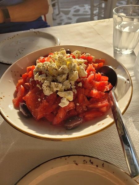 (Okay, this is actually a dakos with Naxos cheese, but I don’t have a photo of a Greek salad 😏).
Blue skies (lots of them), whitewashed villages with steep alleyways, hundreds of churches, and... thousands of stairs? Welcome to the Cyclades! 🙂
We’d been dreaming about this for a while, but in July-August—with the crowds—no way! Now that I can travel outside school holidays, the Cyclades are back on the agenda. And so begins a loooong period of planning and second-guessing, with countless itinerary changes: the Cyclades, yes, but which ones? I was fixated on Folegandros (we won’t be going after all) and really wanted to visit Delos. So, for this first trip, it’ll be: Mykonos (and Delos)-Naxos-Amorgos-Santorini.
Saturday 24/05: Departure from Orly on a Transavia flight, arriving in Mykonos in the late afternoon. We found a hotel that offers free transfers (pretty rare and not insignificant—it’s 25 € each way for just a few kilometers 😠) and at a reasonable price (83 € per night for B&B). Time for dinner already: Greek salad and souvlaki (we’re in Greece, right?)
(Okay, this is actually a dakos with Naxos cheese, but I don’t have a photo of a Greek salad 😏).USA 2022 Road Trip
During our first road trip across the United States, we covered 23,000 km and crossed 28 states in 53 days.
Originally, we had planned to drive Route 66 all the way to Oatman in Arizona and visit various national parks in the American West over a two-month period.
This itinerary was planned before our departure, and all the relevant information had been gathered to stick to the schedule.
Everything went so smoothly that we finished visiting the national parks well ahead of our planned return date.
It helped that having a bed, a portable toilet, and a cooler in our vehicle gave us some autonomy since we didn’t have to worry about accommodation.
So, we decided to extend our road trip to the cities of Nashville and Memphis in Tennessee.
We then headed to Louisiana to visit Baton Rouge and New Orleans.
We crossed Mississippi and Alabama before driving along Florida’s west coast all the way to Key West.
We returned via Florida’s east coast and then crossed the eastern U.S. states to get back to Quebec through the Jackman border crossing in Maine.
So, I invite you to keep reading this long recap, which will let you discover the different attractions we visited throughout this amazing journey.
Videos are included throughout the recap. Click on the image to start the video.
To jump to a specific post, here are the relevant links:
Route 66 - Illinois & Missouri Route 66 - St. Louis (Missouri) - Gateway Arch National Park Route 66 - Cuba (Missouri) - City Murals Route 66 - Springfield (Missouri) - Fantastic Caverns Route 66 - Kansas & Oklahoma Route 66 - Texas & Arizona Route 66 - Texas - The Stations of the Cross in Groom Route 66 - Texas - Panhandle - VW Slug Bug Ranch Texas - Palo Duro Canyon State Park - Juniper Trails Texas - Palo Duro Canyon State Park - The Lighthouse Trail Route 66 - Texas - Amarillo - Cadillac Ranch Route 66 - New Mexico - Santa Rosa Blue Hole New Mexico - Bandelier National Monument - Alcove House Trail via Main Loop Trail New Mexico - Bandelier National Monument - Tsankawi Ruins Trail New Mexico - White Rock Overlook Route 66 - New Mexico - Albuquerque - Old Town New Mexico - White Sands National Park New Mexico - White Sands National Park - Dune Life Nature Trail New Mexico - White Sands National Park - Playa Trail New Mexico - White Sands National Park - Interdune Boardwalk New Mexico - Gila Cliff Dwellings National Monument New Mexico - Grants - Ice Cave & Bandera Volcano New Mexico - Gallup - Pyramide Rock Trail & Church Rock Trail Arizona - Holbrook - Painted Desert Arizona - Petrified Forest National Park - Puerco Pueblo & Newspaper Rock Viewpoint Arizona - Petrified Forest National Park - Blue Mesa Arizona - Petrified Forest National Park - The Teepees, Agate Bridge & Jasper Forest Overlook Arizona - Petrified Forest National Park - Crystal Forest Trail Arizona - Petrified Forest National Park - Giant Logs Trail Arizona - Winslow - Two Guns Ghost Town Arizona - Cameron - Little Colorado River Gorge Overlooks Arizona - Grand Canyon National Park - Shoshone Point Trail Arizona - Grand Canyon National Park - Desert View Drive Arizona - Grand Canyon National Park - Rim Route (Orange) & Village Route (Blue) Arizona - Grand Canyon National Park - Hermit Route (Red Line) Route 66 - Arizona - Historic Town of Oatman Arizona - Bullhead City Community Park Nevada - Red Rock Canyon - Calico I & II & Sandstone Quarry Nevada - Red Rock Canyon - Willow Springs Nevada - Red Rock Canyon Lookouts Nevada - Valley of Fire State Park - White Domes Trail Nevada - Valley of Fire State Park - Seven Wonders Trail, Pink Canyon, Fire Wave Nevada - Valley of Fire State Park - Rainbow Vista Trail Nevada - Valley of Fire State Park - Mouse's Tank Trail Nevada - Valley of Fire State Park - Rock Formations Nevada - Valley of Fire State Park - Scenic Routes Nevada - Cathedral Gorge State Park - Slot Canyons Nevada - Cathedral Gorge State Park - Eagle Point & Miller Point Utah - Bryce Canyon National Park - Mossy Cave & Tropic Ditch Waterfall Trail Utah - Bryce Canyon National Park - Scenic Drive Utah - Zion National Park - Pa'rus Trail Utah - Zion National Park - Sand Bench Trail Utah - Zion National Park - Emerald Pools Trail Utah - Zion National Park - West Rim Trail (Trail connecting to Angels Landing) Utah - Zion National Park - Riverside Walk Utah - Zion National Park - Court of The Patriarchs & Big Bend Utah - Zion National Park - Mount Carmel Highway Scenic Drive Utah - Kanab - Jackson Flat Reservoir Utah - Toadstools Trail in Grand Staircase-Escalante National Monument Arizona - Page - Glen Canyon Dam Overlook Arizona - Page - Glen Canyon National Recreation Area Arizona - Page - Horseshoe Bend Overlook Arizona - Page - Upper Antelope Canyon Arizona - Page - Navajo Canyon Boat Tour at Lake Powell Arizona - Page - Antelope Canyon X Arizona - Canyon de Chelly National Monument - Chelly Canyon Arizona - Canyon de Chelly National Monument - Canyon del Muerto Arizona - Monument Valley Navajo Tribal Park Utah - Mexican Hat Utah - Mexican Hat - Goosenecks State Park Utah - Mexican Hat - Valley of the Gods Utah - The Moki Dugway Scenic Backway Utah - Blanding - Natural Bridges National Monument Utah - Lake Powell - Hite Crossing Bridge Utah - Lake Powell - Glen Canyon National Recreation Area - Hite Overlook Utah - Capitol Reef National Park - Chimney Rock Loop Trail Utah - Capitol Reef National Park - Hickman Bridge Trail Utah - Capitol Reef National Park - Grand Wash Trail Utah - Capitol Reef National Park - Sunset Point Trail Utah - Capitol Reef National Park - Goosenecks Trail Utah - Capitol Reef National Park - Viewpoints - Fruita Area Utah - Capitol Reef National Park - Viewpoints - Scenic Drive Utah - Capitol Reef National Park - Cassidy Arch Trail Utah - Capitol Reef National Park - On the way to Capitol Gorge Trailhead Utah - Capitol Reef National Park - Capitol Gorge Trailhead Utah - Monroe - Mystic Hot Springs Utah - Scenic Overlooks on UT-24, UT-119 & I-70 Utah - Arches National Park - Park Avenue Trail Utah - Arches National Park - Courthouse Towers Section's Viewpoints Utah - Arches National Park - Balanced Rock, Pothole Arch, Ham Rock & Garden of Eden Utah - Arches National Park - Double Arch Trail, Cove Arch, Cove of Caves & Panorama Point Utah - Arches National Park - Windows Loop & Turret Arch Trail Utah - Arches National Park - Delicate Arch Trail Utah - Arches National Park - Upper Delicate Arch Viewpoint Trail Utah - Arches National Park - Fiery Furnace Section - Viewpoints Utah - Arches National Park - Sand Dune Arch Trail Utah - Arches National Park - Skyline Arch Trail Utah - Arches National Park - Devils Garden Trail Utah - Dead Horse Point State Park - West Rim Trail Utah - Dead Horse Point State Park - East Rim Trail Utah - Moab - Utah State Route 279 (Potash Road) Utah - Moab - Shafer Trail - Potash Evaporation Ponds Utah - Moab - Potash Road Dinosaur Tracks and Petroglyphs Utah - Moab - Potash Road - Corona, Bowtie & Pinto Arches Trail Utah - Moab - Potash Road - Wall Street Climbing Area Utah - Moab - Kane Springs Road Utah - Moab - Kane Springs Road - Side By Side Adventure Utah - Moab - Kane Springs Road to Moab Utah - Canyonlands National Park - Island in the Sky - Mesa Arch Trail Utah - Canyonlands National Park - Island in the Sky - Aztec Butte Trail Utah - Canyonlands National Park - Island in the Sky - Whale Rock Trail Utah - Canyonlands National Park - Island in the Sky - Upheaval Dome Trail Utah - Canyonlands National Park - Island in the Sky - Grand View Point Overlook Trail Utah - Canyonlands National Park - Island in the Sky - White Rim Overlook Trail Utah - Canyonlands National Park - Island in the Sky - Overlooks Utah - Moab - Wilson Arch Utah - Monticello - Newspaper Rock State Historical Monument Utah - Canyonlands National Park - The Needles - Road Side Ruin Trail Utah - Canyonlands National Park - The Needles - Cave Spring Trail Utah - Canyonlands National Park - The Needles - Pothole Point Trail Utah - Canyonlands National Park - The Needles - Big Spring Canyon Overlook Trail Utah - Canyonlands National Park - The Needles - Overlooks Colorado - Mesa Verde National Park - Mesa Top Ruins Road Colorado - Mesa Verde National Park - Chapin Mesa Road Colorado - Mesa Verde National Park - Mesa Top Loop Colorado - Mesa Verde National Park - Wetherill Mesa Road Colorado - Great Sand Dunes National Park Colorado - Mosca - Zapata Falls Colorado - Colorado Springs - Garden of the Gods Colorado - Black Canyon of the Gunnison National Park Colorado - Gunnison - Curecanti National Recreation Area Colorado - Gunnison - Blue Mesa Dam & Reservoir Colorado - Lake Pueblo State Park (Pueblo Reservoir) Kentucky - Mayfield, 5 months after an EF4 tornado Tennessee - Nashville - Downtown Walking Tour Tennessee - Graceland Mansion - Home of Elvis Presley Tennessee - Graceland - Lisa Marie & Hound Dog II Jets Tennessee - Graceland - Elvis Presley Automobile Museum & Exhibits Tennessee - Exploring Memphis Louisiana - Exploring Baton Rouge Louisiana - Exploring Lafayette Louisiana - Exploring Houma Louisiana - New Orleans - French Quarter Tour Louisiana - New Orleans - Garden District Tour Louisiana - New Orleans - Creole Queen Mississippi River Cruise Florida - Clearwater Beach Florida - Sanibel Island - Bowman's Beach Florida - Siesta Key Beach Florida - Captiva Island - Turner Beach Florida - Key Largo - Sunset Florida - Key West - Smathers Beach Florida - Miami Beach - Art Deco District Florida - Miami Beach South Carolina - Myrtle Beach Virginia - Virginia Beach Maine - Scarborough - Pine Point Beach
Originally, we had planned to drive Route 66 all the way to Oatman in Arizona and visit various national parks in the American West over a two-month period.
This itinerary was planned before our departure, and all the relevant information had been gathered to stick to the schedule.
Everything went so smoothly that we finished visiting the national parks well ahead of our planned return date.
It helped that having a bed, a portable toilet, and a cooler in our vehicle gave us some autonomy since we didn’t have to worry about accommodation.
So, we decided to extend our road trip to the cities of Nashville and Memphis in Tennessee.
We then headed to Louisiana to visit Baton Rouge and New Orleans.
We crossed Mississippi and Alabama before driving along Florida’s west coast all the way to Key West.
We returned via Florida’s east coast and then crossed the eastern U.S. states to get back to Quebec through the Jackman border crossing in Maine.
So, I invite you to keep reading this long recap, which will let you discover the different attractions we visited throughout this amazing journey.
Videos are included throughout the recap. Click on the image to start the video.
To jump to a specific post, here are the relevant links:
Route 66 - Illinois & Missouri Route 66 - St. Louis (Missouri) - Gateway Arch National Park Route 66 - Cuba (Missouri) - City Murals Route 66 - Springfield (Missouri) - Fantastic Caverns Route 66 - Kansas & Oklahoma Route 66 - Texas & Arizona Route 66 - Texas - The Stations of the Cross in Groom Route 66 - Texas - Panhandle - VW Slug Bug Ranch Texas - Palo Duro Canyon State Park - Juniper Trails Texas - Palo Duro Canyon State Park - The Lighthouse Trail Route 66 - Texas - Amarillo - Cadillac Ranch Route 66 - New Mexico - Santa Rosa Blue Hole New Mexico - Bandelier National Monument - Alcove House Trail via Main Loop Trail New Mexico - Bandelier National Monument - Tsankawi Ruins Trail New Mexico - White Rock Overlook Route 66 - New Mexico - Albuquerque - Old Town New Mexico - White Sands National Park New Mexico - White Sands National Park - Dune Life Nature Trail New Mexico - White Sands National Park - Playa Trail New Mexico - White Sands National Park - Interdune Boardwalk New Mexico - Gila Cliff Dwellings National Monument New Mexico - Grants - Ice Cave & Bandera Volcano New Mexico - Gallup - Pyramide Rock Trail & Church Rock Trail Arizona - Holbrook - Painted Desert Arizona - Petrified Forest National Park - Puerco Pueblo & Newspaper Rock Viewpoint Arizona - Petrified Forest National Park - Blue Mesa Arizona - Petrified Forest National Park - The Teepees, Agate Bridge & Jasper Forest Overlook Arizona - Petrified Forest National Park - Crystal Forest Trail Arizona - Petrified Forest National Park - Giant Logs Trail Arizona - Winslow - Two Guns Ghost Town Arizona - Cameron - Little Colorado River Gorge Overlooks Arizona - Grand Canyon National Park - Shoshone Point Trail Arizona - Grand Canyon National Park - Desert View Drive Arizona - Grand Canyon National Park - Rim Route (Orange) & Village Route (Blue) Arizona - Grand Canyon National Park - Hermit Route (Red Line) Route 66 - Arizona - Historic Town of Oatman Arizona - Bullhead City Community Park Nevada - Red Rock Canyon - Calico I & II & Sandstone Quarry Nevada - Red Rock Canyon - Willow Springs Nevada - Red Rock Canyon Lookouts Nevada - Valley of Fire State Park - White Domes Trail Nevada - Valley of Fire State Park - Seven Wonders Trail, Pink Canyon, Fire Wave Nevada - Valley of Fire State Park - Rainbow Vista Trail Nevada - Valley of Fire State Park - Mouse's Tank Trail Nevada - Valley of Fire State Park - Rock Formations Nevada - Valley of Fire State Park - Scenic Routes Nevada - Cathedral Gorge State Park - Slot Canyons Nevada - Cathedral Gorge State Park - Eagle Point & Miller Point Utah - Bryce Canyon National Park - Mossy Cave & Tropic Ditch Waterfall Trail Utah - Bryce Canyon National Park - Scenic Drive Utah - Zion National Park - Pa'rus Trail Utah - Zion National Park - Sand Bench Trail Utah - Zion National Park - Emerald Pools Trail Utah - Zion National Park - West Rim Trail (Trail connecting to Angels Landing) Utah - Zion National Park - Riverside Walk Utah - Zion National Park - Court of The Patriarchs & Big Bend Utah - Zion National Park - Mount Carmel Highway Scenic Drive Utah - Kanab - Jackson Flat Reservoir Utah - Toadstools Trail in Grand Staircase-Escalante National Monument Arizona - Page - Glen Canyon Dam Overlook Arizona - Page - Glen Canyon National Recreation Area Arizona - Page - Horseshoe Bend Overlook Arizona - Page - Upper Antelope Canyon Arizona - Page - Navajo Canyon Boat Tour at Lake Powell Arizona - Page - Antelope Canyon X Arizona - Canyon de Chelly National Monument - Chelly Canyon Arizona - Canyon de Chelly National Monument - Canyon del Muerto Arizona - Monument Valley Navajo Tribal Park Utah - Mexican Hat Utah - Mexican Hat - Goosenecks State Park Utah - Mexican Hat - Valley of the Gods Utah - The Moki Dugway Scenic Backway Utah - Blanding - Natural Bridges National Monument Utah - Lake Powell - Hite Crossing Bridge Utah - Lake Powell - Glen Canyon National Recreation Area - Hite Overlook Utah - Capitol Reef National Park - Chimney Rock Loop Trail Utah - Capitol Reef National Park - Hickman Bridge Trail Utah - Capitol Reef National Park - Grand Wash Trail Utah - Capitol Reef National Park - Sunset Point Trail Utah - Capitol Reef National Park - Goosenecks Trail Utah - Capitol Reef National Park - Viewpoints - Fruita Area Utah - Capitol Reef National Park - Viewpoints - Scenic Drive Utah - Capitol Reef National Park - Cassidy Arch Trail Utah - Capitol Reef National Park - On the way to Capitol Gorge Trailhead Utah - Capitol Reef National Park - Capitol Gorge Trailhead Utah - Monroe - Mystic Hot Springs Utah - Scenic Overlooks on UT-24, UT-119 & I-70 Utah - Arches National Park - Park Avenue Trail Utah - Arches National Park - Courthouse Towers Section's Viewpoints Utah - Arches National Park - Balanced Rock, Pothole Arch, Ham Rock & Garden of Eden Utah - Arches National Park - Double Arch Trail, Cove Arch, Cove of Caves & Panorama Point Utah - Arches National Park - Windows Loop & Turret Arch Trail Utah - Arches National Park - Delicate Arch Trail Utah - Arches National Park - Upper Delicate Arch Viewpoint Trail Utah - Arches National Park - Fiery Furnace Section - Viewpoints Utah - Arches National Park - Sand Dune Arch Trail Utah - Arches National Park - Skyline Arch Trail Utah - Arches National Park - Devils Garden Trail Utah - Dead Horse Point State Park - West Rim Trail Utah - Dead Horse Point State Park - East Rim Trail Utah - Moab - Utah State Route 279 (Potash Road) Utah - Moab - Shafer Trail - Potash Evaporation Ponds Utah - Moab - Potash Road Dinosaur Tracks and Petroglyphs Utah - Moab - Potash Road - Corona, Bowtie & Pinto Arches Trail Utah - Moab - Potash Road - Wall Street Climbing Area Utah - Moab - Kane Springs Road Utah - Moab - Kane Springs Road - Side By Side Adventure Utah - Moab - Kane Springs Road to Moab Utah - Canyonlands National Park - Island in the Sky - Mesa Arch Trail Utah - Canyonlands National Park - Island in the Sky - Aztec Butte Trail Utah - Canyonlands National Park - Island in the Sky - Whale Rock Trail Utah - Canyonlands National Park - Island in the Sky - Upheaval Dome Trail Utah - Canyonlands National Park - Island in the Sky - Grand View Point Overlook Trail Utah - Canyonlands National Park - Island in the Sky - White Rim Overlook Trail Utah - Canyonlands National Park - Island in the Sky - Overlooks Utah - Moab - Wilson Arch Utah - Monticello - Newspaper Rock State Historical Monument Utah - Canyonlands National Park - The Needles - Road Side Ruin Trail Utah - Canyonlands National Park - The Needles - Cave Spring Trail Utah - Canyonlands National Park - The Needles - Pothole Point Trail Utah - Canyonlands National Park - The Needles - Big Spring Canyon Overlook Trail Utah - Canyonlands National Park - The Needles - Overlooks Colorado - Mesa Verde National Park - Mesa Top Ruins Road Colorado - Mesa Verde National Park - Chapin Mesa Road Colorado - Mesa Verde National Park - Mesa Top Loop Colorado - Mesa Verde National Park - Wetherill Mesa Road Colorado - Great Sand Dunes National Park Colorado - Mosca - Zapata Falls Colorado - Colorado Springs - Garden of the Gods Colorado - Black Canyon of the Gunnison National Park Colorado - Gunnison - Curecanti National Recreation Area Colorado - Gunnison - Blue Mesa Dam & Reservoir Colorado - Lake Pueblo State Park (Pueblo Reservoir) Kentucky - Mayfield, 5 months after an EF4 tornado Tennessee - Nashville - Downtown Walking Tour Tennessee - Graceland Mansion - Home of Elvis Presley Tennessee - Graceland - Lisa Marie & Hound Dog II Jets Tennessee - Graceland - Elvis Presley Automobile Museum & Exhibits Tennessee - Exploring Memphis Louisiana - Exploring Baton Rouge Louisiana - Exploring Lafayette Louisiana - Exploring Houma Louisiana - New Orleans - French Quarter Tour Louisiana - New Orleans - Garden District Tour Louisiana - New Orleans - Creole Queen Mississippi River Cruise Florida - Clearwater Beach Florida - Sanibel Island - Bowman's Beach Florida - Siesta Key Beach Florida - Captiva Island - Turner Beach Florida - Key Largo - Sunset Florida - Key West - Smathers Beach Florida - Miami Beach - Art Deco District Florida - Miami Beach South Carolina - Myrtle Beach Virginia - Virginia Beach Maine - Scarborough - Pine Point Beach
Recap of 17 days between São Paulo, Rio de Janeiro, and Iguaçu/Puerto Iguazu
I’ll repost here the comments I gave in reply to Camidav – see their post https://voyageforum.com/forum/partir-10-jours-bresil-en-autonomie-d10702249/.
As we’ve said several times, 10 days is short for Brazil! But it’s still enough for a “little introduction.” My very recent experience (April 2025) with a 2½-week itinerary might give you some ideas. To start, here’s the route:
- - Saturday, March 29: departure from Lisbon and arrival in São Paulo with LATAM
- - 2 nights in São Paulo
- - Monday, March 31: bus from São Paulo to Paraty
- - Monday 31, Tuesday 1st, and Wednesday, April 2: 3 nights in Paraty
- - Thursday, April 3: bus from Paraty to Angra dos Reis, then ferry > Ilha Grande
- - Thursday 3, Friday 4, and Saturday, April 5: 3 nights in Abraão, on Ilha Grande
- - Sunday, April 6: speedboat > Conceição de Jacareí, then bus > Rio de Janeiro
- - Sunday 6, Monday 7, Tuesday 8, and Wednesday, April 9: 4 nights in Rio
- - Thursday, April 10: flight with LATAM from Rio to Foz do Iguaçu
- - Thursday, April 10: one night in Foz do Iguaçu
- - Friday, April 11: visit to Iguaçu Falls on the Brazilian side, then crossing the border to Puerto Iguazu
- - Friday 11 and Saturday, April 12: 2 nights in Puerto Iguazu
- - Saturday, April 12: visit to the falls on the Argentine side
- - Sunday, April 13: return to Brazil, LATAM flight > São Paulo
- - Sunday 13 and Monday, April 14: 2 nights in São Paulo
- - Tuesday, April 15: flight from São Paulo > Lisbon with LATAM, arriving Wednesday the 16th.
So, it’s clear I’m writing this now from Puerto Iguazu (Argentina), and the end of the trip is near: back to São Paulo and then the flight to Lisbon. I’ll of course share more about all this in the following messages.
A month in Cambodia in November 2024
Here we go!!!
I left home at 4 AM on October 31st and headed to Barcelona. Driving through Barcelona on the ring road stresses me out a bit, but at 6 AM the traffic is smooth, and I arrive at the airport without any issues. I call the valet, who quickly comes to pick up my car. He takes photos of it from all angles before letting me go.
Baggage check-in hasn’t started yet, and there are already several of us waiting.
Once free, everything happens very quickly. The flight to Abu Dhabi is on time and goes smoothly. I’ve never had any problems with this airline, which I’ve been using for several years.
The flight to Bangkok arrives at 7 AM as scheduled. This is my first time in Thailand and Bangkok. I’m used to traveling in India, and I notice that everything here is well organized—the customs process is quick, and the luggage is already on the carousel.
I booked a taxi on Booking. All I have to do is find the right exit and door based on the agency’s instructions. A large sign with the names of people who booked is posted on a wall. A hostess greets me and calls the taxi, which arrives 5 minutes later. I booked one night at the Lost Inn BKK hotel in the Phra Nakhon district, and we arrive at 9 AM. The welcome isn’t warm, and I have to wait until noon, sitting on a chair, before I can check into my room. I’m exhausted, and sleeping sitting up isn’t ideal. Noon finally arrives—the room is small but clean, which is fine for one night. I quickly take a shower to wake up because I plan to spend the afternoon visiting the Grand Palace. First, I need to exchange some money, and the banks are all close together on the same street, which is very convenient. When I enter one, a hostess gives me a ticket and invites me to sit down. There are about twenty counters, and I wait quietly until my number is called. The exchange is quick, so I can head out to find the Royal Palace. It’s actually very easy, and the walk is pleasant.
Entry to the Royal Palace (500 baht).
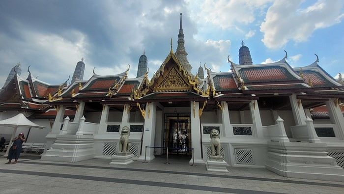
It’s magnificent and grand, and there are quite a few of us visiting. The sky is gray, it’s very humid, and a shower interrupts the visit. It’s a vast complex of temples and palaces. The buildings are colorful and sparkling, with a great sense of serenity (without the tourists, of course). I quietly enjoy the place and try to take photos without tourists, which isn’t easy.
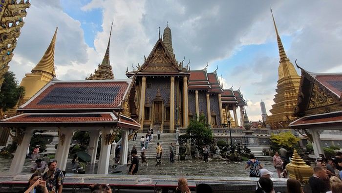
Very close to the Grand Palace is Wat Pho, one of the oldest Buddhist temples in the capital.
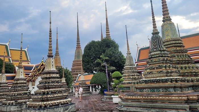
It’s very famous for its 46-meter-long reclining Buddha statue.
Walking around the temple, you can see different representations of Buddha, all covered in gold leaf.
Inside the temple, on one side, monks recite their prayers, while the other side is reserved for tourists who come to meditate in silence.
Before returning to the hotel, I have dinner at an Indian restaurant. I go to bed early because tomorrow’s wake-up call will be very early again.
Saturday, November 2nd Wake-up at 4 AM, departure from the hotel at 4:30 AM. The taxi I booked via Booking is waiting for me and takes me to the airport. The trip is fairly quick—he takes small roads, and at this hour, there’s no traffic.
The flight to Phnom Penh is on time. Before boarding, I realize I left my fleece jacket on the carousel, but it’s too late to go back for it.
The flight goes well, and customs is quick.
At the exit, I take a tuk-tuk to Julieka’s GH near the museum. The welcome is friendly. I won’t be able to check into my room until noon, so I take the opportunity to exchange some euros on the market street. The street is lined with restaurants, and I’ll have my first meal there.
The museum is right across the street, so I don’t waste any time visiting it.
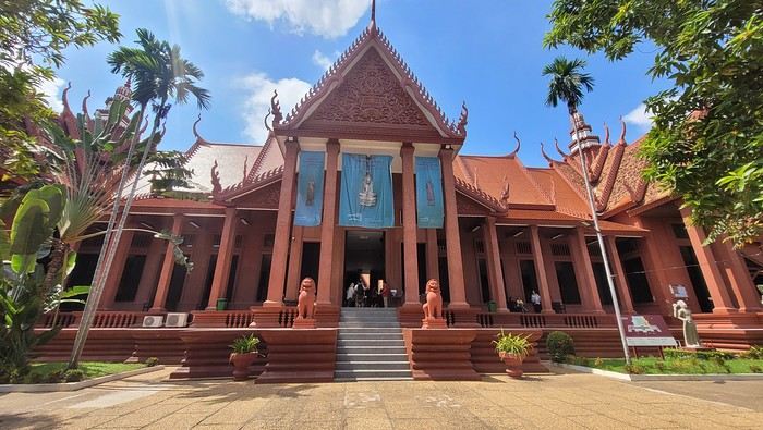
The representations of Hindu deities are very different from those in India, and I don’t recognize them. Many beautiful Buddhas are on display.
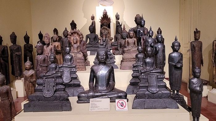
The museum is very pleasant, and there aren’t too many people, which is a plus.
At the exit, I return to the GH, settle into my room—which is decent and clean.
The Royal Palace is 1 km away. I walk along a garden, and at the end of the street is the Tonlé Sap, but I turn right. I arrive at a large esplanade and see the buildings with tiered roofs and glazed tiles. The entrance to the palace is a little further away.
At the entrance, I notice there isn’t the same crowd as at the one in BKK.
Khmer architecture is magnificent. The complex consists of gardens, palaces, pagodas with golden roofs, and slender spires.
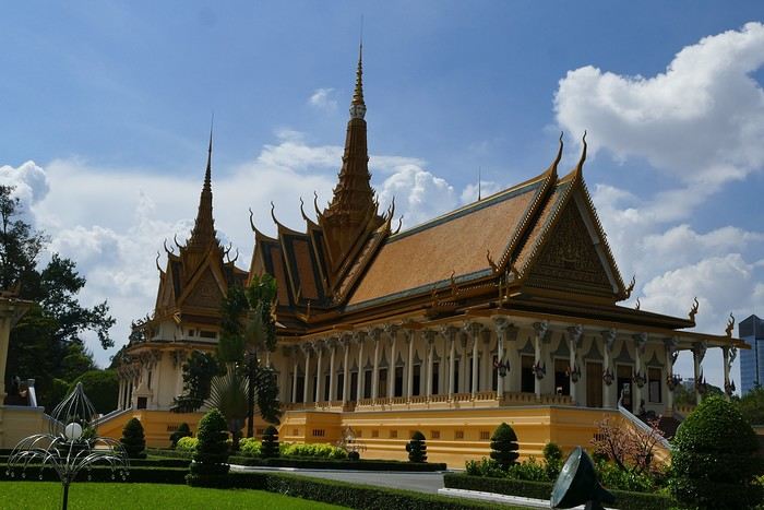
The Silver Pagoda houses the small Emerald Buddha, which is actually made of jade. The silver flooring is covered with carpets. Photos are not allowed.
The walls surrounding the pagoda are covered with frescoes depicting scenes from the Ramayana.
Baggage check-in hasn’t started yet, and there are already several of us waiting.
Once free, everything happens very quickly. The flight to Abu Dhabi is on time and goes smoothly. I’ve never had any problems with this airline, which I’ve been using for several years.
The flight to Bangkok arrives at 7 AM as scheduled. This is my first time in Thailand and Bangkok. I’m used to traveling in India, and I notice that everything here is well organized—the customs process is quick, and the luggage is already on the carousel.
I booked a taxi on Booking. All I have to do is find the right exit and door based on the agency’s instructions. A large sign with the names of people who booked is posted on a wall. A hostess greets me and calls the taxi, which arrives 5 minutes later. I booked one night at the Lost Inn BKK hotel in the Phra Nakhon district, and we arrive at 9 AM. The welcome isn’t warm, and I have to wait until noon, sitting on a chair, before I can check into my room. I’m exhausted, and sleeping sitting up isn’t ideal. Noon finally arrives—the room is small but clean, which is fine for one night. I quickly take a shower to wake up because I plan to spend the afternoon visiting the Grand Palace. First, I need to exchange some money, and the banks are all close together on the same street, which is very convenient. When I enter one, a hostess gives me a ticket and invites me to sit down. There are about twenty counters, and I wait quietly until my number is called. The exchange is quick, so I can head out to find the Royal Palace. It’s actually very easy, and the walk is pleasant.
Entry to the Royal Palace (500 baht).
It’s magnificent and grand, and there are quite a few of us visiting. The sky is gray, it’s very humid, and a shower interrupts the visit. It’s a vast complex of temples and palaces. The buildings are colorful and sparkling, with a great sense of serenity (without the tourists, of course). I quietly enjoy the place and try to take photos without tourists, which isn’t easy.
Very close to the Grand Palace is Wat Pho, one of the oldest Buddhist temples in the capital.
It’s very famous for its 46-meter-long reclining Buddha statue.
Walking around the temple, you can see different representations of Buddha, all covered in gold leaf.
Inside the temple, on one side, monks recite their prayers, while the other side is reserved for tourists who come to meditate in silence.
Before returning to the hotel, I have dinner at an Indian restaurant. I go to bed early because tomorrow’s wake-up call will be very early again.
Saturday, November 2nd Wake-up at 4 AM, departure from the hotel at 4:30 AM. The taxi I booked via Booking is waiting for me and takes me to the airport. The trip is fairly quick—he takes small roads, and at this hour, there’s no traffic.
The flight to Phnom Penh is on time. Before boarding, I realize I left my fleece jacket on the carousel, but it’s too late to go back for it.
The flight goes well, and customs is quick.
At the exit, I take a tuk-tuk to Julieka’s GH near the museum. The welcome is friendly. I won’t be able to check into my room until noon, so I take the opportunity to exchange some euros on the market street. The street is lined with restaurants, and I’ll have my first meal there.
The museum is right across the street, so I don’t waste any time visiting it.
The representations of Hindu deities are very different from those in India, and I don’t recognize them. Many beautiful Buddhas are on display.
The museum is very pleasant, and there aren’t too many people, which is a plus.
At the exit, I return to the GH, settle into my room—which is decent and clean.
The Royal Palace is 1 km away. I walk along a garden, and at the end of the street is the Tonlé Sap, but I turn right. I arrive at a large esplanade and see the buildings with tiered roofs and glazed tiles. The entrance to the palace is a little further away.
At the entrance, I notice there isn’t the same crowd as at the one in BKK.
Khmer architecture is magnificent. The complex consists of gardens, palaces, pagodas with golden roofs, and slender spires.
The Silver Pagoda houses the small Emerald Buddha, which is actually made of jade. The silver flooring is covered with carpets. Photos are not allowed.
The walls surrounding the pagoda are covered with frescoes depicting scenes from the Ramayana.
Selfie à Auschwitz
Bonjour à tous,
Le hasard total de mes "promenades " sur le net m'ont amené à un article du Huffington post qui explique que le centre mémorial d'Auschwitz a été contraint de faire un " rappel à l'ordre " devant la recrudescence des visiteurs ( comme si on visitait en ce lieu ! ) faisant des selfies devant la porte, devant les bâtiments, devant des photos de prisonniers décharnés, sur les rails....
J'ai eu peine à le croire et en regardant sur G images en tapant selfie Auschwitz, j'ai pu constater le summum de la honte ! Déjà, cette mode des selfies m'agace un peu, mais alors là, cela dépasse mon entendement et le respect qui doit prévaloir en ce lieu.
C'était mon " coup de gueule de ce soir,
Respect à vous toutes et tous et bonne soirée.
Le hasard total de mes "promenades " sur le net m'ont amené à un article du Huffington post qui explique que le centre mémorial d'Auschwitz a été contraint de faire un " rappel à l'ordre " devant la recrudescence des visiteurs ( comme si on visitait en ce lieu ! ) faisant des selfies devant la porte, devant les bâtiments, devant des photos de prisonniers décharnés, sur les rails....
J'ai eu peine à le croire et en regardant sur G images en tapant selfie Auschwitz, j'ai pu constater le summum de la honte ! Déjà, cette mode des selfies m'agace un peu, mais alors là, cela dépasse mon entendement et le respect qui doit prévaloir en ce lieu.
C'était mon " coup de gueule de ce soir,
Respect à vous toutes et tous et bonne soirée.
Voyage 5 mois et 3 semaines en Amérique du Sud
Bonjour,
Il n'est jamais trop tard pour rendre compte de son voyage. Le confinement me laisse enfin du temps pour le faire.
Je suis parti le 17 août 2017 et je suis rentré le 7 février 2018. Entre temps, je suis allé en Argentine par cargo puis une fois sur ce continent, j'ai visité l'Uruguay, l'Argentine et le Chili.
Durant tout ce voyage, j'ai tenu un carnet journalier.
Je me propose de vous le livrer.
Cape Town and Kruger: 12 days in February with teens
Hi everyone,
I’d love to share a little travel journal from our 14-day/12-night road trip with our two teens (14 and 17) in February/March 2020. A huge thank you to all of you who helped me plan this trip to South Africa—your patience with my endless questions was amazing!
We left Lyon on Saturday, February 22 at 7:00 AM and arrived in Johannesburg at 10:00 PM after a short layover in Amsterdam. Flights cost 440 € per person (booked in October), with carry-on luggage. We added just one checked bag for the whole family (80 € round-trip with the free Flying Blue membership). Since we’d be moving around a lot, we packed light! In Lyon, we reserved parking at P5 in advance for 70 € for 14 days. The Air France/KLM flight was smooth. When we landed, we picked up our bags and had booked a night at the Aero Guest Lodge, just 5 minutes from the airport, with a free shuttle and breakfast. All you have to do is send a WhatsApp message when you arrive at the airport to let the shuttle driver know. The tricky part? Finding him in the terminal—he wasn’t holding a sign with the hotel’s name. 🤪 A South African called him for me since my English wasn’t great (and I had to get used to the accent 😛), and helped us spot the driver (who was actually less than 5 meters away!) with other guests. When we got to the hotel: all good, except we were 10 people in a van meant for 7. The room was spacious—one king-size bed and two single beds for the kids—with a simple but clean bathroom, a garden, pool, and breakfast (which we didn’t try). All for 65 €, so an awesome value!
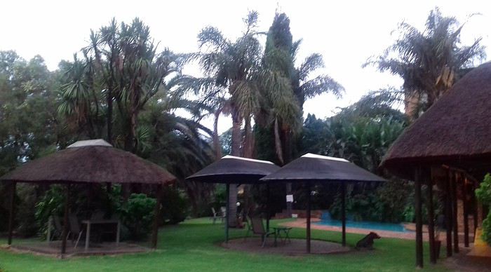 After a restful night, we woke up at 6:00 AM to catch the shuttle back to the airport. Just a heads-up: there’s only one shuttle per hour in the morning, and Kulula canceled our 9:00 AM flight, moving it to 8:00 AM—so no time for breakfast (it starts at 6:30).
We waited 15 minutes in the lovely garden for the driver, who dropped us off at the airport in 5 minutes.
We checked in for our flight to Cape Town, which cost around 40 € (including two checked bags per person).
We grabbed breakfast at the airport instead (less than 20 € for all four of us—one of the nice surprises of South Africa!), and arrived in Cape Town at 10:20 AM.
After a restful night, we woke up at 6:00 AM to catch the shuttle back to the airport. Just a heads-up: there’s only one shuttle per hour in the morning, and Kulula canceled our 9:00 AM flight, moving it to 8:00 AM—so no time for breakfast (it starts at 6:30).
We waited 15 minutes in the lovely garden for the driver, who dropped us off at the airport in 5 minutes.
We checked in for our flight to Cape Town, which cost around 40 € (including two checked bags per person).
We grabbed breakfast at the airport instead (less than 20 € for all four of us—one of the nice surprises of South Africa!), and arrived in Cape Town at 10:20 AM.
 After quickly picking up our bags, we headed to the Avis counter and left with a Toyota Corolla for 80 € for 4 days (rented with the Flying Blue card—free additional driver).
Everything’s on the left... not easy, but it works if you plan your route well.
We drove to our Airbnb in Constantia. We were surprised to see animals, bikes, and pedestrians on the highway!
We arrived around 11:30 AM at our rental—a huge house in the vineyards, in a super secure neighborhood, about 15-20 minutes from Hout Bay. It felt like Beverly Hills, but with super-high walls and barbed wire around the villas. 😕
After quickly picking up our bags, we headed to the Avis counter and left with a Toyota Corolla for 80 € for 4 days (rented with the Flying Blue card—free additional driver).
Everything’s on the left... not easy, but it works if you plan your route well.
We drove to our Airbnb in Constantia. We were surprised to see animals, bikes, and pedestrians on the highway!
We arrived around 11:30 AM at our rental—a huge house in the vineyards, in a super secure neighborhood, about 15-20 minutes from Hout Bay. It felt like Beverly Hills, but with super-high walls and barbed wire around the villas. 😕

We dropped off our bags, changed into shorts (it was around 30°C/86°F), and headed to the Bay Harbour Market in Hout Bay. We had lunch there—such a great vibe! We wandered through the stalls, everyone picked their own dish, and we sat down on the terrace. There was music, artisans of all kinds... a really nice moment.

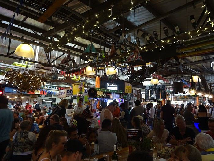
I’d withdrawn 50 € before leaving... and that gave me change to pay the parking attendant. Lunch cost around 30 € for four, including food and drinks.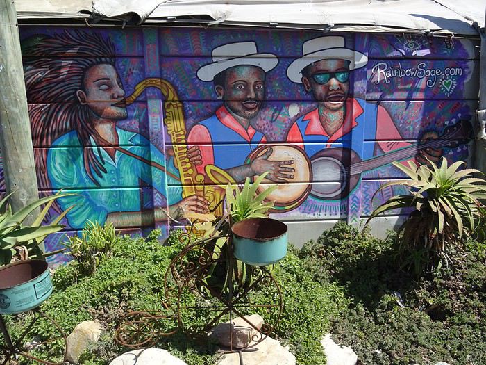

After browsing the artisan stalls, we headed to Hout Bay Beach near the restaurant, Marina Wharf (another small tip for the parking attendant—we’d have to get used to that!). We stopped to admire the sea lions. An ice cream for 1 €? No way we were saying no! 🙂
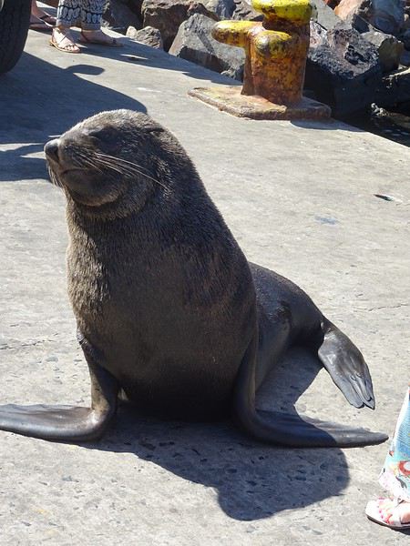
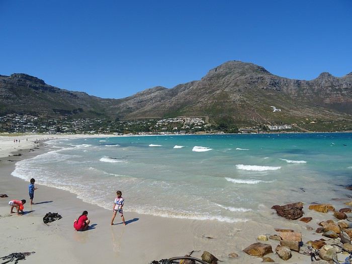
The fatigue was starting to hit, so we headed to the grocery store 10 minutes away (Constantia shopping center) and then had an aperitif in front of the vineyards, opening a delicious bottle of white wine.
I’d love to share a little travel journal from our 14-day/12-night road trip with our two teens (14 and 17) in February/March 2020. A huge thank you to all of you who helped me plan this trip to South Africa—your patience with my endless questions was amazing!
We left Lyon on Saturday, February 22 at 7:00 AM and arrived in Johannesburg at 10:00 PM after a short layover in Amsterdam. Flights cost 440 € per person (booked in October), with carry-on luggage. We added just one checked bag for the whole family (80 € round-trip with the free Flying Blue membership). Since we’d be moving around a lot, we packed light! In Lyon, we reserved parking at P5 in advance for 70 € for 14 days. The Air France/KLM flight was smooth. When we landed, we picked up our bags and had booked a night at the Aero Guest Lodge, just 5 minutes from the airport, with a free shuttle and breakfast. All you have to do is send a WhatsApp message when you arrive at the airport to let the shuttle driver know. The tricky part? Finding him in the terminal—he wasn’t holding a sign with the hotel’s name. 🤪 A South African called him for me since my English wasn’t great (and I had to get used to the accent 😛), and helped us spot the driver (who was actually less than 5 meters away!) with other guests. When we got to the hotel: all good, except we were 10 people in a van meant for 7. The room was spacious—one king-size bed and two single beds for the kids—with a simple but clean bathroom, a garden, pool, and breakfast (which we didn’t try). All for 65 €, so an awesome value!
After a restful night, we woke up at 6:00 AM to catch the shuttle back to the airport. Just a heads-up: there’s only one shuttle per hour in the morning, and Kulula canceled our 9:00 AM flight, moving it to 8:00 AM—so no time for breakfast (it starts at 6:30).
We waited 15 minutes in the lovely garden for the driver, who dropped us off at the airport in 5 minutes.
We checked in for our flight to Cape Town, which cost around 40 € (including two checked bags per person).
We grabbed breakfast at the airport instead (less than 20 € for all four of us—one of the nice surprises of South Africa!), and arrived in Cape Town at 10:20 AM.
After quickly picking up our bags, we headed to the Avis counter and left with a Toyota Corolla for 80 € for 4 days (rented with the Flying Blue card—free additional driver).
Everything’s on the left... not easy, but it works if you plan your route well.
We drove to our Airbnb in Constantia. We were surprised to see animals, bikes, and pedestrians on the highway!
We arrived around 11:30 AM at our rental—a huge house in the vineyards, in a super secure neighborhood, about 15-20 minutes from Hout Bay. It felt like Beverly Hills, but with super-high walls and barbed wire around the villas. 😕We dropped off our bags, changed into shorts (it was around 30°C/86°F), and headed to the Bay Harbour Market in Hout Bay. We had lunch there—such a great vibe! We wandered through the stalls, everyone picked their own dish, and we sat down on the terrace. There was music, artisans of all kinds... a really nice moment.
I’d withdrawn 50 € before leaving... and that gave me change to pay the parking attendant. Lunch cost around 30 € for four, including food and drinks.
After browsing the artisan stalls, we headed to Hout Bay Beach near the restaurant, Marina Wharf (another small tip for the parking attendant—we’d have to get used to that!). We stopped to admire the sea lions. An ice cream for 1 €? No way we were saying no! 🙂
The fatigue was starting to hit, so we headed to the grocery store 10 minutes away (Constantia shopping center) and then had an aperitif in front of the vineyards, opening a delicious bottle of white wine.
On part en vadrouille dans l'ouest américain! Oui, encore...
En ces temps difficiles qui nous obligent à trouver des occupations, je vous soumets ici un carnet que j'avais rédigé il y a quelques années et que je n'ai jamais publié ici... Bonne lecture (pour ceux que ça intéresse...)...
24 juillet - Itinéraire d’une famille gâtée
Envie de t’évader ? Envie de rêver ? Envie de t’amuser ? Oui ? Alors tu as frappé à la bonne adresse... Plus précisément à l’adresse de celui qui a attrapé un virus… En l’occurrence, moi… Et ce virus, pas question de m’en débarrasser en me bourrant d’antibiotiques. Non seulement, les antibiotiques, ce n’est pas automatique, mais ce virus-là, j’en prends grand soin. Je l’entretiens, même… Ce virus, c’est l’étasunite ! Je l’ai contracté le jour où j’ai posé mes arpions chez l’oncle Sam pour la première fois, il y a une décennie de cela. Tout ça ne me rajeunit pas mais depuis ce fameux jour, lui et moi, nous ne nous sommes plus jamais quittés. Un proverbe dit à ce sujet que si tu vas aux Etats-Unis une fois, tu y reviendras un jour… Ben moi, depuis, j’y suis même retourné deux autres fois ! Et figure-toi que si tu lis ces quelques lignes, c’est que je m’apprête à y retourner pour une quatrième vadrouille !... Pour cette fois-ci, je vais accomplir un de mes rêves ! Me faire la route 66 sur mon Harley avec une belle brune accrochée à ma taille... Manque de bol, ma femme est blonde, je n'ai pas le permis moto et nous avons deux louloutes de quatre et sept ans… Va donc falloir que je revoie mes plans...
Bon, si tu es un lecteur assidu de nos précédentes vadrouilles, nous n’avons plus de secret pour toi, si bien que tu sais déjà que nous sommes quatre, juste un an de plus par rapport à la dernière fois… Il y a bien évidemment Sandrine, ma femme alias le portefeuille ; Sasha, notre petite globetrotteuse de quatre ans ; et Anna notre routarde de sept ans et plus toutes ses dents... Ah, et je m’oubliais ! Moi, Franck, la trentaine bien tassée, alias le conducteur, le tour opérateur, le narrateur, le cuisinier, le… Oui, je sais, moi aussi, j’aimerais bien déléguer… Ah, mais j’oublie encore quelqu’un !… Toi… Mais bon, sauf le respect que je te dois, tu ne seras une nouvelle fois que le spectateur du film que nous allons tourner et interpréter… D’ailleurs, quel en sera le titre ?... Et bien après réflexion, on a le choix entre « Voyage entre geysers et déserts », ou alors « Sous le soleil de Beverly Hills »… Pour ce coup-là, en espérant ne pas les vexer, on décide de poser un lapin à Brandon et Brenda… Car oui, c’est décidé, cette nouvelle édition sera composée d'indiens, de geysers, de trappeurs, de pionniers, de bisons, de chercheurs d'or, de hors-la-loi, de ranchs et de cowboys ! A nous les grands espaces… et les gros hamburgers !!! A nous l’ouest américain et ses films qui donnent tant envie : Délivrance, la colline a des yeux, Shining, The Descent, ...
Mais un voyage comme celui-là, ça se prépare un ‘tiot peu. Premièrement, il faut du blé, du flouze, du fric, du pognon, des pépettes, de la caillasse… Ben oui, ça coûte cher tout ça, donc à moins de faire comme le PSG et te faire subventionner par un investisseur qatari, il va falloir que tu en mettes de côté. Deuxièmement, il faut un minimum de travail de préparation. Et je commencerai mon histoire par un retour dans le passé, un bond dans le temps pour revenir pile poil au moment où Sandrine a enfin craqué sous mes coups de butoir et m’a donné son ô combien précieuse approbation… « Allez, ok, c’est bon, fais-toi plaisir ! » Sans avoir réellement conscience de la portée de ces quelques mots, elle venait de me signer un contrat de travail d’un an ! Car moi, ni une, ni deux, j'ai employé toute une équipe de lutins pour m'aider à préparer mon itinéraire. Lecture de carnets de voyage, questions sur des forums, épluchage de guides, visionnage de films, essorage d’internet, … Au final, je dois dire que je suis plus que satisfait de leur boulot ! Ce qui me permet non pas de faire un bilan puisqu'heureusement, le voyage n'est pas commencé, mais plutôt un petit compte-rendu chiffré de ce qui nous attend. Huit états à traverser ou à effleurer, plus de cinq mille kilomètres à parcourir, vingt jours pleins sur place, deux hôtels, quatorze campings différents, huit heures de décalage... Mes trois blondes vont-elles le supporter ? Optimiste que je suis, je mise sur un grand « Oui » ! D’ailleurs, pour les préparer, j’ai mis en place un programme intensif trois mois avant le départ : Marche autour de notre immense propriété, westerns tous les soirs, Coca et hamburgers à volonté à tous les repas !... Et oui, qui ménage sa monture voyage plus souvent !
Avant de tailler la route, je profite de cette intro pour publier une petite annonce à destination des cambrioleurs amateurs de textes de voyage : passez votre route, ma maison est équipée d’une alarme biométrique avec double varifocale et matrice de commutation. De plus, j’ai loué à un pote du neuf trois son gros pitbull pour l’occasion. Sans compter que pendant nos vacances, ma maison va être occupée par mes parents qui sont tous les deux experts en arts martiaux !... D’ailleurs, pourquoi je te raconte ces bobards alors que tu ne connais même pas mon adresse… C'est le 25, avenue des canaris à Triffouillis-sur-Retourne... Euh, merci de ne pas m’envoyer de carte postale à l'adresse ci-dessus... c'est une fausse !
Bon, chut, ça y est, c’est l’heure de l’évaluation… On va savoir si toute la famille est prête pour le grand départ : « Sandrine, donne-moi les huit états dans lesquels nous allons poser les pieds... - Colorado, Wyoming, Nebraska, Dakota du sud, Montana, Idaho, Utah et... euh... mince, oh, je l’ai sur le bout de la langue… Ah oui, l’Arizona !!!… - Mouais… C’était moins une… Encore un peu et tu n’partais pas avec nous ! Et toi, Anna, cite-moi les quatre présidents sculptés sur le Mont Rushmore ? - Abram Licol, Tomasse Washington, George Jeffessonne et Theodore Rousevelle... - Ok, on va dire que c’est bon… Et toi, Sasha, dans quel pays allons-nous cet été ? - Les Jétajuniiiiis de l’Amérique de Mickey ! » Ok, c’est bon, elles sont fin prêtes ! Attention, départ imminent !
24 juillet - Itinéraire d’une famille gâtée
Envie de t’évader ? Envie de rêver ? Envie de t’amuser ? Oui ? Alors tu as frappé à la bonne adresse... Plus précisément à l’adresse de celui qui a attrapé un virus… En l’occurrence, moi… Et ce virus, pas question de m’en débarrasser en me bourrant d’antibiotiques. Non seulement, les antibiotiques, ce n’est pas automatique, mais ce virus-là, j’en prends grand soin. Je l’entretiens, même… Ce virus, c’est l’étasunite ! Je l’ai contracté le jour où j’ai posé mes arpions chez l’oncle Sam pour la première fois, il y a une décennie de cela. Tout ça ne me rajeunit pas mais depuis ce fameux jour, lui et moi, nous ne nous sommes plus jamais quittés. Un proverbe dit à ce sujet que si tu vas aux Etats-Unis une fois, tu y reviendras un jour… Ben moi, depuis, j’y suis même retourné deux autres fois ! Et figure-toi que si tu lis ces quelques lignes, c’est que je m’apprête à y retourner pour une quatrième vadrouille !... Pour cette fois-ci, je vais accomplir un de mes rêves ! Me faire la route 66 sur mon Harley avec une belle brune accrochée à ma taille... Manque de bol, ma femme est blonde, je n'ai pas le permis moto et nous avons deux louloutes de quatre et sept ans… Va donc falloir que je revoie mes plans...
Bon, si tu es un lecteur assidu de nos précédentes vadrouilles, nous n’avons plus de secret pour toi, si bien que tu sais déjà que nous sommes quatre, juste un an de plus par rapport à la dernière fois… Il y a bien évidemment Sandrine, ma femme alias le portefeuille ; Sasha, notre petite globetrotteuse de quatre ans ; et Anna notre routarde de sept ans et plus toutes ses dents... Ah, et je m’oubliais ! Moi, Franck, la trentaine bien tassée, alias le conducteur, le tour opérateur, le narrateur, le cuisinier, le… Oui, je sais, moi aussi, j’aimerais bien déléguer… Ah, mais j’oublie encore quelqu’un !… Toi… Mais bon, sauf le respect que je te dois, tu ne seras une nouvelle fois que le spectateur du film que nous allons tourner et interpréter… D’ailleurs, quel en sera le titre ?... Et bien après réflexion, on a le choix entre « Voyage entre geysers et déserts », ou alors « Sous le soleil de Beverly Hills »… Pour ce coup-là, en espérant ne pas les vexer, on décide de poser un lapin à Brandon et Brenda… Car oui, c’est décidé, cette nouvelle édition sera composée d'indiens, de geysers, de trappeurs, de pionniers, de bisons, de chercheurs d'or, de hors-la-loi, de ranchs et de cowboys ! A nous les grands espaces… et les gros hamburgers !!! A nous l’ouest américain et ses films qui donnent tant envie : Délivrance, la colline a des yeux, Shining, The Descent, ...
Mais un voyage comme celui-là, ça se prépare un ‘tiot peu. Premièrement, il faut du blé, du flouze, du fric, du pognon, des pépettes, de la caillasse… Ben oui, ça coûte cher tout ça, donc à moins de faire comme le PSG et te faire subventionner par un investisseur qatari, il va falloir que tu en mettes de côté. Deuxièmement, il faut un minimum de travail de préparation. Et je commencerai mon histoire par un retour dans le passé, un bond dans le temps pour revenir pile poil au moment où Sandrine a enfin craqué sous mes coups de butoir et m’a donné son ô combien précieuse approbation… « Allez, ok, c’est bon, fais-toi plaisir ! » Sans avoir réellement conscience de la portée de ces quelques mots, elle venait de me signer un contrat de travail d’un an ! Car moi, ni une, ni deux, j'ai employé toute une équipe de lutins pour m'aider à préparer mon itinéraire. Lecture de carnets de voyage, questions sur des forums, épluchage de guides, visionnage de films, essorage d’internet, … Au final, je dois dire que je suis plus que satisfait de leur boulot ! Ce qui me permet non pas de faire un bilan puisqu'heureusement, le voyage n'est pas commencé, mais plutôt un petit compte-rendu chiffré de ce qui nous attend. Huit états à traverser ou à effleurer, plus de cinq mille kilomètres à parcourir, vingt jours pleins sur place, deux hôtels, quatorze campings différents, huit heures de décalage... Mes trois blondes vont-elles le supporter ? Optimiste que je suis, je mise sur un grand « Oui » ! D’ailleurs, pour les préparer, j’ai mis en place un programme intensif trois mois avant le départ : Marche autour de notre immense propriété, westerns tous les soirs, Coca et hamburgers à volonté à tous les repas !... Et oui, qui ménage sa monture voyage plus souvent !
Avant de tailler la route, je profite de cette intro pour publier une petite annonce à destination des cambrioleurs amateurs de textes de voyage : passez votre route, ma maison est équipée d’une alarme biométrique avec double varifocale et matrice de commutation. De plus, j’ai loué à un pote du neuf trois son gros pitbull pour l’occasion. Sans compter que pendant nos vacances, ma maison va être occupée par mes parents qui sont tous les deux experts en arts martiaux !... D’ailleurs, pourquoi je te raconte ces bobards alors que tu ne connais même pas mon adresse… C'est le 25, avenue des canaris à Triffouillis-sur-Retourne... Euh, merci de ne pas m’envoyer de carte postale à l'adresse ci-dessus... c'est une fausse !
Bon, chut, ça y est, c’est l’heure de l’évaluation… On va savoir si toute la famille est prête pour le grand départ : « Sandrine, donne-moi les huit états dans lesquels nous allons poser les pieds... - Colorado, Wyoming, Nebraska, Dakota du sud, Montana, Idaho, Utah et... euh... mince, oh, je l’ai sur le bout de la langue… Ah oui, l’Arizona !!!… - Mouais… C’était moins une… Encore un peu et tu n’partais pas avec nous ! Et toi, Anna, cite-moi les quatre présidents sculptés sur le Mont Rushmore ? - Abram Licol, Tomasse Washington, George Jeffessonne et Theodore Rousevelle... - Ok, on va dire que c’est bon… Et toi, Sasha, dans quel pays allons-nous cet été ? - Les Jétajuniiiiis de l’Amérique de Mickey ! » Ok, c’est bon, elles sont fin prêtes ! Attention, départ imminent !
Notre trip en Afrique du Sud, destination Le Cap
Vendredi 28 nov, 7h, nous sommes réveillés depuis 1h. En attendant le breakfast de 8h, nous partons sur les hauteurs voir le phare et la côte sauvage, elle est magnifique, les vagues sont toutes argentées par les rayons de soleil. Il n'y a que les cris des oiseaux et le clapotis de l'eau.
 Nous avons découvert échouée sur le sable une famille de phoques , personne n'a su nous dire ce qui a causer leur mort et une énorme méduse au moins 30 cm de diamètre!


L'air marin a taquiné notre appétit, il fait bon être devant le petit déjeuner. Nous rencontrons un italien qui parle parfaitement le français, c'est un ami de la propriétaire, elle l'a appelé pour qu'il vienne nous faire la causette. Il est en Afrique du Sud depuis 40 ans, il connait bien Toulon, même au bout du monde, nous entendons parler de la France.
Nous les quittons à regrets, nous étions si bien dans ce petit village, mais il nous faut poursuivre notre balade vers Clanwilliam via Velddrif, Eland's Bay, la côte est splendide, pique -nique près de Lambert's Bay, royaume de la langouste, son port de pêche les exporte dans le monde entier; les amateurs de sensations fortes ne seront pas déçus par l'odeur qui y règne!
Nous atteignons Clanwillian , typique ambiance de ville d'Afrique. Pôle de la commercialisation du Rooibos, herbe rouge (ça ne se fume pas) le "thé" sud-africain par excellence, une plante locale dont la décoction, pauvre en tanin et exempte de caféine, est supposée avoir des vertus médicinales, est exportée dans le monde.
Tour de ville, recherche d'un B&B. Dans une rue calme et fleurie, bordée d'agréables maisons, nous remarquons "B&B ELEPHANT RIVER", c'est ici qu'il faut dormir!
Mais il n'y a personne pour nous recevoir, le portail est fermé et les chiens dans le fond du jardin aboient à qui mieux mieux. Au bout de 10 mn d'attente, un ouvrier jardinier qui passait nous fait signe de rester et reprend son chemin... Quelques minutes plus tard, la propriétaire arrive à notre grand étonnement, ce monsieur était allé la prévenir! Elle nous fait visiter les trois lodges et choisir celui qui nous convient. Tarif défiant tout concurrence 500 rands la nuit. Nous ne rencontrons que des personnes avenantes et sympathiques. Après un douche qui n'était pas superflue, tour du quartier et du centre ville à pied.
 nous rencontrons une manifestation pour le SIDA
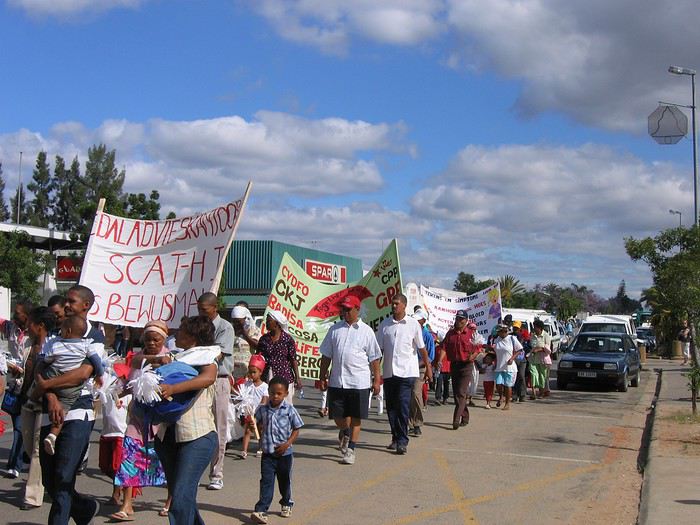
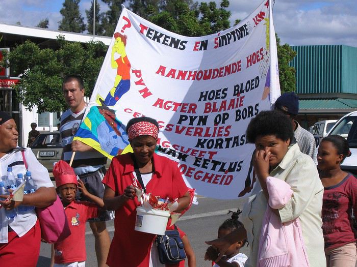
Tout près du lodge, nous avons repéré un resto accueillant et sympathique,
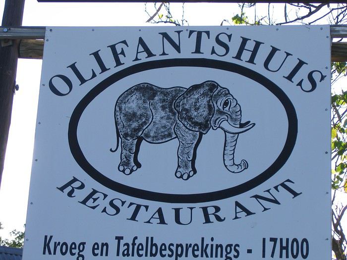 encore une fois les steaks sont énormes 500gr, nous ne le cherchons pas sous les frites, c'est le contraire qui se produit
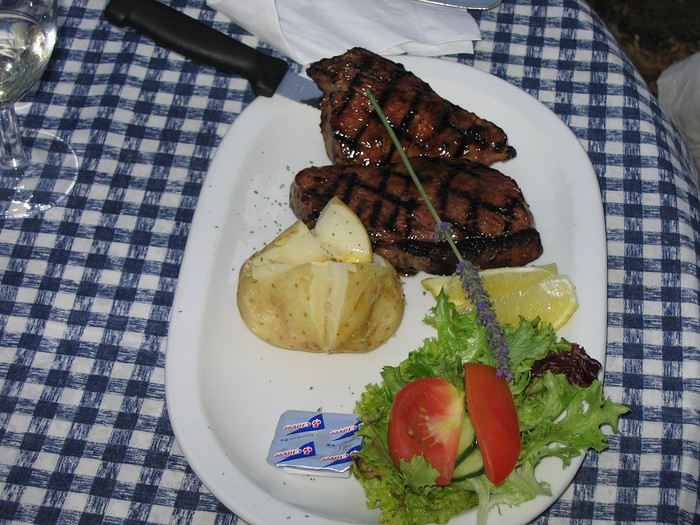 Il est 21h30, le sommeil se fait sentir, il est vrai que nous sommes debout depuis 6h du matin. J'oublie de vous dire que nous avons un lit à baldaquin!!

Demain, une bonne journée nous attend.
Nous avons découvert échouée sur le sable une famille de phoques , personne n'a su nous dire ce qui a causer leur mort et une énorme méduse au moins 30 cm de diamètre!
L'air marin a taquiné notre appétit, il fait bon être devant le petit déjeuner. Nous rencontrons un italien qui parle parfaitement le français, c'est un ami de la propriétaire, elle l'a appelé pour qu'il vienne nous faire la causette. Il est en Afrique du Sud depuis 40 ans, il connait bien Toulon, même au bout du monde, nous entendons parler de la France.
Nous les quittons à regrets, nous étions si bien dans ce petit village, mais il nous faut poursuivre notre balade vers Clanwilliam via Velddrif, Eland's Bay, la côte est splendide, pique -nique près de Lambert's Bay, royaume de la langouste, son port de pêche les exporte dans le monde entier; les amateurs de sensations fortes ne seront pas déçus par l'odeur qui y règne!
Nous atteignons Clanwillian , typique ambiance de ville d'Afrique. Pôle de la commercialisation du Rooibos, herbe rouge (ça ne se fume pas) le "thé" sud-africain par excellence, une plante locale dont la décoction, pauvre en tanin et exempte de caféine, est supposée avoir des vertus médicinales, est exportée dans le monde.
Tour de ville, recherche d'un B&B. Dans une rue calme et fleurie, bordée d'agréables maisons, nous remarquons "B&B ELEPHANT RIVER", c'est ici qu'il faut dormir!
Mais il n'y a personne pour nous recevoir, le portail est fermé et les chiens dans le fond du jardin aboient à qui mieux mieux. Au bout de 10 mn d'attente, un ouvrier jardinier qui passait nous fait signe de rester et reprend son chemin... Quelques minutes plus tard, la propriétaire arrive à notre grand étonnement, ce monsieur était allé la prévenir! Elle nous fait visiter les trois lodges et choisir celui qui nous convient. Tarif défiant tout concurrence 500 rands la nuit. Nous ne rencontrons que des personnes avenantes et sympathiques. Après un douche qui n'était pas superflue, tour du quartier et du centre ville à pied.
nous rencontrons une manifestation pour le SIDA
Tout près du lodge, nous avons repéré un resto accueillant et sympathique,
encore une fois les steaks sont énormes 500gr, nous ne le cherchons pas sous les frites, c'est le contraire qui se produit
Il est 21h30, le sommeil se fait sentir, il est vrai que nous sommes debout depuis 6h du matin. J'oublie de vous dire que nous avons un lit à baldaquin!!
Demain, une bonne journée nous attend.
Chine: Au fil de l'eau du Yangtse
Le fleuve Yangtse et ses célèbres trois gorges … un vrai rêve de voyageur.
Voilà ce que je vous propose de découvrir à travers ce récit d'une balade fluviale singulièrement dépaysante au cœur de l'immense Chine.
Le long fleuve est majestueux surtout lorsque son cours traverse les fameuses gorges qui en ont fait sa renommée.
Quant au nom de Trois Gorges, il vous évoque probablement celui d'un barrage hydroélectrique unique au monde, il sera évidemment abordé mais à la fin de ce carnet de voyage.
Des impressions et des descriptions et beaucoup de photos pour illustrer ce compte rendu de périple fluvial.
Êtes-vous fin prêts à embarquer ? Alors, bienvenue à bord.
--
Un voyage fluvial débute comme il se doit dans un port. Ici, ce sera Chongqing. La ville est impressionnante et démesurée. Presque à perte de vue ce ne sont que gratte-ciel, tours et blocs d'immeubles où s'empilent des milliers d'appartements et où s'entassent des millions de Chinois. La vision est oppressante … en tout cas, c'est l'image que je garde en mémoire de Chongqing, la tentaculaire mégapole du centre de la Chine. Pour vous impressionner un peu plus, on vous parle de cette ville comme la plus vaste de l'Empire du Milieu avec une population estimée à 32 millions d'habitants, la population de cette cité serait l'équivalent de la moitié de celle de la France ! Bon, en y regardant d'un peu plus près on s'aperçoit que ce chiffre effrayant correspond en fait au nombre d'habitants de la région puisque Chongqing est le nom de l'agglomération mais également celui du territoire (un peu plus grand que la superficie de la région française de la Nouvelle Aquitaine). Donc, ironiquement j'aurai envie de préciser que la cité de Chongqing ne compte qu'une petite vingtaine de millions d'habitants !
Après avoir traversé cette étourdissante concentration de buildings et puis après avoir longé la « forêt » d'immeubles alignés tout le long des collines surplombant la rivière Jialing, nous voici au bord de l'autre cours d'eau de l'agglomération, bien plus célèbre, le fameux Yangtse. Le but de notre étape dans cette région.
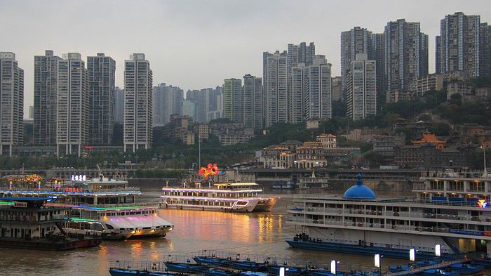
En contrebas, le mythique fleuve paraît presque encombré avec un va-et-vient incessant entre navires de transport et bateaux de promenades sans oublier la présence à quai de plusieurs navires de croisières. Un port fluvial et un fleuve, à l'image de la ville, trépidants. Nous voici donc prêts à embarquer. La pensée de quitter l'immense et si grouillante ville de Chongqing n'est pas pour nous déplaire … déjà on s'imagine navigant lentement dans un décor naturel de gorges hautement spectaculaires. Pour l'instant, on le constate, le lit du Yangtse est particulièrement encaissé, il nous faut descendre par un long escalier fixé sur ces berges pour le moins pentues, puis emprunter un brinquebalant pont flottant, traverser un, puis encore un second bateau de croisière pour enfin atteindre notre navire. Ouf !
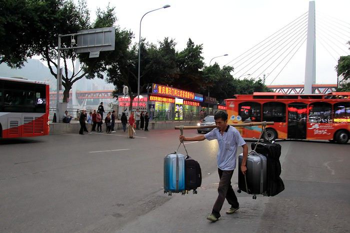
Quant à nos bagages, les porteurs locaux se les disputent. Un portage traditionnel avec un bâton sur l'épaule : un, puis deux bagages de chaque côté et voilà plus de 80 kg sur le dos … Aïe, aïe ! Un vrai travail de forçat, que ne faut-il endurer pour gagner sa vie ! Merci messieurs et respect.
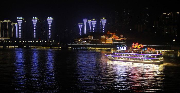
La nuit est maintenant tombée sur la ville et sur l'imposant fleuve, place à un superbe festival de couleurs et de lumières. On en oublie la concentration de barres de buildings pour admirer le spectacle. En fond de panorama des façades illuminées toutes constellées de lumières celles des appartements avec en prime juste sur la berge qui nous fait face un bâtiment de style palais asiatique, aux lignes dorées et étincelantes comme parées de guirlandes lumineuses.
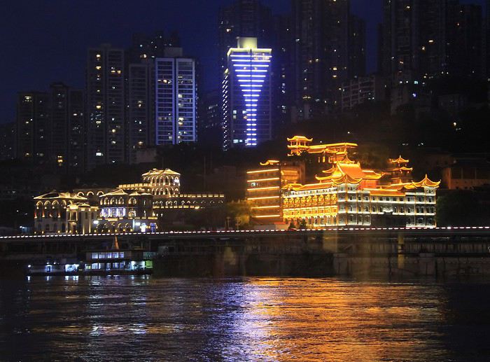
Le ballet des navires anime le décor, les couleurs scintillent. Un moment vert puis jaune avec de virer au rose, splendide ! Ajoutez au tableau des reflets et la représentation devient féerique ! Cette version rose est du plus bel effet.
En se tournant du côté opposé, vers le cœur de la ville, quelques gratte-ciel nous toisent avec leurs originales architectures. Ils paraissent gigantesques, normal pour des gratte-ciel mais c'est plutôt leurs lignes incurvées qui surprennent, on pourrait voir là un effet de déformation due à l'angle de prise de vue … mais non, on ne rêve pas , ces immeubles ont bien ce surprenant aspect légèrement courbe.
Une dernière vision depuis le pont supérieur du bateau en direction du pont illuminé, on l'aperçoit en fond d'image … car il est temps de rentrer à l'intérieur, la brume nimbe le décor et de plus une bruine commence à nous mouiller.
La nouvelle va vite se répandre parmi les voyageurs. Quoi ? le bateau ne partira pas comme prévu ce soir ? Le commandant est seul maître à bord et il a pris cette décision. Le motif ? Des pluies abondantes ont gonflé le débit du Yangtse, les eaux sont hautes et les courants s'affolent en tout sens … Le long fleuve tranquille s'est transformé en quelques heures en un tumultueux cours d'eau. Les manœuvres pour quitter le port puis la navigation paraissent trop périlleuses pour envisager un départ imminent. Dont acte ! Et pendant ce temps, dans le salon à l'intérieur du navire … la croisière s'amuse ! Il fallait bien que je la place cette expression devenue culte, c'est fait !
Un moment de convivialité entre une partie de l'équipage, quelques officiers et les croisiéristes. Le Century Diamond est un bateau de croisière à taille presque humaine … rien à voir avec le gigantisme des paquebots des «cruises » à l'américaine avec leurs milliers de passagers à bord. 110 mètres de long et 130 cabines qui probablement n'était pas toutes occupées à cette date, cela donne à bord une ambiance bon enfant. Pour cet apéritif de présentation, l'ambiance est chaleureuse , les sourires sont de mise et l'on trinque avec entrain. L'occasion pour moi de converser avec un membre du staff de direction, et entre deux gorgées d'un vin chinois champagnisé de lui poser la question qui brûle les lèvres de nous tous : sait-on finalement jusqu'à quel moment est reporté le départ. Avec un large sourire comme savent faire les asiatiques, il nous rassure : « Tomorrow at dawn, for sure! ». Ça s'arrose, tiens ! Et hop un autre flûte de vin sera vite avalée.
--
Quelques bruits, une sensation de mouvement … je suis à peine éveillé, j'ouvre un œil puis les deux et réalise que nous quittons le port. Adieu Chongqing et bonjour la découverte d'une partie du fleuve Yangtse. Au programme, quatre jours de cabotage jusqu'au célèbre barrage des Trois Gorges soit 648 kilomètres de navigation au fil de l'eau.
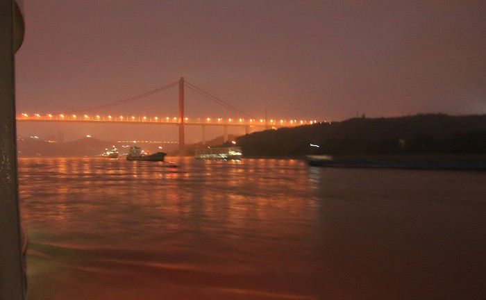
Les lueurs de l'aube n'ont pas encore fait disparaître les ombres de la nuit mais à travers la fenêtre de la cabine j'observe le décor qui défile très lentement : passage sous un pont et croisement de plusieurs embarcations. La photo prise est floue, un peu bougée par manque de luminosité. Finalement elle correspond parfaitement au souvenir que je garde des ces instants celui d'un paysage fluvial embrumé … comme mes yeux à demi réveillés.
Un peu plus tard, un peu plus loin … le jour est à présent levé mais ne triomphe pas complètement des brumes du petit matin, elles estompent encore l'horizon et les silhouettes des montagnes.
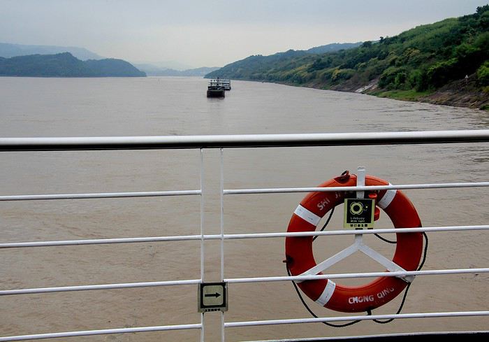
Fini les visions agressives de l'urbanisme galopant qui sévit dans les villes chinoises, ici, dans ce secteur du fleuve, il n'y a de place que pour une nature florissante, celle de la Chine profonde de l'intérieur du pays … de l'eau, des montagnes et une végétation verdoyante. Que cela fait du bien à voir ! voilà un panorama des plus apaisants, on apprécie et on contemple, sans retenue aucune. Avec une vitesse de croisière de quelques 20 à 25 kilomètres/heure, on a tout le temps de profiter des paysages du célèbre Yangtse. Le troisième plus long fleuve du monde (après l'Amazone et le Nil), en effet il serpente sur 6300 kilomètres depuis les hauteurs des montagnes du Tibet jusqu'à la Mer de Chine où il se jette un peu nord de Shanghai. Le cours du Yangtse le fait voyager à travers pas moins de onze régions chinoises, il se fait successivement torrent montagneux puis méandre après méandre se faufile entre des gorges escarpées et de larges vallées pour s'étendre enfin en un immense delta. Quelques 700 affluents viennent rejoindre le lit principal et gonfler son débit, environ 30 000 m³ seconde !
Depuis le pont supérieur, le belvédère est idéal pour ne cesser d'observer les berges.
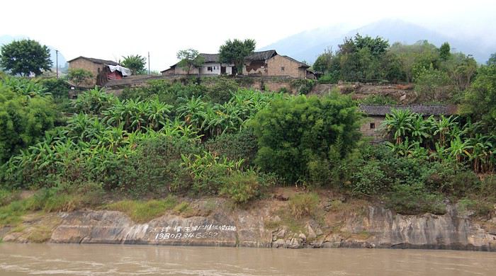
Là, c'est une ferme traditionnelle qui domine le fleuve et surtout une belle plantation de bananiers. Des arbres tropicaux aux larges palmes qui témoignent du climat local, c'est à dire chaud et plutôt humide.
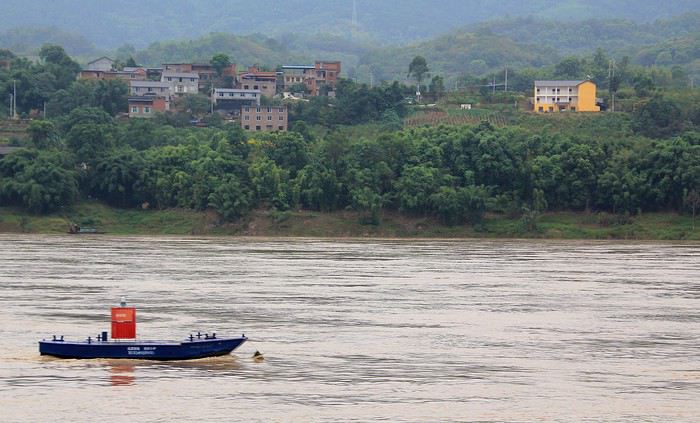
Ici, c'est une simple embarcation qui attire mon regard. Mais où est le pêcheur ? A bien l'observer, on constate que c'est une balise, elle est surmontée d'un lampe pour son éclairage nocturne et elle sert donc à délimiter le chenal de navigation. Il y en a ainsi tout le long des rives du Yangtse, après en avoir ainsi longé plusieurs je ne les confond plus avec de simples barques de pêcheurs. Finalement cette forme imitant une embarcation est bien vue pour intégrer ces repères parmi cet environnement fluvial. Autre avantage, on peut facilement les déplacer selon la hauteur des eaux.
D'autres balises, blanches et rouges jalonnent régulièrement les rivages du fleuve comme on peut le voir sur ces deux photos. Nous sommes en septembre et par endroits, déjà quelques feuillages jaunissent, apportant une belle touche automnale à ces rivages. En de nombreux passages, les berges semblent confortées par des rochers dont les strates (à droite) présentent d'étonnantes courbes. L'impression de solidité, qualité reconnue de la roche, est ici atténuée par cet aspect de mouvement. Comme si la pierre était aussi molle qu'une pâte à modeler. Au bas du long escalier, un pêcheur solitaire taquine les poissons, une image classique des bords de ce fleuve.
D'autres pêcheurs sont embarqués sur de simples barques comme celui-ci qui tire vaillamment son filet. Je ne suis pas sûr qu'il ait apprécié les petites vagues provoquées par le passage de notre navire. Pardon pour le dérangement.
Les rivières qui se jettent dans le grand Yangtse sont particulièrement nombreuses, je l'ai déjà évoqué précédemment. Ainsi, la continuité des rives se trouve-t-elle souvent entaillée, sauf lorsqu'un pont à été construit. C'est le cas en cet endroit où ce pont enjambe la rivière affluente. Tiens, voici un train qui apparaît, c'est parfait pour « animer » ma photo.
Vous vous en doutez, le grand et long Yangtse n'est pas seulement une fleuve utilisé pour les seuls bateaux de croisières. De même, les rivages ne sont pas seulement constitués de paysages de campagnes bucoliques destinées à dépayser les touristes. Avant tout, le fleuve est une voie navigable principalement dédiée aux transports commerciaux. Lors d'une croisière sur son cours on ne s'étonnera pas de croiser en permanence une multitude de péniches, de cargos et de portes containers. Ils transitent chargés de marchandises et de matériaux, de port en port et de ville en ville.
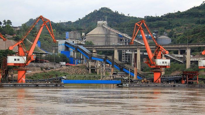
Peu à peu, les rivages se font moins nature et la végétation cède la place à des entrepôts, des silos, des usines et maintenant à un port. Sur les quais d'imposantes grues oranges font comprendre que l'on retrouve une Chine industrielle et urbaine. D'ailleurs, à proximité se profilent de hauts immeubles bâtis à touche-touche !
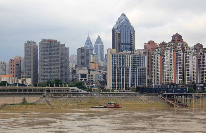
Cette portion des bords du fleuve n'est pas vraiment des plus esthétiques … et si on rentrait à l'intérieur du bateau ? D'autant que comme sur toute croisière d'agrément, des animations sont au programme. Ce matin, il est prévu une démonstration de peinture. Une peinture originale de tradition chinoise : de la peinture sur verre …. mais en peignant l'intérieur de petits vases. Un talentueux artiste nous fait une démonstration et nous explique la technique. Et me voilà pinceau et vase aux mains.
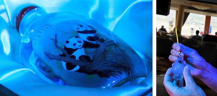
Les poils recourbés du pinceau sont sensés faciliter le travail … mais cela ne me paraît pas du tout évident. Il ne faut surtout pas trembler et à vrai dire cela me donne l'impression d'essayer de peindre avec la main gauche alors que je suis droitier ! Bon, la tentative ne m'a pas convaincu. On pouvez s'en douter, il faut de l'expérience et du travail pour réussir un début de décoration présentable aussi je préfère admirer le travail réalisé par l'artiste (photo vase de gauche).
--
Un voyage fluvial débute comme il se doit dans un port. Ici, ce sera Chongqing. La ville est impressionnante et démesurée. Presque à perte de vue ce ne sont que gratte-ciel, tours et blocs d'immeubles où s'empilent des milliers d'appartements et où s'entassent des millions de Chinois. La vision est oppressante … en tout cas, c'est l'image que je garde en mémoire de Chongqing, la tentaculaire mégapole du centre de la Chine. Pour vous impressionner un peu plus, on vous parle de cette ville comme la plus vaste de l'Empire du Milieu avec une population estimée à 32 millions d'habitants, la population de cette cité serait l'équivalent de la moitié de celle de la France ! Bon, en y regardant d'un peu plus près on s'aperçoit que ce chiffre effrayant correspond en fait au nombre d'habitants de la région puisque Chongqing est le nom de l'agglomération mais également celui du territoire (un peu plus grand que la superficie de la région française de la Nouvelle Aquitaine). Donc, ironiquement j'aurai envie de préciser que la cité de Chongqing ne compte qu'une petite vingtaine de millions d'habitants !
Après avoir traversé cette étourdissante concentration de buildings et puis après avoir longé la « forêt » d'immeubles alignés tout le long des collines surplombant la rivière Jialing, nous voici au bord de l'autre cours d'eau de l'agglomération, bien plus célèbre, le fameux Yangtse. Le but de notre étape dans cette région.
En contrebas, le mythique fleuve paraît presque encombré avec un va-et-vient incessant entre navires de transport et bateaux de promenades sans oublier la présence à quai de plusieurs navires de croisières. Un port fluvial et un fleuve, à l'image de la ville, trépidants. Nous voici donc prêts à embarquer. La pensée de quitter l'immense et si grouillante ville de Chongqing n'est pas pour nous déplaire … déjà on s'imagine navigant lentement dans un décor naturel de gorges hautement spectaculaires. Pour l'instant, on le constate, le lit du Yangtse est particulièrement encaissé, il nous faut descendre par un long escalier fixé sur ces berges pour le moins pentues, puis emprunter un brinquebalant pont flottant, traverser un, puis encore un second bateau de croisière pour enfin atteindre notre navire. Ouf !
Quant à nos bagages, les porteurs locaux se les disputent. Un portage traditionnel avec un bâton sur l'épaule : un, puis deux bagages de chaque côté et voilà plus de 80 kg sur le dos … Aïe, aïe ! Un vrai travail de forçat, que ne faut-il endurer pour gagner sa vie ! Merci messieurs et respect.
La nuit est maintenant tombée sur la ville et sur l'imposant fleuve, place à un superbe festival de couleurs et de lumières. On en oublie la concentration de barres de buildings pour admirer le spectacle. En fond de panorama des façades illuminées toutes constellées de lumières celles des appartements avec en prime juste sur la berge qui nous fait face un bâtiment de style palais asiatique, aux lignes dorées et étincelantes comme parées de guirlandes lumineuses.
Le ballet des navires anime le décor, les couleurs scintillent. Un moment vert puis jaune avec de virer au rose, splendide ! Ajoutez au tableau des reflets et la représentation devient féerique ! Cette version rose est du plus bel effet.
En se tournant du côté opposé, vers le cœur de la ville, quelques gratte-ciel nous toisent avec leurs originales architectures. Ils paraissent gigantesques, normal pour des gratte-ciel mais c'est plutôt leurs lignes incurvées qui surprennent, on pourrait voir là un effet de déformation due à l'angle de prise de vue … mais non, on ne rêve pas , ces immeubles ont bien ce surprenant aspect légèrement courbe.
Une dernière vision depuis le pont supérieur du bateau en direction du pont illuminé, on l'aperçoit en fond d'image … car il est temps de rentrer à l'intérieur, la brume nimbe le décor et de plus une bruine commence à nous mouiller.
La nouvelle va vite se répandre parmi les voyageurs. Quoi ? le bateau ne partira pas comme prévu ce soir ? Le commandant est seul maître à bord et il a pris cette décision. Le motif ? Des pluies abondantes ont gonflé le débit du Yangtse, les eaux sont hautes et les courants s'affolent en tout sens … Le long fleuve tranquille s'est transformé en quelques heures en un tumultueux cours d'eau. Les manœuvres pour quitter le port puis la navigation paraissent trop périlleuses pour envisager un départ imminent. Dont acte ! Et pendant ce temps, dans le salon à l'intérieur du navire … la croisière s'amuse ! Il fallait bien que je la place cette expression devenue culte, c'est fait !
Un moment de convivialité entre une partie de l'équipage, quelques officiers et les croisiéristes. Le Century Diamond est un bateau de croisière à taille presque humaine … rien à voir avec le gigantisme des paquebots des «cruises » à l'américaine avec leurs milliers de passagers à bord. 110 mètres de long et 130 cabines qui probablement n'était pas toutes occupées à cette date, cela donne à bord une ambiance bon enfant. Pour cet apéritif de présentation, l'ambiance est chaleureuse , les sourires sont de mise et l'on trinque avec entrain. L'occasion pour moi de converser avec un membre du staff de direction, et entre deux gorgées d'un vin chinois champagnisé de lui poser la question qui brûle les lèvres de nous tous : sait-on finalement jusqu'à quel moment est reporté le départ. Avec un large sourire comme savent faire les asiatiques, il nous rassure : « Tomorrow at dawn, for sure! ». Ça s'arrose, tiens ! Et hop un autre flûte de vin sera vite avalée.
--
Quelques bruits, une sensation de mouvement … je suis à peine éveillé, j'ouvre un œil puis les deux et réalise que nous quittons le port. Adieu Chongqing et bonjour la découverte d'une partie du fleuve Yangtse. Au programme, quatre jours de cabotage jusqu'au célèbre barrage des Trois Gorges soit 648 kilomètres de navigation au fil de l'eau.
Les lueurs de l'aube n'ont pas encore fait disparaître les ombres de la nuit mais à travers la fenêtre de la cabine j'observe le décor qui défile très lentement : passage sous un pont et croisement de plusieurs embarcations. La photo prise est floue, un peu bougée par manque de luminosité. Finalement elle correspond parfaitement au souvenir que je garde des ces instants celui d'un paysage fluvial embrumé … comme mes yeux à demi réveillés.
Un peu plus tard, un peu plus loin … le jour est à présent levé mais ne triomphe pas complètement des brumes du petit matin, elles estompent encore l'horizon et les silhouettes des montagnes.
Fini les visions agressives de l'urbanisme galopant qui sévit dans les villes chinoises, ici, dans ce secteur du fleuve, il n'y a de place que pour une nature florissante, celle de la Chine profonde de l'intérieur du pays … de l'eau, des montagnes et une végétation verdoyante. Que cela fait du bien à voir ! voilà un panorama des plus apaisants, on apprécie et on contemple, sans retenue aucune. Avec une vitesse de croisière de quelques 20 à 25 kilomètres/heure, on a tout le temps de profiter des paysages du célèbre Yangtse. Le troisième plus long fleuve du monde (après l'Amazone et le Nil), en effet il serpente sur 6300 kilomètres depuis les hauteurs des montagnes du Tibet jusqu'à la Mer de Chine où il se jette un peu nord de Shanghai. Le cours du Yangtse le fait voyager à travers pas moins de onze régions chinoises, il se fait successivement torrent montagneux puis méandre après méandre se faufile entre des gorges escarpées et de larges vallées pour s'étendre enfin en un immense delta. Quelques 700 affluents viennent rejoindre le lit principal et gonfler son débit, environ 30 000 m³ seconde !
Depuis le pont supérieur, le belvédère est idéal pour ne cesser d'observer les berges.
Là, c'est une ferme traditionnelle qui domine le fleuve et surtout une belle plantation de bananiers. Des arbres tropicaux aux larges palmes qui témoignent du climat local, c'est à dire chaud et plutôt humide.
Ici, c'est une simple embarcation qui attire mon regard. Mais où est le pêcheur ? A bien l'observer, on constate que c'est une balise, elle est surmontée d'un lampe pour son éclairage nocturne et elle sert donc à délimiter le chenal de navigation. Il y en a ainsi tout le long des rives du Yangtse, après en avoir ainsi longé plusieurs je ne les confond plus avec de simples barques de pêcheurs. Finalement cette forme imitant une embarcation est bien vue pour intégrer ces repères parmi cet environnement fluvial. Autre avantage, on peut facilement les déplacer selon la hauteur des eaux.
D'autres balises, blanches et rouges jalonnent régulièrement les rivages du fleuve comme on peut le voir sur ces deux photos. Nous sommes en septembre et par endroits, déjà quelques feuillages jaunissent, apportant une belle touche automnale à ces rivages. En de nombreux passages, les berges semblent confortées par des rochers dont les strates (à droite) présentent d'étonnantes courbes. L'impression de solidité, qualité reconnue de la roche, est ici atténuée par cet aspect de mouvement. Comme si la pierre était aussi molle qu'une pâte à modeler. Au bas du long escalier, un pêcheur solitaire taquine les poissons, une image classique des bords de ce fleuve.
D'autres pêcheurs sont embarqués sur de simples barques comme celui-ci qui tire vaillamment son filet. Je ne suis pas sûr qu'il ait apprécié les petites vagues provoquées par le passage de notre navire. Pardon pour le dérangement.
Les rivières qui se jettent dans le grand Yangtse sont particulièrement nombreuses, je l'ai déjà évoqué précédemment. Ainsi, la continuité des rives se trouve-t-elle souvent entaillée, sauf lorsqu'un pont à été construit. C'est le cas en cet endroit où ce pont enjambe la rivière affluente. Tiens, voici un train qui apparaît, c'est parfait pour « animer » ma photo.
Vous vous en doutez, le grand et long Yangtse n'est pas seulement une fleuve utilisé pour les seuls bateaux de croisières. De même, les rivages ne sont pas seulement constitués de paysages de campagnes bucoliques destinées à dépayser les touristes. Avant tout, le fleuve est une voie navigable principalement dédiée aux transports commerciaux. Lors d'une croisière sur son cours on ne s'étonnera pas de croiser en permanence une multitude de péniches, de cargos et de portes containers. Ils transitent chargés de marchandises et de matériaux, de port en port et de ville en ville.
Peu à peu, les rivages se font moins nature et la végétation cède la place à des entrepôts, des silos, des usines et maintenant à un port. Sur les quais d'imposantes grues oranges font comprendre que l'on retrouve une Chine industrielle et urbaine. D'ailleurs, à proximité se profilent de hauts immeubles bâtis à touche-touche !
Cette portion des bords du fleuve n'est pas vraiment des plus esthétiques … et si on rentrait à l'intérieur du bateau ? D'autant que comme sur toute croisière d'agrément, des animations sont au programme. Ce matin, il est prévu une démonstration de peinture. Une peinture originale de tradition chinoise : de la peinture sur verre …. mais en peignant l'intérieur de petits vases. Un talentueux artiste nous fait une démonstration et nous explique la technique. Et me voilà pinceau et vase aux mains.
Les poils recourbés du pinceau sont sensés faciliter le travail … mais cela ne me paraît pas du tout évident. Il ne faut surtout pas trembler et à vrai dire cela me donne l'impression d'essayer de peindre avec la main gauche alors que je suis droitier ! Bon, la tentative ne m'a pas convaincu. On pouvez s'en douter, il faut de l'expérience et du travail pour réussir un début de décoration présentable aussi je préfère admirer le travail réalisé par l'artiste (photo vase de gauche).
Alaska 2018, The Last Frontier!
De retour sur VF après plusieurs mois d'errance entre un road-trip en Afrique du Sud, un contrat en Guadeloupe, un voyage en Tanzanie et un déménagement surprise en Guyane... Je commence, enfin et parallèlement à la préparation de notre prochain voyage en Patagonie, le récit de notre voyage de 3 semaines en Alaska réalisé en Juillet 2018. 🙂
C'est un voyage que nous avons organisé 6 mois en avance.
Après deux longs voyages en Afrique australe nous aurions adoré remettre ça, mais cette année je ne pouvais pas partir plus de 3 semaines et nous nous sommes laissés dire que ce serait bien aussi de voir autre chose et de visiter de nouveaux continents. Qu'a cela ne tienne !
Passionnés de faune sauvage et de grands espaces nous n'avons pas mit longtemps à nous décider et c'est tout naturellement vers le 49ème état des Etats Unis que nous nous sommes tournés. L'Alaska ! L'Alaska et sa faune exceptionnelle qui font rêver bien des amoureux de nature.
Nous avons rapidement prit nos billets d'avions pour Anchorage et en avons profiter pour organiser une escale de 2 jours en Islande afin de visiter la péninsule de Reykjanes que nous n'avions pas pu explorer l'année passée pour cause de tempête de neige.
Nous avons décidé de partir en Juillet plutot qu'en Aout car c'est la période qui semblait la plus sèche (tout est relatif) et la plus propice à l'observation des célèbres grizzlys.
En entamant la préparation de notre voyage, nous nous sommes vite rendu compte qu'organiser un road-trip en Alaska serait très différent de ce que nous connaissions.
Tout d'abord l'Alaska est une destination réputée pour être peu abordable, les locations de voitures via les agences internationales habituelles sont très chères, il y a peu de solution d’hébergement donc il faut réserver longtemps en avance et le rapport qualité prix varie entre mauvais et moyen.
En somme, la façon la plus simple d'y voyager est de louer un camping-car, ce qui n'est pas donné non plus.
En 2017 nous nous étions vraiment beaucoup investis dans l'organisation de notre road-trip de 2 mois en Afrique australe que nous avions commencé à préparer presque 1 an en avance. Cette année nous ne voulions pas nous prendre la tête, nous louerons donc un gros SUV et dormirons dedans pendant 3 semaines comme nous l'avions fait lors de notre tour d'Islande.
C'est une option qui peut paraitre peu confortable mais nous aimons beaucoup la liberté qu'elle offre et cela permet de faire de grosses économies sur l'hébergement pour pouvoir faire plus d'activités ou simplement partir plus longtemps...
Nous nous sommes dépechés de louer un Hyundai Sante Fe (or similar) à Alamo via Happytour et de réserver une journée de bear watching (activité phare et très chère qui s'organise des mois en avance).
Puis, pour des raisons d'hygiènes et de repos obligatoire, nous nous sommes également offert 4 nuits en dur et nous avons acheté quelques guide de voyage, dont The Millepost pour attendre patiemment (ou pas) le jour du départ. 🙂
Au final le seul impératif de notre road-trip était d’être à Homer le 14 Juillet pour le bear watching à Katmai NP et c'est autour de cette date que nous avons élaboré notre programme.
J1 (03/07/18) : Islande, Blue Lagoon
J2 (04/07/18) : Islande, Péninsule de Reykjanes, Reykjavic -> Anchorage
J3 (05/07/18) : Anchorage -> Denali NP
J4 (06/07/18) : Denali NP
J5 (07/07/18) : Denali NP
J6 (08/08/18) : Denali NP
J7 (09/07/18) : Denali NP -> Talkeetna
J8 (10/07/18) : Talkeetna -> Anchorage
J9 (11/07/18) : Anchorage -> Girdwood
J10 (12/07/18) : Girdwood -> Russian River
J11 (13/0718) : Russian River -> Homer
J12 (14/07/18) : Brooks Falls - Katmai NP
J13 (15/07/18) : Homer - Kachemak Bay
J14 (16/07/18) : Homer -> Seward
J15 (17/07/18) : Seward
J16 (18/07/18) : Seward -> Whittiez
J17 (19/07/18) : Whittier -> Valdez
J18 (20/07/18) : Valdez
J19 (21/07/18) : Valdez -> Kenicott
J20 (22/07/18) : Kenicott
J21 (23/07/18) : Kenicott -> Anchorage
J22 (24/07/18) : Départ à 8h pour moi destination Pointe à Pitre et à 16h pour Alison destination Paris.
N'ayant que 19 jours sur place, nous avons fait le choix de nous concentrer sur l'Alaska "continentale" en particulier la très belle péninsule de Kenai et le Denali NP qui était une des principales raisons de notre voyage. 🙂 Le Yukon, et l'Alaska maritime seront donc les destinations de prochains voyages, si la vie le permet !
Le cout total de ce voyage a été d'environ 9000€ à deux et je détaillerai nos différentes dépenses à la fin de ce carnet.
Après ce petit texte d'introduction dont tout le monde se fout, place au récit et aux photos !! 😎
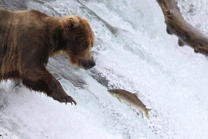
C'est un voyage que nous avons organisé 6 mois en avance.
Après deux longs voyages en Afrique australe nous aurions adoré remettre ça, mais cette année je ne pouvais pas partir plus de 3 semaines et nous nous sommes laissés dire que ce serait bien aussi de voir autre chose et de visiter de nouveaux continents. Qu'a cela ne tienne !
Passionnés de faune sauvage et de grands espaces nous n'avons pas mit longtemps à nous décider et c'est tout naturellement vers le 49ème état des Etats Unis que nous nous sommes tournés. L'Alaska ! L'Alaska et sa faune exceptionnelle qui font rêver bien des amoureux de nature.
Nous avons rapidement prit nos billets d'avions pour Anchorage et en avons profiter pour organiser une escale de 2 jours en Islande afin de visiter la péninsule de Reykjanes que nous n'avions pas pu explorer l'année passée pour cause de tempête de neige.
Nous avons décidé de partir en Juillet plutot qu'en Aout car c'est la période qui semblait la plus sèche (tout est relatif) et la plus propice à l'observation des célèbres grizzlys.
En entamant la préparation de notre voyage, nous nous sommes vite rendu compte qu'organiser un road-trip en Alaska serait très différent de ce que nous connaissions.
Tout d'abord l'Alaska est une destination réputée pour être peu abordable, les locations de voitures via les agences internationales habituelles sont très chères, il y a peu de solution d’hébergement donc il faut réserver longtemps en avance et le rapport qualité prix varie entre mauvais et moyen.
En somme, la façon la plus simple d'y voyager est de louer un camping-car, ce qui n'est pas donné non plus.
En 2017 nous nous étions vraiment beaucoup investis dans l'organisation de notre road-trip de 2 mois en Afrique australe que nous avions commencé à préparer presque 1 an en avance. Cette année nous ne voulions pas nous prendre la tête, nous louerons donc un gros SUV et dormirons dedans pendant 3 semaines comme nous l'avions fait lors de notre tour d'Islande.
C'est une option qui peut paraitre peu confortable mais nous aimons beaucoup la liberté qu'elle offre et cela permet de faire de grosses économies sur l'hébergement pour pouvoir faire plus d'activités ou simplement partir plus longtemps...
Nous nous sommes dépechés de louer un Hyundai Sante Fe (or similar) à Alamo via Happytour et de réserver une journée de bear watching (activité phare et très chère qui s'organise des mois en avance).
Puis, pour des raisons d'hygiènes et de repos obligatoire, nous nous sommes également offert 4 nuits en dur et nous avons acheté quelques guide de voyage, dont The Millepost pour attendre patiemment (ou pas) le jour du départ. 🙂
Au final le seul impératif de notre road-trip était d’être à Homer le 14 Juillet pour le bear watching à Katmai NP et c'est autour de cette date que nous avons élaboré notre programme.
J1 (03/07/18) : Islande, Blue Lagoon
J2 (04/07/18) : Islande, Péninsule de Reykjanes, Reykjavic -> Anchorage
J3 (05/07/18) : Anchorage -> Denali NP
J4 (06/07/18) : Denali NP
J5 (07/07/18) : Denali NP
J6 (08/08/18) : Denali NP
J7 (09/07/18) : Denali NP -> Talkeetna
J8 (10/07/18) : Talkeetna -> Anchorage
J9 (11/07/18) : Anchorage -> Girdwood
J10 (12/07/18) : Girdwood -> Russian River
J11 (13/0718) : Russian River -> Homer
J12 (14/07/18) : Brooks Falls - Katmai NP
J13 (15/07/18) : Homer - Kachemak Bay
J14 (16/07/18) : Homer -> Seward
J15 (17/07/18) : Seward
J16 (18/07/18) : Seward -> Whittiez
J17 (19/07/18) : Whittier -> Valdez
J18 (20/07/18) : Valdez
J19 (21/07/18) : Valdez -> Kenicott
J20 (22/07/18) : Kenicott
J21 (23/07/18) : Kenicott -> Anchorage
J22 (24/07/18) : Départ à 8h pour moi destination Pointe à Pitre et à 16h pour Alison destination Paris.
N'ayant que 19 jours sur place, nous avons fait le choix de nous concentrer sur l'Alaska "continentale" en particulier la très belle péninsule de Kenai et le Denali NP qui était une des principales raisons de notre voyage. 🙂 Le Yukon, et l'Alaska maritime seront donc les destinations de prochains voyages, si la vie le permet !
Le cout total de ce voyage a été d'environ 9000€ à deux et je détaillerai nos différentes dépenses à la fin de ce carnet.
Après ce petit texte d'introduction dont tout le monde se fout, place au récit et aux photos !! 😎