Results for "équipement+ou+matériel+|+28"
13093 results found.
Panneau solaire souple pour voyage à vélo English translation pending
Bonjour
Pour les 4 mois d'itinérante à vélo que nous allons réalisé avec un amis en Pologne et République Tchèque, nous voulons partir avec un panneau solaire sur la remorque pour recharger notamment un ordinateur portable. Le problème c'est que l'on arrive vraiment pas à savoir quel montage il faut faire: quel puissance pour le panneau, batterie ou pas en sortie, etc...
Quelqu'un peut il nous aider?
Merci!!!
Itinéraire Montréal - Tadoussac English translation pending
Bonjour, 🙂
Nous comptons partir 15 jours au québec en juillet (court mais c'est une 1ère approche avec les enfants de 7 et 3 ans)
Nous atterissons et décollons de Montréal et voulons aller jusqu'à Tadoussac pour observer les baleines. (environ 1000km A/R) Nous pensons opter pour la location de voiture et de matériel de camping sur place pour éviter le transport par avion de la tente etc...
Le problème se situe au niveau de l'itinéraire... 🤪 Nous sommes un peu perdus malgré nos nombreuses recherches...
Auriez vous des suggestions de parcours et de haltes... Sachant qu'avec des enfants de cet âge les longues marches sont impensables !
Nous voudrions passer 1 à 2 jours à Montréal ainsi qu'à québec en B&B et le reste du temps... en vadrouille en camping... mais sur un itinéraire assez précis pour savoir où nous allons... (eh oui le séjour à l'aventure est mis de côté jusqu'à l'année prochaine lors de vacances sans les enfants !!! 😉)
En fait nous n'arrivons pas à arrêter nos choix de campings car nous ne savons pas trop quels lieux privilégier ???
Merci beaucoup à tout ceux qui pourrons m'aider à préparer au mieux notre 1er grand séjour en famille !!!
Vanessa
Nous comptons partir 15 jours au québec en juillet (court mais c'est une 1ère approche avec les enfants de 7 et 3 ans)
Nous atterissons et décollons de Montréal et voulons aller jusqu'à Tadoussac pour observer les baleines. (environ 1000km A/R) Nous pensons opter pour la location de voiture et de matériel de camping sur place pour éviter le transport par avion de la tente etc...
Le problème se situe au niveau de l'itinéraire... 🤪 Nous sommes un peu perdus malgré nos nombreuses recherches...
Auriez vous des suggestions de parcours et de haltes... Sachant qu'avec des enfants de cet âge les longues marches sont impensables !
Nous voudrions passer 1 à 2 jours à Montréal ainsi qu'à québec en B&B et le reste du temps... en vadrouille en camping... mais sur un itinéraire assez précis pour savoir où nous allons... (eh oui le séjour à l'aventure est mis de côté jusqu'à l'année prochaine lors de vacances sans les enfants !!! 😉)
En fait nous n'arrivons pas à arrêter nos choix de campings car nous ne savons pas trop quels lieux privilégier ???
Merci beaucoup à tout ceux qui pourrons m'aider à préparer au mieux notre 1er grand séjour en famille !!!
Vanessa
Documentaire en Côte d'Ivoire English translation pending
Bonjour à tous et à toutes!
J'ai entrepris il y a quelques temps la réalisation d'un documentaire en Côte d'Ivoire du 28 mai au 5 juillet 2006. Grâce au concours de gens rencontrés notamment via ce site, mon projet avance bien. Je cherche néanmoins toujours à agrandir mon réseau de contacts. Je cherche donc toute personne concernée par ce pays, vivant en France ou sur place, qui voudra bien discuter de la situation actuelle et m'enrichir d'anecdotes et points de vue nouveaux. De plus, j'ai déjà établi mon itinéraire: Abidjan – Yamoussoukro – Bouaké - Korhogo – Odienné – Man – Tai - San Pedro – Abidjan. Il me faudrait donc connaître des gens dans chacune de ces villes. Je vous remercie d'avance de toute l'aide que vous pourrez m'apporter!
Samir
J'ai entrepris il y a quelques temps la réalisation d'un documentaire en Côte d'Ivoire du 28 mai au 5 juillet 2006. Grâce au concours de gens rencontrés notamment via ce site, mon projet avance bien. Je cherche néanmoins toujours à agrandir mon réseau de contacts. Je cherche donc toute personne concernée par ce pays, vivant en France ou sur place, qui voudra bien discuter de la situation actuelle et m'enrichir d'anecdotes et points de vue nouveaux. De plus, j'ai déjà établi mon itinéraire: Abidjan – Yamoussoukro – Bouaké - Korhogo – Odienné – Man – Tai - San Pedro – Abidjan. Il me faudrait donc connaître des gens dans chacune de ces villes. Je vous remercie d'avance de toute l'aide que vous pourrez m'apporter!
Samir
Vos impressions sur le vélo couché English translation pending
Bonjour,
Je lance un appel à tous ceux qui possède ou pratique le vélo couché de partager ici leurs impressions (bonne ou mauvaise) de cet "autre" vélo.
Je roule sur ce type de vélo depuis plus ou moins 7 ans. Ma première monture était un Alligt. Il s'agit d'un modèle poutre à deux roues (20" et 16"). Très nerveux et très maniable, il avait comme inconvénient majeur la taille des roues. Chargé comme un mullet, il arrivait que les saccoches touchaient dans les tournants 🤪
Je me suis ensuite touné vers Flevo. Je roule depuis 5 ans sur un Trike et un Bike équipé de roues de 20". Elles sont petites mais la géométrie du cadre supprime les inconvénients par rapport à l'Alligt. Je peux même sans problème franchir des bordures et autres obstacles. Reste le choix des pneus qui est assez réduit dans cette dimension.
Enfin, j'ai fait l'aquisition d'un Flevo Racer il y a deux ans. C'est un vélo fabriqué selon le même principe que le Bike et le Trike, c'est à dire articulé en son centre, mais cette fois avec deux roues de 28". La position de conduite est très couchée, et ce vélo ne se prète pas bien à la montagne. Par contre, en terrain plat et valloné, il apporte une sensation de glisse surprenante.
Hpv'iste en herbe, à vos claviers.
Marc
Je lance un appel à tous ceux qui possède ou pratique le vélo couché de partager ici leurs impressions (bonne ou mauvaise) de cet "autre" vélo.
Je roule sur ce type de vélo depuis plus ou moins 7 ans. Ma première monture était un Alligt. Il s'agit d'un modèle poutre à deux roues (20" et 16"). Très nerveux et très maniable, il avait comme inconvénient majeur la taille des roues. Chargé comme un mullet, il arrivait que les saccoches touchaient dans les tournants 🤪
Je me suis ensuite touné vers Flevo. Je roule depuis 5 ans sur un Trike et un Bike équipé de roues de 20". Elles sont petites mais la géométrie du cadre supprime les inconvénients par rapport à l'Alligt. Je peux même sans problème franchir des bordures et autres obstacles. Reste le choix des pneus qui est assez réduit dans cette dimension.
Enfin, j'ai fait l'aquisition d'un Flevo Racer il y a deux ans. C'est un vélo fabriqué selon le même principe que le Bike et le Trike, c'est à dire articulé en son centre, mais cette fois avec deux roues de 28". La position de conduite est très couchée, et ce vélo ne se prète pas bien à la montagne. Par contre, en terrain plat et valloné, il apporte une sensation de glisse surprenante.
Hpv'iste en herbe, à vos claviers.
Marc
Randonnée dans les Alpes en juin English translation pending
bonjour,
nous avons décidé avec des amis de faire une randonnée dans les alpes en bivouac durant 2semaines en fin juin
je voudrais avoir quelques renseignement sachant que nous n'avons pas d’expérience en montagne et que je n'ai fait que très peu de rando dans les alpes donc je ne connais pratiquement pas.
on avait pensé faire du leman au mont blanc mais en juin est ce réalisable?
si vous pouviez faire partager vos expériences, l'itinéraire qui vous a le plus plus, celui qui peut être réalisable par des gens assez inexpérimenté à quoi on peut vraiment s'attendre, le matériel auquel on a peut être pas , la météo à cette période
merci beaucoup pour les renseignements
merci beaucoup pour les renseignements
Sac de voyage pour six mois en Amérique du Sud? English translation pending
Bonjour,
Je vais partir en octobre 2011 pour un voyage de six mois en Amérique du Sud (Equateur, Pérou, Bolivie, Chili et Argentine).
Ayant lu beaucoup d'avis divergeants, je voulais avoir des conseils de gens qui auraient déjà fait un voyage similaire: que faut il prendre comme vêtements? Est il nécéssaire d'investir dans une veste en gore-tex, faut il prendre un polaire, un k-way ou prévoir d'acheter les choses sur place (je commence par Quito)? Et si vous pouviez aussi m'indiquer les bonnes marques et adresses?
D'autre part, par rapport aux vols: j'ai lu des témoignages de personnes qui avaient prévu des alarmes, des cadenas de vélos pour protéger leur sac, notamment dans les soutes... En pratique, comment vous êtes vous protégé contre les vols?
Merci d'avance!! juliette
Je vais partir en octobre 2011 pour un voyage de six mois en Amérique du Sud (Equateur, Pérou, Bolivie, Chili et Argentine).
Ayant lu beaucoup d'avis divergeants, je voulais avoir des conseils de gens qui auraient déjà fait un voyage similaire: que faut il prendre comme vêtements? Est il nécéssaire d'investir dans une veste en gore-tex, faut il prendre un polaire, un k-way ou prévoir d'acheter les choses sur place (je commence par Quito)? Et si vous pouviez aussi m'indiquer les bonnes marques et adresses?
D'autre part, par rapport aux vols: j'ai lu des témoignages de personnes qui avaient prévu des alarmes, des cadenas de vélos pour protéger leur sac, notamment dans les soutes... En pratique, comment vous êtes vous protégé contre les vols?
Merci d'avance!! juliette
Triban trail 7 2008 English translation pending
Bonjour à tous,
j'aimerai avoir votre avis sur la dernière version du triban trail 7 de Décathlon ( http://www.decathlon.fr/FR/triban-trail-7-28723793/ )
Namibia Travel Journal: May 2025 - Trip Review
NAMIBIA TRIP 2025: April 24 to May 20: Feel free to comment or ask us any questions about this amazing journey.
>> Find all our photos and videos for each day on our website here: www.montagne-aventure.net
**DAY 1: Thursday, April 24, 2025: Outbound Flights from Lyon to Windhoek via Munich - Visit to Munich:**

Off we go on a new adventure. The alarm rings at 6:30 AM, the travel bags are packed, and we head to Lyon Airport. We booked our flight tickets with Lufthansa. The first leg to Munich, Germany, is operated by AirBaltic. Departure at 1:05 PM for a 1-hour and 20-minute flight. We arrive at 2:30 PM.
**We now have a 7-hour layover, so we take the opportunity to get some fresh air and explore Munich.** We quickly exit Terminal 2 of the airport and head towards the subway. We buy a group day ticket "Airport-city Day Zone M-5," valid for 2 to 5 people at a price of 30.50 € (instead of 16.30 € per person). We take the S8 line to **Marienplatz** in 35 minutes. **This is the heart of the city.** The weather is overcast, quite cool, but dry. Perfect for a little city trip between two flights while leaving our large luggage in transit at the airport. **Munich is the third-largest German city after Berlin and Hamburg, in the Bavaria region.** **The center has a lot of charm and brings together several religious buildings, easy to explore on foot.** We are impressed by the number of people enjoying these 100% pedestrian streets, which are very pleasant. After Marienplatz, the most famous square with the town hall, we head to the Cathedral of Our Lady, a Gothic church, then continue to **Karlsplatz** and move on to **the food market offering a wide selection of high-end food products in an atmosphere where a certain art of living prevails.** We also visit St. Peter's Church before grabbing a bite to eat. Two good hours were enough for this 10 km city walk. It's time to take the subway back: by 6:30 PM, we are back at the airport. Now, it's time for a bit of waiting and rest. Our second flight is scheduled for 9:35 PM for a 9-hour and 30-minute journey to our final destination in Namibia: **Windhoek.**
> Round-trip flight tickets with Lufthansa from Lyon: 2029 €, or 1,014.50 € per person.
> Lyon Airport parking: 120 €
> Today's expenses: 7 € for 2 pizzas in France / 14 € for the restaurant in Munich / 30.50 € for the daily subway ticket in Munich.
**DAY 2: Friday, April 25, 2024: Arrival in Windhoek, Visit to the Namibian Capital:**
After a 9-hour and 30-minute overnight flight with Discover Airlines, we finally land on Namibian soil just before 7:30 AM. The day is breaking, and the colors are already stunning. We are eager despite the usual fatigue from the flight. The airline was punctual, with friendly staff and good meals, though a bit light. We are the first flight of the day to land, with no more than 15 flights per day here, from 7 AM to 8 PM. We disembark on the tarmac at this airport located in the middle of nowhere, **I finally set foot on African soil for the first time.** We exit among the first from the aircraft to go through the long formalities at the front of the line, as the wait can quickly become endless. Allow at least 5 minutes per person for e-visas. We still wait 45 minutes despite only about twenty people ahead of us. Phew, it's done. We collect our luggage and then withdraw money from an ATM. We make 4 withdrawals of the maximum amount, 2000 NAD $ per withdrawal, for a total of 380 €, or 95.33 € per withdrawal.
Our driver arrives at the same time, perfect timing, we were quick.
We leave the airport at 8:45 AM. By 9:30 AM, we arrive at the **Gracious Whisp vehicle rental agency**, located at the entrance of Windhoek, small and human-sized with a fleet of recent vehicles. More formalities, then a short wait as our vehicle is not yet ready. Time to decompress, catch our breath, and enjoy the very pleasant morning temperature. Not a cloud in sight. Next, a briefing on the vehicle, always with a bit of apprehension due to our approximate English. Allow 45 minutes of explanations, including setting up the roof tent, camping equipment, technical information in case of a flat tire, driving tips in Namibia, and a tour of the 4x4. We have all the necessary equipment for camping: mattresses, sleeping bags, pillows, table, chairs, gas stove, BBQ grill... as well as 2 spare tires, a compressor, a dual tank, and accessories for removing wheels. Off we go, it's time to muster our courage and get behind the wheel. **Heading to SuperSpar Maerua**, fortunately located less than 10 minutes away. We park with the help of a parking attendant; it's very crowded, the space is narrow, but everything goes well despite the cursed right-hand drive. Today's new mission: stock up on groceries. The store is well-stocked with local and imported products, catering to all tastes. We spend 114 € on groceries, from pasta to meat, BBQ lighters to dishwashing products. Two people load our groceries into two carts and transfer them to our vehicle; we feel compelled to leave a tip, 50 NAD $, as we don't have change yet. Now, we head to the hotel, 15 minutes away. Traffic is difficult at a complicated intersection; this will likely be the only traffic jam in Namibia. **We arrive at Kate's Nest Guesthouse & Backpackers around 1:15 PM, quite tired.** We take some well-deserved rest at this recent establishment, quite calm with secure private parking. After a short nap, we enjoy the quiet by the hotel pool. Night falls between 6:30 PM and 7 PM. We eat quietly in our room tonight before starting this long 4x4 road trip in camping mode in the heart of Namibia.
> Today's grocery expenses: 114 € at Super Spar Marua (2395.21 NAD $).
> Round-trip flight tickets with Lufthansa from Lyon: 2029 €, or 1,014.50 € per person.
> Vehicle rental: 4x4 Toyota with roof tent for 24 days: Gracious Whisp Car Rentals: 2,638 € (N$50,640) or **1,319 €** per person - (https://gwcarrentals.com/)
> Distance driven today: 15 km.
> Accommodation: Kate's Nest Guesthouse & Backpackers - 4 Aristotles Street Academia, 9000 Windhoek - 36 € for two for one night.
> Windhoek International Airport website: (https://www.airports.com.na/)
**DAY 3: Saturday, April 26, 2025: Windhoek to Hardap: Mariental Region - Kalahari Desert:**
After a good, restful night, we wake up leisurely around 7 AM. We enjoy the comfort provided by this first and last hotel before 24 nights under the tent.
**We leave Kate's Nest Guesthouse at 8:30 AM to tackle the Namibian roads.** We quickly leave the capital; in just 30 minutes, we find ourselves almost alone in the world. The landscape is dotted with small domes. We leave the **paved B1** quickly to turn left onto the **C15**. **From there, we won't see more than 10 vehicles all day.** After passing through the few houses of **Lekkerwaterpoort**, we tackle our first gravel road. These road sections are limited to 100 km/h, but even at 70 km/h, I find it already challenging. However, I quickly get used to it and gradually pick up speed to reach my cruising speed of around 80 to 90 km/h. **We are on immense straight lines crossing wild expanses as far as the eye can see.** **We come across two baboons, a few ostriches, and numerous cattle and sheep farms.** We pass through the charming village of **Uhlenhorst** with its typical houses and children with broad smiles waving at us. Life here is already very different from Windhoek. **The thermometer rises quickly from 16°C at 8:30 AM to over 28°C in the early afternoon.**
**We arrive at the Hardap Dam reserve at 2 PM.** We stop at the toll booth at the park entrance to pay the entrance fee: 250 NAD $ for 2 people and 1 vehicle. We continue to the dam and then the camp entrance, located a bit further. We had booked in advance, but this place remains little frequented by foreigners.
We take advantage of the hottest hours to rest by the large pool overlooking the immense lake, a very enjoyable moment. Would this be a bit of a vacation?
Around 4:30 PM, we head to the campsite. We overlook this vast water reserve. We arrive first; we will be only 3 vehicles spending the night here. It's time to get to work and set up our equipment for the first time. It takes us a good 20 minutes to set everything up, with a slight apprehension about unfolding the tent. Once this task is done, which we will have to repeat for almost a month, we will become much more efficient over time. Time for rest and contemplation in total silence. The sun gradually sets, and the heat quickly becomes bearable again. Bliss! **This dam is located 20 km northwest of Mariental in an area dotted with conical hills topped with dolerite buttons (Hardap means "hillock" in Nama). It captures the Fish River, which flows south, creating a large lake in the middle of an arid environment. The contrast is striking.** We enjoy our first sunset facing this 360° otherworldly landscape.
Around 7 PM, we start our first BBQ, or "braai" as it's called here. The temperature is perfect. The sun sets, giving way to a star-filled sky of incredible beauty thanks to the absence of any light pollution. The Milky Way will lull us throughout the evening. After some good sausages and potatoes on the BBQ, we head to our roof tent around 9:30 PM with a complete change of scenery in just 24 hours. France already seems so far away...
This campsite has shared showers and toilets, quite clean and functional, as well as a central area with several BBQs and tables. The sites are arranged in a semicircle, each with an electrical outlet. The sites are close to each other but spacious, some slightly shaded. We are only three vehicles tonight, so it's perfectly comfortable and quiet. Not to mention the large pool near the restaurant. Our trip is off to a great start.
> Today's road itinerary: Windhoek > Head south on the B1 to Rehoboth > Turn left onto the C25 then C15 to Stampriet > C20 to Hardap > Full north on the B1 > Then turn left onto the M93 - 5 hours of driving.
> Distance driven today: 354 km.
> Accommodation: Hardap Recreation Resort - 23.3 € for two - Large pool - GR6W+3M2, Hardap Game Reserve, Mariental, Namibia - (http://www.nwr.com.na/resorts/hardap-resort/)
**DAY 4: Sunday, April 27, 2025: Hardap - Brukkaros Volcano - Keetmanshoop - Quivertree Forest Rest Camp**
Our first night under the tent was very pleasant; the little wind quickly calmed down, giving way to absolute silence. The mattress is decent, more comfortable than some nights in Nepal. The length and width give us enough space for maximum comfort, despite my height (1.91 m). We wake up a little before 7 AM as the sun rises, and the lights dazzle us from the start of the day. We pack up the equipment in 30 minutes, quite easily. Then we enjoy the sun, which warms up quickly while we keep our light fleece on.
At 8:30 AM, **we hit the road again, heading south** to our first stop in **Mariental**. We want to do some shopping at SuperSpar, but once we arrive in the parking lot, a young local is fighting with the supermarket security guards and then threatens to throw stones. We don't want to take any risks right at the start, so despite the baton blows he receives, he doesn't stop. We leave empty-handed but fill up with fuel at the Shell station 1 km further. The price per liter is 21.33 NAD $, we fill our 107-liter tank for 107 €. In Namibia, you get served, and they bring the card machine to the window to pay. It's then customary to leave a tip.
We then take the B1 heading due south on a recently renovated road. Around 11:30 AM, we leave it on our right to take **a wild gravel road, the M98**. Just before **Berseba**, we turn right onto a small track, the **D3904 towards Brukkaros Crater up to a camp at 1588 m altitude**. The track then becomes too bumpy. We stop on the counter-slopes where **a wide panorama unfolds over these immense plains as far as the eye can see**. It's 12:15 PM, time for us to eat a rice and tuna salad facing this landscape.
**We are alone in the world until a vehicle arrives and parks next to us.** A bit of apprehension, 4 men head towards us. It turns out to be 4 shepherds looking for a lost foal. The conversation is pleasant, lost in the middle of nowhere. We find ourselves alone again in this absolute silence. **The heat becomes stifling with a good 30°C**. We get back on the road around 1 PM. Back on the B1, **we continue due south to Keetmanshoop**, which we reach around 3 PM. We stop there to do some shopping for 262 NAD $ (12 eggs, a can of tuna, a can of corn, bread, a soda, and a 5-liter water container), or 12.48 €. Two quite insistent children ask us for money or candy at the store exit, yet we give them a small tip, but they continue to cling to the car. Locals parked next to us tell them to leave us alone. Anyway, we finish the trip to **Quivertree Forest**, 15 km away. We will spend the night in this **pleasant farm run by a German**. Upon arrival, as the day before, and as I suppose in the future, we dive straight into the cool pool to relax after all these kilometers. A bliss. Then we take our 4x4 and choose a spot near these famous trees. After the 33°C this afternoon, once 4 PM passed, the temperature drops again and becomes very pleasant. **We are in the middle of the Kokerboom, one of the most interesting and characteristic plants of hot and arid regions. It's not really a tree but a variant of the aloe plant whose botanical name is Aloe Dichotoma. This Kokerboom has a smooth and thick trunk reaching up to 1 m in thickness and 9 m in height. They bloom for the first time at the age of 20 to 30 years.** The flowers are yellow and reach about thirty centimeters during the season between June and July. **They grow mainly in an environment with a high concentration of black rocks absorbing a large amount of heat (38°C). The rocks also serve to anchor the tree with its tentacle-like roots. It also resists frost. Each is between 200 and 300 years old.**
Around 5 PM, we walk to the farm reception to watch the feeding of **two cheetahs**. Magnificent carnivores taking their time to savor their piece of meat. **Then we return near our campsite to enjoy the sunset among these trees. The colors are sublime, as every evening apparently. A magnificent spectacle with colors evolving from yellow to orange then to pink, before giving way once again to a sky filled with thousands of stars.** Our campsite at Quiver Tree Forest Camp is very comfortable; we have a water supply, a stone table, a small lamp, an electrical outlet, a small tree for shade, and a BBQ that we won't use tonight; we'll cook on gas. The sites are far apart, with some shared facilities scattered around, a very beautiful setting. No reservation possible, no need, just show up directly. **The campsite accommodation for 2 people costs 28 €, including the reserve entrance fee of 5 €**. We finish this second bivouac evening around 9:30 PM, time for some reading and sleep in peaceful silence without wind.
> Today's road itinerary: Mariental > B1 heading south to Brukkaros > At Tses turn right towards Berseba via the M98 > Turn right onto the D3904 > 8 km > Brukkaros Volcano (stop at the lower camp as the track is difficult for 1 hour) > Keetmanshoop > Turn left onto the M29 > Quivertree Forest - 4 hours of driving.
> Distance driven today: 371 km.
> Distance walked today: 6 km.
> Today's expenses: Groceries for 12.48 € (262 NAD $) / Fuel for 107 € (1 liter of diesel for 21.33 NAD $).
> Accommodation: Quivertree Forest Rest Camp, P.O. Box 262, Keetmanshoop, Namibia - BBQ, hot showers, toilets, and electricity - No reservation - Pool - 18 €/Person (N$ 340.00 with park entrance) - (http://www.quivertreeforest.com/)
**DAY 5: Monday, April 28, 2025: Quivertree Forest Rest Camp - Giant's Playground - Keetmanshoop - Fish River Canyon - Canyon Roadhouse:**
After an excellent start to the night, we are woken up by the wind shortly before 6 AM, but the sunrise is not far off. We get up at 6:30 AM to enjoy it. The atmosphere is a bit cooler this morning, but the reward is already here.
The adventure continues. At 7:45 AM, we head towards **Giant's Playground**, 4 km away. We take a 3-kilometer walk through this expanse of blocks and igneous rocks.
We continue south at 8:45 AM, passing through Keetmanshoop again where we do some shopping for 25 €, a big stock-up for a good part of the trip: meats, canned goods, pasta, fruits... At 9:30 AM, we take the B4 to Fish River Canyon.
At 11:30 AM, we arrive at the entrance to the NWR park (350 NAD $ entrance for 2 people and 1 vehicle). The track becomes bumpy immediately upon entering the park. After about ten kilometers, we come upon this landscape carved by nature. In the end, it's well worth the detour. We were at the Grand Canyon in the USA exactly (https://www.montagne-aventure.net/2024/04/29/j21-3-juin-2024-grand-canyon-et-lac-powell/) and can thus confirm that this Fish River Canyon is comparable. We make several stops along the southern flank. **Here, nothing is developed; nature is almost in the wild state.** **With 160 km in length, up to 27 km in width, and a depth of 150 m, it is indeed the second-largest canyon in the world.** The history of the canyon is apparent in its different earth layers and stratification: the antiquity of the place is tangible, and the absence of vegetation is surprising. **It consists of two nested canyons, formed at distinct periods. The first distinct layer of schist, sandstone, and eruptive material surrounding the canyon was formed a few two billion years ago, then transformed due to heat and pressure into more solid rock such as gneiss. The inner canyon, carved more recently by the Fish River, has a depth of 270 m.**
We have a picnic once again alone in the world facing this grand panorama at the **Sulphur Spring View Point**. This is where the hiking trail begins, plunging into this narrow canyon, but it is forbidden to venture there alone without a guide. It's 30°C, but a slight wind makes the atmosphere bearable. At 1 PM, we retrace our steps and continue to the **Main View Point** then to the **Hikers View Point**.
In the south of Namibia, the Fish River Canyon, 160 km long, is a true geological wonder: a canyon nested within another canyon, one of the largest in the world. The first sedimentary layers formed two billion years ago; 500 million years ago, a period of tectonic activity caused these layers to crack and tilt, opening a vast canyon in the Earth's crust. The second canyon, with a depth of 270 m, was carved over time by the passage of the Fish River in this new valley.
At 3 PM, we arrive at our very charming camp for the evening, the **Canyon Road House**. We fill up with fuel right away because tomorrow we have a long day of isolated driving: 55 liters for 1240 NAD $. Then we settle into the campsite we had previously reserved in France. We are assigned site 2, very well set up under a tree with its BBQ and stone table just steps from the pool. We quickly set up the tent and jump straight into the pool for the relaxation moment of the day. As usual, the water is quite cool, but it's a real pleasure. Then we stroll around this Canyon Road House, which recreates the atmosphere of the roadside inns of the 1950s with old car wrecks and vintage gas pumps in a bygone era. **Around 5:45 PM, we start a short walk leading us to the top of a hill overlooking the wide plateau where we are to watch the sunset.**
And finally, to end this beautiful day, it's time for the braai, with grilled sausages and white beans on the evening menu.
> Park entrance: 150 DN/person + 50 DN/vehicle (18 € for two). It is possible to enter at two access points: Hobas in the north and Ai-Ais in the south.
> Today's road itinerary: M29 > Keetmanshoop > B1 > B4 > C12 (track) > After Holoog turn right onto the D601 (C37 track) > Accommodation on our right (stop just to check in before 6 PM) > Continue 30 km (30 minutes of track) to the viewpoints after Hobas where you must pay the entrance fee. Sunset View Point to the left > Return before sunset as the park closes (best lights at sunrise). 3 hours.
> Distance driven today: 228 km.
> Distance walked today: 10 km.
> Today's expenses: 25 € for groceries / 17 € for the Fish River Canyon park entrance / 58 € for fuel.
> Accommodation: Canyon Roadhouse, Gondwana Collection Namibia – 34.4 € for two - Pool - Near Hobas - (http://www.gondwana-collection.com/fr/accommodation/canyon-road-campsite)
**DAY 6: Tuesday, April 29, 2025: Canyon Roadhouse - Orange River - South African Border - Vista Trail - Gondwana Sperrgebiet Park - Aus:**
The night was excellent in this very comfortable campsite. **We wake up to the sound of birds** before the alarm at 6:45 AM. Our little morning routine starts as the sun rises. **A big day of driving awaits us to the South African border. This will be the southernmost point of our journey.** We hit the road at 8 AM via the C37, pass through **Hobas**, then turn onto the D207 to **Aussenkehr.** **We cross a mountainous barrier with some high peaks and perfect cones. The rock varies from orange to pink to black.**
We then cross a lunar desert as far as the eye can see on a giant dome; the track winds through nowhere without meeting anyone for hours. The landscapes are surprising. **We spot several ostriches and a gemsbok.** In the middle of this endless expanse, we come to an improbable intersection and continue right onto the D278.
In the middle of these arid lands, we come across a green zone: a vast vineyard. At 10:30 AM, **we come across a "Road closed" sign, fortunately, a local resident waves us to continue; a bit stressed, we proceed.** We start to follow the beautiful Orange River. On the other side of the bank, just a few meters away, South Africa is there. It is the second-longest river in Southern Africa, after the Zambezi. It flows over 2,000 km to the Atlantic. After passing through narrow gorges, we regain altitude before starting the descent, gently heading back north.
**We now cross and follow the Fish River, which joins the Orange River further south** **along this gorge dating back millennia.** At exactly noon, we take a lunch break by the Fish River, still without meeting a soul in this landscape between greenery and aridity. The temperature here is cooler with a pleasant 23°C on the banks, the perfect spot. **We continue on the track to Rosh Pinah**, where we find a paved road again. **The section along the Orange River and the Fish River was officially closed, but we were able to pass without any issues, avoiding a detour of at least 3 hours.** Phew. We now drive at high speed (limited to 120 km/h) through these vast spaces. We come across many ostriches after the **dozens of monkeys along the Fish River**. Around 3 PM, 3 km after the very small town of **Aus**, we reach **our campsite for the evening at Klein Aus Vista**. A new **small peaceful haven very well set up**. As usual, after checking in at reception, we jump straight into the beautiful pool to get our well-deserved dose of coolness, another good thermal shock that our bodies appreciate. Once this moment of relaxation is over, we take our 4x4 to reach the campsite located a bit higher, set apart at the foot of a hill that overlooks us.
After setting up, **around 5 PM, we head to the Vista Trail to climb to the top of a mountain overlooking the vast plain that surrounds us at 360°**. It takes about 30 minutes to climb. The place is just magical, **the perfect viewpoint to admire the sunset**. **We fully savor the moment. We also spot one of the few wild horses in the world capable of living in the desert.** Their numbers have decreased in recent years due to predation and drought (around 100 to 150). At 7 PM, we return to the camp, time for the braai and preparing the meal in this peaceful little camp.
In the south of Namibia, the Fish River Canyon, 160 km long, is a true geological wonder: a canyon nested within another canyon, one of the largest in the world. The first sedimentary layers formed two billion years ago; 500 million years ago, a period of tectonic activity caused these layers to crack and tilt, opening a vast canyon in the Earth's crust. The second canyon, with a depth of 270 m, was carved over time by the passage of the Fish River in this new valley.
> Today's road itinerary: 5 hours of driving: D324 heading south (track) > turn right onto the C10 (track) > D316 heading south > turn right onto the C13 > In Aus turn left onto the B4 > Campsite via a track on the left.
> Fuel station: Solitaire or Aus.
> Distance driven today: 398 km.
> Distance walked today: 7 km.
> Accommodation: Klein-Aus Vista Desert Horse Campsite - Farm Klein-Aus No 8 on the B4 main road to Luederitz Aus 9000, Aus, Namibia - (http://www.klein-aus-vista.com/accommodation/desert-horse-campsite/) 17908 420 DN - Water + Shared shower (hot water). No electricity.
**DAY 7: Wednesday, April 30, 2025: Aus - Kolmanskop - Diaz Point - Luderitz - Kanaan Desert:**
We wake up around 6:45 AM, with partly cloudy weather for once; we feel the ocean's influence gradually. But the sun isn't far off. At 7 AM, we leave the campsite heading west towards Luderitz via the B4. **First stop of the day: Kolmanskop, the ghost town we reach at 8:30 AM**, entry costs 180 NAD $ per person. We discover this **timeless place** in 1.5 hours, moving from building to building amidst violent sand-laden gusts of wind. There's a lot of charm in these different living spaces. **The sand quickly reclaimed the place after this mining town was abandoned.** This was once the headquarters of Consolidated Diamond Mines. It's hard to believe that this former town, where the diamond industry once flourished, had a hospital, a bowling alley, and a theater. The decline in diamond sales after World War II and the discovery of richer deposits put an end to this golden age. By 1956, the town was already completely deserted, and the sand had reclaimed its rights. **These dilapidated buildings swallowed by shifting dunes have something surreal about them.**
At 10:15 AM, we hit the road again **heading to Luderitz, 22 km away**, and first to **Diaz Point** **facing the Atlantic Ocean**. It's a wind-swept peninsula with its characteristic red and white lighthouse. There's a campsite and a coffee shop on site, but the place doesn't inspire rest without shade or shelter from the wind. We return to the city via the D701 track that runs along the ocean, be careful at low tide. We come across **a few fishermen and a fox as well as flamingos.**
We walk through the few streets of the city, much smaller than I imagined, then climb to the **famous little Lutheran church that overlooks the city, the Felsenkirchr.** **The wind blows very strongly here, and the sand is omnipresent, surrounded by the Namib Desert and the southern Atlantic coast.** **A German colonial relic barely touched by the 21st century, Luderitz seems frozen in the past, giving it both a gloomy and a certain charm. In short, it's certainly one of the most incongruous places in Africa.**
At 1:15 PM, just before leaving Luderitz, we do some shopping for 20.50 € and fill up with fuel: 61.50 €, 1290 NAD $ for 61 liters (21.18 $ per liter).
**We return via the B4 to Aus** (paved), **then via rougher tracks**, the C13 then the D707, magnificent as it runs along a mountain range with multiple colors on our right and an endless flat desert on the other side.
To access our campsite for the evening, we must take a **narrow private track for 7 km** on our right to emerge, in this total vastness, at the **isolated Kanaan Desert Retreat on a small hill**. I don't have time today to jump into the pool near the reception; we arrive at 5 PM at 8 small, isolated, and unique sites with a small kitchen, a shower, and a private toilet under a small tarp shelter. **A crazy charm with a unique view...** **This will be my favorite accommodation of this trip. The photos speak for themselves.** We jump into the outdoor shower while savoring the landscape, then prepare our evening braai while enjoying the colors fading, facing this plateau with bushes turning a vivid orange. **A moment that will remain etched for life.** **Savanna atmosphere under a thin emerging moon. Every minute offers different colors. Facing our meal, we have a natural giant screen.**
We end this day contemplating the stars and admire this thin orange moon setting on the horizon (8:42 PM).
**Ghost town just before Luderitz: Kolmanskop** (open from 8 AM to 3 PM - N$ 180 p.p – 9 €). Once, Kolmanskoppe was organized around diamond mining. After finding new, more prolific spots, the town was abandoned and is now a ghost town. The sand and dunes have reclaimed their rights and buried everything humans had built. Houses, train station, bakery, everything has been covered by sand, which passes through the windows, even though they are 1 meter high.
> Today's road itinerary: 5h30: B4 to Luderitz (paved) > Round trip > Kolmanskop on the left > Return via the previous campsite > Then C13 (track) > Turn left D707 (track) > Then track to the right to the campsite.
> Distance driven today: 438 km.
> Distance walked today: 8 km.
> Today's expenses: Groceries at the Spar in Luderitz for 20.50 € / Fuel fill-up in Luderitz for 61.50 €.
> Official Kolmanskop website: (https://kolmanskuppe.com) (open from 8 AM to 1 PM - N$ 180 p.p – 9 €).
> Accommodation: Night at the south of the Namibrand Nature Reserve: Kanaan Desert Retreat – 26.5 € for two - (http://www.kanaannamibia.com/) - Farm 104 Karas 9000 - Sanitary facilities + BBQ + Water + Pool - No electricity - My favorite accommodation of this trip.
**DAY 8: Thursday, May 1, 2025: Kanaan Desert Retreat - Namib Desert - Crossing the Namibrand Nature Reserve – Sesriem Canyon - Elim Dune - Little Sossus Lodge**
After a cooler night than the previous ones with about 10°C, we wake up around 7 AM. We admire, as usual, the sunrise between the desert and the mountains. **The spot from last night was truly perfect, isolated from the world, in total serenity, with a wake-up call to the sound of birds.**
We hit the road a little after 8 AM, heading north via the D707 to Spes Bona, then the gravel road C27 via Betta to Sesriem. **The landscapes roll by and dazzle us.** **We are right in the heart of the Namibrand reserve**, coming across numerous **zebras**, **impalas**, **ruminants that reproduce in large numbers**, and **gemsboks**. At noon, we stop in the shade of a tree to eat. The spot is so romantic facing orange arid mountains and a vast green plateau. **A landscape full of contrasts, timeless and silent.**
**The Namib Desert is the oldest on the planet; its name means "vast arid plain," and it also gave its name to the entire country: Namibia.** The majority of these arid and semi-arid lands dotted with viewpoints are part of the Namib-Naukluft National Park, which covers 23,000 km².
At 1 PM, we enter the Sossusvlei park. We start with the **Sesriem Canyon**, which is 3 km long and 30 m deep. We enter it with a short 1-hour hike into its depths. **It was carved by the Tsauchab River in an agglomerate of sand and pebbles over 15 million years old.** We retrace our steps back to Sesriem, which means "six belts," referring to the number of leather belts (from ox wagons) needed to draw water from the canyon. This remote locality is mainly the gateway to Sossusvlei but offers a gas station and some accommodations. For our part, we sleep 40 km away tonight.
**We then move on to Elim Dune.** It takes about 45 minutes of walking to reach its summit, and the climb is very breath-taking as we progress in the sand where we almost slide back with each step. **A first grand 360° panorama unfolds. The ochre color of the sand contrasts completely with the yellow plain and the brown and black mountains in the distance.**
At 3:15 PM, we start the descent facing Sesriem. We were completely alone once again on this dune. **These Namib dunes are composed of colored quartzite sand, presenting hues ranging from cream to orange and from red to purple. Unlike the ancient dunes of the Kalahari, these move with the wind and adopt distinct, ever-changing shapes.** Star dunes resemble stars seen from above, while transverse dunes, like those on the coast south of Walvis Bay, stand perpendicular to the prevailing southwest wind. The most stable dunes, which thus have the most vegetation, are parabolic dunes, due to the variability of the winds. Longitudinal (seif) dunes measure up to 100 m in height, while barchan dunes, crescent-shaped and predominant at the extreme north of the Skeleton Coast and south of Luderitz, are the most mobile, created by unidirectional winds.
**We get back on the road for 45 minutes to our campsite for the evening, Little Sossus, which we reach at 5 PM**, via C27 then right onto C19. As often upon our arrival, I jump into the cool pool to relax after all this driving, then we proceed to set up the camp. As the day before, the campsite consists of 10 fairly distant sites, with private sanitary facilities and a small roof. We are delighted with this crazy charm. The hot water for our shower is wood-heated: a Namibian lights it every evening around 5 PM.
For a change, or not, the menu features a small BBQ with pork ribs and pasta, facing another sunset, this time with partial cloud cover giving equally splendid colors. Time for a well-deserved rest after long corrugated tracks covered in our 4x4 today.
> Today's road itinerary: 4h45 of driving: Find the D707 and head north (track) > At Spesbona turn left onto the C27 (track) > At Sesriem after entering the park, turn left following View Point Sesriem > Continue 4.5 km to the Sesriem Canyon Parking > Return then head towards Elim Dune > Exit the park then take the D826 > Turn right onto the C19 heading SE > Turn right facing the D854 to the campsite (campsite closes at 7 PM).
> Distance driven today: 272 km.
> Distance walked today: 8 km.
> Today's expenses: Entry to the Sossusvlei Namib-Naukluft Park: 17 € for two (with one car).
> Accommodation: Little Sossus Lodge – 35 € for two - At the junction of the C19 and D854 roads Maltahohe 9000, Maltahohe, Namibia - (http://www.littlesossus.net/) - Pool + Private bathroom + Hot water + Electricity + BBQ + Grocery store (bread to order the day before).
**DAY 9: Friday, May 2, 2025: Little Sossus Lodge - Namib-Naukluft National Park – Sesriem - Sossusvlei - Big Daddy – Deadvlei - Tsauchab River Camp**
Today we start the day early to tackle **the famous dunes of Sossusvlei at first light**. The alarm goes off at 6 AM to leave the camp at 6:45 AM. The wind is blowing quite strongly in gusts this morning, but it only woke us up a quarter of an hour before sunrise. The park opens at 7:15 AM. We start with a small encounter: a friendly **jackal lounging by the roadside.**
We first have to cover the 40 km of track to Sesriem, pay the entrance fee (350 NAD $), and drive 65 km on a paved road this time to reach the **vast salt pan (a lake whose sediments are made of salts) of Sossusvlei**. **It appears amidst the gigantic red dunes that rise on either side. The wind constantly changes the shape of the dunes, as well as their colors, which vary with the light. The setting is breathtaking, giving an impression of immensity and timeless grandeur.**
The paved road ends; the last 4 kilometers become technical and are reserved for 4x4s. Phew, I pass without any problems, though not without stress, switching to L4 mode. **We start the ascent to Big Daddy at 8:45 AM, 325 m of elevation gain in the sand nonetheless.** We climb at an excellent speed despite the strong wind, in exactly 1 hour. At 9:45 AM, we are at the summit of what will remain etched for a long time. The 360° view is simply unimaginable; you have to experience it to believe it. The wind blows violently up there, **it feels like being in the high mountains, on a snow ridge, with a strong transport of sand. The atmosphere is magical.** We start the descent running barefoot in the steep sand.
**We then move on to its neighbor, Deadvlei.** **Here, petrified trees stand in the "vlei" (basin) with their dried branches casting desolate shadows on the white ground. The juxtaposition of the deep blue sky and the towering dunes is captivating.**
We return to the 4x4 parking at 11 AM, the stress rises again for the sandy track passage. We retrace our steps and stop at **Dune 45**.
At noon, we take the opportunity to picnic at the foot of **the beautiful Dune 40**, where there is already no one left. We enjoy the quiet again, well, almost, as the wind remains omnipresent.
At 1 PM, we return to **Sesriem**, where we fill up with fuel (21.15 NAD $ per liter), totaling 1630 for 77 liters (78 €), and do some shopping for 245 NAD $ (two nice pieces of pork, 2 cans, 2 sandwiches for tomorrow, and 1 soda), which is 12.48 €. It's 27°C. We hit the road again, heading to a new destination at 2 PM. We take the C19 back to Little Sossus where we spent the night, then turn left onto the gravel road D854 for about 40 km to **Tsauchab River camp**. Finally, we won't be sleeping here; we are redirected 7 km downstream to **Naukluft View Camp**, which also belongs to Tsauchab River Camp.
We arrive at 4 PM, and thankfully, the fatigue was starting to set in. **Our campsite is located under a small forest, providing some protection from the wind that blew strongly all day. The calm does us a world of good. Once again, a lot of charm**, with very spaced-out sites without any visibility. We can't wait to take our shower. It will be possible from 5 PM with, as the day before, water heated by a wood fire. Time to prepare the campsite for the night. And on the menu, a braai with two superb pieces of pork bought in Sesriem and fries!!!!
**The Namib Desert**
An impressive coastal desert stretching from the Atlantic to a high plateau inland, the narrow Namib Desert runs along the southwest African coast for about 1,300 km. **Considered one of the oldest deserts in the world**, it is bordered to the north by the Kaokoland Desert, which extends into Angola, and to the south by South Africa's Karoo. The narrow Namib is mostly less than 160 km wide. Despite this, it is considered to consist of three sections: the coastal strip influenced by the Atlantic; the Outer Namib, occupying what remains of the western half; and the Inner Namib, comprising the eastern half of the desert. Generally called the Skeleton Coast, the coastal Namib receives almost no rain and depends on regular marine fogs for moisture. From sea level, the terrain rises to 900 m, where the desert meets the base of the Great Escarpment to the east. In the Inner Namib, average annual rainfall is only about 50 mm.
The dryness is such a characteristic of the Namib that it is thought to have been in this arid state for at least 55 million years. It is all the more surprising to learn that animals such as vipers, geckos, zebras, and elephants live in this desert. Some areas of the Namib are also rich in flora, including Welwitschia mirabilis, which grows near the ground with seemingly exhausted leaves, extracting moisture from marine fogs and can live over 1,000 years. In the southern Namib, some dunes are up to 32 km long and 240 m high.
**The frequent fog of the Skeleton Coast:** Driving north along the coast of Namibia, the cold Benguela Current in the Atlantic cools the moist air above the ocean, which, upon meeting the warm desert air, leads to the formation of thick fog banks that drift up to 100 km into the center of the Namib before evaporating under the sun.
> Today's road itinerary: 4 hours of driving: C19 towards Sesriem (track) > D826 (paved) > Foot of Big Daddy via a technical sandy track > Return via the same route > D854 to Tsauchab.
> Gas station: Sesriem.
> Distance driven today: 254 km.
> Distance walked today: 12 km.
> Today's expenses: Park entry at Sesriem for 2 people: 17 € / Fuel fill-up: 78 € / Groceries at Sesriem gas station: 12 € (245 NAD $).
> Accommodation: Tsauchab River Camp - Naukluft View Camp - D054 & D850 GPS: S24 26' 37" E16 10' 11" Sossusvlei 22007, Maltahohe, Namibia - BBQ + Private sanitary facilities + Water - www.tsauchab.com
**DAY 10: Saturday, May 3, 2025: Tsauchab River Camp - Naukluft National Park - Olive Trail Hike (10 km) - Ababis Guest Farm**
We pack up the camp at 8 AM and continue our road trip north via the D854, a bumpy track with many corrugated sections. It's cool this morning, 12°C.
**We enter the Naukluft massif, discovering landscapes with very different terrain than before.** We first need to check in at the campsite, 13 km from the entrance at the end of the track: 350 NAD $ for 2 people and 1 vehicle, then return 4 km back. **On the agenda is the lovely Olive Trail, a 10 km hiking loop that starts 4 km northwest of the park office**, along the D854 that we follow. At 9:45 AM, the hike begins with a fairly steep ascent (about 45 minutes) among the **wild olive trees** from which the trail gets its name. **At the summit, we enjoy a view that embraces the Naukluft Valley.** We then turn east and gradually descend into a deep valley, passing over sometimes slippery rocks. We have a snack around 11:30 AM in these small gorges. **Further on, to cross the wall of a canyon in front of us, some chains are fixed to the rock to help us pass.** We finish this superb loop clockwise at 1:15 PM, taking 3.5 hours including 30 minutes of breaks. We only crossed a small group of 3 people on this wild adventure far from everything. At 1:45 PM, we exit the park and take the **D854 track north to Bullsport**. From there, we turn left and take the C14, which **runs along the bed of the Tsondab River.**
**We arrive at our campsite for the evening, Ababis Guest Farm, at 3 PM.** Quite early for once, allowing us to rest a bit in this peaceful farm where many sheep wander around us. We also enjoy the pool under a magnificent sun, less hot than the previous days, it's 22°C. The camp has only 4 spaced-out sites around shared sanitary facilities. **We are in the middle of a vast plain facing the Naukluft massif mountains.** We will have another beautiful sunset on these mountains. For the first time on this trip, **we will be completely alone at this campsite.** **We haven't encountered many people today**, just 3 during the hike and fewer than 10 vehicles all day.
> Today's road itinerary: Head north on the D854 (track) > Turn left to enter the Naukfluft National Park > Continue on the track then turn right to the Olive Trail hike parking lot (1 hour for 45 km). Return to the D854 and continue north > At Bullsport turn left onto the C14 to Ababis (still a track) > The camp is located on the left facing the D1261 (1 hour for 60 km from Olive Trail). Total: 2 hours of driving for 100 km.
> Gas station: No gas station on the route, except in Solitaire.
> Distance driven today: 115 km.
> Distance walked today: 13 km.
> Accommodation: Ababis Gaestefarm - Night booked by email – payment on site: (https://www.ababis-gaestefarm.de/) - P.O.Box 1004, Maltahöhe - N$ 300.00 per person
**DAY 11: Sunday, May 4, 2025: Ababis Gaestefarm - Namib-Naukluft National Park – Solitaire - Gaub Pass - Kuiseb Canyon - Moon Landscape - Walvis Bay**
The night was, for the first time since the start of this road trip, quite difficult. A strong wind accompanied us all night, making the tent flap constantly. A racket that drove us crazy. We still managed to sleep a few hours. The morning sun brings back our smiles. We hit the road for this new stage a little before 7:45 AM.
We start the day with a first stop less than 15 km away **on the C14 in Solitaire** at 8:15 AM. **This town is lost in the middle of nowhere with its small gas station with a western atmosphere adorned with rusted and sand-covered car wrecks.** After a quick supply stop: 86 NAD $, or 4 € for 1 water container and a box of cookies, we continue north still on the C14, **crossing the Tropic of Capricorn** then devouring this **magnificent track up to Gaub Pass**. **A succession of narrow gorges, turns, climbs, and descents breaking the monotony of the previous long straight lines.** We are right in the heart of no man's land for 200 km. We then start the descent to the **Kuiseb Canyon. It houses the wide bed of the eponymous river, dry almost all year.** Even when it flows for 2 to 3 weeks during the rainy season, it doesn't go beyond Gobabeb and then seeps into the sand. **The drinking water that supplies Walvis Bay is pumped at Rooibank from this underground water table.** **We now cross the Kuiseb Desert where impressive dunes roll down.** We make a short stop at a **natural rock arch** reminding us of our (https://www.montagne-aventure.net/2024/04/29/j19-1-juin-2024-canyonlands-national-park-et-arches-national-park/). Then we gradually descend towards **Walvis Bay** where we will spend the night. At noon, we enter the **Dorob National Park**. The thermometer drops 10°C in 10 minutes as we get closer to the Atlantic Ocean.
At 12:45 PM, much earlier than initially planned, we arrive at the **Moon Landscape** (View Point 4, free) to have a snack, via a very recent surprising dual carriageway in the middle of nowhere, then via the C28. We are again in the hinterlands, the temperature has soared: 30°C without a bit of shade. Even if the colors and the panorama must be exceptional at sunrise or sunset, the detour for this 360° panorama is still worth it. Extreme aridity as far as the eye can see. The place lives up to its name; it really feels like being on the moon. We get back on the road at 1:30 PM via the D1991, C28, then again the A2, which is very new. The latter runs along the beautiful dunes up to the **Dune 7**, where we make another stop.
Then we head towards our final destination of the day, **Walvis Bay. Its port is sheltered by a sand spit, a natural breakwater that protects the city from the powerful assaults of the ocean. Its port was long a strategic place: claimed by the Cape Colony in 1795, it was officially annexed by the British in 1878 to counter Germany's ambitions in the region. A colony of fur seals, pelicans, flamingos, and whale terns have made it their home.**
We do a big grocery shopping at the Spar located in the center for 66 €; it's very easy to park there. Then we fill up with fuel at an Engen station right across for 1117 NAD $ for 54 liters (20.6 NAD $ per liter), which is 54 €. We then **enjoy the seaside in the Lagoon neighborhood**, where it's also easy to park. After kilometers in the desert, **this cool break is more than welcome. The outside temperature is 22°C. In the distance, we can clearly see the clouds lingering over Swakopmund.**
We take the 4x4 one last time to the **Lagoon Chalets where we will spend the night**. The spot is well set up and surprising in the heart of a residential neighborhood. The sites are quite large, separated by fences around very comfortable shared sanitary facilities. BBQ, electricity, and shaded area. We settle in quietly before going out on foot to watch the **sunset over the Pacific Ocean along Lagoon Promenade Road**. We can still see this impressive persistent mist in the distance. The neighborhood is very peaceful, certainly without much charm, but with a very well-developed seafront that inspires relaxation after kilometers without meeting anyone in inhospitable lands. We end the day with our traditional braai: grilled chicken thighs and sautéed potatoes in the coolness of a starry sky.
> Today's road itinerary: 5h30 of driving (or 3h30 of driving for 250 km without the Moon Landscape): Head north on the C14 > Cross the Tropic of Capricorn > Gaub Pass > Kuiseb Canyon on our left in a round trip > Continue to Green Valley and leave the C14 to the right on the D1984 > Turn right on the C28 > Then left D1991 to Moon Landscape D1991 View Point 4 > Return via the same road and stop at Dune 7 for sunset > Walvis Bay.
> Gas station: Solitaire or Walvis Bay.
> Distance driven today: 372 km.
> Distance walked today: 5 km.
> Today's expenses: Fuel fill-up for 54 € + Groceries for 66 € at Spar.
> Accommodation: Walvis Bay: Lagoon Chalets – 36.6 € for two - (http://www.lagoonchaletswb.com/) - 8th Road West, Meersig Meersig 9000, Walvis Bay, Namibia - BBQ – Electricity – Shared sanitary facilities.

**DAY 12: Monday, May 5, 2025: Walvis Bay - Swakopmund - Round Trip to Cape Cross (seals) - Wreck of the Zeila en route - Henties Bay - Spitzkoppe Tented Camp & Campsite**
After an excellent night, a bit cooler and more humid than usual, we wake up around 7 AM and leave the camp at 7:45 AM to **follow the Atlantic coast heading north**. We thus leave **Walvis Bay**, a very pleasant stopover town, and follow the ocean via the B2. **We enter the mist and Swakopmund** at 8:40 AM, parking **near the lighthouse**. The atmosphere is very quiet, the streets seem dead with large empty parking lots and very little traffic, but the few open shops are filled with expatriates enjoying their breakfasts, French bakeries, cafes, travel agencies... **We are in this Benguela Current, a fast cold ocean current that flows from South Africa, up the coasts of Namibia and Angola, towards the northwest to join a warm equatorial current. Hence the supply of very fish-rich waters and this tenacious mist depending on the seasons. In the northern part of the Namib Desert, fogs are frequent during the southern winter. It's almost the only source of moisture since the city of Swakopmund receives, on average, only 11 liters of water per m² in December and January.**
**Swakopmund is wedged between the dunes and the Atlantic rollers. It is the Namibian capital of adventure activities and has a ghostly colonial remnant. With its German architecture, its seaside promenade, it resembles a seaside town of the North Sea or the Baltic.** It is also a bustling African city. **Nearly two-thirds of Swakopmund's population live in Mondesa, a township created during apartheid, northeast of the city center, a legacy of the South African mandate.** The heart of the city is located in the area of the pier, at the foot of the lighthouse, better known as the Mole. During the South African occupation of Swakopmund, the port took a back seat to Walvis Bay.
Continuing on this C34, sometimes on salt, we come across the famous **wreck of the Zeila, stranded in 2008**, on our left. We can see it through the thick fog, being very close to the beach. It's 10:15 AM. Further on, Henties Bay is a bay that attracts many fishermen; it's teeming with vehicles equipped with fishing rods. Besides its fish-rich waters, it enjoys a relaxed atmosphere and a large beach suitable for walks.
We continue further north, heading to Cape Cross, this time a round trip because we will turn off later here in Henties Bay to reach Spitzkoppe via good gravel roads that are quiet alternatives to the very busy paved B2 further south. **Henties Bay is part of the Dorob National Park, a multi-purpose park protecting coastal ecosystems and hosting the many renowned recreational activities of the region. The part of the coast north of Swakopmund up to the Ugab is particularly popular with fishermen who come in droves to fish for saltwater fish.** The small concrete buildings spaced at regular intervals are actually toilets for fishermen and campers. The coastline is also dotted with world-renowned surf spots.
Even before arriving, we can already smell it before we come across thousands of seals (population in 2021: 1.5 million). **The Cape Cross Seal Reserve, the most renowned on the Namibian coast, is home to the most famous breeding colony of fur seals, which seems to take full advantage of the high concentrations of fish present in the icy waters of the Benguela Current. We are impressed by the sight of these 100,000 pinnipeds lounging on the beach and frolicking in the waves.** We have a picnic a little away from the smells facing the ocean in the sun.
At 12:45 PM, it's time to hit the road again. We retrace our steps back to Henties Bay. We stop there to do another big grocery run before not encountering any big cities for many days. We will only buy fresh items day by day until the end of the trip; we have 23 € worth. **In the space of 30 minutes, we go from 15 to 36°C. The thermal shock with an amplitude of more than 20°C.** At 1:45 PM, we hit the road again via the D1918, then we try a very small track on our left, the D1925. It becomes narrow and rough; I have a bit of apprehension. We arrive at a gate to open in the middle of nowhere, then young children run up to us asking for water or food... We then drive to **Spitzkoppe. The arrival right in front of the mountains is majestic, off the beaten path. This mountain appears in the distance like a mirage above the dusty plains of southern Damaraland.** We come across a second gate held by a guard. We enter the "Community Camp" campsite without realizing it through the west entrance. We are given a small paper, then we go to the reception passing **at the foot of these gigantic, magnificent rocks.** Once at the reception, we are informed that this is not the camp we had booked. Ours is located just a little further, and in the end, it's better because the latter was packed. We were able to cross the park very close to these rocks without paying. We exit through the main entrance; 5 Himba children cling to our doors and trunk asking for bread and food again. We continue despite them staying attached, worried about hurting them. Phew, more fear than harm. We cross the few houses and arrive at the right camp at 4:30 PM, the Spitzkoppe Tented & Campsite. The spot is much quieter and well set up. We have site C12, cozy to perfection with its sink, a private shower and toilet, as well as electricity, under the shade of a tree and facing the mountains. The sunset and sunrise will be perfect. We set up the tent and, without delay, head to the pool for a big dose of coolness. Then it's time to prepare the BBQ and **contemplate the fading lights on the Spitzkoppe massif.**
> Today's road itinerary: 5 hours of driving: Head north on the B2 (paved) along the ocean > Swakopmund > C34 (paved) still heading north > On the left, the wreck of the Zeila before Henties Bay > Cape Cross round trip > Henties Bay > D1916 heading east (track) > Turn left onto D3716 > Turn left to the campsite.
> Gas station: Swakopmund or Henties Bay.
> Distance driven today: 344 km.
> Distance walked today: 6 km.
> Today's expenses: Groceries in Henties Bay: 23 € + Cape Cross park entry: 17 €.
> Accommodation: Spitzkoppe Tented Camp & Campsite - Spitzkoppe River Valley 00000, Spitzkoppe river valley, Namibia - (http://spitzkoppemountaincamp.com/) - 26 € - Pool - BBQ - Shower and toilet.
**DAY 13: Tuesday, May 6, 2025: Spitzkoppe - Rock Pools - Uis**
It's 6:45 AM, **we wake up at the foot of one of the most emblematic landscapes of the country, Spitzkoppe, which towers over the valley at 1,728 m.** **The Spitzkoppe massif, "pointed hat" in Afrikaans, is actually a set of three rock formations: Big Spitzkoppe, the granite domes of the Pontok Mountains that surround it, and Little Spitzkoppe, to the southwest. It was first climbed in 1946 and has never stopped attracting experienced climbers; it remains one of the most challenging ascents in the country. The climate in the region is hot**, so try to visit during the cooler months, as it can quickly reach 36°C in the sun in the afternoon. **Spitzkoppe is particularly striking at dusk, as it was last night, and at dawn this morning when the low light sets the rocks ablaze with red and orange hues. The spectacle is unique.**
We re-enter the park managed by the local community (160 NAD $ per person), then start with the **arch sector**. We quietly enjoy all the viewpoints under perfect orange colors. We leave this magnificent spot, reminding us of (https://www.montagne-aventure.net/2024/04/29/j19-1-juin-2024-canyonlands-national-park-et-arches-national-park/), but with much less crowding here. Around 10 AM, we head closer to these mythical peaks, including the main one nicknamed the Matterhorn of Namibia. Then we finish with the **ascent of the rock above Rock Pool. The 360° view of the park is a must-see. Small natural pools carved into the rock bring a bit of water to this arid and rocky landscape.** The wind blows strongly up there, and during a photo shoot with a tripod, it falls forward right onto the lens glass, cracking it... Frustration and shouts, these will be the last quality photos of this trip, and a new bill to pay when we return to replace it... Disgusted.
We continue to **Bushmans Paradise**, have a lunch break in the shade of a rock before hitting the road again around 12:30 PM after thoroughly exploring the park, feeling weakened and sad about my passion: photography...
We fill up with fuel as soon as we arrive in Uis at the price of 21 NAD $ per liter, a total of 1021 NAD $ for 50 liters (52 € by card). **Uis is a former mining town. Tin mining ceased in the early 1990s, but the high white mountain where the ore was dumped is clearly visible. The region is rich in amethysts, Brandberg crystals, and other semi-precious stones; we come across many vendors on the roadside.**
We then head to our final destination of the day, the **Daureb Isib Restcamp**. We arrive quite early for once at 2:45 PM in the heat, but the camp is just perfectly set up, surely the most upscale we will have during this trip. We are in a fortunately shaded area under palm leaves, with a table, chairs with cushions, a sink, a hot shower, toilets, a beautiful pool, and of course our private BBQ. Perfect for regaining a bit of a smile after the fall of my DSLR camera. **We are facing the Brandberg massif, the "fire mountain" in Afrikaans, dominated by Königstein (2,573 m), the highest peak in Namibia.** **The Brandberg owes its name to the reddish-orange glow that forms on its slopes at dawn and dusk, when the sun's rays awaken its red granite faces studded with crystals. It also hides a real treasure inside, as it contains an exceptional concentration of prehistoric rock art**, mainly paintings and some petroglyphs, including the most famous of them, the **White Lady in the Tsisab Gorge**. There are over 43,000 in total, dating back 2,000 to 4,000 years, scattered in hundreds of crevices around the mountain.
Time for the usual swim, laundry, and evening cooking. On the braai menu, local sausages with cheese pasta and leftovers for a good salad the next day.
> Today's road itinerary: 1h45: Head north on the D3716 > Then D1930 (gravel and sand track) to Uis.
> Gas station: Uis.
> Distance driven today: 113 km.
> Distance walked today: 6 km.
> Today's expenses: Fuel fill-up in Uis for 52 € (1,021 NAD $).

> Accommodation: Daureb Isib Restcamp - Erf 672 C/O 3rd & 4th Avenue Uis 9000, Uis, Namibia - (http://www.daurebisib.com/) – 31 € - Pool. Comfort with private bathroom + electricity + Wi-Fi at the restaurant. Clear sky for a beautiful starry night.
**DAY 14: Wednesday, May 7, 2025: Brandberg (Namibia's Highest Mountain) - Damaraland:**
**The Brandberg massif is an isolated, dome-shaped mountain, an inselberg, that towers over the gravel plains scorched by the sun of the Namib Desert to the northwest. It measures 23 km long and 20 km wide. It is the highest point in Namibia at 2,573 meters.**
This massif formed about 130 million years ago when a gigantic viscous mass of magma from deep within the Earth's crust rose through the surrounding rock layers before solidifying. Later, the granite mass was exposed by the erosion of the surrounding rocks.
**The Brandberg is the highest mountain in Namibia, peaking at an altitude of 2,573 m. The indigenous San people call it the "burning mountain," as it appears to glow with a red light at sunset. With its considerable height and width, this massif influences the local climate, attracting more rain on its slopes than the desert below.** The rain seeps through the springs. Unique animal and plant species thrive in this high-altitude environment, and prehistoric paintings adorn the rock faces hidden in the ravines around the base of the mountain.
The first night was also hot since the start of this trip, the thermometer did not drop below 20°C. We wake up gently around 8 AM, a pleasant sleep-in, the sun is already out. After a quick morning cleanup of the 4x4, we have time today, we hit the road at 9:30 AM, getting lost in the Brandberg massif. We are now in the **Damaraland, which stretches from the majestic rock formations of the Brandberg in the south, where we are today, to the bushy expanses at the foot of the rugged mountains of Sesfontein in the north, where we will be tomorrow. It is the perfect destination for wildlife and flora observation.**
We take the track heading towards the **White Lady**, but we want an alternative to this guided visit only. So, just before arriving, we turn right towards a viewpoint named on Google Maps **Rastplatz**. We come across **small Himba villages, living in extreme poverty with no natural resources; the inhabitants ask for water with every passing vehicle...** A bit further, we encounter about ten **ostriches** in the middle of the track, magnificent, as we get closer to the mountains in the background, and a few meters further, **a herd of Oryx**. Then we approach the **bed of the Ugab River**. We then go back and have a snack in the middle of nowhere, under the shade of our 4x4, facing the mountainous massif. We get back on the road around noon, while the temperature is at its peak in this very hot region, 35°C on the gauge with very dry air. We go up the C35 slightly then turn left onto the small track D2319 until we reach the Ugab bed again. Back to Uis in the mid-afternoon.
We did not book the same campsite as the previous night; today we are at the Brandberg Rest Camp. Unfortunately, the camp is not at the same level as the previous one, which was perfect. But the price is also much lower. The sites are next to each other, separated by small fences behind the main building. But it will do just fine. We have our BBQ and electricity, the shared sanitary facilities are decent. We then lounge in the large pool. We will then buy some water for 10 € at the supermarket located right across.
> Gas station: Uis.
> Distance driven today: 118 km.
> Today's expenses: Groceries in Uis: 10 €.
> Accommodation: Brandberg Rest Camp Uis - No 3 Uis Street Namibia 9000, Damaraland, Namibia - (http://www.brandbergrestcamp.com/) - Large pool – Shower – Electricity
**DAY 15: Thursday, May 8, 2025: Damaraland: Petrified Forest - Ugab Valley - Palmwag**
The night was excellent and slightly cooler than the previous one. We wake up around 7 AM and hit the road just before 7:45 AM heading to a new destination as we continue this Namibian road trip. **We cross Damaraland today from south to north.** First via the C35 to **Khorixas**, then turning left onto the C39. **We come across some villagers walking kilometers under the scorching sun with only a small water container in their hand... What a tough life, light-years away from ours.** About 40 km west of this town, we arrive at the **Petrified Forest National Monument**. It is a vast expanse of veld (open vegetation area), dotted with petrified tree trunks that can reach 34 m in length and 6 m in circumference, estimated to be over 260 million years old. These trees belonged to the Gymnospermae family, conifers among which we find today's cycads and welwitschias. The absence of roots and branches suggests that the trunks were deposited here during a significant flood. The site has about fifty trees, some half-buried in sandstone, others perfectly petrified in silica with their bark and growth rings. A guide is mandatory at the entrance to visit the site.
We then continue on this C39 due west to the junction of the D2612. We make a round trip to the south to **Twyfelfontein, which means "uncertain spring" or "bubbling spring" in Damara**. The site is a UNESCO World Heritage site, located at the entrance of the grassy Aba Huab Valley and houses one of the largest collections of rock art on the continent. More than **2,500 petroglyphs** have been discovered on over 200 stones, as well as some rock paintings. They date back about 6,000 years and others 2,500 years. Many engravings depict species that have since disappeared from the region, such as elephants, rhinoceroses, giraffes, and lions. The presence of a seal attests to the existence of links with the coastline at the time, now over 100 km away. It is here, as well as at Brandberg, that the human history of Namibia began with these testimonies of ritual and economic practices among hunter-gatherer peoples.
We continue a bit further south on the D3214 then D3254 to visit the **Organ Pipes, "organ pipes"**. The entrance is also paid, much to our regret... 500 NAD $ for two. We take a well-marked trail leading to a small gorge containing dolerite (coarse-grained basalt) columns 4 m high and aligned on an astonishing 100 m long wall. We are in a volcanic chain stretching over a dozen kilometers, a pile of scoria that seems to have been exposed to fire, the Burnt Mountain "burnt mountain" stands in a bleak and desolate landscape where almost nothing grows.
We head back north and return to the C39 then the C43 to **Palmwag where we will spend the night**. **This concession, covering an area of 5,500 km², is a region of red hills and plains, remarkable for its rolling landscapes as well as its rich fauna and flora**. The region serves as a **buffer zone between Etosha and the Skeleton Coast**. We have a good chance of encountering black rhinos, desert elephants, and lions, as well as spotted hyenas, giraffes, gemsboks, and other antelopes.
We pass the sanitary control barrier at 4 PM, just before entering Palmwag. In our direction, from south to north, we are simply asked about our future destinations and to present my French driver's license. A few meters further, there is a small gas station, then on our left our final destination of the day: the Palmwag Lodge Campsites. We are happy to arrive after this long journey. The welcome is very pleasant, and the site is very comfortable with a real brick shelter housing our shower and toilet, as well as water and electricity. We always have a BBQ available, but today we unfortunately no longer have meat due to concerns about the sanitary control, but we were not sure if it was rather in the other direction that the transport of fresh meat and dairy products is prohibited. We now cross our fingers to be able to observe some different animals, as the place is renowned for elephants, giraffes, and rhinos. We first take some time to relax in the pool before going for a walk around the reserve, without encountering anything unfortunately this evening, but the wake-up will be up to par... Time for the sunset, which is always one of the highlights of the day.
> Today's road itinerary: 5h30 of driving: C35 heading north > Then turn left onto the C39 > Petrified Forest > Go down on the D3612 in a round trip to Twyfelfontain (rock paintings and Organ Pipes) > Go back up on the C39 then C43 to Palmwag > Round trip on the C40 to Mount Grootberg Pass.
For info on the C43, there is a sanitary control at the entrance and exit (transporting raw meat is prohibited).
Palmwag: black rhinos (guided or free visit? at sunrise or sunset).
> Gas station: Twyfelfontain or Palmwag (07:00 – 19:00) – Tire repair in Palmwag.
> Distance driven today: 349 km.
> Distance walked today: km.
> Accommodation: North of Palmwag Lodge Campsites - GPS Coordinates -19.88556°, 13.93694° - Pool – Water and electricity – 34 € - (https://gondwana-collection.com/accommodation/palmwag-campsite?LodgeName=PALMWAG%20CAMPSITE)
**DAY 16: Friday, May 9, 2025: Palmwag - Sesfontein - Entry into Kaokoland - Opuwo**
This morning, we take our time watching for wildlife. We can finally observe our first **kudus** as the sun begins to illuminate the plain in front of us (see video and time-lapse of the day). A few minutes later, we also spot **a couple of giraffes with their calf**, moving calmly and serenely.
**We leave Palmwag** at 9 AM, heading to the northernmost point of Damaraland via the C43 to Sesfontein.
A few kilometers on the track, and we come across **a herd of zebras**, 11 to be exact, in the middle of green hills. Even further, it's more than twenty that cross right in front of us, a treat for our eyes. Their gait is majestic; they are very sensitive to noise. Some are more curious than others and don't hesitate to stay close if we remain quiet. We then cross numerous rough riverbeds. We must always stay very attentive at the wheel because we can drive at over 80 km/h on straight lines and then suddenly have to brake to cross these small streams, usually already dry at this time of year. Many antelopes are still present by the side of the track; the heat is already rising, and they are often lying on the ground at this hour.
**We arrive in Sesfontein at 11:15 AM**, just as the children are leaving school. Transportation is done by donkey-drawn carts. The villagers spend their time in the shade of the trees and in front of the few small shops. The atmosphere of its streets is dusty with a laid-back pace; this town has the feel of an oasis located **by the Hoanib River**, the town of six springs from which it gets its name. Founded in 1896, it was a military outpost built after a cattle plague epidemic. This page of its history is reflected in Fort Sesfontein, erected in 1905 to fight cattle diseases, arms smuggling, and poaching.
We take a lunch break at the exit of the village around 11:30 AM in the shade of a tree, so peaceful, it's 32°C. We continue further north, away from the usual tourist routes, and **enter the Kunene region, also called Kaokoland**. The track becomes narrower and more winding. **These are now vast solitary spaces largely devoid of roads, simply crossed by sandy tracks opened by the South African army just a few decades ago.** The fauna and flora have managed to adapt to this harsh and dry environment, like the desert elephant, an endangered species whose slender legs are perfectly suited to the long journeys the animal must make to find water, a rare resource. This region is also the territory of the Himba people, emblematic of the country. Its name comes from the Kunene River, which marks a narrow belt of vegetation at the Angolan border.
**We arrive in Opuwo at 3 PM**, **this town is the capital of the Kunene region**. Its name means "the end" in the Herero language, a fitting term for this dusty collection of commercial buildings surrounded by traditional huts with round thatched roofs.
**Opuwo is a strong cultural moment of this trip in Himba territory, this semi-nomadic people traditionally settles in an onganda (small village), moving if necessary to find access to water. Himba women are known for their ochre-colored cream, otjize, a mixture of butterfat and ochre powder, applied to protect and moisturize the skin and hair. Fire and smoke play an important role in their culture.** Smoke, often scented with herbs, is used by women for purification. It can also convey prayers to the supreme being, Muluru. In traditional celebrations, there is always a sacred fire that remains lit between the main hut and the animal enclosure, to maintain ties with the ancestors.
Right upon arrival, we fill up with fuel at the Shell station at the price of 21.48 NAD $ per liter, or 67 liters for 1454 NAD $ (72 €) by card. We then quickly stock up on meat at the Spar **where Himba women with bare breasts mix with us, the only white people shopping in the aisles**. **Since the beginning of this trip, this is where life is most bustling**. There are many people on these dusty streets, after kilometers without seeing anyone, the shock is brutal. There are small markets, poverty but also wealth. The town is quite spread out. There are no white people left, **we finally discover the true, harsh African life.**
We arrive at the **Opuwo Country Lodge at 3:30 PM**, located slightly on the heights. We have site 9 at the end of the property for maximum isolation as we like. Once again, we have private sanitary facilities, a BBQ, and electricity. Once settled, we walk 10 minutes to the reception where the pool is located to cool off. An infinity pool that is just magnificent facing the vast landscape before us. But this contrast between this little comfort and the town below makes us uneasy. The employees walk back down. A guard is present at the entrance of the lodge to ensure security; the park where we are is fenced. We enjoy a good braai, then enjoy the few lights of the town gradually lighting up. The night will be quite noisy for once with very loud music rising from a party below until 2:30 AM... And yet it comes from far away... Maybe a bar? In any case, we rule out what we thought was just a party during our visit here on Friday.
> Today's road itinerary: 4 hours of track: Return via the C43 heading south to Opuwo.
> Gas station: Okangwati or Opuwo
> Distance driven today: 261 km.
> Today's expenses: Fuel fill-up in Opuwo for 72 € + Groceries in Opuwo for 21 €.
> Accommodation: Opuwo Country Hotel - Opuwo Hilltop Opuwo 9000, Opuwo, Namibia - -18.044682 / 13.833861 - (http://www.opuwolodge.com/) - N$600.00 - Pool / Water / Private sanitary facilities / Electricity / BBQ.
**DAY 17: Saturday, May 10, 2025: Opuwo to Epupa Falls:**
We take our time this morning by the **Kunene River**, then we hit the road at 8:45 AM. This is our return trip to Opuwo.
After 4 good hours of driving, **we return to the bustling life of Opuwo**. We refill with fuel at the Shell station (21.48 NAD $ per liter) 820 NAD $ (40 €) for 38 liters and do a quick grocery run at the Spar for 488 NAD $ (24 €). We don't take any meat because we have the **sanitary barrier** to cross tomorrow before entering Etosha Park. We pay for these two expenses in cash for the first time; until now, the credit card was always accepted, so we now have to use the cash we withdrew at the airport. Then we head back to the Opuwo Country Lodge, arriving at the campsite at 2 PM. We are the first to arrive, we rest for a moment before heading to the pool and then end the day around our traditional BBQ with sausages and sautéed potatoes. The full moon accompanies us, perfect for nighttime observations in Etosha starting tomorrow.
The campsite's location should be avoided because we again have infernal music that gets louder from 7 PM to 2:30 AM... And yet it comes from far away... Maybe a bar? In any case, we eliminate what we thought was just a party during our visit here on Friday.
> Today's road itinerary: 4 hours of track: Return via the C43 heading south to Opuwo.
> Gas station: Okangwati or Opuwo
> Distance driven today: 180 km.
> Accommodation: Opuwo Country Hotel - Opuwo Hilltop Opuwo 9000, Opuwo, Namibia - -18.044682 / 13.833861 - (http://www.opuwolodge.com/) - N$600.00 - Pool / Water / Electricity / BBQ
**DAY 18: Sunday, May 11, 2025: Epupa Falls:**
Time for a "vacation" day; we wake up leisurely at 8 AM and take our time this morning. Breakfast and even coffee. The night was good, lulled by the sound of the waterfalls.
In the late morning, we head out on the small path along the banks of the Kunene River, which offers magnificent landscapes. We have a beautiful view of Angola from the opposite bank. The falls extend over about 1.5 km and flow over a series of promontories, the highest of which reaches 37 m.
At noon, we return to our campsite to eat in the shade of the palm trees. On the menu: fried eggs and pasta. We take advantage of this afternoon to rest before the last part of this road trip, with reading, writing, and pool time on the agenda.
In the late afternoon, we return to one of the viewpoints overlooking Epupa Falls to once again enjoy the sunset colors from a different angle. We are over the moon; our thoughts wander in all directions. We discuss future trips, adventures, reminisce about our memories, and think about the world around us... We savor the luck of being here. On the way back, a Himba woman asks if we can give her a ride in our 4x4 to Opuwo tomorrow.
Tonight, we dine on our traditional braai with white beans by the Kunene River. We are lulled by the sound of this powerful river flowing under the song of insects. The coolness sets in, and we fall asleep under the stars.
> Distance driven today: 0 km.
> Distance walked today: 10 km.
> Accommodation: Omarunga Lodge Campsites - 68 € for two nights - Site by the river - (https://gondwana-collection.com/fr/accommodation/omarunga-epupa-falls-campsite?LodgeName=OMARUNGA%20EPUPA-FALLS%20CAMPSITE&hsLang=en)

**DAY 19: Monday, May 12, 2025: Epupa to Opuwo**
We enjoy the morning a bit more by the **Kunene River**, then we hit the road at 8:45 AM. This is our return trip to Opuwo.
After 4 good hours on the road, **we return to the bustling life of Opuwo**. We refill with fuel at the Shell station (21.48 NAD $ per liter) for 820 NAD $ (40 €) for 38 liters and do a quick grocery run at the Spar for 488 NAD $ (24 €). We don't take any meat because we have the **sanitary barrier** to cross tomorrow before entering Etosha Park. We pay in cash for these two expenses for the first time; until now, the credit card was always accepted, so we have to use the cash we withdrew at the airport. Then we head back to the Opuwo Country Lodge, arriving at the campsite at 2:30 PM. We are the first to arrive, rest for a moment before heading to the pool, and then end the day with our traditional BBQ: sausages and sautéed potatoes. The full moon accompanies us, perfect for nighttime observations in Etosha starting tomorrow.
The campsite's location should be avoided, as we again have loud music until 2:30 AM... And it comes from far away... Maybe a bar? In any case, we rule out what we thought was just a party during our visit here on Friday.
> Today's road itinerary: 4 hours of track: Return via the C43 heading south to Opuwo.
> Gas station: Okangwati or Opuwo
> Distance driven today: 180 km.
> Accommodation: Opuwo Country Hotel - Opuwo Hilltop Opuwo 9000, Opuwo, Namibia - -18.044682 / 13.833861 - (http://www.opuwolodge.com/) - N$600.00 - Pool / Water / Private sanitary facilities / Electricity / BBQ
**DAY 20: Tuesday, May 13, 2025: Opuwo – Etosha - Olifantsrus**
We wake up before dawn around 6:30 AM. We pack up the camp at 7:15 AM heading to a first waterhole to watch the sunrise and start our day of observations and discoveries. It's 11°C, and as soon as we leave the campsite, we come across numerous zebras, foxes, and springboks with the sun rising on the horizon. Magnificent images.
**At 8:30 AM, we are still alone**, we witness **one of the most beautiful scenes of this trip: 3 lionesses hunting springboks**. It's thanks to the latter, slowing down, that we manage to spot 4 lionesses' heads barely above the tall grass. They hide, stand up, move slowly... We wait without moving. This is their perfect terrain for camouflage. **We are on the lookout and try to be discreet during this hunting scene**. We leave the area to let them finish their remarkable work and continue the track towards the East. The terrain becomes completely flat. It's now been 3 hours since we left the campsite without noticing the time passing, and especially without meeting anyone. Around 10 AM, near a waterhole, we come across a solitary elephant mixed with zebras, buffaloes, and springboks.
Around 11 AM, we take a lunch break; here, it's us who are enclosed in enclosures. Whether in the campsites or the few small equipped areas, we are fenced in by a gate. The animals are free on their territory. The wind has picked up again, just like the sun. We eat alone in absolute calm in the heart of this incredible, unique park; there are no words to describe what nature offers us here, far from any human activity. We start to see some safari vehicles arriving, but the attendance remains much lower than I had imagined. At most, a total of fifteen throughout the day.
Etosha is also a wonderful reserve of vegetation; you can find multiple mopane groves. But also acacias and other trees appreciated by ruminants. The south and east of the park have the most waterholes, which is where most animals gather. In the West, the vegetation is denser, and the wildlife is harder to spot, but it is well present, especially the black-faced impala and Hartmann's mountain zebra, which are found almost nowhere else. The area being less frequented, the bush feeling is more pronounced.
30 minutes of track after eating, **we come across a solitary male lion. The build compared to the females this morning is noticeable from afar**, even though this one is quite far from us unfortunately, unlike this morning when they were right on top of us.
**Etosha is the preferred habitat of lions in Namibia, with about 330 individuals roaming the park's plains, nearly half of the country's wild lions.** The big cats rest under the trees near waterholes, especially the one at Okaukuejo where we arrive today, but it's also a good spot for elephants and rhinos.
We then enter the territory of buffaloes, which we come across by the dozens now. Wow, the encounters keep coming. Then around 2 PM, we follow this immense **Etosha Pan** for the first time, which we will follow for a good part of tomorrow's day.
We arrive at our campsite at 3:30 PM after more than 8 hours of self-safari filled with discoveries. We sleep tonight at the **Olifantsrus Camp**, which we had previously booked in France. We had to wait and click several times for a spot to open up, as the camp has very few sites, and that's a good thing. It is located in one of the wildest areas of Etosha and has a practical observation tower overlooking a waterhole, offering us great opportunities to spot wildlife after nightfall (see photos). **The sunset is once again memorable.** In the guestbook at the reception, where each visitor can note their observations, 3 lions were seen the day before just a few steps from here (1 male, 1 female, and their cub), on a part of the track we didn't cover today; it will be on tomorrow morning's program. We cross our fingers for these predators.
> Today's road itinerary: 6 hours of driving: Leave Opuwo via the C41 (paved road) > Turn right onto the C35 (paved road) to the Galton Gate > Enter Etosha Park.
> Gas station: Opuwo.
> Distance driven today: 369 km.
> Accommodation: Olifantsrus Camping site - 53.4 € for two – Shared sanitary facilities – Electricity – BBQ – No grocery store - (https://www.etoshanationalpark.org/fr/accommodation/olifantsrus-camp)

**DAY 21: Wednesday, May 14, 2025: Etosha National Park: From Olifantsrus to Okaukuejo:**
We wake up before dawn around 6:30 AM. We pack up the camp at 7:15 AM as the gates open, heading to a first waterhole to watch the sunrise and start our day of observations. It's 11°C, and just outside the campsite, we come across numerous zebras, foxes, and springboks with the sun rising on the horizon. Magnificent scenes.
**At 8:30 AM, we are still alone**, and we witness **one of the most beautiful moments of this trip: three lionesses hunting springboks**. Thanks to the springboks slowing down, we manage to spot four lionesses' heads barely above the tall grass. They hide, stand up, and move slowly... We wait without moving. This is their perfect terrain for camouflage. **We stay alert and try to be discreet during this hunting scene**. We leave the area to let them finish their remarkable work and continue the track towards the east. The terrain becomes completely flat. It's been 3 hours since we left the campsite without noticing the time, and especially without meeting anyone. Around 10 AM, near a waterhole, we come across a solitary elephant mixed with zebras, buffaloes, and springboks.
Around 11 AM, we take a lunch break; here, it's us who are enclosed in enclosures. Whether in the campsites or the few small equipped areas, we are fenced in by a gate. The animals are free on their territory. The wind has picked up again, just like the sun. We eat alone in absolute calm in the heart of this incredible, unique park; there are no words to describe what nature offers us here, far from any human activity. We start to see some safari vehicles arriving, but the attendance remains much lower than I had imagined. At most, a total of fifteen throughout the day.
Etosha is also a wonderful reserve of vegetation; you can find multiple mopane groves. But also acacias and other trees appreciated by ruminants. The south and east of the park have the most waterholes, which is where most animals gather. In the west, the vegetation is denser, and the wildlife is harder to spot, but it is well present, especially the black-faced impala and Hartmann's mountain zebra, which are found almost nowhere else. The area being less frequented, the bush feeling is more pronounced.
Thirty minutes of track after eating, **we come across a solitary male lion. The build compared to the females this morning is noticeable from afar**, even though this one is quite far from us unfortunately, unlike this morning when they were right on top of us.
**Etosha is the preferred habitat of lions in Namibia, with about 330 individuals roaming the park's plains, nearly half of the country's wild lions.** The big cats rest under the trees near waterholes, especially the one at Okaukuejo where we arrive today, but it's also a good spot for elephants and rhinos.
We then enter the territory of buffaloes, which we come across by the dozens now. Wow, the encounters keep coming. Then around 2 PM, we follow this immense **Etosha Pan** for the first time, which we will follow for a good part of tomorrow's day.
We arrive at our campsite at 3:30 PM after more than 8 hours of self-safari filled with discoveries. We sleep tonight at the **Okaukuejo Resort**. Upon arrival, this impression of a small town in the middle of hundreds of kilometers without infrastructure remains shocking. **The atmosphere is quite different from last night in our small wild campsite**. However, even though the attendance is higher, we are lucky to get a site in a corner (number 46). **The lit waterhole will also be a reward**. After checking in, we take advantage of the small grocery store to buy two meats for our next BBQs in the park, 3 pork chops and sausages, as well as a cold drink for 252 NAD $. This locality also offers a gas station, a restaurant, and a nice pool, but our goal during this park stay remains focused on the wildlife, so I won't give in this time. Time to set up, followed by a short rest, then our toilette before heading to the "waterhole" for the sunset around 6 PM. **A new grand spectacle unfolds before us, a hundred zebras come to hydrate right before our eyes at the water reserve facing the sunset in a cloud of dust. Then a couple of lions approach stealthily without managing to fill their stomachs. A third guest arrives, a second male lion also comes to drink. The waterhole now becomes the territory of the lions... We are speechless facing what nature offers us, we savor for over an hour scrutinizing the smallest details. What an intense day, images that will remain forever etched in our minds.** It's our turn to have our meal with three beautiful pork chops on the BBQ accompanied by curry vegetables.
At 9 PM, we decide to return to the waterhole, a wonderful idea because we find **an elephant and two black rhinos courting in the water. The male has a hard time seducing his sweetheart and eventually leaves, but a third rhino appears out of nowhere to join her. The scenes unfold under the spotlights** accompanied by a sky full of stars. We eventually go to bed. Looking forward to the rest of the story tomorrow.
> Today's road itinerary: Camp Olifantsrus > Camp Okaukuejo.
> Gas station: Okaukuejo camp.
> Distance driven today: 229 km. > Today's expenses: Groceries for 12 €.
> Accommodation: Okaukuejo Camping Site - 48.12 € for two - Pool - Gas station - Lit waterhole - Grocery store - (https://www.etoshanationalpark.org/fr/accommodation/okaukuejo)

**DAY 22: Thursday, May 15, 2025: Etosha National Park: From Okaukuejo to Halali:**
We wake up around 5:30 AM to a strange noise getting closer, a few thunderclaps, then heavy rain pours down on us! The first since the start of this trip, we had forgotten its sound and smell. We leave the campsite quickly at 7:13 AM as the gates open, the rain stops just in time!
We are right in the heart of the park today. We arrive at the Etosha Pan, an immense flat salt desert that, a few days a year, transforms into a shallow expanse teeming with flamingos and pelicans. At the end of the dry season, everything, from elephants to grasslands, is covered in the white, chalky dust of Etosha.
Around noon, at the Riedfontein waterhole, we spot two male lions in this picturesque savannah. As we've noticed, the females hunt while the males protect the territory. The males and cubs will benefit first.
The day was less emotional than the previous one. We encounter far fewer animals, often at a greater distance. Is it because of the stormy rain we had at dawn this morning, or is it the area? The tracks were also more exhausting, especially the Rhino Drive without meeting a soul. But the view over the immense salt pan as far as the eye can see is worth seeing. Maybe the waterhole at the campsite will surprise us tonight as it did yesterday?
We arrive at 4 PM at the Halali Resort for our last night in the park. We still have a lit waterhole, more intimate than yesterday's, and we can walk around the park thanks to a hiking trail. The sanitary facilities are shared and quite recent, with each site offering its own BBQ and electrical outlet. After setting up and a quick wash, we head on foot to the Halali waterhole for sunset. Tonight's menu features local sausages (beef and pork) with curry pasta.
> Today's road itinerary: Camp Okaukuejo > Camp Halali.
> Gas station: Halali Camp.
> Distance driven today: 242 km.
> Accommodation: Halali Camping Site - 48.12 € for two - Pool - Gas station - Lit waterhole - Grocery store - (https://www.nwr.com.na/resorts/halali-resort/)

**DAY 23: Friday, May 16, 2025: Etosha National Park: From Halali to Namutoni - Waterberg Park:**
We pack up the camp at 7:15 AM as the gates open. It's 17°C, and the sun is out as usual. **We follow the Etosha Pan, still quite wet at this time of year.** The small track offers different viewpoints under a sun gradually rising higher.
The further east we go, the more we encounter gnus, kudus, and impalas. **We are once again spoiled and delighted by everything we discover this morning.** A majestic **giraffe** appears before our eyes just before arriving at **Namutoni** around 9:45 AM, quickly followed by 4 other companions. From there, we change plans, do the **Fischer's Pan** loop, and then decide to exit through the northern gate, allowing us to cover the entire park. Our last encounters will be with these tallest animals, the giraffes, and what a spectacle to see them spread their legs to hydrate, followed by gnus.
Just before the exit, we take a lunch break at an equipped area at 11:30 AM.
**We leave Etosha National Park with a touch of nostalgia through the King Nehale Iya Mpingana gate** at 12:30 PM. We find the beautiful paved B1 road, which is a great relief. Cows and goats take over; driving at 120 km/h on these single-lane, two-way roads with these animals we brush past requires constant vigilance. We fill up with fuel at 1:30 PM in **Oshivelo** (21.33 $ per liter), 93 liters for 99 € by card. Since we hadn't planned to go so far north out of Etosha, we are surprised to go through a **sanitary check** at the exit of the town, but it turns out to be even quicker than the previous one, a simple glance in the fridge by very smiling women, much more pleasant than the staff at the Etosha entrances and exits.
We pass **near Lake Otjikoto** ("deep hole" in Herero), which is **one of the only two natural lakes in Namibia along with its neighbor Lake Guinas**. In 1851, explorers Charles Andersson and Francis Galton came across this karst lake occupying a limestone cauldron 100 m long, 150 m wide, and 55 m deep. Its steep walls, about 20 m high, are the result of the collapse of the rock roof of the sinkhole under water pressure. This lake is also known for the large quantity of weapons and ammunition found in its depths. Remnants of the region's violent past, they were dumped there in 1915 by the retreating German army, refusing to let South African troops get their hands on them. Unfortunately, it's paid entry, and given the late hour, we continue on our way. To our great surprise, there is a lot of traffic on this B1, including many trucks, the first time we've seen so many people in this country. The landscapes change; we even discover deciduous trees taking on their autumn colors.
We pass through **Tsumeb**, and the road continues to **Otjiwarongo**, which means "pleasant place" in the Herero language, and the town lives up to its name. Prosperous and peaceful, with wide avenues and a relaxed atmosphere, we stop there to do some shopping. We buy some local meat to treat ourselves during these last two remaining camping nights: skewers, pork, and sausages, as well as biscuits, a last water tank, and yogurt for Mimi; 388 NAD $ - 20 €. We get back on the road heading south via the B1 for 15 minutes, then turn left onto the C42, still paved, for 30 minutes and 41 km, then left again onto the D2512, a wavy sandy track for 15 minutes.
**We enter the Waterberg National Park this evening.** The arrival facing this mountainous massif in the middle of the plains under the end-of-day lights of a deep red makes us even more eager to discover it. **Composed of impressive sandstone cliffs, tangles of vines, a canopy teeming with birds, elusive wildlife, and improbable dinosaur footprints. The Waterberg occupies a large sandstone plateau 50 km long and 16 km wide, at an altitude of 150 m above the plain.** It is possible to encounter elands, black wildebeests, roan antelopes, buffaloes, and red hartebeests, and with luck, leopards, as well as 200 identified bird species.
We arrive at the NWR campsite at 6 PM, the first time we arrive so late, just before nightfall. It's from here that various hiking trails start for tomorrow's day, including the **Mountain View Trail** that climbs to the edge of the plateau. We quickly settle into this peaceful camp where calm reigns, no more than 5 vehicles tonight. The place is shaded, with fairly recent shared sanitary facilities, electricity, and a BBQ for each. We savor our second-to-last braai under the stars, hearing our plane that brought us to Frankfurt fly over, every day at the same time over the Waterberg then Etosha. Very rare, as there are very few flights that land or fly over Namibian skies.
> Today's road itinerary: 10 hours of driving: B1 then C42 then D2512.
> Gas station: Exit of Etosha Park, Tsumeb, Otavi, or Waterberg Park.
> Distance driven today: 616 km.
> Accommodation: NWR Waterberg Camping Site - Pool - Water - 45 € for two - (https://www.nwr.com.na/resorts/waterberg-resort/#1577510913112-8f243e49-35a647e7-1997)

**DAY 24: Saturday, May 17, 2025: Waterberg Park - Otjiwa:**
We wake up around 7 AM after a very cool night.
**At sunrise, the cliffs appear even redder, and the cries of baboons echo around us.** We come across about thirty of them. We start the hike around 8:15 AM. **The Mountain View Trail will take us to the Waterberg Plateau.** The temperature is pleasant for walking. **The trail starts in a thick forest where the song of birds resonates.** The path is little frequented, so progress is slow and irregular; we regularly have to duck, step over, and climb rocks. However, in 35 minutes, we reach the top of the plateau. We are once again alone in the world in this Namibian nature. **The 360° panorama extends over a wide plain of green shrubs below, then over these steep red cliffs** giving access to this suspended plateau of the Waterberg. To enter, unfortunately, a special permit is required, and you must be accompanied by a guide. We savor the moment under the already hot sun at 9 AM. After an hour reminiscing about our journey on our rocky promontory, we start the descent at 10 AM, completing a loop back to our starting point. **At 10:30 AM, we pass by the small cemetery of German fighters who died in 1904**, then we hit the road back to the B1. We take a lunch break at noon at one of the tables scattered regularly along the paved roads. We are watched by **baboons** perched in their tree. We then decide to make a **detour through the town of Otjiwarongo**, which we didn't have time to explore properly yesterday. **A quick visit to the train station is a must to see locomotive No. 41, built in 1912 by the German company Henschel. It was transported to Namibia to carry ore between the mines of Tsumeb and the port of Swakopmund before being decommissioned in 1960 when the tracks were modified.**
We return to do some shopping and bring back some souvenirs for 300 NAD $ (14 €). We then take the road south on the B1. I start to feel the end of this immense loop through Namibia. Morale is gradually dropping. But we still have plenty of beautiful things to discover. We arrive at 3 PM at the **Otjiwa Safari Lodge. This will be our last night camping after 22 nights sleeping in the wild to the sound of animals.** The nostalgia is palpable. We enter this high-end private park; we don't really feel at home upon arrival. The reception, the pool, the restaurant, everything is very upscale, unlike anything we've experienced during this road trip. However, the reserve has its charm; we come across our beautiful antelopes again. The 10 sites are very comfortable, spaced apart under some bushes. Each has, of course, its BBQ, electricity, lighting, and sink. Before enjoying our last evening, we need to do a thorough dusting of the 4x4 and a good cleaning and organizing of our belongings. Then it's time for our last perfect braai: chicken and pork skewers, as well as tomato-flavored white beans.
> Today's road itinerary: 1h30 of driving: Waterberg > Otjiwarongo > Okonjima wildlife reserve - D2512 then C22 then B1 then turn right onto a 3 km track.
> Gas station: Waterberg Park.
> Distance driven today: 135 km.
> Distance walked today: 6 km.
> Today's expenses: Souvenirs for 14 €.
> Accommodation: Otjiwa Safari Lodge - B1 main road, west side Otjiwarongo 12001, Otjiwarongo, Namibia - (http://www.otjiwa.com.na/) – 40 € for two – From 3 PM.
**DAY 25: Sunday, May 18, 2025: Otjiwa - Windhoek:**
For this last leg of our Namibian journey, we complete the loop back to our starting point, Windhoek. We leave our last campsite at Otjiwa, later than usual, at 10 AM. We head due south on the B1 in less than 3 hours to the country's capital, not without a touch of nostalgia after all these kilometers traveled through Namibia. The landscapes roll by with a lot of melancholy. We make a stop 60 km north, in Okahandja. We take the opportunity to fill up with fuel (21.10 $ per liter), 500 NAD $ for 23 liters; the card machine wasn't working, so we had to withdraw from an ATM at the next gas station. A local was quite insistent at my window, asking for food or money. Anyway, after 15 minutes, we get back on the road.
From here, we take the new A1, a 2x2 lane highway limited, like the previous roads, to 120 km/h. Then we gradually see some of the country's industries before entering the capital in the blink of an eye. We arrive at 1:45 PM at Chameleon Backpackers. It's a small hostel-style hotel with a central pool, a shared kitchen, secure indoor parking, and a restaurant. They also organize tours (3 Day Express, 3 Day Link, 4 Days Etosha, 7 Day Norbert Adventure), very different from everything we've encountered so far, a kind of atmosphere like in Thailand. There are dormitories, rooms with shared bathrooms, and our little cocoon, the Love Bird, a room located alone on the upper floor with its small balcony, a swing, its bathroom, and its large bed with a thatched roof. A lot of charm while overlooking the pool. We eat before setting off to explore the capital.
Windhoek is a modern and well-maintained city, contrasting completely with the rest of the country. It is heavily influenced by its German colonial heritage, still very present in some streets of the capital. The architecture is colorful and surprising. The skyline is shared between the spires of a neo-baroque cathedral, the unusual silhouette of three castles from the German colonial era, and glass and steel skyscrapers. Office workers head to Zoo Park at lunchtime.
We enjoy the smell of grills at some street corners lined with small single-story houses with zinc roofs.
We first head to Windhoek's emblematic monument, its unofficial symbol: Christuskirche, just a 10-minute walk away. This German Lutheran church rises above the traffic at the center of an intersection. Built in 1907 with local sandstone. The roof and other elements were imported from Europe. The result evokes a gingerbread house.
We then walk along the pedestrian shopping street of **Post Street Mall** to admire African crafts, but on this Sunday, most shops are closed; we'll come back tomorrow. We return via the Wernhil shopping center.
> Today's road itinerary: Return to Windhoek in 3 hours via the B1 then the A1. In the capital, turn left onto Florence Nightingale, then right onto Beethoven Street then C28 then B6, then Bismarck Street. Take Church Street and Trift Street towards Voight Street.
> Gas station: Okahandja or Windhoek.
> Distance driven today: 245 km.
> Accommodation: Chameleon Backpackers & Guesthouse – 49 € for two - 5-7 Voigt St, North Windhoek Central, 9000 Windhoek
**DAY 26: Monday, May 19, 2025: Windhoek, Visit to the Namibian Capital:**
Our last sleep in Namibia... The wake-up is a bit sad; we still enjoy this return to comfort in a real bed. After a hearty breakfast, we check out of our little cocoon at 10 AM. We leave our vehicle in the secure parking lot and return for a walk in the center of Windhoek. On this Monday, the center is immediately livelier while still remaining extremely calm for a capital. The pace of life is slow; employees move slowly without rushing, each task is performed with a slowness that is almost surprising. A few skyscrapers further on, we quickly leave the hyper-center. We retrace our steps to the shopping gallery where we linger for a while. We eat around noon with African music in the background, making us even more nostalgic. Then the trip will gradually come to an end, unfortunately, until the moment when we will have to, not without regret, return our rental vehicle around 3 PM... We stop by the hotel again and then head to the rental agency and then to the airport by shuttle, included in our contract.
At 4:20 PM, we are back at the airport. We see ourselves upon arrival as if it were yesterday... Tears are not far off; we wait, the formalities are much quicker than upon arrival. **We board by walking across the tarmac on foot, escorted by about fifteen Namibians, facing the sunset. It will be there until the end, beautifully drawn on the horizon, to say goodbye to Namibia...**
> Round-trip flight tickets with Lufthansa from Lyon: 2029 €, or **1,014.50 €** per person.
> Vehicle rental: 4x4 Toyota with roof tent for 24 days: Gracious Whisp Car Rentals: 2,638 € (N$50,640) or **1,319 €** per person - (https://gwcarrentals.com/)
**DAY 27: Tuesday, May 20, 2025:** Flight FRA 8:15 AM -> 9:35 AM LYS (Air Dolomite No. 1074)
Total expenses including flight tickets + vehicle rental + visa + Lyon parking + food + fuel:
Cost per person: 3467 € Cost for two: 6935 €
>> All our photos and videos for each day on our website here: (https://www.montagne-aventure.net/voyages-découvertes/namibie-2025/)
>> Find all our photos and videos for each day on our website here: www.montagne-aventure.net
**DAY 1: Thursday, April 24, 2025: Outbound Flights from Lyon to Windhoek via Munich - Visit to Munich:**
Off we go on a new adventure. The alarm rings at 6:30 AM, the travel bags are packed, and we head to Lyon Airport. We booked our flight tickets with Lufthansa. The first leg to Munich, Germany, is operated by AirBaltic. Departure at 1:05 PM for a 1-hour and 20-minute flight. We arrive at 2:30 PM.
**We now have a 7-hour layover, so we take the opportunity to get some fresh air and explore Munich.** We quickly exit Terminal 2 of the airport and head towards the subway. We buy a group day ticket "Airport-city Day Zone M-5," valid for 2 to 5 people at a price of 30.50 € (instead of 16.30 € per person). We take the S8 line to **Marienplatz** in 35 minutes. **This is the heart of the city.** The weather is overcast, quite cool, but dry. Perfect for a little city trip between two flights while leaving our large luggage in transit at the airport. **Munich is the third-largest German city after Berlin and Hamburg, in the Bavaria region.** **The center has a lot of charm and brings together several religious buildings, easy to explore on foot.** We are impressed by the number of people enjoying these 100% pedestrian streets, which are very pleasant. After Marienplatz, the most famous square with the town hall, we head to the Cathedral of Our Lady, a Gothic church, then continue to **Karlsplatz** and move on to **the food market offering a wide selection of high-end food products in an atmosphere where a certain art of living prevails.** We also visit St. Peter's Church before grabbing a bite to eat. Two good hours were enough for this 10 km city walk. It's time to take the subway back: by 6:30 PM, we are back at the airport. Now, it's time for a bit of waiting and rest. Our second flight is scheduled for 9:35 PM for a 9-hour and 30-minute journey to our final destination in Namibia: **Windhoek.**
> Round-trip flight tickets with Lufthansa from Lyon: 2029 €, or 1,014.50 € per person.
> Lyon Airport parking: 120 €
> Today's expenses: 7 € for 2 pizzas in France / 14 € for the restaurant in Munich / 30.50 € for the daily subway ticket in Munich.
**DAY 2: Friday, April 25, 2024: Arrival in Windhoek, Visit to the Namibian Capital:**
After a 9-hour and 30-minute overnight flight with Discover Airlines, we finally land on Namibian soil just before 7:30 AM. The day is breaking, and the colors are already stunning. We are eager despite the usual fatigue from the flight. The airline was punctual, with friendly staff and good meals, though a bit light. We are the first flight of the day to land, with no more than 15 flights per day here, from 7 AM to 8 PM. We disembark on the tarmac at this airport located in the middle of nowhere, **I finally set foot on African soil for the first time.** We exit among the first from the aircraft to go through the long formalities at the front of the line, as the wait can quickly become endless. Allow at least 5 minutes per person for e-visas. We still wait 45 minutes despite only about twenty people ahead of us. Phew, it's done. We collect our luggage and then withdraw money from an ATM. We make 4 withdrawals of the maximum amount, 2000 NAD $ per withdrawal, for a total of 380 €, or 95.33 € per withdrawal.
Our driver arrives at the same time, perfect timing, we were quick.
We leave the airport at 8:45 AM. By 9:30 AM, we arrive at the **Gracious Whisp vehicle rental agency**, located at the entrance of Windhoek, small and human-sized with a fleet of recent vehicles. More formalities, then a short wait as our vehicle is not yet ready. Time to decompress, catch our breath, and enjoy the very pleasant morning temperature. Not a cloud in sight. Next, a briefing on the vehicle, always with a bit of apprehension due to our approximate English. Allow 45 minutes of explanations, including setting up the roof tent, camping equipment, technical information in case of a flat tire, driving tips in Namibia, and a tour of the 4x4. We have all the necessary equipment for camping: mattresses, sleeping bags, pillows, table, chairs, gas stove, BBQ grill... as well as 2 spare tires, a compressor, a dual tank, and accessories for removing wheels. Off we go, it's time to muster our courage and get behind the wheel. **Heading to SuperSpar Maerua**, fortunately located less than 10 minutes away. We park with the help of a parking attendant; it's very crowded, the space is narrow, but everything goes well despite the cursed right-hand drive. Today's new mission: stock up on groceries. The store is well-stocked with local and imported products, catering to all tastes. We spend 114 € on groceries, from pasta to meat, BBQ lighters to dishwashing products. Two people load our groceries into two carts and transfer them to our vehicle; we feel compelled to leave a tip, 50 NAD $, as we don't have change yet. Now, we head to the hotel, 15 minutes away. Traffic is difficult at a complicated intersection; this will likely be the only traffic jam in Namibia. **We arrive at Kate's Nest Guesthouse & Backpackers around 1:15 PM, quite tired.** We take some well-deserved rest at this recent establishment, quite calm with secure private parking. After a short nap, we enjoy the quiet by the hotel pool. Night falls between 6:30 PM and 7 PM. We eat quietly in our room tonight before starting this long 4x4 road trip in camping mode in the heart of Namibia.
> Today's grocery expenses: 114 € at Super Spar Marua (2395.21 NAD $).
> Round-trip flight tickets with Lufthansa from Lyon: 2029 €, or 1,014.50 € per person.
> Vehicle rental: 4x4 Toyota with roof tent for 24 days: Gracious Whisp Car Rentals: 2,638 € (N$50,640) or **1,319 €** per person - (https://gwcarrentals.com/)
> Distance driven today: 15 km.
> Accommodation: Kate's Nest Guesthouse & Backpackers - 4 Aristotles Street Academia, 9000 Windhoek - 36 € for two for one night.
> Windhoek International Airport website: (https://www.airports.com.na/)
**DAY 3: Saturday, April 26, 2025: Windhoek to Hardap: Mariental Region - Kalahari Desert:**
After a good, restful night, we wake up leisurely around 7 AM. We enjoy the comfort provided by this first and last hotel before 24 nights under the tent.
**We leave Kate's Nest Guesthouse at 8:30 AM to tackle the Namibian roads.** We quickly leave the capital; in just 30 minutes, we find ourselves almost alone in the world. The landscape is dotted with small domes. We leave the **paved B1** quickly to turn left onto the **C15**. **From there, we won't see more than 10 vehicles all day.** After passing through the few houses of **Lekkerwaterpoort**, we tackle our first gravel road. These road sections are limited to 100 km/h, but even at 70 km/h, I find it already challenging. However, I quickly get used to it and gradually pick up speed to reach my cruising speed of around 80 to 90 km/h. **We are on immense straight lines crossing wild expanses as far as the eye can see.** **We come across two baboons, a few ostriches, and numerous cattle and sheep farms.** We pass through the charming village of **Uhlenhorst** with its typical houses and children with broad smiles waving at us. Life here is already very different from Windhoek. **The thermometer rises quickly from 16°C at 8:30 AM to over 28°C in the early afternoon.**
**We arrive at the Hardap Dam reserve at 2 PM.** We stop at the toll booth at the park entrance to pay the entrance fee: 250 NAD $ for 2 people and 1 vehicle. We continue to the dam and then the camp entrance, located a bit further. We had booked in advance, but this place remains little frequented by foreigners.
We take advantage of the hottest hours to rest by the large pool overlooking the immense lake, a very enjoyable moment. Would this be a bit of a vacation?
Around 4:30 PM, we head to the campsite. We overlook this vast water reserve. We arrive first; we will be only 3 vehicles spending the night here. It's time to get to work and set up our equipment for the first time. It takes us a good 20 minutes to set everything up, with a slight apprehension about unfolding the tent. Once this task is done, which we will have to repeat for almost a month, we will become much more efficient over time. Time for rest and contemplation in total silence. The sun gradually sets, and the heat quickly becomes bearable again. Bliss! **This dam is located 20 km northwest of Mariental in an area dotted with conical hills topped with dolerite buttons (Hardap means "hillock" in Nama). It captures the Fish River, which flows south, creating a large lake in the middle of an arid environment. The contrast is striking.** We enjoy our first sunset facing this 360° otherworldly landscape.
Around 7 PM, we start our first BBQ, or "braai" as it's called here. The temperature is perfect. The sun sets, giving way to a star-filled sky of incredible beauty thanks to the absence of any light pollution. The Milky Way will lull us throughout the evening. After some good sausages and potatoes on the BBQ, we head to our roof tent around 9:30 PM with a complete change of scenery in just 24 hours. France already seems so far away...
This campsite has shared showers and toilets, quite clean and functional, as well as a central area with several BBQs and tables. The sites are arranged in a semicircle, each with an electrical outlet. The sites are close to each other but spacious, some slightly shaded. We are only three vehicles tonight, so it's perfectly comfortable and quiet. Not to mention the large pool near the restaurant. Our trip is off to a great start.
> Today's road itinerary: Windhoek > Head south on the B1 to Rehoboth > Turn left onto the C25 then C15 to Stampriet > C20 to Hardap > Full north on the B1 > Then turn left onto the M93 - 5 hours of driving.
> Distance driven today: 354 km.
> Accommodation: Hardap Recreation Resort - 23.3 € for two - Large pool - GR6W+3M2, Hardap Game Reserve, Mariental, Namibia - (http://www.nwr.com.na/resorts/hardap-resort/)
**DAY 4: Sunday, April 27, 2025: Hardap - Brukkaros Volcano - Keetmanshoop - Quivertree Forest Rest Camp**
Our first night under the tent was very pleasant; the little wind quickly calmed down, giving way to absolute silence. The mattress is decent, more comfortable than some nights in Nepal. The length and width give us enough space for maximum comfort, despite my height (1.91 m). We wake up a little before 7 AM as the sun rises, and the lights dazzle us from the start of the day. We pack up the equipment in 30 minutes, quite easily. Then we enjoy the sun, which warms up quickly while we keep our light fleece on.
At 8:30 AM, **we hit the road again, heading south** to our first stop in **Mariental**. We want to do some shopping at SuperSpar, but once we arrive in the parking lot, a young local is fighting with the supermarket security guards and then threatens to throw stones. We don't want to take any risks right at the start, so despite the baton blows he receives, he doesn't stop. We leave empty-handed but fill up with fuel at the Shell station 1 km further. The price per liter is 21.33 NAD $, we fill our 107-liter tank for 107 €. In Namibia, you get served, and they bring the card machine to the window to pay. It's then customary to leave a tip.
We then take the B1 heading due south on a recently renovated road. Around 11:30 AM, we leave it on our right to take **a wild gravel road, the M98**. Just before **Berseba**, we turn right onto a small track, the **D3904 towards Brukkaros Crater up to a camp at 1588 m altitude**. The track then becomes too bumpy. We stop on the counter-slopes where **a wide panorama unfolds over these immense plains as far as the eye can see**. It's 12:15 PM, time for us to eat a rice and tuna salad facing this landscape.
**We are alone in the world until a vehicle arrives and parks next to us.** A bit of apprehension, 4 men head towards us. It turns out to be 4 shepherds looking for a lost foal. The conversation is pleasant, lost in the middle of nowhere. We find ourselves alone again in this absolute silence. **The heat becomes stifling with a good 30°C**. We get back on the road around 1 PM. Back on the B1, **we continue due south to Keetmanshoop**, which we reach around 3 PM. We stop there to do some shopping for 262 NAD $ (12 eggs, a can of tuna, a can of corn, bread, a soda, and a 5-liter water container), or 12.48 €. Two quite insistent children ask us for money or candy at the store exit, yet we give them a small tip, but they continue to cling to the car. Locals parked next to us tell them to leave us alone. Anyway, we finish the trip to **Quivertree Forest**, 15 km away. We will spend the night in this **pleasant farm run by a German**. Upon arrival, as the day before, and as I suppose in the future, we dive straight into the cool pool to relax after all these kilometers. A bliss. Then we take our 4x4 and choose a spot near these famous trees. After the 33°C this afternoon, once 4 PM passed, the temperature drops again and becomes very pleasant. **We are in the middle of the Kokerboom, one of the most interesting and characteristic plants of hot and arid regions. It's not really a tree but a variant of the aloe plant whose botanical name is Aloe Dichotoma. This Kokerboom has a smooth and thick trunk reaching up to 1 m in thickness and 9 m in height. They bloom for the first time at the age of 20 to 30 years.** The flowers are yellow and reach about thirty centimeters during the season between June and July. **They grow mainly in an environment with a high concentration of black rocks absorbing a large amount of heat (38°C). The rocks also serve to anchor the tree with its tentacle-like roots. It also resists frost. Each is between 200 and 300 years old.**
Around 5 PM, we walk to the farm reception to watch the feeding of **two cheetahs**. Magnificent carnivores taking their time to savor their piece of meat. **Then we return near our campsite to enjoy the sunset among these trees. The colors are sublime, as every evening apparently. A magnificent spectacle with colors evolving from yellow to orange then to pink, before giving way once again to a sky filled with thousands of stars.** Our campsite at Quiver Tree Forest Camp is very comfortable; we have a water supply, a stone table, a small lamp, an electrical outlet, a small tree for shade, and a BBQ that we won't use tonight; we'll cook on gas. The sites are far apart, with some shared facilities scattered around, a very beautiful setting. No reservation possible, no need, just show up directly. **The campsite accommodation for 2 people costs 28 €, including the reserve entrance fee of 5 €**. We finish this second bivouac evening around 9:30 PM, time for some reading and sleep in peaceful silence without wind.
> Today's road itinerary: Mariental > B1 heading south to Brukkaros > At Tses turn right towards Berseba via the M98 > Turn right onto the D3904 > 8 km > Brukkaros Volcano (stop at the lower camp as the track is difficult for 1 hour) > Keetmanshoop > Turn left onto the M29 > Quivertree Forest - 4 hours of driving.
> Distance driven today: 371 km.
> Distance walked today: 6 km.
> Today's expenses: Groceries for 12.48 € (262 NAD $) / Fuel for 107 € (1 liter of diesel for 21.33 NAD $).
> Accommodation: Quivertree Forest Rest Camp, P.O. Box 262, Keetmanshoop, Namibia - BBQ, hot showers, toilets, and electricity - No reservation - Pool - 18 €/Person (N$ 340.00 with park entrance) - (http://www.quivertreeforest.com/)
**DAY 5: Monday, April 28, 2025: Quivertree Forest Rest Camp - Giant's Playground - Keetmanshoop - Fish River Canyon - Canyon Roadhouse:**
After an excellent start to the night, we are woken up by the wind shortly before 6 AM, but the sunrise is not far off. We get up at 6:30 AM to enjoy it. The atmosphere is a bit cooler this morning, but the reward is already here.
The adventure continues. At 7:45 AM, we head towards **Giant's Playground**, 4 km away. We take a 3-kilometer walk through this expanse of blocks and igneous rocks.
We continue south at 8:45 AM, passing through Keetmanshoop again where we do some shopping for 25 €, a big stock-up for a good part of the trip: meats, canned goods, pasta, fruits... At 9:30 AM, we take the B4 to Fish River Canyon.
At 11:30 AM, we arrive at the entrance to the NWR park (350 NAD $ entrance for 2 people and 1 vehicle). The track becomes bumpy immediately upon entering the park. After about ten kilometers, we come upon this landscape carved by nature. In the end, it's well worth the detour. We were at the Grand Canyon in the USA exactly (https://www.montagne-aventure.net/2024/04/29/j21-3-juin-2024-grand-canyon-et-lac-powell/) and can thus confirm that this Fish River Canyon is comparable. We make several stops along the southern flank. **Here, nothing is developed; nature is almost in the wild state.** **With 160 km in length, up to 27 km in width, and a depth of 150 m, it is indeed the second-largest canyon in the world.** The history of the canyon is apparent in its different earth layers and stratification: the antiquity of the place is tangible, and the absence of vegetation is surprising. **It consists of two nested canyons, formed at distinct periods. The first distinct layer of schist, sandstone, and eruptive material surrounding the canyon was formed a few two billion years ago, then transformed due to heat and pressure into more solid rock such as gneiss. The inner canyon, carved more recently by the Fish River, has a depth of 270 m.**
We have a picnic once again alone in the world facing this grand panorama at the **Sulphur Spring View Point**. This is where the hiking trail begins, plunging into this narrow canyon, but it is forbidden to venture there alone without a guide. It's 30°C, but a slight wind makes the atmosphere bearable. At 1 PM, we retrace our steps and continue to the **Main View Point** then to the **Hikers View Point**.
In the south of Namibia, the Fish River Canyon, 160 km long, is a true geological wonder: a canyon nested within another canyon, one of the largest in the world. The first sedimentary layers formed two billion years ago; 500 million years ago, a period of tectonic activity caused these layers to crack and tilt, opening a vast canyon in the Earth's crust. The second canyon, with a depth of 270 m, was carved over time by the passage of the Fish River in this new valley.
At 3 PM, we arrive at our very charming camp for the evening, the **Canyon Road House**. We fill up with fuel right away because tomorrow we have a long day of isolated driving: 55 liters for 1240 NAD $. Then we settle into the campsite we had previously reserved in France. We are assigned site 2, very well set up under a tree with its BBQ and stone table just steps from the pool. We quickly set up the tent and jump straight into the pool for the relaxation moment of the day. As usual, the water is quite cool, but it's a real pleasure. Then we stroll around this Canyon Road House, which recreates the atmosphere of the roadside inns of the 1950s with old car wrecks and vintage gas pumps in a bygone era. **Around 5:45 PM, we start a short walk leading us to the top of a hill overlooking the wide plateau where we are to watch the sunset.**
And finally, to end this beautiful day, it's time for the braai, with grilled sausages and white beans on the evening menu.
> Park entrance: 150 DN/person + 50 DN/vehicle (18 € for two). It is possible to enter at two access points: Hobas in the north and Ai-Ais in the south.
> Today's road itinerary: M29 > Keetmanshoop > B1 > B4 > C12 (track) > After Holoog turn right onto the D601 (C37 track) > Accommodation on our right (stop just to check in before 6 PM) > Continue 30 km (30 minutes of track) to the viewpoints after Hobas where you must pay the entrance fee. Sunset View Point to the left > Return before sunset as the park closes (best lights at sunrise). 3 hours.
> Distance driven today: 228 km.
> Distance walked today: 10 km.
> Today's expenses: 25 € for groceries / 17 € for the Fish River Canyon park entrance / 58 € for fuel.
> Accommodation: Canyon Roadhouse, Gondwana Collection Namibia – 34.4 € for two - Pool - Near Hobas - (http://www.gondwana-collection.com/fr/accommodation/canyon-road-campsite)
**DAY 6: Tuesday, April 29, 2025: Canyon Roadhouse - Orange River - South African Border - Vista Trail - Gondwana Sperrgebiet Park - Aus:**
The night was excellent in this very comfortable campsite. **We wake up to the sound of birds** before the alarm at 6:45 AM. Our little morning routine starts as the sun rises. **A big day of driving awaits us to the South African border. This will be the southernmost point of our journey.** We hit the road at 8 AM via the C37, pass through **Hobas**, then turn onto the D207 to **Aussenkehr.** **We cross a mountainous barrier with some high peaks and perfect cones. The rock varies from orange to pink to black.**
We then cross a lunar desert as far as the eye can see on a giant dome; the track winds through nowhere without meeting anyone for hours. The landscapes are surprising. **We spot several ostriches and a gemsbok.** In the middle of this endless expanse, we come to an improbable intersection and continue right onto the D278.
In the middle of these arid lands, we come across a green zone: a vast vineyard. At 10:30 AM, **we come across a "Road closed" sign, fortunately, a local resident waves us to continue; a bit stressed, we proceed.** We start to follow the beautiful Orange River. On the other side of the bank, just a few meters away, South Africa is there. It is the second-longest river in Southern Africa, after the Zambezi. It flows over 2,000 km to the Atlantic. After passing through narrow gorges, we regain altitude before starting the descent, gently heading back north.
**We now cross and follow the Fish River, which joins the Orange River further south** **along this gorge dating back millennia.** At exactly noon, we take a lunch break by the Fish River, still without meeting a soul in this landscape between greenery and aridity. The temperature here is cooler with a pleasant 23°C on the banks, the perfect spot. **We continue on the track to Rosh Pinah**, where we find a paved road again. **The section along the Orange River and the Fish River was officially closed, but we were able to pass without any issues, avoiding a detour of at least 3 hours.** Phew. We now drive at high speed (limited to 120 km/h) through these vast spaces. We come across many ostriches after the **dozens of monkeys along the Fish River**. Around 3 PM, 3 km after the very small town of **Aus**, we reach **our campsite for the evening at Klein Aus Vista**. A new **small peaceful haven very well set up**. As usual, after checking in at reception, we jump straight into the beautiful pool to get our well-deserved dose of coolness, another good thermal shock that our bodies appreciate. Once this moment of relaxation is over, we take our 4x4 to reach the campsite located a bit higher, set apart at the foot of a hill that overlooks us.
After setting up, **around 5 PM, we head to the Vista Trail to climb to the top of a mountain overlooking the vast plain that surrounds us at 360°**. It takes about 30 minutes to climb. The place is just magical, **the perfect viewpoint to admire the sunset**. **We fully savor the moment. We also spot one of the few wild horses in the world capable of living in the desert.** Their numbers have decreased in recent years due to predation and drought (around 100 to 150). At 7 PM, we return to the camp, time for the braai and preparing the meal in this peaceful little camp.
In the south of Namibia, the Fish River Canyon, 160 km long, is a true geological wonder: a canyon nested within another canyon, one of the largest in the world. The first sedimentary layers formed two billion years ago; 500 million years ago, a period of tectonic activity caused these layers to crack and tilt, opening a vast canyon in the Earth's crust. The second canyon, with a depth of 270 m, was carved over time by the passage of the Fish River in this new valley.
> Today's road itinerary: 5 hours of driving: D324 heading south (track) > turn right onto the C10 (track) > D316 heading south > turn right onto the C13 > In Aus turn left onto the B4 > Campsite via a track on the left.
> Fuel station: Solitaire or Aus.
> Distance driven today: 398 km.
> Distance walked today: 7 km.
> Accommodation: Klein-Aus Vista Desert Horse Campsite - Farm Klein-Aus No 8 on the B4 main road to Luederitz Aus 9000, Aus, Namibia - (http://www.klein-aus-vista.com/accommodation/desert-horse-campsite/) 17908 420 DN - Water + Shared shower (hot water). No electricity.
**DAY 7: Wednesday, April 30, 2025: Aus - Kolmanskop - Diaz Point - Luderitz - Kanaan Desert:**
We wake up around 6:45 AM, with partly cloudy weather for once; we feel the ocean's influence gradually. But the sun isn't far off. At 7 AM, we leave the campsite heading west towards Luderitz via the B4. **First stop of the day: Kolmanskop, the ghost town we reach at 8:30 AM**, entry costs 180 NAD $ per person. We discover this **timeless place** in 1.5 hours, moving from building to building amidst violent sand-laden gusts of wind. There's a lot of charm in these different living spaces. **The sand quickly reclaimed the place after this mining town was abandoned.** This was once the headquarters of Consolidated Diamond Mines. It's hard to believe that this former town, where the diamond industry once flourished, had a hospital, a bowling alley, and a theater. The decline in diamond sales after World War II and the discovery of richer deposits put an end to this golden age. By 1956, the town was already completely deserted, and the sand had reclaimed its rights. **These dilapidated buildings swallowed by shifting dunes have something surreal about them.**
At 10:15 AM, we hit the road again **heading to Luderitz, 22 km away**, and first to **Diaz Point** **facing the Atlantic Ocean**. It's a wind-swept peninsula with its characteristic red and white lighthouse. There's a campsite and a coffee shop on site, but the place doesn't inspire rest without shade or shelter from the wind. We return to the city via the D701 track that runs along the ocean, be careful at low tide. We come across **a few fishermen and a fox as well as flamingos.**
We walk through the few streets of the city, much smaller than I imagined, then climb to the **famous little Lutheran church that overlooks the city, the Felsenkirchr.** **The wind blows very strongly here, and the sand is omnipresent, surrounded by the Namib Desert and the southern Atlantic coast.** **A German colonial relic barely touched by the 21st century, Luderitz seems frozen in the past, giving it both a gloomy and a certain charm. In short, it's certainly one of the most incongruous places in Africa.**
At 1:15 PM, just before leaving Luderitz, we do some shopping for 20.50 € and fill up with fuel: 61.50 €, 1290 NAD $ for 61 liters (21.18 $ per liter).
**We return via the B4 to Aus** (paved), **then via rougher tracks**, the C13 then the D707, magnificent as it runs along a mountain range with multiple colors on our right and an endless flat desert on the other side.
To access our campsite for the evening, we must take a **narrow private track for 7 km** on our right to emerge, in this total vastness, at the **isolated Kanaan Desert Retreat on a small hill**. I don't have time today to jump into the pool near the reception; we arrive at 5 PM at 8 small, isolated, and unique sites with a small kitchen, a shower, and a private toilet under a small tarp shelter. **A crazy charm with a unique view...** **This will be my favorite accommodation of this trip. The photos speak for themselves.** We jump into the outdoor shower while savoring the landscape, then prepare our evening braai while enjoying the colors fading, facing this plateau with bushes turning a vivid orange. **A moment that will remain etched for life.** **Savanna atmosphere under a thin emerging moon. Every minute offers different colors. Facing our meal, we have a natural giant screen.**
We end this day contemplating the stars and admire this thin orange moon setting on the horizon (8:42 PM).
**Ghost town just before Luderitz: Kolmanskop** (open from 8 AM to 3 PM - N$ 180 p.p – 9 €). Once, Kolmanskoppe was organized around diamond mining. After finding new, more prolific spots, the town was abandoned and is now a ghost town. The sand and dunes have reclaimed their rights and buried everything humans had built. Houses, train station, bakery, everything has been covered by sand, which passes through the windows, even though they are 1 meter high.
> Today's road itinerary: 5h30: B4 to Luderitz (paved) > Round trip > Kolmanskop on the left > Return via the previous campsite > Then C13 (track) > Turn left D707 (track) > Then track to the right to the campsite.
> Distance driven today: 438 km.
> Distance walked today: 8 km.
> Today's expenses: Groceries at the Spar in Luderitz for 20.50 € / Fuel fill-up in Luderitz for 61.50 €.
> Official Kolmanskop website: (https://kolmanskuppe.com) (open from 8 AM to 1 PM - N$ 180 p.p – 9 €).
> Accommodation: Night at the south of the Namibrand Nature Reserve: Kanaan Desert Retreat – 26.5 € for two - (http://www.kanaannamibia.com/) - Farm 104 Karas 9000 - Sanitary facilities + BBQ + Water + Pool - No electricity - My favorite accommodation of this trip.
**DAY 8: Thursday, May 1, 2025: Kanaan Desert Retreat - Namib Desert - Crossing the Namibrand Nature Reserve – Sesriem Canyon - Elim Dune - Little Sossus Lodge**
After a cooler night than the previous ones with about 10°C, we wake up around 7 AM. We admire, as usual, the sunrise between the desert and the mountains. **The spot from last night was truly perfect, isolated from the world, in total serenity, with a wake-up call to the sound of birds.**
We hit the road a little after 8 AM, heading north via the D707 to Spes Bona, then the gravel road C27 via Betta to Sesriem. **The landscapes roll by and dazzle us.** **We are right in the heart of the Namibrand reserve**, coming across numerous **zebras**, **impalas**, **ruminants that reproduce in large numbers**, and **gemsboks**. At noon, we stop in the shade of a tree to eat. The spot is so romantic facing orange arid mountains and a vast green plateau. **A landscape full of contrasts, timeless and silent.**
**The Namib Desert is the oldest on the planet; its name means "vast arid plain," and it also gave its name to the entire country: Namibia.** The majority of these arid and semi-arid lands dotted with viewpoints are part of the Namib-Naukluft National Park, which covers 23,000 km².
At 1 PM, we enter the Sossusvlei park. We start with the **Sesriem Canyon**, which is 3 km long and 30 m deep. We enter it with a short 1-hour hike into its depths. **It was carved by the Tsauchab River in an agglomerate of sand and pebbles over 15 million years old.** We retrace our steps back to Sesriem, which means "six belts," referring to the number of leather belts (from ox wagons) needed to draw water from the canyon. This remote locality is mainly the gateway to Sossusvlei but offers a gas station and some accommodations. For our part, we sleep 40 km away tonight.
**We then move on to Elim Dune.** It takes about 45 minutes of walking to reach its summit, and the climb is very breath-taking as we progress in the sand where we almost slide back with each step. **A first grand 360° panorama unfolds. The ochre color of the sand contrasts completely with the yellow plain and the brown and black mountains in the distance.**
At 3:15 PM, we start the descent facing Sesriem. We were completely alone once again on this dune. **These Namib dunes are composed of colored quartzite sand, presenting hues ranging from cream to orange and from red to purple. Unlike the ancient dunes of the Kalahari, these move with the wind and adopt distinct, ever-changing shapes.** Star dunes resemble stars seen from above, while transverse dunes, like those on the coast south of Walvis Bay, stand perpendicular to the prevailing southwest wind. The most stable dunes, which thus have the most vegetation, are parabolic dunes, due to the variability of the winds. Longitudinal (seif) dunes measure up to 100 m in height, while barchan dunes, crescent-shaped and predominant at the extreme north of the Skeleton Coast and south of Luderitz, are the most mobile, created by unidirectional winds.
**We get back on the road for 45 minutes to our campsite for the evening, Little Sossus, which we reach at 5 PM**, via C27 then right onto C19. As often upon our arrival, I jump into the cool pool to relax after all this driving, then we proceed to set up the camp. As the day before, the campsite consists of 10 fairly distant sites, with private sanitary facilities and a small roof. We are delighted with this crazy charm. The hot water for our shower is wood-heated: a Namibian lights it every evening around 5 PM.
For a change, or not, the menu features a small BBQ with pork ribs and pasta, facing another sunset, this time with partial cloud cover giving equally splendid colors. Time for a well-deserved rest after long corrugated tracks covered in our 4x4 today.
> Today's road itinerary: 4h45 of driving: Find the D707 and head north (track) > At Spesbona turn left onto the C27 (track) > At Sesriem after entering the park, turn left following View Point Sesriem > Continue 4.5 km to the Sesriem Canyon Parking > Return then head towards Elim Dune > Exit the park then take the D826 > Turn right onto the C19 heading SE > Turn right facing the D854 to the campsite (campsite closes at 7 PM).
> Distance driven today: 272 km.
> Distance walked today: 8 km.
> Today's expenses: Entry to the Sossusvlei Namib-Naukluft Park: 17 € for two (with one car).
> Accommodation: Little Sossus Lodge – 35 € for two - At the junction of the C19 and D854 roads Maltahohe 9000, Maltahohe, Namibia - (http://www.littlesossus.net/) - Pool + Private bathroom + Hot water + Electricity + BBQ + Grocery store (bread to order the day before).
**DAY 9: Friday, May 2, 2025: Little Sossus Lodge - Namib-Naukluft National Park – Sesriem - Sossusvlei - Big Daddy – Deadvlei - Tsauchab River Camp**
Today we start the day early to tackle **the famous dunes of Sossusvlei at first light**. The alarm goes off at 6 AM to leave the camp at 6:45 AM. The wind is blowing quite strongly in gusts this morning, but it only woke us up a quarter of an hour before sunrise. The park opens at 7:15 AM. We start with a small encounter: a friendly **jackal lounging by the roadside.**
We first have to cover the 40 km of track to Sesriem, pay the entrance fee (350 NAD $), and drive 65 km on a paved road this time to reach the **vast salt pan (a lake whose sediments are made of salts) of Sossusvlei**. **It appears amidst the gigantic red dunes that rise on either side. The wind constantly changes the shape of the dunes, as well as their colors, which vary with the light. The setting is breathtaking, giving an impression of immensity and timeless grandeur.**
The paved road ends; the last 4 kilometers become technical and are reserved for 4x4s. Phew, I pass without any problems, though not without stress, switching to L4 mode. **We start the ascent to Big Daddy at 8:45 AM, 325 m of elevation gain in the sand nonetheless.** We climb at an excellent speed despite the strong wind, in exactly 1 hour. At 9:45 AM, we are at the summit of what will remain etched for a long time. The 360° view is simply unimaginable; you have to experience it to believe it. The wind blows violently up there, **it feels like being in the high mountains, on a snow ridge, with a strong transport of sand. The atmosphere is magical.** We start the descent running barefoot in the steep sand.
**We then move on to its neighbor, Deadvlei.** **Here, petrified trees stand in the "vlei" (basin) with their dried branches casting desolate shadows on the white ground. The juxtaposition of the deep blue sky and the towering dunes is captivating.**
We return to the 4x4 parking at 11 AM, the stress rises again for the sandy track passage. We retrace our steps and stop at **Dune 45**.
At noon, we take the opportunity to picnic at the foot of **the beautiful Dune 40**, where there is already no one left. We enjoy the quiet again, well, almost, as the wind remains omnipresent.
At 1 PM, we return to **Sesriem**, where we fill up with fuel (21.15 NAD $ per liter), totaling 1630 for 77 liters (78 €), and do some shopping for 245 NAD $ (two nice pieces of pork, 2 cans, 2 sandwiches for tomorrow, and 1 soda), which is 12.48 €. It's 27°C. We hit the road again, heading to a new destination at 2 PM. We take the C19 back to Little Sossus where we spent the night, then turn left onto the gravel road D854 for about 40 km to **Tsauchab River camp**. Finally, we won't be sleeping here; we are redirected 7 km downstream to **Naukluft View Camp**, which also belongs to Tsauchab River Camp.
We arrive at 4 PM, and thankfully, the fatigue was starting to set in. **Our campsite is located under a small forest, providing some protection from the wind that blew strongly all day. The calm does us a world of good. Once again, a lot of charm**, with very spaced-out sites without any visibility. We can't wait to take our shower. It will be possible from 5 PM with, as the day before, water heated by a wood fire. Time to prepare the campsite for the night. And on the menu, a braai with two superb pieces of pork bought in Sesriem and fries!!!!
**The Namib Desert**
An impressive coastal desert stretching from the Atlantic to a high plateau inland, the narrow Namib Desert runs along the southwest African coast for about 1,300 km. **Considered one of the oldest deserts in the world**, it is bordered to the north by the Kaokoland Desert, which extends into Angola, and to the south by South Africa's Karoo. The narrow Namib is mostly less than 160 km wide. Despite this, it is considered to consist of three sections: the coastal strip influenced by the Atlantic; the Outer Namib, occupying what remains of the western half; and the Inner Namib, comprising the eastern half of the desert. Generally called the Skeleton Coast, the coastal Namib receives almost no rain and depends on regular marine fogs for moisture. From sea level, the terrain rises to 900 m, where the desert meets the base of the Great Escarpment to the east. In the Inner Namib, average annual rainfall is only about 50 mm.
The dryness is such a characteristic of the Namib that it is thought to have been in this arid state for at least 55 million years. It is all the more surprising to learn that animals such as vipers, geckos, zebras, and elephants live in this desert. Some areas of the Namib are also rich in flora, including Welwitschia mirabilis, which grows near the ground with seemingly exhausted leaves, extracting moisture from marine fogs and can live over 1,000 years. In the southern Namib, some dunes are up to 32 km long and 240 m high.
**The frequent fog of the Skeleton Coast:** Driving north along the coast of Namibia, the cold Benguela Current in the Atlantic cools the moist air above the ocean, which, upon meeting the warm desert air, leads to the formation of thick fog banks that drift up to 100 km into the center of the Namib before evaporating under the sun.
> Today's road itinerary: 4 hours of driving: C19 towards Sesriem (track) > D826 (paved) > Foot of Big Daddy via a technical sandy track > Return via the same route > D854 to Tsauchab.
> Gas station: Sesriem.
> Distance driven today: 254 km.
> Distance walked today: 12 km.
> Today's expenses: Park entry at Sesriem for 2 people: 17 € / Fuel fill-up: 78 € / Groceries at Sesriem gas station: 12 € (245 NAD $).
> Accommodation: Tsauchab River Camp - Naukluft View Camp - D054 & D850 GPS: S24 26' 37" E16 10' 11" Sossusvlei 22007, Maltahohe, Namibia - BBQ + Private sanitary facilities + Water - www.tsauchab.com
**DAY 10: Saturday, May 3, 2025: Tsauchab River Camp - Naukluft National Park - Olive Trail Hike (10 km) - Ababis Guest Farm**
We pack up the camp at 8 AM and continue our road trip north via the D854, a bumpy track with many corrugated sections. It's cool this morning, 12°C.
**We enter the Naukluft massif, discovering landscapes with very different terrain than before.** We first need to check in at the campsite, 13 km from the entrance at the end of the track: 350 NAD $ for 2 people and 1 vehicle, then return 4 km back. **On the agenda is the lovely Olive Trail, a 10 km hiking loop that starts 4 km northwest of the park office**, along the D854 that we follow. At 9:45 AM, the hike begins with a fairly steep ascent (about 45 minutes) among the **wild olive trees** from which the trail gets its name. **At the summit, we enjoy a view that embraces the Naukluft Valley.** We then turn east and gradually descend into a deep valley, passing over sometimes slippery rocks. We have a snack around 11:30 AM in these small gorges. **Further on, to cross the wall of a canyon in front of us, some chains are fixed to the rock to help us pass.** We finish this superb loop clockwise at 1:15 PM, taking 3.5 hours including 30 minutes of breaks. We only crossed a small group of 3 people on this wild adventure far from everything. At 1:45 PM, we exit the park and take the **D854 track north to Bullsport**. From there, we turn left and take the C14, which **runs along the bed of the Tsondab River.**
**We arrive at our campsite for the evening, Ababis Guest Farm, at 3 PM.** Quite early for once, allowing us to rest a bit in this peaceful farm where many sheep wander around us. We also enjoy the pool under a magnificent sun, less hot than the previous days, it's 22°C. The camp has only 4 spaced-out sites around shared sanitary facilities. **We are in the middle of a vast plain facing the Naukluft massif mountains.** We will have another beautiful sunset on these mountains. For the first time on this trip, **we will be completely alone at this campsite.** **We haven't encountered many people today**, just 3 during the hike and fewer than 10 vehicles all day.
> Today's road itinerary: Head north on the D854 (track) > Turn left to enter the Naukfluft National Park > Continue on the track then turn right to the Olive Trail hike parking lot (1 hour for 45 km). Return to the D854 and continue north > At Bullsport turn left onto the C14 to Ababis (still a track) > The camp is located on the left facing the D1261 (1 hour for 60 km from Olive Trail). Total: 2 hours of driving for 100 km.
> Gas station: No gas station on the route, except in Solitaire.
> Distance driven today: 115 km.
> Distance walked today: 13 km.
> Accommodation: Ababis Gaestefarm - Night booked by email – payment on site: (https://www.ababis-gaestefarm.de/) - P.O.Box 1004, Maltahöhe - N$ 300.00 per person
**DAY 11: Sunday, May 4, 2025: Ababis Gaestefarm - Namib-Naukluft National Park – Solitaire - Gaub Pass - Kuiseb Canyon - Moon Landscape - Walvis Bay**
The night was, for the first time since the start of this road trip, quite difficult. A strong wind accompanied us all night, making the tent flap constantly. A racket that drove us crazy. We still managed to sleep a few hours. The morning sun brings back our smiles. We hit the road for this new stage a little before 7:45 AM.
We start the day with a first stop less than 15 km away **on the C14 in Solitaire** at 8:15 AM. **This town is lost in the middle of nowhere with its small gas station with a western atmosphere adorned with rusted and sand-covered car wrecks.** After a quick supply stop: 86 NAD $, or 4 € for 1 water container and a box of cookies, we continue north still on the C14, **crossing the Tropic of Capricorn** then devouring this **magnificent track up to Gaub Pass**. **A succession of narrow gorges, turns, climbs, and descents breaking the monotony of the previous long straight lines.** We are right in the heart of no man's land for 200 km. We then start the descent to the **Kuiseb Canyon. It houses the wide bed of the eponymous river, dry almost all year.** Even when it flows for 2 to 3 weeks during the rainy season, it doesn't go beyond Gobabeb and then seeps into the sand. **The drinking water that supplies Walvis Bay is pumped at Rooibank from this underground water table.** **We now cross the Kuiseb Desert where impressive dunes roll down.** We make a short stop at a **natural rock arch** reminding us of our (https://www.montagne-aventure.net/2024/04/29/j19-1-juin-2024-canyonlands-national-park-et-arches-national-park/). Then we gradually descend towards **Walvis Bay** where we will spend the night. At noon, we enter the **Dorob National Park**. The thermometer drops 10°C in 10 minutes as we get closer to the Atlantic Ocean.
At 12:45 PM, much earlier than initially planned, we arrive at the **Moon Landscape** (View Point 4, free) to have a snack, via a very recent surprising dual carriageway in the middle of nowhere, then via the C28. We are again in the hinterlands, the temperature has soared: 30°C without a bit of shade. Even if the colors and the panorama must be exceptional at sunrise or sunset, the detour for this 360° panorama is still worth it. Extreme aridity as far as the eye can see. The place lives up to its name; it really feels like being on the moon. We get back on the road at 1:30 PM via the D1991, C28, then again the A2, which is very new. The latter runs along the beautiful dunes up to the **Dune 7**, where we make another stop.
Then we head towards our final destination of the day, **Walvis Bay. Its port is sheltered by a sand spit, a natural breakwater that protects the city from the powerful assaults of the ocean. Its port was long a strategic place: claimed by the Cape Colony in 1795, it was officially annexed by the British in 1878 to counter Germany's ambitions in the region. A colony of fur seals, pelicans, flamingos, and whale terns have made it their home.**
We do a big grocery shopping at the Spar located in the center for 66 €; it's very easy to park there. Then we fill up with fuel at an Engen station right across for 1117 NAD $ for 54 liters (20.6 NAD $ per liter), which is 54 €. We then **enjoy the seaside in the Lagoon neighborhood**, where it's also easy to park. After kilometers in the desert, **this cool break is more than welcome. The outside temperature is 22°C. In the distance, we can clearly see the clouds lingering over Swakopmund.**
We take the 4x4 one last time to the **Lagoon Chalets where we will spend the night**. The spot is well set up and surprising in the heart of a residential neighborhood. The sites are quite large, separated by fences around very comfortable shared sanitary facilities. BBQ, electricity, and shaded area. We settle in quietly before going out on foot to watch the **sunset over the Pacific Ocean along Lagoon Promenade Road**. We can still see this impressive persistent mist in the distance. The neighborhood is very peaceful, certainly without much charm, but with a very well-developed seafront that inspires relaxation after kilometers without meeting anyone in inhospitable lands. We end the day with our traditional braai: grilled chicken thighs and sautéed potatoes in the coolness of a starry sky.
> Today's road itinerary: 5h30 of driving (or 3h30 of driving for 250 km without the Moon Landscape): Head north on the C14 > Cross the Tropic of Capricorn > Gaub Pass > Kuiseb Canyon on our left in a round trip > Continue to Green Valley and leave the C14 to the right on the D1984 > Turn right on the C28 > Then left D1991 to Moon Landscape D1991 View Point 4 > Return via the same road and stop at Dune 7 for sunset > Walvis Bay.
> Gas station: Solitaire or Walvis Bay.
> Distance driven today: 372 km.
> Distance walked today: 5 km.
> Today's expenses: Fuel fill-up for 54 € + Groceries for 66 € at Spar.
> Accommodation: Walvis Bay: Lagoon Chalets – 36.6 € for two - (http://www.lagoonchaletswb.com/) - 8th Road West, Meersig Meersig 9000, Walvis Bay, Namibia - BBQ – Electricity – Shared sanitary facilities.
**DAY 12: Monday, May 5, 2025: Walvis Bay - Swakopmund - Round Trip to Cape Cross (seals) - Wreck of the Zeila en route - Henties Bay - Spitzkoppe Tented Camp & Campsite**
After an excellent night, a bit cooler and more humid than usual, we wake up around 7 AM and leave the camp at 7:45 AM to **follow the Atlantic coast heading north**. We thus leave **Walvis Bay**, a very pleasant stopover town, and follow the ocean via the B2. **We enter the mist and Swakopmund** at 8:40 AM, parking **near the lighthouse**. The atmosphere is very quiet, the streets seem dead with large empty parking lots and very little traffic, but the few open shops are filled with expatriates enjoying their breakfasts, French bakeries, cafes, travel agencies... **We are in this Benguela Current, a fast cold ocean current that flows from South Africa, up the coasts of Namibia and Angola, towards the northwest to join a warm equatorial current. Hence the supply of very fish-rich waters and this tenacious mist depending on the seasons. In the northern part of the Namib Desert, fogs are frequent during the southern winter. It's almost the only source of moisture since the city of Swakopmund receives, on average, only 11 liters of water per m² in December and January.**
**Swakopmund is wedged between the dunes and the Atlantic rollers. It is the Namibian capital of adventure activities and has a ghostly colonial remnant. With its German architecture, its seaside promenade, it resembles a seaside town of the North Sea or the Baltic.** It is also a bustling African city. **Nearly two-thirds of Swakopmund's population live in Mondesa, a township created during apartheid, northeast of the city center, a legacy of the South African mandate.** The heart of the city is located in the area of the pier, at the foot of the lighthouse, better known as the Mole. During the South African occupation of Swakopmund, the port took a back seat to Walvis Bay.
Continuing on this C34, sometimes on salt, we come across the famous **wreck of the Zeila, stranded in 2008**, on our left. We can see it through the thick fog, being very close to the beach. It's 10:15 AM. Further on, Henties Bay is a bay that attracts many fishermen; it's teeming with vehicles equipped with fishing rods. Besides its fish-rich waters, it enjoys a relaxed atmosphere and a large beach suitable for walks.
We continue further north, heading to Cape Cross, this time a round trip because we will turn off later here in Henties Bay to reach Spitzkoppe via good gravel roads that are quiet alternatives to the very busy paved B2 further south. **Henties Bay is part of the Dorob National Park, a multi-purpose park protecting coastal ecosystems and hosting the many renowned recreational activities of the region. The part of the coast north of Swakopmund up to the Ugab is particularly popular with fishermen who come in droves to fish for saltwater fish.** The small concrete buildings spaced at regular intervals are actually toilets for fishermen and campers. The coastline is also dotted with world-renowned surf spots.
Even before arriving, we can already smell it before we come across thousands of seals (population in 2021: 1.5 million). **The Cape Cross Seal Reserve, the most renowned on the Namibian coast, is home to the most famous breeding colony of fur seals, which seems to take full advantage of the high concentrations of fish present in the icy waters of the Benguela Current. We are impressed by the sight of these 100,000 pinnipeds lounging on the beach and frolicking in the waves.** We have a picnic a little away from the smells facing the ocean in the sun.
At 12:45 PM, it's time to hit the road again. We retrace our steps back to Henties Bay. We stop there to do another big grocery run before not encountering any big cities for many days. We will only buy fresh items day by day until the end of the trip; we have 23 € worth. **In the space of 30 minutes, we go from 15 to 36°C. The thermal shock with an amplitude of more than 20°C.** At 1:45 PM, we hit the road again via the D1918, then we try a very small track on our left, the D1925. It becomes narrow and rough; I have a bit of apprehension. We arrive at a gate to open in the middle of nowhere, then young children run up to us asking for water or food... We then drive to **Spitzkoppe. The arrival right in front of the mountains is majestic, off the beaten path. This mountain appears in the distance like a mirage above the dusty plains of southern Damaraland.** We come across a second gate held by a guard. We enter the "Community Camp" campsite without realizing it through the west entrance. We are given a small paper, then we go to the reception passing **at the foot of these gigantic, magnificent rocks.** Once at the reception, we are informed that this is not the camp we had booked. Ours is located just a little further, and in the end, it's better because the latter was packed. We were able to cross the park very close to these rocks without paying. We exit through the main entrance; 5 Himba children cling to our doors and trunk asking for bread and food again. We continue despite them staying attached, worried about hurting them. Phew, more fear than harm. We cross the few houses and arrive at the right camp at 4:30 PM, the Spitzkoppe Tented & Campsite. The spot is much quieter and well set up. We have site C12, cozy to perfection with its sink, a private shower and toilet, as well as electricity, under the shade of a tree and facing the mountains. The sunset and sunrise will be perfect. We set up the tent and, without delay, head to the pool for a big dose of coolness. Then it's time to prepare the BBQ and **contemplate the fading lights on the Spitzkoppe massif.**
> Today's road itinerary: 5 hours of driving: Head north on the B2 (paved) along the ocean > Swakopmund > C34 (paved) still heading north > On the left, the wreck of the Zeila before Henties Bay > Cape Cross round trip > Henties Bay > D1916 heading east (track) > Turn left onto D3716 > Turn left to the campsite.
> Gas station: Swakopmund or Henties Bay.
> Distance driven today: 344 km.
> Distance walked today: 6 km.
> Today's expenses: Groceries in Henties Bay: 23 € + Cape Cross park entry: 17 €.
> Accommodation: Spitzkoppe Tented Camp & Campsite - Spitzkoppe River Valley 00000, Spitzkoppe river valley, Namibia - (http://spitzkoppemountaincamp.com/) - 26 € - Pool - BBQ - Shower and toilet.
**DAY 13: Tuesday, May 6, 2025: Spitzkoppe - Rock Pools - Uis**
It's 6:45 AM, **we wake up at the foot of one of the most emblematic landscapes of the country, Spitzkoppe, which towers over the valley at 1,728 m.** **The Spitzkoppe massif, "pointed hat" in Afrikaans, is actually a set of three rock formations: Big Spitzkoppe, the granite domes of the Pontok Mountains that surround it, and Little Spitzkoppe, to the southwest. It was first climbed in 1946 and has never stopped attracting experienced climbers; it remains one of the most challenging ascents in the country. The climate in the region is hot**, so try to visit during the cooler months, as it can quickly reach 36°C in the sun in the afternoon. **Spitzkoppe is particularly striking at dusk, as it was last night, and at dawn this morning when the low light sets the rocks ablaze with red and orange hues. The spectacle is unique.**
We re-enter the park managed by the local community (160 NAD $ per person), then start with the **arch sector**. We quietly enjoy all the viewpoints under perfect orange colors. We leave this magnificent spot, reminding us of (https://www.montagne-aventure.net/2024/04/29/j19-1-juin-2024-canyonlands-national-park-et-arches-national-park/), but with much less crowding here. Around 10 AM, we head closer to these mythical peaks, including the main one nicknamed the Matterhorn of Namibia. Then we finish with the **ascent of the rock above Rock Pool. The 360° view of the park is a must-see. Small natural pools carved into the rock bring a bit of water to this arid and rocky landscape.** The wind blows strongly up there, and during a photo shoot with a tripod, it falls forward right onto the lens glass, cracking it... Frustration and shouts, these will be the last quality photos of this trip, and a new bill to pay when we return to replace it... Disgusted.
We continue to **Bushmans Paradise**, have a lunch break in the shade of a rock before hitting the road again around 12:30 PM after thoroughly exploring the park, feeling weakened and sad about my passion: photography...
We fill up with fuel as soon as we arrive in Uis at the price of 21 NAD $ per liter, a total of 1021 NAD $ for 50 liters (52 € by card). **Uis is a former mining town. Tin mining ceased in the early 1990s, but the high white mountain where the ore was dumped is clearly visible. The region is rich in amethysts, Brandberg crystals, and other semi-precious stones; we come across many vendors on the roadside.**
We then head to our final destination of the day, the **Daureb Isib Restcamp**. We arrive quite early for once at 2:45 PM in the heat, but the camp is just perfectly set up, surely the most upscale we will have during this trip. We are in a fortunately shaded area under palm leaves, with a table, chairs with cushions, a sink, a hot shower, toilets, a beautiful pool, and of course our private BBQ. Perfect for regaining a bit of a smile after the fall of my DSLR camera. **We are facing the Brandberg massif, the "fire mountain" in Afrikaans, dominated by Königstein (2,573 m), the highest peak in Namibia.** **The Brandberg owes its name to the reddish-orange glow that forms on its slopes at dawn and dusk, when the sun's rays awaken its red granite faces studded with crystals. It also hides a real treasure inside, as it contains an exceptional concentration of prehistoric rock art**, mainly paintings and some petroglyphs, including the most famous of them, the **White Lady in the Tsisab Gorge**. There are over 43,000 in total, dating back 2,000 to 4,000 years, scattered in hundreds of crevices around the mountain.
Time for the usual swim, laundry, and evening cooking. On the braai menu, local sausages with cheese pasta and leftovers for a good salad the next day.
> Today's road itinerary: 1h45: Head north on the D3716 > Then D1930 (gravel and sand track) to Uis.
> Gas station: Uis.
> Distance driven today: 113 km.
> Distance walked today: 6 km.
> Today's expenses: Fuel fill-up in Uis for 52 € (1,021 NAD $).
> Accommodation: Daureb Isib Restcamp - Erf 672 C/O 3rd & 4th Avenue Uis 9000, Uis, Namibia - (http://www.daurebisib.com/) – 31 € - Pool. Comfort with private bathroom + electricity + Wi-Fi at the restaurant. Clear sky for a beautiful starry night.
**DAY 14: Wednesday, May 7, 2025: Brandberg (Namibia's Highest Mountain) - Damaraland:**
**The Brandberg massif is an isolated, dome-shaped mountain, an inselberg, that towers over the gravel plains scorched by the sun of the Namib Desert to the northwest. It measures 23 km long and 20 km wide. It is the highest point in Namibia at 2,573 meters.**
This massif formed about 130 million years ago when a gigantic viscous mass of magma from deep within the Earth's crust rose through the surrounding rock layers before solidifying. Later, the granite mass was exposed by the erosion of the surrounding rocks.
**The Brandberg is the highest mountain in Namibia, peaking at an altitude of 2,573 m. The indigenous San people call it the "burning mountain," as it appears to glow with a red light at sunset. With its considerable height and width, this massif influences the local climate, attracting more rain on its slopes than the desert below.** The rain seeps through the springs. Unique animal and plant species thrive in this high-altitude environment, and prehistoric paintings adorn the rock faces hidden in the ravines around the base of the mountain.
The first night was also hot since the start of this trip, the thermometer did not drop below 20°C. We wake up gently around 8 AM, a pleasant sleep-in, the sun is already out. After a quick morning cleanup of the 4x4, we have time today, we hit the road at 9:30 AM, getting lost in the Brandberg massif. We are now in the **Damaraland, which stretches from the majestic rock formations of the Brandberg in the south, where we are today, to the bushy expanses at the foot of the rugged mountains of Sesfontein in the north, where we will be tomorrow. It is the perfect destination for wildlife and flora observation.**
We take the track heading towards the **White Lady**, but we want an alternative to this guided visit only. So, just before arriving, we turn right towards a viewpoint named on Google Maps **Rastplatz**. We come across **small Himba villages, living in extreme poverty with no natural resources; the inhabitants ask for water with every passing vehicle...** A bit further, we encounter about ten **ostriches** in the middle of the track, magnificent, as we get closer to the mountains in the background, and a few meters further, **a herd of Oryx**. Then we approach the **bed of the Ugab River**. We then go back and have a snack in the middle of nowhere, under the shade of our 4x4, facing the mountainous massif. We get back on the road around noon, while the temperature is at its peak in this very hot region, 35°C on the gauge with very dry air. We go up the C35 slightly then turn left onto the small track D2319 until we reach the Ugab bed again. Back to Uis in the mid-afternoon.
We did not book the same campsite as the previous night; today we are at the Brandberg Rest Camp. Unfortunately, the camp is not at the same level as the previous one, which was perfect. But the price is also much lower. The sites are next to each other, separated by small fences behind the main building. But it will do just fine. We have our BBQ and electricity, the shared sanitary facilities are decent. We then lounge in the large pool. We will then buy some water for 10 € at the supermarket located right across.
> Gas station: Uis.
> Distance driven today: 118 km.
> Today's expenses: Groceries in Uis: 10 €.
> Accommodation: Brandberg Rest Camp Uis - No 3 Uis Street Namibia 9000, Damaraland, Namibia - (http://www.brandbergrestcamp.com/) - Large pool – Shower – Electricity
**DAY 15: Thursday, May 8, 2025: Damaraland: Petrified Forest - Ugab Valley - Palmwag**
The night was excellent and slightly cooler than the previous one. We wake up around 7 AM and hit the road just before 7:45 AM heading to a new destination as we continue this Namibian road trip. **We cross Damaraland today from south to north.** First via the C35 to **Khorixas**, then turning left onto the C39. **We come across some villagers walking kilometers under the scorching sun with only a small water container in their hand... What a tough life, light-years away from ours.** About 40 km west of this town, we arrive at the **Petrified Forest National Monument**. It is a vast expanse of veld (open vegetation area), dotted with petrified tree trunks that can reach 34 m in length and 6 m in circumference, estimated to be over 260 million years old. These trees belonged to the Gymnospermae family, conifers among which we find today's cycads and welwitschias. The absence of roots and branches suggests that the trunks were deposited here during a significant flood. The site has about fifty trees, some half-buried in sandstone, others perfectly petrified in silica with their bark and growth rings. A guide is mandatory at the entrance to visit the site.
We then continue on this C39 due west to the junction of the D2612. We make a round trip to the south to **Twyfelfontein, which means "uncertain spring" or "bubbling spring" in Damara**. The site is a UNESCO World Heritage site, located at the entrance of the grassy Aba Huab Valley and houses one of the largest collections of rock art on the continent. More than **2,500 petroglyphs** have been discovered on over 200 stones, as well as some rock paintings. They date back about 6,000 years and others 2,500 years. Many engravings depict species that have since disappeared from the region, such as elephants, rhinoceroses, giraffes, and lions. The presence of a seal attests to the existence of links with the coastline at the time, now over 100 km away. It is here, as well as at Brandberg, that the human history of Namibia began with these testimonies of ritual and economic practices among hunter-gatherer peoples.
We continue a bit further south on the D3214 then D3254 to visit the **Organ Pipes, "organ pipes"**. The entrance is also paid, much to our regret... 500 NAD $ for two. We take a well-marked trail leading to a small gorge containing dolerite (coarse-grained basalt) columns 4 m high and aligned on an astonishing 100 m long wall. We are in a volcanic chain stretching over a dozen kilometers, a pile of scoria that seems to have been exposed to fire, the Burnt Mountain "burnt mountain" stands in a bleak and desolate landscape where almost nothing grows.
We head back north and return to the C39 then the C43 to **Palmwag where we will spend the night**. **This concession, covering an area of 5,500 km², is a region of red hills and plains, remarkable for its rolling landscapes as well as its rich fauna and flora**. The region serves as a **buffer zone between Etosha and the Skeleton Coast**. We have a good chance of encountering black rhinos, desert elephants, and lions, as well as spotted hyenas, giraffes, gemsboks, and other antelopes.
We pass the sanitary control barrier at 4 PM, just before entering Palmwag. In our direction, from south to north, we are simply asked about our future destinations and to present my French driver's license. A few meters further, there is a small gas station, then on our left our final destination of the day: the Palmwag Lodge Campsites. We are happy to arrive after this long journey. The welcome is very pleasant, and the site is very comfortable with a real brick shelter housing our shower and toilet, as well as water and electricity. We always have a BBQ available, but today we unfortunately no longer have meat due to concerns about the sanitary control, but we were not sure if it was rather in the other direction that the transport of fresh meat and dairy products is prohibited. We now cross our fingers to be able to observe some different animals, as the place is renowned for elephants, giraffes, and rhinos. We first take some time to relax in the pool before going for a walk around the reserve, without encountering anything unfortunately this evening, but the wake-up will be up to par... Time for the sunset, which is always one of the highlights of the day.
> Today's road itinerary: 5h30 of driving: C35 heading north > Then turn left onto the C39 > Petrified Forest > Go down on the D3612 in a round trip to Twyfelfontain (rock paintings and Organ Pipes) > Go back up on the C39 then C43 to Palmwag > Round trip on the C40 to Mount Grootberg Pass.
For info on the C43, there is a sanitary control at the entrance and exit (transporting raw meat is prohibited).
Palmwag: black rhinos (guided or free visit? at sunrise or sunset).
> Gas station: Twyfelfontain or Palmwag (07:00 – 19:00) – Tire repair in Palmwag.
> Distance driven today: 349 km.
> Distance walked today: km.
> Accommodation: North of Palmwag Lodge Campsites - GPS Coordinates -19.88556°, 13.93694° - Pool – Water and electricity – 34 € - (https://gondwana-collection.com/accommodation/palmwag-campsite?LodgeName=PALMWAG%20CAMPSITE)
**DAY 16: Friday, May 9, 2025: Palmwag - Sesfontein - Entry into Kaokoland - Opuwo**
This morning, we take our time watching for wildlife. We can finally observe our first **kudus** as the sun begins to illuminate the plain in front of us (see video and time-lapse of the day). A few minutes later, we also spot **a couple of giraffes with their calf**, moving calmly and serenely.
**We leave Palmwag** at 9 AM, heading to the northernmost point of Damaraland via the C43 to Sesfontein.
A few kilometers on the track, and we come across **a herd of zebras**, 11 to be exact, in the middle of green hills. Even further, it's more than twenty that cross right in front of us, a treat for our eyes. Their gait is majestic; they are very sensitive to noise. Some are more curious than others and don't hesitate to stay close if we remain quiet. We then cross numerous rough riverbeds. We must always stay very attentive at the wheel because we can drive at over 80 km/h on straight lines and then suddenly have to brake to cross these small streams, usually already dry at this time of year. Many antelopes are still present by the side of the track; the heat is already rising, and they are often lying on the ground at this hour.
**We arrive in Sesfontein at 11:15 AM**, just as the children are leaving school. Transportation is done by donkey-drawn carts. The villagers spend their time in the shade of the trees and in front of the few small shops. The atmosphere of its streets is dusty with a laid-back pace; this town has the feel of an oasis located **by the Hoanib River**, the town of six springs from which it gets its name. Founded in 1896, it was a military outpost built after a cattle plague epidemic. This page of its history is reflected in Fort Sesfontein, erected in 1905 to fight cattle diseases, arms smuggling, and poaching.
We take a lunch break at the exit of the village around 11:30 AM in the shade of a tree, so peaceful, it's 32°C. We continue further north, away from the usual tourist routes, and **enter the Kunene region, also called Kaokoland**. The track becomes narrower and more winding. **These are now vast solitary spaces largely devoid of roads, simply crossed by sandy tracks opened by the South African army just a few decades ago.** The fauna and flora have managed to adapt to this harsh and dry environment, like the desert elephant, an endangered species whose slender legs are perfectly suited to the long journeys the animal must make to find water, a rare resource. This region is also the territory of the Himba people, emblematic of the country. Its name comes from the Kunene River, which marks a narrow belt of vegetation at the Angolan border.
**We arrive in Opuwo at 3 PM**, **this town is the capital of the Kunene region**. Its name means "the end" in the Herero language, a fitting term for this dusty collection of commercial buildings surrounded by traditional huts with round thatched roofs.
**Opuwo is a strong cultural moment of this trip in Himba territory, this semi-nomadic people traditionally settles in an onganda (small village), moving if necessary to find access to water. Himba women are known for their ochre-colored cream, otjize, a mixture of butterfat and ochre powder, applied to protect and moisturize the skin and hair. Fire and smoke play an important role in their culture.** Smoke, often scented with herbs, is used by women for purification. It can also convey prayers to the supreme being, Muluru. In traditional celebrations, there is always a sacred fire that remains lit between the main hut and the animal enclosure, to maintain ties with the ancestors.
Right upon arrival, we fill up with fuel at the Shell station at the price of 21.48 NAD $ per liter, or 67 liters for 1454 NAD $ (72 €) by card. We then quickly stock up on meat at the Spar **where Himba women with bare breasts mix with us, the only white people shopping in the aisles**. **Since the beginning of this trip, this is where life is most bustling**. There are many people on these dusty streets, after kilometers without seeing anyone, the shock is brutal. There are small markets, poverty but also wealth. The town is quite spread out. There are no white people left, **we finally discover the true, harsh African life.**
We arrive at the **Opuwo Country Lodge at 3:30 PM**, located slightly on the heights. We have site 9 at the end of the property for maximum isolation as we like. Once again, we have private sanitary facilities, a BBQ, and electricity. Once settled, we walk 10 minutes to the reception where the pool is located to cool off. An infinity pool that is just magnificent facing the vast landscape before us. But this contrast between this little comfort and the town below makes us uneasy. The employees walk back down. A guard is present at the entrance of the lodge to ensure security; the park where we are is fenced. We enjoy a good braai, then enjoy the few lights of the town gradually lighting up. The night will be quite noisy for once with very loud music rising from a party below until 2:30 AM... And yet it comes from far away... Maybe a bar? In any case, we rule out what we thought was just a party during our visit here on Friday.
> Today's road itinerary: 4 hours of track: Return via the C43 heading south to Opuwo.
> Gas station: Okangwati or Opuwo
> Distance driven today: 261 km.
> Today's expenses: Fuel fill-up in Opuwo for 72 € + Groceries in Opuwo for 21 €.
> Accommodation: Opuwo Country Hotel - Opuwo Hilltop Opuwo 9000, Opuwo, Namibia - -18.044682 / 13.833861 - (http://www.opuwolodge.com/) - N$600.00 - Pool / Water / Private sanitary facilities / Electricity / BBQ.
**DAY 17: Saturday, May 10, 2025: Opuwo to Epupa Falls:**
We take our time this morning by the **Kunene River**, then we hit the road at 8:45 AM. This is our return trip to Opuwo.
After 4 good hours of driving, **we return to the bustling life of Opuwo**. We refill with fuel at the Shell station (21.48 NAD $ per liter) 820 NAD $ (40 €) for 38 liters and do a quick grocery run at the Spar for 488 NAD $ (24 €). We don't take any meat because we have the **sanitary barrier** to cross tomorrow before entering Etosha Park. We pay for these two expenses in cash for the first time; until now, the credit card was always accepted, so we now have to use the cash we withdrew at the airport. Then we head back to the Opuwo Country Lodge, arriving at the campsite at 2 PM. We are the first to arrive, we rest for a moment before heading to the pool and then end the day around our traditional BBQ with sausages and sautéed potatoes. The full moon accompanies us, perfect for nighttime observations in Etosha starting tomorrow.
The campsite's location should be avoided because we again have infernal music that gets louder from 7 PM to 2:30 AM... And yet it comes from far away... Maybe a bar? In any case, we eliminate what we thought was just a party during our visit here on Friday.
> Today's road itinerary: 4 hours of track: Return via the C43 heading south to Opuwo.
> Gas station: Okangwati or Opuwo
> Distance driven today: 180 km.
> Accommodation: Opuwo Country Hotel - Opuwo Hilltop Opuwo 9000, Opuwo, Namibia - -18.044682 / 13.833861 - (http://www.opuwolodge.com/) - N$600.00 - Pool / Water / Electricity / BBQ
**DAY 18: Sunday, May 11, 2025: Epupa Falls:**
Time for a "vacation" day; we wake up leisurely at 8 AM and take our time this morning. Breakfast and even coffee. The night was good, lulled by the sound of the waterfalls.
In the late morning, we head out on the small path along the banks of the Kunene River, which offers magnificent landscapes. We have a beautiful view of Angola from the opposite bank. The falls extend over about 1.5 km and flow over a series of promontories, the highest of which reaches 37 m.
At noon, we return to our campsite to eat in the shade of the palm trees. On the menu: fried eggs and pasta. We take advantage of this afternoon to rest before the last part of this road trip, with reading, writing, and pool time on the agenda.
In the late afternoon, we return to one of the viewpoints overlooking Epupa Falls to once again enjoy the sunset colors from a different angle. We are over the moon; our thoughts wander in all directions. We discuss future trips, adventures, reminisce about our memories, and think about the world around us... We savor the luck of being here. On the way back, a Himba woman asks if we can give her a ride in our 4x4 to Opuwo tomorrow.
Tonight, we dine on our traditional braai with white beans by the Kunene River. We are lulled by the sound of this powerful river flowing under the song of insects. The coolness sets in, and we fall asleep under the stars.
> Distance driven today: 0 km.
> Distance walked today: 10 km.
> Accommodation: Omarunga Lodge Campsites - 68 € for two nights - Site by the river - (https://gondwana-collection.com/fr/accommodation/omarunga-epupa-falls-campsite?LodgeName=OMARUNGA%20EPUPA-FALLS%20CAMPSITE&hsLang=en)
**DAY 19: Monday, May 12, 2025: Epupa to Opuwo**
We enjoy the morning a bit more by the **Kunene River**, then we hit the road at 8:45 AM. This is our return trip to Opuwo.
After 4 good hours on the road, **we return to the bustling life of Opuwo**. We refill with fuel at the Shell station (21.48 NAD $ per liter) for 820 NAD $ (40 €) for 38 liters and do a quick grocery run at the Spar for 488 NAD $ (24 €). We don't take any meat because we have the **sanitary barrier** to cross tomorrow before entering Etosha Park. We pay in cash for these two expenses for the first time; until now, the credit card was always accepted, so we have to use the cash we withdrew at the airport. Then we head back to the Opuwo Country Lodge, arriving at the campsite at 2:30 PM. We are the first to arrive, rest for a moment before heading to the pool, and then end the day with our traditional BBQ: sausages and sautéed potatoes. The full moon accompanies us, perfect for nighttime observations in Etosha starting tomorrow.
The campsite's location should be avoided, as we again have loud music until 2:30 AM... And it comes from far away... Maybe a bar? In any case, we rule out what we thought was just a party during our visit here on Friday.
> Today's road itinerary: 4 hours of track: Return via the C43 heading south to Opuwo.
> Gas station: Okangwati or Opuwo
> Distance driven today: 180 km.
> Accommodation: Opuwo Country Hotel - Opuwo Hilltop Opuwo 9000, Opuwo, Namibia - -18.044682 / 13.833861 - (http://www.opuwolodge.com/) - N$600.00 - Pool / Water / Private sanitary facilities / Electricity / BBQ
**DAY 20: Tuesday, May 13, 2025: Opuwo – Etosha - Olifantsrus**
We wake up before dawn around 6:30 AM. We pack up the camp at 7:15 AM heading to a first waterhole to watch the sunrise and start our day of observations and discoveries. It's 11°C, and as soon as we leave the campsite, we come across numerous zebras, foxes, and springboks with the sun rising on the horizon. Magnificent images.
**At 8:30 AM, we are still alone**, we witness **one of the most beautiful scenes of this trip: 3 lionesses hunting springboks**. It's thanks to the latter, slowing down, that we manage to spot 4 lionesses' heads barely above the tall grass. They hide, stand up, move slowly... We wait without moving. This is their perfect terrain for camouflage. **We are on the lookout and try to be discreet during this hunting scene**. We leave the area to let them finish their remarkable work and continue the track towards the East. The terrain becomes completely flat. It's now been 3 hours since we left the campsite without noticing the time passing, and especially without meeting anyone. Around 10 AM, near a waterhole, we come across a solitary elephant mixed with zebras, buffaloes, and springboks.
Around 11 AM, we take a lunch break; here, it's us who are enclosed in enclosures. Whether in the campsites or the few small equipped areas, we are fenced in by a gate. The animals are free on their territory. The wind has picked up again, just like the sun. We eat alone in absolute calm in the heart of this incredible, unique park; there are no words to describe what nature offers us here, far from any human activity. We start to see some safari vehicles arriving, but the attendance remains much lower than I had imagined. At most, a total of fifteen throughout the day.
Etosha is also a wonderful reserve of vegetation; you can find multiple mopane groves. But also acacias and other trees appreciated by ruminants. The south and east of the park have the most waterholes, which is where most animals gather. In the West, the vegetation is denser, and the wildlife is harder to spot, but it is well present, especially the black-faced impala and Hartmann's mountain zebra, which are found almost nowhere else. The area being less frequented, the bush feeling is more pronounced.
30 minutes of track after eating, **we come across a solitary male lion. The build compared to the females this morning is noticeable from afar**, even though this one is quite far from us unfortunately, unlike this morning when they were right on top of us.
**Etosha is the preferred habitat of lions in Namibia, with about 330 individuals roaming the park's plains, nearly half of the country's wild lions.** The big cats rest under the trees near waterholes, especially the one at Okaukuejo where we arrive today, but it's also a good spot for elephants and rhinos.
We then enter the territory of buffaloes, which we come across by the dozens now. Wow, the encounters keep coming. Then around 2 PM, we follow this immense **Etosha Pan** for the first time, which we will follow for a good part of tomorrow's day.
We arrive at our campsite at 3:30 PM after more than 8 hours of self-safari filled with discoveries. We sleep tonight at the **Olifantsrus Camp**, which we had previously booked in France. We had to wait and click several times for a spot to open up, as the camp has very few sites, and that's a good thing. It is located in one of the wildest areas of Etosha and has a practical observation tower overlooking a waterhole, offering us great opportunities to spot wildlife after nightfall (see photos). **The sunset is once again memorable.** In the guestbook at the reception, where each visitor can note their observations, 3 lions were seen the day before just a few steps from here (1 male, 1 female, and their cub), on a part of the track we didn't cover today; it will be on tomorrow morning's program. We cross our fingers for these predators.
> Today's road itinerary: 6 hours of driving: Leave Opuwo via the C41 (paved road) > Turn right onto the C35 (paved road) to the Galton Gate > Enter Etosha Park.
> Gas station: Opuwo.
> Distance driven today: 369 km.
> Accommodation: Olifantsrus Camping site - 53.4 € for two – Shared sanitary facilities – Electricity – BBQ – No grocery store - (https://www.etoshanationalpark.org/fr/accommodation/olifantsrus-camp)
**DAY 21: Wednesday, May 14, 2025: Etosha National Park: From Olifantsrus to Okaukuejo:**
We wake up before dawn around 6:30 AM. We pack up the camp at 7:15 AM as the gates open, heading to a first waterhole to watch the sunrise and start our day of observations. It's 11°C, and just outside the campsite, we come across numerous zebras, foxes, and springboks with the sun rising on the horizon. Magnificent scenes.
**At 8:30 AM, we are still alone**, and we witness **one of the most beautiful moments of this trip: three lionesses hunting springboks**. Thanks to the springboks slowing down, we manage to spot four lionesses' heads barely above the tall grass. They hide, stand up, and move slowly... We wait without moving. This is their perfect terrain for camouflage. **We stay alert and try to be discreet during this hunting scene**. We leave the area to let them finish their remarkable work and continue the track towards the east. The terrain becomes completely flat. It's been 3 hours since we left the campsite without noticing the time, and especially without meeting anyone. Around 10 AM, near a waterhole, we come across a solitary elephant mixed with zebras, buffaloes, and springboks.
Around 11 AM, we take a lunch break; here, it's us who are enclosed in enclosures. Whether in the campsites or the few small equipped areas, we are fenced in by a gate. The animals are free on their territory. The wind has picked up again, just like the sun. We eat alone in absolute calm in the heart of this incredible, unique park; there are no words to describe what nature offers us here, far from any human activity. We start to see some safari vehicles arriving, but the attendance remains much lower than I had imagined. At most, a total of fifteen throughout the day.
Etosha is also a wonderful reserve of vegetation; you can find multiple mopane groves. But also acacias and other trees appreciated by ruminants. The south and east of the park have the most waterholes, which is where most animals gather. In the west, the vegetation is denser, and the wildlife is harder to spot, but it is well present, especially the black-faced impala and Hartmann's mountain zebra, which are found almost nowhere else. The area being less frequented, the bush feeling is more pronounced.
Thirty minutes of track after eating, **we come across a solitary male lion. The build compared to the females this morning is noticeable from afar**, even though this one is quite far from us unfortunately, unlike this morning when they were right on top of us.
**Etosha is the preferred habitat of lions in Namibia, with about 330 individuals roaming the park's plains, nearly half of the country's wild lions.** The big cats rest under the trees near waterholes, especially the one at Okaukuejo where we arrive today, but it's also a good spot for elephants and rhinos.
We then enter the territory of buffaloes, which we come across by the dozens now. Wow, the encounters keep coming. Then around 2 PM, we follow this immense **Etosha Pan** for the first time, which we will follow for a good part of tomorrow's day.
We arrive at our campsite at 3:30 PM after more than 8 hours of self-safari filled with discoveries. We sleep tonight at the **Okaukuejo Resort**. Upon arrival, this impression of a small town in the middle of hundreds of kilometers without infrastructure remains shocking. **The atmosphere is quite different from last night in our small wild campsite**. However, even though the attendance is higher, we are lucky to get a site in a corner (number 46). **The lit waterhole will also be a reward**. After checking in, we take advantage of the small grocery store to buy two meats for our next BBQs in the park, 3 pork chops and sausages, as well as a cold drink for 252 NAD $. This locality also offers a gas station, a restaurant, and a nice pool, but our goal during this park stay remains focused on the wildlife, so I won't give in this time. Time to set up, followed by a short rest, then our toilette before heading to the "waterhole" for the sunset around 6 PM. **A new grand spectacle unfolds before us, a hundred zebras come to hydrate right before our eyes at the water reserve facing the sunset in a cloud of dust. Then a couple of lions approach stealthily without managing to fill their stomachs. A third guest arrives, a second male lion also comes to drink. The waterhole now becomes the territory of the lions... We are speechless facing what nature offers us, we savor for over an hour scrutinizing the smallest details. What an intense day, images that will remain forever etched in our minds.** It's our turn to have our meal with three beautiful pork chops on the BBQ accompanied by curry vegetables.
At 9 PM, we decide to return to the waterhole, a wonderful idea because we find **an elephant and two black rhinos courting in the water. The male has a hard time seducing his sweetheart and eventually leaves, but a third rhino appears out of nowhere to join her. The scenes unfold under the spotlights** accompanied by a sky full of stars. We eventually go to bed. Looking forward to the rest of the story tomorrow.
> Today's road itinerary: Camp Olifantsrus > Camp Okaukuejo.
> Gas station: Okaukuejo camp.
> Distance driven today: 229 km. > Today's expenses: Groceries for 12 €.
> Accommodation: Okaukuejo Camping Site - 48.12 € for two - Pool - Gas station - Lit waterhole - Grocery store - (https://www.etoshanationalpark.org/fr/accommodation/okaukuejo)
**DAY 22: Thursday, May 15, 2025: Etosha National Park: From Okaukuejo to Halali:**
We wake up around 5:30 AM to a strange noise getting closer, a few thunderclaps, then heavy rain pours down on us! The first since the start of this trip, we had forgotten its sound and smell. We leave the campsite quickly at 7:13 AM as the gates open, the rain stops just in time!
We are right in the heart of the park today. We arrive at the Etosha Pan, an immense flat salt desert that, a few days a year, transforms into a shallow expanse teeming with flamingos and pelicans. At the end of the dry season, everything, from elephants to grasslands, is covered in the white, chalky dust of Etosha.
Around noon, at the Riedfontein waterhole, we spot two male lions in this picturesque savannah. As we've noticed, the females hunt while the males protect the territory. The males and cubs will benefit first.
The day was less emotional than the previous one. We encounter far fewer animals, often at a greater distance. Is it because of the stormy rain we had at dawn this morning, or is it the area? The tracks were also more exhausting, especially the Rhino Drive without meeting a soul. But the view over the immense salt pan as far as the eye can see is worth seeing. Maybe the waterhole at the campsite will surprise us tonight as it did yesterday?
We arrive at 4 PM at the Halali Resort for our last night in the park. We still have a lit waterhole, more intimate than yesterday's, and we can walk around the park thanks to a hiking trail. The sanitary facilities are shared and quite recent, with each site offering its own BBQ and electrical outlet. After setting up and a quick wash, we head on foot to the Halali waterhole for sunset. Tonight's menu features local sausages (beef and pork) with curry pasta.
> Today's road itinerary: Camp Okaukuejo > Camp Halali.
> Gas station: Halali Camp.
> Distance driven today: 242 km.
> Accommodation: Halali Camping Site - 48.12 € for two - Pool - Gas station - Lit waterhole - Grocery store - (https://www.nwr.com.na/resorts/halali-resort/)
**DAY 23: Friday, May 16, 2025: Etosha National Park: From Halali to Namutoni - Waterberg Park:**
We pack up the camp at 7:15 AM as the gates open. It's 17°C, and the sun is out as usual. **We follow the Etosha Pan, still quite wet at this time of year.** The small track offers different viewpoints under a sun gradually rising higher.
The further east we go, the more we encounter gnus, kudus, and impalas. **We are once again spoiled and delighted by everything we discover this morning.** A majestic **giraffe** appears before our eyes just before arriving at **Namutoni** around 9:45 AM, quickly followed by 4 other companions. From there, we change plans, do the **Fischer's Pan** loop, and then decide to exit through the northern gate, allowing us to cover the entire park. Our last encounters will be with these tallest animals, the giraffes, and what a spectacle to see them spread their legs to hydrate, followed by gnus.
Just before the exit, we take a lunch break at an equipped area at 11:30 AM.
**We leave Etosha National Park with a touch of nostalgia through the King Nehale Iya Mpingana gate** at 12:30 PM. We find the beautiful paved B1 road, which is a great relief. Cows and goats take over; driving at 120 km/h on these single-lane, two-way roads with these animals we brush past requires constant vigilance. We fill up with fuel at 1:30 PM in **Oshivelo** (21.33 $ per liter), 93 liters for 99 € by card. Since we hadn't planned to go so far north out of Etosha, we are surprised to go through a **sanitary check** at the exit of the town, but it turns out to be even quicker than the previous one, a simple glance in the fridge by very smiling women, much more pleasant than the staff at the Etosha entrances and exits.
We pass **near Lake Otjikoto** ("deep hole" in Herero), which is **one of the only two natural lakes in Namibia along with its neighbor Lake Guinas**. In 1851, explorers Charles Andersson and Francis Galton came across this karst lake occupying a limestone cauldron 100 m long, 150 m wide, and 55 m deep. Its steep walls, about 20 m high, are the result of the collapse of the rock roof of the sinkhole under water pressure. This lake is also known for the large quantity of weapons and ammunition found in its depths. Remnants of the region's violent past, they were dumped there in 1915 by the retreating German army, refusing to let South African troops get their hands on them. Unfortunately, it's paid entry, and given the late hour, we continue on our way. To our great surprise, there is a lot of traffic on this B1, including many trucks, the first time we've seen so many people in this country. The landscapes change; we even discover deciduous trees taking on their autumn colors.
We pass through **Tsumeb**, and the road continues to **Otjiwarongo**, which means "pleasant place" in the Herero language, and the town lives up to its name. Prosperous and peaceful, with wide avenues and a relaxed atmosphere, we stop there to do some shopping. We buy some local meat to treat ourselves during these last two remaining camping nights: skewers, pork, and sausages, as well as biscuits, a last water tank, and yogurt for Mimi; 388 NAD $ - 20 €. We get back on the road heading south via the B1 for 15 minutes, then turn left onto the C42, still paved, for 30 minutes and 41 km, then left again onto the D2512, a wavy sandy track for 15 minutes.
**We enter the Waterberg National Park this evening.** The arrival facing this mountainous massif in the middle of the plains under the end-of-day lights of a deep red makes us even more eager to discover it. **Composed of impressive sandstone cliffs, tangles of vines, a canopy teeming with birds, elusive wildlife, and improbable dinosaur footprints. The Waterberg occupies a large sandstone plateau 50 km long and 16 km wide, at an altitude of 150 m above the plain.** It is possible to encounter elands, black wildebeests, roan antelopes, buffaloes, and red hartebeests, and with luck, leopards, as well as 200 identified bird species.
We arrive at the NWR campsite at 6 PM, the first time we arrive so late, just before nightfall. It's from here that various hiking trails start for tomorrow's day, including the **Mountain View Trail** that climbs to the edge of the plateau. We quickly settle into this peaceful camp where calm reigns, no more than 5 vehicles tonight. The place is shaded, with fairly recent shared sanitary facilities, electricity, and a BBQ for each. We savor our second-to-last braai under the stars, hearing our plane that brought us to Frankfurt fly over, every day at the same time over the Waterberg then Etosha. Very rare, as there are very few flights that land or fly over Namibian skies.
> Today's road itinerary: 10 hours of driving: B1 then C42 then D2512.
> Gas station: Exit of Etosha Park, Tsumeb, Otavi, or Waterberg Park.
> Distance driven today: 616 km.
> Accommodation: NWR Waterberg Camping Site - Pool - Water - 45 € for two - (https://www.nwr.com.na/resorts/waterberg-resort/#1577510913112-8f243e49-35a647e7-1997)
**DAY 24: Saturday, May 17, 2025: Waterberg Park - Otjiwa:**
We wake up around 7 AM after a very cool night.
**At sunrise, the cliffs appear even redder, and the cries of baboons echo around us.** We come across about thirty of them. We start the hike around 8:15 AM. **The Mountain View Trail will take us to the Waterberg Plateau.** The temperature is pleasant for walking. **The trail starts in a thick forest where the song of birds resonates.** The path is little frequented, so progress is slow and irregular; we regularly have to duck, step over, and climb rocks. However, in 35 minutes, we reach the top of the plateau. We are once again alone in the world in this Namibian nature. **The 360° panorama extends over a wide plain of green shrubs below, then over these steep red cliffs** giving access to this suspended plateau of the Waterberg. To enter, unfortunately, a special permit is required, and you must be accompanied by a guide. We savor the moment under the already hot sun at 9 AM. After an hour reminiscing about our journey on our rocky promontory, we start the descent at 10 AM, completing a loop back to our starting point. **At 10:30 AM, we pass by the small cemetery of German fighters who died in 1904**, then we hit the road back to the B1. We take a lunch break at noon at one of the tables scattered regularly along the paved roads. We are watched by **baboons** perched in their tree. We then decide to make a **detour through the town of Otjiwarongo**, which we didn't have time to explore properly yesterday. **A quick visit to the train station is a must to see locomotive No. 41, built in 1912 by the German company Henschel. It was transported to Namibia to carry ore between the mines of Tsumeb and the port of Swakopmund before being decommissioned in 1960 when the tracks were modified.**
We return to do some shopping and bring back some souvenirs for 300 NAD $ (14 €). We then take the road south on the B1. I start to feel the end of this immense loop through Namibia. Morale is gradually dropping. But we still have plenty of beautiful things to discover. We arrive at 3 PM at the **Otjiwa Safari Lodge. This will be our last night camping after 22 nights sleeping in the wild to the sound of animals.** The nostalgia is palpable. We enter this high-end private park; we don't really feel at home upon arrival. The reception, the pool, the restaurant, everything is very upscale, unlike anything we've experienced during this road trip. However, the reserve has its charm; we come across our beautiful antelopes again. The 10 sites are very comfortable, spaced apart under some bushes. Each has, of course, its BBQ, electricity, lighting, and sink. Before enjoying our last evening, we need to do a thorough dusting of the 4x4 and a good cleaning and organizing of our belongings. Then it's time for our last perfect braai: chicken and pork skewers, as well as tomato-flavored white beans.
> Today's road itinerary: 1h30 of driving: Waterberg > Otjiwarongo > Okonjima wildlife reserve - D2512 then C22 then B1 then turn right onto a 3 km track.
> Gas station: Waterberg Park.
> Distance driven today: 135 km.
> Distance walked today: 6 km.
> Today's expenses: Souvenirs for 14 €.
> Accommodation: Otjiwa Safari Lodge - B1 main road, west side Otjiwarongo 12001, Otjiwarongo, Namibia - (http://www.otjiwa.com.na/) – 40 € for two – From 3 PM.
**DAY 25: Sunday, May 18, 2025: Otjiwa - Windhoek:**
For this last leg of our Namibian journey, we complete the loop back to our starting point, Windhoek. We leave our last campsite at Otjiwa, later than usual, at 10 AM. We head due south on the B1 in less than 3 hours to the country's capital, not without a touch of nostalgia after all these kilometers traveled through Namibia. The landscapes roll by with a lot of melancholy. We make a stop 60 km north, in Okahandja. We take the opportunity to fill up with fuel (21.10 $ per liter), 500 NAD $ for 23 liters; the card machine wasn't working, so we had to withdraw from an ATM at the next gas station. A local was quite insistent at my window, asking for food or money. Anyway, after 15 minutes, we get back on the road.
From here, we take the new A1, a 2x2 lane highway limited, like the previous roads, to 120 km/h. Then we gradually see some of the country's industries before entering the capital in the blink of an eye. We arrive at 1:45 PM at Chameleon Backpackers. It's a small hostel-style hotel with a central pool, a shared kitchen, secure indoor parking, and a restaurant. They also organize tours (3 Day Express, 3 Day Link, 4 Days Etosha, 7 Day Norbert Adventure), very different from everything we've encountered so far, a kind of atmosphere like in Thailand. There are dormitories, rooms with shared bathrooms, and our little cocoon, the Love Bird, a room located alone on the upper floor with its small balcony, a swing, its bathroom, and its large bed with a thatched roof. A lot of charm while overlooking the pool. We eat before setting off to explore the capital.
Windhoek is a modern and well-maintained city, contrasting completely with the rest of the country. It is heavily influenced by its German colonial heritage, still very present in some streets of the capital. The architecture is colorful and surprising. The skyline is shared between the spires of a neo-baroque cathedral, the unusual silhouette of three castles from the German colonial era, and glass and steel skyscrapers. Office workers head to Zoo Park at lunchtime.
We enjoy the smell of grills at some street corners lined with small single-story houses with zinc roofs.
We first head to Windhoek's emblematic monument, its unofficial symbol: Christuskirche, just a 10-minute walk away. This German Lutheran church rises above the traffic at the center of an intersection. Built in 1907 with local sandstone. The roof and other elements were imported from Europe. The result evokes a gingerbread house.
We then walk along the pedestrian shopping street of **Post Street Mall** to admire African crafts, but on this Sunday, most shops are closed; we'll come back tomorrow. We return via the Wernhil shopping center.
> Today's road itinerary: Return to Windhoek in 3 hours via the B1 then the A1. In the capital, turn left onto Florence Nightingale, then right onto Beethoven Street then C28 then B6, then Bismarck Street. Take Church Street and Trift Street towards Voight Street.
> Gas station: Okahandja or Windhoek.
> Distance driven today: 245 km.
> Accommodation: Chameleon Backpackers & Guesthouse – 49 € for two - 5-7 Voigt St, North Windhoek Central, 9000 Windhoek
**DAY 26: Monday, May 19, 2025: Windhoek, Visit to the Namibian Capital:**
Our last sleep in Namibia... The wake-up is a bit sad; we still enjoy this return to comfort in a real bed. After a hearty breakfast, we check out of our little cocoon at 10 AM. We leave our vehicle in the secure parking lot and return for a walk in the center of Windhoek. On this Monday, the center is immediately livelier while still remaining extremely calm for a capital. The pace of life is slow; employees move slowly without rushing, each task is performed with a slowness that is almost surprising. A few skyscrapers further on, we quickly leave the hyper-center. We retrace our steps to the shopping gallery where we linger for a while. We eat around noon with African music in the background, making us even more nostalgic. Then the trip will gradually come to an end, unfortunately, until the moment when we will have to, not without regret, return our rental vehicle around 3 PM... We stop by the hotel again and then head to the rental agency and then to the airport by shuttle, included in our contract.
At 4:20 PM, we are back at the airport. We see ourselves upon arrival as if it were yesterday... Tears are not far off; we wait, the formalities are much quicker than upon arrival. **We board by walking across the tarmac on foot, escorted by about fifteen Namibians, facing the sunset. It will be there until the end, beautifully drawn on the horizon, to say goodbye to Namibia...**
> Round-trip flight tickets with Lufthansa from Lyon: 2029 €, or **1,014.50 €** per person.
> Vehicle rental: 4x4 Toyota with roof tent for 24 days: Gracious Whisp Car Rentals: 2,638 € (N$50,640) or **1,319 €** per person - (https://gwcarrentals.com/)
**DAY 27: Tuesday, May 20, 2025:** Flight FRA 8:15 AM -> 9:35 AM LYS (Air Dolomite No. 1074)
Total expenses including flight tickets + vehicle rental + visa + Lyon parking + food + fuel:
Cost per person: 3467 € Cost for two: 6935 €
>> All our photos and videos for each day on our website here: (https://www.montagne-aventure.net/voyages-découvertes/namibie-2025/)
Le Costa Rica en famille et en 4x4 English translation pending
Voici le recit de notre voyage au Costa Rica en été 2018
Voyage en famille à 5 : 2 adultes et 3 enfants de 14,10 et 8 ans qui ont l’habitude de voyager et de bivouaquer au milieu de nul part avec couchage en tente de toit . Mais au cours de ce voyage la partie camping sera trés minoritaire en raison de la saison des pluies
J0 samedi 14 juillet
Bordeaux à Paris CDG
CDG 13h40 à SJO21h51 1 escale à Panama
San José aeroport situé à Alajuela
Hotel chez pierre alajuela
J1 dimanche 15 juillet
Briefing chez pierre 7h30 nous ayant permi d’envisager 2 reserves que nous n’avions pas prevu de visiter. Le reste des infos est tres generaliste et utile uniquement pour des personnes n’ayant pas l’habitude de voyager ( ambiance : « Ici le soleil brule mettre de la creme solaire aux enfants… ».
10h Recuperation 4x4 chez Nomad america. Ils viennent vous chercher à l’hotel et vous ramenent à l’aeroport à la fin. Service et organisation parfaits. Le vehicule un FJ cruiser bon état, pneu nickel (contrairement à d’autre experience notamment en islande). Equipement : snorkel, tente de toit, materiel camping, pelle, machette.
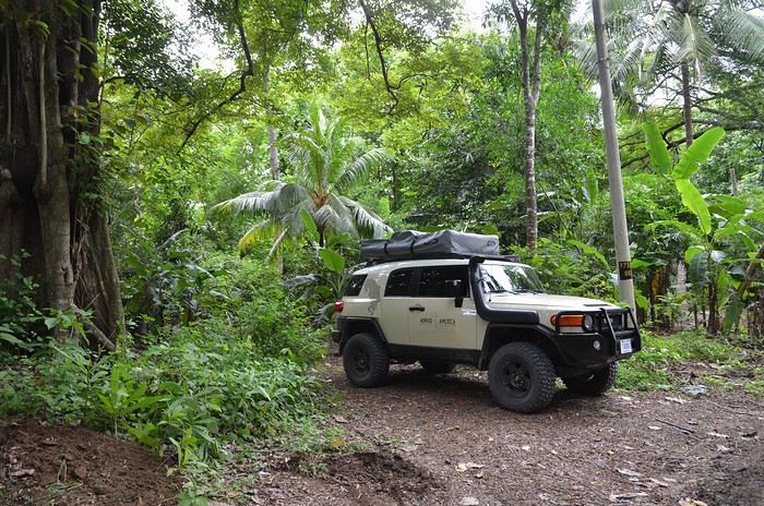
J’avais juste apporté une sangle et des manilles qui nous ont servi à desembourber un camion sur La pavona 11h départ Premiere journée d’organisation ravitaillement et peu de km Alajuala à zone volcan Poas 30km 1h Visite Chutes d’eau et la paz waterfall gardena (très cher mais interressant pour débuter le voyage et faire la connaissance avec les animaux que l’on va avoir l’occasion de rencontrer à l’etat sauvage au cours du voyage.
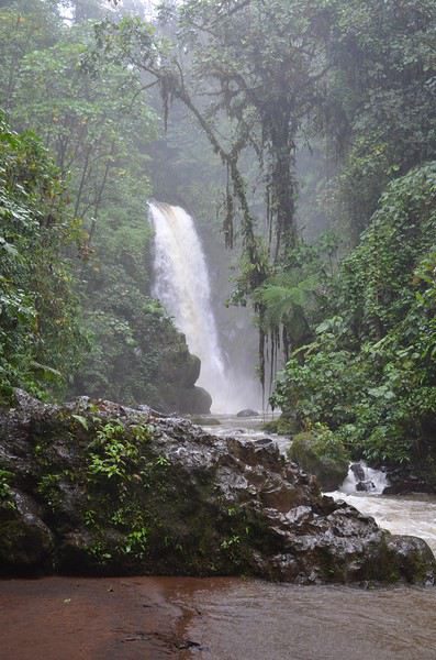
Nuit dans le coin à El Churrasco Hotel (fonctionnel, chambre avec cheminée : on est en altitude à la saison des pluies . Il ne fait pas chaud) 101€ = 125$
J2 lundi 16 juillet
Volcan Poas malheureusement fermé lors de notre passage pour risque d’eruption
départ pour zone nord 70km 1h40
Région de sarapiqui
Visite sur la route d'une exploitation de café
Etape à selva verde rainforest qui se trouve a chilamate ( 5 km à l’ouest de puerto viejo de sarapiqui)
Balade nocturne avec guide (19h) chauve-souris, kinkajous (petit mammifère arboricoles) dont un recueuilli et soigné qui sera remis en liberté au début de la marche par une association locale.Pleins de grenouilles ( yeux rouges, bleu jeans, verte et noires, ice, …) insectes, arachnidées…
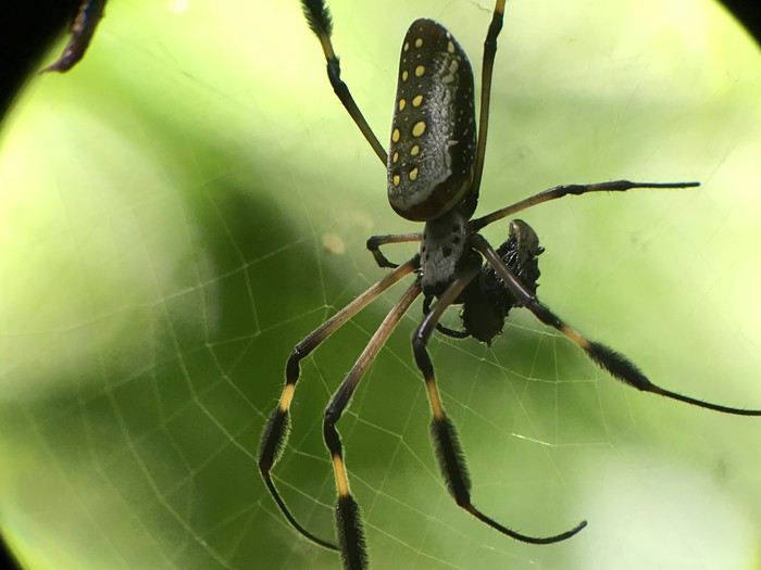
nuit à selva verde (sarapiqui room 187$)
J3 mardi 17 juillet Balade guidée foret primaire dans selva verde rainforest ( 9h ) durée 2h Singes hurleurs, paresseux deux et trois doigts et toute la faune décrite hier soir...
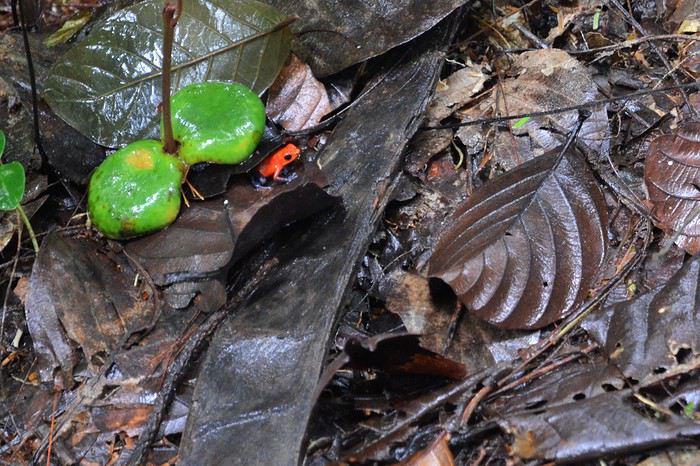
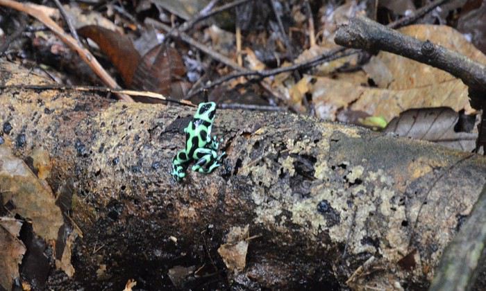
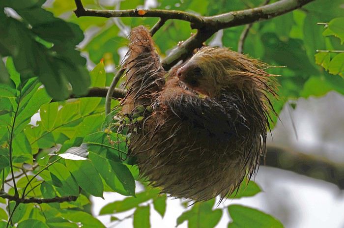
Départ pour La Fortuna
Passage par Hot springs Baldi : multiples bassins d’eau chaude voir très chaude. une pose sympathique avec les enfants. Initialement nous avions prévu un bivouac au village el castillo au bord du lac (vue sur lac et volcan). Mais au vu de la pluie incessante, on se rabat sur Hotel Essence Arenal qui propose un camping ou des chambres en dure ou un compromis que nous avons choisis: des grandes tentes type campement militaire sur plateforme en bambou surplombant la jungle. Très chouette vue sur la jungle depuis les tentes et sur le lac depuis un jacusi en plein air. Cuisine vegetarienne faite devant vous. Ambiance très cool.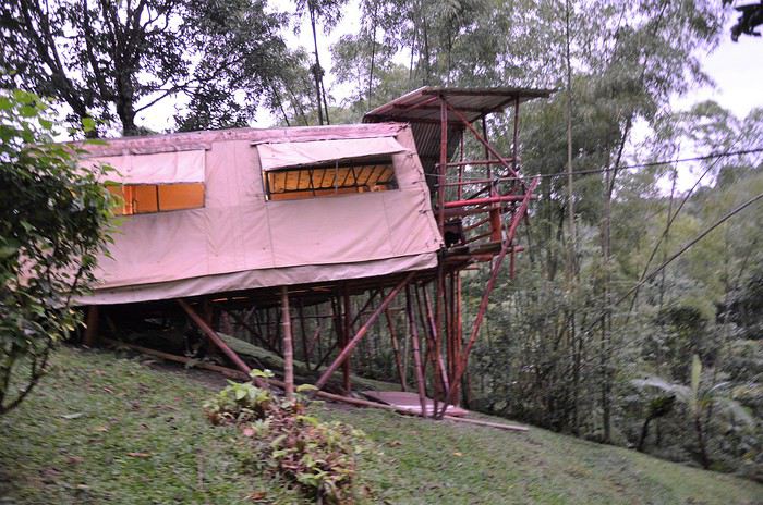
J4 mercredi 18 juillet Visite du parc national du volcan arenal: il existe trois entrées possibles pour le Parc du Volcan. Celle du Parc National du Volcan , celle du Resort Arenal Observatory Lodge et celle de Arenal 68. Elles sont à environ 1 km l’une de l’autre. On a opté pour arenal observatory. Nous n’aurons pas de vue sur le sommet du volcan en raison des épais nuages qui pleurent à grosses larmes pendant presque toute notre rando. Nous sommes trempés jusqu'aux sous vêtements malgré les ponchos, mais la balade reste sympa. Nous verrons de nombreux coatis...
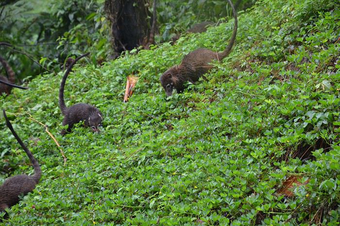
L’après midi sera consacrée à une activité ludique, absolument démentielle. Des tyrolliennes géantes jusqu’à 750 m de long . sensation garantie et une équipe très sympa et très sécurisante y compris pour les enfants.
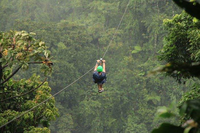
Nous avions prévu de continuer vers monteverde mais nous avons opté pour partir vers une région un peu moins humide vers la cote pacifique.
J5 jeudi 19 juillet
Nous avions 2 options de route une courte par le coté sud du lac arenal via la piste et une plus longue qui nous obligeait à faire le tour par le nord du lac. La nature a choisi! le premier gué de la piste était non franchissable le courant avait emporté la berge ce qui créait un marche d’un metre de haut et l’ eau charriait des troncs d'arbres. Bref demi tour vers la route…
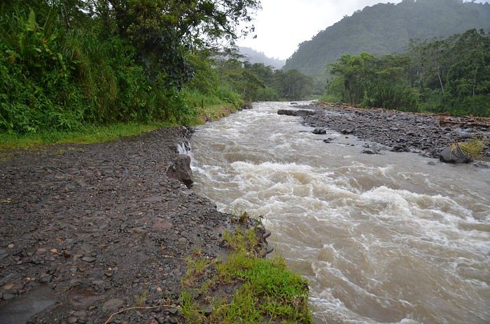
Direction Barra Honda à l’entrée de la presqu’ile de Nicoya Belle rando pleins de singes hurleurs, coatis, singes araignées, iguanes… Nuit en tente de toit devant la reserve de Barra Honda
J6 Vendredi 20 juillet Visite des grottes de barra honda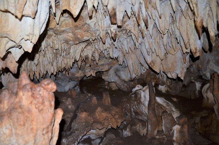
Dépaart pour lapresqu’ile de Nicoya
Visite Reserve Curu
Baignade à la plage, ratons laveurs, singes capucins, coatis, iguanes, cerfs, arrats…
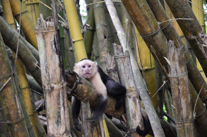
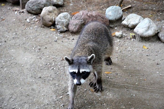
J7 samedi 21 juillet Isla tortuga à environ 45min de bateau. snorkeling : sympa sans plus. eau chargée en particule, visibilité moyenne. Puis passage par une très jolie plage en dehors de la zone touristique trop fréquentée. Présence de pas mal de sangliers peu farouches. L'après midi: Balade a cheval permettant de s’approcher des cervidés présents en grand nombre.
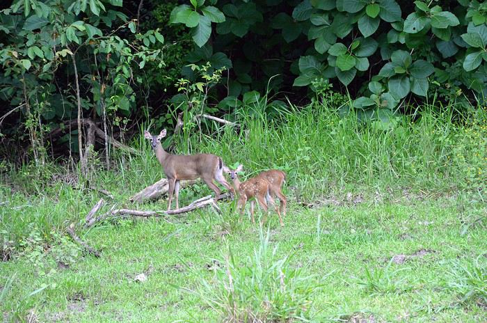
Départ pour montezuma Petit village ambiance baba cool Nuit dans structure tenue par un couple de chilien super accueillants sur les hauteurs de montezuma : casa colores plusieurs petites maisons en location avec cuisine équipée et chambres au milieu d’un jardin très joli occupé par des agoutis.
J8 dimanche 22 juillet
Rando pour aller faire du murray a playa grande : plage accessible uniquement à pied par chemin entre jungle, plage et cascade sur environ 45 minutes
J9 lundi 23 juillet
Montezuma à Paquera environ 30km 45 min Traversée en ferry vers puntarenas (1h30 6/j) direction Quepos vers le sud à 138km 2h15
Passage par le pont de Tarcoles où l’on voit de multiples et énormes crocodiles
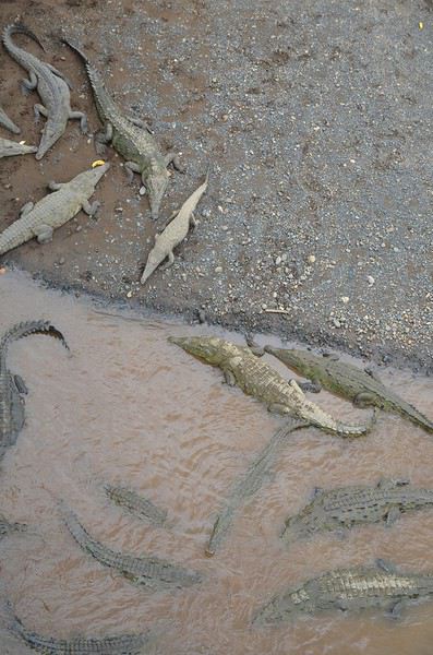
Nuit au sud de quepos au jungle beach hotel 170$ J10 Mardi 24 juillet visite du Parc national Manuel Antonio (!fermé le lundi) Très touristique mais très riche en animaux singes écureuils, hurleurs, , paresseux, iguanes, serpents. Se garer le plus prés possible de l’entrée, ne pas écouter les rabateurs, nourriture type snack interdite, prévoir maillot de bains
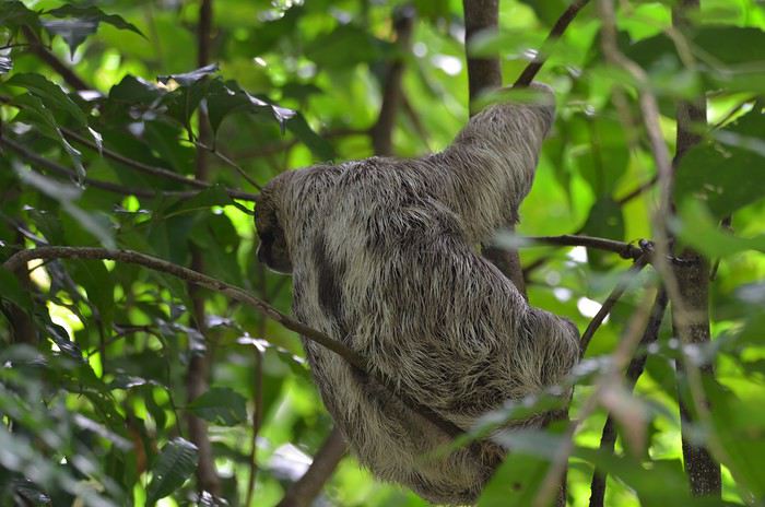
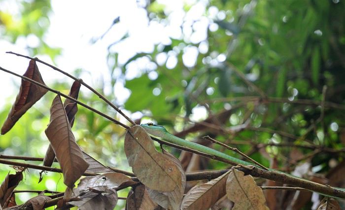
Depart vers camping Playa Matapalo ou l'on a bivouaqué sur la plage ( charli jungle beach) . on était tout seul!
J 11 mercredi 25 juillet
Reveil avec un paresseux dans l’arbre au dessus de la tente.
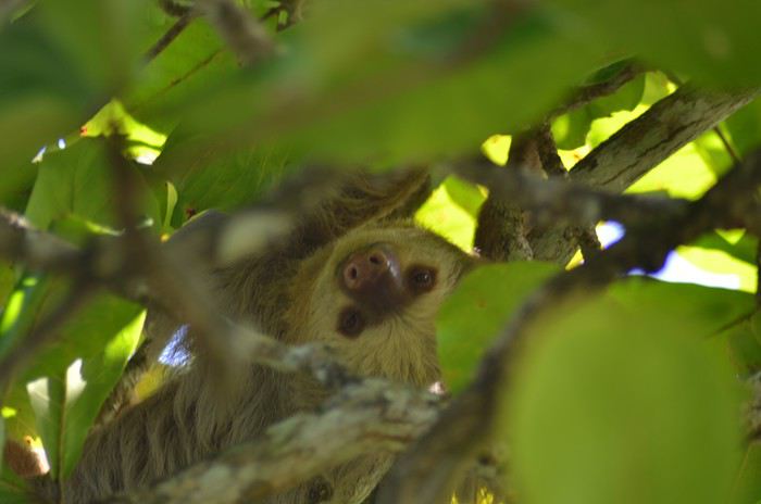
J’avais juste apporté une sangle et des manilles qui nous ont servi à desembourber un camion sur La pavona 11h départ Premiere journée d’organisation ravitaillement et peu de km Alajuala à zone volcan Poas 30km 1h Visite Chutes d’eau et la paz waterfall gardena (très cher mais interressant pour débuter le voyage et faire la connaissance avec les animaux que l’on va avoir l’occasion de rencontrer à l’etat sauvage au cours du voyage.
Nuit dans le coin à El Churrasco Hotel (fonctionnel, chambre avec cheminée : on est en altitude à la saison des pluies . Il ne fait pas chaud) 101€ = 125$
J2 lundi 16 juillet
Volcan Poas malheureusement fermé lors de notre passage pour risque d’eruption
départ pour zone nord 70km 1h40
Région de sarapiqui
Visite sur la route d'une exploitation de café
Etape à selva verde rainforest qui se trouve a chilamate ( 5 km à l’ouest de puerto viejo de sarapiqui)
Balade nocturne avec guide (19h) chauve-souris, kinkajous (petit mammifère arboricoles) dont un recueuilli et soigné qui sera remis en liberté au début de la marche par une association locale.Pleins de grenouilles ( yeux rouges, bleu jeans, verte et noires, ice, …) insectes, arachnidées…
nuit à selva verde (sarapiqui room 187$)
J3 mardi 17 juillet Balade guidée foret primaire dans selva verde rainforest ( 9h ) durée 2h Singes hurleurs, paresseux deux et trois doigts et toute la faune décrite hier soir...
Départ pour La Fortuna
Passage par Hot springs Baldi : multiples bassins d’eau chaude voir très chaude. une pose sympathique avec les enfants. Initialement nous avions prévu un bivouac au village el castillo au bord du lac (vue sur lac et volcan). Mais au vu de la pluie incessante, on se rabat sur Hotel Essence Arenal qui propose un camping ou des chambres en dure ou un compromis que nous avons choisis: des grandes tentes type campement militaire sur plateforme en bambou surplombant la jungle. Très chouette vue sur la jungle depuis les tentes et sur le lac depuis un jacusi en plein air. Cuisine vegetarienne faite devant vous. Ambiance très cool.
J4 mercredi 18 juillet Visite du parc national du volcan arenal: il existe trois entrées possibles pour le Parc du Volcan. Celle du Parc National du Volcan , celle du Resort Arenal Observatory Lodge et celle de Arenal 68. Elles sont à environ 1 km l’une de l’autre. On a opté pour arenal observatory. Nous n’aurons pas de vue sur le sommet du volcan en raison des épais nuages qui pleurent à grosses larmes pendant presque toute notre rando. Nous sommes trempés jusqu'aux sous vêtements malgré les ponchos, mais la balade reste sympa. Nous verrons de nombreux coatis...
L’après midi sera consacrée à une activité ludique, absolument démentielle. Des tyrolliennes géantes jusqu’à 750 m de long . sensation garantie et une équipe très sympa et très sécurisante y compris pour les enfants.
Nous avions prévu de continuer vers monteverde mais nous avons opté pour partir vers une région un peu moins humide vers la cote pacifique.
J5 jeudi 19 juillet
Nous avions 2 options de route une courte par le coté sud du lac arenal via la piste et une plus longue qui nous obligeait à faire le tour par le nord du lac. La nature a choisi! le premier gué de la piste était non franchissable le courant avait emporté la berge ce qui créait un marche d’un metre de haut et l’ eau charriait des troncs d'arbres. Bref demi tour vers la route…
Direction Barra Honda à l’entrée de la presqu’ile de Nicoya Belle rando pleins de singes hurleurs, coatis, singes araignées, iguanes… Nuit en tente de toit devant la reserve de Barra Honda
J6 Vendredi 20 juillet Visite des grottes de barra honda
Dépaart pour lapresqu’ile de Nicoya
Visite Reserve Curu
Baignade à la plage, ratons laveurs, singes capucins, coatis, iguanes, cerfs, arrats…
J7 samedi 21 juillet Isla tortuga à environ 45min de bateau. snorkeling : sympa sans plus. eau chargée en particule, visibilité moyenne. Puis passage par une très jolie plage en dehors de la zone touristique trop fréquentée. Présence de pas mal de sangliers peu farouches. L'après midi: Balade a cheval permettant de s’approcher des cervidés présents en grand nombre.
Départ pour montezuma Petit village ambiance baba cool Nuit dans structure tenue par un couple de chilien super accueillants sur les hauteurs de montezuma : casa colores plusieurs petites maisons en location avec cuisine équipée et chambres au milieu d’un jardin très joli occupé par des agoutis.
J8 dimanche 22 juillet
Rando pour aller faire du murray a playa grande : plage accessible uniquement à pied par chemin entre jungle, plage et cascade sur environ 45 minutes
J9 lundi 23 juillet
Montezuma à Paquera environ 30km 45 min Traversée en ferry vers puntarenas (1h30 6/j) direction Quepos vers le sud à 138km 2h15
Passage par le pont de Tarcoles où l’on voit de multiples et énormes crocodiles
Nuit au sud de quepos au jungle beach hotel 170$ J10 Mardi 24 juillet visite du Parc national Manuel Antonio (!fermé le lundi) Très touristique mais très riche en animaux singes écureuils, hurleurs, , paresseux, iguanes, serpents. Se garer le plus prés possible de l’entrée, ne pas écouter les rabateurs, nourriture type snack interdite, prévoir maillot de bains
Depart vers camping Playa Matapalo ou l'on a bivouaqué sur la plage ( charli jungle beach) . on était tout seul!
J 11 mercredi 25 juillet
Reveil avec un paresseux dans l’arbre au dessus de la tente.
Kayak au Groenland English translation pending
Avis aux amateurs de Terres préservées, de lieux inhabités, de voyages sportifs ainsi qu’aux amoureux de Nature Vierge. Récit de notre voyage en kayak au Groenland, en zigzaguant entre les icebergs, longeant des fjords sauvages, dormant sous tente et gravissant la calotte polaire.
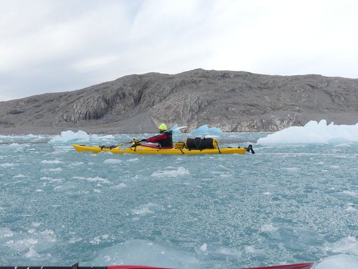
Après avoir utilisé le forum en long et en large pour nos voyages à moto (Islande, Croatie, Bolivie, Chili, Paraguay, Argentine) et nos voyages « conventionnels », notamment la Namibie, c’est désormais à mon tour de partager l’une de nos aventures.
De retour d’un congé sabbatique de 6 mois à moto entièrement organisé par nos soins (www.nouslabas.com), nous avions envie de vacances « clés en main ».
Pour la toute première fois, le forum manquait d’informations et de précieux carnets sur notre destination : le Groenland. Pour résumer cette expédition : 12 jours de kayak (30 août au 10 septembre 2017), nuits sous tente, autonomie complète, groupe de 13 personnes dont la guide.
Je vais donc favoriser autant que possibles les aspects pratiques de cette aventure proposée par Grand Nord Grand Large, Terres d’aventure et organisée par Tasermiut. A ce propos, je recommande une réservation directement auprès de Tasermiut. Le prix est inférieur et il vous suffit d’organiser votre déplacement domicile-> Copenhague -> domicile ou domicile-> Reykjavik -> domicile selon la date du séjour. Vous trouverez une liste des choses emportées en fin de récit.
Mon compagnon (Adrien-32 ans) et moi (Estelle-29 ans) nous envolons de Genève le 28 août 2017 pour atteindre Copenhague après 2h de vol. Nous profitons de notre après-midi pour découvrir la capitale danoise.
Le lendemain, retour à l’aéroport pour un vol à destination de Narsarsuaq, Groenland ! Nous survolons l’Islande et après 5h de vol (et 4h en moins sur nos montres), nous atteignons le pays glacé. Le ciel est découvert, la vue sur l’interminable Inlandsis (calotte polaire) est splendide.
A destination, nous traversons à pied le tarmac du minuscule aéroport (la « ville » compte moins de 200 habitants) et récupérons nos valises. Le ciel est dégagé, il fait environ 10-15 degrés. Nous sommes accueillis par Andrea, le groupe se rencontre. Nous sommes douze : 2 Français, 1 Allemand, 1 Belge, 1 Anglais, 4 Espagnols et 3 Suisses. Le Fran-glais-gnol sera parlé durant tout le séjour. La moyenne d’âge est d’environ 35 ans, les aînés sont un couple d’espagnols de 54 ans et le cadet un Suisse de 27 ans. Nous sommes deux femmes. Le zodiac qui nous permettra de rejoindre Narsaq est prévu dans 3h. Selon le planning, nous aurions dû rejoindre sans attendre Narsaq. Qu’à cela ne tienne, nous abandonnons nos valises dans la remorque du véhicule de Tasermiut et partons en randonnée plus ou moins équipés pour atteindre un petit sommet surplombant le village. Cette première balade permet de faire connaissance.
Nous rejoignons ensuite le port, récupérons nos valises dans la remorque qui a été acheminée depuis l’aéroport et enfilons des vestes très épaisses. Nous formons une chaîne humaine pour transporter tous nos bagages jusqu’au zodiac puis nous embarquons ! Nous suivons l’Eriksfjord durant 1h pour rejoindre Narsaq. En chemin, nous admirons quelques icebergs qui dérivent lentement.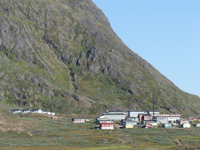 Au port, nous sommes accueillis par Elo (Eloïsa), notre guide. Une Argentine de Patagonie qui, nous le remarquerons très rapidement, est en parfaite symbiose avec son environnement rigoureux.
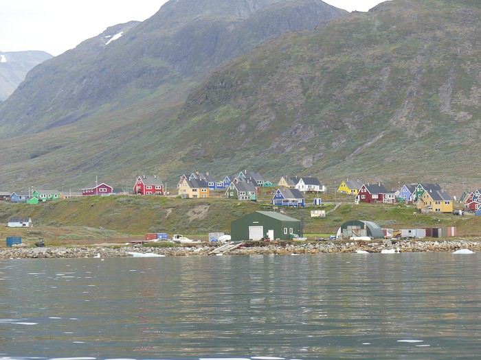 Nos valises sont chargées dans une nouvelle remorque puis nous rejoignons à pieds notre hébergement, une petite auberge en bordure de ville. De très nombreux icebergs flottent dans le fjord, la vue est magnifique. Avec plus de 1’500 habitants et 2 supermarchés, Narsaq possède bien le statut de ville.
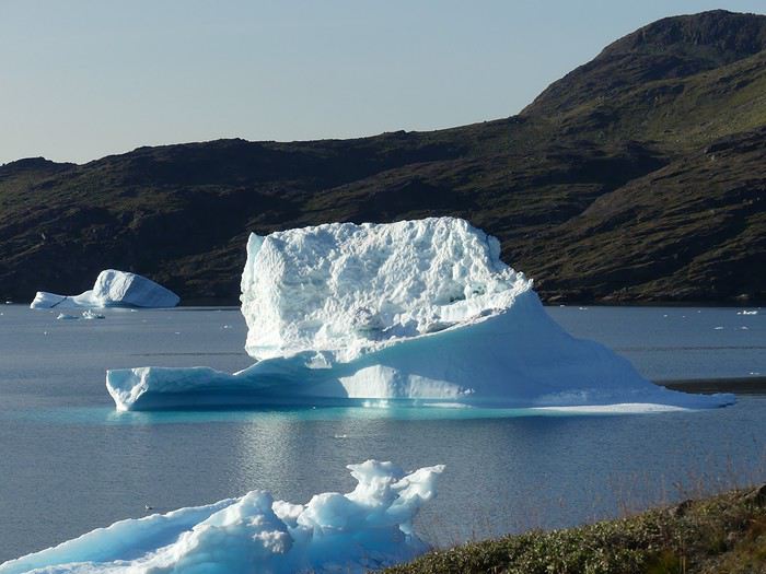 Nous profitons de la soirée pour faire connaissance, Elo répond à toutes nos questions plus ou moins saugrenues sur l’expédition à venir. En voici un échantillon dans le désordre :
- La durée de vie dans l’eau glaciale des fjords est de 10-15 minutes avec une combinaison étanche - Interdiction d’abandonner ou de brûler le papier toilette : on récupère tous les déchets non naturels. Que les plus sensibles se rassurent, cela a traumatisé quelques voyageurs… devoir récupérer son PQ, qui plus est dans un sac plastique transparent, ça éloigne très vite de sa zone de confort…. - Pas de liquide vaisselle ni de savon, la nature n’en veut pas - Pour la douche, la mer est à disposition (imaginez nos têtes !) - Chaque couple/duo dormira dans une tente mise à disposition - Les icebergs peuvent se fissurer, exploser ou se retourner à tout moment. Gardez vos distances et n'oubliez pas que 80% de l'iceberg se trouve SOUS le niveau de l'eau.
Nous passons une excellente soirée, tout le monde s’entraide pour la préparation du repas. Dernière nuit « dans du dur »….
Premier jour d’expédition (30 août 2017). Après le petit-déjeuner, Elo vérifie méticuleusement les bagages de chacun : -Combien de chaussettes ? - 12 paires, une par jour. - Non, tu n’en prends que 4. - Combien de T-shirts ? - 5 -Non, tu n’en prends que 2. - Dans ce sac ? - Mon rasoir… - Non, pas besoin
Pour le coup, on a l’impression de subir la version féminine de Mike Horn dans « Retour à l’état sauvage ». On ne fait pas les malins, on tente d’ajouter discrètement du matériel dans son dos. Peine perdue. Après 12 jours, nous avouerons tous qu’elle avait parfaitement raison. Le strict minimum suffit amplement (*voir liste des choses emportées en fin de carnet). Le but de ce contrôle est d’éviter de se surcharger mais également, et surtout, de vérifier la qualité du matériel emporté : température de confort du sac de couchage, qualité des habits chauds, possession d’équipement de pluie, etc….
Une personne mal équipée met sa vie en danger. Nous transportons ensuite 5 kayaks doubles et 3 kayaks simples jusqu’à la plage. Nous recevons des sacs étanches et commençons à charger les kayaks. Le compartiment avant est réservé à la nourriture. Chaque couple/duo reçoit également un énorme carton de vivres. A nous de nous débrouiller pour que tout passe. Après une partie de Tetris géant, nous parvenons à tout ranger. Les habits, les souliers de randonnée et la tente dans le compartiment étanche arrière, la nourriture dans le compartiment étanche avant. Les matelas et le matériel photo entre les jambes d’Adrien et le matériel pour la journée (gants de rechanges, pulls, gourde) entre mes jambes. Sur le pont arrière, la trousse de toilette, la pharmacie et les sacs à dos, sur le pont avant les sacs de couchages. Nous avons emporté nos propres sacs étanches (3 sacs de 25 litres et 3 de 20 litres), ce qui a été très pratique.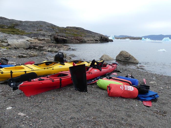 Nous retournons ensuite au hangar où est stocké tout le matériel pour prendre possession de notre équipement. Chacun reçoit une combinaison étanche, une paire de bottes en caoutchouc, une jupe permettant de « fermer » le kayak, un gilet de sauvetage et une pagaie.
Nous voilà enfin prêt !
L’après-midi est bien entamé et le ciel couvert lorsque nous recevons une formation accélérée du pagayage et des règles de sécurité avant de mettre les kayaks à l’eau. Les premiers coups de pagaies sont hésitants pour les débutants, les duos fraichement formés apprennent à se coordonner. (Nous avons participé à un cours privé de technique de pagayage avant notre départ, sur un lac suisse, ce qui n’est pas un luxe). Il nous faudra deux heures pour parcourir les 5 km nous séparant de la rive opposée du fjord. A destination, nous découvrons ce qui deviendra un rituel quotidien : nous portons les kayaks sur plusieurs mètres pour éviter de les voir emportés par la marée montante. Il faut être 6 pour porter un kayak double et 4 pour un simple. Nous unissons ensuite nos forces pour monter le tipi, qui sert de réfectoire et de tente pour Elo.
Nous retournons ensuite au hangar où est stocké tout le matériel pour prendre possession de notre équipement. Chacun reçoit une combinaison étanche, une paire de bottes en caoutchouc, une jupe permettant de « fermer » le kayak, un gilet de sauvetage et une pagaie.
Nous voilà enfin prêt !
L’après-midi est bien entamé et le ciel couvert lorsque nous recevons une formation accélérée du pagayage et des règles de sécurité avant de mettre les kayaks à l’eau. Les premiers coups de pagaies sont hésitants pour les débutants, les duos fraichement formés apprennent à se coordonner. (Nous avons participé à un cours privé de technique de pagayage avant notre départ, sur un lac suisse, ce qui n’est pas un luxe). Il nous faudra deux heures pour parcourir les 5 km nous séparant de la rive opposée du fjord. A destination, nous découvrons ce qui deviendra un rituel quotidien : nous portons les kayaks sur plusieurs mètres pour éviter de les voir emportés par la marée montante. Il faut être 6 pour porter un kayak double et 4 pour un simple. Nous unissons ensuite nos forces pour monter le tipi, qui sert de réfectoire et de tente pour Elo.
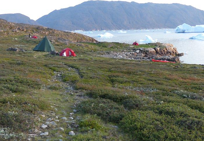 Ensuite, chacun retire son équipement, vide son kayak, installe sa tente, se change et il est déjà l’heure du repas.
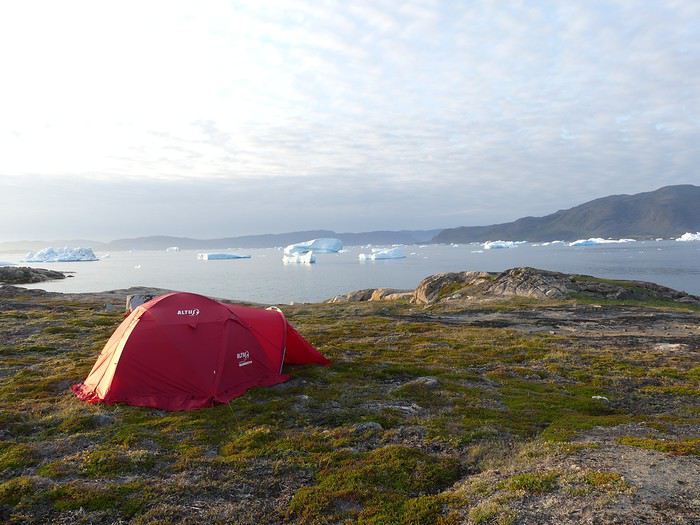 Elo nous concoctera de délicieux menus tout au long du séjour. Jolie prouesse que de cuisiner par terre pour 13 personnes avec deux feux à gaz, une poêle et une casserole.
Durant la nuit, la température descendra jusqu’à 6 degrés. Les icebergs à la dérive ne cesseront d’exploser, de se fissurer, de chuter et de se retourner. Le bruit est impressionnant.
Le lendemain, le ciel est bleu, le paysage toujours aussi beau. Après le petit-déjeuner, une courte marche nous permet de découvrir des ruines d’habitations vikings.
Elo nous concoctera de délicieux menus tout au long du séjour. Jolie prouesse que de cuisiner par terre pour 13 personnes avec deux feux à gaz, une poêle et une casserole.
Durant la nuit, la température descendra jusqu’à 6 degrés. Les icebergs à la dérive ne cesseront d’exploser, de se fissurer, de chuter et de se retourner. Le bruit est impressionnant.
Le lendemain, le ciel est bleu, le paysage toujours aussi beau. Après le petit-déjeuner, une courte marche nous permet de découvrir des ruines d’habitations vikings.
Lorsque tout le matériel est rangé dans les kayaks, nous repartons en mer. Nous faisons une petite pause après une heure.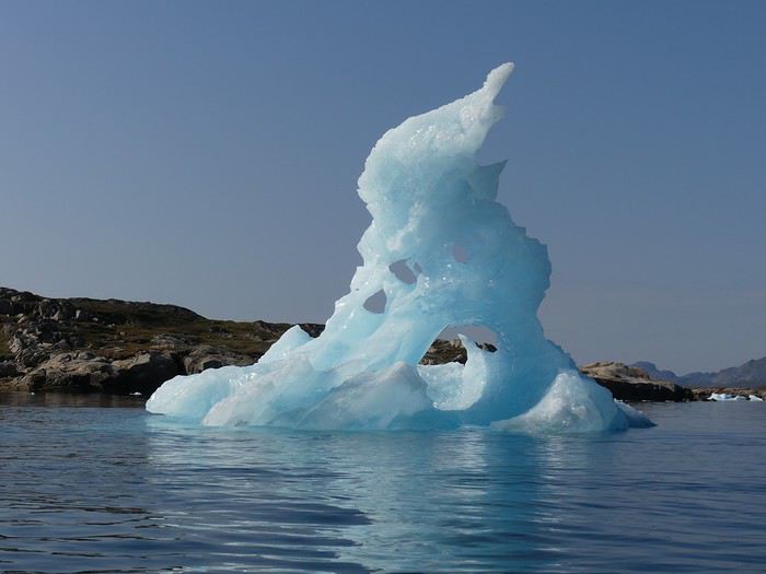 Comme annoncé, Elo se « douche » dans la mer. Nue, elle fait quelques brasses avant de laisser sa peau sécher au soleil. D’abord interloqué, la moitié du groupe finira par l’imiter, avec quelques cris (l’eau est à 2-3 degrés) mais dans une ambiance bonne enfant. Nous voilà au sein d’un groupe de naturistes au Groenland !
Nous réembarquons et nous nous engageons dans la traversée du fjord d’Ikersuaq. La mer est calme, nous passons à proximité d’immenses icebergs en provenance du fjord de Sermilik (80% de l'iceberg est immergé - la taille de celui-ci est démente !). De nouveaux muscles font leur apparition, nous serrons les dents. Après 1h30, nous accostons sur une île pour la pause de midi. Il est déjà 16h…. Nous repartons ensuite pour atteindre notre camp. Il nous faudra 1h30 supplémentaires pour enfin accoster ! Journée très éprouvante, nous avons parcouru près de 25 km. Le ciel révélera quelques faibles aurores boréales blanchâtres. A part le craquement des icebergs, nous profitons d’un silence total. On adore !
Le 3ème jour, les courbatures font leur apparition dès notre installation dans le kayak. Aïe mes bras, aïe mon dos, aïe mes fesses. Tout le monde a souffert de la longue journée d’hier, nous espérons un itinéraire plus court pour aujourd’hui.
 Après 15 km, nous atteignons un nouveau campement. Nous admirons deux aigles et profitons de la rivière toute proche pour une douche…. rapide, très rapide la douche !
 Durant le repas du soir, nous mettons en place des tours de garde afin de surveiller le ciel. Nous espérons pouvoir admirer de belles aurores boréales. Grande dormeuse, je prends immédiatement le premier tour, de 23h30 à minuit. Après deux heures de sommeil, je me rhabille et sors péniblement dans le froid.
Drôle d’ambiance : le campement est parfaitement silencieux, seul un iceberg flotte dans la baie…. Le ciel est découvert, rempli d’innombrables étoiles. Malheureusement, aucune aurore boréale… je me balade durant 30 minutes, puis je vais réveiller mon compagnon, qui assure le tour de garde suivant. Il ne mettra que 5 petites minutes pour sortir de la tente, mais déjà le ciel commence à « bouger ». Je lui explique la situation : il y a quelques trainées blanches, mais rien d’exceptionnel. Il n’en fallait pas plus pour que Dame Nature nous prouve le contraire. C’est à grand cris que nous réveillons tout le campement : Aurora, aurora, Northern Light, wake up !!!
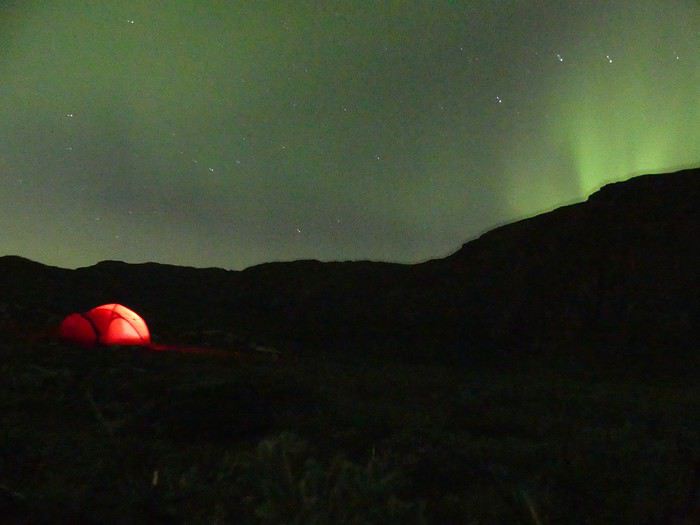 Nous sommes éblouis : le ciel danse sous nos yeux, les aurores ondulent avec grâce, moment inoubliable mais aussi intense que court : à peine 10 minutes !
Nous retournons nous coucher, des aurores pleins les yeux !
Nous sommes éblouis : le ciel danse sous nos yeux, les aurores ondulent avec grâce, moment inoubliable mais aussi intense que court : à peine 10 minutes !
Nous retournons nous coucher, des aurores pleins les yeux !
Le lendemain, nous pagayons durant 10 kilomètres. En début de matinée, la mer est d’huile, nous glissons sur l’eau en longeant le bord du fjord et apercevons un phoque. Mais bientôt le vent se lève, nous l’affrontons de face. Les vagues s’écrasent sur la proue du kayak, nous serrons les dents. Pas moyen de se reposer, au moindre arrêt le vent et les vagues nous font reculer.
Nous atteignons le bivouac en début d’après-midi et parvenons à monter le tipi et les tentes, malgré les fortes bourrasques de vents.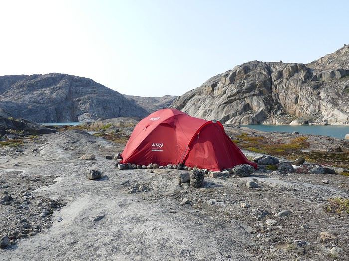
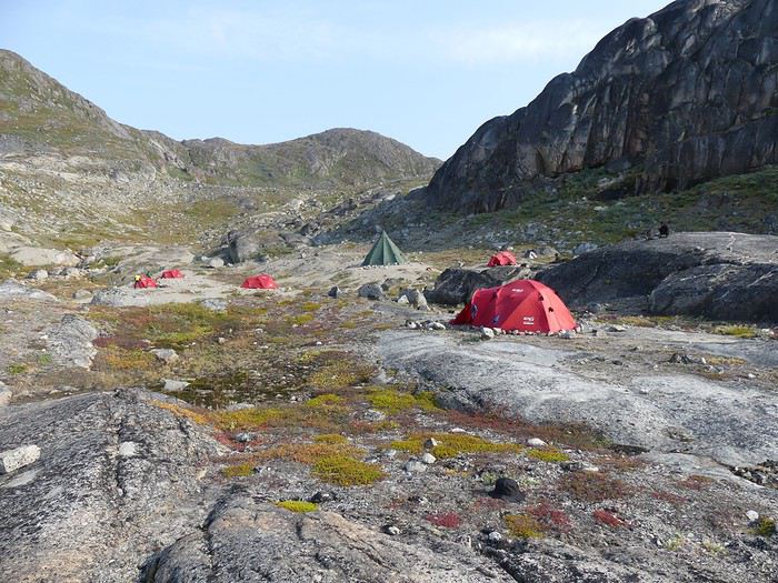 La suite de la journée est libre, chacun s’occupe ou se repose selon ses envies.
Le cinquième jour, pas de kayak ! La journée est consacrée à une randonnée. 6h de marche et 700 mètres de dénivelés pour atteindre un sommet proche de l’Inlandsis. Les fortes rafales de vent de la nuit sont se calmées, nous profitons d’un soleil radieux.
La suite de la journée est libre, chacun s’occupe ou se repose selon ses envies.
Le cinquième jour, pas de kayak ! La journée est consacrée à une randonnée. 6h de marche et 700 mètres de dénivelés pour atteindre un sommet proche de l’Inlandsis. Les fortes rafales de vent de la nuit sont se calmées, nous profitons d’un soleil radieux.
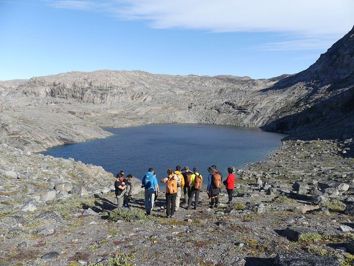 Aucun sentier, nous suivons tant bien que mal Elo. Nous débusquerons des perdrix avant de nous goinfrer de délicieuses myrtilles sauvages. A midi, nous atteignons le sommet et admirons la vue sur la calotte polaire, infinie. 3’000 kilomètres plus au Nord, c’est le Pôle Nord. La glace atteint en moyenne 2 kilomètres d’épaisseur. Tout est démesuré, nous nous sentons minuscules.
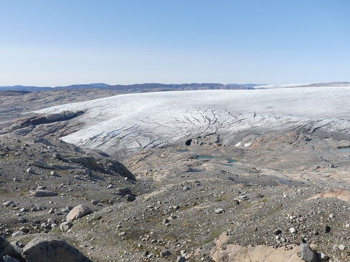
 Nous pique-niquons à l’abri d’une barre rocheuse (le vent est assez fort sur les crêtes) avant d’entamer la descente.
Après avoir utilisé le forum en long et en large pour nos voyages à moto (Islande, Croatie, Bolivie, Chili, Paraguay, Argentine) et nos voyages « conventionnels », notamment la Namibie, c’est désormais à mon tour de partager l’une de nos aventures.
De retour d’un congé sabbatique de 6 mois à moto entièrement organisé par nos soins (www.nouslabas.com), nous avions envie de vacances « clés en main ».
Pour la toute première fois, le forum manquait d’informations et de précieux carnets sur notre destination : le Groenland. Pour résumer cette expédition : 12 jours de kayak (30 août au 10 septembre 2017), nuits sous tente, autonomie complète, groupe de 13 personnes dont la guide.
Je vais donc favoriser autant que possibles les aspects pratiques de cette aventure proposée par Grand Nord Grand Large, Terres d’aventure et organisée par Tasermiut. A ce propos, je recommande une réservation directement auprès de Tasermiut. Le prix est inférieur et il vous suffit d’organiser votre déplacement domicile-> Copenhague -> domicile ou domicile-> Reykjavik -> domicile selon la date du séjour. Vous trouverez une liste des choses emportées en fin de récit.
Mon compagnon (Adrien-32 ans) et moi (Estelle-29 ans) nous envolons de Genève le 28 août 2017 pour atteindre Copenhague après 2h de vol. Nous profitons de notre après-midi pour découvrir la capitale danoise.
Le lendemain, retour à l’aéroport pour un vol à destination de Narsarsuaq, Groenland ! Nous survolons l’Islande et après 5h de vol (et 4h en moins sur nos montres), nous atteignons le pays glacé. Le ciel est découvert, la vue sur l’interminable Inlandsis (calotte polaire) est splendide.
A destination, nous traversons à pied le tarmac du minuscule aéroport (la « ville » compte moins de 200 habitants) et récupérons nos valises. Le ciel est dégagé, il fait environ 10-15 degrés. Nous sommes accueillis par Andrea, le groupe se rencontre. Nous sommes douze : 2 Français, 1 Allemand, 1 Belge, 1 Anglais, 4 Espagnols et 3 Suisses. Le Fran-glais-gnol sera parlé durant tout le séjour. La moyenne d’âge est d’environ 35 ans, les aînés sont un couple d’espagnols de 54 ans et le cadet un Suisse de 27 ans. Nous sommes deux femmes. Le zodiac qui nous permettra de rejoindre Narsaq est prévu dans 3h. Selon le planning, nous aurions dû rejoindre sans attendre Narsaq. Qu’à cela ne tienne, nous abandonnons nos valises dans la remorque du véhicule de Tasermiut et partons en randonnée plus ou moins équipés pour atteindre un petit sommet surplombant le village. Cette première balade permet de faire connaissance.
Nous rejoignons ensuite le port, récupérons nos valises dans la remorque qui a été acheminée depuis l’aéroport et enfilons des vestes très épaisses. Nous formons une chaîne humaine pour transporter tous nos bagages jusqu’au zodiac puis nous embarquons ! Nous suivons l’Eriksfjord durant 1h pour rejoindre Narsaq. En chemin, nous admirons quelques icebergs qui dérivent lentement.
Au port, nous sommes accueillis par Elo (Eloïsa), notre guide. Une Argentine de Patagonie qui, nous le remarquerons très rapidement, est en parfaite symbiose avec son environnement rigoureux.
Nos valises sont chargées dans une nouvelle remorque puis nous rejoignons à pieds notre hébergement, une petite auberge en bordure de ville. De très nombreux icebergs flottent dans le fjord, la vue est magnifique. Avec plus de 1’500 habitants et 2 supermarchés, Narsaq possède bien le statut de ville.
Nous profitons de la soirée pour faire connaissance, Elo répond à toutes nos questions plus ou moins saugrenues sur l’expédition à venir. En voici un échantillon dans le désordre :- La durée de vie dans l’eau glaciale des fjords est de 10-15 minutes avec une combinaison étanche - Interdiction d’abandonner ou de brûler le papier toilette : on récupère tous les déchets non naturels. Que les plus sensibles se rassurent, cela a traumatisé quelques voyageurs… devoir récupérer son PQ, qui plus est dans un sac plastique transparent, ça éloigne très vite de sa zone de confort…. - Pas de liquide vaisselle ni de savon, la nature n’en veut pas - Pour la douche, la mer est à disposition (imaginez nos têtes !) - Chaque couple/duo dormira dans une tente mise à disposition - Les icebergs peuvent se fissurer, exploser ou se retourner à tout moment. Gardez vos distances et n'oubliez pas que 80% de l'iceberg se trouve SOUS le niveau de l'eau.
Nous passons une excellente soirée, tout le monde s’entraide pour la préparation du repas. Dernière nuit « dans du dur »….
Premier jour d’expédition (30 août 2017). Après le petit-déjeuner, Elo vérifie méticuleusement les bagages de chacun : -Combien de chaussettes ? - 12 paires, une par jour. - Non, tu n’en prends que 4. - Combien de T-shirts ? - 5 -Non, tu n’en prends que 2. - Dans ce sac ? - Mon rasoir… - Non, pas besoin
Pour le coup, on a l’impression de subir la version féminine de Mike Horn dans « Retour à l’état sauvage ». On ne fait pas les malins, on tente d’ajouter discrètement du matériel dans son dos. Peine perdue. Après 12 jours, nous avouerons tous qu’elle avait parfaitement raison. Le strict minimum suffit amplement (*voir liste des choses emportées en fin de carnet). Le but de ce contrôle est d’éviter de se surcharger mais également, et surtout, de vérifier la qualité du matériel emporté : température de confort du sac de couchage, qualité des habits chauds, possession d’équipement de pluie, etc….
Une personne mal équipée met sa vie en danger. Nous transportons ensuite 5 kayaks doubles et 3 kayaks simples jusqu’à la plage. Nous recevons des sacs étanches et commençons à charger les kayaks. Le compartiment avant est réservé à la nourriture. Chaque couple/duo reçoit également un énorme carton de vivres. A nous de nous débrouiller pour que tout passe. Après une partie de Tetris géant, nous parvenons à tout ranger. Les habits, les souliers de randonnée et la tente dans le compartiment étanche arrière, la nourriture dans le compartiment étanche avant. Les matelas et le matériel photo entre les jambes d’Adrien et le matériel pour la journée (gants de rechanges, pulls, gourde) entre mes jambes. Sur le pont arrière, la trousse de toilette, la pharmacie et les sacs à dos, sur le pont avant les sacs de couchages. Nous avons emporté nos propres sacs étanches (3 sacs de 25 litres et 3 de 20 litres), ce qui a été très pratique.
Nous retournons ensuite au hangar où est stocké tout le matériel pour prendre possession de notre équipement. Chacun reçoit une combinaison étanche, une paire de bottes en caoutchouc, une jupe permettant de « fermer » le kayak, un gilet de sauvetage et une pagaie.
Nous voilà enfin prêt !
L’après-midi est bien entamé et le ciel couvert lorsque nous recevons une formation accélérée du pagayage et des règles de sécurité avant de mettre les kayaks à l’eau. Les premiers coups de pagaies sont hésitants pour les débutants, les duos fraichement formés apprennent à se coordonner. (Nous avons participé à un cours privé de technique de pagayage avant notre départ, sur un lac suisse, ce qui n’est pas un luxe). Il nous faudra deux heures pour parcourir les 5 km nous séparant de la rive opposée du fjord. A destination, nous découvrons ce qui deviendra un rituel quotidien : nous portons les kayaks sur plusieurs mètres pour éviter de les voir emportés par la marée montante. Il faut être 6 pour porter un kayak double et 4 pour un simple. Nous unissons ensuite nos forces pour monter le tipi, qui sert de réfectoire et de tente pour Elo.
Ensuite, chacun retire son équipement, vide son kayak, installe sa tente, se change et il est déjà l’heure du repas.
Elo nous concoctera de délicieux menus tout au long du séjour. Jolie prouesse que de cuisiner par terre pour 13 personnes avec deux feux à gaz, une poêle et une casserole.
Durant la nuit, la température descendra jusqu’à 6 degrés. Les icebergs à la dérive ne cesseront d’exploser, de se fissurer, de chuter et de se retourner. Le bruit est impressionnant.
Le lendemain, le ciel est bleu, le paysage toujours aussi beau. Après le petit-déjeuner, une courte marche nous permet de découvrir des ruines d’habitations vikings.Lorsque tout le matériel est rangé dans les kayaks, nous repartons en mer. Nous faisons une petite pause après une heure.
Comme annoncé, Elo se « douche » dans la mer. Nue, elle fait quelques brasses avant de laisser sa peau sécher au soleil. D’abord interloqué, la moitié du groupe finira par l’imiter, avec quelques cris (l’eau est à 2-3 degrés) mais dans une ambiance bonne enfant. Nous voilà au sein d’un groupe de naturistes au Groenland !Nous réembarquons et nous nous engageons dans la traversée du fjord d’Ikersuaq. La mer est calme, nous passons à proximité d’immenses icebergs en provenance du fjord de Sermilik (80% de l'iceberg est immergé - la taille de celui-ci est démente !). De nouveaux muscles font leur apparition, nous serrons les dents. Après 1h30, nous accostons sur une île pour la pause de midi. Il est déjà 16h….
Nous repartons ensuite pour atteindre notre camp. Il nous faudra 1h30 supplémentaires pour enfin accoster ! Journée très éprouvante, nous avons parcouru près de 25 km. Le ciel révélera quelques faibles aurores boréales blanchâtres. A part le craquement des icebergs, nous profitons d’un silence total. On adore !Le 3ème jour, les courbatures font leur apparition dès notre installation dans le kayak. Aïe mes bras, aïe mon dos, aïe mes fesses. Tout le monde a souffert de la longue journée d’hier, nous espérons un itinéraire plus court pour aujourd’hui.
Après 15 km, nous atteignons un nouveau campement. Nous admirons deux aigles et profitons de la rivière toute proche pour une douche…. rapide, très rapide la douche !
Durant le repas du soir, nous mettons en place des tours de garde afin de surveiller le ciel. Nous espérons pouvoir admirer de belles aurores boréales. Grande dormeuse, je prends immédiatement le premier tour, de 23h30 à minuit. Après deux heures de sommeil, je me rhabille et sors péniblement dans le froid.Drôle d’ambiance : le campement est parfaitement silencieux, seul un iceberg flotte dans la baie…. Le ciel est découvert, rempli d’innombrables étoiles. Malheureusement, aucune aurore boréale… je me balade durant 30 minutes, puis je vais réveiller mon compagnon, qui assure le tour de garde suivant. Il ne mettra que 5 petites minutes pour sortir de la tente, mais déjà le ciel commence à « bouger ». Je lui explique la situation : il y a quelques trainées blanches, mais rien d’exceptionnel. Il n’en fallait pas plus pour que Dame Nature nous prouve le contraire. C’est à grand cris que nous réveillons tout le campement : Aurora, aurora, Northern Light, wake up !!!
Nous sommes éblouis : le ciel danse sous nos yeux, les aurores ondulent avec grâce, moment inoubliable mais aussi intense que court : à peine 10 minutes !
Nous retournons nous coucher, des aurores pleins les yeux !Le lendemain, nous pagayons durant 10 kilomètres. En début de matinée, la mer est d’huile, nous glissons sur l’eau en longeant le bord du fjord et apercevons un phoque. Mais bientôt le vent se lève, nous l’affrontons de face. Les vagues s’écrasent sur la proue du kayak, nous serrons les dents. Pas moyen de se reposer, au moindre arrêt le vent et les vagues nous font reculer.
Nous atteignons le bivouac en début d’après-midi et parvenons à monter le tipi et les tentes, malgré les fortes bourrasques de vents.
La suite de la journée est libre, chacun s’occupe ou se repose selon ses envies.
Le cinquième jour, pas de kayak ! La journée est consacrée à une randonnée. 6h de marche et 700 mètres de dénivelés pour atteindre un sommet proche de l’Inlandsis. Les fortes rafales de vent de la nuit sont se calmées, nous profitons d’un soleil radieux.
Aucun sentier, nous suivons tant bien que mal Elo. Nous débusquerons des perdrix avant de nous goinfrer de délicieuses myrtilles sauvages. A midi, nous atteignons le sommet et admirons la vue sur la calotte polaire, infinie. 3’000 kilomètres plus au Nord, c’est le Pôle Nord. La glace atteint en moyenne 2 kilomètres d’épaisseur. Tout est démesuré, nous nous sentons minuscules.
Nous pique-niquons à l’abri d’une barre rocheuse (le vent est assez fort sur les crêtes) avant d’entamer la descente.Retour de 2 semaines de vacances plongées au Panama English translation pending
Je viens souvent sur ce forum essentiellement pour piocher des infos pour nos vacances ou week-end et j'ai souhaité partager avec vous notre voyage plongée au Panama avec ce compte-rendus.
Nous étions 4: 2 amies: Michèle et Dorothée, mon compagnon: Cédric et moi-même.
Certains d'entre nous avaient déjà plongée en Guadeloupe, Martinique, Mexique (Playa Del Carmen et La Paz).
J'avais pensé partir au Belize, ou au Honduras, mais le choix s'est arrêté sur le Panama.
Le séjour a été partagé entre la Costa Arriba sur la mer des Caraïbes (7 nuits à Puerto Lindo à côté de Portobelo) et la côte Pacifique vers le très réputé spot de surf de Santa Catalina (5 nuits) et la fameuse île de Coiba (faisant souvent partie du trajet pour les chanceux qui vont plonger aux Cocos). Et 2 nuits à Panama City : au début et à la fin du séjour.
Pour les nuits à Panama City et à Puerto Lindo nous sommes passé en direct. Par contre pour Santa Catalina et la location de voiture, nous sommes passé par un tour opérator Toulousain spécialiste des voyages plongées.
Jour 1: Nous sommes donc partis 2 semaines sur un vol direct Paris- Panama City. Nous partons de Paris à 13h50, sous un ciel bleu avec une température extérieure de 8°c. Le vol dure 11h. Nous arrivons sur l'aéroport de Tocumen avec un peu d'avance, du coup nous devons patienter car le point de parking n'est pas prêt!!!! ce n'est pas grave nous sommes en vacances!!!
Au passage des douanes, nos empreintes digitales sont prisent ainsi qu'une photo... forcément sans sourire!! Récupération des bagages et direction la location de voiture. Nous oublions les chariots pour nos bagages qui sont en locations à 3$. Notre toyota Fortuner est pile la taille dont nous avons besoin pour ranger tous nos sacs.
C'est Dorothée qui conduit la 1ere: voiture énorme, boite automatique, vitres sur-teintées que nous nous empressons de baisser pour voir et faciliter la conduite. Il fait nuit et avec les vitres teintées, la conduite n'est vraiment pas évidente. Surtout que les panaméens n'ont pas l'air de connaître le clignotant mais plus le klaxon. Heureusement, ils ne roulent pas vite!! Nous avions téléchargé en France, une carte du Panama avec l'application gratuite Maps.me pour avoir un GPS sans passer par internet. Cette application est vraiment une réussite.
L'arrivée sur Panama City de nuit est vraiment superbe avec tous ces buildings éclairés et ce reflétant dans la baie. Nous trouvons la rue, où nous avions réservé une chambre pour nous 4 sur le site Air BnB, mais pas la maison!!! Après un appel à notre contact, nous trouvons la maison, nous nous enregistrons et direction le dodo. Nous coupons la clim afin de ne pas compromettre nos futurs plongées. La journée a vraiment été longue. La chaleur n'arrangeant rien.
Jour 2 Grâce au décalage horaire, nous sommes réveillé assez tôt. 7h30, nous prenons notre petit-déjeuner sur la terrasse en bordure d'un jardin et donnons rendez-vous à Mariela pour dans 15 jours. Après avoir rechargé tous nos sacs, nous reprenons la route direction Puerto-Lindo. Nous loupons la sortie sur la transisthmique et faisons demi-tour à Colon avant de continuer en longeant la mer jusqu'à Puerto-Lindo. Faisons un petit arrêt photo, nous nous extasions devant les fourmis qui transportent d’énorme morceaux de feuilles jusqu'à leur fourmilière. Un panneau annonçant le Panama Reef Divers nous accueille à l'entrée du village.
Dernier virage à gauche, déverrouillage des portes et nous voilà arrivé après 3h de route. Névine et Franck nous accueille, nous déchargeons nos sacs et …. reprenons la route, et oui, il est encore tôt et nous souhaitons allez voir le fameux Canal de Panama, la suite du séjour ne nous en laissera pas le temps. Nous nous arrêtons chez Lionel, un français qui tient une pizzeria afin de grignoter quelque chose rapidement à midi. Nous arrivons aux écluses de Gatun en traversant le chantier d’agrandissement du canal. Nous y passons plus de 1h30 à regarder les cargos, vrachiers et autres embarcations passer lentement aux grès des ouvertures et fermetures des écluses. Faisons signes aux équipages. Et essayant de comprendre le fonctionnement. Les écluses se remplissent et se vident rapidement, il y a très peu de monde dans la terrasse d’observation. Pour 5 $, cela vaut vraiment le coup.
Nous rentrons à Puerto Lindo, Franck nous présente le centre et l'organisation pour les prochains jours. En raison d'un coup de vent annoncé dans quelques jours nous groupons les 3 jours de plongées pour avoir les 3 jours de libres en fin de séjour et ne pas être gêné par le mauvais temps. Avec Michèle et Cédric, (Dorothée ayant préféré se reposer) nous dînons chez Hans, au bout de la plage de Puerto Lindo, les assiettes sont vraiment copieuses.
Demain nous sauterons dans nos combinaisons et direction les profondeurs sous marine en attendant nous allons faire une profonde dans nos lits!! Le bruits des vagues qui sont a 20m maxi nous berce gentiment aidé par un petit vent qui passe par les fenêtres ouvertes.
Jour 3: Réveillé à 6h30, nous préparons les caissons d'appareils photo et go-pro, et descendons déjeuner.
Le ciel est nuageux, mais il fait déjà bon. A PuertoLindo nous aurons un ciel assez nuageux tout au long de la semaine, du coup un peu moins chaud (30°c quand même avec toujours un petit alizé).
Le petit déjeuner est bon, copieux et sera le même tout au long du séjour.
Préparation du matériel de plongée, puis direction la lancha pilotée par un jeune homme du village. Notre 1ere plongée se fait sur un ilôt : la isla de las dos hermanas, rien que ça !! L'intervalle de surface se fera sur Playa Blanca, magnifique plage de sable blanc, bordée d'une végétation luxuriante.
La 2eme plongée, se fait à proximité.et porte le nom de la plage Playa Blanca. Retour au centre, nous défaisons nos blocs, allons nous doucher puis à table. Nous avons pris l'option de déjeuner au centre pour les 3 jours de plongées.
Petite sieste pour certaines, lectures pour d'autres puis balade sur le chemin qui mène au village de Cacique. Nous nous équipons un peu de façon excessive par crainte des moustiques et d'autres bêtes sauvages ...(chaussures fermées, pantalon et tee-shirt manches longues, nous regretteront rapidement car il fait vraiment très chaud à l'abri des alizés et les moustiques brillent par leurs absences) Après avoir parcourus 200m après la route, dans un manguier nous trouvons un paresseux endormis. Après quelques photos, nous reprenons notre chemin voir araignées, oiseaux, fleurs, fruits, papillons, fourmis …
Quasiment revenu sur la route, nous entendons les singes hurler, bien sûr nous faisons ½ tour et nous approchons au mieux. C'est Michèle qui les voit en premier. Ils sont là, dans les arbres, avec les jumelles et les appareils photos nous les voyons bien. Ce sont les mâles qui hurlent à la tombée du jour avec leur belle crinière autour du visage. De retour au centre, nous racontons à Névine et Franck nos découvertes qui sont heureux pour nous.
Nous dînons au centre, visionnons nos photos du jour, les terrestres et les sous-marines. Et allons rejoindre Morphée.
Jour 4 : Deuxième jour de plongée, direction Farallones, un îlot avec un petit phare, 2 cocotiers ont le mérite d'y survivre au milieu des oiseaux. Les 2 plongées se font ici, l'intervalle de surface aussi, car nous sommes assez loin de tout. La plongée est belle, vivante, se sera un coup de cœur.
L'après-midi nous visitons le village. Les habitants sont sympathiques, accueillant, un jeune homme nous demande si nous souhaitons une lancha pour aller sur Isla Mamey ou Isla Grande, nous refusons poliment, rester sur une plage durant de longues n'est vraiment pas de notre goût alors qu'il y a tant de choses à voir. Petit tour sur le terrain de base-ball, (il y a des terrains dans presque tous les villages, c'est vraiment un sport très pratiqué ici).
Nous allons dîner dans un resto également tenu par des français: El Don Quijote, pizzeria grill.
Le retour se fait de nuit également, il faut vraiment être vigilant car il y a pas mal de piétons sur les routes, de gens assis sur le bord des routes non éclairé, des chiens, et le risques de rencontre avec les animaux sauvages.
Il n'y a pas vraiment de resto avec de la cuisine locale. Enfin, si la cuisine locale, se résume aux pizzas, frites, poissons frits, poulet frits... accompagné de riz au lait de coco (très bon), yucca (sorte de taro) bananes plantain frite... Nous nous régalons de ceviche (poisson ou fruits de mer mariné dans du citron et aux aromates), heureusement les fruits sont excellent et on se régalera tout au long du séjour de délicieux jus de fruit et batido con leche (sorte de milk-shake). On goûtera même aux premières mangues de la saison (délicieuse).
Jour 5 : Aujourd'hui, dernier jour de plongée dans le mer des Caraïbes à Isla del padre. Elles seront magnifiques et encore bien différentes des précédentes.
Retour au centre, après un bon déjeuner nous prenons la voiture et direction Portobelo pour visiter ses bâtiments historiques les nombreux forts classé au patrimoine de l'UNESCO, la douane, ses ruelles, l'église. En rentrant nous faisons un stop pour voir notre paresseux, découvert 2 jours avant. Il est toujours dans le même arbre, mais a changé de côté.
Ce matin, nous nous immergeons non pas dans l'eau, mais dans la foret avec Franck pour la jungle trek, rapidement il nous montre la première Dendrobate auratus, la célébre grenouille de couleur (celle-ci est noire et verte), elle ne vit pas dans l'eau, mais dans la forêt. Les morphos bleu (papillons) sont énorme, l’extérieur des ailes est couleur feuilles mortes et l’intérieur des ailes est d'un beau bleu azur, ils font environ 15cm d'envergure. Nous verrons aussi le gecko à tête doré et au corps bleu marine. Nous ne verrons pas l'araignée banane mais verrons d'autres araignées, de nombreux oiseaux, des chenilles, une grenouille marron, de belles fleurs, des épines vertigineuses sur les arbres et palmiers... entendront le toucan. Les cris des signes hurleurs nous accompagnent tout au long de la marche. Tantôt nous avons l'impression qu'ils sont loin ou bien très proche. Mais sur le chemin du retour, ils sont vraiment là et nous les apercevons enfin, ils sont à 10/12m de nous. Ils sont vraiment magnifiques, il y a des jeunes qui commence à s'éloigner de leur mère, déjà super agile!!! C'est vraiment génial.
Après une douche et un déjeuner nous prenons la voiture et tournons à gauche devant la pizzeria de Lionel direction la suite de la Costa Arriba: Nombre del Dios, Vente Frio, Palenque, Miramar (fin de la route goudronnée). Des petits villages aux maisons colorées qui s'étendent le long de longues plages de sable noire bordées de cocotiers. Malgré une population assez désœuvré, les habitants sont bienveillants et semble content de nous voir, mais nous n'aurons pas l'occasion de discuter avec eux. Des chiens comme partout ailleurs traînent partout, mais ici plus qu'ailleurs, ils sont vraiment pouilleux.
Nous allons tous dîner chez Hans, au bout de la plage de Puerto Lindo. Les chauves souris sont toujours accrochées au drapeau du Brésil qui décore le plafond.
Jour 6 : Nouvelle journée, nouvelle activité: ce matin: balade à cheval avec Bonnie (la fille de Lionel, le proprio de la pizzeria). Nous sommes sur le lieu de rendez-vous à l'heure, de loin, nous voyons arrivé un petit groupe de cavaliers: voilà Bonnie et 2 amis. Les chevaux sont déjà prêt. Les chevaux sont attribués en fonction de nos niveaux: je monterai Fidji pour les prochaines heures. Les rênes se tiennent d'une main, les selles de cowboys sont confortables. Nous longeons la route sur quelques centaines de mètres sur le bas côté. Puis bifurquons sur une route en terre, passons quelques maisons, longeons des champs, des bois. Ça monte, ça descend. Les 2 jeunes font des petits départs au galop, Cédric se fait surprendre, sont cheval Hidalgo part au galop avec les copains. Ils s'en sort très bien et reste en selle sans problème. Nous attendons Dorothée avec son vieux cheval Hermoso qui peine à grimper, pour une première chevauchée elle est ravie. Michèle monte Bello, et s'en sort également très bien. Nous nous engageons dans un petit sentier où les chevaux doivent enjamber des pierres et des troncs d'arbres. Soudain Hermoso se met en grève et refuse d'avancer. Un des jeunes prend ses rênes et le fait avancer, peu coopératif, il le fait par bons, Dorothée pas rassurée s'accroche à un arbre, dommage que la scène n'est pas été filmée s’était très drôle. Tout finis bien, Dorothée aura quand même un bleu, là où sa jambe a rencontré l'arbre un peu trop violemment!!! Nous arrivons à la rivière, y laissons nos chevaux, et allons nous baigner dans une magnifique piscine naturelle un peu plus haut. L'eau est fraîche, claire, ça fait tellement de bien. Le site fait rêver!! Il est temps de partir, nous remettons pied à l'étrier et nous rentrons par le même chemin. Puis nous bifurquons et revenons à la rivière pour la remontée. Nous apercevons des lézard Jésus Chris. Ces fameux lézard qui courent sur l'eau, ils sont tellement rapide que les prendre en photos est impossible pour nous. Puis retour case départ, après avoir vu un petit crocodile écrasé sur le bas côté de la route. Il doit faire 40cm. La maman ne doit pas être loin!!!
L'après-midi, direction La Guaira pour traverser en lancha et rejoindre Isla Grande. Nous avons l'impression de nous faire arnauqer en payant le parking 5$ pour l'après-midi, alors qu'on nous avait parlé d'un tarif de 1$. Pour la traversée, les prix sont affichés et pour 5$ chacun, nous validons. La traversée se fait en quelques minutes, comme nous ne souhaitons pas aller sur la plage ni dans un hôtel particulier, on nous débarque dans le centre du village. Nous décidons de monter au phare pour commencer. La montée est quand même assez raide, surtout en pleine après-midi!!! Le village est très propre, colorés, nous croisons assez peu de monde. Dire que l’île est surpeuplé les week-end!! Les maisons sont réparties le long d'une rue qui longe la côte. La vue de la haut est magnifique, mais assez bouchée par la végétation, par contre en montant en haut du phare (état très délabré de celui-ci), la vue est à 360°. Nous redescendons est allons boire un verre dans un resto-bar sur pilotis, avant de rejoindre la lancha qui nous attend à la plage. Nous n'avons pas eu le temps de faire tout ce que nous avions prévus !! Pour le retour, elle est bondée, fin d'après-midi oblige, les plagistes rentrent!!
Nous nous dirigeons vers le restaurant que Franck nous a conseillé, les couchers de soleil y sont magnifiques !!! pour cela rendez-vous dans quelques heures !! Le restaurant s'appelle : Adriana, il est à l'entrée du village en venant de Puerto Lindo. 5Km sépare les 2 villages. Nous installons dans la partie bar en regardant le soleil se coucher. Hélas, les nuages se font de plus en plus nombreux. Nous n'aurons qu'un magnifique coucher de soleil dans les nuages !! Le coucher de soleil de rêve ne sera pas pour ce soir. Tant pis !! En tout cas Dorothée, nous réalise une magnifique photo !!! L'heure du repas arrive et nous dégustons de magnifiques et délicieuses langoustes. Le service est assez long mais les plats valent vraiment l'attente !!
Jour 7 : Petit-déjeuner et direction Portobelo en bus pour visiter les forts de l'autre côté de la baie. Les bus sont très très colorés avec de beaux dessins. Les pare-brises sont couverts d'autocollant dans la partie haute et base de celui-ci, l'espace pour voir est vraiment très mince. Certains ont même des ailerons et d'autres décorations sur leur toit!!! Nous rendons visite à Coco et Michèle (couple de français ayant une très bonne connaissance du Panama et de Portobello, Michel anime le site internet: www.sagapanama.fr) pour savoir si nous pouvons bénéficier d'une visite de la ville avec Michel. Hélas n'ayant rien organisé, cela n'est pas possible, il revient juste d'un autre périple. Par contre il nous prête le livre qu'il a écris sur la ville. Sur ses conseils nous nous adressons à Juan pour traverser la baie et rejoindre les forts. Nous avons 1h30 pour visiter. Nous commençons par celui qui est tout en haut. La montée est entrecoupée de nombreuses pauses photos sur la vue qui est magnifique, les bestioles et fleurs rencontrées.
Juan est à l'heure, nous retraversons et allons rendre à Michel son livre. Il nous explique comment avec sa femme, il fabrique des bijoux en ivoire végétale (ou tagua, fruit d'un palmier). Nous faisons quelques achats, les bijoux sont très fins, modernes et rustiques en même temps. Nous allons déjeuner à la panaderia Rico& Rico où nous mangeons un copieux ceviche, pizza et poulet aux légumes. Tout le monde se régale. Nous avons prévus de rentrer en bus, mais ne sachant pas trop à quelle heure il passe, nous le loupons!!! Donc retour en taxi!! Le reste de l'après-midi est consacré aux sacs qu'il faut refaire. Vers 16h, nous allons dans la prairie aux merveilles. En fait ce site n'est vraiment pas loin du centre de plongée, et nous a été indiqué par Franck. Nous y accédons après une courte mais intense grimpette. Nous regardons a tout hasard sous le 1er manguier que nous trouvons en mémoire au 1er paresseux (et seul) que nous avons vu dans un manguier. Bingo, un paresseux y sommeille!!! Des oiseaux aux couleurs chatoyantes s'envolent pour se reposer quelques branches plus loin. Le site est magnifique: nous y verrons 5 paresseux, 2 toucans qui ont un cris qui ressemble à celui de la grenouille, des oiseaux dont j'ai oublié le nom, 2 cerfs que nous n'avons que entr'aperçus, un ara bleu en vol.
Nous dînons avec Névin et Franck autour de poissons au BBQ. La soirée est très sympa!!
Jour 8 : Aujourd'hui nous quittons Puerto Lindo pour aller à Santa Catalina sur la côte Pacifique. 7h de route nous attendent. Nous reprenons la route côtière jusqu'à Sabanitas où nous faisons le plein, puis la trans-isthmique que nous quittons avant Panama City pour rejoindre la Panaméricaine. Nous traversons le canal sur le pont du Centenaire et passons géographiquement en Amérique Centrale. Nous voilà sur la fameuse Panaméricaine, route qui traverse toute l'Amérique hormis la région du Darién forêts et montagnes impénétrables du Panama.
La végétation se fait de plus en plus sèche, l'herbe sèche des champs prend une couleur très brune, la saison sèche est vraiment là pourtant le bétail broute tranquillement dans les prés. Nous nous arrêtons à Santiago, sur la place de l'église, ombragée et fleuris pour manger les sandwichs préparés par Névine. Le thermomètre de la voiture nous indique 40°c: Avec Dorothée nous dégustons un milk-shake à l'ananas et au melon. C'est vraiment très bon! A côté de nous un vieux manguier couvert d'orchidées avec certaines encore en fleurs, les dernières. Des habitants à côté de nous pensent que nous regardons les mangues et nous en cueillent, une bien mure que nous dégustons, elle est juteuse, sucrée bref un vrai bonheur. Ils nous en donnent d'autres en nous expliquant que même vertes elles sont très bonnes tranchées et un peu salées. Nous avons notre apéro!!! Nous reprenons la route pour les dernières heures.
Enfin Santa Catalina!!! Nous repérons l’hôtel Iguanito sur le plan situé au croisement des routes (vraiment très pratique). Nous étions attendu par Chris, française installée au Panama et propriétaire avec son mari Juan de l'hôtel. C'est un petit hôtel de 4 chambres, la salle du restaurant complètement ouverte et au rez de chaussée, à l'étage les 4 chambres sont desservies par une grande terrasse en bois, avec salon de jardin (enfin de terrasse en l'occurrence), hamac... Les chambres sont assez grandes, avec une belle hauteur sous plafond, les salles de bains propres et spacieuses également. Le seul bémol est le manque de rangement (juste 1 bureau, 1 chaise et 1 repose valise) soit, nous laisserons les affaires dans les valises. Pour fêter notre traversée du Panama et notre arrivée sur la côte Pacifique, nous demandons des bières à Chris, qui nous répond qu'en raison des fêtes de Pâques, l'alcool est interdit jusqu'à samedi minuit. Soit, les bières nous seront servie hors de la vue de quiconque. Par ailleurs, elle nous annonce que Cédric (instructeur français travaillant chez Scuba Coiba) nous rejoins plus tard pour nous briefer sur le déroulement des plongées les prochains jours. Une fois, rafraîchis, bagages déchargés et voiture garée, nous allons voir la plage, le centre de plongée. En chemin nous croisons Cédric, que nous reconnaissons grâce à sont tee-shirt nominatif. Nous l'interpellons, il nous rejoint au centre de plongée après une petite course à la supérette locale (mini super comme ils disent!!!). Les sacs de plongées sont stockés sur place, ils ne seront pas a trimballer demain !! Nous avons en détails, l'organisation de l'avant, pendant et après plongée !!! nous savons à quoi nous en tenir. Le rendez-vous est donné le lendemain matin à 7h30, afin de préparer notre matériel. Cédric nous a vraiment donner l'eau à la bouche, nous avons hâte !!!
Nous dînons d'excellentes salades au restaurant de l’hôtel. La route nous a coupé l’appétit malgré une carte très alléchante. Demain ça ira mieux !!!!
Préparation des caissons d'appareils photos, go-pro, des affaires de plongées
Dodo tôt pour un levé tôt.
La nuit est chaude, mais le ventilateur tourne et rafraîchi suffisamment l'air, nous nous méfions toujours de la climatisation.
Jour 8 : Petit déjeuner à 7h, nous sommes servis par Raphaël, il est du Venezuela. Nous avons droit à une boisson chaude, un jus de fruit, et au choix œuf ou pancakes (ils sont délicieux, pour moi c'était pancakes tous les matins!!!).
Puis direction Scuba Coiba où nous retrouvons Cédric qui nous aide pour déterminer notre lestage (bloc en alu oblige), entre les kg et les livres !!
Préparation des bouteilles, nous avons des filets pour notre petit matériel et des petites gourdes que nous pouvons remplir à un bidon avec robinet que nous aurons a disposition sur le bateau. Le trajet durera environ 30 min pour le 1er site, nous nous habillons sur le bateau. Cédric nous présente notre capitaine de lancha et son aide. Et c'est parti pour Cativo !!!! 10 min avant d'arriver sur le spot de plongée nous nous habillons, ce sera à chaque fois pareil. On s'équipe avec sa bouteille dans le bateau ou dans l'eau au choix !! Direction le fond sableux vers 25m, rapidement nous voyons un vol de raie aigle, raie mobula, une douzaine de langoustes de taille très impressionnante. Nous remontons peu à peu, puis un gling gling se fait entendre, Cédric nous interpelle, on regarde dans la direction qu'il nous indique et un requin-baleine sort du bleu planctonique qui nous entoure. Première fois que nous en voyons un en plongée. A priori, il fait un peu plus de 5m. Nos bulles ne l’effraie pas du tout, il mange, fera une série d'aller-retour devant nous pendant 20min. Nous le laissons à son repas et remontons sur le bateau. L'intervalle de plongée se fait sur une plage magnifique, on y un pique-nique tranquillement. Et c'est repartis pour le site de Buffet. Un site magnifique de bancs de sable, de roches. Des requins pointes blanches, sont posés sur le fond, survolés par de nombreux bancs de poissons. Nous rentrons à Santa Catalina. Petite bière bue avec Cédric. Nous dînons au resto de l’hôtel Iguanito et dégustons d'autres plats de la carte, c'est vraiment bon.
Jour 9 : Deuxième journée de plongée, nous retentons le site de Cativo en espérant revoir le requin-baleine. Nous avons un bon espoir, il y a beaucoup de planctons. Il ne sera pas là, ou un peu plus loin peut-être, par contre, nous rencontrons: raies manta, raies pastenague qui nous offre un beau ballet, au loin nous distinguons quelques raies aigles qui passent au loin. Une tortue nous fait l'honneur de sa présence. Une nouvelle plage de rêve nous accueille pour un en-cas direction Frijoles (petite île qui ressemble à un haricot!!), roches, sables un autre site mixte et avec de belles rencontres: tortues, requins pointes blanches, sur le sable, dans des cavités... Pique-nique sur la même plage que hier, nous y sommes vraiment bien, nous retentons Buffet en 3eme plongée en espérant que les requins soient un peu plus actifs avec la marée qui monte. Hélas, ils sont bien là, mais toujours aussi inactifs: posés au fond ou nageant calmement. Les plongées sont belles, vivantes, hélas la visibilité reste assez faible. A certains endroits la thermocline provoque une turbidité de l'eau et des frissons dans les combi, la température varie entre 28°c et 22°c!!
Retour à Santa Catalina. Petite bière bue avec Cédric. Nous dînons au resto de l’hôtel Iguanito et dégustons d'autres plats de la carte, c'est vraiment bon.
Jour 10 : Troisième jour de plongée, alors que nous arrivons au centre, Cédric nous annonce qu'il n'y a pas d'eau (un problème de réservoir)pour le moment si lors de notre retour, elle n'est pas revenu, nous ne pourrons pas rincer le matériel. Ce n'es pas grave, souvent, l'eau doit être utilisé avec parcimonie ou présente en fin de séjour. 3 plongées de programmées. Un nouveau site Mali-Mali. De nombreux et paisibles requins pointe blanche. Décidément, je n'en aurais jamais vu autant!!! Mélange de zones de pierre et de sable. 2eme plongée se fait à Faro: murènes, chirurgiens, langoustes, antennaire jaune géant, requins pointe blanches... La plage du jour est magnifique (comme les autres d'ailleurs), en face de l'ile de Coiba, plantée de nombreux cocotiers abritant des broméliacées et des orchidées (certaines sont encore en fleur). Nous y verrons des traces de crocodiles qui serpentent sur la plage.
3eme plongée se fait à nouveau à Cativo sur le retour à Santa Catalina, les distances en bateau sont assez importantes autant optimiser les trajets. Pas de requin-baleine pour nous, une 2eme palanquée le verra furtivement en fin de plongée. Pour nous ce sera murène en pleine eau, raies pastenague, raie aigle, bancs de poisson qui pour moi reste indéterminé, ne m'en veuillez pas!!
L'eau n'est pas revenue, nous rangeons notre matériel. Et rentrons assez fatigué, nous aurons passé autant de temps dans le bateau que dans l'eau (3h, chacun)
Avec Dorothée, nous prenons rapidement une douche (la coupure d'eau n'a pas touchée la partie du village où se trouve notre hôtel!!) puis nous nous rendons sur la plage pour admirer le coucher de soleil, la marée est en train de monter, les photos se suivent sans se ressembler!!les images sont magnifiques et resterons gravées dans notre tête. Une autre merveilleuse journée se termine...
Jour 11 : Pour notre dernier jour de plongée l'eau est revenue au centre, mais problème de compresseur, il est HS Du coup, comme nous avions réservé pour 4 jours de plongées, le club nous fournit les seules bouteilles qu'ils ont réussi à gonfler, Nous faisons 2 plongées, sur 2 nouveaux sites: Iglesia, avec requin guitare découvert par Cédric alors que seul ses yeux dépassés du sable!! Requin pointe blanche, des antennaires jaune géant, affalés sur un recoin de rocher, une position qui les rend presque invisible!!! Dernier site: Don Juan: de vastes zones de sable avec de l'enrochement également. J'y trouverai les 2 seules nudibranches du séjour!!, des balistes, des poissons chirurgiens, plongée pas profonde: 14m, mais d'une durée de 1h30. Nous n'avons pas le temps de dire au revoir (ou à bientôt) à tous ces habitants des fonds marins. Rinçage du matériel, nous l'étendons sur les séchoir prévu à cet effet, pendant ce temps, nous exécutons nos traditionnels devoir de fin de plongées: remplissage des carnets de plongées et surtout tamponnage des pages remplis sans oublier la bière de fin de journée...de beaux souvenirs!!!
Ce soir avec Dorothée, nous nous rendons sur la plage pour admirer les étoiles, les rues sont désertent, nous entendons quelques conversations venir des endroits sombres des jardins délestés de la chaleur diurne pour quelques heures. Et vive la technologie, une application sur son smartphone nous permet de connaître les constellations que nous avons sous les yeux... à condition de pouvoir les retrouver dans cet extraordinaire quantité d'étoiles!! Les noms résonnent comme des mots qui berce nos nuits: la croix du Sud, l'hydre, les gémeaux... La voie lactée est terriblement belle et prenante. Un groupe de chiens passe, mais ne casse pas la magie!! même les bernard-l’hermite en balade ne nous dérangent pas. Quelques étoiles filantes nous font l'honneur de leur passage!! C'est vraiment une belle soirée, pourquoi n'avons nous pas fait cela avant???????? Il est 23h, l'heure d'aller eu dodo, demain direction Panama City.
Jour 12 : Nous repassons, le matin du départ pour faire nos sacs, dire au revoir à l'équipe.
La voiture, qui n'a pas bougé durant notre séjour est vite chargée.
Nous refaisons la route en sens inverse, le paysage me semble moins désolé, moins sec, je me suis faite à ce paysage, évidement sur la fin du séjour.
L'arrivée à Panama City se fera par le pont des Amériques, enjambant le canal, les building sont devant nous. Nous passons sur l'avenue Balboa et rejoignons l'auberge de jeunesse. Maintenant nous y arrivons sans détour!!! Il est encore un peu tôt pour déposer nos bagages dans la chambre. Mariela nous indique une pizzeria à 2 blocs pour y déjeuner. Après un bon repas typiquement Panaméen!! nous revoilà à notre hébergement, on nous indique même un endroit dans le jardin avec fil d'étendage où l'on peut finir de faire sécher notre matériel. Nous prenons le taxi direction El Casco Viejo, le vieux quartier de Panama City, où de nombreuses maisons de style coloniale sont rénovées, un petit air de La Havane!!! Dorothée nous guide, avec son guide Ulysse qui propose des itinéraires de visite. Petit mojito à la mangue à la Finca del Mar (bar, resto, lunge très cool), pour se poser un peu avant de rattaquer la visite, et le shopping. Nous dînons dans un petit resto à côté de la cathédrale, des plats simples, très copieux et vraiment pas cher!! Nous retournons sur la Plaza de Francia avec sa colonne dominée par ….un coq, pour admirer le pont des Amériques tous illuminés, les navires en attentent de leur passage du canal font la queue. Le front de mer de la ville moderne de Panama City est également illuminé, des milliers de lumières se reflètent dans la baie. Tous cela à des années lumières des petits pueblo tel que Palenque, Miramar ou Santa Catalina. Retour en taxi, le chauffeur est bavard et très sympa!! Comme celui du début d'après-midi.
Il fait chaud dans la chambre, la clim fait un peu de bruit et nous ne la mettons pas.
Jour 13 : Comme d'habitude, nous sommes réveillés tôt, du coup nous en profitons pour finaliser nos sacs, l'équipement de plongée étant bien sec. Puis, comme il est encore tôt pour le petit déjeuner, nous faisons le point sur la journée: direction le Panama Viejo, à l'opposé du Casco Viejo. Il s'agit du site (aujourd'hui en ruine) qui à vue la naissance de la ville. C'est très intéressant, mais nous sommes un peu perdu dans toutes ses ruines, c'est du haut du cloche, alors que nous avons une belle lisibilité sur les différents quartiers de cette ancienne ville, de plus les panneaux sont très explicites. Avec Dorothée nous trouvons le moyen de déguster pour la dernière fois des mangues tombées depuis peu.
Nous décidons d'aller déjeuner à la Finca del Mar dans le Casco Viejo, là où nous avions bu un excellent mojito à la mangue. Je prend, un délicieux ceviche accompagnée de bananes plantain frites, Michèle se rassasie d'une montagne de crudité, Dorothée et Cédric d'hamburger!! Glaces en dessert, dernière séances photos équipés des fameux chapeau panama!!
Voilà c'est terminé, direction l'aéroport. Nous avons en rendant la voiture de location, une douche froide car en plus du tarif des péages que l'on nous demande, l'assurance complémentaire a été rajoutée. Nous n'avons pas été assez vigilant en prenant en charge la voiture de location à notre arrivée.
Nous attendons que l'enregistrement pour notre vol débute, nous tronquons les tongs par des chaussures fermées, les shorts ou jupe par des pantalons. Les chiens antidrogue reniflent nos sacs. Ouf tout va bien. Un groupe de vacanciers de Look Voyage est devant nous dans la queue, nous discutons de ce que nous avons fait, vu. C'était vraiment bien, un beau voyage, surprenant et chargées de belles découvertes. Ce n'est pas les fonds indonésiens, mais chaque plongées réservées sont lots de surprises.
J'espère que ce compte-rendus n'auras pas été trop long et vous donnera envie de découvrir ce beau pays qui mérite d'être connus.
Le séjour a été partagé entre la Costa Arriba sur la mer des Caraïbes (7 nuits à Puerto Lindo à côté de Portobelo) et la côte Pacifique vers le très réputé spot de surf de Santa Catalina (5 nuits) et la fameuse île de Coiba (faisant souvent partie du trajet pour les chanceux qui vont plonger aux Cocos). Et 2 nuits à Panama City : au début et à la fin du séjour.
Pour les nuits à Panama City et à Puerto Lindo nous sommes passé en direct. Par contre pour Santa Catalina et la location de voiture, nous sommes passé par un tour opérator Toulousain spécialiste des voyages plongées.
Jour 1: Nous sommes donc partis 2 semaines sur un vol direct Paris- Panama City. Nous partons de Paris à 13h50, sous un ciel bleu avec une température extérieure de 8°c. Le vol dure 11h. Nous arrivons sur l'aéroport de Tocumen avec un peu d'avance, du coup nous devons patienter car le point de parking n'est pas prêt!!!! ce n'est pas grave nous sommes en vacances!!!
Au passage des douanes, nos empreintes digitales sont prisent ainsi qu'une photo... forcément sans sourire!! Récupération des bagages et direction la location de voiture. Nous oublions les chariots pour nos bagages qui sont en locations à 3$. Notre toyota Fortuner est pile la taille dont nous avons besoin pour ranger tous nos sacs.
C'est Dorothée qui conduit la 1ere: voiture énorme, boite automatique, vitres sur-teintées que nous nous empressons de baisser pour voir et faciliter la conduite. Il fait nuit et avec les vitres teintées, la conduite n'est vraiment pas évidente. Surtout que les panaméens n'ont pas l'air de connaître le clignotant mais plus le klaxon. Heureusement, ils ne roulent pas vite!! Nous avions téléchargé en France, une carte du Panama avec l'application gratuite Maps.me pour avoir un GPS sans passer par internet. Cette application est vraiment une réussite.
L'arrivée sur Panama City de nuit est vraiment superbe avec tous ces buildings éclairés et ce reflétant dans la baie. Nous trouvons la rue, où nous avions réservé une chambre pour nous 4 sur le site Air BnB, mais pas la maison!!! Après un appel à notre contact, nous trouvons la maison, nous nous enregistrons et direction le dodo. Nous coupons la clim afin de ne pas compromettre nos futurs plongées. La journée a vraiment été longue. La chaleur n'arrangeant rien.
Jour 2 Grâce au décalage horaire, nous sommes réveillé assez tôt. 7h30, nous prenons notre petit-déjeuner sur la terrasse en bordure d'un jardin et donnons rendez-vous à Mariela pour dans 15 jours. Après avoir rechargé tous nos sacs, nous reprenons la route direction Puerto-Lindo. Nous loupons la sortie sur la transisthmique et faisons demi-tour à Colon avant de continuer en longeant la mer jusqu'à Puerto-Lindo. Faisons un petit arrêt photo, nous nous extasions devant les fourmis qui transportent d’énorme morceaux de feuilles jusqu'à leur fourmilière. Un panneau annonçant le Panama Reef Divers nous accueille à l'entrée du village.
Dernier virage à gauche, déverrouillage des portes et nous voilà arrivé après 3h de route. Névine et Franck nous accueille, nous déchargeons nos sacs et …. reprenons la route, et oui, il est encore tôt et nous souhaitons allez voir le fameux Canal de Panama, la suite du séjour ne nous en laissera pas le temps. Nous nous arrêtons chez Lionel, un français qui tient une pizzeria afin de grignoter quelque chose rapidement à midi. Nous arrivons aux écluses de Gatun en traversant le chantier d’agrandissement du canal. Nous y passons plus de 1h30 à regarder les cargos, vrachiers et autres embarcations passer lentement aux grès des ouvertures et fermetures des écluses. Faisons signes aux équipages. Et essayant de comprendre le fonctionnement. Les écluses se remplissent et se vident rapidement, il y a très peu de monde dans la terrasse d’observation. Pour 5 $, cela vaut vraiment le coup.
Nous rentrons à Puerto Lindo, Franck nous présente le centre et l'organisation pour les prochains jours. En raison d'un coup de vent annoncé dans quelques jours nous groupons les 3 jours de plongées pour avoir les 3 jours de libres en fin de séjour et ne pas être gêné par le mauvais temps. Avec Michèle et Cédric, (Dorothée ayant préféré se reposer) nous dînons chez Hans, au bout de la plage de Puerto Lindo, les assiettes sont vraiment copieuses.
Demain nous sauterons dans nos combinaisons et direction les profondeurs sous marine en attendant nous allons faire une profonde dans nos lits!! Le bruits des vagues qui sont a 20m maxi nous berce gentiment aidé par un petit vent qui passe par les fenêtres ouvertes.
Jour 3: Réveillé à 6h30, nous préparons les caissons d'appareils photo et go-pro, et descendons déjeuner.
Le ciel est nuageux, mais il fait déjà bon. A PuertoLindo nous aurons un ciel assez nuageux tout au long de la semaine, du coup un peu moins chaud (30°c quand même avec toujours un petit alizé).
Le petit déjeuner est bon, copieux et sera le même tout au long du séjour.
Préparation du matériel de plongée, puis direction la lancha pilotée par un jeune homme du village. Notre 1ere plongée se fait sur un ilôt : la isla de las dos hermanas, rien que ça !! L'intervalle de surface se fera sur Playa Blanca, magnifique plage de sable blanc, bordée d'une végétation luxuriante.
La 2eme plongée, se fait à proximité.et porte le nom de la plage Playa Blanca. Retour au centre, nous défaisons nos blocs, allons nous doucher puis à table. Nous avons pris l'option de déjeuner au centre pour les 3 jours de plongées.
Petite sieste pour certaines, lectures pour d'autres puis balade sur le chemin qui mène au village de Cacique. Nous nous équipons un peu de façon excessive par crainte des moustiques et d'autres bêtes sauvages ...(chaussures fermées, pantalon et tee-shirt manches longues, nous regretteront rapidement car il fait vraiment très chaud à l'abri des alizés et les moustiques brillent par leurs absences) Après avoir parcourus 200m après la route, dans un manguier nous trouvons un paresseux endormis. Après quelques photos, nous reprenons notre chemin voir araignées, oiseaux, fleurs, fruits, papillons, fourmis …
Quasiment revenu sur la route, nous entendons les singes hurler, bien sûr nous faisons ½ tour et nous approchons au mieux. C'est Michèle qui les voit en premier. Ils sont là, dans les arbres, avec les jumelles et les appareils photos nous les voyons bien. Ce sont les mâles qui hurlent à la tombée du jour avec leur belle crinière autour du visage. De retour au centre, nous racontons à Névine et Franck nos découvertes qui sont heureux pour nous.
Nous dînons au centre, visionnons nos photos du jour, les terrestres et les sous-marines. Et allons rejoindre Morphée.
Jour 4 : Deuxième jour de plongée, direction Farallones, un îlot avec un petit phare, 2 cocotiers ont le mérite d'y survivre au milieu des oiseaux. Les 2 plongées se font ici, l'intervalle de surface aussi, car nous sommes assez loin de tout. La plongée est belle, vivante, se sera un coup de cœur.
L'après-midi nous visitons le village. Les habitants sont sympathiques, accueillant, un jeune homme nous demande si nous souhaitons une lancha pour aller sur Isla Mamey ou Isla Grande, nous refusons poliment, rester sur une plage durant de longues n'est vraiment pas de notre goût alors qu'il y a tant de choses à voir. Petit tour sur le terrain de base-ball, (il y a des terrains dans presque tous les villages, c'est vraiment un sport très pratiqué ici).
Nous allons dîner dans un resto également tenu par des français: El Don Quijote, pizzeria grill.
Le retour se fait de nuit également, il faut vraiment être vigilant car il y a pas mal de piétons sur les routes, de gens assis sur le bord des routes non éclairé, des chiens, et le risques de rencontre avec les animaux sauvages.
Il n'y a pas vraiment de resto avec de la cuisine locale. Enfin, si la cuisine locale, se résume aux pizzas, frites, poissons frits, poulet frits... accompagné de riz au lait de coco (très bon), yucca (sorte de taro) bananes plantain frite... Nous nous régalons de ceviche (poisson ou fruits de mer mariné dans du citron et aux aromates), heureusement les fruits sont excellent et on se régalera tout au long du séjour de délicieux jus de fruit et batido con leche (sorte de milk-shake). On goûtera même aux premières mangues de la saison (délicieuse).
Jour 5 : Aujourd'hui, dernier jour de plongée dans le mer des Caraïbes à Isla del padre. Elles seront magnifiques et encore bien différentes des précédentes.
Retour au centre, après un bon déjeuner nous prenons la voiture et direction Portobelo pour visiter ses bâtiments historiques les nombreux forts classé au patrimoine de l'UNESCO, la douane, ses ruelles, l'église. En rentrant nous faisons un stop pour voir notre paresseux, découvert 2 jours avant. Il est toujours dans le même arbre, mais a changé de côté.
Ce matin, nous nous immergeons non pas dans l'eau, mais dans la foret avec Franck pour la jungle trek, rapidement il nous montre la première Dendrobate auratus, la célébre grenouille de couleur (celle-ci est noire et verte), elle ne vit pas dans l'eau, mais dans la forêt. Les morphos bleu (papillons) sont énorme, l’extérieur des ailes est couleur feuilles mortes et l’intérieur des ailes est d'un beau bleu azur, ils font environ 15cm d'envergure. Nous verrons aussi le gecko à tête doré et au corps bleu marine. Nous ne verrons pas l'araignée banane mais verrons d'autres araignées, de nombreux oiseaux, des chenilles, une grenouille marron, de belles fleurs, des épines vertigineuses sur les arbres et palmiers... entendront le toucan. Les cris des signes hurleurs nous accompagnent tout au long de la marche. Tantôt nous avons l'impression qu'ils sont loin ou bien très proche. Mais sur le chemin du retour, ils sont vraiment là et nous les apercevons enfin, ils sont à 10/12m de nous. Ils sont vraiment magnifiques, il y a des jeunes qui commence à s'éloigner de leur mère, déjà super agile!!! C'est vraiment génial.
Après une douche et un déjeuner nous prenons la voiture et tournons à gauche devant la pizzeria de Lionel direction la suite de la Costa Arriba: Nombre del Dios, Vente Frio, Palenque, Miramar (fin de la route goudronnée). Des petits villages aux maisons colorées qui s'étendent le long de longues plages de sable noire bordées de cocotiers. Malgré une population assez désœuvré, les habitants sont bienveillants et semble content de nous voir, mais nous n'aurons pas l'occasion de discuter avec eux. Des chiens comme partout ailleurs traînent partout, mais ici plus qu'ailleurs, ils sont vraiment pouilleux.
Nous allons tous dîner chez Hans, au bout de la plage de Puerto Lindo. Les chauves souris sont toujours accrochées au drapeau du Brésil qui décore le plafond.
Jour 6 : Nouvelle journée, nouvelle activité: ce matin: balade à cheval avec Bonnie (la fille de Lionel, le proprio de la pizzeria). Nous sommes sur le lieu de rendez-vous à l'heure, de loin, nous voyons arrivé un petit groupe de cavaliers: voilà Bonnie et 2 amis. Les chevaux sont déjà prêt. Les chevaux sont attribués en fonction de nos niveaux: je monterai Fidji pour les prochaines heures. Les rênes se tiennent d'une main, les selles de cowboys sont confortables. Nous longeons la route sur quelques centaines de mètres sur le bas côté. Puis bifurquons sur une route en terre, passons quelques maisons, longeons des champs, des bois. Ça monte, ça descend. Les 2 jeunes font des petits départs au galop, Cédric se fait surprendre, sont cheval Hidalgo part au galop avec les copains. Ils s'en sort très bien et reste en selle sans problème. Nous attendons Dorothée avec son vieux cheval Hermoso qui peine à grimper, pour une première chevauchée elle est ravie. Michèle monte Bello, et s'en sort également très bien. Nous nous engageons dans un petit sentier où les chevaux doivent enjamber des pierres et des troncs d'arbres. Soudain Hermoso se met en grève et refuse d'avancer. Un des jeunes prend ses rênes et le fait avancer, peu coopératif, il le fait par bons, Dorothée pas rassurée s'accroche à un arbre, dommage que la scène n'est pas été filmée s’était très drôle. Tout finis bien, Dorothée aura quand même un bleu, là où sa jambe a rencontré l'arbre un peu trop violemment!!! Nous arrivons à la rivière, y laissons nos chevaux, et allons nous baigner dans une magnifique piscine naturelle un peu plus haut. L'eau est fraîche, claire, ça fait tellement de bien. Le site fait rêver!! Il est temps de partir, nous remettons pied à l'étrier et nous rentrons par le même chemin. Puis nous bifurquons et revenons à la rivière pour la remontée. Nous apercevons des lézard Jésus Chris. Ces fameux lézard qui courent sur l'eau, ils sont tellement rapide que les prendre en photos est impossible pour nous. Puis retour case départ, après avoir vu un petit crocodile écrasé sur le bas côté de la route. Il doit faire 40cm. La maman ne doit pas être loin!!!
L'après-midi, direction La Guaira pour traverser en lancha et rejoindre Isla Grande. Nous avons l'impression de nous faire arnauqer en payant le parking 5$ pour l'après-midi, alors qu'on nous avait parlé d'un tarif de 1$. Pour la traversée, les prix sont affichés et pour 5$ chacun, nous validons. La traversée se fait en quelques minutes, comme nous ne souhaitons pas aller sur la plage ni dans un hôtel particulier, on nous débarque dans le centre du village. Nous décidons de monter au phare pour commencer. La montée est quand même assez raide, surtout en pleine après-midi!!! Le village est très propre, colorés, nous croisons assez peu de monde. Dire que l’île est surpeuplé les week-end!! Les maisons sont réparties le long d'une rue qui longe la côte. La vue de la haut est magnifique, mais assez bouchée par la végétation, par contre en montant en haut du phare (état très délabré de celui-ci), la vue est à 360°. Nous redescendons est allons boire un verre dans un resto-bar sur pilotis, avant de rejoindre la lancha qui nous attend à la plage. Nous n'avons pas eu le temps de faire tout ce que nous avions prévus !! Pour le retour, elle est bondée, fin d'après-midi oblige, les plagistes rentrent!!
Nous nous dirigeons vers le restaurant que Franck nous a conseillé, les couchers de soleil y sont magnifiques !!! pour cela rendez-vous dans quelques heures !! Le restaurant s'appelle : Adriana, il est à l'entrée du village en venant de Puerto Lindo. 5Km sépare les 2 villages. Nous installons dans la partie bar en regardant le soleil se coucher. Hélas, les nuages se font de plus en plus nombreux. Nous n'aurons qu'un magnifique coucher de soleil dans les nuages !! Le coucher de soleil de rêve ne sera pas pour ce soir. Tant pis !! En tout cas Dorothée, nous réalise une magnifique photo !!! L'heure du repas arrive et nous dégustons de magnifiques et délicieuses langoustes. Le service est assez long mais les plats valent vraiment l'attente !!
Jour 7 : Petit-déjeuner et direction Portobelo en bus pour visiter les forts de l'autre côté de la baie. Les bus sont très très colorés avec de beaux dessins. Les pare-brises sont couverts d'autocollant dans la partie haute et base de celui-ci, l'espace pour voir est vraiment très mince. Certains ont même des ailerons et d'autres décorations sur leur toit!!! Nous rendons visite à Coco et Michèle (couple de français ayant une très bonne connaissance du Panama et de Portobello, Michel anime le site internet: www.sagapanama.fr) pour savoir si nous pouvons bénéficier d'une visite de la ville avec Michel. Hélas n'ayant rien organisé, cela n'est pas possible, il revient juste d'un autre périple. Par contre il nous prête le livre qu'il a écris sur la ville. Sur ses conseils nous nous adressons à Juan pour traverser la baie et rejoindre les forts. Nous avons 1h30 pour visiter. Nous commençons par celui qui est tout en haut. La montée est entrecoupée de nombreuses pauses photos sur la vue qui est magnifique, les bestioles et fleurs rencontrées.
Juan est à l'heure, nous retraversons et allons rendre à Michel son livre. Il nous explique comment avec sa femme, il fabrique des bijoux en ivoire végétale (ou tagua, fruit d'un palmier). Nous faisons quelques achats, les bijoux sont très fins, modernes et rustiques en même temps. Nous allons déjeuner à la panaderia Rico& Rico où nous mangeons un copieux ceviche, pizza et poulet aux légumes. Tout le monde se régale. Nous avons prévus de rentrer en bus, mais ne sachant pas trop à quelle heure il passe, nous le loupons!!! Donc retour en taxi!! Le reste de l'après-midi est consacré aux sacs qu'il faut refaire. Vers 16h, nous allons dans la prairie aux merveilles. En fait ce site n'est vraiment pas loin du centre de plongée, et nous a été indiqué par Franck. Nous y accédons après une courte mais intense grimpette. Nous regardons a tout hasard sous le 1er manguier que nous trouvons en mémoire au 1er paresseux (et seul) que nous avons vu dans un manguier. Bingo, un paresseux y sommeille!!! Des oiseaux aux couleurs chatoyantes s'envolent pour se reposer quelques branches plus loin. Le site est magnifique: nous y verrons 5 paresseux, 2 toucans qui ont un cris qui ressemble à celui de la grenouille, des oiseaux dont j'ai oublié le nom, 2 cerfs que nous n'avons que entr'aperçus, un ara bleu en vol.
Nous dînons avec Névin et Franck autour de poissons au BBQ. La soirée est très sympa!!
Jour 8 : Aujourd'hui nous quittons Puerto Lindo pour aller à Santa Catalina sur la côte Pacifique. 7h de route nous attendent. Nous reprenons la route côtière jusqu'à Sabanitas où nous faisons le plein, puis la trans-isthmique que nous quittons avant Panama City pour rejoindre la Panaméricaine. Nous traversons le canal sur le pont du Centenaire et passons géographiquement en Amérique Centrale. Nous voilà sur la fameuse Panaméricaine, route qui traverse toute l'Amérique hormis la région du Darién forêts et montagnes impénétrables du Panama.
La végétation se fait de plus en plus sèche, l'herbe sèche des champs prend une couleur très brune, la saison sèche est vraiment là pourtant le bétail broute tranquillement dans les prés. Nous nous arrêtons à Santiago, sur la place de l'église, ombragée et fleuris pour manger les sandwichs préparés par Névine. Le thermomètre de la voiture nous indique 40°c: Avec Dorothée nous dégustons un milk-shake à l'ananas et au melon. C'est vraiment très bon! A côté de nous un vieux manguier couvert d'orchidées avec certaines encore en fleurs, les dernières. Des habitants à côté de nous pensent que nous regardons les mangues et nous en cueillent, une bien mure que nous dégustons, elle est juteuse, sucrée bref un vrai bonheur. Ils nous en donnent d'autres en nous expliquant que même vertes elles sont très bonnes tranchées et un peu salées. Nous avons notre apéro!!! Nous reprenons la route pour les dernières heures.
Enfin Santa Catalina!!! Nous repérons l’hôtel Iguanito sur le plan situé au croisement des routes (vraiment très pratique). Nous étions attendu par Chris, française installée au Panama et propriétaire avec son mari Juan de l'hôtel. C'est un petit hôtel de 4 chambres, la salle du restaurant complètement ouverte et au rez de chaussée, à l'étage les 4 chambres sont desservies par une grande terrasse en bois, avec salon de jardin (enfin de terrasse en l'occurrence), hamac... Les chambres sont assez grandes, avec une belle hauteur sous plafond, les salles de bains propres et spacieuses également. Le seul bémol est le manque de rangement (juste 1 bureau, 1 chaise et 1 repose valise) soit, nous laisserons les affaires dans les valises. Pour fêter notre traversée du Panama et notre arrivée sur la côte Pacifique, nous demandons des bières à Chris, qui nous répond qu'en raison des fêtes de Pâques, l'alcool est interdit jusqu'à samedi minuit. Soit, les bières nous seront servie hors de la vue de quiconque. Par ailleurs, elle nous annonce que Cédric (instructeur français travaillant chez Scuba Coiba) nous rejoins plus tard pour nous briefer sur le déroulement des plongées les prochains jours. Une fois, rafraîchis, bagages déchargés et voiture garée, nous allons voir la plage, le centre de plongée. En chemin nous croisons Cédric, que nous reconnaissons grâce à sont tee-shirt nominatif. Nous l'interpellons, il nous rejoint au centre de plongée après une petite course à la supérette locale (mini super comme ils disent!!!). Les sacs de plongées sont stockés sur place, ils ne seront pas a trimballer demain !! Nous avons en détails, l'organisation de l'avant, pendant et après plongée !!! nous savons à quoi nous en tenir. Le rendez-vous est donné le lendemain matin à 7h30, afin de préparer notre matériel. Cédric nous a vraiment donner l'eau à la bouche, nous avons hâte !!!
Nous dînons d'excellentes salades au restaurant de l’hôtel. La route nous a coupé l’appétit malgré une carte très alléchante. Demain ça ira mieux !!!!
Préparation des caissons d'appareils photos, go-pro, des affaires de plongées
Dodo tôt pour un levé tôt.
La nuit est chaude, mais le ventilateur tourne et rafraîchi suffisamment l'air, nous nous méfions toujours de la climatisation.
Jour 8 : Petit déjeuner à 7h, nous sommes servis par Raphaël, il est du Venezuela. Nous avons droit à une boisson chaude, un jus de fruit, et au choix œuf ou pancakes (ils sont délicieux, pour moi c'était pancakes tous les matins!!!).
Puis direction Scuba Coiba où nous retrouvons Cédric qui nous aide pour déterminer notre lestage (bloc en alu oblige), entre les kg et les livres !!
Préparation des bouteilles, nous avons des filets pour notre petit matériel et des petites gourdes que nous pouvons remplir à un bidon avec robinet que nous aurons a disposition sur le bateau. Le trajet durera environ 30 min pour le 1er site, nous nous habillons sur le bateau. Cédric nous présente notre capitaine de lancha et son aide. Et c'est parti pour Cativo !!!! 10 min avant d'arriver sur le spot de plongée nous nous habillons, ce sera à chaque fois pareil. On s'équipe avec sa bouteille dans le bateau ou dans l'eau au choix !! Direction le fond sableux vers 25m, rapidement nous voyons un vol de raie aigle, raie mobula, une douzaine de langoustes de taille très impressionnante. Nous remontons peu à peu, puis un gling gling se fait entendre, Cédric nous interpelle, on regarde dans la direction qu'il nous indique et un requin-baleine sort du bleu planctonique qui nous entoure. Première fois que nous en voyons un en plongée. A priori, il fait un peu plus de 5m. Nos bulles ne l’effraie pas du tout, il mange, fera une série d'aller-retour devant nous pendant 20min. Nous le laissons à son repas et remontons sur le bateau. L'intervalle de plongée se fait sur une plage magnifique, on y un pique-nique tranquillement. Et c'est repartis pour le site de Buffet. Un site magnifique de bancs de sable, de roches. Des requins pointes blanches, sont posés sur le fond, survolés par de nombreux bancs de poissons. Nous rentrons à Santa Catalina. Petite bière bue avec Cédric. Nous dînons au resto de l’hôtel Iguanito et dégustons d'autres plats de la carte, c'est vraiment bon.
Jour 9 : Deuxième journée de plongée, nous retentons le site de Cativo en espérant revoir le requin-baleine. Nous avons un bon espoir, il y a beaucoup de planctons. Il ne sera pas là, ou un peu plus loin peut-être, par contre, nous rencontrons: raies manta, raies pastenague qui nous offre un beau ballet, au loin nous distinguons quelques raies aigles qui passent au loin. Une tortue nous fait l'honneur de sa présence. Une nouvelle plage de rêve nous accueille pour un en-cas direction Frijoles (petite île qui ressemble à un haricot!!), roches, sables un autre site mixte et avec de belles rencontres: tortues, requins pointes blanches, sur le sable, dans des cavités... Pique-nique sur la même plage que hier, nous y sommes vraiment bien, nous retentons Buffet en 3eme plongée en espérant que les requins soient un peu plus actifs avec la marée qui monte. Hélas, ils sont bien là, mais toujours aussi inactifs: posés au fond ou nageant calmement. Les plongées sont belles, vivantes, hélas la visibilité reste assez faible. A certains endroits la thermocline provoque une turbidité de l'eau et des frissons dans les combi, la température varie entre 28°c et 22°c!!
Retour à Santa Catalina. Petite bière bue avec Cédric. Nous dînons au resto de l’hôtel Iguanito et dégustons d'autres plats de la carte, c'est vraiment bon.
Jour 10 : Troisième jour de plongée, alors que nous arrivons au centre, Cédric nous annonce qu'il n'y a pas d'eau (un problème de réservoir)pour le moment si lors de notre retour, elle n'est pas revenu, nous ne pourrons pas rincer le matériel. Ce n'es pas grave, souvent, l'eau doit être utilisé avec parcimonie ou présente en fin de séjour. 3 plongées de programmées. Un nouveau site Mali-Mali. De nombreux et paisibles requins pointe blanche. Décidément, je n'en aurais jamais vu autant!!! Mélange de zones de pierre et de sable. 2eme plongée se fait à Faro: murènes, chirurgiens, langoustes, antennaire jaune géant, requins pointe blanches... La plage du jour est magnifique (comme les autres d'ailleurs), en face de l'ile de Coiba, plantée de nombreux cocotiers abritant des broméliacées et des orchidées (certaines sont encore en fleur). Nous y verrons des traces de crocodiles qui serpentent sur la plage.
3eme plongée se fait à nouveau à Cativo sur le retour à Santa Catalina, les distances en bateau sont assez importantes autant optimiser les trajets. Pas de requin-baleine pour nous, une 2eme palanquée le verra furtivement en fin de plongée. Pour nous ce sera murène en pleine eau, raies pastenague, raie aigle, bancs de poisson qui pour moi reste indéterminé, ne m'en veuillez pas!!
L'eau n'est pas revenue, nous rangeons notre matériel. Et rentrons assez fatigué, nous aurons passé autant de temps dans le bateau que dans l'eau (3h, chacun)
Avec Dorothée, nous prenons rapidement une douche (la coupure d'eau n'a pas touchée la partie du village où se trouve notre hôtel!!) puis nous nous rendons sur la plage pour admirer le coucher de soleil, la marée est en train de monter, les photos se suivent sans se ressembler!!les images sont magnifiques et resterons gravées dans notre tête. Une autre merveilleuse journée se termine...
Jour 11 : Pour notre dernier jour de plongée l'eau est revenue au centre, mais problème de compresseur, il est HS Du coup, comme nous avions réservé pour 4 jours de plongées, le club nous fournit les seules bouteilles qu'ils ont réussi à gonfler, Nous faisons 2 plongées, sur 2 nouveaux sites: Iglesia, avec requin guitare découvert par Cédric alors que seul ses yeux dépassés du sable!! Requin pointe blanche, des antennaires jaune géant, affalés sur un recoin de rocher, une position qui les rend presque invisible!!! Dernier site: Don Juan: de vastes zones de sable avec de l'enrochement également. J'y trouverai les 2 seules nudibranches du séjour!!, des balistes, des poissons chirurgiens, plongée pas profonde: 14m, mais d'une durée de 1h30. Nous n'avons pas le temps de dire au revoir (ou à bientôt) à tous ces habitants des fonds marins. Rinçage du matériel, nous l'étendons sur les séchoir prévu à cet effet, pendant ce temps, nous exécutons nos traditionnels devoir de fin de plongées: remplissage des carnets de plongées et surtout tamponnage des pages remplis sans oublier la bière de fin de journée...de beaux souvenirs!!!
Ce soir avec Dorothée, nous nous rendons sur la plage pour admirer les étoiles, les rues sont désertent, nous entendons quelques conversations venir des endroits sombres des jardins délestés de la chaleur diurne pour quelques heures. Et vive la technologie, une application sur son smartphone nous permet de connaître les constellations que nous avons sous les yeux... à condition de pouvoir les retrouver dans cet extraordinaire quantité d'étoiles!! Les noms résonnent comme des mots qui berce nos nuits: la croix du Sud, l'hydre, les gémeaux... La voie lactée est terriblement belle et prenante. Un groupe de chiens passe, mais ne casse pas la magie!! même les bernard-l’hermite en balade ne nous dérangent pas. Quelques étoiles filantes nous font l'honneur de leur passage!! C'est vraiment une belle soirée, pourquoi n'avons nous pas fait cela avant???????? Il est 23h, l'heure d'aller eu dodo, demain direction Panama City.
Jour 12 : Nous repassons, le matin du départ pour faire nos sacs, dire au revoir à l'équipe.
La voiture, qui n'a pas bougé durant notre séjour est vite chargée.
Nous refaisons la route en sens inverse, le paysage me semble moins désolé, moins sec, je me suis faite à ce paysage, évidement sur la fin du séjour.
L'arrivée à Panama City se fera par le pont des Amériques, enjambant le canal, les building sont devant nous. Nous passons sur l'avenue Balboa et rejoignons l'auberge de jeunesse. Maintenant nous y arrivons sans détour!!! Il est encore un peu tôt pour déposer nos bagages dans la chambre. Mariela nous indique une pizzeria à 2 blocs pour y déjeuner. Après un bon repas typiquement Panaméen!! nous revoilà à notre hébergement, on nous indique même un endroit dans le jardin avec fil d'étendage où l'on peut finir de faire sécher notre matériel. Nous prenons le taxi direction El Casco Viejo, le vieux quartier de Panama City, où de nombreuses maisons de style coloniale sont rénovées, un petit air de La Havane!!! Dorothée nous guide, avec son guide Ulysse qui propose des itinéraires de visite. Petit mojito à la mangue à la Finca del Mar (bar, resto, lunge très cool), pour se poser un peu avant de rattaquer la visite, et le shopping. Nous dînons dans un petit resto à côté de la cathédrale, des plats simples, très copieux et vraiment pas cher!! Nous retournons sur la Plaza de Francia avec sa colonne dominée par ….un coq, pour admirer le pont des Amériques tous illuminés, les navires en attentent de leur passage du canal font la queue. Le front de mer de la ville moderne de Panama City est également illuminé, des milliers de lumières se reflètent dans la baie. Tous cela à des années lumières des petits pueblo tel que Palenque, Miramar ou Santa Catalina. Retour en taxi, le chauffeur est bavard et très sympa!! Comme celui du début d'après-midi.
Il fait chaud dans la chambre, la clim fait un peu de bruit et nous ne la mettons pas.
Jour 13 : Comme d'habitude, nous sommes réveillés tôt, du coup nous en profitons pour finaliser nos sacs, l'équipement de plongée étant bien sec. Puis, comme il est encore tôt pour le petit déjeuner, nous faisons le point sur la journée: direction le Panama Viejo, à l'opposé du Casco Viejo. Il s'agit du site (aujourd'hui en ruine) qui à vue la naissance de la ville. C'est très intéressant, mais nous sommes un peu perdu dans toutes ses ruines, c'est du haut du cloche, alors que nous avons une belle lisibilité sur les différents quartiers de cette ancienne ville, de plus les panneaux sont très explicites. Avec Dorothée nous trouvons le moyen de déguster pour la dernière fois des mangues tombées depuis peu.
Nous décidons d'aller déjeuner à la Finca del Mar dans le Casco Viejo, là où nous avions bu un excellent mojito à la mangue. Je prend, un délicieux ceviche accompagnée de bananes plantain frites, Michèle se rassasie d'une montagne de crudité, Dorothée et Cédric d'hamburger!! Glaces en dessert, dernière séances photos équipés des fameux chapeau panama!!
Voilà c'est terminé, direction l'aéroport. Nous avons en rendant la voiture de location, une douche froide car en plus du tarif des péages que l'on nous demande, l'assurance complémentaire a été rajoutée. Nous n'avons pas été assez vigilant en prenant en charge la voiture de location à notre arrivée.
Nous attendons que l'enregistrement pour notre vol débute, nous tronquons les tongs par des chaussures fermées, les shorts ou jupe par des pantalons. Les chiens antidrogue reniflent nos sacs. Ouf tout va bien. Un groupe de vacanciers de Look Voyage est devant nous dans la queue, nous discutons de ce que nous avons fait, vu. C'était vraiment bien, un beau voyage, surprenant et chargées de belles découvertes. Ce n'est pas les fonds indonésiens, mais chaque plongées réservées sont lots de surprises.
J'espère que ce compte-rendus n'auras pas été trop long et vous donnera envie de découvrir ce beau pays qui mérite d'être connus.
Slovénie: trek autour du Triglav et autres pérégrinations English translation pending
Trek Magazine a sorti un numéro début 2015 sur la Slovénie avec la présentation d’un circuit autour du Triglav (plus au sommet de Slovénie) dans les Alpes Juliennes. Il y a deux tours de proposer : un de 6 jours et un autre de 12 jours. Le « Tour du Triglav » est une idée des auteurs de l’article et consiste à relier entre eux différents sentiers existants afin d’en faire une boucle.
Le problème, c’est que je n’ai que 9 jours de disponible et que j’ai bien envie de faire les deux. Pour tenir les délais, il va donc falloir le faire en autonomie pour éviter de perdre du temps à rejoindre tel ou tel refuge. Cela évite, d’une part, de devoir s’arrêter à un refuge alors que la journée n’est pas terminée et, d’autre part, de devoir faire un détour pour rejoindre ledit refuge (qui ne se trouve pas forcément au niveau du sentier).
J’ai donc réalisé ce trek en autonomie, c’est-à-dire avec mon matériel de camping (tente, matelas, sac de couchage, réchaud…) et la nourriture pour 9 jours pour un sac qui pesait, au début du périple, 18 kg.
Je précise toutefois qu’en principe, il est interdit de camper dans le parc. Maintenant, une partie de l’itinéraire est extérieure au parc et de plus, il s’est avéré que certains refuges étaient complets lors de mon passage (ceux autour du Triglav notamment (Dolic, Planika, Zasavska koca na Prehodavcih…)) à tel point qu’il n’était même pas possible de dormir dans la cuisine ou la salle à manger.
Pour le GPS, il est facile de trouver une carte GPS topo sur internet.
Jeudi 30 juillet 2015 : Arrivée à l’aéroport de LJUBLJANA à 11h35. Il est possible de prendre le bus public pour se déplacer mais c’est extrêmement lent. Il est préférable de prendre un minibus qui attend en face de la sortie. Le prix dépend du nombre de personnes transportées. Celui qui peut m’amener à BOHINJSKA BISTRICA passe également par le très touristique village de BLED donc pas de problème pour que ce bus se remplisse rapidement. Cela m’aura coûté 28 €. Arrivé au village à 13h15, je remplis ma poche à eau au robinet du cimetière et c’est parti ! L’objectif est de rejoindre le refuge Zorka Jelincica (durée : 4h00), c'est-à-dire d’atteindre la ligne de crête en partant du fond de la vallée : beau dénivelé pour commencer ; Le sentier commence par traverser le village, puis un champ (il faut ouvrir un portail). Je mange un morceau avant de commencer la montée. Le temps n’est pas terrible, il y a des nuages et il commence à pleuvoir au point que mes chaussures finissent par être détrempées ; En plus, le sentier n’est pas simple car il est argileux et donc glissant lorsqu’il est mouillé ;
Le sentier traverse une sorte de plaine d’altitude avec quelques maisons de bergers mais il n’y a personne. Je poursuis jusqu’au col mais c’est assez difficile car c’est le 1er jour. Je l’atteins à 18h30 : je décide de camper juste avant le col sur le versant est car il y a un petit espace plat (inespéré dans ce coin-là) mais c’est aussi très exposé au vent et la nuit sera agitée (vent et pluie): je ne dormirais quasiment pas…
En plus, le sentier n’est pas simple car il est argileux et donc glissant lorsqu’il est mouillé ;
Le sentier traverse une sorte de plaine d’altitude avec quelques maisons de bergers mais il n’y a personne. Je poursuis jusqu’au col mais c’est assez difficile car c’est le 1er jour. Je l’atteins à 18h30 : je décide de camper juste avant le col sur le versant est car il y a un petit espace plat (inespéré dans ce coin-là) mais c’est aussi très exposé au vent et la nuit sera agitée (vent et pluie): je ne dormirais quasiment pas…
Vendredi 31 juillet 2015 : Départ à 7h30 tant bien que mal avec mes chaussures mouillées : il fait froid, il pluviote et il y a du vent ; Je m’arrête au refuge Zorka Jelincica pour acheter une bouteille d’eau (3,5 €) car la gardienne refuse de me donner de l’eau du robinet car elle pense que je vais tomber malade. Sauf que j’avais prévu les pastilles chlorées mais difficile de se faire comprendre ;
Direction le mont VOGEL en suivant la ligne de crête : les paysages sont beaux mais le sentier est parfois compliqué avec quelques passages de varappe. A l’est, le TRIGLAV est déjà dans les nuages ;
Je m’arrête au refuge Zorka Jelincica pour acheter une bouteille d’eau (3,5 €) car la gardienne refuse de me donner de l’eau du robinet car elle pense que je vais tomber malade. Sauf que j’avais prévu les pastilles chlorées mais difficile de se faire comprendre ;
Direction le mont VOGEL en suivant la ligne de crête : les paysages sont beaux mais le sentier est parfois compliqué avec quelques passages de varappe. A l’est, le TRIGLAV est déjà dans les nuages ;


 Je monte au sommet du mont SIJA : il y a pas mal de monde car on peut y accéder depuis le village en contrebas grâce au téléphérique.

Je décide de poursuivre jusqu’au refuge de KOMNA (4h) mais c’est difficile car le sac est encore assez lourd et que les chaussures sont trempées : les cloques sont inévitables ; J’avais pensé rejoindre le refuge RAZOR au niveau du mont VOGEL mais cela oblige à faire un détour d’1h30 car il est un peu à l’écart du parcours. En plus, le lendemain, il aurait fallu remonter pour récupérer le sentier…

J’arrive au refuge à 19h30 pour demander de l’eau du robinet et je poursuis à la recherche d’un coin tranquille pour camper : j’en trouverais un peu après (avant d’atteindre le Krnskih Jezerih). Samedi 1er août 2015 :
Je pars à 8h30 en direction de Krnskih Jezerih après avoir séché ma tente au soleil ;
Il y a un joli lac à 20 min du refuge sur le chemin du mont KRN. Atteindre ce sommet n’aura pas été simple compte tenu du poids du sac et de l’état de mes pieds ! Je l’atteins à 16h. Pour mémoire, il est parfois inscrit sur une pierre près du sentier l’inscription VODA : cela signifie qu’il y a une source d’eau à proximité ;
Samedi 1er août 2015 :
Je pars à 8h30 en direction de Krnskih Jezerih après avoir séché ma tente au soleil ;
Il y a un joli lac à 20 min du refuge sur le chemin du mont KRN. Atteindre ce sommet n’aura pas été simple compte tenu du poids du sac et de l’état de mes pieds ! Je l’atteins à 16h. Pour mémoire, il est parfois inscrit sur une pierre près du sentier l’inscription VODA : cela signifie qu’il y a une source d’eau à proximité ;


Le paysage est vraiment beau : de là-haut, il est possible de voir tout le massif des alpes juliennes avec le TRIGLAV en point d’orgue et le lac en contrebas ;
En redescendant, on tombe tout de suite sur le refuge du KRN gardé par un sympathique couple : j’en profite pour faire le plein d’eau ; J’entame la descente en direction du village de DREZNICA à 16h30. C’est interminable et le chemin est parfois très étroit à partir du moment où on bifurque sur le versant nord est.

Je décide de camper dans la forêt à l’abri des averses du soir…

Le problème, c’est que je n’ai que 9 jours de disponible et que j’ai bien envie de faire les deux. Pour tenir les délais, il va donc falloir le faire en autonomie pour éviter de perdre du temps à rejoindre tel ou tel refuge. Cela évite, d’une part, de devoir s’arrêter à un refuge alors que la journée n’est pas terminée et, d’autre part, de devoir faire un détour pour rejoindre ledit refuge (qui ne se trouve pas forcément au niveau du sentier).
J’ai donc réalisé ce trek en autonomie, c’est-à-dire avec mon matériel de camping (tente, matelas, sac de couchage, réchaud…) et la nourriture pour 9 jours pour un sac qui pesait, au début du périple, 18 kg.
Je précise toutefois qu’en principe, il est interdit de camper dans le parc. Maintenant, une partie de l’itinéraire est extérieure au parc et de plus, il s’est avéré que certains refuges étaient complets lors de mon passage (ceux autour du Triglav notamment (Dolic, Planika, Zasavska koca na Prehodavcih…)) à tel point qu’il n’était même pas possible de dormir dans la cuisine ou la salle à manger.
Pour le GPS, il est facile de trouver une carte GPS topo sur internet.
Jeudi 30 juillet 2015 : Arrivée à l’aéroport de LJUBLJANA à 11h35. Il est possible de prendre le bus public pour se déplacer mais c’est extrêmement lent. Il est préférable de prendre un minibus qui attend en face de la sortie. Le prix dépend du nombre de personnes transportées. Celui qui peut m’amener à BOHINJSKA BISTRICA passe également par le très touristique village de BLED donc pas de problème pour que ce bus se remplisse rapidement. Cela m’aura coûté 28 €. Arrivé au village à 13h15, je remplis ma poche à eau au robinet du cimetière et c’est parti ! L’objectif est de rejoindre le refuge Zorka Jelincica (durée : 4h00), c'est-à-dire d’atteindre la ligne de crête en partant du fond de la vallée : beau dénivelé pour commencer ; Le sentier commence par traverser le village, puis un champ (il faut ouvrir un portail). Je mange un morceau avant de commencer la montée. Le temps n’est pas terrible, il y a des nuages et il commence à pleuvoir au point que mes chaussures finissent par être détrempées ;
En plus, le sentier n’est pas simple car il est argileux et donc glissant lorsqu’il est mouillé ;
Le sentier traverse une sorte de plaine d’altitude avec quelques maisons de bergers mais il n’y a personne. Je poursuis jusqu’au col mais c’est assez difficile car c’est le 1er jour. Je l’atteins à 18h30 : je décide de camper juste avant le col sur le versant est car il y a un petit espace plat (inespéré dans ce coin-là) mais c’est aussi très exposé au vent et la nuit sera agitée (vent et pluie): je ne dormirais quasiment pas…Vendredi 31 juillet 2015 : Départ à 7h30 tant bien que mal avec mes chaussures mouillées : il fait froid, il pluviote et il y a du vent ;
Je m’arrête au refuge Zorka Jelincica pour acheter une bouteille d’eau (3,5 €) car la gardienne refuse de me donner de l’eau du robinet car elle pense que je vais tomber malade. Sauf que j’avais prévu les pastilles chlorées mais difficile de se faire comprendre ;
Direction le mont VOGEL en suivant la ligne de crête : les paysages sont beaux mais le sentier est parfois compliqué avec quelques passages de varappe. A l’est, le TRIGLAV est déjà dans les nuages ;
Je monte au sommet du mont SIJA : il y a pas mal de monde car on peut y accéder depuis le village en contrebas grâce au téléphérique.Je décide de poursuivre jusqu’au refuge de KOMNA (4h) mais c’est difficile car le sac est encore assez lourd et que les chaussures sont trempées : les cloques sont inévitables ; J’avais pensé rejoindre le refuge RAZOR au niveau du mont VOGEL mais cela oblige à faire un détour d’1h30 car il est un peu à l’écart du parcours. En plus, le lendemain, il aurait fallu remonter pour récupérer le sentier…
J’arrive au refuge à 19h30 pour demander de l’eau du robinet et je poursuis à la recherche d’un coin tranquille pour camper : j’en trouverais un peu après (avant d’atteindre le Krnskih Jezerih).
Samedi 1er août 2015 :
Je pars à 8h30 en direction de Krnskih Jezerih après avoir séché ma tente au soleil ;
Il y a un joli lac à 20 min du refuge sur le chemin du mont KRN. Atteindre ce sommet n’aura pas été simple compte tenu du poids du sac et de l’état de mes pieds ! Je l’atteins à 16h. Pour mémoire, il est parfois inscrit sur une pierre près du sentier l’inscription VODA : cela signifie qu’il y a une source d’eau à proximité ;
Le paysage est vraiment beau : de là-haut, il est possible de voir tout le massif des alpes juliennes avec le TRIGLAV en point d’orgue et le lac en contrebas ;
En redescendant, on tombe tout de suite sur le refuge du KRN gardé par un sympathique couple : j’en profite pour faire le plein d’eau ;
J’entame la descente en direction du village de DREZNICA à 16h30. C’est interminable et le chemin est parfois très étroit à partir du moment où on bifurque sur le versant nord est.Je décide de camper dans la forêt à l’abri des averses du soir…
Montage vélo à partir d'un kit cadre English translation pending
Bonjour à tous,
Je voudrais me monter un velo de voyage à partir d'un kit cadre, pour des periples sur routes ou chemins roulants pendant 3/5 jours, donc pas trop chargé ( 2, 3 sacoches).
Connaissez-vous le specialized awol, le salsa vaya, le kona rogue ou le finna landscape.
Sachant que je veux un velo plutot confortable en acier, roulant et donc mes choix sur du 700 ou 29'.
Merci pour vos réponses.
Sacoches vélo English translation pending
Bonjour à tous,
Je reviens d'un petit tour en Bretagne avec ma chienne dans la Babelmobile.
Blog: la babelmobile en Bretagne
J'ai des sacoches Chapak achetées d'occasion il y a 3 ans. La plupart des cyclotouristes que je rencontre ont des Ortlieb ou des sacoches y ressemblant.
Ma question est la suivante: Pourquoi avoir des sacoches "monobloc" qui sont certes étanches mais demandent de tout ouvrir pour accéder à quoi que ce soit?
Sur mes sacoches, il y a non seulement 2 pochettes extérieures par sacoche (une à l'arrière et une sur le côté) mais aussi un filet sur le côté de la sacoche qui permet d'y mette les courses pour le dîner, le coupe-vent si le temps est menaçant ou une petite laine sans avoir à enlever la tente qui est sur le porte-bagage pour les récupérer.
Je conçois que si on voyage vraiment au long court il est essentiel d'être certain de ne pas avoir les affaires mouillées et d'avoir des sacoches très résistantes, mais de nombreux voyageurs que j'ai rencontrés sont comme moi: ils font des tours de une à deux semaines.
Je suis curieuse de vos réponses.
Merci
Quatre retraités au printemps dans le southwest English translation pending
Bonjour,
Parcourir l'Ouest en juillet ou en août est souvent la seule possibilité imposée par les dates des congés annuels. Ces périodes présentent les inconvénients majeurs de prix élevés des vols et des hôtels, d'une forte fréquentation, mais surtout de la chaleur qui rend pénible bien des randonnées. Aussi, l'arrivée à l'âge de la retraite permet-elle de s'affranchir de tout ça et de programmer des séjours plus tranquilles et plus abordables. Ce nouveau road trip s'est donc déroulé du 6 au 29 avril 2015.
L'équipe : deux couples (240 ans au total !), amateurs de nature et d'espaces sauvages et souhaitant profiter de cette période propice à la randonnée pour découvrir de nouveaux paysages.
La préparation.
Elle a commencé début 2014 en puisant les informations dans de nombreuses sources : - Les livres : Le Routard, Ouest américain de Lonely planet, les Photographing the southwest de Laurent Martrès. - Le web : avec bien sûr l'incontournable "Ouest USA", les sites du BLM et Google Map pour le calcul des trajets. - Les forums, VF principalement, qui nous a fourni une mine de renseignements. Un grand merci en particulier à Itat, Pong, stratelec52, Protege….et tous les autres pour leurs précieux conseils de spécialistes.
Le vol : réservation en janvier sur British Airways pour un Genève – Londres – Las Vegas. Un peu moins de 1200 CHF (960 €), juste avant la réévaluation du Franc Suisse. Ouf….
Les hôtels : des Best Western dans la mesure du possible ou alors en suivant les conseils de Tripadvisor…et un coup de cœur pour un hôtel à proximité de Moab…
La voiture : nous souhaitions un SUV standard en suivant l'évolution des prix et les promotions chez Alamo, mais au moment de réserver, il ne restait plus que des modèles fullsize. Nous sommes alors passés par Autoescape qui proposait des SUV standard….chez Alamo et à un prix même un peu inférieur. De plus nous bénéficions d'une remise supplémentaire de 5% avec un code trouvé dans le Routard ! Nous verrons que ce choix s'est révélé finalement judicieux.
Les permis : nous visions le permis pour CBS, celui pour CBN nous paraissant bien aléatoire compte tenu du nombre important de candidats à la loterie. A M-3, soit le 1 janvier à 20 H 00, nous attaquons la demande de permis sur le site du BLM, après avoir quelque peu rodé la procédure les jours précédents ! Nous obtenons les quatre précieux permis : YESSSS ! La consultation du site quelques minutes plus tard seulement nous indique que les dix permis sont déjà attribués pour la date que nous avions choisie….
Pour la photo : un Nikon D7000 avec un zoom 16 - 85 + retouche en post-production.
Le programme.
Jour 1 : Vol Genève – Londres – Las Vegas Jour 2 : Las Vegas Jour 3 : Valley of Fire Jour 4 : Las Vegas – Death Valley Jour 5 : Death Valley Jour 6 : Death Valley - Zion Jour 7 : Zion : Angels landing. Emerald pools. Jour 8 : Zion – Red canyon - Bryce Jour 9 : Bryce : Navajo loop – Queen's garden Jour 10 : Bryce – Torrey : Capitol Reef Jour 11 : Torrey - Moab Jour 12 : Arches Jour 13 : Canyonland Jour 14 : Moab – Monument Valley Jour 15 : Monument Valley - Page Jour 16 : Lower antelope canyon. Glen dam. Lake Powell Jour 17 : Wahweap Hoodoos Jour 18 : Rafting sur le Colorado Jour 19 : CBS Jour 20 : Page – Grand Canyon Jour 21 : Grand Canyon : South Kaibab trail Jour 22 : Grand Canyon – Las Vegas Jour 23 : Las Vegas et vol retour Londres – Genève
Allez : c'est parti !
Jour 1 – 06 Avril 2015 Nous avions choisi ce vol de British Airways pour le prix, mais aussi pour ses horaires intéressants : départ de Genève à 12 H (pas obligés de se lever tôt !) et arrivée à LV à 19 H 20. Le vol retour partait de LV à 21 H 30, ce qui laissait une journée supplémentaire sur place pour les derniers achats. A notre arrivée, l'officier d'immigration est assez sympa et essaye même quelques mots de Français (que nous reconnaissons malgré son terrible accent et le fait qu'en même temps, il mâche bruyamment son chewing-gum…) Nous prenons la navette pour le car rental et nous présentons chez Alamo pour les formalités. - Pouvons-nous choisir le véhicule sur le parking ? - Oh, yes, of course ! Arrivés sur le parking, le choix n'est pas difficile car il reste…zéro véhicule ! Après avoir attendu une dizaine de minutes le retour éventuel d'une voiture, l'employé décide alors de nous surclasser et nous propose un "énorme" GMC Yukon (en 2WD, mais ce sera bien suffisant pour les pistes au programme) 😎 😎 😎 Après avoir installé notre GPS et fait le tour des nombreuses commandes permettant de "maitriser la bête", nous rejoignons notre première étape, l'hôtel Tuscany sur Flamingo road.

Jour 2 – 07 Avril 2015 Après un réveil assez tardif, nous passons cette première journée sur place à nous balader sur le Strip et dans les casinos. Il y a un monde fou partout, qui s'explique en partie par le fait que ce sont actuellement les vacances scolaires des écoliers américains. Le luxe des casinos est vraiment démesuré mais on pense aussi que tout cela est financé par la multitude des joueurs qui s'y font "plumer" à longueur d'année ! Nous passons au Mirage récupérer nos réservations pour le spectacle du Cirque du soleil (Love – Les Beatles) que nous verrons lors de notre retour à LV en fin de séjour. Nous avions obtenu un prix intéressant en adhérant au club du Cirque du soleil.
Nous prenons ensuite le bus (Deuce) pour aller jusqu'à Fremont street. Ayant le souvenir de cette rue dans les années 80, nous avons été assez déçus : moins de néons et le sentiment d'être enfermés avec ce "faux ciel" Nous avions déjà eu cette impression d'être "mis en boite" au Venetian. On se sent aussi un peu moins en sécurité que sur le strip…


Nous retournons finir la journée sur le Strip en contemplant les fontaines du Bellagio.


Jour 3 – 08 Avril 2015 Départ à 9H pour Valley of Fire, par la Northshore road. La route est peu fréquentée et serpente dans de beaux paysages : palmiers et sources thermales. C'est plus agréable que d'emprunter l'autoroute I 15. Nous arrivons donc à VOF par l'entrée Est et déposons nos 10 USD de droits d'entrée dans l'enveloppe. Nous admirons les véhicules stationnés sur le parking : de magnifiques Harley et une rutilante Corvette !


C'est ici également que se trouve Elephant rock.


Nous poursuivons la route jusqu'au Visitor Center pour récupérer une carte et quelques informations auprès des rangers. Notre premier objectif est le fameux "stripped rock" évoqué depuis quelques temps sur VF. Nous l'avions enregistré sur notre GPS rando : il est facilement accessible depuis la Vista trail. Il ne semble pas encore très connu car nous sommes les seuls à nous écarter de la piste pour le voir.


Puis nous reprenons la route jusqu'au parking de White dôme pour faire la petite boucle d'une heure trente environ. C'est l'occasion de parcourir un mini slot canyon.


Un autre petit saut en voiture nous conduit au parking du trailhead de Fire wave. Le trail est bien agréable et balisé de nombreux piquets. Nous sommes seuls sur le site, mais c'est vrai qu'il est encore un peu tôt et que les couleurs seront plus belles au sunset.


Nous n'avons pas fait la totalité de la "boucle aux sept merveilles", mais ce sera une raison de plus de revenir dans ce parc vraiment étonnant.
Nous empruntons cette fois l'I 15 pour rentrer plus rapidement sur Las Vegas.
Parcourir l'Ouest en juillet ou en août est souvent la seule possibilité imposée par les dates des congés annuels. Ces périodes présentent les inconvénients majeurs de prix élevés des vols et des hôtels, d'une forte fréquentation, mais surtout de la chaleur qui rend pénible bien des randonnées. Aussi, l'arrivée à l'âge de la retraite permet-elle de s'affranchir de tout ça et de programmer des séjours plus tranquilles et plus abordables. Ce nouveau road trip s'est donc déroulé du 6 au 29 avril 2015.
L'équipe : deux couples (240 ans au total !), amateurs de nature et d'espaces sauvages et souhaitant profiter de cette période propice à la randonnée pour découvrir de nouveaux paysages.
La préparation.
Elle a commencé début 2014 en puisant les informations dans de nombreuses sources : - Les livres : Le Routard, Ouest américain de Lonely planet, les Photographing the southwest de Laurent Martrès. - Le web : avec bien sûr l'incontournable "Ouest USA", les sites du BLM et Google Map pour le calcul des trajets. - Les forums, VF principalement, qui nous a fourni une mine de renseignements. Un grand merci en particulier à Itat, Pong, stratelec52, Protege….et tous les autres pour leurs précieux conseils de spécialistes.
Le vol : réservation en janvier sur British Airways pour un Genève – Londres – Las Vegas. Un peu moins de 1200 CHF (960 €), juste avant la réévaluation du Franc Suisse. Ouf….
Les hôtels : des Best Western dans la mesure du possible ou alors en suivant les conseils de Tripadvisor…et un coup de cœur pour un hôtel à proximité de Moab…
La voiture : nous souhaitions un SUV standard en suivant l'évolution des prix et les promotions chez Alamo, mais au moment de réserver, il ne restait plus que des modèles fullsize. Nous sommes alors passés par Autoescape qui proposait des SUV standard….chez Alamo et à un prix même un peu inférieur. De plus nous bénéficions d'une remise supplémentaire de 5% avec un code trouvé dans le Routard ! Nous verrons que ce choix s'est révélé finalement judicieux.
Les permis : nous visions le permis pour CBS, celui pour CBN nous paraissant bien aléatoire compte tenu du nombre important de candidats à la loterie. A M-3, soit le 1 janvier à 20 H 00, nous attaquons la demande de permis sur le site du BLM, après avoir quelque peu rodé la procédure les jours précédents ! Nous obtenons les quatre précieux permis : YESSSS ! La consultation du site quelques minutes plus tard seulement nous indique que les dix permis sont déjà attribués pour la date que nous avions choisie….
Pour la photo : un Nikon D7000 avec un zoom 16 - 85 + retouche en post-production.
Le programme.
Jour 1 : Vol Genève – Londres – Las Vegas Jour 2 : Las Vegas Jour 3 : Valley of Fire Jour 4 : Las Vegas – Death Valley Jour 5 : Death Valley Jour 6 : Death Valley - Zion Jour 7 : Zion : Angels landing. Emerald pools. Jour 8 : Zion – Red canyon - Bryce Jour 9 : Bryce : Navajo loop – Queen's garden Jour 10 : Bryce – Torrey : Capitol Reef Jour 11 : Torrey - Moab Jour 12 : Arches Jour 13 : Canyonland Jour 14 : Moab – Monument Valley Jour 15 : Monument Valley - Page Jour 16 : Lower antelope canyon. Glen dam. Lake Powell Jour 17 : Wahweap Hoodoos Jour 18 : Rafting sur le Colorado Jour 19 : CBS Jour 20 : Page – Grand Canyon Jour 21 : Grand Canyon : South Kaibab trail Jour 22 : Grand Canyon – Las Vegas Jour 23 : Las Vegas et vol retour Londres – Genève
Allez : c'est parti !
Jour 1 – 06 Avril 2015 Nous avions choisi ce vol de British Airways pour le prix, mais aussi pour ses horaires intéressants : départ de Genève à 12 H (pas obligés de se lever tôt !) et arrivée à LV à 19 H 20. Le vol retour partait de LV à 21 H 30, ce qui laissait une journée supplémentaire sur place pour les derniers achats. A notre arrivée, l'officier d'immigration est assez sympa et essaye même quelques mots de Français (que nous reconnaissons malgré son terrible accent et le fait qu'en même temps, il mâche bruyamment son chewing-gum…) Nous prenons la navette pour le car rental et nous présentons chez Alamo pour les formalités. - Pouvons-nous choisir le véhicule sur le parking ? - Oh, yes, of course ! Arrivés sur le parking, le choix n'est pas difficile car il reste…zéro véhicule ! Après avoir attendu une dizaine de minutes le retour éventuel d'une voiture, l'employé décide alors de nous surclasser et nous propose un "énorme" GMC Yukon (en 2WD, mais ce sera bien suffisant pour les pistes au programme) 😎 😎 😎 Après avoir installé notre GPS et fait le tour des nombreuses commandes permettant de "maitriser la bête", nous rejoignons notre première étape, l'hôtel Tuscany sur Flamingo road.
Jour 2 – 07 Avril 2015 Après un réveil assez tardif, nous passons cette première journée sur place à nous balader sur le Strip et dans les casinos. Il y a un monde fou partout, qui s'explique en partie par le fait que ce sont actuellement les vacances scolaires des écoliers américains. Le luxe des casinos est vraiment démesuré mais on pense aussi que tout cela est financé par la multitude des joueurs qui s'y font "plumer" à longueur d'année ! Nous passons au Mirage récupérer nos réservations pour le spectacle du Cirque du soleil (Love – Les Beatles) que nous verrons lors de notre retour à LV en fin de séjour. Nous avions obtenu un prix intéressant en adhérant au club du Cirque du soleil.
Nous prenons ensuite le bus (Deuce) pour aller jusqu'à Fremont street. Ayant le souvenir de cette rue dans les années 80, nous avons été assez déçus : moins de néons et le sentiment d'être enfermés avec ce "faux ciel" Nous avions déjà eu cette impression d'être "mis en boite" au Venetian. On se sent aussi un peu moins en sécurité que sur le strip…
Nous retournons finir la journée sur le Strip en contemplant les fontaines du Bellagio.
Jour 3 – 08 Avril 2015 Départ à 9H pour Valley of Fire, par la Northshore road. La route est peu fréquentée et serpente dans de beaux paysages : palmiers et sources thermales. C'est plus agréable que d'emprunter l'autoroute I 15. Nous arrivons donc à VOF par l'entrée Est et déposons nos 10 USD de droits d'entrée dans l'enveloppe. Nous admirons les véhicules stationnés sur le parking : de magnifiques Harley et une rutilante Corvette !
C'est ici également que se trouve Elephant rock.
Nous poursuivons la route jusqu'au Visitor Center pour récupérer une carte et quelques informations auprès des rangers. Notre premier objectif est le fameux "stripped rock" évoqué depuis quelques temps sur VF. Nous l'avions enregistré sur notre GPS rando : il est facilement accessible depuis la Vista trail. Il ne semble pas encore très connu car nous sommes les seuls à nous écarter de la piste pour le voir.
Puis nous reprenons la route jusqu'au parking de White dôme pour faire la petite boucle d'une heure trente environ. C'est l'occasion de parcourir un mini slot canyon.
Un autre petit saut en voiture nous conduit au parking du trailhead de Fire wave. Le trail est bien agréable et balisé de nombreux piquets. Nous sommes seuls sur le site, mais c'est vrai qu'il est encore un peu tôt et que les couleurs seront plus belles au sunset.
Nous n'avons pas fait la totalité de la "boucle aux sept merveilles", mais ce sera une raison de plus de revenir dans ce parc vraiment étonnant.
Nous empruntons cette fois l'I 15 pour rentrer plus rapidement sur Las Vegas.
Taxi Cancun - Playa del Carmen English translation pending
Bonjour!
Nous sommes deux personnes qui partons dans deux semaines pour un voyage de plongée à Playa Del Carmen et après avoir trouvé nos billets d'avion et un petit appart à Playa, nous en sommes à trouver la meilleure façon de se rendre de l'aéroport de Cancun à notre appart de Playa.
Nous avons bien sûr envisagé la solution ADO vers le terminus de la Quinta, suivie d'une marche de 1.5 km ou d'un transfert en taxi alors s'il-vous-plait, ne nous proposez pas ADO, on le sait que c'est abordable, mais ce n'est pas ce que nous voulons savoir.
La question est, précisément: Quel est le tarif d'un TAXI pour deux personnes, en mai 2015, entre l'aéroport de Cancun et Playa Del Carmen (Calle 28 norte pour être plus précis)?
Merci!
Nous sommes deux personnes qui partons dans deux semaines pour un voyage de plongée à Playa Del Carmen et après avoir trouvé nos billets d'avion et un petit appart à Playa, nous en sommes à trouver la meilleure façon de se rendre de l'aéroport de Cancun à notre appart de Playa.
Nous avons bien sûr envisagé la solution ADO vers le terminus de la Quinta, suivie d'une marche de 1.5 km ou d'un transfert en taxi alors s'il-vous-plait, ne nous proposez pas ADO, on le sait que c'est abordable, mais ce n'est pas ce que nous voulons savoir.
La question est, précisément: Quel est le tarif d'un TAXI pour deux personnes, en mai 2015, entre l'aéroport de Cancun et Playa Del Carmen (Calle 28 norte pour être plus précis)?
Merci!
La haute route de l'Everest (octobre/novembre 2013) English translation pending
J’ai réalisé ce voyage avec mon père (65 ans) sans porteur ni guide. Niveau équipement, j’avais notamment :
- Un appareil photo numérique Sony RX100 et ses 2 cartes mémoire (64 GB et 32 GB);
- Un GPS GARMIN 550 avec une carte des sentiers du Solukumbu trouvée là : http://www.nepal-trilogy.de/index.php/de/nepal-garmin-karten-everest-annapurna-langtang-gps-etrex.html ;
- Un chargeur solaire Brunton restore : a permis de recharger les 2 accus de mon GPS chaque jour
- 6 accus de rechanges pour l’appareil photo et 4 pour la frontale
- Un sac de couchage Tundra (The North Face)
- Une douille voleuse à baïonnette achetée à Namche Bazaar et qui permet de charger les appareils électroniques au niveau de l’ampoule électrique puisqu’il n’existe pas de prise de courant dans les chambres.
Le problème de l’acclimatation nous a obligé à de courtes étapes les premiers jours car, pour réduire les risque de MAM, il ne faut pas que le dénivelé entre l’endroit où l’on se réveille le matin et celui où l’on se couche le soir soit supérieur à 400 m. Pour ceux qui habitent Paris, il est possible de réaliser un test d’hypoxie à l’hôpital Avicenne où le professeur Richalet dirige le service des explorations fonctionnelles.
Jeudi 24 octobre 2013 : - Départ de Roissy CDG à 22 h (coût : 690 € / pers).
Vendredi 25 octobre 2013 : - Arrivée à Delhi à 9h35 - Décollage à 13h10 pour une arrivée à Katmandou prévue à 14h55 - Change euros en roupies népalaises juste avant la sortie de l’aéroport - Direction en taxi pour le bureau Nepal Tourism Board (11018, Bhrikuti Mandap, Kathmandu) pour obtenir le certificat TIM’S (il faut 2 photos d’identité + copie passeport + 1 975 NPR (20 $)) mais fermé dès 14h le vendredi (fermé le samedi). J’ai donc bien fait de prendre une journée de sécurité à Katmandou pour régler ce problème ! A noter qu’aucune agence de voyage contactée par mail n’a accepté de s’occuper de cette formalité dans la mesure où nous réalisons le trek en individuel. Par contre, il semblerait possible d’obtenir ce certificat sur place à Lukla car j’y ai croisé des individuels qui ne s’étaient pas préoccupés de cette formalité à Katmandou et qui cherchaient à prendre contact avec les services de police locaux pour l’obtenir mais je ne sais pas s’ils l’ont obtenu ; - Direction l’hôtel Khangsar Guest House (coût : 15 $ par pers Thamel tél : +97714260788). Il est possible de confier gratuitement des bagages durant la période de trek. Le propriétaire, très sympathique, est un ancien guide dans la région de l’Everest.
Samedi 26 octobre 2013 : - Visite du Garden of the dream (200 RN) puis direction le bureau TAAN dans le quartier Magalaon pour le certificat TIM’S ; - Direction en taxi (800 RN) Budhanilkantha (statue couchée entrée libre mais il est interdit aux non hindous de descendre au pied de la statue)

- Puis à pied (mais il est possible de prendre un taxi jusqu’à l’entrée du parc) vers le monastère tibétain Nagi gompa (entrée du parc : 250 RS) : la promenade est longue et le monastère ne vaut pas forcément le déplacement. - Vers 15 h, direction la pagode d’Ichangu Narayan en taxi (1 000 RN) : bien mais sans plus. Du coup on ira visiter le site de Swayambhunath (taxi : 200 RN et 200 RN pour le site) qu’on connaît déjà ; - 7h : retour à Thamel et au Khangsar Guest House.
Dimanche 27 octobre 2013 : - Départ de l’hôtel à 6h pour l’aéroport (taxi : 400 RN) - Départ pour Lukla à 7h45 (coût de l’aller retour : 320 $ / pers durée : 30 min) : prendre une place à gauche de l’appareil pour la vue mais les nuages étaient nombreux donc je n’ai pas vu la chaîne himalayenne ; - Etape Lukla (2 850 m)-Namche Bazaar (3 550 m) : 8h (arrêt possible avant à Jorsale ou Monjo (payer le droit d’entrée du parc : 3 000 RN) : la montée finale pour atteindre le village de Namche Bazaar fût difficile !

- Guesthouse : 300 RN / nuit et autant pour la douche chaude : nous avons pris une lodge située sur les hauteurs du village pour éviter d’avoir à affronter la montée des escaliers en pierre le lendemain, au petit matin...
Lundi 28 octobre 2013 : - Etape acclimatation Khunde-Khumjung : levée à 6h30 pour Syangboche avec une belle vue sur le Thamserku.

Nous atteignons le village à 8h pour prendre un mint tea. Surprise : il y a une piste d’atterrissage avec un hélicoptère qui s’apprête à décoller avec des touristes à bord qui vont sauter en parachute.

- Arrivée à Kunde avec la brume dès 9h30 puis descente jusqu’à Khumjung pour voir le fameux scalpe du Yéti à la gompa (en fait, après analyse, il s’agirait d’une peau de chèvre).


- Retour à Namche vers 13h en passant par l’hôtel japonais. J’en profite pour acheter une douille voleuse (280 RN) qui me permettra de recharger les piles de mon GPS.

Le problème de l’acclimatation nous a obligé à de courtes étapes les premiers jours car, pour réduire les risque de MAM, il ne faut pas que le dénivelé entre l’endroit où l’on se réveille le matin et celui où l’on se couche le soir soit supérieur à 400 m. Pour ceux qui habitent Paris, il est possible de réaliser un test d’hypoxie à l’hôpital Avicenne où le professeur Richalet dirige le service des explorations fonctionnelles.
Jeudi 24 octobre 2013 : - Départ de Roissy CDG à 22 h (coût : 690 € / pers).
Vendredi 25 octobre 2013 : - Arrivée à Delhi à 9h35 - Décollage à 13h10 pour une arrivée à Katmandou prévue à 14h55 - Change euros en roupies népalaises juste avant la sortie de l’aéroport - Direction en taxi pour le bureau Nepal Tourism Board (11018, Bhrikuti Mandap, Kathmandu) pour obtenir le certificat TIM’S (il faut 2 photos d’identité + copie passeport + 1 975 NPR (20 $)) mais fermé dès 14h le vendredi (fermé le samedi). J’ai donc bien fait de prendre une journée de sécurité à Katmandou pour régler ce problème ! A noter qu’aucune agence de voyage contactée par mail n’a accepté de s’occuper de cette formalité dans la mesure où nous réalisons le trek en individuel. Par contre, il semblerait possible d’obtenir ce certificat sur place à Lukla car j’y ai croisé des individuels qui ne s’étaient pas préoccupés de cette formalité à Katmandou et qui cherchaient à prendre contact avec les services de police locaux pour l’obtenir mais je ne sais pas s’ils l’ont obtenu ; - Direction l’hôtel Khangsar Guest House (coût : 15 $ par pers Thamel tél : +97714260788). Il est possible de confier gratuitement des bagages durant la période de trek. Le propriétaire, très sympathique, est un ancien guide dans la région de l’Everest.
Samedi 26 octobre 2013 : - Visite du Garden of the dream (200 RN) puis direction le bureau TAAN dans le quartier Magalaon pour le certificat TIM’S ; - Direction en taxi (800 RN) Budhanilkantha (statue couchée entrée libre mais il est interdit aux non hindous de descendre au pied de la statue)
- Puis à pied (mais il est possible de prendre un taxi jusqu’à l’entrée du parc) vers le monastère tibétain Nagi gompa (entrée du parc : 250 RS) : la promenade est longue et le monastère ne vaut pas forcément le déplacement. - Vers 15 h, direction la pagode d’Ichangu Narayan en taxi (1 000 RN) : bien mais sans plus. Du coup on ira visiter le site de Swayambhunath (taxi : 200 RN et 200 RN pour le site) qu’on connaît déjà ; - 7h : retour à Thamel et au Khangsar Guest House.
Dimanche 27 octobre 2013 : - Départ de l’hôtel à 6h pour l’aéroport (taxi : 400 RN) - Départ pour Lukla à 7h45 (coût de l’aller retour : 320 $ / pers durée : 30 min) : prendre une place à gauche de l’appareil pour la vue mais les nuages étaient nombreux donc je n’ai pas vu la chaîne himalayenne ; - Etape Lukla (2 850 m)-Namche Bazaar (3 550 m) : 8h (arrêt possible avant à Jorsale ou Monjo (payer le droit d’entrée du parc : 3 000 RN) : la montée finale pour atteindre le village de Namche Bazaar fût difficile !
- Guesthouse : 300 RN / nuit et autant pour la douche chaude : nous avons pris une lodge située sur les hauteurs du village pour éviter d’avoir à affronter la montée des escaliers en pierre le lendemain, au petit matin...
Lundi 28 octobre 2013 : - Etape acclimatation Khunde-Khumjung : levée à 6h30 pour Syangboche avec une belle vue sur le Thamserku.
Nous atteignons le village à 8h pour prendre un mint tea. Surprise : il y a une piste d’atterrissage avec un hélicoptère qui s’apprête à décoller avec des touristes à bord qui vont sauter en parachute.
- Arrivée à Kunde avec la brume dès 9h30 puis descente jusqu’à Khumjung pour voir le fameux scalpe du Yéti à la gompa (en fait, après analyse, il s’agirait d’une peau de chèvre).
- Retour à Namche vers 13h en passant par l’hôtel japonais. J’en profite pour acheter une douille voleuse (280 RN) qui me permettra de recharger les piles de mon GPS.
Demande de renseignements sur le parc national d'Etosha en Namibie English translation pending
Bonjour à tous !
Le voyage au nord de la Namibie n'est encore qu'un projet et déjà se profilent quelques questions :
Le site NWR est nettement moins détaillé que le site Sanparks. Je me demande donc comment sont les divers bungalows loués. J'ai l'impression que n'existent que des chambres avec petits déjeuners inclus et qu'il n'y a donc pas de cuisine et le matériel qui va avec . Vrai ou faux ??
D'autre part, je me base actuellement sur une durée de 4 nuits dans ce parc : suffisant ou pas assez ?
J'ai vu qu'il y avait un nouveau camp dans la partie ouest du parc : Dolomite Camp. Des avis ?
Merci😉
Le voyage au nord de la Namibie n'est encore qu'un projet et déjà se profilent quelques questions :
Le site NWR est nettement moins détaillé que le site Sanparks. Je me demande donc comment sont les divers bungalows loués. J'ai l'impression que n'existent que des chambres avec petits déjeuners inclus et qu'il n'y a donc pas de cuisine et le matériel qui va avec . Vrai ou faux ??
D'autre part, je me base actuellement sur une durée de 4 nuits dans ce parc : suffisant ou pas assez ?
J'ai vu qu'il y avait un nouveau camp dans la partie ouest du parc : Dolomite Camp. Des avis ?
Merci😉
Tout remplacer par un compact... English translation pending
Salut à tous,
c'est un peu de la provoc' mais pas seulement ! 😉
Je suis plutot bien équipé en Canon mais forcément, le sac pèse ses 10 bons kilos alors de temps à autres une petite voix me susure à l'oreille : bazarde tout ça et remplace le par un bon compact tu verras comme ça sera cool quand tu te baladeras sans avoir l'impression d'être une des tortues ninjas ...
Certains d'entre vous ont déjà tenté l'expérience ?
c'est un peu de la provoc' mais pas seulement ! 😉
Je suis plutot bien équipé en Canon mais forcément, le sac pèse ses 10 bons kilos alors de temps à autres une petite voix me susure à l'oreille : bazarde tout ça et remplace le par un bon compact tu verras comme ça sera cool quand tu te baladeras sans avoir l'impression d'être une des tortues ninjas ...
Certains d'entre vous ont déjà tenté l'expérience ?
Randonneuse tout terrain grande route English translation pending
Bonjour à tous,
je souhaiterais partager vos avis sur ce modèle de randonneuse "haut de gamme" dont je ne trouve nulle trace sur ce forum. Les produits de cette jeune marque de cycle installée du côté de Freiburg semblent de très grande qualité d'où un coût d'achat certes élevé. Merci pour vos avis et commentaires ainsi que d'autres modèles équivalent telle la randonneuse Cyfac Evasion.
Merci d'avance.
Transport de bagages à Cuba English translation pending
Bonjour,
Depuis, 2006 je me rends à Cuba (Holguin) 2 fois par année visiter mes amis. Je passe environ 1 mois à chacun de mes séjours et loge dans des casas particulares. Depuis, 2 ans maitenant, j'ai un copain cubain (novio). Je quitte prochainement 2 juillet pour 28 jours. Comme beaucoup doivent être au courant j'apporte beaucoup de choses (médicaments, soins personnels, vêtements etc.) Je sollicite l'aide d'une personne qui est sensible aux piètres conditions de vie du peuble cubain et qui serait en accord pour transporter un bagage pour moi. L'idéal serait une personne qui est du vol 1804 d'Air Canada le 2 juillet. Les droits de bagages sont 1 valise par personne et la deuxième à 20$. Bien entendu je débourserai les frais de ce 2e bagage et vous aurez entière liberté de vérifier son contenu.🙂 J'espère que m'a demande ne vexera pas personne, mais c'est le seul moyen que j'ai trouvé. Parce que comme je pars seule les frais pour une 3e valise sont exhorbitants. Je remercie à l'avance
Vélo léger pour une personne légère? English translation pending
Bonjour à tous,
Voici des années que je pédale, tous les jours pour aller travailler, en vacances autour de chez moi et dans le monde (Danemark, Ecosse, careterra austral au Chili). Toujours en autonomie avec tente et tout le barda.
Jusqu'à présent je n'ai eu que des vélos d'occasion, vélo de ville ou VTT (pour la careterra austral) et même si je me faisais régulièrement dépasser par les autres cyclos et leur super vélo sur mesure, c'était super!
Mais le temps passe, et j'ai à présent un peu d'argent et l'envie de m'offrir un beau vélo pour: - tous les jours (10-20 km) - petites vacances en Europe (une semaine avec tente) - grandes vacances au bout du monde (1-2 mois, toujours avec tente)
Je cherche un vélo assez sportif, avec ceintre de course mais pédalier de VTT à 3 plateaux. Pourquoi démmarer une nouvelle discussion sur le sujet? Car je cherche un vélo LEGER, c'est-à-dire 10-12 kg max avec porte-bagages.
La raison est simple, je suis moi-même une poids plume, à peine 45 kg pour 1m62!
Pour les bagages j'essaie toujours de voyager léger, grâce à un peu de bon matériel et surtout en évitant le superflu. En général j'arrive à un max d'environ 15 kg (pour la careterra austral et j'ai la chance d'avoir un super copain qui accepte de porter un peu plus :=)
Mon budget: max 2000 EUR.
Un vélo aussi léger mais qui reste assez robuste pour le voyage c'est possible?
Merci de vos conseils.
Voici des années que je pédale, tous les jours pour aller travailler, en vacances autour de chez moi et dans le monde (Danemark, Ecosse, careterra austral au Chili). Toujours en autonomie avec tente et tout le barda.
Jusqu'à présent je n'ai eu que des vélos d'occasion, vélo de ville ou VTT (pour la careterra austral) et même si je me faisais régulièrement dépasser par les autres cyclos et leur super vélo sur mesure, c'était super!
Mais le temps passe, et j'ai à présent un peu d'argent et l'envie de m'offrir un beau vélo pour: - tous les jours (10-20 km) - petites vacances en Europe (une semaine avec tente) - grandes vacances au bout du monde (1-2 mois, toujours avec tente)
Je cherche un vélo assez sportif, avec ceintre de course mais pédalier de VTT à 3 plateaux. Pourquoi démmarer une nouvelle discussion sur le sujet? Car je cherche un vélo LEGER, c'est-à-dire 10-12 kg max avec porte-bagages.
La raison est simple, je suis moi-même une poids plume, à peine 45 kg pour 1m62!
Pour les bagages j'essaie toujours de voyager léger, grâce à un peu de bon matériel et surtout en évitant le superflu. En général j'arrive à un max d'environ 15 kg (pour la careterra austral et j'ai la chance d'avoir un super copain qui accepte de porter un peu plus :=)
Mon budget: max 2000 EUR.
Un vélo aussi léger mais qui reste assez robuste pour le voyage c'est possible?
Merci de vos conseils.
Voyage d'aventure au Kenya en septembre English translation pending
Bonjour aux spécialistes de l'Afrique et plus particulièrement du Kenya!
J'ai récemment réservé deux vols secs pour Kinshasa pour un départ le 5/9/2010 et un retour le 20/9/2010. Je n'ai rien réservé (encore?) sur place. En lisant le Routard, on mentionne à plusieurs reprises que pour vraiment profiter à fond de l'ambiance des réserves naturelles et des parcs, la meilleure formule est le campement. Nous ne sommes jamais allés en Afrique et donc, c'est un peu la grande surprise, aventure...
Est-il possible de trouver des logements (prix modestes) sur place sans réserver? En ce qui concerne les campements, à quoi est-ce que ça ressemble en fait? De quel genre d'équipement faut-il disposer? Très sincèrement, je ne sais pas s'il est envisageable de se rendre dans un camp au Massaï Mara par exemple, avec ma tente Qeshua et mon sac de couchage...
Je profite de ce site pour faire un appel: nous, nous ne sommes que deux. Si d'autres routards partent au Kenya durant la même période que nous, ça nous arrangerait de pouvoir faire un petit groupe improvisé pour visiter les réserves. Appel aux candidats!
Merci d'avance
Moumba
J'ai récemment réservé deux vols secs pour Kinshasa pour un départ le 5/9/2010 et un retour le 20/9/2010. Je n'ai rien réservé (encore?) sur place. En lisant le Routard, on mentionne à plusieurs reprises que pour vraiment profiter à fond de l'ambiance des réserves naturelles et des parcs, la meilleure formule est le campement. Nous ne sommes jamais allés en Afrique et donc, c'est un peu la grande surprise, aventure...
Est-il possible de trouver des logements (prix modestes) sur place sans réserver? En ce qui concerne les campements, à quoi est-ce que ça ressemble en fait? De quel genre d'équipement faut-il disposer? Très sincèrement, je ne sais pas s'il est envisageable de se rendre dans un camp au Massaï Mara par exemple, avec ma tente Qeshua et mon sac de couchage...
Je profite de ce site pour faire un appel: nous, nous ne sommes que deux. Si d'autres routards partent au Kenya durant la même période que nous, ça nous arrangerait de pouvoir faire un petit groupe improvisé pour visiter les réserves. Appel aux candidats!
Merci d'avance
Moumba
Voyager en autonomie en Tanzanie English translation pending
Bonjour,
Nous cherchons à finaliser un projet de voyage pour cet été en Juillet 2010. Nous prévoyons d'arriver au Kenya, y louer un 4x4 équipé camping avec tente sur le toit et partir à la découverte de la Tanzanie.
Après de nombreuses recherches sur internet, il n'apparaît pas clairement que ce type de voyage soit possible, notamment le voyage "sans guide" et "sans ranger" dans les parcs nationaux.
Merci de vos conseils avisés, Michèle
Merci de vos conseils avisés, Michèle
Retour d'un voyage aux îles Similan (Thaïlande) English translation pending
Quelque infos pour les Iles Similan
Pour aller voir la faune sous marine avec un simple masque et tuba, vous pouvez vous rendre sur les îles Similan et Surin .
Pour Similan:
Rendez vous a Khao Lak à environ 90 km au nord de l aeroport de phuket en bus ou en taxi (1800 bath environ)A Khao Lak il y a de nombreuses agences ou vous pouvez reserver a la journée une sortie ou un sejour de 1 à 3 nuits en bungalow tres corrects avec sdb et clim, mousticaires aux fenetres, 2000 bath pour 2 personnes ou en tente (prix et conditions idem sur Surin).Vous pouvez aussi resercer de France votre bungalow sea wiew sur le net (pas simple mais je peux vous donner la marche à suivre efficace sur mail, on m'a aidé et j 'ai assimilé le mode d 'emploi!)Le bateau je les reservé directement au quai ("pier" quelque km au sud de la ville) de depart un peu moins cher qu'en agence 2200 bath AR en speed boat 3 ou 4 moteurs de 200 CV , on met environ une h 30 car il y a 60 km de la cote.Votre trajet comprend une journée de snorkelling et repas de midi.Ensuite soit vous repartez vers 15h , soit vous restez dormir sur place et votre bateau vous recupère quand vous rentrez sans supplément, Rv à 15h sur la plage avec votre sac;N'emportez pas trop de choses, vous pouvez laisser vos bagages encombrants a votre hotel à KhaoLak.Sur place il y a un resto-cantine unique ou c'est tres bon pour tous les repas.
Vous pouvez trouver sur place des bateux du parc ou privé pour vos sorties snorkelling supplémentaire, je vous conseille le privé 400 bath la sotie " plongées , meme prix que celui du parc , prestation largement superieure et accompagnement sympa.
Poue la découverte sous marine je vous laisse découvrir le merveilleux (avec de préference votre propre materiel cer sur place ce n 'est pas sur que vous en aurez , ca dépendra du nombre de demandes et ceux de votre transporteur , ils ne vous les laissent pas si vous restez sur place). L'eau est à 28 degrés, les plages de Similan extraordinaires.Je mettrai quelques photos avec mon prochain post.Si vous avez des questions n 'hesitez pas !
Mutation à Wallis: logement et travail? English translation pending
Bonjour à tous,
Mon épouse va être mutée à Wallis à compter du 1er novembre 2009. Pourriez-vous me dire s'il est facile de trouver un logement pour 3 personnes dont 1 enfant de 8 ans, et à quel prix? Je voudrais trouver du travail dans la soudure ou le bâtiment. Est-ce possible dans ces deux corps de métier. Merci pour vos réponses.
Ocsia
Mon épouse va être mutée à Wallis à compter du 1er novembre 2009. Pourriez-vous me dire s'il est facile de trouver un logement pour 3 personnes dont 1 enfant de 8 ans, et à quel prix? Je voudrais trouver du travail dans la soudure ou le bâtiment. Est-ce possible dans ces deux corps de métier. Merci pour vos réponses.
Ocsia
Différence de performance entre le vélo de route et le VTT adapté English translation pending
Bonjour,
Comme énoncé dans un post précédent, j'ai l'intention de faire 3800kmcet été pour rentrer en france depuis la Finlande. Ma préocupation majeure, c'est d'avaler les KM le plus rapidement possible ou presque. Je sais, certain diront au détriment de l'expérience, de rencontres inatendues...Mais je suis surtout motivé par l'exploit sportif et j'ai des contraintes de temps.
Après avoir constaté qu'il est possible d'équiper un vélo de route pour le touring, ma question est donc la suivante: Y a t-il une grosse différence de vitesse entre un vélo route, et un vtt équipé de roues 26 pouces mettons de section 1, 5, évidement il doit y en avoir une mais pouvez-vous la quantifier.(mettons la différence entre un road à 10kg et un vtt a 13kg).
Ps: je ne suis pas intérésssé par un hybrid.
Merci
Comme énoncé dans un post précédent, j'ai l'intention de faire 3800kmcet été pour rentrer en france depuis la Finlande. Ma préocupation majeure, c'est d'avaler les KM le plus rapidement possible ou presque. Je sais, certain diront au détriment de l'expérience, de rencontres inatendues...Mais je suis surtout motivé par l'exploit sportif et j'ai des contraintes de temps.
Après avoir constaté qu'il est possible d'équiper un vélo de route pour le touring, ma question est donc la suivante: Y a t-il une grosse différence de vitesse entre un vélo route, et un vtt équipé de roues 26 pouces mettons de section 1, 5, évidement il doit y en avoir une mais pouvez-vous la quantifier.(mettons la différence entre un road à 10kg et un vtt a 13kg).
Ps: je ne suis pas intérésssé par un hybrid.
Merci
Reflex et voyage de trois mois en Amérique du Sud English translation pending
Bonsoir à tous,
J'envisage un voyage de 3 mois en Amérique du Sud (Pérou-Bolivie-Chili-Argentine), sac à dos, et le gros dilemme, c'est mon reflex, dont deux objectifs (16-35 2.8 et 70-200 2.8) et j'ai de la peine à envisager un tel voyage sans mon appareil mais avec mon sac photo, c'est environ 6kg.
Est-ce qu'un passionné de photo et de voyage a déjà expérimenté le séjour sac à dos avec un reflex plutôt lourd et surtout comment l'avez-vous transporté?
Merci de votre aide précieuse
Magali
J'envisage un voyage de 3 mois en Amérique du Sud (Pérou-Bolivie-Chili-Argentine), sac à dos, et le gros dilemme, c'est mon reflex, dont deux objectifs (16-35 2.8 et 70-200 2.8) et j'ai de la peine à envisager un tel voyage sans mon appareil mais avec mon sac photo, c'est environ 6kg.
Est-ce qu'un passionné de photo et de voyage a déjà expérimenté le séjour sac à dos avec un reflex plutôt lourd et surtout comment l'avez-vous transporté?
Merci de votre aide précieuse
Magali
Traverser la cordillère des Andes à vélo English translation pending
Bonjour à tous,
Nous sommes un couple de jeunes et nous voulons traverser la cordillères des andes à vélos si quelqu'un à deja vecu une telle expérience merci de nous donner des infos.
Faut'il mieux partir avec ses vélos ou les acheter la bas ? Dans quelle sens la boucle est la mieux Du Pérou à Ushuaia ou l'inverse ? Quel budget faut-il ? Que faut-il comme matériel ? Combien de temps ? vers quel saison traverser tel ou tel pays ?
Merci à toutes les personnes qui répondrons à notre message. donnez nous votre contact pour discuter avec vous.
Dalhugues et Alex😛
Nous sommes un couple de jeunes et nous voulons traverser la cordillères des andes à vélos si quelqu'un à deja vecu une telle expérience merci de nous donner des infos.
Faut'il mieux partir avec ses vélos ou les acheter la bas ? Dans quelle sens la boucle est la mieux Du Pérou à Ushuaia ou l'inverse ? Quel budget faut-il ? Que faut-il comme matériel ? Combien de temps ? vers quel saison traverser tel ou tel pays ?
Merci à toutes les personnes qui répondrons à notre message. donnez nous votre contact pour discuter avec vous.
Dalhugues et Alex😛
Choix du vélo English translation pending
Bonjour,
je sais que ce sujet à déjà été abrdé plusieurs fois mais je souhéterais avoir votre opinion.
Ma copine et moi souhaitons acquérir chacun un vélo afin de faire des balades en campagne et par la suite des voyages de 15 jour à 1 mois sur les routes de France (pour débuter).
J'ai fait le tour du forum et de plusieurs site de détaillants. Notre budget n'est pas très élevé, nous souhaiterions mettre chacun 300 à 400 € pour débuter car nous préferons essayer le voyage avant d'investir dans du matériel plus adéquat.
Ayant biensur pensé à Décathlon nousn ne sommes pas très chaud pour acheter là bas. Les VTC ont tous des fourches suspendu et nousn ne sommes pas certains de la qualité des accessoires.
A votre avis vaut-il mieux acheter un vélo nu que nous équiperons de porte bagage par la suite ou acheter un vélo déja équiper.
Je voudrais savoir si la Gamme Campus de chez Lapierre pourrait nous convenir ou est-elle trop conçu pour la ville ?
http://www.cycles-lapierre.fr/webfiles/Produits/550.htm
La fourche avant rigide est en acier, le porte bagage également mais je n'en sais pas plus sur les possiblités de pratiques. Son poids est un peu élevé 15, 2 Kg mais il est déja pas mal équipé.
Merci de nous donner votre avis et d'apporter toutes les poropositions que vous pensez pouvoir correspondre à nos attente.
Merci d'avance
je sais que ce sujet à déjà été abrdé plusieurs fois mais je souhéterais avoir votre opinion.
Ma copine et moi souhaitons acquérir chacun un vélo afin de faire des balades en campagne et par la suite des voyages de 15 jour à 1 mois sur les routes de France (pour débuter).
J'ai fait le tour du forum et de plusieurs site de détaillants. Notre budget n'est pas très élevé, nous souhaiterions mettre chacun 300 à 400 € pour débuter car nous préferons essayer le voyage avant d'investir dans du matériel plus adéquat.
Ayant biensur pensé à Décathlon nousn ne sommes pas très chaud pour acheter là bas. Les VTC ont tous des fourches suspendu et nousn ne sommes pas certains de la qualité des accessoires.
A votre avis vaut-il mieux acheter un vélo nu que nous équiperons de porte bagage par la suite ou acheter un vélo déja équiper.
Je voudrais savoir si la Gamme Campus de chez Lapierre pourrait nous convenir ou est-elle trop conçu pour la ville ?
http://www.cycles-lapierre.fr/webfiles/Produits/550.htm
La fourche avant rigide est en acier, le porte bagage également mais je n'en sais pas plus sur les possiblités de pratiques. Son poids est un peu élevé 15, 2 Kg mais il est déja pas mal équipé.
Merci de nous donner votre avis et d'apporter toutes les poropositions que vous pensez pouvoir correspondre à nos attente.
Merci d'avance