14-Day Trip Report to Milos and Kimolos in September-October 2021
The village of Plaka in Milos
It was with great pleasure that we finally reconnected with our old habits as inveterate travelers!
Greece, and more specifically the Greek islands, was the natural choice for us. After having already visited many Greek islands during around 18 trips, we decided to revisit islands we had seen over 40 years ago, like Milos, where our memories were extremely hazy.
Our route was well-planned and familiar: a low-cost flight from Basel-Mulhouse to Athens, then a traditional ferry from Piraeus to Milos. Taking a speedboat, which is faster, would have forced us to spend a night in Piraeus. Plus, we felt that the traditional ferry was part of the journey, and with good weather, spending eight hours on deck wasn’t unpleasant at all. Watching the docking maneuvers with the comings and goings of trucks and cars, observing the passengers, reading a book, or admiring the scenery—all of that is part of the travel experience.
Milos Island: Accommodation in Adamas
We arrived quite late, around 11 PM, in Adamas, the port of Milos. No worries—the friendly couple managing the apartment was waiting for us, and it was just a 10-minute walk from the port.
The first two days were spent unwinding, with swimming at the nearby beach, strolling through Adamas, and relaxing.
Discovering Plaka
On the third day, we took the path along the small beach west of town toward a French military cemetery! A historical reminder of our presence here during the Crimean War, among others. The path climbs toward a beacon perched on top of a hill before disappearing into the scrubland. We returned to Adamas for lunch on our terrace.
In the afternoon, we visited the hilltop village of Plaka by bus from Adamas. Plaka is the original old town, dominated by a church and, even higher up, the ruins of the Kastro. The view is magnificent. We stopped at a pastry shop in the village to enjoy excellent orange cakes and baklavas.
Back in Adamas, we checked out car rental agencies to be more mobile, though the bus network seemed quite extensive. It costs around 40 € per day, plus 8 € if you want to significantly reduce the deductible.
Port of Klima.
Yesterday’s weather was quite mixed with lots of clouds, but today the sun is shining again. We drove to the small port of Klima, famous for its boat garages called "sirmatas." It’s true that in the morning sun, these boat garages carved into the volcanic tuff are beautifully lit, turning the village into a colorful mosaic. Above the village, a path climbs directly to the magnificent Roman theater overlooking the surroundings and the sea.
Following the well-marked path, we reached the road leading 200 meters down to the catacombs. It’s an impressive complex of 3rd and 4th-century catacombs, though only a small part is open to visitors—it’s still very moving. In the mid-afternoon, we got back in the car to visit the tiny ports of Firopotamos and Mandraki, which also have their colorful sirmatas. We took the opportunity to swim at the small beach in Mandraki, where the water was warm and calm.
Mandraki Port. We had a decent dinner at a seaside restaurant in Adamas, though you have to be selective—we had a bad experience at Kynigos on the second night!
Moving to Polonia in Eastern Milos, Sarakiniko Site
The Sarakiniko site
We left Adamas for a second stay on Milos, this time in Polonia. The rental Panda was packed with the four of us and our luggage! Our apartment was in a beautiful house surrounded by a grove, so our lovely terrace was well-shaded. Luckily, there was a small beach nearby, and we went for a swim right away. Apart from us, there were only three other swimmers—definitely the end of the season!
"Fairy chimney"!
In the afternoon, we visited the famous Sarakiniko site, Milos’ emblematic spot. Judging by the number of cars in the parking lot, we wouldn’t be alone. As we approached, we heard an indefinable rock/punk/metal music: some young people had brought a sound system and a foghorn and were having fun diving off a fairly high cliff to impress the crowd. It definitely spoiled the visit. Most spots were taken by couples busy taking selfies, so getting photos of the site without tourists was impossible. Still, the site is magnificent, with its white cliffs looking like they’re covered in whipped cream! The sun was still very bright, reflecting strongly off the cliffs, making photography difficult due to the excessive brightness.
We had a fish dinner in Polonia at the Enalion restaurant: while the octopus and squid were good, the fish soup tasted more like vegetable soup with a few fish crumbs—too bad.
Sunset in Polonia
Ports of Papafranga and Mytikos
We continued our exploration of Milos with the Papafranga gorge, a narrow and deep gorge that opens to the sea, where the water is a stunning color. Access via an unstable and dangerous path is prohibited, but that didn’t stop a couple of tourists in flip-flops from venturing in!!! We then swam in the tiny, calm, and sheltered cove of the small port of Mytikos. We returned to Polonia for lunch at Alkis: excellent moussaka.
In the late afternoon, Pat and I went out to take some photos just before sunset near the Agios Nikolaos chapel, the beacon, and the new Petakoudia neighborhood next to Polonia to the north.
Paleochori Beach
Toward the Multicolored Beach of Paleochori
Another sunny day: we still had to discover Paleochori Beach in the south of the island. It was 10:30 AM, and the beach was almost deserted! The water was pleasant, though a bit chilly when we first entered. The beach is bordered by a cliff that, in some places, displays a beautiful multicolored palette.
We returned to Polonia in the late afternoon, and Pat and I headed toward Vouddhia Beach south of Polonia—bad choice. The beach is surrounded by a huge mining site served by a dusty road where lines of trucks loaded with ore cross paths. It’s the other side of the coin, and Greece still has progress to make in this area. Dinner at Alki’s was just as good as always.
Return to the Sarakiniko Site
Early this morning, Pat and I went back to the Sarakiniko site, hoping to take photos in better conditions. While there were fewer people, the parking lot was still full because sunrise is a must in Milos. Still, the conditions were good, and the sunrise spectators left quickly once the sun had risen above the horizon.
During the day, an increasingly strong wind cooled the atmosphere, making swimming less enjoyable.
Departure for Kimolos Island
We changed islands and left Milos for Kimolos, a nearby island—just a 30-minute trip from Polonia’s port. Our apartment was at the entrance of the hilltop village. It’s a village with typical Cycladic architecture, featuring the remains of an old kastro, a few old churches, and windmill towers perched on the hill. We dined in a tiny tavern where the small outdoor tables were squeezed against the walls to let passersby through! As soon as the sun disappeared, it got cold, especially because of the wind.
Ports of Kara and Goupa
This morning, we explored the small hamlets of Kara and Goupa by Rema Beach, east of the main port. There, we found the sirmatas again—those boat garages partly carved into the volcanic tuff. The path winds between several sirmatas before climbing back up to the Praça road to return to the apartment.
Ports of Kara and Goupa
In the afternoon, we strolled through town, and Pat and I climbed the hill overlooking the village to get a closer look at the few more or less ruined windmills dotting the ridge. Only one mill still had its complete mechanism in place under the roof; the others were empty. The view over the village, port, and sea was beautiful. That evening, we tried another restaurant in the village center, Kali Kardia Bohoris, which was well-frequented by locals, and we didn’t regret it: delicious food, efficient and friendly service, and reasonable prices.
The Kastro Mill
Toward Aliki Beach
We walked to Aliki Beach, west of the main village. It’s a large sandy beach shaded by tamarisk trees, but the strong wind prevented us from enjoying it.
In the afternoon, I set off on a hike toward the fairy chimney at Skiadi (1.5 hours one way). The paths were very well-marked with signs indicating the trail number and the time to reach the destination. The countryside was beautiful but very dry at this time of year, and as always in Greece, many white chapels dotted the landscape. The numerous dry stone walls testify to the immense labor done by the island’s inhabitants over the centuries!
For our last day in Kimolos, we decided to visit the beautiful Praça Beach, one of the most beautiful according to the guides! To get there, we took a path through the interior before joining the paved road near a large dump overflowing with various waste. It’s the flip side of the scenery, and Greece still has progress to make in this area. In the end, Praça Beach left us underwhelmed. The environment, marred by mining operations, detracts from the charm of the beautiful sandy beach.
End of the Trip, Return to Piraeus and France
And that’s it—we took the Zanteferries ferry back to Piraeus, arriving after a calm and sunny 10-hour journey. We had dinner at Souvlaki Street on the port and spent a good night at the Faros I Hotel in Piraeus—a great spot, close to the port, very clean, and reasonably priced.
We flew from Athens to Basel-Mulhouse EuroAirport without any issues.
N.B. Budget: around 1850 € all included for 14 days per couple
The photo album is available by clicking this link: https://photos.app.goo.gl/wRpxRipg4erpzGj99
Arrival at Luang Prabang Airport: Got my visa on the spot in under 5 minutes, but it cost me $40 + $1 for some "processing fee" and a photo.
First ATM withdrawal of the maximum allowed—about 82 €! Luckily, I had euros on me because each withdrawal comes with a fixed fee of 30,000 kips (like in Thailand, where it’s 200 baht per withdrawal, but here you can take out up to 800 €!).
Then I took the airport taxi service for 100,000 kips per person. It’s a minivan that drops passengers (8–10) at their hotels. The ticket booth is right at the exit—easy to spot with a sign that says "Taxi Service."
I left Luang Prabang for Nong Khiaw by minivan, paying 180,000 kips. A big tuk-tuk taxi picked us up at the hotel at 8:40 AM, and we picked up more people along the way until we reached a small minivan station. Our "minivan" was *very* mini—we still managed to squeeze in 12 people, with 2 up front + the driver, even though there wasn’t really space for 2 full seats—more like 1.5!
Luggage was strapped to the roof under a tarp for the trip. Scheduled to leave at 9 AM, we finally took off at 9:30. The ride took 4 hours and 15 minutes from station to station—roads were rough, sometimes unpaved, and always full of potholes. This route is mostly used by trucks registered in China. We passed the dam that now blocks boat traffic between Luang Prabang and Nong Khiaw.
About 40 km from Nong Khiaw, we turned off the main road onto a smaller one, less crowded with trucks but still rough.
At the Nong Khiaw bus station, a shared taxi was waiting to drop everyone off at their hotels. I walked to mine—the Nam Ou View Villa, about 600 meters from the station. Nice room with a great view of the river.
Nong Khiaw is easy to explore on foot. One unpaved road runs along the river, lined with hotels and restaurants with terraces, while a parallel paved road has little traffic and all the shops. I loved the vibe and tranquility of the town. There are plenty of guesthouses, especially on the other side of the bridge. Restaurants everywhere, all in a calm atmosphere.
I hiked up to the highest viewpoint—there are several. The climb is supposed to take 1.5 hours, but it took me 2. Time to enjoy the nature and catch my breath! No real difficulty, just a *lot* of uphill. There’s a small toll at the start of the climb—I don’t remember the exact amount, but it wasn’t expensive. The view at the top is stunning—360°! Mornings are cloudy, midday is usually clear, and evenings are all about the sunset ☀️. The descent was tougher for me—guaranteed sore muscles!
I also walked along the Nam Ou toward Muang Ngoi. The road is quiet and unpaved but often narrow with no views. Small villages along the way. In town, you can rent canoes, and agencies offer day trips or multi-day excursions. There are shops, a bank, and 2 ATMs.
Departure for Muang Ngoi—a village only accessible by private or public boat. I took the 11:30 AM public boat (sold as 11 AM) for 70,000 kips. There were so many of us that two boats were needed, and we were still packed in! We left 40 minutes late because the ticket collector didn’t check anything, and one ticket was missing. Of course, everyone insisted they’d paid—which was probably true, given the general disorganization. The trip took 1 hour and 5 minutes, going upstream against the current. Gorgeous.
Arriving at Muang Ngoi’s tiny dock, hotel owners were waiting for their guests or offering rooms to those without reservations. I’d booked the Riverview Bungalows & GH. The room was a bit worn but comfortable, and the view was amazing!
Muang Ngoi has ONE recently paved main street—all other paths are red dirt and dusty, perfect for unguided day hikes. I *loved* this village. People live their lives without worrying much about tourists, who aren’t too numerous yet. There’s no bank or ATM, and dollars are accepted (even preferred) for transport and hotels. Watch the condition of your bills—the hotelier refused one with a tiny stain I hadn’t even noticed! There are travel agencies for excursions, small shops...
I often ate at Gecko (Western food, I admit) and across the street at Vita, which serves a delicious local dish called *Suzy*—a curry-like specialty. From Muang Ngoi, there are plenty of easy hikes. The trails are simple to find and follow, except for those crossing rice fields. Maps.Me helped me stay on track.
If you don’t want to walk, there are very local transport options: modified tractors with platforms for passengers and luggage. I took an excursion to Sopchem, a small village 40 minutes away by boat. I paid $20 round-trip for two people on a private boat. The ride was stunning—the river cuts through mountains in this section. Sopchem is tiny but charming, especially for buying textiles. Every house has a loom out front and a display selling their work. I bought two scarves for 60,000 kips each without bargaining—it seemed like a steal. Back in Luang Prabang, I saw the same scarves in a fancy boutique for 55,000 kips each—9 or 10 times the price!!!!
I also tried the village laundry service—everywhere lists the price as 25,000 kips per kilo. I picked the closest one to my hotel and watched from my balcony as the woman washed my clothes in the river, then hung them on her fence all day in the dust! Turns out only hotels have washing machines. Better to postpone laundry or do it yourself—my clothes didn’t smell great afterward!
For the return to Luang Prabang, I splurged on a private transfer. An agency at the dock arranged it for $100. I took the public boat to Nong Khiaw, where a driver was waiting. His vehicle was a pickup truck, and the trip took 4 hours total to my hotel in the city center. I recommend this agency (Lattanavongsa Tour Adventure)—very professional. They also run a hotel (same name) that looked nice from the outside, though not riverfront.
In Luang Prabang, I did the Mekong sunset cruise. Departed at 4:30 PM with Sasa Sunset Cruise for 245,000 kips, including one drink and spring rolls. I was lucky to see a beautiful sunset—I don’t regret it.
I also visited the tiny Traditional Arts and Ethnology Centre—very interesting for learning about Laos’ ethnic groups and textile traditions, but *very* small.
Of course, I visited the temples and wandered the alleys to admire the stunning houses.
The sunset at Mount Phousi was nice, but *so* crowded!
The night market is fun but not super interesting—vendors sell pretty much the same things you’ll find in daytime shops at the same prices. There are two food courts, one huge at the end of the market. I love the concept, but the quality of the stalls is debatable.
Luang Prabang
The morning alms-giving ceremony for monks is called *Tak Bat*. This ritual has turned into a circus for Chinese tourists. I’d visited Luang Prabang 15 years ago and didn’t find the same serenity in the ceremony.
In Luang Prabang, I exchanged euros at BFL BRED Bank (recommended in the *Routard* guide). Good rates and a smooth transaction. The employee spoke excellent French and offered me deals on the Sasa sunset cruise (with dinner) and a taxi to the airport. I took her up on the taxi—it was much cheaper. She explained that she works evenings at Sasa Sunset Cruise and the taxi driver is her husband.
Hope this gives you some practical tips for your next trip!
Bolavens (or "Bolovens" – "the region of the Lavens," an old tribe).
PAKSE
A sleepy town, but packed with backpackers in transit between Laos and Cambodia. The streets are numbered, but since there are no signs, you just have to figure it out (rumor has it the signs have been planned for years; luckily, the center isn’t big). Tons of small hotels, including the well-known Sabaidy 2 on Street 20, a big bazaar catering to all budgets, from dark dorms with shared bathrooms to real rooms with terraces or balconies. Since it’s so popular, booking ahead is recommended. My favorite: the Sala Champa, pricier but with two large terraces, one with a bar, and especially a terrace restaurant I consider the best in Pakse (try the divine steamed fish with lemongrass + Lao Gold beer, a rare delight; ask for room 100, with a big terrace). More upscale, the lovely Résidence Sisouk, run by the very classy and French-speaking Mme Sisouk, from the wealthy Lao Sisouk family, the country’s top coffee producer and one of those francophone families you encounter here and there around the world, where class and culture reign – and perfect French. Delicious pastries and, of course, extraordinary coffee tastings. Similar prices at the Pakse Hotel, run by French owners and famous for its rooftop bar-restaurant (great view!).
Tons of restaurants besides those at Sala Champa and Pakse Hotel: from Dao Lin and Sabaidee at the corner of Street 20 and 13, to a decent Indian place (Hassan) and a nice, cheap spot, the Lao Restaurant & Bar, where you can enjoy Lao cuisine for just a few kips, both also on Street 20. You can feast on grilled fish at the countless riverside stalls along the Mekong.
Pakse is home to the famous Yves, a Belgian married to a Lao woman, Noy, who opened the travel agency Miss Noy. He’ll go out of his way to help tourists; he’s incredible, the real tourism office for the region, with maps, endless advice, and every weekday at 6 PM, a full-blown lecture on the Bolavens and the 4000 Islands. A bunch of young travelers listen intently to his explanations about the whole area (he hands out a well-made photocopied map). He also rents bikes and has an internet café with computers that, miraculously, work perfectly. He’s so popular that in high season, you need to book a motorbike 2-3 days in advance (but if he’s out – and he has 40 – he’ll find one for you).
THE BOLAVENS PLATEAU
Plateaus just aren’t my thing – flat-lands! There are some relatively high peaks in the middle, but they’re only accessible by trekking. You can do a small loop from Pakse-Tad Lo-Thateng-Pakson-Pakse, or a big one from Tad Lo to Sekong, then head south to join the Paksong-Pakse road. Starting in the north, the Phu Xam waterfalls are okay (interesting local minority village-museum to the right of the parking lot, and a terrace restaurant above the small falls). Well, they’re on the way, so you might as well see them! After that, a boring road leads to the Tad Lo waterfalls, with tons of small hotels. I chose the big blue house by the river at the right corner of the bridge, the Sipaseth GH, with cute little bungalows in the garden, 4 rooms with balconies overlooking the river, and great food on the terrace facing the falls. **Avoid at all costs**: the Saisee GH, once nice with its little stilt houses by the falls, but now a monument to filth, indifference, and rudeness (confirmed by several people, unanimous on the issue). Luckily, the lovely Tad Lo Lodge, with its bungalows by the falls and gourmet restaurant right above them – not cheap at all – finally built small houses in the woods on the other side for $25.
The next morning, I’d had enough of plateaus, so I took a small loop heading south from Tad Lo to Thateng, and there, a wonder 5 km south of town: the Sinouk Resort. It’s like stepping into *Gone with the Wind* or the Chevalier de Leyritz’s Martinique. In the middle of the Sisouk family’s 34-hectare coffee plantation, a huge garden with three large colonial-style houses: one by the river and pond with a suite + 3 luxury rooms + a small, cozy one for $40 (that’s where I stayed), one with 4 superior rooms for $60, and a very large one overlooking everything with 6 luxury rooms ($60) + 2 huge suites for $90. Of course, it’s all decorated with antique furniture, local knick-knacks, and antiques; there’s a pool, a beautiful restaurant with two terraces, one overlooking a large pond and one by its edge. The food and service are impeccable, and the coffee: from espresso with whipped cream to green tea or wild honey cappuccino… too bad it keeps you up, or you’d sip it all evening (and morning, and afternoon, and in between). In short, a dream!
Back to Pakse via Paksong (what a dump!) and the Tad Fane waterfalls, those are spectacular – twin sisters plunging 200 meters. You can hike down to swim at the bottom (1-hour jungle trek round trip). Across the way, the nice Tad Fane Resort (small houses and a big terrace-restaurant facing the falls).
I think I missed the Katamkok waterfalls, but I don’t believe it – all these falls can’t compare to Ban Gioc Falls in northern Vietnam!!!
CHAMPASAK AND THE 4000 ISLANDS
CHAMPASAK
Even sleepier than Pakse! To avoid the ferry, cross the new Mekong bridge in Pakse, and after about 10 km, turn left at the big "Phaphinoy" sign (the first village in town). When you arrive, turn at the "River Resort" sign. A sumptuous resort on the Mekong, developed with American capital – pure luxury (they even have their own rice field and vegetable garden for the restaurant). Continuing on, you’ll come across the very pleasant Anouxa GH, where I had dinner and stayed. Small bungalows facing the river, garden rooms, and two large wooden houses with huge family rooms + a big terrace on the Mekong, and the food is great! They rent bikes and motorbikes. Further to the right, the pricey Inthira Hotel, which I found uninteresting since it’s on the road instead of by the Mekong. There’s also a Folie Lodge on Don Daeng Island, which I didn’t visit (the word "Folie" is justified: crazy prices, up to $200 and more).
A few nice wats and, of course, Wat Phou, Laos’ most important archaeological site, 10 km south of Champassak in the plains and on the mountainside (the stairs are a killer!). Watch out for the scorching heat, and it closes at 4:30 PM. It’s not Angkor Wat, but it’s still worth the detour. Plan for 2 hours. Entry is 50,000 kips + 5,000 to park your motorbike.
KHIET NGON
To continue south to the 4000 Islands, you have to take the "ferry" (actually fun little things – two canoes joined by a platform; better not mess up when loading your motorbike!). Once on the other side, turn left, and you’ll hit National Road 13 (Pakse-Siphandone, the 4000 Islands), the most boring road I’ve ever been on, like Phnom Penh-Siem Reap – flat and nothing to see. BUT there’s a real gem worth checking out: Kiet Ngon. At Km 48, take the laterite road toward Attapeu (big sign: "Attapeu 155 km") and eat red dust for 8 km (toll: 20,000 kips), then turn right (signposted) onto a good track. You enter the beautiful Xe Pian National Park, where you can still find wild elephants, leopards, and tigers. You arrive at the entrance of the small village of Ban Khiet Ngon. On your right, a small concrete building with 4 decent, cheap rooms (60,000 kips), facing an old wooden house that serves as the tourism office and its "elephant parking" garden. This village is where you can go on an elephant ride (20,000 kips) to the top of Phou Asa, one of the most unusual places I’ve ever seen. You climb through the jungle and emerge onto a flat slate summit, completely bare – it really feels like the Moon! In the distance, an astonishing site built to commemorate a victory by Lao nationalists over Siamese invaders in the 19th century (so the site isn’t 1,000 years old, as the locals claim). A vast archaeological site with an enclosure 180 m by 50 m, marked by 2-meter-high walls and columns made of slate stacked without mortar. At the back, a ruined temple and a tower. Beautiful views of the whole region. Popular with tourists arriving by minibus from Pakse. The elephant rides in a line aren’t my thing, so they tell you it’s forbidden to ride a motorbike, but I did it anyway without any issues – except for the unhappy looks from the mahouts (turn right at the village entrance, sign for "Phou Asa").
If you’ve got the funds, follow the signs for "Kingfisher Lodge" and arrive at Laos’ first ecolodge, developed by a Lao-Italian family. Lovely stilt houses (750,000 kips with breakfast) and 2 bungalows with just fans (250,000 kips). A small two-story wooden building with a restaurant and a terrace by a pond – the bonus: in the evening, wild elephants and buffalo come to drink with you. Booking ahead is recommended since it’s popular with groups from Pakse.
Paper guides also mention the more remote village of Ban Papho, deep in the jungle. There used to be elephant rides, but they’ve stopped. However, there are great treks in the national park (check with the Green Discovery agency in Pakse, which specializes in treks all over Laos).
THE 4000 ISLANDS
You continue on the mind-numbing Road 13 from Pakse and arrive at a brand-new bridge leading to Don Khong Island, where there’s nothing to see except two wats, so if you skip it, you’re not missing much. Next, the Nakasang sign, a small port with mini-ferries crossing the Mekong to Don Det Island. A celebrity, that one – one of those trashy spots for young people who think you can only have fun if you’re wasted on alcohol and drugs. A small street along the river, lined with guesthouses, restaurants, and bars – total chaos! Plus, there’s nothing to see on the island. So, take a tuk-tuk from the jetty, cross the dump, and arrive in a little paradise: Don Khone Island. I planned to stay 2 days but had to be dragged away after 6. A small main village with a dirt road, tons of guesthouses and great restaurants, and lots of beautiful things to see.
For lodging on Don Khone, it’s usually wooden bungalows with river-view terraces. Options range from the elegant and pricey Sala Done Hotel to Somphamit, Pan’s, Pakha GH, and many others. I found my haven away from everything: the little Phonvilay, 3 small bamboo buildings with 2 simple rooms each, terraces above a branch of the Mekong, and a big plus – a small path just to the right that goes down the riverbank, so 3-4 nice swims a day. All for 60,000 kips. To get there, turn right at the end of the bridge until you reach the wat, then take the small path to the river on the right of the wat’s wall.
For food, you’re spoiled for choice. I had all my dinners at the Cordon Bleu of the Fleur du Mékong. I don’t know how she does it, but even the simplest dishes have something extra. She’s famous for her curry (more like a mild stew) of duck or chicken with potatoes and sweet potatoes – a hearty treat. Go for the chicken; Asian ducks are all skin and bones. Her grilled fish is divine!
The island has quite a history: the Mekong upstream is over a kilometer wide (it’s said to reach 14 km during high water) and "falls" onto a rocky barrier. It splits into countless small branches, flowing wherever there’s a crack – hence the 4000 Islands and the impressive rapids. The French discovered this while trying to navigate the Mekong from Saigon to Luang Prabang and China – and bam, impassable! So they built a narrow-gauge railway starting from the south of the island, bypassing the rapids, and ending at the north of Don Det Island. You can see two rusted locomotives, discovered in the jungle in 1990 by a French explorer: one in the southern extension of the bridge and the other in Ban Hang Khone village at the southern tip of the island, both with large English signs and fascinating old photos explaining the whole history of the railway, abandoned when Road 13 was built along the 4000 Islands (the rails were removed, and the railway track is now an excellent trail).
Somphamit Rapids (Li Phi)
Locals call them Li Phi, meaning "the abyss of evil spirits" (the "phi" that Lao people still believe in), because they think the falls and rapids trap spirits, to the point that no one would ever swim there. It’s very dramatic. Entry fee: 35,000 kips. Small beach and a big restaurant with a terrace and thatched-roof tables.
Khon Pa Sai Rapids
A completely different kind, just as spectacular, and less crowded. Turn left at the bridge exit and go to the northern end of the island (Ban Khon Nua village), then continue south until you see a big yellow sign "Khon Pa Sai Waterfalls" pointing to a small path on the left. You arrive at a small suspension bridge with a corner restaurant and terrace where the food is great (I had most of my lunches there). Cross the bridge and follow the path to a spectacular site of falls and rapids. In the middle, you’ll see unique structures – gigantic fish traps over 10 meters long. During high water, each trap can catch up to 500 kg of fish (yes, five hundred) per day.
Ban Hang Khone
This is the "French port" at the southern tip of the island, where the Mekong, after its rapids, spreads out for kilometers – a real inland sea. This is where you can see the famous Irrawaddy dolphins in the morning or late afternoon (boat excursions). To get there, take the trail that was the old railway track, or continue south on the path past the Khon Pa Sai falls (but not by motorbike – the bridge is out). A huge concrete terrace, part of the old port facilities, with a magnificent panoramic view of the Mekong stretching into the distance. Just before, a small path leads to a big beach (with restaurants).
If you go back to Road 13 (or take a pirogue from Don Khone), further south are the Pha Peng Falls, Asia’s highest river falls (15 m). I didn’t go, but they’re said to be spectacular.
I’m not going back, the trip is in the past. I’m posting it anyway because the country probably hasn’t changed enough to make the story outdated, and the astonishing beauty of the place deserves to be shared here.
Saturday, May 31, 2014
Mulhouse - Marrakech
A flight that drags on for three and a half hours. Everything goes smoothly until immigration. Like almost everywhere, you have to fill out a little form with your details and arrival address. The problem comes when you hand it to the customs officer with your passport. Right away, you see the lines are way too long for the number of officers working. I steer Dom toward a line further to the left that’s clearly moving faster than the middle ones. Then I firmly pull him to the far left where I think I spotted a new counter opening. Big mistake. Huge. Because that line is notorious for how slowly the security agent checks each person. At 10 minutes per person, with about fifteen ahead of us, we’re looking at two and a half hours. The wait becomes torture. Everyone gets edgy. We watch enviously as people who were way behind us initially zip through the other lines. You feel like complaining. My advice? Don’t. You have no idea how much a pissed-off customs officer can ruin your day! The rule: stay calm and suck it up.
Once that hurdle’s over, a taxi and boom, we’re at the Gallia, a no-frills but charming hotel just steps from Jemaa El Fna square. This place is insane! It’s teeming with people. You stick out like a sore thumb with your camera—suddenly, a ton of people want to be your best friend! You’re basically a walking wallet!
We’ve got a meet-up with friends who are here on a work trip with their company’s social committee.
We fully embrace our tourist roles—eating at restaurants made for us, with belly dancers who insist we join in. We go with the flow, we’re not prudes, we have a great evening, no way we’re missing out on the fun...
Sunday, June 1, 2014
Marrakech
Super nice breakfast in the hotel’s patio, a real riad, beautifully decorated.
Originally, we’d planned a trip to the Atlas Mountains, but we ended up wandering around the city instead. Before we knew it, we were in the middle of the central souk’s labyrinth. It’s a feast for the eyes, ears, and especially the nose!
I noticed the forum could use more recommendations for visiting Madagascar, so I thought I’d share my experience.
I arrived on the Big Island last March. I moved there as part of a contract with a friend who started a tech business. A quick note about Madagascar: this country is full of talent. The young people are incredibly ambitious, dynamic, and creative.
After visiting some of the more well-known tourist spots like Mahajanga (Majunga) and Toamasina (Tamatave), the place that really stood out to me was Morondava, in the southwest of the island.
To get there, we left Tananarive (Antananarivo) in the evening, heading to Antsirabe, where we spent the night. By the way, Antsirabe is worth lingering in—it’s a charming town with lots of pleasant spots, and you’ll often run into French travelers there.
The next day, we left at 4:00 AM for Morondava. Our goal was to arrive around 3:00 PM, driving at a relaxed pace to enjoy the scenery. We stopped in Miandrivazo for lunch—there, the tilapia and grilled prawns are a must.
Before Miandrivazo, the road isn’t great (like many roads in Madagascar, unfortunately), but the stunning landscapes more than make up for it. The vegetation, typical of African savannas, is fascinating. However, bushfires—unfortunately common on the island—leave visible scars on the scenery.
About 50 kilometers from Morondava, near Mahabo, the magic begins: majestic baobabs line the road, and the sunset turns this scene into a real postcard. It’s a moment I’ll never forget.
Once there, we stayed near Nosy Kely. It was very hot, but the warmth of the locals, the Sakalava, and their incredible culinary skills quickly made us forget the heat. The seafood and fish are prepared with impressive mastery… so good!
I’d love to recommend some great spots, but I’d rather not accidentally promote anything here. What I *can* say is that Morondava is absolutely worth the detour, if only for its unique atmosphere and breathtaking landscapes.
The next day, we set off to explore the famous Avenue of the Baobabs. This place is simply mind-blowing, one of a kind. As the name suggests, it’s an avenue lined with giant baobabs, with a dusty red-dirt road running through the middle. The whole scene has an almost mystical vibe.
We were planning to visit the Tsingy de Bemaraha on the fly, but it turned out to be too ambitious. According to our guide, we would’ve had to cross two rivers, at Belo and Bekopaka, which would’ve taken a lot more time. That’ll definitely be my next big adventure in Madagascar.
If you get the chance, I’d recommend going even farther than the Avenue of the Baobabs—about two hours by road. There, you can catch a glimpse of a real baobab forest in the distance. Some friends in another car were lucky enough to go, and their stories made me dream. They experienced a magical moment, one of those things you have to see to believe.
I’m no travel journal expert, but I hope this little glimpse inspires you to discover this little slice of paradise in Madagascar.
SIEM REAP
You can now rent scooters just about everywhere in Siem Reap, but at rip-off prices—$15–18 a day instead of $5–10 like everywhere else in Indochina. The best options are tuk-tuks or, even better, electric bikes ($12, but with a 50 km range, so they won’t let you go to Banteay Srei or the River of a Thousand Lingas in the Kulen Massif, which are too far). **WARNING:** Wear a helmet, or they *will* catch you. Scooters are banned from going from SR to the stunning temple of Koh Ker in the northeast and continuing to Battambang; no idea why!
My favorite little hotel in Siem Reap? The Neth Socheata, tucked in an alley off Thnou St near the market—lovely rooms, and the owner speaks great English. Then there’s the Ivy Guesthouse with its little garden, but it’s “always full,” according to the owner. For something upscale but still affordable, a fantastic spot is the Pavillon Indochine, tucked away on a quiet side street on the way to the airport—elegant, with incredible attention to decor, a terrace restaurant, garden, pool, etc. Everything you’d want for $70 including breakfast. I also spotted a hostel for backpackers, the Angkor Thom Hostel, with small 6-bed dorms for $4 with a fan or $6 with AC (18 Wat Bo St).
Food-wise, it’s all amazing! Pub Street has turned into a noise nightmare, with speakers blasting what’s supposed to be music but is just *boom, boom, boom, boom, boom*—run away, even though the pizzas at the Italian place Il Forno are really good. The famous and excellent Tigre de Papier has changed its name to Paper Tiger and is still just as good (lunch only, though, because across the street there’s a huge bar blasting *boom boom boom*, so you won’t be able to hear each other during dinner). On the other hand, the Italian-Cambodian El Toro on Pub Street is perfect, with fantastic pizzas and divine lasagna (go to the first-floor dining room—there’s a big bar across the street blasting *boom boom boom*, but at least you can still talk). Due to the lack of customers during COVID, all the French restaurants—Barrio (three times alas!), Les Deux Sœurs, Le Bel Air, and Le Mozart—have closed. The only one left is L’Olivier, which is pricey. I also discovered a great Moroccan restaurant (though run by a Sudanese man and his French wife), Le Tajine, on Strung Thmei St, 09 68 89 78 27. **WARNING:** For tagines and couscous, you need to order at least in the morning; wine and beer are fine. To get there, turn at the corner of the Cineplex behind the big market at the start of Sivatha Boulevard.
I finally went to the Khmer dance show. Beautiful dancers and dances, but **EAT BEFORE OR AFTER**—the meal is so awful that most Westerners leave it on their plates.
THE ANGKOR TEMPLES
Use the excellent *Routard Cambodia* guide. Just a few tips:
- Start with the pre-Angkorian Roluos group, 15 km before Siem Reap on the road to PP—it’s the “ancestor” of the temples.
- To avoid the big crowds at Angkor Wat, Bayon, and Ta Prohm, go between noon and 2 PM when everyone’s having lunch.
- Speaking of lunch, the crowds flock to the hundred or so mediocre food stalls on the left side of Angkor Wat. Instead, head to Angkor Thom after the stunning Pre Rup temples, all the way to the small Sras Srang basin. Along the basin, there are several restaurants with terraces offering first-floor views of the water, and no crowds. Afterward, cross to the other side of the basin—you’ll end up in the countryside with charming villages where locals seem to live as they did during the temples’ golden age (at its peak, the population was estimated at 600,000–800,000, making it the largest city in the world. The theory for the abandonment is water shortages caused by overpopulation).
- I climbed Phnom Bakheng for the famous sunset, but the crowd was so ridiculous that instead of seeing the temple at sunset, you just see the heads and shoulders around you.
- There are tons of small temples that most people skip, and they’re missing out. My favorites: Thommanon, Neak Pean, Ta Som, and especially Pre Rup, an amazing brick complex with 14 towers.
**Big disappointment:** You can no longer climb to the first floor of Bayon, where you used to stand magically among the giant head statues. So, admire the beautiful bas-reliefs on the outside, but there’s no point going inside—you’ll just see a dark, square corridor with nothing interesting.
ANGKOR FURTHER AFIELD
The wonderful Banteay Srei temple. A gem! I couldn’t find the bas-relief stolen by Malraux in the 1920s (fun fact: what he was doing in Indochina—stealing a bas-relief to sell for a fortune in France to cover his massive gambling debts on the stock market, where he ruined his very wealthy American wife—was an open secret. But the French authorities in Saigon, who hated him for his leftist views, decided to let him do it and catch him red-handed, which worked perfectly. He avoided jail only because all the leftist intellectuals in Saint-Germain, Sartre, Beauvoir, and co. cried scandal—though the real scandal was the looting).
30 km of excellent paved road further north, a great spot: the Kulen Massif and the River of a Thousand Lingas (at one point, you’ll come to a T-junction—turn left). Along the road at the foot of the massif, on your right, there’s a great restaurant, Bourey Sovann (where the food is excellent). The trail to the river starts just before it on the left. **Warning:** There are two sites for the River of a Thousand Lingas. One is accessible via a private road, so there’s a $20 toll, and you need to arrive before 11 AM because the road is narrow and traffic flows downhill after that. You’ll end up in a site full of shops, snack stalls, and two good restaurants, including one by a beautiful waterfall. However, the thousand lingas aren’t as spectacular there.
Banteay Srei + the River of a Thousand Lingas makes for a fantastic day. **WARNING:** You used to be able to go to the river and waterfall by scooter or tuk-tuk, but it’s now forbidden. So **go by taxi**—otherwise, you’ll be hiking 12 km round trip up a steep trail.
If you leave Siem Reap early, you can even add Beng Mealea temple on the way back, making a triangular route: SR-BS-Khulen-BM-SR (or the reverse).
If you have time, visit Banteay Samré temple, 10 km west of the Angkor Thom complex. A lovely site with very few visitors.
I’ve never been to the famous Preah Khan on a hill overlooking Thailand. There’s a big dispute between the two countries—the Thais insist the temple belongs to them because the entrance is in their country. There have been serious clashes in the recent past, and landmines are still abundant off the marked paths. They even claim the entire Siem Reap province is theirs and should be returned, arguing it was Thai in the past. It takes two days (6–7 hours each way), with an overnight stay in the nearby village (small hotels and one luxury option with a garden and pool, but it’s expensive).
TONLE SAP
People talk about “floating villages,” but that’s a big mistake—these are actually villages of astonishing stilt houses, 4 meters high or more, due to the lake’s major floods. The most famous is Chong Khneas, which I skipped because it’s packed with tourists. Instead, I really liked Kampong Phluk, which is much quieter. To get there, continue on the road past the Roluos group until you reach a parking lot with pirogues lined up. They’ll take you down the river, stop at this amazing village for a walk, and then take you to the Tonle Sap, a true inland sea. At one point, you’ll pass through a flooded forest that you can explore by small boat. At the junction of the river and the Tonle Sap, and on the lake itself, there are floating restaurants where the food is great. Note that in the dry season, you can reach the village by scooter.
BACK TO PHNOM PENH AND ON TO SOUTHERN VIETNAM
Since I’d planned at least 15 days in the Mekong Delta between Chau Doc and Saigon, I skipped Battambang, etc. With no desire to endure the dusty road from SR to PP again, I simply loaded my bike onto a bus with the great company Rith Monty (book at their office in SR on the small square at the start of Sivatha Boulevard—$10 for the bike and $6 for me), also known as Paramount. Their buses stop on 136 St right in the middle of PP. I’ll also mention the excellent Giant Ibis, with big modern buses that always leave on time—unlike the others.
I spent the night in PP, and the next morning took the fast boat from PP to Chau Doc with Hang Chau Tourist (buying the ticket the day before is recommended—$25—either at your hotel or the port, and they’ll pick you up at your hotel by tuk-tuk to take you to the port). Departure from PP at noon, arrival in Chau Doc around 4 PM. The boat is great—comfortable and fast. A crew member takes your passports for Cambodian exit formalities, and you handle Vietnamese immigration yourself—it all takes 15–20 minutes. The route isn’t on the Mekong but on the Bassac River to the border, then a wide north-south canal to Chau Doc (the arrival is really nice). In the Chau Doc-PP direction, the boat leaves Chau Doc at 7:30 AM.
I’m happy to be back at my keyboard to share a few adventures. 😉
Right now, two more trips are in the works for 2025, but for the moment, I’d rather share than ask questions.
Like many of you, Iceland has been a longtime love of mine.
My first trip there was in February 2016, when we went as a family of five—including our three daughters, who were 1, 6, and 5 at the time. It was a very short stay with just one place to stay, north of the capital.
We explored the south, from Vik to Grindavik, and of course, I was left wanting more.
We returned in April 2018 during a stopover on our way back from New York. We spent three days near Borgarnes, but fatigue and the weather kept me from doing everything I’d planned.
After my mom passed away in January 2023, I decided to go back to Iceland for a full week.
Just to clear my head... I thought I’d go alone, but in the end, my 8-year-old daughter (at the time) is a huge horseback riding fan, so I decided to take her along.
This road trip came together quickly thanks to another well-known French-speaking forum for Iceland lovers.
As usual, I quickly checked availability on Booking and flights with Icelandair.
Booked the flight, then the accommodations—with quite a few changes right up until departure.
Goals for this trip:
Go where I haven’t been yet.
Do a road trip because I love them.
Go horseback riding with my daughter.
Icelandair was booked for May 6–13, 2023. Accommodations were reserved on Booking, and once again, I rented a 4x4 from Blue Car Rental, which I really like.
Not wanting to deal with boredom while there, I got all the insurance and the option to skip the counter. My English isn’t great…
Last trip in September 2022 with my new wife.
Third trip to the States for her, sixth for me...
LA, the Pacific coast, then we head east toward the sequoias and that’s when... fever, shivers... sick—"honey, pass me some Doliprane, I’ve got COVID." We go up into the forest, nap for 2 hours, then hit the road again—feeling a bit better... I’m thirsty, I’m *always* thirsty, everything I drink tastes awful... I’m exhausted, I go to bed around 6:30 PM. Once we get to the hotels, I’m up 6 or 7 times a night to pee. I pull over on the side of the road to empty my bladder... glug-glug pee, glug-glug pee.
We barely scratch the surface of sightseeing—I spend a whole day in SF sleeping... we head home, I sleep for 4 days straight. Doctor, ER. Nearly diabetic coma + pulmonary embolism + an 18 cm piece of *well-done* meat... 15 days in the hospital... antibiotic treatment, 2 shots a day for a month + insulin.
But we had a great trip:
https://youtu.be/dLRJ1kY9q1M?feature=shared
I’ve been putting off posting my Quebec travel experience for a long time. Two years later, I’ve finally decided to share it. The memories are still vivid. I hope this gives you the urge to visit this beautiful region, which I literally fell in love with.
We’re traveling as four adults: my brother Guy, my sister-in-law Martine, my friend Pascal, and myself (Christian).
We entrusted the flight, hotel, and car reservations to the travel agency Amplitudes in Toulouse. Planning the day-to-day activities was up to us. We scheduled a few must-see visits, but for the rest, we’d figure it out on the spot.
06/25 Here we are at Roissy Charles de Gaulle for the usual pre-flight formalities. Everything goes smoothly and quickly. The hardest part is waiting for takeoff.
After an uneventful flight on an Air Canada Boeing 777-300ER, we land at Montréal-Pierre Elliott Trudeau Airport (YUL) in the early afternoon.
At customs, a surprise—no grumpy officer, but a smiling customs agent who jokingly asks me to name three tourist spots in Quebec, or else he won’t let me in. I pass the test easily and enter Quebec!
We head to the Alamo counter at Trudeau Airport to pick up our car: a Ford Escape with only 300 kilometers on the odometer.
We decided to head straight to Quebec City, saving Montreal for the end of the trip. Pascal takes the wheel and gets on the Trans-Canada Highway E20 for a 255 km drive, taking about 2 hours and 45 minutes. With the time difference, we’re already feeling hungry, so we stop for our first poutine at a highway restaurant.
When we arrive in Quebec City, we go straight to the Clarendon Hotel, located right in the heart of Old Quebec. We’ll be staying there for three nights.
Tonight, no restaurant—just a short walk around the hotel before bed. We discover a square with pretty colored water fountains near the city hall.
It’s only 9 PM, but our body clocks say it’s 3 AM.
A massive explosion sets things off... then around 5:30 PM, a huge, coordinated crowd floods the streets of Bujumbura—and the rest of the country—growing by the minute and surging through the main arteries in deafening noise. Backed by every kind of vehicle—motorized or not—pedestrians, bikes, Bajaj, Volkswagens, and Toyota Coasters unite to raise their voices with blaring horns that could wake a nearby ancestor or the Supreme Guide.
The police and all law enforcement in the country—military included—are on high alert but haven’t intervened yet, keeping a very close eye on how the situation develops!
Still at work when RFI and France24 send me their "urgent" Burundi alerts, a full 90 minutes after the reliable outlet "Iwacu Burundi" broke the news.
My trusty wall calendar and today’s date stamp confirm it’s March 23, 2019, backed up by my phone. Worried, I think to myself, *Oh no, here we go again in this tiny Central African country... But my God, why???*
No journal for the first two days.
Day 1 - CARCANS-ROYAN
Day 2 - ROYAN - ROCHEFORT
Tonight I'm in MARANS in the "dry marsh" according to the campsite manager—it’s the first time I’ve heard of a "dry marsh"?!
Photos from the first two days
My gear
The Landes region—nothing extraordinary, but the calm and serenity are nice.
Le Verdon
The wild coast
This marsh isn’t dry, though.
Today is the third day of my trip, and I’m writing to you from a campsite in Marans. I’ve set out to bike from Carcans Maubuisson back to Plaisir.
Why Carcans?
Because we spent a week there as a family—a great week that lets everyone reconnect for a long stretch.
Also, on Saturday, we all headed home—some by car, and me by bike. This journey is about 850 km via bike paths and small cycling roads. It’s not a sporting feat, just a nice long ride for fun.
As the old Chinese sage says, "The destination doesn’t matter—it’s the journey that counts." But he also told me, "Traveling is great, but what’s the point if you don’t share it?"
You see, this old sage has told me a lot of things—he often keeps me company when I’m biking. Of course, he doesn’t pedal, but we travel in harmony. Sure, he can be a bit annoying sometimes, but we still get along.
All this to say I’ve created a group to share my story.
I’d be happy to share this experience with you—it’s an adventure for me.
On Saturday, I wasn’t sure I’d even leave because I’d been dealing with sciatica for days. Luckily, Juliette, a friend of the old Chinese sage, recommended a lifesaving remedy:
Alternately stretching your legs with an elastic band under your foot. Obviously, a jam jar rubber band won’t cut it.
From Marans - The mosquitoes are attacking; time to head back to shelter.
The first two legs took me to Royan and then Rochefort.
The Sèvre Niortaise flows nearby, and I followed a canal from La Rochelle. You could say the area is as dry as the marsh, judging by the state of the crops.
As I mentioned, it’s the third day, and if Jesus rose again on this day, for me it was more like the crucifixion. The scorching heat—only bearable when you’re moving—combined with rough trail conditions, and the old Chinese sage says, "Terrible roads, slow speed, and watch your limbs."
I set out to do 60 km but ended up doing 80, and the last 20 were tough. I kept checking the GPS to see how much farther until the campsite.
Today: Rochefort to Marans, sticking to the coast until La Rochelle, then no notable towns after that—just a constant canal. But since the sky isn’t too low, it hasn’t gotten lost.
I’ve still got plenty of anecdotes to share, but it’s pitch black out, and the mosquitoes are still around. This morning, I counted ten in my tent, all full of my blood.
Yesterday, at the end of the leg to Rochefort, I was really looking forward to crossing the Charente using the transporter bridge, but a sneaky GPS conspiracy led me far from it. I ended up crossing the Charente on a completely ordinary bridge, watching the transporter bridge in the distance with disappointment.
End of the first episode. Until tomorrow, if you’d like!
I’d like to share my thoughts on my recent trip to Mexico (just before the COVID lockdown), specifically in the Yucatan Peninsula, with my twin toddlers (2 and a half years old).
The itinerary is super classic, and I’ll focus mostly on tips and tricks for traveling with young kids.
For the winter of 2019-2020, we were looking for a sunny destination. After going to Guadeloupe when our kids were 6 months old and then Martinique last year (the French West Indies had the advantage of being able to rent a house and easily explore from there, plus having the same standards as mainland France for kids), we decided to try a bit of adventure by heading to the Yucatan. This destination has several advantages:
- Very "Americanized" (I never thought I’d list that as an advantage one day), so it’s easy for kids;
- Varied activities and sightseeing opportunities;
- Easy house rentals on Airbnb;
- Direct flights from Paris;
- Ability to explore from one base without having to move every 2-3 days.
After buying our flight tickets to Cancun on Air France, we decided to base our house rental in two places: Tulum and Mérida. Needless to say, we didn’t stray off the beaten path at all.
Spoiler alert: the vacation went really well, and we were able to enjoy it fully with the kids.
02/28: Flight from CDG to Cancun on Air France. A 10.5-hour flight is long with kids, so we tried to keep them busy as best we could: games, coloring, walking around the plane, meals, a little nap, etc. At that age, it’s hard to get them to focus on a screen. We arrived in Cancun around 6 PM, picked up our rental car from Alamo.
Watch out for a scam attempt at Alamo where the person at the counter wanted us to pay taxes and surcharges that don’t exist! We resisted, but they insisted. In the end, we got away without paying anything extra. We had paid 285 € for the 14-day car rental.
Then we drove to Tulum, which is about 1.5 hours from Cancun Airport. The road was in perfect condition, no complaints, and we arrived at our Airbnb: https://www.airbnb.fr/rooms/35334526?source_impression_id=p3_1584888418_t6pB%2BGyeDwqqkvA0
A really beautiful, spacious house with two large bedrooms and a big pool so parents could relax while the kids napped. The house is in a residential neighborhood in Tulum pueblo, away from restaurants and bars. Bikes were available, but we used our car (no baby seats or helmets provided).
02/29: A quiet day to recover from the trip and jet lag: grocery shopping at Chedraui supermarket in Tulum. Morning at the pool and late afternoon at Tulum Beach.
About the beach: it’s 3 km from Tulum town. Most of the beach is privatized, and there are only 2 or 3 public access points (though you can walk freely along the entire beach afterward). No parking issues at the times we went—usually around 9 AM and after nap time at 5 PM.
03/01: Let’s get motivated! We tried visiting an archaeological site with the kids to see how it went... So we started modestly with the ruins of Tulum. I won’t go into detail about the ruins—they’re super well-known and very touristy. I’ll just mention that when we arrived at the site around 9:30 AM, there was already a 10-minute line at the ticket booth, and by the time we left at noon, the line had grown to at least 45 minutes to an hour under the blazing sun.
Like all the Mayan sites we visited, we appreciated that a large part was accessible for people with reduced mobility (at least the main paths), which also made it stroller-friendly! No problem walking around with the kids or using the stroller when they were tired, and we could store their stuff in it (water bottles, snacks, sunscreen, hats, sunglasses, etc.).
Lunch at home, then nap time and late afternoon at the pool.
03/02: Today the weather is gray, so we decided to visit a cenote. Since accessibility was key, we didn’t go for the most remote or wild one (like we usually would) but headed to the Grand Cenote, which is beautiful, well-organized, and relatively quiet when you arrive around 9:30 AM. The upside of having kids is that they wake you up early, so you can still enjoy the sites without too many people!
Lunch at home, then nap time and pool time.
Note that in Tulum, near the town hall, there’s a playground where Mexican families go, with lots of swings and slides—our kids loved it.
03/03: Encouraged by our experience at the Tulum ruins, we decided to go all out and visit the ruins of Coba. Even though the access isn’t as PMR-friendly, the site is still manageable with a double stroller, especially since it’s huge and the main pyramid is only reachable after a 20-minute walk through the jungle.
The kids loved running around and climbing on some of the structures, but we didn’t let them climb the main pyramid (over 40 meters high) because the stairs were uneven and slippery.
We then had lunch at a restaurant near the parking lot with a view of the lake before heading home for nap time and an afternoon at the pool.
03/04 and 03/05: Two beautiful days spent at Tulum Beach. The beach is really stunning, with white sand and gorgeous turquoise water. There were quite a few seaweed patches when we were there, but not enough to ruin the scenery or the swim.
03/06: Second part of the vacation—today we’re heading to Mérida!
To break up the drive, we decided to stop at Chichen Itza. We arrived at the site around noon, and wow—it was packed! It felt like the Louvre in the middle of summer (well, almost).
We queued to buy tickets and decided to start with lunch at one of the restaurants at the entrance. The upside of everything being so Americanized is that it’s easy to find food on-site, there are restrooms everywhere (super handy with toddlers who can’t hold it for long), and everything is stroller-accessible.
We then visited Chichen Itza, which was a bit disappointing: souvenir vendors all over the site ruined the vibe, and there were crowds everywhere... but the kids loved running around, so we powered through and explored the huge, well-preserved site.
We then hit the road to Mérida, and the kids fell asleep in the car since they hadn’t napped during the Chichen Itza visit.
03/07: Morning stroll in Mérida, afternoon nap, and—at the kids’ insistence—a horse-drawn carriage ride through the city in the late afternoon. They loved it!
03/08: We decided to visit the beautiful town of Izamal, about an hour’s drive from Mérida. This all-yellow town is worth the detour—it’s stunning and almost tourist-free! We had lunch at a restaurant on the main square, then took another post-lunch carriage ride (again!) before heading back to Mérida with the kids napping in the car.
03/09: Nature day today with a visit to the Celestun Reserve, also about an hour from Mérida. The kids loved the boat ride along the river and through the mangroves, spotting pink flamingos, cormorants, and other birds. We were also lucky enough to see crocodiles. For info, renting a boat costs 1800 pesos, and you can share it with other tourists to split the cost (kids don’t count).
We then had lunch at a beachside shack before heading back to Mérida in the late afternoon.
The beach at Celestun is also really beautiful and surprisingly empty. However, it was very windy when we were there, so we didn’t swim.
03/10: Last day of sightseeing, and we chose to visit the Mayan site of Uxmal. Like the other sites, most of it is easily accessible by stroller, but there are many parts where it’s not possible (stairs, tree roots on the path, etc.). No big deal, though, because this site was probably our favorite along with Coba: it’s huge, beautiful, with well-preserved/restored ruins, very few tourists, and you can climb to the top of the last pyramid for a panoramic view of the site. Plus, the iguanas all over the place made our kids’ day. What more could you ask for?
We then had lunch at the restaurant of the resort across from the parking lot, which offered a pretty good buffet (quick service for the kids) and a pool that restaurant guests could use! Unfortunately, we hadn’t planned ahead and left our swimsuits at home...
03/11: For our last day in Mérida, we decided to take it easy. We spent the morning at the zoo (free entry), which has lots of playground equipment (slides, climbing structures, etc.) and a few animals, kind of like the Ménagerie at the Jardin des Plantes. After the kids’ nap, we went to Progreso Beach, which is big but not as pretty as the photos online suggest. A bit of a letdown, but the kids had fun playing in the sand and were thrilled.
03/12: Our flight left Cancun at 5:45 PM. We had a 3.5-hour drive on the highway from Mérida to Cancun. The road was easy, and we were often alone. We stopped in Valladolid for a quick lunch to break up the drive but didn’t really have time to explore the town since we were pressed for time.
Be careful: there’s a 1-hour time difference between Mérida and Cancun, so factor that in when calculating your flight departure time.
All in all, it was a great trip with the kids—we mixed relaxation, beach time, pool time, and a few visits, adapting to their pace. They seemed happy and had no trouble adjusting to the time difference or the local food.
It all started last December, after another price alert from Gilou for United/Lufthansa flights at 250 € from Paris to San Francisco. Meanwhile, I was planning to spend a week alone with our three kids (Maxime, 14, Rachel, 12, and Timéo, 8) somewhere in France for the February break.
But this time, Gilou really outdid himself—way too tempting! 😮 His great tip worked for both the February and Easter breaks. I know April is the ideal month, especially if you love hiking! But for family reasons, only February would work for us.
Isn’t February a month to avoid for the Southwest? To keep our summer trip budget intact, I was thinking of camping as much as possible. After checking weather sites for temperature histories in key spots (Furnace Creek, Saint George, Page, Sedona), nighttime temps over the past two years ranged from +5 to -2°C. So, it seemed doable...
I started discussing (aka negotiating, even begging) with my better half. The kids caught on fast that there was a chance we’d go, and they were thrilled! She finally gave her consent to make the kids happy 😎. I quickly checked that our ESTAs were still valid, and 48 hours later, I had the tickets in hand 😎😎. But five days later, Laetitia changed her mind—her "Yes" turned back into a "No." No way were we going without her to her favorite country!!
Damn it 🤪! I had to tell her I’d already bought the four tickets (without bringing it up again, of course—a "Yes" is a "Yes," right?). And since the tickets were non-refundable, there was no going back... Apparently, with women, some "Yeses" mean *really* yes, but others mean, "I said yes in principle, but I wasn’t actually on board—and I never thought you’d have the nerve to buy the tickets without telling me!!" I had no idea 🤪!
Us guys? We’re way more straightforward—binary, even monetary... Yes means yes! And no can mean yes too 😏!! Anyway, in a lovely family atmosphere, I opened a thread to start planning and thanked Trois14 and Bluemesa for their help. On Trois14’s advice, I booked 5 nights in motels around St. George-Page at super tempting rates—around $35-40 a night...
On that note, Christmas cost me an arm and a leg... Gotta try to make up for it 😛!
Here’s the theoretical itinerary:
Death Valley (2 days)
Valley of Fire
The White Dome (hike up and down via Squirrel Canyon)
4 nights in the Kanab-Page area
Sedona (2 days)
Route 66
Alabama Hills / Trona Pinnacles
Drive back to SFO via Highway 1
That’s the plan, at least...
In reality, it turned into a whole different story. I learned that in February, you’ve got to be flexible—*very* flexible sometimes—to dodge the weather. Halfway through, a cold snap made our second week (planned 100% camping) impossible, completely upending the itinerary.
So, a huge thanks to PapJ59, Noyellebis, and especially Caribou44 and Simonic. 🙂 A thousand thanks for your quick responses, availability, and sound advice, which let us have an original and unforgettable second week—Organ Pipe Cactus NM, Yuma, Salvation Mountain, Anza Borrego SP, a palm grove in Joshua Tree, then back to SFO!! Without you, we’d have been miserable on the spot, but instead... 😇
A big shout-out to Thibaut and his famous blog (rightfully praised on VF—it’s one of the few that details Organ Pipe), to travel journal writers for inspiration in general, and to those who helped me prep or during the trip (journals by Pong, Hiacinthe, Zitounet, and Laetitia).
Hi there,
After our Paris/Beijing/Istanbul camper van trip got canceled due to Covid and then the political situation, we decided to go on a journey through South America in 2023-2024. We crossed and visited Uruguay, Argentina, made a quick detour to Brazil to see the Iguazu Falls, Chile, Bolivia, crossed La Paz, Peru to visit Machu Picchu, and Paraguay.
Nine Bretons in the USA from June 24 to July 20, 2018: Greenery and mosquitoes in the North, heat and storms in the South
Choosing the trip:
After returning from the USA in 2014 (travel journal here), it was clear we’d go back, this time with the firm intention of bringing our kids. 😇
2015 was the year of Scotland (travel journal here), 2016 was a work year, and 2017 was the discovery of Aragon in Spain (travel journal here)… Meanwhile, our kids’ age still seemed like a hurdle for this kind of trip.
The long wait turned out to be an advantage, letting us refine the project and rally others: what started as a two-week trip for four turned into three weeks for nine!! JF’s parents (M&P, who’d already been in 2014) and JF’s brother (C&D&Y) joined our little family (C&JF&A&L)!!😎
After plenty of family discussions, route tweaks, travel journal reads, and advice from VF (plus some specialized books like Photographing the Southwest by Laurent Martrès), we made up our minds—fully aware of the constraints—and split the trip in two:
- First week, just the four of us in an SUV + hotels, looping from LV (Valley of Fire, Saint George, Bryce, Kanab), focusing on rocky, sandy, and colorful hikes:
- Followed by two weeks with nine people in 2 RVs + campgrounds, as close to nature as possible in the parks (Snow Canyon, Kodachrome, Yellowstone, Arches, Canyonlands, Dead Horse, Monument Valley, Grand Canyon):
🙂Before going further, we want to thank the forum members who took the time to answer our questions. Your patience and kindness are amazing! We might forget someone, but thank you all: Jpg13, Mlefebvre, Kast13,Glll2012New, PCecile, Aquilegia, Adumas4, Ju45, Mycovtt, Natb72, Soula1, Orionide, Simonic, Hiacinthe, etc.
Traveling with nine people (ages 9 to 76, including three kids!!) requires some serious logistics and near-perfect timing to avoid wasting time. The plan went off without a hitch😎… well, almost—we’ll get into the details later…😛🏴☠️🙂
In the end, we came back enchanted and happy!! 🙂The family aspect played a big part, but we also discovered spots that were much less crowded, definitely less known to the general public and the hordes of Asian tourists…
The kids returned with stars in their eyes, and the adults with just as many memories (plus around 1,200 photos and 130 GB of GoPro video to sort through)!!😎
We’re already feeling the itch to go back—a Denver loop is starting to take shape…😇
Thoughts on the Americans we met and places we visited:
They haven’t changed since 2014… Still cool, optimistic, and smiling, always ready to strike up a conversation and offer help—even without the lure of our tourist dollars. (Only two cold locals at Monument Valley clearly made little effort to help us.)
We noticed a few changes in the parks😕: some infrastructure was less well-maintained (wobbly wooden walkways, for example), French info pamphlets disappeared from entrance huts, and there were fewer rangers (Lee’s Ferry ranger station was closed). These changes are likely due to Trump’s restrictive policies toward national parks. On the economic side, gas prices rose by 30% since 2014, now around 0.85 € per liter, and with the current exchange rate, conditions are much less favorable for European tourists than in 2014.
But this area is so beautiful—too bad Americans have such an idiot for a president!😠
The flights: Round-trip Paris CDG to Las Vegas LAS
Roissy to Los Angeles with Air Tahiti Nui, then American Airlines for Los Angeles to Las Vegas.
The A340s were impeccable, and service was great with Air Tahiti Nui (the tiare flower given at boarding), and no complaints about AA either.🙂
The hotels: All booked in advance, either through Hotels.com or directly on the hotel’s website (like the Planet Hollywood in Las Vegas). No surprises, everything met expectations.🙂 It’s a real plus for a family of four to have two beds in every room… Still rare in France.
The campgrounds: Except for one night at Lee’s Ferry, all were booked from France through NPS, Xanterra, and KOA sites. No surprises here either—everything met expectations and was well-organized (fire rings and tables at every site, for example).🙂
The vehicles:
First week: Four people in a GMC Yukon XL from HERTZ, at Las Vegas airport for 327 €, unlimited miles, second driver, and insurance.
A typically American beast—355 hp, seven seats: it’s long, big, wide, and tall😮😎😎!! Impeccable condition, quiet, super comfortable with tons of safety features and gadgets (like weather updates tied to GPS!!), and it averaged about 12 L/100 km in 2WD (in 4WD, we nearly hit 19 L on the Stukumpah Road…).
A total win thanks to the HERTZ GOLD card, following Jpg13’s advice (Jean-Pierre, you’re my idol!!😎). It let us skip the counter lines (we didn’t even stop there!), pick up the car, and leave the parking lot in under seven minutes… Even less time for the return!
Second and third weeks: Nine people in two RVs. A 30-foot RV + a 25-foot RV from CRUISE AMERICA in Las Vegas for 5000 €, unlimited miles, kitchenware, and linens/towels/comforters.
A love story in 2014 with this same agency, but unfortunately, this year was much more mixed: aging RVs, ineffective AC in the C30, a leak in the C25’s skylight, a leak in the C25’s toilet drain valve (imagine the dump every time we opened the drain plug…😠🙁), late delivery of both RVs (after 5 PM, though the contract said 4 PM max), abnormal wear on the front tires (we’d discover that later😠), trouble closing the door, etc.In short, a disappointment.😠
Note that other rental companies (El Monte and Road Bear) are probably gaining market share—we saw a lot of their vehicles on the road, and they offer much newer models (at least on the outside) for similar prices…🙂
But setting aside those issues, the vehicles still did their job: letting us sleep as close to nature as possible in the parks and enjoy beautiful sunrises/sunsets with family campfires and marshmallows flambéed with Jack Daniel’s Tennessee Honey😇!!😎 Also worth noting: Cruise America’s solid roadside assistance (we’ll talk more about that later), and how easy it was to drive these beasts—nearly 10 meters long! (Our walkie-talkies were super handy for communication between the two RVs.)
And for the last day, a Ford Transit 12-seater from Hertz, at Las Vegas airport for 145 € for 24 hours. Perfect for a day with nine people and nine suitcases + nine bags!! Everything fit in the trunk, and it let us explore LV independently (including a trip to the outlet) for less than three taxis would’ve cost…😎
There you have it—the scene is set! If you’re interested in the rest, feel free to join in. The travel journal is done on the computer, and we’re up to day 11 for photos… We should be posting daily!!🙂
I’d heard—and rightly so—about the incredible kindness of Taiwanese people. I had just spent a few weeks in Korea, a country of teddy bears, where the locals loved telling me about a place full of… more teddy bears. It was going in circles.
So I arrived in Taipei with stars in my eyes, ready to face all that generosity. Yet, surprisingly, the guard posted in front of the presidential palace wasn’t exactly courteous. And then, the countless military vehicles really struck me. Have you ever seen a teddy bear driving a tank?
I spent most of my evenings in a bar along a very large avenue. I’d go alone and always find company—men, women, it didn’t matter as long as I could blend into this new country, discover its people, their culture, their history.
The heat made me sweat nonstop, my beard had grown back, I was wearing a black T-shirt as worn-out as possible, and my face bore the marks of several months in Russia and Korea. In short, I looked like the perfect globetrotter—the kind I’d probably dreamed of being as a kid.
So there I was, sitting at the bar, deep in conversation with a Taiwanese friend, when a fight broke out between an Italian and an American—two drunk, stupid beasts. Shouting, shoving, we kicked them out.
Well, *we* didn’t. My friend didn’t move; I was the only one who reacted, letting my temper get the better of me.
He looked at me and said, without malice, that white guys had also fought two days earlier.
I turned my head toward the room—I was the only foreigner. I was used to it, but tonight was different. The looks in the mirror were full of distrust. I felt like an idiot for all the others. I felt like an idiot.
I said goodbye to my friend; I was convinced I’d never see him again.
As I headed toward my hostel, my brain was racing. Asia had confronted me with a side of travel I didn’t know. I’d always managed to blend in, to go unnoticed, but when your features and skin color prevent that, the game changes.
And this hyper-globalization, this hyper-communication, the fact that poor guys like me can enjoy travel—is it really a good thing? Does it create an expectation, a need for a mass of tourists who couldn’t care less about the country they’re visiting? No, really, I felt like an idiot.
And then all those damn tanks, and what’s with those dozen tents in front of the presidential palace? It intrigued me. It was late, but there was movement.
Hey!
Hey! How are you?
Good, just a little drunk.
Ha ah aha!
What are you doing here? Why are there so many military personnel around you?
Ha ha ah! You can come if you want!
Oh really?
Yeah, yeah!
I climbed over the fence and learned. I learned that in the mountains to the east of the island, the island’s natives still live. I learned that their culture is disappearing, that they themselves are disappearing. That nothing is being done to preserve the very origin of this country. That all those tanks and military personnel were there for about thirty cheerful troublemakers who had made the trip. Because by being there, they were announcing: *Yes, we’re still here.*
I spent the rest of the evening with them until early morning. They showed me how to weave my own shoes (flip-flops), plied me with endless coffee, laughed when a cop took my picture and I shouted, *Yes, I’m a French spy*, and gave me a bracelet.
I left with a new look in my eyes.
This trip will end as it began, but the next one will be different. I’ll be prepared; it won’t just be an escape or an adventure.
Travelers destroy more than they preserve—it’s not easy to tip the scales, but I’m going to try anyway.
Just sharing a bit about a place we loved in Sulawesi, in an area that’s almost unknown to Western tourists.
Afni and Ilak, a lovely Indonesian couple, built two bungalows on a beach on Banggai Island (the main island of the Banggai archipelago).
The Banggai Islands are an archipelago east of Sulawesi, off the coast of Luwuk. The main island is quite large, with a small town and several villages. From there, you can head to other smaller islands. There are diving spots, snorkeling, paradise-like beaches, Bajo villages, and more.
However, there’s no dive center that I know of, no restaurants for Westerners. Very few people speak English—if anyone at all on the smaller islands.
There are still some tourist facilities, though. But since no information is available in English, it remains mostly a destination for local Indonesian tourism for now. That’s what makes it so charming.
When we went there, the bungalows were already built, but the place wasn’t officially open yet because some essential amenities (kitchen, bathroom) were missing.
So we’d walk 20 minutes to the nearby village to shower and eat at our hosts’ house.
Now it seems all the amenities are finished, and it’s officially open.
We spent about ten days there, on Banggai Island and Mbuang Mbuang Island.
Mbuang Mbuang has stunning lagoons, diving and snorkeling spots, and a hidden jellyfish lake (don’t believe those who say there are only 5 or 6 in the world—they’re forgetting to count this one!). It’s also a bit of an adventure, since:
- No one speaks English in the village
- There was no phone signal (so no Google Translate to help communicate)
- No restaurants (not even a warung!)
- Ferries don’t run every day
But the locals are incredibly kind and ready to help, so you never feel lost.
In short, it’s a destination to visit soon—it has all the makings of a new tourist hotspot.
You’ll need plenty of time, though, as the journeys are long, especially if you want to explore islands beyond Banggai.
Like anywhere off the beaten path, don’t expect all the Western-style services.
To get there, the easiest way is to fly to Luwuk (there are flights from Makassar and Manado) and take an overnight ferry.
5 AM, I’m shivering.
The icy February 2022 fog wraps around the deserted Terminal 2, closed for renovations, on the outskirts of which my hotel stands. I wait alone at the stop in the pitch-black night for the first shuttle of the day, which is supposed to take me to T1. I have no idea where I’m going. All I know is the name: Jerusalem. I’m entirely goy, just as entirely atheist, but I’ve been visiting that imaginary city for decades. It haunts, fantastical, the medieval images that once occupied me for so long. It regularly creeps into my ears through the misfortune of news reports from radios around the world. It crystallizes so many of humanity’s delusions, of which I’m a part. I know nothing about it, haven’t read a single guidebook. But I want to see it, walk its streets, live it for a few days. Make it real, tangible.
The flight is on time. This is the era of mandatory FFP2 masks on all flights landing in Italy (Europe?). The crew valiantly fights against passengers’ ingenious attempts to remove them: sipping their drinks milliliter by milliliter, nibbling their snacks cubic millimeter by cubic millimeter, feigning breathing difficulties, yanking off the elastic bands... A rabbi passes through the rows collecting donations. Men put on their tefillin, drape their prayer shawls, and rock to the rhythm of their prayers. Already, the sense of elsewhere.
Ben Gurion Airport is a stunning airport—monumental, bright, functional, adorned with archaeological remnants and enormous photographs showcasing the country’s great leader in its works. I collect my visa from a kiosk, quickly endure the routine interrogation from a military officer slumped in his seat, withdraw some shekels from an ATM, get my nostrils swabbed at one of the many molecular testing stations in exchange for a yellow all-inclusive resort-style wristband that grants me passage through the outer doors. I spend ages (I think I’m just not good at this) in the crowd trying to find a sherut heading to Jerusalem, then lose myself in the landscape. Mediterranean-style—red earth, stunted vegetation, overrun with sprawling construction. I do glute exercises in this traffic, where a Neapolitan driver would embody road indolence. Endless traffic jams signal the city’s approach. The sherut drops me a few steps from my hotel, the Saint George’s Cathedral Pilgrim Guest House, right on the edge of the dotted lines on maps marking the divide between Jewish and Arab Jerusalem. It’s a pleasant complex with an inner garden and beautiful rooms featuring exposed stone vaults—and thank goodness, because I’m not allowed to leave until I get my test results. The reception staff, incredibly helpful, guide me through the myriad of meal delivery options. A roof over my head, a full stomach—all that’s left is to wait. Read Caillois, check the increasingly precise, increasingly ominous rumors of war brewing, yet again, in Europe, and navigate the city’s virtual map to get a sense of where to head once freed.
The next day, it’s done, and my first destination is, quite naturally, the Old City. The first gate I come across is Jaffa Gate, so Jaffa Gate it is—leading from the chaos of vehicles of all kinds into the labyrinth of alleys packed with goods of all kinds.
Vast, diverse, and multifaceted China! During a recent journey across part of this fascinating country, I enthusiastically discovered so many aspects of it.
But such variety seems hard to condense into a single story. So, for this travel journal, I’ve focused on two main facets of China.
First, a modern and urban China—the sprawling city of Shanghai—and then, in a second part, a China that’s the complete opposite: a rural and more traditional side explored around Yangshuo, where nature is absolutely stunning.
Ready for a tour of China, city first, then countryside?
Travel stories, descriptions, and impressions are on the program, with plenty of room for photos.
Enjoy the journey and happy reading!
--
Urban China: Shanghai
As soon as you explore the city, it’s clear: the Chinese wanted to turn Shanghai—once a small fishing village—into a showcase of a modern, powerful, and forward-looking China.
The megacity is immense, with around 24 million people bustling through its avenues or stuck in monstrous traffic jams at the foot of some of the world’s tallest skyscrapers. Towers so high they almost touch the sky—well, almost. But this gigantism is just one side of this southern metropolis in the Middle Kingdom.
Away from the towers and business districts, you discover another side of Shanghai—more traditional and, some would say, more human.
This is where my travel story begins: on a quiet morning among smiling, relaxed locals.
We’re in one of the city’s parks, specifically Fuxing Park.
As everyone knows, the Chinese love practicing Tai Chi Chuan, in groups or solo, so it’s no surprise to see so many here, moving slowly and precisely through their sequences.
Here’s a first group, their movements and postures perfectly coordinated.
In another alley, a lone practitioner is deep in concentration, executing his movements with focus. I watch him for a few moments, discreetly and from a distance, so as not to disturb him.
To his right, a woman in bright red pants keeps walking, almost as if she’s marching in place. A strange ballet: a series of steps forward, then backward, and so on...
Nearby, this elegant athlete (or artist) performs Tai Chi with a sword—almost like a choreography, her movements resembling a true sword dance.
Further on, the atmosphere is more relaxed and melodic. People are playing music and dancing joyfully, like this woman with her colorful, original hairstyle, all smiles with maracas in hand. You almost want to clap along—her energy is so contagious!
The mood is lighthearted among this group of retirees. Their choir alternates between patriotic hymns and lighter songs.
Someone must have told them some French people were watching, because suddenly they start singing an old French tune: « Vive le vent, vive le vent d’hiver... » And the cheerful choir leader invites us to sing along—all together! The result was a fun cacophony: us in French, them in Chinese. But it was so charming!
These Chinese locals definitely passed on their good mood. It’s a joy to see all these retirees—you can imagine them leaving their small apartments to get some fresh air and meet up in the park for these morning activities.
But let’s not kid ourselves: while they seem so happy and content with those big smiles, most of them probably didn’t have an easy life. Food shortages, draconian regulations, propaganda, the one-child policy—just to name a few! No, what many endured in their daily lives didn’t always give them reason to smile so brightly. But now, they’re making the most of it, and as I wrote earlier, it’s wonderful to see them like this.
Encouraged by these shared moments, I decide to keep going. Without hesitation, I join a Tai Chi session. I tried my best to follow the movements of my neighbors practicing this traditional exercise, but I’ll admit—it wasn’t easy!
This artist, especially attentive, rewards us with a calligraphed phrase about France. A lover of Chinese calligraphy, he writes these sinograms in ancient characters directly on the ground. Is it writing or drawing? It’s hard to say—the result is so aesthetic. An ephemeral phrase, written in water that slowly fades as it dries, before disappearing entirely.
As we walk, we approach one of the park’s exits—so beautifully flowered. These flowerbeds and their blooms hint at the name of this charming place: Parc des Roses—and it’s even written in French!
--
We’re now in the former French Concession of Shanghai, which explains the French inscriptions.
The era of foreign concessions in Shanghai is an old story, dating back to the 1840s—a time when China opened its market to international trade.
Several nations, including European ones, established trading posts in the city. There were British, American, Japanese, Russian, Italian, German, and French communities.
This part of Shanghai was under French administration for a time, starting in 1846.
Some buildings in the area still bear witness to that time, like these ones, with bikes and scooters passing by.
The architecture popular at the time blended European influences with the style of Shanghai’s elegant residences: stone arches above entrances, brick walls, and pleasant inner courtyards. Large homes often divided into several apartments today.
--
Traditional Chinese architecture shines in all its splendor at this tea house.
With pagoda-style roofs—corners turned up toward the sky—refined colors and decorations, and a small corner tower on the right, this Huxinting Pavilion dates back to 1784. It was built in the middle of a pond, offering beautiful reflections. A truly charming spot where you can savor the subtle flavors of Oriental teas in the interior rooms.
Just steps from this picturesque spot, don’t miss the Yuyuan Pavilions and Garden.
The whole complex is stunning and gives a glimpse of imperial-era homes and parks from the Ming Dynasty.
Pass through the entrance gate to enter this opulent property, well protected by a high surrounding wall. On one of them, a dragon sculpture sprawled at full length—about 7 meters—is impressive. The symbol represents power but also happiness.
Created in 1577 by the Pan family, wealthy dignitaries of the time, the visit takes you from pavilions with poetic names like the Pavilion of Three Ears to the Pavilion of Spring’s Announcement. Charming!
The interiors are decorated with woodwork from walls to ceilings, where beautiful Asian lanterns hang.
But the real charm is outside. These shaded gardens, rustling with bamboo, are adorned with several ponds surrounded by impressive rock formations. A world that recreates (in miniature) the mountain and water landscapes of rural China.
This historic Yuyuan Garden, in the heart of the city, took about 18 years to design and build (pavilions and gardens).
Its current appearance is the result of a faithful renovation—much needed, because in 1942, during the so-called Opium War, British officers made it one of their residences. It was partly destroyed by bombings, and later, French troops ransacked it after an attack on their concession.
The site is still under construction—maintenance and renovation—with scaffolding as proof. The garden’s enclosure was set to close for work the day after our visit (for a few weeks, until the end of October 2019). That’s probably why crowds of visitors were rushing in, making the atmosphere a bit less peaceful than this beautiful architectural ensemble might suggest.
For the photos, I had to be a bit clever, avoiding the crowds to give an impression of tranquility—this historic place deserves it.
On the Orly-Saint-Denis flight, under the pretext that Air France had paired their delicious chicken with mushrooms meal with a little bottle of rum, Dom noticed that some passengers hadn’t even opened theirs. So he bribed a flight attendant to bring him the abandoned mini bottles! Needless to say, the guy slept like a baby!
Sunday, September 29, 2019
Saint-Pierre
A flawless journey (well, except for a minor distraction in the massive Hertz queue that led me to cut in front of a few young couples, who weren’t too happy about it—though I joked with the agent about it: *"It happens!"*). We ended up at Hôtel Le Battant des Lames in Saint-Pierre, a gorgeous combo of an infinity pool and the Indian Ocean. We rushed straight into the pool—after over ten hours of sitting on a plane, it felt *amazing*!
We didn’t waste any time—you know Dom—exploring the city on foot. It’s lovely: the seaside is well-developed, it’s tropical, but with the budget of a wealthy country.
Réunion is also famous for its killer sharks…
A Creole music group was playing at a seaside bar, so we settled in.
Night fell, and with it, swarms of insects suddenly invaded the city!
One of the few signs of the tropics here! Insects, geckos, and cockroaches...
Monday, September 30, 2019
Saint-Pierre
We were disappointed, of course! We could’ve gotten a photo of our *aura* and missed the chance by just a week! In tears, we decided to tackle the island’s most famous site.
Excursion to Piton de la Fournaise. The plan was to head to one of the nearby parking lots and take a relaxed stroll. But it quickly turned into… something else.
First, I realized the built-in GPS operates on a pretty basic algorithm—like the earliest models. If there’s a bumpy road that even the toughest Mitsubishi 4x4 struggles with, a path through a junkyard, or any shortcut to save a few meters, it’ll proudly suggest it. So instead of taking the main road—the royal route to the famous volcano—we ended up on charming little mountain roads…
I’ve finally gotten around to writing up a little recap of our Thailand trip in July 2017. Better late than never, right? 😛 It’s not a full travel journal, just a quick rundown with a few (modest) photos.
I’d been wanting to explore Asia for a while, but nothing was set in stone. Then, by chance, I found some great flight deals from Toulouse to Bangkok (1650 € for the three of us—my husband, my 17-year-old son, and me). What the heck, I booked them! We arrived on July 6th around 6 PM and left Bangkok on the 25th in the late afternoon.
So, now I had to plan the route… Let’s be honest: with only three months to prepare and zero knowledge of Asia, sleep wasn’t going to be a priority! That’s where I have to say a huge *thank you* to all the forum members who love this country! I devoured as many travel journals as I could on the forum, discovered all sorts of blogs, and managed to "put together" an itinerary. My husband isn’t a fan of crowded places, so we decided to see a few "must-sees" and then head to spots that are much less frequented by tourists—way more peaceful.
Here’s our route with the accommodations (prices for 3 adults):
- 3 nights in Bangkok (Isanook HOTEL, 180 € with breakfast)
- 1 night on the train to Chiang Mai (69 € for a sleeper berth)
- 3 nights in Chiang Mai (Lanna Tree Boutique Hotel, 230 € with breakfast)
- 1 night in Donsak (Lam Tong Resort, 37 € with breakfast)
- 3 nights on Koh Phaluai (Angthong Beach Resort, 135 € with breakfast)
- 3 nights in Bang Saphan (Palms Gardens, 111 € without breakfast)
- 3 nights in Prachuap Khiri Khan (Sunbeach Hotel, 94 € without breakfast)
- 1 night in Bangkok (Anajak Hotel, 129 € with breakfast—we treated ourselves 🙂)
For the hotels, we could’ve gone cheaper, but being able to take a quick dip in a pool isn’t so bad, right? Especially in Bangkok and Chiang Mai, I think I booked a little late, so options were more limited. No regrets with any of the accommodations—every single one lived up to what we’d seen and read about them.
I’ll say it again: without the travel journals from the active members of this forum, I wouldn’t have been able to plan this trip. I won’t name names, but you’ll recognize your contributions here and there. I was starting from scratch with zero knowledge of the country, and what matters most to me when I travel is gathering as much info as possible on local customs—so we can blend in and avoid any major faux pas! Thanks again to all of you!!! 🙂 😉
Practical details:
- The overnight train was booked as soon as reservations opened, about two months in advance.
- From Chiang Mai to Surat Thani, we flew with Air Asia for 196 € with three checked bags, booked two months ahead. From Surat Thani to Donsak, we arranged for the son of the Lam Tong Resort owner to pick us up at the airport for 1500 baht.
- The round-trip ferry from Donsak to Koh Phaluai cost 1200 baht for the three of us.
- On Koh Phaluai, we hired a guide, Ton, for two days to explore Angthong Marine Park: 8700 baht (including lunch). I booked these two days through Mathilde, who’s been mentioned on this forum.
- From Surat Thani to Bang Saphan: train, tickets bought the same day.
- From Bang Saphan to Prachuap: same.
- From Prachuap to Bangkok: public bus.
Bangkok:
Our hotel was in a neighborhood away from the city’s most touristy spots, so we really got to experience "normal" life. How else to describe it? It’s like being in Paris in the heart of the 20th arrondissement, far from the Eiffel Tower… You wouldn’t think you were in a megacity like Bangkok! We loved this part of town, especially the Sam Yan metro station with its market, its cows (!), and its temple. We also enjoyed the street food stalls right by the hotel, with no crowds.
We loved visiting Wat Pho in the morning before the crowds arrived. We weren’t alone, of course! (They wouldn’t give us a private tour… 🤪) But it was smooth and peaceful, and we got to watch groups of schoolkids singing together on the floor or drawing. The Grand Palace later in the morning was a different story—so many people, long lines at the checkpoints and ticket counters, and *very* loud crowds.
Khao San Road during the day was pretty "calm." We just passed through and spent more time around Soi Rambuttri, eating at a small restaurant where a waiter showed us why Thailand is called the Land of Smiles. We loved hanging out at the end of the street by the river. We also stumbled upon a little market in that area, but I have no idea which streets it was on.
Taking the river shuttles was such a nice way to enjoy the views of the riverbanks.
We really liked Chinatown with its narrow alleys, vendors, hustle and bustle, and smells (not all of them pleasant…).
The greenery and calm of Lumpini Park were so refreshing—not just for tourists, but for locals too, who come to eat, play board games, or go for a walk.
The contrast between the hyper-modern side of the city with its massive malls, skyscrapers, and more working-class neighborhoods is fascinating!
Chiang Mai:
Very touristy, but we knew that going in, so we knew what to expect. We’re not big on temples, but we still really enjoyed discovering some of them as we wandered around—some packed, others much quieter. We loved getting "lost" in the old city’s alleys.
The Doi Suthep site is truly exceptional, and despite the crowds, we managed to find little corners where there was almost no one! So we could enjoy the site and the views of the surrounding landscapes in peace.
Still on the hunt for quiet spots, we headed to Mon Cham, about 40 km from Chiang Mai by scooter. Such a relaxing place—what a great discovery!
During our stay in Chiang Mai, the rain played cat and mouse with us, and I’ll admit, it often won!
Hi everyone,
I’m taking advantage of the forum’s long-awaited reopening to dive back into my memories and start my first travel journal, destination Uganda!
Why Uganda?
Choosing this destination was almost by chance. I’d already traveled to East Africa two years earlier, to Kenya, and loved the experience.
Of course, I wanted to return to the region and see that abundant wildlife I’d enjoyed so much. But Uganda wasn’t really on my radar...
While looking for a destination for a two-week trip in May 2023, I came across cheap flights (~400 €) with Kenya Airways to Entebbe. Why not, I thought? I started looking into the country.
How did the trip go?
Most travelers whose posts I read had organized their trip with an agency and/or rented a vehicle, with or without a driver. That’s not at all how I like to explore a country... and besides, I don’t have a license !
Digging a little deeper, I saw that it seemed possible to reach the main sights using local transport, as long as I was ready to put up with the discomfort of the journeys. Challenge accepted!
On the other hand, the budget accommodations near the parks that I’d managed to find in Kenya seemed much less common here. The trip was shaping up to be expensive, especially since the highlight—gorilla trekking—requires a permit costing several hundred dollars. Yikes, sticking to a reasonable budget was going to be tricky...
In the end, I found a solution. Almost all lodges offer the option to pitch a tent on their grounds for a modest price (between $10 and $20 per night). That would let me enjoy the safaris while keeping this trip "relatively" affordable.
My itinerary
After studying the Lonely Planet East Africa guide, various travel journals and blogs, and the excellent site Safari Bookings, I finally settled on an itinerary (not counting the travel days):
Entebbe – 1 day
Ziwa Rhino Sanctuary – 1 day
Murchison Falls National Park – 2 days
Crater Lakes – 1 day
Queen Elizabeth National Park – 2 days
Bwindi – 3 days
Lake Bunyonyi – 1 day
Kampala – 1 day
For summer 2019, the idea was to return to Africa. We had already been to Namibia in 2017 (+ a few days in Botswana and the end of the trip at Victoria Falls), which we loved, and a trip to Asia in 2018 (Borneo, Perhentian, and Singapore), a nature-focused trip but a bit disappointing due to environmental destruction. The desire to return to Africa was very strong. We wanted a change of scenery, nature, discoveries, to step out of our little comfort zone (a bit, anyway!) and experience travel differently. In short, we dreamed of authenticity, and we weren’t disappointed.
We traveled as a family of four with our daughters, aged 19 and 17. When the urge for Africa hit, Uganda quickly stood out, especially for the chance to see rare animals, particularly the famous mountain gorillas. When I looked into the budget, I was quickly disheartened. It’s really expensive. Too expensive… Then, after reading a few trip reports on "VoyageForum" (thanks Muriel J!), I decided to ask a local agency for a quote. The first contact was very friendly and responsive, and the initial offer for two weeks fit our budget :). A few images gathered from the internet (especially Sipi Falls) finally convinced us all. I asked for an adapted offer with a few more sites to extend the trip to three weeks and cover a fairly complete visit to the country (which, of course, increased the budget! To stay within an acceptable range, we prioritized activities over accommodations and regularly chose the cheapest options, with 2-3 nice lodges in between). It’s booked! We were in October 2018, and the first thing to do was reserve permits to see the gorillas and chimpanzees. Then, the agency took care of all the bookings except for the international flights, which we booked with Ethiopian Airlines. A few months of waiting to look forward to… and a little worry too! Two events didn’t reassure us: the kidnapping of an American tourist by four men at the DRC border and the Ebola outbreak in Congo, with confirmed cases in Uganda by mid-June…
Here we are in July, and departure is approaching. The suitcases are packed (warm clothes, long, short, dark, light, practical, sun, rain, hiking/trekking shoes, flip-flops—clothes for every situation! Don’t forget: headlamp (essential!), binoculars, cameras), and we’re ready.
One day before departure, our agency Mpolampola, through its manager Paul, informs us that he won’t be the one taking care of us during the trip but another guide named Moses. He has a big problem with a vehicle and can’t do otherwise. For us, as long as everything is okay, no worries, especially since I had read glowing reviews about Moses, who turned out to be a very pleasant guide, cautious (most important) on the road, clear about all the activities, and an expert on birds, his specialty. We briefly met Paul in the middle of the trip, who is also very friendly. In short, we 100% recommend this agency.
Flights to Entebbe went smoothly; we arrived around 10:30 AM, filled out health forms (Ebola information signs everywhere), visas, baggage claim, and met Moses, who took us directly to the vehicle. It was in pretty good condition with huge tires (we’d understand why later!), but it had quite a few miles (400,000 on the odometer!). Just missing a seatbelt… Okay, it’s Africa!
Now, here’s our day-by-day itinerary, which I’ll summarize briefly with ratings for each activity:
****TOPISSIME (Amazing)
***Very good
**Good
*Meh
Day 1) Departure from the airport at 11:45 AM for some currency exchange. Stop along the way at the equator for a meal and souvenir photo! Arrival at Lake Mburo Park *** around 5:00 PM. Even before entering the park, we saw lots of antelopes, zebras, elks, etc.—it’s magnificent. On the way, we had already encountered many goats and cows, and we were impressed by their enormous horns. We enjoyed a nice game drive until about 7:00 PM, when we reached our lodge, one of the nicest of the trip, Eagle’s Nest ****, with a magnificent view, a tent with a nice bathroom/shower, and a very good meal.
Day 2) Departure at 7:00 AM for a game drive; we encountered many animals again, especially antelopes, zebras, and birds. There are no giraffes, lions, or cheetahs in this park. We didn’t get lucky enough to see a leopard… :-) Then, we continued to Lake Bunyonyi ***, where the road and views are very beautiful, but we were shocked to see locals (mostly women and children) breaking stones by hand on the mountainside in very precarious safety conditions. There are regularly dramatic accidents because, over time, entire sections detach and cause landslides. These stones are then used for road construction… Another world… This was the only place we saw this. Lake Bunyonyi is a nice stop (but less exotic in our opinion since we have many lakes back home too!). We took a boat to our accommodation, Byoona Amagara ***, which has a lot of charm. We stayed in huts called "geodomes," completely open to nature, so it was very cool at night. To reach the toilets located below, you had to be brave! The meal consisted of lake shrimp—good but a bit bland.
Day 3) After a good breakfast, departure at 9:00 AM to visit three islands. We took several nice walks with beautiful views of the lake and islands. A local meal was served on the last island. At 1:00 PM, we met Moses for the rest of the program and headed to Ruhija in Bwindi Forest****. The landscapes are breathtaking. After two hours of driving and many photo stops, we arrived at our accommodation near the trekking starting point, Ruhija Gorilla Friends Resort **. We stayed in a room instead of the initially planned tents, which was just as well because there was a lot of wind during the night. We still had time for an activity and decided to meet the Bwata pygmies despite the bad reviews in the guide… The first part of the visit was quite nice, with a visit to a school where the children gave us a very joyful welcome. We had a great time listening to them sing and dance! Then we met the Bwata pygmies who live on the edge of the forest. When Bwindi Forest was declared a national park, they had to leave their habitat because their activities weren’t compatible with nature and wildlife protection. We left on a somewhat sad note… The visit ended with a local doctor explaining different medicinal plants, and we watched the making of local beer from sorghum. Good meal. We had butterflies in our stomachs—tomorrow was a big day! I admit I was a bit stressed, not entirely confident in my physical abilities…
Day 4) After a short night due to excitement, breakfast, and departure at 7:30 AM. First, it started calmly with singing and dancing. Then, a 15-minute briefing and group assignments. No one asked if we had any physical problems or anything (when booking, I had inquired a bit, and they told me groups were assigned based on physical abilities). We were assigned to the Mukiza group. At first, I was pretty happy—it was a fairly large group with babies :).
The ranger explained that for now, they didn’t know where the gorillas were… the trackers couldn’t find them…
Oh… (that’s not a good sign!!!)
We set off at a good pace, first on a reasonably sloped path. We were accompanied by a family of four Italians and five porters (four for us!). After an hour, the ranger stopped us and informed us they still couldn’t find them—they had fought with another group the day before and scattered throughout the forest, so they were very far away, and we needed to move faster…
Hmm… we picked up the pace (we weren’t going slowly before!!!) and walked for another good hour—down, up, down again, up again, we kept going, but always more or less on paths. Then another stop. A 10-minute break waiting for news. The news wasn’t very precise, it seemed! The ranger decided to cut through the forest—machetes were used to clear the path. We descended unimaginable slopes, then climbed back up. Our stick kept getting stuck; luckily, our porter helped us, held our hands, and the terrain was vertical! An hour later, another stop: we heard gorilla cries (yay!!!). False hope—we waited again for news from the trackers, who informed our ranger that it was a non-habituated family, so we couldn’t see them. Cold shower—we had to go all the way back up and return to the starting point to maybe see another group. But time was running out… We arrived around 1:30 PM; all the other groups had already left long ago. Our guide was worried because we still had a long drive ahead. We quickly ate a banana, and off we went for another trek (I was exhausted!). Luckily, this group was close—about 45 minutes of steep descent (I was already thinking about the climb back and considering being adopted by a gorilla ). The forest was sublime, with magnificent tree ferns—the place was truly splendid. Finally, we were there. The porters stayed behind, we grabbed our cameras, and followed the ranger. The progress wasn’t easy, but suddenly, a female was in front of us, curled up in a little ball, eating—so cute. The emotion overwhelmed us. But she moved away—it’s hard to observe them; they move constantly, and the terrain is very steep and uneven. We saw a female descending from a tree with a baby on her back—too adorable. Then, here was the silverback, enormous, incredible, yet so calm and peaceful. He ate quietly and gave us a nice demonstration of nostril exploration! We could observe them for a good hour, but photographing them wasn’t easy because they kept moving, and we could barely stand! Toward the end, a large male (black back) suddenly stood up and decided to pass right where I was! I ended up in the bushes, and the male passed in front of me just a few centimeters away (he stepped on one of my daughters’ feet!) followed by the whole family. Just an exceptional moment. It was time to leave; we had to climb back up. I dreaded it because, I admit, I was exhausted. We finished the hike after 4:00 PM, exhausted but happy. The ranger gave us diplomas, and we didn’t linger because we still had a long drive—we needed to reach Ishasha before nightfall. Our guide was a bit stressed. If we were to do it again, we’d spend an extra night in Bwindi. However, it seems finishing so late is exceptional—it never happens, according to our guide!
The road between Bwindi and Ishasha is sublime, with extraordinary landscapes, and despite the late hour, we regularly asked our guide to stop for photos. We arrived at Enjojo *** Lodge around 6:00 PM. The huts are located quite far from the reception and the bathrooms, a bit far from the huts, but otherwise, it was very nice.
Day 5) Departure at 8:00 AM after a good breakfast with the hope of seeing tree-climbing lions (no luck!). Overall, there weren’t many animals, and we arrived around 12:45 PM at our next stop, Parkview Safari Lodge ****, with a magnificent view, a beautiful family bungalow, and a good meal. We enjoyed a short relaxation by the lovely pool. At 4:00 PM, we left to see Kyambura Gorge *** and hike there. Unfortunately, this activity is no longer available, so we walked around the area—it was very beautiful. Back at the hotel, a little rest after the previous day wasn’t a bad idea! Reading, swimming, meals, and dances made the end of the day enjoyable.
Day 6) Departure at 6:30 AM—one of our daughters was sick (stomachache, cold sweats…). Safari in Queen Elizabeth ** (Kaseny Plains)—a bit disappointing. Stop by the salt lake with a nice view. A small market, but we weren’t thrilled by the crafts (overall, apart from some beautiful baskets/plates, there wasn’t much, and the wooden objects were, in our opinion, much less pretty than in Namibia). Then we took the crater road (27 km long) **** with magnificent landscapes. However, you absolutely must close the windows because it’s infested with tsetse flies. At noon, we arrived at Mweya, where we stayed in basic rooms, but the restaurant was well-placed with a beautiful view of the Kazinga Channel. At 2:00 PM, we enjoyed a magnificent cruise **** on the channel. Elephants, antelopes, crocodiles, hippos (including adorable babies), buffaloes, all kinds of birds. Wow!!! Two hours of pure bliss. Quiet end of the day playing cards with a view of the channel and elephants.
Day 7) Departure at 6:00 AM—still sick, we weren’t sure if it was due to the preventive treatment (Malarone) or something else… Another game drive in Queen Elizabeth (Kaseny Plains) and breakfast by the salt lake. Overall, we were a bit disappointed by this park. Then we took the road to Crater Lakes***, again with very beautiful landscapes. A hike of about an hour and a half allowed us to discover these beautiful crater lakes (the water mainly comes from the Rwenzoris). We crossed pretty villages and had nice encounters. End of the day at Tinka’s Home ****, with a family. We loved this place—very welcoming, where we took a cooking class with our hosts. A really great time. After the meal, we enjoyed African stories and dances. Really awesome.
Day 8) Departure at 7:30 AM for another highly anticipated discovery—the chimpanzees in Kibale Forest ****. We went to the meeting point and were split into groups of six, each with a guide. We saw three different groups, and for the last group, we followed a chimpanzee (slightly more comfortable running in the forest than we were!) that led us to the group. Their cries are very impressive, and we could observe them well, even though they were often high up in the trees. We were lucky enough to see two on the ground, very close to us. It was magnificent. End of the encounter and return to the starting point—it was noon. We went back to Tinka’s Home for the meal (delicious!). At 2:00 PM, we hiked in Bigodi Swamp ***, a marsh surrounded by beautiful vegetation, especially huge papyrus, and inhabited by many birds and monkeys. We saw, among others, black-and-white colobus monkeys, red colobus monkeys, and vervet monkeys. We also visited a basket-weaving workshop where we bought two beautiful baskets. Then a short stop in Fort Portal, where we stayed for two nights at Ruwenzori View Guesthouse ***, a nice place with a family room and very good communal meals.
Day 9) Departure at 8:00 AM for a hike in the Rwenzori****—it was a bit chaotic today. First, we had to exchange shillings because we wouldn’t have another chance in the following days. At the bank, employees went to get the bills by motorcycle from other buildings—it was quite surreal! And it took time! Then there was a misunderstanding between the organizer and me… I really wanted to see the region where chameleons are found in the Rwenzori—this region is south of the mountain range, and we were in the north! Anyway, the program included an ascent in the northern part with a positive elevation gain of over 1,500 meters… Talking to the guide scheduled for this hike (Noah), we explained that we really wanted to discover the vegetation and these famous chameleons, not necessarily achieve a physical feat… (we’d had enough!). The decision was made to go south, which meant quite a bit of driving. The hike was really enjoyable, with magnificent vegetation by the river. We saw three of the four chameleon species present, including the famous three-horned chameleon. The region is superb. We ended with a drink at Ruboni Camp, which has a magnificent view of the region (ideally, we should have stayed there). Two hours of driving to finish, and a good meal :).
Day 10) Departure at 8:00 AM—we had a long drive to Ziwa Rhino Ranch****. We passed through Hoima, had lunch in Masindi, and arrived in time for the rhino tracking walk. We could approach them closely on foot—it was impressive. We saw eight. Since we were staying on-site in the guesthouse **, we received precise safety instructions for moving between the rooms and the restaurant. And we quickly understood why!
Day 11) Departure at 6:00 AM for breakfast—surprise, in front of our room, several large rhinos were sleeping (we had also heard a lot of animal noises during the night—rhinos but also what seemed to be predators). So we had to take a detour to reach the restaurant! Second surprise—next to the restaurant, just three meters away at most, two mothers and their baby were also sleeping! Memorable! Then we had an appointment for the shoebill trek and canoe ride **** (package with the previous day’s walk). So there we were, in our boots, splashing through 30 cm of water in search of the shoebill (I really wanted to see one :))! It was really fun, and luck was on our side—a shoebill had just landed in the distance! We approached as best we could and observed it from afar. What a strange bird! There are very few left, and Uganda is one of the countries where the chances of seeing one are quite good. The tour continued with a canoe cruise where we saw a herd of cows (the famous ones with enormous horns) being swum as a dowry to the father of the future bride! A funny spectacle. This stop wasn’t the most anticipated, but we all thought it was really worth the detour. Road to Murchison Falls Park, and arrival around noon at Red Chili Rest Camp **, where we stayed for two nights (family banda). Good meal. Then a cruise to Murchison Falls*** where we disembarked and continued on foot. It was pretty. Back to Red Chili.
Day 12) This morning, early departure for a cruise in search of the shoebill*** (booked in case we didn’t see one at Ziwa). The landscapes were pretty, but there weren’t many birds in the end. We spotted the chosen one from afar after the first 10 minutes—so the suspense didn’t last long :-) It was a nice activity but quite long—5 hours. In the afternoon, safari in Murchison Park****—this park is sublime, the landscapes fabulous. Really one of our favorite parts of the trip. Lots of animals and even a leopard spotted with binoculars because it was far away! Night at Red Chili.
Day 13) Departure for the first morning ferry—it was drizzling, the sky was threatening at first, so the landscape was spectacular! Beautiful contrasts. In the middle of the morning, we were lucky to observe a whole group of lions, first from afar, then with a little patience, the whole group approached until they passed beside and in front of our vehicle. What emotion and excitement! We could then observe large groups of giraffes. They were magnificent. The morning was incredible. Then we headed to our lodge, Fort Murchison ****, and on the way, we saw a whole group of elephants—the view was magnificent. We had a very good meal and enjoyed the pool a bit. We also met Paul, the organizer of our trip. Very nice :). In the late afternoon, off for a short safari in the park. We slept in very well-equipped tents.
Day 14) Today, we had a long drive to Kidepo Park. It was raining, which didn’t help our guide—according to him, the tracks near Kidepo turn to mud with rain and become difficult to navigate. We saw, among other things, a bus in a bad situation in the ditch. Some sections were really tricky, and we were glad to have a driver. The end of the trip—the landscape was spectacular and original, and we saw some traditional villages. We arrived at Kidepo quite late. Short safari in the park before reaching the accommodation. We booked two simple bandas in the park camp**. It was clean but didn’t hold up well in the rain . The restaurant was very nice, though.
Day 15) The day was dedicated to discovering Kidepo Park **** where the landscapes were again superb. First encounter with a lioness resting on a rock. We saw other lions later and observed them for a long time. There were almost no other tourists in the park. Our daughter wasn’t feeling well, and by the time we arrived at the lodge, she had a temperature of 39.5°C (103.1°F)… A nap was necessary. In the late afternoon, we returned to the spot where we had seen the lions that morning, and they were still there—they weren’t happy because rain was threatening! It was a great photo opportunity. Then came the downpour, and our driver urged us to return quickly because the tracks were becoming impassable. Indeed, a jeep was in the ditch… The return was eventful, and several times we slid without being able to do anything… Wow, what a day!
Day 16) No safari this morning because of impassable tracks—the road to Kotido*** was longer than expected as we had to take a detour. The landscapes along the way were surprising. We finally arrived around 1:00 PM at the accommodation and left at 3:00 PM to visit the largest manyatta in East Africa with two translators. It was incredible—a very beautiful experience. The manyatta is immense and has 28,000 inhabitants. Night at Karamojaarts guesthouse*—very average meal.
Day 17) Departure for Moroto****—on the way, we saw many bird species. Moroto doesn’t look like other Ugandan cities. Life there seems very pleasant. We arrived at Kara-Tunga and had a bite to eat. At 4:00 PM, we left to visit a Karamojong village. We enjoyed beautiful dances and watched communal games—it was fun and so authentic. Then we headed to a kraal (where shepherds and herds are) to set up our camp. Moses had to get used to the idea of sleeping in the tribe in a tent! It was incredible to find ourselves in this universe. The place was beautiful, and we had a great time with the Karamojong. Some had never seen white people… had never been in a car… Their culture is incredible. During the evening, around the fire, to our guide’s dismay (a bird enthusiast), they grilled hornbills! On our side, we ate a meal prepared by Kara-Tunga for our sensitive stomachs! Night in a tent.
Day 18) Dawn wake-up in the fog—the atmosphere was quite strange. Our daughter was attacked by a cow—fortunately, more fear than harm, but she ended up with a lot of thorns in her buttocks and thighs ! Then we left for the Mount Elgon region, specifically Sipi Falls****. Lacam Lodge****, perched on the edge of the cliff with a direct view of one of the falls, was just magnificent. The view and landscapes were fabulous. Big favorite. We had dinner and then went for a hike to visit the three falls in the region, partly in the rain. The landscapes were breathtaking! Sunset at Lacam Lodge with the sun setting over the waterfall. We couldn’t get enough and stayed to admire until nightfall!
Day 19) Visit to coffee plantations*** where we were given all the useful explanations to understand the culture and the incredible work required for this product, which is ultimately not very glorified. The visit was very interesting, and we drank very good coffee with the owners. Last photos at Lacam Lodge, and then departure for Jinja, where we arrived in the middle of the afternoon. We took a small cruise to see the source of the Nile*. Very touristy and not at all to our taste… Then a meal at Jinja Base Camp** where we enjoyed guacamole. Our guide Moses left us because another group was waiting for him!
Day 20) Road to Kampala***, the market, the Gaddafi Mosque. Short but interesting visit. Last meal in Entebbe by Lake Victoria, where we almost felt like we were by the sea.
Transfer to the airport and return to Switzerland…
Epilogue: All four of us were enchanted by this trip, which will undoubtedly remain one of the most beautiful we’ve ever taken. Talking about it gives me chills and brings tears to my eyes. It was simply a magnificent experience.
However, I wouldn’t recommend this trip to everyone because you often have to overlook small inconveniences like toilets (the worst of my life) and certain comfort details that, for us, remain details but could be important to others.
Our favorites:
- The gorilla trek
- The cruise on Kazinga Channel
- The Fort Portal region
- The Rwenzori Mountains
- The chimpanzee trek
- Murchison Falls
- Kidepo
- Spending time with the Karamojong tribe
- The Sipi Falls region
- The accommodations: Eagle’s Nest, Byonna Amagara, Parkview Lodge, Tinka’s Home, Rwenzori Guesthouse, Fort Murchison, Night in the kraal, and Lacam Lodge
What we liked less:
- Queen Elizabeth Park
- Jinja
- The accommodations: Ziwa Rhino Ranch, Karamojaarts Guesthouse
I’ll try to post some photos later.
If you have any questions about a future trip, I’d be happy to answer them.
Who among us hasn’t dreamed of having a ticket to Tahiti, Bora Bora, or the Marquesas in their pocket—preferably a one-way ticket to “paradise”?
Idyllic landscape of a dream island, but difficult to access: the Bay of Virgins in Fatu Hiva, Marquesas Islands
Among the values conveyed by literature, tourism, and advertising is the quest for “elsewhere,” for a change of scenery, in the truest sense of the word—that is, the need to leave one’s country. This need for otherness, for difference, is projected onto dreamlike, idealized, even mythicized places. In our imaginary world, the island is often that place.
Yet we forget that islands have also been ideal prisons. The examples are numerous: Elba and Saint Helena, Alcatraz and Poulo Condor, If and Yeu, the Devil’s Islands and Leros. The latter, located in Greece in the Dodecanese, hosted a sinister forced labor camp during the colonels’ dictatorship as well as a psychiatric hospital. Despite the beauty of its bay, tourism has remained marginal there due to its bad reputation, unlike the neighboring island of Patmos.
I’d like to share a selection of about a dozen islands from across the world’s seas and oceans. For dreaming...
°°°°°°°°°°°°°°°
SANTORINI
July 27, 1967
At dawn, the ferry from Agios Nikolaos (Crete) enters the immense caldera of Santorini. From the ship’s deck, Rainer, my travel companion, and I are left in awe by the sight of these towering, multicolored cliffs looming over us. We disembark and begin the steep climb on foot via the winding mule path up to the village of Fira, the capital perched above the cliff. Though it’s still very early, we head to the youth hostel. There wasn’t a soul in the alleys that morning—or rather, there were only cats! I have a fond memory of that encounter with Santorini: a sensory shock, a breathtaking volcanic site, a harmony of blue, ochre-red, and white. A welcoming island, as it was traditional to welcome the xénou, an island that hadn’t yet fully recovered from the terrible 1956 earthquake, a Cycladic architectural marvel where local life was still preserved.
It’s easy to see why, in antiquity, the island was named Kallisté (καλλίστη), “the most beautiful,” as it’s nearly impossible to resist gazing at this landscape shaped by tectonic forces. Indeed, a massive volcanic cataclysm—the Minoan eruption—shaped this scenery in the 17th century BCE, creating a caldera that was quickly filled by the sea. The enormous tsunamis that followed reached Crete, leading to the disappearance of the Minoan civilization.
A cliffside path along the caldera leads us to the peaceful village of Oia, at the northern tip of the island. Blue-domed churches and flower-filled villages with whitewashed houses line the way. This walk is a continuous marvel, offering splendid views of the caldera and the neighboring islands formed by the breakup of the ancient volcano (Thirissa, Nea Kameni). Oia is a large, picturesque village, like Fira perched on the cliff’s edge, which was severely damaged by the 1956 earthquake, and its scars are still visible. Its cave-like houses with vaulted roofs haven’t yet been turned into luxury hotels or shops. Absolute tranquility reigns here.
Oia in 1967—a peaceful village overlooking the caldera. But where are the pools and trendy bars?
A lush countryside covered in olive trees and vineyards welcomes us for a pleasant hike, interrupted by the kindness of a friendly islander who gives us a lift in his truck for a few kilometers. He’s off to harvest his tomatoes, which he grows at the foot of Pyrgos Hill. The delicious little cherry tomato of Santorini earned an EU Protected Designation of Origin (PDO) in 2013. We climb up to the village of Pyrgos, perched on a hill and dominated by the elegant bell tower of its church. Finally, we reach the black sand beach of Kamari on the island’s eastern coast to enjoy a swim.
{...} To be continued
°°°°°°°°°°°°°°°°°
RAIVAVAE (French Polynesia)
November 15, 2007
Éléonore from Pension Tama welcomes us with traditional flower leis, as if she’d been waiting for old friends she hadn’t seen in ages. The small airport terminal is lively, the atmosphere warm—people hugging, rejoicing in reunions, all under kilos of flowers. Then, just as quickly, the place empties until the next flight... in a few days.
In the Austral Islands, a ninety-minute flight from Tahiti, Raivavae is a world away from the frenetic pace of Papeete or the tourist crowds of the Leeward Islands. The true paradise of the South Seas can still be savored here—it’s a bit like Bora Bora half a century ago. Our first feeling upon arriving on this island is wonder, with smiles that could melt even the gloomiest among us, landscapes so stunning they take your breath away, and above all, a sense of disorientation and fulfillment. Picture a mountainous island, about ten kilometers by three and a half, encircled by a coral reef and wild motu, cradling a lagoon with shades of blue that would make Bora Bora green with envy.
The roughly one thousand inhabitants of Raivavae are spread across four villages around the island. Children are everywhere, as is typical in Polynesia, and they greet you with open, genuine smiles. Here, ancestral values have survived progress. The predominantly Protestant population is very devout, as evidenced by the several temples built across the island. Religious fervor sets the rhythm of daily life. Sundays are reserved for worship and Sunday school (catechism). Work is forbidden on that day, and tourist activities are suspended. These rules are strict and respected.
Hat contest for the worship celebration
Yet a sense of resignation is ever-present. The people of Raivavae know they are—and will remain—isolated. Despite the construction of an airstrip in 2004 and a few weekly flights to Tahiti and its nearest neighbor, Tubuai (200 km away), the island remains on the fringes of the world. One painful aspect is the separation of children from their parents when they leave for middle school in Tubuai starting in fifth grade. Television brings daily images of a world the islanders will likely never know, but one they often aspire to.
We are privileged. We have the pristine white-sand beaches of the motu and some of the most beautiful bays in Polynesia all to ourselves. The jewel in the crown, the island’s emblematic spot, is the “motu-pool,” about twenty minutes by boat. A natural, exquisite basin with crystal-clear water, gradients of blue, and white sand. And best of all, there’s almost no one there. In fact, lounging on the beach is frowned upon, especially for young women. Religion looks very unfavorably on sunbathing and lazing around. And yet, everything here leans toward that philosophy of life.
Here’s the thing: ever since Sumatra, I’ve become picky.
I don’t want the grey-green of the North Sea anymore. I want turquoise, crystal-clear waters—so clear you can see the coral 10 meters down. You see it, right?
I don’t want those "equatorial greenhouses" you visit politely in well-maintained park alleys. I want wild, humid, buzzing jungle—hostile yet captivating at the same time.
I don’t want wheat that becomes flour that becomes bread that dips into soup. I want jade-green rice terraces rippling in the wind through distant valleys, where you can enjoy a nasi goreng.
I want more! I want coconut trees in sight, fine sand underfoot, smiles in the streets, and the world’s largest volcanic lake with a charming little island inside. Simple, really!
Here’s the 26-day itinerary across this island:
LAKE TOBA: 4 days
It’s the story of a volcanic island at the bottom of a lake at the bottom of a volcano.
The lake is Toba. The island is Samosir.
Time here is for pausing. Time is for savoring lobsters, swimming in calm waters, enjoying the mild climate without the tourist crowds. And when time isn’t for pausing, it’s for wandering at a leisurely pace—walking, canoeing, or scootering. You’ll discover lush jungle landscapes, Batak villages (a Christian ethnic group) with surprising architecture, small inner lakes, and breathtaking views from the summit.
Tuk Tuk, the main village on Samosir, offers plenty of charming restaurants and accommodations. But you can also venture into lost villages and find a peaceful haven with locals... and never want to leave. If you want to know more and see all the photos, it’s here: Lake Toba.
BERASTAGI: 2 days
We’re in the heart of Sumatra’s volcanoes. Berastagi is the starting point for climbing the smoking, sulfurous mountains nearby. The town itself isn’t interesting, but you’ll find everything you need (markets, lodging, warungs, restaurants...).
For the volcanoes, the most accessible is Gunung Sibayak. No guide needed—the hike only takes a few hours (depending on where you start). All accommodations provide clear directions. The summit is only 2,095 meters high.
Oh, this volcano isn’t all that impressive. But it’s really nice to feel the earth’s warmth in this lunar, ochre-yellow landscape, through the hissing fumaroles escaping the rocks.
The place is stunning on a clear day, or even better if you’re lucky enough to rise above the clouds.
Across from it, you’ll see the splendid view of a more turbulent neighboring volcano: Mount Sinabung and its dramas.
The jungle KETAMBE: 4 days
This is the real jungle. Not the Hollywood studio kind or the city zoo version. No: the jungle. Teeming, dense, humid, and noisy.
With the help of a specialized guide, we spotted plenty of insects and birds, long-tailed macaques, "Thomas leaf monkeys," and the much-anticipated orangutan...
Ketambe is less touristy than Bukit Lawang. The animals are completely wild, not "semi-tame." This part of Gunung Leuser National Park is also harder to access, but the experience remains authentic even as tourism grows.
In these times of deforestation advancing like a terrestrial cancer, experiencing the jungle is a unique, moving, essential moment: it’s "For the wild beauty of the last primary forests" (Le Monde, November 13, 2013).
Leech socks and a small backpack: you’re ready for a multi-day trek? Off you go for muddy slopes, liters of sweat, hot rivers, endless green... and primates!
Sleeping at least one night is a memorable adventure: the sounds of the jungle in total darkness deliver their dose of sensations, chills, and lifelong memories. If you want to know more and see all the photos, it’s here: the Ketambe jungle.
PULAU WEH: 5 days
It’s all here: turquoise waters, fishing villages, thrilling scuba diving, lush jungle, coconut trees, warungs, and fresh fish on abandoned beaches with seashells and crustaceans.
A small island north of Sumatra (50 minutes by ferry), Pulau Weh is slowly recovering from the 2004 tsunami. For now, the place isn’t overrun by tourists. But the infrastructure is more pleasant than in the rest of Sumatra. You’ll find some charming bungalows right on the water. Rent a scooter, and you can easily find yourself alone on a paradise-like cove for a romantic sunset.
For the party scene, uh... it’s pretty quiet! People come here mainly for scuba diving with its colorful corals (though some have bleached) and lively marine life. Snorkeling also reveals beautiful sights. If you’re not here to swim, there’s always lazing on the beach in a hammock, sipping while gazing at the turquoise waves. That’s great too! If you want to know more and see all the photos, it’s here: Pulau Weh.
LAKE MANINJAU: 2 days
The mist yawns slowly over the waters at dawn. When it finally lifts, you discover a blue treasure at the bottom of the old volcano’s caldera. In central-west Sumatra, Lake Maninjau is home to the Minang Kabau people. Less touristy than Lake Toba, it still offers equally beautiful landscapes.
By scooter, a full day is enough to circle the lake (40 km) through villages, jungle, and rice terraces: it’s very pleasant, especially the southern part where traffic is light.
You’ll find bungalows by the water, mainly near the village of Maninjau (yes, same name as the lake). From the crater’s heights, you can admire the whole of Maninjau (the lake!). To get there, you can navigate the 44 hairpin turns (!) by motorized vehicle from Maninjau (the village!) or tackle the path climbing from Bayur to Puncak Lawang, where the view is... top (yes, same name as the village).
HARAU VALLEY: 3 days
Magnificent rice terraces surrounded by towering cliffs and cascading waterfalls. That’s what awaits the adventurer—happy like Ulysses after a long journey to the fertile Harau Valley. It’s peaceful, off the beaten path, and rejuvenating.
Few tourists here, and few accommodations. The well-known Abdi Homestay offers quiet bungalows, slightly set back from the main road, in a stunning setting.
Again, renting a scooter is a great idea, but here, "happiness is in the fields"—well, the rice terraces. So, park your two wheels and venture along the paths crisscrossing the terraces, following small streams, brushing past villages lost in the valley. If you want to know more and see all the photos, it’s here: Harau Valley.
BEACHES SOUTH of PADANG: 4 days
20 km south of Padang lies Bungus Beach. But that’s not it yet... You’ll need to take a fisherman’s boat for 40 minutes south to land on a peninsula inaccessible by car. That’s the minimum to reach this little paradise, nestled between jungle and sea, far from Padang’s pollution and hustle. An Eden on an isolated beach, with nothing but small bungalows and possible excursions to the nearby islands. The only way to get around: by boat and on foot... Pure bliss, toes in the water. And on the blog "Un tour dans le sac", nothing is spared—especially not the description to make your mouth water (Indian Ocean water, that is): sublime turquoise waters, postcard-perfect coconut trees, lazing in your favorite hammock.
For the practical side, here’s some info:
Sumatra Travel: Itinerary Summary
My thoughts
Sumatra is a magnificent Indonesian island and still relatively untouched. Tourists mainly flock to Java and Bali. It’s especially suited for nature lovers who’ll appreciate its volcanoes, paradise islands, jungle, and rice terraces. Sumatra is huge: in 3 weeks, we only visited the northern half of the island... And even then, we barely scratched the surface of this stunning part of Sumatra. That said, this itinerary offers an exceptional variety of landscapes: beaches, volcanoes, rice terraces, jungle—the winning combo!
Overall, Sumatra is still lacking in infrastructure, and maybe that’s a good thing: it’s far from Bali’s rampant "hotel urbanization." That said, you’ll have to accept spartan comfort: Sumatra, as beautiful as it is, is only for backpackers, adventurers, and travelers who can do without cozy 3-star hotels. In short, Sumatra is earned, but the effort is well worth it, and the warm welcome from the locals will make you forget the minor travel inconveniences.
A disappointment? The food isn’t as good as Bali’s (check out our article on the subject (link)). The stop in Berastagi is nice but not essential, especially if you’ve already seen Java’s impressive volcanoes.
A favorite? There were so many! But if I had to choose, I’d pick the Ketambe jungle. It was my first experience in a natural environment I didn’t know: a primary forest and memories that’ll last!
Would I do the Sumatra trip again? I regret not going to the Mentawai Islands. This archipelago, off Sumatra’s west coast, has long remained isolated: some inhabitants still live traditionally. These "flower men" live in harmony with nature. Unfortunately, their way of life is threatened by modern influences, and their fragile, unique culture risks disappearing. I would’ve loved to spend time with this incredible ethnic group. But it takes time: a week seems necessary. I would’ve had to skip some stops in our itinerary—maybe the peninsula south of Bungus and Berastagi?
Budget:
It’s really cheap, especially the food, which, let’s be honest, isn’t amazing. Backpackers who can settle for spartan comfort (small bungalows without AC or hot water) and local food in warungs can easily get by on 20 € per day for two people (food + lodging). The cost of flights from Europe to Sumatra remains high. For our part, we found great deals on Paris-Hong Kong tickets (350 € round trip). Then you just need to reach Medan by low-cost airline.
No mandatory tipping in restaurants or accommodations. However, it’s more common to tip guides or taxi drivers.
Like many places in Indonesia, everything is negotiable. If you’re new to this, it’s not easy at first... Especially when dealing with a population poorer than us, "rich Westerners." But bargaining is part of the local culture! And you’ll get used to it—it even becomes fun. Plus, you don’t want to be that tourist paying the "tourist price" they’ll likely quote first, right?
To negotiate, be firm, respect your counterpart, smile, stay polite... Clearly show it’s too expensive or that the deal is done (by shaking hands, for example). Typing the numbers on your phone helps communicate the price. Learning a few words in the local language ("It’s too expensive," "How much?") is appreciated! Okay, it’s a rough tip, but here’s a base: dividing the first price by 2 gets you close to a fair negotiation.
Currently, 15,000 Indonesian rupiahs are worth about 1 €.
Accommodation
Infrastructure is underdeveloped in Sumatra. You’ll find fewer "charming lodgings" than in Bali. Still, there are some very pleasant places. If you read our Sumatra articles, we recommend Abdi Homestay in Harau Valley and Silimalumbo at Lake Toba. In Pulau Weh, the choice is wider, but we suggest trying the seafood pasta at Bixio Café!
Health
We didn’t get sick in Sumatra. By following a few simple rules (avoiding tap water, not swimming in stagnant freshwater), you’ll avoid the main issues. Hygiene is improving anyway. Anti-malaria treatment is still recommended, but cases are rare.
Also, keep in mind that Sumatra has a hot, humid climate—adjust your behavior accordingly (stay hydrated, protect yourself from the sun, etc.).
January 12, 2013, 5:30 AM, Flight BA043 London-Cape Town
Directly below, Windhoek glittered like a tangle of fairy lights still lit and tossed into a box.
The horizon, edged in purple, was setting up a backup fireworks display, and suddenly, like a cherry on the platter and with unbearable intensity, in less than two minutes the entire sun revealed a gray dam and then a vast, untouched massif.
A few more minutes and the glare to the east of the plane was total. In Africa, the sun is swift.
We still had a France to cross before landing, but it felt as if we were already there. To the west, the raking light revealed what looked like acne and long, swollen scars in a desert region that might be the Swartkloofberg. Further still, straight as far as the eye could see, the two parallel tracks of a dirt road.
At 11,500 meters altitude and 940 km/h, we had a sense of stillness until the Orange River appeared, an incongruous serpent, gray edged with green.
The first South African settlements were dotted with trees providing shade, then rivers highlighted by continuous lines of vegetation.
Water and shade that make life possible.
We’ll return here by the backroads.
Half an hour from Cape Town, the plane tilted toward the sea, crossing plantations (likely citrus) and then an explosion of cultivated greenery in circles on either side of an unruly river. Finally, the coastline was no longer just sand and water—a frothy hem, a suture?
A peninsula came into view, forming two magnificent bays, and... a flight attendant firmly instructed me to return to my seat: we’d arrived!
The Colors of Cape Town
The city was dressed up as I like them—deserted, fluid, free of its vendors.
In the parking lot of the endless beach next to the commercial port north of the city, about two hundred people were unloading their goods in front of their pickups or combis, none of which were from this century: mixed-race, ageless Black people, and white folks who looked like they’d stepped out of another era.
After a few minutes, intrigued, I played a game: first looking at the merchandise, then imagining who was selling it, and finally looking at who was actually manning the stall. Tall Black vendors were selling what they often sell in Europe—leather, sunglasses, watches; mixed-race folks offered discount bundles, and the tanned older white people seemed to have emptied their attics.
We left with an antique tin kettle for morning tea over an open fire, a pack of five exercise books (that’s 600 pages to fill), Bill Bryson’s earliest stories in English, some snoek rillettes (a local fish), and—never seen before—tuna biltong and snoek biltong.
In so-called advanced countries, Sunday is for sports: white cyclists dressed like pros sweating diligently, Black street vendors running in loops at red lights to sell trash bags that day; white golfers losing their balls, which a scantily clad Black man retrieves from the water; under the sails of kite surf boards, it’s all blondes, and in the foam, joyful splashes from a bunch of Black kids.
Searching for an unusual spot for lunch, we drove through the fishing port looking for a dive and, at the end of a dead-end road with no warning, we arrived at the Shimmy Beach Club—quite the program.
The place, open for just three weeks, aims to be ultra-trendy. You could be in San Francisco, Lisbon’s docks, or St. Barth. This time, the "visible" staff was diverse, but the clientele was exclusively white, except for one mixed-race couple.
For this Sunday lunch, the women had pulled out all the stops, and local starlets—who’d make ours look tame—were turning the terrace into a frenzy.
At Cape Town’s port, the girls have *port*. The trend seems to be crochet dresses over swimsuits.
For two hours, a team of employees watered and raked the sand, starting over when they finished. A child in a floaty pink dress and a gold headband, but a future adventurer, stepped onto the freshly raked artificial beach sand for the first time.
A lanky mixed-race man dragged a hose across the ground, followed by a white woman—enchanted?—who then started watering the sand herself, carelessly splashing the glass terrace her colleague had just swept. I suspect a tacit work arrangement to keep everyone employed.
A galleon packed with tourists (are there any in the hold? Does it take tourists to Robben Island?) left the port. A helicopter took off in its wake. Trawlers returned, cutting through a ballet of catamarans, their waterlines well above the water: a bad catch.
If there’s one country where you can’t pretend to ignore skin color, it’s this one. The question is in everyone’s mind, and here more than anywhere else, it’s a decisive economic and political factor.
Columbine of Brittany
200 km north of Cape Town and 9,000 km south of the Breton coast, but on the same cold ocean, we camped on the shore of the Columbine Cape Nature Reserve, sheltered by a rocky chaos that, at first light tomorrow, would transport us to Perros-Guirec.
Our first encounter with wild animals wouldn’t end well for them: it was crayfish season, and they were the size of lobsters at Lorient’s fish market. Bought for R60 (5.5 €) a pair from kids in Pater Noster, they’d end up between two rocks, over a fire. But first, we had to pair the Chenin blanc with some snoek biltong.
With no wood, I lit a fire at dawn with dried seaweed and kelp, as if petrified; it gave off a smell of court-bouillon and... tires. Two hundred fathoms away, on an outpost, an army of cormorants stood at attention, unmoved among the frolicking seals.
At the reserve’s exit, the guard spoke French; Patrick Mwanba had arrived from Congo three years earlier to study, but the cost of living here forced him to drop out. He’d like to return home because life is cheaper there, but the war made him hesitate.
Ding ding dong! Vroom! Arf arf, Woof! Buzz! (A night from hell!)
I’d long planned to visit Calvinia, the center of a region known for extensive sheep farming. An excellent provincial museum, run by an enthusiastic curator, kept us too late to start the drive north.
So we camped in a tiny, charming campsite set up in the garden of a house. A few trees, a patch of resilient grass, and a view of a pretty lit-up steeple—what else?
Well, it turned out to be a sound-and-light show, with the pretty steeple chiming the hours and half-hours. Then suddenly, we were in the VIP stands of the Karoo-Kalahari Truck Race: roaring trucks paraded under our canvas windows, and we realized we were on the main road through town. To top it off, we enjoyed an uninterrupted canine cacophony, from the *arf arf* of little dogs to the *woof* of a mastiff. Oh, and some mosquitoes—the first ones—insisted on keeping us company in the tent, and we hadn’t yet bought the arsenal to neutralize them.
I walked through Calvinia at night; the house gardens weren’t fenced, nor did they have the «Armed Response» signs so common in the country.
The Kalahari Trails
(No, no, I haven’t converted to hiking.)
North of Calvinia, in the south of the Northern Cape, small towns follow one another up to Upington, about a hundred kilometers apart—welcome havens. Between them, with no trees in sight, we stopped in the shade of a motionless cloud: the temperature exceeded 40°C in mid-January.
We were almost out of the High Karoo and into a region of pans drying up, until the first red dunes appeared, precursors of the Kalahari. In the sparse veld vegetation, gatherings of quiver trees in the kopjes, and a caravan of camels without a handler or packs, marching in perfect formation across a pan (no, I hadn’t overdone the Windhoek at the last stop, and no, I wasn’t dehydrated enough to hallucinate).
The historic part of these towns, European in style, was built on the same plans as those in the American Midwest or the Australian Outback: a grid of streets wide enough to turn a wagon pulled by eight pairs of oxen. The architecture was Dutch-inspired, tropicalized with awnings.
Then came more recent housing, functional in style, where the wealthier mixed-race people—who make up the majority of this state—lived, and further on, the township, an assemblage of corrugated iron and plastic, like everywhere else.
Orange, Right Bank
North of Augrabies Falls National Park, on the other side of the Orange River, stretches a rugged and wild territory the size of fifty Groix islands, crisscrossed by a few tracks—the Riemvasmaak.
The inhabitants were driven out half a century ago for a military base, and as soon as President Mandela was elected, he made it a symbol by allowing the exiled populations to return. Several ethnic groups live here on almost nothing, in government-built shacks.
A community camp is set up in a small cirque at the end of a canyon that, while not in the history books, offers a good descent. By mid-afternoon, the air was at 44°C, but luckily there was a spring... except it was a hot spring, with water at 38°C. And they haven’t invented a reversible spring yet. Once the birds and baboons had settled in, in absolute silence and far from any light pollution, we enjoyed the stars like nowhere else (well, that’s what they claim in the region).
The Orange didn’t choose the easy path: arriving from Lesotho, it was almost at the ocean. The terrain to the south and north of this massif seemed easier to cross. Was it to avoid the curse of the Okavango, whose waters disappear into the sands without ever seeing the sea, that it chose this rocky route, thinking that at least the granite wouldn’t steal its water?
I Love You, I Eat You
In the dry bed of the Auob, it lay panting, head raised, alert, between its paws but head-to-tail, a tawny springbok, motionless.
A few minutes earlier, their story had been written in a lightning-fast chase, captured in photos by the driver of the car that alerted us.
It would be a long time before it started eating at the groin without breaking its surveillance.
Earlier, there was a lion lounging in the shade and hundreds of antelopes: springboks and gemsboks (oryx) in herds, hartebeests and steenboks alone. Strange pairs, apart several times, formed by a springbok and a gemsbok.
A few solitary jackals moved slightly sideways, looking furtive. Ostriches, alone, looking a bit dazed.
It was a lucky morning in the Kgalagadi (KTP).
In and Out
Kgalagadi, Nossob Camp.
We were at the very end of the almost-empty camp, ten meters from the fence, whose structure wouldn’t resist an elephant (though there aren’t any here), but it was electrified.
At dusk, on the other side, ten meters away, three lions passed in a row, as if on parade, seemingly focused on their goal and indifferent to the camp, though they glanced at it.
A jackal had gotten into the camp and was trying to get out without success while scavenging. I offered it two pieces of snoek biltong (Don’t feed the animals!) from three meters away—it smelled strong and had bones (bones in biltong!). When it passed by again, it sniffed but didn’t dare approach. Curled up in the chair, motionless, by the faint moonlight, I finally saw it come closer, grab the nearest piece, and move ten meters away to enjoy it (how many jackals know the finer points of sea biltong?). A little reassured, it came back for the second piece.
Another Morning
By morning, the jackal was gone, but our luck hadn’t left us. Two cheetahs again, who found me in the way and slowly moved toward a calmer shadow. Enough birds of prey to form a squadron, but they’re solitary hunters. Two ostriches busy with their dozen unruly chicks. And while we’re at it, a group of four Kalahari lions, sprawled under a thorny bush. Lots of oryx crossing the dunes and herds of red hartebeest. Kori bustards and secretary birds.
It was the first time the Kgalagadi had spoiled us so much.
By chance, a bit like Mrs. Attila, my route roughly followed the same paths I took 8 and 6 years ago...
I even thought of various travel journal titles like... "Where the grass has grown back!"
And then. People who know me (and some forum members) must be wondering:
"Why come back so often, almost every year since the 2000s, to this part of the world?"
Usually, I answer:
For the people, the landscapes, the animals.
Because it’s a big country, a very big one where the horizon feels even farther away.
A country with so much variety—deserts, mountains, oceans, cities...
Because it’s a country that’s quite easy for "average" Europeans to navigate in terms of hygiene, food, driving, and way of life...
Because you can plan your entire trip from your living room, all by yourself.
And because there’s still a pioneer spirit in the air.
And most of all, it’s a country that has turned toward the future without forgetting its past, giving the word "forgiveness" its full meaning.
Well, all that... those are just words.
Here comes, little by little, an example of a "classic" itinerary—simple, reliable, efficient, and balanced.
Three weeks of discoveries, a first taste of this country!
Hello,
Here’s our account of our two weeks in Brazil’s Northeast from March 25 to April 9, 2017. We’re two couples in our fifties. Our itinerary: São Paulo, São Luís, Lençóis Maranhenses Park, the Parnaíba Delta, Jericoacoara, Icaraí de Amontada, Pipa, Olinda, and back to São Paulo.
Our budget came to 1400 € per person, excluding international flights.
For food, in a restaurant, a fish or meat dish for two people served with rice, black beans in sauce, and cassava flour costs an average of 80 BRL. You can eat more cheaply on the street, in self-service spots, or in ‘per kilo’ restaurants.
At all the pousadas, breakfast was included: it was always very good, hearty, and doubled as our midday meal.
Bottled water (1.5 liters): between 2 and 4 BRL
Caipirinha: between 5 and 10 BRL
For organization, we used a local guide, Danielisson, to arrange the "Route of Emotions" from São Luís to Jericoacoara (Days 3 to 7). He’s reliable, speaks French very well, and is passionate about his country. The organization was flawless. We highly recommend him.
For the rest of the trip, we used cars with drivers or taxis instead of public transport. With four of us, it wasn’t too expensive and was much simpler. We don’t regret not renting a car at all—many roads are unpaved or in very poor condition.
Danielisson Pereira: danielissonpereira@yahoo.co.uk
Skype: danielissonpereira (Facebook)
Phone: 55 (98) 991634424 / 981721946
Weather-wise, March-April is the rainy season, so it’s the low season. Downsides: occasional heavy storms, not everything is open (hotels, restaurants, shops…), but upsides: hardly any tourists and lower prices.
Temperature-wise: between 25-30°C year-round, 24/7.
Health-wise: a few mosquitoes, nothing serious, but bring protection.
Day 1: International flight from Lyon to Paris to São Paulo. We went through São Paulo because my husband was there for work.
Hotel: Monreale Hotel: 20 minutes from the airport (free shuttle). For those extending a business trip with a vacation, you can leave your luggage at the hotel for free with no time constraints.
Day 2: São Luís
Flight from São Paulo to São Luís (3.5 hours). We arrived in São Luís in the rain. It felt very strange—the city was deserted. It was Sunday, so everything was closed (don’t count on a currency exchange office or travel agency being open). We struggled to find a restaurant for the evening. Half a day is more than enough to explore the city, but we really liked all the colorful colonial houses.
Flight São Paulo/São Luís: 118 €
Taxi from airport to pousada: 50 BRL for 4
Pousada Portas da Amazônia: 33 € per room
Day 3: Journey to Atins
Shared minibus to Barreirinhas (about 4 hours—paved road) where we left our big bags, then a private boat down the Preguiças River to Atins. Stop at Vassouras, where we discovered our first lagoons and enjoyed excellent fish prepared by locals, then at Mandacaru to climb the lighthouse for a 360-degree view.
Atins is a small fishing village lost in the sand. During our visit in the low season, almost everything was closed, so it was very quiet.
Day 4: Trek in Lençóis Maranhenses Park
At 4 AM, we set off for a two-day trek in the Lençóis Park. One hour by 4x4 to reach the starting point. The sun was just rising. At first, there was some vegetation, but then it was just white sand and lagoons, which, contrary to what we thought, were already quite full for the season. As we went on, the landscapes got more and more beautiful. We never got tired of it. The weather was a bit cloudy but no rain, which was ideal to avoid the heat. We took occasional dips in the clear freshwater. Around noon, we arrived at Baixa Grande oasis. Rest and overnight in hammocks with a local family.
Day 5: Trek in Lençóis Maranhenses Park
We left the oasis at 5 AM. Compared to the day before, we walked higher up, along the dune ridges, and it was even more stunning. Plus, the sun was shining. It was simply magical. Around noon, we climbed the last dune—on the other side, there was no more sand, just vegetation. A 4x4 was waiting to take us back to Barreirinhas (17 km).
A few notes on the trek:
- The 6-7 hours of walking are easy. The sand is hard, nothing like walking on a beach. We wore sandals or sneakers. We often got our feet wet crossing lagoons: at first, we took off our shoes, but later, we crossed fully dressed. Everything dries in 5 minutes!
- Even with clouds, we got sunburned, so it’s best to wear long sleeves and pants (in addition to a cap, sunscreen, lip balm, water…).
- It’s impossible to navigate the desert alone. With the wind, the dunes change shape and position regularly. A guide is essential.
Day 6: Parnaíba Delta
A Jeep took us to Tutoia, where we boarded a boat for the Parnaíba Delta. Nothing exceptional. Normally, you can see red ibises at sunset, but we weren’t lucky—they were in their breeding season, so we couldn’t get close. We slept on Canary Island, next to a pretty fishing village.
Day 7: Journey to Jericoacoara
Boat to Tatus port, then a car to Jericoacoara (via Parnaíba and Camocim). From Camocim onward, it’s a sandy track. We arrived in Jericoacoara in the late afternoon—it was a brutal return to civilization 😅: tourists, shops, restaurants, pousadas, and that’s during the low season!
Pousada Capim Verde: 120 BRL (basic rooms but well-located and cheap)
Day 8: Buggy tour
Classic buggy tour (offered by all Jeri agencies) to Lagoa do Paraíso. Unfortunately, it rained a lot, and we cut our ride short. That was the only day slightly "ruined" by the weather.
Buggy: 270 BRL
Day 9: Icaraí de Amontada
To find some "peace," we headed to Icaraí de Amontada. On the way, alternating wind farms and coconut plantations. Icaraizinho is a village with a stunning beach (as long as you look toward the coconut trees, not the wind turbines). Little wind at this time of year, so no tourists.
Pousada Pais Tropical (run by French owners): very nice, right on the beach.
Taxi Jericoacoara–Icaraí de Amontada: 340 BRL
Day 10: Transfer day to Pipa
Taxi Icaraí–Fortaleza: 350 BRL
Flight Fortaleza–Natal: 37 € per person
Taxi Natal–Pipa: 180 BRL
Pousada in Pipa: Aconchego, run by French owners. Great welcome, quiet, perfectly located in the city center.
Day 11: Pipa – Dolphin Beach
Skeptical, we set off in the morning before high tide (afterward, it’s hard to pass) to try and see dolphins. And we saw them! Mothers with their calves swimming in the waves, appearing where and when you least expect them. They’re not afraid of humans and pop up just a few meters away. It’s unforgettable. No need to take a boat tour—they come to the same spot and stay for 5-10 minutes. For those who don’t want to swim (there were waves and surf when we were there), the dolphins are visible from the beach.
Day 12: Pipa – Tibau do Sul via the beaches
A lovely hike where you go from one beach to another until Tibau do Sul: 2 hours of brisk walking! We stayed a while by the lagoon before taking a shuttle back to Pipa.
Shuttle: 2.5 BRL per person
Day 13: Pipa – Dolphin Beach
We wanted more—it was too good, and we saw them all day long.
Day 14: Recife
A taxi took us to Olinda, where we’d booked a pousada. In the afternoon, we took the bus to Recife: some pretty facades, but nothing unforgettable.
Taxi Pipa–Olinda: 400 BRL
Bus Olinda–Recife: about 4 BRL per person per trip (45 min)
Pousada Villa Olinda (in Olinda): 99 BRL—very well located
Day 15: Olinda
All day walking around Olinda, a small town with colorful houses and many churches. In the late evening, we flew to São Paulo.
Uber Olinda–Recife airport: 32 BRL
Flight Recife–São Paulo: 123 €
Day 16: São Paulo
The hotel in Guarulhos is about an hour by public transport from downtown São Paulo. Short on time, we didn’t see much of the city. We went to Avenida Paulista: it was a Sunday, with lots of cultural and sports events, and the avenue was closed to cars. It was nice. Then we walked down to Ibirapuera Park, but it was marathon day, and we couldn’t get in.
Bus Guarulhos–first metro station: 4.70 BRL
Metro ticket: 3.8 BRL
Conclusion:
With this second trip to Brazil, we discovered another side of the country—a poorer region with fewer infrastructures than the Rio area. The trek in Lençóis Maranhenses Park was the highlight of the trip—landscapes you won’t see anywhere else in the world, worth the trip on their own. We also won’t forget swimming with the dolphins in Pipa.
For our 6th visit to this country, we traveled between Uttar Pradesh and Madhya Pradesh, and let’s just say it was an emotional rollercoaster!!
So if you’re up for it, we’re taking you to Varanasi, Chitrakoot, Khajuraho, Orchha, and Agra.
Ready for takeoff??
WELCOME TO VARANASI
When you leave your sanitized, rigid Western world behind, there’s nothing like diving back into the Indian chaos.
And we nailed it—because when it comes to monumental madness, we couldn’t have picked a better place to start than Varanasi 😉!!
Here’s a little recap of our first day in this insane city.
It all starts with landing at the city’s airport.
As soon as we step out, hundreds of Indians stare at us like they’ve never seen white people before (I’d forgotten how intense that is!). There are lots of women covered in black fabric, only their eyes visible—pretty striking, I must say.
Turns out they’re Indians working in the Middle East, heading back to "work" after a month’s vacation.
We hop in a taxi, but after a few kilometers, we’re stopped… by the passage of the "state minister."
The roads are freshly paved and spotless for his convoy (you can *totally* tell the difference with the roads he didn’t use 😛).
We didn’t manage to spot him in the middle of the 25 cars surrounding him, though!!
Then we arrive in front of the mythical Ganges—a peaceful spot, except for a boat full of Indian pilgrims who, once again, stare at us and take our pictures (the mutual curiosity is hilarious!!).
We board a boat, and almost immediately, we pass a cremation ghat!!
Oh crap, I wasn’t expecting that so soon—it hits me hard (like, *really* hard 🤪)!!
Huge piles of wood, eight massive fires with families gathered around. It lasts as long as the boat ride, and you think you must’ve imagined it… but no!!
You dock and wander through the tiny alleys.
It’s 36°C (97°F) with 90% humidity—you’re dripping.
Cows block the way sometimes. The air smells like incense, then urine, then a woman’s perfume, then rotten fruit, then amazing street food—all within two meters, and *everywhere*!!
Then you step into the main street where pilgrims arrive (60,000 a day—Varanasi is the country’s holiest city!!). The chaos ramps up as you head toward the main road: nonstop honking, a bike whizzing past on your right, a scooter on your left, people brushing against you from all sides, air thick with dust and smoke (diesel *or* cremation!!), beggars of all kinds (kids, elderly, disabled) lined up to appeal to the pilgrims, the suffocating heat, and noise—*so much* noise…
In some areas, people constantly approach you: "Come see my shop," "Need a taxi?" "Want to exchange money?" And then there’s the woman with her baby in her arms, following you for meters, repeating, "No money, milk; no money, milk…" And you’re *dying* inside, but you can’t stop. If you give in, ten more will come running!!
You grit your teeth, keep walking, even talk to yourself out loud!!
After half an hour, it feels like you’ve run a marathon, and you don’t even know where you live anymore!
In the evening, you head to the PUJA (public prayers for all the pilgrims) on a boat in the middle of hundreds of others.
Two ghats are competing—who can make the most noise.
One side is singing, the other chanting, then they switch.
They wave flames, the ghats are packed.
After dinner, you head back to your room around 9 PM and see hundreds of people sleeping on the scorching stones—with cows, dogs, and goats!!!!
A huge thank-you to our parents for giving us the mental balance to handle this, because *India drives you crazy*—and we’re right in the thick of it!!!
It’s an ex.tra.or.di.nary place in the truest sense of the word, with incredible beauty—especially in its human diversity—if you can look past what shocks you.
We stayed for 3 days—3 days of unmatched intensity, where the spectacle is *constant*.
So I *highly* recommend it to all travel lovers, those who embrace difference, and the strange (for us, at least). But definitely *not* for anyone looking for a relaxing vacation!!
After nearly 2 years of waiting (yeah, like many of you, we wanted to hit the road again as soon as we got back to France... but first, we had to fill up the piggy bank!), here we are at last—July, the month we’ve been waiting for!
We’ve got 30 days of exploring new places ahead of us, as well as revisiting some spots we loved back in 2012.
Here’s the plan:
- Joshua Tree NP
- Las Vegas
- Valley of Fire SP
- Yant Flat
- Zion NP (Angel’s Landing)
- Bryce Canyon NP (Fairyland Loop trail)
- Devils Garden on the HITTR
- Capitol Reef NP
- Grand Teton NP
- Yellowstone NP: Old Faithful
- Yellowstone NP: Norris Geyser Basin and Mammoth Hot Springs
- Yellowstone NP: Grand Canyon of the Yellowstone
- West Thumb and Grand Teton NP
- Flaming Gorge
- Colorado NM and Fisher Towers
- Moab: Arches
- Moab: Canyonlands and Corona Arch
- Moab: Canyonlands
- Moab: rafting and Dead Horse Point SP
- Natural Bridges NM and Valley of the Gods
- Monument Valley and Horseshoe Bend
- Coyote Buttes South
- Grand Canyon NP (North Rim)
- Grand Canyon NP (North Rim) and Navajo Bridge
- Sedona
- From Sedona to Tucson
- Arizona-Sonora Desert Museum and Saguaro NP
- Tombstone
Practical details:
- I’d read that it was better to book flight tickets directly on an airline’s website rather than through a comparison site. So, I spent months searching for reasonably priced tickets for two adults and two kids from Paris to Las Vegas for the outbound trip and from Tucson to Paris for the return. I mostly checked Air France, KLM, and British Airways, but prices were always around 4600 €. Not finding anything, we eventually went through a comparison site: Ebookers.
We bought our tickets in mid-December: Paris/Atlanta with Air France, then Atlanta/Los Angeles with Delta for the outbound trip, and Tucson/Atlanta with Delta, then Atlanta/Paris with Air France for the return. Total cost: 4300 €.
The layover on the outbound trip made me a little nervous because it was only 2 hours and 15 minutes. A month later, we got an email from Ebookers saying the layover had been reduced to 1 hour and 40 minutes! And a few months after that, it was down to just 1 hour and 30 minutes... So, we called Air France directly (we didn’t go through Ebookers, and it wasn’t a problem), and they put us on different flights. The new layover was 2 hours and 10 minutes—still not a ton of time, but I felt better than with 1 hour and 30 minutes. And anyway, we figured we’d see how it went!
- For the car, we tried several comparison sites, and in the end, AutoEurope won this year: 808 € for a 30-day rental of a Chevrolet Impala through Thrifty. The second driver was free for the entire trip since we picked up the car in California.
- We didn’t rent a GPS or buy one—we just downloaded Sygic on our two phones and bought the US map. I don’t remember the exact amount, but it cost us around 30 €.
- For hotels, I either booked directly on the sites (Xanterra, Grand Canyon Lodge, etc.) or used Hotels.com (to earn nights through their Welcome Rewards program) or Booking.com (when hotels weren’t available on Hotels.com). I always compared the price on Hotels.com with the hotel’s direct rate, but they were usually the same. So, for the same price, I’d rather earn a night with Welcome Rewards!
We’d set a budget of 100 € per night on average, and we stuck to it pretty well—the final average came out to 101.20 € when including everything (nights + taxes + any nightly fees + parking fees + bank fees).
- As for luggage, we didn’t want to overpack! So, we left with one medium suitcase for Calista, one for me, one large suitcase for Hugo and Yannick, and a sports bag with Calista’s booster seat (we could’ve taken it on the plane with us, but I didn’t want to lug it around the airport during the layover). That sports bag came in handy on the way back, too—because, as everyone knows, you always come back with more than you left with! Each of us also had a backpack as a carry-on.
Before wrapping up this intro and getting into the real details, I’d like to thank everyone who contributed to my discussions and helped me improve our itinerary!
Quick intro for those who don’t know us:
Yannick (36), Peggy (36), Hugo (11), and Calista (8).

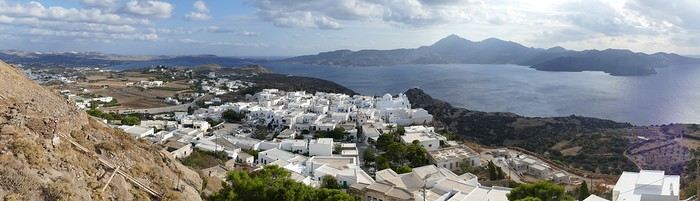
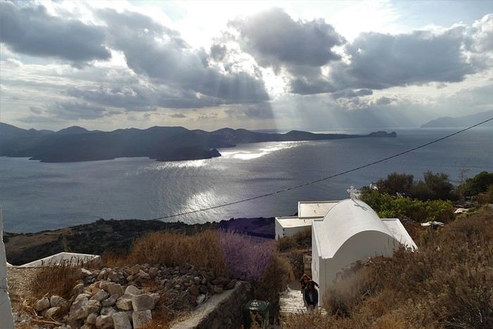
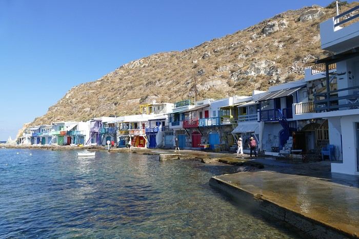
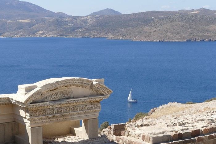 Following the well-marked path, we reached the road leading 200 meters down to the catacombs. It’s an impressive complex of 3rd and 4th-century catacombs, though only a small part is open to visitors—it’s still very moving. In the mid-afternoon, we got back in the car to visit the tiny ports of Firopotamos and Mandraki, which also have their colorful sirmatas. We took the opportunity to swim at the small beach in Mandraki, where the water was warm and calm.
Mandraki Port. We had a decent dinner at a seaside restaurant in Adamas, though you have to be selective—we had a bad experience at Kynigos on the second night!
Moving to Polonia in Eastern Milos, Sarakiniko Site
Following the well-marked path, we reached the road leading 200 meters down to the catacombs. It’s an impressive complex of 3rd and 4th-century catacombs, though only a small part is open to visitors—it’s still very moving. In the mid-afternoon, we got back in the car to visit the tiny ports of Firopotamos and Mandraki, which also have their colorful sirmatas. We took the opportunity to swim at the small beach in Mandraki, where the water was warm and calm.
Mandraki Port. We had a decent dinner at a seaside restaurant in Adamas, though you have to be selective—we had a bad experience at Kynigos on the second night!
Moving to Polonia in Eastern Milos, Sarakiniko Site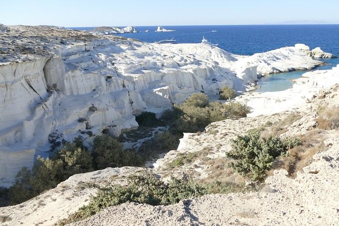
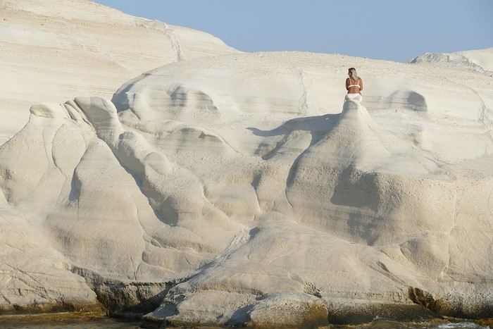
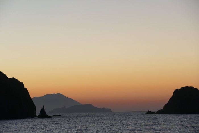
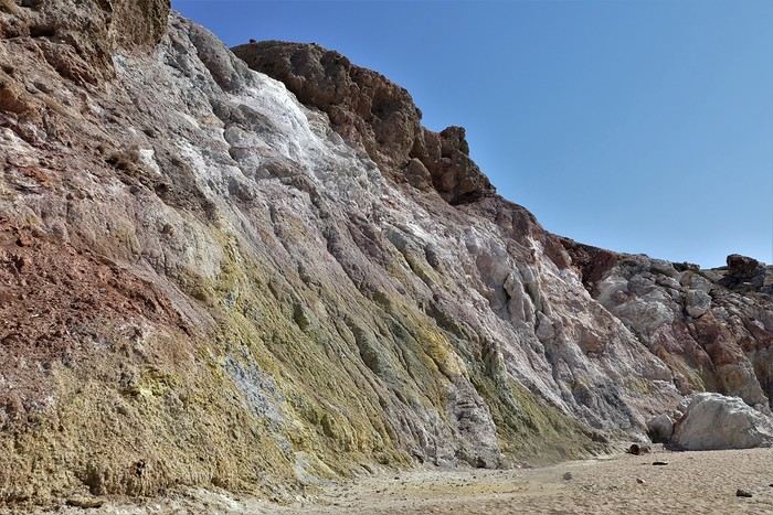
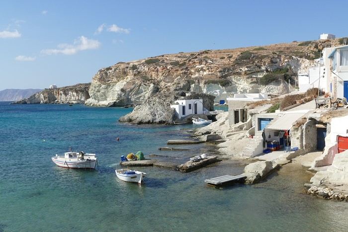
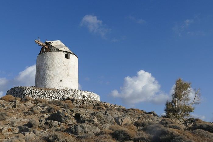
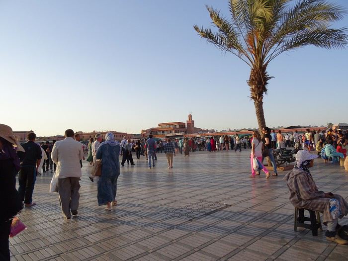
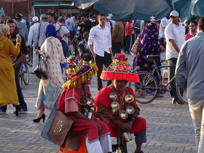
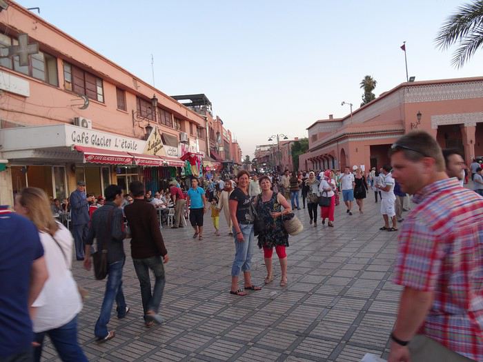
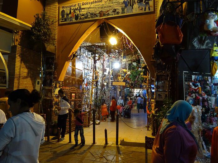
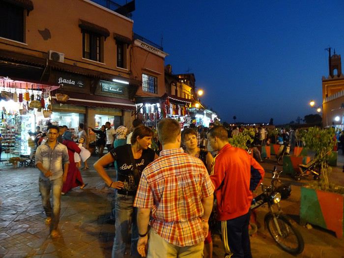
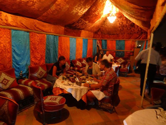
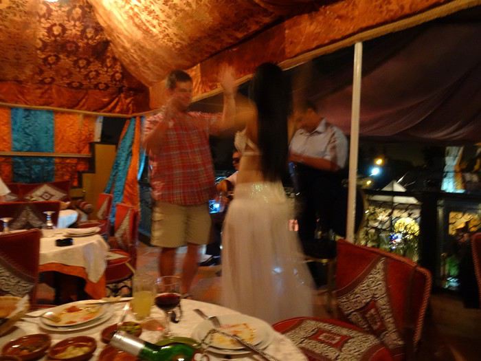
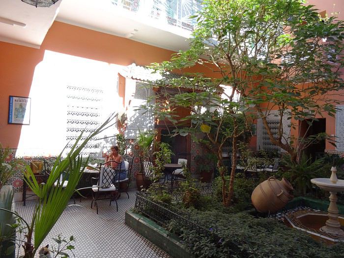
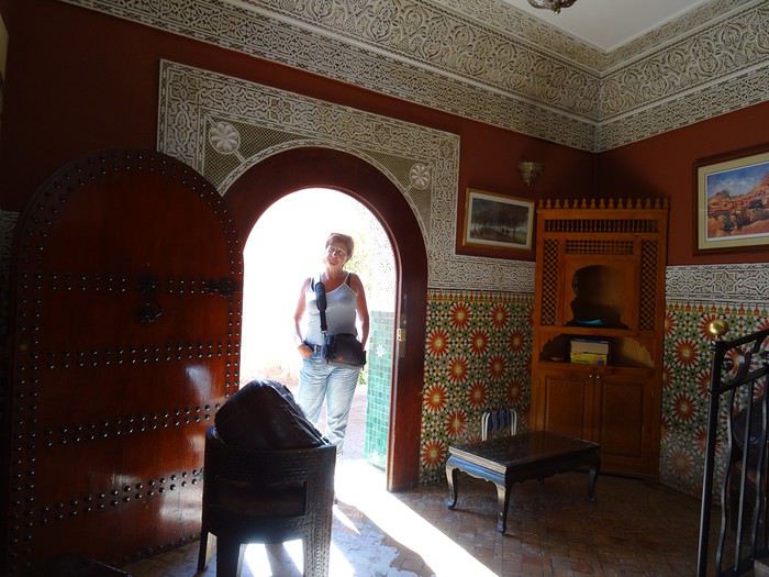
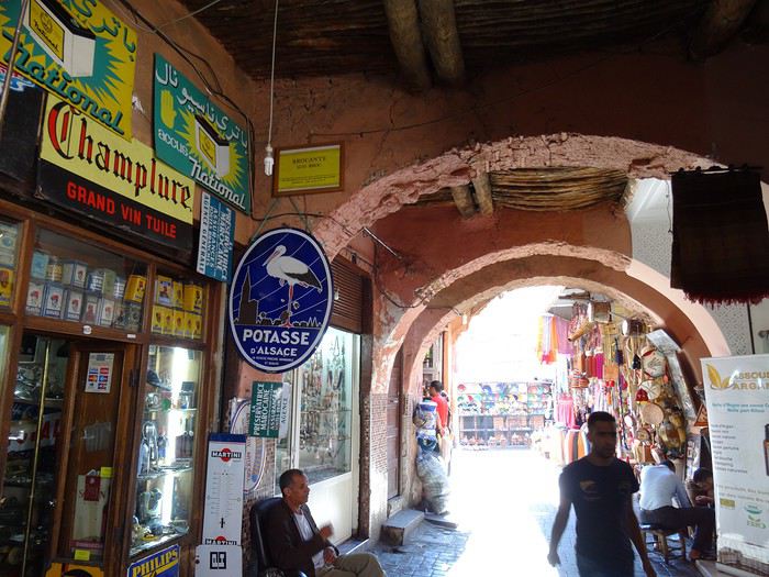


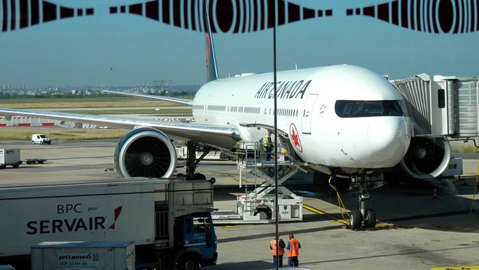
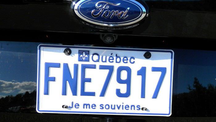

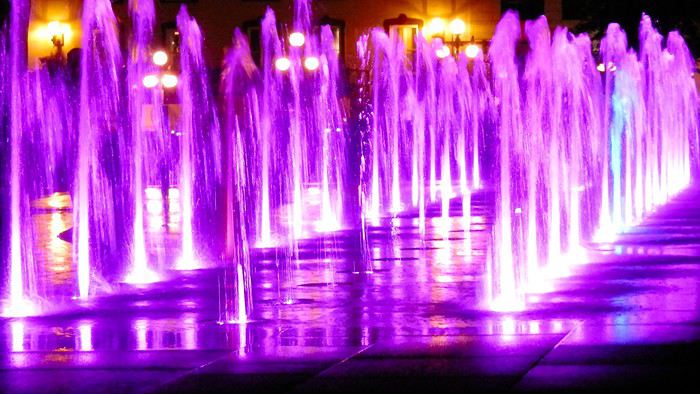 It’s only 9 PM, but our body clocks say it’s 3 AM.
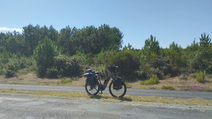 My gear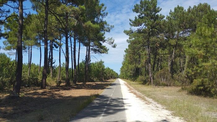

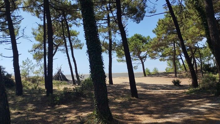
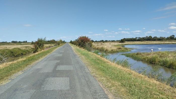
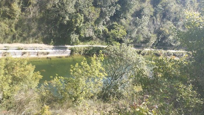
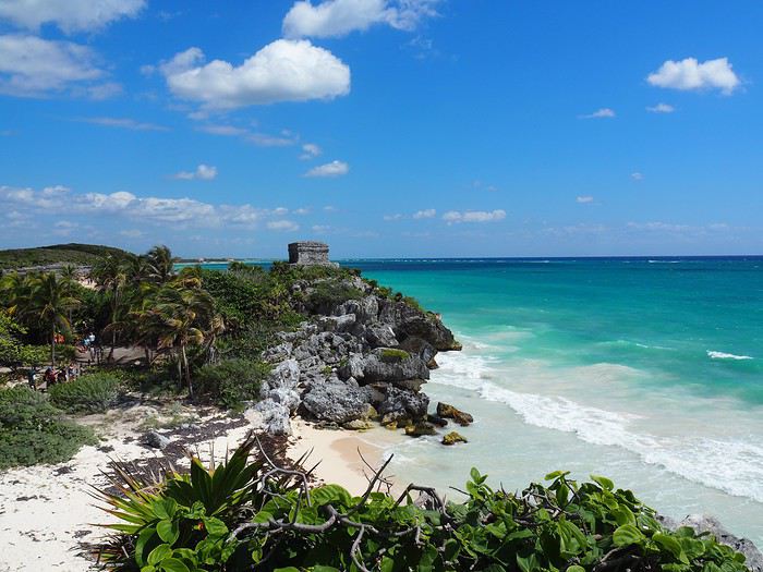
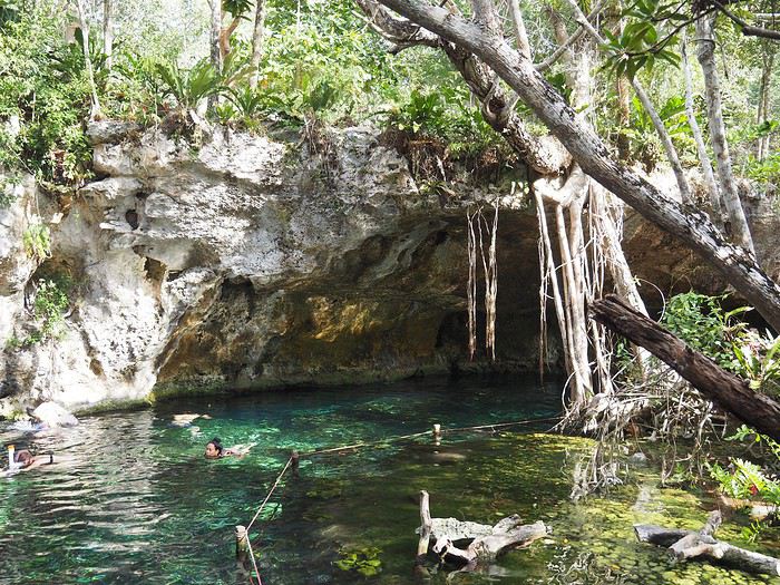
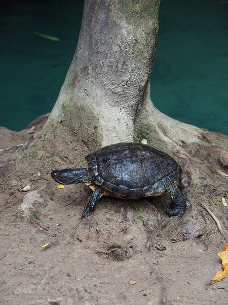
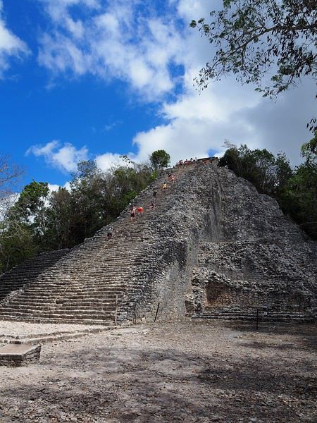
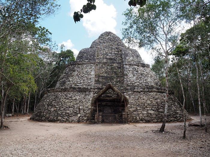
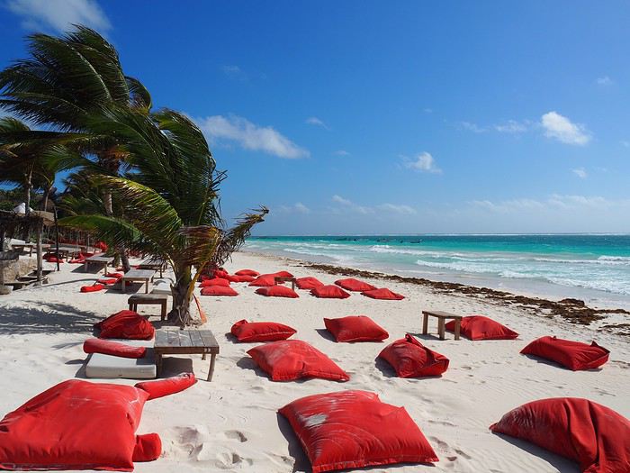
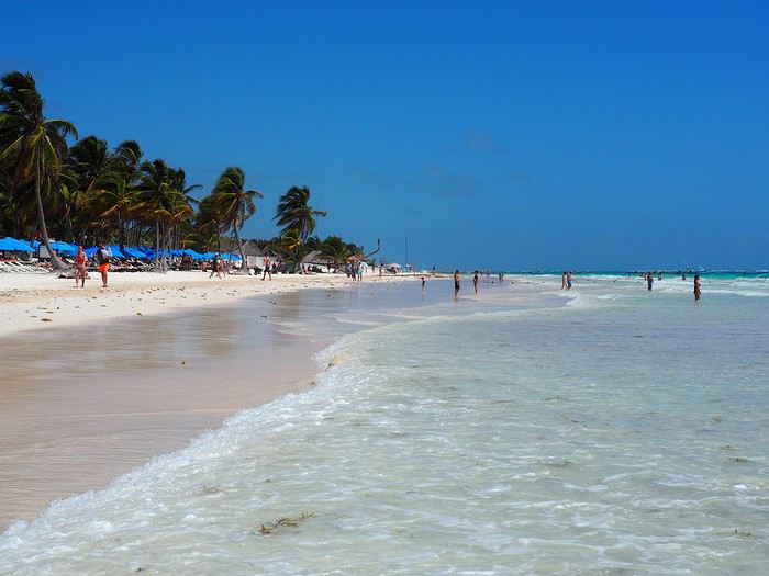
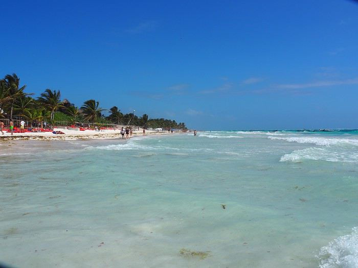
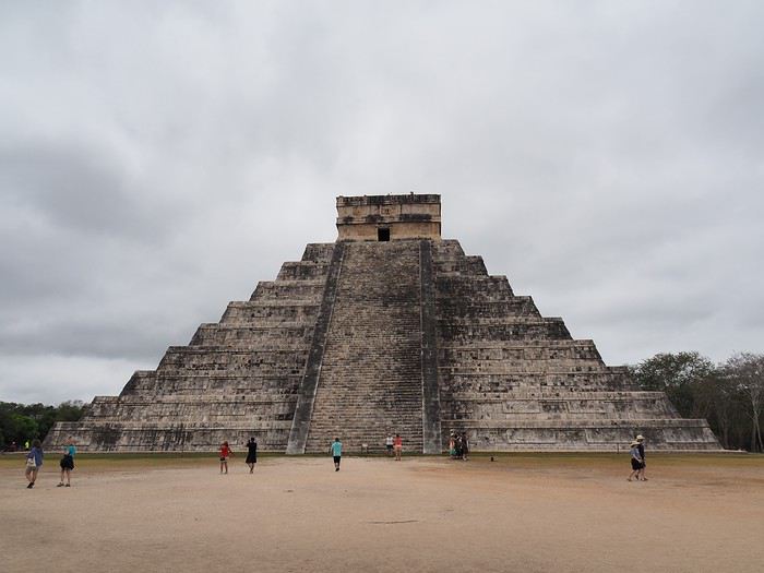
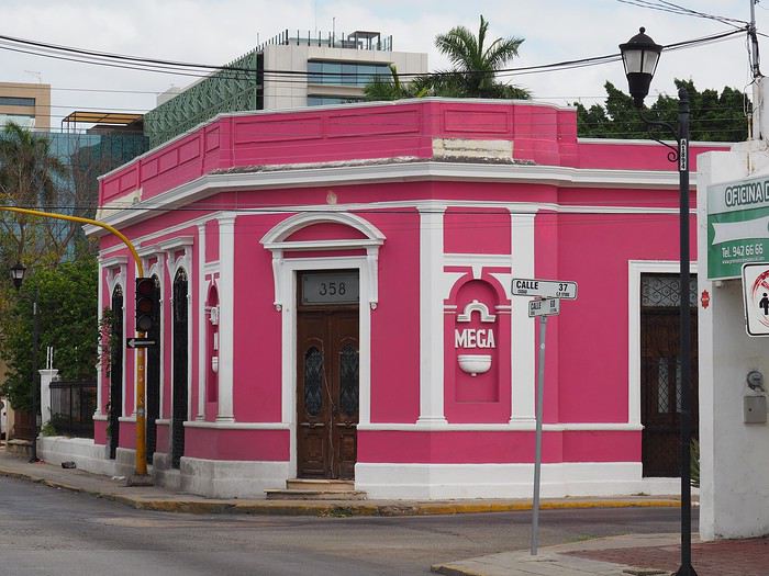
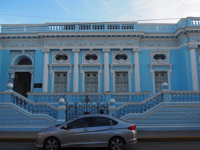
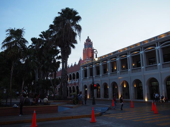
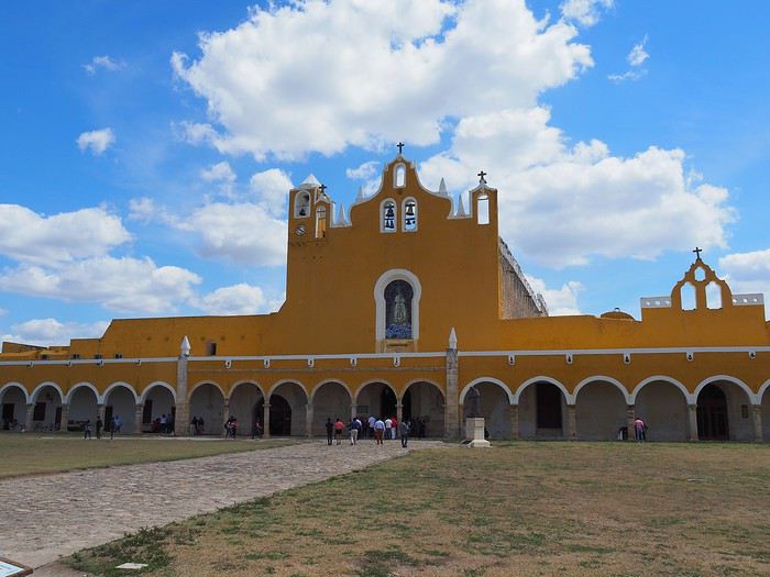
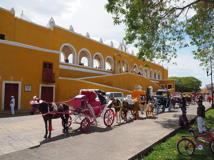
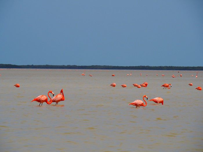
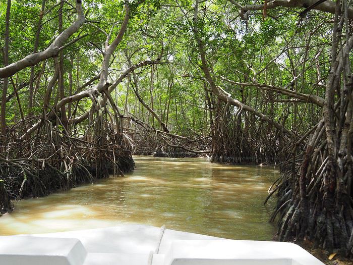
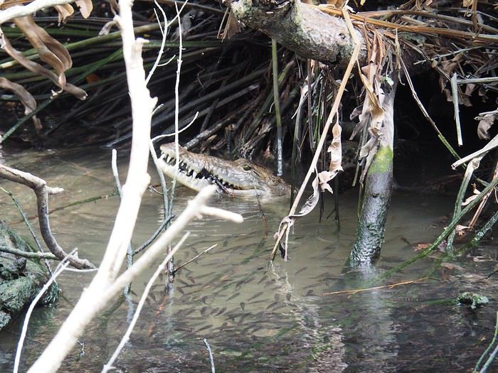
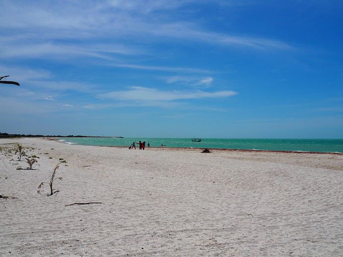
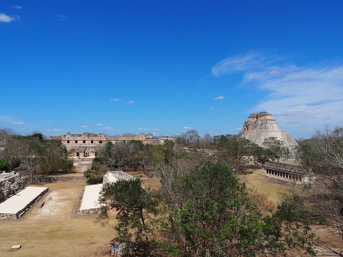
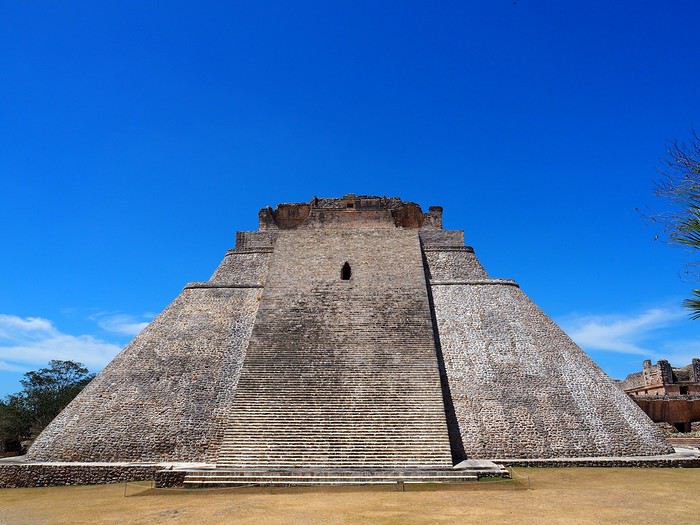

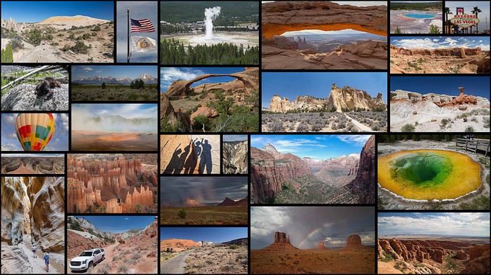
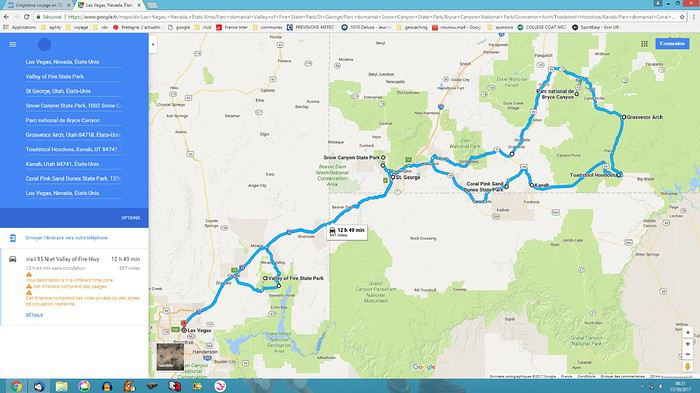 - Followed by two weeks with nine people in 2 RVs + campgrounds, as close to nature as possible in the parks (Snow Canyon, Kodachrome, Yellowstone, Arches, Canyonlands, Dead Horse, Monument Valley, Grand Canyon):
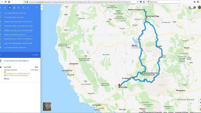 🙂Before going further, we want to thank the forum members who took the time to answer our questions. Your patience and kindness are amazing! We might forget someone, but thank you all: Jpg13, Mlefebvre, Kast13,Glll2012New, PCecile, Aquilegia, Adumas4, Ju45, Mycovtt, Natb72, Soula1, Orionide, Simonic, Hiacinthe, etc.
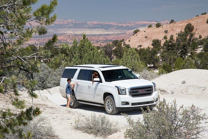 Second and third weeks: Nine people in two RVs. A 30-foot RV + a 25-foot RV from CRUISE AMERICA in Las Vegas for 5000 €, unlimited miles, kitchenware, and linens/towels/comforters.
A love story in 2014 with this same agency, but unfortunately, this year was much more mixed: aging RVs, ineffective AC in the C30, a leak in the C25’s skylight, a leak in the C25’s toilet drain valve (imagine the dump every time we opened the drain plug…😠🙁), late delivery of both RVs (after 5 PM, though the contract said 4 PM max), abnormal wear on the front tires (we’d discover that later😠), trouble closing the door, etc.In short, a disappointment.😠
Note that other rental companies (El Monte and Road Bear) are probably gaining market share—we saw a lot of their vehicles on the road, and they offer much newer models (at least on the outside) for similar prices…🙂
But setting aside those issues, the vehicles still did their job: letting us sleep as close to nature as possible in the parks and enjoy beautiful sunrises/sunsets with family campfires and marshmallows flambéed with Jack Daniel’s Tennessee Honey😇!!😎 Also worth noting: Cruise America’s solid roadside assistance (we’ll talk more about that later), and how easy it was to drive these beasts—nearly 10 meters long! (Our walkie-talkies were super handy for communication between the two RVs.)
Second and third weeks: Nine people in two RVs. A 30-foot RV + a 25-foot RV from CRUISE AMERICA in Las Vegas for 5000 €, unlimited miles, kitchenware, and linens/towels/comforters.
A love story in 2014 with this same agency, but unfortunately, this year was much more mixed: aging RVs, ineffective AC in the C30, a leak in the C25’s skylight, a leak in the C25’s toilet drain valve (imagine the dump every time we opened the drain plug…😠🙁), late delivery of both RVs (after 5 PM, though the contract said 4 PM max), abnormal wear on the front tires (we’d discover that later😠), trouble closing the door, etc.In short, a disappointment.😠
Note that other rental companies (El Monte and Road Bear) are probably gaining market share—we saw a lot of their vehicles on the road, and they offer much newer models (at least on the outside) for similar prices…🙂
But setting aside those issues, the vehicles still did their job: letting us sleep as close to nature as possible in the parks and enjoy beautiful sunrises/sunsets with family campfires and marshmallows flambéed with Jack Daniel’s Tennessee Honey😇!!😎 Also worth noting: Cruise America’s solid roadside assistance (we’ll talk more about that later), and how easy it was to drive these beasts—nearly 10 meters long! (Our walkie-talkies were super handy for communication between the two RVs.)
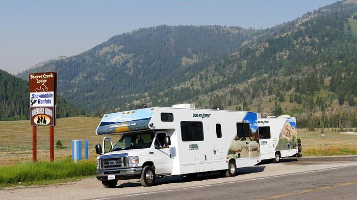 And for the last day, a Ford Transit 12-seater from Hertz, at Las Vegas airport for 145 € for 24 hours. Perfect for a day with nine people and nine suitcases + nine bags!! Everything fit in the trunk, and it let us explore LV independently (including a trip to the outlet) for less than three taxis would’ve cost…😎
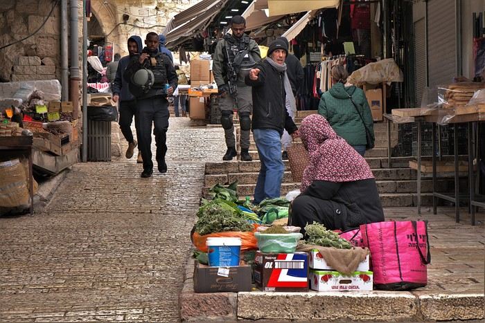

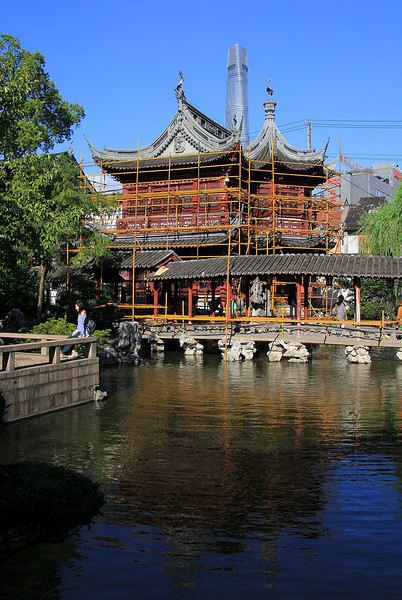
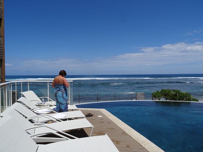
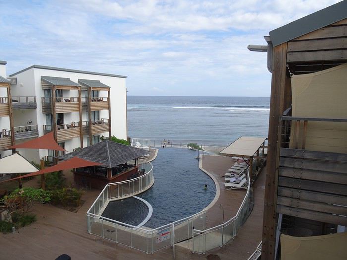
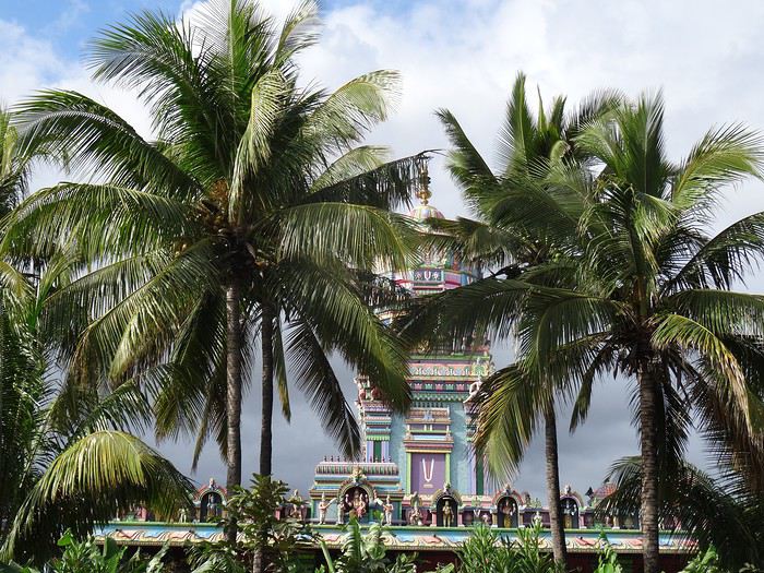
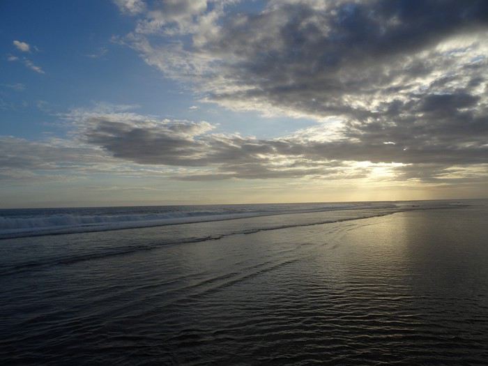
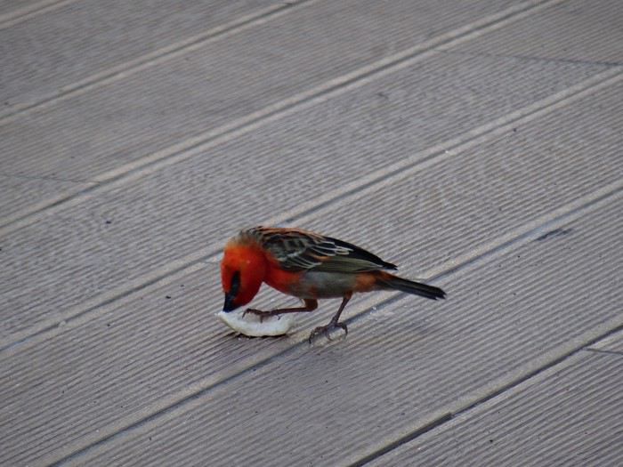
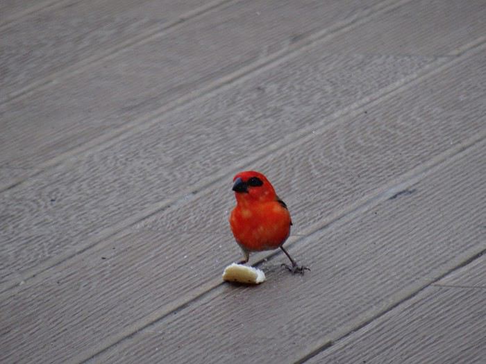
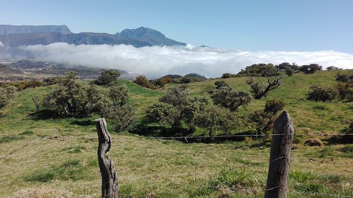
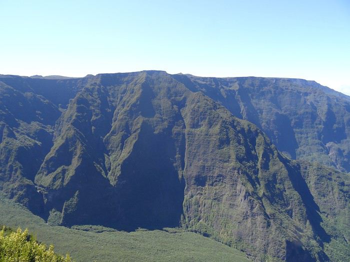
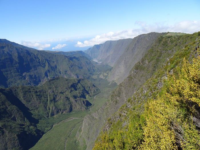
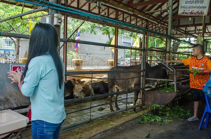
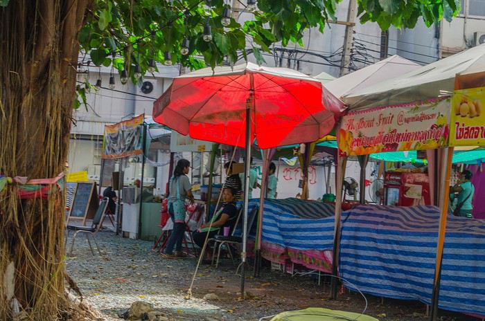
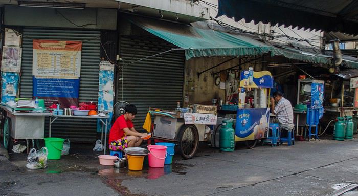
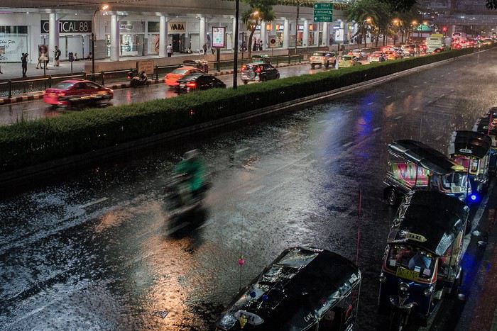
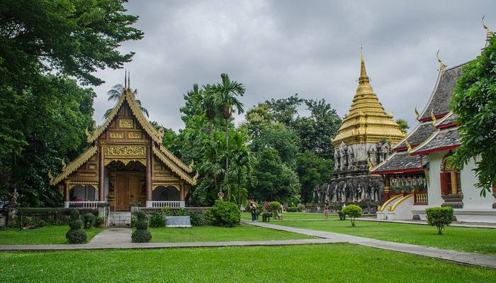
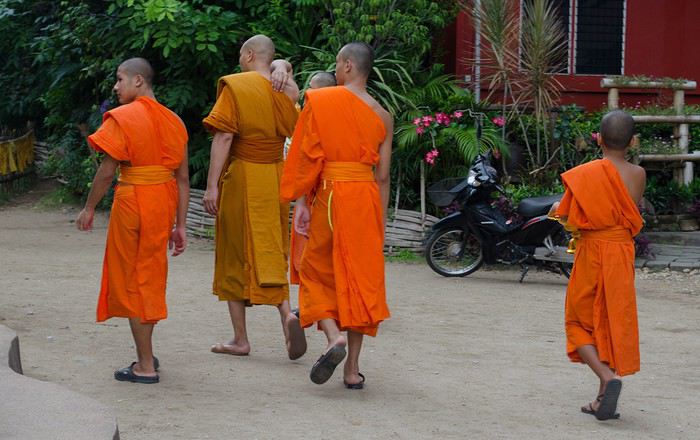
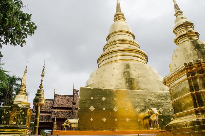
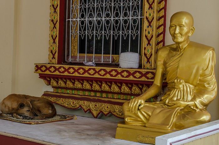
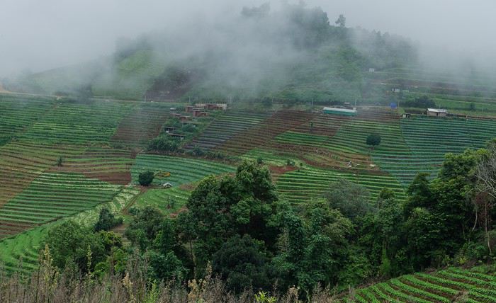
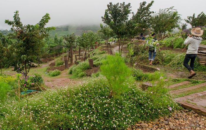
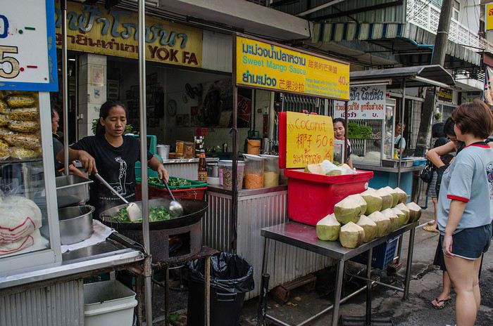

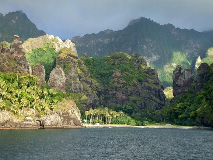 Idyllic landscape of a dream island, but difficult to access: the Bay of Virgins in Fatu Hiva, Marquesas Islands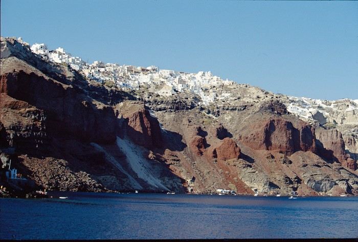
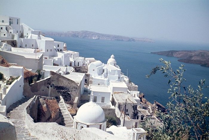 Oia in 1967—a peaceful village overlooking the caldera. But where are the pools and trendy bars?

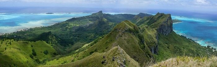
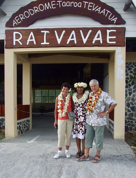
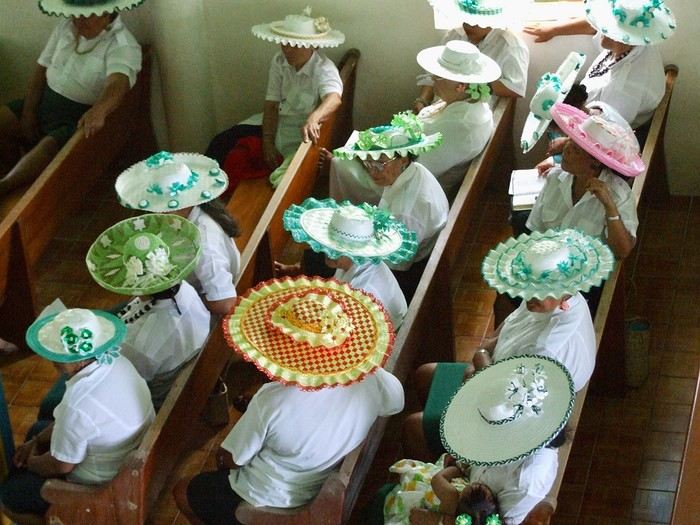 Hat contest for the worship celebration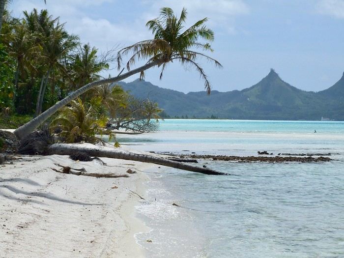
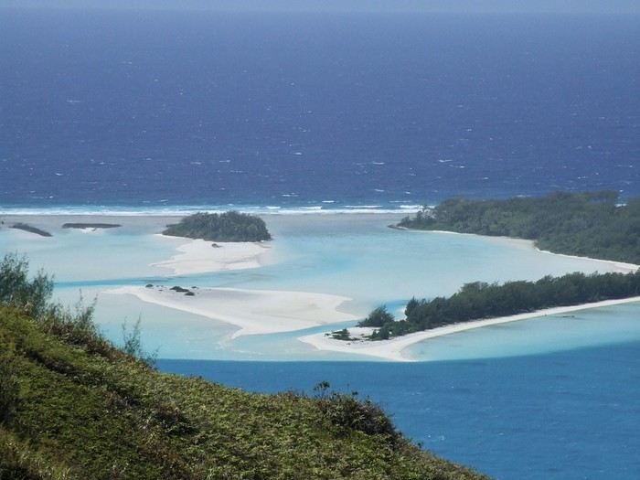 The "motu-pool"


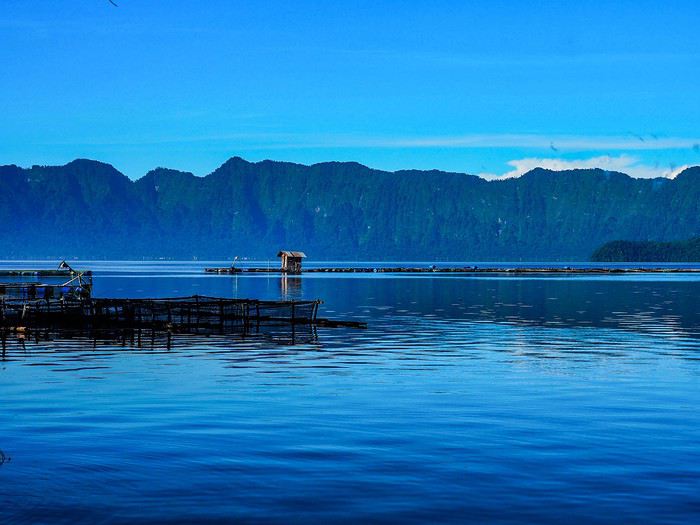


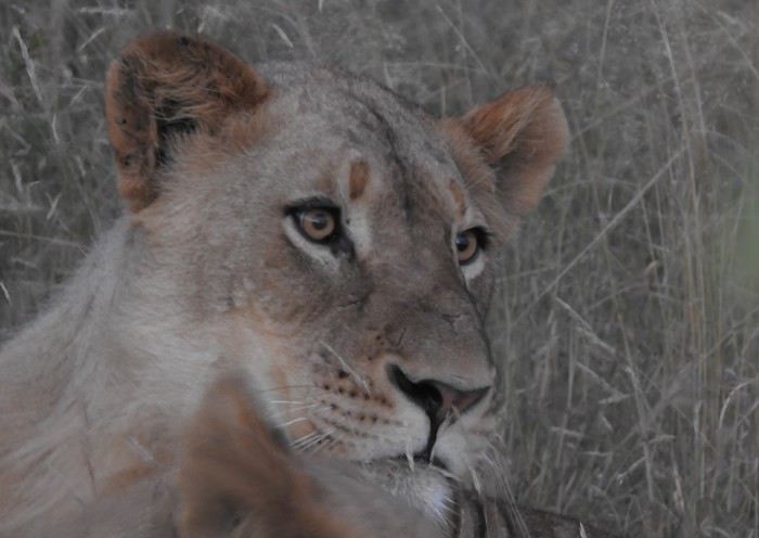
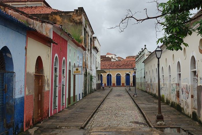
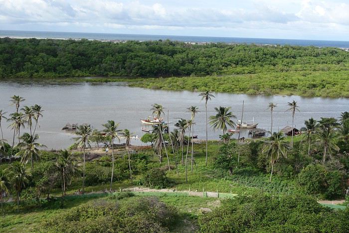
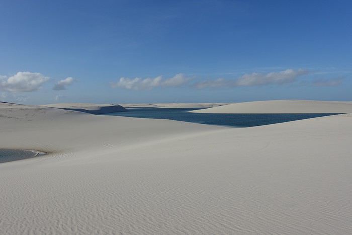
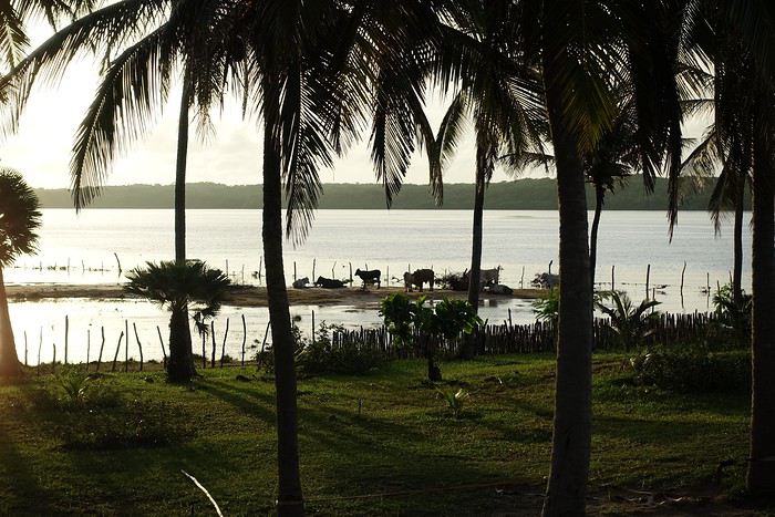
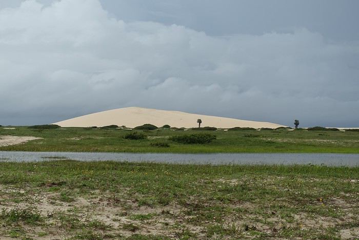
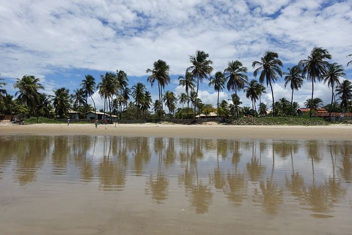 Day 10: Transfer day to Pipa
Taxi Icaraí–Fortaleza: 350 BRL
Flight Fortaleza–Natal: 37 € per person
Taxi Natal–Pipa: 180 BRL
Pousada in Pipa: Aconchego, run by French owners. Great welcome, quiet, perfectly located in the city center.
Day 10: Transfer day to Pipa
Taxi Icaraí–Fortaleza: 350 BRL
Flight Fortaleza–Natal: 37 € per person
Taxi Natal–Pipa: 180 BRL
Pousada in Pipa: Aconchego, run by French owners. Great welcome, quiet, perfectly located in the city center.