Travel journals
FR
MO
Montagnard74 last year
Peru-Bolivia 2017: A Month in the Andes
Here we go...

It’s been almost a month since we got back, and my head is still over there... Just like every time... For my own sake, I know travel journals are useful for travelers planning a trip to a country. But selfishly, they’re also helpful for me—to put the final stone on each journey and revisit it from time to time, just for the memories...

So, this trip won’t be any different, and I invite you to follow along on our Andean adventure, from Lima to the Southern Lipez, from December 16, 2016, to January 14, 2017. It’s a chronological journal because I don’t know how to approach it any other way. It doesn’t hold any absolute truths—just my experiences and feelings, which are obviously personal and not objective!

But if it inspires you to visit these magical countries (and I assume you’re already interested if you’re here) or gives you a couple of tips, then I’ll consider it a win!

So, let’s hit the road for the land of wide-open spaces!

Open
PI
Pinacoladada last year
Newfoundland - Hikes in the Western Part of the Island
INTRODUCTION

Trip taken in 2021, but still relevant for exploring the island of Newfoundland.

We went on multiple hikes in this Canadian province, which offers a unique and breathtaking landscape.

GPS coordinates: 46.20884, -60.24498 Marine Atlantic Ferry

To do this, we traveled to North Sydney, Nova Scotia, to board a Marine Atlantic ferry that took us to Port aux Basques in Newfoundland. The crossing takes about 7 hours.

The ferry *Highlanders* features spacious cabins for two or four people, a restaurant, a retail store, and a play area for kids.

The reclining seats are comfortable and include a headphone jack and a USB charging port.

We went out on the open-air panoramic observation deck several times to admire the Atlantic Ocean, hoping to spot some marine wildlife. Unfortunately, we didn’t see any.

This short video gives you an overview of the facilities. For more details, I invite you to check out Marine Atlantic’s website at the following address: https://www.marineatlantique.ca/.

https://youtu.be/oV9_7AcJnEQ
Open
PI
Pinacoladada last year
Come discover Prince Edward Island
FOREWORD

In July 2018, we decided to go on a road trip to Prince Edward Island. We had four days off, so it was the perfect opportunity to set off on an adventure.

This time, I hadn’t had much time to prepare an itinerary. I’d only done a bit of research online to try and find tourist attractions that might interest us.

I should say that it wasn’t our first visit to the island, and since our stay was quite short, we decided to complete the island loop by making stops along the coast to admire the lighthouses, small fishing villages, beaches, and the stunning steep cliffs.

We also made a few stops at lookouts along the road and even went for a hike in Greenwich National Park.

Our trip was more of an escape into nature. When we travel, we feel best when we’re far from the noise and crowds.

So, I invite you to discover the fabulous landscapes of Prince Edward Island.

To get there, we had to cover nearly 1,000 km. It took us a full day, and we had to cross parts of Quebec and New Brunswick.

The roads are beautiful. However, there isn’t much to see except the vast forests lining the highways.

The Confederation Bridge, which is 12.9 kilometers long, connects New Brunswick to Prince Edward Island.

There’s no fee to enter the island when you cross this bridge. However, a toll must be paid when leaving the island.

https://www.confederationbridge.com/fr/tolls-fees

https://youtu.be/UWhn5bqLONU
Open
PI
Pinacoladada last year
Come discover the North Shore
INTRODUCTION

Travel journal updated in MAY 2025

Since our travel plans outside Canada were canceled due to Covid-19, we decided to take our vacation in Quebec this summer and cover over 5,270 kilometers to explore the various tourist attractions of the North Shore and Gaspésie.

This summary will cover our experiences on the North Shore, while Gaspésie will be the subject of a future summary.

The North Shore, known for its stunning nature, is the perfect spot for outdoor enthusiasts since you can enjoy activities like hiking, wildlife observation, sea kayaking, fishing, and hunting (to name just a few).

It’s also one of the best places in the world to see whales.

Our journey along the North Shore took place between the villages of Tadoussac and Kegaska, as Route 138 ends at the beautiful, long beach in Kegaska.
Open
WA
Wanderer91 last year · Desman
Camino de Santiago from Aumont-Aubrac to Cahors
A few years ago, I walked the Camino de Santiago from Le Puy-en-Velay to Aumont-Aubrac with every intention of continuing my journey the following year. Life had other plans, and it was several years before I picked up my "pilgrim’s staff" again on this legendary trail, starting from Aumont-Aubrac, which I did last September 30th.

Reaching Aumont-Aubrac wasn’t easy since I come from Brittany: first a TGV from Brittany to Paris, then an overnight train from Austerlitz to Rodez, followed by a bus from Rodez to Millau, and finally a TER from Millau to Aumont-Aubrac. I eventually arrived on Sunday, September 30th at 1:30 PM to begin a first stage of 15 km, reaching the Gentianes hostel in Finieyrols, halfway between Aumont and Nasbinals.
Open
VO
Voyajou last year · Malijp
Inside South Africa
Inside South Africa

The Burst Hose. The passenger is so impatient to arrive that the coachman whips a horse that barely tolerates the mistreatment. I can tell she’s gearing up for a kick, and suddenly, at full gallop, she stops responding. If I press the spur, she cuts out but accepts a half-pressed pedal. She pulled this stunt last year, right in the middle of the Kalahari Desert, and I can guess the trick: she blew a hose! An hour at a slow trot brings us to a Ford garage. A workshop manager, as sullen as he is efficient, has the necessary parts removed to reach the hose, then announces he doesn’t have the spare part and will need a week to get it. I suggest taking advantage of the access to make a temporary repair on the tear, but he refuses, arguing the pressure is so high that the patch would give way immediately—"It’s not a Testarossa, after all!" After reassembly, he refuses to charge us anything and advises us to head to the next town, 200 kilometers away—off we go for another four hours. Semi-trailers overtake us without mercy; I’m reminded of *Duel*. At the Land Rover dealership, we learn the part will take two working days to arrive, and it’s Thursday. I decide to have the hose delivered to the house without wheels—I’ll change it myself. Five hours later, climbing the pass in first gear, we reach the object of her desires. * Hide and Seek In Brittany, my neighbor is a taciturn, touchy fisherman. He’s anchored his old boat in the middle of the estuary that separates two departments and uses it as a storage space. It’s a jumble of nets, buoys, and traps. The old wooden vessel is falling apart, and the hull’s paint is nothing but a distant memory—so much so that the Maritime Affairs Directorate of his department orders him to remove it or repaint it. Asterix also runs a restaurant on the harbor, where he treats customers to his catch. One Sunday afternoon, we see him loading cooks, servers, and dishwashers armed with rollers, brushes, and paint cans into dinghies. Off they go for two hours of slapdash painting and laughter. Once the starboard side is done, everyone returns to prepare for the evening service. The port side will wait until the Maritime Affairs Directorate from the other department reacts. This story came back to me when I got home: the side visible from the road had been repainted, but the other side was left as is. * The Blonde, the Red, the White, and the Black Many workers are paid at the end of each week, but alcohol sales for takeaway are banned on Saturdays and Sundays. So, on Friday nights, the bars are packed, and liquor stores never empty—of people who are already full. Their limited means reduce them to cheap, harsh wines or bland beers. Yet, they still end up wasted.

* Seven In mainland France, you can easily raise seven sheep per hectare. In the Great Karoo, it takes seven hectares of sparse but tasty vegetation to feed just one sheep. Not to mention the energy spent moving around. Add to that the fact that a French sheep produces about one and a half lambs per year, while here, between droughts and jackals, it’s closer to 0.7, and you’ll understand why, with a 7,000-hectare farm—the local basic unit—a South African farmer’s income barely exceeds that of a farm a hundred times smaller in Brittany. This weekend, the annual agricultural show is taking place at the fairgrounds. Some come from far away, so a procession of pickups, trailers, and trucks loaded with sheep makes its way up the main street: we’re definitely in the Karoo. I expected a competition of lean, wiry ascetics, able to pass on traits useful to the environment, but I suspect these bodybuilder show animals don’t just graze on the bush and are doped with alfalfa. Besides, I caught a dealer red-handed with a bag of pellets. * They’re Not Dolls Ken is a professional hunting guide, working independently. When it’s not hunting season, he goes fishing for clients, mainly in the United States. He says Trump’s election—whom he slightly resembles, though younger—would be good for his business, but he doesn’t like Trump, nor, it seems, his clients much. He wanted to be a farmer, but in the post-apartheid context, taking over a farm was a gamble. His wife, who’s more beautiful than Barbie and Melania, silently agrees. * Neighbors That’s the problem with women: their *it girl* side. Within a year of her moving in, we got two new neighbors. One on the other side of the track, the other half an hour away (here, that’s *next door*). One only travels at the controls of his black helicopter, the other aboard his private Boeing 737. The first is a very wealthy farmer from the northeast of the country who’s expanding into the Karoo. He just bought two non-contiguous farms of 6,000 hectares each. I still don’t know what the owner of the farm in between is thinking. The newcomer plans to create a wildlife reserve for breeding purposes; our future neighbors will be giraffes, rhinos, and antelopes, including rare species like the Sable. They say he’s a man in a hurry, determined: when the municipality dragged its feet on his request to refurbish the public track that serves as our border, he just went ahead and did it himself. It was a historic farm, crossed by paths leading to other farms, home to a pond full of birds where water from the mountain ends up after the villagers have taken their share. That’s where the golf course I was about to become the 29th member of was located. Now, it’s all closed off, fenced, and lined with monumental gates. The Wild West in the Western Cape. Is it because his name ends in ‘-ski’ that rumors link him to Slavic mafias and advise against crossing him? The same rumors say he’s involved in the uranium market—well, there’s uranium in the Karoo’s subsoil. The second neighbor is a Saudi prince who just bought a modestly sized farm—3,500 hectares—but don’t think he’s a minor prince. He paid four and a half times the market price to get it! The farm had been in the same family for two centuries, and the owners refused to even consider selling. The prince’s agent—money, in this case, black gold—kept coming back every week despite repeated refusals, finally saying his client wanted this farm at any price. A price they were asked to set. And that’s how you sell your ancestors’ graves. There are plenty of huge farms for sale here, but the prince was looking for a property where he wouldn’t see any roads, tracks, or other houses or farms. He’ll come a few days a year to hunt. However, he’s annoyed: the runway at the nearest airport, two hours away, isn’t long enough for his private jet, so he’ll have to land in Cape Town, like me, and endure nearly two hours by helicopter. That’s how it goes in South Africa. I’d be curious to know what Julius Malema, leader of the EFF (Economic Freedom Fighters), who advocates the Zimbabwean model of land redistribution, thinks about it.

* Biko The autobiography of a journalist and politician of European descent, South African, is published this week. In 1977, this rookie got her editor’s permission to investigate the death in detention of black leader Steve Biko. The apartheid regime’s political police claimed he had died from a hunger strike. The bold young woman discovered that the medical examiners reported a slightly overweight corpse, and later, it was revealed that Biko had died from abuse, if not torture. Under pressure after publishing her investigation, Helen Zille, disillusioned, gave up journalism and turned to politics. She is one of the white South Africans who fought against apartheid, and it’s reassuring that some people have a conscience that transcends class or race. *

You Have the Watches... …we have the time. Anyone who’s worked with Africans knows this response they occasionally throw at us. Willem, the inconsistent gardener, couldn’t stand the observation: running around the place at top speed, even with a pitchfork over his shoulder, wasn’t getting the job done. So Jan replaced him. We share the same first name—no doubt we’ll accomplish great things. He’s known to be reliable, meaning he shows up for work, and he only speaks Afrikaans. We communicate like at the circus: thumbs up, thumbs down. Jan has the build of a bushman but the bone structure and features of a mixed-race person—multiple mixes. He’s a sprite, always moving, sometimes without purpose or destination (the journey is the path). I lose sight of him—it’s not exactly a virgin forest—and he reappears elsewhere, busy. Jan doesn’t understand wasted water—he must think the same of us trying to cultivate the desert. He’s a gardener like I’m a violinist, virtuosos of playback. After a very light lunch, he lies down on the ground in the shadow of the stables and falls asleep. If his arrival time in the morning is variable, it’s never before the agreed hour, but his departure time is unchanging: it’s 3 PM, no matter what. No point trying to fool him; he can count and shows me the fancy watch eating up his thin wrist. * Colours Veldrift, Oyster Catcher, Lobster Red, Namib, Dune, Lion's Den, Kalahari, Bush Fire, Karoo Dawn, Cape Fynbos, Safari Trail, African Pan, Bushveld Plains, African Queen, Karoo Drift. A bestiary? A herbarium? No, the colors offered by the country’s top paint manufacturer. All the shades of the continent from an armchair. * Pets She loves three mastiffs, a meter tall at the withers. Is it for their beauty? Their breed? Their deterrent power, because knowing these beasts exist, no one would dare enter her property without an invitation? A bit of all that, probably. She won’t say. She loves pets but likes other people’s less, especially the poor ones. So, she actively participates in the campaign to sterilize dogs and cats in the neighboring township. Just think, the poor things can’t afford to feed or care for them, meaning they can’t ensure them a decent life. She and others justify the pets section of the local mini-supermarket. Whether your pet is a puppy, adult, or mature, whether it likes fish or prefers beef (no one thought of a dog-based reference from the township?), you’ll find your happiness. While you order, many locals will only have access to the parking lot to beg. * Democracy in Africa

What would Tocqueville say about Democracy in America this fall? After the father, we had the son; after the husband, and by default, we might get the wife. No one else, really? Let’s not talk about France and its current vaudeville. A Ivorian academic believes African peoples aren’t ready for "Western-style" democracy (caricatured as a free T-shirt buying a vote). Does he know the same is true elsewhere, where many voters vote not for a vision, a project, or convictions, but to protect their own interests? Here in South Africa, national elections were held recently, confirming the ANC’s decline in favor of the Democratic Alliance (DA). Historically (since the end of apartheid) seen as the party of whites (who make up less than 10% of the population), it has managed to rally those disillusioned by the clientelism, incompetence, and corruption of Mandela’s unworthy heirs. The DA now governs five of the country’s six largest cities. In the neighboring township, long after the vote ended, ANC and DA T-shirt wearers cross paths courteously. Today, it’s different. The DA’s national leader is holding a rally in a vacant lot. A few hundred people are there, including a good third of children, three-quarters of them ragged. Not an ANC T-shirt in sight amid the smoke of braais and deafening music. Fewer than ten pale faces: the journalist I’m driving, a local official, and activists. A small convoy of limousines arrives—just four, fewer than any of President Zuma’s offspring’s private stables. The crowd stirs, flags wave, and ululations ring out. Mmusi Maimane is a light-skinned mixed-race man, towering over the assembly, which he gently parts, joining in the dances and posing for selfies. He’ll give his speech, half in English, half in Afrikaans, perched on a truck platform—the meeting’s cost must be bearable for taxpayers. A mediocre populist orator, no doubt, but skilled. Two hours later, in the evening, another gathering. This time in a historic town property. A hundred and fifty people, casual chic, all white except for three mixed-race individuals... and the DA President. A Rotary Club vibe: everyone the town has in terms of farmers, shopkeepers, and entrepreneurs has paid their dues to honor Mmusi Maimane’s visit. His admirers see him as a new Mandela or compare him to Obama; his opponents think he’s being manipulated, and his detractors call him a traitor. He’s under forty, intelligent, and his wife is white. The chance he’ll become President of South Africa isn’t zero. * Posh Port Out, Starboard Home. Sonja, who walks the desert at dawn, calls one of her acquaintances posh, meaning snobbish. She’s got a sharp tongue. Wealthy English people (not the ones sent to Australia as convicts one-way) traveling to India would book their cabin on the port side on the way out and starboard on the way back. That way, they had a view of the coast throughout the journey instead of the ocean’s emptiness—whatever Kersauzon says. I didn’t know that by choosing my seat on the plane, depending on the route and time, so the sun lights up the landscape instead of blinding me, I was being posh. * Cosmopolitan Wine Tasting A pale lookalike of Jacob Zuma, a painter teaching his art in Europe; an Antwerp writer in South Africa; a desert gardener with a surfer look; an Irishwoman teaching yoga in the Karoo; an Afrikaner passionate about world history; another, our host, up to his neck in wine; and two French observers—observed observers. Conversations flow, then bottles, just before some hosts leave. Recurring corruption scandals involving President Zuma and his inner circle. A Chenin Blanc. Napoleon, who could have changed the course of South African history. An unwooded Chardonnay. The snake, a puff adder, one found in her garden. A Sauvignon Blanc. The kudu hit by a car at the village exit, which didn’t survive. A Pinotage. The bloody Anglo-Boer War. A Shiraz named Down to Earth. * Little Patagonia A story of pressure or depression, temperature differentials, or perhaps an age-old war between the elements—almost every day at the end of the afternoon, as if tucking in, the wind rushes down the mountain and gives a free haircut. When it falls, you don’t know where, and you hope it hurt itself and won’t get back up. I’m going to build a mast on the house, hoist the sails, trim them, and sail across the desert—it will remember the sea. *

Meeting in the township.


Since a cover is needed (in black and white)...
Open
EL
Ellobo last year
Louisiana - Mississippi - Tennessee - Arkansas - April 2024
The context: The urge to return to the USA, to explore a new part of the country. I don’t need much convincing to go back to Uncle Sam’s land. My wife’s on board too. So, off we go for my 9th trip to the USA! (I didn’t take notes, so this is from memory)

Day 1: The departure: Flight with two layovers. I usually avoid layovers in the US before the final destination because of immigration. This time, my flight was Lyon/Munich, then Munich/Chicago, and finally Chicago/New Orleans. The layover in Chicago was 3 hours, and since I’d been through this airport twice before and found it super efficient both times, I wasn’t too worried when I booked my tickets—especially with Lufthansa. Unfortunately, there were several flight changes before departure, the last one leaving us with only a 2h14 layover in Chicago. I called Lufthansa to check if that would be enough, and they told me immigration in Chicago takes about an hour and 45 minutes (according to their calculations). So, I left feeling confident. A 15-minute delay leaving Lyon, then a 1-hour delay leaving Munich—now I’m starting to worry. When we arrived in Chicago, we rushed, cut in line, and made it to immigration. And then—an impossible queue. Game over, we missed our last flight. Of course, Lufthansa rebooked us for the next morning, arriving around 10 AM, and booked us a hotel. I found someone to call Alamo in New Orleans to make sure my rental car would still be there. Everything’s sorted—except our luggage, which we have no idea where it is! My little worry is that we land at 9:45 AM the next morning, and we’ve booked a tour at 11 AM at Laura Plantation, which is about an hour’s drive away! Wait and see…

The +: We're back in the USA The -: Once again, flight delays
Open
EL
Ellobo last year · Mitch341
15 days in Texas in October 2022
Ah! This trip to Texas, postponed so many times because of Covid. I wanted to discover this state, but not in the summer due to the temperatures. I’ll try to dig into my memories since I didn’t take any notes.

Day 1: Departure

Early morning flight from Lyon to Frankfurt (I often fly with Lufthansa). We only have a 50-minute layover, but I trust German organization—it’s not just talk, since it took us only 30 minutes to get to the boarding gate. Arriving in Houston, we’re excited because it’s been 3 years since we last visited the USA, and we’ve missed it.

Everything goes smoothly with the formalities and the car rental, so 1.5 hours after landing, I park near Sam Houston Park to start our discovery. The park is pretty, clean, and has the unique feature of housing some well-preserved Victorian houses. The sun is shining, and it’s always fun to see old wooden houses surrounded by gleaming skyscrapers. A quick drive to the Rothko Chapel, which is dedicated to all faiths. There are also modern artworks in an annex building and outside. Then we head to Pasadena to reach our hotel and go to bed since we’ve been awake for a while!

Hotel: A classic Days Inn. It’s standard, but the beds are comfortable, and it’s a quiet place. The + of the day: We're back in the USA The -: Nothing

Day 2: NASA and then Galveston

Of course, we wake up super early. A quick trip to the nearby Walmart for the usual small purchases. Surprise—I can’t buy a bottle of California white wine because in Texas, there are set hours for buying alcohol. Talk about a bummer for my apéro! Next, we head to Kemah, a small, hyper-touristy port where everything is kitschy but clean and nice. It’s a bit overdone, but since NASA doesn’t open until 10 AM and it’s still early, we might as well enjoy the good weather in a pleasant spot.

We arrive at the NASA Houston center without any issues. It’s smaller than the one in Florida and organized a bit differently. There are trains that take passengers to the different sites, but you need to get tickets (included in the price), and once you’ve finished visiting one site, you have to return to the center to get a ticket for another. Not very practical.

We choose to visit the training center and the rockets, skipping the control room, which, based on the photos, looks like the one at Cape Canaveral. The training center is a cool place because it’s still in use. Engineers are working on machines and computers. We don’t see any astronauts training, but we see the space chair, the shuttle’s robotic arm, and lots of gadgets—this hangar is like Gyro Gearloose’s or Doc’s domain!

Next, we head to the rocket hangar, featuring the Saturn V, the same one as at Cape Canaveral. Finally, we wrap up our tour by returning to the center, where a Boeing 747 with a shuttle attached to its back dominates the outside. We can visit the shuttle, and we don’t miss the chance.

A few exhibits inside complete the experience and satisfy our thirst for knowledge. I love the space exploration era, and gotta say, the Americans do it right. Then we drive to Galveston, about 100 km away. Why Galveston? It’s by the sea, so swimming in late October isn’t unpleasant, and there’s a neighborhood called East End Historic District filled with stunning Victorian houses, each more beautiful than the last. Plus, it’s Halloween season, so the decorations are over the top! They really go all out!

Madame takes a swim, but I find the water too cold for my taste. Apéro (they didn’t trick me twice—I had time to go back to another Walmart!) Dinner + bedtime

Hotel: A classic Quality Inn. No issues. The +: NASA, even if it’s smaller than Cape Canaveral The -: I would’ve preferred the water in the Gulf of Mexico to be a bit warmer
Open
EL
Ellobo last year
Madeira Between Lockdowns - July-August 2021
Hi there, I'm starting a new travel journal with my itinerary and memories in mind, and maybe a few photos if I can find some.

The context:

April 2020, I was supposed to go to Uzbekistan, and October 2020 to Texas: both canceled due to COVID. Summer vacations in 2020 weren’t gonna be fun. Optimistic, I’d rescheduled both trips for roughly the same dates in 2021: the first was canceled again because of COVID, the second due to U.S. entry conditions (still COVID-related!). Summer vacations in 2021 *had* to be more fun, or I was gonna lose it!!! Plus, our parents are dealing with health issues, which is weighing us down—we really need to get away!

So I looked into where we could go, somewhere we could live almost normally. I saw that Madeira had implemented strict COVID measures but that life on the island was pretty chill afterward. For me, Madeira = sun + hiking + landscapes. BINGO.

Day 1: The flight and arrival on the island

Flight with TAP via Lisbon, departing around noon. We wore our masks properly on the plane. (My last flight was to Portugal, and I told myself I’d break the jinx and leave COVID behind us.) Layover in Lisbon, then an afternoon flight to Madeira. The landing went smoothly, no wind. Cristiano Ronaldo Airport in Funchal is known for being one of the trickiest in the world due to crosswinds. The checks were standard, except COVID added an extra step. Before the trip, I had to fill out a questionnaire (Madeira Safe). Once there, a group of young people—probably students—greeted us, each with a tablet. The health questionnaire and vaccine check were super quick. Then we saw a doctor, and just like that, we were wished a great stay. Honestly, it was so well organized that it only took 10 minutes. We wouldn’t put our masks back on until we returned!

A taxi took us to our hotel in the hills above Funchal—a pretty upscale place, which isn’t our usual style, but we needed it this time! Dinner on the hotel terrace with the city at our feet. Amazing!

HOTEL: Quinta da Bela Vista

The +: We’re traveling!!! The -: Nothing.
Open
DA
Darzel last year · Jeeaan
The Moussem of Moulay Abdallah Amghar
Hello,

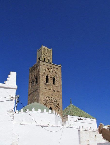
I came across a series of photos I took at the Moussem of Moulay Abdallah Amghar four years ago. This moussem takes place about ten kilometers south of El Jadida, by the sea. Little known, if not unknown, to foreigners, it’s actually one of the most important popular cultural events in Morocco. Like the old great Breton pardons, it blends religion and secular celebrations. It’s said to draw over 200,000 participants/pilgrims and nearly 10,000 horsemen. It happens in the summer, usually in August.

First, a moussem is a religious festival in honor of the local saint—in this case, Moulay Abdallah. The heart of the village is occupied by the saint’s tomb, topped by the mosque’s minaret. Two additional tombs belong to two of the saint’s wives.

Open
PA
Pat17 last year · Docmarco
Two Weeks in Dominica
Hi everyone, I’m sharing my travel journal from Dominica (not to be confused with the Dominican Republic) in January 2020. We wanted to escape the rain, gloom, and cold of France—and we got *some* rain and storms, but also warmth!

DOMINICA A small Caribbean island of 754 km², located between Guadeloupe and Martinique, Dominica is part of the Commonwealth. Roseau is its capital. The locals speak English and Creole. The currency is the East Caribbean Dollar (EC$). In October 2019, we decided to visit this little paradise from January 9 to 24, 2020—14 nights on the island. We traveled as two couples. Flight booking with Air Caraïbes: Orly Terminal 4 to Pointe-à-Pitre by plane, then P-à-P to Roseau with L’Express des Îles (boat) for the outbound trip. Marigot to Pointe-à-Pitre to Orly (all by plane on the return). Air Caraïbes: navigAir: plane + shuttle + boat. They handle everything, even delays. A shuttle waits for us at the airport to take us to the boat.

Accommodation bookings: 7 nights on the Caribbean coast in Salisbury (Sunset Bay Club), 4 nights on the Atlantic coast in Taberi La Plaine (Citrus Creek Plantation), and 3 nights in Marigot (Hibiscus Valley Inn). Car rental booked (Courtesy Rental Car).

Thursday, January 9 8:00 AM: Orly Airport, baggage drop-off—we checked in 48 hours earlier. Scheduled takeoff at 11:10 AM. Arrival in P-à-P at 2:30 PM local time after a 7-hour, 50-minute flight. We collect our luggage, and a shuttle is waiting to take us to the dock for L’Express des Îles. We check in, and a big storm hits P-à-P. Scheduled departure at 5:00 PM for a 2-hour, 20-minute crossing. Lots of waves—many passengers got seasick during the trip. Arrival in Roseau at 7:30 PM. We go through customs. Some clementines to declare… which they confiscated! A taxi takes us to the car rental: Courtesy. The ride is covered by the rental company. We get an automatic. You need a special permit to drive in Dominica (12 €, issued by the rental company). And remember—driving is on the left! It’s dark, and we have a good hour’s drive to reach our hotel. First intersection, headlights coming toward us, honking… we’re on the wrong side—driving on the left, remember? Most roads are in poor condition, narrow, with few signs and little to no street lighting. The island was hit by Tropical Storm Erika in 2015 and Hurricane Maria in September 2017, causing major damage. We finally arrive in Coulibistrie at Sunset Bay Club at 9:30 PM. The owner welcomes us, warms up some bread and cheese, and offers us four beers. We have pâté, sausage, and chips—we have a little picnic on the terrace of our bungalow. We have two adjoining rooms. It’s 11:00 PM when we go to bed… and it’s raining.

Friday, January 10 After a hearty breakfast (French toast or pancakes, jams, fresh juice, coffee or tea, eggs-bacon-cheese, bread, fresh fruit), the sun and rain take turns freely. We head north. Colihaut: a short walk through the village—we’re the only tourists. Portsmouth: lunch on Purple Turtle Beach at Sea Bird Bar and Grill (grilled fish, fries, salad, and the local beer: Kubuli). Then we visit Fort Shirley, part of Cabrits National Park. We do the yellow trail and part of the blue one. We buy a week-long pass, useful for some visits (no entry fee). On the way back, we stop at the market to buy some fruit. We arrive at Sunset in time to watch the sunset over the Caribbean Sea. All day, showers and sunshine.

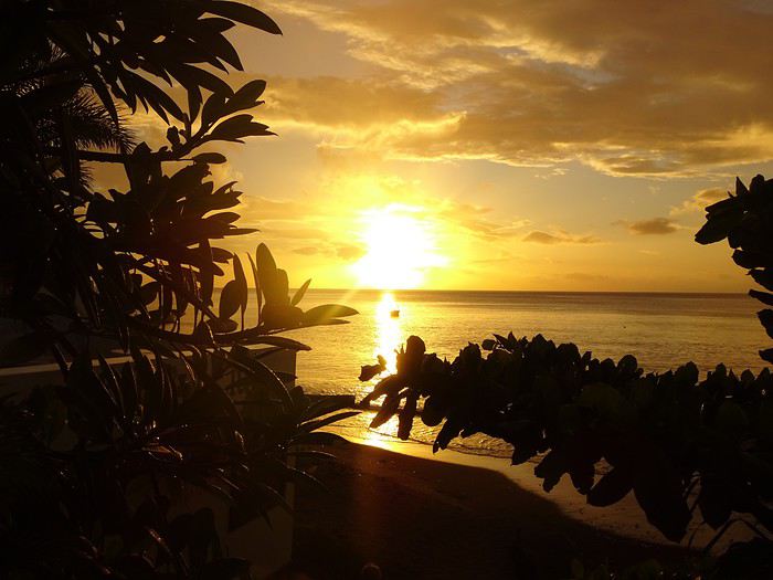
Sunset at Sunset Sunset Beach Colihaut Colihaut


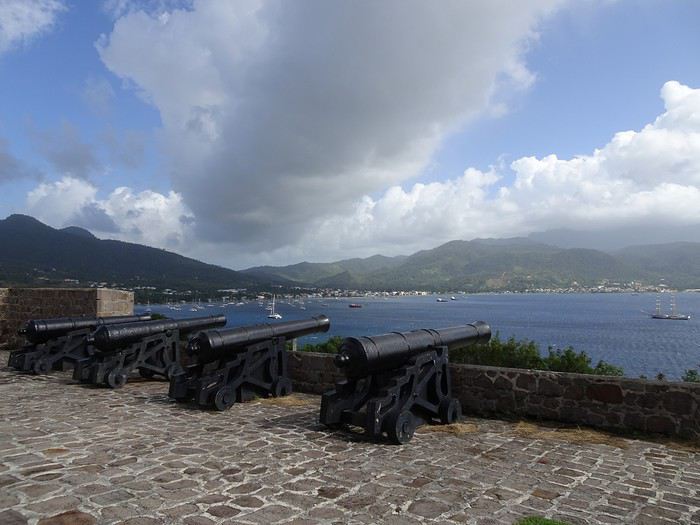
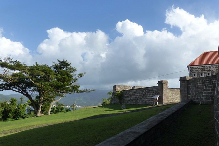
Fort Shirley


Open
VO
VoyageForum last year
Two weeks with girlfriends in southern Kazakhstan
Hi everyone!

I’m just back from two weeks in southern Kazakhstan. I went with a friend, and we organized everything ourselves. We came back absolutely enchanted by the trip: stunning landscapes, lots of animals spotted in the parks, and above all, amazing hospitality and a warm welcome.
Open
XR
Xrctn last year · Marien33
To the Top West End
In this time of general travel-journal scarcity, I’m stepping up to tell you about a far-too-short getaway to the Top West End, a local term for the very northern part of Western Australia, right on the border ( ;) ) with the Northern Territory.

As usual, I didn’t manage to keep it short, but this time I’ve got photos to go with it!

August 2020. Since the opportunities to explore the world are extremely limited right now, all we (R&X) can do is explore our own island! Well, just a part of it, because with the state borders still closed, we’re stuck in Western Australia (WA).

Luckily, we’re pretty fortunate because this state is huge: over 2.5 million km² (that’s more than four times the size of France or 1.5 times Quebec). What’s more, stretching over 20 degrees of latitude between the Antarctic Ocean and the Timor Sea, you’ll find climates ranging from Mediterranean to arid to tropical. That’s actually why we decided to head as far north as possible. Sick of the endless rainy winter in Perth, bring on the heat of the Kimberley... way up Nooorth!

Friday. At the airport, the main terminal was closed (not enough flights), so we ended up in the annex (where flights to the various mines usually depart from). There was no crowd at the gate, and in this huge, single departure lounge, empty seats were plentiful. Only three flights were listed on the screens for the rest of the morning: the first to Coondewanna (?), the second to Darwin, and ours to Kununurra (code KNX).

A cool breeze swept through the half-open corridors along the runways. At the top of the walkway leading to the Fokker 100 (the Airbuses and Boeings are now parked!), a flight attendant greeted us with a basket full of sanitary masks. We were actually the only masked passengers (the staff weren’t wearing them either). With zero Covid-19 cases in WA at the time, the only rule was to maintain social distancing—something pretty hard to do on a full plane!

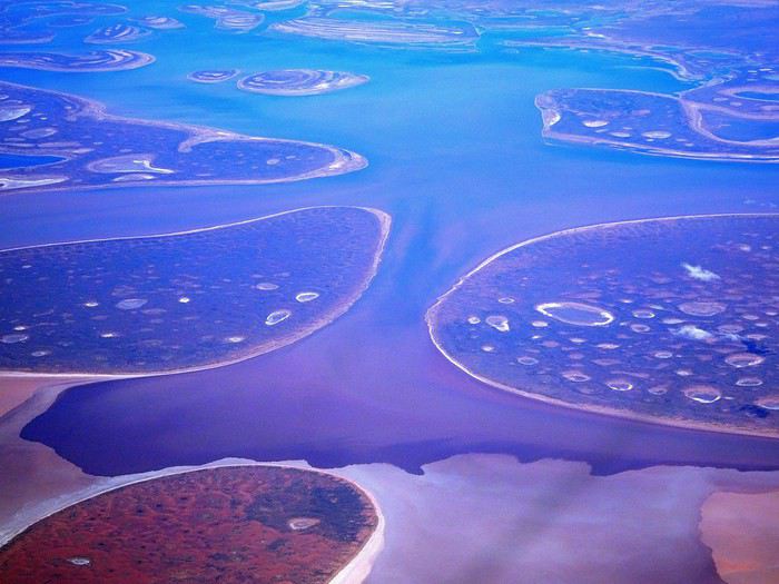
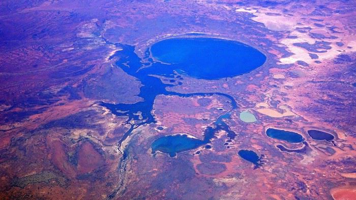
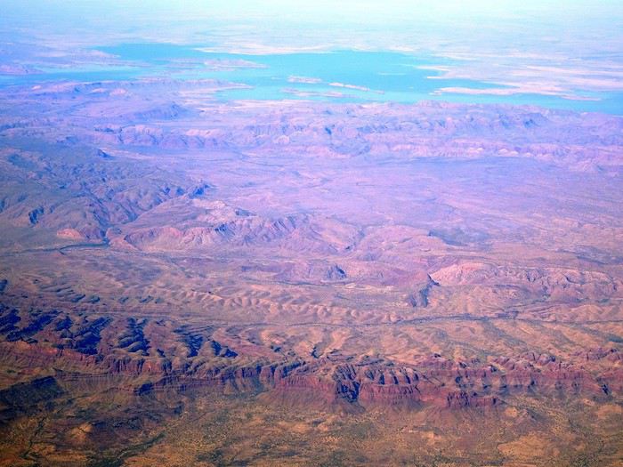
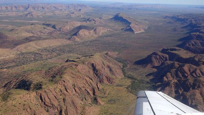
It was also my first time wearing a mask—it felt weird, pretty uncomfortable, and after a while, painful behind the ears. I really feel for those who have to wear one all day, every day. The flight lasted three long hours, but luckily, I had a good book. From the window, I watched an endless expanse of salt lakes in all shapes and sizes—round, elongated, gray, white, sometimes blue and green—and an infinity of winding, capricious meanders, along with long straight lines that led nowhere. The last half-hour got more interesting as rocky, swollen formations and long, sloping plateaus appeared. Against the vast ochre landscape, green patches became more frequent.


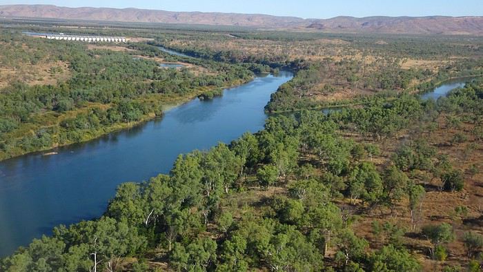
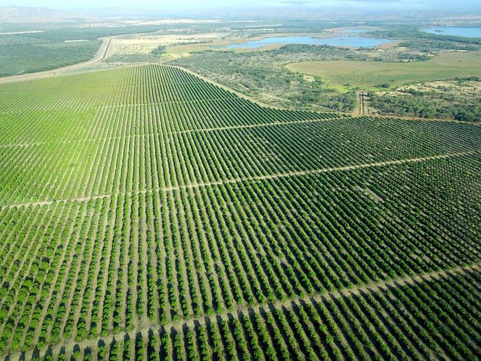
Just before landing, rows of green fields briefly appeared, along with an surprisingly wide river—but we were already rolling down the tarmac. A few hangars, a myriad of small, stationary planes, and a tiny terminal topped with a sign: “Welcome to Kununurra.”


We wanted heat, and here it was—34°C the moment we stepped off the plane! We felt alive again and totally ridiculous in our jeans and sweaters. We quickly grabbed our suitcase and picked up the 4x4 we’d rented—more out of necessity, since only that type of vehicle can access the national parks we planned to visit.

Just four kilometers separated us from Kununurra, a town of 5,000 people founded in 1961 during the construction of the Lake Argyle Dam and the development of the Ord River Irrigation Area Scheme (more on that later). On the horizon, mountain ranges (a bit of an exaggeration, since we know Mt. Meharry, WA’s highest ‘mountain,’ doesn’t even reach 1,250 meters!) and closer to the road, a few irrigation canals cutting through stretches of bush, then a huge park overlooking a small lake lined with reeds.

A row of baobabs (yes, there are baobabs in Australia too!), a series of motels with immaculate lawns, a gas station, and there’s the main street leading to the town center—that is, the parking lots of the two supermarkets, the bottleshop, the pub, the Town Hall, the municipal pool, and the Tourist Office (already closed!), and at the next roundabout, another park, the Presbyterian church, and a few other shops. In short, two or three green blocks that you can explore in no time.

One road leads to the small industrial area and one of the town’s three or four campgrounds, while another heads toward the residential neighborhoods, which look just like the typical suburbs you find in any Australian city—except with tropical vegetation. We stocked up at Coles, an identical copy of the one near our place, and—surprise—the prices were practically the same.

We checked into one of the motels. The receptionist listed the town’s three or four restaurants, insisting that it’s always better to book a table. She recommended the Pump House, a bit outside town on the lake’s edge. “Best spot to watch the sunset, but hurry up.” she told us. It was only 5:00 PM!

When we got there half an hour later, the place was packed, and the sun had already disappeared behind a row of trees! Sure enough, we’d see a few days later that the sunset can be a stunning spectacle—if you wait a bit for the sky (especially if it’s cloudy) to blaze and reflect in the lake’s calm waters. A little disappointed, we headed back into town, where we easily found the other lively spot in town: the pub (nothing like an old English pub). Above the long L-shaped bar, several giant screens (thankfully muted) were broadcasting live footy, rugby league, etc. In one corner, players circled the pool table, while in another, customers were digging into plates of the day’s special. Instead of rooms, there were various patios where groups of friends and coworkers (easily recognizable by the fluoro vests they were still wearing) were gathered. We found a table under a mango tree—unfortunately, a little too close to the guitarist strumming his entire Country Music repertoire, complete with Keith Urban-style tremolos. Guaranteed culture shock!

Since it’s the custom here, we called the Country Club to book a table before the kitchen closed! The CC is the town’s—and even the region’s—fancy spot. Dark decor, modern furniture, dim lighting, and the air conditioning blasting. The twenty or so customers had taken refuge on the vast terrace, lit by torches. The view of the tall eucalyptus trees, illuminated by spotlights shifting from red to blue, was breathtaking.

The menu was minimal, but the grilled salmon was excellent, and the Pavlova (the meringue dessert Kiwis and Aussies have been arguing over since 1906) with melon and watermelon was absolutely divine.

It wasn’t even 9:00 PM, and we were already in bed. Had we already adopted the Top West End’s chicken schedule?!

To be continued... Journal dedicated to Attila
Open
AL
Aleph240758 last year · Herodotos
New Walks from Jodhpur to Narnaul (Feb 24)
I’ve been busy—here’s another travel journal on Rajasthan, with some new discoveries as always.

Thursday, January 25: I left home at 4:30 AM and headed to Barcelona airport. The roads weren’t blocked by farmers yet, so I made the trip without any issues. I arrived at the airport at 7:10 AM, called Parkvia, and someone picked up my car 15 minutes later. All that was left was to check in my luggage. My Etihad flight was at 10:25 AM, which gave me time for breakfast. We landed in Abu Dhabi at 7:30 PM. The flight to Delhi was at 10:15 PM, the transfer went smoothly without any stress, and we arrived in Delhi at 3:00 AM. I couldn’t waste any time upon arrival because I had a flight to Jodhpur at 6:55 AM. I got to customs, and what a nice surprise—the hall was empty. I went through immediately, had my passport and visa checked, and everything was fine. I grabbed my bag quickly and looked for the transfer to T2, which is outside. You have to walk along the taxi parking lot and take the long corridors—it’s well signposted, and the transfer took 10 minutes. At first, I was a little stressed, not knowing how long customs would take, but in the end, I was early for my 6:55 AM flight. I’m even glad I booked this one, as it got me to Jodhpur at 8:20 AM.

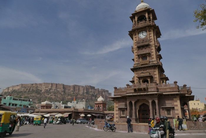
When I arrived, I took an auto-rickshaw to Jodhpur Palace GH, which I’d booked on Booking. The welcome was nice, and I was given a room right away. I was hoping to rest a bit, but unfortunately, it was very noisy. I settled in, took a shower, and was ready to go out and explore the city. The owner stopped me as I was leaving and told me I had to change rooms—I had to repack my bag before heading out. He showed me the way to the clock tower, which is about a 15-minute walk away.

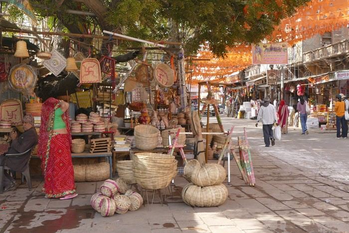
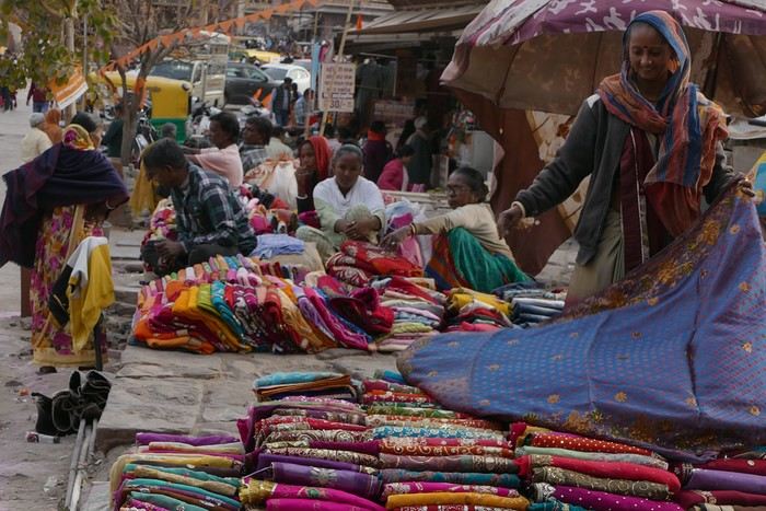
A market lines the street leading to the tower, and the traffic is intense.


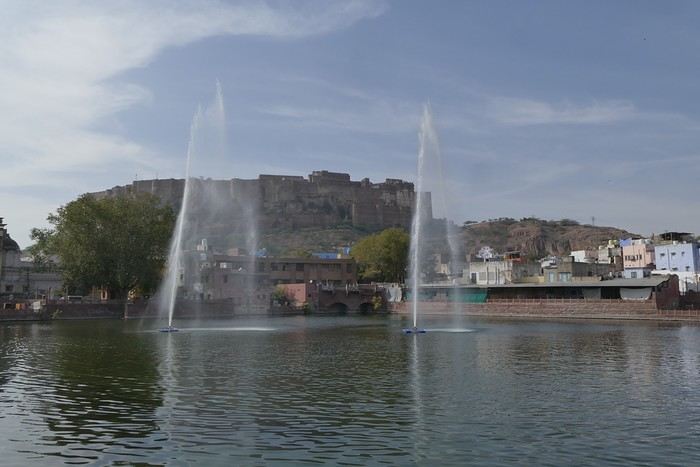
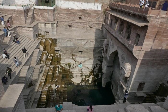
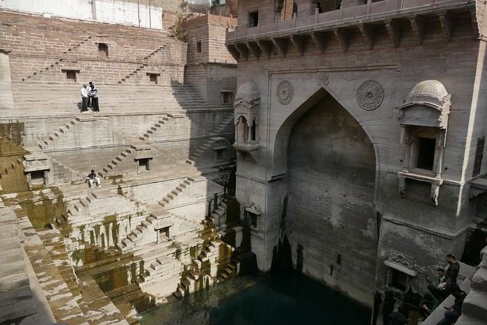
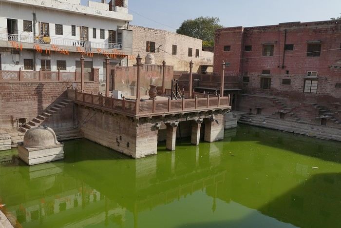
I set off in search of the stepwells and Gulab Sagar, a large basin with three water jets and a great view of Mehrangarh Fort. And yes, more baoris!


Toorji Ka Jhalra Bawdi isn’t far away. It’s a meet-up spot for tourists, with restaurants and terraces lining the area. The place is nice.


I looked for Mahila Bagh Ka Jhalra, went around in circles a bit, and finally found it right across from Gulab Sagar, where I’d already been. It’s not in good condition—it’s a shame it hasn’t been restored.


I went back through the clock tower area, found a currency exchange with a good rate, and booked my train tickets for the whole trip. The street was lively, with heavy traffic.


I was tired and headed back to the guesthouse. When I got there, I realized my phone wasn’t showing the right time, which gave me a chance to rest before going out for dinner. The Indigo restaurant is nearby and will be perfect.
Open
SY
Sylvie56 last year · Puma2A
Kenya February 2020: From Tsavo to Samburu via Meru National Park
Good evening everyone, I hope you're all doing well despite this very unusual time… Here’s a new travel journal to get you back on the Kenyan trails.

It was a really great idea to buy those flight tickets to Nairobi back in December. When Benoit suggested this new safari in February, I hesitated a little (very little): it was the season with particularly high temperatures, and the short rainy season in November/December had been very heavy, raising concerns about the state of the tracks… Given the current situation, no regrets, of course… We quickly organized the safari with our usual guide, and we booked the accommodations ourselves directly. (If we’d waited just a few more weeks, we might’ve regretted it…)

For once, we were able to leave from the airport near where we live (Lorient - Lann Bihoué), which is really convenient: no driving, no parking… We left home at 2 PM on Tuesday, February 18th, and arrived in Nairobi at 6 AM the next morning—perfect. (With a layover in CDG, of course 😉) Upon arrival, after a forehead temperature check by airport staff, we got our visas very quickly (forms filled out before departure). The customs agents congratulated us on our passports full of Kenyan stamps… but we still had to pay the 40 € for the visa.

All that was left was to collect our luggage, and we’d be ready to leave the airport shortly after landing. But there was a small issue: the baggage conveyor belt was broken… Eventually, the suitcases and bags were brought out by hand… Hakuna Matata, as they say here—no problem, as long as they’re all there. Benoit sent a message to Félix, our guide, to come meet us in the airport parking lot. After catching up with our respective families, we set off toward the Mombasa road, heading to Voi.

Traffic in Nairobi is still as heavy as ever, and the pollution is very noticeable (cars, but also cement factories…). The current lockdown has changed things. On social media, Mount Kenya and Kilimanjaro seem visible from Nairobi now!…

The first stop on this safari was a place we hadn’t visited before: the LUMO Community Wildlife Conservancy lumoconservancy.com/. It’s a small reserve located west of Tsavo West and near the Taita Hills. The reserve is managed by the local community, and entry fees are lower than in Tsavo’s national parks. We had initially planned to spend three days in Tsavo East, but since the accommodation wasn’t available for that long, we ended up choosing this option, which turned out to be a great discovery. Since the reserve is small, I think it’s hard to spend more than two days there. The advantage is that, since it’s not a national park, activities like walks or night safaris can be offered.

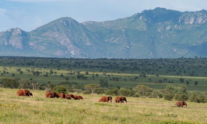
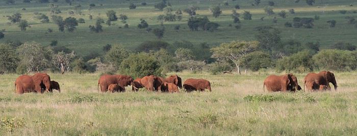
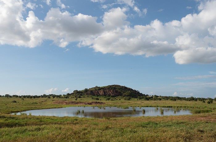
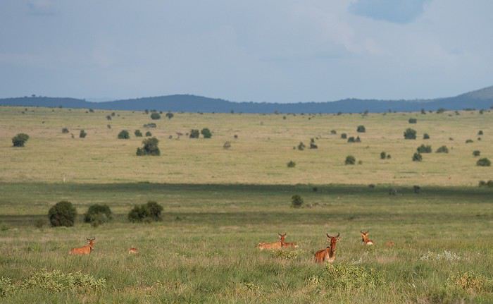
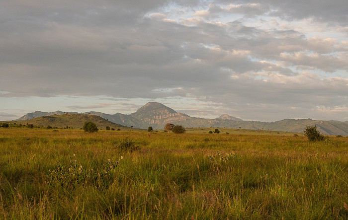
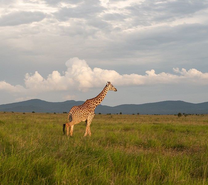
Alright, here are a few images to set the mood.


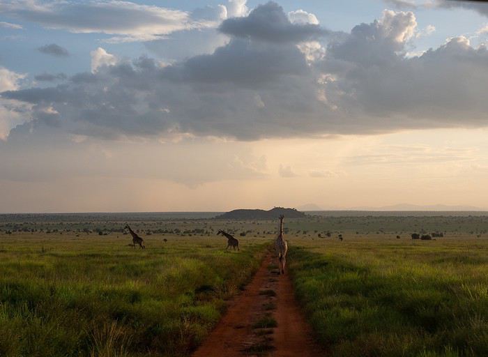
Elephants, but also hartebeests and lots of giraffes in a light we really liked.


Open
FA
Fabhyène last year · Puma2A
The Kingdom of Lions...
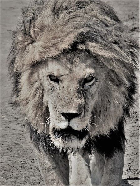
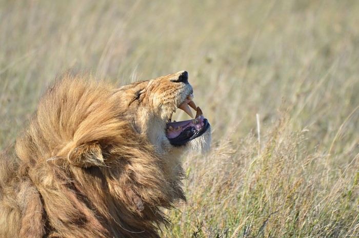
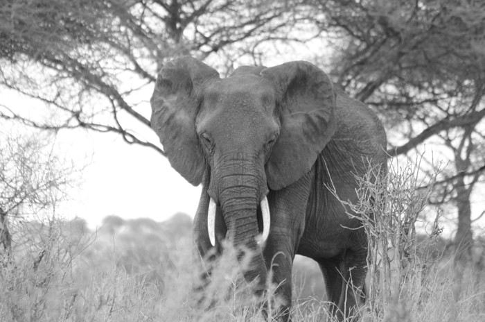
Hello everyone! This trip dates back to late 2021, but since Voyage Forum reopened for writing, I haven’t seen many travel journals about Tanzania, so I decided to repost this one, which I originally shared on another well-known travelers’ site—even though I prefer Voyage Forum’s user experience. It’s also a chance for me to relive this exhilarating trip... So, if you’re up for it, let me take you on a classic adventure: Tarangire - Ngorongoro - Serengeti, plus a little bonus—the small Arusha Park. First off, yes, as the title of this journal suggests, we were lucky enough to spot *tons* of lions. The power they exude is incredible, even if most of the time they just look like big cats napping or strolling around. But lock eyes with one, and you’ll be glad you’re in the jeep.

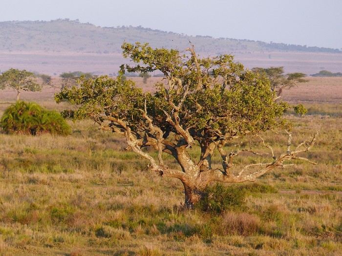
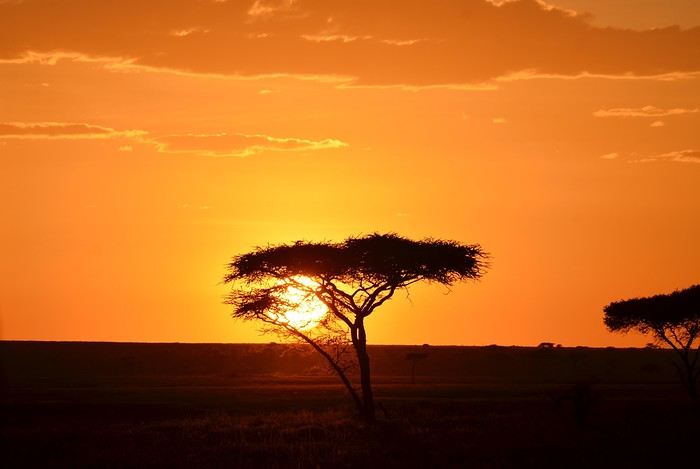
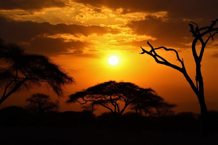
But let’s not forget the rest of the wildlife—and the landscapes, which are absolutely stunning, with those iconic tree silhouettes.


I remember before leaving, I was a little worried I wouldn’t feel that same sense of wonder I’d experienced two years earlier in Botswana (see my travel journal). That fear was unfounded—the magic worked its charm once again! Note: Since we had limited time, we focused our trip entirely on safari, so this journal is 100% animals and landscapes—and 0% Maasai. Next post: TARANGIRE
Open
JE
Jety34 last year · Sylvie56
Happiness Settles in the Heart of the Maasai Mara
(October 2018).

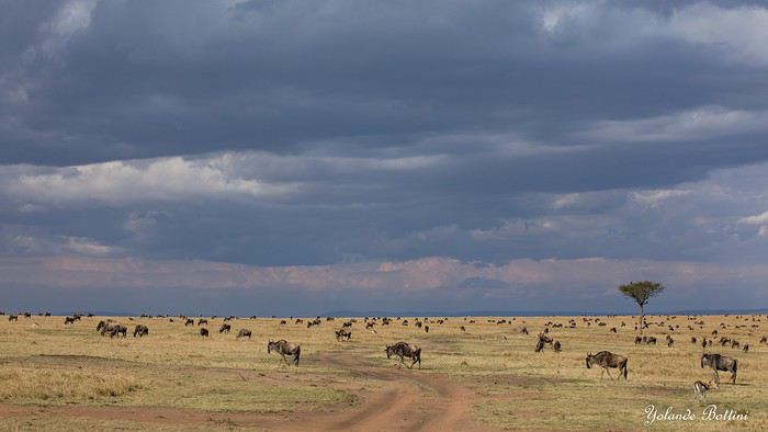
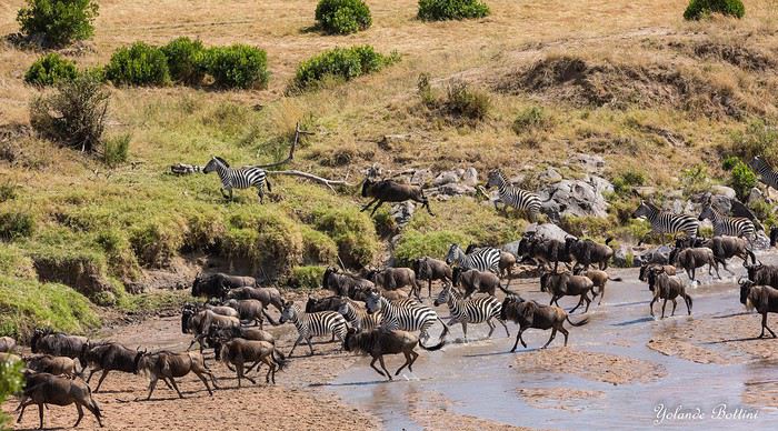
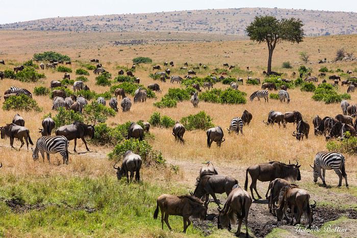
This account of a short stay in Kenya was originally meant for our friends and family, but to pass the time—for both us and you—and to add some content to the increasingly quiet columns of Voyage Forum during these weeks of confinement, when travelers can only journey in their minds, we decided to share the 25 pages of my ramblings, illustrated with Yolande’s photos, from an extraordinary stay in the Maasai Mara National Reserve. We waited until the two previous discussions on this same topic, filled with stunning photos and started by Régis and then Claire—sometimes in agreement, sometimes differing but always full of insights—had quieted down a bit before jumping in. Well, we’ll give it a try.

Let’s clarify: one of us claims to be a beginner photographer, and the other is just an unrepentant dreamer and modest writer. We often pursued our passions separately—Yolande with her mentor and me with an incomparable tracker—so sometimes the photos don’t quite match the text, or vice versa.

We hope you enjoy reading this lengthy post, which is longer than usual in VF’s sections (except, of course, for Mr. Voyajou). A thousand apologies for straying off the beaten path.

Alright, here we go!


Open
CE
Cebvl last year
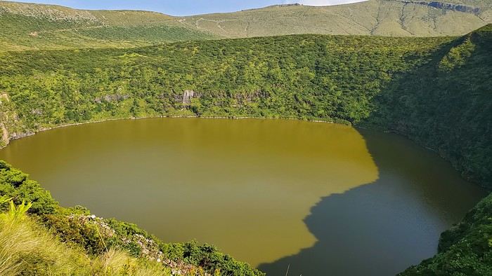
3 weeks camping in the Azores, August 2024
Hi everyone,

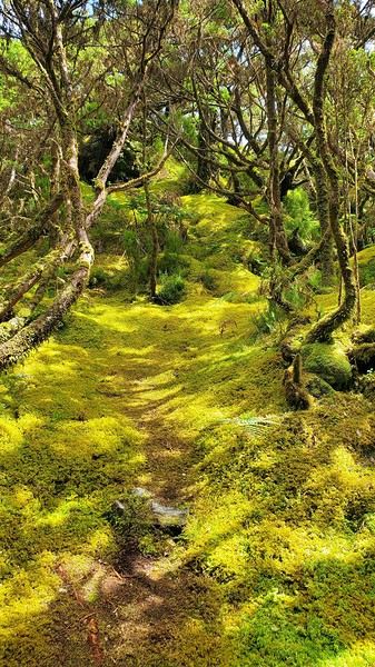
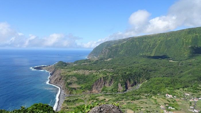
So glad this forum is back up! Here’s a recap of our three little weeks in the Azores in August 2024, camping on Terceira, Flores/Corvo, and São Miguel, with a special focus on the camping side—something I struggled to find info on before we left.

As others have mentioned, a trip to the Azores isn’t something you can improvise last-minute, especially in August. The rental car fleet is limited, so prices go up as availability drops, and vacation rentals/hotels are scarce. Plus, inter-island flights and ferries aren’t exactly frequent. I picked our destination in mid-April, and there were already few rental car options left (some local companies had nothing), and no accommodations on Flores for our dates—or only very expensive ones requiring multiple location changes. Since we love camping, we decided to bring our gear without really knowing what to expect.

Flight with TAP (426 €): Outbound: Lyon → Lisbon → Terceira Return: São Miguel → Lisbon (9-hour stopover for a quick visit) → Lyon

Inter-island flights with SATA: Terceira → Flores (via Horta): 87 € Flores → São Miguel: 90 €

I rented all three cars from the same local company, Ilha Grande—they weren’t picky about the car’s condition. For a Clio (or similar): Terceira (4 days): 461 € Flores (5 days): 623 € São Miguel (8 days): 730 €

Weather: The first two weeks were gorgeous—blue skies, no rain, and even hotter than we expected, around 30°C (temperatures barely dropped at night). The last week of August brought more fine rain (mostly at night) and temps between 20 and 25°C (a light jacket was nice in the mornings and evenings).

TERCEIRA: A great introduction! When I looked at what each island had to offer, Terceira wasn’t at the top of my list, but flying into Terceira cut costs and fit our schedule well, so we spent 4 days there. It turned out to be a lovely start.

For camping, we stayed at Salga Campismo in Porto Judeu, 20 minutes from the airport. We discovered that the island’s campsites were packed with locals—extended families or groups of friends having big, festive gatherings with barbecues and long tables. They spend their summers camping instead of at home, and some even commute to work from there. They had huge tents for sleeping, plus tarps for cooking and relaxing—way more gear than the tourists. Since the week of August 15th is peak vacation time (like in France), we struggled to find a spot, and the nights were pretty noisy. This was the only campsite of the trip with numbered pitches. It’s right by the ocean, next to natural pools. Facilities were decent, with hot showers and picnic tables. Lots of shaded spots. Cost: 4 € per small tent + 2 € per person. Electrical outlets were free (20 € deposit). During our explorations, we passed by Cinco Ribeiras campsite (west coast), which seemed similar.

Camping gas: Always ask the campsite reception if any travelers left a gas canister before buying a new one! Before the trip, I emailed each island’s tourism office, and they gave me addresses for Campingaz bottles. On Terceira, No. 13 Rua João Vaz Corte Real in Angra do Heroísmo (an agricultural store in the industrial zone). CV300 cartridge: 10 €. Note: The tourism office gave me the name of the neighboring store, which didn’t carry that brand.

Fridge: No fridges at any campsite on any island. We had a foldable cooler and found bags of crushed ice in supermarkets’ fish sections.

Things to see: Key takeaway: Do the must-see spots early in your stay in case the weather doesn’t cooperate. We were lucky and saw all the viewpoints without clouds—apparently not always the case!

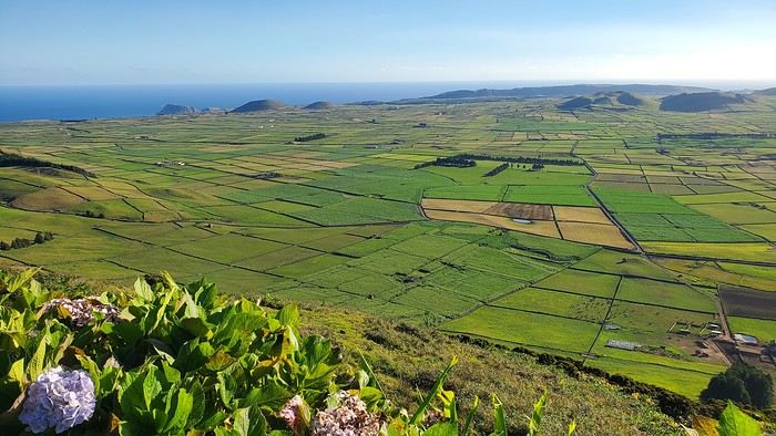
Our main visits/hikes on Terceira: Miradouro Serra do Cume (a must—*the* iconic Terceira photo)

Furnas do Enxofre (free): Few fumaroles, but a pretty 1 km walk through moss and endemic plants. Hike PRC01 TER – Misterios Negros (some acrobatic sections, but a very scenic path). Monte Brasil + Angra do Heroísmo: Lovely town. Hike PR02 TER – Baía da Agualva: Nice, but not much shade (along the coast). Quatro Ribeiras: Church and swimming in natural pools. Biscoitos natural pools: Too touristy (but still free).


FLORES: Our favorite! This was the island I *had* to visit, and we weren’t disappointed—no mass tourism, just stunning nature.

For camping, we chose Santa Cruz campsite. Unlike Terceira, it was only tourists here. Very little shade, but ocean views. Modern facilities with hot showers, clotheslines, and a charging station. A big area with picnic tables, each with a barbecue and sink, all sheltered. Right across from gorgeous natural pools. FREE (you can leave a tip for the caretaker).

For Campingaz, the campsite manager stores canisters and gear left by campers. Otherwise, you can find them at Movipesca.

During a hike, we passed by Fajã Grande campsite (campsites here double as picnic spots for everyone). It’s terraced, with no shade, but very clean facilities and a small bar/restaurant nearby. Natural pools across the street. When we stopped by midday, there were only a few tents. Fajã Grande felt even quieter than Santa Cruz, with just one supermarket.

We also picnicked at Ponta Delgada campsite in the north. Impeccable facilities, lots of picnic tables with barbecues. Empty when we were there. A bit out of the way.

Rental car or not on Flores? Given the high cost, I really debated whether we needed a car. In Santa Cruz, the port, airport, and supermarkets are walkable, and the most famous hikes are one-way, not loops. So I contacted a taxi (the tourism office emails a list of drivers—they don’t wait for customers; you have to call). Prices were around 20 € for Santa Cruz to Fajã Grande, for example. That means you could take several taxi trips before the rental car (over 100 €/day) pays off. But it does mean planning your route and schedule in advance, leaving little room for spontaneity. The taxi I contacted was already booked solid in July, so I decided to keep the car and adjust our hikes to make loops. (FYI, we’re in our 50s, two couples splitting costs—maybe a different calculation if we were 25!) No regrets—it gave us way more freedom.

Our main visits/hikes:

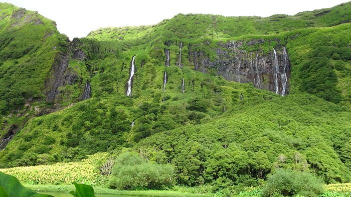
Hike (amazing): Poço da Ribeira do Ferreiro (the iconic waterfalls) → Fajã Grande → Poço do Bacalhau (swim in the waterfall) → Aldeia da Cuada → Poço da Ribeira do Ferreiro. Hike PR04: Loop from Miradouro da Fajã de Lopo Vaz, then down to the beach via the trail. Return along the pebble beach before climbing back up. Worth it, but the descent and ascent are steep.

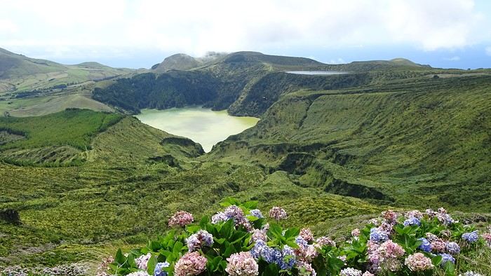
By car: Miradouro do Portal (great view of the coast to Fajã Grande) – Rocha dos Bordões (basalt columns) – Miradouro das Lagoas Rasa e Funda (a must) – Miradouro da Fajã do Conde.

Hike: Miradouro das Lagoas Funda e Comprida, Lagoa Negra, Seca e Branda, Lagoa Branca. A bit muddy and not as memorable as other hikes. The best part (a must) is the view from the starting miradouro.


By car: The north of the island.

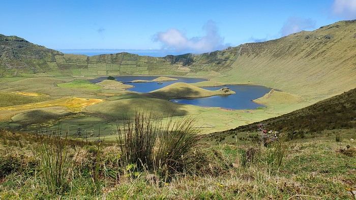
CORVO: Stunning!!

No spots left on the ferry (12 seats), so we took a tourist zodiac (booked a few weeks ahead by email, but there were still spots the day of—several boats make the trip). On the way out, we cruised along Flores’ coast to see waterfalls and caves. On the return, they looked for dolphins (we saw some! 🙂 ). Boat price: 35 € per person. At Corvo, minibuses shuttle between the port and the top of the caldera (10 € round-trip per person). Lots of people just stop at the viewpoint when the shuttle arrives, so we weren’t too crowded on the caldera hike. But it’s too tight on time to walk back down to the port. If you really want to, I think you’d need to stay overnight. All boats spend the same amount of time on the island.


SÃO MIGUEL: Back to civilization—but not just that! São Miguel is way more touristy than the other islands (though still nothing compared to other destinations), but it’s worth it for all the natural sites.

For camping, to avoid long drives, we started at Sete Cidades campsite on the west side. A big, free, terraced campsite with some shade. We were there the last week of August, when crowds start thinning, so there was space—a mix of tourists and locals. A few picnic tables with barbecues. For facilities, one side for men, one for women, each with one toilet (cleaned regularly) and three outdoor cold showers (swimsuits recommended). You can charge your phone in the caretaker’s hut.

After exploring the west, we moved to Furnas for the rest of the trip. We arrived on a Friday night, and the campsite was packed with locals spending the weekend. It emptied out Sunday afternoon. A large, shady campsite with several bathroom blocks (hot showers). There’s a restaurant, but only two picnic tables. Cost: 3.5 € per small tent + 3.5 € per person.

Campingaz: We bought canisters at Decathlon in Ponta Delgada (next to Decathlon, there’s a big shopping center for groceries). Didn’t ask at Sete Cidades, but at Furnas, there was a closet full of gas bottles of all sizes left by campers.

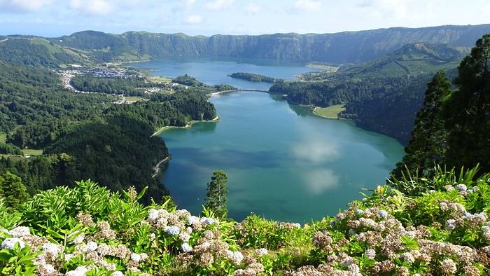
Main visits/hikes: Sete Cidades and the surrounding lakes (lots of viewpoints and short hikes): Beautiful.


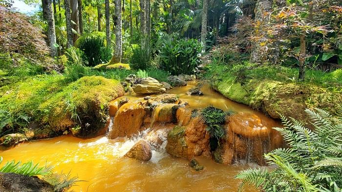
Swimming in the hot springs at Ponta da Ferraria (west side of the island).


Furnas: The lake, fumaroles, and parks (like Terra Nostra).


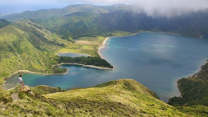
Lagoa do Fogo (gorgeous).


Gorreana tea factory (nice hike through the tea fields + guided tour), Ribeira Grande, Ermida de Nossa Senhora da Paz. The east coast and Ribeira dos Caldeirões park. Ponta Delgada.

Final thoughts: The Azores are a fantastic discovery for nature lovers—lakes, waterfalls, and tranquility. Almost all sites are accessible without hiking (though it’s a shame not to). The “miradouros” (viewpoints) have parking, often with toilets and picnic tables (always very clean), which helps protect nature. Camping is totally doable and really enjoyable! Our only disappointment: Not finding good fruits and veggies (except for São Miguel’s delicious but expensive pineapples).

If you have any questions, I’d be happy to help! Christine
Open
PI
Pierroro last year
Crete Spring 2024
CRETE Spring 2024 from April 11 to May 9

Thursday, April 11: Flight Montreal – Athens (Air Canada # AC 898) Flight Athens – Heraklion (Air Agean # A 3318) Fri 12, Sat 13, and Sun 14 April: Heraklion: Marin Dream Hotel: room great (a bit cramped); location great; breakfast excellent. Spectacular view (5th floor) of the port, balcony, close to the center and restaurants, cleanliness and comfort. I’ll definitely go back! We enjoyed this city, often unfairly criticized because it’s compared to the "three beauties." It’s a great entry point to the island, lets you catch your breath after a few hours of flying and jet lag, and you won’t get bored for 2-3 days. Monday, April 15 am: Car rental (pickup at the airport) Rental company: Auto Europe / Enterprise. Opel Corsica. Efficient and courteous service. Clean car in good condition. No issues. Quick return. I’ll rent again. PS: The two trips between the city center and the airport: public transport (bus): fast, efficient, and cheap.

Mon 15, Tue 16, and Wed 17 April: Agios Nikolaos Highlights: Kritsa, Knossos, Spinalonga, and Mochlos (for the breathtaking descent and the restaurant (Taverna Natural) a short distance from the descent). Accommodation in Ammoudara 72 100 (7-8 km from A.N.): Panorama Bay Villas Apartments. Location (elevated with a view of the blue sea), setting (unbeatable view), convenience, cleanliness, pool: Excellent. I’d run back here. A breakfast in Kritsa is lovely.

Thu 18 and Fri 19 April: Mirtos 720 56: A small seaside town, a bit sleepy, that can be summed up by a main street parallel and very close to the sea, with simple and smiling people. A base for lovely mountain hikes... and Gortyn. Accommodation: Hotel Mirtos: I’ve seen better! But it was only for 2 nights, and considering the rates, the enormous breakfast, and the kindness of the lady... it’s hard to complain. I’d go back if I’m in the area... for 1 or 2 nights. A taverna worth mentioning: Sigelakis, in Sivas. Sat 20, Sun 21, and Mon 22 April: Matala area: Matala: can someone explain the hype? But we were charmed by the region, its small villages (a little nod to Agia Galini), a small mountain school with its students and teacher, and its hidden little beaches... and a taverna (whose owner was a shepherd in another life) and a restaurant where we had our 3 dinners (no need to look elsewhere!). Accommodation in Kamilari(on) 700 20: Aelia Apartments: A long, narrow road through olive groves... the further we went, the more we thought we were on the wrong track! Phew! What an apartment (kitchenette, living room, two bedrooms including one in a mezzanine, balcony). Phew! What a setting, overlooking the surroundings from the terrace! I’d book again right away! Tue 23, Wed 24, and Thu 25 April: Plakias: A favorite! A lovely seaside walk with several terrace bars for an aperitif and really feeling on vacation. Morning hikes and discoveries, and in the afternoon, beach-pool at all-inclusive resorts a few kilometers away (one drink gets you in) and other small beaches. The charm of Spili, the softness of Loutro, and the enchantment of the Imbros Gorge. Accommodation: Horizon Beach Hotel: on the upper floor, a large bright room, a big balcony, and the vast sea right in front of us. Great location. A 10-15 minute walk from the center of Plakias. A great find: I’ll remember this address. In the center, on a street perpendicular to the sea, at the end of this street on your left (facing a tiny bar), one of our best dinners in Crete. The Plakias-Chora Sfakion road is breathtaking, but avoid the road—or rather the path—that hugs the sea too closely... which we didn’t do. Guaranteed sweating!

Fri 26, Sat 27, Sun 28, and Mon 29: Chania: The "big" city. The contrast with the Cretan countryside! Chania offers many attractions for tourists. We happily got "lost" in its alleys. We really enjoyed the quays for a drink at any time and for the lively atmosphere... but I wouldn’t want to be there in July! Accommodation: Boutique Hotel Del Doge. Good location. Close to the port and well soundproofed. A slightly faded decor but very decent. Spacious room and a somewhat narrow bathroom. Parking in a vacant lot along the sea: a 15-20 minute walk. I’d go back unless I find something better! Our favorite spots: we’ll remember Faka, To Stachi, and a restaurant in the center of a small square in the old part (every time we passed by, the TV was on a sports channel!) for the food, service, and friendliness of the staff. AND the ice cream! Great excursions to Valmos and Balos, Kefalas, Kaviles, Almirida, and Gavalochori. Three (3) days would have been enough to get a good sense of the city and the immediate area. It’s not a city—and I’m not even talking about the historic part—where it’s easy to drive. Tue 30, Wed May 1, and Thu 2: Paleochora. Or rather near Paleochora, in Kountoura Selinou (730 01), we stayed at Vienna Rooms Apartments. A few kilometers from the city, a short 10-minute drive, in a lovely olive grove that makes you forget the greenhouses that proliferate in the neighborhood. A large green garden, a big pool, tranquility, and the sea in front of you. Lovely apartments, well furnished, functional, and brand new (still smells new!) On the P-KS road, halfway, on the sea side, there’s a small, brand-new hotel where I’ll stop next time. What a view from the upper floor! Paleochora is a charming little town with a pleasant seaside promenade and an inner street parallel to it, lined with pretty shops. And an important detail: there’s a well-stocked wine bar, Monika Wine Bar, with attentive staff. A good selection of restaurants and a superb breakfast offering. What extraordinary excursions! Elafonissi, Sougia by boat, and up high, many tiny villages and breathtaking panoramas! Fri 03, Sat 04, and Happy Easter May 05: Rethymnon Accommodation: Hotel Casa dei Delfini. Very well located, comfortable, modern, with a certain prestige. A large dining room, stone walls, and a monumental staircase... feels like a castle (parador) in Spain... and a great breakfast. Friendly staff. The market where you can park is a 10-minute walk away. I’ll book again. Of the three "beauties" of Crete, this is our favorite. The center doesn’t (yet) have the "shopping mall" vibe that Chania has a bit too much. It feels good there. It has a cheerful air. Great restaurants. Easter day: visit around Arkadi. Otherwise, we strolled through the city to soak in the beauty of this island. Mon 06, Tue 07, and Wed 08 May: Athens. Flight Aegean #3307 (from Heraklion) Thu 09 May: Return flight: Athens-Montreal. Air Canada #899.

This was our second trip to Greece but our first to Crete. I say "first" because we’re seriously thinking of coming back in May 2025. We traveled in the blooming spring, so without the tourist crowds, and with restaurant and hotel staff in good shape... we could imagine what Crete must be like between July 15 and August 15!!! So our comments should be considered with that in mind. We’re a couple, she’s 76, and he—the driver, GPS, road map, and more—is 79. We’re living proof that Cretan roads are good. They wind, which is normal—we’re in the mountains—sometimes narrow, which is normal—we’re in the mountains—but they’re in very good condition, and Cretan drivers are respectful. Ideal travel climate: not a drop of rain or I don’t remember any! We’ll come back in May for a bit more warmth to enjoy the sea more. Food: the quality and quantity of breakfasts; dinners are good or even very good but sometimes a bit "copy-paste." Landscapes, green mountains, dark canyons (what we saw at 76+79), and endless deep blue, breathtaking. Tomatoes, olives, and honey: we’d want more. The trust restaurateurs show: you have to insist to get the bill!!! Easter: we were in Rethymnon: the crowd was much less oppressive than in Chania two weeks earlier. The kindness and eagerness of people in shops and on the street... which doubles or triples when you stammer a few words of Greek. Our favorites: Kamilari, Plakias, and... Heraklion, yes. In short, we loved it!

PS: Car rental: Why Auto Europe (Enterprise)? The ‘small local rental companies’ don’t rent (re: insurance) to people over 75 springs old!
Open
PY
Pygmalion19 last year · Puma2A
From Ol Pejeta to Tsavo West (Kenya)
Hello everyone,

Here’s the story of our two-week trip—13 nights, actually—in the national parks of northern and southeastern Kenya, which we took last September at the end of summer. My wife and I planned this trip with a French agency (Bel Africa, Paris), which worked with a local operator in Nairobi (Nadhy Travels & Tours). The latter provided a driver-guide and vouchers, but no aperitif🙁! Our all-inclusive package included animal safaris exclusively in a customized 4x4 vehicle (with a pop-up roof) and accommodations in high-quality lodges that we selected ourselves. It’s great for comfort, but not so much for the wallet. The cost was obviously astronomical for the services provided. But that’s just my usual take on lodging in East and Southern Africa! Our itinerary was a loop starting and ending in Nairobi, passing through Ol Pejeta, Buffalo Springs-Samburu, Meru NP, Amboseli, and Tsavo West.

Trip breakdown:

Day 1 to 3: Ol Pejeta Day 3 to 7: Buffalo Springs Day 7 to 8: Meru NP-Nairobi Day 9 to 11: Nairobi-Amboseli Day 11 to 14: Tsavo West

Photo gear we brought:

- 1 bridge camera - 2 DSLR bodies - 2 telephoto lenses: 70-200mm f/2.8 and 200-500mm f/5.6 - 2 pairs of 10x42 binoculars

What motivated this trip? We wanted to recharge and were looking for a certain tranquility that would be ideal for wildlife observation and photography—our hobbies. That immediately ruled out the parks in the southwest, which are too crowded. Plus, those would have likely been a repeat of what we experienced in Tanzania a few years earlier (see my travel journal "The Great Migration"). Buffalo Springs particularly appealed to us because of the unique animal species it’s home to. It was really their existence that drove our choices. We wanted to see animals we’d never seen before in their natural habitats.

So, on a beautiful late-summer evening, we took off from Paris-CDG for Nairobi. The overnight flight was uneventful, and we landed early in the morning at Jomo Kenyatta International Airport (NBO). But our driver-guide wasn’t waiting for us. Judging by the number of signs being held up, we must have been the only travelers in that situation. Good grief, why wasn’t he there like all the others?
Open
PI
Pir971 last year · SimonL
Tanzania 2019 - Polé Polé
KARIBUUU

Over 5 years later, I’m finally getting around to writing the travel journal for our first trip to East Africa: Tanzania. *Polé Polé*, as they say! 😎

A trip I’d started planning just 6 years ago, in February 2019, for my post-internship exam vacation. After returning to South Africa in July 2019 with my family, this trip, planned for September 2019, would be all about discovery and a few firsts: first trip with friends, first trek, first time in East Africa. I really wanted to attempt the Kilimanjaro ascent, try to still see some of its "eternal" ice, and Alison wanted to do as much safari as possible. Unlike with the Zulus, Himbas, or San, visiting a Maasai village wasn’t on the agenda. Thanks to the Kessy Brothers agency, who were super responsive, Sandy from VF, and other members who helped prepare our trip, we settled on the following itinerary:

Day -1 (8/30): Departure from Pointe-à-Pitre Day 0 (8/31): Departure from Paris Day 1 (9/01): Arrival at Kilimanjaro Airport / Ameg Lodge (Moshi) DAY 2 (9/02): Machame gate / Machame camp DAY 3 (9/03): Shira / Shira camp DAY 4 (9/04): Baranco / Baranco camp DAY 5 (9/05): Barafu / Barafu camp DAY 6 (9/06): Barafu + Summit at midnight / Mweka camp DAY 7 (9/07): Mweka gate / Sal Salnero Hotel (Moshi) DAY 8 (9/08): Arusha National Park / Kanga camp DAY 9 (9/09): Tarangire National Park / Kanga camp DAY 10 (9/10): Tarangire National Park / Twiga Lodge DAY 11 (9/11): Lake Manyara / Twiga Lodge DAY 12 (9/12): Ngorongoro Crater / Simba campsite DAY 13 (9/13): Serengeti National Park / Seronera campsite DAY 14 (9/14): Serengeti National Park - Uoga Kuria Camp DAY 15 (9/15): Serengeti National Park / Waso campsite DAY 16 (9/16): Lake Natron / Maasai Giraffe Ecolodge DAY 17 (9/17): Kilimanjaro Airport Day 18 (9/18): Zanzibar Day 19 (9/19): Zanzibar Day 20 (9/20): Zanzibar Day 21 (9/21): Zanzibar

As I mentioned in my first travel journal about our South Africa trip, I’ve had a special connection to Tanzania for a long time. Growing up in the Indian Ocean without ever visiting Africa, those wildlife documentaries on TV when I skipped my pharmacy classes... I imagined and dreamed about this land and country so much.

The original plan was to go just the two of us with Alison, but somehow—though I don’t quite remember how—we ended up organizing the trip with our friends Mélissa and Doriane, who joined us in Arusha after our Kilimanjaro trek for the last two weeks and their very first safari. I think it was Melissa who had the idea to crash our trip, and she was right to do so! 😉 Flights: Pointe-à-Pitre-Grand Case and Grand Case-Paris with Air Caraïbes. Flights: Paris-JRO and ZNZ-Paris with Kenya Airways (layover in Nairobi). Flight: JRO-ZNZ with Air Tanzania.


Safe travels! !
Open
PI
Pierresd last year · Marifb
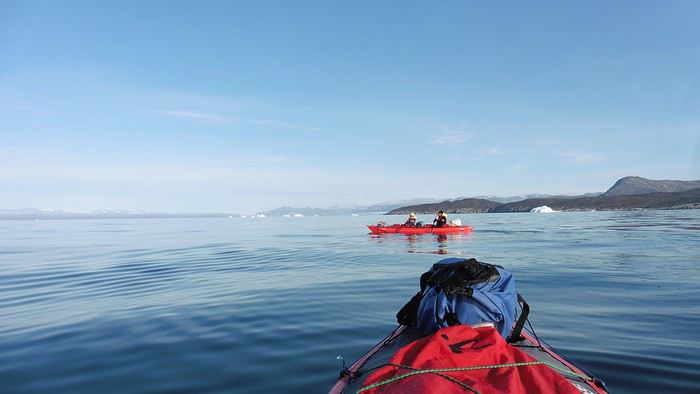
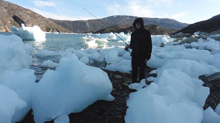
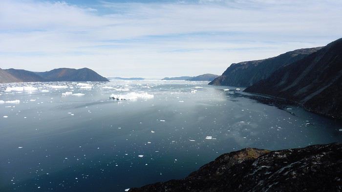
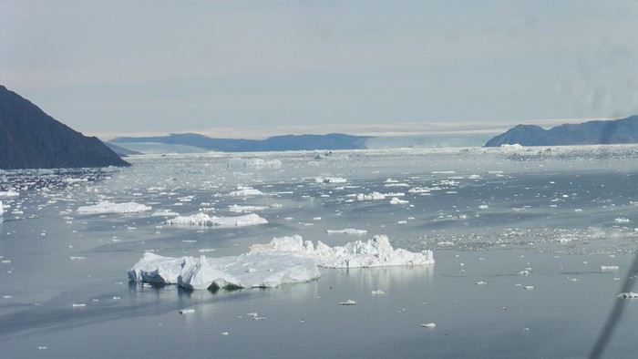
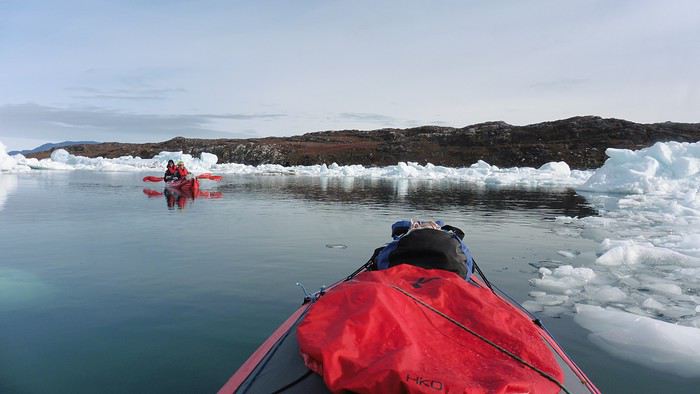
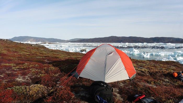
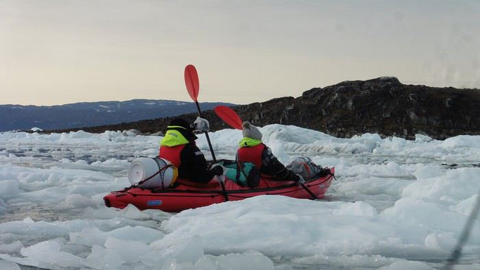
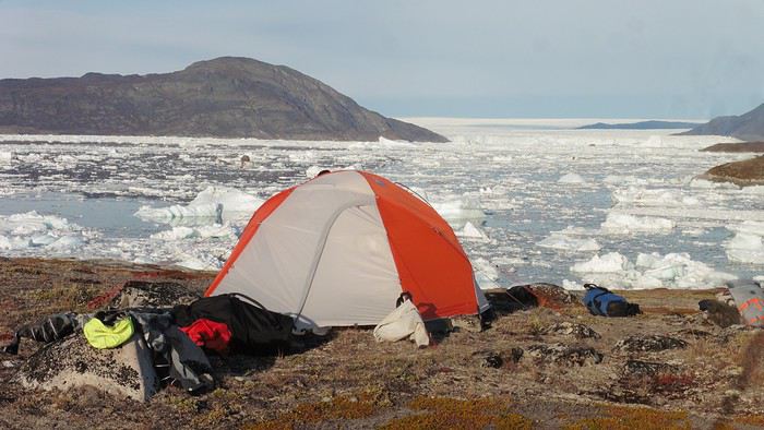
Kayaking in Greenland - Disko Bay: Circumnavigation of Arve Princess Island
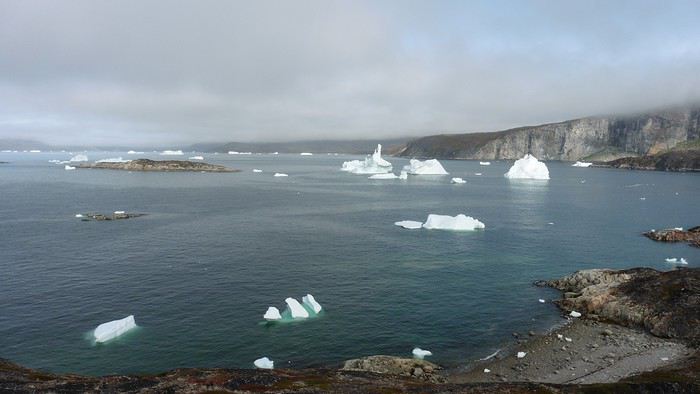
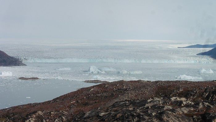
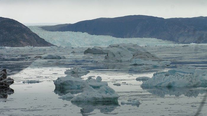
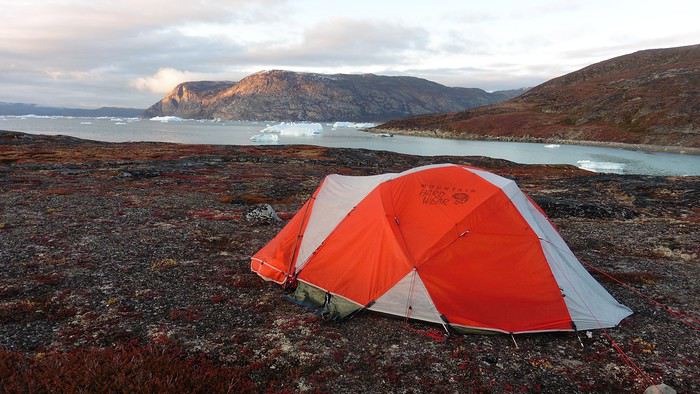
After two rather rainy kayaking experiences in Alaska at the end of summer in recent years, we chose a slightly drier destination for this late August 2018: the west coast of Greenland. The temperature will certainly be a bit colder, especially at this time of year, but we’re betting on a beautiful end to the season. According to temperature charts, it should be around 5 to 10°C with a few night frosts. The tundra will already have its autumn colors, and by the end of the trip, we might be lucky enough to see the northern lights when the nights get darker.

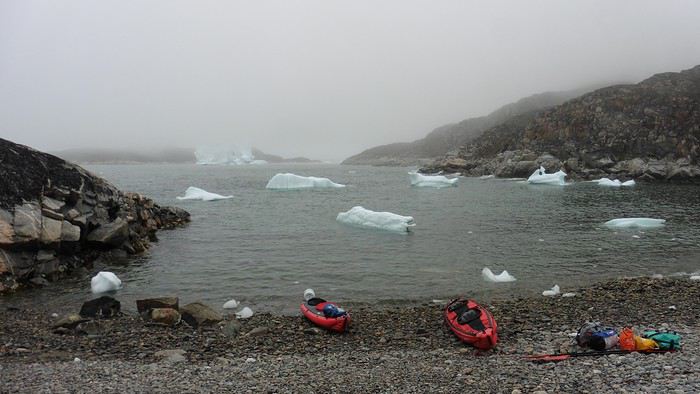
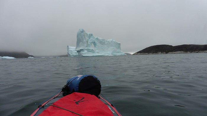
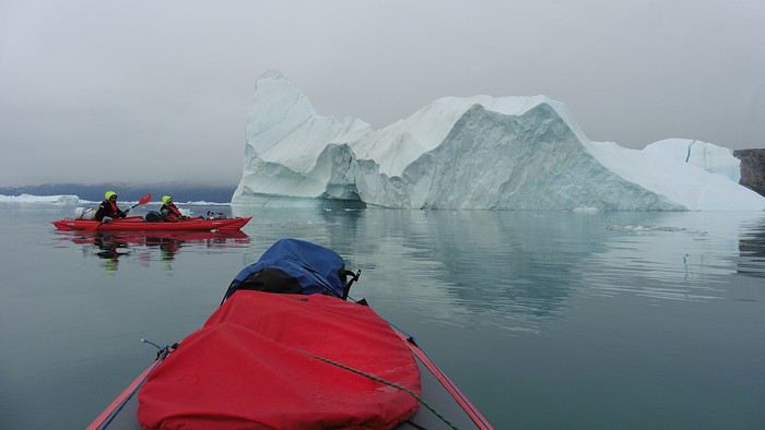
We’re setting off as a group of three in two inflatable double-seater kayaks (Gumotex) brought from France. The plan is to spend two weeks circumnavigating Arve Princess Island, located north of Ilulissat in Disko Bay, with a possible boat drop-off at the southern tip of the island.

This seems like a fairly classic route in the area—we found several descriptions online (thanks to the authors). With their help and Google Earth, we identified all potential campsites and entered their coordinates into a GPS. The western part of the island, facing the bay, seems ideal for whale watching, while the more rugged eastern side offers access to several glacial walls. We’re somewhat familiar with the area from two winter expeditions on skis and pulkas.

Plus, the commitment is limited due to the island’s proximity to several small villages, including Qeqertaq, Oqaatsut, and even Ilulissat. In fact, we saw fishing boats almost every day. The distance suits us well: 200 kilometers in 16 full days on site, which should leave some leeway in case of bad weather or for hiking.

We booked our flights in June with Air Greenland to Ilulissat for the last week of August and the first week of September. On both the outbound and return trips, we stayed overnight in Copenhagen. The France-Copenhagen flight was with Air France.

We were allowed 3 x 20 kg in the hold. Each kayak with its accessories fits into a 20 kg bag; the last hold bag is for shared gear: tent, stoves, dry bags… We only brought 1.5 kg of semolina for food. In the end, we had 61 kg of gear, and no excess baggage was charged.

Individual gear (clothes and sleeping bags…) was distributed in the cabin luggage.

For the boat transfer, we contacted an agency: Blue Jay, which gave us a number to call upon arrival.

Day 0: Wednesday, August 22 Departure day. After work, I drove from Gap to Marseille’s Marignane Airport for the first leg of the trip to Copenhagen. I enjoyed the rather mild local temperatures: 35°C in the shade. After a layover in Paris, I arrived at the Copenhagen hotel, located two train stops from the airport, where my companions were already settled. No issues—everyone was on time with their luggage.

Day 1 The flight to Greenland was at 9 AM. We had a layover in Kangerlussuaq, where we changed planes, then stopped in Aasiaat before reaching Ilulissat Airport at 3 PM under beautiful sunshine.

We called Blue Jay for the boat transfer: they could take us to the island as early as 6 PM; otherwise, we’d have to wait until the next day. That left us 3 hours to prepare our gear and, most importantly, do our shopping for the two-week trip—it seemed tight, but we gave it a shot.

A quick taxi ride took us to Pisiffik, where we easily found everything we needed: bread, butter, cheese, cold cuts, rice, pasta, jam, muesli… There was no C fuel or methylated spirits for the stoves, but this time we knew the trick: at Stark, a bit uphill from the town, we found the precious liquids. Two hours later, we filled our dry bags and containers with our purchases, and by 5:30 PM, we met Klaus, the Blue Jay manager, directly at the port.

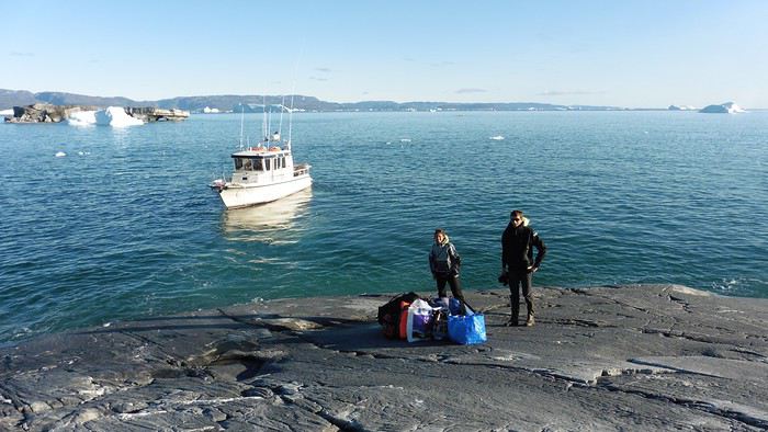
The vacation seemed to truly begin as we sped by boat through the icebergs toward Arve Princess Island. Forty-five minutes later, we spotted a beach lined with rocks where Klaus dropped us off quickly (he had another transfer to make right after).

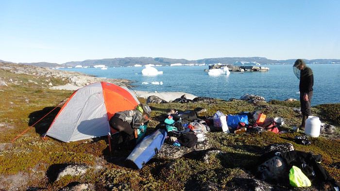
Here we were on the island, in the middle of nowhere, with all our luggage and food to organize, the tent to set up, and the kayaks to inflate—just 10 hours after leaving the Copenhagen hotel. We got to work, bothered by the flies. Despite our head nets, it was barely tolerable—there were so many of them. They swarmed by the dozens into every bag we opened. It was quite mild: 10°C.

Everything was ready by evening, and we were very happy to have completed all these transfers (planes and boat in a single day) as we slipped into our sleeping bags.

During the night, the wind picked up, and we went out several times to check the tent and kayak anchors. We noticed how bright it was—it was still quite twilight even at 1 AM.

Day 2 5:30 AM wake-up—the south wind was still strong, but since we were heading north, we decided to give it a try anyway.

This was also the moment we loaded the kayaks: since there were only three of us for two double-seater kayaks, we filled the hatch of one kayak, which allowed us to fit all our food. It would have been very difficult if there had been four of us for two kayaks.

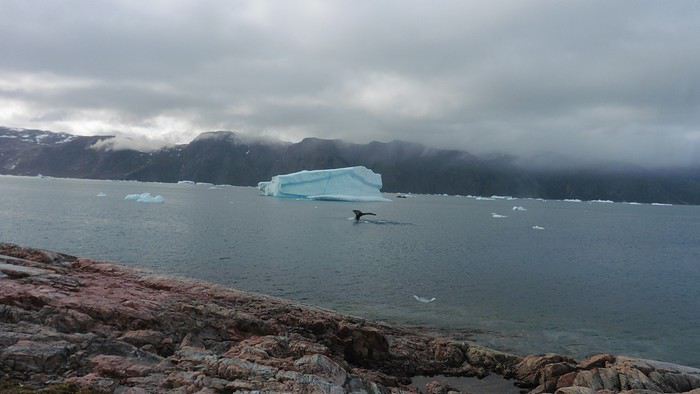
Finally, we set off north along the western coast of the island. The conditions were far from ideal—the sea was rough, and the kayaks had a lot of wind resistance. But the main problem was the spray skirt: the gear on deck weighed it down, and the skirt kept coming off… We’d have to deal with it. Barely underway, and whales were already breaking the surface—it was our first time seeing them, and we were very impressed. Too bad the wind didn’t allow for longer contemplation; stopping paddling was impossible with such strong gusts.

We passed a few headlands and even considered stopping due to the conditions. To find some semblance of shelter, we had to hug the coast closely without cutting across the numerous bays, which significantly lengthened the journey. But as the morning went on, the wind died down, and the sea calmed. We spotted several whales and our first seals. It was almost pleasant during the picnic break. By late afternoon, we reached Kangerup Sarqâ Bay, where we had identified a great campsite with a very large beach and a river. But the wind had shifted—it was now coming from the north, making the last hour difficult due to fatigue and headwinds.

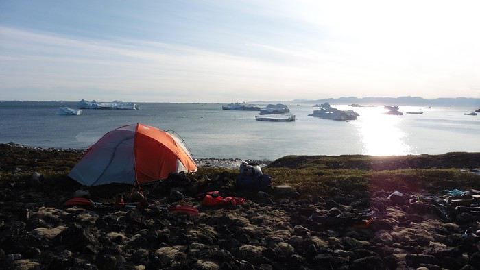
The campsite was ideal and beautiful, facing numerous icebergs grounded in the bay.

The GPS alerted us to another major drawback of inflatable kayaks: their slowness. It took us 7.5 hours of actual paddling (excluding breaks) to cover 28 km, averaging 3.7 km/h—somewhat disappointing. But we knew this before leaving, and once again, we’d have to make do!

Day 3 Surprise: at 6 AM wake-up, it was raining, foggy, with a south wind, and the sea was choppy even in the bay. It seemed wise to skip paddling, even though stopping on the second day was tough on morale. We went back to sleep, especially since the travel fatigue and the harsh conditions of the previous day had taken their toll.

At 11 AM, the navigation conditions weren’t any better—at the ends of the bay, we saw huge waves crashing onto the rocks, and giving up for the day became obvious. However, the rain had stopped, so we set off for a hike along the large lake bordering the bay. The wind hadn’t let up, and it was quite cold.

The tundra was starting to take on its autumn colors, and the contrast between the white lichens and the red vegetation was stunning. At the lake, we took out the fishing rods and quickly caught two beautiful Arctic char over 50 cm long.

As the afternoon wore on, the sun seemed closer. Along the beach, we gathered driftwood (mostly old planks) to cook our catch in foil over a fire. Eating our own food in such a beautiful place next to a good fire was comforting after the day’s setback.


In the middle of the night, an Arctic fox entered the tent’s rear awning. It seemed barely intimidated when we shooed it away with loud shouts and then with stones.

Day 4 6:15 AM wake-up—3°C. We were on the water by 8 AM. The wind had dropped significantly, but the sea was shrouded in fog, and it was very cold in these damp conditions.


We passed the bay’s headland, Kangea, and headed toward the abandoned village of Agpat. The atmosphere was very austere—we hugged black rocks in fog that limited visibility to 50 meters, revealing large icebergs as we went.

Suddenly, the water’s surface stirred in front of my kayak, and a huge gray back emerged from the sea. The collision was inevitable, but the whale seemed to understand and dove immediately, passing under the kayak and resurfacing a few meters away. I felt the kayak rock in the white foam and quickly paddled to escape the turbulence. What an emotion!

A light wind began to clear the fog, and the sun made beautiful appearances. Despite the cold, we stopped to visit the abandoned village, which left a strange impression. All the houses were still in good condition and wide open—some must have been very spacious in their time. We went back to sea, and in front of the large Kaangerdluk Bay, we hesitated—the headwind was strong, and large waves split the water. The next beach, from the island of Nua where we stopped to think, was over 8 km away. It was barely 2 PM, but caution led us to stop here for the day. We had covered 12 km—exactly the distance needed to stay on schedule. The afternoon was spent hiking on the island’s hills and gathering mussels and wood.


In the evening, we cooked these large Greenlandic mussels over a wood fire and savored them under the beautiful evening light. The weather was now fine, but the thermometer read -5°C in the sun…

Day 5 Bright sunshine, a glassy sea, and -8°C at 6 AM. Everything was green for setting off, even if putting on damp kayaking gear was a bit unpleasant in the cold. It was the first time we’d paddled on a flat sea since the start of the trip, and our average speed increased slightly.


We entered the Smallesund Strait, marking the end of the island’s west coast. We were close to the large Torssukatak Fjord, where two glaciers flow. The access pass to the fjord was very narrow, and numerous ice chunks blocked access to the beaches. The wind had picked up and was now hitting us head-on (again). Just before entering the fjord, we landed on a steep beach made of large pebbles on Oqaitsut Island. It was very cold with the wind, and moving forward became difficult. We decided to stop for the day both because of the conditions and because the next campsite was far away, given how rugged the fjord was.

We eventually found a flat spot for the tent despite the steep slope. Even with the wind, the weather was beautiful, and we set off on foot for the northeastern cape of the island, overlooking the fjord. The view was far-reaching and exceptional—up close, the large fjord filled with ice and its steep granite cliffs, and in the distance, the ice cap and glacial walls.

We spotted the village of Qeqertaq, whose network we could pick up, allowing us to check the weather forecast, which was rather good. While securing the kayaks in the evening, I noticed the strange behavior of one kayak at the end of the stage was due to the loss of the skeg—impossible to know where it detached. We’d have to do without it.

Day 6 Still that icy headwind from the northeast. We set off anyway for a long stage to reach the large pass connecting the Torssukatak and Ata Fjords.

We advanced laboriously along the high cliffs of the fjord’s southern shore. They faced due north and blocked the sun. We felt the cold and dampness of the rock. It was really cold, especially in the extremities. We picnicked on the western cape of Qeqertakavasak Island. The cold didn’t allow us to stop for more than 20 minutes… But the wind dropped, and the sea was now very smooth. It was heavily cluttered with ice between the icebergs and old pack ice. The goal was to reach the large rocky promontory of Anapnuna, wedged between the Kujatdleq and Kangilerngata Glaciers, but the ice made progress difficult. We stopped to gain height on a small island and spot a passage of open water, but all we saw was white—passing seemed impossible. The currents were very complex, and entire sections of ice were being swept in one direction and then another at an impressive speed.


We wandered through this labyrinth until landing on a beach on the small island of Takissut, where we set up camp, exhausted from the 30 km covered and the vigilance required by the abundance of ice. The place was sublime under the evening sun—we were surrounded by ice and mountains, with the Kangilerngata Glacier in the distance. The summer contrasts were striking between the water, icebergs, sky, and flaming tundra—all colors were represented. Absolute calm reigned.

The lack of drinking water at this spot wasn’t too much of a constraint: as soon as we arrived on the beach, we placed containers under the icebergs stranded in the intertidal zone. They were all full by the time we finished setting up.

Day 7 We had to change our plans: we wouldn’t reach the rocky promontory, too well protected by the ice. We set off under the sun for Igdluluarssuit Island. Although we had spotted a passage just before launching, we quickly found ourselves surrounded by ice. It was everywhere, and finding water to paddle became complicated. We tried to force our way in every direction, even retracing our steps. Everything moved at an impressive speed—we were in the middle of a whirlpool of ice.

The tension rose, and each boat had its share of big scares. I was trapped against ice floes that dragged me toward an iceberg—the pressure on the kayak was enormous; it was going to capsize or puncture! But with a few strong strokes and paddling against the ice, I managed to free myself from the trap. Barely 10 minutes later, my companions were sandwiched perpendicularly between two icebergs that were closing in. The situation was desperate—the kayak was bending and twisting more and more, but with some strong paddle strokes, it finally freed itself. After these particularly unpleasant moments, we were completely blocked. The drifting ice floes had tightened, and the kayaks were no longer even in the water… The only solution: wait with the kayaks on these floes, which were too thin to walk on (even though we didn’t try). Within minutes, the situation cleared—a waterway opened, and we rushed into it. We paddled with one goal: find a larger pool of water. After going back and forth, our path took shape—we had to force the passage several times, attacking the ice directly with the kayaks, and finally, we escaped the worst of the labyrinth. We reached land on the west side of the island and saw that the rest would be easier. To reach the island, we just had to cross the Arsiviup Ikera Strait, which was lightly cluttered. We reached the eastern cape of the island, ideal for camping, even though we had only paddled for 3 hours. We set up camp and hiked to the island’s summit, which overlooks the entire pass and the glaciers.

Everything was magnificent, no matter the direction. At 2 PM, we were at the summit—the beauty of the place and the picnic facing the glacier in the sun without wind made us forget the near-disaster from a few hours earlier. It would be impossible to approach the glacier by kayak, but from our summit on foot, it seemed so close, and contemplating it safely on solid ground was a great moment.

The pass was incredibly complex—everything was in motion, and an impassable passage could become open water within minutes. We were delighted when we returned to camp. A slightly lost whale among the ice accompanied us along the shore. The place was truly beautiful, but the temperature dropped again under the clear sky, preventing us from eating outside.

Day 8 Clear and cold at wake-up: -9°C. The sea had frozen in many places. We hesitated about the rest of the trip—should we start heading back to Ilulissat or linger in the pass, especially to approach the Eqi Glacier? After the incidents of the previous day, we decided to think carefully and paddled to the southern cape of our island to check the ice conditions toward Eqi. The weather had clouded over in the meantime, and the sky was quite gray. At the cape, we spotted the glacier’s wall, still 15 km away.


The fjord was quite cluttered, but it seemed passable. However, there was no guarantee the view would be much better 1 km from the glacier than 15 km away, especially since the front was quite active and therefore dangerous. We decided to head south without passing by the glacier. The cold temperatures encountered in the pass also motivated us to move away from the glaciers and the ice cap. We navigated under a threatening sky but without wind. The kayaks cut through the thin layer of ice on the surface with a crinkling paper sound. We reached the Ata campsite in the late afternoon after 5 hours of rowing without a single break…

The wind had picked up, and we discovered a nice surprise: a refuge with a table and a comfortable bench lined with mattresses. Facing the worsening weather, we settled in comfortably. The kerosene stove was too complex for our three brains—we couldn’t get it started, too bad, as it was 0°C inside. The rest of the afternoon was spent fishing in the large lake, where we landed a beautiful Arctic char, more than enough for three. A good night’s sleep without the risk of foxes or the sound of a tent shaking in the wind.

Day 9 6 AM wake-up to the sound of rain hitting the cabin. The decision was made looking out the window—wind, rain, and fog obscured the sea: we went back to sleep.

New wake-up, and the rain had stopped—we could go out and stock up on fish. We set off on foot toward the lake, following its western shore. It was very overcast, and the wind encouraged us to keep moving. We made our way to a smaller lake at the end of the large one, where we caught a huge Arctic char. A small clearing brightened the picnic, and we headed back to our cabin.

This 20 km hike kept us busy all day: walking on slippery scree and the micro-relief of the peat bogs took time.

Day 10 The sky was clear, but a light south wind made paddling intense. We set off southeast to reach the opposite shore of the fjord. It was very cold, and it was impossible to stop paddling for even a moment without immediately losing ground due to the wind. We crossed the Kangerluarsuk Fjord. I recognized the cape I had reached on skis in the winter of 2017. We found a nice campsite on the southern shore of the fjord: Uiartag. It wasn’t even noon, but facing this headwind, we preferred to stop here rather than exhaust ourselves for a few extra kilometers. Like the previous ones, this campsite was very comfortable: the ground was covered with a thick layer of lichens and mosses, very pleasant to lie on.

We set off on a hike to the heights of the cape, where the weather alternated between large clearings and snow showers. We noticed the loss of the thermometer, poorly attached to the backpack. On the way back, in the small bay of our beach, a whale swam calmly 10 meters from the shore—a beautiful surprise.

The sky cleared completely, and the temperature dropped as night approached.
Open
SO
Solene40 last year
Sao Tomé, the forgotten island
Hey there, it's me again—back with my usual travel journal share for our loved ones, from our 15-day trip in October 2019.


"Ah, here it is at last—that sweet scent of elsewhere so dear to Cricri and Lulu’s noses, that mix of apprehension and desire when facing the unknown.

We’re really diving into the unknown this time, taking you to the island of SAO TOMÉ... also known as the island: *‘Wait, what did you say?’* 😄. Because apparently, no one’s heard of Sao Tomé—except our Portuguese friends.

It’s an archipelago of three islands smack in the middle of the world, right on the equator, off the coast of Gabon.


No, these aren’t the sun-soaked, Polynesian lagoon islands. Here, *‘it rains, it pours...’* pretty much all the time, it seems.

There’s not much to *‘see’* in the traditional tourist sense—EXCEPT for stunning landscapes, lush vegetation, a few beaches with golden or black sand, colonial buildings still in their original state, a single main road, and plenty of *‘tracks’* that are more or less drivable. All this surrounded by an African population that speaks Portuguese and is known for its warm welcome.

Well, that should be enough for our happiness—and hopefully yours too! 😊


Ready for landing?
Open
PE
Peggy16 last year
Three weeks in Norway (July 2022): fantastic memories despite the rain
Our trip to Norway was two years ago already, but I thought it might still be of interest—and it’ll let me relive it a bit by proxy.

Before booking our flight tickets, we debated the route: should we prioritize the north with the Lofoten and Senja islands, or the south with its countless fjords? I was tempted to stay in the south—the country is so vast, and the drive north is long... but my husband really didn’t want to miss the Lofoten. In the end, we figured that since Norway is known for being expensive, we might only visit once (funny how we said the same thing before our first trip to the American West, and look how that turned out 😎), so we didn’t want to skip anything. That meant a 2–3 day drive up north. With 22 days on the ground, it was doable. Especially since, as usual, we skip big cities and gave Oslo a pass.

Practical details: - Flight tickets: 1195 € for 4 with Air France (Paris–Oslo outbound, Tromsø–Bergen–Paris return) - Car rental: 2020 € for 21 days (including the outrageous drop-off fee between Oslo and Tromsø—about 1000 €) - Tolls and ferries: 250 € for the portion billed directly by the rental company. Some ferries required advance booking and payment at the time of reservation—I’ll note their prices as I go through the story. - Hotels: 4135 €, averaging 188 € per night. We blew past our usual budgets from trips to the U.S., but oh well... - Food: 1570 €, averaging 71 € per day for 4 in a country where everything’s expensive... How’d we manage? We rarely ate out, mostly grocery shopped, and even packed half a suitcase with non-perishables: pasta, rice, a few cans, and even some cured sausage! We also stayed 3 nights at Clarion Collection hotels, where an evening buffet was included in the room rate.
Open
EI
Eiger last year
Adventures of a Bygone Era: The Philippines in 1984
After several discussions on VF about travel journals from the Philippines, I decided to write this curiosity: a trip report from a journey made in 1984, when traveling to the Philippines was still an adventure.

A curiosity because writing a travel journal about a trip 35 years later isn’t common, but also (mostly?) because exploring the Philippines at that time had little in common with traveling there today.

Obviously, I’ve forgotten a number of facts, most of the details, but with the help of a few notes from that time and a stack of slides (yes, there was life before digital 😊), many memories came back and added to the highlights I’d never forgotten. The scanned slides aren’t always great quality, but there are still quite a few to brighten up this chatter. Back then, we didn’t snap photos like we do now—film was too expensive—so I don’t have pictures of every place we visited... too bad, comparing some of those spots to how they look today would’ve been interesting.

Why "Adventures"? Why call it "Adventures" in the Philippines in 1984, a word so often used for a simple exotic trip? - Because the lack of information (no *Guide du Routard*, no *Lonely Planet*, no *Michelin Guide*, nothing, and obviously no internet) gave this trip what’s at the heart of adventure: the unknown. - Because the political situation made the stay sometimes dangerous. - Because transportation conditions were always epic, often perilous. - Because the question of where we’d spend the night came up almost every evening. - And for... quite a few other reasons.

That said, we weren’t exactly explorers!

Why the Philippines? First of all, why go to the Philippines in 1984—a country not exactly set up for tourism and about which we knew very little? How could we get an idea of the beauty of the Philippines and its points of interest when we had no guides or photos?

The idea came to us from Thailand a year earlier, during our first long-haul trip. After touring the north of the country, we met a Frenchman living in Phuket, where there were only a few tourists in Patong, with just a few small hotels and guesthouses. Kata and Karon had no buildings or roads, Rawai only had three palm-thatched bungalows, including ours, and the other islands were unknown to tourists. There was plenty to discover, and we wanted to return to this beautiful country... but the Frenchman made us dream about the Philippines—a country to explore, with wild landscapes.

Long evenings of discussion over multiple Sprite-Mekong cocktails (what memories of those headaches!) finally convinced us we had to go to the Philippines.

Episode 0: Before Departure The decision was made: we’d go to the Philippines in May 1984. Our friends and family were surprised when we announced we were going on vacation to the Philippines (a bit like saying today we were going paddleboarding in the Kerguelen Islands 🤪).

These days, preparing for each of our trips takes long evenings of research, planning, and noting down good addresses... etc. But for the Philippines in 1984, preparation was quick: we had very little information about the country, we were leaving almost at random, and the discovery would only be more exciting.

We still had a few bits of info gathered here and there: the rice terraces in northern Luzon, volcanoes, Negros where we were supposed to visit an acquaintance, Cebu and its marine life (we ended up going elsewhere), and absolutely avoid Mindanao, which was practically at war with the regime. That was about it, but it was already a great itinerary.

Nothing was organized in advance; we’d see day by day. We had no idea about travel times or even the existence of transportation options. The main (and sometimes only) way to connect two islands was by overloaded, rusty ferry. Only the big cities had airports.

Let’s Go: Episode 1: Paris to Manila My travel journals always start after arriving at the airport—the Europe-to-“Other Continent” trip isn’t interesting—but the flight to the Philippines was already an adventure, so I’ll make an exception.

This was the era when only a few Asian airlines were on par with Western ones: Thai, Singapore Airlines, and Philippine Airlines. They had beautiful, brand-new planes, and to attract customers (almost exclusively “businessmen”) from the usual airlines (Air France, Lufthansa, British Airways), there was opulence on board: unlimited champagne, all sorts of cocktails... Compared to today’s long-haul flights, there was still one small difference: no personal screens, just one screen at the front of the cabin with one mandatory movie. And I don’t know why, but we only got James Bond films, both ways... that must’ve been the trend at the time.

The tourism boom to Southeast Asia hadn’t started yet, and the “Asian Tigers” weren’t a thing, so there weren’t many business trips. That meant long-haul flights made stops everywhere to fill the planes. Our Philippine Airlines Boeing 747 left London, picked us up in Paris, then stopped in Frankfurt to take on a few Germans. I don’t know why we then made a stop in Dubai—a totally exotic place at the time. There was nothing to do there... things have changed a lot since. It was a small town lost in the desert. The airport was tiny, with just one or two buildings and a supermarket. During the stopover, everyone had to get off the plane and walk to the supermarket. Photo and electronic equipment were dirt cheap—I guess that was the only reason for the stop. Maybe it was their first commercial move. Emirates didn’t exist yet, as I checked online, but anyway, the idea that such a remote place could have its own airline was unthinkable.

Online, I found this photo of Dubai Airport in 1980. Anyone who’s transited through today’s massive airport with its rows of A380s will appreciate it:

Next stop: New Delhi to drop off some Europeans and pick up a few Indians, and finally, the terminus: Manila. I don’t remember how long the trip took with its five stops—an unimaginable journey today. Despite all those stops to fill the plane, there was still enough space to stretch out on the four center seats of the 747, something that never happens these days despite all the flights in every direction.

So here we are, finally at Manila Airport around midnight.

Episode 1: Manila and Baguio To start, a quick note on the political and economic situation in the Philippines in 1984, which had consequences for us as tourists, as we’d soon realize upon arrival.

After several centuries of Spanish colonization, the Philippines became American at the start of the 20th century, then independent. In 1966, Marcos took power, and little by little, his regime sank into corruption and mismanagement, becoming a dictatorship with martial law, all for the benefit of his family and friends, who enriched themselves endlessly. The peak was the assassination of opposition leader Benigno Aquino in August 1983, which triggered harshly repressed protests. So we arrived a few months later in a very poor country, with omnipresent corruption and an extremely tense political situation, as we’d soon see for ourselves. Major protests took place in the main cities during our trip—I’ll come back to that. Two years later, Marcos fled to Hawaii after being forced out of power following rigged elections. This historical context explains a lot of the situations we found ourselves in over the following weeks.

Arriving in the middle of the night isn’t very cheerful. Manila was already a huge city with many slums, where you could find a few business hotels like the Hilton or Intercontinental—way out of our budget—and plenty of run-down hotels. Luckily, two Indians we’d chatted with on the plane offered to take us to their usual hotel. They came to Manila twice a year for business. We accepted their offer, relieved not to have to look for a place to stay in the middle of the night, figuring the address must be good since they came back every time... we were wrong 🙁

We left the airport and immediately got a taste of the local vibe when we got into the taxi: the police asked for our passports. We thought: what’s more normal than police in a dictatorship?

But that wasn’t it at all. Our two Indian friends explained that the police were noting our names along with the taxi number and time. Crime in Manila was so bad that the taxi driver would be held responsible if anything happened to us... welcome to the Philippines 😎 😎

Historically, the Philippines was a very violent country, where everything was settled with guns or machetes. Previous governments had banned carrying weapons, but Marcos later allowed the free sale and carrying of guns, and disputes were settled with pistols again (or worse, as we’d discover later). Since he’d released most of the criminals from prison to form a paramilitary militia at his service (I’ll talk about our encounter with these “heroes” later), it was pretty dangerous to go into many parts of Manila, where these “tonton macoutes” ruled.

We arrived at our hotel without incident... and then things started badly. The room was infested with big cockroaches—exactly what I hate most in those kinds of countries. No way to find another hotel at that hour. After the long flight, the urge to take a shower was so strong that we squeezed into the bathroom as best we could. After that, I don’t remember—I guess we must’ve fallen asleep exhausted under the sheets in the heat... air conditioning wasn’t widespread yet.

The next day, we just wanted to leave that dump as soon as possible. So we decided to head north right away, stopping in Baguio, and we’d visit Manila a bit on the way back.

When we stepped outside, we discovered a pretty run-down neighborhood with potholed streets. But we also discovered the jeepneys. They were everywhere, flooding the streets.


They had crazy sound systems, each one blasting louder than the last. The interiors were kitschy but fun. There weren’t many private cars—almost all transportation was by jeepney, with buses reserved for intercity trips.


Before heading to the bus terminal for the north, somewhere on the outskirts of the city, we needed to exchange some money. I don’t remember how we ended up in a policeman’s jeep who offered his services: - Exchange money on the black market at a better rate than the banks. - Take us wherever we wanted, in this case, the bus terminal.

We accepted both offers (we’d still checked the official exchange rate from dollars to pesos). So we found ourselves in his jeep. After exchanging money, we left in his vehicle and stopped for gas. Without turning off the engine, he calmly smoked a cigarette while filling up. Since we were in a jeep with no doors or roof, we were ready to jump out if things went south, our travel bag in hand.

But we weren’t done with surprises yet. Once we left the small streets, we ended up in a neighborhood with wide avenues and not much traffic, which didn’t justify his incredible behavior. At every intersection, he made the sign of the cross, closed his eyes, and crossed without looking. I was more stunned than terrified! It wasn’t until we got out of the car later that I told Anne-Marie what had happened. I’d seen everything because the cop had put me in the front seat. Luckily, A-Marie hadn’t noticed anything from the back. Crossing Manila by trusting God rather than the rules of the road was ultimately effective. We were lucky—the trip was off to a good start. 🙂 🙂

We then passed through a neighborhood where slums stretched on for a while, and we left our policeman—friendly but a bit crazy—with relief.

A few hours by bus later, here we are in Baguio, cool in the mountains. My memories of Baguio are pretty fuzzy. I remember a small town. After some research while writing this journal, I found that the population was 120,000 in 1980. Given the population density in each home, that confirms my memory of a smallish town. Outside the “official” district with the president’s summer residence and government buildings, there were two or three paved streets with nice houses. The rest was very dirty and very poor, with lots of slums and dirt roads.


People we met on the street invited us to stay with them. These days, we wouldn’t just show up at strangers’ houses, which we should’ve done in Baguio—it would’ve saved us from an unimaginable and dangerous situation... which I won’t say anything about... !😊

The simple wooden house was on stilts at the edge of a hill with a view of the mountains. Since it was the start of the rainy season in a city that gets a lot of rain, we saw a lot of water. Our outings in town happened between downpours.

View from our lodging:

Episode 2: Baguio to Bontoc Aside from the situation briefly mentioned above, it was on the next leg to Bontoc that the adventure really began: an endless and dangerous road, a bus from another era, breathtaking landscapes, and surprising people.

We didn’t know the distance or how long it would take to get to Bontoc. When we arrived after about ten hours, we learned that Baguio to Bontoc was 140 km.

We got on a bus with wooden seats and settled in, two to a seat meant for two. As the bus filled up, passengers squeezed in three or four per seat, with chickens and baskets full of all sorts of things in the aisle. A little embarrassed, we didn’t know if we should squeeze in three on our seat. The seats were super tight (luckily, Filipinos are small), and I didn’t know where to put my legs given my height. I don’t remember if we stayed alone on our bench or if we ended up sharing with others.


The “road” was a dirt track (or rather, a mud track) with endless turns. We held on as best we could to our slippery wooden seats—it was shaking in every direction. The woman behind us was carsick and throwing up... gross... but what were we doing there? Then we plunged into the Sierra Madre... just the name is dreamy!

Rice terraces started to appear:


they took up more and more space along cliffs where we weren’t always reassured,


with lots of waterfalls (all that water had to go somewhere).

A few miserable villages stretched along the track, most often just a few houses balancing between the road and the drop. The bus stopped in every village—people got on or off and settled inside or on the roof. Street vendors offered their products to the bus passengers—a common sight in Asia, even today.


We were in another world—villagers were in loincloths, others had spears. The atmosphere was strange... but all good, we wanted exoticism, and we got it:

This so-called traditional outfit was everyday wear—it wasn’t for tourists since there weren’t any.

Open
PE
Peggy16 last year
July 2015: A Quick Stop in New Mexico Before Exploring Utah in Depth
This year, we hadn’t planned on going to the United States. After two trips in 2012 and 2014, we needed to refill the piggy bank... But we didn’t count on luck: one late September afternoon in 2014, while randomly browsing the web, I stumbled upon flight tickets for $753 per person for July 2015! After some calculations and hesitation, we decided to shorten the trip compared to the previous year (22 days this time), cut down on hotel costs (80 € per night on average), and skip expensive activities (no helicopter rides, rafting, or guided tours with outfitters, etc.), but we couldn’t pass up such a great opportunity!

Here’s the budget breakdown: - Flight tickets: 3,012 € for 4 (booked directly on AA’s website). One layover on the way out (CDG / Charlotte / Phoenix) and one on the way back (LAX / London / CDG). - Hotels: 1,685 € for 22 nights, averaging 76.60 € per night. We stuck to our budget (and even did better!), thanks to affordable hotels in NM, bookings made when the exchange rate was still favorable, and 2 free nights used on Hotels.com. - Car: 952 € for 22 days renting a standard SUV (Jeep Grand Cherokee). We went through AutoEurope, and the rental company was Dollar. - Gas: Around $20 per day on average (for 5,440 km). - Food: Just under $70 per day on average (for 4 people). We did a lot of grocery shopping for picnics, ate a lot of fast food, and only went to restaurants a few times. - America the Beautiful Pass: Free (the one we bought in July 2014 was still valid until the end of July 2015). - Not covered by the pass: $175 (entry fees for State Parks, a guided tour at Mesa Verde, Pow Wow entry, etc.).

In total, we spent 7,760 € for 4 people over 22 days. On top of that, we added $50 for the NYNY roller coaster (a gift for Hugo) and $135 for the *Mystère* show (a gift for Calista and me).

Here’s the itinerary: - Lost Dutchman SP, Goldfield Ghost Town, and Apache Trail - Chiricahua NM - White Sands NM - White Sands NM, Valley of Fires SP, and Old Town Albuquerque - Taos Pueblo, Pow Wow, and Chimayo - Bandelier NM and Santa Fe - Kasha Katuwe Tent Rocks NM - Shiprock and Mesa Verde NP - Bluff, Gooseneck SP, Road Canyon, and UT95 - Little Wild Horse Canyon and Goblin Valley SP - Capitol Reef NP (Cohab Canyon and Sulphur Creek) - Burr Trail - Zebra Slot Canyon and Lower Calf Creek Falls - Mossy Cave and Cedar Breaks NM - Kanarra Creek and Zion NP (Kolob Canyons) - Coyote Buttes South (Paw Hole) - Zion NP (Progeny Peak) - Snow Canyon SP - Lake Mead and Las Vegas - Las Vegas - Las Vegas - Los Angeles and the trip back
Open
ML
Mllegazou last year · Emma3595
Two weeks with a friend in southern Kazakhstan
Hello everyone!

I’m back from two weeks in southern Kazakhstan. I went with a friend, and we organized everything ourselves. We came back enchanted by this trip: stunning landscapes, lots of animals seen in the parks, and above all, top-notch hospitality and welcome... All of this makes me really want to go back and explore the other countries in the region. In the meantime, I’m sharing the story of these two weeks of travel... Don’t hesitate if you have any questions. And if you want more practical info and/or see more photos, you can check out my blog: https://smilingaroundtheworld.com/category/kazakhstan/

Day 1: First Kazakh steps in Shymkent

So here we are in Kazakhstan for two weeks. We had an excellent flight with Air Astana, which instantly made it into my top 3 best airlines! From the airport, the service was top-notch, with very friendly staff who went out of their way to ensure we both got vegetarian meals (my order hadn’t been taken into account when booking the tickets online). The flight to Nur-Sultan (the new name for the capital, formerly Astana, renamed last month in honor of the resigning president) was three-quarters empty, and we each got to stretch out over three seats. We were given an incredible travel kit, including a reversible sleep mask with phosphorescent writing: “Do not disturb” or “Wake me for meals.” Awesome! As for the lighting in the plane, I think the interior cycled through every color to simulate evening, early night, pitch-black night, and then dawn. It was even a bit surreal—those lights and everyone’s glowing masks ^^ The flight was a bit early and too short for us to sleep well, but it was still pleasant :-)

Upon arriving in Nur-Sultan, the atmosphere was a bit colder. There was staff everywhere, and we were under heavy surveillance. A camera even filmed us as we entered the terminal. We got our passports stamped and settled in to wait for our second flight. We eventually realized we were waiting in the wrong place... We were still in the international terminal, while our next flight was domestic. We finally found the right spot—saved! We started our trip in Shymkent, in the south of the country. We dropped our bags at the City Hostel, a super modern youth hostel offering double rooms. The decor is industrial-style, with very high ceilings—we loved it. When we arrived, it was too early for check-in, so we just left our luggage and went for a walk around the neighborhood. There was quite a bit of traffic, and the avenues were very wide. Despite that, there was also a lot of greenery and green spaces, which lightened things up a bit.

We had lunch (pizza + smoothie) on the top floor of a shopping mall, then headed to the pre-Russian quarter, a much quieter area with its little streets and individual houses.

Back at the hostel, after checking in, we treated ourselves to a two-hour nap—it felt great! In the late afternoon, we set out to find the Salman Bazaar. It wasn’t easy to organize—we realized Shymkent isn’t a very touristy destination—but we eventually managed with the help of the hostel receptionist, who called us a taxi. This bazaar is huge and has everything you could need for daily life: clothes, food, household products, toys... We did some shopping for dinner, then took another taxi to Independence Park, inaugurated in 2011 for the 20th anniversary of Kazakhstan’s independence. We really liked this park—it’s very wooded, and the late afternoon light was, as always, beautiful and pleasant... In the center, a large monument resembles the center of a yurt.

We then walked back to the hostel via Independence Square and several parks. We wanted to grab a drink along the way but didn’t find anything inspiring—oh well. We had dinner at the hostel and went straight to bed. Tomorrow, we’re getting up early... We’re heading out for two days to explore Aksou-Jabagly National Park. This park is famous for its landscapes at this time of year—it should be in full bloom, especially with tulips. We’ll see!

Days 2 & 3: Canyon, tulips, and wildlife in Aksou-Jabagly Park

Located two hours from Shymkent, Aksou-Jabagly Park is reputed to be one of the most beautiful in the region. We took a taxi from Shymkent, and upon arrival, we were warmly welcomed by Ruslan and his mother. They live at the entrance to the reserve, at the foot of the mountains, in a house surrounded by poplars. The setting is exceptional, and we immediately fell in love with the place. For our first day, we set off to explore the Aksou Canyon. Ruslan arranged a 4x4 with a driver and a ranger. The ranger speaks a few words of English, and with Coralie’s few words of Russian, we should manage! After a “viewpoint” stop, the road turns into a dirt track. It’s rained a lot lately, and the track is sometimes very muddy—at one point, we even had to cross a river. Four-wheel drive was definitely needed! The ranger pointed out some marmots by the side of the path—they were adorable.

We finally arrived at “Inspector’s House No. 1,” which overlooks the canyon. The view is magnificent, with high cliffs, wildflowers, conifers, and the Aksou River winding far below. While the driver chatted with the inspector, we descended to the bottom of the canyon with the ranger. The tulips I’d been hoping for were there—I was so happy! There were red, yellow, and even bicolor ones...

At the bottom of the canyon, we took a little break by the river. “Aksou” means “white waters” in Kazakh—the water does indeed have a very special color, a blue that’s both very light and very intense, like some South American lagoons. It bubbles around the rocks. The climb back up was easier than we feared. Once at the top, we continued along the canyon. The perspective changed as we progressed, and we never got tired of the view... Eagles circled above us.

After about 2 km, the driver picked us up, and we continued to a small kiosk at the foot of the mountains, where we had a picnic. Ruslan’s mother had prepared vegetarian “lunch boxes”—it was delicious and felt good to eat. However, it had gotten noticeably colder, so we put our jackets and scarves back on! After the meal, the driver walked off with a bucket—we figured he was going mushroom picking with Inspector No. 2, who had a house nearby.

We enjoyed the spot a bit longer while the driver gathered mushrooms, and then we headed back toward Ruslan’s place. Or so we thought... The return trip turned out to be quite long—the park wasn’t as deserted as it seemed, and the driver stopped every five minutes to chat with people we passed. At one point, we ran into Inspector No. 2 on horseback—it looked like there was a problem with a car further ahead... The driver and ranger bolted out of the car, headed toward the other vehicle, and we heard raised voices... When they came back, we tried to figure out what had happened, but no luck. We stopped again at Inspector No. 1’s house (are you following?), and they made us get out, telling us Inspector No. 2 needed the car for a few minutes... They left us stranded with Inspector No. 1, who went home, leaving us in the garden :-D We kept busy with the puppies, and I even took a little nap in the sun... Three-quarters of an hour later, we finally left—we didn’t fully understand what happened and never found out!

We got back (almost) without stopping to Ruslan’s house. Our room was ready, and we settled in quickly before dinner. It was already 6:30 PM, even though we were supposed to be back by 4 PM. Mushroom picking really slows things down ^^ Ruslan’s mother had prepared a delicious meal: vegetable soup, raw vegetable salad, and a mushroom, carrot, and potato stew. We loved it!

We spent the rest of the evening planning the rest of our trip while sipping tea. At one point, Ruslan and his mother signaled that there were wild boars right across from us—we could see them clearly! There were three adults and three piglets. We also took a little walk in the garden, watched the sunset, I did some blogging, and Coralie read... A lovely evening, and an equally lovely ten-hour night! The next morning, after a good breakfast, we set off on foot into the park. The trail starts right next to Ruslan’s house—so convenient! Today, we were with another ranger, two Germans (brother and sister), and their English-speaking guide (who didn’t guide much). We walked on a dirt road—there were even more tulips than yesterday, and the snow-capped mountains in the distance were stunning. After 5 km, we reached a small cabin, then continued another kilometer to Kishy Kaindy, a viewpoint overlooking the Jabagly River waterfalls (Jabagly means “year-old foal”). It was spectacular! We stayed a good while admiring this natural wonder. Like yesterday, the ranger didn’t rush us at all—it was really nice. We also saw eagles and an ibex perched on a ridge.

We had a picnic at the cabin before heading back the same way we came. This time, the snow-capped peaks were facing us—so beautiful! We picked up our bags and said goodbye to Ruslan’s mother. She was really happy today because her granddaughter was there. She told us she was a “babushka”—I understood that! Ruslan then drove us to Turar Ryskulov, where we took a shared taxi back to Shymkent.

In Shymkent, we struggled a bit with our Airbnb. We waited half an hour for the person who was supposed to let us in, then discovered the Wi-Fi wasn’t working—but we had a lot of bookings to make that evening. The lady finally lent us a Kazakh SIM card with data, which Coralie put in her phone in “hotspot” mode so I could get some internet too. All of that took nearly two hours. Phew! We then rushed to do some shopping at the supermarket. On the way back, some lights caught my eye—it was a pedestrian street all decorated with a funfair next to it. It was very lively, and we spent a good while strolling and people-watching! The rest of our evening was studious, between preparing dinner and booking our next stops.

Day 4: Turkestan, Yasawi Mausoleum, and Sauran ruins

This morning, after one last stroll in Shymkent, we headed to Turkestan. When we arrived at the bus station, we were told the next bus was in nearly three hours, but there were minibuses leaving when full. The system was well-oiled, and in just fifteen minutes, our minibus was ready to go. We each had a seat (and one for our luggage since there’s no trunk!), and the minibus was quite new—nothing like Madagascar ;-)

The trip went well despite a few driving scares—the driver was going a bit fast for my liking! Along the road, the fields were full of poppies—so pretty. When we arrived, we headed straight to the Edem hotel, where we wouldn’t be staying (we had a train to Almaty at midnight) but where we wanted to leave our luggage for the day. They agreed easily—great! Once we’d dropped off our bags and suitcases, we started our visits.

We began with the architectural gem and largest pilgrimage site in Kazakhstan: the mausoleum of Khodja Ahmad Yasawi, a great Sufi sage. Yasawi’s original tomb was already a pilgrimage site when Tamerlane ordered the construction of a larger mausoleum in 1390. It’s decorated with white and blue tiles and has a turquoise dome (currently under renovation). The main facade, unfinished at Tamerlane’s death, was left in earth with visible scaffolding. Impressive! The site is UNESCO-listed. Inside, the main hall displays a large cauldron, and other small rooms showcase plates, ancient coins, belts... Yasawi’s tomb is visible via two adjacent corridors.

We then strolled through the park, which includes many other mausoleums and tombs. We visited the old baths, the Friday Mosque, and then the history museum. The underground mosque, where Yasawi’s cell is located (where he retreated at the end of his life), was unfortunately closed for renovations.

We then went back to the Edem hotel to have them call us a taxi, and we set off to visit the ancient fortress of Sauran. This Silk Road city, once prosperous, is now reduced to ruins, with thousands of poppies blooming between them. High walls once surrounded a bustling and pleasant city. Many foundations remain visible. The place is vast, quiet, almost deserted, and imbued with a certain melancholy... The deep red poppies swayed in the wind, between the remnants of this city, reminding us how fleeting things are.

Back in Turkestan, we had dinner at the Edem hotel’s restaurant (we had to thank them somehow ;-)) and then rushed to the station to catch our train... 18 hours of travel awaited us to Almaty!

Day 5: From Turkestan to Almaty, 18 hours by train across the Kazakh steppe

We traveled from Turkestan to Almaty by train. We booked our tickets the day before departure, and only six seats were left: three in second class, not together at all, and three in first class, also not together but in the same carriage. We opted for first class! It was more expensive, but for such a long trip, a little comfort wouldn’t hurt... We wondered if we’d manage to switch cabins to be together, but it resolved itself: when we boarded, the conductor/carriage chief immediately noticed we weren’t together. He literally kicked a young man out of his berth so we could travel in the same cabin. We felt bad for the young man, even though he seemed to take it well... we thanked him with dried fruit (and I can confirm he took it well—the next day, he came to chat with us). In any case, we were really happy to have our own little cabin for this long journey, especially since we were the only foreigners and the only women in the carriage.

Eighteen hours by train might seem long, but these long trips while traveling aren’t wasted time—they’re the breathing space of the journey. They’re the essential moments for digesting what we’ve already experienced and preparing for future discoveries. They’re also privileged moments for reflection. Traveling slowly, to the rhythm of the train, means falling asleep in Turkestan’s outskirts, lulled by the train’s rocking and creaking, and waking up in the steppe. It’s feeling the train slow down and stop, stepping onto the platform for a moment, and watching the women sell food to passengers. It’s taking the time to write, read, think. It’s chatting with our neighbors and, despite the language barrier, managing to communicate a little. It’s picnicking at the little table in our cabin, with the landscape rolling by outside, and listening to music. It’s feeling privileged, imagining ourselves on the Orient Express or the Trans-Siberian. Reminding ourselves that one day, one day for real, we’ll take that Trans-Siberian. And smiling, thinking that in the meantime, in a few months, there’ll be the Trans-Canadian...

Days 6 & 7: Almaty, the “little apple”

The former capital of Kazakhstan, Almaty is known as the most Western and lively city in the country. At first, we had a bit of trouble identifying the city center—it’s more spread out and less dense than what we’re used to in Europe—but once we got our bearings, we really enjoyed strolling along the wide avenues lined with cafés and in the few pedestrian streets. The city’s emblem is the apple, which you’ll find in various forms around the city, from benches to statues to fountains. The original apple, from which all the apples we know today descend, is said to come from the mountains of Kazakhstan.

For nature, Almaty is a pretty green city. It has large parks, like Panfilov Park, which houses the Zenkov Cathedral. Some streets are also very tree-lined, so much so that they almost look like gardens. Often, high mountains peek out from behind the streets...

For shopping, traditional boutiques sit alongside big international brands. We really liked the Green Bazaar, a large market that sells everything. The food section was great, with stalls of pickled vegetables, dried fruits, and beautifully stacked fresh fruits... A feast for the eyes and lots of temptations for me!

For culture, Almaty has several museums. We visited two: the Fine Arts Museum and the National Museum. Both are housed in very Soviet-looking buildings on the outside, but the Fine Arts Museum turned out to be quite modern inside, with a pleasant museography. The National Museum, on the other hand, has stayed true to its roots ^^ Just walking through it was an experience in itself. And we did quite a bit of shopping there... The hall is a giant shop with lots of handicrafts—we treated ourselves.

The Arasan Baths are a must in Almaty. They’re said to be among the most beautiful baths in Central Asia... Architecturally, I didn’t find them amazing (nothing like Budapest’s, for example), but wow, did it feel good to relax there after a day of sightseeing! I happily moved between the sauna, hammam, and Russian sauna, with a preference for the latter—less dry than a traditional sauna and less humid than the hammam. You can buy bundles of leaves to slap yourself (or get slapped) with to boost circulation. The prices are very affordable too... On a weekday evening, we paid 1,800 tenge, or 4.5 euros, for an hour. Note that they add 20 minutes for changing, so you really get a full hour in the baths.

For restaurants, we didn’t try many because we preferred to limit our food budget by cooking ourselves. However, we did try and highly recommend Daredzhani, a great Georgian restaurant where we feasted. We didn’t know Georgian cuisine before, but we really liked it—vegetables cooked in various ways, cheese-filled breads, potato and/or egg-filled breads, and very thin fruit pastes made from grapes. We actually ate there twice because it was so good! We also loved Coffee Delia, where you can enjoy delicious pastries in a very cozy setting.

Besides being a pleasant place to live, Almaty is also a great base for exploring the surrounding area, and we were happy to stay eight days to discover more of the region!

Days 7, 8 & 9: Getting green around Almaty: Kok Tobe, Shymbulak, Medeo, and Big Almaty Lake

During our stay in Almaty, we used a rather unusual means of transport several times: the cable car! Here, it’s called a "gondola," and it allowed us to gain some altitude and breathe in the fresh mountain air surrounding Almaty ;-)

First cable car ride: Kok Tobe. The cable car starts in the city center and takes you to the top of a hill overlooking Almaty. At the top, it’s fairground vibes with an upside-down house, a Ferris wheel, rides, and the inevitable eagle trainer... There’s even a little corner dedicated to the Beatles, complete with music and a statue!

Second ride: Shymbulak. This time, you take a bus to Medeo, then three cable cars to the top of the mountain, at 3,200 meters altitude. Shymbulak is the largest ski resort in Central Asia. We went there to hike, but there was still snow and skiers, so we settled for admiring the view... With the blue sky and sun we had, it was gorgeous! We then treated ourselves to tea on the terrace—chalet vibes... At Paul’s, we weren’t completely out of place ;-)

Before taking the bus back, we stopped by Medeo, where there’s a large ice rink. With 10,000 m², it can host a thousand skaters in winter! This season, it’s closed; part of it is used as a go-kart track, and the other as a landing strip for paragliders.

Located an hour’s drive from the city center, Big Almaty Lake reveals itself at the last moment, around a bend, nestled in a setting of mountains and greenery. With the recent cold snap, it’s frozen, and the edges are snowy—a beautiful winter atmosphere! The ice was starting to melt, though—we could hear the water moving underneath, and when Coralie tried to walk on the ice, it collapsed under her feet. Unfortunately, it’s impossible to walk around it—a ranger keeps an eye out and blocks the adventurous (including us ;-)).

Days 10 & 11: Excursions around Almaty: Charyn Canyon, Issyk, and Turgen

Almaty’s tourism office is very active and organizes outings on weekends and holidays. We went to Charyn Canyon and then to Issyk and Turgen. A great way to discover the Almaty area at a modest cost (the outing costs about 6,000 tenge, or 15 euros per person).

Formed over millennia by erosion and wind, Charyn Canyon is reminiscent of the Colorado and the Grand Canyon. The most touristy part we visited is called the Valley of Castles, referring to the rock formations that resemble towers. We first walked along the ridge, where there are many viewpoints, then descended into the canyon. A three-kilometer walk leads to the banks of the Charyn River. The place seems to be a favorite relaxation spot for Kazakh families, who picnic, play ball, sunbathe... There’s also a hotel, bungalows, yurts, and a restaurant. Issyk is famous for its burial mounds and its Golden Man—maybe even a Golden Woman—found there. A small museum displays some artifacts. A little further on is Issyk Lake, once dried up but now reappearing... Whether naturally or not isn’t very clear!

As for Turgen, it’s a natural park known for its gorges and waterfalls. We didn’t have time to explore it in detail, but the bus drove through some beautiful landscapes, and we still walked to Bear Waterfall. It’s not incredible, but it’s still a nice little hike.

Besides the practical side of these organized excursions from Almaty, we appreciated being able to do an activity that Kazakhs do on weekends. During the Issyk/Turgen excursion, we really hit it off with Karina, a young student dragged there on vacation by her mother. She’s currently studying computer science at the best university in Astana and hopes to go to Europe eventually... A brilliant young woman, and a chance for us to chat in English ;-)

Days 12 & 13: The spectacular landscapes of Altyn-Emel Park

The last stop on our Kazakhstan trip was Altyn-Emel Park. This park is quite hard to access, so we opted for a car with a driver for two days—pure luxury!

Our driver’s name is Andrei. We met him at 7 AM outside our apartment on Wednesday morning. He doesn’t speak English, but a young man from the agency we booked through was also there, and we went over the itinerary together before leaving with Andrei.

Our first stop was Tamgaly Tas, two hours from Almaty. It’s a site where you can see 16th-century petroglyphs depicting Buddha. The place is also known for climbing—there were lots of young people harnessed up and/or climbing. It’s right in the middle of the Kazakh countryside, and we had a bit of trouble finding it!

Even with the language barrier, Andrei turned out to be very friendly. He suggested photo stops from time to time, didn’t rush us, and pointed out animals he saw... We even backed up on the road to see and help a tortoise cross!

It took another two and a half hours to reach Bashi, the “gateway” village to Altyn-Emel Park. After a quick stop at the rangers’, we arrived at the hotel. Our guidebook mentioned modest guesthouses, but things are changing... The hotel is large, brand new, and still being expanded. It reminded me of some Chinese hotels in Laos.

We had a quick lunch with Andrei—he explained that he’s a truck driver normally, delivering clothes and fabrics between Kazakhstan, Afghanistan, and Russia. He also showed us photos of his wife and son and told us he’s recently become a grandfather! We then headed to the park, grabbing a ranger on the way. Like in Aksou-Jabagly, he was dressed in full military gear. We first headed toward the Katutau Mountains. The rocks are reddish, sculpted by wind and erosion—the place reminded us a bit of Charyn Canyon. We had some “free time” to explore—we didn’t need to be told twice... Meanwhile, Andrei and the ranger chatted nonstop—it looked like they’d hit it off!

We got back in the car and continued along the track to the Aktau Mountains. Change of scenery! The mountains weren’t red anymore but white... Or so they appeared from afar. When we got closer, we realized they were actually multicolored, striped with yellow, pink, and ochre veins... It was magnificent, even more so with the late afternoon light. We had time to explore on our own again, and we walked with delight in this almost dreamlike landscape. We thought we’d made the right choice coming here ;-) We made one last stop before heading back to see a 700-year-old willow. It’s in an oasis where other tourists were camping—very tempting... I got the coordinates of their guide for next time ;-) The way back was in beautiful light, between sunset and a distant storm. Nature even treated us to a gorgeous sunset!

It was past 8 PM when we got back to the hotel, but our dinner was still waiting for us. We ate with Andrei, chatted a bit with a Polish woman who spoke both Russian and French (we put her to work chatting with Andrei ;-)), and then had a quiet evening with Wi-Fi, a shower, and reading in our room.

The next day, after breakfast, we met up with the same ranger and headed toward the singing dunes. These dunes are supposed to make a sound when you slide down their slopes. I was more than skeptical, but okay! When we arrived, we discovered a beautiful landscape—the main dune is gigantic, and when we reached the top, the view was extraordinary: it was the first time I’d seen a dune in the desert, snow-capped mountains, and a river all in one glance! A group of Chinese tourists was ahead of us on the dune, but they turned back quickly, and we were alone. After studying the terrain, I chose a slope that seemed good, and I started sliding down on my bottom... Quickly, I heard and felt a strong vibration, which turned into a hum. The dune really sings! It’s completely crazy... We did several tests—the most effective was sliding down side by side. But it works as long as there aren’t too many tourists doing it and the dune has time to rebuild between slides... There are about thirty singing dunes in the world. This phenomenon, already described by Marco Polo, comes from the synchronous movement of sand grains, which must be very round and covered with a varnish called “desert glaze”...

Covered in sand but delighted, we headed back to Bashi. The ranger stopped at a small spring so we could wash up, but it was almost dry. Along the way, we also saw the “Oshaktas,” a place where Genghis Khan’s expedition is said to have camped in 1219 during his conquest of Central Asia. The stones were apparently used to support the cauldron where food was prepared. A little further on, the ranger made us stop: there were antelopes!!! We saw one up close and a herd further away.

When we got back to the hotel, I took a quick shower to get rid of the sand—I felt like I had it everywhere! We had a quick lunch and then hit the road back to Almaty. Andrei drove very well, had a nice playlist, and I let myself be lulled while watching the landscape roll by outside...

For our last night in Kazakhstan, we booked a yurt in the hills above Almaty, not far from Medeo. For one night, we pretended to be nomads... The bed was a bit hard, and the air was a bit chilly, but we loved it! And the welcome was kind, the meal very good—only downside: the horse milk and camel milk, still warm... I almost threw up. Well, it was an experience, and all of this beautifully concluded our Kazakh stay!

Open
DO
Doxy436 last year · Herodotos
The Tren Maya
TREN MAYA in Yucatán We’re just back from our 7th or 8th trip to the Yucatán since 1971, and it’ll probably be our last (a little tear). We’ve crisscrossed the peninsula many times, but this post isn’t about listing the countless wonders to visit—there are already plenty of articles on that part of Mexico. For this trip, we chose to travel by train to try out this new way of getting around.
The TREN MAYA routes roughly follow the coast in a loop: Cancún – Valladolid – Mérida – Campeche – Escárcega – Chetumal – Tulum – Playa del Carmen – Cancún, with the main stations listed here and usually 2 or 3 stops in between. A branch line runs from Escárcega to Palenque. We only traveled the Cancún – Mérida – Escárcega – Palenque section, as the loop via Chetumal wasn’t open when we planned our trip. Besides, Chetumal itself isn’t very interesting. However, the Escárcega–Chetumal route has lots of Maya sites worth visiting.

The tracks, stations, and rolling stock are all brand new. The Tulum–Mérida section opened in early 2024, and the full loop was inaugurated at the end of 2024. The trains currently consist of 4 tourist-class cars and 2 first-class cars. I imagine this setup might change, since first class was nearly empty while tourist class was between 25% and 70% full, depending on the time and route.

The cars are designed by Alstom and built in Mexico, with the same seating layout as in France: 2+2 in tourist class and 2+1 in first class. The seats are a bit more comfortable than in France for tourist class and slightly firmer in first class.

The track is very well laid on the Cancún–Mérida–Escárcega section we traveled: no jolts at all. However, the Escárcega–Palenque branch is likely built with short rails, so I don’t think it’ll support very high speeds. The line is single-track except for the Cancún–Valladolid–Mérida stretch, which is double-track, and electrification is underway. Signaling is also being installed—the targets are in place but not yet operational. Given the current low traffic, we weren’t too worried.

The trains are diesel-electric hybrids and very quiet in diesel mode. I clocked a speed of 140 km/h, and they say it’ll reach 200 km/h once electrified.

Now, the stations: *grand* is the word that comes to mind. The architects did an amazing job aesthetically—it reminds us of Canfranc, with the same spirit 150 years apart, using marble (?) for the flooring. Technically, though, at least in Valladolid station, it’s a miss—they’ve already added unattractive metal reinforcements to the concrete framework barely a year after the inauguration.

Practical info: Tickets can be bought online on the Tren Maya website.

But contrary to what the *Routard* guide says, you can only book about a week in advance. So, we bought our tickets for the first leg, Cancún–Valladolid, from France, and then got the rest at the station a few days ahead. It seems there’s no ticket sales in travel agencies.

Arrive at the station about 20–30 minutes early, as there are airport-style security checks. Right now, the staff are still getting the hang of the baggage scanners and metal detectors, which can be a bit amusing.

Important note: This is a completely new rail network, so the tracks—and especially the stations—are far from city centers. To get downtown, you’ll need to take a shuttle or a taxi.

Here’s the breakdown for station-to-downtown travel: - **Cancún**: There are shuttles between the airports and the station (35 MXN/person). Taxis are pricier than in NYC: 50 € (1000 MXN) for a 10-minute ride—it’s an organized scam, but at least it’s clean, which is more than you can say for Cancún. If you’re staying at a hotel in Cancún or Playa del Carmen, make sure to arrange the hotel shuttle in advance. - **Valladolid**: 15 minutes from downtown, 150 MXN by taxi, or 36 MXN/person by shuttle, which drops you 3 *cuadras* (a *cuadra* = a block ≈ 100 m) from the center. - **Mérida**: 30 minutes from downtown, 300 MXN by taxi, or 50 MXN/person by shuttle, which drops you 7 or 8 *cuadras* from the center. The ticket agent told us it was just 1 *cuadra* (and we’re perfectly bilingual, so no confusion), but dragging suitcases over broken sidewalks in 33°C heat with no taxis in sight? Not great. So, for Mérida, just take a taxi. - **Campeche**: 10 minutes from downtown, 50 MXN by shuttle, which drops you right in the center (at the *Malecón*, across from the Gamma Hotel). We didn’t see any taxis at the station. - **Palenque**: Most hotels are outside the city center, so a taxi is a must—around 150 to 250 MXN.

Don’t forget to agree on the taxi fare with the driver before getting in.

For Tren Maya fares, there’s a rate for non-Mexican residents and several others for residents based on income. Here are the non-resident fares per person: - Cancún – Valladolid: 472 MXN (539 MXN on the return) - Valladolid – Mérida: 505.50 MXN (553 MXN on the return) - Mérida – Campeche: 574 MXN - Campeche – Palenque: 1300 MXN - Escárcega – Palenque: 789 MXN

The main reason we chose the train over renting a car (our usual go-to) was that on our last trip, just before COVID in 2020, the rental company refused to insure us in Chiapas due to safety concerns. So, we had to skip Palenque—but with the Tren Maya, it became possible again. The big downside of the train is that you need shuttles or taxis to visit all the Maya sites, which adds up in cost and time.

**Conclusion**: If you add up the train fares, taxis, etc., it might be better to rent a car for the whole trip and leave it in a hotel parking lot in Campeche or Escárcega for a couple of days if you want to visit Palenque. Then, take the train for a round trip between Campeche–Palenque or Escárcega–Palenque.

Safe travels! *
Open
ID
Ideesdevoyag last year · Scot2021
9-Day Road Trip in the Yucatán Peninsula
Hi everyone, In late February to early March 2025, we were lucky enough to spend about ten days in Mexico—heading to Cancún. We then embarked on a 9-day road trip to explore the Yucatán Peninsula! Since planning a trip isn’t always easy, we’re sharing our original itinerary (different from the "classic" loop) and our feedback on the places we visited.

With a few photos to illustrate each day, we hope to wow you 🙂! Here’s our loop itinerary starting from Cancún (a packed schedule, but it let us see so much): Day 1 - Cancún’s beach and Holbox Island


×768 214 KB

Day 2 - Holbox Island and the fishing village of Río Lagartos


6 KB

Day 3 - The Río Lagartos nature reserve, Las Coloradas salt flats, the Ek'Balam Mayan site, the church of Uayma, and the colonial city of Valladolid


Open
BR
Brigitte42 last year · Ploeven
Autumn trip from Puglia to Naples via Basilicata...
Hi everyone!!!

I’m finally getting around to writing about this 20-day trip to southern Italy: we didn’t travel this summer, and luckily, we found beautiful light and dreamy weather there at the end of September.

First, here’s the context of the trip: we’re both "confirmed seniors" but still curious and alert enough to enjoy the itinerary we’d imagined! We wanted a mix of discoveries—culture, cities, and nature—with guaranteed sunshine and the occasional short hike... We’re flying to Naples, round-trip, because the flight times work better for us. We rented a car online, picked it up at the airport (details to come... and it won’t be the highlight of the trip!), and booked our hotels in advance.

A quick overview of the itinerary: leaving Naples on September 15th, early in the morning, we’ll drive straight across the boot of Italy to Bari. After 11 days in Puglia, we’ll head back toward our starting point, taking our time: Matera in Basilicata, Maratea by the sea, and finally Paestum with its incredible temples.

Day 1: Brussels-Naples flight (Brussels Airlines) went smoothly; it landed an hour early, and we were thrilled, thinking we could use that time for a quick visit or two... Everything went well until we left the airport. We took the shuttle to the car rental offices, and at first glance, we realized this wouldn’t be smooth sailing!!! In front of every office (they’re side by side), there were already lines and kids sitting on suitcases—everyone looked exhausted... We resigned ourselves to waiting: nothing moved until tempers flared at the counters, and two people nearly came to blows. Things sped up a little, and after 2 (two...) hours of waiting, we finally got our chariot: a black Fiat Tipo, dirty, with a few dents and scratches that we made sure to note in the contract... but it ran!

Off to Bari, then: no time for sightseeing along the way! From there, we headed straight to our hotel in the countryside near Polignano a Mare.


A recurring detail: this happened constantly during our travels. We’d installed our own GPS, fully updated... In recent years, many dirt roads have become drivable, and lots of hotels and hostels have opened in the outskirts of towns. It was extremely rare for our ‘guide’ to recognize the street—let alone the number—we entered. Often, we got by calling the hotel reception: it might seem like a small thing, but it happened so often it became frustrating. In hindsight, it seems like without Google Maps, we’d have been lost!

Anyway, we were beautifully settled, with a terrace overlooking olive groves and the sea in the distance: all was well.


To be continued...
Open

Recommended for you

Previous Page 10 of 184 Next