😎Hi there, fellow backpackers in French Polynesia,
I’ll share my personal impressions and some tips for budget backpackers.
French Polynesia isn’t just for the rich—I’ve met plenty of backpackers exploring these islands on a shoestring!
The biggest expense is definitely the flight ticket. Since the beginning of April 2003, Corsair no longer serves Papeete, leaving only Air France and Air Tahiti Nui (and long live competition!). (AF is ATN’s partner, and a round-trip Paris-Papeete ticket costs at least 1300 € all taxes included.)
"An agreement was signed on 14/08/2002 between the Government of French Polynesia, Nouvelles Frontières Touraventure, Air Tahiti Nui, and Corsair. Corsair’s operation of the Papeete route was scheduled to continue until March 31, 2003. From that date, the Polynesian carrier Air Tahiti Nui would reinforce this route and put two A 340-300s into service."
Before heading to French Polynesia, ask for the brochure *"La petite hôtellerie & l'hébergement chez l'habitant à Tahiti et ses Îles"* (updated every year). Of course, a travel guide from the bookstore is also very useful.
Address: Maison de Tahiti et ses îles, 28, bld Saint Germain, 75005 Paris
Phone: 01 55 42 64 64
www.voyageatahiti.com
This brochure helped me a lot: rates, phone numbers, transfer prices, camping info...
French Polynesia is vast! Which islands do you want to visit? The Marquesas from September to December, and the rest...
Two seasons: hot and humid from November to March, and a cooler season from April to October.
Note that the rainy season runs from November to April. It can rain for 3 or 4 days straight... but hey, as the Tahitians say: so what! Or, well, plants need rain. In July and August, it gets chilly in the evenings in Tahiti and Moorea (the record is 16°C)!
Things to do on Tahiti: island tour, excursion to the interior, the Pearl Museum, the Museum of Tahiti and its Islands, dinner at the food trucks on the waterfront parking lot (VIP boats), Papeete Market. After that, it’s time to head to the other islands...
Cheapest accommodation right in the center of Papeete: Teamo Hostel (5-minute walk from the market!). Dorm beds cost 2100 CFP (a bit run-down, but hey, we’re backpackers, right?). It’s run by a Chinese grandma married to a Tahitian. (You can’t cook or make coffee anymore because some backpackers stole kitchen utensils.) Apparently, there’s a cheap place to stay near the hospital where you can cook, but I don’t know the address...
Truck fare from FAA airport to downtown Papeete: 130 CFP during the day, 200 CFP at night (runs 24/7). You can eat cheaply at Papeete Market (sandwiches for 300 CFP, takeaway meals from 400 to 700 CFP).
Maritime transport from Papeete to Moorea: Aremiti Ferry, 1060 CFP one way. Truck to Moorea Camping or Nelson and Josiane’s camping: 300 CFP. Rates at Nelson’s: camping 1100 CFP/night/person; dorm 1600 CFP/night/person—clean and much better than Moorea Camping.
At Moorea Camping, the shark tour (feeding sharks and rays + snorkeling) costs 2500 CFP/person for guests and 3000 CFP for others (it’s the cheapest on the island—I did it three times!). Getting around isn’t easy because the truck only runs according to ferry schedules, about 3 or 4 times a day. You’ll need to rent a bike or scooter, but it’s expensive: bike rental for 8 hours is 2000 CFP. For the sporty types, the island tour is 60 km.
I can’t afford to stay at the Sofitel in Moorea, but I know it has the most beautiful beach on the island!
To continue to the other islands, you’ll need to either return to Papeete or take a plane, but since we’re broke, we head back to Papeete to catch the boats at Motu-Uta (the maritime port, a 15-minute walk from downtown). Destinations include:
- Tuamotu: Tikehau, Rangiroa, Ahe, Apataki, Manihi, Fakarava...
- Austral Islands: Rimatara, Rurutu, Tubuai, Raivavae, Rapa
- Leeward Islands: Huahine, Raiatea, Tahaa, Bora Bora, Maupiti
- Gambier and the Marquesas Islands: Nuku-Hiva, Hiva-Oa...
You can get maritime schedules from the tourist office (very useful for boat info, schedules, destinations, rates, etc.).
For transport, opt for inter-island ships: schooners or bonitiers (super cheap), but be prepared for long trips with minimal comfort and seasickness... For example, Rurutu to Papeete takes 42 hours at sea! Papeete to Bora Bora is 22 hours!
Update: The cargo ship Dory 2 sank (gasoline explosion), and Vaeanu II is grounded on the reef at Rimatara (Austral Islands).
To be continued in episode (2/)...
Travel journals
Travel journals, memorable souvenir descriptions, reports, travel reviews, etc.
Showing 1–30 of 439 discussions in English.
Lombok, Indonesia: A Forgotten Paradise?
We’ve just returned from 3 weeks (yes, only that!) in Lombok, an island next to Bali, just a few miles away. Since I found very little information before leaving—except about the Gili Islands and organized Rinjani treks—I’ve tried to gather some details that might be useful for a Voyage Forum member looking to explore the area. Nothing exhaustive, but maybe a few great tips.
For those considering a Lonely Planet *Bali & Lombok* guide, be aware that the prices are wrong (expect a 30% increase, especially due to rising fuel costs), much of the info is outdated (the latest edition must be at least 2 or 3 years old), and the real good deals aren’t included. In short, don’t bother weighing down your bag (we already had 17kg of luggage for two—we’re getting soft!). A good map will be far more useful.
Climate: We went in late August to mid-September, so the weather was ideal in this region (best from June to September). It was pleasant, not too hot, with a light breeze keeping the Bintang cold in the evening—pure bliss!
Getting There: The cheapest way is to fly to Kuala Lumpur (Malaysia Airlines), then switch airports (getting to the LCC terminal costs 1.5 ringgit by bus) and take an AirAsia flight to Bali (booked in advance online). Once in Bali, to reach Lombok: either another flight—around 30 €—on a small propeller plane (probably a Dutch legacy); or by boat, but since you have to get to Padangbai in eastern Bali to catch the ferry, you “lose” (a very relative term when traveling) a lot of time (at least 6 hours total) to save a few euros. Since we were already mid-afternoon and didn’t want to spend a night in Bali, we opted for the “tuk-tuk with propellers” 😉. It was the first time I was weighed with my bag before boarding a plane! I know I’ve put on weight lately, but still…
After arriving in the late afternoon in Mataram, Lombok, we decided to find a bed nearby. Headed to Senggigi, Lombok’s main beach resort. We ended up at the first guesthouse, “Lina Cottages,” for 75,000 IDR a night. Exhausted, we headed straight to dreamland. I woke up around midnight, thinking I heard Massimo!??!! I hadn’t even had too much Bintang—was the jet lag giving me hallucinations ? No, I really did hear Massimo belting out a song! After a few seconds of “lost in translation,” I realized the Marina, Senggigi’s trendy bar, had—like every night—a live band playing, and these guys were covering that French classic (sic) you’ve probably heard at least once. Coming all this way just to hear “Massiiiimooooo, Massiiimmoooo, Massiiimmooomooooo…” blasting in your ears like you’re at a campsite in Juan-les-Pins—enough to depress anyone! Anyway, we left ASAP. Just enough time to check out Senggigi: its 4 or 5 bars, 10 restaurants, 3 or 4 luxury hotels—still far from Kuta Bali, but not really our scene anyway. We quickly realized there’s very little organized transport (except for a few Perama bus routes, almost all passing through Senggigi) in Lombok. To avoid spending our 3 weeks in bemos, we quickly opted to rent a car (too old for a two-person motorbike, though we’d done it in Bali… Turns out we made the right call—the roads in Lombok are way too rough for bikes). Senggigi is one of the few places on the island where you can rent a car and withdraw cash. After some tough negotiation, I got a Suzuki Katana for 120,000 IDR/day (instead of the usual 200,000 IDR). I was a bit frustrated—thought it was expensive. A local on vacation in Lombok (he’s lived in Australia for years) later told me he couldn’t even get that rate, saying prices had jumped with the fuel hike (from 2,500 IDR/liter two years ago to 5,000 IDR now).
Anyway, we left Massimo to his interplanetary success and headed south. I was curious to see if we could stay on a small island off Lombok’s southwest peninsula. After 60km and 1.5 hours, we arrived in Taun, where we found a “captain” willing to take us to Gili Nanggu. There seemed to be a guesthouse on the island. After some *very* tough negotiation, we got a round-trip price of 150,000 IDR for two days later (a guide taking tourists to the island for the day later told me he pays 185,000 IDR for the same trip). The island is barely a few hundred meters across, and the only guesthouse, “Gili Nanggu Cottages” (165,000 IDR/night), offered us a charming bungalow in traditional Lombok style. No negotiating possible—we were stuck on the island anyway! By mid-afternoon, the day-trippers (often from Senggigi) left. There were about ten of us staying overnight. The sand was white, the water crystal-clear with fish, and the sunsets stunning… but the coral was pretty damaged.
Next, we headed south to Kuta Lombok. The most direct route via Sepi was marked as “small” on the map… mmm… The Lonely Planet—this was the *only* time it was “useful” (sic)—had a special warning saying many readers had been robbed in the area. Wanting to clear this up for my Voyage Forum friends, we took the plunge! The road was *completely* wrecked—potholes everywhere, and if you ignore the rain-carved ravines, it was like a pothole per square meter! I was searching for tarmac to park my wheels! After 80km and 3 hours of bone-rattling driving, with stunning views of Lombok’s arid southern countryside and deserted turquoise bays, we arrived in Kuta Lombok. On the way, instead of robbers and thieves, we only met schoolchildren with big smiles shouting cheerful “hellloooo’s.” We didn’t see a single other car the whole trip.
Kuta is nothing like its Balinese namesake. It stretches just a few hundred meters along a beautiful round-sand bay (yes, round—it rolls under your feet). About ten deserted restaurants and just as many guesthouses (5% occupancy, I was told—we only saw about ten Westerners in 3 days). No guesthouses face the beach; they’re all on the other side of the road in an inner garden. A bit of a shame. Still, the bay is gorgeous, and a few fishing families live in very basic huts on the beach. We decided to check out the Novotel to get a feel for the area. The lush vegetation contrasted with the surrounding aridity, two pools… all that fresh water being used, plus the Accor flag, made me want to head back to the fishermen’s huts. Finally, we found a guesthouse on the beach at the eastern end of Kuta Bay, just before the Novotel: “Lombok Baru.” It’s the only one on the beach. The bungalow was spotless, right by the sea, for 105,000 IDR/night. The Chinese-Indonesian family running the place told me they’d only been open for 3 years and were growing slowly as they saved up. A new bungalow was under construction, and the “garden” was still a work in progress.
The Tanjung Aan bay, a few kilometers east of Kuta, is stunning—huge, white sand, and almost no one except a few persistent sarong sellers. The bay is definitely worth a visit (if not a sunburn). A toothless old man even tried to sell us a coconut, improvising a song (after my girlfriend started singing to ignore them 😉). With his three words of broken English, he sang: “Coconut mist’errrr… mister coconuttttee… If no coconut, no monyyyy… Coconut mister…” for at least 10 minutes! A rare moment, a beautiful encounter. The song stuck with us for the rest of the trip—even now, I hum it to avoid getting too depressed about being back home. One evening, a Balinese waiter who’d been living in Lombok for 7 years gave us lots of info about the area, the culture, and the people. He talked about the security issues in Kuta—yes, there are frequent thefts (money, cars, etc.). For him, it’s due to the lack of education among many locals, who don’t see beyond their immediate needs and risk scaring tourists away (which is why Kuta is so deserted). After a few days there, you do get the sense that you shouldn’t tempt fate by flashing money or jewelry amid such poverty in southern Lombok. But calling it a “dangerous area” is a stretch! That won’t stop me from going back, though!
Next, we headed east—northeast, actually. I was curious about the small islands on my map, and I hadn’t found *anyone* who’d been there to give me tips. So we drove to Labu Pandan (115km, 3 hours—I may have pushed the Katana a bit…). What looked like a small village was actually just a guesthouse and a few fishing boats on the beach. The “Pondok Gili Lampu” guesthouse also sold basic supplies to locals and had a simple restaurant with 5 or 6 basic bungalows (60,000 IDR/night) and a beautiful deserted black-sand beach. They offered snorkeling trips to Gili Lampu and camping there (organized by the guesthouse), but there were no facilities or water on the island. The strong wind made us decide to stay on the beach—poor visibility for snorkeling and sand in the sleeping bags didn’t sound appealing… The owner, Yanto, didn’t speak a word of English but was absolutely lovely. Another heartwarming encounter that did us so much good. Life was sweet, and we let ourselves drift to the rhythm of faraway relaxation.
Then we headed to Sembalun Lawang, the least crowded starting point for the Rinjani trek (most people start from Senaru). The southern route was fine—we crossed a 1,700m pass. The only person we met was an ice cream vendor on a motorbike overtaking us on the climb—he must’ve been in a hurry, which is ironic for an ice cream seller! After 65km and 1h15 of winding roads, we arrived in Sembalun Lawang and parked our trusty Katana at “Sembalun Nauli,” which had 4 standalone bungalows (90,000 IDR/night) in the middle of nowhere. There was nothing around—just the Rinjani looming ahead, our goal for the next 3 days. The guesthouse arranged our gear (sleeping bags, tent), hired two porters, and bought food. I got a price of 1,400,000 IDR for 2 people for 3 days. I think you could get it down to 1,000,000 or 1,200,000 if you did it yourself, but we hadn’t seen a single person in SL (not a restaurant in sight—even the Rinjani Trekking Center was closed, the guy was supposedly napping…). I didn’t feel like stressing over it. It was a far cry from the 170 USD/person quoted in Senggigi!
The 3-Day Rinjani Trek was a unique experience—not just for the scenery but also for the (relative) “sharing” with the porters: Mister Adi (who spoke a little English) and Mister An (who only spoke Sasak and Indonesian). On the first day, we went from Sembalun to base camp: 1,700m elevation gain under the sun, 6 solid hours of hiking (not counting breaks). My shared backpack, weighing around 10kg, felt heavy on the climb. We took breaks to drink, while our porters smoked!! I don’t know how they did it! The next day, we left at 2:30 AM to reach the summit (1,500m elevation gain) by 6 AM for sunrise. The last 300 meters were brutal—a 35/40° slope, straight up in sand and small stones. Those who say you move a meter forward and slide 50cm back haven’t seen the slope! It’s more like 20cm forward and sometimes 20cm back… tough stuff. But we made it to the summit (3,726m)—not everyone does. A word to the wise: you’d better be in good shape and, above all, have the right mindset! More beautiful than the sunrise was the moonrise—almost full and reddish—around 4 AM. It was stunning! As for vertigo, sure, you’re walking along a ridge, but even for someone like me who’s not a fan of heights, it was fine. Back at base camp, Mister An had made delicious banana pancakes—a local ritual, apparently, and a treat for us! Then we descended to Segara Anak Lake in the crater. It was steep, and with our legs like telephone poles, it wasn’t easy: “Adeng adeng, Mister An!!!” We enjoyed the hot springs (40°C!) and I even swam in the lake itself—the water must’ve been around 20°C, incredibly pure. I was alone facing Gunung Baru, the active volcanic cone: unforgettable! On the third day, we climbed back out of the crater, then descended 2,000m to Senaru, where ojek (motorcycle taxis) were waiting to take us back to Sembalun to retrieve our car, still parked at Sembalun Nauli. Then we drove to Senggigi (2 hours, flat out), where this time we stayed at Dharmarie (150,000 IDR instead of 300,000 IDR)—spotless room, nice bathroom, much quieter than Lina! We returned our Suzuki Katana 3 days late (I thought they’d have a heart attack—they’d been looking for us everywhere, even going to Kuta!). Anyway, I paid for 2 extra days out of the 3, and we headed to catch the Perama boat directly to Gili Air from Senggigi (70,000 IDR/person).
We chose Gili Air based on the posts I’d read on Voyage Forum (thanks 😉). Somehow, we ended up with a French friend at Hotel Gili Air (yes, I know—after our Rinjani adventure, we treated ourselves…) on the north side of the island, where we negotiated the room down to 225,000 IDR/night from the listed 38 USD. The included breakfast was huge, and the seawater pool was a nice touch (if not the hotel staff…). The island was pretty nice—white sand, pretty fish, turtles—but the coral was damaged in many places. Hammock, snorkeling, grilled fish, and Bintang—a simple pleasure
After 3 days, the travel bug bit us again. We wanted to reach Komodo by boat. Two agencies offered 4-day one-way trips to Flores: Perama (1,400,000 IDR/person for deck sleeping) and another (name forgotten) for 850,000 IDR. Couldn’t negotiate with Perama—the next departure was in 5 days (every 6 days, I think). We went with the other one. Everything seemed fine (the boat actually left from Labuhan Lombok, east of Lombok, which we reached by bus from Gili Air) until the agency told us there were only 2 flights a week from Labuan Bajo in Flores back to Bali, which would leave us stuck for 3 days in Flores and make us miss our return flight to Kuala Lumpur. To top it off, the agency lady said we were only 6 people signed up, and the boat wouldn’t leave with fewer than 8… so it fell through. We decided to end our trip with a few days in Bali to see how the island had changed since our last visit in 2003.
I won’t go on about Bali—it’s much better known than Lombok—but here are 3 great spots: - Ubud: So much construction since 2003! You’d think you were in a French city center with all the shops! “Nick’s Pension,” near the top of Monkey Forest—take a small alley to the left as you go up, all the way to the end. A green paradise in the middle of rice fields, quiet, just 50m from Monkey Forest. Nice pool. 300,000 IDR/night, negotiated down to 150,000 IDR. - Amed: “Wa Wa We We II” (120,000 IDR/night)—gorgeous infinity pool, charming bungalows, “relax” vibe. - Jimbaran: “Villa Puri Royan” (from 120,000 IDR)—like a hacienda on 3 levels with a pool in the middle. Right next to the beach warungs. *The* good deal in Jimbaran.
When you go from Lombok to Bali, you notice a clear difference. First, in terms of development. In Lombok, cars are rare outside Mataram/Senggigi. Development is far behind Bali—probably what Bali was like 20 years ago! I heard that construction on an international airport in Praya, central Lombok, started on August 1, 2006… Even if it takes 5 or 10 years to build, maybe it’s time to go. Then there’s the “people” factor—culture or religion plays a role. It’s true that it’s less easy than in Bali (which is so unique…), and relationships can be tougher, even tense at times. Maybe it’s just less accessible for “whirlwind travelers” like us. The car also saved us from many hassles (negotiating bemos, ferry arrivals, etc.). Still, we had some amazing encounters and never felt unsafe. I imagine other experiences could be different, especially if you’re easily intimidated.
I hope you’ll find some useful info in this post. When you visit this part of the world, try to get off the beaten path of the Gili Islands or Senggigi. Lombok and its people are well worth a detour.
Selamat Jalan
We’ve just returned from 3 weeks (yes, only that!) in Lombok, an island next to Bali, just a few miles away. Since I found very little information before leaving—except about the Gili Islands and organized Rinjani treks—I’ve tried to gather some details that might be useful for a Voyage Forum member looking to explore the area. Nothing exhaustive, but maybe a few great tips.
For those considering a Lonely Planet *Bali & Lombok* guide, be aware that the prices are wrong (expect a 30% increase, especially due to rising fuel costs), much of the info is outdated (the latest edition must be at least 2 or 3 years old), and the real good deals aren’t included. In short, don’t bother weighing down your bag (we already had 17kg of luggage for two—we’re getting soft!). A good map will be far more useful.
Climate: We went in late August to mid-September, so the weather was ideal in this region (best from June to September). It was pleasant, not too hot, with a light breeze keeping the Bintang cold in the evening—pure bliss!
Getting There: The cheapest way is to fly to Kuala Lumpur (Malaysia Airlines), then switch airports (getting to the LCC terminal costs 1.5 ringgit by bus) and take an AirAsia flight to Bali (booked in advance online). Once in Bali, to reach Lombok: either another flight—around 30 €—on a small propeller plane (probably a Dutch legacy); or by boat, but since you have to get to Padangbai in eastern Bali to catch the ferry, you “lose” (a very relative term when traveling) a lot of time (at least 6 hours total) to save a few euros. Since we were already mid-afternoon and didn’t want to spend a night in Bali, we opted for the “tuk-tuk with propellers” 😉. It was the first time I was weighed with my bag before boarding a plane! I know I’ve put on weight lately, but still…
After arriving in the late afternoon in Mataram, Lombok, we decided to find a bed nearby. Headed to Senggigi, Lombok’s main beach resort. We ended up at the first guesthouse, “Lina Cottages,” for 75,000 IDR a night. Exhausted, we headed straight to dreamland. I woke up around midnight, thinking I heard Massimo!??!! I hadn’t even had too much Bintang—was the jet lag giving me hallucinations ? No, I really did hear Massimo belting out a song! After a few seconds of “lost in translation,” I realized the Marina, Senggigi’s trendy bar, had—like every night—a live band playing, and these guys were covering that French classic (sic) you’ve probably heard at least once. Coming all this way just to hear “Massiiiimooooo, Massiiimmoooo, Massiiimmooomooooo…” blasting in your ears like you’re at a campsite in Juan-les-Pins—enough to depress anyone! Anyway, we left ASAP. Just enough time to check out Senggigi: its 4 or 5 bars, 10 restaurants, 3 or 4 luxury hotels—still far from Kuta Bali, but not really our scene anyway. We quickly realized there’s very little organized transport (except for a few Perama bus routes, almost all passing through Senggigi) in Lombok. To avoid spending our 3 weeks in bemos, we quickly opted to rent a car (too old for a two-person motorbike, though we’d done it in Bali… Turns out we made the right call—the roads in Lombok are way too rough for bikes). Senggigi is one of the few places on the island where you can rent a car and withdraw cash. After some tough negotiation, I got a Suzuki Katana for 120,000 IDR/day (instead of the usual 200,000 IDR). I was a bit frustrated—thought it was expensive. A local on vacation in Lombok (he’s lived in Australia for years) later told me he couldn’t even get that rate, saying prices had jumped with the fuel hike (from 2,500 IDR/liter two years ago to 5,000 IDR now).
Anyway, we left Massimo to his interplanetary success and headed south. I was curious to see if we could stay on a small island off Lombok’s southwest peninsula. After 60km and 1.5 hours, we arrived in Taun, where we found a “captain” willing to take us to Gili Nanggu. There seemed to be a guesthouse on the island. After some *very* tough negotiation, we got a round-trip price of 150,000 IDR for two days later (a guide taking tourists to the island for the day later told me he pays 185,000 IDR for the same trip). The island is barely a few hundred meters across, and the only guesthouse, “Gili Nanggu Cottages” (165,000 IDR/night), offered us a charming bungalow in traditional Lombok style. No negotiating possible—we were stuck on the island anyway! By mid-afternoon, the day-trippers (often from Senggigi) left. There were about ten of us staying overnight. The sand was white, the water crystal-clear with fish, and the sunsets stunning… but the coral was pretty damaged.
Next, we headed south to Kuta Lombok. The most direct route via Sepi was marked as “small” on the map… mmm… The Lonely Planet—this was the *only* time it was “useful” (sic)—had a special warning saying many readers had been robbed in the area. Wanting to clear this up for my Voyage Forum friends, we took the plunge! The road was *completely* wrecked—potholes everywhere, and if you ignore the rain-carved ravines, it was like a pothole per square meter! I was searching for tarmac to park my wheels! After 80km and 3 hours of bone-rattling driving, with stunning views of Lombok’s arid southern countryside and deserted turquoise bays, we arrived in Kuta Lombok. On the way, instead of robbers and thieves, we only met schoolchildren with big smiles shouting cheerful “hellloooo’s.” We didn’t see a single other car the whole trip.
Kuta is nothing like its Balinese namesake. It stretches just a few hundred meters along a beautiful round-sand bay (yes, round—it rolls under your feet). About ten deserted restaurants and just as many guesthouses (5% occupancy, I was told—we only saw about ten Westerners in 3 days). No guesthouses face the beach; they’re all on the other side of the road in an inner garden. A bit of a shame. Still, the bay is gorgeous, and a few fishing families live in very basic huts on the beach. We decided to check out the Novotel to get a feel for the area. The lush vegetation contrasted with the surrounding aridity, two pools… all that fresh water being used, plus the Accor flag, made me want to head back to the fishermen’s huts. Finally, we found a guesthouse on the beach at the eastern end of Kuta Bay, just before the Novotel: “Lombok Baru.” It’s the only one on the beach. The bungalow was spotless, right by the sea, for 105,000 IDR/night. The Chinese-Indonesian family running the place told me they’d only been open for 3 years and were growing slowly as they saved up. A new bungalow was under construction, and the “garden” was still a work in progress.
The Tanjung Aan bay, a few kilometers east of Kuta, is stunning—huge, white sand, and almost no one except a few persistent sarong sellers. The bay is definitely worth a visit (if not a sunburn). A toothless old man even tried to sell us a coconut, improvising a song (after my girlfriend started singing to ignore them 😉). With his three words of broken English, he sang: “Coconut mist’errrr… mister coconuttttee… If no coconut, no monyyyy… Coconut mister…” for at least 10 minutes! A rare moment, a beautiful encounter. The song stuck with us for the rest of the trip—even now, I hum it to avoid getting too depressed about being back home. One evening, a Balinese waiter who’d been living in Lombok for 7 years gave us lots of info about the area, the culture, and the people. He talked about the security issues in Kuta—yes, there are frequent thefts (money, cars, etc.). For him, it’s due to the lack of education among many locals, who don’t see beyond their immediate needs and risk scaring tourists away (which is why Kuta is so deserted). After a few days there, you do get the sense that you shouldn’t tempt fate by flashing money or jewelry amid such poverty in southern Lombok. But calling it a “dangerous area” is a stretch! That won’t stop me from going back, though!
Next, we headed east—northeast, actually. I was curious about the small islands on my map, and I hadn’t found *anyone* who’d been there to give me tips. So we drove to Labu Pandan (115km, 3 hours—I may have pushed the Katana a bit…). What looked like a small village was actually just a guesthouse and a few fishing boats on the beach. The “Pondok Gili Lampu” guesthouse also sold basic supplies to locals and had a simple restaurant with 5 or 6 basic bungalows (60,000 IDR/night) and a beautiful deserted black-sand beach. They offered snorkeling trips to Gili Lampu and camping there (organized by the guesthouse), but there were no facilities or water on the island. The strong wind made us decide to stay on the beach—poor visibility for snorkeling and sand in the sleeping bags didn’t sound appealing… The owner, Yanto, didn’t speak a word of English but was absolutely lovely. Another heartwarming encounter that did us so much good. Life was sweet, and we let ourselves drift to the rhythm of faraway relaxation.
Then we headed to Sembalun Lawang, the least crowded starting point for the Rinjani trek (most people start from Senaru). The southern route was fine—we crossed a 1,700m pass. The only person we met was an ice cream vendor on a motorbike overtaking us on the climb—he must’ve been in a hurry, which is ironic for an ice cream seller! After 65km and 1h15 of winding roads, we arrived in Sembalun Lawang and parked our trusty Katana at “Sembalun Nauli,” which had 4 standalone bungalows (90,000 IDR/night) in the middle of nowhere. There was nothing around—just the Rinjani looming ahead, our goal for the next 3 days. The guesthouse arranged our gear (sleeping bags, tent), hired two porters, and bought food. I got a price of 1,400,000 IDR for 2 people for 3 days. I think you could get it down to 1,000,000 or 1,200,000 if you did it yourself, but we hadn’t seen a single person in SL (not a restaurant in sight—even the Rinjani Trekking Center was closed, the guy was supposedly napping…). I didn’t feel like stressing over it. It was a far cry from the 170 USD/person quoted in Senggigi!
The 3-Day Rinjani Trek was a unique experience—not just for the scenery but also for the (relative) “sharing” with the porters: Mister Adi (who spoke a little English) and Mister An (who only spoke Sasak and Indonesian). On the first day, we went from Sembalun to base camp: 1,700m elevation gain under the sun, 6 solid hours of hiking (not counting breaks). My shared backpack, weighing around 10kg, felt heavy on the climb. We took breaks to drink, while our porters smoked!! I don’t know how they did it! The next day, we left at 2:30 AM to reach the summit (1,500m elevation gain) by 6 AM for sunrise. The last 300 meters were brutal—a 35/40° slope, straight up in sand and small stones. Those who say you move a meter forward and slide 50cm back haven’t seen the slope! It’s more like 20cm forward and sometimes 20cm back… tough stuff. But we made it to the summit (3,726m)—not everyone does. A word to the wise: you’d better be in good shape and, above all, have the right mindset! More beautiful than the sunrise was the moonrise—almost full and reddish—around 4 AM. It was stunning! As for vertigo, sure, you’re walking along a ridge, but even for someone like me who’s not a fan of heights, it was fine. Back at base camp, Mister An had made delicious banana pancakes—a local ritual, apparently, and a treat for us! Then we descended to Segara Anak Lake in the crater. It was steep, and with our legs like telephone poles, it wasn’t easy: “Adeng adeng, Mister An!!!” We enjoyed the hot springs (40°C!) and I even swam in the lake itself—the water must’ve been around 20°C, incredibly pure. I was alone facing Gunung Baru, the active volcanic cone: unforgettable! On the third day, we climbed back out of the crater, then descended 2,000m to Senaru, where ojek (motorcycle taxis) were waiting to take us back to Sembalun to retrieve our car, still parked at Sembalun Nauli. Then we drove to Senggigi (2 hours, flat out), where this time we stayed at Dharmarie (150,000 IDR instead of 300,000 IDR)—spotless room, nice bathroom, much quieter than Lina! We returned our Suzuki Katana 3 days late (I thought they’d have a heart attack—they’d been looking for us everywhere, even going to Kuta!). Anyway, I paid for 2 extra days out of the 3, and we headed to catch the Perama boat directly to Gili Air from Senggigi (70,000 IDR/person).
We chose Gili Air based on the posts I’d read on Voyage Forum (thanks 😉). Somehow, we ended up with a French friend at Hotel Gili Air (yes, I know—after our Rinjani adventure, we treated ourselves…) on the north side of the island, where we negotiated the room down to 225,000 IDR/night from the listed 38 USD. The included breakfast was huge, and the seawater pool was a nice touch (if not the hotel staff…). The island was pretty nice—white sand, pretty fish, turtles—but the coral was damaged in many places. Hammock, snorkeling, grilled fish, and Bintang—a simple pleasure
After 3 days, the travel bug bit us again. We wanted to reach Komodo by boat. Two agencies offered 4-day one-way trips to Flores: Perama (1,400,000 IDR/person for deck sleeping) and another (name forgotten) for 850,000 IDR. Couldn’t negotiate with Perama—the next departure was in 5 days (every 6 days, I think). We went with the other one. Everything seemed fine (the boat actually left from Labuhan Lombok, east of Lombok, which we reached by bus from Gili Air) until the agency told us there were only 2 flights a week from Labuan Bajo in Flores back to Bali, which would leave us stuck for 3 days in Flores and make us miss our return flight to Kuala Lumpur. To top it off, the agency lady said we were only 6 people signed up, and the boat wouldn’t leave with fewer than 8… so it fell through. We decided to end our trip with a few days in Bali to see how the island had changed since our last visit in 2003.
I won’t go on about Bali—it’s much better known than Lombok—but here are 3 great spots: - Ubud: So much construction since 2003! You’d think you were in a French city center with all the shops! “Nick’s Pension,” near the top of Monkey Forest—take a small alley to the left as you go up, all the way to the end. A green paradise in the middle of rice fields, quiet, just 50m from Monkey Forest. Nice pool. 300,000 IDR/night, negotiated down to 150,000 IDR. - Amed: “Wa Wa We We II” (120,000 IDR/night)—gorgeous infinity pool, charming bungalows, “relax” vibe. - Jimbaran: “Villa Puri Royan” (from 120,000 IDR)—like a hacienda on 3 levels with a pool in the middle. Right next to the beach warungs. *The* good deal in Jimbaran.
When you go from Lombok to Bali, you notice a clear difference. First, in terms of development. In Lombok, cars are rare outside Mataram/Senggigi. Development is far behind Bali—probably what Bali was like 20 years ago! I heard that construction on an international airport in Praya, central Lombok, started on August 1, 2006… Even if it takes 5 or 10 years to build, maybe it’s time to go. Then there’s the “people” factor—culture or religion plays a role. It’s true that it’s less easy than in Bali (which is so unique…), and relationships can be tougher, even tense at times. Maybe it’s just less accessible for “whirlwind travelers” like us. The car also saved us from many hassles (negotiating bemos, ferry arrivals, etc.). Still, we had some amazing encounters and never felt unsafe. I imagine other experiences could be different, especially if you’re easily intimidated.
I hope you’ll find some useful info in this post. When you visit this part of the world, try to get off the beaten path of the Gili Islands or Senggigi. Lombok and its people are well worth a detour.
Selamat Jalan

Why bike (MTB) along the canal between the Two Seas: the lateral canal of the Garonne from Bordeaux to Toulouse, and the Midi Canal from Toulouse to the Mediterranean?
This canal was created to connect the Mediterranean to the Atlantic without going around Spain, and along its entire length, there’s an old towpath (used to pull barges). Since this path is closed to traffic (except for service vehicles from Voies Navigables de France), no cars drive on it—it’s dangerous, noisy, and polluting. The Canal between the Two Seas was built for transporting goods, so it passes through many towns you can explore without dealing with traffic. You can stock up on supplies or spend the night. You’ll discover the varied landscapes of the countryside, always in the serenity brought by the calm and slow flow of the canal’s water. Most of the time, you’ll be in the shade of trees planted to stabilize the banks with their roots. All you have to do is follow this blue—or rather green—ribbon without needing to consult a map. But the biggest advantage is that it’s flat! Of course, on the Canal du Midi, water flows from the watershed divide at Naurouze eastward to the Mediterranean and westward to Toulouse. On the lateral canal of the Garonne, water flows toward Bordeaux. But this slope is almost imperceptible, which is a huge plus when you want to travel by bike for several days with luggage.
When I say "bike," I really mean MTB because, while the towpath has been replaced in some places by a paved bike path, it mostly resembles a dirt trail—sometimes smooth, sometimes rocky, and often cluttered with roots from the magnificent trees lining it. Since the canal was classified as a UNESCO World Heritage site, improvements have been underway, but it won’t be tomorrow that you’ll be able to ride from Bordeaux to Sète on a road bike. And I’m afraid the first sections of the path will be worn out before the rest is finished. You might even run into construction work for this bike path. That’s what happened to me during the spring of 2007.
Sunday, 03/11 – Valence d'Agen 08:15 to Toulouse (Rangueil) 16:30 97 km in 8h15 (6h on the bike) I started on the recently paved path along the lateral canal of the Garonne. The first locks appeared, and as I approached Moissac, the path turned into a billiard table until Castelsarrasin. After the Cousteau port, I was back on the classic dirt towpath with its rocks, roots, and nutria holes. But not for long—soon, I hit ruts left by backhoes and bulldozers, which, fortunately, were resting for the Sunday. A pile of rubble taller than me blocked the entire width of the path. I didn’t want to turn back to find the previous bridge and ride on the other bank, which was just as impassable (dense grass). It wasn’t easy to carry a bike with full panniers, so I lifted it over several mounds. I kept going, sometimes on foot, unsure how far the construction extended. Another bulldozer—luckily, the ground was dry. The work went all the way to Montech, making the path impassable. I recommend taking the N113, which runs parallel (that’s what I did on the way back). In Montech, the famous water slope was at rest, waiting for tourists. For many kilometers, I was back on the traditional towpath. The closer I got to Toulouse, the better the surface became, and the more cyclists and pedestrians I saw—until the city center, where there was nonstop bike traffic, especially students heading to Rangueil.
Monday, 03/12 – Rangueil 09:10 to Revel 16:30 86 km in 7h20 (5h30 on the bike) As soon as you reach Toulouse, you make a 90° turn to follow the connection between the lateral canal and the Canal du Midi. Heading east, you pass the barge selling the famous Toulouse violet souvenirs. A real bike path has been built for 50 km to Port Lauragais. It’s a true joy for Toulousains and travelers. Restrooms have been installed or shared with highway rest areas, allowing you to refill water (of course, bikes are banned from ASF rest areas, but cleverly placed racks let you secure your bike and walk in). At Port Lauragais, it’s another rest area shared by highway users, cyclists, and boaters. You’ll find a cafeteria, restaurant, hotel, and a shop selling regional souvenirs. But the real pleasure is reaching the watershed divide at Naurouze, where water flows toward the Mediterranean on one side and the Atlantic on the other. There, I decided to leave the Canal du Midi, which continues toward Castelnaudary with a much rougher towpath, to follow the *Rigole* that feeds the canal with water from the Saint-Ferréol basin. For me, it was like returning to the source—a bit like a pilgrimage in honor of the brilliant Pierre-Paul Riquet, the designer of this magnificent work. I followed the service trail along the *Rigole*. It’s actually a variant of the GR 653, leading to Revel alongside this artificial waterway. It’s fed by water from the Montagne Noire, and I was worried about a steep climb. But that wasn’t the case—the *Rigole* winds for 40 km, flowing gently under the trees. It was better than a dream: a smooth dirt path with the crunch of pine needles under the wheels, where I only crossed paths with a few fishermen... And to soothe sore buns, the last kilometers were on packed earth—a paradise (ATVs, stay away!). More walkers and cyclists appeared there.
Tuesday, 03/13 After a restful night in Revel, I started the morning with a walk around Lake Saint-Ferréol. A very pleasant 10 km hike, but I don’t recommend it for mountain bikers unless you’re used to mountain terrain and have strong calves. Otherwise, you can take the road—there are at least two hotels near the lake. In the afternoon, I began the return trip to Tarn-et-Garonne via the same path, with the same pleasure.
Total: 378 km of suffering and bliss, for which I must thank the departmental and regional councils for their funding, Voies Navigables de France for maintenance, and the volunteers who mark the hiking trails. And don’t you think you’re exaggerating a bit with your 378 km of bliss and the paradise of the *Rigole*?
Okay, fine—it wasn’t always idyllic. Sometimes the path was downright *pierrique*... but I had great weather, and the landscapes were so beautiful (water, sun, vegetation). In the rain or mud, it would’ve been less fun. What does *pierrique* even mean?
*Pierrique* is worse than rocky. I know a Pierrick, and he’s tough. And why *Facteur4*?
It’s France’s goal to reduce greenhouse gas emissions by a factor of 4 by 2050. I’m doing my part by biking to work 3 out of 4 times. And your cassoulet?
Guilty as charged. I ate the best cassoulet of my life at the Hôtel du Midi in Revel. But it was very productive in methane. My stomach hurt so much I couldn’t sleep and ended up writing my postcards between 3 and 4 AM. So many great memories!
This canal was created to connect the Mediterranean to the Atlantic without going around Spain, and along its entire length, there’s an old towpath (used to pull barges). Since this path is closed to traffic (except for service vehicles from Voies Navigables de France), no cars drive on it—it’s dangerous, noisy, and polluting. The Canal between the Two Seas was built for transporting goods, so it passes through many towns you can explore without dealing with traffic. You can stock up on supplies or spend the night. You’ll discover the varied landscapes of the countryside, always in the serenity brought by the calm and slow flow of the canal’s water. Most of the time, you’ll be in the shade of trees planted to stabilize the banks with their roots. All you have to do is follow this blue—or rather green—ribbon without needing to consult a map. But the biggest advantage is that it’s flat! Of course, on the Canal du Midi, water flows from the watershed divide at Naurouze eastward to the Mediterranean and westward to Toulouse. On the lateral canal of the Garonne, water flows toward Bordeaux. But this slope is almost imperceptible, which is a huge plus when you want to travel by bike for several days with luggage.
When I say "bike," I really mean MTB because, while the towpath has been replaced in some places by a paved bike path, it mostly resembles a dirt trail—sometimes smooth, sometimes rocky, and often cluttered with roots from the magnificent trees lining it. Since the canal was classified as a UNESCO World Heritage site, improvements have been underway, but it won’t be tomorrow that you’ll be able to ride from Bordeaux to Sète on a road bike. And I’m afraid the first sections of the path will be worn out before the rest is finished. You might even run into construction work for this bike path. That’s what happened to me during the spring of 2007.
Sunday, 03/11 – Valence d'Agen 08:15 to Toulouse (Rangueil) 16:30 97 km in 8h15 (6h on the bike) I started on the recently paved path along the lateral canal of the Garonne. The first locks appeared, and as I approached Moissac, the path turned into a billiard table until Castelsarrasin. After the Cousteau port, I was back on the classic dirt towpath with its rocks, roots, and nutria holes. But not for long—soon, I hit ruts left by backhoes and bulldozers, which, fortunately, were resting for the Sunday. A pile of rubble taller than me blocked the entire width of the path. I didn’t want to turn back to find the previous bridge and ride on the other bank, which was just as impassable (dense grass). It wasn’t easy to carry a bike with full panniers, so I lifted it over several mounds. I kept going, sometimes on foot, unsure how far the construction extended. Another bulldozer—luckily, the ground was dry. The work went all the way to Montech, making the path impassable. I recommend taking the N113, which runs parallel (that’s what I did on the way back). In Montech, the famous water slope was at rest, waiting for tourists. For many kilometers, I was back on the traditional towpath. The closer I got to Toulouse, the better the surface became, and the more cyclists and pedestrians I saw—until the city center, where there was nonstop bike traffic, especially students heading to Rangueil.
Monday, 03/12 – Rangueil 09:10 to Revel 16:30 86 km in 7h20 (5h30 on the bike) As soon as you reach Toulouse, you make a 90° turn to follow the connection between the lateral canal and the Canal du Midi. Heading east, you pass the barge selling the famous Toulouse violet souvenirs. A real bike path has been built for 50 km to Port Lauragais. It’s a true joy for Toulousains and travelers. Restrooms have been installed or shared with highway rest areas, allowing you to refill water (of course, bikes are banned from ASF rest areas, but cleverly placed racks let you secure your bike and walk in). At Port Lauragais, it’s another rest area shared by highway users, cyclists, and boaters. You’ll find a cafeteria, restaurant, hotel, and a shop selling regional souvenirs. But the real pleasure is reaching the watershed divide at Naurouze, where water flows toward the Mediterranean on one side and the Atlantic on the other. There, I decided to leave the Canal du Midi, which continues toward Castelnaudary with a much rougher towpath, to follow the *Rigole* that feeds the canal with water from the Saint-Ferréol basin. For me, it was like returning to the source—a bit like a pilgrimage in honor of the brilliant Pierre-Paul Riquet, the designer of this magnificent work. I followed the service trail along the *Rigole*. It’s actually a variant of the GR 653, leading to Revel alongside this artificial waterway. It’s fed by water from the Montagne Noire, and I was worried about a steep climb. But that wasn’t the case—the *Rigole* winds for 40 km, flowing gently under the trees. It was better than a dream: a smooth dirt path with the crunch of pine needles under the wheels, where I only crossed paths with a few fishermen... And to soothe sore buns, the last kilometers were on packed earth—a paradise (ATVs, stay away!). More walkers and cyclists appeared there.
Tuesday, 03/13 After a restful night in Revel, I started the morning with a walk around Lake Saint-Ferréol. A very pleasant 10 km hike, but I don’t recommend it for mountain bikers unless you’re used to mountain terrain and have strong calves. Otherwise, you can take the road—there are at least two hotels near the lake. In the afternoon, I began the return trip to Tarn-et-Garonne via the same path, with the same pleasure.
Total: 378 km of suffering and bliss, for which I must thank the departmental and regional councils for their funding, Voies Navigables de France for maintenance, and the volunteers who mark the hiking trails. And don’t you think you’re exaggerating a bit with your 378 km of bliss and the paradise of the *Rigole*?
Okay, fine—it wasn’t always idyllic. Sometimes the path was downright *pierrique*... but I had great weather, and the landscapes were so beautiful (water, sun, vegetation). In the rain or mud, it would’ve been less fun. What does *pierrique* even mean?
*Pierrique* is worse than rocky. I know a Pierrick, and he’s tough. And why *Facteur4*?
It’s France’s goal to reduce greenhouse gas emissions by a factor of 4 by 2050. I’m doing my part by biking to work 3 out of 4 times. And your cassoulet?
Guilty as charged. I ate the best cassoulet of my life at the Hôtel du Midi in Revel. But it was very productive in methane. My stomach hurt so much I couldn’t sleep and ended up writing my postcards between 3 and 4 AM. So many great memories!

The story of a trip to Morocco, from the first to the last day—otherwise, it wouldn’t have made sense...
Marrakech... then four days on foot in the desert, alone with a guide, a camel driver, and two dromedaries... and Marrakech again.
Everything mattered, even the smallest details, so this is a (very) long story.
Behind the descriptions and anecdotes, there’s emotion, intimacy, and... soul-searching.
All the things it’s strangely easier to share this way, all the things it’s strangely easier to share with people you don’t know...
I have beautiful images in my eyes, but only a few are visible—if you read carefully, you’ll understand why.
The other photos are imagined, created upon returning with souvenirs and a bit of staging.
But everything is authentic.
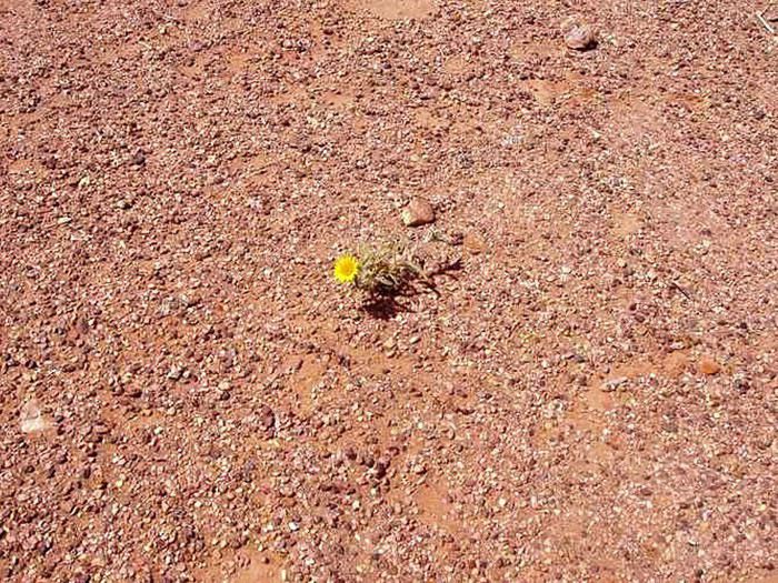
Since I’ve been back, sometimes at night I open my eyes and don’t know where I am... Sleepless night, starry night, night of communion, connected night... In that suspended moment, between wakefulness and sleep, which makes you so receptive... Communion with whom? Connected to what? Lila gnawa... lila de derdeba.
The desert, a solitary path. You step in, and you’re immediately in the essential...
Wednesday... My companion drops me off at Orly Ouest... There are two hours before boarding. My MP3 player turns on but that’s it. It freezes—no commands work, and nothing fixes it... Smile... A trip without music, then? And the first anchor falls away.
(Photo...) ... Passport, tickets, receipts, labels...
Nose pressed to the window for the entire flight... Descending over Marrakech, at low altitude, a pretty mosaic—shades of pink and ochre dotted with green, but also, to the right, less harmonious, aligned cubes. Housing developments under construction? A bumpy, turbulent landing—the plane circles for a long time before touching down.
Welcomed by the familiar, unchanged sound of creaking doors and seats in the little taxis. In Casablanca, it was red Simca 1000s with meters; here, they’re yellow, and you have to negotiate the price. I have no talent for that, so here’s 100 DH!
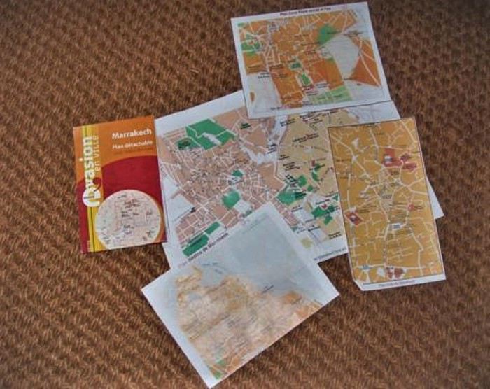 Traversed and forgotten
Marrakech... Sunny, luminous, sensual. Torn between tradition and modernity... Shimmering and fragrant, very noisy... rather polluted? On the road, horses and donkeys still mingle with vehicles... and watch out for traffic when crossing! It’s always a strategic—and athletic—adventure: at what exact moment do you sprint to the opposite sidewalk? And why aren’t any street names marked?
Afternoon on foot, heading to the Bab Doukkala bus station... A landmark: the McDonald’s, then a square with a fountain. Then turn left onto Avenue Hassan II. There’s a bus to Zagora Friday morning, but I can only buy the ticket tomorrow. On the way back to the hotel, at a kiosk on the corner, I buy *Tel Quel*, which I read with great interest online.
Thursday... Early morning, walking to Place Jemaa el-Fna, calm and almost deserted... I don’t get a good deal buying two small daggers for my kids. No talent for haggling—it takes more than charm for that... So I’ll pick the rest of my gifts at the artisan center on Avenue Mohammed V, where prices are marked, and it’s a pleasure to watch the craftsmen work... For my daughter, a satchel and earrings. The satchel smells like goat. The earrings are hand-chiseled in front of me by a very young man with nimble fingers—marvels of delicacy and fragility. Then I linger for a long time in the souk alleys. Scents of leather, thuya and cedar wood, wool and copper... Familiar smells... Childhood memories...
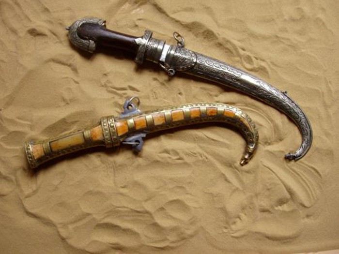 Dear daggers
Earrings
Back at the bus station, an unexpected change: no bus Friday morning, but a departure tonight at 8:30 PM... I have a little time before packing, so I take a long detour: Boulevard de Safi, then right onto Avenue El Mansour to the Majorelle Garden... A quiet pause. Rare plants, all kinds of cacti—smooth, fuzzy, bristling with spines... strange, squat, or stretched-out shapes. An infinite variety of greens, and that famous blue... The song of birds, the sun and shadows playing in the water basins... Time flows lazily. I write postcards—they’ll arrive long after I’m back...
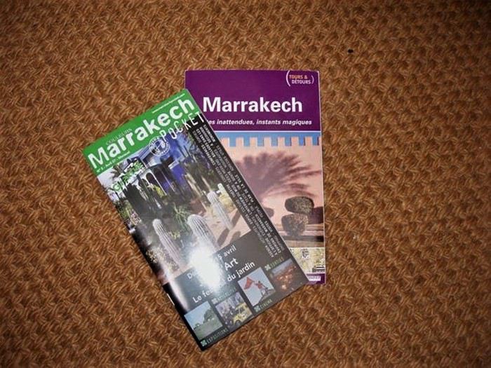
Back to the hotel. Avenue El Mansour, Boulevard Zerktouni—okay, but why are the small street names never marked?!! I get a little lost...
I hope you got my MMS, because before leaving, I left something for you at the front desk...
8 PM, night has already fallen. Arriving at the bus station, and then... Then, a step back... A dense crowd, a tangle of buses... Where to go?... Rare woman, lone foreigner, backpack... I’m quickly spotted, surrounded, poorly guided... Someone with a badge finally points me to the right sidewalk. The bus isn’t there, and the sidewalk is already packed, mostly with men. Will I even get a seat?... Three young men are particularly insistent... They want to know where I’m going and why, if someone is with me, if I’m expected... I answer with a smile. A bit tricky—choosing words, staying polite while evasive... Their French is hesitant, my Arabic is more than rudimentary... Actually, I shouldn’t have tried... Their tone becomes a bit... aggressive, and their eyes light up. Uh-oh... They say they’re students, but what of?... Want to know what I think of the Quran and Allah, what I think of holy war, if I’m "for the Americans," "for the Palestinians"... Other travelers intervene... And the bus still isn’t here... The speech turns fanatical... Then, my smile freezes a little... A small wave of panic, so I send a "freaked out" MMS... (But who else could I send it to?) Then, in this dark crowd, a light dressed in white... Nabila, a young student heading to Zagora for vacation, she speaks French... She plants herself in front of them and scolds them thoroughly. I didn’t catch everything, but it worked! The three troublemakers retreat. Plus, they weren’t on the right sidewalk, and their bus is about to leave without them...
Nabila and I manage to board and sit side by side... The bus leaves two hours late. The trip is long, a bit uncomfortable, slowed by many stops—it was very cold...
Friday... A little stiff, a little dazzled, a little chilled, arriving in Zagora at dawn with the sunrise... Magical! Craving something warm... And then, a heartfelt gift—kindness and hospitality—Nabila invites me to her home. Warm welcome from her mother and siblings, not at all surprised to see me show up so early to share their breakfast! A few hours in their company... We exchange addresses, and the youngest brother, Nouamare, gives me a children’s storybook...
Noon, at *La Fibule du Draa* Lahcen Sarti, the owner... I finally put a smile and a face to an email exchange... He shows me the trek route on the map, laughs when I tell him about my night on the bus, and sends me to rest by the pool... No swimsuit, so a lounge chair and a book... A book that will accompany me into the desert and which I’ll finish in Marrakech, in the Koutoubia Garden...
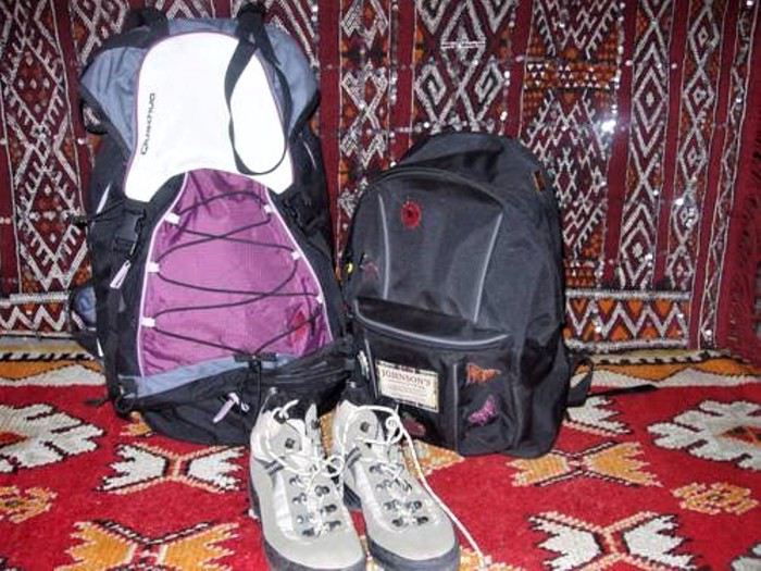
Saturday, Day 1... When I wake up this morning, I know the desert sand will also absorb my blood...
Early departure for four days and three nights, alone, as I wished, with a young guide, Mohammed, and a younger camel driver, Abdou. We’ll be together 24/7, and we won’t see a soul until we reach the fixed campsite on the third evening. Everything we need is loaded onto two dromedaries. And in those baskets, there are miracles—a *Prévert*-style inventory I’ll discover bit by bit, like... a tray for glasses, a basket for bread, a sugar loaf and small glasses for tea, but... large glasses and sugar cubes for coffee, spices, oranges, vegetables, raw eggs!... That won’t break, *La Vache qui Rit*... And so many other unexpected wonders, so surprising in the middle of the desert... (*La Vache qui Rit* is the desert butter. Every morning for breakfast, it was coffee with Nido powdered milk and *kesra* with *La Vache qui Rit* and Aïcha apricot jam... A delight.)
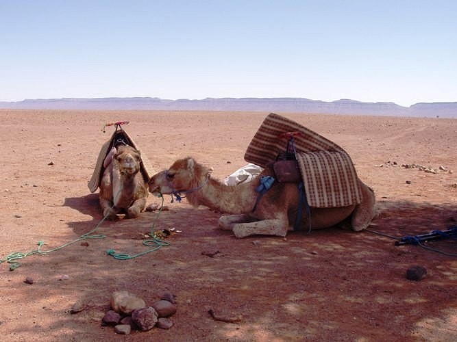
Start of the journey, and the beginning of a long, long walk... We’ll cover 80 km in three days, crossing all kinds of landscapes until the real desert of sand and dunes... I’ll drink water from wells, eat raw vegetables, sleep on a mattress that saddles the dromedaries by day... I’ll forget all the warnings and all my hygiene references... My body will quiet its complaints. No heat, no thirst, no fatigue, no trouble of any kind... just woken by the cold every morning around 6 AM... I take off my watch. Like my companions, I’ll live by the sun’s rhythm...
Abdou leads the dromedaries, so he walks at their pace. Sometimes, we’re grouped together. Sometimes the two guides are together, and I walk behind. Sometimes we talk. Nothing is forced, no discomfort. It’s a simple, harmonious dance—one foot in front of the other, following your shadow as it turns with the sun... Each step leaves behind the useless, the cumbersome, the superfluous... Room for intimacy... Room for silence... Room for the inner self... Facing yourself... I find seashells, and with my eyes closed, I smell the sea...
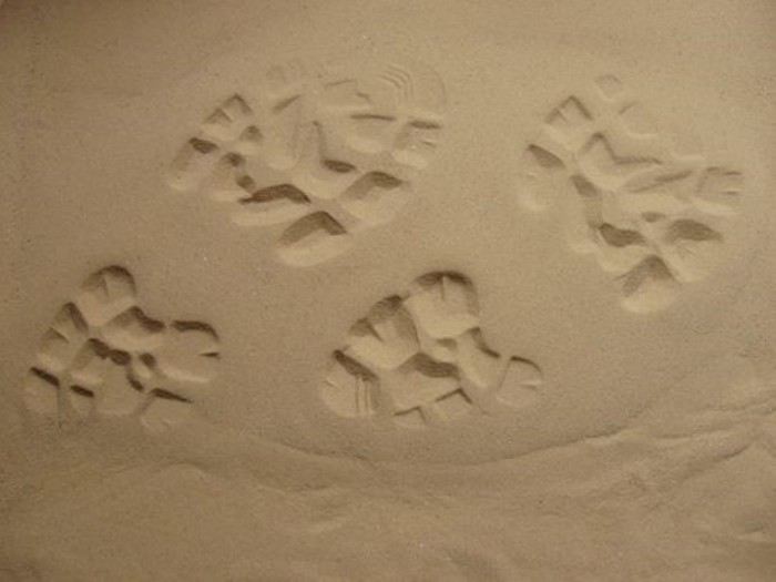 ... One foot in front of the other...
I take out my camera... Capacity for a hundred shots, but it’ll be 10 photos, no more. It freezes—no commands work, and nothing fixes it... Smile... A trip without photos, then? And the second anchor falls... I think of my MP3 player...
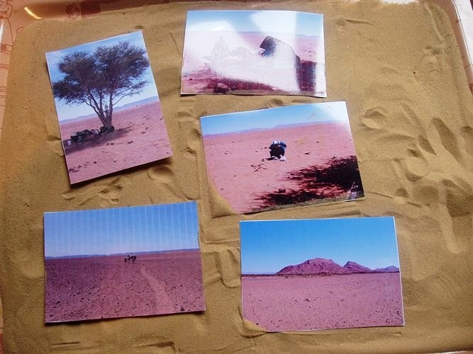 ... A few photos among the ten...
Noon... Unsaddling the dromedaries, which immediately wander off in search of food. And before the meal cooked by Mohammed, the mint tea ritual, prepared by Abdou in a tiny teapot... Thick, frothy, very sweet tea... He serves it on a tray with dates, peanuts, and raisins... And it’ll be like this every day, noon and night...
We gradually get to know each other... Mohammed, 25 years old... Calm, very introspective, almost ascetic, he knows the desert well and loves it... So at ease that he’ll walk in slippers or barefoot, no matter the terrain... When I’m behind him, the advertisement on the back of his sweatshirt makes me smile... There’s a date: January 8, 2003... A little wink from life? (I have a clear memory of that day.) Abdou, barely 20, with a round, jovial face. The mint tea master... When he hands me my glass, he says "Bismillah," and I respond in kind... A joker and a foodie. Thrilled that I only eat vegetables, he’ll have double the meat!
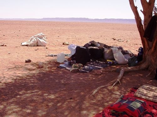
 ... Abdou and his teapot...
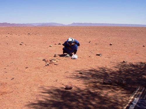
 ... Mohammed...
Late afternoon, a well... Abdou waters the dromedaries, and Mohammed fills the canteens. The caps aren’t watertight, so he wedges a piece of plastic bag found in one of the baskets and screws it on top... Forget all hygiene warnings...
First night in a tent at the foot of Jebel Baní...
 ... Jebel
Sunday, Day 2... Crossing and ascending Jebel Baní... A mineral, lunar landscape—rocks the color of burnt bread and anthracite gray. I pick up pretty pebbles, and Mohammed finds me a fossilized stone... Lunch in a deserted nomad oasis... When we resume our walk, the wind picks up. A wind that only blows in April, violent, terrible—the *Sahli*... Swirls of sand and gravel. Where’s the sky, where’s the earth... everything is dust, everything is yellow and opaque... The gusts are so strong they make us stagger. At times, we even have to crouch to avoid falling. In the acacia forest, Abdou and the dromedaries are only a few meters ahead, yet we can’t see them... We’ll later learn that on that day, planned excursions were canceled... That a group got lost and had to be picked up by 4x4... But Mohammed has a sense of the desert. He’s calm, he guides us... so we continue, and I trust him. He wraps a *chèche* around my head—a fragile barrier against these onslaughts... We have to keep moving, and it’s difficult... But the desert has accepted me, so without resistance, I accept it... And the sand gets everywhere... in my mouth, crunching between my teeth, in my eyes, ears, and nostrils... in my hair... A fine ochre layer covers my face and body, even under my clothes. I’ve become a sand woman... Communion... Fusion with the mineral. I absorb the desert’s prodigious power, just as the desert absorbs my blood...
We walked for four hours, pushed by this furious wind, before stopping for the night under an acacia... There, we had to set up the tent, which they did with difficulty. Then we had to weigh it down... So the utensils and the mint tea tray served as shovels to cover the edges with sand. Then Abdou took care of the dromedaries, holding one of their front legs bent with a rope to keep them from wandering too far... Then we brought everything into the tent and collapsed... but not for long.
Mohammed prepared kingly meals at noon and night with the wonders in the baskets: finely chopped raw vegetable salad, vegetable tagine, soup (and not from a packet!)... Even the canned sardines were garnished with thin orange slices... After this exhausting day for all of us, I told him that bread with *La Vache qui Rit* would be enough... He looked at me with a big smile and said his evening ritual phrase: "Now, Laurence, sit down, take your time, take your book..." He pulled his sand-filled utensils from the miraculous basket, his stove, some vegetables, and made us couscous (and not from a box!), couscous he rolled between his hands... Meanwhile, Abdou took out his sand-filled teapot, his sugar loaf, the peanuts, the dates... The mint tea ritual, like every day, noon and night...
Outside, the wind keeps blowing, stirring up sand whirlwinds... So I won’t go out like the other night to brush my teeth and hair. Just a wipe on my face to remove the dust... Mohammed turns off the gas lamp, and I curl up in my sleeping bag. The dromedaries have moved closer to my side of the tent, and the moonlight stretches their shadows on the canvas. They’ve settled in and make strange noises... We fall asleep very quickly...
Monday, Day 3... My two companions are still asleep when the cold wakes me at 6 AM, like every morning... Everything seems so calm—the wind has stopped... I untie the tent door and... A pure blue sky, gradually tinted with pink and flaming orange. The sun rises before my dazzled eyes. A day of light begins: no trace of yesterday’s storm, except sand... everywhere.
So, breakfast with sand... Then we shake out everything that can be shaken, sending clouds of dust flying... Then Abdou gives the dromedaries back their fourth leg, and we continue the journey.
After the expanses of stones and shrubs on the first day, the rocky ridges of Jebel Baní, and the acacia forest on the second day, the landscape changes, softens... We arrive in the desert as you imagine it, as you dream it, as you’ve seen in thousands of photos: endless golden dunes, in harmonious hollows and curves... The desert of sand... vast, fascinating...
Last meal for the three of us... Tonight, we’ll arrive at the fixed campsite, and we won’t be alone anymore. The break stretches on... So, a little apart on the smooth sand, I write a few words... an obvious truth... entrusting a secret to the desert. In a small box, I’ll bring back some of this magical sand...
 .. A secret in the desert...
Abdou grabs my notebook and draws the dunes. Mohammed draws Abdou and his dromedaries... I learn to do dishes with the contents of a single glass of water... A tiny bird lands on my bag... A bird!... in the middle of nowhere!... The dromedaries seem to relish the acacia branches, thorns and all...
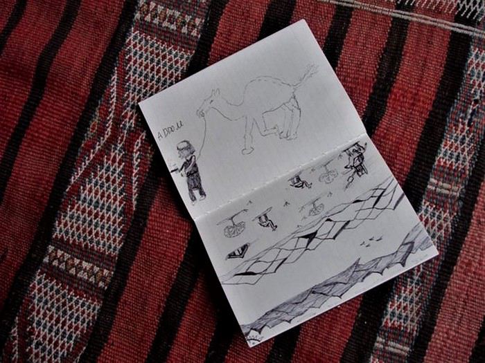 Desert drawings
We set off again... The dunes are higher... Easy to climb, the desert has sensual, feminine curves. A giant’s hand would fit its reliefs like a caress on a soft, supple body... The setting sun gives the landscape colors of amber and spices, cinnamon reflections... The sand offers me pink pebbles and pieces of white quartz that sparkle... I also find a black stone... Mystery...
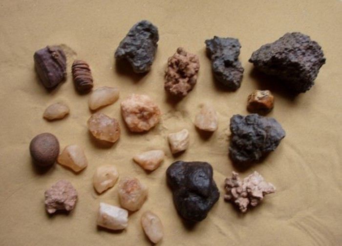 Pink pebbles, fossilized pebbles, sparkling pebbles, and a black stone
Late afternoon, arrival at the fixed campsite at the foot of Erg Lihoudi... The guardian, Lahcen, a whirlwind of chatter and energy, welcomes us with mint tea. He quickly pegs me: "You do yoga, right?" He tells lots of anecdotes about his "clients," ending every sentence with: "No problem! *Machi mouchkil*... *Machi mouchkil*, no problem!" Around the tents, dozens... hundreds of big black beetles swarm on the sand... As I shudder, Lahcen gently picks one up and wants to put it on my hand: "*Machi mouchkil*! It doesn’t sting!"... I hold out a hesitant palm... Despite Lahcen’s infectious enthusiasm, I don’t like this last evening. Two groups arrived by 4x4 to spend a night in the desert... Noise of engines, cameras, voices, and exclamations... An intrusion into my bubble... I keep my distance... They’ll leave very early the next morning...
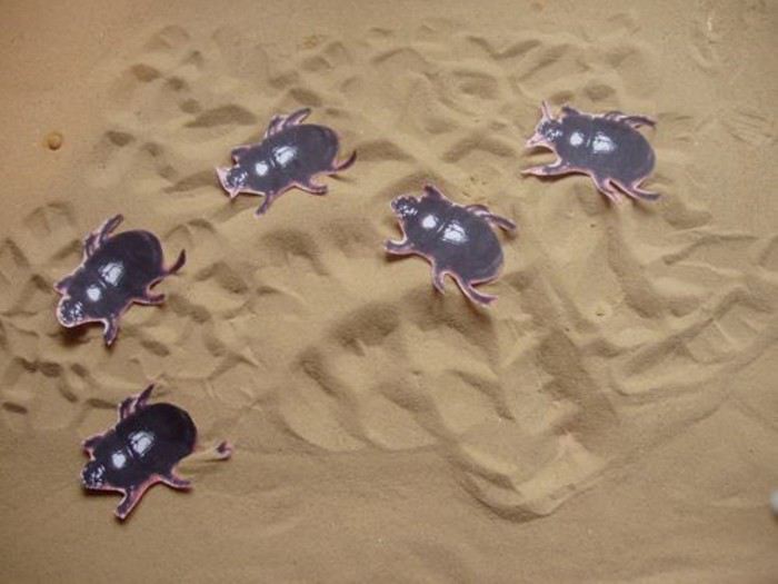 Memory of beetles
Tuesday, Day 4... Standing still on a sand dune, I see both the full moon and the sun in the same sky... A luminous face-off. Magical, overwhelming... Then the moon paled, and the sun blazed brighter. It wasn’t quite night anymore, but day wasn’t far off... The Sacred, Mystical universe unfolded before me... A moment of grace that made my heart beat a little faster... Something indescribable gradually filled me, with infinite gentleness, to the depths of my soul... Facing this unlikely encounter, hesitations, reluctance, and fears seem so trivial... What are we if not fragments of this universe where everything is united... everything is connected...
Then comes the intention of a new message: "I’d love to put a face to..." But in this exchange scattered with misunderstandings, could you receive the intention without interpreting it?...
I stayed a long time on that dune, under the spell... Standing, barefoot and rooted... heart open... Receptive... in Unity between the infinitely small grain of sand and the infinitely vast universe... I hadn’t come to seek anything, yet the generous Earth offered its energy, its subtle strength to every cell of my body, and filled my soul with light... In exchange for this blood spilled on the sand over these four days?...
Give to Receive... Receive and Give... like a signed pact.
What exiled me from my life, disrupting all my bearings, drew me here... A necessary passage through space, withdrawal, and silence... for another birth?... The real desert after the symbolic desert... Pausing for a moment, as if at a crossroads. Connecting before continuing... If this path leads to the essential, then this path has a heart and will continue...
At the foot of the dune on the way down, I found a little Fatima’s hand made of beads. A gift from the desert...
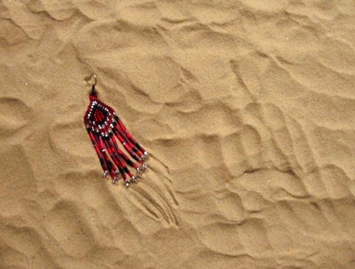 Gift from the desert, good luck charm?
Mohammed and Abdou leave Erg Lihoudi with other people—our shared adventure ends here... Emotion... looks and gestures speak louder than any words... Thank you, from the bottom of my heart...
Return to Zagora in a rickety, bumpy 4x4... After the track, we cross a vast palm grove... Shimmering colors, lush vegetation, palm trees growing in wheat fields... Tender green of the ears, faded green of the fronds, all shades of green contrast with the ochre and pink stone walls... My eyes rediscover green... My eyes rediscover colors... On a narrow path, the 4x4 finds itself facing a donkey carrying three children on its back... Impossible to pass. Who will back up?... Well, roaring progress bowed to four-legged tradition: in a cloud of dust, the 4x4 reversed for several hundred meters... The donkey passed calmly... On its back, the three children waved their hands...
Noon, arrival at *La Fibule du Draa*... Smiling welcome from Lahcen. He offers me a shower—I refuse... Even if he seems a little surprised, he has the delicacy not to show it too much... Strangely, I don’t feel dirty. Yet my clothes are the same, and my body hasn’t seen a drop of water since the day I left... But I want to keep the warmth and the smell of sand on my skin... reconnecting with forgotten, instinctive, animal sensations... So, I transfer my meticulousness and civilized conditioning to my bag... I take everything out, empty it, shake it... hunting down the smallest grain of sand... Futile effort! (I still find some today...) The afternoon stretches lazily by the pool... I contemplate my pebbles and make a lovely encounter...
The Zagora-Marrakech bus leaves at 7 PM... It’s the night of the full moon, and as soon as night falls, the sky fills with stars... Points of light without beginning, without duration, without end... Tiny lights so distant and so close...
Wanting to share this moment... And with whom else? If you look up, you’re the only one seeing the same sky as me. So, the intention of another message. But in this fragile, stumbling exchange... marked by misunderstandings... could you receive the intention without interpreting it?
The trip is shorter than on the way there, but barely more comfortable. A speaker right above my seat blares music and incantations the whole way... Halfway through, the same unusual stop in a village lit up and bustling as if it were daytime (Taddart, I think...). Along the main street, the ground is checkered black and white. Butcher stalls display entire beef carcasses... Smells of smoke and grilling... People are busy... Others, seated, are eating... in the middle of the night.
Arrival in Marrakech at 2 AM. Taxi strike, no room until tonight... Uh-oh! My backpack draws attention: a car stops and offers to take me for 80 DH... Trust... Five minutes later, I push open the door of *Le Toulousain*... The guard offers to let me finish the night on one of the lobby benches. I unfold my sleeping bag and slip into the desert’s scent... No sleep. But with my eyes closed, I see the stars... You came to pick up my bulky envelope.
Wednesday... Difficult early morning... Now, I feel dirty, my clothes bother me, my shoes hurt... Craving a long hot shower, wanting to find my body, wash my hair, put on cream, do my nails, and... It’ll be a long shower... cold! The hotel is charming but a bit run-down.
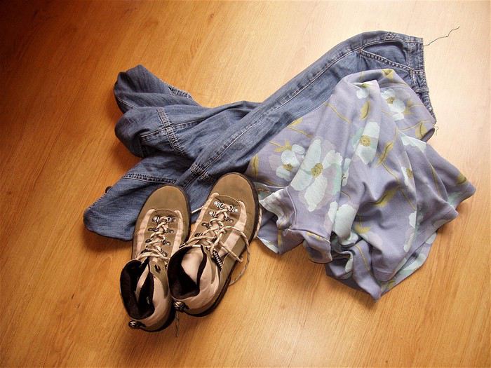 Clothes from 4 days...
Afternoon on foot in the quiet Hivernage district, searching for a childhood memory that may have changed names: the *Holiday Inn* hotel... I didn’t find it, or didn’t recognize it. Long stroll in the Menara Gardens, and return to the hotel at sunset...
Thursday... Last day... Wanting to see the Marrakech Museum because the founder was a friend of my father’s... So, the familiar route: the McDonald’s, the square with the fountain, Avenue Hassan II, Bab Doukkala... but this time, I pass through the ramparts, and in the old city—sensual, charming, enchanting—I get lost, found, and lost again... I tracked down the museum and the Ben Youssef Madrasa at the end of a maze of alleys... Followed scents of mint, olives, honey, and cinnamon... Savored, moved, the same donuts as in my childhood—golden fried dough rings with a hole in the middle, tied together with a blade of grass... (I don’t remember the name...) I filled my eyes with pretty things and exchanged smiles... Received, just like that... A gift... a ring for my little finger... Someone called out to me: "Hey, gazelle," and it made me happy...
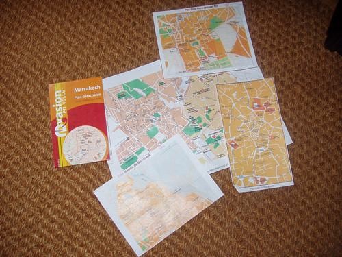 .. Still lost!...
Afternoon in the sun in the Koutoubia Gardens. I finish my book—sand falls from between the pages...
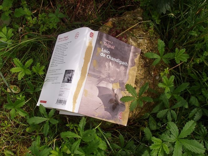 .. Started on the plane... read in the desert... finished in Marrakech...
Melancholy of the last evening... So, on the way back to the hotel, I buy *kesra* and *La Vache qui Rit*...
Long, long sleepless night... Flight in a few hours... Happy to see the ones I love again, too.
Thoughts, emotions, sensations, images... Questions... One question... So, more than reason, going over and over the question... What there is to live, it’ll have to be lived...
The desert, a solitary path... like all paths that lead to the essential...
3:30 AM, your message, read by the metallic voice of a voicemail. And you, facing physical failure, past mistakes, fear... A solitary path. Also. Like all paths that lead to the essential...
Since I’ve been back, sometimes at night I open my eyes and don’t know where I am... Sleepless night, starry night, night of communion, connected night... In that suspended moment, between wakefulness and sleep, which makes you so receptive... Communion with whom? Connected to what? Lila gnawa... lila de derdeba.
The desert, a solitary path. You step in, and you’re immediately in the essential...
Wednesday... My companion drops me off at Orly Ouest... There are two hours before boarding. My MP3 player turns on but that’s it. It freezes—no commands work, and nothing fixes it... Smile... A trip without music, then? And the first anchor falls away.
(Photo...) ... Passport, tickets, receipts, labels...
Nose pressed to the window for the entire flight... Descending over Marrakech, at low altitude, a pretty mosaic—shades of pink and ochre dotted with green, but also, to the right, less harmonious, aligned cubes. Housing developments under construction? A bumpy, turbulent landing—the plane circles for a long time before touching down.
Welcomed by the familiar, unchanged sound of creaking doors and seats in the little taxis. In Casablanca, it was red Simca 1000s with meters; here, they’re yellow, and you have to negotiate the price. I have no talent for that, so here’s 100 DH!
Traversed and forgottenMarrakech... Sunny, luminous, sensual. Torn between tradition and modernity... Shimmering and fragrant, very noisy... rather polluted? On the road, horses and donkeys still mingle with vehicles... and watch out for traffic when crossing! It’s always a strategic—and athletic—adventure: at what exact moment do you sprint to the opposite sidewalk? And why aren’t any street names marked?
Afternoon on foot, heading to the Bab Doukkala bus station... A landmark: the McDonald’s, then a square with a fountain. Then turn left onto Avenue Hassan II. There’s a bus to Zagora Friday morning, but I can only buy the ticket tomorrow. On the way back to the hotel, at a kiosk on the corner, I buy *Tel Quel*, which I read with great interest online.
Thursday... Early morning, walking to Place Jemaa el-Fna, calm and almost deserted... I don’t get a good deal buying two small daggers for my kids. No talent for haggling—it takes more than charm for that... So I’ll pick the rest of my gifts at the artisan center on Avenue Mohammed V, where prices are marked, and it’s a pleasure to watch the craftsmen work... For my daughter, a satchel and earrings. The satchel smells like goat. The earrings are hand-chiseled in front of me by a very young man with nimble fingers—marvels of delicacy and fragility. Then I linger for a long time in the souk alleys. Scents of leather, thuya and cedar wood, wool and copper... Familiar smells... Childhood memories...
Dear daggersEarrings
Back at the bus station, an unexpected change: no bus Friday morning, but a departure tonight at 8:30 PM... I have a little time before packing, so I take a long detour: Boulevard de Safi, then right onto Avenue El Mansour to the Majorelle Garden... A quiet pause. Rare plants, all kinds of cacti—smooth, fuzzy, bristling with spines... strange, squat, or stretched-out shapes. An infinite variety of greens, and that famous blue... The song of birds, the sun and shadows playing in the water basins... Time flows lazily. I write postcards—they’ll arrive long after I’m back...
Back to the hotel. Avenue El Mansour, Boulevard Zerktouni—okay, but why are the small street names never marked?!! I get a little lost...
I hope you got my MMS, because before leaving, I left something for you at the front desk...
8 PM, night has already fallen. Arriving at the bus station, and then... Then, a step back... A dense crowd, a tangle of buses... Where to go?... Rare woman, lone foreigner, backpack... I’m quickly spotted, surrounded, poorly guided... Someone with a badge finally points me to the right sidewalk. The bus isn’t there, and the sidewalk is already packed, mostly with men. Will I even get a seat?... Three young men are particularly insistent... They want to know where I’m going and why, if someone is with me, if I’m expected... I answer with a smile. A bit tricky—choosing words, staying polite while evasive... Their French is hesitant, my Arabic is more than rudimentary... Actually, I shouldn’t have tried... Their tone becomes a bit... aggressive, and their eyes light up. Uh-oh... They say they’re students, but what of?... Want to know what I think of the Quran and Allah, what I think of holy war, if I’m "for the Americans," "for the Palestinians"... Other travelers intervene... And the bus still isn’t here... The speech turns fanatical... Then, my smile freezes a little... A small wave of panic, so I send a "freaked out" MMS... (But who else could I send it to?) Then, in this dark crowd, a light dressed in white... Nabila, a young student heading to Zagora for vacation, she speaks French... She plants herself in front of them and scolds them thoroughly. I didn’t catch everything, but it worked! The three troublemakers retreat. Plus, they weren’t on the right sidewalk, and their bus is about to leave without them...
Nabila and I manage to board and sit side by side... The bus leaves two hours late. The trip is long, a bit uncomfortable, slowed by many stops—it was very cold...
Friday... A little stiff, a little dazzled, a little chilled, arriving in Zagora at dawn with the sunrise... Magical! Craving something warm... And then, a heartfelt gift—kindness and hospitality—Nabila invites me to her home. Warm welcome from her mother and siblings, not at all surprised to see me show up so early to share their breakfast! A few hours in their company... We exchange addresses, and the youngest brother, Nouamare, gives me a children’s storybook...
Noon, at *La Fibule du Draa* Lahcen Sarti, the owner... I finally put a smile and a face to an email exchange... He shows me the trek route on the map, laughs when I tell him about my night on the bus, and sends me to rest by the pool... No swimsuit, so a lounge chair and a book... A book that will accompany me into the desert and which I’ll finish in Marrakech, in the Koutoubia Garden...
Saturday, Day 1... When I wake up this morning, I know the desert sand will also absorb my blood...
Early departure for four days and three nights, alone, as I wished, with a young guide, Mohammed, and a younger camel driver, Abdou. We’ll be together 24/7, and we won’t see a soul until we reach the fixed campsite on the third evening. Everything we need is loaded onto two dromedaries. And in those baskets, there are miracles—a *Prévert*-style inventory I’ll discover bit by bit, like... a tray for glasses, a basket for bread, a sugar loaf and small glasses for tea, but... large glasses and sugar cubes for coffee, spices, oranges, vegetables, raw eggs!... That won’t break, *La Vache qui Rit*... And so many other unexpected wonders, so surprising in the middle of the desert... (*La Vache qui Rit* is the desert butter. Every morning for breakfast, it was coffee with Nido powdered milk and *kesra* with *La Vache qui Rit* and Aïcha apricot jam... A delight.)
Start of the journey, and the beginning of a long, long walk... We’ll cover 80 km in three days, crossing all kinds of landscapes until the real desert of sand and dunes... I’ll drink water from wells, eat raw vegetables, sleep on a mattress that saddles the dromedaries by day... I’ll forget all the warnings and all my hygiene references... My body will quiet its complaints. No heat, no thirst, no fatigue, no trouble of any kind... just woken by the cold every morning around 6 AM... I take off my watch. Like my companions, I’ll live by the sun’s rhythm...
Abdou leads the dromedaries, so he walks at their pace. Sometimes, we’re grouped together. Sometimes the two guides are together, and I walk behind. Sometimes we talk. Nothing is forced, no discomfort. It’s a simple, harmonious dance—one foot in front of the other, following your shadow as it turns with the sun... Each step leaves behind the useless, the cumbersome, the superfluous... Room for intimacy... Room for silence... Room for the inner self... Facing yourself... I find seashells, and with my eyes closed, I smell the sea...
... One foot in front of the other...I take out my camera... Capacity for a hundred shots, but it’ll be 10 photos, no more. It freezes—no commands work, and nothing fixes it... Smile... A trip without photos, then? And the second anchor falls... I think of my MP3 player...
... A few photos among the ten...Noon... Unsaddling the dromedaries, which immediately wander off in search of food. And before the meal cooked by Mohammed, the mint tea ritual, prepared by Abdou in a tiny teapot... Thick, frothy, very sweet tea... He serves it on a tray with dates, peanuts, and raisins... And it’ll be like this every day, noon and night...
We gradually get to know each other... Mohammed, 25 years old... Calm, very introspective, almost ascetic, he knows the desert well and loves it... So at ease that he’ll walk in slippers or barefoot, no matter the terrain... When I’m behind him, the advertisement on the back of his sweatshirt makes me smile... There’s a date: January 8, 2003... A little wink from life? (I have a clear memory of that day.) Abdou, barely 20, with a round, jovial face. The mint tea master... When he hands me my glass, he says "Bismillah," and I respond in kind... A joker and a foodie. Thrilled that I only eat vegetables, he’ll have double the meat!
... Abdou and his teapot...
... Mohammed...Late afternoon, a well... Abdou waters the dromedaries, and Mohammed fills the canteens. The caps aren’t watertight, so he wedges a piece of plastic bag found in one of the baskets and screws it on top... Forget all hygiene warnings...
First night in a tent at the foot of Jebel Baní...
... JebelSunday, Day 2... Crossing and ascending Jebel Baní... A mineral, lunar landscape—rocks the color of burnt bread and anthracite gray. I pick up pretty pebbles, and Mohammed finds me a fossilized stone... Lunch in a deserted nomad oasis... When we resume our walk, the wind picks up. A wind that only blows in April, violent, terrible—the *Sahli*... Swirls of sand and gravel. Where’s the sky, where’s the earth... everything is dust, everything is yellow and opaque... The gusts are so strong they make us stagger. At times, we even have to crouch to avoid falling. In the acacia forest, Abdou and the dromedaries are only a few meters ahead, yet we can’t see them... We’ll later learn that on that day, planned excursions were canceled... That a group got lost and had to be picked up by 4x4... But Mohammed has a sense of the desert. He’s calm, he guides us... so we continue, and I trust him. He wraps a *chèche* around my head—a fragile barrier against these onslaughts... We have to keep moving, and it’s difficult... But the desert has accepted me, so without resistance, I accept it... And the sand gets everywhere... in my mouth, crunching between my teeth, in my eyes, ears, and nostrils... in my hair... A fine ochre layer covers my face and body, even under my clothes. I’ve become a sand woman... Communion... Fusion with the mineral. I absorb the desert’s prodigious power, just as the desert absorbs my blood...
We walked for four hours, pushed by this furious wind, before stopping for the night under an acacia... There, we had to set up the tent, which they did with difficulty. Then we had to weigh it down... So the utensils and the mint tea tray served as shovels to cover the edges with sand. Then Abdou took care of the dromedaries, holding one of their front legs bent with a rope to keep them from wandering too far... Then we brought everything into the tent and collapsed... but not for long.
Mohammed prepared kingly meals at noon and night with the wonders in the baskets: finely chopped raw vegetable salad, vegetable tagine, soup (and not from a packet!)... Even the canned sardines were garnished with thin orange slices... After this exhausting day for all of us, I told him that bread with *La Vache qui Rit* would be enough... He looked at me with a big smile and said his evening ritual phrase: "Now, Laurence, sit down, take your time, take your book..." He pulled his sand-filled utensils from the miraculous basket, his stove, some vegetables, and made us couscous (and not from a box!), couscous he rolled between his hands... Meanwhile, Abdou took out his sand-filled teapot, his sugar loaf, the peanuts, the dates... The mint tea ritual, like every day, noon and night...
Outside, the wind keeps blowing, stirring up sand whirlwinds... So I won’t go out like the other night to brush my teeth and hair. Just a wipe on my face to remove the dust... Mohammed turns off the gas lamp, and I curl up in my sleeping bag. The dromedaries have moved closer to my side of the tent, and the moonlight stretches their shadows on the canvas. They’ve settled in and make strange noises... We fall asleep very quickly...
Monday, Day 3... My two companions are still asleep when the cold wakes me at 6 AM, like every morning... Everything seems so calm—the wind has stopped... I untie the tent door and... A pure blue sky, gradually tinted with pink and flaming orange. The sun rises before my dazzled eyes. A day of light begins: no trace of yesterday’s storm, except sand... everywhere.
So, breakfast with sand... Then we shake out everything that can be shaken, sending clouds of dust flying... Then Abdou gives the dromedaries back their fourth leg, and we continue the journey.
After the expanses of stones and shrubs on the first day, the rocky ridges of Jebel Baní, and the acacia forest on the second day, the landscape changes, softens... We arrive in the desert as you imagine it, as you dream it, as you’ve seen in thousands of photos: endless golden dunes, in harmonious hollows and curves... The desert of sand... vast, fascinating...
Last meal for the three of us... Tonight, we’ll arrive at the fixed campsite, and we won’t be alone anymore. The break stretches on... So, a little apart on the smooth sand, I write a few words... an obvious truth... entrusting a secret to the desert. In a small box, I’ll bring back some of this magical sand...
.. A secret in the desert...Abdou grabs my notebook and draws the dunes. Mohammed draws Abdou and his dromedaries... I learn to do dishes with the contents of a single glass of water... A tiny bird lands on my bag... A bird!... in the middle of nowhere!... The dromedaries seem to relish the acacia branches, thorns and all...
Desert drawingsWe set off again... The dunes are higher... Easy to climb, the desert has sensual, feminine curves. A giant’s hand would fit its reliefs like a caress on a soft, supple body... The setting sun gives the landscape colors of amber and spices, cinnamon reflections... The sand offers me pink pebbles and pieces of white quartz that sparkle... I also find a black stone... Mystery...
Pink pebbles, fossilized pebbles, sparkling pebbles, and a black stoneLate afternoon, arrival at the fixed campsite at the foot of Erg Lihoudi... The guardian, Lahcen, a whirlwind of chatter and energy, welcomes us with mint tea. He quickly pegs me: "You do yoga, right?" He tells lots of anecdotes about his "clients," ending every sentence with: "No problem! *Machi mouchkil*... *Machi mouchkil*, no problem!" Around the tents, dozens... hundreds of big black beetles swarm on the sand... As I shudder, Lahcen gently picks one up and wants to put it on my hand: "*Machi mouchkil*! It doesn’t sting!"... I hold out a hesitant palm... Despite Lahcen’s infectious enthusiasm, I don’t like this last evening. Two groups arrived by 4x4 to spend a night in the desert... Noise of engines, cameras, voices, and exclamations... An intrusion into my bubble... I keep my distance... They’ll leave very early the next morning...
Memory of beetlesTuesday, Day 4... Standing still on a sand dune, I see both the full moon and the sun in the same sky... A luminous face-off. Magical, overwhelming... Then the moon paled, and the sun blazed brighter. It wasn’t quite night anymore, but day wasn’t far off... The Sacred, Mystical universe unfolded before me... A moment of grace that made my heart beat a little faster... Something indescribable gradually filled me, with infinite gentleness, to the depths of my soul... Facing this unlikely encounter, hesitations, reluctance, and fears seem so trivial... What are we if not fragments of this universe where everything is united... everything is connected...
Then comes the intention of a new message: "I’d love to put a face to..." But in this exchange scattered with misunderstandings, could you receive the intention without interpreting it?...
I stayed a long time on that dune, under the spell... Standing, barefoot and rooted... heart open... Receptive... in Unity between the infinitely small grain of sand and the infinitely vast universe... I hadn’t come to seek anything, yet the generous Earth offered its energy, its subtle strength to every cell of my body, and filled my soul with light... In exchange for this blood spilled on the sand over these four days?...
Give to Receive... Receive and Give... like a signed pact.
What exiled me from my life, disrupting all my bearings, drew me here... A necessary passage through space, withdrawal, and silence... for another birth?... The real desert after the symbolic desert... Pausing for a moment, as if at a crossroads. Connecting before continuing... If this path leads to the essential, then this path has a heart and will continue...
At the foot of the dune on the way down, I found a little Fatima’s hand made of beads. A gift from the desert...
Gift from the desert, good luck charm?Mohammed and Abdou leave Erg Lihoudi with other people—our shared adventure ends here... Emotion... looks and gestures speak louder than any words... Thank you, from the bottom of my heart...
Return to Zagora in a rickety, bumpy 4x4... After the track, we cross a vast palm grove... Shimmering colors, lush vegetation, palm trees growing in wheat fields... Tender green of the ears, faded green of the fronds, all shades of green contrast with the ochre and pink stone walls... My eyes rediscover green... My eyes rediscover colors... On a narrow path, the 4x4 finds itself facing a donkey carrying three children on its back... Impossible to pass. Who will back up?... Well, roaring progress bowed to four-legged tradition: in a cloud of dust, the 4x4 reversed for several hundred meters... The donkey passed calmly... On its back, the three children waved their hands...
Noon, arrival at *La Fibule du Draa*... Smiling welcome from Lahcen. He offers me a shower—I refuse... Even if he seems a little surprised, he has the delicacy not to show it too much... Strangely, I don’t feel dirty. Yet my clothes are the same, and my body hasn’t seen a drop of water since the day I left... But I want to keep the warmth and the smell of sand on my skin... reconnecting with forgotten, instinctive, animal sensations... So, I transfer my meticulousness and civilized conditioning to my bag... I take everything out, empty it, shake it... hunting down the smallest grain of sand... Futile effort! (I still find some today...) The afternoon stretches lazily by the pool... I contemplate my pebbles and make a lovely encounter...
The Zagora-Marrakech bus leaves at 7 PM... It’s the night of the full moon, and as soon as night falls, the sky fills with stars... Points of light without beginning, without duration, without end... Tiny lights so distant and so close...
Wanting to share this moment... And with whom else? If you look up, you’re the only one seeing the same sky as me. So, the intention of another message. But in this fragile, stumbling exchange... marked by misunderstandings... could you receive the intention without interpreting it?
The trip is shorter than on the way there, but barely more comfortable. A speaker right above my seat blares music and incantations the whole way... Halfway through, the same unusual stop in a village lit up and bustling as if it were daytime (Taddart, I think...). Along the main street, the ground is checkered black and white. Butcher stalls display entire beef carcasses... Smells of smoke and grilling... People are busy... Others, seated, are eating... in the middle of the night.
Arrival in Marrakech at 2 AM. Taxi strike, no room until tonight... Uh-oh! My backpack draws attention: a car stops and offers to take me for 80 DH... Trust... Five minutes later, I push open the door of *Le Toulousain*... The guard offers to let me finish the night on one of the lobby benches. I unfold my sleeping bag and slip into the desert’s scent... No sleep. But with my eyes closed, I see the stars... You came to pick up my bulky envelope.
Wednesday... Difficult early morning... Now, I feel dirty, my clothes bother me, my shoes hurt... Craving a long hot shower, wanting to find my body, wash my hair, put on cream, do my nails, and... It’ll be a long shower... cold! The hotel is charming but a bit run-down.
Clothes from 4 days...Afternoon on foot in the quiet Hivernage district, searching for a childhood memory that may have changed names: the *Holiday Inn* hotel... I didn’t find it, or didn’t recognize it. Long stroll in the Menara Gardens, and return to the hotel at sunset...
Thursday... Last day... Wanting to see the Marrakech Museum because the founder was a friend of my father’s... So, the familiar route: the McDonald’s, the square with the fountain, Avenue Hassan II, Bab Doukkala... but this time, I pass through the ramparts, and in the old city—sensual, charming, enchanting—I get lost, found, and lost again... I tracked down the museum and the Ben Youssef Madrasa at the end of a maze of alleys... Followed scents of mint, olives, honey, and cinnamon... Savored, moved, the same donuts as in my childhood—golden fried dough rings with a hole in the middle, tied together with a blade of grass... (I don’t remember the name...) I filled my eyes with pretty things and exchanged smiles... Received, just like that... A gift... a ring for my little finger... Someone called out to me: "Hey, gazelle," and it made me happy...
.. Still lost!...Afternoon in the sun in the Koutoubia Gardens. I finish my book—sand falls from between the pages...
.. Started on the plane... read in the desert... finished in Marrakech...Melancholy of the last evening... So, on the way back to the hotel, I buy *kesra* and *La Vache qui Rit*...
Long, long sleepless night... Flight in a few hours... Happy to see the ones I love again, too.
Thoughts, emotions, sensations, images... Questions... One question... So, more than reason, going over and over the question... What there is to live, it’ll have to be lived...
The desert, a solitary path... like all paths that lead to the essential...
3:30 AM, your message, read by the metallic voice of a voicemail. And you, facing physical failure, past mistakes, fear... A solitary path. Also. Like all paths that lead to the essential...

Namaste!
Here I am live from Delhi, past midnight, at least 30 degrees....
I wanted to post the start of this France travel journal but couldn’t find the time, so here it is live!
Off we go for a third trip, but this time for double the duration—6 weeks with the goal of discovering Ladakh and Spiti, starting with a detour to Varanasi to meet up with Babeli and her family.
Phir milenge for the rest of the adventures...
Phir milenge for the rest of the adventures...
Curious travelers all share the same wish: to discover a country or region by stepping off the beaten path and avoiding tourist traps. Who wouldn’t agree with that?
But does that mean we should skip the tourist sites that guidebooks and local tourism offices tout as must-sees? Of course not!
On the Greek island of Rhodes, Lindos, the "Pearl of the South," is undoubtedly the most visited village. Making the trip there is enough to understand its appeal—and I’ll admit, I too fell under the spell of this enchanting place. Through this post and these photos, I want to share my memories, impressions, and a lot of my enthusiasm.
First, there’s that stunning panoramic view you get from the road when arriving from the north of the island. The urge to stop is irresistible.

Perched on a rocky spur, an imposing citadel overlooks a village with that classic Greek charm—whitewashed houses. At the foot of the hill, you can see a perfectly curved bay (the arc is almost flawless) with deep blue waters bordering a lovely stretch of light sand...
With an artist’s eye, you could say this landscape is an ideal painting, and what a beautiful palette of colors! A photographer’s eye will be delighted by the balance of the composition, and any traveler who loves beautiful scenery will simply be captivated by this exceptional view.
This plunging viewpoint is a delicious preview of the site, making me eager to discover more and see Lindos in every detail.
The road winds along the mountainside for about two kilometers before reaching the destination—well, you quickly realize you can’t drive into the narrow alleys! No, you have to leave your car in the parking lots near the village. Spaces are already filling up with private cars and a neat line of tour buses—so we won’t be the only ones visiting Lindos this morning!
The main street, at the heart of the village, is a succession of cafés, tavernas serving ouzo/feta/moussaka, and souvenir shops (T-shirts, pottery, trinkets, flags...). At peak hours, it’s the usual tourist hustle and bustle—easy to imagine.
Fortunately, just a few steps down a side alley, and you quickly find calm and almost solitude.

Aren’t there any cats in Lindos? Not really—domestic felines are everywhere in the village’s alleys. Here are two: a black-and-white one resting on a windowsill and another, all white, heading toward a dead end. In that narrow lane sits an elderly man, his face weathered by the sun, with a salt-and-pepper mustache. Our eyes meet, and I greet him with a "Kalimera" (good morning in Greek, one of the few words I know in the local language!). That earns me a hint of a smile, followed by a question. He’s asking for a cigarette—sorry, my friend, but I don’t smoke!
Wandering, observing, even getting lost in these narrow alleys—that’s how to truly appreciate Lindos. Dazzling white walls, beautiful homes (some dating back to the 15th century), entrances framed by Gothic arches, and wreaths or bouquets of dried flowers adorning the facades. Here and there, muffled conversations can be heard through half-closed shutters, and an ajar door offers a glimpse of lovely inner courtyards where the reds and purples of bougainvillea contrast with the white walls. The locals also add beautiful decorative touches to the floors of patios or stair steps, with black-and-white pebble mosaics forming geometric patterns.
At times, the silence of the alleys away from the center is broken by the puttering of a scooter or hybrid vehicles—half-scooter, half-van—that barely squeeze between the walls of the narrow lanes!

After crisscrossing this real labyrinth, I arrive in front of the village’s main church, the Church of Panagia. A beautiful building dedicated to the Virgin, restored in the 15th century by the Knights of the Order of St. John.
Looking up to admire the bell tower of this Greek Orthodox church, I catch a glimpse among the clustered rooftops of part of the fortifications overlooking the town—the next step in my discovery of Lindos’ heritage.
To reach the citadel’s rock, you’re offered "Lindos taxis" at every corner—donkey rides. The effect is guaranteed for tourists discouraged by the 115 meters of elevation to climb to reach the ramparts: bursts of laughter, donkey hooves slipping on the cobblestones, and the capricious moods of these sometimes stubborn animals. Hee-haw!

You guessed it—I chose to walk up the path along the mountainside. The route reveals magnificent panoramas of the village and the coast, lined with pink oleanders, and you breathe in the fresh air among the olive trees—though sometimes the unmistakable smell of donkey droppings fills the air, with the sea breeze helping to disperse it.

Climbing the fortress steps is like traveling back in time. Here, the testimonies of Lindos’ rich history unfold before visitors’ eyes.
First, the imposing ramparts, built in the Middle Ages by the Knights of the Order of St. John—master builders of defensive structures whose primary mission was to aid and care for pilgrims wounded during the Crusades.
Within the fortifications, you’ll also find the remains of a Byzantine-era church from the 13th century, with its frescoes and murals. Further up, at the top of the rocks, you encounter ancient Greece: the acropolis and the temple dedicated to the goddess Athena. According to historians, the first inhabitants of the site were the Minoans, around 1200 BCE. An ambitious architectural restoration program aims to bring this past back to life.

But once you reach the ancient esplanade, most visitors head straight for the ramparts. The view through their openings is simply breathtaking and dizzying. On the sea side, the cliff drops steeply, and at the foot of the cliffs lies another bay, its shape reminiscent of a heart. Turquoise waters and a small white chapel surrounded by oleanders.
Seeing this panorama, you tell yourself you absolutely must visit it before leaving Lindos.

On the village side, the view is just as stunning—a true aerial perspective of the entire town and its charming white houses. You can easily spot the church with its red-tiled roof. Among the cluster of houses, some have flat rooftops—these belonged to the captains. Lindos was once an important commercial port, strategically located on the maritime route from Europe to the East. From their terraces, these famous ship captains could watch the comings and goings of their vessels.

Back then, Lindos was the capital of Rhodes and had nearly 17,000 inhabitants—far more than the 700 current residents. But these locals proudly claim Lindos is still the capital of Rhodes—well, a tourist capital, at least!
From the vantage point of these ramparts, you also overlook the tiny beach below. The sight of it can only make you want to take a dip—my next stop, a welcome break after the historical and cultural visit.
Walking back through the village via different alleys, I pass some beautiful homes and new chapels, like the one I’m in front of now—a white dome, a classic example of Greek island religious architecture. Dedicated to St. George, it dates back to the 14th century.
Time for some beach fun—that’s Lindos too! A chance to take a dip in crystal-clear, delicious waters with that unmistakable view of Lindos as your backdrop.

Now, heading toward St. Paul’s Bay—the one I spotted from the citadel. Seen from ground level, it’s even more charming, with its little white chapel nestled against the cliffs. The bay and the church are named after the Apostle Paul. History—or legend—tells of the religious figure stopping here during a journey between Ephesus and Syria.

These days, the chapel is a hit with newlyweds—celebrations seem to be back-to-back this afternoon. The idyllic setting is perfect for a beautiful keepsake photo, as any amateur photographer would agree!
As the hours pass, the flow of day-trippers thins out, and Lindos regains a sense of calm and authenticity that suits it so well. As if by magic, the fading light bathes the village in a golden hue—worth admiring without restraint.

Though Lindos is well sheltered from the sea, nestled in its protective cove, its entire past is oriented toward the open water. To etch this unique site even deeper into my memory, I want to see Lindos again from the sea.
The boat, "Captain Manolis," is ready. This morning, we’re at the pebble beach of Vlicha, just a short distance from the village.

The start of the voyage takes us along stark rocky cliffs—a mineral world animated by seabirds, which is classic, but also by goats, which is more unusual. These sure-footed caprins navigate the cliffside along the rock strata—no fear of heights here!
Then, your gaze is drawn to Lindos again, always Lindos—a viewpoint that’s also worth the detour: perched fortifications, white village, and a broad expanse of deep blue in the foreground.

A palette of blues enriched by the waters of the bay just south of the village. The play of light, the reflection of the sky, the transparency of the sea, combined with sandy seabeds, create a breathtaking result: an unreal, almost magical shade of blue. The deep blue!

Puff! Puff! Puff! The boat’s engine slows down. Our captain seems focused and attentive as we navigate through a narrow corridor of jagged rocks. These impressive cliffs have sparked sailors’ imaginations, and our captain points out the lion. A wild feline in the area? Not exactly, but a rock whose shape might suggest a lion’s head—why not, from a certain angle? Just as you start to see the resemblance, the image fades—a fleeting lion, like a mirage.

Twilight also offers visitors fleeting and magical sights. As the deep blue envelops the atmosphere, the lights enhance Lindos’ panorama.
And to add an original and aesthetic touch (as if it were needed!), the amateur photographer in me plays with my camera’s aperture to make the bay and village sparkle with dozens of stars. Isn’t Lindos called the "Pearl of the South"? A pearl that sometimes shines brilliantly!
 LINDOS ISLAND OF RHODES (GREECE) May 2011
Tips: To avoid the crowds of tourists arriving (by boat and especially by bus or car!) for a day trip, it’s best to arrive before 9 AM. Also note: the visit to the Citadel/Ancient Ruins starts at 8:30 AM and closes at 3 PM. Ticket to access the site: 6 €. In the late afternoon, the lighting is beautiful over the village—a splendid viewpoint from the road leading to St. Paul’s Bay. Boat excursion with "Captain Manolis": daily departures (May to September) from Vlicha Beach (a bay 3 km north of Lindos), 25 €.
But does that mean we should skip the tourist sites that guidebooks and local tourism offices tout as must-sees? Of course not!
On the Greek island of Rhodes, Lindos, the "Pearl of the South," is undoubtedly the most visited village. Making the trip there is enough to understand its appeal—and I’ll admit, I too fell under the spell of this enchanting place. Through this post and these photos, I want to share my memories, impressions, and a lot of my enthusiasm.
First, there’s that stunning panoramic view you get from the road when arriving from the north of the island. The urge to stop is irresistible.
Perched on a rocky spur, an imposing citadel overlooks a village with that classic Greek charm—whitewashed houses. At the foot of the hill, you can see a perfectly curved bay (the arc is almost flawless) with deep blue waters bordering a lovely stretch of light sand...
With an artist’s eye, you could say this landscape is an ideal painting, and what a beautiful palette of colors! A photographer’s eye will be delighted by the balance of the composition, and any traveler who loves beautiful scenery will simply be captivated by this exceptional view.
This plunging viewpoint is a delicious preview of the site, making me eager to discover more and see Lindos in every detail.
The road winds along the mountainside for about two kilometers before reaching the destination—well, you quickly realize you can’t drive into the narrow alleys! No, you have to leave your car in the parking lots near the village. Spaces are already filling up with private cars and a neat line of tour buses—so we won’t be the only ones visiting Lindos this morning!
The main street, at the heart of the village, is a succession of cafés, tavernas serving ouzo/feta/moussaka, and souvenir shops (T-shirts, pottery, trinkets, flags...). At peak hours, it’s the usual tourist hustle and bustle—easy to imagine.
Fortunately, just a few steps down a side alley, and you quickly find calm and almost solitude.
Aren’t there any cats in Lindos? Not really—domestic felines are everywhere in the village’s alleys. Here are two: a black-and-white one resting on a windowsill and another, all white, heading toward a dead end. In that narrow lane sits an elderly man, his face weathered by the sun, with a salt-and-pepper mustache. Our eyes meet, and I greet him with a "Kalimera" (good morning in Greek, one of the few words I know in the local language!). That earns me a hint of a smile, followed by a question. He’s asking for a cigarette—sorry, my friend, but I don’t smoke!
Wandering, observing, even getting lost in these narrow alleys—that’s how to truly appreciate Lindos. Dazzling white walls, beautiful homes (some dating back to the 15th century), entrances framed by Gothic arches, and wreaths or bouquets of dried flowers adorning the facades. Here and there, muffled conversations can be heard through half-closed shutters, and an ajar door offers a glimpse of lovely inner courtyards where the reds and purples of bougainvillea contrast with the white walls. The locals also add beautiful decorative touches to the floors of patios or stair steps, with black-and-white pebble mosaics forming geometric patterns.
At times, the silence of the alleys away from the center is broken by the puttering of a scooter or hybrid vehicles—half-scooter, half-van—that barely squeeze between the walls of the narrow lanes!
After crisscrossing this real labyrinth, I arrive in front of the village’s main church, the Church of Panagia. A beautiful building dedicated to the Virgin, restored in the 15th century by the Knights of the Order of St. John.
Looking up to admire the bell tower of this Greek Orthodox church, I catch a glimpse among the clustered rooftops of part of the fortifications overlooking the town—the next step in my discovery of Lindos’ heritage.
To reach the citadel’s rock, you’re offered "Lindos taxis" at every corner—donkey rides. The effect is guaranteed for tourists discouraged by the 115 meters of elevation to climb to reach the ramparts: bursts of laughter, donkey hooves slipping on the cobblestones, and the capricious moods of these sometimes stubborn animals. Hee-haw!
You guessed it—I chose to walk up the path along the mountainside. The route reveals magnificent panoramas of the village and the coast, lined with pink oleanders, and you breathe in the fresh air among the olive trees—though sometimes the unmistakable smell of donkey droppings fills the air, with the sea breeze helping to disperse it.
Climbing the fortress steps is like traveling back in time. Here, the testimonies of Lindos’ rich history unfold before visitors’ eyes.
First, the imposing ramparts, built in the Middle Ages by the Knights of the Order of St. John—master builders of defensive structures whose primary mission was to aid and care for pilgrims wounded during the Crusades.
Within the fortifications, you’ll also find the remains of a Byzantine-era church from the 13th century, with its frescoes and murals. Further up, at the top of the rocks, you encounter ancient Greece: the acropolis and the temple dedicated to the goddess Athena. According to historians, the first inhabitants of the site were the Minoans, around 1200 BCE. An ambitious architectural restoration program aims to bring this past back to life.
But once you reach the ancient esplanade, most visitors head straight for the ramparts. The view through their openings is simply breathtaking and dizzying. On the sea side, the cliff drops steeply, and at the foot of the cliffs lies another bay, its shape reminiscent of a heart. Turquoise waters and a small white chapel surrounded by oleanders.
Seeing this panorama, you tell yourself you absolutely must visit it before leaving Lindos.
On the village side, the view is just as stunning—a true aerial perspective of the entire town and its charming white houses. You can easily spot the church with its red-tiled roof. Among the cluster of houses, some have flat rooftops—these belonged to the captains. Lindos was once an important commercial port, strategically located on the maritime route from Europe to the East. From their terraces, these famous ship captains could watch the comings and goings of their vessels.
Back then, Lindos was the capital of Rhodes and had nearly 17,000 inhabitants—far more than the 700 current residents. But these locals proudly claim Lindos is still the capital of Rhodes—well, a tourist capital, at least!
From the vantage point of these ramparts, you also overlook the tiny beach below. The sight of it can only make you want to take a dip—my next stop, a welcome break after the historical and cultural visit.
Walking back through the village via different alleys, I pass some beautiful homes and new chapels, like the one I’m in front of now—a white dome, a classic example of Greek island religious architecture. Dedicated to St. George, it dates back to the 14th century.
Time for some beach fun—that’s Lindos too! A chance to take a dip in crystal-clear, delicious waters with that unmistakable view of Lindos as your backdrop.
Now, heading toward St. Paul’s Bay—the one I spotted from the citadel. Seen from ground level, it’s even more charming, with its little white chapel nestled against the cliffs. The bay and the church are named after the Apostle Paul. History—or legend—tells of the religious figure stopping here during a journey between Ephesus and Syria.
These days, the chapel is a hit with newlyweds—celebrations seem to be back-to-back this afternoon. The idyllic setting is perfect for a beautiful keepsake photo, as any amateur photographer would agree!
As the hours pass, the flow of day-trippers thins out, and Lindos regains a sense of calm and authenticity that suits it so well. As if by magic, the fading light bathes the village in a golden hue—worth admiring without restraint.
Though Lindos is well sheltered from the sea, nestled in its protective cove, its entire past is oriented toward the open water. To etch this unique site even deeper into my memory, I want to see Lindos again from the sea.
The boat, "Captain Manolis," is ready. This morning, we’re at the pebble beach of Vlicha, just a short distance from the village.
The start of the voyage takes us along stark rocky cliffs—a mineral world animated by seabirds, which is classic, but also by goats, which is more unusual. These sure-footed caprins navigate the cliffside along the rock strata—no fear of heights here!
Then, your gaze is drawn to Lindos again, always Lindos—a viewpoint that’s also worth the detour: perched fortifications, white village, and a broad expanse of deep blue in the foreground.
A palette of blues enriched by the waters of the bay just south of the village. The play of light, the reflection of the sky, the transparency of the sea, combined with sandy seabeds, create a breathtaking result: an unreal, almost magical shade of blue. The deep blue!
Puff! Puff! Puff! The boat’s engine slows down. Our captain seems focused and attentive as we navigate through a narrow corridor of jagged rocks. These impressive cliffs have sparked sailors’ imaginations, and our captain points out the lion. A wild feline in the area? Not exactly, but a rock whose shape might suggest a lion’s head—why not, from a certain angle? Just as you start to see the resemblance, the image fades—a fleeting lion, like a mirage.
Twilight also offers visitors fleeting and magical sights. As the deep blue envelops the atmosphere, the lights enhance Lindos’ panorama.
And to add an original and aesthetic touch (as if it were needed!), the amateur photographer in me plays with my camera’s aperture to make the bay and village sparkle with dozens of stars. Isn’t Lindos called the "Pearl of the South"? A pearl that sometimes shines brilliantly!
LINDOS ISLAND OF RHODES (GREECE) May 2011Tips: To avoid the crowds of tourists arriving (by boat and especially by bus or car!) for a day trip, it’s best to arrive before 9 AM. Also note: the visit to the Citadel/Ancient Ruins starts at 8:30 AM and closes at 3 PM. Ticket to access the site: 6 €. In the late afternoon, the lighting is beautiful over the village—a splendid viewpoint from the road leading to St. Paul’s Bay. Boat excursion with "Captain Manolis": daily departures (May to September) from Vlicha Beach (a bay 3 km north of Lindos), 25 €.
Cycling Through Provence's Big Climbs
In the autumn of 2011, Provence was hit by apocalyptic weather—torrential rain and a particularly violent east wind, reaching 130 kilometers per hour, whipping up waves as high as seven meters. It wasn’t the best time to venture outside. Yet, I told myself that after the storm, calm would return. I kept an eye on the weather forecast and noticed that starting November 10th, a favorable window should open for a little 600-kilometer cycling trip across Provence. The weather reports promised a high-pressure system that would keep the bad weather at bay over these highlands. That was all I needed to decide to set off. The planned route would take me through Provence’s biggest climbs: Mont Ventoux, Montagne de Lure, the Verdon Gorge, the Massif des Maures, and Sainte-Baume.
And so, despite my doubts, the call of adventure was stronger. The train pulled away, and once again, a journey began at Part-Dieu station. This time, I headed toward Haute-Provence for a cycling adventure. It would be my first solo bike trip. I was a little nervous—cycling with panniers makes you feel vulnerable to theft. I’d already been robbed while traveling in a group in Peru, and that experience left me deeply shaken. Alone, I hesitated. But no need to panic—I’d read accounts from long-distance cyclists who hadn’t been robbed, even if it does happen sometimes. I was particularly thinking of a young schoolteacher who had taken a sabbatical to cycle around the world. Her students had remarked, "Teacher, you’re not sporty—how will you manage to cycle around the world?" This young woman was full of resourcefulness. In South America, before flying to China, she locked her bike to a post to take care of a natural need. When she returned, the post had been torn out, and her bike—along with all her gear—was gone. It was a shock for many, but not for her. She boarded her flight to the Middle Kingdom, bought the essentials (including a new bike) once there, and continued her journey! Remembering this story, I almost felt ashamed of my cowardice. These were the thoughts running through my mind as the Rhône Valley rolled by toward Orange, the starting point of my Provençal adventure through the big climbs.
Day One: Orange to Sault via Mont Ventoux – 90 km
9:30 AM, I stepped off the train. With all my gear, I had to navigate the underground passage—no easy feat, given that my bike and luggage weighed 35 kilos. At this time of year, I expected some areas to be deserted, so I’d packed enough to bivouac comfortably. Once outside the station, the southern light flooded over me. I understood why people dream of retiring in these sun-drenched regions. As always, after disembarking from public transport, I had to get my bearings and decide which way to go. The sun, still low on the horizon, pointed east. The roar of fighter jet engines helped me locate the Air Base 115. That was all I needed to "reset the gyros."
As soon as I started pedaling, all my apprehensions vanished. The joy of discovery and physical effort took over, and euphoria washed over me. It’s amazing how emotions can shift from one moment to the next based on seemingly minor circumstances.
The weather was splendid—the forecast had predicted continuous showers, but it was completely wrong. I quickly left the city behind. Mont Ventoux loomed mysteriously, its dimensions hard to gauge. It was even more enigmatic with its summit hidden beneath swirling, mottled clouds clinging to the ridges. It reminded me of a great South American volcano. I struggled to imagine that in a few hours, I’d be up there under that blanket of mist.
The countryside was shaking off its autumnal nighttime dampness. The vineyards, interspersed with tall cypress hedges, confirmed I was in the magnificent Côtes du Rhône wine region. The distinctive Dentelles de Montmirail were very much in evidence. The air force base wasn’t far. I passed the runway’s end markers. A Mirage 2000 flew overhead in a tight turn, followed by another roaring into takeoff. It came straight at me before climbing sharply with a thunderous roar. Thirty years spent in that captivating world came rushing back. I recalled countless extraordinary human and technical experiences from my time in the service. But the purpose of this post isn’t to promote the air force—though I might post some articles one day about travels among men at war.
I continued on my way, leaving my past loves behind. As I pedaled, delightful names rolled by: Violès, Vacqueyras, Gigondas, Beaumes-de-Venise—the crème de la crème of the Côtes du Rhône Villages appellation. I let myself be enchanted by the vineyards and the little paths crisscrossing them. I started to doubt my route, though the imposing mass of Mont Ventoux in the distance acted like a giant beacon. At a crossroads, a car appeared. I approached to ask the driver for directions, but she didn’t even look at me and sped off, clearly frightened. I’d almost forgotten what a fearful world we live in, no doubt traumatized by all the horrors we see in the news and on TV.
The kilometers started adding up, but was my day’s goal too ambitious? It had been two months since I’d last ridden my bike. True, my last trip had been good training—the Route des Grandes Alpes—but that was two months ago. I can’t just take my bike out for a day trip; I need that sense of adventure to find the courage to exercise.
Two cyclists overtook me. Intrigued by my load, they struck up a conversation. They were skeptical when I told them I planned to cross Mont Ventoux that day. One of them pointed out a small chapel near the summit where I could bivouac sheltered. That motivated me even more to reach the top on this first stage. The chapel also had a mythical name for me—Sainte-Anne, the name of my parents’ villa. It was already noon, and I’d covered 50 kilometers. Malaucène appeared—the sacred village of Ventoux’s mad cyclists. Surprisingly, I didn’t see any other cyclists today. I remembered this place in June, teeming with aspirants for the king of summits. Before tackling the climb ahead, I needed to refuel. I enjoyed a pleasant gastronomic break at Max’s. At 1 PM, I started the most famous climb in cycling—21 kilometers, which would actually be 23. I knew it would be tough, especially with two handicaps: 50 kilometers already in my legs and 20 kilos of luggage. But I was counting on my tiny chainring, which let me climb trees to tackle the steep ramps.
I set off at a brisk pace along a deserted road. My speed held up for the first few kilometers. I quickly rose above the valley, the horizon widening. I was surprised to see no one on this world-renowned route among cycling enthusiasts. During the climb and descent, I’d only see five cyclists—but I’ll come back to that. I passed a sign explaining that the effort would be roughly equivalent to climbing the Col de la Bonnette. Having done the latter in September, I figured I’d be fine. I crossed paths with my first cyclist—a woman speeding downhill. After 12 kilometers, I hit slopes averaging 12%. I don’t know if the number 12 is cursed, but I got such a "bamboo" hit that I’d never experienced before. I thought I wouldn’t make it to the summit today. I stopped. My thighs burned so much I could barely walk—lactic acid overload. I looked for a relatively flat spot to pitch my tent. It was 3:30 PM, with two hours of daylight left. But I found nothing.
I got back on my bike, intending to stop as soon as I found a good bivouac spot. But nothing came up. However, my strength slowly returned, perhaps because the slope eased, though it remained around 10%. I entered the summit mists. A cyclist overtook me. I was in the zone where I had to pass the summit. Dusk caught me in the final difficulties. The atmosphere was downright austere. In the twilight, a kilometer from the summit, a cyclist was fixing his bike. I asked if he needed help. He made it clear he didn’t understand. So I asked, "Do you need some help?" His answer was clear: "No, thank you." He showed me his new inner tube. Inside, I thought, "Phew!" If I’d had to stop, sweating in the falling night with the cold intensifying, I’d have struggled to get going again. But he managed, and I continued into the twilight fog. I could barely make out the summit’s large antennas in the clouds, like immense ghosts trying to evade sight. The bike delivered sensations worthy of mountain racing. My goal was to quickly find the famous chapel in the descent to take shelter. As I glided down the southern slope, two cyclists without lights crossed my path in the night—probably heading to the station above, its lights visible in the fog.
I scanned the roadside in the dark for the chapel but saw nothing. After a kilometer or two, I lost all hope. I stopped to put on more clothes as the cold became intense. I had no idea where I could stop on these steep slopes to set up camp. Between the swirls of mist, I could intermittently see the Rhône Valley below, dotted with illuminated towns and villages. The sight was striking. What was I doing on this mountain at night? Then the miracle happened—the clouds parted, and from the ridge above me to the east, a beautiful full moon emerged, casting enough light to consider a nighttime descent to Sault, 26 kilometers away.
In this eerie atmosphere between the moon’s pale rays and patches of fog, I began my descent through a hazy, almost unreal world. The Ventoux’s characteristic white scree reflected the moonlight faintly, dimmed by the mist. In places, entire mountainsides were plunged into complete darkness, and I lost all sense of the road’s path. Then, around a tight bend caused by a land shift, the light returned. It seemed extreme compared to the darkness I’d left behind. I could once again clearly see the road’s contours, though not its potholes or gravel patches. Still, I let the slope carry me, and the speed felt significant, though the low light prevented me from reading my speedometer. In these moments, concentration was at its peak—all senses alert, reflexes ready to react to the slightest incident that could lead to a fall.
I was relieved to see Sault’s lights growing closer. In less than an hour, I reached it, considering the final little climb that required one last push. This village, bustling in summer, was deserted at this time of year—almost dead. The first hotel I came across was closed. A quick shadow passed in a small sloping street. Before it disappeared into the darkness at a house corner, I chased after it and asked about accommodation options. Very kindly, I was directed to what was probably the only hotel open in November. I quickly found it, and the reception was open. I entered wearing my black balaclava, bought in the Ayacucho region—the birthplace of Peru’s Shining Path. At this late hour, I saw questioning glances directed at me. I prefaced, "This isn’t a hold-up." Clearly, the owners had a sense of humor—they started smiling. I took off my balaclava and asked for a room. No problem, and from that moment, the pressure eased. I really didn’t feel like going back out to find a spot to pitch my tent in the biting cold.
The stage had been nearly 100 kilometers, and it was the first. It had been two months since I’d touched my bike, and I probably lacked even minimal training, even though my last bike trip had been crossing the French Alps. I really had to dig deep to overcome my weakness on Ventoux’s steep section. I don’t remember ever having to search so deeply for the energy to keep going. I knew the stage I’d set for tomorrow was significant, with the climb up Montagne de Lure’s northern slope—Ventoux’s little sister, whose ascent is reputed to be endless, over 25 kilometers. I hoped this first day wouldn’t leave me too sore to avoid suffering excessively tomorrow.
For now, relaxation—a hot shower did me a world of good, followed by a good meal. I ate a delicious andouillette from Troyes, very fine, with a particularly successful herb seasoning. I loved it, and yet I’m from Lyon and pride myself on knowing a thing or two about andouillette—not just a sausage but a whole category! A bit chauvinistic, I had to admit, though reluctantly, that I found it better than the ones I usually eat in the Lyon region!
Day Two: Sault to Forcalquier via Montagne de Lure – 116 km
This morning, the weather was magnificent—the air clear, still, very fresh, and invigorating, as only the late season can offer on these Provençal highlands. In summer, they’re known for their scorching heat and drought, but often overlooked is how harsh they can be with cold and storms. Authors like Giono or Bosco described them and their inhabitants wonderfully in books like "Les Âmes Fortes."
The miracle of the night had worked. I wasn’t sore anywhere and felt in great shape. I set off well-equipped, but the effort and sun soon made me sweat. It was time to shed some layers—hat and gloves. A gentle warmth replaced the cold, making for excellent cycling conditions. On the road to Trinit, there was no traffic—only the occasional hunters’ cars parked in the distance. These vehicles were recognizable by their large cages, used to transport hunting dogs. Sometimes, the silence was broken by a distant gunshot. The deciduous forests were losing their foliage, taking on that dull brown hue of late autumn, though here and there, a tree or shrub still resisted, displaying vivid yellow or red. The meadows, their grass already scorched by the cold, were damp from the night’s heavy humidity. The low sun highlighted thousands of spider webs that had trapped insects during the warm season.
Behind me, Mont Ventoux dominated these vast spaces. As often, its imposing, stony summit was crowned with a blanket of clouds. What an impressive mountain—it’s always so hard to gauge its dimensions. I struggled to realize that last night I’d been at the summit and descended its immense southern ridge in the dark. I hoped to return one day in favorable conditions—daylight and no clouds—to enjoy the vast panorama from this unique summit.
Leaving the very Provençal village of Trinit, I tackled my first climb of the day—the Col de l’Homme Mort. The road rose moderately for five kilometers in gentle warmth. The view over the region widened, and I felt the sheer joy of pedaling. At a good pace, I overcame this first little challenge. Once at the pass, I couldn’t resist the ritual of photographing my bike in front of the sign, giving the name and altitude—1,213 meters.
The northern slope was austere and still in shadow. The cold bit again. The road was wet and covered with leaves in places. It wasn’t impossible that some treacherous patches of black ice lurked around a bend. I descended toward the Jabron Valley with caution. Suddenly, around a bend in a forest clearing, the freshly snow-covered Alps, gleaming in the sun, leapt into view, blocking the horizon. I thought I recognized the distinctive silhouette of the Écrins’ south face above a multitude of jagged peaks.
This snow and these mountains awakened a flood of memories of great joys, but I also thought of the guide and his client who had just lost their lives on the Grandes Jorasses’ north face, at the top of a route called the Linceul. The name comes from the face’s appearance—a great ice slope bordering the Grandes Jorasses’ north wall. It was first climbed by René Desmaison in 1968. He passed away a few years ago and, in his final wishes, asked that his ashes be scattered in the Dévoluy Massif at the foot of Pic de Bure, not far from here in these immense pre-Alpine folds.
At my feet, the Jabron Valley stretched almost endlessly east toward Sisteron. In the distance, the dark mass of Montagne de Lure’s north face loomed. This mountain shares similarities with Mont Ventoux. It has the same summit scree of bright limestone, the same forests climbing up to the final rocky stretch, and that blanket of clouds adding a secretive, austere touch to the scene.
I turned left past the town of Séderon and headed toward the little Col de la Pigière, which in a few kilometers allowed me to truly plunge into the beautiful Jabron Valley. I passed through several villages with charming local names—Saint-Vincent, Noyer-sur-Jabron. The river offered lovely views of its narrow gorges with clear, cold water. Autumn seemed less advanced here than on the plateau I’d just left. Many trees still wore brilliant colors, some revealing extraordinary hues—mixes of crimson, pink, and bright red.
Arriving in Noyer-sur-Jabron, I took a tiny road on the river’s right bank, leading in a few kilometers to the foot of Montagne de Lure. In the village of Valbelle, I picnicked on leftovers I’d brought from home—an old cheese and a somewhat stale loaf of bread. It was 1:30 PM. I began the long climb of about 25 kilometers. According to a friend who’s a cycling expert in the region, this section is tough. No wonder it’s called Ventoux’s little sister—the Mont Blanc of cyclists. The elevation gain on this side is still 1,200 meters, while Ventoux via Malaucène is nearly 1,600 meters.
I hoped to reach the summit before nightfall and avoid reliving a nighttime descent. The route wound through a vast forest, following the terrain’s folds. There was activity—mushroom hunters were busy searching for the coveted chanterelle. The climb, though never very steep (only one kilometer at 9%), was interminable. Though traffic was practically nonexistent, I was overtaken by a group of Harley bikers—I counted about forty. Perched high on their machines, hands in the air on wildly shaped handlebars, some with their feet nearly in the sky due to the high footpegs, they didn’t even glance my way. What’s this idiot doing, unable to ride a motorcycle and forced to climb these mountains on a bike with big bags! I wasn’t offended—real Harley purists often see other motorcyclists as renegades, so bikes are even lower on the totem pole! But I didn’t want to start a debate about motorcycles. In my youth, when I was a wild motorcyclist (22 accidents on two wheels), clans were divided into Japanese, German, Italian, and British bike owners. The latter, on their vibrating, oil-leaking machines, considered themselves the purest. But let’s not fight—there’s a statute of limitations, and it’s been nearly forty years.
As yesterday, a few kilometers below the summit, I entered the fog, and the light dropped suddenly. What a hostile mountain in these conditions! It heightened the sense of living an incredible experience. The conditions we encounter play a major role in how the adventure imprints on our memory. I realized once again that in France, you can feel like you’re very far away. Finally, after this very long climb, the Pas de Graille sign suddenly appeared out of the grayness. Strange! Below the sign, a kilometer marker indicated this same pass was over three kilometers away. Clearly, the climb continued. In these final kilometers through the scree, I gained another 130 meters of elevation. Finally, the road’s high point was reached—1,720 meters. It was cold and damp. I quickly covered up, added my balaclava under my helmet, and put on warm gloves. As I was about to start the descent, a car stopped at the summit, and one of the passengers was surprised to find a bike there in these chilly, twilight conditions.
A 20-kilometer descent led me to the village of Saint-Étienne-les-Orgues. I hoped to find a place to stay for the night. No such luck! Everything was clearly closed—no chance of finding shelter. Tonight was getting complicated. I already had exactly 100 kilometers in my legs and didn’t feel like pedaling anymore, especially at night. But I had even less desire to sleep outside. What to do to avoid it? The town of Forcalquier was 16 kilometers away—I hoped the road would descend. I set off in that direction. The first third was along a beautiful, lightly trafficked departmental road with a slight downhill—I pedaled hard. But it got tougher. I joined a busier road, and night had fallen. A several-kilometer climb finished the journey. I knew my magnetic lights weren’t very powerful—hence the danger. They were even less so on the climb because the slower I went, the less they illuminated. Cars coming the opposite way often saw me late and blinded me with their high beams. After passing, I was plunged into total darkness for a few seconds while my pupils readjusted to the night. I imagined those coming up behind me saw me with little warning, despite my slightly fluorescent jacket. When the roadside was clear, I always positioned myself to quickly jump off the road. But unfortunately, in this long final climb, a guardrail prevented any escape to the right in case of sudden braking behind me. That was even more anxiety-inducing since I was stuck at a snail’s pace. Time seemed long. I pedaled as hard as I could, on the verge of asphyxiation, trying to escape this dangerous situation as quickly as possible. My only reference point was the vehicles in front of me, letting me know the climb wasn’t over. Then suddenly, the ordeal ended—the road’s high point was reached. The town and its lights emerged from the void, and clarity returned. Phew! I glided down toward this little town bathed in light. On November 11th, I hoped to find an open hotel since I’d clearly exceeded 100 kilometers, and the idea of having to leave town to find a bivouac spot somewhat frightened me.
I arrived in the town center. Activity was low. The first hotel was closed, but I spotted a lit sign for another establishment further on. I headed there, got off my bike, and entered. The welcome was immediately friendly—a big cat came to rub against me. For me, that was a very good sign, and the first impression was confirmed. I still had to go out to eat. I covered the minimum distance. A restaurant advertised "Mom’s Cooking." I expected Provençal specialties, but they were Moroccan. I chose a delicious tagine with lime and olives, followed by almond and honey ice cream. Exhausted after this 116-kilometer stage, I returned to my room. As often after intense efforts, it was hard to fall asleep.
Day Three: Forcalquier to Moustiers-Sainte-Marie – 58 km
On this third day, due to the progress made yesterday, the stage would be short. I’d call it a transition between two mountain ranges. Indeed, the next big climb is the Verdon Gorge. I planned to position myself at its foot this evening in preparation for a tough stage tomorrow. I made a few purchases—bread, bananas, and medicine for stomach burns (the midday sausage wasn’t always kind to me). The weather was still perfect. The route began with a long descent toward the Durance. It’s always nice to start a cycling day with a downhill—it boosts morale and allows for a gentle warm-up.
I quickly reached the town of Oraison. Just at its entrance, I crossed the Durance, which still bore traces of last week’s heavy rains along its sandbanks. Indeed, numerous stumps and trunks were scattered along its vast gravel bed, along with less ecological debris like old tires.
A little south of Oraison, I took the D907, a small road heading due east between scrubland and meadows. There it was—the Provence we imagine. This stable autumn weather, with still air, neither hot nor cold, just a fresh feeling when emerging from a shaded valley or a slight warmth under the sun, was ideal for a cyclist. After about ten kilometers at the bottom of a small valley I quickly passed through, the village of Le Brunet appeared on the right. It clung to the slopes leading to the Valensole Plateau. A few steep kilometers along a tiny winding road, and suddenly a vast panorama unfolded as the climb ended.
What a magnificent plateau! Though known for its wind, luckily today was completely calm. Far to the east, the Verdon’s great cliffs blocked the horizon. This allowed me to contemplate part of tomorrow’s stage. This place is full of mysteries—many UFO and extraterrestrial encounter stories are associated with it. Moreover, for about thirty years, France hid its ground-to-ground nuclear ballistic missiles here, grouped in the 1st GMS (Ballistic Missile Group), under the air force. Naturally, these rockets fueled fantasies, and pacifist groups settled in the region to protest this type of armament. This gives many reasons to shroud this austere, deserted land in mystery.
I took a dirt path leading to the heart of this zone and stopped at the forest’s edge for lunch. The silence was total, the view stretched very far. But nothing strange or bizarre manifested. No Martian came to share my frankly moldy cheese, very peppery sausage, or bruised banana—sniff! I resumed my route, and as often when crossing places with strong character, I tended to slow down to enjoy them longer. The immense lavender fields stretched endlessly, not very fragrant at this season. I arrived at a group of truffle oaks protected by a fence, with large red signs warning "Firearm." Clearly, the war for the black diamond was raging in this region. I remembered a novel where an old farmer made buyers believe nothing grew on his land. Every year, he secretly stole the mushrooms from the unsuspecting owners. Then one day, they discovered the truth, catching this "polite" neighbor trying to hide a basket full of beautiful, large truffles!
In these vast spaces, I felt good—a sense of plenitude. It’s strange that I only conceive of cycling through wandering. I struggle to plan a day trip. And if I do, it’s highly likely I won’t get up. I need that sense of adventure to fully appreciate my physical effort. Maybe one day I should get psychoanalyzed, but at my age, it’s probably too late! Today, I had all the time in the world—the stage was half as long as yesterday’s, with very little elevation gain. Not a sound, an impressive calm, a beautiful landscape—I pedaled in a wonderful place. That’s probably happiness!
I reached the village of Puimoisson on the plateau’s eastern edge—only 12 kilometers left to Moustiers. I took my time, sat at a café terrace in the sun, and leisurely enjoyed a coffee while listening to the village come to life. I was delighted by these melodious southern voices, bursting into great laughter. There are places where, despite the anxieties caused by our debt-ridden, dysfunctional societies, some have decided to take life on the bright side and show a saving insouciance.
The rest of the journey was a simple formality—I let the slope carry me toward the pretty little town of Moustiers-Sainte-Marie, clinging to the cliff and famous for its faïence. Arriving early for once, I went to the tourist office to choose a comfortable hotel. Indeed, the Hôtel des Restanques was very comfortable and admirably well-located. But at this time of year, I’d have to return to the village center for dinner. The very kind receptionist reserved a table for me at La Treille Muscate, a restaurant with a magnificently arranged room on the church square. It was only 3:30 PM—I continued to take my time, showering and relaxing in front of the TV. Then I set off to explore—or rather, re-explore—this village I’d visited several times before. But I’d never climbed to its chapel perched in the middle of the great cliff towering over the houses. A stony, aerial path led there. The first mentions of the Notre-Dame de Beauvoir chapel, known in ancient times as Notre-Dame d’Entre-Roches, date back to the 9th century. It’s one of the rare "respite" chapels found in Provence. These are chapels where stillborn children were brought to be revived for a few moments, just long enough to baptize them. They could then be buried religiously, ensuring the salvation of their souls. I was also very moved by reading some ex-votos, like the one from "A mother for her three children returned from the war."
The place was impressive, especially as night fell. I was alone and watched the shadows fill the great cliffs above me. With an old climber’s reflex, I looked for possible climbing routes among these slabs and cracks. But climbing is probably forbidden here, too close to the houses. Then I descended to stroll through the village, admiring the magnificent, finely crafted faïence patterns found in many shops. Finally, dinnertime arrived, and I joined my restaurant, which had been highly recommended. I was delighted by the foie gras ravioli and the pieds et paquets—the chef’s specialty. I’ll come back with family.
Day Four: Moustiers to Fréjus via the Verdon – 122 km
A hearty breakfast prepared me for the day’s tough efforts. Next to me, four Chinese people chatted animatedly. Of course, I didn’t understand a word—it was a language with strange intonations and sounds. I left the dining room and prepared my bike on the terrace. Seeing the volume of my luggage, my Chinese friends rushed over and asked to take turns having their photo taken in front of this funny setup. All laughing, they took photos in front of what they probably considered a French coolie off on some trading business! When they show these photos to their relatives, they’ll likely be perplexed about what motivates some to travel by bike rather than car. For them, the car is a symbol of success—according to an article I read last year, 14,000 cars are registered in China every day!
This morning, the air was fresh. As yesterday, I started with a long descent, this time leading to the edge of Lac de Sainte-Croix. A strong, biting headwind slowed me down. It wouldn’t last, as it was generated by the gorge’s outlet, which I’d reach in a few kilometers. On this cold morning, the lake’s shores exuded great tranquility. The sun was still hidden behind the Verdon’s mountainous mass. Trees with yellow leaves stood out against the water’s pale blue. The bridge marking the gorge’s beginning at the lake’s edge was an ideal spot to admire this natural splendor. At this early hour, the play of light and shadow on the water and the immense cliffs delivered a grandiose spectacle in beautiful harmony. This first contact with the gorges, which I knew well, amazed me.
Once past the bridge, the wind calmed. A little further on, I began the long climb that would take me to the top of this immense natural gash, which water had taken millions of years to carve. I was in good shape and highly motivated by the splendors to come. First, I reached the village of Aiguines, which offered a magnificent viewpoint over the lake. Then I continued toward the Corniche Sublime, where countless breathtaking panoramas unfolded as I progressed. But the climb was sustained and long, requiring effort—though my small chainring worked miracles. I first passed the Col d’Illoire, already 500 meters above the lake. Seeing all these great cliffs, countless climbing memories came flooding back. The classic routes of the Escalès cliff, over 300 meters high, flashed by. Routes with legendary names—La Demande, Les Écureuils, Luna-Bong, and many others. The one that left me with the best memory was ULA—a crack, vertical or even overhanging, of sheer beauty rising above a 40-meter slab in one go for 280 meters of sustained, beautiful climbing on extraordinary rock. It made me want to return to climb there, to immerse myself in the atmosphere of those past times. But climbing habits have changed—now routes are accessed from above by rappel, and people don’t always bother to do these great climbs in their entirety, focusing instead on shorter but technically much more difficult enterprises.
At almost every bend, I stopped and scanned these great cliffs, searching for memories of past experiences and emotions in these secret rock folds. The road climbed well above the pass, exceeding 1,200 meters. It was cool, especially since I was sweating. Finally reaching the high point of the Corniche Sublime, I couldn’t gain speed on the descent—my gaze was always drawn to this astonishing canyon. Around a bend, two cyclists with funny small-wheeled bikes. Wow! It was a couple of Australians doing a year-long tour of France. We chatted passionately about our two-wheeled experiences for a moment. But time was passing, and if I wanted to reach Fréjus before nightfall, I’d have to pedal seriously.
I stopped at the Pont de l’Artuby, where bungee jumping was in full swing. But I quickly set off again toward Comps. The wind was against me, and it was climbing. I started to doubt whether I’d make it to the coast that evening. At 2 PM, I was in Comps-sur-Artuby. I didn’t stop, knowing that before reaching the coast, I’d have no alternative to bivouacking, and I had 70 kilometers left to cover. Sure, it should be downhill, but a few climbs were on the program. After a descent out of the village, I crossed the Artuby River again on the Canjuers military camp. A several-kilometer climb followed, fortunately not too steep. I took the D19 toward Barjols. From there, despite the late hour, I opted for a tiny road passing through Claviers, a small perched village. Time passed quickly, but the kilometers added up. I regained hope. Fifteen kilometers after this last village, I reached Saint-Paul-en-Forêt via a magnificent forested route. I had plenty of time to observe mushroom hunters. I asked one who clearly had some in a plastic bag. He gave me this hilarious answer with a magnificent southern accent: "I only picked the bad ones." No reply was possible. I moved on with a smile. A little further on, another hunter carried a basket. As soon as he saw me, he quickly hid it—just in case I saw what it contained. Arriving at the village involved a steep climb, and I was close to 100 kilometers. I still had a little over 20 kilometers to go before reaching Fréjus. The race against nightfall had begun. Over there to my right, I saw the sun setting behind Roquebrune-sur-Argens’ distinctive rock. The sea appeared. There it was—I was in Fréjus’ industrial zone. On this Sunday evening, traffic was heavy. Indeed, many had taken advantage of the return of good weather after very heavy storms to go for a walk. After quite a few detours, I arrived at the seaside just as night fell. My odometer showed 122 km for the day. I quickly found a simple hotel, ate just as quickly, and went to bed.
Day Five: Fréjus to Solliès-Pont – 92 km
Once again, the night had done its restorative work, and I prepared to cross the Massif des Maures feeling quite fresh. The weather forecast was still favorable for today, but a deterioration was expected tomorrow. I tended to trust it because the east wind was blowing, and in the region, that’s a sign of rain. For now, in the short term, this wind would be very useful—it would push me generously throughout the day.
I started calmly along the harbor quays, looking at the boats. Then I joined the road to Saint-Aygulf and followed the coast for forty kilometers to Port-Grimaud. All these seaside resorts—Saint-Aygulf, Les Issambres, Sainte-Maxime—reminded me of my youth when we spent all our vacations fishing, whether from shore, underwater, or by boat. Looking at the sea roll by, I knew what the seabeds looked like under that surface hiding them. The marine areas we knew best were now under the parking lots and commercial zones of Saint-Raphaël’s new port. In our youth, these infrastructures didn’t exist, and their construction came at the expense of coastal marine areas. Our wonderful fishing spots were permanently buried. I remember seeing the first big trucks that came to dump their loads of earth and rubble, destroying all those wonderful places—sandbanks, seaweed beds, groups of rocky holes teeming with fish that enchanted our youth. Over forty years later, I can still visualize them in my imagination under those parking lots and stores, with the names we gave them—my brothers and I: le casse-croûte, le casse-pipe, les montagnes, la digue, la grille, la mare à mulets, la petite-plage, le trou, etc.
Let’s not be overwhelmed by nostalgia. I left the coast and took the little road through the Maures to Collobrières. The route led from ridge to ridge following the terrain’s movements. At this time of year, the region was admirable. Due to the heavy storms of recent weeks, water was streaming everywhere. Waterfalls and streams murmured all along the way. I didn’t recognize the Maures, which I knew for their dryness causing apocalyptic fires. Indeed, around a bend, I came across a small rest area where a memorial had been erected for three firefighters who lost their lives here while fighting one of those gigantic fires fanned by the mistral.
This forest holds treasures—first, the cork oak, then the arbutus, chestnut trees, and of course, mushrooms that love this granitic soil:
The cork oak can be found all along the road. It’s the forest’s essential element. You can recognize it by its light bark (before exploitation), which forms large bulges along the trunk. But after exploitation, the trunks are much smoother, less voluminous, and dark in color. The arbutus is a large berry with red skin covered in small protuberances, growing on the arbutus tree. This fruit, common in Mediterranean areas, ripens in November. That means today, there were plenty around me. Its flesh is orange, with the consistency of firm purée, and it crushes softly in the mouth. The taste of this berry is sweet and excellent. I didn’t hold back—I gorged myself on them, which served as my midday meal. Sometimes I had to climb embankments to get them.
The chestnut tree, a true industry of the region, brings wealth to the surrounding villages. They make candied chestnuts, ice cream, and other products derived from chestnut flour. Be careful not to stop just anywhere to pick this fruit, as the tree owners might not agree. They even make this clear with signs and surround their chestnut trees with fences. Mushrooms—saffron milk caps and porcini—are highly prized in the area. I saw a few hunters, but it clearly wasn’t miraculous. Supposedly, there had been too much rain?
There’s no time to get bored along this little road, from which you can sometimes see the sea. I passed the Col de Taillude at over 400 meters. I began the descent to Collobrières, the chestnut capital, whose festival attracts many people. Before entering, about a hundred meters from the first houses, a cyclist—probably an agricultural worker—came toward me. As he passed, he cheerfully called out, "Go on, little guy! It’s almost there!" We both smiled. At the end of November, the village was cold and almost deserted. Dead leaves swept the wet streets of the town. You could feel winter on the way. I continued my route to Pierrefeu-du-Var, on the western edge of the Massif des Maures. So I gave my last pedal strokes in this pretty little massif so characteristic of Provence.
I looked for a hotel in Cuers but without success. I descended toward Toulon and finally found one on the outskirts of Solliès-Pont. It catered to people coming to work in the region, so nothing very bucolic. But if the weather were to deteriorate tomorrow and turn to rain, I could quickly reach Hyères or Toulon station, which was a significant advantage. Indeed, November rains aren’t usually very pleasant on a bike.
Day Six: Solliès-Pont to Cassis via Sainte-Baume – 85 km
This morning, contrary to the weather forecast, the weather was beautiful, and the latest bulletin seemed to contradict yesterday’s. So no escape to Toulon—I resumed my route toward Sainte-Baume. I left the hotel via a tiny road that, through ups and downs, led me via shortcuts to the road to Belgentier. My body had gotten used to intense daily efforts, and I felt in Olympic form. At a good pace, I launched into a long climb with a moderate slope. The road was busy, but fortunately, the side lane for cyclists often made the exercise more pleasant. The villages rolled by—Méounes, La Roquebrussanne. Near the latter, I observed a Tiger combat helicopter in training. It hovered motionless for long periods—perhaps the pilots were training to master their increasingly sophisticated weapon systems, requiring even more learning?
I left the busy road and headed via an almost deserted route toward the village of Mazaugues. The climbs became steeper. A long descent, and there I was in this pretty village. A grocery store, which besides selling a few ingredients also served as a café. I sat near the electric heater—it was cold, and I was sweaty. I watched customers come and go and listened to the shopkeeper tell me about village life. The name Mazaugues comes from "water mass," which is why drought doesn’t usually affect this area. Apparently, you can even find mushrooms here in summer! I had a good time, and as I was leaving, a local cyclist started a conversation and told me about her dreams of long bike trips, currently limited by her situation as a mother of terrible children. She settled for day trips with her club, which was already good in this very hilly region. I told her the story of a man who, at 73, cycled solo around Morocco. So no panic—she still had thirty or forty years to realize her wildest dreams!
I was warned that it would be a tough climb to reach Sainte-Baume’s northern slope. Indeed, over eight kilometers, the average slope was sustained, but the landscape was wonderful. Here too, water was streaming everywhere. I passed one of those famous icehouses that used to supply Marseille with ice throughout the year. This northern slope of Sainte-Baume is very cold, and this characteristic was exploited in previous centuries to produce ice. Large cylindrical structures, well-protected to the north and semi-buried, received large quantities of water in late autumn, which froze during winter and was kept cool for months until the following winter. Ice blocks were cut and delivered by cart to the city. That’s how, in ancient times, ice was available in summer to keep fish fresh in Marseille. Did pastis exist at that time? If not, the ice cubes must have been bored!
Once the climb was over, the long ridge of Sainte-Baume appeared, and I could see its characteristic antennas. Nestled at the foot of the cliffs, the magnificent millennial forest revealed itself with its autumn colors. I stopped at the monastery. I’d been there several times before and had even slept there during a long walking trip. The welcome had been first-rate by the Dominicans, especially the sisters in their long immaculate robes. They radiated a serenity that was very contagious. Don’t hesitate to stop there for the night. I struggled to get back on my way—some places have a special spirit.
I was soon at the end of my journey. I continued along this magnificent mountain to the Col de l’Espigoulier. To the north, another immense wave of white limestone rose—Montagne Sainte-Victoire, a high place in Provence that painter Cézanne made world-famous. Once at the pass, the entire city of Marseille spread out at my feet, the Mediterranean coast revealed itself from the Calanques to La Ciotat, passing by the famous Cap Canaille, Europe’s highest sea cliff. Above me, bathed in sunlight, Bartagne’s northwest face, very popular among climbers, showed all its reliefs. With an old climber’s reflex, I spotted the many climbs I’d done there. I let myself be carried into a steep, winding descent toward the village of Gémenos in a beautiful setting full of cliffs.
A few more kilometers of climbing toward the Col de l’Ange, then toward Roquefort-la-Bédoule. In this last climb, I raced with two cyclists, admittedly not very young. Then, in a six-kilometer descent, I reached Cassis station, the endpoint of my six-day journey through this wild Provençal land between sea and mountain. I experienced great pleasure during these 570 kilometers through these renowned yet wild French massifs. As always, when a beautiful project comes to an end, you feel a bit orphaned by a beautiful dream come true. You have to quickly envision the next one to avoid a vague sense of emptiness taking over. My next adventure is already taking shape in my mind, but that’s another story.
In the autumn of 2011, Provence was hit by apocalyptic weather—torrential rain and a particularly violent east wind, reaching 130 kilometers per hour, whipping up waves as high as seven meters. It wasn’t the best time to venture outside. Yet, I told myself that after the storm, calm would return. I kept an eye on the weather forecast and noticed that starting November 10th, a favorable window should open for a little 600-kilometer cycling trip across Provence. The weather reports promised a high-pressure system that would keep the bad weather at bay over these highlands. That was all I needed to decide to set off. The planned route would take me through Provence’s biggest climbs: Mont Ventoux, Montagne de Lure, the Verdon Gorge, the Massif des Maures, and Sainte-Baume.
And so, despite my doubts, the call of adventure was stronger. The train pulled away, and once again, a journey began at Part-Dieu station. This time, I headed toward Haute-Provence for a cycling adventure. It would be my first solo bike trip. I was a little nervous—cycling with panniers makes you feel vulnerable to theft. I’d already been robbed while traveling in a group in Peru, and that experience left me deeply shaken. Alone, I hesitated. But no need to panic—I’d read accounts from long-distance cyclists who hadn’t been robbed, even if it does happen sometimes. I was particularly thinking of a young schoolteacher who had taken a sabbatical to cycle around the world. Her students had remarked, "Teacher, you’re not sporty—how will you manage to cycle around the world?" This young woman was full of resourcefulness. In South America, before flying to China, she locked her bike to a post to take care of a natural need. When she returned, the post had been torn out, and her bike—along with all her gear—was gone. It was a shock for many, but not for her. She boarded her flight to the Middle Kingdom, bought the essentials (including a new bike) once there, and continued her journey! Remembering this story, I almost felt ashamed of my cowardice. These were the thoughts running through my mind as the Rhône Valley rolled by toward Orange, the starting point of my Provençal adventure through the big climbs.
Day One: Orange to Sault via Mont Ventoux – 90 km
9:30 AM, I stepped off the train. With all my gear, I had to navigate the underground passage—no easy feat, given that my bike and luggage weighed 35 kilos. At this time of year, I expected some areas to be deserted, so I’d packed enough to bivouac comfortably. Once outside the station, the southern light flooded over me. I understood why people dream of retiring in these sun-drenched regions. As always, after disembarking from public transport, I had to get my bearings and decide which way to go. The sun, still low on the horizon, pointed east. The roar of fighter jet engines helped me locate the Air Base 115. That was all I needed to "reset the gyros."
As soon as I started pedaling, all my apprehensions vanished. The joy of discovery and physical effort took over, and euphoria washed over me. It’s amazing how emotions can shift from one moment to the next based on seemingly minor circumstances.
The weather was splendid—the forecast had predicted continuous showers, but it was completely wrong. I quickly left the city behind. Mont Ventoux loomed mysteriously, its dimensions hard to gauge. It was even more enigmatic with its summit hidden beneath swirling, mottled clouds clinging to the ridges. It reminded me of a great South American volcano. I struggled to imagine that in a few hours, I’d be up there under that blanket of mist.
The countryside was shaking off its autumnal nighttime dampness. The vineyards, interspersed with tall cypress hedges, confirmed I was in the magnificent Côtes du Rhône wine region. The distinctive Dentelles de Montmirail were very much in evidence. The air force base wasn’t far. I passed the runway’s end markers. A Mirage 2000 flew overhead in a tight turn, followed by another roaring into takeoff. It came straight at me before climbing sharply with a thunderous roar. Thirty years spent in that captivating world came rushing back. I recalled countless extraordinary human and technical experiences from my time in the service. But the purpose of this post isn’t to promote the air force—though I might post some articles one day about travels among men at war.
I continued on my way, leaving my past loves behind. As I pedaled, delightful names rolled by: Violès, Vacqueyras, Gigondas, Beaumes-de-Venise—the crème de la crème of the Côtes du Rhône Villages appellation. I let myself be enchanted by the vineyards and the little paths crisscrossing them. I started to doubt my route, though the imposing mass of Mont Ventoux in the distance acted like a giant beacon. At a crossroads, a car appeared. I approached to ask the driver for directions, but she didn’t even look at me and sped off, clearly frightened. I’d almost forgotten what a fearful world we live in, no doubt traumatized by all the horrors we see in the news and on TV.
The kilometers started adding up, but was my day’s goal too ambitious? It had been two months since I’d last ridden my bike. True, my last trip had been good training—the Route des Grandes Alpes—but that was two months ago. I can’t just take my bike out for a day trip; I need that sense of adventure to find the courage to exercise.
Two cyclists overtook me. Intrigued by my load, they struck up a conversation. They were skeptical when I told them I planned to cross Mont Ventoux that day. One of them pointed out a small chapel near the summit where I could bivouac sheltered. That motivated me even more to reach the top on this first stage. The chapel also had a mythical name for me—Sainte-Anne, the name of my parents’ villa. It was already noon, and I’d covered 50 kilometers. Malaucène appeared—the sacred village of Ventoux’s mad cyclists. Surprisingly, I didn’t see any other cyclists today. I remembered this place in June, teeming with aspirants for the king of summits. Before tackling the climb ahead, I needed to refuel. I enjoyed a pleasant gastronomic break at Max’s. At 1 PM, I started the most famous climb in cycling—21 kilometers, which would actually be 23. I knew it would be tough, especially with two handicaps: 50 kilometers already in my legs and 20 kilos of luggage. But I was counting on my tiny chainring, which let me climb trees to tackle the steep ramps.
I set off at a brisk pace along a deserted road. My speed held up for the first few kilometers. I quickly rose above the valley, the horizon widening. I was surprised to see no one on this world-renowned route among cycling enthusiasts. During the climb and descent, I’d only see five cyclists—but I’ll come back to that. I passed a sign explaining that the effort would be roughly equivalent to climbing the Col de la Bonnette. Having done the latter in September, I figured I’d be fine. I crossed paths with my first cyclist—a woman speeding downhill. After 12 kilometers, I hit slopes averaging 12%. I don’t know if the number 12 is cursed, but I got such a "bamboo" hit that I’d never experienced before. I thought I wouldn’t make it to the summit today. I stopped. My thighs burned so much I could barely walk—lactic acid overload. I looked for a relatively flat spot to pitch my tent. It was 3:30 PM, with two hours of daylight left. But I found nothing.
I got back on my bike, intending to stop as soon as I found a good bivouac spot. But nothing came up. However, my strength slowly returned, perhaps because the slope eased, though it remained around 10%. I entered the summit mists. A cyclist overtook me. I was in the zone where I had to pass the summit. Dusk caught me in the final difficulties. The atmosphere was downright austere. In the twilight, a kilometer from the summit, a cyclist was fixing his bike. I asked if he needed help. He made it clear he didn’t understand. So I asked, "Do you need some help?" His answer was clear: "No, thank you." He showed me his new inner tube. Inside, I thought, "Phew!" If I’d had to stop, sweating in the falling night with the cold intensifying, I’d have struggled to get going again. But he managed, and I continued into the twilight fog. I could barely make out the summit’s large antennas in the clouds, like immense ghosts trying to evade sight. The bike delivered sensations worthy of mountain racing. My goal was to quickly find the famous chapel in the descent to take shelter. As I glided down the southern slope, two cyclists without lights crossed my path in the night—probably heading to the station above, its lights visible in the fog.
I scanned the roadside in the dark for the chapel but saw nothing. After a kilometer or two, I lost all hope. I stopped to put on more clothes as the cold became intense. I had no idea where I could stop on these steep slopes to set up camp. Between the swirls of mist, I could intermittently see the Rhône Valley below, dotted with illuminated towns and villages. The sight was striking. What was I doing on this mountain at night? Then the miracle happened—the clouds parted, and from the ridge above me to the east, a beautiful full moon emerged, casting enough light to consider a nighttime descent to Sault, 26 kilometers away.
In this eerie atmosphere between the moon’s pale rays and patches of fog, I began my descent through a hazy, almost unreal world. The Ventoux’s characteristic white scree reflected the moonlight faintly, dimmed by the mist. In places, entire mountainsides were plunged into complete darkness, and I lost all sense of the road’s path. Then, around a tight bend caused by a land shift, the light returned. It seemed extreme compared to the darkness I’d left behind. I could once again clearly see the road’s contours, though not its potholes or gravel patches. Still, I let the slope carry me, and the speed felt significant, though the low light prevented me from reading my speedometer. In these moments, concentration was at its peak—all senses alert, reflexes ready to react to the slightest incident that could lead to a fall.
I was relieved to see Sault’s lights growing closer. In less than an hour, I reached it, considering the final little climb that required one last push. This village, bustling in summer, was deserted at this time of year—almost dead. The first hotel I came across was closed. A quick shadow passed in a small sloping street. Before it disappeared into the darkness at a house corner, I chased after it and asked about accommodation options. Very kindly, I was directed to what was probably the only hotel open in November. I quickly found it, and the reception was open. I entered wearing my black balaclava, bought in the Ayacucho region—the birthplace of Peru’s Shining Path. At this late hour, I saw questioning glances directed at me. I prefaced, "This isn’t a hold-up." Clearly, the owners had a sense of humor—they started smiling. I took off my balaclava and asked for a room. No problem, and from that moment, the pressure eased. I really didn’t feel like going back out to find a spot to pitch my tent in the biting cold.
The stage had been nearly 100 kilometers, and it was the first. It had been two months since I’d touched my bike, and I probably lacked even minimal training, even though my last bike trip had been crossing the French Alps. I really had to dig deep to overcome my weakness on Ventoux’s steep section. I don’t remember ever having to search so deeply for the energy to keep going. I knew the stage I’d set for tomorrow was significant, with the climb up Montagne de Lure’s northern slope—Ventoux’s little sister, whose ascent is reputed to be endless, over 25 kilometers. I hoped this first day wouldn’t leave me too sore to avoid suffering excessively tomorrow.
For now, relaxation—a hot shower did me a world of good, followed by a good meal. I ate a delicious andouillette from Troyes, very fine, with a particularly successful herb seasoning. I loved it, and yet I’m from Lyon and pride myself on knowing a thing or two about andouillette—not just a sausage but a whole category! A bit chauvinistic, I had to admit, though reluctantly, that I found it better than the ones I usually eat in the Lyon region!
Day Two: Sault to Forcalquier via Montagne de Lure – 116 km
This morning, the weather was magnificent—the air clear, still, very fresh, and invigorating, as only the late season can offer on these Provençal highlands. In summer, they’re known for their scorching heat and drought, but often overlooked is how harsh they can be with cold and storms. Authors like Giono or Bosco described them and their inhabitants wonderfully in books like "Les Âmes Fortes."
The miracle of the night had worked. I wasn’t sore anywhere and felt in great shape. I set off well-equipped, but the effort and sun soon made me sweat. It was time to shed some layers—hat and gloves. A gentle warmth replaced the cold, making for excellent cycling conditions. On the road to Trinit, there was no traffic—only the occasional hunters’ cars parked in the distance. These vehicles were recognizable by their large cages, used to transport hunting dogs. Sometimes, the silence was broken by a distant gunshot. The deciduous forests were losing their foliage, taking on that dull brown hue of late autumn, though here and there, a tree or shrub still resisted, displaying vivid yellow or red. The meadows, their grass already scorched by the cold, were damp from the night’s heavy humidity. The low sun highlighted thousands of spider webs that had trapped insects during the warm season.
Behind me, Mont Ventoux dominated these vast spaces. As often, its imposing, stony summit was crowned with a blanket of clouds. What an impressive mountain—it’s always so hard to gauge its dimensions. I struggled to realize that last night I’d been at the summit and descended its immense southern ridge in the dark. I hoped to return one day in favorable conditions—daylight and no clouds—to enjoy the vast panorama from this unique summit.
Leaving the very Provençal village of Trinit, I tackled my first climb of the day—the Col de l’Homme Mort. The road rose moderately for five kilometers in gentle warmth. The view over the region widened, and I felt the sheer joy of pedaling. At a good pace, I overcame this first little challenge. Once at the pass, I couldn’t resist the ritual of photographing my bike in front of the sign, giving the name and altitude—1,213 meters.
The northern slope was austere and still in shadow. The cold bit again. The road was wet and covered with leaves in places. It wasn’t impossible that some treacherous patches of black ice lurked around a bend. I descended toward the Jabron Valley with caution. Suddenly, around a bend in a forest clearing, the freshly snow-covered Alps, gleaming in the sun, leapt into view, blocking the horizon. I thought I recognized the distinctive silhouette of the Écrins’ south face above a multitude of jagged peaks.
This snow and these mountains awakened a flood of memories of great joys, but I also thought of the guide and his client who had just lost their lives on the Grandes Jorasses’ north face, at the top of a route called the Linceul. The name comes from the face’s appearance—a great ice slope bordering the Grandes Jorasses’ north wall. It was first climbed by René Desmaison in 1968. He passed away a few years ago and, in his final wishes, asked that his ashes be scattered in the Dévoluy Massif at the foot of Pic de Bure, not far from here in these immense pre-Alpine folds.
At my feet, the Jabron Valley stretched almost endlessly east toward Sisteron. In the distance, the dark mass of Montagne de Lure’s north face loomed. This mountain shares similarities with Mont Ventoux. It has the same summit scree of bright limestone, the same forests climbing up to the final rocky stretch, and that blanket of clouds adding a secretive, austere touch to the scene.
I turned left past the town of Séderon and headed toward the little Col de la Pigière, which in a few kilometers allowed me to truly plunge into the beautiful Jabron Valley. I passed through several villages with charming local names—Saint-Vincent, Noyer-sur-Jabron. The river offered lovely views of its narrow gorges with clear, cold water. Autumn seemed less advanced here than on the plateau I’d just left. Many trees still wore brilliant colors, some revealing extraordinary hues—mixes of crimson, pink, and bright red.
Arriving in Noyer-sur-Jabron, I took a tiny road on the river’s right bank, leading in a few kilometers to the foot of Montagne de Lure. In the village of Valbelle, I picnicked on leftovers I’d brought from home—an old cheese and a somewhat stale loaf of bread. It was 1:30 PM. I began the long climb of about 25 kilometers. According to a friend who’s a cycling expert in the region, this section is tough. No wonder it’s called Ventoux’s little sister—the Mont Blanc of cyclists. The elevation gain on this side is still 1,200 meters, while Ventoux via Malaucène is nearly 1,600 meters.
I hoped to reach the summit before nightfall and avoid reliving a nighttime descent. The route wound through a vast forest, following the terrain’s folds. There was activity—mushroom hunters were busy searching for the coveted chanterelle. The climb, though never very steep (only one kilometer at 9%), was interminable. Though traffic was practically nonexistent, I was overtaken by a group of Harley bikers—I counted about forty. Perched high on their machines, hands in the air on wildly shaped handlebars, some with their feet nearly in the sky due to the high footpegs, they didn’t even glance my way. What’s this idiot doing, unable to ride a motorcycle and forced to climb these mountains on a bike with big bags! I wasn’t offended—real Harley purists often see other motorcyclists as renegades, so bikes are even lower on the totem pole! But I didn’t want to start a debate about motorcycles. In my youth, when I was a wild motorcyclist (22 accidents on two wheels), clans were divided into Japanese, German, Italian, and British bike owners. The latter, on their vibrating, oil-leaking machines, considered themselves the purest. But let’s not fight—there’s a statute of limitations, and it’s been nearly forty years.
As yesterday, a few kilometers below the summit, I entered the fog, and the light dropped suddenly. What a hostile mountain in these conditions! It heightened the sense of living an incredible experience. The conditions we encounter play a major role in how the adventure imprints on our memory. I realized once again that in France, you can feel like you’re very far away. Finally, after this very long climb, the Pas de Graille sign suddenly appeared out of the grayness. Strange! Below the sign, a kilometer marker indicated this same pass was over three kilometers away. Clearly, the climb continued. In these final kilometers through the scree, I gained another 130 meters of elevation. Finally, the road’s high point was reached—1,720 meters. It was cold and damp. I quickly covered up, added my balaclava under my helmet, and put on warm gloves. As I was about to start the descent, a car stopped at the summit, and one of the passengers was surprised to find a bike there in these chilly, twilight conditions.
A 20-kilometer descent led me to the village of Saint-Étienne-les-Orgues. I hoped to find a place to stay for the night. No such luck! Everything was clearly closed—no chance of finding shelter. Tonight was getting complicated. I already had exactly 100 kilometers in my legs and didn’t feel like pedaling anymore, especially at night. But I had even less desire to sleep outside. What to do to avoid it? The town of Forcalquier was 16 kilometers away—I hoped the road would descend. I set off in that direction. The first third was along a beautiful, lightly trafficked departmental road with a slight downhill—I pedaled hard. But it got tougher. I joined a busier road, and night had fallen. A several-kilometer climb finished the journey. I knew my magnetic lights weren’t very powerful—hence the danger. They were even less so on the climb because the slower I went, the less they illuminated. Cars coming the opposite way often saw me late and blinded me with their high beams. After passing, I was plunged into total darkness for a few seconds while my pupils readjusted to the night. I imagined those coming up behind me saw me with little warning, despite my slightly fluorescent jacket. When the roadside was clear, I always positioned myself to quickly jump off the road. But unfortunately, in this long final climb, a guardrail prevented any escape to the right in case of sudden braking behind me. That was even more anxiety-inducing since I was stuck at a snail’s pace. Time seemed long. I pedaled as hard as I could, on the verge of asphyxiation, trying to escape this dangerous situation as quickly as possible. My only reference point was the vehicles in front of me, letting me know the climb wasn’t over. Then suddenly, the ordeal ended—the road’s high point was reached. The town and its lights emerged from the void, and clarity returned. Phew! I glided down toward this little town bathed in light. On November 11th, I hoped to find an open hotel since I’d clearly exceeded 100 kilometers, and the idea of having to leave town to find a bivouac spot somewhat frightened me.
I arrived in the town center. Activity was low. The first hotel was closed, but I spotted a lit sign for another establishment further on. I headed there, got off my bike, and entered. The welcome was immediately friendly—a big cat came to rub against me. For me, that was a very good sign, and the first impression was confirmed. I still had to go out to eat. I covered the minimum distance. A restaurant advertised "Mom’s Cooking." I expected Provençal specialties, but they were Moroccan. I chose a delicious tagine with lime and olives, followed by almond and honey ice cream. Exhausted after this 116-kilometer stage, I returned to my room. As often after intense efforts, it was hard to fall asleep.
Day Three: Forcalquier to Moustiers-Sainte-Marie – 58 km
On this third day, due to the progress made yesterday, the stage would be short. I’d call it a transition between two mountain ranges. Indeed, the next big climb is the Verdon Gorge. I planned to position myself at its foot this evening in preparation for a tough stage tomorrow. I made a few purchases—bread, bananas, and medicine for stomach burns (the midday sausage wasn’t always kind to me). The weather was still perfect. The route began with a long descent toward the Durance. It’s always nice to start a cycling day with a downhill—it boosts morale and allows for a gentle warm-up.
I quickly reached the town of Oraison. Just at its entrance, I crossed the Durance, which still bore traces of last week’s heavy rains along its sandbanks. Indeed, numerous stumps and trunks were scattered along its vast gravel bed, along with less ecological debris like old tires.
A little south of Oraison, I took the D907, a small road heading due east between scrubland and meadows. There it was—the Provence we imagine. This stable autumn weather, with still air, neither hot nor cold, just a fresh feeling when emerging from a shaded valley or a slight warmth under the sun, was ideal for a cyclist. After about ten kilometers at the bottom of a small valley I quickly passed through, the village of Le Brunet appeared on the right. It clung to the slopes leading to the Valensole Plateau. A few steep kilometers along a tiny winding road, and suddenly a vast panorama unfolded as the climb ended.
What a magnificent plateau! Though known for its wind, luckily today was completely calm. Far to the east, the Verdon’s great cliffs blocked the horizon. This allowed me to contemplate part of tomorrow’s stage. This place is full of mysteries—many UFO and extraterrestrial encounter stories are associated with it. Moreover, for about thirty years, France hid its ground-to-ground nuclear ballistic missiles here, grouped in the 1st GMS (Ballistic Missile Group), under the air force. Naturally, these rockets fueled fantasies, and pacifist groups settled in the region to protest this type of armament. This gives many reasons to shroud this austere, deserted land in mystery.
I took a dirt path leading to the heart of this zone and stopped at the forest’s edge for lunch. The silence was total, the view stretched very far. But nothing strange or bizarre manifested. No Martian came to share my frankly moldy cheese, very peppery sausage, or bruised banana—sniff! I resumed my route, and as often when crossing places with strong character, I tended to slow down to enjoy them longer. The immense lavender fields stretched endlessly, not very fragrant at this season. I arrived at a group of truffle oaks protected by a fence, with large red signs warning "Firearm." Clearly, the war for the black diamond was raging in this region. I remembered a novel where an old farmer made buyers believe nothing grew on his land. Every year, he secretly stole the mushrooms from the unsuspecting owners. Then one day, they discovered the truth, catching this "polite" neighbor trying to hide a basket full of beautiful, large truffles!
In these vast spaces, I felt good—a sense of plenitude. It’s strange that I only conceive of cycling through wandering. I struggle to plan a day trip. And if I do, it’s highly likely I won’t get up. I need that sense of adventure to fully appreciate my physical effort. Maybe one day I should get psychoanalyzed, but at my age, it’s probably too late! Today, I had all the time in the world—the stage was half as long as yesterday’s, with very little elevation gain. Not a sound, an impressive calm, a beautiful landscape—I pedaled in a wonderful place. That’s probably happiness!
I reached the village of Puimoisson on the plateau’s eastern edge—only 12 kilometers left to Moustiers. I took my time, sat at a café terrace in the sun, and leisurely enjoyed a coffee while listening to the village come to life. I was delighted by these melodious southern voices, bursting into great laughter. There are places where, despite the anxieties caused by our debt-ridden, dysfunctional societies, some have decided to take life on the bright side and show a saving insouciance.
The rest of the journey was a simple formality—I let the slope carry me toward the pretty little town of Moustiers-Sainte-Marie, clinging to the cliff and famous for its faïence. Arriving early for once, I went to the tourist office to choose a comfortable hotel. Indeed, the Hôtel des Restanques was very comfortable and admirably well-located. But at this time of year, I’d have to return to the village center for dinner. The very kind receptionist reserved a table for me at La Treille Muscate, a restaurant with a magnificently arranged room on the church square. It was only 3:30 PM—I continued to take my time, showering and relaxing in front of the TV. Then I set off to explore—or rather, re-explore—this village I’d visited several times before. But I’d never climbed to its chapel perched in the middle of the great cliff towering over the houses. A stony, aerial path led there. The first mentions of the Notre-Dame de Beauvoir chapel, known in ancient times as Notre-Dame d’Entre-Roches, date back to the 9th century. It’s one of the rare "respite" chapels found in Provence. These are chapels where stillborn children were brought to be revived for a few moments, just long enough to baptize them. They could then be buried religiously, ensuring the salvation of their souls. I was also very moved by reading some ex-votos, like the one from "A mother for her three children returned from the war."
The place was impressive, especially as night fell. I was alone and watched the shadows fill the great cliffs above me. With an old climber’s reflex, I looked for possible climbing routes among these slabs and cracks. But climbing is probably forbidden here, too close to the houses. Then I descended to stroll through the village, admiring the magnificent, finely crafted faïence patterns found in many shops. Finally, dinnertime arrived, and I joined my restaurant, which had been highly recommended. I was delighted by the foie gras ravioli and the pieds et paquets—the chef’s specialty. I’ll come back with family.
Day Four: Moustiers to Fréjus via the Verdon – 122 km
A hearty breakfast prepared me for the day’s tough efforts. Next to me, four Chinese people chatted animatedly. Of course, I didn’t understand a word—it was a language with strange intonations and sounds. I left the dining room and prepared my bike on the terrace. Seeing the volume of my luggage, my Chinese friends rushed over and asked to take turns having their photo taken in front of this funny setup. All laughing, they took photos in front of what they probably considered a French coolie off on some trading business! When they show these photos to their relatives, they’ll likely be perplexed about what motivates some to travel by bike rather than car. For them, the car is a symbol of success—according to an article I read last year, 14,000 cars are registered in China every day!
This morning, the air was fresh. As yesterday, I started with a long descent, this time leading to the edge of Lac de Sainte-Croix. A strong, biting headwind slowed me down. It wouldn’t last, as it was generated by the gorge’s outlet, which I’d reach in a few kilometers. On this cold morning, the lake’s shores exuded great tranquility. The sun was still hidden behind the Verdon’s mountainous mass. Trees with yellow leaves stood out against the water’s pale blue. The bridge marking the gorge’s beginning at the lake’s edge was an ideal spot to admire this natural splendor. At this early hour, the play of light and shadow on the water and the immense cliffs delivered a grandiose spectacle in beautiful harmony. This first contact with the gorges, which I knew well, amazed me.
Once past the bridge, the wind calmed. A little further on, I began the long climb that would take me to the top of this immense natural gash, which water had taken millions of years to carve. I was in good shape and highly motivated by the splendors to come. First, I reached the village of Aiguines, which offered a magnificent viewpoint over the lake. Then I continued toward the Corniche Sublime, where countless breathtaking panoramas unfolded as I progressed. But the climb was sustained and long, requiring effort—though my small chainring worked miracles. I first passed the Col d’Illoire, already 500 meters above the lake. Seeing all these great cliffs, countless climbing memories came flooding back. The classic routes of the Escalès cliff, over 300 meters high, flashed by. Routes with legendary names—La Demande, Les Écureuils, Luna-Bong, and many others. The one that left me with the best memory was ULA—a crack, vertical or even overhanging, of sheer beauty rising above a 40-meter slab in one go for 280 meters of sustained, beautiful climbing on extraordinary rock. It made me want to return to climb there, to immerse myself in the atmosphere of those past times. But climbing habits have changed—now routes are accessed from above by rappel, and people don’t always bother to do these great climbs in their entirety, focusing instead on shorter but technically much more difficult enterprises.
At almost every bend, I stopped and scanned these great cliffs, searching for memories of past experiences and emotions in these secret rock folds. The road climbed well above the pass, exceeding 1,200 meters. It was cool, especially since I was sweating. Finally reaching the high point of the Corniche Sublime, I couldn’t gain speed on the descent—my gaze was always drawn to this astonishing canyon. Around a bend, two cyclists with funny small-wheeled bikes. Wow! It was a couple of Australians doing a year-long tour of France. We chatted passionately about our two-wheeled experiences for a moment. But time was passing, and if I wanted to reach Fréjus before nightfall, I’d have to pedal seriously.
I stopped at the Pont de l’Artuby, where bungee jumping was in full swing. But I quickly set off again toward Comps. The wind was against me, and it was climbing. I started to doubt whether I’d make it to the coast that evening. At 2 PM, I was in Comps-sur-Artuby. I didn’t stop, knowing that before reaching the coast, I’d have no alternative to bivouacking, and I had 70 kilometers left to cover. Sure, it should be downhill, but a few climbs were on the program. After a descent out of the village, I crossed the Artuby River again on the Canjuers military camp. A several-kilometer climb followed, fortunately not too steep. I took the D19 toward Barjols. From there, despite the late hour, I opted for a tiny road passing through Claviers, a small perched village. Time passed quickly, but the kilometers added up. I regained hope. Fifteen kilometers after this last village, I reached Saint-Paul-en-Forêt via a magnificent forested route. I had plenty of time to observe mushroom hunters. I asked one who clearly had some in a plastic bag. He gave me this hilarious answer with a magnificent southern accent: "I only picked the bad ones." No reply was possible. I moved on with a smile. A little further on, another hunter carried a basket. As soon as he saw me, he quickly hid it—just in case I saw what it contained. Arriving at the village involved a steep climb, and I was close to 100 kilometers. I still had a little over 20 kilometers to go before reaching Fréjus. The race against nightfall had begun. Over there to my right, I saw the sun setting behind Roquebrune-sur-Argens’ distinctive rock. The sea appeared. There it was—I was in Fréjus’ industrial zone. On this Sunday evening, traffic was heavy. Indeed, many had taken advantage of the return of good weather after very heavy storms to go for a walk. After quite a few detours, I arrived at the seaside just as night fell. My odometer showed 122 km for the day. I quickly found a simple hotel, ate just as quickly, and went to bed.
Day Five: Fréjus to Solliès-Pont – 92 km
Once again, the night had done its restorative work, and I prepared to cross the Massif des Maures feeling quite fresh. The weather forecast was still favorable for today, but a deterioration was expected tomorrow. I tended to trust it because the east wind was blowing, and in the region, that’s a sign of rain. For now, in the short term, this wind would be very useful—it would push me generously throughout the day.
I started calmly along the harbor quays, looking at the boats. Then I joined the road to Saint-Aygulf and followed the coast for forty kilometers to Port-Grimaud. All these seaside resorts—Saint-Aygulf, Les Issambres, Sainte-Maxime—reminded me of my youth when we spent all our vacations fishing, whether from shore, underwater, or by boat. Looking at the sea roll by, I knew what the seabeds looked like under that surface hiding them. The marine areas we knew best were now under the parking lots and commercial zones of Saint-Raphaël’s new port. In our youth, these infrastructures didn’t exist, and their construction came at the expense of coastal marine areas. Our wonderful fishing spots were permanently buried. I remember seeing the first big trucks that came to dump their loads of earth and rubble, destroying all those wonderful places—sandbanks, seaweed beds, groups of rocky holes teeming with fish that enchanted our youth. Over forty years later, I can still visualize them in my imagination under those parking lots and stores, with the names we gave them—my brothers and I: le casse-croûte, le casse-pipe, les montagnes, la digue, la grille, la mare à mulets, la petite-plage, le trou, etc.
Let’s not be overwhelmed by nostalgia. I left the coast and took the little road through the Maures to Collobrières. The route led from ridge to ridge following the terrain’s movements. At this time of year, the region was admirable. Due to the heavy storms of recent weeks, water was streaming everywhere. Waterfalls and streams murmured all along the way. I didn’t recognize the Maures, which I knew for their dryness causing apocalyptic fires. Indeed, around a bend, I came across a small rest area where a memorial had been erected for three firefighters who lost their lives here while fighting one of those gigantic fires fanned by the mistral.
This forest holds treasures—first, the cork oak, then the arbutus, chestnut trees, and of course, mushrooms that love this granitic soil:
The cork oak can be found all along the road. It’s the forest’s essential element. You can recognize it by its light bark (before exploitation), which forms large bulges along the trunk. But after exploitation, the trunks are much smoother, less voluminous, and dark in color. The arbutus is a large berry with red skin covered in small protuberances, growing on the arbutus tree. This fruit, common in Mediterranean areas, ripens in November. That means today, there were plenty around me. Its flesh is orange, with the consistency of firm purée, and it crushes softly in the mouth. The taste of this berry is sweet and excellent. I didn’t hold back—I gorged myself on them, which served as my midday meal. Sometimes I had to climb embankments to get them.
The chestnut tree, a true industry of the region, brings wealth to the surrounding villages. They make candied chestnuts, ice cream, and other products derived from chestnut flour. Be careful not to stop just anywhere to pick this fruit, as the tree owners might not agree. They even make this clear with signs and surround their chestnut trees with fences. Mushrooms—saffron milk caps and porcini—are highly prized in the area. I saw a few hunters, but it clearly wasn’t miraculous. Supposedly, there had been too much rain?
There’s no time to get bored along this little road, from which you can sometimes see the sea. I passed the Col de Taillude at over 400 meters. I began the descent to Collobrières, the chestnut capital, whose festival attracts many people. Before entering, about a hundred meters from the first houses, a cyclist—probably an agricultural worker—came toward me. As he passed, he cheerfully called out, "Go on, little guy! It’s almost there!" We both smiled. At the end of November, the village was cold and almost deserted. Dead leaves swept the wet streets of the town. You could feel winter on the way. I continued my route to Pierrefeu-du-Var, on the western edge of the Massif des Maures. So I gave my last pedal strokes in this pretty little massif so characteristic of Provence.
I looked for a hotel in Cuers but without success. I descended toward Toulon and finally found one on the outskirts of Solliès-Pont. It catered to people coming to work in the region, so nothing very bucolic. But if the weather were to deteriorate tomorrow and turn to rain, I could quickly reach Hyères or Toulon station, which was a significant advantage. Indeed, November rains aren’t usually very pleasant on a bike.
Day Six: Solliès-Pont to Cassis via Sainte-Baume – 85 km
This morning, contrary to the weather forecast, the weather was beautiful, and the latest bulletin seemed to contradict yesterday’s. So no escape to Toulon—I resumed my route toward Sainte-Baume. I left the hotel via a tiny road that, through ups and downs, led me via shortcuts to the road to Belgentier. My body had gotten used to intense daily efforts, and I felt in Olympic form. At a good pace, I launched into a long climb with a moderate slope. The road was busy, but fortunately, the side lane for cyclists often made the exercise more pleasant. The villages rolled by—Méounes, La Roquebrussanne. Near the latter, I observed a Tiger combat helicopter in training. It hovered motionless for long periods—perhaps the pilots were training to master their increasingly sophisticated weapon systems, requiring even more learning?
I left the busy road and headed via an almost deserted route toward the village of Mazaugues. The climbs became steeper. A long descent, and there I was in this pretty village. A grocery store, which besides selling a few ingredients also served as a café. I sat near the electric heater—it was cold, and I was sweaty. I watched customers come and go and listened to the shopkeeper tell me about village life. The name Mazaugues comes from "water mass," which is why drought doesn’t usually affect this area. Apparently, you can even find mushrooms here in summer! I had a good time, and as I was leaving, a local cyclist started a conversation and told me about her dreams of long bike trips, currently limited by her situation as a mother of terrible children. She settled for day trips with her club, which was already good in this very hilly region. I told her the story of a man who, at 73, cycled solo around Morocco. So no panic—she still had thirty or forty years to realize her wildest dreams!
I was warned that it would be a tough climb to reach Sainte-Baume’s northern slope. Indeed, over eight kilometers, the average slope was sustained, but the landscape was wonderful. Here too, water was streaming everywhere. I passed one of those famous icehouses that used to supply Marseille with ice throughout the year. This northern slope of Sainte-Baume is very cold, and this characteristic was exploited in previous centuries to produce ice. Large cylindrical structures, well-protected to the north and semi-buried, received large quantities of water in late autumn, which froze during winter and was kept cool for months until the following winter. Ice blocks were cut and delivered by cart to the city. That’s how, in ancient times, ice was available in summer to keep fish fresh in Marseille. Did pastis exist at that time? If not, the ice cubes must have been bored!
Once the climb was over, the long ridge of Sainte-Baume appeared, and I could see its characteristic antennas. Nestled at the foot of the cliffs, the magnificent millennial forest revealed itself with its autumn colors. I stopped at the monastery. I’d been there several times before and had even slept there during a long walking trip. The welcome had been first-rate by the Dominicans, especially the sisters in their long immaculate robes. They radiated a serenity that was very contagious. Don’t hesitate to stop there for the night. I struggled to get back on my way—some places have a special spirit.
I was soon at the end of my journey. I continued along this magnificent mountain to the Col de l’Espigoulier. To the north, another immense wave of white limestone rose—Montagne Sainte-Victoire, a high place in Provence that painter Cézanne made world-famous. Once at the pass, the entire city of Marseille spread out at my feet, the Mediterranean coast revealed itself from the Calanques to La Ciotat, passing by the famous Cap Canaille, Europe’s highest sea cliff. Above me, bathed in sunlight, Bartagne’s northwest face, very popular among climbers, showed all its reliefs. With an old climber’s reflex, I spotted the many climbs I’d done there. I let myself be carried into a steep, winding descent toward the village of Gémenos in a beautiful setting full of cliffs.
A few more kilometers of climbing toward the Col de l’Ange, then toward Roquefort-la-Bédoule. In this last climb, I raced with two cyclists, admittedly not very young. Then, in a six-kilometer descent, I reached Cassis station, the endpoint of my six-day journey through this wild Provençal land between sea and mountain. I experienced great pleasure during these 570 kilometers through these renowned yet wild French massifs. As always, when a beautiful project comes to an end, you feel a bit orphaned by a beautiful dream come true. You have to quickly envision the next one to avoid a vague sense of emptiness taking over. My next adventure is already taking shape in my mind, but that’s another story.
Hi everyone, I’m Thomas, and I’d like to share my trip to Thailand with you. First, I’ll try to walk you through my preparations, my impressions, and what’s left of it all. Then, I’ll gradually post my travel journal as I review it—because right now, it’s not very appealing!
First off, it was an amazing trip. The planning started in January, but the decision to go was made back in September or October 2011. We bought our flight tickets, then chose hotels and made reservations based on the locations and the excursions they offered. We also booked train tickets for the overnight trips between Ayutthaya and Chiang Mai, and then between Chiang Mai and Bangkok. With each passing day leading up to the departure, the excitement grew, along with every new reservation. Finally, vacation day arrived, and we were off. We packed our bags the week before: 2 backpacks and 3 carry-ons. Our route: Paris → Bangkok → Ayutthaya → Chiang Mai → Chanthaburi → Bangkok → Paris → Strasbourg. Almost three weeks in total.
I was surprised by the number of big 4x4s and cars on the roads. I was expecting more two-wheelers! And the tuning scene is huge—wheels, exhaust pipes, steering wheels... they really go all out. The people are attentive, helpful, and always smiling. Okay, it’s the Land of Smiles, but it’s still nice. The landscapes are beautiful, and the air always feels fresh. The food is spicy if you don’t remember to say "no spicy," but it’s delicious. The fruits are fresh and sweet, the sea is warm... Dogs roam freely, people don’t really bother with them, and the same goes for cats. Tiny lizards scurry across ceilings, while giant ones swim in the water. The roads are generally in good condition, and the trains move slowly.
I’ll be back soon with the first day of the trip.
First off, it was an amazing trip. The planning started in January, but the decision to go was made back in September or October 2011. We bought our flight tickets, then chose hotels and made reservations based on the locations and the excursions they offered. We also booked train tickets for the overnight trips between Ayutthaya and Chiang Mai, and then between Chiang Mai and Bangkok. With each passing day leading up to the departure, the excitement grew, along with every new reservation. Finally, vacation day arrived, and we were off. We packed our bags the week before: 2 backpacks and 3 carry-ons. Our route: Paris → Bangkok → Ayutthaya → Chiang Mai → Chanthaburi → Bangkok → Paris → Strasbourg. Almost three weeks in total.
I was surprised by the number of big 4x4s and cars on the roads. I was expecting more two-wheelers! And the tuning scene is huge—wheels, exhaust pipes, steering wheels... they really go all out. The people are attentive, helpful, and always smiling. Okay, it’s the Land of Smiles, but it’s still nice. The landscapes are beautiful, and the air always feels fresh. The food is spicy if you don’t remember to say "no spicy," but it’s delicious. The fruits are fresh and sweet, the sea is warm... Dogs roam freely, people don’t really bother with them, and the same goes for cats. Tiny lizards scurry across ceilings, while giant ones swim in the water. The roads are generally in good condition, and the trains move slowly.
I’ll be back soon with the first day of the trip.
An 80-Day Tour of Southern Africa
Back in South Africa
January 12, 2013, 5:30 AM, Flight BA043 London-Cape Town
Directly below, Windhoek glittered like a tangle of fairy lights still lit and tossed into a box.
The horizon, edged in purple, was setting up a backup fireworks display, and suddenly, like a cherry on the platter and with unbearable intensity, in less than two minutes the entire sun revealed a gray dam and then a vast, untouched massif.
A few more minutes and the glare to the east of the plane was total. In Africa, the sun is swift.
We still had a France to cross before landing, but it felt as if we were already there. To the west, the raking light revealed what looked like acne and long, swollen scars in a desert region that might be the Swartkloofberg. Further still, straight as far as the eye could see, the two parallel tracks of a dirt road.
At 11,500 meters altitude and 940 km/h, we had a sense of stillness until the Orange River appeared, an incongruous serpent, gray edged with green.
The first South African settlements were dotted with trees providing shade, then rivers highlighted by continuous lines of vegetation.
Water and shade that make life possible.
We’ll return here by the backroads.
Half an hour from Cape Town, the plane tilted toward the sea, crossing plantations (likely citrus) and then an explosion of cultivated greenery in circles on either side of an unruly river. Finally, the coastline was no longer just sand and water—a frothy hem, a suture?
A peninsula came into view, forming two magnificent bays, and... a flight attendant firmly instructed me to return to my seat: we’d arrived!
The Colors of Cape Town
The city was dressed up as I like them—deserted, fluid, free of its vendors.
In the parking lot of the endless beach next to the commercial port north of the city, about two hundred people were unloading their goods in front of their pickups or combis, none of which were from this century: mixed-race, ageless Black people, and white folks who looked like they’d stepped out of another era.
After a few minutes, intrigued, I played a game: first looking at the merchandise, then imagining who was selling it, and finally looking at who was actually manning the stall. Tall Black vendors were selling what they often sell in Europe—leather, sunglasses, watches; mixed-race folks offered discount bundles, and the tanned older white people seemed to have emptied their attics.
We left with an antique tin kettle for morning tea over an open fire, a pack of five exercise books (that’s 600 pages to fill), Bill Bryson’s earliest stories in English, some snoek rillettes (a local fish), and—never seen before—tuna biltong and snoek biltong.
In so-called advanced countries, Sunday is for sports: white cyclists dressed like pros sweating diligently, Black street vendors running in loops at red lights to sell trash bags that day; white golfers losing their balls, which a scantily clad Black man retrieves from the water; under the sails of kite surf boards, it’s all blondes, and in the foam, joyful splashes from a bunch of Black kids.
Searching for an unusual spot for lunch, we drove through the fishing port looking for a dive and, at the end of a dead-end road with no warning, we arrived at the Shimmy Beach Club—quite the program.
The place, open for just three weeks, aims to be ultra-trendy. You could be in San Francisco, Lisbon’s docks, or St. Barth. This time, the "visible" staff was diverse, but the clientele was exclusively white, except for one mixed-race couple.
For this Sunday lunch, the women had pulled out all the stops, and local starlets—who’d make ours look tame—were turning the terrace into a frenzy.
At Cape Town’s port, the girls have *port*. The trend seems to be crochet dresses over swimsuits.
For two hours, a team of employees watered and raked the sand, starting over when they finished. A child in a floaty pink dress and a gold headband, but a future adventurer, stepped onto the freshly raked artificial beach sand for the first time.
A lanky mixed-race man dragged a hose across the ground, followed by a white woman—enchanted?—who then started watering the sand herself, carelessly splashing the glass terrace her colleague had just swept. I suspect a tacit work arrangement to keep everyone employed.
A galleon packed with tourists (are there any in the hold? Does it take tourists to Robben Island?) left the port. A helicopter took off in its wake. Trawlers returned, cutting through a ballet of catamarans, their waterlines well above the water: a bad catch.
If there’s one country where you can’t pretend to ignore skin color, it’s this one. The question is in everyone’s mind, and here more than anywhere else, it’s a decisive economic and political factor.
Columbine of Brittany
200 km north of Cape Town and 9,000 km south of the Breton coast, but on the same cold ocean, we camped on the shore of the Columbine Cape Nature Reserve, sheltered by a rocky chaos that, at first light tomorrow, would transport us to Perros-Guirec.
Our first encounter with wild animals wouldn’t end well for them: it was crayfish season, and they were the size of lobsters at Lorient’s fish market. Bought for R60 (5.5 €) a pair from kids in Pater Noster, they’d end up between two rocks, over a fire. But first, we had to pair the Chenin blanc with some snoek biltong.
With no wood, I lit a fire at dawn with dried seaweed and kelp, as if petrified; it gave off a smell of court-bouillon and... tires. Two hundred fathoms away, on an outpost, an army of cormorants stood at attention, unmoved among the frolicking seals.
At the reserve’s exit, the guard spoke French; Patrick Mwanba had arrived from Congo three years earlier to study, but the cost of living here forced him to drop out. He’d like to return home because life is cheaper there, but the war made him hesitate.
Ding ding dong! Vroom! Arf arf, Woof! Buzz! (A night from hell!)
I’d long planned to visit Calvinia, the center of a region known for extensive sheep farming. An excellent provincial museum, run by an enthusiastic curator, kept us too late to start the drive north.
So we camped in a tiny, charming campsite set up in the garden of a house. A few trees, a patch of resilient grass, and a view of a pretty lit-up steeple—what else?
Well, it turned out to be a sound-and-light show, with the pretty steeple chiming the hours and half-hours. Then suddenly, we were in the VIP stands of the Karoo-Kalahari Truck Race: roaring trucks paraded under our canvas windows, and we realized we were on the main road through town. To top it off, we enjoyed an uninterrupted canine cacophony, from the *arf arf* of little dogs to the *woof* of a mastiff. Oh, and some mosquitoes—the first ones—insisted on keeping us company in the tent, and we hadn’t yet bought the arsenal to neutralize them.
I walked through Calvinia at night; the house gardens weren’t fenced, nor did they have the «Armed Response» signs so common in the country.
The Kalahari Trails
(No, no, I haven’t converted to hiking.)
North of Calvinia, in the south of the Northern Cape, small towns follow one another up to Upington, about a hundred kilometers apart—welcome havens. Between them, with no trees in sight, we stopped in the shade of a motionless cloud: the temperature exceeded 40°C in mid-January.
We were almost out of the High Karoo and into a region of pans drying up, until the first red dunes appeared, precursors of the Kalahari. In the sparse veld vegetation, gatherings of quiver trees in the kopjes, and a caravan of camels without a handler or packs, marching in perfect formation across a pan (no, I hadn’t overdone the Windhoek at the last stop, and no, I wasn’t dehydrated enough to hallucinate).
The historic part of these towns, European in style, was built on the same plans as those in the American Midwest or the Australian Outback: a grid of streets wide enough to turn a wagon pulled by eight pairs of oxen. The architecture was Dutch-inspired, tropicalized with awnings.
Then came more recent housing, functional in style, where the wealthier mixed-race people—who make up the majority of this state—lived, and further on, the township, an assemblage of corrugated iron and plastic, like everywhere else.
Orange, Right Bank
North of Augrabies Falls National Park, on the other side of the Orange River, stretches a rugged and wild territory the size of fifty Groix islands, crisscrossed by a few tracks—the Riemvasmaak.
The inhabitants were driven out half a century ago for a military base, and as soon as President Mandela was elected, he made it a symbol by allowing the exiled populations to return. Several ethnic groups live here on almost nothing, in government-built shacks.
A community camp is set up in a small cirque at the end of a canyon that, while not in the history books, offers a good descent. By mid-afternoon, the air was at 44°C, but luckily there was a spring... except it was a hot spring, with water at 38°C. And they haven’t invented a reversible spring yet. Once the birds and baboons had settled in, in absolute silence and far from any light pollution, we enjoyed the stars like nowhere else (well, that’s what they claim in the region).
The Orange didn’t choose the easy path: arriving from Lesotho, it was almost at the ocean. The terrain to the south and north of this massif seemed easier to cross. Was it to avoid the curse of the Okavango, whose waters disappear into the sands without ever seeing the sea, that it chose this rocky route, thinking that at least the granite wouldn’t steal its water?
I Love You, I Eat You
In the dry bed of the Auob, it lay panting, head raised, alert, between its paws but head-to-tail, a tawny springbok, motionless.
A few minutes earlier, their story had been written in a lightning-fast chase, captured in photos by the driver of the car that alerted us.
It would be a long time before it started eating at the groin without breaking its surveillance.
Earlier, there was a lion lounging in the shade and hundreds of antelopes: springboks and gemsboks (oryx) in herds, hartebeests and steenboks alone. Strange pairs, apart several times, formed by a springbok and a gemsbok.
A few solitary jackals moved slightly sideways, looking furtive. Ostriches, alone, looking a bit dazed.
It was a lucky morning in the Kgalagadi (KTP).
In and Out
Kgalagadi, Nossob Camp.
We were at the very end of the almost-empty camp, ten meters from the fence, whose structure wouldn’t resist an elephant (though there aren’t any here), but it was electrified.
At dusk, on the other side, ten meters away, three lions passed in a row, as if on parade, seemingly focused on their goal and indifferent to the camp, though they glanced at it.
A jackal had gotten into the camp and was trying to get out without success while scavenging. I offered it two pieces of snoek biltong (Don’t feed the animals!) from three meters away—it smelled strong and had bones (bones in biltong!). When it passed by again, it sniffed but didn’t dare approach. Curled up in the chair, motionless, by the faint moonlight, I finally saw it come closer, grab the nearest piece, and move ten meters away to enjoy it (how many jackals know the finer points of sea biltong?). A little reassured, it came back for the second piece.
Another Morning
By morning, the jackal was gone, but our luck hadn’t left us. Two cheetahs again, who found me in the way and slowly moved toward a calmer shadow. Enough birds of prey to form a squadron, but they’re solitary hunters. Two ostriches busy with their dozen unruly chicks. And while we’re at it, a group of four Kalahari lions, sprawled under a thorny bush. Lots of oryx crossing the dunes and herds of red hartebeest. Kori bustards and secretary birds.
It was the first time the Kgalagadi had spoiled us so much.
Back in South Africa
January 12, 2013, 5:30 AM, Flight BA043 London-Cape Town
Directly below, Windhoek glittered like a tangle of fairy lights still lit and tossed into a box.
The horizon, edged in purple, was setting up a backup fireworks display, and suddenly, like a cherry on the platter and with unbearable intensity, in less than two minutes the entire sun revealed a gray dam and then a vast, untouched massif.
A few more minutes and the glare to the east of the plane was total. In Africa, the sun is swift.
We still had a France to cross before landing, but it felt as if we were already there. To the west, the raking light revealed what looked like acne and long, swollen scars in a desert region that might be the Swartkloofberg. Further still, straight as far as the eye could see, the two parallel tracks of a dirt road.
At 11,500 meters altitude and 940 km/h, we had a sense of stillness until the Orange River appeared, an incongruous serpent, gray edged with green.
The first South African settlements were dotted with trees providing shade, then rivers highlighted by continuous lines of vegetation.
Water and shade that make life possible.
We’ll return here by the backroads.
Half an hour from Cape Town, the plane tilted toward the sea, crossing plantations (likely citrus) and then an explosion of cultivated greenery in circles on either side of an unruly river. Finally, the coastline was no longer just sand and water—a frothy hem, a suture?
A peninsula came into view, forming two magnificent bays, and... a flight attendant firmly instructed me to return to my seat: we’d arrived!
The Colors of Cape Town
The city was dressed up as I like them—deserted, fluid, free of its vendors.
In the parking lot of the endless beach next to the commercial port north of the city, about two hundred people were unloading their goods in front of their pickups or combis, none of which were from this century: mixed-race, ageless Black people, and white folks who looked like they’d stepped out of another era.
After a few minutes, intrigued, I played a game: first looking at the merchandise, then imagining who was selling it, and finally looking at who was actually manning the stall. Tall Black vendors were selling what they often sell in Europe—leather, sunglasses, watches; mixed-race folks offered discount bundles, and the tanned older white people seemed to have emptied their attics.
We left with an antique tin kettle for morning tea over an open fire, a pack of five exercise books (that’s 600 pages to fill), Bill Bryson’s earliest stories in English, some snoek rillettes (a local fish), and—never seen before—tuna biltong and snoek biltong.
In so-called advanced countries, Sunday is for sports: white cyclists dressed like pros sweating diligently, Black street vendors running in loops at red lights to sell trash bags that day; white golfers losing their balls, which a scantily clad Black man retrieves from the water; under the sails of kite surf boards, it’s all blondes, and in the foam, joyful splashes from a bunch of Black kids.
Searching for an unusual spot for lunch, we drove through the fishing port looking for a dive and, at the end of a dead-end road with no warning, we arrived at the Shimmy Beach Club—quite the program.
The place, open for just three weeks, aims to be ultra-trendy. You could be in San Francisco, Lisbon’s docks, or St. Barth. This time, the "visible" staff was diverse, but the clientele was exclusively white, except for one mixed-race couple.
For this Sunday lunch, the women had pulled out all the stops, and local starlets—who’d make ours look tame—were turning the terrace into a frenzy.
At Cape Town’s port, the girls have *port*. The trend seems to be crochet dresses over swimsuits.
For two hours, a team of employees watered and raked the sand, starting over when they finished. A child in a floaty pink dress and a gold headband, but a future adventurer, stepped onto the freshly raked artificial beach sand for the first time.
A lanky mixed-race man dragged a hose across the ground, followed by a white woman—enchanted?—who then started watering the sand herself, carelessly splashing the glass terrace her colleague had just swept. I suspect a tacit work arrangement to keep everyone employed.
A galleon packed with tourists (are there any in the hold? Does it take tourists to Robben Island?) left the port. A helicopter took off in its wake. Trawlers returned, cutting through a ballet of catamarans, their waterlines well above the water: a bad catch.
If there’s one country where you can’t pretend to ignore skin color, it’s this one. The question is in everyone’s mind, and here more than anywhere else, it’s a decisive economic and political factor.
Columbine of Brittany
200 km north of Cape Town and 9,000 km south of the Breton coast, but on the same cold ocean, we camped on the shore of the Columbine Cape Nature Reserve, sheltered by a rocky chaos that, at first light tomorrow, would transport us to Perros-Guirec.
Our first encounter with wild animals wouldn’t end well for them: it was crayfish season, and they were the size of lobsters at Lorient’s fish market. Bought for R60 (5.5 €) a pair from kids in Pater Noster, they’d end up between two rocks, over a fire. But first, we had to pair the Chenin blanc with some snoek biltong.
With no wood, I lit a fire at dawn with dried seaweed and kelp, as if petrified; it gave off a smell of court-bouillon and... tires. Two hundred fathoms away, on an outpost, an army of cormorants stood at attention, unmoved among the frolicking seals.
At the reserve’s exit, the guard spoke French; Patrick Mwanba had arrived from Congo three years earlier to study, but the cost of living here forced him to drop out. He’d like to return home because life is cheaper there, but the war made him hesitate.
Ding ding dong! Vroom! Arf arf, Woof! Buzz! (A night from hell!)
I’d long planned to visit Calvinia, the center of a region known for extensive sheep farming. An excellent provincial museum, run by an enthusiastic curator, kept us too late to start the drive north.
So we camped in a tiny, charming campsite set up in the garden of a house. A few trees, a patch of resilient grass, and a view of a pretty lit-up steeple—what else?
Well, it turned out to be a sound-and-light show, with the pretty steeple chiming the hours and half-hours. Then suddenly, we were in the VIP stands of the Karoo-Kalahari Truck Race: roaring trucks paraded under our canvas windows, and we realized we were on the main road through town. To top it off, we enjoyed an uninterrupted canine cacophony, from the *arf arf* of little dogs to the *woof* of a mastiff. Oh, and some mosquitoes—the first ones—insisted on keeping us company in the tent, and we hadn’t yet bought the arsenal to neutralize them.
I walked through Calvinia at night; the house gardens weren’t fenced, nor did they have the «Armed Response» signs so common in the country.
The Kalahari Trails
(No, no, I haven’t converted to hiking.)
North of Calvinia, in the south of the Northern Cape, small towns follow one another up to Upington, about a hundred kilometers apart—welcome havens. Between them, with no trees in sight, we stopped in the shade of a motionless cloud: the temperature exceeded 40°C in mid-January.
We were almost out of the High Karoo and into a region of pans drying up, until the first red dunes appeared, precursors of the Kalahari. In the sparse veld vegetation, gatherings of quiver trees in the kopjes, and a caravan of camels without a handler or packs, marching in perfect formation across a pan (no, I hadn’t overdone the Windhoek at the last stop, and no, I wasn’t dehydrated enough to hallucinate).
The historic part of these towns, European in style, was built on the same plans as those in the American Midwest or the Australian Outback: a grid of streets wide enough to turn a wagon pulled by eight pairs of oxen. The architecture was Dutch-inspired, tropicalized with awnings.
Then came more recent housing, functional in style, where the wealthier mixed-race people—who make up the majority of this state—lived, and further on, the township, an assemblage of corrugated iron and plastic, like everywhere else.
Orange, Right Bank
North of Augrabies Falls National Park, on the other side of the Orange River, stretches a rugged and wild territory the size of fifty Groix islands, crisscrossed by a few tracks—the Riemvasmaak.
The inhabitants were driven out half a century ago for a military base, and as soon as President Mandela was elected, he made it a symbol by allowing the exiled populations to return. Several ethnic groups live here on almost nothing, in government-built shacks.
A community camp is set up in a small cirque at the end of a canyon that, while not in the history books, offers a good descent. By mid-afternoon, the air was at 44°C, but luckily there was a spring... except it was a hot spring, with water at 38°C. And they haven’t invented a reversible spring yet. Once the birds and baboons had settled in, in absolute silence and far from any light pollution, we enjoyed the stars like nowhere else (well, that’s what they claim in the region).
The Orange didn’t choose the easy path: arriving from Lesotho, it was almost at the ocean. The terrain to the south and north of this massif seemed easier to cross. Was it to avoid the curse of the Okavango, whose waters disappear into the sands without ever seeing the sea, that it chose this rocky route, thinking that at least the granite wouldn’t steal its water?
I Love You, I Eat You
In the dry bed of the Auob, it lay panting, head raised, alert, between its paws but head-to-tail, a tawny springbok, motionless.
A few minutes earlier, their story had been written in a lightning-fast chase, captured in photos by the driver of the car that alerted us.
It would be a long time before it started eating at the groin without breaking its surveillance.
Earlier, there was a lion lounging in the shade and hundreds of antelopes: springboks and gemsboks (oryx) in herds, hartebeests and steenboks alone. Strange pairs, apart several times, formed by a springbok and a gemsbok.
A few solitary jackals moved slightly sideways, looking furtive. Ostriches, alone, looking a bit dazed.
It was a lucky morning in the Kgalagadi (KTP).
In and Out
Kgalagadi, Nossob Camp.
We were at the very end of the almost-empty camp, ten meters from the fence, whose structure wouldn’t resist an elephant (though there aren’t any here), but it was electrified.
At dusk, on the other side, ten meters away, three lions passed in a row, as if on parade, seemingly focused on their goal and indifferent to the camp, though they glanced at it.
A jackal had gotten into the camp and was trying to get out without success while scavenging. I offered it two pieces of snoek biltong (Don’t feed the animals!) from three meters away—it smelled strong and had bones (bones in biltong!). When it passed by again, it sniffed but didn’t dare approach. Curled up in the chair, motionless, by the faint moonlight, I finally saw it come closer, grab the nearest piece, and move ten meters away to enjoy it (how many jackals know the finer points of sea biltong?). A little reassured, it came back for the second piece.
Another Morning
By morning, the jackal was gone, but our luck hadn’t left us. Two cheetahs again, who found me in the way and slowly moved toward a calmer shadow. Enough birds of prey to form a squadron, but they’re solitary hunters. Two ostriches busy with their dozen unruly chicks. And while we’re at it, a group of four Kalahari lions, sprawled under a thorny bush. Lots of oryx crossing the dunes and herds of red hartebeest. Kori bustards and secretary birds.
It was the first time the Kgalagadi had spoiled us so much.
After a first trip to South Africa in 2009 that enchanted us, we decided to return to this part of the world this year.
Given how much I enjoy reading others' travel journals, I'm mustering up the courage to try my hand at this kind of exercise (which I'm not used to at all 😕). Thanks, of course, to everyone who answered my questions and helped finalize this trip...
So, it's decided—it'll be Southern Africa... but where, with only two weeks of vacation? Victoria Falls, which we had to cancel in 2009 due to turbulent Zimbabwean elections, was automatically back on the itinerary (yes, I know some say "the falls, meh," but I wanted to see them 😛!). We added South Luangwa and ultimately swapped Chobe and Hwange for Lesotho. We have no experience driving a 4x4, which limited our routes in both countries, especially since it's not yet the dry season... but that didn’t stop us from bringing back amazing memories.
Sunday, April 14: After a smooth flight (and even quite comfortable in BA’s brand-new 747), we land early in the morning in Johannesburg. We pick up the car (a little Micra) and off we go toward Clarens, our first stop. We get back into the swing of driving (moving over to the right—sorry, to the left—to let others pass, flashing lights, hazard signals, "thank you," "you’re welcome"...).
I was expecting a small town, but Clarens looks more like a village: a large grassy square,
a few cars,

and dirt roads as soon as you leave the main street.

Still, we found the same quality of South African B&Bs here. We stayed at Patcham Place (the little white speck in the photo above is our Micra!).

We end the afternoon with a walk around Clarens and its surroundings. No doubt about it—it’s autumn...
Monday, April 15: We set off for Lesotho on nearly deserted roads, heading toward Malealea.

We quickly cross the border at Caledon Poort, and the atmosphere changes: more people on the roadside, animals, scattered huts... and lots of traffic police! We still managed to get stopped four times! Mostly, after checking our driver’s license, it was just to chat for ten minutes or so (police aren’t like that back home!). Well, one officer wanted to fine us for not waiting for him to wave us through after I stopped at a stop sign. After some tough negotiations, he let us go 😇.
We leave the main road and find ourselves in wilder landscapes.

The road narrows until it becomes a dirt track. A short climb to the gates of paradise:
... and then it’s just a matter of descending toward Malealea.
Malealea is like a village within a village. You’ll find different types of accommodations, a canteen-style restaurant (no menu choices, but the food is great, and it’s a fun way to chat with others around big tables), and lots of activities offered in partnership with the locals. We’re shown different rondavels to choose from... we pick this one:

Simple but clean and functional, with a private bathroom. On the bed, "real" Basotho blankets.
We decided to stay two nights to have a full day there.
Tuesday, April 16: We opted for a four-hour pony trek to the waterfall—nothing difficult, everything is done at a walking pace, with just a few "slightly" steep climbs and descents where you have to trust the Basotho ponies (no worries, they’re sure-footed 😏). The landscapes are truly stunning:


We walk down to the waterfall (which isn’t anything special—it’s the trek itself that’s worth it) and take the return path...

... crossing through Malealea village again.

We spend the rest of the day exploring the area, reading in the sun, and sipping marula coffee on the bar terrace. We really loved the family atmosphere in Malealea and how the locals were involved in the activities.
Wednesday, April 17: We hit the road again toward Katse. The owner of Malealea advised us against taking our car through Theba Tseka (I know Chris did it last year around the same time, but since we’re not very adventurous, we’ll go back through Maseru and Leribe—oh well, we’ll just take the same route back from Katse).
Quick aside unrelated to the story: putting together a travel journal is taking even longer than I thought 🤪... so, the rest will come a little later...
Given how much I enjoy reading others' travel journals, I'm mustering up the courage to try my hand at this kind of exercise (which I'm not used to at all 😕). Thanks, of course, to everyone who answered my questions and helped finalize this trip...
So, it's decided—it'll be Southern Africa... but where, with only two weeks of vacation? Victoria Falls, which we had to cancel in 2009 due to turbulent Zimbabwean elections, was automatically back on the itinerary (yes, I know some say "the falls, meh," but I wanted to see them 😛!). We added South Luangwa and ultimately swapped Chobe and Hwange for Lesotho. We have no experience driving a 4x4, which limited our routes in both countries, especially since it's not yet the dry season... but that didn’t stop us from bringing back amazing memories.
Sunday, April 14: After a smooth flight (and even quite comfortable in BA’s brand-new 747), we land early in the morning in Johannesburg. We pick up the car (a little Micra) and off we go toward Clarens, our first stop. We get back into the swing of driving (moving over to the right—sorry, to the left—to let others pass, flashing lights, hazard signals, "thank you," "you’re welcome"...).
I was expecting a small town, but Clarens looks more like a village: a large grassy square,
a few cars,
and dirt roads as soon as you leave the main street.
Still, we found the same quality of South African B&Bs here. We stayed at Patcham Place (the little white speck in the photo above is our Micra!).
We end the afternoon with a walk around Clarens and its surroundings. No doubt about it—it’s autumn...
Monday, April 15: We set off for Lesotho on nearly deserted roads, heading toward Malealea.
We quickly cross the border at Caledon Poort, and the atmosphere changes: more people on the roadside, animals, scattered huts... and lots of traffic police! We still managed to get stopped four times! Mostly, after checking our driver’s license, it was just to chat for ten minutes or so (police aren’t like that back home!). Well, one officer wanted to fine us for not waiting for him to wave us through after I stopped at a stop sign. After some tough negotiations, he let us go 😇.
We leave the main road and find ourselves in wilder landscapes.
The road narrows until it becomes a dirt track. A short climb to the gates of paradise:
... and then it’s just a matter of descending toward Malealea.
Malealea is like a village within a village. You’ll find different types of accommodations, a canteen-style restaurant (no menu choices, but the food is great, and it’s a fun way to chat with others around big tables), and lots of activities offered in partnership with the locals. We’re shown different rondavels to choose from... we pick this one:
Simple but clean and functional, with a private bathroom. On the bed, "real" Basotho blankets.
We decided to stay two nights to have a full day there.
Tuesday, April 16: We opted for a four-hour pony trek to the waterfall—nothing difficult, everything is done at a walking pace, with just a few "slightly" steep climbs and descents where you have to trust the Basotho ponies (no worries, they’re sure-footed 😏). The landscapes are truly stunning:
We walk down to the waterfall (which isn’t anything special—it’s the trek itself that’s worth it) and take the return path...
... crossing through Malealea village again.
We spend the rest of the day exploring the area, reading in the sun, and sipping marula coffee on the bar terrace. We really loved the family atmosphere in Malealea and how the locals were involved in the activities.
Wednesday, April 17: We hit the road again toward Katse. The owner of Malealea advised us against taking our car through Theba Tseka (I know Chris did it last year around the same time, but since we’re not very adventurous, we’ll go back through Maseru and Leribe—oh well, we’ll just take the same route back from Katse).
Quick aside unrelated to the story: putting together a travel journal is taking even longer than I thought 🤪... so, the rest will come a little later...
Hey fellow travelers,
As a huge Asia lover, I don’t usually post trip reports here since I find it so easy to get around in those countries (whether online beforehand or on the spot). But after 15 days in Zanzibar, I figured our experience (we’re traveling as a couple) might help some of you.
To sum it up, this island is absolutely stunning but not exactly a walk in the park for independent travelers!
**TRANSPORTATION**
Since we’re not Bill Gates, we have to make choices—especially in Zanzibar, which is way pricier than Asia.
One option was taking the *dalla dalla* (local minibuses) to get around the island, but it was just too complicated for us. For example, going from Nungwi to Matemwe takes half an hour by car but hours by *dalla dalla* because you *have* to go back through the capital!
Taking taxis from one hotel to another didn’t interest us since we see travel as a way to immerse ourselves in the country and get as close to locals as possible (sounds a bit pompous, but I couldn’t find a better way to put it!!).
So, we decided to rent a car to move freely and stop wherever we wanted. If you’re looking for info on the Dolphin Tour, Spice Tour, or Safari Blue… you can skip this part—we didn’t do any of that (I know, it’s a shame, but we can’t do everything, right? 😉). There are agencies everywhere that can organize those for you without any hassle.
Long story short, after some searching, we rented a car from Ally Keys (found on *Le Routard*), a small Toyota 4x4 for $350 for 11 days (we drove about 900 km and spent 80 € on gas).
The roads are basically wide boulevards—just watch out for pedestrians and cyclists constantly. Once you leave Stone Town, though, there’s hardly any traffic.
**The police—quite the love story for us!!** First off, no paranoia needed: police checkpoints stop *every* car, not just the ones with "white" people.
In 11 days of driving around the island, we were stopped… 13 times, no joke!!
Every time, they asked for our international driver’s permit and the Tanzanian permit Ally gave us for free before we left. They were all super friendly and didn’t give us any trouble (a few words in Swahili can help). Except once, when they noticed the insurance had expired *two days* earlier 🤪.
We hadn’t paid attention, and neither had Ally—our bad.
It turned into quite the scene, lasting about 2 hours, but Ally, who we called, negotiated with them. The fine went from $200 down to $20, and Ally even reimbursed us afterward!! Quite the experience, to say the least.
**THE PEOPLE**
Okay, I’ll try to explain our experience *without getting "stoned," please*. I’m not judging anyone—I just want to share what we felt during these 15 days (way too short to really understand, of course).
My go-to motto, "If you smile, they’ll smile back," didn’t really work there. We found the locals weren’t exactly approachable, especially the women.
That said, we *did* meet some genuinely kind and selfless people: one in Stone Town, sometimes in the local eateries where we ate, and with hitchhikers (male and female) we picked up whenever we saw them (the only way we found to share a bit of our "wealth" with them). But overall, I found it *really* tough.
At the same time, it clarified things. Every time someone approached us in a friendly, warm way, they had something to offer (a restaurant, a shop to visit, a snorkeling tour, a taxi…). No issues with them—they were lovely, just like the staff at all the hotels we stayed in.
In Matemwe, we walked through the village every morning and evening for 5 days. I made an effort to smile and say hello every day, morning and night, but even by the end, the best I got was a nod.
We learned a few words in Swahili (hello, how are you…) to break the ice, but it was pretty much a lost cause, with a few exceptions.
Obviously, since I’d never experienced anything like this, I tried to find an explanation—but we were there too briefly to really figure it out. Here are my hypotheses:
- The strong Muslim presence (even little girls wear veils). Maybe they see us white people as "depraved," even though we always dressed modestly.
- Smiling might not be part of their communication style (sounds dumb, but you never know!).
- Maybe there’s some resentment toward white people, which, honestly, I’d totally understand. Let me explain: two worlds share this island without really mixing. 50% of tourists stay in Nungwi and Kendwa, 25% stay in resorts all around the island, 23% go from hotel to hotel by taxi or *dalla dalla*, and maybe 2% travel like we did (totally unscientific stats, obviously).
In 11 days of exploring the island (except Stone Town and the beaches), we *never* saw a white person outside a hotel or taxi (no exaggeration)—never in villages, markets…
Luxury resorts sit right next to villages in extreme poverty (no running water, no electricity, etc.), and the tourism money barely trickles down to locals. It’s enough to make you ashamed of being white—I felt that way more than once!
Anyway, if anyone here knows Zanzibaris well, I’d *love* to hear their perspective.
**PHOTOS**
Given what I just said, you can imagine it wasn’t easy.
The women were the hardest to approach—I gave up on taking their photos after 3 or 4 clear refusals (they’d cover their faces, not angrily, but firmly).
Most men I asked agreed.
With kids, anything goes:
- Some pose for a photo and laugh hysterically when they see themselves.
- Some pose but then demand a dollar, shillings, pens, or even your hair tie if that’s all you’ve got!!
Some happily agree when you ask, while others shout a big "Nooooo" or even threaten to throw rocks at you *before* you’ve even turned on your camera!!
Once again, I put myself in their shoes and watched how "white" people behave. They walk by without a word, raise their camera, snap a shot, and leave without even a wave. When you see yourself in that mirror, it really puts things into perspective!
**STONE TOWN**
Like everyone else, we started our trip in Stone Town—one of the most beautiful cities I’ve ever seen (no exaggeration!). Despite being super touristy, it’s managed to keep its soul, which is pretty rare.
The sea and its *dhows* (boats with triangular sails straight out of another era), colonial buildings everywhere (some renovated, others run-down but still beautiful), narrow alleys with stunning doors (not just in hotels, as I thought), women in colorful veils all over the streets, the call to prayer echoing through the alleys, and, of course, the Darajani Street market—not to be missed if you want even a tiny taste of African life. Pure magic!
The only downside? Quite a few shady guys offering all kinds of services, some of them drug users and a bit unsettling (one even waited for hours outside our hotel after we told him we didn’t need anything). We stayed polite and friendly, and it went fine, but it did create a slightly "sketchy" vibe at times.
For our hotel, we spent the first two nights at Karibu Zanzibar Inn, found online for $65 a night. Right in the heart of the old town, perfect for us—clean, quiet, rooftop terrace for breakfast, welcoming staff. Nothing to complain about, except maybe the price!
For the last two nights before leaving, we found a place on the spot, super well-located, for $45 a night (DM me for details if you’re interested).
We also rented bikes to get around—great for $5 a day per bike.
**MONEY**
Money’s a bit tricky here, I found. Some hotels supposedly only accept dollars (not the ones we stayed in, though), and a lot of prices are listed in that currency. Either way, you can leave your euros at home—several exchange bureaus won’t take them. My advice? Bring enough dollars to avoid credit card fees (you can’t withdraw more than 190 € at a time from ATMs, so you’d pay a fee each time).
For our budget, we spent 800 € per person for 14 days, staying in hotels averaging $45 a night (not easy to find, by the way) and eating often in local eateries (more on that below). Meals in touristy restaurants cost between 6 and 9 € per person, a beer is 2 €, a Coke is 1 €…
Don’t forget, for two people: $100 for visas, $60 for airport-port round-trip taxis, and $160 for Dar-Stone Town round-trip boats.
**FOOD & ACCOMMODATION**
We ate in local restaurants about ten times: chicken or beef skewers with fries or rice for 1.50 € per person. But:
1 – You have to find the "restaurant" that doesn’t look like one (usually a roadside shack).
2 – With a shady spot to sit, which isn’t always possible.
3 – For the squeamish, hygiene conditions are *way* below standard (no fridge, well water used to wash dishes, flies everywhere)!!
We figured if locals eat there, it’s probably a good sign, and honestly, the food was good, and we never got sick.
Plus, it’s the best way to meet Zanzibaris.
Hotels were tough to find under $50. Thankfully, we had the car to scout around (prices in guidebooks had gone up!). We chose to stay 5 days in the north of the island (Matemwe) and 5 days in the south (Jambiani), which let us explore almost the whole island.
We decided that on the spot after checking things out.
In Matemwe, we didn’t overthink it—we stayed at Allykeys Bungalow, whose owner rented us the car! At first, we were a bit wary of his offer, but after checking it out, we loved it. Simple bungalows but with everything we needed, a great setting facing the sea, sun loungers to relax, a restaurant and bar by the water, and—best of all—a very local vibe (about 50 *dhows* leaving for fishing every morning between 5:30 and 6:00, and their return around 1:00 PM with haggling over fish prices on the beach—pure bliss).
Just so you know, it’s pretty noisy (I love the call to prayer, but at 4:30 and 5:30 AM, it’s *early*—especially when it goes on for so long!!), no hot water (just lukewarm), and no Wi-Fi. But for that, there’s a great deal at the Green… at the very north end of the beach. Just by ordering a drink (3 € for a beer, 2 € for a Coke), you can enjoy the Wi-Fi and pool all afternoon. Super friendly welcome at this luxury hotel, even for "bumpkins" like us!!
In Jambiani, we found Pakachi Beach Resort—a dream come true. Listed at over $60 online, they offered us a beachfront bungalow (a big bed downstairs, another upstairs with a sea view and ocean breeze included), a bathroom with hot water, Wi-Fi in common areas, and a pool (low tide is *really* low there!!) for $45 a night. It was so amazing we wondered if they mistook us for *Le Routard* guides since we arrived alone with our car!!
It was also super quiet—only three plugs in use, including ours, which might explain it!!
**THE BEACHES**
Quick rundown:
- The most beautiful aesthetically and for swimming anytime: Kendwa, no question. The downside? Way too many resorts for our taste and no local life. We went for a day before heading back to Matemwe.
- The most tourist-packed: Nungwi, obviously. Not our cup of tea, but I guess it’s great for young people who want to party.
- Best for local life: Matemwe, hands down. The daily fishing returns are a highlight, plus village life, seaweed gatherers, kids on the beach—we *loved* it.
- Best for peace and beauty (but no swimming at low tide): Pongwe, Uroa, Kiwengwa, Jambiani, and a special mention for Dongwe, which we found absolutely gorgeous.
- If you want to feel like you’re in the middle of nowhere but still by the water: Kae Kuu and Unguja Ukuu.
There you go—that’s pretty much everything we saw!
Sorry for the novel. I doubt many of you made it to the end of my "prose." At least no one can say I didn’t share my experience this time 😉.
If you’ve got questions, don’t hesitate.
See you soon, and happy travels!
As a huge Asia lover, I don’t usually post trip reports here since I find it so easy to get around in those countries (whether online beforehand or on the spot). But after 15 days in Zanzibar, I figured our experience (we’re traveling as a couple) might help some of you.
To sum it up, this island is absolutely stunning but not exactly a walk in the park for independent travelers!
**TRANSPORTATION**
Since we’re not Bill Gates, we have to make choices—especially in Zanzibar, which is way pricier than Asia.
One option was taking the *dalla dalla* (local minibuses) to get around the island, but it was just too complicated for us. For example, going from Nungwi to Matemwe takes half an hour by car but hours by *dalla dalla* because you *have* to go back through the capital!
Taking taxis from one hotel to another didn’t interest us since we see travel as a way to immerse ourselves in the country and get as close to locals as possible (sounds a bit pompous, but I couldn’t find a better way to put it!!).
So, we decided to rent a car to move freely and stop wherever we wanted. If you’re looking for info on the Dolphin Tour, Spice Tour, or Safari Blue… you can skip this part—we didn’t do any of that (I know, it’s a shame, but we can’t do everything, right? 😉). There are agencies everywhere that can organize those for you without any hassle.
Long story short, after some searching, we rented a car from Ally Keys (found on *Le Routard*), a small Toyota 4x4 for $350 for 11 days (we drove about 900 km and spent 80 € on gas).
The roads are basically wide boulevards—just watch out for pedestrians and cyclists constantly. Once you leave Stone Town, though, there’s hardly any traffic.
**The police—quite the love story for us!!** First off, no paranoia needed: police checkpoints stop *every* car, not just the ones with "white" people.
In 11 days of driving around the island, we were stopped… 13 times, no joke!!
Every time, they asked for our international driver’s permit and the Tanzanian permit Ally gave us for free before we left. They were all super friendly and didn’t give us any trouble (a few words in Swahili can help). Except once, when they noticed the insurance had expired *two days* earlier 🤪.
We hadn’t paid attention, and neither had Ally—our bad.
It turned into quite the scene, lasting about 2 hours, but Ally, who we called, negotiated with them. The fine went from $200 down to $20, and Ally even reimbursed us afterward!! Quite the experience, to say the least.
**THE PEOPLE**
Okay, I’ll try to explain our experience *without getting "stoned," please*. I’m not judging anyone—I just want to share what we felt during these 15 days (way too short to really understand, of course).
My go-to motto, "If you smile, they’ll smile back," didn’t really work there. We found the locals weren’t exactly approachable, especially the women.
That said, we *did* meet some genuinely kind and selfless people: one in Stone Town, sometimes in the local eateries where we ate, and with hitchhikers (male and female) we picked up whenever we saw them (the only way we found to share a bit of our "wealth" with them). But overall, I found it *really* tough.
At the same time, it clarified things. Every time someone approached us in a friendly, warm way, they had something to offer (a restaurant, a shop to visit, a snorkeling tour, a taxi…). No issues with them—they were lovely, just like the staff at all the hotels we stayed in.
In Matemwe, we walked through the village every morning and evening for 5 days. I made an effort to smile and say hello every day, morning and night, but even by the end, the best I got was a nod.
We learned a few words in Swahili (hello, how are you…) to break the ice, but it was pretty much a lost cause, with a few exceptions.
Obviously, since I’d never experienced anything like this, I tried to find an explanation—but we were there too briefly to really figure it out. Here are my hypotheses:
- The strong Muslim presence (even little girls wear veils). Maybe they see us white people as "depraved," even though we always dressed modestly.
- Smiling might not be part of their communication style (sounds dumb, but you never know!).
- Maybe there’s some resentment toward white people, which, honestly, I’d totally understand. Let me explain: two worlds share this island without really mixing. 50% of tourists stay in Nungwi and Kendwa, 25% stay in resorts all around the island, 23% go from hotel to hotel by taxi or *dalla dalla*, and maybe 2% travel like we did (totally unscientific stats, obviously).
In 11 days of exploring the island (except Stone Town and the beaches), we *never* saw a white person outside a hotel or taxi (no exaggeration)—never in villages, markets…
Luxury resorts sit right next to villages in extreme poverty (no running water, no electricity, etc.), and the tourism money barely trickles down to locals. It’s enough to make you ashamed of being white—I felt that way more than once!
Anyway, if anyone here knows Zanzibaris well, I’d *love* to hear their perspective.
**PHOTOS**
Given what I just said, you can imagine it wasn’t easy.
The women were the hardest to approach—I gave up on taking their photos after 3 or 4 clear refusals (they’d cover their faces, not angrily, but firmly).
Most men I asked agreed.
With kids, anything goes:
- Some pose for a photo and laugh hysterically when they see themselves.
- Some pose but then demand a dollar, shillings, pens, or even your hair tie if that’s all you’ve got!!
Some happily agree when you ask, while others shout a big "Nooooo" or even threaten to throw rocks at you *before* you’ve even turned on your camera!!
Once again, I put myself in their shoes and watched how "white" people behave. They walk by without a word, raise their camera, snap a shot, and leave without even a wave. When you see yourself in that mirror, it really puts things into perspective!
**STONE TOWN**
Like everyone else, we started our trip in Stone Town—one of the most beautiful cities I’ve ever seen (no exaggeration!). Despite being super touristy, it’s managed to keep its soul, which is pretty rare.
The sea and its *dhows* (boats with triangular sails straight out of another era), colonial buildings everywhere (some renovated, others run-down but still beautiful), narrow alleys with stunning doors (not just in hotels, as I thought), women in colorful veils all over the streets, the call to prayer echoing through the alleys, and, of course, the Darajani Street market—not to be missed if you want even a tiny taste of African life. Pure magic!
The only downside? Quite a few shady guys offering all kinds of services, some of them drug users and a bit unsettling (one even waited for hours outside our hotel after we told him we didn’t need anything). We stayed polite and friendly, and it went fine, but it did create a slightly "sketchy" vibe at times.
For our hotel, we spent the first two nights at Karibu Zanzibar Inn, found online for $65 a night. Right in the heart of the old town, perfect for us—clean, quiet, rooftop terrace for breakfast, welcoming staff. Nothing to complain about, except maybe the price!
For the last two nights before leaving, we found a place on the spot, super well-located, for $45 a night (DM me for details if you’re interested).
We also rented bikes to get around—great for $5 a day per bike.
**MONEY**
Money’s a bit tricky here, I found. Some hotels supposedly only accept dollars (not the ones we stayed in, though), and a lot of prices are listed in that currency. Either way, you can leave your euros at home—several exchange bureaus won’t take them. My advice? Bring enough dollars to avoid credit card fees (you can’t withdraw more than 190 € at a time from ATMs, so you’d pay a fee each time).
For our budget, we spent 800 € per person for 14 days, staying in hotels averaging $45 a night (not easy to find, by the way) and eating often in local eateries (more on that below). Meals in touristy restaurants cost between 6 and 9 € per person, a beer is 2 €, a Coke is 1 €…
Don’t forget, for two people: $100 for visas, $60 for airport-port round-trip taxis, and $160 for Dar-Stone Town round-trip boats.
**FOOD & ACCOMMODATION**
We ate in local restaurants about ten times: chicken or beef skewers with fries or rice for 1.50 € per person. But:
1 – You have to find the "restaurant" that doesn’t look like one (usually a roadside shack).
2 – With a shady spot to sit, which isn’t always possible.
3 – For the squeamish, hygiene conditions are *way* below standard (no fridge, well water used to wash dishes, flies everywhere)!!
We figured if locals eat there, it’s probably a good sign, and honestly, the food was good, and we never got sick.
Plus, it’s the best way to meet Zanzibaris.
Hotels were tough to find under $50. Thankfully, we had the car to scout around (prices in guidebooks had gone up!). We chose to stay 5 days in the north of the island (Matemwe) and 5 days in the south (Jambiani), which let us explore almost the whole island.
We decided that on the spot after checking things out.
In Matemwe, we didn’t overthink it—we stayed at Allykeys Bungalow, whose owner rented us the car! At first, we were a bit wary of his offer, but after checking it out, we loved it. Simple bungalows but with everything we needed, a great setting facing the sea, sun loungers to relax, a restaurant and bar by the water, and—best of all—a very local vibe (about 50 *dhows* leaving for fishing every morning between 5:30 and 6:00, and their return around 1:00 PM with haggling over fish prices on the beach—pure bliss).
Just so you know, it’s pretty noisy (I love the call to prayer, but at 4:30 and 5:30 AM, it’s *early*—especially when it goes on for so long!!), no hot water (just lukewarm), and no Wi-Fi. But for that, there’s a great deal at the Green… at the very north end of the beach. Just by ordering a drink (3 € for a beer, 2 € for a Coke), you can enjoy the Wi-Fi and pool all afternoon. Super friendly welcome at this luxury hotel, even for "bumpkins" like us!!
In Jambiani, we found Pakachi Beach Resort—a dream come true. Listed at over $60 online, they offered us a beachfront bungalow (a big bed downstairs, another upstairs with a sea view and ocean breeze included), a bathroom with hot water, Wi-Fi in common areas, and a pool (low tide is *really* low there!!) for $45 a night. It was so amazing we wondered if they mistook us for *Le Routard* guides since we arrived alone with our car!!
It was also super quiet—only three plugs in use, including ours, which might explain it!!
**THE BEACHES**
Quick rundown:
- The most beautiful aesthetically and for swimming anytime: Kendwa, no question. The downside? Way too many resorts for our taste and no local life. We went for a day before heading back to Matemwe.
- The most tourist-packed: Nungwi, obviously. Not our cup of tea, but I guess it’s great for young people who want to party.
- Best for local life: Matemwe, hands down. The daily fishing returns are a highlight, plus village life, seaweed gatherers, kids on the beach—we *loved* it.
- Best for peace and beauty (but no swimming at low tide): Pongwe, Uroa, Kiwengwa, Jambiani, and a special mention for Dongwe, which we found absolutely gorgeous.
- If you want to feel like you’re in the middle of nowhere but still by the water: Kae Kuu and Unguja Ukuu.
There you go—that’s pretty much everything we saw!
Sorry for the novel. I doubt many of you made it to the end of my "prose." At least no one can say I didn’t share my experience this time 😉.
If you’ve got questions, don’t hesitate.
See you soon, and happy travels!

This travel journal is our second on VoyageForum, following last year’s where we recounted our four weeks in Vietnam.
The goal remains the same: since some members on this site share tips, experiences, and great deals that help us prepare for our trips, we do the same after returning—both to give back a little and in the hope that our experiences might be useful to others in some way.
Our route was as follows: Bangkok, Siem Reap, Krabi, Suratthani, Koh Phangan, Koh Tao, Chumphon, Bang Saphan, Prachuab Khiri Khan, Sam Roi Yod, Hua Hin, Phetchaburi, Bangkok.
Beyond rediscovering Bangkok, our objectives were the long-held dream of seeing Angkor and exploring southern Thailand, much of which isn’t overly touristy.
A quick big thank-you to Barbot, who took the time to answer several of our questions.
12/07/2013
The cheapest flight we found earlier this year was a Paris-Bangkok route with a layover in Moscow for 1440 €, total for two people. So, this time we tried Aeroflot. Airbus A318 for the first leg, A330 for the second. Nothing particularly annoying to report—the passengers were very calm, the cabin temperature was comfortable, and we had enough legroom. That said, the quality of the meal trays was pretty mediocre, and the flight attendants weren’t exactly comedians.
We’d like to remind everyone that it’s best to exchange as little money as possible at the airport upon arrival, since the rate is about 5% worse than at city banks.
Of course, we made sure to take the airport exit where you can catch official taxis to avoid getting scammed. So, we queued up, a little lady gave us the ticket, and off we went with the driver. Generally, this system works well because these drivers are registered, know their duties, and the risks they face if they break the rules. Except that day, right off the bat, we got the scammer of the day. His first move was to snatch the ticket from my wife’s hands—the one you’re supposed to keep in case of a complaint. My husband saw it, but after a full day of travel, we were a bit out of it, and honestly, there was no reason to be suspicious. But once we started driving, the guy refused to turn on the meter. We insisted more and more firmly, but nothing. So, I used the famous method of opening the door and starting to step out of the car. At 40 km/h, that scares the driver more than the passenger. He finally turned on the meter, but that didn’t calm him down—quite the opposite. For the next half-hour, he ruined the ride by demanding extra fees here and there. Having dealt with several scam attempts last year in Vietnam, this wasn’t exactly new, and we were proud of ourselves for staying pretty zen. Still, this guy was a little scary—he was completely wired and aggressive. Honestly, it was hard not to think he was on something. He’d be perfect for a *Scarface* remake. When we finally arrived at the hotel, he followed us to the entrance. We paid the two tolls (25 and 45 baht), gave him the usual 100 baht extra for the ride, and stayed polite but firm. So, meter: 245 baht + 100 baht + 25 and 45 baht for tolls—we paid the exact amount, no way we were tipping this guy. He left furious, but he was already like that before picking us up... Anyway, avoid Mr. Chartree Chidchen, number 089 826 7308, car E2663!
We were so relieved to finally settle in at Feung Nakorn Balcony hotel in the temple district. 42 € per night, great reception, all the staff is friendly. The AC works fine, the bed seemed hard at first but turned out to be comfortable. The hotel is quiet, away from the nightlife, but at this time of year, many places are less crowded than in high season. Even with a nice fish pond and outdoor breakfast area, it’s a decent hotel, though we felt we could’ve found something better.
After a night on the plane, the first afternoon is always a bit of a slog. We napped for a few hours, and when we woke up—guess what—we were starving. We visited a temple across from the hotel (nothing special) and then decided to take the Chao Phraya Express, the river shuttle that serves many piers along the river. It was a really enjoyable experience. The steel gangway wobbles when you board and disembark, the boat sits low in the water, and sometimes you get splashed. During peak times, you’re packed in like sardines, but most of all, there’s that exotic urban landscape passing by, especially the temple rooftops.
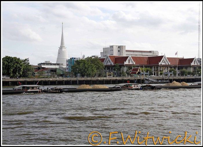
At that exact moment, the boat was packed. We didn’t see a ticket booth at the pier, and we tried in vain to pay the few baht for the ride. The cashier on the boat was too busy, and another employee we called didn’t have time to help us. Oh well, we weren’t going to force the issue. Still, this mode of transport is super practical for avoiding traffic, and at the piers, the lines with station names are clearly marked, with colors matching the flags on the boats. Combined with a map like the *Routard* guide, it’s easy to navigate.
We easily made it to the restaurant *Harmonique*, located near one of these piers. It’s a unanimous favorite on this forum, and let us tell you—it’s well-deserved. What a wonderful experience that evening! We only saw the outdoor gazebo because there was no way we were dining inside. It’s not flashy, so those looking for a luxurious setting should look elsewhere.
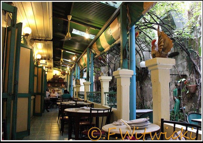
That night, the staff was a bit slow, and we had to track them down several times to move things along. But oh, my friends—what a feast on the plate! Start with the appetizer platter for two at 250 baht, featuring four specialties, each more tempting than the last, followed by their famous crab curry for 200 baht. There’s *so much* crab in there! The dish is so delicious and rich that when you finish, you feel—how to put it—like it was almost *too* good, to the point where you’re almost put off eating for days. And also, oh yes, we *will* be back. Their satay chicken is just as amazing, and it would be a crime not to mention their generous dessert with ice cream, warm banana, and chocolate, plus their *excellent* almond milkshake.
Later, we took a taxi to Kao San Road, mainly to book a Ko Tao-Chumphon trip for 600 baht per person at the Lomprayah counter. In hindsight, we should’ve booked all three of our trips there right away.
Kao San Road is *ultra*-touristy—better for younger crowds, but it’s still worth seeing. There’s rock ‘n’ roll, hippies, and crowds everywhere.
We walked back to the hotel, and when we got a little lost near a canal, a really nice older Thai man spontaneously appeared out of the night to kindly point us in the right direction.
Finally, a real long night of sleep ahead—we cranked up the AC. Sweet, the vacation has begun!
Our route was as follows: Bangkok, Siem Reap, Krabi, Suratthani, Koh Phangan, Koh Tao, Chumphon, Bang Saphan, Prachuab Khiri Khan, Sam Roi Yod, Hua Hin, Phetchaburi, Bangkok.
Beyond rediscovering Bangkok, our objectives were the long-held dream of seeing Angkor and exploring southern Thailand, much of which isn’t overly touristy.
A quick big thank-you to Barbot, who took the time to answer several of our questions.
12/07/2013
The cheapest flight we found earlier this year was a Paris-Bangkok route with a layover in Moscow for 1440 €, total for two people. So, this time we tried Aeroflot. Airbus A318 for the first leg, A330 for the second. Nothing particularly annoying to report—the passengers were very calm, the cabin temperature was comfortable, and we had enough legroom. That said, the quality of the meal trays was pretty mediocre, and the flight attendants weren’t exactly comedians.
We’d like to remind everyone that it’s best to exchange as little money as possible at the airport upon arrival, since the rate is about 5% worse than at city banks.
Of course, we made sure to take the airport exit where you can catch official taxis to avoid getting scammed. So, we queued up, a little lady gave us the ticket, and off we went with the driver. Generally, this system works well because these drivers are registered, know their duties, and the risks they face if they break the rules. Except that day, right off the bat, we got the scammer of the day. His first move was to snatch the ticket from my wife’s hands—the one you’re supposed to keep in case of a complaint. My husband saw it, but after a full day of travel, we were a bit out of it, and honestly, there was no reason to be suspicious. But once we started driving, the guy refused to turn on the meter. We insisted more and more firmly, but nothing. So, I used the famous method of opening the door and starting to step out of the car. At 40 km/h, that scares the driver more than the passenger. He finally turned on the meter, but that didn’t calm him down—quite the opposite. For the next half-hour, he ruined the ride by demanding extra fees here and there. Having dealt with several scam attempts last year in Vietnam, this wasn’t exactly new, and we were proud of ourselves for staying pretty zen. Still, this guy was a little scary—he was completely wired and aggressive. Honestly, it was hard not to think he was on something. He’d be perfect for a *Scarface* remake. When we finally arrived at the hotel, he followed us to the entrance. We paid the two tolls (25 and 45 baht), gave him the usual 100 baht extra for the ride, and stayed polite but firm. So, meter: 245 baht + 100 baht + 25 and 45 baht for tolls—we paid the exact amount, no way we were tipping this guy. He left furious, but he was already like that before picking us up... Anyway, avoid Mr. Chartree Chidchen, number 089 826 7308, car E2663!
We were so relieved to finally settle in at Feung Nakorn Balcony hotel in the temple district. 42 € per night, great reception, all the staff is friendly. The AC works fine, the bed seemed hard at first but turned out to be comfortable. The hotel is quiet, away from the nightlife, but at this time of year, many places are less crowded than in high season. Even with a nice fish pond and outdoor breakfast area, it’s a decent hotel, though we felt we could’ve found something better.
After a night on the plane, the first afternoon is always a bit of a slog. We napped for a few hours, and when we woke up—guess what—we were starving. We visited a temple across from the hotel (nothing special) and then decided to take the Chao Phraya Express, the river shuttle that serves many piers along the river. It was a really enjoyable experience. The steel gangway wobbles when you board and disembark, the boat sits low in the water, and sometimes you get splashed. During peak times, you’re packed in like sardines, but most of all, there’s that exotic urban landscape passing by, especially the temple rooftops.
At that exact moment, the boat was packed. We didn’t see a ticket booth at the pier, and we tried in vain to pay the few baht for the ride. The cashier on the boat was too busy, and another employee we called didn’t have time to help us. Oh well, we weren’t going to force the issue. Still, this mode of transport is super practical for avoiding traffic, and at the piers, the lines with station names are clearly marked, with colors matching the flags on the boats. Combined with a map like the *Routard* guide, it’s easy to navigate.
We easily made it to the restaurant *Harmonique*, located near one of these piers. It’s a unanimous favorite on this forum, and let us tell you—it’s well-deserved. What a wonderful experience that evening! We only saw the outdoor gazebo because there was no way we were dining inside. It’s not flashy, so those looking for a luxurious setting should look elsewhere.
That night, the staff was a bit slow, and we had to track them down several times to move things along. But oh, my friends—what a feast on the plate! Start with the appetizer platter for two at 250 baht, featuring four specialties, each more tempting than the last, followed by their famous crab curry for 200 baht. There’s *so much* crab in there! The dish is so delicious and rich that when you finish, you feel—how to put it—like it was almost *too* good, to the point where you’re almost put off eating for days. And also, oh yes, we *will* be back. Their satay chicken is just as amazing, and it would be a crime not to mention their generous dessert with ice cream, warm banana, and chocolate, plus their *excellent* almond milkshake.
Later, we took a taxi to Kao San Road, mainly to book a Ko Tao-Chumphon trip for 600 baht per person at the Lomprayah counter. In hindsight, we should’ve booked all three of our trips there right away.
Kao San Road is *ultra*-touristy—better for younger crowds, but it’s still worth seeing. There’s rock ‘n’ roll, hippies, and crowds everywhere.
We walked back to the hotel, and when we got a little lost near a canal, a really nice older Thai man spontaneously appeared out of the night to kindly point us in the right direction.
Finally, a real long night of sleep ahead—we cranked up the AC. Sweet, the vacation has begun!
I’ve never done a travel journal on VF before... so I’m giving it a go this year 😉. Just to share a bit of my 3-week trip around the West.
Since I couldn’t find anyone to share the trip with this year, I decided to go solo for 3 weeks at the last minute. So, it wasn’t a super organized or original trip—flight tickets booked last-minute, a loosely planned itinerary—but it was a choice I made.
I wanted to book zero hotels and just drive wherever I felt like. No set hikes or specific goals. Just a classic route through places I already knew for the most part, taking the time to soak in the landscapes. So, don’t expect a story about epic hikes leading to caves or hidden arches in unusual spots. It was more like a return to the roots of my first trip, with one twist: I wanted to explore some areas by mountain bike. Just to see things a little differently.
First up, instead of photos, I’ll share a little time-lapse I made during the trip.
Thursday, October 31: Left Nice early in the morning for Phoenix via London.
The trip was a bit long because I had to wait 5.5 hours in London. My flight ticket was booked kinda late, so I didn’t have much choice.
And then it hit me—when you’re prepping for a trip, you always think you’ll forget something. It was in London that I realized I’d left my driver’s license on my living room shelf. I searched everywhere, but nope, I didn’t bring it.🤪
Luckily, I had an international permit, but the rental contract clearly stated that both licenses had to be presented.
I called a friend to ask her to overnight it to my first hotel, crossing my fingers that the mail wouldn’t take two weeks to arrive.
The flight with British Airways went pretty well. Comfortable enough to watch two movies, eat, take a little nap, and boom—I was in Phoenix.
Around 8 PM local time, I got to the Alamo car rental agency, and surprise—they didn’t care about my license at all. They glanced at the international permit, told me to bring the other one when I got it (basically, they didn’t give a damn), and handed me my car! Woohoo! 😛

I headed to my hotel (the only one I’d booked for my first night), explained to the front desk that my license should arrive by mail so they’d be in the loop, and crashed for a well-deserved first night in the U.S.
Friday, November 1 (And yes! It was a holiday in France, which would complicate my mail situation later.)
I woke up super early with my first goal: find a decent mountain bike at a good price but sturdy enough to handle some national park trails.
As I mentioned earlier, I decided to switch things up this year and explore some mountain bike trails—or just ride whenever I got the chance 😉.
I checked two Walmarts before finally finding a solid bike for under $150. Some might wonder why I bought one—well, the reason’s simple. Renting a bike costs between $40 and $70 a day. My trip lasted 22 days. QED (that’s "quod erat demonstrandum" for those who didn’t get it).
I bought the bike, which fit in my Jeep Compass by folding down the back seats (not super convenient, but it worked).

Off I went on my first adventures.
I decided to head to Apache Junction.
First stop: the Apache Trail at Goldfield Ghost Town. Pretty cute, though super touristy. Some classic Western decor, a little chapel overlooking everything, a museum, a mine, a small Disneyland-style train, souvenir shops, and places to grab a snack. Nothing mind-blowing, but still a fun little visit—especially if you’ve got kids.


I got lucky and explored the ghost town with two school buses—about a hundred excited kids. Total chaos for a ghost town, but hilarious to watch from a distance 😎.
A little further down the Apache Trail, there’s Lost Dutchman State Park. I didn’t linger too long because my goal was to reach the lakes, and after my Walmart adventure and some driving, it was already almost 1 PM. I munched on a bag of chips and hit the road (lots of 20–25 mph speed limits).
I spotted N 1st Water Road along the way, planning to come back in a few days.
My plan to get to the lakes ASAP got derailed when I found a parking lot with a horse trail right in the middle of the saguaros.
I asked a ranger in the lot if I could ride the trail on my mountain bike. He said it’d probably be tough but gave me the green light.
Off I went in my padded shorts and helmet. First bike ride through the cacti with my trusty travel companion (my bike, obviously).

I started off super excited on what seemed like an easy trail, but I quickly realized horse trails don’t account for some key biking challenges 😎—like climbing rocks isn’t exactly a breeze on a mountain bike 😛. No biggie, I carried the bike a few times but got to see my first saguaros up close! A pretty cool way to explore—I don’t regret buying the bike at all!
I got back on the road after drinking 1.5 liters of water (even in November, the sun’s no joke) and headed toward Canyon Lake. With vibes like Lake Powell, I was blown away by the scenery and decided to hang out a bit—just to "soak it in" and enjoy the quiet to end my day. I didn’t see more of the Apache Trail because night falls fast, and for my first day, I figured that was plenty.


I’d decided not to stress about seeing everything at all costs since I’ve traveled a lot in the U.S. and plan to keep coming back. Whatever I missed, I’d catch next time—but I wanted to fully enjoy a few landscapes.
I drove back to Phoenix, grabbed a good burger, and spent the evening in my hotel room planning the next day. Originally, I was only supposed to stay one night in Phoenix, but with my license still MIA, I changed my plans. In the end, I was solo, no reservations anywhere, so I’d just take it day by day!
Saturday, November 2:
I decided to wake up early and head to Tucson for the day. The drive from Phoenix was pretty easy. About 2 hours later, I was at the entrance of Saguaro National Park.
And guess what? There was a little trail perfect for mountain biking. I parked my Jeep at the park entrance and hopped on my bike. I ended up biking the whole park from start to finish—about 20 kilometers, with a paved main road and a gorgeous central trail right through the saguaros! Stunning!

Even being careful, I still got a few cactus spines in my left arm from brushing too close (it stings!). Not easy to remove, so I’d advise anyone with the same idea to be more careful than I was. You’ll figure it out fast! 😉
I spent most of the day in this amazing park—it’s totally worth the detour. It feels like hundreds of chimneys all lined up at equal distances. A unique landscape you’ve gotta see.
Next, I headed to Tucson to check out the airplane boneyard. I’d seen it in a movie years ago and always wanted to see it for myself. Mission accomplished! It was pretty intense, but unfortunately, it didn’t seem possible to get to the most interesting plane alignments. There’s a museum with different types of planes and a guided tour. I settled for peeking through the fences at the planes guarded by military patrols.

I left around 6 PM and got back to Phoenix around 7:30–8 PM, super happy with my day of biking through the cacti!
Sunday, November 3:
Morning by the pool, lounging around—pure bliss. Around 11 AM, I headed to the Premium Outlets. Feeling pretty pleased with myself, I bought 5 pairs of Levi’s for the price of one in France. Just for that, I knew coming to the U.S. was worth it! After that, nothing super exciting—except a cotton field south of Phoenix that I couldn’t stop admiring for a good hour.

I drove around the city—pretty dead on a Sunday—and headed back to the Apache Trail to tackle N 1st Water Road, which I’d spotted two days earlier. A really fun trail to bike if you’ve got a mountain bike 😉. It gives access to several hikes and offers some great scenery. Highly recommend it.


Since I couldn’t find anyone to share the trip with this year, I decided to go solo for 3 weeks at the last minute. So, it wasn’t a super organized or original trip—flight tickets booked last-minute, a loosely planned itinerary—but it was a choice I made.
I wanted to book zero hotels and just drive wherever I felt like. No set hikes or specific goals. Just a classic route through places I already knew for the most part, taking the time to soak in the landscapes. So, don’t expect a story about epic hikes leading to caves or hidden arches in unusual spots. It was more like a return to the roots of my first trip, with one twist: I wanted to explore some areas by mountain bike. Just to see things a little differently.
First up, instead of photos, I’ll share a little time-lapse I made during the trip.
Thursday, October 31: Left Nice early in the morning for Phoenix via London.
The trip was a bit long because I had to wait 5.5 hours in London. My flight ticket was booked kinda late, so I didn’t have much choice.
And then it hit me—when you’re prepping for a trip, you always think you’ll forget something. It was in London that I realized I’d left my driver’s license on my living room shelf. I searched everywhere, but nope, I didn’t bring it.🤪
Luckily, I had an international permit, but the rental contract clearly stated that both licenses had to be presented.
I called a friend to ask her to overnight it to my first hotel, crossing my fingers that the mail wouldn’t take two weeks to arrive.
The flight with British Airways went pretty well. Comfortable enough to watch two movies, eat, take a little nap, and boom—I was in Phoenix.
Around 8 PM local time, I got to the Alamo car rental agency, and surprise—they didn’t care about my license at all. They glanced at the international permit, told me to bring the other one when I got it (basically, they didn’t give a damn), and handed me my car! Woohoo! 😛
I headed to my hotel (the only one I’d booked for my first night), explained to the front desk that my license should arrive by mail so they’d be in the loop, and crashed for a well-deserved first night in the U.S.
Friday, November 1 (And yes! It was a holiday in France, which would complicate my mail situation later.)
I woke up super early with my first goal: find a decent mountain bike at a good price but sturdy enough to handle some national park trails.
As I mentioned earlier, I decided to switch things up this year and explore some mountain bike trails—or just ride whenever I got the chance 😉.
I checked two Walmarts before finally finding a solid bike for under $150. Some might wonder why I bought one—well, the reason’s simple. Renting a bike costs between $40 and $70 a day. My trip lasted 22 days. QED (that’s "quod erat demonstrandum" for those who didn’t get it).
I bought the bike, which fit in my Jeep Compass by folding down the back seats (not super convenient, but it worked).
Off I went on my first adventures.
I decided to head to Apache Junction.
First stop: the Apache Trail at Goldfield Ghost Town. Pretty cute, though super touristy. Some classic Western decor, a little chapel overlooking everything, a museum, a mine, a small Disneyland-style train, souvenir shops, and places to grab a snack. Nothing mind-blowing, but still a fun little visit—especially if you’ve got kids.
I got lucky and explored the ghost town with two school buses—about a hundred excited kids. Total chaos for a ghost town, but hilarious to watch from a distance 😎.
A little further down the Apache Trail, there’s Lost Dutchman State Park. I didn’t linger too long because my goal was to reach the lakes, and after my Walmart adventure and some driving, it was already almost 1 PM. I munched on a bag of chips and hit the road (lots of 20–25 mph speed limits).
I spotted N 1st Water Road along the way, planning to come back in a few days.
My plan to get to the lakes ASAP got derailed when I found a parking lot with a horse trail right in the middle of the saguaros.
I asked a ranger in the lot if I could ride the trail on my mountain bike. He said it’d probably be tough but gave me the green light.
Off I went in my padded shorts and helmet. First bike ride through the cacti with my trusty travel companion (my bike, obviously).
I started off super excited on what seemed like an easy trail, but I quickly realized horse trails don’t account for some key biking challenges 😎—like climbing rocks isn’t exactly a breeze on a mountain bike 😛. No biggie, I carried the bike a few times but got to see my first saguaros up close! A pretty cool way to explore—I don’t regret buying the bike at all!
I got back on the road after drinking 1.5 liters of water (even in November, the sun’s no joke) and headed toward Canyon Lake. With vibes like Lake Powell, I was blown away by the scenery and decided to hang out a bit—just to "soak it in" and enjoy the quiet to end my day. I didn’t see more of the Apache Trail because night falls fast, and for my first day, I figured that was plenty.
I’d decided not to stress about seeing everything at all costs since I’ve traveled a lot in the U.S. and plan to keep coming back. Whatever I missed, I’d catch next time—but I wanted to fully enjoy a few landscapes.
I drove back to Phoenix, grabbed a good burger, and spent the evening in my hotel room planning the next day. Originally, I was only supposed to stay one night in Phoenix, but with my license still MIA, I changed my plans. In the end, I was solo, no reservations anywhere, so I’d just take it day by day!
Saturday, November 2:
I decided to wake up early and head to Tucson for the day. The drive from Phoenix was pretty easy. About 2 hours later, I was at the entrance of Saguaro National Park.
And guess what? There was a little trail perfect for mountain biking. I parked my Jeep at the park entrance and hopped on my bike. I ended up biking the whole park from start to finish—about 20 kilometers, with a paved main road and a gorgeous central trail right through the saguaros! Stunning!
Even being careful, I still got a few cactus spines in my left arm from brushing too close (it stings!). Not easy to remove, so I’d advise anyone with the same idea to be more careful than I was. You’ll figure it out fast! 😉
I spent most of the day in this amazing park—it’s totally worth the detour. It feels like hundreds of chimneys all lined up at equal distances. A unique landscape you’ve gotta see.
Next, I headed to Tucson to check out the airplane boneyard. I’d seen it in a movie years ago and always wanted to see it for myself. Mission accomplished! It was pretty intense, but unfortunately, it didn’t seem possible to get to the most interesting plane alignments. There’s a museum with different types of planes and a guided tour. I settled for peeking through the fences at the planes guarded by military patrols.
I left around 6 PM and got back to Phoenix around 7:30–8 PM, super happy with my day of biking through the cacti!
Sunday, November 3:
Morning by the pool, lounging around—pure bliss. Around 11 AM, I headed to the Premium Outlets. Feeling pretty pleased with myself, I bought 5 pairs of Levi’s for the price of one in France. Just for that, I knew coming to the U.S. was worth it! After that, nothing super exciting—except a cotton field south of Phoenix that I couldn’t stop admiring for a good hour.
I drove around the city—pretty dead on a Sunday—and headed back to the Apache Trail to tackle N 1st Water Road, which I’d spotted two days earlier. A really fun trail to bike if you’ve got a mountain bike 😉. It gives access to several hikes and offers some great scenery. Highly recommend it.
Here’s our third travel journal with photos, following Vietnam in 2012 and Southern Thailand + Angkor in 2013.
Once again, we’d like to thank everyone who brightens up this site with their experiences and tips. Every year, some parts of our itinerary are made easier or richer thanks to your contributions.
We hope our own story will do the same for other travelers.
**10 JULY 2014**
We booked our flight tickets back in September to get a better deal than last year. We were happy with the 1291 € price for two people from Paris—until mid-January, when several airlines started offering promotions we hadn’t expected for our travel dates. Next year, we’ll take the gamble and wait longer, hoping to fly with Qatar Airways, for example. Fate had us flying with Indian Airlines. The Paris-to-Delhi leg was on a brand-new Boeing Dreamliner—obviously fresh off the assembly line. After a quick four-hour layover to stretch our legs, we boarded an Airbus A321 that looked prehistoric for the Delhi-to-Bangkok flight. Honestly, if the outside of the plane had matched the inside, we’d never have made it. Broken screens, shattered armrests—you name it. As for the meal trays, we would’ve devoured them only after a week stranded on a desert island. The cabin crew didn’t win us over either. And we really didn’t appreciate the behavior, attitudes, or stares from most of the people we encountered during our layovers in Delhi. This year’s experience has definitely put us off flying with this airline again—or even setting foot in India ever again. That’s just our personal take, but it’s clear.
Stepping onto Thai soil was an immense relief. After exchanging just a few euros, we took a taxi from the designated spot and had a completely different experience from last year: the driver was normal and efficient. So efficient, in fact, that we arrived at our destination much earlier than expected. A well-deserved tip, and it seemed to make his day.
We dropped our bags at reception and rushed to Harmonique restaurant, just 300 meters away, just in time for the last dinner service. We’d talked about this place at length last year. We’d been looking forward to it for a year, but we only managed to nibble on some spring rolls because what we really wanted was a good night’s sleep. While quite a few customers were still around, four staff members walked through the dining area with two large trash bins from the day’s service. They were clearly pleased with themselves and having a good laugh. It made us chuckle too—seeing something like that done so naturally, when back home, some people would’ve been outraged to witness it in a similar establishment!
A quick word about the Swan Hotel: we’re grateful to those who recommended it on this site and on their blogs. It’s quietly located in the Silom district, just steps from the river. We have fond memories of the giant, ultra-comfortable bed and the well-maintained pool. It was very peaceful, though we were there during a quieter season. At 30 € with breakfast when we booked (and around 20 € without breakfast now), we can’t imagine finding a better-suited hotel in Bangkok.
**11 JULY**
We couldn’t find an open bank and had to withdraw cash from an ATM. Now we know: July 11 is a public holiday in Thailand. It suddenly occurred to us that next year, we’ll keep some baht from our return trip to save time at the airport and avoid little hiccups like this.
We decided not to head straight to Laos and instead spent the day visiting Muang Boran, also known as Ancient City, about 30 km southeast of Bangkok.
There are plenty of ways to get there. We ruled out taxis—too expensive. Besides, we enjoy using local transport; it’s more fun. We took a taxi to Democracy Monument, then found the bus stop about 100 meters from the roundabout, on one of the avenues leading to it. Someone always points you in the right direction. We hopped on bus 511 for a long ride, with two major slowdowns at red lights. The same happened on the way back, as our route crossed busier roads. We told the driver our destination, and he let us know when to get off. No problem—someone already flagged us down 20 meters later to put us in a *songthaew* (a shared taxi-van) that took us straight to the site. The bus and *songthaew* fares were minimal. Already, the people around us were smiling, and we were smiling back.
The entrance fee has gone up: 700 baht. That includes bike rental, a tour minibus, and a boat ride on the river. We still hadn’t fully recovered from the flight, and with the heavy, humid heat, we opted for the electric cart instead—no regrets. Still, 150 baht per hour.
We had an amazing day, beyond our expectations. The park features full-scale or scaled-down replicas of Thailand’s main landmarks, along with countless statues and landscaped gardens. There are also reconstructions of a typical Thai village, a northern Thai village, a farm with animals, and a floating village.
Almost everything we saw was well-made and aesthetically pleasing. The whole place is absolutely worth the trip. We spent six solid hours there without dawdling.
Here’s a very incomplete sample of what we admired:


Visitors will find restrooms, restaurants, and a few shops scattered throughout the site. On the way back, just cross the road using the pedestrian bridge about 250 meters to the left of the exit. Flag down a *songthaew* as it passes.
The whole day flew by between the visit and the commute. We still had time to return to Harmonique to try their famous crab curry. Once you’ve finished it, you think—life isn’t so bad after all.
**10 JULY 2014**
We booked our flight tickets back in September to get a better deal than last year. We were happy with the 1291 € price for two people from Paris—until mid-January, when several airlines started offering promotions we hadn’t expected for our travel dates. Next year, we’ll take the gamble and wait longer, hoping to fly with Qatar Airways, for example. Fate had us flying with Indian Airlines. The Paris-to-Delhi leg was on a brand-new Boeing Dreamliner—obviously fresh off the assembly line. After a quick four-hour layover to stretch our legs, we boarded an Airbus A321 that looked prehistoric for the Delhi-to-Bangkok flight. Honestly, if the outside of the plane had matched the inside, we’d never have made it. Broken screens, shattered armrests—you name it. As for the meal trays, we would’ve devoured them only after a week stranded on a desert island. The cabin crew didn’t win us over either. And we really didn’t appreciate the behavior, attitudes, or stares from most of the people we encountered during our layovers in Delhi. This year’s experience has definitely put us off flying with this airline again—or even setting foot in India ever again. That’s just our personal take, but it’s clear.
Stepping onto Thai soil was an immense relief. After exchanging just a few euros, we took a taxi from the designated spot and had a completely different experience from last year: the driver was normal and efficient. So efficient, in fact, that we arrived at our destination much earlier than expected. A well-deserved tip, and it seemed to make his day.
We dropped our bags at reception and rushed to Harmonique restaurant, just 300 meters away, just in time for the last dinner service. We’d talked about this place at length last year. We’d been looking forward to it for a year, but we only managed to nibble on some spring rolls because what we really wanted was a good night’s sleep. While quite a few customers were still around, four staff members walked through the dining area with two large trash bins from the day’s service. They were clearly pleased with themselves and having a good laugh. It made us chuckle too—seeing something like that done so naturally, when back home, some people would’ve been outraged to witness it in a similar establishment!
A quick word about the Swan Hotel: we’re grateful to those who recommended it on this site and on their blogs. It’s quietly located in the Silom district, just steps from the river. We have fond memories of the giant, ultra-comfortable bed and the well-maintained pool. It was very peaceful, though we were there during a quieter season. At 30 € with breakfast when we booked (and around 20 € without breakfast now), we can’t imagine finding a better-suited hotel in Bangkok.
**11 JULY**
We couldn’t find an open bank and had to withdraw cash from an ATM. Now we know: July 11 is a public holiday in Thailand. It suddenly occurred to us that next year, we’ll keep some baht from our return trip to save time at the airport and avoid little hiccups like this.
We decided not to head straight to Laos and instead spent the day visiting Muang Boran, also known as Ancient City, about 30 km southeast of Bangkok.
There are plenty of ways to get there. We ruled out taxis—too expensive. Besides, we enjoy using local transport; it’s more fun. We took a taxi to Democracy Monument, then found the bus stop about 100 meters from the roundabout, on one of the avenues leading to it. Someone always points you in the right direction. We hopped on bus 511 for a long ride, with two major slowdowns at red lights. The same happened on the way back, as our route crossed busier roads. We told the driver our destination, and he let us know when to get off. No problem—someone already flagged us down 20 meters later to put us in a *songthaew* (a shared taxi-van) that took us straight to the site. The bus and *songthaew* fares were minimal. Already, the people around us were smiling, and we were smiling back.
The entrance fee has gone up: 700 baht. That includes bike rental, a tour minibus, and a boat ride on the river. We still hadn’t fully recovered from the flight, and with the heavy, humid heat, we opted for the electric cart instead—no regrets. Still, 150 baht per hour.
We had an amazing day, beyond our expectations. The park features full-scale or scaled-down replicas of Thailand’s main landmarks, along with countless statues and landscaped gardens. There are also reconstructions of a typical Thai village, a northern Thai village, a farm with animals, and a floating village.
Almost everything we saw was well-made and aesthetically pleasing. The whole place is absolutely worth the trip. We spent six solid hours there without dawdling.
Here’s a very incomplete sample of what we admired:
Visitors will find restrooms, restaurants, and a few shops scattered throughout the site. On the way back, just cross the road using the pedestrian bridge about 250 meters to the left of the exit. Flag down a *songthaew* as it passes.
The whole day flew by between the visit and the commute. We still had time to return to Harmonique to try their famous crab curry. Once you’ve finished it, you think—life isn’t so bad after all.
After nearly 2 years of waiting (yeah, like many of you, we wanted to hit the road again as soon as we got back to France... but first, we had to fill up the piggy bank!), here we are at last—July, the month we’ve been waiting for!
We’ve got 30 days of exploring new places ahead of us, as well as revisiting some spots we loved back in 2012.
Here’s the plan: - Joshua Tree NP - Las Vegas - Valley of Fire SP - Yant Flat - Zion NP (Angel’s Landing) - Bryce Canyon NP (Fairyland Loop trail) - Devils Garden on the HITTR - Capitol Reef NP - Grand Teton NP - Yellowstone NP: Old Faithful - Yellowstone NP: Norris Geyser Basin and Mammoth Hot Springs - Yellowstone NP: Grand Canyon of the Yellowstone - West Thumb and Grand Teton NP - Flaming Gorge - Colorado NM and Fisher Towers - Moab: Arches - Moab: Canyonlands and Corona Arch - Moab: Canyonlands - Moab: rafting and Dead Horse Point SP - Natural Bridges NM and Valley of the Gods - Monument Valley and Horseshoe Bend - Coyote Buttes South - Grand Canyon NP (North Rim) - Grand Canyon NP (North Rim) and Navajo Bridge - Sedona - From Sedona to Tucson - Arizona-Sonora Desert Museum and Saguaro NP - Tombstone
Practical details:
- I’d read that it was better to book flight tickets directly on an airline’s website rather than through a comparison site. So, I spent months searching for reasonably priced tickets for two adults and two kids from Paris to Las Vegas for the outbound trip and from Tucson to Paris for the return. I mostly checked Air France, KLM, and British Airways, but prices were always around 4600 €. Not finding anything, we eventually went through a comparison site: Ebookers. We bought our tickets in mid-December: Paris/Atlanta with Air France, then Atlanta/Los Angeles with Delta for the outbound trip, and Tucson/Atlanta with Delta, then Atlanta/Paris with Air France for the return. Total cost: 4300 €. The layover on the outbound trip made me a little nervous because it was only 2 hours and 15 minutes. A month later, we got an email from Ebookers saying the layover had been reduced to 1 hour and 40 minutes! And a few months after that, it was down to just 1 hour and 30 minutes... So, we called Air France directly (we didn’t go through Ebookers, and it wasn’t a problem), and they put us on different flights. The new layover was 2 hours and 10 minutes—still not a ton of time, but I felt better than with 1 hour and 30 minutes. And anyway, we figured we’d see how it went!
- For the car, we tried several comparison sites, and in the end, AutoEurope won this year: 808 € for a 30-day rental of a Chevrolet Impala through Thrifty. The second driver was free for the entire trip since we picked up the car in California.
- We didn’t rent a GPS or buy one—we just downloaded Sygic on our two phones and bought the US map. I don’t remember the exact amount, but it cost us around 30 €.
- For hotels, I either booked directly on the sites (Xanterra, Grand Canyon Lodge, etc.) or used Hotels.com (to earn nights through their Welcome Rewards program) or Booking.com (when hotels weren’t available on Hotels.com). I always compared the price on Hotels.com with the hotel’s direct rate, but they were usually the same. So, for the same price, I’d rather earn a night with Welcome Rewards! We’d set a budget of 100 € per night on average, and we stuck to it pretty well—the final average came out to 101.20 € when including everything (nights + taxes + any nightly fees + parking fees + bank fees).
- As for luggage, we didn’t want to overpack! So, we left with one medium suitcase for Calista, one for me, one large suitcase for Hugo and Yannick, and a sports bag with Calista’s booster seat (we could’ve taken it on the plane with us, but I didn’t want to lug it around the airport during the layover). That sports bag came in handy on the way back, too—because, as everyone knows, you always come back with more than you left with! Each of us also had a backpack as a carry-on.
Before wrapping up this intro and getting into the real details, I’d like to thank everyone who contributed to my discussions and helped me improve our itinerary!
Quick intro for those who don’t know us: Yannick (36), Peggy (36), Hugo (11), and Calista (8).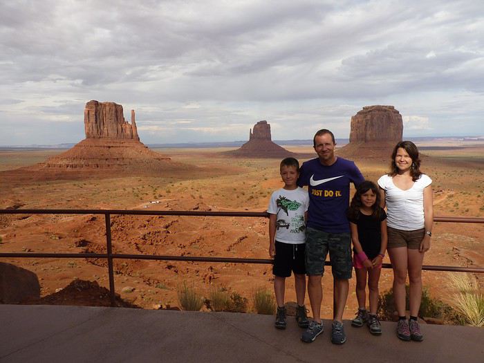
Here’s the plan: - Joshua Tree NP - Las Vegas - Valley of Fire SP - Yant Flat - Zion NP (Angel’s Landing) - Bryce Canyon NP (Fairyland Loop trail) - Devils Garden on the HITTR - Capitol Reef NP - Grand Teton NP - Yellowstone NP: Old Faithful - Yellowstone NP: Norris Geyser Basin and Mammoth Hot Springs - Yellowstone NP: Grand Canyon of the Yellowstone - West Thumb and Grand Teton NP - Flaming Gorge - Colorado NM and Fisher Towers - Moab: Arches - Moab: Canyonlands and Corona Arch - Moab: Canyonlands - Moab: rafting and Dead Horse Point SP - Natural Bridges NM and Valley of the Gods - Monument Valley and Horseshoe Bend - Coyote Buttes South - Grand Canyon NP (North Rim) - Grand Canyon NP (North Rim) and Navajo Bridge - Sedona - From Sedona to Tucson - Arizona-Sonora Desert Museum and Saguaro NP - Tombstone
Practical details:
- I’d read that it was better to book flight tickets directly on an airline’s website rather than through a comparison site. So, I spent months searching for reasonably priced tickets for two adults and two kids from Paris to Las Vegas for the outbound trip and from Tucson to Paris for the return. I mostly checked Air France, KLM, and British Airways, but prices were always around 4600 €. Not finding anything, we eventually went through a comparison site: Ebookers. We bought our tickets in mid-December: Paris/Atlanta with Air France, then Atlanta/Los Angeles with Delta for the outbound trip, and Tucson/Atlanta with Delta, then Atlanta/Paris with Air France for the return. Total cost: 4300 €. The layover on the outbound trip made me a little nervous because it was only 2 hours and 15 minutes. A month later, we got an email from Ebookers saying the layover had been reduced to 1 hour and 40 minutes! And a few months after that, it was down to just 1 hour and 30 minutes... So, we called Air France directly (we didn’t go through Ebookers, and it wasn’t a problem), and they put us on different flights. The new layover was 2 hours and 10 minutes—still not a ton of time, but I felt better than with 1 hour and 30 minutes. And anyway, we figured we’d see how it went!
- For the car, we tried several comparison sites, and in the end, AutoEurope won this year: 808 € for a 30-day rental of a Chevrolet Impala through Thrifty. The second driver was free for the entire trip since we picked up the car in California.
- We didn’t rent a GPS or buy one—we just downloaded Sygic on our two phones and bought the US map. I don’t remember the exact amount, but it cost us around 30 €.
- For hotels, I either booked directly on the sites (Xanterra, Grand Canyon Lodge, etc.) or used Hotels.com (to earn nights through their Welcome Rewards program) or Booking.com (when hotels weren’t available on Hotels.com). I always compared the price on Hotels.com with the hotel’s direct rate, but they were usually the same. So, for the same price, I’d rather earn a night with Welcome Rewards! We’d set a budget of 100 € per night on average, and we stuck to it pretty well—the final average came out to 101.20 € when including everything (nights + taxes + any nightly fees + parking fees + bank fees).
- As for luggage, we didn’t want to overpack! So, we left with one medium suitcase for Calista, one for me, one large suitcase for Hugo and Yannick, and a sports bag with Calista’s booster seat (we could’ve taken it on the plane with us, but I didn’t want to lug it around the airport during the layover). That sports bag came in handy on the way back, too—because, as everyone knows, you always come back with more than you left with! Each of us also had a backpack as a carry-on.
Before wrapping up this intro and getting into the real details, I’d like to thank everyone who contributed to my discussions and helped me improve our itinerary!
Quick intro for those who don’t know us: Yannick (36), Peggy (36), Hugo (11), and Calista (8).
Hello everyone,
Lozère seems like a department that’s been forgotten on this forum—just like in real life, actually.
So if you love strolling through peaceful, exotic places, landscapes that remind you of Mongolia in some spots and of ruiniform shapes in others, and watching the flight of large griffon vultures in the Gorges de la Jonte and the Tarn, I’d like to share a few photos of these places I love. I’ve been exploring here for about thirty years, and I recently took a walk in mid-April with a few detours to the Larzac plateau, which straddles Aveyron and Lozère.
.
We head straight to the start of the Gorges de la Jonte. Our accommodation is right in the middle of these gorges, between Le Rozier and Meyrueis.
Le Rozier, a small village where the Jonte meets the Gorges du Tarn:

The village has three campsites side by side, with a beautiful view:

The Gorges de la Jonte at a spot called Les Douzes:


Lozère seems like a department that’s been forgotten on this forum—just like in real life, actually.
So if you love strolling through peaceful, exotic places, landscapes that remind you of Mongolia in some spots and of ruiniform shapes in others, and watching the flight of large griffon vultures in the Gorges de la Jonte and the Tarn, I’d like to share a few photos of these places I love. I’ve been exploring here for about thirty years, and I recently took a walk in mid-April with a few detours to the Larzac plateau, which straddles Aveyron and Lozère.
.
We head straight to the start of the Gorges de la Jonte. Our accommodation is right in the middle of these gorges, between Le Rozier and Meyrueis.
Le Rozier, a small village where the Jonte meets the Gorges du Tarn:
The village has three campsites side by side, with a beautiful view:
The Gorges de la Jonte at a spot called Les Douzes:
Bom dia, travelers,
A little feedback from our discovery of Madeira—there aren’t many out there! Hoping it might be useful to some of you 🙂
We stayed 7 days in Madeira between May 18th and 25th.
Base: Funchal, the Lido hotel area. A practical neighborhood (lots of restaurants, shops, buses, etc.) but lacking charm. While getting back to Funchal is quick thanks to the road infrastructure, the outskirts of the city are particularly congested in the morning and evening, often due to tourist buses blocking traffic. Plus, even though Funchal enjoys milder weather compared to the rest of the island, you won’t see any sunrises or sunsets there! In short, if I were to do it again, I wouldn’t stay in Funchal for 7 days, even if it’s convenient to unpack once and for all.
Car rental for the week with Avis through locationdevoiture.fr (now Carigami). Zero-excess insurance, two drivers included, full tank on pickup, return with a full tank. After everything I’d read, I was dreading it. No issues at pickup or return. A Citroën C3 with 4,000 km on the clock, which served us perfectly. We brought our own GPS and map, which came in handy. There are signs, of course, but not always where you need them 😛.
Guides & maps: The Rother for hikes, the *Évasion* guide (quite general but very complete), and the Sunflower (borrowed), which I liked less—I found the explanations less clear and a bit messy, but maybe it was just me being unclear 😇. We also had the Freytag & Berndt map at 1:40,000, very useful when exploring the tiniest roads.
Day 1: In the morning, we head to CURRAL DAS FREIRAS. The viewpoint is pretty, very well developed (too much?). We take a short walk down the path as recommended in the Sunflower guide. The environment is wild but doesn’t offer much in terms of views.


We then head east via the expressway. Destination: PONTA DE SÃO LOURENÇO. The sky is overcast there, while just earlier, we were under the sun 😕! We’ll have to deal with the weather’s whims—a constant in Madeira! Off we go for a 3.5-hour round-trip hike, including photo stops, a picnic, and the climb to Ponta do Furado at the very end.


It’s nice, very open, and unlike anywhere else on the island. But it’s also *very* crowded. Mass tourism where everyone’s staring at their feet, barely a smile, hardly a hello 😠. The vibe kind of kills the charm. We were there at lunchtime but didn’t escape the crowds.


Practical detail that matters: no restrooms at the parking lot, none at the Casa do Sardinha, and an environment with no trees or bushes where you can see for miles. Ladies, plan ahead... A hike you should do regardless, with no major difficulty aside from the final climb, though it "undulates" constantly. The trail is perfectly safe.

Back at the parking lot, we take the road to PORTO DA CRUZ, a small village nestled at the foot of the mountain. The natural pools, being cleaned, are empty, and the seaside promenade, splashed by waves, feels a bit gloomy. The charm isn’t there. Return to Funchal via PORTELA and the MIRADOURO DOS INGLESES, which is tricky to find—hidden at the back of a lovely park, tended like an old lady from the 19th century, maybe the former owner of the place...


To be continued... 😉
We stayed 7 days in Madeira between May 18th and 25th.
Base: Funchal, the Lido hotel area. A practical neighborhood (lots of restaurants, shops, buses, etc.) but lacking charm. While getting back to Funchal is quick thanks to the road infrastructure, the outskirts of the city are particularly congested in the morning and evening, often due to tourist buses blocking traffic. Plus, even though Funchal enjoys milder weather compared to the rest of the island, you won’t see any sunrises or sunsets there! In short, if I were to do it again, I wouldn’t stay in Funchal for 7 days, even if it’s convenient to unpack once and for all.
Car rental for the week with Avis through locationdevoiture.fr (now Carigami). Zero-excess insurance, two drivers included, full tank on pickup, return with a full tank. After everything I’d read, I was dreading it. No issues at pickup or return. A Citroën C3 with 4,000 km on the clock, which served us perfectly. We brought our own GPS and map, which came in handy. There are signs, of course, but not always where you need them 😛.
Guides & maps: The Rother for hikes, the *Évasion* guide (quite general but very complete), and the Sunflower (borrowed), which I liked less—I found the explanations less clear and a bit messy, but maybe it was just me being unclear 😇. We also had the Freytag & Berndt map at 1:40,000, very useful when exploring the tiniest roads.
Day 1: In the morning, we head to CURRAL DAS FREIRAS. The viewpoint is pretty, very well developed (too much?). We take a short walk down the path as recommended in the Sunflower guide. The environment is wild but doesn’t offer much in terms of views.
We then head east via the expressway. Destination: PONTA DE SÃO LOURENÇO. The sky is overcast there, while just earlier, we were under the sun 😕! We’ll have to deal with the weather’s whims—a constant in Madeira! Off we go for a 3.5-hour round-trip hike, including photo stops, a picnic, and the climb to Ponta do Furado at the very end.
It’s nice, very open, and unlike anywhere else on the island. But it’s also *very* crowded. Mass tourism where everyone’s staring at their feet, barely a smile, hardly a hello 😠. The vibe kind of kills the charm. We were there at lunchtime but didn’t escape the crowds.
Practical detail that matters: no restrooms at the parking lot, none at the Casa do Sardinha, and an environment with no trees or bushes where you can see for miles. Ladies, plan ahead... A hike you should do regardless, with no major difficulty aside from the final climb, though it "undulates" constantly. The trail is perfectly safe.
Back at the parking lot, we take the road to PORTO DA CRUZ, a small village nestled at the foot of the mountain. The natural pools, being cleaned, are empty, and the seaside promenade, splashed by waves, feels a bit gloomy. The charm isn’t there. Return to Funchal via PORTELA and the MIRADOURO DOS INGLESES, which is tricky to find—hidden at the back of a lovely park, tended like an old lady from the 19th century, maybe the former owner of the place...
To be continued... 😉
This year, we hadn’t planned on going to the United States. After two trips in 2012 and 2014, we needed to refill the piggy bank...
But we didn’t count on luck: one late September afternoon in 2014, while randomly browsing the web, I stumbled upon flight tickets for $753 per person for July 2015! After some calculations and hesitation, we decided to shorten the trip compared to the previous year (22 days this time), cut down on hotel costs (80 € per night on average), and skip expensive activities (no helicopter rides, rafting, or guided tours with outfitters, etc.), but we couldn’t pass up such a great opportunity!
Here’s the budget breakdown: - Flight tickets: 3,012 € for 4 (booked directly on AA’s website). One layover on the way out (CDG / Charlotte / Phoenix) and one on the way back (LAX / London / CDG). - Hotels: 1,685 € for 22 nights, averaging 76.60 € per night. We stuck to our budget (and even did better!), thanks to affordable hotels in NM, bookings made when the exchange rate was still favorable, and 2 free nights used on Hotels.com. - Car: 952 € for 22 days renting a standard SUV (Jeep Grand Cherokee). We went through AutoEurope, and the rental company was Dollar. - Gas: Around $20 per day on average (for 5,440 km). - Food: Just under $70 per day on average (for 4 people). We did a lot of grocery shopping for picnics, ate a lot of fast food, and only went to restaurants a few times. - America the Beautiful Pass: Free (the one we bought in July 2014 was still valid until the end of July 2015). - Not covered by the pass: $175 (entry fees for State Parks, a guided tour at Mesa Verde, Pow Wow entry, etc.).
In total, we spent 7,760 € for 4 people over 22 days. On top of that, we added $50 for the NYNY roller coaster (a gift for Hugo) and $135 for the *Mystère* show (a gift for Calista and me).
Here’s the itinerary: - Lost Dutchman SP, Goldfield Ghost Town, and Apache Trail - Chiricahua NM - White Sands NM - White Sands NM, Valley of Fires SP, and Old Town Albuquerque - Taos Pueblo, Pow Wow, and Chimayo - Bandelier NM and Santa Fe - Kasha Katuwe Tent Rocks NM - Shiprock and Mesa Verde NP - Bluff, Gooseneck SP, Road Canyon, and UT95 - Little Wild Horse Canyon and Goblin Valley SP - Capitol Reef NP (Cohab Canyon and Sulphur Creek) - Burr Trail - Zebra Slot Canyon and Lower Calf Creek Falls - Mossy Cave and Cedar Breaks NM - Kanarra Creek and Zion NP (Kolob Canyons) - Coyote Buttes South (Paw Hole) - Zion NP (Progeny Peak) - Snow Canyon SP - Lake Mead and Las Vegas - Las Vegas - Las Vegas - Los Angeles and the trip back
Here’s the budget breakdown: - Flight tickets: 3,012 € for 4 (booked directly on AA’s website). One layover on the way out (CDG / Charlotte / Phoenix) and one on the way back (LAX / London / CDG). - Hotels: 1,685 € for 22 nights, averaging 76.60 € per night. We stuck to our budget (and even did better!), thanks to affordable hotels in NM, bookings made when the exchange rate was still favorable, and 2 free nights used on Hotels.com. - Car: 952 € for 22 days renting a standard SUV (Jeep Grand Cherokee). We went through AutoEurope, and the rental company was Dollar. - Gas: Around $20 per day on average (for 5,440 km). - Food: Just under $70 per day on average (for 4 people). We did a lot of grocery shopping for picnics, ate a lot of fast food, and only went to restaurants a few times. - America the Beautiful Pass: Free (the one we bought in July 2014 was still valid until the end of July 2015). - Not covered by the pass: $175 (entry fees for State Parks, a guided tour at Mesa Verde, Pow Wow entry, etc.).
In total, we spent 7,760 € for 4 people over 22 days. On top of that, we added $50 for the NYNY roller coaster (a gift for Hugo) and $135 for the *Mystère* show (a gift for Calista and me).
Here’s the itinerary: - Lost Dutchman SP, Goldfield Ghost Town, and Apache Trail - Chiricahua NM - White Sands NM - White Sands NM, Valley of Fires SP, and Old Town Albuquerque - Taos Pueblo, Pow Wow, and Chimayo - Bandelier NM and Santa Fe - Kasha Katuwe Tent Rocks NM - Shiprock and Mesa Verde NP - Bluff, Gooseneck SP, Road Canyon, and UT95 - Little Wild Horse Canyon and Goblin Valley SP - Capitol Reef NP (Cohab Canyon and Sulphur Creek) - Burr Trail - Zebra Slot Canyon and Lower Calf Creek Falls - Mossy Cave and Cedar Breaks NM - Kanarra Creek and Zion NP (Kolob Canyons) - Coyote Buttes South (Paw Hole) - Zion NP (Progeny Peak) - Snow Canyon SP - Lake Mead and Las Vegas - Las Vegas - Las Vegas - Los Angeles and the trip back
From one lagoon to another or from one island to another… From Blue Bay to Le Morne Brabant or from Île aux Aigrettes to Île aux Bénitiers.
In this travel journal, I invite you on a journey through the south of Mauritius—a region undoubtedly less known than the busy shores of the beach resorts, yet it’s an enchanting, authentic, and charming Mauritius that unfolds along this route.

Blue Bay, now there’s a place name that immediately sets the tone… obviously, blue is the dominant shade of this lagoon. Here, you’d almost want to add an “s” to the word *blue*, so many are the shades of blue in this bay. From the matte turquoise of the early morning, where the mangroves on the shore are reflected in the lagoon’s depths, to the translucent light blue of midday—most stunning when the sun is at its zenith. Then there’s the deep navy blue of late afternoon, as the last rays of sunlight add golden touches to the ripples.


What a joy to admire this landscape with all its tones—they shift with the angle of the sun, the presence of clouds, or even the underwater terrain (light sand or coral). How could anyone ever tire of such paradise-like sights! Let’s set the scene a little more. This lagoon is one of the largest on Mauritius, and luckily, its shores remain preserved. There are no unsightly buildings along its edges—just a few pavilions from a luxury hotel, partially hidden by *filaos* (a type of tropical pine) and coconut palms. Across the way lies the quiet village and beach of Blue Bay.

For the rest, nature reigns supreme here, with lush greenery (palm trees, *filaos*, and mangroves) alternating with light sandy beaches dotted with black rocks. The lagoon’s entrance is protected by a coral barrier, where waves from the Indian Ocean crash, forming a frothy edge that outlines the horizon. And as if this setting weren’t already idyllic enough, there’s also an island floating on these impossibly beautiful blue waters: Île des Deux Cocos. This private tropical haven has just one structure—a house with striking Moorish-style architecture. Renting it would cost a fortune, I can only imagine… so let’s just admire this dreamy landscape from afar.

Even though the lagoon’s waters are astonishingly clear, to see the tropical fish and coral, you’ll need to explore either by glass-bottom boat (the view is a bit blurry and distorted) or—much better—by snorkeling. There, you swim in the middle of a real aquarium… without any walls. The wonder is guaranteed! I’ll admit that during my (too short) snorkeling session, I didn’t see all the species in this lagoon—far from it! Apparently, there are over 72 different kinds.


But I did spot and admire some elegant angelfish, colorful parrotfish with their shimmering scales, and especially schools of striped fish—the famous sergeant majors. These two Mauritians, seen from behind with their legs in the water, have another way of interacting with the bay’s fish—they’re teasing them with fishing lines and hooks.


Exploring the lagoon can be nicely rounded out with a kayak trip. With just a few paddle strokes, I’m almost in the middle of the bay. There, during a pause, my gaze wavers between admiring the stunning surroundings and peering at the underwater world through the crystal-clear waters. Look! A few fish dart near my kayak… before quickly hiding in the coral crevices. A little farther on, near the lagoon’s shores, I now glide along the mangroves and their tangled roots—another fascinating aspect of the area to discover.

A lagoon so rich in sights and aesthetic emotions quickly makes you feel like you’ve arrived at the gates of paradise. As my thoughts drift with each stroke of the paddle, the peaceful silence of the lagoon is suddenly shattered by a growing noise… a passenger plane flies overhead before landing on a runway near the island’s airport, which is close to the lagoon. Okay, you’ve got to admit—that’s really the only detail in this environment that brings you back to reality. Can paradise truly exist on Earth? Still, luckily, takeoffs and landings aren’t *too* frequent!

Twilight comes quickly in subtropical regions—it’s now the blue hour over the blue lagoon. From Île des Deux Cocos, a few notes of rhythmic music drift over, accompanied by colorful lights. The evening will be festive well into the night…

………………………………………………………………
After the lagoon and its sea baths, it’s time for a *bain de foule*—we’re now in town. The main city in the south, with its 16,000 inhabitants, Mahébourg is even Mauritius’ second-largest urban area. Its vibe is nothing like the hustle (and traffic jams) of the capital, Port Louis. Here, no tall buildings—just residences, houses, shacks, and shops that give off the charming, laid-back atmosphere of a provincial tropical town.

You’ll encounter the crowd a little later at the central market. It’s Monday morning, a busy day, but the morning is just beginning, and some aisles of the covered market are still sparse.

Under these colorful tarps, stalls overflow with mounds of vegetables and fruits. Here, tomatoes in bulk; there, pyramids of eggplants… Farther on, fruit displays: watermelons, pineapples, bananas, and lychees—the first of the season, a vendor tells me. It all looks so appetizing! We continue our visit, weaving between crate carriers, vendors, and busy housewives feeling, weighing, and comparing the produce… before finally buying their groceries. Baskets fill up as conversations flow in a relaxed but somewhat noisy atmosphere.

Near the exit, stalls line up with Indo-Mauritian specialties. Here, the air smells of deep-fried goodness. The displays are piled high with samoussas and dholl puris—those famous flatbreads made with lentil flour and stuffed with spiced vegetables. There are also some eggplant fritters… The sight of all these local treats makes me want to try them, even if it all looks a bit (okay, *very*) greasy. Let’s grab some for our midday picnic! On the other hand, I’ll pass on the chili cakes, even though the vendor kindly offers them. I’m not used to that local *piquant* heat!

Leaving the market, we take a random street—this one’s particularly crowded and busy. It leads to another covered market, this one for clothes. Here, stalls overflow with colorful fabrics and saris, as well as T-shirts, jeans, and caps…

Near the Chaux River, just before the bridge leading to a working-class neighborhood on the outskirts, stands the old lavoir. It seems like a relic from the past—its basins are completely dry, and the place is deserted. No one is scrubbing, beating, or wringing out laundry. Either Monday isn’t laundry day here, or washing machines have replaced the *lavandières* (laundry women)?
A large community of Indian origin lives in Mahébourg, and of course, they have their places of worship, like this Hindu temple at the city’s entrance, decorated with colors and deities.

--
To be continued in the next post: the Hindu festival of Diwali, Île aux Aigrettes, the rocky cliffs of the South…
Blue Bay, now there’s a place name that immediately sets the tone… obviously, blue is the dominant shade of this lagoon. Here, you’d almost want to add an “s” to the word *blue*, so many are the shades of blue in this bay. From the matte turquoise of the early morning, where the mangroves on the shore are reflected in the lagoon’s depths, to the translucent light blue of midday—most stunning when the sun is at its zenith. Then there’s the deep navy blue of late afternoon, as the last rays of sunlight add golden touches to the ripples.
What a joy to admire this landscape with all its tones—they shift with the angle of the sun, the presence of clouds, or even the underwater terrain (light sand or coral). How could anyone ever tire of such paradise-like sights! Let’s set the scene a little more. This lagoon is one of the largest on Mauritius, and luckily, its shores remain preserved. There are no unsightly buildings along its edges—just a few pavilions from a luxury hotel, partially hidden by *filaos* (a type of tropical pine) and coconut palms. Across the way lies the quiet village and beach of Blue Bay.
For the rest, nature reigns supreme here, with lush greenery (palm trees, *filaos*, and mangroves) alternating with light sandy beaches dotted with black rocks. The lagoon’s entrance is protected by a coral barrier, where waves from the Indian Ocean crash, forming a frothy edge that outlines the horizon. And as if this setting weren’t already idyllic enough, there’s also an island floating on these impossibly beautiful blue waters: Île des Deux Cocos. This private tropical haven has just one structure—a house with striking Moorish-style architecture. Renting it would cost a fortune, I can only imagine… so let’s just admire this dreamy landscape from afar.
Even though the lagoon’s waters are astonishingly clear, to see the tropical fish and coral, you’ll need to explore either by glass-bottom boat (the view is a bit blurry and distorted) or—much better—by snorkeling. There, you swim in the middle of a real aquarium… without any walls. The wonder is guaranteed! I’ll admit that during my (too short) snorkeling session, I didn’t see all the species in this lagoon—far from it! Apparently, there are over 72 different kinds.
But I did spot and admire some elegant angelfish, colorful parrotfish with their shimmering scales, and especially schools of striped fish—the famous sergeant majors. These two Mauritians, seen from behind with their legs in the water, have another way of interacting with the bay’s fish—they’re teasing them with fishing lines and hooks.
Exploring the lagoon can be nicely rounded out with a kayak trip. With just a few paddle strokes, I’m almost in the middle of the bay. There, during a pause, my gaze wavers between admiring the stunning surroundings and peering at the underwater world through the crystal-clear waters. Look! A few fish dart near my kayak… before quickly hiding in the coral crevices. A little farther on, near the lagoon’s shores, I now glide along the mangroves and their tangled roots—another fascinating aspect of the area to discover.
A lagoon so rich in sights and aesthetic emotions quickly makes you feel like you’ve arrived at the gates of paradise. As my thoughts drift with each stroke of the paddle, the peaceful silence of the lagoon is suddenly shattered by a growing noise… a passenger plane flies overhead before landing on a runway near the island’s airport, which is close to the lagoon. Okay, you’ve got to admit—that’s really the only detail in this environment that brings you back to reality. Can paradise truly exist on Earth? Still, luckily, takeoffs and landings aren’t *too* frequent!
Twilight comes quickly in subtropical regions—it’s now the blue hour over the blue lagoon. From Île des Deux Cocos, a few notes of rhythmic music drift over, accompanied by colorful lights. The evening will be festive well into the night…
………………………………………………………………
After the lagoon and its sea baths, it’s time for a *bain de foule*—we’re now in town. The main city in the south, with its 16,000 inhabitants, Mahébourg is even Mauritius’ second-largest urban area. Its vibe is nothing like the hustle (and traffic jams) of the capital, Port Louis. Here, no tall buildings—just residences, houses, shacks, and shops that give off the charming, laid-back atmosphere of a provincial tropical town.
You’ll encounter the crowd a little later at the central market. It’s Monday morning, a busy day, but the morning is just beginning, and some aisles of the covered market are still sparse.
Under these colorful tarps, stalls overflow with mounds of vegetables and fruits. Here, tomatoes in bulk; there, pyramids of eggplants… Farther on, fruit displays: watermelons, pineapples, bananas, and lychees—the first of the season, a vendor tells me. It all looks so appetizing! We continue our visit, weaving between crate carriers, vendors, and busy housewives feeling, weighing, and comparing the produce… before finally buying their groceries. Baskets fill up as conversations flow in a relaxed but somewhat noisy atmosphere.
Near the exit, stalls line up with Indo-Mauritian specialties. Here, the air smells of deep-fried goodness. The displays are piled high with samoussas and dholl puris—those famous flatbreads made with lentil flour and stuffed with spiced vegetables. There are also some eggplant fritters… The sight of all these local treats makes me want to try them, even if it all looks a bit (okay, *very*) greasy. Let’s grab some for our midday picnic! On the other hand, I’ll pass on the chili cakes, even though the vendor kindly offers them. I’m not used to that local *piquant* heat!
Leaving the market, we take a random street—this one’s particularly crowded and busy. It leads to another covered market, this one for clothes. Here, stalls overflow with colorful fabrics and saris, as well as T-shirts, jeans, and caps…
Near the Chaux River, just before the bridge leading to a working-class neighborhood on the outskirts, stands the old lavoir. It seems like a relic from the past—its basins are completely dry, and the place is deserted. No one is scrubbing, beating, or wringing out laundry. Either Monday isn’t laundry day here, or washing machines have replaced the *lavandières* (laundry women)?
A large community of Indian origin lives in Mahébourg, and of course, they have their places of worship, like this Hindu temple at the city’s entrance, decorated with colors and deities.
--
To be continued in the next post: the Hindu festival of Diwali, Île aux Aigrettes, the rocky cliffs of the South…
Hi everyone,
It’s my turn to share my impressions, itineraries, and addresses in Cape Verde. I actually drew a lot of inspiration from travel journals to choose which islands to visit... I set off with a friend for 12 days there.
We chose the islands of Santo Antão for its hikes and São Vicente to enjoy Carnival.
We arrived in São Vicente and spent the first half-day gathering information on ferry schedules to Santo Antão and finding two nights of accommodation for our return to São Vicente during Carnival. We were lucky to find an available room in a guesthouse very close to Laghina Beach, while all the hotels and guesthouses in town were fully booked. Indeed, it’s best to book in advance to secure a room during Carnival.
We also bought a phone card, which turned out to be useful for making a few reservations during our stay. We got some tips from the tourist office located right in the city center.
We left for Santo Antão the same day at 2:30 PM. The ferries from São Vicente to Santo Antão are supposedly the most punctual. And for good reason—they’re very on time, even leaving 5 minutes early. Boarding starts 30 minutes before the scheduled departure to avoid missing it.
On the ferry, we met Vany, who runs a guesthouse near the Paul Valley. He told us his restaurant is very good. He was adorable, and we kept his contact info—we weren’t disappointed!
We arrived in Santo Antão and asked the *colectivo* (shared taxi) to take us to Ponta do Sol for 400 escudos per person. Meanwhile, we bought the 1:500,000 map of Santo Antão (essential for hiking without a guide).
The *colectivo* dropped us off right at the door of a very kind lady who rents rooms on the upper floor of her house (3,000 escudos per night + breakfast for 2 people). We dropped off our things and chatted with a local contact to decide on our itineraries and hikes. We decided on the following route (which sometimes changed day by day):
From Ponta do Sol to Cha d’Igreja (path 212) From Cha d’Igreja via Cabo de Mocho to Ribeira Grande (then return by *colectivo* to Ponta do Sol) (paths 213a, 213, 208a, then the road) The *Rota da Corda* (by taxi) to Cova de Paul, then the Paul Valley (with a guide, likely paths 101 and 102) Cha de Morte to Alta Mira III (starting from Tia Rosa’s place, then paths 302 and 303) Alta Mira III via the Mira Valley to the sea, then back to Alta Mira III (paths 303 and 305a, returning by road)
One thing to remember: the hikes are non-stop uphill and downhill—no flat sections!
From Ponta do Sol to Cha d’Igreja (path 212)
We left our guesthouse around 8:30 AM with a light backpack, water, some snacks for the road, and a few things for our overnight stay in Cha d’Igreja (our host kindly agreed to keep our big backpacks for the night; we’d return the following night).
The path was very easy—impossible to get lost. We were advised to do it in this direction because it’s supposedly prettier and easier than the other way. The scenery includes the coast and villages perched on the lush mountainside. The only downside was the cloud of sand particles that reduced visibility, especially over the sea. We arrived in Cha d’Igreja at 2:30 PM and checked into a guesthouse we’d been recommended (5,600 escudos for 2 people, including dinner, night, and breakfast).
In Cha d’Igreja, there’s a square where people gather in the evenings. That night, kids were dressed up because Carnival was already starting. We also visited an ecolodge run by French people just before the village entrance. The place was really nice—they had bungalows and fully equipped tents. I think it’s worth staying there, but we’d already booked our guesthouse (maybe next time!).
From Cha d’Igreja via Cabo de Mocho to Ribeira Grande
We left around 8:00–8:30 AM for a 3–3.5 hour hike to Boca de Ambas. The scenery was stunning the whole way. We stopped at a *merceria* (small shop) in Boca de Ambas to buy fruit juice and eat some fruit. There, we met an old man who asked, “Are you French? So you don’t speak English?” But then—bluff—we *did* speak English (he was stunned!). We started chatting; he told us he’d traveled a lot, introduced us to his neighbors, and insisted on accompanying us to Zeca’s house (about a 40-minute walk away). We happily accepted his company, but his idea wasn’t to walk—it was to drive us there. So off we went in his 4x4. From there, he showed us the way to Coculi via Cha de Lobhinos. We still asked for directions a few times because we weren’t always sure which path to take. We passed through Ribeirão, Lombo de Negrinho, then hiked with a group on the road to Cha de Saída (about 2.5 hours of walking). The scenery was magnificent again. Then we came across the track to Coculi. It was less pretty, so we decided to hop into the first passing vehicle to take us to Ribeira Grande and then to Synagogue, where we swam in the natural pools.
We returned to Ponta do Sol around 5:00 PM. We had dinner at an excellent restaurant by the sea, right in front of the diver statue (a turtle’s body is on the restaurant’s facade). Lucky for us, there was one table left—the place was packed!
Ponta do Sol is a pretty lively town. We even caught Carnival rehearsals. It was a nice change from the quiet of Cha d’Igreja.
The *Rota da Corda* (by taxi) to Cova de Paul, then the Paul Valley with a guide
The taxi picked us up at 8:30 AM, and we headed to the Cova crater. We left with a small backpack because our *colectivo* driver kindly agreed to drop off our big bags at the guesthouse we’d booked in Paul. We stopped along the way—the scenery was breathtaking. I already regretted not hiking part of this route on foot. We climbed to the top of the crater and descended into the Paul Valley. I expected it to be cloudy, but it was actually very clear and green. The Paul Valley is beautiful. The guide gave us brief explanations about the plants we encountered. There was a lot of downhill walking—it was pretty tough on the feet. I think I would’ve preferred a mix of hiking in the *Rota da Corda* and the Paul Valley.
Guide fee: 4,500 escudos for the day, and 3,000 escudos for the taxi.
We arrived at the guesthouse we’d booked, which is famous for its great food (and for good reason). When we got there, the cook picked out the fish for that evening’s menu from the day’s catch—a lobster... and it was for us! :) The terrace setting of this guesthouse (where the restaurant is) is gorgeous, and the staff is adorable (especially Vany, who runs the place and whom we’d met on the ferry). There’s even a small dedicated space with a stage for live music nights. However, the room was a bit less comfortable (no water at times, quite noisy), but it didn’t matter—the setting and the people made us quickly forget the minor inconveniences. Address: DM me if you want it.
Cha de Morte to Alta Mira III (starting from Tia Rosa’s place, then paths 302 and 303)
We left Paul via Porto Novo, where we took advantage of the *colectivo* change to buy our ferry tickets (for two days later). We decided to head toward Alta Mira III. The owner of the (only?) guesthouse there is also a *colectivo* driver for the route from Porto Novo to the Alta Mira Valley. He dropped us off along the way near Tia Rosa’s house (marked on the map), and we took path 302. The scenery changed dramatically—it was much more arid than the northern and eastern parts of the island. Still, the landscapes and “dykes” in the second part of the route were spectacular. We hiked for about 3.5 hours and arrived at the guesthouse (DM for contact—2,000 escudos per person for the night, including dinner and breakfast). The calm in the village contrasted with the lively atmosphere at Vany’s the night before. The food was excellent—we loved it!
Alta Mira III via the Mira Valley to the sea, then back to Alta Mira III (paths 303 and 305a, returning by road)
Our last hike before returning to São Vicente. We went to the Alta Mira Valley via Alto Mira II to the sea (about 4 hours of walking). The first part, up to Dominguihas, was especially beautiful. After that, I found the scenery a bit monotonous. We returned by road, and luckily, we ran into a car (unexpected on a Sunday in this remote area) near Jorge LUIS’s village, which dropped us off at the Selada viewpoint, 4 km from our guesthouse. Otherwise, it would’ve been a long uphill walk back (not very fun). Second night at our guesthouse (with another amazing dinner).
We left the hiking island to arrive on the party island: São Vicente. A Carnival parade was happening that very evening. We had dinner at a restaurant on Rua Lisboa, which offered a view of the parade from the balcony (packed to the brim). We were lucky to see a magnificent parade in “little Rio” style (with feather costumes, floats, dancing, music, singing, and *batucada*). Once the procession passed, we headed a bit farther (to Praça Nova) to enjoy it longer. Tuesday, February 9: Carnival Day (though the parades had been going on since Friday, including school parades... the city had been celebrating for days). Four groups were set to parade starting at 3:00 PM. We decided to try the same spot as the night before, but this time, all the restaurants had their doors closed—you needed tickets to enjoy the balconies... and tickets were sold out. We really wanted a high vantage point... so we tried the railing of the Alliance Française, like many other Cape Verdeans (the wall was the width of a flip-flop...). It barely held, but we got our spot, which we kept for nearly 5 hours. The vibe was the same as the night before: floats, costumes, dancing with participants aged 7 to 77 (and older...). The evening ended with a big outdoor concert, then... nothing. We looked for other places with music but had no luck. We went back a bit unsatisfied—we would’ve loved to extend the moment. Three days left in São Vicente: a walk on the beach (between Calhau and Praia das Gatas, about 3 hours—go at low tide). The sea brings in a lot of trash, which is a shame because the beach is beautiful (but hard to swim due to strong currents). We hiked to the top of Monte Verde (great view if the weather’s clear, but the wind is very strong at the top—you can also take a taxi). We swam at Mindelo Beach (Laghina), drank coffee at the Pergola (next to the Alliance Française), and enjoyed the sun while it was pouring rain in Paris :)
All in all, it was an amazing trip. I hope you’ll have just as great a time in this little corner of paradise.
It’s my turn to share my impressions, itineraries, and addresses in Cape Verde. I actually drew a lot of inspiration from travel journals to choose which islands to visit... I set off with a friend for 12 days there.
We chose the islands of Santo Antão for its hikes and São Vicente to enjoy Carnival.
We arrived in São Vicente and spent the first half-day gathering information on ferry schedules to Santo Antão and finding two nights of accommodation for our return to São Vicente during Carnival. We were lucky to find an available room in a guesthouse very close to Laghina Beach, while all the hotels and guesthouses in town were fully booked. Indeed, it’s best to book in advance to secure a room during Carnival.
We also bought a phone card, which turned out to be useful for making a few reservations during our stay. We got some tips from the tourist office located right in the city center.
We left for Santo Antão the same day at 2:30 PM. The ferries from São Vicente to Santo Antão are supposedly the most punctual. And for good reason—they’re very on time, even leaving 5 minutes early. Boarding starts 30 minutes before the scheduled departure to avoid missing it.
On the ferry, we met Vany, who runs a guesthouse near the Paul Valley. He told us his restaurant is very good. He was adorable, and we kept his contact info—we weren’t disappointed!
We arrived in Santo Antão and asked the *colectivo* (shared taxi) to take us to Ponta do Sol for 400 escudos per person. Meanwhile, we bought the 1:500,000 map of Santo Antão (essential for hiking without a guide).
The *colectivo* dropped us off right at the door of a very kind lady who rents rooms on the upper floor of her house (3,000 escudos per night + breakfast for 2 people). We dropped off our things and chatted with a local contact to decide on our itineraries and hikes. We decided on the following route (which sometimes changed day by day):
From Ponta do Sol to Cha d’Igreja (path 212) From Cha d’Igreja via Cabo de Mocho to Ribeira Grande (then return by *colectivo* to Ponta do Sol) (paths 213a, 213, 208a, then the road) The *Rota da Corda* (by taxi) to Cova de Paul, then the Paul Valley (with a guide, likely paths 101 and 102) Cha de Morte to Alta Mira III (starting from Tia Rosa’s place, then paths 302 and 303) Alta Mira III via the Mira Valley to the sea, then back to Alta Mira III (paths 303 and 305a, returning by road)
One thing to remember: the hikes are non-stop uphill and downhill—no flat sections!
From Ponta do Sol to Cha d’Igreja (path 212)
We left our guesthouse around 8:30 AM with a light backpack, water, some snacks for the road, and a few things for our overnight stay in Cha d’Igreja (our host kindly agreed to keep our big backpacks for the night; we’d return the following night).
The path was very easy—impossible to get lost. We were advised to do it in this direction because it’s supposedly prettier and easier than the other way. The scenery includes the coast and villages perched on the lush mountainside. The only downside was the cloud of sand particles that reduced visibility, especially over the sea. We arrived in Cha d’Igreja at 2:30 PM and checked into a guesthouse we’d been recommended (5,600 escudos for 2 people, including dinner, night, and breakfast).
In Cha d’Igreja, there’s a square where people gather in the evenings. That night, kids were dressed up because Carnival was already starting. We also visited an ecolodge run by French people just before the village entrance. The place was really nice—they had bungalows and fully equipped tents. I think it’s worth staying there, but we’d already booked our guesthouse (maybe next time!).
From Cha d’Igreja via Cabo de Mocho to Ribeira Grande
We left around 8:00–8:30 AM for a 3–3.5 hour hike to Boca de Ambas. The scenery was stunning the whole way. We stopped at a *merceria* (small shop) in Boca de Ambas to buy fruit juice and eat some fruit. There, we met an old man who asked, “Are you French? So you don’t speak English?” But then—bluff—we *did* speak English (he was stunned!). We started chatting; he told us he’d traveled a lot, introduced us to his neighbors, and insisted on accompanying us to Zeca’s house (about a 40-minute walk away). We happily accepted his company, but his idea wasn’t to walk—it was to drive us there. So off we went in his 4x4. From there, he showed us the way to Coculi via Cha de Lobhinos. We still asked for directions a few times because we weren’t always sure which path to take. We passed through Ribeirão, Lombo de Negrinho, then hiked with a group on the road to Cha de Saída (about 2.5 hours of walking). The scenery was magnificent again. Then we came across the track to Coculi. It was less pretty, so we decided to hop into the first passing vehicle to take us to Ribeira Grande and then to Synagogue, where we swam in the natural pools.
We returned to Ponta do Sol around 5:00 PM. We had dinner at an excellent restaurant by the sea, right in front of the diver statue (a turtle’s body is on the restaurant’s facade). Lucky for us, there was one table left—the place was packed!
Ponta do Sol is a pretty lively town. We even caught Carnival rehearsals. It was a nice change from the quiet of Cha d’Igreja.
The *Rota da Corda* (by taxi) to Cova de Paul, then the Paul Valley with a guide
The taxi picked us up at 8:30 AM, and we headed to the Cova crater. We left with a small backpack because our *colectivo* driver kindly agreed to drop off our big bags at the guesthouse we’d booked in Paul. We stopped along the way—the scenery was breathtaking. I already regretted not hiking part of this route on foot. We climbed to the top of the crater and descended into the Paul Valley. I expected it to be cloudy, but it was actually very clear and green. The Paul Valley is beautiful. The guide gave us brief explanations about the plants we encountered. There was a lot of downhill walking—it was pretty tough on the feet. I think I would’ve preferred a mix of hiking in the *Rota da Corda* and the Paul Valley.
Guide fee: 4,500 escudos for the day, and 3,000 escudos for the taxi.
We arrived at the guesthouse we’d booked, which is famous for its great food (and for good reason). When we got there, the cook picked out the fish for that evening’s menu from the day’s catch—a lobster... and it was for us! :) The terrace setting of this guesthouse (where the restaurant is) is gorgeous, and the staff is adorable (especially Vany, who runs the place and whom we’d met on the ferry). There’s even a small dedicated space with a stage for live music nights. However, the room was a bit less comfortable (no water at times, quite noisy), but it didn’t matter—the setting and the people made us quickly forget the minor inconveniences. Address: DM me if you want it.
Cha de Morte to Alta Mira III (starting from Tia Rosa’s place, then paths 302 and 303)
We left Paul via Porto Novo, where we took advantage of the *colectivo* change to buy our ferry tickets (for two days later). We decided to head toward Alta Mira III. The owner of the (only?) guesthouse there is also a *colectivo* driver for the route from Porto Novo to the Alta Mira Valley. He dropped us off along the way near Tia Rosa’s house (marked on the map), and we took path 302. The scenery changed dramatically—it was much more arid than the northern and eastern parts of the island. Still, the landscapes and “dykes” in the second part of the route were spectacular. We hiked for about 3.5 hours and arrived at the guesthouse (DM for contact—2,000 escudos per person for the night, including dinner and breakfast). The calm in the village contrasted with the lively atmosphere at Vany’s the night before. The food was excellent—we loved it!
Alta Mira III via the Mira Valley to the sea, then back to Alta Mira III (paths 303 and 305a, returning by road)
Our last hike before returning to São Vicente. We went to the Alta Mira Valley via Alto Mira II to the sea (about 4 hours of walking). The first part, up to Dominguihas, was especially beautiful. After that, I found the scenery a bit monotonous. We returned by road, and luckily, we ran into a car (unexpected on a Sunday in this remote area) near Jorge LUIS’s village, which dropped us off at the Selada viewpoint, 4 km from our guesthouse. Otherwise, it would’ve been a long uphill walk back (not very fun). Second night at our guesthouse (with another amazing dinner).
We left the hiking island to arrive on the party island: São Vicente. A Carnival parade was happening that very evening. We had dinner at a restaurant on Rua Lisboa, which offered a view of the parade from the balcony (packed to the brim). We were lucky to see a magnificent parade in “little Rio” style (with feather costumes, floats, dancing, music, singing, and *batucada*). Once the procession passed, we headed a bit farther (to Praça Nova) to enjoy it longer. Tuesday, February 9: Carnival Day (though the parades had been going on since Friday, including school parades... the city had been celebrating for days). Four groups were set to parade starting at 3:00 PM. We decided to try the same spot as the night before, but this time, all the restaurants had their doors closed—you needed tickets to enjoy the balconies... and tickets were sold out. We really wanted a high vantage point... so we tried the railing of the Alliance Française, like many other Cape Verdeans (the wall was the width of a flip-flop...). It barely held, but we got our spot, which we kept for nearly 5 hours. The vibe was the same as the night before: floats, costumes, dancing with participants aged 7 to 77 (and older...). The evening ended with a big outdoor concert, then... nothing. We looked for other places with music but had no luck. We went back a bit unsatisfied—we would’ve loved to extend the moment. Three days left in São Vicente: a walk on the beach (between Calhau and Praia das Gatas, about 3 hours—go at low tide). The sea brings in a lot of trash, which is a shame because the beach is beautiful (but hard to swim due to strong currents). We hiked to the top of Monte Verde (great view if the weather’s clear, but the wind is very strong at the top—you can also take a taxi). We swam at Mindelo Beach (Laghina), drank coffee at the Pergola (next to the Alliance Française), and enjoyed the sun while it was pouring rain in Paris :)
All in all, it was an amazing trip. I hope you’ll have just as great a time in this little corner of paradise.
Here’s a travel journal with photos, different from the ones we usually share with you.
Some of you may have heard about the legendary charm of Alsace, this small region in eastern France, right next to Germany. For those who want to visit, we’re offering this journal. While it’s not exhaustive, it covers many of the most interesting sites, and we’d love to help make your trip a success—or maybe even inspire you to take a trip there.
Introduction
" HOW BEAU-TI-FUL OUR ALSACE IS WITH ITS FRESH VALLEYS IN SUMMER, IT RI-PENS THERE WHEAT, VINES, AND HOPS "
This is the start of a little tune our elementary school teacher used to make us sing in class. That was last century. This refrain and its melody have stayed in my heart because they perfectly capture this region. I know many tourists dream of the Christmas market and the magical snowy landscapes, which makes sense, especially for visitors from the south or those with young kids. As for me, I’d recommend visiting between June and September because everything is so much more pleasant and enjoyable during the warm season.
Alsace is a mix of German organization and French art de vivre. The result? A place beautifully shaped by nature, thoughtfully developed by people, and packed with exceptional restaurants and bakeries. Plus, tourists are generally welcomed with courtesy and expertise.
The heart of the region’s tourism lies between Strasbourg and Colmar, spanning the Haut-Rhin and Bas-Rhin departments. To the west of these cities, often on the slopes between the plain and the hills, winds the famous Wine Route. From north to south, it stretches about 150 to 170 kilometers. A proper visit to Alsace takes about five days to a week—or longer if you’re really into it. I think having a car is best, as the terrain isn’t flat.
Let’s start with northern Alsace, which is less known to tourists—except for the Germans, who love strolling around and enjoying good food there.
Wissembourg sits on the border with Germany, at the very north of the Bas-Rhin, about 60 km from Strasbourg. The tourist office has set up signs near the large free parking lot, so you can take a pleasant walk through this small town. Highlights include the Saint-Pierre Saint-Paul Church (the second-largest in Alsace), the 1741 town hall, the Salt House with its unusual roof, the ramparts, and some fascinating old houses.
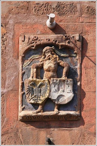
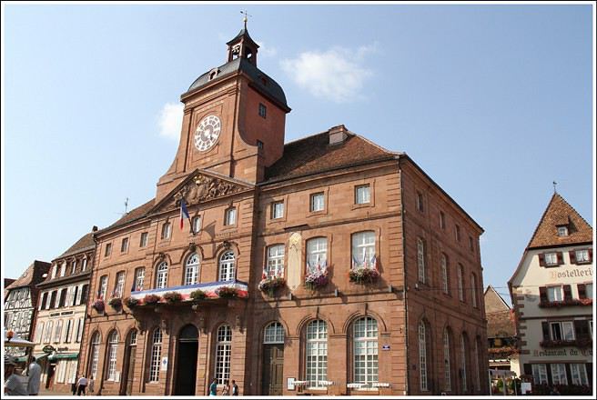


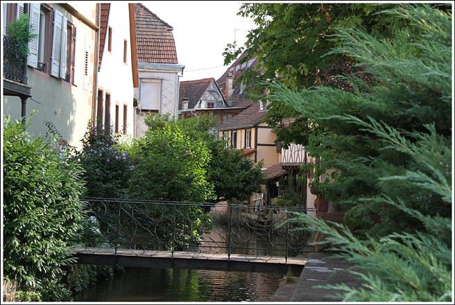
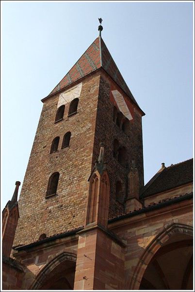
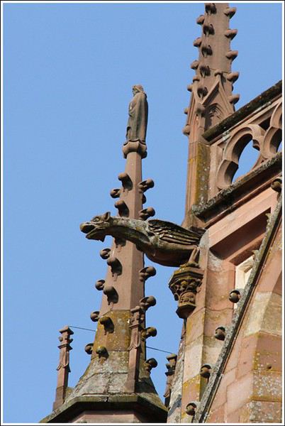
Hills border Alsace along its entire western frontier and also to the north. Countless hikes are possible in these low- and mid-altitude forests, where you can find chanterelles, sheep’s head mushrooms, and blueberries. Here’s a typical view taken above Wissembourg, near the Pigeonnier Pass:
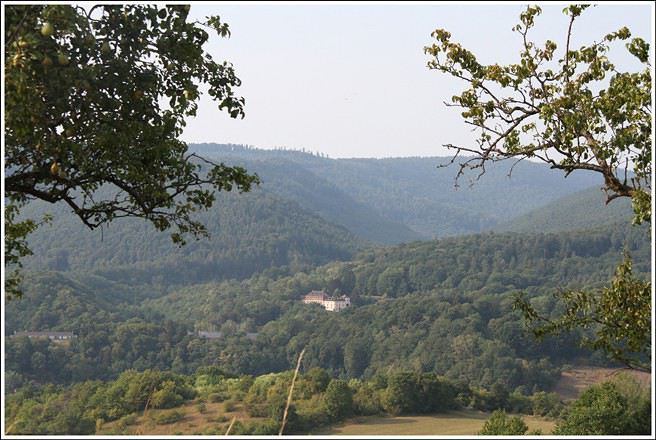
Some of you may have heard about the legendary charm of Alsace, this small region in eastern France, right next to Germany. For those who want to visit, we’re offering this journal. While it’s not exhaustive, it covers many of the most interesting sites, and we’d love to help make your trip a success—or maybe even inspire you to take a trip there.
Introduction
" HOW BEAU-TI-FUL OUR ALSACE IS WITH ITS FRESH VALLEYS IN SUMMER, IT RI-PENS THERE WHEAT, VINES, AND HOPS "
This is the start of a little tune our elementary school teacher used to make us sing in class. That was last century. This refrain and its melody have stayed in my heart because they perfectly capture this region. I know many tourists dream of the Christmas market and the magical snowy landscapes, which makes sense, especially for visitors from the south or those with young kids. As for me, I’d recommend visiting between June and September because everything is so much more pleasant and enjoyable during the warm season.
Alsace is a mix of German organization and French art de vivre. The result? A place beautifully shaped by nature, thoughtfully developed by people, and packed with exceptional restaurants and bakeries. Plus, tourists are generally welcomed with courtesy and expertise.
The heart of the region’s tourism lies between Strasbourg and Colmar, spanning the Haut-Rhin and Bas-Rhin departments. To the west of these cities, often on the slopes between the plain and the hills, winds the famous Wine Route. From north to south, it stretches about 150 to 170 kilometers. A proper visit to Alsace takes about five days to a week—or longer if you’re really into it. I think having a car is best, as the terrain isn’t flat.
Let’s start with northern Alsace, which is less known to tourists—except for the Germans, who love strolling around and enjoying good food there.
Wissembourg sits on the border with Germany, at the very north of the Bas-Rhin, about 60 km from Strasbourg. The tourist office has set up signs near the large free parking lot, so you can take a pleasant walk through this small town. Highlights include the Saint-Pierre Saint-Paul Church (the second-largest in Alsace), the 1741 town hall, the Salt House with its unusual roof, the ramparts, and some fascinating old houses.
Hills border Alsace along its entire western frontier and also to the north. Countless hikes are possible in these low- and mid-altitude forests, where you can find chanterelles, sheep’s head mushrooms, and blueberries. Here’s a typical view taken above Wissembourg, near the Pigeonnier Pass:
I hope this travel journal might interest some people, but since we were completely self-sufficient (tent, sleeping bag, pot, cooking over a wood fire…) almost every day, I don’t have many hotel addresses or great restaurant tips to share! Sorry!
We used the Maio map at 1:50,000 scale. It’s part of the Boa Vista/Sal/Maio map. Bought on Amazon, but currently unavailable as of the latest news.
The people of Maio are extremely welcoming and warm, and we were always more than well received in the villages where we pitched our tent!
We’re usually big hikers, but since Maio is a beach island (gorgeous ones, at that!), we alternated a few hours of walking in the morning with some relaxation in the afternoon: beach, reading, fishing, resting…
1 euro = 110 escudos
Day 1 (Friday) Transfers by plane: Fogo-Praia-Maio We opted for the plane to save some time on transfers, as the boat connections between Fogo and Praia take a while, and those between Praia and Maio are almost nonexistent.
You should budget around 40-50 euros per flight per person.
There are 2 flights per week between Praia and Maio—on Tuesdays and Fridays when we were there (January 2016), but currently on Mondays and Fridays.
Tickets were booked directly and without issue on the TACV website: https://flytacv.com/?lang=en
A bit of a delay leaving Praia, but we arrived on Maio without any problems around 4 PM.
We took an *aluguer* (shared transport, 200 escudos per person) to the center of Vila do Maio, but it’s totally doable on foot with a backpack.
Since it was already a bit late, for this first night, we dropped our bags at Big Game Maio. A standard European-style hotel run by a very nice Italian family. It’s a bit pricey for us (5500 escudos for 2 people with breakfast), but after our 2 weeks in a tent on Fogo, we were happy to find a little comfort. And the breakfast is ultra-generous, with fresh products (cured ham, fruit, cheese, bread) and top quality. The hotel restaurant offers dishes that are a clever mix of Italian and Cape Verdean cuisine. Excellent!
Little tip: We didn’t try it, but Big Game Maio offers big-game fishing trips, diving, and quad rentals.
The hotel is 2 minutes from Vila’s beautiful beach, and we went for a dip at sunset and took a stroll around town. They’re redeveloping the waterfront with pretty sidewalks and light stone walls.
 Vila beach
 Sunset behind Santiago

Day 2 (Saturday): rest day + fishing After 2 weeks of hiking and since Vila is such a peaceful place where it’s nice to take your time, we decided to spend an extra day there. We took the path heading south along the coast to reach Ponta Preta beach in 20 minutes. The path isn’t very pretty because there’s quite a bit of construction going on, which prevents you from really walking along the shore. Lots of real estate agencies, especially Italian ones, have taken over the land. But Ponta Preta beach is a stunning black-sand beach where we had the whole place to ourselves. We decided to go fishing from the rocks.
At 1 PM, the sun was blazing, so we headed back to Vila and dried the fish for the following days.
At 6 PM, we went fishing again, but this time at night from the rocks at the end of Vila beach.
8:30 PM: back to shower and eat at the restaurant.
 The rocks and sea at Ponta Preta
Day 3 (Sunday): from Vila do Maio to Calheta de Baixo, via Monte Batalha (path 101) Hiking time: 5h Since there aren’t many “summits” on Maio, we decided to head to Calheta de Baixo but via Monte Batalha. We left at 8:20 AM and somehow made it to Monte Batalha by 11 AM (2h40 of hiking). But the path is really hard to find in the middle of the dry grass and acacia trees. We kind of cut through randomly, aiming for the summit. Even though it’s not very high (around 300 m), the view is amazing—you can see all of Maio at 360°!
Short 30-minute break. The descent through the “forest” of acacias is even worse for finding your way. We oriented ourselves a bit by the sun to find the road connecting Vila to Calheta. We arrived around 1:30 PM at Calheta de Baixo. A very pretty little seaside village with colorful houses. An idyllic beach, a newly renovated square, and super-friendly people. We pitched our tent facing the sea on the terrace of an abandoned house (after asking the locals for permission).
We cooked some of the dried fish we’d caught the day before, along with fresh beans we’d brought from Fogo (and were still carrying!).
 At the summit of Monte Batalha
 Calheta
 Calheta de Baixo
Day 4 (Monday): From Calheta de Baixo to Morrinho on foot. Hiking time: 3h. Then hitching a bus to Cascabulho, and a car to Pedro Vaz. We left around 9:30 AM heading north (path 201), following the coastline where the beaches just keep coming—each one wilder and more beautiful than the last: Praia de Soca, Calheta Braca, Ponta de Pau Seco, Calhetina. We reached the dunes of Baia de Santana. There’s no real path, so you have to follow the coast, then go around the dunes, and when you spot the 3 coconut trees, head east toward them to find the track leading to Morrinho. Again, we discovered a village with a Wild West vibe, with colorful houses lined up on either side of a paved road. Just enough time to accept a drink offered by a local before jumping onto the passing school bus that took us to Cascabulho. There, we waited for a ride. A political delegation of 10 cars drove right past us without stopping. Luckily, one of the cars had a flat tire and came by 30 minutes later—and that one, thankfully, gave us a lift! They were heading to the inauguration of a water pump in Pedro Vaz. So that’s where we stopped too. After getting permission from the school principal, we pitched our tent in front of the village school… and became the attraction for all the kids who kept us company until nightfall! A woman gave us 2 jugs of water, but with all that company, it was tough to take a peaceful shower!!
Dinner: pasta with beans.
We were woken up by rain during the night and had to rush to bring all our stuff inside the tent!

 The beaches just keep coming...
 The dunes
 The 3 coconut trees, a landmark to find the track
Day 5 (Tuesday): Rest day and fishing at Boca da Ribeira beach We packed up at 8 AM because the kids had school. We filled the 2 water jugs that the woman lent us and headed down to camp at Boca da Ribeira beach, which is a bit further east of Pedro Vaz. It took less than an hour to get there. This time, we really were alone in the world! We pitched the tent and spent the day fishing, reading, playing, and swimming regularly because the sun was beating down hard!!! We caught a nice fish that we grilled over the fire in the evening. With the crabs and shellfish we gathered, we made a seafood rice! Yum! What a feast!
That night, once the tent was zipped up, we felt something like rain on the tent fabric. I decided to go out and gather our things, and then—shock!!! It wasn’t raindrops we were feeling and hearing, but bugs attracted by the light!! Not just a few bugs—a huge swarm of them!!! Thousands of bugs covering the whole tent, the ropes, slipping into the seams and hems! Everywhere! The blue tent had turned green!!! After that, it was a real struggle to get back inside without letting any in! A real challenge, and there were always 3 or 4 that managed to sneak in anyway. Total war!!!
 Boca da Ribeira beach

Day 6 (Wednesday): From Boca da Ribeira to Ribeira Dom João. Hiking time: 3h30 We woke up leisurely and waited for the sun to dry our things, damp from the dew. A man passed by, and we gave him the water jugs we’d borrowed, which saved us a trip back to Pedro Vaz to return them to the woman.
We left around 10 AM. We followed the sea to Alcatraz, then headed toward Pilão Cão. The path runs alongside the small hills on our right, and we passed above Lagoa Cimidor. The terrain is arid, and the path is hard to find among the many goat tracks.
After 3h30 of hiking, we reached Ribeira Dom João with 2 young people we’d met along the way.
Since it was a public holiday in Cape Verde, the kids didn’t have school, and with the principal’s permission, we pitched our tent in the kindergarten. She even kindly opened the school toilets for us. The neighbor gave us the water we needed to wash up and cook. We cooked beef steaks on charcoal. A nice change from fish!! Charcoal is a widespread artisanal product on the island. People almost never cook directly over wood but always with these big chunks of charcoal.
 The hills on our right
 Ribeira Dom João
Day 7 (Thursday): From Ribeira Dom João to Vila do Maio. Hiking time: 3h30 We woke up at 6:30 AM to clear out of the school by 8 AM. The neighbor made us coffee to save time. It took us 2 hours to reach Barreiro, another Wild West-style town! Since we didn’t want to walk on the road, we took the old track and reached Vila do Maio in 1h30.
Last night before taking the plane back to Praia the next day.
 Barreiro
 The old track
 The church in Vila do Maio
That’s where this trip ends!
Maio is truly a magical island! A remote, isolated place with incredible, wild beaches and villages with a Wild West feel—colorful houses on either side of well-paved, well-maintained, and decorated streets. And the locals are so warm and welcoming.
Even for hikers like us, it was a great discovery, and we were able to alternate hiking and relaxation with great pleasure! Too bad the area around Vila do Maio is being overrun by real estate construction—ongoing, unfinished, abandoned…
Safe travels to all!
We used the Maio map at 1:50,000 scale. It’s part of the Boa Vista/Sal/Maio map. Bought on Amazon, but currently unavailable as of the latest news.
The people of Maio are extremely welcoming and warm, and we were always more than well received in the villages where we pitched our tent!
We’re usually big hikers, but since Maio is a beach island (gorgeous ones, at that!), we alternated a few hours of walking in the morning with some relaxation in the afternoon: beach, reading, fishing, resting…
1 euro = 110 escudos
Day 1 (Friday) Transfers by plane: Fogo-Praia-Maio We opted for the plane to save some time on transfers, as the boat connections between Fogo and Praia take a while, and those between Praia and Maio are almost nonexistent.
You should budget around 40-50 euros per flight per person.
There are 2 flights per week between Praia and Maio—on Tuesdays and Fridays when we were there (January 2016), but currently on Mondays and Fridays.
Tickets were booked directly and without issue on the TACV website: https://flytacv.com/?lang=en
A bit of a delay leaving Praia, but we arrived on Maio without any problems around 4 PM.
We took an *aluguer* (shared transport, 200 escudos per person) to the center of Vila do Maio, but it’s totally doable on foot with a backpack.
Since it was already a bit late, for this first night, we dropped our bags at Big Game Maio. A standard European-style hotel run by a very nice Italian family. It’s a bit pricey for us (5500 escudos for 2 people with breakfast), but after our 2 weeks in a tent on Fogo, we were happy to find a little comfort. And the breakfast is ultra-generous, with fresh products (cured ham, fruit, cheese, bread) and top quality. The hotel restaurant offers dishes that are a clever mix of Italian and Cape Verdean cuisine. Excellent!
Little tip: We didn’t try it, but Big Game Maio offers big-game fishing trips, diving, and quad rentals.
The hotel is 2 minutes from Vila’s beautiful beach, and we went for a dip at sunset and took a stroll around town. They’re redeveloping the waterfront with pretty sidewalks and light stone walls.
Vila beach
Sunset behind SantiagoDay 2 (Saturday): rest day + fishing After 2 weeks of hiking and since Vila is such a peaceful place where it’s nice to take your time, we decided to spend an extra day there. We took the path heading south along the coast to reach Ponta Preta beach in 20 minutes. The path isn’t very pretty because there’s quite a bit of construction going on, which prevents you from really walking along the shore. Lots of real estate agencies, especially Italian ones, have taken over the land. But Ponta Preta beach is a stunning black-sand beach where we had the whole place to ourselves. We decided to go fishing from the rocks.
At 1 PM, the sun was blazing, so we headed back to Vila and dried the fish for the following days.
At 6 PM, we went fishing again, but this time at night from the rocks at the end of Vila beach.
8:30 PM: back to shower and eat at the restaurant.
The rocks and sea at Ponta PretaDay 3 (Sunday): from Vila do Maio to Calheta de Baixo, via Monte Batalha (path 101) Hiking time: 5h Since there aren’t many “summits” on Maio, we decided to head to Calheta de Baixo but via Monte Batalha. We left at 8:20 AM and somehow made it to Monte Batalha by 11 AM (2h40 of hiking). But the path is really hard to find in the middle of the dry grass and acacia trees. We kind of cut through randomly, aiming for the summit. Even though it’s not very high (around 300 m), the view is amazing—you can see all of Maio at 360°!
Short 30-minute break. The descent through the “forest” of acacias is even worse for finding your way. We oriented ourselves a bit by the sun to find the road connecting Vila to Calheta. We arrived around 1:30 PM at Calheta de Baixo. A very pretty little seaside village with colorful houses. An idyllic beach, a newly renovated square, and super-friendly people. We pitched our tent facing the sea on the terrace of an abandoned house (after asking the locals for permission).
We cooked some of the dried fish we’d caught the day before, along with fresh beans we’d brought from Fogo (and were still carrying!).
At the summit of Monte Batalha
Calheta
Calheta de BaixoDay 4 (Monday): From Calheta de Baixo to Morrinho on foot. Hiking time: 3h. Then hitching a bus to Cascabulho, and a car to Pedro Vaz. We left around 9:30 AM heading north (path 201), following the coastline where the beaches just keep coming—each one wilder and more beautiful than the last: Praia de Soca, Calheta Braca, Ponta de Pau Seco, Calhetina. We reached the dunes of Baia de Santana. There’s no real path, so you have to follow the coast, then go around the dunes, and when you spot the 3 coconut trees, head east toward them to find the track leading to Morrinho. Again, we discovered a village with a Wild West vibe, with colorful houses lined up on either side of a paved road. Just enough time to accept a drink offered by a local before jumping onto the passing school bus that took us to Cascabulho. There, we waited for a ride. A political delegation of 10 cars drove right past us without stopping. Luckily, one of the cars had a flat tire and came by 30 minutes later—and that one, thankfully, gave us a lift! They were heading to the inauguration of a water pump in Pedro Vaz. So that’s where we stopped too. After getting permission from the school principal, we pitched our tent in front of the village school… and became the attraction for all the kids who kept us company until nightfall! A woman gave us 2 jugs of water, but with all that company, it was tough to take a peaceful shower!!
Dinner: pasta with beans.
We were woken up by rain during the night and had to rush to bring all our stuff inside the tent!
The beaches just keep coming...
The dunes
The 3 coconut trees, a landmark to find the trackDay 5 (Tuesday): Rest day and fishing at Boca da Ribeira beach We packed up at 8 AM because the kids had school. We filled the 2 water jugs that the woman lent us and headed down to camp at Boca da Ribeira beach, which is a bit further east of Pedro Vaz. It took less than an hour to get there. This time, we really were alone in the world! We pitched the tent and spent the day fishing, reading, playing, and swimming regularly because the sun was beating down hard!!! We caught a nice fish that we grilled over the fire in the evening. With the crabs and shellfish we gathered, we made a seafood rice! Yum! What a feast!
That night, once the tent was zipped up, we felt something like rain on the tent fabric. I decided to go out and gather our things, and then—shock!!! It wasn’t raindrops we were feeling and hearing, but bugs attracted by the light!! Not just a few bugs—a huge swarm of them!!! Thousands of bugs covering the whole tent, the ropes, slipping into the seams and hems! Everywhere! The blue tent had turned green!!! After that, it was a real struggle to get back inside without letting any in! A real challenge, and there were always 3 or 4 that managed to sneak in anyway. Total war!!!
Boca da Ribeira beachDay 6 (Wednesday): From Boca da Ribeira to Ribeira Dom João. Hiking time: 3h30 We woke up leisurely and waited for the sun to dry our things, damp from the dew. A man passed by, and we gave him the water jugs we’d borrowed, which saved us a trip back to Pedro Vaz to return them to the woman.
We left around 10 AM. We followed the sea to Alcatraz, then headed toward Pilão Cão. The path runs alongside the small hills on our right, and we passed above Lagoa Cimidor. The terrain is arid, and the path is hard to find among the many goat tracks.
After 3h30 of hiking, we reached Ribeira Dom João with 2 young people we’d met along the way.
Since it was a public holiday in Cape Verde, the kids didn’t have school, and with the principal’s permission, we pitched our tent in the kindergarten. She even kindly opened the school toilets for us. The neighbor gave us the water we needed to wash up and cook. We cooked beef steaks on charcoal. A nice change from fish!! Charcoal is a widespread artisanal product on the island. People almost never cook directly over wood but always with these big chunks of charcoal.
The hills on our right
Ribeira Dom JoãoDay 7 (Thursday): From Ribeira Dom João to Vila do Maio. Hiking time: 3h30 We woke up at 6:30 AM to clear out of the school by 8 AM. The neighbor made us coffee to save time. It took us 2 hours to reach Barreiro, another Wild West-style town! Since we didn’t want to walk on the road, we took the old track and reached Vila do Maio in 1h30.
Last night before taking the plane back to Praia the next day.
Barreiro
The old track
The church in Vila do MaioThat’s where this trip ends!
Maio is truly a magical island! A remote, isolated place with incredible, wild beaches and villages with a Wild West feel—colorful houses on either side of well-paved, well-maintained, and decorated streets. And the locals are so warm and welcoming.
Even for hikers like us, it was a great discovery, and we were able to alternate hiking and relaxation with great pleasure! Too bad the area around Vila do Maio is being overrun by real estate construction—ongoing, unfinished, abandoned…
Safe travels to all!
This trip is a more budget-friendly—and shorter—alternative to the 14-day Aranui 5 cruise, which includes a few days at sea and a detour to Bora Bora in the Leeward Islands on the way back. The advantage of the cruise is that it lets you see and visit (though far too quickly) the two islands of Tahuata and Fatu Hiva, which don’t have airports. By plane, you’ll only be able to land on 4 of the 6 islands. However, Tahuata is accessible from Hiva Oa via a day trip (or two-day trip) shuttle. Plan for two extra days in your total time dedicated to the Marquesas Islands (called *Fenua Enata* in Marquesan language).
Our itinerary is perfect for those who aren’t excited by cruises and prefer to get closer to the local communities. This 9-day trip cost us around 2500 € all-inclusive. For a 14-day cruise on the Aranui, expect to pay 2300 € per person for a basic cabin for four, or 3800 € per person for a superior double cabin.
Air Tahiti offers a 4-island Marquesas Pass (Nuku Hiva, Ua Pou, Ua Huka, and Hiva Oa) for 86,000 XPF (about 700 €). The journey is made on an ATR 72 from Tahiti to Nuku Hiva or Hiva Oa, and on a 19-seat Twin Otter between the islands (often only 13 or 15 seats are available due to cargo, so book well in advance). We’re traveling as a couple. We booked our family-run guesthouse stays at the Tourism Fair in early February, where you can meet the owners and make your choice. Stays are almost always half-board or breakfast-only. Transfers are usually included, but you can always book a car or taxi.
**NUKU HIVA**
**A LITTLE GEOGRAPHY** Nuku Hiva (NH) is located about 1,500 km from Tahiti, in the north of French Polynesia. At 387 km², it’s the second-largest island in French Polynesia after Tahiti. It was formed by incredible volcanic phenomena and cataclysms between 1 and 6 million years ago, which lifted the island thousands of meters above the sea. Even after millennia of slow erosion, collapses, and settling, NH remains the most majestic of the Marquesas, with its sheer cliffs, deep valleys featuring immense waterfalls, and black walls that were once the inner walls of enormous volcanoes.
**A LITTLE HISTORY** The first contact between NH’s inhabitants and Europeans was in 1595 with Spanish navigators who only stayed briefly. It wasn’t until the late 18th century that Europeans arrived in greater numbers on NH (and the other Marquesas Islands), disrupting a very fragile social and cultural balance. It’s believed that nearly 100,000 people lived on Nuku Hiva at that time—a population decimated over the decades by epidemics, diseases brought by Europeans, and alcohol used for barter. The disastrous result: by the 1930s, only 2,500 people remained, having largely lost their identity and living in poverty. Today, the island has about 2,600 inhabitants spread across several villages, with Taiohae as the main one.
**NUKU HIVA IN LITERATURE**
1 / One of the famous writers who visited NH and stayed there was Herman Melville, who arrived in July 1842, the author of *Moby Dick*. The island had just come under French protectorate. Seduced by the enchanting *vahinés* and dazzled by his paradisiacal vision of the place, Melville deserted his ship. He ended up a prisoner of a local tribe, the Taipi, in Taipivai, where he stayed for a month and a half until an Australian ship captain secured his release in exchange for a musket and a roll of cotton fabric! Melville wrote a novel about this tumultuous episode in his life, considered a classic of travel literature. The book, *Typee: A Peep at Polynesian Life*, published in 1846 in the United States, was a huge success.
2 / Another famous Scottish writer, Robert Louis Stevenson, arrived in NH aboard a yacht that anchored in Anaho Bay, the island’s most beautiful, in July 1888. Stevenson was already known for two magnificent novels that marked their era: *Treasure Island* and *Dr. Jekyll & Mr. Hyde*. Stevenson, too, was captivated by the island’s natural beauty, though he also noted the devastating decline in identity, socio-cultural life, and physical health of a population ravaged by disease and alcohol. His account of his stay, *In the South Seas: An Account of Experiences and Observations in the Marquesas, Paumotus, and Gilbert Islands During Two Cruises on the Yacht Casco (1888) and the Schooner Equator (1889)*, was published in 1896 in New York, four years after his death in Apia, Western Samoa, where he had settled. It was also published in London in 1900.
3 / In August 1903, Victor Segalen, a French naval doctor, ethnologist, and archaeologist, landed in NH from the ship *La Durance*, sent to Polynesia to recover the possessions of the painter Paul Gauguin, who had died in April of that year. He, too, was enthralled by the Marquesas but lamented the loss of identity, dignity, and pride of the Māori, alienated by a Christianization that destroyed their culture and customs, denied their gods, and erased their past. He wrote about his experience, doubts, and fears in *Les Immémoriaux*.
4 / In December 1907, Jack London arrived in NH aboard the sailboat *Stark*, following in the footsteps of his illustrious predecessor, Herman Melville. London was in poor physical condition, exhausted from his relentless travels that had taken him from the Klondike in Canada to Japan, Australia, and London in Europe. He was appalled and shocked by Nuku Hiva’s degraded health situation: where Melville had encountered over 2,000 vigorous and healthy Marquesan warriors, London found only 12 suffering from various diseases—the rest had been wiped out by tuberculosis! His approach remained humanistic, and he maintained a sharp geopolitical awareness of these traditional Polynesian cultures, weakened by the inexorable advance of modernity in the early 20th century. He continued his journey to the Tuamotu Islands and Tahiti, publishing *Martin Eden*, the moving account of his initiatory voyage in the South Pacific, in 1911.
5 / Finally, Alain Gerbault, a writer, linguist, ethnologist, and tireless traveler, arrived in the Marquesas via the Panama Canal in December 1933. He was completely exhausted after an endless crossing on a small sailboat, the *Firecrest*. Enthralled by his stay in the Marquesas, he continued to the Tuamotu Islands in 1934, then Tahiti in 1935. Gerbault fought for the preservation of traditions, as well as the songs and dances banned by the Churches and the French Administration (these bans lasted over 50 years, mind you...!!!). Bora Bora remained his favorite island. A staunch Pétainist during World War II, he was forced to flee Bora Bora for Samoa, then Tonga, and finally Timor, a half-Portuguese island and thus neutral during the war. His travel accounts, *In Pursuit of the Sun: Logbook from New York to Tahiti* and *A Paradise Is Dying*, were published in the late 1940s. He died in Timor in 1941, and his ashes were repatriated to Bora Bora.
Back to our trip and stay.
**Day 1: April 27**
Departure from Papeete at 6:30 AM—we had to wake up two hours earlier and reach the airport in the dark. Takeoff at dawn, good weather en route, flight duration: 4 hours.
Arrival around 10:30 AM in Nuku Hiva, the first stop of this trip. We booked two nights in half-board at Pension Koku’u, transfers included. Maybe not such a great idea, those included transfers, especially on this unique island where the airport is located on *Terre Déserte*, on the other side of the mountain, opposite and about 45 km from the main village of Taiohae. They’re charged at a steep price. Expect 6,000 XPF round-trip by taxi, but 15,000 XPF charged by guesthouses or hotels. The difference is notable. It wasn’t the best idea, but we can’t go back. Even for residents like us who know how to travel in Polynesia, the Air Tahiti employee who sold me the Pass couldn’t give any useful advice about the stay itself—probably because he’d never been to the Marquesas. It’s really annoying! In short, the good idea to remember is renting a car (like a Suzuki) to be free to manage your time and stop at leisure. The road signage is a bit basic, but you’ll manage just fine. Our host Alvane waits for us—without a sign (sic!)—and after searching for each other for 5 minutes, we’re off on a journey of over an hour (with photo stops) in a Land Rover with smooth tires (luckily, it’s not raining!). The recently paved and marked mountain road is impeccable. No time to catch our breath at the guesthouse; we leave immediately (not a great idea after waking up at dawn plus 4 hours on a plane) for a half-day hike that was also included in the prepaid stay. A sandwich was provided (really pathetic for the physical effort required), we have water, and we fill a few bottles at the spring near the ceremonial site of Taipivai, our first stop. Then the hike begins in the Hanaheu Valley, descending toward Anaho Bay and its namesake beach. A magnificent and wild spot, a few sailboats anchored, we swim—the water is really warm, over 30°C at the shore. That warm is rare and not necessarily pleasant. We then have to climb a very steep slope; this hike is actually quite tough. The air is still, humid, and stifling under the foliage, there’s a bit of mud, and tiny ants (which don’t bite, I’ll have you know), locally called *fofolles*, running over shoes, ankles, and calves. Not very pleasant...! On top of that, there are mosquitoes to protect against! In hindsight, it seems wise to bring energy bars from Papeete if you plan to hike on the afternoon of your arrival day. We weren’t careful... Result: a moment of weakness for me and a hyperventilation attack climbing back up from Anaho Bay!!! We return to the guesthouse at night. There we find Claudine and her four children—Marquesan-style atmosphere, friendly and casual. We share family life. Very simple room with a bathroom, no mosquitoes, we can sleep with the window open, but the night will be noisy, as is often the case in Polynesia. Roosters are everywhere and don’t sleep, dogs bark or whine. So we end up waking up early... like everyone else.
**Day 2: April 28**
We booked a full-day excursion with Thierry: it starts with a 45-minute boat ride to reach Hakatea Beach, hidden in a small secret bay like many along Nuku Hiva’s coasts. From there, the hike lasts all day—11 km round-trip on flat but also rugged terrain (ancient paved and elevated paths over 1,000 years old)—and river crossings. Bring the right shoes (like plastic Crocs with high socks—not very stylish but practical). We cross the former village of Hakaui, walk along the foundations of dwellings, and there are still weathered tikis in the lush vegetation. The ultimate goal of this hike is to reach the tall Vaipo waterfall. The place is magical, with openings in the vegetation and immense trees allowing photos of the treetops and caves where funeral canoes containing the bones of chiefs or great warriors were once placed. We return the same way to the beach and take another boat ride to reach Taihoae’s port. Back at the guesthouse after a glimpse of Taihoae’s waterfront.
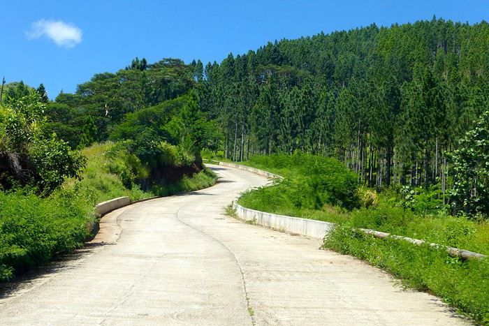
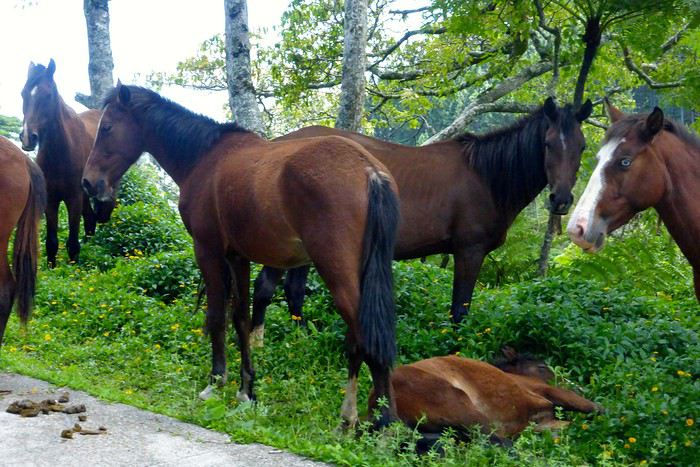
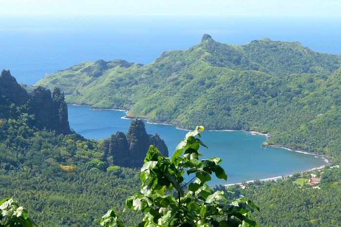
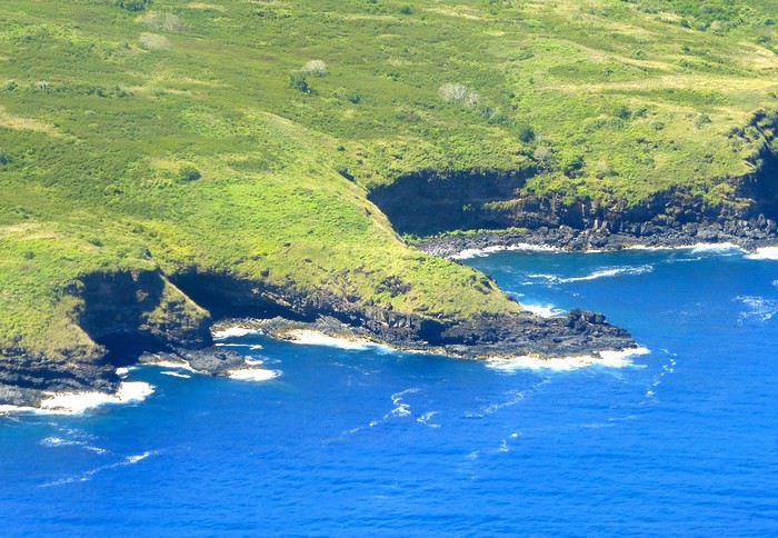
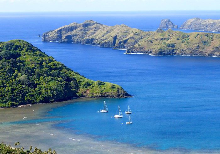
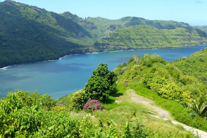
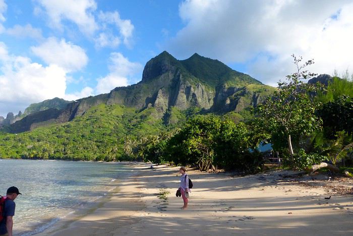
**UA POU**
**Day 3: April 29**
Back to the airport in the late morning for the second flight of the trip to Ua Pou. 20-minute crossing in a Twin Otter (18 seats but only 13 occupied due to cargo between the islands). Beautiful weather, blue sea, nice photos to take upon departure from NH and arrival in UP. We’re greeted by Jérôme, a former military man turned tourism professional, who runs Pension Pukue’e with his wife Elisa, a native of UP. We’re in for two exceptional days. The guesthouse is comfortable, Jérôme and Elisa are very professional and pleasant. Jérôme is also a professional hiker, and Elisa is an excellent cook. We leave quickly for a half-day excursion to Hohoi, after a stop at the archaeological, cultural, and religious site of Maui’a, the Tavaka tribe’s territory. Jérôme is there to explain how Marquesan society functioned at the time and the events that took place on a site still largely buried under vegetation. Then we visit a flower-stone sculptor he knows—the only place in the Marquesas where you’ll find these stones. They’re collected in the river flowing into the sea at Hohoi, sometimes on the beach itself. Back to the guesthouse.
**Day 4: April 30**
A nature hike in the mountains—moderately difficult—toward the Vaiea waterfall is on our program for a good 4 hours. It’s hot, there are mosquitoes, and the dip in the pool under the waterfall (24°C water) is a rare pleasure. Lunch at a friend of Jérôme’s, a former chef for French minister François Fillon, who prepares delicious food. Elisa picks us up by car to return to the guesthouse. Ua Pou is a beautiful and elegant island with its sharp peaks and wild nature. Our favorite, thanks to Jérôme and his wife.
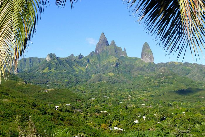
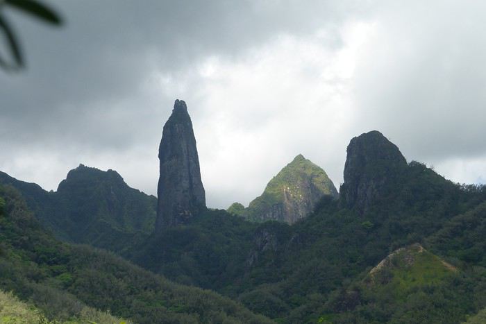
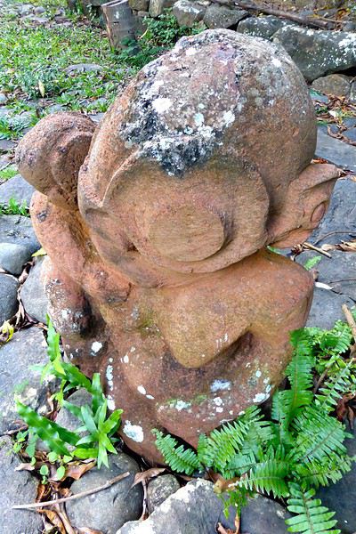
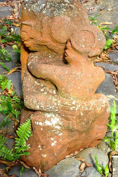
**UA HUKA**
**Day 4: May 1**
Departure for Ua Huka, the smallest inhabited island in the northern group of the Marquesas, located about 1,300 km northeast of Tahiti. Landing is at the oldest airfield in the Marquesas, built in 1972, between the villages of Vaipaee and Hane. Ua Huka has about 680 inhabitants, according to the last census, spread across 3 villages (since the 1870s): Vaipaee, Hane, and Hokatu. The island peaks at Mount Hitikau at only 884 meters. Its origin: a Hawaiian-type shield volcano that—over a few million years—collapsed to become a caldera (or elliptical depression) in which two small volcanoes appeared, the craters of Tahoatikiau and Teepoepo, now part of the Vaikivi Park. The island is rugged and wild, lower than the others, so less cloud-covered and drier. The bays are jagged, the coastline in ochre tones above the intense blue of the sea, and the beaches are constantly disturbed by the powerful surf. The village of Hokatu is only a few kilometers away (just 14 km of road on the island), but Maurice, our host, drives slowly, and it takes time to go up and down. The road is entirely paved or concreted, which isn’t the case on Ua Pou, for example. The guesthouse is disappointing, perched above the village and thus isolated. Beautiful view of the famous Hane motu and the sparkling sea under the bright sun. Apart from that, there are mosquitoes and cockroaches, the bungalow isn’t clean. Meals are taken with Maurice and Delphine in the village—fine dining isn’t on the menu! Ouch!!! We didn’t luck out...
**Day 5: May 2**
Early in the morning, after breakfast, Delphine takes us to the craft center, which turns out to be a letdown—the items for sale are, in my opinion, crude and poorly carved. Nothing like what’s offered at the Marquesas Fair, held twice a year in Papeete, where you can admire and buy small wonders: wood carvings, flower stone, and coral. Delphine is disappointed we’re not interested, and it shows... She’s a bit sulky! These are items meant for Aranui cruise passengers who land on Ua Huka once every two weeks... Solo travelers like us don’t seem to interest her much. The rest of the day—spent with Maurice—is dedicated to visiting cultural centers and small museums, like the Sea Museum in Hane with its ancient canoes, the municipal archaeological museum on the Te Tumu site above the airfield, the petroglyph house near Hokatu Beach, and finally the Papuakeikaraa arboretum, which gathers endemic plants from all over Polynesia and an impressive citrus collection. No excursion planned to Vaikivi Park, toward the previously mentioned craters that recall the island’s volcanic past. Also missing are the viewpoints, the unique endemic vegetation, and especially the petroglyphs. Too bad... at that price!!! Still, in the evening, we go fishing—with sandwiches and drinks in coolers—with other villagers from the dock at the end of the paved road. It’s cool, windy, no mosquitoes, lots of fish caught, and a great atmosphere. Plus, magnificently starry skies.
Ua Huka is one of the rare islands not invaded by the black rat, which has preserved its birdlife, particularly the ultramarine lorikeet (or *pihiti* in Marquesan), which feeds almost exclusively on flower nectar (banana, coconut, hibiscus, mango, guava trees). A dog imported from New Zealand has been specially trained to detect rats: it inspects cargo unloaded from boats and the docks.
I recommend spending two full days on the island—one for visiting the various museums, the other for hiking in the island’s center park, where the archaeological sites are in their raw state: foundations of agricultural terrace walls, gathering places (or *tohua*), dwelling pavements (or *paepae*), sacred sites (or *me’ae* in Marquesan, *marae* in Tahitian) with their tikis and petroglyphs.
To finish, a bit of info on the island’s name, tied to Marquesan oral culture: according to the legend of the creation of the six Marquesas Islands, Ua Huka is the one that puts the finishing touch on the construction of the god Oatea’s house, each island having a defined architectural function. Ua Huka represents the hole (*ua*) where the god deposits what’s left (*huka* in Marquesan) of the unused materials during construction.
**HIVA OA**
**Day 6: May 3**
Departure in the late morning for Hiva Oa. Maurice—who had other things to do—dropped us off at the airfield 3 hours early... so this stop is a bit of a flop, even if we decided to stay positive! Hiva Oa is the third-largest island in French Polynesia after Tahiti and Nuku Hiva, and before Raiatea in the Leeward Islands. The island is beautiful, lush, verdant, and jagged. The mountains soar into the sky, the sea views are grand, the light is sublime—we’re lucky. Beautiful weather. Tania from Pension Kanahau waits for us at the airport. We’re in for two wonderful days with her. Tania is welcoming, smiling, and dynamic. What a pleasure to be with her, at her place—she cooks divinely and serves the best tuna in the world (the Big Eye reserved for the Japanese) and croquettes made with lobster, shrimp, and crab with breadfruit cubes, for example. Comfortable bungalow, no mosquitoes at night, we can sleep with the window open. It’s fantastic! After settling in, Tania takes us to town in Atuona, a pleasant and well-laid-out little village. We start with lunch—a delicious raw fish in coconut milk—then continue with the must-see attractions: the Catholic cemetery where Paul Gauguin and Jacques Brel’s graves are, overlooking the town; the abandoned Protestant cemetery, reclaimed by the bush, with impressive Marquesan warrior tombs made of huge coral slabs and adorned with a tiki head (harder to find, as no one goes there... ask for directions!); the craft center; the Gauguin Museum (and the Jacques Brel Museum); and the waterfront. While we stroll peacefully, Tania organizes an excursion for the next day, May 4, a full day with Pifa O’Connor, a 36-year-old who knows his island inside out, is passionate about local history, and with whom we’ll hit it off.
**Day 7: May 4**
Pifa arrives at 8 AM sharp at the guesthouse, and we immediately buy sandwiches and water at a small supermarket in Atuona. First, we make a brief stop by the roadside at an unmarked spot, from which we descend a small path through dense vegetation leading to the famous smiling tiki—the only one of its kind in the Marquesas and Polynesia. The place is improbable, the tiki isn’t huge, but it’s beautiful and impressive. Then we’re off on the road that, dizzyingly, runs along and overlooks the island’s northern coast, at the edge of the ancient volcano. Few vehicles pass, the road—now a rocky track—is full of potholes, and we proceed slowly. (Note that this road has been fully paved since 2018.) The panoramas are majestic, with every shade of green against the blue sea. We stop again at the top of a cliff adorned with a huge stone, the *sacrifice stone*, from which young virgin girls were once thrown into the sea to appease angry gods. Another pause for lunch this time, at a small restaurant near the exceptional archaeological site of Puamau. We’ll experience the highlights of this trip during this excursion with our guide, Pifa, who spares no explanations. We discover, on a vast esplanade, the ceremonial complexes of Ta’a Oa and Meae Te I’Ipona, the latter featuring superb tikis, particularly the reclining tiki—or *Maki Taua Pepe*—representing Motherhood, a woman giving birth in a squatting position, as was often the case in many civilizations. Also notable is the *Takaii*, the largest tiki recorded in Polynesia to date. There’s also a huge stone with a now-blunt edge, on which the circumcision of chiefs’ and notables’ pre-adolescent sons was performed. A tough ordeal! But that’s not all! It seems there are more on the mountainside rising steeply behind the archaeological site—overturned tikis, platforms, and, apparently, a giant tiki at the top, which must have fallen but was visible from afar on the sea 30 or 40 years ago, according to the island’s elders. This meeting, worship, and living place—it was actually a small town—is immense. Thousands of people once lived in this part of the island. The site—a religious, social, and cultural sanctuary—would be the size of the largest Mayan sites in Yucatán, but the few concerned owners—two or three families who own the mountainside—don’t want to hear about intensive clearing or tree cutting for now. UNESCO rightly asks for some compliance efforts to grant special treatment to Hiva Oa in particular and the Marquesas in general. We’re not there yet, unfortunately, due to insurmountable local rigidities! This kind of attitude is quite typical in Polynesia: people are afraid to uncover *marae* buried under vegetation—they’re taboo and sometimes said to emit negative and deadly waves, so it’s better not to disturb or anger the ancient spirits or gods who might take revenge. The old religion is never far away in Polynesia, despite the successes of the missionaries.
We return to the guesthouse in the late afternoon. Last night in the Marquesas with Tania, who prepares a fine and delicious meal. Note that dinner costs 2,500 XPF per person.
**Day 8: May 5**
We take the plane as planned, via Nuku Hiva (short stopover). Arrival on time in Papeete.
May this travel journal inspire many of you to visit the Marquesas one day. It’s far, it’s expensive, it’s the trip of a lifetime—it’s unforgettable and unmissable.
Our itinerary is perfect for those who aren’t excited by cruises and prefer to get closer to the local communities. This 9-day trip cost us around 2500 € all-inclusive. For a 14-day cruise on the Aranui, expect to pay 2300 € per person for a basic cabin for four, or 3800 € per person for a superior double cabin.
Air Tahiti offers a 4-island Marquesas Pass (Nuku Hiva, Ua Pou, Ua Huka, and Hiva Oa) for 86,000 XPF (about 700 €). The journey is made on an ATR 72 from Tahiti to Nuku Hiva or Hiva Oa, and on a 19-seat Twin Otter between the islands (often only 13 or 15 seats are available due to cargo, so book well in advance). We’re traveling as a couple. We booked our family-run guesthouse stays at the Tourism Fair in early February, where you can meet the owners and make your choice. Stays are almost always half-board or breakfast-only. Transfers are usually included, but you can always book a car or taxi.
**NUKU HIVA**
**A LITTLE GEOGRAPHY** Nuku Hiva (NH) is located about 1,500 km from Tahiti, in the north of French Polynesia. At 387 km², it’s the second-largest island in French Polynesia after Tahiti. It was formed by incredible volcanic phenomena and cataclysms between 1 and 6 million years ago, which lifted the island thousands of meters above the sea. Even after millennia of slow erosion, collapses, and settling, NH remains the most majestic of the Marquesas, with its sheer cliffs, deep valleys featuring immense waterfalls, and black walls that were once the inner walls of enormous volcanoes.
**A LITTLE HISTORY** The first contact between NH’s inhabitants and Europeans was in 1595 with Spanish navigators who only stayed briefly. It wasn’t until the late 18th century that Europeans arrived in greater numbers on NH (and the other Marquesas Islands), disrupting a very fragile social and cultural balance. It’s believed that nearly 100,000 people lived on Nuku Hiva at that time—a population decimated over the decades by epidemics, diseases brought by Europeans, and alcohol used for barter. The disastrous result: by the 1930s, only 2,500 people remained, having largely lost their identity and living in poverty. Today, the island has about 2,600 inhabitants spread across several villages, with Taiohae as the main one.
**NUKU HIVA IN LITERATURE**
1 / One of the famous writers who visited NH and stayed there was Herman Melville, who arrived in July 1842, the author of *Moby Dick*. The island had just come under French protectorate. Seduced by the enchanting *vahinés* and dazzled by his paradisiacal vision of the place, Melville deserted his ship. He ended up a prisoner of a local tribe, the Taipi, in Taipivai, where he stayed for a month and a half until an Australian ship captain secured his release in exchange for a musket and a roll of cotton fabric! Melville wrote a novel about this tumultuous episode in his life, considered a classic of travel literature. The book, *Typee: A Peep at Polynesian Life*, published in 1846 in the United States, was a huge success.
2 / Another famous Scottish writer, Robert Louis Stevenson, arrived in NH aboard a yacht that anchored in Anaho Bay, the island’s most beautiful, in July 1888. Stevenson was already known for two magnificent novels that marked their era: *Treasure Island* and *Dr. Jekyll & Mr. Hyde*. Stevenson, too, was captivated by the island’s natural beauty, though he also noted the devastating decline in identity, socio-cultural life, and physical health of a population ravaged by disease and alcohol. His account of his stay, *In the South Seas: An Account of Experiences and Observations in the Marquesas, Paumotus, and Gilbert Islands During Two Cruises on the Yacht Casco (1888) and the Schooner Equator (1889)*, was published in 1896 in New York, four years after his death in Apia, Western Samoa, where he had settled. It was also published in London in 1900.
3 / In August 1903, Victor Segalen, a French naval doctor, ethnologist, and archaeologist, landed in NH from the ship *La Durance*, sent to Polynesia to recover the possessions of the painter Paul Gauguin, who had died in April of that year. He, too, was enthralled by the Marquesas but lamented the loss of identity, dignity, and pride of the Māori, alienated by a Christianization that destroyed their culture and customs, denied their gods, and erased their past. He wrote about his experience, doubts, and fears in *Les Immémoriaux*.
4 / In December 1907, Jack London arrived in NH aboard the sailboat *Stark*, following in the footsteps of his illustrious predecessor, Herman Melville. London was in poor physical condition, exhausted from his relentless travels that had taken him from the Klondike in Canada to Japan, Australia, and London in Europe. He was appalled and shocked by Nuku Hiva’s degraded health situation: where Melville had encountered over 2,000 vigorous and healthy Marquesan warriors, London found only 12 suffering from various diseases—the rest had been wiped out by tuberculosis! His approach remained humanistic, and he maintained a sharp geopolitical awareness of these traditional Polynesian cultures, weakened by the inexorable advance of modernity in the early 20th century. He continued his journey to the Tuamotu Islands and Tahiti, publishing *Martin Eden*, the moving account of his initiatory voyage in the South Pacific, in 1911.
5 / Finally, Alain Gerbault, a writer, linguist, ethnologist, and tireless traveler, arrived in the Marquesas via the Panama Canal in December 1933. He was completely exhausted after an endless crossing on a small sailboat, the *Firecrest*. Enthralled by his stay in the Marquesas, he continued to the Tuamotu Islands in 1934, then Tahiti in 1935. Gerbault fought for the preservation of traditions, as well as the songs and dances banned by the Churches and the French Administration (these bans lasted over 50 years, mind you...!!!). Bora Bora remained his favorite island. A staunch Pétainist during World War II, he was forced to flee Bora Bora for Samoa, then Tonga, and finally Timor, a half-Portuguese island and thus neutral during the war. His travel accounts, *In Pursuit of the Sun: Logbook from New York to Tahiti* and *A Paradise Is Dying*, were published in the late 1940s. He died in Timor in 1941, and his ashes were repatriated to Bora Bora.
Back to our trip and stay.
**Day 1: April 27**
Departure from Papeete at 6:30 AM—we had to wake up two hours earlier and reach the airport in the dark. Takeoff at dawn, good weather en route, flight duration: 4 hours.
Arrival around 10:30 AM in Nuku Hiva, the first stop of this trip. We booked two nights in half-board at Pension Koku’u, transfers included. Maybe not such a great idea, those included transfers, especially on this unique island where the airport is located on *Terre Déserte*, on the other side of the mountain, opposite and about 45 km from the main village of Taiohae. They’re charged at a steep price. Expect 6,000 XPF round-trip by taxi, but 15,000 XPF charged by guesthouses or hotels. The difference is notable. It wasn’t the best idea, but we can’t go back. Even for residents like us who know how to travel in Polynesia, the Air Tahiti employee who sold me the Pass couldn’t give any useful advice about the stay itself—probably because he’d never been to the Marquesas. It’s really annoying! In short, the good idea to remember is renting a car (like a Suzuki) to be free to manage your time and stop at leisure. The road signage is a bit basic, but you’ll manage just fine. Our host Alvane waits for us—without a sign (sic!)—and after searching for each other for 5 minutes, we’re off on a journey of over an hour (with photo stops) in a Land Rover with smooth tires (luckily, it’s not raining!). The recently paved and marked mountain road is impeccable. No time to catch our breath at the guesthouse; we leave immediately (not a great idea after waking up at dawn plus 4 hours on a plane) for a half-day hike that was also included in the prepaid stay. A sandwich was provided (really pathetic for the physical effort required), we have water, and we fill a few bottles at the spring near the ceremonial site of Taipivai, our first stop. Then the hike begins in the Hanaheu Valley, descending toward Anaho Bay and its namesake beach. A magnificent and wild spot, a few sailboats anchored, we swim—the water is really warm, over 30°C at the shore. That warm is rare and not necessarily pleasant. We then have to climb a very steep slope; this hike is actually quite tough. The air is still, humid, and stifling under the foliage, there’s a bit of mud, and tiny ants (which don’t bite, I’ll have you know), locally called *fofolles*, running over shoes, ankles, and calves. Not very pleasant...! On top of that, there are mosquitoes to protect against! In hindsight, it seems wise to bring energy bars from Papeete if you plan to hike on the afternoon of your arrival day. We weren’t careful... Result: a moment of weakness for me and a hyperventilation attack climbing back up from Anaho Bay!!! We return to the guesthouse at night. There we find Claudine and her four children—Marquesan-style atmosphere, friendly and casual. We share family life. Very simple room with a bathroom, no mosquitoes, we can sleep with the window open, but the night will be noisy, as is often the case in Polynesia. Roosters are everywhere and don’t sleep, dogs bark or whine. So we end up waking up early... like everyone else.
**Day 2: April 28**
We booked a full-day excursion with Thierry: it starts with a 45-minute boat ride to reach Hakatea Beach, hidden in a small secret bay like many along Nuku Hiva’s coasts. From there, the hike lasts all day—11 km round-trip on flat but also rugged terrain (ancient paved and elevated paths over 1,000 years old)—and river crossings. Bring the right shoes (like plastic Crocs with high socks—not very stylish but practical). We cross the former village of Hakaui, walk along the foundations of dwellings, and there are still weathered tikis in the lush vegetation. The ultimate goal of this hike is to reach the tall Vaipo waterfall. The place is magical, with openings in the vegetation and immense trees allowing photos of the treetops and caves where funeral canoes containing the bones of chiefs or great warriors were once placed. We return the same way to the beach and take another boat ride to reach Taihoae’s port. Back at the guesthouse after a glimpse of Taihoae’s waterfront.
**UA POU**
**Day 3: April 29**
Back to the airport in the late morning for the second flight of the trip to Ua Pou. 20-minute crossing in a Twin Otter (18 seats but only 13 occupied due to cargo between the islands). Beautiful weather, blue sea, nice photos to take upon departure from NH and arrival in UP. We’re greeted by Jérôme, a former military man turned tourism professional, who runs Pension Pukue’e with his wife Elisa, a native of UP. We’re in for two exceptional days. The guesthouse is comfortable, Jérôme and Elisa are very professional and pleasant. Jérôme is also a professional hiker, and Elisa is an excellent cook. We leave quickly for a half-day excursion to Hohoi, after a stop at the archaeological, cultural, and religious site of Maui’a, the Tavaka tribe’s territory. Jérôme is there to explain how Marquesan society functioned at the time and the events that took place on a site still largely buried under vegetation. Then we visit a flower-stone sculptor he knows—the only place in the Marquesas where you’ll find these stones. They’re collected in the river flowing into the sea at Hohoi, sometimes on the beach itself. Back to the guesthouse.
**Day 4: April 30**
A nature hike in the mountains—moderately difficult—toward the Vaiea waterfall is on our program for a good 4 hours. It’s hot, there are mosquitoes, and the dip in the pool under the waterfall (24°C water) is a rare pleasure. Lunch at a friend of Jérôme’s, a former chef for French minister François Fillon, who prepares delicious food. Elisa picks us up by car to return to the guesthouse. Ua Pou is a beautiful and elegant island with its sharp peaks and wild nature. Our favorite, thanks to Jérôme and his wife.
**UA HUKA**
**Day 4: May 1**
Departure for Ua Huka, the smallest inhabited island in the northern group of the Marquesas, located about 1,300 km northeast of Tahiti. Landing is at the oldest airfield in the Marquesas, built in 1972, between the villages of Vaipaee and Hane. Ua Huka has about 680 inhabitants, according to the last census, spread across 3 villages (since the 1870s): Vaipaee, Hane, and Hokatu. The island peaks at Mount Hitikau at only 884 meters. Its origin: a Hawaiian-type shield volcano that—over a few million years—collapsed to become a caldera (or elliptical depression) in which two small volcanoes appeared, the craters of Tahoatikiau and Teepoepo, now part of the Vaikivi Park. The island is rugged and wild, lower than the others, so less cloud-covered and drier. The bays are jagged, the coastline in ochre tones above the intense blue of the sea, and the beaches are constantly disturbed by the powerful surf. The village of Hokatu is only a few kilometers away (just 14 km of road on the island), but Maurice, our host, drives slowly, and it takes time to go up and down. The road is entirely paved or concreted, which isn’t the case on Ua Pou, for example. The guesthouse is disappointing, perched above the village and thus isolated. Beautiful view of the famous Hane motu and the sparkling sea under the bright sun. Apart from that, there are mosquitoes and cockroaches, the bungalow isn’t clean. Meals are taken with Maurice and Delphine in the village—fine dining isn’t on the menu! Ouch!!! We didn’t luck out...
**Day 5: May 2**
Early in the morning, after breakfast, Delphine takes us to the craft center, which turns out to be a letdown—the items for sale are, in my opinion, crude and poorly carved. Nothing like what’s offered at the Marquesas Fair, held twice a year in Papeete, where you can admire and buy small wonders: wood carvings, flower stone, and coral. Delphine is disappointed we’re not interested, and it shows... She’s a bit sulky! These are items meant for Aranui cruise passengers who land on Ua Huka once every two weeks... Solo travelers like us don’t seem to interest her much. The rest of the day—spent with Maurice—is dedicated to visiting cultural centers and small museums, like the Sea Museum in Hane with its ancient canoes, the municipal archaeological museum on the Te Tumu site above the airfield, the petroglyph house near Hokatu Beach, and finally the Papuakeikaraa arboretum, which gathers endemic plants from all over Polynesia and an impressive citrus collection. No excursion planned to Vaikivi Park, toward the previously mentioned craters that recall the island’s volcanic past. Also missing are the viewpoints, the unique endemic vegetation, and especially the petroglyphs. Too bad... at that price!!! Still, in the evening, we go fishing—with sandwiches and drinks in coolers—with other villagers from the dock at the end of the paved road. It’s cool, windy, no mosquitoes, lots of fish caught, and a great atmosphere. Plus, magnificently starry skies.
Ua Huka is one of the rare islands not invaded by the black rat, which has preserved its birdlife, particularly the ultramarine lorikeet (or *pihiti* in Marquesan), which feeds almost exclusively on flower nectar (banana, coconut, hibiscus, mango, guava trees). A dog imported from New Zealand has been specially trained to detect rats: it inspects cargo unloaded from boats and the docks.
I recommend spending two full days on the island—one for visiting the various museums, the other for hiking in the island’s center park, where the archaeological sites are in their raw state: foundations of agricultural terrace walls, gathering places (or *tohua*), dwelling pavements (or *paepae*), sacred sites (or *me’ae* in Marquesan, *marae* in Tahitian) with their tikis and petroglyphs.
To finish, a bit of info on the island’s name, tied to Marquesan oral culture: according to the legend of the creation of the six Marquesas Islands, Ua Huka is the one that puts the finishing touch on the construction of the god Oatea’s house, each island having a defined architectural function. Ua Huka represents the hole (*ua*) where the god deposits what’s left (*huka* in Marquesan) of the unused materials during construction.
**HIVA OA**
**Day 6: May 3**
Departure in the late morning for Hiva Oa. Maurice—who had other things to do—dropped us off at the airfield 3 hours early... so this stop is a bit of a flop, even if we decided to stay positive! Hiva Oa is the third-largest island in French Polynesia after Tahiti and Nuku Hiva, and before Raiatea in the Leeward Islands. The island is beautiful, lush, verdant, and jagged. The mountains soar into the sky, the sea views are grand, the light is sublime—we’re lucky. Beautiful weather. Tania from Pension Kanahau waits for us at the airport. We’re in for two wonderful days with her. Tania is welcoming, smiling, and dynamic. What a pleasure to be with her, at her place—she cooks divinely and serves the best tuna in the world (the Big Eye reserved for the Japanese) and croquettes made with lobster, shrimp, and crab with breadfruit cubes, for example. Comfortable bungalow, no mosquitoes at night, we can sleep with the window open. It’s fantastic! After settling in, Tania takes us to town in Atuona, a pleasant and well-laid-out little village. We start with lunch—a delicious raw fish in coconut milk—then continue with the must-see attractions: the Catholic cemetery where Paul Gauguin and Jacques Brel’s graves are, overlooking the town; the abandoned Protestant cemetery, reclaimed by the bush, with impressive Marquesan warrior tombs made of huge coral slabs and adorned with a tiki head (harder to find, as no one goes there... ask for directions!); the craft center; the Gauguin Museum (and the Jacques Brel Museum); and the waterfront. While we stroll peacefully, Tania organizes an excursion for the next day, May 4, a full day with Pifa O’Connor, a 36-year-old who knows his island inside out, is passionate about local history, and with whom we’ll hit it off.
**Day 7: May 4**
Pifa arrives at 8 AM sharp at the guesthouse, and we immediately buy sandwiches and water at a small supermarket in Atuona. First, we make a brief stop by the roadside at an unmarked spot, from which we descend a small path through dense vegetation leading to the famous smiling tiki—the only one of its kind in the Marquesas and Polynesia. The place is improbable, the tiki isn’t huge, but it’s beautiful and impressive. Then we’re off on the road that, dizzyingly, runs along and overlooks the island’s northern coast, at the edge of the ancient volcano. Few vehicles pass, the road—now a rocky track—is full of potholes, and we proceed slowly. (Note that this road has been fully paved since 2018.) The panoramas are majestic, with every shade of green against the blue sea. We stop again at the top of a cliff adorned with a huge stone, the *sacrifice stone*, from which young virgin girls were once thrown into the sea to appease angry gods. Another pause for lunch this time, at a small restaurant near the exceptional archaeological site of Puamau. We’ll experience the highlights of this trip during this excursion with our guide, Pifa, who spares no explanations. We discover, on a vast esplanade, the ceremonial complexes of Ta’a Oa and Meae Te I’Ipona, the latter featuring superb tikis, particularly the reclining tiki—or *Maki Taua Pepe*—representing Motherhood, a woman giving birth in a squatting position, as was often the case in many civilizations. Also notable is the *Takaii*, the largest tiki recorded in Polynesia to date. There’s also a huge stone with a now-blunt edge, on which the circumcision of chiefs’ and notables’ pre-adolescent sons was performed. A tough ordeal! But that’s not all! It seems there are more on the mountainside rising steeply behind the archaeological site—overturned tikis, platforms, and, apparently, a giant tiki at the top, which must have fallen but was visible from afar on the sea 30 or 40 years ago, according to the island’s elders. This meeting, worship, and living place—it was actually a small town—is immense. Thousands of people once lived in this part of the island. The site—a religious, social, and cultural sanctuary—would be the size of the largest Mayan sites in Yucatán, but the few concerned owners—two or three families who own the mountainside—don’t want to hear about intensive clearing or tree cutting for now. UNESCO rightly asks for some compliance efforts to grant special treatment to Hiva Oa in particular and the Marquesas in general. We’re not there yet, unfortunately, due to insurmountable local rigidities! This kind of attitude is quite typical in Polynesia: people are afraid to uncover *marae* buried under vegetation—they’re taboo and sometimes said to emit negative and deadly waves, so it’s better not to disturb or anger the ancient spirits or gods who might take revenge. The old religion is never far away in Polynesia, despite the successes of the missionaries.
We return to the guesthouse in the late afternoon. Last night in the Marquesas with Tania, who prepares a fine and delicious meal. Note that dinner costs 2,500 XPF per person.
**Day 8: May 5**
We take the plane as planned, via Nuku Hiva (short stopover). Arrival on time in Papeete.
May this travel journal inspire many of you to visit the Marquesas one day. It’s far, it’s expensive, it’s the trip of a lifetime—it’s unforgettable and unmissable.
I’m a Burgundian—true, pure, through and through. I’d never want to leave this region, which, objectively speaking, is the most beautiful in the world. It’s overflowing with wonders. But—because there’s always a but—I decided to marry a Breton, a true, pure, tough, stubborn one who only talks about that and has a flag in the hallway (tied to the Burgundian flag on the wall). That’s how my life went off the rails, and this is my story!
January 2014 The trip to Kenya was planned for September. We were deep into researching our future route! For once, I agreed to leave my magnificent region. But then, in the middle of a Manau song (cliché #1), she announces she’s got a bun in the oven. Before she could explain what that expression meant, I asked what kind of candy it was... We canceled the trip because the due date was set for September! Though, I could’ve gone alone. What’s that, my love? You say no? But... there’s no but? Alright, my love! Yes, yes, I’m drinking my herbal tea and going to bed!
April 2015 The trip still wasn’t happening this year either. I preferred to spend my savings on my son, whom I’ll call Mister M! One day, while she’s listening to Celkilt (cliché #2) and drinking Breizh Cola (cliché #3) in front of Breizh TV (cliché #4), she gets a phone call. Her family in Brittany invites us because they want to see Mister M. What joy... I loooooove my in-laws... No, I’m kidding. They’re nice. Yes, yes. Stop teasing me. Okay, fine, it annoys me even though I’m excited to discover the region. The only time I went there, I was 3 years old (in Brittany, not with my in-laws), and it rained a lot (cliché num... nooooo, my dad told me that, it’s not a cliché!). My wife, though, is thrilled to go "home" and show me around. Hmm... We’ll see at the end of the month... I’ve got 15 days of peace left.
Day 1 It’s the big departure. The two cats are at the kennel, the little one is ready, but the wife isn’t yet (I hate whoever invented makeup). The Punto is packed to the brim—one more handbag and it’ll explode. Here we go, off on the open road. We’ll stop in Carnac because with a kid, the drive is long, and my luck is that I’ll see my family before the big dive into the in-laws’ place. The one I’ll call Uncle Racist is on vacation in Carnac with his wife, Auntie PSG! So let’s make a stop there and take the chance to visit, even if my wife thinks the alignments are just "piles of stones." She’ll change her mind. In the meantime, I tease her by asking, when I see a sign, if Nantes is in Brittany. I nearly ended up in the eternal box from the sheer aggression. I’m not getting into that debate. Only my Burgundy interests me.
But we chat, we chat, and here’s Carnac. Uncle Racist welcomes us. It’s late, Mister M has already eaten and gone to bed. For us, it’s a good beef bourguignon (let’s be chauvinistic!) prepared by Auntie PSG. A football evening (my wife is delighted), and it’s time to hit the hay and dream of... Dijon. Really, what a beautiful region!

Just one photo for now, but the rest is coming for Day 2. Yeahhhh, I don’t take photos while driving, come on.
January 2014 The trip to Kenya was planned for September. We were deep into researching our future route! For once, I agreed to leave my magnificent region. But then, in the middle of a Manau song (cliché #1), she announces she’s got a bun in the oven. Before she could explain what that expression meant, I asked what kind of candy it was... We canceled the trip because the due date was set for September! Though, I could’ve gone alone. What’s that, my love? You say no? But... there’s no but? Alright, my love! Yes, yes, I’m drinking my herbal tea and going to bed!
April 2015 The trip still wasn’t happening this year either. I preferred to spend my savings on my son, whom I’ll call Mister M! One day, while she’s listening to Celkilt (cliché #2) and drinking Breizh Cola (cliché #3) in front of Breizh TV (cliché #4), she gets a phone call. Her family in Brittany invites us because they want to see Mister M. What joy... I loooooove my in-laws... No, I’m kidding. They’re nice. Yes, yes. Stop teasing me. Okay, fine, it annoys me even though I’m excited to discover the region. The only time I went there, I was 3 years old (in Brittany, not with my in-laws), and it rained a lot (cliché num... nooooo, my dad told me that, it’s not a cliché!). My wife, though, is thrilled to go "home" and show me around. Hmm... We’ll see at the end of the month... I’ve got 15 days of peace left.
Day 1 It’s the big departure. The two cats are at the kennel, the little one is ready, but the wife isn’t yet (I hate whoever invented makeup). The Punto is packed to the brim—one more handbag and it’ll explode. Here we go, off on the open road. We’ll stop in Carnac because with a kid, the drive is long, and my luck is that I’ll see my family before the big dive into the in-laws’ place. The one I’ll call Uncle Racist is on vacation in Carnac with his wife, Auntie PSG! So let’s make a stop there and take the chance to visit, even if my wife thinks the alignments are just "piles of stones." She’ll change her mind. In the meantime, I tease her by asking, when I see a sign, if Nantes is in Brittany. I nearly ended up in the eternal box from the sheer aggression. I’m not getting into that debate. Only my Burgundy interests me.
But we chat, we chat, and here’s Carnac. Uncle Racist welcomes us. It’s late, Mister M has already eaten and gone to bed. For us, it’s a good beef bourguignon (let’s be chauvinistic!) prepared by Auntie PSG. A football evening (my wife is delighted), and it’s time to hit the hay and dream of... Dijon. Really, what a beautiful region!
Just one photo for now, but the rest is coming for Day 2. Yeahhhh, I don’t take photos while driving, come on.
This quick summary of our trip follows a project I posted on VF back in March 2016. I can answer more specific questions, but here I’m highlighting the points that seem most important. Generally, we started our days early (~7 AM or even earlier), had lunch on the go—often in the street—and dinner at somewhat rustic restaurants (< 100 Bs for two). The hotels (unbooked except for our arrival day in La Paz) had so-called "matrimonial" rooms with private bathrooms, usually costing 150–200 Bs or less.
We had a few cold sweats right off the bat: our debit cards only worked at the last ATM (out of 12!) at the airport… and the next day, our flight to Rurrenabaque was grounded, leaving us stranded for a day. We found decent lodging at Hotel Avenida. The following morning, our plane was finally fixed and crossed the Cordillera without issue. Our stay (5 days / 4 nights in the jungle & pampa) with Mashaquipe was great (our guide Domingo played a big part in that). Very interesting and a reliable agency. We saw quite a few animals, though spotting them in the jungle is tricky. In the savanna, though, it’s easier, and Mashaquipe seems to be one of the few agencies with a site in the pampa (near Santa Rosa).
We flew back to La Paz that evening and got lucky—within an hour, we caught a flight to Santa Cruz. The next morning, our first encounter with bus stations: Santa Cruz’s is huge, and we got a little lost. But we found a bus to San José. We visited the church in the late morning, then headed to the bus station, where schedules seemed random and buses only left in the late afternoon at best. We decided to walk to the outskirts of town toward San Rafael and try hitchhiking. It worked—every (rare) vehicle stopped, and we hopped into the first one heading to San Rafael. When we arrived, we gave the driver half the bus fare (~60 Bs). The next morning, we visited the church early and positioned ourselves at the village exit. A pickup truck quickly picked us up and took us to San Miguel (for free). Then, the same thing happened on the way to San Ignacio, but this time it was a *collectivo* that stopped. We arrived in San Ignacio in the early afternoon, but it was Saturday, and the church was closed. It was supposed to open… but never did. Since the *flota* bus left for Concepción around 7 PM, we took it without getting to visit. The next day, we toured the church and attended mass (++) with a choir and musicians. Then, we took a bus to San Javier, visited the church, and caught a *flota* back to Santa Cruz that evening. It might seem a little rushed, but we were lucky. Verdict: the churches are hidden gems in this somewhat off-the-beaten-path province (almost no tourists). We loved the last two the most, but the others were great too.
The next morning, we flew to Sucre, a beautiful city (though I didn’t connect with it), especially compared to the others, at a moderate altitude for the country… except for the central market, the Museum of Indigenous Art, and the San Felipe Neri convent. By chance, we ended up at *Le Petit Parisien*, a café two steps from the main square (65 c. estudiante). Christian, the owner, is originally from Paris and serves French food. His wife, Anna, is Bolivian and organizes visits to the Jal’qa community west of Sucre. You have to enjoy walking (~35 km in 2 days) and be okay with a *camione* (truck) ride and rustic lodging. We said yes for the next morning (cost: 600 Bs for two). A great memory, especially our night with a Quechua family who had just harvested corn… and the otherworldly landscapes.
Then, an overnight bus to Tupiza, where we checked out agencies for a 4-day loop through Sud Lípez and the salt flats, returning to Uyuni. We were really impressed by *Granero del Oro* (though there were only two of us), but we ultimately went with *Tupiza Tours*, the biggest agency, which had other clients so we could leave as a group of four (it was late June, and there weren’t many tourists yet; cost: 2,600 Bs for two). No regrets—this agency seemed solid, with a well-maintained vehicle and a serious driver (Freddy) who stopped whenever we asked. With our +5°C sleeping bags, we weren’t cold since the hotels (which the Bolivians call *basico*) provided blankets. The landscapes were mind-blowing in color, variety, and scale… even though the weather was pretty variable. We saw quite a few vicuñas.
In Uyuni, we took an overnight bus to La Paz, then another to Puno less than two hours later, arriving in the afternoon. That gave us time to head to the port to find lodging on Amantani. We avoided the street vendors and found an office run by locals from the island. We left the next day with an Italian couple and stayed two nights in Occopampa with a host family. Instead of returning via Taquile, we took a boat to Chifrón, then a bus to Juliaca, and from there to Cusco. The island was nice, and we did a lot of walking. At one point, we ran into a horde of tourists (and the second night, there was a dance with quite a few tourists… but also some locals, though I didn’t connect much). I got the impression the northern part of the island is less touristy… but you don’t get to choose your lodging.
In Cusco, we stayed at Suecia 2 (almost quiet, since it’s on the edge of the happy-hour bars and nightclubs) and across from the excellent restaurant *Victor Victoria*. On Sunday, we took a *collectivo* to the Chinchero market. It was touristy but still fun. There were great textile deals, but we were broke and couldn’t find an ATM. Some regrets… We met two young Spanish women and shared a taxi to Moray (we didn’t visit because you need the *boleto turistico*) and Salinas. The taxi dropped us off for an hour—it was nice, especially in the late afternoon. The next day, though, we were really disappointed by Pisac, which felt 100% touristy and New Age… we’d recommend avoiding it. On the way back from Pisac, we asked the bus to stop at Sacsayhuamán, which we explored a bit without a ticket before walking back down to Cusco. The city itself was nice but nothing extraordinary. We only got the *boleto religioso* (cathedral + Iglesia San Blas + San Cristóbal). The Inca Museum and Qorikancha were highlights.
We’d booked the Lares Trek + Machu Picchu (MP) over 4 days with *Sam Travel Perú*. There were five couples and two guides (Eddy & Julian). Great organization, great guides, and the food… no complaints. The landscapes were stunning… and no altitude issues (we’d acclimatized well with Lípez and Lake Titicaca) or breathing problems since we were in shape. That wasn’t the case for the other participants, but it wasn’t a problem since we had two guides, and on the last day, we split into two groups. We stopped in Aguas Calientes before Lares, then took a car and train to Aguas Calientes. On the guide’s advice, we decided to line up at 4:30 AM (there were already hundreds of people) for the bus to MP. At the top, Eddy guided us until 9 AM, then we explored on our own. At first, it was peaceful with clouds clinging to the peaks, but then it got crowded and hot. We escaped with two other couples to climb Wayna Picchu (it’s steep, but with dry weather, no problem). Still, I’d recommend being in shape for the trek and the climb to WP to really enjoy it. We returned to Cusco in the late afternoon, and the next morning, we flew (booked in advance) to La Paz, where we explored a bit (cable car, San Francisco, Calle Jaén…).
We had a few cold sweats right off the bat: our debit cards only worked at the last ATM (out of 12!) at the airport… and the next day, our flight to Rurrenabaque was grounded, leaving us stranded for a day. We found decent lodging at Hotel Avenida. The following morning, our plane was finally fixed and crossed the Cordillera without issue. Our stay (5 days / 4 nights in the jungle & pampa) with Mashaquipe was great (our guide Domingo played a big part in that). Very interesting and a reliable agency. We saw quite a few animals, though spotting them in the jungle is tricky. In the savanna, though, it’s easier, and Mashaquipe seems to be one of the few agencies with a site in the pampa (near Santa Rosa).
We flew back to La Paz that evening and got lucky—within an hour, we caught a flight to Santa Cruz. The next morning, our first encounter with bus stations: Santa Cruz’s is huge, and we got a little lost. But we found a bus to San José. We visited the church in the late morning, then headed to the bus station, where schedules seemed random and buses only left in the late afternoon at best. We decided to walk to the outskirts of town toward San Rafael and try hitchhiking. It worked—every (rare) vehicle stopped, and we hopped into the first one heading to San Rafael. When we arrived, we gave the driver half the bus fare (~60 Bs). The next morning, we visited the church early and positioned ourselves at the village exit. A pickup truck quickly picked us up and took us to San Miguel (for free). Then, the same thing happened on the way to San Ignacio, but this time it was a *collectivo* that stopped. We arrived in San Ignacio in the early afternoon, but it was Saturday, and the church was closed. It was supposed to open… but never did. Since the *flota* bus left for Concepción around 7 PM, we took it without getting to visit. The next day, we toured the church and attended mass (++) with a choir and musicians. Then, we took a bus to San Javier, visited the church, and caught a *flota* back to Santa Cruz that evening. It might seem a little rushed, but we were lucky. Verdict: the churches are hidden gems in this somewhat off-the-beaten-path province (almost no tourists). We loved the last two the most, but the others were great too.
The next morning, we flew to Sucre, a beautiful city (though I didn’t connect with it), especially compared to the others, at a moderate altitude for the country… except for the central market, the Museum of Indigenous Art, and the San Felipe Neri convent. By chance, we ended up at *Le Petit Parisien*, a café two steps from the main square (65 c. estudiante). Christian, the owner, is originally from Paris and serves French food. His wife, Anna, is Bolivian and organizes visits to the Jal’qa community west of Sucre. You have to enjoy walking (~35 km in 2 days) and be okay with a *camione* (truck) ride and rustic lodging. We said yes for the next morning (cost: 600 Bs for two). A great memory, especially our night with a Quechua family who had just harvested corn… and the otherworldly landscapes.
Then, an overnight bus to Tupiza, where we checked out agencies for a 4-day loop through Sud Lípez and the salt flats, returning to Uyuni. We were really impressed by *Granero del Oro* (though there were only two of us), but we ultimately went with *Tupiza Tours*, the biggest agency, which had other clients so we could leave as a group of four (it was late June, and there weren’t many tourists yet; cost: 2,600 Bs for two). No regrets—this agency seemed solid, with a well-maintained vehicle and a serious driver (Freddy) who stopped whenever we asked. With our +5°C sleeping bags, we weren’t cold since the hotels (which the Bolivians call *basico*) provided blankets. The landscapes were mind-blowing in color, variety, and scale… even though the weather was pretty variable. We saw quite a few vicuñas.
In Uyuni, we took an overnight bus to La Paz, then another to Puno less than two hours later, arriving in the afternoon. That gave us time to head to the port to find lodging on Amantani. We avoided the street vendors and found an office run by locals from the island. We left the next day with an Italian couple and stayed two nights in Occopampa with a host family. Instead of returning via Taquile, we took a boat to Chifrón, then a bus to Juliaca, and from there to Cusco. The island was nice, and we did a lot of walking. At one point, we ran into a horde of tourists (and the second night, there was a dance with quite a few tourists… but also some locals, though I didn’t connect much). I got the impression the northern part of the island is less touristy… but you don’t get to choose your lodging.
In Cusco, we stayed at Suecia 2 (almost quiet, since it’s on the edge of the happy-hour bars and nightclubs) and across from the excellent restaurant *Victor Victoria*. On Sunday, we took a *collectivo* to the Chinchero market. It was touristy but still fun. There were great textile deals, but we were broke and couldn’t find an ATM. Some regrets… We met two young Spanish women and shared a taxi to Moray (we didn’t visit because you need the *boleto turistico*) and Salinas. The taxi dropped us off for an hour—it was nice, especially in the late afternoon. The next day, though, we were really disappointed by Pisac, which felt 100% touristy and New Age… we’d recommend avoiding it. On the way back from Pisac, we asked the bus to stop at Sacsayhuamán, which we explored a bit without a ticket before walking back down to Cusco. The city itself was nice but nothing extraordinary. We only got the *boleto religioso* (cathedral + Iglesia San Blas + San Cristóbal). The Inca Museum and Qorikancha were highlights.
We’d booked the Lares Trek + Machu Picchu (MP) over 4 days with *Sam Travel Perú*. There were five couples and two guides (Eddy & Julian). Great organization, great guides, and the food… no complaints. The landscapes were stunning… and no altitude issues (we’d acclimatized well with Lípez and Lake Titicaca) or breathing problems since we were in shape. That wasn’t the case for the other participants, but it wasn’t a problem since we had two guides, and on the last day, we split into two groups. We stopped in Aguas Calientes before Lares, then took a car and train to Aguas Calientes. On the guide’s advice, we decided to line up at 4:30 AM (there were already hundreds of people) for the bus to MP. At the top, Eddy guided us until 9 AM, then we explored on our own. At first, it was peaceful with clouds clinging to the peaks, but then it got crowded and hot. We escaped with two other couples to climb Wayna Picchu (it’s steep, but with dry weather, no problem). Still, I’d recommend being in shape for the trek and the climb to WP to really enjoy it. We returned to Cusco in the late afternoon, and the next morning, we flew (booked in advance) to La Paz, where we explored a bit (cable car, San Francisco, Calle Jaén…).
Inside South Africa
The Burst Hose. The passenger is so impatient to arrive that the coachman whips a horse that barely tolerates the mistreatment. I can tell she’s gearing up for a kick, and suddenly, at full gallop, she stops responding. If I press the spur, she cuts out but accepts a half-pressed pedal. She pulled this stunt last year, right in the middle of the Kalahari Desert, and I can guess the trick: she blew a hose! An hour at a slow trot brings us to a Ford garage. A workshop manager, as sullen as he is efficient, has the necessary parts removed to reach the hose, then announces he doesn’t have the spare part and will need a week to get it. I suggest taking advantage of the access to make a temporary repair on the tear, but he refuses, arguing the pressure is so high that the patch would give way immediately—"It’s not a Testarossa, after all!" After reassembly, he refuses to charge us anything and advises us to head to the next town, 200 kilometers away—off we go for another four hours. Semi-trailers overtake us without mercy; I’m reminded of *Duel*. At the Land Rover dealership, we learn the part will take two working days to arrive, and it’s Thursday. I decide to have the hose delivered to the house without wheels—I’ll change it myself. Five hours later, climbing the pass in first gear, we reach the object of her desires. * Hide and Seek In Brittany, my neighbor is a taciturn, touchy fisherman. He’s anchored his old boat in the middle of the estuary that separates two departments and uses it as a storage space. It’s a jumble of nets, buoys, and traps. The old wooden vessel is falling apart, and the hull’s paint is nothing but a distant memory—so much so that the Maritime Affairs Directorate of his department orders him to remove it or repaint it. Asterix also runs a restaurant on the harbor, where he treats customers to his catch. One Sunday afternoon, we see him loading cooks, servers, and dishwashers armed with rollers, brushes, and paint cans into dinghies. Off they go for two hours of slapdash painting and laughter. Once the starboard side is done, everyone returns to prepare for the evening service. The port side will wait until the Maritime Affairs Directorate from the other department reacts. This story came back to me when I got home: the side visible from the road had been repainted, but the other side was left as is. * The Blonde, the Red, the White, and the Black Many workers are paid at the end of each week, but alcohol sales for takeaway are banned on Saturdays and Sundays. So, on Friday nights, the bars are packed, and liquor stores never empty—of people who are already full. Their limited means reduce them to cheap, harsh wines or bland beers. Yet, they still end up wasted.
* Seven In mainland France, you can easily raise seven sheep per hectare. In the Great Karoo, it takes seven hectares of sparse but tasty vegetation to feed just one sheep. Not to mention the energy spent moving around. Add to that the fact that a French sheep produces about one and a half lambs per year, while here, between droughts and jackals, it’s closer to 0.7, and you’ll understand why, with a 7,000-hectare farm—the local basic unit—a South African farmer’s income barely exceeds that of a farm a hundred times smaller in Brittany. This weekend, the annual agricultural show is taking place at the fairgrounds. Some come from far away, so a procession of pickups, trailers, and trucks loaded with sheep makes its way up the main street: we’re definitely in the Karoo. I expected a competition of lean, wiry ascetics, able to pass on traits useful to the environment, but I suspect these bodybuilder show animals don’t just graze on the bush and are doped with alfalfa. Besides, I caught a dealer red-handed with a bag of pellets. * They’re Not Dolls Ken is a professional hunting guide, working independently. When it’s not hunting season, he goes fishing for clients, mainly in the United States. He says Trump’s election—whom he slightly resembles, though younger—would be good for his business, but he doesn’t like Trump, nor, it seems, his clients much. He wanted to be a farmer, but in the post-apartheid context, taking over a farm was a gamble. His wife, who’s more beautiful than Barbie and Melania, silently agrees. * Neighbors That’s the problem with women: their *it girl* side. Within a year of her moving in, we got two new neighbors. One on the other side of the track, the other half an hour away (here, that’s *next door*). One only travels at the controls of his black helicopter, the other aboard his private Boeing 737. The first is a very wealthy farmer from the northeast of the country who’s expanding into the Karoo. He just bought two non-contiguous farms of 6,000 hectares each. I still don’t know what the owner of the farm in between is thinking. The newcomer plans to create a wildlife reserve for breeding purposes; our future neighbors will be giraffes, rhinos, and antelopes, including rare species like the Sable. They say he’s a man in a hurry, determined: when the municipality dragged its feet on his request to refurbish the public track that serves as our border, he just went ahead and did it himself. It was a historic farm, crossed by paths leading to other farms, home to a pond full of birds where water from the mountain ends up after the villagers have taken their share. That’s where the golf course I was about to become the 29th member of was located. Now, it’s all closed off, fenced, and lined with monumental gates. The Wild West in the Western Cape. Is it because his name ends in ‘-ski’ that rumors link him to Slavic mafias and advise against crossing him? The same rumors say he’s involved in the uranium market—well, there’s uranium in the Karoo’s subsoil. The second neighbor is a Saudi prince who just bought a modestly sized farm—3,500 hectares—but don’t think he’s a minor prince. He paid four and a half times the market price to get it! The farm had been in the same family for two centuries, and the owners refused to even consider selling. The prince’s agent—money, in this case, black gold—kept coming back every week despite repeated refusals, finally saying his client wanted this farm at any price. A price they were asked to set. And that’s how you sell your ancestors’ graves. There are plenty of huge farms for sale here, but the prince was looking for a property where he wouldn’t see any roads, tracks, or other houses or farms. He’ll come a few days a year to hunt. However, he’s annoyed: the runway at the nearest airport, two hours away, isn’t long enough for his private jet, so he’ll have to land in Cape Town, like me, and endure nearly two hours by helicopter. That’s how it goes in South Africa. I’d be curious to know what Julius Malema, leader of the EFF (Economic Freedom Fighters), who advocates the Zimbabwean model of land redistribution, thinks about it.
* Biko The autobiography of a journalist and politician of European descent, South African, is published this week. In 1977, this rookie got her editor’s permission to investigate the death in detention of black leader Steve Biko. The apartheid regime’s political police claimed he had died from a hunger strike. The bold young woman discovered that the medical examiners reported a slightly overweight corpse, and later, it was revealed that Biko had died from abuse, if not torture. Under pressure after publishing her investigation, Helen Zille, disillusioned, gave up journalism and turned to politics. She is one of the white South Africans who fought against apartheid, and it’s reassuring that some people have a conscience that transcends class or race. *
You Have the Watches... …we have the time. Anyone who’s worked with Africans knows this response they occasionally throw at us. Willem, the inconsistent gardener, couldn’t stand the observation: running around the place at top speed, even with a pitchfork over his shoulder, wasn’t getting the job done. So Jan replaced him. We share the same first name—no doubt we’ll accomplish great things. He’s known to be reliable, meaning he shows up for work, and he only speaks Afrikaans. We communicate like at the circus: thumbs up, thumbs down. Jan has the build of a bushman but the bone structure and features of a mixed-race person—multiple mixes. He’s a sprite, always moving, sometimes without purpose or destination (the journey is the path). I lose sight of him—it’s not exactly a virgin forest—and he reappears elsewhere, busy. Jan doesn’t understand wasted water—he must think the same of us trying to cultivate the desert. He’s a gardener like I’m a violinist, virtuosos of playback. After a very light lunch, he lies down on the ground in the shadow of the stables and falls asleep. If his arrival time in the morning is variable, it’s never before the agreed hour, but his departure time is unchanging: it’s 3 PM, no matter what. No point trying to fool him; he can count and shows me the fancy watch eating up his thin wrist. * Colours Veldrift, Oyster Catcher, Lobster Red, Namib, Dune, Lion's Den, Kalahari, Bush Fire, Karoo Dawn, Cape Fynbos, Safari Trail, African Pan, Bushveld Plains, African Queen, Karoo Drift. A bestiary? A herbarium? No, the colors offered by the country’s top paint manufacturer. All the shades of the continent from an armchair. * Pets She loves three mastiffs, a meter tall at the withers. Is it for their beauty? Their breed? Their deterrent power, because knowing these beasts exist, no one would dare enter her property without an invitation? A bit of all that, probably. She won’t say. She loves pets but likes other people’s less, especially the poor ones. So, she actively participates in the campaign to sterilize dogs and cats in the neighboring township. Just think, the poor things can’t afford to feed or care for them, meaning they can’t ensure them a decent life. She and others justify the pets section of the local mini-supermarket. Whether your pet is a puppy, adult, or mature, whether it likes fish or prefers beef (no one thought of a dog-based reference from the township?), you’ll find your happiness. While you order, many locals will only have access to the parking lot to beg. * Democracy in Africa
What would Tocqueville say about Democracy in America this fall? After the father, we had the son; after the husband, and by default, we might get the wife. No one else, really? Let’s not talk about France and its current vaudeville. A Ivorian academic believes African peoples aren’t ready for "Western-style" democracy (caricatured as a free T-shirt buying a vote). Does he know the same is true elsewhere, where many voters vote not for a vision, a project, or convictions, but to protect their own interests? Here in South Africa, national elections were held recently, confirming the ANC’s decline in favor of the Democratic Alliance (DA). Historically (since the end of apartheid) seen as the party of whites (who make up less than 10% of the population), it has managed to rally those disillusioned by the clientelism, incompetence, and corruption of Mandela’s unworthy heirs. The DA now governs five of the country’s six largest cities. In the neighboring township, long after the vote ended, ANC and DA T-shirt wearers cross paths courteously. Today, it’s different. The DA’s national leader is holding a rally in a vacant lot. A few hundred people are there, including a good third of children, three-quarters of them ragged. Not an ANC T-shirt in sight amid the smoke of braais and deafening music. Fewer than ten pale faces: the journalist I’m driving, a local official, and activists. A small convoy of limousines arrives—just four, fewer than any of President Zuma’s offspring’s private stables. The crowd stirs, flags wave, and ululations ring out. Mmusi Maimane is a light-skinned mixed-race man, towering over the assembly, which he gently parts, joining in the dances and posing for selfies. He’ll give his speech, half in English, half in Afrikaans, perched on a truck platform—the meeting’s cost must be bearable for taxpayers. A mediocre populist orator, no doubt, but skilled. Two hours later, in the evening, another gathering. This time in a historic town property. A hundred and fifty people, casual chic, all white except for three mixed-race individuals... and the DA President. A Rotary Club vibe: everyone the town has in terms of farmers, shopkeepers, and entrepreneurs has paid their dues to honor Mmusi Maimane’s visit. His admirers see him as a new Mandela or compare him to Obama; his opponents think he’s being manipulated, and his detractors call him a traitor. He’s under forty, intelligent, and his wife is white. The chance he’ll become President of South Africa isn’t zero. * Posh Port Out, Starboard Home. Sonja, who walks the desert at dawn, calls one of her acquaintances posh, meaning snobbish. She’s got a sharp tongue. Wealthy English people (not the ones sent to Australia as convicts one-way) traveling to India would book their cabin on the port side on the way out and starboard on the way back. That way, they had a view of the coast throughout the journey instead of the ocean’s emptiness—whatever Kersauzon says. I didn’t know that by choosing my seat on the plane, depending on the route and time, so the sun lights up the landscape instead of blinding me, I was being posh. * Cosmopolitan Wine Tasting A pale lookalike of Jacob Zuma, a painter teaching his art in Europe; an Antwerp writer in South Africa; a desert gardener with a surfer look; an Irishwoman teaching yoga in the Karoo; an Afrikaner passionate about world history; another, our host, up to his neck in wine; and two French observers—observed observers. Conversations flow, then bottles, just before some hosts leave. Recurring corruption scandals involving President Zuma and his inner circle. A Chenin Blanc. Napoleon, who could have changed the course of South African history. An unwooded Chardonnay. The snake, a puff adder, one found in her garden. A Sauvignon Blanc. The kudu hit by a car at the village exit, which didn’t survive. A Pinotage. The bloody Anglo-Boer War. A Shiraz named Down to Earth. * Little Patagonia A story of pressure or depression, temperature differentials, or perhaps an age-old war between the elements—almost every day at the end of the afternoon, as if tucking in, the wind rushes down the mountain and gives a free haircut. When it falls, you don’t know where, and you hope it hurt itself and won’t get back up. I’m going to build a mast on the house, hoist the sails, trim them, and sail across the desert—it will remember the sea. *
 Meeting in the township.

Since a cover is needed (in black and white)...
The Burst Hose. The passenger is so impatient to arrive that the coachman whips a horse that barely tolerates the mistreatment. I can tell she’s gearing up for a kick, and suddenly, at full gallop, she stops responding. If I press the spur, she cuts out but accepts a half-pressed pedal. She pulled this stunt last year, right in the middle of the Kalahari Desert, and I can guess the trick: she blew a hose! An hour at a slow trot brings us to a Ford garage. A workshop manager, as sullen as he is efficient, has the necessary parts removed to reach the hose, then announces he doesn’t have the spare part and will need a week to get it. I suggest taking advantage of the access to make a temporary repair on the tear, but he refuses, arguing the pressure is so high that the patch would give way immediately—"It’s not a Testarossa, after all!" After reassembly, he refuses to charge us anything and advises us to head to the next town, 200 kilometers away—off we go for another four hours. Semi-trailers overtake us without mercy; I’m reminded of *Duel*. At the Land Rover dealership, we learn the part will take two working days to arrive, and it’s Thursday. I decide to have the hose delivered to the house without wheels—I’ll change it myself. Five hours later, climbing the pass in first gear, we reach the object of her desires. * Hide and Seek In Brittany, my neighbor is a taciturn, touchy fisherman. He’s anchored his old boat in the middle of the estuary that separates two departments and uses it as a storage space. It’s a jumble of nets, buoys, and traps. The old wooden vessel is falling apart, and the hull’s paint is nothing but a distant memory—so much so that the Maritime Affairs Directorate of his department orders him to remove it or repaint it. Asterix also runs a restaurant on the harbor, where he treats customers to his catch. One Sunday afternoon, we see him loading cooks, servers, and dishwashers armed with rollers, brushes, and paint cans into dinghies. Off they go for two hours of slapdash painting and laughter. Once the starboard side is done, everyone returns to prepare for the evening service. The port side will wait until the Maritime Affairs Directorate from the other department reacts. This story came back to me when I got home: the side visible from the road had been repainted, but the other side was left as is. * The Blonde, the Red, the White, and the Black Many workers are paid at the end of each week, but alcohol sales for takeaway are banned on Saturdays and Sundays. So, on Friday nights, the bars are packed, and liquor stores never empty—of people who are already full. Their limited means reduce them to cheap, harsh wines or bland beers. Yet, they still end up wasted.
* Seven In mainland France, you can easily raise seven sheep per hectare. In the Great Karoo, it takes seven hectares of sparse but tasty vegetation to feed just one sheep. Not to mention the energy spent moving around. Add to that the fact that a French sheep produces about one and a half lambs per year, while here, between droughts and jackals, it’s closer to 0.7, and you’ll understand why, with a 7,000-hectare farm—the local basic unit—a South African farmer’s income barely exceeds that of a farm a hundred times smaller in Brittany. This weekend, the annual agricultural show is taking place at the fairgrounds. Some come from far away, so a procession of pickups, trailers, and trucks loaded with sheep makes its way up the main street: we’re definitely in the Karoo. I expected a competition of lean, wiry ascetics, able to pass on traits useful to the environment, but I suspect these bodybuilder show animals don’t just graze on the bush and are doped with alfalfa. Besides, I caught a dealer red-handed with a bag of pellets. * They’re Not Dolls Ken is a professional hunting guide, working independently. When it’s not hunting season, he goes fishing for clients, mainly in the United States. He says Trump’s election—whom he slightly resembles, though younger—would be good for his business, but he doesn’t like Trump, nor, it seems, his clients much. He wanted to be a farmer, but in the post-apartheid context, taking over a farm was a gamble. His wife, who’s more beautiful than Barbie and Melania, silently agrees. * Neighbors That’s the problem with women: their *it girl* side. Within a year of her moving in, we got two new neighbors. One on the other side of the track, the other half an hour away (here, that’s *next door*). One only travels at the controls of his black helicopter, the other aboard his private Boeing 737. The first is a very wealthy farmer from the northeast of the country who’s expanding into the Karoo. He just bought two non-contiguous farms of 6,000 hectares each. I still don’t know what the owner of the farm in between is thinking. The newcomer plans to create a wildlife reserve for breeding purposes; our future neighbors will be giraffes, rhinos, and antelopes, including rare species like the Sable. They say he’s a man in a hurry, determined: when the municipality dragged its feet on his request to refurbish the public track that serves as our border, he just went ahead and did it himself. It was a historic farm, crossed by paths leading to other farms, home to a pond full of birds where water from the mountain ends up after the villagers have taken their share. That’s where the golf course I was about to become the 29th member of was located. Now, it’s all closed off, fenced, and lined with monumental gates. The Wild West in the Western Cape. Is it because his name ends in ‘-ski’ that rumors link him to Slavic mafias and advise against crossing him? The same rumors say he’s involved in the uranium market—well, there’s uranium in the Karoo’s subsoil. The second neighbor is a Saudi prince who just bought a modestly sized farm—3,500 hectares—but don’t think he’s a minor prince. He paid four and a half times the market price to get it! The farm had been in the same family for two centuries, and the owners refused to even consider selling. The prince’s agent—money, in this case, black gold—kept coming back every week despite repeated refusals, finally saying his client wanted this farm at any price. A price they were asked to set. And that’s how you sell your ancestors’ graves. There are plenty of huge farms for sale here, but the prince was looking for a property where he wouldn’t see any roads, tracks, or other houses or farms. He’ll come a few days a year to hunt. However, he’s annoyed: the runway at the nearest airport, two hours away, isn’t long enough for his private jet, so he’ll have to land in Cape Town, like me, and endure nearly two hours by helicopter. That’s how it goes in South Africa. I’d be curious to know what Julius Malema, leader of the EFF (Economic Freedom Fighters), who advocates the Zimbabwean model of land redistribution, thinks about it.
* Biko The autobiography of a journalist and politician of European descent, South African, is published this week. In 1977, this rookie got her editor’s permission to investigate the death in detention of black leader Steve Biko. The apartheid regime’s political police claimed he had died from a hunger strike. The bold young woman discovered that the medical examiners reported a slightly overweight corpse, and later, it was revealed that Biko had died from abuse, if not torture. Under pressure after publishing her investigation, Helen Zille, disillusioned, gave up journalism and turned to politics. She is one of the white South Africans who fought against apartheid, and it’s reassuring that some people have a conscience that transcends class or race. *
You Have the Watches... …we have the time. Anyone who’s worked with Africans knows this response they occasionally throw at us. Willem, the inconsistent gardener, couldn’t stand the observation: running around the place at top speed, even with a pitchfork over his shoulder, wasn’t getting the job done. So Jan replaced him. We share the same first name—no doubt we’ll accomplish great things. He’s known to be reliable, meaning he shows up for work, and he only speaks Afrikaans. We communicate like at the circus: thumbs up, thumbs down. Jan has the build of a bushman but the bone structure and features of a mixed-race person—multiple mixes. He’s a sprite, always moving, sometimes without purpose or destination (the journey is the path). I lose sight of him—it’s not exactly a virgin forest—and he reappears elsewhere, busy. Jan doesn’t understand wasted water—he must think the same of us trying to cultivate the desert. He’s a gardener like I’m a violinist, virtuosos of playback. After a very light lunch, he lies down on the ground in the shadow of the stables and falls asleep. If his arrival time in the morning is variable, it’s never before the agreed hour, but his departure time is unchanging: it’s 3 PM, no matter what. No point trying to fool him; he can count and shows me the fancy watch eating up his thin wrist. * Colours Veldrift, Oyster Catcher, Lobster Red, Namib, Dune, Lion's Den, Kalahari, Bush Fire, Karoo Dawn, Cape Fynbos, Safari Trail, African Pan, Bushveld Plains, African Queen, Karoo Drift. A bestiary? A herbarium? No, the colors offered by the country’s top paint manufacturer. All the shades of the continent from an armchair. * Pets She loves three mastiffs, a meter tall at the withers. Is it for their beauty? Their breed? Their deterrent power, because knowing these beasts exist, no one would dare enter her property without an invitation? A bit of all that, probably. She won’t say. She loves pets but likes other people’s less, especially the poor ones. So, she actively participates in the campaign to sterilize dogs and cats in the neighboring township. Just think, the poor things can’t afford to feed or care for them, meaning they can’t ensure them a decent life. She and others justify the pets section of the local mini-supermarket. Whether your pet is a puppy, adult, or mature, whether it likes fish or prefers beef (no one thought of a dog-based reference from the township?), you’ll find your happiness. While you order, many locals will only have access to the parking lot to beg. * Democracy in Africa
What would Tocqueville say about Democracy in America this fall? After the father, we had the son; after the husband, and by default, we might get the wife. No one else, really? Let’s not talk about France and its current vaudeville. A Ivorian academic believes African peoples aren’t ready for "Western-style" democracy (caricatured as a free T-shirt buying a vote). Does he know the same is true elsewhere, where many voters vote not for a vision, a project, or convictions, but to protect their own interests? Here in South Africa, national elections were held recently, confirming the ANC’s decline in favor of the Democratic Alliance (DA). Historically (since the end of apartheid) seen as the party of whites (who make up less than 10% of the population), it has managed to rally those disillusioned by the clientelism, incompetence, and corruption of Mandela’s unworthy heirs. The DA now governs five of the country’s six largest cities. In the neighboring township, long after the vote ended, ANC and DA T-shirt wearers cross paths courteously. Today, it’s different. The DA’s national leader is holding a rally in a vacant lot. A few hundred people are there, including a good third of children, three-quarters of them ragged. Not an ANC T-shirt in sight amid the smoke of braais and deafening music. Fewer than ten pale faces: the journalist I’m driving, a local official, and activists. A small convoy of limousines arrives—just four, fewer than any of President Zuma’s offspring’s private stables. The crowd stirs, flags wave, and ululations ring out. Mmusi Maimane is a light-skinned mixed-race man, towering over the assembly, which he gently parts, joining in the dances and posing for selfies. He’ll give his speech, half in English, half in Afrikaans, perched on a truck platform—the meeting’s cost must be bearable for taxpayers. A mediocre populist orator, no doubt, but skilled. Two hours later, in the evening, another gathering. This time in a historic town property. A hundred and fifty people, casual chic, all white except for three mixed-race individuals... and the DA President. A Rotary Club vibe: everyone the town has in terms of farmers, shopkeepers, and entrepreneurs has paid their dues to honor Mmusi Maimane’s visit. His admirers see him as a new Mandela or compare him to Obama; his opponents think he’s being manipulated, and his detractors call him a traitor. He’s under forty, intelligent, and his wife is white. The chance he’ll become President of South Africa isn’t zero. * Posh Port Out, Starboard Home. Sonja, who walks the desert at dawn, calls one of her acquaintances posh, meaning snobbish. She’s got a sharp tongue. Wealthy English people (not the ones sent to Australia as convicts one-way) traveling to India would book their cabin on the port side on the way out and starboard on the way back. That way, they had a view of the coast throughout the journey instead of the ocean’s emptiness—whatever Kersauzon says. I didn’t know that by choosing my seat on the plane, depending on the route and time, so the sun lights up the landscape instead of blinding me, I was being posh. * Cosmopolitan Wine Tasting A pale lookalike of Jacob Zuma, a painter teaching his art in Europe; an Antwerp writer in South Africa; a desert gardener with a surfer look; an Irishwoman teaching yoga in the Karoo; an Afrikaner passionate about world history; another, our host, up to his neck in wine; and two French observers—observed observers. Conversations flow, then bottles, just before some hosts leave. Recurring corruption scandals involving President Zuma and his inner circle. A Chenin Blanc. Napoleon, who could have changed the course of South African history. An unwooded Chardonnay. The snake, a puff adder, one found in her garden. A Sauvignon Blanc. The kudu hit by a car at the village exit, which didn’t survive. A Pinotage. The bloody Anglo-Boer War. A Shiraz named Down to Earth. * Little Patagonia A story of pressure or depression, temperature differentials, or perhaps an age-old war between the elements—almost every day at the end of the afternoon, as if tucking in, the wind rushes down the mountain and gives a free haircut. When it falls, you don’t know where, and you hope it hurt itself and won’t get back up. I’m going to build a mast on the house, hoist the sails, trim them, and sail across the desert—it will remember the sea. *
Meeting in the township.Since a cover is needed (in black and white)...
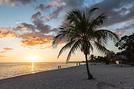
Hello everyone,
As usual, I’m posting a new travel journal about our trip to Norway last September. This one will span several months, with a day-by-day account of our adventure. I won’t be posting many photos on the forum (the publishing rules have become even more complicated since my last journal), but you can find all the shots on my blog (address in my signature).
We’ve just returned from a truly extraordinary, unforgettable trip. Planning this trip wasn’t easy, and I’ll admit I struggled to decide on the itinerary… Should we take the Hurtigruten all the way from the south to the north? But a whole trip by boat didn’t really appeal to us. Or focus on the south in the fjord region? But that would mean missing out on the Lofoten Islands… In the end, we chose to concentrate on southern Norway, exploring the coast and fjords, while including a stop in Oslo and mixing train, boat, and car travel. I also opted for a trip where we’d drive less than in previous years (1,650 km compared to 2,000 km in Portugal and 3,800 km in the American West), but we’d still move around a bit and do some hikes. Here’s the itinerary we followed:

This trip was absolutely amazing and introduced us to so many things we’d never seen or done before—fjords, a night on a boat, glaciers, stave churches, snow in summer (…and the high cost of living!).
If we had to sum up our top highlights, here’s our top 3: Mr.:
the variety of landscapes the colors, especially the colors of the water—from crystal clear to light blue and turquoise in some spots eating good fish
Mrs.:
the roads: the ones in the area we explored were truly stunning Geirangerfjord, especially in the late afternoon, when it was quiet and free of cruise ships the Trolltunga hike: a challenging trek and a little personal achievement for us
What we liked less:
the sometimes inconsistent signage on hikes the cost of living (everything costs money, and even food is expensive) the tunnels: there are so many, and they’re not much fun (except for one with a roundabout inside…!)
That’s it for this first summary/overview, and I can already tell that choosing photos is going to be tough!!! Here’s a little preview of what we discovered:

To see the photos in full size on my blog: check it out here
As usual, I’m posting a new travel journal about our trip to Norway last September. This one will span several months, with a day-by-day account of our adventure. I won’t be posting many photos on the forum (the publishing rules have become even more complicated since my last journal), but you can find all the shots on my blog (address in my signature).
We’ve just returned from a truly extraordinary, unforgettable trip. Planning this trip wasn’t easy, and I’ll admit I struggled to decide on the itinerary… Should we take the Hurtigruten all the way from the south to the north? But a whole trip by boat didn’t really appeal to us. Or focus on the south in the fjord region? But that would mean missing out on the Lofoten Islands… In the end, we chose to concentrate on southern Norway, exploring the coast and fjords, while including a stop in Oslo and mixing train, boat, and car travel. I also opted for a trip where we’d drive less than in previous years (1,650 km compared to 2,000 km in Portugal and 3,800 km in the American West), but we’d still move around a bit and do some hikes. Here’s the itinerary we followed:
This trip was absolutely amazing and introduced us to so many things we’d never seen or done before—fjords, a night on a boat, glaciers, stave churches, snow in summer (…and the high cost of living!).
If we had to sum up our top highlights, here’s our top 3: Mr.:
the variety of landscapes the colors, especially the colors of the water—from crystal clear to light blue and turquoise in some spots eating good fish
Mrs.:
the roads: the ones in the area we explored were truly stunning Geirangerfjord, especially in the late afternoon, when it was quiet and free of cruise ships the Trolltunga hike: a challenging trek and a little personal achievement for us
What we liked less:
the sometimes inconsistent signage on hikes the cost of living (everything costs money, and even food is expensive) the tunnels: there are so many, and they’re not much fun (except for one with a roundabout inside…!)
That’s it for this first summary/overview, and I can already tell that choosing photos is going to be tough!!! Here’s a little preview of what we discovered:
To see the photos in full size on my blog: check it out here
Here we go...
It’s been almost a month since we got back, and my head is still over there... Just like every time... For my own sake, I know travel journals are useful for travelers planning a trip to a country. But selfishly, they’re also helpful for me—to put the final stone on each journey and revisit it from time to time, just for the memories...
So, this trip won’t be any different, and I invite you to follow along on our Andean adventure, from Lima to the Southern Lipez, from December 16, 2016, to January 14, 2017. It’s a chronological journal because I don’t know how to approach it any other way. It doesn’t hold any absolute truths—just my experiences and feelings, which are obviously personal and not objective!
But if it inspires you to visit these magical countries (and I assume you’re already interested if you’re here) or gives you a couple of tips, then I’ll consider it a win!
So, let’s hit the road for the land of wide-open spaces!
It’s been almost a month since we got back, and my head is still over there... Just like every time... For my own sake, I know travel journals are useful for travelers planning a trip to a country. But selfishly, they’re also helpful for me—to put the final stone on each journey and revisit it from time to time, just for the memories...
So, this trip won’t be any different, and I invite you to follow along on our Andean adventure, from Lima to the Southern Lipez, from December 16, 2016, to January 14, 2017. It’s a chronological journal because I don’t know how to approach it any other way. It doesn’t hold any absolute truths—just my experiences and feelings, which are obviously personal and not objective!
But if it inspires you to visit these magical countries (and I assume you’re already interested if you’re here) or gives you a couple of tips, then I’ll consider it a win!
So, let’s hit the road for the land of wide-open spaces!
Hello,
Here’s our account of our two weeks in Brazil’s Northeast from March 25 to April 9, 2017. We’re two couples in our fifties. Our itinerary: São Paulo, São Luís, Lençóis Maranhenses Park, the Parnaíba Delta, Jericoacoara, Icaraí de Amontada, Pipa, Olinda, and back to São Paulo.
Our budget came to 1400 € per person, excluding international flights.
For food, in a restaurant, a fish or meat dish for two people served with rice, black beans in sauce, and cassava flour costs an average of 80 BRL. You can eat more cheaply on the street, in self-service spots, or in ‘per kilo’ restaurants. At all the pousadas, breakfast was included: it was always very good, hearty, and doubled as our midday meal. Bottled water (1.5 liters): between 2 and 4 BRL Caipirinha: between 5 and 10 BRL
For organization, we used a local guide, Danielisson, to arrange the "Route of Emotions" from São Luís to Jericoacoara (Days 3 to 7). He’s reliable, speaks French very well, and is passionate about his country. The organization was flawless. We highly recommend him. For the rest of the trip, we used cars with drivers or taxis instead of public transport. With four of us, it wasn’t too expensive and was much simpler. We don’t regret not renting a car at all—many roads are unpaved or in very poor condition. Danielisson Pereira: danielissonpereira@yahoo.co.uk Skype: danielissonpereira (Facebook) Phone: 55 (98) 991634424 / 981721946
Weather-wise, March-April is the rainy season, so it’s the low season. Downsides: occasional heavy storms, not everything is open (hotels, restaurants, shops…), but upsides: hardly any tourists and lower prices. Temperature-wise: between 25-30°C year-round, 24/7. Health-wise: a few mosquitoes, nothing serious, but bring protection. Day 1: International flight from Lyon to Paris to São Paulo. We went through São Paulo because my husband was there for work. Hotel: Monreale Hotel: 20 minutes from the airport (free shuttle). For those extending a business trip with a vacation, you can leave your luggage at the hotel for free with no time constraints. Day 2: São Luís Flight from São Paulo to São Luís (3.5 hours). We arrived in São Luís in the rain. It felt very strange—the city was deserted. It was Sunday, so everything was closed (don’t count on a currency exchange office or travel agency being open). We struggled to find a restaurant for the evening. Half a day is more than enough to explore the city, but we really liked all the colorful colonial houses. Flight São Paulo/São Luís: 118 € Taxi from airport to pousada: 50 BRL for 4 Pousada Portas da Amazônia: 33 € per room
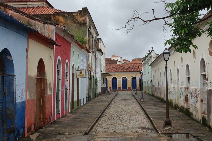
Day 3: Journey to Atins Shared minibus to Barreirinhas (about 4 hours—paved road) where we left our big bags, then a private boat down the Preguiças River to Atins. Stop at Vassouras, where we discovered our first lagoons and enjoyed excellent fish prepared by locals, then at Mandacaru to climb the lighthouse for a 360-degree view. Atins is a small fishing village lost in the sand. During our visit in the low season, almost everything was closed, so it was very quiet.
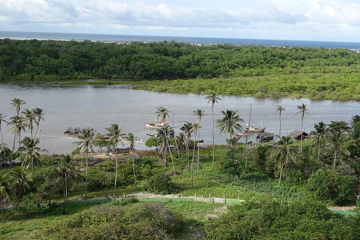
Day 4: Trek in Lençóis Maranhenses Park At 4 AM, we set off for a two-day trek in the Lençóis Park. One hour by 4x4 to reach the starting point. The sun was just rising. At first, there was some vegetation, but then it was just white sand and lagoons, which, contrary to what we thought, were already quite full for the season. As we went on, the landscapes got more and more beautiful. We never got tired of it. The weather was a bit cloudy but no rain, which was ideal to avoid the heat. We took occasional dips in the clear freshwater. Around noon, we arrived at Baixa Grande oasis. Rest and overnight in hammocks with a local family.
Day 5: Trek in Lençóis Maranhenses Park We left the oasis at 5 AM. Compared to the day before, we walked higher up, along the dune ridges, and it was even more stunning. Plus, the sun was shining. It was simply magical. Around noon, we climbed the last dune—on the other side, there was no more sand, just vegetation. A 4x4 was waiting to take us back to Barreirinhas (17 km). A few notes on the trek: - The 6-7 hours of walking are easy. The sand is hard, nothing like walking on a beach. We wore sandals or sneakers. We often got our feet wet crossing lagoons: at first, we took off our shoes, but later, we crossed fully dressed. Everything dries in 5 minutes! - Even with clouds, we got sunburned, so it’s best to wear long sleeves and pants (in addition to a cap, sunscreen, lip balm, water…). - It’s impossible to navigate the desert alone. With the wind, the dunes change shape and position regularly. A guide is essential.
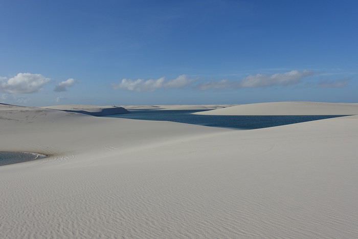
Day 6: Parnaíba Delta A Jeep took us to Tutoia, where we boarded a boat for the Parnaíba Delta. Nothing exceptional. Normally, you can see red ibises at sunset, but we weren’t lucky—they were in their breeding season, so we couldn’t get close. We slept on Canary Island, next to a pretty fishing village.
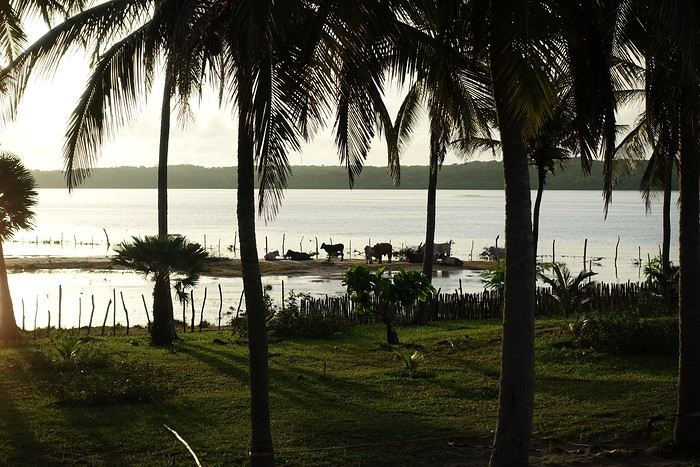
Day 7: Journey to Jericoacoara Boat to Tatus port, then a car to Jericoacoara (via Parnaíba and Camocim). From Camocim onward, it’s a sandy track. We arrived in Jericoacoara in the late afternoon—it was a brutal return to civilization 😅: tourists, shops, restaurants, pousadas, and that’s during the low season! Pousada Capim Verde: 120 BRL (basic rooms but well-located and cheap)
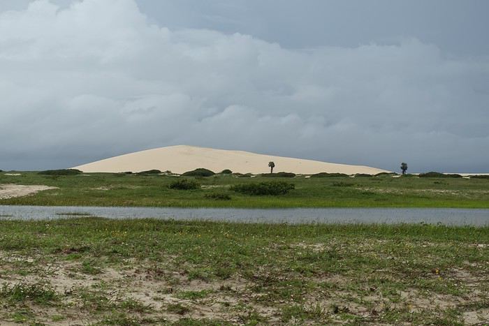
Day 8: Buggy tour Classic buggy tour (offered by all Jeri agencies) to Lagoa do Paraíso. Unfortunately, it rained a lot, and we cut our ride short. That was the only day slightly "ruined" by the weather. Buggy: 270 BRL
Day 9: Icaraí de Amontada To find some "peace," we headed to Icaraí de Amontada. On the way, alternating wind farms and coconut plantations. Icaraizinho is a village with a stunning beach (as long as you look toward the coconut trees, not the wind turbines). Little wind at this time of year, so no tourists. Pousada Pais Tropical (run by French owners): very nice, right on the beach. Taxi Jericoacoara–Icaraí de Amontada: 340 BRL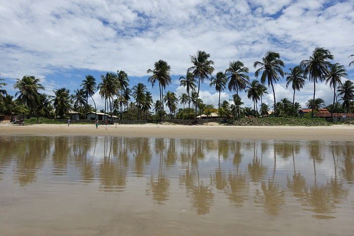 Day 10: Transfer day to Pipa
Taxi Icaraí–Fortaleza: 350 BRL
Flight Fortaleza–Natal: 37 € per person
Taxi Natal–Pipa: 180 BRL
Pousada in Pipa: Aconchego, run by French owners. Great welcome, quiet, perfectly located in the city center.
Day 11: Pipa – Dolphin Beach Skeptical, we set off in the morning before high tide (afterward, it’s hard to pass) to try and see dolphins. And we saw them! Mothers with their calves swimming in the waves, appearing where and when you least expect them. They’re not afraid of humans and pop up just a few meters away. It’s unforgettable. No need to take a boat tour—they come to the same spot and stay for 5-10 minutes. For those who don’t want to swim (there were waves and surf when we were there), the dolphins are visible from the beach.
Day 12: Pipa – Tibau do Sul via the beaches A lovely hike where you go from one beach to another until Tibau do Sul: 2 hours of brisk walking! We stayed a while by the lagoon before taking a shuttle back to Pipa. Shuttle: 2.5 BRL per person
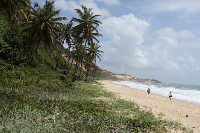
Day 13: Pipa – Dolphin Beach We wanted more—it was too good, and we saw them all day long.
Day 14: Recife A taxi took us to Olinda, where we’d booked a pousada. In the afternoon, we took the bus to Recife: some pretty facades, but nothing unforgettable. Taxi Pipa–Olinda: 400 BRL Bus Olinda–Recife: about 4 BRL per person per trip (45 min) Pousada Villa Olinda (in Olinda): 99 BRL—very well located
Day 15: Olinda All day walking around Olinda, a small town with colorful houses and many churches. In the late evening, we flew to São Paulo. Uber Olinda–Recife airport: 32 BRL Flight Recife–São Paulo: 123 €
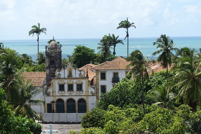
Day 16: São Paulo The hotel in Guarulhos is about an hour by public transport from downtown São Paulo. Short on time, we didn’t see much of the city. We went to Avenida Paulista: it was a Sunday, with lots of cultural and sports events, and the avenue was closed to cars. It was nice. Then we walked down to Ibirapuera Park, but it was marathon day, and we couldn’t get in. Bus Guarulhos–first metro station: 4.70 BRL Metro ticket: 3.8 BRL
Conclusion: With this second trip to Brazil, we discovered another side of the country—a poorer region with fewer infrastructures than the Rio area. The trek in Lençóis Maranhenses Park was the highlight of the trip—landscapes you won’t see anywhere else in the world, worth the trip on their own. We also won’t forget swimming with the dolphins in Pipa.
For food, in a restaurant, a fish or meat dish for two people served with rice, black beans in sauce, and cassava flour costs an average of 80 BRL. You can eat more cheaply on the street, in self-service spots, or in ‘per kilo’ restaurants. At all the pousadas, breakfast was included: it was always very good, hearty, and doubled as our midday meal. Bottled water (1.5 liters): between 2 and 4 BRL Caipirinha: between 5 and 10 BRL
For organization, we used a local guide, Danielisson, to arrange the "Route of Emotions" from São Luís to Jericoacoara (Days 3 to 7). He’s reliable, speaks French very well, and is passionate about his country. The organization was flawless. We highly recommend him. For the rest of the trip, we used cars with drivers or taxis instead of public transport. With four of us, it wasn’t too expensive and was much simpler. We don’t regret not renting a car at all—many roads are unpaved or in very poor condition. Danielisson Pereira: danielissonpereira@yahoo.co.uk Skype: danielissonpereira (Facebook) Phone: 55 (98) 991634424 / 981721946
Weather-wise, March-April is the rainy season, so it’s the low season. Downsides: occasional heavy storms, not everything is open (hotels, restaurants, shops…), but upsides: hardly any tourists and lower prices. Temperature-wise: between 25-30°C year-round, 24/7. Health-wise: a few mosquitoes, nothing serious, but bring protection. Day 1: International flight from Lyon to Paris to São Paulo. We went through São Paulo because my husband was there for work. Hotel: Monreale Hotel: 20 minutes from the airport (free shuttle). For those extending a business trip with a vacation, you can leave your luggage at the hotel for free with no time constraints. Day 2: São Luís Flight from São Paulo to São Luís (3.5 hours). We arrived in São Luís in the rain. It felt very strange—the city was deserted. It was Sunday, so everything was closed (don’t count on a currency exchange office or travel agency being open). We struggled to find a restaurant for the evening. Half a day is more than enough to explore the city, but we really liked all the colorful colonial houses. Flight São Paulo/São Luís: 118 € Taxi from airport to pousada: 50 BRL for 4 Pousada Portas da Amazônia: 33 € per room
Day 3: Journey to Atins Shared minibus to Barreirinhas (about 4 hours—paved road) where we left our big bags, then a private boat down the Preguiças River to Atins. Stop at Vassouras, where we discovered our first lagoons and enjoyed excellent fish prepared by locals, then at Mandacaru to climb the lighthouse for a 360-degree view. Atins is a small fishing village lost in the sand. During our visit in the low season, almost everything was closed, so it was very quiet.
Day 4: Trek in Lençóis Maranhenses Park At 4 AM, we set off for a two-day trek in the Lençóis Park. One hour by 4x4 to reach the starting point. The sun was just rising. At first, there was some vegetation, but then it was just white sand and lagoons, which, contrary to what we thought, were already quite full for the season. As we went on, the landscapes got more and more beautiful. We never got tired of it. The weather was a bit cloudy but no rain, which was ideal to avoid the heat. We took occasional dips in the clear freshwater. Around noon, we arrived at Baixa Grande oasis. Rest and overnight in hammocks with a local family.
Day 5: Trek in Lençóis Maranhenses Park We left the oasis at 5 AM. Compared to the day before, we walked higher up, along the dune ridges, and it was even more stunning. Plus, the sun was shining. It was simply magical. Around noon, we climbed the last dune—on the other side, there was no more sand, just vegetation. A 4x4 was waiting to take us back to Barreirinhas (17 km). A few notes on the trek: - The 6-7 hours of walking are easy. The sand is hard, nothing like walking on a beach. We wore sandals or sneakers. We often got our feet wet crossing lagoons: at first, we took off our shoes, but later, we crossed fully dressed. Everything dries in 5 minutes! - Even with clouds, we got sunburned, so it’s best to wear long sleeves and pants (in addition to a cap, sunscreen, lip balm, water…). - It’s impossible to navigate the desert alone. With the wind, the dunes change shape and position regularly. A guide is essential.
Day 6: Parnaíba Delta A Jeep took us to Tutoia, where we boarded a boat for the Parnaíba Delta. Nothing exceptional. Normally, you can see red ibises at sunset, but we weren’t lucky—they were in their breeding season, so we couldn’t get close. We slept on Canary Island, next to a pretty fishing village.
Day 7: Journey to Jericoacoara Boat to Tatus port, then a car to Jericoacoara (via Parnaíba and Camocim). From Camocim onward, it’s a sandy track. We arrived in Jericoacoara in the late afternoon—it was a brutal return to civilization 😅: tourists, shops, restaurants, pousadas, and that’s during the low season! Pousada Capim Verde: 120 BRL (basic rooms but well-located and cheap)
Day 8: Buggy tour Classic buggy tour (offered by all Jeri agencies) to Lagoa do Paraíso. Unfortunately, it rained a lot, and we cut our ride short. That was the only day slightly "ruined" by the weather. Buggy: 270 BRL
Day 9: Icaraí de Amontada To find some "peace," we headed to Icaraí de Amontada. On the way, alternating wind farms and coconut plantations. Icaraizinho is a village with a stunning beach (as long as you look toward the coconut trees, not the wind turbines). Little wind at this time of year, so no tourists. Pousada Pais Tropical (run by French owners): very nice, right on the beach. Taxi Jericoacoara–Icaraí de Amontada: 340 BRL
Day 10: Transfer day to Pipa
Taxi Icaraí–Fortaleza: 350 BRL
Flight Fortaleza–Natal: 37 € per person
Taxi Natal–Pipa: 180 BRL
Pousada in Pipa: Aconchego, run by French owners. Great welcome, quiet, perfectly located in the city center.Day 11: Pipa – Dolphin Beach Skeptical, we set off in the morning before high tide (afterward, it’s hard to pass) to try and see dolphins. And we saw them! Mothers with their calves swimming in the waves, appearing where and when you least expect them. They’re not afraid of humans and pop up just a few meters away. It’s unforgettable. No need to take a boat tour—they come to the same spot and stay for 5-10 minutes. For those who don’t want to swim (there were waves and surf when we were there), the dolphins are visible from the beach.
Day 12: Pipa – Tibau do Sul via the beaches A lovely hike where you go from one beach to another until Tibau do Sul: 2 hours of brisk walking! We stayed a while by the lagoon before taking a shuttle back to Pipa. Shuttle: 2.5 BRL per person
Day 13: Pipa – Dolphin Beach We wanted more—it was too good, and we saw them all day long.
Day 14: Recife A taxi took us to Olinda, where we’d booked a pousada. In the afternoon, we took the bus to Recife: some pretty facades, but nothing unforgettable. Taxi Pipa–Olinda: 400 BRL Bus Olinda–Recife: about 4 BRL per person per trip (45 min) Pousada Villa Olinda (in Olinda): 99 BRL—very well located
Day 15: Olinda All day walking around Olinda, a small town with colorful houses and many churches. In the late evening, we flew to São Paulo. Uber Olinda–Recife airport: 32 BRL Flight Recife–São Paulo: 123 €
Day 16: São Paulo The hotel in Guarulhos is about an hour by public transport from downtown São Paulo. Short on time, we didn’t see much of the city. We went to Avenida Paulista: it was a Sunday, with lots of cultural and sports events, and the avenue was closed to cars. It was nice. Then we walked down to Ibirapuera Park, but it was marathon day, and we couldn’t get in. Bus Guarulhos–first metro station: 4.70 BRL Metro ticket: 3.8 BRL
Conclusion: With this second trip to Brazil, we discovered another side of the country—a poorer region with fewer infrastructures than the Rio area. The trek in Lençóis Maranhenses Park was the highlight of the trip—landscapes you won’t see anywhere else in the world, worth the trip on their own. We also won’t forget swimming with the dolphins in Pipa.
We just spent a little over 3 weeks in Morocco.
Three weeks on the road starting from Marrakech in a rental Logan.
We decided to split this trip into 3 highlights: the seaside first, a week in Aourir north of Agadir, Aït Baha and Tafraoute for another week, then a week in the Skoura palm grove followed by 3 days in Marrakech before heading back.
When we arrived, we were surprised by the temperatures—much higher than in previous years—and we were amazed by the quantities of flowers we saw throughout our journey. Moroccans explained that they had a lot of rain this winter, beneficial water, not the kind that destroys everything in its path.
First stop: AOURIR. Staying at Bab Aourir, we were able to explore the area. A great discovery this year: the Assif El Had cave, beyond Imouzzer. A beautiful road to get there. Absolute tranquility once you're inside. A lovely spot for a picnic by the *séquia* (irrigation channel) at the cave’s entrance.
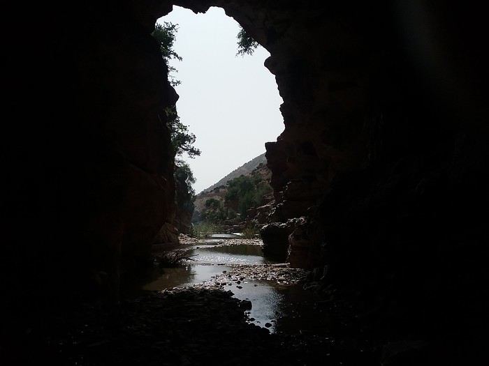
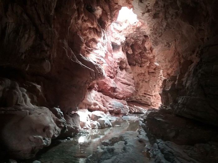
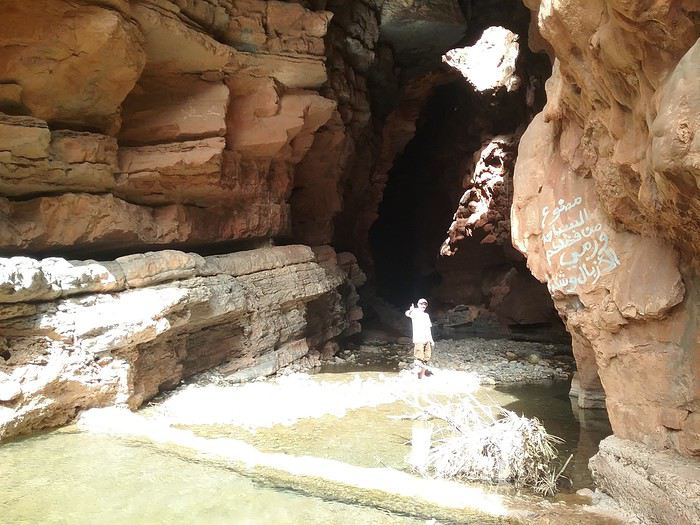
When we arrived, we were surprised by the temperatures—much higher than in previous years—and we were amazed by the quantities of flowers we saw throughout our journey. Moroccans explained that they had a lot of rain this winter, beneficial water, not the kind that destroys everything in its path.
First stop: AOURIR. Staying at Bab Aourir, we were able to explore the area. A great discovery this year: the Assif El Had cave, beyond Imouzzer. A beautiful road to get there. Absolute tranquility once you're inside. A lovely spot for a picnic by the *séquia* (irrigation channel) at the cave’s entrance.
Recommended for you
 Polynesia: How to choose between the Society Islands, Tuamotu, and the Marquesas?
 A Few Days in Turkmenistan from Uzbekistan
 Slovak travel journal
 14 Days in Japan – September-October 2026
 Trek in Norway: Jotunheimen and Dovrefjell, you’ll adapt to the rain...
 CARIBBEAN: The island of SAINT-MARTIN, a different perspective
 Northern Morocco, the kingdom of kif?
 Summer 2026 - 3 weeks in the Azores