USA Road Trip 2023 - Part 1
FR

Translated into English.

PI Pinacoladada Globetrotter ·
HIKE AT CATHEDRAL ROCK - SEDONA - ARIZONA

34.82516, -111.78860 Parking and trailhead 34.81927, -111.79185 Cathedral Rock Vortex 34.81877, -111.79229 End of the trail

The trail, which is 1.2 miles round-trip, first leads us to a stream we need to cross. The climb starts off gently. Cairns mark the path, and we take a few rocky stairs that lead to a plateau offering a spectacular view of Sedona.

After that, we go through a rocky section leading to a fissure in the rock that rises at a 45-degree angle over about 12 meters. This section is tough, especially since there was ice on the rock during our hike. Extreme caution is required.

There are plenty of hand and footholds to help navigate this crevasse. However, this part of the trail can be challenging for those afraid of heights.

We reach a second plateau where we can take a break. We watch hikers climbing the crevasse—the elevation gain is impressive. We’ll have to descend this section on the way back!

We continue our climb to the top of the cliff on slippery rocks. Handholds are necessary in some spots.

A sign reading “End of Trail” confirms we’ve reached the top of the cliff. However, it’s possible to turn right or left at this sign since a trail offers both options.

Heading left, the trail allows us to climb even higher via a crevasse in the rock. The ascent is steep, though. There was ice on the rock during our hike, which made it even more difficult.

At the summit, a rocky spur rises before us, and we have a stunning panoramic view of the surrounding landscape.

Heading right, the trail, about 1.5 meters wide, runs along a ravine and leads to the edge of the cliff. There’s no protection on this trail, and the ravine is very deep.

This hike is considered difficult. It’s important to wear hiking shoes with good grip to make the ascent and descent easier.

https://youtu.be/-0V57kA1wwQ
Anne Blogue: https://deuxnomades.blogspot.com/ YouTube: https://www.youtube.com/c/SouthAngelVideo?sub_confirmation=1
PI Pinacoladada Globetrotter ·
HIKE ON THE BELL ROCK TRAIL - SEDONA - ARIZONA

You have several options to get to Bell Rock. For our part, we took the Bell Rock Pathway trail to get there.

At 4 km round trip, it offers stunning views of Bell Rock, Courthouse Butte, and several other rock formations.

This trail is easy to hike since most of it has a wide, hard surface and is very well marked.

We only went as far as the base of Bell Rock, where there’s a lookout with a fantastic panoramic view of Sedona’s many red cliffs.

However, you can later climb the rocks to reach the top of Bell Rock. Be careful!

34.79146, -111.76164 Parking and trailhead 34.80168, -111.76492 Viewpoint

https://youtu.be/nKmuZ5MtQXE
Anne Blogue: https://deuxnomades.blogspot.com/ YouTube: https://www.youtube.com/c/SouthAngelVideo?sub_confirmation=1
PI Pinacoladada Globetrotter ·
HIKE ON THE AIRPORT LOOP TRAIL - SEDONA - ARIZONA

The Airport Loop Trail is a moderate 3.3-mile hike that circles the upper slope of Airport Mesa, also known as Table Top Mountain.

This hike can also be extended to visit the Airport Mesa Vortex site by taking the Summit Trail (a 0.25-mile round trip). We actually started our hike on this trail.

Uneven steps carved into the rock lead to the top of a hill that offers a stunning 360-degree view of the entire area.

The Airport Loop Trail is a loop trail that provides incredible views of many rock formations as well as the town of Sedona.

It features many technical rocky sections exposed to thorny vegetation. The trail is mostly packed dirt. Rocks and roots are scattered along the ground. Caution is advised!

34.85575, -111.78007 Parking and trailhead 34.85580, -111.77912 Airport Mesa Vortex (Summit Trail) 34.85519, -111.77978 Sedona Trail View Point 34.85518, -111.77994 Continuing on Airport Loop Trail 34.84530, -111.79530 About halfway through the route

https://youtu.be/Xba3qY3NaLQ
Anne Blogue: https://deuxnomades.blogspot.com/ YouTube: https://www.youtube.com/c/SouthAngelVideo?sub_confirmation=1
PI Pinacoladada Globetrotter ·
AMITABHA STUPA AND PEACE PARK - SEDONA - ARIZONA

Established in 2004, this park, located at the foot of Thunder Mountain in Sedona, is a spiritual destination set in a stunning landscape.

It features an 11-meter-tall stupa (Amitabha) as well as a smaller one. A stupa is a monument considered a living presence of Buddha.

Visitors come to the site to pray, meditate, or simply stroll through this peaceful haven. Many also bring offerings they place at the foot of the stupa.

You’ll also find a medicine wheel, an ancient Native American symbol representing the circle of life and, in a broader sense, a map of the universe and the spiritual powers it holds. At the center of the wheel is a circle of seven stones called the Seven Sacred Dancers.

From this central circle extend the paths of the four directions. Each direction has a guardian spirit and a teaching corresponding to the four seasons, the four elements, the four times of day, and the four stages of human life. It also includes the relationship with the Father Sky above and the Mother Earth below.

It was created to honor the Indigenous peoples of Sedona and the surrounding area, namely the Hopi, Navajo, Yavapai, and Apache.

The site is also adorned with a beautiful wooden Buddha statue, prayer flags, and benches where visitors can sit and meditate.

Entry is free. Donations are welcome.

34.874810, -111.807738 Parking and trailhead 34.875541, -111.808307 Amitabha Stupa 34.875515, -111.807733 Tara Stupa 34.877482, -111.808221 Medicine Wheel

https://youtu.be/rBohu1XWoLo
Anne Blogue: https://deuxnomades.blogspot.com/ YouTube: https://www.youtube.com/c/SouthAngelVideo?sub_confirmation=1
PI Pinacoladada Globetrotter ·
HIKING THE BOYNTON CANYON VORTEX TRAIL - SEDONA - ARIZONA

The town of Sedona, Arizona, is famous for its energy vortexes. Each vortex is said to have a different type of energy. People come from all over the world to see and experience them.

Sedona’s vortexes are considered swirling energy centers ideal for healing, meditation, and self-exploration. These are places where the earth feels particularly alive and full of energy. Many people feel inspired, recharged, or uplifted after visiting a vortex.

To reach the Boynton Canyon Vortex, simply park at the Boynton Canyon Trailhead parking lot. Restrooms are available on-site.

You’ll need to follow the Boynton Canyon Trail, also known as the Boynton Vortex Trail, until you reach the Boynton Canyon Vista Trail.

The Vista Trail will lead you to the vortex site. There are a few sections with uneven steps carved into the rock, as well as a short, moderately steep climb up to the Boynton Vortex, located on a plateau near a red rock spur called Kachina Woman.

The panoramic view from this site over the canyon and the various rock formations is truly breathtaking.

During this hike, we were surprised to spot wild boars roaming near the trail. We kept a safe distance to observe them.

34.90743, -111.84852 Parking 34.90767, -111.84910 Start of the trail (1.1-mile round trip) 34.91172, -111.84819 Boynton Canyon Vortex

https://youtu.be/qIbQsupj8Z0
Anne Blogue: https://deuxnomades.blogspot.com/ YouTube: https://www.youtube.com/c/SouthAngelVideo?sub_confirmation=1
PI Pinacoladada Globetrotter ·
HIKE ON DEVIL'S BRIDGE TRAIL - SEDONA - ARIZONA

Devil's Bridge is a sandstone arch located in the Coconino National Forest in Sedona.

The trail to get there is 6.3 kilometers round-trip and starts on an unpaved road called Dry Creek Road (FR 152).

After driving 1.8 km on this road, you’ll find the official trail leading to Devil’s Bridge on your right.

Most of the trail is easy to hike since it’s relatively flat, except at the end where you’ll encounter steep steps carved into the rock.

For us, melting snow covered the road and a thick layer of ice covered the steps, which made the climb to the top of Devil’s Bridge a bit of an adventure. The scenery was magical, though, with all the snow that had fallen the day before.

The arch is impressive and set in a stunning natural landscape. You can even walk on top of the arch!

Since this trail is very popular, you might have to wait your turn—it’s a super busy spot.

34.88988, -111.82050 Parking 34.90304, -111.81419 Right turn (official trail) 34.89765, -111.80771 Devil's Bridge

https://youtu.be/K1HdLU8HxbA
Anne Blogue: https://deuxnomades.blogspot.com/ YouTube: https://www.youtube.com/c/SouthAngelVideo?sub_confirmation=1
PI Pinacoladada Globetrotter ·
HIKE TO BIRTHING CAVE TRAIL - SEDONA - ARIZONA

This trail, 3.1 kilometers round-trip, leads to a stunning cave with breathtaking views of Sedona’s red cliffs.

The trail is wide, flat, and sandy for most of the way. However, the last section is steep and requires climbing the cliff to reach Birthing Cave.

The cave entrance already offers an incredible view of the surrounding landscape. For an even better view from inside the cave, you just need to climb the walls.

Be cautious—the cave walls are smooth, and there aren’t many places to grip while climbing.

You can also walk along a higher ledge inside the cave, but if you lose your footing, the fall could be fatal.

Where does the cave’s name come from? The Hopi, native to the Red Rock area of Sedona, believe their people were born from the center of the Earth. Because of its strong resemblance to a woman’s uterus, the Hopi sent pregnant women to Birthing Cave to give birth.

34.90670, -111.82430 Start of Long Canyon Trail (3.1 km round-trip) 34.91252, -111.83075 Left junction 34.91235, -111.83712 Birthing Cave

https://youtu.be/QnnKsNG0-RE
Anne Blogue: https://deuxnomades.blogspot.com/ YouTube: https://www.youtube.com/c/SouthAngelVideo?sub_confirmation=1
PI Pinacoladada Globetrotter ·
BELL ROCK INN - SEDONA - ARIZONA

This hotel is located in the tourist area of Sedona, close to restaurants, hiking trails, and a golf course. The staff at the front desk when we arrived were really friendly.

We got a nice large room, apartment-style, with a kitchen, living room, bedroom, and bathroom. Wi-Fi access is also available in the room.

Several amenities are offered: outdoor pool, hot tub, barbecue, laundry, and a fitness center.

https://youtu.be/CvpPdEPMl2g
Anne Blogue: https://deuxnomades.blogspot.com/ YouTube: https://www.youtube.com/c/SouthAngelVideo?sub_confirmation=1
PI Pinacoladada Globetrotter ·
ON THE ROADS OF SEDONA - ARIZONA - PART 1

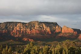
Sedona is a town located in the Arizona desert, about fifty kilometers from Flagstaff.

Sedona is known for its red rock formations, steep canyons, and pine forests. It’s also famous for its vibrant arts community.

Sedona is packed with shops, spas, and art galleries inspired by the New Age movement.

Red Rock State Park, located on the outskirts of town, offers numerous hiking trails and picnic areas.

I’ll share some of the viewpoints we discovered while driving around Sedona. You’ll find breathtaking landscapes!

https://youtu.be/EWkfeKURQeo
Anne Blogue: https://deuxnomades.blogspot.com/ YouTube: https://www.youtube.com/c/SouthAngelVideo?sub_confirmation=1
PI Pinacoladada Globetrotter ·
ON THE ROADS OF SEDONA - ARIZONA - PART 2

More stunning landscapes we saw while traveling the roads of Sedona.

https://youtu.be/1ou6WkeQPl4
Anne Blogue: https://deuxnomades.blogspot.com/ YouTube: https://www.youtube.com/c/SouthAngelVideo?sub_confirmation=1
PI Pinacoladada Globetrotter ·
HIKING TRAIL: KEYHOLE SINK - KAIBAB NATIONAL FOREST - ARIZONA

Keyhole Sink is a canyon located in the Kaibab National Forest, a few kilometers east of Williams, Arizona. This canyon near Williams gets its name from its keyhole shape.

You can reach it on foot via an unpaved trail known as the Keyhole Sink Trail, which is 2.3 kilometers (1.4 miles) round trip.

For centuries, this site was a hunting and religious ceremony spot for the Cohonina people. Petroglyphs dating back around 1,000 years show that hunters used the natural dead-end to trap prey that gathered at the watering hole.

The images carved into the volcanic basalt rock mainly depict animals that were likely found at this watering spot: deer, snakes, and lizards.

In 2010, vandals severely damaged these petroglyphs with silver-white paint. They were later restored, but traces of the vandalism are still visible.

Small waterfalls form during snowmelt and the rainy season.

35.26170, -112.01100 Parking 35.26230, -112.01090 Trailhead 35.26872, -112.01521 Keyhole Sink

https://youtu.be/WLAd3WQKF40
Anne Blogue: https://deuxnomades.blogspot.com/ YouTube: https://www.youtube.com/c/SouthAngelVideo?sub_confirmation=1
PI Pinacoladada Globetrotter ·
DISCOVERING THE TOWN OF WILLIAMS - ARIZONA

Williams is a really typical small town on Route 66, located in the state of Arizona.

History buffs of the famous Route 66 can explore a multitude of historic buildings, several souvenir shops, and some lovely murals.

When we passed through, a recent snowstorm had swept through the area and left a huge amount of snow on the ground.

By car: 35.25701, -112.16903 Williams Gateway to the Grand Canyon Arch 35.25291, -112.18038 Canyon Coaster Adventure Park 35.25353, -112.18151 Route 66 Williams Sign

2.1-kilometer walk around town: 35.25130, -112.18854 Parking 35.25114, -112.18855 Williams Rotary Street Clock 35.25104, -112.18822 The Red Garter Inn 35.25154, -112.18827 Mural: Welcome to Williams Historic Route 66 35.25158, -112.18781 Route 66 Zipline 35.25165, -112.18735 Santa Fe Railcar Bridge 35.25116, -112.18689 Native America Shop 35.25110, -112.18717 Peter's Route 66 Gas Station Museum 35.25032, -112.18715 Mural 35.25081, -112.18771 Addicted to 66 & Indian Jewelry (Turquoise Tepee) 35.25061, -112.18769 Mural: Canyon Vista Mall 35.25057, -112.18858 Grand Canyon Native Jewelry (Citizens Bank Building) 35.25047, -112.18896 Mural: Route 66 of Williams 35.25004, -112.18924 Cruiser's Route 66 Cafe 35.25025, -112.18935 Open Road Cowboy (1901 Pollock Building) 35.24994, -112.18955 Sultana Bar 35.24948, -112.19003 Arizona 9 Motor Hotel & Mural Back to parking

By car: 35.25195, -112.18943 Grand Canyon Railway

https://youtu.be/n6Kic1ag2ws
Anne Blogue: https://deuxnomades.blogspot.com/ YouTube: https://www.youtube.com/c/SouthAngelVideo?sub_confirmation=1
PI Pinacoladada Globetrotter ·
EXPLORING ASH FORK - ARIZONA

The town of Ash Fork is located on Route 66, just 30 kilometers west of Williams in the state of Arizona.

Ash Fork claims to be the "world capital of dimension stone" due to the large number of quarries and stonework sites in the area.

Unfortunately, the construction of Interstate 40 was a major factor in the loss of tourism that severely impacted the town's economy.

Today, the area is mainly residential. However, there are a few Route 66 relics worth checking out.

35.22333, -112.47974 Copperstate Motel 35.22431, -112.48244 Zettlers Route 66 Store 35.22453, -112.48364 DeSoto's Salon 35.22471, -112.48443 Emmanuel Trinity Methodist Church 35.22497, -112.48519 Ash Fork Historical Marker

https://youtu.be/ElOudyBbfDU
Anne Blogue: https://deuxnomades.blogspot.com/ YouTube: https://www.youtube.com/c/SouthAngelVideo?sub_confirmation=1
PI Pinacoladada Globetrotter ·
EXPLORING THE CITY OF KINGMAN - ARIZONA

Kingman is a truly iconic Route 66 town. It’s located in the state of Arizona. This city is home to well-preserved landmarks, museums, and unique cultural sites that offer a glimpse into the rich heritage of the Southwest and the legendary Route 66.

What’s more, the city boasts a fantastic selection of high-quality murals created by renowned artists like Sandy Rusinko and Bob Waldmire.

35.41894, -113.80804 Giganticus Headicus 35.19012, -114.06155 Murals - Mohave Museum of History 35.19029, -114.06359 Mural - Kingman Cerbat Justice Court

2.5 km hike through town.

35.19027, -114.05968 Parking & Kingman Welcome Sign 35.18990, -114.05848 Locomotive Park 35.18977, -114.05752 Thunder-Rode Motorcycle Accessories 35.18974, -114.05629 Murals - Bad Gass Garage & Mural across the street 35.18964, -114.05499 Mural - Rickety Cricket Brewing 35.18944, -114.05415 Mural - Kettlehut's Antiques 35.19108, -114.05462 Murals - American Legion 35.19207, -114.05388 Saint Mary Roman Catholic Church 35.19199, -114.05257 Mohave County Courthouse 35.18958, -114.05092 Building & Route 66 Mural 35.18923, -114.05188 Mural - W. A. Gruninger Building 35.18934, -114.05155 Mural - Savon Bath Treats - Soap Store 35.18821, -114.05140 Mural - Kingman Water Tower 35.18821, -114.05222 Kingman Railroad Museum 35.18903, -114.05495 US Post Office & Mural - Pimp My Pet Grooming & Kingman sign on Route 66 35.18928, -114.05444 Mural - Beale Street Theater Alley 35.18923, -114.05737 Mr D'z Route 66 Diner

Murals to see by car:

35.23821, -114.01093 Good Shepherd Lutheran Church 35.22505, -114.01694 Trotter's RV 35.22502, -114.02874 Kingman Body Works 35.21398, -114.01258 Ramada Hotel 35.20255, -114.02412 Kingman Fire Department Fire Station 2 (on the right on a low wall) 35.19613, -114.03049 Rutherford's 66 Family Diner 35.19507, -114.03214 66 Auto Sales 35.19118, -114.03360 El Trovatore Motel and building across the street 35.19074, -114.03539 Garay Foreign Car Service 35.18761, -114.04612 Simple Auto Repair 35.18831, -114.04978 TNT Auto Center LLC 35.18949, -114.05973 Bangkok Thai Cuisine & Canada Mart next door

https://youtu.be/yCNsIArh12s
Anne Blogue: https://deuxnomades.blogspot.com/ YouTube: https://www.youtube.com/c/SouthAngelVideo?sub_confirmation=1
PI Pinacoladada Globetrotter ·
RAMADA BY WYNDHAM KINGMAN - ARIZONA

Gorgeous murals decorate the building housing the Ramada by Wyndham Kingman in the city of Kingman, Arizona.

These murals feature several famous figures from the art world.

Location: 35.21398, -114.01258

https://youtu.be/L5qZoiBr6k0
Anne Blogue: https://deuxnomades.blogspot.com/ YouTube: https://www.youtube.com/c/SouthAngelVideo?sub_confirmation=1
PI Pinacoladada Globetrotter ·
DAVIS CAMP PARK - BULLHEAD CITY - ARIZONA

Davis Camp Park is located on the banks of the Colorado River, near Bullhead City in the state of Arizona. It’s the perfect spot for all water sports enthusiasts.

This site includes shaded campsites, picnic areas, a swimming beach, a dog park, and a boat launch ramp.

On the north side of the camp, you can choose from several picnic sites dotted with palm trees along the river. Each site has a ramada and a grill, as well as a rocky beach leading straight to the river.

The south side of the camp offers RV sites with views of the Laughlin casinos. Just below the Davis Dam, you can fish for striped bass.

https://youtu.be/L5B0SODWHnc
Anne Blogue: https://deuxnomades.blogspot.com/ YouTube: https://www.youtube.com/c/SouthAngelVideo?sub_confirmation=1
PI Pinacoladada Globetrotter ·
DISCOVERING YUCCA - ARIZONA

Yucca is a small town located on the historic Route 66 in the state of Arizona.

A few remnants from that glorious era still remain today: gas stations, cafés, and motels.

You’ll also find some quirky attractions, like a semi-truck perched high on a pole and a UFO museum housed in a 12-meter-diameter geodesic dome known as Area 66.

34.87429, -114.14857 Water Tank, Frontage Road 34.86737, -114.14839 Old Gas Station, 12481 Frontage Rd 34.86769, -114.14649 Kohinoor Dhaba Indian Food (Punjabi Dhaba), 12470 Frontage Rd 34.87170, -114.14689 Truck on a Pole, 12366 Frontage Rd 34.85988, -114.14556 Area 66, 12716 Alamo Rd

https://youtu.be/aK8slrWKoIE
Anne Blogue: https://deuxnomades.blogspot.com/ YouTube: https://www.youtube.com/c/SouthAngelVideo?sub_confirmation=1
PI Pinacoladada Globetrotter ·
LAKE HAVASU BOARDWALK TOUR - ARIZONA

Lake Havasu City is a stunning lakeside town located on Lake Havasu in the state of Arizona. Lake Havasu is a large reservoir formed by the Parker Dam on the Colorado River, straddling the border between Arizona and California with four hundred miles of shoreline.

London Bridge is probably the city’s most famous landmark. It was originally built in 1831 to span the Thames in London, England. However, by 1962, it was no longer strong enough to handle the increasing traffic in London.

Entrepreneur Robert McCulloch bought the bridge for $2.4 million and had it shipped piece by piece to the United States, then reassembled in the Mojave Desert. Once the bridge was built, a channel was dug beneath it, and the bridge opened in 1971.

We took a stroll along the boardwalk that runs alongside Lake Havasu. It’s lined with plenty of businesses like restaurants, shops, hotels, and more. It’s a very lively area, and the scenery is gorgeous.

Several companies offer water sports equipment rentals as well as boat tours on the lake.

34.47358, -114.34875 Parking 34.47340, -114.34970 Boardwalk

https://youtu.be/gcSYLA_krxE
Anne Blogue: https://deuxnomades.blogspot.com/ YouTube: https://www.youtube.com/c/SouthAngelVideo?sub_confirmation=1
PI Pinacoladada Globetrotter ·
A DUCK CATCHES A LOBSTER - LAKE HAVASU BOARDWALK - ARIZONA

During our stroll along the boardwalk by Lake Havasu, we were surprised to see a duck that had managed to catch a lobster and was desperately trying to keep hold of it.

https://youtu.be/Il5RSdi717w
Anne Blogue: https://deuxnomades.blogspot.com/ YouTube: https://www.youtube.com/c/SouthAngelVideo?sub_confirmation=1
PI Pinacoladada Globetrotter ·
DISCOVERING NEEDLES - CALIFORNIA

When you follow Route 66 and enter California, the first town you come across is Needles.

This town was an important stop on Route 66 between 1920 and 1960. In fact, old motels, restaurants, and numerous murals still bear witness to that legendary era.

We also discovered several military monuments located along the National Old Trails Road, at the western edge of Needles.

The story goes that a man named Jim Nickel started working on these military rock monuments in 2010. He began making them to pass the time, and it turned into a project honoring different military branches and organizations.

The monuments are made from local rocks. He created the first one to honor his wife, then made one for himself and a long-time friend.

He went on to create several more. I invite you to check them out in this video.

34.71540, -114.48945 Trails Arch Bridge 34.83324, -114.59646 66 Motel, 91 Desnok St 34.83641, -114.60052 Needles Railroad Borax Wagon & Palm App. across the street at 305-399 W Broadway 34.83834, -114.60476 Claypool & Co 725 W Broadway St, Needles 34.83892, -114.60578 Historic Masonic Lodge & Needles Theater 823 W Broadway Street + mural across the street 34.83996, -114.60695 Needles Rt 66 Monument, G Street at W Broadway St 34.83998, -114.60615 Murals - Needles Regional Museum, 929 Front St 34.84078, -114.60616 El Garces Hotel, 950 Front St 34.84707, -114.61361 Sage Motel Sign, 1624 N St 34.84844, -114.61907 Faded mural at the Budget Inn 34.84973, -114.62267 Best Western Colorado River Inn, 2371 W Broadway St 34.85102, -114.62307 Wagon Wheel Restaurant, 2420 Needles Hwy 34.86896, -114.64502 Military Monuments along both sides of the road

https://youtu.be/lS7bj70jJOY
Anne Blogue: https://deuxnomades.blogspot.com/ YouTube: https://www.youtube.com/c/SouthAngelVideo?sub_confirmation=1
PI Pinacoladada Globetrotter ·
DISCOVERING GOFFS - CALIFORNIA

Goffs is a ghost town located in the state of California, USA. Founded by pioneers in 1883, this town thrived thanks to mining, the railroad, and its location on Route 66 until the highway was rerouted in 1931.

The town was abandoned for many years. However, the military moved in during World War II, when General Patton’s troops trained in the heart of the Mojave Desert to prepare for battles against Marshal Rommel’s forces in Libya.

The old school was turned into a mess hall for the soldiers. A military hospital and two air bases were also built. Afterward, Goffs faded back into obscurity. The population now consists of only about twenty residents.

It’s a true open-air museum you’ll discover as you stroll through the streets of this abandoned town.

The school and its grounds now house a museum primarily dedicated to the region’s mining history. Remnants of Goffs’ mining era still dot the town.

https://youtu.be/Iscv4WFFXoY
Anne Blogue: https://deuxnomades.blogspot.com/ YouTube: https://www.youtube.com/c/SouthAngelVideo?sub_confirmation=1
PI Pinacoladada Globetrotter ·
DISCOVERING AMBOY - CALIFORNIA

Amboy is a small community located in the middle of the Mojave Desert in California. It was once an important stop along Route 66. However, tourism declined significantly after Interstate 40 opened to the north in 1973.

Today, it has only a few residents and about ten buildings, including Roy's Motel and Café, a post office, and a church.

Roy's Motel and Café opened in 1938. At the time, it was the only business in the area offering gas, food, and a place to sleep.

Closed during the 1990s, the business came back to life in 2008 when philanthropist investor Albert Okura bought the town and its buildings.

Two marble sculptures of lions were erected in the desert along Route 66 east of Amboy, though their origin and meaning remain a mystery to this day.

Other curiosities can be seen nearby. You’ll discover them in this video.

34.55919, -115.66794 Lion of Amboy 34.55917, -115.67253 Lion of Amboy 34.55849, -115.73432 Shoe Tree (Grounded) (near the viaduct) 34.55876, -115.74361 Roy's Motel and Cafe, 87520 National Trails Hwy, Amboy Beautiful Route 66 shields are painted on the pavement right in front of the station. 34.55693, -115.74277 St. Raymond Church, Amboy 34.55658, -115.73964 Amboy Cemetery

https://youtu.be/3XruoQB2XCM
Anne Blogue: https://deuxnomades.blogspot.com/ YouTube: https://www.youtube.com/c/SouthAngelVideo?sub_confirmation=1
PI Pinacoladada Globetrotter ·
VISITING THE FAMOUS BAGDAD CAFE - NEWBERRY SPRINGS - CALIFORNIA

Bagdad Cafe is a legendary spot located in Newberry Springs, California. Most of the tourists who visit are French and German because this café was the filming location for the 1987 movie *Bagdad Café*, directed by German filmmaker Percy Adlon—a film that was hugely popular in France and Germany but completely overlooked in the United States.

The current owner of the café is Andrea Pruett, whom we actually met during our visit. I was immediately in awe of this woman’s courage after everything she’s been through in her life. I was really moved when she shared part of her story with us.

She left Los Angeles in the 1990s to settle here with her husband. Initially, they both wanted to open an ostrich farm.

However, after eating the best hamburger of her life at the Sidewinder Cafe (now the Bagdad Cafe), her husband managed to convince her to buy the place.

They went through with the purchase, and the establishment was renamed "Bagdat Cafe" in honor of the film that had been shot there.

A few years later, despite the deaths of her husband and son, Andrea decided to stay, surrounded by her friends.

The inside of Bagdad Café is decorated wall-to-wall with photos, postcards, flags, stickers, banknotes, and more—left behind by visitors over the years.

Among all these photos, one in particular caught my eye, and I asked Andrea who the man in the picture was.

She was very surprised because it was the first time a visitor had ever asked her about it. In a soft voice, she told me it was a photo of her son, Harold Jr., who died from an accidental overdose in 2002. My heart broke, and I immediately hugged her.

I encourage you to make a little detour to the legendary Bagdad Cafe on your next trip to the USA and meet Ms. Pruett—she’s incredibly kind.

Location: 34.81961, -116.64336

https://youtu.be/x9FXd93qkUs
Anne Blogue: https://deuxnomades.blogspot.com/ YouTube: https://www.youtube.com/c/SouthAngelVideo?sub_confirmation=1
PI Pinacoladada Globetrotter ·
DISCOVERING BARSTOW - CALIFORNIA

Barstow is a city located in the state of California. The main street of this city is actually an old section of Route 66.

The Barstow area became a major mining center in the late 1800s when silver ore was discovered in Calico. A railroad was even built to transport the ore.

The railroad and mine were closed about ten years later when all the silver ore was exhausted.

However, Barstow became a major regional transportation hub since several highways converge there and two large rail yards are also located there.

We took a hike of about 2.6 kilometers through the city to admire, among other things, several murals that were painted around downtown. These murals reflect the city's historic past.

By car: 34.86767, -116.93047 US Route 66 Barstow 34.89130, -116.99886 McDonald’s Barstow Station 34.88872, -117.02277 Big Fire Helmet, 861 Barstow Rd

Hike in the city: 34.89855, -117.01900 Mural Swiss Liquor, 708 E Main S 34.89885, -117.01983 Mural The Beacon Hotel, 703 E Main S 34.89806, -117.01966 Mural at 198 S 7th Ave 34.89885, -117.02046 Mural Simple Tax, 615 E Main S 34.89893, -117.02173 Mural The National Trails Hwy./Route 66, 513 E Main S 34.89897, -117.02268 Mural The Harvey House, 106 N 5th Ave 34.89846, -117.02308 The Native American Voices from the Mojave Desert mural, 410 E Main St 34.89817, -117.02341 Mural The Ice Age, 404 E Main St (behind the building on Barstow Road) 34.89897, -117.02344 Mural William Barstow Strong, 401 E Main St 34.89900, -117.02470 Murals Mining the Mojave Silver & Gold, 239 E Main St 34.89845, -117.02501 Murals Six Early Explorers, 222 E Main St 34.89899, -117.02538 Mural The Mojave Runners, 219 E Main St 34.89903, -117.02582 Village Cafe & Mural on the building across the street, 201 E Main St 34.89930, -117.02640 Mural General Beale Used Pack Camels, 200 N 2nd Ave 34.89864, -117.02702 Murals: El Rancho Motel, 116 E Main St 34.89909, -117.02744 Mural: Starlight Donuts, 101 E Main St 34.89888, -117.02948 Route 66 Motel, 195 Main St 34.89895, -117.03013 The Torches Motel, 201 Main St

By car: 34.90465, -117.02475 Barstow Station (rear) 34.91429, -117.03423 Tom's Certified Welding & Mach

https://youtu.be/tO-yRFwB2yI
Anne Blogue: https://deuxnomades.blogspot.com/ YouTube: https://www.youtube.com/c/SouthAngelVideo?sub_confirmation=1
PI Pinacoladada Globetrotter ·
VEHICLES FROM HELL (MAD MAX CARS) - BARSTOW - CALIFORNIA

The vehicles you'll see in this video were built by Ed and Greg Parker, and some appeared in the first two films of the Mad Max series.

You can spot them on a large vacant lot at the intersection of Soapmine Road and Old Hwy 58 in Barstow, California.

Location: 34.91386, -116.98817

https://youtu.be/Z9m2O7CUmOo
Anne Blogue: https://deuxnomades.blogspot.com/ YouTube: https://www.youtube.com/c/SouthAngelVideo?sub_confirmation=1
PI Pinacoladada Globetrotter ·
PEGGY SUE'S 50'S DINER - YERMO - CALIFORNIA

Peggy Sue's 50's Diner is a 1950s-style restaurant located in the town of Yermo, California. It was reopened in 1987, and the new owners restored it while trying to preserve its original state.

Behind the restaurant, you’ll find Diner-Saur Park, which features a garden filled with, among other things, 3-meter-tall metal dinosaurs and a giant King Kong.

Nearby, along I-15, there’s a water tank modified to look like a giant ice cream sundae.

34.90151, -116.88340 Peggy Sue's 50's Diner & Diner-Saur Park (out back) 34.90770, -116.83620 Ice Cream Sundae Water Tank

https://youtu.be/rCPCXF-aITM
Anne Blogue: https://deuxnomades.blogspot.com/ YouTube: https://www.youtube.com/c/SouthAngelVideo?sub_confirmation=1
PI Pinacoladada Globetrotter ·
LIBERTY SCULPTURE PARK - YERMO - CALIFORNIA

The Liberty Sculpture Park was founded by the renowned sculptor Weiming Chen, who is also its main artist. The park aims to advocate for democracy and freedom for people worldwide, oppose the tyranny of communism, and commemorate the victims of communism.

It serves as an important base for promoting freedom, democracy, and human rights among Chinese expatriates, as well as a memorial for the victims of communism.

Under his leadership, many volunteers have completed the construction of around ten significant sculptures and structures. These include the "Monument 64," the "Tiananmen Massacre Rescue," the "Crazy Horse Chief," the "Tank Man," "Li Wangyang," the "Recovery of the Hong Kong Era Revolution Sculpture," the "Recovery of the Hong Kong Era Revolution Mural," the "CCP Virus," the "Ding Jianqiang Memorial Pavilion," "Liu Xiaobo in the Cage," the "Goddess of Democracy," the "President’s Great Call," and the "Last Days of Mr. Situ Hua."

Liberty Sculpture Park is free to visit. There’s a small pavilion and many interpretive panels in English as well as Mandarin.

Location: 34.90230, -116.84220

https://youtu.be/fvZj6oNZAdw
Anne Blogue: https://deuxnomades.blogspot.com/ YouTube: https://www.youtube.com/c/SouthAngelVideo?sub_confirmation=1
PI Pinacoladada Globetrotter ·
LAKE DOLORES WATER PARK - NEWBERRY SPRINGS - CALIFORNIA

Lake Dolores Water Park is an abandoned site located near Interstate 15 in the Mojave Desert, in the town of Newberry Springs, California.

The park was originally designed and built by local businessman Bob Byers for his family’s use in the early 1960s.

The area he chose for the park’s construction had underground springs that fed Lake Dolores, an artificial lake covering 110 hectares.

In May 1962, a campground adjacent to the small lake was opened to the public.

Over the next 25 years, rides and attractions were added, and the site became a water park.

It featured several water slides as well as a “Zip-Cord” course. Additionally, diving boards and swings were installed in the middle of the lake.

The park reached its peak attendance between the early 1970s and the mid-1980s. After a decline in popularity in the late 1980s, the park had to close its doors.

The park was sold in 1990 to a group of investors, and in 1995, the original water slides were removed and replaced with more modern fiberglass ones. The park also included a lazy river ride on inflatable tubes.

A series of incidents caused financial problems for the investors, and a bankruptcy petition was filed in February 2000. Unable to find a potential buyer, the bankruptcy judge overseeing the case returned the property to Dolores Byers with most debts discharged.

Dolores Byers sold the property in September 2001. The water park was renovated and reopened in May 2002. However, the park was only open on weekends. During the summer of 2004, the park operated intermittently, and the final closure occurred at the end of that same summer.

Some of the park’s facilities were sold in 2009. Afterward, the park was vandalized multiple times and fell into ruin.

Several purchase offers were made later, but all were rejected.

In 2013, a group of New York artists called TrustoCorp painted murals on many of the water park’s buildings.

In 2018, the abandoned park was the victim of arson, resulting in the destruction of the Lazy River Cafe & Arcade.

The park has appeared in a few films as well as TV shows and has even been used for several events.

This large abandoned water park in the arid Mojave Desert draws visitors’ attention with its ruined facilities painted with stunning murals, turning the place into an open-air art gallery.

Location: 34.948545, -116.685619

https://youtu.be/6rQ2kgaKKYQ
Anne Blogue: https://deuxnomades.blogspot.com/ YouTube: https://www.youtube.com/c/SouthAngelVideo?sub_confirmation=1
PI Pinacoladada Globetrotter ·
ZZYZX ROAD - MOJAVE NATIONAL PRESERVE - CALIFORNIA

When driving along I-15, there’s a sign indicating the next exit: "Zzyzx Road" near the town of Baker in California. Intrigued, we took this road, which leads to the California State University Desert Studies Center. This area is now part of the Mojave National Preserve.

However, this place was once a natural oasis. Back then, a massive lake (Mojave Lake) covered this land. As the climate warmed, the water evaporated, leaving a mineral crust in the dried-up basins of Soda Lake and Silver Lake.

In 1944, Curtis Springer settled in the area and opened a mining claim (Zzyzx Mineral Springs) as well as a health resort that made him a millionaire.

He built a two-story hotel, an artificial lake, a cross-shaped swimming pool, and even an airstrip, which Springer named Zyport.

Springer described his establishment as the last word in health and vitality. He even named the place Zzyzx so it would be the last word in the dictionary.

Though he dropped out of school after 9th grade, he presented himself as a doctor.

He hosted a wildly popular radio show broadcast on over 300 stations worldwide. On it, he promoted his health resort and miracle cures, asking listeners to donate.

Over the thirty years he ran the complex, he shipped more than four million packages of his products across the country. The town of Baker had to build a post office just to handle his mail.

During that same period, hundreds of visitors came to his resort seeking a healthier lifestyle.

However, by the late 1960s, complaints started rolling in, and an investigation was launched. His potions, made from basic vegetables, were marketed as miracle cures for all kinds of ailments.

He also sold an anti-baldness cream (Mo-Hair). Users were instructed to vigorously rub the cream into their scalps, then bend over and hold their breath as long as possible. When blood rushed to their heads from lack of oxygen, Springer claimed their red faces were proof the miracle cream was working.

Curtis Springer was charged with false advertising and tax evasion. He was evicted in 1974, spent a few months in prison, and lived out the rest of his life in Las Vegas.

California State University took over the site in 1976. Zzyzx is open to the public and is considered one of the best bird-watching spots in the area.

Visitors are only allowed to explore the lake and picnic area. The buildings on the other side of the lake are on private property and should not be disturbed.

35.19640, -116.13572 Zzyzx Rd sign 35.14360, -116.10575 Zzyzx Mineral Springs

https://youtu.be/wzqW88EUoTU
Anne Blogue: https://deuxnomades.blogspot.com/ YouTube: https://www.youtube.com/c/SouthAngelVideo?sub_confirmation=1
PI Pinacoladada Globetrotter ·
ALIEN FRESH JERKY - BAKER - CALIFORNIA

Luis Ramallo’s family opened their first shop in Crystal Springs, Nevada. They started by selling a variety of items like beef jerky, nuts, trail mixes, dried fruits, stuffed olives, and honey.

Later, they moved and opened the same type of business along I-15 in Baker, California.

Their store has grown significantly, expanding from a sales area of less than 46 square meters to a massive 446-square-meter building, complete with a warehouse.

What makes this shop unique is its bold decor inspired by the extraterrestrial theme. The building looks like a giant spaceship, and aliens are placed here and there around it.

Inside the store, you’ll find a wide selection of jerky, a large variety of hot sauces, and unique souvenirs.

Given the legends surrounding nearby Area 51, their goal is to turn Baker into the ultimate alien destination.

Their project, which includes a UFO-themed hotel, is already under construction, and they plan to expand their product range and improve their services.

If you're a curious traveler who loves discovering quirky spots like this, don’t hesitate to stop by. You’ll be pleasantly surprised by its spectacular decor.

Nearby, you can also see the world’s tallest thermometer. It’s a steel electric sign commemorating the record temperature of 134°F (57°C) recorded in Death Valley, near Baker, on July 10, 1913.

Location: 35.268700, -116.070655

https://youtu.be/ibduK4zJ8iE
Anne Blogue: https://deuxnomades.blogspot.com/ YouTube: https://www.youtube.com/c/SouthAngelVideo?sub_confirmation=1
PI Pinacoladada Globetrotter ·
KELSO DUNES TRAIL - MOJAVE NATIONAL PRESERVE - CALIFORNIA

The Kelso Dunes Trail is a sandy 4.7-kilometer round-trip hike that leads to the top of the Kelso Dunes, which rise over 182 meters high.

For thousands of years, the wind has swept sand from the nearby Mojave River and carried it to the mountains, forming the stunning dunes we see today.

We thought we’d make it to the top of the dunes, but walking in the soft sand is especially exhausting. We settled for hiking just a section of the trail and instead explored the many dune shapes the wind has formed along the way.

Check out this site for more info about the park: https://www.nps.gov/moja/index.htm

34.89238, -115.69892 Parking and trailhead 34.89230, -115.69902 Dune summit

https://youtu.be/c-6QBEgyYMI
Anne Blogue: https://deuxnomades.blogspot.com/ YouTube: https://www.youtube.com/c/SouthAngelVideo?sub_confirmation=1
PI Pinacoladada Globetrotter ·
HOLE-IN-THE-WALL RINGS TRAIL - MOJAVE NATIONAL PRESERVE

The Hole-in-the-Wall Rings Trail is a 1.4-mile loop trail located in Mojave National Preserve in California.

The clockwise start of the trail is easy and lets you observe a great variety of cacti as well as stunning rock formations.

However, the going gets tougher in the canyon, which is very narrow, as you’ll need to climb large boulders and use two sets of rings anchored into the rocks to help you scale steep sections.

35.04177, -115.39635 Hole-in-the-Wall Visitor Center - Friday to Monday 10 AM to 4 PM 35.04200, -115.39506 Parking lot and trailhead 35.04274, -115.39978 Right turn 35.04409, -115.39802 Right turn - Back to the parking lot

https://youtu.be/W157bqskkM8
Anne Blogue: https://deuxnomades.blogspot.com/ YouTube: https://www.youtube.com/c/SouthAngelVideo?sub_confirmation=1
PI Pinacoladada Globetrotter ·
VISITING MITCHELL CAVERNS - MOJAVE NATIONAL PRESERVE

Mitchell Caverns are located in the Mojave National Preserve in the state of California.

When we visited, they could only be explored by making a reservation over the phone (760-928-2586). However, the process has changed. Reservations are now made online via the website reservecalifornia.com.

When booking online, simply select "Providence Mountains SRA" under the category and choose a day when the park is open.

As an alternative to the website above, you can also call Reserve California at 1-800-444-7275 or go directly to the site to check if there are any available spots for the tour.

Fees are charged for the guided tour as well as for the daily park entry.

It’s recommended to arrive 30 minutes before the scheduled departure time, which gives us time to explore the small visitor center and the surrounding area.

When the tour time arrived, a guide gathered the group of visitors and told us the story of the Mitchell family, who once ran this site.

They moved to this location in 1934. Mr. Mitchell developed the 35 km road leading to the site from Route 66. He built stone buildings and personally organized the tours of these caverns.

They left in 1954, after 20 years of operation, when they were both 70 years old. The site was then sold to the California State Parks system.

After sharing this story, the guide invited us to follow him on the 700-meter trail leading to the entrance of the caverns.

We stopped several times along the way to learn more about the plant and animal life, as well as the gold mines that were once in this region.

After crossing a pedestrian bridge, we had to climb a hill to reach the entrance of the caverns.

Inside, there are stairs, small tunnels, and large chambers that allow us to admire the stunning formations.

The return to the Visitor Center is via the same trail.

34.94364, -115.51349 Visitor Center 34.93840, -115.51230 Caverns

https://youtu.be/QoQHrD1YgrU
Anne Blogue: https://deuxnomades.blogspot.com/ YouTube: https://www.youtube.com/c/SouthAngelVideo?sub_confirmation=1
PI Pinacoladada Globetrotter ·
DANTE'S VIEW - DEATH VALLEY NATIONAL PARK - CALIFORNIA

Dante's View is a scenic overlook located in Death Valley National Park in California.

It offers stunning panoramic views of the Badwater Basin, the lowest point in North America, as well as several mountain ranges.

The best time to enjoy the view is in the morning when the sun is still in the east.

Location: 36.22057, -116.72661

Check out this site for more info about the park: https://www.nps.gov/deva/index.htm

https://youtu.be/zJVGh0A-K0Q
Anne Blogue: https://deuxnomades.blogspot.com/ YouTube: https://www.youtube.com/c/SouthAngelVideo?sub_confirmation=1
PI Pinacoladada Globetrotter ·
ZABRISKIE POINT - DEATH VALLEY NATIONAL PARK - CALIFORNIA

Zabriskie Point is a viewpoint located in Death Valley National Park in the state of California, USA. It's easily accessible since it's just 250 meters from the parking lot.

This viewpoint offers stunning views of the badlands below. The badlands you see are eroded hills with vibrant colors, created by the force of water. The landscape is breathtaking.

36.42078, -116.81009 Start of the trail 36.42010, -116.81230 Viewpoint

https://youtu.be/doPuGwaHaZo
Anne Blogue: https://deuxnomades.blogspot.com/ YouTube: https://www.youtube.com/c/SouthAngelVideo?sub_confirmation=1
PI Pinacoladada Globetrotter ·
GOLDEN CANYON - DEATH VALLEY NATIONAL PARK - CALIFORNIA

Golden Canyon Trail is an easy 4.6-kilometer round-trip hike in a pretty canyon located in Death Valley National Park in California.

The canyon is very colorful, with high vertical walls and spectacular ripples formed long ago by runoff water.

You can continue the hike to the fluted walls of a natural amphitheater called "Red Cathedral." The extra distance to get there is about 125 meters. However, this involves climbing and squeezing through rocky spaces.

36.420713, -116.846627 Parking and trailhead 36.427530, -116.827326 End of the trail

https://youtu.be/9dxQqkg5P3E
Anne Blogue: https://deuxnomades.blogspot.com/ YouTube: https://www.youtube.com/c/SouthAngelVideo?sub_confirmation=1
PI Pinacoladada Globetrotter ·
ARTISTS DRIVE & ARTISTS PALETTE - DEATH VALLEY NATIONAL PARK - CALIFORNIA

Artists Drive is a scenic one-way road about 14 kilometers long located in Death Valley National Park in California. The route winds through canyons and mountains covered in vibrant colors.

Several overlooks have been set up along the road to offer different viewpoints of the landscape, which is absolutely stunning.

After driving about 7 kilometers, you’ll reach Artists Palette. This is where the colors are most vibrant. The rainbow-colored hills were formed by volcanic deposits of different compositions.

A trail of about 300 meters starts near the parking area and lets you get closer to these multicolored hills.

36.32985, -116.82973 Start 36.33234, -116.80629 Overlook 1 36.33264, -116.80291 Overlook 2 (about 300 meters round trip) 36.34206, -116.79360 Overlook 3 36.34910, -116.79360 Overlook 4 36.35510, -116.79540 Overlook 5 36.35720, -116.79679 Overlook 6 36.36351, -116.80274 Overlook 7 - Artists Palette 36.37130, -116.82060 Overlook 8 36.37306, -116.82127 Overlook 9 36.38206, -116.82171 Overlook 10 36.38424, -116.83888 Overlook 11

https://youtu.be/jrHauLI-6hY
Anne Blogue: https://deuxnomades.blogspot.com/ YouTube: https://www.youtube.com/c/SouthAngelVideo?sub_confirmation=1
PI Pinacoladada Globetrotter ·
DEVILS GOLF COURSE - DEATH VALLEY NATIONAL PARK - CALIFORNIA

Devils Golf Course is a massive dried-up lake bed that once covered the valley to a depth of 10 meters.

Several thousand years ago, the lake dried up and left behind dissolved minerals that, over time, created vast crusty salt formations.

You’re allowed to walk around these formations, but since they’re uneven and stand vertically, be careful—you could get hurt if you fall.

36.2982, -116.8120 1.2-mile gravel road 36.2860, -116.8263 Parking

https://youtu.be/QfLYIAPBOvA
Anne Blogue: https://deuxnomades.blogspot.com/ YouTube: https://www.youtube.com/c/SouthAngelVideo?sub_confirmation=1
PI Pinacoladada Globetrotter ·
NATURAL BRIDGE TRAIL - DEATH VALLEY NATIONAL PARK - CALIFORNIA

The Natural Bridge Trail is a roughly 600-meter (one-way) trail that leads to a natural stone bridge in Death Valley National Park, California.

You can reach this trail via a 2.4-kilometer gravel road, which is accessible with a standard vehicle.

The natural bridge is about a 15-minute walk from the trailhead, but it’s a steady climb the whole way. Make sure to take your time and bring plenty of water if you’re hiking it during the summer months.

As you get closer, you’ll see just how impressive this natural bridge really is.

You can continue the hike beyond the natural bridge since the trail extends about 500 meters into the canyon. It ends near a dry waterfall where most hikers turn around.

On the way back, descending toward the parking lot, you’ll enjoy a stunning view of the Badwater Basin.

36.28126, -116.76974 Parking lot and trailhead 36.28484, -116.76576 Natural Bridge

https://youtu.be/MKPJN6cJzt8
Anne Blogue: https://deuxnomades.blogspot.com/ YouTube: https://www.youtube.com/c/SouthAngelVideo?sub_confirmation=1
PI Pinacoladada Globetrotter ·
BADWATER BASIN - DEATH VALLEY NATIONAL PARK - CALIFORNIA

Badwater Basin is a vast salt desert located in Death Valley National Park in California. At 85.5 meters below sea level, it’s the lowest point in North America.

An information sign near the parking area explains that this spot was named Badwater when a traveler found water here for his thirsty mule. However, since the water was full of salt, the animal refused to drink it—hence the name Badwater.

At Badwater, heavy rainstorms periodically flood the valley floor, covering the salt flat with a thin layer of standing water. But each newly formed lake doesn’t last long because the water evaporates very quickly.

If you look at the mountain behind the parking area, you’ll notice a sign marking sea level, which is 86 meters above you. It’s pretty impressive!

The farther you walk from the observation platform (on a roughly 3 km round-trip trail), the higher the salt concentration becomes, allowing you to see geometric patterns that formed on the ground when groundwater rose through the deposits and evaporated.

The snow-white salt desert stretches for several kilometers. You can venture beyond the trail, but it’s not recommended when temperatures are high.

36.22977, -116.76729 Parking and trailhead 36.22975, -116.76745 End of the trail

https://youtu.be/LUSrvenutg8
Anne Blogue: https://deuxnomades.blogspot.com/ YouTube: https://www.youtube.com/c/SouthAngelVideo?sub_confirmation=1
PI Pinacoladada Globetrotter ·
HARMONY BORAX WORKS - DEATH VALLEY NATIONAL PARK - CALIFORNIA

Harmony Borax Works, located in Death Valley National Park in California, is home to a large part of the region's mining history.

A 600-meter loop trail has been set up around the site. You’ll find several informational panels that tell you about the mine’s operations.

You’ll learn that borax deposits were discovered in this area in 1881, and its mining became famous thanks to the use, from 1883 to 1888 (the year the company went bankrupt), of double wagons pulled by twenty mules that transported the borax over a long overland route to the nearest railroad in Mojave, California.

The trail lets you see the twenty-mule team wagon that was used to transport the borax, as well as the remains of a refinery.

Location: 36.48003, -116.87328

https://youtu.be/MNEnWlYi3UQ
Anne Blogue: https://deuxnomades.blogspot.com/ YouTube: https://www.youtube.com/c/SouthAngelVideo?sub_confirmation=1
PI Pinacoladada Globetrotter ·
DEVIL'S CORNFIELD - DEATH VALLEY NATIONAL PARK - CALIFORNIA

Devil's Cornfield is located in Death Valley National Park in the state of California. Contrary to what its name suggests, it’s not a vast cornfield but rather huge clumps of grass (Pluchea sericea) that stand well above the desert floor.

These grass clumps attracted many pioneers during the early westward expansion, who believed they were cereal crops (oats, wheat, or barley) that were called "corn" at the time.

Imagine their disappointment when they arrived and realized it wasn’t a cornfield. Thinking this illusion was the work of the devil himself, they named it Devil's Cornfield.

These plants were once used by Native Americans as medicine and in the making of arrows.

There are a few parking areas along the road that offer different views of this area. It’s important not to hike around these formations because the vegetation is fragile.

The best time to visit this spot is during the winter, as the heat isn’t excessive then.

Location: 36.6163, -117.0717

https://youtu.be/teeujAGnwMY
Anne Blogue: https://deuxnomades.blogspot.com/ YouTube: https://www.youtube.com/c/SouthAngelVideo?sub_confirmation=1
PI Pinacoladada Globetrotter ·
MESQUITE FLAT SAND DUNES - DEATH VALLEY NATIONAL PARK - CALIFORNIA

These dunes are located in Death Valley National Park in California. They aren’t the tallest dunes in the park, but they’re the most accessible and really pretty.

There’s no marked trail since the dunes are constantly shifting, so you just improvise. The hike to the top of the main dune is about 3 kilometers round-trip, but walking in the sand isn’t easy.

This spot is super popular, but given how vast the dunes are, the farther you go, the more you’ll have the place to yourself.

Sand sledding is allowed on the dunes.

Location: 36.60616, -117.11542

https://youtu.be/5qZyBMl_nzA
Anne Blogue: https://deuxnomades.blogspot.com/ YouTube: https://www.youtube.com/c/SouthAngelVideo?sub_confirmation=1
PI Pinacoladada Globetrotter ·
MOSAIC CANYON TRAIL - DEATH VALLEY NATIONAL PARK - CALIFORNIA

Mosaic Canyon Trail is a moderate 5.6-kilometer round-trip hike located in Death Valley National Park in California.

From the parking lot, the trail immediately leads into the canyon, which is quite wide at its mouth. However, after covering the first 400 meters, the canyon narrows to a first very tight passage ("narrows") that’s truly spectacular.

Flash floods carrying gravel have carved the narrow canyon and polished the smooth marble walls to a beautiful finish.

After passing through this first very photogenic section, the canyon opens up and then narrows again until you reach a huge boulder blocking the way.

Several hikers decide to turn back at this point, while the more adventurous climb the boulder to access the continuation of the trail, which leads to another uniquely sculpted narrow passage.

Progressing through this tight section is a bit more challenging, and we sometimes had to climb dry waterfalls several dozen centimeters high with very slippery smooth walls.

Even though we were close to the end of the route, we decided to turn back. However, I know the end of the trail is really spectacular because you reach a stunning amphitheater with a vertical dry fall 7.6 meters high.

Location: 36.57187, -117.14432

https://youtu.be/-zsi-VJJ5SY
Anne Blogue: https://deuxnomades.blogspot.com/ YouTube: https://www.youtube.com/c/SouthAngelVideo?sub_confirmation=1
PI Pinacoladada Globetrotter ·
ON THE ROAD - DEATH VALLEY NATIONAL PARK - CALIFORNIA

Death Valley National Park is located in the state of California. It has many tourist attractions that I invite you to discover in the videos I posted earlier:

- Dantes View - Zabriskie Point - Golden Canyon Trail - Artists Drive & Artists Palette - Devils Golf Course - Natural Bridge - Badwater Basin - Harmony Borax Works - Devil's Cornfield - Mesquite Flat Sand Dunes - Mosaic Canyon

But the roads that cross this park also offer magnificent views of the stunning and varied landscape that we get to enjoy from the comfort of our car.

You’ll get a glimpse of it in this video.

https://youtu.be/5wa5nrr0nPc
Anne Blogue: https://deuxnomades.blogspot.com/ YouTube: https://www.youtube.com/c/SouthAngelVideo?sub_confirmation=1
PI Pinacoladada Globetrotter ·
CLEVELAND CLINIC LOU RUVO CENTER FOR BRAIN HEALTH - LAS VEGAS - NEVADA

The Cleveland Clinic Lou Ruvo Center for Brain Health is a strange building located in downtown Las Vegas. It looks like a twisted strip of film!

This building, located at the corner of South Grand Central Parkway and West Bonneville Avenue, is a research center and clinic specializing in neurodegenerative diseases like Alzheimer’s and Parkinson’s.

It was designed by world-renowned architect Frank Gehry, who is also the creator of Seattle’s Museum of Pop Culture and Los Angeles’ Walt Disney Concert Hall.

Its construction took three years, and the center officially opened its doors in 2010.

The Lou Ruvo Center is one of the leading sites for Alzheimer’s clinical trials, and in 2023, it administered its first dose of lecanemab, a treatment for early-stage Alzheimer’s.

The Lou Ruvo Center is named after a spirits and wine company executive who was diagnosed with Alzheimer’s in 1992 and passed away in 1994.

Lou Ruvo’s family had to travel outside Nevada for his treatment since no precise diagnosis could be obtained in Las Vegas. This experience led his son, Larry Ruvo, to create this center to support patients and caregivers dealing with brain diseases.

Larry Ruvo also founded the nonprofit Keep Memory Alive, which supports this center.

The building also houses the Keep Memory Alive Event Center, which hosts banquets, conferences, and weddings.

Location: 36.167186, -115.154663

Across the street is the Clark County Government Center, known for its innovative architecture.

We didn’t visit this complex, which includes not only county administration but also performing arts spaces, a law enforcement facility, a single-story auditorium, a pyramid-shaped cafeteria, and a six-story cylindrical reception hall.

However, you can see the pyramid-shaped building at the end of this video.

Location: 36.166173, -115.154699

https://youtu.be/uRAhXazbZ0E
Anne Blogue: https://deuxnomades.blogspot.com/ YouTube: https://www.youtube.com/c/SouthAngelVideo?sub_confirmation=1
PI Pinacoladada Globetrotter ·
EXPLORING DOWNTOWN LAS VEGAS - NEVADA

It's in the historic district (Downtown) where you'll find the oldest casinos and hotels in Las Vegas.

The main attraction in Downtown is the Fremont Street Experience, a lively pedestrian street you can get a glimpse of in this video, but we'll cover it in more detail in the upcoming videos.

https://youtu.be/QIXepHQBA8Q
Anne Blogue: https://deuxnomades.blogspot.com/ YouTube: https://www.youtube.com/c/SouthAngelVideo?sub_confirmation=1
PI Pinacoladada Globetrotter ·
SLOTZILLA ZIPLINE - FREMONT STREET EXPERIENCE - DOWNTOWN LAS VEGAS - NEVADA

The main attraction in Downtown Las Vegas is the Fremont Street Experience, a lively pedestrian street located between Main Street and Las Vegas Boulevard.

If you're looking for an activity that'll give you an adrenaline rush, the SlotZilla zipline will blow you away.

This zipline is located at the corner of N Main Street and N 4th Street, and you can easily spot it since its starting point is above a giant slot machine. It's as tall as an 11-story building.

Two courses are available:

- the Zip-Zilla, in a seated position at a height of 23.5 meters, which stops halfway down Fremont Street

- the Superhero-Zoom, in a prone position at a height of 34.75 meters, flying over the entire street

You can get a preview in this video.

I suggest checking out this site if you'd like more information on this: https://vegasexperience.com/?utm_source=google&utm_medium=organic&utm_campaign=GMB

https://youtu.be/IBKhp7yJssA
Anne Blogue: https://deuxnomades.blogspot.com/ YouTube: https://www.youtube.com/c/SouthAngelVideo?sub_confirmation=1
PI Pinacoladada Globetrotter ·
VIVA VISION LIGHT SHOW 1 - FREMONT STREET EXPERIENCE - DOWNTOWN LAS VEGAS - NEVADA

This street is covered by the Viva Vision screen, which is the world's largest LED canopy.

The screen is suspended 27 meters above this street lined with iconic hotels and casinos.

A Sound & Light show (Viva Vision Light Show), lasting 5 to 10 minutes, is presented every hour starting at 6 PM until 2 AM, every day. The visual effects are breathtaking.

https://youtu.be/exppne-rS4k
Anne Blogue: https://deuxnomades.blogspot.com/ YouTube: https://www.youtube.com/c/SouthAngelVideo?sub_confirmation=1
PI Pinacoladada Globetrotter ·
VIVA VISION LIGHT SHOW 2 - FREMONT STREET EXPERIENCE - DOWNTOWN LAS VEGAS - NEVADA

Different performance in part 2.

https://youtu.be/VboXwGB3Q-k
Anne Blogue: https://deuxnomades.blogspot.com/ YouTube: https://www.youtube.com/c/SouthAngelVideo?sub_confirmation=1

Similar discussions

You might also like