Langtang – Trekking in the Rain
FR

Translated into English.

DJ Djalma Globetrotter ·
Obviously, 8 days isn’t enough, but you can shorten it by taking a jeep to Chame. Some take it higher, to Manang, but that’s a bit irresponsible since the risk of AMS is still significant. And the trail between Upper Pisang and Ngwal is absolutely stunning and lets you avoid the road, which is unavoidable in some places but fairly short in the end. So from Chame to Muktinath without going all the way to Tilicho, you should be able to manage in 8 days if you walk well: 1 night in Chame, 1 in Upper Pisang, 1 in Ngwal, 2 in Manang, 1 in Yak Kharka, 1 in Thorong Phedi, 1 in Muktinath.

It’s a good option if you’re used to hiking regularly in the mountains, and if you’re over 70, you’ll need to have kept up a certain level of fitness... The Thorong Pass is still 5,400m high. In my opinion, it’s much more physically demanding than the Langtang Valley up to Kyangjin Gompa. Starting the trek in Manang (3,500m) is indeed irresponsible. When I did the Annapurna Circuit, I started from Dumre/Besi Sahar at 650m. That gives you time to acclimatize.
https://www.youtube.com/watch?v=-XCOyB7WStI https://www.youtube.com/watch?v=g2eI67iCbKY
GE GeorgesOZ Globetrotter ·
I’m still following you through the rain and mist... Oh dear! 😕

Next time, I might look into Pokhara, but I’d go for a trek less crowded than those around Annapurna. Have you heard of the Mardi Himal, a week-long trek?

Random thoughts... I don’t know the Mardi Himal in the Annapurna area.

Djalma gave you some good advice, though it’s not my favorite part of the Annapurna Circuit (the Gandaki Valley from Jomsom to Tatopani, with the final climb to Ghorepani). There are some lovely spots, like the village of Marpha, but sometimes you have to walk along the extremely dusty road with frequent truck traffic, and I find the landscapes less impressive than elsewhere. Muktinath and its surroundings, on the other hand, are much more interesting in my opinion. The valley is full of temples, monasteries (Dzong, Kagbeni...), and offers a stunning view of Dhaulagiri. Very few tourists take the trail between Muktinath and Jomsom via the Lubra Pass. I personally really enjoyed this route. In theory, you can explore this region in less than a week.

Otherwise, if you get a permit for $500/person, then yes, I can only recommend Upper Mustang. The landscapes there are exceptional, and if you ever decide to return to Nepal in September , the weather is much better than south of the 8,000-meter mark—the climate is much drier.

I went back to do the Annapurna Circuit two years ago. It was in November. Even though it’s popular, this trek is absolutely beautiful. Of course, 8 days isn’t enough, but you can shorten it by taking a jeep to Chame. Some take it all the way to Manang, but that’s a bit irresponsible given the risk of AMS (Acute Mountain Sickness). The trail between Upper Pisang and Ngwal is absolutely stunning and lets you avoid the road, which is unavoidable in some places but fairly short in the end. So from Chame to Muktinath without going as far as Tilicho, you should be able to do it in 8 days if you walk well: 1 night in Chame, 1 in Upper Pisang, 1 in Ngwal, 2 in Manang, 1 in Yak Kharka, 1 in Thorong Phedi, 1 in Muktinath.

Another alternative in this region is the Naar and Phu trek. Also stunning. A permit is required, but it’s much cheaper than the one for Upper Mustang.

Things change quickly in Nepal. What wasn’t possible a few years ago has become doable. But the mountains remain... As you know, Nepalis will bend over backwards to meet your requests. Though modest, I’ve written a travel journal about Nepal. It’s on my travel blog (see my profile). I cover all the treks mentioned above. The descriptions are pretty basic, but there are photos, and you’ll even see your Langtang trek in great weather (in February).

Hi Anne-Claire, and thanks for such an interesting reply! I can tell you’re a seasoned traveler and that you document your trips really well—great photos and flawless French to boot (so refreshing), in well-structured journals. I skimmed your "Nepal" section and your website, but I’ll definitely come back to dig up some "gems"!

Out of curiosity, I quickly scrolled through your pages on Mexico, a country I know pretty well and love. Like you, I wasn’t a huge fan of the Yucatán, and I totally agree—the country has so much more to offer! In fact, I’m heading back for a few weeks in March-April 2026. This time, it’ll mostly be the state of Michoacán, which I only scratched the surface of a few years ago.

Looking forward to reading more of your posts!
GE GeorgesOZ Globetrotter ·
Obviously, 8 days isn’t enough, but you can shorten it by taking a jeep to Chame. Some take it higher, to Manang, but that’s a bit irresponsible since the risk of AMS is still significant. And the trail between Upper Pisang and Ngwal is absolutely stunning and lets you avoid the road, which is unavoidable in some places but fairly short in the end. So from Chame to Muktinath without going all the way to Tilicho, you should be able to manage in 8 days if you walk well: 1 night in Chame, 1 in Upper Pisang, 1 in Ngwal, 2 in Manang, 1 in Yak Kharka, 1 in Thorong Phedi, 1 in Muktinath.

It’s a good option if you’re used to hiking regularly in the mountains, and if you’re over 70, you’ll need to have kept up a certain level of fitness... The Thorong Pass is still 5,400m. In my opinion, it’s much more physically demanding than the Langtang Valley up to Kyangjin Gompa. Starting the trek in Manang (3,500m) is indeed irresponsible. When I did the Annapurna Circuit, I started from Dumre/Besi Sahar at 650m. That gives you time to acclimatize.

Hello to you too, Jean-Michel. 5,400 meters—I don’t know if I’d dare...

It’s a pleasure to get all this well-informed advice, thank you so much! VoyageForum is really an amazing site, and I’m thrilled it reopened after the COVID years!
NI Nimou74 Veteran ·
Thanks Georges for the kind compliment. 😊 I really want to explore the region north of Mexico City more deeply and even venture much farther north. The cities, like the landscapes, are so appealing. Back to Nepal, sure, 5,400 m is quite an achievement, but by taking your time, it’s nothing insurmountable, and I think altitude-related issues have nothing to do with age. But of course, we do get more tired as we get older, and no one’s spared... 😇
« Voyager rend modeste. Vous voyez quelle petite place vous occupez dans le monde. » - Gustave Flaubert https://www.myatlas.com/anneclaire95
GE GeorgesOZ Globetrotter ·
Thanks Georges for the kind compliment. I really want to explore the region north of Mexico City and even go much further north. The cities, as well as the landscapes, are so appealing.

I’ll continue a bit on this Mexican tangent. I haven’t gone further north than Guanajuato, and to the west, the region between Guadalajara and the state of Colima. I recommend spending at least 2 days, if not 3, in Guadalajara. It’s Mexico’s 3rd-largest city (just behind Monterrey), not very crowded with foreign tourists, and really pleasant.

I love the landscapes, of course, but what attracts me the most is the contact with people, and for that, Mexicans are perfect... but I get by really well in Spanish, which helps!

I’ll close this tangent and get back to my Nepalese travel journal. 🙂
GE GeorgesOZ Globetrotter ·
Day 6 – From Langtang to Lama Hotel (Continued)

We passed through that sadly notable area of the massive avalanche that devastated Langtang in April 2015.

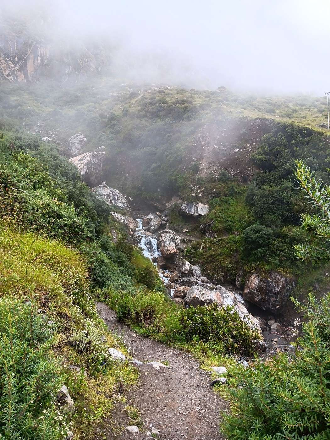
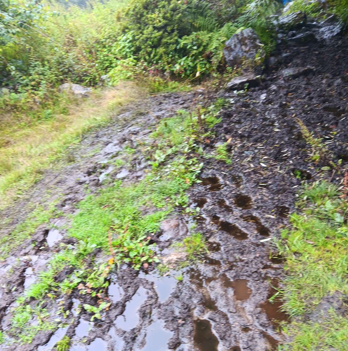
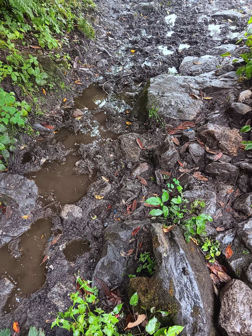
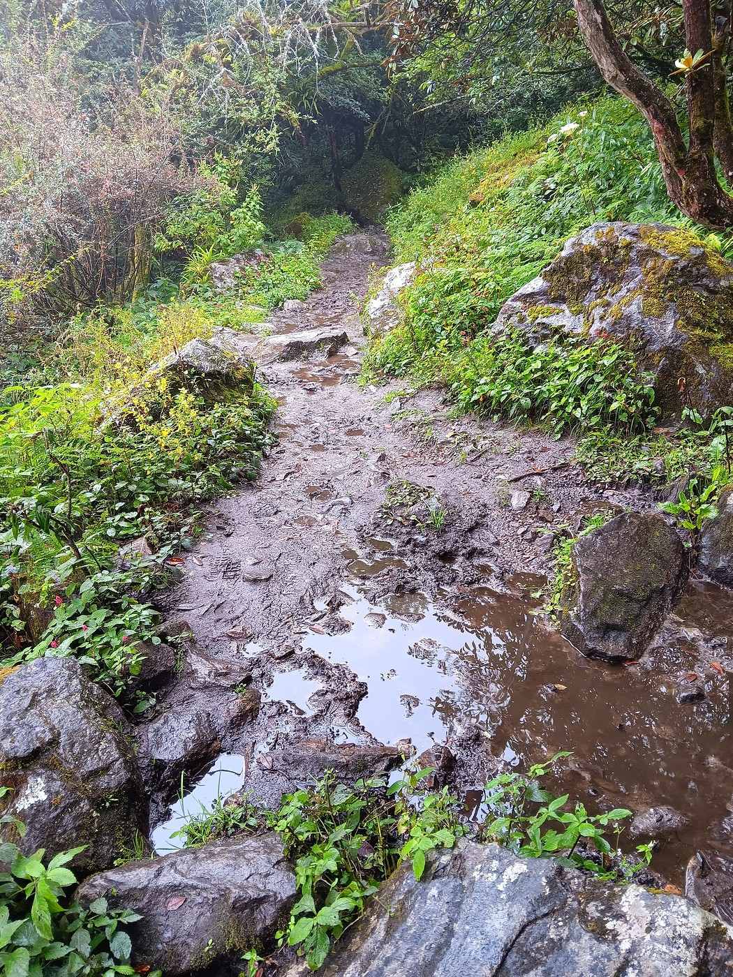
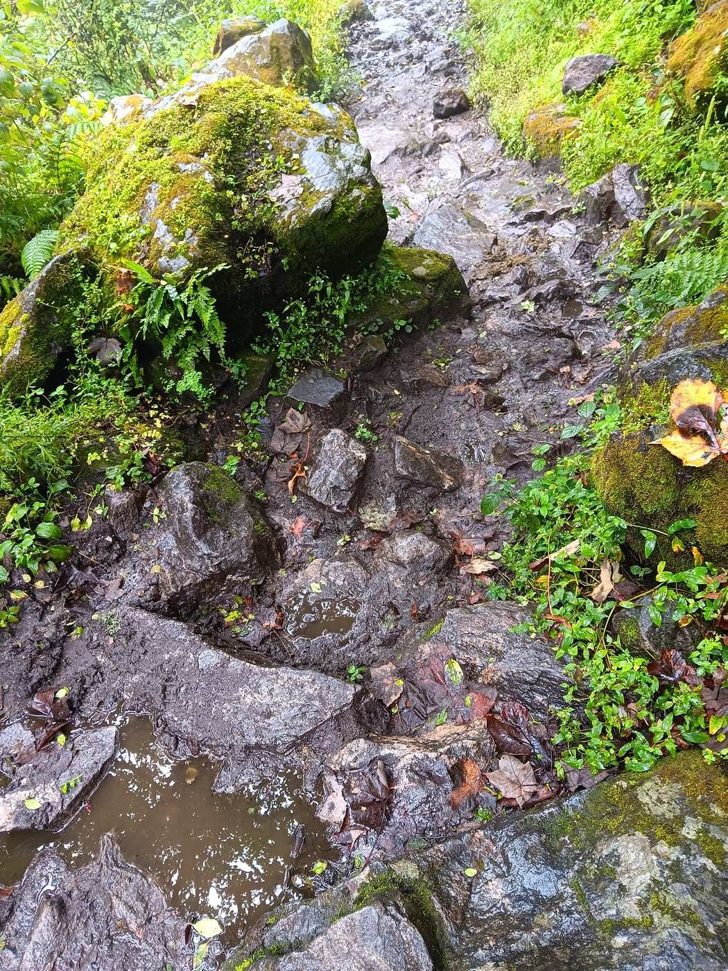
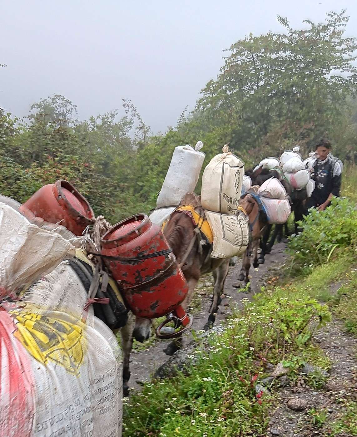
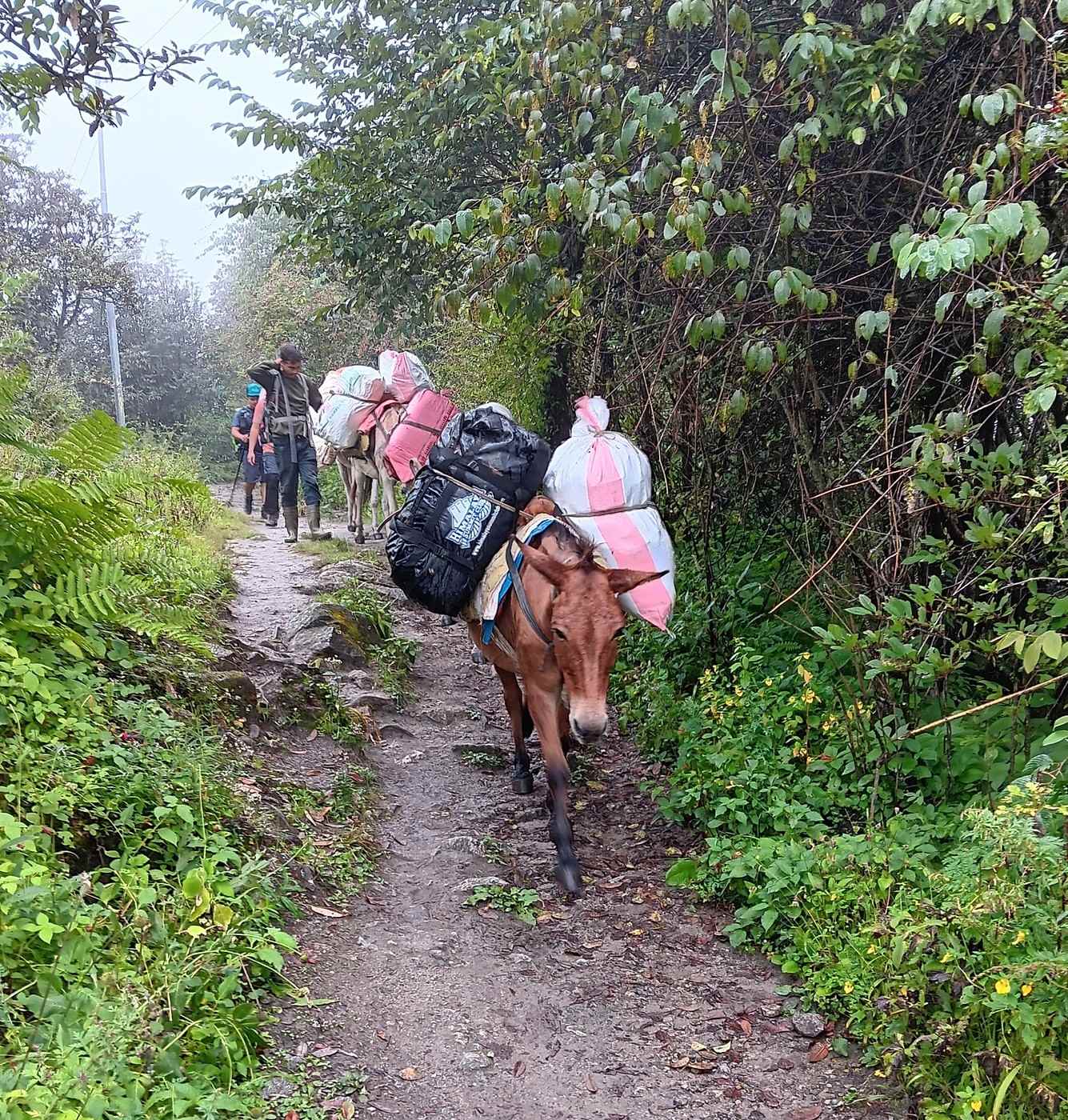
We continued on our way to Lama Hotel. It’s exactly the same path as on the way to Kyanjing Gompa, and we recognized several spots. The crossing of that beautiful stream, for example (1st photo). It’s been drizzling almost non-stop. To give you an idea of the trail’s nature, I’ve included a few photos (2nd, 3rd, 4th, and 5th photos). Around 10:30 AM, we crossed paths with a mule convoy heading up toward Langtang, Kyanjing Gompa, or maybe even farther into the valley (6th and 7th photos). The mules were loaded like... well, like pack mules! 😉 To bring goods into this remote region, there’s nothing but mules or human backs.

Since yesterday, when we left Kyanjing Gompa, we’ve seen few trekkers but quite a few Tamangs, coming and going. They really have Tibetan or at least Asian features. Yesterday, I think, two or three young people passed us almost at a run. One young girl was wearing nothing but flip-flops (red ones, I remember!) that were at least three or four sizes too big. 😮 These people are, of course, used to it.

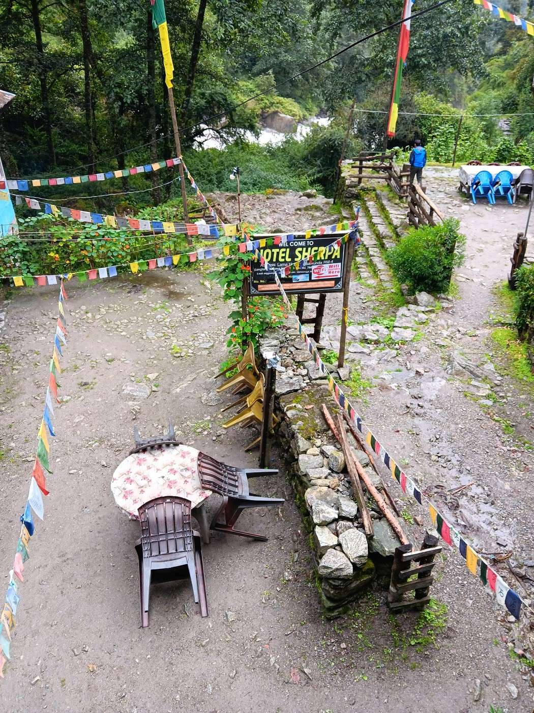
The descent is *so* much easier than the climb! And Y is now in great shape—she ran (or nearly did) ahead of H and me, accompanied by our porter S. We arrived at Lama Hotel around 2 PM. Here’s the view from the walkway we took to our room (8th photo): the courtyard of the Sherpa Hotel, an ambitious name for what it is! 😉 😇 It’s the same guesthouse as on the way up.
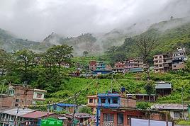
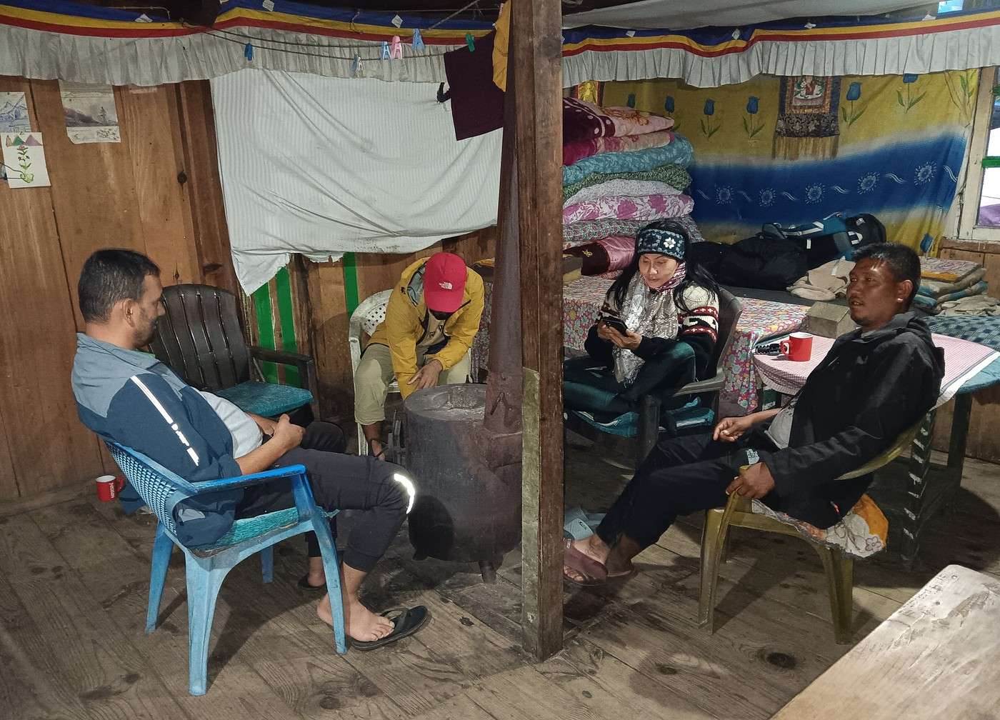
We met up again around 5 PM in the common room—there’s really nothing else to do. 9th photo: Y with H and S, warming up around the wood stove.

Since I’m almost at the 10-photo limit, I’ll take a little break before finishing this day’s account. To be continued, as they say! !
GE GeorgesOZ Globetrotter ·
Day 6 – From Langtang to Lama Hotel (Continued and Concluded)

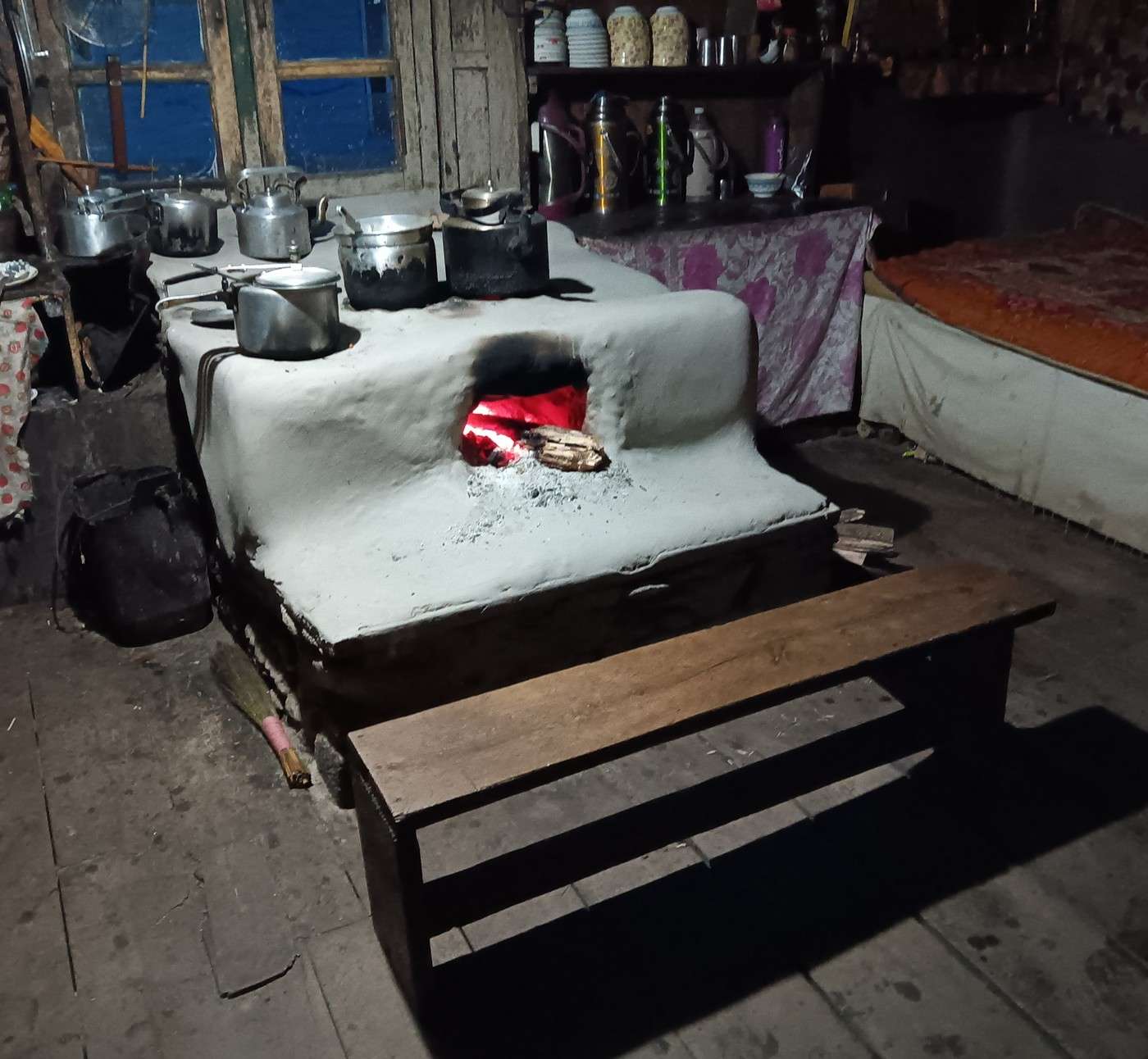
The kitchen is worth a look, especially the rustic setup (I can’t find the right word) for cooking (1st photo). Almost everyone has gotten into the habit of eating dinner fairly early. I ordered a vegetable soup, which, oh surprise! turns out to be pretty good. Did I mention we’re eating strictly vegetarian during the trek—aside from eggs and milk—to avoid any stomach issues that could ruin the trip? I think it suits H just fine, who seems to appreciate our frugality. After all, meals are part of the package we paid for, and any savings on our end benefit our agent, maybe even our guide.

A young guy who just walked into the common room catches my attention. He’s chatting with someone else about the small camera hanging around his neck. His cheerful and enthusiastic tone makes him instantly likable, and I strike up a conversation about photography, the type of camera he uses, etc. It’s his new hobby, and he’s thrilled about it! Since he sits at a nearby table, we keep talking, joined by a New Zealander and a Belgian from Leuven (I remember him—we’d already met in Kyanjing Gompa). Clearly, I’m not the only one enjoying a bit of conversation! The New Zealander talks about his experiences in Mexico and Colombia, where he spent quite some time. What I remember most is that he’d spent over half a year stuck in India during the COVID pandemic, unable to return to New Zealand—but he only answers my questions about where in India, etc., very vaguely.

The Belgian doesn’t say much, but the “photographer” is unstoppable. He’s Canadian, from Saskatchewan, of German and Ukrainian descent. He studied in southern Nova Scotia, where, he says, the Acadians speak a French that even other French Canadians can’t understand.

The young Canadian has a face that reminds me of Gene Wilder, which gets a laugh from everyone! I don’t remember everything we talked about—life stuff, etc. The main thing is that we hit it off so well that Morgan, that’s his name, warmly shakes my hand when I leave the room. It’s such a pleasure to meet people you just click with!

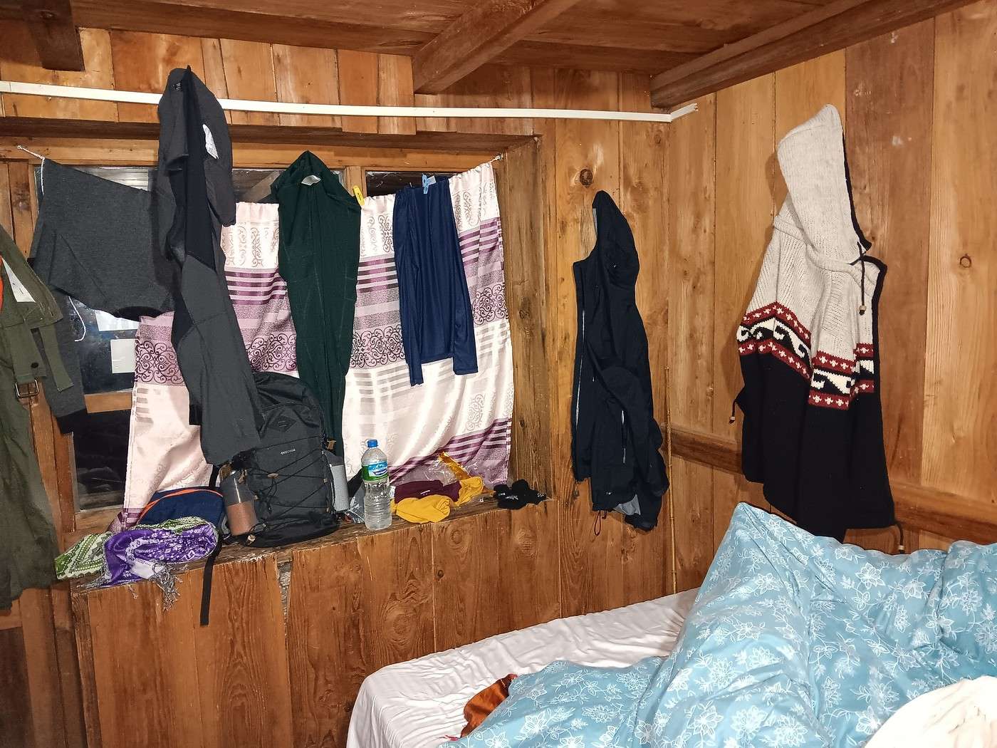
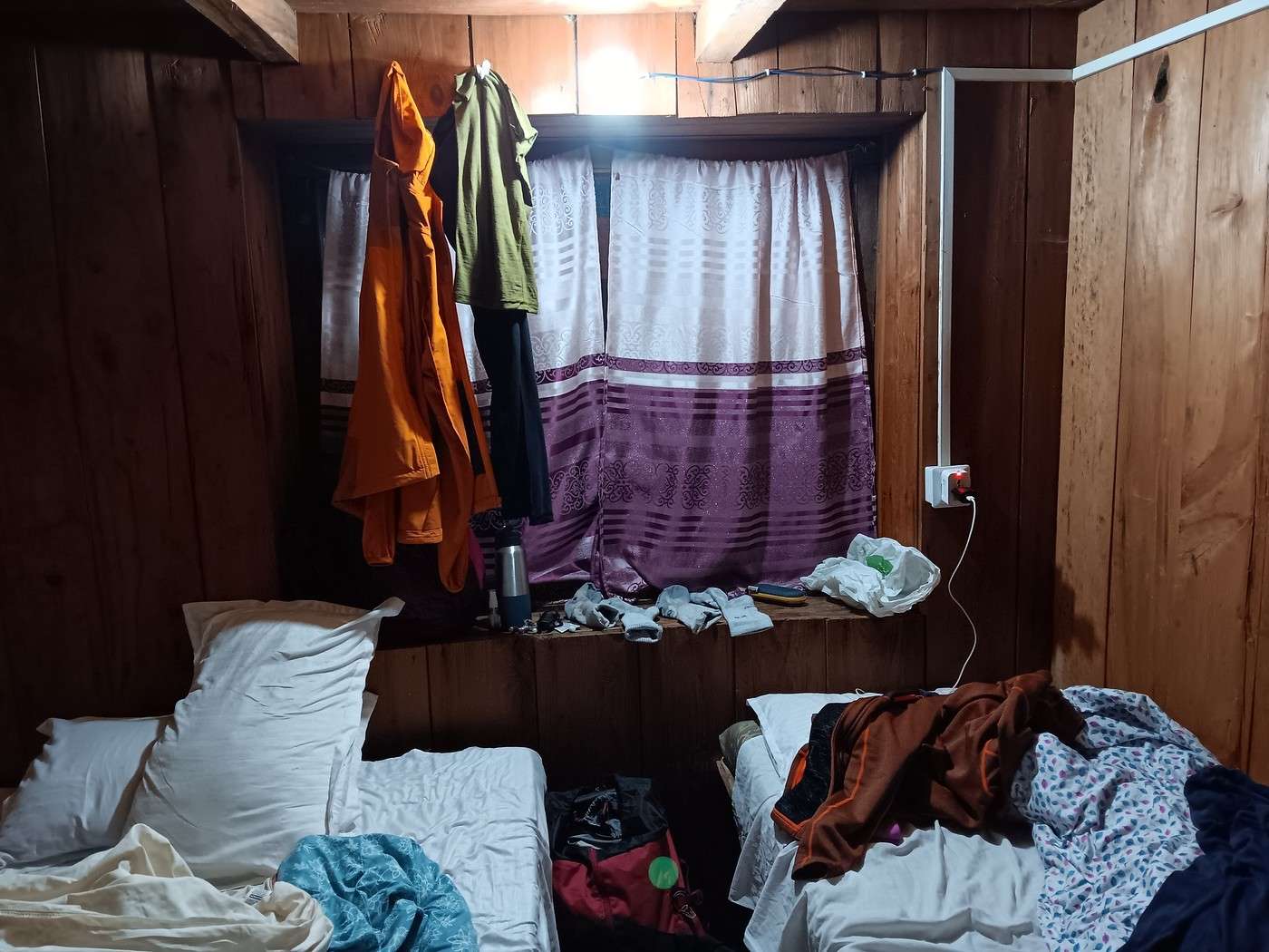
It’s raining nonstop. Y and I grab the clothes we’d hung outside. No chance they’ll dry! We hang up everything we can in our room (2nd and 3rd photos). You’ve got to make do with what you’ve got!
DJ Djalma Globetrotter ·
I think it works out well for H, who seems to appreciate our frugality. The thing is, meals are part of the package we paid for, and any savings made at our expense go to our agent, maybe even our guide.

That’s exactly it! I’ve done a few treks with mandatory guides in "restricted areas." The most recent one was in Upper Mustang... Unlike you, I have a huge appetite and rarely settled for just one (rather frugal) dish, but the guide kept pointing out that any extra dish would have to be paid for separately... Fortunately, it wasn’t too expensive, but by the end of the trek, I filed a complaint (on principle) with the agency: "Nepal Ecology Trek." The director seemed surprised, claiming the guide shouldn’t have acted that way...
https://www.youtube.com/watch?v=-XCOyB7WStI https://www.youtube.com/watch?v=g2eI67iCbKY
AL AlainB69 ·
Hi, I did this trek in a longer version with some variations and returned via the sacred lake last March. The weather was really good. I had a porter-guide (booked through a local agency from France) just for me, which allowed me to fully enjoy this amazing trek despite days with 1,200 m of elevation gain. I’m 74 years old and somewhat trained, mainly from walking in the city at low altitudes... We climbed up to 4,450 meters without any AMS issues thanks to a very gradual ascent. However, the first few days around 3,000 meters and above left me short of breath, but I adapted quickly. For me, this trek was fantastic with some really great encounters. Alain
GE GeorgesOZ Globetrotter ·
Hello, I did this trek in a longer version with some variations and returning via the sacred lake, last March. The weather was quite good. I had a guide-porter (hired through a local agency from France) just for me, which allowed me to fully enjoy this magnificent trek despite days with 1,200 m of elevation gain. I'm 74 years old and I'm somewhat trained, mainly from walking in the city at low altitude... We climbed up to 4,450 meters without any AMS issues thanks to a very gradual ascent. However, during the first few days around 3,000 meters and above, I was short of breath, but I adapted quickly. For me, this trek was fantastic with some really great encounters. Alain

You were lucky! There must have been snow in some places in March, right?
AL AlainB69 ·
Hi, there were only a few scattered patches of snow on the ground. I got caught in a snow shower at the starting point of the highest section. I gave up on summiting the 5,000-meter peak because of the wind and the condition of the people who’d done it the day before on their way back. My only disappointment was the unbelievable air pollution in Kathmandu...
DJ Djalma Globetrotter ·
The pollution but also the countless motorbikes in every neighborhood of the city... Not very pleasant to stroll through the old town.🙁 I remember when Kathmandu only had pedestrians and a few bikes...
https://www.youtube.com/watch?v=-XCOyB7WStI https://www.youtube.com/watch?v=g2eI67iCbKY
GE GeorgesOZ Globetrotter ·
The pollution but also the countless motorbikes in every neighborhood of the city... Not very pleasant to stroll through the old town. 🙁 I knew Kathmandu back when there were only pedestrians and a few bikes...

It’s true that motorbikes and scooters are a real nuisance in KTM. You can’t walk peacefully anymore, and it’s a shame because there are so many great places to see. My first visit, October 1982, was so much quieter!
NI Nimou74 Veteran ·
Fortunately, it wasn’t too expensive, but at the end of the trek I made a complaint (on principle) to the agency: "Nepal Ecology Trek." The director seemed surprised, claiming the guide shouldn’t have acted that way...

They all say the same thing...😉 I never cost them much in that regard. Like Georges, I have very little appetite at altitude and in those rather tough conditions. (We did our very first trek, the Annapurna Sanctuary, with the agency you mentioned).
« Voyager rend modeste. Vous voyez quelle petite place vous occupez dans le monde. » - Gustave Flaubert https://www.myatlas.com/anneclaire95
NI Nimou74 Veteran ·
It’s true that motorbikes and scooters are a real nuisance in KTM.

That’s true.

It’s actually surprising there aren’t more accidents in the end. At least, I haven’t seen any yet!

Waiting for the sun...😇 Maybe at the very end of your trek?
« Voyager rend modeste. Vous voyez quelle petite place vous occupez dans le monde. » - Gustave Flaubert https://www.myatlas.com/anneclaire95
GE GeorgesOZ Globetrotter ·
It’s true that motorbikes and scooters are a real nuisance in KTM.

True.

It’s even surprising there aren’t more accidents in the end. Anyway, I haven’t seen any yet!

Waiting for the sun... Maybe at the very end of your trek?

I didn’t see a single accident either, and it’s almost a miracle (if you believe in those)! We’d returned from Bhaktapur by taxi the Monday before starting the trek—it was the beginning of the big protests against the government that had turned violent (19 deaths if I remember correctly). We got stuck in a narrow street for a good hour, surrounded by crowds of people and scooters going both ways, plus tons of parked scooters on the sides (it was near a school). Honestly, I’d never seen anything like it, except maybe in Bangkok (where I rode a 650cc bike for years). Not a single accident—people were passing within centimeters of each other, absolutely mind-blowing!

As for the sun, you’ll find out soon—suspense!
GE GeorgesOZ Globetrotter ·
Day 7 – From Lama Hotel to Syapru Besi – Landslide It’s been raining since last night and probably most of the night. We’re really glad we hung up everything we could in our tiny room—at least our clothes are dry, or just about. As usual, we have breakfast around 7 a.m. and hit the trail before 8 a.m.

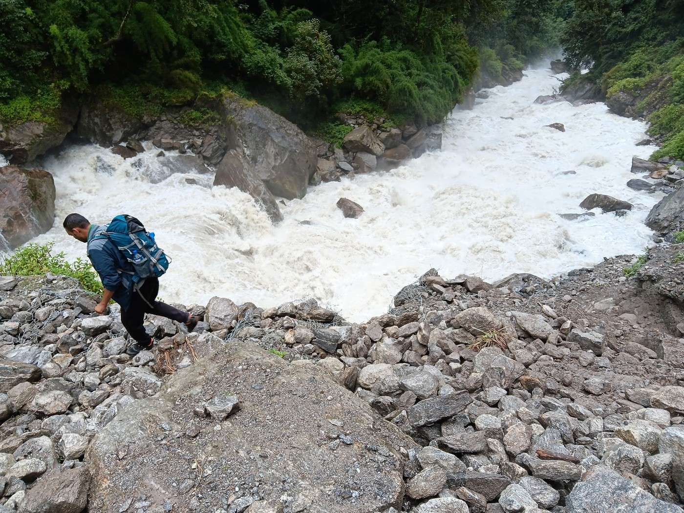
Around 8:30 a.m., we reach the most dangerous spot of our entire trek. 😠 It’s a landslide we’d already encountered on the way up. I’d had the bad idea of stepping a meter or two off the "path" and managed to climb back up by grabbing onto a big rock sticking out of the mass, which luckily was wedged in the slide and hadn’t shifted under my weight.

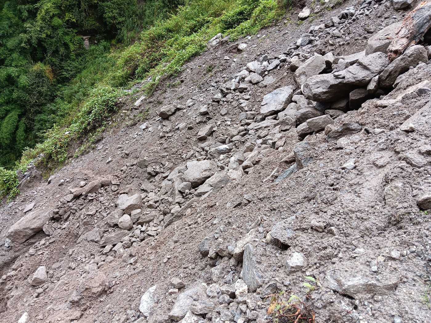
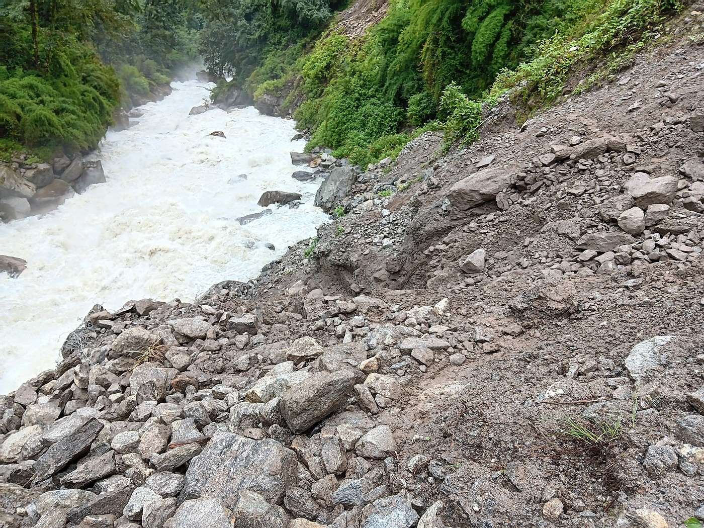
But today, it’s worse! It’s only been drizzling this morning, but with all the rain since last night, it’s slippery as hell! 🤪 And it’s clearly shifted recently!!! H climbs down a few meters to see if there’s a better passage lower down (1st photo). The photo only shows big rocks, but it’s really deceptive. It’s definitely very unstable and way too close to the Langtang River—falling in would mean certain death. 🏴‍☠️ So we take the usual "path." It’s not even 10 meters to cross, but it’s terrifying to look at.

Y goes first, helped by S. Luckily, she’s light and very agile. My turn. H waits on the other side and reaches out his hand. He’s trampled the muddy slope to make a foothold as wide as a foot. In a situation like this, you can’t hesitate too much—once you’re committed, you have to hurry to get to the other side. My instinct tells me that!

It’s so terrifying it deserves two more photos. 2nd photo: the landslide with the "path" in the center. Can you see it??????? 😇 Third photo: a few meters lower, where H went down to scout the terrain. It’s right on the edge of the river…

We’re now on the other side of the landslide. We turn around… and see the New Zealander from yesterday who just crossed too. He’s standing right at the edge of the slide to take photos. The spot is really worth it, but we shout at him not to stay there—it’s so dangerous! When he joins us, I tell him the best photos are often the ones you can’t take. A bit of my wisdom, in all humility. I’ve been in three extreme situations where there was no way to take photos.

Similarly, sometimes you witness extraordinary scenes, like local festivals in exotic countries, where you hesitate to take photos so you don’t stand out as an intruder. It’s better to stay "invisible," keep your eyes open, and enjoy the moment and the place.
GE GeorgesOZ Globetrotter ·
Day 7 – From Lama Hotel to Syapru Besi (Continued) – The Bridge A few hundred meters after the landslide, we stop at a "tea house" to catch our breath. We can’t sit outside—it’s started raining again. Inside, we run into the group of young Israelis we’d met two or three times before. One of them tells me someone died crossing the landslide in 2015. Was it related to the earthquake? No idea. I’d be surprised if there *weren’t* more deaths at that particularly dangerous spot, even if it’s not widely known. Just imagine someone slipping and falling into the Langtang! The body would probably never be found…

The Israelis confirm they’re traveling after completing their military service. I ask a few questions about it, careful not to pry. I’m aware of how sensitive the topic can be. They explain the points system used to sort and assign them to different "roles"—not necessarily combat unless they have a certain potential (if I understood correctly).

I don’t remember if it was at this tea house or another stop later, but we meet the couple from Melbourne again. It was definitely after the landslide—they were really shaken by it. The man told me their guide had to grab his belt to keep him from slipping. We also talk about how goods are transported in the Langtang Valley, especially the two men we’d (and they’d) seen in the forest carrying several wooden planks over two meters long on their backs. I’d been tempted to take a photo and regret not doing it. What a load! Maybe it was yesterday, between Langtang and Lama Hotel. Memories start to blur…

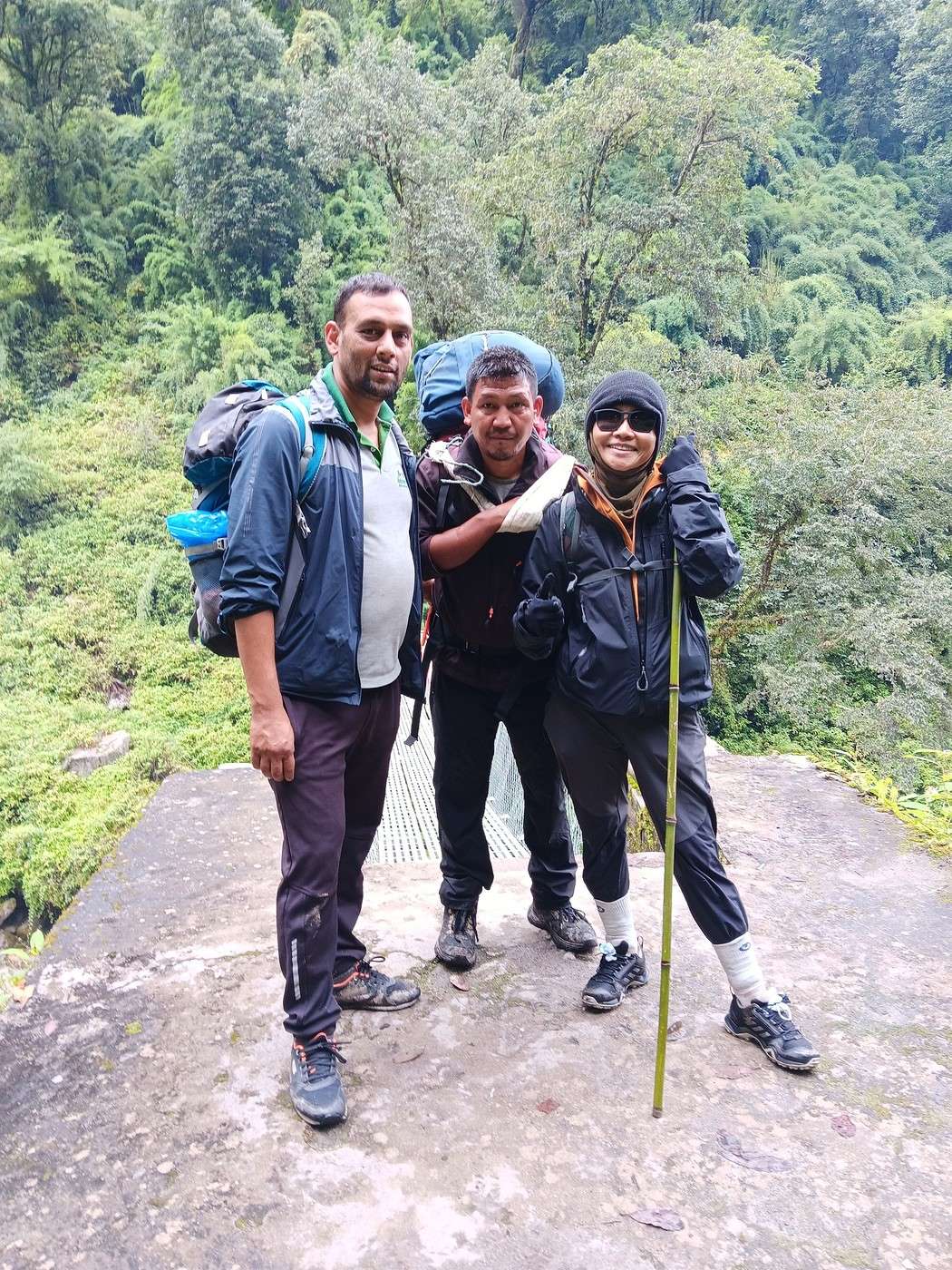
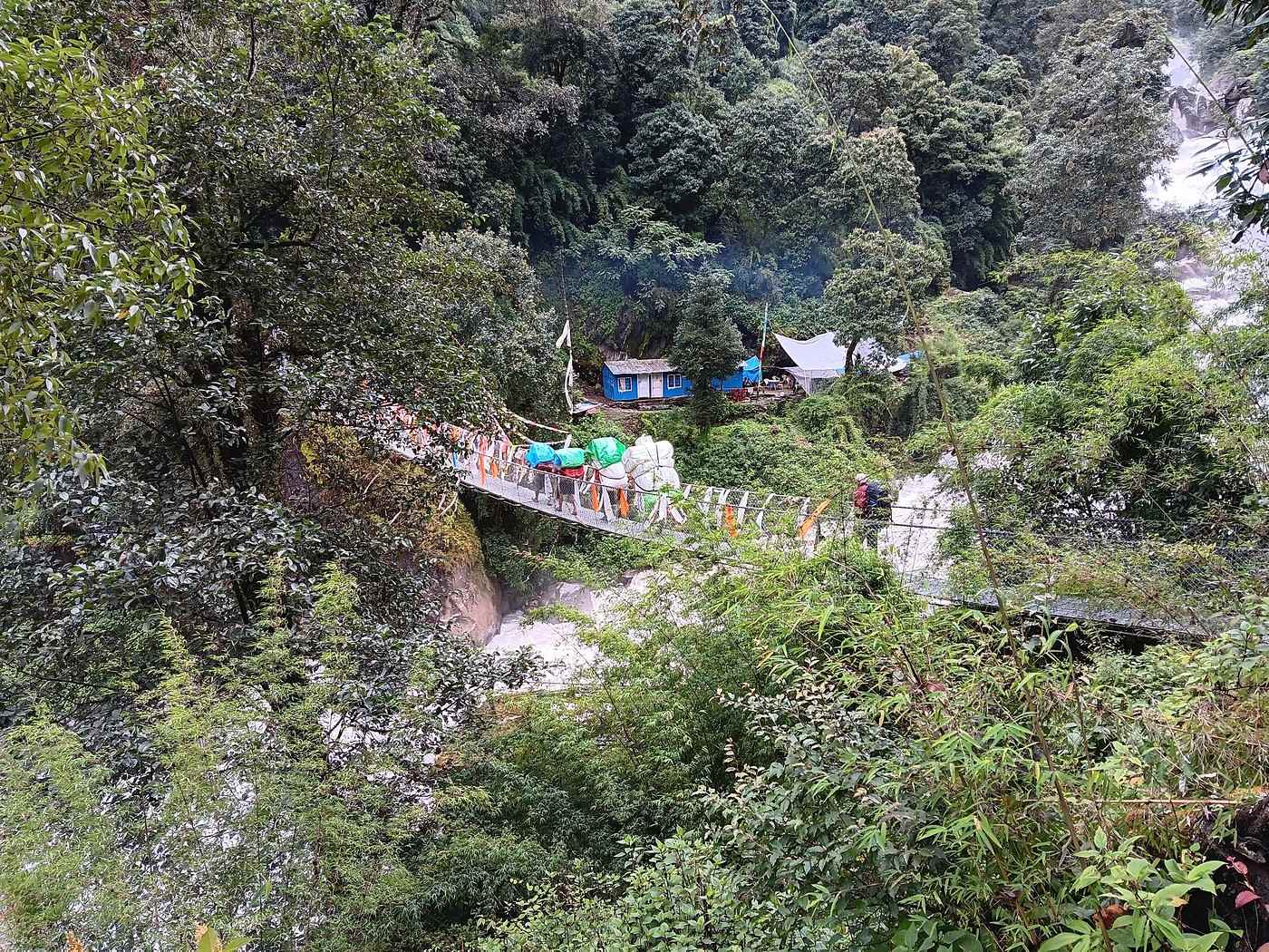
Right after the tea house, we reach the bridge over the Langtang. First photo: Y with H and S at the bridge entrance. H and S aren’t wearing hats—it’s stopped raining. It’s 9 AM, and there’s no sign of shadows—the sun’s still hiding.

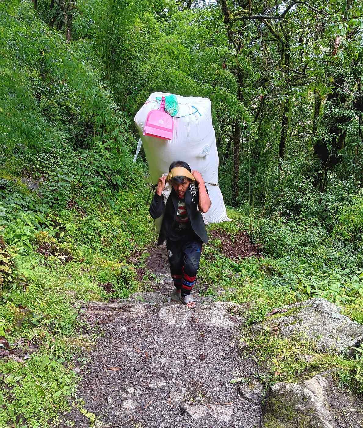
We pass a small "caravan" of porters. Again, the theme of transport in the Langtang Valley. There’s really only mules, human backs, or helicopters in extreme cases. The caravan crosses the bridge, which obviously calls for a photo (the 2nd one), though unfortunately from a distance. And ahead of us, a straggler maybe (3rd photo). Over his huge sack, a funny detail: a shovel for picking up trash, in a bright pink color! Can’t see the broom—is it in the sack? Or was it left behind as the proverbial "straw that would break the camel’s back"?
IO Iorito ·
Hi Terry, Which month would you recommend for the Langtang, Gosainkund, Helambu trek, taking crowd levels into account? I’ve done several trips to Nepal over the last 40 years—the last one was in 2012—but things change, and I’d like to avoid the biggest crowds. We’re trekking solo. Thanks so much for your feedback. IORA
NI Nimou74 Veteran ·
Hello Terry, Which month do you recommend for the Langtang, Gosainkund Helambu trek, considering the crowds? I’ve made several trips to Nepal over the past 40 years, the last one in 2012, but things change, and I’d like to avoid the biggest crowds. We’re trekking solo. Thanks so much for your feedback. IORA

Hi there, I’ll chime in... For clear mountain views, the best season is from late October to February. We’ve had bad weather as early as March. There are more people between mid-October and mid-November, but it’s not a highway by any means! It starts getting very cold by late November, but it’s manageable. I’ll also add a small note—please don’t take it the wrong way, as this is your first post: you’re commenting on a personal travel journal that someone took the time to write and document. Why not start a discussion on the topic or send Terry a PM? Happy researching
« Voyager rend modeste. Vous voyez quelle petite place vous occupez dans le monde. » - Gustave Flaubert https://www.myatlas.com/anneclaire95
IO Iorito ·
Namaste Nimou, Thanks for this feedback—it matches what I was thinking. I actually thought I’d reached out to Terry. Best,
DJ Djalma Globetrotter ·
Which month do you recommend for the Langtang, Gosainkund, and Helambu areas, considering crowd levels?

Hi there,

It depends on the type of trek you want to do. To go from Helambu to Langtang, there are two passes: Laurebina at around 4,800m, which is relatively easy but can be snowed in from mid-December until March. If you return from Langtang to Helambu via Ganja La (a very difficult pass at 5,200m to be done with a guide), you’ll need to wait until April! I did it in March—it was a real struggle. We bivouacked at 4,900m at the foot of the pass in a meter of snow, then spent 3 days without seeing another soul until Tharkhekiang. If you’re only doing the Langtang Valley from Syabru Besi to Kyangjin Gompa (like georgesOz) and even a detour to the sacred lakes of Gosainkund, you can go from February until the end of May. Or from October 15th to early December (best period). If you want to see the rhododendrons in bloom (trees up to 15m tall), you should go from mid-March to early May. PS: I don’t think there’s ever a really crowded period in Langtang. In any case, in my opinion, it’s best to avoid June to mid-October because of the monsoon. Personally, I recommend doing the "Tamang Heritage Trail" (5 days) and continuing into the Langtang Valley—it’s fairly easy, and the whole thing can be done in about 8 days.
https://www.youtube.com/watch?v=-XCOyB7WStI https://www.youtube.com/watch?v=g2eI67iCbKY
TE TerryTara ·
Hello Terry, Which month do you recommend for the Langtang, Gosainkund Helambu trek, considering the crowds? I’ve made several trips to Nepal over 40 years, the last one in 2012, but things change, and I’d like to avoid the biggest crowds. We’re trekking solo. Thanks so much for your feedback. IORA

To avoid repeating and to go a bit further, I’d say it really depends on what you’re looking for. The period between festivals is the busiest, but it’s not like Sagarmatha or the Annapurna Circuit—and even the Manaslu Circuit now. But if you want that feeling of being almost alone, I can only recommend winter, from mid-December to the end of February. I’d even push it to the end of February or a little after because snow is possible, and the views are amazing.

Yes, it’s cold, but the privilege of being almost alone—and especially being with the real locals—is worth it. Many guesthouses are run by seasonal workers during the high season, and it’s hard to know who’s a local or a year-round resident since a lot of people have a second home in Kathmandu during the winter. The experience, beyond being more solitary, is also much more authentic in my opinion. These thoughts also apply to the monsoon season, but the downside is that the mountain views are much less clear, and you’ll have to cross your fingers for a clear morning. A little asterisk for the monsoon period: during Janai Purnima, Gosainkunda isn’t exactly a haven of peace—there are about 4,000 Nepalis at the lake on average!

That said, if you’ve already traveled in Nepal, I can only recommend exploring less touristy areas. The west is wonderful, between Darchula, Rukum, and Khaptad, but the east has just as many treasures, like the Bhojpur region and the hills/mountains of Koshi Province. However, these places can be more challenging if you’re alone (without a guide or if you don’t have a basic level of Nepali). The upside? There’s almost no one there except the locals! :)
IO Iorito ·
Thanks Terry.
GE GeorgesOZ Globetrotter ·
Day 7 – From Lama Hotel to Syapru Besi (Continued and Concluded)

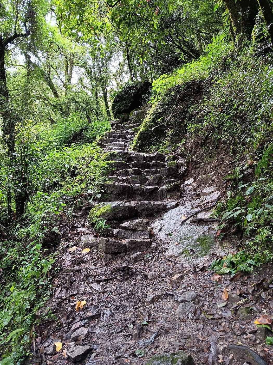
It’s just past 9 a.m. It’s not raining! 😎 But the path is tricky—there’s an endless series of stairs (if you can even call them that!) to climb up and down, and the ground is still damp. Y is way ahead of me with H. She’s in much better shape than she was on the way up! Is it because this is our last hike today, or that well-known phenomenon of horses you can barely hold back when they know they’re heading back to the stable? 😉

My first photo shows one of these “stairs.” It feels like we’re on the winding path to Mordor. Over the past few days, Y in her poncho has often reminded me of the hobbits from *The Lord of the Rings* (Frodo and company) with their funny capes. I see several hikers running up and down these “stairs,” but I’ll leave that to those who are used to it. I’m really careful about where I place my feet—it’d be so easy to sprain an ankle or take a nasty fall.

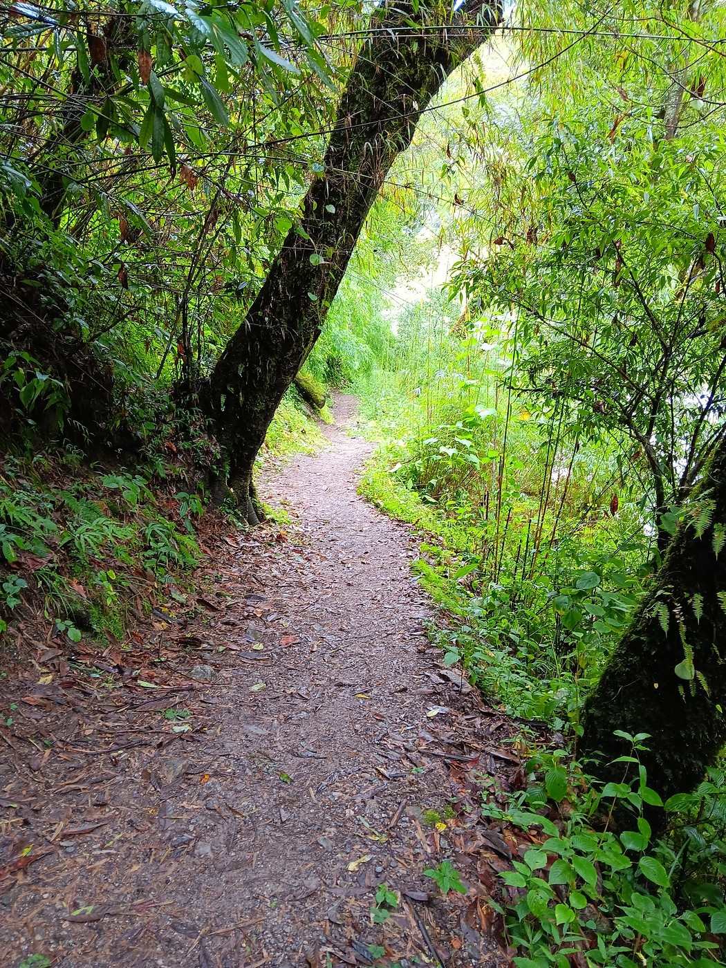
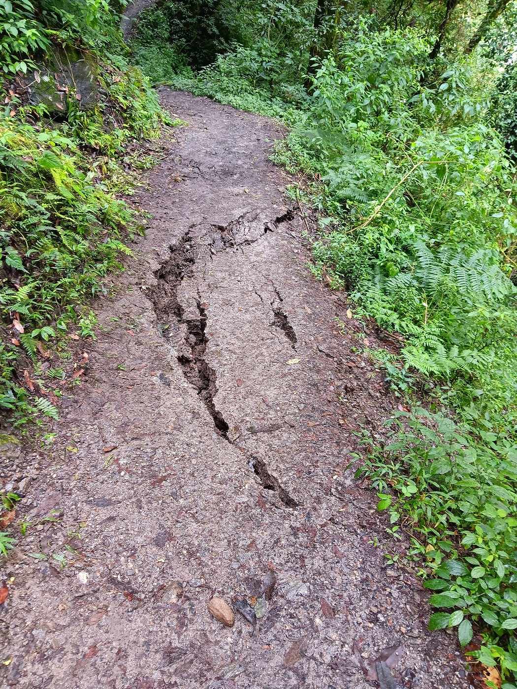
The second photo shows the path in its more relaxed version. You’d almost think you were strolling through one of France’s pretty forests. But don’t be fooled—the slope is steep right off the trail, and the Langtang River isn’t far below. 😕 My third photo proves you’ve got to keep your eyes peeled: a landslide is developing, taking out most of the path. I quickly hop over the small section that still seems stable!

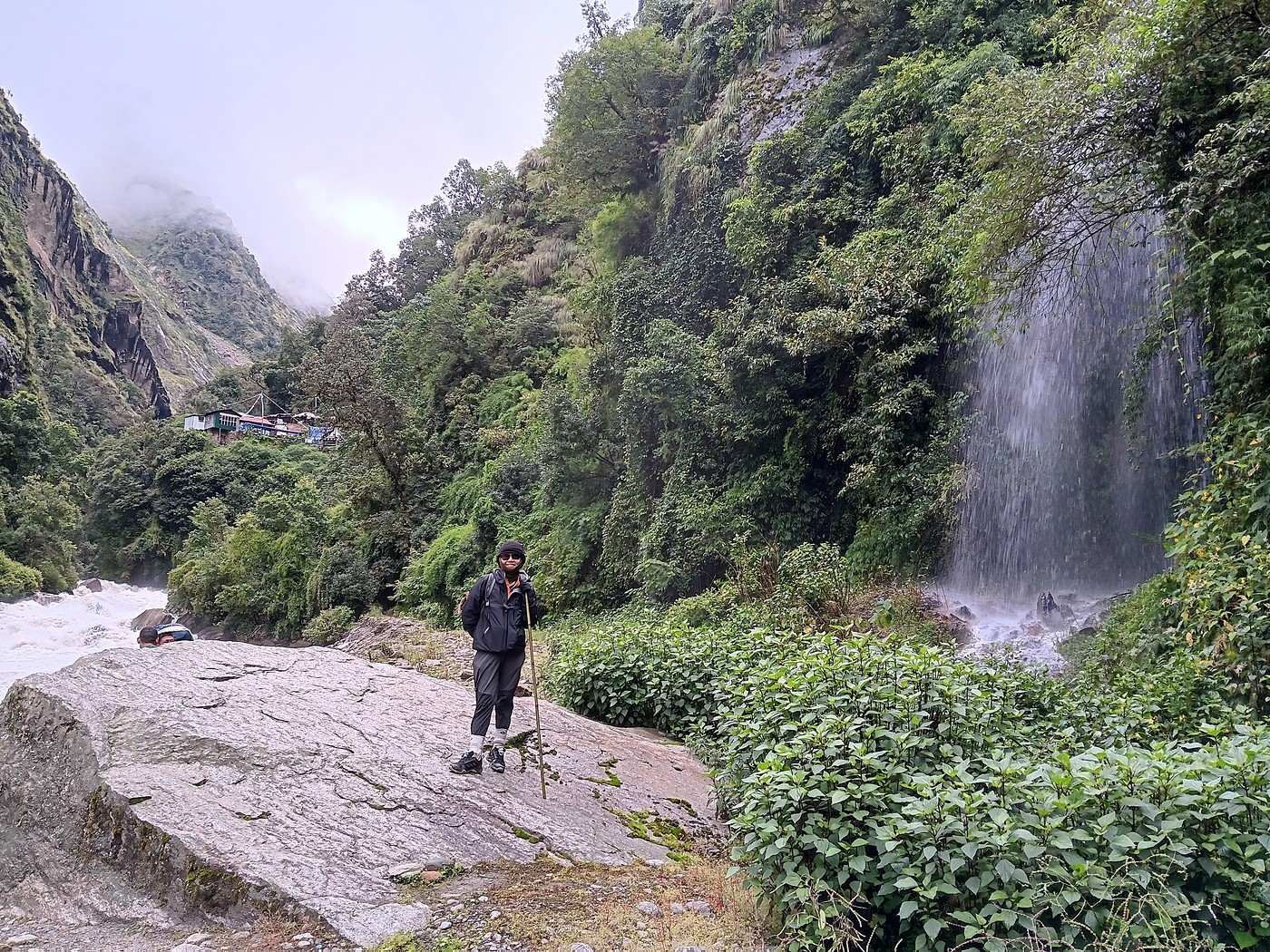
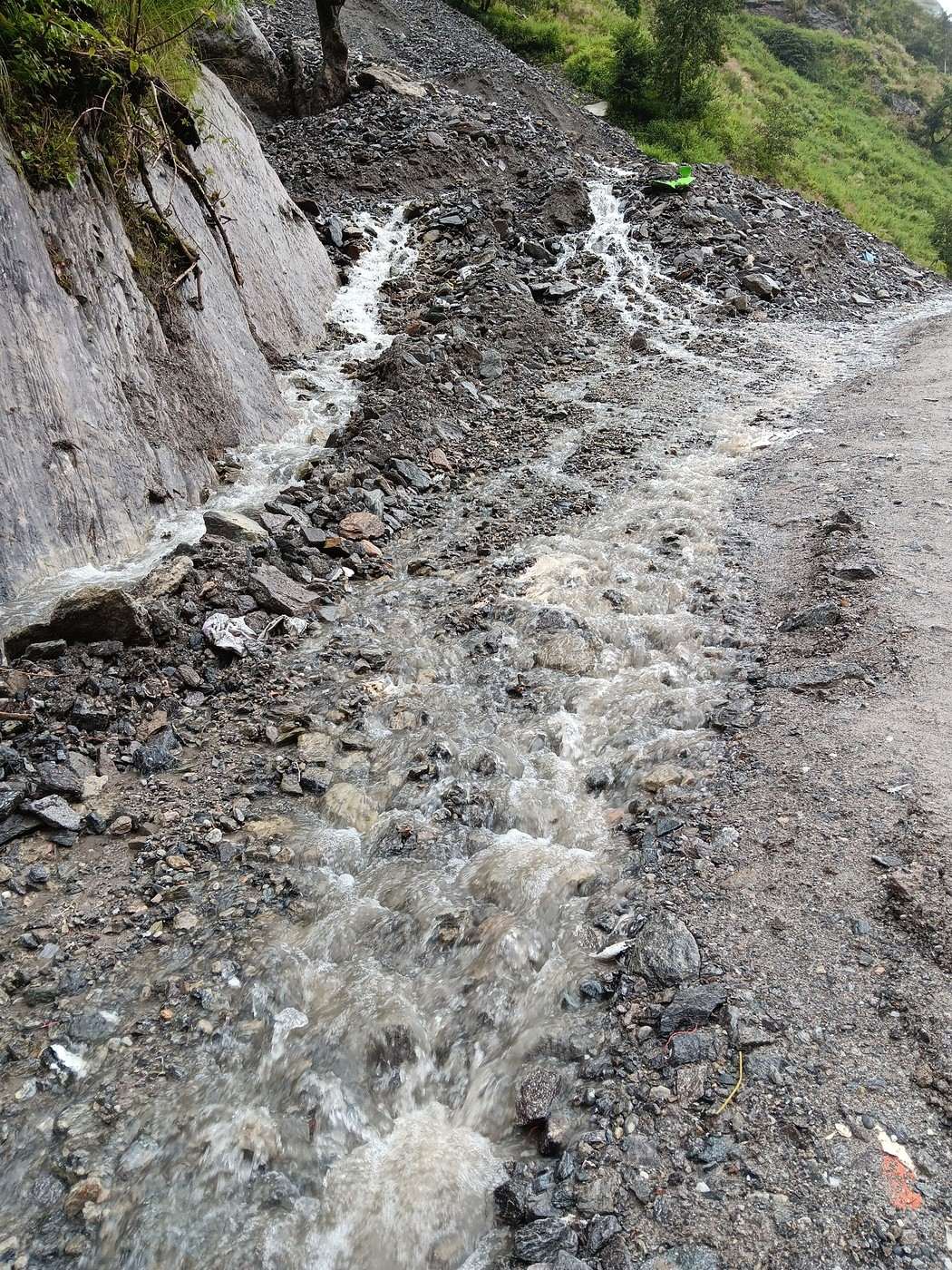
Around 11 a.m., I catch up with Y to take her photo in front of a lovely waterfall (fourth photo). It’s not raining, but the landscape is still misty. We’ve reached the last section of the trek, from the hydroelectric plant under construction to Syapru Besi. The trail is wider, but it’s still a trail, and in some places, it turns into torrents (fifth photo). There’s water everywhere!

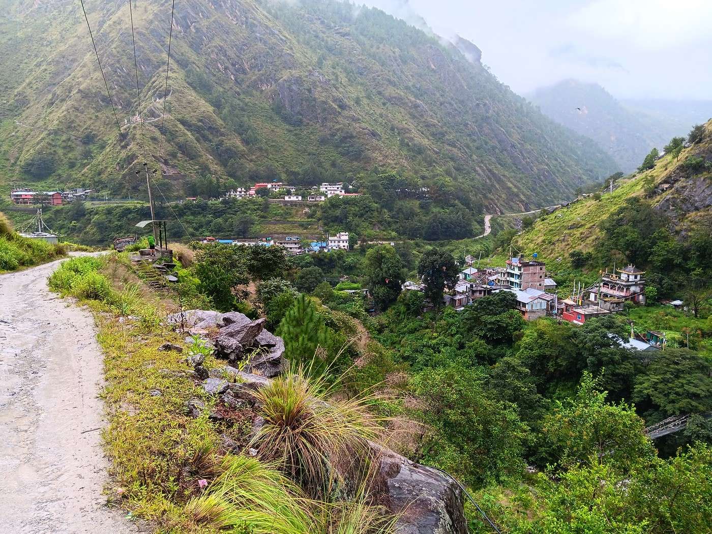
It’s past noon when we reach the outskirts of Syapru Besi. The sixth photo shows the road heading north toward the Tibetan border. And finally, the bridge over the Trishuli Ganga, just below its confluence with the Langtang. We’ve practically made it, with plenty of time for lunch. This last stretch only took us four and a half hours.
GE GeorgesOZ Globetrotter ·
Day 8 – Back to Kathmandu Barely had the God of Day spread the golden braids of his blond hair across the earth; barely had the various birds, adorned with bright colors, celebrated in their sweet concerts the presence of the beautiful Dawn, who, rising from the bed of her elderly husband, advanced while scattering roses on the horizon of the Trishuli Ganga, when Y and I, scorning the comforts of sleep, bravely descended the stairs to appear in the dining room of our GH.

I wonder who’ll react to this lyrical passage—I swiped it from a famous writer! 😉 Sometimes, I feel like you’ve got to shock readers to snap them out of their passivity!

So, to sum up: early wake-up and breakfast as usual!

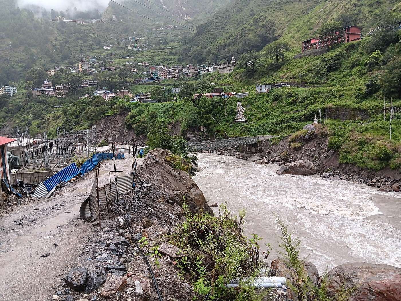
Departure by jeep around 8 a.m. The landslide that forced us to walk the last 2 km to Syapru Besi a few days ago has been cleared. The road is open!

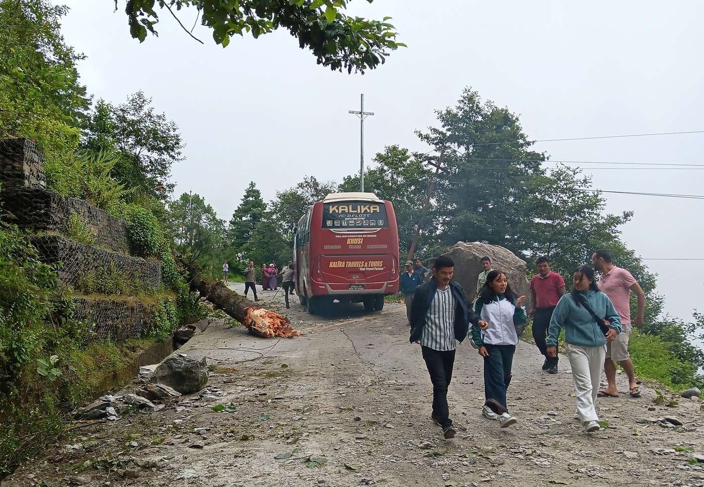
But... barely half an hour into the trip, we’re stuck behind a dozen vehicles. What’s going on? There was a new landslide just as a bus was passing. The bus seems to have avoided the worst: a huge boulder stopped right at the edge of the road before tumbling down toward the Trishuli Ganga below. Needless to say, if that rock had hit the bus, it definitely wouldn’t have been in any shape to continue!

The bus is sideways on the road. The first photo shows why: while swerving to avoid the boulder, the bus got stuck right on a tree trunk that was probably part of the landslide. I can only imagine the braking to avoid disaster! It took a while for the bus to free itself from the trunk and get back on track. But we’re moving again!

It’s 9 a.m. We stop for about ten minutes in a small village, probably for some formality. Maybe it’s the exit from Langtang National Park?

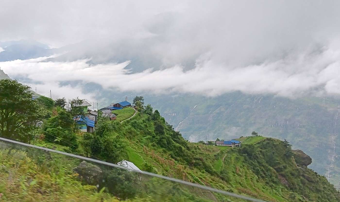
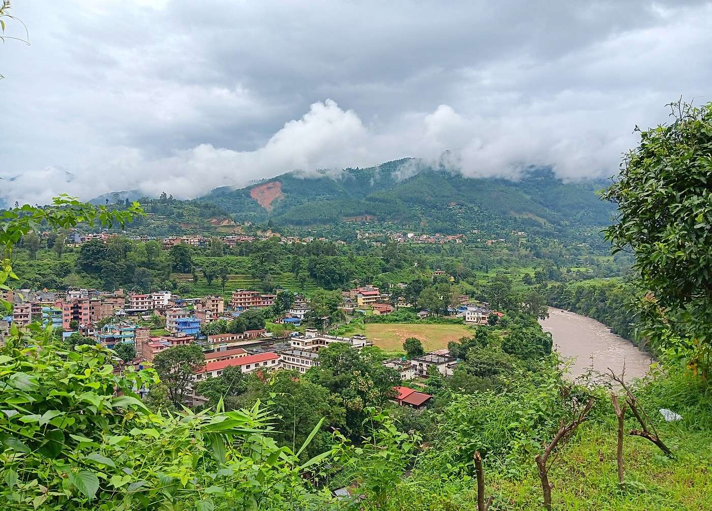
It’s not raining, but the landscape is very foggy. You can’t see the mountain peaks on the other side of the Trishuli Ganga, whose course we’re following. The slopes are steep, but there are houses and crops everywhere (second photo, taken on the fly—if you can call it that—from the jeep). I’ll share a link to a short video too; you can see the mountain on the other side of the valley and the river far below. It’s filmed from the moving jeep, so you’ll see how much it’s shaking—the road isn’t exactly top-notch! https://youtu.be/MZ7Z_ywuYNc

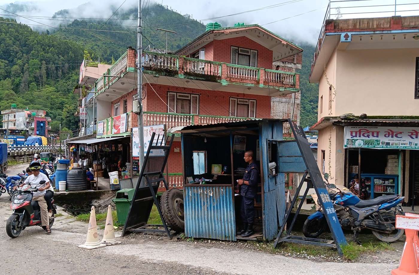
Around 11 a.m., another stop for an administrative check near Nuwakot / Bidur. The third photo: the checkpoint is really impressive!

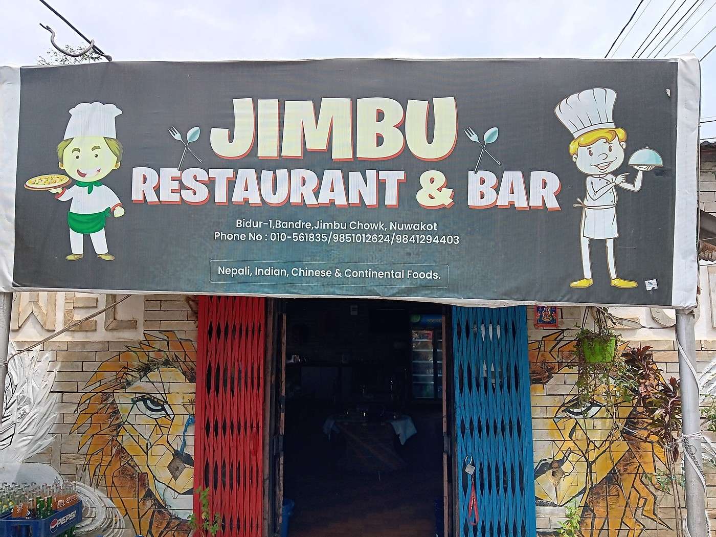
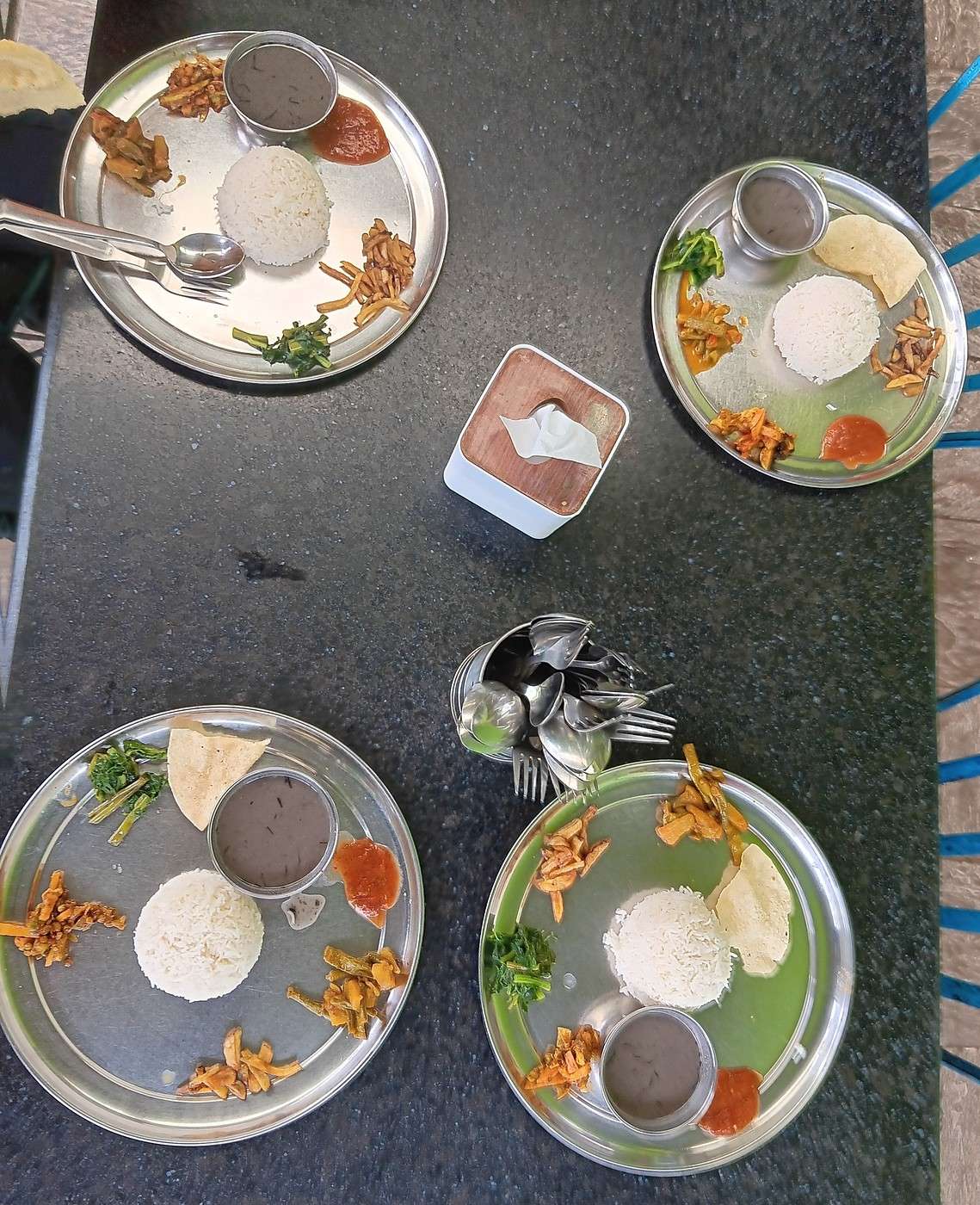
Just before reaching Nuwakot, halfway between Syapru Besi and Kathmandu, we stop again at a checkpoint (fourth photo). If I understand correctly, we’re crossing from one administrative district to another. It’s 11 a.m. We stop shortly after for lunch. It’s the Jimbu restaurant, where we’d already stopped on the way there (fifth photo). It has a lovely garden out back with a great view of the Trishuli Ganga (fifth photo again). There are a lot of people inside, so we sit at a table outside. It’s not raining, and it’s barely rained all day—what a relief! The dal bhat they serve us is delicious (sixth photo), a sign we’re back in “civilization.”

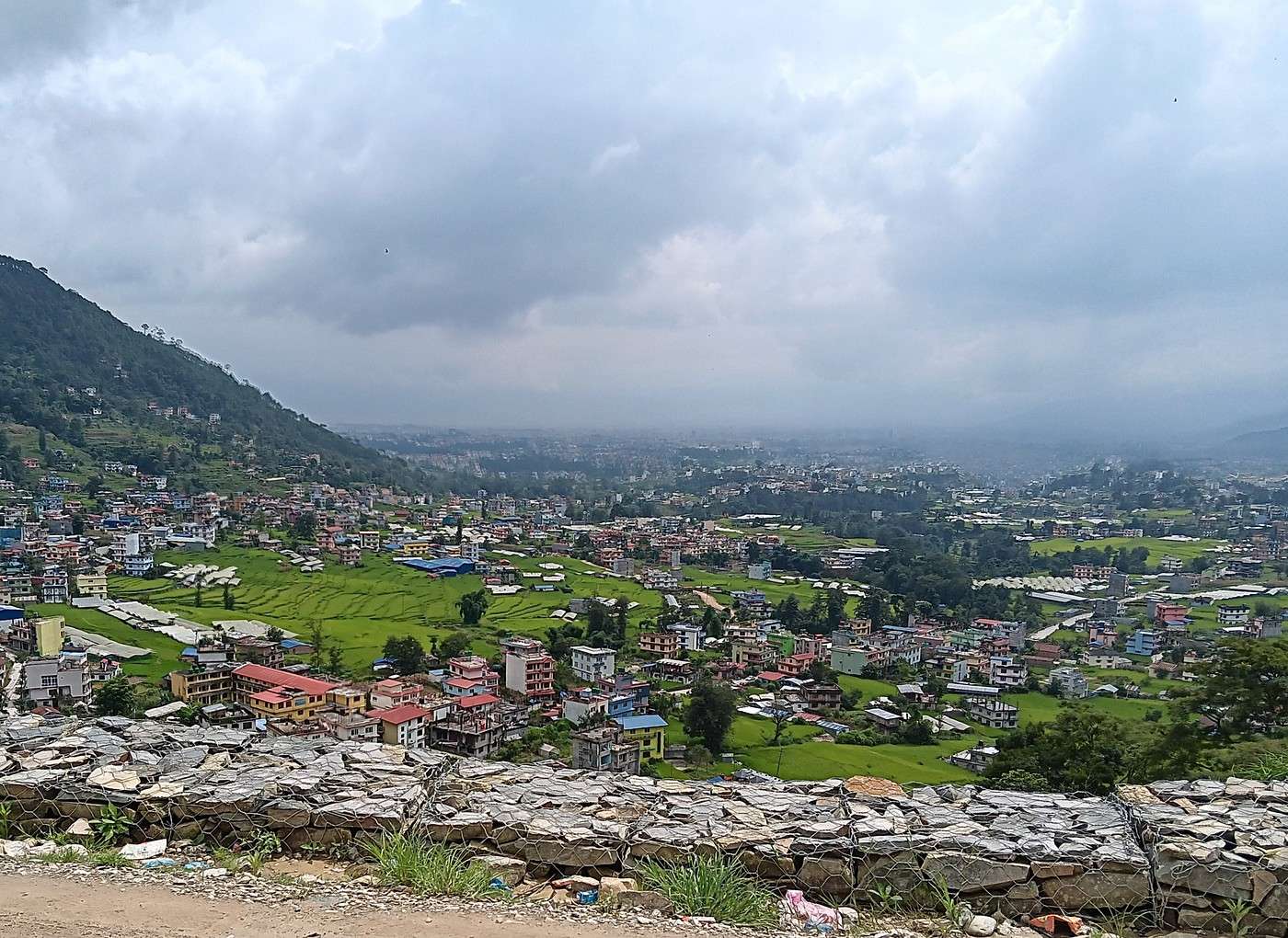
Another good fifty kilometers to Kathmandu. We follow the Likhu River for several kilometers, then there’s still some mountain driving ahead. Y took a double dose of their meds and is handling the many twists, turns, braking, and acceleration just fine. We reach the outskirts of Kathmandu around 1 p.m.—seventh photo, lots of lush green rice paddies, but traffic is picking up fast—ah, back to civilization! We arrive at our hotel in Thamel around 2 p.m. It took us 6 hours to get here from Syapru Besi.
DJ Djalma Globetrotter ·
The dal bhat we were served is really good (6th photo), a sign that we’re back in "civilization."

Nice presentation! But I’ll note that the 4 portions wouldn’t be enough for a single Nepali porter!😉 Don’t tell me the Nepalis (if there were any at the table) had the same amount on their plates... or else they were refilled 3 times!

We arrive at our hotel in Thamel around 2 p.m. It took us 6 hours to make the trip from Syapru Besi.

Conditions have improved a lot. Before, it was closer to 8 hours... in the dry season.
https://www.youtube.com/watch?v=-XCOyB7WStI https://www.youtube.com/watch?v=g2eI67iCbKY
HU Huguetter Veteran ·
Hi there, I’m reading your post with pleasure but also a bit of sadness. We went in 2018—the big circuit with Tamang and Gosainkunda. It was late November and it was already really cold… All along the trail, prayer flags marked the spots where people had lost their lives during the 2015 earthquake… It was a special trek, different from all the others we’ve done in Nepal.
GE GeorgesOZ Globetrotter ·
The dal bhat we were served is really good (6th photo), a sign that we’re back in "civilization."

Nice presentation! But I notice that the 4 portions wouldn’t be enough for a single Nepali porter! ;) Don’t tell me the Nepalis (if there were any at the table) had the same amount on their plates... or else they must’ve gone back for seconds three times!

Yes, we were indeed sitting at the table with our guide and our porter! But given your question, I’ll clarify that one of the servers came back to offer us seconds, and they probably helped themselves to more. :)

Also, the dal was better than usual, even compared to what we’d had several times in KTM. I’ll mention in passing that Nepali dal is quite similar to a black-colored soup (a certain type of lentils), and it’s always the same recipe, whereas in India there’s more variety and it’s always noticeably better, in our opinion (Y will agree with me).

We arrive at our hotel in Thamel around 2 p.m. It took us 6 hours to make the trip from Syapru Besi.

Conditions have improved a lot. Before, it was closer to 8 hours... in the dry season. ;)

What must it have been like! :|
GE GeorgesOZ Globetrotter ·
Hello I read your feedback with pleasure but also a bit of sadness. We went there in 2018, the big loop with Tamang and Gosinkung. It was late November and it was already very cold..... All along the trail, prayer flags marked the spots where people had lost their lives during the 2015 earthquake..... It was a special trek, different from all the others we’ve done in Nepal.

Thanks for your comment. Question: could you clarify how this trek is different from the others, aside from the context of the devastation caused by the earthquake?

There have been several interesting discussions about other treks in Nepal—I’m asking in that same spirit. 🙂
HU Huguetter Veteran ·
Yes, this trek was special because the damage was still visible—you couldn’t help but be moved... or forget what had happened. But another trek was also special for different reasons: crossing Mustang before the road arrived, back when half the lodgings were homestays. It felt like stepping back in time—stunning landscapes and villages, welcoming locals, and no one else on the trails. Another one that stood out was doing ABC solo, with no guide or porter. The opposite of Mustang—crowds on the trails, nationalities I’d never seen on Nepali routes before, like Chinese, Malaysians, Indians...
NI Nimou74 Veteran ·
However, another trek, for different reasons, was also special: crossing Mustang before the road arrived and at a time when half the accommodations were homestays. Like stepping back in time, with stunning landscapes and villages, welcoming locals, and no one on the trails.

Yes, Mustang is a wonderful region. The landscapes are truly spectacular, especially the left bank of the Kali Gandaki, and very different from most treks in Nepal. I’d recommended it to George.

Another one that was a bit special, done solo without a guide or porter: ABC

Strangely, it’s the trek I liked the least in Nepal. It was our very first experience in the country... It rained a lot that season, so I really sympathize with George’s bad luck with the weather—muddy trails, constant humidity... Plus, you’re often at the bottom of the valley, crossing villages, so lots of stairs... But that didn’t stop us from returning to Nepal regularly afterward.
« Voyager rend modeste. Vous voyez quelle petite place vous occupez dans le monde. » - Gustave Flaubert https://www.myatlas.com/anneclaire95
HU Huguetter Veteran ·
I agree with you about the ABC—it’s the one we liked the least too, mainly because of the crowds on the trails. The trek is easy to access, not too tough, and can be done in just a few days. After that, when it comes to the weather, Nepal aficionados know you’ve got to wait until mid-October to avoid the rain, even if nothing’s ever certain 😉
GE GeorgesOZ Globetrotter ·
I agree with you about the ABC trek—the one we liked the least, mainly because of the crowds on the trails. The trek is easily accessible, not too tough, and can be done in just a few days. As for the weather, Nepal enthusiasts know you should wait until mid-October to avoid the rain, even if nothing’s ever guaranteed 😉

Thanks to you, Anne-Claire, and the other contributors. It’s really nice of you to share all these tips about trekking in Nepal. I’m taking good notes. One thing’s clear, though—it’s definitely better to wait until mid-October before setting off!

I still need to give a quick rundown of the costs for our Langtang trek. But to give you an idea, it’s not exactly a cheap affair. When you factor in agency fees, porter costs, a guide, plus expenses not included in the package (especially drinks), it ends up being way more than 1,000 euros for a couple—more like 1,500 euros than 1,000 for 8 days. And I’m not even counting gear if you need to buy it or the flight to Nepal.

With that in mind, Mustang, which seems so appealing, is actually really expensive because of the permit costs. 🙁
DJ Djalma Globetrotter ·
To give you an idea of the cost of a 20-day trek around the Annapurnas, fully self-sufficient (no guide or porters)... Well, this was back in the 80s... It cost us 500 francs for two! All included—permit, food, and accommodation. That’s the equivalent of 100 euros today! (For two.) We slept for a maximum of 3 Nepalese rupees (80 centimes in francs!). Sometimes it was even free, as long as we ate our meals at the same guesthouse, of course. In 1985, I spent even less going without a permit to the Kanchenjunga base camp, mostly sleeping in locals’ homes. But it was *very* spartan! For Upper Mustang or Upper Dolpo, you can’t avoid the permit, which costs at least $500, often $600 or more since the trek usually lasts over 10 days. You also have to add the cost of a licensed guide or agency (mandatory), plus round-trip flights to Jomsom and the Kathmandu-Pokhara bus. A quick question about your trek: did you use a local agency in Kathmandu? Or a French agency like Alibert or similar? Because the price can double for the same service—since the French agency subcontracts with a local one...
https://www.youtube.com/watch?v=-XCOyB7WStI https://www.youtube.com/watch?v=g2eI67iCbKY
AL AlainB69 ·
With a local agency booked from France, the price is around 1000 € all-inclusive: transport from Kathmandu, a guide-porter (10 kg) just for me, food and lodging, and flexible dates. Half the price of a French agency with a group and rigid schedule. You’ll need to add a "serious" tip though.
TE TerryTara ·
I’ll try to shed some light and be transparent about prices, since as a South Asia Travel Organizer living in Nepal with my wife, a trekking guide, I think I know the current rates inside and out.

First off, I don’t like comparing different professionals’ offers because what’s included varies from one provider to another. Even with a similar program, I find it difficult—if not impossible—to compare, because it depends on the quality of the guide/porter, the trekking season, and the customer service provided by the agency or independent guide. Just look at how many people come to me during peak season because their agencies don’t help when there’s a problem with the program, like right now when most Nepali passes have been buried under meters of snow for the past two days. The price might have been attractive, but in many cases, it doesn’t include problem management—except for helicopters and making a huge profit off trekkers’ insurance.

Then, of course, there’s the provider’s origin. All French agencies delegate to local providers. I imagine this has advantages for some (like insurance), but what about the quality of the service and, more importantly, fair compensation for local workers? Last April, I met a trekking group on the Nar-Phu to Thorung La circuit who had paid over 4000 € per person for 18 days with a well-known agency (I won’t name names—Al...). Talking to the FRENCH-SPEAKING guide, he told me he was paid 2500 NPR per day and was eagerly waiting for tips because clients from this big French company are usually generous. Those are his words, and it’s pretty sad... For comparison, experienced independent English-speaking guides generally charge around 3500 NPR per day (not including tips). I find it outrageous what some French agencies pay, but at least the guide is guaranteed work throughout the year.

But even with a local agency, there’s no certainty about fair payment for the guide. The biggest Nepali agencies, which work in volume and offer attractive deals, pay guides between 1400 and 1800 NPR per day in 2025. Even more outrageous, but it explains why tips are MANDATORY with these agencies. For example, a French-speaking guide should normally earn at least 5000 NPR per day.

For the most organized guides, their salary is based on the number of participants. This allows clients to pay less individually while better compensating the guide and giving them more financial visibility throughout the year, since no one treks 12 months a year. It also makes it possible to offer a fair price for solo trekkers. The cost varies depending on whether food and lodging are included. Many don’t like doing this because they feel like they’re losing money, but sometimes it’s actually the opposite. In many places (only the very touristy ones), if the client has a guide but pays for the guesthouse themselves, many lodge owners don’t hesitate to include the guide’s expenses (room & dal bhat) because they tolerate guides earning a little extra from clients not consuming much, but not clients saving money at the expense of BOTH the guide AND the lodge. So, depending on the route and the provider, paying for a package can actually be a saving beyond just convenience, where the client doesn’t have to worry about anything.

Prices can vary enormously between regions. Sagarmatha is extremely expensive for both clients and guides/porters (800 NPR for a porter’s dal bhat in Gorakshep when their bed is the common room couch—it stings, especially when they’re paid 1000–1200 NPR per day when working for agencies), while Rolwaling, for example, is much cheaper, with prices that make sense given the overall cost of living in Nepal. Prices adjust based on how personalized the program is and what’s included. A route off the beaten path may be priced higher because it requires more knowledge and work than a standardized trek.

Ultimately, beyond a specific price, I think it’s up to each person to assess the quality of the agency or independent guide’s work, their expertise, and what they bring to clients. In my opinion, there’s a minimum ethical standard to respect (for example, 2000 NPR per day in 2025 for a porter who doesn’t speak English, and you’ll still need to add a tip). After that, it’s up to each person to decide based on the costs inherent to the route (private vehicle, number of meals included, etc.) and the guide’s quality. The advice I can give is that no matter if you find a cheap or expensive service, what matters is being happy to travel with the people you hire. You’ll be sharing an extraordinary experience with them, and the joy of that shared moment usually makes you happy to pay the person who worked for you and gave you a unique experience. If that bothers you, then don’t hire a guide and explore the trekking areas allowed for independent travelers—it’ll definitely cost less, no doubt about that haha.

No one gets rich from trekking in Nepal. Some see it as a financial opportunity, but those who last are people who deeply love their job and are happy to share their country because it’s far from an easy profession, whether in the short or long term. Except maybe for guides doing Poon Hill 28 times a year and nothing else. But what about those spending 9 months a year above 4000m between Sagarmatha, Makalu, Kanchenjunga, Annapurna, etc.?

Of course, there are always scammers and dishonest people—some who have a public Facebook group but it’s actually run by the guide’s wife to only recommend her husband. Others who are so highly recommended that they say yes to everyone and then, at the last minute, tell them they’re no longer available and give them an inexperienced guide who doesn’t speak French, just to maximize their income. But luckily, these things always come to light. That’s why, before hiring someone, it’s important to check their professionalism and ask for guarantees (guide license, agency’s legal information, etc.). Traveling isn’t that simple, haha.

Beyond specific prices, I’ll end by saying that what’s most important is ethics. Hiring a porter is ethical; loading them up with 50kg on their back isn’t. Any agency that puts more than 20kg on a porter’s back is practicing modern slavery. Yes, some do it personally to build their lodge at high altitude because they have no choice—otherwise, no one would. A guide isn’t just supposed to be a cheerful companion but a mountain professional who helps you whether things are going well or when decisions need to be made to ensure your safety. An agency deserves to be paid for its work (organization, customer service, providing professionals), especially since agencies are the only ones who pay taxes—guides and porters don’t pay any, and it’s undeclared in 99% of cases, whether they’re independent or working for an agency. Everyone deserves their salary, and it’s important to be aware of that to decide whether you can afford to hire professionals.

In short, prices vary widely, but I can only advise working with professionals who put people first—experienced professionals who love their job. That way, you maximize your chances of having an amazing experience and fairly compensating the people involved. When you contact a guide and their first recommendation is Everest Base Camp, the Annapurna Circuit, or just the region they’re from without considering your needs: RED FLAG—BE CAREFUL.

If you have questions about prices, services, or general concerns, don’t hesitate. My job is to organize trips, but I’m a traveler first and foremost, and I know all too well what it’s like to be in the dark about a destination. My comments are based on my experience and what I see daily, but if anything doesn’t sit right with you or isn’t clear, I’d be happy to discuss it! :)
SU SuperNomad ·
Hi TerryTara,

I’ve had the chance to go trekking in Nepal several times (Annapurna Circuit, ABC, Three Passes Trek in the Everest region, Langtang-Helambu) but it’s been a while now (2008–2011). Since then, I’ve been wondering if it’s still possible to do solo treks without a guide or porter. Also, do you have any updates on permit regulations and which regions/treks require them? Finally, is there a long-distance trek in the country—something that would take several months to complete?

Thanks for your replies!
TE TerryTara ·
Hi TerryTara,

I had the chance to go trekking several times in Nepal (Annapurna Circuit, ABC, Three Passes Trek in the Everest region, Langtang-Helambu) but it’s been a while (2008-2011). Since then, I’ve been wondering if it’s still possible to do treks solo without a guide or porter. Also, do you have any updates on regulations regarding permits and the areas you can trek through? Finally, is there a long-distance trek in the country? One that lasts several months of walking?

Thanks for your answers

It has indeed been a while—Nepal is quite different now compared to back then :)

Solo treks without a guide or porter are still definitely possible, and nothing has changed except for the "Restricted Areas" like Nar, Upper Mustang, Manaslu, etc. The only new requirement is that you now need a guide for Shivapuri National Park, whereas before you didn’t. If you speak some Nepali or have strong persuasion skills, you don’t necessarily need a guide—just being with a Nepali is enough.

As for a long-distance trek, the most famous one is the GHT, the Great Himalaya Trail, which crosses the Himalayan range. There are variations between the classic high route and the lower route, which was more recently defined to avoid restricted areas, allowing you to do it completely independently from start to finish. This helps with skill/knowledge issues since there are technical sections, like the pass between Makalu and Sagarmatha (Sherpani Pass), which sometimes require camping.

But the GHT is so long with all the elevation gain that it’s typically broken into several parts, allowing you to complete it in 2, 3, 4, or more trips.

Beyond the GHT, there are plenty of trekking routes that can be combined or adjusted to hike for weeks or even months without any problem. The Himalayas are so vast that trekking all the valleys in Nepal in one lifetime isn’t possible—unless you’re a superhuman like Kilian Jornet, haha
SU SuperNomad ·
Thanks for the quick reply!

Seriously, Nepal has really changed! For the better, I hope! 🙂

I’ll take the time to look into this GHT route. If I have any questions, I’ll go ahead and add you to my contacts.

See you around!
DJ Djalma Globetrotter ·
hi there

it's Shivapuri National Park. If you can get by in Nepali or have serious powers of persuasion, you don’t need a guide—just being with a Nepali is enough.

Do you know why that is? I crossed it on my way from Sundarijal to the Langtang (Laurebina Pass). The "park" isn’t very high in altitude—it’s mostly forest, and there’s little risk of getting lost. Honestly, I’m not sure what makes it special. You exit pretty quickly into Helambu.
https://www.youtube.com/watch?v=-XCOyB7WStI https://www.youtube.com/watch?v=g2eI67iCbKY
DJ Djalma Globetrotter ·
Any idea what the GHT might be like? https://www.martinpierre.fr/pages/treks-asie/great-himalaya-trail.html Martin Pierre’s descriptions and route guides are the best I’ve come across. Duration: 120 to 130 days, around 1,700 km. https://www.tamera.fr/voyages/himalaya-et-inde/la-grande-traversee-du-nepal-1500-km-pied-sur-le-toit-du-monde
https://www.youtube.com/watch?v=-XCOyB7WStI https://www.youtube.com/watch?v=g2eI67iCbKY
TE TerryTara ·
Thanks for the quick reply!

Seriously! Nepal has really changed! Hopefully for the better :)

I’ll take the time to look into this GHT route. If I have any questions, I’ll go ahead and add you to my contacts.

See you around!

Some things have changed for the better, others for the worse. Development always has its pros and cons, and perspectives vary. I live in Nepal, so I can mostly say positive things about this adopted country of mine. What’s certain is that Nepal remains a wonderful playground :)

Feel free to reach out if you need anything—you can contact me directly through the website or social media: Nepal ma Tara.

Do you know why? I crossed it starting from Sundarijal toward Langtang (Laurebina Pass). The "park" isn’t very high in altitude—it’s mostly forest, and there’s little risk of getting lost. To be honest, I don’t know what makes it special. You exit pretty quickly by crossing into Helambu.

Several reasons—the army now controls the area much more strictly than in the past. Even if you take side trails, you risk running into soldiers who aren’t exactly welcoming. Last year, I found myself at gunpoint, being yelled at about what I was doing there, even though I technically hadn’t entered the park yet and was just passing through a regular village.

There have been numerous "incidents," both real and premeditated (attacks, kidnappings, murders), making the area sensitive. There have also been a few animal attacks, which led to measures like "no solo travelers in the park." This applies to Nepalis too—they don’t let anyone wander alone and take contact details from everyone passing through. On the western side at Jamacho, you’re forced to take a single out-and-back trail, and they’ll tell you the latest time you must return. If you don’t, they’ll call you, and if you don’t answer, they’ll contact your emergency contact.

Personally, I think it’s overkill, and unless someone explains it clearly to me, I find it ridiculous. The same thing happened near Champa Devi due to "incidents," but there’s no control there. Same with Phulchoki, near Godawari—it’s even more absurd because there’s literally an army presence at the summit.

But that’s Nepal—sometimes you just have to accept you won’t understand why, haha
SU SuperNomad ·
Thanks Djalma! Great tip.

@Terry Your intro page is amazing—what a life journey! 😐
TE TerryTara ·
Thanks Djalma! Great tip

@Terry Your intro page is amazing—what a life journey! 😐

I can confirm it’s not the most conventional path, but hey, anything’s possible in life! :)
FA FabGreg Globetrotter ·
If on the return from Langtang Helambu you go via Ganja La (a very difficult pass at 5200m to do with a guide)

Crossing the north side of the pass was made easier before autumn 2016 by the installation of a fixed rope along the exposed final access ridge, and a long ladder (retreat if the ridge is too snowy). But it’s still not for the Sunday hiker...

Check out the video starting at 24'03 in https://www.youtube.com/watch?v=GWK9eJTrs50. The long ladder can be seen on the left at 24'38, not as secured as in our Alps (for example, the impressive Schöllijoch between Turtmann and Zermatt).

On the south side of Ganja La, it remains just as wild to reach Tahrke Ghyang in Helambu: 2 long days without a single village or hamlet, with water sources scarce along the route following the ridges. However, the route shown on OpenStreetMap and similar platforms seems to match what’s reported, including tracks published on Wikiloc.

Fabrice
S'exposer à l'Etranger lointain amène à mieux connaître et comprendre sa propre Culture.
DJ Djalma Globetrotter ·
Good evening, The video makes it look pretty cool without snow. I did it in early March and it wasn’t easy without proper gear! No GPS back then either... I knew the Ganja La pass was tough, plus you have to bivouac for 3 nights... and after the pass, finding the right path isn’t straightforward. Alone, I would’ve gone straight down into the first valley and gotten completely lost. That’s why I hired a local "guide" at Kyangin Gompa. There was a lot of snow, and the "guide" spent ages looking for the right passage. No fixed ropes back then either.

No ice axe, and my rented crampons from KTM gave out on me, so I had to dig steps into the frozen snow with the tips of my shoes—no room for error. One slip and I would’ve gone crashing onto the rocks hundreds of meters below. We bivouacked at the foot of the pass in a meter of snow, and at night, rocks were tumbling down just a few meters from our tents... Long story short, I was pretty freaked out and so relieved after crossing the pass. Two more days of nothing until Tharkhekiang.

Oh, and I almost forgot—no water! And my guide hadn’t planned anything at all...
https://www.youtube.com/watch?v=-XCOyB7WStI https://www.youtube.com/watch?v=g2eI67iCbKY
SU SuperNomad ·
I don’t remember this kind of ladder when I hiked the Langtang.

Nepal is so rustic! 😐 I just got back from the US where I hiked the PCT—totally different!!
DJ Djalma Globetrotter ·
I don’t remember that ladder when I trekked the Langtang.

Hi, Did you go through the Ganja La?! What year was that? If it was just the Langtang Valley, there aren’t really any difficulties, so no need for a ladder. 😉
https://www.youtube.com/watch?v=-XCOyB7WStI https://www.youtube.com/watch?v=g2eI67iCbKY

Similar discussions

You might also like