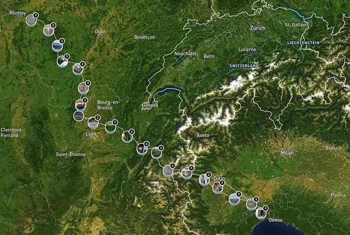
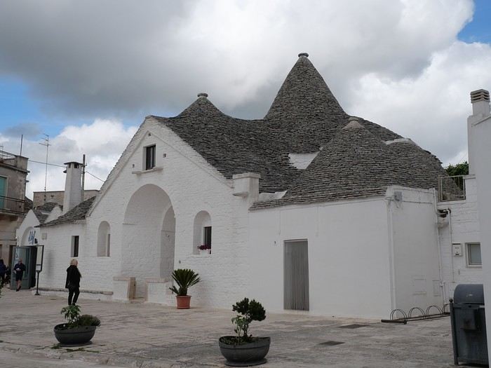
As I’ve mentioned elsewhere, I inherited my love of travel from my parents and some of my grandparents. A strong passion, but one that was unfortunately limited by our family’s modest resources. Back then, living in northern Alsace, a simple trip to the southern part of the region—with the Wine Route as our destination—felt like an extraordinary journey to a land of plenty for the little boy I was in the late 60s and early 70s.
Everything seemed so huge when you were still just a kid.
Back then, I was overwhelmed by countless sensations—I was already highly sensitive, with a keen mind and a nose and taste buds that were developing like a pro’s. Which, as I’d later realize, wasn’t always an advantage.
Those magical days always began with a gentle late-spring or midsummer morning. The interior of the white Peugeot 404, license plate 210 LZ 67, had already soaked up the sun before the engine purred to life, and the cabin gave off a scent I could still recognize today—a fragrance I found so pleasant. Back then, I had no idea it was just the smell of warm plastic from the car’s interior.
Yes, the scents of the 404 on sunny days became my madeleine de Proust...
What’s more, the whole family was unusually cheerful because those moments of relaxation and leisure were rare. Everyone worked, and no one had an easy job or was well paid. Without the *Trente Glorieuses*, these experiences might never have happened.
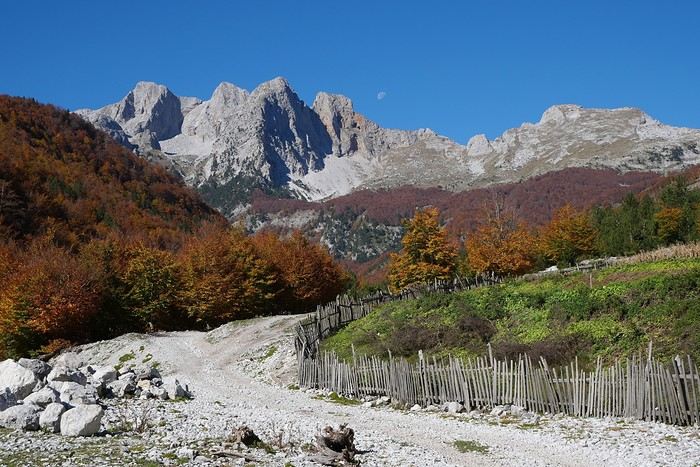
Once we crossed the canton’s borders, I felt like I was light-years away from my everyday surroundings, and every kilometer plunged me deeper into *terra incognita*. It was thrilling. Far from my so-called "medium-sized" town, wheat fields, cornfields, and cabbage patches stretched out, punctuated by tall poles connected by long wires and topped with vegetation—like giant clotheslines without laundry, where magical beanstalks might grow to touch the sky. Back then, I was still far from tasting their product, which was simply beer. At the time, there was still a significant local hop production. Fun fact: it wasn’t until 2002 that Anglo-Saxon scientists proved hops and cannabis belong to the same biological family.
After the fields, the landscape took another step up as it rolled past the little boy’s eyes, often glued to the windows. First came modest hills, then a succession of rolling slopes that soon formed an unbroken chain. Their 700 meters in altitude felt like Himalayan peaks to me—impressive, inert giants, a whole new world. Gazing at them, an intense emotion welled up somewhere between my stomach and lungs, nearly taking my breath away. What mysteries, what treasures did these heights hold?
And then there were the cherries on top—the crowning touch that made the scene even more magical: proud, majestic castles perched on the summits like impassive sentinels. Monuments from the past, yet firmly rooted in the present on their rocky spurs.
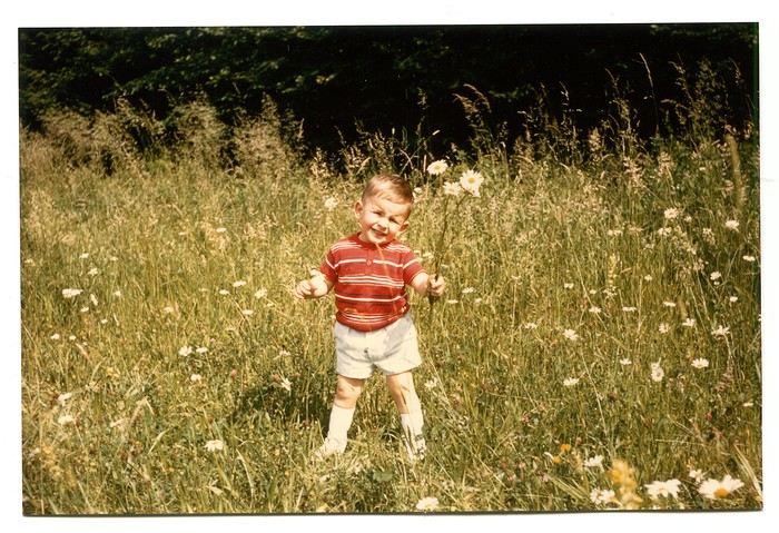
The little boy’s eyes sparkled—he’d been given a castle for Christmas, complete with battlements, towers, a drawbridge, and fully armed knights. He’d watched and lived *Ivanhoe* on the only French TV channel that existed back then.
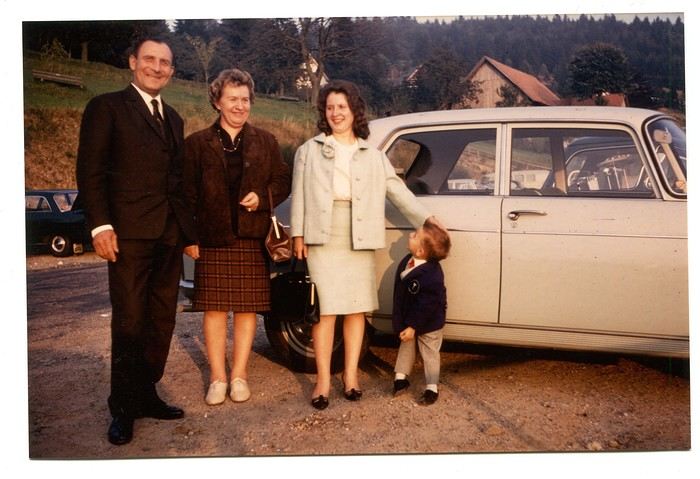
Only once did my paternal grandfather join us on one of these trips. A tall, intelligent man with a face that could shift from stern to mischievous, clearly full of humor and charisma. Sadly, his relationship with alcohol had taken a toll on his life and, by extension, those of his loved ones. He had a strong personality—if his boss crossed the line, he wouldn’t hesitate to punch him, which meant he went through a lot of different jobs. Back then, you could quit one job and easily find another. It was quite something to see him in his final stages, hallucinating pink elephants and even drinking perfume when he had nothing else left. The last time I saw him, he’d slipped away from the doctors and nurses while hospitalized in pretty bad shape—at least, I assume his liver was the issue. We were sitting down for a family lunch when the door burst open, and there he stood in his pajamas, eyes twinkling with mischief, clearly pleased with the dramatic entrance. That theatrical moment didn’t spare us from burying him a few months later at the age of 71. One day, my mother told me the family doctor had quietly remarked that it was a shame—with his robust constitution, he could’ve lived to be a hundred. Yes, the family doctor—this was the man who’d come treat you any day, at almost any hour, just for a phone call. It really existed, it’s not a myth!
That day, his wife—my paternal grandmother—was also along for the ride. Everyone agreed that Jeannette was a good woman. She worked as a waitress at *Le Tigre*, the biggest brasserie in town, right in the center. Most customers preferred to be served by her, including local dignitaries and even the mayor. As a kid, I didn’t find her very fun, open, or warm—she seemed a bit stern. Back then, women in their fifties already had the face and build of grandmothers. Same went for men, don’t get me wrong. I had no idea about the struggles she faced because of her husband. I didn’t know that 30 years earlier, she’d had to flee Alsace while pregnant, under threat from Nazi fighter-bombers. I didn’t know she’d had several miscarriages, and that my father—her only surviving child, born prematurely in March 1940 at the other end of France—weighed less than a kilo at birth and was so tiny he could fit in a shoebox. Hard to imagine he’d grow into a strapping man nearly 1.80 meters tall, tipping the scales at 100 kilos.
When you come back from summer camp in early August and ask why she didn’t pick you up with your parents, and they gently tell you she’s "in heaven," you don’t realize she passed away at 54 after suffering greatly from stomach cancer that had spread.
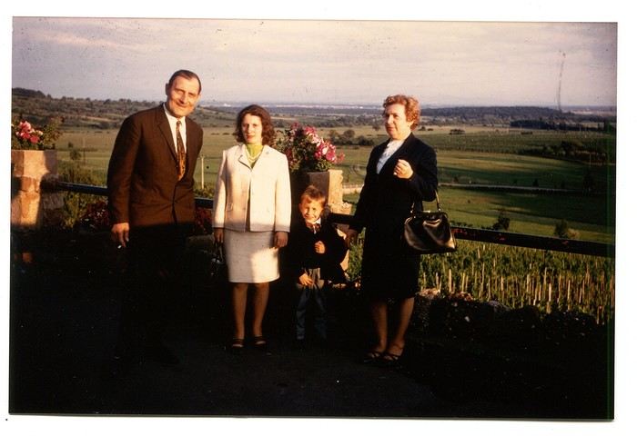
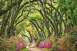
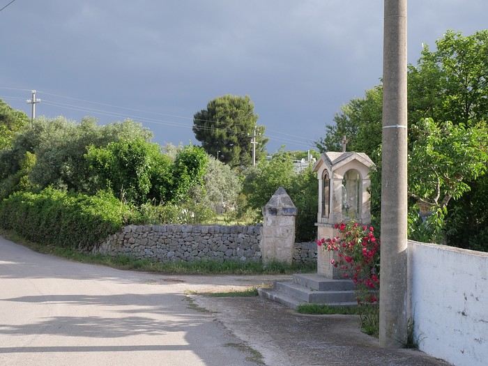
Back to that family outing, that enchanted parenthesis. I even remembered where we’d had lunch when I passed through Dambach-la-Ville decades later. One of those charming, flower-filled towns Alsace produces in abundance—and preserves so well. This one sits high on a hill, and I was a bit stunned on the parking lot because the view stretched far, revealing the Alsace plain below—its fields, villages, hills, and forests. The world seemed so vast and enticing that day, even though I was only glimpsing a tiny fraction of it.
The region was already very touristy, but I wouldn’t notice the downsides until much later. That Sunday noon, I discovered a large restaurant filled with diners. I can still see the enormous piece of meat they served me, decorated with a little wooden skewer topped with a flag. I kept that one for a long time. Those were the golden days of rich, flowing, thick sauces—so flavorful—and the era of the world’s best fries, made on the spot with the best potatoes. To top it off, I was *exceptionally* allowed a small bottle of apple juice, Orangina, or—even better if possible—Sinalco. Yes, Sinalco—like Orangina, but better. A brand that must’ve disappeared in the 70s, but why, and what a shame! Since then, Orangina’s little bubbles have taken the brand to the other side of the planet—it’s now Japanese.
Year after year, I’d eagerly await that ecstatic moment when the most beautiful castle in Alsace, the Haut-Koenigsbourg, appeared in my field of vision. The perfect model, the archetype that blended into the landscape at the height of a child’s dreams.
The trip home always felt like a reality check—less jarring than an alarm clock, but more diffuse and melancholic. From then on, there was only one wish: *When do we leave again?*
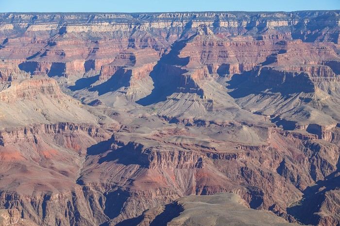
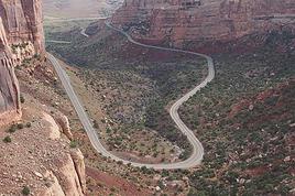
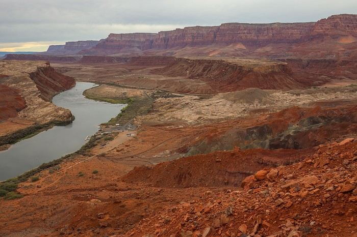 Once we reach the top of the plateau, contrary to what I thought, we're far from being at the level of the "Bend" facing Horseshoe Bend. We still have to walk 2 km of tough terrain, with small rocky hills that can be pretty rough depending on the route.
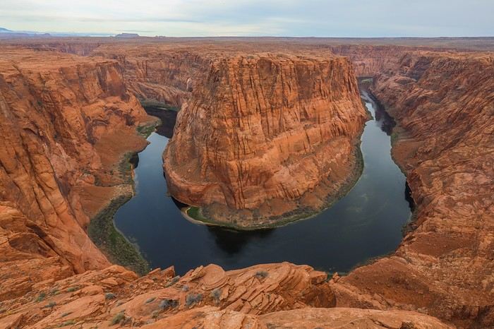 This viewpoint might not be as photogenic as the famous Horseshoe Bend to the left, but at least here, we’ve got the place to ourselves!
 Back at the parking lot, a long drive awaits us to return to Arizona in the Kaibab National Forest, where we’ll camp in an authorized spot. Ioverlander is perfect once again for finding the right camp.
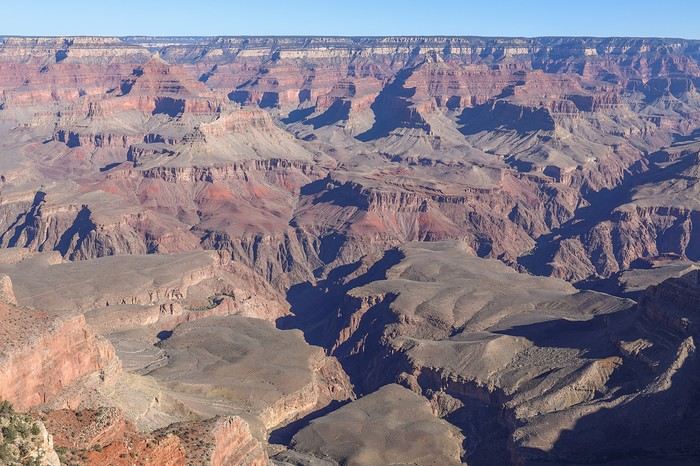
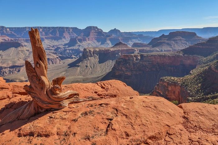
 Right from the start, the tight switchbacks on the descent were impressive...
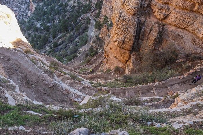 We reached the first well-known viewpoint, Ooh Aah Point.
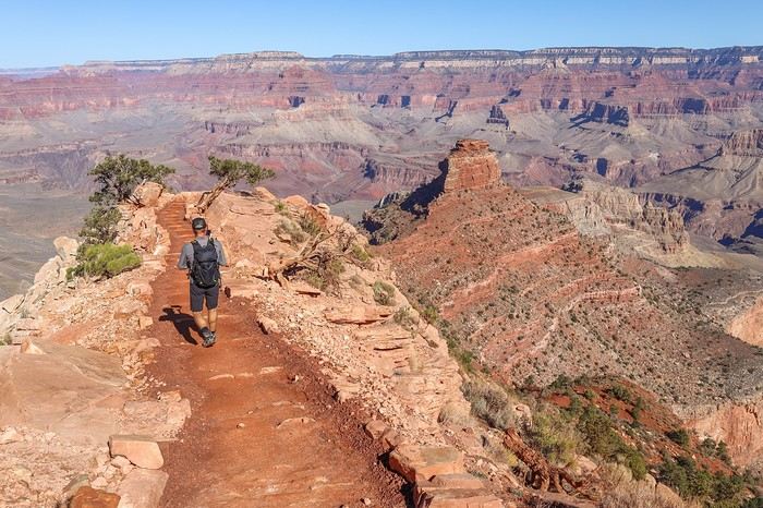 A little further on, Cedar Ridge.
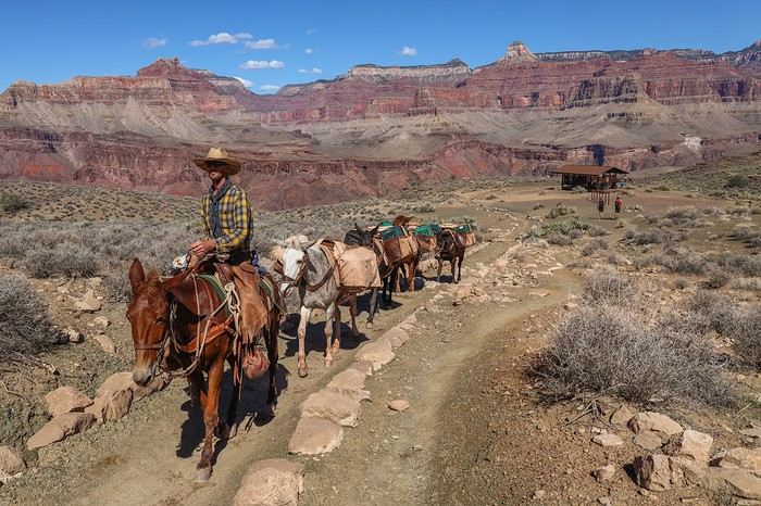
 At noon, we ran into two cowboys hauling equipment, probably from Phantom Ranch.
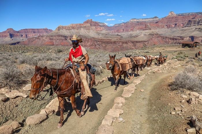
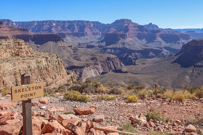
 Instead of taking shelter at The Tipoff Shelter, a spot meant to give hikers a little shade, we decided to keep going... The temperatures were really pleasant this time of year.
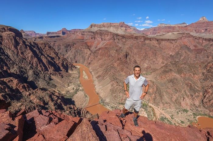 As we got closer to the bottom of the canyon, we lost some depth of field, but the landscapes were still stunning.
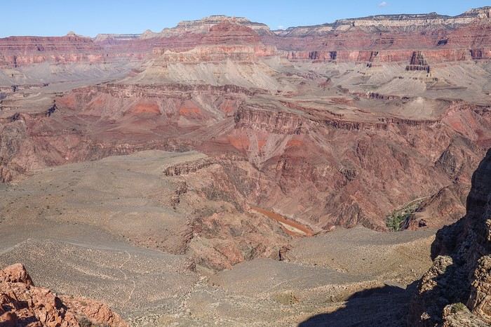
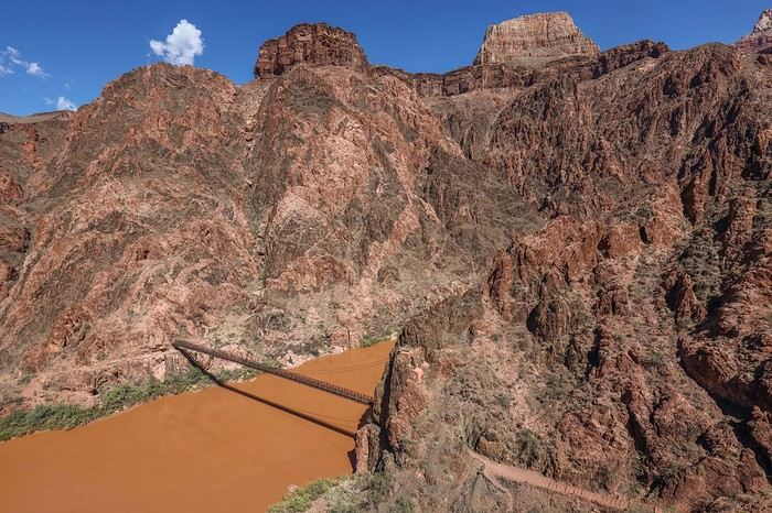 After 4 hours of hiking, it finally happened—our dream came true as we crossed the famous bridge spanning the Colorado River! 😇
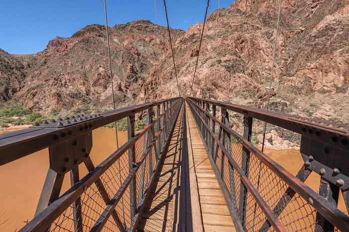 Looking at the vegetation, especially the cacti, it’s easy to imagine the scorching heat that must hit the bottom of the canyon in the middle of summer.
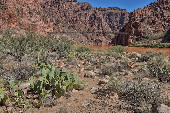 A second bridge, the Bright Angel Suspension Bridge, marks the starting point of the River Trail.
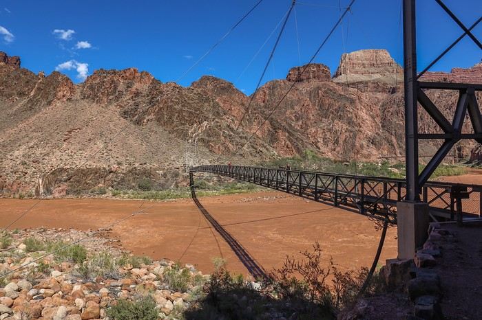 In the distance, we spotted tourists on horseback, probably starting from Phantom Ranch. Personally, I’d rather be on foot than on some nag at the edge of a cliff, but to each their own...
We followed the Colorado River, searching for a shady spot to finally have lunch!
In the distance, we spotted tourists on horseback, probably starting from Phantom Ranch. Personally, I’d rather be on foot than on some nag at the edge of a cliff, but to each their own...
We followed the Colorado River, searching for a shady spot to finally have lunch!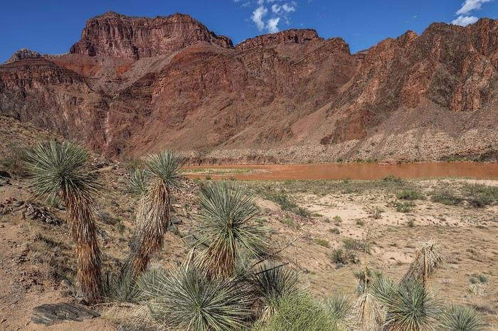 We struggled to find shade but eventually found the perfect spot just before leaving the River Trail. Not a bad view for a picnic...
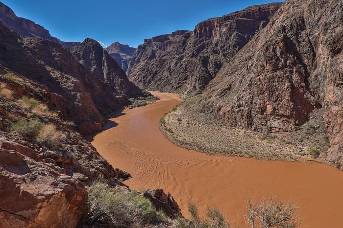
 We then reach Indian Gardens Campground, the last spot with water before the final climb. We take the chance to hydrate well and cool off. We rest there for a good fifteen minutes, laughing as we watch a group of Americans dressed like they’re about to summit Everest, acting all prim and proper.
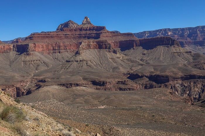
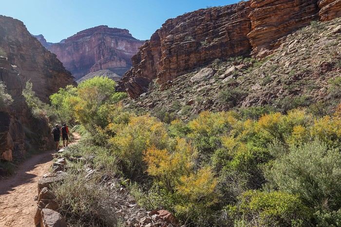
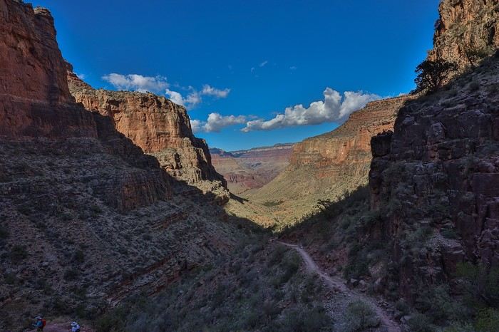 The viewpoints seriously lack width and depth 😕, and it’s only in the last third of the Bright Angel Trail that the scenery starts to be worth it. But it’s still nowhere near the epic views you get on the South Kaibab Trail from start to finish!
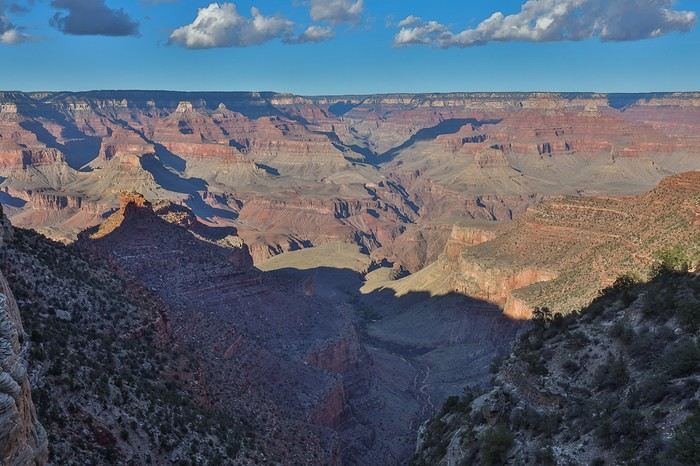 Not only does Sullivan keep his 5 km/h pace even when the climb gets much steeper, but the worst part is that neither he nor Franck stops to drink 😮! To avoid falling behind, I’m forced to keep up the pace while pulling my bottle out of my bag, even having to run to catch up... Machines, those two brothers... 😏
 and reach the Rim at 5:20 PM, after 8.5 hours of hiking, including 1.5 hours of breaks, having crushed the last 7.5 km and 950 m of elevation gain in barely 1.5 hours.
 All three of us fulfilled a childhood dream by descending to the bottom of the Grand Canyon.
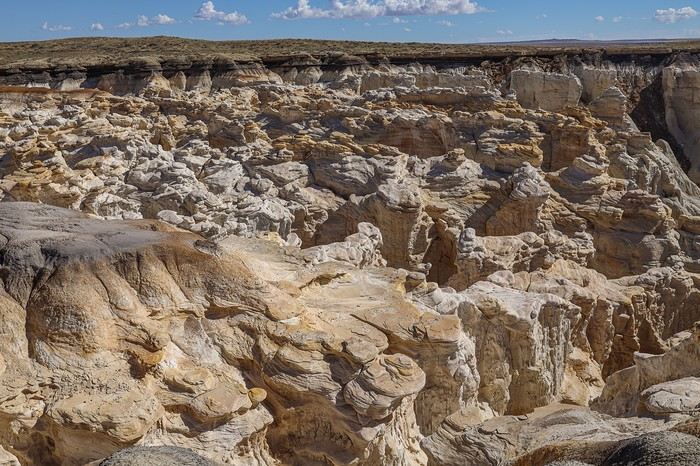
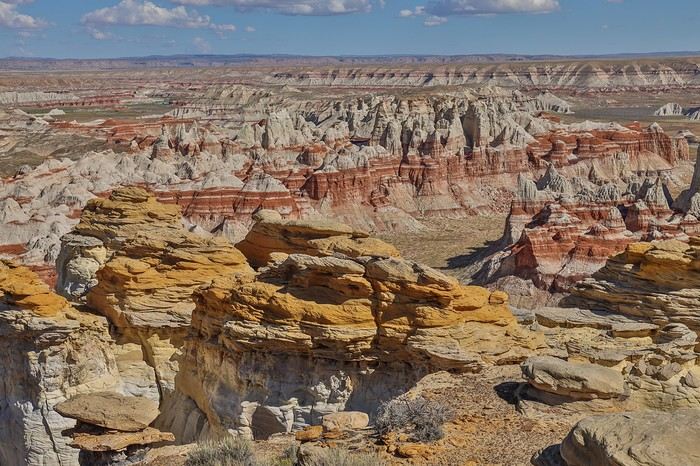
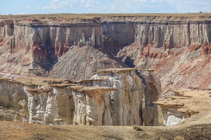
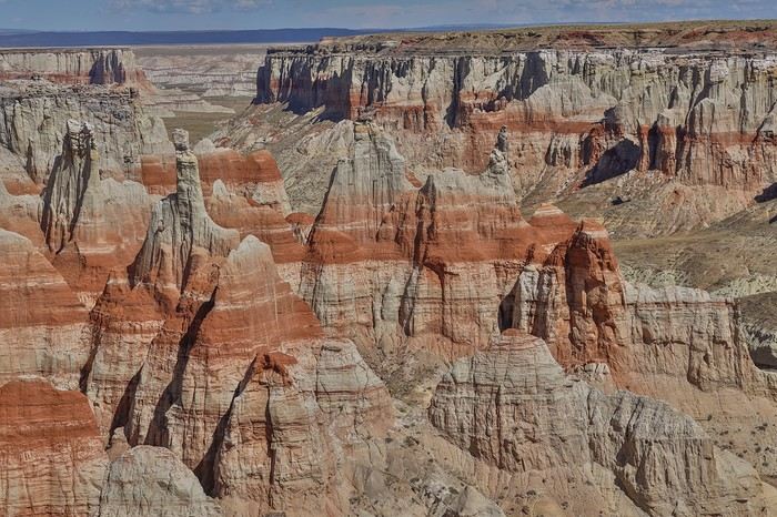
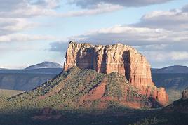
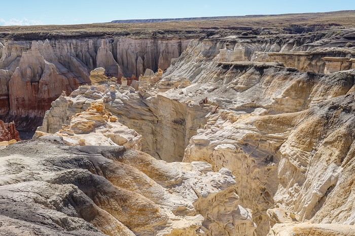 Then, we reach the start of the famous canyon, and a few hundred meters later, we arrive at an incredibly photogenic area with countless hoodoos and teepee-shaped rocks in two-tone shades of cream and ochre! It’s stunning !
 A few yellowish rocks complete this unique scene. In the background, you can make out the characteristic rocks of Ha Ho No Geh Canyon, which we’ll visit later.
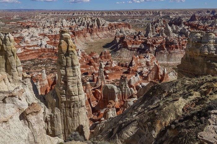
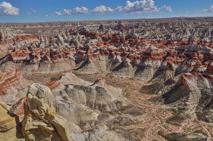 We know it’s possible to go to the bottom of the canyon, but we’ll stick to the rim—it’s enough for the time we’ve allowed ourselves here.
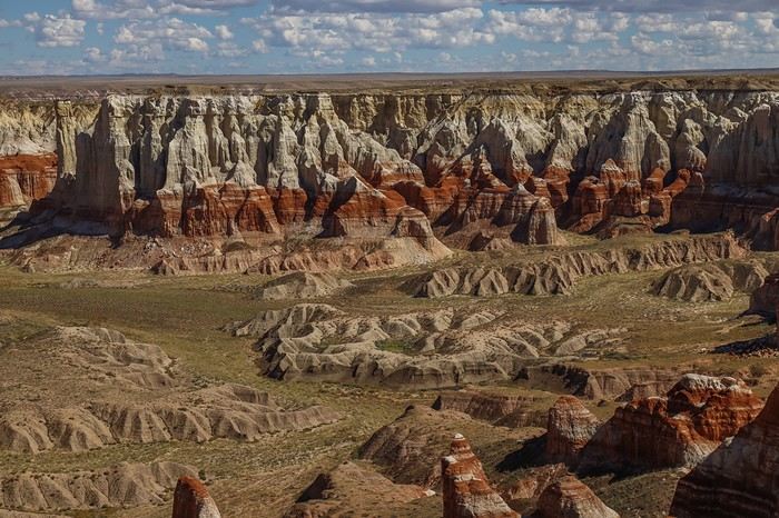
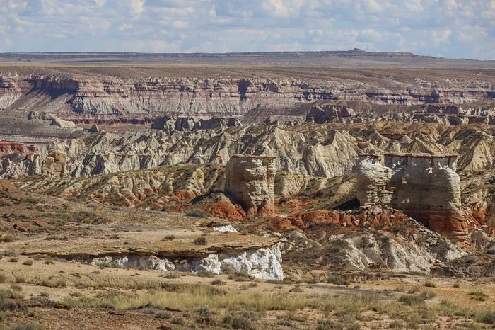
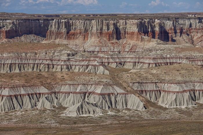
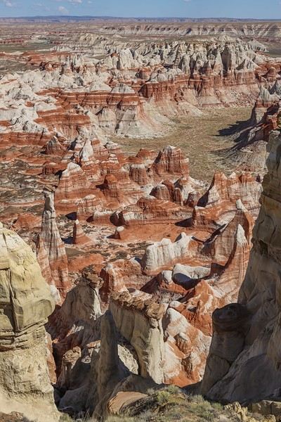
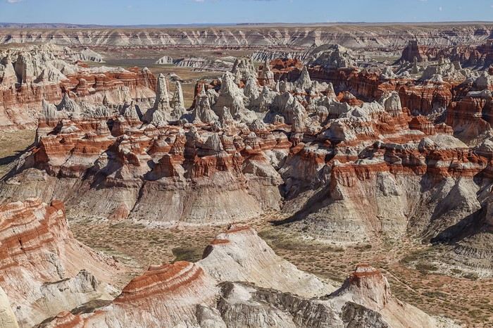
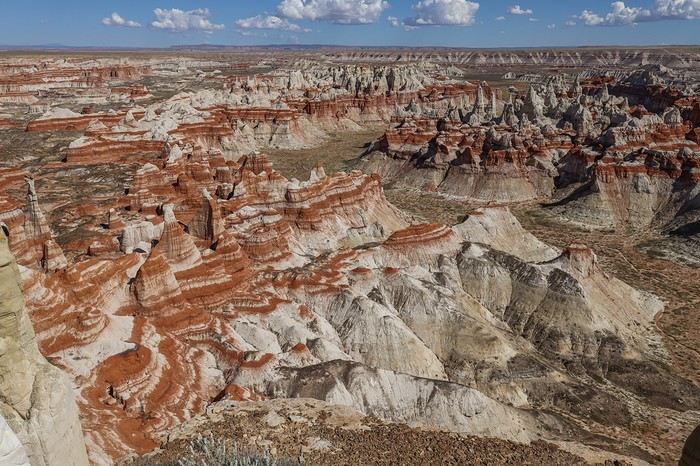
 Back on Route 264, we drive a few miles before turning off to Coal Mine Canyon, this time located in Navajo land. We’re relaxed this time since we have a day permit!
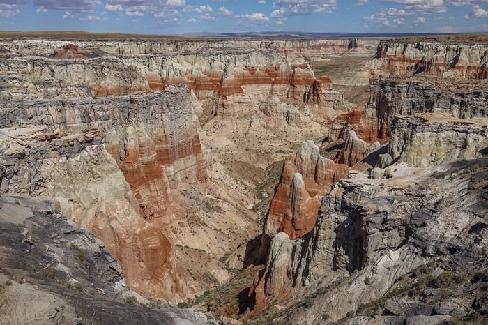
 Beige, ochre, and yellow hues are joined by varying shades of gray. It’s a truly unique landscape—nothing quite like it in the Southwest! 🙂
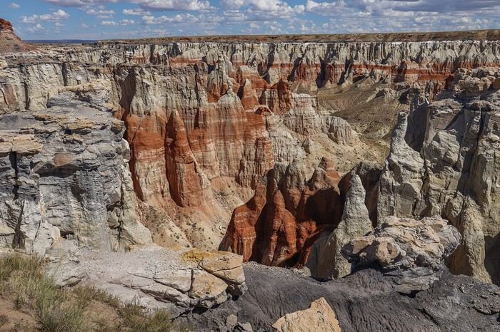 After all these Hopi and Navajo canyons, we decide to switch things up and head to several bends of the Little Colorado River, also located in Navajo land.
 To reach the 5 bends of the Little Colorado on our itinerary, we first have to drive 30 km on a road whose condition we don’t know. In the end, no problem—the road is very smooth, except toward the end where you need to be a bit more careful.
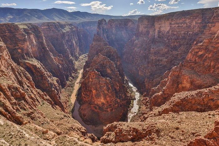 Then, a few miles north, First Bend. The water is still that chocolatey color, the same one that would’ve greeted us at the bottom of the Hopi Salt Trail 😕!
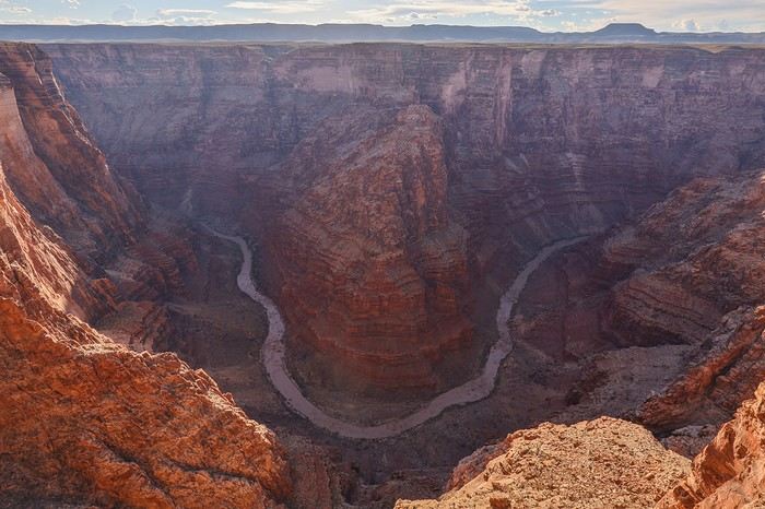 As we head north, the road becomes less and less visible. The Covid years must’ve allowed the vegetation to take over. It’s tricky to make progress, even though there aren’t any sharp rocks. It’s already 6 PM when we leave Third Bend and decide to skip Fourth Bend, which would require a 10 km round-trip detour with slow going. No regrets, though—we’ve really enjoyed this area.

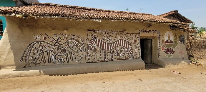
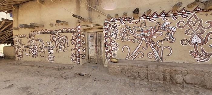
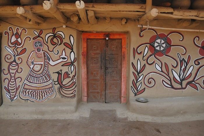
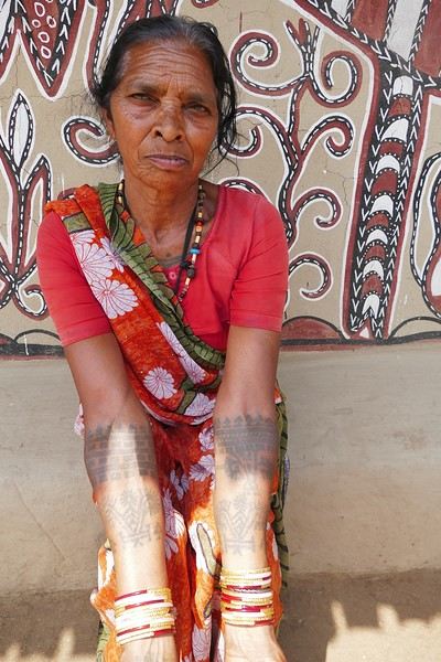
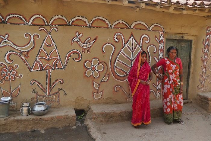
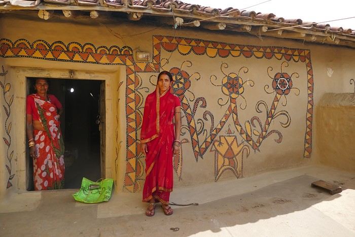
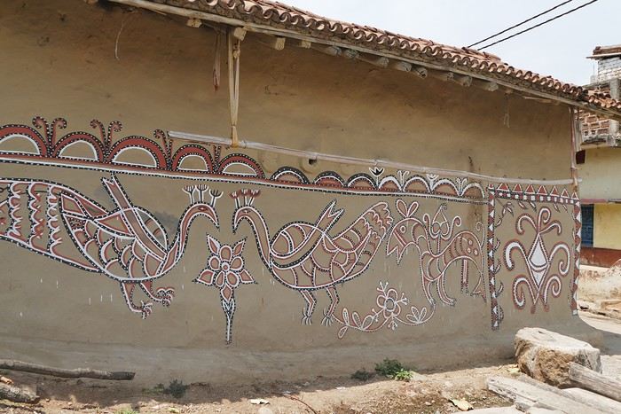 On some paintings, the scenes become almost narrative: you can make out figures, everyday gestures, like a memory of the village inscribed in the walls. The decorative frames around the doors aren’t left to chance either—they symbolically protect the house, like a boundary between the inside and the outside world.
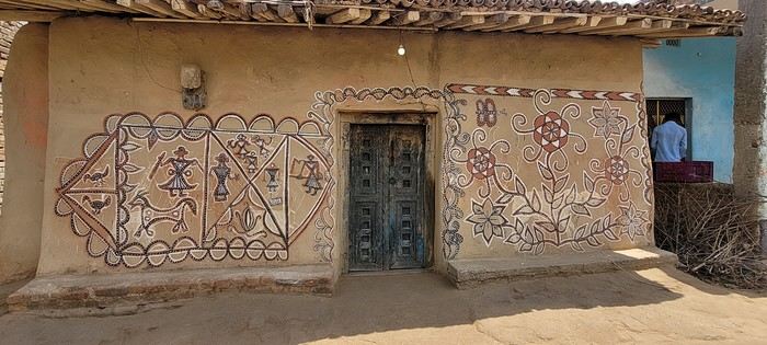

 A little sneak peek?
 Come along, I'm taking you to this country where it's so nice to wander and slow down...

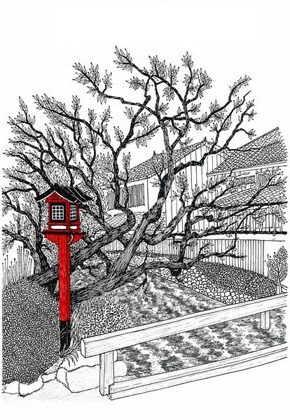 I’m inviting you on a stroll through my drawings—a completely subjective, far from exhaustive, and totally personal take, since it’s based on my own sketches. I put this travel journal together after returning in late 2024, mostly using felt-tip pens and pencils, with a few collages thrown in. I worked from our personal photos.
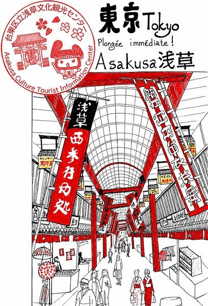
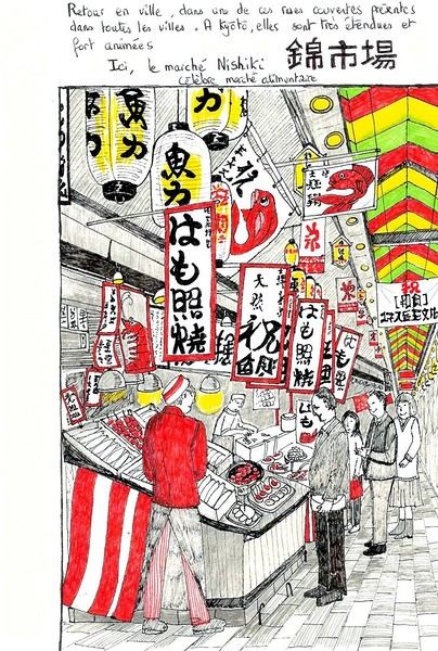
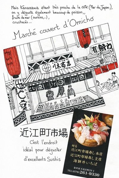 And in Kyoto, Nishiki Market:
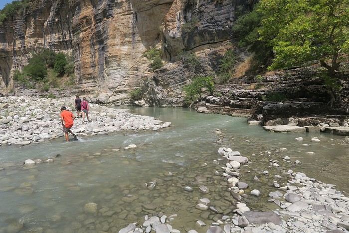
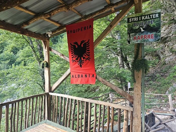
 Since Albania isn’t part of Europe when it comes to phone service (at least not yet! :-)), we had to buy a physical SIM card—otherwise, the bill would’ve been sky-high if we’d used our French plan! We got one from Vodafone AL at the airport. You can buy online before leaving with a virtual SIM (e-SIM) for compatible phones, so you don’t have to swap cards. But given the uncertainty about choosing a plan online, we preferred buying one directly at Tirana Airport. Cost: 31 € for 100 GB. That’s way too much—100 GB is overkill. For 40 GB, it’s 27 €, and the plan lasts 21 days. The price difference isn’t huge, and it was cheaper than online. This plan covers all the countries along the Balkan range.
Money tip: All guesthouses and accommodations accept euros. The local currency in Albania is the LEK. In Montenegro, it’s the euro. Bank fees for withdrawing money from an ATM in Albania are pretty steep: 8 € for a withdrawal of 600–700 LEK (about 200 €)! So it’s better to withdraw cash (euros) in France. Oh, and we booked all our accommodations before leaving, but payment is always in cash. Budget around 400–500 € for 9 days of trekking.
Since Albania isn’t part of Europe when it comes to phone service (at least not yet! :-)), we had to buy a physical SIM card—otherwise, the bill would’ve been sky-high if we’d used our French plan! We got one from Vodafone AL at the airport. You can buy online before leaving with a virtual SIM (e-SIM) for compatible phones, so you don’t have to swap cards. But given the uncertainty about choosing a plan online, we preferred buying one directly at Tirana Airport. Cost: 31 € for 100 GB. That’s way too much—100 GB is overkill. For 40 GB, it’s 27 €, and the plan lasts 21 days. The price difference isn’t huge, and it was cheaper than online. This plan covers all the countries along the Balkan range.
Money tip: All guesthouses and accommodations accept euros. The local currency in Albania is the LEK. In Montenegro, it’s the euro. Bank fees for withdrawing money from an ATM in Albania are pretty steep: 8 € for a withdrawal of 600–700 LEK (about 200 €)! So it’s better to withdraw cash (euros) in France. Oh, and we booked all our accommodations before leaving, but payment is always in cash. Budget around 400–500 € for 9 days of trekking.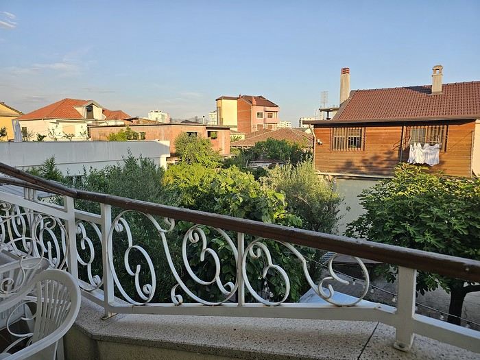 I really liked Shköder, especially its pedestrian street lined with restaurants and lit up at night. It’s a great place to stroll and eat. The food isn’t expensive—two big salads and two beers: 14 € :-) . Fruit prices are also very reasonable: 3 € for a kilo of cherries, compared to 9–10 € in France.
Religions coexist peacefully in these countries—Catholics and Muslims. From our balcony, my friend heard the call to prayer for the first time, coming from one of the city’s mosques.
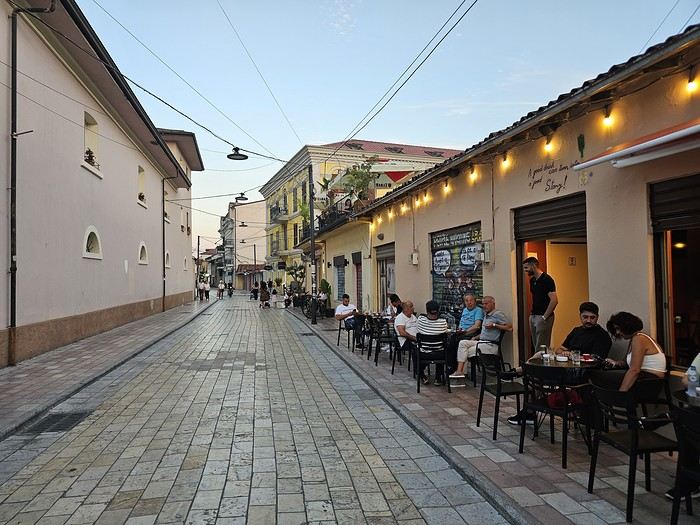
I really liked Shköder, especially its pedestrian street lined with restaurants and lit up at night. It’s a great place to stroll and eat. The food isn’t expensive—two big salads and two beers: 14 € :-) . Fruit prices are also very reasonable: 3 € for a kilo of cherries, compared to 9–10 € in France.
Religions coexist peacefully in these countries—Catholics and Muslims. From our balcony, my friend heard the call to prayer for the first time, coming from one of the city’s mosques.
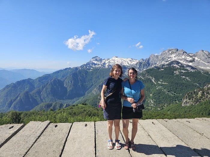
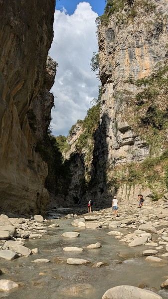
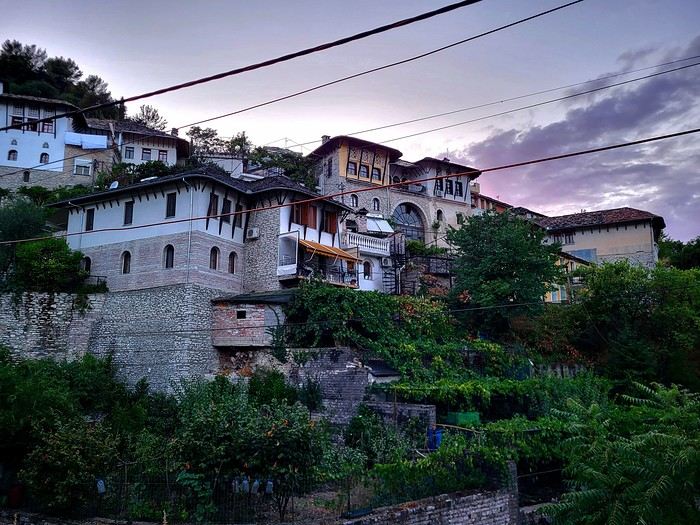
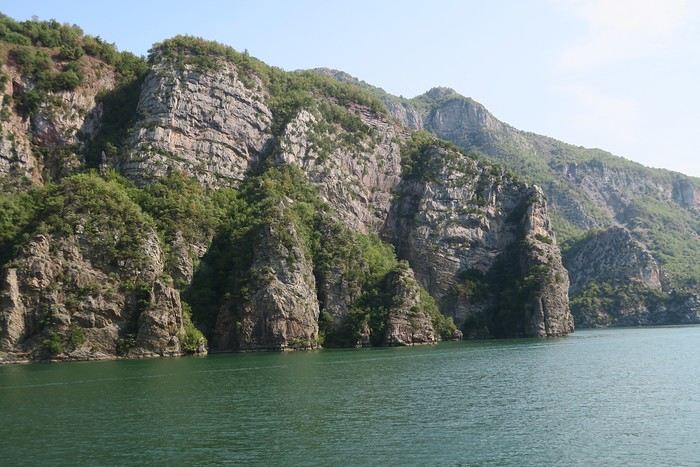
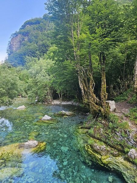
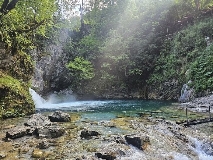
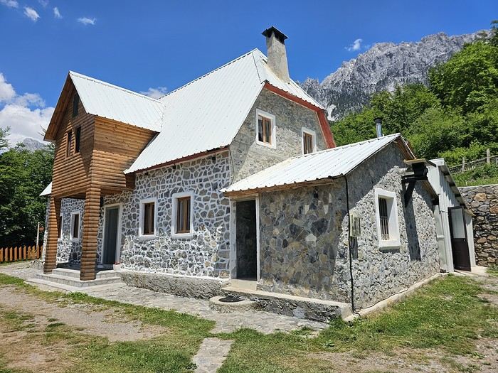 We slept in the heights of Theth at a new guesthouse, "Mountain Vista Shkafi," with an amazing view.

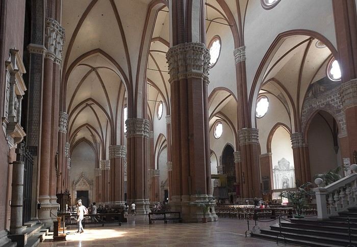
 But Bologna’s real charm lies in its porticoes, which were added to the UNESCO World Heritage list in 2021: 62 km of arcades running along buildings, letting you walk sheltered from the sun or rain. Back in 1288, the city required houses to include private arcades for public use. In the city center, you can stroll under 32 km of porticoes in all sorts of styles—some plain, some ornate—with a strong presence of red tones.